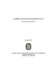
Progress Report - Florida Fish and Wildlife Conservation Commission
Progress Report - Florida Fish and Wildlife Conservation Commission
Progress Report - Florida Fish and Wildlife Conservation Commission

Create successful ePaper yourself
Turn your PDF publications into a flip-book with our unique Google optimized e-Paper software.
Response of Manatees to Vessel Traffic: Simultaneous Measurements of<br />
Behavioral Responses <strong>and</strong> the Acoustic Environment<br />
Final <strong>Progress</strong> <strong>Report</strong> to the <strong>Florida</strong> <strong>Fish</strong> <strong>and</strong> <strong>Wildlife</strong> <strong>Conservation</strong> <strong>Commission</strong><br />
Principal Investigators: Douglas P. Nowacek 1 , Charles J. Deutsch 2 , <strong>and</strong> Mark Johnson 3<br />
Co-investigators: Athena Rycyk 4 , Margaret E. Barlas 5 , Stacie M. Koslovsky 5 , Katherine<br />
Frisch 5 , <strong>and</strong> Thomas Hurst 3<br />
Contributors to <strong>Report</strong>: Charles J. Deutsch 2 , Athena Rycyk 4 , Margaret E. Barlas 5 , Douglas P.<br />
Nowacek 1 , Stacie M. Koslovsky 5 , <strong>and</strong> Katherine Frisch 5<br />
1 Duke University, Marine Laboratory, 135 Duke Marine Lab Rd., Beaufort, NC 28516<br />
2 <strong>Florida</strong> <strong>Fish</strong> <strong>and</strong> <strong>Wildlife</strong> <strong>Conservation</strong> <strong>Commission</strong>, <strong>Fish</strong> <strong>and</strong> <strong>Wildlife</strong> Research Institute,<br />
<strong>Wildlife</strong> Research Laboratory, 1105 SW Williston Rd, Gainesville, FL 32601<br />
3 Woods Hole Oceanographic Institution, Applied Ocean Physics & Engineering Department, 86<br />
Water St., Smith 208A, Woods Hole, MA 02543<br />
4 <strong>Florida</strong> State University, Department of Oceanography, 117 N. Woodward Ave., Tallahassee,<br />
FL 32306<br />
5 <strong>Florida</strong> <strong>Fish</strong> <strong>and</strong> <strong>Wildlife</strong> <strong>Conservation</strong> <strong>Commission</strong>, <strong>Fish</strong> <strong>and</strong> <strong>Wildlife</strong> Research Institute, 100<br />
Eighth Ave. SE, St. Petersburg, FL 33701<br />
1 June 2009
Principal Investigators <strong>and</strong> Co-investigators (listed alphabetically):<br />
Margaret E. Barlas, M.S. --- FWC-FWRI, field biologist<br />
Charles J. Deutsch, Ph.D. --- FWC-FWRI, principal investigator<br />
Katherine Frisch, M.A. --- FWC-FWRI, aerial observer <strong>and</strong> videographer<br />
Thomas Hurst --- WHOI, engineer, DTAG hardware<br />
Mark Johnson, Ph.D. --- WHOI, principal investigator<br />
Stacie M. Koslovsky, M.E.M. --- FWC-FWRI, database manager <strong>and</strong> GIS analyst<br />
Douglas P. Nowacek, Ph.D. --- Duke University, principal investigator<br />
Athena Rycyk, M.S. --- <strong>Florida</strong> State University, doctoral student<br />
How to Cite this <strong>Report</strong>:<br />
Deutsch, C. J., A. Rycyk, M. E. Barlas, D. P. Nowacek, S. M. Koslovsky, <strong>and</strong> K. Frisch. 2009.<br />
Response of manatees to vessel traffic: Simultaneous measurements of behavioral<br />
responses <strong>and</strong> the acoustic environment. Final <strong>Progress</strong> <strong>Report</strong> to <strong>Florida</strong> <strong>Fish</strong> <strong>and</strong><br />
<strong>Wildlife</strong> <strong>Conservation</strong> <strong>Commission</strong>. Project Contract No. 021426 to <strong>Florida</strong> State<br />
University. 111 pp.<br />
- 2 -
PROGRESS REPORT SUMMARY<br />
The major challenge faced by managers charged with promoting the recovery of a viable<br />
manatee population is to design <strong>and</strong> implement actions that are effective in reducing humancaused<br />
mortality <strong>and</strong> injury while minimizing undue impacts on waterborne human activities, all<br />
in the face of a continually increasing human population in <strong>Florida</strong>’s coastal areas. At least onethird<br />
of documented manatee deaths in <strong>Florida</strong> are directly attributable to human activities, <strong>and</strong><br />
the largest single source of human-related mortality is watercraft strikes. The primary<br />
conservation <strong>and</strong> management tool used to prevent vessel strikes is the establishment of speed<br />
restriction zones in habitats frequented by manatees. A thorough underst<strong>and</strong>ing of the behavioral<br />
<strong>and</strong> sensory mechanisms underlying manatee-boat collisions is necessary in order to devise<br />
effective avoidance approaches, whether they be technological or regulatory. A crucial <strong>and</strong><br />
sometimes controversial piece of the manatee-boat interaction puzzle that has been missing is the<br />
acoustic environment around the manatee. That is, what does a manatee hear as a motorized<br />
vessel approaches <strong>and</strong> at what distance? Detailed behavioral observations of manatee reactions<br />
are also lacking due to the turbid nature of most waters that they inhabit.<br />
Through a unique collaboration among scientists <strong>and</strong> engineers from FWC’s <strong>Fish</strong> <strong>and</strong><br />
<strong>Wildlife</strong> Research Institute, <strong>Florida</strong> State University, Duke University, <strong>and</strong> the Woods Hole<br />
Oceanographic Institution, we embarked on a multi-year study to characterize manatee<br />
behavioral responses to approaching vessels while simultaneously recording the acoustic<br />
environment during the encounters. The goal of the project is to create a combined picture of<br />
manatee behavior, acoustics, <strong>and</strong> vessel trajectories so that we can better underst<strong>and</strong> the<br />
responses displayed by manatees when approached by boats <strong>and</strong> the acoustic cues that may<br />
mediate such responses. A secondary objective is to quantify the frequency of manatee-boat<br />
interactions <strong>and</strong> disturbances, <strong>and</strong> how that varies spatially <strong>and</strong> temporally. This research relies<br />
on the application of a state-of-the-art digital acoustic recording tag, known as the DTAG,<br />
developed by WHOI engineers to measure the responses of marine mammals to anthropogenic<br />
sound. In addition to sound, the DTAG also records a suite of behavioral parameters (pitch, roll,<br />
depth, heading, fluke strokes) that permit a detailed three-dimensional reconstruction of the<br />
manatee’s movements, behavior, <strong>and</strong> orientation underwater.<br />
We captured <strong>and</strong> tagged 20 manatees during the spring <strong>and</strong> summer of 2007 <strong>and</strong> 2008, all<br />
but two in Lemon Bay, Placida Harbor, <strong>and</strong> Gasparilla Sound of southwest <strong>Florida</strong> (Charlotte<br />
<strong>and</strong> Sarasota Counties). We deployed the DTAGs along with buoyant, satellite-linked GPS tags<br />
attached to a padded belt around the manatee’s peduncle. The DTAGs were programmed to start<br />
recording 2-3 days after deployment for a period of 34-48 hr. The GPS tags were programmed<br />
to attempt location fixes at 5-minute intervals, providing fine-scale information on movement<br />
tracks <strong>and</strong> habitat use. Manatees were tracked in near real-time through the Argos Data<br />
Collection <strong>and</strong> Location System <strong>and</strong> located in the field with conventional VHF <strong>and</strong> ultrasonic<br />
telemetry. A field crew tracked the tagged manatees by boat on weekends, recording<br />
characteristics of passing vessels, manatee responses, <strong>and</strong> habitat. A laser range finder was used<br />
to record bearing <strong>and</strong> distance to passing vessels in order to reconstruct their trajectories in a<br />
GIS. Aerial videography was also used to provide a clearer perspective of manatee behavior <strong>and</strong><br />
to truth the reconstructions of manatee-vessel encounters.<br />
This final progress report details the study’s objectives, field methods, <strong>and</strong> data<br />
processing procedures <strong>and</strong> provides preliminary summaries <strong>and</strong> analyses. Data entry,<br />
- 3 -
verification, <strong>and</strong> processing in relational databases <strong>and</strong> in GIS are ongoing, so most of the<br />
numbers presented in this report will change. Only a small portion of the DTAG data has been<br />
processed, as the auditing of the acoustic files is very time-consuming. Nevertheless, the data<br />
collected by the field team, combined with massive data streams from the various tags,<br />
demonstrate the promise of this integrated approach for elucidating manatee behavioral<br />
responses to approaching vessels <strong>and</strong> for correlating those responses with vessel acoustic<br />
signatures at the manatee’s location. The tables <strong>and</strong> figures provide an indication of the types of<br />
analyses <strong>and</strong> graphics that are possible with these data. For instance, the DTAG sensor data<br />
were used to create three-dimensional reconstructions of the manatee’s movements during a boat<br />
approach, allowing us to visualize behavioral responses that can be nearly invisible to field<br />
observers. Combining this three-dimensional visualization of manatee movements <strong>and</strong><br />
orientation with temporal changes in acoustical parameters provides a powerful means of<br />
investigating manatee response to vessels.<br />
This study has been successful on several fronts. This is the first time that the newly<br />
redesigned manatee DTAG was deployed on manatees. The housing withstood the harsh<br />
conditions of repeated deployments well <strong>and</strong> the programmed release mechanism functioned<br />
correctly 13 of 20 times. All DTAGs were recovered <strong>and</strong> successfully recorded a wealth of<br />
acoustic <strong>and</strong> behavioral data on the focal manatees, totaling 741 hours. DTAG sensor data were<br />
calibrated <strong>and</strong> methods for aligning the data from the various sensors were successfully<br />
demonstrated. All GPS tags were also recovered <strong>and</strong> logged a large volume of data on manatee<br />
movements <strong>and</strong> habitat use, averaging 245 GPS locations per day. The fine temporal <strong>and</strong> spatial<br />
resolution of the travel paths obtained is unprecedented for a marine mammal. With a few<br />
exceptions due to weather or animal elusiveness, we were able to conduct continuous focal<br />
follows of tagged manatees during weekend days to collect data on the attributes of all watercraft<br />
(>4,200) passing within about 500 m of the focal manatee <strong>and</strong> on manatee response to boat<br />
passes. A complex relational database was developed to incorporate the various types of<br />
information collected in the field; it is being populated to link the data from the observation boat<br />
GPS, range finder data, vessel attributes, manatee behavioral observations, environmental data,<br />
<strong>and</strong> information on observation effort <strong>and</strong> observation boat engine activity.<br />
The number of motorized vessels that passed or approached tagged manatees per hour<br />
was quantified for the first time based on field observations. Preliminary analyses show that, on<br />
average, 23.6 boats passed by a focal manatee per hour but this varied greatly among individuals<br />
(0.2 – 63.8) depending on location. Highest rates occurred on holidays <strong>and</strong> in frequently used<br />
boating corridors; for example, up to 118 boats per hour on Labor Day weekend near the ICW in<br />
Lemon Bay. The vast majority of vessels passed at distances that did not threaten the focal<br />
manatees; 1% <strong>and</strong> 3.7% of boat passes with recorded distance class came within 10 m <strong>and</strong> 50 m,<br />
respectively, of the manatee. Combined with the behavioral data from field observations <strong>and</strong> the<br />
DTAG, this will provide insight into the frequency with which manatees are disturbed by boats<br />
each day.<br />
Based on a preliminary analysis of the field observations entered to date, tagged manatees<br />
were more likely to respond to boat approaches at closer distances. Field observers noted a<br />
response by the manatee about half of the time when a vessel passed by within 10 m. Manatees<br />
typically responded by increasing mobility <strong>and</strong> speed <strong>and</strong> by moving away from the approaching<br />
boat, indicating a flight response. There was no noticeable effect of vessel speed class on the<br />
- 4 -
probability or type of response in this preliminary analysis, but this warrants further<br />
investigation.<br />
A sample of manatee vocalizations was characterized according to fundamental<br />
frequency, duration, frequency contour, <strong>and</strong> rate. Vocal parameters were generally similar to<br />
those found in previous studies. The overall vocalization rate in this sample was 0.47 per<br />
minute. Vocalization rate in relation to the presence of motorized vessels is being analyzed.<br />
This information is important to have if considering deployment of an automated manatee<br />
vocalization detector as part of a manatee avoidance program for boaters.<br />
- 5 -
TABLE OF CONTENTS<br />
PROGRESS REPORT SUMMARY.......................................................................................- 3 -<br />
TABLE OF CONTENTS .........................................................................................................- 6 -<br />
LIST OF TABLES ....................................................................................................................- 8 -<br />
LIST OF FIGURES ..................................................................................................................- 8 -<br />
INTRODUCTION...................................................................................................................- 11 -<br />
Objectives.............................................................................................................................- 14 -<br />
STUDY AREAS ......................................................................................................................- 14 -<br />
Trial 1: Kings Bay, Crystal River, <strong>Florida</strong> .......................................................................- 15 -<br />
Trial 2: Card Sound, Key Largo, <strong>Florida</strong> .........................................................................- 15 -<br />
Primary Study Area: Charlotte Harbor National Estuary, centered on Englewood,<br />
<strong>Florida</strong> ..................................................................................................................................- 15 -<br />
METHODS ..............................................................................................................................- 17 -<br />
Manatee Captures <strong>and</strong> Health Assessments .....................................................................- 17 -<br />
GPS Tag Deployment <strong>and</strong> Tracking..................................................................................- 18 -<br />
Digital Acoustic Recording Tag (DTAG)..........................................................................- 19 -<br />
Visual Observations of Vessels <strong>and</strong> Manatee Behavior...................................................- 20 -<br />
Boat-based Focal Follow Observations.............................................................................- 20 -<br />
Aerial Observations <strong>and</strong> Videography ..............................................................................- 21 -<br />
Environmental Recording ..................................................................................................- 22 -<br />
Data Processing <strong>and</strong> Analysis.............................................................................................- 22 -<br />
Observation Boat GPS Location Data...............................................................................- 22 -<br />
Relational Databases from Field Observations .................................................................- 23 -<br />
Vessel Path Creation <strong>and</strong> Verification...............................................................................- 23 -<br />
Manatee Location Data......................................................................................................- 24 -<br />
- 6 -
DTAG Data on Manatee Behavior ....................................................................................- 24 -<br />
Scoring Acoustic Events....................................................................................................- 25 -<br />
Acoustic Analyses .............................................................................................................- 25 -<br />
Defining Manatee Response from DTAG Data ................................................................- 25 -<br />
RESULTS AND DISCUSSION .............................................................................................- 26 -<br />
Summary of Study Subjects <strong>and</strong> Tag Deployments.........................................................- 26 -<br />
Boat Traffic Experienced by Tagged Manatees ...............................................................- 27 -<br />
Manatee Fine-scale Movements <strong>and</strong> Diving Behavior.....................................................- 28 -<br />
Boat Noise Exposure ...........................................................................................................- 29 -<br />
Manatee Response to Vessel Approaches..........................................................................- 30 -<br />
Manatee Vocalization Rate.................................................................................................- 32 -<br />
CONCLUSIONS .....................................................................................................................- 32 -<br />
Next Steps.............................................................................................................................- 34 -<br />
ACKNOWLEDGMENTS ......................................................................................................- 36 -<br />
LITERATURE CITED ..........................................................................................................- 37 -<br />
TABLES...................................................................................................................................- 42 -<br />
FIGURES.................................................................................................................................- 59 -<br />
APPENDICES.........................................................................................................................- 89 -<br />
- 7 -
LIST OF TABLES<br />
Table 1. Identity <strong>and</strong> physical attributes for 20 manatees tagged in this study.<br />
Table 2. GPS tracking bout information for 20 manatees tagged in this study.<br />
Table 3. DTAG deployment bout information for 20 manatees tagged in this study.<br />
Table 4. The dates, locations, <strong>and</strong> observation effort of focal follows <strong>and</strong> the preliminary<br />
number of boat passes observed for each manatee in 2007.<br />
Table 5. The dates, locations, <strong>and</strong> observation effort of focal follows <strong>and</strong> the preliminary<br />
number of boat passes observed for each manatee in 2008.<br />
Table 6. Preliminary counts of vessel passes characterized by type <strong>and</strong> size of the vessel.<br />
Table 7. Preliminary counts of vessel passes characterized by distance to manatee <strong>and</strong> speed<br />
class of vessel at point of closest approach (estimated in the field).<br />
Table 8. Inventory of video recorded during aerial observations of focal manatees <strong>and</strong> their<br />
interactions with vessels.<br />
Table 9. The received sound levels at a boat’s closest point of approach to the focal manatee<br />
(measured during a one-second time window) <strong>and</strong> the corresponding signal-to-noise ratio<br />
for four selected boat approaches.<br />
Table 10. Manatee response (characterized by field observers) to boat approaches as a function<br />
of closest distance category between the manatee <strong>and</strong> boat.<br />
Table 11. Manatee response (characterized by field observers) to boat approaches as a function<br />
of the speed class of the boat.<br />
Table 12. Fundamental frequencies, average durations, <strong>and</strong> rates of vocalizations as a function<br />
of manatee group size <strong>and</strong> presence of boat noise.<br />
LIST OF FIGURES<br />
Figure 1. Spectra of approaching boats (idling, planing, <strong>and</strong> a PWC) weighted by manatee<br />
hearing thresholds, the ambient noise level, <strong>and</strong> manatee hearing sensitivity (from<br />
Miksis-Olds et al. 2007).<br />
Figure 2. Map of the study area in southwest <strong>Florida</strong>, showing major water bodies with<br />
particular reference to capture <strong>and</strong> focal follow locations.<br />
Figure 3. Google Earth map of the Kings Bay, Crystal River study area where the first DTAG<br />
deployment <strong>and</strong> focal tracking was conducted on TCR005.<br />
Figure 4. Google Earth map of the Card Sound study area where the second DTAG deployment<br />
<strong>and</strong> focal tracking was conducted on TFK007.<br />
Figure 5. A photograph of the tagging assembly showing the placement of the DTAG on the belt<br />
that is fit around the manatee’s peduncle <strong>and</strong> the buoyant GPS tag tethered to the belt via<br />
a flexible 5-foot-long nylon rod.<br />
- 8 -
Figure 6. Photographs of the DTAG including the components inside the DTAG’s plastic<br />
housing.<br />
Figure 7. A photograph of the laser range finder, used to collect distance <strong>and</strong> bearing to all<br />
vessels that passed the focal manatee under observation, in use in the field.<br />
Figure 8. A photograph of a focal manatee as it dives, thereby showing the DTAG attached to<br />
the belt as it breaks the surface of the water.<br />
Figure 9. A screen shot of the MS Access relational database used to enter, store, verify, <strong>and</strong><br />
query data collected in the field, including observers, boat-based effort, aerial effort,<br />
environmental information, engine activity of observation boat, manatee behaviors<br />
(focals), manatee responses to passing vessels, <strong>and</strong> target vessel attribute data.<br />
Figure 10. An example of DTAG sensor data (pitch <strong>and</strong> roll, depth, <strong>and</strong> heading) collected from<br />
manatee TSW063 on April 25, 2008 from 7:00 – 20:00 EDT.<br />
Figure 11. Map of observation boat GPS tracks on dates of focal follows of tagged manatees in<br />
the southwest <strong>Florida</strong> study area.<br />
Figure 12. Preliminary pooled rate of vessel passes (within about 500 m of tagged manatee) by<br />
hour of the day (Eastern Daylight Time).<br />
Figure 13. Locations of observed close encounters (
Figure 23. Acoustics <strong>and</strong> manatee response to approach of a personal watercraft (A01) to within<br />
10 m on 2 Sept 2007 showing that, despite the intense sound level <strong>and</strong> sudden onset of<br />
the boat’s approach, the manatee displayed no changes in heading <strong>and</strong> a lack of fluke<br />
strokes.<br />
Figure 24. Acoustics <strong>and</strong> manatee response to approach of a yacht (M63) to within 10 m on 1<br />
Sept 2007 showing that the boat’s approach could be heard long before it came close to<br />
the manatee <strong>and</strong> the manatee continued to travel when the boat reached its closest point<br />
of approach.<br />
Figure 25. Acoustics <strong>and</strong> manatee response to approach of an open fisherman boat (Y01) to<br />
within 50 m on 9 Sept 2007 showing that the manatee increased its mobility (fluke<br />
strokes) <strong>and</strong> altered its heading after the boat passed.<br />
Figure 26. Acoustics <strong>and</strong> manatee response to approach of an open fisherman boat (Y01) to<br />
within 50 m on 9 Sept 2007 showing that the manatee increased its mobility <strong>and</strong>, after the<br />
boat’s closest point of approach, the manatee altered its heading.<br />
Figure 27. Acoustics <strong>and</strong> manatee response to a boat approaching on a plane to within 10 m of<br />
the manatee’s location showing that the manatee showed an apparent reaction about 9-10<br />
sec before the closest point of vessel approach.<br />
Figure 28. A 3-dimensional reconstruction of TSW062’s behavior over a 12 second period.<br />
Figure 29. Map of a manatee-boat interaction in the ICW of Lemon Bay on 2 September 2007,<br />
showing the movement paths of manatee TSW060, the observation boat, <strong>and</strong> a personal<br />
watercraft over a 0.7-minute time period. This matches DTAG data in Figure 23.<br />
Figure 30. Map of a manatee-boat interaction in Forked Creek (Lemon Bay) on 1 September<br />
2007, showing the movement paths of manatee TSW060, the observation boat, <strong>and</strong> a<br />
slow-moving yacht over a 6-minute time period. This matches DTAG data in Figure 24.<br />
Figure 31. Map of a manatee-boat interaction in Placida Harbor on 9 September 2007, showing<br />
the movement paths of manatee TSW062, the observation boat, <strong>and</strong> a planing open<br />
fisherman boat over a 0.5-minute time period. This matches DTAG data in Figure 25.<br />
Figure 32. Map of a manatee-boat interaction in Placida Harbor on 9 September 2007, showing<br />
the movement paths of manatee TSW062, the observation boat, <strong>and</strong> a plowing open<br />
fisherman boat over a 2-minute time period. This matches DTAG data in Figure 26.<br />
- 10 -
INTRODUCTION<br />
The <strong>Florida</strong> manatee (Trichechus manatus latirostris) inhabits coastal <strong>and</strong> inl<strong>and</strong> waters<br />
in the southeastern United States. This endangered species’ long-term survival is threatened, in<br />
part, by human influences, such that human activity accounts for about half of documented adult<br />
deaths (MPSWG 2005). Of those deaths, approximately 75% result from a collision with a<br />
watercraft (Ackerman et al. 1995, MPSWG 2005). Runge et al. (2007) conducted a population<br />
viability analysis to compare the effects of altering the levels of different threats on future<br />
population status of the <strong>Florida</strong> manatee. Removing or reducing the watercraft threat reduced<br />
the probability of quasi-extinction (i.e., population of 250 adults) far more than an equivalent<br />
reduction of any other modeled threat (loss of warm-water, red tide, <strong>and</strong> entanglement). This<br />
means that watercraft-related mortality poses the single greatest threat to the manatee’s longterm<br />
persistence in <strong>Florida</strong>. The low genetic diversity of the <strong>Florida</strong> manatee (Garcia-Rodriguez<br />
et al. 1998, Garcia-Rodriguez et al. 2000, Tringali et al. 2008) may represent another<br />
vulnerability of this population, making the loss of individuals to human-related causes<br />
particularly detrimental to the genetic health of the population.<br />
Boat collisions injure manatees in two ways: cuts from the propeller <strong>and</strong> blunt trauma.<br />
The severity of cuts from a propeller is determined partly by the size of the propeller. The speed<br />
of the propeller may determine how readily the blade cuts through the manatee’s skin, so faster<br />
boats may cause more severe injury from propeller cuts. The severity of injury from blunt force<br />
on the other h<strong>and</strong> is directly related to the mass <strong>and</strong> speed of the boat. Blunt force trauma can be<br />
caused by collision with a boat’s hull, keel, rudder, skeg, propeller, or anything else that extends<br />
below the water (Calleson <strong>and</strong> Frohlich 2007). The majority of boat-related manatee deaths are<br />
caused by blunt force injuries (Lightsey et al. 2006). The impact force a manatee receives from a<br />
boat collision is related to the energy provided by the moving boat, which increases with the<br />
square of the boat’s speed (Calleson <strong>and</strong> Frohlich 2007). So for example, a boat traveling at 48<br />
km/hr (30 mph) has 36 times the energy of the same boat traveling at 8 km/hr (5 mph).<br />
Therefore, when boaters decrease their speed they are greatly reducing the severity of potential<br />
injury to manatees caused by blunt force of a collision.<br />
Boat noise is a result of cavitation (the formation <strong>and</strong> collapse of bubbles in liquid<br />
formed by low pressure) <strong>and</strong> the machinery used to propel a boat, such as diesel engines <strong>and</strong><br />
gears (National Research Council 2003). This produces noise across a wide range of frequencies<br />
that may extend to 100 kHz, but usually peaks in sound intensity between 5 <strong>and</strong> 500 Hz<br />
(Richardson et al. 1995). Boat noise is comprised of both tonal <strong>and</strong> broadb<strong>and</strong> sounds, the tonal<br />
component is primarily related to propeller blade rate <strong>and</strong> the broadb<strong>and</strong> component is primarily<br />
from cavitation. The sound levels <strong>and</strong> frequency characteristics are loosely related to boat size<br />
<strong>and</strong> speed, but many other characteristics affect the sound output of a boat engine. Boats with<br />
outboard engines, like the recreational boats manatees commonly encounter, can produce sound<br />
levels of 175 dB re 1 µPa-m (Richardson et al. 1995).<br />
In addition to physical harm, elevated noise levels from watercraft can potentially impact<br />
animals in three ways: inducing temporary or permanent hearing threshold shifts (meaning a<br />
sound must be louder to be detected than under normal circumstances); masking of acoustic<br />
signals important to the animal; <strong>and</strong> altering the animal’s normal behavior. These factors could<br />
affect foraging, reproduction, <strong>and</strong> survival of the animal (Nowacek et al. 2007). Preliminary<br />
aerial observations of manatee-boat interactions in Lemon Bay showed an average of one<br />
- 11 -
encounter every 15 minutes, with disturbances resulting in changes in manatee behavior every<br />
49.5 minutes (Keith et al. 2008). While relatively little research into how anthropogenic noise<br />
can affect manatees has been conducted, the effect has been examined in other marine mammals.<br />
There is evidence that boat traffic, a large source of anthropogenic noise, can cause changes in<br />
the behavior of other marine mammals (e.g., Hastie et al. 2003). Nowacek et al. (2001) found<br />
that in the presence of boats bottlenose dolphins remained closer to one another, changed their<br />
heading more often, dove for longer periods, <strong>and</strong> swam faster. Buckstaff (2004) that bottlenose<br />
dolphins produced whistles at a higher rate when a boat was approaching when compared to a<br />
boat moving away or in the absence of boats. This increase in whistle rate could be a result of<br />
individuals using whistles to reunite or compensating for potential signal masking from the boat<br />
noise.<br />
Sound is certainly the predominant cue available to manatees for detecting motorized<br />
vessels in most <strong>Florida</strong> waterways. One reason is the limited visual acuity of manatees<br />
discovered from psychophysical experiments (Bauer et al. 2003). Moreover, manatee vision is<br />
unlikely to be the first indicator of an approaching boat because they typically live in turbid<br />
environments where water clarity severely limits their range of visual detection. Manatee<br />
hearing on the other h<strong>and</strong>, likely allows for early detection of boats. Gerstein et al. (1999)<br />
determined auditory thresholds for two manatees from 0.4 to 46 kHz, finding peak sensitivity at<br />
16 to 18 kHz (50 dB re:1 μPa). Work on behavioral hearing thresholds is being continued by<br />
Mann et al. (unpublished) which will double the sample size of manatees used to obtain<br />
behavioral audiograms. Bullock et al. (1982) used evoked potentials to examine manatee<br />
hearing <strong>and</strong> determined they could hear up to 35 kHz with the largest peaks from 1 kHz to 1.5<br />
kHz. Manatees can hear in the frequencies that most boat engine noise occurs, but with less<br />
sensitivity than higher frequencies. The manatee auditory system also has a high temporal<br />
resolution, roughly ten times that of humans (Mann et al. 2005), suggesting that they should have<br />
good sound localization capabilities underwater. This has been verified recently in behavioral<br />
experiments conducted by Mann et al. (2007), where manatees performed well above chance in<br />
discriminating among sounds produced by 8 speakers arranged around the animal. The<br />
broadb<strong>and</strong> nature <strong>and</strong> frequency range of the stimuli used in this experiment was similar to boat<br />
noise, suggesting that manatees should be capable of localizing sounds produced by boats.<br />
The primary tool used to reduce the risk to manatees of injury by boats is the<br />
implementation of slow speed zones in areas manatees frequent. Having boats travel at slower<br />
speeds is believed to reduce injuries <strong>and</strong> death of manatees in three ways: (a) by allowing the<br />
boat driver more time to see a manatee <strong>and</strong> therefore take evasive action; (b) by providing more<br />
time for the manatee to detect <strong>and</strong> move away from the boat; <strong>and</strong> (c) by reducing the severity of<br />
injuries to a manatee if it is struck (Calleson <strong>and</strong> Frohlich 2007). There is little hard evidence on<br />
the effectiveness of speed zones in reducing watercraft-related deaths <strong>and</strong> injuries, but a recent<br />
analysis of carcass recovery data provides preliminary evidence for a decline in watercraftrelated<br />
manatee deaths following the posting of slow speed zones (Laist <strong>and</strong> Shaw 2006). These<br />
findings suggest that implementation of speed zones may indeed have been effective at reducing<br />
deaths within the area under study. There are some inherent problems, however, with using<br />
salvage data for this purpose, including the lack of annual data on important covariates (e.g., boat<br />
traffic, manatee abundance, reporting rate) that could confound the analysis. Calleson <strong>and</strong><br />
Frohlich (2007) provide a cogent discussion of the rationale for the use of slow speed zones to<br />
reduce manatee injury <strong>and</strong> mortality.<br />
- 12 -
Given the management emphasis on reducing this source of manatee mortality over the<br />
past two decades, there have been relatively few rigorous published studies on manatee<br />
behavioral response to passing or approaching watercraft. Nowacek et al. (2004a) collected<br />
aerial video observations using a remotely operated camera attached to a small aerostat during<br />
both opportunistic <strong>and</strong> controlled boat approaches. Some manatees demonstrated marked<br />
responses to vessel approaches while others did not. The engine type (outboard, inboard, jet, or<br />
non motor) <strong>and</strong> boat speed did not significantly affect whether or not the manatee responded.<br />
The typical response was flight toward deeper water (i.e., boat channel), but this was most<br />
frequent when the boat approached to within 10 m of the manatee <strong>and</strong> the manatee was located<br />
in shallow seagrass habitat (
to furthering our underst<strong>and</strong>ing of manatee-boat interactions because it tells us what the manatee<br />
hears (or should hear, given the species’ audiogram) when approached by motorized vessels<br />
traveling at different speeds <strong>and</strong> distances, <strong>and</strong> in different habitats with different levels of<br />
background noise. In this study we have addressed this knowledge gap through application of<br />
manatee-borne acoustic recording <strong>and</strong> GPS tags, in combination with boat-based <strong>and</strong> aerial<br />
observations of manatee-vessel encounters.<br />
Objectives<br />
The overarching goal of this study is to underst<strong>and</strong> how manatees respond to watercraft in<br />
their natural environment in order to provide managers with a solid scientific basis for taking<br />
actions to reduce the risk of vessel strikes. The specific objectives of this research project are:<br />
• To provide a comprehensive <strong>and</strong> detailed description of manatee behavioral response to<br />
approaching <strong>and</strong> passing watercraft in the coastal waters of <strong>Florida</strong>.<br />
• To correlate the timing <strong>and</strong> type of behavioral response with the acoustic characteristics<br />
of the vessel’s signature as received at the manatee.<br />
• To assess the relative importance of factors affecting the occurrence <strong>and</strong> type of manatee<br />
response to watercraft, including vessel characteristics, habitat characteristics, <strong>and</strong><br />
manatee activity <strong>and</strong> group size.<br />
• To quantify the frequency of manatee-boat interactions by habitat type.<br />
• To quantify vocalization rates of free-ranging manatees in relation to time of day,<br />
activity, <strong>and</strong> watercraft approaches.<br />
STUDY AREAS<br />
Our most important criterion in selection of a study area <strong>and</strong> season was spatial <strong>and</strong><br />
temporal coincidence of relatively high abundance of manatees <strong>and</strong> relatively high vessel traffic.<br />
While there are many such areas in <strong>Florida</strong>, we focused on the southwest region of the state<br />
where population trend appears to be declining (Runge et al. 2004), in part due to watercraftrelated<br />
mortality. Lemon Bay, including Placida Harbor, was identified as the primary study<br />
area. The proximity of this region to the main concentration of trained, experienced crew in St.<br />
Petersburg (FWRI headquarters) minimized travel expenses associated with captures <strong>and</strong><br />
tracking. We avoided the winter season because manatees are known to spend extended amounts<br />
of time at thermal refuges where watercraft are restricted <strong>and</strong> often prohibited (Deutsch et al.<br />
2003a). The highest number of manatee deaths due to vessel collisions typically occurs during<br />
the spring, as manatees disperse to warm season use areas <strong>and</strong> boaters increase activity on the<br />
water. Based on aerial survey counts, manatee use of Lemon Bay is seasonally highest during<br />
the spring months (Koelsch <strong>and</strong> Pitchford 1998) <strong>and</strong> vessel traffic also peaks in spring<br />
(Gorzelany 2006, Sidman et al. 2007). Capture <strong>and</strong> tagging of manatees was centered in Lemon<br />
Bay during summer 2007 <strong>and</strong> in Placida Harbor <strong>and</strong> Gasparilla Sound in spring <strong>and</strong> summer<br />
2008 (Fig. 2). Due to manatee dispersal after capture, the study area exp<strong>and</strong>ed to include the<br />
portion of southwest <strong>Florida</strong> between Sarasota Bay to the north <strong>and</strong> Charlotte Harbor to the<br />
south. Before committing staff <strong>and</strong> funds toward capture of free-ranging manatees, however, we<br />
tested the redesigned DTAG hardware <strong>and</strong> software in the laboratory (Johnson et al. 2007), on a<br />
- 14 -
manatee in captivity (WHOI 2007), <strong>and</strong> in two field trials. The field tests also allowed us to<br />
improve <strong>and</strong> refine our data collection protocols.<br />
Trial 1: Kings Bay, Crystal River, <strong>Florida</strong><br />
The first field test took place in Kings Bay with a tagged manatee that was scheduled for<br />
recapture as part of a USGS health assessment study. On the central west coast of <strong>Florida</strong>, Kings<br />
Bay is an approximately 600-acre spring-fed water body that flows into Crystal River as it makes<br />
its way northwest for 11 km to the Gulf of Mexico (28.888 o N, 82.601 o W) (Fig. 3). More than<br />
thirty known springs distribute fresh water into Kings Bay <strong>and</strong> from the side creeks; however,<br />
the area is also tidally influenced thereby resulting in a brackish environment. While depths at<br />
spring vents are up to 17.6 meters, the remainder of Kings Bay averages 1 to 3 meters deep<br />
(Southwest <strong>Florida</strong> Water Management District 2000). Marsh <strong>and</strong> hardwood palm populate the<br />
area to the west with the City of Crystal River to the east (Scott et al. 2004). Exotic freshwater<br />
plants, including floating <strong>and</strong> submerged mats of dark green filamentous algae (Lyngbya spp.),<br />
Hydrilla verticillata, <strong>and</strong> Myriophyllum spicatum, choke much of the area resulting in removal<br />
projects to keep the water navigable (Southwest <strong>Florida</strong> Water Management District 2000). This<br />
first magnitude spring system serves as a major warm-water refuge for the manatee during the<br />
winter, <strong>and</strong> increasingly manatees are found year-round in Kings Bay. The waters in Kings Bay<br />
<strong>and</strong> Crystal River comprise the Crystal River National <strong>Wildlife</strong> Refuge. During the summer<br />
Kings Bay is a popular water sports recreation area <strong>and</strong> the state speed limit for much of the<br />
main part of the bay is 35 mph during the day (25 mph at night). The southern end of the bay, as<br />
well as the side canals <strong>and</strong> lagoons, are regulated at idle speed year-round. Most of Crystal<br />
River proper is restricted to 25 mph in the central corridor <strong>and</strong> idle speed outside.<br />
Trial 2: Card Sound, Key Largo, <strong>Florida</strong><br />
The second field trial was conducted by tagging a rehabilitated manatee at release into<br />
Card Sound (25.285°N, 80.361°W). Part of a larger system of protected waters <strong>and</strong> l<strong>and</strong>s<br />
between the southeast <strong>Florida</strong> coast <strong>and</strong> the <strong>Florida</strong> Keys (e.g., Biscayne Bay-Card Sound<br />
Aquatic Preserve), Card Sound comprises 17,000 acres of seagrass meadows, hard bottom<br />
communities, <strong>and</strong> mangrove wetl<strong>and</strong>s (Fig. 4). The estuarine environment is separated from the<br />
Atlantic Ocean by the upper <strong>Florida</strong> Keys. Salinities approach marine values except in areas of<br />
canals where freshwater run-off occurs, <strong>and</strong> tidal mixing is most pronounced at the vicinity of<br />
tidal inlets between the barrier keys. Water depths generally range between 2-6 meters deep with<br />
the exception of two banks, Cutter Bank in the north <strong>and</strong> Card Bank in the south. Card Bank is<br />
less than 1 meter below the surface, essentially isolating Little Card Sound to the south. The<br />
Intracoastal Waterway (ICW) traverses Card Sound through the center in a northeast/southwest<br />
direction (<strong>Florida</strong> Department of Natural Resources 1991). The <strong>Florida</strong> Power <strong>and</strong> Light Turkey<br />
Point power plant is located on the west side of Biscayne Bay near the boundary of Card Sound;<br />
as with other power plants throughout the state, manatees use the discharge canal area as a<br />
thermal refuge in winter. While no federal or state boat speed restriction zones exist in this<br />
region, both the discharge <strong>and</strong> intake canals are no entry zones as part of Homel<strong>and</strong> Security<br />
regulations.<br />
Primary Study Area: Charlotte Harbor National Estuary, centered on Englewood, <strong>Florida</strong><br />
Located along the southwest coast of <strong>Florida</strong>, the Charlotte Harbor National Estuary<br />
comprises eight interconnected smaller estuaries including (from north to south): Lemon Bay,<br />
- 15 -
Gasparilla Sound, Cape Haze, Charlotte Harbor, Pine Isl<strong>and</strong> Sound, Matlacha Pass, San Carlos<br />
Bay, <strong>and</strong> Estero Bay. Separated from the Gulf of Mexico by a string of barrier isl<strong>and</strong>s, salt water<br />
flows through passes between these isl<strong>and</strong>s while three major rivers---Myakka, Peace, <strong>and</strong><br />
Caloosahatchee---provide fresh water to the greater estuary (Duffey et al. 2007). Our main study<br />
area included the northern portion of this large region (27.010°N south to 26.707°N, 82.440°W<br />
east to 81.935°W) (Fig. 2).<br />
Lemon Bay (including Placida Harbor) is a long (~21 km) <strong>and</strong> narrow (0.2-1.9 km,<br />
averaging 1.2 km wide) water body separated from the Gulf of Mexico by two barrier isl<strong>and</strong>s.<br />
Composed of marine <strong>and</strong> estuarine waters, inlets, bays, tidal creeks, mudflats, s<strong>and</strong> bars,<br />
beaches, <strong>and</strong> salt flats, Lemon Bay is shallow outside of dredged channels, averaging 1.8 meters<br />
deep at mean high water. Channels include the ICW, which runs the length of the bay, <strong>and</strong><br />
associated access channels westward to the Gulf of Mexico through two passes (Stump <strong>and</strong><br />
Gasparilla) <strong>and</strong> eastward to numerous freshwater creeks <strong>and</strong> residential canal systems. Salinity<br />
varies depending on the amount of rainfall <strong>and</strong> on proximity to these passes <strong>and</strong> creeks. Lemon<br />
Bay is a complex system that supports diverse flora <strong>and</strong> fauna including extensive seagrass<br />
meadows most commonly comprised of Halodule wrightii (shoal grass), Syringodium filiforme<br />
(manatee grass), <strong>and</strong> Thalassia testudinum (turtle grass) (Bureau of Submerged L<strong>and</strong>s <strong>and</strong><br />
Preserves Division of State L<strong>and</strong>s 1992). The federal U.S. <strong>Fish</strong> <strong>and</strong> <strong>Wildlife</strong> Service (FWS)<br />
designated the area from the Sarasota County <strong>and</strong> Charlotte County boundary south to a line<br />
approximately 1.6 km south of the Tom Adams (Bay Road) Bridge as a manatee refuge. The<br />
state <strong>Fish</strong> <strong>and</strong> <strong>Wildlife</strong> <strong>Conservation</strong> <strong>Commission</strong> (FWC) manatee protection zone overlaps the<br />
federal refuge, extending north to Alligator Creek <strong>and</strong> south to the Boca Gr<strong>and</strong>e Causeway (at<br />
the junction of Placida Harbor <strong>and</strong> Gasparilla Sound). Both zones require vessels to operate at<br />
no more than 25 mph while navigating within the ICW <strong>and</strong> at slow speed when outside the ICW<br />
year-round in their respective regulatory areas, with two exceptions in the FWC zone: the area at<br />
the northern extent of Placida Harbor is a slow speed zone throughout for boating safety <strong>and</strong> the<br />
channel to Forked Creek is an idle speed zone.<br />
As the mainl<strong>and</strong> becomes wetl<strong>and</strong> southbound, the estuarine environment of Lemon Bay<br />
<strong>and</strong> Placida Harbor widens into Gasparilla Sound (Fig. 2). The Sound is separated from the Gulf<br />
of Mexico by Gasparilla Isl<strong>and</strong> <strong>and</strong> bounded by oceanic passes to the north (Gasparilla Pass) <strong>and</strong><br />
south (Boca Gr<strong>and</strong>e Pass). A maze of mangrove isl<strong>and</strong>s <strong>and</strong> s<strong>and</strong> bars blur the distinction to the<br />
east where Bull Bay <strong>and</strong> Turtle Bay comprise the Cape Haze Estuary. The entire area is bounded<br />
to the south <strong>and</strong> east by Charlotte Harbor <strong>and</strong>, altogether, is generally described <strong>and</strong> managed as<br />
Charlotte Harbor Proper, approximately 91,000 acres of sovereign submerged l<strong>and</strong>. The<br />
bathymetry of the area is generally uncomplicated, flat <strong>and</strong> shallow averaging only 2.1 meters in<br />
depth (<strong>Florida</strong> Division of Recreation <strong>and</strong> Parks 1983, Stoker 1986). The Myakka <strong>and</strong> Peace<br />
rivers provide large inputs of fresh water to the estuary at the northwest <strong>and</strong> northeast corners of<br />
Charlotte Harbor, respectively. During low tributary flows, tidal waters travel several kilometers<br />
upstream while during high flows, freshwater travels into the harbor, particularly along the west<br />
bank between Hog Isl<strong>and</strong> <strong>and</strong> Cape Haze, commonly referred to as the “West Wall” of Charlotte<br />
Harbor (Post et al. 1999). Thus, salinity varies depending on the amount of rainfall, the<br />
freshwater flow, <strong>and</strong> proximity to these tributaries. Extensive seagrass meadows are found in<br />
shallow bays <strong>and</strong> sounds throughout the area, with T. testudinum, S. filiforme, <strong>and</strong> H. wrightii<br />
being the three most common seagrasses found. Ruppia maritima (widgeon grass) is found in<br />
areas of low salinity, such as near the mouth of the Myakka <strong>and</strong> Peace Rivers. Tidal flats may<br />
have sporadic vegetation or no vegetation at all, but do have extensive algal growth areas<br />
- 16 -
(<strong>Florida</strong> Division of Recreation <strong>and</strong> Parks 1983). As with the Lemon Bay estuary, the diverse<br />
water bodies <strong>and</strong> extensive vegetation make this larger Charlotte Harbor Proper estuary attractive<br />
to a wide variety of fish <strong>and</strong> wildlife, including the manatee. FWC manatee protection zones are<br />
designated in two areas of Turtle Bay, across its mouth <strong>and</strong> at a seagrass bed in the central area<br />
of the bay; both zones require boats to operate at idle speeds in the designated areas <strong>and</strong> at 25<br />
mph or less outside of it. There are also FWC slow speed zones throughout the Myakka River in<br />
Sarasota County <strong>and</strong> in much of the Peace River in Charlotte County.<br />
The Lemon Bay Estuary is connected to the Sarasota Bay Estuary to the north by a 7-kmlong<br />
dredged canal near Venice, <strong>Florida</strong>. Approximately 90 km long <strong>and</strong> spanning from Anna<br />
Maria Sound south to the Venice Inlet, greater Sarasota Bay is not a classic estuary but rather a<br />
coastal lagoon that includes a number of smaller interconnected water bodies (e.g., Sarasota Bay,<br />
Little Sarasota Bay, Blackburn Bay) that are separated by narrows between the mainl<strong>and</strong> <strong>and</strong><br />
barrier isl<strong>and</strong>s (Fig. 2). While the average depth is 2 meters, each of the individual embayments<br />
differ in overall size, shape, <strong>and</strong> depth. As with Lemon Bay, salt water enters through oceanic<br />
passes <strong>and</strong> inlets while fresh water flows from creeks <strong>and</strong> tidal tributaries on the east side of the<br />
bay; thus, salinity varies with regard to geographic placement of these features. Five common<br />
species make up the extensive seagrass meadows found throughout the area: H. wrightii, T.<br />
testudinum, S. filiforme, R. maritima, <strong>and</strong> Halophila engelmanni (star grass) (Sarasota Bay<br />
Estuary Program 2006). A variety of FWC manatee protection zones regulate watercraft<br />
operation throughout the area including, with particular reference to our focal follow areas, a<br />
year-round no entry zone at Pansy Bayou, a slow speed zone between City Isl<strong>and</strong> south to Coon<br />
Key on the west side of Sarasota Bay, <strong>and</strong> a slow speed zone with an upper speed limit of 25<br />
mph permitted in the ICW throughout Little Sarasota Bay.<br />
METHODS<br />
Our general approach was to combine visual observations with advanced, non-invasive<br />
tag technologies to document the behavior of manatees in the presence <strong>and</strong> absence of<br />
opportunistic vessel approaches. State-of-the-art multi-sensor digital acoustic recording tags<br />
(Johnson <strong>and</strong> Tyack 2003) <strong>and</strong> Argos-linked GPS tags (Deutsch et al. 2003a) were deployed on<br />
20 free-ranging manatees over two years of field work. Boat-based visual observations <strong>and</strong><br />
aerial videography were used to ground-truth the tag data <strong>and</strong> to provide a concurrent map of<br />
vessel activity in the area of tagged manatees. Full integration of the various data streams will<br />
permit a multi-dimensional reconstruction of the manatee’s movements <strong>and</strong> behavior in relation<br />
to the trajectories <strong>and</strong> sounds of passing vessels.<br />
Manatee Captures <strong>and</strong> Health Assessments<br />
Manatees were captured <strong>and</strong> tagged during the warm seasons of 2007 <strong>and</strong> 2008. One or<br />
two manatees were captured during mid-week (Wednesday or Thursday) to allow for a 2-3 day<br />
acclimation period before weekend data collection. St<strong>and</strong>ard capture techniques using nets from<br />
a specialized manatee rescue boat were employed (Weigle et al. 2001). Two to three additional<br />
support boats provided observers, safety crew, <strong>and</strong> gear; an aerial observer in a single-engine<br />
Cessna located target manatees <strong>and</strong> ensured that only single animals were set upon. The manatee<br />
was transferred to a stretcher <strong>and</strong> either moved to a nearby beach or worked up on the boat,<br />
depending on the location. The first field season was conducted from June to September 2007<br />
with 10 tag deployments, as follows: one free-ranging manatee in Kings Bay, Crystal River<br />
- 17 -
(Citrus County) that was slated for recapture as part of a USGS study; one rehabilitated mothercalf<br />
pair at their release in Card Sound, southern Biscayne Bay (Miami-Dade County); <strong>and</strong> eight<br />
free-ranging manatees in Lemon Bay near the town of Englewood (Sarasota County). The<br />
second field season extended from April to July 2008, during which we deployed tags on 10<br />
more free-ranging manatees in the Placida Harbor/Gasparilla Sound region of Charlotte County;<br />
this was just south of the main study area from the first year. An additional 3 manatees were<br />
captured <strong>and</strong> not tagged because they were too small (2) or too large (1) to fit a belt around the<br />
peduncle.<br />
The health <strong>and</strong> condition of each animal was assessed through collection of data on<br />
morphometrics (lengths, girths, weight), ultrasonic measurement of backfat thickness,<br />
monitoring of vital signs, on-site veterinary evaluation, <strong>and</strong> post-capture analysis of blood<br />
chemistry <strong>and</strong> hematology. Vital signs, including respiration rate, heart rate, oral temperature,<br />
<strong>and</strong> blood gases were monitored while the animal was on the beach. In addition, we collected<br />
urine <strong>and</strong> fecal samples <strong>and</strong> blood samples for genetic <strong>and</strong> hormone analyses. Two PIT tags<br />
(passive integrated transponder microchips) were inserted subdermally over the shoulders to aid<br />
in future identification (Wright et al. 1998). Each manatee was photo-documented, including all<br />
scars <strong>and</strong> lesions, <strong>and</strong> later compared for possible matches to manatees already documented in<br />
the Manatee Individual Photo-identification (MIPS) catalog. Time to tag, weigh <strong>and</strong> complete a<br />
full health assessment was typically about 1 hour; assessments of visibly pregnant females were<br />
expedited to minimize time out of water.<br />
GPS Tag Deployment <strong>and</strong> Tracking<br />
An Argos-linked GPS tag (TMT-460, Gen IV; Telonics, Inc.) was attached to a padded<br />
belt around each manatee’s peduncle via a flexible 1.5-m-long tether, allowing the transmission<br />
<strong>and</strong> reception of radio signals at depths up to 2 m (Deutsch et al. 1998) (Fig. 5). The tags were<br />
programmed to acquire GPS fixes at 5-min intervals throughout the 24-hr cycle. This allowed us<br />
to track the study animals’ movements remotely <strong>and</strong> in near-real-time, but only a portion of the<br />
GPS data collected could be transmitted via the satellite-based Argos Data Collection <strong>and</strong><br />
Location System (Service Argos 1996). A 0.5 W platform transmitter terminal (PTT)<br />
transmitted the GPS data to polar-orbiting NOAA satellites via a UHF signal. The tags were<br />
programmed with satellite orbital data so that PTT transmissions occurred only when the<br />
satellites were passing overhead, hence extending operational life, increasing the number of<br />
Argos locations, <strong>and</strong> increasing data throughput. These GPS tags transmitted up to 18 GPS<br />
locations over the course of a typical satellite pass, as well as data on tag activity, tag dive<br />
behavior, tag temperature, <strong>and</strong> a low-voltage flag. A saltwater switch was linked to both the<br />
PTT <strong>and</strong> GPS units in order to time transmissions <strong>and</strong> fix attempts to tag surfacings <strong>and</strong> to save<br />
battery life. The entire data record was archived in the tag’s memory <strong>and</strong> downloaded to<br />
computers after tag recovery.<br />
The GPS tags were left on for several weeks in order to collect fine-resolution data on<br />
habitat use <strong>and</strong> travel paths, <strong>and</strong> to better place the brief dTag deployments in context. A<br />
programmable breakaway collar release unit (CR-2a, Telonics, Inc.) was incorporated into most<br />
of the belts as a means to automatically release the entire tag assembly from the animal at a preprogrammed<br />
date <strong>and</strong> time (usually 6-8 weeks after deployment). The CR-2a units employ a<br />
miniature pyrotechnic actuator enclosed within a machined plastic housing measuring<br />
approximately 4 x 5 x 1 cm. In cases where the CR-2a failed, tracking gear was removed by<br />
- 18 -
cutting off the belt with a specialized pole-mounted cutting tool while swimming behind the<br />
manatee or from a boat.<br />
We tracked <strong>and</strong> located tagged manatees in the field with st<strong>and</strong>ard radio-tracking<br />
equipment by homing in on the unique VHF signal transmitted by the GPS tag. When the tag<br />
was underwater (e.g., manatee resting at depth or traveling) <strong>and</strong> at close range (
DTAG was often scheduled to begin sampling at 0700 hr <strong>and</strong> end sampling at 2000 hr; it would<br />
continue that sampling cycle each consecutive day until the DTAG ran out of memory, the<br />
battery was exhausted, or it was turned off by a researcher (Johnson et al. 2007). This allowed<br />
us to maximize sampling during daylight hours, when the manatee was most likely to encounter<br />
boats. The DTAGs were programmed to begin sampling no more than 3 days after deployment<br />
<strong>and</strong> to only record for 34-48 hours over a period of 2-3 days to ensure the battery life of the<br />
DTAG was sufficient to power the release mechanism. The duration of DTAG sampling was<br />
conservatively chosen to ensure that there was sufficient memory to sample while the<br />
observation crew was following the manatee.<br />
Visual Observations of Vessels <strong>and</strong> Manatee Behavior<br />
Boat-based Focal Follow Observations<br />
One to four days after each manatee was captured <strong>and</strong> tagged they were followed by boat<br />
(21.5-ft Key West Bay Reef with 115HP Yamaha outboard engine or 200 HP Mercury outboard<br />
engine) <strong>and</strong> observed continuously for several hours to record interactions with watercraft. All<br />
except the first two manatees, tagged in Kings Bay <strong>and</strong> Card Sound, were tracked on weekends<br />
or holidays. If two manatees were tagged over a given weekend then the individual thought to be<br />
in the most desirable location (i.e., a greater chance of boat passes) was usually chosen to follow.<br />
The focal manatee was located using Argos data <strong>and</strong> the VHF signal from its GPS tag. Once the<br />
manatee was found, the observation boat’s five-person crew began recording data on all<br />
manatee-boat interactions, including data on boat attributes, distance class to manatee at closest<br />
approach, time at closest approach, habitat features, <strong>and</strong> manatee response.<br />
Whenever possible, the observation boat was anchored or used a small electric trolling<br />
motor in order to minimize disturbance <strong>and</strong> added boat noise to the environment around the focal<br />
animal. The anchor chain was covered in surgical tubing to eliminate noise that typically<br />
accompanies anchor operation. The observation crew maintained a field log to record field<br />
hours, on-effort follow times, attributes of the observation boat, list of crew <strong>and</strong> data recorders,<br />
environmental conditions (tides, salinity, wind speed/direction, water visibility, cloud cover, air<br />
<strong>and</strong> water temperature, <strong>and</strong> sea state), <strong>and</strong> general comments for each day. An engine log was<br />
maintained to record the times (to the nearest second) that the observation boat’s main engine<br />
<strong>and</strong> trolling motor were turned on <strong>and</strong> off. All equipment was synchronized to atomic time each<br />
morning <strong>and</strong> event times were recorded in the field to the nearest second.<br />
Each boat in the vicinity of the manatee was assigned a unique alphanumeric ID. Vessel<br />
attributes recorded were type, size class, speed class, engine type, number of engines, <strong>and</strong> when<br />
possible, 4- or 2-stroke engine <strong>and</strong> horsepower of engines. A h<strong>and</strong>-held laser range finder (Laser<br />
Atlanta Advantage, Norcross, GA) was used to obtain multiple waypoints along each boat’s path<br />
(Fig. 7). The bearing <strong>and</strong> distance measurements recorded by the range finder were used to<br />
recreate the travel paths of all vessels in a GIS. The range finder was also used to periodically<br />
obtain bearing <strong>and</strong> distance to the manatee tag, particularly when recent GPS fix attempts were<br />
unsuccessful (as indicated by the VHF pulse rate); this information was used to estimate location<br />
of the manatee to fill in gaps in the manatee movement record. No range finder data were<br />
collected during the first deployment in Crystal River because the unit was not yet available.<br />
The observation boat carried multiple GPS units to ensure there was always a back-up in case of<br />
equipment failure <strong>and</strong> to have multiple records to reference in case any locations seemed<br />
implausible (see below).<br />
- 20 -
When there was at least one boat underway within 500 m, the manatee’s activity, habitat,<br />
water depth, group size, <strong>and</strong> reaction during the boat’s approach were recorded for every boat<br />
pass. In addition, we recorded the time that the boat was closest to the manatee <strong>and</strong> categorized<br />
the distance between the boat <strong>and</strong> manatee at closest approach (0, 1-10, 11-50, <strong>and</strong> >50 m). The<br />
manatee’s response to a boat pass was scored according to the following four categories: change<br />
in mobility, speed change, heading change (with respect to the boat), <strong>and</strong> movement towards a<br />
water channel. Each category was scored as positive, negative, no change, or not applicable.<br />
For example, a positive speed change was an increase in the manatee’s speed <strong>and</strong> a negative<br />
heading change indicates that the manatee adjusted its heading away from the approaching boat.<br />
The manatee’s activity before <strong>and</strong> just after the boat pass was also recorded to assess its<br />
response. Periodically, the focal manatee’s surfacing/diving behavior, activity, <strong>and</strong> habitat were<br />
observed in closer detail <strong>and</strong> continuously recorded in order to correlate with DTAG parameters.<br />
This included manatee activity, group size (defined as all manatees observed within 200 m of the<br />
focal manatee), number of calves in group, bottom type of the habitat, depth of the habitat, <strong>and</strong><br />
time that any part of the manatee (nose, back, or tail) broke the surface of the water (used to<br />
calibrate DTAG depth sensor, Fig. 8). See Appendix 1 for examples of all types of field data<br />
sheets used in this study.<br />
Aerial Observations <strong>and</strong> Videography<br />
Focal follows of tagged manatees in southwest <strong>Florida</strong> were conducted from the air using<br />
a Cessna 172 to record manatee behavior <strong>and</strong> manatee-boat interactions. The technique was<br />
modeled after a method developed by <strong>Wildlife</strong> Trust that used aerial videography to evaluate <strong>and</strong><br />
monitor the effectiveness of manatee refuges <strong>and</strong> sanctuaries in Lemon Bay (Keith et al. 2008).<br />
Previous efforts for conducting continuous aerial observations of manatees used a remotelyoperated<br />
video recording system suspended from a tethered helium-filled aerostat (Flamm et al.<br />
2000, Nowacek et al. 2002). While this platform provided excellent visibility <strong>and</strong> video quality,<br />
its use was limited by weather <strong>and</strong> mobility constraints. Helicopters were also evaluated but the<br />
cost was prohibitive, given our budget. So the decision was made to employ fixed-wing aircraft<br />
as the platform of choice for recording manatee focal observations from the air. Although the<br />
quality of the video filmed from an airplane was not as good as that taken from a fixed platform,<br />
the increased mobility was important in tracking the tagged manatees. A Cessna 172 was<br />
selected as the most cost-effective <strong>and</strong> safe platform for the task. The aerial videographer was<br />
positioned in the front right seat of the airplane with a h<strong>and</strong>held, image-stabilized camcorder<br />
(Canon DV10) from which digital video was shot out the open window of the aircraft.<br />
Our initial objective was to conduct two aerial focal follows of 1 hr duration each (one in<br />
the morning <strong>and</strong> one in the afternoon) during each weekend day in which manatees were<br />
carrying a recording dTag. Over the course of the study, this plan was modified so that focal<br />
follow observations were targeted toward situations where the subject manatee was likely to<br />
encounter boat traffic, rather than just filming an hour of continuous video regardless of whether<br />
vessels were present. The location of the manatee was transmitted to the aerial crew from the<br />
boat crew or by use of Argos satellite location data so no time was wasted in the air finding the<br />
manatee. After the plane was on station over the manatee, a team of two aerial observers<br />
alternated videotaping the tagged manatee with the digital video camera for the duration of the<br />
observation period. The aircraft’s altitude was adjusted for weather <strong>and</strong> other conditions but<br />
ranged between 800 <strong>and</strong> 1000 ft (243-305 m).<br />
- 21 -
The video analysis serves three important functions: (1) to provide a more accurate<br />
determination of manatee activity (e.g., feeding) <strong>and</strong> group size than is possible from a boat,<br />
especially since it is undesirable to disturb the manatee by approaching too closely with the boat;<br />
(2) to provide a clearer picture of the spatial arrangement of habitat, channels, vessels, <strong>and</strong><br />
manatees, which will be important in ground-truthing the reconstruction of the scene using boatbased<br />
<strong>and</strong> tag-based data streams; <strong>and</strong> (3) to provide an archived visual record that can be<br />
analyzed, reanalyzed as needed, <strong>and</strong> displayed to interested parties.<br />
Environmental Recording<br />
Environmental conditions were assessed at the beginning of the focal follow <strong>and</strong> when<br />
any of the conditions changed, with coordinates <strong>and</strong> time of assessment recorded on the<br />
datasheet. Wind speed was measured in knots using a h<strong>and</strong>-held pocket wind meter (Kestrel<br />
1000) <strong>and</strong> described in relation to sea state using the Beaufort scale. Wind direction was noted<br />
using compass points (e.g. N, NE, SE, S). A portable conductivity, salinity <strong>and</strong> temperature<br />
meter (YSI 30) was used to measure water temperature, air temperature, <strong>and</strong> salinity. Water<br />
visibility was measured using a Secchi disk. Finally, sky conditions were described based on<br />
percent of the sky covered by opaque clouds <strong>and</strong> noted using general terms: sunny (0-10% cloud<br />
cover), partly cloudy (10%-50% cloud cover), mostly cloudy (50%-90% cloud cover), overcast<br />
(90%-100%), <strong>and</strong> rain.<br />
Data Processing <strong>and</strong> Analysis<br />
A number of different types of data were collected that need to be processed before they<br />
can be properly combined <strong>and</strong> integrated for final analyses. These data types include:<br />
observation boat GPS locations, field behavioral observations of manatee, field notes on vessel<br />
attributes, range finder data on vessels <strong>and</strong> focal manatee, manatee GPS tag data, environmental<br />
data, DTAG acoustic recordings, DTAG sensor data, manatee capture data, <strong>and</strong> aerial video.<br />
Processing may involve data entry, data verification, a variety of QA/QC procedures, acoustic<br />
auditing, sensor calibration, <strong>and</strong> video inventory; these are described below.<br />
Observation Boat GPS Location Data<br />
Observation boat locations were gathered in the field from four GPS sources with various<br />
fix rates: Garmin 76CS (the primary h<strong>and</strong>-held GPS unit for the observation boat; position stored<br />
every 5 sec); Garmin 76CSx (the backup h<strong>and</strong>-held GPS unit; position stored every 5 sec); a<br />
Tablet PC (Xplore Technologies iX104C2 with attached GPS module, with position displayed in<br />
real-time in ArcGIS every 5-10 sec); <strong>and</strong> Garmin GPSMap 188C Sounder (used for navigation<br />
on displayed nautical charts; position stored every 10 sec).<br />
Two GPS datasets were assembled to test for outliers in the GPS data. The first was a<br />
GPS dataset comprised primarily of Garmin 76CS data <strong>and</strong> supplemented by other GPS<br />
locations when these data were unavailable. A secondary GPS dataset was compiled mostly of<br />
Garmin 76CSx data that were interpolated to one-second intervals using a user-developed SAS<br />
program. Potential outliers were identified by temporally aligning the data from the primary <strong>and</strong><br />
secondary GPS datasets. The distances between simultaneous points in the two datasets were<br />
calculated using Geofunc, a Microsoft Excel add-in developed by the National Marine Mammal<br />
Laboratory (NOAA National Marine <strong>Fish</strong>eries Service). Records where the distance between the<br />
two points was greater than 10 meters were flagged as outliers <strong>and</strong> were brought into ArcGIS for<br />
visual verification. In ArcGIS, potential outliers were manually assessed by comparing the<br />
- 22 -
tracklines from the four different GPS sources <strong>and</strong> judging which path was the most reasonable.<br />
In questionable cases, the positions from the Garmin 76CSx were used by default. After outlier<br />
records were replaced, the corrected path was examined for additional potential outliers by<br />
looking for spikes in the path of the observation boat in ArcGIS at a scale of 1:5,000.<br />
Once the final observation boat GPS dataset was complete, the final processing step was<br />
to interpolate the data to one-second intervals using the SAS program. Rangefinder data were<br />
collected at irregular intervals as vessels passed by the manatee; the final GPS dataset had<br />
positions for the observation boat approximately every 5-6 seconds. In order to estimate the<br />
position of a passing vessel, the position of the observation boat <strong>and</strong> the range <strong>and</strong> bearing to the<br />
target vessel at a given time were required to calculate the target vessel’s position. To resolve<br />
this temporal discrepancy, the observation boat positions from the final dataset were interpolated<br />
to one-second intervals so there was a GPS location for each possible rangefinder shot.<br />
Relational Databases from Field Observations<br />
An extensive relational database was designed to store data collected in the field,<br />
including observers, boat-based effort, aerial effort, environmental information, engine activity<br />
of observation boat, manatee behaviors, manatee responses to passing vessels, <strong>and</strong> target vessel<br />
attribute data. After several major revisions, the development of the field database is complete<br />
(Fig. 9). At present, some data have been entered for 27 out of the 33 field days. Observers,<br />
boat effort, aerial effort, environmental data, <strong>and</strong> engine activity are completely entered for the<br />
27 days (82%) currently represented in the database. Manatee focal activity data are entered for<br />
24 of the 33 field days (73%); manatee response data are entered for 15 days (45%); <strong>and</strong> target<br />
vessel data (rangefinder <strong>and</strong> vessel attribute data) are entered for 13 days (39%). Currently, data<br />
from only one field day (3%) have been verified in their entirety. Data entry <strong>and</strong> data<br />
verification dates <strong>and</strong> staff are documented as a separate tab in the database.<br />
A separate database was created for storing <strong>and</strong> managing the rangefinder data <strong>and</strong> for<br />
merging the final rangefinder data with the final interpolated observation boat GPS data. The<br />
QA/QC process for the rangefinder database, which consisted of several steps, is now complete.<br />
Rangefinder times were rounded to the nearest second to be compatible with the observation boat<br />
GPS data. Additionally, records lacking a range or bearing were removed from the dataset.<br />
Vessel Path Creation <strong>and</strong> Verification<br />
Estimated positions for the target vessels were generated based on the range <strong>and</strong> bearing<br />
from the rangefinder data <strong>and</strong> the GPS position of the observation boat at the time the<br />
rangefinder shot was taken. The final dataset contains 19,965 points that were used to recreate<br />
the target vessel paths. These points will be projected <strong>and</strong> converted to polylines based on the<br />
vessel ID, generating one path for each vessel. The associated target vessel attributes <strong>and</strong><br />
manatee response data will be attached to each path by relating to the date <strong>and</strong> vessel ID fields in<br />
the field database.<br />
Verified field data have been merged with rangefinder data to recreate vessel paths for<br />
one date during Labor Day weekend (1 Sep 2007). The field database on this date contained<br />
records for 1,113 vessel rangefinder shots <strong>and</strong> 42 manatee rangefinder shots; all except four of<br />
these records matched up with complete range <strong>and</strong> bearing data, allowing estimated positions of<br />
vessels to be calculated in 99.6% of the cases. A sample of individual vessel paths (n = 236)<br />
were visually inspected in ArcGIS to evaluate whether they appeared reasonable; in particular,<br />
- 23 -
did they plot in the water, maintain position throughout the path in the channel, <strong>and</strong> show a<br />
straight or curved path? Out of the 1,109 plotted vessel locations, only four plotted on l<strong>and</strong><br />
according to the 1:12,000 <strong>Florida</strong> shoreline. In general, the estimated paths closely followed<br />
known boating corridors (e.g., ICW) <strong>and</strong> appeared reasonable. Some apparent outliers <strong>and</strong> other<br />
issues were noted in this initial stage of the verification process. The next stage of verification<br />
<strong>and</strong> QA/QC will involve developing a speed <strong>and</strong> bearing filter to identify outliers <strong>and</strong> to develop<br />
an objective protocol for the manual verification of vessel tracks in ArcGIS. Once verification is<br />
complete, a SAS program will be written to interpolate the GPS locations to 1-second intervals<br />
that ultimately will be used in manatee-boat interaction analyses.<br />
Manatee Location Data<br />
Telonics software utilities were used to program <strong>and</strong> download the telemetry tags <strong>and</strong> to<br />
decode the compressed GPS data into a comma-delimited text format. The data archived in the<br />
tags’ memory were processed for analysis, as that provided a complete record of GPS locations<br />
<strong>and</strong> fix attempts. Database creation <strong>and</strong> management were accomplished using SAS for<br />
Windows. ArcGIS <strong>and</strong> ArcView GIS software (ESRI, Redl<strong>and</strong>s, CA) were employed for<br />
visualization of GPS locations <strong>and</strong> movement tracks <strong>and</strong> for identifying gross outliers. Manatee<br />
locations were also recorded opportunistically in the field with the rangefinder, as noted above.<br />
These data were processed <strong>and</strong> verified using the same analytic methods as described above for<br />
the vessel rangefinder data. These rangefinder locations will be integrated with the manatee GPS<br />
data to create a combined path for each manatee. Manatee locations were interpolated at 1-sec<br />
intervals for use in manatee-boat interaction analyses.<br />
DTAG Data on Manatee Behavior<br />
The raw output of the DTAGs was composed of measurements from a three-axis<br />
accelerometer, three-axis magnetometer, pressure sensor, temperature sensor, <strong>and</strong> a hydrophone.<br />
Using MATLAB (The MathWorks, Natick, MA) the raw accelerometer measurements were<br />
converted into pitch <strong>and</strong> roll, the magnetometer measurements into heading, <strong>and</strong> the pressure<br />
data into depth. Pitch <strong>and</strong> roll were adjusted for the orientation of the DTAG on each individual<br />
manatee by analyzing the measurements in relation to particular behaviors. For example, when a<br />
manatee is known to be surfacing the roll of the animal should approximate zero <strong>and</strong> when a<br />
manatee is traveling its pitch should average to zero. Likewise the animal is considered “level”<br />
(pitch <strong>and</strong> roll zero) when resting on the bottom. Using these assumptions appropriate pitch <strong>and</strong><br />
roll offset values were determined. Heading was adjusted using the magnetic declination value<br />
associated with the date <strong>and</strong> area occupied by each tagged manatee. Depth was calibrated using<br />
times when the DTAG was known to be at the water’s surface (depth equal zero), such as during<br />
observations of surfacings; we also allowed the DTAG to record for about 5 min at the surface<br />
after detaching from the manatee in order to obtain these known zero readings. Once these<br />
calibrations were completed, a file (referred to as a ‘prh file’) was created that combined the<br />
calibrated pitch, roll, heading, <strong>and</strong> depth variables (see example in Figure 10). The prh file was<br />
then used to create a three-dimensional reconstruction of the manatee’s orientation <strong>and</strong> depth<br />
(using MATLAB scripts written by Mark Johnson). The reconstructions assumed the animal<br />
was always moving; while this facilitates visualization of changes in orientation, it also gives a<br />
false impression of movement when the manatee was not moving. To better interpret the figures,<br />
fluke strokes can be identified using oscillatory changes in pitch; the presence of fluke strokes<br />
can indicate when the manatee was moving <strong>and</strong> the rate of strokes can reflect how rapidly the<br />
manatee was moving.<br />
- 24 -
Scoring Acoustic Events<br />
The occurrence of boat noise, manatee vocalizations, manatee chewing, <strong>and</strong> other<br />
pertinent sounds were identified <strong>and</strong> noted in the acoustic recordings using MATLAB (script<br />
written by Mark Johnson, modified by Athena Rycyk). A trained human listener examined the<br />
spectrograms of the recordings while listening to the recordings to identify all sounds of interest.<br />
The beginning <strong>and</strong> end of boat noise is noted <strong>and</strong> any peaks in boat noise sound level are marked<br />
as such. The identification of peaks in boat noise is subjective <strong>and</strong> will be confirmed with<br />
precise sound level measurements. Identifying peaks in boat noise provides an estimate of when<br />
the boat was closest to the manatee <strong>and</strong> helps match up the sound of a boat pass to the boat<br />
attribute information recorded by the observation crew.<br />
Each manatee vocalization was identified, its duration measured, <strong>and</strong> its contour (pattern<br />
of modulation of the vocalization) categorized; it was also noted whether or not the vocalization<br />
occurred in the presence of audible boat noise. The contour categories (flat, hill-shaped,<br />
decreasing, increasing, <strong>and</strong> U-shaped) are from O’Shea <strong>and</strong> Poché (2006) (Appendix 2). A short<br />
acoustic clip of each manatee vocalization was also created for more detailed analysis, such as<br />
measuring the fundamental frequency. Manatee feeding bouts were identified in the acoustic<br />
records from chewing sounds. A bout was defined as continuous chewing with no break longer<br />
than 5 seconds. Details on the acoustic auditing protocol can be found in Appendix 2.<br />
We have concentrated our auditing efforts on recordings during the day, when the<br />
observation boat was potentially following the manatee <strong>and</strong> there was more boat activity. Thus<br />
far approximately 100 hours of the 741 hours recorded have been fully audited.<br />
Acoustic Analyses<br />
Manatees live in acoustically active environments that can be characterized by<br />
calculating received sound levels in octave b<strong>and</strong>s. Separating the sound level measurements by<br />
octave frequency b<strong>and</strong>s gives a more detailed picture of what sounds are occurring <strong>and</strong> how they<br />
might impact signal masking. For example, boat noise predominantly affects lower frequencies,<br />
but it can reach the frequencies manatees vocalize in. As the manatee’s habitat has many natural<br />
noise sources in addition to boat noise, sound level measurements during boat passes require a<br />
reference level from samples without boat noise during a similar time of day. Using these<br />
measurements we can determine how often manatees are exposed to boat noise, the spatiotemporal<br />
patterns of such exposure (e.g., diel cycles), <strong>and</strong> if habitat or depth affects the<br />
occurrence <strong>and</strong> magnitude of exposure.<br />
Vocalization rates were calculated as all vocalizations per unit time. A preliminary<br />
analysis examined variation in vocalization rates in relation to presence/absence of vessel noise<br />
<strong>and</strong> to presence/absence of conspecifics. Future analyses will further characterize vocalization<br />
parameters—including contours, durations, <strong>and</strong> fundamental frequencies—in relation to these<br />
variables. In a similar manner, the frequency <strong>and</strong> duration of feeding bouts (determined by the<br />
occurrence of chewing noises in the recordings) can be compared between times with no boat<br />
noise <strong>and</strong> times with boat noise.<br />
Defining Manatee Response from DTAG Data<br />
The data collected by the DTAGs allow us to quantitatively measure behavioral response.<br />
Changes in behavior will be identified with respect to the manatee’s depth, roll, pitch, heading,<br />
<strong>and</strong> fluke stroke rate. Changes in depth of the manatee indicate that the manatee is either getting<br />
- 25 -
closer or farther away from the surface. Changes in roll indicate a change in body orientation<br />
<strong>and</strong> changes in pitch can indicate that the manatee is angling towards the surface or into deeper<br />
water. Changes in fluke stroke rate indicate a change in the manatee speed. All of these<br />
behavioral changes can be quantified further with respect to direction (such as an increase or<br />
decrease in depth of the manatee) <strong>and</strong> magnitude (such as a heading change of 90 degrees).<br />
These changes in behavioral variables are used to determine if the manatee responded to<br />
a boat’s approach <strong>and</strong> to describe the nature of the response. Two types of comparisons will be<br />
used to detect <strong>and</strong> evaluate manatee responses to boat passes: (1) comparing frequency <strong>and</strong><br />
types of behavioral changes between time periods of no boat noise <strong>and</strong> periods of boat noise<br />
during a similar time of day; <strong>and</strong> (2) comparing frequency <strong>and</strong> types of behavioral changes<br />
across three time periods within a boat pass—boat approaching (before peak in sound level),<br />
boat near closest point of approach (around peak sound level), <strong>and</strong> boat moving away (after<br />
peak). Changes in behavior will be used to determine when a manatee begins to respond to a<br />
boat’s approach in relation to distance <strong>and</strong> time to closest point of approach <strong>and</strong>, when possible,<br />
in relation to when the vessel’s acoustic signature first becomes audible on the DTAG recording.<br />
RESULTS AND DISCUSSION<br />
Given that data entry <strong>and</strong> verification are ongoing, the numbers presented below are<br />
based on incomplete data <strong>and</strong> will change once the databases are finalized. Therefore, our<br />
findings should be considered preliminary as well.<br />
Summary of Study Subjects <strong>and</strong> Tag Deployments<br />
The 20 tagged manatees in this study included 12 females <strong>and</strong> 8 males; all were adults<br />
except for two large subadults. We avoided capturing females with calves, but the rehabilitated<br />
female (TFK007) was released with her large dependent calf. Three (possibly four) females<br />
were visibly pregnant (i.e., distended abdomen). Sizes of tagged manatees ranged from 254 to<br />
329 cm st<strong>and</strong>ard length <strong>and</strong> from 730 to 1685 lb (331 - 764 kg). Physical attributes of these<br />
individuals are provided in Table 1. Two individuals had fresh wounds (days to weeks old)<br />
indicating recent collisions with vessels.<br />
Summary statistics on tracking duration, number of GPS locations, <strong>and</strong> GPS fix success<br />
are presented in Table 2. Individual tracking durations ranged from 3.0 to 70.2 days. The first<br />
two deployments were only intended to last 3-4 days in order to field-test the DTAG hardware,<br />
software, <strong>and</strong> release mechanism. The GPS deployments in southwest <strong>Florida</strong> were planned to<br />
continue for several weeks after the DTAG was recovered. Four of these 18 tracking bouts were<br />
terminated earlier than planned in order to retrieve the DTAG after its primary release<br />
mechanism failed to operate properly; to do so required removing the entire tagging assembly by<br />
cutting off the belt. A total of 134,970 GPS locations were recorded over two years out of<br />
160,468 fix attempts for 20 individuals. The percentage of GPS fix attempts that were successful<br />
in acquiring a location varied from 63.1% to 98.0% across individuals <strong>and</strong> averaged 84.9% (SD<br />
= 12.3). That is equivalent to an average of 245 GPS locations per day (maximum = 288 at 5min<br />
intervals). The fix success rate for adult males (75.1% ± 8.5, N = 7) was substantially less<br />
than that of adult females (89.4% ± 11.5, N = 11) because males traveled further <strong>and</strong> more<br />
frequently than females during the warm season while searching for estrous females (Deutsch et<br />
al. 2003b). The GPS tag is pulled underwater during moderate to fast traveling, reducing the<br />
opportunity to obtain fixes.<br />
- 26 -
This is the first study in which the newly redesigned manatee DTAG (Johnson et al.<br />
2007) has been deployed on free-ranging manatees. The housings withstood the harsh conditions<br />
of repeated deployments well <strong>and</strong> the programmed release mechanism functioned successfully<br />
13 of 20 times, facilitating quick retrieval at the end of the weekend. The DTAG failed on the<br />
other 7 occasions for a variety of reasons, including motor failure, broken shaft on the motor<br />
gearbox, the interface between the shaft screw <strong>and</strong> motor coming loose, <strong>and</strong> excessive grit in the<br />
shaft. In four of the cases where the DTAG failed to release, the entire belt assembly was<br />
removed by a swimmer or from the boat using a specialized cutting tool. All DTAGs were<br />
recovered <strong>and</strong> successfully recorded a wealth of time-synchronized acoustic <strong>and</strong> behavioral data<br />
on the focal manatees, totaling 741.3 <strong>and</strong> 755.6 hours respectively (Table 3). The deployment<br />
<strong>and</strong> sampling durations were chosen to be less than the estimated memory <strong>and</strong> battery lives.<br />
However, on a few deployments the DTAG became memory limited <strong>and</strong> ended sampling earlier<br />
than scheduled. We attribute the discrepancy between the estimated <strong>and</strong> the actual memory<br />
length to an acoustic environment that differed considerably from the previous DTAG projects<br />
used to calculate the estimates. Future estimates of memory length during deployments in this<br />
study area could be made more accurate by calculating new audio compression parameters<br />
tailored to the local acoustic environment based on the data collected in this study.<br />
Boat Traffic Experienced by Tagged Manatees<br />
Focal follows were concentrated in Lemon Bay during 2007 <strong>and</strong> were spread over a<br />
wider region (Sarasota Bay to Charlotte Harbor) in 2008 (Fig. 11). Over 4,200 boat passes were<br />
recorded by the observation team within approximately 500 m of the tagged manatees during 180<br />
hr of boat-based focal observations (Tables 4 <strong>and</strong> 5). Nearly all involved recreational watercraft<br />
<strong>and</strong> 91% of vessels (with recorded size class) were less than 26 ft long (Table 6). The most<br />
frequently observed vessel type was open fisherman (44%), followed by cruiser (20%), personal<br />
watercraft (11%) <strong>and</strong> yacht (7%) (Table 6). Preliminary analyses of data for all focals pooled<br />
show that, on average, 23.6 boats passed by a focal manatee per hour but this varied greatly<br />
among individuals (0.2 – 63.8) (Tables 4 <strong>and</strong> 5). High rates occurred on holidays <strong>and</strong> in<br />
frequently used boating corridors; for example, 118 boats were recorded during an hour on Labor<br />
Day weekend near the ICW in Lemon Bay. Rates of manatee-boat encounters should vary with<br />
factors that affect the level of vessel traffic generally, such as season, day of the week, time of<br />
day, weather, <strong>and</strong> proximity to boating corridors, entry points, <strong>and</strong> destinations (Gorzelany 2005,<br />
Sidman <strong>and</strong> Flamm 2001). We focused our field work on weekends to maximize the opportunity<br />
to observe such encounters; consequently, the recorded rates of boat passes are probably<br />
substantially higher than what occurred during weekdays. Another factor that could affect the<br />
observed encounter rates was that if there were two manatees carrying DTAGs over the same<br />
weekend, we generally selected the one that was located in an area deemed more likely to have<br />
boat traffic. The acoustic record on the DTAG will provide an alternative <strong>and</strong> unbiased record of<br />
boat encounter rate from the manatee perspective.<br />
Based on the data that have been entered into the field database to date (representing<br />
about 1/3 of the boat passes recorded), 3.7% of boat passes with recorded distance class came<br />
within 50 m of the focal manatee; about 1% passed within 10 m (Table 7). Most vessels (71%)<br />
with speed class recorded were traveling on a plane; 51% of vessels passing within 50 m of the<br />
manatee were on a plane (Table 7). Boat traffic showed a strong diurnal pattern, generally<br />
peaking at mid-day (Fig. 12). A map showing the locations of close manatee-boat interactions<br />
(
encounters based on field observations <strong>and</strong> GIS queries suggests that manatees were either in or<br />
near seagrass beds or in or near boating channels at the time of the interaction.<br />
A total of 1714 minutes (28.6 hr) of videotape was recorded over 24 flights in 2007 <strong>and</strong><br />
2008. The durations of video recordings during focal observations ranged from 19 - 122 minutes<br />
(see video inventory in Table 8). A series of video clips have been created to provide examples<br />
of manatee-boat interactions as well as examples of the manatee engaged in normal activities,<br />
such as resting, traveling, feeding, <strong>and</strong> socializing. The video recordings will be compared to<br />
behavioral data acquired by the DTAG to help interpret the DTAG data <strong>and</strong> eventually be able to<br />
translate it into a gross daily activity budget.<br />
Manatee Fine-scale Movements <strong>and</strong> Diving Behavior<br />
This is the first time that manatee GPS tags have been programmed to attempt fixes as<br />
frequently as every 5 minutes. The resulting travel paths are unprecedented in their fine<br />
resolution over time <strong>and</strong> space. An example is the movement of TSW060 along the ICW in the<br />
narrow waters of northern Lemon Bay (Fig. 14). GPS locations were obtained every 5 minutes<br />
as the manatee traveled north of Forked Creek over the course of the morning; based on GIS<br />
data, this individual crossed the ICW channel nine times over a 4-hour period. We speculate that<br />
shallow waters to either side of the ICW may have driven the manatee to cross the channel so<br />
that it could travel northward outside of the main vessel corridor. Additional examples of tagged<br />
manatees entering, crossing, traveling along, <strong>and</strong> exiting the ICW channel in Lemon Bay in<br />
relation to vessel tracks are illustrated in Figures 15-17. Traveling in the ICW on Labor Day<br />
weekend, these manatees were passed by boats about every 1-2 minutes for the periods shown.<br />
They generally stayed along the edge or to one side of the main channel (e.g., Fig. 17), but<br />
sometimes they crossed the channel (e.g., Fig. 15). Tagged manatees in this study commonly<br />
made this round-trip between central Lemon Bay to Forked Creek, traveling along the narrow<br />
ICW. Clearly they needed to be adept at negotiating this busy channel to avoid being struck by<br />
vessels, most of which were traveling on a plane.<br />
Depth measurements, combined with data on three-dimensional orientation <strong>and</strong><br />
movements inferred from the DTAG’s tri-axis magnetometer <strong>and</strong> tri-axis accelerometer sensors<br />
(all sampled at 50 times per second), permit the reconstruction of underwater movements in four<br />
dimensions (3 spatial plus time). Figure 18 shows two deep dives as manatee TSW062 traversed<br />
Boca Gr<strong>and</strong>e pass <strong>and</strong> appeared to swim along the bottom. Reaching depths of 15 m, this was<br />
similar to the maximum depth of 16.3 m recorded in a manatee diving study in Tampa Bay<br />
(Deutsch et al. 2006). A manatee diving <strong>and</strong> traveling in shallow water, more typical of manatee<br />
habitat, is illustrated in Fig. 19. Although the manatee only dove to a depth of 1.4 m over the 4minute<br />
period displayed, the surfacing behavior is clearly indicated. Furthermore, the pressure<br />
sensor was sufficiently sensitive <strong>and</strong> accurate to detect the manatee’s fluke strokes, which are<br />
shown by the repeated, short up-<strong>and</strong>-down movements of the DTAG’s path (Fig. 19).<br />
Quantifying changes in fluke stroke rate will be helpful in characterizing manatee response to<br />
watercraft.<br />
The DTAG depth data can also be combined with manatee GPS tracks to examine how<br />
differences in habitat can influence the manatee’s behavior <strong>and</strong> susceptibility to boat strikes.<br />
Figure 20 illustrates how the percentage of time spent at different depths differed for two<br />
manatees in different habitats: the manatee crossing Charlotte Harbor (TSW070) spent nearly ¾<br />
of its time at least 3 m below the surface, whereas the manatee occupying the Peace River<br />
- 28 -
(TSW068) spent about ¾ of its time less than 1 m from surface, making it potentially more<br />
vulnerable to passing watercraft.<br />
Boat Noise Exposure<br />
The DTAGs recorded all sounds in the manatee’s environment from 0.1 – 32 kHz,<br />
including those produced by the manatee, boats, <strong>and</strong> ambient noise from other organisms <strong>and</strong><br />
abiotic sources (e.g., wind, rain). This includes noise from the observation boat when either of<br />
its engines was on <strong>and</strong> within acoustic range of the focal manatee. The DTAG did not record the<br />
noise from the aircraft that circled overhead the manatee for focal follows in any of the<br />
recordings audited thus far. Figures 21 <strong>and</strong> 22 display the percentage of time the manatee’s<br />
acoustic environment was at certain received sound levels for three manatees. The received<br />
levels were measured for one-second time windows every 5 seconds within the 0.4-10 kHz <strong>and</strong><br />
10-20 kHz frequency b<strong>and</strong>s. The first range covers the frequencies that most boat-generated<br />
sound occurs in <strong>and</strong> the latter range of frequencies is where manatee hearing is most sensitive<br />
(Gerstein et al. 1999). The received levels for all three manatees in both ranges exhibited a peak<br />
in time spent at a particular sound level bracket, but the modal bracket varied among manatees<br />
from 100-105 to 105-110 dB re 1µPa for the 0.4-10 kHz range <strong>and</strong> from 85-90 to 95-100 dB re<br />
1µPa for the 10-20 kHz range (Figs. 21 <strong>and</strong> 22). TSW062 spent more time in a louder<br />
environment than the other two individuals for both frequency ranges. These sound levels are<br />
considerably higher than the level of ambient noise measured in other studies (e.g., Miksis-Olds<br />
2007, Gerstein et al. 2008). Water flow noise (when the manatee is traveling) <strong>and</strong> the DTAG<br />
rubbing against the manatee can be heard on the acoustic records. Because these sounds<br />
originate very near to the hydrophone, the received sound level measurements may be higher<br />
than the actual ambient sound levels.<br />
Four spectrograms illustrating different types of boat approaches are presented in Figures<br />
23-26. A spectrogram shows the intensity of sound recorded by the DTAG across the frequency<br />
spectrum over time; the color represents sound intensity, with red indicating the loudest sounds.<br />
The first case is of a personal watercraft (A01) that passed on a plane within 10 m of TSW060<br />
(Fig. 23); the received levels at the closest point of approach were 127.8 <strong>and</strong> 118.6 dB re 1µPa<br />
for frequencies of 0.4-10 <strong>and</strong> 10-20 kHz, respectively (Table 9). The received level alone does<br />
not indicate whether the sound is loud enough to be distinguished from background noise. Using<br />
a time prior to the boat’s pass when no boats were audible the signal-to-noise ratios (SNR) were<br />
calculated to be 17.2 <strong>and</strong> 14.0 for frequencies of 0.4-10 <strong>and</strong> 10-20 kHz, respectively (Table 9).<br />
Therefore, at the boat’s closest point of approach the sound was not only loud, but had a high<br />
SNR too. In the next case a yacht (M63) traveled slowly past the manatee at a closest distance<br />
category of 10 m (Fig. 24). The received levels were quieter at the boat’s closest point of<br />
approach than in the above example for the 10-20 kHz bracket, but were louder for the 0.4-10<br />
kHz bracket. The signal-to-noise ratio for the 0.4-10 kHz bracket was similar to the previous<br />
example, but was much lower in the 10-20 kHz b<strong>and</strong>. (Table 9). This means that the sound of<br />
the approaching boat may have been more difficult to detect above background noise. The dense<br />
vertical red lines in this spectrogram represent the broad-b<strong>and</strong> sounds produced by snapping<br />
shrimp, a major source of background noise.<br />
The third example is of an open fisherman (Y01) that traveled on a plane within 11-50 m<br />
of the manatee (Fig. 25). The received levels were 129.4 <strong>and</strong> 108.8 dB re 1µPa for the 0.4-10<br />
<strong>and</strong> 10-20 kHz brackets, respectively. In addition to the loud received levels at this boat’s<br />
- 29 -
closest point of approach, the SRNs were high as well---29.5 <strong>and</strong> 16.0, respectively. The last<br />
case involves an open fisherman boat (K02) that was plowing within 10 m of the focal manatee<br />
(Fig. 26). The received levels at the closest point of approach were 138.1 <strong>and</strong> 119.5 dB re 1µPa<br />
for frequencies of 0.4-10 <strong>and</strong> 10-20 kHz, respectively (Table 9). Signal-to-noise ratios were<br />
particularly high---33.9 <strong>and</strong> 32.6, respectively. These high SNRs within the manatee’s most<br />
sensitive hearing range indicates that the manatees should have had no trouble in hearing these<br />
vessels approach.<br />
Manatee Response to Vessel Approaches<br />
Based on a preliminary analysis of field observations, tagged manatees were more likely<br />
to respond to boat approaches at closer distances. In nearly all cases (97% or greater), manatees<br />
did not noticeably react to vessels passing more than 50 m away (Table 10). Changes in<br />
mobility, speed, or heading were observed in 22-27% of boat passes 11-50 m from the manatee<br />
<strong>and</strong> in 41-55% of interactions where the closest approach distance was
measurements. Figure 28 shows a reconstruction of manatee TSW062’s behavior when an open<br />
fisherman boat slowly passed within 10 m. The field observations noted that the manatee<br />
increased its speed <strong>and</strong> changed its heading away from the approaching boat. The diagram<br />
clearly shows that the manatee’s fluke strokes became erratic immediately after the boat’s closest<br />
point of approach <strong>and</strong> that the manatee also altered its heading.<br />
Integrating the three-dimensional visualization of movement with the temporal changes<br />
in acoustical parameters provides another avenue to examining manatee response to vessels.<br />
Detailed reconstructions of manatee behavioral response to selected vessel approaches are shown<br />
in Figures 23-26, with corresponding vessel <strong>and</strong> manatee paths displayed in Figures 29-32.<br />
Each case study includes a table, spectrogram of the acoustic environment at the manatee, <strong>and</strong> a<br />
three-dimensional figure of the manatee’s orientation <strong>and</strong> movements underwater. The<br />
spectrograms were discussed above under the Boat Noise Exposure section. The table contains<br />
basic information on the interaction, including vessel type, size class, boat speed category, <strong>and</strong><br />
closest distance category between the boat <strong>and</strong> manatee. The reconstructions of the manatee’s 3dimensional<br />
orientation are accurate representations of the manatee’s roll, depth, <strong>and</strong> heading.<br />
Two-dimensional travel is not as accurately represented because it does not account for current<br />
or the manatee gliding (i.e., moving without fluke strokes). The absolute value of roll (in<br />
degrees) is represented by the color of the line; zero roll (shown as dark blue) denotes the<br />
manatee is level; in these figures there is no a distinction between the manatee rolling right<br />
versus left. Both the spectrograms <strong>and</strong> 3-dimensional reconstructions cover the same time<br />
period, with the green arrows representing the beginning of that time period, the red arrow the<br />
closest point of approach, <strong>and</strong> the purple arrow the end of the time period.<br />
In the first case a personal watercraft passed closely (
speed (larger changes in pitch) <strong>and</strong> the manatee altered its heading just after the boat reached its<br />
closest point of approach. These two examples of fast-approaching boats both demonstrate<br />
changes in mobility <strong>and</strong> heading, however, one manatee move closer to the approaching boat <strong>and</strong><br />
the other moved away from it.<br />
Manatee Vocalization Rate<br />
To examine how boat noise affects manatee vocal behavior, portions of the acoustic<br />
record were selected from times when our observation boat’s motor was off <strong>and</strong> we had<br />
estimated the number of manatees within acoustic range of the focal manatee. The fundamental<br />
frequencies of the vocalizations ranged from 0.8 – 7.4 kHz, the average being 2.8 kHz (Table<br />
12). This range <strong>and</strong> distribution of fundamental frequencies is similar to that found in<br />
vocalizations of manatees recorded in Crystal River, <strong>Florida</strong> <strong>and</strong> Belize (Nowacek et al. 2003).<br />
The range of vocalization durations also overlaps with the durations recorded in Crystal River<br />
<strong>and</strong> Belize, however the average duration of vocalizations from this study (0.131 sec) was<br />
shorter than that recorded in Crystal River (0.228 sec) <strong>and</strong> in two of the days sampled in Belize<br />
(0.161 <strong>and</strong> 0.217 sec), but longer then one of the days sampled in Belize (0.032 sec) (Nowacek et<br />
al. 2003). The vocalizations from this study fell into the same contour classifications used by<br />
O’Shea <strong>and</strong> Poché (2006), indicating similar vocalization structure to previously studied manatee<br />
vocalizations.<br />
The average overall vocalization rate (vocalizations/minute) when boat noise was present<br />
was lower (0.29) than when there was no boat noise (0.56). This rate does not take into account<br />
the acoustic group size, however it can be useful when considering application of an automated<br />
manatee vocalization detector as part of a manatee avoidance program for boaters. These rates<br />
estimate the number of vocalizations that can be detected when there is at least one manatee<br />
within acoustic range. When the focal manatee was alone the vocalization rate in the presence of<br />
boat noise (0.56) was similar to that recorded in the absence of boat noise (0.49). As expected,<br />
vocalization rate was higher (0.74) when the manatee was in a group (with 1-8 other manatees)<br />
<strong>and</strong> absent any boat noise. However, the group vocalization rate was considerably suppressed<br />
(0.17) during periods of boat noise; this might partly be accounted for signal masking, especially<br />
of manatees distant from the focal animal, but other factors must also play a role given that the<br />
rate was lower than that for a lone manatee. There was also a difference in the types of<br />
vocalizations used in the presence of boat noise. More vocalizations had an increasing frequency<br />
contour when there was boat noise than when there was not boat noise. The increasing contour<br />
might possibly indicate an alarmed state. Average duration of vocalizations in the presence of<br />
boat noise was also longer than when there was no boat noise audible (Table 12). These<br />
preliminary findings need to be confirmed with a larger sample size, tested statistically, <strong>and</strong> other<br />
factors affecting vocalizations need to be accounted for as well.<br />
CONCLUSIONS<br />
This is the first study on <strong>Florida</strong> manatees to sample both their behavior <strong>and</strong> their<br />
acoustic environment simultaneously. Incorporating this acoustic component is crucial to<br />
furthering our underst<strong>and</strong>ing of manatee-boat interactions because it tells us what the manatee<br />
can hear when approached by motorized vessels traveling at different speeds <strong>and</strong> distances, <strong>and</strong><br />
in different habitats. We are still busy entering, verifying, <strong>and</strong> processing the many streams of<br />
data <strong>and</strong> have just scratched the surface with our analyses <strong>and</strong> graphics. Even so it is clear that<br />
- 32 -
the approach we have adopted in this study—which integrates boat-based <strong>and</strong> aerial field<br />
observations with remote data collection using state-of-the-art electronic tags—will provide<br />
valuable insights into manatee behavioral response to boats. The four-dimensional<br />
reconstructions (4 spatial axes plus time) of manatee movements allow us to visualize behavior<br />
that can be nearly invisible to field observers. Combining this visualization of manatee<br />
movements <strong>and</strong> orientation with temporal changes in acoustical parameters provides a powerful<br />
means of investigating manatee response to vessels.<br />
Based on our extensive hours observing manatees in the field for this project, we can<br />
infer some strategies manatees may use to avoid boat collisions. At a qualitative level, the<br />
primary strategy seemed to be selecting habitat with lower vessel traffic. There were certainly<br />
times when manatees occupied high boat traffic areas, but much of the time manatees were found<br />
in lower traffic areas, such as seagrass beds, creeks, <strong>and</strong> protected bays. Most of these areas are<br />
regulated as slow speed zones for boats. Whether their habitat selection would differ in the<br />
absence of watercraft is debatable—given the separation of major boating corridors from most<br />
manatee habitat—but this question might be addressed through analysis of diurnal versus<br />
nocturnal habitat use patterns. When manatees did venture into high-traffic areas such as<br />
channels, we observed movement behavior that could be interpreted as reducing the risk of being<br />
struck by watercraft. For example, on a number of occasions we observed the focal manatee<br />
swimming slowly just below the surface parallel to the Intracoastal Waterway (ICW); then it<br />
dove <strong>and</strong> crossed the ICW at depth, surfacing again only once it was far from the channel on the<br />
other side. This behavior appears to be one means by which manatees reduce time in the nearsurface<br />
danger zone while crossing a deep channel with potential high-speed vessel traffic, such<br />
as the ICW. An analysis of diving behavior <strong>and</strong> three-dimensional movements underwater<br />
during channel crossings, especially in the presence of planing vessels, should yield further<br />
insights into their boat-avoidance strategies.<br />
Preliminary summary of a subset of the field observations collected indicates that the<br />
probability a manatee would respond to a passing boat increases as distance at closest point of<br />
approach decreases. Given that hundreds of watercraft may pass within several 100 m of a<br />
manatee over the course of a weekend day, it makes sense that these animals monitor vessel<br />
noise <strong>and</strong> only alter their normal activities when one presents a threat by approaching closely.<br />
Furthermore, an initial examination of these data did not find an effect of boat speed class on the<br />
likelihood of response but a proper analysis accounting for distance <strong>and</strong> other variables is<br />
needed. Observed manatee responses most frequently involved increasing swim speed away<br />
from the approaching vessel. These findings are similar to those found by Nowacek et al. (2004)<br />
who used a tethered aerostat to videotape manatee behavioral responses to approaching<br />
watercraft. Some manatees demonstrated marked responses to vessel approaches (often starting<br />
at distances of 25-50 m) while others did not. The typical response was flight toward deeper<br />
water (i.e., boat channel), but this was most frequent when the boat approached to within 10 m of<br />
the manatee <strong>and</strong> the manatee was located in shallow seagrass habitat. That is, when the manatee<br />
was most directly threatened <strong>and</strong> most vulnerable. Speed of the vessel was not a significant<br />
factor in affecting manatee response. While that study was an important first step, behavioral<br />
observations were often limited by water turbidity <strong>and</strong> by the wake of the passing vessel, <strong>and</strong><br />
only gross responses could be scored reliably.<br />
- 33 -
Next Steps<br />
There is a tremendous amount of data entry, database management, QA/QC, acoustic<br />
auditing, <strong>and</strong> statistical analyses to do before concrete findings will be available from this study.<br />
This work forms the basis for a doctoral dissertation by Athena Rycyk, hence it is a multi-year<br />
project. Over the coming year, the remainder of the field data will be entered into the database<br />
<strong>and</strong> checked for quality. These field observations will be integrated with the acoustic results,<br />
dTag sensor data, <strong>and</strong> manatee movements to allow us to directly address the study’s principal<br />
objectives.<br />
The immediate next steps in data processing include the following:<br />
1. Field Observations Database: Finish entering field data into the Access® database.<br />
Manually verify the accuracy <strong>and</strong> completeness of all data entered into the database. Run<br />
QA/QC checks of the database.<br />
2. Vessel Movement Paths: Link boat ID’s to locations estimated with the range finder data<br />
for the entire data set. Create movement paths for each boat ID, filter for potential outliers,<br />
<strong>and</strong> evaluate quality of individual tracks in relation to known boating corridors in GIS <strong>and</strong><br />
with any available video footage. Calculate <strong>and</strong> assign speed <strong>and</strong> heading to each segment<br />
in all boat passes.<br />
3. Manatee Movement Paths: Rangefinder locations of the manatee will be integrated with<br />
the manatee GPS locations to create a combined path for each manatee.<br />
4. DTAG Acoustic Recordings: Finish auditing (listening <strong>and</strong> scoring) all sound recordings,<br />
noting boat noise, vocalizations, <strong>and</strong> manatee feeding sounds. Check inter-observer<br />
reliability of acoustic audits. Identify peaks in boat noise to flag individual passes by<br />
measuring sound levels in MATLAB.<br />
5. DTAG Analyses of Manatee Response: Once sound level peaks are identified, the data will<br />
be broken down into meaningful temporal blocks, such as before the boat is audible, before<br />
the peak in boat noise, after the peak in boat noise, <strong>and</strong> after the boat is no longer audible.<br />
Changes in the following variables will be examined across these time blocks: (a) manatee<br />
depth, (b) heading, (c) fluke stroke rate, (d) fluke stroke amplitude, (e) pitch, <strong>and</strong> (f) roll.<br />
For each time block, values for the following variables will be calculated: received sound<br />
level in octave b<strong>and</strong>s, <strong>and</strong> vocalization rate <strong>and</strong> duration. Programs need to be written in<br />
MATLAB to extract <strong>and</strong> calculate fluke stroke rate <strong>and</strong> amplitude.<br />
6. 3D Movement Path Reconstructions: Truth the two-dimensional (x-y) movements<br />
estimated with the DTAG sensor against movements based on GPS locations. Refine<br />
algorithm in MATLAB script to incorporate GPS fixes. Use available video footage to aid<br />
in biological interpretation of DTAG data streams.<br />
7. GIS Analyses of Habitat Variables: Assign depth, bottom type, <strong>and</strong> distance to channel to<br />
manatee <strong>and</strong> vessel locations for use in manatee-boat interaction analyses. GIS layers first<br />
need to be evaluated <strong>and</strong> compiled.<br />
8. Aerial Observations <strong>and</strong> Videography: The videotaped focal observations will be analyzed<br />
to supplement the boat-based field observations <strong>and</strong> the data from the manatee-borne tags.<br />
Relevant manatee-boat interaction segments will be cataloged <strong>and</strong> referenced in the<br />
database. Use video footage to evaluate <strong>and</strong> interpret other data sources (see above).<br />
- 34 -
9. Manatee-boat Interaction Database: This database will integrate key fields <strong>and</strong> outputs of<br />
all other databases <strong>and</strong> analyses above, including: the time <strong>and</strong> distance between the focal<br />
manatee <strong>and</strong> the target boat at closest point of approach (calculated for all boat passes <strong>and</strong><br />
compare to field observations); habitat at manatee <strong>and</strong> vessel; vessel characteristics<br />
recorded in the field <strong>and</strong> calculated in GIS (e.g., speed); manatee behavioral response from<br />
field observations <strong>and</strong> from DTAG data; acoustic variables; availability <strong>and</strong> quality of<br />
video; etc. This will form the basis for most of the subsequent analyses of manatee<br />
response in relation to vessel speed, distance, habitat <strong>and</strong> other features.<br />
- 35 -
ACKNOWLEDGMENTS<br />
This research project is a collaboration among FWC <strong>Fish</strong> <strong>and</strong> <strong>Wildlife</strong> Research Institute<br />
marine mammal biologists, biological oceanographers <strong>and</strong> marine mammal acousticians from<br />
<strong>Florida</strong> State <strong>and</strong> Duke Universities, <strong>and</strong> marine engineers from Woods Hole Oceanographic<br />
Institution. This partnership takes advantage of the unique expertise <strong>and</strong> resources available at<br />
each institution.<br />
Manatee captures were made possible by the hard work <strong>and</strong> dedication of many staff<br />
from the <strong>Florida</strong> <strong>Fish</strong> <strong>and</strong> <strong>Wildlife</strong> <strong>Conservation</strong> <strong>Commission</strong> (FWC), with assistance from<br />
University of <strong>Florida</strong>’s College of Veterinary Medicine, Volusia County Environmental<br />
Management, Sea World of <strong>Florida</strong>, Jacksonville Zoo, <strong>and</strong> others. We thank Andy Garrett for<br />
leading capture operations; Drs. Martine deWit, Mike Walsh, <strong>and</strong> Jenny Meegan for on-site<br />
veterinary monitoring during captures; <strong>and</strong> Tim Nichols for volunteering his time in piloting <strong>and</strong><br />
aerial observations. We express our deep appreciation to Katie diSalvo, Ashley Coe, Mary Jo<br />
Melichercik, Jessi Cope <strong>and</strong> several other individuals from FWRI, FSU, <strong>and</strong> Mote Marine Lab<br />
for their assistance during long days of data collection in the field. We are grateful to Julie<br />
Mikolajczyk for assistance with database development; <strong>and</strong> to Blaine Hartman <strong>and</strong> Mary Jo<br />
Melichercik for assistance with data entry <strong>and</strong> acoustic auditing. Tom Hurst was the principal<br />
engineer at WHOI behind the design of the dtag housing <strong>and</strong> provided invaluable help in<br />
preparing the tag hardware <strong>and</strong> software <strong>and</strong> in solving dtag issues during the field seasons. Dr.<br />
Mark Johnson of WHOI, a co-PI on the study, programmed the duty cycling capability into the<br />
DTAG recordings of the second field season.<br />
In addition to the funding provided by FWC through the <strong>Florida</strong> Manatee Avoidance<br />
Technology Grant Program, crucial financial support for this study was also provided by FWC’s<br />
Save the Manatee Trust Fund, FWC’s Division of Law Enforcement (Office of Boating <strong>and</strong><br />
Waterways), <strong>Florida</strong> State University, <strong>and</strong> the Disney <strong>Wildlife</strong> <strong>Conservation</strong> Fund (Grant No.<br />
WFF-07-01) through the assistance of the <strong>Wildlife</strong> Foundation of <strong>Florida</strong>. Work for this project<br />
was conducted under USFWS permits #MA773494-8 <strong>and</strong> #MA773494-9.<br />
- 36 -
LITERATURE CITED<br />
ACKERMAN, B. B., S. D. WRIGHT, R. K. BONDE, D. K. ODELL, AND D. J. BANOWETZ.<br />
1995. Trends <strong>and</strong> patterns in the mortality of manatees in <strong>Florida</strong>, 1974-1992. Pages<br />
223-258 in T. J. O’Shea, B. B. Ackerman, <strong>and</strong> H. F. Percival, editors. Population biology<br />
of the <strong>Florida</strong> manatee. National Biological Service Information <strong>and</strong> Technology <strong>Report</strong><br />
1. Washington, D.C. 289 pp.<br />
BAUER, G., D. COLBERT, J. GASPARD III, B. LITTLEFIELD, AND W. FELLNER. 2003.<br />
Underwater visual acuity of <strong>Florida</strong> manatees (Trichechus manatus latirostris),<br />
International Journal of Comparative Psychology. 16: 130-142.<br />
BUCKSTAFF, K. C. 2004. Effects of watercraft noise on the acoustic behavior of bottlenose<br />
dolphins, Tursiops truncatus, in Sarasota Bay, <strong>Florida</strong>. Mar. Mamm. Sci. 20: 709-725.<br />
BULLOCK, T. H., T. J. O'SHEA, AND M. C. MCCLUNE. 1982. Auditory evoked potentials<br />
in the West Indian manatee (Sirenia: Trichechus manatus), Journal Comparative<br />
Physiology 148: 547-554.<br />
BUREAU OF SUBMERGED LANDS AND PRESERVES DIVISION OF STATE LANDS.<br />
1992. Lemon Bay Aquatic Preserve Management Plan. Department of Natural Resources.<br />
160 pp.<br />
CALLESON, S. C. AND K. R. FROHLICH. 2007. Slower boat speeds reduce risks to<br />
manatees, Endangered Species Research 3: 295-304.<br />
DEUTSCH, C. J., R. K. BONDE, AND J. P. REID. 1998. Radio-tracking manatees from l<strong>and</strong><br />
<strong>and</strong> space: Tag design, implementation, <strong>and</strong> lessons learned from long-term study.<br />
Marine Technology Society Journal 32: 18-29.<br />
DEUTSCH, C. J., H. H. EDWARDS, AND M. E. BARLAS. 2006. <strong>Florida</strong> manatee foraging<br />
behavior around a winter warm-water refuge. Final <strong>Report</strong> to the <strong>Wildlife</strong> Foundation of<br />
<strong>Florida</strong>. Grant No. CWT0405-12. FWC/FWRI file FCWT0405-12-F. 42 pp.<br />
DEUTSCH, C. J., H. H. EDWARDS, AND A. J. SMITH. 2003a. Argos-linked GPS tags as a<br />
new tool to investigate manatee behavior: preliminary results on winter use of a warmwater<br />
refuge. In Proceedings of the Argos Animal Tracking Symposium. March 24-26,<br />
2003. Annapolis, Maryl<strong>and</strong>. 6 pp.<br />
DEUTSCH, C. J., J. P. REID, R. K. BONDE, D. E. EASTON, H. I. KOCHMAN, AND T. J.<br />
O’SHEA. 2003b. Seasonal movements, migratory behavior, <strong>and</strong> site fidelity of West<br />
Indian manatees along the Atlantic coast of the United States. <strong>Wildlife</strong> Monographs 151:<br />
1-77.<br />
DEUTSCH, C. J., AND J. E. REYNOLDS, III. In press. <strong>Florida</strong> manatee status <strong>and</strong><br />
conservation issues: a primer. In: Sirenian <strong>Conservation</strong>: Issues <strong>and</strong> Strategies in<br />
Developing Countries. Edited by E. Hines, J. E. Reynolds III, L. V. Aragones, A. A.<br />
Mignucci-Giannoni, <strong>and</strong> M. Marmontel. University of <strong>Florida</strong> Press, Gainesville.<br />
DUFFEY, R., R. E. LEARY, AND J. OTT. 2007. Charlotte Harbor <strong>and</strong> Estero Bay Aquatic<br />
Preserves Water Quality Status <strong>and</strong> Trends 1998-2005. Final <strong>Report</strong> to <strong>Florida</strong><br />
Department of Environmental Protection. 208 pp.<br />
- 37 -
FLORIDA DEPARTMENT OF NATURAL RESOURCES. 1991. Management Plan (cabinet<br />
draft, not adopted) For Biscayne Bay Aquatic Preserve Card Sound. Division of State<br />
L<strong>and</strong>s. 180 pp.<br />
FLAMM, R. O., E. C .G. OWEN, C. F. WEISS, R. S. WELLS, AND D. P. NOWACEK. 2000.<br />
Aerial videogrammetry from a tethered airship to assess manatee life-structure. Marine<br />
Mammal Science 16 (3), 617-630.<br />
FLORIDA DIVISION OF RECREATION AND PARKS. 1983. Charlotte Harbor Aquatic<br />
Preserves Management Plan. Department of Natural Resources. 120 pp.<br />
GARCIA-RODRIGUEZ, A. I., B. W. BOWEN, D. DOMNING, A.A. MIGNUCCI-<br />
GIANNONI, M. MARMONTEL, R. A. MONTOYA-OSPINA, B. MORALES- VELA,<br />
M. RUDIN, R. K. BONDE, AND P. M. MCGUIRE. 1998. Phylogeography of the West<br />
Indian manatee (Trichechus manatus): how many populations <strong>and</strong> how many taxa?<br />
Molecular Ecology 7: 1137-1149.<br />
GARCIA-RODRIGUEZ, A. I., D. MORAGA-AMADOR, W. FARMERIE, P. MCGUIRE,<br />
AND T. L. KING. 2000. Isolation <strong>and</strong> characterization of microsatellite DNA markers in<br />
the <strong>Florida</strong> manatee (Trichechus manatus latirostris) <strong>and</strong> their 39 application in selected<br />
Sirenian species. Molecular Ecology 9: 2155-2234.<br />
GERSTEIN, E. R., L. A. GERSTEIN, N. ELASMAR, AND J. GREENEWALD. 2008. Phase I:<br />
Field tests of manatee alerting devices with wild manatees. Final annual report to the<br />
<strong>Florida</strong> <strong>Fish</strong> <strong>and</strong> <strong>Wildlife</strong> <strong>Conservation</strong> <strong>Commission</strong>. 74 pp.<br />
GERSTEIN, E. R., L. GERSTEIN, S. E. FORSYTHE, AND J. E. BLUE. 1999. The underwater<br />
audiogram of the West Indian manatee (Trichechus manatus). Journal of the Acoustical<br />
Society of America 105: 3575-3583.<br />
GORZELANY, J. F. 2006. An assessment of changes in recreational boat traffic resulting from<br />
the placement of new speed zones in Lemon Bay, <strong>Florida</strong>. Final <strong>Report</strong> to the National<br />
<strong>Fish</strong> <strong>and</strong> <strong>Wildlife</strong> Foundation, Washington, DC.<br />
GORZELANY, J. F. 2005. Recreational boat traffic surveys of Brevard County, <strong>Florida</strong>. Final<br />
<strong>Report</strong> submitted to the <strong>Florida</strong> <strong>Fish</strong> <strong>and</strong> <strong>Wildlife</strong> <strong>Conservation</strong> <strong>Commission</strong>,<br />
Tallahassee, <strong>Florida</strong>. 102pp.<br />
GORZELANY, J. F. 2000. Evaluation of vessel traffic <strong>and</strong> boater compliance in association with<br />
new boat speed regulations in the lower Caloosahatchee River. Final report submitted to<br />
the <strong>Florida</strong> <strong>Fish</strong> <strong>and</strong> <strong>Wildlife</strong> <strong>Conservation</strong> <strong>Commission</strong>, Office of Environmental<br />
Services, Protected Species Management. 38 pp + app.<br />
GORZELANY, J. F. 1998. Evaluation of boat traffic patterns <strong>and</strong> boater compliance in Lee<br />
County, <strong>Florida</strong>. Final <strong>Report</strong> submitted to the <strong>Florida</strong> Department of Environmental<br />
Protection, Tallahassee, <strong>Florida</strong>. 109 pp.<br />
GORZELANY, J. F. 1996. Evaluation of boater compliance with speed regulations in Sarasota<br />
County, <strong>Florida</strong>. Final <strong>Report</strong> submitted to the <strong>Florida</strong> Department of Environmental<br />
Protection, Tallahassee, <strong>Florida</strong>. 106 pp.<br />
GRIBEL, U. AND SCHMID A. 1997. Brightness discrimination ability in the West Indian<br />
manatee (Trichechus manatus). The Journal of Experimental Biology 200: 1587-1592.<br />
- 38 -
HASTIE, G., B. WILSON, L. TUFT, AND P. THOMPSON. 2003. Bottlenose dolphins<br />
increase breathing synchrony in response to boat traffic. Marine Mammal Science 19: 74-<br />
84.<br />
KEITH, L.W., C. R. TAYLOR, J. A. POWELL, AND K. J. FRISCH. 2008. Evaluation <strong>and</strong><br />
monitoring of proposed manatee sanctuaries <strong>and</strong> reserves. Final <strong>Report</strong> to U.S. <strong>Fish</strong> <strong>and</strong><br />
<strong>Wildlife</strong> Service. 43 pp.<br />
KOELSCH, J. K., AND T. D. PITCHFORD. 1998. <strong>Florida</strong> manatees (Trichechus manatus<br />
latirostris) in Charlotte Harbor. Pages 171–185 in S.F. Treat, editor. Proceedings of the<br />
Charlotte Harbor Public Conference <strong>and</strong> Technical Symposium, Punta Gorda, <strong>Florida</strong>,<br />
March 15–16, 1997. Charlotte Harbor National Estuary Program, Technical <strong>Report</strong> 98–<br />
02. North Ft. Myers, <strong>Florida</strong>.<br />
LIGHTSEY, J. D., S. A. ROMMEL, A. M. COSTIDIS, AND T. D. PITCHFORD. 2006.<br />
Methods used during gross necropsy to determine watercraft-related mortality in the<br />
<strong>Florida</strong> manatee (Trichechus manatus latirostris). J. Zoo. Wildl. Med. 37: 262-275.<br />
JOHNSON, M. P., AND P. L. TYACK. 2003. A digital acoustic recording tag for measuring the<br />
response of wild marine mammals to sound. IEEE Journal of Oceanic Engineering 28:3-<br />
12.<br />
JOHNSON, M., T. HURST, AND E. DAWE. 2007. The manatee-DTAG usage notes. Final<br />
report from the Woods Hole Oceanographic Institution to the <strong>Florida</strong> <strong>Fish</strong> <strong>and</strong> <strong>Wildlife</strong><br />
<strong>Conservation</strong> <strong>Commission</strong>. St. Petersburg, FL. 19 pp.<br />
LAIST, D.W. AND C. SHAW. 2006. Preliminary evidence that boat speed restrictions reduce<br />
deaths of <strong>Florida</strong> manatees. Marine Mammal Science 22: 472-479.<br />
MANN D., G. BAUER, D. COLBERT, J. GASPARD, AND R. REEP. 2007. Sound<br />
localization abilities of the West Indian manatee. Final <strong>Report</strong> to the <strong>Florida</strong> <strong>Fish</strong> <strong>and</strong><br />
<strong>Wildlife</strong> <strong>Conservation</strong> <strong>Commission</strong>, St. Petersburg, FL. Project FWC 03/04–28.<br />
MANN, D., D. COLBERT, J. GASPARD, III, B. CASPER, M. COOK, R. REEP, AND G.<br />
BAUER. 2005. Temporal resolution of the <strong>Florida</strong> manatee (Trichechus manatus<br />
latirostris) auditory system. Journal of Comparative Physiology A 191: 903-908.<br />
MIKSIS-OLDS J., P. DONAGHAY, P. MILLER, P. TYACK, AND J. E. REYNOLDS, III.<br />
2007. Simulated vessel approaches elicit differential responses from manatees. Marine<br />
Mammal Science 23: 629-649.<br />
MPSWG. 2005. Biological population assessment of the <strong>Florida</strong> Manatee. <strong>Report</strong> from the<br />
Manatee Population Status Working Group, <strong>Florida</strong> Manatee Recovery <strong>and</strong><br />
Implementation Team to the U.S. <strong>Fish</strong> <strong>and</strong> <strong>Wildlife</strong> Service, Jacksonville, FL.<br />
NATIONAL RESEARCH COUNCIL. 2003. Ocean noise <strong>and</strong> marine mammals. The national<br />
Academies Press, Washington, D. C.<br />
NOWACEK, D, B. CASPER, R. WELLS, S. NOWACEK, AND D. MANN. 2003.<br />
Intraspecific <strong>and</strong> geographic variation of West Indian manatee (Trichechus manatus spp.)<br />
vocalizations. Journal of the Acoustical Society of America 114: 66-69.<br />
NOWACEK, D., L. THORNE, D. JOHNSTON, AND P. TYACK. 2007. Responses of<br />
cetaceans to anthropogenic noise. Mammal Review 37: 81-115.<br />
- 39 -
NOWACEK, S. M., R. S. WELLS, E. C. G. OWEN, T. R. SPEAKMAN, R. O. FLAMM, AND<br />
D. P. NOWACEK. 2004a. <strong>Florida</strong> manatees, Trichechus manatus latirostris, respond to<br />
approaching vessels. Biological <strong>Conservation</strong> 119: 517-523.<br />
NOWACEK, D., M. P. JOHNSON, AND P. L. TYACK. 2004b. North Atlantic right whales<br />
(Eubalaena glacialis) ignore ships but respond to alerting stimuli. Proceedings of the<br />
Royal Society of London. Series B. Biological Sciences 271: 227-231.<br />
NOWACEK, S. M., D. P. NOWACEK, M. P. JOHNSON, K. A. SHORTER, J. A. POWELL,<br />
AND R. S. WELLS. 2002. Manatee behavioral responses to vessel approaches: results<br />
of digital acoustic data logger tagging of manatees in Belize. <strong>Florida</strong> <strong>Fish</strong> <strong>and</strong> <strong>Wildlife</strong><br />
<strong>Conservation</strong> <strong>Commission</strong>, Research Paper Mote Marine Lab Tech report #847: 57.<br />
O’SHEA, T. J. AND L. POCHÉ. 2006. Aspects of underwater sound communication in <strong>Florida</strong><br />
manatees (Trichechus manatus latirostris). Journal of Mammalogy 87: 1061-1071.<br />
POST, BUCKLEY, SCHUH, AND JERNIGAN INC. AND W. DEXTER BENDER AND<br />
ASSOCIATES INC. 1999. Synthesis of Technical Information Volume 1: A<br />
Characterization of Water Quality, Hydrologic Alterations, <strong>and</strong> <strong>Fish</strong> <strong>and</strong> <strong>Wildlife</strong> Habitat<br />
in the Greater Charlotte Harbor Watershed. Prepared for Charlotte Harbor National<br />
Estuary Program. Technical <strong>Report</strong> 99-02. 561 pp.<br />
RICHARDSON, W. J., C. R. GREENE, C. I. MALME, AND D. H. THOMSON. 1995. Marine<br />
mammals <strong>and</strong> noise. Academic Press, San Diego.<br />
RUNGE, M. C., C. A. LANGTIMM, AND W. L. KENDALL. 2004. A stage-based model of<br />
manatee population dynamics. Marine Mammal Science 20: 361–385.<br />
RUNGE M. C., C. A. SANDERS-REED, C. A. LANGTIMM, AND C. J. FONNESBECK.<br />
2007. A quantitative threats analysis for the <strong>Florida</strong> manatee (Trichechus manatus<br />
latirostris). U.S. Geological Survey Open-File <strong>Report</strong> 2007-1086. 34 pp.<br />
SARASOTA BAY ESTUARY PROGRAM. 2006. State of the Bay <strong>Report</strong>. 44pp.<br />
SCOTT, T. M., G. H. MEANS, R. P. MEEGAN, R. C. MEANS, S. B. UPCHURCH, R. E.<br />
COPELAND, J. JONES, T. ROBERTS, AND A. WILLET. 2004. Springs of <strong>Florida</strong>:<br />
<strong>Florida</strong> Geological Survey Bulletin No. 66. Published for the <strong>Florida</strong> Geological Survey,<br />
<strong>Florida</strong> Department of Environmental Protection. 677 pp.<br />
SIDMAN, C., T. FIK, B. SWETT, B. SARGENT, R. FLAMM, AND J. GORZELANY. 2007.<br />
Greater Charlotte Harbor. A comparative spatial analysis of mail <strong>and</strong> aerial survey<br />
derived boating data. <strong>Florida</strong> Sea Grant publication, NOAA Award Number<br />
NA05NOS4191074. 31 pp.<br />
SIDMAN, C. AND R. O. Flamm. 2001. A survey of methods for characterizing recreational<br />
boating in Charlotte Harbor, <strong>Florida</strong>. <strong>Florida</strong> Sea Grant publication, NOAA Award<br />
Number NA07OZ0112. 67pp.<br />
SOUTHWEST FLORIDA WATER MANAGEMENT DISTRICT. 2000. Crystal River/Kings<br />
Bay Surface Water Improvement <strong>and</strong> Management (SWIM) Plan. Prepared by the<br />
Resource Management Department, Tampa, FL. 20 p. + appendices.<br />
STOKER, Y. E. 1986. Water Quality of the Charlotte Harbor Estuarine System, <strong>Florida</strong>.<br />
November 1982 through October 1984. Open File <strong>Report</strong> 85-563. Prepared in<br />
- 40 -
cooperation with the <strong>Florida</strong> Department of Environmental Regulation. U.S. Geological<br />
Survey, Tallahassee, FL.<br />
TRINGALI, M. D., S. SEYOUM, S. L. CARNEY, M. C. DAVIS, M. A. RODRIGUEZ-LOPEZ,<br />
J. E. REYNOLDS III, AND E. HAUBOLD. 2008. Eighteen new polymorphic<br />
microsatellite markers for the endangered <strong>Florida</strong> manatee, Trichechus manatus<br />
latirostris. Molecular Ecology Resources 8: 328-331.<br />
USFWS. 2001. <strong>Florida</strong> manatee recovery plan, Trichechus manatus latirostris, Third Revision.<br />
U.S. <strong>Fish</strong> <strong>and</strong> <strong>Wildlife</strong> Service. Atlanta, Georgia. 144pp. + appendices.<br />
http://northflorida.fws.gov/Manatee/manatees.htm<br />
WEIGLE, B. L., I. E. WRIGHT, M. ROSS, AND R. FLAMM. 2001. Movements of radiotagged<br />
manatees in Tampa Bay <strong>and</strong> along <strong>Florida</strong>'s west coast, 1991-1996. <strong>Florida</strong><br />
Marine Research Institute Technical <strong>Report</strong>s TR-7. St. Petersburg, <strong>Florida</strong>.<br />
WOODS HOLE OCEANOGRAPHIC INSTITUTION. 2007. Manatee DTAG test report.<br />
<strong>Report</strong> from the Woods Hole Oceanographic Institution to the <strong>Florida</strong> <strong>Fish</strong> <strong>and</strong> <strong>Wildlife</strong><br />
<strong>Conservation</strong> <strong>Commission</strong>. St. Petersburg, FL. 2 pp.<br />
WRIGHT, S. D., B. B. ACKERMAN, R. K. BONDE, C. A. BECK, AND D. J. BANOWETZ.<br />
1995. Analysis of watercraft-related mortality of manatees in <strong>Florida</strong>, 1979-1991. Pages<br />
259-268, in T. J. O'Shea, B. B. Ackerman, <strong>and</strong> H. F. Percival, editors. Population Biology<br />
of the <strong>Florida</strong> Manatee. National Biological Service Information <strong>and</strong> Technology <strong>Report</strong><br />
1. Washington, D.C. 289 pp.<br />
- 41 -
TABLES<br />
- 42 -
Table 1. Identity <strong>and</strong> physical attributes for 20 manatees tagged in this study.<br />
Manatee Manatee Age<br />
Reproductive Length Weight Mass<br />
ID Name Class Sex Status (cm) (lb) (kg) Comments<br />
TCR005 Pilo Subadult M NA 265 730 331 Borderline subadult<br />
TFK007 Ocean Reef Adult F Nursing Calf 282 NT NT Calf: "Pumpkin", F, 229 cm<br />
TSW055 Seven Adult F Pregnant 299 NT NT<br />
TSW056 Dodger Subadult F N 254 785 356<br />
TSW057 Little Devil Adult F N 302 1155 524<br />
TSW058 Mayday Adult F Pregnant 276 NT NT<br />
TSW059 Jetty Adult M NA 274 760 345<br />
TSW060 Repita Adult F N 258 845 383 Captured twice; length is average<br />
of both measurements (257, 259)<br />
TSW061 Amazon Adult F N 305 1350 612<br />
TSW062 Rambler Adult F N 269 880 399<br />
TSW063 Arm<strong>and</strong> Adult M NA 283 890 404 Healing wounds (~3-6 wks old)<br />
on right shoulder <strong>and</strong> right side.<br />
TSW064 Striker Adult M NA 295 955 433 Fresh prop/skeg wounds (1-7<br />
days old) on back <strong>and</strong> tail<br />
TSW065 Scram Adult M NA 285 975 442<br />
TSW066 Tracer Adult F Pregnant? 268 1070 485 Possibly pregnant
Manatee Manatee Age<br />
Reproductive Length Weight Mass<br />
ID Name Class Sex Status (cm) (lb) (kg) Comments<br />
TSW067 Cappy Adult M NA 285 915 415<br />
TSW068 Snoopy Adult M NA 297 1045 474<br />
TSW069 Passport Adult M NA 329 1220 553<br />
TSW070 Houdini Adult F N 277 870 395<br />
TSW071 Snicket Adult F Pregnant 285 NT NT Probably pregnant<br />
TSW072 Telemark Adult F N 327 1685 764<br />
NA = not applicable<br />
NT = data not taken; pregnant females were not weighted in order to minimize time out of water.
Table 2. GPS tracking bout information for 20 manatees tagged during 2007 <strong>and</strong> 2008. All date-time values are in local Eastern<br />
Daylight Time.<br />
Manatee Manatee Tagging<br />
Bout Start<br />
ID Name Location Tag ID Date-Time<br />
TCR005 Pilo Kings Bay, 54722 18-Jun-2007<br />
Crystal River<br />
13:59:35<br />
TFK007 Ocean Reef Card Sound,<br />
Key Largo<br />
54722 17-Jul-2007<br />
13:22:00<br />
TSW055 Seven Lemon Bay 54723 25-Jul-2007<br />
12:00:12<br />
TSW056 Dodger Lemon Bay 54727 9-Aug-2007<br />
11:58:20<br />
TSW057 Little Devil Lemon Bay 54728 9-Aug-2007<br />
14:31:23<br />
TSW058 Mayday Lemon Bay 54730 16-Aug-2007<br />
13:38:01<br />
TSW059 Jetty Lemon Bay 54729 22-Aug-2007<br />
10:52:51<br />
TSW060** Repita Lemon Bay 54726,<br />
54722<br />
22-Aug-2007<br />
13:01:32<br />
TSW061 Amazon Lemon Bay 54725 30-Aug-2007<br />
13:10:18<br />
TSW062 Rambler Lemon Bay 54726 5-Sep-2007<br />
12:57:06<br />
Bout End<br />
Date-Time<br />
22-Jun-2007<br />
10:42<br />
20-Jul-2007<br />
12:39<br />
17-Sep-2007<br />
15:09<br />
4-Oct-2007<br />
9:35<br />
19-Sep-2007<br />
10:29<br />
11-Sep-2007<br />
16:57<br />
25-Sep-2007<br />
16:06<br />
17-Sep-2007<br />
15:09<br />
7-Sep-2007<br />
15:26<br />
9-Sep-2007<br />
18:00<br />
Bout<br />
% GPS<br />
Duration No. GPS Fix<br />
(days) Fixes Success<br />
3.9 1062 95.4<br />
3.0 815 95.3<br />
54.1 15099 96.8<br />
55.9 15206 94.5<br />
40.8 11481 97.6<br />
26.1 7375 98.0<br />
34.2 9095 92.3<br />
21.7 6002 96.1<br />
8.4* 2144 92.0<br />
4.2* 918 75.7
Manatee Manatee Tagging<br />
Bout Start<br />
ID Name Location Tag ID Date-Time<br />
TSW063 Arm<strong>and</strong> Gasparilla 54723 22-Apr-2008<br />
Sound<br />
11:48:20<br />
TSW064 Striker Gasparilla<br />
Sound<br />
54727 22-Apr-2008<br />
14:14:29<br />
TSW065 Scram Placida Harbor 54724 30-Apr-2008<br />
10:56:58<br />
TSW066 Tracer Gasparilla<br />
Sound<br />
54728 30-Apr-2008<br />
13:59:52<br />
TSW067 Cappy Placida Harbor 54729 15-May-2008<br />
11:54:27<br />
TSW068 Snoopy Placida Harbor 54730 15-May-2008<br />
14:42:59<br />
TSW069 Passport Placida Harbor 54731 22-May-2008<br />
15:19:05<br />
TSW070 Houdini Placida Harbor 54726 4-Jun-2008<br />
11:32:22<br />
TSW071 Snicket Placida Harbor 75785 4-Jun-2008<br />
13:55:08<br />
TSW072 Telemark Placida Harbor 54728 11-Jun-2008<br />
11:33:25<br />
Bout End<br />
Date-Time<br />
1-Jul-2008<br />
15:25<br />
3-Jun-2008<br />
16:23<br />
7-May-2008<br />
14:15<br />
6-May-2008<br />
11:35<br />
14-Jul-2008<br />
14:01<br />
19-Jun-2008<br />
11:43<br />
9-Jul-2008<br />
8:37<br />
17-Jun-2008<br />
11:30<br />
26-Jun-2008<br />
11:56:29<br />
16-Jun-2008<br />
2:01<br />
Bout<br />
% GPS<br />
Duration No. GPS Fix<br />
(days) Fixes Success<br />
70.2 14805 73.4<br />
42.1 9297 76.8<br />
7.1 1388 67.6<br />
5.9* 1350 79.5<br />
60.1 13146 76.0<br />
34.9 6705 66.8<br />
47.7 9953 72.5<br />
13.0* 2356 63.1<br />
21.9 5547 96.9<br />
4.6 1226 92.5<br />
* These tracking bouts were terminated earlier than planned in order to recover the DTAG.<br />
** There were two tracking bouts for TSW060 during this period because her first tag detached four days after the first capture.
Table 3. DTAG deployment bout information for 20 manatees tagged during 2007 <strong>and</strong> 2008. All date-time values are in local<br />
Eastern Daylight Time.<br />
Manatee DTAG Bout Start<br />
ID ID Date-Time<br />
TCR005 223 20-Jun-2007<br />
10:00:02<br />
TFK007 223 18-Jul-2007<br />
12:00:00<br />
TSW055 224 28-Jul-2007<br />
00:00:02<br />
TSW056 224 11-Aug-2007<br />
00:00:02<br />
TSW057 223 11-Aug-2007<br />
00:00:02<br />
TSW058 223 18-Aug-2007<br />
00:00:02<br />
TSW059 224 25-Aug-2007<br />
00:00:02<br />
TSW060 224 1-Sep-2007<br />
03:00:02<br />
TSW061 223 1-Sep-2007<br />
04:00:02<br />
TSW062 224 8-Sep-2007<br />
03:00:02<br />
Bout End<br />
Recording<br />
Duration (hr)<br />
Date-Time* Duty Cycle<br />
†<br />
Audio Sensor<br />
22-Jun-2007<br />
08:00:00<br />
Continuous 42.6 46.0<br />
20-Jul-2007<br />
10:00:00<br />
29-Jul-2007<br />
16:00:00<br />
12-Aug-2007<br />
16:00:00<br />
12-Aug-2007<br />
17:00:00<br />
19-Aug-2007<br />
13:00:00<br />
26-Aug-2007<br />
17:00:00<br />
2-Sep-2007<br />
15:30:00<br />
2-Sep-2007<br />
17:00:00<br />
9-Sep-2007<br />
17:00:00<br />
DTAG Release<br />
Mechanism<br />
Functioned<br />
DTAG Recovery<br />
Method<br />
Programmed release<br />
Continuous 43.1 43.1 Functioned Programmed release<br />
Continuous 39.0 40.0 Functioned Programmed release<br />
Continuous 37.9 40.0 Malfunctioned Detached after strong<br />
fluke-up dive<br />
Continuous 41.0 41.0 Functioned Programmed release<br />
Continuous 37.0 37.0 Functioned Programmed release<br />
Continuous 36.4 41.0 Functioned Programmed release<br />
Continuous 36.5 36.5 Functioned Programmed release<br />
Continuous 37.0 37.0 Failed Cut off belt<br />
Continuous 33.8 37.0 Failed Cut off belt
Manatee DTAG Bout Start<br />
ID ID Date-Time<br />
TSW063 223 25-Apr-2008<br />
07:00:17<br />
TSW064 224 25-Apr-2008<br />
07:00:17<br />
TSW065 223 3-May-2008<br />
06:00:17<br />
TSW066 224 2-May-2008<br />
07:01:17<br />
TSW067 223 16-May-2008<br />
07:00:17<br />
TSW068 224 17-May-2008<br />
06:00:17<br />
TSW069 223 24-May-2008<br />
07:00:17<br />
TSW070 224 7-Jun-2008<br />
06:00:17<br />
TSW071 223 7-Jun-2008<br />
02:00:17<br />
TSW072 223 14-Jun-2008<br />
02:00:17<br />
Bout End<br />
Recording<br />
Duration (hr)<br />
Date-Time* Duty Cycle<br />
†<br />
DTAG Release DTAG Recovery<br />
Audio Sensor Mechanism Method<br />
27-Apr-2008<br />
15:00:00<br />
0700-2000 34.0 34.0 Functioned Programmed release<br />
27-Apr-2008<br />
17:00:00<br />
5-May-2008<br />
14:00:00<br />
4-May-2008<br />
17:00:00<br />
18-May-2008<br />
17:00:00<br />
19-May-2008<br />
14:00:00<br />
26-May-2008<br />
16:00:00<br />
9-Jun-2008<br />
14:00:00<br />
8-Jun-2008<br />
17:00:00<br />
15-Jun-2008<br />
17:00:00<br />
0700-2000 36.0 36.0 Functioned Programmed release<br />
0600-2000 36.0 36.0 Functioned Programmed release<br />
0700-2000 36.0 36.0 Failed Cut off belt<br />
0700-2000 36.0 36.0 Functioned Programmed release<br />
0600-2000 36.0 36.0 Malfunctioned Detached after strong<br />
fluke-up dive<br />
0700-2000 35.0 35.0 Malfunctioned DTAG detached on its<br />
own<br />
0600-2000 36.0 36.0 Failed Cut off belt<br />
0200-2300 36.0 36.0 Functioned Programmed release<br />
0200-2300 36.0 36.0 Functioned Assisted release<br />
* End time here refers to the scheduled time of DTAG detachment.<br />
† Recording duration here refers to the programmed duration, except when the memory filled earlier than programmed. Actual<br />
recording durations were often longer when the DTAG did not detach on schedule.
Table 4. The dates, locations, <strong>and</strong> observation effort of focal follows <strong>and</strong> the number of boat<br />
passes observed for each manatee in 2007. Numbers are preliminary.<br />
Manatee<br />
ID Dates Location<br />
TCR005 6/20/2007<br />
6/21/2007<br />
TFK007 7/18/2007<br />
7/19/2007<br />
TSW055 7/28/2007<br />
7/29/2007<br />
Kings Bay <strong>and</strong><br />
Crystal River<br />
Observation<br />
Hours<br />
No. Boat Passes<br />
Observed<br />
Boat Pass Rate<br />
(no. per hr)<br />
6.5 154 23.7<br />
Card Sound 9.5 5 0.5<br />
Lemon Bay 11.2 517 46.3<br />
TSW056 8/12/2007 Lemon Bay 5.2 332 63.8<br />
TSW057 8/11/2007<br />
8/12/2007<br />
TSW058 8/18/2007<br />
8/19/2007<br />
TSW059 8/25/2007<br />
8/26/2007<br />
TSW060 9/01/2007<br />
9/02/2007<br />
TSW061 9/01/2007<br />
9/02/2007<br />
TSW062 9/08/2007<br />
9/09/2007<br />
Lemon Bay 8.2 409 49.8<br />
Lemon Bay 10.8 360 33.3<br />
Little Sarasota<br />
Bay<br />
13.6 577 42.5<br />
Lemon Bay 5.5 220 40.0<br />
Lemon Bay 6.7 386 57.6<br />
Gasparilla Sound;<br />
Placida Harbor<br />
14.6 191 13.1<br />
Pooled Total 91.8 3151 34.3
Table 5. The dates, locations, <strong>and</strong> observation effort of focal follows <strong>and</strong> the number of boat<br />
passes observed for each manatee in 2008. Numbers are preliminary.<br />
Manatee<br />
ID Dates Location<br />
TSW063 4/26/2008<br />
4/27/2008<br />
Observation<br />
Hours<br />
No. Boat Passes<br />
Observed<br />
Boat Pass Rate<br />
(no. per hr)<br />
Sarasota Bay 13.6 103 7.6<br />
TSW064 4/27/2008 Myakka River 1.0 21 21.0<br />
TSW065 5/03/2008<br />
5/04/2008<br />
TSW066 5/03/2008<br />
5/04/2008<br />
TSW067 5/17/2008<br />
5/18/2008<br />
TSW068<br />
TSW069<br />
TSW070<br />
5/17/2008<br />
5/18/2008<br />
5/19/2008<br />
5/24/2008<br />
5/25/2008<br />
5/26/2008<br />
6/07/2008<br />
6/08/2008<br />
6/09/2008<br />
Myakka River;<br />
Charlotte Harbor,<br />
Gasparilla Sound<br />
Myakka River;<br />
Charlotte Harbor<br />
Charlotte Harbor;<br />
Peace River<br />
Peace River<br />
(<strong>and</strong> tributaries)<br />
Gasparilla Pass;<br />
Boca Gr<strong>and</strong>e Pass,<br />
Cayo Costa Is.<br />
Turtle Bay;<br />
Charlotte Harbor<br />
9.2 214 23.3<br />
6.0 31 5.1<br />
6.5 89 13.7<br />
8.7 2 0.2<br />
13.2 399 30.3<br />
12.4 94 7.6<br />
TSW071 6/08/2008 Lemon Bay 3.7 71 19.2<br />
TSW072 6/14/2008<br />
6/15/2008<br />
Gasparilla Sound 14.1 78 5.5<br />
Pooled Total 88.4 1102 12.5
Table 6. Vessel passes characterized by type <strong>and</strong> size of vessel.<br />
Vessel Size (feet)<br />
Boat Type 0-15 16-25 26-40 >40 Unknown Total<br />
% of<br />
Total<br />
Cruiser 1 599 13 0 26 639 20.0%<br />
<strong>Fish</strong>erman 1 96 47 16 8 168 5.3%<br />
Open<br />
fisherman<br />
Personal<br />
watercraft<br />
32 1300 44 0 34 1410 44.2%<br />
357 0 0 0 0 357 11.2%<br />
Pontoon 0 71 1 0 6 78 2.4%<br />
Racer 1 5 6 2 1 15 0.5%<br />
Sailboat 2 4 6 4 3 19 0.6%<br />
Small flats 40 14 0 0 6 60 1.9%<br />
Yacht 0 114 100 5 11 230 7.2%<br />
Unknown 7 11 22 3 171 214 6.7%<br />
Total 441 2214 239 30 266 3190<br />
% of Total 13.8% 69.4% 7.5% 0.9% 8.3%<br />
% of<br />
Known<br />
15.1% 75.7% 8.2% 1.0%<br />
Note: Numbers are preliminary, based on only a subset of the data.
Table 7. Distance to manatee <strong>and</strong> speed class of vessel at point of closest approach (estimated in<br />
the field).<br />
Distance Class at CPA<br />
Speed Class 0 1-10 m 11-50 m > 50 m Unknown Total<br />
% of<br />
Total<br />
Neutral 0 1 0 8 0 9 0.6%<br />
Idle/Slow 1 8 12 161 3 185 12.5%<br />
Plow 0 0 3 214 7 224 15.2%<br />
Plane 0 5 21 958 41 1025 69.4%<br />
Unknown 0 0 1 29 5 35 2.4%<br />
Total 1 14 37 1370 56 1478<br />
% of Total 0.1% 0.9% 2.5% 92.7% 3.8%<br />
% of Known 0.1% 1.0% 2.6% 96.3%<br />
Note: Numbers are preliminary, based on only a subset of the data.
Table 8. Inventory of videotape taken during aerial observations of tagged manatees <strong>and</strong> interactions with watercraft.<br />
Date Tape #<br />
Approximate<br />
Timeframe Manatee ID(s) Location Minutes<br />
7/28/2007 1 1109-1215 TSW055 Lemon Bay: NE Tom Adams/ shoreline 62<br />
7/28/2007 2 1402-1447 TSW055 Lemon Bay: NE Tom Adams / grass flats 43<br />
7/29/2007 1 1245-1345 TSW055 Lemon Bay: NE Tom Adams/ grass flats 60<br />
7/29/2007 2 1509-1545 TSW055 Lemon Bay: NE Tom Adams/ grass flats 34<br />
8/11/2007 1 1037-1142 TSW057 Lemon Bay: SE of Stump Pass 58<br />
8/11/2007 2 1329-1452 TSW057 Lemon Bay: SE of Stump Pass 61<br />
8/12/2007 1 1041-1142 TSW056 Lemon Bay: SE Tom Adams 60<br />
8/12/2007 2 1351-1512 TSW057 Lemon Bay: SE of Stump Pass/ residential area 60<br />
8/18/2007 1 1354-1455 TSW058 Lemon Bay: NW Tom Adams 61<br />
8/19/2007 1 1124-1222 TSW058 Lemon Bay: NW Tom Adams 57<br />
8/19/2007 2 1241-1257 TSW058 Lemon Bay: NW Tom Adams/ flats N of marina 16<br />
8/25/2007 1 1200-1230 TSW059 Little Sarasota Bay 30<br />
9/1/2007 1 1052-1152 TSW060, TSW061 Lemon Bay: Across ICW from Indian Mounds 60<br />
9/1/2007 2 1154-1304 TSW060, TSW061 Lemon Bay: N of Indian Mounds 61<br />
9/2/2007 1 1047-1100, 1427-1438 TSW060, TSW061 Lemon Bay: Across ICW from Indian Mounds 24<br />
9/8/2007 1 1127-1231 TSW062 Gasparilla Sound: Boca Gr<strong>and</strong>e area 62<br />
9/8/2007 2 1238-1244 TSW062 Gasparilla Sound: Boca Gr<strong>and</strong>e Golf Course 6<br />
9/9/2007 1 1030-1123 TSW062 Placida Harbor: NW corner 33<br />
4/26/2008 1 1057-1143 TSW063 Sarasota Bay: Cove on W side 38<br />
4/27/2008 1 0925-1014 TSW063 Sarasota Bay: City Isl<strong>and</strong> grass flats 45<br />
5/3/2008 1 1522-1626 TSW065 Myakka River: Big Slough 50
Date Tape #<br />
Approximate<br />
Timeframe Manatee ID(s) Location Minutes<br />
5/4/2008 1 1031-1133 TSW065 Gasparilla Sound: Boca Gr<strong>and</strong>e area 60<br />
5/4/2008 2 1139-1213 TSW065 Gasparilla Sound: Along Boca Gr<strong>and</strong>e golf course 62<br />
5/4/2008 3 1520-1541 TSW066 Charlotte Harbor: West wall 19<br />
5/24/2008 1 1043-1149 TSW069 Gulf of Mexico: Off Cayo Costa 54<br />
5/24/2008 2 1341-1507 TSW069 Gasparilla Sound: Gasparilla Pass area 62<br />
5/24/2008 3 1509-1538 TSW069 Gasparilla Sound: Gasparilla Pass area 29<br />
5/25/2008 1 1004-1048 TSW069 Gulf of Mexico: Off Cayo Costa 33<br />
5/25/2008 2 1050-1124 TSW069 Gulf of Mexico: Off Cayo Costa, near beach 33<br />
5/26/2008 1 1116-1148 TSW069 Gulf of Mexico: Off Cayo Costa, further offshore 29<br />
5/26/2008 2 1504-1551 TSW069 Gasparilla Sound: In Boca Gr<strong>and</strong>e Pass 41<br />
5/26/2008 3 1552-1614 TSW069 Gasparilla Sound: In Boca Gr<strong>and</strong>e Pass 20<br />
6/7/2008 1 1050-1153 TSW070 Charlotte Harbor: West wall 60<br />
6/7/2008 2 1157-1225, 1435-1510 TSW070 Charlotte Harbor: West wall <strong>and</strong> Turtle Bay 62<br />
6/14/2008 1 1034-1100, 1327-1430 TSW072 Gasparilla Sound 60<br />
6/15/2008 1 1020-1126 TSW072 Gasparilla Sound 49<br />
6/15/2008 2 1256-1429 TSW072 Gasparilla Sound 60<br />
Total minutes recorded<br />
1714
Table 9. Received sound levels at a boat’s closest point of approach (measured during a one-second time window) <strong>and</strong> the<br />
corresponding signal-to-noise ratio for four selected boat approaches.<br />
Corresponding<br />
Figure Nos.<br />
Boat<br />
ID<br />
Boat<br />
Type<br />
23, 29 A01 Personal<br />
watercraft<br />
Boat Size<br />
(feet)<br />
Distance between<br />
manatee & boat<br />
at CPA (m)<br />
Boat<br />
Speed at<br />
CPA<br />
0.4-10 kHz 10-20 kHz<br />
Received<br />
Level<br />
(dB re 1µPa) SNR<br />
Received<br />
Level<br />
(dB re 1µPa) SNR<br />
Table 10. Manatee response to boat approaches as a function of closest distance category<br />
between the manatee <strong>and</strong> boat. Responses were categorized by field observers <strong>and</strong> are<br />
summarized as changes in mobility, speed, heading with respect to boat, <strong>and</strong> movement<br />
in relation to channel (if applicable). This includes only a subset of data <strong>and</strong> only<br />
interactions where the response was known.<br />
Mobility<br />
Distance (m) No Change Decrease Increase Sample Size<br />
0 0% 0% 100% 2<br />
Table 11. Manatee response to boat approaches as a function of the speed class of the boat.<br />
Responses were categorized by field observers <strong>and</strong> are summarized as changes in<br />
mobility, speed, heading with respect to boat, <strong>and</strong> movement in relation to channel (if<br />
applicable). This includes only a subset of data, interactions where the response was<br />
known, <strong>and</strong> interactions where the boat approached within 50 m of the manatee.<br />
Mobility<br />
Boat Speed No Change Decrease Increase Sample Size<br />
idle/slow 75% 4% 21% 24<br />
plow 73% 0% 27% 11<br />
plane 69% 7% 24% 29<br />
Speed<br />
Boat Speed No Change Decrease Increase Sample Size<br />
idle/slow 64% 0% 36% 22<br />
plow 78% 0% 22% 9<br />
plane 65% 8% 27% 26<br />
Heading in Relation to Boat<br />
Boat Speed No Change Away Towards Sample Size<br />
idle/slow 73% 23% 5% 22<br />
plow 73% 18% 9% 11<br />
plane 75% 18% 7% 28<br />
Movement in Relation to Channel<br />
Boat Speed No Change Away Towards Sample Size<br />
idle/slow 75% 25% 0% 12<br />
plow 100% 0% 0% 5<br />
plane 90% 10% 0% 20
Table 12. Fundamental frequencies, durations, <strong>and</strong> rates of vocalizations as a function of<br />
grouping (alone versus in a group of 2-9 manatees) <strong>and</strong> presence of boat noise.<br />
Average Fundamental<br />
Frequency (kHz)<br />
Average Duration<br />
(seconds)<br />
Vocalization Rate<br />
(vocalizations/minute)<br />
Group Size Background Sounds<br />
Alone Group Boat Noise No Boat noise All samples<br />
2.97 2.60 2.94 2.80 2.80<br />
0.088 0.154 0.108 0.140 0.131<br />
0.50 0.43 0.29 0.56 0.47<br />
Note: Numbers are preliminary, based on only a subset of the data.
FIGURES<br />
- 59 -
Figure 1. Spectra of approaching boats (idling, planing, <strong>and</strong> a PWC) weighted by manatee<br />
hearing thresholds, the ambient noise level, <strong>and</strong> manatee hearing sensitivity (from<br />
Miksis-Olds et al. 2007).
Figure 2. Map of the study area in southwest <strong>Florida</strong>, showing major water bodies. Manatees<br />
were captured <strong>and</strong> tagged in Lemon Bay, Placida Harbor, <strong>and</strong> Gasparilla Sound.
Figure 3. Google Earth map of Kings Bay, Crystal River study area where the first DTAG<br />
deployment <strong>and</strong> focal tracking was conducted on TCR005.<br />
Figure 4. Google Earth map of Card Sound study area where the second DTAG deployment <strong>and</strong><br />
focal tracking was conducted on TFK007.
Figure 5. The tagging assembly showing the placement of the DTAG on the belt that is fit<br />
around the manatee’s peduncle <strong>and</strong> the buoyant GPS tag tethered to the belt via a flexible<br />
5-foot-long nylon rod.
Figure 6. Components inside the DTAG’s plastic housing: the DTAG electronics in an epoxy<br />
resin casing (lower left), VHF transmitter, <strong>and</strong> foam for flotation (upper left). An<br />
assembled DTAG <strong>and</strong> the location of the release mechanism that connects to the release<br />
block on the manatee’s belt is shown at right.
Figure 7. A laser range finder was used to collect distance <strong>and</strong> bearing to all vessels that passed<br />
the focal manatee under observation, identified by the floating GPS tag on the left side of<br />
the image.<br />
Figure 8. A tagged manatee dives after surfacing to breathe while swimming through the canals<br />
of Boca Gr<strong>and</strong>e. The DTAG attached to the belt is visible as it breaks the surface of the<br />
water <strong>and</strong> the buoyant GPS tag trails behind on a 5-foot-long tether.
Figure 9. Screen shot of the MS Access relational database used to enter, store, verify, <strong>and</strong><br />
query data collected in the field, including observers, boat-based effort, aerial effort,<br />
environmental information, engine activity of observation boat, manatee behaviors<br />
(focals), manatee responses to passing vessels, <strong>and</strong> target vessel attribute data. This<br />
figure shows the data entry form for target vessel attributes. Nine tabs are devoted to<br />
data entry; two additional tabs are for documenting range finder outlier records <strong>and</strong> the<br />
status of data entry <strong>and</strong> verification.
Figure 10. Example of DTAG sensor data collected from manatee TSW063 on April 25, 2008<br />
from 7:00 – 20:00 hr. Sensor shown are pitch <strong>and</strong> roll (top), depth (middle), <strong>and</strong> heading<br />
(bottom).
Figure 11. Map of observation boat GPS tracks on dates of focal follows of tagged manatees in<br />
the southwest <strong>Florida</strong> study area.
Average Number of Vessels<br />
50<br />
40<br />
30<br />
20<br />
10<br />
0<br />
n=3<br />
12.4<br />
8:00<br />
AM<br />
n=12<br />
23.4<br />
9:00<br />
AM<br />
Pooled Rate of Vessel Passes<br />
n=12<br />
30.6<br />
10:00<br />
AM<br />
n=12<br />
37.8<br />
11:00<br />
AM<br />
n=14<br />
44.7<br />
12:00<br />
PM<br />
Time<br />
n=12<br />
46.1<br />
1:00<br />
PM<br />
n=12<br />
37.2<br />
2:00<br />
PM<br />
n=12<br />
40.0<br />
3:00<br />
PM<br />
n=7<br />
37.9<br />
4:00<br />
PM<br />
n=2<br />
25.3<br />
5:00<br />
PM<br />
Figure 12. Pooled rate of boat passes (within about 500 m of tagged manatee) by hour of the<br />
day (Eastern Daylight Time). Numbers are preliminary, based on only a subset of the<br />
data.
Figure 13. Locations of observed close encounters (
Figure 14. Travel path of TSW060 north of Forked Creek, Sarasota County, on 23 August 2007.<br />
Manatee GPS locations were obtained every 5 minutes during the movement along the<br />
Intracoastal Waterway (shown in maroon); numbers denote times. Note the frequent<br />
channel crossings (9 over the 4-hr period) <strong>and</strong> the fine temporal <strong>and</strong> spatial resolution of<br />
the travel path.
Figure 15. Map showing travel path of manatee TSW061 into the ICW of Lemon Bay on 1<br />
September 2007, along with the paths of 29 vessels passing by during a 44-minute time<br />
period.
Figure 16. Map showing travel path of manatee TSW060 in the ICW of Lemon Bay on 1<br />
September 2007, along with the paths of 30 vessels passing by during a 39-minute time<br />
period.
Figure 17. Map showing travel path of manatee TSW060 along the ICW of Lemon Bay <strong>and</strong> into<br />
Forked Creek on 1 September 2007, along with the paths of 26 vessels passing by during<br />
a 32.5-minute time period.
Figure 18. A 3-dimensional reconstruction of TSW062’s movements over a 5.3-minute period<br />
as it traversed Boca Gr<strong>and</strong>e Pass at depths of 15 m. The manatee covered over 200 m in<br />
this time frame indicating that it was traveling quickly.
Figure 19. A 3-dimensional reconstruction of TSW062’s movements over a 4-minute period.<br />
The manatee is traveling in shallow water. The short up-<strong>and</strong>-down movements represent<br />
the fluke strokes recorded by the dTag. The three larger depth changes represent<br />
surfacings.
Figure 20. Distribution of depths (measured at DTAG on peduncle) that two manatees spent<br />
over a given day. TSW068 spent the day pictured in the Peace River (top chart), whereas<br />
TSW070 spent the day pictured crossing Charlotte Harbor (bottom chart).
Figure 21. Relative distribution of received sound levels within the 0.4-10 kHz frequency b<strong>and</strong><br />
for three tagged manatees over their entire DTAG recording periods (about 37 hr each).<br />
Figure 22. Relative distribution of received sound levels within the 10-20 kHz frequency b<strong>and</strong><br />
for three tagged manatees over their entire DTAG recording periods (about 37 hr each).
Frequency (kHz)<br />
Manatee<br />
ID Boat ID CPA Time Boat Type<br />
Boat Size<br />
(feet)<br />
Boat Speed<br />
at CPA<br />
Distance at<br />
CPA (m)<br />
TSW060 A01 9:05:05 personal watercraft
Frequency (kHz)<br />
Manatee<br />
ID Boat ID CPA Time Boat Type<br />
Boat Size<br />
(feet)<br />
Boat Speed<br />
at CPA<br />
Distance at<br />
CPA (m)<br />
TSW060 M63 14:29:12 yacht 26-40 idle/slow
Frequency (kHz)<br />
Manatee<br />
ID Boat ID CPA Time Boat Type<br />
Boat Size<br />
(feet)<br />
Boat Speed<br />
at CPA<br />
Distance at<br />
CPA (m)<br />
TSW062 Y01 11:19:05 open fisherman 16-26 planing
Frequency (kHz)<br />
Manatee<br />
ID Boat ID CPA Time Boat Type<br />
Boat Size<br />
(feet)<br />
Boat Speed<br />
at CPA<br />
Distance at<br />
CPA (m)<br />
TSW062 K02 12:16:25 open fisherman 16-26 plow
Figure 27. Manatee response to a boat approaching on a plane to within 10 m of the manatee’s<br />
location. Top panel shows dTag pitch <strong>and</strong> roll; 2 nd panel shows depth (~1.5 m); 3 rd panel<br />
shows compass heading; <strong>and</strong> the bottom figure is the spectrogram from the dTag acoustic<br />
record during this 20-sec timeframe (red color indicates greater sound amplitude). The<br />
green arrow is the onset of boat noise (audible to the listener), the red arrow is the peak in<br />
boat noise, <strong>and</strong> the blue arrow is when boat noise was no longer audible on the recording.<br />
The manatee showed an apparent reaction about 9-10 sec before the closest point of<br />
vessel approach. The boat was a fisherman type between 16-26 feet in length with a 150<br />
hp 4-stroke engine.
Figure 28. A 3-dimensional reconstruction of TSW062’s behavior over a 12 second period.<br />
The manatee was swimming with even fluke strokes (right side of figure) as it moved to<br />
the left. The pink arrow indicates when a boat pass reached its peak sound level. After<br />
the peak in sound amplitude the manatee’s fluke strokes became erratic, indicating a<br />
response to the passing boat. The color of the line indicates the roll of the manatee (zero<br />
degrees = level).
Figure 29. Map of a manatee-boat interaction in the ICW of Lemon Bay on 2 September 2007,<br />
showing the movement paths of manatee TSW060, the observation boat, <strong>and</strong> a personal<br />
watercraft over a 0.7-minute time period. This matches DTAG data in Figure 23.
Figure 30. Map of a manatee-boat interaction in Forked Creek (Lemon Bay) on 1 September<br />
2007, showing the movement paths of manatee TSW060, the observation boat, <strong>and</strong> a<br />
slow-moving yacht over a 6-minute time period. This matches DTAG data in Figure 24.
Figure 31. Map of a manatee-boat interaction in Placida Harbor on 9 September 2007, showing<br />
the movement paths of manatee TSW062, the observation boat, <strong>and</strong> a planing open<br />
fisherman boat over a 0.5-minute time period. This matches DTAG data in Figure 25.
Figure 32. Map of a manatee-boat interaction in Placida Harbor on 9 September 2007, showing<br />
the movement paths of manatee TSW062, the observation boat, <strong>and</strong> a plowing open<br />
fisherman boat over a 2-minute time period. This matches DTAG data in Figure 26.
APPENDICES<br />
- 89 -
Appendix 1. Variable definitions <strong>and</strong> data sheets used in field data collection. All field data<br />
sheets used in the field can be found at the end of this appendix, including samples of<br />
filled in data sheets.<br />
Definitions (variable names are consistent between data sheets)<br />
dTag Study Field Log<br />
Date: The date that the field data were collected.<br />
Observers: First initial <strong>and</strong> last name of all crew members present aboard the observation boat.<br />
Location: A general description of the location, including the name of the water body, where<br />
most of the manatee follows occurred for that day.<br />
Total Field Time: The time when we left <strong>and</strong> returned to the dock, in local time (most often<br />
EDT).<br />
Aircraft: The type of aircraft used for video focal follows on that field day. Generally, this field<br />
is blank because that information was not necessarily relayed from the aircraft to the<br />
observation boat.<br />
Low Tide: Height (feet) <strong>and</strong> time (local time) of low tide according to predicted tide charts for<br />
the location of the focal follow.<br />
High Tide: Height (feet) <strong>and</strong> time (local time) of high tide according to predicted tide charts for<br />
the location of the focal follow.<br />
Manatee ID #1 <strong>and</strong> Manatee ID #2: The identification number assigned to the individual manatee<br />
(e.g. TSW055) that was followed during the day. If only one individual was followed on<br />
that field day, the Manatee ID #2 <strong>and</strong> associated fields are blank.<br />
Manatee Name: The nickname assigned to the individual manatee. This field is typically blank<br />
because nicknames were assigned toward the end of the field season, after a verification<br />
process to check for previous identifiers.<br />
Boat time(s): Start <strong>and</strong> stop times (local time) of focal follows for the manatee indicated by the<br />
preceding Manatee ID. If the observation boat switched between two focal manatees<br />
multiple times on one day, the start <strong>and</strong> stop times for each is noted in relation to their<br />
manatee ID <strong>and</strong> breaks are noted with semicolons.<br />
Aerial time(s): Start <strong>and</strong> stop times (local time) of aerial follows for the indicated manatee.<br />
Because the observation boat crew was focused on field data collection, this is often not<br />
noted.
Comments: Interesting observations or boat IDs that could be important for future analysis of the<br />
data collected during the field day.<br />
Environmental: Field conditions of the location during the focal follow(s). See the methods<br />
portion of the report for a specific description of how the data were collected.<br />
Observation Boat Engine Activity: A log that keeps track of what time (local time) the engine or<br />
trolling motor is turned on or off. For example, if the engine was turned on, the time was<br />
noted <strong>and</strong> E was circled. When the engine was turned off, the time was noted <strong>and</strong> Off<br />
was circled.<br />
Manatee Surface Behavior, Activity, <strong>and</strong> Habitat Sheet<br />
Manatee ID: The identification number assigned to the individual manatee (e.g. TSW055) to<br />
whom these data apply.<br />
Manatee Name: The nickname assigned to the individual manatee. This field is typically blank<br />
because nicknames were assigned toward the end of the field season, after a verification<br />
process to check for previous identifiers.<br />
Recorder: First initial <strong>and</strong> last name of the crew member(s) recording information on this data<br />
sheet.<br />
Date: The date that the field data were collected.<br />
Start <strong>and</strong> End Time: The time when we began <strong>and</strong> finished collecting this data, in local time<br />
(most often EDT).<br />
Location: A general description of the location, including the name of the water body, during the<br />
times that manatee’s behavior, activity, <strong>and</strong> habitat were recorded.<br />
Comments: Interesting observations that could be important for future analysis of the data<br />
collected during the field day.<br />
Habitat: A general description of the habitat during the times the manatee’s behavior, activity,<br />
<strong>and</strong> habitat were recorded.<br />
Time: The time (local st<strong>and</strong>ard) at which the particular activity or surfacing event occurred.<br />
N: The manatee’s nose broke the surface of the water.<br />
B: The manatee’s back (area from behind the head <strong>and</strong> before the fluke) was at the surface of the<br />
water.<br />
T: The manatee’s tail was at the surface of the water.
Activity: Each time a change in activity was observed, the time <strong>and</strong> new activity was noted.<br />
Activities were: travel, socialize, rest, feed, accelerate, human interaction, nurse, drink,<br />
mill, unknown, or other<br />
BT: The type of bottom habitat at the time the time noted. Bottom types were: vegetated, bare,<br />
or unknown.<br />
Ch?: The contour of the bottom habitat at the time noted. Contours included: channel, edge of a<br />
channel, marina, canal, edge of a canal, or none of the above.<br />
Total # of Tm: The total number of manatees (including focal manatee) within 200 m of the focal<br />
manatee.<br />
# of Calves: The total number of calves (including focal manatee) within 200 m of the focal<br />
manatee.<br />
Depth @ Tm: Either a precise measurement of depth at the focal manatee (in feet) or an<br />
estimated range of the depth (bin): 0-3, 3-6, or >6 feet.<br />
Boat Attributes Sheet<br />
Date: The date that the field data were collected.<br />
Location: A general description of the location, including the name of the water body, where the<br />
data were recorded.<br />
Page: The page number for this datasheet of the total number of similar datasheets.<br />
Manatee ID/ Name: The identification number assigned to the individual manatee (e.g. TSW055)<br />
to whom these data apply <strong>and</strong>/ or the nickname assigned to the individual manatee.<br />
Recorder: First initial <strong>and</strong> last name of the crew member recording the data.<br />
Time: The time (local st<strong>and</strong>ard) at which the particular boat passed. Due to the volume of boat<br />
traffic, not every time was noted; however, we tried to have at least one time noted on<br />
each data sheet to verify the time documented by the rangefinder way point.<br />
TM LOC?: If the rangefinder waypoint is assigned to the manatee instead of a passing boat,<br />
circle Y. Waypoints of the manatee were used to fill in holes in the GPS track (see<br />
description in methods).<br />
Boat ID: An alphanumeric identifier (e.g. A01, G05, X12) assigned to the boat passing by the<br />
focal manatee.<br />
WYPT: The number of the waypoint taken using the rangefinder.
CPA?: If the waypoint was at the boat’s closest point of approach, circle Y.<br />
Speed Class: The general description of the speed of the boat passing by the focal manatee based<br />
on those adapted by Gorzelany (1996, 2000) from the <strong>Florida</strong> Administrative Code 68C-<br />
22.<br />
0=neutral: boat is not moving under power of engine<br />
1=idle/slow: the minimum speed that vessel will maintain steerage (idle) up to the speed<br />
at which the boat is fully off plane <strong>and</strong> settled in the water (slow); very little water is<br />
displaced by the boat <strong>and</strong> wake is minimal<br />
2=plow: intermediate between slow <strong>and</strong> planning speeds; the boat is at an angle in the<br />
water such that the bow is higher than the stern <strong>and</strong> a large amount of water is displaced<br />
so that the boat “plows” through the water<br />
3=plane: the boat is operating at a high enough speed so that it rises partially up out of the<br />
water with the bow <strong>and</strong> stern at equal level.<br />
Boat Type: Based on those described by Gorzelany (1996, 1998)<br />
Small Flats (SF) = A small, open skiff or johnboat that is operated from the stern <strong>and</strong> use<br />
a tiller for steerage.<br />
Yacht (Y) = A vessel with a large enclosed space, such as a cabin, <strong>and</strong> with reduced deck<br />
space, generally noted by small windows in the hull.
Sailboat (S) = A vessel that is propelled at least partly by a sail.<br />
PWC (J) = A jet ski (personal watercraft).<br />
<strong>Fish</strong>erman (F) = A vessel with multiple tiers, outfitted <strong>and</strong> mostly suitable for offshore<br />
fishing.
Pontoon (P) = A vessel in which the deck sits atop of a pair of pontoons (generally<br />
aluminum).<br />
Cruiser (C) = A vessel in which the steering console is to the left or right of the center of<br />
the boat, often has a windshield.<br />
Open fisherman (OF) = A vessel with a steering console positioned in the center <strong>and</strong><br />
open areas with no significant enclosed space.
Racer (R) = A vessel with a greatly elongated bow <strong>and</strong> a small open sitting in the rear of<br />
the vessel, such as Scarabs® <strong>and</strong> cigarette boats.<br />
SIZE CLASS: The length of the boat from bow to stern.<br />
15 = less than 16 feet,<br />
16 = 16-25 feet<br />
26 = 26-39 feet,<br />
40 = greater than 40 feet.<br />
ENG TYPE: The stroke-type of the engine (4-stroke or 2-stroke)<br />
ENG: Type of engine on the boat.<br />
In: The engine is mounted within the hull of the boat (inboard).<br />
Out: The engine is mounted on the outside of the hull of the boat (outboard).<br />
Jet: The watercraft is propelled by water ejected from the stern; no propeller.<br />
# of ENG: The number of outboard engines mounted on the boat.<br />
HP: The horse power of the engine.<br />
Comments: Interesting observations that could be important for future analysis of the data<br />
collected during the field day.<br />
Manatee Reaction Sheet<br />
Date: The date that the field data were collected.<br />
Location: A general description of the location, including the name of the water body, where the<br />
data were recorded.<br />
Page: The page number for this datasheet of the total number of similar datasheets.
Manatee ID/ Name: The identification number assigned to the individual manatee (e.g. TSW055)<br />
to whom these data apply <strong>and</strong>/ or the nickname assigned to the individual manatee.<br />
Recorder: First initial <strong>and</strong> last name of the crew member recording the data.<br />
Time: The time (local st<strong>and</strong>ard) at which the particular boat passed <strong>and</strong> the observations were<br />
recorded.<br />
Boat ID: An alphanumeric identifier (e.g. A01, G05, X12) assigned to the boat passing by the<br />
focal manatee.<br />
CPA?: If the data were recorded at the boat’s closest point of approach, circle Y. Ideally, each<br />
of these observations occurred at the CPA.<br />
Boat to Tm Dist (m): The estimated distance between the focal manatee <strong>and</strong> boat (in meters) at<br />
the time that the data were recorded.<br />
Pre ACT: The focal manatee’s activity before the target boat’s closest point of approach.<br />
Post ACT: The focal manatee’s activity after the target boat’s closest point of approach.<br />
BT: The type of bottom habitat at the time the time noted. Bottom types were: vegetated, bare,<br />
or unknown.<br />
Ch?: The contour of the bottom habitat at the time noted. Contours included: channel, edge of a<br />
channel, marina, canal, edge of a canal, or none of the above.<br />
Total # of Tm: The total number of manatees (including focal manatee) within 200 m of the focal<br />
manatee.<br />
# of Calves: The total number of calves within 200 m of the focal manatee.<br />
Depth @ Tm: Either a precise measurement of depth at the focal manatee (in feet) or an<br />
estimated range of the depth (bin): 0-3, 3-6, or >6 feet.<br />
Reaction Mobility: Changes in movement of the manatee.<br />
0 = no change in the manatee’s mobility<br />
+ = an increase in mobility, such as a change from resting to traveling<br />
- = a decrease in mobility, such as a change from traveling to resting<br />
U = unknown<br />
Speed Change: Change in rate of movement of the manatee.
0 = no change in the manatee’s speed<br />
+ = an increase in the manatee’s speed<br />
- = a decrease in the manatee’s speed<br />
U = unknown.<br />
Heading Change: Change in direction or orientation of the manatee.<br />
0 = the manatee did not change its heading<br />
+ = the manatee changed its heading towards the target boat<br />
- = the manatee changed its heading away from the target boat<br />
U = unknown.<br />
Move to Channel: Change in location of the manatee in relation to nearby channels.<br />
0 = the manatee did not move towards the nearest channel<br />
+ = the manatee move towards the nearest channel<br />
- = the manatee moved away from the nearest channel<br />
N/A = not applicable because no channel was present<br />
U = unknown.<br />
Comments: Interesting observations that could be important for future analysis of the data<br />
collected during the field day.
dTag Study Field Log<br />
Date: 2008 Observers: ___________________________________________________<br />
Location: ______________________________________ Total Field Time: _________ - __________<br />
Observation Vessel: _______________________________ Engine: ___________________<br />
Aircraft: __________________ Low Tide: ______ft _____:_____ High Tide: ______ft _____:_____<br />
Manatee ID#1: Manatee Name:<br />
Boat time(s): _______________________________________________ Total time: ___________<br />
Aerial time(s): ______________________________________________ Total time: ___________<br />
Manatee ID#2: Manatee Name:<br />
Comments:<br />
Boat time(s): _______________________________________________ Total time: ___________<br />
Aerial time(s): ______________________________________________ Total time: ___________<br />
ENVIRONMENTAL (record hourly or when conditions change)<br />
Time: __________ Waypt. #: __________ Location: N _________________ W _________________<br />
Wind: kts Sea State: ______ Water Temp: °C Air Temp: °C<br />
Secchi: m ft Salinity: ppt Sunny - Partly Cloudy - Mostly Cloudy - Overcast - Rain<br />
Time: __________ Waypt. #: __________ Location: N _________________ W _________________<br />
Wind: kts Sea State: ______ Water Temp: °C Air Temp: °C<br />
Secchi: m ft Salinity: ppt Sunny - Partly Cloudy - Mostly Cloudy - Overcast - Rain<br />
Time: __________ Waypt. #: __________ Location: N _________________ W _________________<br />
Wind: kts Sea State: ______ Water Temp: °C Air Temp: °C<br />
Secchi: m ft Salinity: ppt Sunny - Partly Cloudy - Mostly Cloudy - Overcast - Rain<br />
Off E TR<br />
Off E TR<br />
Off E TR<br />
Off E TR<br />
Off E TR<br />
Off E TR<br />
OBSERVATION BOAT ENGINE ACTIVITY<br />
Off E TR<br />
Off E TR<br />
Off E TR<br />
Off E TR<br />
Off E TR<br />
Off E TR<br />
No engine=Off Engine (main)=E Troller=TR<br />
Off E TR<br />
Off E TR<br />
Off E TR<br />
Off E TR<br />
Off E TR<br />
Off E TR<br />
Off E TR<br />
Off E TR<br />
Off E TR<br />
Off E TR<br />
Off E TR<br />
Off E TR<br />
Off E TR<br />
Off E TR<br />
Off E TR<br />
Off E TR<br />
Off E TR<br />
Off E TR
Manatee ID(s) _______________________________ Date ________________ 2007 Page _____ of _____<br />
Time: __________ Waypt. #: __________ Location: N _________________ W _________________<br />
Wind: kts Sea State: ______ Water Temp: °C Air Temp: °C<br />
Secchi: m ft Salinity: ppt Sunny - Partly Cloudy - Mostly Cloudy - Overcast - Rain<br />
Time: __________ Waypt. #: __________ Location: N _________________ W _________________<br />
Wind: kts Sea State: ______ Water Temp: °C Air Temp: °C<br />
Secchi: m ft Salinity: ppt Sunny - Partly Cloudy - Mostly Cloudy - Overcast - Rain<br />
Time: __________ Waypt. #: __________ Location: N _________________ W _________________<br />
Wind: kts Sea State: ______ Water Temp: °C Air Temp: °C<br />
Secchi: m ft Salinity: ppt Sunny - Partly Cloudy - Mostly Cloudy - Overcast - Rain<br />
Time: __________ Waypt. #: __________ Location: N _________________ W _________________<br />
Wind: kts Sea State: ______ Water Temp: °C Air Temp: °C<br />
Secchi: m ft Salinity: ppt Sunny - Partly Cloudy - Mostly Cloudy - Overcast - Rain<br />
Time: __________ Waypt. #: __________ Location: N _________________ W _________________<br />
Wind: kts Sea State: ______ Water Temp: °C Air Temp: °C<br />
Secchi: m ft Salinity: ppt Sunny - Partly Cloudy - Mostly Cloudy - Overcast - Rain<br />
Off E TR<br />
Off E TR<br />
Off E TR<br />
Off E TR<br />
Off E TR<br />
Off E TR<br />
Off E TR<br />
Off E TR<br />
Off E TR<br />
Off E TR<br />
Off E TR<br />
Off E TR<br />
Off E TR<br />
Off E TR<br />
Off E TR<br />
Off E TR<br />
No engine=Off Engine (main)=E Troller=TR<br />
Off E TR<br />
Off E TR<br />
Off E TR<br />
Off E TR<br />
Off E TR<br />
Off E TR<br />
Off E TR<br />
Off E TR<br />
Off E TR<br />
Off E TR<br />
Off E TR<br />
Off E TR<br />
Off E TR<br />
Off E TR<br />
Off E TR<br />
Off E TR<br />
Off E TR<br />
Off E TR<br />
Off E TR<br />
Off E TR<br />
Off E TR<br />
Off E TR<br />
Off E TR<br />
Off E TR
No engine=Off Engine (main)=E Troller=TR<br />
dTag Study Field Log<br />
SEA STATE SCALE<br />
Sea State Description Wind speed Water Surface Conditions<br />
0 Calm No Wind Sea smooth <strong>and</strong> mirror-like<br />
1 Light air 1 to 5 kts Scale-like ripples or small wavelets that do not break; no<br />
foam crests<br />
2 Light breeze 6 to 10 kts Large wavelets; some crests begin to break; occasional<br />
white foam crests<br />
3 Moderate breeze 11 to 15 kts Small waves; fairly frequent white foam crests<br />
4 Moderate wind 16 to 20 kts Moderate waves, taking a more pronounced long form;<br />
many white foam crests; there may be some spray<br />
5+ Heavy wind >20 kts Large waves with foam crests, spray, & st<strong>and</strong>ing foam
Manatee Surface Behavior, Activity, <strong>and</strong> Habitat Sheet: dTag Study<br />
Manatee ID: Manatee Name: Recorder: ________________________<br />
Date: 2007 Start Time: ____________ End Time: ____________<br />
ACTIVITY: T=travel S=socialize R=rest F=feed A=Accelerate H=human interaction N=nurse D=drink C=cavort M=mill U=unknown O=other<br />
BT=BOTTOM TYPE: V=vegetation B=bare U=unknown SURFACING N=Nose B=Back T=Tail<br />
Ch?: Ch=channel ChE=channel edge M=marina Ca=canal CaE=canal edge N=None of the above<br />
If found, please call: <strong>Florida</strong> <strong>Fish</strong> <strong>and</strong> <strong>Wildlife</strong> <strong>Conservation</strong> <strong>Commission</strong>, <strong>Fish</strong> <strong>and</strong> <strong>Wildlife</strong> Research Institute: 727-896-8626 (Marine Mammals)<br />
Page ____ of ____<br />
Location: ________________________________ Habitat: ________________________________________________________<br />
Comments: _________________________________________________________________________________________________<br />
Time<br />
Time Activity BT<br />
Ch? Total #<br />
of Tm<br />
# of<br />
Calves<br />
N B T 0-3 3-6<br />
>6<br />
N B T<br />
N B T<br />
N B T<br />
N B T<br />
N B T<br />
N B T<br />
N B T<br />
N B T<br />
N B T<br />
N B T<br />
Depth @ Tm<br />
(bin) (ft) Comments<br />
0-3 3-6<br />
>6<br />
0-3 3-6<br />
>6<br />
0-3 3-6<br />
>6<br />
0-3 3-6<br />
>6<br />
0-3 3-6<br />
>6<br />
0-3 3-6<br />
>6<br />
0-3 3-6<br />
>6<br />
0-3 3-6<br />
>6<br />
0-3 3-6<br />
>6<br />
0-3 3-6<br />
>6
TIME<br />
TM<br />
LOC<br />
?<br />
Y<br />
Y<br />
Y<br />
Y<br />
Y<br />
Y<br />
Y<br />
Y<br />
Y<br />
Y<br />
Y<br />
Y<br />
Y<br />
SPEED CLASS SIZE TYPE:SF=small flats Date: ____________________________<br />
0=neutral, 1=idle/slow 15=
REACTION: ACTIVITY BT=BOTTOM TYPE Ch? Date: ________________________________<br />
0=No change T=travel S=socialize R=rest V=vegetation B=bare Ch =channel ChE=channel edge Location: ____________________________<br />
+=R�T, toward boat, F=feed A=Accelerate N=nurse U=unknown Ca=canal CaE=canal edge Page _____of_____<br />
↑ speed, toward Ch H=human interaction D=drink M=marina N=None of the above Manatee ID/Name: _____________________<br />
- =T�R, away boat U=unknown C=cavort M=mill<br />
↓ speed, away Ch<br />
Recorder: ____________________________<br />
ACTIVITY AND HABITAT MANATEE REACTION TO BOAT<br />
TIME<br />
BOAT<br />
ID<br />
CPA<br />
?<br />
Y<br />
Y<br />
Y<br />
Y<br />
Y<br />
Y<br />
Y<br />
Y<br />
Y<br />
Boat to Tm<br />
Dist (m)<br />
0 6<br />
Reaction<br />
Mobility<br />
Speed<br />
Change<br />
Heading<br />
Change<br />
Move to<br />
Channel<br />
COMMENTS
Appendix 2. Acoustic auditing protocol.<br />
To open an audit (example ‘tag’ = ‘tm07_244a’; cue = time (seconds) to start audit at):<br />
R=loadaudit(‘tag’)<br />
R=tagaudit(‘tag’,cue,R)<br />
OPERATION<br />
Type or click on the display for the following functions:<br />
- type 'f' to go to the next block<br />
- type 'b' to go to the previous block<br />
- click on the graph to get the time cue, depth, time-to-last<br />
<strong>and</strong> frequency of an event. Time-to-last is the elapsed time<br />
between the current click point <strong>and</strong> the point last clicked.<br />
Results display in the matlab comm<strong>and</strong> window.<br />
- type 's' to select the current segment <strong>and</strong> add it to the audit.<br />
You will be prompted to enter a sound type on the matlab comm<strong>and</strong><br />
window.<br />
- type 'l' to select the current cursor position <strong>and</strong> add it to the<br />
audit as a 0-length event. You will be prompted to enter a sound<br />
type on the matlab comm<strong>and</strong> window.<br />
- type 'x' to delete the audit entry at the cursor position.<br />
If there is no audit entry at the cursor, nothing happens.<br />
If there is more than one audit entry overlapping the cursor, one<br />
will be deleted (the first one encountered in the audit structure).<br />
- type 'p' to play the displayed sound segment<br />
through the computer speaker/headphone jack.<br />
- type 'q' or press the right h<strong>and</strong> mouse button to finish auditing.<br />
To save an audit:<br />
Use the ‘q’ operation to close out the audit window<br />
Saveaudit(‘tag’,R)<br />
An ‘s’ segment is when you want to create a record for an event that has a duration, this<br />
will only be used for vocalizations. When a vocalization is found click where the vocalization<br />
begins, then where the vocalization ends <strong>and</strong> hit the ‘s’ key. You then type the event (voc),<br />
contour code (see codes), b or n (b if the vocalization was during boat noise <strong>and</strong> n if it was not),<br />
<strong>and</strong> press ‘enter’. An ‘l’ event has no duration <strong>and</strong> is used to mark when an audit has started or<br />
stopped, boat noise has started or stopped, there is a peak in sound level for a boat passing<br />
(sound level corresponds to the color intensity on the spectrogram), <strong>and</strong> when a chewing bout<br />
has started or stopped (a bout is when chewing does not stop for more than 5 seconds). An ‘l’<br />
event is created by clicking once at the time of the event <strong>and</strong> hitting ‘l’. Then type the event<br />
description using the codes below <strong>and</strong> press ‘enter’. When you press ‘enter’ after entering text<br />
the audit window will be brought to the front again <strong>and</strong> you can resume auditing.<br />
Audits are automatically saved to the external hard drive in the tag/data/audit folder. The<br />
audits are saved as txt files <strong>and</strong> look like this:<br />
32828.1 0.000 start audit<br />
32831.9 0.000 sboat
32925.1 0.000 pboat<br />
32931.7 0.089 voc u b<br />
32935.7 0.115 voc u b<br />
32962.6 0.000 eboat<br />
33000.0 0.000 schew<br />
33100.0 0.000 echew<br />
33237.0 0.000 end audit<br />
If you need to change anything in the audit files you can open it in wordpad <strong>and</strong> change it by<br />
h<strong>and</strong> <strong>and</strong> save (you can alter them in matlab too, but that can be less user friendly). The header<br />
for the text file would be:<br />
Time (seconds)<br />
Duration<br />
(seconds)<br />
Event Contour<br />
Boat noise?<br />
(b/n)<br />
Comments<br />
The blue fields are only for vocalizations, <strong>and</strong> the bold fields are described in the following<br />
tables. Underlined fields are entered by the auditor after selecting ‘s’ or ‘l’ <strong>and</strong> are separated by<br />
a space. Time <strong>and</strong> duration is automatically recorded by matlab <strong>and</strong> an acoustic clip of any ‘s’<br />
segment is automatically created. Boat noise, chewing, <strong>and</strong> vocalizations are identified by both<br />
listening <strong>and</strong> visually examining the spectrogram.<br />
Event Description<br />
startaudit when you start an auditing session<br />
endaudit when you end an auditing session<br />
voc manatee vocalization<br />
sboat when boat noise starts<br />
pboat peak in boat intensity, if one is identifiable<br />
eboat when boat noise ends<br />
schew when a chewing bout starts<br />
echew when a chewing bout ends<br />
Contour<br />
Code Description<br />
F flat, unmodulated<br />
H hill-shaped, increases in frequency <strong>and</strong> then decreases in frequency<br />
U U-shaped, decreases in frequency <strong>and</strong> then increases in frequency<br />
D decreases in frequency<br />
I increases in frequency<br />
O other
Identifying manatee Vocalizations<br />
Manatee vocalizations sound like chirps or squeaks <strong>and</strong> contain multiple harmonics.<br />
Vocalization durations are 118-900 ms, with an average of 271 ms. The vocalizations can have<br />
frequencies as low as 600 Hz <strong>and</strong> as high as 18 kHz. The fundamental frequency (lowest b<strong>and</strong>)<br />
is typically between 1.75 <strong>and</strong> 3.90 kHz. The shape, also known as contour, of the vocalization<br />
varies <strong>and</strong> can be categorized into one of 5 categories: flat, hill-shaped, U-shaped, decreasing in<br />
frequency, <strong>and</strong> increasing in frequency (see examples below).<br />
Figure from O’Shea & Poché, 2006.