little colorado river plateau basin - Arizona Department of Water ...
little colorado river plateau basin - Arizona Department of Water ...
little colorado river plateau basin - Arizona Department of Water ...
You also want an ePaper? Increase the reach of your titles
YUMPU automatically turns print PDFs into web optimized ePapers that Google loves.
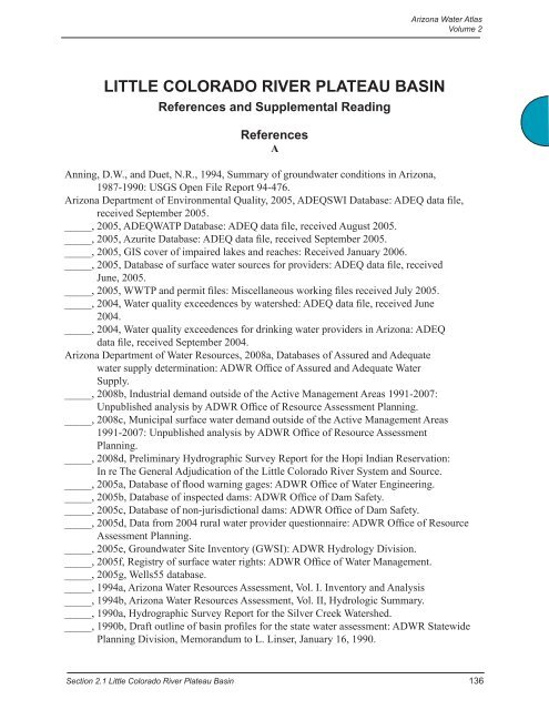
LITTLE COLORADO RIVER PLATEAU BASIN<br />
References and Supplemental Reading<br />
References<br />
A<br />
<strong>Arizona</strong> <strong>Water</strong> Atlas<br />
Volume 2<br />
Anning, D.W., and Duet, N.R., 1994, Summary <strong>of</strong> groundwater conditions in <strong>Arizona</strong>,<br />
1987-1990: USGS Open File Report 94-476.<br />
<strong>Arizona</strong> <strong>Department</strong> <strong>of</strong> Environmental Quality, 2005, ADEQSWI Database: ADEQ data file,<br />
received September 2005.<br />
_____, 2005, ADEQWATP Database: ADEQ data file, received August 2005.<br />
_____, 2005, Azurite Database: ADEQ data file, received September 2005.<br />
_____, 2005, GIS cover <strong>of</strong> impaired lakes and reaches: Received January 2006.<br />
_____, 2005, Database <strong>of</strong> surface water sources for providers: ADEQ data file, received<br />
June, 2005.<br />
_____, 2005, WWTP and permit files: Miscellaneous working files received July 2005.<br />
_____, 2004, <strong>Water</strong> quality exceedences by watershed: ADEQ data file, received June<br />
2004.<br />
_____, 2004, <strong>Water</strong> quality exceedences for drinking water providers in <strong>Arizona</strong>: ADEQ<br />
data file, received September 2004.<br />
<strong>Arizona</strong> <strong>Department</strong> <strong>of</strong> <strong>Water</strong> Resources, 2008a, Databases <strong>of</strong> Assured and Adequate<br />
water supply determination: ADWR Office <strong>of</strong> Assured and Adequate <strong>Water</strong><br />
Supply.<br />
_____, 2008b, Industrial demand outside <strong>of</strong> the Active Management Areas 1991-2007:<br />
Unpublished analysis by ADWR Office <strong>of</strong> Resource Assessment Planning.<br />
_____, 2008c, Municipal surface water demand outside <strong>of</strong> the Active Management Areas<br />
1991-2007: Unpublished analysis by ADWR Office <strong>of</strong> Resource Assessment<br />
Planning.<br />
_____, 2008d, Preliminary Hydrographic Survey Report for the Hopi Indian Reservation:<br />
In re The General Adjudication <strong>of</strong> the Little Colorado River System and Source.<br />
_____, 2005a, Database <strong>of</strong> flood warning gages: ADWR Office <strong>of</strong> <strong>Water</strong> Engineering.<br />
_____, 2005b, Database <strong>of</strong> inspected dams: ADWR Office <strong>of</strong> Dam Safety.<br />
_____, 2005c, Database <strong>of</strong> non-jurisdictional dams: ADWR Office <strong>of</strong> Dam Safety.<br />
_____, 2005d, Data from 2004 rural water provider questionnaire: ADWR Office <strong>of</strong> Resource<br />
Assessment Planning.<br />
_____, 2005e, Groundwater Site Inventory (GWSI): ADWR Hydrology Division.<br />
_____, 2005f, Registry <strong>of</strong> surface water rights: ADWR Office <strong>of</strong> <strong>Water</strong> Management.<br />
_____, 2005g, Wells55 database.<br />
_____, 1994a, <strong>Arizona</strong> <strong>Water</strong> Resources Assessment, Vol. I. Inventory and Analysis<br />
_____, 1994b, <strong>Arizona</strong> <strong>Water</strong> Resources Assessment, Vol. II, Hydrologic Summary.<br />
_____, 1990a, Hydrographic Survey Report for the Silver Creek <strong>Water</strong>shed.<br />
_____, 1990b, Draft outline <strong>of</strong> <strong>basin</strong> pr<strong>of</strong>iles for the state water assessment: ADWR Statewide<br />
Planning Division, Memorandum to L. Linser, January 16, 1990.<br />
Section 2.1 Little Colorado River Plateau Basin 136
<strong>Arizona</strong> <strong>Water</strong> Atlas<br />
Volume 2<br />
_____, 1989, Hydrology <strong>of</strong> the Little Colorado River System, Special report to the Settlement<br />
Committee, In re the General Adjudication <strong>of</strong> the Little Colorado River System and<br />
Source, October 1989.<br />
<strong>Arizona</strong> Land Resource Information System (ALRIS), 2005a, GIS cover <strong>of</strong> Springs: Accessed<br />
January 2006 at http://www.land.state.az.us/alris/index.html.<br />
_____, 2005b, GIS cover <strong>of</strong> Streams: Accessed 2005 at http://www.land. state.az.us/alris/index.<br />
html.<br />
_____, 2005c, GIS cover <strong>of</strong> water features: Accessed July 2005 at http://www.land.state.az.us /<br />
alris/index.html.<br />
_____, 2004d, GIS cover <strong>of</strong> land ownership: Accessed in 2004 at http://www.land.state.az.us/<br />
alris/index.html.<br />
<strong>Arizona</strong> <strong>Water</strong> Commission, 1975, Summary, Phase 1, <strong>Arizona</strong> State <strong>Water</strong> Plan, Inventory <strong>of</strong><br />
resource and uses.<br />
<strong>Arizona</strong> Game and Fish (AZG&F), 2005, <strong>Arizona</strong> <strong>Water</strong>ways: Data file received April 28, 2005.<br />
AZG&F, 1997 & 1993, GIS cover, Statewide riparian inventory and mapping project.<br />
AZG&F, 1982, <strong>Arizona</strong> Lakes Classification Study: AZ Game & Fish Planning <strong>Department</strong>.<br />
<strong>Arizona</strong> Meterological Network (AZMET), 2005, Evaporation data from climatological stations:<br />
Accessed March 2009 at http://www.ag.arizona.edu/azmet/az-data.htm<br />
B<br />
Bills, D.J. and Flynn M.E., 2002, Hydrogeologic data for the Coconino Plateau and adjacent<br />
areas, Coconino and Yavapai Counties, <strong>Arizona</strong>: USGS Open File Report 02-265.<br />
Bills, D.J., Truini, M., Flynn, M.E., Pierce, H.A., Catchings, R.D., and Rymer, M.J., 2000,<br />
Hydrology <strong>of</strong> the regional aquifer near Flagstaff, <strong>Arizona</strong> 1994-97: USGS <strong>Water</strong><br />
Resources Investigations Report 00-4122.<br />
C<br />
Cooley, M.E., Harshbarger, J.W., Akers, J.P, and Hardt, W.F., 1969, Regional Hydrogeology <strong>of</strong><br />
the Navajo and Hopi Indian reservations, <strong>Arizona</strong>, New Mexico and Utah, USGS<br />
Geological Survey Pr<strong>of</strong>essional paper 521-A<br />
E<br />
Environmental Protection Agency, 2005, 2000 and 1996, Clean <strong>Water</strong>shed Needs Survey<br />
databases: Accessed March 2005 at http://www.epa.gov/owm/mtb/cwns/index.htm.<br />
_____, 2005, Surf Your <strong>Water</strong>shed reports: Accessed April 2005 at http://oaspub.epa.gov/enviro/<br />
ef_home2.water.<br />
F<br />
Flora, Stephan, 2004, Hydrological characterization and discharge variability <strong>of</strong> springs in the<br />
middle Verde River watershed, central <strong>Arizona</strong>: Northern <strong>Arizona</strong> University M.S. thesis.<br />
Fisk, G.G., Duet, D.W., Evans, C.E., Angernoth, N.K., and Longsworth, S.A., 2004, <strong>Water</strong><br />
Resources Data, <strong>Arizona</strong> <strong>Water</strong> Year 2003: USGS <strong>Water</strong>-Data Report AZ-03-1.<br />
137 Section 2.1 Little Colorado River Plateau Basin
<strong>Arizona</strong> <strong>Water</strong> Atlas<br />
Volume 2<br />
G<br />
Gregory, H.E., 1916, The Navajo Country - A Geographic and Hydrographic Reconnaissance <strong>of</strong><br />
Parts <strong>of</strong> <strong>Arizona</strong>, New Mexico and Utah: USGS <strong>Water</strong> Supply Paper 380.<br />
H<br />
Hack, J.T., 1942, The Changing Physical Environment <strong>of</strong> the Hopi Indians <strong>of</strong> <strong>Arizona</strong>, Peabody<br />
Museum Papers, v. 35 no 1 pp 1-83.<br />
Hart, RJ, Ward, J.J., Bills, D.J. and Flynn, M.E., 2003, Generalized hydrology and ground water<br />
budget for the C aquifer, Little Colorado River <strong>basin</strong> and parts <strong>of</strong> the Verde and Salt River<br />
<strong>basin</strong>s, <strong>Arizona</strong> and New Mexico: USGS <strong>Water</strong> Resources Investigations Report 02-4026.<br />
K<br />
Konieczki, A.D. and Wilson, R.P., 1992, Annual summary <strong>of</strong> groundwater conditions in <strong>Arizona</strong>,<br />
spring 1986 to spring 1987: USGS Open File Report 92-54.<br />
L<br />
Littin, G.R., 1993, Results <strong>of</strong> groundwater, surface water and water quality monitoring, Black<br />
Mesa area, Northeastern <strong>Arizona</strong>, 1991-1992: USGS <strong>Water</strong> Resources Investigations<br />
Report 93-4111.<br />
Lopes, T.J. and H<strong>of</strong>fman, J.P,, 1997, Geochemical Analyses <strong>of</strong> Ground-water Ages, Recharge<br />
Rates and Hydraulic Conductivity <strong>of</strong> the N Aquifer, Black Mesa Area, <strong>Arizona</strong>: USGS<br />
<strong>Water</strong> Resources Investigations Report 96-4190.<br />
M<br />
McCormack, H.F., Fisk, G.G., Duet, N.R., Evans, D.W., Roberts, W.P., and Castillo, N.K., 2002,<br />
<strong>Water</strong> resources data <strong>Arizona</strong>, water year 2002: USGS <strong>Water</strong> Data Report AZ-02-1.<br />
N<br />
Natural Resources Conservation Service (NRCS), 2005, SNOTEL (Snowpack Telemetry) station<br />
data: Accessed March 2009 at http://www3.wcc.nrcs.usda.gov/snotel/<strong>Arizona</strong>/<br />
arizona.html<br />
_____, 2005, Snow Course Data Network data file: Accessed December 2005 at http://www3.<br />
wcc.nrcs.usda.gov/snow/snowhist.html<br />
Navajo Tribal Utility Authority (NTUA), 2004, Data file <strong>of</strong> NTUA wells and yields.<br />
O<br />
Oregon State University, 1998, Spatial Climate Analysis Service (SCAS): www.ocs.orst.edu/<br />
prism, PRISM map – <strong>Arizona</strong><br />
P<br />
Pope, G.L., Rigas, P.D., and Smith, C.F., 1998, Statistical summaries <strong>of</strong> streamflow data<br />
and characteristics <strong>of</strong> drainage <strong>basin</strong>s for selected streamflow-gaging stations in <strong>Arizona</strong><br />
through water year 1996: USGS <strong>Water</strong>-Resources Investigations Report 98-4225.<br />
Price, D., and Arnow, T., 1974, Summary appraisals <strong>of</strong> the nation’s groundwater resources,<br />
Upper Colorado region: USGS Pr<strong>of</strong>essional Paper 813-C.<br />
Section 2.1 Little Colorado River Plateau Basin 138
<strong>Arizona</strong> <strong>Water</strong> Atlas<br />
Volume 2<br />
S<br />
Soil Conservation Service (SCS) & USFS, 1981, Little Colorado River Basin, AZ-New<br />
Mexico, Coop Study, Appendix II – <strong>Water</strong> Resources, and Appendix IV - Recreation,<br />
Fish & Wildlife and Timber: USDA report.<br />
Spangler, L.E., and Johnson, M.S., 1999, Hydrology & water quality <strong>of</strong> the Oljato Alluvial<br />
Aquifer: USGS <strong>Water</strong> Resources Investigations Report 99-4074.<br />
Stone, N., 2004, Hubbell Trading Post National Historic Site Superintendent: electronic<br />
communication, November 9, 2004.<br />
T<br />
Tadayon, S., 2004, <strong>Water</strong> withdrawals for irrigation, municipal, mining, thermoelectricpower,<br />
and drainage uses in <strong>Arizona</strong> outside <strong>of</strong> the active management areas, 1991-2000:<br />
USGS Scientific Investigations Report 2004-5293.<br />
TerraSpectra Geomatics, 2000, Abandoned uranium mines project, <strong>Arizona</strong>, New Mexico, Utah-<br />
Navajo Lands, 1994-2000: EPA & Corps <strong>of</strong> Engineers joint report.<br />
Thomas, B., 2003, <strong>Water</strong> quality data for Navajo National Monument, Northeastern AZ,<br />
2001-2002: USGS Open file report 03-287.<br />
Thomas, B., 2003, <strong>Water</strong> quality data for Walnut Canyon and Wupatki National Monuments,<br />
<strong>Arizona</strong>-2001-02: USGS Open File Report 03-286.<br />
Truini, M., Macy, J.P., and Porter, T.J., 2005, Groundwater, surface water and water chemistry<br />
data, Black Mesa area, Northeastern <strong>Arizona</strong>, 2003-2004: USGS Open file report 2005-<br />
1080.<br />
Truini, M., and Thomas, B.E., 2004, Groundwater, surface water, and water chemistry data,<br />
Black Mesa Area, Northeastern <strong>Arizona</strong> -2002-03: USGS Open file Report 03-503.<br />
Truini, M., Longsworth, S.A., 2003, Hydrogeology <strong>of</strong> the D aquifer and movement and ages <strong>of</strong><br />
groundwater determined from geochemical and isotopic analysis, Black Mesa area,<br />
northeastern <strong>Arizona</strong>: USGS <strong>Water</strong> Resources Investigations 2003-4189.<br />
U<br />
United States Army Corps <strong>of</strong> Engineers, 2004 and 2005, National Inventory <strong>of</strong> Dams-<strong>Arizona</strong>:<br />
Accessed November 2004 to April 2005 at http://crunch.tec.army.mil/nidpublic/<br />
webpages/nid.cfm.<br />
United States Geological Survey, 2007, <strong>Water</strong> withdrawals for irrigation, municipal, mining,<br />
thermoelectric-power, and drainage uses in <strong>Arizona</strong> outside <strong>of</strong> the active management<br />
areas 1991-2005, Data file received November 2007.<br />
_____, 2006a, National Hydrography Dataset: Accessed at http://nhd.usgs.gov/.<br />
_____, 2006b, Database <strong>of</strong> springs and spring discharges through 2005: Received November<br />
2004 and January 2006 from USGS <strong>of</strong>fice in Tucson, AZ.<br />
_____, 2005, National <strong>Water</strong> Information System (NWIS) data for <strong>Arizona</strong>: Accessed December<br />
2005 at http://waterdata.usgs.gov/nwis.<br />
_____, 2004, Southwest Regional Gap analysis study-land cover descriptions: Accessed January<br />
2005 at http://earth.gis.usu.edu/swgap.<br />
_____, 1981, Geographic digital data for 1:500,000 scale maps: USGS National Mapping<br />
Program Data Users Guide.<br />
139 Section 2.1 Little Colorado River Plateau Basin
<strong>Arizona</strong> <strong>Water</strong> Atlas<br />
Volume 2<br />
W<br />
<strong>Water</strong> Infrastructure Finance Authority (WIFA), 2005, Clean <strong>Water</strong>shed Needs Survey-2004:<br />
Unpublished data sheets received July, 2005.<br />
WIFA, 2005, <strong>Water</strong> and Wastewater Residential Rate Survey for the State <strong>of</strong> <strong>Arizona</strong>.<br />
Wilson, R.P., 1992, Summary <strong>of</strong> groundwater conditions in <strong>Arizona</strong> 1985 to 1986: USGS <strong>Water</strong><br />
Resource Investigation Report, 90-4179.<br />
Western Regional Climate Center (WRCC), 2005a, Precipitation and temperature<br />
station data: Accessed December 2005 at: http://www.wrcc.dri.edu/htmlfiles/westevap.<br />
final.html<br />
_____, 2005b, Pan Evaporation Station data: Accessed December 2005 at http://www.wrcc.dri.<br />
edu/htmlfiles/westevap.final.html<br />
Y<br />
Young, 2006, Holbrook Public Works <strong>Department</strong>, personal communication, 1/5/2006.<br />
Supplemental Reading<br />
Allen, C., 1995, Analysis <strong>of</strong> the Hydrogeologic Conditions Present Within Fort Valley,<br />
Coconino County, AZ: Northern <strong>Arizona</strong> University, M.S. thesis, 136 p.<br />
Andersen, Mark, 2005, Assessment <strong>of</strong> water availability in the Lower Colorado River<br />
<strong>basin</strong>: In Conservation and Innovation in <strong>Water</strong> Management: Proceedings <strong>of</strong> the 18 th<br />
annual <strong>Arizona</strong> Hydrological Society Symposium, Flagstaff, <strong>Arizona</strong>, September, 2005.<br />
<strong>Arizona</strong> <strong>Department</strong> <strong>of</strong> Environmental Quality, 2008, Lyman Lake total maximum daily load,<br />
Fact sheet 08-02.<br />
_____, 2008, Lake Mary Regional total maximum daily load, Fact sheet 08-17.<br />
_____, 2007, Little Colorado River Total Maximum Daily Load, Fact Sheet 07-03.<br />
_____, 2006, Rainbow Lake Total Maximum Daily Load, Fact Sheet 06-16.<br />
_____, 2002, Little Colorado River TMDL for Turbidity.<br />
<strong>Arizona</strong> <strong>Department</strong> <strong>of</strong> <strong>Water</strong> Resources, 1997, Preliminary hydrographic survey report<br />
<strong>of</strong> Indian lands in the Little Colorado River <strong>basin</strong>: <strong>Arizona</strong> <strong>Department</strong> <strong>of</strong> <strong>Water</strong><br />
Resources Report.<br />
_____, 1990, Hydrographic survey report for the Silver Creek watershed, volumes 1-5: The<br />
general adjudication <strong>of</strong> the Little Colorado River system and source.<br />
Army Corps <strong>of</strong> Engineers, 1991, Holbrook levees, Little Colorado River <strong>basin</strong>, Little Colorado<br />
Section 2.1 Little Colorado River Plateau Basin 140
<strong>Arizona</strong> <strong>Water</strong> Atlas<br />
Volume 2<br />
River at Holbrook, <strong>Arizona</strong>: US Army Corps <strong>of</strong> Engineers, Los Angles District, Report.<br />
Bartholomew Engineering, Inc., 1986, Amended water adequacy study for Vernon ValleyII,<br />
Apache County, <strong>Arizona</strong>.<br />
Bergh<strong>of</strong>f, K., Boobar, L., and Ritenour, J., 1998, The effects <strong>of</strong> land use on water quality at<br />
the beaches <strong>of</strong> Lake Powell: in <strong>Water</strong> at the Confluence <strong>of</strong> Science, Law and Public<br />
Policy: Proceedings from the 11 th annual <strong>Arizona</strong> Hydrological Society Symposium,<br />
September 1998, Tucson, <strong>Arizona</strong>.<br />
Bills, D.J., Truini, M., Flynn, M.E., Pierce, H.A., Catchings, R.D., and Rymer, M.J., 2000,<br />
Hydrology <strong>of</strong> the regional aquifer near Flagstaff, <strong>Arizona</strong>, 1994-1997: USGS <strong>Water</strong><br />
Resources Investigations Report 00 - 4122, 143 p.<br />
Bills, D.J. and Hjarlmarson, H.W., 1990, Estimates <strong>of</strong> groundwater flow components for<br />
Lyman Lake, Apache County, <strong>Arizona</strong>: USGS <strong>Water</strong> Resources Investigations Report 89-<br />
4151.<br />
Blakemore, T.E., 2003, <strong>Water</strong> quality data for Navajo National Monument, Northeastern<br />
<strong>Arizona</strong>, 2001-2002: USGS Open File Report 03-287.<br />
Bookman-Edmonston Engineering, Inc., 1984, Report on adequate water supply for<br />
proposed Heber Associates Development.<br />
Bowman, S. N., 2000, Nutrioso Creek TMDL for turbidity: <strong>Arizona</strong> <strong>Department</strong> <strong>of</strong><br />
Environmental Quality, June 2000.<br />
Brian, N.J., 1992, Historical review <strong>of</strong> water flow and riparian vegetation at Walnut Canyon<br />
National Monument, <strong>Arizona</strong>: NPS Technical Report NPS/ WRUA.NRTR-92/44.<br />
Brown and Caldwell, 1997, Hydrologic study for city <strong>of</strong> Show Low <strong>Arizona</strong> in support <strong>of</strong><br />
designation <strong>of</strong> adequate water supply.<br />
Bureau <strong>of</strong> Reclamation and the GOES Office in Flagstaff, <strong>Arizona</strong>, 1990, Glen Canyon<br />
Environmental Studies Phase II, Draft Integrated Research Plan Volume I.<br />
_____, 2000, Appraisal level study <strong>of</strong> <strong>Water</strong> Delivery System Analyses: North Central <strong>Arizona</strong><br />
Regional <strong>Water</strong> Supply Project.<br />
Carpenter, T.L., 2001, The origin <strong>of</strong> isotopically anomalous waters <strong>of</strong> the Mogollon Rim<br />
region <strong>of</strong> <strong>Arizona</strong>: <strong>Arizona</strong> State University, M.S. Thesis, 107 p.<br />
City <strong>of</strong> Show Low, General Plan <strong>Water</strong> Resources Element, adopted July 2003.<br />
Cherry, D., and Cullom, C., 1996, A discussion <strong>of</strong> the vulnerability <strong>of</strong> Blue Springs to the<br />
141 Section 2.1 Little Colorado River Plateau Basin
<strong>Arizona</strong> <strong>Water</strong> Atlas<br />
Volume 2<br />
impacts <strong>of</strong> well withdrawals in the Little Colorado River watershed: in Wanted: <strong>Water</strong><br />
for Rural <strong>Arizona</strong>: Proceedings from the 9 th annual <strong>Arizona</strong> Hydrological Society<br />
Symposium, September 1996, Prescott, <strong>Arizona</strong>, p.3.<br />
Craig, S.D., Dam, W.L., Kernodle, J.M. and Thorn, C.R., 1990, Hydrology <strong>of</strong> the Point<br />
Lookout sandstone in the San Juan structural <strong>basin</strong>, New Mexico, Colorado, <strong>Arizona</strong> and<br />
Utah: USGS 1990 report, 2 sheets.<br />
Daniel B. Stephens and Associates, Inc. (DBSA), 2000, Hopi Drought Plan. Prepared with the<br />
Hopi Tribe, August, 2000.<br />
Desta, A.S., 2006, Modeling precipitation-run<strong>of</strong>f relationships to determine water yield from a<br />
ponderosa pine forest watershed: Thesis (M.S.), Northern <strong>Arizona</strong> University, 2006.<br />
Dickens, C. M., 2004, Hydrologic study: water adequacy report- Foxboro Ranch Estates,<br />
Coconino County, <strong>Arizona</strong>.<br />
Dixson, E.C., 1990, Hydrologeology and groundwater quality in the Sanders area, western<br />
Puerco <strong>basin</strong>, <strong>Arizona</strong>: University <strong>of</strong> Nevada, M.S. thesis.<br />
Dohm, S., 1995, Hydrogeology and ground-water availability <strong>of</strong> the Bird Springs alluvial<br />
aquifer, Navajo Indian Reservation: Northern <strong>Arizona</strong> University, M.S. thesis, 133 p.<br />
Downm, C.E., Harper, L., and Boston, R., 1995, Walnut Canyon and <strong>Water</strong>: Capture, storage,<br />
and use during the Sinagua period <strong>of</strong> occupation, CA. A.D. 1100-1300: NAU<br />
Archeological Report No. 1125.<br />
Dulaney, A.R., 1991, <strong>Water</strong> chemistry <strong>of</strong> the Navajo-Lukachukai aquifer system, Black<br />
Mesa <strong>basin</strong> and vicinity, <strong>Arizona</strong>: Proceedings from the 4 th annual <strong>Arizona</strong> Hydrological<br />
Society Symposium.<br />
Environmental and Earth Science Consultants Ltd., 2000, Hydrologic study for demonstrating<br />
an adequate water supply- Silver Creek <strong>Water</strong>front Estates, White Mountain<br />
Lake Estates <strong>Water</strong> Company, White Mountain Lake, Navajo County, <strong>Arizona</strong>.<br />
_____, 1998, Hydrologic study for demonstrating an adequate water supply- Eagle Ridge<br />
Subdivision, Cedar Grove <strong>Water</strong> Company, Apache County, <strong>Arizona</strong>.<br />
Feth, J.H., 1954, Preliminary report <strong>of</strong> investigations <strong>of</strong> springs in the Mogollon rim<br />
region <strong>of</strong> <strong>Arizona</strong>: USGS Open file report 54-339.<br />
Fisk, G.G., Ferguson, S.A., Rankin, D.R., and Wirt, L., 1994, Chemical, geologic, and<br />
hydrological data from the Little Colorado River <strong>basin</strong>, <strong>Arizona</strong> and New Mexico: USGS<br />
Open File Report 94-356.<br />
Section 2.1 Little Colorado River Plateau Basin 142
<strong>Arizona</strong> <strong>Water</strong> Atlas<br />
Volume 2<br />
Flynn, M., Hornewer, N., 2003, Variations in sand storage measured at monumented cross<br />
sections in the Colorado River between Glen Canyon and Lava Falls rapid, Northern<br />
<strong>Arizona</strong>, 1992-1999: USGS <strong>Water</strong> Resources Investigations Report 03-4104, 39 p.<br />
Garrett, L.D., and Garrett, P.J., 2001, LCR-MOM/ADWR cooperative project on forest<br />
restoration- a work plan for forest restoration and monitoring activities on the Billy Creek<br />
/Thompson Creek subwatershed area - Apache Sitgreaves National Forest: M3 Research,<br />
final report.<br />
Gauger, R.W., 1997, River-stage data Colorado River, Glen Canyon Dam to upper Lake<br />
Mead, <strong>Arizona</strong>, 1990-1994: USGS Open–File Report 96-626, 20 p.<br />
Geotrans Co, 1993, Investigation <strong>of</strong> the N and D aquifer geochemistry and flow characteristics<br />
using major ion and isotope chemistry, petrology, rock stress analysis, and<br />
dendrochronology in the Black Mesa area, <strong>Arizona</strong>: Peabody Western Coal Co., report.<br />
Geo V. Sabol Consulting Engineers, Inc., 1993, Little Colorado River geomorphology and <strong>river</strong><br />
stability study, Navajo County, <strong>Arizona</strong>: 2 vol.<br />
Gillespie, E.L., 1983, Demonstration <strong>of</strong> hydrologic ground water evaluation <strong>of</strong> the Star Light<br />
Pines subdivision, Coconino County, <strong>Arizona</strong>.<br />
Godwin, T. N., A.E. Springer, and L.E. DeWald, 1999, Restoration <strong>of</strong> a degraded perennial<br />
spring-fed riparian system on the Colorado Plateau: EOS, Transactions American<br />
Geophysical Union, vol. 80.<br />
Godwin, T.N., Springer, A.E., DeWald, L.E., 1998, Anthropogenic influences on springdominated,<br />
high elevation riparian ecosystems in a semi-arid region: Geological Society<br />
<strong>of</strong> America Abstracts with Programs, vol. 30, p. A120.<br />
Graf, J.B., Wirt, Laurie, Swanson, E.K., Fisk, G.G., and Gray, J.R., 1996, Stream-flow transport<br />
<strong>of</strong> radionuclides and other chemical constituents in the Puerco and Little Colorado River \<br />
<strong>basin</strong>s, <strong>Arizona</strong> and New Mexico: USGS <strong>Water</strong>-Supply Paper 2459, 89 p.<br />
Gray, J.R. and Webb, R.H., 1991, Radionuclides in the Puerco and Lower Little Colorado<br />
River <strong>basin</strong>s, New Mexico and <strong>Arizona</strong>: in Radon in <strong>Water</strong>: USGS Bulletin 1971, p.297-<br />
311.<br />
Gray, J.R., 1990, <strong>Water</strong> quality in uranium mine pits and groundwater in the Cameron<br />
Uranium Mining Belt, <strong>Arizona</strong>: in Minimizing Risks to the Hydrologic Environment:<br />
Abstracts from the American Institute <strong>of</strong> Hydrology Meeting, March 1990, Las Vegas,<br />
Nevada, p.19.<br />
Grecu, V., 1995, Structural and Hydrologic Analysis <strong>of</strong> Coconino-Supai Aquifer, Lake<br />
143 Section 2.1 Little Colorado River Plateau Basin
<strong>Arizona</strong> <strong>Water</strong> Atlas<br />
Volume 2<br />
Mary <strong>Water</strong>shed, Coconino County <strong>Arizona</strong>: Northern <strong>Arizona</strong> University, M.S. thesis,<br />
143 p.<br />
Griffith, S., 1993, Geochemistry and reaction path modeling <strong>of</strong> the N-aquifer system,<br />
Hopi Reservation Northeastern <strong>Arizona</strong>: Northern <strong>Arizona</strong> University, M.S. thesis, 107<br />
p.<br />
Harms, R., 2005a, Canyon De Chelly National Park springs, seeps, hanging gardens and tinajas<br />
summary: NPS, Southern Colorado Network.<br />
_____, 2005b, Navajo National Monument springs, seeps, hanging gardens and tinajas summary:<br />
NPS, Southern Colorado Network.<br />
_____, 2005c, Petrified Forest National Park springs, seeps, hanging gardens and tinajas<br />
summary: NPS, Southern Colorado Network.<br />
Hart, H.E., and others, 2004, Physical and chemical characteristics <strong>of</strong> Knowles, Forgotten, and<br />
Moqui canyons and the effects <strong>of</strong> recreational use on water quality, Lake Powell, <strong>Arizona</strong><br />
and Utah: USGS Scientific Investigations Report 2004-5120, 40 p.<br />
Hart, R.J., 1999, <strong>Water</strong> Quality <strong>of</strong> the Colorado River monitored by the USGS National Stream<br />
Quality Accounting Network: in <strong>Water</strong> Issues and Partnerships for Rural <strong>Arizona</strong>:<br />
Proceedings <strong>of</strong> the 12 annual symposium <strong>of</strong> the <strong>Arizona</strong> Hydrological Society, September<br />
1999, Hon Dah, <strong>Arizona</strong>.<br />
_____, Assessment <strong>of</strong> spring chemistry along the south rim <strong>of</strong> the Grand Canyon National Park,<br />
<strong>Arizona</strong>: USGS Fact Sheet 096-02.<br />
_____, 1992, Comparison <strong>of</strong> water quality characteristics <strong>of</strong> Lake Powell and the Colorado<br />
River: in Lake Reservoir, and <strong>Water</strong>shed Management in a Changing Environment:<br />
Abstracts from the 11 th annual International Symposium <strong>of</strong> the North American Lake<br />
Management Society, November 1991, Denver Colorado, p.70.<br />
Hart, R.J., Ward, J.J., Bills, D.J., and Flynn M.E., 2002, Generalized hydrology and groundwater<br />
budget for the C aquifer, Little Colorado River <strong>basin</strong>, and parts <strong>of</strong> Verde and Salt River<br />
<strong>basin</strong>, <strong>Arizona</strong> and New Mexico: USGS <strong>Water</strong> Resources Investigations Report 02-4026,<br />
47 p.<br />
Hart, R.J. and Sherman, K.M., 1996, Physical and chemical characteristics <strong>of</strong> Lake Powell at<br />
the forebay and outflows <strong>of</strong> Glen Canyon Dam, northeastern <strong>Arizona</strong>: USGS <strong>Water</strong><br />
Resources Investigations Report 96-4016, 78 p.<br />
Hereford, R., 2007, Climate Variation at Flagstaff, <strong>Arizona</strong> - 1950 to 2007:USGS Open File<br />
Report 2007-1410, 17 p.<br />
Section 2.1 Little Colorado River Plateau Basin 144
<strong>Arizona</strong> <strong>Water</strong> Atlas<br />
Volume 2<br />
Higgins, D.P., 1999, Leakage simulations from a perched mountain aquifer in the inner <strong>basin</strong>,<br />
San Francisco Mountains, <strong>Arizona</strong>: Northern <strong>Arizona</strong> University, M.S. thesis, 141 p.<br />
Hinchman, V.H., 1993, Relationships between riparian vegetation and alluvial channel deposits,<br />
Little Colorado River <strong>Arizona</strong>: <strong>Arizona</strong> State University, M. S. thesis.<br />
Hornewer, N.J., Flynn, M.E., 2008, Bathymetric Survey and Storage Capacity <strong>of</strong> Upper Lake<br />
Mary near Flagstaff, <strong>Arizona</strong>: United States Geological Survey, Open File Report 2008-<br />
1098.<br />
HydroSystems, Inc., 2004, Physical availability demonstration analysis for Flagstaff Meadows in<br />
Coconino County <strong>Arizona</strong>.<br />
Johnson, M.S., and Sorrell, J.D., 1998, Hydrogeology <strong>of</strong> the Bird Springs alluvial aquifer Navajo<br />
nation: in <strong>Water</strong> at the Confluence <strong>of</strong> Science, Law and Public Policy: Proceedings from<br />
the 11 th annual <strong>Arizona</strong> Hydrological Society Symposium, September 1998, Tucson,<br />
<strong>Arizona</strong>, p. 139.<br />
Johnson, M.S., and Spangler, L.E., 1996, Hydrogeologic investigation <strong>of</strong> the Oljeto Wash<br />
aquifer, Monument Valley, <strong>Arizona</strong> and Utah: in Wanted: <strong>Water</strong> for<br />
Rural <strong>Arizona</strong>: Proceedings from the 9 th annual <strong>Arizona</strong> Hydrological Society<br />
Symposium, September 1996, Prescott, <strong>Arizona</strong>, p. 159.<br />
Kelly, S.E., 2000, Ground water flow simulation and recharge sources for a fractured sandstone<br />
aquifer, Coconino County, <strong>Arizona</strong>: Northern <strong>Arizona</strong> University, M.S. thesis 145 p.<br />
Kelly, S., Springer, A., and Vanderbilt, M., 1999, Recharge mechanisms for the<br />
Coconino- Schnebly Hill aquifer in the Lake Mary area, Coconino County, Northern<br />
<strong>Arizona</strong>: Proceedings from the 12th annual <strong>Arizona</strong> Hydrological Society Symposium,<br />
September 1999, Pinetop, <strong>Arizona</strong>.<br />
Kennard, M., 1990, <strong>Water</strong> supply aspects <strong>of</strong> the Navajo-Lukachukai aquifer system, Black Mesa<br />
and vicinity, <strong>Arizona</strong>: Geological Society <strong>of</strong> America annual meeting, Dallas Texas, 11 p.<br />
LCR-MOM Program Coordinating Committee, 2000, Strategic plan <strong>of</strong> the Little Colorado River<br />
watershed multiple objective management group, LCR-MOM.<br />
Littin, G.R., Baum, B.A., and Truini, M. 1999, Groundwater, surface water and water chemistry<br />
data, Black Mesa area, northeastern <strong>Arizona</strong>-1997: USGS Open–File Report 98-653, 27<br />
p.<br />
Longsworth, S.A., 1994, Geohydrology and water chemistry <strong>of</strong> abandoned uranium mines and<br />
radiochemistry <strong>of</strong> spoil-material leachate, Monument Valley and Cameron areas, <strong>Arizona</strong><br />
and Utah: USGS <strong>Water</strong> Resources Investigation 93-4226.<br />
145 Section 2.1 Little Colorado River Plateau Basin
<strong>Arizona</strong> <strong>Water</strong> Atlas<br />
Volume 2<br />
Lombard, J. P., Anderson, T. W., Montgomery, E. L., Blainer-Fleming, J. K, 1992, Aquifer<br />
systems <strong>of</strong> the southern Colorado Plateau: in Proceedings <strong>of</strong> <strong>Arizona</strong> <strong>Water</strong> 2000:<br />
Commission on the <strong>Arizona</strong> Environment and <strong>Arizona</strong> Hydrological Society Symposium,<br />
September 1992, p. 287-303.<br />
Lopes, T.J., and H<strong>of</strong>fman, J.P., 1996, Geochemical analysis <strong>of</strong> groundwater ages,<br />
recharge rates and hydraulic conductivity <strong>of</strong> the N aquifer, Black Mesa area, <strong>Arizona</strong>:<br />
USGS <strong>Water</strong> Resources Investigations 96-4190.<br />
Manera, P. A., 1988, Ground water evaluation in preparation for an application for<br />
adequacy <strong>of</strong> water supply, Flagstaff Ranch <strong>Water</strong> Company.<br />
Manion-Farrar, J., 2008, <strong>Water</strong> conservation policy in Northern <strong>Arizona</strong> : successes and<br />
limitations: Thesis (M.A.) -- Northern <strong>Arizona</strong> University, 2008.<br />
Marley, B., 2004, C aquifer exploration near Moenkopi, <strong>Arizona</strong>: in The Value <strong>of</strong> <strong>Water</strong>:<br />
Proceedings from the 17 th annual <strong>Arizona</strong> Hydrological Society symposium, September<br />
2004, Tucson <strong>Arizona</strong>.<br />
Marley, B., Newcomer, B. and Morgan, R., 1999, Inter-aquifer leakage or inadequate annular<br />
well seals: What is the origin <strong>of</strong> poor groundwater quality in the N Aquifer in the<br />
southeastern part <strong>of</strong> the Black Mesa <strong>basin</strong>?: in <strong>Water</strong> Issues and Partnerships for Rural<br />
<strong>Arizona</strong>: Proceedings from the 12 th annual <strong>Arizona</strong> Hydrological Society Symposium,<br />
September 1999, Pinetop, <strong>Arizona</strong>.<br />
McCulley, B., 1995, Marble Canyon Spring Sampling Investigation: Office <strong>of</strong> Nuclear Waste<br />
Isolation, Battelle Memorial Institute.<br />
McGavock, E., 2004, Challenge <strong>of</strong> water supply in northern <strong>Arizona</strong>: in The Value <strong>of</strong><br />
<strong>Water</strong>: Proceedings from the 17 th annual <strong>Arizona</strong> Hydrological Society symposium,<br />
September 2004, Tucson <strong>Arizona</strong>.<br />
Misseri, P.E., 1998, The Upper Colorado River comprehensive water plan: Town <strong>of</strong> Eager report.<br />
Montgomery, Errol, L., and Associates, 1996a, Assessment <strong>of</strong> hydrologic conditions and<br />
potential effects <strong>of</strong> proposed groundwater withdrawal for Canyon Forest Village,<br />
Coconino County, <strong>Arizona</strong>: report June 1996.<br />
_____ 1996b, Hydrogeologic monitor program February 1, 1995 through January 31, 1996,<br />
Springerville Generating Station area, Apache County, <strong>Arizona</strong>: Tucson Electric & Power<br />
Report.<br />
_____, 1993a, Results <strong>of</strong> 90-day aquifer test and groundwater flow model projections for long<br />
term water yield <strong>of</strong> the Coconino-Supai aquifer Lake Mary well field, Coconino County,<br />
<strong>Arizona</strong>: Tucson, <strong>Arizona</strong>, Errol L. Montgomery and Associates report prepared for the<br />
city <strong>of</strong> Flagstaff, 1885 p.<br />
Section 2.1 Little Colorado River Plateau Basin 146
<strong>Arizona</strong> <strong>Water</strong> Atlas<br />
Volume 2<br />
_____, 1993b, Projections for composite drawdown impact for the Kaibab-Coconino aquifer<br />
based on revised projected groundwater withdrawals for the Springerville and Coronado<br />
generation stations, Apache County <strong>Arizona</strong>: Tucson Electric Power report.<br />
Montgomery, E.L., McGavock, E.H., and Victor, W.R., 1999, The R-Aquifer system in<br />
northern <strong>Arizona</strong>: in <strong>Water</strong> Issues and Partnerships for Rural <strong>Arizona</strong>: Proceedings from<br />
the 12 th annual <strong>Arizona</strong> Hydrological Society Symposium, September 1999, Pinetop,<br />
<strong>Arizona</strong>.<br />
Moody, T., Valencia, R., Wirtanen, K., Wirtanen, M., 2001, Upper Little Colorado River<br />
Concept Plan: a road map and resource guide to riparian enhancement for private<br />
landowners: Northern <strong>Arizona</strong> University, College <strong>of</strong> Engineering and Technology,<br />
<strong>Department</strong> <strong>of</strong> Civil and Environmental Engineering.<br />
Morgan, J., 2000, A new look at the structure <strong>of</strong> the Coconino aquifer <strong>of</strong> northeastern<br />
<strong>Arizona</strong>: in Environmental Technologies for the 21st Century: Proceedings from the 13 th<br />
annual <strong>Arizona</strong> Hydrological Society Symposium, September 2000, Phoenix, <strong>Arizona</strong>,<br />
p.67.<br />
Morgan, R., 1995, Draft progress report on the characteristics <strong>of</strong> the Little Colorado River <strong>basin</strong><br />
<strong>of</strong> northeastern <strong>Arizona</strong> and northwestern New Mexico: Bureau <strong>of</strong> Reclamation contract<br />
no. 1-FC-40-10560.<br />
Mullen, G., Springer, A., Kolb, T., and Ament, A., 2002, Restoration <strong>of</strong> wet meadows: Influence<br />
<strong>of</strong> burning herbaceous communities on groundwater recharge: in <strong>Water</strong> Transfers: Past,<br />
Present and Future: Proceedings from the 15 th annual <strong>Arizona</strong> Hydrological Society<br />
Symposium, September 2002, Flagstaff, <strong>Arizona</strong>.<br />
National Park Service, 1999a, Baseline water quality data inventory and analysis: Canyon<br />
De Chelly National Monument: <strong>Water</strong> Resources Division, Ft Collins, CO., NPS Report,<br />
NPS/NRWRD/NRTR-99/228.<br />
_____, 1999b, Baseline water quality data inventory and analysis: Navajo National Monument:<br />
<strong>Water</strong> Resources Division, Ft Collins, CO., NPS Report, NPS/NRWRD/NRTR-98/196.<br />
_____, 1999c, Baseline water quality data inventory and analysis, Walnut Canyon National<br />
Monument: <strong>Water</strong> Resources Division, Ft Collins, CO., NPS Report, NPS/NRWRD/<br />
NRTR-99/224, 203 pp.<br />
_____, 1997, Baseline water quality data inventory and analysis, Hubbell Trading Post National<br />
Historic Site: <strong>Water</strong> Resources Division, Ft Collins, CO., NPS Report NPS/NRWRD/<br />
NRTR-97/144, 177 pp.<br />
_____, 1996a, Baseline water quality inventory and analysis, Sunset Crater National Monument:<br />
147 Section 2.1 Little Colorado River Plateau Basin
<strong>Arizona</strong> <strong>Water</strong> Atlas<br />
Volume 2<br />
<strong>Water</strong> Resources Division, Ft Collins, CO., NPS Report NPS/NRWRD/NRTR-96/90,<br />
161 pp.<br />
_____, 1996b, Baseline water quality data inventory and analysis, Wupatki National Monument:<br />
<strong>Water</strong> Resources Division, Ft Collins, CO., NPS Report NPS/NRWRD/NRTR-96/82, 229<br />
pp.<br />
Navajo Nation <strong>Department</strong> <strong>of</strong> <strong>Water</strong> Resources, 2004, Appraisal Study - Ganado<br />
Irrigation <strong>Water</strong> Conservation Project, 3 Volumes <strong>of</strong> Appendices: U.S Bureau <strong>of</strong><br />
Reclamation, Native American Affairs Office, Phoenix AZ, September 30, 2000.<br />
Northwest Economics Associates, 1993, Garden and livestock water use in the N aquifer <strong>basin</strong>:<br />
Report for regional Native American communities.<br />
O’Day, C. M., and Leake, S. A., 1995, Ground water availability in the Flagstaff area <strong>of</strong><br />
the Colorado Plateau, <strong>Arizona</strong>: in <strong>Water</strong> Use in <strong>Arizona</strong>: Cooperation or Conflict?:<br />
Proceedings from the 8 th annual <strong>Arizona</strong> Hydrological Society Symposium, September<br />
1995, Tucson, <strong>Arizona</strong>, p. 2-3.<br />
Parker, J.T.C., 1998, Low and zero discharge control on the morphology <strong>of</strong> tributaries in the<br />
East Dinnebito Wash drainage <strong>basin</strong>, Black Mesa, northeastern <strong>Arizona</strong>: in Supplement to<br />
EOS Transactions from the American Geophysical Union fall meeting, November 1998,<br />
p. F305.<br />
Parsons Brinckerh<strong>of</strong>f Value Engineering, 2002, Show Low Creek reservoir system evaluation:<br />
final report for Northern <strong>Arizona</strong> University and Navajo County, 02-09.<br />
Roessel, R.J., 1994, Hydrogeology <strong>of</strong> the Chinle Wash watershed, Navajo Nation <strong>Arizona</strong>, Utah<br />
and New Mexico: University <strong>of</strong> <strong>Arizona</strong>, M.S. thesis.<br />
Rote, J.J., Flynn, M.E., and Bills, D.J., 1997, Hydrologic data, Colorado River and major<br />
tributaries, Glen Canyon Dam to Diamond Creek, <strong>Arizona</strong>, water years 1990-1995: USGS<br />
Open – File Report 97-250, 474 p.<br />
Scott, P.W., 1994, Hydrogeological-structural analysis <strong>of</strong> the Woody Mountain well field<br />
area with geophysical interpretations: Northern <strong>Arizona</strong> M.S. thesis.<br />
Schlinger, C. and Janecek, J. 2002, Lone Pine Dam groundwater recharge evaluation:<br />
Northern <strong>Arizona</strong> University report for Navajo County.<br />
Sottillare, J.P., Bills, D.J. and Brown, J.G., 1992, Results <strong>of</strong> groundwater, surface water<br />
and water quality monitoring, Black Mesa area, northeastern <strong>Arizona</strong>:<br />
USGS <strong>Water</strong> Resources Investigation Report 92-4008.<br />
Southwest Ground-water Consultants Inc., 2005, Hydrologic investigation, Sundance Springs<br />
Section 2.1 Little Colorado River Plateau Basin 148
Community, Snowflake, <strong>Arizona</strong>.<br />
<strong>Arizona</strong> <strong>Water</strong> Atlas<br />
Volume 2<br />
_____, 1998, Hydrologic study in support <strong>of</strong> an application for a water adequacy report, Pine<br />
Canyon Estates near Starlight Pines, <strong>Arizona</strong>.<br />
_____, 2001, Application for water adequacy report, Hidden Meadow Ranch (Formerly Aspen<br />
Meadow Ranch), Apache County, <strong>Arizona</strong>.<br />
Springer, A.E., Gavin, A.J., Godwin, T.N., Higgins, D.P., Wilkinson, R.W., 1998,<br />
Characterization and ecological restoration <strong>of</strong> perched aquifers in the Flagstaff, <strong>Arizona</strong>,<br />
area: Geological Society <strong>of</strong> America, Abstracts with Programs, vol. 30, p. 37.<br />
Springer, A.E., Bills, D., 1998, Exploration for and ecological importance <strong>of</strong> shallow and<br />
deep ground-water around San Francisco Mountain: in Duebendorfer, E.M., ed., Geologic<br />
excursions in northern and central <strong>Arizona</strong>, p. 27-33.<br />
Strength, D., Parnell, R.A., Jr., and Bennett, J.B., 1996, Rates <strong>of</strong> travertine deposition:<br />
comparison <strong>of</strong> laboratory and field rates in the Little Colorado River, <strong>Arizona</strong>: EOS,<br />
Transactions <strong>of</strong> the American Geophysical Union, v. 47, no. 46.<br />
Stumpner, P., 2004a, Data report for survey <strong>of</strong> Heiser and Peshlaki springs, Wupatki National<br />
Monument; NPS unnumbered report.<br />
_____, 2004b. Hydrolgeological investigations and water table monitoring recommendation<br />
Deadman Wash and Little Colorado River confluence area, Wupatki National Monument:<br />
NPS unnumbered report.<br />
Rowlands, P.G., Avery, C.C., Brian, N.J., and Johnson, H., 1995, Historic flow regimes and<br />
canyon bottom vegetation dynamics at Walnut Canyon National Monument, <strong>Arizona</strong>:<br />
National Park Service report.<br />
Tecle, A., Wagner, M.R., and Avery, C. C., 1993, The effect <strong>of</strong> pulp mill wastewater irrigation<br />
on soil salinity: in Emerging Critical Issues in <strong>Water</strong> Resources <strong>of</strong> <strong>Arizona</strong> and the<br />
Southwest: Proceedings from the 6 th annual <strong>Arizona</strong> Hydrological Society Symposium,<br />
September 1993, Casa Grande, <strong>Arizona</strong>, p. 268.<br />
Tetra Tech, 1999, Rainbow Lake-total maximum daily load study: Draft report prepared<br />
for ADEQ.<br />
Thomas, B.E., 2003, <strong>Water</strong> quality data for Navajo National Monument, northeastern<br />
<strong>Arizona</strong>-2001-2002: USGS Open File Report 03-287.<br />
_____, 2003,<strong>Water</strong> quality data for Walnut Canyon and Wupatki National Monuments, <strong>Arizona</strong>-<br />
2001-2002: USGS Open – File Report 03-286, 13 p.<br />
149 Section 2.1 Little Colorado River Plateau Basin
<strong>Arizona</strong> <strong>Water</strong> Atlas<br />
Volume 2<br />
_____, 2002, Groundwater, surface-water, and water-chemistry data, Black Mesa area,<br />
northeastern <strong>Arizona</strong>-2001-02, and performance and sensitivity <strong>of</strong> the USGS 1988<br />
numerical model <strong>of</strong> the N aquifer: USGS <strong>Water</strong> Resources Investigations Report 02 -<br />
4211, 75 p.<br />
Thorstenson, D.J., and Beard, L.S., 1998, Geology and fracture analysis <strong>of</strong> Camp Navajo,<br />
<strong>Arizona</strong> Army National Guard, <strong>Arizona</strong>: USGS Open-File Report 98-242, 42 p.<br />
Topping, D.J., Schmidt, J.C., and Vierra, L.E., Jr., 2003, Computation and analysis <strong>of</strong> the<br />
instantaneous-discharge record for the Colorado River at Lees Ferry, <strong>Arizona</strong>, May 8,<br />
1921, through September 30, 2000: USGS Pr<strong>of</strong>essional Paper 1677.<br />
Town <strong>of</strong> Pinetop-Lakeside, General Plan <strong>Water</strong> Resources Element, adopted March 2001.<br />
Town <strong>of</strong> Snowflake, General Plan <strong>Water</strong> Resources Element, adopted 2003.<br />
Town <strong>of</strong> Taylor, General Plan <strong>Water</strong> Resources Element, adopted December 2003.<br />
Towne, D.C., Yu, W.K., and Emrick, S., 1996, The impacts <strong>of</strong> septic systems on water<br />
quality <strong>of</strong> shallow aquifers: a case study <strong>of</strong> Fort Valley, <strong>Arizona</strong>: in<br />
Wanted: <strong>Water</strong> for Rural <strong>Arizona</strong>: Proceedings from the 9 th annual <strong>Arizona</strong> Hydrological<br />
Society Symposium, September 1996, Prescott, <strong>Arizona</strong>, p.191.<br />
Tso, E., 1995, Hydrogeologic Evaluation <strong>of</strong> a Proposed Solid Waste Landfill Site,<br />
Located Ten Miles North East <strong>of</strong> Cameron, <strong>Arizona</strong>: Northern <strong>Arizona</strong> University, M.S.<br />
thesis, 116 p.<br />
Truini, M., Macy, J.P, 2007, Ground-<strong>Water</strong>, Surface-<strong>Water</strong>, and <strong>Water</strong>-Chemistry Data, Black<br />
Mesa Area, Northeastern <strong>Arizona</strong>-2005-06 USGS Open-File Report 2007-1041<br />
Truini, M., and Longsworth, S.A., 2003 Hydrology <strong>of</strong> the D aquifer and movement<br />
and ages <strong>of</strong> ground water determined from geo-chemical and isotopic analysis,<br />
Black Mesa area, northeastern <strong>Arizona</strong>: USGS <strong>Water</strong> Resources Investigations Report 03<br />
- 4189, 38 p.<br />
United States <strong>Department</strong> <strong>of</strong> Energy, 2008, Annual Groundwater Report April 2007 through<br />
March 2008 Tuba City, <strong>Arizona</strong>, Disposal Site, Office <strong>of</strong> Legacy Management: Doc. No.<br />
S0426800.<br />
United Sates <strong>Department</strong> <strong>of</strong> the Interior, 2004, Analysis <strong>of</strong> Little Colorado River stability<br />
between Holbrook and Winslow, <strong>Arizona</strong>: In Little Colorado<br />
River Sediment Study, Bureau <strong>of</strong> Reclamation, Denver, Colorado, May 23, 2003.<br />
_____, 2000, <strong>Water</strong> delivery system analysis <strong>of</strong> the North Central <strong>Arizona</strong> Regional <strong>Water</strong><br />
Supply Project: Bureau <strong>of</strong> Reclamation, draft, September 2000.<br />
Section 2.1 Little Colorado River Plateau Basin 150
<strong>Arizona</strong> <strong>Water</strong> Atlas<br />
Volume 2<br />
_____, 2000, Western Navajo <strong>Water</strong> Supply Project- Lake Powell <strong>Arizona</strong> to Cameron, <strong>Arizona</strong>:<br />
Bureau <strong>of</strong> Reclamation, April, 2000.<br />
Upper Little Colorado River <strong>Water</strong>shed Partnership, 2001, <strong>Water</strong>shed action and management<br />
plan, draft.<br />
Van Metre, P.C., 1990, Flow and water quality relations between surface water and groundwater<br />
in the Puerco River <strong>basin</strong> near Chambers, <strong>Arizona</strong>: University <strong>of</strong> <strong>Arizona</strong>, M.S. thesis.<br />
Van Metre, P.C, Wirt, L., Lopes, T.J. and Ferguson, S.A., 1997, Effects <strong>of</strong> uranium mine<br />
releases on groundwater quality in the Puerco River <strong>basin</strong>, <strong>Arizona</strong> and New Mexico:<br />
USGS <strong>Water</strong> Supply Paper 2476,73 p.<br />
Vitale, Jenny, 2003, <strong>Water</strong> adequacy report for Linden Trails, Linden, Navajo County,<br />
<strong>Arizona</strong>.<br />
Waltemeyer, S.D., 2006, Analysis <strong>of</strong> the Magnitude and Frequency <strong>of</strong> Peak Discharges for the<br />
Navajo Nation in <strong>Arizona</strong>, Utah, Colorado, and New Mexico: USGS Scientific<br />
Investigations Report 2006-5306, 42 p.<br />
Webb, R.H., Leake, S.A., Turner, R.M., 2007, The Ribbon <strong>of</strong> Green: Change in Riparian<br />
Vegetation in the Southwestern United States, University <strong>of</strong> <strong>Arizona</strong> Press.<br />
Weber, D.S. and Montgomery, E.L., 1994, Projections for long-term groundwater yield from the<br />
Coconino - Supai aquifer, Lake Mary area, Northern <strong>Arizona</strong>: in the Approaching<br />
Millennium-Evolving Perspectives in <strong>Water</strong><br />
Resources: Proceedings from the 7 th annual <strong>Arizona</strong> Hydrological Society<br />
Symposium, September 1994, Scottsdale, <strong>Arizona</strong>, p. 311-326.<br />
Wickham, M., 1992, The geochemistry <strong>of</strong> surface water and ground water interactions<br />
for selected Black Mesa drainages, Little Colorado River <strong>basin</strong>, <strong>Arizona</strong>: University <strong>of</strong><br />
<strong>Arizona</strong>, M.S. thesis.<br />
Wirt, L., Van Metre, P.C. and Favor, B, 1991, Historical water-quality data, Puerco River<br />
<strong>basin</strong>, <strong>Arizona</strong> and New Mexico: USGS Open File Report 91-196.<br />
Woodward – Cline Consultants, 1992, Cholla ash ponds – groundwater interpretive<br />
report, Navajo County, <strong>Arizona</strong>: <strong>Arizona</strong> Public Service Report June 1992.<br />
Zhu, Chen, Waddell, R.K., Star, I., and Ostrander, M., 1998, Responses <strong>of</strong> ground water<br />
in the Black Mesa Basin, northeastern <strong>Arizona</strong>, to paleoclimatic changes during<br />
the late Pleistocene and Holocene; Geology, vol. 26, no.2, 127-130.<br />
151 Section 2.1 Little Colorado River Plateau Basin


