D-BAUG - Departement Bau, Umwelt und Geomatik - ETH Zürich
D-BAUG - Departement Bau, Umwelt und Geomatik - ETH Zürich
D-BAUG - Departement Bau, Umwelt und Geomatik - ETH Zürich

Create successful ePaper yourself
Turn your PDF publications into a flip-book with our unique Google optimized e-Paper software.
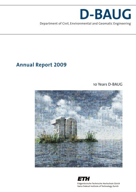
D-<strong>BAUG</strong><br />
Department of Civil, Environmental and Geomatic Engineering<br />
Annual Report 2009<br />
10 Years D-<strong>BAUG</strong>
03 Preface<br />
05 MSc Excellence Scholarships<br />
06 «Switzerland is still in the<br />
making»<br />
11 Donators D-<strong>BAUG</strong><br />
Table of Contents<br />
12 Development of Student<br />
Figures<br />
14 Field Trip to Vienna’s Water Supply<br />
and Waste Disposal Plant<br />
18 Doctoral studies at the<br />
D-<strong>BAUG</strong><br />
22 The Juneau Icefield Research<br />
Program<br />
26 The Rüdlingen Monitoring<br />
and Landslide Experiment<br />
32 Raum+<br />
38 The mountain hut of the future –<br />
the New Monte Rosa Hut SAC<br />
40 Environmental Sustainability<br />
of the Monte-Rosa Hut<br />
44 Fire Safety of Guests and<br />
Hut’s Crew of First Priority<br />
48 Highlights<br />
Structures<br />
56 Highlights<br />
Infrastructure Systems<br />
60 Highlights<br />
Resources<br />
66 Highlights<br />
Geo-, Structural- and<br />
Environmental Data<br />
70 Highlights<br />
High-Tech Measuring Systems<br />
75 Facts and Figures<br />
82 Contacts<br />
84 Masthead /<br />
FSC Certificate<br />
Preface<br />
D-<strong>BAUG</strong> Annual Report 2009 ▪ 1
Preface<br />
In the middle of difficulty lies<br />
opportunity.<br />
2 ▪ D-<strong>BAUG</strong> Annual Report 2009<br />
Albert Einstein
Dear readers<br />
Preface<br />
For <strong>ETH</strong> Zurich and for the Department of Civil, Environmental and Geomatic<br />
Engineering (D-<strong>BAUG</strong>), the year 2009 was marked both by continuity and by<br />
important changes.<br />
The Executive board could further develop and consolidate various initiatives to<br />
helping to promote a qualitative growth of <strong>ETH</strong> Zurich. In particular, there is a plan<br />
to establish about 80 new professorships; however, the f<strong>und</strong>ing provided by the<br />
government will still remain unchanged. In order to meet this goal, new f<strong>und</strong>ing<br />
models must be developed. Therefore, the importance of professorship and project<br />
sponsoring is growing; besides department-specific networks, the <strong>ETH</strong> Fo<strong>und</strong>ation<br />
is thereby playing a central role. For the outside viewer, this growth is represented<br />
by numerous new buildings, which are <strong>und</strong>er construction or planned at “<strong>ETH</strong><br />
Zentrum” and “Science City Hoenggerberg”. D-<strong>BAUG</strong> currently prepares to move<br />
the Laboratory of Hydraulics, Hydrology and Glaciology (VAW) into a new building<br />
at Hönggerberg.<br />
Lorenz Hurni<br />
Preface<br />
Unfortunately, the Vice President for Research and Corporate Relations of <strong>ETH</strong>, Prof. Peter Chen, had to resign only after<br />
two years due to a case of fraud in his research group. The increasing pressure to publicise may be a reason why such<br />
cases tend to increase on international level. Presumably, f<strong>und</strong>amental research is more affected than goal-oriented<br />
domains with an application-induced risk awareness.The Executive board of <strong>ETH</strong> was able to limit the damage by a clear<br />
decision and by a timely and comprehensive information policy. D-<strong>BAUG</strong> puts all its efforts into the compliance with the<br />
guidelines for research integrity and good scientific practice.<br />
Also unpleasant were some <strong>und</strong>ifferentiated, politically motivated scurrilities in a newspaper advertisement, targeted<br />
at German professors in Zurich. In fact, a comment on this should be obsolete. Naturally, our department is convinced<br />
that only a college of professors consisting both of Swiss and foreign members can guarantee the highest level of<br />
quality in research and teaching. Many colleagues of D-<strong>BAUG</strong>, of <strong>ETH</strong> and of the University of Zurich distanced<br />
themselves publicly from these polemics.<br />
In autumn 2009, the Department of Civil, Environmental and Geomatic Engineering could already look back on its 10th<br />
anniversary. D-<strong>BAUG</strong> evolved in October 1999 from a merger of the former Departments of Civil and Environmental<br />
Engineering (D-BAUM) and Geodetic Sciences (D-GEOD), as well as from the former Divisions of Civil Engineering (II) and<br />
Rural Engineering and Surveying (VIII). On August 1, 2009, I had the honour and pleasure to take charge of the<br />
Department, being the successor of Professors Hans-Rudolf Schalcher and Peter Marti, and being very actively supported<br />
by my Deputy Prof. Ulrich Weidmann. I would like to thank my predecessors for having launched and navigated the<br />
department successfully, despite some intermittent storms and calms. I would like to extend my sincere thanks to all<br />
colleagues, staff and institutes members; by their devotion and enthusiasm, they allow for excellent results in research<br />
and for a high level education of our students. I am looking forward to continue to work together with all of them in<br />
the coming years.<br />
The reorganisation of the faculty is still <strong>und</strong>er way. In the reporting year, the following colleagues have retired: Prof.<br />
Hans-Gerd Kahle (Geodesy), Prof. Hans-Rudolf Schalcher (Construction planning and management), and Prof. Armin<br />
Grün (Photogrammetry). Besides, two colleagues have left <strong>ETH</strong> Zurich: Prof. Jan van Mier (Fracture mechanics of concrete,<br />
per December 31, 2009), and Prof. Alessandro Dazio (Earthquake Engineering and Structural Dynamics). We would like<br />
to thank them for their excellent work during all their years at <strong>ETH</strong> and wish them all the best for the future.<br />
D-<strong>BAUG</strong> Annual Report 2009 ▪ 3
Preface<br />
In 2009 we could welcome the following new colleagues at D-<strong>BAUG</strong>: Dr. Irena Hajnsek as Professor for Earth Observation<br />
(Microwave Remote Sensing) per November 1, Dr. Robert Boes as Professor for Hydraulic Structures per February 1, and<br />
Dr. Eberhard Morgenroth as Professor for Process Engineering in Urban Water Management per August 1. On January 1,<br />
2010, Dr. Bryan Adey was appointed Professor for Infrastructure Management.<br />
Currently, a number of appointment procedures are pending; they will presumably be terminated in 2010: Spatial<br />
Information Engineering, Photogrammetry, Construction Materials, Structural Mechanics (externally f<strong>und</strong>ed Assistant<br />
Professorship), Industrial Ecology/Air Quality Control (Assistant professorship together with EMPA), and Structural<br />
Dynamics and Earthquake Engineering.<br />
The number of incoming new students has increased again and amounts to a total of 289. In the curriculum of Civil<br />
Engineering, 178 new entries were registered. The increase of 21 students compared to 2008 can be attributed solely to<br />
new female students, fortunately! The curriculum of Environmental Engineering has 91 new students; the entries in<br />
the curriculum of Geomatics and Planning remain slightly below 20. There is a large discrepancy between the number<br />
of Geomatic engineers leaving <strong>ETH</strong> and the demand in the professional world. As an appeal on the website of the<br />
University of New South Wales in Sidney/Australia shows, this represents a world-wide emergency:„There is a desperate<br />
need globally for both Surveying and Spatial Information System professionals.“ We hope to find a remedy by increasing<br />
the public presence of the domain through involvement of the new professorships and by improving the information<br />
of high school students and career counsels (see also pages 12–13).<br />
The Bologna System with Bachelor and Master curricula was established in 2003, and the first graduates started their<br />
professional career in 2008. Currently, the Bachelor curricula are being revised, based on the experience gained in the<br />
first years and the feedback of the alumni. The curricula will come into effect in autumn 2010.<br />
The Excellence Scholarship programme for outstanding Masters students which was initiated with support of the <strong>ETH</strong><br />
Fo<strong>und</strong>ation, is still pleasantly evolving. Currently, 7 students are being supported (see page 5).They had the opportunity<br />
to present themselves to the private, institutional and company sponsors in the large experimental hall of D-<strong>BAUG</strong>. A<br />
report about this useful networking event and on the Excellence Scholarship programme can be fo<strong>und</strong> on pages 6–11.<br />
We would like to thank the sponsors for their very much appreciated support, which directly fosters the new members<br />
of our professional domain. We hope that this enjoyable development will continue.<br />
Also this year we would like to thank all our partners in the <strong>ETH</strong> domain, in the national and international environment<br />
and in institutions and companies. Through your collaboration and support, you place your trust in us and in our<br />
graduates. We are looking forward to further mutual projects and stimulating contacts and we hope you will enjoy<br />
reading our Annual Report 2009!<br />
Zurich, March 2010<br />
Lorenz Hurni<br />
Head of Department<br />
4 ▪ D-<strong>BAUG</strong> Annual Report 2009<br />
Preface
MSc Excellence Scholarships<br />
Maren Peter<br />
Was born March 22, 1987 in Leipzig (Germany), is proud to be a Saxon, she likes to<br />
show different personalities on stage and has sometimes a too high focus on details.Whenever<br />
there is time she tries to cook and to save money for her next journey.<br />
Not only through her camera but also in sciences she likes to watch out for different<br />
perspectives.<br />
Notable achievement<br />
Maren did her bachelors degree at the Freie Universität Berlin in Geographical Sciences<br />
about the water problem in Istanbul.Due to her good academic achievement<br />
she was considered for the Mcs scholarship, so she can keep researching on that<br />
topic.<br />
MSc Excellence Scholarships<br />
Corinna Elaine Salzer<br />
Was born August 14,1984 in Stuttgart (Germany). She enjoys spending time in nature,<br />
prefers being aware of where her food comes from and sets high value on cultivating<br />
friendships. Lack of moral courage annoys her. Corinna is enthusiastic<br />
about sustainable ideas and innovations,which align the world with future requirements.<br />
Thanks to her scholarship she can focus on her studies.<br />
Notable achievement<br />
Corinna feels strongly about applying her knowledge in regional contexts.She has<br />
worked in South Africa,Turkey and Nepal so far and graduated as BSc in Civil Engineering<br />
with very good results at the <strong>Bau</strong>haus University Weimar.<br />
Stella Viktoria Schieffer<br />
Was born August 24,1987 in Neuss (Germany).She enjoys travelling and is very much<br />
interested in foreign countries and cultures.Besides her studies,Stella likes listening<br />
to music and to explore the art and culture scene of Zurich.As a creative free thinker<br />
she gets annoyed with humorless bureaucrats and petite bourgeoisie and plans to<br />
change the world when she gets the chance.<br />
Notable achievement<br />
Stella is thankful for the MSc Excellence Scholarship after her Bachelor studies in civil<br />
engineering at the Massachusetts Institute of Technology (MIT) and the University<br />
of Cambridge.<br />
Benjamin Wissmann<br />
Was born August 30, 1985, from Berne, Switzerland. He’s looking for the challenges<br />
in work and studies,relaxes on his racing bicycle,likes to eyeball our society and is inspired<br />
by contemporary art and design.<br />
Notable achievement<br />
Benjamin received the MSc excellence scholarship for his excellent academic achievement<br />
during his Bachelor studies in civil engineering at the Swiss Federal Institute<br />
of Technology in Zurich.<br />
D-<strong>BAUG</strong> Annual Report 2009 ▪ 5
MSc Excellence Scholarships<br />
6 ▪ D-<strong>BAUG</strong> Annual Report 2009<br />
“Switzerland is still in the making“<br />
The Excellence Scholarship Programme seeks to support talented <strong>ETH</strong> Master’s stu-<br />
dents. Civil engineering scholarship holders recently met with their sponsors. Konrad<br />
Basler, a donator of the <strong>ETH</strong> Zurich Fo<strong>und</strong>ation, explains in an interview with <strong>ETH</strong><br />
Life why he supports young people and how he sees the future of Civil Engineering.<br />
by Thomas Langholz, <strong>ETH</strong> Life<br />
What has influenced you, Mr. Basler, to actively support students?<br />
I am very attached to <strong>ETH</strong> Zurich, since essentially it is thanks<br />
to the <strong>ETH</strong> that I myself have gotten this far. Although programmes<br />
like the Excellence Scholarship did not exist in my<br />
student days, I received support and encouragement from<br />
my teachers. I consider it to be a snowball effect: we support<br />
the young students and they in turn will support the next generations.<br />
Konrad Basler is committed to<br />
promoting outstanding young<br />
scientists and actively supports<br />
the <strong>ETH</strong> Zurich Excellence Scholarship<br />
and Opportunity Programme.<br />
What can you tell us about<br />
your own education?<br />
I was a farmer’s son and I initially<br />
learned the carpenter<br />
trade before changing to<br />
what was then known as the<br />
Technical College in Winterthur.<br />
Taking up civil engineering<br />
studies at <strong>ETH</strong> was then<br />
only a stone’s throw away. In<br />
those days, Civil Engineers<br />
were regarded as something<br />
special. They were the people<br />
who built big dams and tunnels,<br />
and impressive railway<br />
bridges like the Rhaetian Railway<br />
Bridge, which has now<br />
been incorporated into the UNESCO list of world heritage sites.<br />
In the fifties, Civil Engineering was the biggest department<br />
at the <strong>ETH</strong>.<br />
What distinguishes <strong>ETH</strong> for you?<br />
My studies at <strong>ETH</strong> were the key to my future career. I like the<br />
idea that the <strong>ETH</strong> wants to be a leader amongst European uni-<br />
versities. This philosophy also partly reflects the success of our<br />
own company, Basler & Hofmann. We want to be a cut above<br />
the rest and not simply compete with them.We must offer excellence.<br />
What is your impression of the scholarship holders whom you<br />
have met?<br />
They come across as motivated, friendly people. Their visions<br />
are still vague, but they want to be above the average and I<br />
am convinced they will succeed. I would say they know the<br />
name of the game at <strong>ETH</strong> and that is why I want to support<br />
them.<br />
How would you compare your studies at <strong>ETH</strong> with the current<br />
Bologna programmes?<br />
My grandchildren are studying and fill me in on the current situation.<br />
Regardless of the Bologna process, I think it’s important<br />
that students still have time for philosophy, the theatre, art and<br />
life. Nowadays cultural interests are sacrificed to the examination<br />
sessions. I don’t know how this problem can be solved.<br />
What is your advice to students?<br />
I wish we could improve our use of the Bologna system to effectively<br />
promote student exchange. In Switzerland, the EPF in<br />
Lausanne provides the opportunity of learning another<br />
language and getting to know another culture.We must build<br />
bridges across language barriers, which is also of political importance.<br />
The Excellence Scholarship Programme should also aim at<br />
supporting young engineers. Has it reached its goal or should<br />
it promote more engineers?<br />
It could definitely support more engineers. The fact that<br />
there are too few engineers is a never-ending discussion.
MSc Excellence Scholarships<br />
D-<strong>BAUG</strong> Annual Report 2009 ▪ 7
MSc Excellence Scholarships<br />
Even in this current economic crisis, there are too few engineers.<br />
Certain circles maintain that Switzerland is increasingly being<br />
supplanted with industrial and residential areas. Is engineering<br />
a career for the future?<br />
Absolutely! Take the terminal train station in Zurich, for in-<br />
Konrad Basler<br />
Konrad Basler was born in 1929 in Thalheim on the river<br />
Thur. When he finished his apprenticeship as a carpenter,<br />
he studied at the Technical College in Winterthur<br />
and completed his engineering studies at <strong>ETH</strong> Zurich in<br />
1954. His concluded his doctoral studies at Lehigh University<br />
in Bethlehem (USA) in 1959. From 1960, he worked<br />
as a self-employed advisory engineer in Egg and since<br />
1969 has been a shareholder in Basler & Hofmann Engineering<br />
and Planning Ltd. From 1977 to 1991, he represented<br />
the SVP in the National Assembly where his main<br />
political focus was on energy, the environment and finance.<br />
In the eighties Mr. Basler was a member of the<br />
Swiss Federal School Board (now called the <strong>ETH</strong> Board;<br />
www.ethrat.ch).Today the Basler & Hofmann group has<br />
about 500 employees working on construction, energy,<br />
environment, mobility and security. The company has<br />
numerous offices throughout Switzerland and branches<br />
in Germany, Singapore, India and Slovakia.<br />
8 ▪ D-<strong>BAUG</strong> Annual Report 2009<br />
stance. We are currently constructing a cross-over line <strong>und</strong>er<br />
the main station. The denser the population, the greater the<br />
challenges. In the pioneering days, workers would have done<br />
it in no time with shovels and picks. Today it’s a two-billion<br />
franc project engaging the best engineers. Switzerland will always<br />
need a high level of engineering. This country is still in<br />
the making!<br />
“A future of provenance”<br />
Innovation and promoting young scientists at the Department of Civil, Environmental and Geomatic Engineering<br />
Organised jointly by the <strong>ETH</strong> Zurich Fo<strong>und</strong>ation and Professors Peter Marti and Lorenz Hurni, the partners of the<br />
Excellence Scholarship Programmes (excellence scholarships for Master’s students) were, on 20 October 2009, invited<br />
to meet the young talents they support at an event held in the D-<strong>BAUG</strong> experimental hall. Needless to say, this was an<br />
ideal opportunity to thank the f<strong>und</strong>ers for generously supporting our young talents and to present some current research<br />
work to our guests.<br />
This event also marked a change in office when Professor Marti, the former head of department, officially handed over<br />
duties to his colleague, Professor Lorenz Hurni. In office since August 2009, Prof. Hurni maximized the occasion by bringing<br />
our guests up to date on recent events within the department.<br />
Young talents at D-<strong>BAUG</strong>: our five scholarship holders<br />
Since the launching of the “Excellence Scholarship & Opportunity Programme” at <strong>ETH</strong> Zurich, six talented Master’s students<br />
at D-<strong>BAUG</strong> have each been awarded a scholarship. Five scholarship holders attended the ‘talents meet f<strong>und</strong>ers’<br />
event and introduced themselves to the event participants. These young scientists spoke individually about what this<br />
scholarship has helped them to achieve and how they foresee their future. Naturally, they also thanked the partners for<br />
their kind support.The students’light-hearted, informal presentation went down well and gave this event its rather special<br />
tone.<br />
Whether our young, innovative scientists take up employment in research, seeking to resolve tomorrow’s problems, or<br />
in a company, both have a common denominator: they strive towards progress and effectiveness by engaging in joint<br />
collaborative efforts.<br />
Nathalie Fontana<br />
<strong>ETH</strong> Zurich Fo<strong>und</strong>ation<br />
The Excellence Scholarship F<strong>und</strong> of the <strong>ETH</strong> Zurich Fo<strong>und</strong>ation<br />
In 2007, the <strong>ETH</strong> Executive Board initiated the scholarship<br />
programme. Its aim is to recruit excellent students<br />
from at home and abroad for Master’s studies and to<br />
educate talented young scientists for the industry. Financial<br />
contributions are made by private donors. The<br />
<strong>ETH</strong> Zurich Fo<strong>und</strong>ation wants to establish partnerships<br />
with enterprises and fo<strong>und</strong>ations and to identify private<br />
sponsors. Scholarship applicants must hold an excellent<br />
record in their Bachelor’s studies and submit a<br />
so<strong>und</strong> project outline for a research project. Currently, 30<br />
scholarships are awarded, but it is intended to raise this<br />
number to 50 scholarships a year.
MSc Excellence Scholarships<br />
D-<strong>BAUG</strong> Annual Report 2009 ▪ 9
Donators D-<strong>BAUG</strong><br />
If we meet someone who owes us thanks, we<br />
right away remember that. But how often do<br />
we meet someone to whom we owe thanks<br />
without remembering that.<br />
10 ▪ D-<strong>BAUG</strong> Annual Report 2009<br />
Johann Wolfgang von Goethe
Donators D-<strong>BAUG</strong><br />
Donators D-<strong>BAUG</strong><br />
We’d like to thank the following companies, fo<strong>und</strong>ations <strong>und</strong> individuals who supported<br />
us in the year 2009, and likewise those who do not want to be mentioned by name:<br />
Partners, Companies and Fo<strong>und</strong>ations<br />
Albert-Lück-Stiftung<br />
Basler & Hofmann AG<br />
Gruner AG<br />
Implenia AG<br />
Walo Bertschinger AG<br />
Dr. Vollenweider AG<br />
Private Donators<br />
Kurt Allemann<br />
Hans W. Appenzeller<br />
Ernst Arber<br />
Oliver Y. Barde<br />
Dr. Konrad Basler<br />
Roland <strong>Bau</strong>mann<br />
Ernst Berger<br />
Pirmin Betschart<br />
Erwin Beusch<br />
Heinrich Bossert<br />
Frank Werner Bosshardt<br />
Walter Brauchli<br />
Patrick Burgherr<br />
Reto Caflisch<br />
Luca Censi<br />
Gian-Carlo Dalla Vedova<br />
Francesco Delmué<br />
Dr. Alexandros Deloukas<br />
Camille Diederich<br />
Heinz Eichenberger<br />
Urs Emch<br />
Urs Fähndrich<br />
Ernst Fahrni<br />
Hans Fischer<br />
Pascal Fleischer<br />
Prof. Dr. Mario Fontana<br />
Kurt Frey<br />
Norbert Fürer<br />
Dr. Armand Fürst<br />
Peter Christian Gafner<br />
Heinrich Gnehm<br />
Dr. Mathis Grenacher<br />
Frank P. Gross<br />
Prof. Dr. Hans von Gunten<br />
Thomas Häring<br />
Christian Hausner<br />
Werner Hirschi<br />
Hans Rudolf Holenweg<br />
Konrad M. Huber<br />
Prof. Dr. Lorenz Hurni<br />
Friedrich Jacober<br />
Peter Jenny<br />
Prof. Dr. Jacques Kamm<br />
Waldemar Kieliger<br />
André Kollbrunner<br />
Hermann Kunz<br />
Peter Landert<br />
Prof. Dr. Hans-Jürgen Lang<br />
Dr. Rodolfo Lardi<br />
Felix Lauper<br />
Dr. Gilgian Leuzinger<br />
Alfred Lorenz<br />
Peter Lüthi<br />
Rudolf Ulrich Mettler<br />
Dr. Bruno Meyer<br />
Sotirios Mougridis<br />
Dr. Andreas Müller<br />
Walter Munz<br />
Jean Neiers-Tockert<br />
Heinz Neuenschwander<br />
Jürg Nyfeler<br />
Dietrich W. Oechsle<br />
Daniel Oertli<br />
Mattia Pace<br />
Frédéric-M. Perret<br />
Rudolf Pfister<br />
Dr. André Piller<br />
Ruedi Räss<br />
Gian G. Righetti<br />
Prof. Dr. Alfred Rösli<br />
Antonio Rosnati<br />
Peter Rysler<br />
Milutin Scepan<br />
Peter Schlub<br />
Hans-Peter Schneebeli<br />
Alfred Schürch<br />
Peter Spirig<br />
Rudolf Stüssi-Hodel<br />
Paolo Tamò<br />
Jon Andri Tgetgel<br />
Edy Toscano<br />
Yves Tournier<br />
Peter Trauffer<br />
Thomas Trüb<br />
Hans Tschamper<br />
Hans Vollenweider<br />
Hugo von Gunten<br />
Ernst Wädensweiler<br />
Richard Weber<br />
Paul Wenk<br />
Prof. Dr. Willy Wilk<br />
Hansjakob Windler<br />
Maximilian Winkler<br />
Walter Zumstein<br />
D-<strong>BAUG</strong> Annual Report 2009 ▪ 11
Student Figures<br />
1 For additional figures, see Section Facts & Figures.<br />
12 ▪ D-<strong>BAUG</strong> Annual Report 2009<br />
Development of Student Figures<br />
Teaching, a key aspect of our mission at D-<strong>BAUG</strong>, focuses on three Bachelor’s and four<br />
Master’s curricula courses to support doctoral studies and continuing professional edu-<br />
cation: Civil Engineering (CE), Environmental Engineering (EE), Geomatics and Planning<br />
(GP), and Spatial Development & Infrastructure Systems (SDIS, only MSc).<br />
by Patrick Dilger, Planning & Controlling D-<strong>BAUG</strong><br />
From the year 2000 onwards, figures for new incoming students have shown a positive trend: they have actually more<br />
than tripled since D-<strong>BAUG</strong> was established in 1999 (Fig. 1), clearly surpassing the figures of the early 1990’s.<br />
In 2009, the number of incoming female students rose significantly to 81, which accounts for a good 28% of all incoming<br />
students.This represents a vast increase of 50% since 2008 and points towards a general trend at <strong>ETH</strong> Zurich: the number<br />
of first-year female students has never been so high. It can safely be said that the efforts made (e.g.‘<strong>ETH</strong> on the road’<br />
to meet grammar school pupils or the annual Researchers’ Night) to attract more female students are beginning to pay<br />
off.<br />
By the end of the 1960’s, less than 5% of incoming students were female. This number increased to 25% by the end of<br />
the 1990’s. Engineering, a field in which females were far and few between, has seen considerable growth in female registrants.<br />
In fact, Civil Engineering is attracting an increasing number of women who want to take up professions that<br />
serve society and produce results. Overall, however, Switzerland must further endeavour to draw more women towards<br />
the engineering professions. Most female students at <strong>ETH</strong> Zurich still pursue studies in architecture, pharmacy, sport,<br />
food science or biology.<br />
The recently initiated Master’s degree courses have developed nicely. Since the MSc programmes were introduced in 2006,<br />
the number of incoming MSc students has risen from 70 to 140 (Fig. 2). In the wake of the Bologna Reform, 2009 has<br />
been the second year to award Master’s degree certificates (Fig. 3) to successful graduates. Compared to 2008, the number<br />
of graduates completing the course has doubled.<br />
The number of doctoral graduates has increased steadily over the years, although the increase flattened and stabilised<br />
at 39 graduates last year. At the end of 2008, there were 204 registered doctoral students at D-<strong>BAUG</strong>. (Fig. 4). 1<br />
While in 2009, the University of Zurich had, for the first time ever, over 25,000 matriculated students, <strong>ETH</strong> Zurich has<br />
exceeded the impressive number of 15,000 students. Since the number of grammar school pupils completing their<br />
matriculation examinations (“Matura”) is rising, it is expected that the overall number of students in Switzerland will<br />
increase during the next 3–4 years. Thereafter statistics show that this growth curve is expected to flatten.
New incoming students at D-<strong>BAUG</strong> (BSc-level)<br />
300<br />
275<br />
250<br />
225<br />
200<br />
175<br />
150<br />
125<br />
100<br />
75<br />
50<br />
25<br />
0<br />
New incoming students at D-<strong>BAUG</strong> (MSc-level)<br />
150<br />
140<br />
130<br />
120<br />
110<br />
100<br />
90<br />
80<br />
70<br />
60<br />
50<br />
40<br />
30<br />
20<br />
10<br />
0<br />
MSc degrees (MSc <strong>ETH</strong>)<br />
100<br />
80<br />
60<br />
40<br />
20<br />
0<br />
Doctoral students and dissertations<br />
225<br />
200<br />
175<br />
150<br />
125<br />
100<br />
75<br />
50<br />
25<br />
0<br />
80/81<br />
81/82<br />
82/83<br />
83/84<br />
84/85<br />
85/86<br />
86/87<br />
87/88<br />
88/89<br />
89/90<br />
90/91<br />
91/92<br />
92/93<br />
93/94<br />
94/95<br />
95/96<br />
96/97<br />
97/98<br />
98/99<br />
99/01<br />
00/01<br />
01/02<br />
02/03<br />
03/04<br />
04/05<br />
05/06<br />
06/07<br />
2007<br />
06 / 07 2007 2008 2009<br />
2008 2009<br />
2002 2003 2004 2005 2006 2007 2008 2009<br />
2009<br />
40<br />
35<br />
30<br />
25<br />
20<br />
15<br />
10<br />
5<br />
0<br />
Fig. 1<br />
�BSc new incoming total<br />
�CE<br />
�Rural Engineering and Surveying<br />
�EE<br />
�GP<br />
�BSc new female students<br />
Fig. 2<br />
�MSc new incoming total<br />
�CE<br />
�EE<br />
�GP<br />
�SDIS<br />
Fig. 3<br />
�MSc total<br />
�MSc CE<br />
�MSc EE<br />
�MSc GP<br />
�MSc SDIS<br />
Fig. 4<br />
�Doctoral students<br />
�Dissertations<br />
Student Figures<br />
D-<strong>BAUG</strong> Annual Report 2009 ▪ 13
Field Trip<br />
Field Trip to Vienna’s Water Supply and Waste Disposal Plant<br />
Organised for the second consecutive year, the study excursion to Vienna’s Water<br />
Supply and Waste Disposal Plant, which is an official course in the Master pro-<br />
gramme, was scheduled from 30 April – 3 May 2009.<br />
by Michael Margreth (MSc Geography) / IfU<br />
and Christian Maslo (Ing. Mag. [MSc in Engineering]), AQUA-PR and senior lecturer at the University of Vienna<br />
Excursion overview<br />
About 30 students studying environmental sciences and<br />
engineering at <strong>ETH</strong> Zurich, or geography at the University<br />
of Zurich, had the opportunity to visit Vienna’s Water Supply<br />
site, its sewerage treatment plant, units and technical<br />
facilities, as well as its headwaters.<br />
Stop in Vienna, the federal capital (30 April 2009)<br />
During our one-day visit of our eastern neighbours’capital<br />
city, the students had a tour of the sewerage treatment<br />
plant, which was upgraded in 2005. Located to the southeast<br />
of Vienna in Simmering, the 11th Viennese district,<br />
the plant treats the entire effluent of the city’s 1.8 million<br />
inhabitants. With a cleaning capacity of aro<strong>und</strong> 96%, this<br />
plant is the most modern of its type In Europe.<br />
In the afternoon, we visited the water tower on Wienerberg<br />
in the 10th Viennese district, “Favoriten”. Built between<br />
1898 and 1899, the tower, which from 1910 was only used<br />
occasionally once the second Viennese mountain spring<br />
water line (German acronym: HQL) came into operation,<br />
was finally closed down in 1956. It is considered as a building<br />
of industrial historicism and is <strong>und</strong>er monumental<br />
protection. The pressure for supplying the surro<strong>und</strong>ing<br />
houses was enabled by the principle of “communicating<br />
vessels”. Most impressive of all, visitors may look aro<strong>und</strong><br />
the originally built technical facilities. In the evening of the<br />
first day of our visit, our entire delegation from Zurich was<br />
invited by the City of Vienna to a reception hosted by the<br />
mayor followed by dinner in the basement of the Viennese<br />
City Hall. Not only was this an ideal opportunity to interact<br />
socially and professionally with our colleagues from the<br />
Viennese water supply works, but our students could also<br />
relish the many delights of Viennese cuisine.<br />
14 ▪ D-<strong>BAUG</strong> Annual Report 2009<br />
Stop at Vienna’s Headwaters located in the provinces of Lower<br />
Austria and Steiermark (1–3 May 2009)<br />
Vienna’s drinking water supply is largely based on spring<br />
water which, considering its type and quality, is unique<br />
for a city with a population of one million people. Depending<br />
on whether the year was dry or wet, the percentage<br />
of spring water is between 92 to 98%. The remaining 2 to<br />
8 % is gro<strong>und</strong>water in porous media and comes from<br />
gro<strong>und</strong> water works (Lobau and the third Viennese water<br />
supply line in Moosbrunn). Spring water is extracted in<br />
the east Karst region of the northern Kalk Alps in the provinces<br />
of Lower Austria and Steiermark and is piped to<br />
Vienna via the first and second Viennese mountain spring<br />
water line.With the exception that the Pfannbauern spring<br />
water has to be pumped, drinking water from all the other<br />
springs flows to the Austrian metropolis only with the<br />
help of gravity along the ducts of the first and second<br />
Viennese mountain spring water line. About one sixth of<br />
the Austrian federal territory is covered by landscape shaping<br />
processes which are generally referred to as karst formation.<br />
During our three-day visit of the City of Vienna’s headwaters,<br />
the students were shown different types of springs:<br />
dolomite springs with a relatively constant delivery and<br />
lime springs with high fluctuating delivery.The connection<br />
between spring delivery and karst formation system in<br />
lime or dolomite inside the mountain is crucial. Since, before<br />
seepage in the karst rock, the water is filtered mostly<br />
only through a relatively thinly covered soil layer, the danger<br />
of contamination in the spring water catchment area<br />
is high. For this reason, the protection of the spring water<br />
catchment area – from the plateau to the spring water immersion<br />
points in the valleys – is of major importance.
Fig. 1: Participants of the Vienna water field trip May 2009.<br />
Fig. 2<br />
Field Trip<br />
D-<strong>BAUG</strong> Annual Report 2009 ▪ 15
Field Trip<br />
In particular, measures taken and developed, especially<br />
the implementation of protective measures, were brought<br />
home to our students.This included setting up sanctuaries<br />
in spring water catchment areas and constructing an elaborate<br />
monitoring system which, by means of specially<br />
developed sensors, measures the water quality parameters<br />
constantly online in very short intervals (e.g. of a minute).<br />
Needless to say, this guarantees a closing monitoring of<br />
the quality of the water. Such measures ensure an optimal<br />
management of the spring water and an excellent water<br />
quality for its consumers.<br />
Our visit concluded with a tour of the water reservoir, Neusiedl<br />
am Steinfeld, which is considered to be one of the largest<br />
closed water reservoirs in Europe. It is mostly used to<br />
balance out the partly high fluctuating spring water delivery<br />
and to optimise water supply to the city of Vienna via<br />
the first mountain spring water line. A total of 600 million<br />
litres of water can be stored in four vaults which suffice to<br />
meet the water supply demand for 1.5 days. By means of a<br />
pipeline network stretching over 3300 kilometres, drinking<br />
water is delivered to over 100,000 house connections<br />
in the urban area.<br />
16 ▪ D-<strong>BAUG</strong> Annual Report 2009<br />
This excursion provided our students with an excellent<br />
overview of the technical and financial complexities that<br />
have been involved in building both the mountain spring<br />
water lines and the adjacent facilities since 1873 when the<br />
first HQL went into operation. All the students thoroughly<br />
enjoyed the excursion and express their thanks to D-<strong>BAUG</strong><br />
for financing the study trip.<br />
Fig. 3: Route of drinking water from the karstic springs to the Austrian capital via the I. and II. Viennese pipeline network.
Fig. 4: Spring: Side branch of the Kläfferquelle covered with<br />
moss. With the capacity of a maximum 40’000 l s -1 is this<br />
spring the biggest chanelled karstic spring of Central Europe.<br />
Fig. 6: Flowstone cave: Lime sediments of different shapes in the<br />
cave system of the Lurgrotte.<br />
Fig. 8: Bird's eye view ot the sewerage treatment plant of Vienna .<br />
Field Trip<br />
Fig. 5: Drinking water reservoir: Arches of the water container<br />
Neusiedl located in the suburbs.<br />
Fig. 7<br />
D-<strong>BAUG</strong> Annual Report 2009 ▪ 17
Doctoral studies<br />
Doctoral studies at the Department of Civil, Environmental and<br />
Geomatic Engineering<br />
“Never again study – work, here I come!” In 2003, I was resolved to adhere to this<br />
motto following my geomatic engineering studies.<br />
by Hans-Martin Zogg, Dr. sc. <strong>ETH</strong><br />
Now I am sure you are wondering for how long I kept<br />
that up ...? Motto here or there, after one year in the working<br />
world, I dared to return to university life for my PhD<br />
studies.<br />
One thing at a time however! When I finished my degree<br />
course at <strong>ETH</strong> Zurich, I was tired of the constant exposure<br />
to an academic, theoretical and scientific environment,<br />
and simply wanted to get on with using this knowledge<br />
in the practical world. My geomatic engineering studies<br />
at <strong>ETH</strong> Zurich, referred to as a Master’s degree in Geomatics<br />
and Planning since the Bologna Reform, were varied<br />
and thought-provoking. I had been well prepared for<br />
the working world. No sooner had I completed my diploma<br />
thesis on terrestrial laser scanners at the Institute<br />
of Geodesy and Photogrammetry than I had the chance<br />
to go directly and work at Leica Geosystems in the USA.<br />
What a unique opportunity to be able to work abroad in<br />
the industry! I gained considerable experience and began<br />
to realise that learning and instruction are also an integral<br />
part of the professional world. After spending one<br />
year in San Francisco, I decided to return to Switzerland<br />
and soon had the opportunity to take up PhD studies at<br />
the Institute of Geodesy and Photogrammetry (IGP), <strong>ETH</strong><br />
Zurich, while maintaining contact with Leica Geosystems<br />
by attending to some smaller projects. That was certainly<br />
an offer I could not refuse and my “Never again study –<br />
work, here I come!” motto quickly faded into oblivion. The<br />
practical experience I gained during that year certainly<br />
encouraged me to take up PhD studies. It also emphasised<br />
the importance of a good education and participation<br />
at continuing education courses to enhance<br />
professional development. In addition, being able to<br />
study an interesting topic in-depth was very motivating.<br />
18 ▪ D-<strong>BAUG</strong> Annual Report 2009<br />
So, in autumn 2004, I returned to the <strong>ETH</strong>, one year after<br />
my degree, to work as an assistant and doctoral student<br />
for Professor Ingensand, Chair of Geodetic Metrology and<br />
Engineering Geodesy. I spent half of my working time on<br />
teaching and the other half on researching terrestrial<br />
laser scanners and other smaller research projects. This<br />
combination of activities gave me great diversity at work.<br />
Initially, I was challenged by the direct contact with the<br />
students. It was no longer a matter of asking the assistant<br />
questions as in my student days – I myself now had<br />
to answer them! Since I always strove to give clear explanations<br />
which the students could follow, I could not<br />
formulate my answers in a sparse few words. I tried to<br />
get down to their level and to recall my own experiences<br />
and expectations as a student. As a result, my teaching<br />
memories are still very positive. I tutored students taking<br />
surveying courses and those preparing their Master’s<br />
thesis. Needless to say, working as an assistant did have<br />
its drawbacks: the lectures and exercises, as well as the<br />
students’ questions, became repetitive. Still, two major<br />
highlights during my time as an assistant at <strong>ETH</strong> Zurich<br />
soon obliterated the negative aspects: organising and<br />
conducting the 3-week geodetic project course for Master’s<br />
students in Sedrun and, in autumn 2006, accompanying<br />
Master’s students on their final year trip to Lisbon.<br />
I had not just returned to the <strong>ETH</strong> to teach, but rather to<br />
continue my research studies and prepare my dissertation.<br />
Concluding my research project required a great<br />
deal of energy, particularly when my research work was<br />
making no progress. This is, needless to say, part of a researcher’s<br />
life and I had to learn how to cope with setbacks<br />
or the unexpected when experiments did not go<br />
just quite the way they should have. But, sure enough,
Fig. 1: ISPRS Congress 2008 in Peking. The<br />
congress centre was right beside the “bird’s<br />
nest” (Olympia Stadion).<br />
Doctoral studies<br />
Fig. 2: Presentation of research results at the third Swiss-Baltic Week 2008 in<br />
Tallinn.<br />
Fig. 3: Basic surveying at the Gotthard intermediary construction phase in Sedrun with visiting scientists from Lituania (2005).<br />
D-<strong>BAUG</strong> Annual Report 2009 ▪ 19
Doctoral studies<br />
every cloud has a silver lining and, slowly but surely, my<br />
research progressed. After about two years of research<br />
work, a small light finally appeared at the end of the tunnel<br />
encircling my PhD studies: the motivation to complete<br />
my studies and prepare my dissertation. During the<br />
entire period, the Institute of Geodesy and Photogrammetry<br />
provided me with an excellent environment to<br />
conduct my research work, not only in terms of its infrastructure,<br />
but also thanks to the scientific competence<br />
of the professors and staff working at the Institute.<br />
In those four years spent at the Institute, I learned to experience<br />
and appreciate scientific exchange between research<br />
groups in an international environment. The<br />
various seminars, conferences and congresses were welcome<br />
highlights in the everyday life of a scientist. Besides<br />
being exposed to new thinking and perception<br />
processes, I also got to know new cultures by participating<br />
at conferences in Graz, Vilnius, Fulda and Tallinn. I<br />
especially remember the ISPRS Congress (ISPRS – International<br />
Society for Photogrammetry and Remote Sensing)<br />
in Peking which took place in summer 2008 shortly<br />
Fig. 4: Research project surveying in an extraordinary setting on the Jungfraujoch (2007).<br />
20 ▪ D-<strong>BAUG</strong> Annual Report 2009<br />
before the Olympic Games. Naturally, the Olympic spirit penetrated<br />
the scientific lectures and reflected itself in both<br />
the content and the diverse levels of the contributions.<br />
In autumn 2008, I concluded my PhD studies by handing<br />
in my dissertation, the defence of which was my last official<br />
exam at <strong>ETH</strong> Zurich. I had to, or rather could, present<br />
my results obtained over a research period of four years<br />
to a large audience. Primarily, I had to defend my results<br />
by answering the assessors’ critical questions and presenting<br />
convincing counter-arguments.<br />
In retrospect, and considering the experience I gained at<br />
work immediately after my doctorate, I would definitely<br />
register again for PhD studies. The scientific and cultural<br />
diversity, the collegiality and the optimal research environment<br />
are, in my opinion, unique at <strong>ETH</strong> Zurich. My<br />
motto, “Never again study – work, here I come!”, is certainly<br />
part of history, and I am more convinced than ever<br />
that taking up PhD studies at <strong>ETH</strong> Zurich provides optimal<br />
qualifications for life and work.
Fig. 5: Swiss and Baltic State researchers’ scientific meeting at the second Swiss-Baltic Week 2007 in Lituania.<br />
Fig. 6: Poster session at the MCG Conference (International Conference on Machine, Control and Guidance) in Zurich (2008).<br />
Fig. 7: Evaluating surveying data during the geodetic project course at the course centre in Sedrun (2007).<br />
Doctoral studies<br />
D-<strong>BAUG</strong> Annual Report 2009 ▪ 21
Key Article ▪ Juneau Icefield Research Program<br />
The Juneau Icefield Research Program –<br />
A long-term study on the implications of climate change<br />
Glaciers are significant indicators for climate change and research teams aro<strong>und</strong> the<br />
globe try to analyze and <strong>und</strong>erstand the process of glacial changes. The Juneau Icefield<br />
in Alaska has been subject to such research since 1946 and measurements for the inter-<br />
pretation of climate change implications are available for more than 60 years. The geo-<br />
detic surveys and processed data serve as basic data for this purpose.<br />
by Werner Stempfhuber / IGP; Melanie Kunz / IKA<br />
Approximately 5% of Alaska is permanently covered by ice<br />
and snow. The Juneau Icefield is referred to as 5th largest<br />
contiguous glacial area in the western hemisphere and<br />
covers an area of over 4000 km2. Situated in the north of<br />
the Alaskan capitol Juneau, the Icefield consists of about<br />
140 glaciers, some as long as 30 km and the main glacier<br />
with the name of Taku is over 1400 m thick. The area was<br />
mapped by the Preliminary Bo<strong>und</strong>ary Survey from 1983 to<br />
1894 and again from 1906 to 1910 with more sophisticated<br />
methods. After World War II the Juneau Icefield Research<br />
Program (JIRP) was fo<strong>und</strong>ed <strong>und</strong>er the leadership of Dr.<br />
Maynard M. Miller (University of Idaho). Since 1946 JIRP expeditions<br />
are run every year which makes the Juneau Icefield<br />
one of the most explored glacial areas worldwide.<br />
The Juneau Icefield Research Program (JIRP)<br />
Every summer scientists cross the Juneau Icefield with a<br />
group of students from the southern end towards Atlin<br />
(Canada) in the north. Equipped with the latest survey<br />
hardware they gather and analyze data to answer glaciological<br />
questions in the domain of glacier dynamics and<br />
mass balance. The scope of the research and training program<br />
is to offer practical projects based on the following<br />
fields: glaciology, hydrology, geology, geomorphology, geophysics,<br />
geodesy, photogrammetry, remote sensing, meteorology,<br />
botany, as well as environmental and resource<br />
protection.This long-term study produces answers to current<br />
questions about climate change through countless<br />
publications and dissertations (crevassezone.org/reports-<br />
JIRP.htm). The extensive JIRP infrastructure encompasses<br />
aro<strong>und</strong> 20 base camps and allows for a convenient stay on<br />
the icefield. However, research teams and students have to<br />
cover the 150 km long way across the glaciers only with<br />
their skis, carrying all their gear with them. And exactly<br />
these experiences fascinate every JIRP participant and<br />
make an unforgettable memory (Fig. 1). In the year 2009 an<br />
22 ▪ D-<strong>BAUG</strong> Annual Report 2009<br />
<strong>ETH</strong> staff member was able to actively join this research<br />
program and spend an amazing summer in Alaska.<br />
JIRP is run by the Glaciological & Arctic Sciences Institute<br />
of the University of Idaho and by the Fo<strong>und</strong>ation for Glacier<br />
and Environmental Research. The collected information<br />
about the program and an extensive literature list are available<br />
at crevassezone.org and www.juneauicefield.com.<br />
Surveying the Juneau Icefield<br />
From 1946 to 2009 countless surveys have been conducted,<br />
the data analyzed and visualized. Because the early surveys<br />
were based on theodolite and distance measurements, a<br />
holistic processing of all available survey data is not fully<br />
possible. Since 1992 all longitudinal and cross sections on<br />
the icefield are surveyed with the help of 2-frequency GPS<br />
receivers and for the last few years also with GLONASS receivers.<br />
With this global surveying method processing and<br />
visualization of the geodetic data are possible in a continuous<br />
system. In Figure 3 (upper left) all surveyed longitudinal<br />
and cross profiles are presented graphically in a georeferenced<br />
LandSat-satellite picture. With the available<br />
stakeout and reference points the profiles can easily be staked<br />
out and measured in real-time.The two plots of results<br />
(Fig. 3, upper right and middle) show the changes over the<br />
years exemplary for a profile on Taku glacier.Together with<br />
the information on annual layers gathered in the snow pits,<br />
mass balances can be modeled. Some cross profiles are<br />
measured twice during the season, which provides information<br />
on the flow rate of the glacier surface. On Taku<br />
glacier this velocity is over 60 cm per day (Fig. 3, bottom).<br />
Long-term surveys on Lemon Creek glacier (Fig. 4, left),<br />
which have been analyzed and evaluated in connection with<br />
the International Geophysical Year of the American Geographical<br />
Society between 1957 to 1999, resulted in a decrease<br />
of the total mass from 901 x 106 km 3 to 695 x 106 km 3 . This
Fig. 1: above – Gilkey Trench; below – small Building at Camp 18.<br />
Fig. 2: Left – GPS-reference point near Camp 10; right – GPS-rover survey on Taku glacier.<br />
Juneau Icefield Research Program ▪ Key Article<br />
D-<strong>BAUG</strong> Annual Report 2009 ▪ 23
Key Article ▪ Juneau Icefield Research Program<br />
trend can also be observed in the GPS surveys from 2001 to<br />
2009 (Fig. 4, right), which provide point and line data for<br />
the determination of ablation, flow rate and analysis of<br />
glacier deformation. In order to conduct a holistic evaluation<br />
of mass balance, information on precipitation, topography,<br />
meteorology, as well as runoff and inflow over the<br />
whole glacial area have to be considered.<br />
Nowadays also terrestrial and remote sensing methodology<br />
can be used for the survey of glacier surfaces. CryoSat-<br />
2 is a satellite which has been built for the precise determination<br />
of elevation-changes in areas covered by snow<br />
and ice. This satellite mission is expected to start soon<br />
(www.cryosat.de). To help this mission, a preparation of<br />
the available survey data is necessary. At the moment a database<br />
for the consistent handling of the survey data and<br />
additional information is being built and filled. This homogeneous<br />
system forms the basis for further research<br />
projects. Apart from the future satellite surveys for the<br />
exact determination of the thickness and surface position<br />
of the ice research projects in the field of strain and stress<br />
analysis as well as the derivation of uplift rates (momentarily<br />
approx. 11 mm/year) are planned. For this purpose a<br />
monitoring system which delivers data to the office 365<br />
days a year would be helpful. Preliminary assessments for<br />
such a project have already been conducted.<br />
Outlook<br />
So far the geodetic JIRP projects have been limited to surveying<br />
profiles with RTKDGNSS. However, the existing data<br />
represent a unique series of measurements for an analysis<br />
of the icefield. The survey data accurately document the<br />
annual changes of the surface and form the basis for all<br />
further research. With the future satellite data even more<br />
high quality data will be available, allowing for new research<br />
perspectives. Since these data have first to be verified<br />
via gro<strong>und</strong> control points, the expedition team is still<br />
facing new challenges.<br />
Literature and Weblinks<br />
Welsch,W., Lang, M., <strong>und</strong> Miller, M. M. [1997]: Geodetic Activites<br />
Juneau Icefield, Alaska 1981-1996, Schriftenreihe der<br />
Universität der B<strong>und</strong>eswehr München, Heft 50.<br />
http://www.crevassezone.org<br />
http://www.juneauicefield.com<br />
24 ▪ D-<strong>BAUG</strong> Annual Report 2009
Juneau Icefield Research Program ▪ Key Article<br />
Fig 3: Upper left – Longitudinal and cross profiles on the Juneau Icefield; upper right and middle – Example of cross section surveys<br />
on Taku glacier, plot of the elevation of a point in the middle of the glacier; bottom – velocity vector on Taku glacier.<br />
Fig. 4: left – areal changes on Lemon Creek and Ptarmigan glacier; right – Elevation changes on Lemon Creek glacier.<br />
D-<strong>BAUG</strong> Annual Report 2009 ▪ 25
Key Article ▪ Rüdlingen Monitoring and Landslide Experiment<br />
The Rüdlingen Monitoring and Landslide Experiment<br />
A large scale field experiment was conducted on a steep forested slope in north Switzer-<br />
land to trigger a landslide by means of artificial rainfall. The experiment was successful<br />
and has delivered valuable knowledge about the behaviour of landslides.<br />
by Sarah Springman, Amin Askarinejad, Peter Kienzler, Francesca Casini, Marco Sperl, Ernst Bleiker / IGT;<br />
Devrim Akca, Armin Grün, Professur für Photogrammetrie / IGP<br />
One of the many strengths of working in Switzerland and at<br />
the <strong>ETH</strong> Zurich is the many and varied possibilities to engage<br />
in ‘big picture’ research that offers an opportunity to contribute<br />
within a multidisciplinary environment to solve a problem<br />
of societal concern. In this case, civil and geomatic engineers<br />
were at the centre of a fascinating project that sought<br />
to expose the ways in which landslides would be triggered,<br />
leading to <strong>und</strong>erstanding about initiation of failure and the<br />
subsequent movement of the displaced soil. Earlier field experiments<br />
in Gruben (Teysseire, 2006) and Tössegg (Thielen,<br />
2007) were forerunner doctoral projects that were largely focused<br />
on geotechnical aspects alone. Nonetheless, they contributed<br />
much useful knowledge for the planning and execution<br />
of this project as well as a clear <strong>und</strong>erstanding that we<br />
needed to incorporate input from colleagues in the fields of<br />
geology, hydrology, soil physics, geophysics, photogrammetry,<br />
bio-engineering and instrumentation and sensor technology.<br />
The Competence Centre for Environmental Sustainability has<br />
provided the stimulus for an overarching project entitled<br />
TRAMM 1 , Triggering of Rapid Mass Movements, in which<br />
groups from WSL, <strong>ETH</strong>Z and EPFL, coordinated by<br />
Dr Manfred Stähli, have focused their research on enhancing<br />
<strong>und</strong>erstanding of triggering and initiation mechanisms, including<br />
the transition from slow to fast mass movement processes,<br />
and flow characteristics of such catastrophic mass<br />
movements. The roles of heterogeneity of hydro-mechanical<br />
slope processes on the onset of snow avalanches, landslides,<br />
and debris flows are also being studied by other research<br />
groups.<br />
The Rüdlingen Experiment was a sub-project within<br />
TRAMM, led by the first author.The express purpose was to<br />
1 http://www.cces.ethz.ch/projects/hazri/tramm<br />
26 ▪ D-<strong>BAUG</strong> Annual Report 2009<br />
trigger a rainfall induced landslide, having characterised<br />
the slope, instrumented it with a range of state of the art<br />
sensors to observe its response to the environmental loading<br />
and exposed it to 24 hour observation using high resolution<br />
cameras to witness the slide. Rüdlingen village<br />
(Fig. 1) was chosen following an extreme event in May<br />
2002 in which 100 mm of rain had fallen in 40 minutes, leading<br />
to 42 landslides aro<strong>und</strong> the local area. Student projects<br />
were carried out in three of these locations in 2003<br />
during the remediation period, in support of the local<br />
council.The Council President, Katy Leutenegger was open<br />
to the idea of a controlled experiment being conducted on<br />
a slope within their territory, when she was approached in<br />
2007. Permission was obtained to fell a few trees, which<br />
were mainly at the bo<strong>und</strong>aries of the slope. The Schaffhausen<br />
cantonal authorities, represented by their delegate<br />
for natural hazards, Jürg Schulthess, and the<br />
neighbouring Buchberg village were both supportive and<br />
interested in the outcomes of the research, which has already<br />
been reported back to the community in 2010. Local<br />
assistance was essential at a practical level during the period<br />
of the experiment and in the clean up afterwards!<br />
Having identified a possible steep forested slope that<br />
would be susceptible to slope instability on the basis of<br />
geology, topography, accessibility, vegetation and expected<br />
gro<strong>und</strong> profile (Fig. 2), it was necessary to characterise the<br />
layers of soil and determine depth to rock to decide whether<br />
the experiment would be feasible or not. A series of<br />
test pits were dug aro<strong>und</strong> the edges of the projected test<br />
field to determine soil layering, investigate the root systems,<br />
locate rock depth and extract soil samples to enable<br />
the relevant properties to be measured. Infiltration tests
Fig. 1: Location of the test site, detailed map and map of Switzerland (after Sieber, 2003).<br />
Fig. 2: Soil profile from upper part of the slope.<br />
Rüdlingen Monitoring and Landslide Experiment ▪ Key Article<br />
Fig. 3: Dye pattern in the middle section of a test pit<br />
(scale: from gro<strong>und</strong> surface to 1.3 m depth).<br />
D-<strong>BAUG</strong> Annual Report 2009 ▪ 27
Key Article ▪ Rüdlingen Monitoring and Landslide Experiment<br />
were also carried out, using water coloured with brilliant<br />
blue dye, to investigate the mode and speed of infiltration<br />
of water into the gro<strong>und</strong> (Fig. 3).These exhibited homogeneous<br />
saturation and staining of the soil profile (Fig. 3)<br />
with only little preferential flow and possible local build up<br />
of a perched water table at the transition to bedrock (here<br />
at 1 m depth), which confirmed the high vulnerability of the<br />
slope to a deep-seated failure above the transition to bedrock<br />
rather than a near-surface failure. Furthermore, since<br />
a small percentage of active clay minerals, increasing with<br />
depth, were fo<strong>und</strong> in the soil, and these would tend to reduce<br />
the soil strength and the permeability, it was quickly<br />
established that a likely failure surface would lie above<br />
the bedrock at between 1 and 2 m depth. State of the art<br />
seismic dilatometer testing was also conducted by Andreas<br />
Schmid and René Rohr (IGT: Chair Geomechanics) to<br />
deliver shear wave velocity near the surface. Combined<br />
with the planned area of the experimental test field of 35<br />
m longitudinally and 7 m transversely on the slope, aro<strong>und</strong><br />
500 m 3 of debris could be mobilised in the worst case: a not<br />
insignificant amount! Since much of this could have been<br />
expected to flow over the road and into the Rhine, protection<br />
measures were sought with the help of GEO-<br />
BRUGG, who generously donated two panels of their Swiss<br />
made ring net, instrumented to measure force at impact.<br />
The reasons why a slope fails suddenly due to rainfall can<br />
be compared to the collapse of a sandcastle due rainfall or<br />
flooding. The capillary action of at the water-air-soil particle<br />
interface in partially saturated gro<strong>und</strong> adds strength to<br />
the soil due to the suctions that increase contact stresses<br />
between the particles. As the gro<strong>und</strong> saturates due to infiltration,<br />
the suctions reduce as does the shear resistance<br />
in the gro<strong>und</strong>, with the reverse condition emerging as soil<br />
saturates and a gro<strong>und</strong>water table rises. In this case, increasing<br />
hydrostatic porewater pressures reduce contact<br />
stresses and hence the strength.The relationship between<br />
the degree of saturation and the suction becomes a critical<br />
means of evaluating the contribution to strength (see<br />
Fig. 6).<br />
A 4-camera arrangement was adopted for the image<br />
acquisition. IDS cameras were placed in housing shields to<br />
protect them against environmental effects and two each<br />
were equipped with 8.0 mm and 12.0 mm C-mount lenses.<br />
They were fixed on two tall trees at the foot of the slope<br />
(Fig. 4) at approximately 25 metres height by a professional<br />
climber. Approximately 250 white ping-pong balls (with<br />
diameter 40 mm) were glued onto wooden pegs and embedded<br />
in the gro<strong>und</strong> in a 1 m by 1 m grid (Fig. 4). 21 well distributed<br />
gro<strong>und</strong> control points were established on the<br />
surro<strong>und</strong>ing stable trees.The a priori point positioning accuracy<br />
of the ping-pong balls, using an in-house developed<br />
network simulation tool, was estimated as ± 10.3 mm along<br />
the horizontal direction and ± 3.5 mm along the vertical direction.<br />
In the second sprinkling experiment, the area of interest<br />
was moved ca. 5 metres up the slope. In order to<br />
make the targets more discernable on the image space, the<br />
ping-pong balls were replaced with approximately 80<br />
white tennis balls. A posteriori point positioning accuracy<br />
28 ▪ D-<strong>BAUG</strong> Annual Report 2009<br />
obtained from b<strong>und</strong>le adjustment in the first sprinkling experiment<br />
was ± 16.5 mm along the horizontal direction and<br />
± 3.4 mm along the vertical direction. For the second experiment,<br />
these values were ± 11.0 mm and ± 4.3 mm for<br />
the horizontal and vertical directions, respectively. Just<br />
prior to the monitoring experiment in October 2008, Cornelia<br />
Brönnimann (EPFL), conducted a pumping test close<br />
to the lowest instrument cluster above bedrock. No<br />
gro<strong>und</strong>water table could be sustained.This rejected one of<br />
the possible triggering mechanisms due to watertable<br />
rise. Furthermore, geophysical monitoring conducted by<br />
Klaus Holliger’s group from Uni Lausanne, led by Barbara<br />
Suski with Francesca Gambazzi, indicated the likelihood of<br />
a strata change in the <strong>und</strong>erlying Molasse rocks, which<br />
would confirm the presence of cracking in the more competent<br />
coarse grained Susswasser Molasse compared to<br />
the weaker, fine grained Meereswasser Molasse.<br />
A safety concept was also set up to make sure that noone<br />
was buried during the landslide, since it was predicted<br />
that failure would occur within a matter of seconds, and it<br />
would not be possible to escape the muddy onslaught.The<br />
observational method was used as a decision-making framework<br />
depending on the degree of saturation and<br />
suction with depth, linked to stability calculations of a predicted<br />
failure mechanism (Fig. 6). A traffic light system backed<br />
up with appropriate observations, measurements and<br />
permitted actions at each level, set up clear command,<br />
control and communications between the team members<br />
and the local community. A‘red’state meant that the slope<br />
could fail at any time and so noone was permitted to pass<br />
below the net or within 20 m of the slope.<br />
Connecting up the water supply (Figs. 7a, b, c) was successfully<br />
achieved. The first experiment ran in October<br />
2008. After a preliminary testing phase, a total of 1.7 m of<br />
rainfall, calculated as an average over the slope area, was<br />
supplied over 3.5 days. The mode of saturation of the<br />
gro<strong>und</strong> was observed and some deformations were measured<br />
in the top right quarter of the field, but failure did<br />
not occur. Furthermore, some extremely promising technology<br />
using acoustic sensors developed (Fig. 4) by D-<strong>BAUG</strong><br />
Associate Dani Or’s group, were installed by Gernot Michelmayr<br />
and hinted at some significant shear movement<br />
during one of the most extreme rainfall periods (at 40<br />
mm/hour), that was supported by data from both the surface<br />
deformations and the inclinometers.<br />
The research team concluded that failure had not occurred<br />
on two accounts, because of the leaky base rock in the lower<br />
half of the slope, where the greatest part of the water<br />
had been supplied so that a gro<strong>und</strong>water table could not<br />
rise and root reinforcement, characterised by WSL/STEP<br />
doctoral researcher Massimiliano Schwarz, from a tree<br />
stump in the lower left quadrant of the slope.<br />
Measures taken included confirming that there was less<br />
permeable base rock <strong>und</strong>erlying the top of slope to permit<br />
a gro<strong>und</strong>water table to rise during the rainfall event, and<br />
re-orienting the sprinklers at closer spacings, further up the
Fig. 4: Location of the instrumentation clusters (Cl. 1 – 3), the sprinklers and the photogrammetry<br />
cameras.<br />
Fig. 6: Decision – making graph for the observational method.<br />
Rüdlingen Monitoring and Landslide Experiment ▪ Key Article<br />
Fig. 5: Deformation probe.<br />
Fig. 7: a) Supply of water from a hydrant, b) long water pipe to the test field c) water-meters and main connections to the sprinklers.<br />
D-<strong>BAUG</strong> Annual Report 2009 ▪ 29
Key Article ▪ Rüdlingen Monitoring and Landslide Experiment<br />
slope (Fig. 8), where less influence was expected from the<br />
vegetation and a rising gro<strong>und</strong>water table would be possible.<br />
Roots were severed to a depth of 40 cm along the sides<br />
of the field and more extensive tracer / run-off experiments<br />
were planned for a follow-up experiment in March<br />
2009 over 2 weeks, so that saturation could be achieved<br />
prior to initiating failure.<br />
Pre-test predictions of a failure event were as follows: a<br />
landslide would be triggered towards the end of the first<br />
week, it would be initiated in the top right quadrant, and<br />
travel towards the bottom right of the field, with a failure<br />
surface at a depth of about 1.5 m, mobilising between<br />
100–300m 3 of debris.<br />
With newly aligned sprinklers, the rainfall was adjusted to<br />
an average distribution of 15 mm/h. There was an instant<br />
response in the upper part of the field as the saturation degree<br />
increased, suctions dropped and then the water table<br />
rose over 5 h to about 1.5 m below gro<strong>und</strong> level, where it<br />
stayed for the next 10 h. 15 h after the rainfall had begun,<br />
at 3:00 am, the upper right quadrant started to creep<br />
downslope, with the rate increasing until 3:23 am (Fig. 9).<br />
A crack opened up parallel to the top of the test field, and<br />
as the failure surface spread through the gro<strong>und</strong>, the right<br />
hand side of the landslide followed the scar made through<br />
the vegetation and the left ripped away from and through<br />
the surficial vegetation (Fig. 10). It took 36 seconds to mobilise<br />
about 130 m 3 (3 super script) of soil and roots, which<br />
travelled left towards the tree stump in the lower part of<br />
the field, which re-directed the flow to accelerate towards<br />
the bottom right, whereupon it took only 12 seconds more<br />
to impact on the protection net. Not one grain of debris<br />
reached the forest road below (Fig. 11). Water oozed out of<br />
the back scarp for several minutes after the event and the<br />
research team celebrated ‘a bonnie slide’, which was quite<br />
well predicted in size and shape. The difficulty of estimating<br />
the time to failure was emphasised however.<br />
Lessons for the locals include that a cracked base rock is<br />
very effective at draining the overlying gro<strong>und</strong>, rather like<br />
trying to fill up a bath when the plug is not in! The challenges<br />
of slope instabilities lie when shallow soil layers<br />
overly semi-impermeable rock so that a water table can<br />
build up locally or even flow out of the gro<strong>und</strong>. Useful<br />
hints to such episodic springs can be obtained from vegetation<br />
and during winter from the build up of ice (Fig. 12).<br />
In general, vegetation has a very positive effect on slope<br />
stability, with tree roots acting as effective deep reinforcement,<br />
which could be quantified by the experiment.<br />
References.<br />
Askarinejad, A. (2009). A method to locate the slip surface<br />
and measuring subsurface deformations in slopes. 4th International<br />
Young Geotechnical Engineers' Conference,<br />
Alexandria, Egypt: 171-174.<br />
Casini, F., Jommi, C., Springman, S.M. (2010). A laboratory investigation<br />
on an <strong>und</strong>isturbed silty sand from a slope<br />
prone to landsliding. Granular Matter, in print, DOI:<br />
10.1007/s10035-010-0182-y.<br />
30 ▪ D-<strong>BAUG</strong> Annual Report 2009<br />
Colombo L. (2009) Large shear box for analysing strength<br />
mobilisation in unsaturated conditions. Master Thesis, Politecnico<br />
di Milano.<br />
Minder, P. (2008). Shear resistance of silty sand from the<br />
Rüdlingen monitoring and triggering test site. Semester<br />
thesis, <strong>ETH</strong>, Zurich.<br />
Springman, S.M., Kienzler, P., Casini, F., Askarinejad, A. (2009).<br />
Landslide triggering experiment in a steep forested slope<br />
in Switzerland. Proc. of the 17th Intern. Conf. on Soil Mech.<br />
and Geotech. Engin., Egypt, 5-9 Oct. IOS Press.<br />
Teysseire, P. (2006). Geotechnische Eigenschaften von Moränen.<br />
PhD dissertation <strong>ETH</strong> Zurich.<br />
Thielen, A. (2007). Einfluss der Bodensättigung auf die Stabilität<br />
von Hängen. PhD dissertation <strong>ETH</strong> Zurich.<br />
Acknowledgements:<br />
This research was partially f<strong>und</strong>ed by the Competence<br />
Centre for Environment and Sustainability (CCES) and<br />
the <strong>ETH</strong> Research F<strong>und</strong>, within the framework of the<br />
TRAMM Project. Geobrugg AG, Canton Schaffhausen<br />
and Terr-Bohr AG are thanked for contributing as<br />
sponsors.<br />
We are grateful to the Rüdlingen Council, especially<br />
Mrs. Katy Leutenegger (President) and Martin Kern,<br />
the fire station, the farmers, foresters and communities<br />
of Rüdlingen and Buchberg.<br />
Fatih Akdeniz, Mengia Amberg, Harald Bollinger, Rico<br />
Borellini, Cornelia Brönnimann, Louis Bugnion, Lorenzo<br />
Colombo, Matthias Denk, Sara Durot, Alfred Ehrbar,<br />
John Eichenberger, Francesca Gambazzi, Ralf Herzog,<br />
Martin Huber, Hilmar Ingensand, Markus Iten, Elena<br />
Kapogianni, Thomy Keller, Kubilay Kelesoglu, Lyesse<br />
Laloui, Jan Laue, Peter Lehmann, Anita Meyer, Gernot<br />
Michlmayr, Ferney Morales, Mathieu Nuth, Dani Or,<br />
Heinz Richner, Christian Rickli, René Rohr, Andreas<br />
Schmid, Massimiliano Schwarz, Manfred Stähli, Karl<br />
Steiner, Barbara Suski, Laurent Tacher, Axel Volkwein,<br />
Albrecht von Bötticher, Corinna Wendeler, Felix<br />
Wietlisbach and Adrian Zweidler are thanked for their<br />
contribution to this project.
� Fig. 8: Sprinkler locations: October 2008 (left);<br />
March 2009 (right).<br />
Fig. 9: Sequence of movements in the upper part of<br />
the slope 1 . �<br />
1 Vgl. Video auf:<br />
http://www.cces.ethz.ch/projects/hazri/tramm/<br />
film_landslide_ruedlingen.wmv<br />
Fig. 10: a) Pulled out or b) broken roots at the side of the failure wedge.<br />
Fig. 11: GEOBRUGG net containing debris. Fig. 12: Frozen springs.<br />
Rüdlingen Monitoring and Landslide Experiment ▪ Key Article<br />
D-<strong>BAUG</strong> Annual Report 2009 ▪ 31
Key Article ▪ Raum +<br />
Raum+: A project to assess land reserves for settlements –<br />
a contribution to sustainable spatial development1<br />
One of the most strategic tasks for spatial development in the near future is the<br />
reduction of the consumption of land in our cities and regions.<br />
by Bernd Scholl <strong>und</strong> Hany Elgendy / IRL<br />
Innenentwicklung vor Aussenentwicklung<br />
In the 1990s, the amount of land in Switzerland already in<br />
use for development purposes was ca. 400 m 2 of land per<br />
person. (Arealstatistik des B<strong>und</strong>esamtes für Statistik, BFS<br />
1992/1997). Since then, land consumption has been disconnected<br />
from population growth, as in other European<br />
countries, and continues to grow steadily. Every second<br />
about one square meter of land in Switzerland is sealed for<br />
settlement purposes – about eight hectares per day (Arealstatistik,<br />
BFS 1992/1997).<br />
The main driving forces behind this development are the<br />
continuously changing demographic structure, increased<br />
individual mobility, increasing prosperity as well as<br />
changing demands on living space by the Swiss population.<br />
In recent times, a new upsurge in population numbers has<br />
added to the problem. The results are expressed in the increasing<br />
amount of living space per person. In Switzerland,<br />
living space per resident climbed from 34 m 2 in 1980<br />
to 44 m 2 in 2000 (BFS: Eidgenössische Volkszählung, 1980<br />
& 2000]. At present, this important statistic lies at ca. 50 m 2 .<br />
Looking at this figure in relation to the number of residents,<br />
it shows that Switzerland has a relatively high ratio compared<br />
to land use in other European countries.<br />
Many of the investigations of recent years have delivered<br />
numerous supporting evidences that show the reduction<br />
of land use can help avoid some <strong>und</strong>esirable developments,<br />
for example, in conflicts between areas designated for<br />
settlement, landscape and transport. Against the backgro<strong>und</strong><br />
of the demographic developments, an economical<br />
use of energy and available (but always more limited) financial<br />
resources gives limiting settlement areas additional<br />
topicality and expanded dimensions. In the meantime,<br />
the strategic significance of a reduction in the amount of<br />
land used for settlement purposes has also been politically<br />
32 ▪ D-<strong>BAUG</strong> Annual Report 2009<br />
recognised. The economical use of land is anchored in the<br />
Federal Constitution and was established in Article 1 of<br />
the 2006 Federal Law on Spatial Planning (B<strong>und</strong>esgesetz<br />
über die Raumplanung 2006). As a consequence,“inner development<br />
before new development” is now finding a<br />
place in land-use planning strategies in Switzerland (B<strong>und</strong>esamt<br />
für Raumentwicklung – ARE 1996).<br />
As a minimum effort towards sustainable spatial development,<br />
the strategy of inner development before new development<br />
is not only an effort to halt the use of valuable<br />
cultural land and to steer settlement development towards<br />
inner development , it is also to promote a transformation<br />
of the current inventory.Thus, its intention is not<br />
to bring spatial development to a standstill, but rather to<br />
manage the use of settlement land. In truth, the transformation<br />
that more than doubled the settlement inventory in<br />
the last 50 years is the actual central challenge and a task for<br />
future spatial development. This will also trigger large investments<br />
for the renovation and expansion of the building inventory<br />
and the infrastructure, as has happened in the past.<br />
Following the inner development before new development<br />
principle, however, requires an overview of potential settlement<br />
areas, i.e., quantities, qualities and availability. The<br />
usual information in a spatial inventory only includes quantitative<br />
information on the settlement reserves outside<br />
the currently settled areas or infill areas within the settlement.<br />
It does not give specific information at the level of<br />
land parcels. Other important potential sites, e.g., disposable<br />
or fallow areas, have not been available in the records<br />
for a considerable amount of time.<br />
To fill this information gap, a site-by-site overview of the<br />
potential areas is required to finally make the distribution<br />
pattern of potential areas visible.The overviews also bring
Fig. 1: The methodological approach of Raum + .<br />
Raum + ▪ Key Article<br />
D-<strong>BAUG</strong> Annual Report 2009 ▪ 33
Key Article ▪ Raum +<br />
in information on temporal availability and potential obstacles<br />
through the activation of available potential areas.<br />
This is the purpose of the Raum+ initiative from the <strong>ETH</strong><br />
Zurich Chair for Spatial Development.<br />
Raum+: The methodological approach<br />
The first Raum+ initiative was launched in 2006 as a cooperative<br />
project by six regions of Baden-Württemberg<br />
(with over 400 communities), the Canton of Basel-Landschaft<br />
(with all its cities and communities), the Environment<br />
and Economic Ministries of Baden-Württemberg,<br />
the University of Karlsruhe and <strong>ETH</strong> Zurich. By its conclusion<br />
in 2008, the project had provided a wealth of experience in<br />
the methodology of surveys and their evaluation.These experiences<br />
were incorporated into the pilot project in the<br />
Canton of Schwyz, which will be reported later in this report.<br />
Raum+ is a problem-oriented project that tests the possibilities<br />
and limits of inter-municipal cooperation.The basis<br />
of the project is made up of problem-oriented and crossborder<br />
overviews of potential settlement areas in inner<br />
cities and suburbs in a form that can be adjusted and<br />
brought up to date. Along with the overview, a resilient and<br />
flexible basis for the discussion and adjustment of the<br />
existing approaches, planning instruments and promotion<br />
mechanisms for sustainable land management<br />
should be created.<br />
The core of the methodological approach of Raum+ is to<br />
make an instrument available to the cities and communities<br />
of the various cantons that will provide an overview of<br />
any potential settlement areas necessary for their cantonal<br />
spatial development, without involving any major effort<br />
1 . In addition, expert consultants are provided to help in<br />
the creation and regular updating of the overviews. This<br />
survey of the community and its follow-up become the<br />
fo<strong>und</strong>ation for the generation of overviews of potential<br />
settlement areas for the canton and perhaps in future for<br />
all of Switzerland. An essential element of this activity is an<br />
Internet-based platform that allows information to be gathered<br />
independent of time and place. The access eligibility<br />
for the platform can be decided by the participants and<br />
correspondingly regulated by them. The basis for the<br />
Raum+ approach is built upon the following three f<strong>und</strong>amental<br />
elements:<br />
� Cooperation and dialogue-oriented: a cooperative approach<br />
based on trust is critical for regional land management.<br />
� Decentralised and updateable: The basis of the Raum+<br />
approach is an Internet-based planning information system<br />
that is decentralised, accessible and updateable.<br />
� Overview and situation evaluation:The Raum+ approach<br />
enables, for the first time, the evaluation of potential<br />
settlement areas by quantity, spatial distribution and<br />
quality, as well as across administrative bo<strong>und</strong>aries.<br />
Raum+ in Canton Schwyz<br />
In 2007, the Canton of Schwyz and the Federal Office for<br />
Spatial Development (ARE) took the initiative to create an<br />
overview of settlement area reserves throughout the can-<br />
34 ▪ D-<strong>BAUG</strong> Annual Report 2009<br />
ton. A further goal of the initiative was to update the Canton’s<br />
Planning Guide 2006 within the framework of the approval<br />
process and, based on the information gathered, to<br />
make a discussion about the existing building zone reserves<br />
possible. The resulting project, Potential settlement<br />
areas for a spatial development policy of ‘inner development<br />
first’ – Raum+ Schwyz, was conducted by <strong>ETH</strong> Zurich<br />
in cooperation with ARE as part of the pilot project on sustainable<br />
settlement development. A total of 30 communities<br />
in the Canton of Schwyz participated in the project.<br />
The existing settlement area reserves within the legally<br />
binding building zones of these communities were surveyed<br />
and divided into the following three categories:<br />
� Inner development potential: areas larger than 2,000<br />
m2 within the current settlement area, both built up and<br />
not built up areas.<br />
� Building gaps: ready to build land parcels and classic<br />
building sites with an area between 200 and 2,000 m2,<br />
inside or outside of the current settlement area.<br />
� External reserves: areas larger than 2,000 m2, outside of<br />
the current settlement area that are not built up.<br />
A total of 1,724 potential settlement areas were surveyed in<br />
the Canton of Schwyz with a total surface area of 541 ha. Of<br />
these, more than half are within a current settlement area<br />
and corresponds to an area of 15 m2 per capita (residents<br />
and workers in a spatial unit).Transferred into the survey’s<br />
three categories, about 307 ha have inner development<br />
potential and infill areas that can be placed at the canton’s<br />
disposal.The remainder, about ca. 234 ha, are reserves outside<br />
the current settlement area, but within the legally defined<br />
building zones.<br />
If, for example, the inner development potential and infill<br />
areas were completely consumed in residential areas, a<br />
mid-sized utilisation of 0.4, about a million square meters<br />
of floor space, could be created. This would allow, using a<br />
simplified estimation of 50 m² of floor space per resident,<br />
the addition of about 20,000 residents, i.e., about a 15%<br />
growth of the population. And, this would still conform to<br />
the prerequisites of mobility for the area and maintaining<br />
the living space need per capita at its present level. From<br />
another viewpoint, the areas with inner development potential<br />
and infill areas would also be sufficient to provide<br />
the same number of residents in the Canton of Schwyz<br />
with a growth in living space per resident to 10 m².<br />
Availability of settlement reserves.<br />
Availability of settlement reserves<br />
A central question for inner development is the question of<br />
availability. According to the survey and evaluation, about<br />
30% of the inner development potential can be mobilised<br />
without any obstacles. For the other 70%, there is a minimum<br />
of at least one obstacle to mobilisation, of which, according<br />
to the community representatives, the most common<br />
by far is a lack of owner readiness.<br />
Likewise, about 30% of the infill areas and 46% of the external<br />
reserves do not present obstacles, which means
Fig. 2: Categories used in the survey of potential settlement areas.<br />
Raum + ▪ Key Article<br />
Fig. 3: View from the southwest of the communities of Altendorf, Galgenen and Lachen. Represented are the cubatures of a possible<br />
build-up with heights normal for the site. The colours represent the various potential categories: Red: redevelopment; blue: building<br />
gaps, yellow: reserves outside the current settlement area.<br />
Basis data from SWISSIMAGE © swisstopo (DV 012725); DTM-AV © 2009 LN089 <strong>Umwelt</strong>dep. Kt. SZ, AVG, Cubatures: Survey results.<br />
D-<strong>BAUG</strong> Annual Report 2009 ▪ 35
Key Article ▪ Raum +<br />
that at least a third of the inner-city reserves can be mobilised<br />
in the short term. Here as well, it is good to differentiate<br />
spatially and consider if mobilisation can be accelerated<br />
through the concerted action of individual<br />
communities, through the communities working with each<br />
other and communities working together with the canton.<br />
However, the readiness of owners to evaluate the potential<br />
is the most common obstacle here as well. Now, more<br />
than in the past, it will depend on being able to, first, awaken<br />
interest in an exchange through an active strategy of<br />
inner development , and second, to activate interest in the<br />
diverse potential through offers, consultations and mutual<br />
planning. This means that, more than in the past, is<br />
will be important to invest in planning support for the<br />
mobilisation of inner development reserves.<br />
A differentiated examination of the temporal availability<br />
and additional tasks needed to mobilise the potential areas<br />
shows that, <strong>und</strong>er these conditions, the readiness of the<br />
landowners to grant building permission would have to<br />
take place in a time frame of ten years at the latest.<br />
Perspectives and recommendations for further steps<br />
The experience with the pilot project supports the concept<br />
that a survey of potential settlement areas can be managed<br />
within a level of appropriate expenditure for the communities.<br />
The technical conditions for the use of an Internet-based<br />
overview and for the evaluation of the data are<br />
now available to all the communities in the canton. During<br />
the pilot project, the canton had already begun to make arrangements<br />
to ensure that communities will have access<br />
to the overviews over the long term. Based on the experiences<br />
with the pilot project, the following recommendations<br />
have been formulated:<br />
a. From the overview of land management in the Canton<br />
of Schwyz<br />
� To agree on performing a regular follow-up of the overviews<br />
in the Canton of Schwyz.<br />
� To prepare regular status reports on the land-use balance in<br />
the canton and to submit the reports to the government.<br />
� To check which special processes of an especially important<br />
nature for a inner development -oriented settlement<br />
policy in the defined spaces in the Canton of<br />
Schwyz can be supported and therefore what special<br />
means can be placed at their disposal.<br />
� To entrust the Federal Office for Spatial Development<br />
with the coordination of the work required.<br />
b. Nationwide support for the implementation of the minimum<br />
strategy: inner development before new development<br />
� To request community and inter-community concepts<br />
and strategies for inner development and to promote<br />
and support them.<br />
� To provide argumentation and implementation help for<br />
a inner development -oriented settlement policy in the<br />
form of instruments and to test and compile examples<br />
of their implementation and make these available to<br />
the communities and cantons.<br />
36 ▪ D-<strong>BAUG</strong> Annual Report 2009<br />
� To test inter-community cooperation and processes to<br />
establish their positive effects.<br />
c. Gradual expansion of the overviews<br />
� To use the knowledge gained from the pilot project for<br />
a gradual nationwide expansion of the use of the overview<br />
instrument and to make provisions that, starting in<br />
2010, the overviews can be compiled in two to four additional<br />
cantons. The experiences of the Canton of<br />
Schwyz in the follow-up processes should be added to<br />
this information as an update.<br />
� To ensure comparability and a minimum content requirement<br />
for the overviews and to coordinate this between<br />
the cantons.<br />
� To investigate and approve the general legal conditions<br />
and technical prerequisites in the federal and cantonal<br />
governments needed for a nationwide expansion of the<br />
use of this instrument.<br />
Sources<br />
� Wirtschaftsministerium <strong>und</strong> <strong>Umwelt</strong>ministerium des<br />
Landes Baden-Württemberg (Herausgeber): Schlussbericht<br />
des Kooperationsprojektes „Nachhaltiges grenzüberschreitendes<br />
Siedlungsflächenmanagement -<br />
Raum+“, Regions- <strong>und</strong> Nationalgrenzen überschreitendes<br />
Kooperationsprojekt, Stuttgart 2008.<br />
� Professur für Raumentwicklung der <strong>ETH</strong> <strong>Zürich</strong> (Herausgeber):<br />
Schlussbericht des Modellvorhabens„Raum+<br />
Schwyz: Siedlungsflächenpotenziale für eine Siedlungsentwicklung<br />
nach innen“, <strong>Zürich</strong> 2010.
Fig. 4: Total surface area of potential inner development areas in the Canton of Schwyz by planning status.<br />
Raum + ▪ Key Article<br />
D-<strong>BAUG</strong> Annual Report 2009 ▪ 37
Key Article ▪ New Monte Rosa Hut SAC<br />
The mountain hut of the future – the New Monte Rosa Hut SAC<br />
High above Zermatt, exposed at an altitude of 2883 m above sea level in the centre of<br />
the spectacular Monte Rosa massive, <strong>ETH</strong> Zurich and the Swiss Alpine Club (SAC) have<br />
successfully concluded a gro<strong>und</strong>-breaking project in high alpine construction.<br />
by Patrick Dilger, Planning & Controlling D-<strong>BAUG</strong><br />
The project on the New Monte Rosa Hut SAC was launched<br />
in 2005, the 150th jubilee year of <strong>ETH</strong> Zurich. In collaboration<br />
with SAC, <strong>ETH</strong> Zurich strove to construct a transforming,<br />
innovative and ecologically sustainable hut, exemplary<br />
in design and technology, and mirroring the research<br />
conducted at the Swiss Federal Institute of Technology.<br />
<strong>ETH</strong> Zurich considers this visionary mountain hut, nicknamed<br />
“Mountain Crystal”, to be the most complex timber<br />
construction in Switzerland. In addition to elaborating the<br />
project’s architectonic and technical concepts, <strong>ETH</strong> Zurich<br />
actively searched for sponsors, but did not contribute to the<br />
construction costs amounting to CHF 6.5 million.<br />
Due to the extreme climatic conditions, construction had<br />
to be completed during the five spring/summer months.<br />
Each cubic metre of cement, each wooden element and<br />
every single screw were flown to the site by helicopter.<br />
Bearing in mind that a maximum load was limited to 600<br />
kg, the high level of prefabricated elements had to be ready<br />
to assemble. Since Mountain Crystal’s wooden construction<br />
is enveloped in a layer of lamellar aluminium fascia,<br />
its polygonal shape glistens and glows in the heart of<br />
this majestic rocky landscape. Not only pioneering in terms<br />
of its facade, the alpine hut is also eco-friendly.The high alpine<br />
building is 90% energy self-sufficient. Starting in<br />
March 2010, “Mountain Crystal” is scheduled to welcome<br />
approximately 120 guests. For further information, see:<br />
www.neuemonterosahuette.ch<br />
www.sac-cas.ch<br />
D-<strong>BAUG</strong> was also involved in the construction of the New<br />
Monte Rosa Hut SAC, providing input on ecological sustainability<br />
and fire prevention. The following two articles focus<br />
on these topics.<br />
38 ▪ D-<strong>BAUG</strong> Annual Report 2009<br />
Map section: Monterosa area<br />
Publication (available in German only)<br />
«Neue Monte-Rosa-Hütte SAC<br />
Ein autarkes <strong>Bau</strong>werk im hochalpinen Raum»<br />
Vorworte von<br />
Ralph Eichler, Meinrad K.<br />
Eberle, Reto Jenatsch,<br />
Franz Steinegger.<br />
Beiträge von<br />
Paul Knüsel, Marie-Anne<br />
Lerjen, Ákos Moravánszky,<br />
Adolph Stiller.<br />
Gespräch mit<br />
Ákos Moravánszky, Andrea<br />
Deplazes, David Gugerli.<br />
Fotografien von<br />
Tonatiuh Ambrosetti.<br />
Ausführliche Projektdokumentation mit Beiträgen der<br />
beteiligten Experten. 23x27 cm, Hardcover, 224 Seiten,<br />
ca. 180 Abb., gta Verlag, <strong>Zürich</strong> 2010, ISBN 978-3-85676-273-5<br />
CHF 65.– (inkl. MwSt., exkl. Versandkosten).
New Monte Rosa Hut SAC ▪ Key Article<br />
D-<strong>BAUG</strong> Annual Report 2009 ▪ 39
Key Article ▪ New Monte Rosa Hut SAC<br />
Environmental Sustainability of the Monte-Rosa Hut<br />
The overall concept of a construction process that preserves resources and is free of<br />
pullutants minimizes the impact on our environment and sets new standards in eco-<br />
logical building planning and realisation.<br />
by Stefanie Hellweg, Melanie Goymann, Mathias Wittenwiler / IfU<br />
Goal and scope of the study<br />
Life cycle assessment (LCA) and prospective material and<br />
energy flow balances were used during the planning of the<br />
new Monte Rosa hut.The use of these tools in the early stages<br />
of the planning phase allowed them to have a high leverage<br />
effect on design choices, allowing for sustainable<br />
construction and operation. For example, increased insulation<br />
can reduce heat consumption, and the environmental<br />
impact of energy consumption can be reduced<br />
through the use of renewable energy sources. Construction<br />
materials and processes, including manufacture, transport,<br />
and disposal, were also analyzed. Figure 1 shows the<br />
system bo<strong>und</strong>aries of this analysis. Operation of the hut, including<br />
transport of provisions, was included, although<br />
the production of food and beverages was neglected. It was<br />
assumed that there is no increased demand for nourishment<br />
as a result of visiting the hut.<br />
Methods<br />
An LCA was performed to evaluate the environmental impacts<br />
of the building materials and processes “from cradle<br />
to grave”. Various material choices were assessed, and the<br />
best materials were indicated. For hut operation, electricity<br />
and heat generation, including the production, transport,<br />
and disposal of photovoltaic and lead battery system, and<br />
all other technical devices were considered. Electricity use<br />
of the hut was estimated by extrapolating measured electricity<br />
use data from the old hut. Meteonorm software was<br />
used to calculate solar insolation, and subsequently solar<br />
electricity and heat production. The energy supply system<br />
of the hut will be supplemented with a combined heat and<br />
power plant, which will serve as a back-up system during<br />
bad weather periods. The fuel use of this device was calculated<br />
based on historical weather data, using the difference<br />
between solar energy supply and anticipated demand.<br />
Helicopter flights to transport food and fuel were<br />
40 ▪ D-<strong>BAUG</strong> Annual Report 2009<br />
included in the study.The life cycle assessment data for the<br />
production of materials and energy were taken from the<br />
database ecoinvent (www.ecoinvent.ch) and additional<br />
project-specific data. Life cycle impact assessment was<br />
performed using two different methods: cumulated energy<br />
demand and global warming potential, calculated over a<br />
100 year timeframe and expressed in CO2 equivalents.<br />
Results<br />
Although the new hut offers more space and a higher level<br />
of comfort, the energy demand and greenhouse gas<br />
emissions per overnight stay are significantly reduced compared<br />
to the old hut (Fig. 2).This decrease in CO2 emissions<br />
comes primarily from the use of renewable energy sources<br />
and building materials, as well as from a well insulated<br />
building, energy-efficient equipment, and by the avoidance<br />
of snow melting through recycling and seasonal storage of<br />
water. Melting and heating water in the old hut led to the<br />
use of 6000 kilograms of coal annually (Fig. 2). The new<br />
wastewater purification plant uses electricity but reduces<br />
the impact of wastewater emissions to the environment.<br />
The use of nontoxic and recyclable materials helps to preserve<br />
resources and to reduce the emission of substances<br />
harmful to the environment and human health. Figure 4<br />
shows the high fraction of renewable energetic resources<br />
used in the production and disposal of the new hut materials.<br />
This is particularly due to the large amounts of wood<br />
used as building material. Almost one third of the total cumulative<br />
energy demand of the construction comes from<br />
the outer wall. The façade is the part of the outer wall<br />
with the highest impact, and the selection of an ecological<br />
façade was therefore very important. Vacuum isolation<br />
panels (VIP), glass with integrated sodium carbonate<br />
hydrate heat storage, and conventional isolation combined<br />
with an aluminium skin were analyzed, and are shown in
Fig. 1: System bo<strong>und</strong>aries of the life cycle assessment. All processes marked in yellow were assessed.<br />
New Monte Rosa Hut SAC ▪ Key Article<br />
Fig. 2: Energy flow analysis of the old Monte-Rosa hut (above) and comparison of greenhouse gas emissions per overnight stay in<br />
the old and new Monte-Rosa hug (below).<br />
D-<strong>BAUG</strong> Annual Report 2009 ▪ 41
Key Article ▪ New Monte Rosa Hut SAC<br />
figure 3. All three options had similar insulation properties,<br />
but the conventional isolation/aluminium skin package<br />
was shown to be the most favourable alternative.The new<br />
Monte Rosa hut was therefore built with a conventional<br />
isolation package.<br />
The key to achieving truly low-impact construction and<br />
operation was the integrative use of life cycle assessment<br />
during the entire planning phase.The new Monte Rosa hut<br />
shows that a sustainable mountain hut can also provide a<br />
high level of comfort. Even though the electricity demand<br />
of the hut will increase, because of increased guest numbers<br />
and an the addition of a wastewater treatment plant,<br />
the sustainable energy supply and the use of ecological<br />
construction materials will bring down the quantity of<br />
non-renewable energy and cumulated CO2 emissions. Life<br />
cycle assessment of buildings normally show higher environmental<br />
impacts during the building use than during<br />
the construction and disposal phases. Looking at the new<br />
Monte Rosa hut, figure 4 shows that this gap is much<br />
smaller, as sustainable energy is used whenever possible<br />
for running the hut.<br />
42 ▪ D-<strong>BAUG</strong> Annual Report 2009
New Monte Rosa Hut SAC ▪ Key Article<br />
Fig. 3: Energy flow analysis of the construction and disposal of the building (left) and comparison of environmental key parameters<br />
of three building skin types (right).<br />
Fig. 4: Cumulative Energy demand of the old and new Monte-Rosa hut over a time period of 50 years.<br />
D-<strong>BAUG</strong> Annual Report 2009 ▪ 43
Key Article ▪ New Monte Rosa Hut SAC<br />
44 ▪ D-<strong>BAUG</strong> Annual Report 2009<br />
Fire Safety of Guests and Hut’s Crew of First Priority<br />
The choice of structural timber for the new Monte Rosa Hut necessitated an object-spe-<br />
cific fire safety concept. In it the safety objectives and all measures were specified that<br />
were required to achieve it. The safety of guests and the hut’s crew are of prime impor-<br />
tance. Quality control ensures the implementation of the concept.<br />
by Hansbeat Reusser, Holzbaubüro Reusser GmbH, Winterthur; Mario Fontana / IBK<br />
The standard concept for Swiss Alpine Club (SAC) huts<br />
normally applies the fire protection guideline «Abgelegene<br />
Beherbergungsbetriebe» der Vereinigung Kantonaler<br />
Feuerversicherungen (VKF) – «Operating Remote Hostels»<br />
of the Association of Cantonal Fire Insurers. If a project involves<br />
more than two storeys, for the whole structure and<br />
the fire compartments a non-combustible construction is<br />
required. The selected method of timber construction<br />
using prefabricated elements for the new Monte Rosa Hut<br />
necessitated a specific fire safety concept for the building.<br />
Fire protection objectives and special features<br />
The safety of guests and the hut’s crew was of paramount<br />
importance in the formulation of the fire protection objectives.<br />
Thus the occurrence of fires and explosions should<br />
be prevented using technical and organisational measures.<br />
The spread of flames, heat and smoke is limited by constructional<br />
measures and the creation of fire compartments<br />
while also ensuring the structural stability of the<br />
building for a specific period of time. The protection of<br />
neighbouring buildings is not a factor here due to the remoteness<br />
of the location. The intervention of the fire service<br />
is made impossible by the lack of access and the insufficient<br />
supply of fire-fighting water. On the other hand,<br />
it may be assumed that because of the location of the hut<br />
high in the mountains, the hut’s visitors are agile, physically<br />
fit and quite used to the mountains. However after a fire<br />
they must be protected against icy weather conditions.<br />
Concept<br />
Besides the short and convenient escape routes from all the<br />
rooms to a safe place, the concept provides each guest room<br />
with a secondary escape route using a fixed outside emergency<br />
stairs. According to the VKF regulations the new Monte<br />
Rosa Hut is defined as having four storeys. Therefore, the detailed<br />
design of the timber structure accorded with the building<br />
rules for four-storey timber structures with living accommodation,<br />
working areas or rooms for educational purposes.<br />
Quality Control<br />
Quality control was considered to be of prime importance<br />
in relation to fire safety. The assigned quality control level,<br />
agreed upon with the fire safety authority, was Q3 in accordance<br />
with the Swiss Timber Industry Lignum documentation<br />
«Brandschutz» – «Fire Safety». In general, the<br />
work of the fire safety specialists involved the preparation<br />
of a fire safety concept in agreement with the fire safety<br />
authorities, advising the planners, supervision of the call for<br />
tenders, production (prefabrication) as well as periodic<br />
checks during erection and the final checks with the authorities.<br />
Thus, throughout all phases of the project it was<br />
required to act as consultants for the components relevant<br />
to fire safety from planning and execution right up to the<br />
putting into operation as well as supervising and accompanying<br />
the work. This also required close cooperation<br />
with the architects and site management personnel.<br />
Technical Fire Safety<br />
The hut is fitted with an automatic fire detection and<br />
alarm system with continuous monitoring in all rooms.<br />
The system controls the ventilation dampers, the fire doors<br />
and the smoke and heat venting system. Emergency<br />
lighting facilitates safe escape. The energy is supplied by<br />
solar and battery power. For fire fighting, because of the insufficient<br />
supply of water, hand-held fire extinguishers<br />
and fire buckets with spraying devices are available.<br />
Organisational Fire Safety<br />
A special feature is the provision of 120 bivouac bags outside<br />
the hut. These are necessary so that after a fire with<br />
a quick successful escape people are not left without protection<br />
in the case of icy weather conditions.
Fig. 1: Plan view of 1st storey with fire compartments and escape routes.<br />
Fig. 2: Section with fire compartments.<br />
New Monte Rosa Hut SAC ▪ Key Article<br />
D-<strong>BAUG</strong> Annual Report 2009 ▪ 45
Key Article ▪ New Monte Rosa Hut SAC<br />
Structural Elements<br />
It is certainly unusual for the lower storeys to be built in<br />
timber. In this case all structural elements are constructed<br />
to have a fire resistance of 60 minutes. All surfaces are<br />
coated with non-cumbustible lining. The same applies to<br />
the staircase. The gro<strong>und</strong> floor is also provided with a fire<br />
resistance 60 minutes. In the dining room however the surfaces<br />
are flammable.The fire compartments of the storeys<br />
with guest rooms have a fire resistance of 30 minutes with<br />
flammable surfaces. All insulation in the building is made<br />
with non combustible materials having a melting point of<br />
over 1000 degrees Celsius.<br />
46 ▪ D-<strong>BAUG</strong> Annual Report 2009<br />
Fire Test on Glazing system<br />
In order to keep the staircase free of fire and smoke in the<br />
event of a fire, the glazing in this area is furnished with E30<br />
windows. The stud-and-tie system using aluminium in<br />
combination with a triple fire protection glazing was not<br />
available with the corresponding certificates of approval .<br />
Thus a fire test, which was successful, was carried out at<br />
the EMPA in Dübendorf <strong>und</strong>er the supervision of Thomas<br />
Nussbaumer to obtain a object-specific approval by the fire<br />
authorities.<br />
Fig. 3: Fire resistance test on a window at the EMPA Dübendorf (Photo: Hansbeat Reusser, Holzbaubüro).
New Monte Rosa Hut SAC ▪ Key Article<br />
Fig. 4: Installation duct for the ventilation system with fire protection damper and firewall (Photo: Hansbeat Reusser, Holzbaubüro).<br />
Fig. 5: Installation of fire-protective insulation material for floor element (Photo: Hans Zurniwen).<br />
D-<strong>BAUG</strong> Annual Report 2009 ▪ 47
Highlights ▪ Structures<br />
Elastic modului of spruce wood<br />
Comparison between experimentally and<br />
theoretically determined elastic moduli of<br />
spruce wood depending on the growth<br />
ring angle.<br />
When wood is mechanically loaded perpendicular to the grain,<br />
its elastic modulus depends on the so called growth ring angle.<br />
This angle is defined by the load direction and the anatomical<br />
structure of wood in the radial-tangential plane (Fig. 1a). Elastic<br />
moduli depending on the growth ring angle were,so far,ascertained<br />
either theoretically according to the tensor theory for<br />
anisotropic materials on basis of elastic engineering parameters<br />
for the principle growth directions (L,R,T).Or a dynamic approach<br />
was employed (measurement of direction-depending<br />
ultraso<strong>und</strong> velocities).<br />
The goal of a project in the Wood Physics Group (Institute for<br />
Building Materials) was to determine these values experimentally<br />
using a static approach suitable also for angles between<br />
the principle planes. For this purpose, miniature specimens<br />
from spruce wood were produced (surface area in the RT<br />
plane: 10mm x 10mm; thickness in the longitudinal direction:<br />
4mm) and tested with a micro compression stage. The small<br />
specimen size (compared tostandardspecimens) allowed to assume<br />
an orthotropic wood structure, curved growth ring<br />
bo<strong>und</strong>aries were avoided.The growth ring angles of the specimens<br />
were varied in 15° steps (Fig.1a:0° = radial load direction,<br />
90° = tangential load direction) and for each angle 13 specimens<br />
were tested. The results (Fig. 1b) show a high correlation between<br />
experimentally and theoretically determined values,<br />
and confirm the sufficient accuracy of the theoretical approach.<br />
48 ▪ D-<strong>BAUG</strong> Annual Report 2009<br />
Heat and moisture transport of<br />
building envelopes based on wood<br />
How is the behaviour of heat and mois-<br />
ture transport in building elements made<br />
of timbered wood compared to conventio-<br />
nal wood frame constructions?<br />
by Daniel Keunecke, Joszef Garab, Peter Niemz / IfB by M. Joscak and P. Niemz / IfB<br />
To answer this question, comparative measurements were<br />
carried out at the IfB in the group of Wood Physics. Because<br />
of the novelty of this type of solid wood constructions, the<br />
practical experiences concerning the behaviour <strong>und</strong>er nonsteady-state<br />
conditions are scarce. Additionally, further investigation<br />
and calculation of the heat and moisture transport<br />
is needed because of the extremely high material<br />
consumption for the manufacturing of such building elements.<br />
For the experiments <strong>und</strong>er natural weathering conditions<br />
at the campus of the <strong>ETH</strong> Zurich, small test buildings without<br />
openings were constructed. For further experiments,<br />
wood-based building components were created and are<br />
currently tested in cooperation with the Fraunhofer Institute<br />
for Building Physics in Holzkirchen (Germany).<br />
The conventional wood frame constructions with different<br />
types of insulation (low density fibreboard, cellulose flakes<br />
and glass or rock wool) improved with thin layers of<br />
wooden panels or solid wood are compared to those made<br />
of timbered wood, like layered board construction joined<br />
with wooden dowels, a construction with slotted wooden<br />
boards and a log construction.<br />
For the calculation of the relevant physical parameters<br />
such as heat and moisture transport <strong>und</strong>er non-steadystate<br />
conditions based on measured data, the simulation<br />
software Delphin is employed. (Fig. 2) shows the calculation<br />
of the heat transport inside the wall of a small test building<br />
made of a layered timber construction joined with<br />
wooden dowels. The aim of the investigations is to discover<br />
new building physics parameters and their advantages and<br />
disadvantages, respectively, for building envelopes made of<br />
solid wood. Additionally, the simulation should answer the<br />
question, if contemporary calculation models of heat and<br />
moisture transport are suitable to calculate building elements<br />
based on wood.
Structures ▪ Highlights<br />
Fig. 1 a) Specimen alignment and definition of the growth ring angle. b) comparison between the calculated and experimentally determined<br />
elastic moduli.<br />
Fig. 2: Calculation of the heat transport inside the wall of a small test building made of a layered timber construction joined with<br />
wooden dowels.<br />
D-<strong>BAUG</strong> Annual Report 2009 ▪ 49
Highlights ▪ Structures<br />
Air-Coupled Ultraso<strong>und</strong> Inspection of<br />
Glued Timber Components<br />
Non destructive bonding quality assessment<br />
of glued timber products is necessary in order<br />
to prevent security hazards.<br />
by S. J. Sanabria, J. Neuenschwander, U. Sennhauser /<br />
EMPA Dübendorf; P. Niemz / IfB<br />
Air coupled ultraso<strong>und</strong> investigations allowed successful imaging<br />
of glued and non-glued regions with high reproducibility<br />
and spatial accuracy. Glued laminated timber, solid wood panels<br />
and prefabricated wood components currently experience<br />
a strong increase of use in timber constructions; bonding quality<br />
assessment is necessary in order to prevent security hazards.<br />
Air-coupled ultraso<strong>und</strong> (ACU) is a novel non-destructive<br />
method with important improvements in reproducibility and<br />
fine scanning capability with respect to other traditional ultrasonic<br />
technologies used for wood.<br />
As part of an ongoing PhD project,ACU measurements in normal<br />
transmission mode with 120 kHz transducers were performed<br />
on samples consisting of two 5 mm Norway spruce<br />
solid wood lamellas glued together with a polyurethane adhesive,<br />
with artificially introduced delaminated areas. Ultrasonic<br />
scanning with high resolution was performed to image<br />
the presence or absence of glue.The samples were broken up<br />
after measurement and the glued and non-glued regions were<br />
photographed and compared with the ultrasonic amplitude<br />
images.<br />
(Fig. 1) demonstrates successful ACU imaging of glued and<br />
non-glued timber down to a spatial resolution of 20 mm. Ultraso<strong>und</strong><br />
amplitude variations up to 55 dB are observed between<br />
glued and non-glued material,which ensures a reliable<br />
glue line assessment,despite amplitude variations below 8 dB<br />
in bonded regions due to the heterogeneity of wood structure.<br />
The reproducibility of the measurement is below 1.5% after one<br />
year. Future research work is planned to inspect thicker multiple<br />
laminated glued timber structures.The main challenge is<br />
to resolve ultrasonic signal changes between bonded and disbonded<br />
areas from those introduced by wood heterogeneity.<br />
50 ▪ D-<strong>BAUG</strong> Annual Report 2009<br />
Modeling the Growth and Impact of<br />
Wood Decay Fungi<br />
The wood decay fungus P. Vitreus increa-<br />
ses the permeability of wood and thereby<br />
the uptake of wood preservatives.<br />
by M. Fuhr, H.J. Herrmann / IfB<br />
The selective degradation of pit membranes in refractory<br />
wood species e.g. Norway spruce (Picea abies [L.] Kast.) by<br />
the basidiomycete Physisporinus vitreus increases the<br />
permeability of the wood. This process which has been<br />
termed bioincising can be used to improve the uptake of<br />
wood preservatives and environmentally-benign wood<br />
modification substances.The bioincised wood can be used<br />
for a range different industrial purposes.<br />
The objective of this project is to develop a mathematical<br />
model of hyphal growth and expansion of P. vitreus by<br />
means of stochastic processes both in space and time<br />
(Fig. 2). Irreversible growth has been investigated for a long<br />
time in the context of cancer growth, dendritic growth<br />
and gelation and penetration in porous media. In addition,<br />
the project allows to examine degradation patterns of<br />
the fungus and its enzyme activity. By focusing on these<br />
f<strong>und</strong>amental processes, we hope to improve our knowledge<br />
on how the complex system (fungus - wood) interacts<br />
<strong>und</strong>er defined conditions.This information is crucial for the<br />
scaling up of the bioincising process. This work is a joint<br />
project of the two research groups Wood Protection and<br />
Biotechnology, EMPA St. Gallen (Prof. Dr. F.W.M.R. Schwarze)<br />
and Computational Physics for Engineering Materials (Prof.<br />
Dr. H.J. Herrmann).
Structures ▪ Highlights<br />
Fig. 1: ACU imaging of glue presence and absence. Top: Photograph of open board; glued and non-glued areas are separately indicated.<br />
Bottom: ACU amplitude image. The well glued areas correspond to high amplitude levels; the presence of a droplet of glue (1)<br />
can be successfully imaged.<br />
Fig. 2: (a) Wood decay fungi exploit a substrate by forming a network (mycelium) of filaments (hyphae), which are (b) visible <strong>und</strong>er a<br />
laser scanning microscopy. (c) Mosaic pictures of thin sections allow the analysis of mycelium's morphology and enable to calibrate<br />
(d) mathematical models.<br />
D-<strong>BAUG</strong> Annual Report 2009 ▪ 51
Highlights ▪ Structures<br />
Properties of microfibre<br />
reinforced cement<br />
Uniaxial tensile tests on microfibre rein-<br />
forced cement with aligned fibres were<br />
performed.<br />
At the Institute for Building Materials steel microfibers<br />
were produced by cutting a stainless steel fine wire<br />
(d=50µm) in 3mm fibres. These fibres were embedded in<br />
cement paste. The micro fibres were mixed with cement<br />
pastes with different water/cement ratios.With these mixtures<br />
dog bone shaped samples were produced for uniaxial<br />
tensile tests. With a special filling method the fibres<br />
were aligned in the loading direction in order to enhance<br />
the performance of the material. Uniaxial tensile tests<br />
were performed with freely rotating supports in closedloop<br />
displacement control. During testing the surface of<br />
the specimen was scanned with two high resolution cameras.<br />
With digital image correlation displacements and<br />
strains can be calculated and with this strain concentrations<br />
and cracks can be identified (Fig. 1).<br />
After testing the specimens were cut close to the crack.The<br />
cross section can be used to verify the fibre alignment. It<br />
could be shown that the filling method worked well for fibre<br />
alignment. As a consequence of the fibre alignment<br />
the results of the direct tensile tests showed a low scatter<br />
in the results.<br />
References:<br />
Proceedings „Advances in cement-based materials“, van<br />
Zijl & Boshoff eds. CRC press p. 67–73. Scaling of Fracture<br />
Properties of Fibre Reinforced Cement in FraMCoS-7, in<br />
press.<br />
Annual Report D-<strong>BAUG</strong>, 2008, p. 42.<br />
52 ▪ D-<strong>BAUG</strong> Annual Report 2009<br />
The impact fragmentation of plastic mate-<br />
rials of high industrial relevance is investi-<br />
gated.<br />
New universality class of<br />
fragmentation phenomena<br />
by C. Rieger, J. G.M. van Mier / IfB by G. Timar, F. Kun, H.J. Herrmann / IfB<br />
Fragmentation phenomena are ubiquitous in nature and<br />
play a crucial role in a wide variety of industrial processes<br />
related to mining and ore processing. Experiments have revealed<br />
a striking universality of fragmentation phenomena,<br />
i.e. the mass distribution of pieces of heterogeneous brittle<br />
materials has a power law form with an exponent depending<br />
solely on the dimensionality of the system. It is an<br />
important question of high industrial relevance whether<br />
such universality prevails for polymeric materials which exhibit<br />
ductile breaking.<br />
In cooperation with the Frauenhofer Institute and Thyssen,<br />
we carried out an experimental and theoretical study of<br />
the fragmentation of polymeric materials by impacting<br />
polyoxymethylen particles of spherical shape against a<br />
hard wall. Experiments revealed a power law mass distribution<br />
of fragments with an exponent of approx. 1.25,<br />
which is significantly different from the known exponents<br />
of three-dimensional bulk materials. Based on computer<br />
simulations of a three-dimensional discrete element<br />
model, we show that the dominance of shear in the crack<br />
formation and the healing of compressed crack surfaces<br />
are the key features which give rise to the emergence of<br />
the novel universality class of fragmentation phenomena<br />
(Fig. 2, 3).
Fig. 1: Crack mouth of micro fibre-reinforced cement.<br />
Structures ▪ Highlights<br />
Fig.: Mass distribution of fragments of heterogeneous brittle<br />
materials (open diamonds) and for plastic materials (filled<br />
triangles). The slope of the fitted straight lines is 1.9 (blue)<br />
and 1.25 (red). The insets present corresponding final states<br />
of the breakup process where the white arrows indicate the<br />
velocity vector of a few pieces.<br />
Fig. 2: Final states of impact at low impact velocities in the experiment (a) and in the simulation (b). In the contact area with the hard<br />
wall large permanent deformation occurs due to compression, while above it vertical cracks are formed due to tensile stresses. The<br />
simulations are in a very good agreement with the measurements.<br />
D-<strong>BAUG</strong> Annual Report 2009 ▪ 53
Highlights ▪ Structures<br />
Numerical simulation of rock fall<br />
impact on reinforced concrete slabs<br />
In order to improve the design of rock fall<br />
protection galleries, impact load capacity<br />
of reinforced concrete slabs is studied<br />
using finite element simulations.<br />
Applicability of numerical analysis is validated calibrating the<br />
results with falling-weight impact tests carried out in 2007.By<br />
using finite element results obtained simulating the impact<br />
loads which initiated the failure during the experiment, a criterion<br />
is proposed to investigate failure in the slabs. This provided<br />
a reasonable base for extrapolation of the numerical results<br />
beyond the range of performed experiments (Fig.1,Fig.2).<br />
In addition,a numerical approach is proposed for modelling reinforced<br />
concrete slabs subjected to consecutive impact loading,<br />
to improve <strong>und</strong>erstanding the behaviour of rock fall protection<br />
galleries subjected to impact of more than one rock in<br />
their history.The gained knowledge is used to model an existing<br />
rock fall protection gallery and to study a possible failure.<br />
Finite element methods will also be used to investigate the influence<br />
of parameters and assumptions made for a proposed<br />
analytical model.The model,which is based on a system of multiple<br />
degrees of freedom,enables an efficient way to carry out<br />
a performance based design and to predict shear and bending<br />
failure.<br />
The combination of analytical and finite element models facilitates<br />
a better <strong>und</strong>erstanding of the behaviour of slabs subjected<br />
to impact loads and allows the knowledge to be applied<br />
in improving design of rock fall protection galleries and calculating<br />
the capacity of the existing ones.<br />
54 ▪ D-<strong>BAUG</strong> Annual Report 2009<br />
Elastic wave propagation in a segmented<br />
X-ray computed tomography concrete<br />
model.<br />
by S. Ghadimi-Khasraghy, T. Vogel / IBK by G. K. Kocur, T. Vogel / IBK<br />
3D Structure of Concrete Specimens<br />
Cuboid-shaped, <strong>und</strong>estroyed concrete specimens (12x12x16<br />
cm) were scanned with X-ray computed tomography (CT)<br />
at the Institute of Diagnostic Radiology of the University<br />
Hospital Zurich. Based on the recorded two-dimensional<br />
X-ray slice data, the 3D structure was reconstructed in the<br />
post processing. By means of segmenting, the concrete<br />
constituents such as aggregate grains (Fig. 3, left) and air<br />
inclusions (Fig. 3, right) could be identified as different<br />
phases and separated digitally. In segmentation, related areas<br />
of contiguous pixels (2D) or voxels (3D) are allocated to<br />
a certain material (phase), i.e. based on threshold values.<br />
The digital format of the segmented phases (Fig. 4, left) can<br />
be used for further numerical procedures such as the simulation<br />
of wave propagation in concrete. The numerical<br />
simulations are performed with the finite difference<br />
method.<br />
The application of the segmented CT models allows for a<br />
differentiated study on the influence of single phases on<br />
the wave propagation behavior. The emphasis is on the<br />
scattering effect of air inclusions on the propagating wave<br />
fronts (Fig. 4, right) and the associated decreasing wave velocities.<br />
The study aims at quantifying these influences<br />
and at comparing with experimental results.<br />
The segmented CT model which represents the inner structure<br />
of the concrete specimen can as well be used to verify<br />
purely numerically generated concrete models.
� Fig 1: Finite element model of a large-scale falling weight<br />
test on a slab.<br />
Fig. 2: Comparison of crack patterns at soffit of slab obtained from<br />
experiment and finite element analysis for an impact. �<br />
Structures ▪ Highlights<br />
Fig. 3: Two (threshold-) segmented<br />
phases of concrete of<br />
the X-ray CT slice data: aggregate<br />
grains (left) and air inclusions<br />
(right).<br />
Fig. 4: Segmented CT model (2D) of a concrete cuboid, scanned with X-rays and discretized on 400x400 grid points, displaying the<br />
density on a gray scale (left). Snapshot of one time step of the wave propagation (right) excited by an explosion source (red circle in<br />
Fig. 2, left).<br />
D-<strong>BAUG</strong> Annual Report 2009 ▪ 55
Highlights ▪ Infrastructure Systems<br />
Renewal of the hydropower station<br />
Rüchlig in Aarau<br />
Hybrid investigations to optimize the<br />
hydraulic structures of the planned power<br />
plant Rüchlig.<br />
The hydropower station Rüchlig is situated on the river Aare in<br />
Aarau. It is operated by the Nordostschweizerische Kraftwerke<br />
AG (NOK).The powerhouse and the main weir are separated by<br />
a small island called Zurlindeninsel. In connection with the imminent<br />
renewal of the concession, it is intended to rehabilitate<br />
the existent power station Rüchlig, to improve the flood protection<br />
in the city of Aarau, and to increase the residual flow.<br />
The existing powerhouse will be replaced by a new powerhouse<br />
with two units on the left hand side of the power channel.<br />
On the right hand side a gated flood weir will be built. In<br />
the future the flood protection will be improved by discharging<br />
a much higher flow through the power channel during a flood<br />
event.<br />
Numerical model experiments<br />
The numerical model covers the whole concession area and will<br />
provide information on the expected behaviour of the flow<br />
during normal operation and in case of a flood. New water<br />
level-discharge-relations and net heads will be determined.<br />
For flood events the freeboard and bed shear stress in the<br />
channel are examined.The extreme situation of an emergency<br />
shut-down of the turbines is investigated by means of up- and<br />
downsurge calculations (Fig. 1).<br />
The model is calibrated on the basis of measured water leveldischarge-relations<br />
at six different measuring points.<br />
The simulations are carried out with the software program<br />
BASEMENT. BASEMENT has been developed at VAW and is used<br />
for the simulation of transient flow in open channels.<br />
Physical model experiments<br />
The physical model of the powerhouse simulates a local section<br />
of the channel including the flood weir and the powerhouse at a<br />
scale of 1:30 (Fig. 2). The bo<strong>und</strong>ary conditions are based on numerical<br />
simulation results. The main focus is on the design of<br />
the power intake, the weir structures and the dividing pier.<br />
56 ▪ D-<strong>BAUG</strong> Annual Report 2009<br />
Hydraulics of dike breaching<br />
Flood events during the past years resul-<br />
ted in increased dike failures due to over-<br />
topping.<br />
by E. Rühli, N. Mache, A. Lais, D. Vetsch / VAW by L. Schmocker,W.H. Hager / VAW<br />
Dikes along rivers are designed to protect a valley including its<br />
population and property from floods. However, many dikes<br />
have not been maintained during decades and flood events<br />
during the past years resulted in increased dike failures due<br />
to overtopping. Breaching of a dike can lead to extensive<br />
flooding of nearby areas along with both monetary and human<br />
losses.An accurate prediction of the dike failure process<br />
is essential to develop effective emergency action plans or establish<br />
adequate safety measurements.<br />
The dike breach process is therefore systematically investigated<br />
in a hydraulic model at VAW. A small scale model dike<br />
was inserted in a model channel and subsequently completely<br />
eroded due to overtopping.The small scale model allows<br />
testing a wide range of parameters affecting the dike<br />
breach process with a comparatively small effort. Of particular<br />
interest are the dike erosion process, the dike failure time<br />
and the resulting outflow. Figure 3 shows a typical temporal<br />
advance of the dike breach. The water inflow results in dike<br />
crest overtopping at time t = 0 s. Its erosion starts at t = 2 s.<br />
At time t = 10 s almost half of the dike is eroded and at t = 100 s<br />
the original dike is completely destroyed.
Fig. 1: Wave propagation 16 s after an emergency shut-down of the turbines.<br />
Fig. 2: Final design of the intake.<br />
FIG. 3: Advance of dike erosion due to overtopping at various times.<br />
Infrastructure Systems ▪ Highlights<br />
D-<strong>BAUG</strong> Annual Report 2009 ▪ 57
Highlights ▪ Infrastructure Systems<br />
Intake structure of the Handeck 2<br />
power plant<br />
Enhancement of the Handeck 2 power plant's<br />
efficiency by increasing the discharge and<br />
reducing head losses.<br />
The Kraftwerke Oberhasli AG (KWO), based in Innertkirchen<br />
(BE), plans to enhance the Handeck 2 power plant's efficiency<br />
by increasing the discharge from 42.5 to 65.5 m 3 /s<br />
and reducing head losses in the hydraulic system.This upgrade<br />
is part of the project “KWO plus”.The project design<br />
uses the existing intake structure in the Räterichsboden<br />
reservoir. In addition to the existing head race tunnel, a parallel<br />
tunnel shall be constructed and connected by a junction<br />
to the existing tunnel. The upper edge of the intake<br />
cross-section is located about 9.5 m below the existent<br />
minimum operating water level.<br />
VAW was commissioned in April 2009 with the construction<br />
of a physical model at a scale of 1:35 in order to investigate<br />
and analyse the problems related to the vortex formation<br />
due to the increased flow velocity at the intake (Fig. 1). In an<br />
additional detail model the intake structure was reproduced<br />
in a channel at a scale of 1:25. This model should give information<br />
about scale effects related to vortex formation.<br />
The model tests show that the formation of vortices with<br />
risk of air entrainment would lead to an increase of about<br />
13 m of the minimum operating level.This would negatively<br />
affect the efficiency of the hydropower plant. At the moment,<br />
anti-vortex devices are tested in order to allow a further<br />
lowering of the reservoir water level.<br />
Because of the large number of upgrading projects of existing<br />
power plants and the related problem of tightening<br />
flow conditions, VAW launched a research project which<br />
should investigate the air entrainment rate due to vortices<br />
(Fig. 2).With this information it is possible to estimate<br />
the consequences of air in the pressure system and, if applicable,<br />
to accept air entrainment.The latter would require<br />
counter-measures such as de-aeration devices in the system.<br />
For a precise design of such de-aeration systems the<br />
air entrainment rate as input parameter has to be known.<br />
58 ▪ D-<strong>BAUG</strong> Annual Report 2009<br />
Cracking due to hygric or thermal<br />
shocks<br />
Concrete surfaces, such as floors and pave-<br />
ments, develop micro- and macrocracks<br />
when exposed to dry air. How can this<br />
phenomenon be explained?<br />
by G. Möller, M. Pinotti, A. Lais / VAW by J. Bisschop, F.K.Wittel / IfB<br />
The life-time of a concrete floor is strongly affected by the<br />
amount of surface damage. Pre-existing surface cracks accelerate<br />
deterioration of concrete by traffic loading and by the<br />
ingress of aggressive fluids. Drying shrinkage has long been<br />
recognized as an important cause for cracking of concrete.<br />
However,explaining the geometry of drying shrinkage crackpatterns<br />
in concrete is a difficult task because the shrinking<br />
material is constrained in multiple ways.<br />
In this project we explain a particular type of shrinkage<br />
cracks, namely those formed by pure contraction gradients.<br />
These form in unconfined samples of hardened cement<br />
paste suddenly exposed to severe drying conditions.<br />
The surface layers immediately contract, while the inner<br />
parts do not, since it takes time for moisture to diffuse out<br />
of the material.This problem is equivalent to the formation<br />
of surface cracks in certain materials <strong>und</strong>er thermal shock.<br />
What has been theoretically predicted, also is confirmed<br />
experimentally in this project. The deeper surface cracks<br />
propagate into the material driven by the evolution of the<br />
contraction gradient, the more cracks are able to interact<br />
as explained by a hierarchical 2D model (Fig. 3). From some<br />
critical point onwards only every second crack can propagate,<br />
shielding the intermediate ones. We showed that<br />
this crack spacing doubling can occur once or twice, depending<br />
on the drying rate and sample thickness.
� Fig. 1: Hydraulic model at a scale of 1:35 at VAW.<br />
Infrastructure Systems ▪ Highlights<br />
⊳ Fig. 2: Air-entraining vortex at the intake structure in the 1:25<br />
scale model.<br />
Fig. 3: Desiccation crack-patterns in hardened cement paste after 5 hours drying at 25% relative humidity. Cracks are impregnated<br />
with a fluorescent resin. Left images: shock drying at ambient pressure (100 hPa). Right images: shock drying in an Environmental<br />
SEM (600 Pa). Section images are stretched in the vertical direction by a factor 4.<br />
D-<strong>BAUG</strong> Annual Report 2009 ▪ 59
Highlights ▪ Infrastructure Systems / Highlights ▪ Resources<br />
In situ tests on steel deck concrete<br />
composite slabs at Zurich International<br />
Airport<br />
Is the load bearing capacity after 35 years in<br />
service still sufficient?<br />
by M. Klippel, M. Knobloch, M. Fontana / IBK<br />
Terminal B at Zurich International Airport has been used by<br />
millions of tourists and business people. To implement<br />
the European Schengen agreement, the terminal has to be<br />
reconstructed after 35 years in service (Fig. 1).<br />
The terminal was built in 1974, basically as a steel frame<br />
construction with profiled steel sheeting as supporting<br />
structure. Does this structure still meet the current safety<br />
and serviceability standards or will it have to be replaced?<br />
The decision regarding demolition or modification, with all<br />
the associated economic and ecologic effects, has to be<br />
based on a firm fo<strong>und</strong>ation. Generally, how does the loadbearing<br />
behaviour of composite constructions change over<br />
the years? How appropriate are our design rules for assessing<br />
the capacity of existing and intensely used structures?<br />
The bond between steel sheeting and concrete is the critical<br />
factor for the load-bearing capacity of composite slabs.<br />
How has the bond between the concrete and the steel<br />
changed during 35 years of intensive use? Is it still sufficient?<br />
To clarify this and further questions, large-scale tests<br />
were performed in situ on the composite slabs at Zurich International<br />
Airport (Fig. 2).<br />
Useful data was generated by these tests to enable the assessment<br />
of the composite slabs. The tests showed that a<br />
sufficient bond still exists between the steel sheets and the<br />
concrete and that current design rules properly assess the<br />
load-bearing capacity of structures after long-term use.<br />
60 ▪ D-<strong>BAUG</strong> Annual Report 2009<br />
Shear band propagation in soils as a<br />
mechanism of tsunamigenic landslides<br />
Via physical tests an analytical model has<br />
been validated which provides an approach<br />
to calculate initial landslide velocity of sub-<br />
merged tsunamigenic landslides.<br />
by E. Saurer, A. M. Puzrin / IGT<br />
Conventional geotechnical methods to analyze the failure<br />
mechanisms of submerged slides tend to <strong>und</strong>erestimate<br />
the real height of the resulting tsunami wave. In this<br />
study, an approach has been developed, which includes<br />
dynamic analysis of the landslide mechanism. This approach<br />
accounts for an initial landslide velocity, which justifies<br />
larger tsunami wave height predictions.<br />
The analytical model is based on the phenomenon of progressive<br />
and catastrophic shear band propagation in soils<br />
and on the energy balance approach from fracture mechanics.<br />
In order to validate this model, the rate of the<br />
progressive shear band propagation has been studied using<br />
physical trapdoor- and shear-blade tests and compared<br />
to the analytical solution (Fig. 5a, 5b).<br />
When applied to the dynamic process of catastrophic shear<br />
band propagation in slides, this energy balance approach<br />
allowed for an analytical solution for the initial landslide<br />
velocity to be derived (Fig. 6a).<br />
Application of the obtained analytical solution to historic<br />
and recent submerged landslides, such as the Weggis slide<br />
in Lake Lucerne (Fig. 6b), confirmed that this approach is an<br />
appropriate tool to explain more realistic tsunami wave<br />
heights.
Fig. 1: Terminal B, Zurich International Airport, shortly before<br />
refurbishment.<br />
Fig 3: Test preparation (fixing of measuring devices) at the bottom<br />
side of the profiled steel sheeting.<br />
a b<br />
Infrastructure Systems / Resources ▪ Highlights<br />
Fig. 2: Large-scale in situ tests on composite slabs with profiled<br />
steel sheeting – Testing procedure and test set-up.<br />
Fig 4: In situ tests on composite slabs with profiled steel sheeting<br />
– Top view cantilever beam test.<br />
Fig. 5a + 5b: Experiment (a) and analytical model (b) of the shear band propagation in shear-blade test.<br />
a b<br />
Abb. 6a + 6b: (a) Analytical model for the calculation of the initial slide velocity in a submerged landslide; (b) Weggis slide (from<br />
Strasser, Diss. <strong>ETH</strong> 17285, 2008).<br />
D-<strong>BAUG</strong> Annual Report 2009 ▪ 61
Highlights ▪ Resources<br />
Flood control measures at the “Kleine<br />
Emme” River<br />
Physical experiments on drift wood retention<br />
at the‘Kleine Emme’River near Malters,<br />
Canton Lucerne.<br />
The 2005 flood event caused large damages in many regions<br />
in Switzerland and so in the area of the Kleine Emme<br />
River. Initiated by this event, a combined approach including<br />
hydro power production and drift wood retention with<br />
a diversion channel and a drift wood rack (Fig. 1) for the<br />
Malters river stretch at the Kleine Emme has been projected.<br />
The Canton Lucerne has assigned the VAW to test<br />
and optimize the given configuration with the help of a<br />
physical model on a 1:50 scale with focus on flood protection<br />
aspects and the efficiency of the drift wood retention.<br />
The experiments showed that, with the given configuration,<br />
the intended efficiency of 50 % of retained drift wood<br />
can be achieved; however, certain flood protection aspects<br />
were not fulfilled.To improve the situation, a new concept<br />
regarding the direction of the approach flow towards the<br />
drift wood rack (parallel instead of frontal approach flow)<br />
(Fig. 2) has been tested.The parallel approach flow in combination<br />
with an area of recirculating flow, led to the same<br />
efficiency of retained drift wood, plus strongly improved<br />
flood safety conditions.This improvement can be explained<br />
by a reduced tendency of the drift wood for piling up in<br />
front of the drift wood rack with parallel approach flow,<br />
leading to reduced backwater effects.<br />
The final design includes a second drift wood rack downstream<br />
of the first one, which increases the drift wood retention<br />
efficiency by approximately 10 %, resulting in a total<br />
retention efficiency of roughly 2/3 of the oncoming<br />
drift wood.<br />
62 ▪ D-<strong>BAUG</strong> Annual Report 2009<br />
Flood protection project “Linth 2000”<br />
Hybrid modelling of a spillway to prevent<br />
dam breaks at the Linth Canal.<br />
by S. Tamagni, V. Weitbrecht / VAW by P. Seitz, Th. Berchtold, V. Weitbrecht, D. Vetsch / VAW<br />
Since river engineering and flood protection concepts are<br />
designed to work properly not only <strong>und</strong>er design conditions,<br />
but as well for the overload scenario, the flood protection<br />
project “Linth 2000” is investigated at the VAW using<br />
a hybrid modelling approach, where physical and<br />
numerical experiments are combined. A regulated overfall<br />
weir in an 800 m long newly built local river widening is<br />
planned to limit the downstream discharge in the Linth<br />
Canal. The spillway is designed to reduce the peak flow of<br />
500 m 3 /s in the canal to a maximum of 420 m 3 /s. The<br />
mean discharge in the Linth Canal is about 54.6 m 3 /s.<br />
In the laboratory, the physical model on a 1:30 scale covers<br />
90 m 2 . It includes parts of the local widening, the spillway<br />
and the runoff in the stream course downstream of the<br />
spillway (Fig. 3).<br />
To assess upstream bo<strong>und</strong>ary conditions for the physical<br />
model, numerical simulations are performed covering a<br />
larger flow domain up- and downstream of the local<br />
widening (Fig. 3). In the numerical model, the water levels,<br />
the bed shear stress and the averaged flow velocities are<br />
calculated for several flood scenarios. In the physical model,<br />
the functionality of the spillway and the riverbed stability<br />
are tested. For the numerical computations, the modular<br />
software BASEMENT that has been developed at VAW is<br />
used.
1<br />
2<br />
3<br />
4<br />
5<br />
6<br />
7<br />
8<br />
9<br />
main weir<br />
powerhouse<br />
drift wood weir<br />
stilling basin<br />
drift wood rack<br />
drop<br />
unregulated lateral weir<br />
local widening<br />
drift wood retention area<br />
Fig. 1: Initial configuration for the drift wood retention project at the Kleine Emme River near Malters.<br />
dam<br />
constant bed level<br />
drift wood rack with<br />
parallel approach flow<br />
Fig. 3: Perimeter of the numerical model (contour coloured topography) and of the physical model (black lines).<br />
8<br />
Resources ▪ Highlights<br />
Fig. 2: View of the adapted configuration of the drift wood retention area with parallel approach flow towards the drift wood rack<br />
(view against flow direction).<br />
1<br />
stilling basin downstream sill<br />
pier<br />
drop behind the rack<br />
7<br />
3<br />
2<br />
sill<br />
4<br />
block ramp<br />
5<br />
9<br />
6<br />
guiding wall<br />
D-<strong>BAUG</strong> Annual Report 2009 ▪ 63
Highlights ▪ Resources<br />
Bacterial biofilms develop<br />
heterogeneous structures<br />
Biofilms can be used in biological treatment<br />
processes to degrade contaminants.<br />
by E. Morgenroth / IfU + Eawag; K. Milferstedt / INRA LBE,<br />
Narbonne, France; N. Derlon / Eawag<br />
Bacteria in biofilms excrete a sticky polymeric matrix composed<br />
of polysaccharides, proteins, and extracellular DNA.<br />
This polymeric matrix allows the biofilm to remain attached<br />
to solid surfaces and protects the bacteria living inside the<br />
biofilm from the environment. This protection makes it difficult<br />
to remove unwanted biofilms, using disinfectants or<br />
cleaning agents in dental hygiene, on heat exchangers, and<br />
in drinking water distribution networks. In biological wastewater<br />
treatment we are developing reactors that take advantage<br />
of biofilms to degrade contaminants. Biofilm performance<br />
and persistence is closely linked to biofilm<br />
structure. We have developed an imaging technique and<br />
quantitative image analysis to monitor large-scale and longterm<br />
development of biofilm structures over time.<br />
In controlled growth experiments we initially observed the<br />
development of a homogeneous and steadily growing<br />
biofilm. When a critical biofilm thickness is reached, detachment<br />
occurs, reducing the stability of the remaining<br />
biofilm, resulting in subsequent random large scale detachment<br />
events that are no longer correlated to biofilm thickness.<br />
Our results provide first indications of developmental<br />
succession cycles initiated by sloughing of large amounts of<br />
biomass. While microscale development of biofilms (Fig. 1a,<br />
1b, 1c) is highly dynamic and unpredictable, the macroscale<br />
performance of biofilm reactors (Fig. 1e) is usually quite stable<br />
and can be well controlled.We are continuing to develop<br />
novel imaging techniques that allow us to monitor biofilm<br />
dynamics at relevant length and time scales (Fig. 2).<br />
Note: The majority of this work has been performed at the<br />
University of Illinois at Urbana-Champaign supported by a<br />
CAREER award to Eberhard Morgenroth from the National<br />
Science Fo<strong>und</strong>ation <strong>und</strong>er grant No. BES-0134104. Figures<br />
are from Morgenroth, E. and Milferstedt, K. (2009) Reviews in<br />
Environmental Science and Biotechnology, 8 (3), 203-208.<br />
64 ▪ D-<strong>BAUG</strong> Annual Report 2009<br />
Turbulence and interfaces<br />
Laboratory experiments and numerical<br />
simulations reveal the nature of interfaces<br />
at the bo<strong>und</strong>ary of turbulent flow regions.<br />
by M. Holzner, B. Lüthi, W. Kinzelbach / IfU<br />
Sharp and strongly contorted interfaces are known to exist<br />
at the bo<strong>und</strong>ary of clouds, smoke plumes, volcanic eruptions,<br />
etc., which separate the turbulent flow from the irrotational<br />
ambient flow regions.These interfaces fluctuate<br />
vigorously on a wide spectrum of scales and are associated<br />
with entrainment and mixing of ambient fluid into the turbulent<br />
flow regions. F<strong>und</strong>amental <strong>und</strong>erstanding of these<br />
processes is important, e.g., for the improvement of models<br />
for the dispersion of contaminants in the atmosphere.<br />
We conducted experiments by using 3D particle tracking<br />
velocimetry, a method that allows measuring in 3D the velocity<br />
of tracer particles that are passively advected by the<br />
flow.The unsteady turbulent flow of the experiment which<br />
had no mean shear and a small Reynolds number, Re λ = 50,<br />
was also simulated via direct numerical simulations. We<br />
measured that the local entrainment velocity, u a, scales<br />
with the smallest velocity scale of the flow, namely, the Kolmogorov<br />
velocity, uη. (Fig. 3) shows a snapshot of the spatial<br />
distribution of the magnitude of u a over the interface<br />
between turbulent and non-turbulent regions. On the<br />
other hand, globally, the interface propagates with a velocity<br />
u e, that is on the order of the integral velocity scale.<br />
We reconcile the two at first conflicting observations by<br />
showing that the interface area is strongly deformed by<br />
the turbulent eddies to account for the same global entrainment<br />
flux with a small characteristic velocity. The<br />
measured ratio between the integrated local and the<br />
global entrainment flux is close to unity, Q η./Q 0=1±5%.<br />
(Fig. 3) also shows qualitatively that the magnitude of ua,<br />
depends on the large-scale shape of the interface, being<br />
higher at the top of outward facing billows and smaller on<br />
their sides and inside the crests. Small- and large-scale<br />
features hence appear to strongly depend on each other.
Resources ▪ Highlights<br />
Fig. 1: Biofilm development can be characterized using different length scales: (a) Different types of microbial cells are distributed<br />
heterogeneously in different colonies (microscale), (b) internal pores and channels within the biofilm matrix can allow for limited<br />
advective flow inside the biofilm (micro- or mesoscale), (c) patchy distribution of biofilm clusters over the biofilm substratum (mesoscale),<br />
(d) heterogeneous distribution of biofilm within the overall system of an annular reactor in research (macroscale) and (e)<br />
in a rotating biological contactor as example for full-scale biofilm reactors (macroscale) (Photo: Siemens).<br />
Fig. 2: Experimental systems and biofilm reactors are characterized<br />
by length and time scales. Three time scales can be differentiated:<br />
Initial attachment (minutes – hours), initial biofilm<br />
development (days), growth, detachment, re-growth, maturation<br />
(weeks, months, years). Research relevant to biofilm reactors<br />
must integrate micro-, meso-, and macroscale and must evaluate<br />
long-term biofilm development.<br />
Fig. 3: The local entrainment velocity, u a , normalized by the Kolmogorov velocity, u η , is rendered over the turbulence interface visualized by<br />
using an isosurface of enstrophy, where the isolevel, c ω² , normalized by the mean enstrophy in the turbulent region is cω² / = 10 -3 .<br />
D-<strong>BAUG</strong> Annual Report 2009 ▪ 65
Highlights ▪ Geo-, Structural- and Environmental Data<br />
Gornergletscher and Gornersee Simulation of geodynamic processes<br />
‘Icequakes’: Seismic activity on Gornerglet-<br />
scher during Gornersee outburst floods.<br />
During the summers 2004, 2005, 2006 and 2007, the Laboratory<br />
of Hydraulics, Hydrology and Glaciology (VAW) installed<br />
high-density seismometer networks on Gornergletscher<br />
in order to study the yearly drainages of the<br />
nearby ice-marginal lake Gornersee. Among the record of<br />
the nearly 200,000 'icequakes' most seismic events are<br />
consequences of crevasse opening near the surface.This is<br />
supported by moment tensor inversions which show that<br />
source mechanisms are generally tensile dislocations.<br />
However, we also identified about one dozen of near-surface<br />
icequakes whose moment tensors represent solid evidence<br />
for shear fracturing within alpine glacier ice. Icequakes<br />
near the glacier bed or at intermediate depths<br />
make up only a small fraction of the recorded events.Their<br />
source mechanisms are generally tensile dislocations, as indicated<br />
by a detailed analysis of several icequake clusters.<br />
Qualitative waveform characteristics indicate that other<br />
basal icequake sources may also exist.<br />
Subglacial water pressure beneath Gornergletscher is<br />
strongly influenced by the daily surface melt cycle and the<br />
drainage of Gornersee.We analyzed how subglacial water<br />
pressure influences basal fracturing by comparing the activity<br />
of basal icequakes to fluctuations in the water table<br />
in boreholes drilled to the glacier bed. The results show<br />
that basal icequakes occur mainly during low or falling<br />
water pressure periods (Fig. 1). This indicates that basal<br />
fracturing occurs when the glacier couples to its bed after<br />
periods of water-enhanced basal sliding.<br />
66 ▪ D-<strong>BAUG</strong> Annual Report 2009<br />
Geodetic measurements provide impor-<br />
tant bo<strong>und</strong>ary conditions for the simula-<br />
tion of geodynamic processes.<br />
by Fabian Walter / VAW by M.D. Müller, A. Geiger, H.-G. Kahle / IGP<br />
The <strong>und</strong>erstanding of geodynamic processes such as the<br />
deformation of the Earth's crust along plate bo<strong>und</strong>aries is<br />
of great importance for seismic hazard analysis. Stress accumulation<br />
in the lithosphere and related deformations<br />
depend on a multitude of geophysical parameters. Many of<br />
them are not directly measurable and therefore only approximately<br />
determined.<br />
Numerical simulation enables the reverse engineering of<br />
geodynamic processes and their calculation for a well-defined<br />
parameter range. A comparison of developed models<br />
and used parameters with geodetic and geologic observations<br />
yields a plausibility assessment.<br />
For the seismically very active region of the Eastern<br />
Mediterranean and especially for Greece GPS measurements<br />
provide detailed information about recent crustal<br />
deformations. Additionally, seismic and geologic observations<br />
are available. Using the Finite Elements method it is<br />
attempted to develop tectonic models in such a way that<br />
their kinematic patterns concur with existing observations.<br />
First models incorporate only the most active seismotectonic<br />
structures.They yield promising results and are going<br />
to be improved in an iterative process (Fig. 2, 3).
Geo-, Structural- and Environmental Data ▪ Highlights<br />
Fig. 1: Subglacial water pressure (black solid line) and basal icequakes (red squares) beneath Gornergletscher. In 2004 (left) a major<br />
lake drainage maintained high subglacial water pressures for several days. In 2006 (right) the pressure perturbation was rather<br />
minor, as a surface drainage produced only small discharge.<br />
Fig. 2: The North Aegean Trough (NAT) is one of the most active<br />
seismo-tectonic structures in Greece. According to GPS measurements<br />
the differential velocity across the NAT diminishes towards<br />
its western termination. In Figure 1a section of a Finite Elements<br />
model developed for the North Aegean sea is shown. The colour<br />
scheme corresponds to the calculated continuous dislocation field<br />
of this region. The red line indicates the location of the NAT.<br />
Fig. 3: : Residuals of motion as calculated with the Finite Elements<br />
method are shown with respect to a recent GPS velocity solution<br />
(red arrows). The red line indicates the location of the NAT.<br />
D-<strong>BAUG</strong> Annual Report 2009 ▪ 67
Highlights ▪ Geo-, Structural- and Environmental Data<br />
Alignment of the future 50 km Compact<br />
LInear Collider (CLIC) at CERN<br />
What is horizontal ? High-precision deter-<br />
mination of the geoid over short distances.<br />
Although the world’s largest particle accelerator, the LHC<br />
(Large Hadron Collider) at the European Organisation for<br />
Nuclear Research (CERN), has started its operation only<br />
very recently, the next generation of accelerators is already<br />
<strong>und</strong>er intensive study.The CERN explores the feasibility of<br />
a new electron-positron linear collider of 50 km length<br />
called CLIC (Compact LInear Collider). One of the biggest<br />
technological challenges is the alignment of all components<br />
accelerating and steering the particle beam in a<br />
straight line. In fact, these elements must be aligned with<br />
a relative accuracy of 10 microns per 200 meters (compared<br />
to 0.1 mm per 100 meters for the LHC).<br />
For the vertical component a solution based on a hydrostatic<br />
leveling system (HLS) is <strong>und</strong>er study giving promising<br />
results. Nevertheless, this technique is limited, amongst<br />
others, by the reference of the static water. In fact, the<br />
equilibrium state of static water does not coincide with a<br />
straight line, but matches the instantaneous equipotential<br />
surface of the gravity field, the geoid, which depends on<br />
the inhomogeneous density distribution in the vicinity. In<br />
other words, the geoid has to be determined with an accuracy<br />
of better than 10 microns per 200 meters, if instruments<br />
depending on gravity (such as the HLS) are used.<br />
In order to study the feasibility of this geoid determination,<br />
extremely dense measurements of the acceleration of gravity<br />
and the astro-geodetic deflection of the vertical are carried<br />
out at the surface and inside a straight tunnel of 850<br />
metres lengths at a depth of 100 m.The gravity acceleration<br />
is measured by the new gravimeter CG-5 with a resolution of<br />
one billionth of the Earth’s acceleration (g ≈ 9.81 m/s 2 ). The<br />
deflection of the vertical is determined with an accuracy of<br />
better than 0.1 arc second by the astro-geodetic system DI-<br />
ADEM developed at IGP. The combination of these measurements<br />
with geological information will be the basis to assess<br />
the variations in the gravity field over such short<br />
distances.<br />
68 ▪ D-<strong>BAUG</strong> Annual Report 2009<br />
Interactive Design of World Map<br />
Projections<br />
A new software-based approach to the<br />
design of projections for world maps.<br />
by S. Guillaume, B. Bürki / IGP von B. Jenny, L. Hurni / IKA<br />
The design of new map projections has until now required<br />
mathematical expertise that has limited this activity to a<br />
small group of specialists. The Institute of Cartography<br />
developed a new software-based method, enabling cartographers<br />
to easily design new world map projections.<br />
A new projection is designed interactively in an iterative<br />
process, which allows the designer to graphically and numerically<br />
assess the representation of the continents and<br />
the graticule (the network of lines of latitude and longitude<br />
upon which a map is drawn).<br />
The devised concepts were implemented in Flex Projector,<br />
a specialised free and open-source software application for<br />
the design of new world map projections. It enables users<br />
to quickly create new map projections and modify or combine<br />
existing projections. Flex Projector also offers complementary<br />
visualisations and numerical evaluation methods<br />
that illustrate the distribution and amount of the<br />
inevitable areal and angular distortion and help the projection<br />
designer optimize a projection. Flex Projector was<br />
used to create various new map projections, for example<br />
the Natural Earth projection (Fig. 3), which is a pseudocylindrical<br />
projection with a balanced appearance of major<br />
landmasses. It was decided to give the corners, where<br />
the pole lines and bo<strong>und</strong>ing meridians meet, a ro<strong>und</strong>ed appearance.<br />
The ro<strong>und</strong>ed corners suggest that the projection<br />
represents a spherical earth, and reduce the size of polar areas,<br />
thereby reducing the areal exaggeration of Antarctica.
Geo-, Structural- and Environmental Data ▪ Highlights<br />
Fig. 1: The Digital Astro-geodetic Deflection Measuring system<br />
(DIADEM) is composed of a 1000 mm telescope, a<br />
2184x1472 pixel CCD camera, a digital focuser, 6 ultra-precise<br />
tiltmeters, a GPS receiver, 2 computers, and 8 digitally<br />
steered DC motors.<br />
Fig. 2: The complete measurement system, ready to be deployed<br />
in difficult field areas.<br />
Fig. 3: The new pseudo-cylindrical Natural Earth projection, designed with the Flex Projector software application.<br />
D-<strong>BAUG</strong> Annual Report 2009 ▪ 69
Highlights ▪ Geo-, Structural- and Environmental Data / Highlights ▪ High-Tech Measuring Systems<br />
The Web-Based<br />
Swiss World Atlas interactive<br />
Development of future-oriented teaching<br />
material for modern geographic education.<br />
by Ch. Häberling, H. Bär, J. Cron, Ph. Marty, L. Hurni / IKA<br />
The Swiss World Atlas is the most widespread printed<br />
school atlas in Switzerland and commercially very successful.<br />
Since its first publication almost one h<strong>und</strong>red years<br />
ago, it was entirely and partially revised several times. The<br />
next edition will also comprise an up-to-date atlas information<br />
system. By projecting the atlas maps as wall maps<br />
or using them as an individual teaching aid, the screen visualizations<br />
offer a broad range of interactive applications.<br />
Besides classic orthogonal map representations (Fig. 1) the<br />
Swiss World Atlas interactive also consists of virtual globes<br />
and interactive block diagrams. The screen-optimized visualisations<br />
offer a high standard functionality like layer management<br />
or search tools.<br />
With the aid of a special texture mapping method, the virtual<br />
globe module is able to display satellite images as well<br />
as physical and thematic global maps (Fig. 2). With the integrated<br />
block diagrams depicting regionally and topographically<br />
interesting landscape models – a novelty among<br />
interactive school atlases – the students learn to better interpret<br />
contour lines and distinctive landforms (Fig. 3). Additionally<br />
developed visualization tools showing the revolution<br />
of the earth aro<strong>und</strong> the sun (Fig. 4) sharpen the<br />
spatial thinking of the students. All those representations<br />
are accessible by a functional and easy-to-handle graphical<br />
user interface.<br />
After finishing the prototype test phase a beta version will<br />
be available in June 2010.The official publication of the first<br />
edition of the SwissWorld Atlas interactive is planned in October<br />
2010 (www.swissworldatlas.ch).<br />
70 ▪ D-<strong>BAUG</strong> Annual Report 2009<br />
Air invasion structure<br />
Visualization of air injection into liquid-<br />
saturated 3D porous media.<br />
by X.-Z. Kong, M. Holzner, W. Kinzelbach, F. Stauffer / IfU<br />
The study of gas movement following injection into liquid-saturated<br />
movable porous media is an active area of investigation<br />
for theoretical and practical reasons,involving remediation,biological<br />
processes, aeration of filters, and others. Practically,<br />
most issues involve three-dimensional (3D) systems and therefore<br />
a corresponding detailed description in three spatial dimensions<br />
is extremely important for a full characterization of<br />
the phenomena occurring.<br />
Airinjectionpatternswereinvestigatedinfully3Dlaboratoryexperiments<br />
<strong>und</strong>er gravity effects.Using the technique of refractive<br />
index matching between the porous medium (crushed silica<br />
glass) and the liquid phase (a glycerine-water solution), the<br />
air flow patterns are visualized in a non-intrusive way by tomographic<br />
laser sheet scanning (Fig. 5).While grains and fluid<br />
are completely transparent,air bubbles show by their very clear<br />
contrast. By using this technique, a series of preliminary laboratory<br />
experiments were performed in a box of the size 20 cm<br />
× 20 cm × 30 cm using silica glass grains of size 1.0-1.6 mm as<br />
granularmaterial.Aftersubsequent imageprocessingof the2D<br />
slices obtained in a linear sweep of the box, a 3D dynamic air<br />
flow pattern (Fig.6) appears,allowing a quantitative analysis of<br />
the air flow dynamics on pore-scale.The temporal resolution of<br />
the present configuration is 0.1 s,and the spatial resolution is 0.1<br />
mm in plane and about 1 mm out of plane of the laser sheet .<br />
In (Fig. 6),we can see that the invasion structure shows a fragmentation<br />
behavior for small injection rates.Once the air bubble<br />
elongates to a certain length, fragmentation occurs. This<br />
means that discrete air clusters are driven by their own buoyancy.
Fig. 1: Section of a topographic atlas<br />
map of the Moutier Gorge (Switzerland).<br />
Fig. 2: Interactive virtual globe draped<br />
with a thematic representation showing<br />
the global atmospheric pressure and<br />
main wind directions.<br />
High-Tech Measuring Systems ▪ Highlights<br />
Fig. 3: Block diagram showing a digital terrain<br />
model of the Moutier Gorge (Switzerland).<br />
Fig. 4: Dynamic visualisation tool showing the revolution of the earth aro<strong>und</strong> the sun combined with an interactive chart to explain<br />
the seasonal daylight pattern.<br />
Fig. 5: Experimental configuration in the laboratory: the laser beam is expanded<br />
and thinned to a light sheet, then scanned through the observation volume<br />
via the rotation of an eight-faced prism.<br />
Fig. 6: Images of the air invasion structure in the<br />
porous medium at times, from left to right, 2 s, 4 s,<br />
6 s, and 8 s. The height of the packing is 157 mm.<br />
The air flow rate is 8.25 ml/min.<br />
D-<strong>BAUG</strong> Annual Report 2009 ▪ 71
Highlights ▪ High-Tech Measuring Systems<br />
Material Research on Game Consoles<br />
First they conquered the playrooms of our chil-<br />
dren, now they are about to change computa-<br />
tional sciences.<br />
by K. Kovacs, F.K. Wittel, H.J. Herrmann / IfB<br />
Game consoles and so called Graphics Processing Units (GPUs)<br />
from high performance graphic cards promise an extreme performance<br />
leap for numeric simulations.Today the way we program<br />
numerical models and run our simulations is changing<br />
rapidly.Thereasoncanbefo<strong>und</strong>inprocessors(CPU),that require<br />
more complicated cooling concepts due to increase in clock<br />
frequency.To deal with this matter,frequencies were reduced in<br />
the last years and several processors,so called multi cores were<br />
integrated on one chip. CPUs <strong>und</strong>er development will work<br />
with up to 64 cores and graphic cards already today work with<br />
up to512simpleprocessors that share thesamememoryonone<br />
GPU.The theoretical increase in performance of simple integer<br />
operationscompared tosinglecoreCPUsisup toafactorof200<br />
at a fraction of the energy.To be able to use such processors efficiently,<br />
software needs to be tailored to the architecture. Cell<br />
CPUs, that are the heart of the PlayStation3, are a promising<br />
compromise between CPUs and the cumbersome to program<br />
GPUs.<br />
To meet the challenges of high performance simulations on<br />
modernsharedmemory architectures,investments infast cluster<br />
solutions are essential.By extending our cluster to 456 cores<br />
with a total of 1.2TB memory,a peak performance of aro<strong>und</strong> 5-<br />
6 TFlops, fast 40GB/s interlink and a parallel file system with<br />
35TB,wearenowable tomeet ourneeds.Themultitudeofchallenging<br />
numerical approaches used to simulate building materials<br />
was awarded recently by an “IBM Faculty Award”. With<br />
this award,support in form of cell blade hardware and expertise<br />
from developers is granted to facilitate the implementation<br />
of our simulation programs to the cell blade architecture (Fig.1).<br />
Using this technology we can expect to run significantly larger<br />
simulationsup to10 times faster at 70% energy reductioncompared<br />
to the newest multi-core processors.<br />
72 ▪ D-<strong>BAUG</strong> Annual Report 2009<br />
Rockglacier monitoring with low-cost GPS:<br />
Case study on the Dirru glacier, Mattertal<br />
Is it possible to detect smallest move-<br />
ments by low-cost GPS receivers?<br />
by P. Limpach, A. Geiger, M. Rothacher / IGP<br />
This question shall be answered by a pilot project on the Dirru<br />
rockglacier in the Mattertal,where a test network for GPS monitoring<br />
has been installed in June 2009 (Fig.1a).The goal of the<br />
test network is to investigate the potential of low-cost GPS receiversfortheprecisemonitoringofslopeinstabilitiesinmountainous<br />
areas, in order to strengthen the <strong>und</strong>erstanding of<br />
processeslinked to permafrost-related slope instabilities and to<br />
enhance existing monitoring and early-warning systems. The<br />
test site was selected by the Alpine Cryosphere and Geomorphology<br />
research group of the University of Fribourg and the<br />
Swiss Federal Office for the Environment (FOEN),based on displacements<br />
detected by SAR interferometry and periodic GPS<br />
surveys.This study is financially supported by FOEN.<br />
The GPS test network consistsof three permanent GPSstations<br />
(Fig. 2a):one reference station (REFD) outside the instable area<br />
and twostations(DIR2 andDIR3)on the movingrockglacier.The<br />
three stations are equipped with low-cost single-frequency (L1)<br />
GPSreceiversbySwissmanufacturerµ-bloxandpoweredbysolar<br />
panels (Fig. 2b).The GPS data processing is based on differential<br />
carrier phase techniques.The low-cost GPS system provides<br />
continuous observations of surface motions with<br />
centimeter accuracy. It allowed to reliably observe station displacementsof2.5cm/day,whichsummedup<br />
to3mover theobservation<br />
period of 4 months (Fig.2c).
High-Tech Measuring Systems ▪ Highlights<br />
Fig. 1: Part of the new compute cluster, based on Intel new Nehalem architecture. The inset shows one blade (IBM HS22) in detail,<br />
with passive heat sinks.<br />
Fig. 2: (a) GPS test network on the Dirru rockglacier, with three permanent GPS stations. The yellow dashed line delimits the rockglacier<br />
area. (b) GPS station installed on the rockglacier, including (from right to left) GPS antenna, solar panel and instrument box containing<br />
GPS receiver and battery. (c) Time series of horizontal displacements of GPS stations DIR2 (green) and DIR3 (blue), from June<br />
12th to October 14th 2009 (4 months).<br />
D-<strong>BAUG</strong> Annual Report 2009 ▪ 73
Highlights ▪ High-Tech Measuring Systems<br />
GPS as Rotational Sensor<br />
Can GPS be used to estimate the orientation<br />
and rotational velocity of the antenna?<br />
by S. Häberling, A. Geiger / IGP<br />
To this day, the satellite-based navigation systems such as the<br />
Global Postioning System (GPS) are mainly used for positioning<br />
applications. An additional method to retrieve 3D rotation anglesfrommeasurementswithasingleGPSantennainreal-time<br />
was demonstrated by a master thesis.This information about<br />
the angular velocities and the full 3D rotation in addition to the<br />
position would enlarge the applicability of GPS in machine control<br />
and air navigation.<br />
The method is using the properties of the circularly polarized<br />
electromagnetic waves that are transmitted by the GPS satellites.<br />
The rotation of the receiver antenna relative to the satellite<br />
antenna generates a phase shift called “phase wind-up”<br />
(Fig.1).Depending on the type of rotation and on the elevation<br />
angleof theincomingsignal thisphaseshift,measuredfromdifferentsatellites,allows<br />
thedescriptionof thefull3Dantennarotation.<br />
For the detection of small phase shifts in GPS raw data it is necessary<br />
to build a linear combination between signals with different<br />
frequencies to eliminate error sources. After a statistical<br />
signal processing with appropriate filtering the results indicate<br />
that minimalrotationalvelocitiesof3–3.5°/saresignificantlydetected<br />
depending on time of day (e.g.ionosphere) and satellite<br />
constellation.Thealgorithmdevelopedfor thedeterminationof<br />
the full 3D rotation generates stable solutions.This was verified<br />
by simulations and real measurements (Fig.2).<br />
74 ▪ D-<strong>BAUG</strong> Annual Report 2009<br />
Fig. 1: A simplified schematic illustration of an incoming circularly<br />
polarized electromagnetic wave. Due to the rotation of the<br />
GPS antenna (blue to red) an angle (phase shift Δφ) occurs between<br />
the two dipole vectors (dashed). They can be described as<br />
a projection from the polarization plane (grey) onto the antenna<br />
plane.<br />
Fig. 2: Measurement setup with the rotation simulator and the<br />
mounted GPS antenna.
Organisation Chart D-<strong>BAUG</strong><br />
Institutes (Date: January 1, 2010)<br />
Facts & Figures 2009<br />
IBB Institute for Construction Engineering and Management<br />
Prof.<br />
B. Adey<br />
Prof.<br />
G. Girmscheid<br />
Prof.<br />
H. Wallbaum (AP)<br />
IBK Institute of Structural Engineering<br />
Prof.<br />
M.H. Faber<br />
Head of Department<br />
Curriculum Committee<br />
Departmental<br />
Administration, Offices<br />
Institutes<br />
Prof.<br />
M. Fontana<br />
Prof.<br />
P. Marti<br />
Department Conference<br />
Head of Department<br />
IBB Construction Engineering and Management<br />
IBK Structural Engineering<br />
IfB Building Materials<br />
IfU Environmental Engineering<br />
IGP Geodesy and Photogrammetry<br />
IGT Geotechnical Engeneering<br />
IKA Cartography<br />
IRL Spatial and Landscape Planning<br />
IVT Transport Planning and Systems<br />
VAW Hydraulics, Hydrology and Glaciology<br />
Prof.<br />
T. Vogel<br />
Institute Directors Conference<br />
Conference on Examinations<br />
Laboratories,<br />
Workshops<br />
Curricula<br />
Prof.<br />
A. Dazio (AP)<br />
Civil Engineering (CE)<br />
Environmental Engineering (EE)<br />
Facts and Figures<br />
Geomatic Engineering and Planning (GP)<br />
Spatial Development &<br />
Infrastructure Systems (SDIS)<br />
D-<strong>BAUG</strong> Annual Report 2009 ▪ 75
Facts and Figures<br />
IfB Institute for Building Materials<br />
Prof.<br />
H.J. Herrmann<br />
Prof.<br />
J.G.M. van Mier<br />
76 ▪ D-<strong>BAUG</strong> Annual Report 2009<br />
Prof.<br />
B. Elsener (TP)<br />
IfU Institute of Environmental Engineering<br />
Prof.<br />
P. Burlando<br />
Prof.<br />
E. Morgenroth<br />
Prof.<br />
P. Niemz (TP)<br />
IGP Institute of Geodesy and Photogrammetry<br />
Prof.<br />
H. Ingensand<br />
Prof.<br />
M. Rothacher<br />
IGT Institute for Geotechnical Engineering IKA Institute of Cartography<br />
Prof.<br />
G. Anagnostou<br />
Prof.<br />
A. Puzrin<br />
IRL Institute of Spatial and<br />
Landscape Planning<br />
Prof.<br />
B. Scholl<br />
Prof.<br />
A. Grêt-Regamey<br />
Prof.<br />
S.M.Springman<br />
VAW Laboratory of Hydraulics, Hydrology and Glaciology<br />
Prof.<br />
R. Boes<br />
Prof.<br />
W. Gujer<br />
Prof.<br />
F. Stauffer (TP)<br />
Prof.<br />
M. Funk (TP)<br />
Prof.<br />
I. Hajnsek<br />
Prof.<br />
W. Hager (TP)<br />
Prof.<br />
S. Hellweg<br />
Prof.<br />
F. Siegrist (TP; EAWAG)<br />
Prof.<br />
L. Hurni<br />
IVT Institute of Transport Planning and Systems<br />
Prof.<br />
K.W. Axhausen<br />
Prof.<br />
W. Kinzelbach<br />
Prof.<br />
U. Weidmann<br />
Prof.<br />
H.P. Lindenmann<br />
(TP)<br />
Prof.<br />
A. Geiger (TP)<br />
Prof.<br />
P. Spacek<br />
(TP)<br />
(AP) = Assistant Professor<br />
(TP) = Titular Professor
Faculty<br />
Retirements and Demissions:<br />
Prof. Hans-Gert Kahle Mathematical and Physical Geodesy Jan 2009<br />
Prof. Armin Grün Photogrammetry and Opical Remote Sensing July 2009<br />
Prof. Hans-Rudolf Schalcher Construction Planning and Management July 2009<br />
Prof. Jan G.M. van Mier Building Materials Dec 2009<br />
Appointments:<br />
Prof. Markus Rothacher Mathematical and Physical Geodesy Jan 2009<br />
Prof. Robert Boes Hydraulic Structures Feb 2009<br />
Prof. Eberhard Morgenroth Process Engineering in Urban Water Management Aug 2009<br />
Prof. Irena Hajnsek Earth Observation Nov 2009<br />
Prof. Brian Adey Infrastructure Management Jan 2010<br />
Students D-<strong>BAUG</strong> (Date: November 3, 2009)<br />
Staff D-<strong>BAUG</strong> (in capita; <strong>ETH</strong> and Third Party F<strong>und</strong>ing; Date: End of December 2009)<br />
P AP TP Senior<br />
Scientist<br />
Senior<br />
Assistant<br />
BSc MSc 1) Total<br />
Senior Technical Staff<br />
(incl. ICT)<br />
Doctoral<br />
Students<br />
Admin. Staff Apprentices<br />
Facts and Figures<br />
Curricula ♂ ♀ ♂ ♀ ♂ ♀ T ♂ ♀ T T<br />
Civil Engineering 373 81 102 28 475 109 584 112 26 138<br />
Environmental Engineering 132 67 66 42 198 109 307 25 8 33<br />
D-<strong>BAUG</strong><br />
Staff total<br />
(capita)<br />
24 2 9 6 44 277 65 44 4 475<br />
Dissertations<br />
Geomatic Engineering & Planning 2) 46 14 27 10 73 24 97 26 7 33<br />
Spatial Development and<br />
Infrastructure Systems<br />
26 13 26 13 39<br />
Total 551 162 221 93 772 255 1027 163 41 204 38<br />
1) Without Guest and Mobility Students<br />
2) Including SDIS for PhD Students<br />
P = Professor<br />
AP = Assistant Professor<br />
TP = Titular Professor<br />
SA = Senior Assistant<br />
Scientific Staff = Doctoral students, Post-Docs, Assistants<br />
Figures without Student Assistants, Hourly Wage Employees, Trainees,“occupied Workplaces”<br />
D-<strong>BAUG</strong> Annual Report 2009 ▪ 77
Facts and Figures<br />
Master of Advanced Studies (MAS), Certificate of Advanced Studies (CAS), Courses<br />
Workshops, Symposia, Congresses<br />
78 ▪ D-<strong>BAUG</strong> Annual Report 2009<br />
Institute Title<br />
MAS <strong>ETH</strong> IBK / HazN<strong>ETH</strong> Natural Hazards Management<br />
MAS <strong>ETH</strong> IfU Sustainable Water Resources<br />
MAS <strong>ETH</strong> IRL / IVT / NSL Spatial Planning<br />
MAS EPFL EPFL + VAW / IfU Hydraulic Engineering<br />
CAS <strong>ETH</strong> IBK / IVT et al. Risk and Safety of Technical Systems (responsible body: D-MAVT)<br />
CAS <strong>ETH</strong> IGP / IKA Spatial Information Systems<br />
CAS <strong>ETH</strong> IRL / NSL Spatial Development<br />
CAS, HTA Luzern IBK Seismic design, HTA Luzern<br />
PhD Programme IRL International PhD Program 'Perspectives of Spatial Development in European Metropolitan<br />
Regions'<br />
Postgraduate Course IBB 3rd International Summer School for Sustainable Construction<br />
Course IBB Management in Construction Firms<br />
Kurs IBB Research Methodology in Construction Management<br />
Course IBK Earthquake Engineering and Structural Dynamics, invited Contribution on Displacement<br />
Based Methods in Earthquake Engineering, Austrian Standards, Vienna, Austria<br />
Course IBK F<strong>und</strong>amentals of Seismic Design, ROSE School, Pavia Italia<br />
Course IBK Seismic Design of Building Structures, University of Stellenbosch, South Africa<br />
Course IBK / BFH Fire Safety in Timber Structures, Research Aspects<br />
Course IGP / IKA Efficient Work with VBA (Visual Basic for Applications)<br />
Course IGP / IKA From GIS Data to Interactive Web Map<br />
Course IGP / IKA Introduction to INTERLIS (basic and advanced training course)<br />
Course IGP / IKA Introduction to Photogrammetry, Satellite Optical Remote Sensing, Airborne Laser Scanning<br />
Course IGP / IKA Model Based Integration of Spatial Data in GIS as Key to their Use<br />
Course IGP / IKA Open Source GIS with GRASS and Quantum GIS<br />
Course IVT / VSS / bfu Safety Audits for Transport Projects<br />
Course IVT Estimation and Implementation of Decision Models<br />
Course IGP Introduction to Java for the GIS Development<br />
E-Learning IGT GEOTip - Geotechnical Information Platform (former CALICE): Soil Mechanic<br />
E-Learning IKA / IRL / et al. GITTA - Geographic Information Technology Training Alliance<br />
E-Learning IKA / UniZH / FHNW CartouCHe - Cartography for Swiss Higher Education<br />
Date (in 2009) Event Institute Topic<br />
15 January Symposium IfU Quality Oriented Gro<strong>und</strong>water Management<br />
22 - 23 January Congress IBB LIVING LAB - Design Study for a EU Research Infrastructure to research Human Interaction with,<br />
and Stimulate the Adoption of, Sustainable, Smart and Healthy Innovations Aro<strong>und</strong> the Home<br />
24 - 25 January Workshop IfB 'Rencontre de Physique Statistique'<br />
26 - 29 January Congress <strong>ETH</strong> / MIT /<br />
Uni Tokyo /<br />
Chalmers<br />
Annual Meeting 2009, Alliance for Global Sustainability<br />
27 January Workshop IRL Landscape and Renewable Energy<br />
29 January Workshop IRL Sustainability economic hubs - from Masdar in Abu Dhabi to a Swiss hub in Dübendorf<br />
9 - 13 February Workshop IGT Qualitative and Quantitative Analysis of Clay Minerals<br />
10 February Workshop IGP Satellite-Based Photogrammetry<br />
11 - 13 February Meeting IVT RailZurich2009: 3rd International Seminar on Railway Operations Modelling and Analysis<br />
17 February Seminar IVT / CCSS Telematics in Transportation<br />
18 - 20 February Symposium IRL Spaces and Projects of National Importance (SAPONI)<br />
22 - 27 February Workshop IfB / IGT From Shear Bands to Rapid Flow, Monte Verità, Ascona, CH<br />
25 - 28 February Workshop IGP 3D-Arch'2009, 3D Virtual Reconstruction and Visualization of Complex Architectures<br />
1 - 3 March Conference IRL Health and Recreation in Forest and Landscape<br />
3 March Colloquium VAW 'Kopswerk II - Modellversuche, numerische Simulationen <strong>und</strong> erste Betriebserfahrungen'<br />
10 March Colloquium IBK Inn Bridge Vulpera<br />
24 March Seminar IVT GSM Data for Transport Planning<br />
31 March Colloquium VAW 'Hochwasserschutz für das untere Mangfalltal: Eine integrale Lösung'<br />
2 April Symposium IBB PPP-School projects - Economic efficiency assessment<br />
3 / 6 April Workshop IKA From GIS & sensor data to Web maps, SANY (EU Project)
Workshops, Symposia, Congresses (cont.)<br />
Date (in 2009) Event Institute Topic<br />
7 April Colloquium IBK Hot-galvanising in steel construction<br />
21 - 24 April Meeting IVT MATSim Tutorial and User Meeting 2009<br />
Facts and Figures<br />
22 - 24 April Meeting IVT D-A-CH EMS Conference<br />
22 - 25 April Conference IRL Advanced analysis of spatial multi-functionality to determine regional potenti als for<br />
renewable energies<br />
23 April Meeting IRL Space Plus, Mannheim<br />
24 April Symposium IGT SGBF 2009: Durchmesserlinie SBB <strong>Zürich</strong><br />
28 April Colloquium VAW 'Hochwasserentlastungsstollen Lyssbach'<br />
30 April Symposium IGP Swiss Geodetic Commission, Spring Conference<br />
7 May Colloquium IGT 'Tunnelbau in druckhaftem Gebirge'<br />
7 May Seminar IVT How Does Accessibility Create Value?<br />
11 May Workshop IGP ESRI User Group of <strong>ETH</strong> Zurich<br />
13 - 16 May Congress IBK / IFED - 'Engineering Decision Making': viertes Forum - 'Long-term<br />
University Policy Makings for Sustainable Society', Hakone, Japan<br />
of Tokyo<br />
14 May Symposium IBB Contract award process by PPP<br />
19 May Colloquium VAW 'Alpenrhein, Rück- <strong>und</strong> Ausblick'<br />
26 May Colloquium IBK Stability in Steel Construction<br />
3 - 5 June Symposium IRL Higher Education in Spatial Planning (HESP)<br />
8 June Workshop IRL Airport Dübendorf, media information with workshop<br />
8 - 12 June Workshop IfB / IVT Coping with Crises in Complex Socio-Economic Systems<br />
9 June Workshop IRL Securing the Sustainable Provision of Ecosystem Services in the Alps and the Carpathians<br />
9 - 10 June Workshop IKA Design Workshop, 80 Days (EU Project)<br />
9 - 10 June Symposium IKA Internat. Cartographic Assoc. (ICA): 50th Anniversary, Celebration, Bern<br />
11 - 12 June Seminar IKA ICA Committee Meeting<br />
12 - 16 June Conference IRL IALE, Identifying the Regional Potential for Renewable Energy Using Ecosystem Services and<br />
Landscape Visualizations<br />
25 June Meeting IVT The Revolution of Automation - Impact on Tranportation and Society in the 20th and 21st Centuries<br />
29 June Colloquium IGP 45 Years in the Ivory Tower, Colloquium on Retirement of Prof. Armin Grün<br />
30 June Congress IBB Generating value for sustainable features of properties<br />
2 - 5 July Conference IGP Optical 3D Measurement Techniques<br />
7 July Seminar IVT Cities, Energy, Transportation<br />
16 July Symposium IRL / KIT Airport and Spatial Development<br />
2 - 3 August Conference IGP SPIE - Optics and Photonics, 'Videometrics, Range Imaging, and Applications X'<br />
19 August - 3 September Exhibition IGP Xaver Imfeld (1853-1909) - 'Meister der Alpentopografie'<br />
24 - 28 August Congress IBK / EMPA Research and Innovation in Building and Construction, Timber Structures, CIB-W18<br />
26 - 28 August Workshop IfU COST Experiments in Turbulence<br />
3 September Meeting IGP Geomatic Engineering with Tradition and Future, Anniversary Symposium at <strong>ETH</strong> Zurich to<br />
the 100th Obit of Xaver Imfeld<br />
4 September Symposium IfU Gro<strong>und</strong>water and More<br />
4 September Workshop IGP INSPIRE Data Harmonisation<br />
8 September Meeting IRL Landmanagement for a Sustainable Spatial Planning and Development<br />
10 - 11 September Meeting IBK 11th D-A-CH Conference, Earthquake and Masonry<br />
14 September Colloquium IfB Current Wood Research Questions<br />
17 - 19 September Congress IBB Construction Management Professorship Meeting - Teaching and Research<br />
21 - 22 September Workshop IBK / COST Actions TU0601 ('Robustness of Structures') <strong>und</strong> E55 ('Modelling of the Performance of<br />
University of<br />
Ljubljana<br />
Timber Structures'), Ljubljana, Slovenia<br />
22 September Colloquium VAW Perils of Glacier dammed Lakes<br />
23 September Seminar IVT Innovatiove Approaches for a Shift in Transalpine Freight Transport<br />
6 October Colloquium IBK MyZeil Frankfurt - 'Planung <strong>und</strong> Ausführung des avant-gardistischen Freiformdaches'<br />
14 - 18 October Conference IRL Dimensions of Ecology: from Global Change to Molecular Ecology, Linking<br />
Bayesian Networks to a GIS for ecosystem service management<br />
19 - 20 October Workshop IGP Airborne Laser Scanning Technology, Data Processing and Applications<br />
20 October Meeting D-<strong>BAUG</strong> Sponsor's event Excellence Scholarship Programme D-<strong>BAUG</strong><br />
20 October Colloquium IBK Findings and Results of Earth Quake at L'Aquila on 6 April 2009<br />
20 October Colloquium VAW 'Geschiebeumleitstollen Solis: <strong>Bau</strong>technische Herausforderungen im Bereich des Einlaufbauwerks'<br />
28 October Seminar IVT Freight Transport Models<br />
D-<strong>BAUG</strong> Annual Report 2009 ▪ 79
Facts and Figures<br />
Workshops, Symposia, Congresses (cont.)<br />
Date (in 2009) Event Institute Topic<br />
2 - 6 November Workshop IRL How can cultural ecosystem services better be integrated into the concept of ecosystem services?<br />
3 November Colloquium IBK Melezza Bridge in Borgnone-Palagnedra<br />
5 - 6 November Symposium IGP AHORN 2009: Orientation, Navigation, Exchange in the Alpine Area<br />
6 November Colloquium IfB Physics and Reliablity of Wood and Wood Composites<br />
6 November Symposium IGT Autumn Meeting SGBG: Geotechnical Parameter and Coefficient<br />
12November Meeting IRL Geosuisse: Sustainable planning conditional on soil resources<br />
13 November Symposium IfU 39th LCA Discussion Forum, Regionalization in LCA<br />
13 November Seminar IVT Land Use Models<br />
13 November Conference IRL Ecosystem Services for Sustainable Planning<br />
17 November Colloquium VAW River Flows with Curvature<br />
17 November Colloquium IBK Sports Centre Mülimatt, Brugg<br />
19 - 20 November Symposium IRL / NSL Swiss Spatial Sciences Framework (SRF)<br />
24 - 25 November Meeting IVT / VöV /<br />
KöV / BAV<br />
Public Transport Forum Oberhofen<br />
26 November Workshop IRL Experiences with (participative) methods and integration of methods in spatial planning:<br />
Scenario workshop<br />
26 November Workshop IRL 3D Visualization for participative landscape development<br />
30 November Seminar IVT ETCS - History, State of the Art and Outlook<br />
2 December Seminar IVT Car Sharing in Japan<br />
3 December Seminar IVT Transportation Models between Planning Pretense and Methodological Advance<br />
10 December Colloquium IGT Urban Tunnelling<br />
10 - 13 December Workshop IfU Precipitation in Urban Areas<br />
11 - 12 December Workshop IGP / BKG Unified Analysis, Germany<br />
15 December Colloquium VAW Flood Water Protection Engelberg<br />
Honours<br />
Name Institute<br />
Prof. Dr. Fontana Mario IBK IABSE, Invited lecture Public Session, Bangkok<br />
Prof. Dr. Fontana Mario IBK Tokyo University of Science, Invited Lecture<br />
Prof. Dr. Grün Armin IGP RESGAT - Remote Sensing and GIS Ass. of Thailand, Dr. Boon Indrabarya Gold Medal<br />
Prof. Dr. Kinzelbach Wolfgang IfU Fellow of the American Geophysical Society<br />
Prof. Dr. Niemz Peter IfB Honorary Doctorate, the University of West Hungary, Sopron<br />
Prof. Dr. Niemz Peter IfB Nondestructive Testing and Evaluation of Wood Distinguished Service Award, confered by the<br />
International OC of the 'Nondestructive Testing and Evaluation of Wood' Symposium in Beijing<br />
Prof. Dr. Puzrin Alexander M. IGT 'Golden Owl VS<strong>ETH</strong> 2009' - Excellence in Teaching in D-<strong>BAUG</strong><br />
Prof. Dr. Springman Sarah M. IGT Fellow of the The Royal Academy of Engineering RAEng<br />
Dr. Akca Devrim IGP Carl Pulfrich Award<br />
Dr. Jenny Bernhard IKA CaGIS Scholarship Award at PhD Level<br />
Dr. Knobloch Markus IBK Tokyo University of Science, Invited Lecture<br />
Dr. Milzow Christian IfU Otto-Jaag-Prize for Protection of Waterbodies<br />
Dr. Staub Peter IGP Innovation Award e-geo.ch<br />
Dr. Weitbrecht Volker VAW ASCE Karl Hilgard Hydraulic Prize<br />
Aemisegger Franziska IfU Willi-Studer-Price; <strong>ETH</strong>-Medal; MSc Diploma with Distinction<br />
Anastasi Andrea IBK Culmann Award<br />
Bertsch Jonas IGP Geosuisse Award; MSc Diploma with Distinction<br />
Berweger Angelo IBK Culmann Award<br />
Braun Bernard IBK Culmann Award<br />
Coray Sandra IBK SIKA Award for excellent MSc Diploma Thesis<br />
Dalban-Canassy Pierre VAW Swiss Society for Snow, Ice and Permafrost, SEP-Award for Young Researchers, 3rd Best Presentation<br />
De Sanctis Gianluca IBK Culmann Award<br />
Dieterle Florian IGT Culmann Award<br />
Dürrenmatt David IfU DWA Award, 'Deutsche Vereinigung für Wasserwirtschaft, Abwasser <strong>und</strong> Abfall e.V.'<br />
Fehlmann Patrick IBK IABSE Photo Contest of Structures, 7th prize<br />
Gartmann Jürg VAW IM-Price for MSc Thesis 'Projektierung Kraftwerk Chlus', Ingegneria Maggia<br />
80 ▪ D-<strong>BAUG</strong> Annual Report 2009
Honours (Forts.)<br />
Name Institute<br />
Facts and Figures<br />
Haeberling Simon IGP Willi-Studer-Price; <strong>ETH</strong>-Medal; MSc Diploma with Distinction<br />
Imre Bernd IGT Best Presentation Award, International Conference 'From Shear Bands to Rapid Flow', Centro<br />
Stefano Franscini, Monte Verità, Ascona, CH<br />
Iten Michael IGT Young Researchers Award, Internat. Symposium, 'Prediction and Simulation Methods for Geohazard<br />
Mitigation', IS-Kyoto<br />
Kocher Lorenz IBK Culmann Award<br />
Minder Pascal Stefan IGT Willi-Studer-Price; <strong>ETH</strong>-Medal; MSc Diploma with Distinction<br />
Neuenschwander Martin IBK Culmann Award<br />
Riesen Patrick VAW Swiss Society for Snow, Ice and Permafrost, SEP-Award for Young Researchers, Best Presentation<br />
Rupf Michael IBK Culmann Award<br />
Schleifer Vanessa IBK Security Award 2009 VBSF<br />
Theiler Matthias IBK Culmann Award<br />
Verones Francesca IfU Geosuisse Award<br />
Villiger Sebastian IBK <strong>ETH</strong>-Medal<br />
Viry Emmanuel IBB Construction Management Award, 'Industrialisierungspotentiale des konventionellen<br />
Tunnelbaus am Beispiel des Ceneri-Basistunnels'<br />
Von der Tann Loretta IGT Culmann Award<br />
Wendeler Corinna IBK / WSL PLANAT Research Award<br />
Werder Mauro Angelo VAW European Geosciences Union (EGU), General Assembly, Young Scientists Outstanding Poster<br />
Paper (YSOPP) Award 2009<br />
Wiesmann Samuel IKA Swiss Society for Applied Geography (SGAG), 3rd price for Master Thesis<br />
Zingg Sara VAW Maggia Price<br />
D-<strong>BAUG</strong> Annual Report 2009 ▪ 81
Contacts<br />
Date: March 1, 2010<br />
Head of Department<br />
Prof. Dr. L. Hurni<br />
Curricula<br />
Civil Engineering (BSc + MSc)<br />
Director<br />
Prof. Dr. G. Anagnostou<br />
Curricula<br />
Civil Engineering (BSc + MSc)<br />
Director<br />
Prof. Dr. W. Kinzelbach<br />
Curricula<br />
Geomatic Engineering and<br />
Planning (BSc + MSc)<br />
Director<br />
Prof. Dr. H. Ingensand<br />
82 ▪ D-<strong>BAUG</strong> Annual Report 2009<br />
Contacts<br />
Deputy Head of Department<br />
Prof. Dr. U. Weidmann<br />
Secretariat<br />
E. Manna M. Küpfer<br />
Secretariat<br />
S. Schirrmacher<br />
Secretariat<br />
S. Schirrmacher<br />
Laboratory for Environmental<br />
Engineering<br />
R. Oertle D. Braun M. Hanyecz<br />
R. Oertle
Curriculum<br />
Spatial Development & Infrastructure<br />
Systems (MSc)<br />
Director<br />
Prof. Dr. B. Scholl<br />
Staff<br />
Education Doctorate<br />
Planning &<br />
Controlling<br />
M.Hänger B. Cuperus Dr. P. Dilger<br />
Mechanical<br />
Workshop<br />
Electronic<br />
Workshop<br />
Material &<br />
Chemical Stores<br />
P. Jenni C. Senn W. Dahinden<br />
Contacts<br />
Secretariat<br />
S. Schirrmacher<br />
R. Oertle<br />
Secretariat ICT ICT<br />
E. Altenburger Dr.X.Studerus R.Alber<br />
<strong>ETH</strong> Zurich<br />
Department of Civil, Environmental and Geomatic Engineering (D-<strong>BAUG</strong>)<br />
P.O. Box 193<br />
CH-8093 Zurich<br />
www.baug.ethz.ch<br />
Zurich, March 1, 2010<br />
Contacts<br />
D-<strong>BAUG</strong> Annual Report 2009 ▪ 83
Masthead / FSC Certificate<br />
Masthead<br />
Published by<br />
Department of Civil, Environmental and Geomatic Engineering<br />
Editor<br />
Dr. Patrick Dilger<br />
Layout<br />
KGT Quaiser<br />
Communication, Advertising, PR<br />
Photos<br />
Department of Civil, Environmental and Geomatic Engineering<br />
1st Edition March 2010<br />
2500 copies in German<br />
850 copies in English<br />
84 ▪ D-<strong>BAUG</strong> Annual Report 2009<br />
This Annual Report was printed on paper from well-managed<br />
forests and other controlled sources. For further information see:<br />
www.fsc-schweiz.ch
www.baug.ethz.ch