Spring - Hampton Roads Planning District Commission
Spring - Hampton Roads Planning District Commission
Spring - Hampton Roads Planning District Commission

You also want an ePaper? Increase the reach of your titles
YUMPU automatically turns print PDFs into web optimized ePapers that Google loves.
HAMPTON ROADS REVIEW<br />
A Q UA RT E R LY P U B L I C AT I O N O F T H E H A M P T O N ROA D S P L A N N I N G D I S T R I C T C O M M I S S I O N • S p r i n g ’ 0 8<br />
In this issue:<br />
Commemorating 40 years of<br />
progress in the Region<br />
Art Collins retires after 38 years of service
Arthur L. Collins Retires After 38 Years of Service<br />
This month will end my thirty<br />
eight years of <strong>Planning</strong> <strong>District</strong><br />
service to the communities of<br />
<strong>Hampton</strong> <strong>Roads</strong>, twenty nine<br />
as your Executive Director. I<br />
want to thank the more than<br />
200 different local elected<br />
officials whom I have worked<br />
for over the years, who have<br />
allowed me to do what I have<br />
found to be both professionally<br />
and personally rewarding.<br />
We have accomplished<br />
much given the institutional<br />
difficulties to regional<br />
cooperation presented by Virginia’s system of very independent and competitive local governments.<br />
More so than any metropolitan area of Virginia, this region’s local governments have realized the<br />
efficiencies and productivity improvements that come with regional cooperation. The citizens of<br />
<strong>Hampton</strong> <strong>Roads</strong> have every reason to be proud of what their elected leaders have and continue to<br />
accomplish. Over the years, through the initiatives of the PDC, regional agencies to address solid<br />
waste, correctional needs, public private partnerships, BRAC and homeland security were created.<br />
It is an enviable record of cooperation. A regional transportation authority was established by the<br />
region’s local governments, but its funding was found to be unconstitutional. That struggle continues.<br />
We have benefitted greatly from the knowledge and experience of a dedicated HRPDC professional<br />
staff and those that make up the many regional advisory committees they support. Their enthusiasm<br />
and commitment to the communities we serve has been outstanding and the quality of the research<br />
and analysis has gained a national reputation.<br />
We live in a constantly changing world. The status quo is not good enough to continue to be truly<br />
competitive. No region progresses without strong leadership and from time to time, some sacrifice.<br />
An unwillingness to invest for the future is a prescription for stagnation. Those who preceded this<br />
generation made difficult decisions to provide us with the infrastructure to succeed. I hope we are<br />
prepared to do the same for future generations. We should be pleased and encouraged to witness<br />
the resurgence of our urban core cities and the attention the growing communities have given to plan<br />
thoughtfully and with attention to the environment. <strong>Hampton</strong> <strong>Roads</strong> has a bright future. I am looking<br />
forward to staying engaged in the activities of this wonderful region in retirement. I’ll be watching.<br />
To all, good luck and best wishes.
<strong>Hampton</strong> <strong>Roads</strong> Regional Progress<br />
Retiring from anywhere after 38 years is<br />
a momentous occasion in any industry.<br />
However, since the Virginia General Assembly<br />
divided the state into 22 planning district<br />
commissions only 40 years ago, Arthur Collins’<br />
retirement after 38 years with the <strong>Hampton</strong><br />
<strong>Roads</strong> <strong>Planning</strong> <strong>District</strong> <strong>Commission</strong> (HRDPC)<br />
and its predecessor, the Southeastern Virginia<br />
<strong>Planning</strong> <strong>District</strong> <strong>Commission</strong> (SVPDC), is<br />
significant.<br />
The <strong>Hampton</strong> <strong>Roads</strong> Review looks back at<br />
the major events of the past 40 years that have<br />
moved the <strong>Hampton</strong> <strong>Roads</strong> region forward<br />
since the creation of planning district commissions in<br />
Virginia. Some of the following events were brought about<br />
by the jurisdictions or other state and local organizations.<br />
Other events, the HRPDC or its predecessors, the Peninsula<br />
<strong>Planning</strong> <strong>District</strong> <strong>Commission</strong> (PPDC) and SVPDC, were<br />
directly involved. The point of this review is not to lay claim<br />
to events, but to remind us all that we are one region and<br />
together we have, and will continue to, accomplish great<br />
things for the citizens of <strong>Hampton</strong> <strong>Roads</strong>.<br />
We hope you enjoy!<br />
The Sixties<br />
Regional planning is already underway in <strong>Hampton</strong> <strong>Roads</strong>.<br />
The Southeastern Virginia Regional <strong>Planning</strong> <strong>Commission</strong><br />
(SVRPC) and Peninsula Regional <strong>Planning</strong> <strong>Commission</strong><br />
(PRPC) are in existence and working on major transportation<br />
studies which eventually led to the Monitor-Merrimac<br />
Memorial Bridge Tunnel (1992) and other major regional<br />
transportation facilities.<br />
An 18-mile-long section of I-64, from VA-143 Camp Peary<br />
Road north of Williamsburg to VA-143 Jefferson Avenue<br />
near the Williamsburg-Newport News International Airport,<br />
opened in 1965.<br />
On the Southside, I-64 from US-460 in Norfolk (Wards<br />
Corner) to Bowers Hill in Chesapeake is completed in three<br />
phases of highway construction from 1967-1969.<br />
The Route 44 Virginia Beach-Norfolk Expressway<br />
opened in 1967.<br />
Governor Holton signed the Virginia Area<br />
Development Act (VADA) in 1968. The VADA divided<br />
the state of Virginia into 22 distinct planning district<br />
commissions. According to the legislation, the<br />
purpose of a <strong>Planning</strong> <strong>District</strong> <strong>Commission</strong> is:<br />
“The planning district commission shall also promote the<br />
orderly and efficient development of the physical, social<br />
and economic elements of the district by planning, and<br />
encouraging and assisting localities to plan, for the future.”<br />
As a result of the Virginia Area Development Act, the<br />
Southeastern Virginia Regional <strong>Planning</strong> <strong>Commission</strong><br />
(SVRPC) and Peninsula Regional <strong>Planning</strong> <strong>Commission</strong><br />
(PRPC) converted to planning districts in July 1969.<br />
Originally, <strong>Hampton</strong><br />
<strong>Roads</strong> had two PDCs.<br />
The Southeastern<br />
Virginia <strong>Planning</strong> <strong>District</strong><br />
<strong>Commission</strong> (SVPDC)<br />
served the Southside<br />
cities of Chesapeake, Franklin, Norfolk,<br />
Portsmouth, Suffolk, and Virginia Beach<br />
and counties of Isle of Wight, Nansemond,<br />
and Southampton. Robert F. Foeller was<br />
the first Executive Director of the SVPDC.<br />
The Peninsula <strong>Planning</strong> <strong>District</strong><br />
<strong>Commission</strong> (PPDC) served the cities of <strong>Hampton</strong>, Newport<br />
News, Poquoson, and Williamsburg and the counties of<br />
James City and York. The only PPDC Executive Director was<br />
Henry M. Cochran.<br />
Old Dominion University receives University status, 1969.<br />
3
The Seventies<br />
<strong>Hampton</strong> Coliseum opened in 1970 and is the first large<br />
multi-purpose arena in Virginia.<br />
The Norfolk Scope opened in 1971.<br />
Interstate 64, between Wards Corner and the <strong>Hampton</strong><br />
<strong>Roads</strong> Bridge Tunnel (HRBT) is completed in three phases in<br />
1971, 1974, and 1975.<br />
The first section of Interstate 564, from I-64 to International<br />
Terminal Boulevard, opened in 1971. It is extended in 1974,<br />
and again in 1977, connecting the Norfolk Naval Base with a<br />
direct access to I-64.<br />
In 1972, the SVPDC completed a Regional Water Plan and<br />
a Regional Transportation Plan. It leads to the creation of<br />
the Southeastern Water Authority of Virginia (SWAV) and the<br />
Tidewater Transportation <strong>District</strong> <strong>Commission</strong>, better known<br />
now as <strong>Hampton</strong> <strong>Roads</strong> Transit (HRT).<br />
Interstate 264 is completed in 1972, connecting I-64 at<br />
Bowers Hill with the I-64/VA-44 interchange. However, at<br />
this time, the Downtown Tunnel is just two-lanes and the<br />
Berkley Bridge is a four-lane bridge.<br />
In 1972, the towns of Holland and Whaleyville and the<br />
county of Nansemond consolidated to form the city of<br />
Nansemond.<br />
The SVPDC staff began supporting the SWAV in 1973.<br />
SWAV is asked to develop a regional water supply system.<br />
Tidewater Regional Transit (TRT) begins transit service in the<br />
cities of Norfolk and Virginia Beach in January 1973.<br />
In January 1974, the SVPDC opened a Local Assistance<br />
Planner office in Franklin to serve the localities of Franklin,<br />
Isle of Wight, and Southampton. The office is a part of a<br />
program to provide those jurisdictions with little to no<br />
planning staff with technical data assistance, ordinance<br />
reviews, land use reports and information regarding ongoing<br />
regional programs.<br />
The SVPDC, PPDC and the <strong>Hampton</strong> <strong>Roads</strong> Sanitation<br />
<strong>District</strong> <strong>Commission</strong> (HRSD) formed the <strong>Hampton</strong> <strong>Roads</strong><br />
Water Quality Agency (HRWQA) which is charged with<br />
developing a Section 208 regional wastewater (water quality)<br />
management plan in 1974.<br />
In 1974, the city of Suffolk and the city of Nansemond<br />
merged to form a new municipality encompassing a total of<br />
430 square miles. It is the largest city in land area in Virginia<br />
and the 11 th largest in the country.<br />
Norfolk Regional Airport opened its new terminal in 1974.<br />
Tidewater Emergency Medical Services<br />
Council (TEMS) was incorporated in 1974<br />
to develop and implement an efficient and<br />
effective regional EMS delivery system.<br />
It serves the citizens of the Southside<br />
communities.<br />
The state of Virginia is split into two area codes, 703 and 804<br />
in 1975.<br />
Work started to expand the James River Bridge, connecting<br />
Isle of Wight County and Newport News, from a two-lane<br />
facility to four lanes in 1975<br />
Peninsula Transportation <strong>District</strong> <strong>Commission</strong> (PENTRAN)<br />
began transit service in the cities of <strong>Hampton</strong> and Newport<br />
News in April 1975.<br />
Busch Gardens opened May 5, 1975, in James City County.
The SWAV proposed using Lake Gaston as a water supply<br />
source for Virginia Beach and the Southside in 1975.<br />
The SWAV is reorganized in 1976 to include solid waste<br />
disposal/resource recovery responsibilities and renamed the<br />
Southeastern Public Service Authority of Virginia (SPSA).<br />
SVPDC staff continues to support SPSA until 1978 when<br />
SPSA hires its own staff.<br />
A parallel two-lane tunnel opened at the HRBT in 1976. The<br />
original two-lane HRBT opened in 1957.<br />
Tolls are removed from the <strong>Hampton</strong> <strong>Roads</strong> Bridge-Tunnel,<br />
James River Bridge, and Coleman Bridge in June 1976.<br />
Operation Sail, a tall ship celebration for the American<br />
Bicentennial, took place on the Downtown Norfolk<br />
waterfront in 1976. It develops into the<br />
annual Harborfest.<br />
Peninsulas Emergency Medical<br />
Services Council (PEMS) was<br />
incorporated in 1976 to develop and<br />
implement an efficient and effective<br />
regional EMS delivery system. It serves<br />
the citizens in the communities on the<br />
Peninsula and the Middle Peninsula.<br />
The Yorktown Victory Center opened as<br />
one of three Bicentennial visitor centers in Virginia in 1976.<br />
In 1976, the Norfolk Regional Airport changed its name to<br />
Norfolk International Airport with the addition of Federal<br />
Customs facilities.<br />
James City County Transit Service began in 1977.<br />
The Regional Resources Recovery Implementation Plan<br />
developed by the SVPDC is completed in March 1977. It<br />
calls for new methods of disposal of the region’s solid waste,<br />
including the building of a facility which will burn the<br />
region’s solid waste to create steam and electricity to sell to<br />
the Norfolk Naval Shipyard in Portsmouth.<br />
“During the 1977 Session of the<br />
Virginia General Assembly, the<br />
SVPDC monitored all legislative<br />
action through the use of an inhouse<br />
computer terminal. This<br />
valuable service has been provided<br />
for two years to the local member<br />
governments and interested local<br />
agencies and individuals, and may<br />
continue on an annual basis.”<br />
Southeastern Virginia <strong>Planning</strong><br />
<strong>District</strong> <strong>Commission</strong> Annual<br />
Report 1977<br />
I-64 between Richmond and the HRBT is completed in<br />
August 1978.<br />
The Downtown Tunnel and Berkley Bridge facility is included<br />
in I-264 in 1978.<br />
Norfolk State is granted University status in 1979.<br />
Section 208 regional wastewater (water quality) management<br />
plan is completed in 1979 and subsequently adopted by<br />
Virginia’s State Water Control Board.<br />
Arthur Collins is appointed SVPDC Executive Director on<br />
July 1, 1979, following Robert F. Foeller’s retirement.<br />
The Eighties<br />
An urban legend is born when a blizzard hits <strong>Hampton</strong><br />
<strong>Roads</strong> during the Norfolk Scope run of the Ringling Bros.<br />
and Barnum and Bailey Circus in February 1980. <strong>Hampton</strong><br />
<strong>Roads</strong> receives 45 inches of snow that winter.<br />
Lynnhaven Mall in Virginia Beach and Greenbrier Mall in<br />
Chesapeake opened in 1981.<br />
The first segment of I-664, the 1.2 miles south from I-64/I-<br />
664 interchange in <strong>Hampton</strong>, was opened in June 1981.<br />
More segments opened in 1983, 1987, 1988, and 1991,<br />
progressing through <strong>Hampton</strong> and Newport News toward the<br />
harbor.<br />
Norfolk and Western and Southern Railways consolidated in<br />
1982 to form Norfolk Southern. The company’s headquarters<br />
is located in Norfolk. Norfolk Southern is one of two Fortune
500 companies headquartered in <strong>Hampton</strong> <strong>Roads</strong>. The other<br />
company is Smithfield Foods located in Isle of Wight County.<br />
Waterside opened in Norfolk, as a festival marketplace, in<br />
1983.<br />
The Federal government combined <strong>Hampton</strong> <strong>Roads</strong> and<br />
parts of northeastern North Carolina into one Metropolitan<br />
Statistical Area (MSA) in July 1983.<br />
Long distance telephone tolls between the Peninsula and<br />
Southside are removed in 1984.<br />
The SVPDC and SPSA broke ground for the Regional<br />
Building, July 23, 1986.<br />
Tolls are removed from the Midtown and Downtown Tunnels<br />
in 1986.<br />
Patrick Henry Mall opened in Newport News in 1987.<br />
The Regional Building opened in May 1987.<br />
The SVPDC, local governments, and the Tidewater Utility and<br />
Heavy Contractors started working on Regional Standards for<br />
highway and utility construction within the region in 1987.<br />
Initial planning for a regional jail facility for Chesapeake,<br />
Portsmouth, Norfolk, and Virginia Beach began in 1988.<br />
In 1988, VDOT expanded the Downtown Tunnel by opening<br />
a second two-lane parallel tunnel.<br />
Chesapeake Square Mall opened in Chesapeake in 1989.<br />
The Virginia Peninsulas Public Service Authority (VPPSA)<br />
is established in 1989. It is the regional solid waste<br />
management service provider for the many communities on<br />
the Peninsula and Middle Peninsula.<br />
The Nineties<br />
July 1, 1990, the<br />
<strong>Hampton</strong> <strong>Roads</strong><br />
<strong>Planning</strong> <strong>District</strong><br />
<strong>Commission</strong> is<br />
created with the<br />
merger of the SVPDC<br />
and PPDC.<br />
Arthur Collins is appointed Executive Director of the merged<br />
<strong>Hampton</strong> <strong>Roads</strong> <strong>Planning</strong> <strong>District</strong> <strong>Commission</strong>, July 18,<br />
1990.
“Electronic communications, now being investigated by<br />
Word Processing staff, will increase the speed with which the<br />
HRPDC is able to provide and exchange data and information<br />
with local jurisdictions as well as outside agencies.”<br />
<strong>Hampton</strong> <strong>Roads</strong> <strong>Planning</strong> <strong>District</strong> <strong>Commission</strong>,<br />
Annual Report 1990<br />
Patrick Henry International Airport is renamed Newport<br />
News/Williamsburg International Airport in September 1990.<br />
The Southeastern Virginia and Peninsula MPOs merged on<br />
July 1, 1991, one year after the PDCs merged.<br />
The <strong>Hampton</strong> <strong>Roads</strong> Regional Jail Authority is created to<br />
develop and operate a Southside jail facility in 1991. The<br />
HRPDC provided planning and organization.<br />
Initial planning for a regional jail facility for York County,<br />
James City County, Poquoson and Williamsburg began<br />
in 1991.<br />
The interchange of I-464 with the eastern end of the<br />
Downtown Tunnel and the Berkley Bridge is completed<br />
in 1991.<br />
In 1991, Norfolk International Airport completed a new<br />
concourse extension of 10 additional gates, for a total of 24<br />
gates and a new FAA air traffic control tower.<br />
VDOT opened 7.1 miles of Interstate I-664 in Chesapeake in<br />
January 1992 from I-64 in Bowers Hill to Route 135.<br />
The 6.2-mile-long final section of I-664, that includes<br />
the 4.6-mile Monitor-Merrimac Memorial Bridge-Tunnel<br />
(MMMBT), was opened on April 30, 1992.<br />
A new terminal at Newport News/Williamsburg International<br />
Airport opened in late 1992.<br />
Western Tidewater Regional Jail Authority is created to serve<br />
the cities of Franklin and Suffolk and Isle of Wight County.<br />
The jail opened in 1992.<br />
Fifteen localities and the HRPDC signed a Memorandum of<br />
Agreement (MOA) to cooperatively mitigate the impact of<br />
public ground water withdrawals. The HRPDC employs a<br />
Regional Geologist to implement the program.<br />
Chesapeake and Virginia Beach backed out of the regional<br />
jail authority in 1991. However, it is revived when <strong>Hampton</strong><br />
and Newport News signed on in 1993.<br />
Harbor Park opened in Downtown Norfolk in 1993.<br />
Gloucester County joined the HRPDC in 1993.<br />
The <strong>Hampton</strong> <strong>Roads</strong> Water Efficiency Team (HR WET) is<br />
established in 1994 to conduct educational programs to<br />
increase water efficiency in <strong>Hampton</strong> <strong>Roads</strong>.<br />
The Regional Cooperation Act amended the Virginia Area<br />
Development Act of 1968. It also provides funding for<br />
cooperative strategic economic development activities in<br />
1995. The Regional Cooperation Act reaffirms that PDCs are:<br />
“…to encourage and facilitate local government cooperation<br />
and state-local cooperation in addressing on a regional basis<br />
problems of greater than local significance. The cooperation<br />
resulting from this chapter is intended to facilitate the<br />
recognition and analysis of regional opportunities and take<br />
account of regional influences in planning and implementing<br />
public policies and services.”
Tolls on the Virginia Beach-Norfolk Expressway (Route 44)<br />
are removed in 1995.<br />
<strong>Hampton</strong> <strong>Roads</strong> Housing Consortium (HRHC) is established<br />
in 1995.<br />
The <strong>Hampton</strong> <strong>Roads</strong> Partnership, a public-private<br />
organization that focuses on regional issues to enhance the<br />
region’s competitiveness in the global economy, was formed<br />
on May 15, 1996, with assistance from the HRPDC.<br />
<strong>Hampton</strong> <strong>Roads</strong> and Virginia’s Eastern Shore are designated a<br />
new area code, 757, in 1996.<br />
An expanded Coleman Bridge opens in August of 1996. Tolls<br />
to pay for the reconstruction are collected from commuters<br />
going north to Gloucester, and this is the first toll facility in<br />
<strong>Hampton</strong> <strong>Roads</strong> to employ electronic tolling or Smart Tag.<br />
In 1997, the <strong>Hampton</strong> <strong>Roads</strong> region worked through the<br />
Sports Authority of <strong>Hampton</strong> <strong>Roads</strong> and the Sports Facility<br />
Authority of <strong>Hampton</strong> <strong>Roads</strong>, staffed by the HRPDC, to<br />
land a National Hockey League (NHL) expansion franchise.<br />
The effort failed when the NHL selected other cities for<br />
expansion.<br />
Crossroads Bus Route is established to provide a bus transit<br />
link between Peninsula and Southside cities for the first time<br />
in 1997.<br />
VDOT designated and signed the 56-mile-long I-64/I-664<br />
loop as the <strong>Hampton</strong> <strong>Roads</strong> Beltway in January, 1997<br />
Surry County joined the HRPDC in 1998.<br />
<strong>Hampton</strong> <strong>Roads</strong> Loan Fund Partnership (HRLFP) is created<br />
in 1998. The HRLFP helps low income families purchase<br />
homes.<br />
In 1998, James City County Service Authority and the City<br />
of Norfolk started the Help To Others (H2O) Program to<br />
assist citizens in paying<br />
water bills during times<br />
of financial emergencies.<br />
This pilot program is<br />
expanded throughout the<br />
region in 1999.<br />
8<br />
<strong>Hampton</strong> Road Economic Development Alliance is created<br />
in 1998.<br />
The HRPDC added a full-time employee for Regional<br />
Emergency Management <strong>Planning</strong> in 1998.<br />
In 1998, the <strong>Hampton</strong> <strong>Roads</strong> region became the first region<br />
to adopt a flag.<br />
The city of Virginia Beach, in cooperation with the cities<br />
of Chesapeake and Norfolk, completed the Lake Gaston<br />
Pipeline project in 1998. It brings water from Lake Gaston,<br />
located along the NC-VA border, to Norfolk’s reservoirs<br />
located in the city of Suffolk.<br />
In 1999, HR STORM is created to promote regional pollution<br />
prevention through stormwater awareness.<br />
PENTRAN and TRT merged to form <strong>Hampton</strong> <strong>Roads</strong> Transit<br />
(HRT) on October 1, 1999.<br />
MacArthur Mall opened in Downtown Norfolk in March<br />
1999.<br />
The Virginia Beach-Norfolk Expressway (Route 44) became<br />
part of I-264 in 1999.<br />
The cities of Norfolk, Chesapeake, Virginia Beach, and<br />
<strong>Hampton</strong> combined Department of Health and Human<br />
Services grants to form the nation’s first regional metropolitan<br />
medical response system, the <strong>Hampton</strong> <strong>Roads</strong> Metropolitan<br />
Medical Response System (HRMMRS), in August 1999. This<br />
was expanded to include all <strong>Hampton</strong> <strong>Roads</strong> Communities.
The New Millennium<br />
HR CLEAN, the region’s recycling and litter prevention<br />
education program, is established in 2000.<br />
The region’s localities and the HRPDC signed an MOA to<br />
work together on implementing a cooperative stormwater<br />
program.<br />
Norfolk International Airport completed a major capital<br />
improvement project in June 2002. The project included a<br />
new arrivals building with an automated baggage handling<br />
system, a parking garage, runway upgrades, and a main<br />
terminal lobby refurbishment.<br />
Hurricane Isabel tested the Regional Emergency<br />
Coordination Plan for Public Works and Utility Service<br />
Providers and the Debris Management Plan in September<br />
2003.<br />
In 2004, the HRPDC secured a $6 million Port Security Grant<br />
and purchased communications equipment to better enable<br />
local, state, and federal responders during a disaster.<br />
The <strong>Hampton</strong> <strong>Roads</strong> Joint Land Use Study (JLUS) is<br />
completed in 2005. The study identified measures to<br />
minimize encroachment of urban development in areas<br />
surrounding the Navy airfields on the Southside.<br />
After years of effort, VDOT opened an expanded I-64<br />
between <strong>Hampton</strong> <strong>Roads</strong> Center Parkway and I-664 in July<br />
2006.<br />
In 2006, a contraflow lane reversal system is installed on I-64<br />
to hasten an evacuation of the <strong>Hampton</strong> <strong>Roads</strong> area. During<br />
an evacuation, the eastbound lanes of I-64 will be reversed<br />
into westbound lanes so residents can evacuate.<br />
Yorktown celebrated the 225 th Anniversary of the Siege at<br />
Yorktown in 2006.<br />
In January 2007, the Department of Homeland Security<br />
(DHS) designated the <strong>Hampton</strong> <strong>Roads</strong> region as a high threat<br />
urban area and eligible to compete for DHS Urban Area<br />
Security Initiative (UASI) funds.<br />
In 2007, the HRPDC signed an MOA with the region’s 24<br />
cities, counties, and towns to develop a water supply plan to<br />
comply with state requirements for local and regional water<br />
supply planning.<br />
HRT broke ground for The Tide, Norfolk’s Light Rail System,<br />
on December 8, 2007. The 7.4 mile starter rail line will<br />
stretch from the Eastern Virginia Medical Center through<br />
downtown Norfolk, past Harbor Park and continue parallel to<br />
I-264 up to Newtown Road. It is expected to be operational<br />
by 2010.<br />
<strong>Hampton</strong> <strong>Roads</strong> commemorated the 400 th Anniversary of the<br />
founding of Jamestown in 2007.<br />
In 2007, the <strong>Hampton</strong> <strong>Roads</strong> Transportation Authority<br />
(HRTA) is created to address a region-specific package of<br />
six transportation projects critical to the continued growth<br />
of the region. In 2008, funding for the HRTA was ruled<br />
unconstitutional.<br />
The HRPDC, <strong>Hampton</strong> <strong>Roads</strong> Sanitation <strong>District</strong> (HRSD), and<br />
fourteen localities signed an MOA in 2007 to work together<br />
to comply with a Regional Consent Order with the state to<br />
minimize sanitary sewer overflows.<br />
The <strong>Hampton</strong> <strong>Roads</strong> Help To Other (H2O) Program is<br />
incorporated in 2007 as a 501(c) (3) non-profit corporation.<br />
Art Collins retires May 1, 2008, after 38 years of service with<br />
the HRPDC.
The State of Transportation<br />
in <strong>Hampton</strong><br />
Oyster Point<br />
Transportation Study<br />
Completed<br />
The city of Newport News requested the HRPDC conduct<br />
a traffic management study of the Oyster Point area. The<br />
objectives of this study included assessing the existing<br />
transportation system and identifying ways to maintain or<br />
improve future traffic flow within the study boundaries. The<br />
study area includes the Oyster Point City Center, a 52-acre<br />
high-density mixed-use district that combines residential,<br />
retail, and office space mixed-use development. When fully<br />
developed, City Center is anticipated to have one million<br />
square feet of office space, 225,000 square feet of retail, and<br />
600,000 square feet of residential space. Projected 2030<br />
socioeconomic data for the Oyster Point area was adjusted<br />
to reflect future plans and development expected for the City<br />
Center area, and incorporated into the <strong>Hampton</strong> <strong>Roads</strong> travel<br />
demand forecasting model to predict travel behavior to/from<br />
Oyster Point by the year 2030.<br />
The study analyzed fourteen signalized intersections<br />
within the Oyster Point area for existing and future traffic<br />
movement scenarios. In 2006 and 2007, turning movement<br />
counts were collected and used to determine existing traffic<br />
conditions levels of service (LOS) for all 14 intesections for<br />
the morning and afternoon peak hours for a typical weekday.<br />
LOS is measured on a scale of “A” through “F,” with LOS<br />
A representing the best operating conditions and LOS F<br />
representing the worst.<br />
The existing signal timings and delays were also examined<br />
for efficient traffic movement. Traffic signal coordination<br />
software was used to model optimal signal timings among all<br />
intersections. The study found that while some intersections<br />
are operating with optimal signal timings, optimizing all<br />
signal timings would result in a cumulative reduction in the<br />
overall average intersection delay by about 19% for the AM<br />
peak period and 14% for the PM peak period.<br />
Three sets of traffic volumes, based on three build alternatives<br />
10<br />
<strong>Roads</strong> Update<br />
under consideration, were developed to determine future<br />
2030 traffic conditions in the study area. These alternatives<br />
center on an extension of Middle Ground Boulevard and a<br />
partial I-64 interchange with Middle Ground Boulevard. The<br />
study recommended the city forego the partial interchange,<br />
but proceed with their plans to extend Middle Ground<br />
Boulevard from Jefferson Avenue to Warwick Boulevard.<br />
Doing so would provide a reduction in daily traffic vehicles<br />
along parallel east/west roadways like Oyster Point Road and<br />
J. Clyde Morris Boulevard, and some additional connectivity<br />
and another alternative route within the Oyster Point area.<br />
Many of the roads in the Oyster Point area were built to<br />
serve light industrial and small business uses (i.e., no right<br />
or left turn lanes), not dense developments, such as City<br />
Center. Therefore, several critical roadway improvements<br />
will be necessary by the year 2030 in order to keep traffic<br />
moving. A majority of the improvements recommended<br />
by the study focused on low cost geometric roadway<br />
solutions (i.e., adding turn lanes rather than widening<br />
roadways). These recommended improvements will need<br />
to be implemented as a system wide package, and the City<br />
should re-optimize the study area signals upon completion
of these roadway geometric improvements. The study also<br />
identified existing bicycle and pedestrian deficiencies in the<br />
area. Recommendations were made for pedestrian signals,<br />
crosswalks, bike facilities, and sidewalks.<br />
The recommended roadway improvements should also be<br />
implemented in combination with several other congestion<br />
mitigation strategies in order to help ease future traffic<br />
congestion levels in the Oyster Point study area. The<br />
following is a list of congestion mitigation strategies that are<br />
recommended by the study:<br />
•<br />
Strategy #1 – Eliminate Person Trips or Reduce Vehicle<br />
Miles Traveled (VMT) though techniques such as parking<br />
fees, telecommuting and zoning.<br />
PM Peak Hour<br />
•<br />
•<br />
•<br />
Strategy #3 – Shift trips from Single Occupancy<br />
Vehicle (SOV) to High Occupancy Vehicle (HOV) by<br />
encouraging and improving carpooling, vanpooling,<br />
ridesharing, and parking opportunities.<br />
Strategy #4 – Improve roadway operations by employing<br />
Intelligent Transportation Systems (ITS)/Smart Traffic<br />
Center technology.<br />
Strategy #5 – Add capacity by widening lanes, creating<br />
continuous flow intersections and improving alternate<br />
routes.<br />
A full copy of the The Oyster Point Transportation Study can<br />
be downloaded at the HRPDC website, http://www.hrpdcva.<br />
gov/TRANS/TRANS_Reports.asp<br />
• Strategy #2 – Shift trips from automobile to other modes<br />
through improvement to public transit operations and<br />
AM bicycle Peak Hour and pedestrian facilities<br />
Existing Signal Timings Optimized Signal Timings<br />
AM Peak Hour<br />
Avg Delay Existing Signal Timings<br />
Cycle<br />
Length Avg Delay Optimized Signal Timings<br />
Cycle<br />
Length<br />
Intersection<br />
(sec/veh) LOS Failing Movements (LOS E or F) Cycle (sec) (sec/veh) LOS Failing Movements (LOS E or F) Cycle (sec)<br />
1 Jefferson Ave / Oyster Point Rd<br />
Avg 80.0 Delay<br />
Intersection<br />
(sec/veh)<br />
2 Jefferson Ave / Middle Ground Blvd 52.6<br />
1 Jefferson Ave / Oyster Point Rd 80.0<br />
3 Jefferson Ave / Loftis Blvd 7.5<br />
2 Jefferson Ave / Middle Ground Blvd 52.6<br />
4 Jefferson Ave / Thimble Shoals Blvd 36.9<br />
3 Jefferson Ave / Loftis Blvd 7.5<br />
5 Jefferson Ave / Pilot House Dr 4.8<br />
4 Jefferson Ave / Thimble Shoals Blvd 36.9<br />
6 Jefferson Ave / J. Clyde Morris Blvd 132.5<br />
5 Jefferson Ave / Pilot House Dr 4.8<br />
7 Oyster Point Rd / Canon Blvd 31.1<br />
6 Jefferson Ave / J. Clyde Morris Blvd 132.5<br />
8 Canon Blvd / Old Oyster Point Rd 6.4<br />
7 Oyster Point Rd / Canon Blvd 31.1<br />
9 Canon Blvd / Middle Ground Blvd 14.2<br />
8 Canon Blvd / Old Oyster Point Rd 6.4<br />
10 J. Clyde Morris Blvd / Thimble Shoals Blvd 8.3<br />
9 Canon Blvd / Middle Ground Blvd 14.2<br />
11 J. Clyde Morris Blvd / Diligence Dr 22.2<br />
10 J. Clyde Morris Blvd / Thimble Shoals Blvd 8.3<br />
12 Diligence Dr / Rock Landing Dr 10.0<br />
11 J. Clyde Morris Blvd / Diligence Dr 22.2<br />
13 Diligence Dr / Thimble Shoals Blvd 10.3<br />
12 Diligence Dr / Rock Landing Dr 10.0<br />
14 Canon Blvd / Thimble Shoals Blvd 11.7<br />
13 Diligence Dr / Thimble Shoals Blvd 10.3<br />
TOTAL 429<br />
F SBT,EBL,EBT,WBL<br />
LOS Failing Movements (LOS E or F)<br />
D NBL,SBL<br />
F SBT,EBL,EBT,WBL<br />
A NBL<br />
D NBL,SBL<br />
D SBL,EBL,WBT,WBL<br />
A NBL<br />
A NBL,SBL,WBT,WBL<br />
D SBL,EBL,WBT,WBL<br />
F NBL,SBT,SBR,EBL,EBT,WBL,WBT<br />
A NBL,SBL,WBT,WBL<br />
C WBL<br />
F NBL,SBT,SBR,EBL,EBT,WBL,WBT<br />
A<br />
C WBL<br />
B<br />
A<br />
A<br />
B<br />
C<br />
A<br />
B<br />
C<br />
B<br />
B<br />
B<br />
B<br />
Length 110<br />
(sec)<br />
110<br />
110<br />
110<br />
110<br />
110<br />
110<br />
110<br />
110<br />
110<br />
110<br />
110<br />
110<br />
110<br />
110<br />
112.8<br />
110<br />
100<br />
112.8<br />
100<br />
100<br />
100<br />
100<br />
100<br />
100<br />
100<br />
100<br />
Avg 50.0 Delay<br />
(sec/veh)<br />
33.0<br />
50.0<br />
5.9<br />
33.0<br />
26.9<br />
5.9<br />
6.1<br />
26.9<br />
122.2<br />
6.1<br />
20.4<br />
122.2<br />
6.8<br />
20.4<br />
14.2<br />
6.8<br />
8.3<br />
14.2<br />
22.2<br />
8.3<br />
10.0<br />
22.2<br />
10.3<br />
10.0<br />
11.7<br />
10.3<br />
348<br />
D<br />
LOS<br />
C<br />
D<br />
A<br />
C<br />
C<br />
A<br />
A<br />
C<br />
F<br />
A<br />
C<br />
F<br />
A<br />
C<br />
B<br />
A<br />
A<br />
B<br />
C<br />
A<br />
B<br />
C<br />
B<br />
B<br />
B<br />
B<br />
SBT,EBT,WBL<br />
Failing Movements (LOS E or F)<br />
SBL<br />
SBT,EBT,WBL<br />
SBL<br />
SBL,EBL<br />
SBL,EBL<br />
NBL,SBL,SBT,SBR, EBL,EBT,WBL<br />
SBT,SBL<br />
NBL,SBL,SBT,SBR, EBL,EBT,WBL<br />
SBT,SBL<br />
Length 110<br />
(sec)<br />
110<br />
110<br />
110<br />
110<br />
110<br />
110<br />
110<br />
110<br />
110<br />
110<br />
110<br />
110<br />
55<br />
110<br />
112.8<br />
55<br />
100<br />
112.8<br />
100<br />
100<br />
100<br />
100<br />
100<br />
100<br />
100<br />
100<br />
14 Canon Blvd / Thimble Shoals Overall BlvdReduction 11.7 in Average B Delay by Optimizing Signal Timings 100<br />
TOTAL 429<br />
19% 11.7<br />
348<br />
B 100<br />
Overall Reduction in Average Delay by Optimizing Signal Timings 19%<br />
Existing Signal Timings Optimized Signal Timings<br />
PM Peak Hour<br />
Avg Delay Existing Signal Timings<br />
Cycle<br />
Length Avg Delay Optimized Signal Timings<br />
Cycle<br />
Length<br />
Intersection<br />
(sec/veh) LOS Failing Movements (LOS E or F) Cycle (sec) (sec/veh) LOS Failing Movements (LOS E or F) Cycle (sec)<br />
1 Jefferson Ave / Oyster Point Rd<br />
Avg 57.9 Delay E NBL,NBT,SBL,SBT,EBL,WBL,WBT Length 140 Avg 57.9 Delay<br />
Intersection<br />
(sec/veh) LOS Failing Movements (LOS E or F) (sec) (sec/veh)<br />
2 Jefferson Ave / Middle Ground Blvd 23.7 C SBL,NBL,EBL,WBL,WBT 140 23.7<br />
1 Jefferson Ave / Oyster Point Rd 57.9 E NBL,NBT,SBL,SBT,EBL,WBL,WBT 140 57.9<br />
3 Jefferson Ave / Loftis Blvd 11.6 B NBL,EBL 140 11.6<br />
2 Jefferson Ave / Middle Ground Blvd 23.7 C SBL,NBL,EBL,WBL,WBT 140 23.7<br />
4 Jefferson Ave / Thimble Shoals Blvd 33.6 C EBL,EBT,WBL,WBT 140 33.6<br />
3 Jefferson Ave / Loftis Blvd 11.6 B NBL,EBL 140 11.6<br />
5 Jefferson Ave / Pilot House Dr 9.2 A SBL,NBL,WBL,WBT 140 9.2<br />
4 Jefferson Ave / Thimble Shoals Blvd 33.6 C EBL,EBT,WBL,WBT 140 33.6<br />
6 Jefferson Ave / J. Clyde Morris Blvd 99.8 F NBL,NBT,SBL,SBT,SBR,EBL,EBT,WBL 140 99.8<br />
5 Jefferson Ave / Pilot House Dr 9.2 A SBL,NBL,WBL,WBT 140 9.2<br />
7 Oyster Point Rd / Canon Blvd 32.8 C SBL,SBT,EBL,WBL 140 32.8<br />
6 Jefferson Ave / J. Clyde Morris Blvd 99.8 F NBL,NBT,SBL,SBT,SBR,EBL,EBT,WBL 140 99.8<br />
8 Canon Blvd / Old Oyster Point Rd 20.0 C 140 20.0<br />
7 Oyster Point Rd / Canon Blvd 32.8 C SBL,SBT,EBL,WBL 140 32.8<br />
9 Canon Blvd / Middle Ground Blvd 14.3 B 82.8 20.4<br />
8 Canon Blvd / Old Oyster Point Rd 20.0 C 140 20.0<br />
10 J. Clyde Morris Blvd / Thimble Shoals Blvd 18.4 B SBL,SBT,EBL 125 21.8<br />
9 Canon Blvd / Middle Ground Blvd 14.3 B 82.8 20.4<br />
11 J. Clyde Morris Blvd / Diligence Dr 39.0 D SBL,EBL,WBL,WBT,WBR 125 33.4<br />
10 J. Clyde Morris Blvd / Thimble Shoals Blvd 18.4 B SBL,SBT,EBL 125 21.8<br />
12 Diligence Dr / Rock Landing Dr 39.7 D SBL,SBT,SBR 62 29.5<br />
11 J. Clyde Morris Blvd / Diligence Dr 39.0 D SBL,EBL,WBL,WBT,WBR 125 33.4<br />
13 Diligence Dr / Thimble Shoals Blvd 13.1 B 62.5 10.6<br />
12 Diligence Dr / Rock Landing Dr 39.7 D SBL,SBT,SBR 62 29.5<br />
14 Canon Blvd / Thimble Shoals Blvd 87.2 F SBL,SBR,EBL 125 27.7<br />
13 Diligence Dr / Thimble Shoals Blvd 13.1 B 62.5 10.6<br />
TOTAL 500 432<br />
14 Canon Blvd / Thimble Shoals Overall Blvd 87.2 F SBL,SBR,EBL 125 27.7 Reduction in Average Delay by Optimizing Signal Timings 14%<br />
TOTAL 500 432<br />
E<br />
LOS<br />
C<br />
E<br />
B<br />
C<br />
C<br />
B<br />
A<br />
C<br />
F<br />
A<br />
C<br />
F<br />
C<br />
C<br />
C<br />
C<br />
C<br />
C<br />
C<br />
C<br />
C<br />
C<br />
B<br />
C<br />
C<br />
B<br />
C<br />
NBL,NBT,SBL,SBT,EBL,WBL,WBT<br />
Failing Movements (LOS E or F)<br />
SBL,NBL,EBL,WBL,WBT<br />
NBL,NBT,SBL,SBT,EBL,WBL,WBT<br />
NBL,EBL<br />
SBL,NBL,EBL,WBL,WBT<br />
EBL,EBT,WBL,WBT<br />
NBL,EBL<br />
SBL,NBL,WBL,WBT<br />
EBL,EBT,WBL,WBT<br />
NBL,NBT,SBL,SBT,SBR,EBL,EBT,WBL<br />
SBL,NBL,WBL,WBT<br />
SBL,SBT,EBL,WBL<br />
NBL,NBT,SBL,SBT,SBR,EBL,EBT,WBL<br />
SBL,SBT,EBL,WBL<br />
SBL,WBL,WBT,WBR<br />
SBL,WBL,WBT,WBR<br />
EBL<br />
EBL<br />
Length 140<br />
(sec)<br />
140<br />
140<br />
140<br />
140<br />
140<br />
140<br />
140<br />
140<br />
140<br />
140<br />
140<br />
140<br />
140<br />
140<br />
110<br />
140<br />
110<br />
110<br />
110<br />
110<br />
110<br />
110<br />
110<br />
110<br />
55<br />
110<br />
55 11<br />
Overall Reduction in Average Delay by Optimizing Signal Timings 14%
Franklin Travel Demand Model<br />
As part of the process of developing the Rural Long Range<br />
Transportation Plan (RLRP) for <strong>Hampton</strong> <strong>Roads</strong>, the HRPDC<br />
is preparing a travel demand forecasting model for the city of<br />
Franklin.<br />
In 2007, in response to a statewide VDOT initiative, the<br />
HRPDC began a multi-phase effort to develop a regional<br />
transportation plan for a portion of the rural area of <strong>Hampton</strong><br />
<strong>Roads</strong> – Southampton County and the city of Franklin. The<br />
RLRP will evaluate the transportation system with respect<br />
to existing and projected population and employment in<br />
the rural areas and recommend<br />
a range of transportation<br />
improvements that best satisfy<br />
existing and future transportation<br />
needs.<br />
In support of Phase II (of four<br />
phases) of the <strong>Hampton</strong> <strong>Roads</strong><br />
RLRP process, the HRPDC<br />
is preparing a travel demand<br />
forecasting model for the city<br />
of Franklin. A travel demand<br />
forecasting model takes future<br />
socioeconomic data and the<br />
transportation network as inputs<br />
and produces predicted traffic<br />
volumes. Both Southampton<br />
12<br />
Check out the new<br />
HRPDC website at:<br />
www.hrpdcva.gov<br />
County and the city of Franklin are represented in the<br />
statewide travel model. However, since the statewide<br />
travel model is intended to forecast intercity travel, it does<br />
not capture travel on city streets. Therefore, the HRPRC is<br />
developing the Franklin travel model in an effort to better<br />
forecast future transportation conditions within the city.<br />
The development of the Franklin travel model will aid<br />
the HRPDC in conducting the RLRP effort by establishing<br />
reasonable traffic forecasts, identifying corridors at-risk for<br />
traffic congestion, and testing alternative transportation<br />
projects within the city of Franklin.
HRMMRS Fund Purchase Disaster<br />
Medical Support Units<br />
The HRPDC is pleased to announce the purchase of eight (8) Disaster Medical<br />
Support Units (DMSU) using funds from federal Metropolitan Medical Response<br />
System contracts and grants. The following <strong>Hampton</strong> <strong>Roads</strong> jurisdictions and<br />
organizations have agreed to accept the DMSUs and make them available to<br />
support the <strong>Hampton</strong> <strong>Roads</strong> Metropolitan Medical Response System (HRMMRS):<br />
• Chesapeake Fire Department<br />
• <strong>Hampton</strong> Fire-Rescue<br />
• James City County Fire Department<br />
• Newport News Fire Department<br />
• Norfolk Fire-Rescue<br />
• Portsmouth Fire, Rescue & Emergency Services<br />
• Virginia Beach Department of EMS<br />
•<br />
York County Department of Fire and Life Safety<br />
This represents a significant milestone in improving our regional preparedness and response<br />
capabilities to incidents of significance. In accepting the DMSU, these organizations have<br />
agreed to use the equipment to augment their emergency medical response resources during<br />
a mass casualty, disaster or terrorism event as part of the HRMMRS and (when available) to<br />
honor mutual aid requests from other <strong>Hampton</strong> <strong>Roads</strong> jurisdictions and organizations for such<br />
equipment during mass casualty events that exceed the resources of the requesting party.<br />
EVACUATION<br />
ROUTE<br />
13
<strong>Hampton</strong> <strong>Roads</strong> Loan Fund Partnership Update<br />
The HRPDC continues to be the regional administrator for homeownership assistance funding received under an annual<br />
contract with the Virginia Department of Housing and Community Development (DHCD). Funding from this program<br />
provides down payment and closing cost assistance to potential homebuyers who would more than likely not be able to<br />
purchase a home without assistance. To date, the program has served 23 families resulting in over $4 million in home sales<br />
for the region in this fiscal period.<br />
The HRPDC was also awarded $3 million in first mortgage funding from the Virginia Housing Development Authority<br />
(VHDA). Through a special program called SPARC (Sponsoring Partnerships and Revitalizing Communities), the HRPDC is<br />
able to offer first mortgage loans at one-half point below the current VHDA interest rate. On the average, loans are closing<br />
around 5% with this product. While some localities have SPARC funding, the majority of the funding is associated with a<br />
certain section of the city or housing development project. The allocation received by the HRPDC was awarded to serve the<br />
entire <strong>Hampton</strong> <strong>Roads</strong> Region and concentrates on strengthening and increasing minority homeownership in this region.<br />
State Housing Counseling Conference to be held in the region<br />
The Virginia Association of Housing Counselors 2008<br />
Conference “Empowering Ourselves to Empower Others”<br />
will be held in the region this year. The Virginia Association<br />
of Housing Counselors, Inc. (VAHC) was established to<br />
provide support and resources to housing counselors or<br />
those in related fields. The mission of the organization is to<br />
strengthen housing counseling as a profession and assure that<br />
all low and moderate income families and individuals are<br />
offered the opportunity to live in safe, decent and affordable<br />
housing.<br />
“We are happy that the conference will be<br />
held in our region this year. With a high<br />
concentration of VAHC members here in this<br />
area, we expect a high level of participation<br />
from agencies located in <strong>Hampton</strong> <strong>Roads</strong>”,<br />
stated Shernita Bethea, Housing and Human<br />
Services Planner for the HRPDC as well as the<br />
current VAHC President.<br />
Several local housing experts have been added<br />
to the agenda and will be presenting on a<br />
number of related topics, such as: affordable<br />
housing initiatives, foreclosure prevention,<br />
addressing the housing needs of special<br />
populations, and fair housing.<br />
1<br />
Greg Grootendorst, HRPDC Deputy Executive Director<br />
of Economics, is also slated to present on the relationship<br />
between housing and the economy. For more information<br />
concerning the conference, please contact Shernita L.<br />
Bethea, 757-420-8300.
HRPDC Annual Economic Forecast<br />
The Economics Department presented the HRPDC Economic Forecast at the <strong>Commission</strong> meeting in January. A review<br />
of the national economy in 2007 highlighted several important trends, namely the decline in residential and commercial<br />
construction, the increasing number of foreclosures, the slow down in consumer demand, the sliding dollar, numerous rate<br />
cuts by the federal reserve, and increasing energy and inflationary pressures. The <strong>Hampton</strong> <strong>Roads</strong> economy managed to<br />
grow its employment base while keeping unemployment rates low. The region’s retail sales slowed in 2007 and car sales<br />
declined. Jamestown’s 400 th anniversary celebration helped to boost the region’s hotel revenues and increasing exports<br />
propelled cargo traffic at the port. Like much of the nation, <strong>Hampton</strong> <strong>Roads</strong> experienced a decline in the housing market.<br />
Houses remained on the market for much longer than previous years as the number of homes sold declined. In spite of the<br />
housing market cool down, the region’s average home prices remained steady.<br />
Looking to the year ahead we expect continued upheaval in both residential and commercial real estate. Consumer<br />
demand will be weak, reflecting a lack in consumer confidence. Inflationary pressures will continue to put pressure on<br />
interest rates and sluggish employment growth will hamper economic growth. During this time of slow growth, <strong>Hampton</strong><br />
<strong>Roads</strong> will benefit from our unique industrial mix, which brings stability to the region’s economy. The region will also<br />
benefit from state and federal programs designed to boost the economy and tackle problems with the housing market.<br />
2008 Forecast<br />
U.S.<br />
2007<br />
(YTD)<br />
2008<br />
Forecast<br />
Real GDP 2.2% 2.2%<br />
Interest Rates<br />
<strong>Hampton</strong> <strong>Roads</strong><br />
Short Government Rates 4.6% 4.3%<br />
Long Government Rates 4.6% 4.3%<br />
Gross Product NA 2.3%<br />
Civilian Employment 1.5% 1.8%<br />
Unemployment Rate 3.2% 3.2%<br />
Retail Sales 3.8% 3.6%<br />
Auto and Truck Sales 0.0% 1.2%<br />
Value of Single-Family Residential Building<br />
Permits<br />
-16.0% -8.0%<br />
Hotel Revenues 8.5% 4.3%<br />
1
Compatible Land Use <strong>Planning</strong> Workshop<br />
The HRPDC held a workshop on Compatible Land Use <strong>Planning</strong> on February 29, 2008. The workshop focused on<br />
opportunities for linking regional open space planning and the buffering of military facilities to protect them from<br />
encroachment by new development. The agenda included a presentation on the Department of Defense Readiness and<br />
Environmental Protection Initiative, Green Infrastructure in <strong>Hampton</strong> <strong>Roads</strong>, the North Carolina Onslow Bight Conservation<br />
Forum, the <strong>Hampton</strong> <strong>Roads</strong> Joint Land Use Study and the pending Langley Air Force Base Joint Land Use Study. Participants<br />
in the workshop included representatives from the various military facilities in <strong>Hampton</strong> <strong>Roads</strong>, local government planning<br />
department staff and local government parks and recreation staff. The workshop provided an excellent opportunity for the<br />
sharing of strategies to simultaneously protect critical natural resources and maintain the viability of the military facilities in<br />
<strong>Hampton</strong> <strong>Roads</strong>.<br />
Green Infrastructure Presentations<br />
Eric Walberg, HRPDC Principal Physical Planner, has made a series of presentations on green infrastructure to various groups<br />
around the state. The presentations focus on the work of the HRPDC staff in developing a regional green infrastructure<br />
program and the associated implementation activities. Recent presentations include the following:<br />
1<br />
• September 20, 2007: Master Gardner Training, Richmond<br />
• September 21, 2007: Bike Walk Conference, Williamsburg<br />
• September 24, 2007: Virginia Geographic Information System Conference, Virginia Beach<br />
• November 7 & 8, 2007: New River Valley Green Infrastructure Workshop, Newport News<br />
• November 16, 2007: RC&D Green Infrastructure Workshop, Charlottesville<br />
• December 6, 2007: Coastal Partners Workshop, Portsmouth<br />
• January 25, 2008: Northern Virginia Urban Forestry Roundtable, Fairfax<br />
Mr. Walberg will also be involved in a series of presentations on green infrastructure around the state in 2008 and will be<br />
presenting at the American <strong>Planning</strong> Association conference this spring. These presentations are available on the HRPDC<br />
website.<br />
Watershed Roundtable Holds First Meetings<br />
The newly formed <strong>Hampton</strong> <strong>Roads</strong> Watershed Roundtable held its first<br />
two meetings in November 2007 and January 2008. These meetings<br />
focused on the structuring of the Roundtable and the potential issues that<br />
could be addressed through it. The purpose of the Roundtable is to serve<br />
as a viable regional mechanism for improving dialogue between the<br />
private sector and state, local, and regional agencies on environmental<br />
issues. Participants at the first two meetings included representatives<br />
from environmental groups, homebuilders associations, chambers of<br />
commerce, farm bureaus, trade associations, and citizens groups.<br />
HRPDC staff led the Roundtable in a discussion of environmental issues<br />
facing the region. Roundtable participants agreed that they should<br />
focus their efforts over the next year on green infrastructure and green<br />
building issues as well as water quality planning, as embodied in the<br />
Total Maximum Daily Load program. Roundtable participants also agreed<br />
that it is productive for them to meet on a monthly or bi-monthly basis.<br />
Meeting locations will be rotated between the Southside and Peninsula to<br />
help facilitate greater participation.
HR WET Trailer Schedule<br />
Want to learn more about water conservation and the steps you can take to reduce water<br />
consumption? If so, stop by the HR WET Trailer at the following upcoming events in the<br />
<strong>Hampton</strong> <strong>Roads</strong> area! The HR WET trailer is stocked full of water conservation tools and tips that<br />
can help you reduce your indoor and outdoor water use.<br />
Event Date Location<br />
Earth Day April 20, 2008 Waller Mill Park,<br />
Williamsburg<br />
Earth Day<br />
May 4, 2008 Mt. Trashmore Park,<br />
12:00 p.m. - 5:00 p.m.<br />
Virginia Beach<br />
Chesapeake Jubilee May 16-18, 2008 Chesapeake City Park<br />
<strong>Hampton</strong> Bay Days September 5-7, 2008 Downtown <strong>Hampton</strong><br />
(Near Carousel)<br />
USGS Report about Private Domestic<br />
Wells Recently Released<br />
The U.S. Geological Survey has just released a new ground water<br />
study which includes data from the <strong>Hampton</strong> <strong>Roads</strong> region. The<br />
study, “Private Domestic-Well Characteristics and the Distribution<br />
of Domestic Withdrawals among Aquifers in the Virginia Coastal<br />
Plain”, analyzes ground water withdrawals from private wells<br />
serving individual homes. The study is the first effort to determine<br />
the amount of domestic well water withdrawn from each aquifer<br />
in the Coastal Plain. The study evaluated a sample of the well<br />
construction records that are collected by the Virginia Department<br />
of Health and estimated that only 22% of the wells withdraw water<br />
from the shallow, surficial aquifer. Most of the wells withdraw<br />
water from the deeper confined aquifers. The estimated amount of<br />
water used by private domestic wells is 40 million gallons per day<br />
which is approximately 28% of all the ground water withdrawals<br />
in the Coastal Plain. In the past, only large withdrawals that<br />
require permits from the Department of Environmental Quality<br />
were tracked. The study findings indicate that the total withdrawals<br />
from domestic wells are significant and are important to consider<br />
in long term water supply planning. This data will be incorporated<br />
into the on-going effort by the HRPDC in cooperation with the<br />
region’s cities, counties and towns to develop a Regional Water<br />
Supply Plan. The USGS study is available at the following website:<br />
http://pubs.usgs.gov/sir/2007/5250/.<br />
1
Regional Solid Waste Plan 2018<br />
The Southeastern Public Service Authority of Virginia (SPSA) was created by the eight Southside members of the HRPDC in<br />
1976 to manage the solid waste generated in those communities. When operations began, Use and Support Contracts were<br />
developed between SPSA and the participating localities. These contracts expire in 2018.<br />
Concern about managing solid waste in the period after the contracts expire led the <strong>Hampton</strong> <strong>Roads</strong> Chief Administrative<br />
Officers (CAOs) to examine solid waste management in Southside <strong>Hampton</strong> <strong>Roads</strong> after 2018 and to request that the HRPDC<br />
staff lead this effort. A technical advisory committee consisting of local government solid waste, financial and management<br />
staff has been convened to assist in guiding the study.<br />
The HRPDC has retained the consulting firm, SCS Engineers, to conduct the technical analysis of future solid waste<br />
management options. The consultant will examine the region’s solid waste management needs for the period from 2018-<br />
2050 and a variety of technical, regulatory, policy and financial issues associated with future solid waste management.<br />
Recommendations on the appropriate model to be used in managing the region’s solid waste will be developed and<br />
consideration of related issues by the CAOs will be facilitated by the consultant in cooperation with the HRPDC staff. The<br />
study is scheduled for completion in late 2008.<br />
Regional Stormwater MOA Renewed!<br />
The Memorandum of Agreement (MOA) reestablishing<br />
the <strong>Hampton</strong> <strong>Roads</strong> Regional Stormwater Management<br />
Program was recently signed by 18 local governments in<br />
<strong>Hampton</strong> <strong>Roads</strong> and the HRPDC. The MOA was initially<br />
executed in 2003. New to the program this year are the<br />
towns of Smithfield and Windsor, and the county of Surry.<br />
The Regional Stormwater MOA describes the responsibilities<br />
of the HRPDC and the signatory local governments in<br />
implementing the Regional Stormwater Management<br />
Program over the next five years.<br />
The Regional Stormwater Management Program was<br />
formed to undertake various studies to support local<br />
government stormwater management programs and to help<br />
local governments comply with their Virginia Stormwater<br />
Management Program (VSMP) permits and other applicable<br />
stormwater management requirements. Through the<br />
program, the HRPDC has assisted localities in:<br />
-<br />
-<br />
-<br />
-<br />
18<br />
coordinating the reporting about stormwater related<br />
activities to state and federal agencies,<br />
facilitating the development of the Permit Administration<br />
and Reporting System (PARS) on a cooperative, regional<br />
basis,<br />
the training of municipal employees, contractors and<br />
civic leaders about stormwater management, pollution<br />
prevention and permit requirements, and<br />
developing and enhancing the regional stormwater<br />
education program (HR STORM).<br />
Through these and other regional collaborative efforts,<br />
local governments have been able to meet state and federal<br />
stormwater requirements in a cost-effective manner that<br />
minimizes the duplication of program components and the<br />
administrative burden on the participating local governments.<br />
The HRPDC looks forward to continued success in<br />
implementing the various elements of the Regional<br />
Stormwater Management Program over the next five years.
New Staff Joins the HRPDC<br />
Sharon Lawrence, Receptionist – The new face greeting visitors to the<br />
HRPDC offices and the new voice answering the HRPDC phones belongs to<br />
Ms. Sharon Lawrence. Ms. Lawrence joined the HRPDC staff on February 1,<br />
2008. Prior to joining the HRPDC, Ms. Lawrence worked for the Portsmouth<br />
law firm of Moody, Strople, Kloeppel and Higginbotham. She is currently<br />
completing her General Studies Associate’s degree at Tidewater Community<br />
College. When finished, she plans to continue her education by pursuing a<br />
Bachelor’s degree in religion.<br />
Welcome aboard, Sharon!<br />
Jessica M. Banks, Transportation Analyst – Ms. Banks joined the HRPDC’s<br />
Transportation staff in March 2008. She earned a Bachelor’s degree in<br />
Government and International Politics from George Mason<br />
University and a Master’s degree in City and Regional <strong>Planning</strong><br />
from Rutgers University. Prior to joining the HRPDC staff, Ms.<br />
Banks was the Administrative Analyst for the Norfolk Department<br />
of Development.<br />
As a Transportation Analyst, Jessica will perform a broad range of<br />
tasks related to regional transportation planning. Among other<br />
duties, Jessica will conduct transportation data analyses and<br />
special studies and be involved in MPO initiatives including public<br />
involvement and the transportation improvement program.<br />
Welcome aboard, Jessica!<br />
Christopher Vaigneur, Reprographic Supervisor – Mr. Vaigneur<br />
became a member of the HRPDC’s Graphics Department Team<br />
on December 17, 2007. He attended Armstrong State College in Savannah,<br />
Georgia and Tidewater Community College. Chris spent four years in the US<br />
Navy aboard the USS Theodore Roosevelt, (CVN-71), as storekeeper of the<br />
Depot Level Repairable and Nuclear parts during the Persian Gulf war. He<br />
recently spent eight years working in the import, wholesale/<br />
retail business with a Virginia Beach firm dealing in the sports<br />
clothing industry, shipping nationally, managing a staff of<br />
20. He set up the screen print process to improve in-house<br />
production, printed the company’s catalogs, and handled<br />
website sales.<br />
In addition to supervising the production of numerous HRPDC<br />
reports and publications, Chris’s duties also include the<br />
coordination and execution of the countless meetings at the<br />
HRPDC offices and in the Regional Board Room. Chris will<br />
also maintain office supply inventories and copier equipment<br />
conditions/contracts. He will prepare monthly cost summary<br />
statements for graphics, and provide invoices and journal<br />
entries to accounting.<br />
Welcome aboard, Chris!<br />
1
The <strong>Hampton</strong> <strong>Roads</strong> Review is published<br />
quarterly and is available at no cost. The<br />
HRPDC is a voluntary association of sixteen<br />
local governments. The purpose of the HRPDC<br />
is to provide a forum for local governments<br />
to address issues of regional importance<br />
and to encourage regional cooperation and<br />
coordination. For more information contact the<br />
HRPDC at 757.420.8300 or visit our website<br />
at www.hrpdcva.gov.<br />
PAUL D. FRAIM<br />
Chair<br />
ARTHUR L. COLLINS<br />
Executive Director/Secretary<br />
JOHN M. CARLOCK<br />
Deputy Executive Director Physical <strong>Planning</strong><br />
NANCY K. COLLINS<br />
Deputy Executive Director Administration<br />
DWIGHT L. FARMER<br />
Deputy Executive Director Transportation<br />
GREG C. GROOTENDORST<br />
Deputy Executive Director Economics<br />
Hearing Impaired may contact<br />
the HRPDC through the<br />
Virginia Relay Center: 800.828.1120<br />
HRPDC<br />
The Regional Building<br />
723 Woodlake Drive<br />
Chesapeake, VA 23320<br />
RETURN SERVICE<br />
REQUESTED<br />
The <strong>Hampton</strong> <strong>Roads</strong> Review, a quarterly publication of the <strong>Hampton</strong><br />
<strong>Roads</strong> <strong>Planning</strong> <strong>District</strong> <strong>Commission</strong>, is funded by the Federal Highway<br />
Administration, the Virginia Department of Transportation, the National<br />
Oceanic and Atmospheric Administration, the Virginia Department of<br />
Environmental Quality, Virginia Coastal Zone Management Program<br />
and local area governments.<br />
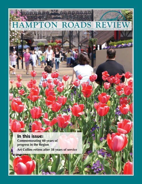
Editor: Joe Turner; Graphic Designer: Brian Miller; Cover photo: <strong>Spring</strong><br />
break in Busch Gardens, Williamsburg by Joe Turner.<br />
MAIN OFFICE:<br />
The Regional Building<br />
723 Woodlake Drive<br />
Chesapeake, VA 23320<br />
Ph: 757.420.8300<br />
Fax: 757.523.4881<br />
PENINSULA OFFICE:<br />
(Visit by appointment)<br />
2101 Executive Drive, Suite 1-C<br />
Tower Box 8<br />
<strong>Hampton</strong>, VA 23666<br />
Ph: 757.420.8300<br />
APR 16 HRPDC Quarterly <strong>Commission</strong>/<br />
Metropolitan <strong>Planning</strong> Organization<br />
held at: The Regional Board Room<br />
MAY 21 HRPDC Executive Committee/<br />
Metropolitan <strong>Planning</strong> Organization<br />
held at: The Regional Board Room<br />
JUN 18 HRPDC Executive Committee/<br />
Metropolitan <strong>Planning</strong> Organization<br />
held at: The Regional Board Room<br />
MEETING CALENDAR<br />
PRSRT STD<br />
US POSTAGE PAID<br />
NORFOLK VA<br />
PERMIT NO.#3024