Priority Objectives HCRS Goals - Hawaii Coral Reef Strategies
Priority Objectives HCRS Goals - Hawaii Coral Reef Strategies
Priority Objectives HCRS Goals - Hawaii Coral Reef Strategies

You also want an ePaper? Increase the reach of your titles
YUMPU automatically turns print PDFs into web optimized ePapers that Google loves.
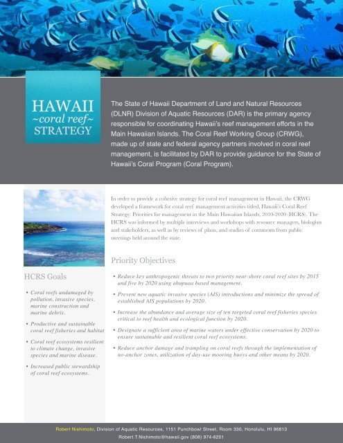
<strong>HCRS</strong> <strong>Goals</strong><br />
• <strong>Coral</strong> reefs undamaged by<br />
pollution, invasive species,<br />
marine construction and<br />
marine debris.<br />
• Productive and sustainable<br />
coral reef fisheries and habitat<br />
• <strong>Coral</strong> reef ecosystems resilient<br />
to climate change, invasive<br />
species and marine disease.<br />
• Increased public stewardship<br />
of coral reef ecosystems.<br />
The State of <strong>Hawaii</strong> Department of Land and Natural Resources<br />
(DLNR) Division of Aquatic Resources (DAR) is the primary agency<br />
responsible for coordinating <strong>Hawaii</strong>’s reef management efforts in the<br />
Main <strong>Hawaii</strong>an Islands. The <strong>Coral</strong> <strong>Reef</strong> Working Group (CRWG),<br />
made up of state and federal agency partners involved in coral reef<br />
management, is facilitated by DAR to provide guidance for the State of<br />
<strong>Hawaii</strong>’s <strong>Coral</strong> Program (<strong>Coral</strong> Program).<br />
In order to provide a cohesive strategy for coral reef management in <strong>Hawaii</strong>, the CRWG<br />
developed a framework for coral reef management activities titled, <strong>Hawaii</strong>’s <strong>Coral</strong> <strong>Reef</strong><br />
Strategy: Priorities for management in the Main <strong>Hawaii</strong>an Islands, 2010-2020 (<strong>HCRS</strong>). The<br />
<strong>HCRS</strong> was informed by multiple interviews and workshops with resource managers, biologists<br />
and stakeholders, as well as by reviews of plans, and studies of comments from public<br />
meetings held around the state.<br />
<strong>Priority</strong> <strong>Objectives</strong><br />
• Reduce key anthropogenic threats to two priority near-shore coral reef sites by 2015<br />
and five by 2020 using ahupuaa based management.<br />
• Prevent new aquatic invasive species (AIS) introductions and minimize the spread of<br />
established AIS populations by 2020.<br />
• Increase the abundance and average size of ten targeted coral reef fisheries species<br />
critical to reef health and ecological function by 2020.<br />
• Designate a sufficient area of marine waters under effective conservation by 2020 to<br />
ensure sustainable and resilient coral reef ecosystems.<br />
• Reduce anchor damage and trampling on coral reefs through the implementation of<br />
no-anchor zones, utilization of day-use mooring buoys and other means by 2020.<br />
Robert Nishimoto, Division of Aquatic Resources, 1151 Punchbowl Street, Room 330, Honolulu, HI 96813<br />
Robert.T.Nishimoto@hawaii.gov (808) 974-6201
<strong>Priority</strong> Sites<br />
West Maui<br />
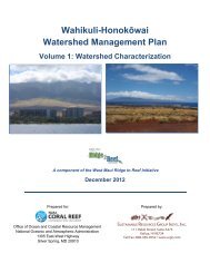
The Watershed Assessment Management Plan (WAMP) will be developed through a costshare<br />
agreement between the State of Hawai`i, Department of Land and Natural Resources<br />
(DLNR) and the U.S. Army Corps of Engineers (USACE). The WAMP will provide an<br />
umbrella process to coordinate the variety of partnership initiatives within the study area.<br />
The US <strong>Coral</strong> <strong>Reef</strong> Task Force designated the West Maui Watershed Plan as the priority<br />
partnership in the Pacific in 2011. With NOAA support, the Wahikuli and Honokowai<br />
Watershed Assessment was initiated in September. The WAMP will expand the boundaries to<br />
two neighboring watersheds and will begin in spring 2012.<br />
The Kahekili and Molokini Conservation Action Plan (CAP) workshop was held<br />
August 30-September 3, 2011. The goal of the CAP is to develop priority strategies for<br />
implementation to address existing and future threats facing coral reef ecosystems in these<br />
regions. Workshop II: Conservation <strong>Strategies</strong> will be help on November 15-17, 2011.<br />
Workshop III: Measures & Capacity will be held on January 23-26, 2012.<br />
The Maui Coastal Use Mapping Project is designed to fill a critical information gap in<br />
ocean management by mapping significant human uses of the nearshore ocean area in the<br />
Honolua – Wahikuli region. The goal is to gain a better understanding of the spatial range<br />
and intensity of key human activities and use-types in this region in order to better inform<br />
resource management. A participatory mapping workshop was held in summer 2011 with<br />
local resource users, scientists, and stakeholders. Data, maps and analytical products will be<br />
made available to local community groups, state and federal agencies, NGOs, and to other<br />
interested parties. These maps will also be used in the Kahekili CAP and the WAMP.<br />
South Kohala, <strong>Hawaii</strong><br />
The final Kawaihae-‘Anaeho‘omalu Conservation Action Plan (CAP) workshop was held<br />
September 28-30, 2011. Like the Maui CAP, the goal is to develop priority strategies for<br />
implementation to address existing and future threats of near-shore coral reef ecosystems.<br />
CAP implementation is scheduled to begin in January 2012. The South Kohala Coastal Use<br />
Mapping Project (Kawaihae-Keahole region) was completed and results are available at ….<br />
Robert Nishimoto, Division of Aquatic Resources, 1151 Punchbowl Street, Room 330, Honolulu, HI 96813<br />
Robert.T.Nishimoto@hawaii.gov (808) 974-6201
Local Action <strong>Strategies</strong><br />
Fisheries (FLASH)<br />
Bonefish (Albula spp.), locally know as ‘O‘io in Hawai‘i, were an important protein source for<br />
early <strong>Hawaii</strong>ans but today have limited economic importance commercially. Currently there<br />
are no accurate ways to estimate the recreational and subsistence fisheries values. This project<br />
collaborated with recreational ‘O‘io fishers to tag fish and collect catch data. An interactive<br />
website (www.oiotaggingproject.com) was created for anglers to report their data and view<br />
updated data summaries. This information is critical to develop effective precautionary<br />
management strategies for the species of the bonefish industry.<br />
Alien Invasive Species (AIS)<br />
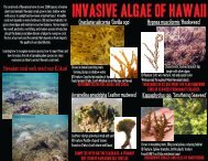
For many years, the AIS program has focused efforts in controlling invasive algae in Kane’ohe<br />
Bay, O’ahu through manual removal of algae using the SuperSucker, a barge-based pumping<br />
system that vacuums the algae from the reef through a large flexible hose and into burlap<br />
bags. The SuperSucker can remove up to 3,000 lbs of algae a day, uncovering previously<br />
smothered coral and exposing available habitat to reef dwelling organisms. Recently the<br />
program has shifted focus towards sustainable natural restoration with the goal of returning<br />
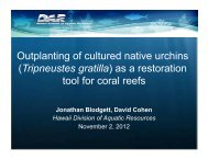
healthy coral dominance. Native sea urchins (Tripneustes gratila) were used in a successful<br />
pilot project to restore a normal level of herbivory to regions in the Bay and thus controlling<br />
the algal biomass. The pilot project has blossomed into a landscape-level restoration project;<br />
a new hatchery has been built, cultured urchins have been successfully deployed on key reefs,<br />
and plans are underway to systematically clear and outplant multiple patch reefs with urchins<br />
of increasing size.<br />
Climate Change and Marine Debris (CCMD)<br />
Research on the effects of freshwater seeps and other potential causes of coral decline as<br />
well as processes of decline (i.e. too little recruitment vs. too much mortality) is ongoing at<br />
Kahekili, Maui. Areas of reef were classified as healthy, intermediately or severely degraded.<br />
Rates of coral mortality in healthy vs. degraded areas will allow researchers to better<br />
determine the cause of dead zones.<br />
Robert Nishimoto, Division of Aquatic Resources, 1151 Punchbowl Street, Room 330, Honolulu, HI 96813<br />
Robert.T.Nishimoto@hawaii.gov (808) 974-6201
Land-based Sources of Pollution (LBSP-LAS)<br />
An on the ground, best management project has been selected from the recently completed<br />
Waiulaula Watershed Plan for Hawai‘i island. Xx feet of fencing will be installed to protect<br />
the critical riparian corridor around the streams in the upper Waiulaula watershed. Fencing<br />
out cattle will eliminate the nutrient loading into the stream as well as the potential for the<br />
introduction of pathogens and sediment loads from eroding stream beds caused by cattle<br />
trampling. Work is estimated to begin in spring 2011.<br />
Makai Watch<br />
Four Observation and Compliance Workshops were conducted by the State of Hawai‘i<br />
DLNR in July and August 2011 on Oahu, Maui, and <strong>Hawaii</strong> island to train current Makai<br />
Watch communities on how to use incident reporting sheets. Well trained and well informed<br />
community watch groups will continue to help resource enforcement officers in their efforts to<br />
protect <strong>Hawaii</strong>’s nearshore reefs.<br />
Robert Nishimoto, Division of Aquatic Resources, 1151 Punchbowl Street, Room 330, Honolulu, HI 96813<br />
Robert.T.Nishimoto@hawaii.gov (808) 974-6201