Guidebook - Ispra
Guidebook - Ispra
Guidebook - Ispra

Create successful ePaper yourself
Turn your PDF publications into a flip-book with our unique Google optimized e-Paper software.
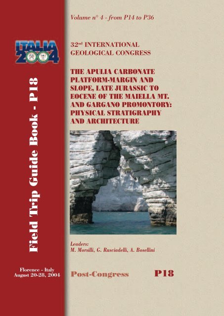
Field Trip Guide Book - P18<br />
Volume n° 4 - from P14 to P36<br />
32 nd INTERNATIONAL<br />
GEOLOGICAL CONGRESS<br />
THE APULIA CARBONATE<br />
PLATFORM-MARGIN AND<br />
SLOPE, LATE JURASSIC TO<br />
EOCENE OF THE MAIELLA MT.<br />
AND GARGANO PROMONTORY:<br />
PHYSICAL STRATIGRAPHY<br />
AND ARCHITECTURE<br />
Leaders:<br />
M. Morsilli, G. Rusciadelli, A. Bosellini<br />
Florence - Italy<br />
August 20-28, 2004 Post-Congress P18
The scientific content of this guide is under the total responsibility of the Authors<br />
Published by:<br />
APAT – Italian Agency for the Environmental Protection and Technical Services - Via Vitaliano<br />
Brancati, 48 - 00144 Roma - Italy<br />
Series Editors:<br />
Luca Guerrieri, Irene Rischia and Leonello Serva (APAT, Roma)<br />
Field Trip Committee:<br />
Leonello Serva (APAT, Roma), Alessandro Michetti (Università dell’Insubria, Como), Giulio Pavia<br />
(Università di Torino), Raffaele Pignone (Servizio Geologico Regione Emilia-Romagna, Bologna) and<br />
Riccardo Polino (CNR, Torino)<br />
Acknowledgments:<br />
The 32 nd IGC Organizing Committee is grateful to Roberto Pompili and Elisa Brustia (APAT, Roma)<br />
for their collaboration in editing.<br />
Graphic project:<br />
Full snc - Firenze<br />
Layout and press:<br />
Lito Terrazzi srl - Firenze
Volume n° 3 - from P14 to P36<br />
32 nd INTERNATIONAL<br />
GEOLOGICAL CONGRESS<br />
THE APULIA CARBONATE<br />
PLATFORM-MARGIN AND<br />
SLOPE, LATE JURASSIC TO<br />
EOCENE OF THE MAIELLA MT.<br />
AND GARGANO PROMONTORY:<br />
PHYSICAL STRATIGRAPHY AND<br />
ARCHITECTURE<br />
AUTHORS: M. Morsilli¹, G. Rusciadelli², A. Bosellini¹<br />
¹ Dipartimento di Scienze della Terra, Università di Ferrara, Ferrara - Italy<br />
² Dipartimento di Scienze della Terra, Università di Chieti, Chieti - Italy<br />
Florence - Italy<br />
August 20-28, 2004<br />
Post-Congress<br />
P18
Front Cover:<br />
Pelagic mitric limestones and slumps<br />
(background) of the Maiolica Fm (Baia delle<br />
Zagare, Gargano Promontory)
THE APULIA CARBONATE PLATFORM-MARGIN AND SLOPE, LATE JURASSIC TO<br />
EOCENE OF THE MAIELLA MT. AND GARGANO PROMONTORY:<br />
PHYSICAL STRATIGRAPHY AND ARCHITECTURE P18<br />
Introduction<br />
The main goals of this fi eld trip are the stratigraphic<br />
architecture of the eastern margin of the Apulia<br />
Carbonate Platform (ACP) and the associated<br />
slope and basin sediments, along the unique onland<br />
outcrop areas of this vast carbonate platform<br />
(Maiella Mountain and Gargano Promontory).<br />
The ACP represents a case study of a margin with<br />
different evolutionary stages through time, from a<br />
progradational to aggradational and from erosional to<br />
by-pass. Spectacular geometries and different systems<br />
are visible, in some cases at the seismic scale, with<br />
various facies associations and physical stratigraphic<br />
relationships. Onlap, interfi ngering, erosional features<br />
at different scale, slumpings, breccia bodies, graded<br />
beds, pelagics, are the main geometric features<br />
and associated sedimentary products. Drowning<br />
unconformities, scalloped margins and coalescence<br />
of various platform systems also characterize the<br />
evolution of this carbonate platform through time.<br />
The fi rst day will be spent to travel from Florence to<br />
the Maiella Mountain, in the Abruzzo Region. During<br />
the second day, the fi eld trip will start on the Maiella<br />
and focus on its spectacular abrupt contact between<br />
the platform facies and slope-to-basin sediments. In<br />
the late afternoon we will travel to the town of Vieste,<br />
in the eastern corner of the Gargano Promontory<br />
(Apulia Region). The third day we will start with<br />
a panoramic view of the sea-cliff (Pizzomunno) of<br />
the old town of Vieste, where an erosional surface<br />
between the Upper Cretaceous pelagic sediments and<br />
Middle Eocene calciturbidites and breccia bodies is<br />
clearly visible. Then we will move along the eastern<br />
coast of the Gargano to observe spectacular slumpings<br />
and breccia bodies in the basinal Maiolica Fm (Lower<br />
Cretaceous), and will reach the Mattinata area where<br />
the Maiolica Fm unconformably onlaps the fl ank of<br />
the underlying drowned platform. At the end of the<br />
day we will visit the Saraceno Mountain where, in<br />
a hundred meters high sea-cliff, is clearly visible<br />
the transition between Middle Eocene clinostratifi ed<br />
strata and sub-horizontal basinal sediments. The forth<br />
day will be spent in the Belvedere di Ruggiano area<br />
to observe the abrupt contact between Berriasian<br />
platform facies and Upper Cretaceous base-of-slope<br />
deposits. Then we move to the Val Carbonara section,<br />
where the interfi ngering between Lower Cretaceous<br />
margin and slope deposits is well exposed. These<br />
are abruptly truncated by a huge mid-Cretaceous<br />
Leaders: M. Morsilli, G. Rusciadelli, A. Bosellini<br />
megabreccia event. The last stop of this fi eld trip will<br />
be in the Borgo Celano quarry, where many dinosaurs<br />
footprints have been recently discovered in a peritidal<br />
succession. In the late afternoon we will start to return<br />
to Florence.<br />
Topographic maps<br />
Maiella area: I.G.M.I. maps (Istituto Geografi co<br />
Militare Italiano), scale: 1:100.000, Foglio n° 147,<br />
Lanciano. Scale: 1:25.000, Tavoletta 147IIINE<br />
“Pennapiedimonte”.<br />
Gargano Area: I.G.M.I. maps, scale: 1:50.000,<br />
Foglio n° 385, Vieste, F. n° 398 Mattinata, F. n° 397<br />
Manfredonia.<br />
Geological Maps<br />
Maiella area: Donzelli G. (1968) Carta geologica<br />
della Maiella, Dipartimento di Scienze della Terra,<br />
Università di Chieti eds. Carta Geologica d’Italia,<br />
scale 1:100.000 F. n° 147 Lanciano. Vezzani and<br />
Ghisetti (1997) Carta Geologica dell’Abruzzo, scale<br />
1:100.000, SELCA eds.<br />
Gargano Area: Carta Geologica d’Italia, scale 1:<br />
100.000 F. n° 156 San Marco in Lamis; F. n° 157<br />
M.S. Angelo.<br />
Guide Books<br />
Maiella area: Guide Geologiche Regionali n° 10<br />
Abruzzo, BEMA Eds., 2003;<br />
Gargano Area: Guide Geologiche Regionali n° 8<br />
Puglia e Monte Vulture, BEMA Eds., 1999; Bosellini<br />
et al., 2000. The eastern margin of the Apulia<br />
carbonate Platform: the Gargano transect. IAS fi eld<br />
trip guide book. WG4 Meeting Vieste.<br />
Regional geologic setting<br />
The Maiella Mt. and the Gargano Promontory<br />
represent the northern and the eastern outcropping<br />
portions of the ACP. The Maiella Mt. is the outermost<br />
tectonic unit of the Central Apennine thrust and fold<br />
belt, whereas the Gargano Promontory is a portion<br />
of the stable and relatively undeformed Southern<br />
Apennine foreland (Figure1). Their present-day<br />
setting derives from a different geological evolution,<br />
occurred during the last few million years, started<br />
with the involvement of the Mesozoic Tethyan<br />
passive margin into the lithospheric fl exure,<br />
associated to the Neoalpine collisional phase. From<br />
Miocene to present, the ACP was progressively<br />
involved in the building of the Apenninic Chain. In<br />
the Central Apennines, its internal part corresponds<br />
to an imbricate system of folded and thrusted units,<br />
3 - P18<br />
Volume n° 3 - from P14 to P36
Volume n° 3 - from P14 to P36<br />
P18<br />
P18 -<br />
Leaders: M.Morsilli, G. Rusciadelli, A. Bosellini<br />
Figure 1 - Geological map of the Central and Southern Apennines compiled from many Authors.<br />
Figure 3 - Line drawing of a seimic line located in the Adriatic offshore, where is recorded the platform to basin<br />
transition of the APC. The Liassic faulted platform (Calcare Massiccio Fm) sealed by Middle to Upper Jurassic slope<br />
deposits exported from the platform margin. Note the scalloped Cretaceous margin and the thick wedge at the base of<br />
the slope, quite similar to the Maiella setting.<br />
while in the Southern Apennines it plunges westward<br />
below the terrigenous sediments of the Pliocene to<br />
Quaternary foredeep. Eastward, the ACP represents<br />
the stable and relatively undeformed foreland of the<br />
Apennine thrust belt, and it is buried below Pliocene<br />
and Quaternary siliciclastic deposits to the north, or<br />
partially exposed in the Apulia Region to the southeast.<br />
The ACP was a major paleogeographic element of the<br />
southern margin of the Mesozoic Tethys Ocean. It is<br />
one of the so-called peri-Adriatic platforms, which are<br />
comparable to the Bahamas banks in their carbonate<br />
facies, shape, size, and subsidence rates and also in<br />
the internal architecture (D’Argenio, 1971; Bernoulli,<br />
1972; Eberli et al., 1993). It faces the Meso-Cenozoic<br />
Umbria-Marche Basin to the north and the Adriatic<br />
Basin (Ionian Basin, sensu Zappaterra, 1990) to the<br />
east. Different interpretations exist about the extent<br />
and termination of the ACP toward the south and its<br />
paleogeographic relation with the Lagonegro-Molise<br />
Basin and the internal Lazio-Abruzzo and Campano-<br />
Lucana carbonate platforms (Mostardini and Merlini,<br />
1986; Patacca et al., 1991; Ciarapica and Passeri,<br />
2002 and references therein). A major controversy
THE APULIA CARBONATE PLATFORM-MARGIN AND SLOPE, LATE JURASSIC TO<br />
EOCENE OF THE MAIELLA MT. AND GARGANO PROMONTORY:<br />
PHYSICAL STRATIGRAPHY AND ARCHITECTURE P18<br />
Figure 2 - The eastern margin (Jurassic-Lower Cretaceous) of the Apulia Platform, with interpreted scalloped<br />
structures, compiled from outcrops and subsurface data (modifi ed after Bosellini et al., 2000).<br />
exists as regard the possible connection of the ACP<br />
with the African continent (see Bosellini, 2002 for<br />
discussion and general bibliography).<br />
The initial separation between the ACP and adjacent<br />
basinal areas is another open question. This separation<br />
is well documented starting from the Liassic, even<br />
though the beginning of the extension and the<br />
continental crustal thinning, linked to the Tethyan<br />
rifting is probably more ancient. This interpretation<br />
is suggested by the Lower Triassic basinal sediments<br />
(M. Facito Fm) of the Lagonegro Basin and by the<br />
highly different sedimentation rates recorded in the<br />
adjacent depositional areas of the Dolomia Principale<br />
(45 m/Ma as average) and of the Anidriti di Burano<br />
or equivalents (200 m/Ma as average), which indicate<br />
subsidence rates compatible with rifting regimes<br />
(Finetti, in press; Finetti et al., in press).<br />
The margin of the ACP is mostly buried under<br />
Tertiary and Quaternary deposits, but it can be well<br />
drawn from subsurface and outcrops data. To the<br />
southeast, the ACP margin is still perfectly preserved<br />
and not affected by strong compressive tectonics. It<br />
lies 20-30 km east of the present Apulia coast line<br />
(De Dominicis and Mazzoldi, 1989; De Alteriis and<br />
Aiello, 1993) (Figure2). To the northwest, about 15<br />
km from the present Abruzzo coastal line, the ACP<br />
margin turns of about 90° and strikes in a SW direction<br />
toward the folded and thrusted units of the Lazio-<br />
Abruzzo area. The ACP margin is characterized by an<br />
overall aggrading or slightly prograding architecture,<br />
characterised by different geometric and depositional<br />
features along its extent. In some areas, a depositional<br />
margin characterizes the platform to basin transition,<br />
with a 20° to 30° dipping slope extending for about<br />
4-6 km basinward, from the platform break; in<br />
this case, bio-intraclastic deposits and breccias are<br />
exported downslope and drape the Liassic normal<br />
faults (Figure3). In other areas, the platform margin<br />
is characterized by an abrupt escarpment, recording<br />
an evolution from erosive to depositional conditions<br />
during the Late Cretaceous and Tertiary. Here, typical<br />
geometric and depositional features are represented<br />
by faults, scallops, large-scale onlaps and huge<br />
amount of breccias and megabreccias. This second<br />
type of margin setting characterises discrete portions<br />
of the ACP from south to north, both in subsurface<br />
(offshore of Brindisi, Bari and Ortona) and in outcrops<br />
(Gargano and Maiella areas) (Figure2). This fi eld trip<br />
will deal with both types of margin.<br />
The geological framework of the<br />
Maiella Mountain<br />
The Maiella Mt. represents the most spectacular<br />
outcropping folded and thrusted structure of the<br />
external Abruzzi Apennines, and derives from the<br />
deformation of the internal sectors of the ACP<br />
5 - P18<br />
Volume n° 3 - from P14 to P36
Volume n° 3 - from P14 to P36<br />
P18<br />
P18 -<br />
Leaders: M.Morsilli, G. Rusciadelli, A. Bosellini<br />
Figure 4 - Geological scheme of the Maiella Mountain and surrounding areas,<br />
Central Italy (compiled from many Authors).<br />
(Figure1). The Maiella is characterized by a N-S to<br />
NW-SE oriented anticline, with an axial culmination<br />
in the central sectors (Figure4). The main folding and<br />
thrusting of the Maiella occurred during the Middle to<br />
Upper Pliocene (Calamita et al., 1996 and references<br />
therein; Crescenti et al., in press). Northward and<br />
eastward, gently eastward tilted Upper Pliocene<br />
- Pleistocene deposits unconformably seal Meso-<br />
Cenozoic carbonates, Messinian evaporites and<br />
Lower Pliocene siliciclastic folded successions. The<br />
western fl ank of the Maiella anticline is truncated<br />
by a W-dipping normal fault (the Caramanico fault),<br />
extending for a length of about 30 km in a N-S/ NW-SE<br />
direction, with a maximum downthrow of about 3 km<br />
(Donzelli, 1968). Its activity is considered Messinian<br />
to Pliocene (Scisciani et al., 2000) or Quaternary<br />
(Ghisetti and Vezzani, 2002). Southward, the Maiella<br />
anticline is confi ned by the Sangro-Volturno line,
THE APULIA CARBONATE PLATFORM-MARGIN AND SLOPE, LATE JURASSIC TO<br />
EOCENE OF THE MAIELLA MT. AND GARGANO PROMONTORY:<br />
PHYSICAL STRATIGRAPHY AND ARCHITECTURE P18<br />
separating a structural depression, where the Molise<br />
Allocthonous Units crop-out (Figs.1 and 4).<br />
The sedimentary succession of the Maiella records the<br />
complete geodynamic evolution from the late stages of<br />
the Tethyan post-rift (Early Cretaceous) to the stress<br />
inversion that precedes the closure of the western<br />
Alpine Tethys (Late Cretaceous-Early Tertiary), up to<br />
the fi nal stages of the building process of the Central<br />
Apenninic chain (Pliocene-Pleistocene).<br />
The Cretaceous stratigraphic units represent different<br />
depositional environments: the inner platform, in<br />
the southern and central areas, the slope and basin<br />
in the northern sectors. The Cretaceous sedimentary<br />
evolution of the Maiella is characterized by the<br />
transition between an escarpment-bounded platform<br />
to a carbonate ramp. During the Tertiary, depositional<br />
conditions were more homogeneous and dominated<br />
by carbonate ramps until the early Messinian. Starting<br />
from the late Messinian, concomitantly with the<br />
evaporitic event, the Maiella and the surrounding<br />
areas are progressively involved in the deformation<br />
associated to the migration of the chain-foredeepforeland<br />
system; the carbonate deposition stops and<br />
it is defi nitively replaced by siliciclastic deposits,<br />
wich records the complete evolution from foredeep to<br />
shoreface depositional systems.<br />
Stratigraphic framework of the Maiella Mountain<br />
The Cretaceous lithostratigraphic framework of the<br />
Maiella here presented mainly derives from studies<br />
by Crescenti et al. (1969), Catenacci (1974), and<br />
successively implemented by Accordi et al. (1987),<br />
Accarie (1988), Vecsei, (1991), Eberli et al. (1993),<br />
Mutti et al. (1996), Sanders (1996), Rusciadelli and<br />
Vichi (1998), Stössel (1999), Morsilli et al. (2000,<br />
2002, in press), Rusciadelli et al. (2003), Rusciadelli<br />
(in press) (Figure5).<br />
1) Morrone di Pacentro Formation (Early Cretaceous)<br />
(Crescenti et al., 1969). This formation is made up of<br />
10 cm to few meters thick, grey to beige limestones.<br />
Textures are mudstones to bioclastic and/or oolithic<br />
grainstones, with frequent gastropods (nerineids) and<br />
lamellibranches. These lithofacies allow to refer this<br />
formation to an internal platform with transition to a<br />
sandy open margin<br />
2) Cima delle Murelle Formation (Late Cenomanian<br />
p.p.- Campanian p.p.) (Vecsei, 1991). It lies on the<br />
fi rst bauxitic level and it is composed by the whole<br />
range of textures, from mudstones to oolithic and<br />
bioclastic grainstones, centimetre to metre thick.<br />
Rudist biostromes (Radiolitids and Hippuritids)<br />
frequently occur at different stratigraphic intervals.<br />
These lithofacies are organized into few meters<br />
thick cycles, frequently characterised by surfaces of<br />
subaerial exposure at<br />
the top. This facies<br />
association has been<br />
referred to a platform<br />
margin periodically<br />
infl uenced by high<br />
energy conditions.<br />
3) Bocca di Valle<br />
Formation (Albian p.p.<br />
Early Cenomanian). It<br />
is made up of thin<br />
micritic pelagic<br />
limestones alternating<br />
with medium to thick<br />
bioclastic packstones<br />
and grainstones<br />
and thick bodies<br />
of breccias with<br />
platform-derived<br />
clasts. Black shales<br />
levels intercalate in<br />
Figure 5 - Chronostratigraphy and lithostratigraphic nomenclature of Cretaceous successions of the Maiella Mountain<br />
defi ned by Crescenti et al. (1969), Catenacci (1974), Accarie et al. (1986), Accarie (1988), Accordi et al. (1987), Vecsei<br />
(1991), Eberli et al. (1993), Mutti et al. (1996), Sanders (1996) and Rusciadelli (unpublished data).<br />
7 - P18<br />
Volume n° 3 - from P14 to P36
Volume n° 3 - from P14 to P36<br />
P18<br />
P18 -<br />
Leaders: M.Morsilli, G. Rusciadelli, A. Bosellini<br />
Figure 6 - Various models proposed for the contact<br />
between platform and slope-to-basin deposits<br />
in the Maiella Mt.<br />
the lower part of the unit. This unit corresponds to<br />
the Marne a Fucoidi of the basinal areas. Lithofacies<br />
indicate a base-of-slope depositional setting.<br />
4) Valle dell’Inferno Formation (Cenomanian p.p).<br />
(Accarie, 1988; Vecsei, 1991). It is mainly composed<br />
by metre scale beds, often amalgamated, made of<br />
bioclastic packstones and grainstones. Breccias<br />
and megabreccias bodies, with platform-derived<br />
clasts, characterise the lower part of this unit. The<br />
depositional environment is referable to a slope to<br />
base-of-slope transition.<br />
5) Tre Grotte Formation (Turonian-Campanian<br />
p.p.) (Vecsei, 1991). It is represented by different<br />
lithofacies, such as thin to medium mudstoneswackestones<br />
with planktonic foraminifera, medium<br />
to thick bioclastic frequently graded packstonesgrainstones,<br />
and lenticular, metre to ten metres thick<br />
breccias and megabreccias. This unit onlaps the<br />
Lower and Upper Cretaceous platform and margin<br />
successions of the Morrone di Pacentro and Cima<br />
delle Murelle. This unit has been referred to a slope to<br />
base-of-slope transition.<br />
6) Orfento Formation (Campanian p.p.-<br />
Maastrichtian). (Crescenti et al., 1969). It is<br />
essentially composed by lenticular bodies and cross<br />
bedded bioclastic grainstones and rudstones. The<br />
bioclastic fraction is represented by rudist fragments.<br />
Sedimentological features allow to refer this unit to<br />
a high energy carbonate ramp with bioclastic shoals<br />
migrating toward a shallow basin (Eberli et al., 1993;<br />
Mutti et al., 1996).<br />
The Maiella paleoescarpment<br />
The paleoescarpment is one of the most intriguing<br />
features of the Maiella geology. It corresponds to a<br />
rather irregular surface, more or less E-W oriented<br />
and dipping northward with angles ranging between<br />
20° and 40° (Crescenti et al., 1969; Accarie et al.,<br />
1989; Vecsei, 1991; Eberli et al., 1993; Morsilli et<br />
al., 2002). It truncates Lower and Upper Cretaceous<br />
platform facies (Morrone di Pacentro and Cima delle<br />
Murelle) along a 1000 m high surface on which Upper<br />
Cretaceous slope deposits onlap.<br />
From the fi rst recognition of the paleoescarpment<br />
(Crescenti et al., 1969), the interpretation of this<br />
paleogeographic element has been referred both<br />
to sedimentary and structural models (Figure6).<br />
Structural models (Accarie, 1988; Accordi et al.,<br />
1987) apply the ’60 classical model of faulted<br />
platform to basin transition, with the paleoescarpment<br />
represented by a series of tilted blocks displaced by<br />
a fault system. A sedimentary model, based on the<br />
confi gurations of modern platform to basin transitions<br />
(Bahamas model), is envisaged by the ETH group of<br />
Bernoulli (Vecsei, 1991; Stössel, 1999). This model<br />
consider the paleoescarpment as the product of a<br />
long-lived evolution, started during the Tethyan rifting<br />
phase, with the dissection of the Liassic platform and<br />
the initial separation between platform and basin<br />
sectors. According to this model, the paleoescarpment<br />
represents a by-pass and erosive surface, separating<br />
basinal areas from an aggrading platform that kept
THE APULIA CARBONATE PLATFORM-MARGIN AND SLOPE, LATE JURASSIC TO<br />
EOCENE OF THE MAIELLA MT. AND GARGANO PROMONTORY:<br />
PHYSICAL STRATIGRAPHY AND ARCHITECTURE P18<br />
Figure 7 - Satellite image (Landsat TM) of the Gargano Promontory. The Mattinata Fault is the main E-W striking<br />
alignement visible in the southern part of the image<br />
up during time. Only during the Late Cretaceous,<br />
the paleoescarpment was sealed and the platform<br />
architecture changed from aggrading to prograding<br />
(Crescenti et al., 1969; Eberli et al., 1993). A more<br />
recent sedimentary model is proposed by Morsilli<br />
et al. (2002). They consider the paleoescarpment<br />
as the remnant surface of a series of submarine<br />
landslides, formed during an imposing phase of<br />
platform margin collapses. Successively, through a<br />
mechanical quantitative modelling, Rusciadelli et al.<br />
(2003) highlighted the fundamental role of earthquake<br />
swarms in the formation of the large-scale margin<br />
collapses.<br />
The geological framework of the<br />
Gargano Promontory<br />
The Gargano Promontory is a gentle NW-SE trending<br />
regional anticline where the oldest units of Late<br />
Jurassic age reach an elevation of 1000 m. The<br />
structure is complicated by several E-W, NE-SW<br />
and NW-SE trending steep to subvertical normal<br />
and strike-slip faults (Figure7). One of the most<br />
impressive structural features of the Gargano is a<br />
major E-W horizontal shear zone (Val Carbonara<br />
Fault, Mattinata Fault or Mattinata-Gondola Fault<br />
Zone). As shown by seismic profi les, the Mattinata<br />
Fault continues offshore for tens of kilometres<br />
(Gondola Line of De Dominicis and Mazzoldi, 1989).<br />
Quite controversial is the kinematics of this structure.<br />
It has been interpreted as right-lateral (Guerricchio,<br />
1986, 1996; Finetti and Del Ben, 1986; De Dominicis<br />
and Mazzoldi, 1989; Bosellini et al., 1993; Doglioni<br />
et al., 1994), left-lateral (Funiciello et al., 1992; Favali<br />
et al., 1992; Salvini et al., 1999; Billi, 2003), right-<br />
to left-lateral inverted (de Alteriis, 1995; Gambini<br />
and Tozzi, 1996) or as a reverse fault (Ortolani and<br />
Pagliuca, 1989). The Mattinata fault is a complex<br />
structure that records different kinematics related to<br />
changes in the stress regime through time (Morsilli,<br />
1998). Chilovi et al. (2000) indicate a complex history<br />
of this structure: Mesozoic extensional regime,<br />
followed by a Late Miocene to Early Pliocene leftlateral<br />
displacement and Late Pliocene to Quaternary<br />
right-lateral activity.<br />
Recently, the Gargano has been interpreted as a<br />
Neogene contractional belt (Bertotti et al., 1999)<br />
with many thrust structures previously interpreted as<br />
normal faults (Figure8). Until the early Miocene, the<br />
Gargano was poorly deformed, but during Langhian<br />
to Tortonian times a tectonic phase starts to deform<br />
the previous and sindepositional units with gentle<br />
folds and thrusts. Between the Late Miocene and the<br />
early (?) Pliocene, NE-SW trending normal faults<br />
developed in the Gargano area, leading fi nally the<br />
9 - P18<br />
Volume n° 3 - from P14 to P36
Volume n° 3 - from P14 to P36<br />
P18<br />
P18 -<br />
Leaders: M.Morsilli, G. Rusciadelli, A. Bosellini<br />
Figure 8 - Geological section of the Gargano Promontory with the interpreted deep thrust (after Bertotti et al., 1999).<br />
uplift of the Promontory. Post-Pliocene deformation<br />
consists of gentle NW-SE trending folds and strikeslip<br />
faults (Bertotti et al., 1999).<br />
Stratigraphic framework of the<br />
Gargano Promontory<br />
The backbone of the Gargano Promontory consists<br />
of a thick pile of Jurassic and Cretaceous shallowwater<br />
carbonates. The structurally elevated position<br />
of the Gargano and the consequent erosion of the<br />
younger sediments prevent us from knowing the<br />
exact thickness of the Jurassic-Cretaceous succession.<br />
The entire thickness of the ACP has been estimated of<br />
about 6000 m by Mostardini and Merlini (1986), but,<br />
according to the wells Gargano-1 and Foresta Umbra-<br />
1, the total thickness of the Jurassic-Cretaceous<br />
succession of the Gargano Promontory can be<br />
conservatively estimated to be around 3000-3500 m<br />
(Bosellini et al., 1993). This huge Jurassic-Cretaceous<br />
platform, which passes eastward into slope and<br />
basinal deposits, overlies a thick dolomite-evaporite<br />
succession, the so called Burano Anhydrite (Anidriti<br />
di Burano) (Martinis and Pieri, 1964) of Late Triassic<br />
age, visible in a quite small outcrop near the Lake<br />
of Lesina (Punta delle Pietre Nere) (Posenato et al.,<br />
1994).<br />
On the basis of many regional or local events, that<br />
have formed major unconformities, the Gargano<br />
Figure 9 - Chronostratigraphic chart showing formations, second-order sequences and “systems tracts” of the Gargano<br />
Promontory (modifi ed after Bosellini et al., 1999). 1) Inner platform facies; 2) margin facies; 3) slope and base-of-slope<br />
facies; 4) basin facies; 5) megabreccias; 6) hiatuses; 7) bauxites. Time scale after Gradstein et al. (1995).
Figure 10 - Ellipsactinia sp. in the Monte Sacro<br />
Limestone (Monte di Mezzo – Carpino).<br />
THE APULIA CARBONATE PLATFORM-MARGIN AND SLOPE, LATE JURASSIC TO<br />
EOCENE OF THE MAIELLA MT. AND GARGANO PROMONTORY:<br />
PHYSICAL STRATIGRAPHY AND ARCHITECTURE P18<br />
stratigraphy has been subdivided into many second<br />
order depositional sequences (Figure9) (Bosellini<br />
et al., 1993, 1999). They corresponds to the<br />
supersequences or megasequences of Hubbard,<br />
(1988), Vail et al., (1991), among others.<br />
Monte Sacro Sequence (Callovian p.p.-Valanginian<br />
p.p.) - This sequence (the lower boundary is not<br />
exposed) is composed of fi ve lithostratigraphic units<br />
that represents a broad spectrum of depositional<br />
environments from the inner platform to the basin,<br />
they include the following.<br />
(1) Sannicandro Formation. This unit crops out only<br />
in the western and central sector of the Gargano and<br />
consists of a thick succession of meter-scale (1-5<br />
m) peritidal parasequences representing lagoon to<br />
supratidal environments. Common lithofacies include<br />
mudstone-wackestone rich in dasycladacean algae,<br />
ostracods, gastropods (Nerinea sp.), and peloidal to<br />
oolitic packstone-grainstone. Birdseye structures,<br />
fenestral fabric, and stromatolite layers, associated<br />
with fl at-pebble breccias, are common at the cycle<br />
tops.<br />
(2) Monte Spigno Formation. This unit crops out<br />
in the central area of the Gargano promontory and<br />
consists mainly of oolitic and oncolitic grainstones.<br />
Sedimentary structures include current and wave<br />
ripples and low-angle planar laminations (dune<br />
scale). Meniscus cements and keystone vugs are<br />
common features in thin section. This facies suggests<br />
a shallow-water high-energy setting, such as oolitic<br />
shoals with local zones of emersion.<br />
(3) Monte Sacro Limestone. This formation occurs<br />
in a narrow and arched belt from Monte d’Elio to<br />
Mattinata and consists of massive wackestone rich<br />
in Ellipsactinia, Sphaeractinia, and stromatoporoids<br />
(Figure10). This facies association is interpreted to<br />
represent a spectrum of environments from reef front<br />
to external margin (Morsilli and Bosellini, 1997).<br />
The landward boundary with the Monte Spigno Fm<br />
is gradual with a zone of skeletal sands and scattered<br />
branching coral colonies in life position (patchreefs).<br />
(4) Ripe Rosse Formation. It corresponds to the Casa<br />
Varfone formation of Bosellini and Morsilli (1994)<br />
and consists of thick-bedded skeletal rudstone,<br />
stromatoporoid breccias, and graded grainstones<br />
interfi ngering with cherty lime mudstones. Clasts<br />
are mainly fragments of Ellipsactinia, Sphaeractinia,<br />
stromatoporoids, and corals. The geometric<br />
relationships observable in the fi eld support the<br />
interpretation that this facies association is a proximal<br />
to distal, clinostratifi ed slope succession (Figure11).<br />
Upslope it passes into the Monte Sacro Limestone.<br />
(5) Maiolica 1. It is the well known formation<br />
of the Mediterranean basinal sediments of Late<br />
Jurassic-Early Cretaceous age. It consists of white,<br />
thin bedded, micritic limestone with cherts, rich<br />
in calpionellids and Nannoconus. Slump features<br />
(intraformational folds, truncation surfaces) are quite<br />
Figure 11 - The Upper Jurassic-Lower Cretaceous depositional fl ank<br />
of the Apulia Platform (Ripe Rosse - Lame di Milo, north of Mattinata).<br />
11 - P18<br />
Volume n° 3 - from P14 to P36
Volume n° 3 - from P14 to P36<br />
P18<br />
P18 -<br />
Leaders: M.Morsilli, G. Rusciadelli, A. Bosellini<br />
common (Figure12).<br />
Upper Sequence Boundary --- Near the town of<br />
Mattinata, the inclined surface of the platform<br />
slope of Berriasian-earliest Valanginian age is<br />
onlapped by a thick succession of white, thinbedded<br />
micritic limestones of the Maiolica 2 Fm.<br />
The physical stratigraphic relationships (Figure13)<br />
are clearly unconformable and suggest the existence<br />
of a drowning unconformity (sensu Schlager, 1989)<br />
(Bosellini and Morsilli, 1997).<br />
Mattinata 1 Sequence (Valanginian p.p.- Early<br />
Aptian) - This sequence is mainly represented by<br />
inner-platform and slope-to-basin facies.<br />
(1) San Giovanni Rotondo 1 Limestone. This unit<br />
is a thick succession (500-600 m) of shallowwater<br />
limestone that can be subdivided into three<br />
members (Claps et al., 1996). Member 1 consists of a<br />
Figure 13 - The massive slope (right) of the Apulia<br />
Platform (Late Jurassic-Berriasian) and the adjacent<br />
onlapping basinal succession (left) of Valanginian p.p.-<br />
Hauterivian age. Locality Coppa di Montelci,<br />
north of Mattinata.<br />
monotonous and acyclic subtidal succession. Member<br />
2 is represented by a thick cyclic unit characterized<br />
by quasi-periodic alternation of “loferitic” beds and<br />
centimetre-thick layers of green shales, deposited in a<br />
tidal-fl at setting. Many dinosaur footprints have been<br />
recently discovered in a quarry near Borgo Celano<br />
(Gianolla et al., 2000). Member 3 displays a variety<br />
of facies including subtidal high-energy thin-bedded<br />
calcarenites at the base of parasequences and domal<br />
stromatolites in the upper part (Figure14).<br />
(2) Monte degli Angeli 1 Limestone. It represents the<br />
bioconstructed margin of the platform and consists<br />
of skeletal sand and stromatoporoid boundstone and<br />
rudstone with scattered coral fragments. It crops out<br />
only at the Monte degli Angeli (lower part), to the<br />
Figure 12 - Slump structures in the Maiolica Fm<br />
(Gattarella cove).<br />
west of Monte S. Angelo.<br />
(3) Mattinata 1 Formation. This unit is a slope<br />
and base-of-slope carbonate succession, rich in<br />
gravity-displaced deposits (calciturbidites, breccias),<br />
interbedded with cherty micritic limestone, commonly<br />
slumped (Luciani and Cobianchi 1994; Cobianchi et<br />
Figure 14 - Domal stromatolite, member 2 of the S.<br />
Giovanni Rotondo Limestone (Borgo Celano).
THE APULIA CARBONATE PLATFORM-MARGIN AND SLOPE, LATE JURASSIC TO<br />
EOCENE OF THE MAIELLA MT. AND GARGANO PROMONTORY:<br />
PHYSICAL STRATIGRAPHY AND ARCHITECTURE P18<br />
al., 1997). The type section is exposed near the town<br />
of Monte S. Angelo, along the road to Val Carbonara<br />
and S. Giovanni Rotondo.<br />
(4) Maiolica 2. Same facies of the Maiolica 1<br />
described above.<br />
Upper Sequence Boundary --- There is a rather<br />
abrupt change in lithology in slope and basinal<br />
settings: both the Maiolica 2 and Mattinata 1 Fm<br />
are overlain by a marly and shaly succession, the<br />
so-called Scisti a Fucoidi Formation (Cobianchi et<br />
al., 1997), early Aptian-late Albian in age. From a<br />
physical stratigraphic point of view, the sequence<br />
boundary is clearly a drowning event: the platform<br />
and its bioclastic apron (Mattinata Fm) is abruptly<br />
backstepped for some 5-10 km, suggesting that<br />
shallow deposition was terminated in a short time.<br />
Mattinata 2 Sequence (Early Aptian - Late Albian)<br />
- This sequence is largely represented by slope and<br />
basin deposits. Equivalent shallow-water deposits are<br />
present only at Monte degli Angeli and Coppa di Pila<br />
and in the area between Rignano and Manfredonia.<br />
The sequence, characterized in the upper part by a<br />
strong progradational trend, is represented by the<br />
following formations.<br />
(1) San Giovanni Rotondo 2 Limestone. This unit,<br />
which corresponds to Masseria Quadrone Limestone<br />
of Merla et al. (1969), is an inner-platform succession<br />
of Albian-Cenomanian? age. It consists of thick beds<br />
of mudstone-wackestone with peloidal packstonegrainstone<br />
intercalations. Recently, Luperto Sinni<br />
(1996) described a thin succession (about 30 m) of<br />
mudstone-packstone with late Albian orbitolinids in<br />
the same area; the top consists of a Sellialveolina<br />
vialli-bearing limestone, early Cenomanian in age.<br />
(2) Monte degli Angeli 2 Limestone. It is the Late<br />
Aptian to Middle-Late Albian tract of the Lower<br />
Cretaceous margin of the ACP. It is grafted onto<br />
the underlying Hauterivian-early Aptian platform<br />
margin, but, in places, there may be 1-2 m of pelagic<br />
limestone. The Monte degli Angeli Limestone is<br />
rich in sponges, chaetetids, corals, and rudists and<br />
represents the bioconstructed margin of this sequence.<br />
The age of the outcropping part of this formation is<br />
limited to the late Aptian, whereas the Albian part<br />
is documented only in platform-derived breccia<br />
occurring in the Mattinata 2 Fm.<br />
(3) Marne a Fucoidi Formation. This lithological<br />
unit, rich in marls and black shales, deposited during<br />
episodic anoxic events (Cobianchi et al., 1997; 1999),<br />
has a maximum thickness of 120 m in the northern<br />
Gargano (Figure15), and overlies both the Maiolica<br />
2 and Mattinata 1 formations. It clearly represents<br />
a rather abrupt change in the basinal sedimentation<br />
and is associated with a standstill in the platform<br />
evolution. In the Monte S. Angelo area, the Marne<br />
a Fucoidi wedges out against the platform slope and<br />
is absent on the platform top, where a few meters<br />
of pelagic limestone or an unconformity surface are<br />
present.<br />
(4) Mattinata 2 Formation. It is the same slope and<br />
base-of-slope succession as the previously described<br />
Mattinata 1 Fm, from which it is separated by a<br />
wedge of pelagic limestone with thin beds of black<br />
shale (Marne a Fucoidi Fm). The Aptian-Albian tract<br />
Figure 15 - Stratigraphic section of the Marne a Fucoidi<br />
Fm in the northern Gargano (Fontanelle section<br />
– Ischitella) (after Cobianchi et al. 1997)<br />
13 - P18<br />
Volume n° 3 - from P14 to P36
Volume n° 3 - from P14 to P36<br />
P18<br />
P18 -<br />
Leaders: M.Morsilli, G. Rusciadelli, A. Bosellini<br />
of Mattinata Fm is more rich in graded breccias and<br />
calciturbidites.<br />
Upper Sequence Boundary --- It is a major erosional<br />
unconformity of regional extent. On the platform, it<br />
corresponds to well known karst and bauxite horizons<br />
developed over the entire peri-Adriatic region<br />
(Crescenti and Vighi, 1964; Accarie et al., 1989;<br />
D’Argenio and Mindszenty, 1991; Carannante et al.,<br />
1992; Mindszenty et al., 1995). In the slope and baseof-slope<br />
settings, the Mattinata and Marne a Fucoidi<br />
formations are unconformably overlain by a huge<br />
megabreccia; the boundary is clearly erosional.<br />
Monte S. Angelo 1 Sequence (Late Albian-Santonian)<br />
- This sequence consists mainly of slope and basinal,<br />
fully pelagic sediments. The shallow-water tract of<br />
the sequence is represented by a small outcrop in the<br />
western and southern part of the promontory.<br />
(1) Altamura Limestone. This formation, previously<br />
known as Casa Lauriola Limestone (Merla et<br />
al., 1969), consists of shallow-water, subtidal to<br />
peritidal carbonates, and crops out in two zones,<br />
near S. Giovanni Rotondo and near Apricena. It<br />
unconformably overlies the mid-Cretaceous bauxite<br />
horizon (Merla et al., 1969). In the S. Giovanni<br />
Rotondo area it consists of mudstone-wackestone with<br />
thin intercalations of green marls of late Turonian?-<br />
Coniacian p.p. age (Luperto Sinni, 1996), whereas<br />
Figure 16 - Stratigraphic sections of the Monte S. Angelo Fm in the northern Gargano<br />
(area between Vico, Rodi and Ischitella) (after Neri and Luciani, 1994).<br />
in the Apricena area the outcropping succession<br />
consists of meter-thick mudstone-wackestone beds<br />
with scattered bouquets or clusters of rudists and<br />
intercalated stromatolite (Late Turonian-Senonian)<br />
(Laviano and Marino, 1996; Morsilli, 1998).<br />
(2) Monte S. Angelo Formation. In the type area, it<br />
consists mainly of megabreccia lenses with boulders<br />
and clasts derived from the Lower Cretaceous<br />
carbonate platform margin. In the Ischitella-Vico area<br />
(northern Gargano), graded breccias and calciturbidites<br />
are intercalated with pelagic limestones (Figure16).<br />
This unit, Late Albian-Cenomanian in age (Neri and<br />
Luciani, 1994), represents the slope and base-of-slope<br />
accumulation derived from large platform-margin<br />
failures (Bosellini et al., 1993, 1999).<br />
(3) Monte Acuto 1 Formation. This is a succession<br />
deposited in slope and base-of-slope settings (Neri,<br />
1993; Neri and Luciani, 1994; Luperto Sinni and<br />
Borgomano, 1994). It consists of white, chalky<br />
and cherty lime mudstones, alternating with coarse<br />
bioclastic calciturbidites, breccias, and megabreccias;<br />
clasts are both of platform and slope-basin derivation.<br />
The entire M. Acuto Fm (1 and 2) has been divided<br />
into fi ve units (Neri, 1993): (a) a basal condensed<br />
pelagic interval (Unit 1) (Figure17); (b) two bodies of<br />
calciturbidites (Units 2 and 4), separated by a Scaglia<br />
tongue (Unit 3), some 50 m thick (Santonian-early<br />
Campanian in age) and (c) a pelagic interval on top of
THE APULIA CARBONATE PLATFORM-MARGIN AND SLOPE, LATE JURASSIC TO<br />
EOCENE OF THE MAIELLA MT. AND GARGANO PROMONTORY:<br />
PHYSICAL STRATIGRAPHY AND ARCHITECTURE P18<br />
the succession (Unit 5). Facies associations of Units<br />
2 and 4 are representative of a system of laterally<br />
coalescing depositional lobes (Figure18) (Neri, 1993).<br />
Only Units 1 and 2 constitute the Monte Acuto 1 Fm.<br />
(4) Scaglia 1 Formation. It is the basinal counterpart<br />
of the sequence and consists of thin-bedded, chalky<br />
and cherty white lime mudstones (Figure19).<br />
Upper Sequence Boundary --- The Scaglia tongue<br />
(Unit 3 of Monte Acuto Fm) represents a time<br />
interval during which the exportation along the slope<br />
setting was stopped. Recently, in the Apricena area,<br />
at least 50 meters of pelagic and resedimented beds<br />
of Late Santonian (Dicarinella asymetrica zone)<br />
have been found on top of the Altamura Limestone<br />
(Morsilli et al., 2003). In the uppermost 10 meters of<br />
the succession several leaves and other remains of<br />
Figure 17 - Massive strata of the Monte S. Angelo Fm<br />
(rocky cliff) overlain with a sharp contact (arrows) by the<br />
Monte Acuto Fm (southern Gargano).<br />
Figure 18 - Calciturbidites (darker bands) in the Monte<br />
Acuto Fm organized in TU-CU cycles (road cut Monte S.<br />
Angelo-Mattinata).<br />
Figure 19 - Thin bedded lime mudstones with chert of the<br />
Scaglia Formation (Pizzomunno spike – Vieste).<br />
plants (Conifer, Angiosperm, Fern, Frenelopsis sp.)<br />
were founded associated with a few small fi shes (De<br />
Cosmo and Morsilli, 2002). These fi ndings testify an<br />
abrupt drowning of this sector of the platform and the<br />
consequent starvation of the slope setting not only<br />
in the Gargano area but also in other areas as shown<br />
by offshore seismic profi les (De Alteriis and Aiello,<br />
1993) and by the huge backstepping of the platform<br />
margin (at least 20 km) in the Fasano-Ostuni area<br />
(Pieri and Laviano, 1989). At the same time of the<br />
platform drowning, emerged areas were certainly<br />
present as testifi ed by the abundant and diversifi ed<br />
fl ora found in the Apricena area (Figure20).<br />
Figure 20 - Plants remains in the pelagic mudstones of<br />
Late Santonian age (Apricena area).<br />
15 - P18<br />
Volume n° 3 - from P14 to P36
Volume n° 3 - from P14 to P36<br />
P18<br />
P18 -<br />
Leaders: M.Morsilli, G. Rusciadelli, A. Bosellini<br />
Monte S. Angelo 2 Sequence (Early Campanian-<br />
Danian p.p.) - This sequence comprises only slope<br />
and basin facies.<br />
(1) Monte Acuto 2 Formation. It corresponds to<br />
units 3, 4, and 5 as defi ned by Neri (1993). Unit 3,<br />
the Scaglia tongue previously described, consists of<br />
pelagic sediments with some breccia and turbidite<br />
layers, which seem to be more common upslope.<br />
Unit 4 is a thick calciturbidite body, like unit 2. The<br />
last unit is represented by pelagic sediments with<br />
some thin bioclastic turbidites of Danian age (M.<br />
trinidanensis zone) (Bosellini et al., 1993).<br />
(2) Scaglia 2 Formation. Lithologically, this<br />
succession is the same as Scaglia 1 and crops out<br />
along the north-eastern part of the Gargano (Vieste-<br />
Peschici area) and as pelagic interval in the Monte<br />
Acuto Fm in the southern area (Monte S. Angelo).<br />
Upper Sequence Boundary --- The Monte Acuto<br />
2 and Scaglia 2 formations are overlain by the<br />
Grottone Megabreccia or by the laterally equivalent<br />
calciturbidites of the Peschici Fm (Bosellini et al.,<br />
1993, 1999) of Middle Eocene age. The contact is<br />
everywhere unconformable and deeply erosional (see<br />
stop 3.1 and Figure9).<br />
Monte Saraceno Sequence (Lutetian) - The youngest<br />
depositional sequence considered here is a 250-350 m<br />
thick succession, entirely Middle Eocene (Lutetian)<br />
in age (Bosellini et al., 1993, 1999). It is represented<br />
almost entirely by slope and base-of-slope deposits,<br />
and consists of the following formations.<br />
(1) Grottone Megabreccia. It is constituted by 50-60<br />
m of channelized megabreccia bodies separated by<br />
amalgamation surfaces. Its lower boundary is strongly<br />
erosional and channelized into the underlying Monte<br />
Acuto Fm.<br />
(2) Peschici Formation. This is a thick succession<br />
(350 m) of graded breccias and calciturbidites<br />
(Figure21), alternating with pelagic marlstone<br />
onlapping a huge scar on the underlying Scaglia. The<br />
age of this unit is Late Lutetian, documented by the<br />
presence of Nummulites meneghinii and N. beaumonti<br />
(Bosellini et al., 1993).<br />
(3) Punta Rossa Limestone. This is the Eocene basinal<br />
(proximal) facies, consisting of chalky, whitish<br />
and thin-bedded lime mudstone rich in planktonic<br />
foraminifera referred to the Morozovella lehneri zone<br />
(Bosellini et al., 1993). There are several 20-30 cm<br />
thick calciturbidites within the succession, which is<br />
characterized by frequent truncation surfaces and<br />
discordances (slump scars) (see stop 3.4).<br />
Figure 21 - The Peschici Fm represented by graded<br />
breccias and nummulitic turbidites,<br />
alternating with hemipelagic marly mudstones<br />
(sea-cliff, old town of Vieste).<br />
(4) Monte Saraceno Limestone. It is the uppermost<br />
unit of the sequence and is represented by linear<br />
clinoforms (see stop 3.4) (Adams et al., 2002), made<br />
of Nummulites and Dyscociclina rudstones (Bosellini<br />
and Neri, 1995). At the top of the clinoforms package,<br />
above an emersion surface (Adams et al., 2002),<br />
fl oatstones rich in branching corals, gastropods, and<br />
bivalves occur.<br />
Evolution of the Apulia platform margin along the<br />
Gargano transect<br />
According to Bosellini et al. (1999), various events<br />
controlled the evolution of the ACP in the Gargano<br />
Promontory. From the Late Jurassic to the Early<br />
Cretaceous (Berriasian-Valanginian), the ACP<br />
margin was colonized by bioconstructors such as<br />
spongae (Ellipsactiniae, stromatoporoids), corals<br />
and rudists. The lateral extent of bioconstructions is<br />
locally interrupted by sandy (oolitic and bioclastic)<br />
passages and shoals that also occupied a large<br />
part of the shallow “back-reef” area (Morsilli and<br />
Bosellini, 1997; Morsilli, 1998). The inner platform<br />
area was instead characterized by typical peritidal<br />
environments. The external margin zone passed<br />
gradually to the proximal slope and fi nally to the<br />
basin deposits of eastern Gargano (Figure22). The<br />
inclined surface of the platform slope is onlapped<br />
and buried (Figure13) by a thick succession of white,<br />
thin-bedded cherty, lime mudstones (Maiolica 2).<br />
The physical stratigraphic relationships directly<br />
observable in the fi eld are clearly unconformable and<br />
suggest the occurrence of a drowning unconformity<br />
(Bosellini and Morsilli, 1997; Bracco Gartner et al.,
THE APULIA CARBONATE PLATFORM-MARGIN AND SLOPE, LATE JURASSIC TO<br />
EOCENE OF THE MAIELLA MT. AND GARGANO PROMONTORY:<br />
PHYSICAL STRATIGRAPHY AND ARCHITECTURE P18<br />
2002). After a period (Valanginian p.p.-Aptian p.p.)<br />
of normal platform and margin productivity and<br />
evolution, the ACP margin and the adjacent slope<br />
suddenly became inactivate during the early Aptian<br />
(Cobianchi et al., 1997; Bosellini et al., 1999). This<br />
event coincides with a relatively abrupt change in<br />
the open marine setting: the pelagic coccolith-rich<br />
white lime mudstones and chert of the Maiolica 2<br />
Fm are overlain by the Marne a Fucoidi Fm, a marly<br />
and shaly succession, with episodic organic carbonrich<br />
black shales (Cobianchi et al., 1997, 1999). The<br />
black shales correspond to a well known anoxic event<br />
occurred on a global scale and related to a change in<br />
the oceanographic and climatic conditions (Schlanger<br />
and Jenkyns, 1976; Jenkyns, 1980). Toward the end<br />
of the Albian and during the Cenomanian, a series of<br />
relative sea-level lowstands repeatedly exposed the<br />
carbonate platforms of the Southern Apennines and<br />
of the Apulian foreland to subaerial conditions, from<br />
the Maiella Mountain (Accarie et al., 1989; Eberli<br />
et al., 1993), to Lazio and Campania (Crescenti and<br />
Vighi, 1970; D’Argenio et al., 1987; Carannante et al.,<br />
1992; Ruberti, 1993), Gargano and Murge (Crescenti<br />
and Vighi, 1964; Mindszenty et al., 1995). The<br />
associated stratigraphic hiatuses, also documented<br />
by well-known bauxite deposits (D’Argenio and<br />
Mindszenty, 1991, 1992), are confi ned between the<br />
Albian p.p. and the early Turonian p.p. time interval.<br />
In the Gargano area, pronounced margin failures and<br />
consequent deposition of huge megabreccia bodies<br />
along the slope and base-of-slope belt were coeval<br />
with the general emergence and karst development<br />
of the southern Apennine carbonate platforms and<br />
also other platforms around the world (Grötsch et<br />
al., 1993). However, according to Crescenti and<br />
Vighi (1964), the bauxite-related unconformity of<br />
Gargano is late Cenomanian-Turonian p.p. (see<br />
discussion in Bosellini et al., 1999, pp. 1248-1249).<br />
The triggering mechanisms of the Gargano collapses<br />
might be related to seismic shocks associated with<br />
the incipient uplift of Apulia (linked to migration<br />
of intraplate stress according to Mindszenty et<br />
al., 1995), which culminated with its generalized<br />
emersion in Cenomanian-Turonian times. According<br />
to seismic profi les, it seems possible that the entire<br />
ACP margin was indented by several scallop features<br />
(Figure2). From Turonian until the late Santonian<br />
the margin was reactivate, the deep scallops sutured<br />
and exportation of bioclastic deposits (Monte Acuto<br />
Fm) continued through this time interval. Another<br />
stop in the exportation along the slope of platformderived<br />
sediments occurs in the late Santonian-Early<br />
Campanian (Luciani and Neri, 1994). At least 50<br />
m of pelagic lime mudstones with cherts divide in<br />
two parts the Monte Acuto Fm. Recently, in the<br />
Apricena area, pelagic sediments of Late Santonian<br />
age (Dicarinella asymetrica Zone), have been<br />
documented on top of previous inner platform facies<br />
of the Altamura Limestone (Morsilli et al., 2003). A<br />
signifi cant landward retreat of the margin of the ACP<br />
during early Campanian times is also recorded in the<br />
Fasano-Ostuni area, some 200 km to the southeast<br />
(Murge, Figure2) (Pieri and Laviano, 1989;) and in the<br />
Adriatic offshore (De Alteriis and Aiello, 1993). This<br />
events testify the partial drowning of some sector of<br />
the ACP (Early Eocene?). Finally, in Paleocene? time,<br />
new catastrophic failures occurred on the margin of<br />
the Eocene platform. A basal megabreccia (Grottone<br />
Megabreccia) followed by Lutetian clinostratifi ed<br />
deposits of the Monte Saraceno Limestone and<br />
bioclastic turbidites (Peschici Fm) were deposited<br />
around (Vieste-Peschici area and Monte Saraceno)<br />
the Gargano Promontory.<br />
Figure 22 - Late Jurassic-Early Cretaceous facies associations of the Gargano Promontory from the inner platform to<br />
the basin (modifi ed after Morsilli and Bosellini, 1997).<br />
17 - P18<br />
Volume n° 3 - from P14 to P36
Volume n° 3 - from P14 to P36<br />
P18<br />
P18 -<br />
Leaders: M.Morsilli, G. Rusciadelli, A. Bosellini<br />
Field itinerary<br />
DAY 1<br />
Transfer from Florence to the Maiella Mt.<br />
This day will be spent travelling from Florence to<br />
the Maiella Mt., along the A1 motor-way as far as<br />
Rome and along the A24 motor-way to Chieti (about<br />
5 hours). From here we will reach the Mamma Rosa<br />
Hotel (about 1 hour), at about 2000 m, where we will<br />
have the dinner and spend the night.<br />
DAY 2<br />
The Maiella Mountain<br />
During this day, the geometric relationships between<br />
platform and slope-to-basin successions will be<br />
analysed, in order to reconstruct the type of margin<br />
that characterises the northern portion of the Apulia<br />
platform margin. Different geometric settings can be<br />
seen at the seismic scale along the natural section of<br />
the Maiella (Stops 2.1 to 2.3). In the Pennapiedimonte<br />
area (Stop 2.4), about 90 My of geological evolution<br />
are “exposed” along a continuous, several hundred<br />
meters thick section. In fact, it records the stratigraphic<br />
history from the Late Cretaceous to the Miocene and<br />
the vertical transition from an escarpment-bounded<br />
platform to a carbonate ramp. The spectacular<br />
outcrops and the different elements recorded in the<br />
Maiella make this area one of the best case studies to<br />
observe geological features associated to a carbonate<br />
platform to basin transition.<br />
Stop 2.1:<br />
The M. d’Ugni and Murelle panoramic view<br />
We are in front of the platform to basin transition, in<br />
the central area of the Maiella Anticline. The landscape<br />
corresponds to a natural section, east-west oriented,<br />
crosscutting the long axis of the anticline. Here, the<br />
depositional and geometric features of the northern<br />
Figure 2.1.1 - Simplifi ed geological map of the central part of the Maiella Mountain. 1, Quaternary; 2, calcarenites of<br />
the S. Spirito Fm and Bolognano Fm p.p. ( Paleocene-Miocene); 3, skeletal sediments from open-shelf to ramp of the<br />
Orfento Fm (Campanian p.p.-Maastrichtian); 4, slope deposits of the Tre Grotte Fm (Turonian-Campanian p.p.); 5,<br />
slope deposits of the Valle dell’Inferno Fm (Cenomanian p.p.); 6, platform facies of the Morrone di Pacentro Fm (Early<br />
Cretaceous); 7, margin facies of the Cima Murelle Fm (Late Cretaceous); 8, main megabreccia bodies of the Tre Grotte<br />
Fm (Late Cretaceous); 9, traces of geological sections (modifi ed after Morsilli et al., 2002).
THE APULIA CARBONATE PLATFORM-MARGIN AND SLOPE, LATE JURASSIC TO<br />
EOCENE OF THE MAIELLA MT. AND GARGANO PROMONTORY:<br />
PHYSICAL STRATIGRAPHY AND ARCHITECTURE P18<br />
Figure 2.1.2 - The abrupt contact between the Lower Cretaceous platform and the Upper Cretaceous slope-to-basin<br />
sediments in the Monte D’Ugni area. Cliffs in the wood are thick megabreccia bodies that onlap the Lower Cretaceous<br />
platform (see also Figure2.1.1). On the right, 3D reconstruction of the Monte d’Ugni area and the boundary between<br />
the two different facies (after Morsilli et al., in press).<br />
Figure 2.1.3 - N-S cross section showing the escarpment geometry at Monte D’Ugni and the lithostratigraphic<br />
relationships between platform and slope formations. Note growth strata in the lower part of the Valle dell’Inferno Fm<br />
(after Rusciadelli et al., 2003).<br />
Figure 2.1.4 - Panoramic view from north of the Cima delle Murelle-Monte Focalone area. The contact between slope<br />
and platform sediments are marked by the thick solid line.<br />
19 - P18<br />
Volume n° 3 - from P14 to P36
Volume n° 3 - from P14 to P36<br />
P18<br />
P18 -<br />
Leaders: M.Morsilli, G. Rusciadelli, A. Bosellini<br />
portion the ACP margin will be illustrated through<br />
seismic scale outcrops (Figure2.1.1). These features<br />
allow to reconstruct the complete evolution from an<br />
escarpment-bounded platform to a carbonate ramp<br />
and to evaluate the control of large-scale collapses on<br />
the physiography of the platform margin and on the<br />
architecture of the sedimentary successions.<br />
From the Rifugio Pomilio, looking southward, the<br />
Monte d’Ugni allows to observe a panoramic view of<br />
the eastern part of the Maiella platform margin. The<br />
sedimentary successions are represented from top to<br />
base by:<br />
- the Orfento Fm consisting of bioclastic prograding<br />
deposits of the Upper Cretaceous carbonate ramp;<br />
- the Tre Grotte Fm represented by the alternation<br />
between hemipelagic limestones, bio-calcarenites and<br />
megabreccias bodies (the cliffs between trees) of the<br />
Upper Cretaceous slope;<br />
- the Morrone di Pacentro Fm (the vertical, deep cliff)<br />
Figure 2.1.6 - N-S cross section showing the escarpment<br />
geometry along the Cima delle Murelle transect and the<br />
relationships between platform and slope deposits<br />
(after Morsilli et al., 2002).<br />
representing the Lower Cretaceous inner platform<br />
succession;<br />
- the Valle dell’Inferno Fm represented by the<br />
alternation of biocalcarenites and megabreccia bodies<br />
of the Lower Cretaceous slope.<br />
In this area, the Upper Cretaceous slope deposits<br />
of the Tre Grotte Fm onlap the Lower Cretaceous<br />
inner platform facies through a low angle surface<br />
(Figure2.1.2). In cross section, this surface has an<br />
asymptotic profi le decreasing downslope from a 60°<br />
to 20°-10°, within a distance of 2.5 km (Figure2.1.3).<br />
Figure 2.1.5 - 3D view of Cima delle Murelle-Monte<br />
Focalone area clearly shows the contact between the two<br />
different depositional environments (the view is from the<br />
west) (after Morsilli et al., in press).<br />
Figure 2.1.7 - Clinoforms (around 30°) at the base of<br />
the Selva Romana Valley. Clinoforms are composed of<br />
alternating bio-intraclstic grainstones,<br />
rudstones and breccias.
THE APULIA CARBONATE PLATFORM-MARGIN AND SLOPE, LATE JURASSIC TO<br />
EOCENE OF THE MAIELLA MT. AND GARGANO PROMONTORY:<br />
PHYSICAL STRATIGRAPHY AND ARCHITECTURE P18<br />
Figure 2.2.1 - The spectacular seismic-scale escarpment geometry at Monte Rotondo and the relationships between<br />
platform and slope successions.<br />
In a more distal position, the high angle contact<br />
(~45°), between Upper Cretaceous slope deposits<br />
and Lower Cretaceous platform deposits, abruptly<br />
interrupts the platform northward extent. Along<br />
the Tre Grotte Valley, the lower strata of the Valle<br />
dell’Inferno Fm are dipping 30°-40° southward,<br />
whereas the upper strata are dipping 30° northward<br />
and onlap the paleoescarpment. This geometric<br />
relationships suggest the activity of a fault or of a fault<br />
system during the deposition of the Valle dell’Inferno<br />
Fm, as also suggested by minor faults post-dated by<br />
the upper part of this unit.<br />
A 2 km wide concave upward profi le results from<br />
cross sections oriented E-W in the M. D’Ugni area<br />
(Figure2.1.3). Onlapping Upper Cretaceous slope<br />
deposits display maximal thickness in the centre of<br />
the indentation (500-600 m), thinning progressively<br />
up to few tens of metres laterally and upslope.<br />
Moving westward, in the central sector of the<br />
platform margin, the Murelle area records a different<br />
stratigraphic and geometric setting, with respect to the<br />
M. d’Ugni. Here, in fact, the Upper Cretaceous margin<br />
of the Cima delle Murelle Fm lies unconformably<br />
above the Lower Cretaceous platform of the Morrone<br />
di Pacentro Fm. Upper Cretaceous slope deposits<br />
are still represented by the Tre Grotte Fm, but with<br />
less frequent megabreccia events. Moreover, the<br />
paleoescarpment is represented by a more regular<br />
and steeper profi le, which rests generally constant<br />
with average angles of 30° (Figs.2.1.4, 2.1.5, 2.1.6).<br />
North of Le Murelle, the paleoescarpment is defi ned<br />
by the contact between Upper Cretaceous slope facies<br />
(Tre Grotte Fm) with angles of 10° to 25°, and Lower<br />
Cretaceous proximal slope deposits (Morrone di<br />
Pacentro Fm), represented by 30° dipping clinoforms.<br />
Upslope, the escarpment truncates, fi rst, Lower<br />
Cretaceous sub-horizontal platform margin facies<br />
and then Upper Cretaceous external platform deposits<br />
(Figure2.1.7).<br />
Stop 2.2:<br />
The Monte Rotondo panoramic view<br />
The M. Rotondo area corresponds to the westernmost<br />
outcrops of the platform margin, where similar<br />
depositional and geometric features of the Monte<br />
d’Ugni and Murelle areas are displayed (Figure2.2.1,<br />
2.2.2). Here, the Tertiary succession, represented by<br />
an Eocene p.p. carbonate ramp (the upper white bar)<br />
and an Oligocene p.p. coralgal reef (the uppermost<br />
cliff on top of Pesco Falcone), seals the Cretaceous<br />
successions through an important unconformity<br />
that records a long-term hiatus (Paleocene to<br />
Middle Eocene; Eberli et al., 1993). The Cretaceous<br />
succession is represented from top to base by: the<br />
Orfento Fm that overlies and onlaps the Cima delle<br />
Murelle Fm; the Tre Grotte Fm that onlaps the Cima<br />
21 - P18<br />
Volume n° 3 - from P14 to P36
Volume n° 3 - from P14 to P36<br />
P18<br />
P18 -<br />
Leaders: M.Morsilli, G. Rusciadelli, A. Bosellini<br />
Figure 2.2.2 - 3D view of the area between Monte<br />
Focalone and Monte Rotondo and relative boundaries of<br />
slope and platform deposits (after Morsilli et al., in press).<br />
delle Murelle Fm and the Morrone di Pacentro Fm.<br />
The contact between Upper Cretaceous slope facies<br />
(Tre Grotte Fm) and Lower Cretaceous platform<br />
deposits (Morrone di Pacentro Fm) corresponds to<br />
a surface with angles of 25° to 35°, similar to the<br />
Murelle area. Upslope, the contact is between Upper<br />
Cretaceous slope deposits and Upper Cretaceous<br />
platform margin facies; the escarpment corresponds<br />
to a steeper surface with average of 60°, similarly to<br />
the Monte D’Ugni area (Figure2.2.3). However, the<br />
lack of platform facies laterally to the Monte Rotondo<br />
(Rava del Diavolo to the west and Rava della Sfi schia<br />
to the east), and the absence of faults with a relevant<br />
downthrow, suggest a more complex morphology of<br />
the escarpment as regards other areas.<br />
Stop 2.3:<br />
Blockhaus. Summary of the previous stops,<br />
interpretation of the physiography and evolution<br />
of the Maiella platform margin<br />
From this point it is possible to appreciate the whole<br />
extent of the northern margin of the ACP, outcropping<br />
along the east-west oriented natural section of the<br />
Maiella anticline. This allows to summerize all the<br />
observations and informations of the previous stops,<br />
in order to fi gure the general physiography of the<br />
paleomargin and to speculate about its evolution.<br />
In summary, the contact between Upper Cretaceous<br />
slope successions (Tre Grotte Fm) and Lower to<br />
Upper Cretaceous platform and margin facies is<br />
Figure 2.2.3 - N-S cross section showing the escarpment<br />
geometry along Monte Rotondo area (for the location see<br />
Figure2.1.1 section I-I’) and the relationships between<br />
platform and slope deposits. E-W geological section<br />
between Pesco Falcone and Cima delle Murelle area<br />
(for the location see Figure2.1.1 section L-L’); note the<br />
presence of two large-scale scallops located east and west<br />
of Monte Rotondo. Dotted lines indicate the interpreted<br />
reconstruction of the platform upslope (after Morsilli et<br />
al., 2002).<br />
characterised by different geometries from east to<br />
west. In the Monte d’Ugni area, it is characterised<br />
by a low-angle contact between Upper Cretaceous<br />
slope deposits and Lower Cretaceous platform<br />
succession; Upper Cretaceous margin deposits are<br />
missing. In the Murelle area, the Upper Cretaceous<br />
slope succession onlaps, fi rst the Lower Cretaceous<br />
proximal slope to inner platform deposits and then<br />
the Upper Cretaceous margin deposits. Here, the<br />
paleoescarpment corresponds to a regular and steep<br />
profi le, with average angles of 30°. In the Monte<br />
Rotondo area, Upper Cretaceous slope deposits<br />
onlap the Lower Cretaceous platform and the Upper<br />
Cretaceous margin through a surface with angles<br />
varying upward from 25°/35° to 60°.<br />
To better evaluate the morphologic features and the<br />
evolution of the paleoescarpment, a 3D model was<br />
builded by removing the Upper Cretaceous slope<br />
deposits (Valle dell’Inferno and Tre Grotte Fms)<br />
and by reconstructing the Upper Cretaceous margin,<br />
eroded during the Quaternary (Figure 2.3.1).<br />
The different geometric confi gurations of the
THE APULIA CARBONATE PLATFORM-MARGIN AND SLOPE, LATE JURASSIC TO<br />
EOCENE OF THE MAIELLA MT. AND GARGANO PROMONTORY:<br />
PHYSICAL STRATIGRAPHY AND ARCHITECTURE P18<br />
Figure 2.3.1 - Extended 3D model of the Maiella platform. This three-dimensional view allows to easily identifi ed a<br />
complex scalloped bank margin with scars of different shape and scale. Only in the Murella area the escarpment has<br />
a regular and planar profi le. The red line marks the contact between the Lower and Upper Cretaceous platform facies<br />
(after Morsilli et al., in press).<br />
paleoescarpment observed throughout the Maiella<br />
anticline suggest the presence of a complex sinuous<br />
platform margin. It is characterised by an alternation<br />
between deep indentations (Monte d’Ugni, Rava del<br />
Diavolo and Rava della Sfi schia), and prominent<br />
ridges (Murelle and Monte Rotondo and Pesco<br />
Falcone). The resultant morphology is a sort of giant<br />
groove and spur structure.<br />
Indentations are similar in shape and size to those<br />
observed in modern scalloped platform margins. They<br />
are incised on Lower Cretaceous platform (Morrone<br />
di Pacentro Fm) and fi lled by Upper Cretaceous<br />
slope facies (Tre Grotte Fm). Typical morphological<br />
features of landslides, such as crown, head scarp,<br />
fl anks and slip plane, can be easily recognized in the<br />
Monte d’Ugni indentation (Figure2.3.2). In prominent<br />
ridge structures, the erosional processes are less<br />
pronounced and the Lower Cretaceous platform is<br />
more preserved below the onlap.<br />
The evolution of the paleoescarpment<br />
The 3D reconstruction points out two main<br />
features: the processes responsible for the complex<br />
confi guration of the platform margin and the role of<br />
the inherited morphology in the distribution of the<br />
Upper Cretaceous rudist-dominated margin.<br />
The complex morphology of the platform margin<br />
of the Maiella, resulting in the alternating between<br />
large-scale indentations and prominent ridge<br />
structures, suggests the presence of large-scale<br />
collapses of the platform margin (Morsilli et al., 2000;<br />
2002; Rusciadelli et al., 2003). This phenomenon<br />
profoundly modifi ed the original confi guration of<br />
the platform margin. In spite of this, along prominent<br />
ridge structures, some of the original geometric and<br />
depositional features are still preserved (e.g., Lower<br />
Cretaceous margin facies and margin to proximal<br />
Figure 2.3.2 - 3D model of the amphitheatre-like scar of<br />
the Monte D’Ugni area<br />
23 - P18<br />
Volume n° 3 - from P14 to P36
Volume n° 3 - from P14 to P36<br />
P18<br />
P18 -<br />
Leaders: M.Morsilli, G. Rusciadelli, A. Bosellini<br />
Figure 2.3.3 - Reconstructed geometry of the pre-collapse depositional profi le of the Maiella platform at the end of the<br />
Early Cretaceous. Following this reconstruction, the pre-collapse depositional profi le corresponds to a depositional and<br />
essentially aggrading or weakly prograding platform with a slope inclined about 25-30°.<br />
slope clinostratifi ed deposits) (Rusciadelli et al.,<br />
2003), and the pre-collapse depositional profi le of<br />
the platform-to-basin transition can be envisaged<br />
(Figure2.3.3). The reconstruction of the possible precollapse<br />
depositional profi le of the Maiella platform<br />
margin at the end of the Early Cretaceous suggests<br />
that the platform edge extended 1 km further to the<br />
north, compared with the present position of the<br />
paleoescarpment. The maximum thickness of the<br />
sediments eroded by the margin collapse is estimated<br />
around 300 m (Rusciadelli et al., 2003).<br />
The presence of large and small-scale scalloped<br />
structures and of breccias and megabreccias deposits,<br />
intercalated in slope successions during two distinct<br />
time intervals, suggests that the present escarpment<br />
confi guration was the result of two main evolution<br />
phases dominated by collapse events (Figure2.3.4).<br />
The fi rst one occurred between the Middle Albian<br />
and the Lower Cenomanian, as suggested by the<br />
age of megabreccias with platform derived clasts<br />
outcropping northward (Bocca di Valle unit), and is<br />
defi ned by a major collapse event which affected the<br />
platform margin along its whole length. The previous<br />
physiography of the margin was deeply modifi ed,<br />
and for the fi rst time during the Cretaceous the<br />
platform to basin transition corresponds to an erosive<br />
and by-pass slope. The inherited confi guration was<br />
characterised by prominent ridges with an average<br />
30° dipping stable slope, and by indentations with a<br />
less stable slope, affected by periodic different-scale<br />
collapses. These were responsible for the progressive<br />
backstepping of the platform edge. During this phase,<br />
large amounts of breccias, megabreccias and bioclastic<br />
deposits were shed basinward over distances of 15 km<br />
as average from the platform edge and distributed<br />
over an area of 150 km 2 at least. Concomitantly<br />
to this phase, or immediately after, a widespread<br />
emersion of the platform occurred followed by
THE APULIA CARBONATE PLATFORM-MARGIN AND SLOPE, LATE JURASSIC TO<br />
EOCENE OF THE MAIELLA MT. AND GARGANO PROMONTORY:<br />
PHYSICAL STRATIGRAPHY AND ARCHITECTURE P18<br />
Figure 2.3.4 - Interpretation of the origin and evolution of the Maiella paleoescarpment during the Albian p.p.-<br />
Campanian p.p. time interval (after Morsilli et al., 2002).<br />
25 - P18<br />
Volume n° 3 - from P14 to P36
Volume n° 3 - from P14 to P36<br />
P18<br />
P18 -<br />
Leaders: M.Morsilli, G. Rusciadelli, A. Bosellini<br />
Figure 2.4.1 - Geological map of the Pennapiedimonte area<br />
the formation of bauxitic soils. The second phase,<br />
dominated by collapse events, started from Middle<br />
Cenomanian, in concomitance with the fl ooding of<br />
the platform previously emerged. Rudist biostromes<br />
and sand shoals newly colonised the platform margin,<br />
following the indented morphology of the platform<br />
edge, inherited by the previous large-scale collapse<br />
events. The presence of a steep escarpment prevented<br />
the basinward progradational of the margin, which<br />
aggraded vertically on the platform edge. Large<br />
amounts of bioclastic material, which indicates high<br />
productivity rates of the margin, were shed basinward<br />
by-passing the slope. This confi guration of the slope<br />
promoted small-scale collapses of margin portions<br />
during the Late Cretaceous, with the consequent<br />
progressive backstepping and reworking of the<br />
platform edge. The products of these small-scale<br />
collapses correspond to the breccias and megabreccias<br />
deposits intercalated within the Upper Cretaceous<br />
slope succession. During this phase, the space in front<br />
of the platform margin was progressively fi lled and<br />
conditions along the slope changed from by-pass to<br />
depositional.<br />
Many triggering mechanisms have been invoked<br />
to explain margin collapses and the formation of<br />
steep escarpments and their related products (i.e.<br />
megabreccias). The most widely accepted factors<br />
include: tectonically driven earthquake, fault scarp<br />
formation, platform oversteepening, thrust loading,<br />
undercutting bottom currents, differences in<br />
geotechnical behaviour of rocks, relative sea level<br />
changes, and bolide impacts (see discussion in Spence<br />
and Tucker, 1997; Bosellini, 1998; Drzewiecki and<br />
Simo, 2002). To better understand the mechanisms<br />
triggering margin collapses, a quantitative modelling<br />
has been applied to the large-scale collapse of the<br />
Maiella Platform (Rusciadelli et al., 2003). The<br />
results obtained strengthen the hypothesis that the<br />
paleoescarpment is caused by a series of large-scale<br />
collapses associated to earthquake swarms linked to<br />
the tectonic displacement along a fault located at base<br />
of the slope. Successively to the issue of these results,<br />
direct fi eld data have carried new evidences for the<br />
presence of a fault, which activity was post-dated by<br />
Upper Cretaceous deposits (Figure 2.1.3).<br />
Stop 2.4:<br />
Pennapiedimonte. The Upper Cretaceous<br />
to Miocene slope to distal ramp successions<br />
The Pennapiedimonte section is located on the eastern<br />
fl ank of the Maiella anticline, along the northern side<br />
of the Tre Grotte Valley (Figure2.4.1). Along this<br />
section the whole Cenomanian p.p. to Miocene slopeto-distal<br />
ramp succession is exposed (Figure 2.4.2).<br />
The Tertiary deposits are represented by the<br />
Bolognano (Chattian- Lower Messinian p.p.) and the<br />
Santo Spirito (Danian-Lower Rupelian) formations.<br />
The Bolognano Fm corresponds to a distal ramp with<br />
bioclastic sandwaves with large benthic foraminifera<br />
and molluscs. At the base, an erosive conglomerate,<br />
marked by a long-term hiatus, separates the<br />
Bolognano from the underlying S. Spirito Fm. In the
THE APULIA CARBONATE PLATFORM-MARGIN AND SLOPE, LATE JURASSIC TO<br />
EOCENE OF THE MAIELLA MT. AND GARGANO PROMONTORY:<br />
PHYSICAL STRATIGRAPHY AND ARCHITECTURE P18<br />
Figure 2.4.2 - Schematic stratigraphic section of the<br />
Pennaiedimonte<br />
Figure 2.4.3 - Photo along the Pennapiedimonte path.<br />
Here is exposed the upper part of the Tre Grotte Fm and<br />
the Orfento Fm. Note the thick megabreccia bed along<br />
the road.<br />
Pennapiedimonte section, this formation corresponds<br />
to a less prominent interval made up of calcareous<br />
bioclastic turbidites and pelagic limestones, with<br />
nummulitic debris fl ows intercalated at different<br />
stratigraphic levels. At the base, a few meter thick<br />
conglomerate separates the S. Spirito Fm from<br />
the underlying Orfento Fm. This represents the<br />
last Cretaceous depositional unit that seals the<br />
morphologic differences between the platform<br />
and the basin, across the Maiella escarpment. It is<br />
characterized by about 200 m of bioclastic grainstones<br />
and rudstones, organised into staked convex bodies<br />
(submarine sand waves), some hundred of meters long<br />
and few tens of meters thick. Megabreccias deposits<br />
locally occur at different stratigraphic level within the<br />
Orfento Fm. Along the Pennapiedimonte section, the<br />
lower boundary of this unit corresponds to an erosive<br />
unconformity highlighted by the abrupt change from<br />
coarse bioclastic grainstones and rudstones to pelagic<br />
and fi ne grained limestones of the underlying unit.<br />
Basinward, this boundary corresponds to a correlative<br />
conformity and the depositional features change<br />
gradually from one unit to another.<br />
The underlying unit is the Tre Grotte Fm, defi ned by<br />
the alternation of centimetre to decimetre thick coarse<br />
to fi ne bioclastic packstones, pelagic planktonic<br />
foraminifera-rich mudstones and wackestones,<br />
rose and black chert levels. Metre to few tens of<br />
metres thick breccias and megabreccias bodies<br />
27 - P18<br />
Volume n° 3 - from P14 to P36
Volume n° 3 - from P14 to P36<br />
P18<br />
P18 -<br />
Leaders: M.Morsilli, G. Rusciadelli, A. Bosellini<br />
Figure 3.1.1 - Erosional contact (marine onlap) between the Peschici Fm and the underlying Scaglia Fm<br />
(Pizzomunno spike - Vieste).<br />
characterise the section along the whole thickness.<br />
In the Pennapiedimonte area the Tre Grotte Fm is<br />
500 m thick, but it rapidly thins southward, along the<br />
paleoescarpment. At the base of the unit, (Figure2.4.3)<br />
a few metres to 20 m thick interval of fi ne grained<br />
bioclastic packstones and pelagic mudstones,<br />
characterises the transition to the underlying<br />
Valle dell’Inferno Fm. This is the lowermost unit<br />
outcropping along the Pennapiedimonte section and it<br />
is composed by bioclastic grainstones and packstones,<br />
with several breccias and megabreccias bodies. The<br />
maximum outcropping thickness is about 300 m.<br />
DAY 3<br />
Gargano Promontory<br />
This day is dedicated to the erosional contact between<br />
the Peschici Fm (Middle Eocene) and the underlying<br />
Scaglia Fm (Coniacian p.p.) cropping out along the<br />
sea-cliff of Vieste town (Stop 3.1). Then we will<br />
observe the eastern coast of the Gargano Promontory<br />
where Lower Cretaceous basinal sediments,<br />
characterized by spectacular slumpings and breccia<br />
dykes, crops out along sea-cliffs (Stop 3.2). Coming<br />
westward, near Mattinata we shall observe the<br />
platform slope onlapped by the cherty lime mudstones<br />
of the Maiolica Fm (Stop 3.3). Finally, we will visit<br />
the Monte Saraceno area where a Middle Eocene<br />
slope-to-basin transition is very well exposed<br />
(Stop 3.4).<br />
Stop 3.1:<br />
The Peschici Formation and its erosional contact<br />
with the underlying Scaglia Formation<br />
Figure 3.1.2 - Burrows in the pelagic sediments of the<br />
Peschici Formation (S. Francesco – Vieste).<br />
On the southern sea-cliff of Vieste (near Pizzomunno<br />
spike), the erosional contact between the basinal,<br />
cherty lime mudstones of the Scaglia Fm and the<br />
overlying Peschici Fm is spectacularly exposed<br />
(Figure3.1.1). In this area the Peschici Fm is<br />
represented by meter-thick coarse calciturbidites<br />
(Figure21), rich in large nummulitids, alternating<br />
with “chalky” lime mudstones and fi ne-grained<br />
calcarenites, locally affected by heavy bioturbation<br />
(Figure3.1.2). The upper part of the Scaglia has been<br />
dated to the Marginotruncana sigali and Dicarinella<br />
primitiva zones (late Turonian-early Coniacian),<br />
whereas the Peschici Fm has been assigned to the<br />
middle Lutetian on the basis both of resedimented<br />
nummulites found in the bioclastic turbidites and of the
THE APULIA CARBONATE PLATFORM-MARGIN AND SLOPE, LATE JURASSIC TO<br />
EOCENE OF THE MAIELLA MT. AND GARGANO PROMONTORY:<br />
PHYSICAL STRATIGRAPHY AND ARCHITECTURE P18<br />
Figure 3.2.1 - Typical Maiolica outcrop: thin-bedded, white lime mudstones with chert lenses and layers, in places with<br />
slump features (Testa del Gargano).<br />
planktonic foraminifers (Turborotalia possagnoensis<br />
Zone) occurring in the intercalated pelagic mudstones<br />
(Bosellini et al., 1993). The unconformity separating<br />
the Eocene deposits from the underlying deep-water<br />
Cretaceous Scaglia Fm is not a transgressive contact,<br />
as interpreted previously, but a submarine erosional<br />
scar onlapped by gravity-displaced and pelagic<br />
sediments (Bosellini et al., 1993, 1999, 2000). These<br />
data indicate a major unconformity, associated with<br />
an erosional hiatus of about 45 Myr, between the<br />
Figure 3.2.3 - Breccia dyke with Tertiary clasts within the<br />
Lower Cretaceous Maiolica Fm (Torre del Ponte).<br />
Figure 3.2.2 - Black chert nodules in the Maiolica<br />
Formation (Torre del Ponte).<br />
two units. Therefore, this hiatus is more pronounced<br />
basinward. It is not clear which mechanisms were<br />
involved in the formation of this gap, but a huge<br />
slump scar or prolonged activity of deep-sea currents<br />
could explain this contact (Bosellini et al., 1993).<br />
Stop 3.2:<br />
The Lower Cretaceous Maiolica Formation and<br />
its slump structures<br />
The typical basinal deposits adjacent to the ACP<br />
carbonates are represented by the well-known Maiolica<br />
Fm (Figure3.2.1). It consists of white, thin-bedded,<br />
micritic limestones with chert, rich in calpionellids<br />
and nannoconus (Figure3.2.2). Various types of<br />
synsedimentary deformations affect the Maiolica<br />
Fm. Several slump features and “sedimentary dykes”<br />
29 - P18<br />
Volume n° 3 - from P14 to P36
Volume n° 3 - from P14 to P36<br />
P18<br />
P18 -<br />
Leaders: M.Morsilli, G. Rusciadelli, A. Bosellini<br />
Figure 3.2.4 - Huge “megabreccia dyke” whitin the<br />
Maiolica Fm. Many clasts belong to the Maiolica (seacliff<br />
of Vignanotica cove).<br />
Figure 3.2.5 - Sedimentary features of breccia dyke in the<br />
Maiolica Fm. The height of this outcrop is about 15 m<br />
(Testa del Gargano).<br />
Figure 3.2.6 - One of the most spectacular slumpings in the eastern Gargano (Baia delle Zagare).
THE APULIA CARBONATE PLATFORM-MARGIN AND SLOPE, LATE JURASSIC TO<br />
EOCENE OF THE MAIELLA MT. AND GARGANO PROMONTORY:<br />
PHYSICAL STRATIGRAPHY AND ARCHITECTURE P18<br />
Figure 3.3.1 - The massive fl ank of the platform (Ripe Rosse Fm) onlapped by pelagic lime mudstones<br />
(Maiolica Fm) (Incoronata).<br />
(Figure3.2.3, 3.2.4, 3.2.5) are spectacularly exposed<br />
along coastal road cuts between Vieste and Mattinata<br />
and in various sea-cliffs along the coast. One of the<br />
most typical (and photographed) slumping occurs in<br />
the Baia delle Zagare cove (Figure3.2.6).<br />
Stop 3.3:<br />
The depositional slope of the Apulia Platform<br />
The slope of the ACP (Upper Jurassic-Lower<br />
Cretaceous) onlapped by the Lower Cretaceous<br />
Maiolica Fm (drowning unconformity) is well<br />
exposed near the town of Mattinata (Figure13).<br />
According to Bosellini and Morsilli (1997), the<br />
age of the platform fl ank carbonates is Tithonian-<br />
Valanginian p.p., whereas the onlapping pelagic<br />
succession (Maiolica) is early Valanginian at<br />
the toe of the slope (Calpionellites Zone) and<br />
progressively younger upward (latest Valanginianearly<br />
Hauterivian; subzone NC4a of Bralower,<br />
1987) (Figure3.3.1). No evidences of impregnation<br />
of authigenic minerals, like phosphate, glauconite,<br />
and Fe-Mn crusts, commonly found associated with<br />
drowning surfaces in other areas of the Tethyan<br />
domain, are present (Föllmi et al., 1994). The<br />
Maiolica interval, close to the unconformity surface,<br />
contains several beds of densely packed isooriented<br />
Figure 3.3.2 - Silicifi ed brachiopod shell<br />
(Peregrinella garganica).<br />
31 - P18<br />
Volume n° 3 - from P14 to P36
Volume n° 3 - from P14 to P36<br />
P18<br />
P18 -<br />
Leaders: M.Morsilli, G. Rusciadelli, A. Bosellini<br />
Figure 3.4.1 - The Monte Saraceno is consituted of<br />
Middle Eocene clinostratifi ed nummulitic calcarenites<br />
that passe downslope to the thinnely bedded basinal<br />
limestones of Punta Rossa Fm.<br />
brachiopods (Peregrinella) (Figure3.3.2). According<br />
to Posenato and Morsilli (1999), Peregrinella habitats<br />
were situated below the photic zone and their food<br />
chain was based on chemoautotrophic bacteria. This<br />
would confi rm the proposal of Campbell and Bottjer<br />
(1995) to consider Peregrinella as a member of fossil<br />
cold-seep assemblages. The mass occurrence of<br />
Peregrinella in the Mattinata area could be related<br />
to the existence of methane (?) seepage, which rose<br />
from deep fractures or faults affecting the Lower<br />
Cretaceous platform fl ank.<br />
Stop 3.4:<br />
The middle Eocene clinoforms and the transition<br />
to coeval basin deposits<br />
This stop comprises a panoramic view of the whole<br />
Figure 3.4.2 - Internal discordances (slump scars) in the<br />
sea-cliff of Punta Rossa.<br />
succession, quite well exposed in the sea-cliff of Punta<br />
Rossa and Monte Saraceno area (Figure3.4.1), as well<br />
as close observation of the main sedimentary facies.<br />
Starting from the sea level, the succession consists of<br />
the following units (Bosellini and Neri, 1995; Adams<br />
et al., 2002). A) Thin bedded fi ne-grained calcarenites<br />
alternating with minor chalky lime mudstones (Punta<br />
Rossa Limestone); a gradually increase in grainy<br />
lithotypes occurs upward. Frequent intraformational<br />
discordances (slump scars) are also visible in this<br />
unit (Figure3.4.2). B) Thick bedded, very fi ne to<br />
coarse sand sized, poorly washed skeletal packstones,<br />
grainstones, and rudstones with nummulitids,<br />
echinoids and other skeletal grains This clinostratifi ed<br />
slope deposits have a modal angle of 15–22.5° and<br />
a linear shape (Adams et al., 2002) (Figure3.4.3). C)<br />
Above an exposure surface, a massive limestone rich<br />
in branching corals, gastropods, and bivalves occur<br />
(Figure3.4.3).<br />
DAY 4<br />
Gargano Promontory<br />
During this day, the erosional margin of the ACP<br />
will be visited. In particular, the abrupt contact<br />
between the Lower Cretaceous platform deposits<br />
pertaining to the M. Spigno Fm and the gravitydisplaced<br />
deposits of the Monte S. Angelo Fm will be<br />
examined (Stop 4.1). Next, we will have a panoramic<br />
view of the southern fl ank of the Carbonara Valley<br />
where an almost complete transect between Lower<br />
Cretaceous platform margin facies (Monte degli<br />
Angeli Limestone) and slope deposits crops out<br />
along the road to Monte S. Angelo (Stop 4.2). In<br />
the upper part of the section is also visible the huge<br />
megabreccia body of the Monte S. Angelo Fm<br />
that lies with an erosional contact on the previous
THE APULIA CARBONATE PLATFORM-MARGIN AND SLOPE, LATE JURASSIC TO<br />
EOCENE OF THE MAIELLA MT. AND GARGANO PROMONTORY:<br />
PHYSICAL STRATIGRAPHY AND ARCHITECTURE P18<br />
Figure 3.4.3 - Clinostratifi ed thick beds with a planar surface. On top of the outcrop many coral rudstone to fl oatstone<br />
occur in a massive body of about 10-15 m above an exposure surface (Bosellini & Neri, 1995; Adams et al, 2002). This<br />
small “reef” could be the result of a relative sea-level lowstand and testify the only area where Eocene shallow-water<br />
carbonates crop out in the Gargano.<br />
succession. Later, some features of the Monte Acuto<br />
Fm will be examined (Stop 4.3). Finally, we will visit<br />
the CO.L.MAR quarry, where the peritidal cycles<br />
with many dinosaur footprints of the San Giovanni<br />
Rotondo Limestone crops out (Stop 4.4).<br />
Stop 4.1a:<br />
Panoramic view of the scalloped margin<br />
The large-scale stratigraphic relationships of<br />
the scalloped margin will be observed from<br />
the Manfredonia-Belvedere di Ruggiano road<br />
Figure 4.1.1 - Lateral relationships between the platform facies of the Monte Spigno Fm (MSF) and the Monte S.<br />
Angelo Fm (MSA). The unconformable surface separating the two units is a complex erosional surface onlapped by the<br />
megabreccia bodies of the Monte S. Angelo Fm and in the upper part by the thick calciturbidites of the Monte Acuto Fm<br />
(SS – San Salvatore member). f, main faults; a-a’, trace of stratigraphic section of Figure 4.1.3 (after Bosellini et al.,<br />
1993, 2000).<br />
33 - P18<br />
Volume n° 3 - from P14 to P36
Volume n° 3 - from P14 to P36<br />
P18<br />
P18 -<br />
Leaders: M.Morsilli, G. Rusciadelli, A. Bosellini<br />
Figure 4.1.2 - Geological map of the San Salvatore<br />
– Ruggiano area showing the amphiteatre-like contact<br />
between the shallow-water sediments (AP) and the<br />
adjacent Monte S. Angelo Fm (MSA) and the overlying<br />
Monte Acuto Fm (SS) (after Bosellini et al., 1993).<br />
(Figure 4.1.1). The massive cliff of the Monte S.<br />
Angelo Fm (to the east) lies adjacent to platform<br />
deposits of Berriasian age of Monte Spigno Fm (to<br />
the west). The unconformable contact separating<br />
the two stratigraphic units is a complex erosional<br />
surface onlapped by the megabreccia bodies of the<br />
Monte S. Angelo Fm and in the upper part by the<br />
coarse-grained deposits of the Monte Acuto Fm (San<br />
Salvatore Member sensu Bosellini et al., 1993). This<br />
contact is instead considered a paleofault by several<br />
authors (Masse and Borgomano, 1987; Masse and<br />
Luperto Sinni, 1989; Borgomano, 2000; Graziano,<br />
2000, 2001). However, detailed mapping of the area<br />
revealed that the contact line has a curvilinear shape<br />
(Figure 4.1.2) in plain view. Indeed, the various<br />
faults that dissect the areas result in mainly rightlateral<br />
displacement of the unconformable surface<br />
and are all younger than the surface itself. This area<br />
in a 3D reconstruction is a sort of kilometre-scale<br />
amphitheatre. Shape and dimension suggest the<br />
presence in this area of a scalloped bank margin,<br />
comparable to other features visible in the Maiella Mt.<br />
(see Day 2), and in many recent carbonate platforms<br />
of the Carribean region (Mullins et al., 1986; Hine et<br />
al., 1992).<br />
Stop 4.1b:<br />
The section of the Belvedere di Ruggiano<br />
Figure 4.1.3 - Stratigraphic section of the Monte S.<br />
Angelo Fm and the overlying San Salvatore member in<br />
the Ruggiano area (after Bosellini et al., 1993).<br />
This stop comprises close observations of the<br />
sedimentary features of the Monte S. Angelo Fm<br />
exposed in cuts along the road. In this section, (Figure<br />
4.1.3) the platform deposits, belonging to the Monte<br />
Spigno Fm, are mainly represented by oolithic,<br />
oncolitic and bioclastic grainstones and bioturbated<br />
wackestone-packstone with gastropod shells and other<br />
bioclasts. They are dated as Berriasian on the basis of<br />
benthic foraminifers and calcareous algae (Bosellini<br />
et al., 1993). These shallow water carbonates are<br />
unconformably overlain by gravity-displaced<br />
deposits consisting of alternating megabreccia bodies<br />
(Figure4.1.4) and coarse calcarenites referred to the<br />
upper part of the Monte S. Angelo Fm (Figure 4.1.5).
THE APULIA CARBONATE PLATFORM-MARGIN AND SLOPE, LATE JURASSIC TO<br />
EOCENE OF THE MAIELLA MT. AND GARGANO PROMONTORY:<br />
PHYSICAL STRATIGRAPHY AND ARCHITECTURE P18<br />
Figure 4.1.4 - Platform derived olistolith in the lower part<br />
of the Monte S. Angelo Fm. The block is about 2 m long<br />
(road Manfredonia – Ruggiano).<br />
They are in turn overlain by turbiditic amalgamated<br />
bio-calcarenites and breccias, with scattered lenses<br />
of pelagic mudstones of Turonian age (Bosellini et<br />
al., 1993) that mark the base of the Monte Acuto Fm<br />
(Figure4.1.3).<br />
Stop 4.2:<br />
Panoramic view of Val Carbonara section<br />
The stop provides a panoramic view of the southern<br />
fl ank of Val Carbonara, between Monte degli<br />
Angeli and the town of Monte S. Angelo to the east<br />
(Figure4.2.1). The fl at-lying platform deposits of<br />
Monte degli Angeli, mainly consisting of rudist, coral<br />
and sponge boundstone, grade to the east (Madonna<br />
degli Angeli) into clinostratifi ed slope deposits,<br />
belonging to the Mattinata Fm (Bosellini et al., 1993;<br />
Luciani and Cobianchi, 1994). Further east (near the<br />
town of Monte S. Angelo), the slope deposits are<br />
truncated by the basal megabreccia of the Monte S.<br />
Angelo Fm (Figure4.2.2). The whole succession could<br />
be subdivided in two parts rich in resedimented beds<br />
(breccia and calciturbidites) separated by a wedge of<br />
pelagic lime mudstones of Aptian age belonging to<br />
the Marne a Fucoidi Fm (Figure4.2.3).<br />
Stop 4.3:<br />
The lower part of the Monte Acuto Formation<br />
The lowermost part of the Monte Acuto Fm<br />
(Figure4.3.1) is represented by a pelagic-dominated<br />
interval, about 10 m thick, mainly consisting of<br />
thin-bedded whitish lime mudstone with planktonic<br />
foraminifers of the Helvetoglobotruncana helvetica<br />
Zone (Turonian) (Luciani, 1993) (Figure4.3.2) that<br />
sharply cover the Monte S. Angelo Fm. Thin lenses<br />
and layers of chert occur in the middle part of the unit<br />
and thin bioclastic calciturbidites are intercalated in<br />
the upper part of the interval, recording the beginning<br />
of the carbonate production and exportation along<br />
the slope and base-of-slope settings. The pelagic<br />
interval is deeply truncated by a megabreccia body.<br />
The upward succession consists mainly of alternating<br />
calciturbidites beds, frequently organized into<br />
Figure 4.1.5 - Onlap of coarse bioclastic grainstone to rudstone (interval b in Figure 4.1.3) over the basal megabreccia<br />
body in the Ruggiano section.<br />
35 - P18<br />
Volume n° 3 - from P14 to P36
Volume n° 3 - from P14 to P36<br />
P18<br />
P18 -<br />
Leaders: M.Morsilli, G. Rusciadelli, A. Bosellini<br />
Figure 4.2.1 - Panoramic view of the Monte degli Angeli - Val Carbonara area, few kilometres west of the Monte S.<br />
Angelo town.<br />
Figure 4.2.2 - Metric clast in the megabreccia of Monte S.<br />
Angelo Fm (Monte S. Angelo).<br />
coarsening-up sequences (Figure18) (Neri, 1993),<br />
and pelagic lime mudstone intervals.<br />
Stop 4.4:<br />
Peritidal cycles and dinosaur footprints<br />
A thick pile of inner platform facies crops out in the<br />
whole western part of the Gargano Promontory where<br />
this type of sedimentation have persisted with minor<br />
interruptions from the Callovian to the Santonian<br />
p.p. (Sannicandro Limestone, San Giovanni Rotondo<br />
Limestone, Altamura Limestone). Peritidal cycles are<br />
visible in the CO.L.MAR quarry near Borgo Celano<br />
(Figure4.4.1). They belongs to the member 2 of the<br />
San Giovanni Rotondo Limestone (Figure4.4.2).<br />
Many dinosaur footprints have been recently<br />
discovered in the same quarry (Gianolla et al., 2000).<br />
The footprints are mainly natural casts (Figure4.4.3).<br />
Figure 4.2.3 - Reconstructed geologic profi le (from photograph and stratigraphic sections) between Monte degli Angeli<br />
and the town of Monte S. Angelo. The paleoslope, its connection with the platform margins (Monte degli Angeli), and<br />
the main wedge of Aptian lime mudstone (Marne a Fucoidi), subdividing the two Mattinata sequences, are clearly<br />
visible (modifi ed after Luciani and Cobianchi, 1994; Bosellini et al., 1999).
THE APULIA CARBONATE PLATFORM-MARGIN AND SLOPE, LATE JURASSIC TO<br />
EOCENE OF THE MAIELLA MT. AND GARGANO PROMONTORY:<br />
PHYSICAL STRATIGRAPHY AND ARCHITECTURE P18<br />
Figure 4.3.1 - Simplifi ed stratigraphic column of the<br />
Monte Acuto Formation (after Neri, 1993).<br />
They are present in the lower part of Member 2<br />
of this stratigraphic unit, where the occurrence of<br />
Campanellula capuensis permits to date this interval<br />
to late Hauterivian-early Barremian time (Claps et al.,<br />
1996). Footprints occur in an easily recognizable layer<br />
composed mainly of peloidal wackestone-packstone<br />
with a cap of very thin (2 mm) green clay in which<br />
the reptiles “passage” was impressed. This lithofacies<br />
lies on a 40 cm thick bed extremely bioturbated with<br />
burrows fi lled by green and pink clay (Figure4.4.4).<br />
Other footprints have been found on top of a different<br />
layer composed mainly of bioturbated wackestones<br />
with some emersion features on top (oxidation<br />
fi lms and locally black-pebbles). Preliminary study<br />
on footprints and short tracks testifi es the presence<br />
of middle to large-size bipedal dinosaurs, whit a<br />
foot length ranging from 15 to 40 cm. Some of the<br />
footprints can be attributed to theropods, others could<br />
be also theropodan or iguanodontian and sauropods.<br />
The above described dinosaur evidence suggests that<br />
a considerable portion of the ACP was emergent and<br />
supported the dinosaurs population with food and<br />
fresh water. The ACP and the associated Adriatic<br />
block have been considered since the beginning of<br />
the last century as a nose, a promontory of the Africa<br />
continent (plate). But all the most recent paleotectonic<br />
reconstructions consider Apulia an independent<br />
Figure 4.3.2 - The pelagic interval above the Monte S. Angelo Fm, abruptly overlain by gravity-displaced debrites. The<br />
erosional contact represents the downlap surface of the prograding depositional system of the Monte Acuto Fm (road<br />
Manfredonia-Monte S. Angelo).<br />
37 - P18<br />
Volume n° 3 - from P14 to P36
Volume n° 3 - from P14 to P36<br />
P18<br />
P18 -<br />
Leaders: M.Morsilli, G. Rusciadelli, A. Bosellini<br />
Figure 4.4.1 - Panoramic view of the CO.L.MAR<br />
quarry (south of Borgo Celano). The meter-scale cyclic<br />
arrangement is the most striking feature of the San<br />
Giovanni Rotondo Limestone.<br />
Figure 4.4.2 - Simplifi ed stratigraphic log of the San<br />
Giovanni Rotondo Limestone with the occurrence of<br />
the dinosaur footprints found in the CO.L.MAR quarry<br />
(Borgo Celano section) (after Claps et al. 1996).<br />
Figure 4.4.3 - Tridactyl dinosaur footprints found in the<br />
CO.L.MAR quarry (Borgo Celano).
THE APULIA CARBONATE PLATFORM-MARGIN AND SLOPE, LATE JURASSIC TO<br />
EOCENE OF THE MAIELLA MT. AND GARGANO PROMONTORY:<br />
PHYSICAL STRATIGRAPHY AND ARCHITECTURE P18<br />
Figure 4.4.4 - Beds with peculiar sedimentologic features.<br />
Burrows are very well developed in the central part and<br />
fi lled by green or pink clay. The dinosaur footprints are<br />
present in the thin clay layer visible in the upper part<br />
(arrow).<br />
Figure 4.4.5 - Paleogeographic map of the centralwestern<br />
Mediterranean area during the Early Cretaceous.<br />
The Ionian Sea basin is interpreted as a ‘‘cul-desac’’<br />
deep sound foundered in Middle Jurassic time,<br />
contemporaneously with the opening of the Ligurian<br />
Ocean. The Apulia carbonate platform is considered a<br />
spur of the African platform, separating two deep-water<br />
basins, the Ionian to the west and the Levantine to the<br />
east. Location of mid-oceanic ridges and transform faults<br />
is hypothetical (after Bosellini, 2002).<br />
micro-continent, separated from Africa by a deepwater<br />
oceanic channel (Masse et al., 1993). However,<br />
the presence of a “continental” dinosaurs association<br />
(with large sauropods and large theropods like those<br />
in the Cretaceous of North America and Africa) in<br />
the nearby Adriatic-Dinaric carbonate platform (NE<br />
Italy, Slovenia and Croatia) (Dalla Vecchia, 1998),<br />
suggests at least a Hauterivian-Barremian connection<br />
with Africa. The decouplement of Adria from Africa<br />
and the individuation of the Apulia microplate could<br />
be more recent. A possible connection between Apulia<br />
and Africa has been suggested by Bosellini (2002).<br />
His review of geophysical and geological data of the<br />
Ionian Sea and surrounding areas leads to envisage<br />
the Late Jurassic –Early Cretaceous Ionian Sea region<br />
as a ‘‘cul-de-sac’’-type basin enclosed by shallowwater<br />
carbonate banks, connecting the ACP to<br />
Peloponnesus, northern Cyrenaica, Cyrene Seamount<br />
and Medina Ridge (Figure4.4.5). These banks were<br />
repeatedly and periodically exposed to subaerial<br />
conditions, and offered vast land areas for migration<br />
of dinosaurs. The conclusion of Bosellini review<br />
leads to consider Adria as a true African Promontory<br />
and the ACP as a sort of Florida Peninsula, attached<br />
to North Africa (Cyrenaica spur), subdividing the<br />
oceanic(?) ‘‘Mesozoic Mediterranean’’ into a western<br />
Ionian basin and an eastern Levantine basin.<br />
Acknowledgements<br />
Financial support to A.B. and M.M. has been<br />
provided by COFIN 2000 – MM04093739 (grant to<br />
A. Bosellini).<br />
References cited<br />
Accarie, H. (1988). Dinamique sedimentaire et<br />
structurale au passage plate-forme/bassin. Les facies<br />
carbonates cretaces et tertiaires: Massif de la Maiella<br />
(Abruzzes, Italie). Ecole des Mines de Paris, Mémoire<br />
Science de la Terre 5, 158.<br />
Accarie, H., Beaudoin B., Cussey R., Joseph P.<br />
and Triboulet, S. (1989). Dynamique sédimentaire<br />
et structurale au passage plate-forme/basin, les<br />
faciés carbonates Cretacés du massif de la Maiella<br />
(Abruzzes, Italie). Memorie Società Geologica<br />
Italiana 36 (1986), 217-231.<br />
Accordi, G., Carbone, F., Sirna, G., Catalano,<br />
G. and Reali, S. (1987). Sedimentary events and<br />
rudist assemblages of Maiella Mt. (Central Italy):<br />
paleogeographic implications. Geologica Romana,<br />
26, 135-147. Roma.<br />
Adams, E.W., Morsilli, M., Schlager, W., Keim, L.<br />
39 - P18<br />
Volume n° 3 - from P14 to P36
Volume n° 3 - from P14 to P36<br />
P18<br />
P18 -<br />
Leaders: M.Morsilli, G. Rusciadelli, A. Bosellini<br />
and Van Hoek, T. (2002). Quantifying the geometry<br />
and sediment fabric of linear slopes: examples from<br />
the Tertiary of Italy (Southern Alps and Gargano<br />
Promontory). Sedimentary Geology 154, 11-30.<br />
Bernoulli, D. (1972). North Atlantic and Mediterranean<br />
Mesozoic facies: a comparision. In “Initial Reports of<br />
the Deep Sea Drilling Project” (C.D. Hollister, J.I.<br />
Ewing et al. eds.), 11, pp. 801-871. Washington, D.C.,<br />
U.S. Government Printing Offi ce.<br />
Bertotti, G., Casolari, E. and Picotti, V. (1999). The<br />
Gargano Promontory: a Neogene contractional belt<br />
within the Adriatic plate. Terra Nova 11, 168-173.<br />
Billi, A. and Salvini, F. (2000). Sistemi di fratture<br />
associati a faglie in rocce carbonatiche, nuovi<br />
dati sull’evoluzione tettonica del Promontorio del<br />
Gargano. Bollettino Società Geologica Italiana 119,<br />
237-250.<br />
Billi, A. (2003). Solution slip and separations on<br />
strike-slip fault zones: theory and application to the<br />
Mattinata Fault, Italy. Journal of Structural Geology<br />
25, 703–715.<br />
Borgomano, J.R.F. (2000). The Upper Cretaceous<br />
carbonates of the Gargano-Murge region, southern<br />
Italy: A model of platform-to-basin transition.<br />
A.A.P.G. Bulletin 84, 1561-1588.<br />
Bosellini, A. (1998). Scalloped vs faulted carbonate<br />
platform margins and the origin of basinal<br />
megabreccias. Bollettino Società Geologica Italiana<br />
53, 63-74.<br />
Bosellini, A. (2002). Dinosaurs ‘‘re-write’’ the<br />
geodynamics of the eastern Mediterranean and the<br />
paleogeography of the Apulia Platform. Earth-<br />
Science Reviews 59, 211– 234.<br />
Bosellini, A. and Morsilli, M. (1994). Il Lago di<br />
Varano (Gargano, Puglia settentrionale): una nicchia<br />
di distacco da frana sottomarina cretacea. Annali<br />
Università di Ferrara (N.S.), Sezione Scienze della<br />
Terra 5, 39-52.<br />
Bosellini, A. and Morsilli, M. (1997). A Lower<br />
Cretaceous drowning unconformity on the eastern<br />
fl ank of the Apulia Platform (Gargano Promontory,<br />
southern Italy). Cretaceous Research 18, 51-61.<br />
Bosellini, A. and Neri, C. (1995). L’Eocene di Monte<br />
Saraceno (Promontorio del Gargano, Puglia). Annali<br />
Università di Ferrara (N.S.), Sezione Scienze della<br />
Terra 6, 27-40.<br />
Bosellini, A., Morsilli, M. and Neri, C. (1999). Longterm<br />
event stratigraphy of the Apulia Platform margin:<br />
Upper Jurassic to Eocene, Gargano, Southern Italy.<br />
Journal of Sedimentary Research 69, 1241-1252.<br />
Bosellini, A., Morsilli, M. and Neri, C. (2000). The<br />
eastern margin of the Apulia Platform: the Gargano<br />
transect. In “Quantitative Models on Cretaceous<br />
Carbonate” S.E.P.M Cretaceous Resource Events and<br />
Rhythms, WG4 meeting, Vieste, Italy, fi eld trip guide<br />
book, 46 pp.<br />
Bosellini, A., Neri, C. and Luciani, V. (1993).<br />
Platform margin collapses and sequence stratigraphic<br />
organization of carbonate slopes: Cretaceous-Eocene,<br />
Gargano Promontory. Terra Nova 5, 282-297.<br />
Bracco Gartner, G., Morsilli, M., Schlager, W. and<br />
Bosellini, A. (2002). Toe-of-slope of a Cretaceous<br />
carbonate platform in outcrop, seismic model and<br />
offshore seimic data (Apulia, Italy). International<br />
Journal of Earth Science 91, 315-330.<br />
Bralower, T.J. (1987). Valanginian to Aptian<br />
calcareous nannofossil stratigraphy and correlation<br />
with the upper M-sequence Magnetic Anomalies.<br />
Marine Micropaleontology 11, 293-310.<br />
Campbell, K.A. and Bottjer, D.J. (1995). Peregrinella:<br />
an Early Cretaceous cold-seep-restricted brachiopod.<br />
Paleobiology 21, 461-478.<br />
Catenacci, V. (1974). Note illustrative della Carta<br />
Geologica d’Italia scala 1:100.000 - Foglio 147<br />
“Lanciano”. Servizio Geologico d’Italia, 87 pp.<br />
Carannante, G., D’argenio B, Dello Iacovo B., Ferreri<br />
V., Mindszenty A. and Simone L. (1992). Studi<br />
sul carsismo cretacico dell’Appennino Campano.<br />
Memorie Società Geologica Italiana 41 (1988), 733-<br />
759.<br />
Chilovi, C., De Feyter, A.J. and Pompucci, A. (2000).<br />
Wrench zone reactivation in the Adriatic Block: the<br />
example of the Mattinata Fault System (SE Italy).<br />
Bollettino Società Geologica Italiana 119, 3-8.<br />
Ciarapica, G. and Passeri, L. (2002). The<br />
paleogeographic duplicity of the Apennines.<br />
Bollettino Società Geologica Italiana, Volume<br />
speciale 1, 67-75.<br />
Claps, M., Parente, M., Neri, C. and Bosellini, A.<br />
(1996). Facies and cycles of the S. Giovanni Rotondo<br />
Limestones (Lower Cretaceous, Gargano Promontory,<br />
Southern Italy): the Borgo Celano Section. Annali<br />
Università di Ferrara, Sezione Scienze della Terra<br />
7, 1-35.<br />
Cobianchi, M., Luciani, V. and Bosellini, A. (1997).<br />
Early Cretaceous nannofossils and planktonic<br />
foraminifera from northern Gargano (Apulia, southern<br />
Italy). Cretaceous Research 18, 249-293.<br />
Cobianchi, M., Luciani, V. and Menegatti, A.<br />
(1999). The Selli Level of the Gargano Promontory,<br />
Apulia, southern Italy: foraminiferal and calcareous<br />
nannofossil data. Cretaceous Research 20, 255-269.
THE APULIA CARBONATE PLATFORM-MARGIN AND SLOPE, LATE JURASSIC TO<br />
EOCENE OF THE MAIELLA MT. AND GARGANO PROMONTORY:<br />
PHYSICAL STRATIGRAPHY AND ARCHITECTURE P18<br />
Colantoni, P., Tramontana, M. and Tedeschi, R.<br />
(1990). Contributo alla conoscenza dell’avampaese<br />
apulo: struttura del Golfo di Manfredonia. Giornale<br />
di Geologia 52, 145-162. Bologna<br />
Cremonini, G., Elmi, C. and Selli, R. (1971). Note<br />
illustrative della carta geologica d’Italia, alla scala 1:<br />
100.000; Foglio 156 “S. Marco in Lamis”. Servizio<br />
Geologico d’Italia, pp. 66, Roma.<br />
Crescenti, U. and Vighi, L. (1964). Caratteristiche,<br />
genesi e stratigrafi a dei depositi bauxitici cretacici del<br />
Gargano e delle Murge; cenni sulle argille con pisoliti<br />
bauxitiche del Salento. Bollettino Società Geologica<br />
Italiana 83, 285-337.<br />
Crescenti, U. and Vighi, L. (1970). Risultati delle<br />
ricerche eseguite sulle formazioni bauxitiche<br />
cretaciche del Casertano e del Matese, in Campania.<br />
Memorie Società Geologica Italiana 9, 401-434.<br />
Crescenti, U., Crostella, A., Donzelli, G. and Raffi ,<br />
G.(1969). Stratigrafi a della serie calcarea dal lias al<br />
miocene nella regione Marchigiano Abruzzese. (Parte<br />
II - Litostratigrafi a, biostratigrafi a, paleogeografi a).<br />
Memorie Società Geologica Italiana 9, 343-420.<br />
Crescenti, U., Milia, M. L. and Rusciadelli, G. (in<br />
press). Stratigraphic and tectonic evolution of the<br />
Pliocene Abruzzi basin (Central Apennines, Italy).<br />
Bollettino Società Geologica Italiana.<br />
D’Argenio, B. (1971). Evoluzione geotettonica<br />
comparata tra alcune piattaforme carbonatiche dei<br />
Mediterranei Europeo ed Americano. Atti Accademia<br />
Pontaniana 20, 331-362. Napoli.<br />
D’Argenio, B. and Mindszenty, A. (1991). Karst<br />
bauxites at regional unconformities and geotectonic<br />
correlation in the Cretaceous of the Mediterranean.<br />
Bollettino Società Geologica Italiana 110, 85-92.<br />
D’Argenio, B. and Mindszenty, A. (1992). Tectonic<br />
and climatic control on paleokarst and bauxites.<br />
Giornale di Geologia 54, 207-218. Bologna.<br />
D’Argenio, B., Mindszenty, A., Bardossy, G.Y.,<br />
Juhasz, E. and Boni, M. (1987). Bauxites of southern<br />
Italy revisited. Rendiconti Società Geologica Italiana<br />
9, 263-268.<br />
Dalla Vecchia, F.M. (1998). Remains of Sauropoda<br />
(Reptilia, Saurischia) in the Lower Cretaceous (Upper<br />
Hauterivian/Lower Barremian) limestones of SW<br />
Istria (Croatia). Geologica Croatica 51, 105-134.<br />
Zagreb.<br />
De Alteriis, G. and Aiello, G. (1993). Stratigraphy and<br />
tectonics offshore of Puglia (Italy, southern Adriatic<br />
Sea). Marine Geology 113, 233-253.<br />
De Alteriis, G. (1995). Different foreland basins in<br />
Italy: examples from the central and southern Adriatic<br />
Sea. Tectonophysics 252, 349–373.<br />
De Cosmo, P.D. and Morsilli, M. (2002). Segnalazione<br />
di resti di fl ora ed ittiofauna fossile del Santoniano<br />
superiore nell’area di Apricena (Puglia, Gargano).<br />
Gruppo informale di Sedimentologia, IX Riunione<br />
annuale, Pescara 21-22 Ottobre, Abstract book, 39-<br />
40.<br />
De Dominicis, A. and Mazzoldi, G. (1989).<br />
Interpretazione geologico-strutturale del margine<br />
orientale della Piattaforma Apula. Memorie Società<br />
Geologica Italiana 38 (1987), 163-176.<br />
Doglioni, C., Mongelli, F. and Pieri, P. (1994). The<br />
Puglia uplift (SE Italy). An anomaly in the foreland of<br />
the Apenninic subduction due to buckling of a thick<br />
continental lithosphere. Tectonics 13, 1309–1321.<br />
Donzelli, G. (1968). Studio geologico della Maiella.<br />
In: “Studio Geologico della Maiella”. Università<br />
Gabriele D’Annunzio, Dipartimento di Scienze della<br />
Terra (Ed.) (1997), 1-49.<br />
Drzewiecki, P.A. and Simo, J.A. (2002). Depositional<br />
processes, triggering mechanisms and sediment<br />
composition of carbonate gravity fl ow deposits:<br />
examples from the Late Cretaceous of the southcentral<br />
Pyrenees, Spain. Sedimentary Geology<br />
146,155-189.<br />
Eberli, G.P., Bernoulli, D., Sanders, D. and Vecsei, A.<br />
(1993). From aggradation to progradation: the Maiella<br />
Platform, Abruzzi, Italy.In “Cretaceous Carbonate<br />
Platform” (J.A.T. Simo, R.W. Scott and J.P. Masse<br />
eds.), A.A.P.G. Memoir 56, 213-232.<br />
Favali, P., Funiciello, R., Mattietti, G., Mele, G. and<br />
Salvini, F., 1992. An active margin across the Adriatic<br />
Sea (central Mediterranean Sea). Tectonophysics 219,<br />
109–117.<br />
Finetti, I.R. (in press). Geodynamic evolution of the<br />
Meditteranean region from Permo-Triassic Ionian<br />
opening to present, constrained from new lithspheric<br />
CROP seismic data. Tectonophysics, Spec. Vol.,<br />
Chapter 34.<br />
Finetti, I. and Del Ben, A. (1986). Geophysical study<br />
of the Tyrrhenian opening. Bollettino di Geofi sica<br />
Teorica ed Applicata 28, 75–155. Trieste.<br />
Finetti, I.R., Calamita, F., Crescenti, U., Rusciadelli<br />
G., Scisciani, V. (in press). Crustal geological section<br />
across Central Italy form the Corsica Basin to the<br />
Adriatic Sea based on geological and CROP seismic<br />
data. Tectonophysics, Spec. Vol.<br />
Föllmi K.B., Weissert H., Bisping M. and Funk H.<br />
(1994). Phosphogenesis, carbone-isotope stratigraphy,<br />
and carbonate-platform evolution along the Lower<br />
Cretaceous northern Tethyan margin. Geological<br />
41 - P18<br />
Volume n° 3 - from P14 to P36
Volume n° 3 - from P14 to P36<br />
P18<br />
P18 -<br />
Leaders: M.Morsilli, G. Rusciadelli, A. Bosellini<br />
Society of America Bulletin 106, 729-746.<br />
Funiciello, R., Montone, P., Salvini, F. and Tozzi,<br />
M. (1992). Caratteri strutturali del Promontorio del<br />
Gargano. Memorie Società Geologica Italiana 41<br />
(1988), 861-868.<br />
Gambini, R. and Tozzi, M. (1996). Tertiary<br />
geodynamic evolution of the Southern Adria<br />
microplate. Terra Nova 8, 593-602.<br />
Ghisetti, L. and Vezzani, F. (2002). Normal faulting,<br />
extension and uplift in the outer thrust belt of the<br />
central Apennines (Italy): role of the Caramanico<br />
fault. Basin Research 14, 225-236.<br />
Gianolla, P., Morsilli, M. and Bosellini A. (2000). First<br />
discovery of Early Cretaceous dinosaur footprints in<br />
the Gargano Promontory. In “The eastern margin of<br />
the Apulia Platform: the Gargano transect” (Bosellini<br />
A., Morsilli M. and Neri C. eds.). Quantitative Models<br />
on Cretaceous Carbonate, WG4 meeting, Vieste, Italy,<br />
abstract, 9.<br />
Gradstein, F.M., Agterberg, F.P., Ogg, J.G.,<br />
Hardenbol, J., Van Veen, P., Thierry, J. and Huang,<br />
Z. (1995). A Triassic, Jurassic and Cretaceous time<br />
scale. In “Geochronology, Time Scales and Global<br />
Stratigraphic Correlation” (W.A. Berggren, D.V.<br />
Kent, M.P. Aubry and J. Hardenbol eds.), S.E.P.M.<br />
Special Publication 54, 95-126.<br />
Graziano, R. (2000). The Aptian-Albian of the Apulia<br />
Carbonate Platform (Gargano Promontory, southern<br />
Italy): evidence of palaeogeographic and tectonic<br />
controls on the stratigraphic architecture of the<br />
platform margin. Cretaceous Research 21, 107-126.<br />
Graziano, R. (2001). The Cretaceous megabreccias<br />
of the Gargano Promontory (Apulia, southern<br />
Italy): their stratigraphic and genetic meaning in the<br />
evolutionary framework of the Apulia Carbonate<br />
Platform. Terra Nova 13, 110-116.<br />
Grötsch, J., Schroeder, R., Noe, S. and Flugel, E.<br />
(1993). Carbonate platforms as recorders of highamplitude<br />
eustatic sea-level fl uctuations: the late<br />
Albian appenninica-event. Basin Research 5, 197-<br />
212.<br />
Guerricchio, A. (1986). Esempi di bacini di pull-apart<br />
nel Gargano. Geologia Applicata e Idrogeologia 21,<br />
25-36. Bari.<br />
Guerricchio, A. (1996). Strutture di blocco (curve<br />
di imbottigliamento) lungo la faglia di Mattinata<br />
(Gargano). Geologia Applicata e Idrogeologia 31,<br />
315-322. Bari.<br />
Hine, A., Locker, S.D., Tedesco, L.P., Mullins, H.T.,<br />
Hallock, P., Belknap, D.F., Gonzales, J.L. Neumann,<br />
A.C. and Snyder, S.W. (1992). Megabreccia shedding<br />
from modern, low-relief carbonate platforms,<br />
Nicaraguan Rise. Geological Society of America<br />
Bulletin 104, 928-943.<br />
Hubbard, R.J. (1988). Age and signifi cance of<br />
sequence boundaries on Jurassic and early Cretaceous<br />
rifted continental margins. A.A.P.G. Bulletin 72, 49-<br />
72.<br />
Jenkyns, H.C. (1980). Cretaceous anoxic events:<br />
from continents to oceans. Journal of the Geological<br />
Society, 137, 171-188.<br />
Laviano, A. and Marino, M. (1996). Biostratigraphy<br />
and paleoecology of Upper Cretaceous carbonate<br />
successions in the Gargano Promontory. Memorie<br />
Società Geologica Italiana 51, 685-701.<br />
Luciani, V. (1993). Paleoecology of Mid-Turonian<br />
planktic Foraminifera assemblages: an example of<br />
depth stratifi cation along a carbonate paleoslope<br />
(Gargano Promontory). Annali Università di Ferrara<br />
(N.S.), Sezione Scienze della Terra 4, 47-49.<br />
Luciani, V. and Cobianchi, M. (1994). Type section of<br />
the Mattinata Formation (Lower Cretaceous, Gargano<br />
Promontory, southern Italy): new biostratigraphic<br />
data (calcareous nannofossils and planktonic<br />
foraminifers). Memorie di Scienze Geologiche 46,<br />
283-301. Padova.<br />
Luperto Sinni, E. (1996). Schema stratigrafi co del<br />
Cretacico del Gargano basato su risultati di recenti<br />
ricerche. Memorie Società Geologica Italiana 51,<br />
1019-1036.<br />
Luperto Sinni E. and Borgomano J. (1994).<br />
Stratigrafi a del Cretaceo superiore in facies di scarpata<br />
di Monte S. Angelo (Promontorio del Gargano, Italia<br />
meridionale). Bollettino Società Geologica Italiana<br />
113, 355-382.<br />
Luperto Sinni, E. and Masse, J.P. (1986). Données<br />
nouvelles sur la stratigraphie des calcaires de<br />
plate-forme du Crétacé inférieur du Gargano (Italie<br />
méridionale). Rivista Italiana di Paleontologia e<br />
Stratigrafi a 92, 33-66. Milano.<br />
Luperto Sinni, E. and Masse, J.P. (1987). Données<br />
nouvelles sur la stratigraphie et la micropaléontologie<br />
des séries carbonatées de talus et de basin du Crétacé<br />
inférieur du Gargano (Italie méridionale). Rivista<br />
Italiana di Paleontologia e Stratigrafi a 93, 347-378.<br />
Milano.<br />
Martinis, B. and Pieri, P. (1964). Alcune notizie<br />
sulla formazione evaporitica del Triasssico superiore<br />
nell’Italia centrale e meridionale. Memorie Società<br />
Geologica Italiana 4 (1963), 649-678.<br />
Masse, J.P. and Borgomano, J. (1987). Un modèle de<br />
transition plate-forme-bassin carbonatés contrôlé par
THE APULIA CARBONATE PLATFORM-MARGIN AND SLOPE, LATE JURASSIC TO<br />
EOCENE OF THE MAIELLA MT. AND GARGANO PROMONTORY:<br />
PHYSICAL STRATIGRAPHY AND ARCHITECTURE P18<br />
des phénomènes tectoniques: le Crétacé du Gargano<br />
(Italie Méridionale). C.R. Acad. Sc. Paris, t. 304,<br />
Série II, n° 10, 521-526.<br />
Masse, J.P. and Luperto Sinni, E. (1989). A platform<br />
to basin transitional model: the lower cretaceus<br />
carbonates of the Gargano Massif. Memorie Società<br />
Geologica Italiana 40 (1987), 99-108.<br />
Masse, J.P., Bellion, Y., Benkhelil, J., Boulin, J.,<br />
Cornee, J.J., Dercourt, J., Guiraud, R., Mascle, G.,<br />
Poisson, A., Ricou, L.E., Sandulescu, M. (1993).<br />
Lower Aptian (114 to 112 Ma). In “Atlas Tethys<br />
Palaeoenvironmental Maps” (Dercourt J., Ricou L.E.<br />
and Vrielync B. eds.), 135-152 (CCGM, Paris, 1993).<br />
Merla, G., Ercoli, A. and Torre, D. (1969). Note<br />
illustrative della carta geologica d’Italia, alla scala<br />
1:100.000, Foglio 164 “Foggia”. Servizio Geologico<br />
d’Italia, 22 pp., Roma.<br />
Mindszenty, A., D’argenio, B. and Aiello, G.<br />
(1995). Lithospheric bulges recorded by regional<br />
unconformities. The case of Mesozoic-Tertiary<br />
Apulia. Tectonophysics 252, 137-161.<br />
Morsilli, M. (1998). Stratigrafi a e sedimentologia<br />
del margine della Piattaforma Apula nel Gargano<br />
(Giurassico superiore-Cretaceo infe-riore). Tesi di<br />
Dottorato di Ricerca, Università di Ferrara, 203 pp.,<br />
Librerie Nazionali di Roma e Firenze.<br />
Morsilli, M. and Bosellini, A. (1997). Carbonate facies<br />
zonation of the Upper Jurassic-Lower Cretaceous<br />
Apulia Platform margin (Gargano Promontory,<br />
southern Italy). Rivista Italiana di Paleontologia e<br />
Stratigrafi a 103, 193-206. Milano.<br />
Morsilli, M., Rusciadelli, G., Vich,i G. and Bosellini,<br />
A. (2000). Gravity-driven processes: Control<br />
on margin architecture and slope evolution in a<br />
Cretaceous carbonate platform (Montagna della<br />
Maiella, Italy). A.A.P.G. Bulletin 84, Association<br />
Round Table abstract, 1467.<br />
Morsilli, M., Rusciadelli, G. and Bosellini, A.<br />
(2002). Large-scale gravity-driven structures:<br />
control on margin architecture and related deposits<br />
of a Cretaceous Carbonate Platform (Montagna<br />
della Maiella, Central Appennines, Italy). Bollettino<br />
Società Geologica Italiana, Volume Speciale n° 1,<br />
619-628.<br />
Morsilli, M., Rusciadelli, G. and Milia, L. (in press).<br />
3D reconstruction of a Cretaceous scalloped bank<br />
margin: The Apulia carbonate platform (Montagna<br />
della Maiella, Italy). Journal of Sedimentary<br />
Research.<br />
Morsilli, M., De Cosmo P.D., Luciani, V. and<br />
Bosellini, A. (2003). Late Santonian partial<br />
drowning of the Apulia Carbonate Platform<br />
(Gargano Promontory, southern Italy): new data for<br />
paleogeographic reconstructions. 22 nd I.A.S. Regional<br />
Meeting – Opatija, Croatia. Abstract Book, 135.<br />
Mostardini, F. and Merlini, S. (1986). Appennino<br />
centro-meridionale: sezioni geologiche e proposta<br />
di modello strutturale. AGIP Mineraria, Atti 73°<br />
Congresso Società Geologica Italiana, pp. 1-59.<br />
Mullins, H.T., Gardulski, A.F. and Hine, A.C. (1986).<br />
Catastrophic collapse of the west Florida carbonate<br />
platform margin. Geology 14, 167-170.<br />
Mutti, M., Bernoulli, D., Eberli, G. and Vecsei,<br />
A. (1996). Depositional geometries and facies<br />
associations in an Upper Cretaceous prograding<br />
carbonate platform margin (Orfento Supersequence,<br />
Maiella, Italy). Journal of Sedimentary Research 66,<br />
749-765.<br />
Neri, C. (1993). Stratigraphy and sedimentology<br />
of the Monte Acuto Formation (Upper Cretaceous-<br />
Lower Paleocene, Gargano Promontory, Southern<br />
Italy). Annali Università di Ferrara (N.S.), Sezione<br />
Scienze della Terra 4, 13-44.<br />
Neri, C. and Luciani, V. (1994). The Monte S. Angelo<br />
Sequence (Late Cretaceous - Paleocene, Gargano<br />
Promontory, southern Italy): physical stratigraphy<br />
and biostratigraphy. Giornale di Geologia 56, 149-<br />
165. Bologna.<br />
Ortolani, F. and Pagliuca, S. (1989). Tettonica<br />
transpressiva nel Gargano e rapporti con le catene<br />
appenninica e dinarica. Memorie Società Geologica<br />
Italiana 38 (1987), 205-224.<br />
Patacca, E., Scandone, P., Bellatalla, M., Perilli, N.<br />
& Santini U., 1991. La zona di giunzione tra l’arco<br />
appenninico settentrionale e l’arco appenninico<br />
meridionale nell’Abruzzo e nel Molise. Studi<br />
Geologici Camerti, Vol. Speciale, 1991/2, CROP 11,<br />
417-441. Camerino.<br />
Pieri, P. and Laviano, A. (1989). Tettonica e<br />
sedimentazione nei depositi Senoniani delle Murge<br />
sud-orientali (Ostuni). Bollettino Società Geologica<br />
Italiana 108, 351-356.<br />
Posenato, R. and Morsilli, M. (1999). New species<br />
of Peregrinella (Brachiopoda) from the Lower<br />
Cretaceous of the Gargano Promontory (southern<br />
Italy). Cretaceous Research 20, 641-654.<br />
Posenato, R., De Fino, M., La Volpe, G. and Piccarreta,<br />
P. (1994). L’affi oramento del Trias superiore<br />
delle Pietre Nere (calcari e gessi) e i prodotti del<br />
vulcanesimo basico paleogenico. Società Geologica<br />
Italiana, 77 Riunione estiva. Guida all’escursione,<br />
19-23. Bari.<br />
43 - P18<br />
Volume n° 3 - from P14 to P36
Volume n° 3 - from P14 to P36<br />
P18<br />
P18 -<br />
Leaders: M.Morsilli, G. Rusciadelli, A. Bosellini<br />
Ruberti, D. (1993). Le lacune stratigrafi che nel<br />
Cretacico del Matese centro-settentrionale. Bollettino<br />
Società Geologica Italiana 111 (1992), 283-289.<br />
Rusciadelli, G. (in press). Clastic shedding, pelagic<br />
intervals, breccias and megabreccias: the slope<br />
response to the Lazio-Abruzzi Platform dynamics.<br />
Journal of Sedimentary Research.<br />
Rusciadelli, G. and Vichi, G. (1998). Stratigrafi a<br />
sequenziale, organizzazione e correlazione dei<br />
depositi di piattaforma e bacino del Cretacico<br />
superiore della Maiella. “Atti del 79° Congresso<br />
Nazionale della S.G.I.” (Palermo).<br />
Rusciadelli, G., Sciarra, N. and Mangifesta, M.<br />
(2003). 2D modelling of large-scale platform margin<br />
collapses along an ancient carbonate platform edge<br />
(Maiella Mt., Central Apennines, Italy): geological<br />
model and conceptual framework. Palaeogeography,<br />
Palaeoclimatology, Palaeoecology 200, 189-203.<br />
Salvini, F., Billi, A. and Wise, D.U. (1999). Strikeslip<br />
fault-propagation cleavage in carbonate rocks:<br />
the Mattinata Fault zone, Southern Apennines, Italy.<br />
Journal of Structural Geology 21, 1731–1749.<br />
Sanders, D. (1996). Rudists biostromes on the<br />
margin of an isolated carbonate platform: the upper<br />
cretaceous of montagna della Maiella, Italy. Eclogae<br />
geologicae Helvetiae 89, 845-871.<br />
Schlager, W. (1989). Drowning unconformities on<br />
carbonate platforms. In “Controls on Carbonate<br />
Platform and Basin Development” (Crevello P.D.,<br />
Wilson J.L., Sarg J.F. and Read J.F. eds), S.E.P.M.<br />
Special Publication 44, 15-25.<br />
Schlanger, S. O. and Jenkyns, H. C. (1976). Cretaceous<br />
oceanic anoxic sediments: causes and consequences.<br />
Geologie en Mijnbouw 55, 179-184.<br />
Scisciani, V., Calamita, F., Bigi, S., De Girolamo, C.<br />
& Paltrinieri, W., 2000. The infl uence of syn-orogenic<br />
normal faults on Pliocene thrust system development:<br />
the Maiella structure (Central Apennines, Italy).<br />
Memorie Società Geologica Italiana 55, 193-204.<br />
Spence, G.H. and Tucker, M.E. (1997). Genesis of<br />
limestone megabreccias and their signifi cance in<br />
carbonate sequence stratigraphic models: a review.<br />
Sedimentary Geology 112, 163-193.<br />
Stössel, I. (1999). Rudists and carbonate platform<br />
evolution: the Late Cretaceous Maiella Carbonate<br />
Platform Margin, Abruzzi, Italy. Memorie di Scienze<br />
Geologiche 51, 333-413. Padova.<br />
Vail, P.R., Audermard, F., Bowman S.C., Eisner, P.N.<br />
and Perez Cruz, G. (1991). The stratigraphic signature<br />
of tectonics and sedimentation: an overview. In<br />
“Cycles and Events in Stratigraphy” (G. Einsele, W.<br />
Ricken and A. Seilacher, eds.), Springer Verlag, 617-<br />
659. Berlin.<br />
Vecsei, A. (1991). Aggradation und progradation<br />
eines karbonatplattform-randes: kreide mis mittleres<br />
tertiar der montagna della Maiella, Abruzzen. Ph.D.<br />
Thesis, Mitteilungen des Geologischen Institutes der<br />
Eidgenossischen Technischen Hochschule und der<br />
Universitat, 274, 171 pp.<br />
Vezzani L. & Ghisetti F. (1997). Carta geologica<br />
dell’Abruzzo in scala 1:100000. S.E.L.C.A., Firenze.<br />
Zappaterra E. (1990). Carbonate paleogeographic<br />
sequence of the Periadriatic region. Bollettino Società<br />
Geologica Italiana 109, 5-20.
Back Cover:<br />
fi eld trip itinerary
32 nd INTERNATIONAL GEOLOGICAL CONGRESS<br />
Edited by APAT<br />
FIELD TRIP MAP