

Status of Alaska Wetlands - U.S. Fish and Wildlife Service
Status of Alaska Wetlands - U.S. Fish and Wildlife Service
Status of Alaska Wetlands - U.S. Fish and Wildlife Service

You also want an ePaper? Increase the reach of your titles
YUMPU automatically turns print PDFs into web optimized ePapers that Google loves.
Uganik Isl<strong>and</strong>, <strong>Alaska</strong> Peninsula <strong>and</strong> Southwest Isl<strong>and</strong>s<br />
PALUSTRINE OPEN WATER<br />
THE AUTHORS ACKNOWLEDGMENTS<br />
Jonathan V . Hall coordinates the National This report is the result <strong>of</strong> extensive effort . Special<br />
<strong>Wetl<strong>and</strong>s</strong> Inventory in the <strong>Alaska</strong> Region <strong>of</strong> the appreciation is extended to U . S . <strong>Fish</strong> <strong>and</strong> <strong>Wildlife</strong><br />
U . S . <strong>Fish</strong> <strong>and</strong> <strong>Wildlife</strong> <strong>Service</strong> . <strong>Service</strong> personnel including Don Woodard, Becky<br />
Stanley, Tom Dahl, Norm Mangrum, <strong>and</strong> Rene<br />
W . E . Frayer is Dean <strong>of</strong> the School <strong>of</strong> Forestry Whitehead <strong>of</strong> the National <strong>Wetl<strong>and</strong>s</strong> Inventory<br />
<strong>and</strong> Wood Products at Michigan Technological Group, St . Petersburg, Florida; Charles Storrs <strong>of</strong><br />
University . He specializes in natural resources the Division <strong>of</strong> Habitat Conservation, Atlanta,<br />
survey design <strong>and</strong> analysis . Georgia ; <strong>and</strong> David Dall <strong>of</strong> the National <strong>Wetl<strong>and</strong>s</strong><br />
Inventory, Washington, D . C .<br />
Bill O . Wilen is Project Leader <strong>of</strong>the National<br />
<strong>Wetl<strong>and</strong>s</strong> Inventory for the U . S . <strong>Fish</strong> <strong>and</strong> Many individuals from Geonex Inc . were respon<br />
<strong>Wildlife</strong> <strong>Service</strong> . sible for photo interpretation <strong>and</strong> map produc-<br />
U.S . <strong>Fish</strong> <strong>and</strong> <strong>Wildlife</strong> <strong>Service</strong><br />
<strong>Alaska</strong> Region<br />
Anchorage, <strong>Alaska</strong><br />
USFWS<br />
tion . Principal among these are Keith Patterson,<br />
DESIGN<br />
Sheila Ricardi, Marsha Martin, Todd<br />
Neurminger, Barbara Schuster, Jim Dick, <strong>and</strong><br />
Gale Communications ; St . Paul, MN Dave Fink . Their work is greatly appreciated .<br />
Funding support from the U . S . Army Corps <strong>of</strong><br />
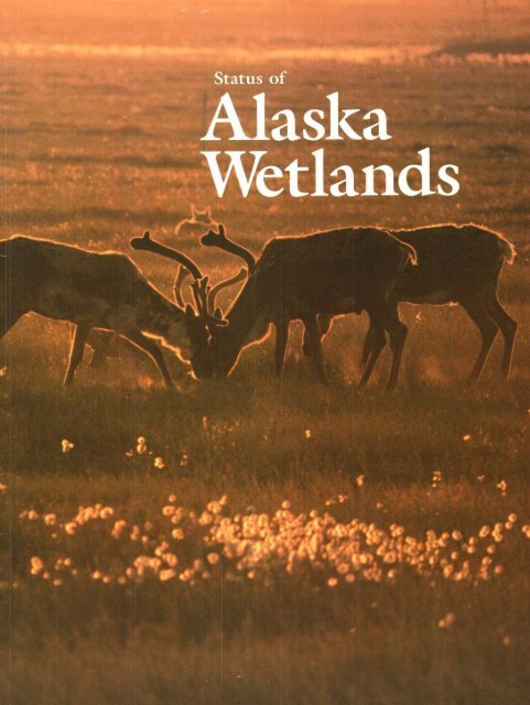
Cover photo: Caribou, Arctic Coastal Plain Engineers <strong>and</strong> the National Oceanic <strong>and</strong><br />
PALUSTRINE EMERGENT - FLOODED Atmospheric Administration's National Marine<br />
BP EXPLORATION (ALASKA) INC<br />
Pollution Program Office is gratefully acknowl-<br />
Back cover photo : Yellow pond lily, edged . Glen Yankus <strong>of</strong>the U . S . Department <strong>of</strong><br />
Cook Inlet - Susitna Lowl<strong>and</strong> Interior's Minerals Management <strong>Service</strong> also<br />
S GALE assisted in the study .
Arctic Coastal Plain<br />
PALUSTRINE OPEN WATER AND EMERGENT - FLOODED<br />
<strong>Status</strong> <strong>of</strong><br />
<strong>Alaska</strong><br />
<strong>Wetl<strong>and</strong>s</strong><br />
by Jonathan V. Hall,W. E . Frayer <strong>and</strong> Bill O. Wilen<br />
1994<br />
BP EXPLORATION (ALASKA) INC
Pintails, Yukon Flats<br />
PALUSTRINE EMERGENT - FLOODED<br />
USFWS
Highlights<br />
<strong>Alaska</strong> encompasses an area <strong>of</strong> 403,247,700<br />
acres, including <strong>of</strong>fshore areas involved in this<br />
study . Total acreage <strong>of</strong> wetl<strong>and</strong>s is 174,683,900<br />
acres . This is 43 .3 percent <strong>of</strong><strong>Alaska</strong>'s surface<br />
area . In the lower 48 states, wetl<strong>and</strong>s only occupy<br />
5 .2 percent <strong>of</strong> the surface area .<br />
Deepwater habitats cover an additional<br />
29,870,400 acres, or 7 .4 percent <strong>of</strong> <strong>Alaska</strong>'s<br />
surface area .<br />
Over 88 percent (154,917,300 acres) <strong>of</strong><strong>Alaska</strong><br />
wetl<strong>and</strong>s are under public management .<br />
J . HAL .<br />
Palustrine scrub/shrub wetl<strong>and</strong>s are extensive .<br />
They cover 114,510,100 acres, which is almost<br />
t"vo-thirds <strong>of</strong><strong>Alaska</strong>'s wetl<strong>and</strong>s .<br />
Areas other than wetl<strong>and</strong>s <strong>and</strong> deepwater habitats<br />
account for 198,693,400 acres, less than half <strong>of</strong><br />
<strong>Alaska</strong>'s area .<br />
Brooks Range<br />
PALUSTRINE SCRUB/SHRUB - SATURATED
Contents<br />
Highlights . . . . . . . . . . . . . . . . . . . . . . . . . . . . . . . . . . . . . . . . . . .3<br />
Introduction . . . . . . . . . . . . . . . . . . . . . . . . . . . . . . . . . . . . . . . .7<br />
Overview . . . . . . . . . . . . . . . . . . . . . . . . . . . . . . . . . . . . . . . . . . . . .9<br />
Classification System . . . . . . . . . . . . . . . . . . . . . . . . . .11<br />
Survey Procedure . . . . . . . . . . . . . . . . . . . . . . . . . . . . . . .15<br />
Results . . . . . . . . . . . . . . . . . . . . . . . . . . . . . . . . . . . . . . . . . . . . . . . 17<br />
In Conclusion . . . . . . . . . . . . . . . . . . . . . . . . . . . . . . . . . . . .29<br />
Literature Cited . . . . . . . . . . . . . . . . . . . . . . . . . . . . . . . . .31<br />
Appendix . . . . . . . . . . . . . . . . . . . . . . . . . . . . . . . . . . . . . . . . . . .32<br />
left. Safety Harbor; Western Coastal Zone Mountain cranberry, Kuskoklvim Higblancls<br />
ESTUARINE INTERTIDAL VEGETATED PALUSTRINE SCRUB/SHRUB - SATURATED<br />
J HALL D .DALL<br />
7Y
wetl<strong>and</strong> develop about this National Frayer percent wetl<strong>and</strong>s mid-1950's loss Oil comprising million United period, (Dahl <strong>and</strong> 1974 to responsibility report <strong>and</strong> <strong>of</strong> pipeline, <strong>of</strong> <strong>of</strong> the an at 11 were et 1983 a458,000 <strong>and</strong> gains remained migratory the et their <strong>Wetl<strong>and</strong>s</strong> the National average al million acres ONE <strong>and</strong> 1950's States approximately for al created disseminate (1983) <strong>Fish</strong> characteristics time nation's <strong>and</strong> showed the <strong>and</strong> Arctic associated the habitats 1991 equates <strong>Fish</strong> acres annual for <strong>and</strong> mid-1970's, <strong>and</strong> 48 <strong>of</strong> nine-year <strong>Wetl<strong>and</strong>s</strong> losses in<strong>and</strong> Inventory <strong>and</strong> This settlement the contiguous the Frayer Coastal wetl<strong>and</strong>s the <strong>and</strong> <strong>Wildlife</strong> 1970's <strong>of</strong>wetl<strong>and</strong>s<br />
<strong>of</strong> to endangered Of in Tiner net protection comprehensive deepwater mid-1970's two 20-\,ear wetl<strong>and</strong>s Nved<strong>and</strong> EMERGENT <strong>Wildlife</strong> an particular <strong>and</strong> the period loss 1991) Inventory Plain were Project, million Shaia <strong>Service</strong>, there (1984) lower The extent in<strong>of</strong> states, SCRUB/SHRUB<br />
net loss the <strong>Service</strong> published An between During 290,200 Creek <strong>and</strong> habitats fish was purpose -concern 48 acres annual loss FLOODED Between has area rate <strong>of</strong> Lowl<strong>and</strong> through study update Of only man- <strong>and</strong> data states awet <strong>of</strong> Flats, has loss the was <strong>of</strong> the is<br />
CHAPTER<br />
Introduction<br />
The<br />
major<br />
agement<br />
wildlife<br />
are<br />
Since<br />
its<br />
inventoried<br />
to<br />
concerning<br />
l<strong>and</strong>s .<br />
Results<br />
<strong>of</strong><br />
between<br />
by<br />
wetl<strong>and</strong>s<br />
now<br />
46<br />
the<br />
<strong>of</strong><br />
same<br />
wetl<strong>and</strong>s<br />
nine<br />
net<br />
<strong>of</strong><br />
1974<br />
down<br />
acres<br />
.<br />
.<br />
left:<br />
PALUSTRINE EMERGENT - FLOODED<br />
J . HALL<br />
.<br />
;<br />
.<br />
.<br />
a<br />
average<br />
.<br />
right :<br />
,<br />
Tanana-Kuskoklvim<br />
PALUSTRINE<br />
AND<br />
.<br />
.<br />
.<br />
.<br />
.<br />
GOLET<br />
states <strong>of</strong>wetl<strong>and</strong>s lower State example, statistical report isestimates <strong>and</strong> areas the <strong>and</strong> 1992) trends <strong>of</strong> to or provide 48 deepwater first managed presents Peters <strong>Alaska</strong>, obtain other on states this design in report <strong>of</strong> <strong>and</strong> their approach the current information selected 1990) can reliable Natives deepwater results habitats, by trends used Central for be several <strong>and</strong> <strong>Alaska</strong> status in used geographical estimates was <strong>of</strong> <strong>and</strong> the Valley Florida it aon habitats federal with used study does others <strong>of</strong> quality trend While the <strong>Alaska</strong> <strong>of</strong> intensified<br />
for to not amounts (Frayer on agencies, study in California evaluate<br />
it It individ- areas the provide <strong>Alaska</strong> wetpro- does, for sta- <strong>and</strong> <strong>of</strong><br />
The<br />
the<br />
sampling<br />
ual<br />
For<br />
wetl<strong>and</strong><br />
(Frayer<br />
Hefner<br />
This<br />
tus<br />
This<br />
videsl<strong>and</strong>s<br />
information<br />
however,<br />
these<br />
the<br />
F .<br />
.<br />
.<br />
.<br />
.<br />
.<br />
.
CHAPTER TWO<br />
Ovcrvicw<br />
<strong>Wetl<strong>and</strong>s</strong> in <strong>Alaska</strong> include types commonly<br />
referred to as bogs, muskegs, wet <strong>and</strong> moist tundra,<br />
fens, marshes, swamps, mud flats, <strong>and</strong> salt<br />
marshes . The U .S . <strong>Fish</strong> <strong>and</strong> <strong>Wildlife</strong> <strong>Service</strong> estimates<br />
that during the 200-year period between<br />
1780 <strong>and</strong> 1980, approximately 'ho <strong>of</strong> a percent <strong>of</strong><br />
the original wetl<strong>and</strong> acreage in <strong>Alaska</strong> was lost<br />
(Dahl 1990) .<br />
Common terms used for <strong>Alaska</strong>'s deepwater<br />
habitats include lakes, bays, sounds, fjords,<br />
lagoons, <strong>and</strong> inlets . The two largest lakes in<br />
<strong>Alaska</strong> are Lake Iliamna (1,000 square miles) <strong>and</strong><br />
Bechar<strong>of</strong> Lake (458 square miles) . Large coastal<br />
deepwater habitats include Kotzebue Sound,<br />
Norton Sound, Bristol Bay, Cook Inlet, <strong>and</strong> the<br />
labyrinth <strong>of</strong> fjords, inlets, <strong>and</strong> straits in the<br />
Alex<strong>and</strong>er Archipelago (southeast <strong>Alaska</strong>) .<br />
Lagoons formed behind barrier isl<strong>and</strong>s are common<br />
in northwest <strong>Alaska</strong> along the Chukchi Sea<br />
<strong>and</strong> Bering Strait coasts .<br />
Most regions <strong>of</strong> <strong>Alaska</strong> have a l<strong>and</strong> surface that<br />
includes extensive areas <strong>of</strong> wetl<strong>and</strong>s . Treeless<br />
expanses <strong>of</strong> moist <strong>and</strong> wet tundra underlain by<br />
permafrost occur in the northern <strong>and</strong> western<br />
portions . Interior <strong>Alaska</strong> contains millions <strong>of</strong><br />
acres <strong>of</strong> black spruce muskeg <strong>and</strong> floodplain<br />
wetl<strong>and</strong>s dominated by deciduous shrubs <strong>and</strong><br />
emergents . Shrub <strong>and</strong> licrbaceous bogs are a conspicuous<br />
feature <strong>of</strong> the l<strong>and</strong>scape in south central<br />
<strong>and</strong> southeast <strong>Alaska</strong> . Even in mountainous areas<br />
such as the Brooks Range, wetl<strong>and</strong>s have developed<br />
in drainages <strong>and</strong> on vegetated slopes . Some<br />
<strong>of</strong> the nation's most extensive complexes <strong>of</strong> salt<br />
marshes <strong>and</strong> mud flats occur along the coasts <strong>of</strong><br />
the Beaufort Sea, Chukchi Sea, Bering Sea <strong>and</strong><br />
the Gulf <strong>of</strong> <strong>Alaska</strong> .<br />
left : Blying Sound, South Central Coastal Zone<br />
MARINE INTERTIDAL<br />
J HALL<br />
<strong>Wetl<strong>and</strong>s</strong> are abundant in the valleys <strong>and</strong> basins<br />
associated with large river systems including the<br />
Yukon, Kuskokwim, Porcupine, Tanana, <strong>and</strong><br />
Koyukuk Rivers . Significant wetl<strong>and</strong> areas also<br />
occur on the major river deltas in <strong>Alaska</strong> . The<br />
Yukon-Kuskokwim Delta, one <strong>of</strong> the world's<br />
largest coastal deltaic formations, supports a variety<br />
<strong>of</strong> wetl<strong>and</strong> types including wet tundra, grassy<br />
sloughs, shrub swamps, ponds <strong>and</strong> brackish<br />
marsh . Other major deltas in <strong>Alaska</strong> that are predominantly<br />
wetl<strong>and</strong> are the Colville River Delta<br />
on the Beaufort Sea coast, the Copper River<br />
Delta in south central <strong>Alaska</strong>, <strong>and</strong> the Stikine<br />
River Delta in the southeast region .<br />
Many wetl<strong>and</strong>s in northern portions <strong>of</strong> <strong>Alaska</strong> are<br />
underlain <strong>and</strong> maintained by permafrost, or<br />
perennially frozen ground . Wetl<strong>and</strong> conditions<br />
<strong>of</strong>ten occur because the frozen layer traps water<br />
at or near the soil surface . Other wetl<strong>and</strong>s are<br />
maintained by heavy rainfall, glacial melt water,<br />
river flooding, beaver activity, snow melt, springs,<br />
<strong>and</strong> the ebb <strong>and</strong> flow <strong>of</strong> tides .<br />
<strong>Wetl<strong>and</strong>s</strong> in <strong>Alaska</strong> range in elevation from tidal<br />
systems at sea level to moist tundra areas in high<br />
alpine zones . <strong>Wetl<strong>and</strong>s</strong> are as common on slopes<br />
as they are in lowl<strong>and</strong> sites <strong>and</strong> depressions .<br />
While north-facing slopes are frequently wetl<strong>and</strong><br />
due to the presence <strong>of</strong>permafrost, south-facing<br />
slopes in the same area <strong>of</strong>ten support non-wetl<strong>and</strong><br />
plant communities on `yell-drained soils .<br />
Hillside wetl<strong>and</strong>s are common in southern portions<br />
<strong>of</strong> <strong>Alaska</strong> due to abundant precipitation <strong>and</strong><br />
shallow depths to bedrock .<br />
<strong>Alaska</strong>'s wetl<strong>and</strong>s provide many benefits including<br />
: food <strong>and</strong> habitat for wildlife, fish <strong>and</strong> shellfish<br />
species, natural products for human use <strong>and</strong><br />
subsistence, shoreline erosion <strong>and</strong> sediment control,<br />
flood protection, <strong>and</strong> opportunities for<br />
recreation <strong>and</strong> aesthetic appreciation . Not all<br />
wetl<strong>and</strong>s perform all these functions, but most<br />
wetl<strong>and</strong>s contribute to one or more in varying<br />
degrees .
Tundra wetl<strong>and</strong>s in northern <strong>and</strong> western <strong>Alaska</strong><br />
are prime breeding grounds for many shorebirds<br />
(s<strong>and</strong>pipers, plovers, <strong>and</strong> their relatives) .<br />
Waterfowl species dependent on <strong>Alaska</strong> wetl<strong>and</strong>s<br />
include more than 70 thous<strong>and</strong> swans, one million<br />
geese, <strong>and</strong> 12 million ducks (King <strong>and</strong><br />
Lensink 1971) . These include more than half the<br />
continental populations <strong>of</strong> tundra <strong>and</strong> trumpeter<br />
swans <strong>and</strong> all or most <strong>of</strong> the continental populations<br />
<strong>of</strong> eight species or subspecies <strong>of</strong> geese . In<br />
recent years, <strong>Alaska</strong> wetl<strong>and</strong>s have on average<br />
supported 30 percent <strong>of</strong> the continental populations<br />
<strong>of</strong> northern pintails, 24 percent <strong>of</strong> American<br />
wigeons, 19 percent <strong>of</strong> scaup, 18 percent <strong>of</strong> canvasback,<br />
<strong>and</strong> 13 percent <strong>of</strong> green-winged teal<br />
(Lensink <strong>and</strong> Derksen 1986) . The importance <strong>of</strong><br />
<strong>Alaska</strong> wetl<strong>and</strong>s to these <strong>and</strong> other species<br />
increases significantly during years when drought<br />
occurs in prairie states <strong>and</strong> provinces .<br />
During migration, huge flocks <strong>of</strong>waterfowl <strong>and</strong><br />
shorebirds stop at specific wetl<strong>and</strong> areas for resting<br />
<strong>and</strong> feeding . These critical wetl<strong>and</strong>s provide<br />
concentrated food resources necessary to fuel the<br />
journey to nesting areas in the spring or southern<br />
destinations in the fall . Nearly all <strong>of</strong> the Pacific<br />
Flyway black brant feed on rich eelgrass beds at<br />
Izembek Lagoon on the <strong>Alaska</strong> Peninsula during<br />
fall migration (<strong>Fish</strong> <strong>and</strong> <strong>Wildlife</strong> <strong>Service</strong> 1985) .<br />
Many mammals in <strong>Alaska</strong> use specific wetl<strong>and</strong><br />
types <strong>and</strong> areas . Some species, such as beaver <strong>and</strong><br />
muskrat, spend most <strong>of</strong> their lives in wetl<strong>and</strong>s .<br />
Other mammals use wetl<strong>and</strong>s primarily as feeding<br />
areas or resting areas . Moose commonly feed on<br />
submerged vegetation in deep marshes <strong>and</strong> shallow<br />
ponds . The two largest herds <strong>of</strong> caribou,<br />
both in northern <strong>Alaska</strong>, gather into huge aggregations<br />
<strong>and</strong> migrate from upl<strong>and</strong> areas to coastal<br />
wetl<strong>and</strong> areas in the summer . Uninterrupted<br />
Snowgeese over Arctic Coastal Plain<br />
PALUSTRINE EMERGENT - SATURATED<br />
A BRACKNEY<br />
moist tundra wetl<strong>and</strong>s in the North Slope coastal<br />
plain are used by these animals for calving <strong>and</strong><br />
feeding . Nonvegetated wetl<strong>and</strong> types such as<br />
gravel bars <strong>and</strong> coastal beaches are used to escape<br />
insect harassment .<br />
The value <strong>of</strong>wetl<strong>and</strong>s for fish is well established<br />
for <strong>Alaska</strong>'s coastal wetl<strong>and</strong>s along rivers <strong>and</strong><br />
streams . Many fish species feed in wetl<strong>and</strong>s or on<br />
food produced by wetl<strong>and</strong>s . Coastal wetl<strong>and</strong>s <strong>and</strong><br />
stream side marshes are used as nursery grounds .<br />
Other wetl<strong>and</strong> types adjacent to rivers maintain<br />
<strong>and</strong> regulate stream flow in channels used by fish .<br />
Species (e . g ., salmon) that move between fresh<br />
water <strong>and</strong> saltwater are dependent on both<br />
coastal <strong>and</strong> riparian wetl<strong>and</strong>s . Annually, the<br />
salmon industry in <strong>Alaska</strong> employs approximately<br />
22,000 people (<strong>Alaska</strong> Dept . <strong>of</strong> <strong>Fish</strong> <strong>and</strong> Game<br />
1992) . The annual value <strong>of</strong> this fishery to commercial<br />
harvesters is $600 million (<strong>Alaska</strong> Dept .<br />
<strong>of</strong> Education 1991) .<br />
Many wetl<strong>and</strong>s serve to temporarily store flood<br />
waters, thereby protecting downstream properties<br />
from flood damage . The flood storage function<br />
also helps to slow the velocity <strong>of</strong>water, which<br />
reduces the water's erosive potential . This function<br />
<strong>of</strong>wetl<strong>and</strong>s becomes increasingly important<br />
in <strong>Alaska</strong>'s towns <strong>and</strong> cities, where development<br />
has increased the rate <strong>and</strong> volume <strong>of</strong> surfacewater<br />
run<strong>of</strong>f <strong>and</strong> the potential for flood damage .<br />
Where permafrost is common, the ability <strong>of</strong>wetl<strong>and</strong>s<br />
to store flood waters is reduced .<br />
Subsistence use <strong>of</strong> wetl<strong>and</strong> resources in <strong>Alaska</strong> is<br />
extensive . In most areas, wetl<strong>and</strong> habitats provide<br />
resources upon which Native village economies<br />
are based . A major portion <strong>of</strong> hunting, fishing,<br />
trapping, <strong>and</strong> gathering activities occurs in wetl<strong>and</strong>s<br />
areas (Ellanna <strong>and</strong> Wheeler 1986) . <strong>Fish</strong> <strong>and</strong><br />
wildlife resources harvested for subsistence use<br />
<strong>and</strong> dependent on wetl<strong>and</strong>s include five species <strong>of</strong><br />
salmon, shellfish, ducks, geese, beaver, <strong>and</strong> otter .<br />
Plant materials frequently collected from wetl<strong>and</strong>s<br />
include blueberries, cranberries, labrador<br />
tea, <strong>and</strong> willow .<br />
The diversity <strong>of</strong> plant <strong>and</strong> animal life in wetl<strong>and</strong>s<br />
makes them a valuable resource for nonconsumptive<br />
recreation such as wildlife viewing <strong>and</strong> photography<br />
. <strong>Wetl<strong>and</strong>s</strong>, particularly in urban areas,<br />
are valuable in providing other passive recreation<br />
opportunities including education, open space,<br />
<strong>and</strong> aesthetic enjoyment . In addition, waterfowl<br />
hunting in the United States depends on continued<br />
productivity <strong>of</strong> <strong>Alaska</strong>'s wetl<strong>and</strong>s .
CHAPTER THREE<br />
Classification System<br />
The definitions, classifications <strong>and</strong> categories <strong>of</strong><br />
wetl<strong>and</strong>s <strong>and</strong> deepwater habitats used are those<br />
described by Cowardin et al . (1979) . In general<br />
terms, wetl<strong>and</strong> is l<strong>and</strong> where saturation with<br />
water is the dominant factor determining the<br />
nature <strong>of</strong> soil development <strong>and</strong> the types <strong>of</strong>plant<br />
<strong>and</strong> animal communities living in the soil <strong>and</strong> on<br />
its surface . Technically, wetl<strong>and</strong>s are l<strong>and</strong>s transitional<br />
bemveen terrestrial <strong>and</strong> aquatic systems<br />
where the water table is usually at or near the surface<br />
or the l<strong>and</strong> is covered by shallow water .<br />
<strong>Wetl<strong>and</strong>s</strong> must also have one or more <strong>of</strong> the following<br />
three attributes : 1) at least periodically,<br />
the l<strong>and</strong> supports predominantly hydrophytes ;<br />
2) the substrate is predominantly undrained<br />
hydric soil ; <strong>and</strong> 3) the substrate is nonsoil <strong>and</strong> is<br />
saturated with water or covered by shallow water<br />
at some time during the growing season <strong>of</strong> each<br />
year .<br />
Deepwater habitats consist <strong>of</strong> certain permanently<br />
flooded l<strong>and</strong>s . In saltwater areas, the separation<br />
between wetl<strong>and</strong> <strong>and</strong> deepwater habitat coincides<br />
with the elevation <strong>of</strong> the extreme low water <strong>of</strong><br />
spring tide . In other areas, the separation is at a<br />
depth <strong>of</strong> two meters (6 .6 feet) below low water .<br />
This is the maximum depth in which emergent<br />
plants normally grow .<br />
Within the hierarchical structure <strong>of</strong> classification,<br />
wetl<strong>and</strong>s <strong>and</strong> deepwater habitats are grouped<br />
according to systems . A system consists <strong>of</strong> environments<br />
<strong>of</strong> similar hydrological, geomorphological,<br />
chemical, <strong>and</strong> biological influences . Each<br />
Color-infrared aerialphotograph showing<br />
Kantishna River, Tanana-Kuskokwim Lowl<strong>and</strong><br />
system is further divided by the driving ecological<br />
force, such as ebb <strong>and</strong> flow <strong>of</strong> tide, <strong>and</strong> by substrate<br />
material <strong>and</strong> flooding regimes, or on vegetation<br />
life form . Groupings <strong>of</strong> categories were<br />
made to accommodate special interests <strong>of</strong> the<br />
study, <strong>and</strong> to facilitate comparison <strong>of</strong> results with<br />
those <strong>of</strong> similar studies conducted in other<br />
regions <strong>of</strong> the United States .
12<br />
The marine system extends from the outer edge<br />
<strong>of</strong> the continental shelf shoreward to the extreme<br />
high water <strong>of</strong> spring tides or to the boundary <strong>of</strong><br />
other systems as defined later . Marine subticlal<br />
includes that portion that is continuously submerged<br />
. This habitat is beyond the scope <strong>of</strong> the<br />
study <strong>and</strong> was therefore not included . Marine<br />
intertidal includes areas in which the substrate is<br />
exposed <strong>and</strong> flooded by tides, including the associated<br />
splash zone .<br />
The estuarine system consists <strong>of</strong> deepwater tidal<br />
habitats <strong>and</strong> adjacent tidal wetl<strong>and</strong>s which are<br />
usually semi-enclosed by l<strong>and</strong>, but have open,<br />
partially obstructed, or sporadic access to the<br />
open ocean <strong>and</strong> in which ocean water is at least<br />
occasionally diluted by fresh water run<strong>of</strong>f from<br />
the l<strong>and</strong> . Estuarine subtidal is that portion that is<br />
continuously submerged (considered deepwater<br />
habitat), while estuarine intertidal is the portion<br />
exposed <strong>and</strong> flooded by tides, including the<br />
splash zone . For the purposes <strong>of</strong> this study, estuarine<br />
intertidal wetl<strong>and</strong>s were separated into the<br />
following groups : Nonvegetated, which includes<br />
unconsolidated shore (e .g . mud flats) <strong>and</strong> aquatic<br />
beds (e .g . seagrasses or algal beds) ; <strong>and</strong> vegetated,<br />
which is primarily emergent. Emergent vegetation<br />
consists <strong>of</strong> erect, rooted herbaceous plants typically<br />
found in wet environments .<br />
The lacustrine system includes wetl<strong>and</strong>s (littoral)<br />
<strong>and</strong> deepwater habitats (limnetic) situated in<br />
topographic depressions or dammed river channels<br />
. Each area must exceed 20 acres or be deeper<br />
than two meters (6 .6 feet) or have an active<br />
wave-formed or bedrock shoreline feature .<br />
Lacustrine areas are treated as deepwater<br />
habitats in this study .<br />
The palustrine system includes all nontidal wetl<strong>and</strong>s<br />
not included within any <strong>of</strong> the other four<br />
systems <strong>and</strong> does not include any deepwater<br />
habitats . For this study, palustrine wetl<strong>and</strong>s are<br />
divided into the following groups : unconsolidated<br />
shore, open water (primarily ponds), aquatic beds<br />
(e .g . pondlilies <strong>and</strong> pondweeds), emergent,<br />
scrub/shrub, <strong>and</strong>forested. Emergent is defined the<br />
same as for estuarine wetl<strong>and</strong>s . Forested is characterized<br />
by the presence <strong>of</strong> trees, <strong>and</strong> scrub/shrub<br />
includes areas dominated by shrubs <strong>and</strong> small or<br />
stunted trees .<br />
Yukon-I,Cuskokwim Delta<br />
PALUSTRINE EMERGENT - FLOODED AND OPEN WATER<br />
F . GOLET
Palustrine vegetated wetl<strong>and</strong>s were further separated<br />
into categories <strong>of</strong> saturated <strong>and</strong> flooded .<br />
Saturated wetl<strong>and</strong>s seldom have surface water,<br />
but the substrate is saturated for extended periods<br />
during the growing season . <strong>Wetl<strong>and</strong>s</strong> with<br />
organic soils, such as bogs, typically are saturated .<br />
Other examples <strong>of</strong> saturated wetl<strong>and</strong>s include<br />
moist tundra <strong>and</strong> black spruce muskegs with<br />
permafrost occurring at a shallow depth .<br />
Flooded wetl<strong>and</strong>s range from temporarily flooded<br />
to permanently flooded . In temporarily flooded<br />
wetl<strong>and</strong>s, surface water is present for brief periods<br />
during the growing season . Flooded wetl<strong>and</strong>s in<br />
<strong>Alaska</strong> include marshes, wet tundra, riparian wetl<strong>and</strong>s,<br />
<strong>and</strong> shrub swamps .<br />
Near Naknek, Bristol Bay Coastal Plain<br />
PALUSTRINE EMERGENT - FLOODED<br />
J HALL<br />
49<br />
In summary, the 14 wetl<strong>and</strong> <strong>and</strong> deepwater<br />
habitat categories used in this study are :<br />
Category<br />
Marine intertidal<br />
Estuarine subtidal<br />
Estuarine intertidal nonvegetatEd<br />
Estuarine intertidal vegetated<br />
Palustrine unconsolidated shore<br />
Palustrine open water<br />
Palustrine aquatic beds<br />
Palustrine emergent - saturates<br />
Palustrine emergent - flooded<br />
Palustrine scrub/shrub - saturated<br />
Palustrine scrub/shrub - floodEd<br />
Palustrine forested - saturated<br />
Palustrine forested - flooded<br />
Lacustrine<br />
Common Examples<br />
Ocean shoreline<br />
Open water <strong>of</strong> bays/inlets<br />
Mud <strong>and</strong> s<strong>and</strong> flats/beaches<br />
Salt marsh<br />
Pond flats/beaches<br />
Open water ponds<br />
Floating <strong>and</strong> submerged aquatic vegetation<br />
Moist tussock tundra <strong>and</strong> sedge bogs<br />
Wet sedge/grass tundra <strong>and</strong> marshes<br />
Moist shrub tundra <strong>and</strong> shrub bogs/muskegs<br />
Shrub swamps<br />
Forested bogs/muskegs<br />
Forested swamps<br />
Lakes<br />
It A<br />
1 3
14<br />
All remaining surface area (area not classed as<br />
wetl<strong>and</strong> or deepwater habitat) corresponds to<br />
classes <strong>of</strong> agriculture, urban, <strong>and</strong> other used by<br />
Anderson et al . (1976) at their Classification<br />
Level I . Other includes Anderson's Level I classes<br />
<strong>of</strong> forest l<strong>and</strong>, rangel<strong>and</strong>, <strong>and</strong> barren l<strong>and</strong>, as well<br />
as l<strong>and</strong>s that had been cleared <strong>of</strong> vegetation but<br />
had not been put to identifiable use .<br />
The type <strong>of</strong> ownership <strong>of</strong> wetl<strong>and</strong>s was also<br />
determined in the study . For federal ownership,<br />
five categories were selected based on the management<br />
agency involved . These include the<br />
Bureau <strong>of</strong>L<strong>and</strong> Management, <strong>Fish</strong> <strong>and</strong> <strong>Wildlife</strong><br />
<strong>Service</strong>, National Park <strong>Service</strong>, Forest <strong>Service</strong>, <strong>and</strong><br />
otherfederal agencies . Additional ownership cate-<br />
gories are Native, State <strong>and</strong> other . The results for<br />
individual categories are accurate for only one<br />
point in time . After transfers <strong>of</strong> federal l<strong>and</strong> to<br />
Native <strong>and</strong> State ownership are completed, the<br />
samples involved in this study could be reclassified<br />
by ownership for timely results .<br />
This briefly describes the classification used in<br />
this study . It is difficult to differentiate the categories<br />
further without introducing highly technical<br />
terms . More detailed discussions, exact definitions,<br />
<strong>and</strong> fuller descriptions are provided by<br />
Cowardin et al . (1979) .<br />
Yukon-Kuskokwim Delta<br />
PALUSTRINE UNCONSOLIDATED SHORE<br />
F . GOLET
CHAPTER FOUR<br />
Survey Procedure<br />
The objective <strong>of</strong> the study was to develop statistical<br />
estimates <strong>of</strong> the areal extent <strong>of</strong>wetl<strong>and</strong> <strong>and</strong><br />
deepwater habitat categories <strong>and</strong> ownership classes<br />
for <strong>Alaska</strong> .<br />
A stratified r<strong>and</strong>om sampling design was used<br />
with 21 inl<strong>and</strong> strata formed by modification <strong>of</strong><br />
the l<strong>and</strong> resource areas described by Rieger et al .<br />
(1979) . The study also used four coastal strata<br />
encompassing areas in the marine <strong>and</strong> estuarine<br />
systems . The 25 strata <strong>and</strong> <strong>Alaska</strong>'s four major<br />
regions are shown in the map on page 16 .<br />
Sample units were allocated to strata in proportion<br />
to expected amounts <strong>of</strong>wetl<strong>and</strong>s <strong>and</strong> deepwater<br />
habitats as estimated by <strong>Fish</strong> <strong>and</strong> <strong>Wildlife</strong><br />
<strong>Service</strong> personnel . A pilot study with 500 sample<br />
units was conducted to estimate the total number<br />
<strong>of</strong> sample units required for the statewide study .<br />
Kisarahk Lake, Kuskokwiyu Highl<strong>and</strong>s<br />
LACUSTRINE<br />
D.DALL<br />
The total number <strong>of</strong> sample units used statewide<br />
was 2,566 .<br />
Each sample unit is a four-square mile area, two<br />
miles on each side . The units were plotted on<br />
U . S . Geological Survey topographic maps <strong>and</strong><br />
on aerial photographs . The 1 : 60,000 scale colorinfrared<br />
aerial photography was obtained for the<br />
most recent date available . The average date <strong>of</strong><br />
this photography was 1980, with 90 percent <strong>of</strong><br />
the photos within three years <strong>of</strong> the average .<br />
The photography was interpreted <strong>and</strong> annotated<br />
in accordance with the classification system<br />
described earlier <strong>and</strong> with procedures developed<br />
by the <strong>Fish</strong> <strong>and</strong> <strong>Wildlife</strong> <strong>Service</strong>'s National<br />
<strong>Wetl<strong>and</strong>s</strong> Inventory Project . A minimum mapping<br />
size <strong>of</strong> one-half acre was used . L<strong>and</strong> ownership/management<br />
determinations were made<br />
from l<strong>and</strong> information records maintained by the<br />
Bureau <strong>of</strong> L<strong>and</strong> Management .<br />
15
Southeast Coastal Zone<br />
South Central Coastal Zone<br />
Western Coastal Zone<br />
Northern Coastal Zone<br />
Southeast<strong>Alaska</strong> Mountains<br />
Southeast<strong>Alaska</strong> Lowl<strong>and</strong>s<br />
South Central <strong>Alaska</strong> Mountains<br />
Cook Inlet -Susitna Lowl<strong>and</strong><br />
<strong>Alaska</strong> Peninsula <strong>and</strong> Southwest Isl<strong>and</strong>s<br />
Kuskokwim Highl<strong>and</strong>s<br />
Koyukuk-Innoko Lowl<strong>and</strong><br />
<strong>Alaska</strong> Range<br />
Copper River Plateau<br />
Tanana-Kuskokwim Lowl<strong>and</strong><br />
Interior <strong>Alaska</strong> Highl<strong>and</strong>s<br />
Yukon Flats<br />
Kanuti Flats<br />
Bristol BayCoastal Plain<br />
Bering Sea Isl<strong>and</strong>s<br />
Yukon Kuskokwim Delta<br />
Norton Sound Highl<strong>and</strong>s<br />
Selawik Kobuk Delta<br />
Brooks Range<br />
Arctic Foothills<br />
Arctic Coastal Plain
CHAPTER FIVE<br />
Results<br />
The intent <strong>of</strong> this study was to quantify areal<br />
coverage <strong>of</strong>wetl<strong>and</strong>s <strong>and</strong> deepwater habitats for<br />
<strong>Alaska</strong> . Results for all categories discussed in the<br />
classification system section are given in the<br />
Appendix . Several <strong>of</strong> the individual categories<br />
were grouped based on physical, chemical, <strong>and</strong><br />
biological similarities <strong>and</strong> are shown as subtotals .<br />
These groupings include the following :<br />
<strong>Wetl<strong>and</strong>s</strong> <strong>and</strong> deepwater habitats includes all<br />
marine, estuarine, palustrine, <strong>and</strong> paustrine classifications<br />
.<br />
<strong>Wetl<strong>and</strong>s</strong> includes marine, estuarine, <strong>and</strong> palustrine<br />
wetl<strong>and</strong>s .<br />
Estuarine wetl<strong>and</strong>s includes all estuarine categories<br />
except estuarine subtidal (a deepwater<br />
habitat) .<br />
Palustrine wetl<strong>and</strong>s includes all palustrine categories<br />
.<br />
Palustrinc nonvegetated wetl<strong>and</strong>s includes the<br />
unconsolidated shore, open water, <strong>and</strong> aquatic<br />
bed categories .<br />
Palustrine vegetated wetl<strong>and</strong>s includes all emergent,<br />
scrub/shrub, <strong>and</strong> forested categories .<br />
Palustrine emergent wetl<strong>and</strong>s, palustrine<br />
scrub/shrub wetl<strong>and</strong>s, <strong>and</strong> palustrineforested wetl<strong>and</strong>s<br />
include the saturated <strong>and</strong> flooded categories<br />
.<br />
Deepwater habitats includes estuarine subtidal<br />
<strong>and</strong> lacustrine habitats .<br />
Results presented in the remainder <strong>of</strong> this section<br />
are based on information found in the Appendix<br />
<strong>and</strong> other supplementary data .<br />
<strong>Alaska</strong> Range<br />
PALUSTRINE SCRUB/SHRUB - SATURATED<br />
USFWS<br />
17
1 8<br />
WETLANDS AND<br />
DEEPWATERHABITATS<br />
The estimate <strong>of</strong> wetl<strong>and</strong>s <strong>and</strong> deepwater habitats<br />
is 204,554,300 acres (See figure 1) . This represents<br />
50 .7 percent <strong>of</strong> <strong>Alaska</strong>'s surface area . In the<br />
lower 48 states, wetl<strong>and</strong>s <strong>and</strong> deepwater habitats<br />
only occupy 9.3 percent <strong>of</strong> the surface area .<br />
Suckling Hills, South Central <strong>Alaska</strong> Mountains<br />
PALUSTRINE EMERGENT - SATURATED AND OPEN WATER<br />
WETLANDS<br />
The estimate <strong>of</strong>wetl<strong>and</strong>s is 174,683,900 acres .<br />
The lower 48 states contain an estimated<br />
103,343,600 acres <strong>of</strong> wetl<strong>and</strong>s (See figures 2, 3) .<br />
Figure 4 shows the distribution <strong>of</strong> <strong>Alaska</strong> wetl<strong>and</strong>s<br />
by region .<br />
z<br />
J . HALL
ALL SURFACE AREA<br />
NON-WETLANDS<br />
2,108,718,600 acres<br />
88 .4°/o<br />
Figure 1<br />
<strong>Alaska</strong> <strong>Wetl<strong>and</strong>s</strong> <strong>and</strong> Deepwater Habitats<br />
OTHER WETLANDS<br />
198,693,400 acres' 174,683,900 acres<br />
49.3% 43 .3°,0<br />
Figures 2, 3<br />
Surface Area <strong>of</strong> <strong>Alaska</strong> <strong>and</strong> Lower 48 States<br />
WETLANDS<br />
278,027,500 acres<br />
11 .6%<br />
Figure 4<br />
DEEPWATER<br />
HABITATS<br />
29,870,400 acres<br />
7 .4%<br />
Distribution <strong>of</strong> <strong>Alaska</strong> <strong>Wetl<strong>and</strong>s</strong> by Region<br />
WETLANDS<br />
INTERIOR<br />
70,665,700 acres<br />
SOUTHERN<br />
40 .4% 9,051,200 acres<br />
5 .2%<br />
ARCTIC AND WESTERN<br />
92,776,400 acres<br />
531%<br />
ALASKA WETLANDS LOWER 48<br />
174,683,900 acres WETLANDS<br />
62 .8% 103,343,600 acres<br />
- COASTAL ZONE<br />
2,190,600 acres<br />
1 .3%<br />
37 .2%
Arctic Foothills<br />
PALUSTRINE EMERGENT - SATURATED<br />
The 25 physical subdivisions <strong>and</strong> four regions<br />
appearing in the map on page 16 are shown<br />
PHYSICAL SUBDIVISION<br />
ALASKA PHYSICAL SUBDIVISIONS<br />
below with their respective total acreages <strong>and</strong><br />
wetl<strong>and</strong> areas .<br />
TOTAL WETLAND WETLAND<br />
TOTAL WETLAND<br />
ACRES ACRES PERCENT PHYSICAL SUBDIVISION<br />
ACRES ACRES<br />
(INTHOUSANDS OF ACRES) (IN THOUSANDS OF ACRES)<br />
Southeast <strong>Alaska</strong> Mountains 7,023.9 84 .4 1 .2 Norton Sound Highl<strong>and</strong>s 34,652 .3 18,320 .1 52 .9<br />
Southeast <strong>Alaska</strong> Lowl<strong>and</strong>s 11,128.4 3,835 .5 34 .5 Selawik-Kobuk Delta 3,149.6 2,384.0 75 .7<br />
South Central <strong>Alaska</strong> Mountains 26,375.7 739 .4 2 .8 Yukon-Kuskokwim Delta 15,860 .3 12,477 .0 78 .7<br />
Cook Inlet - Susitna Lowl<strong>and</strong> 9,442.0 2,644 .5 28 .0 Bristol Bay Coastal Plain 6,067 .5 3,331 .8 54 .9<br />
<strong>Alaska</strong> Peninsula & Southwest Isl<strong>and</strong>s 15,748.6 1,747 .4 11 .1 Bering Sea Isl<strong>and</strong>s 2,898 .1 2,194 .5 75 .7<br />
Total - Southern <strong>Alaska</strong> 69,718 .6 9,051 .2 13 .0<br />
Coastal Zone acreage is primarily estuarine subtidal, a deepwater habitat<br />
USFWS<br />
WETLAND<br />
PERCENT<br />
Brooks Range 32 ;406 .5 7,182 .3 22 .2<br />
Arctic Foothills 36,390 .6 30,271 .1 83 .2<br />
Copper River Plateau 8,367.4 3,056 .9 36 .5<br />
Arctic Coastal Plain 20,031 .5 16,615 .6 82 .9<br />
<strong>Alaska</strong> Range 18,197 .4 1,339 .5 7 .4 Total - Arctic & Western <strong>Alaska</strong> 151,456.4 92,776 .4 61 .3<br />
Koyukuk-Innoko Lowl<strong>and</strong> 10,161 .0 7,223 .0 71 .1<br />
Kanuti Flats 1,339.0 1,023.7 76 .5 Southeast Coastal Zone 7,456 .8 236 .0 3 .2<br />
Tanana-Kuskokwim Lowl<strong>and</strong> 13,550 .9 8,256.1 60 .9 South Central Coastal Zone 6,567 .7 694 .1 10 .6<br />
Yukon Flats 9,679.2 3,681 .6 38 .0 Western Coastal Zone 3,754 .8 1,106 .3 29 .5<br />
Kuskokwim Highl<strong>and</strong>s 44,182 .5 24,462 .4 55 .4 Northern Coastal Zone 3,592 .3 154 .2 4 .3<br />
Interior <strong>Alaska</strong> Highl<strong>and</strong>s 55,223 .7 21,622 .5 39 .2<br />
Total - Interior <strong>Alaska</strong> 160,701 .1 70,665 .7 44 .0<br />
Total - Coastal Zone' 21,371 .6 2,190 .6 10 .3<br />
Total - <strong>Alaska</strong> 403,247.7 174,683.9 43 .3
Marine Intertidal <strong>Wetl<strong>and</strong>s</strong><br />
The estimate <strong>of</strong> marine intertidal wetl<strong>and</strong>s is<br />
48,600 acres .<br />
Estuarine <strong>Wetl<strong>and</strong>s</strong><br />
The estimate <strong>of</strong> estuarine -,vetl<strong>and</strong>s is 2,131,900<br />
acres . This is smaller than the estimated<br />
5,472,700 acres <strong>of</strong> estuarine wetl<strong>and</strong>s in the<br />
lower 48 states (See figure 5) . As shown in<br />
figures 6 <strong>and</strong> 7, the majority <strong>of</strong> estuarine wetl<strong>and</strong>s<br />
in <strong>Alaska</strong> are nonvegetated ; the vast majority <strong>of</strong><br />
estuarine wetl<strong>and</strong>s in the lower 48 states are<br />
vegetated . Figure 8 shows the distribution <strong>of</strong><br />
<strong>Alaska</strong> estuarine wetl<strong>and</strong>s by coastal subdivisions .<br />
Figure 6<br />
Estuarine <strong>Wetl<strong>and</strong>s</strong> in <strong>Alaska</strong><br />
NONVEGETATED<br />
1,771,700 acres<br />
83 .1<br />
VEGETATED<br />
360,200 acres<br />
16 .9%<br />
SOUTHEAST<br />
230,800 acres<br />
10 .8%<br />
NORTHERN<br />
144,300 acres<br />
6 .8%<br />
Figure 8<br />
NONVEGETATED<br />
689,800 acres<br />
12 .6%<br />
Distribution <strong>of</strong> <strong>Alaska</strong> Estuarine <strong>Wetl<strong>and</strong>s</strong><br />
by Coastal Subdivisions<br />
SOUTH CENTRAL<br />
675 .900 acres<br />
31 .7%<br />
WESTERN<br />
1 .080 .900 acres<br />
50 .7%<br />
Figure 5<br />
Estuarine <strong>Wetl<strong>and</strong>s</strong> in <strong>Alaska</strong><br />
<strong>and</strong> the Lower 48 States<br />
ALASKA LOWER 48<br />
ESTUARINE ESTUARINE<br />
WETLANDS WETLANDS<br />
2,131,900 acres 5,472,700 acres<br />
28 .0%<br />
72 .0°'0<br />
Figure 7<br />
Estuarine <strong>Wetl<strong>and</strong>s</strong> in the Lower 48 States<br />
VEGETATED<br />
4,782,900 acres<br />
87 .4%
22<br />
Palustrine <strong>Wetl<strong>and</strong>s</strong><br />
The estimate <strong>of</strong> palustrine wetl<strong>and</strong>s is<br />
172,503,400 acres . This represents 98 .8 percent<br />
<strong>of</strong> the wetl<strong>and</strong>s in <strong>Alaska</strong> .<br />
Palustrine Nonvegetated <strong>Wetl<strong>and</strong>s</strong><br />
The estimate <strong>of</strong> palustrine nonvegetated wetl<strong>and</strong>s<br />
in <strong>Alaska</strong> is 2,670,200 acres . The lower 48 states<br />
have 6,141,300 acres <strong>of</strong>palustrine nonvegetated<br />
wetl<strong>and</strong>s . In both cases, most <strong>of</strong>the area is open<br />
water ponds . However, in the mid-1950's, there<br />
was only an estimated 2,704,400 acres <strong>of</strong>palustrine<br />
nonvegetated wetl<strong>and</strong>s in the lower 48<br />
states . Most <strong>of</strong> the increase is due to pond<br />
construction .<br />
Caribou herd, Arctic Coastal Plain<br />
PALUSTRINE EMERGENT - FLOODED<br />
Palustrine Vegetated <strong>Wetl<strong>and</strong>s</strong><br />
The estimate <strong>of</strong> palustrine vegetated wetl<strong>and</strong>s is<br />
169,833,200 acres . This is much larger than the<br />
91,625,300 acres in the lower 48 states (See<br />
figure 9) . The distribution is quite different for<br />
the two areas . In <strong>Alaska</strong>, the vast majority <strong>of</strong><br />
palustrine vegetated wetl<strong>and</strong>s are scrub/shrub<br />
wetl<strong>and</strong>s, <strong>and</strong> the smallest amount is forested<br />
wetl<strong>and</strong>s (See figure 10) ; in the lower 48 states,<br />
the majority <strong>of</strong> palustrine vegetated wetl<strong>and</strong>s are<br />
forested wetl<strong>and</strong>s, <strong>and</strong> the smallest amount is<br />
scrub/shrub wetl<strong>and</strong>s (See figure 11) . The distribution<br />
<strong>of</strong> palustrine vegetated wetl<strong>and</strong>s in<br />
<strong>Alaska</strong>'s Southern, Interior, <strong>and</strong> Arctic <strong>and</strong><br />
Western regions is shown in figures 12, 13, <strong>and</strong><br />
14, respectively .<br />
BP EXPLORATION (ALASKA) INC
Figure 10<br />
Figure 9<br />
Palustrine Vegetated <strong>Wetl<strong>and</strong>s</strong> in <strong>Alaska</strong><br />
<strong>and</strong> the Lower 48 States<br />
ALASKA LOWER 48<br />
169,833,200 acres 91,625,300 acres<br />
65 .0% 35 .0%<br />
Figure 11<br />
Palustrine Vegetated <strong>Wetl<strong>and</strong>s</strong> in <strong>Alaska</strong> Palustrine Vegetated <strong>Wetl<strong>and</strong>s</strong> in the Lower 48 States<br />
EMERGENT<br />
1,842,700 acres<br />
20 .8%<br />
SCRUB/SHRUB<br />
114,510,100 acres<br />
67 .4%<br />
SCRUB/SHRUB<br />
3,709,600 acres<br />
42 .0%<br />
FORESTED<br />
3,290,600 acres<br />
37 .2%<br />
FORESTED<br />
13,322,300 acres<br />
7.9%<br />
OPP"<br />
EMERGENT<br />
42,000,800 acres<br />
24 .7%<br />
Figures 12, 13, 14<br />
Palustrine Vegetated <strong>Wetl<strong>and</strong>s</strong> by Region<br />
EMERGENT<br />
8,973,400 acres<br />
12 .8%<br />
SCRUB/SHRUB<br />
52,047,600 acres<br />
74 .3%<br />
FORESTED<br />
8,989,300 acres<br />
12 .9%<br />
SCRUB/SHRUB<br />
15,344,500 acres<br />
16 .7%<br />
EMERGENT<br />
24,533,000 acres<br />
26 .8%<br />
FORESTED<br />
51,747,800 acres<br />
56 .5%<br />
SOUTHERN INTERIOR ARCTIC & WESTERN<br />
SCRUB/SHRUB<br />
58,752,900 acres<br />
64 .6%<br />
EMERGENT<br />
31,184,700 acres<br />
34 .3%<br />
FORESTED<br />
1,042,400 acres<br />
1 .1%
24<br />
Palustrine Emergent <strong>Wetl<strong>and</strong>s</strong><br />
(Figures 15, 16)<br />
The estimate <strong>of</strong>palustrine emergent wetl<strong>and</strong>s is<br />
42,000,800 acres . The amounts <strong>of</strong> saturated <strong>and</strong><br />
flooded wetl<strong>and</strong>s are approximately equal .<br />
Palustrine emergent wetl<strong>and</strong>s are most common<br />
in Arctic <strong>and</strong> Western <strong>Alaska</strong>, where threefourths<br />
<strong>of</strong> this type <strong>of</strong> wetl<strong>and</strong> is found . Over 14<br />
million acres <strong>of</strong> palustrine emergent wetl<strong>and</strong>s are<br />
found in the Arctic Coastal Plain, the only physical<br />
subdivision in <strong>Alaska</strong> with the majority <strong>of</strong> its<br />
surface area in this single type . Over five million<br />
acres <strong>of</strong> palustrine emergent wetl<strong>and</strong>s are found<br />
in the Yukon-ICuskokwim Delta <strong>and</strong> also in the<br />
Arctic Foothills .<br />
Palustrine Scrub/Shrub <strong>Wetl<strong>and</strong>s</strong><br />
(Figures 17, 18)<br />
The estimate <strong>of</strong> palustrine scrub/shrub wetl<strong>and</strong>s<br />
is 114,510,100 acres . Only 5 .8 percent <strong>of</strong> these<br />
wetl<strong>and</strong>s are classified as flooded . Flooded palustrine<br />
scrub/shrub wetl<strong>and</strong>s are most common in<br />
the Yukon-Kuskokwim Delta, where about one-<br />
fourth <strong>of</strong> the palustrine scrub/shrub wetl<strong>and</strong>s are<br />
flooded . Almost 97 percent <strong>of</strong> the palustrine<br />
scrub/shrub wetl<strong>and</strong>s are found in Interior<br />
<strong>Alaska</strong> <strong>and</strong> Arctic <strong>and</strong> Western <strong>Alaska</strong> .<br />
Subdivisions having the most palustrine<br />
scrub/shrub wetl<strong>and</strong>s are the Arctic Foothills in<br />
Arctic <strong>and</strong> Western <strong>Alaska</strong>, with 24,548,300<br />
acres ; <strong>and</strong>, the Kuskokwim Highl<strong>and</strong>s <strong>and</strong> the<br />
Interior <strong>Alaska</strong> Highl<strong>and</strong>s in Interior <strong>Alaska</strong><br />
with 18,858,900 acres <strong>and</strong> 16,348,900 acres,<br />
respectively .<br />
Palustrine Forested <strong>Wetl<strong>and</strong>s</strong><br />
(Figures 19, 20)<br />
The estimate <strong>of</strong>palustrine forested wetl<strong>and</strong>s is<br />
13,322,300 acres . Only 204,300 acres are classified<br />
as flooded . As shown earlier, palustrine<br />
forested wetl<strong>and</strong>s cover relatively little area in<br />
<strong>Alaska</strong> compared to the lower 48 states, where it<br />
is the most abundant type <strong>of</strong>wetl<strong>and</strong> .<br />
Tanana-Kuskokwim Lowl<strong>and</strong><br />
I'ALUSTRINE SCRUB/SHRUB - FLOODED<br />
F 30LET
SATURATED VS . FLOODED DISTRIBUTION BY REGION<br />
SATURATED FLOODED<br />
21,170,500 acres 20,830,300 acres<br />
50 .4%<br />
49 .6%<br />
SATURATED<br />
107,917,900 acres<br />
94 .2%<br />
SATURATED<br />
13,118,000 acres<br />
98 .5%<br />
Figures 15, 16<br />
Palustrine Emergent <strong>Wetl<strong>and</strong>s</strong><br />
Figures 17, 18<br />
Palustrine Scrub/Shrub <strong>Wetl<strong>and</strong>s</strong><br />
FLOODED<br />
6 .592 .200 acres<br />
5 .8%<br />
Figures 19, 20<br />
Palustrine Forested <strong>Wetl<strong>and</strong>s</strong><br />
FLOODED<br />
204,300 acres<br />
1 .5%<br />
ARCTIC AND WESTERN<br />
31,184,700 acres<br />
74 .2%<br />
SATURATED VS . FLOODED DISTRIBUTION BY REGION<br />
INTERIOR<br />
52 .047 .600 acres<br />
45 .5%<br />
SATURATED VS . FLOODED DISTRIBUTION BY REGION<br />
INTERIOR<br />
8,989,300 acres<br />
67 .5%<br />
INTERIOR<br />
8 .973 .400 acres<br />
21 .4°0<br />
ARCTIC AND WESTERN<br />
58,752,900 acres<br />
51 .3%<br />
SOUTHERN<br />
3,290,600 acres<br />
24 .7%<br />
SOUTHERN<br />
1,842,700 acres<br />
4 .4%<br />
SOUTHERN<br />
3,709,600 acres<br />
3 .2%<br />
ARCTIC AND WESTERN<br />
1,042 ;400 acres<br />
7 .8%
26<br />
DEEPWATERHABITATS<br />
The estimate <strong>of</strong>deepwater habitats is 29,870,400<br />
acres . Estuarine subtidal habitats cover approximately<br />
the same surface area in <strong>Alaska</strong> as in the<br />
lower 48 states (See figure 21) . <strong>Alaska</strong> has much<br />
less acreage in lacustrine deepwater habitats than<br />
the lower 48 states ; however, about t\vo-thirds <strong>of</strong><br />
the lacustrine area in the lower 48 states is in the<br />
Great Lakes .<br />
OWNERSHIP<br />
The detailed ownership information collected<br />
during the study is presented in the summary<br />
table in the Appendix . The information should<br />
be used with caution, because the State <strong>of</strong> <strong>Alaska</strong><br />
<strong>and</strong> Natives are continuing to receive l<strong>and</strong>s<br />
selected from the block <strong>of</strong> l<strong>and</strong>s managed by the<br />
Bureau <strong>of</strong> L<strong>and</strong> Management . This results in<br />
major shifts in wetl<strong>and</strong> acreages managed by the<br />
Northwestern Lagoon, South Central Coastal Zone<br />
ESTUARINE SUBTIDAL<br />
affected groups . Other shifts have occurred<br />
between groups due to l<strong>and</strong> trades <strong>and</strong> acquisitions,<br />
<strong>and</strong> conversion <strong>of</strong> State l<strong>and</strong>s to private<br />
ownership through homesteading <strong>and</strong> agricultural<br />
programs .<br />
Figure 22 shows the distribution <strong>of</strong>wetl<strong>and</strong>s<br />
among ownership/management categories . The<br />
remaining figures show acreages for wetl<strong>and</strong> categories<br />
managed by the <strong>Fish</strong> <strong>and</strong> <strong>Wildlife</strong> <strong>Service</strong>,<br />
the National Park <strong>Service</strong>, <strong>and</strong> the Forest <strong>Service</strong> .<br />
Acreages in these groups have been relatively stable<br />
over the past several years . As might be<br />
expected, 1) the <strong>Fish</strong> <strong>and</strong> <strong>Wildlife</strong> <strong>Service</strong> is managing<br />
a greater proportion <strong>of</strong> emergent wetl<strong>and</strong>s<br />
than the other two agencies, <strong>and</strong> 2) the most<br />
prevalent wetl<strong>and</strong> category under Forest <strong>Service</strong><br />
management is palustrine forested .<br />
J . HALL
Figure 21<br />
Figure 22<br />
Estuarine <strong>and</strong> Lacustrine Deepwater Habitats Distribution <strong>of</strong> <strong>Wetl<strong>and</strong>s</strong> by Ownership/Management<br />
in <strong>Alaska</strong> <strong>and</strong> the Lower 48 States<br />
LOWER 48<br />
ESTUARINE SUBTIDAL<br />
18,882,400 acres<br />
17 .7%<br />
LOWER 48<br />
LACUSTRINE<br />
57,842,800 acres<br />
54 .3%<br />
<strong>Wetl<strong>and</strong>s</strong> under Management by <strong>Fish</strong> <strong>and</strong> <strong>Wildlife</strong> <strong>Service</strong><br />
PALUSTRINE<br />
SCRUB/SHRUB<br />
24,151 ;900 acres<br />
62 .9%<br />
PALUSTRINE<br />
EMERGENT<br />
11,531,800 acres<br />
30 .1%<br />
ALASKA<br />
ESTUARINE SUBTIDAL<br />
19,152,400 acres<br />
18 .0%<br />
PALUSTRINE<br />
PALUSTRINE I EMERGENT<br />
SCRUB/SHRUB 1,034,400 acres<br />
11,332,900 acres 7.8%<br />
85 .5%<br />
Figure 23<br />
PALUSTRINE<br />
FORESTED<br />
1,492,900 acres<br />
3.9%<br />
\ OTHER<br />
WETLANDS<br />
1,185,700 acres<br />
3 .1<br />
\ OTHER<br />
WETLANDS<br />
111,900 acres<br />
0.8%<br />
PALUSTRINE<br />
FORESTED<br />
780,500 acres<br />
5.9%<br />
PALUSTRINE<br />
EMERGENT<br />
370,000 acres<br />
9.7%<br />
NATIONAL<br />
PARK SERVICE<br />
13,259,700 acres<br />
7.6%<br />
OTHERS<br />
564,700 acres<br />
0.3%<br />
I<br />
ALASKA<br />
LACUSTRINE<br />
STATE<br />
40,270,200 acres<br />
23 .01°<br />
BUREAU OF<br />
LAND MANAGEMENT<br />
10,718,000 acres 58,824,900 acres<br />
10 .0% NATIVE-<br />
19,575,000 acres<br />
11 .2%<br />
33 .7%<br />
FISH AND<br />
WILDLIFE SERVICE<br />
FOREST SERVICE -<br />
3,827,100 acres<br />
2.2%<br />
38,362,300 acres<br />
22 .0%<br />
Figure 24 Figure 25<br />
<strong>Wetl<strong>and</strong>s</strong> under Management by National Park <strong>Service</strong> <strong>Wetl<strong>and</strong>s</strong> under Management by Forest <strong>Service</strong><br />
PALUSTIRINE<br />
PALUSTRINE FORESTED<br />
SCRUB/SHRUB 2,649,700 acres<br />
745,600 acres 69 .2 11%<br />
19 .5%<br />
i<br />
OTHER<br />
WETLANDS<br />
61,800 acres<br />
1 .6%
CHAPTER SIX<br />
In Conclusion<br />
This survey provides an estimate <strong>of</strong> 174,683,900<br />
acres <strong>of</strong> wetl<strong>and</strong>s in <strong>Alaska</strong>, dominated by palustrine<br />
vegetated wetl<strong>and</strong>s . <strong>Alaska</strong> contains 63 percent<br />
<strong>of</strong> the total wetl<strong>and</strong> acreage in the United<br />
States (excluding Hawaii) . While widespread wetl<strong>and</strong><br />
losses have been relatively low in <strong>Alaska</strong>,<br />
specific localities have sustained significant losses<br />
(<strong>Alaska</strong> Dept . <strong>of</strong> Natural Resources 1993) .<br />
Results <strong>of</strong> this study provide the basis for future<br />
studies <strong>of</strong>wetl<strong>and</strong> trends . One <strong>of</strong> the first trends<br />
that could be studied is the change in the ownership/management<br />
<strong>of</strong> wetl<strong>and</strong>s resulting from<br />
continuing l<strong>and</strong> transfers involving federal agencies,<br />
Natives, <strong>and</strong> the State <strong>of</strong> <strong>Alaska</strong>. The sample<br />
units used in this study could be reclassified by<br />
ownership at some future date to provide more<br />
current information .<br />
left: Black spruce, Tauana-Kuskokwim Lolvl<strong>and</strong><br />
PALUSTRINE FORESTED - SATURATED<br />
J HALL<br />
right: Moose, Cook Inlet - Susitna LoiPl<strong>and</strong><br />
PALUSTRINE EMERGENT - FLOODED<br />
Continual monitoring <strong>of</strong> surface area use <strong>and</strong><br />
changes in use is needed to provide the basis for<br />
wise decisions . This report is the result <strong>of</strong> one<br />
such method <strong>of</strong> monitoring initiated by the<br />
U . S . <strong>Fish</strong> <strong>and</strong> <strong>Wildlife</strong> <strong>Service</strong> . The results in<br />
this report provide wetl<strong>and</strong> information similar<br />
to 1) the forest <strong>and</strong> range information required<br />
by the Forest <strong>and</strong> Rangel<strong>and</strong> Renewable<br />
Resources Planning Act, <strong>and</strong> 2) information on<br />
soil, water, <strong>and</strong> related resources required by the<br />
Soil <strong>and</strong> Water Resource Conservation Act . The<br />
results can be updated in the future on the schedule<br />
required by those Acts .<br />
usLws<br />
29
Literature Cited<br />
<strong>Alaska</strong> Department <strong>of</strong> Commerce <strong>and</strong> Economic<br />
Development . 1992 . Seafood Industry Sector<br />
Report . State <strong>of</strong><strong>Alaska</strong>, Dept . <strong>of</strong> Commerce <strong>and</strong><br />
Econ . Dev ., Div . <strong>of</strong> Business Dev . 181 pp .<br />
<strong>Alaska</strong> Department <strong>of</strong> Education . 1991 . <strong>Alaska</strong><br />
Blue Book 1991-1992, Ninth Ed . State <strong>of</strong><br />
<strong>Alaska</strong>, Dept . <strong>of</strong> Educ ., Div . <strong>of</strong> State Libraries,<br />
Archives, <strong>and</strong> Museums . 369 pp .<br />
<strong>Alaska</strong> Department <strong>of</strong> Natural Resources . 1993 .<br />
<strong>Alaska</strong>'s outdoor legacy : statewide comprehensive<br />
outdoor recreation plan, 1992-1996 . State <strong>of</strong><br />
<strong>Alaska</strong>, Dept . <strong>of</strong> Natural Resources . 80 pp .<br />
Anderson, James R ., Ernest E . Hardy, John T .<br />
Roach, <strong>and</strong> Richard E . Witmer . 1976 . A l<strong>and</strong> use<br />
<strong>and</strong> cover classification svstem for use with<br />
remote sensor data . U . S . Geol . Suiv . Pr<strong>of</strong>. Pape r<br />
964 . 22 pp .<br />
Cowardin, L . M ., V . Carter, F . C . Golet, <strong>and</strong> E .<br />
T . LaRoc . 1979 . Classification <strong>of</strong>wetl<strong>and</strong>s <strong>and</strong><br />
deepwater habitats <strong>of</strong> the United States . U . S .<br />
<strong>Fish</strong> Wildl . Setv . 103 pp .<br />
Dahl, T . E . 1990 . Wetl<strong>and</strong> losses in the United<br />
States, 1780's to 1980's . U . S . <strong>Fish</strong> Wildl . Scrv .<br />
21 pp .<br />
Dahl, T . E ., <strong>and</strong> C . E . Johnson . 1991 . Statu s <strong>and</strong><br />
trends <strong>of</strong>wetl<strong>and</strong>s in the conterminous United<br />
States, mid-1970's to mid-1980's . U . S . <strong>Fish</strong><br />
Wildl . Scrv . 28 pp .<br />
Ellanna, L . J ., <strong>and</strong> P . C . Wheeler . 1986 .<br />
Subsistence use <strong>of</strong> wetl<strong>and</strong>s in <strong>Alaska</strong> .<br />
In : <strong>Alaska</strong> Regional Wetl<strong>and</strong> Functions -<br />
Proceedings <strong>of</strong> a Workshop . The Environmental<br />
Institute, Univ . <strong>of</strong> Mass . pp 85-103 .<br />
left: Stikine River Delta, Southeast <strong>Alaska</strong> Lowl<strong>and</strong>s<br />
PALUSTRINE EMERGENT - FLOODED<br />
J HALL<br />
Frayer, W . E ., T . J . Monahan, D . C . Bowden,<br />
<strong>and</strong> F . A . Graybill . 1983 . Statu s <strong>and</strong> trends <strong>of</strong><br />
wetl<strong>and</strong>s <strong>and</strong> deepwater habitats in the conterminous<br />
United States, 1950's to 1970's . Colo .<br />
State Univ . 32 pp .<br />
Frayer,W . E ., <strong>and</strong> Dennis Peters . 1989 .<br />
<strong>Wetl<strong>and</strong>s</strong> <strong>of</strong> the California Central Valley : <strong>Status</strong><br />
<strong>and</strong> trends, 1939 to mid-1980's . U . S . <strong>Fish</strong><br />
Wildl . Scrv . 28 pp .<br />
Frayer, W . E . 1991 . <strong>Status</strong> <strong>and</strong> trends <strong>of</strong><br />
wetl<strong>and</strong>s <strong>and</strong> deepwater habitats in the<br />
conterminous United States, 1970's to 1980's .<br />
Mich . Technological Univ . 32 pp .<br />
Frayer, W. E ., <strong>and</strong> John Hefizer . 1991 . Florida<br />
wetl<strong>and</strong>s : <strong>Status</strong> <strong>and</strong> trends, 1970's to 1980's .<br />
U . S <strong>Fish</strong> Wildl . Scrv . 32 pp .<br />
King, J . G ., <strong>and</strong> C . J . Lensink . 1971 . An<br />
evaluation <strong>of</strong> <strong>Alaska</strong> habitat for migratory birds .<br />
Unpublished report . Bureau <strong>of</strong> Sport <strong>Fish</strong>eries<br />
<strong>and</strong> <strong>Wildlife</strong>, Wash ., D . C . 72 pp .<br />
Lensink, C . J ., <strong>and</strong> D . V . Derksen . 1986 .<br />
Evaluation <strong>of</strong> <strong>Alaska</strong> wetl<strong>and</strong>s for waterfowl .<br />
In : <strong>Alaska</strong> Regional Wetl<strong>and</strong> Functions -<br />
Proceedings <strong>of</strong> a Workshop . The Environmental<br />
Institute, Univ . <strong>of</strong> Mass . pp . 45-84 .<br />
Rieger, Samuel, Dale B . Schoephorster <strong>and</strong><br />
Clarence E . Furbush . 1979 . Exploratory soil<br />
survey <strong>of</strong> <strong>Alaska</strong> . U . S . Dept . Agr . Soi l Cons .<br />
Scrv . 213 pp .<br />
U . S . <strong>Fish</strong> <strong>and</strong> <strong>Wildlife</strong> <strong>Service</strong> . 1985 .<br />
Izembek National <strong>Wildlife</strong> Refuge - comprehensive<br />
conservation plan . U . S . <strong>Fish</strong> Wildl . Serv .,<br />
Anchorage, <strong>Alaska</strong> . 270 pp .
Appendix<br />
Estimates produced include acreages with associated<br />
st<strong>and</strong>ard errors . Many estimates are not<br />
considered reliable enough to recommend their<br />
use for making decisions . An indication is given<br />
<strong>of</strong> the reliability <strong>of</strong> each estimated acreage in the<br />
summary tables included in this appendix . The<br />
st<strong>and</strong>ard error <strong>of</strong> each entry expressed as a percentage<br />
<strong>of</strong> the entry (SE%) is given in parentheses<br />
. Reliability can be stated generally as "we are<br />
68 percent confident that the true value is within<br />
the interval constructed by adding to <strong>and</strong> subtracting<br />
from the entry the SE%/100 times the<br />
entry ." For example, if an entry is one million<br />
acres <strong>and</strong> the SE% is 20, then we are 68 percent<br />
confident that the true value is between 800,000<br />
<strong>and</strong> 1,200,000 acres . An equivalent statement for<br />
95 percent confidence can be made by adding<br />
<strong>and</strong> subtracting twice the amount to <strong>and</strong> from<br />
the entry .<br />
Therefore, a large SE% indicates low reliability, if<br />
any, in the estimate . In fact, if the SE% is 100 or<br />
greater, we cannot even say that we are 68 percent<br />
confident that the true value is not zero .<br />
This discussion on reliability is meant to aid in<br />
interpretation <strong>of</strong> the study results . It was expected<br />
that only certain estimates would be precise<br />
enough to be meaningful . However, all entries<br />
are included in the summary table for additivity<br />
<strong>and</strong> ease <strong>of</strong>comparison .<br />
Seaside plantain,<br />
Anchorage, South Central Coastal Zone<br />
ESTUARINE INTERTIDAL VEGETATED<br />
Estimates were produced for categories described<br />
in Chapter Three . These estimates are summarized<br />
on the next page . Totals for columns are<br />
estimates <strong>of</strong> total acreage by ownership/management<br />
classification categor)T . Row totals (the<br />
extreme right column) are estimates <strong>of</strong> total<br />
acreage by surface area category . Entries are<br />
interpreted as in the following examples (all from<br />
the second <strong>and</strong> tenth columns <strong>of</strong> the table) :<br />
" " 11,531,800 acres classified as palustrine<br />
emergent are managed by the U . S . <strong>Fish</strong><br />
<strong>and</strong> <strong>Wildlife</strong> <strong>Service</strong> .<br />
" " 42,000,800 acres are classified as palustrine<br />
emergent .<br />
00<br />
00<br />
F . GOLET<br />
24,151,900 acres classified as palustrine<br />
scrub/shrub are managed by U . S . <strong>Fish</strong><br />
<strong>and</strong> <strong>Wildlife</strong> <strong>Service</strong> .<br />
The estimate <strong>of</strong> palustrine forested area is<br />
13,322,300 acres .<br />
The estimated area <strong>of</strong>wetl<strong>and</strong>s <strong>and</strong><br />
deepwater habitats is 204,554,300 acres .
TABLE 1 . Area, in thous<strong>and</strong>s <strong>of</strong> acres, by surface area classification .<br />
Sampling error, in percent, is given in parentheses below estimate .<br />
FEDERAL<br />
OWNERSHIP CLASSIFICATION<br />
BUREAU FISH AND NATIONAL ALL<br />
OF LAND WILDLIFE PARK FOREST OTHER ALL NATIVE STATE OTHER OWNER-<br />
MGMT . SERVICE SERVICE SERVICE FEDERAL FEDERAL SHIPS<br />
MARINE INTERTIDAL WETLANDS 0 2 .9 0 0 0 2 .9 0 45 .7 0 48 .6<br />
(42.9) (42.9) (31.1) (29.7)<br />
NON-VEGETATED 0 .6 58 .0 5 .2 0 .1 1 .3 65 .2 7 .5 1698 .0 1 .0 1771 .7<br />
ESTUARINE (75.2) (44.0) (72.2) (55.0) (93.2) (39.6) (53.2) (7 .9) (94.9) (7 .6)<br />
INTERTIDAL<br />
VEGETATED 5 .6 52 .6 0 .9 23 .6 4 .5 87 .2 17 .0 255 .9 0 .1 360 .2<br />
(45.6) (36.3) (54.6) (46.6) (87.0) (25.8) (37.4) (18.2) (95.0) (14.3)<br />
ESTUARINE WETLANDS 6 .2 110 .6 6 .1 23 .7 5 .8 152 .4 24 .5 1953 .9 1 .1 2131 .9<br />
(41.9) (30.3) (69.4) (46.4) (71.8) (23.5) (33.2) (7.4) (94.9) (7.1)<br />
UNCONSOLIDATED 5 .4 15 .3 0 .1


