PhoToPlan 8.0 What's new? - download - Kubit GmbH
PhoToPlan 8.0 What's new? - download - Kubit GmbH
PhoToPlan 8.0 What's new? - download - Kubit GmbH

Create successful ePaper yourself
Turn your PDF publications into a flip-book with our unique Google optimized e-Paper software.
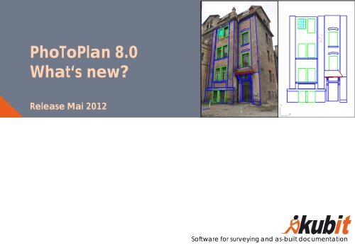
<strong>PhoToPlan</strong> <strong>8.0</strong><br />
What‘s <strong>new</strong>?<br />
Release Mai 2012<br />
Software for surveying and as-built documentation
Overview – What‘s <strong>new</strong><br />
General<br />
�Compatible with AutoCAD 2013 and AutoCAD LT 2013<br />
�Improved ergonomics in image rectification and image orientation<br />
�New user help system and many detail improvements<br />
<strong>PhoToPlan</strong> Pro<br />
�<strong>PhoToPlan</strong> Pro and Ultimate features now also in AutoCAD LT<br />
� Multiple image evaluation extended and more comfortable<br />
� New commands for evaluation in 3D<br />
<strong>PhoToPlan</strong> Ultimate<br />
� Image plans of façades, towers, vaults etc. by unwrapping photos into the plane<br />
kubit <strong>GmbH</strong> Software for surveying and as-built documentation www.kubit-software.com<br />
2
<strong>PhoToPlan</strong> - Compatibility<br />
Operating systems:<br />
� All 32 bit - and 64 bit - versions of Windows 7, Vista and XP<br />
Compatibility with AutoCAD:<br />
� Supports AutoCAD 2013 and AutoCAD LT 2013<br />
� Supports all Autodesk products based on AutoCAD 2013,<br />
like<br />
− Architecture 2013<br />
− Civil 3D 2013<br />
� Supports older AutoCAD / AutoCAD LT versions of 2010<br />
and higher<br />
� <strong>PhoToPlan</strong> Pro and Ultimate with AutoCAD LT 2012 and<br />
higher<br />
� For older systems a previous version of <strong>PhoToPlan</strong> can be<br />
provided.<br />
kubit <strong>GmbH</strong> Software for surveying and as-built documentation www.kubit-software.com<br />
3
<strong>PhoToPlan</strong> General – Improved Functions<br />
Processing and merging of bitonal images<br />
Bitonal raster images (one color and white or<br />
transparent background) can be superposed by<br />
merging them in a way that the content of both<br />
images is visible.<br />
Thus scanned plans of the same object but with<br />
different content – e.g. layout plans at different times –<br />
can be compared and change detected.<br />
In the example on the left a real-estate map and a<br />
map of wastewater sewerages have been scanned<br />
and then rectified to the same scale and merged<br />
using <strong>PhoToPlan</strong>.<br />
kubit <strong>GmbH</strong> Software for surveying and as-built documentation www.kubit-software.com<br />
4
<strong>PhoToPlan</strong> General – Improved Functions<br />
Image rectification and image<br />
orientation faster and more comfortable<br />
Automatic zoom during assignment of control<br />
points and image points speeds up the process of<br />
image rectification and image orientation.<br />
Scalable dialogs provide better overview in the<br />
point lists.<br />
Lists inside dialogs can now<br />
be sorted.<br />
Automatically<br />
zoom to the<br />
image point<br />
Click on the column header for sorting<br />
No scrolling since dialog is scalable<br />
kubit <strong>GmbH</strong> Software for surveying and as-built documentation www.kubit-software.com<br />
5
<strong>PhoToPlan</strong> General – Improved Functions<br />
Improved help system<br />
In all <strong>PhoToPlan</strong> dialogs you get help for the<br />
command you currently use.<br />
Quick access to the according manual chapter.<br />
Simply click this icon:<br />
kubit <strong>GmbH</strong> Software for surveying and as-built documentation www.kubit-software.com<br />
Click on the kubit help icon<br />
opens the manual for the<br />
particular command<br />
6
<strong>PhoToPlan</strong> Pro and Ultimate – New Features<br />
Adoptions for evaluation in 3D inside<br />
AutoCAD LT<br />
Viewing and checking the spatial evaluation<br />
results also in AutoCAD LT in 3D orbit (accessable<br />
via o or Ctrl + left mouse button)<br />
For larger objects it is helpful to define the center<br />
for the 3D orbit. Therefore the according<br />
AutoCAD command was integrated into the<br />
<strong>PhoToPlan</strong> menu.<br />
<strong>PhoToPlan</strong> displays the Z-coordinate within the<br />
drawing status bar for you to check it even inside<br />
AutoCAD LT.<br />
Spatial coordinates<br />
kubit <strong>GmbH</strong> Software for surveying and as-built documentation www.kubit-software.com<br />
7
<strong>PhoToPlan</strong> Pro – Improved Functions<br />
Multiple image evaluation<br />
The display of the Epipolar line makes the<br />
evaluation in oriented images much easier.<br />
Since corresponding points always lie on this line<br />
you may also evaluate structures for which the<br />
point assignment is not distinct.<br />
The commands for the dual image evaluation<br />
have been extended to evaluation with multiple<br />
images. Thus the evaluation can be overdetermined.<br />
This makes it possible to check the<br />
accuracy.<br />
A protocol point block is created for every point<br />
that has been determined by multiple image<br />
evaluation. For accuracy check and proof these<br />
blocks can be displayed and if needed exported<br />
to a text file.<br />
Point in first image<br />
kubit <strong>GmbH</strong> Software for surveying and as-built documentation www.kubit-software.com<br />
The same point in<br />
second image<br />
8
<strong>PhoToPlan</strong> Pro – New Features<br />
3D distance dimension<br />
The three-dimensional distance of two points<br />
within space can be determined and<br />
dimensioned with this command. The 3D<br />
dimensioning automatically adapts to the current<br />
view, so that the distance dimension can always<br />
be read clearly.<br />
The 3D dimensioning is intended for the fast<br />
determination of distances and the presentation of<br />
spatial data.<br />
No matter from which direction you look at<br />
the 3D model – you will always be able to<br />
read the distance dimensioning.<br />
kubit <strong>GmbH</strong> Software for surveying and as-built documentation www.kubit-software.com<br />
9
<strong>PhoToPlan</strong> Pro – New Features<br />
Plotting oriented images overlaid with 3D<br />
dimensions and evaluations<br />
Plotting in perspective view with the oriented image<br />
visible in the printout needs a non-wireframe visual<br />
style for the viewport that shall be plotted.<br />
<strong>PhoToPlan</strong> allows to toggle the visual style also in<br />
view ports with camera navigation views and in<br />
AutoCAD LT.<br />
This way you may print the geometry and the 3D<br />
dimension together with the oriented image and<br />
hand them on to a third party that does not use<br />
AutoCAD at all.<br />
kubit <strong>GmbH</strong> Software for surveying and as-built documentation www.kubit-software.com<br />
10
<strong>PhoToPlan</strong> Pro – New Features<br />
3D modeling with kubit planes<br />
The <strong>new</strong> "Intersection lines (3 planes)" command generates a spatial trihedron.<br />
Therefore intersection point and intersecting lines of the three selected planes are visible.<br />
The command makes the generation of 3D surface models by means of planes easier.<br />
The surfaces can be used for the creation of true orthophotos (<strong>PhoToPlan</strong> Ultimate) and for 3D<br />
drawing on surfaces (monoplotting).<br />
kubit <strong>GmbH</strong> Software for surveying and as-built documentation www.kubit-software.com<br />
11
<strong>PhoToPlan</strong> Ultimate – New Features<br />
Image plans of façades – Projection into<br />
the plane<br />
Façades, towers, roofs, vaults very often have a<br />
„prismatic surface“. <strong>PhoToPlan</strong> Ultimate now provides<br />
tools for:<br />
1. creating such surfaces easily and subsequently<br />
2. projecting the photos to the surface and creating<br />
an image plan by “unwrapping” it into the plane.<br />
In the image plan you may measure, dimension,<br />
determine areas or map damages and much more.<br />
kubit <strong>GmbH</strong> Software for surveying and as-built documentation www.kubit-software.com<br />
12
<strong>PhoToPlan</strong> Ultimate – New Features<br />
Prismatic surfaces<br />
� can of course also be used for the calculation of<br />
true orthophotos and for monoplotting.<br />
� can easily be created by drawing a best fit<br />
polyline which may also contain curves. They often<br />
approximate an object better than planes or<br />
cylinders.<br />
kubit <strong>GmbH</strong> Software für Vermessung und Dokumentation www.kubit.de<br />
13
Contact<br />
kubit <strong>GmbH</strong><br />
Tiergartenstraße 79<br />
01219 Dresden<br />
Germany<br />
phone: +49 351 418880-0<br />
fax: +49 351 418880-0<br />
email: info@kubit-software.com<br />
web: www.kubit-software.com<br />
www.kubit-software.com<br />
kubit <strong>GmbH</strong> Software for surveying and as-built documentation www.kubit-software.com 14