History Notes- - Waseca County Historical Society
History Notes- - Waseca County Historical Society
History Notes- - Waseca County Historical Society

Create successful ePaper yourself
Turn your PDF publications into a flip-book with our unique Google optimized e-Paper software.
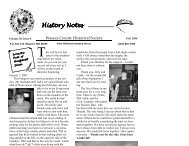
The Townships: 150 Years of Grassroots Government<br />
Alton, Blooming Grove, Byron, Freedom, Iosco, Janesville, New Richland,<br />
Otisco, St. Mary, Vivian, Wilton, Woodville<br />
"The surveyors, as they are respectively qualified,<br />
shall proceed to divide said territory into townships of<br />
six miles square, by lines running due north and south,<br />
and others crossing these at right angles, as near as<br />
may be, unless where the boundaries of the late Indian<br />
purchases may render the same impracticable, and then<br />
they shall depart from this rule no further than such<br />
particular circumstances may require. … As soon as<br />
seven ranges of townships and fractional parts of<br />
townships, in the direction from south to north shall<br />
have been surveyed, the geographer shall transmit<br />
plats thereof to the board of treasury, who shall record<br />
the same, with the report in well bound books to be<br />
kept for that purpose."<br />
he rectangular survey system was enacted by the<br />
T Land Ordinance Act of 1787. Now known as the<br />
Public Land Survey System, this system divided the western<br />
lands into grid-shaped townships and sections. Surveyed<br />
land was sold by the government, providing important<br />
revenue for the cash-starved nation. Previous to the<br />
Public Land Survey System, land was surveyed using a<br />
confusing landmark-based system called metes and<br />
bounds. The Public Land Survey System is coordinatebased,<br />
with all distances and bearings made from northsouth<br />
running meridians and east-west base lines. The<br />
largest subdivision of land is the Public Land Survey<br />
Township (as opposed to political township), and measures<br />
six miles square. Each township is comprised of 36<br />
sections, and each section has an area of one square mile<br />
(640 acres).<br />
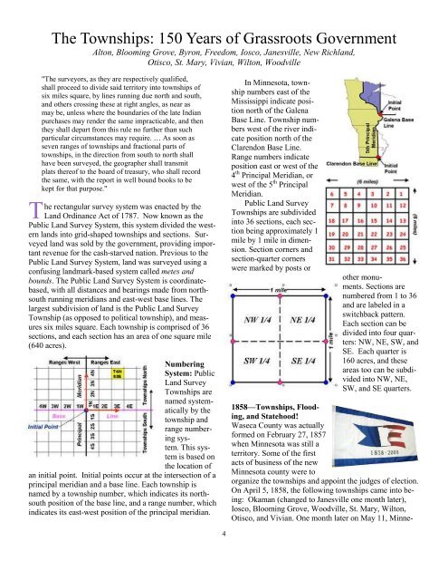
Numbering<br />
System: Public<br />
Land Survey<br />
Townships are<br />
named systematically<br />
by the<br />
township and<br />
range numberingsystem.<br />
This system<br />
is based on<br />
the location of<br />
an initial point. Initial points occur at the intersection of a<br />
principal meridian and a base line. Each township is<br />
named by a township number, which indicates its northsouth<br />
position of the base line, and a range number, which<br />
indicates its east-west position of the principal meridian.<br />
4<br />
In Minnesota, township<br />
numbers east of the<br />
Mississippi indicate position<br />
north of the Galena<br />
Base Line. Township numbers<br />
west of the river indicate<br />
position north of the<br />
Clarendon Base Line.<br />
Range numbers indicate<br />
position east or west of the<br />
4 th Principal Meridian, or<br />
west of the 5 th Principal<br />
Meridian.<br />
Public Land Survey<br />
Townships are subdivided<br />
into 36 sections, each section<br />
being approximately 1<br />
mile by 1 mile in dimension.<br />
Section corners and<br />
section-quarter corners<br />
were marked by posts or<br />
other monuments.<br />
Sections are<br />
numbered from 1 to 36<br />
and are labeled in a<br />
switchback pattern.<br />
Each section can be<br />
divided into four quarters:<br />
NW, NE, SW, and<br />
SE. Each quarter is<br />
160 acres, and these<br />
areas too can be subdivided<br />
into NW, NE,<br />
SW, and SE quarters.<br />
1858—Townships, Flooding,<br />
and Statehood!<br />
<strong>Waseca</strong> <strong>County</strong> was actually<br />
formed on February 27, 1857<br />
when Minnesota was still a<br />
territory. Some of the first<br />
acts of business of the new<br />
Minnesota county were to<br />
organize the townships and appoint the judges of election.<br />
On April 5, 1858, the following townships came into being:<br />
Okaman (changed to Janesville one month later),<br />
Iosco, Blooming Grove, Woodville, St. Mary, Wilton,<br />
Otisco, and Vivian. One month later on May 11, Minne-