History Notes- - Waseca County Historical Society
History Notes- - Waseca County Historical Society
History Notes- - Waseca County Historical Society

You also want an ePaper? Increase the reach of your titles
YUMPU automatically turns print PDFs into web optimized ePapers that Google loves.
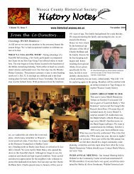
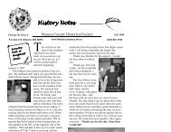
Alex McColley wore his<br />
St. Mary Township t-shirt to the<br />
opening—he purchased it at the<br />
<strong>Waseca</strong> <strong>County</strong> Fair last summer!<br />
5<br />
sota became the nation’s 32nd state of the union. On May<br />
17, Okaman was changed to Janesville. On November 1,<br />
New Richland was organized first as Norway, then changed<br />
to New Richland; and Byron. Freedom and Alton Townships<br />
would not be organized until 1864 after the Winnebago<br />
or Hochunk tribes were moved and the reservation<br />
lands were made available for sale to settlers. By 1864 <strong>Waseca</strong><br />
<strong>County</strong> had 12 townships identical in size, surveyed<br />
and marked with 36 sections. In those early days each<br />
township board had a meeting place in Section 16--the center<br />
of each township.<br />
Dealing with the county finances dominated the first<br />
half of the county agenda, but by July and August 1858 the<br />
weather caught everyone’s attention. It was said that storm<br />
after storm raged through the county flooding settlers along<br />
the Le Sueur River bottom lands. Trees were washed out,<br />
fences torn down, hay and grain stacks carried downstream.<br />
Wheat, oat, potato, corn and garden crops were lost; and of<br />
course, food and livelihood for the coming year was gone.<br />
Crop destruction created such incredible deprivation that<br />
many settlers gave up and left. But those who stayed created<br />
one of the most agriculturally rich counties in the entire<br />
state. In later years <strong>Waseca</strong> <strong>County</strong> set records for various<br />
crop production per acre—wheat, corn, soybeans.<br />
Township government is truly “grassroots government.”<br />
It was the beginning of how we were all going to<br />
live together in this new land. It was the beginning of how<br />
we would take care of each other, provide for the good of<br />
all--creating the roads and bridges to get crops to market. It<br />
was the beginning of making choices for ourselves in a free<br />
society where that is possible. Opportunities were everywhere<br />
for those willing to work at it. Providing food, services,<br />
goods, transportation, churches, were all immediately<br />
necessary for survival.<br />
WCHS’s Townships exhibit is divided into the 12 individual<br />
townships histories, photographs, stories and artifacts.<br />
The centerpiece of each is a copy of the original survey<br />
plat maps created between 1848 and 1857 by the U.S.<br />
Surveyor General of Iowa and Wisconsin, headquartered in<br />
Dubuque, IA. The narratives about the beginnings of each<br />
township, the early settlers and officials were originally<br />
researched and written by Donna Fostveit and published in<br />
the <strong>Waseca</strong> <strong>County</strong> 1879 Plat Book. At the beginning of the<br />
exhibit is an assortment of items that new immigrants and<br />
settlers may have had with them traveling to the new territory<br />
in the 1850s-- “What would you bring with you, leaving<br />
home forever, to make a new home in unknown territory?”<br />
The survey maps are available online through the collaboration<br />
by the Minnesota State Archives of MHS, the<br />
Minnesota Department of Transportation, the Office of<br />
the Secretary of State, the Department of Administration’s<br />
Land Management Information Center and the<br />
Minnesota Association of <strong>County</strong> Surveyors.