Fit For Life - Glasgow cycling route map - Glasgow City Council
Fit For Life - Glasgow cycling route map - Glasgow City Council
Fit For Life - Glasgow cycling route map - Glasgow City Council

Create successful ePaper yourself
Turn your PDF publications into a flip-book with our unique Google optimized e-Paper software.
1 River Kelvin Way<br />
At any time of year, walking or <strong>cycling</strong> along<br />
the banks of the Kelvin from Partick to<br />
Garscube Estate is one of the most rewarding<br />
experiences <strong>Glasgow</strong> has to offer, with its<br />
rich natural habitat and unspoilt beauty in the<br />
heart of the city.<br />
The <strong>route</strong> is generally off-road from where<br />
the River Kelvin meets the Clyde at <strong>Glasgow</strong><br />
Harbour. Often a choice of paths is offered<br />
depending on which side of the river you wish<br />
to use.<br />
Beyond Garscube Estate, walkers may wish<br />
to continue to Milngavie, via the Allander<br />
Water, giving a total distance of about 8 miles.<br />
The path on this section is a bit rougher than<br />
before, so allow extra time. This <strong>route</strong> could<br />
be used by those wishing to access the West<br />
Highland Way – which starts in Milngavie,<br />
thus providing a <strong>route</strong> from the centre of<br />
<strong>Glasgow</strong> to <strong>For</strong>t William, 100 miles to the<br />
north!<br />
6 The White Cart Water & A77<br />
Within this short distance of less than 4 miles, a good number of historic<br />
buildings, leisure amenities, community services and large employers<br />
exist. The <strong>route</strong> is therefore of value to both cyclists and walkers who are<br />
commuting or those on a leisure trip. Starting at Pollok House, the White<br />
Cart <strong>route</strong> follows the river upstream to Linn Park using park paths, off-road<br />
paths and quiet streets. The <strong>route</strong> also links to National Cycle Routes 7 &<br />
75 in Pollok Country Park which follow the White Cart towards Paisley, or<br />
alternatively into the <strong>City</strong> Centre.<br />
The White Cart <strong>route</strong> crosses the A77 <strong>route</strong> at Kilmarnock Road in<br />
Shawlands. Although the A77 is a busy traffic <strong>route</strong> at some locations, the<br />
cycle <strong>route</strong> is well defined between Shawlands and Kilmarnock*, mainly<br />
using cycle lanes, segregated cycle tracks and signing. Many opportunities<br />
to explore quiet country lanes exist within the countryside to the east and<br />
west of the A77 and the cycle <strong>route</strong> can also be used as a convenient way to<br />
access Whitelees Wind Farm, which includes 56 miles of off-road trails.<br />
*N.B. Although the <strong>map</strong> indicates a gap in the <strong>route</strong> through Giffnock this 1 kilometre stretch benefits from cycle facilities at<br />
the traffic lights, a wide carriageway and having camera enforcement of the 30mph speed limit.<br />
• People can be easily startled by cyclists, try using a<br />
bell or giving a friendly ‘Hello’ before you pass.<br />
• Remember that many people are hard of hearing<br />
or visually impaired – don’t assume they can see<br />
or hear you;<br />
• Be especially careful at junctions, bends<br />
and entrances;<br />
• Don‘t expect to cycle at high speeds, shared<br />
tracks are for everyone, not just cyclists;<br />
• Be prepared to slow down or stop if necessary;<br />
• Leave other people plenty of room when passing<br />
and be especially aware of small children and their<br />
unpredictable movements;<br />
• Cycle with respect for others and acknowledge<br />
those who give way to you;<br />
Cycling Code of Conduct<br />
2 <strong>For</strong>th & Clyde Canal<br />
The canal towpath provides an almost flat, off-road corridor for both cyclists<br />
and walkers. The 35 mile canal links the Clyde and <strong>For</strong>th estuaries, with an<br />
additional branch to Port Dundas in <strong>Glasgow</strong>, providing a convenient <strong>route</strong><br />
for cyclists and walkers commuting into the <strong>City</strong> Centre from the West End.<br />
Linking with the Union Canal at Falkirk, the <strong>For</strong>th & Clyde canal forms part of<br />
National Cycle Route 754 and National Cycle Route 7, between Bowling and<br />
Clydebank. Many short walks can be undertaken along the canal in what is<br />
often a tranquil setting, with much industrial heritage to be explored as well.<br />
When used in conjunction with the River Kelvin Way and the <strong>Glasgow</strong> to<br />
Loch Lomond <strong>route</strong>, an interesting leisure loop of approximately 13 miles<br />
can be formed. The River Kelvin passes underneath the canal at Maryhill<br />
and is linked via a well graded path.<br />
7 <strong>Glasgow</strong> to Paisley<br />
The 9 mile <strong>route</strong> makes use of a mix of offroad<br />
paths and parks, but also uses some<br />
quiet streets as well.<br />
The <strong>route</strong> starts 1 mile west of <strong>Glasgow</strong> <strong>City</strong><br />
Centre opposite the Scottish Exhibition and<br />
Conference Centre at Bell’s Bridge, crossing to<br />
the south side of the river. Attractions along<br />
the way include Pacific Quay, Festival Park,<br />
Pollok Country Park, the White Cart Water,<br />
Rosshall Park and then Jenny’s Well Nature<br />
Reserve near Hunterhill after about 7 miles.<br />
Once at Paisley, the <strong>route</strong> links with train<br />
services at Canal Street station, so returning<br />
by train is easy. As the path continues beyond<br />
Canal Street station, those wishing a much<br />
longer day out could consider continuing<br />
along National Cycle Routes 7 & 75 to the<br />
Clyde Coast destinations of Ardrossan,<br />
Irvine or Gourock, using predominantly<br />
off road tracks.<br />
Run <strong>Glasgow</strong><br />
Running is a quick and easy way to get fit and increase your stamina. If you are thinking about<br />
running then why not join one of the <strong>Glasgow</strong> Running Networks.<br />
The <strong>Glasgow</strong> Running Network provides year round training for all levels of runners from complete<br />
beginners to more experienced runners looking to improve fitness and race times. They cater<br />
for men and women of all ages in a supportive, safe and fun environment. All groups are led by<br />
qualified jog leaders. <strong>For</strong> further information visit www.runglasgow.org<br />
Cycle <strong>Glasgow</strong><br />
Cycling is a great exercise for overall fitness, developing muscle strength and improving<br />
circulation. If you haven’t been on a bike for a while then contact <strong>Glasgow</strong> <strong>Life</strong> for advice<br />
regarding finding basic bicycle maintenance services or tuition classes to get you back on<br />
two wheels. Contact www.glasgowlife.org.uk for further information. You can also phone<br />
the <strong>cycling</strong> information telephone line on 0141 287 9171 or email les@glasgow.gov.uk for<br />
information regarding cycle <strong>route</strong>s around <strong>Glasgow</strong>.<br />
Walk <strong>Glasgow</strong><br />
Walking has many benefits. <strong>For</strong> example:<br />
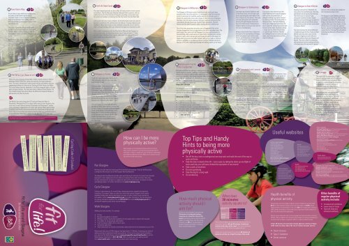
How can I be more<br />
physically active?<br />
Most people can incorporate physical activity into their<br />
daily routine, however if you have a pre-existing medical<br />
condition it is best to check with your GP before undertaking<br />
any additional physical activity. Read on for some hints and<br />
tips on how to be more active.<br />
• It’s free<br />
• No special equipment is required<br />
• Walking is within the physical capability of most people with no special skill required<br />
• It’s suitable for all age groups and abilities<br />
• It can be enjoyed safely with no risk of injury<br />
• It promotes good sleep<br />
• It has been proven to increase concentration and productivity in the workplace by up to 15%.<br />
Most people take around 3,000 steps per day (equivalent of 1.28miles). Increasing your levels of<br />
walking can lead to significant health improvements. To find out more about local led walks in<br />
your area visit the Walk <strong>Glasgow</strong> website www.glasgowlife.org.uk/healthwalks or call the<br />
Walk <strong>Glasgow</strong> Coordinator on 0141 287 0963. Why not create your own walking <strong>route</strong>s?<br />
Visit www.walkit.com for advice and assistance with <strong>route</strong> planning.<br />
3 <strong>Glasgow</strong> to Millerston<br />
The <strong>Glasgow</strong> to Millerston <strong>route</strong> is mainly on-road, with cycle lanes<br />
provided within the urban sections. It is designed to help the commuter<br />
cyclist in particular, but could be used by leisure cyclists who want to<br />
access the countryside, towns and villages to the north east of <strong>Glasgow</strong>.<br />
Starting in the <strong>City</strong> Centre opposite <strong>Glasgow</strong> Caledonian University, the<br />
<strong>route</strong> passes through Townhead, Sighthill Park, Springburn, Royston,<br />
Glenconner Park and Provanmill, before leaving the city at Millerston.<br />
One of the main attractions along the way is Hogganfield Park which<br />
includes Hogganfield Loch, a large shallow loch with a wooded island. The<br />
park is about four miles out from <strong>Glasgow</strong> <strong>City</strong> Centre and excellent for<br />
bird watching, with a wide variety of water birds, including some rarities.<br />
Access is easy, with a tarmac path all the way around the loch edge. <strong>For</strong><br />
those wishing to arrive via public transport and go for a walk, a local bus<br />
service is available on Cumbernauld Road. Cardowan Woods extends to<br />
the east of the park, where good <strong>cycling</strong> and walking tracks can be found.<br />
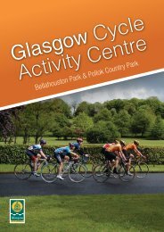
8 Bellahouston Park &<br />
Pollok Country Park<br />
Both parks are ideal for walking or <strong>cycling</strong> and can be<br />
reached easily by <strong>cycling</strong>, walking or using public transport.<br />
Options for <strong>cycling</strong> or walking within either park are<br />
extensive, with flat or hilly <strong>route</strong>s available. Why not make a<br />
longer day of it and combine a visit to both parks as part of<br />
the same outing, or contact the countryside rangers to find<br />
out what events are happening?<br />
Phone 0141 276 0924<br />
The <strong>Glasgow</strong> Cycle Activity Centre uses Bellahouston<br />
Park and Pollok Country Park and offers a range of <strong>cycling</strong><br />
activities to suit different abilities.<br />
Attractions include:<br />
• a pavilion, providing a base for formal activities;<br />
• a 420 metre long oval track;<br />
• 1.3 kilometre <strong>cycling</strong> events circuit;<br />
• 3 kilometres of graded mountain bike circuits;<br />
• local cycle <strong>route</strong>s, including National Cycle Route 7 &<br />
75 and the White Cart Way;<br />
• cycle training, phone <strong>Glasgow</strong> <strong>Life</strong><br />
on 0141 287 5079; and<br />
• a booking facility for groups.<br />
Top Tips and Handy<br />
Hints to being more<br />
physically activeve<br />
• Get off the bus, train or underground one stop early and walk the rest of the way to<br />
work and home<br />
• Take the stairs instead of the lift – over a year, by taking the stairs up one flight of<br />
stairs each day you will have climbed the equivalent of one munro!<br />
• Take a walk at lunchtime<br />
• Do some gardening<br />
• Take the dog for a long walk<br />
• Go out dancing<br />
How much physical<br />
activity should I<br />
aim for?<br />
Adults are recommended to accumulate<br />
30 minutes of moderately intense<br />
exercise on at least five days of the<br />
week (moderately intense physical activity<br />
makes you breath faster and feel warm).<br />
However only 45% of the population of<br />
Greater <strong>Glasgow</strong> and Clyde is meeting<br />
these recommended levels.<br />
Activity Calorie<br />
Consumption<br />
Female<br />
Walking 135 180<br />
Running 285 375<br />
Cycling 140 185<br />
4 <strong>Glasgow</strong> to Cambuslang<br />
What does<br />
30 minutes<br />
activity equate to?<br />
Starting at the Scottish Exhibition and<br />
Conference Centre, this off-road <strong>route</strong><br />
heads east along the north bank of the<br />
River Clyde to the <strong>City</strong> Centre. The <strong>route</strong><br />
continues along the north riverbank,<br />
passing through <strong>Glasgow</strong> Green and<br />
beyond to Dalmarnock, Parkhead and<br />
Dalbeth, before crossing to the south of<br />
the river at Cambuslang.<br />
Being so close to the river, a feature of<br />
the <strong>route</strong> is the vast number of bridges<br />
which are passed, each with its own<br />
history, providing access to the nearby<br />
areas of Tradeston, Laurieston, the<br />
Gorbals, Oatlands and Shawfield.<br />
9 <strong>Glasgow</strong> to Loch Lomond<br />
The <strong>route</strong> starts at Bell’s Bridge and is<br />
mainly off-road using former railways,<br />
paths, shared pedestrian and cycle<br />
footways and canal towpaths.<br />
The <strong>route</strong> runs west, parallel to the<br />
River Clyde, travelling some way along<br />
the former Lanarkshire Dunbartonshire<br />
railway line from Partick through<br />
Whiteinch, Scotstoun and Yoker to<br />
Clydebank. From there it follows the<br />
towpath of the <strong>For</strong>th and Clyde Canal<br />
through Dalmuir and Old Kilpatrick<br />
to Bowling. The final stretch from<br />
Bowling to Dumbarton is on an off-road<br />
path avoiding the busy A82 trunk road.<br />
Calorie<br />
Consumption<br />
Male<br />
Adults who are obese are advised that they should aim to<br />
accumulate between 60 and 90 minutes of moderate<br />
activity on five days of the week. This can be achieved<br />
in shorter bouts of 10-15mins throughout the day.<br />
Children are recommended to accumulate 60 minutes of<br />
moderate activity on at least five days of the week.<br />
This <strong>route</strong> is also referred to as the<br />
Clyde Walkway and is equally popular<br />
with cyclists and pedestrians. A<br />
pleasant walking loop can be formed<br />
by utilising some of the many paths in<br />
<strong>Glasgow</strong> Green. The Clyde Walkway<br />
forms part of National Cycle Route 75<br />
and is useful for commuting cyclists and<br />
leisure cyclists alike. <strong>For</strong> those seeking<br />
a longer journey, Route 75 continues<br />
on road through Westburn, Newton<br />
and Uddingston before passing through<br />
many, many more destinations all the<br />
way to Edinburgh.<br />
After passing through Dumbarton Town<br />
Centre the <strong>route</strong> follows the banks of<br />
the River Leven to its source in Loch<br />
Lomond at Balloch.<br />
The 21 mile long <strong>route</strong> was the first<br />
long distance cycleway in Scotland and<br />
now forms part of National Cycle Route<br />
7. Cyclists could consider extending the<br />
trip over several days, keeping going<br />
all the way to Inverness! <strong>For</strong> others,<br />
you are never far from the railway,<br />
so why not try walking sections of<br />
the <strong>route</strong>, using the train to get you<br />
there and back.<br />
Useful websites<br />
Cycling organisations<br />
www.sustrans.org.uk<br />
www.<strong>cycling</strong>scotland.org<br />
www.scottish<strong>cycling</strong>.org.uk<br />
www.british<strong>cycling</strong>.org.uk<br />
www.ctc.org.uk<br />
www.spokes.org.uk<br />
www.gobike.org<br />
www.ctcscotland.org.uk<br />
www.glasgowriderz.co.uk<br />
West of Scotland Special Olympics<br />
www.sogb.org.uk or<br />
www.scottishdisabilitysport.com<br />
Cycling projects<br />
www.commonwheel.org.uk<br />
www.dundee.ac.uk/pamis/<br />
www.bikeclub.org.uk<br />
www.freewheelnorth.org.uk<br />
www.bikeeventsscotland.com<br />
www.glasgowbikeshed.org<br />
Health benefits of<br />
physical activity<br />
Heading south east from Shawfield, the<br />
<strong>route</strong> passes through Rutherglen, Burnside,<br />
and Nerston before reaching East Kilbride.<br />
The 8 mile <strong>route</strong> is mainly on-road,<br />
using quiet residential streets, shared<br />
pedestrian and cycle footways and parks. It<br />
conveniently ends at East Kilbride railway<br />
station which provides a direct service back<br />
to <strong>Glasgow</strong> Central.<br />
The <strong>route</strong> traverses the natural difference<br />
in height between the River Clyde and East<br />
Kilbride with a few short steep inclines.<br />
The gain in height just north of Nerston<br />
provides excellent views over <strong>Glasgow</strong> and<br />
beyond. The <strong>route</strong> is ideal for commuting<br />
and recreational cyclists working and living<br />
in the busy towns through which it passes.<br />
Health<br />
www.glasgowlife.org.uk<br />
www.checkmylifestyle.com<br />
www.healthatwork.org.uk<br />
www.pathsforall.org.uk<br />
www.food.gov.uk<br />
www.ouractivenation.co.uk<br />
www.jogscotland.org.uk<br />
Events<br />
www.pedalforscotland.org<br />
www.goskyride.com<br />
www.bikeweek.org.uk<br />
www.mobilityweek-europe.org<br />
Scotland has one of the highest obesity levels in Western countries with<br />
65.1% of the population being classed as overweight and 26.8% obese.<br />
These numbers are predicated to rise, with 40% of the population obese by<br />
2030. Being overweight or obese can lead to significant health problems in<br />
later life and reduced life expectancy.<br />
Obesity occurs when we take in more energy from food and drink, including<br />
alcohol, than our bodies use. Increasing the amount of <strong>cycling</strong> and walking in<br />
our daily lives can have a significant effect on reducing obesity levels.<br />
In fact, 30 minutes of moderately intense physical activity on 5 days<br />
of the week can help reduce the risk of chronic diseases such as:<br />
• Heart disease<br />
• Type 2 diabetes<br />
• Some cancers<br />
5 <strong>Glasgow</strong> to East Kilbride<br />
Sections of the <strong>route</strong> are also suitable for<br />
short localised journey on foot.<br />
The <strong>Glasgow</strong> to East Kilbride <strong>route</strong> forms<br />
part of National Cycle Route 756 and links<br />
to National Cycle Route 75 at Rutherglen<br />
Bridge. From there the <strong>City</strong> Centre can be<br />
reached within just a few minutes. At East<br />
Kilbride, there is a 2 mile link <strong>route</strong> from<br />
Nerston, passing the Kingsgate Retail Park,<br />
James Hamilton Heritage Park and leading<br />
to the National Museum of Rural <strong>Life</strong> at<br />
Kittochside.<br />
10 Colleges<br />
This <strong>route</strong> uses a combination of cycle<br />
lanes on existing roads and off-road cycle<br />
tracks to form the most convenient <strong>route</strong><br />
for users. It stretches from the University<br />
of Strathclyde in the <strong>City</strong> Centre, to<br />
Jordanhill in the <strong>City</strong>’s West End, a<br />
distance of approximately 5 miles.<br />
The Colleges <strong>route</strong> can also be used<br />
in conjunction with other <strong>route</strong>s. <strong>For</strong><br />
example, in the <strong>City</strong> Centre, the <strong>route</strong><br />
links with the <strong>Glasgow</strong> to Millerston<br />
<strong>route</strong>. The River Kelvin Way can be easily<br />
accessed at Hillhead, about half way<br />
along the Colleges <strong>route</strong>. The western<br />
end links to National Cycle Route 7<br />
(<strong>Glasgow</strong> to Inverness) via the Jordanhill<br />
Nature Trail, with easy access to<br />
Scotstoun Stadium & Leisure Centre as<br />
well as Victoria Park.<br />
Other websites<br />
<strong>For</strong>th and Clyde Canal www.britishwaterways.co.uk/scotland/<br />
Friends of the River Kelvin www.fork.org.uk<br />
<strong>Glasgow</strong> Science Centre www.gsc.org.uk<br />
James Hamilton Heritage Park www.southlanarkshire.gov.uk<br />
Jenny’s Well Nature Reserve www.renfrewshire.gov.uk<br />
Museums & Sports Facilities in <strong>Glasgow</strong><br />
www.glasgowlife.org.uk<br />
Pollok House & Holmwood House www.nts.org.uk<br />
www.pathsforall.org.uk<br />
www.visitscotland.com/<strong>cycling</strong><br />
www.spt.co.uk/travelplanning/index.html<br />
www.secc.co.uk<br />
www.whitelee.com<br />
www.cartblanche.org.uk<br />
Travel advice<br />
www.travelinescotland.com<br />
www.sptjourneyshare.co.uk<br />
<strong>Glasgow</strong> <strong>City</strong> <strong>Council</strong> websites<br />
<strong>Glasgow</strong> <strong>City</strong> <strong>Council</strong> www.glasgow.gov.uk<br />
<strong>Glasgow</strong> <strong>City</strong> <strong>Council</strong> <strong>cycling</strong> www.glasgow.gov.uk/en/<br />
Residents/GettingAround/Cycling/<br />
<strong>Glasgow</strong> <strong>City</strong> <strong>Council</strong> parks www.glasgow.gov.uk/en/<br />
Residents/Parks_Outdoors/<br />
Other <strong>Council</strong> WebPages: www.glasgow.gov.uk/en/Residents/<br />
Leisure_Culture/Parks_Outdoors/glasgowmountainbikecircuit.htm<br />
Other benefits of<br />
regular physical<br />
activity include:<br />
• Increased self-confidence<br />
• Lower levels of stress<br />
• Improved sleep and<br />
enhanced wellbeing<br />
<strong>Fit</strong>_for_<strong>Life</strong>07032011.indd 1 21/03/2011 16:29
Bike Shops<br />
<strong>Fit</strong> for <strong>Life</strong> around <strong>Glasgow</strong><br />
Be more active more often<br />
Parkhall<br />
Within the area of this <strong>map</strong>, there are ample opportunities to visit some of the<br />
many attractions using the <strong>cycling</strong> and walking <strong>route</strong>s shown. Although still within<br />
built-up areas, many of these <strong>route</strong>s give the feel of the open countryside. <strong>Glasgow</strong>’s<br />
public transport system is geared to the needs of the city and its inhabitants making access<br />
to parks and other attractions straight forward and convenient. It has therefore never been<br />
easier to travel in a way that benefits your health and the environment.<br />
The <strong>route</strong>s suggested in this leaflet are just a selection of the many <strong>cycling</strong> and walking <strong>route</strong>s in and around <strong>Glasgow</strong>.<br />
9<br />
All of the <strong>route</strong>s can be used by both cyclists and walkers, but some may be more suited to one activity than the other.<br />
The symbols shown alongside the <strong>route</strong>s below identify where this is the case.<br />
1 RIVER KELVIN WAY<br />
2 FORTH & CLYDE CANAL<br />
3 GLASGOW TO MILLERSTON<br />
4 GLASGOW TO CAMBUSLANG<br />
5 GLASGOW TO EAST KILBRIDE<br />
6 THE WHITE CART WATER & A77<br />
7 GLASGOW TO PAISLEY<br />
8 BELLAHOUSTON PARK AND POLLOK COUNTRY PARK<br />
9 GLASGOW - LOCH LOMOND<br />
10 COLLEGES<br />
FIT FOR LIFE - ROUTES<br />
CYCLEWAY-ON ROAD<br />
CYCLEWAY-OFF ROAD<br />
BUS CORRIDOR<br />
CYCLEWAY-CONSTRUCTION/DESIGN<br />
Route suitable for<br />
Walker Cyclist<br />
Cycle Routes Key<br />
COMMUNITY CENTRE<br />
RECREATION CENTRE<br />
PUBLIC HALL<br />
HALL OR THEATRE<br />
SPORT AND RECREATION<br />
MUSEUM<br />
LIBRARY AND LEARNING CENTRE<br />
SWIMMING POOL<br />
<strong>City</strong> Centre Gradient and Traffic Density Map<br />
LEISURE/SPORTS CENTRE<br />
Reproduced by permission of Ordnance Survey on behalf of HMSO. © Crown Copyright and database right 2009. All rights reserved. Ordnance Survey Licence number 100023379.<br />
Neilston<br />
Duntocher<br />
Clydebank<br />
Paisley<br />
Seedhill<br />
Renfrew<br />
7<br />
Charlston<br />
Thornly<br />
Park<br />
Dykebar<br />
Hospital<br />
Crossmill<br />
Clydebank<br />
and District<br />
Golf Course<br />
Hardgate<br />
Barrhead<br />
Dovecothall<br />
Faifley<br />
To Loch Lomond<br />
Renfrew<br />
Golf<br />
Course<br />
Barshaw<br />
Golf Course<br />
Barshaw<br />
Park<br />
Robertson<br />
Park<br />
Hawkhead<br />
Hospital<br />
Whitecrook<br />
North<br />
Arkleston<br />
Cemetery<br />
Barshaw<br />
Hospital<br />
Yoker<br />
Oldhall<br />
Ralston Golf Course<br />
Salterland<br />
Caravan<br />
Park<br />
Cowan<br />
Park<br />
Drumry<br />
Auchenback<br />
Cleddans<br />
Yoker<br />
Dean<br />
Park<br />
Drumchapel<br />
Park<br />
Drumchapel Pool<br />
Hillington<br />
Penilee<br />
Penilee<br />
Recreation<br />
Ground<br />
Garscadden<br />
Yoker<br />
Recreation<br />
Ground<br />
Crookston Road<br />
South<br />
Nitshill<br />
Windyhill Golf Course<br />
Drumchapel<br />
Blawarthill<br />
Hospital<br />
Yoker Sports CentreGarscadden<br />
To Paisley<br />
10<br />
Hillington West<br />
Leverndale<br />
Hospital<br />
Donald Dewar Sports Centre<br />
Braehead<br />
Crookston<br />
Bonnyholm<br />
Avenue<br />
Ross Football<br />
Hall<br />
Hospital<br />
Rosshall<br />
Park<br />
Blairdardie<br />
Knightswood<br />
Crookston<br />
Househill Park<br />
Nitshill<br />
Nitshill<br />
Drumchapel<br />
Hospital<br />
Drumchapel<br />
Blairdardie<br />
Knightswood<br />
Golf Course<br />
Garscadden<br />
Dumbarton Road<br />
Bearsden Golf<br />
Course<br />
Knightswood<br />
Park<br />
Scotstounhill<br />
Hillington East<br />
7<br />
9<br />
2<br />
Crookston<br />
Woods<br />
Shieldhall<br />
Househillwood<br />
Priesthill<br />
Southpark<br />
Village<br />
Bearsden<br />
Newton Mearns<br />
Stonedyke<br />
Westerton<br />
Westerton<br />
Netherton<br />
Jenny<br />
Lind<br />
Jordanhill<br />
Scotstoun Leisure Centre<br />
Scotstoun<br />
Pollok<br />
Darnley<br />
Cardonald<br />
Park<br />
Cardonald<br />
South<br />
Pollok<br />
Recreation<br />
Ground<br />
Scotstoun Leisure<br />
Lochar<br />
Park<br />
Whiteinch<br />
M77<br />
Priesthill & Park Darnley<br />
St. Andrews College<br />
Of Education<br />
FORTH & CLYD E CANAL<br />
University of Strathclyde:<br />
Jordanhill Campus<br />
GLASGOW - LOCH LOMOND<br />
Mosspark<br />
GLASGOW TO PAISLEY<br />
Southern<br />
General<br />
Hospital<br />
Pollok Leisure Centre<br />
6<br />
Cardonald<br />
Craigton<br />
Crematorium<br />
Nethercraigs<br />
Patterton<br />
Temple<br />
Recreation<br />
Ground<br />
Victoria Park<br />
Temple<br />
Drumoyne<br />
Shieldhall Road<br />
Craigton<br />
Carnwadric<br />
Arden<br />
Deaconsbank<br />
Crookfur<br />
Crow Road<br />
Paisley Road West<br />
Corkerhill<br />
Cowglen<br />
Hospital<br />
Pollok<br />
Golf<br />
Course<br />
A77 R OUTE<br />
Canniesburn<br />
Hospital<br />
Cairnhill<br />
Woods<br />
Elder Park<br />
Mosspark<br />
Cowglen Golf Course<br />
Deaconsbank<br />
Golf<br />
Course<br />
Bearsden<br />
Milngavie<br />
Hillfoot<br />
Anniesland<br />
Jordanhill<br />
Kennishead<br />
Kennishead<br />
Hyndland<br />
Broomhill<br />
Hyndland<br />
Govan<br />
M8<br />
Haggs Castle<br />
Golf Course<br />
Pollok House<br />
Naseby<br />
Park<br />
Barrhead Road<br />
King<br />
George V<br />
Park<br />
Whitecraigs<br />
Golf Course<br />
Cross<br />
Park<br />
Binghams<br />
Pond<br />
Thornliebank<br />
Broom<br />
Hillfoot<br />
Dawsholm Park<br />
Great Western Road<br />
Gartnavel Royal<br />
General Hospital<br />
Palace of Art Sports Centre<br />
8<br />
10<br />
COLLEGES<br />
BELLAHOUSTON<br />
PARK<br />
8<br />
1<br />
Anniesland<br />
Hayburn<br />
Park<br />
Nitshill Road<br />
Partickhill<br />
Bellahouston<br />
Dumbreck<br />
Whitecraigs<br />
Kelvindale<br />
Partick<br />
Partick<br />
Ibrox<br />
Mansewood<br />
High<br />
Park<br />
Thornliebank<br />
Eastwood<br />
Park<br />
New<br />
Kilpatrick<br />
Cemetery<br />
Maryhill Road<br />
Whitecraigs<br />
Milngavie<br />
West of<br />
Scotland<br />
Science Park<br />
Douglas<br />
Park<br />
Golf<br />
Course<br />
Killermont<br />
Golf Course<br />
Kelvindale<br />
Station<br />
Park<br />
R i v e r C l y d e<br />
POLLOK COUNTRY<br />
PARK<br />
Auldhouse<br />
Park<br />
Caldercuilt<br />
Recreation<br />
Ground<br />
Maryhill Park<br />
Williamwood<br />
Kelvinside<br />
Dowanhill<br />
Yorkhill<br />
Park<br />
Downhill<br />
Park<br />
Nether Pollok<br />
Hillpark<br />
Cathcart Castle<br />
Golf Course<br />
1<br />
Dougalston Golf Course<br />
Temple Woods<br />
Maryhill<br />
Dumbreck<br />
Pollokshaws West<br />
RIVER KELVI N WAY<br />
Kelvin Hall I.S.A.<br />
9<br />
6<br />
Botanic<br />
Gardens<br />
Festival Park<br />
Hillhead<br />
University Of <strong>Glasgow</strong><br />
Western<br />
Infirmary<br />
Royal<br />
Hospital<br />
for Sick<br />
Children<br />
(Yorkhill)<br />
Plantation Park<br />
Maxwell Park<br />
Giffnock<br />
Clarkston<br />
Busby<br />
Gilshochill<br />
Kinning<br />
Park<br />
Pollokshields<br />
North<br />
Kelvinside<br />
Maxwell Park<br />
Strathbungo<br />
Crossmyloof<br />
Pollokshaws<br />
A77 ROUTE<br />
Shawlands<br />
Summerston<br />
Summerston<br />
Maryhill<br />
Cessnock<br />
Titwood<br />
Park<br />
River<br />
Kelvin<br />
Walkway<br />
Newlands<br />
Newlands<br />
Park<br />
Kelvingrove<br />
Park<br />
Exhibition Centre<br />
Giffnock<br />
To Kilmarnock<br />
Maryhill Leisure Centre<br />
1<br />
Pollokshaws East<br />
Williamwood<br />
6<br />
Gilshochill<br />
Cadder<br />
Maxwell<br />
Square<br />
Pollokshields West<br />
Williamwood<br />
Golf<br />
Course<br />
Langside<br />
Victoria<br />
Infirmary<br />
Muirend<br />
Sheddens<br />
Balmore Road<br />
Ruchill<br />
Ruchill Park<br />
Queens Park<br />
Albert<br />
Park<br />
Langside<br />
Muirend<br />
Clarkston<br />
Woodside<br />
Charing Cross<br />
Tradeston<br />
Possil Loch<br />
Nature Reserve<br />
Ruchill Hospital (Closed)<br />
Anderston<br />
WHITE CART WATER<br />
2<br />
Charing Cross<br />
Hamiltonhill<br />
Queen's<br />
Park<br />
<strong>Glasgow</strong> Central<br />
Argyle Street<br />
Merchant <strong>City</strong><br />
Mount<br />
Florida<br />
Parkhouse<br />
High Possil<br />
Possilpark<br />
Port Dundas<br />
Garnethill Cowcaddens<br />
Custom House Quay<br />
Pollokshields East<br />
Govanhill<br />
Park<br />
Govanhill<br />
Queens Park<br />
Holmlea<br />
Park<br />
Queens Park<br />
Recreation<br />
Ground<br />
Holmwood<br />
House (NTS)<br />
Busby<br />
Lambhill<br />
Possilpark & Parkhouse<br />
North Woodside Leisure Centre<br />
Cathcart<br />
Riccarton<br />
Street<br />
Park<br />
Crosshill<br />
Holyrood Sports Centre<br />
6<br />
Cathkin Park<br />
Mount Florida<br />
Hampden<br />
Park<br />
Cathcart<br />
Linn<br />
Park<br />
Golf<br />
Course<br />
2<br />
Balmore Golf Course<br />
Milton<br />
Townhead<br />
10<br />
<strong>Glasgow</strong> Queen Street<br />
George<br />
Square<br />
Aitkinhead Road<br />
Thorntonhall<br />
Cowlairs Park<br />
Ashfield<br />
4<br />
Gorbals Leisure Centre<br />
Gorbals<br />
Toryglen<br />
Playing<br />
Fields<br />
Toryglen<br />
Park<br />
Ardmay Park<br />
Kings Park<br />
Kings Park<br />
Bishopbriggs Golf Course<br />
Milton<br />
Park<br />
Mountain Bike<br />
Circuit<br />
Colston<br />
Balgrayhill<br />
Bishopbriggs<br />
Springburn Leisure CentreSpringburn<br />
Keppoch<br />
Castlemilk<br />
Eastfield Park<br />
Sighthill<br />
Sighthill<br />
Park<br />
<strong>Glasgow</strong><br />
Green<br />
Toryglen<br />
King's Park<br />
Golf Course<br />
Royal<br />
Infirmary<br />
High Street<br />
Croftfoot<br />
Springburn Road<br />
Calton<br />
Richmond Park<br />
Carmunnock<br />
Petershill<br />
Park<br />
<strong>Glasgow</strong> Road<br />
Barlia Sports<br />
Complex<br />
Castlemilk Pool<br />
Springburn<br />
Croftfoot<br />
Cawder Golf Course<br />
Bridgeton<br />
Rutherglen<br />
Dennistoun<br />
East Kilbride<br />
Cadder<br />
Balornock<br />
Woodhill<br />
Auchinairn<br />
Barmulloch<br />
Blochairn<br />
Camlachie<br />
Dalmarnock<br />
Provanmill<br />
High<br />
Burnside<br />
Blackhill<br />
Parkhead<br />
Robroyston<br />
Royston Riddrie<br />
Crownpoint<br />
Sports<br />
Complex<br />
Castlemilk Park<br />
Springburn Park<br />
Glenconnor Park<br />
Cathkin Braes Country Park<br />
5<br />
Castlemilk Sports Centre<br />
Stobhill<br />
Hospital<br />
Barnhill<br />
Bellgrove<br />
Bridgeton<br />
Dalmarnock<br />
Hairmyres<br />
Bishopbriggs<br />
3<br />
Rutherglen<br />
Cemetery<br />
Littlehill<br />
Golf Course<br />
Broomfield<br />
Park<br />
Whitehill Pool<br />
Duke Street<br />
Cathkin Braes<br />
Golf Course<br />
Blairbeth Golf Course<br />
Alexandra Park<br />
Golf Course<br />
Alexandra Park<br />
Haghill<br />
The<br />
Cairngorm<br />
Residential<br />
Park<br />
GLASGOW TO MILLERSTON<br />
Rutherglen<br />
Hogarth Park<br />
Helenvale<br />
Park<br />
Helensea<br />
Park<br />
Cumbernauld Road<br />
Riddrie Park<br />
Carntyne<br />
Alexandra Parade<br />
Haghill Park Sports Centre<br />
4<br />
GLASGOW TO CAMBUSLANG<br />
Burnside<br />
Braidfauld<br />
London Road<br />
5<br />
Hayston Golf Course<br />
2<br />
East Kilbride<br />
To Falkirk<br />
Tollcross Park<br />
Hogganfield<br />
South<br />
Carntyne<br />
Whitlawburn<br />
Lethamhill Golf Course<br />
Edinburgh Road<br />
Greenfield Park<br />
Football<br />
Carntyne<br />
Shettleston<br />
Day<br />
Hospital<br />
Tollcross Leisure Centre<br />
Cambuslang<br />
GLASGOW TO EAST KILBRIDE<br />
5<br />
Tollcross<br />
Kirkhill<br />
Golf<br />
Course<br />
Kirkintilloch Golf Course<br />
Gallowhill<br />
Hogganfield<br />
Park<br />
Croftcroighn<br />
Park<br />
Cranhill Park<br />
Greenfield Park<br />
Shettleston<br />
Kirkhill<br />
Kirkintilloch<br />
Millerston<br />
Ruchazie<br />
Lightburn<br />
Hospital<br />
Craigend<br />
Cranhill<br />
Buckingham<br />
Park<br />
4<br />
Cambuslang<br />
Golf<br />
Course<br />
Orchard<br />
Park<br />
Budhill<br />
Park<br />
Cambuslang<br />
Halfway<br />
M80<br />
University Of Strathclyde<br />
Sports Ground<br />
Kirkhill<br />
Golf Course<br />
Shettleston<br />
Sandyhills Park<br />
Sandyhill Golf Course<br />
Carmyle<br />
Springboig<br />
Carmyle<br />
Carmyle<br />
New<br />
Park<br />
Westburn<br />
Cemetery<br />
Lenzie<br />
Lenzie<br />
Golf<br />
Course<br />
To Cumbernauld<br />
Barlanark<br />
Park<br />
Westside<br />
Lenzie<br />
Hallside<br />
Flemington<br />
Oxgang<br />
Stepps<br />
Garthamlock<br />
M8<br />
Queenslie<br />
Lenzie<br />
Hospital<br />
Barlanark<br />
Mount<br />
Vernon<br />
Mount<br />
Vernon<br />
Park<br />
Harestanes<br />
Wellhouse<br />
Early Braes<br />
Barrachnie<br />
Park<br />
Auld<br />
Aisle<br />
Cemetery<br />
Stepps<br />
Newton<br />
Sherbourne<br />
Park<br />
Woodilee<br />
Hospital<br />
Canal Towpaths: Canal towpaths Muirhead are often narrow and<br />
Auchinlea Park<br />
Easterhouse Sports Centre<br />
Mount Vernon<br />
Shared Paths: Paths that can legally be shared by cyclists and<br />
pedestrians will Waterside be clearly signed as such. Although cyclists<br />
and pedestrians can mix perfectly safely on shared paths,<br />
cyclists should warn people as they approach from behind by<br />
ringing their bell or saying ‘Excuse me’.<br />
Footways: Unless it is clearly marked as a cycle track, <strong>cycling</strong><br />
on the footway is illegal. It can also be inconsiderate since it<br />
may put other road users at risk of injury, especially elderly<br />
pedestrians or young children.<br />
Traffic Lights: Failing to stop at a red traffic light is illegal and<br />
irresponsible. Not only does it diminish the respect of cyclists<br />
in the eyes of other road users, it puts you and other road users<br />
at unnecessary risk of injury.<br />
After Dark: Remember to use front and rear lights after dark.<br />
Modern LED cycle lights are cheap and reliable, and the code<br />
stresses the importance of always using lights after dark.<br />
Lights can be supplemented by using high visibility clothing<br />
such as reflective bands or bibs?<br />
Cardowan<br />
Provanhall<br />
Easterhouse Pool<br />
Kildermorie<br />
Garrowhill<br />
Garrowhill<br />
Park<br />
Blairtummock<br />
Blairtummock<br />
Park<br />
Easthall<br />
Garrowhill<br />
Baillieston<br />
Blairtummock<br />
Baillieston<br />
Broomhouse<br />
Broomhouse<br />
Park<br />
Garnkirk<br />
Easterhouse<br />
Easterhouse<br />
Crosshill<br />
Park<br />
Swinton<br />
Calderbraes<br />
Golf Course<br />
Blantyre<br />
Gartloch<br />
James<br />
Lindsay<br />
Memorial<br />
Park<br />
Lochend<br />
Gartcosh<br />
Commonhead<br />
Rogerfield<br />
Birkenshaw<br />
Kylepark<br />
Uddingston<br />
Uddingston<br />
Livingstone<br />
Memorial<br />
Park<br />
Blantyre Public Park<br />
Blantyre<br />
Bedlay<br />
Cemetery<br />
sightlines can be restricted at bridges. These problems can be<br />
overcome by slowing down, making your presence known, and<br />
Crow Wood Golf Course<br />
giving other users as much space as possible.<br />
Mount Ellen<br />
Golf Course<br />
Bothwell Castle<br />
Park<br />
Golf Course<br />
Miles<br />
Udston Hospital<br />
0 0.5 1 2 3<br />
0 0.5 1 2 3 4 5<br />
Kilometres<br />
<strong>Fit</strong>_for_<strong>Life</strong>07032011.indd 2 21/03/2011 16:29<br />
To Edinburgh