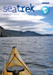
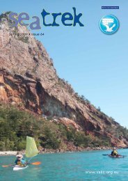
Sea Trek Issue 70 - Victorian Sea Kayak Club
Sea Trek Issue 70 - Victorian Sea Kayak Club
Sea Trek Issue 70 - Victorian Sea Kayak Club

Create successful ePaper yourself
Turn your PDF publications into a flip-book with our unique Google optimized e-Paper software.
oad to Queenscliff, but this was a bit of<br />
a walk with the boat. I was fortunate to<br />
find the caretaker onsite at Golightly<br />
Caravan Park, which is near the foreshore<br />
park, doing some cleaning. This park is<br />
normally for annual residents only. As it<br />
was quiet, the caretaker, Kaylene was<br />
happy for me to throw up my tent. Fortunate<br />
timing for me. This park is next to a<br />
concrete ramp leading up from the beach.<br />
When the seasonal park is open, you<br />
would use this same ramp for access.<br />
At 0710 hrs on Tuesday June 28 I set off<br />
in half-light for Shortland Bluff approx<br />
3.5 km away. I was targeting reaching the<br />
Bluff by 0730 hrs, so I had 2 hrs of flood<br />
tide to work with on my way to Portarlington.<br />
With flood tide assistance the<br />
GPS was recording 8-11km per hour with<br />
little paddling effort. There was virtually<br />
no wind, but some unusual cloud formations<br />
further up the bay. By 0745 hrs I<br />
was in sunshine and moving N past the<br />
rear end of the Queenscliff / Sorrento<br />
ferry parked in its dock. There was little<br />
traffic on the VHF or on the water.<br />
I cruised up the E coast of Swan Island<br />
which is part golf course and part military<br />
training establishment. At the NE tip<br />
I stopped for a break to take some photos<br />
of the J class submarine wreck. There<br />
was a small pod of dolphins at the S end<br />
of the wreck cruising in the current. This<br />
wreck was placed there by the military<br />
years ago when the submarine was sold<br />
for scrap.<br />
They bought it and placed it in its current<br />
location with the intention of using the<br />
generator on board to power the base on<br />
shore. Many years later it is a rusting<br />
hulk filled with sand, in a similar fashion<br />
to the one within the Sandringham Yacht<br />
<strong>Club</strong> Marina. I headed N past the Coles<br />
navigation marker.<br />
Shortly after this, the cloud formation<br />
that I had noted earlier enveloped me. It<br />
turned out to be fog that a light N wind<br />
had blown onto the bay.<br />
Visibility was down to as low as 50m at<br />
times. I opted to stay close to shore to<br />
ensure I was out of the way of recreational<br />
vessels that I could hear but not<br />
see. In the distance cargo vessels where<br />
sounding their fog horns and talking to<br />
Lonsdale Light regarding the lack of<br />
visibility. I knew where they would be<br />
travelling but not the recreational craft.<br />
Using what visibility was available and a<br />
mapping GPS I contoured my way up the<br />
coast to Portarlington. I tracked past St<br />
Leonards and Indented Head without<br />
sighting them. I was within 80m of the<br />
marina at Portarlington before a faint<br />
outline and dark shape could be made<br />
out. In these sort of conditions it is easy<br />
to start disbelieving your compass.<br />
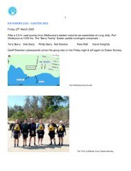
I overnighted at the Portarlington <strong>Sea</strong>side<br />
Resort which is right on the beach, perfect<br />
for those travelling by boat after a<br />
30km day. In some ways the part between<br />
the N end of Swan Island and<br />
Portarlington was like being on an indoor<br />
exercise bike as there wasn’t any scenery<br />
to distract the eye or mind. As a result the<br />
distance and time seemed to take forever<br />
to pass. I will have to redo this coastal<br />
section in the future to see what it looks<br />
like. By 1500 hrs the fog had lifted to<br />
reveal a beautiful sunny couple of late<br />
afternoon hours.<br />
The plan for Wednesday was to head to<br />
Williamstown, or if not feeling great, as<br />
far as I got and Heather would collect me<br />
after she finished work. The other option<br />
had been to stay at Indented Head and<br />
head directly for Ricketts point, a distance<br />
of 32 km. I had decided against this<br />
due to the forecast for fog and a NE wind<br />
up to 15 kn.<br />
At 0820 hrs on Wednesday June 29 I<br />
launched heading straight across to Werribee<br />
South. This is a crossing of approximately<br />
16.5 km and crosses the start of<br />
Richards Channel which services Corio<br />
Bay. Fog was in evidence with visibility<br />
varying between 50-100 m. I had waypoints<br />
for my crossing loaded into my<br />
GPS and a backup unit. I wanted to ensure<br />
that I knew when I was approaching<br />
Richards Channel to ensure I crossed it<br />
quickly and without commercial marine<br />
traffic nearby.<br />
From the chatter on the VHF it was apparent<br />
that the fog horn I could hear to<br />
the E was out bound from Richards<br />
Channel. The only concern now was the<br />
recreational craft. Conditions were calm<br />
with little wind to move the fog.<br />
About 5 km across, the fog dissipated<br />
and it was a sunny day. I had a short<br />
break near the Werribee River mouth and<br />
then headed to Point Cook. I then tracked<br />
directly to Point Gellibrand, behind<br />
which is the Williamstown cricket<br />
ground, and then the breakwater at Williamstown.<br />
These last few legs had a steady head<br />
wind accompanying me from the NE. It<br />
seemed to take forever for the breakwater<br />
at Williamstown to come into view. I<br />
passed the time ball tower and rounded<br />
the breakwater, passing the blue stone<br />
dry dock in the ship yards.<br />
The journey was over when I wheeled the<br />
boat out of the water at 1600 hrs between<br />
the Workshop Jetty and the Royals Yacht<br />
<strong>Club</strong> pens, Williamstown.<br />
A solid day of 40 km was complete and it<br />
felt like it<br />
11