nä ala hele ma kai o kohala hema - Kumu Pono Associates LLC
nä ala hele ma kai o kohala hema - Kumu Pono Associates LLC
nä ala hele ma kai o kohala hema - Kumu Pono Associates LLC
- TAGS
- hele
- kohala
- hema
- kumu
- pono
- associates
- kumupono.com

You also want an ePaper? Increase the reach of your titles
YUMPU automatically turns print PDFs into web optimized ePapers that Google loves.
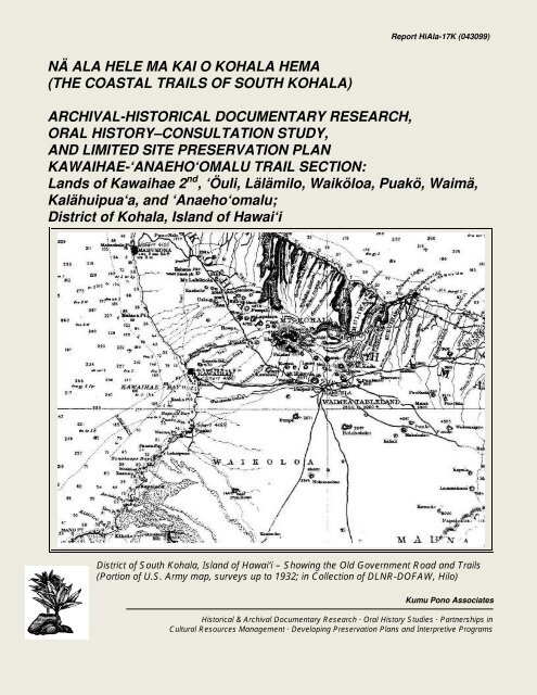
NÄ ALA HELE MA KAI O KOHALA HEMA<br />
(THE COASTAL TRAILS OF SOUTH KOHALA)<br />
Report HiAla-17K (043099)<br />
ARCHIVAL-HISTORICAL DOCUMENTARY RESEARCH,<br />
ORAL HISTORY–CONSULTATION STUDY,<br />
AND LIMITED SITE PRESERVATION PLAN<br />
KAWAIHAE-‘ANAEHO‘OMALU TRAIL SECTION:<br />
Lands of Kawaihae 2 nd , ‘Öuli, Lälämilo, Waiköloa, Puakö, Waimä,<br />
Kalähuipua‘a, and ‘Anaeho‘o<strong>ma</strong>lu;<br />
District of Koh<strong>ala</strong>, Island of Hawai‘i<br />
District of South Koh<strong>ala</strong>, Island of Hawai‘i – Showing the Old Government Road and Trails<br />
(Portion of U.S. Army <strong>ma</strong>p, surveys up to 1932; in Collection of DLNR-DOFAW, Hilo)<br />
<strong>Kumu</strong> <strong>Pono</strong> <strong>Associates</strong><br />
Historical & Archival Documentary Research · Oral History Studies · Partnerships in<br />
Cultural Resources Management · Developing Preservation Plans and Interpretive Programs
NÄ ALA HELE MA KAI O KOHALA HEMA<br />
(THE COASTAL TRAILS OF SOUTH KOHALA)<br />
ARCHIVAL-HISTORICAL DOCUMENTARY RESEARCH,<br />
ORAL HISTORY–CONSULTATION STUDY,<br />
AND LIMITED SITE PRESERVATION PLAN<br />
KAWAIHAE-‘ANAEHO‘OMALU TRAIL SECTION:<br />
Report HiAla-17K (043099)<br />
Lands of Kawaihae 2 nd , ‘Öuli, Lälämilo, Waiköloa, Puakö, Waimä,<br />
Kalähuipua‘a and ‘Anaeho‘o<strong>ma</strong>lu;<br />
District of Koh<strong>ala</strong>, Island of Hawai‘i<br />
(TMK Overview Sheets: 6-2, 6-8 & 6-9)<br />
BY<br />
Kepä Maly • Cultural Historian & Resource Specialist<br />
PREPARED FOR<br />
Nä Ala Hele Program Manager (Hawai‘i Island)<br />
State Division of Forestry and Wildlife<br />
P.O. Box 4849<br />
Hilo, Hawai‘i 96720<br />
April 30, 1999<br />
©1999 <strong>Kumu</strong> <strong>Pono</strong> <strong>Associates</strong><br />
<strong>Kumu</strong> <strong>Pono</strong> <strong>Associates</strong><br />
Kepä Maly, Consultant<br />
Historical & Archival Documentary Research · Oral History Studies · Partnerships in<br />
Cultural Resources Management · Developing Preservation Plans and Interpretive Programs<br />
554 Keonaona St. · Hilo, Hawai‘i 96720 · (ph./fax) 808.981.0196 · (e-<strong>ma</strong>il) kumupono@hawaii.rr.com
DETAILED ABSTRACT<br />
At the request of Rodney Oshiro, of the Department of Land and Natural Resources-Division<br />
of Forestry and Wildlife, Trails and Access program <strong>ma</strong>nager on the island of Hawai‘i,<br />
cultural resources specialist, Kepä Maly (<strong>Kumu</strong> <strong>Pono</strong> <strong>Associates</strong>), conducted a study to<br />
research and identify cultural-historical resources of the <strong>ala</strong> <strong>hele</strong> (trails) — with particular<br />
emphasis on the <strong>ala</strong> loa (long path or trail) – <strong>ala</strong> nui aupuni (government road) — of South<br />
Koh<strong>ala</strong> (Kawaihae to ‘Anaeho‘o<strong>ma</strong>lu Section), on the Island of Hawai‘i (TMK: overview<br />
sheets 6-2, 6-8 & 6-9). The study area, approxi<strong>ma</strong>tely eleven and a half (11.5) miles long,<br />
includes a portion of the State’s Hawai‘i Island “Demonstration Trail” system—Ala Kaha<strong>kai</strong>—<br />
which extends approxi<strong>ma</strong>tely 35 miles, from Kawaihae to Kailua-Kona.<br />
In regards to native and historic terminology used to identify types of Hawaiian trails, it is<br />
noted here that the “Ala Kaha<strong>kai</strong>” system is <strong>ma</strong>de up of two types of native trails. From<br />
Kawaihae 2 nd to middle section of Kalähuipua‘a, the historical alignment identified in native<br />
accounts and cartographic resources, generally follows the alignment of the <strong>ala</strong> loa-<strong>ala</strong> nui<br />
aupuni. The second part of the present-day Ala Kaha<strong>kai</strong> alignment, from the middle section<br />
of Kalähuipua‘a to the ‘Anaeho‘o<strong>ma</strong>lu-Pu‘u Anahulu boundary (<strong>ma</strong>rking the boundary<br />
between South Koh<strong>ala</strong> and North Kona) follows s<strong>ma</strong>ller localized <strong>ala</strong> <strong>hele</strong> (also known as<br />
<strong>ala</strong> lihi <strong>kai</strong>, or shore line trails) which are of varying ages, ranging from ancient to recent. The<br />
more recent sections of the alignment have in part been determined by development<br />
activities over the last 25 years. It will be seen in this study that historical documentation<br />
places the early alignments of the <strong>ala</strong> loa-<strong>ala</strong> nui aupuni from middle Kalähuipua‘a to the<br />
South Koh<strong>ala</strong>-North Kona boundary some distance inland, generally following the<br />
‘Anaeho‘o<strong>ma</strong>lu-Waiköloa boundary to North Kona.<br />
This study provides land <strong>ma</strong>nagers and interested parties with important historical<br />
documentation pertaining to some of the significant cultural and natural features of the<br />
landscape of the South Koh<strong>ala</strong> coastal trail system, and the relationship of those resources<br />
to other resources of the larger ahupua‘a (native Hawaiian land units) crossed by the trail.<br />
While most of the area crossed by the coastal trail system has undergone extensive<br />
archaeological study, that work has not been compiled into one comprehensive document<br />
(nor does it generally focus on trails). Several key archaeological surveys for the present<br />
study area are cited, and those survey reports along with the detailed archival-historical<br />
documentation cited in this study provide readers with foundational documentation for<br />
implementation of a long-term program of care, <strong>ma</strong>nagement, and interpretation of the <strong>ala</strong><br />
<strong>hele</strong> (a general Hawaiian term used to identify trails) in the Kawaihae-‘Anaeho‘o<strong>ma</strong>lu region.<br />
Study Methodology<br />
The work conducted as a part of this study included three basic components: (1) research<br />
and report findings of archival and historical literature; (2) conducting oral history interviews<br />
and consultation with ka<strong>ma</strong>‘äina (native residents) and others with knowledge of the land;<br />
and (3) development of a limited preservation plan with recommendations for protection and<br />
interpretation of the trail and cultural-historic resources along the trail so that they can be<br />
appropriately <strong>ma</strong>naged in the future. The latter phase of work—based on specific<br />
recommendations by interviewees and consultation participants and standard practice of the<br />
Department of Land and Natural Resources-Historic Preservation Division—sets a<br />
foundation for development of long-term protection measures. Further detailed trail and<br />
Ke Ala Loa-Ala Nui Aupuni <strong>Kumu</strong> <strong>Pono</strong> <strong>Associates</strong><br />
Kawaihae to ‘Anaeho‘o<strong>ma</strong>lu, Koh<strong>ala</strong> ii April 30, 1999
archaeological site treatment recommendations will also be determined as archaeological<br />
site recordation is completed.<br />
In the period between April to December, 1998, the author conducted detailed research of<br />
archival-historical literature. The pri<strong>ma</strong>ry documentation cited in this study focuses on<br />
government records of roadways, public lands and public facilities which have not received<br />
broad exposure in past studies—thus <strong>ma</strong>king important historical records available to the<br />
interested public. Additionally, a synthesis of previously reported documentation which has<br />
bearing on the study is cited as well, with references back to the original studies.<br />
The oral historical component of this study was conducted between February 1998 to April<br />
1999. The study includes interviews with ten individuals in seven interviews, who have<br />
generational ties to the lands from Kawaihae to Ka‘üpülehu—all of whom traveled the trails<br />
(from the <strong>ala</strong> lihi <strong>kai</strong> to the <strong>ala</strong> nui aupuni) with elders in their youth.<br />
Study Organization<br />
This study is divided into several pri<strong>ma</strong>ry sections by subject <strong>ma</strong>tter, each with<br />
accompanying sub-sections. The pri<strong>ma</strong>ry sections of the study include:<br />
I – an introduction to the study methodology and general overview of<br />
Hawaiian trails;<br />
II & III – detailed documentation found as a result of the archival and<br />
historical literature research; including important historical<br />
IV –<br />
documentation written by native and non-Hawaiian authors;<br />
an overview of historical studies and archaeological research<br />
conducted in the Kawaihae-‘Anaeho‘o<strong>ma</strong>lu region between 1904 to<br />
1997;<br />
V – an overview of oral historical interviews and consultation records of<br />
the Koh<strong>ala</strong> study area;<br />
VI – a limited site preservation plan (including general recommendations<br />
for site interpretation) for the historic trail and its associated<br />
resources.<br />
The study provides readers with access to an extensive collection of documentation —<br />
including traditional accounts and for<strong>ma</strong>l government communications of the nineteenth<br />
century about the <strong>ala</strong> <strong>hele</strong>-<strong>ala</strong> loa in the region of South Koh<strong>ala</strong>, and the relationship of the<br />
rights-of-way to the larger regional and island-wide trail system. The study also includes<br />
documentation pertaining to native traditions, customs, and practices that have been<br />
handed down over the generations by individuals who have resided in South Koh<strong>ala</strong> and<br />
neighboring lands. As such, the documentation will be of use in planning future<br />
archaeological investigations, and in interpreting sites.<br />
Overview of Pri<strong>ma</strong>ry Recommendations<br />
Made by Interviewees and Consultation Participants<br />
The following comments and recommendations come from two pri<strong>ma</strong>ry sources — (1) oral<br />
history interviews, and (2) consultation with Nä Ala Hele and DLNR-SHPD (see Section VI<br />
for further details on treatment recommendations).<br />
Ke Ala Loa-Ala Nui Aupuni <strong>Kumu</strong> <strong>Pono</strong> <strong>Associates</strong><br />
Kawaihae to ‘Anaeho‘o<strong>ma</strong>lu, Koh<strong>ala</strong> iii April 30, 1999
� Nä Ala Hele should seek out, and <strong>ma</strong>ke every effort to work with descendants of the<br />
native families of the Kawaihae-Kap<strong>ala</strong>oa vicinity in the development of for<strong>ma</strong>lized<br />
site treatment plans, long term <strong>ma</strong>nagement of the historic <strong>ala</strong> loa-<strong>ala</strong> <strong>hele</strong><br />
resources, and identifying traditional based protocols for trail use.<br />
� Nä Ala Hele should work to facilitate the development of a community based<br />
resources <strong>ma</strong>nagement partnership in which native families, land owners, individuals<br />
knowledgeable about trails, and stakeholder agencies can coordinate long term<br />
<strong>ma</strong>nagement programs for resources of the South Koh<strong>ala</strong> coastal trail system.<br />
A component of such a <strong>ma</strong>nagement plan might include a resident “trail<br />
host” or “stewardship” program (similar to that at the Kekaha Kai State<br />
Park). It has been suggested that an individual(s) descended from the<br />
traditional families of the South Koh<strong>ala</strong> study area be sought out for such<br />
a position(s).<br />
� The historic resources need to be respected, people should be informed that<br />
entering the sites is inappropriate (exceptions being lineal descendants, cultural<br />
practitioners, and those performing preservation tasks).<br />
� All trail users should be informed that da<strong>ma</strong>ging the historic resources is<br />
inappropriate and punishable by State Law (HRS 6E-11).<br />
� Any restoration to the <strong>ala</strong> <strong>hele</strong>-<strong>ala</strong> loa-<strong>ala</strong> nui aupuni should be done in a <strong>ma</strong>nner<br />
consistent with the historic and natural qualities of the existing landscape.<br />
� If any work occurs on or near the historic resources, prior approval should be<br />
obtained from DLNR-SHPD, a plan developed, and work should be monitored.<br />
(Stones should not be harvested from one site for use on another site or in trail<br />
repair.)<br />
� Trail use should be limited to non-motorized transportation.<br />
� The trail and adjoining sites should be periodically monitored by Nä Ala Hele–DLNR-<br />
SHPD to ensure that no activities impact the sites, a regular <strong>ma</strong>intenance schedule<br />
should be established to care for sites, grounds, litter, and interpretive needs.<br />
� Interpretive signs should be set in appropriate, unobtrusive locations, to inform the<br />
public about: (a) the history and nature of the South Koh<strong>ala</strong> coastal trail system and<br />
adjoining sites; and (b) to inform trail users about the responsibilities that each<br />
traveler has for use of the trail – such as re<strong>ma</strong>ining on trail (not trespassing onto<br />
private property), and staying off of cultural and archaeological sites.<br />
� Develop an educational program agreement (including field visits) with the Koh<strong>ala</strong><br />
District schools to help foster awareness and appreciation of the historic trail system<br />
and natural resources of South Koh<strong>ala</strong>.<br />
Ke Ala Loa-Ala Nui Aupuni <strong>Kumu</strong> <strong>Pono</strong> <strong>Associates</strong><br />
Kawaihae to ‘Anaeho‘o<strong>ma</strong>lu, Koh<strong>ala</strong> iv April 30, 1999
� Sensitive sites (for example–caves, burial features, and ceremonial sites) should be<br />
avoided. Sites known to contain, or which <strong>ma</strong>y possibly contain burial re<strong>ma</strong>ins<br />
should not be identified on public documents (the privacy of confidential infor<strong>ma</strong>tion<br />
will be protected).<br />
� If inadvertently discovered, burial re<strong>ma</strong>ins are to be protected in place (if not<br />
immediately threatened with da<strong>ma</strong>ge from natural or <strong>ma</strong>n-<strong>ma</strong>de causes). Final<br />
disposition of re<strong>ma</strong>ins should be determined in consultation with DLNR-SHPD, and<br />
native Hawaiian descendants of the families of Kawaihae-‘Anaeho‘o<strong>ma</strong>lu-Kap<strong>ala</strong>oa<br />
vicinity. If any burial re<strong>ma</strong>ins should be discovered, they are to be treated on a caseby-case<br />
basis in concurrence with Chapter 6E-43 (as amended by Act 306).<br />
� Dogs and other ani<strong>ma</strong>ls should be kept on leashes at all times, and they should be<br />
kept away from wildlife such as seals, turtles, and <strong>ma</strong>rine bird life which at times haul<br />
out or nest on the shore. Likewise, people should stay away from them as well –<br />
<strong>ma</strong>ke no move to approach these ani<strong>ma</strong>ls.<br />
� The <strong>ala</strong> <strong>hele</strong>-<strong>ala</strong> loa-<strong>ala</strong> nui aupuni passes through private property and resort<br />
developments. All trail users should be asked to refrain from trespassing (trail<br />
signage and other interpretive <strong>ma</strong>terials will be developed with the necessary<br />
messages).<br />
Ke Ala Loa-Ala Nui Aupuni <strong>Kumu</strong> <strong>Pono</strong> <strong>Associates</strong><br />
Kawaihae to ‘Anaeho‘o<strong>ma</strong>lu, Koh<strong>ala</strong> v April 30, 1999
CONTENTS<br />
I. INTRODUCTION • 1<br />
Background • 1<br />
Nä Ala Hele – Hawai‘i’s Trail & Access System • 3<br />
Ala Kaha<strong>kai</strong> (“Trail by the Sea”) • 4<br />
Study Guidelines • 5<br />
Archival and Historical Resources • 5<br />
Oral History Interviews and Consultation Records of the Koh<strong>ala</strong> Study • 6<br />
Kawaihae to ‘Anaeho‘o<strong>ma</strong>lu: An Overview of the Ala Loa<br />
and Ala Nui Aupuni in the Cultural-Historical Landscape • 6<br />
II. MO‘OLELO ‘ÄINA: NATIVE TRADITIONS<br />
AND HISTORIC ACCOUNTS OF SOUTH KOHALA • 10<br />
An Overview of Hawaiian Settlement • 10<br />
Hawaiian Land- and Resource-Management Practices • 11<br />
II.a. Kekähi Mo‘olelo Hawai‘i (Selected Hawaiian Traditions) • 11<br />
Naming of Puakö and the Tradition of Salt Making • 13<br />
Puakö–The cave of Pupualenalena • 14<br />
Traditions from the Reign of Lono-i-ka-<strong>ma</strong>kahiki • 16<br />
Ke-Ahu-a-Lono (The-Altar-of Lono) • 18<br />
Alapa‘inuiakauaua at Kikiako‘i, Kawaihae (ca. 1754) • 19<br />
Reconstruction and Dedication of Pu‘u Koholä (ca. 1790-1791) • 19<br />
Kawaihae: A Retreat for Liholiho in 1819 • 22<br />
Ka‘ao Ho‘oniua Pu‘uwai no Ka-Miki<br />
(The Heart Stirring tale of Ka-Miki) • 23<br />
Overview of Traditions and Place Names of Koh<strong>ala</strong><br />
Recorded in the Story of Ka-Miki • 24<br />
Nä Ho‘o<strong>ma</strong>na‘o o ka Manawa (Reflections of Past Times) • 36<br />
Ka Huaka‘i Lawai‘a i Kap<strong>ala</strong>oa<br />
(The Fishing Trip to Kap<strong>ala</strong>oa) • 36<br />
The Reason that the Name Kap<strong>ala</strong>oa was Given • 37<br />
II.b. South Koh<strong>ala</strong> Described in the Journals and Logs<br />
of Historic Visitors (1778 to 1902) • 39<br />
Observations by Captain James Cook and Crew • 39<br />
The Journals of Captain George Vancouver • 39<br />
Narratives of a Visit in 1819 by de Freycinet and Arago • 42<br />
The Journal of William Ellis • 45<br />
Salt Ponds at Kawaihae • 48<br />
Kamehameha’s Fish-Pond at Kiholo • 49<br />
The Journals of Lorenzo Lyons (1832-1859) • 49<br />
Kailua to Kawaihae (1840) • 51<br />
Ports of the Sandwich Islands (1857) • 51<br />
Travel Along the Coastal Roads and Trails (1880) • 52<br />
The Roads of Koh<strong>ala</strong> and Kona (1902) • 54<br />
Ke Ala Loa-Ala Nui Aupuni <strong>Kumu</strong> <strong>Pono</strong> <strong>Associates</strong><br />
Kawaihae to ‘Anaeho‘o<strong>ma</strong>lu, Koh<strong>ala</strong> vi April 30, 1999
III. A CHRONOLOGICAL HISTORY OF RESIDENCY AND<br />
TRAVEL IN THE MAKAI LANDS OF KAWAIHAE HIKINA<br />
TO ‘ANAEHO‘OMALU • 55<br />
The Mä<strong>hele</strong> ‘Äina (Land Division) of 1848 • 55<br />
Ahuapua‘a of Kawaihae Hikina (East Kawaihae or Kawaihae 2 nd ) • 56<br />
Ili Kupono of Ouli (K<strong>ala</strong>na of Waimea) • 57<br />
Ili of Waikoloa (K<strong>ala</strong>na of Waimea) • 58<br />
Ili of L<strong>ala</strong>milo and Puako (K<strong>ala</strong>na of Waimea) • 58<br />
Ili of K<strong>ala</strong>huipuaa (K<strong>ala</strong>na of Waimea) • 60<br />
Ili of Anaehoo<strong>ma</strong>lu (K<strong>ala</strong>na of Waimea) • 60<br />
Residency and Land Use (1853) • 62<br />
Impacts upon Native Residency: Report of the<br />
Royal Commissioners on Development of Resources (1877) • 63<br />
Trails and Roads of South Koh<strong>ala</strong> and Vicinity • 64<br />
Churches and Schools of South Koh<strong>ala</strong> • 76<br />
Proceedings of the Boundary Commission (1873-1901)<br />
Lands of Kawaihae Hikina (2 nd ) to ‘Anaeho‘o<strong>ma</strong>lu • 82<br />
Kawaihae Hikina (2 nd ) • 83<br />
Ouli • 87<br />
Waikoloa nui • 89<br />
Waimea • 93<br />
Puako • 94<br />
L<strong>ala</strong>milo and Wai<strong>ma</strong>a • 95<br />
K<strong>ala</strong>huipuaa and Anaehoo<strong>ma</strong>lu • 96<br />
Hawaiian Government Survey Records (1880s) • 99<br />
Field Notebooks • 100<br />
Kawaihae-‘Anaeho‘o<strong>ma</strong>lu – Land Tenure (ca. 1900-1950) • 118<br />
Overview of Selected Land Records • 118<br />
IV. TWENTIETH CENTURY WRITINGS: SELECTED<br />
DOCUMENTATION OF THE HISTORY AND<br />
ARCHAEOLOGY OF SOUTH KOHALA (THE COASTAL ZONE) • 131<br />
Thos. Thrum (1908) • 131<br />
J.F.G. Stokes (1906-1909) • 131<br />
A. Baker (1919 & 1920) • 134<br />
J. Reinecke (1929-1930) • 136<br />
Theo. Kelsey (1933) • 139<br />
E.S.C. Handy (1940) • 140<br />
Kawaihae-Puakö Road and House Lot Surveys (1949-1959) • 141<br />
Recent Archaeological-Historical Investigations • 141<br />
V. ORAL HISTORY INTERVIEWS–<br />
SOUTH KOHALA AND PORTIONS OF KEKAHA,<br />
NORTH KONA (February 1998-April 1999) • 145<br />
Study Background • 145<br />
Development of the Oral History Program and Consultation Discussions • 146<br />
Interview Methodology • 150<br />
Overview of Interview Discussions and<br />
Recommendations <strong>ma</strong>de by Participants • 151<br />
Robert Keäke<strong>ala</strong>ni Sr. (April 1980-March 1986) • 151<br />
Robert “Sonny” Keäke<strong>ala</strong>ni Jr. and<br />
Leina‘<strong>ala</strong> Keäke<strong>ala</strong>ni-Lightner (February 19, 1998) • 152<br />
Jiro Ya<strong>ma</strong>guchi (April 20, 1998) • 153<br />
Ke Ala Loa-Ala Nui Aupuni <strong>Kumu</strong> <strong>Pono</strong> <strong>Associates</strong><br />
Kawaihae to ‘Anaeho‘o<strong>ma</strong>lu, Koh<strong>ala</strong> vii April 30, 1999
Willam AhYou Akau and<br />
Annie Kahikilani “Lani” Akau (July 6, 1998 and April 10, 1999) • 154<br />
Florence “Coco” La‘i-ke-aloha-o-Kamä<strong>ma</strong>lu<br />
Vredenburg-Hind (September 30, 1998) • 155<br />
Kenneth Francis Kamu‘ook<strong>ala</strong>ni Brown (March 15, 1999) • 156<br />
Elizabeth Tita Kauikeölani Ruddle-Spiel<strong>ma</strong>n and<br />
John Kurt (JK) Spiel<strong>ma</strong>n (March 26, 1999) • 157<br />
VI. CONSERVATION AND PROTECTION:<br />
GUIDANCE FOR IMPLEMENTATION OF A LIMITED<br />
SITE PRESERVATION PLAN FOR THE ALA LOA-<br />
ALA NUI AUPUNI (SOUTH KOHALA SECTION) • 159<br />
Overview • 159<br />
Historic Preservation Guidelines • 160<br />
Site Treatment Actions • 160<br />
Site Protection, Trail Use Protocols and Access • 161<br />
Interpretation • 162<br />
Trail Maintenance • 163<br />
Concerns for Natural Resources and Private Property • 166<br />
REFERENCES CITED • 167<br />
APPENDICES<br />
Appendix A: Oral History Interview Transcripts and Release of Interview<br />
Records – South Koh<strong>ala</strong> and Portions of Kekaha,<br />
North Kona (February 1998-April 1999) • A-1<br />
Appendix B: Selected Photographs of the South Koh<strong>ala</strong> Section of the<br />
Ala Loa – Ala Nui Aupuni • B-1<br />
TABLES<br />
Table 1. Limited Overview: Previous Archaeological-Historical Studies • 142<br />
Table 2. Interviewee Background and overview of Documentation Recorded • 148<br />
ILLUSTRATIONS<br />
Figure 1. The Ala Loa – Ala Nui Aupuni (and State of Hawai‘i<br />
Demonstration Trail – “Ala Kaha<strong>kai</strong>”), Island of Hawai‘i • 2<br />
Figure 2. Annotated Interview Map – Portion of Register Map No. 2786<br />
(Showing Approxi<strong>ma</strong>te Locations of Sites<br />
Referenced During Interviews) • at end of study<br />
Figure 3. Portion of Register Map No. 824; Boundary Commission Survey –<br />
‘Anaeho‘o<strong>ma</strong>lu and Kalähuipua‘a (showing the “Old Alaloa,” • 15 (full <strong>ma</strong>p<br />
“Cave of Pupualenalena” and other sites) at end of<br />
study)<br />
Figure 4. Island of Hawaii Showing the Ala loa from Kawaihae to Puakö<br />
(Ellis’ Narrative - American Edition 1825; in Fitzpatrick 1986:87) • 46<br />
Figure 5. Diagram of LCA 4522-4523, Awarded to Kaoanaeha and Puna at<br />
Kawaihae Hikina (Ma<strong>hele</strong> Book 4:626) • 57<br />
Figure 6. Diagram of LCA 3758 Awarded to Akahi at Puako • 59<br />
Figure 7. LCA 4102 Awarded to Ka<strong>ma</strong>hiai at Puako • 61<br />
Figure 8. Population Distribution, Island of Hawai‘i (Coulter 1931:28) • 62<br />
Figure 9. Alanui Aupuni, North Kona to South Koh<strong>ala</strong>; J. Kaele<strong>ma</strong>kule Sr.<br />
Road Supervisor (December 22, 1890) • 74<br />
Ke Ala Loa-Ala Nui Aupuni <strong>Kumu</strong> <strong>Pono</strong> <strong>Associates</strong><br />
Kawaihae to ‘Anaeho‘o<strong>ma</strong>lu, Koh<strong>ala</strong> viii April 30, 1999
Figure 10. Kahuahale Kula (School Lot at Kawaihae Kai),<br />
November 23, 1853 • 77<br />
Figure 11. Kahuahale Kula (School Lot at Puako) December 6, 1851 • 78<br />
Figure 12. Kahuahale Pule (Church Lot at Puako) September 17, 1853 • 79<br />
Figure 13. Portion of Register Map No. 1278, J.S. Emerson (1882) • at end of study<br />
Figure 14. J.S. Emerson, Field Note Book Map – Book 252:47 • 101<br />
Figure 15. J.S. Emerson, Field Note Book Map – Book 252:41 • 103<br />
Figure 16. J.S. Emerson, Field Note Book Map – Book 253:1 • 104<br />
Figure 17. J.S. Emerson, Field Note Book Map – Book 253:25 • 107<br />
Figure 18. J.S. Emerson, Field Note Book Map – Book 251:35 • 109<br />
Figure 19. J.S. Emerson, Field Note Book Map – Book 251:79 • 110<br />
Figure 20. J.S. Emerson, Field Note Book Map – Book 251:109 • 112<br />
Figure 21. J.S. Emerson, Field Note Book Map – Book 252:39 • 113<br />
Figure 22. Rough Sketch of ‘Anaeho‘o<strong>ma</strong>lu and Kalähuipua’a<br />
(showing Govt. Road and key survey points).<br />
J.S. Emerson October 22, 1880 • 115<br />
Figure 23. Portion of Reg. Map No. 2786, Puakö Plantation Section • 119<br />
Figure 24. Grant 4856, the Puako Sugar Mill Lot • 120<br />
Figure 25. Map of General Lease Nos. 840, 1855, & 3083,<br />
Land of L<strong>ala</strong>milo (showing exclusions), to Robert Hind • 121<br />
Figure 26. Grant No. 8821, Awarded to J.B. Kaono at Puako • 124<br />
Figure 27. Grant No. 9967, Awarded to Annie Paulo at Puako • 125<br />
Figure 28. Grant No.’s 9896, 10134, 10138, 10139, and 10990,<br />
Awarded to the Wishard family at Waile‘a • 127<br />
Figure 29. Grant No. 10,559, Granted to Annabelle Ruddle at Paniau • 128<br />
Figure 30. Grant No. 12,005, Awarded to Rebecca Laau at Puako • 130<br />
Figure 31. Territorial Survey Map – C.S.F. 5500; Showing locations of<br />
Hale-o-Kapuni, Kikiako‘i, Mailekini, Pu‘u Koholä, the Trail to Puakö<br />
and Kona, and other sites in the vicinity of the Ala Loa • 133<br />
Figure 32. Map after Reinecke (Bishop Museum - Ms. 1930:1)<br />
Showing Approxi<strong>ma</strong>te Locations of Sites and Features<br />
Described in the Vicinity of Kap<strong>ala</strong>oa-Kalähuipua‘a • 137<br />
Figure 33. C.S.F. Map 11,081 to 11,087 (incl.); Map Showing Proposed<br />
Kawaihae-Puako Road and Kawaihae-Puako Trail<br />
(Ancient Trail). State Survey Division (Sept.27, 1950) • at end of study<br />
Figure 34. South Koh<strong>ala</strong>/North Kona Oral<br />
History Study – List of General Questions • 147<br />
Figure 35. Sample Interpretive Text A • 164<br />
Figure 36. Sample Interpretive Sign B • 165<br />
He Leo Ho‘o<strong>ma</strong>ika‘i iä ‘Oukou—<br />
E <strong>nä</strong> kupa o ka ‘äina o Koh<strong>ala</strong> He<strong>ma</strong> a me Kekaha <strong>ma</strong> Kona, me <strong>nä</strong> <strong>ma</strong>ka<strong>ma</strong>ka, a me <strong>nä</strong><br />
käko‘o <strong>ma</strong>i Hawai‘i a i O‘ahu — Mahalo nui iä ‘oukou a pau i ka loko<strong>ma</strong>ika‘i a me ke kökua.<br />
A eia ka hua o ka hana, he mo‘olelo no <strong>nä</strong> mua aku.<br />
Me ka ha‘aha‘a a me ke aloha kau palena ‘ole – Kepä Maly<br />
O ka mea <strong>ma</strong>ika‘i mäla<strong>ma</strong>, o ka mea <strong>ma</strong>ika‘i ‘ole, käpae ‘ia<br />
Ke Ala Loa-Ala Nui Aupuni <strong>Kumu</strong> <strong>Pono</strong> <strong>Associates</strong><br />
Kawaihae to ‘Anaeho‘o<strong>ma</strong>lu, Koh<strong>ala</strong> ix April 30, 1999
I. INTRODUCTION<br />
BACKGROUND<br />
At the request of Rodney Oshiro, of the Department of Land and Natural Resources-Division<br />
of Forestry and Wildlife, island of Hawai‘i program <strong>ma</strong>nager for Nä Ala Hele 1 , cultural<br />
resources specialist, Kepä Maly (<strong>Kumu</strong> <strong>Pono</strong> <strong>Associates</strong>), conducted a study to research<br />
and identify cultural-historical resources of the <strong>ala</strong> loa (long path or trail), <strong>ala</strong> nui aupuni<br />
(government road), and <strong>ala</strong> lihi <strong>kai</strong> 2 (s<strong>ma</strong>ller shoreline trails) of South Koh<strong>ala</strong> (Kawaihae to<br />
‘Anaeho‘o<strong>ma</strong>lu Section), on the Island of Hawai‘i (TMK: overview sheets 6-2, 6-8 & 6-9). The<br />
South Koh<strong>ala</strong> <strong>ala</strong> loa-<strong>ala</strong> nui aupuni (trail-road alignment) is part of a circle-island trail<br />
system, and though this study focuses on the approxi<strong>ma</strong>tely eleven and a half (11.5) mile<br />
long section of trails that extend from Kawaihae 2 nd to ‘Anaeho‘o<strong>ma</strong>lu (Figure 1), readers are<br />
also provided with infor<strong>ma</strong>tion about the relationship of this section of trail to the larger trail<br />
system that extends both north and south of the present study area.<br />
Ala <strong>hele</strong> (a general Hawaiian term for trails and byways) are first, a link between<br />
communities and resources, and in ancient times (prior to the nineteenth century), the<br />
pri<strong>ma</strong>ry method of travel on these trails was by foot. With changes in land tenure in the<br />
nineteenth and twentieth centuries—including the disappearance of s<strong>ma</strong>ll coastal<br />
communities—the nature of travel and trail use also changed. In South Koh<strong>ala</strong>, sections of<br />
the ancient <strong>ala</strong> loa—portions of which were historically modified into the <strong>ala</strong> nui aupuni<br />
(government road system)—departed from the coast, bypassing areas where no native<br />
communities re<strong>ma</strong>ined. This is particularly noticeable in the Kalähuipua‘a-‘Anaeho‘o<strong>ma</strong>lu<br />
vicinity. And today, s<strong>ma</strong>ller localized <strong>ala</strong> lihi <strong>kai</strong> (near shore trails) have become established<br />
as the pri<strong>ma</strong>ry thoroughfares, and are now incorporated into the coastal trail system—given<br />
a contemporary name “Ala Kaha<strong>kai</strong>” or “Trail by the Sea” — (DLNR-DOFAW 1991-II:6-7,<br />
and NPS 1997:6).<br />
The South Koh<strong>ala</strong> section of the <strong>ala</strong> <strong>hele</strong> trail system extends for approxi<strong>ma</strong>tely eleven and<br />
a half miles along the coast of South Koh<strong>ala</strong>. At areas like—‘Öhai‘ula, Waiku‘i and<br />
Mau‘u<strong>ma</strong>e (in the land of Kawaihae); Kauna‘oa (in the land ‘Öuli) and Häpuna (in the lands<br />
‘Öuli-Lälämilo); Waile‘a (in the land of Lälämilo); Puakö Bay and Waimä; and portions of<br />
Kalähuipua‘a and ‘Anaeho‘o<strong>ma</strong>lu, the trail is situated at sea level (and in some locations can<br />
be awash in waves), and follows sandy or rocky shore lines. The other sections of the <strong>ala</strong><br />
<strong>hele</strong> cross over various topography ranging from pali (cliffs) along the shore, ten to fifty feet<br />
high, to inland elevations of almost 75 feet above sea level.<br />
This study was conducted to help answer questions and document traditions and practices<br />
associated with travel in the ahupua‘a and ‘ili (native land divisions) of Kawaihae, ‘Öuli,<br />
Lälämilo, Waiköloa, Puakö, Waimä, Kalähuipua‘a, and ‘Anaeho‘o<strong>ma</strong>lu—specifically the<br />
coastal region—and to identify some of the significant features of the landscape, so that<br />
1 The Trails and Access Program of the State of Hawai‘i.<br />
2 Ala lihi <strong>kai</strong> (literally – shoreline trail), is a term used by elderly native speakers and early nineteenth century<br />
residents of the coastal region between Kona and Koh<strong>ala</strong> (recorded in oral history interviews conducted by the<br />
author – cf. Maly 1998).<br />
Ke Ala Loa-Ala Nui Aupuni <strong>Kumu</strong> <strong>Pono</strong> <strong>Associates</strong><br />
Kawaihae to ‘Anaeho‘o<strong>ma</strong>lu, Koh<strong>ala</strong> 1 April 30, 1999
Figure 1. The Ala Loa – Ala Nui Aupuni (and State of Hawai‘i Demonstration Trail –<br />
“Ala Kaha<strong>kai</strong>”) South Koh<strong>ala</strong> Section, Island of Hawai‘i (from DLNR-DOFAW<br />
1991– II:15)<br />
Ke Ala Loa-Ala Nui Aupuni <strong>Kumu</strong> <strong>Pono</strong> <strong>Associates</strong><br />
Kawaihae to ‘Anaeho‘o<strong>ma</strong>lu, Koh<strong>ala</strong> 2 April 30, 1999
they can be protected, preserved, or appropriately <strong>ma</strong>naged in the future. Also, the oral<br />
history interview component of the study recorded historical accounts of individuals who<br />
traveled the trail from the 1920s, and elicited recommendations regarding present and future<br />
uses of the South Koh<strong>ala</strong> trail system. As a result of the research and interviews, readers<br />
are provided detailed documentation about the history and practices of people who are<br />
ka<strong>ma</strong>‘äina (native) to the land, and the relationship of coastal resources and communities to<br />
those of the uplands.<br />
Importantly, the infor<strong>ma</strong>tion cited herein, presents the Division of Forestry and Wildlife – Nä<br />
Ala Hele, native Hawaiians, and community organizations with historical infor<strong>ma</strong>tion that will<br />
be helpful in the creation of a partnership by which to continue learning about the South<br />
Koh<strong>ala</strong> trail system and developing a comprehensive integrated resources <strong>ma</strong>nagement<br />
program for its varied resources.<br />
Nä Ala Hele – Hawai‘i’s Trail & Access System<br />
Ala <strong>hele</strong> are an integral part of the cultural landscape of Hawai‘i. There is a long history of<br />
using trails and accesses for local and regional travel, subsistence activities, cultural and<br />
religious purposes, and for educational and recreational purposes in Hawai‘i. In 1988, the<br />
State Legislature for<strong>ma</strong>lized its position regarding the need for a comprehensive trail and<br />
access system in Hawai‘i with improved mountain and shoreline trails and accesses.<br />
Through Act 236, the Legislature established Nä Ala Hele, the Hawai‘i Statewide Trail and<br />
Access System. A part of Nä Ala Hele’s program vision is the development of a trail and<br />
access network and <strong>ma</strong>nagement system which:<br />
1. provides a broad range of recreational, cultural, religious, and subsistence<br />
opportunities for all of Hawaii’s people, and<br />
2. helps conserve Hawaii’s cultural heritage and environment. (DLNR-<br />
DOFAW 1991:II-1)<br />
Nä Ala Hele has the front-line responsibility for <strong>ma</strong>nagement of trails and accesses, but<br />
because of the diversity of trails and the cultural and natural resources through which they<br />
pass, other agencies also share oversight and <strong>ma</strong>nagement responsibilities. Historic trails<br />
(e.g. <strong>ala</strong> <strong>hele</strong> and <strong>ala</strong> loa) and highways and roads (the <strong>ala</strong> nui aupuni), have been defined<br />
as historic properties, that is “any building, structure, object, district, area or sites, including<br />
heiau and underwater site which is over fifty years old,” (HRS Chapter 6E-2) and they<br />
require special consideration in determining proper care, use and long-term treatment<br />
(DLNR-DOFAW 1991:IV-12).<br />
This study and the accompanying framework for a limited preservation plan has been<br />
undertaken as a part of the process Nä Ala Hele needs to follow to meet some of the basic<br />
<strong>ma</strong>nagement responsibilities of the program. Hawaii Revised Statutes, Chapter 198D — the<br />
Hawaii Statewide Trail and Access System Legislation — directs Nä Ala Hele to ensure<br />
proper and respectful <strong>ma</strong>nagement and use of the trails and appreciation of their associated<br />
natural and cultural resources. Specifically the law directs Nä Ala Hele “To preserve the<br />
integrity, condition, naturalness, or beauty of the trails or accesses…” (HRS – Chapter<br />
198D-6).<br />
As a part of the Nä Ala Hele program, the State has developed a series of “demonstration<br />
Ke Ala Loa-Ala Nui Aupuni <strong>Kumu</strong> <strong>Pono</strong> <strong>Associates</strong><br />
Kawaihae to ‘Anaeho‘o<strong>ma</strong>lu, Koh<strong>ala</strong> 3 April 30, 1999
trails” on each of the islands with which to showcase the unique qualities and opportunities<br />
that are available through the program. The demonstration trail on the island of Hawai‘i<br />
extends from Kawaihae to the Old Kona Airport Park (the land of Lanihau); thus including<br />
the present study area. The following description of the demonstration trail, prepared by<br />
DLNR-DOFAW (1991) provides readers with a general overview of the trail in the study<br />
area, and its present condition:<br />
Ala Kaha<strong>kai</strong> (“Trail by the Sea”)<br />
Ala Kaha<strong>kai</strong> would be a shoreline trail extending from Puukohola Heiau<br />
National Historic site in Kawaihae to the Old Kona Airport Park at Kailua-Kona.<br />
The route consists of about 50 miles of trails along the approxi<strong>ma</strong>tely 35 miles<br />
of shoreline. Its elevations range from sea level to 60 feet.<br />
The State is a <strong>ma</strong>jor landowner along this coast. The State <strong>ma</strong>y have a public<br />
easement or fee simple interest in the trail itself where it incorporates ancient<br />
Hawaiian trails. Federal and county park sites and Honokohau Harbor are<br />
along the trail route in addition to several proposed State parks. Major resort<br />
developments (existing and proposed) along this coast include Mauna Kea<br />
Resort, Mauna Lani Resort, Waikoloa Beach Resort, Kona Village Resort,<br />
Kaupulehu Resort, Kukio Beach Resort, and Kohanaiki Resort. The trail route<br />
would be seaward of privately owned properties wherever possible, except<br />
where an established, ancient trail exists. Other landowners that will be<br />
affected include Bishop Estate, Liliuok<strong>ala</strong>ni Trust, and various landowners in<br />
Puako, Weliweli, Keawaiki, Maniniowali, Awakee, Mahaiula, and Honokohau.<br />
Although large sections of the ancient trail are in good condition, certain<br />
segments of it have been destroyed by wave action, four-wheel drive vehicles,<br />
and land clearing activities. Actual trail routing <strong>ma</strong>y need to follow roads, as in<br />
the case of Mauna Kea Beach Hotel and parts of Puako. Some portions of the<br />
trail are already developed and <strong>ma</strong>intained as public trails due to Hawaii<br />
County ordinances requiring that public shoreline access and related<br />
infrastructure be provided by resort developments. Certain parks have<br />
developed shoreline trails. By working on Ala Kaha<strong>kai</strong> incrementally, as<br />
opportunities and resources become available, Na Ala Hele intends to<br />
eventually complete a continuous pedestrian route along the coast.<br />
Most of the trail traverses arid, sunny areas with little or no vegetation. Some<br />
more remote areas have extensive kiawe (algaroba) growth while <strong>ma</strong>nicured<br />
landscapes can be seen at resort sites… (DLNR-DOFAW 1991 – II:6)<br />
By 1992, the demonstration trail program had gained national interest and the United States<br />
Congress passed legislation to undertake a study and evaluate the potential of including<br />
approxi<strong>ma</strong>tely a 175-mile long section of the <strong>ala</strong> loa (generally referred to as the Ala<br />
Kaha<strong>kai</strong>) into the National Trails System (NPS 1997:v). The study process is presently<br />
underway with the draft Environmental Impact Statement having been published in May<br />
1997 (NPS 1997).<br />
Ke Ala Loa-Ala Nui Aupuni <strong>Kumu</strong> <strong>Pono</strong> <strong>Associates</strong><br />
Kawaihae to ‘Anaeho‘o<strong>ma</strong>lu, Koh<strong>ala</strong> 4 April 30, 1999
Study Guidelines<br />
The research and interviews conducted for this study were performed in a <strong>ma</strong>nner<br />
consistent with Federal and State laws and guidelines for such studies. Among the<br />
referenced laws and guidelines were the National Historic Preservation Act (NHPA) of 1966,<br />
as amended in 1992; the Advisory Council on Historic Preservation’s “Guidelines for<br />
Consideration of Traditional Cultural Values in Historic Preservation Review” (ACHP 1985);<br />
National Register Bulletin 38, “Guidelines for Evaluating and Documenting Traditional<br />
Cultural Properties” (Parker and King 1990); the Hawai‘i State Historic Preservation Statue<br />
(Chapter 6E), which affords protection to historic sites, including traditional cultural<br />
properties of ongoing cultural significance; the criteria, standards, and guidelines currently<br />
utilized by the Department of Land and Natural Resources-State Historic Preservation<br />
Division (DLNR-SHPD) for the evaluation and documentation of cultural sites (cf. Title 13,<br />
Sub-Title 13:274-4,5,6; 275:6 – Draft of December 1996); and guidelines for cultural impact<br />
assessment studies, adopted by the Office of Environmental Quality Control (November<br />
1997).<br />
Archival and Historical Resources<br />
A pri<strong>ma</strong>ry objective of the present study was to research and report on documentation that<br />
would help readers better understand native Hawaiian customs and historic events in the<br />
coastal lands of Kawaihae, ‘Öuli, Lälämilo, Waiköloa, Puakö, Waimä, Kalähuipua‘a. In<br />
preparing the archival-historical documentary report for this study, the author reviewed both<br />
published and <strong>ma</strong>nuscript references in English and Hawaiian—referencing documentation<br />
for lands of the immediate study area as well as those for neighboring lands. In an effort to<br />
further our understanding of the cultural-historic resources, the author conducted research in<br />
several areas which have not received much exposure in past studies. Thus, this study<br />
along with other previously conducted studies, provides readers with a well-rounded picture<br />
of residency and travel in coastal South Koh<strong>ala</strong>.<br />
Archival-historical research was conducted between April to December 1998. References<br />
included, but were not limited to — land use records, including Hawaiian Land Commission<br />
Award (LCA) records from the Mä<strong>hele</strong> (Land Division) of 1848; Boundary Commission<br />
Testimonies and Survey records of the Kingdom and Territory of Hawai‘i (ca. 1873-1903);<br />
and historical texts authored or compiled by — D. Malo (1951); J.P. I‘i (1959); S. Ka<strong>ma</strong>kau<br />
(1961, 1964, 1976, and 1991); Wm. Ellis (1963); A. Fornander (1916-1919 and 1996); G.<br />
Bowser (1880); T. Thrum (1908); J.F.G. Stokes and T. Dye (1991); J. W. Coulter (1931); E.<br />
Doyle (1953); M. Beckwith (1970); Reinecke (ms. 1930); and Handy and Handy with Pukui<br />
(1972). Importantly, the study also includes several native accounts from Hawaiian language<br />
newspapers (compiled and translated from Hawaiian to English, by the author), and<br />
historical records authored by eighteenth and nineteenth century visitors to the region. This<br />
infor<strong>ma</strong>tion is generally cited in the chronological order of original publication.<br />
Because large sections of the <strong>ala</strong> loa-<strong>ala</strong> nui aupuni from Kawaihae 2 nd to ‘Anaeho‘o<strong>ma</strong>lu<br />
pass through land parcels which have been, or are planned for resort development, much of<br />
the land has undergone some level of archaeological study. Thus, there are a number of<br />
detailed reports which describe archaeological field work and the findings of historical<br />
research published for the study area. Unfortunately, that work has not been compiled into<br />
one comprehensive document (nor does it generally focus on trails). Pri<strong>ma</strong>ry archaeological<br />
surveys which provide resource <strong>ma</strong>nagers and other interested readers with an overview of<br />
cultural–historical surveys conducted in the present study area are found in the writings of —<br />
Ke Ala Loa-Ala Nui Aupuni <strong>Kumu</strong> <strong>Pono</strong> <strong>Associates</strong><br />
Kawaihae to ‘Anaeho‘o<strong>ma</strong>lu, Koh<strong>ala</strong> 5 April 30, 1999
Thrum (1908); Stokes (1909); Stokes and Dye (1991); Reinecke (ms. 1930); Barrera and<br />
Barrère (1971); Ching (1971); Rosendahl (1972); Kelly (1972, 1974); Kirch (1979); Cordy<br />
(1975, 1987); Clark and Kirch, eds. (1983); Graves 1993; Greene (1993); and NPS (1997).<br />
Excerpts from, or reference to selected reports are also cited in this study.<br />
The archival-historical resources were located in the collections of the Hawai‘i State<br />
Archives, Land Management Division, Survey Division, and Bureau of Conveyances; the<br />
Bishop Museum Archives; Hawaiian Historical Society; University of Hawai‘i-Hilo Mo‘okini<br />
Library; DLNR-SHPD (Hilo office); the offices of Paul H. Rosendahl, Ph.D., Inc.; private<br />
collections; and in the collection of the author.<br />
Oral History Interviews and<br />
Consultation Records of the South Koh<strong>ala</strong> Study<br />
Oral history interviews for this study were conducted between February 1998 to April 1999.<br />
A total of seven oral history interviews with ten participants were conducted. The recorded<br />
interviews were transcribed and returned to each of the interviewees and follow up<br />
discussions were conducted to review each of the typed draft-transcripts. The latter process<br />
resulted in the recording of additional narratives with several interviewees. Following<br />
completion of the interview process, all of the participants in the tape recorded oral history<br />
interviews gave their written permission for inclusion of portions of their transcripts in this<br />
study (Appendix A). Because of the review and follow-up discussions with interviewees, the<br />
final transcripts cited in this study, at times differ from the original recorded interview. The<br />
final released transcripts supercede the original documentation. During the interviews and<br />
other communications, several historic <strong>ma</strong>ps were referenced, and when appropriate, the<br />
general locations of sites referenced were <strong>ma</strong>rked on the <strong>ma</strong>ps. That infor<strong>ma</strong>tion was in turn<br />
compiled on one <strong>ma</strong>p, which is cited as Figure 2, an annotated interview <strong>ma</strong>p at the end of<br />
this study.<br />
As a result of the above referenced approaches to the study and compilation of historical<br />
narratives, this study presents readers with an overview of written documentation that spans<br />
more than 220 years—covering <strong>ma</strong>ny centuries of traditions—and oral historical accounts<br />
that span more than 100 years. It will be seen that there is continuity and a number of<br />
similarities shared between both forms of documentation. The continuity in the written and<br />
oral historical accounts, suggests that there is time-depth in aspects of the cultural<br />
knowledge as expressed by, and practiced by members of the present generation.<br />
Thus, the historical-archival research and oral history interviews provide readers a detailed<br />
overview of practices and customs of native residents in the area, and of the role of the <strong>ala</strong><br />
loa-<strong>ala</strong> nui aupuni (South Koh<strong>ala</strong> section) in the lives of the people of the land. In turn, this<br />
infor<strong>ma</strong>tion provides resource <strong>ma</strong>nagers, land owners, and interested individuals with<br />
foundational documentation for the development of long-term care, <strong>ma</strong>nagement, and<br />
interpretation of the Kawaihae-‘Anaeho‘o<strong>ma</strong>lu trail system.<br />
Kawaihae to ‘Anaeho‘o<strong>ma</strong>lu:<br />
An Overview of the Ala Loa and Ala Nui Aupuni<br />
In the Cultural-Historical Landscape<br />
The present-day South Koh<strong>ala</strong> trail evolved from a trail system generally called the “<strong>ala</strong><br />
<strong>hele</strong>” or “<strong>ala</strong> loa.” The trails served not only to provide travelers with access to resources<br />
Ke Ala Loa-Ala Nui Aupuni <strong>Kumu</strong> <strong>Pono</strong> <strong>Associates</strong><br />
Kawaihae to ‘Anaeho‘o<strong>ma</strong>lu, Koh<strong>ala</strong> 6 April 30, 1999
within a given ahupua‘a 3 , but also provided travelers with access through the entire district<br />
of Koh<strong>ala</strong>. The <strong>ma</strong>in trail system—the <strong>ala</strong> loa (which were later likened to highways)—also<br />
connected other districts of the island to one another. It is likely that over the centuries, the<br />
<strong>ala</strong> loa in Koh<strong>ala</strong> was modified in response to the changing landscape and settlement<br />
patterns. But in the period of Hawaiian pre-history (generally the period from settlement to<br />
the late eighteenth century), it can be safely posited that the general trail alignments of<br />
Koh<strong>ala</strong>—including the s<strong>ma</strong>ller connecting trails—re<strong>ma</strong>ined basically unchanged once<br />
established.<br />
In addition to the native terms used to describe trails, cited in the introductory sections of this<br />
study, there are a number of other terms used in the native language to describe trails. In<br />
the Hawaiian mind, the trails did not end on the land or on readily identifiable landscapes.<br />
The ancient trail system included <strong>ma</strong>ny kinds of trails and employed a variety of methods of<br />
travel which were adapted to the natural environment and needs of the travelers. Among the<br />
native terms and descriptions of types of trails found in native writings are:<br />
<strong>ala</strong> hula‘ana (trails or routes which ended at points on the ocean or at streams<br />
that travelers swam to cross to the other side);<br />
<strong>ala</strong> ‘ülili (<strong>ma</strong>rked trails on the steep cliffs);<br />
<strong>ala</strong> hakalewa or <strong>ala</strong> kaula (trails along sheer cliffs from which one would at<br />
times dangle from rope ladders);<br />
<strong>ala</strong> pi‘i uka or <strong>ala</strong> pi‘i <strong>ma</strong>una (trails which ascend to the uplands or mountain;<br />
now generally called <strong>ma</strong>uka-<strong>ma</strong><strong>kai</strong> trails);<br />
<strong>ala</strong> <strong>kai</strong> (ocean trails on which canoes were used to travel from place to place<br />
on one island, or between the various Hawaiian Islands 4 . (cf. Malo 1951;<br />
I‘i 1959; Ka<strong>ma</strong>kau 1961; and Mä<strong>hele</strong> and Boundary Commission<br />
Testimonies in this study)<br />
While the present study area trail system is pri<strong>ma</strong>rily land-based (swimming and canoe<br />
travel are recorded for the South Koh<strong>ala</strong> section), the larger <strong>ala</strong> loa - <strong>ala</strong> nui aupuni to which<br />
the South Koh<strong>ala</strong> system connects, includes all of these components.<br />
Because ancient trails were established to provide travelers with standardized and relatively<br />
safe access to a variety of resources, the trails were (and re<strong>ma</strong>in) important features of the<br />
cultural landscape. The <strong>ala</strong> <strong>hele</strong> were the link between individual residences, resource<br />
collection sites, agricultural field systems, and larger communities—the religious and political<br />
centers of the island of Hawai‘i. Along Hawaiian trails are found a wide variety of cultural<br />
resources, they include, but are not limited to—residences (both per<strong>ma</strong>nent and temporary),<br />
enclosures and exclosures, wall alignments, agricultural complexes, resting places, resource<br />
collection sites, ceremonial features, ilina (burial sites), petroglyphs, subsidiary trails, and<br />
other sites of significance to the families who once lived in the vicinity of the trails. The trails<br />
themselves, also exhibit a variety of construction methods which range from ancient—for<br />
example worn paths on pähoehoe or ‘a‘ä lava surfaces, trails across sandy shores and dry<br />
rocky soils, curbstone and coral-cobble lined trails, or cobble stepping stone pavements—to<br />
3<br />
Ahupua‘a is a traditional term used to describe an ancient Hawaiian land unit, and re<strong>ma</strong>ins the pri<strong>ma</strong>ry land unit of<br />
the modern land classification system.<br />
4<br />
The <strong>ala</strong> <strong>kai</strong> were also the link between the Hawaiian Islands and Kahiki (the ancestral homelands). The ocean<br />
trail(s) known as Ke-<strong>ala</strong>-i-Kahiki (the path to Kahiki), crossed the great expanse of the <strong>kai</strong> pöpolohua a Käne (the<br />
deep purple-black ocean of Käne).<br />
Ke Ala Loa-Ala Nui Aupuni <strong>Kumu</strong> <strong>Pono</strong> <strong>Associates</strong><br />
Kawaihae to ‘Anaeho‘o<strong>ma</strong>lu, Koh<strong>ala</strong> 7 April 30, 1999
historic curbstone lined roads with elevated stone filled “bridges” that level out the contour of<br />
the roadway. Appendix B is a collection of several photographs of the study area trail<br />
system.<br />
Following the early nineteenth century, western contact brought about changes in the<br />
methods of travel (horses and other hoofed ani<strong>ma</strong>ls were introduced). By the mid nineteenth<br />
century, wheeled carts were being used on some of the trails. In some cases the old <strong>ala</strong><br />
<strong>hele</strong>-<strong>ala</strong> loa, were realigned (straightened out), widened, and smoothed over, and others<br />
were simply abandoned for newer more direct routes. In establishing modified trail- and<br />
early road-systems, portions of the routes were moved far enough inland so as to <strong>ma</strong>ke a<br />
straight route, thus, taking travel away from the shoreline. By the 1840s, the modified<br />
alignments became a part of a system of “roads” called the “Ala Nui Aupuni” or Government<br />
Roads. Work on the roads was funded in part by government appropriations, and through<br />
the labor or financial contributions of area residents and prisoners working off penalties (see<br />
Government communications in this study). This was occurring on the <strong>ala</strong> loa of South<br />
Koh<strong>ala</strong>, which by the 1850s, became the <strong>ma</strong>in Government road in the <strong>ma</strong><strong>kai</strong> (coastal)<br />
lands. By the trail-roadway system, regional residents and visitors gained access to their<br />
schools and churches, and people from outside of South Koh<strong>ala</strong>, were provided access<br />
through and beyond the remote South Koh<strong>ala</strong> villages and landscape.<br />
Historical documentation cited in this study indicates that the <strong>ma</strong>in <strong>ala</strong> loa-<strong>ala</strong> nui aupuni<br />
extending between ‘Anaeho‘o<strong>ma</strong>lu to Kawaihae served pri<strong>ma</strong>rily as a route between North<br />
Kona and Kawaihae. The pri<strong>ma</strong>ry stopping places were Kïholo 5 and Kap<strong>ala</strong>oa (in North<br />
Kona), and Puakö and Kawaihae in South Koh<strong>ala</strong>. By the early 1800s, the other coastal<br />
areas of the present study area—for example ‘Anaeho‘o<strong>ma</strong>lu, Kalähuipua‘a, Waimä,<br />
Lälämilo-Waiköloa, and ‘Öuli—were all but abandoned (see Figure 2), with individuals from<br />
the few re<strong>ma</strong>ining communities using the s<strong>ma</strong>ller <strong>ala</strong> lihi <strong>kai</strong> (shoreline trails) pri<strong>ma</strong>rily for<br />
subsistence activities. While access through coastal Waimä, Lälämilo-Waiköloa, and ‘Öuli<br />
was <strong>ma</strong>intained by the <strong>ala</strong> loa-<strong>ala</strong> nui aupuni (which passes through those lands), at<br />
Kalähuipua‘a and ‘Anaeho‘o<strong>ma</strong>lu (southern most of the lands units in South Koh<strong>ala</strong>), were<br />
accessed by a s<strong>ma</strong>ller system of localized trails. As such, southern portions of the historic<br />
<strong>ala</strong> nui aupuni were some distance inland, away from the shore.<br />
The earliest historical accounts (from AD 1823) and a <strong>ma</strong>p (from AD 1825) of the region<br />
show only a trail between Kawaihae and Puakö (see narratives of Wm. Ellis in this study).<br />
Later government communications dating from the 1850s clearly describe a government trail<br />
or road passing between North Kona and South Koh<strong>ala</strong>, but it does not appear to have been<br />
recorded on <strong>ma</strong>ps prior to ca. 1875 (Register Map No. 1182). The most detailed <strong>ma</strong>ps<br />
showing the contiguous alignment of the <strong>ala</strong> nui aupuni, and also providing details on place<br />
names and natural- and <strong>ma</strong>n<strong>ma</strong>de-features do not appear to have been drawn until 1882<br />
(J.S. Emerson’s Register Map No. 1278). Several ancient accounts and early historic<br />
journals also report that often travel to and from various localities along the South Koh<strong>ala</strong><br />
5 In Kona, native historians record that there were two <strong>ala</strong> loa or <strong>ma</strong>in routes which were traveled. The upland route,<br />
that extended from South Kona to North Kona—generally the route of the historic Mäm<strong>ala</strong>hoa Highway—was<br />
known by the name Ke-<strong>ala</strong>-‘Ehu (the-Path-of-‘Ehu – named for a fifteenth century chief of Kona). Ke-<strong>ala</strong>-‘Ehu<br />
departs from the uplands in the Ka‘üpülehu vicinity, and descended to Kïholo where it met with the <strong>ala</strong> loa of the<br />
coastal region. This <strong>ala</strong> loa then continued through South Koh<strong>ala</strong>—generally along the alignment of the Kanikü<br />
Road or <strong>ala</strong> nui aupuni of the present study area (I‘i, 1959:121-120 and Ka<strong>ma</strong>kau, 1961:429).<br />
Ke Ala Loa-Ala Nui Aupuni <strong>Kumu</strong> <strong>Pono</strong> <strong>Associates</strong><br />
Kawaihae to ‘Anaeho‘o<strong>ma</strong>lu, Koh<strong>ala</strong> 8 April 30, 1999
shoreline and between South Koh<strong>ala</strong> and North Kona took place in part by sea (on canoe or<br />
later by boat).<br />
Government records on trails and road development for the present study area are limited,<br />
though several important descriptions of development and work on the <strong>ala</strong> nui aupuni were<br />
located. The South Koh<strong>ala</strong> road system generally fell under the jurisdiction of the Koh<strong>ala</strong><br />
Road Supervisor, but a number of communications from the North Kona Road Supervisor<br />
also document the history of travel in the area. In conducting this study, it was noted that<br />
there are only limited government records for the <strong>ala</strong> nui aupuni of South Koh<strong>ala</strong>. Though,<br />
other Koh<strong>ala</strong> roadways such as the Kawaihae-Waimea Road, Waimea-Koh<strong>ala</strong> Mountain<br />
Road, and Kawaihae-Mähukona Road are regularly mentioned in the annual reports. It<br />
appears that by the 1880s, there was only limited interest in the Kawaihae-Kona Road (that<br />
is the trail-road system of the present study area), which is also called the Puakö-Kïholo<br />
Road or the Kanikü 6 Road.<br />
By the late 1890s, a new upland Kona-Waimea Road was being developed (supervised in<br />
part by Eben Low, grandfather of one of the interviewees in this study). There was also<br />
steady work undertaken on the Kawaihae-Waimea Road, and work on the new Koh<strong>ala</strong><br />
Mountain road was underway. In this same period, it appears that government work on the<br />
South Koh<strong>ala</strong> <strong>ala</strong> nui aupuni ended. By the beginning of the 1900s, the pri<strong>ma</strong>ry use of the<br />
Kawaihae-Kona Road was <strong>ma</strong>de by the native residents of Kïholo, Kap<strong>ala</strong>oa, Puakö, and<br />
Kawaihae. Oral history interviews with descendants of the native residents of the Kap<strong>ala</strong>oa-<br />
Kawaihae region describe the travel as being undertaken for fishing, exchange of goods,<br />
and visitation between families of the remote coastal villages. During this time, the larger<br />
landowners tended to go to Kawaihae and travel by boat to their scattered residences along<br />
the South Koh<strong>ala</strong> coast.<br />
With the outbreak of World War II, the method of travel changed once again. The U.S. Army,<br />
working with local families, bulldozed a rough road from Kawaihae towards Kalähuipua‘a. At<br />
a few areas, the new roadway alignment followed the old <strong>ala</strong> nui aupuni, but generally, the<br />
alignment was moved inland because of obstructions (such as cliffs and gulches), and to<br />
create a more direct route. When this occurred, there were also s<strong>ma</strong>ller feeder roadways<br />
<strong>ma</strong>de, that extended from the new alignment to fortifications on points overlooking the<br />
shore. By 1945, the few families who <strong>ma</strong>intained residences between Kawaihae and<br />
‘Anaeho‘o<strong>ma</strong>lu, would sometimes drive to their homes, though boats re<strong>ma</strong>ined in use as<br />
well through the 1970s. By mid 1949, the Territorial Government initiated a project to survey<br />
and open a new road from Kawaihae to Puakö, to facilitate the opening of beach lots for<br />
interested buyers (cf. Register Map 4030 and CSF Maps No. 11,081 to 11087).<br />
6<br />
Kanikü – The name denotes the roads’ crossing of the ‘a‘ä lava flow of Kanikü, behind Kalähuipua‘a and<br />
‘Anaeho‘o<strong>ma</strong>lu.<br />
Ke Ala Loa-Ala Nui Aupuni <strong>Kumu</strong> <strong>Pono</strong> <strong>Associates</strong><br />
Kawaihae to ‘Anaeho‘o<strong>ma</strong>lu, Koh<strong>ala</strong> 9 April 30, 1999
II. MO‘OLELO ‘ÄINA: NATIVE TRADITIONS<br />
AND HISTORIC ACCOUNTS OF SOUTH KOHALA<br />
This part of the study is divided into several sections, and provides readers with an overview<br />
of — island and district settlement, native Hawaiian land use practices and traditions, and<br />
historic narratives written by early visitors and foreign residents. These accounts are<br />
important, as they help us understand the cultural landscape and can help encourage<br />
responsible and wise use of the trails. When one travels along the <strong>ala</strong> loa-<strong>ala</strong> nui aupuni of<br />
South Koh<strong>ala</strong>, one walks the path where great dra<strong>ma</strong>s unfolded, and kingdoms were <strong>ma</strong>de.<br />
The following documentation includes several native traditions (some translated from the<br />
original Hawaiian for the first time, by the author) spanning <strong>ma</strong>ny centuries, that reference<br />
the lands between Kawaihae and Pu‘u Anahulu. Some of the narratives <strong>ma</strong>ke specific<br />
references to places through which the ancient <strong>ala</strong> <strong>hele</strong> and <strong>ala</strong> loa passes, while other<br />
accounts are part of larger traditions that are associated with regional and island-wide<br />
events. The native traditions describe customs and practices of the native people who<br />
resided on these lands, walked the trails, and who were sustained by the wealth of the land<br />
and adjacent <strong>ma</strong>rine fisheries. It is also appropriate to note here, that the occurrence of<br />
these traditions—<strong>ma</strong>ny in association with place names of land divisions, cultural sites,<br />
features of the landscape, and events in the history of the lands through which the study<br />
area trail passes—are an indicator of the rich native history of the lands between Kawaihae<br />
and Pu‘u Anahulu.<br />
An Overview of Hawaiian Settlement<br />
For <strong>ma</strong>ny years, archaeologists have proposed that early Polynesian settlement voyages<br />
between Kahiki (the ancestral homelands of the Hawaiian gods and people) and Hawai‘i<br />
were underway by AD 300, with long distance voyages occurring fairly regularly to ca. AD<br />
1250. It has been similarly reported that the early Hawaiian population came pri<strong>ma</strong>rily from<br />
the Marquesas and Society Islands (Emory in Tatar 1982:16-18). For generations following<br />
initial settlement, communities were clustered along the watered, windward (ko‘olau) shores<br />
of the Hawaiian Islands. Along the ko‘olau shores, streams flowed and rainfall was<br />
abundant, and agricultural production became established. The ko‘olau region also offered<br />
sheltered bays from which deep sea fisheries could be easily accessed, and near shore<br />
fisheries, enriched by nutrients carried in the fresh water, could be <strong>ma</strong>intained in fishponds<br />
and coastal fisheries. It was around these bays that clusters of houses where families lived,<br />
could be found (McEldowney ms. 1979:15). In these early times, the residents generally<br />
engaged in subsistence practices in the forms of agriculture and fishing (Handy and Handy<br />
1972:287).<br />
Over the period of several centuries, areas with the richest natural resources became<br />
populated and perhaps crowded (by ca. 750 to 1000 AD), and the residents began<br />
expanding out into the kona (leeward) and more remote regions of the island. Based on his<br />
own work and that of others, Kirch (1979) reports that by ca. AD 1200, there were s<strong>ma</strong>ll<br />
coastal settlements at various areas along the western shore line of Hawai‘i—for example:<br />
‘Anaeho‘o<strong>ma</strong>lu, Kalähuipua‘a, Puakö and Kawaihae (Kirch 1979:198).<br />
Ke Ala Loa-Ala Nui Aupuni <strong>Kumu</strong> <strong>Pono</strong> <strong>Associates</strong><br />
Kawaihae to ‘Anaeho‘o<strong>ma</strong>lu, Koh<strong>ala</strong> 10 April 30, 1999
Hawaiian Land and Resource-Management Practices<br />
Over the generations, the ancient Hawaiians developed a sophisticated system of land- and<br />
resources -<strong>ma</strong>nagement. By the time ‘Umi-a-Lïloa came to rule the island of Hawai‘i in ca.<br />
1525, the island (moku-puni) was divided into six districts (moku-o-loko). Koh<strong>ala</strong> is the<br />
northern-most of the districts on the island of Hawai‘i.<br />
The large districts like Koh<strong>ala</strong>, were further divided into <strong>ma</strong>nageable units of land, and were<br />
tended to by the <strong>ma</strong>ka‘äinana (people of the land) (cf. Malo 1951:63-67). Of all the land<br />
divisions, perhaps the most significant <strong>ma</strong>nagement unit was the ahupua‘a; these are<br />
subdivisions of land that were usually <strong>ma</strong>rked by an altar with an i<strong>ma</strong>ge or representation of<br />
a pig placed upon it (thus the name ahu-pua‘a or pig altar). Ahupua‘a <strong>ma</strong>y be compared to<br />
pie-shaped wedges of land that extended from the mountains or some other feature of<br />
geological significance (e.g., a valley or crater) to the ocean fisheries fronting the land unit.<br />
The boundaries of the ahupua‘a were generally defined by cycles and patterns of natural<br />
resources occurring within the lands (cf. Lyons, 1875; In The Islander).<br />
The ahupua‘a were also divided into s<strong>ma</strong>ller <strong>ma</strong>nageable parcels of land (such as the ‘ili,<br />
kö‘ele, mäla, and kïhäpai, etc.) in which cultivated resources could be grown and natural<br />
resources harvested. As long as sufficient tribute was offered and kapu (restrictions) were<br />
observed, the common people, who lived in a given ahupua‘a had access to most of the<br />
resources from mountain slopes to the ocean. These access rights were almost uniformly<br />
tied to residency on a particular land, and earned as a result of taking responsibility for<br />
stewardship of the natural environment, and supplying the needs of ones’ ali‘i (cf. Malo<br />
1951:63-67; Ka<strong>ma</strong>kau 1961:372-377; and Boundary Commission testimonies in this study).<br />
Entire ahupua‘a, or portions of the land were generally under the jurisdiction of appointed<br />
konohiki or lesser chief-landlords, who answered to an ali‘i-‘ai-ahupua‘a (chief who<br />
controlled the ahupua‘a resources). The ali‘i-‘ai-ahupua‘a in turn answered to an ali‘i ‘ai<br />
moku (chief who claimed the abundance of the entire district). Thus, ahupua‘a resources<br />
supported not only the <strong>ma</strong>ka‘äinana and ‘ohana who lived on the land, but also contributed<br />
to the support of the royal community of regional and/or island kingdoms. This form of<br />
district subdividing was integral to Hawaiian life and was the product of strictly adhered to<br />
resources <strong>ma</strong>nagement planning. In this system, the land provided the fruits and vegetables<br />
for the diet, and the ocean provided most of the protein, and in communities with long-term<br />
royal residents, divisions of labor came to be strictly adhered to.<br />
II.a. Kekähi Mo‘olelo Hawai‘i (Selected Hawaiian Traditions)<br />
One native tradition which references Kalähuipua‘a and Puakö is set in distant antiquity, in a<br />
time when gods took hu<strong>ma</strong>n form and walked with <strong>ma</strong>nkind. In 1837 S.P. K<strong>ala</strong><strong>ma</strong> and G. P.<br />
Judd collected native traditions of the use of herbs as medicines and how the knowledge<br />
was first gained by the Hawaiians. An article series published in the Hawaiian newspaper,<br />
Ka Hae Hawaii in 1858, presented some of that infor<strong>ma</strong>tion to readers of the paper. The<br />
narrative is of great interest because it describes several place names and herb resources<br />
between Kalähuipua‘a and Puakö, in association with rituals of healing. The account also<br />
alludes to the migrations of the god-form of the kölea (golden plover), in connection with<br />
events in the area. A translation of key points of the mo‘olelo (tradition), translated by the<br />
author is included below:<br />
Kamä‘oa was the husband and Hinaikam<strong>ala</strong><strong>ma</strong> was the wife. To them were<br />
born the children, Kü, Lono, Käne, Kanaloa, Ka<strong>ma</strong>kaokukoa‘e, Ka‘<strong>ala</strong>enui-<br />
Ke Ala Loa-Ala Nui Aupuni <strong>Kumu</strong> <strong>Pono</strong> <strong>Associates</strong><br />
Kawaihae to ‘Anaeho‘o<strong>ma</strong>lu, Koh<strong>ala</strong> 11 April 30, 1999
ahina, and Ka<strong>ma</strong>kanui‘aha‘ilono. Each of the children were gods and<br />
possessed various powers. Ka<strong>ma</strong>kanui‘aha‘ilono’s gift was healing. All of the<br />
older children departed from their parents and went to reside at various places<br />
around the islands. Each of the children were known for their various attributes,<br />
some life giving and others taking life. Being the youngest, Kamä‘oa and<br />
Hinaikam<strong>ala</strong><strong>ma</strong> assumed that their s<strong>ma</strong>ll son, Ka<strong>ma</strong>kanui‘aha‘ilono (Ka<strong>ma</strong>ka)<br />
would re<strong>ma</strong>in with them, but when he was old enough, he went to his parents<br />
and told them that he wished to travel throughout the islands. He visited<br />
Ni‘ihau, Kaua‘i, O‘ahu, Moloka‘i, Maui, Läna‘i, Kaho‘olawe, and then returned to<br />
Hawai‘i. Along the way, he healed people who were afflicted with various<br />
ailments. These ailments were brought about by one of Ka<strong>ma</strong>ka’s elder<br />
brothers, Ka<strong>ma</strong>kaokukoa‘e, who <strong>ma</strong>de people ill wherever he traveled.<br />
Ka<strong>ma</strong>ka traveled along the trail (<strong>ala</strong>nui) through Kona to Ka‘ü. While in the<br />
uplands of Ka‘ü, he came across the chief Lono, who was tending his extensive<br />
agricultural fields. Ka<strong>ma</strong>ka distracted Lono, who struck his foot with his ‘ö‘ö<br />
[digging stick]. Immediately, the wound became badly swollen and infected.<br />
Ka<strong>ma</strong>ka then healed Lono, and from that time he was also known as Lonopühä<br />
(Swollen Lono). Ka<strong>ma</strong>ka then set off to continue his journey, heading for<br />
Puna and Hilo. Having been healed, Lono followed and asked if he could travel<br />
with Ka<strong>ma</strong>ka. Ka<strong>ma</strong>ka agreed and the two traveled together through Puna,<br />
Hilo, and Hämäkua. Along the way, Lono observed as Ka<strong>ma</strong>ka healed people<br />
of various ailments by using various herbs.<br />
When they reached the heights of Hämäkua Ka<strong>ma</strong>ka decided to pass Waipi‘o<br />
(where Ka<strong>ma</strong>kaokukoa‘e had settled) for he thought that perhaps his new<br />
friend might be killed by Ka<strong>ma</strong>kakukoa‘e. The two travelers went to the uplands<br />
of Waimea, and from there, they descended to the shore of Puakö and went to<br />
Kalähuipua‘a. Now at Kalähuipua‘a, Ka<strong>ma</strong>ka saw a stranger (he did not know it<br />
was one of his younger relatives) who had the form of a bird, the kölea (golden<br />
plover), and whose path was a rainbow. Now this stranger was also a healer.<br />
Ka<strong>ma</strong>ka called out to him, “Where are you from?” The stranger answered<br />
“From Kona.” But Ka<strong>ma</strong>ka said, “I have been in Kona and there is no person<br />
like you there.” Ka<strong>ma</strong>ka asked several times, and each time received a<br />
different reply, until finally the stranger said, “I am from the shore, here.”<br />
Ka<strong>ma</strong>ka then said “Yes, you are indeed of this place.” The stranger then said<br />
his name was Kölea-nui-a-Hina, and told him that they were related. The three<br />
stayed there for a while and then went further into Koh<strong>ala</strong> to (see)<br />
Ka<strong>ma</strong>nuiohua. Ka<strong>ma</strong>ka then asked where the herbs were and Lono said that<br />
they had fallen at Köleamoku. He was then told to go to Puakö and fetch the<br />
herbs. When he went to gather the herbs, he found that they were growing<br />
there. Seeing this, Lono pulled up all of the herbs that could be found, and left<br />
none behind. Lono then returned to Ka<strong>ma</strong>ka, who asked where the herbs were.<br />
Lono told that he had found them growing there (at Puakö) and that he had<br />
pulled all of them up, leaving none behind. Hearing this, Lono-i-kölea-moku<br />
became angry and he refused to enter the house of Ka<strong>ma</strong>ka. Lonoiköleamoku<br />
then carved an i<strong>ma</strong>ge and placed it in front of the door of the house of<br />
Ke Ala Loa-Ala Nui Aupuni <strong>Kumu</strong> <strong>Pono</strong> <strong>Associates</strong><br />
Kawaihae to ‘Anaeho‘o<strong>ma</strong>lu, Koh<strong>ala</strong> 12 April 30, 1999
Ka<strong>ma</strong>kanui‘aha‘ilono. He said that he would not again enter the house up to<br />
the time that he returned to Kahiki.<br />
When Lonoiköleamoku returned to Kahiki, Ka<strong>ma</strong>kanui‘aha‘ilono, then went to<br />
‘Äwini with his friend, Lonopühä, and taught him about <strong>ma</strong>king medicines… (Ka<br />
Hae Hawai‘i, November 24, 1858:136)<br />
Several historians cite various versions of this tradition—with Ka<strong>ma</strong>kanui‘aha‘ilono the godteacher<br />
and Lono-pühä as the student—as the source of how healing arts were originally<br />
learned by the Hawaiian people. Lonopühä himself was deified and called upon by various<br />
practitioners while treating patients. The god-form of the kölea also played an important role<br />
in these practices (cf. Malo 1951; Ka<strong>ma</strong>kau 1961 & 1964; Thrum 1907; Beckwith 1970).<br />
Perhaps one of the earliest traditions mentioning ‘Anaeho‘o<strong>ma</strong>lu—which can be placed in a<br />
datable context by genealogy—was recorded by Abraham Fornander (1996), who in<br />
between the 1860s to 1880s, compiled a large collection of Hawaiian traditions. In his<br />
discussion about the genealogies of the chiefs of the islands, Fornander reports that the<br />
cruel chief Ka<strong>ma</strong>‘iole—who lived around the thirteenth century—was killed in a battle at<br />
‘Anaeho‘o<strong>ma</strong>lu by the chief K<strong>ala</strong>pana (Fornander 1996:40-41). There is no further<br />
discussion of events that took place in the area at that time.<br />
Naming of Puakö and the Tradition of Salt Making<br />
Another account from the collection of Abraham Fornander (1916-1917), titled “The Legend<br />
of Kaulanapoki‘i” mentions Kalähuipua’a and Puakö, and travel upon the trails from the<br />
uplands to the shore. The narrative also provides readers with a description of salt <strong>ma</strong>king,<br />
and how the land of Puakö was named. By association with Hïkapöloa, chief of Koh<strong>ala</strong> at<br />
the time of the events described in this story, the narrative dates back to around the<br />
thirteenth century. The narratives below, are a paraphrased sum<strong>ma</strong>ry of Fornander’s texts:<br />
Kau<strong>ma</strong>lu<strong>ma</strong>lu was the father and Lanihau was the mother (both of these<br />
names are also the names of lands in North Kona) of ten children, five boys<br />
and five girls. When the children grew to adulthood, the eldest girl, Mailelauli‘i<br />
invited her four sisters to go site seeing with her. The girls set out on their<br />
journey from the lowlands of Kona, and traveled to Hu‘ehu‘e. Looking upon the<br />
shore from Hu‘ehu‘e, the girls saw the beaches of Kïholo and Kap<strong>ala</strong>oa, and<br />
desired to see them up close. They then descended to the shore and visited<br />
Kïholo and Kap<strong>ala</strong>oa. From Kap<strong>ala</strong>oa, the sisters then traveled to Kalähuipua‘a<br />
where they met Puakö, a handsome <strong>ma</strong>n who lived in the area.<br />
Puakö immediately fell in love with Mailelauli‘i, and she consented to becoming<br />
his wife that day. The next morning, Puakö rose early and began carrying sea<br />
water to the salt ponds for <strong>ma</strong>king salt. Mailelauli‘i’s sisters did not like the<br />
thought of Puakö being a salt <strong>ma</strong>ker and feared that they too would be put to<br />
work at carrying water to fill the salt beds. As a result, the sisters encouraged<br />
Mailelauli‘i to bid farewell to Puakö and continue on their journey further into<br />
Koh<strong>ala</strong>… (Fornander 1916-1917 Vol. 4-3:560-568)<br />
The narrative continues by describing how Mailelauli‘i <strong>ma</strong>rried the chief Hïkapöloa, who by<br />
treachery, killed the brothers of Mailelauli‘i. In the end, Hïkapöloa was killed himself, the<br />
Ke Ala Loa-Ala Nui Aupuni <strong>Kumu</strong> <strong>Pono</strong> <strong>Associates</strong><br />
Kawaihae to ‘Anaeho‘o<strong>ma</strong>lu, Koh<strong>ala</strong> 13 April 30, 1999
others returned to life, and all the family returned to Kona, never again to sleep with<br />
another person of Koh<strong>ala</strong>. (Fornander 1916-1917 Vol. 4-3:560-568)<br />
Puakö—The Cave of Pupualenalena<br />
In the ‘ili (a native land unit) of Puakö, just inland of Paniau Point, on the <strong>ma</strong>uka (inland) side<br />
of the <strong>ala</strong> loa, is a cave, identified in 1880 by native infor<strong>ma</strong>nts as being “The Cave of<br />
Pupualenalena” (Figure 3 on following page and at end, Register Map 824). Pupualenalena<br />
was a supernatural dog, who in the time of Hakau (the half brother of ‘Umi-a-Lïloa; ca. AD<br />
1600), lived at Puakö. The cave is still pointed out by the descendants of Na-ko‘o-lani-o-<br />
Hakau, who purchased the land in 1935 (see interview with Tita Ruddle-Spiel<strong>ma</strong>n).<br />
The tradition of Pupualenalena was recorded by Abraham Fornander in the 1880s.<br />
A paraphrased sum<strong>ma</strong>ry of the narratives recorded by Fornander is presented here:<br />
Pupualenalena, lived with his <strong>ma</strong>ster, an old fisher<strong>ma</strong>n, at Puakö. When the<br />
<strong>ma</strong>n went fishing, he always took the dog Pupualenalena with him on his<br />
canoe. Now it was the dogs’ habit to eat his <strong>ma</strong>sters’ fish whenever they were<br />
tossed into the back of the canoe. The <strong>ma</strong>ster told Pupualenalena, that it was<br />
alright for him to eat the fish, but asked Pupualenalena to go and gather ‘awa<br />
(Piper methysticum) roots for him to <strong>ma</strong>ke into a drink. Pupualenalena<br />
understood the <strong>ma</strong>sters’ request, and that evening he went to gather ‘awa for<br />
his <strong>ma</strong>ster.<br />
Pupualenalena traveled all the way to Waipi‘o, where the king Hakau lived and<br />
had his sacred ‘awa garden below Pua‘ahuku. Now this ‘awa was restricted for<br />
use only by Hakau, and if anyone was caught stealing the ‘awa the thief would<br />
be killed. Eventually, Hakau determined that someone was stealing his ‘awa,<br />
and he placed his guards around the ‘awa patch. That night, Pupualenalena<br />
traveled from Puakö to Waipi‘o, and gathered up the ‘awa. The kings’ men saw<br />
the dog stealing the ‘awa, but because Pupualenalena was so fast, they could<br />
not catch him. One of the kings’ runners was able to trail behind<br />
Pupualenalena, and followed him to Puakö, where it was found that the old<br />
<strong>ma</strong>n showed signs of drinking large quantities of ‘awa (his skin was red and<br />
scaly).<br />
The old fisher<strong>ma</strong>n and the dog were taken to Waipi‘o, where Hakau asked if<br />
the old <strong>ma</strong>n had been drinking ‘awa. The <strong>ma</strong>n answered yes, but stated that he<br />
had not known that Pupualenalena had been traveling all the way to Waipi‘o to<br />
get the ‘awa. While Hakau was telling the old <strong>ma</strong>n and his dog that they would<br />
both be put to death, a great noise arose in Waipi‘o. This noise was from a<br />
conch shell which was blown throughout the night by the spirits that lived in the<br />
uplands of Waipi‘o. Because of the constant blowing of the conch shell, the<br />
people of Waipi‘o were unable to get much sleep. Hakau told the old <strong>ma</strong>n, that<br />
if Pupualenalena could steal the conch, that they both would be spared.<br />
Pupualenalena secured the conch shell, and Hakau cared for the old <strong>ma</strong>n and<br />
the dog from that day on. (Fornander 1916-1917 Vol. 4-3:558, 560)<br />
Ke Ala Loa-Ala Nui Aupuni <strong>Kumu</strong> <strong>Pono</strong> <strong>Associates</strong><br />
Kawaihae to ‘Anaeho‘o<strong>ma</strong>lu, Koh<strong>ala</strong> 14 April 30, 1999
Figure 3. Portion of Register Map No. 824; Boundary Commission Survey –<br />
‘Anaeho‘o<strong>ma</strong>lu and Kalähuipua‘a (showing the “Old Alaloa,”<br />
“Cave of Pupualenalena” and other sites) (State Survey Division)<br />
Ke Ala Loa-Ala Nui Aupuni <strong>Kumu</strong> <strong>Pono</strong> <strong>Associates</strong><br />
Kawaihae to ‘Anaeho‘o<strong>ma</strong>lu, Koh<strong>ala</strong> 15 April 30, 1999
Traditions from the Reign of Lono-i-ka-<strong>ma</strong>kahiki<br />
The pri<strong>ma</strong>ry traditional narratives which describe events and the occurrence of place names,<br />
throughout the region of South Koh<strong>ala</strong> date from around the middle 1600s when Lono-i-ka<strong>ma</strong>kahiki—grandson<br />
of ‘Umi-a-Lïloa—ruled the island of Hawai‘i (cf. Ka<strong>ma</strong>kau 1961;<br />
Fornander 1916-1917 Vol. 4-2:342-344, Vol. 5-2:446-451, and 1996; Barrère 1971; and<br />
NPS 1997).<br />
During the reign of Lono-i-ka-<strong>ma</strong>kahiki (Lono), his elder brother Kanaloa-kua‘ana attempted<br />
to rebel and take control of Hawai‘i. The rebel forces were situated at:<br />
…the land called Anaehoo<strong>ma</strong>lu, near the boundaries of Koh<strong>ala</strong> and Kona. The<br />
rebel chiefs were encamped seaward of this along the shore. The next day<br />
Lono <strong>ma</strong>rched down and met the rebels at the place called Wailea, not far from<br />
Wainanalii, where in those days a watercourse appears to have been flowing.<br />
Lono won the battle, and the rebel chiefs fled northward with their forces. At<br />
Kaunooa [Kauna‘oa], between Puako and Kawaihae, they <strong>ma</strong>de another stand,<br />
but were again routed by Lono, and retreated to Nakikiaianihau, where they fell<br />
in with reinforcements from Koh<strong>ala</strong> and Ha<strong>ma</strong>kua. Two other engagements<br />
were fought at Puupa and Puukohola, near the Heiau of that name, in both of<br />
which Lono was victorious... (Fornander 1996:120-121)<br />
The relationship between Lono and Kanaloakua‘ana was restored, and we find them<br />
mentioned once again in traditions of the area, that occurred a few years later.<br />
Native historian, Samuel Ka<strong>ma</strong>kau (1961) also recorded that during the reign of Lono-i-ka<strong>ma</strong>kahiki,<br />
Ka<strong>ma</strong>läläwalu (the king of Maui), <strong>ma</strong>de plans to invade the island of Hawai‘i.<br />
Ka<strong>ma</strong>läläwalu (Ka<strong>ma</strong>) sent spies to determine how <strong>ma</strong>ny people lived on the island. The<br />
spies “landed at Kawaihae,” and one of them, Ka-uhi-o-ka-lani, traveled the trail between<br />
Kawaihae to Kanikü (the lava plain behind ‘Anaeho‘o<strong>ma</strong>lu) (Ka<strong>ma</strong>kau 1961:56). Returning to<br />
his companions, Ka-uhi-o-ka-lani reported “I went visiting from here to the lava bed and<br />
pond that lies along the length of the land.” He was told “Kaniku is the lava bed and Kiholo,<br />
the pond” (Ka<strong>ma</strong>kau 1961:56). When the spies completed their circuit around the island,<br />
they reported back to Maui and told Ka<strong>ma</strong>:<br />
…“We went all around Hawaii. There were <strong>ma</strong>ny houses, but few men. We<br />
went to Koh<strong>ala</strong> and the men only on the shores…Bare of inhabitants is Koh<strong>ala</strong>,<br />
for the men are at the coast.” The spies had seen the land of Koh<strong>ala</strong> [but had<br />
failed to see the people for] on all of the fields where sports were held from<br />
inner Koh<strong>ala</strong> to outer Koh<strong>ala</strong>, from Koh<strong>ala</strong> of the coastal cliffs to Koh<strong>ala</strong> of the<br />
inland, a crowd of people gathered every day from morning to night to play.<br />
Koh<strong>ala</strong> was known as a thickly-populated land. The spies thought that if Koh<strong>ala</strong><br />
was conquered, Kona, Ka-‘u, and Puna would be easily taken, and they felt<br />
that Hilo and Ha<strong>ma</strong>kua would lend no assistance. This was true, for the chiefs<br />
of these districts were cousins of the chiefs of Maui… (Ka<strong>ma</strong>kau 1961:56-57)<br />
Ka<strong>ma</strong>kau reports that Ka<strong>ma</strong> and his warriors traveled on a great fleet of canoes and landed<br />
in the district of Koh<strong>ala</strong>:<br />
Ke Ala Loa-Ala Nui Aupuni <strong>Kumu</strong> <strong>Pono</strong> <strong>Associates</strong><br />
Kawaihae to ‘Anaeho‘o<strong>ma</strong>lu, Koh<strong>ala</strong> 16 April 30, 1999
At that time a high chief of Hawaii, Kanaloa-kua‘ana, the son of Keawe-nui-a-<br />
‘Umi [an older brother of Lono-i-ka-<strong>ma</strong>kahiki’s], was taken and cruelly treated.<br />
His whole skin was tattooed, his eyelids turned inside out and tattooed.<br />
Kanaloa-kua‘ana was renamed Ka-<strong>ma</strong>ka-hiwa (Blackened-eyes) and Ka-<strong>ma</strong>kapaweo<br />
(Shamed-eyes)… Ka<strong>ma</strong>-l<strong>ala</strong>-walu set forth for Kawaihae, and found no<br />
one there. The people had gone up to Waimea, for all observed the services<br />
held at the heiau of Mailekini. Only those of lower Kawaihae and Puako<br />
re<strong>ma</strong>ined. (Ka<strong>ma</strong>kau 1961:58)<br />
Fornander (1996) elaborated on one point in the account of Kanaloa-kua‘ana—who became<br />
known as Ka<strong>ma</strong>kahiwa—that is of particular interest for those who travel along the coastal<br />
trail between Kauna‘oa and Puakö. Kanaloa-kua‘ana <strong>ma</strong>rched to meet the forces of<br />
Ka<strong>ma</strong>läläwalu:<br />
At Kauna‘oa he met Kam<strong>ala</strong>lawalu, who was <strong>ma</strong>rching inland. A battle ensued.<br />
The Maui forces greatly outnumbered those of Kanaloakuaana, who was utterly<br />
defeated and himself taken prisoner at [what is now called] Ka<strong>ma</strong>kahiwa in<br />
Puako, where his eyes were put out, and then he was slain (Fornander<br />
1996:13).<br />
Ka<strong>ma</strong>kahiwa is the name of a canoe landing at Puakö, in the vicinity of the 1853 School Lot<br />
Grant (cf. Register Map No. 1974).<br />
Having gained the victory at Puakö, Ka<strong>ma</strong>läläwalu prepared to <strong>ma</strong>rch to Waimea and enter<br />
into battle. Ka<strong>ma</strong>läläwalu’s counselors told him:<br />
Waimea is not a good battle site for strangers because the plain is long, and<br />
there is no water. Should defeat be met with by the warring strangers, they will<br />
all be slaughtered… (Ka<strong>ma</strong>kau 1961:58)<br />
Ka<strong>ma</strong> ignored the advice of his counselors, and instead listened to the advise of two old<br />
men of Kawaihae, one of whom was named Pühau-kole (commemorated as the name of a<br />
stream that passes the north side of Pu‘ukoholä and Mailekini). These old men purposefully<br />
misled Ka<strong>ma</strong>, telling him that the plain below Pu‘u ‘Oa‘oaka (Waimea) would be a good<br />
battle field, and that all his canoes should be taken apart so none of the Maui warriors could<br />
run back to the canoes and secretly return to Maui (Ka<strong>ma</strong>kau 1961:58). The advise of the<br />
old men was taken by Ka<strong>ma</strong>, and the following events occurred:<br />
After Ka<strong>ma</strong>-l<strong>ala</strong>-walu’s warriors reached the grassy plain, they looked seaward<br />
on the left and beheld the men of Kona advancing toward them. The lava bed<br />
of Kaniku [behind ‘Anaeho‘o<strong>ma</strong>lu] and all the land up to Hu‘ehu‘e was covered<br />
with the men of Kona. Those of Ka‘u and Puna were coming down from Mauna<br />
Kea, and those of Waimea and Koh<strong>ala</strong> were on the level plain of Waimea. The<br />
men covered the whole of the grassy plain of Waimea like locusts.<br />
Kam<strong>ala</strong>lawalu with his warriors dared to fight. The battlefield of Pu‘oa‘oaka was<br />
outside of the grassy plain of Waimea, but the men of Hawaii were afraid of<br />
being taken captive by Ka<strong>ma</strong>, so they led [Ka<strong>ma</strong>läläwalu’s forces] to the<br />
waterless plain lest Maui’s warriors find water and hard, waterworn pebbles.<br />
The men of Hawaii feared that the Maui warriors would find water to drink and<br />
Ke Ala Loa-Ala Nui Aupuni <strong>Kumu</strong> <strong>Pono</strong> <strong>Associates</strong><br />
Kawaihae to ‘Anaeho‘o<strong>ma</strong>lu, Koh<strong>ala</strong> 17 April 30, 1999
ecome stronger for the slinging of stones that would fall like raindrops from<br />
the sky. The stones would fall about with a force like lightning, breaking the<br />
bones into pieces and causing sudden death as if by bullets…<br />
…The Maui men who were used to slinging shiny, water-worn stones grabbed<br />
up the stones of Pu‘oa‘oaka. A cloud of dust rose to the sky and twisted about<br />
like smoke, but the lava rocks were light, and few of the Hawaii men were killed<br />
by them. This was one of the things that helped to destroy the warriors of<br />
Ka<strong>ma</strong>-l<strong>ala</strong>-walu: They went away out on the plain where the strong fighters<br />
were unable to find water...The warriors of Maui were put to flight, and the<br />
retreat to Kawaihae was long. [Yet] there were <strong>ma</strong>ny who did reach Kawaihae,<br />
but because of the lack of canoes, only a few escaped with their lives... Kam<strong>ala</strong>la-walu,<br />
ruler of Maui, was killed on the grassy plain of Puako, and some of<br />
his chiefs were also destroyed. (Ka<strong>ma</strong>kau 1961:58-60).<br />
Ke-Ahu-a-Lono (The-Altar-<strong>ma</strong>de-by-Lono)<br />
Abraham Fornander (1916-1917) records that following the events described above, there<br />
was a period of peace on Hawai‘i. But one further event in the life of Lono-i-ka-<strong>ma</strong>kahiki<br />
takes readers back to the land of ‘Anaeho‘o<strong>ma</strong>lu. Out of jealousy, some of the Hawai‘i Island<br />
chiefs slandered Kapaihiahilina (Kapaihi), a trusted advisor and companion of Lono’s, who<br />
had befriended the king while he was on Kaua‘i. For a while, Lono believed the slanderous<br />
allegations, and Kapaihi, departed from Lono, to return to Kaua‘i. Feeling remorse, Lono set<br />
off after Kapaihi, and they met at ‘Anaeho‘o<strong>ma</strong>lu. Fornander described the meeting and how<br />
Ke-ahu-a-Lono (The-altar-<strong>ma</strong>de-by-Lono) came to be <strong>ma</strong>de on the boundary of Koh<strong>ala</strong> and<br />
Kona:<br />
When Lonoika<strong>ma</strong>kahiki set sail on his search for his friend, Kapaihiahilina had<br />
already arrived at Anaehoo<strong>ma</strong>lu and soon afterwards was followed by<br />
Lonoika<strong>ma</strong>kahiki and others. Lonoika<strong>ma</strong>kahiki saw Kapaihiahilina sitting on the<br />
sand beach when the canoes were being hauled ashore. Lonoika<strong>ma</strong>kahiki<br />
immediately began to wail and also described their previous wanderings<br />
together. Kapaihiahilina recognizing the king also commenced wailing. When<br />
they came together and had ceased weeping and conversing, then<br />
Lonoika<strong>ma</strong>kahiki <strong>ma</strong>de a covenant between them, that there would be no more<br />
strife, nor would he hearken to the voice of slander which surrounds him, and in<br />
order that the understanding between them should be <strong>ma</strong>de binding,<br />
Lonoika<strong>ma</strong>kahiki built a temple of rocks as a place for the offering of their<br />
prayers and the <strong>ma</strong>king of oaths to Lonoika<strong>ma</strong>kahiki’s god to fully seal the<br />
covenant.<br />
Kapaihiahilina observed that Lonoika<strong>ma</strong>kahiki was sincere in his desires and at<br />
that moment gave his consent to return with Lonoika<strong>ma</strong>kahiki. After their<br />
religious observance at this place they returned to Kona and resided at<br />
Kaawaloa, in South Kona.<br />
(Tradition says because of the covenant entered into for the erection of the<br />
mound of rocks at Anaehoo<strong>ma</strong>lu, the boundary between Koh<strong>ala</strong> and Kona was<br />
named Keahualono, and that place has been known ever since by that name<br />
Ke Ala Loa-Ala Nui Aupuni <strong>Kumu</strong> <strong>Pono</strong> <strong>Associates</strong><br />
Kawaihae to ‘Anaeho‘o<strong>ma</strong>lu, Koh<strong>ala</strong> 18 April 30, 1999
signifying the erection of a mound of rocks by Lonoika<strong>ma</strong>kahiki). (Fornander<br />
1917 Volume 4-3:360,362)<br />
Another account describing circumstances around construction of Ke-Ahu-a-Lono was<br />
published in the Hawaiian newspaper, Ka Hökü o Hawai‘i in 1924. The narrative is part of a<br />
series of historical articles, penned by J.W.H.I. Kihe, a native resident of Pu‘u Anahulu (a<br />
land situated on the boundary of Kona and Koh<strong>ala</strong>). Kihe was a native Hawaiian historian<br />
and prolific writer, and was also one of the translators of the Fornander collection. Kihe<br />
placed the construction of “Ke Ahu a Lono” (The-altar-<strong>ma</strong>de-by-Lono) in the period when<br />
Lono-i-ka-<strong>ma</strong>kahiki and his followers were preparing for their battle against Ka<strong>ma</strong>-lälä-walu,<br />
king of Maui. This native account—excerpts translated by Maly—provides the following<br />
historical notes:<br />
This Altar (Ahu) is an Altar of the warrior leaders and warriors of<br />
Lonoika<strong>ma</strong>kahiki, built at the time he went to battle with Kam<strong>ala</strong>lawalu, the king<br />
of Maui. Kam<strong>ala</strong>lawalu and his forces landed at Kawaihae and began their<br />
ascent. This stone altar was built then and is called the Ahu <strong>ma</strong>de by Lono to<br />
this time (Ke-Ahu-a-Lono)… The Altar is at the boundary between Kona and<br />
Koh<strong>ala</strong>, near the road (<strong>ala</strong>nui) to Koh<strong>ala</strong>, <strong>ma</strong>de by Haanio. (Kihe in Ka Hökü o<br />
Hawai‘i Jan. 31-Feb. 14, 1924).<br />
Ke-ahu-a-Lono is an important feature on the boundary of Koh<strong>ala</strong> and Kona (see<br />
descriptions of boundaries later in this report), next to the <strong>ala</strong> loa or <strong>ala</strong> nui that <strong>ma</strong>rks the<br />
inland boundary of ‘Anaeho‘o<strong>ma</strong>lu (Figure 3). (see also Cordy 1987)<br />
Alapa‘inuiakauaua at Kikiako‘i, Kawaihae (ca. 1754)<br />
One of the interesting accounts that references the land of Kawaihae in the vicinity of the <strong>ala</strong><br />
loa below Mailekini Heiau, comes from ca. 1754, in the final days of the reign of Alapa‘i-nuia-ka-uaua<br />
(Alapa‘i). Alapa‘i was the chief of Hawai‘i at the time of Kamehameha’s birth (ca.<br />
1758), and he played a role in the upbringing of the young Kamehameha. Ka<strong>ma</strong>kau (1961)<br />
notes that in the final days of Alapa‘i:<br />
…he moved to Kikiako‘i in Kawaihae. There his illness became serious, and at<br />
Kikiako‘i in the heiau of Mailekini, Kawaihae, he appointed his son Keawe-<br />
‘op<strong>ala</strong> to be ruler over the island. (Ka<strong>ma</strong>kau 1961:77)<br />
K<strong>ala</strong>ni‘öpu‘u, a nephew of Alapa‘i’s, was also a hereditary chief of Hawai‘i and had<br />
challenged Alapa‘i’s rule. Shortly after Alapa‘i’s death, K<strong>ala</strong>ni‘öpu‘u killed Keawe‘öp<strong>ala</strong> and<br />
assumed rule over Hawai‘i (Ka<strong>ma</strong>kau 1961:78). In those years, Kamehameha was under<br />
the guardianship of his uncle, K<strong>ala</strong>ni‘öpu‘u, and his path would find him back at Kawaihae,<br />
where he secured his own reign.<br />
Reconstruction and Dedication of Pu‘u Koholä (1790-1791)<br />
In ca. 1790 Kamehameha I and his chiefs were living at Kawaihae. Following the advice of a<br />
priest from Kaua‘i, Kamehameha under took the reconstruction of the heiau Pu‘u Koholä, to<br />
dedicate it as a house for his god, Kükä‘ilimoku (Ka<strong>ma</strong>kau 1961:154) During this time,<br />
“thousands of people were encamped on the neighboring hillsides” (Fornander 1996:328). In<br />
ca. 1791, Kamehameha dedicated this heiau , and his cousin, Keöuakü‘ahu‘ula (Keöua)—a<br />
rival for supre<strong>ma</strong>cy on Hawai‘i—was offered as the sacrifice. The narratives below are<br />
Ke Ala Loa-Ala Nui Aupuni <strong>Kumu</strong> <strong>Pono</strong> <strong>Associates</strong><br />
Kawaihae to ‘Anaeho‘o<strong>ma</strong>lu, Koh<strong>ala</strong> 19 April 30, 1999
excerpted from Ka<strong>ma</strong>kau’s account of the events that led up to the dedication of the heiau,<br />
and include references to several places along the coast, between Pu‘u Wa‘awa‘a and<br />
Kawaihae. In order to construct the heiau, Kamehameha—<br />
…summoned his counselors and younger brothers, chiefs of the family and<br />
chiefs of the guard, all the chiefs, lesser chiefs, and commoners of the whole<br />
district. Not one was allowed to be absent except for the women, because it<br />
was tabu to offer a wo<strong>ma</strong>n upon the altar; a <strong>ma</strong>n alone could furnish such a<br />
sacrifice. The building of the heiau of Pu‘u-koholà was, as in ancient times,<br />
directed by an expert—not in oratory, politics, genealogy, or the prophetic art,<br />
but by a member of the class called hulihonua who knew the configuration of<br />
the earth (called kuhikuhi pu‘uone). Their knowledge was like that of the<br />
navigator who knows the latitude and longitude of each land, where the rocks<br />
are, the deep places, and the shallow, where it is cold and where warm, and<br />
can tell without mistake the degrees, east or west, north or south. Such<br />
knowledge, taught on Kauai, one could apply anywhere in the world; so Kapou-kahi<br />
had instructed Ha‘alo‘u [a chiefess relative of Kamehameha’s] to the<br />
letter.<br />
When it came to the building of Pu‘u-koholà no one, not even a tabu chief was<br />
excused from the work of carrying stone. Kamehameha himself labored with<br />
the rest. The only exception was the high tabu chief Ke-ali‘i-<strong>ma</strong>ika‘i<br />
[Kamehameha’s younger brother]… Thus Kamehameha and the chiefs labored<br />
until the heiau was completed, with its fence of i<strong>ma</strong>ges (paehumu) and oracle<br />
tower (anu‘unu‘u), with all its walls outside and the hole for the bones of<br />
sacrifice. He brought down the ‘ohi‘a tree (‘ohi‘ako) for the haku ‘ohi‘a and<br />
erected the shelter house (hale <strong>ma</strong>lu) of ‘ohi‘a wood for Ku-ka‘ili-moku<br />
according to the rule laid down by the kahuna class of Pa‘ao. Had the class<br />
been that of the Nalu‘ulu the god’s house would have been <strong>ma</strong>de of la<strong>ma</strong><br />
wood.<br />
As soon as the heiau was completed, just before it was declared free,<br />
Kamehameha’s two counselors, Keawe-a-heulu and Ka-<strong>ma</strong>nawa, were sent to<br />
fetch Keoua, ruling chief of the eastern end of the island of Hawaii… Keoua<br />
was living in Ka-‘u <strong>ma</strong>uka in Kahuku with his chiefs and the warriors of his<br />
guard. Keawe-a-heulu and his companion landed at Ka‘iliki‘i and began the<br />
ascent to Kahehawahawa… Close to the extreme edge of the tabu enclosure<br />
of Keoua’s place the two…messengers rolled along in the dirt until they came<br />
to the place where Keoua was sitting, when they grasped his feet and wept…<br />
“We have come to fetch you, the son of our lord’s older brother, and to take you<br />
with us to Kona to meet your younger cousin, and you two to be our chiefs and<br />
we to be your uncles. So then let war cease between you.” (Ka<strong>ma</strong>kau<br />
1961:154-155).<br />
Keöua agreed to accompany his uncles, the two messengers sent by Kamehameha. Some<br />
of the party traveled by foot overland, while Keöua and some of his trusted counselors and<br />
guards traveled with the messengers by canoe. Along the way, certain members of his party<br />
kept urging Keöua to kill Ka<strong>ma</strong>nawa and Keawe-a-heulu, and turn around, but the chief<br />
refused:<br />
Ke Ala Loa-Ala Nui Aupuni <strong>Kumu</strong> <strong>Pono</strong> <strong>Associates</strong><br />
Kawaihae to ‘Anaeho‘o<strong>ma</strong>lu, Koh<strong>ala</strong> 20 April 30, 1999
…They left Kailua and went as far as Luahinewai at Kekaha [in the land of Pu‘u<br />
Wa‘awa‘a], where they landed the canoes. Keoua went to bathe, and after<br />
bathing he cut off the end of his penis (‘omu‘o), an act which believers in<br />
sorcery call “the death of Uli,” and which was a certain sign that he knew he<br />
was about to die. * There for the sixth time his counselors urged the killing of the<br />
messengers and the return by the mountains to Ka-‘u, since to go to Kawaihae<br />
meant death. Keoua refused…<br />
When all was ready, Keoua and his followers went aboard the canoes, twentyseven<br />
in all. Keoua, with Uhai carrying the kahili and another chief carrying the<br />
spittoon, was on the platform (pola), and the paddlers took their places. Just<br />
outside of Puakò they came in sight of the plain of Kawaihae and Pu‘u-koholà<br />
standing <strong>ma</strong>jestic. The fleet of canoes grouped in crescent for<strong>ma</strong>tion like<br />
canoes out for flying fish. Keoua re<strong>ma</strong>rked to Keawe-a-heulu, “It looks stormy<br />
ashore; the storm clouds are flying!” The chief replied, “From whence can a<br />
storm come on such a pleasant day?” Again Keoua repeated, “It looks stormy<br />
ashore; the storm clouds are flying.” They kept on their course until near<br />
Mailekini, when Ke‘e-au-moku and some others carrying spears, muskets, and<br />
other weapons broke through the for<strong>ma</strong>tion of the fleet, surrounded the canoes<br />
of Keoua, separating them from those of Keawe-a-heulu and his followers and<br />
calling to Ka-<strong>ma</strong>nawa to paddle ahead. Keoua arose and called to<br />
Kamehameha, “Here I am!” Kamehameha called back, “Stand up and come<br />
forward that we <strong>ma</strong>y greet each other.” Keoua rose again, intending to spring<br />
ashore, when Ke‘e-au-moku thrust a spear at him which Keoua dodged,<br />
snatched, and thrust back at Ke‘e-au-moku, who snatched it away. Kua-kahela,<br />
who was an eyewitness, said that if there had been weapons aboard Keoua’s<br />
canoes some [of Kamehameha’s warriors] would have been killed. Muskets<br />
were then fired from the shores, and a great commotion took place among the<br />
people , during which Kua-kahela, Keoua’s kahuna, jumped overboard and,<br />
disappearing under the eyes of thousands, hid in the tabu house of Ke-ku‘iapo-iwa<br />
where he lay concealed in a roll of <strong>ma</strong>ts…This <strong>ma</strong>n and one other<br />
were the only ones saved of those who came in the canoe with Keoua. La‘anui<br />
jumped overboard secretly while off Puakò. Keoua and all those who were with<br />
him on the canoe were killed…<br />
By the death of Keoua Kuahu-‘ula and his placing in the heiau of Pu‘u-koholà<br />
the whole island of Hawaii became Kamehameha’s. (Ka<strong>ma</strong>kau 1961:156-157)<br />
At various times in between 1792 to 1796, after the dedication of Pu‘u Koholä,<br />
Kamehameha lived at Kawaihae and worked the lands of South Koh<strong>ala</strong>. While at Kawaihae<br />
in 1796, Kamehameha initiated work on the great peleleu canoe fleet for the invasion of<br />
Kaua‘i. In reflecting on the stories of the period, Ka<strong>ma</strong>kau observed that Kamehameha<br />
worked on the heiau of the land and ensured the safety of those who traveled the trails of<br />
South Koh<strong>ala</strong>. Ka<strong>ma</strong>kau also noted that Puakö was an important source of coconuts which<br />
were used in the dedication of the heiau of Kamehameha.<br />
* “The death of Uli” refers to death caused by the vengeance of the sorcerer, since Uli is the goddess worshipped by<br />
Sorcerers. The part cut off is used for the purpose of sorcery so that those who do a <strong>ma</strong>n to death <strong>ma</strong>y themselves<br />
be discovered and punished.<br />
Ke Ala Loa-Ala Nui Aupuni <strong>Kumu</strong> <strong>Pono</strong> <strong>Associates</strong><br />
Kawaihae to ‘Anaeho‘o<strong>ma</strong>lu, Koh<strong>ala</strong> 21 April 30, 1999
Kamehameha saw an old <strong>ma</strong>n with his grandson on his way home across the<br />
plain of Kawaihae. He was gasping under a heavy load of ti root. Pitying him,<br />
Kamehameha drew near to help him. When the load was taken from him the<br />
old <strong>ma</strong>n, supposing Kamehameha to be a robber, exclaimed, “What are you<br />
doing! These plains are under the tabu of Pai‘ea [Kamehameha].” “Is Pai‘ea a<br />
good chief? “Yes, Pai‘ea is a good chief. He <strong>ma</strong>kes the old <strong>ma</strong>n and the old<br />
wo<strong>ma</strong>n to sleep [without fear] by the roadside. He is a good chief; it is his<br />
favorites who are bad and rob others.” Bad indeed!” said Kamehameha, and he<br />
carried the old <strong>ma</strong>n’s load until they came to the beach close to Kawaihae.<br />
Then he said, “If some men overtake you, do not tell them that I carried your<br />
load for you thus far.” Some time later the old <strong>ma</strong>n was overtaken by<br />
Kamehameha’s favorites who asked him, “Have you seen the chief,<br />
Kamehameha?” The old <strong>ma</strong>n was terrified, believing that he would die for<br />
letting the chief carry his load; but Kamehameha was a kindly chief and a<br />
patient one.<br />
While Kamehameha was living with the chiefs at Waimea [he was] engaged in<br />
restoring the old heiaus. When the fence of i<strong>ma</strong>ges (paehumu), the oracle<br />
tower (anu‘unu‘u), and the pavement (kipapa) of the heiau of Uli had been<br />
restored, all the people had to go down to Puako after coconuts. When each<br />
had taken up his load to return there re<strong>ma</strong>ined still 480 nuts unhusked. All had<br />
gone except Kamehameha and one other to whom the chief was unknown.<br />
Kamehameha turned to him and said, “It looks as if there would not be enough<br />
coconuts for the dedication in the morning.” It is possible that the <strong>ma</strong>n<br />
recognized the chief for he replied, “They will all be there. The two put the nuts<br />
into nets and fastened them together into a huge load that stood taller than<br />
either of them. The road from Puako to Waimea is close to twenty miles in<br />
length. Occasionally when the <strong>ma</strong>n seemed tired Kamehameha took a turn at<br />
the load. At dusk as they neared their destination, and it came time for evening<br />
prayer, Kamehameha left the <strong>ma</strong>n saying, ‘When you get to the heiau spend<br />
the night with people of the place, but do not tell them that Kamehameha<br />
helped carry the load on his back.’ Because of this feat of strength and another<br />
later, when he took up two hogs each more than a fathom long and carried<br />
them without help, this Kuihelani, as his name was, became a great favorite<br />
with the chief and held an important office under him. He was allowed to have<br />
ten wives, an honor allowed to no other chief besides, and there was no home<br />
happier than his, no governor of a district to be compared with Kuihelani.<br />
(Ka<strong>ma</strong>kau 1961:182-183)<br />
Kawaihae: A Retreat for Liholiho in 1819<br />
By the time of the dedication of Pu‘ukoholä, the number of western ships visiting the islands<br />
was beginning to increase. Several detailed descriptions of Kawaihae and the neighboring<br />
region (from ca. 1793 to 1890) are cited in the section of this study titled “South Koh<strong>ala</strong><br />
Described in the Journals Historic Visitors.” One of the important native accounts, that<br />
describes the significance of the heiau complex, and likely reflects on the value of the South<br />
Koh<strong>ala</strong> fisheries, was recorded by Ka<strong>ma</strong>kau (1961). Ka<strong>ma</strong>kau recorded that following the<br />
death of Kamehameha I at his residence of Ka<strong>ma</strong>kahonu in what is now called Kailua, in<br />
May 1819, it was necessary for Liholiho (Kamehameha II to remove himself from the area:<br />
Ke Ala Loa-Ala Nui Aupuni <strong>Kumu</strong> <strong>Pono</strong> <strong>Associates</strong><br />
Kawaihae to ‘Anaeho‘o<strong>ma</strong>lu, Koh<strong>ala</strong> 22 April 30, 1999
At the close of the purification the kahuna Hewahewa said, “Where shall the<br />
ruling chief stay?” The chiefs responded in unison, “Where indeed” Are not you<br />
the one to choose the place?” “Since Kona is unclean, there are but two places<br />
for him to stay, Ka-‘u and Koh<strong>ala</strong>.” So the chiefs chose Koh<strong>ala</strong> because the<br />
people there were more loyal to the chief. At dawn of the next day the body<br />
was carried to the house of the dead (hale lua)… In the meantime when a land<br />
was defiled by the corpse of its ruling chief, it was considered in old days the<br />
proper thing for his heir to depart to another district for some days until the<br />
bones had been cleaned (ho‘o<strong>ma</strong>‘e<strong>ma</strong>‘e ia), covered with basket work (ka‘ai<br />
ia), and placed within the tower (‘anu‘u) of the heiau, as the corpses of chiefs<br />
were prepared in old days for burial. In the early morning therefore Liholiho<br />
sailed and touched Kawaihae... (Ka<strong>ma</strong>kau 1961:213)<br />
The ten days necessary for the cleaning of Kamehameha’s bones had passed,<br />
and they had been brought to the tower (‘anu‘u) within the heiau built for them<br />
where the receptacle (ka‘ai) was woven in which they were to be deposited.<br />
Liholiho, the heir to the kingdom, returned from Kawaihae to Kailua with his<br />
company of chiefs, and the days of mourning were ended. On May (Kaelo) 21,<br />
1819, in the twenty-first year of his age, Liholiho began to rule over the<br />
people… (Ka<strong>ma</strong>kau 1961:219)<br />
Shortly after assuming rule over the kingdom, and under the influence of Ka‘ahu<strong>ma</strong>nu, his<br />
sacred mother Keöpüolani, and other chiefs, Liholiho declared the ‘ai-noa (free eating),<br />
breaking the ancient kapu system the forbade men and women from eating together and<br />
severely limited the kinds of foods which women (even high chiefesses) could eat (Ka<strong>ma</strong>kau<br />
1961:222). In December 1819, rebellion arose, and Kekuaok<strong>ala</strong>ni, Liholiho’s cousin and<br />
keeper of the gods, was killed at Kuamo‘o in a battle over the breaking of the kapu<br />
(restrictions and com<strong>ma</strong>ndments) of the ancient religious system. Shortly thereafter, a s<strong>ma</strong>ll<br />
rebellion arose in Hämäkua, and Ka<strong>ma</strong>kau tells readers that Hoapili and an army sailed from<br />
Kailua to Kawaihae, and then <strong>ma</strong>rched up to Waimea where the rebels were dispersed<br />
(Ka<strong>ma</strong>kau 1961:228).<br />
Ka‘ao Ho‘oniua Pu‘uwai No Ka-Miki<br />
(The Heart Stirring Story of Ka-Miki)<br />
Perhaps one of the most detailed native traditions which includes rich accounts of place<br />
names, and practices of the coastal lands—Kawaihae to ‘Anaeho‘o<strong>ma</strong>lu—through which the<br />
study area <strong>ala</strong> <strong>hele</strong>-<strong>ala</strong> loa passes, is a historical account titled “Ka‘ao Ho‘oniua Pu‘uwai no<br />
Ka-Miki” (The Heart Stirring Tale of Ka-Miki), that was published in the Hawaiian language<br />
newspaper Ka Hökü o Hawai‘i (1914-1917). The story of Ka-Miki is a long and complex<br />
account, that was recorded for the paper by Hawaiian historians John Wise and J.W.H.I.<br />
Kihe—with contributions by local infor<strong>ma</strong>nts. While “Ka-Miki” is not an ancient account, the<br />
authors used a mixture of local stories, tales, and family traditions in association with place<br />
names to tie together fragments of site specific history that had been handed down over the<br />
generations.<br />
The complete narratives include historical accounts for approxi<strong>ma</strong>tely 800 place names<br />
(<strong>ma</strong>ny personified, commemorating particular individuals) of the island of Hawai‘i. While the<br />
personification of all the identified individuals and their associated place names <strong>ma</strong>y not be<br />
entirely “ancient,” the site documentation within the “story of Ka-Miki” is of significant cultural<br />
Ke Ala Loa-Ala Nui Aupuni <strong>Kumu</strong> <strong>Pono</strong> <strong>Associates</strong><br />
Kawaihae to ‘Anaeho‘o<strong>ma</strong>lu, Koh<strong>ala</strong> 23 April 30, 1999
and historical value. The narratives below (translated by Maly), are excerpted from various<br />
parts of the tradition, and provide readers with descriptions of the land, resources, areas of<br />
residence, and practices of the native residents, as handed down by ka<strong>ma</strong>‘äina (those<br />
familiar with the land). While the narratives are lengthy, they are also the most detailed ones<br />
for the lands from ‘Öuli to ‘Anaeho‘o<strong>ma</strong>lu and Kap<strong>ala</strong>oa.<br />
Overview: Traditions and Place Names of Koh<strong>ala</strong><br />
Recorded in the Story of Ka-Miki<br />
The story of Ka-Miki is about two supernatural brothers, Ka-Miki (The quick, or adept one)<br />
and Maka-‘iole (Rat [squinting] eyes) who traveled along the ancient <strong>ala</strong> <strong>hele</strong> and <strong>ala</strong> loa<br />
(trails and byways) that encircled the island of Hawai‘i. Born in ‘e‘epa (mysteriouspre<strong>ma</strong>ture)<br />
forms, Ka-Miki and Maka-‘iole were the children of Pöhaku-o-Käne and<br />
Kapa‘ihilani, ali‘i of the lands of Kohana-iki and Kaloko. Reared by their great grandmother,<br />
Ka-uluhe-nui-hihi-kolo-i-uka (The great entangled growth of uluhe fern which spreads across<br />
the uplands), the brothers were instructed in the uses of their supernatural powers. Kauluhe,<br />
who was also one of the <strong>ma</strong>nifestations of the earth-mother goddess and creative<br />
force of nature, Haumea (also called Papa), who dwelt at K<strong>ala</strong><strong>ma</strong>‘ula on the heights of<br />
Hualälai, was also a goddess of competitors.<br />
Following completion of their training, Ka-uluhe sent Ka-Miki and Maka-‘iole on a journey<br />
around the island of Hawai‘i to challenge disreputable ‘ölohe (experts, skilled in all <strong>ma</strong>nner<br />
of fighting techniques and competing in riddling, running, leaping, fishing and debating<br />
contests, etc.) and priests whose dishonorable conduct offended the gods of ancient<br />
Hawai‘i. The narratives are set in the time when Hïkapöloa and Kapa‘au-iki-a-K<strong>ala</strong>na were<br />
the two pri<strong>ma</strong>ry chiefs of Koh<strong>ala</strong> (ca. thirteenth century).<br />
During their journey, Ka-Miki and Maka-‘iole competed along the <strong>ala</strong> loa and <strong>ala</strong> <strong>hele</strong> and on<br />
the kahua le‘ale‘a (contest arenas) associated with the royal courts of the chiefs of the<br />
islands’ six districts. While in the district of North Koh<strong>ala</strong>, the <strong>ma</strong>jor events of the story<br />
occurred at Pololü, H<strong>ala</strong>‘ula, and Keawewai. Though the pri<strong>ma</strong>ry narratives of the journey<br />
around Hawai‘i do not include the coastal region between Kawaihae and ‘Anaeho‘o<strong>ma</strong>lu (the<br />
brothers traveled the upland trails in this region), the tradition does include detailed accounts<br />
of the coastal region at various points in the texts.<br />
The moku o loko district (literally: interior island) of Koh<strong>ala</strong> is one of the six <strong>ma</strong>jor<br />
districts on the island of Hawai‘i. Just like an island, the larger districts were also divided<br />
into sub-districts and regions. In the tradition of Ka-Miki, the boundaries and inner land<br />
divisions of Koh<strong>ala</strong> are described with the following traditional saying:<br />
O Koh<strong>ala</strong> nui, o Koh<strong>ala</strong> iki, o Koh<strong>ala</strong> loko, o Koh<strong>ala</strong> waho, o Koh<strong>ala</strong> <strong>ma</strong>kani<br />
‘Äpa‘apa‘a, o Pili o Kalähikiola, o Na-pu‘u-haele-lua. ‘Oia ho‘i! ‘Oia la! O <strong>nä</strong><br />
‘okina iho la ‘ia o ka ‘äina ha‘aheo i ke kahili a ka <strong>ma</strong>kani ‘Äpa‘apa‘a e ho‘ola‘au<br />
<strong>ma</strong>i ana me he ipo <strong>ala</strong> ka në hone i ka poli o ke aloha —<br />
Large Koh<strong>ala</strong>, little Koh<strong>ala</strong>, inner Koh<strong>ala</strong>, outer Koh<strong>ala</strong>, Koh<strong>ala</strong> of the<br />
‘Äpa‘apa‘a wind, of Pili and Kalähikiola, the two traveling hills. Indeed! They are<br />
the combined districts of this proud land brushed by the ‘Äpa‘apa‘a wind,<br />
<strong>ma</strong>turing like a love nestled fondly in the bosom of love (Ka Hökü o Hawai‘i,<br />
Ke Ala Loa-Ala Nui Aupuni <strong>Kumu</strong> <strong>Pono</strong> <strong>Associates</strong><br />
Kawaihae to ‘Anaeho‘o<strong>ma</strong>lu, Koh<strong>ala</strong> 24 April 30, 1999
March 22, 1917).<br />
For generations, sayings like the one above, have been spoken in praise of Koh<strong>ala</strong> and its<br />
various land divisions which extend from Honoke‘ä on the Hämäkua boundary to Ke-ahu-a-<br />
Lono on the Kona boundary. The lands from Kawaihae to ‘Anaeho‘o<strong>ma</strong>lu are within the<br />
region called Koh<strong>ala</strong> waho (outer Koh<strong>ala</strong>), or Koh<strong>ala</strong> <strong>ma</strong>kani ‘Äpa‘apa‘a (Koh<strong>ala</strong> of the<br />
‘Äpa‘apa‘a wind).<br />
Place Name<br />
(meaning 7 and location)<br />
Wai-kö-loa (lit. Watercarried-far;<br />
named for a<br />
wind goddess)<br />
7 lit. = literal translation; int. = interpretive translation.<br />
Mo‘olelo (Tradition)<br />
Upon completing their training, Ka-uluhe sent Ka-Miki and<br />
Maka‘iole to fetch ‘awa from Waipi‘o water from a sacred spring<br />
on Mauna Kea, and other items needed to prepare the ‘awa for<br />
drinking. While traveling on the plain of Waiköloa, Ka-Miki and<br />
Maka-‘iole gathered the sedge Ka-lau-o-ke-Kähuli which was to<br />
be used for straining the ceremonial ‘awa drink. At Holoholokü,<br />
some of the sacred water of Käne which Ka-Miki was carrying<br />
in the ‘awa bowl Hökü‘ula was lifted out by the wind, Waiköloa.<br />
The water was carried some distance, and where it fell a spring<br />
was formed. The deity Pöhaku-a-Käne retrieved some of the<br />
water from the spring, and carried it to his companion deity<br />
Pöhakuloa at the base of Mauna Kea. The spring from where<br />
Pöhakuakäne fetched the water came to be called Waiki‘i<br />
(Water fetched)… (March 12, 1914)<br />
While on their journey around the island, the brothers stopped<br />
at Kapalilua, South Kona, and Ka-Miki was described as the<br />
skilled ‘ölohe from the lands of Näpu‘u (the Pu‘u Anahulu –<br />
Kekaha region). In describing Näpu‘u, the wind<br />
Waiköloa was mentioned:<br />
Näpu‘u (pü) ‘Alu Kinikini i ku‘ia e ke ao-lewa i ka <strong>ma</strong>kani i ka<br />
ho‘ohae a ka Näulu, i ka hö‘elo ‘ia e ka Waiköloa a me ke<br />
Kaumuku kuehu lepo i ke kula pili — The <strong>ma</strong>ny gullied or<br />
folded hills where the wind borne Näulu rain clouds appear,<br />
[land] moistened by the Waiköloa wind, with the Kaumuku<br />
winds which stir up the dust on the pili grass covered plain…<br />
(December 3, 1914)<br />
Native historian Samuel Ka<strong>ma</strong>kau also wrote that Waiköloa<br />
was one of several winds that came to Hawai‘i from Kahiki<br />
when they were sent by Lonopele as he tried to destroy the<br />
priest Pä‘ao and his companions (Ka<strong>ma</strong>kau 1991:5).<br />
Ke Ala Loa-Ala Nui Aupuni <strong>Kumu</strong> <strong>Pono</strong> <strong>Associates</strong><br />
Kawaihae to ‘Anaeho‘o<strong>ma</strong>lu, Koh<strong>ala</strong> 25 April 30, 1999
Place Name<br />
(meaning and location)<br />
Koh<strong>ala</strong> Makani<br />
‘Äpa‘apa‘a (Koh<strong>ala</strong> of the<br />
strong winds)<br />
Ke-ana-halululu (int. Thecave-of-roaring;<br />
as wind<br />
traveling through a cave)<br />
Pu‘u-‘äina-kö (int.<br />
Mounds-of-sugarcanerefuse<br />
– mulching)<br />
Keawe-wai (lit. Keawe’swater)<br />
Ka-ho‘opulu (lit. The-onewho-moistens;<br />
an upland<br />
hill in Kawaihae)<br />
Hono-koa (lit. Bravebay);<br />
at Kawaihae.<br />
Mo‘olelo (Tradition)<br />
…After competing on the kahua of Hinakahua at<br />
Päpa‘<strong>ala</strong>ukanaka, Ka-Miki, Maka-‘iole and Keahi<strong>ala</strong>ka<br />
departed for Koh<strong>ala</strong> <strong>ma</strong>kani ‘Äpa‘apa‘a (the region of South<br />
Koh<strong>ala</strong> – Kawaihae). Crossing the uplands, traveling along the<br />
<strong>ala</strong> nui (<strong>ma</strong>in trail) towards Kawaihae, they came to a field<br />
abundantly planted in kö (sugar cane), where Keanahalululu an<br />
‘olohe lua was working in the field of his chiefess.<br />
It is because of the practice of mulching planting sites with the<br />
refuse of sugar cane growth, that the name Pu‘u-‘äina-kö was<br />
given. The name Pu‘u-‘äina-kö is a regional name for the fields<br />
which stretch across Koh<strong>ala</strong> waho towards North Kona, and is<br />
also the name of a hill. [The hill Pu‘u-‘äina-kö is about four and<br />
one-half miles above the coast, on the boundary between<br />
Kawaihae and ‘Öuli (see Register Map No. 2230)].<br />
Sugarcane was one of Ka-Miki’s desires, and he asked<br />
Keanahalululu which sugar cane was kapu (restricted) and<br />
which was noa (free)? Keanahalululu told Ka-Miki that all the<br />
kö was restricted for the chiefess Keawewai. Keawewai was<br />
the sacred ward of Ka-ho‘opulu and Ka-holoi-wai-a-ka-Näulu.<br />
Keanahalululu asked Ka-Miki and his companions their names,<br />
to which Ka-Miki responded; Nana-holoke-i-ke-kihi-o-kam<strong>ala</strong><strong>ma</strong>,<br />
Kahuelo-ku-i-ke-kihi-o-Ka‘elo-ka-m<strong>ala</strong><strong>ma</strong>, and<br />
Keahi<strong>ala</strong>ka-o-ka-papa-lohi-o-‘Äpua. Upon hearing these<br />
mysterious names, Keanahalululu understood they were no<br />
ordinary travelers, and thought that they were young chief’s<br />
from Koh<strong>ala</strong> loko (inner Koh<strong>ala</strong>), so he agreed to ask the<br />
chiefess if they might have some sugar cane.<br />
Keanahalululu went to Keawewai’s compound and met with her<br />
priest guardians. He explained Ka-Miki’s request, and spoke<br />
their names to Kaholoiwai who discerned the nature of Ka-Miki<br />
mä (and his companions). Kaholoiwai told Keanahalululu that<br />
Ka-Miki mä were the descendants of Haumea-nui-a-kaaïwaïwa<br />
and Lani-nui-ku‘i-a-<strong>ma</strong><strong>ma</strong>o-loa and relatives of their<br />
chiefess and themselves. Kaholoiwai had Keanahalululu<br />
oversee the preparation of the imu, food and ‘awa for a feast.<br />
Kaholoiwai then sent Honokoa, the chiefess’ messenger to call<br />
Keawewai.<br />
When everything was prepared, Keanahalululu returned to<br />
invite Ka-Miki mä to the chiefess’ compound. Upon rejoining<br />
Ka-Miki mä, Keanahalululu saw that they had already eaten<br />
great quantities of the kö, and he commented on their<br />
Ke Ala Loa-Ala Nui Aupuni <strong>Kumu</strong> <strong>Pono</strong> <strong>Associates</strong><br />
Kawaihae to ‘Anaeho‘o<strong>ma</strong>lu, Koh<strong>ala</strong> 26 April 30, 1999
Place Name<br />
(meaning and location)<br />
Waimea, the land of<br />
Lani-<strong>ma</strong>o<strong>ma</strong>o<br />
Lälä-milo (lit. Milo –<br />
Thespesia populnea –<br />
branch)<br />
Kanaka-naka (int. Man<br />
with dry or cracked skin;<br />
also written as<br />
Kanekanaka). The point<br />
on the south side of<br />
Häpuna Bay, in the ‘ili of<br />
Lälämilo.<br />
Pili-a-mo‘o (int. To-clinglike-a<br />
lizard)<br />
Në-‘ula (int. Red-nëseaweed;<br />
certain<br />
seaweeds were used as<br />
offerings to Kü‘ula upon<br />
ko‘a (fishing shrines) and<br />
red was sacred to<br />
Kü‘ula). Në‘ula is on the<br />
southern point of Puakö<br />
Bay, at the location<br />
known as Kaiakeakua<br />
(see Reg. Map No.<br />
1974).<br />
Mo‘olelo (Tradition)<br />
mischievous nature, but led Ka-Miki mä to the compound and<br />
village of Keawewai. Now at this time, there were <strong>ma</strong>ny people<br />
living on these lands from the shore to the koai‘e (Acacia<br />
koaia) and mä<strong>ma</strong>ne (Sophora chrysophylla) forests. Ka-Miki<br />
mä, Keawewai, her guardians and the people of the land all<br />
gathered for this meeting and feast.<br />
The time with Keawewai was pleasurably spent playing könane<br />
and all <strong>ma</strong>nner of games which the elders of that time were<br />
fond of. Ka-Miki mä departed from Keawewai and traveled to<br />
the uplands of Waimea, where they were reunited with their<br />
fe<strong>ma</strong>le elder Lani-nui-ku‘i-a-<strong>ma</strong><strong>ma</strong>o-loa for whom the lands of<br />
Lani<strong>ma</strong>o<strong>ma</strong>o were named… (March 22 & 29, 1917)<br />
The region of Lälämilo was named for the chief Lälämilo.<br />
Lälämilo was the grandson of Kanakanaka, an expert lawai‘a<br />
hï-‘ahi (deep sea tuna lure fisher<strong>ma</strong>n) and Pili-a-mo‘o, a<br />
powerful priestess and ‘ölohe. Kanakanaka and Piliamo‘o were<br />
the parents of Në‘ula (a fishing goddess), and she <strong>ma</strong>rried<br />
Pu‘u-hïna‘i a chief of the inlands. Në‘ula and Pu‘u-hïna‘i were<br />
the parents of Lälämilo.<br />
Kanakanaka was an expert lawai‘a hï-‘ahi (deep sea tuna lure<br />
fisher<strong>ma</strong>n), and his sister was the wind goddess Waiköloa.<br />
Lälämilo also gained fame as an expert ‘ölohe and fisher<strong>ma</strong>n.<br />
Through his wife Puakö, Lälämilo came to possess the<br />
supernatural leho (cowrie octopus lure) which had been an<br />
‘önohi (cherished) possession of Ha‘aluea, a goddess with an<br />
octopus form… How this octopus lure came to rest on the reefs<br />
fronting this land re<strong>ma</strong>ins a mystery.<br />
The leho was so powerful that if it was only shown to the he‘e<br />
(octopus), they would climb upon the canoe and be caught.<br />
Lälämilo carefully guarded this lure and even slept with it.<br />
When Lälämilo did leave the lure, he stored it in the hökeo aho<br />
hï-‘ahi (tuna lure and olo<strong>nä</strong> line storage gourd) of his<br />
grandfather Kanakanaka, and this was hidden, tied to the ridge<br />
pole of his house.<br />
Lälämilo’s grandmother Piliamo‘o, discerned the nature of the<br />
lure, and instructed Lälämilo to kill all people who inquired<br />
about the lure, or sought to see it. Because the fame of this<br />
Ke Ala Loa-Ala Nui Aupuni <strong>Kumu</strong> <strong>Pono</strong> <strong>Associates</strong><br />
Kawaihae to ‘Anaeho‘o<strong>ma</strong>lu, Koh<strong>ala</strong> 27 April 30, 1999
Place Name<br />
(meaning and location)<br />
Pu‘u-hïna‘i (lit. Baskethill;<br />
descriptive of the rich<br />
dryland agricultural fields<br />
of the area).<br />
Pu‘u-‘iwa‘iwa (lit. Maiden<br />
hair-fern-hill).<br />
Pua-kö (lit. Cane-flower<br />
or tassel).<br />
Po‘opo‘o (lit. Hollows or<br />
depressions; planting<br />
holes).<br />
Mo‘olelo (Tradition)<br />
lure spread around Hawai‘i and people were curious about it,<br />
<strong>ma</strong>ny people were killed.<br />
Pili-a-Ka‘aiea the chief of Kona greatly loved octopus fishing,<br />
and had sent several messengers to inquire of Lälämilo how he<br />
might acquire the lure. All of the messengers were killed by<br />
Lälämilo and Piliamo‘o. While at the contest field called<br />
Hinakahua in Puapua‘a, Ka-Miki agreed to fetch the lure for Pili<br />
as one of the conditions he needed to fulfill in order to become<br />
the foremost favorite of Pili. Now as these events at the court<br />
of Pili were unfolding, Lälämilo decided to visit his father Pu‘uhïna‘i;<br />
his sister Pu‘u‘iwa‘iwa; and his grand aunt Waiköloa,<br />
who was Pu‘u‘iwa‘iwa’s guardian. To this day, places are<br />
named for all of these people as well.<br />
Lälämilo arose and told his wife Puakö, and his mother Në‘ula<br />
that he was going to the uplands to visit his father, sister, and<br />
the people who worked the upland plantations. Lälämilo<br />
desired to eat the sugar cane and bananas, and drink the ‘awa<br />
which grew on the hill of Po‘opo‘o. Po‘opo‘o was also the name<br />
of a seer (<strong>ma</strong>käula) who saw to the continued peaceful<br />
dwelling of the people. Lälämilo placed the lure in<br />
Kanakanaka’s gourd and secured it near the ridge pole of his<br />
house. Lälämilo then asked Puakö and Në‘ula to go and look<br />
after the gourd in which the ‘önohi (eyeball or cherished<br />
possession) of Ha‘aluea was kept.<br />
Lälämilo then departed and traveled up towards the residences<br />
and agricultural lands of Pu‘uhïna‘i mä, as he drew near his<br />
destination, his thoughts returned to the lure. Lälämilo looked<br />
towards the ocean, and his desire to see the lure was very<br />
great (July 5, 1917). At the same time, Lälämilo also had a<br />
premonition, so he returned to the shore without visiting his<br />
father and sister. During the time when Lälämilo was gone, Ka-<br />
Miki had traveled to Lälämilo’s land and met with a <strong>ma</strong>n of the<br />
area named Nïheu. Ka-Miki inquired, “Where is the chief<br />
Lälämilo’s house?” Nïheu said, “It is there above the canoe<br />
landing.” Ka-Miki then asked, “And where is the chief?” Nïheu<br />
responded by saying, “I don’t know, perhaps he is in the<br />
house.” Ka-Miki then went to Lälämilo’s house, peering in he<br />
saw the gourd container and he lowered it, removing the<br />
cordage. Ka-Miki then took out the lure and departed from<br />
Lälämilo without incident.<br />
Ke Ala Loa-Ala Nui Aupuni <strong>Kumu</strong> <strong>Pono</strong> <strong>Associates</strong><br />
Kawaihae to ‘Anaeho‘o<strong>ma</strong>lu, Koh<strong>ala</strong> 28 April 30, 1999
Place Name<br />
(meaning and location)<br />
‘Anae-ho‘o<strong>ma</strong>lu (lit.<br />
Protected- mullet fish)<br />
Naming of Pu‘u Anahulu,<br />
Pu‘u Wa‘awa‘a and other<br />
sites of Kekaha.<br />
Ka-p<strong>ala</strong>oa (lit. Thewhale-tooth-pendant);<br />
an<br />
‘ili in the land of Pu‘u<br />
Anahulu.<br />
Wai-mä (lit. discolored<br />
water; water that fades<br />
as when salt is formed).<br />
An ‘ili of Waimea, the<br />
coastal area between<br />
Puakö and Kalähuipua‘a.<br />
Mo‘olelo (Tradition)<br />
The narrator then proceeds to tell readers about how Puakö<br />
and ‘Anae-ho‘o<strong>ma</strong>lu and other places in the regions came to<br />
be named:<br />
Puakö was the daughter of Wa‘awa‘a (k) and Anahulu (w), and<br />
the sister of: ‘Anaeho‘o<strong>ma</strong>lu (w); Pü‘äla‘a (k); and Maui-loa (k).<br />
Puakö’s great desire was to eat he‘e (octopus), and Pü‘äla‘a<br />
was kept continually busy acquiring he‘e for Puakö, and getting<br />
pa‘ou‘ou fish for ‘Anaeho‘o<strong>ma</strong>lu. When he could no longer<br />
provide sufficient numbers of fish for his sisters they left Puna<br />
and set out in search of suitable husbands who could provide<br />
for their needs.<br />
Because of their great love for ‘Anaeho‘o<strong>ma</strong>lu and Puakö,<br />
Anahulu, Wa‘awa‘a, their relatives and attendants also moved<br />
to the Kona - Koh<strong>ala</strong> region and dwelt at sites which now bear<br />
their names; only Pü‘äla‘a re<strong>ma</strong>ined in Puna. This is how Pu‘u-<br />
Huluhulu, Pu‘u-Iki, and Mauiloa came to be named; and Pu‘u<br />
Anahulu (Ten day hill [ceremonial period]) was named for<br />
Anahulu, the chiefess wife of Wa‘awa‘a (Pu‘u Wa‘awa‘a).<br />
Arriving at Kap<strong>ala</strong>oa in the Kekaha lands of Kona,<br />
‘Anaeho‘o<strong>ma</strong>lu <strong>ma</strong>rried Näipuak<strong>ala</strong>ulani , son of the chiefess<br />
Kuaïwa of Kap<strong>ala</strong>oa. Puakö went on to Waimä where she met<br />
with natives of that area, and was introduced to the chiefess<br />
Në‘ula, mother of Lälämilo. When Në‘ula learned that Puakö<br />
greatly coveted he‘e, she told Puakö that her son was the<br />
foremost lawai‘a ‘ökilo he‘e (octopus fisher<strong>ma</strong>n) of the region.<br />
And because Puakö was so beautiful, Në‘ula introduced her to<br />
Lälämilo. Lälämilo saw Puakö, and compared her to the<br />
foremost “he‘e” which he could catch.<br />
One day after Lälämilo and Puakö were <strong>ma</strong>rried, Puakö went<br />
to the shore to gather fish and seaweeds. It was low tide at<br />
Waimä, and she was able to go far out upon the flats where<br />
she saw a he‘e (octopus) spread out upon the reef, which she<br />
speared and took it towards the shore. This he‘e was so heavy<br />
she could barely carry it, and Në‘ula saw Puakö and inquired<br />
who had given it to her. Puakö told Në‘ula how she found the<br />
octopus on the coral out cropping. Në‘ula responded that she<br />
was native of this place and had never seen such an octopus<br />
at this area. (July 19, 1917)<br />
While Puakö and Në‘ula were talking, Lälämilo returned from<br />
octopus fishing and saw Puakö’s octopus. Lälämilo asked<br />
Ke Ala Loa-Ala Nui Aupuni <strong>Kumu</strong> <strong>Pono</strong> <strong>Associates</strong><br />
Kawaihae to ‘Anaeho‘o<strong>ma</strong>lu, Koh<strong>ala</strong> 29 April 30, 1999
Place Name<br />
(meaning and location)<br />
An account of how lühe‘e<br />
(octopus lure) fishing<br />
originated in Hawai‘i.<br />
Mo‘olelo (Tradition)<br />
Puakö where she had gotten that octopus from and she related<br />
the events to him. Lälämilo accused her of lying, and asked<br />
how an ocean octopus could be found on the reef. Lälämilo<br />
then struck Puakö, thinking that she had gotten her octopus<br />
from some other <strong>ma</strong>n. He struck her so hard that her skin<br />
darkened, and Në‘ula interceded saying that they should go to<br />
the place where the octopus came from. Në‘ula told Lälämilo<br />
that perhaps what Puakö said was true, and that they should<br />
go look upon the reef. Indeed there was an octopus upon the<br />
reef, and Lälämilo caught it. Coming before Puakö, Lälämilo<br />
apologized for thinking that someone else had taken the –<br />
restricted fish of the chief (implying that Puakö was restricted to<br />
Lälämilo).<br />
Lälämilo then went to investigate why the he‘e were attracted<br />
to that site on the reef. He looked and found a s<strong>ma</strong>ll hole with<br />
something red like an ‘öhi‘a blossom inside it. He realized that<br />
it was a beautiful leho (cowrie lure) which had attracted the<br />
he‘e, indeed it was the foremost lure of all Hawai‘i.<br />
Lälämilo broke the reef and took the cowrie, and from that time,<br />
no more he‘e appeared on the reef. Lälämilo took the leho to<br />
his house and cleaned the meat from it. He then fastened it<br />
with rope, <strong>ma</strong>king the lure, and he kept it close to him. Lälämilo<br />
placed the lure in a container and went octopus fishing. When<br />
he got to the lühe‘e (octopus fishing) site, Lälämilo removed<br />
the lure from the container and secured it to his hand. At the<br />
same time, a he‘e came up and climbed upon the canoe, but<br />
when the lure was covered the he‘e stopped coming into the<br />
canoe. Lälämilo had gotten some 120 he‘e in a short time, and<br />
he returned to show his wife and mother the results. Në‘ula<br />
suggested that Lälämilo take the lure and an offering of he‘e to<br />
his grandmother, the seer Pili-a-mo‘o.<br />
Lälämilo went to Pili-a-mo‘o and showed the lure to her. Pili-amo‘o<br />
discerned the nature of the lure and told Lälämilo that this<br />
was not an ordinary cowrie lure, but a god, the ‘önohi (favorite<br />
or cherished one) of Ha‘aluea the mysterious supernatural<br />
octopus being of the ocean depths. Ha‘aluea and her family<br />
came from Käne-hü<strong>nä</strong>-moku (The hidden land of Käne) and<br />
settled at Makaïwa in the land of Kapa‘a, Kaua‘i. Ha‘aluea was<br />
the wife of the wind and ocean god Halulu-ko‘ako‘a, and<br />
grandmother of ‘Iwa-nui-kïlou-moku (Great ‘Iwa the island<br />
catcher).<br />
The shore line of Në‘ula where the octopus lure was found was<br />
described with the saying—The shore where salt is gathered at<br />
Ke Ala Loa-Ala Nui Aupuni <strong>Kumu</strong> <strong>Pono</strong> <strong>Associates</strong><br />
Kawaihae to ‘Anaeho‘o<strong>ma</strong>lu, Koh<strong>ala</strong> 30 April 30, 1999
Place Name<br />
(meaning and location)<br />
Kauna‘oa (lit. Doddervine);<br />
the residence of<br />
Piliamo‘o, and canoe<br />
landing in the land of<br />
‘Öuli<br />
Mo‘olelo (Tradition)<br />
Në‘ula who is the Kü‘ula on which salt grains are placed by the<br />
wind Kuehulepo which scatters dust, land where the three<br />
canoe sailing winds Haehae, Näulu, and Ho‘olua blow.<br />
Pili-a-mo‘o consecrated the leho and the he‘e which it<br />
attracted. She also told Lälämilo that the first he‘e caught must<br />
always be brought to her as an offering. Pili-a-mo‘o then told<br />
Lälämilo that no one should be allowed to see the leho, and<br />
that anyone who sought to see it had to be killed. As the fame<br />
of the lure spread through the land, people were curious about<br />
it, and <strong>ma</strong>ny people were killed by Lälämilo. It is at this point,<br />
that the narrative returns to Ka-Miki and his successful<br />
acquiring of the lure (July 26, 1917).<br />
Because of his premonition that something was amiss with the<br />
lure, Lälämilo returned to his home from the uplands and found<br />
that the leho had indeed been stolen. Lälämilo went empty<br />
handed to Pili-a-mo‘o, and she ignored him, thinking he had<br />
forgotten to bring her the offering of the first caught he‘e.<br />
Lälämilo called in a chant (mele kahea) to Pili-a-mo‘o<br />
lamenting the loss of the prized possession of Ha‘aluea —<br />
Arise o Ho‘olua [Piliamo‘o, like the strong wind]<br />
O lashing gusts of the Kiu [northern winds]<br />
of the Näulu [southern rain storms]<br />
The sea is agitated and the clouds fly by<br />
The waves rise to the land<br />
Throwing the coral pieces upon the pöhuehue growth<br />
[The lure] has fled [vanished], the prize of Ha‘aluea’s<br />
eye has been removed<br />
I am overcome with grief<br />
It is I, Lälämilo<br />
The offspring of Kanakanaka and my mysterious<br />
ancestress Piliamo‘o who sleeps here,<br />
Arise!<br />
Thus, learning of the theft, Pili-a-mo‘o com<strong>ma</strong>nded that<br />
Lälämilo seek out a black pig; a white cock; ‘awa from Po‘opo‘o<br />
— ka ‘awa kïpulu a Po‘opo‘o (the mulched ‘awa growth of<br />
Po‘opo‘o); an ‘ähuluhulu (red fish); and a red <strong>ma</strong>lo before the<br />
setting of the sun.<br />
Lälämilo acquired all of the items and returned to the house of<br />
Pili-a-mo‘o overlooking the shore of Kauna‘oa. Pili-a-mo‘o told<br />
Lälämilo to release the pig and chicken, and both of them<br />
entered the canoe which Pili-a-mo‘o had prepared as the path<br />
Ke Ala Loa-Ala Nui Aupuni <strong>Kumu</strong> <strong>Pono</strong> <strong>Associates</strong><br />
Kawaihae to ‘Anaeho‘o<strong>ma</strong>lu, Koh<strong>ala</strong> 31 April 30, 1999
Place Name<br />
(meaning and location)<br />
Lälämilo prepares to<br />
travel to Kaua‘i and enlist<br />
the aid of ‘Iwa, in helping<br />
him retrieve the leho.<br />
The canoe journey to<br />
Kaua‘i and back to South<br />
Koh<strong>ala</strong>.<br />
Mo‘olelo (Tradition)<br />
on which Lälämilo would travel to Kaua‘i-o-Kamäwaelu<strong>ala</strong>ni,<br />
where he would find ‘Iwa at Makaïwa, Kapa‘a.<br />
Pili-a-mo‘o called to Lälämilo saying, “The gods have approved<br />
your offerings, and here is your path (canoe) to present the<br />
offerings to ‘Iwa, the mysterious rascal of the land which<br />
snares the sun, ‘Iwa the sacred ward of Halulu-ko‘ak‘oa.” With<br />
the offerings set in the canoe, and the sail raised, Pili-a-mo‘o<br />
then prepared, an ‘awa ceremony.<br />
The pig was at the <strong>ma</strong>st, the ‘awa and fish were set on the<br />
platform, the rooster sat on the outrigger end, and the <strong>ma</strong>lo<br />
was placed at the stern of the canoe. After Pili-a-mo‘o and<br />
Lälämilo drank ‘awa they slept and when half the night passed<br />
the rooster crowed. Pili-a-mo‘o arose and went out of the<br />
house where she saw the navigators’ star high above. Pili-amo‘o<br />
then called to Lälämilo, “Arise great shark of the sea, o<br />
offspring of Hulihia-ka-lani, o flippers of the turtle Kamilo-holuo-Waiäkea.<br />
Awaken for the light of the star Hïki‘i-<strong>ma</strong>ka-o-<br />
Unulau, the Ku<strong>ala</strong>u (shower bearing wind) blows and the<br />
traveler will touch Kaua‘i.” Lälämilo arose, entered the canoe<br />
and prepared to sail to Kaua‘i. (August 2, 1917)<br />
Before departing, Pili-a-mo‘o told Lälämilo, “Go and journey to<br />
Kaua‘i, to the curling waves of Makaïwa. And when you land on<br />
the shore, do not turn the nose of the canoe shore ward, leave<br />
it facing to the uplands. A young child will grasp the canoe and<br />
say; For whom is the canoe?” Pili-a-mo‘o told Lälämilo that he<br />
must tell the little boy, “The canoe is Lälämilo’s.” The boy will<br />
then ask where is the canoe going, and you must tell him, “The<br />
canoe is going to fetch ‘Iwa-nui-kïlou-moku.” The boy will then<br />
ask why you want ‘Iwa, to which you must respond, “I seek ‘Iwa<br />
as a companion to travel with.”<br />
When you take the canoe to the dry shore, tell the boy that the<br />
items in the canoe are offerings to ‘Iwa, and then gird the <strong>ma</strong>lo<br />
on the boy and place the offerings at the house. Taking these<br />
words in, Lälämilo departed with the wind, flying like a mälolo<br />
(flying fish) leaping over the waves. In a short time Hawai‘i was<br />
lost from view, and as the early sun light appeared, Lälämilo<br />
landed the canoe upon the shore of Kaua‘i. He met with the<br />
young boy as Pili-a-mo‘o had instructed, and Lälämilo<br />
presented the offerings to Halulu-ko‘ako‘a (‘Iwas’ grandfather;<br />
a god of winds who controlled the ocean waves). All things<br />
were fulfilled as Pili-a-mo‘o had described them.<br />
Ke Ala Loa-Ala Nui Aupuni <strong>Kumu</strong> <strong>Pono</strong> <strong>Associates</strong><br />
Kawaihae to ‘Anaeho‘o<strong>ma</strong>lu, Koh<strong>ala</strong> 32 April 30, 1999
Place Name<br />
(meaning and location)<br />
Passing Kawaihae,<br />
landing at Kauna‘oa.<br />
Mo‘olelo (Tradition)<br />
After a feast and ‘awa, ‘Iwa fell asleep, but still listened to his<br />
grandfather. Halulu-ko‘ako‘a asked Lälämilo the nature of his<br />
journey, and Lälämilo explained about the leho. Haluluko‘ako‘a<br />
called to ‘Iwa, arise great island catching ‘Iwa of<br />
Kahiki-kü, favorite of Halulu-ko‘ako‘a and Maluaka. ‘Iwa awoke<br />
and they drank ‘awa again, ‘Iwa then went out and prepared<br />
the canoe. ‘Iwa then called to Halulu-ko‘ako‘a that everything<br />
was prepared. Halulu-ko‘ako‘a agreed that it was time to depart<br />
and he brought out the paddle Lapakük<strong>ala</strong>ni. Now this was a<br />
large paddle and Lälämilo doubted if ‘Iwa could handle it.<br />
(August 6, 1917)<br />
When Lälämilo and ‘Iwa went to the canoe, ‘Iwa told Lälämilo<br />
to take the front seat, saying that Lälämilo had exhibited his<br />
skills in arriving at Kaua‘i. ‘Iwa said he would steer the canoe<br />
back to Hawai‘i. With one push, the canoe passed the ko‘a<br />
hï‘ahi of ‘Äwini at Wailua. ‘Iwa called to Halulu-ko‘ako‘a, “Here<br />
is our cherished paddle Lapakük<strong>ala</strong>ni” and thrust it into the sea<br />
which raged all around Kaua‘i. It is because of this event that<br />
the sea of Kaua‘i is always rough.<br />
The canoe leapt forward and they reached the point of<br />
Nänu‘alele, at Ka‘uiki along the shore of Punahoa, Maui. Then<br />
passing Maui, ‘Iwa thrust the paddle once again into the ocean,<br />
waves arose to Maui’s shore, and Koh<strong>ala</strong> rose before them.<br />
The ‘Äpa‘apa‘a wind carried them past Hä‘ena, Awalua, and<br />
Kapa‘a, lands of Koh<strong>ala</strong>. ‘Iwa asked Lälämilo, “What land is<br />
this which rises above?”, and Lälämilo told him it was Koh<strong>ala</strong>.<br />
The ‘Äpa‘apa‘a then carried them past Kawaihae of the<br />
whispering sea to the sandy shore of Kauna‘oa where they<br />
landed and went to Piliamo‘o’s house. Pili-a-mo‘o had prepared<br />
food and ‘awa, and when they had eaten, the two friends fell<br />
asleep. When they awakened, Lälämilo and ‘Iwa swam in the<br />
ocean and then went to meet with Në‘ula and Puakö (August<br />
16, 1917).<br />
‘Iwa then told Lälämilo mä, “tomorrow we will retrieve the leho<br />
from Kona, and on the following day I will return to Kaua‘i”.<br />
Though Lälämilo and Pili-a-mo‘o asked ‘Iwa to stay for a while<br />
and visit Hawai‘i, ‘Iwa told them that he had a vision that he<br />
must return to Kaua‘i quickly.<br />
On the following morning, ‘Iwa awakened Lälämilo, calling to<br />
him — E <strong>ala</strong> ua ao e, ua mälam<strong>ala</strong><strong>ma</strong> , ua ‘ohi ka pili o<br />
Makali‘i, ua li‘ili‘i ka pö, ka hauli ka lani lele ka hökü ke pi‘i nei<br />
ka ‘ula wena o ke ao ia (Arise the light shines, the Makali‘i has<br />
Ke Ala Loa-Ala Nui Aupuni <strong>Kumu</strong> <strong>Pono</strong> <strong>Associates</strong><br />
Kawaihae to ‘Anaeho‘o<strong>ma</strong>lu, Koh<strong>ala</strong> 33 April 30, 1999
Place Name<br />
(meaning and location)<br />
Lälämilo and ‘Iwa travel<br />
to Hölualoa to fish for<br />
he‘e with the chief Pili,<br />
and retrieve the sacred<br />
leho.<br />
Fishing for he‘e<br />
described.<br />
Mo‘olelo (Tradition)<br />
passed, the night lessens, the heavens recede and the stars fly<br />
as the red glow arises, it is light).<br />
‘Iwa then said, “Let us go fetch the pride of our grandmother.”<br />
‘Iwa and Lälämilo departed from Lälämilo and quickly arrived at<br />
the shore of Pälau‘eka (in Hölualoa) where Pili’s fishermen<br />
Ka‘aha‘aha and Kapakapaka were preparing for the chiefs’<br />
fishing expedition. Kapakapaka greatly admired the alert look<br />
of these two youth, so he inquired if they knew how to paddle.<br />
‘Iwa said he had some experience in canoeing, righting a<br />
canoe, directing a canoe through the waves and landing one<br />
upon the shore. Kapakapaka then invited them to board the<br />
canoe. ‘Iwa inquired what fish the chief was after today, and<br />
Kapakapaka said he‘e.<br />
‘Iwa then described the nature of he‘e and told them that the<br />
largest octopus, he‘e o <strong>kai</strong> uli, dwelt in the deep waters. ‘Iwa<br />
went on to say that this he‘e was so large that only one arm<br />
could fit in the canoe. Kapakapaka did not believe ‘Iwa, but<br />
Ka‘aha‘aha said if there were such a he‘e that it would be worth<br />
seeing. ‘Iwa then told the fishermen that they should go out<br />
before the chief and locate this mysterious octopus (August 23,<br />
1917).<br />
Lälämilo, ‘Iwa, and Pili’s head fishermen traveled beyond the<br />
‘öpelu, hand line, and käh<strong>ala</strong> fishing ko‘a (grounds), and ‘Iwa<br />
said here is were we will try to catch the he‘e o <strong>kai</strong> uli. ‘Iwa took<br />
his cowrie lure “Mulali-nui-<strong>ma</strong>ka<strong>kai</strong>”, bound with a hook and<br />
‘öahi stone sinker and tossed it into the sea. ‘Iwa then chanted<br />
to his grandmother Ha‘aluea asking for her assistance<br />
Arise o cliff octopus<br />
Arise o round headed octopus<br />
Arise o long headed octopus<br />
Arise o octopus of the reef<br />
Arise o flattened octopus<br />
Arise o octopus spread upon the ocean floor<br />
Arise o octopus which bends like the coconut palm leaves<br />
O great unfurling leaf<br />
O fragrant one which sets numbing fear<br />
The octopus of the deep sea...<br />
When ‘Iwa finished his prayer, a he‘e like none other pulled at<br />
the lure and rose to the canoe. ‘Iwa killed the he‘e,<br />
Kapakapaka and Ka‘aha‘aha were astounded, and ‘Iwa then<br />
told them this is not the biggest octopus yet. He then cast his<br />
Ke Ala Loa-Ala Nui Aupuni <strong>Kumu</strong> <strong>Pono</strong> <strong>Associates</strong><br />
Kawaihae to ‘Anaeho‘o<strong>ma</strong>lu, Koh<strong>ala</strong> 34 April 30, 1999
Place Name<br />
(meaning and location)<br />
Kauna‘oa also known as<br />
Waimea.<br />
Because of the difficulty<br />
Lälämilo had in keeping<br />
the leho, he divided it<br />
with Pü‘äla‘a, and the<br />
lure became known by<br />
the name “Kalo-kunu.”<br />
An account about<br />
Kaholoiwaiaka<strong>nä</strong>ulu, a<br />
priest and rain <strong>ma</strong>ker<br />
who resided at<br />
Kaho‘opulu.<br />
Mo‘olelo (Tradition)<br />
lure again, and this time the lure was held firmly in the ocean<br />
as though stuck in the coral. Pili’s double hulled canoe drew<br />
near, and ‘Iwa suggested that Kapakapaka mä ask Pili to use<br />
his lure at this site, so he could secure the largest octopus.<br />
Pili’s lure was set into the water and ‘Iwa called once again to<br />
Ha‘aluea...<br />
O Ha‘aluea<br />
Here is our lure<br />
Hold it tightly<br />
And let your tentacle<br />
Reach to cling to that which is above... (August 30, 1917)<br />
A large he‘e rose and embraced Pili’s canoe, this he‘e was<br />
killed and Pili set the lure into the ocean again. This time the<br />
goddess Ha‘aluea rose in her octopus form and held tight to<br />
the canoe and lure. ‘Iwa dove into the ocean and swam along<br />
Ha‘aluea’s tentacles, he found the lure and secured it in the<br />
folds of his <strong>ma</strong>lo. ‘Iwa then tied the chiefs’ line to a coral<br />
outcropping and returned to the surface where he joined<br />
Lälämilo. Ha‘aluea let go of Pili’s canoe, and ‘Iwa told Lälämilo<br />
to paddle the canoe towards Maui. In a short time, they arrived<br />
along the shore of Waimea (also called Kauna‘oa), where they<br />
were greeted by Pili-a-mo‘o.<br />
Lälämilo and ‘Iwa ate and drank ‘awa, and ‘Iwa then returned<br />
to Kaua‘i. Thus Lälämilo reclaimed his lure (September 6,<br />
1917). Puakö’s brother Pü‘äla‘a arrived from Puna and<br />
Lälämilo divided the leho with him. Because the divided shells<br />
looked like portions of baked taro, the lure came to be called<br />
Kalo-kunu (broiled taro). And so told is the story of Lälämilo<br />
and Kalokunu of the wind Kuehulepo of Puakö (September 13,<br />
1917).<br />
One additional narrative, authored by J.W.H.I. Kihe, about<br />
Puakö and her family was shared with readers on September<br />
2, 1914. In a series of articles titled “Pu‘uanahulu i ka uka ‘Iu‘iu,<br />
Kona <strong>ma</strong>u Luhiehu Hihiu” (Pu‘uanahulu of the Distant Uplands,<br />
with its Uncommon Beauty), Kihe reported that:<br />
Ka-holoi-wai-a-ka-Näulu was an elder brother of the Pele<br />
priestess, Anahulu, when Anahulu and Wa‘awa‘a mä moved<br />
from Puna, to be closer to Anaeho‘o<strong>ma</strong>lu and Puakö,<br />
Kaholoiwai followed as well. From his dwelling place at<br />
Kaho‘opulu, a hill above Kawaihae, Kaholoiwai cared for his<br />
sister, watching for her needs. When a period of dryness came<br />
upon the land, Kaholoiwai would send the Näulu showers<br />
Ke Ala Loa-Ala Nui Aupuni <strong>Kumu</strong> <strong>Pono</strong> <strong>Associates</strong><br />
Kawaihae to ‘Anaeho‘o<strong>ma</strong>lu, Koh<strong>ala</strong> 35 April 30, 1999
across the lands, reaching up to Pu‘u Wa‘awa‘a. Thus, food<br />
plants were able to grow upon the land. (Ka Hökü o Hawai‘i<br />
September 2, 1914)<br />
Nä Ho‘o<strong>ma</strong>na‘o o ka Manawa (Reflections of Past Times)<br />
In 1924, J.W.H.I. Kihe penned another series of articles in Ka Hökü o Hawai‘i. In this series,<br />
Kihe lamented the changes he’d seen in the days of his life. The following excerpts<br />
(translated by the author), provide insight into the historic community of Kekaha (ca. 1860 to<br />
1924). Kihe described the demise of the families, and the abandonment of the coastal lands,<br />
including the villages of Honoköhau, Kaloko, Kohanaiki, the lands of ‘O‘o<strong>ma</strong>, K<strong>ala</strong>oa,<br />
Hale‘ohi‘u, Maka‘ula, Kaü, Pu‘uk<strong>ala</strong>-‘Öhiki, Awalua, Kaulana, Mahai‘ula, Mak<strong>ala</strong>wena,<br />
Awake‘e, Küki‘o, Ka‘üpülehu, Kïholo, Keawaiki, Kap<strong>ala</strong>oa, Pu‘uanahulu, and Pu‘uwa‘awa‘a.<br />
In those times the families of the coastal lands traveled the <strong>ala</strong> nui aupuni along the coast by<br />
foot and on horseback, and canoes also traveled between the various villages. Kihe noted<br />
that:<br />
These <strong>ma</strong>ny lands were filled with people in those days. There were men,<br />
women, and children, the houses were filled with large families. Truly there<br />
were <strong>ma</strong>ny people [in Kekaha]. I would travel around with the young men and<br />
women in those days, and we would stay together, travel together, eat<br />
together, and spend the nights in homes filled with aloha… Today [1924], the<br />
families are lost, the land is quiet. There are no people, only the rocks and<br />
trees re<strong>ma</strong>in, and only occasionally does one meet with a <strong>ma</strong>n today… The<br />
men, women, and children have all passed away… (J.W.H.I. Kihe – June 5 &<br />
12, 1924)<br />
Ka Huaka‘i Lawai‘a i Kap<strong>ala</strong>oa<br />
(The Fishing Trip to Kap<strong>ala</strong>oa)<br />
In 1926, Reverend Steven L. Desha Sr., editor of the Hawaiian newspaper, Ka Hökü o<br />
Hawai‘i, penned a series of articles that described Kap<strong>ala</strong>oa and practices of the native<br />
families of the coastal region known as Kekaha, and told readers about the work of<br />
Reverend George “Holokahiki” Ka‘önohi<strong>ma</strong>ka. Ka‘önohi<strong>ma</strong>ka was the beloved elder leader<br />
of the churches of the Kekaha region of North Kona, and Desha reports that it was<br />
Ka‘önohi<strong>ma</strong>ka who founded the school and church at Kap<strong>ala</strong>oa (in ca. 1880), on the family<br />
land of D. Alapa‘i Kahinu (Alapa‘i) (Ka Hökü o Hawai‘i, August 10, 1926:3). It was while on<br />
visits to Kap<strong>ala</strong>oa, that Desha himself developed a great love for the area—in 1928 Desha<br />
purchased Kap<strong>ala</strong>oa Homestead Lot No. 39. The following excerpts from Desha’s articles<br />
provide readers with an overview of traditions of Kap<strong>ala</strong>oa, a description of the community in<br />
the early twentieth century, and introduces readers to several of the families who traveled on<br />
the <strong>ala</strong> <strong>hele</strong> and <strong>ala</strong> loa of the region. Writing in the third party, Desha reported:<br />
Several weeks ago, our editor took a break and went to the shore at a place<br />
called Kap<strong>ala</strong>oa near the boundary of North Kona and South Koh<strong>ala</strong>, close to<br />
the place called ‘Anaeho‘o<strong>ma</strong>lu. There are three houses at this place called<br />
Kap<strong>ala</strong>oa, they are the pandanus thatched house of D.A. Kahinu, known by the<br />
name of Alapa‘i, and the house of his family, and a school house which was<br />
gotten from him when he got his 17 acre homestead lot, and the house of the<br />
Ke Ala Loa-Ala Nui Aupuni <strong>Kumu</strong> <strong>Pono</strong> <strong>Associates</strong><br />
Kawaihae to ‘Anaeho‘o<strong>ma</strong>lu, Koh<strong>ala</strong> 36 April 30, 1999
late Kimo Hale (James Purdy), which his daughters now own. They are Mrs.<br />
Maka‘ai of Pu‘uanahulu and Mrs. Lindsey of Waimea. It was in their home that<br />
the editor, his family, and some guests were hosted…<br />
The Reason That the Name “Kap<strong>ala</strong>oa” was Given<br />
Here is a little interesting tale about the name given to this place. At one time in<br />
the distant past, there was living along these shores, a chiefess whose name<br />
was “Ke Ali‘i Wahine o Kuaïwa” (The Chiefess Kuaïwa) and there were<br />
multitudes of people dwelling in her presence. There were two kinds of work<br />
done by the people who dwelled on this land at that time, that was ka ‘oihana<br />
hana pa‘a<strong>kai</strong> (salt <strong>ma</strong>king) and ka ‘oihana lawai‘a (fishing).<br />
One day, there drew near to the entrance of the chiefess Kuaïwa’s house, an<br />
old wo<strong>ma</strong>n with sagging skin. she was very old and her eyes were smeared<br />
with mucus. When the old wo<strong>ma</strong>n met with the chiefess Kuaïwa, she asked if<br />
the chiefess could give her a little fish. Now the fishermen were just returning to<br />
the shore and their chiefess, with canoes filled with fish of all different kinds.<br />
Now perhaps because of the dirty nature of the old beggar wo<strong>ma</strong>n, and<br />
because of the inflamed nature of her eyes, the chiefess felt no compassion for<br />
the old wo<strong>ma</strong>n. So Kuaïwa answered her haughtily, denying the old beggar<br />
wo<strong>ma</strong>n any fish. She pushed her away from the door and <strong>ma</strong>de rude re<strong>ma</strong>rks<br />
to her.<br />
Not long after the time this old wo<strong>ma</strong>n was pushed away, the chiefess Kuaïwa<br />
was resting in her house with her ipu<strong>kai</strong> i‘a (bowl of fish) placed before her.<br />
There erupted from a place behind where her house was situated a fire. The<br />
chiefess tried to run away, while taking up her ipu<strong>kai</strong> puna<strong>hele</strong> (cherished fish<br />
bowl), and attempted to save her life. Foremost in the chiefess’ thoughts about<br />
her life, was her Lei P<strong>ala</strong>oa (whale tooth pendant), which she took from her<br />
neck and threw outside of the house. Where it fell, it immediately turned to<br />
stone. This stone in the shape of a whale tooth pendant is still there to this day.<br />
Also, a short distance away, is the body of the chiefess who was consumed by<br />
the fire of the old wo<strong>ma</strong>n who she pushed away without compassion. She was<br />
turned to a stone as well. The stone body of the chiefess Kuaïwa <strong>ma</strong>y still be<br />
seen standing there to this day.<br />
When she was overtaken by the fires of this supernatural old wo<strong>ma</strong>n, her<br />
cherished ipu<strong>kai</strong> i‘a (fish bowl) also slipped from her hand. And just as the<br />
immeasurable wrath of this old wo<strong>ma</strong>n had turned the Lei P<strong>ala</strong>oa into stone,<br />
and just as the chiefess had been turned to stone, so too, was the fish bowl<br />
covered by the fires and turned to stone by this supernatural wo<strong>ma</strong>n. The<br />
ipu<strong>kai</strong> <strong>ma</strong>y still be seen to this day, about 100 feet away from the stone body of<br />
the chiefess, Kuaïwa. The fish from within the ipu<strong>kai</strong> were perhaps consumed<br />
by this supernatural wo<strong>ma</strong>n of the fire. But only the ipu<strong>kai</strong> re<strong>ma</strong>ins, there are<br />
no fish in it.<br />
As a result of the Lei P<strong>ala</strong>oa of the chiefess Kuaïwa being turned to stone, this<br />
place came to be called KA-PALAOA [The-Whale-tooth-pendant]. And this<br />
place has been the home of <strong>ma</strong>ny of the fishermen and those who <strong>ma</strong>ke salt<br />
Ke Ala Loa-Ala Nui Aupuni <strong>Kumu</strong> <strong>Pono</strong> <strong>Associates</strong><br />
Kawaihae to ‘Anaeho‘o<strong>ma</strong>lu, Koh<strong>ala</strong> 37 April 30, 1999
from ancient times, in this land of ours. There re<strong>ma</strong>ins at this time, the home of<br />
D. Alapa‘i Kahinu, on this kaha (shore) of Kap<strong>ala</strong>oa, as well as the family of<br />
Kimo Hale, the families of these two women who hosted us at this kaha<br />
mehameha (lonely shore), and who shared this tradition with us.<br />
At the place where the stone body of the chiefess Kuaïwa is found, the water is<br />
shallow. It is at the sandy shore which is where ‘Anaeho‘o<strong>ma</strong>lu begins. At this<br />
little shallow place, there live <strong>ma</strong>ny he‘e o <strong>kai</strong>uli (octopus which come up from<br />
the deep sea). In the months of September and October the he‘e move up from<br />
the depths of the sea and dig their holes in this shallow water, and are a great<br />
benefit to the natives of this kaha wai ‘ole o <strong>nä</strong> Kona (waterless shore of the<br />
Kona lands). It is not called this because there is no water, but because the<br />
water is not sweet. Most of the water of this shore is half salt water (brackish).<br />
At the home of Kimo Hale, where his descendants reside, there is a punawai<br />
(spring) dug into the earth, a spring in the coral stones. The spring was <strong>ma</strong>de<br />
by the Hawaiians, by cooking some of the coral as in an imu, at the instruction<br />
of Mr. Spencer, the grandfather of Sam. M. Spencer. The spring is known by<br />
the name “Pakana.” The spring, <strong>ma</strong>de about fifty years ago, re<strong>ma</strong>ins there to<br />
this day. It is from this spring that visitors obtained water while resting at the<br />
village of Kap<strong>ala</strong>oa, and through the graciousness of the family of Kimo Hale,<br />
who <strong>ma</strong>ke the spring known to the visitors.<br />
In the shallow waters of Kap<strong>ala</strong>oa, there are also <strong>ma</strong>ny ku‘una ‘upena (net<br />
fishing spots), and more than enough fish <strong>ma</strong>y be caught in the nets, filling the<br />
fish bowls of the natives of this desirable shore. There is a boastful saying, that<br />
one “Lights the fire and is filled with joy, before going to catch the fish, which<br />
are placed jumping on the flames.” These words are not true, but are said in<br />
boast of the good fishing. (S.L. Desha Sr. August 3, 1926)<br />
Later in August 1926, Desha wrote that by the 1870s, Reverend George P. Ka‘önohi<strong>ma</strong>ka<br />
assumed pastorship for the field of Kekaha, and through his efforts, at least six churches in<br />
the Kekaha region were established. The “Statistical Table of the Hawaiian Churches for<br />
1877” identified G.P. Ka‘önohi<strong>ma</strong>ka as the Pastor of the Kekaha Church, with a total of 174<br />
members in good standing (Hawaii State Archives, Lyons’ Collection; M-96). Desha noted<br />
that the period he was writing about was ca. 1889, when he was the minister of the churches<br />
at Ke<strong>ala</strong>kekua and Lanakila. The following excerpts, translated by the author come from the<br />
August 17, 1926 issue of Ka Hökü o Hawai‘i, and describe travel along the coastal and<br />
<strong>ma</strong>uka-<strong>ma</strong><strong>kai</strong> trails of the region in the late nineteenth century.<br />
During the tenure of Rev. G.P. Kaonohi<strong>ma</strong>ka, as Minister of the Churches<br />
of Kekaha, he worked with true patience. He traveled the “kihapai laula”<br />
(broad field or expansive parish) on his donkey, keeping his work in the<br />
various sections of the kihapai laula. There were times when he would<br />
begin his journey by going to the section of the “Hills”, that is Puuanahulu<br />
and Puuwaawaa. Then when he was done there, he would go down to<br />
Kap<strong>ala</strong>oa, at the place known as Anaehoo<strong>ma</strong>lu. When he was finished<br />
there, he would travel to the various places, being Keawaiki, Kiholo,<br />
Kaupulehu, Kukio, Mak<strong>ala</strong>wena, Mahaiula, and Honokohau and Kaloko.<br />
Kaonohi<strong>ma</strong>ka would then return to the uplands of Kohanaiki and K<strong>ala</strong>oa.<br />
Ke Ala Loa-Ala Nui Aupuni <strong>Kumu</strong> <strong>Pono</strong> <strong>Associates</strong><br />
Kawaihae to ‘Anaeho‘o<strong>ma</strong>lu, Koh<strong>ala</strong> 38 April 30, 1999
He would be gone for several weeks at a time till he returned once again<br />
to his home. He would sleep as a guest in the homes of the brethren.<br />
There were <strong>ma</strong>ny Church Elders (Luna Ek<strong>ala</strong>sia) in these places where<br />
the people dwelt. In these various places, there were <strong>ma</strong>ny residents, and<br />
the prayer services would be held in the homes of some of the people, if<br />
there was no school house or meeting house at certain places… (Desha<br />
in Ka Hökü o Hawai‘i, August 17, 1926:3)<br />
II.b. South Koh<strong>ala</strong> Described<br />
in the Journals and Logs of Historic Visitors (1778-1902)<br />
This section of the study provides readers with selected narratives from several journals<br />
recorded by early visitors—explorers, missionaries, and travelers—who described the<br />
coastal region of South Koh<strong>ala</strong>. One of the themes common to most of the narratives is that<br />
the land was little inhabited by the time of recording the various accounts.<br />
Observations by Captain James Cook and Crew<br />
The earliest foreign description of the Kawaihae vicinity is found in the Journals of Captain<br />
James Cook (Beaglehole 1967). The journal entry of February 6, 1779, penned by Captain<br />
James King, describes the journey along the Koh<strong>ala</strong> coast (north to south) and describes<br />
Kawaihae (spelled Toe-yah-ya):<br />
Although the Neern part of the bay which (the whole or part) is call’d Toe-yahya<br />
looks green & pleasant, yet as it is neither wooded or hardly any signs of<br />
culture, & a few houses, It has certainly some defect, & does not answer the<br />
purposes of what the natives cultivate. The s part appeard rocky & black, &<br />
partkes more of the nature of the land about Karakakooa. (Beaglehole<br />
1967:525)<br />
In search of water, a crew went ashore and reported that, “They found no place shlterd, &<br />
none that would answer our purpose for water, as they were carried inland to it” (Beaglehole<br />
1967:526). The crew also reported their rescue of three individuals whose canoe had been<br />
capsized while they were returning to shore (Beaglehole 1967:526). Later, in March 1779,<br />
while sailing north from Ke<strong>ala</strong>kekua, the ships passed the Koh<strong>ala</strong> shoreline and King<br />
compared the southern section of Koh<strong>ala</strong> to the arid shore of Ka‘ü, and reported that there<br />
appeared to be few residents in the area around Kawaihae —<br />
We now come to Ko-Harra the NW & last district. It is bounded by two tolerable<br />
high hills, & the Coast forms a very extensive bay calld Toe Yah-Yah, In the<br />
bottom of which is foul Corally ground, & there was no approaching it; In the<br />
head of the bay as far as we could judge distant the Country lookd tolerably,<br />
but the s side is partook of the same nature as Kao, & along the NE side of the<br />
bay close to which we Saild, It is very little Cultivated, & we saw but few<br />
houses; the Peoples appearance shewd that they were the lowest Class that<br />
inhabited them. (Beaglehole 1967:608)<br />
The Journals of Captain George Vancouver<br />
Captain George Vancouver accompanied James Cook on his visits to Hawai‘i in 1778-1779.<br />
Vancouver returned to the Hawaiian Islands in 1793 and 1794, in com<strong>ma</strong>nd of his own<br />
exploring expedition (Vancouver 1967). In February 1793 and 1794, Vancouver visited<br />
Ke Ala Loa-Ala Nui Aupuni <strong>Kumu</strong> <strong>Pono</strong> <strong>Associates</strong><br />
Kawaihae to ‘Anaeho‘o<strong>ma</strong>lu, Koh<strong>ala</strong> 39 April 30, 1999
Kawaihae (written Toeaigh). In 1793, Vancouver approached Kawaihae from the North, and<br />
in 1794, he approached it from the south. His observations include descriptions of —<br />
Kawaihae village and environs (in 1793 Ke‘eaumoku was the chief in residence at<br />
Kawaihae); a detailed account of salt <strong>ma</strong>king; it also appears that the morai or heiau of Pu‘u<br />
Koholä was in use (on the second visit Kamehameha was with Vancouver); and he noted<br />
that the lands to the south of Kawaihae appeared unpopulated.<br />
Selected excerpts from Vancouver’s journal are cited below; it will be noted that in <strong>ma</strong>ny<br />
words, the letter “ f ” replaces the letter “ s ”. Also, Vancouver’s spelling of Hawaiian words<br />
appears to have been phonetic—as he heard them—thus, is very different than present<br />
usage.<br />
February 13, 1793<br />
…we hauled into Toeaigh bay, and at feven o’clock anchored about feven<br />
miles to the fouth of the point above mentioned, in 41 fathoms of water, brown<br />
fandy bottom, with f<strong>ma</strong>ll pieces of coral…<br />
February 14, 1793<br />
The adjacent fhores, forming the north-weftern part of the Bay, feemed to be<br />
very fruitful, whilft the number of habitations indicated them to be well peopled;<br />
yet none of the natives ventured near us. As we confidered the taboo to be at<br />
an end, I began to be apprehenfive that the fhynefs of the inhabitants<br />
originated from fome more ferious caufe; at about ten o’clock however a canoe<br />
was feen paddling towards the fhip; we immediately brought to, and on her<br />
coming alongfide, we were informed by thofe in her that they belonged to<br />
Kahowmotoo [Ke‘eaumoku 8 ], who was then refiding at a village, on an eftate of<br />
his, in the bottom of the Bay, named Toeaigh; off which there was a good<br />
anchorage, and excellent water eafily procured. Thefe people, without leaft<br />
hefitation, faid that the reafon of our not having been vifited before was, that the<br />
whole of the ifland was under a very frict taboo, that prohibited the inhabitants<br />
from ufing their canoes, or quitting the fhore by any other means; but that the<br />
rank and confequence of their <strong>ma</strong>fter Kahowmotoo, authorized him to difpenfe<br />
with the reftrictions on the prefent occafion; as he entertained homes, that the<br />
[Volume II:112] veffel in fight was the fame in which his favorite Fervant<br />
Terehooa had embarked; he had therefore fent them to <strong>ma</strong>ke the neceffary<br />
inquiries, and in cafe his expectations fhould be confirmed, a prefent of a hog<br />
and fome vegetables was in the canoe for Terehooa…<br />
…Mr. Whidbey, who was in the cutter founding for the beft anchorage, foon<br />
<strong>ma</strong>de the fignal for an eligible fituation, where, about half paft two, we anchored<br />
in 25 fathoms water on a bottom of fine brown fand and mud…the morai<br />
[temple], which is alfo confpicuous in pointing out this ftation, N. 67 E.; and the<br />
watering place at the diftance of a mile and a quarter, being the neareft fhore…<br />
[Volume II:113]<br />
Vancouver continues his narratives describing the hospitality of Ke‘eaumoku and re<strong>ma</strong>rking<br />
8 Ke‘eaumoku is the chief who played an important role in the rise of Kamehameha, and was also the chief who killed<br />
Keöua in the dedication of Pu‘u Koholä. Vancouver records that Ke‘eaumoku was with his wife Na<strong>ma</strong>hana at<br />
Kawaihae (together, they were the parents of Ka‘ahu<strong>ma</strong>nu, a favorite wife of Kamehameha).<br />
Ke Ala Loa-Ala Nui Aupuni <strong>Kumu</strong> <strong>Pono</strong> <strong>Associates</strong><br />
Kawaihae to ‘Anaeho‘o<strong>ma</strong>lu, Koh<strong>ala</strong> 40 April 30, 1999
on the condition of the cattle and sheep which he had brought with him to give to<br />
Kamehameha.<br />
…The name of the village Toeaigh was by us extended to the Bay, (which is<br />
the fame that had been called by Captain King Toeayahha bay,) fince the<br />
native give no diftinctive name to any part of the ocean that wafhes the fhores<br />
of their iflands. Such bays, coves, &c. as are fo diftinguifhed, having been<br />
named by their European vifitors from the contiguous villages or diftricts.<br />
Toeaigh is fituated in a grove of cocoa-nut trees, juft behind a fandy beach. A<br />
reef of coral rocks, extending thence about three quarters of a mile into the fea,<br />
rendered it inacceffible to our boats in a direct line, but we landed very<br />
commodioufly in a narrow channel, between the reef and the fhore, near the<br />
morai, to the S.E. of the beach, from whence we had about two miles to walk to<br />
the habitation of Kahowmotoo… The village confifted only of ftraggling houfes,<br />
of two claffes; thofe appropriated to the refidence of the inhabitants were f<strong>ma</strong>ll,<br />
mean, miferable huts; but the others, allotted to the purpofes of fhading,<br />
building, and repairing their canoes, were excellent in their kind; in thefe<br />
occupations feveral people were bufily employed, who feemed to execute their<br />
work with great neatnefs and ingenuity. In about the middle of the village is a<br />
refevoir of falt water, nearly n the centre of a large inclofure, <strong>ma</strong>de by walls of<br />
mud and ftones. Between thefe walls and the refervoir the whole fpace is<br />
occupied by fhallow earthen pans, of no regular fize or fhape, nor place in any<br />
order or degree of elevation. The refervoir is feparated by a bank or f<strong>ma</strong>ll<br />
portion of the fandy beach from the ocean, and had no vifible communication<br />
with it, but [Volume II:116] was apparently a ftagnated ftanding pool, covered<br />
with a muddy fcum, of yellowifh green colour. This, the natives fay, it always<br />
bears, and without being replenifhed by them from the fea conftantly affords a<br />
fufficient quantity of exceffively falt water, for fupplying the numerous pans; the<br />
expofure of which to the influence of the fun, foon caufes evaporation and<br />
cryftallization… They have large quantities, equal in colour and in quality to any<br />
<strong>ma</strong>de in Europe, but the cryftals are much larger… [Volume II:117]<br />
Vancouver’s description of the salt works at Kawaihae includes further details and is worthy<br />
reading to those interested in this native practice. The oral history interview with William and<br />
Lani Akau, describe the continuation of the practice through the 1930s (see interview in this<br />
study).<br />
Vancouver and his ship departed from Kawaihae on February 18, 1793, sailing<br />
for Kaiakeakua and a meeting with Kamehameha. In February 1794,<br />
Vancouver once again visited the region of South Koh<strong>ala</strong>, landing at Kawaihae.<br />
Sailing north from Ke<strong>ala</strong>kekua , he recorded:<br />
In the forenoon of the 27 th , we had a light breeze from the weftward; with this<br />
we fteered for the anchorage at Toeaigh…the adjacent fhores were<br />
uninterefting, being chiefly compofed of volcanic <strong>ma</strong>tter, and producing only a<br />
few detached groves of cocoa nut trees, with the appearance of little cultivation<br />
and very few inhabitants. The deficiency of the population on fhore was amply<br />
compenfated by the number of our friends that accompanied us afloat in<br />
Ke Ala Loa-Ala Nui Aupuni <strong>Kumu</strong> <strong>Pono</strong> <strong>Associates</strong><br />
Kawaihae to ‘Anaeho‘o<strong>ma</strong>lu, Koh<strong>ala</strong> 41 April 30, 1999
canoes of all defcriptions…<br />
As this evening was to be devoted to an appointed taboo that would continue<br />
until the morning of the 1ft of <strong>ma</strong>rch, the king and the reft of our friends went on<br />
fhore for the purpofe of attending their religious duties… [Volume III:62]<br />
Vancouver notes that the morai (Pu‘u Koholä) was one of the reference points for drawing<br />
into the landing at Kawaihae. The morai:<br />
…is a confpicuous object, and a good leading <strong>ma</strong>rk to this anchorage; it is<br />
fituated on a barren eminence to the fouthward of the village, and is to be kept<br />
in a line with a f<strong>ma</strong>ll faddle hill, on the eaftern land defcending from the higher<br />
parts, over the village of Toeaigh, on the north fide of this fpacious open bay…<br />
[Volume III:62]<br />
February 28, 1794<br />
The only circumftances that feem to render this a defirable ftopping place, are<br />
the run of water, which however does not conftantly flow; and the probability of<br />
procuring refrefhments, from its contiguity to the fertile, and populous weftern<br />
part of the diftrict of Koarra [Koh<strong>ala</strong>], and the plains of Whymea [Waimea], lying<br />
behind the land that conftitutes this part of the sea coaft.<br />
The country rifes rather quickly from the fea fide, and, fo far as it could be feen<br />
on our approach, had no very promifing afpect; it forms a kind of glacis, or<br />
inclined plane in front of the mountains, immediately behind [Volume III:63]<br />
which the plains of Whymea are ftated to commence, which are reputed to be<br />
very rich and productive…<br />
This day being devoted to their holy rites, the king, with all the provincial chiefs,<br />
re<strong>ma</strong>ined on facred retirement. The fame caufe operated to deprive us of the<br />
fociety of our other vifitors, particularly the fe<strong>ma</strong>les, who are on no account<br />
permitted to be afloat on thefe occasions.<br />
March 1, 1794<br />
The next morning the king, with all our friends, were again about the veffels. In<br />
the courfe of the day a further proof of the liberality of Ta<strong>ma</strong>ah<strong>ma</strong>ah’s<br />
difpofition was given, by his prefenting us with near an hundred hogs of the<br />
largeft fize, and as great a quantity of vegetables as both veffels could well<br />
difpofe of... [Volume III:64]<br />
Vancouver departed from Kawaihae on the following day.<br />
Narratives of a Visit in 1819 by de Freycinet and Arago<br />
Louis Claude de Saulses de Freycinet (1978) conducted a voyage around the world on the<br />
French ships L’Uranie and L’Physicienne. While on the voyage de Freycinet visited Hawai‘i<br />
in 1819 and recorded his observations. Arriving at Kailua in August 1819, de Freycinet met<br />
Governor John Adams Kuakini, and learned that Liholiho (Riorio), Kamehameha II was at<br />
Koh<strong>ala</strong>:<br />
Ke Ala Loa-Ala Nui Aupuni <strong>Kumu</strong> <strong>Pono</strong> <strong>Associates</strong><br />
Kawaihae to ‘Anaeho‘o<strong>ma</strong>lu, Koh<strong>ala</strong> 42 April 30, 1999
This young chief told me that King Riorio had, upon the death of his father, left<br />
the town of Kayakakoua [Ke<strong>ala</strong>kekua], where were located the principal<br />
warehouse, his ships, and dockyards. He had gone and established his<br />
residence at the village of Kohaihai [Kawaihae], on the bay of the same name,<br />
and there held his court.<br />
Peace, it is true, had not been disturbed by the death of Tamehameha, but<br />
several of the principal chiefs of the island had raised claims to which there<br />
was still not perfect agreement; there existed a certain vagueness and<br />
indecision in the political situation toward which efforts at settlement were being<br />
<strong>ma</strong>de.<br />
Amongst the persons attached to the court of Riorio were the wives of the late<br />
king, the princes and princesses of the royal blood, the principal chiefs of the<br />
Sandwich Islands (excepting those of the islands of Atouai and Wahou [Kauai<br />
and Oahu]), and the Europeans residing on Owhyhi [Hawaii]. (de Freycinet<br />
1978:5)<br />
On August 12 th , de Freycinet landed at Kawaihae and was greeted by Liholiho, his relatives,<br />
and attendants. The royal compound was situated near the shore, below the heiau of Pu‘u<br />
Koholä and Mailekini, and not far from the trail that continues from Kawaihae through Puakö<br />
and on to Kap<strong>ala</strong>oa. While at Kawaihae, de Freycinet learned about the political difficulties<br />
on the island since the death of Kamehameha I, and describes the significant events in<br />
Hawaiian history of the time that took place at Kawaihae—such as the division of land<br />
between the chiefs, and efforts to bring peace between the king and Kekuaok<strong>ala</strong>ni who<br />
threatened rebellion as a result of the overthrow of the old religious system (de Freycinet<br />
1978:14-29).<br />
Describing the village at Kawaihae, de Freycinet reported:<br />
Kohaihai. Less spread-out and more irregular than Kayakakoua, Kohaihai is<br />
surrounded by even sadder, even drier grounds, if that is possible. Here in fact,<br />
not an atom of greenery appeared before our eyes. One could have said that it<br />
had been ravaged by fire. On an elevation near the southern section of the<br />
village, a morai surrounded by a rock wall had the appearance of a European<br />
fort. Mr. Young’s house, built in European style, could be seen farther off on the<br />
shore to the north. (de Freycinet 1978:41)<br />
Jacques Arago (1823), who traveled with de Freycinet, also recorded his observations and<br />
descriptions of the South Koh<strong>ala</strong> landscape, the difficulty of traveling the trails across the<br />
lava flows, the residence of Liholiho (Riouriou) at Kawaihae, and the morai or heiau of Pu‘u<br />
Koholä and Mailekini. Traveling from Kailua towards Kawaihae, Arago reported:<br />
Not a tree nor a bush, not a single stripe of verdure, not a beast nor a bird, and<br />
scarcely an insect give life to this desolate scene…the whole coast is indented<br />
with crooked and deep ravines, and broken into little cones and petty<br />
eminences, once the craters of volcanoes long extinguished. Immense<br />
deposits of lava, which the waves break over with violence; <strong>ma</strong>ssy rocks,<br />
suspended like arches, from the precipices between which dart the rays of a<br />
Ke Ala Loa-Ala Nui Aupuni <strong>Kumu</strong> <strong>Pono</strong> <strong>Associates</strong><br />
Kawaihae to ‘Anaeho‘o<strong>ma</strong>lu, Koh<strong>ala</strong> 43 April 30, 1999
urning sun; half-formed paths, which <strong>ma</strong>kes us shudder as we tread them,<br />
and which at intervals are lost on the rocky shore, or in the distance, which we<br />
dare not attempt to reach; such are the terrific objects, which in this [page 87]<br />
inhospitable country shock our view, and depress our i<strong>ma</strong>gination. The misery<br />
of the people is to be deplored, who are frequently obliged rapidly to traverse<br />
these frightful deserts, without finding a s<strong>ma</strong>ll spring, or a single rivulet, in<br />
which they <strong>ma</strong>y have the gratification of quenching their thirst; or a single bush<br />
under which they <strong>ma</strong>y repose from their fatigues… [Arago 1823:88]<br />
Arago noted that Kawaihae was the residence of Riouriou at the time of his visit:<br />
Riouriou, Temmea<strong>ma</strong>h’s son, has established his residence and his court,<br />
since his father’s death, near this abode of mourning and sorrow. The reason I<br />
have heard assigned for this selection, appear to me insufficient to account for<br />
it. One of them would do the prince great honour, the other is too contrary to<br />
his interests…we learnt that the motive which induced Riouriou to fix his<br />
residence near this frightful spot, was, that this part of the island being so<br />
wretchedly poor, he did not feel himself bound to supply his officers with much<br />
food, who, moreover, procured the greater part of their subsistence from the<br />
bay, which contains great quantities of fish.<br />
But a difficulty on such a supposition suggests itself. The power of Riouriou is<br />
not yet so firmly established, as to allow him to risk displeasing his chief<br />
officers. One of the conspirators is already at the head of a powerful army; he<br />
is encamped a few leagues only from Toyai [Kawaihae]; he is perhaps on the<br />
point of some bold enterprise… [Arago 1823:88]<br />
Of the village of Kawaihae and the heiau (morai) of Pu‘u Koholä with its i<strong>ma</strong>ges in place;<br />
Mailekini (converted into a fort); and the scene at Kikiako‘i, on the inland side of the <strong>ala</strong> loa,<br />
Arago reported:<br />
About two hundred huts compose the town of Toyai; they are low, s<strong>ma</strong>ll, and<br />
badly covered. Many of them are not more than six or eight feet in length. The<br />
people who inhabit them will however bear no comparison with those who we<br />
saw at Karakakooa [Ke<strong>ala</strong>kekua]… On a hill opposite to that on which the<br />
house of Mr. Young is built, there is a very large morai enclosed by a stone wall<br />
about four feet high. The statues seen here are colossal, and regularly placed; I<br />
have counted above forty of them. The earth is covered with pebbles, evidently<br />
thrown there by design, although I have not learned the motive. A native who<br />
accompanied me related that on the board which was placed in the middle of<br />
the enclosure, were exposed the dead bodies of those who had been<br />
strangled, or stoned to death; that the place was tabooed for all the<br />
inhabitants, except the high [page 101] priest, who repaired thither daily to<br />
consult the entrails of the victims. M. Rives afterwards confirmed what I had<br />
been told on these subjects, and which I had merely guessed.<br />
Immediately below this monument is a fort [Mailekini], pretty regularly built, and<br />
mounting twenty-two guns. It com<strong>ma</strong>nds the town and the bay; and although<br />
surmounted itself by the morai, there is no danger of an enemy’s attempting to<br />
Ke Ala Loa-Ala Nui Aupuni <strong>Kumu</strong> <strong>Pono</strong> <strong>Associates</strong><br />
Kawaihae to ‘Anaeho‘o<strong>ma</strong>lu, Koh<strong>ala</strong> 44 April 30, 1999
possess himself of this height, so great is the reverence of the people for the<br />
religion of their fathers. Here the name of Temple is given to a s<strong>ma</strong>ll spot<br />
enclosed by a hedge of cocoa-nut tree branches; in the middle are two huts;<br />
one of these serves as a residence for the priest, in the other are deposited the<br />
offerings with which the idols are presented; these are consecrated, and<br />
suspended on the branches of a banana-tree planted in the enclosure, or from<br />
the top of a high pole. The quantity is sometimes considerable; for I have seen<br />
the re<strong>ma</strong>ins of four or five hogs, and enormous piles of bananas, offered by the<br />
piety of the inhabitants, and accepted by the voracity of their gods; who<br />
probably <strong>ma</strong>y in their turn be generous, and thus repay the blind confidence of<br />
their worshippers…<br />
In traversing the pathways which intersect Toyai, in every direction, numerous<br />
groups are seen occupied in various sports, by which they endeavor to shorten<br />
the lingering hours… [Arago 1823:102]<br />
The Journal of William Ellis<br />
In 1823 English missionary, William Ellis, toured the island of Hawai‘i with members of the<br />
American mission party, seeking out population centers at which to establish missions. The<br />
Journal of William Ellis (1963) provides readers with often detailed accounts of the villages<br />
he visited. In this case, Ellis and party describe Kawaihae, Puakö, and Kap<strong>ala</strong>oa. His<br />
descriptions of the coastal environs and areas of habitation provide readers with a general<br />
sense of the cultural and natural landscape between Kawaihae and Kïholo. Members of the<br />
Ellis party traveled a portion of the <strong>ala</strong> loa, walking from Puakö to Kawaihae, and apparently<br />
found no reason to walk further south towards Kalähuipua‘a or ‘Anaeho‘o<strong>ma</strong>lu. The route<br />
traveled is shown on a <strong>ma</strong>p prepared with Ellis’ Journal (Figure 4).<br />
Ellis’ first visit to the Kawaihae (Towaihae) vicinity was <strong>ma</strong>de while sailing from Lähai<strong>nä</strong>,<br />
Maui to the island of Hawai‘i. He noted that Kawaihae was a “considerable village,” which<br />
presented good opportunity for the establishment of a mission (Ellis 1963:x). Ellis recorded<br />
the following observations:<br />
At four o’clock p.m. a light air sprung up from the southward, and carried us<br />
slowly on towards Tawaihae, a district in the division of Koh<strong>ala</strong>, about four<br />
miles long, containing a spacious bay, and good anchorage.<br />
The vessel stood in towards the north side of the bay, and a large heiau,<br />
(heathen temple), situated on the brow of a hill, to the southward, and heading<br />
directly for a deep gully, or water-course, called Honokoa, opposite the mouth<br />
of which, about 7 p.m. she came to anchor, in 10 fathoms, with good bottom.<br />
The north side of the bay affords much the best anchorage for shipping,<br />
especially for those that wish to lie near the shore. It is the best holding ground,<br />
and is also screened by the kuhive (high land) of Koh<strong>ala</strong> from those sudden<br />
and violent gusts of wind, called by the natives mumuku, which come down<br />
between the mountains with almost irresistible fury, on the southern part of<br />
Towaihae, and the adjacent districts. (Ellis 1963:55)<br />
The next day, Ellis walked about a “mile” to the south and arrived at the house of John<br />
Ke Ala Loa-Ala Nui Aupuni <strong>Kumu</strong> <strong>Pono</strong> <strong>Associates</strong><br />
Kawaihae to ‘Anaeho‘o<strong>ma</strong>lu, Koh<strong>ala</strong> 45 April 30, 1999
Young, “an aged English<strong>ma</strong>n, who had resided thirty-six years on the island, and rendered<br />
Ke Ala Loa-Ala Nui Aupuni <strong>Kumu</strong> <strong>Pono</strong> <strong>Associates</strong><br />
Kawaihae to ‘Anaeho‘o<strong>ma</strong>lu, Koh<strong>ala</strong> 46 April 30, 1999
Figure 4. Island of Hawaii Showing the Ala Loa From Kawaihae to Puakö<br />
(Ellis’ Narrative - American Edition 1825; in Fitzpatrick 1986:87)<br />
Ke Ala Loa-Ala Nui Aupuni <strong>Kumu</strong> <strong>Pono</strong> <strong>Associates</strong><br />
Kawaihae to ‘Anaeho‘o<strong>ma</strong>lu, Koh<strong>ala</strong> 47 April 30, 1999
the most important services to the late king.” (Ellis 1963:55) Ellis then described his visit to,<br />
and what he learned of Pu‘u Koholä (Bukohola) Heiau. The introductory narrative is cited<br />
below, for a full recounting of Ellis’ description, see the “Journal of William Ellis” (1963):<br />
…I visited the large heiau or temple called Bukohola. It stands on an eminence<br />
in the southern part of the district, and was built by Tamehameha about thirty<br />
years ago, when he was engaged in conquering Hawaii, and the rest of the<br />
Sandwich Islands.<br />
He had subdued Maui, Ranai, and Moro<strong>kai</strong>, and was preparing, from the latter,<br />
to invade Oahu, but in consequence of a rebellion in the south and east parts<br />
of Hawaii, was obliged to return thither. When he had overcome those who had<br />
rebelled, he finished the heiau, dedicated it to Tairi, his god of war, and then<br />
proceeded to the conquest of Oahu… (Ellis 1963:55)<br />
Ellis records that following his visit to Pu‘u Koholä, he gave a sermon at Young’s house to<br />
approxi<strong>ma</strong>tely 60 individuals, and he then departed by ship for Kailua (Ellis 1963:57).<br />
Ellis and party <strong>ma</strong>de a second visit to Kawaihae, approaching from the north, while finishing<br />
his circuit of the island. While traveling by canoe from Mähukona, Ellis esti<strong>ma</strong>ted that he saw<br />
about 600 houses, though only about 400 people had been counted (Ellis 1963:286). Ellis<br />
and party arrived at Kawaihae where they were hosted again by John Young. Ellis reported:<br />
Before daylight on the 22d we were roused by vast multitudes of people<br />
passing through the district from Waimea with sandal wood, which had been<br />
cut in the adjacent mountains for Karaimoku, by the people of Waimea, and<br />
which the people of Koh<strong>ala</strong>, as far as the north point, had been ordered to bring<br />
down to his store house on the beach, for the purpose of its being shipped to<br />
Oahu.<br />
There were between two and three thousand men, carrying each from one to<br />
six pieces of sandal wood, according to their size and weight. It was generally<br />
tied on their backs by bands <strong>ma</strong>de of ti leaves, passed over the shoulders and<br />
under the arms, and fastened across their breast. When they had deposited the<br />
wood at the storehouse, they departed to their respective homes.<br />
Between seven and eight in the morning, we walked to the warm springs, a<br />
short distance to the southward of the large heiaus, and enjoyed a refreshing<br />
bathe.<br />
These springs rise on the beach a little below high-water <strong>ma</strong>rk, of course they<br />
are overflowed by every tide; but at low tide, the warm water bubbles up<br />
through the sand, fills a s<strong>ma</strong>ll kind of cistern, <strong>ma</strong>de with stones piled close<br />
together on the side towards the sea, and affords a very agreeable bathing<br />
place.<br />
The water is comfortably warm, and is probably impregnated with sulphur;<br />
various medicinal qualities are ascribed to it by those who have used it. (Ellis<br />
1963:286-287)<br />
Ke Ala Loa-Ala Nui Aupuni <strong>Kumu</strong> <strong>Pono</strong> <strong>Associates</strong><br />
Kawaihae to ‘Anaeho‘o<strong>ma</strong>lu, Koh<strong>ala</strong> 48 April 30, 1999
In the following narratives, Ellis describes salt <strong>ma</strong>king practices at Kawaihae. The process<br />
he describes, as well as the harvesting of pa‘a<strong>kai</strong> (salt) from käheka (natural ponding areas)<br />
occurred at various locations along the shore line of this region.<br />
Salt Ponds at Kawaihae<br />
The natives of this district <strong>ma</strong>nufacture large quantities of salt, by evaporating<br />
the sea water. We saw a number of their pans, in the disposition of which they<br />
display great ingenuity. They have generally one large pond near the sea, into<br />
which the water flows by a channel cut through the rocks, or is carried thither<br />
by the natives in large c<strong>ala</strong>bashes. After re<strong>ma</strong>ining there some time, it is<br />
conducted into a number of s<strong>ma</strong>ller pans about six or eight inches in depth<br />
which are <strong>ma</strong>de with great care, and frequently lined with large evergreen<br />
leaves in order to prevent absorption. Along the narrow banks or partitions<br />
between the different pans, we saw a number of large evergreen leaves<br />
placed. They were tied up at each end, so as to resemble a shallow dish<br />
[perhaps plaited coconut fronds], and filled with sea water, in which the crystals<br />
of salt were abundant… (Ellis 1963:287)<br />
Ellis himself, did not travel the coastal trail much beyond ‘Öhai‘ula Bay, but his journal<br />
includes excerpts of notes from Asa Thurston’s visit to Puakö. The visit was <strong>ma</strong>de by<br />
walking from Pu‘ukapu in the uplands of Waimea to Puakö, and then returning to Kawaihae<br />
along the trail:<br />
From Puukapu he directed his steps towards the sea-shore, and in the twilight<br />
of the evening reached Puako, a considerable village, four or five miles to the<br />
southward of Towaihae, where he took up his lodging for the night. After<br />
addressing the people on the morning of the 27 th , Mr. Thurston returned to<br />
Towaihae… (Ellis 1963:289)<br />
In the section of his journal titled “Visiting Villages Between Kawaihae and Kailua” Ellis notes<br />
that he traveled by canoe along the southern coast of Koh<strong>ala</strong> and northern coast of Kona.<br />
By the journal entry, it appears that Ellis saw no reason to stop again at Puakö, and he did<br />
not land again until he reached Kap<strong>ala</strong>oa (Kaparaoa), North Kona:<br />
About nine a.m. I stopped at Kaparaoa, a s<strong>ma</strong>ll village on the beach, containing<br />
twenty-two house, where I found the people preparing their food for the<br />
ensuing day, on which they said the governor [Kuakini] had sent word for them<br />
to do no work, neither cook any food. When the people were collected, I<br />
addressed them, and after answering a number of inquiries respecting the<br />
<strong>ma</strong>nner in which they should keep the Sabbath-day, again embarked on board<br />
my canoe, and sailed to Wainanarii, where I landed, repaired to the house of<br />
Waipo, the chief, who, as soon as the object of my visit was known, directed<br />
the people to assemble at his house.<br />
At Kaparaoa I saw a number of curiously carved wooden idols, which formerly<br />
belonged to an adjacent temple. I asked the natives it they would part with<br />
any? They said, Yes; and I should have purchased on, but had no means of<br />
conveying it away, for it was an unwieldy log of heavy wood, twelve or fourteen<br />
Ke Ala Loa-Ala Nui Aupuni <strong>Kumu</strong> <strong>Pono</strong> <strong>Associates</strong><br />
Kawaihae to ‘Anaeho‘o<strong>ma</strong>lu, Koh<strong>ala</strong> 49 April 30, 1999
feet long, curiously carved, in rude and frightful imitation of the hu<strong>ma</strong>n figure.<br />
(Ellis 1963:294)<br />
After re<strong>ma</strong>ining there till two p.m. I left them <strong>ma</strong>king preparations to keep the<br />
Sabbath-day, according to the orders they had received from the governor.<br />
Kamehameha’s Fish-Pond at Kiholo<br />
About four in the afternoon I landed at Kihoro, a straggling village, inhabited<br />
principally by fishermen. A number of people collected, to who I addressed a<br />
short discourse… (Ellis 1963:294)<br />
…This village exhibits another monument of the genius of Tamehameha. A<br />
s<strong>ma</strong>ll bay, perhaps half a mile across, runs inland a considerable distance.<br />
From one side of this bay, Tamehameha built a strong stone wall, six feet high<br />
in some places, and twenty feet wide, by which he had an excellent fish-pond,<br />
not less than two miles in circumference. There were several arches in the wall,<br />
which were guarded by strong stakes driven into the ground so far apart as to<br />
admit the water of the sea; yet sufficiently close to prevent the fish from<br />
escaping. It was well stocked with fish, and water-fowl were seen swimming on<br />
its surface… (Ellis 1963:296).<br />
The Journal of Lorenzo Lyons (ca. 1832-1859)<br />
On July 16 1832, Lorenzo Lyons (Makua Laiana), one of the most famed and beloved<br />
missionaries of all those who came to Hawai‘i, replaced Reverend Dwight Baldwin as<br />
minister at Waimea, Hawai‘i. Lyons’ “Church Field” was centered in Waimea, at what is now<br />
the historic church ‘Imiola and included both Koh<strong>ala</strong> and Hämäkua (Doyle 1953:40 & 57).<br />
One of Lyons’ churches was Hökü Loa (Evening star) at the village of Puakö, the present<br />
structure was completed March 21, 1859 (Doyle 1953:167). Lyons kept a journal describing<br />
his journeys and activities throughout the “field,” and in 1835 he briefly mentioned his<br />
journey from Kawaihae to Puakö.<br />
Wednesday: Rose at four o‘clock and walked to Puako, five or six miles distant.<br />
When it was light I gathered a few shells. I walked along the shore — alone. On<br />
one hand was the ocean; on the other a dreary, desolate waste —rocks, lava,<br />
coral. I thot of home as I often do. I wonder what my friends would think if they<br />
knew just where I am… I reached Puako at an early hour. As I was alone<br />
carrying my own c<strong>ala</strong>bash, the natives mistook me for some wandering<br />
foreigner, and when I spoke to them in their own language how startled they<br />
were! But some knew me. They expressed a great deal of pity for me because I<br />
had to carry my own baggage… I excited a great deal of curiosity, I then had<br />
breakfast — that is I sat on a stone and ate a biscuit. No water could be found<br />
but salt water. As soon as the people could be collected together I talked to<br />
them; examined their school, after which I took a look at their salt works, took<br />
dinner, drank some coconut water, and started for home, my horse having<br />
come after me.<br />
Puako is a village on the shore, very like Kawaihae, but larger. It has a s<strong>ma</strong>ll<br />
harbor in which native vessels anchor. Coconut groves give it a verdant aspect.<br />
No food grows in the place. The people <strong>ma</strong>ke salt and catch fish. These they<br />
Ke Ala Loa-Ala Nui Aupuni <strong>Kumu</strong> <strong>Pono</strong> <strong>Associates</strong><br />
Kawaihae to ‘Anaeho‘o<strong>ma</strong>lu, Koh<strong>ala</strong> 50 April 30, 1999
exchange for vegetables grown elsewhere. (Doyle 1953:84-85).<br />
Another entry from Lyons journal between the years of 1839-1846 offers the following<br />
narrative:<br />
Not infrequently at Kawaihae and Puako there is no food to be had. The people<br />
live without food for days, except a little fish which prevents starvation. Nor is<br />
this to be had everyday, the ocean being so rough they cannot fish, or a<br />
government working day interferes, when the sailing of a canoe is tabu —<br />
unless the owner chooses to pay a fine. The water too at these places is such<br />
that I cannot drink it. I would as soon drink a dose of Epsom salts... On the way<br />
to Puako, all is barren and still more desolate. After an hour's walk from my<br />
house, not a hu<strong>ma</strong>n dwelling is to be seen till you reach the shore, which<br />
requires a walk of about five hours (Doyle 1945:108-109).<br />
Around this time period, Lyons esti<strong>ma</strong>ted the total population of at Kawaihae and Puakö to<br />
be 734 persons (Doyle 1953:122). The presence of a trail from Koh<strong>ala</strong> through Kona is<br />
mentioned in passing when Lyons reported:<br />
Aug. 8, 1843. Took the road from Kap<strong>ala</strong>oa to Kailua on foot. Passed the great<br />
fish pond at Kiholo, one of the artificial wonders of Hawaii; an immense work! A<br />
prodigious wall run through a portion of the ocean, a channel for the water etc.<br />
Half of Hawaii worked on it in the days of Kamehameha. (Doyle 1953:137)<br />
During the time that Lyons was tending to his mission in South Koh<strong>ala</strong>, one of his fellow<br />
missionaries visited him and reports having walked the trail from Wai<strong>nä</strong><strong>nä</strong>li‘i to Puakö, and<br />
then continued on to Kawaihae. The account, written by Cochran Forbes (1984) in<br />
1841provides the following observations:<br />
Jany. 1. On the 29 th left home for Koh<strong>ala</strong>… [On Dec. 31] …had a long &<br />
tedious journey by land to Kiholo. Arrived there at dark. Our canoe with<br />
baggage had not got along bad sea & head wind, mumuku & hoolua blowing,<br />
Spent the night at Kiholo & preached. Next morning our canoe got along as far<br />
as Wainanalii where we took breakfast and leaving the canoe, a strong<br />
mumuku blowing, we came by land over the lava to Puako arrived there about<br />
3 oclock and encamped with Daniela (Loli) one of Bro Lyons’ deacons. Here<br />
we spent the night and early this morng. the men returned for the baggage &<br />
brought it By land as the sea is rough & strong winds blowing.<br />
Monday Jany. 3. Spent the Sab. at Kawaihae. Preached twice to a few who<br />
assembled. Puna 9 was kind to us. Gave us the sole use of his house… (Forbes<br />
1984:91)<br />
Lyons journals as reported by his granddaughter, Em<strong>ma</strong> Doyle (1953), offer no further<br />
references to Koh<strong>ala</strong> lands beyond Puakö. As noted earlier in this section of the study, the<br />
absence of references <strong>ma</strong>de by Lyons to lands south of Puakö, is probably the result of<br />
9 In the Mä<strong>hele</strong>, Puna was recipient of LCA No.s 4522-4523; Puna was a Konohiki overseer of Kawaihae and<br />
companion of Ka‘oana‘eha, wife of the late John Young.<br />
Ke Ala Loa-Ala Nui Aupuni <strong>Kumu</strong> <strong>Pono</strong> <strong>Associates</strong><br />
Kawaihae to ‘Anaeho‘o<strong>ma</strong>lu, Koh<strong>ala</strong> 51 April 30, 1999
there being few, if any residents in the re<strong>ma</strong>inder of South Koh<strong>ala</strong> during the time.<br />
One of the significant events that had an impact on travel and residency in the coastal<br />
region of South Koh<strong>ala</strong> and North Kona, was the February 1859 eruption of Mauna Loa. The<br />
eruption began at approxi<strong>ma</strong>tely the 10,500 foot elevation, and in eight days it reached the<br />
ocean at Pu‘u Anahulu, destroying the community of Wai<strong>nä</strong><strong>nä</strong>li‘i and the great fishpond at<br />
Kïholo. In his annual Mission report for the year 1859, Lyons records that the affects of the<br />
flow also impacted residency in Puakö:<br />
…the heat of the volcanic stream that entered the sea near this place killed or<br />
frightened away all their fish. . .There re<strong>ma</strong>in the fruit of a few coconut trees, &<br />
the lauh<strong>ala</strong> from the leaf of which the women busy themselves in <strong>ma</strong>king <strong>ma</strong>ts.<br />
The men can sometimes find a job of work that will bring them in something,<br />
i.e. if they can <strong>ma</strong>nge to obtain food, all of which comes from a distance.<br />
(Lyons IN Barrère 1971:111)<br />
Kailua to Kawaihae (1840)<br />
J.J. Jarves, editor of the Polynesian, traveled around the island of Hawai‘i with members of<br />
the United States Exploring Expedition (under the com<strong>ma</strong>nd of Captain Charles Wilkes). On<br />
July 25, 1840, he provided his readers with the following brief description of his journey from<br />
Kailua to Kawaihae:<br />
At midnight, having rejoined the brig, she got underweigh, and taking the land<br />
breeze stood for Kawaihae bay, where we arrived late the following morning.<br />
The coast presented nothing but a dreary aspect of extinct craters, and<br />
blackened streams of lava, without vegetation. Mauna Hu<strong>ala</strong>lai, with its craggy<br />
peaks rose abruptly in the background, and occasionally Mauna Kea gleamed<br />
its snowy tops from out the surrounding mist. Kawaihae is a barren, cheerless<br />
place, containing but few houses and a store, as a depot for goods for the<br />
interior. A tolerable cart road leads to Waimea; distance fourteen miles. (The<br />
Polynesian July 25, 1840:26)<br />
Ports of the Sandwich Islands (1857)<br />
In 1857, the Pacific Commercial Advertiser published a series of articles describing the<br />
pri<strong>ma</strong>ry ports of the Hawaiian Islands. While the article does not describe travel by land, it<br />
does provide readers with insight into the extent of business activities at Kawaihae. The<br />
description puts into perspective the great interest in road development between Waimea<br />
and Kawaihae as referenced in government communications cited in this study. Additionally,<br />
the cursory description the neighboring lands leads readers to assume that the outlying<br />
areas were little inhabited by that time.<br />
Kawaihae, (pronounced generally Tow-a-high) is a s<strong>ma</strong>ll village on the bay of<br />
the same name on the western shore of Hawaii, with scarcely an object to<br />
attract a resident. Excepting a few cocoanut trees which line the water’s edge,<br />
there is hardly any foliage to be seen in the village or on the hills back of it. It<br />
derives its importance from being the port of the rich and extensive grazing<br />
uplands of Waimea—one of the finest agricultural districts of the islands, which<br />
has not yet developed its full resources. Just back of the town there exist the<br />
ruins of one of those large heiaus or idol temples. It is the most perfect one<br />
now existing on the islands. It was this temple which the young Kamehameha<br />
Ke Ala Loa-Ala Nui Aupuni <strong>Kumu</strong> <strong>Pono</strong> <strong>Associates</strong><br />
Kawaihae to ‘Anaeho‘o<strong>ma</strong>lu, Koh<strong>ala</strong> 52 April 30, 1999
II, on the death of his father, went up to consecrate, accompanied by his<br />
priests; and it was here in the midst of his revelry that he brought the tabu<br />
system to an end.<br />
…The bay is well sheltered from the trades, but open to the southerly winds,<br />
and affords a good anchorage. Vessels bound for Kawaihae from the<br />
windward, should keep Koh<strong>ala</strong> point distant about four miles, keep along the<br />
land in a southerly direction for about twenty miles till they come in sight of<br />
Macy and Low’s store, then stand directly in the bay till you open a large gulch<br />
on the north east… Forty or fifty whale ships have annually visited this port for<br />
the last few years, to procure salted beef and Irish potatoes, which are<br />
considered the finest produced on the islands. During 1856, about 1500 barrels<br />
of beef and over 5000 barrels of Irish potatoes have been furnished as supplies<br />
to vessels touching here. Besides the above the exports of the place have<br />
consisted of fresh beef, pork, fowls, beans, some 22,000 lbs. wool, 1200<br />
bullock hides, 5000 goat skins, 35,000 lbs. of tallow, &c., &c. (Pacific<br />
Commercial Advertiser January 29, 1857)<br />
Travel Along the Coastal Roads and Trails in 1880<br />
George Bowser, editor of “The Hawaiian Kingdom Statistical and Commercial Directory and<br />
Tourists Guide” (1880) wrote about various statistics and places of interest around the<br />
Hawaiian Islands. In his narratives about the island of Hawai‘i, Bowser described travel from<br />
Waimea to Puakö—he traveled to Kawaihae and back to Waimea via the Kawaihae-Waimea<br />
Road, and then descended to Puakö via a trail through Lälämilo. Describing the <strong>ala</strong> loa-<strong>ala</strong><br />
nui aupuni along the coast Bowser wrote:<br />
I <strong>ma</strong>de my start from the house of Mr. Frank Spencer, leaving the Koh<strong>ala</strong><br />
district… Fifteen miles of a miserably rough and stony road brought me to<br />
Puako, a s<strong>ma</strong>ll village on the sea-coast, not far from the boundary between the<br />
Koh<strong>ala</strong> and Kona districts. There was nothing to be seen on the way after I had<br />
got well away from Waimea except clinkers; no vegetation, except where the<br />
cactus has secured a scanty foothold. At Puako there is some grief for the eye,<br />
in the shape of a grove of cocoa-palms, which are growing quite close to the<br />
water’s edge. These had been planted right amongst the lava, and where they<br />
got their sustenance from I could not i<strong>ma</strong>gine. They are not of any great height,<br />
running from twenty to sixty feet. There are about a dozen native huts in the<br />
place. These buildings are from twenty to forty feet long and about fifteen feet<br />
high to the ridge of the roof. They only contain a single room each, and are<br />
covered with several layers of <strong>ma</strong>tting.<br />
From Puako we had a view of Mauna Hu<strong>ala</strong>lai, which is distant about twentyfive<br />
miles. The country all round is nothing but lava, although, near the sea, a<br />
scarcity of vegetation has established itself. On the shore, which is composed<br />
of lava-rock, there is an abundance of mussels and periwinkles, but not of a<br />
very large size. All the way from Waimea I had not seen a drop of water, but at<br />
Puako I found in fine spring of the excellent water. Is some ten or fifteen feet<br />
from the edge of the sea, and is called by the natives Makahi<strong>ma</strong>. The land,<br />
which gradually slopes up from the shore at Puako to Mauna-Hu<strong>ala</strong>lai, is<br />
almost devoid of vegetation, and in the whole district there is not a tree to be<br />
Ke Ala Loa-Ala Nui Aupuni <strong>Kumu</strong> <strong>Pono</strong> <strong>Associates</strong><br />
Kawaihae to ‘Anaeho‘o<strong>ma</strong>lu, Koh<strong>ala</strong> 53 April 30, 1999
seen.<br />
From Puako to K<strong>ala</strong>huipuaa is about four miles. The traveler cannot mistake<br />
the road in this district, as the paths are always plainly <strong>ma</strong>rked. The road to<br />
K<strong>ala</strong>huipuaa is along the sea beach, and is in good order. A few shrubs are<br />
growing along the route, but on my left I had nothing but a sea of lava. At this<br />
place [K<strong>ala</strong>huipuaa] there are several waterholes into s<strong>ma</strong>ll groves of cocoanut<br />
trees. There is a splendid view from here of the south side of the Island of<br />
Maui, which is something short of thirty miles away, in a crow line. On the road<br />
to this place we passed over the scene of the lava flow of 1859, one of the<br />
grandest that has ever been seen in Hawaii. Here the lava is turned and<br />
twisted in all directions. This stream of lava reached to the sea from its source<br />
on the north flank of Maunaloa (about thirty miles distant in a straight line) in<br />
the incredibly short space of three [sic] days. One of the pieces of mischief it<br />
did was to destroy a splendid fish pond and its contents. There is still a pool of<br />
water left to <strong>ma</strong>rket place where this fish pond used to be.<br />
From K<strong>ala</strong>huipuaa to Kiholo, my next halting place, the road leaves the sea<br />
beach and turns inland in a southerly direction. [as seen from the distance] On<br />
the way we saw the great lava flow of 1801, which burst out from the base of<br />
Mauna Hu<strong>ala</strong>lai, not more than six miles from the sea. There is nothing to be<br />
seen all the way but lava; lava to the right of you, lava to the left of you, lava<br />
ahead of your, lava behind you, and lava beneath you; the road for a dozen<br />
miles or more is composed of nothing but clinkers of every size. The tourist, on<br />
his way southwards, will probably keep to this inland road until it leads him<br />
upwards into woodland country, and so on to Kailua. The route I had laid out<br />
for myself involved a detour to Kiholo, which is reached by a side-track that<br />
returns towards the coast over a barren and waterless expanse of lava. There<br />
is, indeed, not water to be had anywhere after leaving K<strong>ala</strong>huipuaa until the<br />
traveler reaches Kiholo, nor from that place again until within a few miles of<br />
Kailua, which is the next coast town to be visited.<br />
Kiholo is situated on a s<strong>ma</strong>ll inlet of the sea, and in its neighborhood the lava<br />
has, at some time, run right down to the sea… In the foreground the sea of<br />
dark grey lava, far off, some patches of grass which are anything but green, but<br />
which, nevert<strong>hele</strong>ss, supply food for numbers of goats, and in the background<br />
the fine mountain Hu<strong>ala</strong>lai. Around the village are a few cocoanut groves, but<br />
they are s<strong>ma</strong>ll, and the trees are of stunted growth. Accommodation can be<br />
had by any one who visits the place at the house of a native named Kauai, who<br />
will also find plenty of grass and water for your horse. There is a splendid<br />
bathing place, and plenty of fish are to be had, and fishing for those who desire<br />
it.<br />
From Kiholo the road southwards is rough and laborious. Perpetual travelling<br />
over lava is very hard upon our horses, and it is impossible to travel faster than<br />
the slowest walk… (Bowser 1880:546-548)<br />
Ke Ala Loa-Ala Nui Aupuni <strong>Kumu</strong> <strong>Pono</strong> <strong>Associates</strong><br />
Kawaihae to ‘Anaeho‘o<strong>ma</strong>lu, Koh<strong>ala</strong> 54 April 30, 1999
The Roads of Koh<strong>ala</strong> and Kona (1902)<br />
In 1902, Charles Baldwin penned a series of articles in the <strong>ma</strong>gazine, Hawaii’s Young<br />
People, describing the “Geography of Hawaii.” In his discussion about the roads on the<br />
island of Hawai‘i, he presented readers with a good description of travel between Koh<strong>ala</strong><br />
and Kona. Baldwin wrote:<br />
In traveling around the other islands of the group, we usually follow the<br />
seashore, but with Hawaii the case is different, for, to avoid waste regions and<br />
to accommodate the inhabitants, the road goes far inland in places. As the<br />
government could not always afford to build more that one road around the<br />
“big” island, that one was put where it would be of the most use to the greatest<br />
number of people.<br />
During my first tour around Hawaii I met a gentle<strong>ma</strong>n who said that he had<br />
driven around the island. I had always supposed that this was impossible, as<br />
there was only a trail between Koh<strong>ala</strong> and Kona, but there was his buggy and<br />
horse which he had purchased in Hilo. Later, I discovered what he had done—<br />
and others like him, who claim that they have driven around Hawaii. Putting his<br />
horse and wagon on the little steamer Upolu, he had sailed around to Kailua;<br />
but as the Upolu has since been wrecked, you cannot now “drive” around<br />
Hawaii.<br />
In a year or two the wagon road which is now building over the lava between<br />
Waimea and Kona [under the supervision of Eben Low] will have been<br />
completed and then one can drive around the island. But this section now<br />
being constructed, as well as that portion over the lava between Kona and Kau,<br />
will be rough traveling.<br />
Travelers from Koh<strong>ala</strong> to Kona usually take the trail over the lava from<br />
Kawaihae. Most people speak of this as a journey to be avoided, but, with a<br />
horse that is used to traveling over lava, the ride is not an unpleasant one,<br />
particularly if we <strong>ma</strong>ke an early start from Kawaihae, thus reaching Kiholo<br />
before the lava has had time to get thoroughly heated. Twenty miles of the trail<br />
is over lava; the first portion, that between Kawaihae and Kiholo, being the<br />
worst. Nowhere else in the world <strong>ma</strong>y one see so <strong>ma</strong>ny recent lava flows as<br />
are gathered in this region. Most of them are aa flows. The ride is certainly a<br />
unique one, and consequently interesting. (Baldwin 1902:46)<br />
Ke Ala Loa-Ala Nui Aupuni <strong>Kumu</strong> <strong>Pono</strong> <strong>Associates</strong><br />
Kawaihae to ‘Anaeho‘o<strong>ma</strong>lu, Koh<strong>ala</strong> 55 April 30, 1999
III. A CHRONOLOGICAL HISTORY OF RESIDENCY AND TRAVEL IN<br />
THE MAKAI LANDS OF KAWAIHAE HIKINA TO ‘ANAEHO‘OMALU<br />
This section of the study provides readers with detailed records of governmental<br />
communications pertaining to South Koh<strong>ala</strong> (Specifically the lands of Kawaihae 2 nd , ‘Öuli,<br />
Waiköloa, Lälämilo, Puakö, Waimä, Kalähuipua‘a, and ‘Anaeho‘o<strong>ma</strong>lu, and the coastal trails<br />
(the <strong>ala</strong> loa and <strong>ala</strong> nui aupuni) of South Koh<strong>ala</strong>. The pri<strong>ma</strong>ry repositories of the original<br />
documentation cited below included the Hawai‘i State Archives, Survey Division, Land<br />
Management Division, and Bureau of Conveyances. Unless otherwise noted,<br />
communications cited below were viewed in the collection of the State Archives.<br />
Because this document is meant to provide land and resource <strong>ma</strong>nagers and other<br />
interested parties with detailed documentation of the history of travel on the <strong>ala</strong> loa-<strong>ala</strong> nui<br />
aupuni of South Koh<strong>ala</strong>, most of the pertinent documentation is cited verbatim. The<br />
infor<strong>ma</strong>tion is generally presented in chronological order, and communications translated by<br />
the author (Maly) are noted. (Italics emphasis is this author’s – noting particular sections of<br />
text.)<br />
The following communications are organized by categories such as—Land Tenure and the<br />
Mä<strong>hele</strong> ‘Äina; Trails and Roads; Schools and Churches; Boundary Commission; and<br />
Government Survey—and include letters to and from the Hawaiian Government, district<br />
officials, and area residents that document the development of coastal schools and<br />
churches, roadways, public-works and public-facilities, and changes in the community during<br />
the nineteenth and early twentieth centuries (from ca. 1846 to 1900).<br />
The Mä<strong>hele</strong> ‘Äina (Land Division) of 1848<br />
In pre-western contact Hawai‘i, all land and natural resources were held in trust by the high<br />
chiefs (ali‘i ‘ai ahupua‘a or ali‘i ‘ai moku). The use of lands and resources were given to the<br />
hoa‘äina (native tenants), at the prerogative of the ali‘i and their representatives or land<br />
agents (konohiki), who were generally lesser chiefs as well. In 1848, the Hawaiian system of<br />
land tenure was radically altered by the Mä<strong>hele</strong> ‘Äina (Division of Land). This change in land<br />
tenure was ardently sought after by the growing Western population and business interests<br />
in the island kingdom—generally individuals were hesitant to enter business deals on leasehold<br />
land.<br />
The Mä<strong>hele</strong> (division) defined the land interests of Kamehameha III (the King), the highranking<br />
chiefs, and the konohiki. As a result of the Mä<strong>hele</strong>, all land in the Kingdom of Hawai‘i<br />
came to be placed in one of three categories: (1) Crown Lands (for the occupant of the<br />
throne); (2) Government Lands; and (3) Konohiki Lands (Chinen 1958:vii and Chinen<br />
1961:13). Laws in the period of the Mä<strong>hele</strong> record that ownership rights to all lands in the<br />
kingdom were “subject to the rights of the native tenants;” those individuals who lived on the<br />
land and worked it for their subsistence and the welfare of the chiefs (Kanawai Hoopai<br />
Karai<strong>ma</strong>... {Penal Code} 1850:22). The 1850 resolutions in “Kanawai Hoopai Karai<strong>ma</strong> no ko<br />
Hawaii Pae Aina,” authorized the newly formed Land Commission to award fee-simple title<br />
to all native tenants who occupied and improved any portion of Crown, Government, or<br />
Konohiki lands. These awards were to be free of commutation except for house lots located<br />
in the districts of Honolulu, Lähai<strong>nä</strong>, and Hilo (cf. Penal Code, 1850:123-124; and Chinen<br />
1958:29). After native Hawaiian commoners were granted the opportunity to acquire their<br />
Ke Ala Loa-Ala Nui Aupuni <strong>Kumu</strong> <strong>Pono</strong> <strong>Associates</strong><br />
Kawaihae to ‘Anaeho‘o<strong>ma</strong>lu, Koh<strong>ala</strong> 56 April 30, 1999
own parcels of land through the Mä<strong>hele</strong>, foreigners were also granted the right to own land<br />
in 1850, provided they had sworn an oath of loyalty to the Hawaiian Monarch<br />
(Kame‘eleihiwa 1992:300).<br />
In order to receive their awards from the Land Commission, the hoa‘äina were required to<br />
prove that they cultivated the land for a living. They were not permitted to acquire<br />
“wastelands” (e.g. fishponds) or lands which they cultivated “with the seeming intention of<br />
enlarging their lots.” Once a claim was confirmed, a survey was required before the Land<br />
Commission was authorized to issue any award (ibid.). The lands awarded to the hoa‘äina<br />
became known as “Kuleana Lands.” All of the claims and awards (the Land Commission<br />
Awards or LCA) were numbered, and the LCA numbers re<strong>ma</strong>in in use today to identify the<br />
original owners of lands in Hawai‘i.<br />
By the time of its closure on March 31, 1855, the Land Commission issued only 8,421<br />
kuleana claims, equaling only 28,658 acres of land to the native tenants (Kame‘eleihiwa<br />
1992:295). The Register and Testimony books of Mä<strong>hele</strong> provide documentation on the<br />
following Land Commission Awards (LCA) for the lands of the present study area over which<br />
the <strong>ala</strong> loa-<strong>ala</strong> nui aupuni passes. The awards below include ali‘i and konohiki awards<br />
(usually entire ahupua‘a or ‘ili) and a few s<strong>ma</strong>ll kuleana awarded to native tenants:<br />
September 1, 1848<br />
Kauikeaouli (Kamehameha III) approved the equal division of lands of John<br />
Young (Olohana), between his heirs. In this division, John Young (Keoni Ana)<br />
received the ahupua‘a of Kawaihae 2 nd , and George Hü‘eu Davis received the<br />
land of Waiköloa. (Privy Council, Vol. 3-A:97-99)<br />
Ahuapua‘a of Kawaihae Hikina (East Kawaihae or Kawaihae 2 nd )<br />
LCA 8515 to Keoni Ana:<br />
An inheritance land, the ahupuaa of Kawaihae Hikina, Koh<strong>ala</strong> (Book 10:333;<br />
and Native Register 3:708).<br />
LCA 4103 to Kahunaaliiole:<br />
Naniu sworn and stated: I have seen this house-lot at Kahaleuku, Kawaihae,<br />
Hawaii. It has been enclosed with four houses in it, three of which are for<br />
Kaahunaliiole and one for the government. To the uplands is government kula<br />
(flat lands); on the Puako side is Koa and Puhaukole stream; on the shore is<br />
the sea; and on the Koh<strong>ala</strong> side is Makahuna and Lyon’s house… (Native<br />
Testimony Vol. 4:2)<br />
LCA 4522-4523 to Kaoanaeha [chiefess and wife of the late John Young] &<br />
Iopa Puna [Figure 5]:<br />
Keliikaheawa sworn and stated: I know the house lot of Puna folks [mä] at<br />
Kawaihae, Hawaii. Its name is Pahukanilua. The boundaries are thus: on the<br />
inland side is the kula [flat land] of the Government; on the Puako side is the<br />
stream Makahuna; on the sea side is the ocean; on the Koh<strong>ala</strong> side is<br />
Pokiahua. This place had been for Kaoanaeha and Olohana [John Young].<br />
Olohana had received it from Kamehameha I… There are five houses and<br />
plants there which belong to Kaoanaeha and Puna at this time… (Native<br />
Testimony Vol. 4:6-7)<br />
Ke Ala Loa-Ala Nui Aupuni <strong>Kumu</strong> <strong>Pono</strong> <strong>Associates</strong><br />
Kawaihae to ‘Anaeho‘o<strong>ma</strong>lu, Koh<strong>ala</strong> 57 April 30, 1999
Figure 5. Diagram of LCA 4522-4523, Awarded to Kaoanaeha and Puna at Kawaihae<br />
Hikina (Ma<strong>hele</strong> Book 4:626)<br />
‘Ili Kupono of ‘Öuli (K<strong>ala</strong>na of Waimea)<br />
LCA 8518-B to James Young Kanehoa:<br />
An inheritance land, the land of Ouli, ahupuaa of Waimea. (Book 10:531, Royal<br />
Patent 2237; Native Register 3:708)<br />
While no claims or awards for land in the coastal section of ‘Öuli appear to have been<br />
recorded, several claims were registered in the <strong>ma</strong>uka section of ‘Öuli and in neighboring<br />
land divisions or ‘ili which were a part of the Waimea Ahupua‘a. Excerpts from three claims<br />
recorded for ‘Öuli are cited below, as they provide readers with a description of residency<br />
and land use practices as handed down to that time. These testimonies are important as<br />
they document that land use in ‘Öuli and the other neighboring ‘ili of Waimea was flexible.<br />
Tenants apparently were granted residency and cultivation rights in several of the lands of<br />
this region. While the texts document upland uses, they are silent regarding coastal<br />
residency and fisheries. It can be assumed that a number of people cared for and <strong>ma</strong>de use<br />
of resources on the shore and out on the ocean fisheries.<br />
LCA 4199 to Kai<strong>kai</strong><br />
Puna [the companion of the chiefess Kaoanaeha] sworn: I have knowledge of<br />
this land of Kai<strong>kai</strong> at Puuiki in Waimea, Hawaii. It is in one section, with two<br />
houses within it. It is entirely enclosed with a wall, and mea kanu (vegetables or<br />
cultivated plants) within. To the uplands is a place of the ahupuaa; towards<br />
Wailoa, is a stream, by the name of Puuiki; towards the coast is the ahupuaa;<br />
and towards Koh<strong>ala</strong> is the stream of Mananea. We gave it to him in 1841, and<br />
Ke Ala Loa-Ala Nui Aupuni <strong>Kumu</strong> <strong>Pono</strong> <strong>Associates</strong><br />
Kawaihae to ‘Anaeho‘o<strong>ma</strong>lu, Koh<strong>ala</strong> 58 April 30, 1999
do not object to him [his residency] to this day. (Native Testimony Vol. 4:6)<br />
LCA 4152 to Kaohi<strong>ma</strong>unu (Bk.5:42); house lot in Ouli and cultivating land<br />
in Lanikepu<br />
Kai<strong>kai</strong> sworn: I know, that there in the ili (land section) of Ouli, he has a house<br />
lot; and in the ili aina of Lanikepu are two taro gardens (kihapai kalo)... The first<br />
section is the house lot, it is not enclosed with a wall, but preparations are<br />
being <strong>ma</strong>de. There are two houses there for Kaohi<strong>ma</strong>unu. To the uplands and<br />
outside [Kona] is Kaoanaeha, towards the shore is Pae’s land, and towards<br />
Koh<strong>ala</strong> is Kaoanaeha’s land. He received his house lot from me in 1839. No<br />
one has objected to him. The second section [in Lanikepu], is a taro garden<br />
(m<strong>ala</strong> kalo); to the uplands is Kaanaana’s land, and on all other sides is land of<br />
the Konohiki. Section three, planted: to the uplands is the land of Nuhi; on the<br />
outside [Kona] is the Konohiki, C. Kanaina; towards the shore is Ko<strong>ala</strong>ni; and<br />
towards Koh<strong>ala</strong> is the land of Kanehailua… (Native Testimony Vol. 4:16)<br />
LCA 3833 to Pae<br />
Kai<strong>kai</strong> sworn: I know the house lot of Pae in the ili (land section) of Ouli. It is<br />
one section with no house for him. The lot is half way enclosed with a wall and<br />
the house within belongs to Kaoanaeha. Above him is Kaohi<strong>ma</strong>unu’s land; the<br />
Konohiki surrounds him on the re<strong>ma</strong>ining sides. I gave him the land in 1846...<br />
(Native Testimony Vol. 4:10)<br />
Ahupuaa (or Ili) of Waikoloa (K<strong>ala</strong>na of Waimea)<br />
LCA 8521-B to George Davis Hueu:<br />
An inheritance land, the ahupuaa of Waikoloa, K<strong>ala</strong>na of Waimea. (Book<br />
10:394-395; Royal Patent 5671).<br />
Nine s<strong>ma</strong>ller kuleana were awarded in the uplands of Waiköloa, most in the vicinity of the<br />
present-day Waimea Town (Indices of Awards 1929; cf. Register Map No. 2756 – Waikoloa<br />
Water Rights Map). Like those awarded in the uplands of ‘Öuli, it is likely that the upland<br />
residents probably <strong>ma</strong>de seasonal trips to procure <strong>ma</strong>rine resources from the shore of South<br />
Koh<strong>ala</strong>—the coastal lands were associated with larger district of Waimea.<br />
‘Ili of Lälämilo and Puakö (K<strong>ala</strong>na of Waimea)<br />
LCA 8559-B to William Charles Lunalilo:<br />
Ili of Puako and L<strong>ala</strong>milo, K<strong>ala</strong>na of Waimea (Puke Ma<strong>hele</strong> 1848:17-18; and<br />
Foreign Testimony Vol. 16:81)<br />
LCA 3736 to Petero Wahakane [Wahakane was also the first school teacher<br />
at Puako]:<br />
January 6, 1848 (Ili of L<strong>ala</strong>milo in Puako)<br />
I have three places to describe: at Puako is a house lot, at Waimea is a house<br />
lot, at Waipio are 17 taro pond fields (loi), District 6, Hawaii… (Native Register<br />
Vol. 8:52)<br />
September 13, 1848<br />
Ka<strong>ma</strong>hiai sworn and stated: I have seen (his land), there in the land section of<br />
Ke Ala Loa-Ala Nui Aupuni <strong>Kumu</strong> <strong>Pono</strong> <strong>Associates</strong><br />
Kawaihae to ‘Anaeho‘o<strong>ma</strong>lu, Koh<strong>ala</strong> 59 April 30, 1999
L<strong>ala</strong>milo at Puako, Hawaii. It is not enclosed, there are two houses within it,<br />
one for Wahakane and one for Kaui who dwells under Wahakane. The<br />
boundaries are; inland and Waho [i.e. Kona side] is Uila<strong>ma</strong> Pekeles [William<br />
Beckleys] land, is so on all sides. It was vacant land before Wahakane received<br />
it in 1843… (Native Testimony Vol. 4:19)<br />
LCA 3758 to ‘Akahi (w.) [Figure 6]:<br />
January 12, 1848 (Puako, Waimea)<br />
I have a house lot at Puako, in Waimea, at the shore. It is 16 fathoms long and<br />
16 fathoms wide. It has been surrounded with a stone wall from ancient times.<br />
(Native Register Vol. 8:52)<br />
Ka<strong>ma</strong>hiai sworn and stated: I have seen Akahi’s place, it is at Puako in<br />
Waimea, Hawaii, in one section. It has been enclosed and there are four<br />
house, two of which are for Akahi, and one for Kahenehene 10 (w.) and the other<br />
for Napuupuu. On the upland and Waho [i.e. towards Kona] sides is the land of<br />
Uila<strong>ma</strong>, the Konohiki; towards the sea is Hueu’s land; and towards Kawaihae is<br />
Uila<strong>ma</strong> Pekele’s land. Akahi has a very old claim and no one has objected…<br />
(Native Testimony Vol. 4:20)<br />
.<br />
Figure 6. Diagram of LCA 3758 Awarded to Akahi at Puako (Ma<strong>hele</strong> Book Vol. 4:627)<br />
10<br />
Kahenehene was the sole native tenant applicant who registered a claim for land at ‘Anaeho’o<strong>ma</strong>lu (not awarded);<br />
see LCA No. 4100.<br />
Ke Ala Loa-Ala Nui Aupuni <strong>Kumu</strong> <strong>Pono</strong> <strong>Associates</strong><br />
Kawaihae to ‘Anaeho‘o<strong>ma</strong>lu, Koh<strong>ala</strong> 60 April 30, 1999
LCA 4099 to Keawekuloa, Kaholoaa & Kahumoku 11 :<br />
January 6, 1848 (Puako)<br />
Here is our claim for a lot at Puako, Waimea, Hawaii. It is 40 fathoms by 40<br />
fathoms. Within this lot are 5 houses, 7 coconut trees, 2 h<strong>ala</strong> trees and 5 salt<br />
<strong>ma</strong>king ponds. (Native Register Vol. 8:384)<br />
Pookulou sworn and stated: I have seen there at the ili of Puako, ahupuaa of<br />
Waimea, the house lot. There are three people who have joined together in this<br />
house lot claim. To the uplands is William Beckley’s land and on the Kona side<br />
is William Beckley; on the seaward side is Hueu’s land, and it is the same on<br />
the Koh<strong>ala</strong> side. It is enclosed with a wall which they built. There are 3 houses,<br />
one each for Keawekuloa, Kaholoaa, and Kahumoku. It is an old place from<br />
their parents and grandparents. There are 7 coconut trees, and 2 pandanus<br />
trees for Kaholoaa. No one has objected. There is one pond in the lot, the pond<br />
is theirs. The second parcel is salt <strong>ma</strong>king land (Aina Paa<strong>kai</strong>). Above is the<br />
Konohiki, and it is so on all sides. It is for Kaholoaa, not Kahumoku.<br />
Keawekuloa also has two salt <strong>ma</strong>king lands. It is good to give this salt <strong>ma</strong>king<br />
land, it is an old place from the parents. There are also dryland cultivating<br />
grounds (kula <strong>ma</strong>hi). They grow sweet potatoes at this place. I do not know the<br />
boundaries. 2 for Kaholoaa and 2 for Keawekuloa, none for Kahumoku. It is an<br />
old place as well…. Awihi<strong>ma</strong>kaok<strong>ala</strong>ni confirms the testimony.<br />
Pookulou adds that it is old land from before the time of Kamehameha I.<br />
(Native Testimony Vol. 4:147-148)<br />
LCA 4102 to Ka<strong>ma</strong>hiai [Figure 7]:<br />
January 8, 1848 (Puako)<br />
I hereby describe to you my house lot at Puako… The circumference is 80<br />
fathoms, it is for you to affirm. I am your obedient servant. (Native Register Vol.<br />
8:65)<br />
September 13, 1848<br />
Akahi sworn and stated: I have seen there in the land section of L<strong>ala</strong>milo,<br />
adjoining Puako, a house lot with three houses in it. It is enclosed with a wall.<br />
One house is for Ka<strong>ma</strong>hiai, one for Naoho, and one for Kahaanapilo. On the<br />
upland side is William B.; on the outer Koh<strong>ala</strong> side is William B., on the<br />
shoreward side is Akahi’s lot, and on the Koh<strong>ala</strong> side is William B. He got it<br />
from Hueu in 1842. No one has objected…<br />
K<strong>ala</strong>la testifies the same as Akahi (Native Testimony Vol. 4:21)<br />
Ili of K<strong>ala</strong>huipuaa (K<strong>ala</strong>na of Waimea)<br />
LCA 4452 to Hakaleleponi K<strong>ala</strong><strong>ma</strong> (wife of Kamehameha III):<br />
Awarded in the Ma<strong>hele</strong> of 1848 (Probate 2410).<br />
Ili of Anaehoo<strong>ma</strong>lu (K<strong>ala</strong>na of Waimea)<br />
LCA 4452 to Hakaleleponi K<strong>ala</strong><strong>ma</strong> (wife of Kamehameha III):<br />
Awarded in the Ma<strong>hele</strong> of 1848 (cf. Probate 2410).<br />
11 In Boundary Commission testimony, Kahumoku states that he was born in 1819, and that his elders had lived at<br />
Puako {Vol. B:297); Keawekuloa, also served as overseer for the land of Waikoloa (Vol. A-1 No.2:7).<br />
Ke Ala Loa-Ala Nui Aupuni <strong>Kumu</strong> <strong>Pono</strong> <strong>Associates</strong><br />
Kawaihae to ‘Anaeho‘o<strong>ma</strong>lu, Koh<strong>ala</strong> 61 April 30, 1999
Figure 7. LCA 4102 Awarded to Ka<strong>ma</strong>hiai at Puako (Ma<strong>hele</strong> Book Vol. 4:626)<br />
LCA 4100 Kahenehene (w.):<br />
Ili of Anaehoo<strong>ma</strong>lu:<br />
December 12, 1848<br />
I hereby describe to you the source of my land claim, it is a dependency (land<br />
unit) from Mokuohai [battle of ca. 1782], for my father Keliikuheapuu,<br />
Keliikuheapuu was one who went with Kamehameha to the battle of Mokuohai<br />
where Kiw<strong>ala</strong>o was killed, thus Keliikuheapuu acquired Anaehoo<strong>ma</strong>lu, it is an<br />
independent land division of Waimea. When he died the chiefs took the land, it<br />
was taken at the time that Kamehameha I died; I hereby tell you the character<br />
of my elders, that is my father. Here is what I have for you Commissioners, this<br />
is my property there, my father also planted 4 kou trees at Anaehoo<strong>ma</strong>lu, and<br />
they are still growing. I am with appreciation. (NR 8:66)<br />
September 13, 1848<br />
Akahi sworn and stated: I have seen Kahenehene’s lot, it is in the ili land at<br />
Anaehoo<strong>ma</strong>lu in Waimea, Hawaii, in one section. It has been enclosed with<br />
four houses in it, two of which are for her relatives who are living there now.<br />
The other two houses are for Keliileonui who is only a tenant.<br />
There are four kou trees, five coconut tree, three salt <strong>ma</strong>king ponds. To the<br />
uplands and Kona, is the land of William Beckley, the Konohiki; on the<br />
shoreward and Koh<strong>ala</strong> sides is Kanaina. Her elders, father, received this land<br />
during the time of Mokuohai, she now has it. No one had objected at that time,<br />
but in the year 1847 Keliileonui objected… (Native Testimony Vol. 4:21-22)<br />
This claim was relinquished prior to confir<strong>ma</strong>tion.<br />
Ke Ala Loa-Ala Nui Aupuni <strong>Kumu</strong> <strong>Pono</strong> <strong>Associates</strong><br />
Kawaihae to ‘Anaeho‘o<strong>ma</strong>lu, Koh<strong>ala</strong> 62 April 30, 1999
Residency and Land Use (1853)<br />
J.W. Coulter (1931)<br />
reviewed various records<br />
that detailed population<br />
statistics and land utilization<br />
records in the Hawaiian<br />
Islands up to 1853. He<br />
chose 1853, as that was the<br />
first year that a census<br />
report, by district, for each<br />
of the islands was<br />
undertaken (Coulter 1931:3-<br />
4). On the island of Hawai‘i,<br />
Coulter reports that the<br />
native population numbered<br />
24,450 (cf. Armstrong, April<br />
8, 1854). Sources cited by<br />
Coulter which referenced<br />
the district of Koh<strong>ala</strong>,<br />
focused pri<strong>ma</strong>rily in the<br />
northern part of the<br />
district—where rainfall was<br />
ample to support a larger<br />
population—but he noted<br />
that:<br />
Figure 8. Population<br />
Distribution, Island of Hawai‘i ( Coulter 1931:28)<br />
Kawaihae, a village situated in a semi-arid, unattractive area, owed its<br />
existence to being a point of embarkation for other islands and a point of<br />
debarkations for this part of the island of Hawaii. (Coulter 1931:30)<br />
Coulter did report that excess taro grown in Waipi‘o was taken to Kawaihae (Coulter<br />
1931:30). As a part of his statistical study, Coulter also prepared a <strong>ma</strong>p of the island of<br />
Hawai‘i, which showed the distribution of population in 1853 (Figure 8). Each O indicated on<br />
the <strong>ma</strong>p equals a population of 50 people (O=500 people in Hilo). It will be noted that in<br />
Kawaihae (the coastal zone), he indicates a population of at least 200 individuals (this is<br />
consistent with historical observations). The next population center appears to be Lälämilo-<br />
Puakö with 100 residents, and the last population center of South Koh<strong>ala</strong> appears to be the<br />
Kalähuipua‘a-‘Anaeho‘o<strong>ma</strong>lu vicinity with 100 residents. Coulter <strong>ma</strong>kes no indication of<br />
residents at Kap<strong>ala</strong>oa, Wai<strong>nä</strong><strong>nä</strong>li‘i, Kïholo, and lands further south until K<strong>ala</strong>oa, in North<br />
Kona. Government and mission records cited in this study, show these esti<strong>ma</strong>tes and<br />
population areas to be inaccurate, in that by this time, only a few individuals were living at<br />
Kalähuipua‘a-‘Anaeho‘o<strong>ma</strong>lu, and upwards of 100 people were living in the s<strong>ma</strong>ll<br />
communities in the northern-most section of North Kona.<br />
Ke Ala Loa-Ala Nui Aupuni <strong>Kumu</strong> <strong>Pono</strong> <strong>Associates</strong><br />
Kawaihae to ‘Anaeho‘o<strong>ma</strong>lu, Koh<strong>ala</strong> 63 April 30, 1999
Impacts upon Native Residency:<br />
Report of the Royal Commissioners on Development of Resources (1877)<br />
In 1876, King David Kaläkaua appointed a commission “to aid in the development of<br />
resources in the Kingdom” (Act of September 25, 1876). In 1877, the Commissioners toured<br />
the Island of Hawai‘i, assessing needs, development potentials, and meeting with residents<br />
to discuss the general nature of the resources.<br />
While detailed narratives are given for most of the island of Hawai‘i, the lower kula (flat<br />
lands) and coastal region of South Koh<strong>ala</strong> where ignored. The description of the Waimea<br />
plateau and forests provide readers with a probable explanation for the oversight—the<br />
impacts of grazing ani<strong>ma</strong>ls had overrun residences and agricultural fields, and <strong>ma</strong>de the<br />
land almost impossible to live on. The Commissioners landed at Mähukona, and visited<br />
North Koh<strong>ala</strong>, praising it’s resources and potential. Departing from Pu‘uhu‘e, the commission<br />
then traveled to Waimea and offered the following report:<br />
The route lies around the slopes of the Koh<strong>ala</strong> mountains through Kawaihaeuka.<br />
The forests on the Koh<strong>ala</strong> mountains are dying rapidly. The land is mostly<br />
for grazing purposes, though on the mountain potatoes of fine quality can be<br />
raised in large quantities. In sheltered places, coffee would doubtless grow, but<br />
owning to the sparseness of the population and the superior attractions to other<br />
parts of the district, this part will hardly soon be settled. The once fertile and<br />
populous plain of Waimea looked sterile and desolate when visited by the<br />
Commission—a painful contrast to Koh<strong>ala</strong> loko on the other side of the<br />
mountain.<br />
The complaint of the people is well founded. The water they use is fouled in<br />
<strong>ma</strong>ny places by cattle, horses and other ani<strong>ma</strong>ls, and as the stream is sluggish<br />
it has no chance to free itself of impurities, and the water used by the people in<br />
their houses must be a cause of disease and death, especially to the children…<br />
It is little wonder that with his crops trodden out by the sheep or cattle of his<br />
stronger neighbors, his family sickened perhaps to death by the polluted<br />
waters, that the s<strong>ma</strong>ll holder should yield to despair, and abandoning his<br />
homestead seek employment in some other district, usually without <strong>ma</strong>king<br />
another home…<br />
The plains of Pukapu and Waimea are subject to high winds, aggravated by the<br />
loss of the sheltering forests of former days. The soil however is very good in<br />
<strong>ma</strong>ny places for sugar cane and other products. To develop its best resources,<br />
efforts must be <strong>ma</strong>de to restore the forests and husband the supply of water at<br />
their sources to furnish a supply for agricultural purposes…<br />
It would seem that a wise appreciation of the best interests of this district, even<br />
of the grazing interests themselves, would lead to the decrease of the immense<br />
herds which threaten not only Waimea but even Ha<strong>ma</strong>kua with almost<br />
irreparable disaster. It is to be feared that they will in time render a large part of<br />
the land of little value even for grazing purposes. owning to the increasing<br />
frequency and severity of droughts and consequent failure of springs… …the<br />
Government, if it would wish to preserve that part of the island of Hawaii from<br />
serious injury, must take some steps for reclaiming the forests.<br />
Ke Ala Loa-Ala Nui Aupuni <strong>Kumu</strong> <strong>Pono</strong> <strong>Associates</strong><br />
Kawaihae to ‘Anaeho‘o<strong>ma</strong>lu, Koh<strong>ala</strong> 64 April 30, 1999
In this connection we would say that it is unfortunate that large tracts of Crown<br />
and Government lands have been lately leased on long terms for grazing<br />
purposes, without conditions as to their protection from per<strong>ma</strong>nent injury, at<br />
rates much lower than their value even as preserves for Government purposes<br />
or public protection… [Pacific Commercial Advertiser – May 5, 1877]<br />
Trails and Roads of South Koh<strong>ala</strong> and Vicinity<br />
As a result of conducting this study, it was found that most of the early government<br />
communications pertaining to roads in South Koh<strong>ala</strong> focus on travel from Kawaihae Harbor<br />
to Waimea. By the 1880s communications begin documenting efforts of planning for, and<br />
working on the Koh<strong>ala</strong> Mountain Road, from Waimea to North Koh<strong>ala</strong> (also known as<br />
Brunner’s Road). Government communications and historical accounts describe the<br />
Kawaihae-Waimea road as the <strong>ma</strong>in thoroughfare, even for those who would then travel<br />
along the coast to the Puakö vicinity and beyond. Thus, the records of trails and roadways in<br />
coastal lands of South Koh<strong>ala</strong> are limited (though it was found that communications from<br />
North Kona also include discussions about work on the Koh<strong>ala</strong>-Kanikü section of the<br />
trail/road system). As documented in Sections II.a. and II.b. above, the diminishing<br />
population—roads communications provide further documentation on residency patterns—in<br />
the region was the pri<strong>ma</strong>ry reason that little interest was given to the <strong>ala</strong> loa-<strong>ala</strong> nui aupuni.<br />
August 13, 1847<br />
Governor of Hawaii, George L. Kapeau; to<br />
Premier and Minister of Interior, Keoni Ana<br />
Regarding taxation and public work days. Of particular interest are the paragraphs below<br />
which describe the development of the Government Road encircling the island of Hawai‘i<br />
from Kona to Ka‘ü, Puna, and Hilo. It will be noted that by the 1840s there was already<br />
discussion in the government about the importance of the road system as a means of travel<br />
to be used by visitors.<br />
Aloha oe e ka mea Hanohano –<br />
I have a few questions which I wish to ask you. Will the police officers be<br />
required to pay, when they do not attend the Tuesday (Poalua) labor days?<br />
How about parents who have several children? What about school teachers<br />
and school agents? Are they not required to work like all other people when<br />
there is Government work on the roads and highways?<br />
I believe that school agents, school teachers and parents who have several<br />
children, should only go and work on the weeks of the public, and not on the<br />
konohiki days….<br />
…The roads from Kailua and down the pali of Ke<strong>ala</strong>kekua, and from Kailua to<br />
Honokohau, Kaloko, Oo<strong>ma</strong>, at the places that were told our King, and from<br />
thence to Kaelehuluhulu, are now being surveyed. When I find a suitable day, I<br />
will go to Napoopoo immediately, to confer with the old timers of that place, in<br />
order to decide upon the proper place to build the highway from Napoopoo to<br />
Honaunau, and Kauhako, and thence continue on to meet the road from Kau.<br />
The road is close to the shore of Kapalilua…<br />
The width of the highways around Hawaii, is only one fathom, but, where it is<br />
suitable to widen where there is plenty of dirt, two fathoms and over would be<br />
Ke Ala Loa-Ala Nui Aupuni <strong>Kumu</strong> <strong>Pono</strong> <strong>Associates</strong><br />
Kawaihae to ‘Anaeho‘o<strong>ma</strong>lu, Koh<strong>ala</strong> 65 April 30, 1999
all right… If the roads are put into proper condition, there are a lot of places for<br />
the strangers to visit when they come here. The Kilauea volcano, and the<br />
mountains of Maunaloa, Maunakea, Hu<strong>ala</strong>lai.<br />
There is only one trouble to prevent the building of a highway all around, the<br />
steep gulches at Waipio and Pololu, but this place can be left to the very last…<br />
(Subject File – Roads Hawaii)<br />
March 29, 1848<br />
Governor Kapeau; to Minister of the Interior, Keoni Ana:<br />
Acknowledging receipt of communication and answering questions regarding construction<br />
methods used in building the roads.<br />
…I do not know just what amount of work has been done, but, I can only let<br />
you know what has come under my notice.<br />
The highway has been laid from Kailua to Kaloko, and running to the North<br />
West, about four miles long, but it is not completely finished with dirt. The place<br />
laid with dirt and in good condition is only 310 fathoms.<br />
The highway from Ke<strong>ala</strong>kekua to Honaunau has been laid, but is not all<br />
finished, and are only s<strong>ma</strong>ll sections… (Subject File – Roads Hawaii)<br />
March 11, 1859<br />
Isaac Y. Davis; to Minister of the Interior, Keoni Ana<br />
Writing in reference to the progress of the 1859 lava flow which also cut off the Alanui<br />
Aupuni between Kawaihae and Kona.<br />
…There is nothing new, but, your red eyed wo<strong>ma</strong>n is flowing once again,<br />
da<strong>ma</strong>ging the land of the King. It is here in the uplands of Puuwaawaa, and is<br />
perhaps going again to destroy the places that re<strong>ma</strong>in, such as Wainanalii.<br />
Won’t you com<strong>ma</strong>nd your wo<strong>ma</strong>n, Pele, not to go once again and destroy the<br />
land of my King, or you two shall be cut off from me… (Interior Department<br />
letters; Lands)<br />
Overview of Road Laws and Development<br />
in the Kingdom of Hawai‘i (1840 to 1857):<br />
Roads are the most accurate tests of the degree of civilization in every country.<br />
Their construction is one of the first indications of the emergence of a people<br />
from a savage state, and their improvement keeps pace with the advance of a<br />
nation in wealth and science. They are the veins and arteries through which<br />
flow the agricultural productions and commercial supplies, which are essential<br />
to the prosperity of the state. Agriculture is in a great measure dependent upon<br />
good roads for its success and rewards.<br />
The history of road <strong>ma</strong>king in this kingdom does not date far back. The first law<br />
that we find recorded was enacted in 1840, which as well as the laws of 1846<br />
and 1850 gave to the Governors a general control of the roads, with power to<br />
<strong>ma</strong>ke new roads and employ prisoners in their construction. But no system of<br />
road <strong>ma</strong>king has ever been introduced, and the whole subject has been left to<br />
be executed as chance dictated. In 1852 road supervisors were <strong>ma</strong>de elective<br />
by the people, at the annual election in January. This change worked no<br />
Ke Ala Loa-Ala Nui Aupuni <strong>Kumu</strong> <strong>Pono</strong> <strong>Associates</strong><br />
Kawaihae to ‘Anaeho‘o<strong>ma</strong>lu, Koh<strong>ala</strong> 66 April 30, 1999
improvement in the roads, as the road supervisors, in order to re<strong>ma</strong>in popular,<br />
required the least possible amount of labor, and in <strong>ma</strong>ny districts an hour or<br />
two of work in the morning was considered as a compliance with the road law.<br />
Under this law the road supervisors were pretty much to themselves, and<br />
though accountable to the Minister of the Interior, they considered favor of their<br />
constituents of more importance. This law was found productive of more evil<br />
than good, and during the last session of the legislature a new road law was<br />
passed, which goes in to force on the 1st of January 1857. This new law gives<br />
to the Minister of the Interior the appointment of road supervisors throughout<br />
the Kingdom, who are subject to such general instructions (we suppose in<br />
regard to the construction of roads) as he <strong>ma</strong>y issue… (The Pacific<br />
Commercial Advertiser, September 25, 1856)<br />
1861<br />
J.P. Travis, Road Supervisor, North Kona; to<br />
Prince Lot Kamehameha, Minister of the Interior<br />
…I beg most respectfully to submit to your Royal Highness my report as Road<br />
supervisor of North Kona Hawaii for the year of 1860. The new lava flow at<br />
Kiholo has been <strong>ma</strong>de passable for travel also the upper road as far as<br />
Honuaula… (Subject File – Roads, Hawaii)<br />
In 1863, fourteen businessmen (part Hawaiian and foreigners), wrote a letter to Minister of<br />
the Interior, Prince Lot Kamehameha, asking for the removal of Francis Spencer, as Road<br />
Supervisor of South Koh<strong>ala</strong>:<br />
The undersigned your humble Petitioners, residents and tax payers of the<br />
district of South Koh<strong>ala</strong> Hawaii Beg leave to call your Excellency’s urgent<br />
attention to the present bad and almost impassable condition of the Kawaihae<br />
Road <strong>ma</strong>king the passage of teams almost impracticable and highly expensive<br />
to their owners and generally detrimental to the interst of the community at<br />
large. Your petitioners therefore pray that the present supervisor <strong>ma</strong>y not be<br />
reappointed but that some person competent for the office be appointed in his<br />
stead to the end that labour and taxes <strong>ma</strong>y be expended to the mutual interest<br />
of the District and travelling community. The removal is asked on the following<br />
grounds:<br />
1 st To a general neglect of duty and utter indifference to the Interest of the<br />
community. 2 nd For a total neglect of Personally superintending the expenditure<br />
of the Labour upon the roads the whole <strong>ma</strong>nagement being left to incompetent<br />
Deputies. 3 rd For not supplying the men with tools to work and allowing them to<br />
come without tools. Some of the having only Pieces of C<strong>ala</strong>bashes and Pieces<br />
of shingles to work with. 4 th For illegally Freeing persons from their proper<br />
amount of task work… (Subject File, Roads Hawaii)<br />
1864<br />
Francis Spencer, Road Supervisor, South Koh<strong>ala</strong>; to<br />
Prince Lot Kamehameha, Minister of the Interior<br />
I wish to state the facts regarding certain complaints <strong>ma</strong>de against me for<br />
neglecting my duty and letting off people too easy with their labor tax or task<br />
Ke Ala Loa-Ala Nui Aupuni <strong>Kumu</strong> <strong>Pono</strong> <strong>Associates</strong><br />
Kawaihae to ‘Anaeho‘o<strong>ma</strong>lu, Koh<strong>ala</strong> 67 April 30, 1999
work as Road Supervisor for this District.<br />
The lower part Ka<strong>ala</strong> of the Kawaihae Road has always been a difficult part to<br />
<strong>ma</strong>ke good inasmuch as all the Supervisors heretofore, <strong>ma</strong>de a great mistake<br />
in throwing out the stone, thereby forming a Ditch for the heavy rains, instead<br />
of raising the road… The New Road Act compelled me to have all labor done<br />
before the last of November, which took me rather by surprise, intending not to<br />
call the labor until after March, as in that month we have the Kona Storms…<br />
(Subject File, Roads Hawaii)<br />
March 30, 1866<br />
Geo. Hardey, Road Supervisor for Koh<strong>ala</strong>, Ha<strong>ma</strong>kua, and Kona; to<br />
F.W. Hutchinson, Minister of Interior:<br />
…I have now 7 prisoners and 9 hired men at work upon the Kiholo Road (the<br />
lava flow) and I would beg to enquire if I am to <strong>ma</strong>ke a separate Quarterly<br />
Return of moneys expended of the appropriations or include in my Yearly act.<br />
merely. If there should be any money left to be expended upon the Kiholo Road<br />
I should feel obliged if you would forward to me said amt. I expect the Kiholo<br />
Road will take me about 2 months from the time of commencement (the 20 th of<br />
last month). I also need 12 stone crowbars for this work… (Subject File –<br />
Roads, Hawaii)<br />
The individuals who worked on the road between April 1 st to June 30 th , 1866 included:<br />
Kailihonua, Ka<strong>hele</strong>, Welewele, Keliihanapule, Kailikini, Puuk<strong>ala</strong>, Maluo,<br />
Kahaolehokano, Kimo, Poliahu, Moehau, Kiaihili, Paapu, and Papa… (ibid.)<br />
September 13, 1871<br />
Jas. Smith, Road Supervisor, North Kona; to<br />
Chas. Gulick, Chief Clerk, Interior Department:<br />
Reports that work has been under way on the “aa of Kaniku.” (Subject File –<br />
Roads, Hawaii)<br />
September 20, 1871<br />
Samuel F. Chillingworth, Road Supervisor, South Koh<strong>ala</strong>; to<br />
F.W. Hutchinson, Minister of the Interior:<br />
Herewith I have the honor to hand your Excellency, a/c current vouchers etc.<br />
for work on Kawaihae & Kiholo road, also for money expended in the repairs of<br />
the Waimea road, in the part da<strong>ma</strong>ged by the recent storm.<br />
I have now <strong>ma</strong>de about two thirds of the road from the boundary where Mr.<br />
Smith commenced, leaving about one third more to finish the road over the<br />
“Clinkers.” The portion I have worked, I have succeeded in <strong>ma</strong>king into quite a<br />
good road and have carefully gone over the re<strong>ma</strong>ining portion, which will take<br />
about two Hundred Dollars to complete. I find however that I have exceeded<br />
the limits of your Excellency’s first instructions viz. (to expend $500)… I now<br />
await your Excellency’s instructions as to continuing the work… (Subject File –<br />
Roads Hawaii)<br />
Ke Ala Loa-Ala Nui Aupuni <strong>Kumu</strong> <strong>Pono</strong> <strong>Associates</strong><br />
Kawaihae to ‘Anaeho‘o<strong>ma</strong>lu, Koh<strong>ala</strong> 68 April 30, 1999
Dec. 18, 1871<br />
R.A. Ly<strong>ma</strong>n, Lieut. Governor of Hawai‘i; to<br />
F.W. Hutchinson, Minister of the Interior:<br />
…The last time I was in Waimea, parities who came to Court from Kona, told<br />
me that the whole of the road between Kiholo and Kawaihae was being well<br />
<strong>ma</strong>de. I have written to several parties <strong>ma</strong>king inquiries in reference to the road<br />
and will send you the result of my inquiries, as soon as I hear from them…<br />
(Subject File – Roads Hawaii)<br />
December 28, 1871<br />
Samuel F. Chillingworth, Road Supervisor; to<br />
F.W. Hutchison, Minister of Interior:<br />
I have to acknowledge the receipt of your Excellency’s favor of the 16 th Inst.<br />
(which reached my hands by “Kilauea” on last evening.) In reply I would beg to<br />
say that your infor<strong>ma</strong>nt in the <strong>ma</strong>tter of the road over the lava flow has taken<br />
the course usually adopted by parties who complain to satisfy some private<br />
pique, he has flavored a large quantity of false statements by a few facts. The<br />
men employed by me on the road at present, are exactly the same body of<br />
men that recently completed the “Waimea & Kawaihae road”. I selected these<br />
from the fact that they were experienced hands at road <strong>ma</strong>king. I employed<br />
them at 75 cents per day, this being the lowest terms I could get men to go<br />
there for. I did not consent to pay this price until I had tried thoroughly to get<br />
some men to work cheaper. What Mr. Smith pays his men I do not know (I<br />
have heard it was 50 cents and food) but after I had tried hard to get the men to<br />
work for 50 cents, and found that they would not I was compelled to give them<br />
the 75 cents, but if your Excellency will refer to my letter, which accompanied<br />
the first pay list in connection with the road you will find that in that letter I<br />
called your Excellency’s attention to the charge per day, asking you if you<br />
considered that amount too much, to let me know, and at the same time<br />
informing you that I could not get men here to go over for less. The men are<br />
employed by the day are liable to discharge at the termination of any days<br />
work. The work has been all done under my supervision, and under the<br />
immediate charge of the native Luna “Epa”, I have <strong>ma</strong>de what I consider a very<br />
good road, and I am not alone in that opinion as I have from time to time been<br />
complimented by the <strong>ma</strong>ny travellers. However I would most respectfully<br />
suggest that your Excellency should appoint some outside party to examine the<br />
road and report on the present condition and quality of work done. I have not<br />
measured exactly the quantity of road completed, but have about ¾ of a mile<br />
more to work, when the road will be completed from the commencement of the<br />
lava flow to the district boundary which is the largest half of the whole flow. The<br />
men in my employment as road Supervisor I have always worked to the fullest<br />
extent either on start work or otherwise as I thought most beneficial to the work<br />
in hand.<br />
With respect to the men working for me on steamer days, if your Excellency will<br />
kindly refer to my pay lists forwarded to the department, you will find that the<br />
men have just asked five days payment for the government. The sixth day they<br />
work for me on the steamer for which I pay them $1.00 per <strong>ma</strong>n. The men are<br />
not in my pay only as the work for us here, and are paid by me just in<br />
Ke Ala Loa-Ala Nui Aupuni <strong>Kumu</strong> <strong>Pono</strong> <strong>Associates</strong><br />
Kawaihae to ‘Anaeho‘o<strong>ma</strong>lu, Koh<strong>ala</strong> 69 April 30, 1999
accordance with the number of days they work for us… (Subject File – Roads<br />
Hawaii)<br />
December 29, 1871<br />
R.A. Ly<strong>ma</strong>n, Governor of Hawaii; to<br />
F.W. Hutchison, Minister of the Interior:<br />
…I notice in your favor of the 18 th inst., that you speak of the new flow of lava<br />
on the Kiholo and Kawaihae road. The only New flow of lava on that road, is<br />
the flow of 1859, on the north side of Kiholo, and is several miles south of the<br />
boundary of south Koh<strong>ala</strong> and north Kona.<br />
Mr. Smith I am told commenced to work the road in Kona at the boundary of<br />
south Koh<strong>ala</strong> and is working towards the New Lava flow at Kiholo. He has not<br />
yet got to it. Mr. C. [Chillingworth] commenced work at the boundary of his<br />
District, and is working towards Kawaihae. Judge Hoapili says that he has<br />
almost completed his portion of the road, and that you can canter a horse the<br />
whole length of it… (Subject File – Roads Hawaii)<br />
December 29, 1871<br />
S. Aiwohi (Lead Native Minister of the South Koh<strong>ala</strong> Churches); to<br />
F.W. Hutchison, Minister of the Interior:<br />
I have received your communication bearing date of December 17 last,<br />
requiring certain questions to be answered in respect to the roads between<br />
Kawaihae & Kona Akau. Almost all the questions you have asked are true<br />
having obtained infor<strong>ma</strong>tion from the very people that worked on the road, and<br />
in my opinion a waste of government funds.<br />
As you desired some particulars I will give what have been the prevalent report.<br />
1. On the day of proceeding to work, no work is done on that day. The time<br />
allowed for work is from 2, to 2½ hours in the morning. On every steamer day<br />
they leave and are <strong>ma</strong>de to work for the Luna in Kawaihae. The amount of<br />
labor to be performed is one fathom a day, equal to $5.00 dollars for six<br />
fathoms in the week. Where places are <strong>ma</strong>de and are incomplete they are<br />
<strong>ma</strong>de to go over it a second time, adding an additional expense to the<br />
government, being $1.50 for one fathom. I have heard from the very people<br />
that work on the roads that during the working days, a portion of the men are<br />
detached for fishing, and whatever fish that is caught, it is distributed equally<br />
among them, nevert<strong>hele</strong>ss those that did not work received their pay equally<br />
with those that worked.<br />
I cannot inform you of the condition of the roads, as I have not seen them to<br />
give you a description. It is obvious that the Superintendent of the roads in this<br />
District have been injudiciously expended by the Luna’s without regard of the<br />
public good.<br />
As I speak to you in confidence I hope my name will not be mentioned…<br />
(Subject File – Roads Hawaii)<br />
Ke Ala Loa-Ala Nui Aupuni <strong>Kumu</strong> <strong>Pono</strong> <strong>Associates</strong><br />
Kawaihae to ‘Anaeho‘o<strong>ma</strong>lu, Koh<strong>ala</strong> 70 April 30, 1999
July 9, 1873<br />
R.A. Ly<strong>ma</strong>n; to<br />
E.O. Hall, Minister of the Interior.<br />
Notifies Minister that the road from Kiholo to Kailua needs repairing. (Interior<br />
Department – Lands)<br />
August 14, 1873<br />
R.A. Ly<strong>ma</strong>n; to<br />
E.O. Hall, Minister of the Interior:<br />
I have just reached here [Kawaihae] from Kona. I have seen most of the roads<br />
in N. Kona, and they are being improved near where the people live. If there is<br />
any money to be expended on the roads in N. Kona, I would say that the place<br />
where it is most needed is from Kiholo to Mak<strong>ala</strong>wena, or the Notch on<br />
Hu<strong>ala</strong>lai.<br />
This is the <strong>ma</strong>in road around the island and is in very bad condition. Hardly<br />
anyone lives there, and there are several miles of road across the lava there,<br />
that can only be worked by hiring men to do it. There is also a road across a<br />
strip of Aa a mile & a half or 2 in length in the south end of S. Koh<strong>ala</strong> next to<br />
the boundary of N. Kona, that needs working, and then the road from here<br />
[Kawaihae] to Kona will be quite passable… (Subject File – Roads Hawaii)<br />
January 1875<br />
Petition to William L. Moehonua, Minister of the Interior:<br />
Signed by 54 Residents of South Koh<strong>ala</strong>, the petitioners ask that Samuel F.<br />
Chillingworth be removed from position as Road Supervisor:<br />
We the people whose names are below humbly ask you to release from duty<br />
and terminate Samuel F. Chillingworth from the position of Road Supervisor for<br />
the District of South Koh<strong>ala</strong>, Island of Hawaii, for the reasons described below:<br />
First 1. Samuel F. Chillingworth mentioned above has departed from his<br />
residence in this district and is at Kahuwa in the district of North<br />
Koh<strong>ala</strong>, and is dwelling there at this time.<br />
Second 2. In the past year he took the Road Funds and for the people who<br />
owed him money at his store, if they were strong, even if they<br />
were not strong, they worked off their debt, but the people without<br />
debt would not agree to this.<br />
Third 3. One or two days of work was all that was done in six days; and<br />
with the decreasing of work pursuant to the law in the year 1874,<br />
with only four days for roadwork, the people were happy because<br />
they only worked four hours in one day.<br />
Fourth 4. From the time that Samuel F. Chillingworth got this position until<br />
today, he has not once come to look at the work of his Deputies<br />
and people that worked on the road.<br />
Ke Ala Loa-Ala Nui Aupuni <strong>Kumu</strong> <strong>Pono</strong> <strong>Associates</strong><br />
Kawaihae to ‘Anaeho‘o<strong>ma</strong>lu, Koh<strong>ala</strong> 71 April 30, 1999
Fifth 5. The roads are left in disrepair from Waimea to Puuloa at<br />
Kawaihae uka with no work done on it. It was found to be so on<br />
the journey of the young Chief William P. Leleiohoku. And it is so<br />
with the re<strong>ma</strong>inder of the road of Kaniku which adjoins to North<br />
Kona. These two places are left in disrepair.<br />
Sixth 6. At the place close to the store of S.F. Chillingworth, the people<br />
have been hired and not a place can be seen in disrepair on the<br />
road there.<br />
For these reasons shown above we ask you to select and appoint Samuel H.<br />
Mahuka as Road Supervisor for the District of South Koh<strong>ala</strong>, Island of Hawaii…<br />
(Subject File – Roads Hawaii, translated by K. Maly)<br />
September 13, 1880<br />
J.A. Hassinger, Chief Clerk Interior Department; to<br />
J.W. Smith, Road Supervisor, North Kona:<br />
…For your present work of necessity, you can draw as notified by the late<br />
Minister of Interior. In regard to the Kiholo Road his Excellency desires that you<br />
will not act until the same shall be inspected by the Agent who will visit and<br />
inspect all the roads of your district in a few weeks… (Interior Department Book<br />
18:84)<br />
November 4, 1880<br />
J.W. Smith, Road Supervisor, North Kona; to<br />
A.P. Carter, Minister of the Interior:<br />
…Heretofore I have been paying one dollar per day, but few natives will work<br />
for that, they want $1.50 per day. Thus far I have refused to pay more than<br />
$1.00 and have been getting men for that sum.<br />
The most urgent repairs are needed on the <strong>ma</strong>in road from Kaupulehu to<br />
Kiholo, and north of Kiholo to the Koh<strong>ala</strong> boundary, a distance of about 20<br />
miles… (Subject File – Roads Hawaii)<br />
March 14, 1883<br />
G. Spencer, Chair<strong>ma</strong>n, Road Board, South Koh<strong>ala</strong>; to<br />
L.A. Thurston, Minister of the Interior:<br />
…In answer to your of the 12 inst. regarding the rate of wages we pay the road<br />
laborers – for this district – we could not obtain good working men for less than<br />
we pay - $1.50 per day. My predecessor paid $2. per day for very indifferent<br />
laborers, in fact <strong>ma</strong>ny were School Boys. The Luna Kanehaku, Road<br />
Supervisor, rec’d. $60.00 per month and did not work at all. You will see at<br />
glance the difficulty we had to contend with.<br />
Unfortunately this district is not supplied with Portuguese, Chinese, Japanese,<br />
or Hawaiian labor like the District you allude to, and the Kawaihae Road has<br />
not a dwelling between the port and Eight Miles, and the cli<strong>ma</strong>te is very hot etc.<br />
etc… (Subject File – Roads Hawaii)<br />
Ke Ala Loa-Ala Nui Aupuni <strong>Kumu</strong> <strong>Pono</strong> <strong>Associates</strong><br />
Kawaihae to ‘Anaeho‘o<strong>ma</strong>lu, Koh<strong>ala</strong> 72 April 30, 1999
March 21 st , 1885<br />
C.N. Arnold, Road Superintendent-in-Chief, Hawaii; to<br />
Charles Gulick, Minister of Interior:<br />
…In accordance with your instructions I beg to hand you the following list of<br />
names as being those I would select for Supervisors in the different Road<br />
Districts under my charge:<br />
J.K. Kauna<strong>ma</strong>nu, Ha<strong>ma</strong>kua District<br />
James Kaai, North Koh<strong>ala</strong> District<br />
S.P. Wahinenui, South Koh<strong>ala</strong> District<br />
Judge J.K. Hoapili, North Kona District<br />
Hon. D.H. Nahinu, South Kona District<br />
Hon. J. Kauhane, Kau District<br />
W.L. Haau, Puna District<br />
Hoping these parties <strong>ma</strong>y meet with your approval… (Subject File – Roads<br />
Hawaii)<br />
July 14 th , 1887<br />
C.N. Arnold, Road Superintendent-in-Chief, Hawaii; to<br />
L.A. Thurston, Minister of the Interior:<br />
…In obedience to your request I beg to hand you the following list of the District<br />
Supervisors under my jurisdiction –<br />
North Hilo – D. Ka<strong>ma</strong>i; Native<br />
East Hilo – John Moore; half caste<br />
Ha<strong>ma</strong>kua – W. Lu<strong>ma</strong>heihei; half caste<br />
North Koh<strong>ala</strong> – Kaili<strong>ma</strong>i; Native<br />
South Koh<strong>ala</strong> – Kanehaku; Native<br />
North Kona – Hon. J.K. Nahale; Native<br />
South Kona – Hon. D.H. Nahinu; Native<br />
Kau – John Kapahu; Native<br />
Puna – no appointment<br />
Recommendations:<br />
Puna – perhaps Kauwila… (Subject File – Roads Hawaii)<br />
March 8, 1888<br />
J. Kaelemkule; Supervisor, North Kona Road Board; to<br />
L.A. Thurston, Minister of the Interior.<br />
Provides Thurston with an over view of work on the road of North Kona, and<br />
described the Government road (Ala nui Aupuni or Ala loa) to Kiholo and the<br />
South Koh<strong>ala</strong> boundary:<br />
…3. The government road or <strong>ala</strong> loa from upland Kainaliu (that is the boundary<br />
between this district of South Kona), runs straight down to Kiholo and reaches<br />
the boundary of the district adjoining South Koh<strong>ala</strong>, its length is 20 and 30<br />
miles. With a troubled heart I explain to your Excellency that from the place<br />
called Kap<strong>ala</strong>oa next to South Koh<strong>ala</strong> until Kiholo – this is a very bad section of<br />
about 8 miles; This place is always da<strong>ma</strong>ged by the ani<strong>ma</strong>ls of the people who<br />
Ke Ala Loa-Ala Nui Aupuni <strong>Kumu</strong> <strong>Pono</strong> <strong>Associates</strong><br />
Kawaihae to ‘Anaeho‘o<strong>ma</strong>lu, Koh<strong>ala</strong> 73 April 30, 1999
travel along this road. The pahoehoe to the north of Kiholo called Ke A. hou, is<br />
a place that it is justified to work quickly without waiting. Schedule A, attached,<br />
will tell you what is proposed to care for these bad places…:<br />
The upland Road from Kainaliu to the boundary adjoining S. Koh<strong>ala</strong> –<br />
$1,500.00. (Subject File – Roads Hawaii; translated by K. Maly)<br />
September 30, 1889<br />
Thos. Aiu, Secretary, North Kona Road Board (for J. Kaele<strong>ma</strong>kule); to<br />
L.A. Thurston, Minister of the Interior.<br />
Provides Thurston with an over view of work on the road of North Kona, and<br />
Identifies individuals who are responsible for road <strong>ma</strong>intenance (cantoniers) in<br />
various portions of the district. In the region of the Kïholo Road, the following<br />
was reported:<br />
That section of road from Kukuioohiwai [Kaupulehu] to Keahualono. Paiwa is<br />
the caretaker. (Subject File – Roads Hawaii; translated by K. Maly)<br />
December 22, 1890<br />
J. Kaelemkule; Supervisor, North Kona Road Board; to<br />
C.N. Spencer, Minister of the Interior:<br />
…I forward to you the list of names of the cantoniers who have been hired to<br />
work on the roads of this district, totalling 15 sections; showing the alignment of<br />
the road and the length of each of the sections. The monthly pay is $4.00 per<br />
month, at one day of work each week. The board wanted to increase it to two<br />
days a week, but if that was done, there would not have been enough money<br />
as our road tax is only $700.00 for this district….<br />
You will receive here the diagram [Figure 9] of the roads of North Kona.<br />
(Subject File – Roads Hawaii; translated by K. Maly)<br />
December 1892<br />
Petition to Geo. N. Wilcox, Minister of the Interior:<br />
Signed by 160 residents of Kona. The petitioners note that the Kanikü (Koh<strong>ala</strong>-<br />
Kona road) was built in 1871, and ask that S.B. Kaomea be appointed to<br />
position of Road Supervisor for unfinished work on Ke<strong>ala</strong>kehe Road:<br />
We the undersigned residents of Kona, Hawaii humbly present this petition<br />
before your Excellency.<br />
We have known that S.B. Kaomea is a native of great experience in road<br />
<strong>ma</strong>king, and has been proved by the well constructed roads which he had<br />
taken, known as the Kaniku Road, near South Koh<strong>ala</strong>, <strong>ma</strong>de in A.D. 1871,<br />
which is now in perfect and solid condition… (Subject File – Roads Hawaii)<br />
Ke Ala Loa-Ala Nui Aupuni <strong>Kumu</strong> <strong>Pono</strong> <strong>Associates</strong><br />
Kawaihae to ‘Anaeho‘o<strong>ma</strong>lu, Koh<strong>ala</strong> 74 April 30, 1999
Figure 9. Alanui Aupuni, North Kona to South Koh<strong>ala</strong>; J. Kaele<strong>ma</strong>kule Sr.<br />
Road Supervisor (December 22, 1890 – State Archives)<br />
Ke Ala Loa-Ala Nui Aupuni <strong>Kumu</strong> <strong>Pono</strong> <strong>Associates</strong><br />
Kawaihae to ‘Anaeho‘o<strong>ma</strong>lu, Koh<strong>ala</strong> 75 April 30, 1999
December 19, 1892<br />
Wm. Hookuanui (Kawaihae resident); to G.N. Wilcox, Minister of the Interior:<br />
Applies to Wilcox for the position of Road Supervisor, South Koh<strong>ala</strong>, and notes:<br />
…Here in my district there is great trouble on the roads, and there are <strong>ma</strong>ny<br />
dangerous places to travel. (Subject File – Roads Hawaii; translated by K.<br />
Maly)<br />
March 2, 1893<br />
Jas. E. Laau (Kawaihae resident); to J.A. King, Minister of the Interior:<br />
Please look over this letter thoroughly. We, the men that worked on the Road<br />
between Kawaihae and Kona, ask your excellency to carefully look over this,<br />
as follows.<br />
We were hired to work on said Road for $140.00 – Contract work. After we<br />
completed our work we went to Wm. Hookuanui, Chair<strong>ma</strong>n of the Road Board<br />
for our money, he had drawn the money but he put it off from one week to<br />
another, and we nearly had a “row” to it. Last week he paid us $100.00, with an<br />
IOU for the b<strong>ala</strong>nce of $40.00. The time has passed for payment. Therefore we<br />
humbly ask that this <strong>ma</strong>tter be worked out and that we be paid our money in<br />
full. (Subject File – Roads Hawaii)<br />
March 23, 1893<br />
Judge S.H. Mahuka, District of South Koh<strong>ala</strong>; to<br />
J.A. King, Minister of the Interior:<br />
…I have learned that a petition has been sent to His Excellency asking for the<br />
removal of the Road board of this District:<br />
John Maguire, Esq.<br />
Wm. Hookuanui, Esq.<br />
Willie K. Davis<br />
This road board was elected by a popular vote of the people of this district.<br />
Wm. Hookuanui was elected by the Board Chair<strong>ma</strong>n. Willie Davis has been<br />
about from the District on the account of ill health and he has since returned.<br />
In my capacity as District Judge, I wish to say that I have implicit confidence in<br />
the Road Board. Wm. Hookuanui personally supervised the working of the<br />
roads of this District with capability and at a s<strong>ma</strong>ll cost.<br />
1. The road from K<strong>ala</strong>huipuaa to Keahualono has been repaired at a cost of<br />
$90.00.<br />
2. The road from Puako to Kawaihae has been repaired at a cost of $50.00.<br />
The first work that has been done on the same for the last 20 years.<br />
These roads are now thoroughly repaired and in first class condition, the public<br />
is witness to this statement… (Subject File – Roads Hawaii)<br />
Ke Ala Loa-Ala Nui Aupuni <strong>Kumu</strong> <strong>Pono</strong> <strong>Associates</strong><br />
Kawaihae to ‘Anaeho‘o<strong>ma</strong>lu, Koh<strong>ala</strong> 76 April 30, 1999
Churches and Schools of South Koh<strong>ala</strong><br />
Throughout the Hawaiian Islands, important communities (generally near ports and ali‘i<br />
residences) were selected as pri<strong>ma</strong>ry church and school centers. The selection of sites on<br />
the island of Hawai‘i as described by William Ellis (1963), is discussed earlier in this study.<br />
On Hawai‘i such locations as Hilo Town; Pü‘ula and ‘Öpihikao, Puna; Wai‘öhinu, Ka‘ü;<br />
Ka‘awaloa and Kailua, Kona; Waimea and I‘ole, Koh<strong>ala</strong>; and Kukui<strong>hele</strong>, Hämäkua; served<br />
as the bases for outreach work on the island. From these centers—all under the jurisdiction<br />
of foreign missionaries—outlying churches were being established. The instruction of<br />
students (most of whom were adults in the early years), in reading, writing and other skills<br />
also fell to the missionaries and trained native teachers. By 1831, eleven hundred schools<br />
were in operation throughout the islands, with more than thirty thousand students<br />
(Kuykendall and Day 1970:79). These schools—usually associated with native churches—<br />
were organized in most populated ahupua‘a around the island of Hawai‘i, and native<br />
teachers and lay-ministers were appointed to oversee their daily activities.<br />
By ca. 1840, most of the native residents of the Hawaiian Islands could read and write, and<br />
interest in the schools began to diminish. On October 15, 1840, Kamehameha III enacted a<br />
law that required the <strong>ma</strong>intenance and local support of the native schools in all populated<br />
areas (Kuykendall and Day 1970:80). By this time, one church and school each were<br />
established in Kawaihae and Puakö. By 1851, the lands on which the churches and schools<br />
were situated, were for<strong>ma</strong>lly surveyed and conveyed to their respective administrative<br />
organizations.<br />
The following documentation provides readers with an overview of activities undertaken, and<br />
statistics recorded in the churches and schools of South Koh<strong>ala</strong> (with emphasis on activities<br />
in the coastal lands). Because of the close relationship between the families of the Kekaha<br />
(arid shoreline) region of South Koh<strong>ala</strong> and North Kona, reference is <strong>ma</strong>de to the schools of<br />
Wai<strong>nä</strong><strong>nä</strong>li‘i, Kïholo, and Kap<strong>ala</strong>oa in the lands of Pu‘u Anahulu and Pu‘u Wa‘awa‘a. Section<br />
II.a.: 33-36, also provides readers with important historical documentation in the form of eye<br />
witness accounts, regarding the history of schools, churches, and coastal villages—in the<br />
late nineteenth and early twentieth centuries—which were accessed by the <strong>ala</strong> <strong>hele</strong> system<br />
of coastal South Koh<strong>ala</strong>-North Kona.<br />
1848 School Report (January-December)<br />
Public Instruction Files:<br />
By 1848, surveys of schools, including names of teachers, numbers of students and various<br />
limited comments regarding the quality of instruction began being forwarded to the Hawaiian<br />
Government. Unfortunately the records for South Koh<strong>ala</strong> could not be located during this<br />
study.<br />
Of interest though, on January 10, 1848, Petero Wahakane, the school teacher at Puakö<br />
responded to an inquiry about problems in the schools. Through this communication, we<br />
learn that a school at Puakö had been established, but because of a lack of payment of<br />
teacher’s s<strong>ala</strong>ries, and a lack of funding for facilities, the program was in great difficulty. (P.<br />
Wahakane to Keoni Ana. Series 262 – Hawaii Island; Folder of 1848)<br />
In the same period, the North Kona School District report the names of teachers and number<br />
of students at Kïholo and Wai<strong>nä</strong><strong>nä</strong>li‘i as being:<br />
Ke Ala Loa-Ala Nui Aupuni <strong>Kumu</strong> <strong>Pono</strong> <strong>Associates</strong><br />
Kawaihae to ‘Anaeho‘o<strong>ma</strong>lu, Koh<strong>ala</strong> 77 April 30, 1999
Daily Number Location<br />
Teacher<br />
S<strong>ala</strong>ry of Students of School<br />
— — — Kawaihae <strong>kai</strong><br />
— — — Puako<br />
Kalua 1/16 18 Wainanalii<br />
Punihaole 1/8 21 Kiholo<br />
Studies included subjects such as — reading, arithmetic, geography, pen<strong>ma</strong>nship,<br />
philosophy, science, and religion. (Series 262 – Hawaii Island; Folder of 1848)<br />
November 23, 1853<br />
Koh<strong>ala</strong> Kawaihae, Koh<strong>ala</strong>, Hawaii [Figure 10]:<br />
Figure 10. Kahuahale Kula (School Lot at Kawaihae Kai)<br />
Beginning at the Eastern corner, above the stone wall of Manuia, proceeding<br />
North 57¾ East, 200 feet, then North 82¼ West 218 feet, then South 57¾ West<br />
200 feet, then to the wall of Manuia South 52¼ East 218 feet, and reach the<br />
point of commencement.<br />
One acre within.<br />
C.J. Lyons, Surveyor<br />
(Board of Education Grant No. 13:3)<br />
Ke Ala Loa-Ala Nui Aupuni <strong>Kumu</strong> <strong>Pono</strong> <strong>Associates</strong><br />
Kawaihae to ‘Anaeho‘o<strong>ma</strong>lu, Koh<strong>ala</strong> 78 April 30, 1999
December 6, 1851<br />
School Lot at Puako, Waimea, Hawaii [Figure 11]:<br />
Figure 11. Kahuahale Kula (School Lot at Puako)<br />
School lot at Puako, Waimea, Hawaii. Beginning at a coconut tree on the<br />
Northern corner next to the land of Wahakane, proceeding South 24º East 184<br />
feet, then along the land of the Konohiki, South 74 ¼º West 228 feet; then along<br />
Mokuheia’s land North 5¾ West 169 feet; then proceeding near the shore North<br />
78½ East 177 feet to the place of commencement.<br />
Within this is 903 fathoms.<br />
C.J. Lyons.<br />
(Board of Education Grant No. 13:1)<br />
September 17, 1853<br />
Church Lot at Puako, Waimea, Hawaii [Figure 12]:<br />
Beginning at the northern corner adjoining Ka<strong>ma</strong>hiai’s lot and proceeding along<br />
Ka<strong>ma</strong>hiai’s lot South 80 ½º West 150 feet; then along Kauhini’s lot South 69 ½º<br />
West 24 feet; then along the Konohiki’s land South 90º West 150 feet; North 80<br />
½º East 200 feet; and North 19º West 155 feet to the point of commencement.<br />
800 Fathoms.<br />
Ke Ala Loa-Ala Nui Aupuni <strong>Kumu</strong> <strong>Pono</strong> <strong>Associates</strong><br />
Kawaihae to ‘Anaeho‘o<strong>ma</strong>lu, Koh<strong>ala</strong> 79 April 30, 1999
Figure 12. Kahuahale Pule (Church Lot at Puako)<br />
September 8, 1855<br />
G.S.D. Manuia, Kahu Kula (School Master): to<br />
Ka Elele Hawaii (the Hawaiian Newspaper)<br />
…Here is what I have to explain to you about the schools of this District, District<br />
6, Island of Hawaii, it is the s<strong>ma</strong>llest of the Districts of this island, Hawaii. There<br />
are only little schools, and far to travel; the roads are bad and there is much<br />
rock. It is overrun by ani<strong>ma</strong>ls, and they cause much da<strong>ma</strong>ge to the roads. The<br />
schools are few and there are only few people scattered here and there, but<br />
the ani<strong>ma</strong>ls are <strong>ma</strong>ny…<br />
Teacher<br />
Location<br />
Number<br />
of Students<br />
P. Papaua Makela (Kawaihae uka) 23<br />
D. Malo Ka<strong>ala</strong>ea (Kawaihae uka) 30<br />
G.B. Kahoohuli Kawaihae <strong>kai</strong> 33<br />
D. Kilakau Puako 18<br />
It is right that roads be <strong>ma</strong>de so that one can travel directly, it would be a<br />
blessing for the people and the government should be urged to do this. Here<br />
are the worst areas: from Waimea to Makela at Kawaihae uka, from there to<br />
Ka<strong>ala</strong>ea wai on that side of Kawaihae and Puuhonu, at Ka<strong>ala</strong>ea down to<br />
Kawaihae <strong>kai</strong> and from Kawaihae <strong>kai</strong> to Puako, this is the worst part of the<br />
district, and then from Puako to ascend to Kaupo-hui… (Public Instruction<br />
Series 262; Box 1)<br />
Ke Ala Loa-Ala Nui Aupuni <strong>Kumu</strong> <strong>Pono</strong> <strong>Associates</strong><br />
Kawaihae to ‘Anaeho‘o<strong>ma</strong>lu, Koh<strong>ala</strong> 80 April 30, 1999
Chas. Gulick, School Inspector; to Department of Public Instruction<br />
“1865 – Report on Hawaii; Inspector Gulick’s Report”<br />
Hawaii – Koh<strong>ala</strong> He<strong>ma</strong> [South Koh<strong>ala</strong>]. Having arrived at Kawaihae per<br />
steamer Kilauea on July 19, 1865, I proceeded the following day to inspect the<br />
schools of the vicinity.<br />
1. Puako: In a S.W. direction form Kawaihae, about 5 miles distance,<br />
pleasantly situated amidst cocoanut groves, at the foot of the barren hills, along<br />
the shore. It is quite a village, with a painted and well kept meeting house and<br />
several newly built dwelling houses. The school house is of stone and mortar,<br />
substantially built and was once upon a time whitewashed. But time and<br />
neglect has laid their hands heavily upon it as evidenced in the dirty and<br />
broken walls, the want of floor and benches and its broken door and mud<br />
stained windows. Although the school site belonging to it was about an acre<br />
large, the house stood pinched up within a narrow enclosure of stone. I ordered<br />
the Agent to repair and whitewash the house, put floor and benches in it,<br />
enlarge the enclosure in conformity with the original lot, have it cleaned and<br />
planted, and to stir up the parents to assist in the work. This school carries 18<br />
children on the register, but only 10 attended on the day I was there. The<br />
proficiency of the scholars was not very satisfactory. I am inclined to believe<br />
that “the School <strong>ma</strong>ster is abroad” too much of his time, he living at Kawaihae<br />
too far from the school; but none other was to be had.<br />
2 nd . Kawaihae Kai: A large stone and mortar building, thatched roof, similar to<br />
the Puako school house and in much the same dilapidated condition. It has the<br />
advantage of benches and forms, but the broken windows, dirty walls and no<br />
floor, gave it all most as ancient an appearance as the Heiau of Mailekini,<br />
which from its neighboring hill, one might almost fancy, was looking down in<br />
derision at the pre<strong>ma</strong>ture decay of this seedling of another faith. The school<br />
house now stands on the lot originally given to the Protest: church of<br />
Kawaihae; but as the church has been built on another lot, and the original<br />
school lot lies empty and can if necessary be exchanged with the church<br />
proprietor, I concluded to retain the school where it is, ordering the Agent to<br />
have it fenced in according to the proper boundaries, cleaned up and planted.<br />
Eighteen scholars attended the examinations. Reading was good, but the other<br />
branches not much better than at Puako… (Series 262 – Folder Hawaii -<br />
1865:1-2)<br />
In his report on South Koh<strong>ala</strong>, Gulick also mentions a school at Uhu (which he could not<br />
locate while traveling upland to the school at Waiköloa), and he describes the schools and<br />
circumstances at Makelä and Ka‘<strong>ala</strong>ea in Kawaihae Uka. Completing his circuit, Gulick<br />
notes that he did not visit the school at Kïholo.<br />
1873 School Report; Koh<strong>ala</strong> He<strong>ma</strong> (South Koh<strong>ala</strong>)<br />
Public Instruction Files (January 1 – July 1, 1873):<br />
The following report for South Koh<strong>ala</strong> identifies school locations and gives us the names of<br />
teachers who were living in the region. Schools were identified at – Waiköloa (two schools);<br />
Ke Ala Loa-Ala Nui Aupuni <strong>Kumu</strong> <strong>Pono</strong> <strong>Associates</strong><br />
Kawaihae to ‘Anaeho‘o<strong>ma</strong>lu, Koh<strong>ala</strong> 81 April 30, 1999
Wai‘aka; Kap<strong>ala</strong>oa 12 (actually in North Kona, near the Koh<strong>ala</strong>-Kona boundary); Puakö;<br />
Kawaihae (<strong>kai</strong>); Ka‘<strong>ala</strong>ea and Pu‘uhonu (Kawaihae uka). Samuel Mahuka was the South<br />
Koh<strong>ala</strong> agent:<br />
Location Daily Number Type of<br />
Teacher<br />
of School S<strong>ala</strong>ry of Students School House<br />
J. Poai Kap<strong>ala</strong>oa $0.50 12 Wooden<br />
Josepa Puako $0.50 20 Mortar<br />
Matia Kamehaikana Kawaihae Kai $0.50 21 Wooden<br />
—<br />
[Wainanalii<br />
destroyed in<br />
1859]<br />
(Series 262 – Hawaii Island)<br />
1873 – Report of H.R. Hitchcock, Inspector General of Schools:<br />
Notes that there has been a decrease in attendance of schools in South Koh<strong>ala</strong>, over a two<br />
year period of 77 students; enrollment dropping from 175 students to 98 students. In 1873,<br />
five schools were in operation in south Koh<strong>ala</strong>, a sixth at Pu‘uhonu was closed that year.<br />
The re<strong>ma</strong>ining schools were at Pu‘ukapu, Kekula, Ka‘<strong>ala</strong>ea, and Makelä in the uplands, and<br />
Kawaihae Kai and Puakö on the coast. (Series 262 – Hawaii Island; Oct. 10 – Nov. 20,<br />
1873)<br />
1880 School Report; Koh<strong>ala</strong> He<strong>ma</strong> (South Koh<strong>ala</strong>)<br />
Public Instruction Files (Oct. 1 – December 31, 1880):<br />
The following report for South Koh<strong>ala</strong> identifies school locations and gives us the names of<br />
teachers who were living in the region. It will be seen that in this period that the schools at<br />
Pu‘u Anahulu and Kïholo fell under the jurisdiction of the South Koh<strong>ala</strong> agent:<br />
Daily Number Location Condition<br />
Teacher<br />
S<strong>ala</strong>ry of Students of School of School<br />
J.B. Kahoohuli $1.00 19 Kawaihae <strong>kai</strong> Good<br />
[not listed] Puako<br />
A. Kekahukula $0.75 14 Puuanahulu Good<br />
J. Kaonohi $0.75 11 Kiholo In the Church<br />
(Series 262, Box 4 – Hawaii Island; Folder of 1880)<br />
Schools at Kawaihae and Puakö were <strong>ma</strong>intained through the early years of the twentieth<br />
century. A 1911 report of the Department of Public Instruction described the schools as:<br />
Kawaihae S. Koh<strong>ala</strong>: 1 N.W. [new wood] frame bldg., shingle roof; school<br />
house and teacher’s cottage combined; 1 old bldg. formerly used as school<br />
house; 1 out-building.<br />
12 This communication appears to be the first reference to a school being established at Kap<strong>ala</strong>oa. In Section II.a.:33,<br />
under the heading “Ka Huaka‘i Lawai‘a i Kap<strong>ala</strong>oa” Reverend S.L. Desha Sr., discusses the establishment of this<br />
school.<br />
Ke Ala Loa-Ala Nui Aupuni <strong>Kumu</strong> <strong>Pono</strong> <strong>Associates</strong><br />
Kawaihae to ‘Anaeho‘o<strong>ma</strong>lu, Koh<strong>ala</strong> 82 April 30, 1999<br />
—<br />
—<br />
—
Puako S. Koh<strong>ala</strong>: 1 T & G [tongue and groove] frame bldg., shingle roof; 1 outhouse.<br />
(Public Instruction Series 261 (1907-1911 Inventory).<br />
The Kawaihae School re<strong>ma</strong>ined in use until it was destroyed by the 1946 tidal wave<br />
(tsunami). A new school was quickly built on the <strong>ma</strong>uka side of the new Kawaihae Road,<br />
which re<strong>ma</strong>ined in use until 1961 (oral history interview with Wm. and Lani Akau – in this<br />
study). The school at Puakö was closed in the 1920s. James, La‘au, the last teacher at the<br />
school relocated to his residence at Waiku‘i (Kawaihae 2 nd ), and children from Puakö went<br />
to school at Kawaihae. The Kawaihae School went up to 9 th grade, and any students<br />
wishing to go further, went either to Koh<strong>ala</strong> or Honoka‘a for the upper grades (interview with<br />
Wm. and Lani Akau).<br />
Proceedings of the Boundary Commission (1873-1901):<br />
Lands of Kawaihae Hikina (2nd) to ‘Anaeho‘o<strong>ma</strong>lu<br />
The emergence of fee-simple title for land in Hawai‘i saw rapid growth of business interests<br />
as well. In 1857 J.F.B. Marshall addressed the Annual Meeting of the Royal Hawaiian<br />
Agricultural Society, and reported on the increasing development of business in the islands.<br />
Ventures included—cultivation of sugar and coffee; harvesting pulu for <strong>ma</strong>ttresses and<br />
pillows, and kukui for oil; ranching and export of hides, tallow and wool; and salt<br />
<strong>ma</strong>nufacture (Pacific Commercial Advertiser; November 5, 1857). Fee-simple title growing<br />
business interests also heightened the need to establish boundaries of lands so that private<br />
property “rights” could be protected.<br />
In 1862, a Commission of Boundaries (the Boundary Commission) was established in the<br />
Kingdom of Hawai‘i to legally set the boundaries of all the ahupua‘a that had been awarded<br />
as a part of the Mä<strong>hele</strong>. Subsequently, in 1874, the Commissioners of Boundaries was<br />
authorized to certify the boundaries for lands brought before them (W.D. Alexander in Thrum<br />
1891:117-118). Rufus A. Ly<strong>ma</strong>n served as the Commissioner of Boundaries for the Third<br />
Judicial Circuit. The pri<strong>ma</strong>ry infor<strong>ma</strong>nts for the boundary descriptions were old native<br />
residents of the areas being discussed; in this case <strong>ma</strong>ny of the witnesses had been born in<br />
one of the lands of the Kawaihae-‘Anaeho‘o<strong>ma</strong>lu study area, in between the 1790s to<br />
1820s.<br />
The native witnesses usually spoke in Hawaiian, and their testimony was translated into<br />
English and transcribed as the proceedings occurred. Readers here will note that there are<br />
often inconsistencies in spelling of particular words such as place names and features. The<br />
author has also observed that often, when two of the same vowels were used by the original<br />
translator/transcriber, it indicated that he heard a lengthened pronunciation of a particular<br />
vowel. This emphasis of pronunciation is now indicated by a <strong>ma</strong>cron <strong>ma</strong>rk—for example, the<br />
place name “Wai<strong>ma</strong>a” would be written “Waimä.”<br />
The narratives below are excerpts from the testimonies given by native residents of the<br />
area, or that were given by surveyors who recorded the boundaries based on the testimony<br />
of native guides. Not all of the documentation provided by each witness, is repeated here,<br />
though pri<strong>ma</strong>ry documentation regarding ahupua‘a boundaries in the study area, and<br />
narratives regarding native customs, practices, and cultural features are cited. Underlining<br />
and square bracketing are used by this author to highlight particular points of historical<br />
interest in the narratives. Register Map No. 1278 (Figure 13 at the end of this study) was<br />
prepared by J.S. Emerson from surveys conducted between 1880-1882, and depicts a<br />
Ke Ala Loa-Ala Nui Aupuni <strong>Kumu</strong> <strong>Pono</strong> <strong>Associates</strong><br />
Kawaihae to ‘Anaeho‘o<strong>ma</strong>lu, Koh<strong>ala</strong> 83 April 30, 1999
number of the locations (natural and <strong>ma</strong>n<strong>ma</strong>de) in the coastal regions between Kauna‘oa<br />
Bay and Kïholo, described in the testimonies.<br />
Volume B<br />
The Ahupuaa of Kawaihae 2nd, District of<br />
South Koh<strong>ala</strong>, Island of Hawaii 3d. J.C.<br />
November 15, 1873.<br />
Kalualukela K. Sworn<br />
I was born at Kawaihae uka two years before [ca. 1808] the building of Kiholo. I<br />
have always lived there, and know all the boundaries.<br />
Kuhelani my father, and his brother, bird catchers, when they were growing old<br />
showed me the boundaries as was the custom in olden times, I also went with<br />
them when I was young, as they were lunas [boss-men] under the konohiki of<br />
Kawaihae hikina [eastern Kawaihae].<br />
Kawaihae is bounded <strong>ma</strong><strong>kai</strong> by the sea, and has ancient fishing rights<br />
extending out to sea; bounded, on the Kona side by the ahupuaa of Waimea. In<br />
Kamehameha Is time, I heard from my parents that he gave the land adjoining<br />
Kawaihae at the sea shore to Ouli there by <strong>ma</strong>king that land extend to the sea.<br />
Before that time Ouli stopped at Puuike. Davis and John Young were great<br />
favorites of Kamehameha I and he gave them the land, thereby <strong>ma</strong>king Ouli (ili<br />
of Waimea) bound Kawaihae at the sea shore, instead of [page 73] the<br />
ahupuaa. A place called Kalepemoa [on the shore] a pile of stones near<br />
Waiulaula gulch is the boundary. Beginning here the boundary runs up the<br />
gulch to Paliuli, an old cultivating ground near the gulch, there the boundary<br />
runs to the left of the gulch to Lawai [Lauwai] and from thence to Puainako,<br />
where Kawaihae ceases to join Ouli, and is bounded by Napukawaiwai<br />
[Napuukawaiwai], an ili of Waimea. Thence along this land to Kalualepo yellow<br />
soil on the Kawaihae side of Waihoolana, this swamp has piipiiwai and<br />
kalokaloha growing in it and is the South East corner of Kawaihae, and at the<br />
place where that land is cut off by Waipio and Wai<strong>ma</strong>nu. The slope towards<br />
Kawaihae belonging to Kawaihae and the slope towards Waipio belonging to<br />
that land. No swamp belonging to Kawaihae.<br />
(Note: This boundary has already been decided by Judge G.M. Robertson.)<br />
The land of Puukapu does not cut Kawaihae off. It is about one and a half miles<br />
from Kahialepo to the boundary of Waipio, at a pool of water called Ulu, at the<br />
foot of the water fall, but the boundary runs along on the top of the pali above<br />
the falls, leaving the pali at the head of Waipio valley. The boundary runs<br />
toward Wai<strong>ma</strong>nu along the lands of Waipio and Wai<strong>ma</strong>nu on the <strong>ma</strong><strong>kai</strong> side of<br />
Waihoolana. Kawaihae 2d is cut off on the Koh<strong>ala</strong> side by Kawaihae 1 st so that<br />
it does not reach Wai<strong>ma</strong>nu, but is a little on the <strong>ma</strong><strong>kai</strong> side of Waihoolana;<br />
thence the boundary between Kawaihae 1 st and Kawaihae 2 runs across the<br />
swamp to Napoeaumihula<strong>ma</strong><strong>kai</strong>k<strong>ala</strong>ni, a high hill a little toward Kawaihae of<br />
the swamp, from which you can see the corners of Kawaihae. I have seen<br />
them from there. The boundary between Waimea and Kawaihae runs on the<br />
Mana side of this hill, but a long distance from it. From this hill the boundary<br />
between Kawaihae 1 st and Kawaihae 2d runs across the hill and down the<br />
Ke Ala Loa-Ala Nui Aupuni <strong>Kumu</strong> <strong>Pono</strong> <strong>Associates</strong><br />
Kawaihae to ‘Anaeho‘o<strong>ma</strong>lu, Koh<strong>ala</strong> 84 April 30, 1999
idge to Kapaliowaiu, thence along the top of said pali and down the pali into<br />
Keawewai gulch, at the foot of a waterfall. Thence down the gulch to Koh<strong>ala</strong><br />
road to Keanakanaha, the pool of water below the bridge there the boundary<br />
leaves the gulch [page 74] and runs to the <strong>ma</strong><strong>kai</strong> side of Lincoln’s house to the<br />
Waimea base of Olopio, a hill on Kawaihae 1 st . Thence the boundary runs to<br />
Umelaau, where a stone crossing is built across the gulch. Thence down the<br />
gulch to Makahuna and from thence down the center of Makahuna gulch to the<br />
sea… [page 75]<br />
Kalualukela K. Recalled.<br />
Makahuna Gulch is the boundary at sea shore between Kawaihae 1 st and<br />
Kawaihae 2 nd , it lays between John Young’s old house and John Parker’s<br />
house, and is on the Kona side of the latter. Kauhuhu gulch is near the trig [?]<br />
works. [page 75]<br />
Kalua K. Sworn (Same witness as on Ouli)<br />
I know the place called Kalualepo, it is a hole with yellow soil, it is near the<br />
Waihoolana. Puukapu an ili of Waimea bound Kawaihae 2 nd [page 75]. Thence<br />
to Waihoolana, a gulch of standing water. This gulch runs to Waipio. I lived<br />
there one month. Thence along the gulch to Kaapeape a place where there<br />
used to be a settlement. I do not know that the boundary line is on Kawaihae<br />
2 nd , but I do know that the land comes to Kalualepo, which is the only <strong>ma</strong>uka<br />
boundary of Kawaihae that I know of. This boundary given is the boundary of<br />
Puukapu. I know the boundary between Kawaihae and Waimea going towards<br />
shore. C.X.d.<br />
Know the hill called Napoeaumehulu<strong>ma</strong>kaok<strong>ala</strong>ni, but I do not know what land<br />
it is on. It is a long way off towards Koh<strong>ala</strong>. [page 76]<br />
Volume B<br />
The Ahupuaa of Kawaihae 2 nd or Kawaihae Hikina.<br />
January 20 th , 1876.<br />
Kaneahiku W. sworn says: (quite an elderly wo<strong>ma</strong>n)<br />
I was born at Pahoa, Koh<strong>ala</strong>, Hawaii. I helped carry stones at the building of<br />
Kiholo [built ca. 1810]. I was <strong>ma</strong>rried before the battle near Keauhou in Kona,<br />
at which Kekuak<strong>ala</strong>ni was killed [the battle of Kuamo‘o, Dec. 1819]. I was born<br />
the year before Kanihonui died at Oahu [ca. 1807]. I know the land of<br />
Kawaihae. I lived here a great <strong>ma</strong>ny years, my husband Mahi was buried in the<br />
pali of Honokoa.<br />
I know the boundaries between Kawaihae 1 st and Kawaihae 2 nd . Olohana (John<br />
Young) put us on Kawaihae 2 nd , and we lived at place called Ailipoa, below<br />
where the church now stands. Mahi was konohiki, and I heard him telling<br />
people the boundaries.<br />
An old heiau called Kauhuhu is the boundary at the shore between the two<br />
Kawaihae. Thence the boundary between them runs up the gulch to Olopio.<br />
Part of this place lays on Kawaihae 1 st and part on Kawaihae 2 nd . The<br />
boundary runs up the awawa [valley of gulch] from the shore to the Kona side<br />
Ke Ala Loa-Ala Nui Aupuni <strong>Kumu</strong> <strong>Pono</strong> <strong>Associates</strong><br />
Kawaihae to ‘Anaeho‘o<strong>ma</strong>lu, Koh<strong>ala</strong> 85 April 30, 1999
of hill called Kanani. Thence up to Keawewai, the boundary at that place being<br />
in the water in the gulch. I do not know very much about the boundary there, as<br />
in those days we were “noho like <strong>ma</strong> na Kawaihae elua” [shared common<br />
rights on the two Kawaihae]. From Keawewai the boundary runs up the gulch. I<br />
do not know the boundaries above there. Kamoehau is the ka<strong>ma</strong>aina of the<br />
land and knows the true boundaries. CX.d<br />
I know the boundaries at shore. I have been away from here 40 or 50 years,<br />
and have forgotten the boundaries. John Young was alive when I moved away<br />
[John Young (Olohana) died on December 16, 1835]. The beach and sea on<br />
the Kona side of Kauhuhu belonged to Kawaihae Hikina. When we came from<br />
the other Kawaihae on to this place to fish, we had to give part of our fish to<br />
Olohana.<br />
I never heard that place called Makahuna is the boundary between these two<br />
lands. I know ili called Pohakuloa, it is on this land, and the gulch is on the<br />
other side. Keawewai gulch runs <strong>ma</strong><strong>kai</strong> onto Kawaihae 1 st … [page 390]<br />
[transcriber notes that witness became confused, and was unwilling to testify<br />
further]<br />
Kamoehau K. sworn says: (he is quite an old <strong>ma</strong>n, and is the one who last<br />
witness says knows the true boundaries of the land…)<br />
I was born at Kawaihae uka. I saw the Peleleu [great canoe fleet of<br />
Kamehameha I in ca. 1795] and was old enough to cook food at that time. I live<br />
on Kawaihae 1 st , Koh<strong>ala</strong> Hawaii, and have always lived there. I am a ka<strong>ma</strong>aina<br />
of these lands, and know the boundaries between them, from the shore to the<br />
<strong>ma</strong>uka end. My parents told me the boundaries. Kauaawa my father, and<br />
Nakoana my mother were ka<strong>ma</strong>aina here. They told me the boundaries<br />
because of the killing of Olohana’s <strong>ma</strong>n by Kawailepolepo. They wanted to kill<br />
the <strong>ma</strong>n, but K<strong>ala</strong>i<strong>ma</strong>hu [K<strong>ala</strong>‘i<strong>ma</strong><strong>ma</strong>hu, the half-brother of Kamehameha I]<br />
said no, give the land to pay for it, and so the land from Pohakuloa to Waiulaula<br />
(Waiulaula is boundary between Kawaihae 2 nd and Ouli) was given to Olohana,<br />
and this place where we are now was left for Kawaihae 1 st . Place called<br />
Pokiiahua is the boundary at shore between the two Kawaihae. It is a water<br />
hole, thence the boundary runs up the gulch to <strong>ma</strong><strong>kai</strong> of Olopio, there it leaves<br />
the gulch and runs between Olopio and Opule<strong>hele</strong>he, and thence up Auwai<br />
[water channel] to Keawewai, thence up gulch to Waiaele, a powai [i.e.<br />
po‘owai, a water source] in gulch, thence up hills to the Waikoloa gulch where<br />
these lands are cut off by Waimea. CX.d.<br />
(Note: This witness’ evidence agrees with G.M. Robertson’s Certificate of<br />
Boundaries of Waimea, as to the two Kawaihae being cut off by Waimea.)<br />
Know place called Kalualepo, it belongs to both Kawaihae, the Waikoloa gulch<br />
is a long way from there. Kalualepo is at the head of where the water runs to<br />
Honokane valley. There is yellowish dirt there. I never heard in olden times that<br />
the boundary between these two lands was at Kauhuhu. The sea from<br />
Pokiiahua to Kauhuhu belonged to Kawaihae Akau [Kawaihae 1 st ], and the sea<br />
Ke Ala Loa-Ala Nui Aupuni <strong>Kumu</strong> <strong>Pono</strong> <strong>Associates</strong><br />
Kawaihae to ‘Anaeho‘o<strong>ma</strong>lu, Koh<strong>ala</strong> 86 April 30, 1999
on the Kona side of Pokiiahua to Kawaihae Hikina. Mahi lived on the tract of<br />
land between Pokiiahua and Kauhuhu, but was Konohiki under K<strong>ala</strong>i<strong>ma</strong>hu, and<br />
not under Olohana. He used to divide the fish and give part to Olohana.<br />
Olohana and K<strong>ala</strong>i<strong>ma</strong>hu were noho like [shared equal rights], so they used to<br />
give him part of the fish.<br />
Place called Pohakuloa is on Kawaihae Hikina near boundary. Pula<strong>ma</strong> is the ili<br />
aina next to Pohakuloa, and is on Kawaihae Akau. They lay side and side to<br />
the sea shore. The place where we now are is on Pula<strong>ma</strong>, and Pohakuloa is<br />
east of us, where Olohana’s (John Young) house used to stand. Part of the<br />
Pohopaa<strong>kai</strong> [salt ponds] belong to Kawaihae Hikina, but most of them belong<br />
to Kawaihae 1 st . The boundary between the two lands is where I stated before.<br />
The folks living <strong>ma</strong>uka on Kawaihae 2 nd used to go after salt at the shore to the<br />
salt works near Kauhuhu. The pohopaa<strong>kai</strong> Pohakuloa, Kaholei, Piipapu [?],<br />
Nupaa [?] belong to Kawaihae Hikina, the other pohopaa<strong>kai</strong> to Kawaihae 1 st .<br />
They are lele [detached land units] of Kawaihae Hikina. Kaneloa is on<br />
Kawaihae Hikina, and I know of poho paa<strong>kai</strong> called Kaneloa. Know of place of<br />
Kawaihae Hikina called Makela, but do not know of salt place of that name.<br />
[page 391]<br />
M<strong>ala</strong>huehue is an ili of Kawaihae Hikina, and I know of salt place at shore by<br />
that name, and it belongs to Kawaihae Hikina. Kukui is an ili aina [land parcel]<br />
of Kawaihae Hikina, I do not know of any salt place of that name. Kapahukapu<br />
is an ili of Kawaihae Hikina, I do not know of any poho paa<strong>kai</strong> of that name.<br />
The places I have mentions are ili aina of Kawaihae Hikina, and the poho<br />
paa<strong>kai</strong> of the same names belong to it also… [page 392]<br />
The boundaries of Kawaihae 2 nd (particularly the upland section) re<strong>ma</strong>ined in dispute until<br />
1903. On December 29, 1903, Certificate of Boundaries No. 187 was issued. A.B.<br />
Loebenstein, Surveyor, acting on behalf of the Queen Em<strong>ma</strong> Estate and Trustees of the<br />
Queen’s Hospital noted that his survey (represented in Register Map No. 2230) was<br />
conducted in confor<strong>ma</strong>nce with testimony provided by Kalualukela, Kia‘inui, Kalua, and<br />
Kaneahiku (w.) to R.A. Ly<strong>ma</strong>n in the years 1873 to 1876 (Vol. D. No. 5:599).<br />
Following the production of further testimony from native residents and ranchers, to clarify<br />
the <strong>ma</strong>uka boundaries, a decision on the boundaries was rendered on December 29, 1903.<br />
Kawaihae 2 nd – Decision<br />
The boundaries of the land of Kawaihae 2 nd , are decided to be as follows.<br />
Beginning at the South angle of this land, in the mouth of the Waiulaula gulch,<br />
and run up said gulch, along the land of Ouli, Boundary Certificate No. 63, and<br />
along the land of [page 612] Waimea, Boundary Certificate No. 4, to, or as far<br />
as, the brow of “Summit Hill” of the Koh<strong>ala</strong> range. Thence along the land of<br />
Kawaihae 1 st , across Summit Hill and along the ridge to Kapaliowaiu, thence<br />
along the top of said pali and down the pali into the Keawewai stream, and<br />
down the middle of said stream to the East angle of L.C. Award No. 8513, to L.<br />
Lincoln, thence along the South East boundary of said Award to its <strong>ma</strong><strong>kai</strong><br />
corner, thence following the general course of the old Pohakuloa ditch to pile of<br />
stones on Makalii Hill, thence in a direct line to Makahuna gulch where it comes<br />
Ke Ala Loa-Ala Nui Aupuni <strong>Kumu</strong> <strong>Pono</strong> <strong>Associates</strong><br />
Kawaihae to ‘Anaeho‘o<strong>ma</strong>lu, Koh<strong>ala</strong> 87 April 30, 1999
from the land of Kawaihae 2 nd , and turns <strong>ma</strong><strong>kai</strong>, opposite Olopio, near Pula<strong>ma</strong>,<br />
thence follow down the center of Makahuna, South branch, to its junction with<br />
the North branch and down the centre of Makahuna gulch to the sea, thence<br />
along the sea shore to the point of commencement.”<br />
Fredrick S. Ly<strong>ma</strong>n<br />
Commissioner of Boundaries.<br />
December 29, 1903.<br />
[Volume D. No. 5:613]<br />
Volume B<br />
Ouli an Ili aina of Waimea in the District of South Koh<strong>ala</strong>.<br />
Island of Hawaii 3d. J.C.<br />
November 14, 1873.<br />
Pupuka K. Sworn.<br />
I was born on Ouli, and was quite large at the building of Kiholo, but do not<br />
know the date of my birth. I have lived on Ouli and adjoining lands. I know all<br />
the boundaries of said land, used to <strong>ma</strong>hiai [farm] on the <strong>ma</strong><strong>kai</strong> portion of it.<br />
Ouli is bounded <strong>ma</strong><strong>kai</strong> by the sea, and has ancient fishing rights, it is bounded<br />
on the Kona side by Waimea.<br />
The boundary at sea shore is Kaihumoku, a point of stones in the sea, or the<br />
middle of the sand beach, thence direct to Ahuahaloo, the boundary following<br />
an old trail to the place, thence to Ak<strong>ala</strong>napahu, thence to Kaaweuweu, where<br />
the boundary runs into a gulch called Waiulaula. (at the shore this is an ahu in<br />
the gulch)<br />
Thence along the gulch to Puuiki close to the side of the Government road from<br />
Waimea to Kawaihae, from thence to Liloapoho, a punawai [spring] in the<br />
gulch, thence to Paipai the <strong>ma</strong><strong>kai</strong> corner of Ohia, formerly Ku’s land, and now<br />
owned by John Parker, Patent from No. _____, thence along Ohia to Kawaluna<br />
at the road to North Koh<strong>ala</strong>. [page 64]<br />
Thence along Makaluhe’s Land Patent No. ____ to Haumea, a hill, thence<br />
along Kiai’s kula land, now owned by Lindsay, No. 1070, along this land to<br />
Ainapu, a hill by the boundary. Kahekalua’s land No. 1070 ends near this<br />
place. There is a s<strong>ma</strong>ll remnant of the land of Lanikapu [Lanikepu] near the<br />
road to Kawaihae. From the <strong>ma</strong>uka corner of Kahekalua’s land the boundary<br />
runs along Lanikapu, thence to Ohia o Keawe, a resting place on the road,<br />
which we used to go up and catch birds. Thence up to Lua Meki Halukuwailani,<br />
a deep hole with some s<strong>ma</strong>ll ones near to it, thence to the gulch Keanui o<br />
<strong>ma</strong>nu where Ouli is cut off by the land of Puukapu. There is a deep water hole<br />
and ancient crossing at the corner of Momoualoa and Ouli and boundary of<br />
Puukapu, this point is <strong>ma</strong>rked X. Thence the boundary between Ouli and<br />
Momoualoa runs <strong>ma</strong><strong>kai</strong> to Kinoiki, thence to Kekualoa a cultivating ground,<br />
belonging to Ouli, thence to Kekuaninau, between Kekualoa and Kekuaninau<br />
the boundary runs in the gulch, thence leaving said gulch the boundary runs to<br />
Keahupuaa, a pile of stones, passing around the base of a large hill called<br />
Kamoa (said hill is on the <strong>ma</strong>uka side of the road to Koh<strong>ala</strong>) thence Hookeke, a<br />
Ke Ala Loa-Ala Nui Aupuni <strong>Kumu</strong> <strong>Pono</strong> <strong>Associates</strong><br />
Kawaihae to ‘Anaeho‘o<strong>ma</strong>lu, Koh<strong>ala</strong> 88 April 30, 1999
koele [agricultural field worked for the chief], thence to a gulch on the Koh<strong>ala</strong><br />
side of Puuiki, to a place called Keahukauina on the road to Kawaihae. Mauka<br />
of Puuiki Momoualoa ceases to join Ouli; and Pauahi joins to Keahukauina.<br />
Thence along the land of Kapia, an ili of Waimea to a hill called Kuanuanu<br />
(Keahu<strong>kai</strong>na is a resting place in the road). Thence along the land of<br />
Napuukawaiwai (an ili of Waimea) to Palinui, a resting place and hill on the<br />
Kona side of Kawaihae road. Thence along the land of Kawaihae to<br />
Owaakahoalii, an ancient pile of stones, thence to gulch, thence along the<br />
gulch to Waiulaula at the shore. My parents (now dead) showed me the<br />
boundaries. I went with the surveyor last month built piles of stones and<br />
<strong>ma</strong>rked X on them, on the boundaries as I pointed them out. Kalua K. a<br />
ka<strong>ma</strong>aina of said lands, also went with us. CX.d.<br />
The boundary between Ouli and Puukapu [page 65] is the gulch Keanui o<br />
Manu. I know the boundaries of Puukapu, where I used to go after birds. [page<br />
66]<br />
Kalua K. Sworn.<br />
I was born in Waimea South Koh<strong>ala</strong> Hawaii at the time of the plague, and have<br />
lived in Waimea, and Kapia, a land near Ouli. I am a ka<strong>ma</strong>aina and know the<br />
boundaries of Ouli. Kauhine K a konohiki (now dead) showed them to me. The<br />
sea bounds it <strong>ma</strong><strong>kai</strong> and the land has ancient fishing rights. Bounded on the<br />
Kona side by Waimea. (The land Ouli is an ili of Waimea).<br />
Commencing at the sea shore at a place called Kaihumoku thence direct<br />
<strong>ma</strong>uka to Ahuahaloo, thence to Kulanapahu, thence to Kaaweuweu, a place<br />
where the trail from shore crosses a gulch, thence up the gulch to Puuiki, a<br />
place by the road from Waimea to Kawaihae, thence along the gulch to<br />
Waiaohua, a pool of water in the gulch, Thence to Liloapoho, thence across the<br />
road in the gulch to Paipai, where Lanikapu joins Ouli; thence along land sold<br />
on Lanikapu to <strong>Kumu</strong>kawau, the <strong>ma</strong>uka corner of my land, thence along the<br />
Government land to Ohia o Keawe. Thence to Luameki Halukuwailani, thence<br />
to gulch Keanuio<strong>ma</strong>no where Ouli is cut off by Puukapu, there is a pahoehoe<br />
rock in the gulch towards Koh<strong>ala</strong>, to an ancient crossing place <strong>ma</strong>rked X<br />
thence to Kini a hill running along on the land Mumuoloa thence to Kekualoa,<br />
and from thence down the gulch to Kekuaninau, there the boundary leaves the<br />
gulch and runs along on the South side of said gulch. Thence around the west<br />
base of a hill, called Kamoa to a rock <strong>ma</strong>rked X called Keahupuaa. Thence to<br />
Hokeke thence to Pauahi gulch. Thence along Kawaihae road and land of<br />
Pauahi to Keahu Kaoina, thence along the land of Kapia and Panaulukia, to<br />
Palinui. Thence along the ili aina of Kapukawaiwai to Kaopapa, a resting place<br />
<strong>ma</strong>uka of Puuainako. Thence to Puuainako, thence along the land of Kawaihae<br />
to Oahuakahohalii, thence direct down to the gulch called [page 66] Waiulaula,<br />
thence down said gulch to Kalepeamoa, where it is <strong>ma</strong>rked by the seashore. I<br />
went with the surveyor Mr. Brown, and pointed out the boundaries to him.<br />
Pupuka Samuela K<strong>ala</strong>laluhi and Kanealii and others went with us. The<br />
boundaries I testify to today are the ones that were told to me by former<br />
Konohiki and are the same as I pointed out to the surveyor. CXd.<br />
Ke Ala Loa-Ala Nui Aupuni <strong>Kumu</strong> <strong>Pono</strong> <strong>Associates</strong><br />
Kawaihae to ‘Anaeho‘o<strong>ma</strong>lu, Koh<strong>ala</strong> 89 April 30, 1999
Kauhine was a ka<strong>ma</strong>aina, and I learned from him the boundaries of the <strong>ma</strong><strong>kai</strong><br />
portion of Ouli. The upper portion I heard from bird catchers. I went with Ka<strong>ma</strong>u<br />
and Kanehailua, and lived with them two months catching birds and they told<br />
me the <strong>ma</strong>uka boundaries… [page 67]<br />
Volume A – 1, No. 2<br />
Rex vs. George Davis<br />
Boundary Dispute<br />
Waikoloa nui Ili of Waimea – Hawaii.<br />
Testimony taken August 8 th and 9 th 1865 at Waimea-Hawaii.<br />
Davis’ Witnesses: Rex Witnesses :<br />
1. Mi 1 st 1. Kaolulu<br />
2. Ehu 2. Kuupele<br />
3. Kuehu 3. Kanakaole<br />
4. Kalua 4. Moluhi<br />
5. Moolau 5. Kanehailua<br />
6. Kuahine 6. Kahakauwila<br />
7. Wahahee 7. Kuale<strong>hele</strong>he<br />
George Davis claims that Waikoloa, as he had heard, begins at Puaapilau,<br />
thence down the road from Ha<strong>ma</strong>kua to Waimea, to Puu Ohikona, thence to<br />
Paa<strong>kai</strong> nui, thence to Ouli, the land of Keoniana, and along the boundary of<br />
Ouli to the sea shore at Kaihumoku, thence along the shore to L<strong>ala</strong>milo; thence<br />
to Keaha [Keahaaha], thence to Keakolono [i.e., Keahuolono], on the boundary<br />
of Kona; then along the boundary of Kona to Kaohe, then along the boundary<br />
of Kaohe to Kemoli [Kemole], thence to Kupaha.<br />
Ehu – sworn: I am ka<strong>ma</strong>aina of Puukapu. I was born in Waimea. I know the<br />
boundary from my own and my father’s knowledge.<br />
Commence at Puaapilau, thence to Napa<strong>ma</strong>kani, thence to Paa<strong>kai</strong>nui, thence<br />
to Kapuulepo, thence to Kapalih<strong>ala</strong>pepe, thence to Puuainako, thence to<br />
K<strong>ala</strong>lakoa.<br />
I knew Kahanapilo w. wife of George Davis-she was not konohiki of the ilis on<br />
Waikoloa – nor of Waimea – I was in Kona when she died.<br />
I am ka<strong>ma</strong>aina of Puukapu only – Kainea was the Konohiki when I lived there.<br />
There was no pili grass on that land – my father was not a bird catcher, he<br />
used to <strong>ma</strong>hiai [farm]. Waikoloa was the land that had the birds – the boundary<br />
as stated is the boundary from the time of Kamehameha first.<br />
Cross – Kainea was Konohiki in the time of K<strong>ala</strong>imoku – Kainea is dead.<br />
Waikoloa is an ahupuaa of Waimea, which is a K<strong>ala</strong>na, with eight divisions. I<br />
only know about Waikoloa. – I have been on to Puk<strong>ala</strong>ni – Nohoaina and<br />
Paula<strong>ma</strong> – they join Waikoloa, but do not run far out. – Puk<strong>ala</strong>ni joins Puukapu.<br />
Nohoaina joins Puk<strong>ala</strong>ni, and Paula<strong>ma</strong> joins Waikoloa. Puukapu is a division of<br />
Waimea. – Puk<strong>ala</strong>ni belonged to Kamehameha and he gave it to his <strong>ma</strong>n<br />
Kekoikumoku. Nohoaina belonged to the chiefs of Waimea, Kupapaulu.<br />
Ke Ala Loa-Ala Nui Aupuni <strong>Kumu</strong> <strong>Pono</strong> <strong>Associates</strong><br />
Kawaihae to ‘Anaeho‘o<strong>ma</strong>lu, Koh<strong>ala</strong> 90 April 30, 1999
Paula<strong>ma</strong> belonged to Kupapaulu. – Puukapu belonged to K<strong>ala</strong>imoku. ( I do not<br />
know the present owners). I do not know who was the Konohiki before Kainea.<br />
Wahahee – sworn. – I am ka<strong>ma</strong>aina of the King’s land Puukapu – I was born<br />
there. Commence at Puaapilau, thence to Pooholua, thence to Leohu, thence<br />
to Paa<strong>kai</strong>nui, thence to Kapuulepo, that is all I know.<br />
Puulepo is close to Puk<strong>ala</strong>ni, which land joins Puukapu. – My parents showed<br />
me the boundary. – My mother belonged at Puukapu, my father was from<br />
Napuu [page 6]. Nohoaina joins Puk<strong>ala</strong>ni, Paula<strong>ma</strong> joins Nohoaina, and<br />
Waikoloa joins Paula<strong>ma</strong>. Puk<strong>ala</strong>ni belonged to Kamehameha fourth. –<br />
Nohoaina and Paula<strong>ma</strong> to the same; also Puukapu; and I suppose they<br />
descended to Kamehameha V.<br />
Cross. – I do not know the boundary of Paula<strong>ma</strong> and Waikoloa. – I heard that<br />
Waikoloa was divided. – there are two Waikoloa’s, they lie side by side. I do not<br />
know the adjoining lands to Waikoloa, except Paula<strong>ma</strong> on the <strong>ma</strong>uka side. – I<br />
heard that Waikoloa joins Napuu. – I have not heard that Paula<strong>ma</strong> joins Napuu.<br />
– all the pili belonged to Waikoloa.<br />
Mi 1 st – sworn: I live on Waikoloa – I am a ka<strong>ma</strong>aina of the lands in dispute.<br />
The name of the large land is Waimea – I am a witness for George Davis, and<br />
also for the Rex. – Waimea is a K<strong>ala</strong>na. – which is the same as an island<br />
divided in to districts. – there are eight Okana in Waimea. In those Okana are<br />
those lands said to extend out (<strong>hele</strong> <strong>ma</strong>waho). These lands came in to the<br />
possession of Kamehameha I who said to Kupapaulu, go and look out to of the<br />
large lands running to the sea, for John Young and Isaac Davis. Kupapaulu<br />
went to Keawekuloa, the haku aina, who said if we give Waikoloa to the<br />
foreigners they will get K<strong>ala</strong>huipua [K<strong>ala</strong>huipuaa] and Anaio<strong>ma</strong>lu<br />
[Anaehoo<strong>ma</strong>lu] (two lands at the beach) then your <strong>ma</strong>ster will have no fish. So<br />
they kept the sea lands and gave Waikoloa to Isaac Davis. John Young asked<br />
my parents if it was a large land they said, the black aa was Napuu, and the<br />
good land Waimea.<br />
They kept all the valuable part of the lands, and gave the poor land outside to<br />
Isaac Davis. They kept Puukapu, Puk<strong>ala</strong>ni, Nohoaina, Kukuiula (above the<br />
church), and Paula<strong>ma</strong>; and gave Waikoloa to Isaac Davis. The other Waikoloa,<br />
this side of the stream dividing them, was the King’s. It comes down along the<br />
stream by Mr. Lyon’s, then along the ditch, then along the wall of Puuloa, to<br />
Ahuli on the King’s land, to the round hill, Uleiokapihe, and is cut off here by<br />
Davis’ Waikoloa. – The wall was the boundary below, between Waikoloa of<br />
Isaac Davis and the land of the King, Kamehameha I. The latter built it by<br />
Kauliakamoa; to keep the cattle off from the King’s land. The boundary runs to<br />
Liuliu, and the pili was all South, on Davis’ land; then I know along an old road,<br />
Puupa, Waikoloa being South and Waimea North of the road, then to Kaniku.<br />
That is all I know.<br />
Cross. – My parents heard the com<strong>ma</strong>nd of Kamehameha I to Kupapaulu, and<br />
they told me, and also about John Young’s asking about the land.<br />
I never heard that Puukapu, Nohoaina, Puk<strong>ala</strong>ni, and Paula<strong>ma</strong> extended out to<br />
Ke Ala Loa-Ala Nui Aupuni <strong>Kumu</strong> <strong>Pono</strong> <strong>Associates</strong><br />
Kawaihae to ‘Anaeho‘o<strong>ma</strong>lu, Koh<strong>ala</strong> 91 April 30, 1999
the pili. A road divided the land of the King and that of I. Davis.<br />
Waikoloa. – The wall was built to keep off the cattle, and to <strong>ma</strong>rk the land. The<br />
church is on the King’s land. When K<strong>ala</strong><strong>ma</strong> measured Waikoloa he took in the<br />
church, I heard. – I went with K<strong>ala</strong><strong>ma</strong> some of the time. K<strong>ala</strong><strong>ma</strong> said leave the<br />
old boundary and <strong>ma</strong>ke a straight boundary, so I left them, lest Davis’ land<br />
would go to the King. – The boundary as I know it is from the English school<br />
house along a hollow, to the ditch near to Hoo<strong>ma</strong>loo; thence to puu Makeokeo;<br />
thence to hills outside of Ahuli. The church is on Paula<strong>ma</strong> which joins<br />
Waikoloa.<br />
I know the boundary of Paula<strong>ma</strong> it does not reach Napuu.<br />
I know the <strong>ma</strong>uka boundary of Waikoloa and Puukapu. Puukapu extends to<br />
Puulepo, then goes in (<strong>ma</strong>loko). [page 7]<br />
Kuahine – sworn: I am ka<strong>ma</strong>aina at Lihue. I know the boundaries of Waikoloa;<br />
viz. from Koananai to Puuokaa, to Kekio, to Pahoa, which are cut off from<br />
Waikoloa, and are cut off by it; the are all divisions of the Okana Lihue.<br />
Liuliu is an old road, forms the boundary between Waikoloa and the ahupuaa to<br />
Puuwaawaa, where the road divides, one goes to the sea shore, and the other<br />
goes along the boundary, along the pili to Kepani; thence to Keahu a Lono –<br />
Waikoloa being <strong>ma</strong>uka of the road. – My father, who was luna [overseer] of the<br />
land Lihue, told me the boundary.<br />
Cross. – Kahanapilo w. was Konohiki of Waikoloa – it descended from her<br />
parents, and from her husband, Hueu, this is from my knowledge.<br />
I know about the wall built, my father was luna at the time. – I was large at the<br />
time, and could carry stones. – Kupapaulu and Keawekuloa were the Konohikis<br />
of the land. – I never saw Kamehameha I. – but I was born before his death. I<br />
was a babe when Kiholo was built [built ca. 1810].<br />
I know Waikoloa first, it goes to the mound near Ahuli… [page 8]<br />
Witness, Mo‘olau – presented testimony similar to the above; notes that he was born at<br />
Kïholo, and that he helped to build the boundary wall referenced by Mi, above (pages 8-9).<br />
Volume A No. 1 No. 2<br />
For the King<br />
Kaolulu sworn – I am ka<strong>ma</strong>aina of the lands in dispute from one end to the<br />
other. I was born on Ouli, and have lived on different parts of the lands.<br />
Commence at Kohiaina, the head of Waikoloa, thence to Waikalehua, thence<br />
to Kapele, thence to Alaanui, thence to Alaohia, thence to Keaku<strong>ala</strong>p<strong>ala</strong>pa,<br />
thence to Kulanapahu, thence to Kaopapa, thence to Keanakii, thence to<br />
Kaho<strong>ala</strong>piko, the <strong>ma</strong><strong>kai</strong> boundary is from Puupanui to Puuakowai, thence to<br />
Kilohana, thence to Puuokaa, thence to Waikoloa, thence to Puuohu, this is the<br />
boundary of Waikoloa nui of George Davis.<br />
Ke Ala Loa-Ala Nui Aupuni <strong>Kumu</strong> <strong>Pono</strong> <strong>Associates</strong><br />
Kawaihae to ‘Anaeho‘o<strong>ma</strong>lu, Koh<strong>ala</strong> 92 April 30, 1999
Cross. – Puupanui is the corner <strong>ma</strong><strong>kai</strong>. – This description begins at Paula<strong>ma</strong>.<br />
Puuhuluhulu is the land <strong>ma</strong><strong>kai</strong> of Waikoloa; and also Kaleikumikiau; Puupili;<br />
Pahoa; Kekio; 2 Puuokaa; and Waikoloa are King’s lands adjoining. I know<br />
about the wall; I could carry stones then; in the time of Kamehameha I. I know<br />
the boundary of Waimea. – Commence at Puukapu, the head of the land.<br />
Waikoloa is an ili of the Ahupuaa Waimea, as I have heard.<br />
Waikoloa first reaches Napuu at Puupanui. – The two Waikoloas joined <strong>ma</strong>uka.<br />
The King’s Waikoloa reaches Puuokaa, which is cut off by Davis’ Waikoloa.<br />
Davis’ Waikoloa does not reach Puukeekee, nor Waikii.<br />
The land from here down to the sea is Waimea, which has divisions.<br />
Paula<strong>ma</strong> is adjoining Napuu; so is Nohoaina. Paula<strong>ma</strong> and Waikoloa meet<br />
Napii at Kahoo<strong>ala</strong>piko. Kahanapilo w. was never Konohiki of any land but<br />
Waiauia. [page 9]<br />
Witness, Kuupele – testified that he was born at Puuanahulu. “I know the wall –<br />
it was built to keep off the cattle from the cultivated land. I could carry stones –<br />
it was after Kiholo in the time of Kamehameha I…” (pages 9-10)<br />
Kanehailua – sworn — I am ka<strong>ma</strong>aina of Waimea. I know the boundary of<br />
Waikoloa and the King’s land. Paula<strong>ma</strong> joins Waikoloa. Commence at the<br />
woods, at Kohiaina, thence to Puakalehua, thence to Kapele, thence to<br />
Alaanui, thence to Alaohia, thence to Keku<strong>ala</strong>p<strong>ala</strong>pa, thence to Kulanapahu,<br />
thence to Keanakii, thence to Kahoopapale, thence to Kahoo<strong>ala</strong>piko.<br />
Puuanahulu cuts off Paula<strong>ma</strong> here. Nohoaina joins Paula<strong>ma</strong> from the woods to<br />
Napuu. That is what I know of the boundary <strong>ma</strong>uka of Waikoloa. The <strong>ma</strong><strong>kai</strong><br />
boundary is from Puupaha to Puuakowai, thence to Kilohana, also adjoining<br />
Puuokaa and Ka<strong>ma</strong>keokeo, to the settlement of Mr. Lyons <strong>ma</strong> [folks].<br />
Waikoloa of the King joins <strong>ma</strong><strong>kai</strong>; then comes Pahoa first and second. Puupili,<br />
K<strong>ala</strong>eokumikiau, Puuhuluhulu, Kaleohai, Kokiapuueo, Paaina, Opuokopukini,<br />
Kaluaana, Papuaa, Wailoa, and Mahoe, which is the kahawai [stream] of<br />
Puuiki. All of these are the King’s lands. Waikoloa is an ili of Waimea Ahupuaa;<br />
as are also these other lands. Waimea is an Okana…<br />
Cross: Puuhinai is the <strong>ma</strong><strong>kai</strong> corner of Waikoloa of George Davis on the<br />
boundary of Kona. Puupaha is the corner of the King’s Waikoloa. Puupili joins<br />
Napuu, so does also K<strong>ala</strong>eokumikiau. Kapaakea is the name of the palce<br />
where Puupili joins Napuu. The Hooneene gulch is where the land joins Napuu.<br />
Puuhuluhulu joins Napuu at Halolo gulch. Kaleohai joins Napuu. Kokiapuueo<br />
joins Napuu. These are all the lands that join Kona. [page 10]…<br />
…The boundaries of Waikoloa nui as decided by the Commissioners of<br />
Boundaries at Waimea – Hawaii, August tenth 1865.<br />
Commencing at Kohiaina run to Waiakalehua, to Kapele Alaanui, Alaohia,<br />
Keaku<strong>ala</strong>p<strong>ala</strong>pa, Kulanapahu, Kaopapa, Keanakii, Kahoopapale,<br />
Kahoo<strong>ala</strong>piko, then along Napuu to Puupaha; then along the King’s land to<br />
Ke Ala Loa-Ala Nui Aupuni <strong>Kumu</strong> <strong>Pono</strong> <strong>Associates</strong><br />
Kawaihae to ‘Anaeho‘o<strong>ma</strong>lu, Koh<strong>ala</strong> 93 April 30, 1999
Puakowai, Kilohana, Puuokaa, Makeokeo, Waikoloa, to Puuohu, and to<br />
commencement, as given by Kaolulu, Kuupele, Kanehailua, and Kahakauwila.<br />
P. Cummings<br />
F.S. Ly<strong>ma</strong>n. [page 12]<br />
Volume A No. 1 - (No. 4)<br />
Ahupuaa (or K<strong>ala</strong>na) of Waimea, Hawaii<br />
Boundaries of Waimea – January 8 th , 1867<br />
Beginning at a place known as Kilohana, on the south bank of the Waipio Pali,<br />
corner of the lands of Waipio and L<strong>ala</strong>kea, on the Eastern boundary of<br />
Waimea; thence along the land L<strong>ala</strong>kea, South 35º 50’ E. 90 58/100 chains, to<br />
a large ohia tree <strong>ma</strong>rked W. at a place known as Kaakolea. Thence along the<br />
land Waikoekoe, South 60º E 55 30/100 chains, to Kaimuhonu. Thence South<br />
69 ¼º E 118 49/100 chains, South 49º E 10 chains, to a large rock <strong>ma</strong>rked W. at<br />
K<strong>ala</strong>papohaku, <strong>ma</strong>uka corner of Waikoekoe. Thence along the track of land<br />
known as Kamoku, South 22 chains, to Manuhea at which point stands a large<br />
<strong>ma</strong><strong>ma</strong>ne post <strong>ma</strong>rked Puukapu. Thence South 63º W 30 chains, South 13º W<br />
11 50/100 chains, South 12 ½º E 60 50/100 chains to a tree <strong>ma</strong>rked X, at a<br />
place known as Kahaleula, M.E. corner of Harry Purdy’s land in Waimea.<br />
Thence South 16 ½º E 35 chains, cross the road leading from Waimea to<br />
Parker’s, 45 chains to Makahaluhalu, 79 chains to a pile of rocks, S.E. corner<br />
of Harry Purdy’s land. Thence South 12º E 128 chains to a large rock <strong>ma</strong>rked<br />
XIX, at a place known as Kapuaapilau. Thence along J.P. Parker’s land,<br />
Paauhau, South to E 63 chains, to a pile of rocks on the top of the hill called<br />
Puukaliali. Thence along the [page 16] Western boundary of J.P. Parker’s land<br />
by the line described in his Royal Patent (No. 2769) to a pile of stones <strong>ma</strong>rked<br />
“P” at the most South Westerly point of Paauhau. Thence up the gulch known<br />
as the Auwaiakeakua, to a large flat rock <strong>ma</strong>rked XIV, on the top of a conical<br />
hill known as Puulaau, at the South East corner of J.P. Parker’s land, Paauhau.<br />
Thence to Aiak<strong>ala</strong> on the boundary of the Ahupuaa of Kaohe. Thence along<br />
Kaohe, South 14º E 70 chains to the gulch of Waikii and Keoneheehee.<br />
Thence South 13º E 80 chains to a pile of stones <strong>ma</strong>rked X, at Kilohana.<br />
Thence South 4º W 31 chains to a pile of stones <strong>ma</strong>rked X. Thence South 6º E<br />
24 50/100 chains to a pile of stones <strong>ma</strong>rked X. Thence South 12º E 131 chains<br />
to a pile of stones <strong>ma</strong>rked X, at the corner of Kaohe, on the South East side of<br />
Puukapele. Thence along the boundary of Puuanahulu in the district of Kona,<br />
North 58º W 194 chains to Kaaawa, a resting place, where is a pile of stones.<br />
Thence North 62º W 160 chains to a pile of stones <strong>ma</strong>rked X. Thence North<br />
85º W 72 chains to Heawai, where is a pile of stones <strong>ma</strong>rked X. Thence North<br />
58º W 160 chains to Keamuku to a large stone <strong>ma</strong>rked X. Thence North 65º<br />
West 72 chains to a pile of stones <strong>ma</strong>rked X. Thence North 53º W 73 chains to<br />
a pile of stones <strong>ma</strong>rked X, at Wawaekea. Thence North 42º W 87 chains to a<br />
cave known by the name Hanaialii. Thence North 53º W 136 chains to a pile of<br />
stones at Kikiha. Thence North 30º W 65 chains to a pile of stones <strong>ma</strong>rked X.<br />
Thence North 47º W 84 chains to a cave at Kapu<strong>kai</strong>ki. Thence South 89º W<br />
522 chains by Kapalihookaakaa, Kauakahi<strong>ala</strong>a, Hana<strong>ma</strong>uloa, Palihai, and<br />
Puupoe, to Keahuaalono on the side of the road leading to Kona. Thence to<br />
Hiia<strong>kai</strong>kaalei on the sea beach, the extreme boundary of the Ili of<br />
Anaehoo<strong>ma</strong>lu on the line between Koh<strong>ala</strong> and Kona. Thence along the sea<br />
Ke Ala Loa-Ala Nui Aupuni <strong>Kumu</strong> <strong>Pono</strong> <strong>Associates</strong><br />
Kawaihae to ‘Anaeho‘o<strong>ma</strong>lu, Koh<strong>ala</strong> 94 April 30, 1999
shore <strong>ma</strong><strong>kai</strong> of Anaehoo<strong>ma</strong>lu and K<strong>ala</strong>huipuaa to a large pile of rocks on the<br />
<strong>ma</strong>uka side of the Beach road. Thence along the sea. North 31º E 19 55/100<br />
chains, North 5º E 15 91/100 chains, South 34º E 59 85/100 chains to the<br />
houses on Wai<strong>ma</strong>. Thence North 80º E 15 chains, North 42º E 68 chains to the<br />
extreme point of rocks at Puako. Thence South 15º E 16 chains to the church.<br />
North 63º E 20 chains to the South East point of Bay. Thence North 9º E 16<br />
67/100 chains to Piliamoo. Thence North 10 ¼º E 50 31/100 chains, North 3 ¼º E<br />
44 85/100 chains to Kaihumoku. Thence along the sea to the mouth of<br />
Waiulaula gulch, at the corner of the lands Waimea and Kawaihae Kai. Thence<br />
up along the center of said gulch to a large [page 17] boulder <strong>ma</strong>rked X, at a<br />
point known as Paliuli, at the corner of the lands Kawaihae Kai and Kawaihae<br />
uka, at which point the line leaves the gulch to the right. Thence North 51 ½º E<br />
75 78/100 chains to a pile of rocks at Lawai [Lauwai]. Thence North 44º E 70<br />
45/100 chains to Puuainako, a s<strong>ma</strong>ll hill on the South side of the Waimea and<br />
Kawaihae Road. Thence North 53º E 72 72/100 chains to the Luwahine Gulch<br />
where it leaves the hills. Thence up along said gulch North 53º E 70/100<br />
chains, North 10º E, 23 50/100 chains, North 48 ¾º E 81 chains, North 21º ¾ E<br />
31 chains, to Puukawaiwai 61 80/100 chains to angle. Thence North 11º E 22<br />
70/100 chains to the Koh<strong>ala</strong> Road thence up and along the general course to<br />
the Luwahine Gulch, North 31º E 240 chains to a place known as Kalualepo, at<br />
the <strong>ma</strong>uka South East corner of Kawaihae 2 nd on the boundary of Waimea.<br />
Thence along the <strong>ma</strong>uka side of Kawaihae 1 st and Kawaihae 2 nd to the head of<br />
the Honokane Pali. Thence along the <strong>ma</strong>uka ends of the lands of Honokane 1 st<br />
and Honokane 2 nd , Wai<strong>ma</strong>nu, and Waipio 1 st and 2 nd , to the place of<br />
commencement.<br />
G. M. Robertson<br />
Commissioner of Boundaries<br />
8 th January 1867. [page 18]<br />
Volume B<br />
The Ahupuaa of Puako, District of South Koh<strong>ala</strong>,<br />
Island of Hawaii 3 rd J.C.<br />
September 23, 1874.<br />
Kauwewahine K. Sworn. I was born at Waimea South Koh<strong>ala</strong> at the time of<br />
building Kiholo [ca. 1810], have lived at L<strong>ala</strong>milo since the days of<br />
Kamehameha II, am a ka<strong>ma</strong>aina there and know the boundaries of the ili aina<br />
from K<strong>ala</strong>huipuaa to Ouli. Know the boundaries of Puako, my parents (now<br />
dead) told these boundaries to me.<br />
L<strong>ala</strong>milo bounds Puako on the Kawaihae side (or North side) a wall at the dam<br />
of a fishing pond at a place called Makeha [i.e., Makaha, the fishpond sluice<br />
gate] is the boundary. Thence along the stream from the pond to a place called<br />
Keahuakapuaa, a wall at the shore. Thence along shore towards Kona to a<br />
large rock on the sand beach called Kapelekaaha. The sea belongs to<br />
L<strong>ala</strong>milo. Thence <strong>ma</strong>uka along L<strong>ala</strong>milo to Puapuaa, passing from the Kona<br />
side to the <strong>ma</strong>uka side of the ponds. Thence towards Koh<strong>ala</strong> hills to Piikoele,<br />
an old pond now filled in with sand, on the <strong>ma</strong>uka side of the present pond.<br />
Thence to the Makaha. These are the boundaries of Puako as told me by my<br />
parents.<br />
Ke Ala Loa-Ala Nui Aupuni <strong>Kumu</strong> <strong>Pono</strong> <strong>Associates</strong><br />
Kawaihae to ‘Anaeho‘o<strong>ma</strong>lu, Koh<strong>ala</strong> 95 April 30, 1999
The land was formerly surveyed by the haole who surveyed K<strong>ala</strong>huipuaa and<br />
Anaehoo<strong>ma</strong>lu [Hitchcock – Reg. Map No. 1182]. Palea, now living at Puako,<br />
Kauhine (now dead), and myself were his ka<strong>ma</strong>aina and he surveyed the same<br />
boundaries that I have testified to. [page 296]<br />
Kahumoku K. Sworn.<br />
I was born at Puako at the time of Kauaokekuaok<strong>ala</strong>ni [Dec. 1819], and have<br />
lived there most of my life. My parents and kupuna, now all dead, belonged<br />
there and they told me the boundaries. L<strong>ala</strong>milo bounds Puako on the North<br />
side. Commencing at the <strong>ma</strong>kaha [fishpond sluice gate] near the pond, the<br />
boundary runs <strong>ma</strong><strong>kai</strong> along the stream to a wall at the sea shore called<br />
Kaehuakapuaa. Thence along the shore to Kapeleaaka stones at the road.<br />
Thence <strong>ma</strong>uka along L<strong>ala</strong>milo to Puapuaa a pond on Puako. Thence the<br />
boundary runs towards Koh<strong>ala</strong> to Piikoele an old pond that is now filled up.<br />
Thence to Ka<strong>ma</strong>kaha. Ancient fishing rights in the shallow water near shore,<br />
the sea outside belongs to L<strong>ala</strong>milo.<br />
I have heard that the land has been surveyed. CX.d [page 297]<br />
Volume B<br />
The Ili of L<strong>ala</strong>milo and Wai<strong>ma</strong>a<br />
District of South Koh<strong>ala</strong>, Island of Hawaii 3 rd J.C.<br />
September 23, 1874<br />
L<strong>ala</strong>milo<br />
Kauwewahine K. continued from Puako.<br />
The boundary at the shore on the North side between the lands of L<strong>ala</strong>milo and<br />
Ouli is at a place called Kaihumoku, a point of rocks in the sea in the middle of<br />
the sand beach. Thence along Ouli way <strong>ma</strong>uka to Waimea. Thence along<br />
shore towards Kona to Puako and around Puako and along shore to a wall at<br />
the shore between this land and Wai<strong>ma</strong>a called Keawaulaula, thence <strong>ma</strong>uka a<br />
short distance to the boundary of Waikaloa to Kuielua a kahawai [stream] and<br />
from thence it runs <strong>ma</strong>uka towards Waimea.<br />
Wai<strong>ma</strong>a<br />
The boundary at the shore between Wai<strong>ma</strong>a and L<strong>ala</strong>milo on the North side is<br />
at Keawaulaula. Thence it runs <strong>ma</strong>uka along L<strong>ala</strong>milo to Kaaio an old burying<br />
place on the boundary between these lands and Waikoloa. Thence towards<br />
Kona along the boundary of Waikoloa to the corner of K<strong>ala</strong>huipuaa. Thence<br />
<strong>ma</strong>uka along K<strong>ala</strong>huipuaa to Keahaaha a lae aa [an aa rock promontory],<br />
thence to Pohakupuka. Bounded <strong>ma</strong><strong>kai</strong> by the sea. Ancient fishing rights<br />
extending out to sea C.X.d.<br />
L<strong>ala</strong>milo<br />
Kahumoku K. Continued from Puako.<br />
The boundary at shore between L<strong>ala</strong>milo and Ouli is at Kaihumoku, thence<br />
along the shore and around Puako and along the shore to Keawaulaula [page<br />
298]... [testimony as given by Kauwewahine above]<br />
Ke Ala Loa-Ala Nui Aupuni <strong>Kumu</strong> <strong>Pono</strong> <strong>Associates</strong><br />
Kawaihae to ‘Anaeho‘o<strong>ma</strong>lu, Koh<strong>ala</strong> 96 April 30, 1999
Volume A No.1<br />
Of the Ili of K<strong>ala</strong>huipuaa…<br />
Of the Ili of Anaehoo<strong>ma</strong>lu…<br />
Notes of Survey (Dec. 3 rd , 1858)<br />
Anaehoo<strong>ma</strong>lu:<br />
Beginning at the seashore point of junction with K<strong>ala</strong>huipuaa, and running<br />
thence along the line of K<strong>ala</strong>huipuaa S. 72 1/3º E. 34.50 ch. thence along the<br />
<strong>ala</strong>nui aupuni S 16º W. 83.52 ch. S 24 W. 49.00 ch S 25 W. 34.00 ch thence<br />
along the line of Kap<strong>ala</strong>oa. N 73º W. 30.00 ch to the sea, and thence along the<br />
shore N 35º E 13.00 ch N 32º W 56.00 ch No 39 ¼º E 59.40 ch N 39 ¼ E 59.80 to<br />
the point of commencement.<br />
Comprising an area of 846 Acres more or less… [page 231]<br />
Volume A No. 1<br />
The Ahupuaa of K<strong>ala</strong>huipuaa. District South Koh<strong>ala</strong>,<br />
Island of Hawaii 3d J.C.<br />
August 14, 1873<br />
George Kaukuna K. Sworn.<br />
I was born on Oahu, moved to Kap<strong>ala</strong>oa North Kona Hawaii in 1863 and have<br />
lived there, and at Kiholo since that time. Know the boundaries of K<strong>ala</strong>huipuaa.<br />
Kuhelani K. and others (now dead) pointed them out to me. Commencing at the<br />
sea shore the boundary between K<strong>ala</strong>huipuaa and Anaehoo<strong>ma</strong>lu is at<br />
Pohakuloa, a large high rock at the shore, Iliilinaehe. Thence the boundary<br />
between these two lands runs <strong>ma</strong>uka to the Government road, Waikoloa is<br />
<strong>ma</strong>uka of the road. Thence along the land of Waikoloa to Kepani a puu<br />
hoo<strong>ma</strong>ha [a resting place; a rock outcropping, mound, or hill], there are two<br />
piles of stones there, and the road cuts through the hill. From this point you can<br />
see the trees on the shore at K<strong>ala</strong>huipuaa. Thence along the land of Waimea<br />
<strong>kai</strong> towards Koh<strong>ala</strong> hills, to a place called Milokukahi; a grove of Milo trees,<br />
where the boundary turns <strong>ma</strong><strong>kai</strong>, along Waimea to sea shore; between the<br />
seashore and Milokukahi there is a place on the boundary called Keahaaha on<br />
aa. Pohakupuka a rock in the sea is the boundary at shore. Ancient fishing<br />
rights extending out to sea. CX.d [page 384]<br />
It will be noted below, that Na‘auhau, states that a new road has been built (this is probably<br />
the Kanikü Road discussed in the Government Road files of 1871).<br />
Naauhau K. Sworn.<br />
I was born at L<strong>ala</strong>milo, <strong>ma</strong>uka of Puako, South Koh<strong>ala</strong>, shortly after the<br />
building of Kiholo, have lived at Anaehoo<strong>ma</strong>lu and K<strong>ala</strong>huipuaa and am a<br />
ka<strong>ma</strong>aina of said lands and know the boundaries. The corner or junction of this<br />
land of K<strong>ala</strong>huipuaa and Anaehoo<strong>ma</strong>lu, is a pile of stones on a hill at the place<br />
where the Government road turns towards Kona, and just before you get to the<br />
place where you can see the trees on the shore at K<strong>ala</strong>huipuaa coming from<br />
Kona towards Kawaihae.<br />
Anaehoo<strong>ma</strong>lu being on the Kona side, thence along Waikoloa, the boundary<br />
running along the Government road to the junction of the new road, thence the<br />
boundary runs <strong>ma</strong><strong>kai</strong>, along the line of the old road along Waikoloa to<br />
Ke Ala Loa-Ala Nui Aupuni <strong>Kumu</strong> <strong>Pono</strong> <strong>Associates</strong><br />
Kawaihae to ‘Anaeho‘o<strong>ma</strong>lu, Koh<strong>ala</strong> 97 April 30, 1999
Milokukahi, thence <strong>ma</strong><strong>kai</strong> along the boundary of Waimea <strong>kai</strong> to a place called<br />
Wai<strong>ma</strong>a, to Keahaaha a cave, <strong>ma</strong>uka of the Government road, thence to<br />
Pohakupuka a large rock in the sea with holes through it. Ancient fishing rights<br />
extending out to sea. C.X.d…<br />
Decision:<br />
Boundaries decided to be as given… Aug. 14 th , 1873 [page 385].<br />
Volume A No. 1<br />
The Ahupuaa of Anaehoo<strong>ma</strong>lu District South Koh<strong>ala</strong>,<br />
Island of Hawaii, 3d J.C.<br />
August 14, 1873<br />
George Kaukuna K. Sworn (Same witness as on K<strong>ala</strong>huipuaa).<br />
Know the land of Anaehoo<strong>ma</strong>lu in South Koh<strong>ala</strong>. Puuanahulu a land in North<br />
Kona, bounds it on the South west side, this land used to bound it on the<br />
<strong>ma</strong>uka side also, but I am told that Waikoloa now bounds it from the South<br />
corner. Bounded on the North side by K<strong>ala</strong>huipuaa; and by the sea on the<br />
<strong>ma</strong><strong>kai</strong> side, the land has ancient fishing rights extending out to sea.<br />
Kuihelani (now dead), a ka<strong>ma</strong>aina of the land showed me the boundaries. The<br />
boundary at sea shore between Anaehoo<strong>ma</strong>lu and Puuanahulu is at<br />
Hiia<strong>kai</strong>kalei, a s<strong>ma</strong>ll heiau. The ka<strong>ma</strong>aina said the line of sea [fishing] rights<br />
runs <strong>ma</strong><strong>kai</strong> to Pohakuloa, a place between two rocks in the seas, a few rods to<br />
the north side of a rock called Meko, from this point at the shore, the boundary<br />
between these lands runs <strong>ma</strong>uka to Ahu o Lono, on the <strong>ma</strong><strong>kai</strong> side of the<br />
Government road, which is the corner of Waikoloa [page 386] thence along<br />
Waikoloa, along the Government road towards Kawaihae to a place on the<br />
Kona side of Kepani, and corner of K<strong>ala</strong>huipuaa. Thence <strong>ma</strong><strong>kai</strong> along<br />
K<strong>ala</strong>huipuaa to a place in the aa at shore, covered with gravel, called<br />
Iliilineehe. CX.d<br />
Naauhau K. Sworn. (Same witness as on K<strong>ala</strong>huipuaa)<br />
The boundary at sea shore between Anaehoo<strong>ma</strong>lu and Puuanahulu is at<br />
Hiak<strong>ala</strong>ihi [Hiia<strong>kai</strong>kaalei] a s<strong>ma</strong>ll heiau, thence <strong>ma</strong>uka to Ahu o Lono, thence<br />
along the Government road towards Kawaihae. Waikoloa is said to bound<br />
Anaehoo<strong>ma</strong>lu <strong>ma</strong>uka to Kepani; just before you can see the trees at the shore<br />
on K<strong>ala</strong>huipuaa coming towards Kawaihae. There turn <strong>ma</strong><strong>kai</strong> along<br />
K<strong>ala</strong>huipuaa to Iliilineehe at Pohakuloa, on the sea shore.<br />
Ancient fishing rights extending out to sea. CX.d. [page 387]<br />
Decision<br />
The boundaries of Anaehoo<strong>ma</strong>lu are decided to be commencing at a s<strong>ma</strong>ll<br />
Heiau on sea shore called Hiia<strong>kai</strong>kalei, thence, <strong>ma</strong>uka along land of Puanahulu<br />
to pile of stones Ahu o Lono <strong>ma</strong>uka of Gov’t. road, thence along land of<br />
Waikoloa as given in Certificate of Boundaries of Waikoloa to a pile of stones<br />
on Aa, thence <strong>ma</strong><strong>kai</strong> along land of K<strong>ala</strong>huipuaa to high rock at shore called<br />
Pohakuloa. Bounded <strong>ma</strong><strong>kai</strong> by sea. June 8, 1874. [page 387]<br />
Ke Ala Loa-Ala Nui Aupuni <strong>Kumu</strong> <strong>Pono</strong> <strong>Associates</strong><br />
Kawaihae to ‘Anaeho‘o<strong>ma</strong>lu, Koh<strong>ala</strong> 98 April 30, 1999
Volume 1 No. 3<br />
No. 131<br />
P<strong>ala</strong>p<strong>ala</strong> Hooiaio I Na Palena O Ka Aina O Anaehoo<strong>ma</strong>lu Apana<br />
o Koh<strong>ala</strong> He<strong>ma</strong>, Mokupuni O Hawaii…<br />
F.S. Ly<strong>ma</strong>n Esq. Komisina<br />
…No ka mea, ua waiho ia <strong>ma</strong>i he p<strong>ala</strong>p<strong>ala</strong> noi, e hooholo a e hooiaio au i na<br />
palena o ka aina o Anaehoo<strong>ma</strong>lu Apana, o Koh<strong>ala</strong> He<strong>ma</strong> Mokupuni o Hawaii<br />
<strong>ma</strong> ka la __ o Augate 1873 e C. Kanaina ka mea nona keia aina, <strong>ma</strong> kona Loio<br />
A.F. Judd, e like me ke Kanawai no ka hooponopono ana i na Palena Aina, i<br />
aponoia <strong>ma</strong> ka la 22 o June, M.H. 1868; nolaila, ua hoolohe pono au i na olelo<br />
hoike a pau e pili ana i na palena, a ua imi aku au <strong>ma</strong> na ano e ae, e<br />
hoo<strong>ma</strong>opopo ai a e hooholo pololei ai, e like me ka mea i hoakaka lea ia <strong>ma</strong> ka<br />
moolelo o keia hana, i m<strong>ala</strong><strong>ma</strong> ia e au <strong>ma</strong>loko o ka Buke Helu 1. A. aoao 386 &<br />
387 a ua akaka ia‘u, o na palena oiaio ku i ke kanawai a me ke kaulike, oia ano<br />
keia:<br />
Beginning at the ancient monument known as Keahualono, on the boundary of<br />
Kona and Koh<strong>ala</strong>, about 150 feet <strong>ma</strong><strong>kai</strong> of present Gov’t. road, the station point<br />
being <strong>ma</strong>rked by a steel bolt in rock, whence Nohonaohae trig. sta. bears N.<br />
87º 14’ E. line 69170 feet, [page 324] and Puuloa trig. sta. bears N. 37º 49’E<br />
feet; the <strong>ma</strong>gnetic declination being 8º 40’ and Running, N 33º 33’ true 5570<br />
feet along Waikoloa to a large rock on East side of Gov’t. road called<br />
Pohakuloa, (at 4065 feet of this entire aa flow).<br />
N. 26º 10’E true 4450 feet along Gov’t. road by Waikoloa to a pile of stones at<br />
Pohaku<strong>hele</strong> at the S. E. corner of Lahuipuaa N. 50º 5’ W. true 3360 feet along<br />
Lahuipuaa to a large and well known rock called Pohakuloa at the sea coast<br />
west of Iliilinaehehe bay. Thence along the sea coast at high water <strong>ma</strong>rk to a<br />
point opposite the ancient monument of Hiiaka i ka elei and up to said<br />
monument which bears:<br />
S 21º 30’ W. true 10640 feet from the last station<br />
S. 58º 40’ E. “ 1719 “ along Puuanahulu to initial point.<br />
Area 866 Acres<br />
Including 2 fish ponds of an aggregate area of 4 ½ acres – surveyed by J. S.<br />
Emerson [Register Map No. 824 – at end of study]… [page 325]<br />
No. 132<br />
P<strong>ala</strong>p<strong>ala</strong> Hooiaio i na Palena o ka<br />
Aina o Lahuipuaa Apana o Koh<strong>ala</strong><br />
He<strong>ma</strong>, Mokupuni o Hawaii.<br />
F.S. Ly<strong>ma</strong>n Esq. Komisina.<br />
…Begin at a drill hole on a well known rock called Pohakupuka, 200 feet East<br />
of the Lae o Panipou and 180 feet West of the Gov’t. road from which the [page<br />
326] Puako trig. sta. bears N. 52º 10’ E. true 13670 feet and the Kawaihae<br />
Light House bears N. 17º 27’ E. (true). The <strong>ma</strong>gnetic declination being 8º 40’;<br />
Run:<br />
Ke Ala Loa-Ala Nui Aupuni <strong>Kumu</strong> <strong>Pono</strong> <strong>Associates</strong><br />
Kawaihae to ‘Anaeho‘o<strong>ma</strong>lu, Koh<strong>ala</strong> 99 April 30, 1999
(1 st ) S 71º 14’ East (true) 1632 feet along Wai<strong>ma</strong> to a drill hole in the Pahoehoe<br />
rock and pile of stones at Milokukahi<br />
(2 d ) S. 40º 14’ W. (true) 5308 feet along the old <strong>ala</strong>loa, dividing the land from<br />
Waikoloa, to a point on the North edge of old aa flow at Kepani.<br />
(3 d ) S. 21º 40’ W. (true) 1259 feet along Govt. road by Waikoloa to a point at<br />
Ahuakiei.<br />
(4 th ) S. 25º 15’ W. (true) 1330 feet along Govt. road by Waikoloa to a pile of<br />
stones, at Pohakui<strong>hele</strong> at the N.E. corner of Anaehoo<strong>ma</strong>lu.<br />
(5 th ) N. 50º 05’ W. (true) 3360 feet along Anaehoo<strong>ma</strong>lu to a large and well<br />
known rock called Pohakuloa at the sea coast W. of Hiilinaehehe [Iliilinaehehe]<br />
bay. Thence along the sea coast at high water <strong>ma</strong>rk to a point opposite the<br />
initial point and up to the initial point which bears<br />
(6) N. 49º 00’ E. (true) 7300 feet from the last station.<br />
Area 359 Acres.<br />
Including 7 fishponds of an aggregate area of 10 ½ acres… January 24 th , 1881<br />
[page 327]<br />
Hawaiian Government Survey Records (1880-1882)<br />
Among the most significant historic records of the study area—in the later nineteenth<br />
century—are the field notebooks of Kingdom Surveyor, Joseph S. Emerson. Born on O‘ahu,<br />
J.S. Emerson (like his brother, Nathaniel Emerson, a compiler of Hawaiian history) had the<br />
ability to converse in Hawaiian, and he was greatly interested in Hawaiian beliefs, traditions,<br />
and customs. As a result of this interest, his survey notebooks record more than coordinates<br />
for developing <strong>ma</strong>ps. While in the field, Emerson also sought out knowledgeable native<br />
residents of the lands he surveyed, as guides. Thus, while he was in the field he also<br />
recorded their traditions of place names, residences, trails, and various features of the<br />
cultural and natural landscape. Among the lands that Emerson worked in was the region of<br />
South Koh<strong>ala</strong> and North Kona.<br />
Another unique facet of the Emerson field note books is that his assistant J. Perry<strong>ma</strong>n, was<br />
a talented artist. Perry<strong>ma</strong>n’s sketches bring the landscape of the period to life. In a letter to<br />
W.D. Alexander, Surveyor General, Emerson described his methods and wrote that he took<br />
readings off of:<br />
…every visible hill, cape, bay, or point of interest in the district, recording its<br />
local name, and the name of the Ahupuaa in which it is situated. Every item of<br />
local historical, mythological or geological interest has been carefully sought &<br />
noted. Perry<strong>ma</strong>n has embellished the pages of the field book with twenty four<br />
neatly executed views & sketches from the various trig stations we have<br />
occupied… (Emerson to Alexander, May 21, 1882; Hawai‘i State Archives –<br />
DAGS 6, Box 1)<br />
In his field communications (letter series to W.D. Alexander), Emerson comments on, and<br />
identifies some of his native infor<strong>ma</strong>nts and field guides. While describing the process of<br />
setting up triangulation stations from Puakö to Kaloko, Emerson reported that the “two native<br />
men are extra good. I could not have found two better men by searching the island a year.”<br />
(State Archives, HGS DAGS 6, Box 1; February 15, 1882). We learn later, that the pri<strong>ma</strong>ry<br />
native guides were Iakopa and Ka‘ilihiwa—küpuna of the Keäke<strong>ala</strong>ni family (State Archives,<br />
HGS DAGS 6, Box 1; May 5, and August 30, 1882). Discussing the field books Emerson<br />
Ke Ala Loa-Ala Nui Aupuni <strong>Kumu</strong> <strong>Pono</strong> <strong>Associates</strong><br />
Kawaihae to ‘Anaeho‘o<strong>ma</strong>lu, Koh<strong>ala</strong> 100 April 30, 1999
also commented that “Perry<strong>ma</strong>n is just laying himself out in the <strong>ma</strong>tter of topography. His<br />
sketches deserve the highest praise…” (ibid.:May 5, 1882).<br />
Field Notebooks<br />
The following documentation is excerpted from the Field Note Books of J.S. Emerson. The<br />
numbered sites and place names coincide with <strong>ma</strong>ps that are cited as figures in text (some<br />
documentation on sites or features outside of the study area is also included here). Because<br />
the original books are in poor condition—highly acidic paper that has darkened, <strong>ma</strong>king the<br />
pencil written and drawn records hard to read—the copies have been carefully darkened to<br />
enhance readability. Figure 13 (Register Map No. 1278 – at end of study) was produced by<br />
Emerson as a result of the 1880-1882 surveys. The <strong>ma</strong>p, along with the Perry<strong>ma</strong>n sketches<br />
cited below, identify the locations of <strong>ma</strong>ny of the place names features documented by<br />
Emerson in the study area.<br />
J.S. Emerson Field Notebook Vol. II Reg. No. 252<br />
West Hawaii Pri<strong>ma</strong>ry Triangulation, Kona District<br />
Puu Anahulu; April 29-20,1882 (see Figure 14 for locations discussed below)<br />
Site # and Comment:<br />
1– Lae o Kawili. In Mak<strong>ala</strong>wena.<br />
2 – Lae o Awakee. In Kukio.<br />
3 – Bay this side of cape.<br />
4 – Lae o Kukio iki.<br />
5 – Large rock in sea.<br />
6 – Kukio iki Bay.<br />
7 – Lae o Kukio nui.<br />
8 – End of reef<br />
9 – Kukio nui Bay.<br />
10 – Kaoahu’s house in Kaupulehu Village.<br />
11 – this side of house.<br />
12 – Bay; tangent to head.<br />
13 – Lae o Kolomuo (extremity in Kaupulehu).<br />
14 – Nukumeomeo rock (opposite cape).<br />
15 – Pohakuokahae. By authority of Kailihiwa – Boundary point between the ilis of<br />
Kaupulehu and Kiholo.<br />
16 – s<strong>ma</strong>ll inlet.<br />
17 – s<strong>ma</strong>ll cape.<br />
18 – s<strong>ma</strong>ll bay.<br />
19 – Lae o Nawaikulua.<br />
20 – S<strong>ma</strong>ll inlet.<br />
21 – Keawawa<strong>ma</strong>no.<br />
22 – Waiaelepi.<br />
23 – Lauh<strong>ala</strong> Grove.<br />
24 – Keanini’s Grass house.<br />
25 – Kauai’s Grass house.<br />
Ke Ala Loa-Ala Nui Aupuni <strong>Kumu</strong> <strong>Pono</strong> <strong>Associates</strong><br />
Kawaihae to ‘Anaeho‘o<strong>ma</strong>lu, Koh<strong>ala</strong> 101 April 30, 1999
Figure 14. J.S. Emerson, Field Note Book Map – Book 252:47 (State Survey Division)<br />
Ke Ala Loa-Ala Nui Aupuni <strong>Kumu</strong> <strong>Pono</strong> <strong>Associates</strong><br />
Kawaihae to ‘Anaeho‘o<strong>ma</strong>lu, Koh<strong>ala</strong> 102 April 30, 1999
26 – Kiholo meeting house.<br />
Puu Waawaa.<br />
27 – Lae o Keawaiki.<br />
28 – Honuakaha.<br />
29 – Lae Iliili.<br />
30 – inside bay [Book 252:69-71]<br />
Puu Waawaa [Figure 15 for locations discussed below]<br />
Site # and Comment:<br />
1 – Lae o Hiki.<br />
2 – Bay.<br />
3 – Lae Hou.<br />
4 – Keawakeekee – tangent, canoe landing.<br />
5 – Reef.<br />
6 – Lake Keawaiki – fishpond, south side.<br />
7 – Lake Keawaiki – fishpond, north side.<br />
8 – Akinakahi.<br />
9 – Lae o Naubaka.<br />
10 – Kap<strong>ala</strong>oa Sch. house. Site on Center.<br />
11 – Anaehoo<strong>ma</strong>lu bay.<br />
12 – Lae Anae.<br />
13 – Lae o ka Auau<br />
14 – Waiulua inlet.<br />
15 – Lae o Pohakuoakaha.<br />
16 – Pohakuoakaha. [Book 252:71]<br />
May 4 th , 1882<br />
Puu Waawaa<br />
1 – Point on Pahoehoe.<br />
2 – Point on Pahoehoe.<br />
3 – Point on Pahoehoe.<br />
4 – Point on Pahoehoe.<br />
5 – Point on Pahoehoe. [Book 252:93]<br />
J.S. Emerson Field Notebook Vol. II Reg. No. 252<br />
West Hawaii Pri<strong>ma</strong>ry Triangulation, Kona District<br />
Kuili Station; May 19-20,1882 [see Figure 16 for locations discussed below]<br />
Site # and Comment:<br />
25 – Kua bay. Sand beach Maniniowali.<br />
26 – Lae o Papiha, rock cape Maniniowali.<br />
Ke Ala Loa-Ala Nui Aupuni <strong>Kumu</strong> <strong>Pono</strong> <strong>Associates</strong><br />
Kawaihae to ‘Anaeho‘o<strong>ma</strong>lu, Koh<strong>ala</strong> 103 April 30, 1999
Figure 15. J.S. Emerson, Field Note Book Map – Book 252:41 (State Survey Division)<br />
Ke Ala Loa-Ala Nui Aupuni <strong>Kumu</strong> <strong>Pono</strong> <strong>Associates</strong><br />
Kawaihae to ‘Anaeho‘o<strong>ma</strong>lu, Koh<strong>ala</strong> 104 April 30, 1999
Figure 16. J.S. Emerson, Field Note Book Map – Book 253:1 (State Survey Division)<br />
Ke Ala Loa-Ala Nui Aupuni <strong>Kumu</strong> <strong>Pono</strong> <strong>Associates</strong><br />
Kawaihae to ‘Anaeho‘o<strong>ma</strong>lu, Koh<strong>ala</strong> 105 April 30, 1999
Site # and Comment:<br />
27 – Kakapa Bay, Kukio iki - site of one of Kamehameha’s old “heiaus” now<br />
destroyed by the sea–D 3º9’0’.<br />
28 – Lae o Kikaua - Named in honor of Kikaua, the husband of Kahawaliwali, who<br />
was slain by Pele for not giving “kapa”... [Book 252:129-130]<br />
29 – Paapu’s new lauh<strong>ala</strong> house in Kukio Village, Kukio nui.<br />
30 – Uluweuweu Bay in Kukio nui.<br />
31 – <strong>Kumu</strong>kea – from the white surf, Kukio nui.<br />
32 – Kapilau Bay – head of bay, Kaupulehu.<br />
33 – Lae o Mahewalu.<br />
34 – Keonenui Bay; long black sand beach.<br />
35 – Lae o Nukumeomeo.<br />
36 – Kiholo Bay; site on surf – indefinite.<br />
37 – Lae Hou – extremity.<br />
38 – Ohiki Bay.<br />
39 – Lae o Kaiwi, needle shaped.<br />
40 – Akina kahi Bay.<br />
41 – Lae o Naubaka, Puu Anahulu.<br />
42 – Kahamoi Bay. “Ha” = outlet to fishpond. “Moi” = a choice fish.<br />
43 – Pohakuloa rock. On cape of same name, P. Anahulu.<br />
44 – Lae o Pohakuloa.<br />
45 – Akahukaumu. Indefinite, head of bay.<br />
The lighting – “Akahu” of the oven “Kaumu.”<br />
[now written as Akahu Kaimu]<br />
46 – Lae o Leleiwi, bone cape on a/c of sharpness.<br />
47 – Kap<strong>ala</strong>oa bay.<br />
Anaehoo<strong>ma</strong>lu Station<br />
48 – Kuaiwa rock. Name from “Kuaiwa” chief of Anahulu Ahupuaa who in the time of<br />
Kaahu<strong>ma</strong>nu raised a revolt in favor of heathenism and being bound hand and<br />
foot, was thrown into the sea at Kailua.<br />
Lae Makaha. Outlet of fishpond [Book 252:131-132]<br />
Hale o Mihi rock. Mihi an ancient demigod or Kupua.<br />
Koukealii Bay, sight on surf at head.<br />
Lae o ka Auau. Anaehoo<strong>ma</strong>lu.<br />
Waiulua inlet, abounding in “ulua” fish.<br />
Waiulua Cape, nearly on level with sea.<br />
Anaehoo<strong>ma</strong>lu Bay. Head of bay.<br />
[Book 252:131]<br />
Ke Ala Loa-Ala Nui Aupuni <strong>Kumu</strong> <strong>Pono</strong> <strong>Associates</strong><br />
Kawaihae to ‘Anaeho‘o<strong>ma</strong>lu, Koh<strong>ala</strong> 106 April 30, 1999
J.S. Emerson Field Notebook Vol. 111 Reg. No. 253<br />
West Hawaii Pri<strong>ma</strong>ry Triangulation, Kona District<br />
Akahipuu; May 29,1882 (see Figure 17 for locations discussed below)<br />
Site # and Comment:<br />
1 – Kiholo meeting house. Puu Waawaa.<br />
2 – Kauai’s frame house. Puu Waawaa, Kiholo village.<br />
3 – Keanini’s frame house. Puu Waawaa, Kiholo village.<br />
4 – Honuakaha Bay. Puu Waawaa.<br />
5 – Keawaiki Cape. Puu Waawaa.<br />
6 – Kiholo Bay. Puu Waawaa.<br />
7 – Lae Iliili. Cape of lava stones.<br />
8 – Inside bay.<br />
9 – Lae Hou. [Book 253:39]<br />
Akahipuu – May 31, 1882<br />
10 – Ohiki Bay. In Puu Waawaa.<br />
11 – Lae Ohiki. “<br />
12 – Koholapilau bay. “<br />
13 – Konalimu. “<br />
14 – Keawakeekee bay. “<br />
15 – Keawakeekee cape. “<br />
16 – Keawaiki bay. “<br />
17 – Lae Akinakahi. In Puu Waawaa.<br />
18 – Akinakahi Bay. [Book 253:49]<br />
19 – Lae o Naubaka. In Puu Anahulu.<br />
20 – Kaluaouou Bay. “<br />
21 – Lae o Na<strong>ma</strong>hana. “<br />
22 – Parker’s new frame house. In Anaehoo<strong>ma</strong>lu.<br />
23 – Anaehoo<strong>ma</strong>lu. “<br />
24 – Anaehoo<strong>ma</strong>lu fishpond, tang. <strong>ma</strong><strong>kai</strong> side. “<br />
25 – Anaehoo<strong>ma</strong>lu fishpond, tang. <strong>ma</strong>uka side. “<br />
26 – Lae o ka Auau. In Anaehoo<strong>ma</strong>lu.<br />
27 – Waiulua bay. “<br />
28 – Pohakuakaha rock. At end of cape Auau.<br />
29 – Pohakuakaha Cape. Sight on surf.<br />
30 – Honokaape bay.<br />
31 – Lae o Waawaa. [Book 253:51]<br />
Ke Ala Loa-Ala Nui Aupuni <strong>Kumu</strong> <strong>Pono</strong> <strong>Associates</strong><br />
Kawaihae to ‘Anaeho‘o<strong>ma</strong>lu, Koh<strong>ala</strong> 107 April 30, 1999
Figure 17. J.S. Emerson, Field Note Book Map – Book 253:25 (State Survey Division)<br />
Ke Ala Loa-Ala Nui Aupuni <strong>Kumu</strong> <strong>Pono</strong> <strong>Associates</strong><br />
Kawaihae to ‘Anaeho‘o<strong>ma</strong>lu, Koh<strong>ala</strong> 108 April 30, 1999
J.S. Emerson Field Notebook Vol. 1 Reg. No. 251<br />
West Hawaii Pri<strong>ma</strong>ry Triangulation, Kona District<br />
Anaehoo<strong>ma</strong>lu; March 9-10,1882 (see Figure18 for locations discussed below)<br />
Site # and Comment:<br />
1 – Lae Upolu.<br />
2 – Lae Waa<strong>ma</strong>uli.<br />
3 – Lae Waawaa.<br />
4 – S<strong>ma</strong>ll cape.<br />
5 – Lae Iliilinaeheehe.<br />
6 – Pohaku Loa. Boundary of Anaehoo<strong>ma</strong>lu and K<strong>ala</strong>huipuaa.<br />
7 – Point on coast.<br />
8 – Honokaape bay.<br />
9 – Honokaape cape.<br />
10 – Part of Honokaape.<br />
11 – Submerged rock. Outermost rock of reef.<br />
12 – End of reef.<br />
13 – Submerged rock.<br />
14 – Rock on point.<br />
15 – Lae Kaauau.<br />
16 – Grove of Cocoanut trees. This side [north] of Hiiaka o ka Alahii.<br />
17 – Grove of Cocoanut trees. At Kap<strong>ala</strong>oa, coast sea level.<br />
18 – Lae o Leleiwi.<br />
19 – Lae o Naubaka.<br />
20 – Lae Hou.<br />
21 – Nuku o Meomeo. [Book 251:33 &39]<br />
J.S. Emerson Field Notebook Vol. 1 Reg. No. 251<br />
West Hawaii Pri<strong>ma</strong>ry Triangulation, Kona District<br />
Nohonaohae; March 23 & 29,1882 (see Figure 19 for locations discussed below)<br />
Site # and Comment (Section 2):<br />
1 – Lae o Mano.<br />
2 – Kiholo Bay.<br />
3 – Lae Hou.<br />
4 – Lae o Kaiwi.<br />
5 – Keawaiki Bay.<br />
6 – Lae o Leleiwi.<br />
7 – Kap<strong>ala</strong>oa Sch. H.<br />
Ke Ala Loa-Ala Nui Aupuni <strong>Kumu</strong> <strong>Pono</strong> <strong>Associates</strong><br />
Kawaihae to ‘Anaeho‘o<strong>ma</strong>lu, Koh<strong>ala</strong> 109 April 30, 1999
Figure 18. J.S. Emerson, Field Note Book Map – Book 251:35 (State Survey Division)<br />
Ke Ala Loa-Ala Nui Aupuni <strong>Kumu</strong> <strong>Pono</strong> <strong>Associates</strong><br />
Kawaihae to ‘Anaeho‘o<strong>ma</strong>lu, Koh<strong>ala</strong> 110 April 30, 1999
Figure 19. J.S. Emerson, Field Note Book Map – Book 251:79 (State Survey Division)<br />
Ke Ala Loa-Ala Nui Aupuni <strong>Kumu</strong> <strong>Pono</strong> <strong>Associates</strong><br />
Kawaihae to ‘Anaeho‘o<strong>ma</strong>lu, Koh<strong>ala</strong> 111 April 30, 1999
Site # and Comment (Section 1):<br />
1 – Lae o Kawaihae.<br />
2 – Lae o Honokoa.<br />
3 – Lae o Waia<strong>kai</strong>lio.<br />
4 – Lae o Puulaula.<br />
5 – Lae o Wai<strong>ma</strong>. [Book 251:93]<br />
J.S. Emerson Field Notebook Vol. 1 Reg. No. 251<br />
West Hawaii Pri<strong>ma</strong>ry Triangulation, Kona District<br />
Sea Coast from Ahumoa; April 6 & 7,1882<br />
(see Figure 20 for locations discussed below)<br />
Site # and Comment:<br />
8 – Kap<strong>ala</strong>oa School House<br />
1 – Lae o Kaiwi. [Book 251:125]<br />
2 – Parker’s House. In Lahuipuaa. [Book 251:127]<br />
3 – Puako Church ruins.<br />
4 – Lae o Puako.<br />
5 – Lae o Kawaihae… [Book 251:127]<br />
J.S. Emerson Field Notebook Vol. II Reg. No. 252<br />
West Hawaii Pri<strong>ma</strong>ry Triangulation, Kona District<br />
Sea Coast from Puu Anahulu; April 25,1882<br />
(see Figure 21 for locations discussed below)<br />
Site # and Comment:<br />
1 – Lae o Iliilinaehehe.<br />
2 – Pohakuloa. Boundary between Anaehoo<strong>ma</strong>lu & Lahuipuaa.<br />
3 – Iliilinaehehe bay [the northern side of Honoka‘ope].<br />
4 – Parker’s house in Lahuipuaa. Sight on center.<br />
5 – Lae o Kapaniau. Tangent to cape.<br />
6 – Bay.<br />
7 – Lae o Pohakupuka.<br />
8 – Bay.<br />
9 – Puako Ch. ruins. Sight on center.<br />
10 – Lae o Piliamoo. Hidden by cocoanut trees.<br />
11 –Piliamoo bay.<br />
12 – Bay.<br />
13 – Lae o Kanekanaka. Hidden by cocoanut trees..<br />
Ke Ala Loa-Ala Nui Aupuni <strong>Kumu</strong> <strong>Pono</strong> <strong>Associates</strong><br />
Kawaihae to ‘Anaeho‘o<strong>ma</strong>lu, Koh<strong>ala</strong> 112 April 30, 1999
Figure 20. J.S. Emerson, Field Note Book Map – Book 251:109 (State Survey Division)<br />
Ke Ala Loa-Ala Nui Aupuni <strong>Kumu</strong> <strong>Pono</strong> <strong>Associates</strong><br />
Kawaihae to ‘Anaeho‘o<strong>ma</strong>lu, Koh<strong>ala</strong> 113 April 30, 1999
Figure 21. J.S. Emerson, Field Note Book Map – Book 252:39 (State Survey Division)<br />
Ke Ala Loa-Ala Nui Aupuni <strong>Kumu</strong> <strong>Pono</strong> <strong>Associates</strong><br />
Kawaihae to ‘Anaeho‘o<strong>ma</strong>lu, Koh<strong>ala</strong> 114 April 30, 1999
14 – Hapuna Bay.<br />
15 – Lae o Kaunaoa.<br />
16 – Kaunaoa bay.<br />
17 – Lae o Kaaha. Extreme.<br />
18 – S<strong>ma</strong>ll bays.<br />
19 – Lae o Kaaha. Tangent to head.<br />
20 – Bay.<br />
21 – Kawaihae Ch. [Book 252:73]<br />
In addition to the field note book descriptions, Emerson was also writing regular status<br />
reports to W.D. Alexander, Surveyor General of the Kingdom. Those letters—from the<br />
collection of the Hawaii State Archives—often provide readers with interesting reading. The<br />
communications document field conditions, difficulties with some surveys, and who the<br />
infor<strong>ma</strong>nts and field guides were. Among the letters are the following:<br />
October 16, 1880<br />
J.S. Emerson, Surveyor (in Camp at Lahuipuaa); to<br />
W.D. Alexander, Surveyor General.<br />
Describes surveying conditions along the Koh<strong>ala</strong>-Hämäkua boundary; also discusses<br />
problems with previous surveys of the Lähuipua‘a vicinity:<br />
I am very much surprised to find that Hitchcock’s <strong>ma</strong>p & description of<br />
Lahuipuaa [Reg. Map No. 1182] are so different from what the ka<strong>ma</strong>ainas point<br />
out to me as the bounds, that I am compelled to regard his work as pretty<br />
nearly useless… (HGS DAGS 6, Box 1)<br />
October 22, 1880<br />
J.S. Emerson, Surveyor (in Camp at Lahuipuaa); to<br />
W.D. Alexander, Surveyor General:<br />
…Yours of Oct. 19 is at hand. With this I inclose a very rough plot of my survey<br />
of Lahuipuaa & Anaehoo<strong>ma</strong>lu, scale 20 ch. = 1 in [Figure 22]. You can<br />
superpose my tracing of Hitchcock’s survey and compare the two.<br />
Full lines represent the boundaries according to Ka<strong>ma</strong>ainas. Broken lines<br />
represent Hitchcock’s boundaries. You will see that according to his survey the<br />
only valuable part of Lahuipuaa, which contains the four large fish ponds and<br />
nearly all the cocoanut trees, is not included in his <strong>ma</strong>p & description of that<br />
land, but is called Waimea (I suppose Wai<strong>ma</strong> is meant.) There is a radical<br />
mistake in the location on your tracing of the North edge of the great flow. Its<br />
true position is at Kepani near the bend in the Govt. Road and not far from the<br />
fish ponds. In your sketch it is placed one mile too far North East, so as to<br />
place it on the line between Wai<strong>ma</strong> & Lahuipuaa.<br />
This error in a former survey probably led Hitchcock into the mistake about the<br />
position of the boundary between these two lands… I have located Ahualono &<br />
will finish the fish ponds tomorrow… (HGS DAGS 6, Box 1)<br />
Ke Ala Loa-Ala Nui Aupuni <strong>Kumu</strong> <strong>Pono</strong> <strong>Associates</strong><br />
Kawaihae to ‘Anaeho‘o<strong>ma</strong>lu, Koh<strong>ala</strong> 115 April 30, 1999
Figure 22. Rough Sketch of ‘Anaeho‘o<strong>ma</strong>lu and Kalähuipua’a (showing Govt. Road<br />
and key survey points). J.S. Emerson October 22, 1880.<br />
Ke Ala Loa-Ala Nui Aupuni <strong>Kumu</strong> <strong>Pono</strong> <strong>Associates</strong><br />
Kawaihae to ‘Anaeho‘o<strong>ma</strong>lu, Koh<strong>ala</strong> 116 April 30, 1999
In 1882, Emerson described surveying of the Kona-Koh<strong>ala</strong> region, and wrote about the field<br />
sketches by Perry<strong>ma</strong>n, and how he obtained infor<strong>ma</strong>tion pertaining to the landscape from<br />
native residents:<br />
May 21, 1882<br />
J.S. Emerson, Surveyor<br />
(in Camp – Kaupulehu, Northwest Slope of Hu<strong>ala</strong>lai, about 6000 feet above sea<br />
level); to W.D. Alexander, Surveyor General.<br />
…We left our station at Puu Anahulu Friday morning May 5 in the midst of a<br />
furious sand storm accompanied by occasional whirl winds of great force, and<br />
after quite a <strong>ma</strong>rch through the forest over a rough aa trail reached Puu<br />
Waawaa about 5 P.M. To protect ourselves from the Mumuku [name of the<br />
fierce winds of the area], we pitched tent in a jungle of ulei shrubs. But to our<br />
intense disgust we found the hill, or little mountain on which we were<br />
encamped, swarming with myriads of pokepoke, or sow-bugs, sole living<br />
representative of the fossil trilobite. They covered and got into everything, lined<br />
our blankets & pillows, crawled up the sides of the tent & dropped down upon<br />
our faces as we slept, or crawled into our ears and hair. We destroyed<br />
thousands upon thousands with fire & faggot, but tens of thousands came to<br />
their funeral. The scourge lasted as long as we re<strong>ma</strong>ined on the hill, and when<br />
we left May 17, we carried away a large swarm that still covered the tent.<br />
During the ten days we occupied the station, we had but little clear weather.<br />
We were in the cloud, fog, mist or rain much of the time, and the continued<br />
breathing of such an atmosphere was a most trying ordeal…<br />
Every item of local historical, mythological or geological interest has been<br />
carefully sought out & noted. Perry<strong>ma</strong>n has embellished the pages of the field<br />
book with twenty four neatly executed views & sketches from the various trig.<br />
stations we have occupied… [selected sketches cited as figures above in this<br />
section of the study] (HGS DAGS 6 box 1)<br />
August 30, 1883<br />
J.S. Emerson, Surveyor (Punihaole’s house – Kiholo, Kona, Hawaii); to<br />
W.D. Alexander, Surveyor General:<br />
…I arrived at Kawaihae yesterday P.M. at 5 after an extremely disagreeable<br />
voyage on the nasty steamer Likelike. The weather was fair, but the condition<br />
of the boat was such as to <strong>ma</strong>ke all the passengers of the Anglo Saxon race<br />
horribly sick. I <strong>ma</strong>de for<strong>ma</strong>l complaint of the state of things to Capt. King and to<br />
Mr. White at Mahukona, and the former gave the steward a severe repri<strong>ma</strong>nd<br />
for neglecting the sanitary condition of the cabin. I have never seen it so bad<br />
before.<br />
This morning at 3 I left Kawaihae in Capt. Kanehaku’s 13 clean whale boat, and<br />
after a delightful sail along the familiar coast reached this place at 7. Kailihiwa 14<br />
13<br />
Kanehaku also served as the South Koh<strong>ala</strong> Road Supervisor in the period between ca. 1883-1887<br />
(communications cited in this study).<br />
14<br />
As noted in the interviews with Robert Keäke<strong>ala</strong>ni Sr. and his children, Ka‘ilihiwa (nui) was the grandfather of R.<br />
Keäke<strong>ala</strong>ni Sr.—the one from whom he learned much about the land of Kawaihae to Ka‘üpülehu—and Iakopa was<br />
also a relative of the grandparent’s generation.<br />
Ke Ala Loa-Ala Nui Aupuni <strong>Kumu</strong> <strong>Pono</strong> <strong>Associates</strong><br />
Kawaihae to ‘Anaeho‘o<strong>ma</strong>lu, Koh<strong>ala</strong> 118 April 30, 1999
and the ani<strong>ma</strong>ls will be due here this P.M. So says Iakopa… (HGS DAGS 6<br />
box 2)<br />
Kawaihae-‘Anaeho‘o<strong>ma</strong>lu – Land Tenure (ca. 1900 to 1950)<br />
The documentation below, provides readers with an overview of selected records pertaining<br />
to land ownership in the first half of the twentieth century. Of particular interest are the<br />
records of individuals whose descendants and relatives participated in oral history interviews<br />
cited in this study (e.g., the families of Akau-Paulo-La‘au-Kaono-Kaloa, Vredenburg-Hind,<br />
Low-Ruddle, and Brown).<br />
Overview of Selected Land Records<br />
June 30, 1902, Lucy K. Peabody conveyed to Wilmot L. Vredenburg, 553 acres at Puakö<br />
(Bureau of Conveyance Liber 238:162-163 ) (Figure 23). Vredenburg’s interest in Puakö<br />
was subsequently incorporated into the Puakö Sugar Plantation venture with Robert and<br />
John Hind (see below).<br />
As early as 1899, W. Vredenburg and John Hind applied to purchase parcels of land in<br />
Puakö. In 1904, John Hind applied for and received the Grant No. 4856, containing 3.91<br />
acres of land at Puako which became the Puako Mill Lot. The <strong>ala</strong> loa-<strong>ala</strong> nui aupuni runs<br />
through this lot (Figure 24) (State Land Management Division).<br />
In 1914, Robert Hind acquired General Lease No. 840 for 1,000 acres of land in the coastal<br />
region of Lälämilo (the re<strong>ma</strong>ining inland portions of Lälämilo were leased by Parker Ranch).<br />
By this time, Hind was diversifying his operations—extending his ranching interests (a kiawe<br />
feed lot and cattle shipping operation), honey <strong>ma</strong>king, and <strong>ma</strong>king charcoal on the lease<br />
land (see oral history interviews with Wm. and Lani Akau, and Tita Ruddle-Spiel<strong>ma</strong>n). The<br />
lease was for a period of 15 years and excluded — L.C. Awards 3736 (to Wahakane), 3758<br />
(to Akahi), 4102 (to Ka<strong>ma</strong>hiai), and 8550-B Ap. 6 (to W.C. Lunalilo); the Puakö House Lots<br />
Nos. 2, 3, 4, 5, 6, and 7; and Grants 8821 (to David Kaono), 4856 (to John Hind), School<br />
Grant 13:1, and the Church lot. Also excluded from the lease were the “existing Government<br />
Road and trails” (C.S.F. 2483) (Figure 25). In 1927 the lease was renewed (General Lease<br />
No. 1855) and extended to December 1943. The lease was once again renewed (General<br />
Lease No. 3083), but in 1952, the trustees of the estate of Robert Hind canceled the lease<br />
(cf. Bureau of Conveyances and Land Division files).<br />
Puako Sugar Plantation<br />
As noted above, by ca. 1902, John and Robert Hind and W. Vredenburg had entered into a<br />
partnership, forming the Puako Sugar Plantation. The plantation consisted of both<br />
purchased and leased lands (leases coming form the Government and Parker Ranch – cf.<br />
Lease No. 50-A). John Hind’s journals (a type written <strong>ma</strong>nuscript, ms.) provides readers with<br />
a brief history of the Puakö Plantation and other family business interests, with insightful<br />
comments on the changing Koh<strong>ala</strong> environment brought on by the diminishing upland<br />
forests. Unfortunately, there are few dates accompanying the narratives, and approxi<strong>ma</strong>te<br />
dates can only be assumed at the present time.<br />
Mr. W.L. Vreedenburg [sic] one Sunday came to Hawi in a state of<br />
considerable excitement, with four or five sticks of fine looking cane strapped to<br />
his saddle, which, as he put it, he discovered at Puako the day before while on<br />
Ke Ala Loa-Ala Nui Aupuni <strong>Kumu</strong> <strong>Pono</strong> <strong>Associates</strong><br />
Kawaihae to ‘Anaeho‘o<strong>ma</strong>lu, Koh<strong>ala</strong> 119 April 30, 1999
Figure 23. Portion of Reg. Map No. 2786, Puakö Plantation Section<br />
Ke Ala Loa-Ala Nui Aupuni <strong>Kumu</strong> <strong>Pono</strong> <strong>Associates</strong><br />
Kawaihae to ‘Anaeho‘o<strong>ma</strong>lu, Koh<strong>ala</strong> 120 April 30, 1999
Figure 24. Portion of Map – Grant 4856, the Puako Sugar Mill Lot<br />
Ke Ala Loa-Ala Nui Aupuni <strong>Kumu</strong> <strong>Pono</strong> <strong>Associates</strong><br />
Kawaihae to ‘Anaeho‘o<strong>ma</strong>lu, Koh<strong>ala</strong> 121 April 30, 1999
Figure 25. Map of General Lease Nos. 840, 1855, & 3083, Land of L<strong>ala</strong>milo<br />
(showing exclusions), to Robert Hind. (C.S.F. 2483)<br />
Ke Ala Loa-Ala Nui Aupuni <strong>Kumu</strong> <strong>Pono</strong> <strong>Associates</strong><br />
Kawaihae to ‘Anaeho‘o<strong>ma</strong>lu, Koh<strong>ala</strong> 122 April 30, 1999
a shooting trip. This cane was grown without irrigation, and he enthusiastically<br />
announced, there were large areas of as good land as that on which these<br />
particular sticks were grown... [Hind ms.:46]<br />
To <strong>ma</strong>ke a long story short, conditions appeared extremely favorable for cane<br />
growing. Soil was analyzed, and found of unusual fertility, in fact received<br />
special mention by Dr. Maxwell the Director of the H.S.P.A. Experimental<br />
Station. A well was sunk (about ten feet) water analyzed and found to contain<br />
no more salt than water on other plantations, using well water. An experimental<br />
plot was planted, which for growth exceeded anything I had ever seen.<br />
Negotiations were entered into with Parker Ranch, for the property and as<br />
there appeared to be no bidders for our Waipunalei [Hilo] land, an exchange<br />
was finally arranged whereby Sam Parker, secured our rights in Waipunalei, for<br />
his rights in Puako.<br />
A fine up to date little mill with all the appurtenances which go with a modern<br />
plantation [Hind ms.:47] was installed, on an ideal site, a hundred or so yards<br />
from the landing... [in ca. 1905]<br />
Shortly after the mill <strong>ma</strong>chinery was ordered, and the cane for the first crop<br />
looking very wonderful, we suddenly realized there were a couple of very<br />
important, vital in fact, elements which had not entered into any of our<br />
calculations. Frechets and semityphoons; one of the former caused quite a<br />
considerable loss to our first planting, but these frechets, while unwelcome, at<br />
the time, were of certain value, and over a series of years prove an asset.<br />
But the high winds proved disastrous. During the first year or two we only had a<br />
few severe visitations, but later, while we might be exempt for several months,<br />
and everything flourishing, we would have a continuation of storms, which at<br />
times would threaten to put us off the <strong>ma</strong>p. [Hind ms.:48] And I <strong>ma</strong>y say in<br />
passing, were it not for these heavy wind storms, and conditions could continue<br />
as they were during the first few months of our operations there, Puako would<br />
be worth $35,000.00 to $50,000.00 a year. I have seen the property more than<br />
once, look good for either of these amounts and after a three days blow, look<br />
like thirty cents. The principal cause of this sudden deterioration being the<br />
thorough drying out of the soil, leaving the salt, which could not be washed out<br />
in time, by subsequent irritations. We found a good rain was of very great<br />
benefit, and finally as a forlorn hope, after keeping tab, on the Waimea stream<br />
for over eighteen months, put in an eight mile flume, but strange as it <strong>ma</strong>y<br />
seem, the water failed just before the flume was finished. Mr. Carter the<br />
Manager of the Parker Ranch [c. 1903 15 ] attributed the failure to the<br />
unprecedented dry weather in the [Hind ms.:49] mountains, but as the stream,<br />
never after that, continued to flow with any degree of regularity, it would appear<br />
the shrinkage of forest area in the mountains was having its effect. Puako, as a<br />
sugar proposition, I was satisfied, was hopeless, so finally was closed down,<br />
and parts gradually sold off at what they would bring [closed by ca. 1914]. The<br />
15 By 1903, “a severe reduction in rainfall” brought about discussions which led to the development of the Koh<strong>ala</strong><br />
Ditch. In 1904, John Hind “launched his ditch campaign” (Stephenson 1977:14). The entire ditch alignment is<br />
indicated on Register Map 2786.<br />
Ke Ala Loa-Ala Nui Aupuni <strong>Kumu</strong> <strong>Pono</strong> <strong>Associates</strong><br />
Kawaihae to ‘Anaeho‘o<strong>ma</strong>lu, Koh<strong>ala</strong> 123 April 30, 1999
Mill and some of the tanks removed and installed at Hoea [North Koh<strong>ala</strong>]...<br />
[Hind ms.: 50]<br />
As noted above the Puakö sugar venture failed by 1914 (cf. Conde and Best 1973:115). By<br />
1930, additional grants were being awarded the few native families living on the beach, and<br />
by 1950, the beach lands had been subdivided into more than 165 Beach House Lots (cf.<br />
Register Map 4027; Chas. Murray, July 1950) which at the time were generally “vacation”<br />
houses.<br />
In 1919 and 1922, J.B. (David) Kaono applied to the Territory of Hawaii for a Preference<br />
Right to Purchase a lot at Puako (Grant No. 8821). The <strong>ala</strong> loa-<strong>ala</strong> nui aupuni passes the<br />
<strong>ma</strong>uka boundary of this lot (Figure 26). Born at Puakö in 1862, J.B. Kaono wrote the<br />
following letter to the Land Commissioner in 1919 (he subsequently obtained the grant):<br />
…I have lived a long time on this land, I was born here and I am now of the age<br />
of 57 years, and have had 12 children. And I am still living on government land,<br />
because of my love for the land.<br />
And because of the troubles I have had, therefore, I will say to you, the<br />
Commissioner of Public Lands, so that you <strong>ma</strong>y be able to decide. To the<br />
former Commissioner I stated, and he told me that “the land had been passed<br />
to Lope Haina [Robert Hind] and would be well for you to see Lope for a place<br />
for your house, and when you come to an agreement inform me and I will<br />
speedily confirm the same.”<br />
And on account of what Lope Haina is doing to me, he has troubled my living.<br />
He told me to break down my house again and move away to some other place<br />
and his house was to be built where my house stood. He said to me that “You<br />
have no business to live on the land, the land belongs to me.” Because he<br />
found the land was cleared by me, therefore he came and ordered me away. I<br />
refused him. “I will not move from this land until the government settles<br />
between you and I.” He then said to me “If I should tear down your house what<br />
would you do?” I told him “That is your privilege. For myself, I will not go.” He<br />
became quite angry and ordered his men to break down the fence, and the<br />
cattle and pigs came in the premises and destroyed my planted trees. My<br />
drinking water became the water for the pigs. Destroying all that I have labored<br />
for so long on this land and caring for it up to this time.<br />
J.B. Kaono<br />
L<strong>ala</strong>milo Puako, Hawaii.<br />
(State Land Management Division)<br />
In 1921, Mrs. Annie (Jack) Paulo, applied to the Land Commissioner for Lot No. 7 of the<br />
Puako House Lots. In 1931, following the terms of the lease of Puako to John Hind and<br />
Parker Ranch, Lot No. 7 was granted to Mrs. Annie Paulo (Patent Grant No. 9967). The lot<br />
neighbors the lot of Kaono, and the <strong>ala</strong> loa-<strong>ala</strong> nui aupuni passes its <strong>ma</strong>uka side (Figure<br />
27).<br />
Ke Ala Loa-Ala Nui Aupuni <strong>Kumu</strong> <strong>Pono</strong> <strong>Associates</strong><br />
Kawaihae to ‘Anaeho‘o<strong>ma</strong>lu, Koh<strong>ala</strong> 124 April 30, 1999
Figure 26. Grant No. 8821, Awarded to David (J.B.) Kaono at Puako<br />
Ke Ala Loa-Ala Nui Aupuni <strong>Kumu</strong> <strong>Pono</strong> <strong>Associates</strong><br />
Kawaihae to ‘Anaeho‘o<strong>ma</strong>lu, Koh<strong>ala</strong> 125 April 30, 1999
Figure 27. Grant No. 9967, Awarded to Annie Paulo at Puako<br />
Ke Ala Loa-Ala Nui Aupuni <strong>Kumu</strong> <strong>Pono</strong> <strong>Associates</strong><br />
Kawaihae to ‘Anaeho‘o<strong>ma</strong>lu, Koh<strong>ala</strong> 126 April 30, 1999
It will be noted in the infor<strong>ma</strong>tion provided in support of this application, that Mrs. Paulo (a<br />
La‘au family descendant) was the wife of Jack Paulo, who is spoken of in oral history<br />
interviews with Wm. and Lani Akau, and Tita Ruddle-Spiel<strong>ma</strong>n. He was very knowledgeable<br />
about the fisheries from Kawaihae through Ka‘üpülehu, and worked for Francis I‘i Brown,<br />
after Brown acquired Kalähuipua‘a-‘Anaeho‘o<strong>ma</strong>lu and Keawaiki.<br />
Mrs. Paulo herself was born at Waiku‘i in 1893 (see Figure 31 – page 132; depicting the<br />
residence of James Laau); her family home being on the <strong>ma</strong>uka side of the <strong>ala</strong> loa. The<br />
following historical documentation was filed under the Preference Right Claim No. 847 of<br />
Annie La‘au Paulo:<br />
1. The applicant is 37 years old and was born at Waikui, near Kawaehae [i.e.<br />
Kawaihae], on June 8 th , 1893.<br />
2. The applicant is a native born citizen.<br />
3. The applicant is a <strong>ma</strong>rried wo<strong>ma</strong>n, whose husbands name is Jack Paulo.<br />
4. The applicant has one son who will be 20 years old on Dec. 17 th , 1930.<br />
She also has her father, J.E. Laau who is feeble, who is dependant on<br />
her, he lives at Waikui near Kawaehae. I believe that this is Kawaehae 2,<br />
the Queen Em<strong>ma</strong> land.<br />
5. The applicant has lived on the land at Puako for over 11 years, is at<br />
present living with her father at Waikui to care for him as he is quite<br />
feeble. She has been at Waikui for about three years caring for him, but<br />
goes over to Puako every once in a while, where she has <strong>ma</strong>intained her<br />
home, and keeps all of her household effects etc., claiming that she has<br />
not given up the place, but is necessarily detained away to care for her<br />
father.<br />
6. Prior to her occupancy of the land, a Japanese alien lived there, being a<br />
laborer for Mr. Robert Hind when he had the land under general Lease<br />
[See General Lease # 50-A]… (Grant 9967 – State Land Management<br />
Division)<br />
In 1932 16 , Francis Hyde I‘i Brown purchased the lands of ‘Anaeho‘o<strong>ma</strong>lu and Kalähuipua‘a<br />
from Elizabeth K. Woods (Parker Ranch heiress). As noted earlier in this study, the lands<br />
were originally awarded to Queen K<strong>ala</strong><strong>ma</strong> in the Mä<strong>hele</strong> of 1848, and reconfirmed as a part<br />
her inheritance from her husband, Kauikeaouli (King Kamehameha III). K<strong>ala</strong><strong>ma</strong> died in<br />
1870, and her uncle, Charles Kana‘ina—father of King William Lunalilo—was her heir. When<br />
Kana‘ina died in 1877, his estate sold the land of ‘Anaeho‘o<strong>ma</strong>lu (as well as Kalähuipua‘a)<br />
to Samuel Parker (Interior Department Document No. 250). In 1972, Francis Brown sold<br />
‘Anaeho‘o<strong>ma</strong>lu and Kalähuipua‘a to Mauna Lani Resort.<br />
In the period between 1929 to 1941, members of the Wishard family acquired beach lots at<br />
Waile‘a. The lots were granted under Patent No.’s 9896, 10134, 10138, 10139, and 10990.<br />
The <strong>ala</strong> loa-<strong>ala</strong> nui aupuni crosses the beach in front of some of the lots, and passes<br />
through the southern lots (Figure 28) (State Land Management Division).<br />
16 cf. Bureau of Conveyances Liber 1150:328, Jan. 8, 1932; and oral history interview with Kenneth Brown.<br />
Ke Ala Loa-Ala Nui Aupuni <strong>Kumu</strong> <strong>Pono</strong> <strong>Associates</strong><br />
Kawaihae to ‘Anaeho‘o<strong>ma</strong>lu, Koh<strong>ala</strong> 127 April 30, 1999
Figure 28. Grant No.’s 9896, 10134, 10138, 10139, and 10990,<br />
Ke Ala Loa-Ala Nui Aupuni <strong>Kumu</strong> <strong>Pono</strong> <strong>Associates</strong><br />
Kawaihae to ‘Anaeho‘o<strong>ma</strong>lu, Koh<strong>ala</strong> 128 April 30, 1999
Awarded to the Wishard family at Waile‘a<br />
Figure 29. Grant No. 10,559, Sold to Annabelle Nako‘olaniohakau Ruddle at Paniau<br />
Ke Ala Loa-Ala Nui Aupuni <strong>Kumu</strong> <strong>Pono</strong> <strong>Associates</strong><br />
Kawaihae to ‘Anaeho‘o<strong>ma</strong>lu, Koh<strong>ala</strong> 129 April 30, 1999
In 1937 Annabelle Nako‘olaniohakau Low-Ruddle purchased 7.428 acres of government<br />
land in the ‘ili of Waimä (Puakö House Lots Nos. 10, 11, & 12), but by that time, the land<br />
name was recorded as being Lälämilo. The purchase was confirmed in Grant No. 10,559,<br />
and because of the parcel’s proximity to “Ka lae o Kapaniau” (Paniau Point), the parcel is<br />
known by the name, Paniau (Figure 29). For documentation on this grant parcel and family<br />
history, see the interview with Tita Ruddle-Spiel<strong>ma</strong>n and family in this study.<br />
In 1950, Mrs. Rebecca Kaloa Laau (family documentation cited above and in the oral history<br />
interview with Wm. and Lani Akau) was issued Land Patent Grant No. 12,005 for 1.82 acres<br />
of land at Puako. The parcel was originally Lot No. 6 of the Puako House Lots, with a<br />
preference right to purchase granted to Michael Kaloa in 1920. The “Shore Road” passes<br />
the <strong>ma</strong><strong>kai</strong> boundary of the lot (Figure 30) (Grant No. 12,005 – State Land Management<br />
Division).<br />
Portions of the re<strong>ma</strong>ining land divisions of Kawaihae 2 nd , ‘Öuli, and Lälämilo fall under the<br />
jurisdiction of Federal, State, County, and private owners—including estate owners,<br />
representing the trusts of several of the ali‘i awardees. Sections of these lands have<br />
undergone some form of development, and uses include park lands, hotel-resort properties,<br />
and multiple and single family dwellings.<br />
Ke Ala Loa-Ala Nui Aupuni <strong>Kumu</strong> <strong>Pono</strong> <strong>Associates</strong><br />
Kawaihae to ‘Anaeho‘o<strong>ma</strong>lu, Koh<strong>ala</strong> 130 April 30, 1999
Figure 30. Grant No. 12,005, Awarded to Rebecca Laau at Puako<br />
Ke Ala Loa-Ala Nui Aupuni <strong>Kumu</strong> <strong>Pono</strong> <strong>Associates</strong><br />
Kawaihae to ‘Anaeho‘o<strong>ma</strong>lu, Koh<strong>ala</strong> 131 April 30, 1999
IV. TWENTIETH CENTURY WRITINGS:<br />
SELECTED DOCUMENTATION OF THE HISTORY AND<br />
ARCHAEOLOGY OF SOUTH KOHALA (THE COASTAL ZONE)<br />
The preceding sections of this study provide readers with pri<strong>ma</strong>ry documentation of the<br />
native history, traditions, and practices of the Hawaiian residents of the South Koh<strong>ala</strong> region,<br />
and document the history of change in residency and travel through the nineteenth century.<br />
As seen in the writings of a number of non-Hawaiian residents of the islands, by the middle<br />
to late 1800s, there was a growing awareness of the rapid decline in knowledge of native<br />
customs, practices, and familiarity with features of the cultural landscape. The<br />
documentation cited in this section of the study provides readers with an overview of<br />
selected historical studies and archaeological investigations into the <strong>ala</strong> loa-<strong>ala</strong> nui aupuni<br />
and resources of the coastal zone of South Koh<strong>ala</strong>.<br />
Thos. Thrum (1908)<br />
The earliest syste<strong>ma</strong>tic report on archaeological features—heiau or ceremonial sites—on<br />
the island of Hawai‘i, was compiled by Thos. Thrum (1908). Thrum’s work was the result of a<br />
literature review and field visits, and in the district of Koh<strong>ala</strong>, he provided documentation on<br />
thirteen heiau. Pu‘u Koholä and Mailekini at Kawaihae were the southern-most sites in the<br />
district for which he obtained infor<strong>ma</strong>tion. No further sites were described for the lands<br />
between Kawaihae (South Koh<strong>ala</strong>) to Keahuolu (North Kona)—approxi<strong>ma</strong>tely 33 miles<br />
(Thrum 1908:42-43). Thrum provided the following descriptions of Pu‘u Koholä and<br />
Mailekini:<br />
Puukohola….Kawaihae, a large heiau of pookanaka [hu<strong>ma</strong>n sacrifice] class<br />
224x1000 ft. in size, walled on the ends and <strong>ma</strong>uka side; its seaward side open<br />
and terraced: Consecrated by Lono [i-ka-<strong>ma</strong>kahiki] about 1580; rebuilt by<br />
Kamehameha I, about 1791, and dedicated to his war god Kaili, and the place<br />
of sacrifice of Keoua.<br />
Mailekini….Kawaihae, situate a short distance below Puukohola, 270x65 ft. in<br />
size; class unknown. Its front is a low perpendicular wall; the <strong>ma</strong>uka one much<br />
heavier and sloping. Internal features all gone; the interior now occupied by<br />
graves. (Thrum 1908:43)<br />
In subsequent articles (1908-1923), Thrum revisits the heiau of Pu‘u Koholä and Mailekini,<br />
citing and interpreting nineteenth century accounts—some of which were referenced earlier<br />
in this study.<br />
J.F.G. Stokes (1906-1909)<br />
In 1906-1907, J.F.G. Stokes conducted a field survey of heiau on the island of Hawai‘i for<br />
the B.P. Pauahi Bishop Museum (Stokes and Dye 1991). Stokes recorded infor<strong>ma</strong>tion on<br />
fourteen (14) heiau. He provided detailed descriptions of the condition of “Pu‘ukoholä” (SIHP<br />
No. 4139) but noted that — “The local infor<strong>ma</strong>tion was scanty,” and that “Ellis’s account was<br />
the best published” (Stokes and Dye 1991:169). Stokes also described Mailekini (SIHP No.<br />
4139), and noted:<br />
This heiau is supposed to be older than the present heiau of Pu‘ukoholä and<br />
has suffered more internal changes. At one time, in the early part of the<br />
Ke Ala Loa-Ala Nui Aupuni <strong>Kumu</strong> <strong>Pono</strong> <strong>Associates</strong><br />
Kawaihae to ‘Anaeho‘o<strong>ma</strong>lu, Koh<strong>ala</strong> 132 April 30, 1999
nineteenth century, it was planned to convert Mailekini Heiau into a fort [see<br />
Arago 1823 in this study]. Later changes were caused by recent burials,<br />
particularly in the northern end. The only interest now pertaining to this heiau is<br />
the construction of its outer walls, similar in form and <strong>ma</strong>terial to those of<br />
Pu‘ukoholä Heiau.<br />
It <strong>ma</strong>y be added that an elderly local native stated that Keoua Kuahuula, for<br />
whose conquest Kamehameha I built Pu‘ukoholä heiau, was cooked in an<br />
underground oven, the site of which is on the ridge about 50 feet to the west of<br />
the northwest corner of Pu‘ukoholä. (Stokes and Dye 1991:169, 171).<br />
Stokes visited no other heiau in South Koh<strong>ala</strong>, though while in North Koh<strong>ala</strong>, he was told<br />
about three heiau near the shore of Puakö; he also reported that he could find no old natives<br />
at Puakö by which to confirm the infor<strong>ma</strong>tion:<br />
…I was given the names of three heiau for hu<strong>ma</strong>n sacrifice at Puakö, near the<br />
sea. They were Mahikihia Heiau, Kauhuhu Heiau, and Kapo Heiau. The last<br />
two are also names of minor deities. It might be mentioned that Kauhuhu is a<br />
shark-god said to have lived in a cave on Moloka‘i, and Kapo is one of the<br />
sorcery gods. I could find no old native residents at Puakö and so recorded no<br />
old traditions. (Stokes and Dye 1991:178-179)<br />
It is appropriate to note here, that the name “Kauhuhu,” mentioned above by Stokes, was<br />
also referenced in the Boundary Commission testimonies for Kawaihae 2 nd , by Kalualukela<br />
K. , Kaneahiku w. , and Kamoehau K. (see testimonies in this study). Kauhuhu was identified as<br />
being on or near the boundary of Kawaihae 1 and 2, and the site of a heiau. While it is<br />
common to have duplication of place names around the islands, it is also interesting that<br />
Stokes associated the name with a shark deity. Kawaihae Bay was known as a place<br />
frequented by sharks. Another heiau of Kawaihae, situated in the ocean below Pu‘u Koholä<br />
and Mailekini has been recorded, though not mentioned by Stokes. That heiau is named<br />
Hale-o-Kapuni. Since the dredging and construction of the new harbor at Kawaihae (ca.<br />
1968), the shoreline and near shore fishery has undergone significant changes (see<br />
interview with Wm. and Lani Akau). Among the casualties have been the muliwai and<br />
pu‘uone (estuarine and dune banked pond systems) and the heiau dedicated to the sharks<br />
of Kawaihae.<br />
Register Map 1323 (Jackson, 1883) and Territorial Survey Map, C.S.F. 5500 (Ke<strong>ala</strong>, Oct.<br />
1929) identify the location of Hale-o-Kapuni in relationship to features on the land (Figure<br />
31). Of Hale-o-Kapuni, Pukui, Elbert and Mo‘okini (1974) stated:<br />
Ka-mehameha I is said to have used this heiau, and sharks were fed here.<br />
Rocks from here <strong>ma</strong>y have been used to build Pu‘u-koholä heiau. Lit., house of<br />
Kapuni (a high priest of the chief Keawe). (Pukui et al. 1974:38)<br />
Ke Ala Loa-Ala Nui Aupuni <strong>Kumu</strong> <strong>Pono</strong> <strong>Associates</strong><br />
Kawaihae to ‘Anaeho‘o<strong>ma</strong>lu, Koh<strong>ala</strong> 133 April 30, 1999
Figure 31. Territorial Survey Map – C.S.F. 5500; Showing locations of Hale-o-Kapuni,<br />
Kikiako‘i, Mailekini, Pu‘u Koholä, the Trail to Puakö and Kona, and other sites<br />
in the vicinity of the Ala Loa. (State Survey Division)<br />
Ke Ala Loa-Ala Nui Aupuni <strong>Kumu</strong> <strong>Pono</strong> <strong>Associates</strong><br />
Kawaihae to ‘Anaeho‘o<strong>ma</strong>lu, Koh<strong>ala</strong> 134 April 30, 1999
In a study prepared for the National Park Service (Greene 1993), titled “Three Traditional<br />
Sites on the West Coast of Hawai‘i Island” readers are provided with an overview of<br />
historical narratives and oral history interviews (up to 1978) that relate the history of this site<br />
(Greene 1993:257-262).<br />
In 1972, Public Law 92-388 was signed, establishing Pu‘u Koholä Heiau National Historic<br />
Site. This section of the district through which the <strong>ala</strong> loa-<strong>ala</strong>nui aupuni passes contains<br />
some of the “outstanding cultural resources of great significance to the Hawaiian people”<br />
(Green 1993:292). The National Historic Site also includes:<br />
…the Mailekini and submerged Hale-o-Kapuni heiau, the royal courtyard of<br />
Pelekane, and other evidence of Hawaiian occupation, such as prehistoric and<br />
historic house sites and grave sites and standing and buried ruins of other<br />
features of hu<strong>ma</strong>n occupancy… (Greene 1993:292)<br />
In 1909, J.F.G. Stokes returned to Hawai‘i and traveled portions of the <strong>ala</strong> loa-<strong>ala</strong>nui aupuni<br />
in the coast region of North Kona-South Koh<strong>ala</strong>. In doing so he found and described an<br />
extensive field of petroglyphs. Confusion arose because Stokes identified the site as being<br />
at “Puuanahulu in South Koh<strong>ala</strong>.” In 1918, A. Baker set out to locate the petroglyphs which<br />
Stokes described in 1909, and he noted that Pu‘u Anahulu is in North Kona, not South<br />
Koh<strong>ala</strong>. Ten years later, J. Reinecke (ms. 1930) noted that neither Stokes or Baker had the<br />
benefit of good <strong>ma</strong>ps, and Reinecke placed the site in ‘Anaeho‘o<strong>ma</strong>lu (Reinecke’s Site No.<br />
147). Regarding the petroglyph filed, Stokes (1910) wrote:<br />
At Puuanahulu in South Koh<strong>ala</strong>, when passing a long a trail late one afternoon,<br />
the re<strong>ma</strong>rkable sight of a couple of acres of pahoehoe closely covered with<br />
petroglyphs was experienced… One striking peculiarity was the use of<br />
irregularly circular lines for the inclusion or separation of groups of petroglyphs,<br />
perhaps for the purpose of limiting or defining a particular record. There were<br />
forms innumerable, forms not suggestive of the hu<strong>ma</strong>n or ani<strong>ma</strong>l, which from<br />
this grouping could leave but little doubt that they told a connected story. They<br />
left a strong impression that the Hawaiians had <strong>ma</strong>de a decided advance<br />
towards a written language… Mostly on the outskirts of this interesting area<br />
were <strong>ma</strong>ny names of Hawaiians, sometimes dates, and more initials. It seemed<br />
to have been a time-honored place for recording events. The place had been<br />
isolated by the flow of lava in 1859 and is not easy of approach… (Stokes<br />
1910:59-60)<br />
A. Baker (1919 & 1920)<br />
Baker (1919) elaborates on the field and described his 1918 visit to the site via the Kïholo-<br />
Ka‘üpülehu Trail and then along the <strong>ala</strong> loa-<strong>ala</strong> nui aupuni. It is noted here, that Baker’s<br />
esti<strong>ma</strong>ted distance from Kïholo to the Petroglyph field places the field in ‘Anaeho‘o<strong>ma</strong>lu.<br />
…Proceeding by automobile to Huehue, North Kona, we got an early start in<br />
the saddle on what proved to be a forty-mile round-trip horseback journey on<br />
trails, a portion of which was over the roughest kind of lava. At one time these<br />
trails formed the <strong>ma</strong>in thoroughfare around the island, but on this occasion we<br />
saw but two living souls on the whole trip, tho we were away from the present<br />
<strong>ma</strong>in road thirteen hours. Reaching Kiholo in less than three hours, we pushed<br />
Ke Ala Loa-Ala Nui Aupuni <strong>Kumu</strong> <strong>Pono</strong> <strong>Associates</strong><br />
Kawaihae to ‘Anaeho‘o<strong>ma</strong>lu, Koh<strong>ala</strong> 135 April 30, 1999
on toward Kawaihae, thinking that we might find our goal in the section<br />
between the flows of 1859, as that was surely “isolated by the flow of 1859”,<br />
but it was away past both branches of this flow, some six or probably eight<br />
miles from Kiholo, and about two miles before the Koh<strong>ala</strong> line. It was here, on<br />
some brown or reddish pahoehoe just before a high aa flow, that we saw the<br />
first Hawaiian name, strangely enough with the date of my own birth. Soon we<br />
saw other names, and , looking inland, beheld the first circles and <strong>ma</strong>rks, which<br />
proved to cover more, rather than less, than two acres… It is on the lower trail,<br />
a half mile to a mile back from the shore. It might be reached as easily from the<br />
Kawaihae side, judging by the way it looks on the <strong>ma</strong>p. I have talked with a<br />
number of people who have been over the trail without seeing the figures,<br />
probably because their attention was taken up by the names until they had<br />
ridden past the area…<br />
The rock is unusually soft for pahoehoe, the horses having cut a path along the<br />
trail across it, while elsewhere it is so hard that no impression has been <strong>ma</strong>de<br />
by all the years of travel, the way being <strong>ma</strong>rked by little piles of lava with a<br />
piece of coral or bone to show white in the night. No such variety of lava in form<br />
or color has been seen on any other trail, except on the journey to the summit<br />
of Mauna Loa….<br />
There are hundreds of circles and thousands of <strong>ma</strong>rks of all kinds on this<br />
favorite field of ancient Hawaiian records, covering perhaps centuries… (Baker<br />
1919:130-132)<br />
In 1919, Baker returned to Kona, and accompanied John Lynn, Manager of Pu‘u Wa‘awa‘a<br />
Ranch, to Puakö. Lynn had told Baker of more petroglyphs in the field there, and agreed to<br />
show them to Baker. Baker and Lynn rode down the Ke‘ämuku trail to Puakö. Baker’s<br />
narratives are of interest, not only for the description of the petroglyphs, but also because he<br />
provides readers with a description of the then closing sugar operation which had been<br />
started by Robert Hind Jr. of Pu‘u Wa‘awa‘a:<br />
Just before reaching Puako one is surprised by overlooking vivid green<br />
irrigated alfalfa fields, the alfalfa being raised for feeding the pigs and a few<br />
cattle of this one-time sugar plantation, of which scarcely a suggestion now<br />
re<strong>ma</strong>ins. Algeroba has also grown in <strong>ma</strong>rvelously, and the beans well second<br />
the alfalfa as feed. Dust is deep and powdery , but this, blown down from the<br />
Waimea Plains, or brought by the occasional sudden freshets, is what <strong>ma</strong>kes<br />
the good soil here.<br />
Mr. Cullen, <strong>ma</strong>nager at Puako, said that he had run across the rock <strong>ma</strong>rking<br />
recently, so he offered to guide us to them, but when we found his patches they<br />
proved not to be Mr. Lynn’s find at all, but still another set of petroglyphs. We<br />
went along the shore trail south from pretty Puako Bay, perhaps about a mile<br />
and a half or two miles to a gate which led us through the algeroba an eighth to<br />
a quarter of a mile from the sea. We had to tie our horses and walk or crawl to<br />
get to the place, and it is almost impossible to describe it so that a stranger<br />
could find it, as there are no land<strong>ma</strong>rks for comparison. We turned in not far<br />
before what is now a break in the algeroba growth, but it <strong>ma</strong>y be filled soon.<br />
Ke Ala Loa-Ala Nui Aupuni <strong>Kumu</strong> <strong>Pono</strong> <strong>Associates</strong><br />
Kawaihae to ‘Anaeho‘o<strong>ma</strong>lu, Koh<strong>ala</strong> 136 April 30, 1999
The <strong>ma</strong>rks are on a couple of fair-sized patches of pahoehoe in open places<br />
among the trees just before one reaches a low stone wall, and perhaps half<br />
way from the sea to a telephone line. As far again beyond the line, toward<br />
Mauna Kea, we would have crossed the line of the other wonderful strip which<br />
we started out to see, and which we found the next day.<br />
At this first place the most striking new feature is one row of thirty simple s<strong>ma</strong>ll<br />
hu<strong>ma</strong>n figures, one directly above the other, and one other shorter line. There<br />
are also, among the conventional forms, a number of triangular-bodied<br />
creatures with either three or five straight-lines fingers and toes, like all the<br />
other body lines…There are no circles here.<br />
The second morning we started again, finding the first petroglyphs some two<br />
miles or so from Puako Bay, to the south but part way inland. To our<br />
a<strong>ma</strong>zement we followed this narrow stop of rock cuttings in a relatively straight<br />
line, and almost continuous, for what we all agreed was at least two and a half<br />
miles and perhaps more, for after a break where sand had drifted over we<br />
found a few again, just where the before-mentioned shore trail mounted on the<br />
big aa lava strip of about three miles to Kalinaopelu 17 , the name of the place in<br />
Puuanahulu <strong>ma</strong><strong>kai</strong>, South Kona, described in last year’s ANNUAL, some halfmile<br />
inland from Kap<strong>ala</strong>oa and another half mile north. A third of the way over<br />
this lava to Kalinaopelu, going south, seemed to be the boundary between<br />
South Koh<strong>ala</strong> and North Kona. The Puako end of these petroglyphs is some<br />
three-fourths of a mile from the shore, with the telephone line about a third of<br />
the way to the water. The last, at the southern end are about at the shore, as<br />
described, where are the last of the algeroba trees, five miles from Puako bay.<br />
This wonderful strip of petroglyphs was along an ancient trail going more inland<br />
than the present trail, but of which I could see no trace at the present time. The<br />
area is double or three times that at Kalinaopelu, though due to the compact<br />
<strong>ma</strong>ss of petroglyphs on the two acres or so there, perhaps there are no more<br />
actual figures… (Baker 1920:49-52)<br />
J. Reinecke (1929-1930)<br />
In 1929-1930, Bishop Museum contracted John Reinecke to conduct a survey of Hawaiian<br />
sites in West Hawai‘i (Reinecke Ms. 1930). A portion of Reinecke’s survey extended from<br />
Kailua to Kalähuipua‘a, his work being the first attempt at a survey of sites beyond those of<br />
ceremonial significance. During his survey, Reinecke <strong>ma</strong>de the following observations<br />
between Kap<strong>ala</strong>oa (in Pu‘u Anahulu, North Kona) to Kalähuipua‘a (Figure 32):<br />
Site 138. Kap<strong>ala</strong>oa. On the a-a where it gives place to the pahoehoe are five or<br />
more rude shelters. The oasis is bounded at the south with a wall. By the gate<br />
is a s<strong>ma</strong>ll pen. On the beach just <strong>ma</strong><strong>kai</strong> is some sort of site. The little headland<br />
within the line of the wall is a complex of s<strong>ma</strong>ll enclosures for salt-<strong>ma</strong>king.<br />
There are two s<strong>ma</strong>ll platforms, one or both being the kuula named PUAKO.<br />
The oasis as far as Desha’s house is cut up by stone walls, within them palms,<br />
17 Kalina‘öpelu – In the story of Ka-Miki, Kalina‘öpelu is identified as being on the ‘a‘ä plain of Kanikü (Feb. 19, 1914).<br />
It does not appear that the name has been recorded on historic <strong>ma</strong>ps.<br />
Ke Ala Loa-Ala Nui Aupuni <strong>Kumu</strong> <strong>Pono</strong> <strong>Associates</strong><br />
Kawaihae to ‘Anaeho‘o<strong>ma</strong>lu, Koh<strong>ala</strong> 137 April 30, 1999
Figure 32. Map after Reinecke (Bishop Museum - Ms. 1930:1) Showing Approxi<strong>ma</strong>te<br />
Locations of Sites and Features described in the vicinity of Kap<strong>ala</strong>oa-<br />
Kalähuipua‘a<br />
Ke Ala Loa-Ala Nui Aupuni <strong>Kumu</strong> <strong>Pono</strong> <strong>Associates</strong><br />
Kawaihae to ‘Anaeho‘o<strong>ma</strong>lu, Koh<strong>ala</strong> 138 April 30, 1999
a few wells now dry, platforms—at least five modern house platforms—and a<br />
shelter. On the brittle, easily chipped pahoehoe by the southern gate are <strong>ma</strong>ny<br />
petroglyphs. From the names found in connection with them and the carvings<br />
of sailing ships, one can see that they belong to a period after 1830, but old<br />
Alapai, who has lived at Kap<strong>ala</strong>oa since about 1860, says that they were there<br />
when he came… [Reinecke was told the story of Kuaiwa—which he was<br />
informed was a chief of the area—and how he lost his life to Pele (see account<br />
by Desha, earlier in this study).]<br />
Kap<strong>ala</strong>oa is inhabited only by the family of Alapai, the stories bout [sic] whom<br />
and his family have been secured from Mrs. Yanagi<br />
Site 139. The first stone wall, at the north of Kap<strong>ala</strong>oa land, has a house<br />
platform just south of it. North is a large papamu…15 x 15, two others worn<br />
smooth, and unfinished papamu, and three petroglyphs. A few pools and<br />
<strong>ma</strong>rshes, one partially surrounded by a wall. A clump of lauh<strong>ala</strong> in the a-a 100<br />
yards <strong>ma</strong>uka shows a spring there.<br />
Site 140. Anaehoo<strong>ma</strong>lu. There are graves on the a-a back of the line of kiawe.<br />
Several yard walls in more or less ruin; two house platforms and one walled<br />
house site, perhaps two. Most of Anaehoo<strong>ma</strong>lu is comprised in the beach and<br />
the two-story house among the cocopalms, with its yard.<br />
Back if the pond are three walled house sites, one partly on the location of an<br />
older site. [Reinecke Ms. 1930:26-27]<br />
Site 141. At the north end of the s<strong>ma</strong>ll pond I observed three house sites, but<br />
there undoubtedly have been <strong>ma</strong>ny more. This strip of coast is low and stormswept,<br />
which accounts for the absence of ruins. A line of pools, some with good<br />
water, runs northward half a mile along the coast. At one by Kaauau Point are<br />
two s<strong>ma</strong>ll shelters.<br />
The approxi<strong>ma</strong>te location of the heiau KAEO was indicated to me, but I did not<br />
see it.<br />
Site 142. At Waialua [Waiulua] no ruins are apparent except for one shelter and<br />
a few rude hut sites at the Koh<strong>ala</strong> side of the entrance to the shallows.<br />
Site 143. A slightly brackish spring and several shelters, half a dozen of the<br />
respectable hut sites, all walled.<br />
Site 144. Along this high coast of rough a-a; ten shelters at various intervals.<br />
Site 145. At Honokaope Bay, white sand drifted among the a-a; a few kiawe; no<br />
pool as on the <strong>ma</strong>p. There is, however, the pool in the a-a a little north, with<br />
potable brackish water. One shelter between it and the sea.<br />
A third of the distance towards K<strong>ala</strong>huipuaa is a shelter on the path.<br />
Ke Ala Loa-Ala Nui Aupuni <strong>Kumu</strong> <strong>Pono</strong> <strong>Associates</strong><br />
Kawaihae to ‘Anaeho‘o<strong>ma</strong>lu, Koh<strong>ala</strong> 139 April 30, 1999
Site 146. A few shelters where the path descends from the a-a to the <strong>ma</strong>sonry<br />
breakwater of the chief pond at K<strong>ala</strong>huipuaa.<br />
From here the growth of kiawe along the shore is so dense that it was useless<br />
to attempt any survey of sites unless one had a base near; nor is it likely that a<br />
painstaking search would reveal much. [Reinecke Ms. 1930:28]<br />
Of particular interest to travelers along the <strong>ala</strong> loa-<strong>ala</strong> nui aupuni is the petroglyph field of<br />
‘Anaeho‘o<strong>ma</strong>lu-Waiköloa:<br />
Site 147. The area of petroglyphs on the pahoehoe about three-quarters of a<br />
mile N.E. of Anaehoo<strong>ma</strong>lu, S. Koh<strong>ala</strong>, by the trail and mostly on Anaehoo<strong>ma</strong>lu<br />
land. This area is well described by Stokes in the Bishop Museum Occasional<br />
Papers for 1909, and is mentioned by Dr. Albert S. Baker in Thrum’s Annual for<br />
1919, pp. 131. Both men, not having exact <strong>ma</strong>ps mislocated the area, the<br />
former putting it between the branches of the 1856 [i.e. 1859] flow, the latter in<br />
Puu Anahulu land.<br />
Mr. Stokes has given the area the only study worthy of the name, and because<br />
of a lack of time he did little. When I had exhausted my films I felt that there<br />
was no point in my examining the area very thoroughly, as I had not then seen<br />
the above mentioned studies, and the number and variety of the petroglyphs<br />
really requires a skilled photographer who should carefully photograph the area<br />
inclosed within rings, and all other distinct forms in the neighborhood.<br />
…There must be thousands of individual petroglyphs. The predominant feature<br />
is the rings, single or several concentric together, with or without a s<strong>ma</strong>ll hole in<br />
the center…There were several names, initial, and dates in the locality, but I<br />
saw no ships or other modern-appearing figures, such as the “horse” at Lae<br />
Mano.<br />
In several places the pahoehoe had been worn to a depth of several inches,<br />
say two to five, by the carving of petroglyph on petroglyph, so that the surface<br />
presented the appearance of a shallow bowl… [Reinecke Ms. 1930:29]<br />
Theo. Kelsey (1933)<br />
Theodore Kelsey was a well known, ethnographer of this century. He worked throughout the<br />
islands, speaking with elderly native infor<strong>ma</strong>nts and translating <strong>ma</strong>ny native accounts. A<br />
portion of his collection is curated in the Hawaii State Archives, and from his notes come the<br />
following accounts.<br />
In 1904 Nathaniel Emerson visited the coastal lands of Kawaihae. While there,<br />
he was told about certain important places of the landscape. He wrote:<br />
Jan. 28, 1904. Lei-<strong>ma</strong>kani accompanied me to the heiau Hale-o-ka-puni, a pile<br />
of rocks laid in a circle in the shallow water. A house at one time stood here.<br />
Kiki-a-ko‘i.<br />
Hale-o-ka-puni – The House (or temple) of the circuit – was at one time a<br />
heiau, and from it were taken the rocks to build Puu Kohola’. An old wall about<br />
Ke Ala Loa-Ala Nui Aupuni <strong>Kumu</strong> <strong>Pono</strong> <strong>Associates</strong><br />
Kawaihae to ‘Anaeho‘o<strong>ma</strong>lu, Koh<strong>ala</strong> 140 April 30, 1999
30 feet square was pointed out to me as Ka Hale o Ka-mehameha. It is now a<br />
ruin.<br />
On a lower level than the big heiau is a long ruin, once a heiau called Mailekini.<br />
It is about 300 - 350 ft. long by about 150 ft. wide. The <strong>ma</strong>uka wall is<br />
higher. At the N.W. end is a round hollow 6 ft. in diameter, said to be an oven,<br />
length 90 yards by pace, width 19 yards by pace. The <strong>ma</strong><strong>kai</strong> wall is much lower<br />
and not so thick, The hollow space between is partly filled in, and contains<br />
some oblong altar-like structures, perhaps graves. Distance up to Puu Kohola’<br />
about 200.<br />
Jan. 29, 1904. Ka-wai-hae. At a little place called Poo-pepe I saw a stone said<br />
to be the i<strong>ma</strong>ge of Kane. This i<strong>ma</strong>ge was erected to its present position by King<br />
Ka-la-kaua about the year 1887. He crowned it with <strong>ma</strong>ile, ‘ie‘ie, p<strong>ala</strong>p<strong>ala</strong>i, and<br />
offered awa. This god, if you are in need of fish, will wake you and direct you to<br />
the place where they are. You must offer the first fish to him in sacrifice.<br />
(Emerson in Kelsey Folder 22 – Hawaii State Archives)<br />
From native historian Ka-loku-o-ka-<strong>ma</strong>ile, Kelsey learned about some of the place names of<br />
South Koh<strong>ala</strong>:<br />
1. Ka-<strong>ma</strong>ka-hiwa. The land of Puako, s. Koh<strong>ala</strong>. For the chief Kanaloa-<br />
Kuaana.<br />
2. Pua-ko, a windy land. Pu ka <strong>ma</strong>kani a ko, wind borne. Pu a ko a‘e la na<br />
‘ale. O ka hui ana o na ale a lele ka hu‘a <strong>kai</strong> iluna, he puako kela. The<br />
meeting of the waves and the foam flies up. That is a pu-a-ko. [written]<br />
Pua-ko means sugar-cane flower (Kelsey).<br />
3. Ka-wai-hae (From Rev. K<strong>ala</strong>iwaa). Ka-wai-hae was so named because the<br />
subjects of two chiefs squabbled for first chance to get water from a<br />
spring that re<strong>ma</strong>ins. (The spring was covered by the County of Hawaii –<br />
Henry Kekahuna). The land of Ka-wai-hae is in two sections, ekahi and<br />
elua. The two chiefs were hostile, though their people contended for first<br />
chance to get water from the famous spring (The-water-of-wrath). (Kelsey<br />
Folder 22 – Hawaii State Archives)<br />
E.S. C. Handy (1940)<br />
In Native Planters (1940), ethnographer E.S. Craighill Handy presents readers with<br />
documentation of agriculture, fishing, and life in the South Koh<strong>ala</strong> region, as he collected it<br />
from infor<strong>ma</strong>nts and archival sources. He noted that:<br />
...From Puako to Anaehoo<strong>ma</strong>lu at the southern end of Koh<strong>ala</strong> and from<br />
Kap<strong>ala</strong>oa, at the northern extreme of Kona, to Kailua there are no streams<br />
whatever, and certainly there were no terraces… South Koh<strong>ala</strong> produced much<br />
dry taro in the lower forest zone which formerly extended far down over what is<br />
now open pasture... (Handy 1940:119).<br />
The coastal section of Waimea, now called South Koh<strong>ala</strong>, has a number of<br />
s<strong>ma</strong>ll bays with sandy shores where fishermen used to live, and where they<br />
Ke Ala Loa-Ala Nui Aupuni <strong>Kumu</strong> <strong>Pono</strong> <strong>Associates</strong><br />
Kawaihae to ‘Anaeho‘o<strong>ma</strong>lu, Koh<strong>ala</strong> 141 April 30, 1999
probably cultivated potatoes in s<strong>ma</strong>ll patches. Anaehoo<strong>ma</strong>lu, Waialua<br />
[Waiulua], Honokaope, K<strong>ala</strong>huipuaa and Pauoa all have sandy strips along the<br />
sea; and there is an area of black cinder in this section where sweet potatoes<br />
might be grown in rainy seasons. Puako was a sizable fishing village at one<br />
time where were undoubtedly <strong>ma</strong>ny sweet potato patches... Between<br />
Kawaihae and the upland taro plantations in the vicinity of Waikoloa Stream<br />
(below the present town of Waimea) there were <strong>ma</strong>ny plantations on the kula<br />
lands from the coast to 2,500 feet as is indicated by the stone walls and dry<br />
terraces on the hillsides... (Handy 1940:163).<br />
Kawaihae-Puakö Road Survey and House Lots Surveys (1949-1950)<br />
As interest in the beach lots of the Waile‘a (sometimes written “Waialea”) – Puakö region<br />
grew, so too did the need for improved access to the beaches. Up to the out break of World<br />
War II all travel between Kawaihae and ‘Anaeho‘o<strong>ma</strong>lu was done by trail or boat. The war<br />
brought with it a need for military vehicles to access likely invasion-force landing sites, and<br />
rough roads were bulldozed in the early 1940s. After the war, more and more people began<br />
acquiring beach lots. The trend was to build beach houses which could be visited on<br />
vacations and weekends, and improved roads would <strong>ma</strong>ke access much easier. In July<br />
1950 Chas. Murray completed his survey of the Kawaihae-Puako Road (Register Map No.<br />
4030), and also plotted out more than 165 lots for the “Puako Beach House Lots” (Register<br />
Map 4027). The <strong>ma</strong>p lays out the pri<strong>ma</strong>ry road alignment (also secondary road alignments),<br />
identifies pri<strong>ma</strong>ry place names (including bays, gulches, and points), provide the locations of<br />
privately owned parcels, and also provide the coordinates of the “Old Trail” along the<br />
shoreline (Kawaihae to the Waimä-Kalähuipua‘a boundary). Because Register Map 4030 is<br />
26 inches wide by 18.8 feet long, and Register Map 4027 is 36 inches wide by thirteen feet<br />
long, it is not feasible to reproduce them here (copies were provided to the Hilo offices of Nä<br />
Ala Hele).<br />
In September 1950, the Territorial Survey Department prepared C.S.F. Map 11,081 to<br />
11,087 (incl.), which includes <strong>ma</strong>ny of the details (but not all) recorded on Register Map No.<br />
4030. Figure 33 (at the end of the study) is the C.S.F. <strong>ma</strong>p; please note that “Maume Bay”<br />
(i.e. Mau‘u<strong>ma</strong>e Bay) is inaccurately identified on the C.S.F. Map; the name should be<br />
situated at the location identified as “PARCEL 2” on the <strong>ma</strong>p. Other places are also<br />
misidentified.<br />
Recent Archaeological–Historical Investigations<br />
A number of archaeological and historical studies have been conducted in the Kawaihae-<br />
‘Anaeho‘o<strong>ma</strong>lu vicinity of coastal South Koh<strong>ala</strong> over the last 30 years. While a<br />
comprehensive review and compilation of the site descriptions recorded in those studies has<br />
yet to be completed, they provide DLNR-DOFAW – Nä Ala Hele and other State agencies<br />
with the foundational documentation for establishing a plan of site protection, interpretation,<br />
and access. Table 1 presents readers with a list of some of the important studies conducted<br />
to date for the region.<br />
Ross Cordy, Ph.D., a staff archaeologist of DLNR-SHPD provides readers with a synthesis<br />
of the Kawaihae–Kïholo trail system (Cordy 1997; IN NPS 1997). The narrative is<br />
particularly important to this study because the detailed archival documentation cited herein<br />
confirms Cordy’s field observations and interpretation which places the ancient <strong>ala</strong> loa inland<br />
Ke Ala Loa-Ala Nui Aupuni <strong>Kumu</strong> <strong>Pono</strong> <strong>Associates</strong><br />
Kawaihae to ‘Anaeho‘o<strong>ma</strong>lu, Koh<strong>ala</strong> 142 April 30, 1999
Table 1. Limited Overview: Previous Archaeological-Historical Studies<br />
Year Author Land Type of Study<br />
1969<br />
‘Öuli<br />
Rosendahl, P.H.<br />
Archaeological<br />
1972<br />
Lälämilo-<br />
‘Anaeho‘o<strong>ma</strong>lu<br />
Barrera, Wm.<br />
Archaeological<br />
1971 Barrère, D.<br />
‘Anaeho‘o<strong>ma</strong>lu<br />
Lälämilo, So. Koh<strong>ala</strong><br />
Historical (App. A)<br />
1971 Ching, F.<br />
to<br />
Archaeological<br />
Hä<strong>ma</strong>na<strong>ma</strong>na,<br />
Kona<br />
No.<br />
1975<br />
Kirch, P.<br />
Kalähuipua‘a<br />
Archaeological<br />
1979<br />
1972<br />
‘Anaeho‘o<strong>ma</strong>lu, So. Historical Trails<br />
Koh<strong>ala</strong> to Küki‘o, No. Assessment<br />
Kelly, M.<br />
Kona<br />
1974<br />
Kawaihae to Waimea<br />
Road Corridor<br />
Historical<br />
Assessment<br />
1975,<br />
‘Anaeho‘o<strong>ma</strong>lu<br />
Archaeological/Hist<br />
orical Assessment<br />
Cordy, R.<br />
1987<br />
‘Anaeho‘o<strong>ma</strong>lu<br />
Archaeological<br />
Assessment<br />
1978 Yent, M., and A.<br />
Griffin<br />
Lälämilo Archaeological<br />
1980 Kennedy, J. Paniau<br />
Waimä)<br />
(Puakö- Archaeological<br />
Rosendahl, P.H.,<br />
1981 and<br />
Kawaihae 2<br />
C. Silva<br />
nd Archaeological<br />
‘Öuli<br />
and (Trails)<br />
Kaschko, M., and<br />
Historical (Trails)<br />
1982 P.H. Rosendahl Kawaihae 2 nd and Archaeological<br />
‘Öuli<br />
(Trails)<br />
1982 Tomonari-Tuggle,<br />
M.<br />
Puakö Archaeological<br />
Ke Ala Loa-Ala Nui Aupuni <strong>Kumu</strong> <strong>Pono</strong> <strong>Associates</strong><br />
Kawaihae to ‘Anaeho‘o<strong>ma</strong>lu, Koh<strong>ala</strong> 143 April 30, 1999
Table 1. (continued)<br />
Year Author<br />
Clark, J., and P.<br />
Land Type of Study<br />
1983 Kirch,<br />
Kawaihae-Waimea Archaeological-<br />
(editors)<br />
Historical<br />
1988<br />
‘Anaeho‘o<strong>ma</strong>lu,<br />
a & b,<br />
Kalähuipua‘a, and<br />
Jensen, P.<br />
Waiköloa<br />
Archaeological<br />
1989,<br />
1994<br />
1990<br />
a & b<br />
1991<br />
1993<br />
Carlson, A., and<br />
P.H. Rosendahl<br />
Jensen, P. and<br />
P.H. Rosendahl<br />
Greene, L.<br />
‘Anaeho‘o<strong>ma</strong>lu-<br />
Waiköloa<br />
Lälämilo<br />
Kawaihae 2 nd<br />
‘Öuli<br />
Kawaihae, So. Koh<strong>ala</strong><br />
(and others in No. and<br />
So. Kona)<br />
Archaeological<br />
Archaeological<br />
Archaeological<br />
Archaeological/Hist<br />
orical<br />
Assessment<br />
1993 Graves, D. ‘Öuli Archaeological<br />
1993 Boudreau, M., and<br />
D. Graves<br />
1993<br />
1994<br />
1995<br />
1996<br />
1999<br />
a & b<br />
Maly, K., and<br />
P.H. Rosendahl<br />
Landrum, J., and<br />
S. Williams<br />
Nees, R., and<br />
S. Williams<br />
OGDEN<br />
Cultural Surveys<br />
Hawai‘i<br />
Lälämilo (Paniau)<br />
‘Öuli<br />
‘Anaeho‘o<strong>ma</strong>lu<br />
‘Anaeho‘o<strong>ma</strong>lu<br />
‘Anaeho‘o<strong>ma</strong>lu<br />
‘Anaeho‘o<strong>ma</strong>lu<br />
Archaeological<br />
Archaeological Site<br />
Preservation Plan<br />
and<br />
Historical Overview<br />
Archaeological<br />
Archaeological<br />
Archaeological Site<br />
Preservation Plan<br />
Archaeological<br />
(Trail Assessment)<br />
from the middle section of Kalähuipua‘a through ‘Anaeho‘o<strong>ma</strong>lu, near the present-day <strong>ala</strong><br />
nui aupuni. Cordy observed:<br />
Beyond Kawaihae, in contrast to the soil lands, the rockier lands of South<br />
Koh<strong>ala</strong>, Kona, Ka‘ü and Puna are present, and here pieces of the prehistoric<br />
trail survive as a winding or relatively straight foot-path. In Kalähuipua‘a<br />
(today’s Mauna Lani Resort), the <strong>ala</strong> loa crosses the rougher Kanikü ‘a‘ä lava<br />
flow. The trail often appears as a winding, crushed lava foot path—two or three<br />
feet wide.<br />
Ke Ala Loa-Ala Nui Aupuni <strong>Kumu</strong> <strong>Pono</strong> <strong>Associates</strong><br />
Kawaihae to ‘Anaeho‘o<strong>ma</strong>lu, Koh<strong>ala</strong> 144 April 30, 1999
It winds in and out and under the late 1800s Mä<strong>ma</strong>lohoa [sic] Trail. Upon<br />
descending off the Kanikü ‘a‘ä flow and onto older pähoehoe lands in<br />
‘Anaeho‘o<strong>ma</strong>lu, the straight 1800s trail is clearly apparent running through the<br />
Waikoloa petroglyph field. Less apparent is a dark vividly worn path in the lava<br />
about two or three feet wide. This worn path is sometimes 20-30 feet away<br />
from the more recent trail, sometimes joins that trail and follows its route, and<br />
sometimes passes under and to the other side of the recent trail. This is the<br />
prehistoric <strong>ala</strong> loa. It continues across the Waikoloa Beach Resort lands of<br />
‘Anaeho‘o<strong>ma</strong>lu, being slightly visible in spots and quite faint in others. Beyond<br />
‘Anaeho‘o<strong>ma</strong>lu to the 1859 lava flow around Kïholo Bay, [the State Historic<br />
Preservation Division (SHPD or SHPO) has] no records on the trail… (Cordy IN<br />
NPS 1997, Appendix D-1)<br />
In addition to the trails—which are important features of the cultural-historical landscape—<br />
there have been <strong>ma</strong>ny other cultural-historical sites identified along the coastal trails of<br />
South Koh<strong>ala</strong>. They include residential sites and complexes (these include habitation<br />
features included per<strong>ma</strong>nent residences inhabited over the period of generations, temporary<br />
shelters which were used on repeat visits for long periods of time, and short-term temporary<br />
shelters); wall alignments (straight walls, L-, C-, and U-shaped walls); dry land planting<br />
areas and clearing mounds; <strong>ma</strong>rine resource propagation and collection sites, including<br />
fishpond complexes and salt <strong>ma</strong>king sites; heiau (temples) and shrines; burial sites;<br />
petroglyph fields; quarry sites where various forms of lava were collected and shaped into<br />
abraders and other tools; wells and springs; storage sites (cupboards where fishing gear<br />
and other items might be kept for use during seasonal visitation to the coast); caves; and<br />
historic (early twentieth century) residences.<br />
Areas where fishponds existed and potable water could be easily obtained were the pri<strong>ma</strong>ry<br />
areas of settlement—i.e., (south to north) ‘Anaeho‘o<strong>ma</strong>lu, Kalähuipua‘a, Puakö, Häpuna,<br />
Kauna‘oa, Wai‘ula‘ula, Mau‘u<strong>ma</strong>e, Waiku‘i, ‘Öhai‘ula, Kikiako‘i, and Pelekäne. In general,<br />
per<strong>ma</strong>nent residences were taken up in the coastal region of South Koh<strong>ala</strong> by ca. AD 600.<br />
Between AD 900 to 1500 there was a gradual increase in population, with steady trends in<br />
residency through AD 1778. By AD 1800, <strong>ma</strong>ny of the remote area residences were<br />
abandoned, a few residents at ‘Anaeho‘o<strong>ma</strong>lu, several families at Puakö, and the strongest<br />
population at Kawaihae (cf. Barrera 1971, Cordy 1975, Kirch 1979 & 1985, Carlson and<br />
Rosendahl 1990, Jensen 1991, Graves 1993, and NPS 1997).<br />
Ke Ala Loa-Ala Nui Aupuni <strong>Kumu</strong> <strong>Pono</strong> <strong>Associates</strong><br />
Kawaihae to ‘Anaeho‘o<strong>ma</strong>lu, Koh<strong>ala</strong> 145 April 30, 1999
V. ORAL HISTORY INTERVIEWS–<br />
SOUTH KOHALA AND PORTIONS OF KEKAHA,<br />
NORTH KONA (February 1998-April 1999)<br />
Study Background<br />
This section of the study provides readers with a description of how the oral history study<br />
was conducted, and an overview of the accounts recorded through interviews. The full<br />
released interview transcripts are presented in Appendix A. As noted in the release of<br />
interview record forms (at the end of each interview), the transcripts in this study <strong>ma</strong>y<br />
supersede the recorded narratives. This is the result of the review process—when<br />
interviewees <strong>ma</strong>y <strong>ma</strong>ke corrections or additions to their transcripts, and/or also ask that<br />
certain sensitive family infor<strong>ma</strong>tion be removed from the public record.<br />
Oral history interviews help to demonstrate how certain knowledge is handed down through<br />
time, from generation to generation. Often, because the experiences conveyed are<br />
personal, the narratives are richer and more ani<strong>ma</strong>ted than those that are typically found in<br />
reports that are purely academic or archival in nature. Thus, through the process of<br />
conducting oral history interviews things are learned that are at times overlooked in other<br />
forms of studies. Also, with the passing of time, knowledge and personal recollections<br />
undergo changes; sometimes, that which was once important is forgotten, or assigned a<br />
lesser value. So today, when individuals—particularly those from outside the culture which<br />
originally assigned the cultural values—evaluate things such as resources, cultural<br />
practices, and history, their importance is diminished. Thus, oral historical narratives provide<br />
both present and future generations with an opportunity to understand the cultural<br />
attachment—that is, the relationship shared between people and their natural and cultural<br />
environments.<br />
Readers are asked to keep in mind, that while this component of the study records cultural<br />
and historical knowledge of the South Koh<strong>ala</strong>-North Kona region, the documentation is<br />
incomplete. In the process of conducting oral history interviews and consultation, it is<br />
impossible to record all the knowledge or infor<strong>ma</strong>tion that the interviewees possess. Thus,<br />
the records provide readers with only glimpses into the stories being told, and of the lives of<br />
the interview participants. The author/interviewer has <strong>ma</strong>de every effort to accurately relay<br />
the recollections, thoughts and recommendations of the people who shared their personal<br />
histories in this study.<br />
As would be expected, participants in oral history interviews sometimes have different<br />
recollections of history, or give different accounts for particular locations or events of a<br />
particular period. There are a number of reasons that differences are recorded in oral history<br />
interviews, among them are:<br />
(1) they result from varying values assigned to an area or occurrences<br />
during an interviewees for<strong>ma</strong>tive years;<br />
(2) they <strong>ma</strong>y reflect localized or familial interpretations of the particular<br />
history being conveyed;<br />
(3) with the passing of <strong>ma</strong>ny years, sometimes that which was heard<br />
from elders during one’s childhood 60 or more years ago, <strong>ma</strong>y<br />
Ke Ala Loa-Ala Nui Aupuni <strong>Kumu</strong> <strong>Pono</strong> <strong>Associates</strong><br />
Kawaihae to ‘Anaeho‘o<strong>ma</strong>lu, Koh<strong>ala</strong> 146 April 30, 1999
transform into that which the interviewee recalls having actually<br />
experienced;<br />
(4) in some cases it can be the result of the introduction of infor<strong>ma</strong>tion<br />
into traditions that is of more recent historical origin; and<br />
(5) some aspects of an interviewee’s recollections <strong>ma</strong>y be shaped by a<br />
broader world view. In the face of continual change to one’s cultural<br />
and natural landscapes, there can evolve a sense of urgency in<br />
caring for what has been.<br />
In general, it will be seen that the few differences of history and recollections in the cited<br />
interviews are minor. If anything, they help direct us to questions which <strong>ma</strong>y be answered<br />
through additional research, or in some cases, pose questions which <strong>ma</strong>y never be<br />
answered. Diversity in the stories told, should be seen as something which will enhance<br />
interpretation, preservation, and long-term <strong>ma</strong>nagement programs of the <strong>ala</strong> <strong>hele</strong> - <strong>ala</strong> loa -<br />
<strong>ala</strong> nui aupuni of the South Koh<strong>ala</strong> and North Kona (Kekaha) region.<br />
The author also notes here, that reconciliation of infor<strong>ma</strong>tion among infor<strong>ma</strong>nts is<br />
inappropriate within the interview process, and is inconsistent with the purpose of oral<br />
historical research. The <strong>ma</strong>in objective of the oral history interview process is to record the<br />
ideas and sentiments personally held by the interviewees as accurately and respectfully as<br />
possible, without judgement. Adhering to these standards ensures both the quality and<br />
quantity of infor<strong>ma</strong>tion obtained from individual interviewees, and facilitates the recording of<br />
infor<strong>ma</strong>tion that will be of benefit to present and future generations. The oral history process<br />
also has another value to contemporary issues. It provides a means of initiating a<br />
meaningful dialogue and partnership with local communities by communicating on the basis,<br />
and in a form that is respectful of cultural values and perspectives of individuals<br />
representative of their community.<br />
Development of the Oral History Program<br />
and Consultation Discussions<br />
While preparing to undertake the present study, the author elicited recommendations for<br />
possible interviewees from staff of Nä Ala Hele, DLNR-SHPD, and native Hawaiian<br />
residents of South Koh<strong>ala</strong>-North Kona. Following a for<strong>ma</strong>t developed in consultation with<br />
DLNR-SHPD and Nä Ala Hele, the author then developed a general questionnaire outline<br />
for the interview process (Figure 34). The questionnaire was used to set the general frame<br />
work for conducting the interviews.<br />
In selecting interviewees, the author/interviewer followed several standard criteria for<br />
selection of who might be most knowledgeable about the study area (Table 2 provides<br />
readers with an introduction to interview participants and documentation recorded). Among<br />
the criteria were:<br />
a. The interviewee’s genealogical ties to early residents of lands within<br />
or adjoining the study area;<br />
b. Age. The older the infor<strong>ma</strong>nt, the greater the likelihood that the<br />
individual had had personal communications or first-hand<br />
experiences with even older, now deceased Hawaiians and area<br />
residents; and<br />
Ke Ala Loa-Ala Nui Aupuni <strong>Kumu</strong> <strong>Pono</strong> <strong>Associates</strong><br />
Kawaihae to ‘Anaeho‘o<strong>ma</strong>lu, Koh<strong>ala</strong> 147 April 30, 1999
General Question Outline for Oral History Interviews–The Kawaihae to ‘Anaeho‘o<strong>ma</strong>lu<br />
(and Kekaha North Kona) Ala Loa-Ala Nui Aupuni Trail System, Island of Hawai‘i<br />
The following questions are meant to set a basic foundation for discussion during the oral history interview. Your<br />
personal knowledge and experiences will provide direction for the formulation of other detailed questions,<br />
determine the need for site visits, and/or other forms of documentation which <strong>ma</strong>y be necessary.<br />
Name:____________________________________… When were you born? ___________________<br />
Where were you born?_______________ Parents? (father/mother) ________________________<br />
Grew up where?____________ Also lived at? ____________ Raised by? _________________<br />
Additional family background pertinent to the Koh<strong>ala</strong>-Kona study area — Such as generations of family residency<br />
in area... (time period)?<br />
Kinds of infor<strong>ma</strong>tion learned/activities participated in, and how learned...?<br />
Naming of the ahupua‘a or sections of the land that are of particular significance in the history of the land and to<br />
native practices…?<br />
Knowledge of heiau (or other ceremonial sites), other cultural resources (for example – kü‘ula, ‘ilina…), and<br />
families or practices associated with those sites?<br />
Knowledge of land based ko‘a (cross ahupua‘a) — ocean based ko‘a; kilo i‘a (fish spotting<br />
stations) locations and types of fish? Names of heiau and ko‘a etc.? … Burial sites, practices,<br />
beliefs, and areas or sites of concern (ancient un<strong>ma</strong>rked, historic <strong>ma</strong>rked / un<strong>ma</strong>rked, family)…?<br />
Representing who and when interred …?<br />
Villages or house sites – church – stores – community activities — Names of native- and resident- families and<br />
where did they live?<br />
Fishing — describe practices (i.e., where occurred/occurring, types of fish; names of fishermen; and what<br />
protocols were observed…? (such as: permission granted, practices and methods of collection…?)<br />
Who were/are the other families that came and/or come to collect area resources, and protocol?<br />
Gathering practices (who and what)? Shore line and <strong>ma</strong>uka-<strong>ma</strong><strong>kai</strong> trail accesses?<br />
What have you heard about the <strong>ala</strong> loa-<strong>ala</strong> nui aupuni? When built; who used it; its’ relationship to other<br />
communities of Koh<strong>ala</strong> and Kona?<br />
Personal family histories of travel upon the trail/road…?<br />
Historic Land Use: Agricultural and Ranching Activities…?<br />
Do you have any early photographs of the area?<br />
Are there particular sites or locations along the South Koh<strong>ala</strong>/North Kona coastline that are of cultural<br />
significance or concern to you? Recommendations on how best to care for the natural and cultural resources of<br />
the trail system study area...?<br />
Do you have recommendations — such as cultural resource- and site-protection needs — regarding access<br />
along the <strong>ala</strong> <strong>hele</strong> - <strong>ala</strong> loa – <strong>ala</strong> nui aupuni?<br />
Describe sites and define boundaries of those sites/locations and of the area of access via the<br />
trail/road …<br />
Figure 34. South Koh<strong>ala</strong>/North Kona Oral History Study – List of General Questions<br />
Ke Ala Loa-Ala Nui Aupuni <strong>Kumu</strong> <strong>Pono</strong> <strong>Associates</strong><br />
Kawaihae to ‘Anaeho‘o<strong>ma</strong>lu, Koh<strong>ala</strong> 148 April 30, 1999
c. An individuals’ identity in the community as being someone<br />
possessing specific knowledge of lore or historical wisdom<br />
pertaining to the lands, families, practices, and land use and<br />
subsistence activities in the study area.<br />
Table 2. Interviewee Background and overview of Documentation Recorded<br />
Name of Interviewee,<br />
Ethnicity & Place of<br />
Residence<br />
Robert Keäke<strong>ala</strong>ni Sr.<br />
– Hawaiian;<br />
(deceased) formerly of<br />
Pu‘u Anahulu.<br />
Robert Keäke<strong>ala</strong>ni Jr.<br />
– Hawaiian; living at<br />
Waimea.<br />
and<br />
Leina‘<strong>ala</strong> Keäke<strong>ala</strong>ni-<br />
Lightner – Hawaiian;<br />
living at Pu‘u Anahulu.<br />
Jiro Ya<strong>ma</strong>guchi<br />
– Japanese;<br />
living at Waimea.<br />
Year Born<br />
& Location<br />
1916 at<br />
Kahuwai<br />
Village,<br />
Ka‘üpülehu<br />
1943 at<br />
Kapa‘au,<br />
Koh<strong>ala</strong><br />
1953 at<br />
Pu‘u<br />
Anahulu<br />
1924 at<br />
Waimea<br />
Comments:<br />
A descendant of families with generations of residency in the Kekaha region<br />
– lands from Ka‘üpülehu to Kawaihae.<br />
Interview Discussions Include Descriptions of:<br />
· Travel on coastal trails from Kawaihae to Mak<strong>ala</strong>wena;<br />
· Areas of traditional and historic (early twentieth century residences);<br />
· Burial practices;<br />
· Traditional practices and beliefs;<br />
· Family deity;<br />
· Fishing and subsistence practices; and<br />
· The relationships between coastal and upland communities.<br />
The children of Robert Keäke<strong>ala</strong>ni Sr. (and Margaret Keanu Maunu), their<br />
family history ties them to the study area lands with generations of residency<br />
and extended family relationships.<br />
Interview Discussions Include Descriptions of:<br />
· Travel on coastal trails from Kawaihae to K<strong>ala</strong>e<strong>ma</strong>nö-Ka‘üpülehu;<br />
· Areas of traditional and historic (early twentieth century residences);<br />
· Heiau and other ceremonial sites;<br />
· Burial practices;<br />
· Traditional practices and beliefs;<br />
· Family deity;<br />
· Fishing and subsistence practices;<br />
· The relationships between coastal and upland communities;<br />
· Ranching operations;<br />
· The importance of protecting traditional Hawaiian sites; and<br />
· The need for monitoring trail uses and interpretation of trail resources.<br />
A retired Parker Ranch cowboy; Mr. Ya<strong>ma</strong>guchi worked with old Hawaiian<br />
ranch hands, and speaks Hawaiian himself.<br />
Interview Discussions Include Descriptions of:<br />
· Travel on coastal trails from Kawaihae to Kïholo;<br />
· Heiau and other ceremonial sites;<br />
· Areas of historic residence;<br />
· Fishing and subsistence practices;<br />
· Ranching operations; and<br />
· The importance of respecting traditional Hawaiian sites and interpretation of<br />
trail resources.<br />
Ke Ala Loa-Ala Nui Aupuni <strong>Kumu</strong> <strong>Pono</strong> <strong>Associates</strong><br />
Kawaihae to ‘Anaeho‘o<strong>ma</strong>lu, Koh<strong>ala</strong> 149 April 30, 1999
Table 2. Interviewee Background (continued)<br />
Name of Interviewee,<br />
Ethnicity & Place of<br />
Residence<br />
William A. Akau<br />
– Part Hawaiian<br />
and<br />
A. Kahikilani Akau<br />
– Part Hawaiian;<br />
both living on<br />
Hawaiian Homestead<br />
at Kawaihae.<br />
F. Coco Vredenburg-<br />
Hind – Part Hawaiian;<br />
living at Hölualoa.<br />
Kenneth Francis<br />
Brown – Part<br />
Hawaiian; living in<br />
Honolulu.<br />
Year Born<br />
& Location<br />
1927 at<br />
Wai‘emi,<br />
Waimea<br />
1937 at<br />
Kawaihae<br />
1923<br />
Honolulu<br />
(returned to<br />
Waimea<br />
with her<br />
mother<br />
when she<br />
was two<br />
weeks old)<br />
1919 at<br />
Honolulu<br />
Comments:<br />
Mr. Akau and his sister, Ms. Lani Akau are descended from families who<br />
have lived at Kawaihae for <strong>ma</strong>ny generations (family residency at Kawaihae<br />
pre-dates the 1791 dedication of Pu‘u Koholä Heiau).<br />
Interview Discussions Include Descriptions of:<br />
· Travel on coastal trails from Kawaihae to Kïholo (with particular emphasis<br />
on the region from Kawaihae-‘Öuli to ‘Anaeho‘o<strong>ma</strong>lu and Kap<strong>ala</strong>oa);<br />
· Areas of traditional and historic (early twentieth century residences);<br />
· Heiau and other ceremonial sites;<br />
· Burial practices;<br />
· Traditional practices and beliefs;<br />
· Fishing and subsistence practices;<br />
· The relationships between coastal and upland communities;<br />
· Changes which have occurred in the region since ca. 1940;<br />
· The importance of respecting traditional Hawaiian sites;<br />
· The importance of protecting traditional trails and rights of access; and<br />
· The need for monitoring trail uses and interpretation of trail resources.<br />
Mrs. Coco Hind’s Hawaiian family (Keawe‘ehu) has resided in Koh<strong>ala</strong> for<br />
<strong>ma</strong>ny generations. The Vredenburg side of her family moved to Koh<strong>ala</strong> in the<br />
1880s, and was involved in ranching and development of the Puakö Sugar<br />
Plantation.<br />
Interview Discussions Include Descriptions of:<br />
· Travel on coastal trails in the areas of Kawaihae-Öuli and Kïholo;<br />
· Heiau and other ceremonial sites;<br />
· Areas of historic (early twentieth century residences);<br />
· Fishing and subsistence practices;<br />
· The relationships between coastal and upland communities;<br />
· Changes which have occurred in the region since ca. 1940;<br />
· Ranching operations;<br />
· The importance of protecting traditional Hawaiian sites; and<br />
· The need for monitoring trail use and interpretation of trail resources.<br />
Mr. Brown is the nephew of Francis I‘i Brown, former owner of Kalähuipua‘a<br />
and ‘Anaeho‘o<strong>ma</strong>lu (the family still <strong>ma</strong>intains an interest in Keawaiki, a short<br />
distance south of ‘Anaeho‘o<strong>ma</strong>lu).<br />
Interview Discussions Include Descriptions of:<br />
· Travel on coastal trails in the areas of Kalähuipua‘a-‘Anaeho‘o<strong>ma</strong>lu and<br />
Keawaiki;<br />
· Areas of historic (early twentieth century residences);<br />
· Fishing and subsistence practices;<br />
· The importance of protecting traditional Hawaiian sites;<br />
· The need for monitoring trail uses and interpretation of trail resources.<br />
Ke Ala Loa-Ala Nui Aupuni <strong>Kumu</strong> <strong>Pono</strong> <strong>Associates</strong><br />
Kawaihae to ‘Anaeho‘o<strong>ma</strong>lu, Koh<strong>ala</strong> 150 April 30, 1999
Table 2. Interviewee Background (continued)<br />
Name of Interviewee,<br />
Ethnicity & Place of<br />
Residence<br />
E. Tita Ruddle-<br />
Spiel<strong>ma</strong>n – Part<br />
Hawaiian;<br />
and<br />
JK Spiel<strong>ma</strong>n – Part<br />
Hawaiian;<br />
both living at ‘Öuli,<br />
Koh<strong>ala</strong>.<br />
Year Born<br />
& Location<br />
1924,<br />
at Waiäkea<br />
1953, at<br />
Honolulu<br />
Comments:<br />
Tita Spiel<strong>ma</strong>n and her son, JK, are descended from the Parker-Low lines<br />
(with ties to the Kamehameha genealogy) and their family has resided in the<br />
Koh<strong>ala</strong> District for <strong>ma</strong>ny generations (predating western contact).<br />
Interview Discussions Include Descriptions of:<br />
· Travel on coastal trails from Kawaihae to Kïholo (with particular emphasis<br />
on the lands of Paniau-Puakö, ‘Anaeho‘o<strong>ma</strong>lu-Kalähuipua‘a, and Keawaiki);<br />
· Areas of traditional and historic (early twentieth century residences);<br />
· Heiau and other ceremonial sites;<br />
· Burial practices;<br />
· Traditional practices and beliefs;<br />
· Fishing and subsistence practices;<br />
· The relationships between coastal and upland communities;<br />
· Changes which have occurred in the region since ca. 1940;<br />
· The importance of respecting traditional Hawaiian sites;<br />
· The importance of protecting traditional trails and rights of access; and<br />
· The need for monitoring trail uses and interpretation of trail resources.<br />
Interview Methodology<br />
As noted above, the general list of interview topics was used during the interviews. Also, in<br />
the process of initiating contact with potential interviewees and introducing them to the oral<br />
history study, each individual was told about the nature of the study—the kinds of<br />
infor<strong>ma</strong>tion being sought. Everyone was told that the study was being conducted on behalf<br />
of Nä Ala Hele, to gather infor<strong>ma</strong>tion about the South Koh<strong>ala</strong> coastal trail system. When the<br />
interviewees indicated their willingness to participate in a for<strong>ma</strong>l interview, arrangements<br />
were <strong>ma</strong>de to meet and conduct the interview.<br />
During the interviews several <strong>ma</strong>ps were referenced to identify, and when appropriate, <strong>ma</strong>rk<br />
various locations being discussed. The <strong>ma</strong>ps included — Register Map 1323 (Jackson,<br />
1880) of Kawaihae Harbor; Register Map 824 (Emerson, 1880) of ‘Anaeho‘o<strong>ma</strong>lu and<br />
Kalähuipua‘a; Register Map 1278 (Emerson, 1882) of portions of North Kona and South<br />
Koh<strong>ala</strong>; Register Map 2230 (Lobenstein, 1903); Register Map 2786 (Wright, 1917); and<br />
Register Map 3000 (Lane, 1936). Figure 2 at the end of the study is an annotated <strong>ma</strong>p, with<br />
the approxi<strong>ma</strong>te locations of sites referenced during the interviews <strong>ma</strong>rked on it. During<br />
each of the interviews clean copies of the <strong>ma</strong>ps were used, so that the interviewees would<br />
be able to <strong>ma</strong>rk locations they discussed, based on their own memory of historic sites and<br />
features.<br />
The taped interviews were recorded on a Sony TCS-580V cassette recorder, using TDK<br />
D90 High Output standard cassette tapes. The interviews were transcribed and returned to<br />
the interviewees and follow up discussions were conducted to review the draft-typed<br />
transcripts of each interview. The latter process resulted in the recording of additional<br />
narratives with several interviewees. Following completion of the interview process, all of the<br />
participants in<br />
the tape recorded oral history interviews gave their written permission for inclusion of<br />
portions of their transcripts in this study.<br />
The pri<strong>ma</strong>ry goals of the oral history study were to record —<br />
Ke Ala Loa-Ala Nui Aupuni <strong>Kumu</strong> <strong>Pono</strong> <strong>Associates</strong><br />
Kawaihae to ‘Anaeho‘o<strong>ma</strong>lu, Koh<strong>ala</strong> 151 April 30, 1999
(1) traditional and historic knowledge—as handed down through<br />
families—about the coastal region of South Koh<strong>ala</strong>-North Kona<br />
(Kekaha), and trails and access;<br />
(2) infor<strong>ma</strong>tion pertaining to land-use; traditional sites; religious and<br />
cultural practices; traditional values;<br />
(3) historic events in the lives of native Hawaiians and other individuals<br />
who share first-hand experiences in the study area (resulting from<br />
generations of cultural affiliation with the landscape and area<br />
resources; or are the result of extensive personal travel upon, or<br />
work in the area); and<br />
(4) record community views regarding activities, including trail access,<br />
interpretation and protection of resources.<br />
As a result of the review process, the final released interviews supercede the original tape<br />
recorded interview. Because of the personal and sensitive nature of certain infor<strong>ma</strong>tion<br />
recorded on tape, some of the interviewees withheld release of the interview tapes—the<br />
releases provide specific requirements as to the release of tapes and records.<br />
All participants in the interview process have received full copies of this study in order to<br />
help perpetuate the history in their respective families, and in the development of community<br />
partnerships for stewardship of the resources. Released interview records and other<br />
documentation will be curated in the collections of Nä Ala Hele, and the University of<br />
Hawai‘i-Hilo Mo‘okini Library.<br />
Overview of Interview Discussions<br />
and Recommendations <strong>ma</strong>de by Participants<br />
The narratives below, provide readers with an introduction to, and general sum<strong>ma</strong>ry of the<br />
infor<strong>ma</strong>tion recorded during the interviews. Please note, that while the infor<strong>ma</strong>tion below<br />
provides readers with an overview of the cultural-historical documentation that was recorded<br />
as a part of the interviews, the full interview transcripts (in Appendix A), contain detailed<br />
narratives on a wide range of subjects, and should be read to fully understand the context in<br />
which the infor<strong>ma</strong>tion was discussed.<br />
Robert K. Keäke<strong>ala</strong>ni Sr.<br />
April 1980 to March 1986<br />
Conversational Interviews Recorded by:<br />
Shirley Kau‘i Keäke<strong>ala</strong>ni and Leina‘<strong>ala</strong> Keäke<strong>ala</strong>ni-Lightner<br />
(transcribed by Kepä Maly)<br />
Prior to his birth, the parents of Robert K. Keäke<strong>ala</strong>ni Sr. (Tütü Lopaka) were residing at<br />
Kap<strong>ala</strong>oa, near the South Koh<strong>ala</strong>-North Kona Boundary. But family traditions of shark deity<br />
and events leading up to his birth, caused his mother to travel to Kahuwai (Ka‘üpülehu),<br />
where she gave birth to her son, and left him under the protection of Kükü Kahiko and<br />
Mahikö. Tütü Lopaka did not leave Ka‘üpülehu-<strong>kai</strong> to rejoin his parents and siblings (two of<br />
whom were born after his own birth) until he was around six years old. For <strong>ma</strong>ny<br />
generations, Tütü Lopaka’s family has lived in the Kekaha region, with residency extending<br />
from Ka‘üpülehu (Kahuwai) to Pu‘u Anahulu (Kap<strong>ala</strong>oa), with family members living at<br />
Ke Ala Loa-Ala Nui Aupuni <strong>Kumu</strong> <strong>Pono</strong> <strong>Associates</strong><br />
Kawaihae to ‘Anaeho‘o<strong>ma</strong>lu, Koh<strong>ala</strong> 152 April 30, 1999
isolated villages along the shore all the way to Kawaihae. In the mid to late 1800s, küpuna<br />
(elders) on the Ka‘ilihiwa-Keäke<strong>ala</strong>ni side of the family were among the pri<strong>ma</strong>ry infor<strong>ma</strong>nts<br />
to early surveyors who recorded the boundaries and topography of the Kekaha lands of<br />
North Kona and portions of South Koh<strong>ala</strong>.<br />
Tütü Lopaka’s father was Keäke<strong>ala</strong>ni, who was born at Kïholo, and his mother was Keola<br />
Na‘aho, who was born at Kahuwai. In 1913, Keäke<strong>ala</strong>ni and Keola Na‘aho <strong>ma</strong>rried, and<br />
together they lived at Pu‘u Anahulu-uka, with seasonal residences at Kahuwai, Kïholo,<br />
Keawaiki, and Kap<strong>ala</strong>oa until their passing away (1931 and 1925 respectively).<br />
As a youth, Tütü Lopaka traveled the lands of the Kekaha region (North Kona-South Koh<strong>ala</strong>)<br />
with his kupuna, Ka‘ilihiwa-nui and others. His travels took him from the shore to the<br />
mountains, and along the way significant natural resource and cultural features (including<br />
<strong>ma</strong>ny family sites) were pointed out to him. Even as a teenager, when he was old enough to<br />
work for Pu‘u Wa‘awa‘a Ranch as a cowboy, Tütü Lopaka and his relatives (among whom<br />
were Ikaaka, Alapa‘i, Kapehe, Näluahine, and Kiliona), traveled the coastal trails between<br />
Kawaihae and Ka‘üpülehu. In his interviews, Tütü Lopaka shares his recollections of areas<br />
where family members lived, fishing practices, travel upon the trails and on canoe between<br />
various locations, and places of importance in native traditions.<br />
Today, the tradition and attachment to residency upon the ancestral lands re<strong>ma</strong>ins strong<br />
among the Keäke<strong>ala</strong>ni children. From their earliest days, their papa instilled in them a deep<br />
aloha, respect, and sense of stewardship for their native lands and the heritage of their<br />
family upon those lands. As a result of his instruction, his daughters Kau‘i and Leina‘<strong>ala</strong><br />
recorded a number of their historical conversations with their father. Their foresight is<br />
fortunate, as Tütü Lopaka passed away in 1990.<br />
The Keäke<strong>ala</strong>ni family generously allowed the author to transcribe several of the tapes<br />
they’d recorded with their father. Thus, through those recordings, we are able to share some<br />
of the history of travel across the lands from Ka‘üpülehu to Kawaihae that would have<br />
otherwise been lost. These narratives are in Tütü Lopaka’s own words, and document that<br />
which he personally experienced or was told by his elders.<br />
Robert “Sonny” Keäke<strong>ala</strong>ni Jr.,<br />
Leina‘<strong>ala</strong> Keäke<strong>ala</strong>ni-Lightner and Ku‘ulei Keäke<strong>ala</strong>ni mä<br />
February 19, 1998 – Interview at Kïholo Bay, Pu‘u Wa‘awa‘a<br />
with Kepä Maly<br />
Robert “Sonny” Keäke<strong>ala</strong>ni Jr. is the son of Robert K. Keäke<strong>ala</strong>ni Sr. and Margaret Keanu<br />
Maunu-Keäke<strong>ala</strong>ni. Sonny was born in 1943, and in his early years to his teens, he had the<br />
benefit of being with several elder members of his family, traveling the land from Kap<strong>ala</strong>oa<br />
to Puakö and beyond in the north, and from Kap<strong>ala</strong>oa to K<strong>ala</strong>e<strong>ma</strong>nö (Ka‘üpülehu) in the<br />
south. Traveling with his relatives, and later working for Pu‘u Wa‘awa‘a ranch, he also<br />
traveled through the uplands of Pu‘u Anahulu and Pu‘u Wa‘awa‘a. Growing up, Sonny saw,<br />
heard, and experienced <strong>ma</strong>ny things, pertaining to the history of the land, areas of cultural<br />
significance, and customs and practices of his küpuna. Sonny himself is a good story teller,<br />
and he is proud of his family’s heritage and relationship to the lands of Pu‘u Anahulu, Pu‘u<br />
Wa‘awa‘a, and Ka‘üpülehu.<br />
Leina‘<strong>ala</strong> Keäke<strong>ala</strong>ni-Lightner, Sonny’s younger sister, was very close to her father and<br />
Ke Ala Loa-Ala Nui Aupuni <strong>Kumu</strong> <strong>Pono</strong> <strong>Associates</strong><br />
Kawaihae to ‘Anaeho‘o<strong>ma</strong>lu, Koh<strong>ala</strong> 153 April 30, 1999
spent a great deal of time with him recording his recollections and traveling to various places<br />
which are of importance to their family. It is interesting that in their upbringing, Sonny and<br />
Leina‘<strong>ala</strong> learned things in common, but they also possess special knowledge which their<br />
father shared only with one of them. Thus, when they come together in this interview, their<br />
individual stories fill out the history being discussed by the other.<br />
Of particular interest to the present study, Sonny and Leina‘<strong>ala</strong> speak of travel upon trails<br />
from Ka‘üpülehu to Kawaihae. They speak of traditional sites, practices and beliefs of their<br />
family, and help readers understand certain aspects of their father’s interviews (cited in this<br />
study). As a youth, Sonny learned from his küpuna that they used to travel from Kap<strong>ala</strong>oa to<br />
a place inland of ‘Anaeho‘o<strong>ma</strong>lu (pronounced ‘Anae<strong>ma</strong>lu), in Waiköloa. This place, known<br />
as Makahonu, was an old dryland planting ground—situated near the present day Waiköloa<br />
Road-Ka‘ahu<strong>ma</strong>nu Highway intersection—which was still used through the turn of the<br />
century by native residents of the coast.<br />
The discussions also describe the relationship of families between coastal and inland<br />
settlements, the use of trails between Kawaihae and Kïholo, and the importance of the<br />
landscape in the native traditions of the region. This interview was conducted with two<br />
projects in mind—one, the Koh<strong>ala</strong> trails study, and the second to better understand the<br />
significance of the K<strong>ala</strong>e<strong>ma</strong>nö salt works in the lives of native families of the region.<br />
It is noted here, that Sonny and Leina‘<strong>ala</strong> are both very protective of their history and have a<br />
deep attachment to the landscape. They feel strongly that if people are going to travel the<br />
trails, they need to respect the land and leave the things of the past alone. They note that<br />
they did not intrude on those old places when they were young, and no one else should do<br />
so today. Leina‘<strong>ala</strong> is particularly an advocate of interpretation—sharing aspects of the<br />
history with people who visit the lands—she believes that understanding the history and<br />
importance of the landscape, will help protect the natural and cultural resources.<br />
Jiro Ya<strong>ma</strong>guchi<br />
Waimea, Koh<strong>ala</strong> — Parker Ranch Paniolo<br />
April 20, 1998 (Oral History Interview with Kepä Maly and Ku‘ulei Keäke<strong>ala</strong>ni)<br />
Jiro Ya<strong>ma</strong>guchi was born in 1924 on Parker Ranch. He is a retired paniolo (cowboy), and he<br />
worked the Parker Ranch lands from coastal Koh<strong>ala</strong> to Humu‘ula on the slopes of Mauna<br />
Kea. Mr. Ya<strong>ma</strong>guchi worked very closely with the Hawaiian cowboys, and early in his life<br />
learned to speak the Hawaiian language. He developed a great love for the history and sites<br />
of the lands on which he worked, and is highly respected today for his knowledge of the<br />
land.<br />
Of particular interest to the study of trails and history of the coastal lands of South Koh<strong>ala</strong>,<br />
Mr. Ya<strong>ma</strong>guchi described noted that he was most familiar with the lands around Kawaihae<br />
and the Kap<strong>ala</strong>oa-‘Anaeho‘o<strong>ma</strong>lu-Puakö region, he walked all of the trails in those areas.<br />
He learned that at certain locations there were Kü‘ula (fishermen’s deity stones), and often<br />
went fishing from the trail between Kap<strong>ala</strong>oa and Honoka‘ope. Mr. Ya<strong>ma</strong>guchi recalled that<br />
Parker Ranch also took care of the ‘Anaeho‘o<strong>ma</strong>lu fishponds, and restocked the ponds with<br />
fish from Kawaihae. Mr. Ya<strong>ma</strong>guchi also recalled that the 1946 tidal wave (tsunami) had a<br />
significant impact on portions of the South Koh<strong>ala</strong> shoreline. Mrs. Kakazu, the wife of the<br />
‘Anaeho‘o<strong>ma</strong>lu caretaker was killed in the tsunami when her house was washed away.<br />
Ke Ala Loa-Ala Nui Aupuni <strong>Kumu</strong> <strong>Pono</strong> <strong>Associates</strong><br />
Kawaihae to ‘Anaeho‘o<strong>ma</strong>lu, Koh<strong>ala</strong> 154 April 30, 1999
Mr. Ya<strong>ma</strong>guchi also discussed burial sites, old residences, and heiau near the trails, and<br />
expressed his feelings that the old Hawaiian places need to be respected and cared for. He<br />
also feels that people who use the trails, must also take responsibility to care for them.<br />
Ku‘ulei Keäke<strong>ala</strong>ni (whose father, aunt, and grandfather are cited in this study) helped to<br />
<strong>ma</strong>ke arrangements for the interview with Mr. Ya<strong>ma</strong>guchi. During the interview Register<br />
Maps No. 1278, 1877, and 2786 were referenced, and areas of interest pointed out by Mr.<br />
Ya<strong>ma</strong>guchi.<br />
William AhYou Akau<br />
and Annie Kahikilani “Lani” Akau<br />
Oral History Interview at Kawaihae<br />
with Kepä Maly (July 6, 1998 with notes from April 10,1999)<br />
William A. Akau (retired Kawaihae Harbor Master) and Annie Kahikilani (“Lani”) Akau<br />
(retired school teacher) are brother and sister, and life-long residents of Kawaihae. Their<br />
genealogical line places their family at Pu‘u Koholä in 1791 when Kamehameha I dedicated<br />
the heiau to his god Kükä‘ilimoku. Their family traditions also tie them to the lands and<br />
families of Koh<strong>ala</strong> (including past residents of Puakö and Kap<strong>ala</strong>oa), and they walked the<br />
<strong>ala</strong> <strong>hele</strong> and <strong>ala</strong> loa of the region throughout their youth.<br />
In speaking about trails, Uncle Bill noted that “The <strong>ala</strong> loa and <strong>ala</strong> <strong>hele</strong> were held in trust for<br />
the people by Kamehameha III.” And in discussing native terminology for trails, he said that<br />
“the <strong>ala</strong> loa is the <strong>ma</strong>in route around the island, while the <strong>ala</strong> <strong>hele</strong> are s<strong>ma</strong>ller trails along the<br />
shore, between houses and resource areas, and that run <strong>ma</strong>uka-<strong>ma</strong><strong>kai</strong>.”<br />
In the interview, the Akaus describe traditions of travel along the coastal trails and by sea<br />
which they learned from their elders. They also describe the changing nature of travel in<br />
their youth, with travel evolving from foot trails to bulldozed roadways opened as a part of<br />
the war effort in the 1940s. Uncle Bill feels so strongly about protection of the trails and<br />
rights of access, that when the Mauna Kea hotel moved to destroy the <strong>ala</strong> <strong>hele</strong> (coastal<br />
trails) and block the access of native families, he entered into a law-suit in the 1970s-1980s<br />
to stop their action. As a result, the right of access has been protected along the Kawaihae-<br />
‘Öuli shoreline.<br />
Another interesting aspect of the interview, is the description given by the Akaus, of land use<br />
on the kula (flat lands) above the trail in the Pu‘u Koholä vicinity, and the importance of the<br />
estuarine and near shore fisheries on the ocean side. The flat lands around Pu‘u Koholä<br />
were irrigated through a system of ‘auwai (water channels) up to ca. 1940. The ‘auwai<br />
system from Hanak<strong>ala</strong>uwai (Lauwai), Keanu‘i‘o<strong>ma</strong>nö-Wai‘ula‘ula fed productive fields of<br />
‘u<strong>ala</strong> (sweet potatoes) and other crops—grown in close proximity to Pu‘u Koholä. The<br />
waters Pühaukole-Pelekäne and Makahuna also flowed to the sea and produced a rich<br />
muliwai–pu‘u one (estuarine fishery). When <strong>ma</strong>uka land owners blocked the water flow off in<br />
the uplands, keeping it from the near shore kula, the lands dried up, and the nutrients which<br />
enriched the muliwai–pu‘u one stopped flowing to the shore. That, coupled with the dredging<br />
and filling of the harbor all but destroyed the Kawaihae fishery which had supported the<br />
native families of the region. The Akaus note that what one sees at Kawaihae today, is<br />
nothing like what it was when they were young. It was a productive land with rich fisheries.<br />
Ke Ala Loa-Ala Nui Aupuni <strong>Kumu</strong> <strong>Pono</strong> <strong>Associates</strong><br />
Kawaihae to ‘Anaeho‘o<strong>ma</strong>lu, Koh<strong>ala</strong> 155 April 30, 1999
While the Akaus support the ongoing efforts of <strong>ma</strong>intaining traditional and custo<strong>ma</strong>ry, and<br />
public access, they also feel strongly that those who use the trails must be respectful of the<br />
past. They urge development of interpretive <strong>ma</strong>terial (such as signs and leaflets) to be used<br />
by those who use the trails. Interpretation will help create awareness of what is right and<br />
wrong to do, while traveling the trails. They also suggest that a monitoring system be<br />
established so that the trail can be closely monitored to ensure respect of the old Hawaiian<br />
sites and careful use of the resources. Involving the native families of the coastal lands in<br />
planning and monitoring, can help ensure success in the Nä Ala Hele program.<br />
The Akaus are concerned about contemporary use of the term “Ala Kaha<strong>kai</strong>” for the trail.<br />
While they understand what it is supposed to mean, they say that it was never used by their<br />
küpuna (elders) when they spoke of the Hawaiian trail system. In this region of South<br />
Koh<strong>ala</strong>, they traveled either the <strong>ala</strong> loa or the <strong>ala</strong> <strong>hele</strong>, depending on where they were going<br />
and the purpose of their travel. By working with families of the area, things like names and<br />
terminology can be worked out.<br />
Florence “Coco” La‘i-ke-aloha-o-Kamä<strong>ma</strong>lu Vredenburg-Hind<br />
Oral History Interview – South Koh<strong>ala</strong> Region and Mauna Kea<br />
With Kepä Maly (September 30, 1998)<br />
Coco Vredenburg-Hind (aunty Coco) was born in 1923 on O‘ahu, at the Wai‘<strong>ala</strong>e home of<br />
her grandmother. Her father was Theodore Vredenburg, a descendent of the Keawe‘ehu<br />
line of Koh<strong>ala</strong>, and her mother was Beatrice Irene Mak<strong>ala</strong>pua Davison, of Maui. Within a two<br />
weeks of her birth, aunty Coco’s mother returned with her to Waimea, Hawai‘i, where her<br />
father worked for Parker Ranch, supervising the ranch’s dairy and thoroughbred horse<br />
operations.<br />
Aunty Coco’s grandfather, Wilmot Vredenburg entered into a business partnership with<br />
Robert and John Hind in the 1890s, and by 1902, he purchased portions of Puakö to begin<br />
the Puakö Sugar Plantation with the Hinds (the Puakö venture failed prior to aunty Coco’s<br />
birth). Growing up in Waimea, aunty Coco, her family and friends, often took vacations down<br />
to the Kawaihae vicinity. In her youth, she often walked the coastal trail between Kawaihae<br />
and Kauna‘oa Bay. They also took boat rides to the ‘Anaeho‘o<strong>ma</strong>lu-Kalähuipua‘a vicinity.<br />
During their vacations, the families would stay at what is now called Spencer Park (she<br />
remembers the elderly Mr. and Mrs. La‘au and Jack Paulo living there as well).<br />
Aunty Coco’s late husband, Robert “Bobby” Hind (<strong>ma</strong>rried in 1948), is also a descendant of<br />
the partners in the Puakö sugar venture. Like aunty Coco, her husband was descended<br />
from a well known part Hawaiian ranching family, with ties to the Parkers, Lows, and various<br />
ranching interests in the Hämäkua-Koh<strong>ala</strong>-Kona Districts of Hawai‘i. In those early years,<br />
her husband’s family still <strong>ma</strong>intained ownership interests in Puakö and Kïholo (portions of<br />
the Kïholo properties are still held by the family), and she has continued learning about and<br />
traveling the lands of Kekaha (North Kona-South Koh<strong>ala</strong>).<br />
As a youth, aunty Coco was told about the heiau, Pu‘u Koholä and Haleokapuni, and she<br />
was instructed that old Hawaiian places were to be left alone and respected. Those<br />
instructions have re<strong>ma</strong>ined with her all of her life. Aunty Coco feels that plans to keep trails<br />
open are good. But, she is very concerned about impacts on native Hawaiian sites and<br />
Ke Ala Loa-Ala Nui Aupuni <strong>Kumu</strong> <strong>Pono</strong> <strong>Associates</strong><br />
Kawaihae to ‘Anaeho‘o<strong>ma</strong>lu, Koh<strong>ala</strong> 156 April 30, 1999
<strong>ma</strong>rine resources (she shares her recollections of early fishing practices – noting that today<br />
the resources are highly stressed). The lands in the Kïholo vicinity (including their personal<br />
lands) have been significantly impacted by careless individuals who have raided burial<br />
caves, even broken into their home, and left mountains of rubbish behind. She suggests that<br />
some sort of monitoring plan be established, and thinks that <strong>ma</strong>king a stewardship or<br />
curatorship program for the trails and sites would be helpful.<br />
This interview was conducted as a part of the present study, and part of an oral history study<br />
for the summit region of Mauna Kea (Maly 1999a). The Koh<strong>ala</strong>/Kona section of the interview<br />
is cited in this study. During the interview Register Maps No. 1278, 2786, and 3000 were<br />
referenced.<br />
Kenneth Francis Kamu‘ook<strong>ala</strong>ni Brown<br />
Oral History Interview with Kepä Maly<br />
Kalähuipua‘a and ‘Anaeho‘o<strong>ma</strong>lu (March 15, 1999)<br />
Kenneth Francis Kamu‘ook<strong>ala</strong>ni Brown was born in 1919, at Ka‘<strong>ala</strong>wai, O‘ahu. His father<br />
was George I‘i Brown (brother of Francis Hyde I‘i Brown), and his mother was Julia White-<br />
Brown. Mr. Brown’s great grandfather was the noted Hawaiian historian, John Papa I‘i, and<br />
was closely associated with the Kamehameha line. Mr. Brown’s uncle Francis Hyde I‘i<br />
Brown, was the former owner of Kalähuipua‘a and ‘Anaeho‘o<strong>ma</strong>lu (the family still <strong>ma</strong>intains<br />
an interest in Keawaiki, a short distance south of ‘Anaeho‘o<strong>ma</strong>lu). Francis Brown had a<br />
great interest in his Hawaiian history, and when he acquired the ‘Anaeho‘o<strong>ma</strong>lu-<br />
Kalähuipua‘a lands, he brought native families of the lands together to work for him, and it<br />
was from them, that he learned about the area.<br />
By ca. 1932, Kenneth Brown, began traveling with his uncle to the ‘Anaeho‘o<strong>ma</strong>lu-<br />
Kalähuipua‘a and Keawaiki vicinity, and he too learned about some of the history of the<br />
region. Kenneth Brown re<strong>ma</strong>ins attached to the lands to this day, and is often sought out for<br />
comment and review of proposed activities in the area.<br />
During the interview, Mr. K. Brown shared his recollections of historic residency, travel in the<br />
region between Kawaihae – Keawaiki – Kailua, and fishing. He notes that the old fishermen<br />
of the region taught his uncle about the importance of landscape to the fishermen, and that<br />
they were keen observers of the skies as well. Mr. Brown noted that by the 1930s, there<br />
were only a few families living between ‘Anaeho‘o<strong>ma</strong>lu and Kawaihae (residences were<br />
situated at Paniau and Puakö — by that time Kïholo, Kap<strong>ala</strong>oa and other s<strong>ma</strong>ll communities<br />
had been abandoned). He noted that there was frequent travel between Kawaihae and<br />
Kalähuipua‘a-‘Anaeho‘o<strong>ma</strong>lu, but most of that was done by boat. Mr. Brown did note that his<br />
uncle encouraged native fishermen and others to use the coastal trails—travel was pri<strong>ma</strong>rily<br />
done for subsistence fishing—and he encouraged people to take care of the trails and<br />
<strong>ma</strong>rine resources.<br />
Mr. Brown feels that access along the trails is fine, but he encouraged the protection of<br />
important native sites and the natural resources. He feels that people need to be informed<br />
about the history of the area, and that travelers need to be respectful of the land. During the<br />
interview, Register Maps No. 824, 2786, and 3000 were referenced, and when appropriate,<br />
sites were pointed out during the discussion.<br />
Ke Ala Loa-Ala Nui Aupuni <strong>Kumu</strong> <strong>Pono</strong> <strong>Associates</strong><br />
Kawaihae to ‘Anaeho‘o<strong>ma</strong>lu, Koh<strong>ala</strong> 157 April 30, 1999
Arrangements for this interview were initiated by Roger Harris (Senior Project Manager –<br />
Sea Cliff Development at Honoka‘ope Bay). Prior to conducting the interview, Roger Harris<br />
had spoken with Mr. Brown, and asked him to share his thoughts regarding how best to<br />
restore the <strong>ala</strong> <strong>hele</strong> – a fisher<strong>ma</strong>n’s trail behind Honoka‘öpe Bay —<br />
Today, the <strong>ala</strong> <strong>hele</strong> (trail alignment) is perched—approxi<strong>ma</strong>tely 65 feet above<br />
sea level—upon a narrow ‘a‘ä (rough lava rock) berm. The berm is an artificial<br />
feature, formed in part by quarrying on the <strong>ma</strong>uka (inland) side of the trail and<br />
wave erosion on the <strong>ma</strong><strong>kai</strong> (seaward) side of the trail. Thus, the historical<br />
context of the Honoka‘ope trail section has been altered and travel upon it can<br />
be hazardous. Based on the current condition of the trail, the Sea Cliff<br />
Development proposed that a 650 foot long section of the artificial berm upon<br />
which the <strong>ala</strong> <strong>hele</strong> is perched, be lowered approxi<strong>ma</strong>tely 20 feet to bring the<br />
trail into context with the surrounding land and seascape. It was proposed that<br />
the existing surface <strong>ma</strong>terial be gathered prior to lowering the trail, and then<br />
returned to the lowered surface, giving it a natural look.<br />
Mr. Brown concurred with the proposed restoration and treatment, but at the time of this<br />
writing, the proposed action has been reconsidered, and the proposal withdrawn.<br />
Elizabeth “Tita” Kauikeölani Ruddle-Spiel<strong>ma</strong>n<br />
John Kurt Spiel<strong>ma</strong>n (with Joseph Spiel<strong>ma</strong>n Sr.)<br />
Oral History Interview at Paniau<br />
with Kepä and Onaona Maly (March 26, 1999)<br />
Tita Spiel<strong>ma</strong>n and her son, JK, are descended from the Parker-Low lines and their family<br />
has resided in the Koh<strong>ala</strong> District for <strong>ma</strong>ny generations (predating western contact). In 1935,<br />
at the suggestion of Francis I‘i Brown, Tita Spiel<strong>ma</strong>n’s mother, Annabelle Low-Ruddle,<br />
purchased a homestead lot at Paniau, in the Waimä-Puakö vicinity of South Koh<strong>ala</strong>. As a<br />
result, Tita came to learn about South Koh<strong>ala</strong>-North Kona lands, extending from Kawaihae<br />
to Manini‘öwali.<br />
In the years between the 1930s to 1950s, Tita traveled the lands and fished the ocean with<br />
native families, and her elders, learning about various aspects of the natural and cultural<br />
landscape. She shares rich descriptions of how the native families of the land relied upon it<br />
for life and sustenance. Tita also noted that it was the traditional custom of those who<br />
regularly traveled the trail across the lava flows to place white coral along the way, so that<br />
when people traveled at night, they could follow the alignment. Her recollections also bring<br />
important historical documentation to light, in regards to transitions in travel between<br />
Kawaihae and Kalähuipua‘a following the outbreak of World War II.<br />
Tita’s son, JK, has fished all of his life along the South Koh<strong>ala</strong>-North Kona shoreline. During<br />
his youth, he began learning about the land and ocean resources from his mother and some<br />
of his elders who were still alive when he was a child. Though the family no longer owns<br />
Paniau, JK works on the land for the new owner. Thus he and his family, <strong>ma</strong>intain their<br />
attachment to the land, and work to continue the stewardship responsibilities which his<br />
family exercised for more than 60 years.<br />
In regards to increased access and use of the <strong>ala</strong> <strong>hele</strong> and <strong>ala</strong> loa-<strong>ala</strong> nui aupuni, both Tita<br />
and JK expressed their feelings that it is important to document the history and sites. Tita<br />
Ke Ala Loa-Ala Nui Aupuni <strong>Kumu</strong> <strong>Pono</strong> <strong>Associates</strong><br />
Kawaihae to ‘Anaeho‘o<strong>ma</strong>lu, Koh<strong>ala</strong> 158 April 30, 1999
noted that the sites along the trails “should be preserved so that future generations of<br />
children <strong>ma</strong>y know and understand and appreciate it.”<br />
While walking around Paniau with the Spiel<strong>ma</strong>ns, Tita and JK pointed out the well known<br />
cave which is situated near the <strong>ala</strong> nui aupuni. The cave is an important cultural feature on<br />
the landscape, and one which was always respected by the families of Paniau. J.S.<br />
Emerson’s 1880 survey of Kalähuipua‘a-‘Anaeho‘o<strong>ma</strong>lu, identifies the cave as “Cave of<br />
Pupualenalena” (see Register Map No. 824). The story about the cave ties back to an<br />
account of a supernatural dog (Pupualenalena) who lived in the time of the chief Hakau (ca.<br />
16 th century) — who is connected to the line of Annabelle Na-ko‘o-lani-o-Hakau Low-Ruddle.<br />
JK notes that as a result of increased access to the beach lands, people began using the<br />
cave as a rubbish dump—he is regularly cleaning it out. Thus, increasing access <strong>ma</strong>kes him<br />
apprehensive —<br />
Because I’ve seen the abuse when access has been allowed to people. Rubbish,<br />
degradation, you’d be a<strong>ma</strong>zed at what you see. The petroglyphs, people pouring<br />
fiberglass in. So that’s the other side. You allow access and yes, you have a<br />
handful that are there to learn, observe and be protective and respectful, then<br />
you get the others that come and will abuse. So it’s kind of a catch twenty-two.<br />
You want to open it, you want to keep it available, however if it’s not monitored<br />
and watched. You’ll have the people like my mom said, “They don’t care.” So it’s<br />
really a tough thing to discuss.<br />
Ke Ala Loa-Ala Nui Aupuni <strong>Kumu</strong> <strong>Pono</strong> <strong>Associates</strong><br />
Kawaihae to ‘Anaeho‘o<strong>ma</strong>lu, Koh<strong>ala</strong> 159 April 30, 1999
VI. CONSERVATION AND PROTECTION:<br />
GUIDANCE FOR IMPLEMENTATION OF A LIMITED SITE<br />
PRESERVATION PLAN FOR THE ALA LOA – ALA NUI AUPUNI<br />
(SOUTH KOHALA SECTION)<br />
Overview<br />
Access to, and travel on the study area trail system is not a recent phenomena, as<br />
documented in historical literature and recorded in oral history interviews, it has been ongoing.<br />
The legislative <strong>ma</strong>ndate of Nä Ala Hele requires that the division facilitate, protect,<br />
and promote public access upon the public rights-of-way (HRS – Chapter 198D; and DLNR-<br />
DOFAW 1991:II-1 and IV-12). Because of past impacts on cultural and natural resources, in<br />
part the result of uninformed use of the trails, Nä Ala Hele has undertaken the preparation of<br />
the present study, and the formulation of the general site preservation and interpretation<br />
plan described herein. As a part of this process, Nä Ala Hele has entered into consultation<br />
regarding trails and access and historic preservation issues with sister agency, the State<br />
Historic Preservation Division (SHPD). Letters (1993 to 1997) on file in the Hilo office of Nä<br />
Ala Hele document these efforts. It is the foundational premise of Nä Ala Hele that informed<br />
trail use will help to promote “wise use” of the trails and promote protection of both cultural<br />
and natural resources associated with the trails.<br />
This section of the study provides Nä Ala Hele and others interested in <strong>ma</strong>nagement and<br />
protection of the historic and natural resources of the <strong>ala</strong> loa-<strong>ala</strong> nui aupuni in the coastal<br />
region of South Koh<strong>ala</strong> with foundational recommendations for developing and <strong>ma</strong>intaining<br />
a “wise use” program for those resources. The recommendations given below, are rooted in<br />
standard practice (i.e., Federal and State laws and guidelines), recommendations from past<br />
archaeological surveys conducted at various points along the coast (cited in Section IV), and<br />
those shared by individuals who participated in the oral history and consultation program<br />
undertaken as a part of this study. The recommended actions set the framework for<br />
implementation of a limited preservation plan, including interpretive mechanisms. Increased<br />
awareness and “wise use” of the <strong>ala</strong> loa-<strong>ala</strong> nui aupuni in the coastal region of South Koh<strong>ala</strong><br />
will help to ensure that the resources are protected to a time when more detailed integrated<br />
resources <strong>ma</strong>nagement- and preservation-planning can be developed.<br />
Over time, as funding becomes available for undertaking detailed archaeological studies,<br />
further infor<strong>ma</strong>tion on the nature and extent of the cultural-historic resources will be<br />
recorded. From that work more site specific treatment recommendations can be formulated<br />
so as to enable <strong>ma</strong>nagers and trail users to care for the trail and resources in a <strong>ma</strong>nner that<br />
is more respectful of the cultural-historical landscape. Thus, the goal of this limited<br />
preservation plan—given the present economic constraints and the nature of on-going use<br />
of the <strong>ala</strong> loa-<strong>ala</strong> nui aupuni system—is to provide people with infor<strong>ma</strong>tion to help trail and<br />
resource users approach the resources in a more informed <strong>ma</strong>nner. Indeed, one of the<br />
important objectives of a preservation plan is to foster an awareness among resource users,<br />
so that the users can share in the responsibility for care of the resources. For this reason, a<br />
preservation plan generally includes an interpretive plan. It is through interpretation that the<br />
agency, landowners, resource <strong>ma</strong>nagers, and concerned citizens, can enhance the<br />
awareness of the public that uses the trail. Awareness can in turn foster appreciation for the<br />
unique and sensitive nature of the resources, and appreciation in turn fosters actions that<br />
can lead to increased protection of the resources.<br />
Ke Ala Loa-Ala Nui Aupuni <strong>Kumu</strong> <strong>Pono</strong> <strong>Associates</strong><br />
Kawaihae to ‘Anaeho‘o<strong>ma</strong>lu, Koh<strong>ala</strong> 160 April 30, 1999
It should also be noted here, that while this study and plan focused on the Kawaihae-<br />
‘Anaeho‘o<strong>ma</strong>lu section of the historic <strong>ala</strong> <strong>hele</strong> and <strong>ala</strong> loa-<strong>ala</strong> nui aupuni, portions of the<br />
right-of-way are part of a regional trail system. Certain recommendations here can be<br />
applied to the larger public trail, and further work on all of the right-of-way can be undertaken<br />
to ensure an integrated resources <strong>ma</strong>nagement approach to the historic trail system.<br />
Historic Preservation Guidelines<br />
Cultural resources <strong>ma</strong>nagement involves a delicate b<strong>ala</strong>nce between caring for history and<br />
the cultural past—the long-term benefits of preservation planning—and the immediate needs<br />
of today. Cultural resources, like natural resources, are nonrenewable they are becoming<br />
increasingly endangered by activities which impact the resources and modify the landscape<br />
(cf. McGimsey and Davis 1977). Federal, state, and local laws require the mitigation of<br />
adverse impacts on cultural resources.<br />
There are several approaches that are taken in cultural resources <strong>ma</strong>nagement, this<br />
discussion deals with preservation and conservation. Preservation is the specific act of<br />
protecting a site and its surroundings. Conservation is a program of site preservation<br />
combined with local community participation and education. Conservation strives to <strong>ma</strong>intain<br />
the integrity of a site and the values (cultural, environmental, esthetic, and scientific) which<br />
contribute to its significance. In the latter integrated action, the involvement of landowners,<br />
Hawaiian community members, area residents, and <strong>ma</strong>nagement agencies in the<br />
conservation process and their long-term involvement in the protection and interpretation of<br />
the resources, is integral to the success of preservation efforts along the South Koh<strong>ala</strong><br />
section of the <strong>ala</strong> <strong>hele</strong> — <strong>ala</strong> loa-<strong>ala</strong> nui aupuni trail system.<br />
Hawaii Revised Statutes Chapter 6E, the State’s Historic Preservation Law, includes historic<br />
trails in the definitions of “historic property” (§6E-2) Historic Preservation (§6E-3) (cf. DLNR-<br />
DOFAW 1991:IV-12). Na Ala Hele’s partner agency, the State Historic Preservation Division<br />
(DLNR-SHPD) has formulated draft guidelines for the treatment of historic properties and<br />
the development of preservation plans—Title 13, Subtitle 13, Chapters 276 and 277 (Draft–<br />
December 12, 1996). These guidelines require the following areas of research and<br />
documentation of site treatments:<br />
Historical background research; Consultation with individuals knowledgeable<br />
about the project area’s history; Preservation of archaeological sites; Buffer<br />
zones; Short-term protection measures; Preservation tasks; Considerations for<br />
historic properties with cultural significance; Exhibition requirements; and<br />
Provision for perpetual preservation (Title 13, subtitle 13, Chapters 276-277,<br />
Draft Dec. 12, 1996).<br />
These guidelines along with those of the Legislation and Law that direct Nä Ala Hele, set the<br />
foundation for a successful plan of long-term resource protection, conservation, and<br />
interpretation. This limited preservation plan takes into consideration each of the areas set<br />
forth for plan development.<br />
Site Treatment Actions<br />
An archaeological site preservation plan seeks to set forth guidance and policies for both<br />
short-term and long-term preservation and interpretation of cultural sites identified as being<br />
significant to a particular landscape. Because large sections of the <strong>ala</strong> loa-<strong>ala</strong> nui aupuni<br />
Ke Ala Loa-Ala Nui Aupuni <strong>Kumu</strong> <strong>Pono</strong> <strong>Associates</strong><br />
Kawaihae to ‘Anaeho‘o<strong>ma</strong>lu, Koh<strong>ala</strong> 161 April 30, 1999
from Kawaihae 2 nd to ‘Anaeho‘o<strong>ma</strong>lu pass through land parcels which have been, or are<br />
planned for resort development, much of the land has undergone some level of<br />
archaeological study. While that work has not been compiled into one specific study which<br />
focuses on sites along and near the <strong>ala</strong> loa-<strong>ala</strong> nui aupuni trail system, the various reports<br />
are a part of the inventory of DLNR-SHPD.<br />
Initial implementation of site preservation guidelines will fall to Nä Ala Hele and other state<br />
agencies who share <strong>ma</strong>nagement responsibilities for public and historic resources. The<br />
following actions to be undertaken by, or facilitated by Nä Ala Hele (with the support of<br />
DLNR-SHPD and other regulatory agencies, land owners, and native Hawaiian- and<br />
community-organizations) will help provide greater protection for, and enjoyment of the<br />
cultural-historical resources of the South Koh<strong>ala</strong> <strong>ala</strong> loa-<strong>ala</strong> nui aupuni trail system.<br />
Site Protection, Trail Use Protocols and Access<br />
Action # 1:<br />
All sites visible along the trail are to be avoided (viewed from the trail), and<br />
preserved-as-is, or stabilized as deemed appropriate by DLNR-SHPD.<br />
· All <strong>ma</strong>nagement actions pertaining to the long-term preservation of the <strong>ala</strong> loa<strong>ala</strong><br />
nui aupuni (South Koh<strong>ala</strong> section) will be coordinated by Nä Ala Hele in<br />
consultation with DLNR-SHPD, land owners, and a community based<br />
organization(s) which will share in care for the resources. Any work which<br />
would entail trail stabilization will be done in consultation with DLNR-SHPD.<br />
DLNR-SHPD will also be notified if any changes occur (the result of either<br />
natural or <strong>ma</strong>n-<strong>ma</strong>de impacts) in site conditions. It is also recommended that<br />
periodic site visits be conducted by DLNR-SHPD to monitor trail and associated<br />
site conditions.<br />
Action # 2:<br />
Na Ala Hele will seek to facilitate the development of a community based<br />
resources <strong>ma</strong>nagement partnership in which native families of the South<br />
Koh<strong>ala</strong>-Kekaha (North Kona) vicinity, land owners, individuals knowledgeable<br />
about trails, and stakeholder agencies can coordinate long term <strong>ma</strong>nagement<br />
and conservation efforts along the <strong>ala</strong> loa-<strong>ala</strong> nui aupuni in the coastal region<br />
of South Koh<strong>ala</strong>.<br />
· In forming this partnership Na Ala Hele will seek out, and <strong>ma</strong>ke every effort to<br />
work with descendants of the native families of South Koh<strong>ala</strong> region in the<br />
development of for<strong>ma</strong>lized site treatment plans, long term <strong>ma</strong>nagement of the<br />
<strong>ala</strong> loa-<strong>ala</strong> nui aupuni resources, and identifying traditional based protocols for<br />
trail use.<br />
· Members of families who participated in the oral history program conducted as<br />
a part of this study (have already stated their interest in participating) and<br />
descendants of other families identified in historical records cited in this study<br />
are likely candidates for the partnership program. A component of such a<br />
<strong>ma</strong>nagement plan might include a resident “trail host” or “stewardship” program<br />
(similar to that at the Kekaha Kai or Mälaekahana State Parks). It has been<br />
suggested that an individual or family descended from the traditional families of<br />
the Kawaihae-Kap<strong>ala</strong>oa vicinity be sought out for such a position.<br />
Ke Ala Loa-Ala Nui Aupuni <strong>Kumu</strong> <strong>Pono</strong> <strong>Associates</strong><br />
Kawaihae to ‘Anaeho‘o<strong>ma</strong>lu, Koh<strong>ala</strong> 162 April 30, 1999
Action # 3:<br />
Monitoring—It is suggested here, that Nä Ala Hele and DLNR-SHPD (perhaps<br />
in partnership with community assistance) develop an archival catalogue of<br />
existing trail and site conditions. Such a catalogue will serve as the “control” for<br />
monitoring reviews to be conducted by Nä Ala Hele–DLNR-SHPD, and<br />
participants in a trail stewardship program. The catalogue could be housed with<br />
Nä Ala Hele–DLNR-SHPD, the offices of the Hawai‘i County Planning<br />
Department, and by the designated community stewardship group.<br />
Action # 4:<br />
Other than the careful removal of intrusive vegetation and stabilization of<br />
sections of the trail that are unsafe or in disrepair (under the supervision of<br />
DLNR-SHPD), no other site work will occur. Thus, until further archaeological<br />
field work is undertaken and issues regarding public access away from the trail<br />
system are resolved, all sites other than the trail and those part of existing<br />
interpretive preserves are to be avoided. Entering sites (e.g. climbing over<br />
walls, removal of stones, and exploring beyond the bounds of the <strong>ala</strong> loa-<strong>ala</strong><br />
nui aupuni) will be discouraged.<br />
Action # 5:<br />
Interpretation of the historic trail will include messages requesting that people<br />
do not leave the historic trail—public right-of-way—and informing them that the<br />
trail and other historic resources viewed from the trail are protected by State<br />
Law (cf. Chapter 6E-11).<br />
Interpretation<br />
As noted above, interpretation can play an important role in the long term protection and<br />
conservation of resources.<br />
Action # 6:<br />
Limited interpretive messages have been set in place at several areas<br />
(pri<strong>ma</strong>rily as a part of resort development) It is proposed that further interpretive<br />
texts be developed from the documentation (archival and oral historical)<br />
presented in this study, and that signs—set at appropriate locations along the<br />
trail— and a pamphlet be designed to help ensure that people get the most<br />
from their travel along the <strong>ala</strong> loa-<strong>ala</strong> nui aupuni.<br />
The interpretive messages should include: (a) site descriptions and appropriate graphics;<br />
(b) citations of cultural-historic site protection laws; (c) description of the public right-of-way<br />
and private property rights of the trail; (d) traditional and historic references; and (e) personal<br />
safety statements. A combination of wayside exhibits and interpretive pamphlets could be<br />
used along the <strong>ala</strong> loa-<strong>ala</strong> nui aupuni to tie together various component features of the<br />
cultural and natural landscape of the Kawaihae-‘Anaeho‘o<strong>ma</strong>lu region. It is suggested that<br />
signs be placed at points of entry to the trail, and at selected interior locations along the trail.<br />
Signage (to be developed) will provide travelers with the basic infor<strong>ma</strong>tion as described in<br />
items a, b, c, d, and e above (historical infor<strong>ma</strong>tion would be included with each sign to<br />
enhance the trail experience).<br />
Ke Ala Loa-Ala Nui Aupuni <strong>Kumu</strong> <strong>Pono</strong> <strong>Associates</strong><br />
Kawaihae to ‘Anaeho‘o<strong>ma</strong>lu, Koh<strong>ala</strong> 163 April 30, 1999
General samples of wording for two types of signs and/or brochure texts are presented on<br />
the following pages (Figures 35 and 36). In addition to standard infor<strong>ma</strong>tion written up on Nä<br />
Ala Hele trail signs (e.g., safety and contact infor<strong>ma</strong>tion), locational <strong>ma</strong>ps and appropriate<br />
graphics could be incorporated into the interpretive media to break up paragraphs and<br />
coincide with textual descriptions. Wayside exhibit and brochure design could follow the<br />
standard for<strong>ma</strong>ts of the National Park Service and existing Nä Ala Hele and State Parks<br />
signage.<br />
Trail Maintenance<br />
As noted in Action # 4 above, part of the <strong>ma</strong>intenance program will include the removal of<br />
inappropriate vegetation from the trail alignment. This work will be done by hand clearing<br />
and where purposefully set stones (e.g., curbstones, cobblestones, and other pavements)<br />
are set in place, roots will not be pulled. Vegetation will be cut to ground level, and an<br />
approved herbicide can be applied to the remnant growth to terminate it.<br />
Action # 7: Waste receptacles are situated on both the northern and southern<br />
ends of the South Koh<strong>ala</strong> Section of the <strong>ala</strong> loa-<strong>ala</strong> nui aupuni and at other<br />
points of public access (these are generally on resort or residential<br />
development properties). Travelers should also be encouraged to participate in<br />
self-monitoring and <strong>ma</strong>intenance (carrying out what they carry in) while using<br />
the trail. Waste receptacles should be placed in such a way so as not to detract<br />
from the view plains, yet still be identifiable as waste receptacles.<br />
As new receptacle sites are developed, they should be designed in a <strong>ma</strong>nner compatible<br />
with the natural surroundings. Bin styles might include, but not be limited to: (1) heavy duty<br />
covered metal bins held in place between chain secured cemented pipes. The bins would be<br />
painted in a color that blends in with the natural surroundings; (2) similar heavy duty bins set<br />
into cemented stone set cairns. The cement could be used in the joints and interior of the<br />
hollow cairns, leaving the exterior something like dry stacked stones; or (3) the same bins<br />
set into stationary wooden guards. Nä Ala Hele, land owners and community-based trail<br />
stewardship group(s) can develop a schedule for monitoring and collection of waste, as well<br />
as coordinating general trail and signage <strong>ma</strong>intenance.<br />
Ke Ala Loa-Ala Nui Aupuni <strong>Kumu</strong> <strong>Pono</strong> <strong>Associates</strong><br />
Kawaihae to ‘Anaeho‘o<strong>ma</strong>lu, Koh<strong>ala</strong> 164 April 30, 1999
Ke Ala Loa-Ala Nui Aupuni o Koh<strong>ala</strong> He<strong>ma</strong><br />
(The Long Trail and Government Road of South Koh<strong>ala</strong>)<br />
Ahupua‘a of Kawaihae 2 nd to ‘Anaeho‘o<strong>ma</strong>lu<br />
(SITE Nos. 50-10-10-308 and 50-10-11-334)<br />
This historic trail is a portion of the Old Hawaiian Government Trail<br />
and Road system. The trail passes through cultural sites and private property.<br />
Please Stay on the Trail.<br />
The present-day South Koh<strong>ala</strong> coastal trail system evolved from a trail system generally called the “<strong>ala</strong> <strong>hele</strong>” or<br />
“<strong>ala</strong> loa.” Because ancient trails were established to provide travelers with standardized and relatively safe<br />
access to a variety of resources, the trails were (and re<strong>ma</strong>in) important features of the cultural landscape. The<br />
<strong>ala</strong> <strong>hele</strong>-<strong>ala</strong> loa were the link between individual residences, resource collection sites, agricultural field systems,<br />
and larger communities—the religious and political centers of the island of Hawai‘i. Along Hawaiian trails are<br />
found a wide variety of cultural resources, they include, but are not limited to—residences (both per<strong>ma</strong>nent and<br />
temporary), enclosures and exclosures, wall alignments, agricultural complexes, resting places, resource<br />
collection sites, ceremonial features, ilina (burial sites), petroglyphs, subsidiary trails, and other sites which are of<br />
significance to the families who once lived in the vicinity of the trails. The trails themselves, also exhibit a variety<br />
of construction methods which range from ancient—for example worn paths on pähoehoe or ‘a‘ä lava surfaces,<br />
trails across sandy shores and dry rocky soils, or cobble stepping stone pavements—to historic curbstone lined<br />
roads with elevated stone filled “bridges” that level out the contour of the roadway.<br />
Following the early nineteenth century, western contact brought about changes in the methods of travel (horses<br />
and other hoofed ani<strong>ma</strong>ls were introduced). By the mid nineteenth century, wheeled carts were being used on<br />
some of the trails. In some cases the old <strong>ala</strong> <strong>hele</strong>-<strong>ala</strong> loa, were realigned (straightened out), widened, and<br />
smoothed over, and others were simply abandoned for newer more direct routes. In establishing modified trail-<br />
and early road-systems, portions of the routes were moved far enough inland so as to <strong>ma</strong>ke a straight route,<br />
thus, taking travel away from the shoreline. By the 1840s, the modified alignments became a part of a system of<br />
“roads” called the “Ala Nui Aupuni” or Government Roads. By the trail-roadway system, regional residents and<br />
visitors gained access to their schools and churches, and people from outside of South Koh<strong>ala</strong>, were provided<br />
access to through and beyond the remote South Koh<strong>ala</strong> villages and landscape.<br />
Historical documentation indicates that the <strong>ma</strong>in <strong>ala</strong> loa-<strong>ala</strong> nui aupuni extending between ‘Anaeho‘o<strong>ma</strong>lu to<br />
Kawaihae served pri<strong>ma</strong>rily as a route between North Kona and Kawaihae. The pri<strong>ma</strong>ry stopping places were<br />
Kïholo and Kap<strong>ala</strong>oa (in North Kona), and Puakö and Kawaihae in South Koh<strong>ala</strong>. By the early 1800s, the other<br />
coastal areas passed by this trail system—for example ‘Anaeho‘o<strong>ma</strong>lu, Kalähuipua‘a, Waimä, Lälämilo-<br />
Waiköloa, and ‘Öuli—were all but abandoned, with individuals from the few re<strong>ma</strong>ining communities using the<br />
s<strong>ma</strong>ller <strong>ala</strong> lihi <strong>kai</strong> (shoreline trails) pri<strong>ma</strong>rily for subsistence activities. While access through coastal Waimä,<br />
Lälämilo-Waiköloa, and ‘Öuli was <strong>ma</strong>intained by the <strong>ala</strong> loa-<strong>ala</strong> nui aupuni (which passes through those lands),<br />
at Kalähuipua‘a and ‘Anaeho‘o<strong>ma</strong>lu (southern most of the lands units in South Koh<strong>ala</strong>) it appears that the shore<br />
line was accessed by a s<strong>ma</strong>ller system of localized trails. As such, southern portions of the pri<strong>ma</strong>ry <strong>ala</strong> loa-<strong>ala</strong><br />
nui aupuni were some distance inland, away from the shore.<br />
By the late 1890s, a new upland Kona-Waimea Road was being developed. In this same period, it appears that<br />
government work on the South Koh<strong>ala</strong> <strong>ala</strong> nui aupuni ended. By the beginning of the 1900s, the pri<strong>ma</strong>ry use of<br />
the Kawaihae-Kona <strong>ala</strong> loa-<strong>ala</strong> nui aupuni was <strong>ma</strong>de by the native residents of Kïholo, Kap<strong>ala</strong>oa, Puakö, and<br />
Kawaihae. Oral history interviews with descendants of the native resident of the Kap<strong>ala</strong>oa-Kawaihae region<br />
describe the travel as being undertaken for fishing, exchange of goods, and visitation between families of the<br />
remote coastal villages. During this time, the larger landowners tended to go to Kawaihae and travel by boat to<br />
their scattered residences along the South Koh<strong>ala</strong> coast.<br />
Figure 35. Sample Interpretive Text A - Part 1 of 2<br />
Ke Ala Loa-Ala Nui Aupuni <strong>Kumu</strong> <strong>Pono</strong> <strong>Associates</strong><br />
Kawaihae to ‘Anaeho‘o<strong>ma</strong>lu, Koh<strong>ala</strong> 165 April 30, 1999
With the out break of World War II, the method of travel changed once again. The army, working with local<br />
families, bulldozed a rough road from Kawaihae towards Kalähuipua‘a. At a few areas, the new roadway<br />
alignment followed the old <strong>ala</strong> nui aupuni, but generally, the alignment was moved inland because of<br />
obstructions (such as cliffs and gulches), and to create a more direct route. When this occurred, there were also<br />
s<strong>ma</strong>ller feeder roadways <strong>ma</strong>de, that extended from the new alignment to fortifications on points overlooking the<br />
shore. By 1945, the few families who <strong>ma</strong>intained residences between Kawaihae and ‘Anaeho‘o<strong>ma</strong>lu, would<br />
sometimes drive to their homes, though boats re<strong>ma</strong>ined in use through the 1970s. By mid 1949, the Territorial<br />
Government initiated a project to survey and open a new road from Kawaihae to Puakö. This done, along with<br />
growing interest in the coastal lands of the region, led to the formulation of plans for opening a coastal highway<br />
system in the 1970s. Today, the old <strong>ala</strong> loa-<strong>ala</strong> nui aupuni trail system of coastal South Koh<strong>ala</strong> is pri<strong>ma</strong>rily used<br />
by subsistence fishermen and for recreational activities.<br />
Please refrain from walking on adjoining historic sites<br />
and do not remove any rocks from walls or other features.<br />
The <strong>ala</strong> loa-<strong>ala</strong>nui aupuni is a historic roadway. Da<strong>ma</strong>ge to the trail or any archaeological sites along the trail is<br />
subject to penalties, as defined in Hawai‘i Revised Statutes Chapter §6E-11.<br />
Figure 35. Sample Interpretive text A - Part 2 of 2<br />
At areas along the trail where adjoining features are visible, limited infor<strong>ma</strong>tion could be<br />
provided. An example being:<br />
SITE 50-10-11-5629<br />
Ahupua‘a of ‘Öuli, South Koh<strong>ala</strong><br />
Kauna‘oa Point Complex<br />
A per<strong>ma</strong>nent habitation complex dating from ca. AD 1672.<br />
The complex comprises eleven features located at<br />
Kauna‘oa Point, overlooking Häpuna Bay.<br />
Please stay on the historic trail. Da<strong>ma</strong>ge to this site,<br />
the historic trail or any archaeological sites<br />
along the trail is subject to penalties, as defined in<br />
Hawai‘i Revised Statutes Chapter §6E-11.<br />
Figure 36. Sample Interpretive Sign B<br />
Action # 8: In order to ensure culturally sensitive, long-term site <strong>ma</strong>intenance<br />
and site protection, Nä Ala Hele will develop a program that informs program<br />
volunteers and staff about the requirements for site preservation. Among the<br />
topics to be addressed are the following:<br />
Ke Ala Loa-Ala Nui Aupuni <strong>Kumu</strong> <strong>Pono</strong> <strong>Associates</strong><br />
Kawaihae to ‘Anaeho‘o<strong>ma</strong>lu, Koh<strong>ala</strong> 166 April 30, 1999
1. Training of individuals in appropriate <strong>ma</strong>intenance techniques and of appropriate<br />
uses/visitation at the sites (e.g., no picnicking, camping, or playing on adjoining sites; no<br />
removal of sand, dirt, or stones, etc., from the sites). Staff, volunteers, and landowners<br />
will be informed of who to call when inappropriate activities are observed;<br />
2. Landscaping <strong>ma</strong>intenance (no planting or use of herbicides, etc., will occur without<br />
DLNR-SHPD approval);<br />
3. Waste receptacle locations and <strong>ma</strong>intenance schedules will be established;<br />
4. Development, installation, and <strong>ma</strong>intenance of interpretive exhibits; and<br />
5. Site condition monitoring and notifying Nä Ala Hele – DLNR-SHPD of changes in site<br />
conditions.<br />
Concerns for Natural Resources and Private Property<br />
As recorded in oral history interviews conducted as a part of this study, the native families of<br />
the land followed an unwritten but natural system of protocols in using the trails and<br />
resources between Kawaihae and ‘Anaeho‘o<strong>ma</strong>lu. Paraphrased, it was observed that the<br />
right of trail usage carries with it the responsibility of trail care and respect of resources.<br />
To help ensure the protection of special natural resources (life forms), such as native shore<br />
birds, honu (turtles), ‘ïlio holo <strong>kai</strong> (Hawaiian monk seals), and other forms of <strong>ma</strong>rine life, it is<br />
suggested that:<br />
· Dogs and other ani<strong>ma</strong>ls should be kept on leashes at all times, and they should be kept<br />
away from these unique forms of Hawaiian wildlife. Likewise, people should stay away from<br />
them as well – <strong>ma</strong>ke no move to approach these ani<strong>ma</strong>ls.<br />
It is also noted that the South Koh<strong>ala</strong> <strong>ala</strong> <strong>hele</strong> and <strong>ala</strong> loa-<strong>ala</strong> nui aupuni trail system passes<br />
through private property — including single family residences and resort developments.<br />
· While often inviting, the grounds around some of these residences and resorts are not<br />
public park facilities. All trail users should be asked to refrain from trespassing and asked to<br />
respect the private property rights (trail signage and other interpretive <strong>ma</strong>terials will be<br />
developed with the necessary messages).<br />
While preparing the present study, the author walked the length of the South Koh<strong>ala</strong> trail<br />
system with Nä Ala Hele Trails Technician, Pat Thiele—walking in two sections, from<br />
Kawaihae to Puakö landing, and Puakö to ‘Anaeho‘o<strong>ma</strong>lu. As a result of those field trips, the<br />
author learned about on-going Nä Ala Hele <strong>ma</strong>nagement programs (components of which<br />
are cited above) and observed the diverse cultural and natural resources found along the<br />
trail. The two field trips were an important contribution to development of the interviews and<br />
treatment actions described above.<br />
Ke Ala Loa-Ala Nui Aupuni <strong>Kumu</strong> <strong>Pono</strong> <strong>Associates</strong><br />
Kawaihae to ‘Anaeho‘o<strong>ma</strong>lu, Koh<strong>ala</strong> 167 April 30, 1999
REFERENCES CITED<br />
ACHP (Advisory Council on Historic Preservation)<br />
1985 Guidelines for Consideration of Traditional Cultural Values in Historic Preservation<br />
Review. Washington, D.C.: Advisory Council on Historic Preservation. (Draft report,<br />
August)<br />
Alexander, W.D.<br />
1891 A Brief History of Land Titles in the Hawaiian Kingdom. Hawaiian Al<strong>ma</strong>nac and<br />
Annual for 1891. Honolulu. T.G. Thrum.<br />
1902 Hawaiian Geographic Names. U.S. Coast and Geodetic Survey. Washington.<br />
Government Printing Office.<br />
Arago, J.V.<br />
1823 Narrative of a Voyage Around the World in the Uranie and Physicienne Corvettes,<br />
Com<strong>ma</strong>nd by Captain Freycinet, During the Years 1817, 1818, 1819 and 1820.<br />
London: Truettel and Wurtz, Treuttle, Jun, and Richter. (facsimile reprint by<br />
Bibliotheca Australiana)<br />
Baker, A.S.<br />
1919 More Petroglyphs (Puuanahulu and Honokohau), The Hawaiian Al<strong>ma</strong>nac and Annual<br />
for 1919:131-135. Thos. G. Thrum, Honolulu.<br />
1920 Still More Petroglyphs. The Hawaiian Al<strong>ma</strong>nac and Annual for 1920:49-52. Thos. G.<br />
Thrum, Honolulu.<br />
Baldwin, C. W.<br />
1902 Geography of Hawaii. Roads. Hawaii’s Young People. Honolulu, Hawaii.<br />
Barrera, W.J. Jr.<br />
1971 Anaehoo<strong>ma</strong>lu: A Hawaiian Oasis. Preliminary Report of Salvage Research in South<br />
Koh<strong>ala</strong>, Hawaii. Pacific Anthropological Records No. 15. Department of<br />
Anthropology, B.P. Bishop Museum, Honolulu.<br />
Barrère, D.<br />
1971 Appendix A, Anaehoo<strong>ma</strong>lu—A Reconstruction of Its History. IN Barrera, W.J. Jr.,<br />
Anaehoo<strong>ma</strong>lu: A Hawaiian Oasis, Preliminary Report of Salvage Research in South<br />
Koh<strong>ala</strong>, Hawaii. Pacific Anthropological Records 15:109-113. Department of<br />
Anthropology, B.P. Bishop Museum, Honolulu.<br />
Beaglehole, J.C.<br />
1967 The Journals of Captain James Cook. Cambridge: Hakluyt Society.<br />
Beckwith, M.<br />
1970 Hawaiian Mythology. Honolulu: University of Hawaii Press.<br />
Ke Ala Loa-Ala Nui Aupuni <strong>Kumu</strong> <strong>Pono</strong> <strong>Associates</strong><br />
Kawaihae to ‘Anaeho‘o<strong>ma</strong>lu, Koh<strong>ala</strong> 168 April 30, 1999
Board of Commissioners<br />
1929 Indices of Awards Made by the Board of Commissioners to Quiet Land Titles in the<br />
Hawaiian Islands. Honolulu: Star Bulletin Publishing.<br />
Boudreau, M., and D.K. Graves<br />
1993 Archaeological Mitigation Program, Paniau Development Parcel Project Area, Phase<br />
II - Data Recovery and Interim Site Preservation, Land of L<strong>ala</strong>milo, South Koh<strong>ala</strong><br />
District, Island of Hawaii (TMK:3-6-9-01:7). PHRI Report 1188-051193. Prepared for<br />
Paniau Partners.<br />
Boundary Commission Testimony<br />
1873-1903 Microfilm Collection of the University of Hawai‘i at Hilo, Mo‘okini Library.<br />
Bowser, G. (compiler)<br />
1880 The Hawaiian Kingdom Statistical and Commercial Directory and Tourists Guide.<br />
Honolulu: Bowser and Co.<br />
Carlson, A.K., and P.H. Rosendahl<br />
1990 Sum<strong>ma</strong>ry of Findings, and General Significance Assessments and Recommended<br />
General Treatments, Phase II - Data Collection, Phased Archaeological Inventory<br />
Survey, Queen’s Lands at Mauna Kea, Land of Kawaihae 2nd, South Koh<strong>ala</strong> District,<br />
Island of Hawaii. PHRI Interim Report 591-030990. Prepared for Mauna Kea<br />
Properties, Inc.<br />
1990 Archaeological Inventory Survey, Queen’s Lands at Mauna Kea, Land of Kawaihae<br />
2nd, South Koh<strong>ala</strong> District, Island of Hawaii (TMK:3-6-02:6). PHRI Report 591-<br />
052090. Prepared for Mauna Kea Properties, Inc.<br />
Chinen, J.J.<br />
l958 The Great Ma<strong>hele</strong>: Hawaii’s Land Division of 1848. Honolulu: University of Hawaii<br />
Press.<br />
1961 Original Land Titles in Hawaii. Privately published.<br />
Ching, F.K.W., Jr.<br />
1971 The Archaeology of South Koh<strong>ala</strong> and North Kona: From the Ahupua‘a of L<strong>ala</strong>milo to<br />
the Ahupua‘a of Ha<strong>ma</strong>na<strong>ma</strong>na. Surface Survey Kailua-Kawaihae Road Corridor<br />
(Section III). Hawaii State Archaeological Journal 71-1. Department of Land and<br />
Natural Resources.<br />
Clark, J.T., and P.V. Kirch (editors)<br />
1983 Archaeological Investigations of the Mudlane-Waimea-Kawaihae Road Corridor,<br />
Island of Hawai‘i. An Interdisciplinary Study of an Environmental Transect.<br />
Departmental Report Series 83-1. Department of Anthropology, B.P. Bishop<br />
Museum, Honolulu. Prepared for Department of Transportation, State of Hawaii.<br />
Conde, J.C., and G.M. Best<br />
1973 Sugar Trains: Narrow Gauge Rails of Hawaii. Felton, California: Glenwood<br />
Publishers.<br />
Ke Ala Loa-Ala Nui Aupuni <strong>Kumu</strong> <strong>Pono</strong> <strong>Associates</strong><br />
Kawaihae to ‘Anaeho‘o<strong>ma</strong>lu, Koh<strong>ala</strong> 169 April 30, 1999
Cordy, R.H.<br />
1975 Archaeology at Anaehoo<strong>ma</strong>lu (Hawaii Island): A Reanalysis of Social Organization.<br />
Manuscript. Department of Anthropology, University of Hawaii.<br />
1987 Anaehoo<strong>ma</strong>lu’s Ahupuaa Altar Ke Ahu o Lono, HA-E1-63: An Archaeological and<br />
Archival Overview. South Koh<strong>ala</strong>, Hawaii. Manuscript. Department of Land and<br />
Natural Resources, Historic Preservation Program, State of Hawaii Historic<br />
Preservation Office.<br />
1997 Remnants of the Prehistoric Ala Loa Along the Ala Kaha<strong>kai</strong> Route. Appendix D IN<br />
National Park Service (NPS) Draft May 1997. National Park Service Pacific West<br />
Region, San Francisco, California.<br />
Coulter, J.W.<br />
1931 Population and Utilization of Land and Sea in Hawaii, 1853. Bishop Museum Bulletin<br />
88. B.P. Bishop Museum, Honolulu.<br />
Cultural Surveys Hawai‘i<br />
Jan. 1999 The Ala Kaha<strong>kai</strong> Trail – Site 16343 at the Sea Cliff Development ands, ‘Ili of<br />
‘Anaeho‘o<strong>ma</strong>lu, Waikoloa Ahupua‘a, South Koh<strong>ala</strong> District, Hawai‘i Island, TMK 6-8-<br />
22:27. Background Data Compiled by Cultural Surveys Hawai’i for Sea Cliff<br />
Development to Facilitate Discussion with the State Historic Preservation Division,<br />
Nä Ala<strong>hele</strong> and the Nä Ala<strong>hele</strong> Advisory Council. (January 1999)<br />
Feb. 1999 Request to the State Historic Preservation Division for a Re-Evaluation of the Historic<br />
Preservation Status of Certain Specific Features at the “49 Black Sand Beach<br />
Development” (Formerly “Mauna Lani Resorts Lot 2”), ‘Ili of ‘Anaeho‘o<strong>ma</strong>lu,<br />
Waikoloa Ahupua‘a, South Koh<strong>ala</strong> District, Hawai‘i Island. Prepared for Sea Cliff<br />
Development. (February 1999)<br />
DLNR (Department of Land and Natural Resources)<br />
1996 Hawaii Administrative Rules, Title 13, Department of Land and Natural Resources,<br />
Subtitle 13, State Historic Preservation Division Rules, Chapter 276:7, Consultation<br />
with individuals knowledgeable about the project area’s history; & Chapter 277,<br />
Rules Governing Mini<strong>ma</strong>l Requirements for Archaeological Site Preservation and<br />
Development (Draft, December 12, 1996).<br />
DLNR- Division of Forestry and Wildlife (DOFAW)<br />
1991 Na Ala Hele Hawai‘i Trail and Access System. Program Plan. Prepared by Division<br />
of Forestry and Wildlife, Department of Land and Natural Resources. May.<br />
Doyle, E.L.<br />
1953 Makua Laiana: The Story of Lorenzo Lyons. Compiled from the <strong>ma</strong>nuscript journals,<br />
1832-1886. Honolulu, Honolulu Star-Bulletin.<br />
Ellis, W.<br />
1963 Journal of William Ellis. Honolulu: Advertiser Publishing Co., Ltd.<br />
Ke Ala Loa-Ala Nui Aupuni <strong>Kumu</strong> <strong>Pono</strong> <strong>Associates</strong><br />
Kawaihae to ‘Anaeho‘o<strong>ma</strong>lu, Koh<strong>ala</strong> 170 April 30, 1999
Emory, K.P.<br />
1970 Inventory of Archaeological and Historical Sites in the Districts of Kona and Ka‘u and<br />
in Anaehoo<strong>ma</strong>lu, South Koh<strong>ala</strong>, Island of Hawaii. Departmental Report Series 70-12<br />
(Report 61-1, Reprinted 1971) Department of Anthropology, B.P. Bishop Museum,<br />
Honolulu. Prepared for The Department of Land and Natural Resources, State of<br />
Hawaii.<br />
Fitzpatrick, G.L<br />
1986 The Early Mapping of Hawai‘i. Honolulu: Editions Limited.<br />
Forbes, C.<br />
1984 The Journals of Cochran Forbes, Missionary to Hawaii 1831-1864. Hawaiian Mission<br />
Children’s Society, Honolulu.<br />
Fornander, A.<br />
1917- Fornander Collection of Hawaiian Antiquities and Folklore. (9 vols.). Honolulu:<br />
1919 Bishop Museum Press.<br />
l996 Ancient History of the Hawaiian People. Mutual Publishing, Australia.<br />
Freycinet, L. de<br />
1978 Hawaii in 1819: A Narrative Account by Louis Claude de Saulses Freycinet. Pacific<br />
Anthropological Records 26. Department of Anthropology, B.P. Bishop Museum,<br />
Honolulu. (Translated by E. Wiswell, edited by M. Kelly)<br />
Graves, D.K.<br />
1993 Archaeological Mitigation Program, The Bluffs at Mauna Kea, Phase II -<br />
Archaeological Data Recovery, Land of Ouli, South Koh<strong>ala</strong> District, Island of Hawaii<br />
(TMK:3-6-02:Por.13;3-6-6-01:38). PHRI Report 1042-022393. Prepared for Mauna<br />
Kea Properties, Inc. c/o Belt, Collins & <strong>Associates</strong>.<br />
Greene, L. W.<br />
1993 A Cultural History of Three Traditional Hawaiian Sites on the West Coast of Hawai‘i<br />
Island. United States Department of the Interior, National Park Service, Denver<br />
Service Center.<br />
Handy, E.S.C<br />
1940 The Hawaiian Planter: His Plants, Methods and Areas of Cultivation. B.P. Bishop<br />
Museum Bulletin 161. Bishop Museum Press, Honolulu.<br />
Handy, E.S.C., E.G. Handy, with M.K. Pukui<br />
1972 Native Planters in Old Hawaii, Their Life, Lore, and Environment. B.P. Bishop<br />
Museum Bulletin 233. B.P. Bishop Museum Press.<br />
Hind, J.<br />
nd. A Brief History of Robert R. Hind's entry into the Sugar Business, and its<br />
Continuance Under the Management of his son John. (95 leaves, UH-Hilo<br />
Hd9118.H25 H5).<br />
Ke Ala Loa-Ala Nui Aupuni <strong>Kumu</strong> <strong>Pono</strong> <strong>Associates</strong><br />
Kawaihae to ‘Anaeho‘o<strong>ma</strong>lu, Koh<strong>ala</strong> 171 April 30, 1999
I‘i, J.P.<br />
l959 Fragments of Hawaiian History. Honolulu: Bishop Museum Press.<br />
Jensen, P.M.<br />
1988a Archaeological Sum<strong>ma</strong>ry Report: Phase II Expansion Area - Waikoloa Beach Resort,<br />
Lands of Anaehoo<strong>ma</strong>lu and Waikoloa, South Koh<strong>ala</strong> District, Island of Hawaii. PHRI<br />
Report 500-100788. Prepared for Transcontinental Development Company.<br />
1988b Archaeological Inventory Survey, Mauna Lani Marina Project Area, Mauna Lani<br />
Resort, Lands of K<strong>ala</strong>huipuaa and Waikoloa, South Koh<strong>ala</strong> District, Island of Hawaii.<br />
PHRI Report 588-060589. Prepared for Belt, Collins & <strong>Associates</strong>.<br />
1989 Archaeological Inventory Survey, Undeveloped Lots 1-7 of File Plan 1562 and the<br />
Strip Adjacent to the Kiholo-Puako Trail, Waikoloa Beach Resort, Lands of<br />
Anaehoo<strong>ma</strong>lu and Waikoloa South Koh<strong>ala</strong>, Island of Hawaii. PHRI Report 454-<br />
060189. Prepared for Transcontinental Development Company.<br />
1994 Phased Archaeological Inventory Survey, Hapuna Beach State Recreation Area<br />
Expansion Project, Phase III - Data Analyses and Final Report. Land of L<strong>ala</strong>milo,<br />
South Koh<strong>ala</strong> District, Island of Hawaii. PHRI Report 1246-011594. Prepared for<br />
Harrison <strong>Associates</strong>.<br />
Jensen, P.M., and P.H. Rosendahl<br />
1991 Archaeological Mitigation Program, Phase I: Mitigation for Data Recovery, Interim<br />
Site Preservation, Burial Treatment and Monitoring. The Bluffs at Mauna Kea, Land<br />
of Ouli, South Koh<strong>ala</strong> District, Island of Hawaii. PHRI Report 938-121390. Prepared<br />
for Mauna Kea Properties, Inc.<br />
Ka‘aihue, M. M.<br />
1991 Music of Helen Desha-Beamer. Abigail K. Kawananakoa Foundation. Honolulu.<br />
Kaschko, M.W., and P.H. Rosendahl<br />
1982 Identification of Historic and Prehistoric Trails Located Within Mauna Kea Properties,<br />
Inc., Development Properties at Kawaihae 2nd and Ouli, South Koh<strong>ala</strong> District,<br />
Island of Hawaii. Manuscript. PHRI Report 55-060782. Prepared for Mauna Kea<br />
Properties, Inc.<br />
Ka<strong>ma</strong>kau, S.M.<br />
1961 Ruling Chiefs of Hawaii. Honolulu: Kamehameha Schools Press.<br />
1964 Ka Po‘e Kahiko: The People of Old. B.P. Bishop Museum Special Publication 51.<br />
Bishop Museum Press, Honolulu.<br />
1976 The Works of the People of Old. B.P. Bishop Museum Special Publication 61. Bishop<br />
Museum Press, Honolulu.<br />
1991 Tales and Traditions of the People of Old, Nä Mo‘olelo a ka Po‘e Kahiko. Bishop<br />
Museum Press, Honolulu.<br />
Ke Ala Loa-Ala Nui Aupuni <strong>Kumu</strong> <strong>Pono</strong> <strong>Associates</strong><br />
Kawaihae to ‘Anaeho‘o<strong>ma</strong>lu, Koh<strong>ala</strong> 172 April 30, 1999
Kame‘eleihiwa, L.<br />
1992 Native Land, and Foreign Desires. Honolulu: Bishop Museum Press.<br />
Kelly, M.<br />
ms. 1972 Along the Coastal Trails From Anaehoo<strong>ma</strong>lu to Old Kona Airport (September 26, -<br />
October 2, 1972). Bishop Museum, Honolulu (Draft Ms. 111072).<br />
1974 Historical Survey of the Waimea to Kawaihae Road Corridor, Island of Hawaii.<br />
Departmental Report Series 74-1, Department of Anthropology, B.P. Bishop<br />
Museum, Honolulu.<br />
1974 E Hoolono i ke <strong>kai</strong> Hawanawana (Listen to the Whispering Sea). Department of<br />
Anthropology, B.P. Bishop Museum, Honolulu.<br />
Kennedy, J.<br />
1980 The Archaeology of Paniau. Archaeological Consultants of Hawaii. Report prepared<br />
for Kep, Alui, Inc.<br />
Kingdom of Hawai‘i<br />
1850 Kanawai Hoopai Karai<strong>ma</strong> no ko Hawaii Pae Aina [Penal Code].<br />
Kirch, P.V.<br />
1975 Preliminary Report on Phase II Archaeological Investigations at K<strong>ala</strong>huipua‘a, South<br />
Koh<strong>ala</strong>, Hawaii Island. Manuscript. Department of Anthropology, B.P. Bishop<br />
Museum, Honolulu.<br />
1979 Marine Exploitation in Prehistoric Hawaii: Archaeological Investigations at<br />
K<strong>ala</strong>huipua‘a, Hawai‘i Island. Pacific Anthropological Records No. 29. Department of<br />
Anthropology, B.P. Bishop Museum, Honolulu.<br />
Kuykendall, R.S., and A.G. Day<br />
1970 Hawaii: A History; From Polynesian Kingdom to American Statehood. Englewood<br />
Cliffs: Prentice-Hall, Inc. (New Revised Edition)<br />
Landrum, J., and S. Williams<br />
1994 Archaeological Inventory Survey of Hotel Site 3, Mauna Lani Resort Complex,<br />
‘Anaeho‘o<strong>ma</strong>lu ‘ili Waimea Ahupua‘a, South Koh<strong>ala</strong> District, Hawaii Island (TMK 6-8-<br />
22:32). Prepared for Mauna Lani Resort by Ogden Environmental and Energy<br />
Services Co., Inc.<br />
Lyons, C.J.<br />
1875 Land Matters in Hawaii. Islander, Honolulu.<br />
Malo, D.<br />
1951 Hawaiian Antiquities. Honolulu, B.P. Bishop Museum.<br />
Ke Ala Loa-Ala Nui Aupuni <strong>Kumu</strong> <strong>Pono</strong> <strong>Associates</strong><br />
Kawaihae to ‘Anaeho‘o<strong>ma</strong>lu, Koh<strong>ala</strong> 173 April 30, 1999
Maly, Kepä (translator)<br />
ms. Ka‘ao Ho‘oniua Pu‘uwai no Ka-Miki (The Heart Stirring Story of Ka-Miki). A<br />
translation of a legendary account of people and places of the island of Hawai‘i.<br />
published in the Hawaiian Newspaper Ka Hökü o Hawai‘i; January 8, 1914 -<br />
December 6, 1917.<br />
Maly, Kepä<br />
1998 “Ka‘üpülehu <strong>ma</strong> ka ‘Äina Kaha” A Report on Archival and Historical Documentary<br />
Research and Oral History Interviews. Ahupua‘a of Ka‘üpülehu, District of North<br />
Kona, Island of Hawai‘i (TMK 7-2-03). Prepared for Kaupulehu Developments.<br />
Volume I (KPA Report 052098) and Volume II (KPA Report 073098). Hilo, Hawai‘i.<br />
1999a Mauna Kea Science Reserve and Hale Pöhaku Complex Development Plan Update:<br />
Oral History and Consultation Study, and Archival Literature Research. Ahupua‘a of<br />
– Ka‘ohe (Hämäkua District) and Humu‘ula (Hilo District), Island of Hawai‘i (various<br />
TMK). (KPA Report HiMK21-020199). Hilo, Hawai‘i.<br />
Maly, K., and P.H. Rosendahl<br />
1993 Archaeological Site Preservation Plan, Phase III, the Bluffs at Mauna Kea, Land of<br />
‘Ouli, South Koh<strong>ala</strong> District, Island of Hawai‘i (TMK:3-6-02:Por.12; 3-6-6-01:38).<br />
PHRI Report 1405-121393. Prepared for Mauna Kea Properties, Inc. c/o Belt Collins<br />
Hawaii.<br />
McEldowney, H.<br />
1979 Archaeological and Historical Literature Search and Research Design: Lava Flow<br />
Control Study, Hilo, Hawai‘i. BPBM Report, Honolulu.<br />
McGimsey, C.R. III, and H.A. Davis, editors<br />
1977 The Management of Archeological Resources. The Airlie House Report. Special<br />
Publication of The Society for American Archaeology.<br />
National Park Service (NPS)<br />
1997 Draft – Ala Kaha<strong>kai</strong> National trail Study and Environmental Impact Statement.<br />
National Park Service; Pacific West Region. San Francisco, California. (May 1997)<br />
Nees, R., and S. Williams<br />
1995 Archaeological Inventory Survey of Parcel G, Mauna Lani Resort Complex,<br />
‘Anaeho‘o<strong>ma</strong>lu ‘Ili Waimea Ahupua‘, South Koh<strong>ala</strong> District, Hawaii Island (TMK 6-8-<br />
22:27). Prepared for Mauna Lani Resort by Ogden Environmental and Energy<br />
Services Co., Inc.<br />
OEQC (Office of Environmental Quality Control, State of Hawai‘i)<br />
1997 Guidelines for Assessing Cultural Impacts. Adopted by the Environmental Council;<br />
November 17, 1997.<br />
OGDEN<br />
July 1996 Burial Treatment Plan for Hotel Site 3 Mauna Lani Resort, South Koh<strong>ala</strong>, Hawai‘i<br />
Island. Prepared for Mauna Lani Resort, Inc., by Ogden Environmental and Energy<br />
Services Co., Inc.<br />
Ke Ala Loa-Ala Nui Aupuni <strong>Kumu</strong> <strong>Pono</strong> <strong>Associates</strong><br />
Kawaihae to ‘Anaeho‘o<strong>ma</strong>lu, Koh<strong>ala</strong> 174 April 30, 1999
Parker, P.L., and T.F. King<br />
1990 Guidelines for Evaluating and Documenting Traditional Cultural Properties. National<br />
Register Bulletin 38. U.S. Department of the Interior, National Park Service,<br />
Washington D.C.<br />
Pukui, M.K., S. Elbert, and E. Mookini<br />
1974 Place Names of Hawaii. University of Hawaii Press, Honolulu.<br />
Reinecke, J.<br />
Ms. 1930 Survey of Hawaiian Sites, 1929-1930. Manuscript in Department of Anthropology,<br />
B.P. Bishop Museum, Honolulu.<br />
Rosendahl, P.H.<br />
1969 An Archaeological Survey of the Ouli Coastal Lands Between Hapuna Bay and<br />
Kaunaoa Bay, South Koh<strong>ala</strong>, Hawaii; Including Excavations at Site E4-14, Kaunaoa<br />
Point. Manuscript 040069. Department of Anthropology, B.P. Bishop Museum,<br />
Honolulu.<br />
1972 Archaeological Salvage of the Hapuna-Anaehoo<strong>ma</strong>lu Section of the Kailua-<br />
Kawaihae Road (Queen Kaahu<strong>ma</strong>nu Highway), Island of Hawaii. Departmental<br />
Report Series 72-5. Department of Anthropology, B.P. Bishop Museum, Honolulu.<br />
State of Hawai‘i<br />
Ms. Files cited in text from the collections of the:<br />
Bureau of Conveyances<br />
Division of Forestry and Wildlife (Hilo)<br />
Hawai‘i State Archives<br />
Land Management Division<br />
State Survey Division<br />
Stokes, J.F.G.<br />
1910 Notes on Hawaiian Petroglyphs. Director’s Report for 1909. Bishop Museum<br />
Occasional Paper. 4:257-295. B.P. Bishop Museum, Honolulu.<br />
Stokes, J.F.G., and T. Dye<br />
1991 Heiau of the Island of Hawai‘i. Bishop Museum Bulletin in Anthropology 2.<br />
Bishop Museum Press, Honolulu.<br />
Tatar, E.<br />
1982 Nineteenth Century Hawaiian Chant. Pacific Anthropological Records No. 33.<br />
Department of Anthropology, B.P. Bishop Museum, Honolulu.<br />
Thrum, T.G.<br />
1907 Hawaiian Folk Tales, A Collection of Native Legends. Chicago.<br />
1908 Heiaus and Heiau Sites Throughout the Hawaiian Islands. Island of Hawaii. Hawaiian<br />
Al<strong>ma</strong>nac and Annual for 1909. Honolulu: T.G. Thrum.<br />
Ke Ala Loa-Ala Nui Aupuni <strong>Kumu</strong> <strong>Pono</strong> <strong>Associates</strong><br />
Kawaihae to ‘Anaeho‘o<strong>ma</strong>lu, Koh<strong>ala</strong> 175 April 30, 1999
Tomonari-Tuggle, M.<br />
1982 An Archaeological Reconnaissance Survey of a Parcel Adjoining the Puako<br />
Petroglyph Fields, Puako, Hawai‘i. Prepared for Waimea Hawaiian Civic Club and<br />
Mauna Lani Resort.<br />
Vancouver, G.<br />
1798 A Voyage of Discovery to the North Pacific Ocean, and Round the World, Volumes<br />
1-3. London: Robinsons and Edwards.<br />
Yent, M., and A. Estioko-Griffin<br />
1978 Results and Recommendations of the Archaeological Reconnaissance Conducted at<br />
Hapuna Beach State Park, District of South Koh<strong>ala</strong>, Hawaii. Memorandum. Prepared<br />
for Department of Land and Natural Resources, State of Hawaii.<br />
Ke Ala Loa-Ala Nui Aupuni <strong>Kumu</strong> <strong>Pono</strong> <strong>Associates</strong><br />
Kawaihae to ‘Anaeho‘o<strong>ma</strong>lu, Koh<strong>ala</strong> 176 April 30, 1999