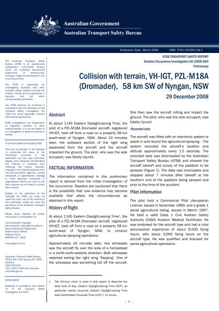
Collision with terrain, VH-IGT, PZL-M18A (Dromader), 58 km SW of ...
Collision with terrain, VH-IGT, PZL-M18A (Dromader), 58 km SW of ...
Collision with terrain, VH-IGT, PZL-M18A (Dromader), 58 km SW of ...

You also want an ePaper? Increase the reach of your titles
YUMPU automatically turns print PDFs into web optimized ePapers that Google loves.
The Australian Transport Safety<br />
Bureau (ATSB) is an operationally<br />
independent multi-modal Bureau<br />
<strong>with</strong>in the Australian Government<br />
Department <strong>of</strong> Infrastructure,<br />
Transport, Regional Development and<br />
Local Government.<br />
The ATSB is responsible for<br />
investigating accidents and other<br />
transport safety matters involving civil<br />
aviation, marine and rail operations in<br />
Australia that fall <strong>with</strong>in<br />
Commonwealth jurisdiction.<br />
The ATSB performs its functions in<br />
accordance <strong>with</strong> the provisions <strong>of</strong> the<br />
Transport Safety Investigation Act<br />
2003 and, where applicable, relevant<br />
international agreements.<br />
ATSB investigations are independent<br />
<strong>of</strong> regulatory, operator or other<br />
external bodies. It is not the object <strong>of</strong><br />
an investigation to determine blame or<br />
liability.<br />
© Commonwealth <strong>of</strong> Australia 2009<br />
This work is copyright. In the interests<br />
<strong>of</strong> enhancing the value <strong>of</strong> the<br />
information contained in this<br />
publication you may copy, download,<br />
display, print, reproduce and distribute<br />
this material in unaltered form<br />
(retaining this notice). However,<br />
copyright in the material obtained from<br />
non-Commonwealth agencies, private<br />
individuals or organisations, belongs<br />
to those agencies, individuals or<br />
organisations. Where you want to use<br />
their material you will need to contact<br />
them directly.<br />
Subject to the provisions <strong>of</strong> the<br />
Copyright Act 1968, you must not<br />
make any other use <strong>of</strong> the material in<br />
this publication unless you have the<br />
permission <strong>of</strong> the Australian Transport<br />
Safety Bureau.<br />
Please direct requests for further<br />
information or authorisation to:<br />
Commonwealth Copyright<br />
Administration, Copyright Law Branch<br />
Attorney-General’s Department<br />
Robert Garran Offices<br />
National Circuit<br />
BARTON ACT 2600<br />
www.ag.gov.au/cca<br />
Australian Transport Safety Bureau<br />
PO Box 967, Civic Square ACT 2608<br />
Australia<br />
1800 020 616<br />
+61 2 6247 4150 from overseas<br />
www.atsb.gov.au<br />
INFRA-08440<br />
Released in accordance <strong>with</strong> section<br />
25 <strong>of</strong> the Transport Safety<br />
Investigation Act 2003<br />
Abstract<br />
Publication Date: Month 2009 ISBN 978-1-921602-28-3<br />
ATSB TRANSPORT SAFETY REPORT<br />
Aviation Occurrence Investigation AO-2008-084<br />
Preliminary<br />
<strong>Collision</strong> <strong>with</strong> <strong>terrain</strong>, <strong>VH</strong>-<strong>IGT</strong>, <strong>PZL</strong>-<strong>M18A</strong><br />
(<strong>Dromader</strong>), <strong>58</strong> <strong>km</strong> <strong>SW</strong> <strong>of</strong> Nyngan, N<strong>SW</strong><br />
At about 1145 Eastern Daylight-saving Time, the<br />
pilot <strong>of</strong> a <strong>PZL</strong>-<strong>M18A</strong> <strong>Dromader</strong> aircraft, registered<br />
<strong>VH</strong>-<strong>IGT</strong>, took <strong>of</strong>f from a road on a property <strong>58</strong> <strong>km</strong><br />
south-west <strong>of</strong> Nyngan, N<strong>SW</strong>. About 10 minutes<br />
later, the outboard section <strong>of</strong> the right wing<br />
separated from the aircraft and the aircraft<br />
impacted the ground. The pilot, who was the sole<br />
occupant, was fatally injured.<br />
FACTUAL INFORMATION<br />
The information contained in this preliminary<br />
report is derived from the initial investigation <strong>of</strong><br />
the occurrence. Readers are cautioned that there<br />
is the possibility that new evidence may become<br />
available that alters the circumstances as<br />
depicted in this report.<br />
History <strong>of</strong> flight<br />
At about 1145 Eastern Daylight-saving Time 1 , the<br />
pilot <strong>of</strong> a <strong>PZL</strong>-<strong>M18A</strong> <strong>Dromader</strong> aircraft, registered<br />
<strong>VH</strong>-<strong>IGT</strong>, took <strong>of</strong>f from a road on a property <strong>58</strong> <strong>km</strong><br />
south-west <strong>of</strong> Nyngan, N<strong>SW</strong>, to conduct<br />
agricultural spraying operations.<br />
Approximately 10 minutes later, two witnesses<br />
saw the aircraft fly over the area <strong>of</strong> a homestead<br />
in a north-north-westerly direction. Both witnesses<br />
reported seeing the right wing ‘flapping’. One <strong>of</strong><br />
the witnesses saw something fall <strong>of</strong>f the aircraft.<br />
1 The 24-hour clock is used in this report to describe the<br />
local time <strong>of</strong> day, Eastern Daylight-saving Time (EDT), as<br />
particular events occurred. Eastern Daylight-saving Time<br />
was Coordinated Universal Time (UTC) + 11 hours.<br />
- 1 -<br />
29 December 2008<br />
She then saw the aircraft rolling and impact the<br />
ground. The pilot, who was the sole occupant, was<br />
fatally injured.<br />
Recorded data<br />
The aircraft was fitted <strong>with</strong> an electronic system to<br />
assist in and record the agricultural spraying. . The<br />
system recorded the aircraft’s location and<br />
altitude approximately every 1.5 seconds. The<br />
recorded data was downloaded by the Australian<br />
Transport Safety Bureau (ATSB) and showed the<br />
aircraft take<strong>of</strong>f and survey <strong>of</strong> the paddock to be<br />
sprayed (Figure 1). The data was incomplete and<br />
stopped about 7 minutes after take<strong>of</strong>f at the<br />
southern end <strong>of</strong> the paddock being sprayed and<br />
prior to the time <strong>of</strong> the accident.<br />
Pilot information<br />
The pilot held a Commercial Pilot (Aeroplane)<br />
Licence, issued in November 1990, and a grade 1<br />
aerial agricultural rating, issued in March 1997.<br />
He held a valid Class 1 Civil Aviation Safety<br />
Authority (CASA) Aviation Medical Certificate. He<br />
was endorsed for the aircraft type and had a total<br />
aeronautical experience <strong>of</strong> about 6,500 flying<br />
hours, <strong>with</strong> about 3,000 flying hours on the<br />
aircraft type. He was qualified and licensed for<br />
aerial agricultural operations.
Figure 1: Recorded aircraft track<br />
Take<strong>of</strong>f run<br />
Last recorded data<br />
In accordance <strong>with</strong> the requirements <strong>of</strong> the<br />
aircraft Flight Manual Supplement 207/403/FMS,<br />
<strong>PZL</strong> M18, <strong>Dromader</strong> Restricted Category STC –<br />
MTOW Increase, the pilot had been assessed by<br />
the operator’s Chief Pilot on 11 November 2008,<br />
as being competent to conduct operations in <strong>PZL</strong><br />
M18(A) <strong>Dromader</strong> aeroplanes at weights above<br />
5,300 kg.<br />
Operational information<br />
According to the operator’s Pilot Work Order, the<br />
aircraft hopper load for the flight during which the<br />
accident occurred, was to consist <strong>of</strong> a 2,123 kg<br />
mix <strong>of</strong> herbicide chemicals and water.<br />
The fuel load could not be conclusively<br />
determined. However, based on the operator’s<br />
procedures, it is likely that the aircraft had<br />
between half and a full fuel load at the beginning<br />
<strong>of</strong> the flight. If the aircraft had a full fuel load, the<br />
take-<strong>of</strong>f weight would have been about 5,370 kg.<br />
CASA had issued an exemption to the operator to<br />
permit an increased maximum take-<strong>of</strong>f weight to<br />
6,600 kg.<br />
Bureau <strong>of</strong> Meteorology reports for the Nyngan<br />
area indicated fine conditions, winds from the<br />
south-west at 12 kts and a maximum recorded<br />
temperature <strong>of</strong> about 35 degrees C.<br />
Aircraft information<br />
The aircraft was manufactured in Poland in 1987<br />
and had been subsequently modified. One <strong>of</strong> the<br />
modifications, carried out in 2005, was the<br />
replacement <strong>of</strong> the original reciprocating (radial)<br />
engine and the 4-blade propeller <strong>with</strong> a Garrett<br />
TPE 331-11U-612G gas-turbine engine and a<br />
Hartzell 5-blade constant speed propeller. This<br />
was done in accordance <strong>with</strong> an approved<br />
Supplemental Type Certificate (STC), number<br />
SA09039SC.<br />
- 2 -<br />
Accident location<br />
Location <strong>of</strong><br />
homestead and<br />
witnesses<br />
Blue line – Aircraft track<br />
from recorded data<br />
Green line – Tree line
The aircraft was first registered in Australia in July<br />
2004 and registered to the current owner in June<br />
2005. The aircraft was issued <strong>with</strong> a certificate <strong>of</strong><br />
airworthiness in the restricted category 2 in<br />
November 2005. It had accumulated about 6,229<br />
hours in service at the time <strong>of</strong> issue <strong>of</strong> the last<br />
maintenance release, on 12 December 2008. The<br />
aircraft total time in service was about 6,271.1<br />
hours before the accident flight.<br />
The most recent maintenance was a 300-hourly<br />
periodic inspection conducted on 12 December<br />
2008. On 24 December 2008, bird strike damage<br />
to the right wing tip leading edge was repaired.<br />
The location <strong>of</strong> this repair was outboard <strong>of</strong> the<br />
location <strong>of</strong> wing separation.<br />
Wreckage information<br />
The wreckage trail extended for about 330 m in a<br />
north-easterly direction. The first items in the<br />
wreckage trail, prior to ground impact, were the<br />
outboard section <strong>of</strong> the right wing and items <strong>of</strong><br />
debris from the hopper, the light bar and the<br />
canopy Perspex. The outboard section <strong>of</strong> the right<br />
wing was located approximately 100 m prior to<br />
the initial impact point <strong>of</strong> the main wreckage<br />
(Figure 2).<br />
The tip <strong>of</strong> the remaining attached section <strong>of</strong> the<br />
right wing was the first point <strong>of</strong> the aircraft to<br />
impact the ground. The aircraft then impacted the<br />
ground in about a 30 O nose-down attitude. The<br />
right wing then separated from the fuselage due<br />
to the impact forces. The fuselage and tail rotated<br />
to be facing a westerly direction (Figure 3).<br />
The engine was located about 125 m from the<br />
initial impact point, in the direction <strong>of</strong> flight. Four<br />
<strong>of</strong> the five propeller blades had been released<br />
from the propeller hub. Two <strong>of</strong> the propeller<br />
blades were located 200 m from the impact crater<br />
and were the last pieces <strong>of</strong> the aircraft in the<br />
wreckage trail. The engine and propellers were<br />
examined and it was determined that the engine<br />
was delivering significant power at the time <strong>of</strong> the<br />
accident.<br />
All flight controls were accounted for and the<br />
control system continuity was established.<br />
The outboard section <strong>of</strong> the right wing had<br />
separated approximately 1.8 m from the tip. The<br />
2 For the purpose <strong>of</strong> agricultural and fire fighting operations.<br />
location <strong>of</strong> the separation was between the tiedown<br />
hard point and the straps along the forward<br />
face <strong>of</strong> the main spar (Figures 4 and 5).<br />
FURTHER INVESTIGATION<br />
The investigation is continuing and will include:<br />
- 3 -<br />
- further analysis <strong>of</strong> the recorded data<br />
- a review <strong>of</strong> the aircraft’s maintenance<br />
history<br />
- a review <strong>of</strong> records <strong>of</strong> modifications to<br />
the aircraft<br />
- an appraisal <strong>of</strong> the effects on the aircraft<br />
structure under higher gross weight loads<br />
- an analysis <strong>of</strong> the failure mode <strong>of</strong> the<br />
right wing.
Figure 2: Outboard section <strong>of</strong> right wing and main wreckage<br />
Figure 3: Main wreckage<br />
- 4 -<br />
Direction <strong>of</strong> flight
Figure 4: Reconstructed right wing<br />
Right wing<br />
Figure 5: Two sections <strong>of</strong> the right wing main spar looking forward<br />
Right wing<br />
Inboard<br />
Main spar<br />
Leading edge<br />
- 5 -<br />
Outboard<br />
Outboard<br />
section <strong>of</strong><br />
right wing<br />
Outboard section <strong>of</strong><br />
right wing