Heritage Trail HT - Discover Northern Ireland
Heritage Trail HT - Discover Northern Ireland
Heritage Trail HT - Discover Northern Ireland

Create successful ePaper yourself
Turn your PDF publications into a flip-book with our unique Google optimized e-Paper software.
Tourist Information<br />
Tourist Information Centre Services<br />
• Your one stop shop for visiting <strong>Ireland</strong>, for 32<br />
county tourist information and friendly,<br />
helpful advice from multi-lingual staff.<br />
• Make your journey time less by booking<br />
through our accommodation reservation<br />
service<br />
• Free literature and itinerary advice on<br />
travelling throughout <strong>Ireland</strong>.<br />
• Information available on the local area<br />
- free guide books and maps.<br />
• Experience a journey through history with<br />
a selection of Guided Walking Tours.<br />
• Visit the Gift Shop which offers a range of<br />
souvenirs to suit all tastes.<br />
• Exchange those Euro or dollars through our<br />
Bureau de Change<br />
• 24 hour public information kiosk for enquiries<br />
any time, day or night.<br />
• For cyclists lock your bicycles away and enjoy<br />
your stay by using cycle lockers.<br />
Opening Hours<br />
OPEN ALL YEAR Mon-Fri 9.00am-5.00pm<br />
MAR-JUNE & OCT Mon-Fri 9.00am-5.00pm, Sat 10.00am-5.00pm<br />
JULY-SEPT Mon-Fri 9.00am-7.00pm, Sat 10.00am-6.00pm, Sun 10.00am-5.00pm<br />
Dialling Codes<br />
Dialling from the Republic of <strong>Ireland</strong> All eight digit telephone numbers<br />
must be prefixed with (048) eg (048) 7126 7284<br />
Dialling Internationally All telephone numbers must be prefixed<br />
with +44 and the area dialling code eg +44 28 7126 7284<br />
For further information on any of these services<br />
please contact Derry Visitor and Convention Bureau<br />
44 Foyle Street, Derry BT48 6AT<br />
Tourist Information Centre<br />
T: 028 7126 7284<br />
F: 028 7137 7992<br />
Administration & Marketing<br />
T: 028 7137 7577<br />
F: 028 7137 7992<br />
E: info@derryvisitor.com<br />
www.derryvisitor.com<br />
©Derry Visitor and Convention Bureau<br />
Every effort has been made to ensure the accuracy in the compilation of this brochure. DVCB,<br />
however, cannot accept responsibility for errors or omissions but where such are brought to our<br />
attention, future publications will be amended accordingly.<br />
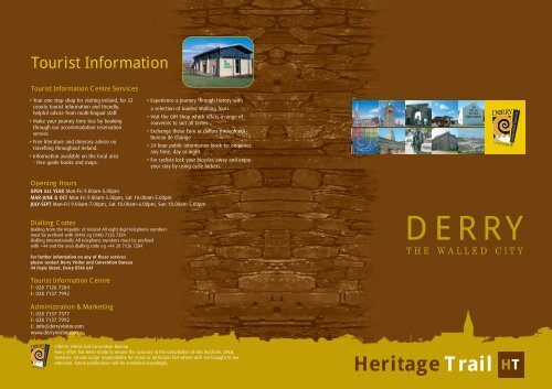
DERRY<br />
THE WALLED CITY<br />
<strong>Heritage</strong> <strong>Trail</strong> <strong>HT</strong>
<strong>HT</strong><br />
<strong>Heritage</strong> <strong>Trail</strong><br />
We’re on the <strong>Trail</strong><br />
…to discover the rich natural and built heritage of a city and its<br />
hinterland that is unrivalled in <strong>Ireland</strong>. Trace the story of this vibrant<br />
Walled City and see the ever changing skyline of a city constant in the<br />
warmth of its welcome.<br />
Derry is a city which has been one of the longest inhabited places in <strong>Ireland</strong>. The earliest<br />
historical references date to the sixth century when a monastery was founded here by the great<br />
Irish Saint Columba/Colmcille in 546 AD. The name Derry changed to Londonderry during the<br />
Plantation of Ulster, as the new city was built by the Guilds of London (1613-1618).<br />
After the building of the City Walls in the early part of the seventeenth century other key periods<br />
in the city’s history have included the Siege of Derry, Emigration, Famine in <strong>Ireland</strong>, Shirt Industry,<br />
World War I & II, Easter Rising, Civil Rights Marches, Bloody Sunday, Ceasefires and the Good<br />
Friday Agreement, all of which have contributed in some part over the centuries to having shaped<br />
today’s modern yet historic, friendly and forward-looking city.<br />
This <strong>Heritage</strong> <strong>Trail</strong> has identified 100 sites of particular historic significance -from Cathedrals and<br />
Churches, Parks and Villages, Murals and Monuments all within the Derry City Council area so that<br />
wherever you are you’re never too far from a little bit of history.<br />
The city and surrounding countryside have been divided into distinctive areas so that it is easy for<br />
you to locate some of our more historic sites. So correlate the heritage sites reference number to<br />
one of the maps and follow your trail…<br />
So now its up to you to get on the <strong>Trail</strong> and make a little bit of history of your own…<br />
Image credit opposite top: Derry City Council - a painting by John Noah Gossett c1846<br />
Contents<br />
Within the Walled City 2<br />
Outside the Walled City 6<br />
Greater Cityside Area 13<br />
Waterside Area 15<br />
Beyond the City 18<br />
Sculptor Sites 20<br />
Location Maps 24<br />
Tours Information 29
<strong>HT</strong><br />
<strong>Heritage</strong> <strong>Trail</strong><br />
2<br />
PAGE<br />
Within the Walled City<br />
1 Walls of Derry<br />
The City Walls were built between 1613 and<br />
1618, by The Honourable, The Irish Society.<br />
Designed by Captain Edward Donnington, and<br />
measured by Thomas Raven, they originally had<br />
only four gates - Butcher Gate, Bishop Gate,<br />
Ferryquay Gate and Shipquay Gate. Three<br />
new gates have been added since the 18th<br />
century – New Gate, Magazine Gate and Castle<br />
Gate. The Walls have nine ramparts and are<br />
approximately 1.5km (1 1/8th miles) in length.<br />
They vary in width between 12 and 35 feet. The<br />
Walls of Derry are the most complete in <strong>Ireland</strong><br />
and one of the finest examples in Europe of<br />
Walled Cities. The city claims Europe’s largest<br />
collection of cannon whose origins are known<br />
precisely. Many of them thundered in anger over<br />
the two seventeenth century sieges. In 2005<br />
Derry City Council decided to restore the<br />
surviving 24 cannon and under expert<br />
supervision and often by hand, craftsmen,<br />
cleared the barrels of centuries of rubbish,<br />
stripped off layers of paint and corrosion and<br />
bathed, sponged and waxed the cannon back to<br />
their former glory. The cannon are displayed<br />
throughout the City Walls with the impressive<br />
Roaring Meg located on the double bastion. A<br />
2 The City Gates<br />
Shipquay Gate This is one of the original four<br />
city gates with the present archway dating from<br />
1805. The interior face of the gate has on each<br />
side a circular frame - on the left hand side is a<br />
cornucopia and on the right hand side is a<br />
caduceus. On the exterior face there are similar<br />
frames without ornaments. The original gate<br />
would have had a tower and portcullis as this gate<br />
was the main point of entry from the river. A<br />
546<br />
Founding of the<br />
city by St<br />
Columba<br />
1 2 3 4 5 6<br />
1607<br />
Flight of the<br />
Earls<br />
1608<br />
Plantation of<br />
Ulster<br />
1613-18<br />
Building of<br />
City Walls<br />
1688<br />
Siege of Derry<br />
Butcher Gate This original gate was the most<br />
damaged gate during the siege of 1689. The<br />
gate was rebuilt in 1790 and takes its name<br />
from the street inside - Butcher Street, were the<br />
towns’ butchers had their shops. A<br />
Bishop Gate This original gate was replaced in<br />
1789 by the present structure - a triumphal arch.<br />
This was to mark the first centenary of the<br />
closing of the gates by The Apprentice Boys of<br />
Derry. The architect was H.A. Baker, with the<br />
sculpted heads representing the River Foyle<br />
(external) and the River Boyne(internal)<br />
designed by Edward Smyth, who had sculptured<br />
the thirteen riverine heads on the Dublin Custom<br />
House in c.1784. On either side of the gate are<br />
steps giving access to the City Walls. A<br />
Ferryquay Gate This gate is one of the four<br />
original gateways; it overlooked the ferryquay on<br />
the River Foyle. The gate originally had a<br />
drawbridge and Tower; this was replaced by the<br />
present day gate in 1865. Famously this was<br />
the gate closed by the Apprentice Boys of Derry<br />
in December 1688 against the Jacobite army of<br />
James II. The headstone on the outside of the<br />
gate represents Reverend George Walker,<br />
Governor of Derry in 1689. The headstone on<br />
the inside of the gate is of Reverend James<br />
Gordon. A<br />
Castle Gate This gate is one of two added to<br />
the walls below Butcher Gate, it was built<br />
between 1805-1808. An old Irish Fortified House<br />
of the O’Doherty’s of Inishowen was once<br />
located near this site inside the present City<br />
Walls. A<br />
1695<br />
Penal Laws<br />
1718<br />
Emigration<br />
begins<br />
1845-49<br />
Famine in<br />
<strong>Ireland</strong><br />
1860<br />
Shirt Industry<br />
1914<br />
World War 1<br />
New Gate This gate was added to the walls<br />
c.1790’s, before this an opening had been made<br />
in the wall at this point allowing access to<br />
Wapping Lane (now Fountain Street). However<br />
the opening was re-inforced into a gateway as<br />
tensions arose just before the United Irishmen<br />
Rising of 1798. A<br />
The Magazine Gate This gate was added to<br />
the walls c.1888 to allow additional access to<br />
the river front. A<br />
3 St. Columb’s Cathedral<br />
- Church of <strong>Ireland</strong> (C of I)<br />
This Cathedral was built in 1633 by William<br />
Parrot for The Honourable, The Irish Society and<br />
is in the Planter Gothic style. The tower and<br />
main building are original. The present spire was<br />
added in 1821. The Chancel was added in 1887<br />
and the Chapter House in 1910. The Cathedral<br />
has many fine stained glass windows,<br />
regimental flags, memorials and a large<br />
collection of historical items from the time of the<br />
siege. The foundation stone in the porch,<br />
originally from the 12th Century Templemore<br />
Monastery of the Columban tradition is inscribed<br />
if stones could speake<br />
then London’s prayse<br />
should sounde who<br />
built this church and<br />
cittie from the grounde<br />
Vaughan aed<br />
The peal of eight bells is the oldest set in<br />
<strong>Ireland</strong>, presented by Charles 1, in 1638.<br />
1916<br />
Easter Rising<br />
1919-21<br />
Irish War of<br />
Independence<br />
1932<br />
Amelia Earhart<br />
lands<br />
A<br />
1939-45<br />
World War II<br />
1968<br />
Civil Rights<br />
Marches<br />
<strong>HT</strong><br />
<strong>Heritage</strong> <strong>Trail</strong><br />
4 The Deanery<br />
Located on Bishop Street, it replaced an earlier<br />
Deanery of 1720. The present building by<br />
Thomas Banbury Gough then Dean of Derry<br />
dates to 1833. It is one of the finest examples of<br />
Georgian architecture inside the City Walls. It is<br />
three storeys high with a basement, a gateway<br />
entrance to the stables at the rear of the<br />
building and also has a curved staircase in the<br />
main porch. A<br />
5 The Masonic Hall<br />
Formerly known as the Bishop’s Palace, built in<br />
1754 in the Episcopate of William Barnard - it<br />
gave Bishop Street its present name. The<br />
building was once home to Bishop Hervey, Earl<br />
of Bristol, who had it largely reconstructed to his<br />
design. In 1798 it was used as a barracks, the<br />
gardens became a parade ground on to the city<br />
walls - a section still known today as the Grand<br />
Parade. Mrs. Cecil Francis Alexander, the hymn<br />
writer, died here in 1895. A<br />
6 The Courthouse<br />
Located opposite the Masonic Hall, it was<br />
completed in 1817 and is one of the finest<br />
architectural buildings in the city. Designed in<br />
Greek revival style with a pedimented portico,<br />
above the pediment are the Royal Coat of Arms<br />
and the statues of Justice and Peace in Portland<br />
stone. The main building material is of white<br />
Dungiven sandstone. It was damaged by bomb<br />
attacks in the 1970s. Restoration began in 1995<br />
and the Courthouse reopened<br />
in 1998. A<br />
1972<br />
Bloody Sunday<br />
1994<br />
Ceasefires<br />
1998<br />
Good Friday<br />
Agreement<br />
3<br />
PAGE
4<br />
PAGE<br />
<strong>HT</strong><br />
<strong>Heritage</strong> <strong>Trail</strong><br />
7<br />
8 9 10 11 12 13 14 15 16 17<br />
18 19<br />
7 The Verbal Arts Centre<br />
Located in the former First Derry National School<br />
on the city walls, the building dates from 1894.<br />
The School was originally founded as a Blue Coat<br />
School in 1733. The pupils were choristers who<br />
sang in church. The centre caters for the creation<br />
of the verbal arts, a symbol of the North West’s<br />
prowess in poetry, drama and song. Integrated<br />
within the building are a number of craft pieces<br />
including works by Louis Le Brocquy and John<br />
Behan. A<br />
8 St. Augustine’s Church (C of I)<br />
This church is locally known as the “Wee Church<br />
on the Walls” and is thought to be the site of<br />
the 6th Century Monastery of St. Columba or<br />
Colmcille (546 A.D.). This building was destroyed<br />
by fire in 1095. A second abbey was built in<br />
1136, it later became known as Dubh Regles<br />
(Black Church) in 1423. The Church was used by<br />
the first English settlers as a place of worship in<br />
the 16th Century. The present building dates<br />
from 1872 and is in the design of 13th Century<br />
gothic style. A<br />
9 Walker’s Memorial Plinth<br />
Located opposite St. Augustine’s Church the<br />
Royal Bastion is the site of the former Walker’s<br />
Pillar, a memorial to Rev. George Walker joint<br />
Governor of Derry during the Siege of 1689. The<br />
pillar was 90 feet in height surmounted by the<br />
statue of Rev. George Walker “of heroic size”(20<br />
feet), with one hand outstretched towards the<br />
site of the river barrier/boom. Internally a spiral<br />
staircase of 105 steps( The Siege lasted 105<br />
days – the longest in British History) allowed<br />
access to the viewing platform on top. The pillar<br />
and statue were destroyed by a bomb explosion<br />
in August 1973. Only the pedestal remains to<br />
this day. A<br />
10 The Apprentice Boys’<br />
Memorial Hall<br />
Opened in 1877 this building is the world<br />
headquarters of the Apprentice Boys of Derry<br />
organisation, it was extended and reopened in<br />
1937. Designed by John Ferguson the building is<br />
neo-gothic, with a strong Scottish baronial<br />
façade. A<br />
11 First Derry Presbyterian<br />
Church<br />
First opened in 1780, this Church is believed to<br />
be on the site of an earlier Presbyterian Church<br />
of 1690. The foundation stone of this earlier<br />
building is now above the centre door inscribed<br />
with Roman numerals M.D.C.X.C. (1690). In 1828<br />
the pediment and cornices of Dungiven<br />
sandstone were added. A<br />
12 The Diamond<br />
Located in the centre of the walled city, it is<br />
possible to see all four original gates from this<br />
location. Three former town-halls have resided in<br />
this position in the years 1625, 1692 and 1823.<br />
In 1904 a fire in Austin’s Department store in the<br />
Diamond also set the town-hall alight and<br />
subsequently destroyed the building –<br />
consequently a small garden was made on the<br />
site. The present War memorial was built in<br />
1927 by the sculptor Vernon March. The figures<br />
represent the Navy and the Army and are<br />
overlooked by the<br />
winged Angel of<br />
Victory<br />
representing the<br />
Royal Air-force. The<br />
cenotaph in the<br />
Diamond is now<br />
a memorial to<br />
all those who<br />
died during<br />
World War<br />
I & II. A<br />
13 Austin’s Department Store<br />
Located in the south corner of the Diamond is<br />
<strong>Ireland</strong>'s first department store, built in 1904-6<br />
after a fire in the original store, to a design of<br />
M.A. Robinson. It is a five storey Edwardian<br />
building - the elaborate architecture is said to<br />
reflect the function of the place and has a tower<br />
at the corner with a copper-covered cupola on<br />
top. Austin’s is now believed to be the world’s<br />
oldest independent department store. A<br />
14 Shipquay Street<br />
Originally known as Silver Street it still has many<br />
buildings dating from the 18th Century. Numbers<br />
6 & 8 are three storey Georgian terraced houses<br />
circa 1770 and most of the older houses have<br />
stepped entrances due to the steepness of the<br />
street, it is reputed to be one of the steepest<br />
commercial streets in the British Isles. A<br />
15 The Craft Village<br />
Located in the area between lower Shipquay St.<br />
and Magazine St. is the Craft Village, a<br />
reconstruction of an 18th Century street and 19th<br />
Century square. It incorporates a variety of<br />
multipurpose retail outlets. Above the shops are<br />
modern apartments incorporated into the design<br />
of the Village. The Village was opened by<br />
President of <strong>Ireland</strong>, Mary Robinson in 1992. The<br />
village also houses the Genealogy Centre which<br />
has an extensive record of passenger lists from<br />
the 18th and 19th Century emigration periods<br />
and offers a service to those tracing their<br />
ancestral roots in Co. Derry and Inishowen,<br />
Co.Donegal. A<br />
16 The Tower Museum<br />
The Tower Museum opened in 1992 and has<br />
won both the British and Irish Museum of the<br />
Year awards and was awarded joint second<br />
European Museum of the Year in 1995. The<br />
museum has two permanent exhibitions on<br />
display. A<br />
- An Armada Shipwreck<br />
La Trinidad Valencera Exhibition displays many of<br />
the objects recovered from one of the largest ships<br />
from the Spanish Armada, La Trinidad Valencera.<br />
<strong>HT</strong><br />
This vessel sunk in Kinnegoe Bay, Co. Donegal in<br />
1588. The exhibition tells the story of the<br />
discovery of the shipwreck by the City of Derry<br />
Sub Aqua Club in 1971 and the subsequent<br />
recovery of the artifacts by a team of underwater<br />
archaeologists.<br />
The Story of Derry details the history of the<br />
City of Derry from its geological formation<br />
through to the present day covering subjects as<br />
diverse as early monasticism, Plantation, Siege of<br />
Derry through to the recent Troubles.<br />
17 St. Columb’s Hall<br />
Located on the junction of Orchard<br />
Street/Newmarket Street is the Parochial Hall for<br />
the Templemore Parish, built as a temperance<br />
hall in 1886; the three figures on top of the hall<br />
represent Eire, Temperance and Vulcan. In the<br />
1940/50s the hall was used as a cinema and<br />
has now been restored as a theatre. A<br />
18 The Millennium Forum<br />
Built just inside the walled area on Newmarket<br />
Street is the Millennium Forum, opened in 2001.<br />
The first purpose built theatre in the city it has<br />
seating for 1000 and has the largest theatre<br />
stage in <strong>Ireland</strong>. The sloping stalls floor can be<br />
raised to level with the stage floor and this area<br />
can be used for exhibitions and conferences.<br />
There is also a covered piazza area used for nontheatre<br />
exhibitions. A<br />
<strong>Heritage</strong> <strong>Trail</strong><br />
19 The Playhouse Theatre<br />
Located in Artillery Street which gets its name<br />
from a house situated against the City Walls<br />
(Artillery House – 1738 - which probably housed<br />
artillery pieces), this was the former St Joseph’s<br />
school, originally built as a school for homeless<br />
girls in 1911. It was designed by the architect E.J.<br />
Toye who also designed other listed buildings in<br />
the city including St. Eugene’s Cathedral spire,<br />
Lumen Christi College and Pennyburn Church. In<br />
2004, The Playhouse featured as one of the 21<br />
buildings across the UK to reach the finals of a<br />
national television competition, BBC Restoration.<br />
The buildings are now home to the award<br />
winning Playhouse Theatre. A<br />
5<br />
PAGE
6<br />
PAGE<br />
<strong>HT</strong><br />
<strong>Heritage</strong> <strong>Trail</strong><br />
20<br />
21 22<br />
23<br />
Outside the Walled City<br />
20 Guildhall<br />
The original building was built in 1887 at a cost<br />
of £19,000 and was designed by John Guy<br />
Ferguson. It was destroyed by a fire in 1908 and<br />
reopened in 1912 at a further cost of 26,000 to<br />
the Irish Society to a design of M.A. Robinson.<br />
The red sandstone building is of neo-gothic<br />
architecture; with Tudor overtones. In 1972, the<br />
Guildhall was destroyed by a number of bomb<br />
attacks and carefully restored and reopened in<br />
1978. The interior houses some of the finest<br />
examples of stained glass windows in <strong>Ireland</strong><br />
with many having been restored using the<br />
original watercolour designs. The council<br />
chamber on the ground floor is the seat of Derry<br />
City Council. A<br />
21 Harbour Museum<br />
This traditional Victorian style museum, housed<br />
in the former Londonderry Port & Harbour<br />
Commissioners offices, built in 1882 to the<br />
design of John Kennedy looks at the city’s<br />
maritime heritage with emphasis on the<br />
emigration periods of the 18th and 19th<br />
centuries. A<br />
22 The Bogside<br />
This area first developed as a residential area in<br />
the 18th Century. However, industry had<br />
developed around the docks area as shipbuilding<br />
and shirt-making attracted people from the<br />
Catholic community back to the city from<br />
Donegal and the West of <strong>Ireland</strong> looking for<br />
work. Some older housing from the 18th & 19th<br />
centuries still remained in the area until the<br />
1960’s, however housing provision was limited<br />
and it was common practice for many families to<br />
live in one house. Protests about the housing<br />
conditions was one of the predominant factors<br />
for the organisation of a Civil Rights March on<br />
the 5th October 1968. The banning and<br />
subsequent RUC baton charging of the marchers<br />
led to rioting in the Bogside, this event is often<br />
seen by many as the start of the troubles in<br />
<strong>Northern</strong> <strong>Ireland</strong>.<br />
It was also in the Bogside that the event which<br />
became known as ‘Bloody Sunday’ occurred on<br />
30th January 1972. A<br />
23 The Bloody Sunday Memorial<br />
The obelisk erected here lists the names of<br />
fourteen civilians shot dead near this site in<br />
Glenfada Park (which now houses the Museum<br />
of Free Derry) by the Army following a riot at<br />
the end of a march protesting about internment<br />
without trial on 30th January 1972, a date which<br />
became known as ‘Bloody Sunday’. In the<br />
subsequent Widgery Enquiry in 1972, Lord<br />
Widgery concluded in his investigation and<br />
reports that the soldiers had been fired on first.<br />
He said “there would have been no deaths if<br />
there had not been an illegal march, which had<br />
created a highly dangerous situation". However,<br />
the families campaign for a new inquiry were<br />
met with little response for many years until<br />
1997 when the Irish Government submitted a<br />
detailed dossier of evidence to the UK to back<br />
demands for a new Bloody Sunday inquiry. The<br />
178-page document incorporated an assessment<br />
of fresh information about the shootings, as well<br />
as a damning indictment of the Widgery report.<br />
The UK Government spent seven months<br />
studying the evidence before agreeing to the<br />
new investigation. On the eve of the 26th<br />
anniversary of Bloody Sunday in 1998, Tony Blair<br />
announced an independent judicial inquiry into<br />
Bloody Sunday, headed by the British Law Lord,<br />
Lord Saville of Newdigate, and two judges from<br />
Commonwealth countries. Lord Saville opened<br />
the proceedings with a vow to fully investigate<br />
Bloody Sunday and events leading up to it. The<br />
naming of the inquiry as the Bloody Sunday<br />
Inquiry is viewed as having huge significance<br />
and a symbolic move to detach the new<br />
investigation from the Widgery inquiry.<br />
A report from the Tribunal on its findings has yet<br />
to be published as we write this in 2007. A<br />
24<br />
Free Derry Corner<br />
The gable wall with its slogan“You Are<br />
Now Entering Free Derry” was painted<br />
by John Caker Casey, on 5th January<br />
1969, during the riots that followed the<br />
attack on Civil Rights marchers at<br />
Burntollet Bridge. The name “Free<br />
Derry” was given to the areas of the<br />
Bogside, Creggan and Brandywell that<br />
were barricaded off from the security<br />
forces between August 1969 and July<br />
1972. The barriers were removed during<br />
“Operation Motorman” on 30 July 1972.<br />
The area around Free Derry Corner was a<br />
familiar meeting place in the area. A<br />
<strong>HT</strong><br />
<strong>Heritage</strong> <strong>Trail</strong><br />
7<br />
PAGE
8<br />
PAGE<br />
<strong>HT</strong><br />
<strong>Heritage</strong> <strong>Trail</strong><br />
25<br />
25<br />
THE BOGSIDE GALLERY OF MURALS<br />
The Bogside Murals have been painted by a group of local artists on gable<br />
walls alongside the main road that runs through the Bogside, Rossville<br />
Street and Lecky Road area. The three artists,William Kelly, Kevin<br />
Hasson, and Tom Kelly describe the 11 murals as ‘The Peoples Gallery’.<br />
Ten of the murals reflect events in the Bogside in the past and one, The<br />
Peace Mural looks to the future with the idealist image of a Dove. The<br />
artists have a small studio in the Bogside located behind the Bogside Inn.<br />
Bloody Sunday Commemoration Mural<br />
On the gable wall opposite the Bogside Inn is<br />
the “Bloody Sunday Commemoration” mural<br />
painted in 1997 to mark the 25th anniversary of<br />
Bloody Sunday (30th of January 1972). The<br />
mural has an image of each of the 14 people<br />
who died painted inside a circle of soft red and<br />
is surrounded by 14 oak leaves - a leaf for each<br />
of the victims - the oakleaf being a symbol of<br />
the city.<br />
The Death Of Innocence Mural<br />
Located on the corner of Lecky Road and<br />
Rossville Street is the mural known as “The<br />
Death of Innocence”. The girl on the mural is<br />
Annette McGavigan who at fourteen years old<br />
became the first child victim of the troubles<br />
from Derry and the one hundredth victim in<br />
<strong>Northern</strong> <strong>Ireland</strong>. In September 1971 she was<br />
killed as she returned home from school during<br />
a shooting incident in the Bogside area. The<br />
mural highlights the figure of Annette against<br />
the background of debris from a bomb<br />
explosion, a rifle with the muzzle buried in the<br />
ground and the image of a butterfly in the top<br />
left corner which was subsequently coloured in<br />
(2006) to represent the change from violence to<br />
peace with the onset of the peace process.<br />
The Petrol Bomber<br />
The Petrol Bomber is the first mural of the<br />
Bogside artists and was painted in 1994 to<br />
commemorate the 25th Anniversary of the<br />
Battle of Bogside. The image was taken from a<br />
magazine photograph by Clive Limpkin - the boy<br />
is wearing a Second World War gas mask against<br />
the C.S. gas used by the police. In the<br />
background the high rise Rossville flats with<br />
A<br />
rioters on the roof dominated the Bogside area<br />
and the city walls at Butcher Gate.<br />
Bernadette<br />
Bernadette Devlin was a leading figure in the<br />
civil rights movement and in the Battle of<br />
Bogside in 1969. She had been elected to<br />
Westminster as M.P. for Mid-Ulster in April 1969<br />
as the youngest ever M.P, at 19 years of age.<br />
The artists see the mural as a tribute to Derry<br />
women in general, the other woman is pictured<br />
with a metal bin lid - banging bin lids on the<br />
ground was an effective alarm device in the<br />
Bogside area and important events were often<br />
heralded by the noise of the bins. “Bernadette”<br />
is the first colour mural of the artists and as a<br />
tribute to women the artists said “It would have<br />
been unthinkable to have painted it in black and<br />
white”.<br />
Bloody Sunday<br />
“Bloody Sunday depicts the fate of the campaign<br />
for civil rights” as seen by Bogside artists. The<br />
mural shows the death of Jackie Duddy, the first<br />
person to die on Bloody Sunday. The image of<br />
the priest waving a white handkerchief is that of<br />
Father Daly, who later became Bishop of Derry.<br />
This scene is taken from a newsreel of the day<br />
and is surrounded by images of the marchers<br />
protesting against internment. The “Civil Rights”<br />
banner that headed the march was later used to<br />
cover the dead on Rossville Street.<br />
Motorman<br />
This mural is seen by the artists as an anti-war<br />
symbol, and also the historical event, the ending<br />
of Free Derry when the army launched<br />
“Operation Motorman” in July 1972. The army<br />
used twenty six companies of soldiers and tanks<br />
to remove barricades in the Bogside and<br />
Creggan areas. The image of the soldier is<br />
deliberately highlighted against the doorway “to<br />
communicate something of the ferocity of the<br />
onslaught” of Motorman.<br />
Civil Rights<br />
This mural on the gable wall beside the Museum<br />
of Free Derry, Glenfada Park represents the civil<br />
rights marches that began the campaign for<br />
equal rights for Catholics. The most well known<br />
of which was the banned march in Derry on the<br />
5th October 1968 which led to rioting as the<br />
march was baton charged by police on Duke<br />
Street. The banners carried by marchers in the<br />
mural represent the various causes of the<br />
campaigns and there are well known local faces<br />
in the crowd, including local nationalist politician<br />
Eddie McAteer to the left of the man in the hat -<br />
Vinnie Coyle - who often was a steward in the<br />
marches.<br />
The Rioter<br />
In the early days of Free Derry it was almost<br />
customary for local school children to meet at<br />
the Rossville Street entrance to the Bogside and<br />
engage in rioting with the police and army - this<br />
happened mainly on Saturdays and on school<br />
holidays and became known to locals as the<br />
Saturday matinee. The boy in the mural is<br />
holding an old window grill, the mesh would<br />
have protected him from rubber or plastic bullets<br />
normally used by the security forces, but not<br />
from the effects of C.S. gas which is shown in<br />
white between him and the Saracen that has<br />
turned to face him. This occurred in the days<br />
before Bloody Sunday when the army used real<br />
bullets on the rioters. The artists say that the<br />
image has unavoidable echoes of a lone man<br />
facing the convoy of tanks on Tiananmen Square<br />
in 1989.<br />
<strong>HT</strong><br />
<strong>Heritage</strong> <strong>Trail</strong><br />
The Hunger Strikes<br />
In the 1970s many republican people were<br />
imprisoned. These prisons were specially built at<br />
this time and from an aerial view had the<br />
appearance of the letter “H”. The ‘H blocks’ as<br />
they became known housed both men and<br />
women prisoners and the inmates regarded<br />
themselves as political prisoners.. It was<br />
announced on the 26th of March 1980 there<br />
would be no Special Category prisoners as from<br />
the 1st April 1980. They began a protest<br />
campaign for Special Category Status that would<br />
allow them to wear their own clothes and have<br />
free association in the blocks. In September the<br />
prisoners refused to wear prison clothes and<br />
wore only their blankets, this became known as<br />
the ‘Blanket Protests’ and became the hunger<br />
strikes of the early 1980s. The man in the mural<br />
is Raymond McCartney who endured 53 days of<br />
the 1980 hunger strike.<br />
The H-Block monument is now located in<br />
Rossville Street, near Free Derry Corner.<br />
The Peace Mural<br />
The Peace Mural, taken from the cover of a<br />
college magazine is of a dove, one wing of<br />
which is outlined as an oak leaf the other wing<br />
outlined as a scroll of the word ‘Peace’. The<br />
dove is set against a tiled background of equal<br />
squares in the colours of the spectrum and was<br />
unveiled on the 31st July 2004.<br />
The Runner<br />
This mural depicts a typical scene from the<br />
Troubles. Tear gas was used extensively in riot<br />
situations. This image shows a young boy in full<br />
flight, seconds after a cannister of CS gas has<br />
been fired. The artist intended this mural to be a<br />
cautionary reminder to the young of the dangers<br />
inherent in civil conflict. It was completed by the<br />
artists in July 2006.<br />
9<br />
PAGE
10<br />
PAGE<br />
<strong>HT</strong><br />
<strong>Heritage</strong> <strong>Trail</strong><br />
26 28<br />
29<br />
30 31 32<br />
26 The Long Tower Church<br />
- St. Columba’s Church,<br />
Roman Catholic (R.C.)<br />
The present church dates back to 1784 on a site<br />
were Mass had been celebrated during the<br />
Penal times. It was near here that the Teampall<br />
Mór(Great Church) was built in 1164. The original<br />
structure was rectangular in shape, the fluted<br />
Corinthian pillars in the altar were given by<br />
Hervey, the Earl Bishop, who also made a<br />
considerable donation to the building. It was<br />
extended in 1810 with a nave and galleries and<br />
also extended in 1890 and 1909 to its present<br />
“T” shape form with three galleries. The interior<br />
is a very ornate neo-renaissance. The paintings<br />
on the walls are by McEvoy of Dublin, in oils on<br />
copper, and are copies of old masters. Eight of<br />
the windows on each of the east and west<br />
galleries are by Meyer of Munich - the church is<br />
now considered to be one of the most beautiful<br />
churches in <strong>Ireland</strong>. A<br />
27 The <strong>Heritage</strong> Tower<br />
This is the last remaining turret of the former<br />
jail, demolished in the 1970s and is now used as<br />
a heritage centre exhibiting artefacts and<br />
memorabilia dating from World War I to the<br />
present day. The jail was originally built in 1791<br />
though the Tower was a 19th Century<br />
addition(1824) and built as a hanging tower, it<br />
was here that Wolf Tone (a leader of the United<br />
Irishmen) was held after his capture at<br />
Rathmullan, Co. Donegal in 1798. A<br />
28 The Fountain Estate<br />
and Murals<br />
The Fountain Estate is the last Protestant working<br />
class area on the city side of the River Foyle. One<br />
of the oldest King Billy murals, the mural of him<br />
crossing the Boyne and the Siege of Derry 1689,<br />
is a replica of Bobby Jackson’s mural originally<br />
painted in the 1920’s and was repainted each<br />
year by three generations of the Jackson family<br />
until the wall fell down in 1994. A<br />
27<br />
29 Lumen Christi College<br />
Formerly the site of St. Columb’s College on<br />
Bishop Street, this was once the summer palace<br />
of the Church of <strong>Ireland</strong> Bishop Hervey.<br />
St. Columb’s was built in 1877 and the north<br />
wing extension added in 1892. Other extensions<br />
were added in 1897, 1932 and 1936. In the<br />
grounds are the remains of a windmill that was<br />
the scene of a battle during the Siege of 1689.<br />
The Walls surrounding the College have a coping<br />
of lava from Mount Vesuvius brought back by<br />
Bishop Hervey. A<br />
30 Nazareth House<br />
Located opposite the entrance to Lumen Christi<br />
College, it was built in 1892 as an orphanage<br />
home for children and refuge for old people. A<br />
31 Creggan Country Park<br />
The park has its origins in the highly popular<br />
rainbow trout fishery run by Glenowen Fisheries<br />
Worker’s Co-operative which was opened<br />
officially in May 1992 by Jack Charlton and<br />
facilitated some 40,000 anglers at its peak. The<br />
fishery demonstrated the enormous potential<br />
that the 100 acre site offered and a state of the<br />
art activity centre opened in 2002 offering a<br />
range of water sports. B<br />
34 35 36 37 38 40<br />
32 The Star Factory<br />
Located on Foyle Road, it was built in 1889 as<br />
the textile trade in the city developed. The<br />
structure is of rock-faced sandstone, which sets it<br />
apart from the other factories of red brick in the<br />
city. It has now been converted into a modern<br />
day apartment block. A<br />
33 The Foyle Valley<br />
Railway Museum<br />
Built in 1989, it housed many<br />
exhibits from the four railways that<br />
once operated from the city. These<br />
were the Great <strong>Northern</strong> 1845,<br />
London Midland Scottish (L.M.S.)<br />
1853, Londonderry and Lough Swilly Railway<br />
1863, and from 1900 the County Donegal<br />
Railway. All that remains today is the <strong>Northern</strong><br />
<strong>Ireland</strong> Railways (NIR) Derry-Belfast line. A<br />
34 Craigavon Bridge<br />
Built in 1933 it replaced the former Carlisle<br />
Bridge which was preceded by a wooden bridge<br />
that had been built across the Foyle at the<br />
bottom of Bridge Street, in 1791 by two Boston<br />
engineers - Cox and Thompson. The two recent<br />
bridges were both double-decked bridges. The<br />
Carlisle Bridge was built in 1863. The lower deck<br />
of the Craigavon Bridge was converted from a<br />
railway bridge to a road bridge in 1967. A<br />
35 Tillie and Henderson Factory<br />
Formerly located on a site opposite the Foyle<br />
Valley Railway, once the largest shirt factory in the<br />
world, the building was constructed for Messrs<br />
Tillie and Henderson in 1857. The company<br />
moved to modern premises in 1972, and the<br />
building remained in a derelict state. In 2002/3<br />
the building suffered a number of arson attacks<br />
and it was demolished in January 2003. A<br />
36 Carlisle Road<br />
Presbyterian Church<br />
This Church was built in 1879, replacing an old<br />
church located inside the city walls. The architect<br />
was Young & Mackenzie. It has a neo-gothic<br />
façade with mock turrets and pinnacles. A<br />
37 Methodist Church<br />
This Church was built in 1904 and replaced the<br />
original church on the East Wall. The architect<br />
was A. Foreman and the building has a number<br />
of flying buttresses which add a visual effect<br />
rather than any function. The Church has an<br />
unusual hexagonal roof at one corner over a<br />
neo-gothic façade. A<br />
38 Welsh Margetson Factory<br />
Built in 1872, as a shirt factory, this three-storey<br />
red brick factory by architect J.G Ferguson on<br />
Carlisle Road now houses a government<br />
pensions office. A<br />
<strong>HT</strong><br />
<strong>Heritage</strong> <strong>Trail</strong><br />
39 Great James Street<br />
Presbyterian Church<br />
In 1837 this Church was built with a neoclassical<br />
façade at the top of a wide set of<br />
external steps. The Church was designed by<br />
Stewart Gordon as was the adjoining Manse. It is<br />
known as the ‘Scots Church’. A<br />
39<br />
40 No.33 Great James Street<br />
Formerly a girls school - Strand House School, it<br />
was built in 1865 in Georgian style and originally<br />
had a portico – which has since been removed. A<br />
11<br />
PAGE
12<br />
PAGE<br />
<strong>HT</strong><br />
<strong>Heritage</strong> <strong>Trail</strong><br />
41 Greater Cityside Area<br />
St. Eugene’s Cathedral (R.C.)<br />
The foundation stone was laid in 1851 just after<br />
the Famine in <strong>Ireland</strong>. Designed by James<br />
McCarthy, it was not completed until 1873. The<br />
spire was added in 1903 and is 79 metres in<br />
height - the second highest spire in <strong>Ireland</strong>. The<br />
building is of local whin-stone with buttresses and<br />
the spire is of Newry granite. The church has<br />
many stained glass windows by Meyer of Munich.<br />
In the 1980s the Cathedral was extensively<br />
renovated and a new sacristy and conference<br />
centre added. A<br />
42 Brooke Park<br />
The park was developed around a boy’s orphanage<br />
known as Gwyn’s Charitable Institute from a<br />
bequest of a Mr Brooke. This building was<br />
destroyed in the 1970s during ‘The Troubles’ when<br />
it was being used as a library. The Gate Lodge at<br />
the Infirmary Road entrance was built in 1840 and<br />
is contemporary to the original Gwyn’s building.<br />
The statue just inside the Infirmary Gate is of Sir<br />
Robert Ferguson, Bart, a former M.P. for the city. A<br />
43 Christ Church (C of I)<br />
Bishop Knox built this Neo-Gothic Church (known<br />
as a ‘Free Church’ ) to the design of John Ferguson<br />
in 1830. The church was extended in 1881,<br />
however it was destroyed by a fire in the 1990s<br />
but refitted in 2000. B<br />
44<br />
41 42<br />
43<br />
45 46 47<br />
44 Clarendon Street<br />
Formerly known as Ponsonby Street, this<br />
became the second Conservation Area in the<br />
City. The houses in the street date from 1840<br />
and are three storey in height of Georgian style<br />
architecture, with red brick. On the southern side<br />
of the street is a house known as ‘Foyle Cottage’<br />
built in 1815 this is the oldest house in the<br />
street. B<br />
45 City Factory<br />
Located on Little James Street, this former shirt<br />
factory was built in 1863 for Messrs McIntyre,<br />
Hogg and Marsh. The keystones above the<br />
windows depict the five continents. It now houses<br />
a faculty of the North West Institute of Further and<br />
Higher Education and the Void Arts Centre. B<br />
46 Crawford Square<br />
Within this Conservation Area is the Victorian Park<br />
area named after the Rev. James Crawford,<br />
minister of Strand Road Presbyterian Church until<br />
1849. No’s. 1-19 were built before 1873 and No’s<br />
20-23 date from 1862. The architect was<br />
Fitzgibbon Louch. B<br />
47 The Boathouse<br />
Located on Queens Quay - The Irish Society built<br />
this former boathouse for the City of Derry Rowing<br />
Club in 1863. It is now a listed building however it<br />
lay almost in ruins until the present owner<br />
restored the tower and façade in 2002. The<br />
building is currently the Quaywest Restaurant. B<br />
48<br />
48 University of Ulster at Magee<br />
This building was opened in 1865 as a training<br />
College for Ministers of the Presbyterian Church<br />
and was built thanks to a bequest of £20,000<br />
from a Mrs. Magee in 1846. The building has a<br />
Neo-Gothic facade with Scottish freestone and<br />
stands on a prominent site overlooking the River<br />
Foyle. The pinnacles of the building form part of<br />
the skyline of the city. Now a campus of the<br />
University of Ulster it has recently been<br />
expanded both with many new University<br />
buildings on site and an increase in student<br />
numbers. B<br />
49 Claremont Presbyterian<br />
Church<br />
This former church, now office accommodation,<br />
was built in 1905. A feature of the building is<br />
the cavernous effect doorway and red brick<br />
turrets. The design of M.A. Robinson is Gothic<br />
with Tudor overtones. B<br />
50 Rock Mills<br />
Located at the lower end of the Rock Road, on<br />
Strand Road is the former flour mills building of<br />
the Gilliland family. Constructed in 1846 they<br />
have now been converted to student<br />
accommodation for the Magee Campus of the<br />
University of Ulster by the Student Housing<br />
Association. B<br />
50<br />
49<br />
<strong>HT</strong><br />
<strong>Heritage</strong> <strong>Trail</strong><br />
13<br />
PAGE
14<br />
PAGE<br />
<strong>HT</strong><br />
<strong>Heritage</strong> <strong>Trail</strong><br />
51 52 53<br />
Wilkinson’s Shirt Factory<br />
This former shirt factory was built in 1921. During<br />
the Second World War the then flat roof was<br />
used as an anti-aircraft gun site as it overlooked<br />
a ship repair yard on the River Foyle. It now<br />
houses a supermarket and apartments. B<br />
51 Waterside Area<br />
52 The Shipyard Area<br />
The area along the riverfront from Sainsbury’s<br />
car park to Bay Road was the shipyard in the<br />
late 18th and early 19th Centuries. The most<br />
well known builder was Captain William Coppin<br />
who built many ships, including the ‘Great<br />
<strong>Northern</strong>’ the first screw propelled ship built in<br />
<strong>Ireland</strong>. Ownership of the shipyard changed<br />
hands a number of times after Coppin and<br />
eventually closed in the depression of 1928<br />
when it was owned by Swan Hunter Ltd. During<br />
the Second World War the area was used as a<br />
ship repair yard by Harland & Wolff for the<br />
numerous allied navy ships that were based in<br />
the city. B<br />
53 Boom Hall<br />
This large house now in a ruined state located<br />
on the Culmore Road overlooking the River<br />
Foyle, was built for the Alexander family in<br />
1779, founders of the Bank of <strong>Ireland</strong>. Field<br />
Marshal Alexander of Tunis was one of the<br />
family, as was Bishop William Alexander,<br />
husband of Mrs. Cecil Frances Alexander the<br />
famous hymn writer. The site overlooks the<br />
position of the Siege Boom built across the River<br />
Foyle in 1689. B<br />
54 Brookhall<br />
The present house was built in 1802 on the<br />
estate that runs down to the site of the Siege<br />
Boom. Once owned by the Gilliland family who<br />
planted the estate with its rare ornamental trees<br />
and shrubs, Brookhall is now home to one of<br />
<strong>Ireland</strong>’s most famous authors - Jennifer<br />
Johnston. B<br />
54 55 56<br />
55 Amelia Earhart Cottage<br />
Located in Ballyarnett Country Park – the cottage<br />
houses an exhibition on the unexpected landing<br />
of Amelia Earhart in the outskirts of the city in<br />
May 1932 when she became the first women to<br />
fly solo across the Atlantic (Harbor Grace,<br />
Newfoundland, to Paris, France). Amelia landed<br />
in the field where the cottage now stands after<br />
flying for nineteen hours. She followed the track<br />
of the railway from Buncrana into Derry. A<br />
quarter sized working model of her Lockheed<br />
Vega aircraft is displayed by the Museum Service<br />
of Derry City Council. B<br />
56 Foyle Bridge<br />
The bridge was officially opened on the 17th<br />
October 1984 costing £22million. It is<br />
undoubtedly one of the longest and most<br />
spectacular bridges in <strong>Ireland</strong>. The centre spans<br />
of steel were fabricated at the Harland & Wolff<br />
Shipyard in Belfast and floated on barges to the<br />
Foyle where they were lifted into position by<br />
special cranes. B<br />
57 Siege Boom<br />
Below the Foyle Bridge, on the northern side, is<br />
the site of a boom or floating barrier constructed<br />
during the siege of 1689. It was broken by three<br />
ships - the ‘Mountjoy’‘, Dartmouth’ and the<br />
‘Swallow’ on the 29th July 1689 to bring relief to<br />
the besieged city and an end to the siege. B<br />
58 Rosses Bay<br />
Located on the southern side of the bridge at<br />
Waterside is an inlet of the Foyle called Rosses<br />
Bay or ‘Port Rois’. The bay is now almost<br />
separated from the river by the railway<br />
embankment and was the site of a ship battle in<br />
1200 A.D. between the McDermott and<br />
O’Donnell Clans. The townland around the bay is<br />
called ‘Caw’, which means a ‘battle site’. B<br />
59 Murals - Lincoln Courts/<br />
Bond Street<br />
These murals show various symbols rooted in<br />
Loyalist tradition and history e.g. The Clenched<br />
Fist (which has been perhaps one of the<br />
strongest Loyalist emblems that has existed)<br />
and the colours of the Union Jack and the Crown<br />
(which symbolise the British Monarchy) are only<br />
a few of the many images appearing on Loyalist<br />
murals. The image of King William III of Orange<br />
(also known as King Billy) can be found on<br />
many wall murals in Loyalist areas. The<br />
Dutchman who was declared sovereign of<br />
England, Scotland and <strong>Ireland</strong> in February 1689<br />
won the Protestant victory over the Catholic King<br />
58<br />
57 59 60 61<br />
<strong>HT</strong><br />
<strong>Heritage</strong> <strong>Trail</strong><br />
James II (a Scotsman) on 1 July 1690 at the<br />
Battle of the Boyne. There are many images of<br />
King Billy on horseback crossing the Boyne and<br />
these are symbolic of a victory for Protestantism.<br />
In 2006, £3.3m was to be spent replacing<br />
paramilitary murals in <strong>Northern</strong> <strong>Ireland</strong>. The<br />
purpose of the 'Re-Imaging Communities<br />
Programme' was to engage local people and<br />
their communities in finding ways of replacing<br />
divisive murals and emblems with more positive<br />
imagery. The aim was to remove any<br />
paramilitary murals designed to intimidate or<br />
mark out territory (The colours Red, White and<br />
Blue signifying Loyalism and Green White and<br />
Orange signifying Republicanism). B<br />
60 Former U.S. Naval Base<br />
at Clooney<br />
Located on a site opposite the Broomhill Hotel<br />
on Clooney Road is the former U.S. Naval<br />
communications base which was built during the<br />
Second World War. It was the last operational<br />
U.S. Base in <strong>Ireland</strong> until it closed in 1977. B<br />
61 St. Columb’s Park<br />
This public park, on the Limavady Road was<br />
formerly the estate of the Hill family. A large<br />
house in the grounds was called ‘Chatham’ as its<br />
builder was a naval officer Lieutenant John Rea;<br />
his daughter had married Sir George Hill of<br />
‘Brookhall’. In 1845 the Hill Estate was bought<br />
by the Londonderry Corporation for use as a<br />
public park.<br />
15<br />
PAGE
16<br />
PAGE<br />
<strong>HT</strong><br />
<strong>Heritage</strong> <strong>Trail</strong><br />
62<br />
63 64<br />
65<br />
66 67 68<br />
The Hill house was used for a time as a Nurse’s<br />
home and is now St Columb’s Park House<br />
Activity and Reconciliation Centre.<br />
The ruins of a small church of St. Brecan’s can be<br />
found In the grounds of the park. These ruins are<br />
from a church re-built on this site by Redmond<br />
O’Gallagher, Bishop of Derry in 1585. The original<br />
church was destroyed in 1197, by a Norman<br />
Knight - Rotsel Pitun. B<br />
62 Ebrington Presbyterian<br />
Church<br />
This hall type church was built in 1897, the<br />
interior has a gallery constructed around three<br />
sides. The entrance façade facing Limavady Road<br />
is Neo-Classical with a pediment. B<br />
63 Ebrington Barracks<br />
The Barracks are named after Lord Ebrington, the<br />
then Lord Lieutenant of <strong>Ireland</strong> and were built<br />
between 1839 & 1841 on a prime site<br />
overlooking the River Foyle. During the Second<br />
World War the barracks became part of the<br />
‘H.M.S. Ferret’ naval base, the main escort base<br />
and Anti-Submarine Training School for the allied<br />
navies operating from Derry. After the war it<br />
became known as ‘H.M.S. Sea Eagle’ and<br />
operated as the Joint Anti-Submarine School until<br />
1970, when it was handed back to the British<br />
Army and re-named again as Ebrington Barracks.<br />
The base was closed by the Ministry of Defence<br />
in 2004. The ILEX Urban Regeneration Company<br />
have since been tasked with the regeneration of<br />
this site as well as the Fort George Army base<br />
on the Strand Road and the Clooney Naval Base<br />
site in the Waterside. B<br />
64 All Saints Church (C of I)<br />
The church was built in 1867 and is a good<br />
example of neo-gothic style with red granite<br />
capitals and walls of local whinstone. Located in<br />
the grounds of the church, is a Russian Cannon<br />
relic of the Crimean War. It was presented to the<br />
city as a gift after the War. The cannon was<br />
originally located in the grounds of Brooke Park<br />
until the 1970’s. B<br />
65 The Workhouse<br />
Located on the Glendermott Road it was built in<br />
1840 to the design of George Wilkinson. The<br />
Workhouse opened on 10th March 1940 and<br />
was planned for 800 inmates. It had been built<br />
to a standard design for Workhouses. Men and<br />
women were segregated in the building whilst<br />
children were separated by gender and from<br />
their parents. This was a place of last resort for<br />
the poor of the district. The catchment area<br />
covered by the Workhouse included both sides<br />
of the River Foyle and part of East Donegal.<br />
Within the Workhouse conditions were appalling<br />
and the inmates, (as they were called), had to<br />
work to help provide food. In the grounds there<br />
was a Fever Hospital and a Graveyard for<br />
Paupers. In 1850, at the end of the famine<br />
period the number of people there totalled<br />
1200. The building became the Waterside<br />
Hospital in 1947 with the introduction of the<br />
National Health Service and is now The<br />
Workhouse Museum and Waterside Library. There<br />
is a permanent Exhibition on the role of the City<br />
in the Battle of the Atlantic during the Second<br />
World War on the first floor. B<br />
66 Ebrington Shirt Factory<br />
Now known as the Ebrington Centre - this redbrick<br />
building was built in 1892 for the Young<br />
and Rochester Company and is now located on<br />
the same site as the Workhouse; it is used as a<br />
community centre and home to the Waterside<br />
Theatre. B<br />
67 Altnagelvin Hospital<br />
Located on the Dungiven Road, this ten storey<br />
high building was the first General Hospital to be<br />
built in the U.K. after the Second World War. It<br />
opened in 1960 to the design of Yorke,<br />
Rosenberg and Mardall, to the cost of £2.8<br />
million. A statue of the legendary Irish Princess<br />
Macha by F.E. Williams is located in the grounds.<br />
The hospital is one of the six main hospitals in<br />
N. <strong>Ireland</strong> and the only one of the six west of<br />
the River Bann. Agnes Jones House - named<br />
after the famous nurse - Agnes Jones (1832-68),<br />
located near the entrance to Altnagelvin Hospital<br />
is now used as residential accommodation for<br />
69 70 71 72 73 74<br />
the hospital. Agnes Jones who lived at Fahan, Co.<br />
Donegal trained and worked with Florence<br />
Nightingale in the Crimea. She contacted cholera<br />
when in charge of Liverpool Infirmary and died<br />
aged 36; she is buried in Fahan Graveyard,<br />
Fahan, Co. Donegal. B<br />
68 Glendermott Church (C of I)<br />
Located on Church Brae, near Altnagelvin<br />
Hospital is this small stone built Church of<br />
<strong>Ireland</strong> that dates back to 1753. The church was<br />
extended in 1861. The original spire of wood<br />
was blown down in the ‘Great Wind’ of the<br />
1830’s. A simple parish church of nave, chancel<br />
and small tower. A memorial to the dead of the<br />
First World War in the form of a statue of a<br />
bugler sounding the last post, is located in the<br />
grounds of the Church. B<br />
69 Glenaden Shirt Exhibition<br />
This shirt exhibition takes you through the<br />
history of shirt making over the last 150 years.<br />
In the 1920s the shirt-making industry<br />
employed almost 18,000 people at its peak in<br />
the city. The Factory Girls a sculpture located on<br />
the roundabout at King Street in the Waterside<br />
celebrates the working lives of the many<br />
thousands of women who were central to<br />
Derry’s shirt making industry over the years.<br />
Commissioned by the Department for Social<br />
Development in 2006 the artist Louise Walsh has<br />
the wheel of a sewing machine as the centre<br />
piece of the work and on the slope of the<br />
roundabout a giant shirt and collar, on the collar<br />
are numerous short scripts from stories of the<br />
lives of the thousands of women workers in the<br />
factories of Derry. B<br />
70 St. Columb’s Church (R.C.)<br />
Bishop McLaughlin opened this church on Chapel<br />
Road in 1841. The wooden pulpit from St.<br />
Columb’s Cathedral (C.O.I.) was bought and<br />
installed in 1861. In 1873 the bell was added and<br />
a Parochial House was built in 1865. The Church<br />
was then extended in 1887. It was once again<br />
extended in 1916 and more recently the Church<br />
and Presbytery were renovated in 1992. B<br />
71 Spencer Road<br />
This road was constructed in 1863 for access to<br />
the new bridge, the then Carlisle Bridge. It is<br />
named after Earl Spencer the then Lord<br />
Lieutenant of <strong>Ireland</strong>, a direct ancestor of the<br />
late Princess of Wales. B<br />
<strong>HT</strong><br />
<strong>Heritage</strong> <strong>Trail</strong><br />
72 The former Waterside<br />
Railway Station<br />
Built in 1873 on Duke Street is the original<br />
terminus of the railway to Belfast. The architect<br />
was John Lanyon and the clock tower was added<br />
in 1888. The building was restored after a<br />
number of bomb attacks in the 1970s by<br />
architect Caroline Dickson. The restoration has<br />
won a Europa Nostra award. Trains for Belfast<br />
now leave from the modern railway station<br />
nearby. B<br />
73 The former Co. Donegal<br />
Railway Station<br />
This building located south of the junction of<br />
Craigavon Bridge and Victoria Road was the<br />
terminus of the Co. Donegal Railway which<br />
opened in 1900 as a narrow gauge track that<br />
ran through Strabane, Ballybofey and Donegal<br />
Town and onward to the fishing port of Killybegs<br />
until closing in 1955. B<br />
74 Prehen House<br />
Located in Prehen Park close to Prehen Woods,<br />
this rare sophisticated early Georgian family<br />
house was built in 1738 and attributed to one of<br />
<strong>Ireland</strong>’s finest architects - Michael Priestley.<br />
Prehen was originally home to the Tomkins<br />
family with the marriage of Honoria Tomkins and<br />
Andrew Knox bringing about the Knox dynasty at<br />
Prehen. Prehen (wood of the crows) is home to<br />
one of <strong>Ireland</strong>’s greatest love stories, the legend<br />
of Half Hanged McNaughton. Located nearby is<br />
Prehen Woods an area of ancient woodland that<br />
dates back to at least the 16th Century. The<br />
wood is one of the few remaining that has red<br />
squirrel native to the area, as well as oak, ash<br />
and birch trees it is now listed as a 17 acre<br />
protected woodland. B<br />
17<br />
PAGE
18<br />
PAGE<br />
<strong>HT</strong><br />
<strong>Heritage</strong> <strong>Trail</strong><br />
Beyond the Walled City<br />
75<br />
76 77<br />
79 80<br />
75 Ardmore and Drumahoe<br />
On the A6 road to Belfast lies the villages of<br />
Ardmore (great height) and Drumahoe (the edge<br />
of the cave), set in a mixture of pasture and<br />
woodland are two 17th Century Houses, the<br />
Beech Hill House, now a hotel and the ancestral<br />
home of the Beresford-Ash family - Ashbrook<br />
House. During the Second World War Beech Hill<br />
House was commandeered as home to the U.S.<br />
Marines and this is remembered by a<br />
commemorative plaque in the grounds of the<br />
hotel. C<br />
76 Ballygroll Pre-historic<br />
The complex is situated on Slievegore Hill,<br />
located off the main Derry to Belfast road. This<br />
collection of prehistoric monuments date from<br />
4000 to 1000 BC, they include a court tomb, two<br />
wedge tombs, a round cairn, a barrow and two<br />
stone circles in the remains of a pre-bog field<br />
system. A system of prehistoric field walls can<br />
be found on the nearby ridge; only the tops of<br />
the walls appear out of the bog having been<br />
sealed there around 100 BC. Grid<br />
Ref.C53261373. C<br />
77 Brackfield Bawn<br />
Located off the main Derry to Belfast road (A6)<br />
the ruin of the bawn house dates to 1611, built<br />
on lands of the skinners company. This type of<br />
fortified house was a requirement of the<br />
Plantation of county Londonderry by the 12<br />
London companies; it was designed by Sir<br />
Edward Doddington, who designed the walls of<br />
Derry. A survey of the site in 1619 shows a<br />
village of twelve houses and a church near the<br />
bawn and house. Grid Ref. C51501002. C<br />
78 Ness Woods Country Park<br />
Located 12km east of the city off the main<br />
Belfast road (A6) is Ness Wood Country Park<br />
comprising 50 hectares of mixed woodland<br />
known as Ness, Ervey and Tamnymore, in the<br />
sheltered Burntollet Valley. The main feature of<br />
the Park is a spectacular waterfall – Ness Falls<br />
(the highest in <strong>Northern</strong> <strong>Ireland</strong>), from which<br />
the Park derives its name, based on the Irish "an<br />
las" or Ness meaning waterfall, located on the<br />
Burntollet River that runs through the steep<br />
wooded glen of the country park. C<br />
79 Claudy Village<br />
Located approximately 15 kilometres from Derry,<br />
just off the main Derry–Belfast road, is the<br />
village of Claudy, “Cloidgh” the washing river in<br />
Irish. The Faughan river flows through the village<br />
and the country park. Near by are the ruins of<br />
the old parish church of Cumber. C<br />
78<br />
80 Park Village<br />
On the foothills of the Sperrin Mountains is the<br />
little village of Park, surrounded by many<br />
ancient sites, standing stones, raths and<br />
chambered graves. The 17th Century Learmount<br />
Castle is located in the nearby Learmount<br />
Woods. The Crooked Bridge in the village was a<br />
well-used hunting ground for local highwaymen<br />
and nearby is the 1830s hunting lodge, Tamnagh<br />
Lodge, to the style of the 17th Century Italian<br />
designer Andrea Palladio. Located on the (B74)<br />
road between Claudy and Dungiven is the<br />
village of Feeny (from the Irish “a wooded<br />
place”) built as part of the plans of the<br />
Fishmonger’s Company in the 17th Century. It is<br />
noted for it’s winding main street. Close by is<br />
the 18th Century Drumcovitt House in grand<br />
plantation style and also the ruin of Banagher<br />
Old Church. C<br />
81<br />
81 Eglinton Village<br />
Originally known as Muff or “An Mhagh”<br />
meaning “The Plain” in Irish, the village was<br />
built as part of the plantation of the city and<br />
county by the twelve guilds of London, on the<br />
lands of the Grocers Company. The Church of<br />
<strong>Ireland</strong> rectory is shown on a map of 1622. The<br />
village was redesigned in the early 19th Century<br />
with an impressive tree lined main street. Two<br />
oak trees in the centre of the village were<br />
planted as saplings to commemorate the<br />
coronations of Edward VII and George V. The<br />
village was renamed as Eglinton in 1858 after a<br />
visit by the then Lord Lieutenant of <strong>Ireland</strong>, Lord<br />
82 83<br />
<strong>HT</strong><br />
<strong>Heritage</strong> <strong>Trail</strong><br />
Eglinton. The Court and Market House, located on<br />
the main street in Eglinton Village this house<br />
was built by Michael Angelo Nicholson in 1827<br />
and acted as a court room and market house. It<br />
originally had open arcades on the ground floor<br />
level for a country market. There are two Coat of<br />
Arms that decorate the low walls alongside the<br />
building, on the left are the Arms of the<br />
Babington family and on the right are the Arms<br />
of the Grocers Company. St. Canice’s Church of<br />
<strong>Ireland</strong> built between 1619-1622 was erected on<br />
the same site as the present Church of <strong>Ireland</strong>.<br />
St Canice’s, Faughanvale Parish Church was<br />
designed by John Bowen and built in 1821 of<br />
Georgian design with a tower at one end. The<br />
building was extended in 1853 when transepts<br />
were added; of the original 17th Century church<br />
only the ruin of the west gable with its cut stone<br />
window remains today. C<br />
82 City of Derry Airport<br />
Built during the Second World War as an R.A.F.<br />
aerodrome it was home to the famous<br />
“American Eagles” of the 133 Squadron. It<br />
transferred to the Royal Navy in 1943 and<br />
became known as R.N.A.S. “Gannet” until it<br />
closed in 1966. Eglinton airfield was reopened as<br />
City of Derry Airport in the 1970s. C<br />
83 Culmore Fort<br />
Located on the western shore of the Foyle 7km<br />
downstream from the city, the fort on a<br />
promontory that divides the river from the lough<br />
dates back to late medieval times; captured from<br />
the O’Doherty clan in 1600 it was refortified by<br />
Sir Henry Dowcra and formed an integral part of<br />
the defences of the city. Seventeenth century<br />
maps show the fort as a large camp with<br />
cannon emplacements. A large earthen bank is<br />
still visible to the north of the tower. The fort<br />
was occupied by the army of King James who<br />
protected the approach to the boom on the river<br />
during the Siege of 1689. C<br />
19<br />
PAGE
20<br />
PAGE<br />
<strong>HT</strong><br />
<strong>Heritage</strong> <strong>Trail</strong><br />
Sculptor Sites<br />
84 Emigration Statues<br />
This seven figure family group is thematically<br />
based on emigration. The main family group can<br />
be seen carrying with them the cultural baggage<br />
that emigrants would have taken with them to<br />
the ‘New World’. The father and daughter can be<br />
seen striding towards the port while the mother,<br />
son and baby look behind to the grandparents.<br />
One of the figures represents that of a young<br />
girl. The missing figure of the young girl with her<br />
hand in the water of the fountain represents the<br />
tradition of leaving the oldest daughter behind<br />
to look after the grandparents, in the hope that<br />
some day she might rejoin the others in the<br />
‘New World’. Sculptured by Eamon O’Doherty in<br />
1990. A<br />
85<br />
84 86<br />
87 88 89<br />
85 Statue of HM Queen Victoria<br />
Located in the foyer of the Guildhall is the statue<br />
of HM Queen Victoria which was erected by<br />
public subscription to commemorate the 60th<br />
anniversary of her accession to the throne. It<br />
was unveiled on 24th November 1899 by the<br />
Right Honourable Goerge Henry, General<br />
Governor of <strong>Ireland</strong> and was the first statue of<br />
Victoria to be unveiled in <strong>Ireland</strong>.The statue<br />
shows Queen Victoria in her ceremonial gowns<br />
and robes, with the band across her chest<br />
representing the Order of the Garter. The statue<br />
stands 6 feet 10 inches and weighs<br />
approximately 2.5 tonnes, it was carved out of<br />
one solid block of Sicilian Marble by FJ<br />
Williamson who was crown sculptor for 32 years.<br />
Its pedestal weighs approximately 3 tonnes. C<br />
86 Four Just Men<br />
Located in the rear entrance porch to the<br />
Guildhall, they represent the four commissioners<br />
sent over from the guilds of London to decide on<br />
the site of the walled city during the Plantation.<br />
The sculpture is of stone relief (107 x 81cms) to<br />
the design of George McCann. They were<br />
commissioned by the Londonderry Corporation in<br />
connection with the Festival of Britain in 1951,<br />
for the encouragement of the arts in the city. A<br />
87 Janus Statue<br />
Located outside the entrance to the Millennium<br />
Forum, this cruciform figure on East Wall was<br />
originally one of three identical cast iron figures<br />
by Antony Gormley, where his own body<br />
determined the size of each. Commissioned in<br />
1987 by T.S.W.A., two have since been sold to a<br />
private buyer. The sculpture is long regarded as a<br />
forerunner to one of Britain’s largest and most<br />
impressive sculptures the “Angel of the North”,<br />
which stands near the A1 in Gateshead near<br />
Newcastle in the North East of England. A<br />
88 Departure<br />
This sculpture hanging in the stairwell of the central<br />
library in Foyle Street is themed on emigration in<br />
wood, metal and fish by Richard Livingstone. It was<br />
purchased for the Western Education and Library<br />
Board in 1994. A<br />
89 Train<br />
These steel plate models of railway engines are<br />
mounted at each end of the lower deck of<br />
Craigavon Bridge, modelled by Richard Livingstone<br />
the engine on the Waterside end is of the Co.<br />
Donegal Railway ‘Colmcille’ and at Foyle Road the<br />
engine type is that used on the Great <strong>Northern</strong><br />
Railway. This engine faces toward Donegal and the<br />
‘Colmcille’ faces towards Antrim. Commissioned by<br />
the D.O.E. in 1997 the lower deck of the bridge was<br />
originally for railway use only, connecting the four<br />
railway stations of the city - today only one<br />
remains. A<br />
90 Reconciliation<br />
(Hands Across the Divide)<br />
Located in Carlisle Square at the city side of<br />
Craigavon Bridge roundabout, these prominent<br />
bronze male figures, by artist Maurice Harron were<br />
originally intended to have their hands joined in a<br />
gesture of reconciliation. They were altered just<br />
before the work was completed as Maurice Harron<br />
felt that ‘The Troubles’ here were not finally settled.<br />
Commissioned by the D.O.E. in 1992 the 8ft high<br />
figures are mounted on broken walls of Donegal<br />
Slate. A<br />
91 The City as Shape<br />
These four, twenty-ton granite blocks, by John Aiken<br />
represent the four quarters of the walled city -<br />
Ferryquay St, Shipquay St, Butcher St, and Bishop St.<br />
The irregular geometric, multi-sided stones are<br />
intended to portray the old city in ‘terms of shape<br />
and form’. The granite used is highly polished and<br />
comes from Europe, Africa, and South America,<br />
representing ‘the diversity of cultures in Derry and<br />
its role as a port’. The resulting abstract form<br />
profiling Derry Walls represent the historical,<br />
archaeological, commercial and culture of the city.<br />
This work was commissioned by the D.O.E. in 1999<br />
via an open submission sculptor competition. A<br />
90 91 92 93<br />
<strong>HT</strong><br />
<strong>Heritage</strong> <strong>Trail</strong><br />
92<br />
John Lawrence,<br />
Memorial Statue.<br />
John Lawrence, Viceroy of India 1864-9 was a<br />
pupil of Foyle and Londonderry College. This<br />
statue by J.E. Boehm (Fecit) was erected to his<br />
memory at Lahore in 1887. It was brought to<br />
Foyle College, Lawrence Hill in 1968. It was<br />
restored in 1962 by the Morris Singer<br />
Company, London and was moved to the<br />
present site of Foyle and Londonderry College<br />
on the Northland Road in the 1970s. B<br />
93 The Four Seasons<br />
This Mural was commissioned for the opening<br />
of Altnagelvin Hospital in 1960. It was first<br />
mounted in the main entrance foyer and is<br />
now on the first floor of the new second<br />
phase building of the hospital. The mural ‘Oil<br />
on board’ (46ft x 4ft) by William Scott was<br />
commissioned by the architects of the<br />
hospital. B<br />
21<br />
PAGE
22<br />
PAGE<br />
<strong>HT</strong><br />
<strong>Heritage</strong> <strong>Trail</strong><br />
94 95<br />
94 Commemoration Window of<br />
Innocent People killed in the<br />
Troubles in Derry<br />
In 1989, Derry City Council commissioned Peter<br />
Rooney to design a four panel stained glass<br />
commemorative window for the Guildhall. The<br />
window is located in the entrance corridor of the<br />
Guildhall. A<br />
95 Landscape Sculptures<br />
These eight pillars of various sizes were<br />
commissioned by Derry City and Donegal County<br />
Councils to mark ‘Impact 92’. Sculptured by<br />
Marko Pogacnic, in Mourne Granite they stand in<br />
various sites around the city, including Corrody<br />
Hill, St. Columb’s Park, Altnagelvin Hospital and<br />
on Gortnessy Hill. He was also commissioned to<br />
design a number of Derry Bronze Plates,<br />
(6x6cms) to commemorate ‘Impact’ 92. They are<br />
located at Bank Place, Orchard Gallery, Pump St,<br />
Ferryquay St, Long Tower Chapel, Rossville St,<br />
Hawkin St, New Gate, at the end of Bishop<br />
Street without, St. Augustine’s Church, Waterloo<br />
Place - south facing corner, St. Columb’s<br />
Cathedral - North Entrance, and the North corner<br />
of the Diamond. B<br />
96 Points of Departure<br />
Markers<br />
These are bronze plates mounted<br />
on round pedestals of salvaged<br />
timber from the old quaysides in<br />
the city. They each<br />
commemorate the different<br />
periods of the city’s emigration<br />
history. The 6th Century leaving<br />
of St. Columba, Presbyterian<br />
emigration in the 18th<br />
Century, the 19th Century<br />
Catholic Emigration and the<br />
Famine period. They also<br />
mark the site of the<br />
departure point of the ‘Scotch<br />
Boat’ and the berth of the Burns<br />
and Lairds vessels that took<br />
mainly Donegal workers to<br />
Scotland to work at the potato<br />
harvesting each year. The role of<br />
96 97 98<br />
the port in the Second World War, when it was<br />
the main convoy escort base in the Battle of the<br />
Atlantic is marked and that where many<br />
evacuees left for the sanctuary of the United<br />
States through the port.’ Another plaque marks<br />
the migration of the Scottish and English settlers<br />
after the end of the Siege of 1688/89. The<br />
Plates are located on the Riverside Path<br />
between the Sainsbury’s Car park, Queen’s Quay<br />
and the John Street Roundabout. The Battle of<br />
the Atlantic memorial is situated on the<br />
Quayside at Lisahally Port. A<br />
97 Atlantic Drift<br />
This monument located in the grounds of the<br />
Derry City Council Offices on Strand Road<br />
combine old wooden piles from the quays of the<br />
old jetty at the Port of Londonderry. The piles<br />
have been erected vertically to mark the use of<br />
the port as a major place of departure in the<br />
18th & 19th Centuries. They are of various<br />
heights so that the monument resembles the<br />
skyline of some North American cities.<br />
Commissioned by Derry City Council from<br />
an open competition, the 34ft, 34 ton<br />
work is by a local artist Locky Morris<br />
and it was completed in 2001. B<br />
98 Columba Coracle<br />
Erected on a 15ft plinth on<br />
bronze sculpture by Canadian<br />
sculptors Ron and Linda Baird<br />
is a contemporary example of<br />
the boat used by St. Columba<br />
on his 6th Century voyage to<br />
Iona. The artists saw the<br />
image of Columba as an<br />
example of reconciliation<br />
between the communities<br />
here. Commissioned by the<br />
McGinnis Brothers, the builders<br />
of Sainsbury’s, Strand Road and<br />
located in its grounds, it was erected<br />
in 2000. B<br />
99 Joseph Locke Memorial<br />
Sculpture<br />
Located near the entrance to the City Hotel on<br />
Queen’s Quay this unusual bronze sculpture was<br />
erected in March 2005 to honour the memory of<br />
music legend Josef Locke who died in 1999.<br />
Born Joseph McLaughlin in 1917 he became a<br />
music personality in the 1940s with sell out<br />
seasons in the music halls of England and<br />
summer seasons in Blackpool. He was signed by<br />
E.M.I. records in 1947 and became associated<br />
with his signature tune of “Hear my Song,<br />
Violetta”. The sculpture has on the spiral twist,<br />
figures that represent aspects of Locke’s life and<br />
career. The design of the memorial is by Terry<br />
Quigley, and rendered by Maurice Harron. A<br />
99<br />
100 The Coat of Arms of the City<br />
of Londonderry<br />
The skeleton or death figure on Derry’s Coat of<br />
Arms is believed to represent Walter De Burgo, a<br />
young Anglo/Norman Knight and nephew of the<br />
Red Earl – Richard De Burgo. The young knight,<br />
following a bitter feud involving his cousin<br />
William de Burgo (Earl of Ulster), was captured<br />
by the latter and imprisoned in a dungeon at<br />
Greencastle in Co. Donegal, where he starved to<br />
death in 1332. The castle depicted on the Coat<br />
of Arms is believed to be a representation of<br />
Greencastle.<br />
100<br />
The reason for Walter De Burgo’s appearance on<br />
the Arms is thought to be due to the fact that<br />
Edward II granted Walter’s uncle, Richard,<br />
perpetual ownership of Inis Eoghain and the<br />
island of Derry in 1311.<br />
The addition in 1613 of the Cross of St George<br />
and the Sword of St Paul ( the original arms of<br />
the City of London) to the Coat of Arms of Derry<br />
signified the linking of the two cities during the<br />
Plantation of Ulster and ultimately the<br />
establishment of Londonderry.<br />
The meaning of the motto : Vita, Veritas, Victoria<br />
– Life, Truth, Victory<br />
The Coat of Arms is the official<br />
symbol for Derry City Council. An<br />
example of the original Coat of<br />
Arms can be found in the upper<br />
corridor in the Guildhall. A<br />
<strong>HT</strong><br />
<strong>Heritage</strong> <strong>Trail</strong><br />
23<br />
PAGE
24<br />
PAGE<br />
<strong>HT</strong><br />
<strong>Heritage</strong> <strong>Trail</strong><br />
MAP<br />
A<br />
Walled City<br />
A MAP<br />
5<br />
42<br />
99<br />
39 40<br />
41<br />
84<br />
85<br />
21<br />
86<br />
20<br />
100<br />
94<br />
3<br />
6<br />
2<br />
23<br />
16<br />
15<br />
88<br />
14<br />
87<br />
24<br />
18<br />
17<br />
11<br />
22<br />
12<br />
13<br />
10<br />
9<br />
8<br />
25<br />
BOGSIDE<br />
ARTISTS<br />
STUDIO<br />
91<br />
1<br />
19<br />
4<br />
5<br />
3<br />
7<br />
6<br />
GASYARD<br />
CENTRE<br />
4<br />
1<br />
2<br />
38<br />
26<br />
TOURIST<br />
INFORMATION<br />
CENTRE<br />
37<br />
28<br />
96<br />
27<br />
36<br />
HERITAGE<br />
TOWER<br />
90<br />
89<br />
35<br />
34<br />
33<br />
29<br />
RIVER FOYLE<br />
30<br />
32<br />
Disabled access to walls<br />
Tour departure points (see p29)<br />
<strong>HT</strong><br />
<strong>Heritage</strong> <strong>Trail</strong><br />
25<br />
PAGE
26<br />
PAGE<br />
27<br />
PAGE<br />
<strong>HT</strong><br />
<strong>Heritage</strong> <strong>Trail</strong><br />
<strong>HT</strong><br />
<strong>Heritage</strong> <strong>Trail</strong><br />
Greater Derry City<br />
50<br />
51<br />
52<br />
53<br />
54<br />
55<br />
56<br />
57<br />
58<br />
59<br />
60<br />
61<br />
62<br />
63<br />
64<br />
72<br />
71<br />
70<br />
69<br />
68<br />
67<br />
66<br />
65<br />
74<br />
73<br />
93<br />
95<br />
97<br />
98<br />
92<br />
31<br />
49<br />
48<br />
46<br />
45<br />
43<br />
44 47<br />
B<br />
MAP<br />
B<br />
MAP
28<br />
PAGE<br />
<strong>HT</strong><br />
<strong>Heritage</strong> <strong>Trail</strong><br />
C MAP<br />
to Buncrana (A2)<br />
to Letterkenny (A40)<br />
Derry & Environs<br />
to Strabane (A5)<br />
to Moville<br />
Boom Hall<br />
A<br />
B<br />
Newbuildings<br />
Ardmore<br />
DERRY<br />
Drumahoe<br />
75<br />
83<br />
Lough Foyle<br />
j<br />
m<br />
m77<br />
mOaks<br />
River Faughan<br />
Woods<br />
to Limavady (A2)<br />
81 Eglinton<br />
A<br />
B<br />
m<br />
82<br />
Ballygroll<br />
Ness Woods<br />
78<br />
Ervey Woods<br />
79<br />
76<br />
Brackfield Bawn<br />
Claudy<br />
Craigavon Bridge<br />
Foyle Bridge<br />
Historic Site<br />
80<br />
Park<br />
Country Park / Wooded Area<br />
to Belfast (A6)<br />
Tours Information<br />
So much to enjoy in and around the Walled City<br />
sightseers won't find it hard to discover why<br />
touring around the city and surrounding<br />
countryside is a multi-layered experience that<br />
takes in all periods of its tumultuous history and<br />
its vibrant present.<br />
In all - a wealth of tour options await the visitor<br />
and don't forget to call into the Tourist Information<br />
Centre for updated tour information. It is advisable<br />
to telephone in advance to confirm tour schedules.<br />
TOUR COMPANY CONTACT NUMBER DEPARTURE POINT<br />
Walking Tours (Scheduled Walking Tours are offered by the following companies):<br />
1<br />
2<br />
3<br />
Derry Visitor and (028) 7126 7284 Tourist Information Centre,<br />
Convention Bureau 44 Foyle Street<br />
City Tours (028) 7127 1996, M: 077 1293 7997 11 Carlisle Road<br />
Free Derry Tours (028) 7126 2812, M: 077 9328 5972 Museum of Free Derry,<br />
Glenfada Park<br />
Other tour companies offering walking tours of the Walled City<br />
and which are available on request:<br />
About Ulster (028) 2076 8743, M: 077 7931 9676 Phone for details<br />
CB Blue Badge Guides (028) 7134 3776 Phone for details<br />
Derrybluebadgeguide.com (028) 7136 1311 M: 077 4317 5709 Phone for details<br />
Derry Walls (028) 7134 7176 M: 078 8984 4019 Phone for details<br />
Maiden City Tours (028) 7135 4561 M: 078 0895 7330 Phone for details<br />
McNamara Tours (028) 7134 5335 M: 078 8996 3858 Phone for details<br />
Tours ‘n <strong>Trail</strong>s (028) 7136 7000 M: 077 6332 0632 Phone for details<br />
<strong>HT</strong><br />
<strong>Heritage</strong> <strong>Trail</strong><br />
4 BUS TOURS<br />
City Sightseeing (028) 9062 6888 Tourist Information Centre/Guildhall<br />
Open Top Tours M: 077 4024 9998 Tourist Information Centre/Guildhall<br />
5 CRUISE BOAT TOURS<br />
Foyle Cruise Line (028) 7136 2857 Queen’s Quay<br />
6 TAXI TOURS<br />
Derry Taxis (028) 7126 0247 Foyle Street<br />
29<br />
PAGE