St Peters-Section 12 Appendices - Historic Scotland
St Peters-Section 12 Appendices - Historic Scotland
St Peters-Section 12 Appendices - Historic Scotland

You also want an ePaper? Increase the reach of your titles
YUMPU automatically turns print PDFs into web optimized ePapers that Google loves.
<strong>Section</strong> <strong>12</strong><br />
<strong>Appendices</strong><br />
CONSERVATION ASSESSMENT - VOLUME 1: ST PETER’S SEMINARY FEBRUARY 2008 264 Final Issue<br />
<strong>12</strong>.1 Site History<br />
<strong>12</strong>.2 Archaeological Assessment Report<br />
<strong>12</strong>.3 Chronology<br />
<strong>12</strong>.4 Archival sources<br />
<strong>12</strong>.5 Bibliography, Documents & Drawings<br />
<strong>12</strong>.6 Listing Entry<br />
<strong>12</strong>.7 Risk Registers :World Monument Watch List 2008/Buildings at<br />
Risk Register<br />
<strong>12</strong>.8 Client Brief for Commission<br />
<strong>12</strong>.9 Examples of Rescue & Re-use<br />
<strong>12</strong>.10 Synopsis of Consultation Feedback<br />
<strong>12</strong>.11 Glossary of terms
Blaeu Atlas, based on Pont’s map, 1654 Herman Mill’s map, 1745 Charles Ross’s map, 1777<br />
John Thompson’s map, 1820 John Ainslie’s map, 1821 1st Edition OS, 1854-8<br />
<strong>12</strong>. APPENDICES<br />
Site History<br />
CONSERVATION ASSESSMENT - VOLUME 1: ST PETER’S SEMINARY FEBRUARY 2008 265 Final Issue<br />
<strong>12</strong>.1<br />
<strong>12</strong>.1.1<br />
<strong>12</strong>.1.2<br />
<strong>12</strong>.1.3<br />
<strong>12</strong>.1.4<br />
<strong>12</strong>.1.5<br />
<strong>12</strong>.1.6<br />
Early History<br />
The name “Kilmahew” is derived from the chapel of <strong>St</strong> Mahew (or<br />
Mochta), shown on a piece of land called the “Kirkton of Kilmahew”<br />
on early maps close to the Clyde estuary. The chapel is said to have<br />
existed since earliest Christian times1 .<br />
The first documented reference to a Napier in <strong>Scotland</strong> is in<br />
two charters of Malcolm, Earl of Lennox, who lived at the end of<br />
the 13th century. This was John Napier, granted by one of the<br />
charters, -“all that quarter of lands called Kylmethew lying between<br />
Muydugwen and Archerreran.” The full extent of the lands can not<br />
be determined exactly at this time, but a “quarter-land” was usually<br />
a quarter of the area which could be tilled by eight-oxen plough in<br />
a year, usually taken to be 104 Scots acres, thus a “quarter land”<br />
was about 26 Scots acres (32.5 Imperial acres or 13.26 hectares). 2<br />
In the 14th century William Napier added lands to his estate, which<br />
included the chapel. By the mid-15th century the chapel must have<br />
been in ruins because it is recorded that it was rebuilt in 1467 by the<br />
then Laird of Kilmahew, Duncan Napier. 3<br />
Some modern-day accounts suggest the tower house or keep known<br />
as “Kilmahew Castle”was built in the 15th century and some the 15th and the 17th century. An Archaeological Assessment prepared for<br />
the purpose of this report concluded that the fi rst development phase<br />
probably dates from the 16th century, with subsequent major phases<br />
taking place in the mid-late 18th century and late 18th – early 19th century. Refer to Archaeological Assessment for more detail.<br />
Kilmahew Castle does not appear on early county maps nor is it<br />
recorded in any early accounts. Modern-day descriptions seem to be<br />
based on visual surveys. However, it seems a natural location for a<br />
“lookout”. A large and rather grand settlement surrounded by parkland<br />
and befi tting a castle is clearly shown situated between Kilmahew and<br />
Wallacetown burns4 as early as the Blaeu map, 1654. This could either<br />
refer to the above castle, or rather the large ‘emparked’ settlement that<br />
is shown on the Roy’s map, c.1750s, see below.<br />
Eighteenth Century<br />
George Maxwell Napier5 inherited Kilmahew in 1694 and it is his
General Roy’s map showing ‘indication of emparked’ landscape c.1750’s<br />
<strong>12</strong>. APPENDICES<br />
CONSERVATION ASSESSMENT - VOLUME 1: ST PETER’S SEMINARY FEBRUARY 2008 266 Final Issue
1st Edition Ordnance Survey 1854-8<br />
<strong>12</strong>.1.7<br />
<strong>12</strong>.1.8<br />
<strong>12</strong>. APPENDICES<br />
CONSERVATION ASSESSMENT - VOLUME 1: ST PETER’S SEMINARY FEBRUARY 2008 267 Final Issue<br />
name that is associated with the decline of the Napiers of Kilmahew.<br />
He was unusually extravagant and started to sell off lands to settle his<br />
debts as early as 1705, and again in 1721 and 1735. His favourite<br />
horse is supposedly buried near a waterfall in the glen of Kilmahew.<br />
The Archaeological Assessment states that although is it tempting to<br />
think that he was responsible for the aggrandisement of Kilmahew<br />
Castle, there is no evidence for this at present.<br />
In Roy’s map, c.1750s,the location of the two burns is clearly<br />
recognisable, as they join before flowing south to the Clyde estuary.<br />
A rectilinear ‘emparked’ area, ie. enclosed by park paling, is shown to<br />
the north of the ‘triangle’ created by their union. A house or “castle”<br />
occupies a central position within the enclosure surrounded by formal<br />
landscape. North of the paling lies an informal settlement called<br />
“Milldovan”. (Exact spelling is difficult to read – could be Milldivan?)<br />
In later maps this house is referred to as the “Triangle of Milndovan”. 6<br />
The relationship between the “Triangle of Milndovan” and the formal<br />
‘emparked’ area in Roy’s map, c.1750s suggests that the location<br />
of a second Napier residence lies just to the north of the existing<br />
19th century kitchen garden, at the southern end of the east park.<br />
This would seem quite likely, given that the area appears to have<br />
been levelled out to form a terrace and its relatively defensive witha<br />
magnificent panorama of the Clyde estuary, now difficult to appreciate<br />
due to the vegetation. Also, in the 1880, David Murray describes<br />
some old stones inscribed with the date 1732 found in this vicinity.<br />
Once again the Archaeological Assessment concludes that without<br />
intrusive investigation it is difficult to confirm the location of this<br />
settlement.<br />
When George Napier died in 1744 all of his children had predeceased<br />
him, so that which he did not squander passed, after some<br />
contestation to Jean Smith (Napier), a distant relative via the line of<br />
John Maxwell (George’s second brother).<br />
Nineteenth Century<br />
Two generations later, the eighteenth Laird of Kilmahew William<br />
Napier, an American citizen, 7 decided to make up and sell the titles<br />
to what little remained of the estate in 1820. Mr Sharp8 bought the<br />
estate, and promptly sold it to his brother Alexander Sharp. Arthur<br />
Jones9 records that Alexander Sharp had the “castle” altered to make<br />
it habitable,however the Archaeological Assessment suggests that<br />
the last major work to Kilmahew Castle was probably earlier than this.<br />
Although all of his children are recorded as born here, the family’s<br />
principal residence was elsewhere.
2nd Edition Ordnance Survey, 1896-1900<br />
<strong>12</strong>.1.9<br />
<strong>12</strong>.1.10<br />
<strong>12</strong>.1.11<br />
<strong>12</strong>.1.<strong>12</strong><br />
<strong>12</strong>.1.13<br />
<strong>12</strong>. APPENDICES<br />
CONSERVATION ASSESSMENT - VOLUME 1: ST PETER’S SEMINARY FEBRUARY 2008 268 Final Issue<br />
In John Thompson’s map, 1820 Kilmahew is referred to as “Kilmahu<br />
Cas. Ruins”. In 1845 the <strong>St</strong>atistical Account refers to a “mansionhouse”<br />
at Kilmahew, “now abandoned”. Once again it is tempting to<br />
suggest that the latter might be a reference to the settlement visible in<br />
the Roy map.<br />
In 1848 James Burns acquired Bloomhill, which lies due south of<br />
Kilmahew. He was drawn to the area for his wife’s personal reasons.<br />
The <strong>St</strong>atistical Account states that the recently built Bloomhill House<br />
was “perhaps the most beautiful villa on the Clyde”. Over the next<br />
decade or so, Burns gradually bought up what is believed to be<br />
original estate of Kilmahew in no less than eight portions. Burns<br />
had made his money in steam navigation and in conjunction with his<br />
brother George, was one of the founders of the Cunard10 shipping line,<br />
a company of international repute. However, in 1860 Burns lost his<br />
wife and from that date till the time of his death he lived with his only<br />
son, Mr John William Burns.<br />
Between 1865-1868 Burn’s son, John William Burns commissioned<br />
John Burnet to design and build a new mansion house at Kilmahew.<br />
It was thought to be a fine example of the Scots Baronial style at a<br />
time it was merging with the Jacobean type. It is not considered to be<br />
Burnet’s best11 .<br />
The mansion house is first shown on the 2nd Edition OS map, 1896-<br />
1900 surrounded by a broad terrace and formal garden. The house<br />
was sited in a sheltered situation to the east of Kilmahew burn. The<br />
chief entrance was from the east where a turning circle opened on to<br />
sloping parkland further east. Built from greenish grey stone hewn<br />
from a local quarry, its peaked gables and lofty turrets, with panoramic<br />
views from the upper storeys, could be seen from the Clyde rising<br />
above the wooded glens. The house had three reception rooms, 21<br />
bedrooms and dressing rooms, a billiard room and a library, famed for<br />
a fine collection of family portraits and rare books.<br />
After his father’s death Burns began an extensive scheme of<br />
improvements including road building, fencing and draining. He also<br />
continued to add land to the estate, including the land that surrounded<br />
the old chapel. Boundaries were removed and the surrounding<br />
farmland was planted as parkland. There were two lodges, West<br />
Lodge and South Lodge, a stable complex with coach house and<br />
a large kitchen garden with glasshouses, bothies etc. The main
3rd Edition Ordnance Survey, 1918-1922<br />
<strong>12</strong>.1.14<br />
<strong>12</strong>.1.15<br />
<strong>12</strong>.1.16<br />
<strong>12</strong>. APPENDICES<br />
CONSERVATION ASSESSMENT - VOLUME 1: ST PETER’S SEMINARY FEBRUARY 2008 269 Final Issue<br />
approach was via a new drive from the west over a new stone Gothic<br />
bridge. The south approach drive crossed a double stone bridge<br />
spanning the two burns. An intricate network of paths, including at<br />
least 11 foot bridges enabled the visitor to explore the two glens.<br />
Features included a new artificial lake, curling pond, and of course<br />
the ruins of Kilmahew Castle or keep, by this time serving as an<br />
architectural curiosity or folly that must have held huge attraction to<br />
Victorians. The glen was left in its natural state, its banks embellished<br />
with ornamental trees and shrubs that accentuated its picturesque<br />
qualities, some of which were said to have been collected by Burns<br />
thanks to his Cunard connections<strong>12</strong> . In places, the existing wooded<br />
areas were expanded to screen new developments such as the<br />
lake and stables so that from most open areas everything appeared<br />
swathed in woodland. The family opened the grounds regularly to<br />
visitors and the gardens were much admired. John Fleming was<br />
gardener throughout much of the Victorian period, David Morris,<br />
gardener from towards the end of the last century.<br />
Between 1871-2 Cardross Free Church, commissioned by Burns and<br />
his late father, was built to designs by John Burnet. In 1875 Burns<br />
acquired the estate of Cumbernauld.<br />
Twentieth Century<br />
In 1900 John William Burns’ son, John William Burns inherited the<br />
estate but eight years later leased it to Claud Allan. In 1919 the estate<br />
was advertised for sale. At this time it amounted to 1,552 acres which<br />
was to be sold in lots and included the old castle or keep, the mansion<br />
house and grounds, Asker Farm with Asker Hill rough pasture and<br />
plantation, Kilmahew Farm, Kilmahew Cottages, Low Milndovan Farm,<br />
Auchenfroe House and grounds with about an acre of woodland and a<br />
cottage, and Bloomhill House and grounds. Allan bought the estate13 .<br />
3rd Edition Ordnance Survey 1918-22 shows the modernisation of<br />
Kilmahew, probably by Allan following his purchase. This included a<br />
sewage plant, in the vicinity of the ‘Triangle of Milndovan’ with a sun<br />
gauge shown to the west of it; stables, that appear to be partially<br />
glazed and a gasometer which replaced the coach house; and a new,<br />
more direct road linking the stables to the house. Views were opened<br />
up to east of house whilst the woodland was extended eastwards into<br />
east to screen new tennis courts. The map also shows the farmland in<br />
the south west laid out as a golf course in 1895.
Aerial photograph, 15 May 1940<br />
<strong>12</strong>.1.17<br />
<strong>12</strong>.1.18<br />
<strong>12</strong>.1.9<br />
<strong>12</strong>.1.10<br />
<strong>12</strong>. APPENDICES<br />
CONSERVATION ASSESSMENT - VOLUME 1: ST PETER’S SEMINARY FEBRUARY 2008 270 Final Issue<br />
The gardeners continued to be well maintained and appreciated. At<br />
this time, the head gardener was Mr Frank G. Dunbar, relatively well<br />
know for his contributions in The Gardeners’ Chronicle. In 1938, there<br />
is an account of a visit to the gardens in this same publication, which<br />
describes the gardens in some detail noting that:<br />
‘An interesting feature of the garden is that the natural effect has<br />
been closely adhered to, even to the extent of planting, for the most<br />
part, only shrubs and trees as are in true keeping with the whole<br />
conception.’<br />
World War II inflicted considerable damage. An Aerial Photograph<br />
of 1946 shows the parkland and surrounding area pockmarked with<br />
bomb sites. It was always going to vulnerable given its proximity to<br />
the Clyde. Much of the west park is under agricultural production.<br />
It is possible to see the original track that led to the tower house.<br />
Shading suggests a western spur of Kilmahew burn visible on some of<br />
the early Kilmanew maps.<br />
The Archdiocese of Glasgow acquired the estate in 1948. An article<br />
in an in-house magazine14 confirms that there were still magnificent<br />
views across the whole stretch of the Clyde from Dumbarton to<br />
Dunoon at this time, and suggests that both glens were planted with<br />
ornamental trees and shrubs. In spring, the glens were covered in a<br />
carpet of snowdrop and daffodil, narcissus, primrose and bluebell.<br />
<strong>St</strong>. Peter’s College came from the neighbouring property of Darleith,<br />
and having settled down there looked around for means of expansion<br />
and for increasing accommodations. The house at Darleith was given<br />
over to the students of philosophy and Kilmahew was reserved for the<br />
theological students. The compact, vertical plan of Kilmahew house<br />
was not so easily adapted to the requirements of college life as the<br />
much rambling, horizontal plan of Darleith.<br />
In 1953, the Archdiocese approached Gillespie Kidd and Coia with<br />
whom they already had a professional relationship, to consider an<br />
extension to Kilmahew. The diocese required accommodation for 115<br />
students; classroom; library; dining area; chapel; convent block; and<br />
swimming pool. The swimming pool was later deleted form the brief,<br />
and the accommodation reduced to 100 trainee priests. The diocese<br />
introduced Father David McRoberts to Coia, who had developed a<br />
scheme to extend the existing house. McRoberts proposal included a<br />
new sister’s wing to the north, a library and dining room to the north<br />
west and a students block to the south west. Coia and McRoberts
Gillespie Kidd & Coia Site Plan, 1961<br />
<strong>12</strong>.1.11<br />
<strong>12</strong>.1.<strong>12</strong><br />
<strong>12</strong>.1.13<br />
<strong>12</strong>. APPENDICES<br />
CONSERVATION ASSESSMENT - VOLUME 1: ST PETER’S SEMINARY FEBRUARY 2008 271 Final Issue<br />
worked together under direct orders from the diocese to develop<br />
McRoberst’s scheme. This scheme was eventually shelved due to<br />
financial commitments of the diocese. When the diocese came to<br />
review the scheme again, Gillespie Kidd and Coia had evolved and<br />
Isi Metzstein and Andy Macmillan had joined the practice. In 1959<br />
a completely new design was accepted developed in ‘close and<br />
exclusive collaboration with the Archbishop-not with anyone else, just<br />
the Archbishop himself.’ Gillespie Kidd and Coia provided drawings to<br />
the structural engineer in 1959. The proposals were further developed<br />
with certain changes made and it was anticipated that construction<br />
would commence in 1961 and would be completed in the Spring of<br />
1963. Enabling works of the construction of a massive new retaining<br />
wall were undertaken by Hunter & Clark and begun in April 1961 and<br />
in June 1962 the firm of James Laidlaw & Sons, accepted the main<br />
contract for the project and agreed to complete in two years. After<br />
significant delay, due to weather, poor ground conditions requiring<br />
redesign and additional work, the students and staff finally took<br />
possession of the new college on October 1st 1966. The inauguration<br />
ceremony and solemn opening was held on <strong>St</strong> Andrew’s Day 1966.<br />
The last internal finishing works were completed in 1968.<br />
The college was only occupied for 14 years, as the diocese took the<br />
decision to close <strong>St</strong> Peter’s Seminary in 1979 and it finally closed<br />
in 1980. The reasons attributed to the closure of the seminary are;<br />
changes to the curriculum as a result of the Second Vatican Council,<br />
decreasing numbers of ordination, financial difficulties of the church<br />
and the perceived defects of the building.<br />
In 1983 the church decided to use the buildings as a drug<br />
rehabilitation and detoxification centre, which was run by the Church<br />
social services department and run for five years. The centre was then<br />
closed in 1987, due to ongoing problems with the deterioration of the<br />
building fabric.<br />
The diocese submitted several application for demolition all of<br />
which were refused. Since then a series of planning and listed<br />
building application have been submitted and refused. See detailed<br />
chronology.<br />
Despite attempts to secure the buildings effectively, extensive<br />
vandalism and theft have occurred. Kilmahew House having<br />
suffered two fires left the house in a dangerous condition and was<br />
subsequently demolished in 1995.
Current ordnance survey map<br />
<strong>12</strong>. APPENDICES<br />
CONSERVATION ASSESSMENT - VOLUME 1: ST PETER’S SEMINARY FEBRUARY 2008 272 Final Issue<br />
In 1993 the Secretary of <strong>St</strong>ate listed the Coia Buildings as of special<br />
architectural importance, Category “A”.<br />
(Endnotes)<br />
1. ‘Kil’ suggests its of Celtic origin.<br />
2. www.napier.ac.uk/depts/clan_napier<br />
3. The chapel was not used after the Reformation and again fell into<br />
disuse. It was repaired and refurbished in 1955 and reopened and<br />
rededicated by Archbishop Donald Campbell of Glasgow. www.napier.<br />
ac.uk/depts/clan_napier<br />
4. Early maps are confusing, as the two burns, Kilmahew and<br />
Wallacetown, appear independent of each other.<br />
5. George’s mother Margaret Napier married Patrick Maxwell of Newark<br />
and George was their fi rst son. Under the conditions of ‘entail’, assumed<br />
the name and arms of Napier of Kilmahew.<br />
6. 1st Edition Ordnance Survey, 1864-5 and visible but not labelled in the<br />
1st Edition Ordnance Survey, 1854-8 (small scale)<br />
7. His father, Alexander emigrated and settled in Virginia c.1800. However,<br />
there were Napiers still living in Cardross in the latter half of the 20th century.<br />
8. Mr Sharp was married to William Napier’s sister<br />
9. Cardross, The Village in Days Gone by, p.82<br />
10. It is interesting to note that he would have been connected with<br />
Robert Napier (1791-1876) one of the most eminent, and probably the<br />
most successful of the Kilmahew Napiers who developed a new steam<br />
engine for ships which was so successful that between the years 1840-65,<br />
his fi rm furnished the entire Cunard fl eet with engines. He was partnered<br />
in his business by this cousin, David Napier, also an eminent marine
Kilmahew Castle and Estate<br />
Cardross, near Helensburgh, Argyll and Bute<br />
Analytical notes (June-July 2007)<br />
1. Introduction<br />
The following assessment was undertaken as part of a wider appraisal of the Kilmahew Estate and the<br />
ruined remains of the A-Listed modernist <strong>St</strong> Peter’s Seminary, Cardross. The present assessment was<br />
undertaken on site by Tom Addyman between 20 June and 4 July. The work was organised in close<br />
association with Charlotte Maclean, landscape consultant to the project.<br />
2. Analytical Assessment of Kilmahew Castle<br />
i. Introduction<br />
Kilmahew Castle, the ancient seat of the Napiers of Kilmahew, occupies a localised area of level<br />
ground on the W side of the Kilmahew Burn, which at this point forms a substantial ravine (NGR NS<br />
3516 7866). The castle overlooks gently downwards-sloping ground to the S and SW; a slight gully, a<br />
probable former burn course runs from NW to SE skirting the W side of the castle site. This, seen as a<br />
prominent crop-mark feature on wartime aerial photographic coverage, may have contributed to the<br />
past defensibility of the site. At least in its later period of use it seems that the castle may have been<br />
accessed by an approach from the N, running along the upper side of the Kilmahew Burn.<br />
MacGibbon and Ross : view from the NW (1889)<br />
As it stands today the major portion of Kilmahew Castle consists of a rectangular tower house that is<br />
of four full stories rising to a parapet. All four walls are almost entire to their wall heads. In plan the<br />
CONSERVATION ASSESSMENT - VOLUME 1: ST PETER’S SEMINARY FEBRUARY 2008 273 Final Issue<br />
<strong>12</strong>. APPENDICES<br />
tower is aligned N/S, measuring 14.00m by 7.63m. The building however comprises a number of<br />
individual phases that, in addition to the early fabric, also include a substantial rebuilding at the end of<br />
the 18 th century, the majority of the S and W walls being of this period.<br />
ii. Early castle remains<br />
The surviving early walling of the castle, to the E, N and NW, is for the most part of sandstone<br />
rubblework construction, the sandstone employed generally being of deep pinkish to purple-brown<br />
hue; there is also occasional occurrence of a much blonder sandstone. Generally there is relatively<br />
little dressing of the rubblework. However the dressings themselves – quoins and dressings around<br />
openings - are well detailed and regularly cut with relatively fine joints. The quoining to SE, NE, and<br />
NW is all very regularly cut, long tails extending back.<br />
In contrast to the masonry elsewhere the lower E part of the S wall and the lower southern part of the<br />
E wall there are areas of walling that are largely composed of small whin boulders. In both areas this<br />
masonry fabric rises up to between 1.0m and 1.5m in height. It is possible that this is a remnant of an<br />
earlier construction.<br />
Midway along the foot of the E wall, slightly offset to the N, are three or four small projecting<br />
boulders that seem to have formed part of a footing course. These also appear to be of whin or some<br />
metamorphic rock.<br />
The walls rise up to a wall head that is detailed with a continuous corbel table supporting in turn<br />
continuous lintelling. The individual corbels are rounded below with a small fillet above, the lintel<br />
above is similarly detailed but less substantial. The parapet detailing survives best to the NE with<br />
further fragments remaining at the very NW. A further well-preserved section occurs at the S end of<br />
the E wall. This runs to a bartizan turret at the SE corner that extends up from the storey below. This<br />
has a corbelled base and although it has seen some reconstruction on the S side higher up, the lower S<br />
side and the majority of the E side of the bartizan appear to be original.<br />
At the S end of the E wall the early masonry returns along the S wall for a short distance (about 2m),<br />
beyond which the tower has been substantially rebuilt.<br />
Externally two main moulding details are employed for window and other openings. Larger window<br />
openings on the E wall and the N wall are both detailed with a rounded aris, whereas two garderobe<br />
windows on the E wall are detailed with a substantial quirked angle roll. Window openings on the W<br />
wall are similarly detailed with a rounded arras as are the dressings of the principal entrance. The<br />
quirked roll is also seen in a number of reused stones throughout the later parts of the castle.<br />
Ground floor<br />
<strong>12</strong>.2 Archaeological Assessment Report by<br />
Addyman Archaeology<br />
The principal entrance to Kilmahew Castle lies at the N end of the W wall. Its dressed jambs are<br />
surmounted by a substantial lintel with small relieving arch over. According to some accounts this<br />
lintel had been detailed with a motto or biblical quotation; MacGibbon and Ross note that it bore the<br />
motto - “The peace of God be herein.” The entrance jambs have a double rebate that perhaps suggests<br />
that there had been both door and a yett. The jambs also retain the sockets for a substantial draw-bar<br />
that retracted into the wall to the N.<br />
Internally the lower floor of the tower is quite substantially clogged by debris and the wall bases<br />
cannot be seen. At the extreme SE corner there is a springing that represents remaining evidence for a<br />
vault, most likely a long barrel vault. It is probable that the majority of the lower level was vaulted<br />
throughout. However to the N, offset to the E, there remains the rear side of a substantial kitchen<br />
chimneybreast and, towards the N end of the E wall, there is a further springing that may in fact<br />
represent the beginning of the arched opening for the chimney fireplace (or, possibly the point at<br />
which the vaulting met the chimneybreast, immediately adjacent to the fireplace arch). In their plan
MacGibbon and Ross indeed suggest an archway springing from this point and apparently still<br />
surviving at that time.<br />
The N interior wall showing the kitchen flue, off-set to the E<br />
MacGibbon and Ross : ground floor plan (1889)<br />
CONSERVATION ASSESSMENT - VOLUME 1: ST PETER’S SEMINARY FEBRUARY 2008 274 Final Issue<br />
<strong>12</strong>. APPENDICES<br />
As one enters the castle immediately to the N there is a small chamber that appears to have been<br />
intramural – a possible guard chamber, but, as suggested by the MacGibbon and Ross plan, actually<br />
accessed from within the kitchen fireplace (with increased collapse this arrangement can no longer be<br />
confirmed). The chamber had been lit by a small light in the N wall, later blocked.
It is not clear where the original stair had been from the lower level to the first floor. A main stair was<br />
commonly placed close to the principal entrance; at Kilmahew the stair may have risen up on the S<br />
side of the entrance vestibule area before returning clockwise above the entrance itself and up to the<br />
NW corner of the tower. The physical evidence presently visible does not seem to support<br />
MacGibbon and Ross’ suggestion of a turnpike stair at the NW corner, although this may have been<br />
the case of the upper floors.<br />
Within the interior to the SE there is a circular stone lined mouth of what appears to have been a well<br />
and is marked as such by McGibbon and Ross. This has a wrought iron grill over.<br />
First floor<br />
At first floor level there is evidence for the E jamb of a window at the E end of the S wall. In the E<br />
wall there is a relatively well preserved fireplace, its lintel broken, immediately to the N of which<br />
there is a blocked window opening. Like others elsewhere this is arch-headed. Further E there is a<br />
blocked opening with a small relieving arch over. Perhaps this had been some form of aumbry<br />
(though corresponding patching of the exterior wall face may suggest an opening).<br />
Towards the N end of the E wall there survives the southern jamb of a small entrance that seems to<br />
have led to a small chamber, presumably a gardrobe. The entrance has an exterior rebate for an<br />
outwards-opening door. The chamber within is small with a single light in the E wall. Of this<br />
entrance both the lintel and an over-lintel stone constitute re-used dressed stones, both of which are<br />
detailed with roll-mouldings, the upper one containing sockets for vertical ferrimenta - this is clearly a<br />
window sill turned upside down. These resued stones suggest the entrance might be secondary to the<br />
general construction of the surrounding tower.<br />
Most of the E part of the N wall is occupied by the substantial kitchen chimneybreast. On the W side<br />
of the chimneybreast there is a recessed area containing a window that is now blocked. It is somewhat<br />
difficult to understand how this window had functioned; though awkwardly sited it may have been<br />
intended to light the entrance area.<br />
On the W side of this window recess there is, in turn, an inward-projecting bulk of masonry that seems<br />
to have supported the upper part of a straight flight of stairs. At least latterly this stair had risen up<br />
from S to N and seems to have given access from first floor to second floor levels. The silhouette of<br />
the stair-tread stones, is preserved in the W wall where the individual stones had been cut in,<br />
fragments of one or two of the upper ones and the lowermost stair tread still survive, the latter<br />
apparently detailed with a rounded bottle nosing. It is possible that this stair may be in part a<br />
secondary insertion, the bottle nosing, if it can be believed, at least suggesting a 17 th century date. Just<br />
to the S of this on the W wall there is surviving N jamb of a small window opening that had perhaps lit<br />
the stairwell area from that side. At the head of the stairs there is a further window within the N wall,<br />
now blocked.<br />
Second floor level<br />
CONSERVATION ASSESSMENT - VOLUME 1: ST PETER’S SEMINARY FEBRUARY 2008 275 Final Issue<br />
Evidence for a stair above the principal entrance<br />
The second floor level of the early tower had a similar arrangement to the first floor. At the E end of<br />
the S wall there is a surviving window jamb with part of an arch head over. At the S end of the E wall<br />
there is a well preserved fireplace, blocked, on the N side of which a large window recess with arched<br />
head over. Continuing N there is a further arched headed window recess. Towards the N end of the E<br />
wall there exists a further possible guard robe chamber with an entrance perhaps set on the diagonal<br />
into it this is light by a small light. This small chamber appears to have been squeezed in along side of<br />
the substantial kitchen chimneybreast.<br />
There survives the N jamb of a further small window towards the N end of the W wall.<br />
Third floor level<br />
<strong>12</strong>. APPENDICES<br />
Vegetation growth and ruination obscure many details that may have survived of the third floor level.<br />
However, remaining features include the opening into the bartizan to the SE, a substantial arch headed<br />
window opening midway along the E wall, and a further possibly similar opening at the N end of the E<br />
wall.<br />
At the E end of the N wall there is a further substantial window opening. Set at a lower level in the N<br />
wall towards the centre W of the N wall there is a tall further window opening, quite narrow, this is<br />
blocked.<br />
Immediately above the entrance at the wall head (N end of E wall) there are two substantially<br />
projecting matriculations; these relating to a box matriculation protecting over the entrance area.
iii. The Gothick mansion<br />
The remains of the earlier Kilmahew Castle may have become ruinous by the 18 th century. Certainly at<br />
this stage there was a very substantial rebuilding, an attempt to create a gothick mansion that appears<br />
never to have been completed. As MacGibbon and Ross note,<br />
… the owner of the castle for the period carried out considerable alterations upon it, and rebuilt<br />
the south and west walls with the view of rendering it a modern mansion in the Gothic style, with<br />
a large entrance staircase and doorway at the south-west angle. This work, however, was never<br />
completed.<br />
The fireplace in the east wall and various wall recesses also seem to owe their origin to the<br />
operations of this period…<br />
The new mansion was clearly intended to have its principal elevation frontage facing S and from its<br />
remains in the S wall it seems likely this had been intended to be a tri-partite composition detailed<br />
with gothic arched window openings and entrance, with openings on three levels.<br />
Early postcard showing the incomplete S frontage of the gothick mansion from the SW<br />
In the event, only the eastern third of this scheme was completed, incorporating the remains of the preexisting<br />
tower. If there had still been any standing remains of the W wall and the S wall, these were<br />
removed and wholly rebuilt.<br />
In general the rubblework of the 18 th century extensions is more neatly constructed than the original,<br />
containing a higher proportion of more regular slab-like smaller pieces of sandstone. Throughout this<br />
work individual carved stones that evidently derive from lost parts of the earlier tower have been<br />
incorporated. A number of jamb stones with prominent angle rolls being particularly notable.<br />
The new work seems to have involved removing the pre-existing cellar vaulting and the substantial refacing<br />
of the inner side of the E wall. A series of new openings were let into the E wall at the lower<br />
level. From S to N these include a small fireplace with flue track cut in above, a large deeply-splayed<br />
CONSERVATION ASSESSMENT - VOLUME 1: ST PETER’S SEMINARY FEBRUARY 2008 276 Final Issue<br />
recess within which there was an exterior entrance, and then a substantial kitchen fireplace. This latter<br />
is well preserved with single monolith jambs and lintel above, both lintel and jambs are neatly drovetooled.<br />
Brick and masonry infill within contain a fireplace, etc.<br />
Within the area of the former chimneybreast at the N end of the E wall a new opening was broken<br />
through to the exterior that appears to have been a window.<br />
In the new W wall two entrances were formed, each with a relieving arch over. At third floor level<br />
there is a blocked possible entrance in the centre of the W wall, slightly offset to the S. This appears to<br />
have been intentionally located directly opposite an original window in the E wall. Internally at first<br />
floor ceiling level, there are a series of sockets in the wall face that may have been scaffolding related.<br />
S frontage<br />
In the centre of the new S wall there is a gothick window. This had clearly had tracery within though<br />
curiously detailed, a central mullion appears to have risen to the apex of the arch and there are sockets<br />
for what appear to be a transom and two further sockets at higher level relating to further tracery. The<br />
remaining dressings of this window are well preserved, crisply cut and drove-tooled.<br />
Interior of the S frontage and the S part of the W wall<br />
<strong>12</strong>. APPENDICES
It seems that the second and first floor levels of the pre-existing tower were amalgamated into a single<br />
chamber. With the possible exception of the first floor fireplace, all of the pre-existing window and<br />
fireplace openings were blocked off with rubblework. A massive new full height window opening<br />
dominates the S wall, this now containing a rubblework blocking. From the evidence of the sill stone<br />
however, there are two upstands. It appears that this window had been intended to contain stone<br />
tracery, however the jams and soffit of the arch show no such corresponding detailing. In the centre of<br />
the W wall, intended as an internal wall evidently, is a solitary arch headed opening formed of rubble<br />
stone. At third floor level the S W bartizan was provided with a tall lancet window, inserted, and in the<br />
centre of the bay a further arch headed window. This still retaining some tracery, a transom and<br />
mullion running down below, it is not clear how the upper part of the window was appointed<br />
(obscuring vegetation). Both this window and the double height window immediately below are<br />
detailed with hollow hood-mouldings with lapel stops. There is a moulded stringcourse between the<br />
two levels.<br />
S frontage – gothic windows at ground and first floor<br />
At the wall head the parapet walling is mostly complete, apparently re-using pre-existing stones, the<br />
parapet top is detail with flat coped crenellations.<br />
Remains to the W<br />
It is clear that the gothic mansion had been intended to extend further to the W; the masonry of the S<br />
frontage at ground floor level includes a remnant of a western extension. At the lower level this<br />
contains a plainly detailed central entrance with arched head above. This arching over extended<br />
further internally in order to support the projecting masonry jamb of a deeply set first floor entrance<br />
(see below). At the W end of this western extension of the S frontage there is a section of walling that<br />
returns to the N for a short distance (approximately 3m); this terminates at a jamb. It seems that the<br />
area enclosed by these walls was intended to have had a low vaulted ceiling, the vault spring having<br />
been pre-prepared in the W wall of the existing tower.<br />
CONSERVATION ASSESSMENT - VOLUME 1: ST PETER’S SEMINARY FEBRUARY 2008 277 Final Issue<br />
The unfinished western extension to the S frontage<br />
<strong>12</strong>. APPENDICES<br />
The principal entrance to the mansion appears to have been at first floor level within the central bay;<br />
of this the E side still remains, integral to the SW corner of the existing tower. The entrance was all<br />
formed of tightly jointed ashlarwork of a polished or very lightly tooled fine-grained sandstone. The<br />
entrance was deeply set and very broadly splayed, its outer angle defined by a triple quarter-engaged<br />
clustered column, with capital and base of early English character. Above this the capital are the first<br />
three vousoirs of an arch; this is in turn flanked by the remains of a hood mould with label stop.<br />
Behind this corner-piece there is an angled section of ashlarwork that contains a projecting seat below<br />
and paired niches above. Further N there survives the return of the E jamb of the entrance itself, this<br />
plainly detailed.<br />
The completed E side of the 1 st floor entrance and detail of base of clustered column
Detail of the upper part of the E side of the first floor entrance<br />
It is clear that at ground floor level the existing western extension of the S frontage was what was<br />
required structurally to support the existing masonry of the first floor entrance. However construction<br />
seems to have been abandoned at this point in the project, the structure left incomplete.<br />
It is evident there must have been some form of stair intended in the centre of the S frontage. If<br />
completed, this elevation would doubtless have been a very fine if whimsical composition. However,<br />
in its abandoned state it now perfectly fulfils another 18 th century ideal, that of the sublime gothic<br />
folly-ruin.<br />
At the third floor level at the SW corner a tusking has been left for the continuation of frontage further<br />
W.<br />
It seems possible that the eastern part of the intended gothic mansion had actually been largely<br />
completed perhaps even roofed before the project was abandoned. Internally there are sockets for floor<br />
structures, at first floor and third floor levels.<br />
Additional notes:<br />
The secondary entrance in the centre of the E wall is detailed with inserted dressings that are neatly<br />
drove tooled with a 10 cm margin and more coarsely tooled beyond. Of similar detailing had been the<br />
former window at the N end of the E wall (the high sill here indicates that this had been intended as a<br />
window).<br />
Dating and inspiration<br />
CONSERVATION ASSESSMENT - VOLUME 1: ST PETER’S SEMINARY FEBRUARY 2008 278 Final Issue<br />
It is tempting to associate the abortive rebuilding of Kilmahew Castle with George Maxwell Napier 1<br />
who inherited Kilmahew in 1694 and died, childless, in 1744. He was unusually extravagant and<br />
started to sell off lands to settle his debts as early as 1705, and again in 1721 and 1735. Did his<br />
extravagance extend to a scheme for the old castle? If dating to before 1744 this would make the<br />
Kilmahew building project an exceptionally early example of the Gothick. The flamboyance of the<br />
building may well have been in accord with Maxwell Napier’s tastes.<br />
In architectural terms, if this remodelling had occurred before 1744 it would be an exceptionally early<br />
example of a major structure built in the Gothic. The two principal early proponents of the style,<br />
William Kent and Batty Langley both began to experiment with the Gothic Mode in the 1730s,<br />
Langley publishing his influential treatise in 1741-2. 2 The character of the incomplete Kilmahew<br />
frontage is very reminiscent of Langley’s style, described by Colvin as engaging but unscholarly<br />
designs. Equally applicable to the architecture of Kilmahew is Colvin’s further observation on<br />
William Kent,<br />
his pioneer Gothic designs … show him exercising a fancy uncontrolled by Palladian constraints<br />
and establish him as the creator of an English rococo Gothick happily free from antiquarian<br />
preoccupations.<br />
Gothic revival detailing had been employed in <strong>Scotland</strong> from the 1740s, Roger Morris’ Inverary<br />
Castle being the pre-eminent example. Indeed close comparison of the detailing of the windows and<br />
external facades of Inverary bring up many similarities and common nuances, as well as clustered<br />
columns flanking the principal entrance. A drawing of Inveraray by John Douglas bears a particular<br />
similarity, as does one of his for Archerfield House in East Lothian, also in the gothick style (John<br />
Douglas Collection, NMRS) 3 .<br />
Inveraray Castle, Argyll, by John Douglas (©RCAHMS)<br />
<strong>12</strong>. APPENDICES<br />
1 George’s mother Margaret Napier married Patrick Maxwell of Newark and George was their first son. Under the<br />
conditions of ‘entail’, assumed the name and arms of Napier of Kilmahew.<br />
2 Batty and Thomas Langley Ancient Architecture Restored, and Improved, by A Great Variety of Grand and usefull Designs,<br />
Entirely New In the Gothick Mode For the Ornamenting of Buildings and Gardens<br />
3 I am indebted to Simon Green of the RCAHMS for his suggestion of a John Douglas connection.
According to Colvin in 1743 John Douglas stated since the year 1730 he has built several Houses …<br />
for private Gentlemen. It is possible that this may have been one of those.<br />
Without firm historical documentation it would be unwise to assign the Kilmahew frontage such an<br />
early date. This form of gothick continued in use throughout the latter half of the 18 th century and,<br />
although it is tempting to assign an eccentric and incomplete design to the whim of an extravagant and<br />
impecunious individual it is possible that one of his successors was responsible for the work.<br />
Whatever the case may be the building is an important and very rare Scottish example of an 18 th<br />
century gothick composition in the spirit of Batty Langley and truly, as he termed it, a rural building<br />
of pleasure.<br />
iv. Subsequent works<br />
At a relatively early stage, perhaps relatively shortly after termination of the building works, a number<br />
of the openings of the 18 th century phase were blocked in. These include the two ground floor<br />
entrances to the W, and the ground floor entrance and window to the E (following a pareing-back of<br />
their jambs). It is possible that a number of the earlier window openings were perhaps only blocked<br />
off at this stage.<br />
At first floor level the arched opening in the W wall was blocked off, part of the blocking still<br />
remaining, and the very large S window was also blocked in. In each case rubblework was used that<br />
was of fairly similar character of the 18 th century masonry elsewhere, but generally employing<br />
smallish slab like stones.<br />
After removal of floor structures and the general abandonment, the lower eastern part of the interior<br />
was occupied by a lean-to shed whose lime mortar fillet survives to silhouette the former roof line.<br />
v. Condition notes<br />
The remains of Kilmahew Castle are relatively well preserved and generally stable.<br />
CONSERVATION ASSESSMENT - VOLUME 1: ST PETER’S SEMINARY FEBRUARY 2008 279 Final Issue<br />
<strong>12</strong>. APPENDICES<br />
Subsequent to abandonment, and apparently after the MacGibbon and Ross visit of c1889, the<br />
chimneybreast of the early castle (N wall) had collapsed internally.<br />
There is a major structural crack on the line of the windows towards the W end of the N wall, however<br />
subsequent movement seems to have been relatively limited in this area.<br />
The upper parts of the N wall are in poor condition. An adjacent lime tree is now growing right onto<br />
the wall top in this area, clearly not helping the situation. In this area there has been extensive erosion<br />
of mortar from between stones and there has been localized collapse in the centre-western part of the<br />
wall head, a rubble pile evident to the exterior. It is possible that this partly came down when the<br />
chimney breast collapsed internally.<br />
Generally the wall head masonry is in fairly precarious state, very little mortar now remaining and<br />
gaps between stones very obviously evident.<br />
Generally the E wall is well preserved. There is very slight bowing towards the N end of the E wall<br />
and the beginnings of a structural crack on the line of the windows towards the N end of the E wall,<br />
though generally stable. In the centre part of the E wall the wall head appears to be particularly<br />
unstable and generally the wall head would require consolidation to make safe.<br />
At the SE corner a major growth of ivy obscures much of the fabric; this has been killed off by cutting<br />
lower down.<br />
Generally the S elevation appears stable although there is slight structural cracking on the centre line<br />
of the arch headed windows and some particular distortion of the head of the uppermost window, with<br />
the crack running up through the parapet. A number of the parapet stones (in particular the copings)<br />
are clearly loose.<br />
At the W end of the S frontage the ground floor remains appear relatively stable, the arching still<br />
performing its structural function supporting the first floor projecting masonry of the intended<br />
mansion entrance. Of the ashlarwork of the entrance itself some individual stones are loose and it<br />
appears that one or two have fallen, perhaps still recoverable on the ground below, otherwise generally<br />
in good condition.<br />
At its W end the ground floor masonry though in stable condition, has been impacted by a tree that has<br />
grown out of the rubblework, this now appears to be dead.<br />
The W wall of the tower proper appears to be generally stable although there is some individual<br />
cracking around the entrance area and spalling of the entrance stones, particularly on the N side where<br />
one stone that is still in situ is hanging rather precariously. Limited consolidation might be advised in<br />
this area.<br />
The wall head masonry in the upper level along much of the W wall appears to be in fairly acute need<br />
of consolidation, particularly the area above the entrance offset to the N.
vi. Significance<br />
The significance of Kilmahew Castle lies upon a number of levels and is partly recognised by its status<br />
as a Scheduled Ancient Monument and its Category B listing as an historic building.<br />
Kilmahew Castle and nearby <strong>St</strong> Mahew’s chapel together constitute the only tangible reminders of the<br />
presence of an extraordinarily long-lived local family, the Napiers of Kilmahew, who held the lands<br />
from the 13 th to the early 19th century.<br />
The earlier parts of the structure, though incomplete, nevertheless constitute a good example of tower<br />
house architecture of its period.<br />
The earlier parts of the tower are of considerable archaeological interest as they appear to incorporate<br />
remains of what may have been an even earlier fortified structure and also retain possible evidence of<br />
a later remodelling, perhaps in the 17 th century.<br />
The immediate surroundings self-evidently have considerable archaeological potential. Such<br />
structures did not exist in isolation and an accompanying complex of ancillary building would be<br />
expected, these perhaps protected by further defences or an enclosure wall.<br />
Kilmahew Castle has very considerable significance as a mansion recast in the gothick manner, albeit<br />
never completed. The architecture of the principal façade is of unusual quality, well proportioned and<br />
of sophisticated detail. Though no clear historical dating evidence has so far been identified it is<br />
possible that the design dates to the mid-late 18 th century rather than to the early 19 th century as some<br />
commentators have suggested. This whimsical gothick was popularised by Batty Langley in the mid<br />
18 th century in his 1742 treatise, and exemplified by Horace Walpole’s <strong>St</strong>rawberry Hill House. The<br />
style remained popular throughout the later 18 th century and into the early 19 th . In the Scottish context<br />
such an architectural composition is a great rarity and the Kilmahew frontage is an accomplished<br />
example of its type – the recasting of an ancient family seat into a modish country villa. If the<br />
structure can be attributed to the likes of John Douglas and dated to the second quarter of the 18 th<br />
century (1740s?) then the significance of the structure is self-evidently on a national level.<br />
Kilmahew Castle also has considerable inherent fascination as an incomplete 18 th century building<br />
project, whereby many of the construction processes are laid bare.<br />
vii. Policies<br />
The condition of Kilmahew Castle should be properly assessed by an historic buildings architect and a<br />
conservation-trained structural engineer, from which a scheme for stabilisation should be evolved.<br />
The ruin, though generally stable, has localised areas of instability, particularly at the wall heads. This<br />
will constitute an increasing liability and risk to the public – a popular footpath runs along the E side<br />
of the tower and the tower itself is generally accessible.<br />
Any proposed works to the tower will necessarily be subject to the normal Scheduled Monument<br />
Consent process, all proposals to be agreed in consultation with <strong>Historic</strong> <strong>Scotland</strong><br />
Works to the castle, whether clearance or consolidation will necessarily require associated<br />
archaeological involvement, whether monitoring, excavation or recording of the upstanding fabric.<br />
2. <strong>St</strong>one bridge over the Wallacetown Burn<br />
CONSERVATION ASSESSMENT - VOLUME 1: ST PETER’S SEMINARY FEBRUARY 2008 280 Final Issue<br />
A stone bridge that crosses the Wallacetown Burn and presently giving access to the 1860s walled<br />
garden also appears on the 1 st Edition Ordnance Survey where the track that crosses it angles N to a<br />
settlement marked as Triangle of Mildovan. This bridge marks the crossing point of the Wallacetown<br />
Burn of the original farm track that led off Carman Road at the area of the existing South Lodge. The<br />
track ran westwards, crossing the burn, and then angled to the N, running up along the side of the burn<br />
and then into the triangle itself and the farm steading.<br />
At the time of the construction of Kilmahew House the track was re-routed; from this time on it<br />
accessed the eastern entrance to the walled garden and part of its old northwards-angling route reused<br />
as an access to the potting sheds behind the walled garden N wall.<br />
Though the bridge is now very overgrown it is neatly built of large slab like pieces of reddish purple<br />
sandstone, a simple single arch springing from vertical abutments on either side that are built against<br />
outcropping bedrock. After crossing the burn and where it angles up to the N the parapet is partly<br />
corbelled out over the arch of the bridge itself. The parapets are just less than 1m in height and are<br />
capped off with roughly dressed rounded red sandstone coping stone.<br />
It appears the bridge is of two phases. The arch and abutments and lower part of the bridge itself are<br />
generally formed of more elongate slab-like, often roughly squared pieces of standstone, whereas the<br />
parapets themselves are generally made of much larger stones that are less slab-like and often roughly<br />
dressed but nevertheless fairly coarse. This suggestion is further supported by the evidence of the<br />
parapet and abutments. Where the parapet angles around to the NW the side of the burn has been built<br />
up with an additional thickening of masonry against the pre-existing W abutment. This secondary<br />
work has been partly washed away to reveal the original face of the bridge continuing behind. This<br />
additional thickening is of similar masonry character to the upper part of the bridge parapet.<br />
Upstream side of the bridge<br />
<strong>12</strong>. APPENDICES
Abutting the S (downstream) side of the eastern abutment is a secondary buttressing, this again relates<br />
to the secondary angling and smoothing off of the curve of the drive back that lead here, this appears<br />
to be a secondary alteration and may date to the 1860s.<br />
Condition notes<br />
While the arch of the bridge is intact and structurally undistorted it is clear that the lower part of the<br />
western abutment has been considerably eroded by water action and the masonry beginning to become<br />
loose.<br />
As the bridge and the abutments cross over the burn itself, both parapets have been pushed in.<br />
The upstream (northern) side of the eastern abutment, the facing of the abutment is beginning to<br />
collapse.<br />
The extension to the N side of the western abutment has substantially collapsed and fallen away.<br />
Relating to this area on the road surface inside the parapet there is now a substantial hole running<br />
down within the parapet, the latter now hanging in mid-air.<br />
The entire bridge is very heavily overgrown with vegetation and the down stream side of the bridge is<br />
barely visible beneath the existing growth.<br />
The down-stream side of the bridge appears to be in somewhat better condition than the upstream side.<br />
This bridge, though in poor general condition now, seems to be wholly repairable.<br />
Significance<br />
The Wallacetown Burn bridge is a significant survivor of the pre-Kilmahew House landscape. The<br />
original bridge largely survives, a structure that may date to the 18 th century.<br />
It was remodelled at the time of the construction of Kilmahew House from which time on it accessed<br />
the eastern entrance to the walled garden and part of its old northwards-angling route reused as an<br />
access to the potting sheds behind the walled garden N wall. As such it forms one of the major built<br />
elements of the Victorian designed landscape, part of a principal circulation route.<br />
Policy<br />
It is important for a number of reasons, not least in terms of practical circulation and public safety, that<br />
this bridge be assessed by a conservation-trained structural engineer, be cleared of vegetation and<br />
made safe in the short term, and a suitable repair programme planned for to fully reinstate it as a<br />
functioning structure, employing appropriate materials (including lime-based mortars) and techniques<br />
of construction, detailing, etc. to match the original.<br />
3. Triangle of Mildovan (East Park)<br />
CONSERVATION ASSESSMENT - VOLUME 1: ST PETER’S SEMINARY FEBRUARY 2008 281 Final Issue<br />
This is an area of higher ground forming a promontory defined to the SE by the Kilmahew Burn and to<br />
the SW by the Wallacetown Burn and the ravines that they occupy. It seems to have favourable land<br />
within, set on two levels. At the lower level is the area of ground occupied by the present walled<br />
garden of the 1860s; above this is a further terrace of level land and this seems to have been the site of<br />
the Triangle of Mildovan steading or cottage; it also appears to fit the topography expressed on<br />
William Roy’s map of c1747-55, which also shows a settlement and associated enclosures (see<br />
below).<br />
Within the upper terrace area little can be now seen at the surface, though there is a small copse of<br />
four oak trees offset to the NE within this area of land, and this appears to be approximately the<br />
location of the farm steading. The steading appears to have been removed at the time of the erection<br />
of the Kilmahew House in the 1860s and does not appear on the 2 nd Edition Ordnance Survey map. It<br />
seems that this area of land was opened out and enclosures removed to create a more park-like setting<br />
for the southeastern aspect of Kilmahew House.<br />
An oblique aerial photograph taken before the increased growth of marsh grasses on the rising ground<br />
immediately above the upper terrace shows there were field systems in this area consisting of ridge<br />
and furrow running up and down slope. These can no longer be readily seen on the ground.<br />
The nature of the settlement shown on the Roy Map is unclear, although it appears to be the principal<br />
domain under the name of Kilmahew. The old castle does not appear to be shown and may have been<br />
abandoned at that stage. Roy shows a central house or steading, surrounded by a series of rectangular<br />
enclosures that form a T-shape; these neatly occupy what appears to be the Triangle of Mildovan area<br />
of land. Without archaeological investigation little more can be said of the possible nature of this site.<br />
Before the growth of mature trees along the S side in the area of the walled garden it is evident that<br />
this site had panoramic views over the Clyde from its elevated position and this area being fairly well<br />
drained, with these views, access to water, some defensive capabilities may long have been the focus<br />
of human settlement. The possibility of first pre-historic occupation should not be discounted.<br />
Wartime aerial photography shows crop-marking suggestive of prehistoric settlement features within<br />
this area – these include a series of circular ‘structures’ (RCAHMS : 106G-SCOT-UK92-RS2-4269).<br />
Without ground investigation it is not possible to further elucidate the nature of these remains –<br />
whether relatively recent farming-related or whether of a more archaeological nature – perhaps<br />
prehistoric hut circles. The wartime image also shows what appears to be a bomb crater at the top of<br />
the Triangle of Mildovan field, the extreme NE limit of the present property area.<br />
A little to the E of the group of oak trees as the ground begins to slope down, there is an abandoned<br />
water treatment plant of concrete construction. It is not clear how extensive the works associated with<br />
this had been and how much of the surrounding area had been disturbed during its construction.<br />
Significance<br />
<strong>12</strong>. APPENDICES<br />
From the 1860s the East Park area had particular significance as part of a parkland vista extending SE<br />
from Kilmahew House. The significance of the site – principally the upper terrace (the southern part<br />
the present field above the walled garden) – in earlier periods is less certain.<br />
The Triangle of Mildovan steading or cottage that is shown on the 1 st Edition Ordnance Survey is of<br />
unknown origin but may be relatively late in date as a settlement. The earlier parts of the<br />
Wallacetown Burn bridge, which provided access to the site, seem likely to date little earlier than the<br />
later 18 th or even early 19 th century. However much depends upon the unreliable Roy map. If this<br />
does indeed show a principal dwelling and formal enclosures on the Triangle of Mildovan site then<br />
any surviving archaeological remains may have considerable significance.
The possibility that much earlier archaeological remains may survive within this favourable location,<br />
perhaps suggested by crop-mark evidence, should not be dismissed.<br />
Policy<br />
With the distinct possibility of the survival of significant archaeological remains on the upper terrace<br />
within the Triangle of Mildovan it is imperative that the archaeological potential of the site is<br />
investigated in advance of development proposals if they were to involve this area of land (and<br />
preferably well in advance).<br />
An archaeological evaluation will be required as part of the planning process as a matter of course,<br />
given the general sensitivity if the wider site and the particular potential of this location.<br />
4. West Park<br />
Much of the area of West Park is laid out as a golf course and it is now only the northern field<br />
(bounding the W side of Kilmahew Castle) that has not seen extensive golf-related landscaping.<br />
The wartime aerial photography shows what appear to be a cluster of 4 or 5 bomb craters within the<br />
western part of the field to the W of Kilmahew Castle (RCAHMS : 106G-SCOT-UK92-RS2-4269).<br />
Cardross was bombed during the war, enemy action that also resulted in the destruction of the parish<br />
church and incendiary damage to Geilston House.<br />
This photograph of the West Park also shows a substantial SE/NW aligned linear feature that may<br />
have been an early burn course; this feature extends beyond the site boundary to the NW, along the W<br />
side of Kilmahew Farm. Little that is certainly of an archaeological nature can be seen in the way of<br />
crop marks upon this image.<br />
Significance<br />
Part of the significance of the West Park relates to it as an integral part of the 1860s designed<br />
landscape, where it formed part of the parkland setting for Kilmahew House on its western approach.<br />
Other significance may be archaeological although the potential for surviving remains in the area is<br />
presently unknown. It is probable that damage relating to the golf course will have been limited and<br />
localised; it is likely that areas out-with teeing-off areas, formally-constructed greens and bunkers will<br />
have escaped major landscaping activity.<br />
The eastern part of the field on the W side of Kilmahew Castle is an obvious potential location for<br />
associated archaeological remains.<br />
Policies<br />
If contemplated, proposed development in the West Park area will be subject to the normal planning<br />
process whereby there may be a requirement to undertake prior archaeological evaluation to assess the<br />
area for archaeological potential.<br />
Though Kilmahew Castle is itself a Scheduled Ancient Monument the scheduled area boundary lies<br />
close to the upstanding remains. It can be confidently predicted that the area that might contain<br />
significant related archaeology would be considerably more extensive.<br />
CONSERVATION ASSESSMENT - VOLUME 1: ST PETER’S SEMINARY FEBRUARY 2008 282 Final Issue<br />
It is recommended that any potential proposal for development should not affect the field on the W<br />
side of the castle. This area of land is the setting for the castle site – it will likely contain<br />
archaeological remains of part of the associated complex of castle-related structures and<br />
5. South Lodge (Carman Road lodge) and gate piers<br />
This lodge building is a handsomely-built building that forms an integral part of the 1860s layout of<br />
the Kilmahew designed landscape. Long abandoned and its windows bricked up, recent vandalism has<br />
involved breaking into and causing extensive damage within the interiors.<br />
The building is now at extreme risk of further vandalism and arson.<br />
Significance<br />
An integral part of the 1860s estate designed landscape associated with Kilmahew House. Important<br />
as the first ‘incident’ on the main approach to the estate. Its individual importance is recognised in its<br />
Category B listing as an historic building, including the gate piers.<br />
Policy<br />
Ensure the immediate protection of the structure from further destruction.<br />
Repair and identify options for reuse.<br />
Reinstate gates and repair piers; re-connect and repair adjacent policies wall.<br />
6. West Lodge<br />
Though sadly ruined the walls of this small lodge house still stand in large part. Before very recent<br />
vandalism this derelict structure was still a building of considerable quality, picturesque.<br />
Significance<br />
An integral part of the 1860s estate designed landscape associated with Kilmahew House.<br />
Policy<br />
Make ruin safe and secure from vandalism.<br />
Options appraisal.<br />
Ideally – reinstate as a cottage.<br />
7. Walled garden<br />
<strong>12</strong>. APPENDICES<br />
The existing walled garden, occupying the lower Triangle of Mildovan terrace immediately above the<br />
confluence of burns, forms an integral part of the development of the Kilmahew policies in the 1860s<br />
(the arched opening to the garden bears the date 1868).<br />
In spite of its dilapidated state the Kilmahew walled garden remains a very good set-pet piece example<br />
of its type, a principal adjunct to the typical Victorian country house.
The complex seems to be of a single period, including a central walled area with flanking garden areas<br />
surrounding to the S and E.<br />
The main compound is bounded to the N by what had been a particularly impressive range of<br />
glasshouses, these with paired major gabled projections, all built of a high quality hard-wood. The<br />
glasshouses intercommunicated with a range of brick-built, slate-roofed potting sheds, boiler-houses,<br />
etc against the rear of the garden wall. Both the glasshouses and the sheds are now in a state of<br />
collapse.<br />
Policy<br />
General vegetation clearance and control.<br />
Consolidate, stabilise and protect from vandalism in the short term.<br />
Options appraisal for reuse/a future use.<br />
Ideally - Reinstate as an operational garden, with proper, appropriate repair of structures, path systems<br />
and access routes.<br />
8. Designed Landscape<br />
The Victorian designed landscape of Kilmahew House, though missing some of its major built<br />
elements not least of which are Kilmahew House itself and its associated stable block, must<br />
nonetheless be considered to be of considerable inherent significance.<br />
- natural landscape of high quality.<br />
- artfully designed high Victorian estate and policies.<br />
- high quality and extensive estate buildings and infrastructure<br />
9. Archaeological Policies<br />
General<br />
In general terms proposed development will be subject to the normal planning processes, applications<br />
will be vetted by the West of <strong>Scotland</strong> Archaeology Service at which stage the current document will<br />
inform the decision-making process in determining what archaeological conditions are applied.<br />
Works affecting a Scheduled Ancient Monument should properly be subject to the Scheduled<br />
Monument Consent process. Proposals should be developed in close consultation with <strong>Historic</strong><br />
<strong>Scotland</strong>.<br />
Similarly works that might be undertaken within the setting of the Scheduled Ancient Monument<br />
should ideally be developed in consultation of <strong>Historic</strong> <strong>Scotland</strong>.<br />
10. Roy map (1748-55) – general discussion<br />
By a cartographic error Roy’s map for this area shows the lower reaches of the Kilmahew Burn to be<br />
merged with those of the Geilston Burn before flowing into the Firth of Clyde; in reality they are<br />
independent systems that enter the Clyde at different points. This confuses the immediate geography<br />
of Kilmahew and may have significant implications for understanding the nature of possible<br />
archaeological remains at the site.<br />
CONSERVATION ASSESSMENT - VOLUME 1: ST PETER’S SEMINARY FEBRUARY 2008 283 Final Issue<br />
<strong>12</strong>. APPENDICES<br />
The Roy depiction of a T-shaped rectilinear enclosure with a house at its centre between a confluence<br />
of burns seems most likely to be confirmed as occupying the triangle of land between Kilmahew Burn<br />
and Wallacetown Burn – the area known as Triangle of Mildovan. The enclosure shown is tree-lined<br />
and clearly intended to represent formal policies associated with a principal residence. However Roy<br />
specifically names this site Killmahoe – it may therefore be possible that he is indicating Kilmahew<br />
Castle though Roy’s topographical representation fits the existing castle site far less well.<br />
Whether the castle site was superseded as the principal residence, at least for a period in the 18 th<br />
century, was not determined by the historical research.
<strong>12</strong>. APPENDICES<br />
CONSERVATION ASSESSMENT - VOLUME 1: ST PETER’S SEMINARY FEBRUARY 2008 284 Final Issue<br />
<strong>12</strong>.3 Chronology<br />
(Read in conjunction with Appendix <strong>12</strong>.2 :Archaeological Assessment.)<br />
13 th Century<br />
Pre <strong>12</strong>94<br />
Kilmahew passed into the possession of John Napier. Old Cardross p. 10<br />
During c13th lands in Cardross were being split up, and were passing from<br />
the hands of the Earls of Lennox into those of others.<br />
John Napier, who was later to distinguish himself in the War of<br />
Independence, received from Malcolm, Earl of Lennox a charter of “the<br />
quarter of land called Kylmethew.’ The History of Dumbartonshire., 1860<br />
p.459<br />
14 th Century<br />
William Napier, added to the estate when he received charter from King<br />
David II of the half lands of Kilmahew “where the chapel is situated.” The<br />
History of Dumbartonshire, 1860 p. 459<br />
‘… The chapel of <strong>St</strong>. Mahew, which gave its name to the surrounding<br />
territory, was situated at the Kirkton of Kilmahew and was under the special<br />
patronage of the Napier family.’ <strong>St</strong> Peter’s College Magazine, p. 5<br />
15 th Century<br />
Duncan Napier (son of John Napier)<br />
Dugald Napier (son of William Napier)<br />
John Napier<br />
Duncan Napier (son of John)<br />
1476 By the mid-15 th century the chapel must have been in ruins because it is<br />
recorded that it was rebuilt in 1467 by the then Laird of Kilmahew, Duncan<br />
Napier. www.napier.ac.uk/depts/clan_napier<br />
1478 James Napier (son of James)<br />
1496 Robert Napier<br />
C15th Kilmahew Castle ‘It is perched in a strong position above a steep ravine<br />
and forms an oblong block, now ruinous but surviving to the wallhead. The<br />
southern end has been much altered and ‘gothicised’, but to the north and<br />
east it remains authentic. It has been a tall keep of five storeys and a garret,<br />
probably dating from the 15 th century, the walls crowned by the usual parapet<br />
and walk, of which only the course of individual corbels survives. Most of<br />
the windows, which have been small, have been built up, while more modern<br />
ones have been opened.
The entrance lies to the north end of the west front, away from the ravine,<br />
and is surmounted by a wide lintel which formerly bore the inscription THE<br />
PEACE OF GOD BE HEREIN. This door is provided with deep protective<br />
bar-holes, and high above, at parapet-level, are great corbels for a<br />
machicolated projection from which missiles could be hurled down upon<br />
unwelcome visitors.<br />
Access is given to an unvaulted basement, with a great fireplace in the north<br />
gable, There is a well in the floor of the southern altered part of this ground<br />
floor, which was no doubt subdivided. The turnpike stair rose in the northwest<br />
angle, beside the door, but this has fallen in, and the upper floors are<br />
now in accessible. The kitchen would be in the basement, with the large<br />
fireplace, the Hall on the first floor, and the sleeping accommodation above,<br />
in the usual arrangement.’ The Fortified House in <strong>Scotland</strong> p.100-101<br />
C15th Kilmahew Castle: ‘C15 and c17. Ruinous, overgrown tower house, the seat<br />
of the Napier family who held lands here from the c13 to the c19. Rubble<br />
with ashlar margins. The castle stood five storeys high to a corbelled<br />
parapet. Early c19 alterations reduced the height and introduced some<br />
pointed-arch windows but the attempt to create a Gothick mansion was<br />
abandoned.’ The Buildings of <strong>Scotland</strong> p.168<br />
C15th Kilmahew Castle described as 15 th and 17 th century. ‘Thereafter much rebuilt<br />
in an attempt to turn it into a Gothick mansion.’ North Clyde Estuary p.68<br />
16 th Century<br />
John Napier<br />
1542-1700<br />
Kilmahew Castle ‘comprises the remains of a keep of the period 1542-1700.’<br />
Scottish Heritage Inspector’s Report.<br />
1548 Robert Napier<br />
‘When John Naper of Kilmahew died in 1548, he had 35 acres of oats and<br />
7 in barley, and likewise twenty-four cows; fourteen draught oxen; eleven<br />
two-year-old quays; seven horses; ten stirks; fifty sheep; ewes, hogs, and<br />
dymmonts; forty-two calves; twenty-five stones of iron; two boats, nets, and<br />
other fishing gear.’ Old Cardross p. 58<br />
1553 ‘Milndovan was acquired in 1553 by John Wood of Geilston. After being<br />
in possession of his descendents for several generations, it was held for<br />
some time by a family Fallisdaills, the last of whom sold it to a cadet of<br />
the family of Bontine of Ardoch. It was held as an independent subject till<br />
1746, when it was untied to the Ardoch estate, but disjoined in 1814, and<br />
added to Drumhead, property of which it now forms a part.’ The History of<br />
Dumbartonshire, 1860 p.429<br />
1569 Patrick Napier (grandson of John)<br />
<strong>12</strong>. APPENDICES<br />
17 th Century<br />
1603 John Napier (son of Patrick)<br />
1644 Robert Napier (son of John)<br />
1646 Pont’s map (not shown in this report)<br />
1649 John Napier (son of Robert)<br />
CONSERVATION ASSESSMENT - VOLUME 1: ST PETER’S SEMINARY FEBRUARY 2008 285 Final Issue<br />
1653 John Napier acquires Walton and Wallaceton from his father-in-law, the<br />
Laird of Luss. History of Dumbartonshire, 1860. John dies without male<br />
issue and so the estate passes by ‘entail’ to his eldest daughter.<br />
1654 Blaeu Atlas, based on Pont’s map: The name Kilmahew is given to the area<br />
north of the Clyde between what is probably Geilston Burn and Wallacetown<br />
Burn (shown to the east of “Wellacetoun”). Above the name “Kilmahew” is<br />
a large symbol for a settlement surrounded by relatively dense woodland.<br />
To the east lies “Drumsaddoch”, to the south lies the Kirk of Kilmahew and<br />
to the east of the kirk lies “Achinchro C.” (Auchenfro castle?). The name<br />
Cardross appears further west on the east bank of the mouth of the River<br />
Leven.<br />
1689 Margaret Napier (da of Robert) m.(1) Patrick Maxwell of Newark<br />
1694 George Maxwell Napier (son of Margaret and Patrick)<br />
m. (1) Christian, da. John Sinclair of Ulbster (2) Ann Dewar, his<br />
housekeeper, da. Innkeeper in Leith<br />
‘…he was unusually extravagant and careless, and latterly contracted<br />
liabilities which led to the breaking up of his once valuable and compact<br />
estate. He alientated the following properties:-the Barony of Newark, to<br />
William Cochrane of Ilmaronock; Tealing, in Angus, to Provost Scrymgeour<br />
of Dundee, in 1705; Napierstonand Auchendonarie to James Smollett of<br />
Bonhill in 1735.’ The History of Dumbartonshire, 1860 p.463<br />
‘The ruins of the castle, built partly, it is believed by George Napier, …<br />
His character is indicated by the fact he erected a stable for a favourite<br />
horse, the walls of which were hung with mirrors, and the stalls and manger<br />
formed of the most costly woods. … when this animal died, … buried his<br />
favourite near a waterfall in the glen of Kilmahew, still known as “Spottie’s<br />
Linn.” … All his five children had predeceased him, … so that the fragment<br />
of the estates which he had not alienated passed to distant relatives,<br />
who wasted most of the little that was left in litigation.’ The History of<br />
Dumbartonshire, 1860 p.463
18th Century<br />
1721 ‘…the estate of Kilmahew proper, ie. the two Auchensails, Kirkton, Kilmahew Mill,<br />
and Mill Lands of Kilmahew, Drumsaddoch, the Barrs, Auchenfroe, and the Spittal of<br />
Auchenfroe-was adjudged from George Napier by Sir James Smollett for two debts of<br />
£<strong>12</strong>,896, is.4d. Scots and £1,295, <strong>12</strong>s. Scots.’ Old Cardross p. 47<br />
1732 Date inscribed on a few stones ‘a little above the garden … near the site of the former<br />
house of Triangle’, alongside initials of Robert Bontine of Mildovan and of Margaret<br />
Bontine his wife. This area belonged to a branch of the Bontine family at this time. At this<br />
time the Kilmahew lands lay between Auchenfroe Burn and Geilston Burn. Old Cardross<br />
p. 19<br />
1735 ‘To redeem a portion of the ancestral domain, George Napier … sold to James Smollett,<br />
Sir James’ son, the Auchensails, Barrs, and Drumsaddoch, with Wallacetown and Walton<br />
at the price of £33,152 Scots or £2,762 <strong>St</strong>g., being 261/2 or 28 years purchase of the then<br />
rental of about £1,200 Scots, or £100 <strong>St</strong>g.’ Old Cardross p. 47<br />
1744 Jean Smith (Napier)<br />
‘For the successor to George Napier, it is now necessary to return to John Maxwell,<br />
the second son of Margaret, the heiress of Kilmahew. He appears to have had an<br />
only daughter, Elizabeth, who married Robert Smith, portioner of Inveresk, and had<br />
one child’– History of Dumbartonshire, 1860<br />
On the death of George Napier ‘The estate passed into a collateral branch of the<br />
family, which never recovered the prosperity of influence of the earlier family.’ <strong>St</strong><br />
Peter’s College Magazine, p. 7<br />
1745 Herman Moll’s map: Shows a similar arrangement to the Blaeu Atlas but in less<br />
detail.<br />
1750 General Roy’s map : Wallacetown and Kilmahew burns appear to merge creating<br />
a triangular shaped plot between the burns. A rectangle lies in the middle of the<br />
triangle labelled “Kilmahoe”. The detail suggests a formal garden with a building<br />
in the centre enclosed by park palings and trees. The northern area has been<br />
further compartmentalised by a line of trees. On the north eastern flank of the area<br />
lies a cluster of buildings also surrounded by trees but not ‘emparked’, labelled<br />
“Mildovan”. There is an additional spur to the west of the Kilmahew Burn. Further<br />
south, on the east side of the burn lie “Wallacetown”, “Spittle”, “Walltown” and<br />
“Cardross Kirk”. On the west bank lie “Geilstone” and “Achinfroa”.<br />
1777 Charles Ross’s map: The burns appear as two separate burns once again. The<br />
name “Killmachew” appears between two burns and north of “Spitle” but does<br />
not appear to be attached to any particular settlement, although it could refer to<br />
the Keep, which lies to the north west of the triangle. Between the two a large<br />
unlabelled house is indicated, similar in stature to the one indicated for “Gilstowne”,<br />
with a smaller unlabelled settlement further the south. Cardross Kirk shown further<br />
east. The area is relatively well wooded with a triangular open area in the location<br />
of the Triangle of Mildovan..<br />
<strong>12</strong>. APPENDICES<br />
19th Century<br />
1809 William Brydie Napier (son of Jean Smith)<br />
CONSERVATION ASSESSMENT - VOLUME 1: ST PETER’S SEMINARY FEBRUARY 2008 286 Final Issue<br />
Alexander Brydie Napier (brother of William) settled in Virginia about 1800<br />
William Napier of Kilmahew, (son of Alexander)<br />
‘… a citizen of American, made up titles to Kilmahew and Wallaceton, as heir of his<br />
uncle, and in 1820 conveyed these lands to Alexander Sharp, brother of the husband<br />
of his sister Elizabeth. During the possession of Kilmahew by Alexander Sharp, an<br />
attempt was made to enlarge and restore the ancient residence of the Napiers; but it<br />
was not carried out; and the tower, now in ruins, is no in appropriate memorial to the<br />
fate of the family who erected it and kept high festival within its walls.’ The History of<br />
Dumbartonshire, 1860 p.465<br />
1820 John Thompson’s map: Kilmahew and Wallacetown burns appear as separate<br />
entities, uniting beneath a triangular area. The label “Kilmahu Cas. ruins” appears<br />
over the triangle, and probably refers to a blurred symbol which may indicate the<br />
Keep to the west of Kilmahew Burn. Cardross Kirk appears in the location of<br />
Kilmahew Kirk shown on earlier maps and the Carman Road is shown for the first<br />
time connecting Cardross with Renton via a settlement labelled Carman on Carman<br />
Hill, and running parallel to the east of Wallacetown Burn. A settlement labelled<br />
“Milldovan” appears to the north of the castle ruins. “Geilstoun burn appears to the<br />
west. This map appears more accurate than preceding county maps, and suggests<br />
that the layout of burns in Roy’s map is quite accurate.<br />
1820 Alexander Sharp<br />
‘In 1820 the estate was sold by William Napier (heir of his uncle) whose sister<br />
Elizabeth had married a Mr Sharp. This man’s brother, Alexander Sharp, bought the<br />
estate.’ Cardross, The Village in Days Gone by, p.82<br />
‘The lands of Kilmahew proper were sold by the last of the Napiers to his cousin<br />
Alexander Sharpe, from whom they passed to John Barr, esq., railway contractor;’<br />
The History of Dumbartonshire, 1860 p.465<br />
1820-8 Sharp’s children are recorded as having been born at Kilmahew between these<br />
dates. ‘Sharp had the castle altered somewhat to make it habitable –eg., some new<br />
windows were built together with a new south-west entrance with niches for columns.<br />
The number of storeys reduced to three. However, the family resided latterly<br />
at Seabank, a house on the shore a few hundred yards west of Murrays Farm.’<br />
Cardross, The Village in Days Gone by, p.82<br />
1821 John Ainslie’s map: Not a particularly helpful map and more confusing than the<br />
preceding one. Wallacetown Burn and Kilmahew Burn simplified as a single burn,<br />
and Geilston Burn is also shown. Settlements vaguely indicated to the west of<br />
Wallacetown Burn at “Middleton”, “Curlyhill”, “Milldeven”, “Tryangle”, “Wallacetown”,<br />
“Leadside”. “Killhahew” is indicated to the east of the burn, possibly in the location<br />
of the Keep? “Auchenfro” lies on the west bank further south. Perhaps of most<br />
interest is a large house labelled “Bloom” in the location of Bloomhill and the fact
that Cardross is indicated as a major settlement.<br />
1844 John Burnet set up in business Dictionary of Scottish Artists<br />
1845 ‘The mansion-house in the parish of Cardross do not present any remarkable<br />
features; those of Ardoch and Kilmahew, now abandoned, are indifferent specimens<br />
of the old Scottish country house. … Bloomhill House, recently built, the seat of<br />
Alexander Ferrier, Esq. is perhaps the most beautiful villa on the Clyde.’ <strong>St</strong>atistical<br />
Account 1845 p.87<br />
1848 James Burns acquires the small Cardross estate of Bloomhill. <strong>St</strong> Peter’s College<br />
Magazine, p. 8<br />
‘…drawn hither by the attractive force of a domestic motive … James Burns, …<br />
had married a lady, Margaret Shortridge, whose father was one of the owners of<br />
Levenfield, the oldest printwork in the Vale of Leven; and it was to gratify her natural<br />
desire to be near the lovely scenes where her youthful years had been spent that<br />
Mr Burns acquired and came to reside at Bloomhill, a small mansion lying on the<br />
ascent between the shore and Kilmahew. Gradually he added to this property the<br />
larger adjoining estate which had been owned by the Napiers … and we believe<br />
that Kilmahew was bought by Mr Burns in no fewer than eight different portions, into<br />
which it had been broken up.’ Dumbaton Herald, 1879<br />
1854-8 1st Edition OS map, small scale: The well-wooded spurs of Wallacetown and<br />
Kilmahew Burns are shown. The tower house or keep, labelled Kilmahew Castle<br />
is in the correct location, and is approached by the lane that now forms the west<br />
boundary of the parkland. The settlement shown as “Triangle of Milndovan” on the<br />
larger scale 1st Edition OS map is approached by a lane off Carman Road. The<br />
smaller estates of Auchenfroe House and Bloomhill House are shown in some detail<br />
but are not labelled. Further south is settlement labelled “Ladeside” approached by<br />
a lane that leads to Triangle of Mildovan.<br />
1859 James Burns acquires the whole estate of Kilmahew<br />
b.1789 Barony, d.1871, m.1)Margaret Smith, dau. William Smith of Muirbank,<br />
Lanarkshire, m.1835 2) Margaret Shortridge (1794-1860), dau. William Shortridge,<br />
Merchant of Levenfield, Alexandria & Elizabeth Yuille (1794-1857) dau. Of George<br />
Yuille of Darleith<br />
JP & DL of Dumbarton<br />
1824, set up a steam navigation business with his younger brother George. Shortly<br />
afterward they founded the Cunard Company of worldwide reputation.<br />
1859 James Burns made the last of the purchase of Kilmahew estate in 1859. Dumbaton<br />
Herald, 1879<br />
1860 Mr Burns lost his wife, ‘…and from that date till the time of his death, … he had his<br />
home with his only son, Mr John William Burns,…’ Dumbaton Herald, 1879<br />
1860 John William Burns of Kilmahew and Cumbernauld<br />
b. Barony 1837, d.1900, m.1861 Helen Sherer (1842-1926), da.Gen. George Moyle<br />
<strong>12</strong>. APPENDICES<br />
CONSERVATION ASSESSMENT - VOLUME 1: ST PETER’S SEMINARY FEBRUARY 2008 287 Final Issue<br />
Sherer ? & Jane Bagly O’Ha? (1837-1857)<br />
JP & DL co. Dumbarton, JP Lanark, BA Cantab., advocate, Dep Lieut. of Dumbarton,<br />
had Cardross Free Church built (with father).<br />
1865-8 Kilmahew House built to designs by John Burnet (1814-1901)<br />
‘“After a good night’s repose … we rose very early in the morning and went to<br />
see the old castle of Kilmahew. Before reaching it we had to pass through a long<br />
romantic glen; the scenery here was very beautiful. The walk which we chose for<br />
out path had on the left side a rich mossy bank overhung with shady trees; while<br />
on the other side lay a steep rugged bank at the foot of which a rivulet with various<br />
cascades ran rippling through the shade, thus lending to the scenery a wild and<br />
picturesque appearance. Over a very rocky part of this bank, a large substantial<br />
<strong>St</strong>onebridge was built, this we crossed and came upon numerous workmen who<br />
were building a very extensive mansion for Mr. Burns the proprietor of the estate<br />
of Kilmahew. Going up the glen a little father we came to the old castle. There, as<br />
we stood and gazed upon its now dilapidated walls, many a thought of past days<br />
rushed through our minds and filled us with awe.”’ From the Lennox Herald, and<br />
quoted in <strong>St</strong> Peter’s College Magazine, p. 8<br />
‘Built for John William Burns, son of the founder of the Cunard Line, it is thoroughly<br />
Baronial, though not Burnet’s best. All the usual Scottish elements are employed,<br />
plus some unexpected <strong>St</strong>ar of David tracery in two tall staircase windows.’ North<br />
Clyde Estuary, p.60<br />
‘…the new laird has erected a mansion house which, for beauty of<br />
situation and design, quite excels any other in the parish.<br />
In many ways John William Burns has greatly improved his various estates since they<br />
came into his hands. He has lavished money upon them to good purpose.’ <strong>Historic</strong><br />
Families, p.67<br />
‘The castle, … is a fine example of the Scotch Baronial style at the time when it<br />
was merging into the Jacobean type; and nothing could be more in unison with the<br />
surrounding scenery. Seen close at hand, it as an aspect of great dignity, united<br />
with a pleasing absence of heaviness or undue solemnity; while its peaked gables<br />
and lofty turrets, rising from the densely wooded-glen, as seen from the Clyde, or<br />
from the South-Western Railway on the opposite shore, blend most harmoniously<br />
into the natural features of the hillside. The rock used in building, a bastard<br />
freestone of greenish grey tone found in the ravine near the castle … The chief<br />
entrance is the the east, and as is common in this style, is on the lower or servants<br />
floor …’ Dumbaton Herald, 1879<br />
‘Altogether the house was built with three reception rooms, twenty-one bed and<br />
dressing rooms, a billiard room and a library. … the house was famed for its<br />
collection of family portraits by some of the finest artists of the day. In the library<br />
there was a collection of some 5,000 rare books.’ Cardross, the Village in Days Gone<br />
by p.83
1865-95<br />
1st Edition Ordnance Survey /County Series 21<br />
This shows two burns, Kilmahew and Wallacetown with densely wooded banks,<br />
surrounded by farmland. Farmsteads are scattered roundabout, and include<br />
Kilmahew, Wallacetown, Low and High Milndovan.<br />
The lane that will form west boundary of designed parkland has a spur leading<br />
directly to the Keep. There are narrow shelterbelts lying parallel to the lanes in<br />
some places.<br />
A spur off Carman Road leads a settlement labelled “Triangle of Milndovan”<br />
via a property called Ladeside further south. Neither settlement is shown as<br />
a courtyard which suggests that they are not farmsteads. There is a triangular<br />
area between the two burns shown as open field and a noticeably small field<br />
network surrounding the Triangle of Milndovan settlement to elsewhere.<br />
There is a path suggested on the west bank of Kilmanew burn leading north to the<br />
Keep, but could be shading to suggest embankment.<br />
The boundaries, be they fields or roads of the designed landscape already exist.<br />
1871 John William Burns, began, on his accession to the property in 1871, an extensive<br />
scheme of improvements to the estate. He acquired several of the neighbouring<br />
properties (including the old Chapel of <strong>St</strong>. Mahew) which had formed part of the<br />
ancient property of the Napiers. Among the lands thus incorporated in the estate<br />
was the ancient property of Milndovan …, which in the eighteenth century was<br />
owned by a family named Bontine. A somewhat pathetic memorial of this family<br />
and their house remains in a group of a few stones, near the tennis courts, one of<br />
which bears the inscription: “R.B., M.B., 1732” (Robert Bontine of Milndovan and<br />
his wife, Margaret Bontine), and, another repeats the date 1732.’ <strong>St</strong> Peter’s College<br />
Magazine, p. 8<br />
‘John William Burns undertook extensive schemes of roadmaking, fencing and<br />
draining and he laid out the lovely lawns, garden and woodland, together with the<br />
fine artificial lake. The whole complex makes the most of a magnificent situation.<br />
The able landscape architect who has laid out the grounds has made full use of the<br />
splendid back-ground provided by the broad River Clyde, the Renfrewshire coast and<br />
distant Argyllshire mountains.’ <strong>St</strong> Peter’s College Magazine, p. 8<br />
1871-2 Cardross Free Church built to designs by John Burnet, commissioned by James<br />
Burns and son, John William. North Clyde Estuary, p.59<br />
1875 John William Burns bought ‘… the fine estate of Cumbernauld, so long associated<br />
with the historic family of Fleeming, Earls of Wigtown and Lords Fleeming, paying for<br />
the same £160,00.’ <strong>Historic</strong> Families, p.67<br />
1879 ‘Among all the sunny slopes that swell upwards from the bosom of the Clyde, through<br />
richly cultivated fields and picturesque ravines to the heath-clad hills of the Lennox,<br />
there is surely no fairer scene than that glen of Kilmahew in which the old Napiers<br />
dwelt. Their castle, a roofless ruin, still stands embowered among the trees near the<br />
head of the ravine. A little lower down, on a nobler plateau on the oppositie bank of<br />
the burn which runs through the defile, stands the modern castle of Kilmahew. The<br />
<strong>12</strong>. APPENDICES<br />
CONSERVATION ASSESSMENT - VOLUME 1: ST PETER’S SEMINARY FEBRUARY 2008 288 Final Issue<br />
sweet southern exposure; the magnificent look-out , in front across the Clyde to<br />
the pastoral hills of Renfrew and Ayr, on the right to the grim mountains of Argyll,<br />
in the centre, to the distant peaks of Arran; the bosky glades lying between the<br />
ancient home of the Napiers and the shore-these might well sufficed to vindicate the<br />
choice of merchant prince of our own day, who fixed his abode among the woods of<br />
Kilmahew…<br />
When we have walked up the romantic glen we find the ancient seat of the Napiers<br />
is in the possession of a happy party of excursionists: three young men are<br />
discoursing music form the summit of a fragment of the broken wall, while their<br />
companions are dancing merrily on the green sward underneath, a few couples may<br />
be seen wandering in the woods. This picturesque spot is a favourite resort of such<br />
parties from the city: and they are always made welcome by the lord of the manor.’<br />
Dumbaton Herald, 1879<br />
1879 Kilmahew, The Seat of John Burne, The Book of Dumbartonshire,1879<br />
1880 “Kilmahew Tower” described as roofless by David Murray Old Cardross p. 20<br />
1889 ‘This old castle, the ancient seat of the Napiers, stands near the top of a picturesque<br />
little ravine, about one mile north from the Frith of Clyde at Cardross. The estate<br />
remained in the possession of the Napier family from the thirteenth to the nineteenth<br />
century, when it was broken up and sold in lots, but has again to a great extent been<br />
gradually acquired and reunited by the present proprietor, John William Burns, Esq.,<br />
and his father. During the interval the owner of the castle for the time carried out<br />
considerable alterations upon it, and rebuilt the south and west walls with the view<br />
of rendering it a modern mansion in the Gothic style, with a large entrance staircase<br />
and doorway a the south-west angle.<br />
The fireplace in the east wall and various wall recesses also seem to owe their origin<br />
to the operations of this period. The general outline of the structure is undoubtedly<br />
that of the original castle, being parallelogram 46 feet long by 25 feet broad. The<br />
entrance door was near the north-west angle, and on the ground floor. The broad<br />
lintel which covers it bore at one time the motto-“The peace of God be herein.” At the<br />
parapet, exactly above the doorway, may be noticed two large and boldly-projecting<br />
corbels, which no doubt carried a battlement or breteche for the protection of the<br />
entrance. …’<br />
This fine modern mansion of Kilmahew, built by the late Mr. Burns, occupies<br />
a beautiful site at a short distance from the old castle. From its well-kept and<br />
picturesque grounds a splendid view is obtained over the Frith of Clyde and the<br />
Renfrewshire hills beyond.’ The Castellated and Domestic Architecture of <strong>Scotland</strong><br />
p.443-444<br />
1891 ‘…the family was, of course, well established in the house and we can see from the<br />
census that present that night were four members of the family, two visitors, a retired<br />
nurse, and nine domestic servants. When we consider the number of gardeners,<br />
under-gardeners, foresters, gamekeepers, ostlers and stable boys who were also in<br />
the employ of the family, the total number must have been similar to some small-to<br />
medium sized business today. …<br />
… The gardens of Kilmahew were at one time the horticultural glory of the area, none
y the best head gardeners being employed by the laird, and many were the visiting<br />
parties who enjoyed picnics there and pleasant walks along the wooded paths. John<br />
Fleming, gardener throughout much of the Victorian period, David Morris, gardener<br />
from towards the end of the last century, and Frank Dunbar in more recent times<br />
(under the Allan family) were very eminent in their profession.’ Cardross, The Village<br />
in Days Gone by, p. 83<br />
1895 Farmland laid out south of West park as a golf course. Golf club established and<br />
leased land.<br />
1896-1900<br />
2nd Edition Ordnance Survey / County Series 22<br />
This shows the new Kilmahew mansion house, complete with terraces<br />
and formal garden with central fountain; west and south lodge and<br />
associated approach drives; the Gothic bridge and double bridge; a stable<br />
block; large kitchen garden; curling pond; and large fish pond or lake.<br />
The lines of the burn running through the site remains unaltered. There is an<br />
incredibly intricate network of paths that includes 11 footbridges and the path running<br />
parallel to Kilmahew burn leading south to Bloomhill and Auchenfroe. The path<br />
with lime trees shown for first time. The lane to the Keep from the west has<br />
been removed.<br />
A new approach leading eastwards from west lodge appears to be the main visitor<br />
approach. Boundaries are removed to create parkland on either side and framed<br />
views are controlled by tree clumps and the smooth flowing lines of shelterbelts. Iron<br />
railings are suggested by graphics.<br />
The approach from south lodge follows the alignment of the lane to ‘Triangle of<br />
Milndovan’ with views looking south over parkland.<br />
There is an open area to east of mansion with framed views to the east park, where<br />
field boundaries and the settlements at Triangle of Milndovan and Ladeside have<br />
been removed.<br />
The north wall of the kitchen garden follows the line of an earlier field boundary and<br />
is planted alternately with deciduous and coniferous trees. The whole of the<br />
triangular area created by the junction of the burns appears to be have been<br />
walled or fenced with entrances in the north, west corner and east. The latter<br />
is positioned to the east of where the lane to ‘Triangle of Milndovan’ crossed<br />
Wallacetown burn. The garden includes extensive glasshouses, with bothies, potting<br />
sheds etc. on the north side of the wall. There is an inner walled area in the<br />
north east corner of the garden which suggests the main area of activity.<br />
The stables are laid out in a u-shaped courtyard. Additional outhouses suggest<br />
accommodation for a coachman or grooms. The wooded area extends westwards to<br />
conceal the stables from views from West park.<br />
Two islands are shown in the fishpond or lake. The lake is roughly in the location the<br />
spur shown on earlier maps, with views from terrace to lake and vice versa.<br />
The Keep is shown as Kilmahew Castle. There is a long view from the Keep over the<br />
lake, framed by clumps in the west park to the Clyde beyond.<br />
The field network retained to the north east of the mansion suggests this was never<br />
considered parkland and they form an important part of the setting.<br />
<strong>12</strong>. APPENDICES<br />
CONSERVATION ASSESSMENT - VOLUME 1: ST PETER’S SEMINARY FEBRUARY 2008 289 Final Issue<br />
1900 John William Burns succ.<br />
b. Blythswood 1863, m.1903 Annie Douglas Pilkington (d.1945), da. Of Thomas Pilkington<br />
of Sandside, Caithness<br />
JP cos. Dumbarton and Lanark, BA Cantab., Late Captain 1st Dragoons, served in South<br />
African War, in WWI in 5th Res. Cav., Member of King’s Body Guard for <strong>Scotland</strong>, the<br />
Royal Co. of Archers.<br />
1900 Kilmahew from the Swan Pond about 1900, Helensburgh Library<br />
1900 Kilmahew Mansion House about 1900, Helensburgh Library<br />
1908 Claud A. Allan (1871-1945) becomes tenant of Kilmahew House. Cardross, The<br />
Village in Days Gone by, p. 831918-1922<br />
1917 Wartime Fete at Kilmahew (detail), Helensburgh Library<br />
c.1917 Wartime Fete at Kilmahew, Helensburgh Library<br />
1919 24 May ‘KILMAHEW FOR SALE Major Burns has decided to sell Kilmahew,<br />
Cardross, and has instructed Messrs Knight, Frank & Rutley to offer it for sale,<br />
by auction, in the coming season. The estate is about 2000 acres in extent, and<br />
includes the mansion house of Kilmahew with the remains of the old castle, three<br />
other large residences, the Cardross Golf Course (18 holes) and club house, and<br />
numerous farms and small holdings.’ The Lennox Herald, p.3, col.1<br />
1919 Claud A. Allan purchases Kilmahew Estate<br />
‘The estate … amounted to 1,552 acres when it was sold in lots in 1919. It include,<br />
the old castle, the mansion house and grounds, Asker Farm with Asker Hill rough<br />
pasture and plantation, Kilmahew Farm, Kilmahew Cottages, Low Milndovan Farm,<br />
Auchenfroe House and grounds with about an acre of woodland and a cottage, and<br />
Bloomhill House and grounds.’ Cardross, The Village in Days Gone by, p. 83<br />
1918-22<br />
3rd Edition Ordnance Survey /County series 22<br />
This shows the modernisation of Kilmahew, and indicates a sewage plant in the<br />
location of the Triangle settlement. A sun gauge shown to the west of this.<br />
The stables appear to be partially glazed and a coach house has made way for a<br />
gasometer. There is an additional carriage route linking the stables with drive to<br />
mansion house<br />
Lots of parkland trees appear to have been planted in the west park, which were not<br />
visible on 2nd Edition OS map. Farmland to the south of west park is laid out as a<br />
golf course<br />
In the east park, trees planted adjacent to the sewage plant, still exist today and are<br />
roughly in same alignment as the trees visible in the 1st Edition OS map, adjacent<br />
to the settlement of ‘Triangle of Milndovan’. Open farmland to the north east of the<br />
mansion house is shown with additional field boundaries<br />
A Sundial is shown to east area of walled area within kitchen garden<br />
The weir adjacent to the Keep labelled as a waterfall.
The curling pond is labelled<br />
The northern section of path running parallel to Kilmahew Burn no longer visible<br />
All the designed views visible in 2nd Edition OS map are still in tact.<br />
An area to east of the mansion house turning circle opened up further and the<br />
wooded area extended eastwards into east park to screen new tennis courts.<br />
Early c19th<br />
Kilmahew Old Castle, Cardross, postcard, Helensburgh Library<br />
Early c19th Helensburgh Library<br />
Kilmahew, Cardross, postcard, Helensburgh Library<br />
1938 ‘We were looking forward to visiting the famous garden which has been so keenly<br />
and enthusiastically planned by its owners, Mr. And Mrs Claud Allan. We felt that we<br />
were not altogether strangers as we have enjoyed reading the Northern ‘Gardeners’<br />
notes which Mr. F. G. Dunbar, who watches over Kilmahew’s park and garden, so<br />
ably contributes to our Week’s Work pages. …<br />
Our expectations were more than justified …<br />
The garden … is, in the main, a magnificent example of natural landscape effect<br />
in which the existing features have been adapted and enlarged, but care has been<br />
taken to retain and enhance the natural beauty of the grounds. The castle itself<br />
stands on rising ground, approached by the winding avenue, and is surrounded with<br />
a broad, flagged and balustraded terrace. Beyond the castle the ground falls sharply<br />
away into a deep, natural ravine which has been widened, banked and turfed in<br />
pleasant undulating levels. From the higher ground at one side a little stream finds<br />
its way gradually along the bottom of the ravine, and by its side Primula japonica in<br />
many shades of colour, and P.pulverulenta thrive happily.<br />
The view from the terrace is truly magnificent. A long vista through beautiful trees,<br />
past banks of Rhododendron ponticum, terminates in a glimpse of the ornamental<br />
lake, far away on the higher ground. The scene, quiet … is even more entrancing<br />
as then the skilful plantings of many shrubs which deck themselves with colourful<br />
foliage and berries, come into thief full glory. Skirting one end of the old Mosscovered<br />
terrace is a winding path leading down into the ravine; a the base of the<br />
terrace a long herbaceous border, …<br />
An interesting feature of the garden is that the natural effect has been closely<br />
adhered to, even to the extent of planting, for the most part, only shrubs and trees as<br />
are in true keeping with the whole conception. Thus it is, that the more flamboyant<br />
hybrid Rhododendrons and other decorative shrubs are not included, and the<br />
subdued tones of R. ponticum reign undisturbed and rightful dignity among Silver<br />
Birches and Scottish Rowan trees. Here and there, but not obtrusive in the general<br />
vista form the terrace, we found many plants of an obvious exotic nature. Japanese<br />
Maples, Tricuspidaria lanceolata, Pieris (Andromeda) japonica var. variegata,<br />
sheltered the sturdy growths of Lilium giganteum which were thrusting boldly through<br />
the rich dark soil. Beneath the plantings of shrubs and trees a fine collection of<br />
hardy Heaths was flourishing …’ The Gardeners’ Chronicle<br />
1938 The Lake, Kilmahew Castle, The Gardeners’ Chronicle, 1938<br />
1938 Below the Terrace, Kilmanew Castle, The Gardeners’ Chronicle, 1938<br />
<strong>12</strong>. APPENDICES<br />
CONSERVATION ASSESSMENT - VOLUME 1: ST PETER’S SEMINARY FEBRUARY 2008 290 Final Issue<br />
1945 Commander Allan succ. (son) Cardross, The Village in Days Gone by, p. 83<br />
Evacuation of students and staff from <strong>St</strong> Peter’s College, Bearsden to <strong>St</strong> Joseph’s<br />
College, Mill Hill, England, to allow repairs to be made.<br />
1946 15 May: Aerial photograph<br />
23 May Destruction of <strong>St</strong> Peter’s College, Bearsden, by fire during dry rot repairs.<br />
5 October <strong>St</strong>udents and staff moved to Darleith House.<br />
1948 Archdiocese of Glasgow acquires Kilmahew house and grounds. Cardross, The<br />
Village in Days Gone by, p. 83<br />
World War II caused considerable damage. ‘A land mine fell near Kilmahew Castle,<br />
trees were thrown down by the blast and the mansion house suffered severely: most<br />
of the windows were blown in, the woodwork and even solid brick interior walls in the<br />
upper part of the house were dislocated and broken. No repairs could be attempted<br />
while hostilities lasted, except to make the house wind and water tight. Such was the<br />
situation when <strong>St</strong>. Peter’s College came from the neighbouring property of Darleith,<br />
and having settled down there looked around for means of expansion and for<br />
increasing accommodations.<br />
…the house at Darleith was given over to the students of philosophy and Kilmahew<br />
was reserved for the theological students.<br />
… The compact, vertical plan of Kilmahew house was not so easily adapted to the<br />
requirements of college life as the much rambling, horizontal plan of Darleith …<br />
To eke out accommodations, a number of students are for the present, lodged in<br />
a separate buildings, a few minutes’ walk away from the main house: this building<br />
which contains garages, stable, ball-court, three dwelling houses and other offices,<br />
… in addition to a large walled garden with extensive green houses, the estate<br />
provides us with two large tennis courts, a delightful boating pond, a curling pond,<br />
putting green, since the property extends over part of the Cardross Golf Course, …<br />
since our arrival here, a football field has been made out in one of the fields above<br />
the house.<br />
The most striking feature of the estate is the extraordinary beauty of its situation;<br />
lying halfway up the Carman Hill, though it is within twenty minutes’ walk of the main<br />
Dumbarton to Helensburgh road, it contrives to be completely isolated and peaceful<br />
yet, at the same time, commanding a magnificent view of the whole stretch of the<br />
Clyde from Dumbarton to Dunoon. The estate is traversed by two picturesque<br />
burns, the Wallacetown Burn and Kilmahew Burn, this latter cascades down past<br />
the old castle through a most beautiful glen. The course of these two streams have<br />
been planted with a grand variety of trees and shrubs, which in spring and autumn,<br />
are a kaleidoscopic in their ever changing colours of leaf and flower: everywhere the<br />
ground is a carpet of flowers, changing with the course of the year, snowdrop and<br />
daffodil, narcissus, primrose and bluebell. That part of the estate which immediately<br />
surrounds the house is a delightful blend of natural and artificial beauty, framing<br />
lovely vistas of the River Clyde…<br />
The beauty and peace of the place has attracted a delightful variety of bird and<br />
animal life;…’ <strong>St</strong> Peter’s College Magazine, p. 9-10<br />
1948 View from West, <strong>St</strong> Peter’s College, Kilmahew <strong>St</strong> Peter’s College Magazine
1948 College from Lake, <strong>St</strong> Peter’s College, Kilmahew <strong>St</strong> Peter’s College Magazine<br />
1948 Abortive bid, by the Archbishop MacDonald of <strong>St</strong> Andrews and Edinburgh, to buy the<br />
Royal Hotel, <strong>St</strong> Andrews, for conversion into a national seminary and training college<br />
for male Catholic teachers.<br />
1948 16 September: Move of theology students to Kilmahew House (leaving philosophy<br />
students still at Darleith).<br />
1948-49<br />
Theological <strong>St</strong>aff, <strong>St</strong>. Peter’s College, Kilmahew, Helensburgh Library<br />
1953 April: Beginning of discussions between Jack Coia and the archdiocese on extension<br />
to Kilmahew House; first (unrealised) scheme by Coia and McRoberts.<br />
1956 June. Design of <strong>St</strong> Paul’s Glenrothes.<br />
1956 April: Continuing discussion between Gillespie, Kidd & Coia (GKC) and Archbishop<br />
Campbell over the initial scheme.<br />
1959 Preparation of GKC drawings for second design.<br />
1958-66 <strong>St</strong> Peter’s College built adjacent to the house.<br />
1960 February: Exploration work under supervision of W V Zinn, consultant engineers.<br />
1960 1 st March: Arrival of machinery for construction of retaining wall.<br />
1960 June: Construction of model.<br />
1960 October: Transplantation of trees from site by students.<br />
1960 30 November: Cutting of first sod by Archbishop Campbell.<br />
1961 Site plan, Gillespie Kidd & Coia of proposed new <strong>St</strong> Peter’s Seminary.<br />
1961 17 April: Beginning of construction of the retaining wall, by contractor Hunter & Clark.<br />
1961 May: official appointment of Zinn as engineers for project<br />
1961 July: Alteration (to reduce cost) to design of sanctuary block.<br />
1961 November: Alterations (to reduce cost) to design of main block; reduction in totals<br />
estimated cost from £486,010 to £349,800.<br />
1961 8 November: Completion of retaining wall.<br />
1961 25 December: Commencement of Second Vatican Council.<br />
<strong>12</strong>. APPENDICES<br />
CONSERVATION ASSESSMENT - VOLUME 1: ST PETER’S SEMINARY FEBRUARY 2008 291 Final Issue<br />
1962 January: Beginning of structural revisions to classroom block.<br />
1962 29 April: Commencement of pile driving.<br />
1962 15 June: Acceptance of main building contract by James Laidlaw & Sons<br />
1963 January: Further alteration to sanctuary designs.<br />
1963 Monsignor Treanor, Rector of <strong>St</strong> Peter’s College. died 24 January,<br />
1963 Father Michael Connolly appointment as Rector.<br />
1963 April: Move of Farther McRoberts from his post at <strong>St</strong> Peter’s to <strong>St</strong> Charles, Carstairs.<br />
1963 April: Completion of main block foundations, and beginning of construction of first<br />
floor; delay to work by bad weather.<br />
1963 Archbishop Campbell. died 22 July<br />
1963 August: Alteration of convent block design.<br />
1964 August: Beginning of alteration work to existing house.<br />
1964 September: Completion of shell of main block.<br />
1964 8 September: Laying of foundation stone in sanctuary by Archbishop Scanlan.<br />
1964 late: Beginning of internal fitting out of convent block.<br />
1965 April: Introduction of overtime working by Laidlaw to accelerate work.<br />
1965 <strong>12</strong> April: Progress visit by Archbishop Scanlan<br />
1965 8 December: End of Second Vatican Council.<br />
1966 18 March: Complaints by Laidlaw about lack of detailed drawings.<br />
1966 April: Alterations to stable block.<br />
1966 May: Screening of BBC Documentary, Four Modern Buildings.<br />
1966 1 October: Beginning of use of new buildings (except classroom block) by students<br />
and staff.<br />
1966 30 November: Inauguration ceremony and solemn opening of <strong>St</strong> Peter’s College<br />
1967 February-December: Further alteration to Kilmahew House.
1967 2 April: Opening of classroom block (with exception of the library).<br />
1967 19 October: RIBA award to GKC for design of College.<br />
1969 29 November: Receipt by architect of final claim from clerk of works.<br />
1971 March: Vatican announcement that 13,450 Catholic priests had abandoned the<br />
priesthood between 1964 and 1967.<br />
1971 22 June: Final cost from McLernan & Whyte, quantity surveyors (£609,805 5s 8d,<br />
including £574,575 due to the main contractors), along with claim for prolongation of<br />
£23,928 16s 9d.<br />
1971 22 October: Settlement of final certificate (but not prolongation claim) by diocese.<br />
1972 Monsignor McMahon appointment, as Rector (in succession to Farther Connolly).<br />
1972 May: Conclusion of negotiations over finalisation of architects’ account.<br />
1973 7 April: Report by Monsignor McMahon on water ingress and other problems with<br />
new college.<br />
1974 September: Collapse of roof over stairway in classroom block.<br />
1974 14 November: <strong>St</strong>atement by GKC to Archdiocese, disclaiming ‘professional liability’<br />
for problems of building.<br />
1974 24 December: Promise by GKC to start repair work in early 1975.<br />
1975 September: Withdrawal of Motherwell Diocese’s students from Cardross, to attend<br />
Drygrange Seminary<br />
1976 Archbishop Scanlan, Former archbishop dies 25 March<br />
1976 November: Decision in principle to close Cardross Seminary; application by First<br />
Hospitality Corporation of America for change of use of the complex to a hotel.<br />
1980 February: Official closure of <strong>St</strong> Peter’s College; re-housing of Glasgow Province<br />
seminary in the former Convent of the Franciscan Nuns of the Immaculate<br />
Conception, Briar Road, Newlands.<br />
1980 March: Planning application (later withdrawn) for change of use to conference centre.<br />
1980 May : Withdrawal of First Hospitality Corporation of America’s planning application<br />
and offer of purchase.<br />
1981 Jack Coia dies in August<br />
<strong>12</strong>. APPENDICES<br />
CONSERVATION ASSESSMENT - VOLUME 1: ST PETER’S SEMINARY FEBRUARY 2008 292 Final Issue<br />
1983 Beginning of four year use of former Cardross seminary building buildings by the<br />
diocese as a drug rehabilitation and detoxification centre.<br />
1983 Archdiocese submitted application to demolish <strong>St</strong> Peter’s College. Application<br />
refused.<br />
1985 November: Opening of new interdiocesan Chester College, Bearsden responsible<br />
for training priests for the whole country except <strong>St</strong> Andrews and Edinburgh, and<br />
Aberdeen.<br />
1987 Closure of drug rehabilitation centre in former seminary, owing to deterioration of<br />
building.<br />
1987 September: <strong>St</strong>atutory listing of <strong>St</strong> Paul’s Church, Glenrothes, (the first post war GKC<br />
building to be listed).<br />
1987 Golf club purchased golf course.<br />
1992 Preparation of (abortive) plans by the Walker Group for marketing and restoration of<br />
Cardross complex.<br />
1992 6 August: Elevation of <strong>St</strong> Peter’s College by <strong>Historic</strong> <strong>Scotland</strong> from Category B to<br />
Category A.<br />
1993 Classical House asked to consider a strategy for safeguarding <strong>St</strong> pPeter’s College.<br />
1993 October: Planning application by Archdiocese for part-demolition of complex;<br />
application refused.<br />
1993 October: Alternative planning proposals for conversion of the complex to flats, or for<br />
its retention as a consolidated ruin; acceptance of the second option (not yet acted<br />
upon, by September 1996).<br />
1993 4 October: Redesignation of Chesters College as Scotus College, national seminary<br />
for the whole of <strong>Scotland</strong>.<br />
1994 Report for DOCOMOMO The Scottish National Group<br />
1994 Market assessment was commissioned from EDAW CR Planning for Dunbartonshire<br />
Enterprise.<br />
1994 Planning application submitted for the conversion of the seminary to residential use,<br />
together with the development of a further 60 houses on the site of the walled garden<br />
and stable block (Refused 16 May 2004)<br />
Mothballing of the listed buildings (Approved) supported by enabling development of<br />
24 houses (Refused 16 May 2004)
<strong>12</strong>. APPENDICES<br />
CONSERVATION ASSESSMENT - VOLUME 1: ST PETER’S SEMINARY FEBRUARY 2008 293 Final Issue<br />
Listed building consent for the partial demolition of Kilmahew House and alteration to<br />
seminary for retention as a monument (Granted 30 June 1994)<br />
Demolition of fire damaged Kilmahew House (Granted 8 November 1994)<br />
1995 November: Kilmahew House demolished.<br />
1996 Appeal against the refusal of the outline application for the residential development<br />
of 22 houses was dismissed.<br />
1997 Development of Viable <strong>St</strong>rategic Masterplan for the Maintenance and Sustainability<br />
for the Kilmahew Estate Cardross, prepared by Page and Park and Ian White<br />
Associates<br />
1998 31 August: Planning Application for the formation of 33 new house plots and a new<br />
country park. The proposals included works to the seminary to make it safe, by<br />
means or repairing and mothballing the buildings. No Listed Building Application was<br />
submitted.<br />
1999 28 July: Planning application called in for determination by the Scottish Ministers<br />
on the grounds of the proposal’s possible implications for the green belt policies<br />
contained in the development plan; and guidance contained in NPPG 17 : Transport<br />
and Planning and NPPG 18: Planning and the historic Environment.<br />
2000 18Jan-26 Jan: Public Inquiry held at Geilston Hall Cardross on the proposed planning<br />
application for the erection of 33 new house and the formation of a new country park<br />
2000 August Scottish Ministers refused outline planning permission.<br />
2004 June: Planning application for the erection of 28 residential building plots and the<br />
stabilisation of the seminary buildings with the restoration of a section of the building<br />
2005 November: Ryden issued Assessment of Development Appraisal for Outline Planning<br />
consent for Development at Kilmahew Estate, Cardross.<br />
2005 Montagu Evens prepared report for <strong>Historic</strong> <strong>Scotland</strong><br />
2007 January Avanti Architects commissioned to carry out Conservation Assessment of <strong>St</strong><br />
Peter’s College.
Helensburgh Library<br />
West King <strong>St</strong>reet<br />
Helensburgh<br />
G84 8EB<br />
tel:01436 674 626<br />
http://www.argyll-bute.gov.uk/helensburghlibrary<br />
The Mitchell Library<br />
North <strong>St</strong>reet<br />
Glasgow G3 7DN<br />
Phone: 0141 287 2999<br />
Fax: 0141 287 2815<br />
http://www.mitchelllibrary.org/virtualmitchell/<br />
<strong>12</strong>. APPENDICES<br />
<strong>12</strong>.4 Archival sources<br />
CONSERVATION ASSESSMENT - VOLUME 1: ST PETER’S SEMINARY FEBRUARY 2008 294 Final Issue<br />
Gillespie Kidd & Coia Archives<br />
Mackintosh School of Architecture<br />
177 Renfrew <strong>St</strong>reet<br />
Glasgow<br />
<strong>Scotland</strong><br />
Tel: 0141 353 4666<br />
http://www.gsa.ac.uk/update_flash.html<br />
British Architectural Library<br />
Royal Institute of British Architects<br />
66 Portland Place<br />
London W1B 1AD<br />
tel:020 7580 5533<br />
http://www.architecture.com/go/Architecture/Reference/Library_898.<br />
html<br />
Photographs Collection<br />
British Architectural Library<br />
Royal Institute of British Architects<br />
66 Portland Place<br />
London W1B 1AD<br />
tel:020 7307 3627 and 020 7307 3642<br />
http://www.architecture.com/go/Architecture/Reference/Library_887.<br />
html<br />
The Twentieth Century Society<br />
70 Cowcross <strong>St</strong>reet<br />
London EC1M 6EJ<br />
tel:020 7250 3857<br />
http://www.c20society.org.uk/<br />
RCAHMS<br />
John Sinclair House<br />
16 Bernard Terrace<br />
Edinburgh<br />
EH8 9NX.<br />
tel:+44 (0)131 662 1456<br />
http://www.rcahms.gov.uk/contact.html
<strong>12</strong>. APPENDICES<br />
<strong>12</strong>.5 Bibliography<br />
CONSERVATION ASSESSMENT - VOLUME 1: ST PETER’S SEMINARY FEBRUARY 2008 295 Final Issue<br />
Project Correspondence<br />
Supporting Financial <strong>St</strong>atement dated June 2004 Confidential Info<br />
Cost Plan Dated June 2004 by CRGP Ltd (formed part of above)<br />
Copies of Original Floor Plans and <strong>Section</strong> Gillespie Kidd & Coia<br />
Copies of Original Site Plan Gillespie Kidd & Coia<br />
Asbestos Walkover Report April 2005 by Johnson Poole & Bloomer<br />
Summary Precognition for Public Inquiry 1999 prepared by Ian White<br />
Associates<br />
Argyll & Bute Planning Report Dated 21 Sept 1998 On Planning<br />
Application to form 33 Building Plots and formation of a country Park<br />
Argyll & Bute Council Closing Submission for Public Inquiry dated<br />
January 2000 for the above application.<br />
Scottish Executive Report of Local Public Inquiry 18-26 Jan 2000<br />
Development of Viable <strong>St</strong>rategic Master plan for the Maintenance and<br />
Sustainability of the Kilmahew Estate by Page and Park Architects<br />
and Ian White Associates<br />
Market Assessment of <strong>St</strong> <strong>Peters</strong> by EDAW CR Planning dated Sept<br />
1994<br />
<strong>Historic</strong> Buildings <strong>St</strong>atement of Case dated Oct 1999<br />
Soluis fly through on CD<br />
Hirst Landscape CD<br />
<strong>St</strong> Peter Preservation Building Trust All relevant correspondence and<br />
Elliot and Partners S.Eng report.<br />
Publications/Policy Documents<br />
Conservation Principles Polices and Guidance for the<br />
Sustainable Management of the <strong>Historic</strong> Environment (Second<br />
<strong>St</strong>age Consultation), 2007, May, Published by English Heritage<br />
Memorandum of Guidance on Listed Buildings and Conservation<br />
Areas, 1998, Published by <strong>Historic</strong> <strong>Scotland</strong><br />
Modified Finalized Draft Local Plan-Written <strong>St</strong>atement, 2006,<br />
June, Published by Argyll & Bute Council<br />
Enabling Development and the Conservation of Heritage Assets,<br />
2000, Sept, Published by English Heritage<br />
Journal 3: The Twentieth Century Church,1998. Published by The<br />
Twentieth Century Society<br />
Architectural Press & Articles& Film<br />
Concrete Quarterly, 1967, Jan-Mar.,p.16-23 <strong>St</strong>. Peter’s College<br />
Seminary, Cardross.
<strong>12</strong>. APPENDICES<br />
CONSERVATION ASSESSMENT - VOLUME 1: ST PETER’S SEMINARY FEBRUARY 2008 296 Final Issue<br />
Architect and Builder, 1967, Sept.’p.22-26. <strong>St</strong>. Peter’s College<br />
Seminary, Cardross.<br />
Country Life, 1967 July 27, p.2<strong>12</strong>-214 <strong>St</strong> Peter’s College, Cardross.<br />
Architect’s Journal, 1968 May 1st <strong>St</strong>. Peter’s College Seminary,<br />
Cardross.<br />
Mac Journal: Special Issue. Gillespie Kidd & Coia, no.1,1994 p.<br />
4-74.<br />
Prospect (<strong>Scotland</strong>) no.89,2003 Jan/Feb.’ p.22-29 The seminary<br />
at Cardross, see as <strong>Scotland</strong>’s best and most neglected modernist<br />
building.<br />
Prospect NW no.6, 2004 Jan/Feb.’0.10-15 Fallen Angels by Penny<br />
Lewis<br />
Icon, Dan Dubowitz’s photos of crumbling monasteries. No. 010,<br />
2004 Feb.,p.90-95<br />
Prospect (<strong>Scotland</strong>) : no.107, 2005Jan.’p.46 My favorite building. <strong>St</strong><br />
Peter’s Seminary, Cardross, Article by Nick Barley<br />
Architect’s Journal, vol 224, no.9,2006 Sept.14, p.27-41 Cardross<br />
by Andrew Mead.<br />
<strong>St</strong> Peter’s College Magazine “Kilmahew Cardross”, extracted from<br />
No. 72, June 1949<br />
The Gardeners’ Chronicle “Kilmahew Castle” , November <strong>12</strong>th , 1938<br />
The Lennox Herald, 24 May, 1919 p.3, col.1<br />
The Dumbarton Herald, July 30, 1879<br />
The Architectural Review, no.1079, Corbusier 100, January 1987<br />
Short Film ‘Space and Light’ 1972 Directed by Murragr Grigor<br />
Documentary ‘Four Modern Buildings: Cardross Seminary’ 1966.<br />
BBC , Presented by Patrick Nuttgens<br />
Books<br />
Arts Council, Le Corbusier Architect of the Century, 1987<br />
Edited by Willy Boesiger, Le Corbusier, published by Thames and<br />
Hudson,1972<br />
Burke, B., A Genealogical & Heraldic History of the Landed Gentry of<br />
Great Britain, ed.1952<br />
Burke, B., A Genealogical & Heraldic History of the Landed Gentry of<br />
Great Britain 1914<br />
Davis, M.C, Baronial Mansions & Castle Restorations in the West of<br />
<strong>Scotland</strong><br />
Glendinning, Miles, Rebuilding <strong>Scotland</strong>: the postwar vision 1945-<br />
1975, published East Linton Tuckwell Press, 1977<br />
Irving, J. The History of Dumbartonshire, Civil, Ecclesiastical, and<br />
Territorial; with Genealogical Notices of the Principal Families in the<br />
County, 2nd Ed., Dumbarton: printed for the Author, 1860
<strong>12</strong>. APPENDICES<br />
CONSERVATION ASSESSMENT - VOLUME 1: ST PETER’S SEMINARY FEBRUARY 2008 297 Final Issue<br />
Irving, J., The Book of Dumbartonshire Vol.3 Portraits and Mansions, W<br />
and AK Johnston, Edinburgh and London 1879<br />
Jones, A.F., Cardross, The Village in Days Gone by, Dumbarton District<br />
Libraries, 1985<br />
MacLeod, D., <strong>Historic</strong> Families, Notable People and Memorabilia of the<br />
Lennox, 1891<br />
MacInnes Ranald, Glendinning Miles, MacKechnie Aonghus:Building a<br />
Nation, The <strong>St</strong>ory of <strong>Scotland</strong>’s Architecture, published by Canongate<br />
Books.<br />
MacInnes Ranald, Glendinning Miles, MacKechnie Aonghus: A History<br />
of Scottish Architecture, published by Edinburgh University Press,1996<br />
Murray, D., MA, FSA Scot. Old Cardross: A Lecture, 1880<br />
Ray, Nicholas, Alvar Aalto, published byYale University Press,2005.<br />
Robertson, W.K.C. robert, Jack Coia, His Life and Work, published<br />
1986.<br />
Rodger, Johnny: Gillespie Kidd & Coia 1956-1987 published by RIAS<br />
in partnership with The Lighthouse, <strong>Scotland</strong> Centre for Archtecture,<br />
Design and the City.<br />
Tranter, N., The Fortified House in <strong>Scotland</strong>, vol. 5, 1970<br />
Walker, F.A. with Sinclair, F. North Clyde Estuary: An illustrated<br />
Architectural Guide, 1992<br />
Watters, Diane, Cardross Seminary: Gillespie Kidd & Coia and the<br />
architecture of postwar Catholicism. Published Royal Commission on the<br />
Ancient and <strong>Historic</strong>al Monuments of <strong>Scotland</strong> 1997<br />
Webb Michael, Architecture in Britain Today<br />
Kilmahew Castle<br />
Entry in the Schedule of Monuments re: Kilmahew Castle<br />
MacGibbon, D., and Ross, T. The Castellated and Domestic Architecture<br />
of <strong>Scotland</strong>, Vol. 3, 1889<br />
Tranter, N., The Fortified House in <strong>Scotland</strong>, vol. 5, 1970<br />
Walker, F.A., “Argyle and Bute” The Buildings of <strong>Scotland</strong>, Penguin<br />
Books, 2000 p.168<br />
Drawings<br />
Cardross Bridge file PDF file on disc<br />
ARM Architects: Proposed Site <strong>Section</strong>s, Indicative Housing Layout, Site<br />
Proposals.<br />
Copies of Original Floor Plans and <strong>Section</strong> Gillespie Kidd & Coia<br />
Copies of Original Site Plan Gillespie Kidd & Coia<br />
Colour A1 copies of Hirst landscape Architects :Development<br />
Framework/Landscape <strong>St</strong>rategy, Tree Survey, Tree Retention Woodland<br />
Planting<br />
Colour A3 Hirst Landscape Architects: Proposed Landscape<br />
Improvements around the Building, Original Layout Plan of Building, Site<br />
Survey (very basic visual survey)
CONSERVATION ASSESSMENT - VOLUME 1: ST PETER’S SEMINARY FEBRUARY 2008 298 Final Issue<br />
<strong>12</strong>. APPENDICES<br />
<strong>12</strong>.6 Listing Entry
Buildings at Risk Register for <strong>Scotland</strong><br />
Quick Links >>><br />
[Skip Navigation Bar] [Sitemap and Accessibility Information]<br />
Home Search the Register<br />
Frequently Asked<br />
Questions<br />
Full Record<br />
Contact Funds for Restoration<br />
For help in interpreting any information given in these results, please refer to Frequently Asked<br />
Questions by clicking here.<br />
General Details<br />
Category: AT RISK<br />
SCT Ref No: 1483<br />
Name of Building: <strong>St</strong> Peter´s College (Former)<br />
Other Name(s): Cardross Seminary (Former)<br />
Category of Listing: A<br />
Conservation Area: No<br />
Location<br />
Address: Carman Hill, Cardross<br />
Postcode: G82 5EY<br />
Planning Authority: Argyll and Bute<br />
Divisional Area: Helensburgh and Lomond<br />
Parish: Cardross<br />
OS Grid Ref: NS 3530 7840<br />
Location Type: Rural<br />
Page 1 of 6<br />
Description<br />
Brief Modernist seminary buildings, greatly influenced by Le Corbusier and in particular his<br />
Description: work at the La Tourette monastery. The buildings are in concrete and column<br />
construction with brown-pebble facings to the precast concrete slab cladding.<br />
The main block rises to 4 storeys and features clustered concrete columns to the<br />
basement with a sunken undercroft. Supporting columns run through the ground floor to<br />
support the pyramid of the 3 upper bedroom/study floors. These are externally expressed<br />
by a series of superimposed cantilevers in a stepped ziggurat-like elevation of precast<br />
concrete slab cladding.<br />
The chapel at the south end is flanked by silo-like side chapels, top-lit by half domes. A<br />
ramp descends from behind the altar down to the sacristy and lower chapels.<br />
The upper storeys are vaulted and stepped back, with internal access balconies opening<br />
onto a central space. An in situ escape stair in reinforced concrete sits at the north end,<br />
cantilevered out from a concrete chimney.<br />
Buildings at Risk Register for <strong>Scotland</strong><br />
Original<br />
Date of<br />
Building:<br />
Architect(s):<br />
CONSERVATION ASSESSMENT - VOLUME 1: ST PETER’S SEMINARY FEBRUARY 2008 299 Final Issue<br />
The lecture theatre/library block rises to 2 storeys over a raised basement with perimeter<br />
precast concrete columns. It joins the main block at right angles. The glazed upper<br />
storey formerly housed the classroom. The top storey is supported on 4 large internal<br />
columns with beams, which carry cantilevered projections up to 40ft at both ends. An in<br />
situ concrete wall is marked with a diagonal herring-bone pattern.<br />
The service/kitchen wing rises to a single storey and is harled. It features small regularlydisposed<br />
windows and is now partly demolished, having once linked the seminary to the<br />
demolished Kilmahew House.<br />
The convent rises to 2 storeys and comprises a cluster of small rooms, most with curved<br />
walls. It is pierced with small windows partly set under the cantilevered upper storey. The<br />
ground floor is harled, whilst the upper floor features brown-pebble facings to its precast<br />
concrete slab cladding.<br />
The Kilmahew House Estate was bought by the Catholic Church to replace the former <strong>St</strong><br />
Peter's Seminary at Bearsden which burnt down in 1948. Theology students studied at<br />
Kilmahew House, whilst philosophy students studied at nearby Darleith House. <strong>St</strong> Peter's<br />
Seminary was commissioned in 1958 by Archbishop Donald Campbell in order to bring<br />
all of the students under one roof. <strong>St</strong>aff were housed in Kilmahew House itself. Upon<br />
opening in 1966 the seminary was instantly hailed as one of the finest modern buildings<br />
of the day, winning the prestigious RIBA Architecture Award in 1967. In the upheaval that<br />
followed the second Vatican Council in 1967, the number of men studying for the<br />
priesthood fell sharply and <strong>St</strong> Peter's never reached its full capacity of 100 students. It<br />
closed in 1978.<br />
1966<br />
Isi Metzstein (b.1928), John Cowell (dates unknown) and Andrew MacMillan (b.1928) of<br />
Gillespie, Kidd and Coia<br />
Picture(s) of Building<br />
Main Block, west<br />
elevation<br />
Main<br />
Block,<br />
north and<br />
west<br />
elevations<br />
February 1990 February<br />
1990<br />
Main Block,<br />
chapel interior<br />
Lecture<br />
Theatre/Library<br />
Block<br />
Lecture<br />
Theatre/Library<br />
Block<br />
February 1990 February 1990 February 1990<br />
<strong>12</strong>. APPENDICES<br />
<strong>12</strong>.7 Risk Registers<br />
Scottish Civic Trust - Buildings at Risk Register<br />
Page 2 of 6<br />
Category of Risk / Development History<br />
Condition: Ruinous<br />
Category of High<br />
Risk:<br />
Exemptions -<br />
to Category<br />
of Risk:<br />
Site Visit February 1990<br />
History:<br />
Reason for 1978: The college is vacated and some of the surrounding land sold to Cardross Golf<br />
Risk / Club. The seminary buildings are unsuccessfully offered to the police as a training<br />
Development college and then to hotel developers. Applications to sell the land for building were<br />
History: blocked as contrary to green belt policy. Kilmahew House subsequently reopened as a<br />
drug rehabilitation centre, but was later closed over fears of vandalism.
Buildings at Risk Register for <strong>Scotland</strong><br />
Page 3 of 6<br />
February 1990: External inspection reveals the college to be vacant and is disrepair.<br />
Winter 1990: The newsletter of the Glasgow Institute of Architects reports that the<br />
Archdiocese of Glasgow is seeking permissions to demolish the 1966 buildings. The<br />
classroom wing has suffered water ingress, whilst the copper roof has been stripped in<br />
places. The globe lights hanging in the upper lecture rooms are fillled with water and<br />
furnishings are now tarnished with mould. However, the buildings remain structurally<br />
sound. The adjacent Kilmahew House is well-maintained.<br />
23 February 1992: Press reports note that the Archdiocese has withdrawn security from<br />
the site, which is now beset by vandalism although security gates are to be erected.<br />
Currently listed within the curtilage of Kilmahew House, <strong>Historic</strong> <strong>Scotland</strong> is considering<br />
listing the seminary separately. The Walker Group has been commissioned by the<br />
Archdiocese to access the development potential of the site.<br />
27 March 1992: The Glasgow Herald reports note that restoration is estimated at £5<br />
million. The Walker Group has invited all interested parties to meet and discuss the<br />
future of the site. Security gates have now been erected. The Scotsman repeats the<br />
story.<br />
July 1992: A Repairs Notice is served.<br />
4 September 1992: The Helensburgh Advertiser reports that the seminary building has<br />
been A-listed.<br />
11 September 1992: The Lennox Herald repeats the story.<br />
14 September 1992: The Glasgow Herald repeats the story.<br />
16 September 1992: Press reports note that the buildings remain for sale. The owners<br />
are asking local residents to help counter vandalism.<br />
28 September 1992: The Herald reports on the condition of the seminary.<br />
23 October 1992: The press carries a letter from Docomomo, an international watchdog<br />
for the protection of outstanding 20th century buildings, decrying the current condition<br />
of the seminary.<br />
25 June 1993: Press reports note that the Archdiocese has asked developers Classical<br />
House to join talks on the future of the site.<br />
3 November 1993: The Dumbarton Reporter notes that the Archdiocese has submitted<br />
2 applications for the redevelopment of the site. The first would see the seminary<br />
building converted into 6 townhouses, with the teaching block forming 1 house. 60 new<br />
houses would also be built on green belt land. The second scheme would see all the<br />
building retained and secured for future use by a public body, possibly incorporating a<br />
visitors' centre. 24 new houses would be built. Both schemes include the creation of a<br />
country park. Classical House is acting as partner.<br />
5 November 1993: The Helensburgh Advertiser and Lennox Herald repeat the story.<br />
3 December 1993: Press reports note that the plans are opposed by many locals. As<br />
part of the first scheme, Kilmahew House would be demolished save for the south<br />
eastern tower.<br />
20 December 1993: The Herald reports that the plans are opposed by the Cardross<br />
Community Council. The Helensburgh and District Civic Society has lodged a formal<br />
objection.<br />
30 March 1994: The Dumbarton Reporter notes that planning officials have<br />
recommended refusal of all applications, save for the partial demolition of Kilmahew<br />
House.<br />
1 April 1994: The Lennox Herald notes that the applications are viewed as contrary to<br />
green belt policy and were opposed by Scottish Natural Heritage. Dunbartonshire<br />
Enterprise has expressed a willingness to fund condition surveys and marketability<br />
reports for the Scottish <strong>Historic</strong> Buildings Trust. The Helensburgh Advertiser repeats<br />
the story.<br />
22 April 1994: The Lennox Herald reports that SHBT is interested in acquiring the<br />
seminary under conditions offered in the second scheme, whereby new owners would<br />
be given £75,000 to fund maintenace and security. It is exploring conversion into a<br />
conference centre, estimated at £3 million.<br />
27 April 1994: The Dumbarton Reporter notes that the Planning and Development<br />
Committee has supported the partial demolition of Kilmahew House and alterations to<br />
the seminary, but has rejected housing developments on the site.<br />
29 April 1994: The Helensburgh Advertiser repeats the story.<br />
30 April 1994: The Herald reports that the Archdiocese may appeal the decision.<br />
25 May 1994: The Dumbarton Reporter notes that Kilmahew House has been ravaged<br />
by fire. The seminary buildings remain largely unaffected.<br />
July 1994: EDAW CR Planning of Glasgow is commissioned by Dunbartonshire<br />
Enterprise to undertake a market assessment of potential new uses.<br />
2 September 1994: The Lennox Herald reports that permissions are sought for the<br />
Buildings at Risk Register for <strong>Scotland</strong><br />
CONSERVATION ASSESSMENT - VOLUME 1: ST PETER’S SEMINARY FEBRUARY 2008 300 Final Issue<br />
<strong>12</strong>. APPENDICES<br />
Page 4 of 6<br />
demolition of Kilmahew House. Local planners are recommending approval, though<br />
SCT has objected. The house is subsequently demolished in 1995.<br />
5 November 1994: The Herald carries a feature on the seminary.<br />
1 June 1995: The Helensburgh Advertiser notes that Classical House is seeking<br />
permission to build 22 houses at the site, with SHBT becoming custodians of the<br />
present structures and a £50,000 estate management fund. An area of land will be<br />
given over to the Council for use as a country park, whilst the remaining land will be<br />
given over to the <strong>St</strong>rathclyde Greenbelt Company, who will be responsible for<br />
maintaining the woodland. Local planners are recommending approval, although the<br />
plans are not supported by <strong>St</strong>rathclyde Reginoal Council.<br />
2 June 1995: The Lennox Herald repeats the story.<br />
7 June 1995: The Dumbarton Reporter notes that Councillors are minded to approval<br />
the application.<br />
8 June 1995: The Helensburgh Advertiser repeats the story.<br />
9 June 1995: The Lennox Herald repeats the story.<br />
6 June 1996: The Helensbrugh Advertiser reports that the application was refused,<br />
following objections from <strong>St</strong>rathclyde Regional Council. The decision went to appeal,<br />
but has been upheld.<br />
13 June 1996: The Helensburgh Advertiser reports that a local Councillor has criticised<br />
the decision.<br />
January 1997: Local planners report that further discussions are taking place between<br />
the Council and the Archdiocese with a view to submitting an amended planning<br />
application.<br />
22 May 1997: The Helensburgh Advertiser reports on the plight of the college.<br />
10 September 1998: The Helensburgh Advertiser reports that new plans by Classical<br />
House would see the seminary stabilised and 33 houses built in the walled garden. The<br />
plans are supported by the Cardross Community Council.<br />
4 March 1999: The Helensburgh Advertiser reports that an application has gone before<br />
Councillors. The sale of the 25th house would trigger a payment of £100,000 to the<br />
local authority for the maintenance of the proposed country park. The seminary<br />
buildinfs would be mothballed and gifted to the council, to be managed by a specifically<br />
established trust. Local planners are recommending approval.<br />
5 March 1999: The Lennox Herald repeats the story.<br />
7 March 1999: The Sunday Express reports that DOCOMOMO has criticised the plans<br />
and has named the seminary as one of the top ten postwar buildings in the country.<br />
8 April 1999: The Helensburgh Advertiser reports that the plans are opposed by<br />
environmental campaigners and members of the adjacent Cardross Golf Club.<br />
16 April 1999: The Lennox Herald reports that the plans have been approved with<br />
conditions.<br />
24 April 1999: The Helensburgh Advertiser carries criticism of the decision.<br />
7 October 1999: The Helensburgh Advertiser reports on the decision to go to a Public<br />
Inquiry.<br />
11 November 1999: The Helensburgh Advertiser reports that <strong>Historic</strong> <strong>Scotland</strong> has<br />
withdrawn support for the scheme.<br />
27 January 2000: The Helensburgh Advertiser reports on the Public Inquiry.<br />
28 January 2000: The Lennox Herald repeats the story.<br />
August 2000: The decision is called in for consideration by the Secretary of <strong>St</strong>ate and is<br />
subsequently overturned.<br />
January 2003: Classical House reports that it is to undertake a further marketing<br />
appraisal.<br />
13 February 2003: The Clydebank Post and the Helensburgh Advertiser report on the<br />
college's inclusion on the Buildings at Risk Register.<br />
25 April 2003: The Lennox Herald reports that the Archdiocese is exploring the<br />
establishment of a trust to repair the roof and maintain the building.<br />
2 May 2003: The Clyde Weekly News repeats the story.<br />
7 February 2004: The Herald carries a feature on the seminary in its magazine. A<br />
Cardross Regeneration Trust has been established to engender debate on the building.<br />
22 April 2004: The Helensburgh Advertiser reports on speculation that the college may<br />
feature in the second series of BBC's Restoration programme.<br />
28 April 2004: The Dumbarton Reporter repeats the story.<br />
<strong>12</strong> May 2004: The Dumbarton and Vale of Leven Reporter notes the building's inclusion<br />
on the Buildings at Risk Register.<br />
13 May 2004: The Helensburgh Advertiser repeats the story.<br />
19 May 2004: The Dumbarton and Vale of Leven Reporter notes that the Archdiocese<br />
of Glasgow is to submit new plans to mothball the college and build 28 houses in the
Buildings at Risk Register for <strong>Scotland</strong><br />
Page 5 of 6<br />
grounds.<br />
21 May 2004: The Clyde Weekly News reports that the college will not feature on<br />
BBC's Restoration programme.<br />
6 July 2004: The Herald reports that the Archdiocese now plans to build 28 homes in<br />
the grounds and use the resulting funds to stabilise the college. The Kilmahew Estate<br />
grounds will be restored and gifted to a local management company so that they can be<br />
opened up to the local community.<br />
8 July 2004: The Helensburgh Advertiser repeats the story.<br />
9 July 2004: The Catholic Observer repeats the story.<br />
19 July 2004: The Glasgow Evening Times repeats the story.<br />
23 July 2004: The Clyde Weekly News repeats the story.<br />
18 November 2004: The Herald reports on criticism of the planning application, which<br />
would see much of the college stripped back and mothballed. The <strong>St</strong> Peter's Building<br />
Preservation Trust has withdrawn its support for the plans.<br />
29 November 2004: The Herald carries letters and opinions on the proposals.<br />
4 December 2004: The Herald carries comments on the proposals.<br />
24 December 2004: The Lennox Herald reports that the plans have been formally<br />
lodged.<br />
October 2005: Clyde weekly News reports that the seminary has been awarded the title<br />
of <strong>Scotland</strong>'s most influentuial modern building by Prospect Magazine.<br />
Guides to Development<br />
Category of Listing: A<br />
<strong>Historic</strong> <strong>Scotland</strong> Listed Building No: 6464<br />
Conservation Area: No<br />
Category of Conservation Area: N/A<br />
Town Scheme: No<br />
Townscape Heritage Initiative: No<br />
Inventory of Gardens and Designed Landscapes in <strong>Scotland</strong>: No<br />
World Heritage Site: No<br />
Planning Authority Contact: Jenny Carlile<br />
Telephone: (01546) 604277<br />
Email: jenny.carlile@argyll-bute.gov.uk<br />
Availability<br />
Current Availability: For Sale/Lease<br />
Appointed Agents:<br />
Classical House Ltd, 29 Park Circus, Glasgow G3 6AP Tel: (0141) 332<br />
6611<br />
Price: Unknown<br />
Floor Area: Unknown<br />
Area of Surrounding<br />
Ground:<br />
100 acres<br />
Marketing Notes: -<br />
Occupancy: Vacant<br />
Occupant Type: N/A<br />
Present Use: N/A<br />
N/A<br />
Former Use: School/College/University<br />
N/A<br />
Name of Owner: Roman Catholic Archdiocese of Glasgow<br />
Address: 186 Clyde <strong>St</strong>reet<br />
Glasgow<br />
Buildings at Risk Register for <strong>Scotland</strong><br />
G1 4JY<br />
Type of Ownership: Religious<br />
CONSERVATION ASSESSMENT - VOLUME 1: ST PETER’S SEMINARY FEBRUARY 2008 301 Final Issue<br />
Information Sources<br />
Deffenbaugh (2003); Walker and Sinclair (1992), p61; Watters (1997); Willis<br />
(1977), pp56-59; Architectural Heritage, (11) 2000, p77; Architects' Journal,<br />
6 May 1964; Artwork, April/May 1989; Concrete Quarterly, January/March<br />
Bibliography:<br />
1967; Country Life, 27 July 1967; Interior Design, August 1967; Newsletter<br />
of the Architectural Heritage Society of <strong>Scotland</strong>, Spring 1994, pp40-43;<br />
Prospect, September 1979, p15; The Clergy Review, March 1967.<br />
Additional<br />
Contacts/Information<br />
Sources:<br />
Archive material is held by the National Monuments Record of <strong>Scotland</strong>, the<br />
Glasgow Archdiocese Archive, the Royal Incorporation of Architects in<br />
<strong>Scotland</strong>, Scottish Catholic Archives, and Scotus College Museum.<br />
Online Resources: http://www.virtualrestoration.org<br />
Original Entry Date: 20/02/1990<br />
Date of Last Edit: 11/01/2005<br />
Authorised users may<br />
provide feedback on this<br />
record:<br />
<strong>12</strong>. APPENDICES<br />
Page 6 of 6<br />
Note: The material in Appendix <strong>12</strong>.7 is reproduced with the kind permission of the Scottish<br />
Civic Trust, whose assistance is gratefully acknowledged.
CONSERVATION ASSESSMENT - VOLUME 1: ST PETER’S SEMINARY FEBRUARY 2008 302 Final Issue<br />
<strong>12</strong>. APPENDICES<br />
<strong>12</strong>.7 Risk Registers<br />
World Monument Fund Watch List 2008
CONSERVATION ASSESSMENT - VOLUME 1: ST PETER’S SEMINARY FEBRUARY 2008 303 Final Issue<br />
<strong>12</strong>. APPENDICES<br />
<strong>12</strong>.8 Client Brief for Commission
CONSERVATION ASSESSMENT - VOLUME 1: ST PETER’S SEMINARY FEBRUARY 2008 304 Final Issue<br />
<strong>12</strong>. APPENDICES
<strong>12</strong>. APPENDICES<br />
CONSERVATION ASSESSMENT - VOLUME 1: ST PETER’S SEMINARY FEBRUARY 2008 305 Final Issue<br />
<strong>12</strong>.9<br />
<strong>12</strong>.9.1<br />
<strong>12</strong>.9.2<br />
<strong>12</strong>.9.3<br />
<strong>12</strong>.9.4<br />
<strong>12</strong>.9.5<br />
Examples of Rescue and Re-use<br />
Encouraging precedents - Ruins and rescues<br />
A famous legend from the rebuilding of <strong>St</strong> Paul’s Cathedral in London<br />
tells of Wren’s instruction to one of his masons to find a suitable<br />
stone from the surrounding rubble with which to infill part of the new<br />
walling, and how the mason returns with a noble fragment bearing the<br />
inscription RESURGAM. This piece of stone, which may still be seen<br />
high in the pediment of the south transept, came to symbolize the<br />
defiant resilience of that moment when after the devastation of the<br />
Great Fire London rebuilt itself and moved forward to become again a<br />
leading world city.<br />
The act of rebuilding or rescuing, wherever it has occurred over the<br />
centuries, has frequently acquired a particular resonance within<br />
its historical and cultural context – whether it marks a moment in<br />
the recovery of a nation, a city, a village or even a single social<br />
group. The recreated artifact generally comes to embody the shared<br />
aspiration not only of its rescuers, but also of the whole cultural<br />
community they effectively represent. Embedding itself in its historical<br />
moment it converts collective effort into a material monument to<br />
survival and continuity.<br />
This section of the report has accordingly been included in order<br />
to place the current predicament of <strong>St</strong> Peter’s Cardross in a wider<br />
contemporary and historical context. If for a moment one imagines<br />
the mountainous difficulties of rescuing the seminary and returning<br />
it to some sort of beneficial use as a project already completed, it is<br />
interesting to contemplate the cultural impact of such an achievement<br />
in <strong>Scotland</strong> and beyond, and the extent to which it could become an<br />
emblem of the nation’s growing sense of identity.<br />
The conclusion from other such initiatives suggests that whilst the<br />
initial challenge is always dominated by economic considerations,<br />
these are superseded in the result by deeper social and cultural<br />
outcomes. It is not intended to suggest that the situation currently<br />
facing <strong>St</strong> Peter’s may be equated in detail with any of the selection<br />
of recent and more historic cases that is appended here. Every<br />
example is the outcome of a particular struggle. It is simply offered<br />
as a comparator to maintain awareness that positive outcomes have<br />
emerged in numerous other situations which at the outset were
<strong>12</strong>.9.6<br />
<strong>12</strong>.9.7<br />
<strong>12</strong>.9.8<br />
<strong>12</strong>.9.9<br />
<strong>12</strong>.9.10<br />
<strong>12</strong>. APPENDICES<br />
CONSERVATION ASSESSMENT - VOLUME 1: ST PETER’S SEMINARY FEBRUARY 2008 306 Final Issue<br />
characterized by a sense of hopelessness and impossibility. Indeed<br />
it may be suggested that the more daunting the rescue proposition<br />
appears at the outset the greater the eventual symbolic and cultural<br />
impact of the eventual rescue.<br />
Zonestraal Sanatorium, Hilversum, The Netherlands<br />
This iconic sanatorium built in 1928 to combat tuberculosis achieved<br />
its early objectives and became obsolete by the mid-1950s. Following<br />
several unsuitable alterations the building became ruinous and lay<br />
abandoned for many years. Its importance in the canon of modern<br />
Dutch architecture has however never been doubted, and after years<br />
of research and promotion the building has now been rescued and<br />
restored with viable new uses, helped in this process by the proceeds<br />
of enabling development.<br />
Villa Savoye, Poissy, France<br />
Le Corbusier’s definitive masterpiece of the 1930s became a<br />
derelict ruin and threatened with destruction in 1959, but was saved<br />
by Government intervention and now stands as a national and<br />
international monument enjoyed by visitors from all corners of the<br />
globe.<br />
The German Pavilion, Barcelona<br />
Mies van de Rohe’s temporary monument of 1929 became an icon of<br />
international modernism even before its removal after the exhibition<br />
ended. It has now been perfectly recreated on its original site as a<br />
tourist venue and definitive set piece of its period.<br />
The Isokon, London<br />
This apartment block of 1934 and one time home of Walter Gropius<br />
and Marcel Breuer became a Grade I icon but was mismanaged and<br />
neglected and gradually became uninhabitable. It has now been<br />
completely refurbished and fully occupied in a recent award-winning<br />
conservation rescue scheme.<br />
Tate Modern<br />
The former Bankside Power <strong>St</strong>ation, redundant and languishing,<br />
became one of the great regeneration stories of recent times in its<br />
conversion to the new Tate Modern Gallery and is now one of the<br />
most heavily visited cultural attractions in the UK.
<strong>12</strong>.9.11<br />
<strong>12</strong>.9.<strong>12</strong><br />
<strong>12</strong>.9.13<br />
<strong>12</strong>.9.14<br />
<strong>12</strong>.9.15<br />
<strong>12</strong>.9.16<br />
<strong>12</strong>. APPENDICES<br />
CONSERVATION ASSESSMENT - VOLUME 1: ST PETER’S SEMINARY FEBRUARY 2008 307 Final Issue<br />
Uppark House, West Sussex<br />
This fine house famously burnt down during the latter stages of a<br />
major restoration project and was reduced to a charred ruin. It was<br />
however completely rebuilt and now stands as one of the National<br />
Trust’s most popular attractions.<br />
Temple Bar, City of London<br />
This celebrated London monument was dismantled in the period of<br />
post-war city redevelopment and for years lay in pieces in a field<br />
outside London. It has recently been fully restored in a landmark<br />
location opposite <strong>St</strong> Paul’s Cathedral.<br />
SS Great Britain<br />
Brunel’s great ship was for decades marooned on a reef in the<br />
Falkland Islands, until being rescued and repatriated to Bristol in<br />
England where it has been painstakingly restored and now stands<br />
as a monument to Brunel’s pioneering genius and Britain’s industrial<br />
achievement.<br />
The Cutty Sark<br />
This unique ship, the most famous of its type, and currently<br />
the subject of a major conservation project, has recently been<br />
substantially damaged by fire. The challenge of restoring this icon<br />
of 19th maritime commerce has thereby massively increased, but it<br />
is already certain that the will exists to overcome it and bring the<br />
restoration to fruition. Overcoming such increased adversity by<br />
becoming another part of the restoration narrative will only intensify<br />
the value and appreciation of the Cutty Sark for future visitors.<br />
Tsar’s Palace, Petrodvorets<br />
This lavish 18th century palace, one of the glories of Imperial Russia,<br />
was almost totally destroyed in World War II, but has been completely<br />
restored in the post-war Soviet period as a symbol of Russian<br />
resilience and key monument of national heritage.<br />
Mostar Bridge<br />
This beautiful bridge was destroyed in the hostilities that have<br />
engulfed the former territory of Yugoslavia over recent years. But it<br />
has recently been completely rebuilt to become a symbol of national<br />
recovery.
<strong>12</strong>.9.17<br />
<strong>12</strong>.9.18<br />
<strong>12</strong>.9.19<br />
<strong>12</strong>.9.20<br />
<strong>12</strong>.9.21<br />
<strong>12</strong>. APPENDICES<br />
CONSERVATION ASSESSMENT - VOLUME 1: ST PETER’S SEMINARY FEBRUARY 2008 308 Final Issue<br />
Frauenkirche Church, Dresden<br />
This church was utterly destroyed in wartime air raids and was<br />
assumed to have been lost for ever. But it has recently been faithfully<br />
rebuilt to stand as a potent symbol of recovery for Dresden and East<br />
Germany as a whole.<br />
De Lichtenberg, Weert, Netherlands<br />
This remarkable post-war extension to a Catholic school, a cultural<br />
and recreational complex including an open-air amphitheatre, fell<br />
out of use and was allowed to become derelict. But now it is a<br />
locally listed monument and is the subject of a new rescue initiative<br />
by the specially formed group Behoud de Lichtenberg (Save the<br />
Lichtenberg.)<br />
Selected Analogues<br />
It is again noted that it was not part of this assignment to ‘come up<br />
with the answer’ for the future of <strong>St</strong> Peter’s Cardross. That must<br />
become the object of a continuing dialogue of the key stakeholders<br />
and others involved. But this report does seek to make a positive<br />
contribution to the dialogue that must continue if consideration<br />
of possibilities for re-use are to be fully explored. In the process<br />
of preparing this report we have been made aware of various<br />
suggestions and initiatives for a possible future for Cardross as an<br />
arts retreat/ cultural retreat/ conference centre.<br />
It has been suggested that there is a great need for a cultural retreat<br />
and conference centre for the arts in the UK, which does not exist at<br />
present. Likewise the suggestion is that there is a growing demand<br />
for ‘executive education’ and in-service professional training and<br />
retreats in the arts and cultural sector, as well as the public and<br />
voluntary sector. There are a few small, scattered venues which are<br />
either without special facilities, or which are specific to a special art<br />
form (see below).<br />
The setting, the space and the potential ease of access by public<br />
transport at Cardross would be important for such an enterprise to<br />
become a successful venue. The architectural status of the Gillespie<br />
Kidd and Coia work together with the unique setting of the historic<br />
gardens and woodlands could become the key to harnessing a wider<br />
public interest in saving the estate and creating a new and successful<br />
use for it.
<strong>12</strong>.9.22<br />
<strong>12</strong>.9.23<br />
<strong>12</strong>.9.24<br />
<strong>12</strong>.9.25<br />
<strong>12</strong>.9.26<br />
<strong>12</strong>. APPENDICES<br />
CONSERVATION ASSESSMENT - VOLUME 1: ST PETER’S SEMINARY FEBRUARY 2008 309 Final Issue<br />
A simple residential retreat would require basic accommodation<br />
with: separate bedrooms, shared bathrooms and attractive teaching<br />
spaces, along with self-catering facilities and or/ good on-site cook<br />
and restaurant service. A residential conference centre open to a<br />
wider remit would require better accommodation (en-suite bathrooms<br />
and good wi-fi communications). A cultural centre (Art powerhouse)<br />
would require specific facilities including a sprung floor for dance<br />
performance and workshops; controlled acoustics for music and<br />
theatre performance and workshops; wi-fi and digital workshops<br />
for visual arts performance; film and video projection and separate<br />
studio spaces for visual arts and designer-maker (craft) residences.<br />
Any public funding and use would require that the renovated building<br />
meet the Disability Discrimination Act and Public Health and Safety<br />
measures with disability access and the installation of lifts, etc.<br />
Having said this, it is noted that it need not be ssumed that all the<br />
above facilities would be accomodated within the Listed buildings<br />
themselves. The development of purpose designed facilities for<br />
specific elements that could not be satisfactorily assimilated should<br />
be regarded as part of the larger challenge of returning the site to<br />
beneficial use.<br />
In this context it is relevant to note the organisation ACAVA and its<br />
specific proposals for <strong>St</strong> Peter’s.<br />
ACAVA, Blechynden <strong>St</strong>reet, London<br />
The Association for Cultural Advancement through Visual Art<br />
(“ACAVA”) is a registered charity and has been engaged for some<br />
25 years in the promotion of community arts and ‘art in education’<br />
projects, and the provision of studios, working spaces and exhibition<br />
facilities for artists and crafts workers. ACAVA provides strategic<br />
consultancy services to local authorities and other agencies<br />
supporting ‘regeneration through art’. The charity also owns and<br />
administers three freehold and 14 leasehold buildings at which work<br />
places for over 300 artists and creative workers are provided.<br />
ACAVA has very considerable experience in the conversion of<br />
existing premises to arts-employment, exhibition gallery, and<br />
arts-educational uses, and have also undertaken purpose built<br />
development. Their acclaimed headquarters building in North<br />
Kensington, with studios, digital arts suite and community arts space<br />
was the first purpose artist studios complex to the build in London for<br />
many years.
<strong>12</strong>.9.27<br />
<strong>12</strong>.9.28<br />
<strong>12</strong>.9.29<br />
<strong>12</strong>.9.30<br />
<strong>12</strong>.9.31<br />
<strong>12</strong>.9.32<br />
<strong>12</strong>. APPENDICES<br />
CONSERVATION ASSESSMENT - VOLUME 1: ST PETER’S SEMINARY FEBRUARY 2008 310 Final Issue<br />
ACAVA has recently drawn up an outline prospectus which proposes<br />
the regeneration of <strong>St</strong> Peter’s Cardross as a residential Arts<br />
Powerhouse, becoming a forum of national significance for the full<br />
range of arts including the visual arts, multi-media, video and film,<br />
music and dance, performance art, sculpture and emerging art forms.<br />
The prospectus is available to be taken forward.<br />
Possible analogies albeit not identical with existing venues include<br />
the following -<br />
The Commonwork Centre, Bore Place, Kent: can accommodate up<br />
to 46 residents, and up to 100 people for daytime use, in a variety of<br />
historically intriguing buildings surrounded by beautiful gardens and<br />
wild spaces. This is the current preferred venue for resident cultural<br />
retreats and conferences in England. As a result it is overstretched<br />
and booked out.<br />
Cove Park, Peaton Hill, Argyll and Bute: is an international centre for<br />
the arts and creative industries based on the shore of Loch Long in<br />
<strong>Scotland</strong>. The Centre and Seminar Room can accommodate groups<br />
of up to 50 people. It also offers up to ten residencies at any one<br />
time to national and international artists, writers, and workers in the<br />
creative industries. The residencies last for a week to three months.<br />
Its success has forced it to increase its accommodation in an ad hoc<br />
manner.<br />
The Creative Retreat, Banff, Aberdeenshire: this small commercial<br />
enterprise offers year-round tutored arts courses for up to 15<br />
people. It is equipped with artist studios and has self-catering<br />
accommodation. It is based in the fishing village of Gardenstown on<br />
<strong>Scotland</strong>’s Banffshire Coast.<br />
Dartington Hall International Summer School, Totnes, Devon (Music<br />
only): a large residential summer school of weeklong courses<br />
that can accommodate 150 people. It is set on a 1000-acre estate<br />
near Totnes, South Devon, famous for its historic medieval hall<br />
and gardens, renovated and laid out in the 1920’s by Leonard and<br />
Dorothy Elmhirst as the base for an experiment in rural reconstruction<br />
and the promotion of the arts and crafts. It is not at present open as<br />
a conference centre, but is contemplating relocating the existing Art<br />
School to Falmouth, which would free up residential and teaching<br />
space at Dartington throughout the year for cultural conferences.
<strong>12</strong>.9.33<br />
<strong>12</strong>.9.34<br />
<strong>12</strong>.9.35<br />
<strong>12</strong>.9.36<br />
<strong>12</strong>.9.37<br />
<strong>12</strong>. APPENDICES<br />
CONSERVATION ASSESSMENT - VOLUME 1: ST PETER’S SEMINARY FEBRUARY 2008 311 Final Issue<br />
Aldeburgh Music and Residences, Snape, Suffolk (Music only):<br />
Based around the success of the non-residential summer music<br />
festival, founded by Benjamin Britten, Peter Pears and Eric Crozier<br />
in 1948, and centred on the main concert hall at Snape Maltings.<br />
A recent three-year funding for the arts has launched Aldeburgh<br />
Residencies, a major new professional development programme<br />
offering bespoke rehearsal, creative and performance opportunities<br />
to the most talented international and UK artists, in the inspirational<br />
setting of the Suffolk coast. Residencies can last from three days to<br />
three months, and most culminate in performances or showings of<br />
works-in-progress. It does not have any conference facilities.<br />
Other organizations include:<br />
Cockpit Arts, Holborn, London<br />
Based in London, Cockpit Arts is the largest provider of workspace<br />
for designer-makers in the UK. Cockpit Arts is a registered charity<br />
with the sole aim of helping designer-makers to achieve commercial<br />
success. It has opened a new centre in Deptford’s Creekside to<br />
accompany its long-established Holborn base.<br />
The National Theatre of <strong>Scotland</strong>, 45 Hope <strong>St</strong>reet, Glasgow<br />
NTS, <strong>Scotland</strong>’s first National Theatre, was launched in February<br />
2006 to critical acclaim, working with the best Scottish actors,<br />
directors and theatre companies. It has no building of its own, and<br />
therefore tours across <strong>Scotland</strong> and elsewhere. Since the launch of<br />
the NTS, NTS Learn have created educational and outreach theatre<br />
projects involving over 30,000 participants & audience members.<br />
They have delivered over 1000 workshops and a programme of work<br />
in 25 Scottish areas, working alongside over 80 schools.<br />
The Lost Gardens of Heligan, Cornwall<br />
This nineteenth century thousand-acre estate at <strong>St</strong>.Austell,<br />
Cornwall flourished up until the First World War, when it became<br />
abandoned. Its renovation under the direction of Tim Smit caught<br />
the public imagination and it has become a leading centre for<br />
garden restoration. Its success in demonstrating the potential of an<br />
apparently irretrievable site to become again something of value<br />
contributed directly to The Eden Project in the disused clay pit<br />
quarries at Boldelva in Cornwall.<br />
The Commonwork Centre, Edenbridge, Kent<br />
This is a group of organisations based on an organic farm and
<strong>12</strong>.9.38<br />
<strong>12</strong>.9.39<br />
<strong>12</strong>.9.40<br />
<strong>12</strong>. APPENDICES<br />
CONSERVATION ASSESSMENT - VOLUME 1: ST PETER’S SEMINARY FEBRUARY 2008 3<strong>12</strong> Final Issue<br />
study centre, working towards sustainable solutions in farming,<br />
the environment and education. The Centre offers a peaceful,<br />
stimulating environment for professional and personal development<br />
for residential and non-residential stays and can accommodate up<br />
to 46 residents, and up to 100 people for daytime use, in a variety of<br />
historically interesting buildings surrounded by beautiful gardens and<br />
wild spaces.<br />
Dance Base, <strong>Scotland</strong>’s National Centre for Dance, Grassmarket,<br />
Edinburgh<br />
As <strong>Scotland</strong>’s National Centre for Dance, Dance Base offers a focal<br />
point to reach out and inspire well-being and creativity in dance for<br />
local, national and international communities.<br />
Dance Base operates three artistic programmes: a public class<br />
programme in over 40 different forms of dance throughout the year, a<br />
support programme promoting professional dancers through classes,<br />
workshops, performance opportunities, and an outreach programme<br />
taking dance in a therapeutic capacity to those unable to come into<br />
Dance Base - including those in schools, nurseries, sheltered housing<br />
units, hospitals, adult training centres and probation centres.<br />
The Eden Project, Cornwall.<br />
The Eden project was created with an £80 million initiative to build<br />
three transparent biomes (geodesic domes designed by Nicholas<br />
Grimshaw) in an old china clay pit at Boldeva. The biomes contain<br />
different eco-climates loosely based on the different climates found<br />
throughout the world - tropical jungle, temperate, and desert.<br />
The Eden Project is a not-for-profit charitable Trust. Its mission is to<br />
promote the understanding and responsible management of the vital<br />
relationship between plants, people and resources leading towards a<br />
sustainable future for all.<br />
The Banff Centre, Alberta, Canada<br />
The Banff Centre is a globally respected arts, cultural, and<br />
educational institution and conference facility. It is located in Banff<br />
National Park, a UNESCO World Heritage site. The spectacular<br />
beauty of the Canadian Rockies surrounds the campus which is <strong>12</strong>8<br />
kilometres (80 miles) west of Calgary, Alberta. The Banff Centre<br />
is a leader on the local, national and international stages in the<br />
development and promotion of creative work in the arts, sciences,<br />
business, and the environment; a catalyst for creative thought,<br />
lifelong learning, the development and showcasing of new work, and
<strong>12</strong>.9.41<br />
<strong>12</strong>. APPENDICES<br />
CONSERVATION ASSESSMENT - VOLUME 1: ST PETER’S SEMINARY FEBRUARY 2008 313 Final Issue<br />
the advancement of applied research; a resource for individual and<br />
group renewal and transformation, and an enabler of innovation and<br />
creativity for participants and staff to question assumptions, explore<br />
ideas, embrace change, and exemplify excellence.<br />
There are doubtless other examples of viable facilities that may<br />
provide good analogies for ways of regenerating <strong>St</strong> Peter’s Cardross<br />
and also organizations or individuals with relevant experience that<br />
could offer valuable advice. The process of investigating these<br />
systematically to arrive at a relevant selection of real leads would<br />
form a useful early task in any follow-up project agenda.<br />
(We are indebted to Charles Cooper for his assistance in the<br />
research and compilation of the above examples.)
<strong>12</strong>.10<br />
<strong>12</strong>.10.1<br />
<strong>12</strong>.10.2<br />
<strong>12</strong>.10.3<br />
<strong>12</strong>.10.4<br />
CONSERVATION ASSESSMENT - VOLUME 1: ST PETER’S SEMINARY FEBRUARY 2008 314 Final Issue<br />
Synopsis of Consultation Feedback<br />
The preparation of this report was undertaken in close dialogue with the<br />
following key stakeholders:<br />
Ken Crilley Archdiocese of Glasgow<br />
Monsignor Peter Smith Archdiocese of Glasgow<br />
Ranald McInnes <strong>Historic</strong> <strong>Scotland</strong><br />
Angus Gilmour Argyll & Bute Council<br />
Jenny Carlile Argyll & Bute Council<br />
John Sheridan Classical House<br />
Baxter Allan Keppie Planning<br />
With the agreement of the above group the draft Conservation<br />
Assessment was circulated to the following wider group of interested<br />
parties for their comments:<br />
Professor Isi Metzstein Architect of <strong>St</strong> <strong>Peters</strong> Seminary<br />
Professor Andy MacMillan Architect of <strong>St</strong> Peter Seminary<br />
Penny Lewis <strong>St</strong> Peter’s Preservation Trust<br />
John Deffenbaugh <strong>St</strong> Peter’s Preservation Trust<br />
Mark Baines Lecturer at Glasgow School of<br />
Architecture, former<br />
employee of Gillespie Kidd and Coia<br />
Joseph Mirwitch Twentieth Century Society<br />
Neil Calder Cardross Community Trust<br />
Charles <strong>St</strong>rang RIAS Conservation Committee<br />
Jonathan Foyle World Monuments Fund in Britain<br />
Charles Cooper Researcher<br />
Duncan Smith ACAVA<br />
Dianne Watters RCHAMS<br />
Alex Adamson Scottish Civic Trust<br />
Adam <strong>St</strong>anners Docomomo Scottish Group<br />
Dennis Sharp Docomomo UK<br />
Comments were received, from World Monuments Fund in Britain, Argyll &<br />
Bute Council, Charles <strong>St</strong>rang, Twentieth Century Society, Charles Cooper,<br />
<strong>St</strong> Peter’s Preservation Trust, Scottish Civic Trust and Docomomo Scottish<br />
National Group<br />
The comments fall broadly into 4 categories:
<strong>12</strong>.10.5<br />
<strong>12</strong>.10.6<br />
<strong>12</strong>.10.7<br />
<strong>12</strong>.10.8<br />
<strong>12</strong>.10.9<br />
CONSERVATION ASSESSMENT - VOLUME 1: ST PETER’S SEMINARY FEBRUARY 2008 315 Final Issue<br />
1. Detailed comments on particular items in the buildings or estate<br />
grounds<br />
2. <strong>St</strong>atements regarding the relative validity of the Options<br />
considered<br />
3. Comments on the determination of the current Planning<br />
Application and Enabling Development<br />
4. Comments on the reporting of recommendations and actions that<br />
should be taken in the immediate future.<br />
The following summarizes the feedback received, any comments in<br />
immediate response to these, and the actions taken in respect of the fi nal<br />
report edit.<br />
World Monuments Fund in Britain<br />
Feedback<br />
<strong>St</strong> Peter’s Seminary is one of <strong>Scotland</strong> most important 20th Century<br />
buildings.<br />
WMF welcomes the extensive report as a very positive step towards giving<br />
the entire site a new future.<br />
Notes WMF’s 2006 initiative ‘Modernism at Risk’ and the addition of <strong>St</strong><br />
Peter’s Seminary to the World Monuments Fund Watch List following<br />
selection by an independent international jury.<br />
Endorses Twentieth Century Society’s response, and underlines four<br />
principal concerns.<br />
1. Complex requires immediate protection from climate and vandalism<br />
2. Site security measures to be put in place immediately to protect<br />
buildings and public<br />
3. Whole site should be widely marketed to seek widest interest in its<br />
future<br />
4. Further funds should made available to carry out a full Conservation<br />
Plan with positive recommendations to save the buildings and re-use<br />
them.<br />
Current planning application should be shelved pending exploration of<br />
every possible solution that retains the buildings<br />
Finds proposals by ACAVA to be worthy of further examination.<br />
WMF supportive of efforts to plan for a good future for the site.<br />
Avanti Architects Response/Actions<br />
Include synopsis of WMF feedback in Appendix.<br />
Supplement Executive Summary to summarize recommendations for<br />
immediate future action.
<strong>12</strong>.10.10<br />
<strong>12</strong>.10.11<br />
<strong>12</strong>.10.<strong>12</strong><br />
<strong>12</strong>.10.13<br />
<strong>12</strong>.10.14<br />
Argyll & Bute Council<br />
CONSERVATION ASSESSMENT - VOLUME 1: ST PETER’S SEMINARY FEBRUARY 2008 316 Final Issue<br />
Feedback<br />
Welcomes report and recognizes the detailed, specialist work in compiling<br />
it.<br />
Acknowledges that document is not a Conservation Management Plan but<br />
considers that the report clearly sets out the signifi cance of the heritage<br />
asset and provides a factual baseline which all parties should sign up to.<br />
The report will inform the local planning authority’s approach to current<br />
and future applications (in particular the question of enabling development<br />
on Kilmahew site) and will guide our future actions.<br />
Encourages all interested parties to accept the reports fi ndings and<br />
conclusions.<br />
Welcomes detailed indicative costs, allowing comparison of options and<br />
balanced decisions<br />
Believes report sets the scene for the future, encouraging a positive future<br />
for this highly signifi cant heritage asset.<br />
Report will provide exceptionally strong basis for a full Conservation<br />
Management Plan and future appropriate action.<br />
Avanti Architects Response/Actions<br />
Include synopsis of Argyll & Bute Council’s feedback in Appendix.<br />
Supplement Executive Summary to summarize recommendations for<br />
immediate future action.<br />
Charles <strong>St</strong>rang<br />
Feedback<br />
Notes comments are personal observations, not on behalf of the RIAS<br />
Suggests a separate short summary document be produced for ease of<br />
consultation<br />
A most impressive and thorough document, thoughtfully set out. Para<br />
numbers throughout might benefi t consultation. Some over-technical<br />
terms.<br />
Robust repairs required given history of vandalism and rapacious<br />
‘architectural salvage’, especially repairs in advance of re-occupation.<br />
Good to identify other members of the GKC practice who may have been<br />
involved, and evidence of other practices developing out of training with<br />
GKC.<br />
Dates of other buildings mentioned in report would be of interest.<br />
Agrees importance of boardmarked concrete, and that it should not be<br />
overpainted.
CONSERVATION ASSESSMENT - VOLUME 1: ST PETER’S SEMINARY FEBRUARY 2008 317 Final Issue<br />
Agrees with dismissal of the romantic ruin argument<br />
Considers it unacceptable to raise or impose handrails, including on<br />
entrance bridge and processional ramp.<br />
Agrees about quality of panel fi nishes, and suggests that stainless steel<br />
bolts could be considered as panel fi xings<br />
Recalls acoustic ‘over-brightness, from early visit - consider rugs rather<br />
than sheet fi nishes<br />
Agree with the term ‘should be incorporated within the original design<br />
intent’ and that this should be applied sympathetically, not religiously.<br />
There should be no fi re enclosures to staircases<br />
Timber screens and windows should be replaced in timber<br />
Failure of side chapel harl requires detailed analysis: refer to <strong>Section</strong> 4.6<br />
‘Brickwork’<br />
Fire upgrade requirements should not be taken as ‘carte blanche’ to alter<br />
the interior.<br />
If bedrooms are able to be linked, consider providing doors each side of<br />
wall for acoustics<br />
A ‘museum bedroom’ would only be of value if its contents were real items<br />
Solar collectors could be considered where fl at roofs are not overseen.<br />
External chapel should not be roofed<br />
Any new uses will require storage, so sacristy could still retain timber<br />
fi tments/wardrobes.<br />
Altar treatment depends on new use – could be boxed in and displayed on<br />
demand.<br />
New lighting should match the light temperature/colour and design of the<br />
original; light fi ttings in teaching block should either match originals exactly<br />
or be contemporary and different.<br />
Floor upgradings should not be done, but waivers sought, or other means<br />
of achieving performance<br />
Loss of toilet pod is avoidable, as wc’s will still be needed whatever the<br />
eventual use.<br />
Kitchen block is key aid to understanding the group, particularly with a new<br />
Kilmahew House<br />
Accretions on the convent block roof to be avoided.<br />
Do not consider the ‘Consolidated Exhibit’ option to be realistically<br />
achievable.<br />
Without more detailed work on individual elements 5 year period for<br />
Holding Option may be misleading.<br />
‘<strong>St</strong>abilized <strong>St</strong>ructure’ option is unacceptable, and could be a disastrous<br />
precedent to infl ict on an A –listed building<br />
Agrees that ‘Do nothing’ is not a realistic option, but useful to know if<br />
owners carry insurance for public liability.
<strong>12</strong>.10.15<br />
<strong>12</strong>.10.16<br />
<strong>12</strong>.10.17<br />
CONSERVATION ASSESSMENT - VOLUME 1: ST PETER’S SEMINARY FEBRUARY 2008 318 Final Issue<br />
Demolition is unacceptable – Restoration / repair options should be<br />
pursued energetically<br />
Any option involving standing remains would entail 24 hour security<br />
presence<br />
Do not introduce metal reinforcing arches into rhodendron tunnel if none<br />
currently exist<br />
Do not consider the current scheme to be ‘Enabling Development’, but an<br />
examination of options should include re-occupation of Kilmahew Castle<br />
and construction of new buildings on sites of Kilmahew House and the<br />
<strong>St</strong>able Block.<br />
A new Kilmahew House could make sense of the designed landscape and<br />
the GKC layout, but would need to be of supreme architectural quality<br />
Evidence from the landscape and archaeological assessments suggest<br />
the estate should be added to the Inventory of Gardens and Designed<br />
Landscapes in <strong>Scotland</strong><br />
Proposals for ‘Country Park’ should refl ect landscape values beyond<br />
‘mere’ nature conservation and managed access.<br />
Avanti Architects Response/Actions<br />
Include synopsis of Charles <strong>St</strong>rang’s feedback in Appendix, including<br />
detailed recommendations on works to the buildings and landscape. (Note<br />
– processional ramp originally had handrail to open side.)<br />
Cross refer to new publication on GKC for further details of fi rm.<br />
Recommend publication of Executive Summary as a separate short<br />
document for wide public information and consultation.<br />
See Glossary for technical terms<br />
Add paragraph numbers as appropriate.<br />
Twentieth Century Society<br />
Feedback<br />
Welcome report as a necessary fi rst step in ending neglect of this heritage<br />
asset<br />
Endorse and applaud fi ndings of fact relating to the importance of the<br />
heritage asset, its state and condition. <strong>St</strong>udies undertaken and information<br />
compiled are most useful.<br />
Have serious reservations regarding defi ciencies and omissions of the<br />
report.<br />
In no way are said defi ciencies attributed to any neglect or failure of Avanti<br />
or the report team.<br />
Defi ciencies are attributable to inappropriate and inadequate brief and<br />
inappropriate client instructions.
CONSERVATION ASSESSMENT - VOLUME 1: ST PETER’S SEMINARY FEBRUARY 2008 319 Final Issue<br />
Applaud <strong>Historic</strong> <strong>Scotland</strong> for funding report, but regret that <strong>Historic</strong><br />
<strong>Scotland</strong> chose not to participate as a ‘joint client stakeholder’.<br />
<strong>Historic</strong> <strong>Scotland</strong> should now accept shared responsibility for a<br />
Conservation Management Plan<br />
The draft report is not the much needed Conservation Management Plan.<br />
Such a plan, or a prescribed process for its production is now required.<br />
Important additional matters will need to be addressed by the<br />
Conservation Management Plan.<br />
The Plan will need to :<br />
Consider vulnerabilities and challenges generally and provide area specifi c<br />
policies<br />
Provide policies for management of specifi c threats<br />
Examples of issues to be addressed include inaccessible roof drainage;<br />
introduction of modern services; how new needs might be met without<br />
damage to historic fabric and setting; how modern standards of thermal<br />
comfort and energy conservation might be met; how disabled access<br />
might be met.<br />
A clear statement of fi ndings of fact is essential<br />
Report should include policy recommendations of a conservation led<br />
approach<br />
Robust fi nding that the current planning application is not in accordance<br />
with the statement of signifi cance.<br />
Report should state that the current planning application should be<br />
withdrawn/abandoned<br />
Report should recommend immediate measures for security and<br />
protection of the building.<br />
No recommendation for a conservation led approach. Report makes clear<br />
that full restoration of the asset remains practicable.<br />
Any short term scheme/ action should be compatible with eventual full<br />
restoration<br />
Further investigations of potential possible new and sustainable use are<br />
required and should be advocated.<br />
The plan does not prescribe ‘next steps’ to be followed in short and<br />
medium term.<br />
Repairs and consolidation should be undertaken according to established<br />
conservation practice. Public authorities have statutory powers to serve<br />
repair notices and compulsorily purchase neglected properties.<br />
The present condition of building is completely unacceptable and<br />
represents a failure of those responsible to discharge their proper<br />
obligations for it.<br />
Separation of the ownership of the seminary and the estate should be<br />
rejected out of hand.
<strong>12</strong>.10.18<br />
<strong>12</strong>.10.19<br />
<strong>12</strong>.10.20<br />
CONSERVATION ASSESSMENT - VOLUME 1: ST PETER’S SEMINARY FEBRUARY 2008 320 Final Issue<br />
Public access should be informed by a curatorial programme.<br />
Appropriate treatment of classroom wing is essential. Removal of the roof<br />
is not acceptable.<br />
Avanti Architects Response/Actions<br />
Include synopsis of Twentieth Century Society’s feedback in Appendix.<br />
<strong>St</strong>atement that <strong>Historic</strong> <strong>Scotland</strong> did not participate is incorrect. <strong>Historic</strong><br />
<strong>Scotland</strong> took part in all project meetings and was author of the brief -<br />
entitled Conservation Assessment, (see Appendix <strong>12</strong>.8).<br />
Note that report addresses all the requirements of the appointment brief,<br />
and was not tasked to present specifi c scheme designs – which would<br />
have required brief for a new use brief and business case, which at<br />
present do not exist.<br />
Supplement Executive Summary to summarize recommendations for<br />
immediate future action, including reference to management plan,<br />
immediate security requirements, elimination of non-compliant options and<br />
progression of conservation and re-use.<br />
Vulnerability of asset is fully described and illustrated.<br />
Key fi ndings of fact are included in Executive Summary. Option/s<br />
considered to be non-viable are stated as such.<br />
Separation of ownership of former seminary buildings and Kilmahew<br />
Estate is not proposed or assumed, but the question of appropriate<br />
management arrangements for the various elements of the asset is raised<br />
as an issue to be addressed.<br />
Arrangements for public access provision are described in <strong>Section</strong>s 7 and<br />
8.<br />
Classroom roof is not recommended for removal, but is now so dilapidated<br />
and hazardous, that it may require deconstruction before reconstruction is<br />
feasible.<br />
Charles Cooper<br />
Feedback<br />
Very impressive report. Very intelligent, open and detailed explication.<br />
Architectural value and potential is immense, but dilapidations are<br />
extensive, and all that comes over in a well balanced way that is covered<br />
from all angles.<br />
Parkland and landscape section of the report came across very strongly<br />
and added an unexpected aspect to the equation, offering a possible key<br />
to restoration.<br />
Greatest fear is that ‘the fate of <strong>St</strong> Peter’s will be decided by tactics rather<br />
than debate.’
<strong>12</strong>.10.21<br />
<strong>12</strong>.10.22<br />
CONSERVATION ASSESSMENT - VOLUME 1: ST PETER’S SEMINARY FEBRUARY 2008 321 Final Issue<br />
Avanti Architects Response/Actions<br />
Record synopsis of Charles Cooper’s feedback in Appendix.<br />
None further to those noted in response to other feedback.<br />
<strong>St</strong> Peter’s Building Preservation Trust<br />
Feedback<br />
Warmly welcomes reports’ fi ndings and acknowledges comprehensive<br />
nature of the work undertaken. Nothing further to add to content of the<br />
document, but wish to clarify how we might move forward from this work.<br />
The report’s fi ndings regarding the current proposals (Option 4 <strong>St</strong>abilised<br />
<strong>St</strong>ructure) allow Argyll and Bute Council to negatively determine the<br />
current planning application.<br />
The Trust would then support implementation of Option 1 – the<br />
Consolidated Exhibit.<br />
This would allow structure to be used for temporary activities to raise<br />
funding for investigating re-sue option. To facilitate this <strong>Historic</strong> <strong>Scotland</strong><br />
should take the seminary complex into statutory care for the medium term.<br />
<strong>St</strong> <strong>Peters</strong> Building Preservation Trust would support <strong>Historic</strong> <strong>Scotland</strong> in<br />
this scenario providing assistance in marketing and investigating re-use<br />
options.<br />
The report together with The Lighthouse Exhibition has created a defi nite<br />
window of opportunity that must be harnessed.<br />
A more radical option to progress regeneration would be for the <strong>St</strong> Peter’s<br />
Building Preservation Trust to take ownership of the complex provided that<br />
considerable funding and support were available.<br />
Believes that marketing of the buildings should coincide with the current<br />
window of opportunity resulting from the publication of the report and the<br />
current GKC Exhibition, with re-use being the ultimate objective arising<br />
from the Conservation Assessment.<br />
Believes that current context provides unprecedented opportunity to<br />
investigate realistic and long term future for <strong>St</strong> Peter’s, through increased<br />
awareness of GKC’s work and funding mechanisms offered by World<br />
Monuments Fund recognition.<br />
Key to this will be implementation of Option 1, securing the buildings while<br />
allowing them to be used as a viable marketing tool and mechanism to<br />
raise funding through temporary events.<br />
Urges all parties to keep sight of primary objective of the Conservation<br />
Assessment, namely the conservation of the A listed structures and their<br />
retention for the benefi t of future generations.<br />
Urge appropriate parties to act promptly to determine the current planning
<strong>12</strong>.10.23<br />
<strong>12</strong>.10.24<br />
<strong>12</strong>.10.25<br />
<strong>12</strong>.10.26<br />
<strong>12</strong>.10.27<br />
<strong>12</strong>.10.28<br />
<strong>12</strong>.10.29<br />
CONSERVATION ASSESSMENT - VOLUME 1: ST PETER’S SEMINARY FEBRUARY 2008 322 Final Issue<br />
application and provide the necessary context in which to implement to<br />
Conservation Assessment’s fi ndings.<br />
Would welcome opportunity to meet with all parties following publication,<br />
to discuss outcomes, recommendations and role of the Trust in taking<br />
these forward.<br />
Avanti Architects Response/Actions<br />
Record synopsis of <strong>St</strong> Peter’s Building Preservation Trust’s feedback in<br />
Appendix.<br />
Supplement Executive Summary to summarize recommendations for<br />
immediate future action.<br />
Include note in the above summary regarding Reports’ fi ndings on current<br />
planning application.<br />
Scottish Civic Trust<br />
Feedback<br />
Trust welcomes the report and is pleased that full restoration remains a<br />
possibility.<br />
The Trust’s preferred option would to be to restore the complex with a new,<br />
sympathetic and sustainable use for the complex.<br />
The Trust consider that the complex’s long term future can only be secured<br />
by fi nding a suitable use for the building, and whilst they acknowledge that<br />
a holding option may be required they consider that enabling development<br />
would not be appropriate for any intermediate option and should only be<br />
used to secure the full restoration of the complex.<br />
Trust hopes that the report and recent renewed interest in the complex will<br />
lead to a fruitful debate concerning the future of the complex and estate.<br />
Avanti Architects Response/Actions<br />
Record synopsis of Scottish Civic Trust’s feedback in Appendix.<br />
None further to those noted in response to other feedback.<br />
Docomomo Scottish National Group<br />
Feedback<br />
Notes the three conservation options (Consolidated Exhibit, Holding and<br />
Full Restoration) and the further three options (<strong>St</strong>abilized <strong>St</strong>ructure, Do<br />
Nothing, Demolition) as not viable or inconsistent with signifi cance of the<br />
buildings.<br />
Specifi c comments on the report
<strong>12</strong>.10.30<br />
<strong>12</strong>.10.31<br />
CONSERVATION ASSESSMENT - VOLUME 1: ST PETER’S SEMINARY FEBRUARY 2008 323 Final Issue<br />
GKC one of few Scottish practices that received international recognition.<br />
Emphasis on this reinforces the call for conservation<br />
Include transcripts of interviews with Metzstein & MacMillan as source for<br />
future adaptation of building in spirit of the original<br />
Consideration of electrochemical concrete remediation is encouraging, as<br />
it highlights contrast between engineering led solution and one centred on<br />
conservation<br />
Enabling development section should also note the positive opportunities<br />
this might provide in funding repair<br />
Include comment on the arguments against prolonging life of Modernist<br />
buildings, which suggests that as products of consumer society their<br />
preservation disrespects the spirit of their creators.<br />
Condition surveys, repair proposals and historical information not reviewed<br />
in detail, but proposals do appear to follow current conservation practice<br />
in recommending repair, like-for-like replacement and site storage.<br />
Authors have gone back to fi rst principles and considered <strong>St</strong> Peter’s from<br />
a conservators perspective which is entirely fi tting for a Category A listed<br />
building and has to be commended.<br />
Avanti Architects Response/Actions<br />
Record synopsis of Docomomo Scottish National Group’s feedback in<br />
Appendix.<br />
Add emphasis to GKC’s international recognition<br />
Include reference to source material on GKC. (Including further material in<br />
the already extensive document itself would make it too unwieldy.)<br />
Add emphasis to the conservation benefi ts of electrochemical concrete<br />
remediation techniques<br />
Highlight the comment in Enabling Development section on positive<br />
potential – if rightly conceived<br />
Include note on the argument and counter argument regarding<br />
conservation of Modernist buildings
authenticity the characteristics that most<br />
truthfully reflect and embody the<br />
cultural heritage values of a place<br />
axis imaginary centre line of an<br />
architectural design<br />
cantilever a horizontal projection, eg a<br />
step, balcony, beam or canopy,<br />
any structure with no apparent<br />
support at the leading edge<br />
cladding an external covering or skin<br />
applied to a structure for<br />
aesthetic or protective purposes<br />
cloister an enclosed space, usually<br />
a quadrangle or open court,<br />
surrounded by roofed or vaulted<br />
passages with an open arcade<br />
or colonnade on the interior side<br />
and a plain wall on the other, it<br />
connects the monastic church<br />
with the domestic parts of the<br />
monastery.<br />
clerestory windowed wall rising above an<br />
adjoining roof<br />
conservation the process of managing<br />
change in ways that will best<br />
sustain the heritage values of a<br />
significant place in its setting,<br />
while recognizing opportunities<br />
to reveal or reinforce those<br />
values for present and future<br />
generations<br />
crypt in a church, a chamber or vault<br />
beneath the main floor, not<br />
necessarily underground, and<br />
usually containing graves or<br />
relics.<br />
coated painted or varnished finishes<br />
CONSERVATION ASSESSMENT - VOLUME 1: ST PETER’S SEMINARY FEBRUARY 2008 324 Final Issue<br />
<strong>12</strong>. APPENDICES<br />
<strong>12</strong>.11 Glossary of Terms<br />
coping A brick, stone or concrete<br />
projection, usually overhanging<br />
for weathering the top of wall<br />
concrete finishes<br />
fair-faced plain finish concrete of uniform<br />
colour with no surface applied<br />
treatment<br />
exposed aggregate plain finish concrete with surface<br />
laitence removed (by one of<br />
the various methods) to expose<br />
constituent aggregate; often<br />
aggregate of specific texture and<br />
colour is used to accentuate the<br />
effect<br />
pre cast concrete components cast in a<br />
factory or on site before being<br />
placed in position<br />
context any relationship between a place<br />
and other places, relevant to the<br />
values of that place<br />
curtain walling façade cladding with sheets of<br />
glass or other materials held in a<br />
metal frame giving a decorative<br />
and durable external skin to a<br />
building<br />
façade the front or face of a building<br />
emphasized architecturally.<br />
fabric the assembled materials of which<br />
the building shell and interiors are<br />
made<br />
fenestration the arrangement of windows in a<br />
building.
hard and soft landscape hard landscape – external<br />
surfaces paved or finished in<br />
material other than trees, grass or<br />
other vegetation<br />
soft landscape – external<br />
surfaces planted with trees, grass<br />
or other vegetation<br />
harling wet dash roughcast<br />
hy-rib expanded metal sheet/lath,<br />
specifically developed for use as<br />
permanent formwork to plaster/<br />
render coats<br />
invasive (non-invasive) an aggressive or potentially<br />
disruptive operation or sampling<br />
process damaging to a surface<br />
or substrate and thereby<br />
necessitating local remedial<br />
repair<br />
keep <strong>St</strong>rong central tower which<br />
normally forms the heart of a<br />
castle<br />
like-for-like the use of identical material and/<br />
or design in any replacement<br />
work<br />
load-bearing wall a wall that supports the structure<br />
above it, including walls, floors,<br />
roofs and their loads<br />
mise en scene ‘putting into the scene’ applies to<br />
everything within an arrangement<br />
referring to all elements of visual<br />
style<br />
piano nobile principal floor of Renaissance or<br />
later house, usually one storey<br />
above ground level<br />
reinstatement the return of an original element<br />
of design<br />
refurbishment the process of returning<br />
something to its former state/<br />
good condition<br />
CONSERVATION ASSESSMENT - VOLUME 1: ST PETER’S SEMINARY FEBRUARY 2008 325 Final Issue<br />
renewal replacing existing fabric, fittings<br />
or installations<br />
repair work beyond the scope of<br />
maintenance, to remedy defects<br />
caused by decay, damage or use,<br />
but not involving restoration.<br />
replacement the removal of existing fabric and<br />
introduction of new fabric in its<br />
place<br />
replication to reproduce exactly; to make a<br />
duplicate of an original (to make<br />
copies)<br />
restoration to return a place to a known<br />
earlier state, without conjecture<br />
reversibility capable of being reversed so that<br />
the previous state is restored<br />
sacristy room for keeping vestments and<br />
other church furnishings, sacred<br />
vessels, and church treasures.<br />
sanctuary consecrated (or sacred) area of<br />
a church or temple around its<br />
tabernacle or altar<br />
secular state of being separate from<br />
organized religion<br />
<strong>12</strong>. APPENDICES<br />
self-finished uncoated expressed material<br />
soffit the underside of a floor, terrace<br />
or balcony<br />
sui generis literally meaning of its own<br />
kind/genus or unique in its<br />
characteristics<br />
sustainable capable of meeting present needs<br />
without compromising ability to<br />
meet future needs.<br />
upgrade the enhancement of technical<br />
performance through design<br />
intervention
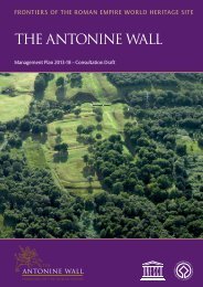
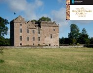
![Elgin Cathedral Wedding Brochure [pdf, 544kb] - Historic Scotland](https://img.yumpu.com/22301571/1/190x151/elgin-cathedral-wedding-brochure-pdf-544kb-historic-scotland.jpg?quality=85)