Mapping Woody Vegetation with the Compact High Resolution - ESA
Mapping Woody Vegetation with the Compact High Resolution - ESA
Mapping Woody Vegetation with the Compact High Resolution - ESA

Create successful ePaper yourself
Turn your PDF publications into a flip-book with our unique Google optimized e-Paper software.
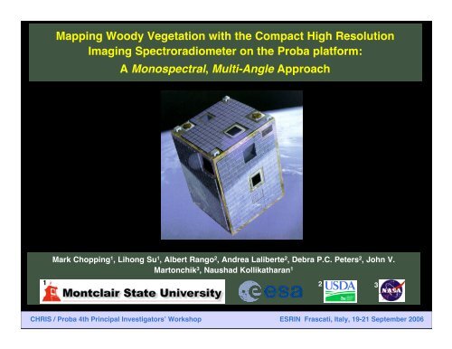
<strong>Mapping</strong> <strong>Woody</strong> <strong>Vegetation</strong> <strong>with</strong> <strong>the</strong> <strong>Compact</strong> <strong>High</strong> <strong>Resolution</strong><br />
Imaging Spectroradiometer on <strong>the</strong> Proba platform:<br />
A Monospectral, Multi-Angle Approach<br />
Mark Chopping 1 , Lihong Su 1 , Albert Rango 2 , Andrea Laliberte 2 , Debra P.C. Peters 2 , John V.<br />
Martonchik 3 , Naushad Kollikatharan 1<br />
1 2 3<br />
CHRIS / Proba 4th Principal Investigators! Workshop ESRIN Frascati, Italy, 19-21 September 2006
CHRIS/Proba Jornada Experiment: Advances in Multi-Angle Imaging<br />
Acknowledgments<br />
The data used were derived from <strong>the</strong> <strong>Compact</strong> <strong>High</strong> <strong>Resolution</strong> Imaging<br />
Spectrometer, developed by Sira Technology Ltd (formerly Sira Electro-Optics<br />
Ltd), mounted on board <strong>the</strong> European Space Agency!s PROBA-1 platform. The<br />
MISR data used were obtained from <strong>the</strong> NASA Langley Research Center<br />
Atmospheric Science Data Center.<br />
The Jornada Experimental Range is administered by <strong>the</strong> USDA Agricultural<br />
Research Service and is a Long Term Ecological Research site supported by<br />
<strong>the</strong> National Science Foundation. Forest Inventory Service data were provided<br />
by Gretchen Moisen, US Forest Service, Rocky Mountain Research Station,<br />
Ogden, UT.<br />
Thanks to Matt Smith and <strong>the</strong> Global Land Cover Facility, University of<br />
Maryland, College Park, MD, for providing <strong>the</strong> VCF and SDB data.<br />
The work described herein has been significantly enabled by NASA grant<br />
NNG04GK91G to Mark Chopping (EOS project EOS/03-0183-0465 “Quantifying<br />
Changes in Carbon Pools <strong>with</strong> Shrub Invasion of Desert Grasslands using<br />
Multi-Angular Data from EOS Terra and Aqua”, that also benefited from our<br />
work under <strong>the</strong> <strong>ESA</strong> CHRIS/Proba program.<br />
CHRIS / Proba 4th Principal Investigators! Workshop ESRIN Frascati, Italy, 19-21 September 2006
CHRIS/Proba Jornada Experiment: Advances in Multi-Angle Imaging<br />
OUTLINE and SUMMARY<br />
• Goal: estimate sub-pixel woody shrub fractional cover at<br />
landscape scales using multi-angle RS techniques<br />
• Approach: evaluate <strong>the</strong> Simple Geometric Model (SGM) against<br />
<strong>the</strong> 631 nm directional signal from CHRIS; adjust against CHRIS<br />
(and MISR red band) multi-angle data<br />
• Major Challenge: to obtaining adequate estimates of<br />
background reflectance anisotropy at CHRIS/Proba (and<br />
MISR/Terra) acquisition angles<br />
• 1st order solution: exploit <strong>the</strong> isotropic, geometric, and volume<br />
scattering weights of Li-Ross model kernels<br />
• Results: mapped distributions of woody shrub cover are good<br />
<strong>with</strong> reference to estimates made using IKONOS 1 m<br />
panchromatic imagery<br />
CHRIS / Proba 4th Principal Investigators! Workshop ESRIN Frascati, Italy, 19-21 September 2006
CHRIS/Proba Jornada Experiment: Advances in Multi-Angle Imaging<br />
Structure: Should be a Strength of M-angle Remote Sensing<br />
• Multi-angle sampling provides sensitivity to vegetation<br />
canopy structure through <strong>the</strong> physical phenomena of<br />
shadow-hiding and volume scattering by leaves<br />
• Multi-angle data are best interpreted through canopy<br />
reflectance models, which have greater explanatory power<br />
than empirical measures<br />
• However, interpretation is difficult because <strong>the</strong> real world is<br />
complex and complex models can be difficult, impractical,<br />
or even impossible to invert: We have to decide on <strong>the</strong><br />
appropriate level of complexity, or devise appropriate<br />
inversion protocols (e.g., injection of a priori knowledge)<br />
CHRIS / Proba 4th Principal Investigators! Workshop ESRIN Frascati, Italy, 19-21 September 2006
Canopy architecture and spatial<br />
heterogeneity affect carbon<br />
storage, vegetation dynamics,<br />
and productivity of grasslands<br />
undergoing woody<br />
encroachment Extensive<br />
creosotebush<br />
shrublands in<br />
sou<strong>the</strong>rn<br />
New Mexico<br />
We need maps of structural parameters for grasslands as well as<br />
savannas, woodlands and forests: shrubs now occupy 83% of<br />
current and former US grasslands (not to mention elsewhere)<br />
CHRIS / Proba 4th Principal Investigators! Workshop ESRIN Frascati, Italy, 19-21 September 2006
We have a lot of real<br />
estate occupied by<br />
non-forest woody<br />
plants (nowadays)<br />
AZ NM<br />
Mexico<br />
Forest<br />
Non-forest mask<br />
Lakes or reservoirs<br />
State boundaries<br />
Source: USDA, US Forest Service Forest Inventory<br />
Analysis, Forest Cover map for <strong>the</strong> Interior West<br />
CHRIS / Proba 4th Principal Investigators! Workshop ESRIN Frascati, Italy, 19-21 September 2006<br />
TX
CHRIS/Proba Jornada Experiment: Advances in Multi-Angle Imaging<br />
In <strong>the</strong> 1980s we<br />
recognized large<br />
directional effects in<br />
AVHRR VNIR data<br />
resulting from<br />
variations in canopy<br />
structure; in <strong>the</strong><br />
1990s we learned<br />
how to model <strong>the</strong>se<br />
semi-empirically (Li-<br />
Ross & RPV models)<br />
Chihuahuan Desert<br />
nor<strong>the</strong>rn boundary<br />
rivers and lakes<br />
USDA-ARS Jornada<br />
Experimental Range<br />
N<br />
100 km<br />
Multispectral image from AVHRR VIS, NIR, and Mid-IR channels ? …NO!<br />
RGB= iso, geo, vol kernel weights from Li-Ross BRDF model fitted to AVHRR VIS channel!<br />
CHRIS / Proba 4th Principal Investigators! Workshop ESRIN Frascati, Italy, 19-21 September 2006
CHRIS/Proba Jornada Experiment: Advances in Multi-Angle Imaging<br />
Canopy Structure from M-Angle Observations<br />
Researchers have sought to obtain measures of<br />
canopy structure using NASA (MISR) & <strong>ESA</strong> (CHRIS)<br />
multi-angle observations by following a variety of<br />
approaches:<br />
A. Empirical / Data Mining / Synergistic<br />
B. Radiative Transfer modeling/LUTs<br />
C. Canopy Openness from MRPV-k parameter<br />
D. Clumping Index<br />
E. Structural Scattering Index (Li-Ross)<br />
F. Geometric-Optical and Hybrid Models<br />
All <strong>the</strong>se avenues have proved worthwhile<br />
Applied <strong>with</strong> CHRIS Applied <strong>with</strong> o<strong>the</strong>r instruments (MISR, MODIS)<br />
CHRIS / Proba 4th Principal Investigators! Workshop ESRIN Frascati, Italy, 19-21 September 2006
CHRIS/Proba Jornada Experiment: Advances in Multi-Angle Imaging<br />
study area<br />
USDA, ARS Jornada<br />
Experimental Range,<br />
~37 km N of Las Cruces,<br />
New Mexico<br />
CHRIS / Proba 4th Principal Investigators! Workshop ESRIN Frascati, Italy, 19-21 September 2006
CHRIS/Proba Jornada Experiment: Advances in Multi-Angle Imaging<br />
State of New Mexico<br />
150 0 150 300 miles<br />
Sevilleta National<br />
Wildlife Refuge<br />
25 0 75 km<br />
Jornada<br />
Experimental<br />
Range<br />
MISR iso kernel weight image<br />
CHRIS / Proba 4th Principal Investigators! Workshop ESRIN Frascati, Italy, 19-21 September 2006
CHRIS/Proba Jornada Experiment: Advances in Multi-Angle Imaging<br />
<strong>Vegetation</strong> Changes in <strong>the</strong> Last 150 yrs: space for time<br />
Typical Desert Grassland (Sevilleta) substitution<br />
Chihuahuan and Plains Grassland (Black<br />
Grama Grasslands <strong>with</strong> Blue Grama)<br />
Honey mesquite (Prosopis<br />
glandulosa) shrub-coppice dunes<br />
Desertified Grassland (Jornada)<br />
CHRIS / Proba 4th Principal Investigators! Workshop ESRIN Frascati, Italy, 19-21 September 2006
Black Grama Grassland<br />
CHRIS / Proba 4th Principal Investigators! Workshop ESRIN Frascati, Italy, 19-21 September 2006
Grassland-Shrub Transition<br />
(backscattering)<br />
CHRIS / Proba 4th Principal Investigators! Workshop ESRIN Frascati, Italy, 19-21 September 2006
Grassland-Shrub Transition<br />
(forward-scattering)<br />
CHRIS / Proba 4th Principal Investigators! Workshop ESRIN Frascati, Italy, 19-21 September 2006
Grassland-Shrub Transition<br />
<strong>with</strong> advanced mesquite encroachment<br />
CHRIS / Proba 4th Principal Investigators! Workshop ESRIN Frascati, Italy, 19-21 September 2006
Mesquite Shrub Coppice Dunes<br />
CHRIS / Proba 4th Principal Investigators! Workshop ESRIN Frascati, Italy, 19-21 September 2006
CHRIS/Proba Jornada Experiment: Advances in Multi-Angle Imaging<br />
Chopping et al. performed GO modeling studies using<br />
DuncanTech, CHRIS, and MISR data in <strong>the</strong> SW US at <strong>the</strong><br />
Plot scale* 25 m 2 2003-4<br />
Landscape scale 1 § > 27 km 2 2005<br />
Landscape scale "2 " # > 3,519 km2 2005-6<br />
Regional scale ~ 240,000 km 2 2006<br />
Continental/Global scale… 20xx?<br />
* DuncanTech Airborne Imaging Camera<br />
§ CHRIS/Proba (Sira/SSTL/<strong>ESA</strong>)<br />
# MISR (NASA/JPL)<br />
CHRIS / Proba 4th Principal Investigators! Workshop ESRIN Frascati, Italy, 19-21 September 2006
CHRIS/Proba Jornada Experiment: Advances in Multi-Angle Imaging<br />
Chopping et al. performed GO modeling studies using<br />
DuncanTech, CHRIS, and MISR data in <strong>the</strong> SW US at <strong>the</strong><br />
Plot scale* 25 m 2 field/air<br />
Landscape scale 1 § > 27 km 2 air/CHRIS<br />
Landscape scale "2 " # > 3,519 km2 MISR<br />
Regional scale ~ 240,000 km2 MISR<br />
Continental/Global scale… 20xx?<br />
* DuncanTech Airborne Imaging Camera<br />
§ CHRIS/Proba (Sira/SSTL/<strong>ESA</strong>)<br />
# MISR (NASA/JPL)<br />
CHRIS / Proba 4th Principal Investigators! Workshop ESRIN Frascati, Italy, 19-21 September 2006
CHRIS/Proba Jornada Experiment: Advances in Multi-Angle Imaging<br />
Chopping, M. (2006a), Progress in retrieving canopy structure parameters from NASA multi-angle remote<br />
sensing, Terra/Salomonson session, Proc. IGARSS’06, Denver, CO, July 2006.<br />
Chopping, M., (2006b) Multi-angle remote sensing and applications, in Advances in Land Remote Sensing:<br />
System, Modeling, Inversion and Applications, S. Liang (ed), in revision.<br />
Chopping, M., Su, L., Rango, A., Martonchik, J.V., Peters, D.P.C., and Laliberte, A. (2006a), Remote<br />
sensing of woody shrub cover in desert grasslands using MISR <strong>with</strong> a geometric-optical<br />
canopy reflectance model, Remote Sens. Environ., accepted, 07/06.<br />
Chopping, M., Su, L., Laliberte, A., Rango, A., Peters, D.P.C., and Kollikkathara, N. (2006b), <strong>Mapping</strong><br />
shrub abundance in desert grasslands using geometric-optical modeling and multiangle remote<br />
sensing <strong>with</strong> CHRIS/Proba. Remote Sens. Environ. 104 (2006) 62 – 73.<br />
Chopping, M., Su, L., Laliberte, A., Rango, A., Peters, D.P.C., and Martonchik, J.V. (2006c) <strong>Mapping</strong><br />
woody plant cover in desert grasslands using canopy reflectance modeling and MISR data,<br />
Geophysical Research Letters, Vol. 33, L17402, doi:10.1029/2006GL027148.<br />
Chopping, M., J.V. Martonchik, et al. (2005), Geometric-optical modeling of desert grassland canopy<br />
structure <strong>with</strong> MISR, Proc. ISPMSRS 2005, I: 141-143<br />
Chopping, M.J., Su, L., Rango, A., and Maxwell, C. (2004). Modelling <strong>the</strong> reflectance anisotropy of<br />
Chihuahuan Desert grass-shrub transition canopy-soil complexes, IJRS 25: 2725–2745.<br />
Chopping, M., Laliberte, A., and Rango, A. (2004), Exploitation of multi-angle data from CHRIS on<br />
Proba: First results from <strong>the</strong> Jornada Experimental Range, European Space Research Institute<br />
(ESRIN), Frascati, Italy, <strong>ESA</strong> Special Publication SP-578,109-117.<br />
Chopping M.J., Rango, A., Havstad, K.M., Schiebe, F.R., Ritchie, J.C., Schmugge, T.J., French, A., Su, L.,<br />
McKee, L., and Davis, R.M. (2003), Canopy attributes of Chihuahuan Desert grassland and<br />
transition communities derived from multi-angular airborne imagery, Remote Sens. Environ.<br />
85(3): 339-354.<br />
CHRIS / Proba 4th Principal Investigators! Workshop ESRIN Frascati, Italy, 19-21 September 2006
CHRIS/Proba Jornada Experiment: Advances in Multi-Angle Imaging<br />
Geometric-Optical<br />
(Li-Strahler) models<br />
provide one way to<br />
interpret multi-angle data<br />
• August 22, 2003 CHRIS data<br />
set (Mode 3: ~18 m GIFOVs)<br />
• 4 overlapping looks<br />
• Geometry from Xephem/TLEs<br />
• Geometric transformation<br />
w/poly2/3 and rubbersheeting<br />
(>60 GCPs);<br />
resampled to 25m<br />
• Atmospheric correction using<br />
6S/visibility estimates<br />
• No correction for striping<br />
• Only <strong>the</strong> 631 nm (red) data<br />
were used in modeling (KISS<br />
principle)<br />
CHRIS / Proba 4th Principal Investigators! Workshop ESRIN Frascati, Italy, 19-21 September 2006
CHRIS/Proba Jornada Experiment: Advances in Multi-Angle Imaging<br />
Geometric-Optical Models predict bidirectional reflectance at specified<br />
illumination and viewing directions as a function of canopy structure<br />
parameters of practical and ecological significance:<br />
• mean crown shape (b/r)<br />
• mean crown radius (r)<br />
• plant number density (!)<br />
• mean canopy height (h)<br />
r<br />
• background brightness<br />
and anisotropy (Walthall<br />
model (a function of<br />
of understory density)<br />
b<br />
R = G . k G + C . k C + T . k T + Z . k Z<br />
G, C, T, Z can be<br />
assumed Lambertian or<br />
may have defined<br />
reflectance anisotropies<br />
sunlit crown shadowed crown<br />
sunlit ground shadowed ground<br />
CHRIS / Proba 4th Principal Investigators! Workshop ESRIN Frascati, Italy, 19-21 September 2006<br />
h
CHRIS/Proba Jornada Experiment: Advances in Multi-Angle Imaging<br />
Knowledge of <strong>the</strong> background contribution is critical if <strong>the</strong> background is highly<br />
exposed, as in this shrub-grass transition zone in <strong>the</strong> USDA, ARS Jornada<br />
Experimental Range in sou<strong>the</strong>rn New Mexico<br />
CHRIS CHRIS / Proba / Proba 4th 4th Principal Investigators! Workshop ESRIN ESRIN Frascati, Italy, Italy, 19-21 19-21 September 2006 2006
5<br />
1<br />
4<br />
3<br />
IKONOS Panchromatic Image<br />
05/23/01 Sites are indicated in RED<br />
6<br />
2<br />
CHRIS / Proba 4th Principal Investigators! Workshop ESRIN Frascati, Italy, 19-21 September 2006<br />
600 m<br />
N<br />
The problem:<br />
understory<br />
We looked at this by<br />
studying <strong>the</strong> soilunderstory<br />
behaviour<br />
at a number of<br />
Selected Sites:<br />
1. grama grass <strong>with</strong> some<br />
PRGL (mesquite)<br />
2. large PRGL on sand<br />
3. small PRGL on dense<br />
understory<br />
4. small PRGL on sparse<br />
understory<br />
5 small PRGL on dense<br />
understory(2)<br />
6. mixed area near<br />
WestWell
250 meters<br />
250 meters<br />
IKONOS 1 meter pan images for 6 contrasting sites<br />
Used as proxy for field measurements & cal/validation<br />
CHRIS / Proba 4th Principal Investigators! Workshop ESRIN Frascati, Italy, 19-21 September 2006
CHRIS/Proba Jornada Experiment: Advances in Multi-Angle Imaging<br />
How to Obtain <strong>the</strong> Background Signal?<br />
The ability to estimate <strong>the</strong><br />
brightness and anisotropy of <strong>the</strong><br />
background is a major<br />
prerequisite for <strong>the</strong> use of GO<br />
models in many places<br />
R = G . k G + C . k C + T . k T + Z . k Z<br />
i.e., G = ??<br />
Can G be Lambertian?<br />
NO<br />
Can G have static anisotropy?<br />
NO<br />
We have a problem<br />
Can we make this work?<br />
k G >= 0.75<br />
Photo: Scott Bauer, USDA, ARS Photo Unit<br />
CHRIS / Proba 4th Principal Investigators! Workshop ESRIN Frascati, Italy, 19-21 September 2006
CHRIS/Proba Jornada Experiment: Advances in Multi-Angle Imaging<br />
1st Order: The Li-Ross vol kernel weight is sensitive to <strong>the</strong> understory<br />
E.g., MISR vol kernel weight Ikonos pan image<br />
+shrub<br />
-vol scattering<br />
high low<br />
+u.story<br />
+vol scattering<br />
CHRIS / Proba 4th Principal Investigators! Workshop ESRIN Frascati, Italy, 19-21 September 2006
Simple<br />
Geometricoptical<br />
Model<br />
Inversion<br />
Protocol<br />
The Walthall<br />
model (W) is used<br />
to represent <strong>the</strong><br />
background and a<br />
Ross function<br />
allows for <strong>with</strong>incrown<br />
volume<br />
scattering; G is<br />
replaced <strong>with</strong> W<br />
and C <strong>with</strong> Ross,<br />
so that<br />
R =<br />
G W.k G +C Ross.k C<br />
T and Z are<br />
considered black<br />
Exposed<br />
soil<br />
invert <strong>the</strong><br />
LiSparse-RossThin<br />
kernel-driven model against<br />
Red band MISR CHRIS data in 9 4 views<br />
obtain relationships between <strong>the</strong><br />
kernel weights and <strong>the</strong> background<br />
BRDF in <strong>the</strong> MISR CHRISplane<br />
by fixing<br />
shrub statistics and adjusting <strong>the</strong><br />
Walthall model parameters<br />
obtain estimates of woody shrub<br />
mean radiius and number density<br />
via thresholding 1 m IKONOS<br />
panchromatic imagery<br />
CHRIS MISR<br />
Red Band<br />
BRFs<br />
in Nine Cameras<br />
4 looks<br />
invert <strong>the</strong> SGM model<br />
using <strong>the</strong> estimated<br />
background and fixing<br />
all parameters except<br />
mean shrub radius;<br />
adjust <strong>the</strong> model<br />
against MISR CHRIS data<br />
calculate fractional<br />
shrub cover from mean<br />
shrub density<br />
CHRIS / Proba 4th Principal Investigators! Mesquite shrubs Workshop Black grama ESRIN grass Frascati, Italy, 19-21 September 2006
CHRIS/Proba Jornada Experiment: Advances in Multi-Angle Imaging<br />
Estimated surface<br />
bidirectional reflectance vs.<br />
surface bidirectional<br />
reflectance at 631 nm<br />
modeled using <strong>the</strong> Simple<br />
Geometric Model (SGM)<br />
when driven <strong>with</strong> IKONOS-<br />
derived shrub statistics and<br />
backgrounds estimated a<br />
priori from isotropic-<br />
LiSparse-RossThin LiSK<br />
model kernel weights<br />
(represented by <strong>the</strong> Walthall<br />
model). R 2 =0.75 N= 38,934.<br />
CHRIS Reflectance at 631 nm<br />
Noisy!<br />
Too Noisy?<br />
(no!)<br />
CHRIS / Proba 4th Principal Investigators! Workshop ESRIN Frascati, Italy, 19-21 September 2006
CHRIS/Proba Jornada Experiment: Advances in Multi-Angle Imaging<br />
Modeled vs. measured woody shrub<br />
fractional cover, <strong>the</strong> latter estimated<br />
from IKONOS 1 m panchromatic<br />
imagery. These results were obtained<br />
by adjusting <strong>the</strong> Walthall model<br />
coefficients so that <strong>the</strong> lowest<br />
absolute RMSE was obtained<br />
between <strong>the</strong> Simple Geometric Model<br />
(SGM) and <strong>the</strong> corresponding<br />
CHRIS/Proba 631 nm multi-angle<br />
reflectance data. Error in retrieving<br />
shrub cover using this method is<br />
almost entirely owing to inaccuracy<br />
in estimating <strong>the</strong> background signal.<br />
y = 0.8746x + 0.0055<br />
R 2 = 0.9987<br />
CHRIS / Proba 4th Principal Investigators! Workshop ESRIN Frascati, Italy, 19-21 September 2006<br />
Modeled Fractional Shrub Cover<br />
0.35<br />
0.30<br />
0.25<br />
0.20<br />
0.15<br />
0.10<br />
0.05<br />
0.00<br />
1:1<br />
line<br />
0.00 0.05 0.10 0.15 0.20 0.25 0.30 0.35<br />
Measured Fractional Shrub Cover
CHRIS/Proba Jornada Experiment: Advances in Multi-Angle Imaging<br />
Multi-angle false colour<br />
composites:<br />
(a) RGB = band 421 composite<br />
(b) RGB = band 421 simulation<br />
(c) RGB = band 431 composite<br />
(d) RGB = band 431 simulation<br />
These composites show strong<br />
agreement between modeled and<br />
observed CHRIS/Proba data in<br />
different views and also provide<br />
an indication of <strong>the</strong> information<br />
content of multi-angle imagery.<br />
(a)<br />
(c)<br />
CHRIS / Proba 4th Principal Investigators! Workshop ESRIN Frascati, Italy, 19-21 September 2006<br />
(b)<br />
(d)
CHRIS/Proba Jornada Experiment: Advances in Multi-Angle Imaging<br />
Estimated<br />
<strong>with</strong><br />
IKONOS<br />
500 m<br />
Estimated<br />
<strong>with</strong><br />
CHRIS/SGM<br />
Mapped values of retrieved fractional woody shrub cover match <strong>the</strong><br />
distribution of <strong>the</strong> IKONOS-estimated values: (a) fractional woody shrub<br />
cover estimated using IKONOS 1 m panchromatic imagery (b) woody shrub<br />
cover retrieved by adjusting <strong>the</strong> SGM against CHRIS/Proba multi-angle data.<br />
CHRIS / Proba 4th Principal Investigators! Workshop ESRIN Frascati, Italy, 19-21 September 2006
CHRIS/Proba Jornada Experiment: Advances in Multi-Angle Imaging<br />
Frequency distributions of<br />
absolute deviation between<br />
retrieved and measured<br />
fractional woody shrub cover<br />
(retrieved using SGM <strong>with</strong><br />
calibrated Walthall soil-<br />
understory response). Almost<br />
90% of estimates are<br />
associated <strong>with</strong> a deviation<br />
from <strong>the</strong> IKONOS-estimated<br />
value of less than 0.08.<br />
Frequency<br />
700<br />
600<br />
500<br />
400<br />
300<br />
200<br />
100<br />
0<br />
0.001 0.076 0.151 0.226 0.301 0.376 0.451<br />
Absolute deviation<br />
Frequency<br />
Cumulative %<br />
120.0%<br />
100.0%<br />
CHRIS / Proba 4th Principal Investigators! Workshop ESRIN Frascati, Italy, 19-21 September 2006<br />
80.0%<br />
60.0%<br />
40.0%<br />
20.0%<br />
.0%
CHRIS/Proba Jornada Experiment: Advances in Multi-Angle Imaging<br />
Note: <strong>the</strong>re is error in <strong>the</strong><br />
IKONOS-derived<br />
estimates: Fractional<br />
woody shrub cover from 1<br />
m IKONOS pan imagery<br />
vs. independently-derived<br />
estimates from<br />
segmentation of 0.5 m<br />
QuickBird pan imagery,<br />
using eCognition (random<br />
sample)<br />
CHRIS / Proba 4th Principal Investigators! Workshop ESRIN Frascati, Italy, 19-21 September 2006
CHRIS/Proba Jornada Experiment: Advances in Multi-Angle Imaging<br />
Conclusions -- Part 1<br />
The multi-angle remote sensing signal from<br />
CHRIS/Proba at 631 nm can be explained in terms of<br />
a combined soil-understory background response<br />
and woody shrub cover and exploited to map woody<br />
shrub cover in desert grasslands at landscape<br />
scales.<br />
The modeling framework developed allows retrieval<br />
of shrub cover for both canopies <strong>with</strong> an important<br />
understory component as well as those <strong>with</strong> sparse<br />
understories and a high proportion of exposed soil.<br />
CHRIS / Proba 4th Principal Investigators! Workshop ESRIN Frascati, Italy, 19-21 September 2006
CHRIS/Proba Jornada Experiment: Advances in Multi-Angle Imaging<br />
Can we apply similar techniques over larger<br />
areas -- and <strong>with</strong> a higher revisit rate -- using<br />
NASA!s Multi-angle Imaging Spectro-<br />
Radiometer (MISR) on <strong>the</strong> Terra satellite?<br />
YES!<br />
The following slides show <strong>the</strong> results from<br />
<strong>the</strong> first run…<br />
CHRIS / Proba 4th Principal Investigators! Workshop ESRIN Frascati, Italy, 19-21 September 2006
Comparisons of Retrievals <strong>with</strong> VCF % Tree Cover Map<br />
0.89<br />
tree<br />
0.30<br />
0.29<br />
shrub<br />
0.00<br />
Fractional<br />
Cover<br />
Rio Grande<br />
riparian zone<br />
Left: MISR/GO <strong>Woody</strong> Plant Cover Right: MODIS <strong>Vegetation</strong> Continuous<br />
Fields % Tree Cover for <strong>the</strong> USDA, ARS Jornada Experimental Range<br />
CHRIS / Proba 4th Principal Investigators! Workshop ESRIN Frascati, Italy, 19-21 September 2006<br />
10 km<br />
Fractional<br />
Cover<br />
Summerford San Andres Mountains<br />
Mountain<br />
0.27<br />
0.02<br />
0.01
Comparisons of Retrievals <strong>with</strong> VCF % Tree Cover Map<br />
Fractional Cover<br />
0.89<br />
tree<br />
0.30<br />
0.27<br />
0.02<br />
0.29<br />
shrub<br />
0.00<br />
0.01<br />
10 km<br />
--10 km--<br />
Rio Grande<br />
riparian<br />
zone<br />
San Andres<br />
Mountains<br />
Top: MISR/GO<br />
<strong>Woody</strong> Plant Cover<br />
Bottom: MODIS<br />
<strong>Vegetation</strong><br />
Continuous Fields<br />
% Tree Cover for<br />
<strong>the</strong> Sevilleta<br />
National Wildlife<br />
Refuge near<br />
Socorro, NM<br />
CHRIS / Proba 4th Principal Investigators! Workshop ESRIN Frascati, Italy, 19-21 September 2006
MISR/GO Regional <strong>Woody</strong> Plant Canopy Cover<br />
white=cloud<br />
cover and<br />
White Sands<br />
National<br />
Monument<br />
AZ NM<br />
Mexico<br />
MISR/GO Canopy Cover Forest Inventory Analysis Canopy Cover<br />
CHRIS / Proba 4th Principal Investigators! Workshop ESRIN Frascati, Italy, 19-21 September 2006<br />
TX
MISR/GO Regional <strong>Woody</strong> Plant Canopy Height<br />
AZ NM<br />
Mexico<br />
MISR/GO Mean Canopy Height Forest Inventory Analysis Canopy Height<br />
CHRIS / Proba 4th Principal Investigators! Workshop ESRIN Frascati, Italy, 19-21 September 2006<br />
TX
MISR/GO Regional <strong>Woody</strong> Plant Canopy Cover<br />
CHRIS / Proba 4th Principal Investigators! Workshop ESRIN Frascati, Italy, 19-21 September 2006
MISR/GO Regional <strong>Woody</strong> Plant Canopy Height<br />
CHRIS / Proba 4th Principal Investigators! Workshop ESRIN Frascati, Italy, 19-21 September 2006
MISR/GO Regional Crown Cover x Canopy Height<br />
CHRIS / Proba 4th Principal Investigators! Workshop ESRIN Frascati, Italy, 19-21 September 2006
MISR / SGM work: Caveats Etc.<br />
• The Li-Ross background relationship was<br />
calibrated on only 19 grass-shrub sites in <strong>the</strong> W.<br />
part of <strong>the</strong> USDA Jornada Experimental Range<br />
• The results from this 1st run should be much<br />
worse: crown LAI was fixed over <strong>the</strong> entire area,<br />
which is insane (but existing LAI products are not<br />
crown LAI, so cannot be used directly)<br />
• These results should be classified as “very<br />
interesting” at this stage: validation is required. On<br />
<strong>the</strong> o<strong>the</strong>r hand, <strong>the</strong>y are to our knowledge unique in<br />
<strong>the</strong> moderate resolution RS world<br />
CHRIS / Proba 4th Principal Investigators! Workshop ESRIN Frascati, Italy, 19-21 September 2006
CHRIS/Proba Jornada Experiment: Advances in Multi-Angle Imaging<br />
Conclusions -- Part 2<br />
• CHRIS is an unique instrument providing data for <strong>the</strong> testing<br />
of algorithms that have important applications in many<br />
disciplines (including mapping canopy structural parameters)<br />
• We have made significant progress towards exploiting <strong>the</strong><br />
structural information content of multi-angle data (empirical<br />
methods currently give <strong>the</strong> best results; models are gaining…)<br />
• Multi-angle data provide a way to separate <strong>the</strong> background<br />
and upper canopy contributions, enabling <strong>the</strong> inversion of GO<br />
models for crown cover and mean canopy height over large<br />
areas (validation must be pursued)<br />
• Retrieval of canopy structure measures is more challenging<br />
over shrubs than over trees (no surprise)<br />
• Working <strong>with</strong> CHRIS and MISR multi-angle data has benefitted<br />
our research in both EO programs.<br />
CHRIS / Proba 4th Principal Investigators! Workshop ESRIN Frascati, Italy, 19-21 September 2006
CHRIS/Proba Jornada Experiment: Advances in Multi-Angle Imaging<br />
Publications:<br />
CHRIS / Proba 4th Principal Investigators! Workshop ESRIN Frascati, Italy, 19-21 September 2006
CHRIS/Proba Jornada Experiment: Advances in Multi-Angle Imaging<br />
Publications:<br />
CHRIS / Proba 4th Principal Investigators! Workshop ESRIN Frascati, Italy, 19-21 September 2006
CHRIS/Proba Jornada Experiment: Advances in Multi-Angle Imaging<br />
Publications:<br />
CHRIS / Proba 4th Principal Investigators! Workshop ESRIN Frascati, Italy, 19-21 September 2006
CHRIS/Proba Jornada Experiment: Advances in Multi-Angle Imaging<br />
Publications:<br />
CHRIS / Proba 4th Principal Investigators! Workshop ESRIN Frascati, Italy, 19-21 September 2006
Thank You!<br />
Questions?<br />
Google:<br />
Chopping CHRIS Jornada<br />
Chopping MISR Jornada<br />
CHRIS / Proba 4th Principal Investigators! Workshop ESRIN Frascati, Italy, 19-21 September 2006