The return of the water - IUCN
The return of the water - IUCN
The return of the water - IUCN

Create successful ePaper yourself
Turn your PDF publications into a flip-book with our unique Google optimized e-Paper software.
<strong>IUCN</strong> – <strong>The</strong> World Conservation Union<br />
Founded in 1948, <strong>The</strong> World Conservation Union brings toge<strong>the</strong>r States,<br />
government agencies and a diverse range <strong>of</strong> non-governmental<br />
organizations in a unique world partnership: over 1000 members in all,<br />
spread across some 140 countries.<br />
As a Union, <strong>IUCN</strong> seeks to influence, encourage and assist societies<br />
throughout <strong>the</strong> world to conserve <strong>the</strong> integrity and diversity <strong>of</strong> nature and<br />
to ensure that any use <strong>of</strong> natural resources is equitable and ecologically<br />
sustainable.<br />
<strong>The</strong> World Conservation Union builds on <strong>the</strong> stengths <strong>of</strong> its members,<br />
networks and partners to enhance <strong>the</strong>ir capacity and to support global<br />
alliances to safeguard natural resources at local, regional and global<br />
levels.<br />
<strong>IUCN</strong> Wetlands & Water Resources <strong>IUCN</strong> Publications Services Unit<br />
Programme 219c Huntingdon Road<br />
Rue Mauverney 28 Cambridge, CB3 0DL,<br />
CH-1196 Gland, Switzerland United Kingdom<br />
Tel:+41 22 999 0000 Tel:++44 (1223) 277-894<br />
Fax:+41 22 999 0002 Fax:++44 (1223) 277-175<br />
E-mail: wwrp@iucn.org E-mail: info@books.iucn.org<br />
www.iucn.org/<strong>the</strong>mes/wetlands/ www.iucn.org/bookstore/<br />
<strong>The</strong> <strong>return</strong> <strong>of</strong> <strong>the</strong> <strong>water</strong>: Restoring <strong>the</strong> Waza Logone floodplain in Cameroon <strong>IUCN</strong><br />
<strong>IUCN</strong><br />
Wetlands<br />
and Water<br />
Resources<br />
Programme<br />
BLUE SERIES<br />
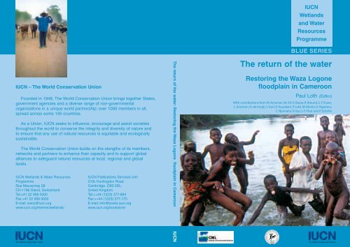
<strong>The</strong> <strong>return</strong> <strong>of</strong> <strong>the</strong> <strong>water</strong><br />
Restoring <strong>the</strong> Waza Logone<br />
floodplain in Cameroon<br />
Paul Loth (Editor)<br />
With contributions from M. Acreman, M. Ali, H. Bauer, R. Braund, S.Y. Evans,<br />
L. Emerton, H. de Iongh, S. Kari, R. Kouokam, P. Loth, M. Moritz, D. Ngantou,<br />
C. Njomaha, P. Oyo, J-Y. Pirot and P. Scholte
<strong>The</strong> <strong>return</strong> <strong>of</strong> <strong>the</strong> <strong>water</strong><br />
Restoring <strong>the</strong> Waza Logone<br />
floodplain in Cameroon<br />
Paul Loth (Editor)<br />
With contributions from M. Acreman, M. Ali, H. Bauer, R. Braund, S.Y. Evans,<br />
L. Emerton, H. de Iongh, S. Kari, R. Kouokam, P. Loth, M. Moritz, D. Ngantou,<br />
C. Njomaha, P. Oyo, J-Y. Pirot and P. Scholte<br />
<strong>The</strong> Waza Logone project is managed by <strong>IUCN</strong> - <strong>The</strong> World Conservation Union, through an agreement with<br />
<strong>the</strong> Government <strong>of</strong> Cameroon. Funding is provided principally by <strong>the</strong> Directorate-General for International<br />
Cooperation (DGIS) <strong>of</strong> <strong>the</strong> Ne<strong>the</strong>rlands, while additional grants and in-kind support were also received from<br />
<strong>the</strong> World Wide Fund for Nature (WWF), <strong>the</strong> European Commission and <strong>the</strong> Government <strong>of</strong> Cameroon. <strong>The</strong><br />
Ne<strong>the</strong>rlands Development Organisation (SNV), <strong>the</strong> Centre for Environment and Development Studies in<br />
Cameroon (CEDC) and <strong>the</strong> Institute <strong>of</strong> Environmental Sciences (CML) from <strong>the</strong> University <strong>of</strong> Leiden, <strong>the</strong><br />
Ne<strong>the</strong>rlands, provided scientific and technical support.
<strong>The</strong> designation <strong>of</strong> geographical entities in this book, and <strong>the</strong> presentation <strong>of</strong> <strong>the</strong> material, do not<br />
imply <strong>the</strong> expression <strong>of</strong> any opinion whatsoever on <strong>the</strong> part <strong>of</strong> <strong>IUCN</strong> concerning <strong>the</strong> legal status <strong>of</strong><br />
any country, territory, or area, or <strong>of</strong> its authorities, or concerning <strong>the</strong> delimitation <strong>of</strong> its frontiers or<br />
boundaries.<br />
<strong>The</strong> views expressed in this publication do not necessarily reflect those <strong>of</strong> <strong>IUCN</strong>, CEDC or CML.<br />
This publication has been made possible in part by funding from <strong>the</strong> Government <strong>of</strong> <strong>the</strong> Ne<strong>the</strong>rlands.<br />
Published by: <strong>IUCN</strong>, Gland, Switzerland and Cambridge, UK<br />
Copyright: ©2004 International Union for <strong>the</strong> Conservation <strong>of</strong> Nature and Natural<br />
Resources<br />
ii<br />
Reproduction <strong>of</strong> this publication for educational or o<strong>the</strong>r noncommercial<br />
purposes is authorized without prior written permission<br />
from <strong>the</strong> copyright holder provided <strong>the</strong> source is fully acknowledged.<br />
Reproduction <strong>of</strong> this publication for resale or o<strong>the</strong>r commercial<br />
purposes is prohibited without prior written permission <strong>of</strong> <strong>the</strong><br />
copyright holder.<br />
Citation: Loth, P. (Editor), 2004. <strong>The</strong> Return <strong>of</strong> <strong>the</strong> Water: Restoring <strong>the</strong> Waza Logone<br />
Floodplain in Cameroon. <strong>IUCN</strong>, Gland, Switzerland and Cambridge, UK.<br />
xvi + 156 pp.<br />
ISBN: 2-8317-0752-8<br />
Cover photograph: Children play in <strong>the</strong> <strong>water</strong> that once again flows through <strong>the</strong> Waza Logone<br />
floodplain in Nor<strong>the</strong>rn Cameroon – from de Noray, M.L. (2003)<br />
“Waza Logone – Histoires d’Eaux et d’Hommes”, <strong>IUCN</strong>, Switzerland<br />
Printed by: Sadag Imprimerie - 01200 Bellegarde, France<br />
Available from: <strong>IUCN</strong> Publications Services Unit<br />
219c Huntingdon Road, Cambridge CB3 0DL, United Kingdom<br />
Tel.: +44 1223 277894, Fax:+44 1223 277175<br />
E-mail: info@books.iucn.org<br />
http://www.iucn.org/bookstore<br />
A catalogue <strong>of</strong> <strong>IUCN</strong> publications is also available<br />
<strong>The</strong> text <strong>of</strong> this book is printed on couché mat 115g, chlorine-free paper.
<strong>IUCN</strong> – <strong>The</strong> World Conservation Union<br />
Founded in 1948, <strong>The</strong> World Conservation Union brings toge<strong>the</strong>r States, government agencies and<br />
a diverse range <strong>of</strong> non-governmental organizations in a unique world partnership: 1000 members<br />
in all, spread across some 140 countries.<br />
As a Union, <strong>IUCN</strong> seeks to influence, encourage and assist societies throughout <strong>the</strong> world to conserve<br />
<strong>the</strong> integrity and diversity <strong>of</strong> nature and to ensure that any use <strong>of</strong> natural resources is equitable and<br />
ecologically sustainable.<br />
<strong>The</strong> World Conservation Union builds on <strong>the</strong> strengths <strong>of</strong> its members, networks and partners to<br />
enhance <strong>the</strong>ir capacity and to support global alliances to safeguard natural resources at local, regional<br />
and global levels.<br />
Institute <strong>of</strong> Environmental Sciences, CML, <strong>the</strong> Ne<strong>the</strong>rlands<br />
<strong>The</strong> Department “Environment and Development” (PMO) <strong>of</strong> <strong>the</strong> Institute <strong>of</strong> Environmental Sciences<br />
(CML) in Leiden, <strong>the</strong> Ne<strong>the</strong>rlands, focuses on <strong>the</strong> depletion, protection and rehabilitation <strong>of</strong> natural<br />
resources, such as forests, marine resources, soils and wildlife, in <strong>the</strong> developing world. It works in<br />
Leiden and in a number <strong>of</strong> developing countries, in particular Cameroon (CEDC), <strong>the</strong> Philippines<br />
and Indonesia.<br />
Its main activities are higher education and scientific research in environmental sciences.<br />
Centre for Environment and Development Studies, Cameroon<br />
<strong>The</strong> Centre for Environment and Development Studies in Cameroon (CEDC) in Maroua is <strong>the</strong><br />
product <strong>of</strong> co-operation between <strong>the</strong> former Ministry <strong>of</strong> Higher Education, Computer Science and<br />
Scientific Research (MESIRES) in Cameroon and Leiden University (UL) in <strong>the</strong> Ne<strong>the</strong>rlands.<br />
Its main activities are training, higher education and scientific research. CEDC also provides practical<br />
support to field projects in <strong>the</strong> drylands surrounding Maroua. CEDC has received financial support<br />
from <strong>the</strong> Cameroonian government and from <strong>the</strong> Dutch Government through UL/CML, <strong>IUCN</strong> –<br />
<strong>The</strong> World Conservation Union and <strong>the</strong> Ne<strong>the</strong>rlands Organisation for International Co-operation in<br />
Higher Education (NUFFIC).<br />
iii
Table <strong>of</strong> Contents<br />
Foreword vii<br />
Contributors ix<br />
Acknowledgements x<br />
Abbreviations xii<br />
List <strong>of</strong> Tables xiii<br />
List <strong>of</strong> Figures xiv<br />
List <strong>of</strong> Plates xv<br />
Part I: Introduction<br />
Chapter 1 - Introduction 3<br />
1.1 Floodplains 3<br />
1.2 Floodplains <strong>of</strong> <strong>the</strong> Sahel 4<br />
1.3 <strong>The</strong> Waza Logone floodplain 5<br />
1.4 Organisation <strong>of</strong> <strong>the</strong> book 9<br />
Part II: <strong>The</strong> Receding Water<br />
Chapter 2 - <strong>The</strong> Need for Increased Rice Production 13<br />
2.1 <strong>The</strong> colonial view on economic development 13<br />
2.2 Intensification and expansion <strong>of</strong> rice production 14<br />
2.3 <strong>The</strong> planning and building <strong>of</strong> <strong>the</strong> Maga dam 15<br />
Chapter 3 - Consequences <strong>of</strong> <strong>the</strong> Dam and <strong>the</strong> Drought 19<br />
3.1 Reduced flooding as a consequence <strong>of</strong> climatic change? 19<br />
3.2 Ecological consequences <strong>of</strong> reduced flooding 20<br />
3.3 Socio-economic consequences 23<br />
Part III: <strong>The</strong> Natural Setting<br />
Chapter 4 - <strong>The</strong> Wider Context 27<br />
4.1 <strong>The</strong> wider context <strong>of</strong> <strong>the</strong> Logone floodplain 27<br />
4.2 Geographical Features <strong>of</strong> <strong>the</strong> Lake Chad Basin 29<br />
4.3 Climate 30<br />
4.4 Historical Rainfall/River Flow Relationship 32<br />
Chapter 5 - Hydrology <strong>of</strong> <strong>the</strong> Waza Logone Area 33<br />
5.1 Flooding characteristics and flooding cycle 33<br />
5.2 Flooding Volume, Extent, Depth and Duration 34<br />
5.3 Impact <strong>of</strong> <strong>the</strong> Maga dam and <strong>the</strong> Logone River embankments 35<br />
5.4 O<strong>the</strong>r factors affecting floodplain inundation 36<br />
Chapter 6 - <strong>The</strong> Natural Resources <strong>of</strong> <strong>the</strong> Waza Logone Floodplain 39<br />
6.1 Soils and vegetation 39<br />
6.2 Bird life 40<br />
6.3 Wildlife - <strong>The</strong> Waza National Park 41<br />
v
Part IV: Living with <strong>the</strong> Seasons<br />
Chapter 7 - <strong>The</strong> People <strong>of</strong> <strong>the</strong> Floodplain 53<br />
7.1 Floodplain livelihood systems 53<br />
7.2 Ethnic groups in <strong>the</strong> floodplain 54<br />
7.3 Man as part <strong>of</strong> <strong>the</strong> ecosystem: pastoralism 55<br />
7.4 <strong>The</strong> fishers 61<br />
7.5 Farming 65<br />
7.6 O<strong>the</strong>r activities 66<br />
Chapter 8 - Conflicts and Conflict Management in <strong>the</strong> Waza Logone Floodplain 69<br />
8.1 Fighting for access to <strong>the</strong> resources 69<br />
8.2 Conflict management 72<br />
Part V: <strong>The</strong> Intervention<br />
Chapter 9 - <strong>The</strong> Waza Logone Project: History, Objectives and Main Results 77<br />
9.1 Historical Background 77<br />
9.2 Phase I (1988) 78<br />
9.3 Phase II (1992-1995) 78<br />
9.4 Phase III (1995 - 2000) 81<br />
9.5 <strong>The</strong> Waza National Park Management Plan 84<br />
Chapter 10 - <strong>The</strong> Waza Logone Project in Action 89<br />
10.1 Restoration <strong>of</strong> <strong>the</strong> flooding regime 89<br />
10.2 Socio-economic consequences <strong>of</strong> re-flooding 94<br />
10.3 Participatory conflict management 97<br />
10.4 <strong>The</strong> new institutional linkages 99<br />
10.5 Conclusions 103<br />
Chapter 11 - Economic Justification <strong>of</strong> Additional Floodplain Re-inundation 105<br />
11.1 Introduction 105<br />
11.2 Options for re-inundation 105<br />
11.3 Valuation methods 107<br />
11.4 Valuation results: <strong>the</strong> economic benefit <strong>of</strong> re-inundation 114<br />
11.5 Sensitivity analysis and key assumptions 117<br />
11.6 Conclusions: economic arguments for re-inundation 120<br />
Part VI: Guidelines for Floodplain Management<br />
Chapter 12 - Tools and Practices for Floodplain Restoration 125<br />
12.1 Implementing <strong>the</strong> ecosystem approach 125<br />
12.2 Key steps for ecosystem restoration 128<br />
12.3 Managing flood releases 130<br />
12.4 Guidelines on Sahelian floodplain management 133<br />
12.5 Conclusion 136<br />
Chapter 13 - Towards Sustainability 137<br />
13.1 Management and research priorities 137<br />
13.2 Restoring livelihoods 141<br />
13.3 Conclusion 144<br />
References 145<br />
Maps<br />
vi
Foreword<br />
This book tells <strong>the</strong> story <strong>of</strong> times past, when wetlands were considered as wastelands and decisionmakers<br />
and managers were unaware <strong>of</strong> <strong>the</strong>ir benefits, a time when <strong>the</strong> adverse impacts <strong>of</strong> hydropower<br />
and irrigation schemes on ecosystems and people downstream seemed unimportant. This story has<br />
a happier ending in <strong>the</strong>se more enlightened times when wetland ecosystems are viewed as essential<br />
elements in integrated river basin planning, which draws upon <strong>the</strong> most appropriate modern science<br />
and traditional knowledge. <strong>The</strong> hero <strong>of</strong> <strong>the</strong> story is one <strong>of</strong> <strong>the</strong> best-known floodplains <strong>of</strong> <strong>the</strong> Sahel<br />
- <strong>the</strong> Waza Logone floodplain in <strong>the</strong> Extreme-North Province <strong>of</strong> Cameroon. This book tells <strong>of</strong> <strong>the</strong><br />
partial restoration <strong>of</strong> <strong>the</strong> wetland using lessons from <strong>the</strong> floodplain’s history to partially correct<br />
earlier mistakes.<br />
<strong>The</strong> Logone River in Cameroon is typical <strong>of</strong> many rivers in Africa. In <strong>the</strong> dry season, it may almost<br />
cease to flow, whereas during <strong>the</strong> wet season (August-September), with an average flow rate <strong>of</strong><br />
1,800 m3/sec, it may overflow its banks. Before <strong>the</strong> 1980s, when seasonal floods were unimpeded<br />
by engineering works, a vast area on <strong>the</strong> left bank, encompassing a substantial part <strong>of</strong> Waza National<br />
Park, was temporally flooded most years. Fishers, farmers and nomadic pastoralists used <strong>the</strong> floodplain,<br />
following <strong>the</strong> annual flood pattern in a well-established sequence which allowed all users to benefit<br />
from <strong>the</strong> inundated land before, during, and after <strong>the</strong> wet season. Thousands <strong>of</strong> elephants and giraffes,<br />
and a huge population <strong>of</strong> antelopes, roamed <strong>the</strong> floodplain in and around Waza National Park,<br />
providing a significant source <strong>of</strong> tourism-related income for local people and <strong>the</strong> government.<br />
However, in <strong>the</strong> late 1970s, a 30 km long dam was built to create a 400 km 2 reservoir (Lake Maga)<br />
needed for a series <strong>of</strong> rice projects (SEMRY 1 and SEMRY 2). This dam and <strong>the</strong> many kilometres<br />
<strong>of</strong> embankments on <strong>the</strong> left bank <strong>of</strong> <strong>the</strong> Logone River deprived <strong>the</strong> Waza Logone floodplain <strong>of</strong> much<br />
<strong>of</strong> its natural flood <strong>water</strong> and, <strong>the</strong>refore, <strong>of</strong> its ecological potential. From 1981until <strong>the</strong> mid-1990s,<br />
this sharp reduction in flooding led to major environmental degradation and severe social upheaval<br />
over an area covering 800,000 hectares downstream <strong>of</strong> Lake Maga.<br />
<strong>The</strong>se dramatic changes had a serious impact on <strong>the</strong> many people who relied on <strong>the</strong> natural resources<br />
for <strong>the</strong>ir livelihoods. Income dropped due to smaller fish catches, reduced arable land available for<br />
floating rice or sorghum growing and for flood recession farming, and also because fuel wood, fruits,<br />
medicines and tradable products such as Arabic gum, were less plentiful. Dry season grazing lands<br />
for cattle and wildlife were also greatly reduced. Thus, <strong>the</strong> sudden and nearly total alteration <strong>of</strong> <strong>the</strong><br />
<strong>water</strong> regime over several tens <strong>of</strong> thousands <strong>of</strong> hectares <strong>of</strong> floodplain had an immediate impact on<br />
ecosystem functions and services, resulting in large-scale emigration <strong>of</strong> local people, cattle and<br />
wildlife to o<strong>the</strong>r areas.<br />
In response to <strong>the</strong> droughts which affected <strong>the</strong> Sahel in <strong>the</strong> 1960s and 1970s, many countries opted<br />
for large-scale, intensive irrigation schemes to meet <strong>the</strong>ir food security needs and to provide export<br />
opportunities. Unfortunately, until <strong>the</strong> early 1990s, <strong>the</strong>se schemes were premised on overly optimistic<br />
economic forecasts and, even worse, implemented without any assessment <strong>of</strong> <strong>the</strong>ir impacts on<br />
downstream ecosystems and livelihoods. Today, a wealth <strong>of</strong> evidence demonstrates that, in many<br />
instances, <strong>the</strong>se engineering projects (SEMRY being one <strong>of</strong> <strong>the</strong>m) have not delivered <strong>the</strong> food<br />
increases anticipated during pre-commissioning phases. It has <strong>the</strong>refore become apparent that full<br />
floodplain conversion to irrigated agriculture is economically risky because <strong>the</strong> traditional farming,<br />
herding and fishing activities which such projects replace require no capital investments and <strong>of</strong>ten<br />
generate higher and more regular (and thus safer) <strong>return</strong>s per unit <strong>of</strong> <strong>water</strong> used.<br />
From 1990-2003, <strong>the</strong> Government <strong>of</strong> Cameroon and <strong>IUCN</strong> - <strong>The</strong> World Conservation Union, with<br />
<strong>the</strong> support <strong>of</strong> <strong>the</strong> Government <strong>of</strong> <strong>the</strong> Ne<strong>the</strong>rlands, SEMRY, <strong>the</strong> provincial, local and traditional<br />
vii
authorities, <strong>the</strong> University <strong>of</strong> Leiden (CML), <strong>the</strong> Centre for Environment and Development in<br />
Cameroon (CEDC) and o<strong>the</strong>r technical institutions in Africa and Europe, have been working to<br />
rehabilitate <strong>the</strong> degraded Waza Logone floodplain. <strong>The</strong> project used <strong>the</strong> ecosystem approach as <strong>the</strong><br />
guiding principle for establishing participatory planning and management procedures, carrying out<br />
numerous environmental, social and economic studies, as well as for training and communication<br />
activities.<br />
<strong>The</strong> aim <strong>of</strong> <strong>the</strong> Waza Logone project has never been to restore <strong>the</strong> floodplain to its pre-dam status.<br />
On <strong>the</strong> contrary, when seeking alternative <strong>water</strong> management options, much effort was devoted to<br />
ensuring that restoration would not jeopardise <strong>the</strong> SEMRY rice scheme. This illustrates <strong>the</strong> idea that<br />
<strong>the</strong> 1970s dam planning process could easily have been carried out in partnership with all stakeholders,<br />
giving due consideration to <strong>the</strong> viability <strong>of</strong> downstream resources.<br />
<strong>The</strong> outcome <strong>of</strong> <strong>the</strong> project is extremely heartening, with considerable positive impacts on <strong>the</strong> income<br />
and livelihoods <strong>of</strong> local communities, major increases in fish catches, traditional farming productivity<br />
and carrying capacity for livestock and wildlife in Waza National Park.<br />
Locally, <strong>the</strong> people have understood <strong>the</strong> need to protect <strong>the</strong>ir floodplain ecosystem. <strong>The</strong>y have also<br />
become more familiar with planning, community-based resources management and sustainable use<br />
practices. Last, but certainly not least, through improved local-level management systems, local<br />
people have undertaken to pursue <strong>the</strong> work initiated by <strong>the</strong> project. We hope that <strong>the</strong> results achieved<br />
over <strong>the</strong> past decade will convince policy makers, engineers and donors that <strong>water</strong> management for<br />
irrigation should be an integral part <strong>of</strong> <strong>the</strong> overall endeavour to use ecological systems more equitably<br />
and sustainably.<br />
Sound environmental management for sustainable development is a key component <strong>of</strong> <strong>the</strong> New<br />
Partnership for Africa's Development (NEPAD). Integrated <strong>water</strong> resources management which<br />
gives ample consideration to <strong>the</strong> environment and biodiversity will play an essential role in <strong>the</strong> fight<br />
against poverty in many African countries and will help to place <strong>the</strong>se countries, both individually<br />
and collectively, on <strong>the</strong> path towards sustainable development.<br />
HE Ms Agnes van Ardenne<br />
Minister for Development Cooperation<br />
<strong>The</strong> Ne<strong>the</strong>rlands<br />
viii
Contributors<br />
Dr. Mike Acreman, Head <strong>of</strong> Hydro-ecology and Wetlands, Centre for Ecology and Hydrology,<br />
Wallingford, Oxfordshire, OX10 8BB, United Kingdom. E-mail: man@ceh.ac.uk<br />
Dr. Madi Ali, Co-ordinator Centre <strong>of</strong> Environment and Development Studies (CEDC), P.O. Box<br />
410, Maroua, Cameroon. E-mail: cedc@braouz.net<br />
Dr. Hans Bauer, Institute <strong>of</strong> Environmental Sciences (CML), Leiden University. P.O. Box 9518,<br />
2300 RA Leiden, <strong>The</strong> Ne<strong>the</strong>rlands. E-mail: bauer@cml.leidenuniv.nl<br />
Mr Richard Braund, Senior Environmental Consultant, Nippon Koei UK, 2 Chalfont Court, Lower<br />
Earley, Reading RG6 5SY, United Kingdom E-mail: richardbraund50@hotmail.com (formerly<br />
Technical Adviser, Waza Logone project, Cameroon)<br />
Mrs Sun Yan Evans, Mott MacDonald, Demeter House, Station Road, Cambridge CB1 2RS,<br />
United Kingdom. E-mail: sye@mm-camb.mottmac.com<br />
Dr. Lucy Emerton, Head Ecosystems and Livelihoods Group Asia (Environmental Economics,<br />
Biodiversity & Species, Marine & Coastal), <strong>IUCN</strong> - <strong>The</strong> World Conservation Union, 53 Horton<br />
Place, Colombo 7, Sri Lanka. E-mail: LAE@iucnsl.org<br />
Dr. Hans H. de Iongh, Head <strong>of</strong> Africa Programme, Department <strong>of</strong> Environment and Development,<br />
Institute <strong>of</strong> Environmental Sciences (CML), Leiden University. P.O. Box 9518, 2300 RA Leiden,<br />
<strong>The</strong> Ne<strong>the</strong>rlands. E-mail: Iongh@cml.leidenuniv.nl<br />
Mr Saïdou Kari, Waza Logone project, P.O. Box 284, Maroua, Cameroon. E-mail:<br />
pwl@marouanet.com.<br />
Mr Roger Kouokam, Technical Officer, Ne<strong>the</strong>rlands Development Organisation (SNV) at <strong>the</strong><br />
Waza Logone project, P.O. Box 284, Maroua, Cameroon. E-mail: pwl@marouanet.com<br />
Dr. Paul E. Loth, Institute <strong>of</strong> Environmental Sciences (CML), Leiden University. P.O. Box 9518,<br />
2300 RA Leiden, <strong>The</strong> Ne<strong>the</strong>rlands. E-mail: loth@cml.leidenuniv.nl<br />
Dr. Mark Moritz, Department <strong>of</strong> Anthropology, University <strong>of</strong> California at Los Angeles, 341<br />
Haines Hall, Box 951553, Los Angeles, CA 90095-1553, United States <strong>of</strong> America. E-mail:<br />
mmoritz@ucla.edu<br />
Mr Daniel Ngantou, Regional Director for Central Africa, <strong>IUCN</strong> Regional Office for Central<br />
Africa, P.O. Box 5506, Yaoundé, Cameroon. E-mail: Daniel.Ngantou@iucn.org<br />
Mr Charles Njomaha, Agronomic economist, Centre <strong>of</strong> Environment and Development Studies<br />
(CEDC), P.O. Box 410, Maroua, Cameroon. E-mail: cedc@braouz.net<br />
Dr. Pierre Oyo, Director, Waza Logone project, <strong>IUCN</strong>, P.O. Box 284, Maroua, Cameroon. E-mail:<br />
pwl@marouanet.com<br />
Dr. Jean-Yves Pirot, Coordinator, Wetlands and Water Resources Programme, <strong>IUCN</strong> - <strong>The</strong> World<br />
Conservation Union, Rue Mauverney 28, 1196 Gland, Switzerland. E-mail: Jean-<br />
Yves.Pirot@iucn.org<br />
Mr Paul Scholte, Institute <strong>of</strong> Environmental Sciences (CML), Leiden University, P.O. Box 9518,<br />
2300 RA Leiden, <strong>The</strong> Ne<strong>the</strong>rlands. E-mail: ScholKerst@cs.com<br />
ix
Acknowledgements<br />
<strong>The</strong> Waza Logone project is managed by <strong>IUCN</strong> - <strong>The</strong> World Conservation Union, through an<br />
agreement with <strong>the</strong> Government <strong>of</strong> Cameroon. Funding is provided principally by <strong>the</strong> Directorate-<br />
General for International Cooperation <strong>of</strong> <strong>the</strong> Ne<strong>the</strong>rlands (DGIS), while additional grants and inkind<br />
support were also received from <strong>the</strong> World Wide Fund for Nature (WWF), <strong>the</strong> European<br />
Commission and <strong>the</strong> Government <strong>of</strong> Cameroon. <strong>The</strong> Ne<strong>the</strong>rlands Development Organisation (SNV),<br />
<strong>the</strong> Centre for Environment and Development Studies in Cameroon (CEDC) and <strong>the</strong> Institute <strong>of</strong><br />
Environmental Sciences (CML) from <strong>the</strong> University <strong>of</strong> Leiden (UL) provided scientific and technical<br />
support.<br />
For <strong>IUCN</strong>, its government and NGO members, and <strong>the</strong> project partners, this book is an opportunity<br />
to thank all those who have supported, in many different ways, <strong>the</strong> Waza Logone project since its<br />
inception in <strong>the</strong> late 1980s.<br />
First and foremost, a heartfelt tribute must be paid to <strong>the</strong> commitment <strong>of</strong> all Waza Logone project<br />
personnel, especially staff <strong>of</strong> <strong>the</strong> Cellule d’Appui aux Initiatives de Développement (CACID), who<br />
have been responsible for implementing <strong>the</strong> project since 2000. We also gratefully acknowledge <strong>the</strong><br />
dedication <strong>of</strong> those, <strong>of</strong>ten former project staff, who have taken a lead role in establishing <strong>the</strong> local<br />
NGOs (Association Camerounaise pour l’Education Environnementale - ACEEN, Association<br />
d’Appui aux Initiatives de Développement Rural - AIDR, Cellule de Formation et d’Appui aux<br />
Initiatives de Développement - CFAID) as part <strong>of</strong> <strong>the</strong> project’s progressive exit strategy.<br />
At provincial level, key institutions have been important in guiding <strong>the</strong> project through its successive<br />
phases. We are grateful to <strong>the</strong> provincial Governors, especially Governors Benoît Namvou, Seidou<br />
Mounchipou, Yene Essomba and Lazare Abate Abate, for <strong>the</strong>ir unfailing political support. Likewise,<br />
we wish to highlight <strong>the</strong> constant willingness <strong>of</strong> <strong>the</strong> successive regional Delegates for Environment<br />
and Forest to provide assistance.<br />
At central level, in <strong>the</strong> Ministry for Environment and Forest, Ministers Bava Djingoer, Mbede and<br />
Naah Ondoua have all monitored <strong>the</strong> progress made to restore <strong>the</strong> floodplain very closely. <strong>The</strong><br />
strategic guidance received from Tchana Mesack, Ebwele Fils Leroy and Yadji Bello has helped <strong>the</strong><br />
project to overcome many hurdles. At this point in time, CEDC, CML and <strong>IUCN</strong> also wish to<br />
acknowledge <strong>the</strong> huge contribution made by Dr Tutuwan, whose accidental and most untimely death<br />
has deprived us <strong>of</strong> his energy and vision for environmental conservation in Cameroon.<br />
Invaluable guidance was provided to <strong>the</strong> project by traditional authorities, in particular <strong>the</strong> Sultans,<br />
Lamidos and Lawans, who have always supported <strong>the</strong> restoration <strong>of</strong> <strong>the</strong> floodplain. <strong>The</strong>ir assistance<br />
in fostering close relationships between <strong>the</strong> project and its key stakeholders, <strong>the</strong> people <strong>of</strong> <strong>the</strong><br />
floodplain, is gratefully acknowledged.<br />
Irrespective <strong>of</strong> <strong>the</strong>ir institutional origins, <strong>the</strong> following people must be thanked for <strong>the</strong>ir unfailing<br />
interest in, and strategic contributions to, <strong>the</strong> implementation <strong>of</strong> <strong>the</strong> Waza Logone project. <strong>The</strong>y are:<br />
Mike Acreman, Saleh Adam, Madi Ali, Michael Allen, Grazia Borrini-Feyerabend, Richard Braund,<br />
Jan Browers, Hans de Iongh, Marie-Laure de Noray, Hanson Njiforti, Annelies Donners, Carel<br />
Drijver, Patrick Dugan, Lucy Emerton, Victor Ferrari, Mahamat Habibou, Augusta Henriques, Jaap<br />
Kok, Roger Kouokam, Joost Lubbers, Daniel Ngantou, Jean-Claude Nguinguiri, Erick Jan van<br />
Oosterhout, Pierre Oyo, Ibrahima Peghouma, Jean-Yves Pirot, Maureen Roël, Paul Scholte, Jaap<br />
Schoorle, Martin Tchamba, Franke Toornstra, Piet Wit and Ton van der Zon.<br />
<strong>The</strong> Institut de Recherche pour le Développement - IRD gave kindly permission to use information<br />
x
from <strong>the</strong> Atlas de la Province de l’Extrême-Nord du Cameroun to produce <strong>the</strong> maps in this book.<br />
We thank Marco Gylstra <strong>of</strong> Geovision for preparing <strong>the</strong> figures based on satellite images. We also<br />
thank CML staff, in particular librarian Edith de Roos for her continuous support and Maarten van<br />
’t Zelfde for his assistance with <strong>the</strong> graphics. <strong>The</strong> comments on earlier versions <strong>of</strong> <strong>the</strong> text by Chris<br />
Geerling and Joost Brouwer, and <strong>the</strong> reports from earlier periods made available by Bart van Lavieren<br />
and Piet Wit were very helpful. Finally, we thank Hans Bauer for <strong>the</strong> final review, Peter Hamling<br />
for his editing skills and Elroy Bos for overseeing <strong>the</strong> whole printing process.<br />
All <strong>of</strong> <strong>the</strong> above institutions and experts toge<strong>the</strong>r would not have achieved much without <strong>the</strong> confidence<br />
entrusted in <strong>the</strong> project and its partners by <strong>the</strong> sedentary and nomadic inhabitants <strong>of</strong> <strong>the</strong> floodplain.<br />
This book is a tribute to <strong>the</strong>ir understanding, cooperation and hospitality over <strong>the</strong> past fifteen years.<br />
Editorial note<br />
This book contains a colour section in <strong>the</strong> centre <strong>of</strong> <strong>the</strong> book. Plates refer to colour figures or colour<br />
photographs in this section. Black and white photographs are incorporated in <strong>the</strong> text and are referred<br />
to as Photos. Maps are found at <strong>the</strong> end <strong>of</strong> <strong>the</strong> book.<br />
<strong>The</strong> exchange rates used in this book are 100 F CFA = 1 FF = 0.1524 €, and 1 US$ = 1 €.<br />
xi
Abbreviations<br />
ABN Niger Basin Authority<br />
CEDC Centre for Environment and Development Studies in Cameroon<br />
CCCE Caisse Centrale de Coopération Economique<br />
CFDT Compagnie française de Développement des Fibres Textiles<br />
CML Institute <strong>of</strong> Environmental Sciences (CML), Leiden University, <strong>the</strong> Ne<strong>the</strong>rlands<br />
EU European Union<br />
FAC Fonds d’Aide à la Coopération (France)<br />
FIDES Fonds d’Investissement pour le Développement Economique et Social des<br />
Territoires d’Outre- Mer<br />
GEF Global Environment Facility<br />
GEPIS Groupe d’Expert sur les Plaines d’Inondation Saheliennes<br />
INADES African Institute for Economic and Social Development<br />
<strong>IUCN</strong> <strong>The</strong> World Conservation Union<br />
IRA Institut de Recherche Agronomique<br />
IRAD Institut de Recherches Agricoles pour le Développement<br />
IRAT Institut de Recherches Agronomiques Tropicales et des cultures vivrières<br />
IRCT Institut de la Recherche du Coton et des fibres Textiles<br />
IRGM Institut de Recherche Géologique et Miniêre<br />
IRZ Institut de Recherche Zootechnique<br />
IWRM Integrated Water Resources Management<br />
LCBC Lake Chad Basin Commission<br />
MESIRES Ministry <strong>of</strong> Higher Education, Computer Services and Scientific Research<br />
(Cameroon)<br />
MINEF Ministère de l’Environnement et des Forêts (Cameroon)<br />
MINPAT Ministère du Plan et Aménagement du Territoire (Cameroon)<br />
NGO Non-Governmental Organisation<br />
OCSD Organisation Canadienne pour la Solidarité et le Développement<br />
OECD Organisation for Economic Co-operation and Development<br />
OMVG Organisation pour le Mise en Valeur du fleuve Gambie<br />
OMVS Organisation pour la Mise en Valeur du fleuve Sénégal<br />
ORSTOM Institut Français de Recherche Scientifique pour le Développement en<br />
Coopération (currently: IRD)<br />
RMP Research Master Plan<br />
SAILD Service d’Appui aux Initiatives Locales de Développement<br />
SAWEG Sahelian Wetlands Expert Group<br />
SEMNORD Secteur Expérimental de Modernisation du Nord<br />
SEMRY Secteur Expérimental de Modernisation de la Riziculture de Yagoua (later<br />
renamed to Société d’Expansion et de Modernisation de la Riziculture de<br />
Yagoua)<br />
SNV Ne<strong>the</strong>rlands Development Organisation<br />
SOGREAH Société Grenobloise d’Etudes et d’Applications Hydrauliques<br />
UNDP United Nations Development Programme<br />
WLP Waza Logone project<br />
xii
List <strong>of</strong> Tables<br />
1.1 Major floodplain wetlands <strong>of</strong> Sahelian West Africa 14<br />
3.1 Yearly economic costs <strong>of</strong> flood loss in <strong>the</strong> Waza Logone region 23<br />
6.1 Estimates <strong>of</strong> fractions <strong>of</strong> <strong>water</strong> bird populations present in <strong>the</strong> sou<strong>the</strong>rn part <strong>of</strong> <strong>the</strong><br />
Lake Chad Basin in <strong>the</strong> period 1984-1999 41<br />
6.2 Numbers <strong>of</strong> <strong>the</strong> four most common <strong>water</strong>bird species in and around Waza National<br />
Park between 1993 and 1995-1997 44<br />
6.3 Number <strong>of</strong> tourists visiting Waza National Park 49<br />
7.1 Climatic events and main land use types in <strong>the</strong> Logone floodplain 53<br />
7.2 Pastoral groups in <strong>the</strong> Logone floodplain and <strong>the</strong>ir wet season grazing areas 56<br />
7.3 Number <strong>of</strong> livestock per livelihood system in various ethnic groups, and taxes to be<br />
paid as grazing rights 59<br />
10.1 Flood<strong>water</strong> peak flow release options as specified by <strong>the</strong> Waza Logone project to<br />
restore <strong>the</strong> loss <strong>of</strong> flooded area by <strong>the</strong> Maga dam 92<br />
10.2 Simulation results <strong>of</strong> various release options under three climatic scenarios 93<br />
10.3 Provincial <strong>of</strong>fices <strong>of</strong> line ministries participating in project activities and <strong>the</strong>ir<br />
main contributions 102<br />
11.1 Reinundation options 106<br />
11.2 Valuation techniques used in this study 109<br />
11.3 Assumptions <strong>of</strong> change in flood benefits over time 111<br />
11.4 Estimated floodplain population in 2002, extrapolated from a demographic survey<br />
carried out by <strong>the</strong> Waza Logone project in 1999 113<br />
11.5 Economic value <strong>of</strong> flooding in <strong>the</strong> Waza Logone region 114<br />
11.6 Economic costs <strong>of</strong> flood loss in <strong>the</strong> Waza Logone region 115<br />
11.7. Economic benefits <strong>of</strong> pilot flood releases 116<br />
11.8 Economic benefits <strong>of</strong> reinundation 116<br />
11.9 Incremental benefits and costs <strong>of</strong> reinundation options 117<br />
11.10 Sensitiviy <strong>of</strong> results to change in discount rate 118<br />
11.11 Sensitivity <strong>of</strong> results to changes in key benefits 119<br />
11.12 Sensitivity results to changes in flooding conditions 119<br />
xiii
List <strong>of</strong> Figures<br />
1.1 Relationship between flooded area and fish catch on African floodplains 3<br />
1.2 <strong>The</strong> project area in <strong>the</strong> floodplain <strong>of</strong> <strong>the</strong> Logone River 6<br />
3.1 Cumulative deviation <strong>of</strong> mean annual rainfall and maximum flow discharges for<br />
two flow gauge stations in <strong>the</strong> Logone river 19<br />
3.2. Flow chart illustrating <strong>the</strong> cascading effects <strong>of</strong> <strong>water</strong> through <strong>the</strong> Logone floodplain<br />
ecosystem 20<br />
3.3 Counts <strong>of</strong> three common, resident antelope species in Waza National Park,<br />
western kob (Kobus kob kob), korrigum (Damaliscus korrigum), and roan<br />
(Hippotragus equinus) since 1962 to present 21<br />
3.4 Predicted changes in <strong>the</strong> natural flooding region by <strong>the</strong> construction <strong>of</strong> <strong>the</strong> dam<br />
at Maga 22<br />
3.5 Changes in land use after <strong>the</strong> construction <strong>of</strong> <strong>the</strong> dam at Maga and <strong>the</strong> containment<br />
dykes along <strong>the</strong> Logone river 23<br />
4.1 Satellite images <strong>of</strong> Lake Chad in 1963 and 2001 showing free <strong>water</strong> 28<br />
4.2 Changes in <strong>water</strong> level <strong>of</strong> Lake Chad since 1870, based on minimum and maximum<br />
lake levels 28<br />
4.3 Main flyways <strong>of</strong> migratory birds from Palaearctic regions to West, Central and<br />
East Africa onto sou<strong>the</strong>rn Africa 29<br />
4.4 Rainfall isohyets across <strong>the</strong> catchment areas <strong>of</strong> <strong>the</strong> Chari and Logone rivers 30<br />
4.5 Flow gauge stations in <strong>the</strong> Logone river with annual departures from <strong>the</strong> mean<br />
maximum flow rates at N'Djamena and Bongor 31<br />
5.1 Typical hydrograph <strong>of</strong> <strong>the</strong> El Beïd River at Tilde and mean monthly rainfall at<br />
N'Djamena 33<br />
5.2 Mean monthly maximum flow rates measured at different flow gauge stations in <strong>the</strong><br />
Logone river 34<br />
6.1 Main topographical features <strong>of</strong> <strong>the</strong> Waza National Park 42<br />
6.2 Estimated elephant numbers in Waza National Park between 1962 and 2002 46<br />
6.3 Movements <strong>of</strong> <strong>the</strong> Waza National Park elephant population in nor<strong>the</strong>rn Cameroon and<br />
locations where elephants caused damage to crops in 1986/1987 47<br />
8.1 Conflicts in <strong>the</strong> Waza Logone floodplain 69<br />
8.2 Fishing canals in <strong>the</strong> Logone floodplain near Zina in <strong>the</strong> 1980s 71<br />
11.1 Extent <strong>of</strong> proposed flood releases 106<br />
11.2 Economic benefits <strong>of</strong> re-inundation <strong>of</strong> <strong>the</strong> Waza Logone floodplain 108<br />
11.3 Economic costs <strong>of</strong> re-inundation <strong>of</strong> <strong>the</strong> Waza Logone floodplain 108<br />
11.4 Composition <strong>of</strong> flood values 114<br />
11.5 Composition <strong>of</strong> incremental benefits <strong>of</strong> re-inundation 117<br />
12.1 <strong>The</strong> trade-<strong>of</strong>f between using <strong>water</strong> for managed flood releases and for reservoir based<br />
activities 130<br />
12.2 A planning framework for managed flood releases 131<br />
xiv
List <strong>of</strong> Plates<br />
1.1 Different views on <strong>the</strong> Logone floodplain.<br />
a) Herders trekking to collect <strong>water</strong>;<br />
b) Two men in a dug-out canoe (during <strong>the</strong> wet season people can only move by boat);<br />
c) artificial mounds on which people retreated during floods are a typical view<br />
<strong>of</strong> <strong>the</strong> floodplains near Waza National Park;<br />
d) a village on <strong>the</strong> floodplain during <strong>the</strong> dry season;<br />
e) cattle grazing on <strong>the</strong> floodplain at <strong>the</strong> beginning <strong>of</strong> <strong>the</strong> dry season. I<br />
1.2 Kob antelopes at <strong>the</strong> Mahe <strong>water</strong> point in <strong>the</strong> floodplain, near <strong>the</strong> eastern border<br />
<strong>of</strong> Waza National Park II<br />
6.4 <strong>The</strong> population <strong>of</strong> black crowned cranes in Waza National Park accounts for more<br />
than 1% <strong>of</strong> <strong>the</strong>ir total population. II<br />
7.1 Distribution <strong>of</strong> ethnic groups in <strong>the</strong> Logone floodplain III<br />
7.2 Seasonal movements <strong>of</strong> pastoralists to and from <strong>the</strong> Logone floodplain in 1990. IV<br />
7.3 Fishers along <strong>the</strong> Logone River throwing out <strong>the</strong>ir nets. V<br />
7.4 Fishing canals in <strong>the</strong> Logone floodplain. During <strong>the</strong> dry season (a), <strong>the</strong> canals<br />
are repaired or newly dug. (b) Fishing canal during <strong>the</strong> floods. VI<br />
7.5 A nomadic herder with his cattle. VII<br />
7.6 Fishing with basket-shaped traps at Haring VII<br />
7.5 Big fish are only caught by traditional techniques such as spearing,<br />
which requires a high <strong>water</strong> level. VIII<br />
7.8 Adam Aba Djouro, a Kotoko fisher, with a freshly caught fish. Big fish are<br />
increasingly rare because <strong>of</strong> <strong>the</strong> degradation <strong>of</strong> <strong>the</strong> traditional fishing rules and <strong>the</strong><br />
introduction <strong>of</strong> modern fishing techniques such as <strong>the</strong> drag net. VIII<br />
xv
Part I<br />
Introduction
1<br />
1.1 Floodplains<br />
Introduction<br />
By Paul Loth and Mike Acreman<br />
Floodplains (Plate 1.1) are <strong>the</strong> flat stretches <strong>of</strong> land adjacent to rivers that are inundated during<br />
floods (Nanson and Croke, 1992). Floodplains are created by <strong>the</strong> deposition <strong>of</strong> sediment as <strong>the</strong> river<br />
channel migrates laterally (Marriot, 1998). <strong>The</strong> periodic nature <strong>of</strong> <strong>the</strong> floods means that floodplains<br />
are composed <strong>of</strong> a rich mosaic <strong>of</strong> habitats including back<strong>water</strong>s, swamps, ridges and hollows. Lateral<br />
connectivity between rivers and <strong>the</strong>ir floodplains during inundation is a key driving force for <strong>the</strong><br />
river ecosystem (Junk et al., 1989). Rivers provide <strong>the</strong> floodplain with sediments and nutrients,<br />
whilst <strong>the</strong> floodplain provides a breeding ground for river species (Welcomme, 1979). Figure 1.1<br />
shows how fish catches increase with flooded area.<br />
Fish catch (kg/yr)<br />
180000<br />
150000<br />
120000<br />
90000<br />
60000<br />
30000<br />
0<br />
0 500 1000 1500 2000<br />
Flooded area (km2)<br />
Figure 1.1 Relationship between flooded area and fish catch on African floodplains (after Welcomme, 1996).<br />
Floodplains play a key role in regulating river flows: outflows from major floodplains such as <strong>the</strong><br />
Okavango (Botswana) and Sudd (Sudan) are far less variable (lower floods and higher low flows)<br />
than inflows (Sutcliffe and Parks, 1996). Inundated floodplains are also important for replenishing<br />
underlying aquifers. Ground<strong>water</strong> beyond <strong>the</strong> wetland has been demonstrated for <strong>the</strong> floodplains<br />
<strong>of</strong> <strong>the</strong> River Yamuna, India (Nielsen et al., 1991), <strong>the</strong> Senegal River in Senegal (Hollis, 1996) and<br />
Hadejia-Jamare floodplains, Nigeria (Hollis et al., 1993). In <strong>the</strong>se wetlands generous seasonal <strong>water</strong><br />
availability is combined with high soil fertility, which supports productive ecosystems <strong>of</strong> great<br />
biodiversity. Floodplains along <strong>the</strong> Nile, Indus and Tigris and Euphrates supported some <strong>of</strong> <strong>the</strong> great<br />
civilizations <strong>of</strong> <strong>the</strong> world (Mitsch and Gosselink, 1993).<br />
Wetlands in low rainfall areas are particularly important. <strong>The</strong>se ecosystems are <strong>of</strong>ten <strong>the</strong> only places<br />
where plant growth remains possible throughout <strong>the</strong> dry season. This is <strong>the</strong> reason that highly productive<br />
floodplains have been chosen as core areas for human settlement (Acreman and Hollis, 1996; Connah,<br />
3
<strong>The</strong> Return <strong>of</strong> <strong>the</strong> Water<br />
1981; Hollis et al., 1993). Floodplains are <strong>of</strong>ten not suitable for permanent habitation. Floods force<br />
inhabitants <strong>of</strong> <strong>the</strong> floodplains away, to higher grounds. Aquatic or <strong>water</strong>-adapted creatures remain,<br />
while o<strong>the</strong>rs including Palaearctic birds, take advantage <strong>of</strong> <strong>the</strong> riches <strong>of</strong> <strong>the</strong> floods before migrating.<br />
<strong>The</strong>re are many examples <strong>of</strong> floodplains still fulfilling <strong>the</strong> same role for human societies today as<br />
<strong>the</strong>y have done for many centuries. Nomadic pastoralists in <strong>the</strong> Sahelian zone take advantage <strong>of</strong><br />
green fodder, on <strong>the</strong> floodplains during <strong>the</strong> dry season (Braukamper, 1996; CTA, 1999). Depressions<br />
filled with <strong>water</strong> after <strong>the</strong> floods have receded trap fish that are harvested by fishermen and birds.<br />
<strong>The</strong> saturated earth provides <strong>water</strong> for plant growth to allow cropping into <strong>the</strong> dry season. Thus, a<br />
fine fabric <strong>of</strong> interwoven ethnic groups exists with various activities succeeding each o<strong>the</strong>r during<br />
<strong>the</strong> seasons according to <strong>the</strong> availability <strong>of</strong> <strong>the</strong> resources (Pamo, 1998). Adaptation to <strong>the</strong> flood cycle<br />
is integral to <strong>the</strong> lives <strong>of</strong> many communities on <strong>the</strong> floodplain. Customary laws govern access to<br />
resources and festivals celebrate key dates in <strong>the</strong> calendar.<br />
In recent years, a combination <strong>of</strong> drought, increasing populations <strong>of</strong> people and livestock and rising<br />
poverty has put increasing pressure on <strong>the</strong> floodplains and has led to over exploitation <strong>of</strong> <strong>the</strong> natural<br />
resources. In <strong>the</strong> face <strong>of</strong> such pressure, <strong>the</strong> implementation <strong>of</strong> major river engineering schemes, such<br />
as dams, for intensive irrigation and for hydroelectric power generation has <strong>of</strong>ten been seen as <strong>the</strong><br />
key to development (Acreman, 1996a). Consequently throughout West and Central Africa, successive<br />
governments built dams in river systems paying little regard to <strong>the</strong> economic or environmental<br />
consequences for those suffering from <strong>the</strong> loss <strong>of</strong> <strong>the</strong> floods.<br />
1.2 Floodplains <strong>of</strong> <strong>the</strong> Sahel<br />
<strong>The</strong> Sahelian region <strong>of</strong> West Africa is defined roughly by average annual rainfall, extending from<br />
about 150 mm in <strong>the</strong> north (at latitude <strong>of</strong> around 18°N) to 1,000 mm in <strong>the</strong> south (latitude 10°N).<br />
Rainfall is highly seasonal, with a dry season extending from October to May. Average temperatures<br />
in January are around 25°C rising to 30°C in July, although daytime temperatures frequently exceed<br />
45°C. Gash et al. (1996) estimated actual evaporation to be, on average, around 2.5 mm per day<br />
during <strong>the</strong> 1992 wet season when rainfall was about 7 mm per day. Thus much <strong>of</strong> <strong>the</strong> rainfall<br />
evaporates immediately.<br />
Fur<strong>the</strong>r south rainfall is considerably higher, reaching 3,000-5,000 mm per year in, for example, <strong>the</strong><br />
Fouta Djallon massif <strong>of</strong> Guinea. Here <strong>the</strong> wet season can last for seven to nine months. <strong>The</strong>se humid<br />
areas are <strong>the</strong> sources <strong>of</strong> <strong>the</strong> major rivers <strong>of</strong> <strong>the</strong> region, including <strong>the</strong> Senegal, Niger, Yobe and Logone.<br />
As <strong>the</strong>y run north, <strong>the</strong> rivers provide vital <strong>water</strong> resources to <strong>the</strong> Sahel. <strong>The</strong>ir flow regimes show a<br />
distinct peak, controlled by <strong>the</strong> rainfall patterns in <strong>the</strong> head<strong>water</strong>s. After <strong>the</strong> peak flows have passed,<br />
<strong>the</strong> extent <strong>of</strong> <strong>the</strong> flooded areas decreases rapidly as <strong>the</strong> dry season progresses. <strong>The</strong> maximum extent<br />
<strong>of</strong> flooding varies from year to year in response to <strong>the</strong> amount <strong>of</strong> rainfall falling in <strong>the</strong> catchment<br />
area. In an average year <strong>the</strong> total inundated area <strong>of</strong> <strong>the</strong> major wetland systems in <strong>the</strong> Sahel is about<br />
67,000 km 2 (see Table 1.1).<br />
Wetland surface area km 2<br />
country<br />
1. Senegal delta 3,000 Senegal, Mauritania<br />
2. Senegal valley 5,000 Senegal, Mauritania<br />
3. Niger inner delta 30,000 Mali<br />
4. Niger fringing floodplains 3,000 Nigeria<br />
5. Sokoto and Rima valleys 1,000 Nigeria<br />
6. Hadejia-Nguru floodplains 4,000 Nigeria<br />
7. Logone floodplain 11,000 Cameroon, Chad<br />
8. Lake Chad floodplain 10,000 Nigeria, Cameroon, Chad<br />
4<br />
Total 67,000<br />
Table 1.1 Major floodplain wetlands <strong>of</strong> Sahelian West Africa (after Drijver and Van Wetten, 1992).
Introduction<br />
Rainfall in <strong>the</strong> Sahel is very variable and <strong>the</strong> historical records show series <strong>of</strong> years with below or<br />
above average values. <strong>The</strong> 1970s and 1980s were particularly dry (especially in comparison with<br />
<strong>the</strong> average for <strong>the</strong> years 1931 to 1960, which are <strong>of</strong>ten used as a “standard period”) creating severe<br />
drought conditions. This contrasted with <strong>the</strong> relatively wet 1950s and 1960s. For example, average<br />
annual rainfall in Niamey for <strong>the</strong> 1950-69 period was 650 mm, whilst in <strong>the</strong> 1970-1989 period it<br />
was 490 mm. Hare (1985) suggested that rainfall in <strong>the</strong> Sahel actually derives from locally evaporated<br />
<strong>water</strong> and not from <strong>the</strong> ocean. <strong>The</strong> deforestation <strong>of</strong> <strong>the</strong> West African coastal zone that has occurred<br />
over <strong>the</strong> past two decades has probably reduced wet season evapotranspiration. This in turn may<br />
have resulted in less rainfall fur<strong>the</strong>r north.<br />
Changes in vegetation patterns in <strong>the</strong> Sahel itself may exacerbate this reduction (De Iongh and Prins,<br />
2000). <strong>The</strong> vegetation is broadly described as tropical grassland savannah that is dominated by three<br />
distinct units: tiger bush on <strong>the</strong> plateau areas, fallow savannah and millet fields. After <strong>the</strong> vegetation<br />
cover is removed an area can become hotter and drier because <strong>water</strong> is no longer cycled between<br />
plants and <strong>the</strong> atmosphere. This can lead to a positive feedback cycle <strong>of</strong> desertification, with increasing<br />
loss <strong>of</strong> <strong>water</strong> resources in that area. For example, results <strong>of</strong> simulations using a global circulation<br />
model, in which <strong>the</strong> natural vegetation in <strong>the</strong> Sahel was completely removed, indicated that rainfall<br />
was reduced by 22% between June and August, while <strong>the</strong> rainy season was delayed by half a month<br />
(Xue and Shukla, 1993). Savenije and Hall (1993) concluded that observed rainfall deficiencies over<br />
<strong>the</strong> period 1971-80 compared with <strong>the</strong> previous two decades could be attributed to a reduction <strong>of</strong><br />
some 40 percent in evaporation, which may be due to loss <strong>of</strong> vegetal cover. Vegetation change may<br />
be as important as removal <strong>of</strong> vegetation. Gash et al. (1996) calculated that wet season transpiration<br />
from millet is 22% less than from <strong>the</strong> savannah but <strong>the</strong> heat flow to <strong>the</strong> atmosphere (sensible heat<br />
flux) is 41% greater.<br />
<strong>The</strong> past 30-40 years has seen a rapid increase in <strong>the</strong> population <strong>of</strong> people and livestock in <strong>the</strong><br />
Sahel. Given <strong>the</strong> demographic changes and <strong>the</strong> climatic variability, hydrological management has<br />
been seen as <strong>the</strong> key to development through <strong>the</strong> implementation <strong>of</strong> major river engineering schemes.<br />
Many dams have been built in <strong>the</strong> Sahel for irrigation and hydropower production, such as <strong>the</strong><br />
Manantali dam in <strong>the</strong> head<strong>water</strong>s <strong>of</strong> <strong>the</strong> Senegal River in Mali, and <strong>the</strong> Tiga dam on <strong>the</strong> Jama’are<br />
River, Nigeria. Few <strong>of</strong> <strong>the</strong>se schemes have ever realised <strong>the</strong>ir full potential, and many are facing<br />
serious technical, administrative, socio-economic, political and environmental problems. Salinization<br />
and <strong>water</strong> logging are particularly prevalent as many schemes were built without adequate drainage.<br />
Irrigation schemes provide ideal conditions for snails, mosquitoes and o<strong>the</strong>r disease vectors, which<br />
can lead to serious epidemics like schistosomiasis and malaria. A fur<strong>the</strong>r problem is that <strong>the</strong>re is<br />
insufficient manpower to maintain <strong>the</strong> irrigation plots. <strong>The</strong> reduction in downstream floodplain<br />
inundation has had disastrous effects on <strong>the</strong> local rural economy, which relies on wetland products<br />
and functions. In some cases, <strong>the</strong>se schemes established an inefficient, unsustainable single sector<br />
use, in place <strong>of</strong> <strong>the</strong> efficient, sustainable multi-functionality <strong>of</strong> <strong>the</strong> natural system. Many irrigation<br />
schemes have diminished, ra<strong>the</strong>r than improved, <strong>the</strong> living standards and economy <strong>of</strong> <strong>the</strong> region<br />
as a whole. This experience has highlighted that sustainable use <strong>of</strong> <strong>the</strong> natural resources requires<br />
a combination <strong>of</strong> intensive and extensive floodplain farming systems using both customary and<br />
modern techniques.<br />
1.3 <strong>The</strong> Waza Logone floodplain<br />
<strong>The</strong> Waza Logone floodplain (6,000 km 2 ) in nor<strong>the</strong>rn Cameroon is one <strong>of</strong> <strong>the</strong>se floodplain systems<br />
(Figure 1.2). It is about ten per cent <strong>of</strong> <strong>the</strong> total surface <strong>of</strong> major inland wetlands in <strong>the</strong> West African<br />
Sahel (Wesseling et al., 1994). More than 100,000 people use <strong>the</strong> floodplain area for fishing, dry<br />
season grazing and agriculture. Exploitation may vary by site and by season, corresponding to <strong>the</strong><br />
dynamic character <strong>of</strong> <strong>the</strong> floods and <strong>the</strong> cultural background <strong>of</strong> <strong>the</strong> floodplain users. Both resident<br />
and nomadic communities benefit from <strong>the</strong> wide variety <strong>of</strong> wetland products: fish, meat, milk, rice<br />
5
<strong>The</strong> Return <strong>of</strong> <strong>the</strong> Water<br />
and o<strong>the</strong>r cereals, wild grains and seeds, medicines, timber, firewood and game. During <strong>the</strong> dry<br />
season particularly, <strong>the</strong> area plays a pivotal role in sustaining <strong>the</strong> rural economy <strong>of</strong> <strong>the</strong> region. Fish<br />
and wetland sorghum (“muskwari”) are exported and herds from <strong>the</strong> wider surroundings in Cameroon,<br />
Chad and Nigeria can find fresh pastures and <strong>water</strong> for <strong>the</strong>ir survival in <strong>the</strong> dry season (Seignobos<br />
and Iyébi-Mandjek, 2000).<br />
Figure 1.2 <strong>The</strong> project area in <strong>the</strong> floodplain <strong>of</strong> <strong>the</strong> Logone River. Dark grey = flooded area, light grey = intervention area<br />
<strong>of</strong> <strong>the</strong> Waza Logone project.<br />
Due to <strong>the</strong> presence <strong>of</strong> two national parks, Waza and Kalamalue, <strong>the</strong> Waza Logone floodplain is <strong>the</strong><br />
only remaining site in this region <strong>of</strong> <strong>the</strong> Sahel where a rich diversity <strong>of</strong> wildlife occurs (Drijver,<br />
1991; see Plate 1.2). Today, wildlife depends largely on <strong>the</strong> 1,700 km 2 Waza National Park. <strong>The</strong> area<br />
was first gazetted as a hunting area in 1934, and subsequently, in 1938 it was classified as a forest<br />
reserve. In 1960 <strong>the</strong> area was designated as a National Park (Flizot, 1962), and in 1979 it was declared<br />
a Man and Biosphere Reserve (UNESCO, 2003). Nowadays giraffes, elephants, lions and various<br />
6
species <strong>of</strong> ungulates, such as korrigum, roan antelope and <strong>the</strong> western kob can still be found in large<br />
numbers. <strong>The</strong> Waza Logone region hosts various species <strong>of</strong> birds <strong>of</strong> prey, vultures, as well as ostriches,<br />
secretary birds, marabous and most <strong>of</strong> <strong>the</strong> West African wetland birds, including various species <strong>of</strong><br />
heron, crane, stork and ibis. <strong>The</strong> region also supports large numbers <strong>of</strong> migratory birds. <strong>The</strong>ir annual<br />
migration over <strong>the</strong> Sahara to Europe and back again six months later would not be possible without<br />
<strong>the</strong> rich feeding grounds and resting sites <strong>of</strong> <strong>the</strong> floodplain.<br />
Photo 1.1 Rice fields at <strong>the</strong> SEMRY II irrigation scheme at Maga (Photo P. Loth).<br />
Introduction<br />
In 1979, a dam was built across <strong>the</strong> Waza Logone floodplain to create a reservoir, called Lake Maga,<br />
for irrigated rice cultivation (Figure 1.2) in <strong>the</strong> SEMRY II rice scheme. <strong>The</strong> dam intercepted feeder<br />
rivers that fed <strong>water</strong> from <strong>the</strong> Mandara Mountains to <strong>the</strong> floodplain. Associated embankments along<br />
<strong>the</strong> Logone, built to prevent inundation <strong>of</strong> <strong>the</strong> rice scheme, also restricted flood<strong>water</strong> extending<br />
across <strong>the</strong> floodplain. This coincided with a succession <strong>of</strong> years <strong>of</strong> below average rainfall. As a<br />
result, <strong>the</strong> flooding patterns <strong>of</strong> <strong>the</strong> <strong>water</strong>s overflowing <strong>the</strong> levees <strong>of</strong> <strong>the</strong> Logone River changed<br />
(Drijver and Marchand, 1985). <strong>The</strong> floods extended less far from <strong>the</strong> river, which led to changes in<br />
<strong>the</strong> vegetation. Palatable grasses disappeared and were replaced by short-lived, low quality grasses,<br />
thus significantly depleting <strong>the</strong> renewable fodder for livestock and wildlife (Pamo, 1998). <strong>The</strong> floods<br />
no longer refilled <strong>the</strong> <strong>water</strong> points, scattered around <strong>the</strong> area, so that animals had to migrate beyond<br />
<strong>the</strong> floodplain to find dry season drinking <strong>water</strong>. Fish no longer re-colonised <strong>the</strong> <strong>water</strong> points and<br />
migrating <strong>water</strong>birds could not find suitable habitat. <strong>The</strong> reduction in flooded area led to a rapid<br />
decline <strong>of</strong> <strong>the</strong> floodplain ecosystems and local communities found it difficult to continue with <strong>the</strong>ir<br />
specialised wetland livelihoods. In order to survive, <strong>the</strong> different groups were forced to diversify<br />
into activities previously practised by <strong>the</strong> o<strong>the</strong>r groups. Consequently, <strong>the</strong> number <strong>of</strong> conflicts between<br />
<strong>the</strong> different users <strong>of</strong> <strong>the</strong> floodplain increased (Hussein et al., 2000; Moritz et al., 2002).<br />
<strong>The</strong> Waza Logone project<br />
<strong>The</strong> first studies <strong>of</strong> <strong>the</strong> environmental problems in <strong>the</strong> floodplain that arose from <strong>the</strong> changing <strong>water</strong><br />
regime were undertaken under <strong>the</strong> auspices <strong>of</strong> <strong>the</strong> Institute <strong>of</strong> Environmental Sciences (CML) <strong>of</strong><br />
Leiden University, <strong>the</strong> Ne<strong>the</strong>rlands (Drijver and Marchand, 1985). <strong>The</strong> outcome <strong>of</strong> <strong>the</strong>se studies led<br />
to <strong>the</strong> formulation <strong>of</strong> a floodplain restoration project. After an initial phase in 1988, <strong>the</strong> Waza Logone<br />
7
<strong>The</strong> Return <strong>of</strong> <strong>the</strong> Water<br />
project started in earnest in 1992 (Chapter 9). <strong>The</strong> general objective <strong>of</strong> <strong>the</strong> project was to achieve<br />
long-term enhancement <strong>of</strong> <strong>the</strong> biodiversity <strong>of</strong> <strong>the</strong> Waza Logone area and to provide a sustainable<br />
improvement to <strong>the</strong> quality <strong>of</strong> life <strong>of</strong> its population. To reach this objective, <strong>the</strong> project has formulated<br />
a number <strong>of</strong> specific aims, including re-inundation <strong>of</strong> <strong>the</strong> floodplain, institutional streng<strong>the</strong>ning and<br />
improved management <strong>of</strong> <strong>the</strong> Park and its surrounding area in collaboration with local communities<br />
(see Chapter 15). <strong>The</strong> many pioneering aspects <strong>of</strong> <strong>the</strong> Waza Logone project led it to become<br />
subsequently a demonstration site for <strong>the</strong> sustainable management <strong>of</strong> Sahelian floodplains (<strong>IUCN</strong>,<br />
2000b) and application <strong>of</strong> <strong>the</strong> ecosystem management approach (Pirot et al., 2000).<br />
Characteristics <strong>of</strong> <strong>the</strong> Waza Logone floodplain<br />
<strong>The</strong> flooding <strong>of</strong> <strong>the</strong> Waza Logone Floodplain caused by <strong>the</strong> Logone River depends on <strong>the</strong> amount<br />
<strong>of</strong> rainfall that falls within <strong>the</strong> catchment area. Local rainfall is affected by global climate change.<br />
A change in rainfall affects <strong>the</strong> extent and duration <strong>of</strong> <strong>the</strong> flooding. <strong>The</strong> recent prolonged period <strong>of</strong><br />
reduced flooding was exacerbated by <strong>the</strong> construction <strong>of</strong> <strong>the</strong> Maga dam. <strong>The</strong> floodplain ecosystem<br />
was severly damaged. Recent downward trends in rainfall may be due to short-term variability in<br />
rainfall or <strong>the</strong> result <strong>of</strong> lasting changes in global climate.<br />
In low rainfall areas, where rainfall is seasonally distributed, <strong>the</strong> <strong>water</strong> stored in <strong>the</strong> soil provides a<br />
vital source for plant growth. <strong>The</strong> ratio <strong>of</strong> perennial grasses to annual grasses is greater in those<br />
places where soil moisture is replenished annually compared to places where available soil moisture<br />
is not recharged. In floodplains perennial grasses prevail because adequate soil moisture is available.<br />
When <strong>the</strong> moisture in <strong>the</strong> soil is not sufficiently replenished less productive annual grasses replace<br />
perennial grasses. This has occurred on <strong>the</strong> Logone floodplain where flood<strong>water</strong>s have not reached<br />
for a number <strong>of</strong> years. Local rainfall was sufficient for <strong>the</strong> rapidly growing annual grass species to<br />
complete <strong>the</strong>ir life cycle but not sufficient to replenish <strong>the</strong> <strong>water</strong> table.<br />
Perennial grasses have a higher annual biomass production than annual grasses, because <strong>the</strong>y continue<br />
to grow long after annual grasses have completed <strong>the</strong>ir life cycle and died. <strong>The</strong> growing green parts<br />
<strong>of</strong> a plant contain more nutrients than dead plant parts, so that grazers <strong>of</strong> perennial grasses attain a<br />
better condition than when <strong>the</strong>y feed on annual grasses. When <strong>the</strong> proportion <strong>of</strong> perennial grasses<br />
increases at <strong>the</strong> expense <strong>of</strong> annual grasses grazers will thrive better. Many grazers, including livestock,<br />
must drink daily. This limits <strong>the</strong> distance <strong>the</strong> animals can move away from a <strong>water</strong> point. Animals<br />
that need to travel far to reach <strong>water</strong> have to expend more energy than those who can find <strong>water</strong> at<br />
close range. Grazers that can easily find drinking <strong>water</strong> thus have more time available to search for<br />
<strong>the</strong> best grazing patches. Grazers pr<strong>of</strong>it from ample <strong>water</strong> availability. <strong>The</strong> productivity <strong>of</strong> <strong>the</strong><br />
floodplains has long been recognised by nomadic herdsmen, who take advantage <strong>of</strong> <strong>the</strong> continuing<br />
grass growth on <strong>the</strong> floodplain during <strong>the</strong> dry season.<br />
Fishers can make substantial incomes from <strong>the</strong> fish that <strong>the</strong>y can catch in <strong>the</strong> floodplain. Dry land<br />
crops benefit particularly from <strong>the</strong> stored moisture in <strong>the</strong> soil after flooding. Since grass growth for<br />
livestock, <strong>the</strong> size <strong>of</strong> fish stocks, and soil moisture availability for <strong>the</strong> growing <strong>of</strong> crops are all<br />
positively correlated with <strong>the</strong> degree <strong>of</strong> flooding, <strong>the</strong> income <strong>of</strong> <strong>the</strong> local communities depends also<br />
on <strong>the</strong> extent <strong>of</strong> <strong>the</strong> flooding.<br />
<strong>The</strong> Waza Logone floodplain also plays an important role in <strong>the</strong> conservation <strong>of</strong> biological diversity,<br />
from <strong>the</strong> global level to <strong>the</strong> local level. At <strong>the</strong> global scale, <strong>the</strong> floodplain is an important foraging<br />
area for palaearctic migratory birds. At a regional, West and Central African, scale, <strong>the</strong> elephant<br />
population <strong>of</strong> <strong>the</strong> Waza National Park may be one <strong>of</strong> <strong>the</strong> last remaining viable populations <strong>of</strong> this<br />
region. Recent data also suggests that <strong>the</strong> lions <strong>of</strong> Waza represent one <strong>of</strong> <strong>the</strong> last remaining populations<br />
in Central and West Africa. <strong>The</strong> Waza Logone project also focused on <strong>the</strong> negative impacts that<br />
reduced flooding had on <strong>the</strong> biodiversity in <strong>the</strong> floodplain.<br />
8
From its inception, <strong>the</strong> Waza Logone project faced a situation where conservation efforts were<br />
frustrated by <strong>the</strong> hostile relationships between <strong>the</strong> conservation authorities and <strong>the</strong> local communities<br />
(Drijver, 1991; Scholte et al., 1996). Additionally, <strong>the</strong> project found that many conflicts occurred<br />
among <strong>the</strong> various groups <strong>of</strong> people in <strong>the</strong> floodplain area:<br />
• Farmers may occupy traditional grazing areas, particularly in <strong>the</strong> wet season grazing grounds,<br />
outside <strong>the</strong> floodplain area;<br />
• Since cattle and wild grazers eat <strong>the</strong> same grasses, <strong>the</strong>y may compete with each o<strong>the</strong>r;<br />
• Predators may prey on <strong>the</strong> most abundant prey, so that when cattle out-compete wild grazers,<br />
proportionally more cattle will be killed and eaten;<br />
• Herders may allow <strong>the</strong>ir livestock to graze illegally within <strong>the</strong> perimeter <strong>of</strong> <strong>the</strong> Park, bringing<br />
<strong>the</strong>m into conflict with game wardens;<br />
• Whilst migrating, pastoralists may destroy fishing canals in <strong>the</strong> floodplain, and cattle may<br />
destroy crops that are in <strong>the</strong> field;<br />
• <strong>The</strong> fishing rights in <strong>the</strong> floodplain, traditionally vested with <strong>the</strong> Kotoko, have been disputed<br />
by ano<strong>the</strong>r tribe, <strong>the</strong> Musgum (Van Est, 1999);<br />
• Fish caught within <strong>the</strong> boundaries <strong>of</strong> <strong>the</strong> national park, are illegally acquired, thus bringing<br />
those fishers in conflict with <strong>the</strong> Park’s authority.<br />
Tourists are attracted by <strong>the</strong> landscape and <strong>the</strong> wildlife (Plate 1.2.). Visiting tourists pay entrance<br />
fees, <strong>the</strong> bulk <strong>of</strong> which are collected by <strong>the</strong> Central Government. Little was distributed to <strong>the</strong> local<br />
communities around <strong>the</strong> National Park. This increased <strong>the</strong> antagonistic attitude <strong>of</strong> <strong>the</strong> local population<br />
towards <strong>the</strong> National Park Authorities.<br />
More than 1,000 elephants make use <strong>of</strong> <strong>the</strong> floodplain, but <strong>the</strong> Waza and Kalamalue National Parks<br />
are too small for <strong>the</strong> entire elephant population to find sufficient food. Consequently, many elephants<br />
move to o<strong>the</strong>r feeding areas, outside <strong>the</strong> Parks, destroying fields and possessions <strong>of</strong> <strong>the</strong> people en<br />
route (De Iongh et al., 1999; Tchamba, 1996a,b; Tchamba et al., 1994).<br />
<strong>The</strong> movement and distribution <strong>of</strong> wild animals in and around <strong>the</strong> National Parks necessitate<br />
appropriate management efforts involving local populations. This is one <strong>of</strong> <strong>the</strong> so-called “Malawi<br />
Principles” <strong>of</strong> <strong>the</strong> Ecosystem Approach for <strong>the</strong> conservation <strong>of</strong> biological diversity (CBD, 1998).<br />
Guinea fowl populations can be managed for sustainable meat <strong>of</strong>f take at <strong>the</strong> village level. Many<br />
antelopes graze on <strong>the</strong> floodplain east <strong>of</strong> <strong>the</strong> park in <strong>the</strong> dry season. Lions venture out <strong>of</strong> <strong>the</strong> protected<br />
area <strong>of</strong> <strong>the</strong> Waza National Park in pursuit <strong>of</strong> <strong>the</strong>ir prey. Cows and small stock fall prey to <strong>the</strong> lions.<br />
<strong>The</strong> solution <strong>of</strong> <strong>the</strong> ensuing conflicts arising from livestock predation by lions requires a higher level<br />
<strong>of</strong> management than <strong>the</strong> Park Warden or <strong>the</strong> Village Chief. Elephants roam from <strong>the</strong> Kalamalue Park<br />
as far as <strong>the</strong> town <strong>of</strong> Maroua, causing destruction on <strong>the</strong> way. <strong>The</strong> appropriate level to address <strong>the</strong><br />
elephant problem <strong>the</strong>refore would be at <strong>the</strong> Provincial level <strong>of</strong> <strong>the</strong> Governor. <strong>The</strong> reform <strong>of</strong> <strong>the</strong><br />
management <strong>of</strong> <strong>the</strong> natural resources and conflict control are <strong>the</strong> two important pillars <strong>of</strong> <strong>the</strong> Waza<br />
Logone project. Sharing <strong>the</strong> responsibilities for <strong>the</strong> upkeep <strong>of</strong> protected areas with <strong>the</strong> local<br />
communities may provide <strong>the</strong> necessary incentives to <strong>the</strong> disadvantaged people (Barbier, 1992;<br />
Drijver, 1991; Drijver, et al., 1995; Moritz et al., 2002; Scholte et al., 1996). Organising all<br />
stakeholders on <strong>the</strong> floodplain is <strong>the</strong> o<strong>the</strong>r innovative approach that recurs in this book.<br />
1.4 Organisation <strong>of</strong> <strong>the</strong> book<br />
Introduction<br />
This book describes <strong>the</strong> efforts undertaken by <strong>the</strong> Waza Logone project over <strong>the</strong> past ten years to<br />
mitigate <strong>the</strong> ecological and socio-economic effects <strong>of</strong> <strong>the</strong> dam on <strong>the</strong> floodplain area and its<br />
inhabitants. To achieve sustainable use <strong>of</strong> <strong>the</strong> natural resources in <strong>the</strong> floodplain area, <strong>the</strong> project’s<br />
main aim was to provide a sustainable livelihood for <strong>the</strong> local people and to maintain <strong>the</strong> diversity<br />
<strong>of</strong> <strong>the</strong> biological resources <strong>of</strong> <strong>the</strong> floodplain. <strong>The</strong> developments in <strong>the</strong> Logone floodplains can be<br />
9
<strong>The</strong> Return <strong>of</strong> <strong>the</strong> Water<br />
considered as an example for o<strong>the</strong>r floodplain areas in Central and West Africa in general, and those<br />
<strong>of</strong> <strong>the</strong> Lake Chad Basin in particular.<br />
Part I covers a general introduction to <strong>the</strong> book. Enhanced food production has been, and still is, a<br />
major concern for <strong>the</strong> governments <strong>of</strong> many countries that are regularly facing food shortages. In<br />
<strong>the</strong> past, large infrastructural projects have been designed without consideration <strong>of</strong> <strong>the</strong> consequences<br />
for <strong>the</strong> environment and without consulting <strong>the</strong> local populations. Part II describes <strong>the</strong> historical and<br />
political developments that have led to <strong>the</strong> rice scheme at Maga in <strong>the</strong> late 1970s. At that time formal<br />
environmental impact assessments were not required. None<strong>the</strong>less, <strong>the</strong> local population had already<br />
forseen many <strong>of</strong> <strong>the</strong> problems that later led to <strong>the</strong> establishment <strong>of</strong> <strong>the</strong> Waza Logone project to<br />
mitigate <strong>the</strong> consequences <strong>of</strong> <strong>the</strong> infrastructural works.<br />
Part III provides a more detailed overview <strong>of</strong> <strong>the</strong> physical and ecological settings <strong>of</strong> <strong>the</strong> Waza Logone<br />
region. It deals with <strong>the</strong> various scales at which <strong>the</strong> region can be considered. In order to find adequate<br />
remedies for <strong>the</strong> deteriorating situation, it is important to realise how <strong>the</strong> floodplain is used and how<br />
<strong>the</strong> effects <strong>of</strong> <strong>the</strong> changing flooding regime impacts on receiving ecosystems.<br />
Part IV deals with <strong>the</strong> people who live in <strong>the</strong> floodplain. This Part provides an account <strong>of</strong> how <strong>the</strong><br />
livelihoods <strong>of</strong> <strong>the</strong> various ethnic groups in <strong>the</strong> floodplain are dictated by <strong>the</strong> dynamics <strong>of</strong> <strong>the</strong> floodplain,<br />
and how this defines <strong>the</strong> incomes <strong>of</strong> <strong>the</strong> various user groups.<br />
<strong>The</strong> interventions that <strong>the</strong> project has undertaken so far are presented in Part V. <strong>The</strong> history <strong>of</strong> Waza<br />
Logone project, its objectives and <strong>the</strong> actions undertaken by <strong>the</strong> project to achieve <strong>the</strong> restoration<br />
<strong>of</strong> inundation <strong>of</strong> <strong>the</strong> floodplain are described. After a number <strong>of</strong> pilot flood releases hydrological<br />
models were developed to examine full-scale release options. <strong>The</strong> benefits associated with a few <strong>of</strong><br />
<strong>the</strong>se re-flooding options are examined. <strong>The</strong> project developed a management structure for <strong>the</strong><br />
sustainable use <strong>of</strong> <strong>the</strong> floodplain and its resources.<br />
<strong>The</strong> book concludes with Part VI, which provides a recipe for ecosystem restoration based on <strong>the</strong><br />
Ecosystem Approach, adopted by <strong>the</strong> Convention on <strong>the</strong> Conservation <strong>of</strong> Biological Diversity, as<br />
<strong>the</strong> leading principle for ecosystem management. Finally, based on <strong>the</strong> experiences <strong>of</strong> <strong>the</strong> Waza<br />
Logone Project, guidelines for Sahelian floodplain management are developed.<br />
10
Part II<br />
<strong>The</strong> Receding Water
2<br />
<strong>The</strong> Need for Increased Rice Production<br />
By Charles Njomaha and Jean-Yves Pirot<br />
2.1 <strong>The</strong> colonial view <strong>of</strong> economic development<br />
Foreign involvement in nor<strong>the</strong>rn Cameroon started in 1902 when <strong>the</strong> Germans arrived and began to<br />
map <strong>the</strong> territory. Following <strong>the</strong> German defeat in World War I <strong>the</strong> League <strong>of</strong> Nations granted <strong>the</strong><br />
French and <strong>the</strong> British <strong>the</strong> mandate to rule over Cameroon. When <strong>the</strong> French arrived for <strong>the</strong> first time<br />
in <strong>the</strong> North <strong>of</strong> Cameroon in 1916, <strong>the</strong>y had to intervene in <strong>the</strong> intertribal warfare. <strong>The</strong>y set up an<br />
administrative network that was based on <strong>the</strong> Fulbe traditional chieftaincy. In <strong>the</strong> 1930s <strong>the</strong> French<br />
wanted to develop <strong>the</strong> infrastructure in <strong>the</strong> far North in support <strong>of</strong> <strong>the</strong> local administration. <strong>The</strong> funds<br />
required for <strong>the</strong> improvement <strong>of</strong> <strong>the</strong> infrastructure would be generated by an increase in tax revenues<br />
gained from <strong>the</strong> production <strong>of</strong> cash crops. Thus, people were encouraged to grow groundnuts and<br />
cotton. People living in <strong>the</strong> mountains were already growing groundnuts, so <strong>the</strong> French were able to<br />
increase <strong>the</strong> production by importing, testing and diffusing additional seeds from Nigeria and o<strong>the</strong>r<br />
West African countries. <strong>The</strong> groundnuts were first transported to Garoua, and <strong>the</strong>n shipped via <strong>the</strong><br />
Benue River to Port Harcourt in Nigeria to be traded on <strong>the</strong> world market. <strong>The</strong> trials with annual cotton<br />
failed, however, because no research was undertaken to advise farmers on how to grow <strong>the</strong> cotton<br />
under <strong>the</strong> local circumstances. <strong>The</strong> nearest location where annual cotton was grown was in Chad.<br />
During <strong>the</strong> Second World War (1939 – 1945), development activities in <strong>the</strong> region were significantly<br />
reduced. After <strong>the</strong> war <strong>the</strong> French recognised that <strong>the</strong> realisation <strong>of</strong> <strong>the</strong> basic infrastructural necessities<br />
could not be borne by <strong>the</strong> agricultural sector alone. <strong>The</strong>refore, a French-based investment fund<br />
(FIDES 1 ), a cotton and textiles development corporation (CFDT 2 ), and two research institutes (IRCT 3<br />
and IRAT 4 ) were created in 1946 to finance and support infrastructural and agricultural developments<br />
in Cameroon and o<strong>the</strong>r colonies. In this new structure, tax revenues were used only to supplement<br />
<strong>the</strong> development fund. A few years later, in 1952, a new rural development company (SEMNORD 5 )<br />
was created in nor<strong>the</strong>rn Cameroon with <strong>the</strong> aim to disseminate technologies on food crops.<br />
Due to <strong>the</strong> long-lasting floods (6 to 8 months), and <strong>the</strong> presence <strong>of</strong> heavy clay soils (vertisols), only<br />
floating rice was grown in <strong>the</strong> Logone floodplain. In <strong>the</strong> period 1942 to 1947, <strong>the</strong> total rice production<br />
in <strong>the</strong> north <strong>of</strong> Cameroon increased from five to ten tonnes <strong>of</strong> paddy rice, and by 1950, <strong>the</strong> total rice<br />
production had increased to 350 tonnes (Beauvilain, 1989). Not surprisingly, <strong>the</strong>refore, SEMNORD<br />
started with experimental plots for irrigated rice. <strong>The</strong> positive results <strong>of</strong> <strong>the</strong>se trials led to <strong>the</strong><br />
conclusion that irrigated rice would be a suitable crop for <strong>the</strong> Logone floodplain. In 1954, a rice<br />
company, called SEMRY 6 ,was created to promote <strong>the</strong> local rice production in <strong>the</strong> Logone floodplain<br />
and to organise <strong>the</strong> rice marketing activities. By 1965, SEMRY was supervising 10,000 farmers for<br />
a total <strong>of</strong> 6,500 hectares <strong>of</strong> cultivated land and a production <strong>of</strong> nearly 10,000 tonnes <strong>of</strong> paddy rice<br />
(Roupsard, 1987). <strong>The</strong>re were four major producing centres: Yagoua, Djafga, Pouss and Ngodeni.<br />
From 1953 to 1970, <strong>the</strong> annual quantity <strong>of</strong> rice sold in Cameroon by SEMRY increased from 1,500<br />
1 FIDES: Fonds d’Investissement pour le Développement Economique et Social des Territoires d’Outre- Mer/<br />
Economic and Social Development Fund for Overseas Possessions<br />
2 CFDT: Compagnie française de Développement des Fibres Textiles<br />
3 IRCT: Institut de la Recherche du Coton et des fibres Textiles<br />
4 IRAT: Institut de Recherches Agronomiques Tropicales et des cultures vivrières<br />
5 SEMNORD: Secteur Expérimental de Modernisation du Nord<br />
6 SEMRY: Secteur Expérimental de Modernisation de la Riziculture de Yagoua<br />
13
<strong>The</strong> Return <strong>of</strong> <strong>the</strong> Water<br />
tonnes to 4,100 tonnes and this represented about 30% <strong>of</strong> <strong>the</strong> national consumption (MINPLAD,<br />
1970b). <strong>The</strong> major problem facing <strong>the</strong> company was its inability to control <strong>the</strong> overflows <strong>of</strong> <strong>the</strong><br />
Logone river, which reduced <strong>the</strong> effects <strong>of</strong> fertilisers and significantly influenced rice yields. O<strong>the</strong>r<br />
problems included <strong>the</strong> lack <strong>of</strong> qualified researchers, market distortions due to an informal market<br />
<strong>of</strong> paddy rice and <strong>the</strong> relatively low price <strong>of</strong> imported rice arriving in Douala.<br />
2.2 Intensification and expansion <strong>of</strong> rice production<br />
From Independence (1960), <strong>the</strong> Cameroon administration organised activities and investments within<br />
five-year Development Plans. <strong>The</strong> second Development Plan (1966-1971) had <strong>the</strong> following objectives:<br />
(1) to reduce food imports (2) to increase inter-regional trade within <strong>the</strong> country and (3) to increase<br />
rural household incomes. Within <strong>the</strong> framework <strong>of</strong> this second Plan, <strong>the</strong> government ordered a<br />
feasibility study <strong>of</strong> an intensification <strong>of</strong> SEMRY activities in 1967 (MINPLAD, 1970a). This<br />
intensification programme involved <strong>the</strong> construction <strong>of</strong> embankments to stop bank overflows from<br />
<strong>the</strong> Logone river, a controlled irrigation <strong>of</strong> rice plots through <strong>water</strong> pumping, <strong>the</strong> use <strong>of</strong> fertilisers<br />
and improved varieties and <strong>the</strong> use <strong>of</strong> adequate machinery to plough <strong>the</strong> land. <strong>The</strong> study took three<br />
years (1967-1970) and was conducted by IRAT, SOGETHA and a private engineering company.<br />
<strong>The</strong> study concluded that rice yields could be doubled to three tonnes per hectare because farmers<br />
could produce twice a year. <strong>The</strong>se projected yields were expected to increase farmers’ annual income<br />
substantially (estimated in 1968 at 23.80). By 1985 SEMRY could thus attain a yearly production<br />
<strong>of</strong> 16,000 tonnes <strong>of</strong> white rice. This figure would represent 40% <strong>of</strong> <strong>the</strong> estimated national consumption<br />
at a projected five per cent growth <strong>of</strong> urban population, assuming favourable income elasticity for<br />
rice. <strong>The</strong> reduction <strong>of</strong> annual rice imports resulting from <strong>the</strong> project would constitute savings <strong>of</strong><br />
about 610,000 to 760,000 to <strong>the</strong> treasury. <strong>The</strong> estimated economic rate <strong>of</strong> <strong>return</strong>s <strong>of</strong> <strong>the</strong> project<br />
varied between 11.6 and 17.7%, depending on <strong>the</strong> various production scenarios. Although <strong>the</strong> financial<br />
rate <strong>of</strong> <strong>return</strong> was relatively low (4 to 5.7%), it was predicted that <strong>the</strong> external capital investment<br />
could be paid back entirely by 1985. Finally, to increase <strong>the</strong> price competitiveness <strong>of</strong> SEMRY rice<br />
compared to imported rice in Douala and Yaoundé, <strong>the</strong> consultants recommended an improvement<br />
<strong>of</strong> <strong>the</strong> road network between Yagoua and Douala, and to levy a levelling tax <strong>of</strong> € 0.01 per kg on<br />
imported rice (MINPLAD, 1970a,b).<br />
Based on <strong>the</strong>se projected agronomic and financial results, <strong>the</strong> Cameroon government decided to<br />
intensify <strong>the</strong> project. A new SEMRY 7 project was created in Yagoua in 1971, with <strong>the</strong> objective <strong>of</strong><br />
increasing rice production. Expected spin-<strong>of</strong>fs were a reduction in famine incidence in north<br />
Cameroon, to back-up <strong>the</strong> country’s self-sufficiency in rice, to increase farmers’ income and to<br />
reduce rural to urban migration. <strong>The</strong> intensification project started with an investment <strong>of</strong> € 3.96<br />
million jointly financed by <strong>the</strong> World Bank, two French institutions (FAC 8 and CCCE 9 ) and <strong>the</strong><br />
Cameroon government (Roupsard, 1987). By 1975-76, SEMRY portrayed outstanding agronomic<br />
performances: <strong>the</strong> paddy yields ranged from four to six tonnes per hectare, far above <strong>the</strong> predicted<br />
three tonnes. <strong>The</strong> annual production <strong>of</strong> paddy reached 23,391 tonnes, about 50% more than <strong>the</strong><br />
production projected by <strong>the</strong> feasibility studies. Given this agronomic success, <strong>the</strong> Cameroon<br />
government decided to expand <strong>the</strong> intensification programme to o<strong>the</strong>r favourable areas <strong>of</strong> <strong>the</strong> Logone<br />
floodplain. This expansion was expected to help <strong>the</strong> company to achieve quickly and fully its<br />
objectives listed above. <strong>The</strong> location studies conducted in 1976 led to <strong>the</strong> creation <strong>of</strong> two o<strong>the</strong>r<br />
SEMRY units in Maga (SEMRY II in 1977) and Kousseri (SEMRY III in 1978). To avoid <strong>the</strong> high<br />
costs <strong>of</strong> irrigation by pumps, which increased <strong>the</strong> production costs in Yagoua and Kousseri, <strong>the</strong><br />
government decided to build a dam in order to create <strong>the</strong> Lake Maga. <strong>The</strong> lake would cover an area<br />
7 SEMRY: Société d’Expansion et de Modernisation de la Riziculture de Yagoua<br />
8 FAC:Fonds d’Aide à la Coopération (France)<br />
9 CCCE: Caisse Centrale de Coopération Economique<br />
14
<strong>of</strong> 360 km 2 and would hold about 500 to 900 millions m 3 <strong>of</strong> <strong>water</strong>. <strong>The</strong> total investment amounted<br />
to € 21 million. Compared to <strong>the</strong> investment costs in Yagoua and Kousseri (€ 3.45 and 2.06 million<br />
respectively), <strong>the</strong> SEMRY project at Maga was projected to be <strong>the</strong> largest production unit, with a<br />
potential <strong>of</strong> 10,000 hectares <strong>of</strong> irrigated land. SEMRY II and III had great agronomic performances<br />
similar to those <strong>of</strong> SEMRY I in Yagoua. By 1986, <strong>the</strong> three SEMRY units were producing a total <strong>of</strong><br />
102,680 tonnes <strong>of</strong> paddy rice on 13,000 hectares <strong>of</strong> land and in collaboration with 22,000 farmers<br />
(Harre et al., 1992). Unfortunately, however, <strong>the</strong> SEMRY rice appeared to be less price competitive<br />
compared to imported rice and <strong>the</strong> corrective actions (levelling tax, compulsory mix ratio) taken by<br />
<strong>the</strong> government turned out to be ineffective. Due to <strong>the</strong> economic crisis, which started in 1987, <strong>the</strong><br />
government was forced to stop its subsidies to SEMRY in 1988. <strong>The</strong> poor financial performance <strong>of</strong><br />
<strong>the</strong> company resulted in a drastic reduction <strong>of</strong> its agronomic performance.<br />
2.3 <strong>The</strong> planning and building <strong>of</strong> Maga Dam<br />
Very few records are available to explain <strong>the</strong> process followed to plan, build and operate Maga dam.<br />
A series <strong>of</strong> eight reports produced from 1962 to 1972 by SOGREAH 10 indicate that planning for <strong>the</strong><br />
construction <strong>of</strong> an irrigation scheme near Pouss started about 20 years before <strong>the</strong> reservoir at Maga<br />
was finally built in 1979-1981. Ano<strong>the</strong>r document, dated November 1981, gives a list <strong>of</strong> <strong>the</strong> 26<br />
reports produced from April 1975 to March 1981. However, <strong>the</strong>se are mostly tendering documents,<br />
feasibility studies and recommendations for <strong>the</strong> operation and maintenance <strong>of</strong> <strong>the</strong> hydraulic equipment.<br />
<strong>The</strong> central library in SOGREAH Headquarters (Grenoble, France) holds only seven reports on <strong>the</strong><br />
construction <strong>of</strong> <strong>the</strong> irrigation schemes under consideration, namely SEMRY I (5,300 hectares,<br />
upstream <strong>of</strong> <strong>the</strong> dam and reservoir) and SEMRY II (7,000 hectares, for which <strong>the</strong> dam and reservoir<br />
were built). <strong>The</strong>se are also mainly engineering feasibility studies and tendering documents for <strong>the</strong><br />
construction <strong>of</strong> <strong>the</strong> infrastructure, such as <strong>the</strong> intake sluice gate, inflow channels, 27 km earth dam<br />
and 21 km protection embankment along <strong>the</strong> Logone River. Of some 35 different documents found,<br />
only two short reports address, to a limited extent, some <strong>of</strong> <strong>the</strong> impacts <strong>of</strong> <strong>the</strong> two irrigation projects.<br />
Calo and Cardiles (1977) analysed <strong>the</strong> impact <strong>of</strong> SEMRY I on <strong>the</strong> basis <strong>of</strong> a ten-day desk study.<br />
<strong>The</strong>ir conclusions <strong>of</strong> <strong>the</strong> project, which produced 23,000 tons <strong>of</strong> rice in 1976, were very positive:<br />
“SEMRY I has resulted in a fourfold increase in <strong>the</strong> size <strong>of</strong> <strong>the</strong> city <strong>of</strong> Yagoua and in <strong>the</strong> number <strong>of</strong><br />
households in <strong>the</strong> vicinity <strong>of</strong> <strong>the</strong> irrigated perimeter, perhaps due to <strong>the</strong> break-up <strong>of</strong> former and larger<br />
sarés (several houses and concessions belonging to a family group); <strong>the</strong> project provides employment<br />
for about 500 highly-qualified technicians and workers (note: to be reduced to 250 when <strong>the</strong> scheme<br />
became fully operational; in 1992, only 87 staff were left to operate SEMRY I ) and 12,000 rice<br />
planters were trained; individual income in <strong>the</strong> project area ( 34) is four times <strong>the</strong> income in <strong>the</strong><br />
non-managed area, thus boosting investments in e.g. farming and household equipment”. <strong>The</strong> report<br />
stressed <strong>the</strong> significant increase in government services (new health centres, schools and colleges,<br />
police stations etc.) and government employees, and quotes impressive progress in terms <strong>of</strong> primary<br />
and secondary education. <strong>The</strong> impact <strong>of</strong> <strong>the</strong> project on improved community health was much less<br />
clear, although <strong>the</strong> report mentioned that schistosomiasis and amoebas were quite insignificant<br />
threats. Overall, given <strong>the</strong>se very positive impacts, <strong>the</strong> project was considered a major success in<br />
terms <strong>of</strong> <strong>water</strong> management, food security and improved livelihoods.<br />
More interestingly, SOGREAH (1980) analysed <strong>the</strong> impact <strong>of</strong> <strong>the</strong> dam on <strong>water</strong> availability in <strong>the</strong><br />
floodplain and <strong>the</strong> Waza National Park, following <strong>the</strong> acute drought <strong>of</strong> December 1979. <strong>The</strong> study<br />
concluded that this drought was primarily a result <strong>of</strong> reduced rainfall and associated flooding in<br />
1979 (920 million m 3 less than in an average year) compared to <strong>the</strong> <strong>water</strong> deficit due to <strong>the</strong> dam,<br />
which is estimated at only 107 million m 3 . Never<strong>the</strong>less, <strong>the</strong> report made a case for fur<strong>the</strong>r research<br />
into <strong>the</strong> proximate causes <strong>of</strong> <strong>the</strong> drought in <strong>the</strong> floodplain. Additionally, <strong>the</strong>re were remarks indicating<br />
10 SOGREAH: Société Grenobloise d’Etudes et d’Applications Hydrauliques<br />
<strong>The</strong> Need for Increased Rice Production<br />
15
<strong>The</strong> Return <strong>of</strong> <strong>the</strong> Water<br />
that <strong>the</strong> reservoir (which collects <strong>water</strong> from upstream rivers) and <strong>the</strong> embankment along <strong>the</strong> Logone<br />
Photo 2.1 <strong>The</strong> dyke along <strong>the</strong> Logone, completed in September 1982, prevented <strong>water</strong> to enter <strong>the</strong> floodplain through <strong>the</strong><br />
Petit Goroma (Photo Piet Wit).<br />
River (which blocks several channels providing <strong>water</strong> to <strong>the</strong> floodplain), could potentially cause a<br />
serious <strong>water</strong> shortage in <strong>the</strong> downstream part <strong>of</strong> <strong>the</strong> floodplain, including <strong>the</strong> Waza National Park.<br />
To compensate for <strong>the</strong> loss <strong>of</strong> <strong>water</strong> from <strong>the</strong> rivers upstream, it was suggested to gradually release<br />
additional <strong>water</strong> (from 40 to 70 m 3 /sec between September and November) to <strong>the</strong> floodplain using<br />
<strong>the</strong> sluice gate at Vrick (max. <strong>of</strong> 100 m 3 /sec). It was also suggested that partly reopening one <strong>of</strong> <strong>the</strong><br />
natural channels (Areinata) feeding <strong>the</strong> Logomatya River channel (north <strong>of</strong> <strong>the</strong> rice scheme) could<br />
guarantee some <strong>water</strong> flow to <strong>the</strong> floodplain and towards <strong>the</strong> park after August. <strong>The</strong> complete<br />
reopening <strong>of</strong> <strong>the</strong> natural channels blocked by <strong>the</strong> last few kilometres <strong>of</strong> protective embankment<br />
along <strong>the</strong> Logone River was considered impossible, since this could jeopardise <strong>the</strong> existence <strong>of</strong> <strong>the</strong><br />
rice scheme itself or lessen its drainage capacity.<br />
SOGREAH, which provided detailed guidance to SEMRY on <strong>the</strong> operation and management <strong>of</strong> all<br />
hydraulic infrastructures, referred to Vrick as a simple sluice gate that could only be used to partially<br />
or fully flush <strong>the</strong> reservoir in <strong>the</strong> event <strong>of</strong> dangerously rising <strong>water</strong> levels (SOGREAH, 1981a). It<br />
thus appears that <strong>the</strong> suggestion made in 1980 to use <strong>the</strong> Vrick sluice gate to provide for environmental<br />
flows was disregarded. Unfortunately, none <strong>of</strong> <strong>the</strong> recommendations listed in <strong>the</strong> impact study<br />
(SOGREAH, 1980) were implemented in <strong>the</strong> following years. Ano<strong>the</strong>r assessment <strong>of</strong> options to<br />
alleviate <strong>the</strong> impacts <strong>of</strong> recurrent droughts in Waza National Park was done in 1982 (Grijsen and<br />
Wit, 1983). Commissioned jointly by <strong>the</strong> Directorate General for Tourism, Cameroon, and <strong>the</strong><br />
Ne<strong>the</strong>rlands Ministry <strong>of</strong> Foreign Affairs (DGIS), this study recommended implementation <strong>of</strong> managed<br />
flood releases from <strong>the</strong> Vrick sluice gate at <strong>the</strong> onset <strong>of</strong> <strong>the</strong> rainy season, to increase <strong>the</strong> outflow <strong>of</strong><br />
<strong>the</strong> Logomatya river into <strong>the</strong> floodplain by lowering its banks and by enlarging a number <strong>of</strong> natural<br />
sloughs, and in any case to assess <strong>the</strong> feasibility <strong>of</strong> opening a new channel from Maga (or Guirvidig)<br />
to Dieguere. However, it was not until 1994 that <strong>the</strong> first opening in <strong>the</strong> embankment along <strong>the</strong><br />
Logone, at Tekele, resulted in a long-awaited flow <strong>of</strong> additional <strong>water</strong> from <strong>the</strong> river to <strong>the</strong> floodplain<br />
and <strong>the</strong> National Park.<br />
16
<strong>The</strong> Need for Increased Rice Production<br />
In 2003, forty years after <strong>the</strong> first feasibility study, it is relatively easy to pass judgement on <strong>the</strong><br />
decisions made, or how <strong>the</strong> planning could have been better. A more ecologically-sensitive and<br />
socio-economically acceptable irrigation scheme could have been built and operated over <strong>the</strong> past<br />
thirty years – i.e. from 1962 when <strong>the</strong> first feasibility study was made until 1994 when <strong>the</strong> Waza<br />
Logone project conducted <strong>the</strong> first pilot release <strong>of</strong> <strong>water</strong> into <strong>the</strong> floodplain. It is clear, however,<br />
that <strong>the</strong> irrigation scheme’s builders, whose enthusiasm was quite understandably boosted by <strong>the</strong><br />
high productivity <strong>of</strong> SEMRY I in <strong>the</strong> years immediately following its inception, did not collect any<br />
ecological, hydrological and socio-economic data to assess <strong>the</strong> downstream impacts <strong>of</strong> <strong>the</strong> dam. It<br />
may be that <strong>the</strong>se detrimental impacts were considered negligible compared to <strong>the</strong> thousands <strong>of</strong> tons<br />
<strong>of</strong> rice produced by SEMRY I and <strong>the</strong> even larger quantities anticipated from SEMRY II. Thus, <strong>the</strong><br />
protective embankment along <strong>the</strong> Logone River was built between June, 1979 and February 1980<br />
without <strong>the</strong> knowledge that protecting SEMRY II from <strong>the</strong> risk <strong>of</strong> river flooding did not require a<br />
21 km long embankment. This embankment would instead deprive people downstream <strong>of</strong> much<br />
needed <strong>water</strong> and, <strong>the</strong>refore, <strong>of</strong> <strong>the</strong>ir livelihoods. It also had a negative influence on <strong>the</strong> Waza National<br />
Park, which is a UNESCO Biosphere Reserve. Ano<strong>the</strong>r example is that <strong>the</strong> sluice gate at Vrick was<br />
built mainly to improve <strong>the</strong> level <strong>of</strong> safety <strong>of</strong> <strong>the</strong> dam and not to manage releases <strong>of</strong> <strong>water</strong> to <strong>the</strong><br />
floodplain in <strong>the</strong> spirit <strong>of</strong> <strong>the</strong> Cameroon-Chad agreement on <strong>the</strong> use <strong>of</strong> Logone <strong>water</strong>s. Lastly, <strong>the</strong><br />
designers <strong>of</strong> <strong>the</strong> rice scheme did not contact <strong>the</strong> local people, nor did <strong>the</strong>y consult <strong>the</strong>ir traditional<br />
leaders. That <strong>the</strong>y were mistaken to ignore local involvement became evident when <strong>the</strong> protective<br />
embankment was nearing completion in early 1980. <strong>The</strong>n, a large delegation <strong>of</strong> high-ranking sultans<br />
and Lawans asked <strong>the</strong> construction company to leave <strong>the</strong> Petit Guruma channel (which feeds <strong>the</strong><br />
Logomatya) open to carry <strong>water</strong> to <strong>the</strong> floodplain. Unfortunately, <strong>the</strong>ir request was simply turned<br />
down, because at such a late stage <strong>the</strong> contractor lacked <strong>the</strong> necessary downstream hydrological<br />
data to support an alternative building plan, and perhaps also failed to understand, or trust in, traditional<br />
knowledge.<br />
Environmental impact assessments started to become common features <strong>of</strong> development projects<br />
only in <strong>the</strong> mid-1980s; not until <strong>the</strong> 1990s was major progress made in mainstreaming detailed<br />
assessment and mitigation actions into natural resources development projects affecting tropical<br />
wetlands (Meynell and Pirot, 1996). Indeed, if <strong>the</strong> recommendations <strong>of</strong> <strong>the</strong> World Commission on<br />
Dams (WCD, 2000) had been made available earlier, <strong>the</strong> planning process for SEMRY II would<br />
undoubtedly have been significantly different. This is why <strong>the</strong> Commission’s guidance should be<br />
used and, if necessary, adjusted to meet <strong>the</strong> expectations <strong>of</strong> governments, investors, beneficiaries<br />
and affected populations.<br />
17
3<br />
Consequences <strong>of</strong> <strong>the</strong> Dam and <strong>the</strong><br />
Drought<br />
By Paul Loth<br />
3.1 Reduced flooding as a consequence <strong>of</strong> climatic change?<br />
<strong>The</strong> high productivity <strong>of</strong> <strong>the</strong> Waza Logone region depends to a large extent on <strong>the</strong> over bank flooding<br />
<strong>of</strong> <strong>the</strong> Logone River each year between September and December. After 1979 <strong>the</strong> annual inundation<br />
<strong>of</strong> <strong>the</strong> Waza Logone floodplain was reduced significantly, due to hydro-agricultural works and low<br />
rainfall. <strong>The</strong> construction <strong>of</strong> <strong>the</strong> dam to create a reservoir (Lake Maga) for <strong>the</strong> SEMRY irrigation<br />
scheme at <strong>the</strong> sou<strong>the</strong>rn boundary <strong>of</strong> <strong>the</strong> flood plain has blocked <strong>water</strong> supplies coming from <strong>the</strong><br />
Mandara Mountains to <strong>the</strong> floodplain. In all, <strong>the</strong> dam reduced <strong>the</strong> flooded area by almost 1,000 km 2<br />
(Drijver and Marchand, 1985).<br />
Deviation <strong>of</strong> Mean Max Flow (m3/s)<br />
25,000<br />
20,000<br />
15,000<br />
10,000<br />
5,000<br />
0<br />
wet (dry) wet dry (wet) dry average<br />
1930 1940 1950 1960 1970 1980 1990 2000<br />
Year<br />
Figure 3.1 Cumulative deviation <strong>of</strong> mean annual rainfall (black dots) and maximum flow discharges (m 3 per second; open<br />
symbols) for two flow gauge stations in <strong>the</strong> Logone river. Rainfall data is averaged for rainfall stations in <strong>the</strong> entire Logone<br />
floodplain. Squares represent flow gauge measurements at N'Djamena, triangles for flow gauge data at Bongor. <strong>The</strong><br />
indication <strong>of</strong> wet and dry periods is based on rainfall data. Dotted line represents zero deviation rainfall.<br />
<strong>The</strong> years following <strong>the</strong> closure <strong>of</strong> <strong>the</strong> dam were coincidentally characterised by below average<br />
rainfall. In Figure 3.1 <strong>the</strong> cumulative deviation <strong>of</strong> <strong>the</strong> mean annual rainfall for rainfall stations in<br />
<strong>the</strong> Logone floodplain is presented 1 . For <strong>the</strong> period that rainfall data are available (1930 – 1994),<br />
several wet and dry periods can be distinguished. <strong>The</strong> series begins with a succession <strong>of</strong> wetterthan-normal<br />
years until <strong>the</strong> late 1930s. <strong>The</strong> following period is almost normal in rainfall, perhaps<br />
with a slight tendency to be drier than <strong>the</strong> mean. <strong>The</strong> next 15 years or so are characterised by<br />
1 A cumulative deviation <strong>of</strong> <strong>the</strong> mean graph adds <strong>the</strong> difference <strong>of</strong> <strong>the</strong> total yearly rainfall with <strong>the</strong> mean rainfall<br />
for each year. In this case <strong>the</strong> mean rainfall over 65 years was 954 mm. A year with less rainfall than average<br />
results in a negative value added to <strong>the</strong> cumulative sum, a rainfall amount higher than <strong>the</strong> mean value on <strong>the</strong><br />
o<strong>the</strong>r hand adds to <strong>the</strong> total value <strong>of</strong> <strong>the</strong> summed deviations. See also Prins and Loth (1988).<br />
2,000<br />
1,500<br />
1,000<br />
500<br />
0<br />
-500<br />
Deviation <strong>of</strong> Mean Rainfall (mm)<br />
19
<strong>The</strong> Return <strong>of</strong> <strong>the</strong> Water<br />
consistently higher rainfall amounts than normal. Although in this period <strong>the</strong> annual amounts differed<br />
only slightly from <strong>the</strong> long-term mean, <strong>the</strong>re was not a single year with lower than average rainfall.<br />
<strong>The</strong> first half <strong>of</strong> <strong>the</strong> 1970s was drier than normal, but <strong>the</strong> second half <strong>of</strong> <strong>the</strong> 1970s<br />
was again slightly wetter. A succession <strong>of</strong> very dry years occurred in <strong>the</strong> period between 1980 and<br />
1990, after which rainfall in <strong>the</strong> Logone floodplain <strong>return</strong>ed to <strong>the</strong> long-term average (Figure 3.1).<br />
In <strong>the</strong> same figure, <strong>the</strong> cumulative deviation is plotted <strong>of</strong> <strong>the</strong> maximum discharge flow <strong>of</strong> <strong>the</strong> Logone<br />
River as measured in Bongor and N’Djamena. A hydrological study showed that a significant<br />
correlation exists (r 2 = 0.66, P < 0.05) between <strong>the</strong> annual maximum flow at Bongor and <strong>the</strong> duration<br />
<strong>of</strong> <strong>the</strong> flood<strong>water</strong> exceeding bank full discharge (Mott MacDonald, 1999). Hence, <strong>the</strong>se flow rates<br />
are indicative <strong>of</strong> <strong>the</strong> extent <strong>of</strong> <strong>the</strong> floodplain flooded each year. <strong>The</strong> maximum flow rates <strong>of</strong> <strong>the</strong><br />
Logone River measured at <strong>the</strong>se two flow gauging stations also show series <strong>of</strong> years with more, or<br />
less, than <strong>the</strong> mean discharge. <strong>The</strong> trends in <strong>the</strong>se two flow curves are very similar. That is not<br />
surprising, because <strong>the</strong> Logone River contributes to both flow records. All three curves show similar<br />
trends, although <strong>the</strong> flow data and <strong>the</strong> rainfall data are not entirely in phase. This is because <strong>the</strong><br />
Logone River receives most <strong>of</strong> its <strong>water</strong> from upstream <strong>of</strong> <strong>the</strong> floodplain. None<strong>the</strong>less, <strong>the</strong> strong<br />
downward trends in <strong>the</strong> period between 1980 and 1990 in all three curves suggest that during this<br />
period rainfall has been low over a larger area than <strong>the</strong> Logone floodplain alone (Folland et al.,<br />
1991).<br />
<strong>The</strong> reduction in flood extent over <strong>the</strong> years following <strong>the</strong> closure <strong>of</strong> <strong>the</strong> dam at Maga in 1979 is<br />
illustrated in Map 3.1. In some places, flooding was significantly reduced, or even completely<br />
absent during <strong>the</strong>se years, while in o<strong>the</strong>r places both <strong>the</strong> depth and duration <strong>of</strong> <strong>the</strong> flooding were<br />
reduced.<br />
3.2 Ecological consequences <strong>of</strong> reduced flooding<br />
<strong>The</strong> reduction in flooding has had devastating consequences for <strong>the</strong> ecology and biodiversity <strong>of</strong> <strong>the</strong><br />
floodplain (Van der Zon and Dong à Echiké, 1985; VanPraet, 1976; Wesseling et al., 1994). Farmers,<br />
fishers and pastoralists who depend on <strong>the</strong> floodplain suffered from <strong>the</strong> negative impacts <strong>of</strong> <strong>the</strong><br />
20<br />
a. rainfall<br />
+<br />
+<br />
+<br />
+<br />
+<br />
_<br />
b. flooding<br />
c. soil moisture<br />
d. grass growth<br />
e. herbivores<br />
f. Maga dam<br />
Figure 3.2. Flow chart illustrating <strong>the</strong> cascading effects <strong>of</strong> <strong>water</strong> through <strong>the</strong> Logone floodplain ecosystem. Grey arrows<br />
indicate a positive effect i.e. an increase results in a higher quantity <strong>of</strong> <strong>the</strong> depending factor, while black arrows indicate<br />
<strong>the</strong> reverse, a negative effect.<strong>The</strong> Maga dam has one direct effect, namely <strong>the</strong> reduction in flooding (solid arrow), but due<br />
to <strong>the</strong> cascading effects <strong>the</strong> dam caused reductions in all <strong>the</strong> o<strong>the</strong>r factors as well (broken arrows). Note that low rainfall<br />
amounts also result in reduced flooding and lessened recharge <strong>of</strong> <strong>water</strong> in <strong>the</strong> soil.
eduction in flooding (Drijver and Marchand, 1985; <strong>IUCN</strong>, 1999a; Wesseling et al., 1994). Wild<br />
and domestic herbivores (Figure 3.2; e) thrive on good grasses (Figure 3.2; d). Grasses grow better<br />
after flooding (Scholte et al., 2000b) because <strong>the</strong> plant available <strong>water</strong> in <strong>the</strong> soil is recharged (Figure<br />
3.2; c) by rainfall that falls directly on <strong>the</strong> soil (Figure 3.2; a), and by <strong>water</strong> brought by <strong>the</strong> flooding<br />
<strong>of</strong> <strong>the</strong> Logone River (Figure 3.2; b). <strong>The</strong> flooding itself depends on <strong>the</strong> amount <strong>of</strong> rainfall that has<br />
fallen in <strong>the</strong> catchment <strong>of</strong> <strong>the</strong> Logone River. <strong>The</strong> dam (Figure 3.2; f) that had been constructed for<br />
<strong>the</strong> rice scheme, has a negative impact on <strong>the</strong> extent <strong>of</strong> <strong>the</strong> flooding <strong>of</strong> <strong>the</strong> Logone (SOGREAH,<br />
1981b; Wesseling et al., 1994). As a consequence, at some places <strong>the</strong> recharge <strong>of</strong> soil moisture has<br />
diminished, which in turn has resulted in <strong>the</strong> proliferation <strong>of</strong> species that are less palatable for <strong>the</strong><br />
grass eaters, be <strong>the</strong>y wildlife or livestock (Scholte et al., 1995, 2000b; Van der Zon and Dong à<br />
Echiké, 1985).<br />
<strong>The</strong> deterioration <strong>of</strong> <strong>the</strong> feeding grounds <strong>of</strong> <strong>the</strong> grazers should <strong>the</strong>refore be reflected in <strong>the</strong>ir numbers.<br />
<strong>The</strong> number <strong>of</strong> grazing wild ungulates in <strong>the</strong> Waza National Park indeed declined drastically since<br />
commissioning <strong>of</strong> <strong>the</strong> Maga dam. Analysis <strong>of</strong> <strong>the</strong> numbers <strong>of</strong> <strong>the</strong> most common wild grazers in <strong>the</strong><br />
park, <strong>the</strong> western kob (Kobus kob kob), <strong>the</strong> korrigum (Damaliscus korrigum) and <strong>the</strong> roan antelope<br />
(Hippotragus equinus) indicate, however, that <strong>the</strong> decrease in wild ungulates commenced before<br />
<strong>the</strong> construction <strong>of</strong> <strong>the</strong> dam (Figure 3.3).<br />
number<br />
30,000<br />
25,000<br />
20,000<br />
15,000<br />
10,000<br />
5,00a0<br />
0<br />
Roan<br />
Consequences <strong>of</strong> <strong>the</strong> Dam and <strong>the</strong> Drought<br />
Pre-dam period Maga dam Pilot<br />
releases<br />
Western kob<br />
Korrigum<br />
�� *** *<br />
1960 1970 1980 1990 2000<br />
Year<br />
�� ��<br />
Figure 3.3 Counts <strong>of</strong> three common, resident antelope species in Waza National Park, western kob (Kobus kob kob), korrigum<br />
(Damaliscus korrigum), and roan (Hippotragus equinus) since 1962 to present. Strongly deviating counts (2000) have<br />
been omitted. Note that various counting methods have been used: ( based on regular observations in <strong>the</strong> park, ∆<br />
transect counts, * <strong>water</strong>hole counts.Three periods are indicated: before <strong>the</strong> construction <strong>of</strong> <strong>the</strong> dam at Maga, <strong>the</strong> period<br />
between 1979 and <strong>the</strong> first additional releases <strong>of</strong> <strong>water</strong> as a result <strong>of</strong> <strong>the</strong> pilot releases (see amongst o<strong>the</strong>rs Chapters 5<br />
and 16). Data from Saleh et al. (2002).<br />
In 1976 VanPraet (VanPraet, 1976) already concluded that <strong>the</strong> vegetation in <strong>the</strong> Waza National Park<br />
was degrading due to a process <strong>of</strong> soil dehydration. VanPraet suggested that this dehydration started<br />
as early as 1957, when <strong>the</strong> embankments along <strong>the</strong> Logone south <strong>of</strong> Pouss were constructed for <strong>the</strong><br />
SEMRY I rice scheme. <strong>The</strong> increase in <strong>the</strong> numbers <strong>of</strong> wild grazers following <strong>the</strong> pilot releases in<br />
1994 and 1997 form a clear indication that additional flooding <strong>of</strong> <strong>the</strong> Waza Logone area is beneficial<br />
to <strong>the</strong> wild grazers <strong>of</strong> <strong>the</strong> Waza National Park. Drijver and Marchand (1985) argued that <strong>the</strong> lack <strong>of</strong><br />
rain and <strong>the</strong> corresponding low discharges <strong>of</strong> <strong>the</strong> Logone River were mainly responsible for <strong>the</strong><br />
diminished flooding (Figure 3.4). It was a coincidence that <strong>the</strong> closure <strong>of</strong> <strong>the</strong> dam was followed by<br />
➜<br />
*<br />
21
<strong>The</strong> Return <strong>of</strong> <strong>the</strong> Water<br />
two very dry years. This suggestion is supported by <strong>the</strong> fact that in 1982 <strong>the</strong> inundated area in <strong>the</strong><br />
Waza National Park was almost equal to that <strong>of</strong> 1974 (Map 3.1, end <strong>of</strong> book), which reportedly were<br />
hydrologically comparable years (Grijsen and Wit, 1983; Van Oijen and Kemdo, 1986). Although<br />
<strong>the</strong> hydro-agricultural works <strong>of</strong> SEMRY may not have been <strong>the</strong> main cause <strong>of</strong> <strong>the</strong> reduction in<br />
flooding extent, <strong>the</strong> Maga dam certainly had effect on <strong>the</strong> flooding patterns in areas downstream<br />
(see areas 4 and 5 in Figure 3.4).<br />
Figure 3.4 After <strong>the</strong> construction <strong>of</strong> <strong>the</strong> dam at Maga, <strong>the</strong> natural flooding region was expected to be replaced by: 1)<br />
irrigated schemes, approx. 12,000 ha, 2) a reservoir, Lake Maga, approx. 39,000 ha, 3) an adjacent zone where flooding no<br />
longer would occur, approx. 59,000 ha, 4) a zone in which natural flooding would significantly have changed approx.<br />
50,000 ha, and 5) a zone in which natural flooding would only slightly be affected, approx. 50,000 ha. After Drijver and<br />
Marchand (1985).<br />
Reduced flooding had additional negative effects on o<strong>the</strong>r production systems. <strong>The</strong> floods no longer<br />
refilled <strong>water</strong>holes. Lack <strong>of</strong> surface <strong>water</strong> not only limited <strong>the</strong> movement <strong>of</strong> livestock and reduced<br />
fish production (<strong>IUCN</strong>, 1999a; Wesseling et al., 1994). Waterfowl and o<strong>the</strong>r birds were forced into<br />
smaller habitats. Bird counts at places where flooding remained could be expected to yield similar,<br />
or even higher numbers <strong>of</strong> birds reflecting <strong>the</strong> increased density <strong>of</strong> birds in a reduced suitable habitat.<br />
22
3.3 Socio-economic consequences<br />
Consequences <strong>of</strong> <strong>the</strong> Dam and <strong>the</strong> Drought<br />
<strong>The</strong> altered flooding patterns also changed <strong>the</strong> cropping patterns in <strong>the</strong> floodplain area. When <strong>the</strong><br />
reservoir at Maga filled up, dry season sorghum (muskwari) fields that existed <strong>the</strong>re were lost (Fotsing,<br />
2002; See Figure 3.5). Where <strong>the</strong> containment embankments prevented <strong>the</strong> flood<strong>water</strong>’s progress,<br />
people had to give up growing muskwari. Rice cultivation replaced <strong>the</strong> growing <strong>of</strong> muskwari (Fotsing,<br />
2002), but <strong>the</strong> pr<strong>of</strong>its were made mainly by <strong>the</strong> parastatal rice-growing organisation, SEMRY.<br />
<strong>The</strong> socio-economic consequences <strong>of</strong> <strong>the</strong> loss <strong>of</strong> natural resources in <strong>the</strong> floodplain were significant.<br />
<strong>The</strong> monetary losses, caused by <strong>the</strong> decrease in inundated floodplain area, were estimated at, on<br />
average, more than € 2 million per year (see Table 3.1). A significant proportion <strong>of</strong> <strong>the</strong> losses were<br />
borne by cattle owners. <strong>The</strong> loss <strong>of</strong> fishing grounds forced many fishers, in particular <strong>the</strong> Kotoko,<br />
to search for better opportunities. Some fishers moved to Lake Maga, but many <strong>of</strong> <strong>the</strong>m moved to<br />
man-made Lake Lagdo in <strong>the</strong> North Province.<br />
Activity Total loss (million € )<br />
Calculated from [1] After [2]<br />
Livestock keeping 1.68 1.40<br />
Fisheries 0.54 0.50<br />
Agriculture -- 0.34<br />
Tourism and hunting 0.03 --<br />
Uses <strong>of</strong> grass -- 0.30<br />
Use <strong>of</strong> surface <strong>water</strong> supply -- 0.02<br />
Net loss 2.25 2.56<br />
Table 3.1 Yearly economic costs <strong>of</strong> flood loss in <strong>the</strong> Waza Logone region. Calculation based on average climatic conditions<br />
resulting in a reduction <strong>of</strong> flooded area <strong>of</strong> 964 km2. Source: [1] Drijver and Marchand (1985), [2] <strong>IUCN</strong> (1999b).<br />
1975<br />
Logone river<br />
Ephemeral rivers, outline Lake Maga after 1979<br />
Study area<br />
1985<br />
Logone river<br />
Ephemeral rivers, outline Lake Maga<br />
Study area<br />
a<br />
b<br />
Figure 3.5. Changes in land use after <strong>the</strong> construction<br />
<strong>of</strong> <strong>the</strong> dam at Maga and <strong>the</strong> containment dykes along<br />
<strong>the</strong> Logone river. a) in 1975, before <strong>the</strong> construction <strong>of</strong><br />
<strong>the</strong> dam and containment dykes, and b) in 1985, after<br />
<strong>the</strong> construction <strong>of</strong> <strong>the</strong> dam and containment dykes.<br />
Areas with dry season sorghum in light grey (muskwari)<br />
and rice cultivation in dark grey. Based on satellite<br />
imagery. From Fotsing (2002).<br />
23
Part III<br />
<strong>The</strong> Natural Setting
4<br />
<strong>The</strong> Wider Context<br />
By Sun Yan Evans and Paul Loth<br />
<strong>The</strong> Waza Logone floodplain cannot be seen in isolation from <strong>the</strong> rest <strong>of</strong> <strong>the</strong> world. Global events<br />
have had <strong>the</strong>ir impact on <strong>the</strong> region. Similarly incidents that affect <strong>the</strong> nature <strong>of</strong> <strong>the</strong> Logone floodplain<br />
have had <strong>the</strong>ir impact on a much larger scale, even on a global level. Climate change, for example,<br />
is a global event that has implications for <strong>the</strong> ecosystem <strong>of</strong> Lake Chad. This is illustrated by <strong>the</strong><br />
dramatic historical changes in <strong>water</strong> levels in <strong>the</strong> lake. However, <strong>the</strong> extent to which infrastructure<br />
works that led to <strong>the</strong> establishment <strong>of</strong> <strong>the</strong> Waza Logone project may also have contributed to <strong>the</strong><br />
decline in lake levels in Lake Tchad, but this is beyond <strong>the</strong> scope <strong>of</strong> this book.<br />
<strong>The</strong> natural resources <strong>of</strong> <strong>the</strong> Waza Logone floodplain are not only <strong>of</strong> local or national importance.<br />
<strong>The</strong> lavish dry season pastures that exist thanks to <strong>the</strong> recurring floods attract nomadic pastoralists<br />
from <strong>the</strong> neighbouring countries (see Chapter 7). <strong>The</strong> area’s importance as a staging area for migratory<br />
birds is recently being discovered. <strong>The</strong> floodplain is important on a global scale. <strong>The</strong> Waza Logone<br />
project also has a bearing on a scale beyond <strong>the</strong> floodplain itself.<br />
4.1 <strong>The</strong> wider context <strong>of</strong> <strong>the</strong> Logone floodplain<br />
Situated on <strong>the</strong> West bank <strong>of</strong> <strong>the</strong> lower Logone River in nor<strong>the</strong>rn Cameroon, <strong>the</strong> Waza Logone<br />
floodplain lies within <strong>the</strong> basin <strong>of</strong> Lake Chad. <strong>The</strong> <strong>water</strong> levels <strong>of</strong> Lake Chad have changed<br />
considerably over time. Around 10,000 years ago, during <strong>the</strong> wetter “pluvial” period (corresponding<br />
to glacial periods in high latitudes), Lake Chad <strong>water</strong> level was 100 m higher than at present and<br />
covered some 0.5 million km 2 (Goudie, 1977). <strong>The</strong> Lake level and size declined during <strong>the</strong> Pleistocene<br />
period.<br />
During <strong>the</strong> early 20 th century Lake Chad was <strong>the</strong> sixth largest lake in <strong>the</strong> world, but over <strong>the</strong> past<br />
three decades its size has drastically diminished. It is now only five percent <strong>of</strong> its former size. <strong>The</strong><br />
speed at which <strong>the</strong> lake is drying-up can be seen from satellite images that have been acquired at<br />
different times (Figure 4.1). <strong>The</strong> earliest image, 1963, shows that <strong>the</strong> entire lakebed was occupied<br />
by <strong>water</strong> (Figure 4.1.a), while at present day very little <strong>water</strong> is left (Figure 4.1.b). Although <strong>the</strong><br />
lake level fluctuated considerably in <strong>the</strong> past, <strong>the</strong> recent decline <strong>of</strong> <strong>the</strong> lake seems to be a serious<br />
downward trend (Figure 4.2). Also <strong>the</strong> seasonal fluctuations have become more pronounced in <strong>the</strong><br />
recent years.<br />
<strong>The</strong> initial decline <strong>of</strong> <strong>the</strong> lake has been attributed to <strong>the</strong> deteriorating climatic conditions in <strong>the</strong><br />
1970s, when a series <strong>of</strong> successive droughts caused <strong>the</strong> lake to drop to its lowest level ever known.<br />
Because less <strong>water</strong> was available for rain fed agriculture, <strong>the</strong> demand for <strong>water</strong> for irrigation purposes<br />
increased. Water <strong>of</strong>f take for irrigation from its main feeder rivers, <strong>the</strong> Chari and <strong>the</strong> Logone, has<br />
increased subsequently, and currently accounts for half <strong>of</strong> <strong>the</strong> lack <strong>of</strong> <strong>water</strong> in <strong>the</strong> lake. Hence,<br />
climatic change, as well as widespread human use <strong>of</strong> <strong>the</strong> <strong>water</strong> has resulted in <strong>the</strong> low <strong>water</strong> levels<br />
in Lake Chad (Coe and Foley, 2001).<br />
Lake Chad and <strong>the</strong> floodplains <strong>of</strong> its main feeder rivers play an important role on a global level.<br />
Many migratory bird species make use <strong>of</strong> <strong>the</strong> abundant food resources during one part <strong>of</strong> <strong>the</strong> year.<br />
<strong>The</strong> best known flyways are those along <strong>the</strong> coast <strong>of</strong> West Africa and <strong>the</strong> eastern flyway to East<br />
27
<strong>The</strong> Return <strong>of</strong> <strong>the</strong> Water<br />
28<br />
Elevation <strong>of</strong> lake surface<br />
above sea level (m)<br />
285<br />
284<br />
283<br />
282<br />
281<br />
280<br />
279<br />
Figure 4.1 Satellite images <strong>of</strong> Lake Chad,<br />
showing free <strong>water</strong> in black. In 1963 (a) <strong>the</strong><br />
<strong>water</strong> surface was uninterrupted between <strong>the</strong><br />
nor<strong>the</strong>rn and <strong>the</strong> sou<strong>the</strong>rn part. In 2001 (b) only<br />
a small open <strong>water</strong> body remained in <strong>the</strong><br />
sou<strong>the</strong>rn part, surrounded by swampy<br />
vegetation (grey). <strong>The</strong> nor<strong>the</strong>rn and <strong>the</strong><br />
sou<strong>the</strong>rn part <strong>of</strong> <strong>the</strong> lake are almost completely<br />
separated by sand dunes.<strong>The</strong> sand dunes can<br />
be recognised by <strong>the</strong> rippled features on this<br />
image. (Source: a: Earth Observatory, NASA, US<br />
Government: http://www.gsfc.nasa.gov/gsfc<br />
/earth/environ/lakechad/chad.htm,b: http://<br />
earthobservatory.nasa.gov/Newsroom/NewIm<br />
ages/images.php3?img_id=4714 )<br />
1870 1895 1920 1945 1970<br />
Figure 4.2 Changes in <strong>water</strong> level <strong>of</strong> Lake Chad since 1870, based on minimum and maximum lake levels. After Mott<br />
MacDonald (1993) and Sikes (1972).<br />
Years
Africa. A third migration route to Central Africa has been described, but has not been studied in as<br />
much detail as <strong>the</strong> o<strong>the</strong>r two (Figure 4.3). Waterfowl are abundantly present in <strong>the</strong> Logone floodplain,<br />
indicating its importance as a wetland. For some bird species, such as <strong>the</strong> black crowned crane<br />
(Balearica p. pavonia) <strong>the</strong> Logone floodplain meets <strong>the</strong> Ramsar criteria (Davis, 1994) <strong>of</strong> an<br />
internationally important wetland. This species is a near threatened species, because its numbers<br />
show a decreasing trend, and because more than 1% <strong>of</strong> this species is found in <strong>the</strong> Logone floodplain<br />
(Wetlands International, 2002; see also Table 6.1). Based on <strong>the</strong> numbers <strong>of</strong> <strong>water</strong> birds visiting <strong>the</strong><br />
area, <strong>the</strong> floodplain could be included in <strong>the</strong> Ramsar list as a wetland <strong>of</strong> international importance.<br />
4.2 Geographical features <strong>of</strong> <strong>the</strong> Lake Chad basin<br />
<strong>The</strong> Wider Context<br />
Figure 4.3 Main flyways <strong>of</strong><br />
migratory birds from Palae-arctic<br />
regions to West, Central and East<br />
Africa onto sou<strong>the</strong>rn Africa. After<br />
Roggeri (1995).<br />
<strong>The</strong> Lake Chad Basin is situated between <strong>the</strong> Aïr Mountains in Niger, <strong>the</strong> Tibesti Mountains and<br />
<strong>the</strong> Ennedi Plateau in Chad, <strong>the</strong> Darfoe area in Sudan and <strong>the</strong> nor<strong>the</strong>rn edge <strong>of</strong> <strong>the</strong> Congo basin in<br />
Central African Republic and Cameroon. <strong>The</strong> nor<strong>the</strong>rn half <strong>of</strong> <strong>the</strong> Basin has a desert landscape with<br />
scattered oases, while <strong>the</strong> sou<strong>the</strong>rn half consists <strong>of</strong> extended swamps along <strong>the</strong> two major river<br />
systems draining into Lake Chad, <strong>the</strong> Komadugu Yobe in Nigeria, and <strong>the</strong> Chari in Chad.<br />
<strong>The</strong> Lake Chad basin is generally a flat, featureless, roughly circular plain, less than 400 metres<br />
above sea level. Most <strong>of</strong> <strong>the</strong> basin rim is mountainous. Rivers flow into <strong>the</strong> basin from Sudan, Chad,<br />
Niger, Nigeria, Central African Republic and Cameroon. Approximately 95 per cent <strong>of</strong> <strong>the</strong> inflow<br />
to Lake Chad originates in <strong>the</strong> Chari-Logone catchment in <strong>the</strong> south (DHV et al., 1979). <strong>The</strong> remaining<br />
inflow comes from <strong>the</strong> o<strong>the</strong>r catchments in Chad, Cameroon, Nigeria and Niger. <strong>The</strong> Logone River,<br />
29
<strong>The</strong> Return <strong>of</strong> <strong>the</strong> Water<br />
which forms <strong>the</strong> boundary between Cameroon and Chad, has its confluence with Chari close to <strong>the</strong><br />
Lake border. <strong>The</strong> basin has no outlet to <strong>the</strong> sea, its natural <strong>water</strong> losses occur only through evaporation<br />
and infiltration.<br />
Traditional land use patterns in <strong>the</strong> Lake Chad basin tend to follow climatic and geographical<br />
constraints. In <strong>the</strong> arid north, pastoralism prevails; around Lake Chad and <strong>the</strong> Logone and Chari<br />
rivers, fishing predominates; in <strong>the</strong> well-<strong>water</strong>ed south, rain fed agriculture is practised. Small-scale<br />
irrigation is found wherever <strong>the</strong>re is a seasonally reliable source <strong>of</strong> <strong>water</strong>, such as along <strong>the</strong> main<br />
river channels.<br />
4. 3 Climate<br />
Mean annual temperature in <strong>the</strong> Waza Logone region is 28°C. December is coolest, with mean<br />
monthly minimum <strong>of</strong> 16°C and maximum <strong>of</strong> 33°C. April, just before <strong>the</strong> rains, has a mean monthly<br />
minimum <strong>of</strong> 21°C and maximum <strong>of</strong> 41°C.<br />
West Africa has no major mountain barriers, ei<strong>the</strong>r longitudinally or latitudinal oriented, to disrupt<br />
<strong>the</strong> dominant monsoon circulation. Consequently, <strong>the</strong> rainfall in <strong>the</strong> Lake Chad basin is to a large<br />
extent governed by <strong>the</strong> movements <strong>of</strong> <strong>the</strong> inter-tropical convergence zone (ITCZ 1 ). Rainfall in <strong>the</strong><br />
drier part <strong>of</strong> West Africa is highly unpredictable, both in time and space, even though all <strong>the</strong> rain<br />
that falls during one year is concentrated in <strong>the</strong> wet season. Locally <strong>the</strong> amount <strong>of</strong> rainfall may vary<br />
greatly, depending on whe<strong>the</strong>r or not a storm cell generates precipitation. This variability is an<br />
inherent feature <strong>of</strong> <strong>the</strong> African climate and has been shown to have prevailed for at least several<br />
centuries (Rowell et al., 1992).<br />
Figure 4.4 Rainfall isohyets across <strong>the</strong> catchment areas <strong>of</strong> <strong>the</strong> Chari and Logone rivers. Base map courtesy <strong>of</strong> Wolters-<br />
Noordh<strong>of</strong>f Atlasproducties (Wereld@tlas)<br />
1 <strong>The</strong> ITCZ represents <strong>the</strong> boundary where dry, hot air from <strong>the</strong> <strong>the</strong> north meets warm, humid air from <strong>the</strong> south.<br />
<strong>The</strong> ITCZ reaches its nor<strong>the</strong>rnmost position normally near <strong>the</strong> 19th parallel around mid-August, when Sahel<br />
rainfall peaks. After August, <strong>the</strong> ITCZ typically retreats rapidly southward. Drought years in <strong>the</strong> Sahel are<br />
associated with <strong>the</strong> ITCZ being south <strong>of</strong> its normal position, while wet years are associated with <strong>the</strong> ITCZ<br />
north <strong>of</strong> normal. After http://www.cpc.noaa.gov/products/ african_desk/ITCZ/ITCZ.html<br />
30
<strong>The</strong> Wider Context<br />
<strong>The</strong> geographical basin <strong>of</strong> Lake Chad can be broadly divided into three climatic zones (DHV et al.,<br />
1979): a moist tropical zone, a semiarid zone, and an arid zone. Arid areas are defined as those areas<br />
where rainfall is not adequate for regular crop production, and semiarid areas are areas where rainfall<br />
is sufficient for short-season crops, and where grass is a dominant element <strong>of</strong> <strong>the</strong> natural vegetation.<br />
<strong>The</strong> Waza Logone area lies within <strong>the</strong> semiarid zone.<br />
In general <strong>the</strong> rainfall isohyets <strong>of</strong> <strong>the</strong> Lake Chad basin form parallel east-west lines, as shown in<br />
Figure 4.4. At <strong>the</strong> source <strong>of</strong> <strong>the</strong> Logone River in Cameroon, on <strong>the</strong> Adamawa Plateau in <strong>the</strong> south,<br />
<strong>the</strong> annual rainfall is <strong>the</strong> highest and exceeds 1,400 mm. Here <strong>the</strong> rainy season starts in early March<br />
and continues to November. Fur<strong>the</strong>r north, at N’Djamena for instance, <strong>the</strong> mean annual rainfall<br />
amounts to only 640 mm. <strong>The</strong>re, <strong>the</strong> rainy season starts at <strong>the</strong> beginning <strong>of</strong> April and lasts until <strong>the</strong><br />
end <strong>of</strong> October. In <strong>the</strong> Waza Logone area, a north-south gradient in rainfall is also evident. <strong>The</strong><br />
average annual rainfall ranges from about 750 mm in <strong>the</strong> south near Pouss to less than 550 mm near<br />
Lake Chad.<br />
Lake<br />
Chad<br />
Annual deviation from mean maximum flow (m3/s)<br />
3000<br />
2000<br />
1000<br />
0<br />
-1000<br />
-2000<br />
-3000<br />
1930<br />
Y ear<br />
Provincial boundary<br />
N’Djamena<br />
1940<br />
1950<br />
Annual deviation from mean maximum flow (m3/s)<br />
3000<br />
2000<br />
1000<br />
0<br />
-1000<br />
-2000<br />
1960<br />
-3000<br />
1930<br />
Year<br />
1970<br />
Bongor<br />
Figure 4.5 Flow gauge stations in <strong>the</strong> Logone river. Insets: annual departures from <strong>the</strong> mean maximum flow rates (m 3 /s)<br />
at N'Djamena and Bongor. <strong>The</strong> gauge station at N'Djamena is located after <strong>the</strong> confluence <strong>of</strong> <strong>the</strong> Logone and <strong>the</strong> Chari<br />
river. Missing data are indicated with horizontal bars.<br />
1940<br />
1980<br />
1950<br />
1990<br />
1960<br />
1970<br />
1980<br />
1990<br />
31
<strong>The</strong> Return <strong>of</strong> <strong>the</strong> Water<br />
4.4 Historical rainfall/river flow relationship<br />
River flow records are good indicators <strong>of</strong> past rainfall conditions. <strong>The</strong>re is a long-term flow gauging<br />
station on <strong>the</strong> Logone River at Bongor, close to <strong>the</strong> upstream end <strong>of</strong> <strong>the</strong> Waza Logone area (see<br />
Figure 4.5). This has records dating from <strong>the</strong> 1940s. Ano<strong>the</strong>r flow gauging station was installed in<br />
<strong>the</strong> Chari River at N’Djamena, near <strong>the</strong> downstream end <strong>of</strong> <strong>the</strong> Waza Logone area. Its flow records<br />
date from <strong>the</strong> 1930s. Statistical analysis (Mott MacDonald, 1993) <strong>of</strong> <strong>the</strong> flow data at Bongor and<br />
N’Djamena reveals that since <strong>the</strong>ir records began, <strong>the</strong> driest decade at Bongor was <strong>the</strong> 1980s; and<br />
<strong>the</strong> wettest decade was <strong>the</strong> 1960s. At N’Djamena, <strong>the</strong> driest decade was also <strong>the</strong> 1980s, <strong>the</strong> wettest<br />
decade was <strong>the</strong> 1950s and <strong>the</strong> second wettest decade was <strong>the</strong> 1960s. <strong>The</strong> last 30 years (i.e. since<br />
1970) have been relatively dry compared with <strong>the</strong> previous 30 years (see graphs in Figure 4.5).<br />
However, <strong>the</strong> length <strong>of</strong> record is not sufficiently long to allow detailed long-term run<strong>of</strong>f trend analysis<br />
to be undertaken. <strong>The</strong>refore, projections <strong>of</strong> future run<strong>of</strong>f patterns in <strong>the</strong> Logone catchment area<br />
cannot be made.<br />
<strong>The</strong> shift to a drier-climatic regime in <strong>the</strong> 1970s is recognised as a general trend across <strong>the</strong> Sahel<br />
region <strong>of</strong> Africa, and is not peculiar to <strong>the</strong> Logone-Chari catchment area. Studies have indicated<br />
that this shift may be related to sea surface temperature anomalies (Folland et al., 1991; Rowell et<br />
al., 1992). It is not clear whe<strong>the</strong>r <strong>the</strong>se changes are cyclical, and a <strong>return</strong> to a wet period could be<br />
expected, or if <strong>the</strong>y represent a modal shift in operation <strong>of</strong> <strong>the</strong> global ocean-climate system, in which<br />
case persistence <strong>of</strong> drier conditions is likely to continue. Future predictions are fur<strong>the</strong>r complicated<br />
by <strong>the</strong> difficulty <strong>of</strong> predicting <strong>the</strong> effects <strong>of</strong> global warming due to increased levels <strong>of</strong> greenhouse<br />
gases.<br />
32
5<br />
Hydrology <strong>of</strong> <strong>the</strong> Waza Logone Area<br />
By Sun Yan Evans and Paul Loth<br />
5.1 Flooding characteristics and flooding cycle<br />
<strong>The</strong> lower Logone floodplain, known locally as <strong>the</strong> “yaéré”, lies at <strong>the</strong> sou<strong>the</strong>rn edge <strong>of</strong> <strong>the</strong> semiarid<br />
zone within <strong>the</strong> Lake Chad basin. A study carried out before <strong>the</strong> onset <strong>of</strong> <strong>the</strong> Sahelian drought<br />
in <strong>the</strong> 1970s (Mott MacDonald, 1993), investigated <strong>the</strong> relationship between rainfall and run<strong>of</strong>f <strong>of</strong><br />
<strong>the</strong> upper Chari-Logone catchment area. Two important conclusions from this study were that (i)<br />
small changes in rainfall produced large variations in surface run<strong>of</strong>f, and (ii) two, or even only one<br />
year <strong>of</strong> above or below average rainfall resulted in a longer sequence <strong>of</strong> years with above or below<br />
average flows. <strong>The</strong>se conclusions are important in determining <strong>the</strong> hydrological regime <strong>of</strong> <strong>the</strong><br />
floodplain in <strong>the</strong> past three decades.<br />
Two mechanisms are involved in <strong>the</strong> seasonal flooding <strong>of</strong> <strong>the</strong> flood plain. <strong>The</strong> first is rain-induced<br />
local run<strong>of</strong>f and <strong>the</strong> second is flood-induced, which is caused by over bank flooding from <strong>the</strong> main<br />
rivers. In <strong>the</strong> upper reaches <strong>of</strong> <strong>the</strong> River Logone, where rainfall is higher, rain provides a major<br />
contribution to <strong>the</strong> floodings, whereas in <strong>the</strong> north, over bank flooding predominates. <strong>The</strong> inundation<br />
mechanism depends to a great degree on rainfall patterns. <strong>The</strong> first rains, which normally occur in<br />
May, saturate <strong>the</strong> soils and begin to fill <strong>the</strong> deepest depressions.<br />
<strong>The</strong> over spill from <strong>the</strong> rivers follows from September to October. This process can be seen clearly<br />
in <strong>the</strong> hydrograph <strong>of</strong> <strong>the</strong> seasonal El Beid River where two peaks occur: rain induced local run<strong>of</strong>f<br />
from <strong>the</strong> Mandara Mountains in September and flood induced in December from <strong>the</strong> Logone, and,<br />
occasionally, from <strong>the</strong> Serbouel in years <strong>of</strong> high flow (Figure 5.1).<br />
Maximum flow rate (m3/s)<br />
250<br />
200<br />
150<br />
100<br />
50<br />
0<br />
0000000000000000000000000000000000000000000000000000000000000000000000000000000000000000000000000000000000000000000000000000000<br />
0000000000000000000000000000000000000000000000000000000000000000000000000000000000000000000000000000000000000000000000000000000<br />
0000000000000000000000000000000000000000000000000000000000000000000000000000000000000000000000000000000000000000000000000000000<br />
0000000000000000000000000000000000000000000000000000000000000000000000000000000000000000000000000000000000000000000000000000000<br />
00000000000000000000000000000000000000000000000000000000000000000000000000000000000000000000000000000000000000000000000000000000000000000000000000000000000000000000000000000000000000000000000000000000000000000000000000000000000000000000000000000000000000<br />
00000000000000000000000000000000000000000000000000000000000000000000000000000000000000000000000000000000000000000000000000000000000000000000000000000000000000000000000000000000000000000000000000000000000000000000000000000000000000000000000000000000000000<br />
00000000000000000000000000000000000000000000000000000000000000000000000000000000000000000000000000000000000000000000000000000000000000000000000000000000000000000000000000000000000000000000000000000000000000000000000000000000000000000000000000000000000000<br />
00000000000000000000000000000000000000000000000000000000000000000000000000000000000000000000000000000000000000000000000000000000000000000000000000000000000000000000000000000000000000000000000000000000000000000000000000000000000000000000000000000000000000<br />
00000000000000000000000000000000000000000000000000000000000000000000000000000000000000000000000000000000000000000000000000000000000000000000000000000000000000000000000000000000000000000000000000000000000000000000000000000000000000000000000000000000000000<br />
00000000000000000000000000000000000000000000000000000000000000000000000000000000000000000000000000000000000000000000000000000000000000000000000000000000000000000000000000000000000000000000000000000000000000000000000000000000000000000000000000000000000000<br />
00000000000000000000000000000000000000000000000000000000000000000000000000000000000000000000000000000000000000000000000000000000000000000000000000000000000000000000000000000000000000000000000000000000000000000000000000000000000000000000000000000000000000<br />
00000000000000000000000000000000000000000000000000000000000000000000000000000000000000000000000000000000000000000000000000000000000000000000000000000000000000000000000000000000000000000000000000000000000000000000000000000000000000000000000000000000000000<br />
00000000000000000000000000000000000000000000000000000000000000000000000000000000000000000000000000000000000000000000000000000000000000000000000000000000000000000000000000000000000000000000000000000000000000000000000000000000000000000000000000000000000000<br />
00000000000000000000000000000000000000000000000000000000000000000000000000000000000000000000000000000000000000000000000000000000000000000000000000000000000000000000000000000000000000000000000000000000000000000000000000000000000000000000000000000000000000<br />
00000000000000000000000000000000000000000000000000000000000000000000000000000000000000000000000000000000000000000000000000000000000000000000000000000000000000000000000000000000000000000000000000000000000000000000000000000000000000000000000000000000000000<br />
00000000000000000000000000000000000000000000000000000000000000000000000000000000000000000000000000000000000000000000000000000000000000000000000000000000000000000000000000000000000000000000000000000000000000000000000000000000000000000000000000000000000000<br />
00000000000000000000000000000000000000000000000000000000000000000000000000000000000000000000000000000000000000000000000000000000000000000000000000000000000000000000000000000000000000000000000000000000000000000000000000000000000000000000000000000000000000<br />
00000000000000000000000000000000000000000000000000000000000000000000000000000000000000000000000000000000000000000000000000000000000000000000000000000000000000000000000000000000000000000000000000000000000000000000000000000000000000000000000000000000000000<br />
00000000000000000000000000000000000000000000000000000000000000000000000000000000000000000000000000000000000000000000000000000000000000000000000000000000000000000000000000000000000000000000000000000000000000000000000000000000000000000000000000000000000000<br />
00000000000000000000000000000000000000000000000000000000000000000000000000000000000000000000000000000000000000000000000000000000000000000000000000000000000000000000000000000000000000000000000000000000000000000000000000000000000000000000000000000000000000<br />
00000000000000000000000000000000000000000000000000000000000000000000000000000000000000000000000000000000000000000000000000000000000000000000000000000000000000000000000000000000000000000000000000000000000000000000000000000000000000000000000000000000000000<br />
00000000000000000000000000000000000000000000000000000000000000000000000000000000000000000000000000000000000000000000000000000000000000000000000000000000000000000000000000000000000000000000000000000000000000000000000000000000000000000000000000000000000000<br />
00000000000000000000000000000000000000000000000000000000000000000000000000000000000000000000000000000000000000000000000000000000000000000000000000000000000000000000000000000000000000000000000000000000000000000000000000000000000000000000000000000000000000<br />
00000000000000000000000000000000000000000000000000000000000000000000000000000000000000000000000000000000000000000000000000000000000000000000000000000000000000000000000000000000000000000000000000000000000000000000000000000000000000000000000000000000000000<br />
00000000000000000000000000000000000000000000000000000000000000000000000000000000000000000000000000000000000000000000000000000000000000000000000000000000000000000000000000000000000000000000000000000000000000000000000000000000000000000000000000000000000000<br />
000000000000000000000000000000000000000000000000000000000000000000000000000000000000000000000000000000000000000000000000000000000000000000000000000000000000000000000000000000000000000000000000000000000000000000000000000000000000000000000000000000000000000000000000000000000000000000000000000000000000000000000000000000000000000000000000000000000000000000000000000000000000000000000<br />
000000000000000000000000000000000000000000000000000000000000000000000000000000000000000000000000000000000000000000000000000000000000000000000000000000000000000000000000000000000000000000000000000000000000000000000000000000000000000000000000000000000000000000000000000000000000000000000000000000000000000000000000000000000000000000000000000000000000000000000000000000000000000000000<br />
000000000000000000000000000000000000000000000000000000000000000000000000000000000000000000000000000000000000000000000000000000000000000000000000000000000000000000000000000000000000000000000000000000000000000000000000000000000000000000000000000000000000000000000000000000000000000000000000000000000000000000000000000000000000000000000000000000000000000000000000000000000000000000000<br />
000000000000000000000000000000000000000000000000000000000000000000000000000000000000000000000000000000000000000000000000000000000000000000000000000000000000000000000000000000000000000000000000000000000000000000000000000000000000000000000000000000000000000000000000000000000000000000000000000000000000000000000000000000000000000000000000000000000000000000000000000000000000000000000<br />
000000000000000000000000000000000000000000000000000000000000000000000000000000000000000000000000000000000000000000000000000000000000000000000000000000000000000000000000000000000000000000000000000000000000000000000000000000000000000000000000000000000000000000000000000000000000000000000000000000000000000000000000000000000000000000000000000000000000000000000000000000000000000000000<br />
0000000000000000000000000000000000000000000000000000000000000000000000000000000000000000000000000000000000000000000000000000000000000000000000000000000000000000000000000000000000000000000000000000000000000000000000000000000000000000000000000000000000000000000000000000000000000000000000000000000000000000000000000000000000000000000000000000000000000000000000000000000000000000000000000000000000000000000000000000000000000000000000000000000000000000000000000000000000000000000000000000000000000000000000000000<br />
0000000000000000000000000000000000000000000000000000000000000000000000000000000000000000000000000000000000000000000000000000000000000000000000000000000000000000000000000000000000000000000000000000000000000000000000000000000000000000000000000000000000000000000000000000000000000000000000000000000000000000000000000000000000000000000000000000000000000000000000000000000000000000000000000000000000000000000000000000000000000000000000000000000000000000000000000000000000000000000000000000000000000000000000000000<br />
0000000000000000000000000000000000000000000000000000000000000000000000000000000000000000000000000000000000000000000000000000000000000000000000000000000000000000000000000000000000000000000000000000000000000000000000000000000000000000000000000000000000000000000000000000000000000000000000000000000000000000000000000000000000000000000000000000000000000000000000000000000000000000000000000000000000000000000000000000000000000000000000000000000000000000000000000000000000000000000000000000000000000000000000000000<br />
0000000000000000000000000000000000000000000000000000000000000000000000000000000000000000000000000000000000000000000000000000000000000000000000000000000000000000000000000000000000000000000000000000000000000000000000000000000000000000000000000000000000000000000000000000000000000000000000000000000000000000000000000000000000000000000000000000000000000000000000000000000000000000000000000000000000000000000000000000000000000000000000000000000000000000000000000000000000000000000000000000000000000000000000000000<br />
0000000000000000000000000000000000000000000000000000000000000000000000000000000000000000000000000000000000000000000000000000000000000000000000000000000000000000000000000000000000000000000000000000000000000000000000000000000000000000000000000000000000000000000000000000000000000000000000000000000000000000000000000000000000000000000000000000000000000000000000000000000000000000000000000000000000000000000000000000000000000000000000000000000000000000000000000000000000000000000000000000000000000000000000000000<br />
0000000000000000000000000000000000000000000000000000000000000000000000000000000000000000000000000000000000000000000000000000000000000000000000000000000000000000000000000000000000000000000000000000000000000000000000000000000000000000000000000000000000000000000000000000000000000000000000000000000000000000000000000000000000000000000000000000000000000000000000000000000000000000000000000000000000000000000000000000000000000000000000000000000000000000000000000000000000000000000000000000000000000000000000000000<br />
0000000000000000000000000000000000000000000000000000000000000000000000000000000000000000000000000000000000000000000000000000000000000000000000000000000000000000000000000000000000000000000000000000000000000000000000000000000000000000000000000000000000000000000000000000000000000000000000000000000000000000000000000000000000000000000000000000000000000000000000000000000000000000000000000000000000000000000000000000000000000000000000000000000000000000000000000000000000000000000000000000000000000000000000000000<br />
0000000000000000000000000000000000000000000000000000000000000000000000000000000000000000000000000000000000000000000000000000000000000000000000000000000000000000000000000000000000000000000000000000000000000000000000000000000000000000000000000000000000000000000000000000000000000000000000000000000000000000000000000000000000000000000000000000000000000000000000000000000000000000000000000000000000000000000000000000000000000000000000000000000000000000000000000000000000000000000000000000000000000000000000000000<br />
0000000000000000000000000000000000000000000000000000000000000000000000000000000000000000000000000000000000000000000000000000000000000000000000000000000000000000000000000000000000000000000000000000000000000000000000000000000000000000000000000000000000000000000000000000000000000000000000000000000000000000000000000000000000000000000000000000000000000000000000000000000000000000000000000000000000000000000000000000000000000000000000000000000000000000000000000000000000000000000000000000000000000000000000000000<br />
0000000000000000000000000000000000000000000000000000000000000000000000000000000000000000000000000000000000000000000000000000000000000000000000000000000000000000000000000000000000000000000000000000000000000000000000000000000000000000000000000000000000000000000000000000000000000000000000000000000000000000000000000000000000000000000000000000000000000000000000000000000000000000000000000000000000000000000000000000000000000000000000000000000000000000000000000000000000000000000000000000000000000000000000000000<br />
0000000000000000000000000000000000000000000000000000000000000000000000000000000000000000000000000000000000000000000000000000000000000000000000000000000000000000000000000000000000000000000000000000000000000000000000000000000000000000000000000000000000000000000000000000000000000000000000000000000000000000000000000000000000000000000000000000000000000000000000000000000000000000000000000000000000000000000000000000000000000000000000000000000000000000000000000000000000000000000000000000000000000000000000000000<br />
0000000000000000000000000000000000000000000000000000000000000000000000000000000000000000000000000000000000000000000000000000000000000000000000000000000000000000000000000000000000000000000000000000000000000000000000000000000000000000000000000000000000000000000000000000000000000000000000000000000000000000000000000000000000000000000000000000000000000000000000000000000000000000000000000000000000000000000000000000000000000000000000000000000000000000000000000000000000000000000000000000000000000000000000000000<br />
0000000000000000000000000000000000000000000000000000000000000000000000000000000000000000000000000000000000000000000000000000000000000000000000000000000000000000000000000000000000000000000000000000000000000000000000000000000000000000000000000000000000000000000000000000000000000000000000000000000000000000000000000000000000000000000000000000000000000000000000000000000000000000000000000000000000000000000000000000000000000000000000000000000000000000000000000000000000000000000000000000000000000000000000000000<br />
0000000000000000000000000000000000000000000000000000000000000000000000000000000000000000000000000000000000000000000000000000000000000000000000000000000000000000000000000000000000000000000000000000000000000000000000000000000000000000000000000000000000000000000000000000000000000000000000000000000000000000000000000000000000000000000000000000000000000000000000000000000000000000000000000000000000000000000000000000000000000000000000000000000000000000000000000000000000000000000000000000000000000000000000000000<br />
0000000000000000000000000000000000000000000000000000000000000000000000000000000000000000000000000000000000000000000000000000000000000000000000000000000000000000000000000000000000000000000000000000000000000000000000000000000000000000000000000000000000000000000000000000000000000000000000000000000000000000000000000000000000000000000000000000000000000000000000000000000000000000000000000000000000000000000000000000000000000000000000000000000000000000000000000000000000000000000000000000000000000000000000000000<br />
0000000000000000000000000000000000000000000000000000000000000000000000000000000000000000000000000000000000000000000000000000000000000000000000000000000000000000000000000000000000000000000000000000000000000000000000000000000000000000000000000000000000000000000000000000000000000000000000000000000000000000000000000000000000000000000000000000000000000000000000000000000000000000000000000000000000000000000000000000000000000000000000000000000000000000000000000000000000000000000000000000000000000000000000000000<br />
0000000000000000000000000000000000000000000000000000000000000000000000000000000000000000000000000000000000000000000000000000000000000000000000000000000000000000000000000000000000000000000000000000000000000000000000000000000000000000000000000000000000000000000000000000000000000000000000000000000000000000000000000000000000000000000000000000000000000000000000000000000000000000000000000000000000000000000000000000000000000000000000000000000000000000000000000000000000000000000000000000000000000000000000000000<br />
0000000000000000000000000000000000000000000000000000000000000000000000000000000000000000000000000000000000000000000000000000000000000000000000000000000000000000000000000000000000000000000000000000000000000000000000000000000000000000000000000000000000000000000000000000000000000000000000000000000000000000000000000000000000000000000000000000000000000000000000000000000000000000000000000000000000000000000000000000000000000000000000000000000000000000000000000000000000000000000000000000000000000000000000000000<br />
0000000000000000000000000000000000000000000000000000000000000000000000000000000000000000000000000000000000000000000000000000000000000000000000000000000000000000000000000000000000000000000000000000000000000000000000000000000000000000000000000000000000000000000000000000000000000000000000000000000000000000000000000000000000000000000000000000000000000000000000000000000000000000000000000000000000000000000000000000000000000000000000000000000000000000000000000000000000000000000000000000000000000000000000000000<br />
0000000000000000000000000000000000000000000000000000000000000000000000000000000000000000000000000000000000000000000000000000000000000000000000000000000000000000000000000000000000000000000000000000000000000000000000000000000000000000000000000000000000000000000000000000000000000000000000000000000000000000000000000000000000000000000000000000000000000000000000000000000000000000000000000000000000000000000000000000000000000000000000000000000000000000000000000000000000000000000000000000000000000000000000000000<br />
0000000000000000000000000000000000000000000000000000000000000000000000000000000000000000000000000000000000000000000000000000000000000000000000000000000000000000000000000000000000000000000000000000000000000000000000000000000000000000000000000000000000000000000000000000000000000000000000000000000000000000000000000000000000000000000000000000000000000000000000000000000000000000000000000000000000000000000000000000000000000000000000000000000000000000000000000000000000000000000000000000000000000000000000000000<br />
0000000000000000000000000000000000000000000000000000000000000000000000000000000000000000000000000000000000000000000000000000000000000000000000000000000000000000000000000000000000000000000000000000000000000000000000000000000000000000000000000000000000000000000000000000000000000000000000000000000000000000000000000000000000000000000000000000000000000000000000000000000000000000000000000000000000000000000000000000000000000000000000000000000000000000000000000000000000000000000000000000000000000000000000000000<br />
0000000000000000000000000000000000000000000000000000000000000000000000000000000000000000000000000000000000000000000000000000000000000000000000000000000000000000000000000000000000000000000000000000000000000000000000000000000000000000000000000000000000000000000000000000000000000000000000000000000000000000000000000000000000000000000000000000000000000000000000000000000000000000000000000000000000000000000000000000000000000000000000000000000000000000000000000000000000000000000000000000000000000000000000000000<br />
0000000000000000000000000000000000000000000000000000000000000000000000000000000000000000000000000000000000000000000000000000000 0000000000000000000000000000000000000000000000000000000000000000000000000000000000000000000000000000000000000000000000000000000000000000000000000000000000000000000000000000000000000000000000000000000000000000000000000000000000000000000000000000000000000000000000000000000000000000000000000000000000000000000000000000000000000000000000000000000000000000000000000000000000000000000000000000000000000000000000000000000000000000000000000000000000000000000000000000000000000000000000000000000000000000000000000000<br />
0000000000000000000000000000000000000000000000000000000000000000000000000000000000000000000000000000000000000000000000000000000<br />
0000000000000000000000000000000000000000000000000000000000000000000000000000000000000000000000000000000000000000000000000000000000000000000000000000000000000000000000000000000000000000000000000000000000000000000000000000000000000000000000000000000000000000000000000000000000000000000000000000000000000000000000000000000000000000000000000000000000000000000000000000000000000000000000000000000000000000000000000000000000000000000000000000000000000000000000000000000000000000000000000000000000000000000000000000<br />
00000000000000000000000000000000000000000000000000000000000000000000000000000000000000000000000000000000000000000000000000000000000000000000000000000000000000000000000000000000000000000000000000000000000000000000000000000000000000000000000000000000000000<br />
0000000000000000000000000000000000000000000000000000000000000000000000000000000000000000000000000000000000000000000000000000000000000000000000000000000000000000000000000000000000000000000000000000000000000000000000000000000000000000000000000000000000000000000000000000000000000000000000000000000000000000000000000000000000000000000000000000000000000000000000000000000000000000000000000000000000000000000000000000000000000000000000000000000000000000000000000000000000000000000000000000000000000000000000000000<br />
00000000000000000000000000000000000000000000000000000000000000000000000000000000000000000000000000000000000000000000000000000000000000000000000000000000000000000000000000000000000000000000000000000000000000000000000000000000000000000000000000000000000000 0000000000000000000000000000000000000000000000000000000000000000000000000000000000000000000000000000000000000000000000000000000000000000000000000000000000000000000000000000000000000000000000000000000000000000000000000000000000000000000000000000000000000000000000000000000000000000000000000000000000000000000000000000000000000000000000000000000000000000000000000000000000000000000000000000000000000000000000000000000000000000000000000000000000000000000000000000000000000000000000000000000000000000000000000000<br />
00000000000000000000000000000000000000000000000000000000000000000000000000000000000000000000000000000000000000000000000000000000000000000000000000000000000000000000000000000000000000000000000000000000000000000000000000000000000000000000000000000000000000<br />
0000000000000000000000000000000000000000000000000000000000000000000000000000000000000000000000000000000000000000000000000000000000000000000000000000000000000000000000000000000000000000000000000000000000000000000000000000000000000000000000000000000000000000000000000000000000000000000000000000000000000000000000000000000000000000000000000000000000000000000000000000000000000000000000000000000000000000000000000000000000000000000000000000000000000000000000000000000000000000000000000000000000000000000000000000<br />
00000000000000000000000000000000000000000000000000000000000000000000000000000000000000000000000000000000000000000000000000000000000000000000000000000000000000000000000000000000000000000000000000000000000000000000000000000000000000000000000000000000000000 0000000000000000000000000000000000000000000000000000000000000000000000000000000000000000000000000000000000000000000000000000000000000000000000000000000000000000000000000000000000000000000000000000000000000000000000000000000000000000000000000000000000000000000000000000000000000000000000000000000000000000000000000000000000000000000000000000000000000000000000000000000000000000000000000000000000000000000000000000000000000000000000000000000000000000000000000000000000000000000000000000000000000000000000000000<br />
00000000000000000000000000000000000000000000000000000000000000000000000000000000000000000000000000000000000000000000000000000000000000000000000000000000000000000000000000000000000000000000000000000000000000000000000000000000000000000000000000000000000000<br />
0000000000000000000000000000000000000000000000000000000000000000000000000000000000000000000000000000000000000000000000000000000000000000000000000000000000000000000000000000000000000000000000000000000000000000000000000000000000000000000000000000000000000000000000000000000000000000000000000000000000000000000000000000000000000000000000000000000000000000000000000000000000000000000000000000000000000000000000000000000000000000000000000000000000000000000000000000000000000000000000000000000000000000000000000000<br />
00000000000000000000000000000000000000000000000000000000000000000000000000000000000000000000000000000000000000000000000000000000000000000000000000000000000000000000000000000000000000000000000000000000000000000000000000000000000000000000000000000000000000<br />
00000000000000000000000000000000000000000000000000000000000000000000000000000000000000000000000000000000000000000000000000000000000000000000000000000000000000000000000000000000000000000000000000000000000000000000000000000000000000000000000000000000000000000000000000000000000000000000000000000000000000000000000000000000000000000000000000000000000000000000000000000000000000000000000000000000000000000000000000000000000000000000000000000000000000000000000000000000000000000000000000000000000000000000000000000000000000000000000000000000000000000000000000000000000000000000000000000000000000000000000000000000000000000000000000000000000<br />
00000000000000000000000000000000000000000000000000000000000000000000000000000000000000000000000000000000000000000000000000000000000000000000000000000000000000000000000000000000000000000000000000000000000000000000000000000000000000000000000000000000000000 00000000000000000000000000000000000000000000000000000000000000000000000000000000000000000000000000000000000000000000000000000000000000000000000000000000000000000000000000000000000000000000000000000000000000000000000000000000000000000000000000000000000000000000000000000000000000000000000000000000000000000000000000000000000000000000000000000000000000000000000000000000000000000000000000000000000000000000000000000000000000000000000000000000000000000000000000000000000000000000000000000000000000000000000000000000000000000000000000000000000000000000000000000000000000000000000000000000000000000000000000000000000000000000000000000000000<br />
00000000000000000000000000000000000000000000000000000000000000000000000000000000000000000000000000000000000000000000000000000000000000000000000000000000000000000000000000000000000000000000000000000000000000000000000000000000000000000000000000000000000000<br />
00000000000000000000000000000000000000000000000000000000000000000000000000000000000000000000000000000000000000000000000000000000000000000000000000000000000000000000000000000000000000000000000000000000000000000000000000000000000000000000000000000000000000000000000000000000000000000000000000000000000000000000000000000000000000000000000000000000000000000000000000000000000000000000000000000000000000000000000000000000000000000000000000000000000000000000000000000000000000000000000000000000000000000000000000000000000000000000000000000000000000000000000000000000000000000000000000000000000000000000000000000000000000000000000000000000000000000000000000000000000000000000000000000000000000000000000000000000000000000000000000000000000000000000000000000000000000000000000000000000000000000000000000000000000000000000000000000000000000000000000000000000000000000000000000000000000000000000000000000000000000000000000000000000000000000000000000000000000000000000000000000000000000000000000000000000000000000000000000000000<br />
00000000000000000000000000000000000000000000000000000000000000000000000000000000000000000000000000000000000000000000000000000000000000000000000000000000000000000000000000000000000000000000000000000000000000000000000000000000000000000000000000000000000000000000000000000000000000000000000000000000000000000000000000000000000000000000000000000000000000000000000000000000000000000000000000000000000000000000000000000000000000000000000000000000000000000000000000000000000000000000000000000000000000000000000000000000000000000000000000000000000000000000000000000000000000000000000000000000000000000000000000000000000000000000000000000000000000000000000000000000000000000000000000000000000000000000000000000000000000000000000000000000000000000000000000000000000000000000000000000000000000000000000000000000000000000000000000000000000000000000000000000000000000000000000000000000000000000000000000000000000000000000000000000000000000000000000000000000000000000000000000000000000000000000000000000000000000000000000000000000<br />
00000000000000000000000000000000000000000000000000000000000000000000000000000000000000000000000000000000000000000000000000000000000000000000000000000000000000000000000000000000000000000000000000000000000000000000000000000000000000000000000000000000000000000000000000000000000000000000000000000000000000000000000000000000000000000000000000000000000000000000000000000000000000000000000000000000000000000000000000000000000000000000000000000000000000000000000000000000000000000000000000000000000000000000000000000000000000000000000000000000000000000000000000000000000000000000000000000000000000000000000000000000000000000000000000000000000000000000000000000000000000000000000000000000000000000000000000000000000000000000000000000000000000000000000000000000000000000000000000000000000000000000000000000000000000000000000000000000000000000000000000000000000000000000000000000000000000000000000000000000000000000000000000000000000000000000000000000000000000000000000000000000000000000000000000000000000000000000000000000000<br />
00000000000000000000000000000000000000000000000000000000000000000000000000000000000000000000000000000000000000000000000000000000000000000000000000000000000000000000000000000000000000000000000000000000000000000000000000000000000000000000000000000000000000000000000000000000000000000000000000000000000000000000000000000000000000000000000000000000000000000000000000000000000000000000000000000000000000000000000000000000000000000000000000000000000000000000000000000000000000000000000000000000000000000000000000000000000000000000000000000000000000000000000000000000000000000000000000000000000000000000000000000000000000000000000000000000000000000000000000000000000000000000000000000000000000000000000000000000000000000000000000000000000000000000000000000000000000000000000000000000000000000000000000000000000000000000000000000000000000000000000000000000000000000000000000000000000000000000000000000000000000000000000000000000000000000000000000000000000000000000000000000000000000000000000000000000000000000000000000000000<br />
00000000000000000000000000000000000000000000000000000000000000000000000000000000000000000000000000000000000000000000000000000000000000000000000000000000000000000000000000000000000000000000000000000000000000000000000000000000000000000000000000000000000000000000000000000000000000000000000000000000000000000000000000000000000000000000000000000000000000000000000000000000000000000000000000000000000000000000000000000000000000000000000000000000000000000000000000000000000000000000000000000000000000000000000000000000000000000000000000000000000000000000000000000000000000000000000000000000000000000000000000000000000000000000000000000000000000000000000000000000000000000000000000000000000000000000000000000000000000000000000000000000000000000000000000000000000000000000000000000000000000000000000000000000000000000000000000000000000000000000000000000000000000000000000000000000000000000000000000000000000000000000000000000000000000000000000000000000000000000000000000000000000000000000000000000000000000000000000000000000<br />
000000000000000000000000000000000000000000000000000000000000000000000000000000000000000000000000000000000000000000000000000000000000000000000000000000000000000000000000000000000000000000000000000000000000000000000000000000000000000000000000000000000000000000000000000000000000000000000000000000000000000000000000000000000000000000000000000000000000000000000000000000000000000000000000000000000000000000000000000000000000000000000000000000000000000000000000000000000000000000000000000000000000000000000000000000000000000000000000000000000000000000000000000000000000000000000000000000000000000000000000000000000000000000000000000000000000000000000000000000000000000000000000000000000000000000000000000000000000000000000000000000000000000000000000000000000000000000000000000000000000000000000000000000000000000000000000000000000000000000000000000000000000000000000000000000000000000000000000000000000000000000000000000000000000000000000000000000000000000000000000000000000000000000000000000000000000000000000000000000000000000000000000000000000000000000000000000000000000000000000000000000000000000000000000000000000000000000000000000000000000000<br />
00000000000000000000000000000000000000000000000000000000000000000000000000000000000000000000000000000000000000000000000000000000000000000000000000000000000000000000000000000000000000000000000000000000000000000000000000000000000000000000000000000000000000000000000000000000000000000000000000000000000000000000000000000000000000000000000000000000000000000000000000000000000000000000000000000000000000000000000000000000000000000000000000000000000000000000000000000000000000000000000000000000000000000000000000000000000000000000000000000000000000000000000000000000000000000000000000000000000000000000000000000000000000000000000000000000000000000000000000000000000000000000000000000000000000000000000000000000000000000000000000000000000000000000000000000000000000000000000000000000000000000000000000000000000000000000000000000000000000000000000000000000000000000000000000000000000000000000000000000000000000000000000000000000000000000000000000000000000000000000000000000000000000000000000000000000000000000000000000000000<br />
00000000000000000000000000000000000000000000000000000000000000000000000000000000000000000000000000000000000000000000000000000000000000000000000000000000000000000000000000000000000000000000000000000000000000000000000000000000000000000000000000000000000000000000000000000000000000000000000000000000000000000000000000000000000000000000000000000000000000000000000000000000000000000000000000000000000000000000000000000000000000000000000000000000000000000000000000000000000000000000000000000000000000000000000000000000000000000000000000000000000000000000000000000000000000000000000000000000000000000000000000000000000000000000000000000000000000000000000000000000000000000000000000000000000000000000000000000000000000000000000000000000000000000000000000000000000000000000000000000000000000000000000000000000000000000000000000000000000000000000000000000000000000000000000000000000000000000000000000000000000000000000000000000000000000000000000000000000000000000000000000000000000000000000000000000000000000000000000000000000000000000000000000000000000000000000000000000000000000000000000000000000000000000000000000000000000000000000000000000000000000000000000000000000000000000000000000000000000000000000000000000000000000000000000000000000000000000000<br />
Jun Jul Aug Sep Oct Nov Dec Jan Feb Mar Apr May<br />
Figure 5.1 Typical hydrograph <strong>of</strong> <strong>the</strong> El Beïd River at Tilde (line graph), and mean monthly rainfall at N'Djamena (bars).<br />
Local rainfall saturates <strong>the</strong> soil and fills <strong>the</strong> deepest depressions first.<strong>The</strong>n over bank flooding inundates <strong>the</strong> entire floodplain.<br />
Rainfall data from Beavilain (1995), hydrograph after Mott MacDonald (1993).<br />
200<br />
150<br />
100<br />
50<br />
0<br />
Rainfall (mm)<br />
33
<strong>The</strong> Return <strong>of</strong> <strong>the</strong> Water<br />
Over-bank flow is, however, by far <strong>the</strong> biggest contributor to <strong>the</strong> inundation <strong>of</strong> <strong>the</strong> floodplain. <strong>The</strong><br />
annual over-bank flooding reduces both <strong>the</strong> peak flows and total volume <strong>of</strong> <strong>water</strong> in <strong>the</strong> River Logone.<br />
Water stored on <strong>the</strong> floodplain is <strong>return</strong>ed during <strong>the</strong> recession period. Thus, <strong>the</strong> floodplains regulate<br />
<strong>the</strong> river by distributing flows throughout <strong>the</strong> year. In low flow years a low flood peak and ei<strong>the</strong>r a<br />
brief period <strong>of</strong> over spill, or complete failure to overtop <strong>the</strong> banks, results in decreased losses in <strong>the</strong><br />
overall flow in <strong>the</strong> main river. However, it also results in a much-reduced <strong>return</strong> flow from <strong>the</strong> yaérés.<br />
In extremely low flow years, <strong>the</strong>re may be a complete lack <strong>of</strong> flood-induced inundation.<br />
<strong>The</strong> annual over-bank flooding reduces both <strong>the</strong> peak flows and <strong>the</strong> total volume <strong>of</strong> <strong>water</strong> in <strong>the</strong><br />
Logone River. Between Bongor and N’Djamena, bank over spill seasonally inundates a large area<br />
<strong>of</strong> <strong>the</strong> land, including <strong>the</strong> Waza Logone area. As inflows reduce, drainage <strong>of</strong> <strong>the</strong> Logone floodplain<br />
takes place. Part <strong>of</strong> <strong>the</strong> flood <strong>water</strong> drains slowly to <strong>the</strong> north-west and eventually into <strong>the</strong> El Beid<br />
River, part <strong>of</strong> it <strong>return</strong>s back to <strong>the</strong> Logone River, part <strong>of</strong> it contributes to <strong>the</strong> ground<strong>water</strong> through<br />
infiltration and part <strong>of</strong> it is lost through evapotranspiration.<br />
Much <strong>of</strong> <strong>the</strong> surface <strong>water</strong> is lost due to infiltration into <strong>the</strong> soil, evaporation, and transpiration by<br />
plants. Losses due to infiltration, evapotranspiration and transfer to o<strong>the</strong>r catchments are sufficiently<br />
large that <strong>the</strong> Logone River progressively decreases in flow between Lai, where major flood-induced<br />
inundation begins, and N’Djamena, where <strong>the</strong> Logone River joins <strong>the</strong> Chari River. In dry years,<br />
with little to no over-bank flooding, <strong>the</strong> measured flow at Logone Birni was 12% less than in Lai,<br />
400 km fur<strong>the</strong>r upstream. In average years, <strong>the</strong> reduction amounted to 28 %, and in very wet years,<br />
<strong>the</strong> total flow was reduced by 40% in this reach. Consequently, <strong>the</strong> losses during wet years are greater<br />
than in dry years (Figure 5.2)<br />
Figure 5.2 Mean monthly maximum flow rates measured at different flow gauge stations in <strong>the</strong> Logone river.<strong>The</strong> highest<br />
flow rates are measured in Lai, but <strong>the</strong> flow rate decreases fur<strong>the</strong>r downstream along <strong>the</strong> Logone river. When <strong>the</strong> flood<br />
reaches <strong>the</strong> floodplain <strong>the</strong> amount <strong>of</strong> <strong>water</strong> passing <strong>the</strong> flow gauges is spread out more (respectively Pouss, Logone-Gana<br />
and Logone-Birni). Data from Seignobos and Iyébi-Mandjek (2000).<br />
5.2 Flooding volume, extent, depth and duration<br />
<strong>The</strong> volume <strong>of</strong> flood<strong>water</strong> on <strong>the</strong> lower Logone floodplain depends mainly on <strong>the</strong> magnitude <strong>of</strong> <strong>the</strong><br />
flood peak on <strong>the</strong> Logone River, and <strong>the</strong> duration <strong>of</strong> <strong>the</strong> flood<strong>water</strong> exceeding <strong>the</strong> bank full capacity<br />
<strong>of</strong> <strong>the</strong> Logone River (Mott MacDonald, 1999). Since rainfall in <strong>the</strong> Lake Chad basin is highly<br />
34<br />
Mean maximum flow (m3/s)<br />
2000<br />
1500<br />
1000<br />
500<br />
0<br />
Logone-Gana<br />
Logone-Birni<br />
Jan Feb Mar Apr May Jun Jul Aug Sep Oct Nov Dec<br />
Lai<br />
Bongor<br />
Katoa (Pouss)
variable, <strong>the</strong> extent, depth, duration and volume <strong>of</strong> flooding varies from year to year (Chapter 3).<br />
<strong>The</strong> inundation in <strong>the</strong> Waza Logone area normally extends from August to December in wet years.<br />
During dry years, <strong>the</strong> extent, depth and duration <strong>of</strong> flooding is much less. However, insufficient data<br />
are available to establish <strong>the</strong> relationship between rainfall and <strong>the</strong> degree <strong>of</strong> inundation in detail.<br />
At Laï <strong>the</strong> maximum flow occurs in September, and amounts to 30% <strong>of</strong> <strong>the</strong> total yearly run<strong>of</strong>f, 70%<br />
between August and October, and 97% between July and November. <strong>The</strong> extent and duration <strong>of</strong><br />
flooding on <strong>the</strong> lower Logone floodplain is closely related to <strong>the</strong> peak flow and <strong>the</strong> volume <strong>of</strong><br />
flood<strong>water</strong> through Lai. <strong>The</strong> river overtops its banks mainly in August and September, except in<br />
years <strong>of</strong> low rainfall. In November, part <strong>of</strong> <strong>the</strong> residual flood<strong>water</strong> drains back to <strong>the</strong> Logone and<br />
part <strong>of</strong> it drains northwards into <strong>the</strong> El Beid River at Tilde.<br />
A recent hydraulic study (Mott MacDonald, 1999) modelled <strong>the</strong> degree <strong>of</strong> flooding for three<br />
categories <strong>of</strong> hydrological years before <strong>the</strong> construction <strong>of</strong> <strong>the</strong> Maga dam and <strong>the</strong> containment<br />
embankments along <strong>the</strong> Logone River. Average hydrological years were defined as years with<br />
flows that corresponded with <strong>the</strong> 50 percentile <strong>of</strong> <strong>the</strong> annual maximum flow series. Good years<br />
were defined as those years with flows that met or exceeded <strong>the</strong> 75 percentile <strong>of</strong> <strong>the</strong> annual<br />
maximum flow series, and poor hydrological years as years that had flows that did not exceed <strong>the</strong><br />
25 percentile <strong>of</strong> <strong>the</strong> annual maximum flow series. <strong>The</strong> results <strong>of</strong> <strong>the</strong> model indicated that <strong>the</strong><br />
inundated area on <strong>the</strong> left bank downstream <strong>of</strong> Pouss could reach 3,400 km 2 (under “average”<br />
hydrological conditions). <strong>The</strong> model also showed that in “poor” hydrological years <strong>the</strong> inundated<br />
area on <strong>the</strong> Waza Logone floodplain could be reduced to less than 2,500 km 2 , and in ‘good’<br />
hydrological years <strong>the</strong> inundated area could exceed 3,800 km 2 . <strong>The</strong> inundation depth varies from<br />
place to place and from year to year.<br />
5.3 Impact <strong>of</strong> <strong>the</strong> Maga Dam and <strong>the</strong> Logone River embankments<br />
Hydrology <strong>of</strong> <strong>the</strong> Waza Logone Area<br />
<strong>The</strong> Maga Dam between Guirvidig and Pouss was built in 1979 to create a reservoir for <strong>the</strong> SEMRY<br />
rice irrigation scheme. An embankment along <strong>the</strong> left bank <strong>of</strong> <strong>the</strong> Logone River between Pouss and<br />
Tekele was also built in <strong>the</strong> same year to protect <strong>the</strong> rice scheme from inundation. <strong>The</strong> total length<br />
<strong>of</strong> <strong>the</strong> containment embankments between Yagoua and Tekele is about 100 km long and one to two<br />
meter above <strong>the</strong> original bank levels.<br />
<strong>The</strong> lake that filled up after <strong>the</strong> completion <strong>of</strong> <strong>the</strong> dam, Lake Maga, has a surface area <strong>of</strong> approximately<br />
400 km 2 . <strong>The</strong> dam intercepts <strong>the</strong> discharge from <strong>the</strong> Mandara Mountains in <strong>the</strong> west via <strong>the</strong> rivers<br />
Tsanaga and Boula. <strong>The</strong> dam also intercepts <strong>the</strong> discharge from <strong>the</strong> Logone River via <strong>the</strong> Djafga<br />
Canal, Mayo Balic and Mayo Guerlo. A 750 m long spillway connects <strong>the</strong> Lake Maga and <strong>the</strong><br />
Logone River near Pouss. <strong>The</strong> spillway allows excessive <strong>water</strong> in Lake Maga flowing back to <strong>the</strong><br />
Logone River. It also allows <strong>water</strong> flowing into <strong>the</strong> Lake Maga from <strong>the</strong> Logone River when <strong>the</strong><br />
<strong>water</strong> level in <strong>the</strong> Lake Maga is lower than that in <strong>the</strong> river. So <strong>the</strong> <strong>water</strong> can flow in both directions<br />
depending on <strong>the</strong> <strong>water</strong> levels in <strong>the</strong> two systems.<br />
<strong>The</strong> construction <strong>of</strong> <strong>the</strong> Maga dam and <strong>the</strong> embankment altered <strong>the</strong> tributary network and drainage.<br />
<strong>The</strong> dam intercepted <strong>the</strong> flows from a number <strong>of</strong> feeder rivers to <strong>the</strong> Waza Logone floodplain. Both<br />
<strong>the</strong> dam and <strong>the</strong> containment embankment have also altered <strong>the</strong> interactions and connections between<br />
<strong>the</strong> Logone River and <strong>the</strong> floodplain, hence altering <strong>the</strong> flood paths. <strong>The</strong>refore <strong>the</strong> flood mechanism<br />
has also been affected. Since flood-induced inundation occurs only at high river stages, any artificial<br />
flood peak attenuation and river regulation reduces <strong>the</strong> extent and <strong>the</strong> depth <strong>of</strong> seasonal inundation<br />
<strong>of</strong> <strong>the</strong> Waza Logone floodplain. <strong>The</strong> embankment along <strong>the</strong> Logone River, and <strong>the</strong> Maga dam itself<br />
eliminate flooding immediately to <strong>the</strong> north <strong>of</strong> Lake Maga as far as Tekele, and also reduce flooding<br />
over <strong>the</strong> rest <strong>of</strong> <strong>the</strong> floodplain.<br />
35
<strong>The</strong> Return <strong>of</strong> <strong>the</strong> Water<br />
<strong>The</strong> hydraulic model showed that, under average hydrological conditions, <strong>the</strong> flooded area on <strong>the</strong><br />
left bank <strong>of</strong> <strong>the</strong> Logone River downstream <strong>of</strong> Pouss was reduced by approximately 1,000 km 2 . This<br />
is equivalent to a 30% reduction in area flooded following <strong>the</strong> construction <strong>of</strong> <strong>the</strong> dam and <strong>the</strong><br />
containment embankments (Mott MacDonald, 1999). <strong>The</strong> model fur<strong>the</strong>r calculated that under <strong>the</strong>se<br />
conditions <strong>the</strong> maximum floodplain width on <strong>the</strong> left bank was reduced by 20 km from about 50<br />
km to approximately 30 km.<br />
Recharging <strong>of</strong> ground<strong>water</strong> is generally recognised as an important function <strong>of</strong> many wetlands<br />
(Roggeri, 1995; Wesseling et al., 1994). On some floodplains, recharge occurs primarily during<br />
flood flows, since <strong>the</strong> floodplain provides a large surface area (Hollis, 1996) and some floodplain<br />
soils are permeable (Nielson et al., 1991). <strong>The</strong> construction <strong>of</strong> <strong>the</strong> Maga dam and <strong>the</strong> embankments<br />
along <strong>the</strong> Logone River has reduced <strong>the</strong> inundated area, but insufficient data is available to quantify<br />
<strong>the</strong> impact on ground<strong>water</strong>.<br />
<strong>The</strong> effects <strong>of</strong> <strong>the</strong> Maga dam were not all negative and environmentally detrimental. It supports an<br />
important rice scheme and many people find employment <strong>the</strong>re as workers or as independent farmers.<br />
<strong>The</strong> Maga Lake provides good, year-round fishing grounds for many fishermen, and <strong>the</strong> lakeshores<br />
provide good grazing grounds throughout <strong>the</strong> dry season. However, <strong>the</strong> dam and <strong>the</strong> embankments<br />
have had negative effects on <strong>the</strong> productivity <strong>of</strong> <strong>the</strong> floodplain downstream <strong>of</strong> <strong>the</strong> dam, and on <strong>the</strong><br />
livelihoods <strong>of</strong> communities living <strong>the</strong>re. Yet, <strong>the</strong>re is major concern about <strong>the</strong> long-term negative<br />
effects on soil fertility, <strong>the</strong> geomorphological changes in <strong>the</strong> terrain and <strong>the</strong> expected accompanying<br />
loss <strong>of</strong> biodiversity will prevail for <strong>the</strong> time to come.<br />
5.4 O<strong>the</strong>r factors affecting floodplain inundation<br />
In addition to over bank flooding, and <strong>the</strong> factors influencing <strong>the</strong> flooding patterns – such as <strong>the</strong><br />
Lake Maga and <strong>the</strong> embankment along <strong>the</strong> Logone River, inundation <strong>of</strong> <strong>the</strong> Logone floodplain is<br />
also influenced by soil moisture content, precipitation, evapotranspiration, and infiltration.<br />
Soil Moisture<br />
When in May or June it starts raining on <strong>the</strong> Logone floodplain, <strong>the</strong> soil surface becomes saturated:<br />
<strong>the</strong> soil pores are filled with <strong>water</strong> and <strong>the</strong> air is driven out. <strong>The</strong> <strong>water</strong> <strong>the</strong>n travels downwards under<br />
gravity and capillary action. As more <strong>water</strong> is added through rain and over bank flooding from <strong>the</strong><br />
Logone River, <strong>the</strong> depth <strong>of</strong> saturation increases. When <strong>the</strong> flooding ends in November or December,<br />
<strong>water</strong> still travels downward through <strong>the</strong> soil. Soon after <strong>the</strong> flooding season, <strong>the</strong> soil moisture<br />
content reduces rapidly due to continuous high temperatures that increase evaporation from bare<br />
soils, and enhance <strong>the</strong> transpiration rate <strong>of</strong> <strong>the</strong> vegetation. Before <strong>the</strong> next rainfall season starts, <strong>the</strong><br />
soil moisture deficit becomes very high. This limits <strong>the</strong> plant production on <strong>the</strong> floodplain. So far,<br />
detailed data is lacking for <strong>the</strong> Waza Logone area to assess <strong>the</strong> variation in soil moisture content<br />
through <strong>the</strong> year.<br />
Precipitation<br />
<strong>The</strong> primary feature <strong>of</strong> precipitation in <strong>the</strong> Waza Logone area is <strong>the</strong> high variability in time and<br />
space <strong>of</strong> individual storms, <strong>of</strong> seasonal rainfall, and <strong>of</strong> annual and cyclical totals. <strong>The</strong> Logone River<br />
receives <strong>the</strong> greatest part <strong>of</strong> its flow from its upper catchment in <strong>the</strong> south. Water is collected in <strong>the</strong><br />
steeper upper catchment upstream <strong>of</strong> Laï where <strong>the</strong> rainfall is plentiful and tributaries collect <strong>water</strong><br />
on <strong>the</strong> Adamawa Plateau, a highland area at around 1,000 m in elevation. Below Laï, <strong>the</strong> main stream<br />
extends 456 km before joining <strong>the</strong> Chari River at N’Djamena. <strong>The</strong> average rainfall on <strong>the</strong> Waza<br />
Logone area varies from around 750 mm in <strong>the</strong> south near Pouss to 600 mm in <strong>the</strong> north near Lake<br />
36
Hydrology <strong>of</strong> <strong>the</strong> Waza Logone Area<br />
Chad. Although <strong>the</strong>re are large annual rainfall variations, almost all rain falls during <strong>the</strong> rainy season<br />
from May/June to September/October in <strong>the</strong> Waza Logone area. <strong>The</strong> high spatial and temporal<br />
variation in rainfall in <strong>the</strong> Logone floodplain complicates <strong>the</strong> forecasting <strong>of</strong> <strong>the</strong> flooding patterns.<br />
Evapotranspiration<br />
In <strong>the</strong> semi-arid Waza Logone area, an important feature <strong>of</strong> <strong>the</strong> <strong>water</strong> balance is <strong>the</strong> high proportion<br />
<strong>of</strong> incoming <strong>water</strong> that is <strong>return</strong>ed to <strong>the</strong> atmosphere by evaporation from <strong>the</strong> <strong>water</strong> surface and from<br />
bare soils. Direct evaporation, and transpiration by plants cause <strong>the</strong> highest <strong>water</strong> losses, whereas<br />
deep drainage and infiltration have relatively small effects. During <strong>the</strong> flooding season, <strong>the</strong> flooding<br />
is extensive, and consequently, <strong>the</strong> volume <strong>of</strong> <strong>water</strong> lost through direct evaporation from open <strong>water</strong><br />
surfaces is considerable. As long as <strong>the</strong> vegetation cover after <strong>the</strong> flooding season is low, direct<br />
evaporation <strong>of</strong> <strong>water</strong> from <strong>the</strong> soil remains important. When <strong>the</strong> vegetation has formed a closed<br />
grass sward, however, <strong>water</strong> loss through transpiration is predominant. <strong>The</strong>refore, evapotranspiration<br />
is one <strong>of</strong> <strong>the</strong> most important factors affecting <strong>the</strong> flooding depth and <strong>the</strong> <strong>water</strong> holding on <strong>the</strong><br />
floodplain <strong>of</strong> <strong>the</strong> Logone River.<br />
<strong>The</strong> factors controlling evaporation have been known for a long time, but <strong>the</strong>ir evaluation is difficult<br />
because <strong>of</strong> <strong>the</strong>ir interdependent effects. <strong>The</strong> evaporation rate depends on vapour pressure <strong>of</strong> <strong>the</strong> body<br />
<strong>of</strong> <strong>water</strong> and that <strong>of</strong> <strong>the</strong> air. Those vapour pressures depend on temperature <strong>of</strong> <strong>the</strong> <strong>water</strong> and air,<br />
wind, atmospheric pressure, quality <strong>of</strong> <strong>the</strong> <strong>water</strong>, and <strong>the</strong> nature and shape <strong>of</strong> <strong>the</strong> <strong>water</strong> surface.<br />
Estimated annual potential evaporation for N’Djamena ranges between 2,275 and 2,800 mm,<br />
depending on <strong>the</strong> method used (SEMRY, 1984).<br />
Infiltration<br />
Infiltration is normally considered as a three-step sequence: surface entry, transmission through <strong>the</strong><br />
soil, and depletion <strong>of</strong> storage capacity in <strong>the</strong> soil. <strong>The</strong> characteristics <strong>of</strong> <strong>the</strong> permeable medium and<br />
<strong>the</strong> percolating fluid determine <strong>the</strong> percolation rate into <strong>the</strong> soil. <strong>The</strong> three-step sequence presents<br />
difficulties in <strong>the</strong> measurement <strong>of</strong> infiltration. In a previous study (Mott MacDonald, 1993) some<br />
estimates were made <strong>of</strong> appropriate infiltration losses through <strong>the</strong> bed <strong>of</strong> Lake Chad. Values <strong>of</strong> 0.55<br />
mm per day and 1.15 mm per day were derived for seepage from <strong>the</strong> north and south pools<br />
respectively. However, previous studies <strong>of</strong> <strong>the</strong> yaéré (lower Logone Floodplain) suggest that after<br />
<strong>the</strong> flood<strong>water</strong>s have spread to <strong>the</strong>ir full extent, infiltration losses on <strong>the</strong> lower Logone floodplain<br />
are very low. <strong>The</strong> soils <strong>of</strong> <strong>the</strong> floodplain are fine alluvial deposits that seal after initial wetting. <strong>The</strong><br />
study (Mott MacDonald, 1993) indicates that <strong>the</strong> main source <strong>of</strong> recharge to <strong>the</strong> shallow aquifer is<br />
from <strong>the</strong> rivers and is not significant over <strong>the</strong> lower Logone floodplain. <strong>The</strong> <strong>water</strong> table is recharged<br />
vertically or transversely from surface flood<strong>water</strong>. <strong>The</strong> <strong>water</strong> table could be less than five metres<br />
deep in <strong>the</strong> Waza Logone area. However, <strong>the</strong> impermeable clay soils that cover <strong>the</strong> alluvial plains<br />
after being wetted up by local rainfall and over bank flooding from <strong>the</strong> Logone River do not allow<br />
infiltration in areas where <strong>the</strong> flood<strong>water</strong>s dry up each year.<br />
<strong>The</strong> initial losses are to be expected as <strong>the</strong> soils moisten under <strong>the</strong> influence <strong>of</strong> local rainfall, which<br />
in <strong>the</strong> Logone floodplain precedes <strong>the</strong> main flood by at least a month. <strong>The</strong>re is no direct measurement<br />
<strong>of</strong> <strong>the</strong> <strong>water</strong> loss through infiltration on <strong>the</strong> Logone floodplain. In fact, infiltration is not a real loss<br />
<strong>of</strong> <strong>the</strong> <strong>water</strong> resources, as it changes <strong>the</strong> form from surface <strong>water</strong> to ground <strong>water</strong> or <strong>the</strong> moisture<br />
in <strong>the</strong> soil.<br />
37
6<br />
6.1 Soils and vegetation<br />
<strong>The</strong> Natural Resources <strong>of</strong> <strong>the</strong> Waza Logone<br />
Floodplain<br />
By Paul Loth, Hans de Iongh and Hans Bauer<br />
<strong>The</strong> Logone floodplain is part <strong>of</strong> <strong>the</strong> vast Lake Chad Basin. <strong>The</strong> Lake Chad Basin probably originated<br />
in <strong>the</strong> upper Jurassic to lower Cretaceous period (to 130 million years BP), when Gondwanaland<br />
broke up into <strong>the</strong> African and South American continents. <strong>The</strong> major African rifts, <strong>the</strong> East African<br />
Rift system and <strong>the</strong> Nigerian northwest-sou<strong>the</strong>ast rift were formed as a consequence <strong>of</strong> <strong>the</strong> tectonic<br />
movements. In <strong>the</strong> Cretaceous (130 – 75 million years BP) <strong>the</strong> Lake Chad Basin was formed during<br />
various phases <strong>of</strong> rifting (CTA, 1999). <strong>The</strong>reafter <strong>the</strong> Lake Chad Basin was progressively filled up<br />
with sediments. <strong>The</strong> sediment layers exist <strong>of</strong> clayey to sandy materials, depending on <strong>the</strong> geological<br />
processes and <strong>the</strong> parent material from which <strong>the</strong> sediments were derived. During <strong>the</strong> Quaternary<br />
large variations in climatic and hydrologic conditions influenced <strong>the</strong> composition <strong>of</strong> <strong>the</strong> sediments.<br />
A humid period in <strong>the</strong> Holocene (12,000 years BP) caused a rise in <strong>the</strong> lake level, while <strong>the</strong> lake<br />
expanded to a surface <strong>of</strong> 330,00 km 2 . In this period clayey alluvial sediments were deposited. When<br />
<strong>the</strong> climate became drier, <strong>the</strong> lake started to retreat, and by 6,000 BP Lake Chad had shrunk to a<br />
surface <strong>of</strong> about 300,000 km 2 . Dunes and sandy deposits mark this extent <strong>of</strong> <strong>the</strong> lake (CTA, 1999;<br />
Schneider, 1967).<br />
In Cameroon this ridge <strong>of</strong> dunes runs in southwest-nor<strong>the</strong>ast direction, between Yagoua on <strong>the</strong><br />
Logone river and Limani at <strong>the</strong> Nigerian border. From <strong>the</strong> dune ridge <strong>the</strong> terrain slopes gently towards<br />
<strong>the</strong> floodplain. Except for some lower lying parts, this area is not flooded. Sandy soils are found<br />
adjacent to <strong>the</strong> dune ridge, being a mix <strong>of</strong> dune sands and alluvial deposits. Sandy soils along <strong>the</strong><br />
lakeside <strong>of</strong> Lake Chad consist <strong>of</strong> levees formed by <strong>the</strong> rivers draining into <strong>the</strong> Lake (Brabant and<br />
Gavaud, 1985). <strong>The</strong> lowest lying area, <strong>the</strong> floodplain itself, is seasonally flooded (Map 6.1, end <strong>of</strong><br />
book). <strong>The</strong> heavy clay soils become impermeable after <strong>the</strong> first rains and are <strong>the</strong>n inundated by over<br />
bank flows <strong>of</strong> <strong>the</strong> Logone River (Chapter 4 and 5).<br />
<strong>The</strong> principal vegetation types can be divided according to <strong>the</strong>se major landscape types. In <strong>the</strong> Lake<br />
Chad Basin, north <strong>of</strong> <strong>the</strong> dune cordon, <strong>the</strong> vegetation types belong to <strong>the</strong> Sahelo-Sudan shrub<br />
savannas, except for <strong>the</strong> endemic grasslands <strong>of</strong> <strong>the</strong> floodplain itself (De Iongh and Prins, 2000;<br />
Brabant and Gavaud, 1985). Five major types <strong>of</strong> shrub savannahs can be distinguished, when <strong>the</strong><br />
dune cordon is included. <strong>The</strong> Guiera senegalensis open shrub savannah is typical for <strong>the</strong> sands <strong>of</strong><br />
<strong>the</strong> dune cordon. <strong>The</strong> shrub savannah on <strong>the</strong> slightly sloping transition zone between <strong>the</strong> dunes and<br />
<strong>the</strong> floodplains is characterized by <strong>the</strong> presence <strong>of</strong> <strong>the</strong> trees Anogeissus leiocarpus and Sclerocarya<br />
birrea. On <strong>the</strong> vertisols that form <strong>the</strong> transition zone between <strong>the</strong> inundated grasslands and <strong>the</strong><br />
slightly higher, not flooded soils, thorn tree savannah occurs, with Acacia seyal as <strong>the</strong> typical tree<br />
species. North <strong>of</strong> <strong>the</strong> floodplain, open thorn shrub savannah is alternated with A. nilotica thickets<br />
near ponds and river courses, forming a mosaic. Finally, close to <strong>the</strong> shore <strong>of</strong> Lake Chad, Sahelian<br />
steppe, with open thorn shrub savanna, prevails (Brabant and Gavaud, 1985).<br />
Human influences on <strong>the</strong> vegetation in this area are limited, to <strong>the</strong> extent that soil degradation has<br />
not occurred. <strong>The</strong> first settlers who arrived in <strong>the</strong> floodplain could only remain during <strong>the</strong> floods by<br />
forming earth mounds. <strong>The</strong> presence <strong>of</strong> Celtis integrifolia on such knolls in <strong>the</strong> floodplain is evidence<br />
that <strong>the</strong>se sites were occupied in <strong>the</strong> 18 th century (Seignobos and Iyébi-Mandjek, 2000). At present<br />
commercial fire wood collecting is considerable. In 1997, for instance, 108.5 m 3 <strong>of</strong> firewood was<br />
39
<strong>The</strong> Return <strong>of</strong> <strong>the</strong> Water<br />
brought to Maroua town from <strong>the</strong> Waza Division alone (Madi Ali and Peters, 2001). <strong>The</strong> continuation<br />
<strong>of</strong> fire wood collecting may pose a threat to <strong>the</strong> continued existence <strong>of</strong> <strong>the</strong> remaining bush in <strong>the</strong><br />
floodplain area. In some parts <strong>of</strong> <strong>the</strong> floodplain, <strong>the</strong> bush has been cleared in order to grow more<br />
dry season sorghum (‘muskwari’).<br />
<strong>The</strong> area <strong>of</strong> <strong>the</strong> Waza Logone project primarily includes <strong>the</strong> inundated floodplains and encompasses<br />
<strong>the</strong> entire Waza National Park. <strong>The</strong> floodplain habitat <strong>of</strong> <strong>the</strong> Waza National Park was seriously<br />
threatened by <strong>the</strong> altered flooding patterns caused by <strong>the</strong> dam at Maga and declining rainfall. It is<br />
<strong>the</strong>refore not surprising that over <strong>the</strong> years <strong>the</strong> Waza National Park has been <strong>the</strong> focus <strong>of</strong> scientific<br />
research. Before turning to this particular species-rich area in <strong>the</strong> floodplain, <strong>the</strong> importance <strong>of</strong> <strong>the</strong><br />
floodplains as a whole for migratory birds will be discussed.<br />
6.2 Bird life<br />
<strong>The</strong> seasonal migration <strong>of</strong> Palaearctic birds to tropical Africa is quite well known, although <strong>the</strong><br />
reason that birds undertake such impressively long flights is only recently being understood. Wetlands<br />
in particular are attractive staging areas for migrant <strong>water</strong> birds. <strong>The</strong> Logone floodplain in particular<br />
is visited by numerous Palaearctic birds, which spend <strong>the</strong> wintertime foraging in <strong>the</strong> grasslands.<br />
Waterfowl censuses have been carried out in <strong>the</strong> Lake Chad basin since <strong>the</strong> 1980s, to act as indicators<br />
<strong>of</strong> <strong>the</strong> importance <strong>of</strong> <strong>the</strong>se wetlands. <strong>The</strong> sou<strong>the</strong>rn floodplains <strong>of</strong> Lake Chad appear indeed to be<br />
important foraging areas for hundreds <strong>of</strong> thousands <strong>of</strong> birds (Table 6.1). <strong>The</strong> Logone floodplain<br />
supports considerably more <strong>water</strong> birds than <strong>the</strong> Hadejia-Nguru floodplains in Nigeria. Before 1990<br />
four species, garganey (Anas querquedula), pintail (Anas acuta), white-faced whistling duck<br />
(Dendrocygna viduata) and ruff (Philomachus pugnax), toge<strong>the</strong>r accounted for 88 to 96% <strong>of</strong> all<br />
birds counted in <strong>the</strong> Logone floodplain and <strong>the</strong> sou<strong>the</strong>rn part <strong>of</strong> Lake Chad. In 1993, Pintail did not<br />
even represent 1% <strong>of</strong> all birds counted, and only ruff (29%) was still present in large numbers,<br />
followed by squacco heron (Ardeola ralloides) with 11%, white-faced whistling duck at 6% and<br />
little stint (Calidris minuta) at 5%. Thirteen more species, each with numbers between 2 to 4% <strong>of</strong><br />
<strong>the</strong> total number <strong>of</strong> birds counted, made up ano<strong>the</strong>r 28% <strong>of</strong> <strong>the</strong> total number <strong>of</strong> birds (Van Wetten<br />
and Spierenburg, 1998). In addition, <strong>the</strong> man-made lake at Maga has become an important staging<br />
area for large numbers <strong>of</strong> birds. One <strong>of</strong> <strong>the</strong> bird studies suggested that <strong>the</strong> irrigated rice fields, too,<br />
have become extremely important habitats for <strong>water</strong> birds (OAG Munster, 1991).<br />
<strong>The</strong> Convention on Wetlands (commonly called Ramsar) provides criteria for identifying<br />
internationally important wetlands (Davis, 1994). Such wetlands should regularly support at least<br />
20,000 <strong>water</strong>fowl, or should support at least one per cent <strong>of</strong> <strong>the</strong> individuals in a population <strong>of</strong> one<br />
species. <strong>The</strong> Lake Chad Basin as a whole with around one million visiting <strong>water</strong> birds (see Table<br />
6.1) should thus be considered an important wetland area under <strong>the</strong> Ramsar Convention. Within this<br />
large area, however, <strong>the</strong>re are several distinctive locations that each may support tens <strong>of</strong> thousands<br />
<strong>of</strong> <strong>water</strong>fowl. During <strong>the</strong> <strong>water</strong>fowl count <strong>of</strong> 1993, for instance, <strong>the</strong> minimum estimate <strong>of</strong> <strong>water</strong>fowl<br />
birds in <strong>the</strong> 40,000 ha Zilim/Zimado depression narrowly exceeded this threshold number. If, however,<br />
<strong>the</strong> estimates based on <strong>the</strong> median <strong>of</strong> <strong>the</strong> counts are used, <strong>the</strong> Lake Maga and <strong>the</strong> Tekele depression<br />
by far exceeded this threshold (see Tables 4.9 and 4.10 in Van Wetten and Spierenburg 1998). Also<br />
<strong>the</strong> Waza National Park is an important staging area for <strong>water</strong> birds (see Table 6.2), even though<br />
half <strong>of</strong> <strong>the</strong> Park’s area is unsuitable as habitat for most <strong>water</strong>fowl. More importantly, however, <strong>the</strong><br />
western black crowned crane (Balearica p. pavonia) is resident in <strong>the</strong> park and <strong>the</strong> surrounding<br />
areas. <strong>The</strong> total world population <strong>of</strong> this species is estimated at 15,000 individuals (Wetlands<br />
International, 2002), <strong>of</strong> which almost 12 percent occur in <strong>the</strong> Logone floodplain (Unpublished count<br />
carried out by <strong>the</strong> Waza Logone project/Ecole de Faune in 1997). O<strong>the</strong>r species that meet <strong>the</strong> one<br />
per cent criteria in <strong>the</strong> Logone floodplain area are: <strong>the</strong> West African populations <strong>of</strong> white pelican<br />
(Pelecanus onocrotalus) and long-tailed cormorant (Phalacrocorax africanus), each with about two<br />
40
percent; four per cent <strong>of</strong> <strong>the</strong> West African population <strong>of</strong> <strong>the</strong> white-faced whistling duck (Dendrocygna<br />
viduata); five percent <strong>of</strong> <strong>the</strong> West African population <strong>of</strong> <strong>the</strong> spur-winged goose sub-species<br />
(Plectropterus g. gambensis); one third <strong>of</strong> <strong>the</strong> SW European and NW African population <strong>of</strong> <strong>the</strong><br />
collared pratincole (Glareola p. pratincola). <strong>The</strong> Waza Logone project has continued <strong>the</strong> yearly<br />
<strong>water</strong>fowl counts in co-operation with <strong>the</strong> Garoua Wildlife School.<br />
Species<br />
critical pop.<br />
size<br />
6.3 Wildlife - <strong>the</strong> Waza National Park<br />
<strong>The</strong> Natural Resources <strong>of</strong> <strong>the</strong> Waza Logone Floodplain<br />
Percentage <strong>of</strong> a single population<br />
Logone floodplain + L. Chad Hadedj--Nguru (Nigeria) Logone floodplain + L. Chad<br />
1984 1986 1987 1988 1989 1990 1991 1993 1999<br />
Ardeola ralloides Squacco Heron 40 6,3 80,4 49,0 3,0 3,2 1,7 7,5 327,9 75.0<br />
Balearica pavonina Crowned Crane 150 4,2 7,9 18,1 - 0,0 - - 26,7 14.0<br />
Glareola pratincola Common Pratincole 190 - 0,0 16,0 0,4 0,4 0,0 15,5 15,9 51.1<br />
Ardea (Egretta) alba Great White Egret 470 - - - 0,0 0,3 0,3 0,0 6,7 (2.8)<br />
Calidris minuta Little Stint 2 000 - - 0,0 0,3 1,1 0,1 0,0 3,1 n.a.<br />
Larus cirrhocephalus Grey-headed Gull 300 1,8 8,0 15,5 0,0 0,2 0,2 1,0 2,8 (1.2)<br />
Phalacrocorax africanus Long-tailed Shag 1 000 0,1 - 2,0 0,0 0,2 0,1 0,1 2,5 (4.4)<br />
Nycticorax nycticorax Night Heron 1 200 - - 0,3 0,0 0,0 0,4 0,1 2,3 n.a.<br />
Plectropterus gambensis Spur-winged Goose 1 000 2,4 7,2 30,7 0,1 1,7 1,0 0,8 2,2 2.1<br />
Dendrocygna viduata White-faced Whistling Duck 3 800 5,5 5,8 33,9 0,4 0,7 1,7 0,8 2,0 4.6<br />
Tringa stagnatilis Marsh Sandpiper 370 - - - 0,1 0,1 0,2 0,3 1,8 n.a.<br />
Ardea purpurea Purple Heron 880 0,0 0,1 0,2 0,0 0,1 0,2 0,1 1,6 n.a.<br />
Ciconia ciconia White Stork 930 - - - 0,0 0,2 0,0 0,1 1,6 (4.0)<br />
Egretta ardesiaca Black Heron 1 000 0,2 0,0 0,9 0,0 0,0 0,0 - 1,3 (3.6)<br />
Dendrocygna bicolor Fulvous Whistling Duck 1 000 21,0 5,1 12,5 0,3 1,2 1,2 - 1,0 0.1<br />
Sterna nilotica Gull-billed Tern 130 0,0 0,2 1,6 0,1 0,0 0,1 0,4 1,0 -<br />
Threskiornis aethiopicus Sacred Ibis 3 300 0,1 0,5 0,4 0,0 0,0 0,0 0,3 1,0 n.a.<br />
Limosa limosa Black-tailed Godwit 1 300 10,8 23,4 6,5 1,2 0,2 0,4 0,0 0,8 n.a.<br />
Pelecanus onocrotalus White Pelican 600 0,0 1,0 1,3 0,2 0,0 0,0 0,1 0,7 0.3<br />
Nettapus auritus Pigmy Goose 100 0,2 0,4 1,2 0,1 - 0,0 - 0,7 n.a.<br />
Sarkidiornis melanotos Knob-billed Goose/Comb Duck 750 5,3 11,8 32,0 0,3 3,5 2,4 0,5 0,3 1.9<br />
Himantopus himantopus Black-winged Stilt 10 000 1,0 0,3 0,5 0,0 0,0 0,0 0,1 0,2 n.a.<br />
Anas acuta Pintail 10 000 25,3 10,2 52,6 1,5 0,2 2,1 0,0 0,1 0.0<br />
Tringa erythropus Spotted Redshank 1 000 - 0,0 - 0,7 1,8 0,2 0,0 0,0 n.a.<br />
Alopochen aegyptiaca Egyptian goose 180 0,3 3,4 1,2 - 0,0 - - 0,0 -<br />
Aythya nyroca Ferruginous Duck 530 0,1 0,6 0,9 3,0 0,0 0,5 - - -<br />
Anas clypeata Nor<strong>the</strong>rn Shoveler 4 500 0,6 0,0 1,3 0,2 0,1 0,0 0,0 - -<br />
Recurvirostra avosetta Pied Avocet 470 0,1 1,5 0,3 0,1 0,2 0,1 - - -<br />
Total number <strong>of</strong> birds counted<br />
329 650 189 619 761 133 23 519 16 897 34 355 10 916 62 576 11 298<br />
Estimated total number <strong>of</strong> birds<br />
964 236 622 820 1 427 316 43 883 58 319 68 856 373 451 119 061 n.a<br />
Table 6.1 Estimates <strong>of</strong> fractions <strong>of</strong> <strong>water</strong> bird populations present in <strong>the</strong> sou<strong>the</strong>rn part <strong>of</strong> <strong>the</strong> Lake Chad Basin in <strong>the</strong> period<br />
1984-1999 (based on Van Wetten and Spierenburg, 1998; Dijkstra et al., 2002). <strong>The</strong> column critical population size gives<br />
<strong>the</strong> number <strong>of</strong> individuals at 1% <strong>of</strong> <strong>the</strong> size <strong>of</strong> one population (Wetlands International, 2002). Only species that were<br />
present at least once with > 1% (in bold) <strong>of</strong> one distinct -generally West or Central African- population are listed; counts<br />
exceeding 10% <strong>of</strong> one population in dark grey. Near Threatened species according to <strong>IUCN</strong> Criteria in light grey (Wetlands<br />
International, 2002). - : not encountered; n.a.: population estimates for entire area not available; percentages between<br />
brackets: based on counts only (1999 data). Data sources: 1984 - 1987 aerial survey Lake Maga, Logone floodplains, Lake<br />
Fitri, Lake Chad (Pérennou, 1991, in Van Wetten and Spierenburg, 1998). 1988 - 1990 ground survey Hadedji - Nguru, Nigeria<br />
(Pérennou, 1991). 1991 Ground survey Lake Maga and surroundings (OAG Munster, 1991), 1993 mimimum estimates<br />
based on stratified counts Logone floodplain and sou<strong>the</strong>rn lake side <strong>of</strong> Lake Chad (Van Wetten and Spierenburg, 1998),<br />
1999 data (Dijkstra et al., 2002).<br />
History <strong>of</strong> <strong>the</strong> park<br />
<strong>The</strong> Waza National Park was established by <strong>the</strong> French Colonial Administration as a hunting reserve<br />
with <strong>the</strong> name <strong>of</strong> Zina-Waza on 24 March 1934 (Arrêté No. 71). It was enlarged from 155,000<br />
hectares to 165,000 hectares by Arrêté No. 264 <strong>of</strong> 9 September 1935, and <strong>the</strong>n raised to <strong>the</strong> level<br />
<strong>of</strong> a forest and fauna reserve by Arrêté No. 297 <strong>of</strong> 30 July 1938. Later, on 5 December 1968 it was<br />
proclaimed by <strong>the</strong> Government <strong>of</strong> <strong>the</strong> Republic <strong>of</strong> Cameroon as “Parc National de Waza” by Arrêté<br />
No. 120. It was classified as a biosphere reserve in May 1979 (WCMC, 1983).<br />
General features<br />
About half <strong>of</strong> <strong>the</strong> Park, <strong>the</strong> nor<strong>the</strong>rn and eastern side, is located within <strong>the</strong> floodplain <strong>of</strong> <strong>the</strong> Logone<br />
River. Here <strong>the</strong> topography is very flat, only varying by a few centimetres in altitude (Anonymous,<br />
41
<strong>The</strong> Return <strong>of</strong> <strong>the</strong> Water<br />
1997). <strong>The</strong> clay soils are prone to seasonal inundation. <strong>The</strong> southwestern side <strong>of</strong> <strong>the</strong> Park is situated<br />
on <strong>the</strong> sandy deposits <strong>of</strong> <strong>the</strong> fringe <strong>of</strong> <strong>the</strong> Lake Chad basin. At 320 metres above sea level, this part<br />
<strong>of</strong> <strong>the</strong> Park is about 20 metres higher than <strong>the</strong> nor<strong>the</strong>astern part. It is slightly undulating, with height<br />
differences <strong>of</strong> a few metres, and is never flooded. Prominent exceptions are <strong>the</strong> three isolated hills<br />
(inselbergs) at Waza village, which form <strong>the</strong> main entrance to <strong>the</strong> Park.<br />
<strong>The</strong> climate <strong>of</strong> <strong>the</strong> region is semi-arid, with a dry season from October to May. Rainfall is irregular,<br />
with an annual mean <strong>of</strong> 600 mm (Beauvilain, 1995). Mean annual temperature is 28°C. December<br />
is <strong>the</strong> coolest month, with mean minimum <strong>of</strong> 16°C and mean maximum <strong>of</strong> 33°C. April, just before<br />
<strong>the</strong> rains, has a mean minimum <strong>of</strong> 21°C and mean maximum <strong>of</strong> 41°C.<br />
<strong>The</strong> Waza National Park does not contain a permanent river and although a considerable number <strong>of</strong><br />
<strong>water</strong>holes occur in <strong>the</strong> park, only a small number <strong>of</strong> <strong>the</strong>m are permanent (Figure 6.1). <strong>The</strong> eastern<br />
half has many natural and artificial <strong>water</strong>holes that fill up during <strong>the</strong> rainy season, but in most years<br />
all except three artificial <strong>water</strong>holes dry out during <strong>the</strong> dry season. In years with adequate rainfall<br />
<strong>the</strong> eastern half <strong>of</strong> <strong>the</strong> Park is largely inundated by rain and flooded by excess <strong>water</strong> from <strong>the</strong> Logone<br />
river and rivers coming from <strong>the</strong> Mandara Mountains. Here, too, only a few artificial <strong>water</strong>holes<br />
remain towards <strong>the</strong> end <strong>of</strong> <strong>the</strong> dry season (Drijver and Marchand, 1985).<br />
Vegetation <strong>of</strong> <strong>the</strong> Waza National Park<br />
Vegetation types<br />
<strong>The</strong> major vegetation types that characterise <strong>the</strong> floodplain area can also be distinguished in <strong>the</strong><br />
Waza National Park (Map 6.2, end <strong>of</strong> book). In <strong>the</strong> Park, six vegetation types have been distinguished,<br />
based on <strong>the</strong> species that are dominant in <strong>the</strong> herb layer (Wit, 1975).<br />
42<br />
11.5<br />
G.N.<br />
M.N.<br />
Kingueroua<br />
Tagawa<br />
11.25<br />
11.0<br />
30<br />
WAZA<br />
Hoya<br />
Bodelaram<br />
Goulouvadouma<br />
Louloumbaya<br />
Wendoukole<br />
Anane<br />
Djarawa<br />
Kingueroua<br />
Mourgouma Mandour J<br />
Boukgouma<br />
Talabal<br />
Mbouet<br />
Zeila<br />
Kaya<br />
Gobe<br />
Lougouma<br />
Krizaniwa<br />
Gaori<br />
Dourbatassa<br />
Sabata boulangoua<br />
Goumbouremaram<br />
GoudrJ<br />
Gouzoua<br />
Kalia<br />
Talengourou<br />
Gamzamia<br />
Toukounoram<br />
Mengeng<br />
Sawarwar J<br />
Telma<br />
Tchikam<br />
Tchoukoube<br />
Daguin<br />
ZINA<br />
Zouang<br />
Magala<br />
Abakachi<br />
Alaza<br />
Arabo<br />
14.5<br />
Douri<br />
Goulouzivini<br />
PoumJ<br />
Niouke<br />
Amayo<br />
Yamoussa Minguirli<br />
Darlele<br />
Malia<br />
Gouzouang<br />
Ndiguina<br />
Ouria<br />
Goulou<br />
Goubga<br />
Andirni<br />
Moukbaya<br />
Gouroumgaoua<br />
14.75<br />
Dieguere<br />
Mbele<br />
Koga<br />
Baram<br />
Tchede<br />
Broum<br />
Vo<br />
Hale<br />
Mahe<br />
LEGEND<br />
Tarred road<br />
Park boundary (road)<br />
Track<br />
Village<br />
Waterhole<br />
0km 10km<br />
Figure 6.1 Main topographical features <strong>of</strong> <strong>the</strong> Waza National Park. From: Bauer, 2003.
<strong>The</strong> Natural Resources <strong>of</strong> <strong>the</strong> Waza Logone Floodplain<br />
<strong>The</strong> floodplain is seasonally inundated for prolonged periods and <strong>water</strong> depth can reach one to two<br />
metres. <strong>The</strong> open, flooded grasslands, or yaérés, consist <strong>of</strong> <strong>the</strong> perennial grasses Echinochloa<br />
pyramidalis, Vetiveria nigritana, Oryza longistaminata, and Hyparrhenia rufa (White, 1983). <strong>The</strong><br />
herb Sesbania pachycarpa occurs on places where flooding is less deep or less prolonged, especially<br />
on slightly sandy soils and elevated parts <strong>of</strong> <strong>the</strong> floodplain (Wit, 1975). Trees are absent in <strong>the</strong>se<br />
grasslands and fires common.<br />
Black, clay Karal soils surround <strong>the</strong> actual floodplain and are saturated with <strong>water</strong> in <strong>the</strong> rainy season<br />
(WCMC, 1983). Acacia seyal is <strong>the</strong> dominant species here. Below <strong>the</strong> trees, a layer <strong>of</strong> herbs and coarse<br />
grasses grows to 3 m in height, including Caperonia palustris, Echinochloa colona, Hibiscus asper,<br />
Hygrophila auriculata, Sorghum purpureo-sericeum, and Schoenfeldia gracilis (White, 1983).<br />
On <strong>the</strong> higher dunes and sandy alluvial deposits in <strong>the</strong> southwest <strong>of</strong> <strong>the</strong> Park, open to dense woodland<br />
occurs with Anogeissus leiocarpa as <strong>the</strong> dominant tree. O<strong>the</strong>r woody species include those that are<br />
also found in <strong>the</strong> Sclerocarya birrea woodlands in <strong>the</strong> western part <strong>of</strong> <strong>the</strong> Park. Open, wooded<br />
grassland, characterised by <strong>the</strong> tree Lannea humilis is found at places where <strong>the</strong> soil is very saline.<br />
<strong>The</strong> presence <strong>of</strong> <strong>the</strong> tree Balanites aegyptiaca close to <strong>the</strong> floodplain grasslands gives this woodland<br />
a very characteristic appearance.<br />
Old village sites are marked by <strong>the</strong> presence <strong>of</strong> tree species that are typical for past human habitation.<br />
<strong>The</strong> differences with <strong>the</strong> surrounding natural vegetation are very marked in <strong>the</strong> Karal soils and <strong>the</strong><br />
floodplain area, and include Tamarindus indica, Adansonia digitata, Acacia sieberiana, and various<br />
Ficus spp. (Wit, 1975).<br />
Vegetation dynamics<br />
<strong>The</strong> composition <strong>of</strong> <strong>the</strong> plant communities <strong>of</strong> <strong>the</strong> floodplain is mainly determined by <strong>the</strong> high soil<br />
<strong>water</strong> availability during <strong>the</strong> dry season, resulting from saturation by flood<strong>water</strong> during <strong>the</strong> wet<br />
season. Perennial grasses, such as Vetiveria nigritana, Echinochloa pyramidalis, and Oryza<br />
longistaminata continue to grow well into <strong>the</strong> dry season (Scholte et al., 2000a; Van De Klundert<br />
and Oosterhuis, 1997). When perennial grasses are grazed, or when <strong>the</strong>y are burnt, <strong>the</strong> grasses<br />
continue to produce leaves, providing food for <strong>the</strong> grazers. In those areas <strong>of</strong> <strong>the</strong> floodplain where<br />
flooding was absent due to <strong>the</strong> combined effects <strong>of</strong> <strong>the</strong> drought in <strong>the</strong> 1980s and building <strong>of</strong> Maga<br />
Photo 6.1 Spur-winged geese in a shallow, dried up depression in Waza National Park (Photo P. Loth).<br />
43
<strong>The</strong> Return <strong>of</strong> <strong>the</strong> Water<br />
dam, <strong>the</strong> perennial grasses disappeared and were replaced by annual grasses (Scholte et al., 2000a;<br />
Van Der Jagt and Pot, 1996). <strong>The</strong>se annuals have a shorter period <strong>of</strong> growth and ra<strong>the</strong>r than investing<br />
in vegetative parts, <strong>the</strong>se plants heavily invest in seeds. Herbivores thus not only find less biomass<br />
to feed upon when annual grasses dominate grasslands (Scholte et al., 1995, 1996), but also <strong>the</strong><br />
production period is much shorter. After seed setting annual grasses die, whereas perennial grasses<br />
continue to grow. <strong>The</strong>re is evidence, however, that <strong>the</strong> replacement <strong>of</strong> perennial grasses by annuals<br />
is reversible. Where <strong>the</strong> floods <strong>return</strong>ed, due to increased rainfall in combination with <strong>the</strong> pilot flood<br />
releases in 1994 and 1997, re-colonisation <strong>of</strong> perennial grasses was recorded (Scholte et al.,2000b).<br />
Birds<br />
<strong>The</strong> Waza National Park is renowned for its biodiversity. In total 379 bird species have been identified<br />
in <strong>the</strong> Park. About half <strong>of</strong> <strong>the</strong> population <strong>of</strong> <strong>the</strong> black crowned crane (Balearica p. pavonia), some<br />
six per cent <strong>of</strong> <strong>the</strong> total world population, resides in <strong>the</strong> Waza National Park. This population has<br />
been (Van der Giessen and Raspe, 1997; Zekveld and Elissen, 1997), and will continue to be monitored<br />
by Leiden University. Annual <strong>water</strong> bird counts have been carried out in <strong>the</strong> Waza Logone area since<br />
1993. <strong>The</strong> largest bird populations are white-faced whistling duck (Dendrocygna viduata), knobbilled<br />
goose (Sarkidiornis melanotus), garganey (Anas querquedula) and spur-winged goose<br />
(Plectropterus gambensis) (see Table 6.2).<br />
Species 1993 1995 1996 1997<br />
White-faced whistling duck 7,524 5,784 5,427 15,317<br />
Spur-winged goose 2,128 845 2,928 5,249<br />
Garganey 121 735 6,781 2,035<br />
Knob-billed goose 230 623 681 1,184<br />
Total 12,103 7,986 15,817 23,795<br />
Table 6.2 Numbers <strong>of</strong> <strong>the</strong> four most common <strong>water</strong>bird species in and around Waza National Park between 1993 (De Kort<br />
and Van Weerd, 1995) and 1995-1997 (Bobo Kadiri, 1997).<br />
Guinea fowl have been studied intensively in and around <strong>the</strong> Waza National Park. <strong>The</strong> idea was to<br />
develop a management plan to harvest birds from <strong>the</strong> populations that occur around <strong>the</strong> villages<br />
near <strong>the</strong> Park to provide <strong>the</strong> villagers with extra meat. Before a study was initiated, however, <strong>the</strong><br />
people were asked whe<strong>the</strong>r <strong>the</strong>y would eat meat from <strong>the</strong>se birds. It appeared that <strong>the</strong>re was no taboo<br />
on eating guinea fowl and local communities welcomed <strong>the</strong> idea. Based on field data, a population<br />
dynamic model was developed with biotic and abiotic parameters as an input. It appeared that rainfall<br />
was a very good predictor for <strong>the</strong> number <strong>of</strong> eggs produced. Hence, rainfall amounts can be used<br />
to set harvest quota <strong>of</strong> guinea fowl (Njiforti, 1997, 2001).<br />
Mammals<br />
<strong>The</strong>re are at least 30 species <strong>of</strong> mammals in <strong>the</strong> park, including elephant (Loxodonta africana), giraffe<br />
(Giraffa camelopardalis), lion (Pan<strong>the</strong>ra leo), two species <strong>of</strong> hyena (Crocuta crocuta and Hyaena<br />
hyaena), kob (Kobus kob), korrigum (Damaliscus korrigum), roan antelope (Hippotragus equinus),<br />
gazelle (Gazella rufifrons), warthog (Phacochoerus aethiopicus), reedbuck (Redunca redunca) and<br />
Grimm’s duiker (Sylvicarpa grimmia) in addition to smaller or less abundant species (Flizot, 1962;<br />
Tchamba, 1996a; Anonymous, 1997). <strong>The</strong> latter two species have become extremely rare and might<br />
join <strong>the</strong> list <strong>of</strong> species that have become locally extinct over <strong>the</strong> last few decades: leopard (Pan<strong>the</strong>ra<br />
pardus), cheetah (Acinonyx jubatus), <strong>water</strong>buck (Kobus ellipsiprymnus), bushbuck (Tragelaphus<br />
scriptus) and red flanked duiker (Cephalophus rufilatus) (Anonymous, 1997; pers. obs. H. Bauer).<br />
44
Photo 6.2 Young lion with prey in Waza National Park. (Photo H. de Iongh).<br />
<strong>The</strong> Natural Resources <strong>of</strong> <strong>the</strong> Waza Logone Floodplain<br />
Photo 6.3 Roan antelope in <strong>the</strong> harmatan (dust storm) in Waza National Park (Photo P. Loth).<br />
Declining trends in antelope numbers in <strong>the</strong> Waza National Park can be explained by <strong>the</strong> cumulated<br />
effects <strong>of</strong> <strong>the</strong> construction <strong>of</strong> <strong>the</strong> Maga dam in 1979, declining rainfall figures after 1980 and <strong>the</strong><br />
impact <strong>of</strong> rinderpest during 1980-1990. Also <strong>the</strong> reduced management intensity, expressed as <strong>the</strong><br />
annual budget, or <strong>the</strong> number <strong>of</strong> game guards, may have led to increased poaching. To illustrate this<br />
point, <strong>the</strong> number <strong>of</strong> game guards declined from thirty in 1980 to only eight in 2000.<br />
<strong>The</strong> Elephant Issue<br />
<strong>The</strong> herbivore assemblage <strong>of</strong> <strong>the</strong> Waza National Park has not remained <strong>the</strong> same over time. It is not<br />
only that species are disappearing from <strong>the</strong> herbivore list, but also fifty years ago elephants were<br />
not recorded in <strong>the</strong> Park. In 1947 <strong>the</strong> first groups <strong>of</strong> elephants crossed <strong>the</strong> Logone River from Chad,<br />
stopped in <strong>the</strong> Kalamalue National Park and later on travelled to Waza, where <strong>the</strong>y settled (Flizot,<br />
45
<strong>The</strong> Return <strong>of</strong> <strong>the</strong> Water<br />
1948; Ngog Nje, 1986). Since <strong>the</strong>n <strong>the</strong> population has steadily increased, not only due to natural<br />
growth, but also to subsequent immigration from Chad and Nigeria (Fry, 1970; Figure 6.2)<br />
<strong>The</strong> elephants used <strong>the</strong> Acacia seyal trees in <strong>the</strong> park as <strong>the</strong>ir major dry season food source. <strong>The</strong><br />
presence <strong>of</strong> elephants in <strong>the</strong> Park became a serious concern for <strong>the</strong> authorities, because <strong>the</strong> Acacia<br />
woodlands began to show signs <strong>of</strong> degeneration due to <strong>the</strong> feeding behaviour <strong>of</strong> <strong>the</strong> elephants. By<br />
1968 <strong>the</strong> Park Administration noticed that elephants were destroying mature A. seyal trees at an<br />
alarming rate. It was also feared that <strong>the</strong> A. seyal woodlands in Waza would be completely destroyed<br />
by <strong>the</strong> elephants (Ngog Nje, 1981). Similar destructive behaviour was known from East Africa,<br />
where elephants destroyed mature A. tortilis trees in Lake Manyara National Park, Tanzania (Douglas-<br />
Hamilton, 1972; Loth, 1999). Since A. seyal is <strong>the</strong> major food source for <strong>the</strong> giraffes in <strong>the</strong> Waza<br />
National Park, <strong>the</strong> authorities feared that <strong>the</strong> giraffe population would also disappear completely.<br />
In response, <strong>the</strong> authorities started a culling operation that lasted from 1968 to 1973. Each year<br />
about 60 to 80 elephants were shot <strong>of</strong> a total estimated population <strong>of</strong> 500 to 600. Today elephants<br />
are still shot by sport hunters around <strong>the</strong> Waza National Park, but <strong>the</strong> quota is much lower.<br />
<strong>The</strong> threat to <strong>the</strong> Acacia woodlands also led to <strong>the</strong> study <strong>of</strong> giraffes in <strong>the</strong> Waza National Park (Ngog<br />
Nje, 1981). During this study, <strong>the</strong> regeneration potential <strong>of</strong> A. seyal in <strong>the</strong> Park was investigated.<br />
Within <strong>the</strong> Acacia woodlands, in <strong>the</strong> central part <strong>of</strong> <strong>the</strong> Park, <strong>the</strong> density <strong>of</strong> adult trees was 83 per<br />
hectare, whereas <strong>the</strong> density <strong>of</strong> <strong>the</strong> age cohort that may provide <strong>the</strong> regeneration potential was eight<br />
times higher. <strong>The</strong> mortality rate <strong>of</strong> <strong>the</strong> trees was 11%, but <strong>the</strong> regeneration rate was twice this figure<br />
at 27%. Ngog Nje (1981) concluded, <strong>the</strong>refore, that <strong>the</strong>re was no danger that A. seyal would disappear<br />
from <strong>the</strong> Park. None<strong>the</strong>less, Tchamba (1996a) found that damage to <strong>the</strong> Acacia zone caused by<br />
elephants was severe. In a recent study in Lake Manyara National Park in Tanzania Loth (1999)<br />
found, however, that rejuvenation <strong>of</strong> Acacia woodlands was possible, because elephants killed mature<br />
Acacia trees. <strong>The</strong> study demonstrated that A. tortilis could germinate, but not establish in <strong>the</strong> shade<br />
<strong>of</strong> parental trees. Hence, by opening up <strong>the</strong> woodlands, and thus allowing establishment <strong>of</strong> a new<br />
generation <strong>of</strong> Acacia trees, elephants enhanced <strong>the</strong> resilience <strong>of</strong> <strong>the</strong> Acacia woodlands. Whe<strong>the</strong>r<br />
similar mechanisms also apply to A. seyal, remains to be investigated.<br />
Although <strong>the</strong> elephants found ample food in <strong>the</strong> Acacia woodlands <strong>of</strong> <strong>the</strong> Waza National Park, it<br />
was insufficient to feed <strong>the</strong> herds year round. During <strong>the</strong> dry season <strong>the</strong> Acacias are leafless, and<br />
possibly <strong>the</strong>ir sheer numbers prevented all elephants from finding adequate forage in <strong>the</strong>se woodlands.<br />
46<br />
Number <strong>of</strong> elephants .<br />
1500<br />
1000<br />
500<br />
0<br />
1960 1970 1980 1990 2000 2010<br />
Figure 6.2 Estimated elephant numbers in Waza National Park between 1962 and 2002.<strong>The</strong> area in <strong>the</strong> graph shows <strong>the</strong><br />
difference between counts with low and high numbers counted in <strong>the</strong> park. Source: Saleh et al., 2002.<br />
Year
<strong>The</strong> Natural Resources <strong>of</strong> <strong>the</strong> Waza Logone Floodplain<br />
During <strong>the</strong> dry season <strong>the</strong> elephants foraged in <strong>the</strong> floodplain grasslands (Flizot, 1948), but <strong>the</strong>y<br />
also moved north, to Kalamalue National Park (Eijs and Ekobo, 1987; Steehouwer, 1988). Elephant<br />
movements in sou<strong>the</strong>rn direction were first documented in 1980, when a herd <strong>of</strong> some 30 elephants<br />
was reported roaming in <strong>the</strong> Mindif area (DDA, 1980). After <strong>the</strong> construction <strong>of</strong> Maga dam, however,<br />
<strong>the</strong> number <strong>of</strong> elephants moving to <strong>the</strong> north decreased, while elephants started to move in increasingly<br />
larger numbers in a sou<strong>the</strong>rly direction (De Iongh et al., 1999; Eijs and Ekobo, 1987; Meijvogel<br />
and Ekobo, 1986; Steehouwer, 1988). During <strong>the</strong>ir migration, <strong>the</strong> elephants increasingly came in<br />
conflict with local communities; destroying agricultural crops, damaging properties and even killing<br />
people (Figure 6.3). Steehouwer (1988) suggested that two different sub-populations undertook <strong>the</strong><br />
sou<strong>the</strong>rn and <strong>the</strong> nor<strong>the</strong>rn movement, respectively.<br />
Figure 6.3 Movements <strong>of</strong> <strong>the</strong> Waza National Park elephant population in nor<strong>the</strong>rn Cameroon and locations where elepants<br />
caused damage to crops in 1986/1987. <strong>The</strong> trek to <strong>the</strong> nor<strong>the</strong>rn direction occurred during <strong>the</strong> dry season, <strong>the</strong> sou<strong>the</strong>rn<br />
trek during <strong>the</strong> wet season. After Steehouwer, 1988.<br />
By using satellite tracking <strong>of</strong> a number <strong>of</strong> collared elephants three sub-populations <strong>of</strong> elephants<br />
were identified in Waza National Park (De Iongh et al., 1999; Tchamba 1996a; see also Map 6.3,<br />
end <strong>of</strong> book). One sub-population resided in <strong>the</strong> nor<strong>the</strong>rn part <strong>of</strong> <strong>the</strong> Park and migrated to Kalamalue<br />
National Park at <strong>the</strong> beginning <strong>of</strong> <strong>the</strong> dry season (January-June). <strong>The</strong> prolonged stay <strong>of</strong> a large group<br />
<strong>of</strong> elephants in such a small area (some 300 estimated to be <strong>the</strong>re in 2001; Loth, pers. obs.) caused<br />
considerable damages to <strong>the</strong> natural vegetation (Tchamba, 1996a). This group also made excursions<br />
47
<strong>The</strong> Return <strong>of</strong> <strong>the</strong> Water<br />
into <strong>the</strong> bush surrounding Kalamalue National Park. Increasingly, however, <strong>the</strong> bush has been cleared<br />
to make way for agricultural land, leading to yet more conflicts between elephants and people (Loth,<br />
pers. obs. 2001 and 2002). A second sub-population resided year-round inside <strong>the</strong> Waza National<br />
Park. A third sub-population used <strong>the</strong> central and sou<strong>the</strong>rn part <strong>of</strong> <strong>the</strong> Park and migrated to <strong>the</strong> south<br />
at <strong>the</strong> onset <strong>of</strong> <strong>the</strong> rains (June-July). <strong>The</strong>se elephants in particular caused extensive damage to crops<br />
throughout <strong>the</strong> wet season and <strong>return</strong>ed to <strong>the</strong> park only in November-December. All <strong>the</strong>se elephant<br />
populations resided in <strong>the</strong> Park for at least a part <strong>of</strong> <strong>the</strong> year (Tchamba, 1996a).<br />
Lions and Livestock<br />
Lions are a threatened species in West and Central Africa (Bauer et al., 2001). As a flagship species<br />
this bleak outlook is <strong>of</strong> great concern for conservationists. Lions appeal to <strong>the</strong> general public, especially<br />
in Europe and <strong>the</strong> United States <strong>of</strong> America and loss <strong>of</strong> this species would reduce <strong>the</strong> attractiveness <strong>of</strong><br />
Parks, such as Waza, for visiting tourists. <strong>The</strong> monetary value <strong>of</strong> lions for <strong>the</strong> tourist industry can be<br />
calculated by multiplying <strong>the</strong> Park’s revenue by <strong>the</strong> proportion <strong>of</strong> tourists that consider <strong>the</strong> lion to be<br />
<strong>the</strong> most attractive animal. In <strong>the</strong> case <strong>of</strong> <strong>the</strong> Waza National Park this yielded an annual amount <strong>of</strong><br />
9,000 (Tchamba, 1996b). Each individual lion thus adds about 150 per annum to <strong>the</strong> Park revenue.<br />
On <strong>the</strong> o<strong>the</strong>r hand, lions constituted a nuisance to humans, because <strong>the</strong>y preyed upon livestock.<br />
Predation on livestock was a serious phenomenon, especially to <strong>the</strong> south <strong>of</strong> <strong>the</strong> park (Bauer, 1995).<br />
Lions created more damage than any o<strong>the</strong>r carnivore. Lions killed some 700 cattle and over 1,000<br />
small stock annually, which could be valued at approximately 140,000. Predation was, however,<br />
perceived as <strong>the</strong> third most important problem by <strong>the</strong> local population (Mbouché, 1995). <strong>The</strong> total<br />
number <strong>of</strong> livestock killed by lions and hyenas combined, was equal to livestock losses due to<br />
diseases. Most losses (62 %) had been reported from <strong>the</strong> south side <strong>of</strong> <strong>the</strong> Park (Sonne, 1998).<br />
<strong>The</strong> earliest lion population estimates for <strong>the</strong> Waza National Park were educated guesses: 50-60 in<br />
1962 (Flizot, 1962), 40-50 in 1986 (Ngog Nje, 1986), 50-60 in 1988 (Drijver, 1991), 70 in 1995<br />
48<br />
Photo 6.4 Sedated elephant after<br />
satellite radio transmitter was fitted.<br />
(Photo H. de Iongh).
(Bauer, 1995) and 30-60 lions -with a mean <strong>of</strong> 50 - in <strong>the</strong> 1990s (De Iongh et al., 2002;Bauer, 2003).<br />
<strong>The</strong>se figures provide an indication <strong>of</strong> <strong>the</strong> order <strong>of</strong> magnitude <strong>of</strong> <strong>the</strong> absolute number <strong>of</strong> lions. <strong>The</strong>y<br />
cannot be used, however, to do a meaningful analysis <strong>of</strong> <strong>the</strong> trends in lion numbers.<br />
In 1998 five lions in <strong>the</strong> Waza National Park were fitted with VHF radio collars to determine <strong>the</strong><br />
home range size and <strong>the</strong> seasonal use <strong>of</strong> <strong>the</strong>ir territories. <strong>The</strong> home ranges <strong>of</strong> <strong>the</strong>se tagged lions<br />
remained stable. <strong>The</strong> movements showed a consistent pattern for every individual throughout <strong>the</strong><br />
research period. <strong>The</strong>re were certainly differences between individuals: <strong>the</strong> resident individuals, two<br />
females, had smaller home ranges than <strong>the</strong> two males who spent at least part <strong>of</strong> <strong>the</strong>ir time outside<br />
<strong>the</strong> Park. One female spent <strong>the</strong> dry season inside Waza Park, but left during <strong>the</strong> wet season, which<br />
increased her home range.<br />
Photo 6.5 Two radio-collared lions mating in Waza National Park. (Photo P. Loth).<br />
<strong>The</strong> Natural Resources <strong>of</strong> <strong>the</strong> Waza Logone Floodplain<br />
Tourism<br />
<strong>The</strong> number <strong>of</strong> tourists visiting <strong>the</strong> Waza National Park was at a minimum in <strong>the</strong> 1994/95 season<br />
(Table 6.3). This low was clearly related to <strong>the</strong> economic crisis and insecurity in <strong>the</strong> area. During<br />
1995/96 to 1996/97 <strong>the</strong>re was a tendency for numbers to increase. According to <strong>the</strong> chief game<br />
warden <strong>the</strong> long-term target is 12,000 tourists visiting <strong>the</strong> park per year, while before <strong>the</strong> economic<br />
crisis started, an average <strong>of</strong> 7,000 tourists was visiting <strong>the</strong> Park. Of <strong>the</strong> tourists visiting Waza, 15%<br />
are nationals, 25% residents and 60% non-resident visitors. <strong>The</strong> average length <strong>of</strong> a visit to <strong>the</strong> Park<br />
was three days. According to Tchamba (1996b), elephants are <strong>the</strong> number one attraction for tourists<br />
visiting Waza Park, with lions a close second. Tchamba also indicated that as a result <strong>of</strong> pilot flood<br />
releases and <strong>the</strong> re-inundation <strong>of</strong> <strong>the</strong> floodplain, elephants would tend to stay longer in <strong>the</strong> Park.<br />
This could increase <strong>the</strong> attraction value <strong>of</strong> elephants for tourists after <strong>the</strong> full re-inundation.<br />
Year before 1984 87/88 88/89 89/90 90/91 94/95 95/96 96/97<br />
Number 7000 5600 5400 5700 5600 4500 5000 5400<br />
Table 6.3 Number <strong>of</strong> tourists visiting Waza National Park (source: Chief Game Warden).<br />
49
Part IV<br />
Living with <strong>the</strong> Seasons
7<br />
<strong>The</strong> People <strong>of</strong> <strong>the</strong> Floodplain<br />
By Paul Loth, Mark Moritz, Roger Kouokam,<br />
Paul Scholte and Saïdou Kari<br />
7.1 Floodplain livelihood systems<br />
<strong>The</strong> Waza Logone project strongly depended on <strong>the</strong> collaboration <strong>of</strong> <strong>the</strong> local population to achieve<br />
its goals. Several ethnic groups live in <strong>the</strong> floodplain, each <strong>of</strong> <strong>the</strong>m with <strong>the</strong>ir own interests in <strong>the</strong><br />
use <strong>of</strong> and access to <strong>the</strong> floodplain’s natural resources. <strong>The</strong>se interests <strong>of</strong>ten collide with those <strong>of</strong><br />
o<strong>the</strong>r groups. <strong>The</strong> project <strong>the</strong>refore invested a lot <strong>of</strong> time and effort to understand <strong>the</strong> socio-economic<br />
background <strong>of</strong> <strong>the</strong> different groups in <strong>the</strong> Logone floodplain.<br />
<strong>The</strong> human activities that take place on <strong>the</strong> floodplain depend on <strong>the</strong> natural resources provided by<br />
<strong>the</strong> floodplain. Activities follow each o<strong>the</strong>r, as <strong>the</strong> resources become available according to <strong>the</strong><br />
hydrological cycle (Drijver and Marchand, 1985; Welcomme, 1979). Accordingly, <strong>the</strong> people in <strong>the</strong><br />
floodplain have different livelihoods, with different degrees <strong>of</strong> specialisation ranging from pastoralism<br />
to agriculture (Roggeri, 1995). Pastoralism is defined as <strong>the</strong> mode <strong>of</strong> existence <strong>of</strong> people who primarily<br />
derive <strong>the</strong>ir livelihood from <strong>the</strong> permanent management <strong>of</strong> livestock on rangelands. Agriculturists<br />
make <strong>the</strong>ir living from cultivating crops (Van Driel, 2001). <strong>The</strong> presence <strong>of</strong> <strong>water</strong> in <strong>the</strong> Waza Logone<br />
area allows fishing as a third specialisation. <strong>The</strong> distinction between <strong>the</strong>se different modes <strong>of</strong> existence<br />
is not very strict. Many farmers in <strong>the</strong> floodplain take <strong>the</strong> opportunity during <strong>the</strong> slack period <strong>of</strong> high<br />
<strong>water</strong> to fish, while o<strong>the</strong>r farmers also keep livestock (Kouokam, 1996; Kouokam et al., 1994).<br />
<strong>The</strong> activities <strong>of</strong> <strong>the</strong> people are strongly influenced by <strong>the</strong> different seasons, which are in particular<br />
characterised by <strong>the</strong> absence or presence <strong>of</strong> rain and floods (Table 7.1). Pastoralists use <strong>the</strong> seasonally<br />
inundated floodplains in <strong>the</strong> dry season because grass production continues <strong>the</strong>re for a long time.<br />
Table 7.1 Climatic events and main land use types in <strong>the</strong> Logone floodplain (after Drijver and Marchand, 1985).<br />
53
<strong>The</strong> Return <strong>of</strong> <strong>the</strong> Water<br />
While <strong>the</strong> flooding restores <strong>the</strong> soil moisture to enable grass growth in <strong>the</strong> dry season, <strong>the</strong> flood<strong>water</strong><br />
at <strong>the</strong> same time forces <strong>the</strong> pastoralists to take <strong>the</strong>ir livestock away to higher grounds to prevent<br />
<strong>water</strong>borne diseases. This is <strong>the</strong> time when <strong>the</strong> fishermen have <strong>the</strong>ir biggest catches, because <strong>the</strong>y<br />
can use <strong>the</strong> entire floodplain as fishing grounds. Agriculturists use <strong>the</strong> rainy season to grow <strong>the</strong>ir<br />
crops and those who live in <strong>the</strong> floodplain can extend <strong>the</strong> cropping season by growing floating rice<br />
in <strong>the</strong> flood<strong>water</strong> that follows <strong>the</strong> rains.<br />
<strong>The</strong> way in which people use <strong>the</strong> natural resources <strong>of</strong> <strong>the</strong> floodplain depends on <strong>the</strong> seasonal<br />
availability <strong>of</strong> <strong>the</strong>se resources. <strong>The</strong> two extremes that characterise people’s mobility are at <strong>the</strong> one<br />
hand sedentary agriculturalists, and at <strong>the</strong> o<strong>the</strong>r hand pure nomadic pastoralists. <strong>The</strong> following<br />
definitions are used in this book (after Van Driel, 2001).<br />
Nomadic pastoralists are people who specialize in animal production and depend mainly on livestock<br />
for <strong>the</strong>ir subsistence. <strong>The</strong>y are highly mobile with no fixed homestead in order to be able to find <strong>the</strong><br />
best patches <strong>of</strong> grazing areas in <strong>the</strong> variable climatic conditions <strong>of</strong> <strong>the</strong> arid zones. Semi-nomadic<br />
pastoralists sometimes have a permanent camp for <strong>the</strong> elders to which <strong>the</strong> rest <strong>of</strong> <strong>the</strong> household<br />
regularly <strong>return</strong>s.<br />
When pastoralists partially rely on agriculture but keep <strong>the</strong>ir pastoral system mobile, <strong>the</strong>y are called<br />
semi-settled agro-pastoralists. <strong>The</strong>y combine a fixed farming base with a mobile herding camp while<br />
transhumance is undertaken. <strong>The</strong> herd’s most important product is milk. Some milk-cows are usually<br />
left at <strong>the</strong> homestead while <strong>the</strong> rest <strong>of</strong> <strong>the</strong> herd is away with a number <strong>of</strong> <strong>the</strong> male kin.<br />
<strong>The</strong> settled agro-pastoralists and <strong>the</strong> settled agricultural stock-keepers are people who both farm<br />
and keep <strong>the</strong>ir livestock around <strong>the</strong> homestead, and who could be called mixed farmers. Agriculture<br />
constitutes an important part <strong>of</strong> <strong>the</strong> household economy for <strong>the</strong> settled agro-pastoralists, but <strong>the</strong><br />
main focus is still on stock, which is kept around <strong>the</strong> homestead all year round. <strong>The</strong>y invest any<br />
farm surplus in livestock. If <strong>the</strong> household focuses on agriculture and additionally owns some<br />
livestock, <strong>the</strong> people are seen as settled agricultural stock-keepers, or sedentary farmers. In this case<br />
cattle-breeding complements cultivation, and animals are used for draft power while <strong>the</strong>ir manure<br />
also serves as a means <strong>of</strong> capital accumulation.<br />
Ano<strong>the</strong>r animal-based livelihood system is fishing. Settled or sedentary fishermen catch sufficient<br />
fish in <strong>the</strong>ir immediate surroundings that <strong>the</strong> income from fish sales allows <strong>the</strong>m to buy additional<br />
requirements to complement whatever <strong>the</strong>y can ga<strong>the</strong>r from <strong>the</strong>ir immediate surroundings, for<br />
instance wild rice. Nomadic fishermen move around in a large area throughout <strong>the</strong> year in search<br />
for <strong>the</strong> best fishing grounds. O<strong>the</strong>rwise fishing is a secondary activity among agriculturists who live<br />
in <strong>the</strong> neighbourhood <strong>of</strong> suitable fishing <strong>water</strong>s.<br />
7.2 Ethnic groups in <strong>the</strong> floodplain<br />
<strong>The</strong> specialisation in livelihood is <strong>of</strong>ten along ethnic lines, because each ethnic group has a common<br />
language and a shared history, which forms <strong>the</strong>ir collective identity (Van Driel, 2001).<br />
<strong>The</strong> Fulbe or Fulani (<strong>the</strong> English name) is <strong>the</strong> largest nomadic pastoral group in <strong>the</strong> world. A number<br />
<strong>of</strong> different Fulbe groups make use <strong>of</strong> <strong>the</strong> floodplain, from strictly nomadic to <strong>the</strong> semi-settled Fulbe<br />
who send out <strong>the</strong>ir herds to <strong>the</strong> floodplain, usually under <strong>the</strong> guidance <strong>of</strong> hired herdsmen (see below).<br />
<strong>The</strong> Shuwa Arabs are <strong>of</strong> origin nomadic pastoralists, but many <strong>of</strong> <strong>the</strong>m are now settled agropastoralists.<br />
In <strong>the</strong> floodplain, <strong>the</strong> Fulbe have settled in two core areas. One group has settled in <strong>the</strong> villages<br />
Fadaré and Petté, some 50 km north <strong>of</strong> Maroua. <strong>The</strong>ir herds enter <strong>the</strong> plain along <strong>the</strong> sou<strong>the</strong>rn and<br />
54
eastern border <strong>of</strong> <strong>the</strong> Waza National Park. <strong>The</strong>ir animals graze on <strong>the</strong> left bank <strong>of</strong> <strong>the</strong> Logomatya<br />
River. <strong>The</strong> o<strong>the</strong>r group live in <strong>the</strong> villages <strong>of</strong> Mindif and Kaélé, sou<strong>the</strong>ast <strong>of</strong> Maroua. <strong>The</strong>y get access<br />
to <strong>the</strong> plain in <strong>the</strong> south via <strong>the</strong> Maga dam and use pastures <strong>of</strong> <strong>the</strong> eastern bank <strong>of</strong> <strong>the</strong> Logomatya<br />
River.<br />
<strong>The</strong> groups that are settled are farmers and fishers. <strong>The</strong> Musgum are <strong>of</strong> origin also pastoralists but <strong>the</strong>y<br />
have turned to farming already quite some time ago. Only recently <strong>the</strong> Musgum successfully challenged<br />
<strong>the</strong> Kotoko, fishers pur sang, <strong>the</strong>ir supremacy to fishing rights. Ano<strong>the</strong>r sedentary group is <strong>the</strong> Masa<br />
but <strong>the</strong> largest concentrations are found near Yagoua, outside <strong>the</strong> project area (See Plate 7.1).<br />
7.3 Man as part <strong>of</strong> <strong>the</strong> ecosystem: pastoralism<br />
<strong>The</strong> People <strong>of</strong> <strong>the</strong> Floodplain<br />
Pastoral groups in <strong>the</strong> floodplain<br />
<strong>The</strong> Logone floodplain has always been an important grazing area for thousands <strong>of</strong> pastoralists in<br />
<strong>the</strong> Lake Chad Basin (Barth, 1965; CTA, 1999). When <strong>the</strong> grasses in <strong>the</strong> surrounding plains and<br />
mountains shrivel, and <strong>water</strong> holes dry up, pastoralists from Cameroon, Chad, Nigeria, and Niger<br />
move <strong>the</strong>ir livestock to <strong>the</strong> floodplains <strong>of</strong> <strong>the</strong> Chari and Logone rivers. <strong>The</strong> <strong>water</strong>-soaked soil allows<br />
grasses to continue to grow well into <strong>the</strong> dry season, so that herdsmen find forage and easily accessible<br />
surface <strong>water</strong> for <strong>the</strong>ir animals. <strong>The</strong> grasslands <strong>of</strong> <strong>the</strong> floodplain are unsuitable for anything but<br />
grazing; solely pastoralists’ livestock and wild herbivores exploit <strong>the</strong> available biomass. This makes<br />
pastoralism a sustainable and economically viable way to exploit <strong>the</strong> grassland savannas <strong>of</strong> <strong>the</strong><br />
Logone floodplain.<br />
Cattle are <strong>the</strong> key animals for most pastoralists in <strong>the</strong> floodplain, although many also keep o<strong>the</strong>r<br />
species. Donkeys are used as pack animals, horses for personal transport, while sheep and a few<br />
goats serve as change for small expenses. Some <strong>of</strong> <strong>the</strong> Uuda shepherds from Niger use camels as<br />
pack animals.<br />
During <strong>the</strong> rainy season, only <strong>the</strong> cattle <strong>of</strong> <strong>the</strong> sedentary Musgum remain in <strong>the</strong> floodplain but when<br />
<strong>the</strong> <strong>water</strong> retreats, <strong>the</strong> situation changes (See Plate 7.2). About three thousand nomadic and seminomadic<br />
pastoralists from <strong>the</strong> Diamaré plains, <strong>the</strong> area north <strong>of</strong> Kousseri, Nigeria, and Niger enter<br />
<strong>the</strong> floodplain with <strong>the</strong>ir herds for a period <strong>of</strong> six to eight months (Beauvilain, 1981). In <strong>the</strong> course<br />
<strong>of</strong> <strong>the</strong> dry season, <strong>the</strong> number <strong>of</strong> cattle increases to over 200,000, which is about one-third <strong>of</strong> <strong>the</strong><br />
total number <strong>of</strong> cattle in <strong>the</strong> Far North Province (Beauvilain, 1981; Gaston and Dulieu, 1976).<br />
Pastoral groups<br />
<strong>The</strong>re are several groups <strong>of</strong> nomadic Fulbe that use <strong>the</strong> floodplain during <strong>the</strong> dry season (e.g. Mare,<br />
Aljiam, Adanko, Hanagamba, Bibbe Woyla, Uuda). Most <strong>of</strong> <strong>the</strong>m originally came from Nigeria, but<br />
have been in Cameroon for <strong>the</strong> last twenty to sixty years. Most <strong>of</strong> <strong>the</strong> nomadic Fulbe identify<br />
<strong>the</strong>mselves as Cameroonians and have Cameroonian identity cards, although <strong>the</strong>ir kin network<br />
extends across all borders. It reflects <strong>the</strong> readiness <strong>of</strong> nomadic Fulbe to move whenever rangeland<br />
conditions deteriorate, not only because <strong>of</strong> ecological but also socio-political conditions (i.e. insecurity).<br />
<strong>The</strong> red cattle breed <strong>of</strong> <strong>the</strong> nomadic Fulbe is called bo’deeji; it is larger than <strong>the</strong> breed <strong>of</strong> <strong>the</strong> sedentary<br />
Fulbe, gudaali, and is better adapted to <strong>the</strong> hardships <strong>of</strong> <strong>the</strong> transhumance. <strong>The</strong> bo’deeji have long<br />
horns and are an impressive sight. <strong>The</strong>re is considerable interbreeding between <strong>the</strong>se two zebu breeds<br />
in <strong>the</strong> floodplain. <strong>The</strong> agro-pastoral Fulbe generally keep gudaali cattle, a breed that is more adapted<br />
to a sedentary pastoral system. <strong>The</strong>se animals are smaller than <strong>the</strong> nomadic breed <strong>of</strong> <strong>the</strong> bo’deeji,<br />
have a wide range <strong>of</strong> coat colours, and shorter horns. <strong>The</strong> sedentary Musgum pastoralists keep a<br />
livestock breed, which is smaller than that <strong>of</strong> <strong>the</strong> Fulbe and Shuwa Arab transhumant pastoralists<br />
and better adapted to withstand <strong>the</strong> rainy and flooding season.<br />
55
<strong>The</strong> Return <strong>of</strong> <strong>the</strong> Water<br />
Most <strong>of</strong> <strong>the</strong> Shuwa Arabs come ei<strong>the</strong>r from Borno State in Nigeria or from <strong>the</strong> Logone-Chari delta<br />
north <strong>of</strong> Kousseri (Hagenburger-Sagripanti, 1977; Tijani, 1986; see Table 7.2). Shuwa pastoralists<br />
do not sell milk, but <strong>the</strong>y use it for household consumption or leave it for livestock breeding. <strong>The</strong><br />
Shuwa are more involved in livestock trading than <strong>the</strong> o<strong>the</strong>r pastoral groups in <strong>the</strong> floodplain. <strong>The</strong>y<br />
increase <strong>the</strong>ir herd size by buying additional heads <strong>of</strong> cattle from <strong>the</strong>ir trade pr<strong>of</strong>its, and by taking<br />
care <strong>of</strong> entrusted animals from relatives in Nigeria. Both nomadic and agro-pastoral Shuwa Arabs<br />
move with <strong>the</strong>ir livestock to <strong>the</strong> Logone floodplain (Schrader, 1986).<br />
Table 7.2 Pastoral groups in <strong>the</strong> Logone floodplain and <strong>the</strong>ir wet season grazing areas.<br />
<strong>The</strong> Uuda from Niger and Sokoto State (Nigeria) are nomadic Fulbe who breed sheep as <strong>the</strong>ir most<br />
important animal. <strong>The</strong>se shepherds come to <strong>the</strong> floodplain to exploit <strong>the</strong> woody savannah surrounding<br />
<strong>the</strong> floodplain. By lopping and cutting trees, mainly Acacia seyal and A. sieberiana, <strong>the</strong> Uuda feed<br />
<strong>the</strong>ir black and white sheep and leave a degraded environment wherever <strong>the</strong>y pastured <strong>the</strong>ir animals<br />
(Scholte et al., 1996).<br />
Pastoral use <strong>of</strong> <strong>the</strong> floodplain ecosystem<br />
Mobility is <strong>the</strong> key strategy <strong>of</strong> pastoralists who use <strong>the</strong> seasonally inundated floodplains <strong>of</strong> <strong>the</strong><br />
Logone River. <strong>The</strong> trekking movements <strong>of</strong> <strong>the</strong> pastoralists to <strong>the</strong> floodplain depend on whe<strong>the</strong>r <strong>the</strong>y<br />
practice transhumance with <strong>the</strong>ir family, <strong>the</strong> breed and number <strong>of</strong> animals, presence <strong>of</strong> epizootics,<br />
traditions, and <strong>the</strong> political situation. In <strong>the</strong> pastoral exploitation <strong>of</strong> <strong>the</strong> floodplain several phases<br />
can be distinguished.<br />
<strong>The</strong> majority <strong>of</strong> <strong>the</strong> nomadic pastoralists arrive in <strong>the</strong> floodplain in November and December,<br />
when <strong>the</strong> <strong>water</strong> retreats (see Table 7.1). From November through January, after <strong>the</strong> recession <strong>of</strong><br />
<strong>the</strong> flood<strong>water</strong>, <strong>the</strong> animals feed on <strong>the</strong> young shoots <strong>of</strong> grass, especially Echinochloa stagnina<br />
and Vossia cuspidata. At <strong>the</strong> beginning <strong>of</strong> this phase, pastoralists on transhumance enter <strong>the</strong><br />
floodplain and split <strong>the</strong>ir herds in two; older animals and <strong>the</strong> majority <strong>of</strong> <strong>the</strong> milking animals stay<br />
with <strong>the</strong> families, while young herders take <strong>the</strong> best and healthy animals on a separate route. <strong>The</strong><br />
young men follow <strong>the</strong> retreat <strong>of</strong> <strong>the</strong> <strong>water</strong> in search <strong>of</strong> ungrazed pastures. During this period, <strong>the</strong><br />
animals <strong>of</strong>ten graze while standing in <strong>the</strong> <strong>water</strong>. <strong>The</strong> mobility and flexibility <strong>of</strong> <strong>the</strong>se herds is<br />
enormous. <strong>The</strong> young men have no tents or camp, <strong>the</strong>y just carry a mat on <strong>the</strong>ir back and sleep<br />
wherever <strong>the</strong>y end up at <strong>the</strong> end <strong>of</strong> <strong>the</strong> day. <strong>The</strong> only food available for <strong>the</strong>se herders for several<br />
months is milk (from <strong>the</strong> one or two milk cows that are in <strong>the</strong>se herds). In January or February,<br />
<strong>the</strong> herds are combined again and <strong>the</strong> households settle in one or two campsites for <strong>the</strong> rest <strong>of</strong> <strong>the</strong><br />
dry season.<br />
In <strong>the</strong> next phase <strong>of</strong> exploitation <strong>of</strong> <strong>the</strong> floodplain grasslands, lasting from January/February to <strong>the</strong><br />
beginning <strong>of</strong> <strong>the</strong> rainy season in May, <strong>the</strong> animals feed on <strong>the</strong> regrowth <strong>of</strong> perennial grasses that<br />
result from fires. Once <strong>the</strong> <strong>water</strong> has retreated again to <strong>the</strong> depressions and rivers in <strong>the</strong> floodplain,<br />
<strong>the</strong> rangelands are set on fire. Pastoralists burn dry grasses to stimulate <strong>the</strong> regrowth <strong>of</strong> perennial<br />
grasses. Also hunters set <strong>the</strong> plains on fire to facilitate game hunting. <strong>The</strong> moisture that is still<br />
56<br />
Livelihood system Mobility Ethnic group Wet season grazing area<br />
Nomadic pastoralists Shuwa Arabs Diamaré<br />
Nomadic shepherds Uuda Niger, Nigeria<br />
Semi-nomadic pastoralists Transhumant Fulbe Diamaré<br />
Semi-settled agro-pastoralists Shuwa Arabs North <strong>of</strong> Kousseri, Diamaré<br />
Fulbe Diamaré<br />
Settled agro-pastoralists Sedentary Musgum Logone floodplain
available in <strong>the</strong> soil enables <strong>the</strong> regrowth <strong>of</strong> Hyparrhenia rufa, Echinochloa stagnina, and Vetiveria<br />
nigritana. <strong>The</strong>se fires are a key component <strong>of</strong> <strong>the</strong> pastoral ecosystem, because <strong>the</strong>y ensure that green<br />
pastures are available in <strong>the</strong> floodplain until <strong>the</strong> end <strong>of</strong> <strong>the</strong> dry season.<br />
Photo 7.1 Cattle and sheep roaming <strong>the</strong> bush near Petté, south <strong>of</strong> Waza National Park (Photo P. Loth).<br />
<strong>The</strong> People <strong>of</strong> <strong>the</strong> Floodplain<br />
At <strong>the</strong> onset <strong>of</strong> <strong>the</strong> rainy season in May or June, pastoralists direct <strong>the</strong>ir animals to those places<br />
where <strong>the</strong> first rains have fallen. Scouts are sent out to find out where <strong>the</strong>re is enough grass and<br />
surface <strong>water</strong> to support <strong>the</strong>ir herds. <strong>The</strong>y also find this information at <strong>the</strong> local livestock markets,<br />
where <strong>the</strong>y ask fellow pastoralists, and compare <strong>the</strong> condition <strong>of</strong> animals coming from different<br />
regions. As soon as <strong>the</strong>re is enough pasture and <strong>water</strong> outside <strong>the</strong> floodplain, <strong>the</strong> pastoralists leave.<br />
<strong>The</strong> trek to <strong>the</strong> rainy season pastures <strong>of</strong> <strong>the</strong> Diamaré does not follow a direct route. Instead, pastoralists<br />
first follow <strong>the</strong> rains in search <strong>of</strong> <strong>the</strong> best pastures for a period <strong>of</strong> one or two months (June – July).<br />
In August, when <strong>the</strong> rainy season is in full effect, pastoralists go to <strong>the</strong>ir customary campsites where<br />
<strong>the</strong>y camp for a month or two. At <strong>the</strong> end <strong>of</strong> <strong>the</strong> rainy season, when <strong>water</strong> sources are running dry<br />
and <strong>the</strong> quality <strong>of</strong> <strong>the</strong> pastures declines, <strong>the</strong>y move straight back to <strong>the</strong> floodplain in just a few days.<br />
<strong>The</strong> cycle is about to start anew.<br />
Hazards for herders<br />
All pastoralists, except <strong>the</strong> sedentary Musgum, practice night grazing in <strong>the</strong> floodplain. <strong>The</strong> advantage<br />
<strong>of</strong> night grazing is reduced heat stress and increased forage intake (cf. Ayantunde et al., 2000). Most<br />
herds start grazing somewhere between 21:00 and 23:00 and <strong>return</strong> between 3:00 and 5:00. Night<br />
grazing is labour demanding, but maintains <strong>the</strong> animals in better condition (cf. Ayantunde et al.,<br />
2000). <strong>The</strong> main disadvantage <strong>of</strong> night grazing in <strong>the</strong> Logone floodplain is insecurity; most cattle<br />
raids take place at night when herders are taking <strong>the</strong>ir animals to pasture. Insecurity has been <strong>the</strong><br />
main reason for pastoralists leaving <strong>the</strong> Logone floodplain over <strong>the</strong> last thirty years, and was considered<br />
more important than <strong>the</strong> ecological decline that resulted from <strong>the</strong> Maga Dam and SEMRY II (Scholte<br />
et al., 1996).<br />
<strong>The</strong> various pastoralist groups on transhumance enter <strong>the</strong> floodplain from <strong>the</strong> south around November.<br />
Later, <strong>the</strong>y move to <strong>the</strong> north <strong>of</strong> <strong>the</strong> floodplain, but <strong>the</strong> speed <strong>of</strong> movement depends on <strong>the</strong> rate at<br />
57
<strong>The</strong> Return <strong>of</strong> <strong>the</strong> Water<br />
which <strong>the</strong> flood<strong>water</strong> recedes. <strong>The</strong>ir arrival is usually earlier in dry years, and later in years with<br />
better rainfall.When <strong>the</strong>y arrive early, and <strong>the</strong> millet has not yet been harvested, <strong>the</strong> cows and bulls<br />
cause significant damage to crops, creating problems for local farmers. Fishers are also concerned<br />
when pastoralists enter <strong>the</strong> plain at such a time, because large quantities <strong>of</strong> fish remain in <strong>the</strong> fishing<br />
canals. In addition to <strong>the</strong> costs involved in repairing damage caused to <strong>the</strong> canals, fish can escape<br />
through <strong>the</strong> broken canal levees when cattle herds cross <strong>the</strong> floodplain. Details <strong>of</strong> <strong>the</strong>se conflicts<br />
are presented in Chapter 8.<br />
Apart from conflicts that arise occasionally between pastoralists and farmers or between pastoralists<br />
and fishermen, herdsmen face o<strong>the</strong>r constraints, notably <strong>water</strong>borne diseases, such as pasteurellosis<br />
and liver fluke. Cattle <strong>the</strong>ft is high in <strong>the</strong> plain compared to <strong>the</strong> neighbouring zones. Predation by<br />
<strong>the</strong> animals from <strong>the</strong> Waza National Park mainly affects cattle grazing in <strong>the</strong> peripheral zone <strong>of</strong> <strong>the</strong><br />
park.<br />
All <strong>the</strong>se constraints represent a considerable loss for <strong>the</strong> cattle owners. <strong>The</strong> total number <strong>of</strong> cattle<br />
lost due to disease, <strong>the</strong>ft and predation is estimated to be 6.7% <strong>of</strong> <strong>the</strong> total herd size. Cattle losses<br />
can be reduced if <strong>the</strong> pastoralists start <strong>the</strong>ir migration into <strong>the</strong> floodplain after <strong>the</strong> harvesting period<br />
<strong>of</strong> <strong>the</strong> red sorghum during mid-October or if <strong>the</strong>y access certain grazing lands after <strong>the</strong> fishing in<br />
<strong>the</strong> canals (December - January) is finished. Cattle owners can also restrict <strong>the</strong>ir losses if <strong>the</strong>y avoid<br />
grazing around <strong>the</strong> vicinity <strong>of</strong> <strong>the</strong> park, and if <strong>the</strong>y systematically vaccinate <strong>the</strong>ir herds before <strong>the</strong>y<br />
go on transhumance, or if <strong>the</strong>y strictly adhere to <strong>the</strong> corridors that are set up to facilitate <strong>the</strong>ir migration<br />
in <strong>the</strong> plain.<br />
Pastoral economy<br />
<strong>The</strong> Logone floodplain is economically important for pastoralists, both for <strong>the</strong> marketing <strong>of</strong> livestock<br />
as well as for <strong>the</strong> production and sale <strong>of</strong> milk. Livestock buyers from Cameroon and Nigeria, who<br />
come to <strong>the</strong> Logone floodplain to buy animals, frequent livestock markets in and near <strong>the</strong> floodplain<br />
(Zimado, Pouss, Kaykay Bourkoumandje, and Mazera). About 300 animals are sold every week in<br />
<strong>the</strong> floodplain, which supplies <strong>the</strong> markets <strong>of</strong> Bogo, Maroua, and Banki (Nigeria) where <strong>the</strong> animals<br />
are resold.<br />
Pastoralists face several costs in order to maintain <strong>the</strong>ir herd (Table 7.3). Vaccination costs have<br />
been estimated at € 0.15 per cow per year. Some herdsmen give <strong>the</strong>ir livestock additional fodder,<br />
such as salt and cattle cakes, at an estimated average cost <strong>of</strong> € 1.35 per animal per year. Finally, in<br />
<strong>the</strong> case <strong>of</strong> absentee herd owners, <strong>the</strong>y need to pay <strong>the</strong> shepherd’s monthly salary (€ 15). An average<br />
cattle owner will pay out an annual sum <strong>of</strong> € 5.35 to keep one animal.<br />
Occasionally o<strong>the</strong>r costs are incurred during transhumance due to conflicts between pastoralists and<br />
o<strong>the</strong>r users <strong>of</strong> <strong>the</strong> floodplain. <strong>The</strong>se are estimated to amount to € 30 – 40 per herd. Nomadic herders<br />
understand that <strong>the</strong> size <strong>of</strong> a herd cannot increase without having to pay compensation for damages<br />
inflicted upon <strong>the</strong> fields <strong>of</strong> farmers. Sometimes <strong>the</strong> herders even intentionally cause damages to<br />
cultivated areas for this end. More costly, however, are <strong>the</strong> various taxes and levies <strong>the</strong> herdsmen<br />
have to pay. <strong>The</strong> amount <strong>of</strong> <strong>the</strong>se taxes depends on <strong>the</strong> mobility <strong>of</strong> <strong>the</strong> herds.<br />
Nomadic pastoralists<br />
<strong>The</strong> nomadic Uuda sheepherders from Niger (100 households) and from Sokoto State in Nigeria (108<br />
households; Kouokam and Saidou, 1998) pay taxes at <strong>the</strong> international border between Cameroon and<br />
Nigeria. <strong>The</strong>y also pay € 0.25 to € 0.50 per sheep as local council fees, and each camp must give some<br />
sheep to <strong>the</strong> local authority (Lamido) as <strong>the</strong> traditional charges for using <strong>the</strong> pastures. In addition to<br />
this, <strong>the</strong>y must give one sheep per herd <strong>of</strong> 150 to 200 animals when <strong>the</strong>y move into <strong>the</strong> floodplain area.<br />
58
Livelihood system<br />
Ethnic group<br />
No<br />
people<br />
No hh No <strong>of</strong><br />
camps No <strong>of</strong><br />
herds<br />
<strong>The</strong> People <strong>of</strong> <strong>the</strong> Floodplain<br />
Cattle Tot # Value ( 11 Taxes ( ) per herd<br />
Mean<br />
herd<br />
size<br />
Tot #<br />
cattle<br />
small<br />
livestock<br />
small, 110<br />
cattle)<br />
* 10 6<br />
€ €<br />
€<br />
Council<br />
fee<br />
Traditional<br />
Nomadic pastoralists<br />
Fulbe –Woïla 1 134 248 31 217 80 17 360 6 510 1.98 60 15<br />
Fulbe –Addanko 217 40 10 40 48 1 920 2 000 0.23 30 12<br />
Fulbe –Alidjam 347 56 11 88 50 4 400 1 760 0.50 30 12<br />
Fulbe –Uuda 810 *<br />
208 *<br />
52 *<br />
- 0 0 62 400 *<br />
0.69 35 20<br />
Shuwa Arabs 932 198 22 260 110 31 460 8 580 3.23 75 22<br />
Totals 3 440 750 126 605 55 140 81 250<br />
Semi-nomadic pastoralists<br />
Fulbe (N) 441 119 21 168 85 14 280 168 1.57 70 15<br />
Fulbe (S) 342 72 19 190 82 15 580 1 900 1.73 60 12<br />
Totals 783 181 40 358 29 860 2 068<br />
Semi-settled agro-pastoralists ‡<br />
Shuwa Arabs n.a. 1 937 n.a. n.a. 18 34 850 38 750 4.26<br />
Fulbe n.a. 2 105 n.a. n.a. 20 42 100 42 100 5.09<br />
Totals 4 042 76 950 80 850<br />
Settled (agro-)pastoralists<br />
Musgum n.a. 6 063 n.a. n.a. 10 60 630 151 500 8.34<br />
Kotoko n.a. 1 347 n.a. n.a. 1 1 347 10 800 0.27<br />
Bornois n.a. 3 705 n.a. n.a. 1 3 705 74 100 1.22<br />
Totals 11 115 65 682 236 400<br />
Grand Total 16 088 227 632 400 578<br />
Source: socio-economic surveys carried out in 1996, 1997 and 1998 in Waza Logone region.<br />
Table 7.3 Number <strong>of</strong> livestock per livelihood system in various ethnic groups, and taxes to be paid as grazing rights. Data<br />
for nomadic and semi-nomadic pastoralists ( † ) based on surveys carried out by <strong>the</strong> Waza Logone project in 1997 and<br />
1998, data for agro-pastoralsits and settled agriculturalists ( ‡ ) based on 1996 survey. hh= house holds, n.a. = not available;<br />
* = estimated data.<br />
Nomadic pastoralists pay taxes varying € 30 to € 75 per herd to <strong>the</strong> local councils where <strong>the</strong>y settle.<br />
In addition, a traditional tax equivalent to € 15 is paid to <strong>the</strong> Lamido to obtain his permission to use<br />
<strong>the</strong> pastures.<br />
During transhumance, <strong>the</strong> chairman <strong>of</strong> <strong>the</strong> council allows three days free passage for <strong>the</strong> herds. After<br />
that period, <strong>the</strong> council fees must be paid. Thus, <strong>the</strong> herder may decide to quickly pass <strong>the</strong> territory<br />
<strong>of</strong> one council, in order to save <strong>the</strong> fees he should o<strong>the</strong>rwise have to pay. Nomadic groups usually<br />
send someone to <strong>the</strong> Lamido to discuss <strong>the</strong> situation ahead. <strong>The</strong>y will enquire with <strong>the</strong> Lamido<br />
whe<strong>the</strong>r <strong>the</strong> road is free, or whe<strong>the</strong>r <strong>the</strong>re have been recent reports <strong>of</strong> cattle <strong>the</strong>ft, and so on. <strong>The</strong><br />
Lamido from his side asks for <strong>the</strong> size <strong>of</strong> <strong>the</strong> herd, and <strong>the</strong>n <strong>the</strong> required fees are negotiated, payable<br />
in goats, sheep or calves. (see Plate 7.5).<br />
Semi-nomadic pastoralists<br />
<strong>The</strong>se Fulbe pastoralists hire herdsmen to graze <strong>the</strong>ir cattle in <strong>the</strong> floodplain at a cost <strong>of</strong> € 15 per<br />
month. <strong>The</strong>ir herds are made up <strong>of</strong> sheep and cows. <strong>The</strong>y have to pay taxes for grazing rights to <strong>the</strong><br />
council where <strong>the</strong>y stay. In 1998 some 72 households camped in <strong>the</strong> sou<strong>the</strong>rn part <strong>of</strong> <strong>the</strong> floodplain,<br />
close to Maroua, and 199 households camped in <strong>the</strong> nor<strong>the</strong>rn part <strong>of</strong> <strong>the</strong> floodplain. <strong>The</strong> rates vary<br />
59
<strong>The</strong> Return <strong>of</strong> <strong>the</strong> Water<br />
from € 0.75 to € 1.50 per head <strong>of</strong> cattle. In addition, <strong>the</strong>y have to give at least one tenth <strong>of</strong> <strong>the</strong>ir<br />
annual production to <strong>the</strong> local traditional authority.<br />
Sedentary pastoralists<br />
<strong>The</strong> animals <strong>of</strong> <strong>the</strong> sedentary pastoralists graze around <strong>the</strong>ir villages. Some <strong>of</strong> <strong>the</strong>m give part <strong>of</strong> <strong>the</strong>ir<br />
herds to nomads while <strong>the</strong>y move into <strong>the</strong> plain, and <strong>the</strong>se livestock owners could <strong>the</strong>n be considered<br />
to be semi-settled agro-pastoralists. This means that <strong>the</strong>se animals stay in <strong>the</strong> floodplain for a whole<br />
year. Sedentary pastoralists live in <strong>the</strong> villages <strong>of</strong> <strong>the</strong> Waza Logone region; <strong>the</strong>y number 730<br />
households, representing 3.2% <strong>of</strong> <strong>the</strong> total population (Kouokam, 1996). All ethnic groups breed<br />
cows, donkeys, sheep and goats, except for <strong>the</strong> Kotoko, who keep only small ruminants. As residents<br />
living in <strong>the</strong> villages, <strong>the</strong>y only pay <strong>the</strong> annual tax <strong>of</strong> € 5.35 (fixed by <strong>the</strong> government) to <strong>the</strong> local<br />
councils in order to use land for cultivation and as pastures. If <strong>the</strong>y move to o<strong>the</strong>rs parts <strong>of</strong> <strong>the</strong><br />
floodplain to fish or to graze <strong>the</strong>ir cattle, <strong>the</strong>y also have to pay transhumance fees to <strong>the</strong> council<br />
where <strong>the</strong>y stay. In addition to <strong>the</strong>se fees, a breeder can willingly give part <strong>of</strong> his annual production<br />
(1 goat or sheep, or 1 cow) to <strong>the</strong> traditional local authority. This part, less or equal to 10% <strong>of</strong> his<br />
annual revenue, gives him <strong>the</strong> right to use <strong>the</strong> village land.<br />
In general, small ruminants and cow milk are sold in order to buy clo<strong>the</strong>s and cereals (millet). <strong>The</strong><br />
number <strong>of</strong> sheep or goats sold per year and per household varies from one to five. Cows are scarcely<br />
sold; generally only one or two are yearly sold by any one household. Cattle owners normally prefer<br />
keeping cattle for social events, such as marriage or birth celebrations. Within <strong>the</strong> Musgum ethnic<br />
group, a man has to give 6 to 12 cows in order to marry a wife. <strong>The</strong> market value for a sheep or goat<br />
ranges between € 7 and € 15, and for a cow between € 75 and € 150. In recent years, <strong>the</strong> breeding<br />
rate <strong>of</strong> cattle has increased from 15% to 50% and breeders as well as traders obtain considerable<br />
benefits from livestock. Indeed, breeders who use <strong>the</strong> floodplain will be able to sell more animals.<br />
In addition, traders whose margin is now estimated at 30% <strong>of</strong> <strong>the</strong>ir investments will also buy and<br />
sell more animals to improve <strong>the</strong>ir annual incomes that is currently estimated at € 370 per trader.<br />
Herd size and herd productivity<br />
<strong>The</strong> average number <strong>of</strong> animals per household ranges between 50 and 110 head <strong>of</strong> cattle with about<br />
10 to 50 small stock for nomadic and semi-settled pastoralists, and ranges between 1 to 20 cows<br />
and 8 to 25 goats and sheep for sedentary breeders (Table 7.3). <strong>The</strong> latter prefer small ruminants for<br />
several reasons. Children can guide <strong>the</strong>se animals in <strong>the</strong> pasture, or <strong>the</strong>y can graze around <strong>the</strong> village<br />
without any herdsman, thus saving <strong>the</strong> fee for a herder. Additionally, sedentary breeders are busy<br />
with o<strong>the</strong>r activities, including farming and fishing. <strong>The</strong>re is not enough time to take care <strong>of</strong> a big<br />
cattle herd. <strong>The</strong> Kotoko ethnic group, for example, consists mostly <strong>of</strong> fishermen who hardly keep<br />
cattle. Indeed, an average <strong>of</strong> one cow per household was recorded and even <strong>the</strong>n Kotoko women<br />
complained <strong>of</strong> <strong>the</strong> need to sweep cow dung.<br />
Surveys that were held among different ethnic groups from 1996 to 1998 showed that <strong>the</strong> breeding rate<br />
<strong>of</strong> animals grazing in <strong>the</strong> floodplain had improved over this period. For cows, it increased from 16 %<br />
in 1996 to 50 % in 1998. It remained stable at this level up to date (2000). For <strong>the</strong> small ruminants, <strong>the</strong><br />
breeding rate was 15% in 1994, increased to 32% in 1996 and reached 50% in 1998. <strong>The</strong> increase <strong>of</strong><br />
<strong>the</strong> reproductive rates <strong>of</strong> livestock coincided with <strong>the</strong> improved conditions <strong>of</strong> <strong>the</strong> floodplain grasslands,<br />
which resulted from <strong>the</strong> pilot flood releases undertaken by <strong>the</strong> Waza Logone project in 1994 and 1997.<br />
Milk production<br />
In <strong>the</strong> dry season, <strong>the</strong> reproductive rates and milk yields are generally higher in <strong>the</strong> floodplain than<br />
in o<strong>the</strong>r parts <strong>of</strong> <strong>the</strong> province, because <strong>the</strong> pasture conditions are better. <strong>The</strong> average milk production<br />
60
is one to two litres a day per cow under poor feeding conditions (April to June) and three to four<br />
litres a day per cow under good feeding conditions in <strong>the</strong> floodplain (July to March). <strong>The</strong> daily<br />
average production <strong>of</strong> milk per cow is 2.5 litres a day for a period <strong>of</strong> 6 to 20 months. Women exploit<br />
milk; a woman can sell at most 20 litres a day and keep 10 litres for family consumption (5 persons<br />
on average per household). Human population densities in <strong>the</strong> floodplain, however, are low, which<br />
limits <strong>the</strong> marketing opportunities for diary products by pastoral women. <strong>The</strong> major portion <strong>of</strong> milk<br />
collected (40 litres) everyday is thrown away in order to avoid overfeeding <strong>of</strong> calves. In recent years,<br />
however, businessmen from Maroua, <strong>the</strong> main urban centre in <strong>the</strong> Far North Province, have bought<br />
milk at <strong>the</strong> local markets <strong>of</strong> Guirvidig and Pouss, throughout <strong>the</strong> dry season, and in Mazera during<br />
<strong>the</strong> Muslim fasting month <strong>of</strong> Ramadan (Moritz et al., 2002). <strong>The</strong> main drawbacks to dairy marketing<br />
are <strong>the</strong> remoteness, and <strong>the</strong> poor conditions <strong>of</strong> <strong>the</strong> roads between <strong>the</strong> local markets <strong>of</strong> <strong>the</strong> floodplain<br />
and <strong>the</strong> urban consumers in Maroua.<br />
Supplemental fodder<br />
Apart from <strong>the</strong> direct benefits gained in selling animals, <strong>the</strong>re are o<strong>the</strong>r indirect pr<strong>of</strong>its drawn from<br />
transhumance. <strong>The</strong> floodplain is a dry season grazing area exploited by sedentary, nomadic and<br />
transhumant breeders. If <strong>the</strong>se pastures were not available, <strong>the</strong> herders would need to mitigate <strong>the</strong><br />
poor feeding conditions, entailing considerable costs. <strong>The</strong> only o<strong>the</strong>r strategy would be to feed <strong>the</strong>ir<br />
cattle throughout <strong>the</strong> year with some additional source <strong>of</strong> feeding such as cattle cakes, red sorghum<br />
and groundnuts leaves. All <strong>the</strong>se produces are expensive on <strong>the</strong> market. A detailed calculation has<br />
shown that, during <strong>the</strong> dry season, a breeder needs 57.60 to feed a cow properly for a period <strong>of</strong><br />
six months. He would have avoided <strong>the</strong>se expenses by practising transhumance in <strong>the</strong> floodplain<br />
(De Iongh et al., 1998). It is true that transhumance causes some losses due to <strong>the</strong>ft (1.2%), <strong>water</strong>borne<br />
diseases (5%), predation (2%) and accidents (0.3%) representing in all an annual average loss rate<br />
<strong>of</strong> 6.7% per head <strong>of</strong> cattle per year (Kouokam and Saidou, 1998). However, <strong>the</strong>se losses are marginal<br />
compared to benefits deriving from transhumance, because a breeder looses only about 8 per<br />
animal - that is 6.7% <strong>of</strong> <strong>the</strong> average market value - when grazing in <strong>the</strong> floodplain.<br />
Conclusion<br />
During <strong>the</strong> dry season <strong>the</strong> Logone floodplain is a key resource within <strong>the</strong> larger pastoral ecosystem<br />
<strong>of</strong> <strong>the</strong> Lake Chad Basin. By itself it cannot sustain livestock herds throughout <strong>the</strong> year. Rainy season<br />
rangelands are equally important for pastoralists. If pastoralists cannot move freely to, from, and<br />
within rainy season rangelands, <strong>the</strong>y also cannot use <strong>the</strong> floodplain. Contrary to what is frequently<br />
stated in <strong>the</strong> literature, crossing national borders is relatively easy, and does not form a major impediment<br />
for <strong>the</strong> transhumance movement. Pastoralists move back and forth between Cameroon, Nigeria, and<br />
Chad and many Cameroonian pastoralists spend part <strong>of</strong> <strong>the</strong> cold dry season in Chad. However,<br />
encroachments on rangelands and transhumance routes by farmers and fishers within <strong>the</strong> Far North<br />
Province <strong>of</strong> Cameroon do threaten <strong>the</strong>ir mobility, and thus, <strong>the</strong> sustainability <strong>of</strong> <strong>the</strong> pastoral ecosystem.<br />
7.4 <strong>The</strong> fishers<br />
<strong>The</strong> People <strong>of</strong> <strong>the</strong> Floodplain<br />
Fishing history<br />
<strong>The</strong> sedentary Kotoko have long been <strong>the</strong> traditional fishers in <strong>the</strong> floodplain. During <strong>the</strong> floods<br />
<strong>the</strong>y used to fish wherever <strong>the</strong>y pleased. Even well into <strong>the</strong> dry season <strong>the</strong>y could still continue to<br />
fish in designated fishing reserves. <strong>The</strong>se reserves, <strong>water</strong>-filled depressions in <strong>the</strong> floodplain, were<br />
managed by traditional chiefs who decided who could, and who could not, fish. <strong>The</strong> result <strong>of</strong> this<br />
system was that <strong>the</strong> Kotoko fishers were ensured <strong>of</strong> fish throughout <strong>the</strong> year. Drying <strong>of</strong> fish also<br />
ensured <strong>the</strong> availability <strong>of</strong> fish for trading in lean periods, because dried fish could be kept in stock<br />
(Van Est, 1999).<br />
61
<strong>The</strong> Return <strong>of</strong> <strong>the</strong> Water<br />
<strong>The</strong> Musgum came in <strong>the</strong> floodplain at <strong>the</strong> end <strong>of</strong> <strong>the</strong> 19 th century, where <strong>the</strong> Kotoko sultan reigned.<br />
Initially <strong>the</strong> Musgum complied with <strong>the</strong> ruling <strong>of</strong> <strong>the</strong> Kotoko. <strong>The</strong>y allowed <strong>the</strong> newcomers to settle<br />
on uninhabited small islands under strict conditions. Only during <strong>the</strong> last decade <strong>of</strong> <strong>the</strong> 20 th century<br />
<strong>the</strong> power base <strong>of</strong> <strong>the</strong> Kotoko Sultanate declined. <strong>The</strong> Musgum no longer accepted certain Kotoko<br />
privileges and access rights to fishing grounds. This led to vehement conflicts between <strong>the</strong> two ethnic<br />
groups. In <strong>the</strong> end <strong>the</strong> Kotoko gave up <strong>the</strong>ir exclusive fishing rights (Van Est, 1999).<br />
During <strong>the</strong> last few years, <strong>the</strong> fishing grounds have been open to everyone. Toge<strong>the</strong>r with <strong>the</strong> reduced<br />
extent <strong>of</strong> <strong>the</strong> flooding, <strong>the</strong>se developments resulted in decreased fish yields for <strong>the</strong> Kotoko fishers.<br />
Some <strong>of</strong> <strong>the</strong> fishermen decided to look for better fishing areas, and found <strong>the</strong>se in Lake Chad and<br />
in <strong>the</strong> new man-made lakes, Lagdo and Maga in Cameroon. <strong>The</strong> reduced level <strong>of</strong> Lake Chad in <strong>the</strong><br />
past decade increased <strong>the</strong> fish biomass in <strong>the</strong> remaining <strong>water</strong>s, so that fishing became efficient.<br />
Before <strong>the</strong>se events young Kotoko fishermen ventured out in search <strong>of</strong> alternative fishing grounds,<br />
and thus became nomadic fishers.<br />
<strong>The</strong> fishing<br />
<strong>The</strong> fishery production cycle begins in <strong>the</strong> rainy season. In September and October <strong>the</strong> river <strong>water</strong><br />
rises and <strong>the</strong> <strong>water</strong> starts to spread onto <strong>the</strong> floodplain. Fish leave <strong>the</strong> rivers or o<strong>the</strong>r permanent <strong>water</strong><br />
bodies, where <strong>the</strong>y have spent <strong>the</strong> dry season. With <strong>the</strong> floods, Clarias spp migrate fur<strong>the</strong>r onto <strong>the</strong><br />
floodplain to feed and spawn. In <strong>the</strong> same period o<strong>the</strong>r species like Petrocephalus bovei, Brycinus<br />
nurse, Oreochromis niloticus and Synodontis nigrita spawn in <strong>the</strong> <strong>water</strong>courses. <strong>The</strong> adult fish, <strong>the</strong><br />
juveniles and <strong>the</strong> newly hatched fry grow up quickly on <strong>the</strong> abundant food. When <strong>the</strong> flood<strong>water</strong>s<br />
recede <strong>the</strong> fish <strong>return</strong> to <strong>the</strong> river to await <strong>the</strong> next flood cycle.<br />
Photo 7.2 A Kotoko fisher (Photo H. de Iongh).<br />
62<br />
Photo 7.3 Fish on sale at Maroua market.<br />
(Photo H. de Iongh).
<strong>The</strong> People <strong>of</strong> <strong>the</strong> Floodplain<br />
<strong>The</strong> exact pattern <strong>of</strong> fish migration varies from species to species. <strong>The</strong> hardy African Catfish (Clarias<br />
spp) is usually <strong>the</strong> first to move (Plate 7.7, 7.8). Large catfish can be found in <strong>water</strong> barely covering<br />
<strong>the</strong>ir backs, and <strong>the</strong>y have even been found at night, moving in wet grass. Catfish are also <strong>the</strong> last<br />
to leave <strong>the</strong> plain as <strong>the</strong> flood recedes. Sardines (Alestes spp.), on <strong>the</strong> o<strong>the</strong>r hand, are very sensitive<br />
to <strong>the</strong> <strong>water</strong> level. <strong>The</strong>y are <strong>the</strong> last to arrive on <strong>the</strong> floodplain, and <strong>the</strong>y will leave as soon as <strong>the</strong>y<br />
sense <strong>the</strong> <strong>water</strong> beginning to recede (De Iongh et al., 1998). Fish productivity in floodplains is<br />
usually estimated to lie between 40 and 60 kg (Benech and Quensiere, 1982; Welcomme, 1979) per<br />
hectare <strong>of</strong> flooded area. In <strong>the</strong>se seasonally flooded wetlands, catch sizes are, however, correlated<br />
with <strong>the</strong> intensity <strong>of</strong> <strong>the</strong> flooding (depth and duration) in <strong>the</strong> preceding year (Welcomme, 1979).<br />
<strong>The</strong> habits <strong>of</strong> <strong>the</strong> species and <strong>the</strong>ir biological requirements dictate <strong>the</strong> method <strong>of</strong> fishing employed<br />
in <strong>the</strong>ir capture. Although people may fish throughout <strong>the</strong> year, two broad fishing seasons can be<br />
defined. <strong>The</strong> “Great Fishery” begins at <strong>the</strong> height <strong>of</strong> <strong>the</strong> flood. Although <strong>the</strong> rains begin some time<br />
in June, <strong>the</strong> <strong>water</strong>s only begin to rise and spread onto <strong>the</strong> floodplain in July. In <strong>the</strong> shallow <strong>water</strong>,<br />
large Catfish can be speared, or clubbed, as <strong>the</strong>y leave <strong>the</strong> river or pools where <strong>the</strong>y have spent <strong>the</strong><br />
dry season. In September <strong>the</strong> normally sedentary local fishers move with <strong>the</strong>ir families into camps<br />
on <strong>the</strong> floodplain. Here <strong>the</strong>y set baited traps in cleared areas for <strong>the</strong> widely dispersed fish. As <strong>the</strong><br />
<strong>water</strong> begins to recede migrant fishermen from neighbouring areas join <strong>the</strong> fishery swelling <strong>the</strong><br />
numbers <strong>of</strong> fishermen, from <strong>the</strong> 3,600 locals, to about 6,800, estimated during 1996/97 or even more<br />
in previous years (Djuikom, 1996; see Plate 7.2)<br />
<strong>The</strong>re is a short concentrated period <strong>of</strong> sardine (Alestes sp.) fishing, just as <strong>the</strong> flood turns and <strong>the</strong>se<br />
fish migrate en masse to <strong>the</strong> safety <strong>of</strong> <strong>the</strong> river. All fishermen temporarily leave <strong>the</strong> floodplain to<br />
exploit this fishery along <strong>the</strong> Logone River and o<strong>the</strong>r large <strong>water</strong>courses. After <strong>the</strong> harvest, <strong>the</strong><br />
fishermen <strong>return</strong> to <strong>the</strong> floodplain once again (De Iongh et al., 1998).<br />
<strong>The</strong> receding <strong>water</strong> concentrates <strong>the</strong> fish in natural depressions and <strong>water</strong>courses, where <strong>the</strong>y are<br />
easily caught with set nets, grass barriers, traps and hooks. Some fishermen have dug many canals<br />
to concentrate <strong>the</strong> fish and facilitate <strong>the</strong> catching fur<strong>the</strong>r. This is <strong>the</strong> most productive fishing period.<br />
Once <strong>the</strong> full flood has receded and <strong>the</strong> fishing in <strong>the</strong> canals is over, <strong>the</strong> migrants leave <strong>the</strong> fishery.<br />
<strong>The</strong> floodplain is, however, still dotted with pools in natural depressions, and o<strong>the</strong>r <strong>water</strong> bodies<br />
that are full <strong>of</strong> trapped fish; fish that could not reach <strong>the</strong> safety <strong>of</strong> <strong>the</strong> river. <strong>The</strong>se depressions<br />
gradually become swampy, <strong>the</strong>n dry up so that <strong>the</strong> trapped fish are fur<strong>the</strong>r concentrated. When <strong>the</strong>se<br />
places are suitable for fishing, <strong>the</strong> men use dragnets to catch as many fish as <strong>the</strong>y can. <strong>The</strong> woman<br />
and children <strong>the</strong>n all join in a communal and social fishing event, called “Haring”. <strong>The</strong>y all enter<br />
<strong>the</strong> <strong>water</strong> with special basket-shaped traps, which <strong>the</strong>y repeatedly plunge into <strong>the</strong> <strong>water</strong> to trap <strong>the</strong><br />
remaining fish (see Plate 7.6). O<strong>the</strong>r natural and artificial depressions may hold <strong>water</strong> throughout<br />
<strong>the</strong> dry season. <strong>The</strong>se, as well as <strong>the</strong> river itself, are fished on a subsistence basis with set nets, throw<br />
nets and hook lines (Plate 7.3). This period is called <strong>the</strong> “Small Fishery” (De Iongh et al., 1998).<br />
Fishing tactics<br />
In September and October, while <strong>the</strong> <strong>water</strong> rises to its highest level, <strong>the</strong> fishermen make <strong>the</strong> last<br />
preparations for <strong>the</strong> imminent fishing season. <strong>The</strong>y finish <strong>the</strong> maintenance <strong>of</strong> <strong>the</strong>ir fishing gear and<br />
buy new equipment when needed. <strong>The</strong>y start fishing in <strong>the</strong> floodplain when <strong>the</strong> flood reaches its<br />
maximum level, normally in October.<br />
<strong>The</strong> main fishing season on <strong>the</strong> floodplains extends from September or October to February. <strong>The</strong><br />
fishermen use fishing baskets, called “mama” in <strong>the</strong> floodplain to harvest <strong>the</strong> sardines. Each fisher<br />
uses on average about 130 “mamas”. <strong>The</strong>se fishing baskets are made <strong>of</strong> grasses that grow in flooded<br />
areas. For Claria spp., <strong>the</strong> fishers use fifteen different types <strong>of</strong> fishing gear, called “nasse malienne”.<br />
After <strong>the</strong> fishers have installed <strong>the</strong> “mamas” or <strong>the</strong> “nasse malienne” in <strong>the</strong> floodplain, <strong>the</strong> fishers<br />
63
<strong>The</strong> Return <strong>of</strong> <strong>the</strong> Water<br />
check <strong>the</strong>ir traps once every two days. In general, <strong>the</strong> quantity <strong>of</strong> fish caught in <strong>the</strong> first month or<br />
so is low, but this will significantly increase in November and December.<br />
Fishing becomes more intensive in November, when <strong>the</strong> <strong>water</strong> level in rivers starts to drop. <strong>The</strong> fishers<br />
continue to fish intensively in <strong>the</strong> rivers and canals (Plate 7.4) until <strong>the</strong> end <strong>of</strong> December. During <strong>the</strong>se<br />
months almost <strong>the</strong> complete fishing population is active in <strong>the</strong> rivers <strong>of</strong> <strong>the</strong> Waza Logone region. <strong>The</strong><br />
average number <strong>of</strong> fishing gears used by fishermen in this period is estimated at 20 lines <strong>of</strong> 1,000 hooks<br />
each, one fishing net used with a boat, and one fishing net used without a boat. <strong>The</strong> species favoured<br />
by fishers is Clarias anguillaris, because it tastes good and <strong>the</strong>refore fetches <strong>the</strong> highest price.<br />
After December <strong>the</strong> intensity <strong>of</strong> <strong>the</strong> fishing reduces. In January and February a number <strong>of</strong> fishermen<br />
exploit <strong>the</strong>ir fishing canals in <strong>the</strong> floodplain. <strong>The</strong>se are trenches that <strong>the</strong> fishers dig in <strong>the</strong> dry season<br />
and that join a depression to a river located in <strong>the</strong> floodplain. Gillnets are placed in <strong>the</strong> canals and<br />
nets are installed at <strong>the</strong> entrance <strong>of</strong> <strong>the</strong> canals near <strong>the</strong> river. Clarias spp. (54%), Tilapia niloticus<br />
(32%), Hemichromis fasciatus (3.7%), Synodontis spec. (3.6%) and Ctenopoma pe<strong>the</strong>rici (2%) are<br />
<strong>the</strong> main species harvested with this fishing method (Bobo Kadiri and Boukar, 1997; Bobo Kadiri<br />
et al., 1996; Mahamat and Kouokam, 1997).<br />
Fishing reserves<br />
Although <strong>the</strong> fishing period ends for most fishers in February, some continue fishing in <strong>the</strong> special<br />
fishing reserves until May. In general, a fishing reserve belongs to one or two neighbouring villages,<br />
whose inhabitants organise <strong>the</strong>mselves to look after it. <strong>The</strong> reserves remain closed for everyone<br />
from mid-November until a date that usually falls after <strong>the</strong> main fishing season. <strong>The</strong> date <strong>of</strong> <strong>the</strong><br />
reserve opening for fishing is determined during a meeting where <strong>the</strong> majority <strong>of</strong> villagers reach<br />
consensus. Following this, fishermen inform <strong>the</strong> Lamido, <strong>the</strong> traditional authority in <strong>the</strong> area. He<br />
will receive a part <strong>of</strong> <strong>the</strong> whole production. In general, a third <strong>of</strong> <strong>the</strong> harvest is assigned to hire<br />
special fishing gear (dragnets) that is only used at this occasion. <strong>The</strong> o<strong>the</strong>r two thirds is shared among<br />
fishermen. In many cases, <strong>the</strong> rest is sold and <strong>the</strong> money gained is used as co-funding for wells or<br />
o<strong>the</strong>r social infrastructures that help <strong>the</strong> entire population <strong>of</strong> <strong>the</strong> village.<br />
Some fishing reserves may also be important refuge areas for fish that spawn again during <strong>the</strong> next<br />
flooding event. Fur<strong>the</strong>rmore, <strong>the</strong> fishing reserves may also be used at special occasions at <strong>the</strong> onset<br />
<strong>of</strong> <strong>the</strong> fishing season, which involve ceremonials to evoke favourable fishing conditions.<br />
Fishing economy<br />
<strong>The</strong> Waza Logone project carried out a socio-economic study <strong>of</strong> 21 villages in <strong>the</strong> floodplain,<br />
revealing that <strong>the</strong> floodplain population is made up <strong>of</strong> different wealth groups, characterised by<br />
distinct livelihood strategies. All groups were involved in <strong>the</strong> same activities, i.e. farming, fishing,<br />
cattle-holding and trading. <strong>The</strong> better <strong>of</strong>f relied mainly on farming, but <strong>the</strong> time spent on fishing<br />
increased with poverty. <strong>The</strong> majority <strong>of</strong> <strong>the</strong> population in this study was comprised <strong>of</strong> Musgum<br />
(76%), Masa and Kotoko (each 10%) and o<strong>the</strong>rs (Béné et al., 2000). <strong>The</strong> villages included in this<br />
study are between Zina and Maga. This study confirmed <strong>the</strong> general notion that small-scale fishing<br />
communities, particularly in tropical countries, belong to <strong>the</strong> poorest and most disadvantaged part<br />
<strong>of</strong> rural societies.<br />
<strong>The</strong> total amount <strong>of</strong> fish caught in <strong>the</strong> 2,600 km 2 floodplain, which encompassed in <strong>the</strong> Waza Logone<br />
project area during <strong>the</strong> 1996/1997 fishing season, was estimated at 12,000 tonnes. <strong>The</strong> yield thus<br />
amounted to 46 kg <strong>of</strong> fresh fish per hectare <strong>of</strong> flooded area, which agrees with <strong>the</strong> earlier quoted<br />
estimates. From <strong>the</strong> results <strong>of</strong> <strong>the</strong> socio-economic surveys it was estimated that <strong>the</strong> total catch per<br />
fisher was 10 sacks <strong>of</strong> dry fish with an average weight <strong>of</strong> 40 kg per sack; after sun-drying each fish<br />
64
Plate 1.1 Different views<br />
on <strong>the</strong> Logone<br />
floodplain. a) Herders<br />
trekking to collect<br />
<strong>water</strong>; b) Two men in a<br />
dug-out canoe (during<br />
<strong>the</strong> wet season people<br />
can only move by boat);<br />
c) artificial mounds on<br />
which people retreated<br />
during floods are a<br />
typical view <strong>of</strong> <strong>the</strong><br />
floodplains near Waza<br />
National Park; d) a<br />
village on <strong>the</strong><br />
floodplain during <strong>the</strong><br />
dry season; e) cattle<br />
grazing on <strong>the</strong><br />
floodplain at <strong>the</strong><br />
beginning <strong>of</strong> <strong>the</strong> dry<br />
season (Photos P. Loth).<br />
I
Plate 1.2 Kob antelopes at <strong>the</strong> Mahe <strong>water</strong> point in <strong>the</strong> floodplain, near <strong>the</strong> eastern border <strong>of</strong> Waza National Park.<br />
Plate 6.4 <strong>The</strong> population <strong>of</strong> black crowned cranes in Waza National Park accounts for more than 1% <strong>of</strong> <strong>the</strong>ir total population<br />
(Photos P. Loth).<br />
II
Plate 7.1 Distribution <strong>of</strong> ethnic groups in <strong>the</strong> Logone floodplain.<br />
III
Plate 7.2 Seasonal movements <strong>of</strong> pastoralists to and from <strong>the</strong> Logone floodplain in 1990.<br />
IV
Plate 7.3 Fishers along <strong>the</strong> Logone river throwing out <strong>the</strong>ir nets (Photos P. Loth).<br />
V
Plate 7.4 Fishing cannals in <strong>the</strong> Logone floodplain. During <strong>the</strong> dry season, (a) <strong>the</strong> canals are repaired or newly dug.<br />
(b) Fishing canal during <strong>the</strong> floods (Photos P. Loth).<br />
VI
Plate 7.6 Fishing with basket-shaped traps at Haring (Photo <strong>IUCN</strong>).<br />
Plate 7.5 A nomadic herder with his cattle<br />
(Photo <strong>IUCN</strong>).<br />
VII
Plate 7.7 Big fish are only caught by traditional techniques such as spearing, which requires a high <strong>water</strong> level. (Photo<br />
I. Harkes).<br />
Plate 7.8 Adam Aba Djouro, a Kotoko fisher, with a freshly caught fish. Big fish are increasingly rare because <strong>of</strong> <strong>the</strong> degradation<br />
<strong>of</strong> <strong>the</strong> traditional fishing rules and <strong>the</strong> introduction <strong>of</strong> modern fishing techniques such as <strong>the</strong> drag net (Photo I. Harkes).<br />
VIII
has lost 60% to 70% <strong>of</strong> its fresh weight. It was estimated that 10,000 fishermen were active (Mahamat<br />
and Kouokam, 1997). From an earlier survey carried out in 1994, just before <strong>the</strong> first pilot release,<br />
only half this amount was caught (Kouokam et al., 1994). Since <strong>the</strong> number <strong>of</strong> fishing days per<br />
season is 75 days, <strong>the</strong> daily catch is more than 8 kg.<br />
Members <strong>of</strong> a fishing-household fish and process <strong>the</strong> fish toge<strong>the</strong>r. <strong>The</strong> fa<strong>the</strong>r and some <strong>of</strong> his<br />
children install fishing gear and harvest <strong>the</strong> fish. Women process and dry <strong>the</strong> fish. <strong>The</strong> dry fish weight<br />
range from 25 kg per sack <strong>of</strong> Tilapia niloticus to 50 kg per sack <strong>of</strong> Gymnarchus niloticus.<br />
Whatever <strong>the</strong>ir status, fishers pay access fees. <strong>The</strong> traditional tax, estimated at 10% <strong>of</strong> <strong>the</strong> total<br />
production, is paid to <strong>the</strong> Lamido (<strong>the</strong> traditional Chief) and varies from 2 kg up to 20 kg <strong>of</strong> dry fish<br />
per fisher. In addition, <strong>the</strong>y pay a tax to <strong>the</strong> municipality that ranges from just over € 5 to € 45.<br />
Fishers who own a fishing canal pay <strong>the</strong> most.<br />
<strong>The</strong> yearly investment is around € 105 for each fishing-household. This money is allocated to pay<br />
for fishing gear, transportation <strong>of</strong> products to <strong>the</strong> local market and to hire labour. Considering <strong>the</strong><br />
weighted price <strong>of</strong> € 29 per sack <strong>of</strong> fish, <strong>the</strong> gross annual incomes <strong>of</strong> a fishing household is estimated<br />
at € 290.<br />
Fish traders earn much more than <strong>the</strong> fishers <strong>the</strong>mselves. <strong>The</strong>y buy fish at local markets and resell<br />
it in o<strong>the</strong>r markets in <strong>the</strong> province. <strong>The</strong> turnover <strong>of</strong> an average trader is 385 sacks with a mark-up<br />
<strong>of</strong> around € 3.80 per sack, yielding a net benefit <strong>of</strong> € 1,425 (Kouokam, 1996). In terms <strong>of</strong> economic<br />
value, fishing activities bring nearly € 2 million to <strong>the</strong> economy <strong>of</strong> <strong>the</strong> Waza Logone region (Mahamat<br />
and Kouokam, 1997).<br />
Despite its significant contribution to <strong>the</strong> local economy, fishing activities face a number <strong>of</strong> problems.<br />
Among <strong>the</strong> most important are <strong>the</strong> power exercised by <strong>the</strong> majority <strong>of</strong> traders over fishermen, conflicts<br />
between fishermen and o<strong>the</strong>r floodplain user groups (pastoralist, transhumant fishermen), and lack<br />
<strong>of</strong> respect for fishing regulations, especially <strong>the</strong> bound fishing period and dimensions <strong>of</strong> fishing<br />
gears.<br />
7.5 Farming<br />
<strong>The</strong> People <strong>of</strong> <strong>the</strong> Floodplain<br />
<strong>The</strong> rainy season in <strong>the</strong> north <strong>of</strong> Cameroon extends from June to September. It is marked by a uneven<br />
distribution <strong>of</strong> rain in space and time. <strong>The</strong> annual total amount <strong>of</strong> rainfall in <strong>the</strong> area, about 600 mm<br />
in <strong>the</strong> south <strong>of</strong> <strong>the</strong> area to just under 500 mm in <strong>the</strong> north, is enough to produce red and white millet,<br />
maize, rice, cotton, and vegetables. About once every three years, however, crop production may<br />
fail. This occurs because ei<strong>the</strong>r <strong>the</strong>re is simply not enough rainfall, or <strong>the</strong> distribution over <strong>the</strong><br />
growing season has been erratic. Fortunately <strong>the</strong> government provides emergency food aid in such<br />
circumstances to relief <strong>the</strong> plight <strong>of</strong> local people.<br />
Agriculture is <strong>the</strong> main production activity in <strong>the</strong> Waza Logone region. A census carried out by <strong>the</strong><br />
Waza Logone project in 1996 has shown that out <strong>of</strong> <strong>the</strong> 200,000 people that live in this region, 60,000<br />
people live in urban areas and 140,000 in rural areas. <strong>The</strong> same census has shown that for 25% <strong>of</strong><br />
<strong>the</strong> rural population agriculture is <strong>the</strong> main activity, and a secondary activity for 34% (Djuikom,<br />
1996). Food crops are primarily grown for home consumption. Part <strong>of</strong> <strong>the</strong> crops is sold when money<br />
is urgently needed.<br />
Farming practices<br />
In June, fields are ploughed and sowed with red and white millet, maize, and vegetables. Cotton,<br />
<strong>the</strong> main industrial crop, is also sown at this time. Red millet is harvested in October. Millet is <strong>the</strong><br />
65
<strong>The</strong> Return <strong>of</strong> <strong>the</strong> Water<br />
staple food for <strong>the</strong> majority <strong>of</strong> <strong>the</strong> local people. Nursery plants <strong>of</strong> dry season millet are transplanted<br />
at <strong>the</strong> end <strong>of</strong> September. <strong>The</strong>y use <strong>the</strong> soil moisture to grow and reach <strong>the</strong> stage <strong>of</strong> maturity in<br />
February when <strong>the</strong>y are harvested. Rice is sown in July, and nursery plants are transplanted in<br />
August. Rice growth is fed initially by rain and is <strong>the</strong>n irrigated by flood<strong>water</strong> to reach maturity<br />
in February.<br />
Despite <strong>the</strong> fact that tractors are used in some rice and cotton farms, most people use locally made<br />
manual equipment. Because <strong>of</strong> <strong>the</strong> labour intensive way <strong>of</strong> farming, <strong>the</strong> field size per household is<br />
restricted. Fur<strong>the</strong>rmore, <strong>the</strong> floodplain itself is suitable for only a few crops because <strong>of</strong> <strong>the</strong> wet<br />
conditions during <strong>the</strong> growing season and <strong>the</strong> high temperatures during <strong>the</strong> dry season. <strong>The</strong> size <strong>of</strong><br />
<strong>the</strong> farms range from one eighth <strong>of</strong> a hectare to a quarter <strong>of</strong> a hectare for red millet, from a quarter<br />
<strong>of</strong> a hectare to one and a half hectare for dry season millet, and from one eighth <strong>of</strong> a hectare to one<br />
hectare for rice. <strong>The</strong> average surface <strong>of</strong> cotton fields is one quarter <strong>of</strong> a hectare per household.<br />
Farming production and income<br />
Annual production per household ranges from 0.5 tons to 3.5 tons for red and white millet, from<br />
0.5 tons to 4 tons for paddy rice. Rice has <strong>the</strong> highest production <strong>of</strong> agricultural produce sold in<br />
markets within <strong>the</strong> Waza Logone region. A market survey carried out from 1995 to 1998 by <strong>the</strong><br />
Waza Logone project showed that almost 60 % <strong>of</strong> white and red millet and dry season millet and<br />
about 90 % <strong>of</strong> rice are sold in local markets. In 1996, ano<strong>the</strong>r survey carried out by Kouokam (1996)<br />
in 17 villages gave <strong>the</strong> following results. <strong>The</strong> annual net income deriving from agriculture ranges<br />
from € 30 to € 380 per household. <strong>The</strong> average investment per agricultural household is estimated<br />
at € 36.50.<br />
Food crop yields could be doubled if farms were not affected by pests species, such as birds (Quelea<br />
quelea), insects and, in <strong>the</strong> case <strong>of</strong> farms located in <strong>the</strong> vicinity <strong>of</strong> <strong>the</strong> national parks, wildlife. In<br />
some years, excessive flooding may cause additional losses <strong>of</strong> crops. <strong>The</strong> total losses caused by <strong>the</strong><br />
above factors are estimated at 50% <strong>of</strong> <strong>the</strong> potential production <strong>of</strong> <strong>the</strong> whole region (Kouokam, 1996;<br />
Kouokam et al., 1994).<br />
7.6 O<strong>the</strong>r Activities<br />
In addition to <strong>the</strong> main activities <strong>of</strong> fishing, livestock keeping and agriculture, many people engage<br />
in o<strong>the</strong>r income generating activities. <strong>The</strong>se are generally carried out during periods when <strong>the</strong> main<br />
activities are at a low level. Fishermen also repair <strong>the</strong>ir nets and boats at this time.<br />
Gum arabic collecting<br />
Men, women and children all pick gum arabic (Plate 7.6) in <strong>the</strong> vicinity <strong>of</strong> <strong>the</strong> Waza National Park<br />
and in <strong>the</strong> north <strong>of</strong> <strong>the</strong> Waza district. This activity extends from November to May, but it becomes<br />
intensive between February and May. Gum arabic farms are active four days per week. <strong>The</strong> quantity<br />
collected per day is estimated at 5.5 kg per man, 4.0 kg per woman, and 4.5 kg per child. This implies<br />
an average <strong>of</strong> 4.6 kg per day and per individual representing a total production <strong>of</strong> 122 tons in <strong>the</strong><br />
year 2000 for 295 pickers counted during 90 days <strong>of</strong> work. Gum arabic is sold at € 0.25 per kg at<br />
local markets. <strong>The</strong> annual income per picker is estimated at € 100 (414 kg <strong>of</strong> gum per picker per<br />
year). In addition to pickers, <strong>the</strong>re are traders who earn € 0.19 per kg sold.<br />
A preliminary study was carried out during <strong>the</strong> 2001 dry season on <strong>the</strong> effects <strong>of</strong> gum collecting on<br />
Acacia seyal trees. <strong>The</strong> results <strong>of</strong> this study suggest that gum harvesting by itself may be harmless<br />
to <strong>the</strong> trees. <strong>The</strong> study carried out in and around <strong>the</strong> Waza National Park, concluded that <strong>the</strong> gum<br />
collectors did not wilfully damage <strong>the</strong> trees. <strong>The</strong> study did not provide, however, any insight to what<br />
66
<strong>The</strong> People <strong>of</strong> <strong>the</strong> Floodplain<br />
extent <strong>the</strong> presence <strong>of</strong> people influenced <strong>the</strong> use <strong>of</strong> <strong>the</strong> Acacia woodlands by wildlife (Van Brederode,<br />
2001).<br />
Ro<strong>of</strong> thatching<br />
<strong>The</strong> sedentary population in <strong>the</strong> floodplain has to renew <strong>the</strong> grass <strong>of</strong> <strong>the</strong>ir thatched ro<strong>of</strong>s once every<br />
three years. In general, <strong>the</strong> compound <strong>of</strong> a household contains on average five huts. This means that<br />
each household has to renew around two ro<strong>of</strong>s yearly. At <strong>the</strong> same time, <strong>the</strong> walls <strong>of</strong> <strong>the</strong> huts are<br />
covered with roughcast; <strong>the</strong> women usually do this work. For thatching <strong>the</strong> common floodplain<br />
grasses are used.<br />
Handicrafts<br />
Women make mats and brooms <strong>of</strong> materials harvested from <strong>the</strong> floodplain. <strong>The</strong> weekly average<br />
production per household is around one mat sold at € 2.30 and five brooms sold at € 0.04 each.<br />
Handicraft activities are carried out by around 50% <strong>of</strong> <strong>the</strong> households in <strong>the</strong> Waza Logone region<br />
during <strong>the</strong> three months <strong>of</strong>f-season. Handicraft activities earn each household a total <strong>of</strong> around<br />
€ 30 per year. Some men are also specialised in making “seccos”, a type <strong>of</strong> mat made <strong>of</strong> <strong>the</strong> grass<br />
Hypharrhenia rufa. <strong>The</strong>y produce one “secco” per week during a period <strong>of</strong> three months. Each<br />
“secco” is sold at € 1.50, and <strong>the</strong> total annual earnings from this activity amount to € 23.<br />
67
8<br />
Conflicts and Conflict Management in <strong>the</strong><br />
Waza Logone Floodplain<br />
By Roger Kouokam, Mark Moritz, Daniel Ngantou and Paul Loth<br />
8.1 Fighting for access to <strong>the</strong> resources<br />
<strong>The</strong> rich diversity <strong>of</strong> <strong>the</strong> natural resources in <strong>the</strong> Waza Logone floodplain has always attracted many<br />
different users. In <strong>the</strong> past, <strong>the</strong>se users gained access to <strong>the</strong> resources in an organised way, because <strong>the</strong><br />
traditional leaders governed <strong>the</strong> rights to use <strong>the</strong>m. Over <strong>the</strong> past few decades <strong>the</strong> authority <strong>of</strong> <strong>the</strong><br />
traditional leaders has been eroded among <strong>the</strong> communities. Consequently, access to <strong>the</strong> floodplain<br />
resources no longer was organised by a generally accepted authority, and serious conflicts resulted<br />
when different user groups claimed <strong>the</strong> exclusive right to use specific resources. A clear example <strong>of</strong><br />
such conflicts resulting from <strong>the</strong> breaking down <strong>of</strong> <strong>the</strong> traditional power base occurred in <strong>the</strong> fisheries.<br />
<strong>The</strong> Kotoko, traditionally <strong>the</strong> most skilled fishers lost <strong>the</strong>ir supremacy over fishing rights in <strong>the</strong>ir conflict<br />
with <strong>the</strong> Musgum, pragmatic herdsmen turned farmer cum fisher. Since <strong>the</strong>n access to fishing was no<br />
longer regulated, leading to an explosion <strong>of</strong> fishing canals dug in <strong>the</strong> floodplain. <strong>The</strong>se canals, <strong>of</strong>ten<br />
several kilometres long, blocked <strong>the</strong> usual routes <strong>of</strong> <strong>the</strong> cattle herds <strong>of</strong> <strong>the</strong> floodplain. <strong>The</strong> cattle that<br />
had no alternative route but to go across <strong>the</strong>se canals eroded <strong>the</strong> walls <strong>of</strong> <strong>the</strong> canals with <strong>the</strong>ir ho<strong>of</strong>s,<br />
leading to skirmishes between fishermen and herdsmen. Notorious were <strong>the</strong> clashes between pastoralists<br />
and farmers, which occurred when cattle trampled <strong>the</strong> crops or fed upon crops still on <strong>the</strong> fields.<br />
Wildlife, searching for food beyond <strong>the</strong> exclusive reserved areas, competed with people for <strong>the</strong> bush<br />
resources. Where <strong>the</strong> bush was turned into farmland, <strong>the</strong> cropped land formed a readily available food<br />
source for hungry herds. <strong>The</strong> Waza National Park attracted tourists, but <strong>the</strong> local communities did not<br />
share any <strong>of</strong> <strong>the</strong> revenues generated by tourism. Consequently, <strong>the</strong> people living in <strong>the</strong> area felt not<br />
committed to assist <strong>the</strong> authorities in <strong>the</strong> maintenance <strong>of</strong> <strong>the</strong> park. Ra<strong>the</strong>r, <strong>the</strong>y took advantage <strong>of</strong> <strong>the</strong><br />
inadequate surveillance capacity <strong>of</strong> <strong>the</strong> government and exploited whatever resources in <strong>the</strong> park.<br />
Figure 8.1 Conflicts in <strong>the</strong> Waza Logone floodplain<br />
69
<strong>The</strong> Return <strong>of</strong> <strong>the</strong> Water<br />
<strong>The</strong>se were <strong>the</strong> circumstances in which <strong>the</strong> Waza Logone project started its work. One <strong>of</strong> <strong>the</strong> tasks<br />
<strong>of</strong> <strong>the</strong> project was to solve <strong>the</strong> conflicts among <strong>the</strong> users. <strong>The</strong> conflicts are summarised in Figure<br />
8.1 and are described in more detail in <strong>the</strong> following paragraphs. <strong>The</strong> solutions to <strong>the</strong> problems<br />
found by <strong>the</strong> project are discussed in Chapter 10.<br />
Conflicts between herders and farmers<br />
Conflicts between herders and farmers usually relate to damage to crops caused by livestock. In <strong>the</strong><br />
Waza Logone area especially <strong>the</strong> nomadic pastoralists were involved in such conflicts. Conflicts<br />
occurred particularly when <strong>the</strong> herds entered <strong>the</strong> floodplain. In order to prevent cattle from roaming<br />
onto fields containing food crops, corridors had been established for free passage to and from <strong>the</strong><br />
floodplain. Existing transhumance corridors shrank due to progressive land occupation by farmers,<br />
who established more and more dry season sorghum fields. As a result it became increasingly difficult<br />
to keep <strong>the</strong> cattle herds within <strong>the</strong> corridor boundaries. After <strong>the</strong> two pilot releases had been carried<br />
out in 1994 and in 1997, not only <strong>the</strong> sedentary population in <strong>the</strong> floodplain increased, but also <strong>the</strong><br />
number <strong>of</strong> pastoralists that made use <strong>of</strong> <strong>the</strong> floodplain. Hence, damage to <strong>the</strong> farmed land occurred<br />
more frequently over <strong>the</strong> last five years.<br />
Ano<strong>the</strong>r cause <strong>of</strong> conflict arose when herds arrived at <strong>the</strong> time that <strong>the</strong> traditional floating rice was<br />
still ripening or before <strong>the</strong> sorghum had been harvested. Despite <strong>the</strong> goodwill <strong>of</strong> <strong>the</strong> pastoralists,<br />
<strong>the</strong>y could not prevent <strong>the</strong>ir animals feeding on <strong>the</strong>se crops. Sometimes farmers deliberately caused<br />
<strong>the</strong>se conflicts by <strong>the</strong> establishment <strong>of</strong> sorghum farms in areas reserved as pastureland. Intentional<br />
provocations could also come from pastoralists who calculated that it was worth paying farmers<br />
damage and thus allowing animals to feed on crops.<br />
A particularly good example is <strong>the</strong> case <strong>of</strong> <strong>the</strong> Uuda sheepherders from Nigeria. <strong>The</strong> Uuda believed<br />
that, as soon as <strong>the</strong>y paid <strong>the</strong>ir taxes to <strong>the</strong> local councils, <strong>the</strong>y had <strong>the</strong> right to use <strong>the</strong> pastures as<br />
<strong>the</strong>y saw fit. Hence <strong>the</strong> sheepherders thought that <strong>the</strong>se “grazing rights” permitted <strong>the</strong>m to cut<br />
branches <strong>of</strong> Acacia seyal and A. sieberiana trees to feed <strong>the</strong>ir animals. <strong>The</strong>se herders in particular<br />
caused grave damage to <strong>the</strong> environment. This attitude created conflicts with <strong>the</strong> local communities,<br />
who were aware <strong>of</strong> <strong>the</strong> importance <strong>of</strong> trees in <strong>the</strong> combat against desertification. In some areas,<br />
such as around Petté, south <strong>of</strong> <strong>the</strong> Waza National Park, <strong>the</strong> local traditional authority forbade tree<br />
cutting. This rule existed throughout <strong>the</strong> Province, but it had been rarely implemented as in <strong>the</strong><br />
Petté area.<br />
Conflicts between pastoralists and fishermen<br />
Conflicts between pastoralists and fishermen were caused by <strong>the</strong> existence <strong>of</strong> fishing canals. In<br />
1999/2000, almost 2,500 canals were counted in <strong>the</strong> floodplain and about 1,000 were situated<br />
on <strong>the</strong> banks <strong>of</strong> <strong>the</strong> Logomatya River alone (Figure 8.2). This gave an average <strong>of</strong> two canals for<br />
every hundred metres, while <strong>the</strong> canals <strong>the</strong>mselves typically were between one and two kilometres<br />
long. <strong>The</strong> dense network <strong>of</strong> fishing canals frequently intersected <strong>the</strong> transhumance corridors,<br />
and pastoralists could not gain access to pastures without passing through <strong>the</strong> canals. While<br />
passing, <strong>the</strong> embankments <strong>of</strong> <strong>the</strong> canals were damaged by <strong>the</strong> animals. This added to <strong>the</strong> costs<br />
<strong>of</strong> scouring <strong>the</strong> canals. Fishers also claimed that such damage led to a reduction in <strong>the</strong> fish catch,<br />
because <strong>the</strong> canals remained full <strong>of</strong> <strong>water</strong>. <strong>The</strong> fishers asserted that <strong>the</strong> fish hid itself in more<br />
secure places.<br />
Conflicts between pastoralists and <strong>the</strong> Waza National Park authorities<br />
Confrontations between pastoralists and <strong>the</strong> Waza National Park administration took place whenever<br />
herders were caught while illegally grazing <strong>the</strong>ir cattle inside <strong>the</strong> park. <strong>The</strong>y did so because <strong>the</strong>re<br />
70
Conflicts and Conflict Management in <strong>the</strong> Waza Logone Floodplain<br />
<strong>the</strong> pastures were abundant and <strong>water</strong> was available year-round in several <strong>of</strong> <strong>the</strong> park’s <strong>water</strong>holes.<br />
When herders were caught with <strong>the</strong>ir herd in <strong>the</strong> park as a first <strong>of</strong>fender, <strong>the</strong>y only had to pay a<br />
modest fine. If <strong>the</strong>y were caught again, <strong>the</strong> warden could take <strong>the</strong>m to court. Although <strong>the</strong> herders<br />
were well aware that grazing <strong>of</strong> livestock within <strong>the</strong> Park was forbidden, <strong>the</strong>y took <strong>the</strong>se risks because<br />
<strong>the</strong>y knew that settling outside <strong>the</strong> court was possible with <strong>the</strong> game-guards. Moreover, <strong>the</strong> risk <strong>of</strong><br />
being caught was very low, because <strong>the</strong> handful <strong>of</strong> game guards could not possibly patrol <strong>the</strong> 160,000<br />
ha <strong>of</strong> <strong>the</strong> Park effectively.<br />
Figure 8.2 Fishing canals in <strong>the</strong> Logone floodplain near<br />
Zina in <strong>the</strong> 1980s<br />
<strong>The</strong> predation <strong>of</strong> livestock by lions had fur<strong>the</strong>r soured <strong>the</strong> relationship between <strong>the</strong> Park authorities<br />
and <strong>the</strong> neighbouring communities. When wild carnivores took livestock, <strong>the</strong> livestock owners turned<br />
to <strong>the</strong> Park Warden for action, because people held him also responsible for wildlife outside <strong>the</strong> Park’s<br />
perimeter. A recent study <strong>of</strong> <strong>the</strong> lions <strong>of</strong> Waza concluded that some lions were problematic by nature<br />
(Bauer, 2003). Such “problem” lions made a habit <strong>of</strong> killing livestock. O<strong>the</strong>r lions could shift<br />
temporarily to livestock as <strong>the</strong>ir prey, when <strong>the</strong>y were wounded, or when <strong>the</strong>y were o<strong>the</strong>rwise in a<br />
poor condition, as livestock makes easy prey for <strong>the</strong>m. <strong>The</strong> study could not provide an answer to why<br />
some animals were problem animals, while o<strong>the</strong>rs only killed livestock occasionally. It is also not<br />
known whe<strong>the</strong>r <strong>the</strong> habitual grazing <strong>of</strong> livestock within <strong>the</strong> Park’s boundaries could have enticed <strong>the</strong><br />
lions to switch over to o<strong>the</strong>r easy accessible prey, and that <strong>the</strong>y thus had acquired a taste for livestock.<br />
Conflicts between fishermen and <strong>the</strong> Waza National Park authorities<br />
Animosities also occurred between <strong>the</strong> Waza National Park administration and fishermen who live<br />
in <strong>the</strong> vicinity <strong>of</strong> this protected area. According to <strong>the</strong> fishers, three ponds located within <strong>the</strong> Park<br />
71
<strong>The</strong> Return <strong>of</strong> <strong>the</strong> Water<br />
belonged to <strong>the</strong>m because <strong>the</strong>y were forcibly removed from <strong>the</strong> current Waza National Park limits<br />
during its extension in 1968. For this reason, <strong>the</strong>y continued to fish in <strong>the</strong>se ponds (Vo, Tchikam<br />
and Telma). <strong>The</strong>y were aware <strong>of</strong> <strong>the</strong> risks taken while entering <strong>the</strong> Park, and <strong>the</strong>refore <strong>the</strong> majority<br />
<strong>of</strong> fishers entered <strong>the</strong> park during <strong>the</strong> night.<br />
Conflicts among fishers<br />
Formerly, fishing was <strong>the</strong> prerogative <strong>of</strong> <strong>the</strong> Kotoko. Recently, however, <strong>the</strong> Musgum successfully<br />
challenged <strong>the</strong>ir privilege <strong>of</strong> exclusively determining <strong>the</strong> access rights to <strong>the</strong> fishing grounds. <strong>The</strong><br />
Musgum, who originally were pastoralists, had since long settled in <strong>the</strong> floodplain as settled agropastoralists,<br />
and defied <strong>the</strong> fishing authority <strong>of</strong> <strong>the</strong> Kotoko. After years <strong>of</strong> conflicts between <strong>the</strong>se<br />
two ethnic groups over access to fishing grounds, <strong>the</strong> Kotoko yielded to <strong>the</strong> pressure <strong>of</strong> <strong>the</strong> Musgum.<br />
Consequently, fishing has become a free for all, resulting in excessive numbers <strong>of</strong> canals being<br />
dug.<br />
8.2 Conflict Management<br />
From <strong>the</strong> grassroots to supra-national levels<br />
Institutional arrangements in <strong>the</strong> Waza Logone area vary from <strong>the</strong> local level to <strong>the</strong> regional level.<br />
At <strong>the</strong> local level, <strong>the</strong> use <strong>of</strong> <strong>the</strong> natural resources is well organised. <strong>The</strong>re are 555 villages, each<br />
headed by a village chief (Djaoro), who is assisted by a number <strong>of</strong> counsellors, appointed by <strong>the</strong><br />
village chief. In <strong>the</strong> administration <strong>the</strong> village chiefs take <strong>the</strong> position <strong>of</strong> administrative auxiliaries,<br />
because <strong>the</strong>y help levying government taxes. <strong>The</strong>y are responsible for <strong>the</strong> local management <strong>of</strong> <strong>the</strong><br />
land, and for <strong>the</strong> people who live within <strong>the</strong>ir administrative units. <strong>The</strong>y also have <strong>the</strong> authority to<br />
allow new families to settle in <strong>the</strong>ir village, when <strong>the</strong>y ask for it. <strong>The</strong> village chief has, however, to<br />
inform his senior in <strong>the</strong> hierarchy, <strong>the</strong> Lamido, who has <strong>the</strong> power to overturn <strong>the</strong> village chief’s<br />
decision. Nomadic pastoralists and fishermen must obtain permission to use <strong>the</strong> village area, and<br />
have to follow <strong>the</strong> same processes as those who want to settle permanently in a village.<br />
<strong>The</strong> Waza Logone region is divided into a number <strong>of</strong> administrative units, <strong>the</strong> so-called cantons.<br />
Each canton encompasses a number <strong>of</strong> villages and is headed by a Lamido who is <strong>the</strong> most influential<br />
traditional chief at <strong>the</strong> local level. He enforces <strong>the</strong> rules according to which <strong>the</strong> use <strong>of</strong> <strong>the</strong> natural<br />
resources is regulated, in particular those related to <strong>the</strong> exploitation <strong>of</strong> fish and pastures. <strong>The</strong> Lamido<br />
72<br />
Photo 8.1 Efficient<br />
protection <strong>of</strong> <strong>the</strong><br />
predators may increase<br />
<strong>the</strong> losses <strong>of</strong> livestock due<br />
to predation by lions<br />
(Photo P. Loth).
Conflicts and Conflict Management in <strong>the</strong> Waza Logone Floodplain<br />
also has <strong>the</strong> responsibility for controlling conflicts that could not be solved at <strong>the</strong> village level. He<br />
is accountable to <strong>the</strong> divisional <strong>of</strong>ficer who is <strong>the</strong> head <strong>of</strong> <strong>the</strong> division within which <strong>the</strong> canton<br />
resorts. <strong>The</strong> divisional <strong>of</strong>ficer represents and defends <strong>the</strong> state’s interests in his administrative unit.<br />
He is important in <strong>the</strong> solving <strong>of</strong> conflicts related to access to natural resources. Local committees<br />
have been set in place by <strong>the</strong> government for this purpose, and <strong>the</strong> divisional <strong>of</strong>ficer presides this<br />
committee. <strong>The</strong> divisional <strong>of</strong>ficer can refer complicated cases, for instance conflicts between ethnic<br />
groups and those related to <strong>the</strong> use <strong>of</strong> trans-boundary resources, to <strong>the</strong> Governor <strong>of</strong> <strong>the</strong> Far North<br />
Province. <strong>The</strong> Governor can solve <strong>the</strong> cases himself, or he in turn can submit cases to <strong>the</strong> central<br />
government or to <strong>the</strong> Lake Chad Basin Commission (LCBC).<br />
Cameroon is one <strong>of</strong> <strong>the</strong> five members <strong>of</strong> <strong>the</strong> LCBC. <strong>The</strong> o<strong>the</strong>r members are Nigeria, Chad, Niger<br />
and <strong>the</strong> Central African Republic. This organisation examines problems related to <strong>water</strong> management<br />
in <strong>the</strong> entire basin <strong>of</strong> Lake Chad, and those concerning <strong>the</strong> exploitation <strong>of</strong> trans-boundary natural<br />
resources by user groups coming from neighbouring countries. Cameroon is well represented in <strong>the</strong><br />
executive secretariat <strong>of</strong> LCBC. <strong>The</strong> Governor <strong>of</strong> <strong>the</strong> Far North Province is <strong>the</strong> de facto representative<br />
<strong>of</strong> Cameroon at <strong>the</strong> LCBC. He can address problems that arise in <strong>the</strong> Waza Logone region and can<br />
submit trans-boundary problems to <strong>the</strong> LCBC for examination.<br />
Conflicts over land management in <strong>the</strong> floodplain among <strong>the</strong> sedentary population and between <strong>the</strong><br />
sedentary population and <strong>the</strong> nomadic pastoralists are an ancient occupation. Several ways were in<br />
place to manage <strong>the</strong>se conflicts. With <strong>the</strong> arrival <strong>of</strong> <strong>the</strong> French administration, institutions for arbitration<br />
became available. This section provides an overview <strong>of</strong> <strong>the</strong> power structures as <strong>the</strong>y were in place<br />
before <strong>the</strong> Waza Logone project mediated in <strong>the</strong> solving <strong>the</strong> type <strong>of</strong> conflicts descrived above.<br />
Institutional arrangements and agro-pastoral conflict management<br />
Customary, access to <strong>the</strong> resources <strong>of</strong> <strong>the</strong> floodplain was regulated on <strong>the</strong> basis <strong>of</strong> <strong>the</strong> generic<br />
understanding that everybody in <strong>the</strong> floodplain has <strong>the</strong> right to use <strong>the</strong> natural resources for his or<br />
her own subsistence. Thus, <strong>the</strong> sedentary farmers always acknowledged that nomadic herdsmen had<br />
<strong>the</strong> right to graze in <strong>the</strong> floodplain. According to <strong>the</strong> protocols <strong>the</strong> nomad leader had <strong>the</strong> obligation<br />
to solicit <strong>the</strong> right <strong>of</strong> way from <strong>the</strong> Lamido, or <strong>the</strong> right to exploit <strong>the</strong> pastures within his territory.<br />
This was generally accepted, but a levy had to be paid. <strong>The</strong> height <strong>of</strong> <strong>the</strong> levy was determined<br />
according to <strong>the</strong> number <strong>of</strong> animals in a herd and <strong>the</strong> relations that existed between <strong>the</strong> Lamido and<br />
<strong>the</strong> pastoralists’ leader. Conflicts were resolved amicably between <strong>the</strong> nomadic pastoralists and <strong>the</strong><br />
farmers. <strong>The</strong> village head and <strong>the</strong> leader <strong>of</strong> <strong>the</strong> pastoralists were <strong>the</strong> mediators. Occasionally <strong>the</strong><br />
conflicting parties can not reach a mutually accepted agreement. In such situations <strong>the</strong> case is brought<br />
before <strong>the</strong> Lamido.<br />
In addition to <strong>the</strong>se normative procedures, nomadic and sedentary communities established reciprocal<br />
relations, which diminish <strong>the</strong> chances <strong>of</strong> conflicts. <strong>The</strong>se were formed by <strong>the</strong> traditional barter trade<br />
(milk for sorghum) and o<strong>the</strong>r agreements. <strong>The</strong> presence <strong>of</strong> a herder’s camp near a farm increased<br />
<strong>the</strong> soil fertility through <strong>the</strong> concentration <strong>of</strong> cow dung near <strong>the</strong> camp. In some cases <strong>the</strong> farmers<br />
and <strong>the</strong> herders negotiated about <strong>the</strong> cow dung. Ano<strong>the</strong>r important part <strong>of</strong> <strong>the</strong> contract was that cattle<br />
owners <strong>of</strong> <strong>the</strong> village entrusted <strong>the</strong>ir own cattle to <strong>the</strong> nomadic pastoralists, who took <strong>the</strong> animals<br />
to <strong>the</strong> bush during <strong>the</strong> dry season.<br />
<strong>The</strong>se traditional mechanisms to manage conflicts are less and less frequently used because a system<br />
based on arbitration is gaining preference. A commission for agro-pastoral conflict settling was<br />
instituted in each administrative division. <strong>The</strong>se commissions are composed <strong>of</strong> <strong>the</strong> divisional <strong>of</strong>ficer<br />
(president <strong>of</strong> <strong>the</strong> commission), <strong>the</strong> Mayor, <strong>the</strong> gendarmerie (police) brigade squadron, <strong>the</strong> local<br />
<strong>of</strong>ficer <strong>of</strong> <strong>the</strong> Ministry <strong>of</strong> Animal Husbandry, <strong>the</strong> Ministry <strong>of</strong> Agriculture, <strong>the</strong> village head, and<br />
representatives <strong>of</strong> <strong>the</strong> conflicting pastoralists and farmers. <strong>The</strong> procedures in <strong>the</strong> commission are<br />
73
<strong>The</strong> Return <strong>of</strong> <strong>the</strong> Water<br />
defined by legal and administrative regulations. <strong>The</strong> verdicts are mainly based on <strong>the</strong> act regulating<br />
<strong>the</strong> itineraries <strong>of</strong> livestock.<br />
Despite <strong>the</strong> existence <strong>of</strong> various mechanisms to manage conflicts between <strong>the</strong> various user groups<br />
in <strong>the</strong> floodplain <strong>the</strong> number <strong>of</strong> conflicts did not decrease. <strong>The</strong> demand for more farmland, and <strong>the</strong><br />
inadequate delineation <strong>of</strong> livestock corridors contributed tot <strong>the</strong> conflicts that involved pastoralists.<br />
One <strong>of</strong> <strong>the</strong> major achievements <strong>of</strong> <strong>the</strong> Waza Logone project was that, indeed, <strong>the</strong> project made a<br />
difference in <strong>the</strong> control and management <strong>of</strong> conflicts.<br />
74
Part V<br />
<strong>The</strong> Intervention
9<br />
<strong>The</strong> Waza Logone Project:<br />
History, Objectives and Main Results<br />
By Paul Loth and Hans de Iongh<br />
<strong>The</strong> previous chapters describe <strong>the</strong> Logone floodplain at <strong>the</strong> time <strong>the</strong> Waza Logone Project started.<br />
This section <strong>of</strong> <strong>the</strong> book reviews <strong>the</strong> history and <strong>the</strong> objectives <strong>of</strong> <strong>the</strong> Waza Logone Project, <strong>the</strong>n<br />
summarises <strong>the</strong> most significant results achieved up to <strong>the</strong> end <strong>of</strong> Phase III, which ended in 2000.<br />
<strong>The</strong> project started with a trial re-flooding operation, which was extended. <strong>The</strong> project monitored<br />
<strong>the</strong> ecological and socio-economic consequences <strong>of</strong> <strong>the</strong> pilot releases. <strong>The</strong> admission <strong>of</strong> additional<br />
<strong>water</strong> to <strong>the</strong> floodplain had widespread ecological consequences for those areas <strong>of</strong> <strong>the</strong> floodplain<br />
that were no longer flooded after <strong>the</strong> dam and <strong>the</strong> embankments were constructed for <strong>the</strong> irrigated<br />
rice scheme at Maga. <strong>The</strong> re-admission <strong>of</strong> <strong>the</strong> <strong>water</strong> increased <strong>the</strong> amount <strong>of</strong> fish, and turned <strong>the</strong><br />
degraded grasslands into productive dry land pastures again. <strong>The</strong> project collected enough data,<br />
which enabled <strong>the</strong> project to model <strong>the</strong> costs and benefits <strong>of</strong> different re-flooding options. Re-flooding<br />
would help mitigate <strong>the</strong> impact <strong>of</strong> <strong>the</strong> confinements <strong>of</strong> <strong>the</strong> flood<strong>water</strong>s <strong>of</strong> <strong>the</strong> Logone River.<br />
From its inception <strong>the</strong> Waza Logone Project was convinced that to be successful, <strong>the</strong> project should<br />
be fully accepted by <strong>the</strong> local communities. At <strong>the</strong> same time that <strong>the</strong> project was working towards<br />
<strong>the</strong> restoration <strong>of</strong> <strong>the</strong> natural resources <strong>of</strong> <strong>the</strong> floodplain, <strong>the</strong> Waza Logone project concentrated<br />
efforts to ensure active participation <strong>of</strong> <strong>the</strong> local communities. <strong>The</strong> project won local goodwill by<br />
acting as a facilitator to solve conflicts between different user groups over access to <strong>the</strong> natural<br />
resources <strong>of</strong> <strong>the</strong> floodplain.<br />
9.1 Historical background<br />
<strong>The</strong> Institute <strong>of</strong> Environmental Sciences (CML) <strong>of</strong> Leiden University in <strong>the</strong> Ne<strong>the</strong>rlands has been<br />
involved in research in <strong>the</strong> Waza Logone Floodplain since 1986. <strong>The</strong> first field surveys by CML<br />
staff and students, to study <strong>the</strong> impact <strong>of</strong> <strong>the</strong> Maga dam on <strong>the</strong> ecology <strong>of</strong> <strong>the</strong> floodplain were<br />
implemented during 1986 and 1987, with funds <strong>of</strong> Leiden University and <strong>the</strong> European Union. <strong>The</strong><br />
surveys showed that <strong>the</strong> Maga dam had a significant impact on <strong>the</strong> floodplain vegetation, on fisheries,<br />
wildlife and on nomadic livestock migration.<br />
Based on <strong>the</strong> preliminary results <strong>of</strong> <strong>the</strong>se surveys, a project proposal with a modest budget was<br />
submitted to <strong>the</strong> Directorate-General for International Co-operation (DGIS) <strong>of</strong> <strong>the</strong> Ne<strong>the</strong>rlands’<br />
Ministry <strong>of</strong> Foreign Affairs to support fur<strong>the</strong>r studies with <strong>the</strong> aim to quantify <strong>the</strong> environmental<br />
impact <strong>of</strong> <strong>the</strong> dam. This marked Phase I <strong>of</strong> <strong>the</strong> Waza Logone project (WLP). This project finally led<br />
to a number <strong>of</strong> recommendations pointing towards a major rehabilitation project. <strong>The</strong> outlines <strong>of</strong><br />
this Phase II proposal were drafted jointly by <strong>IUCN</strong> and CML and submitted to and approved by<br />
DGIS for funding in 1990. <strong>The</strong> Waza Logone project was established with <strong>the</strong> objectives <strong>of</strong>:<br />
• Pursuing <strong>the</strong> integrated management <strong>of</strong> <strong>the</strong> natural resources <strong>of</strong> <strong>the</strong> floodplain;<br />
• Providing a sustainable livelihood for local people;<br />
• Maintaining biodiversity, both inside <strong>the</strong> boundaries <strong>of</strong> <strong>the</strong> Waza National Park, and in <strong>the</strong><br />
surroundings <strong>of</strong> <strong>the</strong> Park.<br />
Phase II started in 1992. Phase III was subsequently approved in 1995, ending in April 2000 (<strong>IUCN</strong>,<br />
1995). Under a Memorandum <strong>of</strong> Understanding between <strong>IUCN</strong> and CML <strong>the</strong> responsibilities and<br />
tasks in this partnership were fur<strong>the</strong>r defined. A new Memorandum <strong>of</strong> Understanding was drafted<br />
77
<strong>The</strong> Return <strong>of</strong> <strong>the</strong> Water<br />
for <strong>the</strong> Exit phase 2000-2003 (Phase IV). This book only describes <strong>the</strong> experiences <strong>of</strong> <strong>the</strong> project<br />
up to <strong>the</strong> Exit Phase.<br />
9.2 Phase I (1988)<br />
<strong>The</strong> first phase <strong>of</strong> <strong>the</strong> project began in 1988 with a year-long consultancy funded by <strong>the</strong> Ministry<br />
<strong>of</strong> Foreign Affairs (DGIS) <strong>of</strong> <strong>the</strong> Ne<strong>the</strong>rlands. <strong>The</strong> consultancy culminated in a seminar (held at<br />
Waza, September 1988) on <strong>the</strong> conservation and development in <strong>the</strong> Waza-Logone region. Also a<br />
programme document was formulated that formed <strong>the</strong> basis <strong>of</strong> <strong>the</strong> Waza Logone project.<br />
9.3 Phase II (1992-1995)<br />
With funding from DGIS assured for three years, <strong>the</strong> second phase consisted <strong>of</strong> <strong>the</strong> planning and<br />
implementation <strong>of</strong> activities to restore <strong>the</strong> productivity and biological diversity <strong>of</strong> <strong>the</strong> Logone<br />
floodplain and to develop mechanisms for sustainable resource management.<br />
<strong>The</strong> project was established on <strong>the</strong> ground and became effective in September 1991 with <strong>the</strong> signing<br />
<strong>of</strong> an agreement between <strong>the</strong> Ministry <strong>of</strong> Planning and Regional Development (MinPAT) and <strong>IUCN</strong>.<br />
This was followed in November 1991 by <strong>the</strong> signature <strong>of</strong> a Memorandum <strong>of</strong> Understanding between<br />
<strong>IUCN</strong> and <strong>the</strong> Institute <strong>of</strong> Environmental Sciences (CML) <strong>of</strong> Leiden University, for joint implementation<br />
and supervision <strong>of</strong> <strong>the</strong> project. Early in 1992, <strong>the</strong> Ministry <strong>of</strong> Environment and Forestry (MINEF)<br />
was created and Government responsibility <strong>of</strong> <strong>the</strong> project was transferred to this new Ministry, this<br />
change being notified to <strong>IUCN</strong> by <strong>the</strong> Minister <strong>of</strong> Environment and Forestry in March 1994.<br />
Phase II became operational with <strong>the</strong> recruitment for three years <strong>of</strong> <strong>the</strong> <strong>IUCN</strong> project Director on<br />
1 April 1992. MINEF appointed a Cameroonian Co-Director in December 1992 and <strong>the</strong> CML<br />
ecologist joined <strong>the</strong> project in May 1993. <strong>The</strong> technical staff <strong>of</strong> <strong>the</strong> project was completed by <strong>the</strong><br />
arrival <strong>of</strong> two technical assistants from SNV (Ne<strong>the</strong>rlands Development Organisation) in May and<br />
June 1993, under an agreement signed between <strong>the</strong> project and SNV-Cameroon.<br />
Goal and objectives <strong>of</strong> Phase II<br />
<strong>The</strong> overall goal <strong>of</strong> <strong>the</strong> project for Phase II was to assist <strong>the</strong> Government <strong>of</strong> Cameroon in pursuing<br />
<strong>the</strong> integrated management <strong>of</strong> natural resources in <strong>the</strong> Waza Logone region, so as to provide a<br />
sustainable livelihood for <strong>the</strong> local people and to maintain <strong>the</strong> diversity <strong>of</strong> <strong>the</strong> biological resources<br />
<strong>of</strong> <strong>the</strong> floodplain. <strong>The</strong> specific objectives for Phase II were:<br />
• To investigate, design and implement an operational plan for <strong>the</strong> rehabilitation <strong>of</strong> <strong>the</strong><br />
hydrological regime <strong>of</strong> <strong>the</strong> Logone floodplain;<br />
• To formulate and test an operational action programme for <strong>the</strong> management and development<br />
<strong>of</strong> <strong>the</strong> area around <strong>the</strong> Waza National Park, in collaboration with <strong>the</strong> local communities and<br />
in accordance with <strong>the</strong> principles <strong>of</strong> <strong>the</strong> Biosphere Reserve network;<br />
• To contribute to ongoing government efforts towards regional development planning by<br />
means <strong>of</strong> field evaluations <strong>of</strong> <strong>the</strong> environmental impacts <strong>of</strong> existing development projects;<br />
• To develop a methodology for <strong>the</strong> design and implementation <strong>of</strong> conservation and<br />
development activities in o<strong>the</strong>r similar situations in <strong>the</strong> Sudano-Sahelian region;<br />
• To streng<strong>the</strong>n institutional capacity to manage <strong>the</strong> natural resources <strong>of</strong> <strong>the</strong> Waza Logone<br />
region, in particular through training national staff participating in <strong>the</strong> project.<br />
Activities carried out during Phase II<br />
To achieve <strong>the</strong> objectives for this Phase <strong>of</strong> <strong>the</strong> project, <strong>the</strong> following activities were carried out:<br />
• Investigations and <strong>the</strong> design <strong>of</strong> options for <strong>the</strong> preliminary hydrological rehabilitation <strong>of</strong><br />
78
<strong>The</strong> Waza Logone Project: History, Objectives and Main Results<br />
<strong>the</strong> floodplain by controlled release <strong>of</strong> <strong>water</strong> through <strong>the</strong> Logone embankment and a plan<br />
for major rehabilitation;<br />
• <strong>The</strong> execution <strong>of</strong> a limited pilot release <strong>of</strong> <strong>water</strong> in preparation for, and as a basis for estimating<br />
<strong>the</strong> future impact <strong>of</strong> <strong>the</strong> main rehabilitation;<br />
• Definition <strong>of</strong> mechanisms for sustainable floodplain resource use, based on socio-economic<br />
and ecological assessments <strong>of</strong> <strong>the</strong> relationships between human and wildlife communities,<br />
especially in relation to <strong>the</strong>ir use <strong>of</strong> <strong>water</strong>;<br />
• Development and implementation <strong>of</strong> a management strategy for <strong>the</strong> Waza National Park and<br />
its periphery, with a view to providing local communities with clear and direct benefits from<br />
<strong>the</strong> park, and to improving <strong>the</strong> sustainability <strong>of</strong> resource use and conservation;<br />
• Streng<strong>the</strong>ning <strong>the</strong> capacity at government and village levels to manage <strong>the</strong> natural resources<br />
<strong>of</strong> <strong>the</strong> region, through <strong>the</strong> participation <strong>of</strong> national personnel in <strong>the</strong> project’s work;<br />
• Streng<strong>the</strong>ning <strong>of</strong> regional planning capacities based on a specific training programme and<br />
a series <strong>of</strong> environmental impact assessments.<br />
Project activities were implemented in co-operation with local communities who hold <strong>the</strong> key to<br />
<strong>the</strong> wise use <strong>of</strong> natural resources in <strong>the</strong> future. In addition, <strong>the</strong> project aimed to increase <strong>the</strong> capacity<br />
<strong>of</strong> regional government services to respond to <strong>the</strong> needs <strong>of</strong> local communities, in a manner that is<br />
compatible with <strong>the</strong> conservation <strong>of</strong> <strong>the</strong> natural resource base and <strong>the</strong> biological diversity. Close<br />
involvement <strong>of</strong> provincial institutions in <strong>the</strong> implementation <strong>of</strong> <strong>the</strong> project would also ensure longterm<br />
institutional sustainability.<br />
At <strong>the</strong> end <strong>of</strong> phase II, <strong>the</strong> project had made baseline surveys <strong>of</strong> <strong>the</strong> resources and socio-economy<br />
<strong>of</strong> <strong>the</strong> region, in preparation for a pilot release <strong>of</strong> <strong>water</strong> onto <strong>the</strong> floodplain, which was successfully<br />
achieved in August 1994 (see Chapter 10). This pilot release was evaluated by a survey <strong>of</strong> <strong>the</strong><br />
population and <strong>the</strong>ir reaction was found to be very positive. <strong>The</strong> project has set in place systems for<br />
monitoring <strong>the</strong> impacts <strong>of</strong> this pilot release, using local expertise and manpower. It has also trained<br />
several pr<strong>of</strong>essionals from Cameroon, through an Environmental Impact Assessment <strong>of</strong> a related<br />
project, and has performed a training exercise preparatory to a full Environmental Impact Assessment<br />
<strong>of</strong> <strong>the</strong> Waza-Logone project itself. Finally, it has established <strong>the</strong> framework allowing permanent<br />
formal institutions to follow <strong>the</strong> work <strong>of</strong> <strong>the</strong> project and it has laid <strong>the</strong> foundations for village level,<br />
participatory resource management in <strong>the</strong> floodplain and in <strong>the</strong> surroundings <strong>of</strong> <strong>the</strong> Waza National<br />
Park.<br />
Main results <strong>of</strong> Phase II<br />
Hydrological studies and pilot release <strong>of</strong> <strong>water</strong><br />
At first, hydrological studies concentrated on field monitoring to identify <strong>the</strong> mechanisms <strong>of</strong> floodplain<br />
inundation and <strong>the</strong> role played by <strong>the</strong> former <strong>water</strong> courses and fish canals. Rainfall data for <strong>the</strong><br />
catchment since 1960 and <strong>water</strong>-level figures for <strong>the</strong> River Logone complemented this information.<br />
Later, a programme was carried out to provide detailed topographical data to map all <strong>water</strong>courses.<br />
This produced an understanding <strong>of</strong> <strong>the</strong> sequence and processes <strong>of</strong> flooding and <strong>the</strong> construction <strong>of</strong><br />
a simple hydrological model <strong>of</strong> <strong>the</strong> floodplain, which indicated <strong>the</strong> likely changes to <strong>water</strong> movements<br />
resulting from various floodplain rehabilitation options. On <strong>the</strong> basis <strong>of</strong> this analysis, a range <strong>of</strong><br />
options for enhancing <strong>the</strong> volume <strong>of</strong> flood<strong>water</strong> that reaches <strong>the</strong> floodplain was presented (Chapter<br />
10). <strong>The</strong>se are based on various combinations <strong>of</strong> managing <strong>the</strong> flow <strong>of</strong> <strong>water</strong> through Lake Maga<br />
and <strong>the</strong> embankments <strong>of</strong> <strong>the</strong> Logone River.<br />
One <strong>of</strong> <strong>the</strong> options, for a limited re-flooding, provided <strong>the</strong> opportunity for a pilot release, to be used<br />
to verify <strong>the</strong> understanding <strong>of</strong> <strong>the</strong> hydrology and to gauge local reactions to <strong>the</strong> <strong>return</strong> <strong>of</strong> flood <strong>water</strong>,<br />
before planning <strong>the</strong> full scale release <strong>of</strong> <strong>water</strong>. This pilot release, which was originally intended to<br />
take place during <strong>the</strong> 1995 wet season, was brought forward to August 1994, for reasons that are<br />
79
<strong>The</strong> Return <strong>of</strong> <strong>the</strong> Water<br />
both technical and political:<br />
• <strong>The</strong> area had been studied periodically over <strong>the</strong> years and <strong>the</strong> local people had lived through<br />
a number <strong>of</strong> broken promises. <strong>The</strong> pilot release would prove <strong>the</strong> reality <strong>of</strong> <strong>the</strong> project to <strong>the</strong><br />
villagers and it would bring immediate benefits to an area in years <strong>of</strong> good rainfall. In <strong>the</strong><br />
worst case, that <strong>the</strong>re were no future phases <strong>of</strong> <strong>the</strong> project, <strong>the</strong> pilot release would ensure<br />
that at least a minimum inundation <strong>of</strong> <strong>the</strong> floodplain takes place each year;<br />
• <strong>The</strong> pilot release represented <strong>the</strong> best means <strong>of</strong> obtaining information on <strong>the</strong> ecological and<br />
hydrological effects <strong>of</strong> rehabilitation measures and allowed much more realistic assessment<br />
<strong>of</strong> <strong>the</strong> reaction <strong>of</strong> <strong>the</strong> local population, <strong>the</strong> administration and <strong>the</strong> legislature. It would<br />
especially be <strong>the</strong> case when tackling questions <strong>of</strong> <strong>water</strong> and resource management, resource<br />
ownership, grazing rights and fish canal rights;<br />
• <strong>The</strong> risks <strong>of</strong> an early pilot release were small. <strong>The</strong> topographical studies indicated that <strong>the</strong>se<br />
measures could be taken without threatening <strong>the</strong> rice fields <strong>of</strong> <strong>the</strong> SEMRY scheme, and <strong>the</strong><br />
floods would certainly not surpass what villagers had lived with in <strong>the</strong> past. <strong>The</strong> population<br />
had shown itself to be overwhelmingly in favour <strong>of</strong> <strong>the</strong> trial;<br />
• <strong>The</strong> pilot release would enhance <strong>the</strong> project’s international value as an example <strong>of</strong> floodplain<br />
rehabilitation. Meetings at <strong>the</strong> LCBC had shown that <strong>water</strong> basin authorities in <strong>the</strong> region<br />
were awaiting <strong>the</strong> results <strong>of</strong> <strong>the</strong> pilot release with interest. O<strong>the</strong>r donors (such as UNDP)<br />
were considering a regional programme <strong>of</strong> floodplain restoration in several neighbouring<br />
countries, which would take <strong>the</strong> experience <strong>of</strong> <strong>the</strong> Waza Logone region as a model.<br />
After extensive discussions with all villages likely to be affected, <strong>the</strong> earthworks necessary for <strong>the</strong><br />
pilot release were carried out by SEMRY in May 1994. A grid <strong>of</strong> observation points had been<br />
established in <strong>the</strong> area to allow regular measurement <strong>of</strong> <strong>the</strong> flood level, direction <strong>of</strong> <strong>water</strong> flows and<br />
changes in vegetation, and <strong>the</strong>se data were analysed in 1995 along with ecological information<br />
collected from <strong>the</strong> same sampling points. <strong>The</strong> pilot release took place in August and September<br />
1994, its magnitude being increased by an exceptionally good rainy season. <strong>The</strong> result <strong>of</strong> <strong>the</strong> pilot<br />
release was evaluated in December 1994 by a survey <strong>of</strong> local populations and <strong>the</strong>ir reaction was<br />
found to be very positive (<strong>IUCN</strong>, 1995).<br />
Sustainable resource use (ecological and socio-economic surveys)<br />
In collaboration with CEDC <strong>the</strong> project used Geographical Information Systems and Remote Sensing<br />
data to develop a framework for mapping <strong>the</strong> main vegetation types <strong>of</strong> <strong>the</strong> floodplain, to which<br />
subsequent field work would add detail. This permitted <strong>the</strong> estimation <strong>of</strong> <strong>the</strong> productivity <strong>of</strong> <strong>the</strong><br />
different parts <strong>of</strong> <strong>the</strong> area, leading to <strong>the</strong> cost/benefit estimates <strong>of</strong> <strong>the</strong> re-flooding options. <strong>The</strong> present<br />
situation was compared to information from photographs <strong>of</strong> <strong>the</strong> area taken during <strong>the</strong> 1970s and<br />
1980s to help understand <strong>the</strong> historical development <strong>of</strong> <strong>the</strong> floodplain vegetation. In parallel, a system<br />
for <strong>the</strong> long-term monitoring <strong>of</strong> vegetation in <strong>the</strong> floodplain was developed with <strong>the</strong> University <strong>of</strong><br />
Dschang and <strong>the</strong> Maroua Research Centre <strong>of</strong> <strong>the</strong> national Institute <strong>of</strong> Agronomic Research IRA.<br />
Results from this study showed ra<strong>the</strong>r unexpected effects <strong>of</strong> <strong>the</strong> drought on <strong>the</strong> vegetation, and<br />
suggested that effects from re-flooding would be similarly unpredictable.<br />
Fieldwork for a vegetation map <strong>of</strong> Kalamalue National Park had to be abandoned in January 1994,<br />
because <strong>of</strong> <strong>the</strong> civil insecurity in <strong>the</strong> area. Later, two counts <strong>of</strong> large mammals could, however, be<br />
conducted in <strong>the</strong> same area by Park personnel, under supervision from <strong>the</strong> project and <strong>the</strong> Garoua<br />
Wildlife School. Unexpectedly, <strong>the</strong>se counts showed that a considerable increase in <strong>the</strong> large mammal<br />
population <strong>of</strong> this protected area had occurred since <strong>the</strong> last counts in 1984. This is in marked contrast<br />
to <strong>the</strong> situation in <strong>the</strong> Waza National Park, where a decrease in population (especially <strong>of</strong> Kob antelope)<br />
was recorded in counts around <strong>the</strong> <strong>water</strong> holes in <strong>the</strong> hottest period <strong>of</strong> <strong>the</strong> year. <strong>The</strong>se counts were<br />
verified with aerial surveys <strong>of</strong> all large mammals (wild and domestic) in <strong>the</strong> floodplain, with <strong>the</strong><br />
view <strong>of</strong> perfecting a relatively cheap, ground-based methodology for monitoring animal populations<br />
in <strong>the</strong> long-term. Eventually, such counts may have to be verified at much less frequent intervals by<br />
aerial surveys. In addition, <strong>the</strong> project sponsored <strong>the</strong> work <strong>of</strong> two students to compare bird populations<br />
80
in different ecosystems. This indicated that <strong>the</strong> presence <strong>of</strong> bird species could be used as an indicator<br />
<strong>of</strong> biodiversity in <strong>the</strong> project area.<br />
A database was established containing locations an herd sizes <strong>of</strong> all pastoralists who visited <strong>the</strong><br />
Logone floodplain in <strong>the</strong> dry season. Details about <strong>the</strong> composition <strong>of</strong> <strong>the</strong>ir groups as well as <strong>the</strong>ir<br />
migratory pattern were also incorporated. Based on this information, regular contacts have been<br />
organised, leading to discussions about pastoralists’ appreciation <strong>of</strong> re-flooding activities and <strong>the</strong>ir<br />
pressing problems. This will help to determine <strong>the</strong> long-term effects <strong>of</strong> improvements in <strong>the</strong> floodplain<br />
pastures, in terms <strong>of</strong> livestock populations, migration and carrying capacities. Fishing systems and<br />
fish catches are being monitored in <strong>the</strong> pilot zone with similar intentions.<br />
A Rapid Rural Appraisal (RRA) <strong>of</strong> <strong>the</strong> wider project area was carried out with <strong>the</strong> participation <strong>of</strong><br />
several members <strong>of</strong> different Provincial Services (particularly environment and forests, livestock,<br />
community development, women and social affairs), which were trained at CEDC during a twelveday<br />
course in participative research techniques. <strong>The</strong> project’s ecologist and members <strong>of</strong> <strong>the</strong> fisheries,<br />
crop protection and o<strong>the</strong>r services, as well as and IRA for vegetation aspects, were involved in giving<br />
additional background information to <strong>the</strong> research team members.<br />
Toge<strong>the</strong>r with a census <strong>of</strong> human sedentary populations, carried out by a member <strong>of</strong> <strong>the</strong> Delegation<br />
<strong>of</strong> <strong>the</strong> Ministry <strong>of</strong> Planning, this provided a wealth <strong>of</strong> information which guided <strong>the</strong> project’s and<br />
<strong>the</strong> Administration’s activities in <strong>the</strong> floodplain. Several issues were highlighted by this work. <strong>The</strong>se<br />
are currently being considered by <strong>the</strong> Permanent Committee.<br />
Management <strong>of</strong> <strong>the</strong> National Parks and <strong>the</strong>ir peripheral zones<br />
<strong>The</strong> management <strong>of</strong> <strong>the</strong> Waza and Kalamalue National Parks was not included in <strong>the</strong> original project<br />
documents. Subsequently, a proposal for an additional component (entitled “Emergency Action Plan<br />
for Improved Park Management in Nor<strong>the</strong>rn Cameroon”) was approved by DGIS August 1994. Issues<br />
covering <strong>the</strong> relationship between <strong>the</strong> local population and <strong>the</strong> National Parks, for which solutions must<br />
be developed over a long time, were included in this project document. A number <strong>of</strong> studies were carried<br />
out aimed specifically at natural resource utilisation in <strong>the</strong> peripheral zones <strong>of</strong> <strong>the</strong> National Parks.<br />
Institutional streng<strong>the</strong>ning<br />
Formal training during <strong>the</strong> Phase II was limited to local short courses, such as those at CEDC on<br />
environmental impact assessments and on participatory research methods. A limited number <strong>of</strong><br />
international training workshops were also attended.<br />
<strong>The</strong> project provided informal on-<strong>the</strong>-job training to technical governmental services and to partners<br />
within <strong>the</strong> local communities. Villagers were employed to monitor <strong>the</strong> impacts <strong>of</strong> <strong>the</strong> pilot release.<br />
This was done to broaden <strong>the</strong>ir understanding <strong>of</strong> <strong>the</strong> situation, to implicate <strong>the</strong>m in <strong>the</strong> decisions to<br />
be made, to give <strong>the</strong>m a greater sense <strong>of</strong> responsibility for <strong>the</strong> natural resources in <strong>the</strong>ir environment<br />
and to develop a capacity at village level to handle such monitoring activities in <strong>the</strong> future.<br />
<strong>The</strong> environmental impact assessments (EIAs) were specifically introduced during phase II with<br />
two aims: for educational purposes, to train a multi-disciplinary group <strong>of</strong> Cameroonians to be capable<br />
to carry out such studies; and for purely technical purposes, to perform a technically competent<br />
analysis <strong>of</strong> <strong>the</strong> impacts <strong>of</strong> <strong>the</strong> projects.<br />
9.4 Phase III (1995 – 2000)<br />
<strong>The</strong> Waza Logone Project: History, Objectives and Main Results<br />
Goal and objectives <strong>of</strong> Phase III<br />
<strong>The</strong> global objective <strong>of</strong> Phase III was to achieve sustainable improvement <strong>of</strong> <strong>the</strong> quality <strong>of</strong> life <strong>of</strong><br />
<strong>the</strong> population, and <strong>the</strong> long-term enhancement <strong>of</strong> <strong>the</strong> biological diversity <strong>of</strong> <strong>the</strong> Waza Logone region<br />
81
<strong>The</strong> Return <strong>of</strong> <strong>the</strong> Water<br />
(<strong>IUCN</strong> 2000a). <strong>The</strong> specific objectives were:<br />
• To restore natural resources (fish, pasture, land <strong>water</strong>) by hydrological and ecological<br />
rehabilitation <strong>of</strong> <strong>the</strong> floodplain;<br />
• To safeguard <strong>the</strong> national parks Waza and Kalamalue as important centres <strong>of</strong> global<br />
biodiversity;<br />
• To develop and maintain systems <strong>of</strong> resources management that sustain <strong>the</strong> biodiversity <strong>of</strong><br />
each <strong>of</strong> <strong>the</strong> ecological sub-zones <strong>of</strong> <strong>the</strong> region, whilst ensuring <strong>the</strong> socio-economic<br />
development <strong>of</strong> <strong>the</strong> resident and migrant populations that depend on <strong>the</strong> region;<br />
• To ensure <strong>the</strong> capacity <strong>of</strong> <strong>the</strong> government and <strong>the</strong> local communities to maintain sustainable<br />
resource management and development in <strong>the</strong> long term;<br />
• To develop a community-level eco-development strategy that leads to sustainable<br />
development <strong>of</strong> <strong>the</strong> population, sustainable use <strong>of</strong> <strong>the</strong> natural resources and conservation<br />
<strong>of</strong> <strong>the</strong> environment.<br />
Key to <strong>the</strong> success in obtaining its objectives was <strong>the</strong> project’s process approach, by which <strong>the</strong> full<br />
participation <strong>of</strong> <strong>the</strong> people <strong>of</strong> <strong>the</strong> floodplain was ensured, while enabling <strong>the</strong>m to determine <strong>the</strong>ir<br />
own development paths. This required <strong>the</strong> involvement <strong>of</strong> <strong>the</strong> target groups in all levels <strong>of</strong> decisionmaking.<br />
Fur<strong>the</strong>rmore it was necessary to establish institutional structures with representations from<br />
all levels (communities, traditional chiefs and administration) for <strong>the</strong> implementation <strong>of</strong> <strong>the</strong> floodplain<br />
resource and national park management plans that were developed by <strong>the</strong> project in co-operation<br />
with all <strong>the</strong> stakeholders.<br />
Activities carried out during Phase III<br />
<strong>The</strong> implementation <strong>of</strong> <strong>the</strong> project’s strategy foresaw three distinct stages:<br />
• Ecosystem evaluation, including <strong>the</strong> definition <strong>of</strong> <strong>the</strong> ecosystem boundaries to be managed,<br />
<strong>the</strong> provision <strong>of</strong> <strong>the</strong> understanding <strong>of</strong> <strong>the</strong> natural and socio-economic processes, and <strong>the</strong><br />
identification <strong>of</strong> alternative management approaches;<br />
• Resource management by ecosystem rehabilitation, ecosystem management planning, and<br />
implementation <strong>of</strong> development activities; <strong>the</strong> re-inundation <strong>of</strong> <strong>the</strong> floodplain was <strong>the</strong> central<br />
<strong>the</strong>me <strong>of</strong> each <strong>of</strong> <strong>the</strong>se elements;<br />
• Exit strategy, ensuring sustainability and involved <strong>the</strong> transfer <strong>of</strong> responsibilities and <strong>the</strong><br />
processes <strong>of</strong> management and financing from <strong>the</strong> project to its long-term successors in <strong>the</strong><br />
region, <strong>the</strong> support organisations. During phase III <strong>of</strong> <strong>the</strong> project a preparatory phase<br />
(collection <strong>of</strong> data, establishing partnerships, capacity building, management planning) was<br />
to be followed by a development stage (institution building, development <strong>of</strong> management<br />
structures. An exit phase (project Phase IV) was foreseen during which <strong>the</strong> transfer <strong>of</strong> all<br />
processes would be completed.<br />
Main results Phase III<br />
Data ga<strong>the</strong>ring and studies continued to be carried out on a wide range <strong>of</strong> socio-economic issues<br />
and ecological and hydrological processes. <strong>The</strong>se included village and market surveys, gender,<br />
demography, <strong>water</strong>-related diseases and <strong>the</strong> social effects <strong>of</strong> re-flooding, fishing canals, fish population<br />
dynamics and migration, livestock densities and movements, vegetation studies, bird and mammal<br />
populations, hydrology, hydro-geology and <strong>water</strong> quality. Some examples <strong>of</strong> <strong>the</strong> activities and<br />
achievements are described below (<strong>IUCN</strong>, 2000a,b).<br />
Institutional streng<strong>the</strong>ning and training<br />
Technical training programmes provided courses for villagers and project personnel in pluvial rice<br />
growing, apiculture, and on gender issues. Project and government personnel fur<strong>the</strong>r received training<br />
in Participatory - and Rapid Rural Appraisal (PRA and RRA), health and sanitation, computer use,<br />
82
<strong>The</strong> Waza Logone Project: History, Objectives and Main Results<br />
project planning, and in Geographical Information Systems (GIS). Project and government personnel<br />
also benefited from attending seminars and from study tours in Cameroon and abroad (Ne<strong>the</strong>rlands,<br />
Switzerland, Zimbabwe, and Guinea-Bissau).<br />
Eco-development<br />
Eco-development activities included <strong>the</strong> development <strong>of</strong> resource management programmes in<br />
livestock (three cattle migration corridors established), forestry (six villages within a community<br />
forest), apiculture (two groups), and fisheries. Fur<strong>the</strong>rmore, community development projects were<br />
implemented in rice growing (15 villages, with 15 groups for men, 15 for women), and eco-tourism<br />
(in three locations, with 3 women’s groups, 2 men’s groups). Lastly, clean <strong>water</strong> and sanitation<br />
facilities were provided (37 wells in 33 villages), combined with a programme <strong>of</strong> health and hygiene<br />
education that resulted in a decrease <strong>of</strong> 70% <strong>of</strong> diarrhoea.<br />
Community participation and awareness was fur<strong>the</strong>r encouraged through <strong>the</strong> project’s communications<br />
programme, which included <strong>the</strong> integration <strong>of</strong> gender issues into project activities, and <strong>the</strong> launching<br />
<strong>of</strong> <strong>the</strong> environmental education programme, which included adult awareness and a regular appearing<br />
bulletin for schools.<br />
Floodplain re-inundation programme<br />
Proposals were developed for <strong>the</strong> rehabilitation <strong>of</strong> <strong>the</strong> floodplain through a programme <strong>of</strong> largescale<br />
re-inundation. After <strong>the</strong> first pilot release during Phase II, in 1994, a second pilot release<br />
was effectuated in 1997 by modifying and opening a second channel blocked by <strong>the</strong> rice scheme<br />
works. <strong>The</strong> combined channel flows <strong>of</strong> both pilot releases totalled approximately 35 m 3 /s for a<br />
duration <strong>of</strong> 6 - 8 weeks. <strong>The</strong> additional <strong>water</strong> resulted in an annual increase in <strong>the</strong> area flooded<br />
in an average year <strong>of</strong> around 200 km 2 (see also Chapter 10). <strong>The</strong> releases provided additional<br />
hydrological, hydraulic, ecological and socio-economic data on <strong>the</strong> planned large-scale reinundation,<br />
and established <strong>the</strong> credibility <strong>of</strong> <strong>the</strong> project amongst <strong>the</strong> local population. <strong>The</strong><br />
improved conditions resulted in an expansion <strong>of</strong> economic activities, and a recent economic<br />
evaluation confirmed <strong>the</strong> substantial economic benefits that will be available from a major reinundation.<br />
A preliminary Environmental Impact Assessment in 1995 <strong>of</strong> <strong>the</strong> proposed large-scale re-inundation<br />
concluded that <strong>the</strong> impact would be mostly beneficial. Monitoring <strong>of</strong> <strong>the</strong> effects <strong>of</strong> <strong>the</strong> pilot reflooding<br />
since 1994 indicated a significant improvement in <strong>the</strong> state <strong>of</strong> <strong>the</strong> environment (vegetation,<br />
wildlife, and fishery).<br />
<strong>The</strong> European Commission provided financial support for <strong>the</strong> re-inundation programme by funding<br />
<strong>the</strong> development <strong>of</strong> a hydrodynamic model <strong>of</strong> <strong>the</strong> floodplain that calculated <strong>the</strong> areas <strong>of</strong> additional<br />
flooding resulting from <strong>the</strong> various release options developed by <strong>the</strong> project. Although <strong>the</strong> remainder<br />
<strong>of</strong> <strong>the</strong> re-inundation programme was not funded, <strong>the</strong> large-scale re-inundation <strong>of</strong> <strong>the</strong> floodplain by<br />
releasing <strong>water</strong> from <strong>the</strong> Logone River and from Lake Maga remained fundamental to <strong>the</strong> achievement<br />
<strong>of</strong> <strong>the</strong> project’s objectives.<br />
Sustainable resource use<br />
Propositions for <strong>the</strong> sustainable use <strong>of</strong> natural resources in <strong>the</strong> floodplain was prepared as part <strong>of</strong> a<br />
draft management plan. Management committees and local groups had been established to assure<br />
local participation and to prepare for long-term sustainability. An agreement was signed with SEMRY<br />
to establish a Water Management Committee for <strong>the</strong> management <strong>of</strong> <strong>the</strong> <strong>water</strong>s <strong>of</strong> Lake Maga and<br />
areas downstream. A support mission to <strong>the</strong> project in Institutional Development provided guidance<br />
in <strong>the</strong> way in which local participation could be mobilised and assured for long-term resource use<br />
and management.<br />
83
<strong>The</strong> Return <strong>of</strong> <strong>the</strong> Water<br />
9.5 <strong>The</strong> Waza National Park Management Plan<br />
Introduction<br />
<strong>The</strong> integrity <strong>of</strong> <strong>the</strong> floodplain ecosystem, <strong>of</strong> which Waza National Park is an integral part, became<br />
threatened after <strong>the</strong> SEMRY earthworks allowed less flood<strong>water</strong> onto <strong>the</strong> Logone floodplain. This<br />
threat was <strong>the</strong> direct reason for <strong>the</strong> formulation <strong>of</strong> <strong>the</strong> Waza Logone project.<br />
People are, and always have been part <strong>of</strong> <strong>the</strong> floodplain ecosystem (Chapter 7). Indeed, <strong>the</strong> ecology<br />
<strong>of</strong> <strong>the</strong> present-day park was partially shaped by people living in it before it was a protected area.<br />
Several villages and fishermen’s camps existed within <strong>the</strong> current boundaries <strong>of</strong> <strong>the</strong> park. <strong>The</strong> mounds<br />
on which <strong>the</strong> people lived and <strong>the</strong> excavated <strong>water</strong>holes for <strong>the</strong> fishermen added to <strong>the</strong> overall species<br />
richness. When <strong>the</strong> area became a protected area, most villages moved to <strong>the</strong> contemporary boundary<br />
<strong>of</strong> <strong>the</strong> park, while o<strong>the</strong>rs re-established fur<strong>the</strong>r away. Some villages, however, refused to move out<br />
<strong>of</strong> <strong>the</strong> area. <strong>The</strong>se were forcibly removed, but one remained and even today <strong>the</strong> village Baram exists<br />
within <strong>the</strong> park boundary (<strong>IUCN</strong>, 1997)<br />
Several studies undertaken by <strong>the</strong> project showed that <strong>the</strong> park area was important for <strong>the</strong> economy<br />
<strong>of</strong> <strong>the</strong> nearby communities, because <strong>the</strong> people –illegally- harvested <strong>the</strong> natural resources <strong>of</strong> <strong>the</strong><br />
park, such as fish and grass. Villagers also grazed <strong>the</strong>ir livestock within <strong>the</strong> confines <strong>of</strong> <strong>the</strong> park.<br />
When <strong>the</strong> people were asked to rank <strong>the</strong>ir problems, <strong>the</strong> lack <strong>of</strong> flood<strong>water</strong> came out as <strong>the</strong> most<br />
pressing problem. O<strong>the</strong>r <strong>of</strong>ten-mentioned problems were <strong>the</strong> killing <strong>of</strong> livestock by predators and<br />
<strong>the</strong> raiding <strong>of</strong> crops by wildlife. At <strong>the</strong> same time <strong>the</strong> illegal use <strong>of</strong> <strong>the</strong> resources inside <strong>the</strong> park<br />
created a tense relationship between <strong>the</strong> local communities and <strong>the</strong> park authorities.<br />
Since <strong>the</strong> construction <strong>of</strong> <strong>the</strong> Maga dam and related earth works, <strong>the</strong> management <strong>of</strong> <strong>the</strong> Waza<br />
National Park faced considerable problems:<br />
• Reduced rainfall coupled with decreased inundation as a consequence <strong>of</strong> <strong>the</strong> SEMRY works<br />
caused a lowering <strong>of</strong> <strong>the</strong> ground<strong>water</strong> table. This and <strong>the</strong> occurrence <strong>of</strong> uncontrolled bush<br />
fires resulted in a reduction <strong>of</strong> <strong>the</strong> primary production, and consequently, a reduction <strong>of</strong> <strong>the</strong><br />
number <strong>of</strong> wild and domestic herbivores in <strong>the</strong> floodplain (<strong>IUCN</strong>, 1997; see Chapter 3). At<br />
<strong>the</strong> same time <strong>the</strong> number <strong>of</strong> elephants using <strong>the</strong> Waza National Park and surroundings shot<br />
up since <strong>the</strong> beginning <strong>of</strong> <strong>the</strong> 1980s. <strong>The</strong> increase in elephant numbers was not an indication<br />
that <strong>the</strong> ecosystem was recovering again, but ra<strong>the</strong>r reflected <strong>the</strong> relative safety <strong>of</strong> nor<strong>the</strong>rn<br />
Cameroon in comparison to <strong>the</strong> neighbouring countries.<br />
• <strong>The</strong> introduction <strong>of</strong> large-scale irrigation at Maga was at <strong>the</strong> cost <strong>of</strong> traditional forms <strong>of</strong><br />
small-scale floating rice cultivation and o<strong>the</strong>r traditional forms <strong>of</strong> agriculture. <strong>The</strong> degradation<br />
<strong>of</strong> <strong>the</strong> pasturelands for <strong>the</strong> livestock as a result <strong>of</strong> lessened flooding has been described in<br />
o<strong>the</strong>r chapters (Chapters 3 and 10). In order to survive <strong>the</strong> people living in <strong>the</strong> vicinity <strong>of</strong><br />
<strong>the</strong> park had no o<strong>the</strong>r option than to use <strong>the</strong> natural resources in <strong>the</strong> Waza National Park,<br />
and to resort to poaching (<strong>IUCN</strong>, 1997).<br />
• Meanwhile <strong>the</strong> overall situation in <strong>the</strong> area also deteriorated, notably because <strong>of</strong> increasing<br />
activities <strong>of</strong> bandits and because governmental services broke down. <strong>The</strong>re was no research<br />
programme to monitor <strong>the</strong> changes in <strong>the</strong> park as a result <strong>of</strong> <strong>the</strong> changing situation.<br />
Not surprisingly <strong>the</strong> management <strong>of</strong> <strong>the</strong> park fell short in providing adequate responses to all <strong>the</strong>se<br />
changes. <strong>The</strong> Waza Logone project <strong>the</strong>refore promoted a different way <strong>of</strong> park management, based<br />
on <strong>the</strong> zoning <strong>of</strong> <strong>the</strong> park. Within each zone <strong>the</strong> degree in which <strong>the</strong> natural resources can be used<br />
is defined.<br />
<strong>The</strong> new management plan proposed by <strong>the</strong> project was based on three criteria:<br />
• <strong>The</strong> priority should lie in <strong>the</strong> conservation <strong>of</strong> <strong>the</strong> natural resources;<br />
• <strong>The</strong> management <strong>of</strong> <strong>the</strong> park should be sustainable, while <strong>the</strong> park should contribute to <strong>the</strong><br />
84
<strong>The</strong> Waza Logone Project: History, Objectives and Main Results<br />
revenues <strong>of</strong> <strong>the</strong> state;<br />
• <strong>The</strong> management <strong>of</strong> <strong>the</strong> park should be participative to guarantee that <strong>the</strong> needs <strong>of</strong> <strong>the</strong> local<br />
population are taken into account.<br />
Objectives <strong>of</strong> <strong>the</strong> management plan<br />
At <strong>the</strong> end <strong>of</strong> <strong>the</strong> five-year management plan <strong>the</strong> following objectives should have been achieved:<br />
• <strong>The</strong> ecosystem, <strong>of</strong> which <strong>the</strong> park forms part, is in a good state. This meant that not only<br />
<strong>water</strong> should be permanently present in <strong>the</strong> <strong>water</strong>holes <strong>of</strong> <strong>the</strong> floodplain, but also <strong>the</strong> vegetation<br />
and <strong>the</strong> wildlife populations must have met certain levels. More specifically, adequate<br />
regeneration <strong>of</strong> woody species should have occurred in <strong>the</strong> Acacia seyal woodland, and<br />
perennial grasses should have attained a good cover in <strong>the</strong> floodplain area. <strong>The</strong> herbivore<br />
populations should have increased and <strong>the</strong>ir population structure should be sound.<br />
• Sustainable management <strong>of</strong> <strong>the</strong> park and its immediate surroundings is assured, meaning<br />
that <strong>the</strong> required structures are in place and well integrated in <strong>the</strong> social context. This is<br />
reflected in both <strong>the</strong> legal aspects and <strong>the</strong> adequate provision <strong>of</strong> <strong>the</strong> necessary means provided<br />
by <strong>the</strong> government, in terms <strong>of</strong> personnel, equipment and finances.<br />
• Regular monitoring <strong>of</strong> <strong>the</strong> condition <strong>of</strong> <strong>the</strong> natural resources <strong>of</strong> <strong>the</strong> park is initiated.<br />
• <strong>The</strong> local communities participate in effective, sustainable management. <strong>The</strong> communities<br />
should <strong>the</strong>refore be aware that <strong>the</strong> park is essential for <strong>the</strong>ir livelihood. <strong>The</strong> people should<br />
be involved in conservation activities.<br />
To achieve sustainable management and conservation <strong>of</strong> <strong>the</strong> natural resources <strong>of</strong> <strong>the</strong> park, <strong>the</strong> project<br />
insisted on an integrated approach, <strong>the</strong> people’s participation in management, and <strong>the</strong> gradual<br />
delegation <strong>of</strong> <strong>the</strong> decision power to <strong>the</strong> people.<br />
Operational strategy<br />
People’s participation<br />
Participation <strong>of</strong> <strong>the</strong> local population was deemed indispensable since on <strong>the</strong> one hand <strong>the</strong> people<br />
were indifferent towards <strong>the</strong> park, and on <strong>the</strong> o<strong>the</strong>r hand <strong>the</strong> government did not make available<br />
sufficient means to provide adequate protection <strong>of</strong> <strong>the</strong> natural resources. For <strong>the</strong> peripheral zone1 it<br />
would mean that <strong>the</strong> local communities are actively involved in <strong>the</strong> decision making process, while<br />
for decisions concerning <strong>the</strong> park area itself <strong>the</strong> local communities should be timely informed and<br />
consulted. Thus, transparency concerning <strong>the</strong> management <strong>of</strong> <strong>the</strong> park will be assured, so that<br />
measures taken by <strong>the</strong> park authorities will be better understood and accepted by <strong>the</strong> local<br />
communities.<br />
<strong>The</strong> local communities will have <strong>the</strong> exclusive access rights to <strong>the</strong> natural resources <strong>of</strong> <strong>the</strong> park.<br />
<strong>The</strong>se rights will only be granted after <strong>the</strong> relevant stakeholders have been identified, such as <strong>the</strong><br />
villages in <strong>the</strong> immediate vicinity <strong>of</strong> <strong>the</strong> park, <strong>the</strong> nomadic herdsmen who come to <strong>the</strong> area to graze<br />
<strong>the</strong>ir livestock, and <strong>the</strong> traditional leaders. <strong>The</strong> traditional leaders have a lot <strong>of</strong> power and, since<br />
<strong>the</strong>ir area <strong>of</strong> jurisdiction also included <strong>the</strong> park area, <strong>the</strong>y pr<strong>of</strong>ited <strong>of</strong> <strong>the</strong> resources collected <strong>of</strong> this<br />
area through <strong>the</strong> levying <strong>of</strong> taxes.<br />
All parties should be fully aware that conservation is <strong>the</strong> first priority. Hence, <strong>the</strong> government is<br />
responsible to ascertain that <strong>the</strong> use <strong>of</strong> certain resources will not be at <strong>the</strong> detriment <strong>of</strong> conservation,<br />
but ra<strong>the</strong>r to <strong>the</strong> contrary. This requires <strong>the</strong> regulation with possibilities to use sanctions in case one<br />
1 National parks in Cameroon by law must have a buffer zone around <strong>the</strong>ir territory <strong>of</strong> 5 km wide. In <strong>the</strong> case<br />
<strong>of</strong> <strong>the</strong> Waza National Park such a buffer zone could not be effectuated, because <strong>the</strong> people who before lived<br />
inside <strong>the</strong> park, had already been moved once before. Since <strong>the</strong>re was not sufficient space available for a proper<br />
buffer zone, a peripheral zone was instated <strong>of</strong> much less width.<br />
85
<strong>The</strong> Return <strong>of</strong> <strong>the</strong> Water<br />
<strong>of</strong> <strong>the</strong> partners does not respect <strong>the</strong> terms <strong>of</strong> <strong>the</strong> agreement that has been drawn up to specify <strong>the</strong><br />
responsibilities <strong>of</strong> each party.<br />
Delegation <strong>of</strong> <strong>the</strong> decision power for efficient conservation<br />
Decentralized mechanisms are required to efficiently secure future funding <strong>of</strong> conservation efforts.<br />
This can be achieved by setting up an autonomous institution for <strong>the</strong> Waza National Park.<br />
Integrated approach<br />
<strong>The</strong> problems concerning <strong>the</strong> conservation <strong>of</strong> <strong>the</strong> Waza National Park are many and complex. Each<br />
problem must <strong>the</strong>refore be examined as part <strong>of</strong> this complex <strong>of</strong> factors, and proper solutions sought.<br />
Action plan<br />
For <strong>the</strong> implementation <strong>of</strong> <strong>the</strong> management plan <strong>of</strong> <strong>the</strong> Waza National Park an action plan was<br />
developed with three main points: anti-poaching activities, <strong>the</strong> ecological management <strong>of</strong> <strong>the</strong> natural<br />
resources <strong>of</strong> <strong>the</strong> park and its surroundings, and <strong>the</strong> integration <strong>of</strong> <strong>the</strong> park in <strong>the</strong> development <strong>of</strong> <strong>the</strong><br />
region.<br />
Anti-poaching activities<br />
<strong>The</strong> occurrence <strong>of</strong> poaching forces <strong>the</strong> authorities to take appropriate law-enforcing action, but such<br />
activities do not go well with <strong>the</strong> local communities. <strong>The</strong> long-term protection <strong>of</strong> <strong>the</strong> park requires<br />
<strong>the</strong> support <strong>of</strong> <strong>the</strong> local communities through a participative approach and a system <strong>of</strong> prevention<br />
and repression should be based on reports made by <strong>the</strong> village scouts. <strong>The</strong>se village scouts have<br />
been trained by <strong>the</strong> project to assist <strong>the</strong> park authorities by patrolling <strong>the</strong> area in <strong>the</strong> vicinity <strong>of</strong> <strong>the</strong>ir<br />
own village. <strong>The</strong> village scouts thus help to defend <strong>the</strong> exclusive rights to <strong>the</strong> resources for <strong>the</strong>ir<br />
villages. <strong>The</strong> illegal use <strong>of</strong> <strong>the</strong> natural resources <strong>of</strong> <strong>the</strong> park by o<strong>the</strong>r Cameroonians and foreigners<br />
requires a strategy <strong>of</strong> strong repression.<br />
Ecological management<br />
<strong>The</strong> conservation <strong>of</strong> <strong>the</strong> natural resources <strong>of</strong> <strong>the</strong> Waza National Park and its peripheral zone<br />
depends on <strong>the</strong> proper functioning <strong>of</strong> its ecosystems on which <strong>the</strong>se resources depend. Hence,<br />
key indicators should be monitored to assess whe<strong>the</strong>r <strong>the</strong> functioning <strong>of</strong> <strong>the</strong> ecosystem is changing,<br />
to <strong>the</strong> better or to <strong>the</strong> worse. In <strong>the</strong> latter case, <strong>the</strong> management <strong>of</strong> <strong>the</strong> area should be adopted to<br />
improve <strong>the</strong> situation. Beyond <strong>the</strong>se tasks, <strong>the</strong> ecological management <strong>of</strong> <strong>the</strong> park includes <strong>the</strong><br />
use <strong>of</strong> controlled fires, <strong>the</strong> zoning <strong>of</strong> <strong>the</strong> park, <strong>the</strong> maintenance <strong>of</strong> roads and <strong>water</strong>holes in <strong>the</strong><br />
park, etc.<br />
Integration in <strong>the</strong> development activities <strong>of</strong> <strong>the</strong> region<br />
<strong>The</strong> implementation <strong>of</strong> this part requires an integrated and participative approach. As much as <strong>the</strong><br />
people around <strong>the</strong> park need to use <strong>the</strong> resources from <strong>the</strong> park for <strong>the</strong>ir survival, <strong>the</strong> park equally<br />
depends on <strong>the</strong> peripheral zone for its existence. To assure <strong>the</strong> collaboration <strong>of</strong> <strong>the</strong> local communities,<br />
it is important that <strong>the</strong> people recognize that <strong>the</strong> park adds to <strong>the</strong>ir income and, hence, <strong>the</strong>ir survival.<br />
This means, that <strong>the</strong> resources around <strong>the</strong> park and to a limited extent some resources inside <strong>the</strong><br />
park will be to <strong>the</strong> exclusive disposal <strong>of</strong> <strong>the</strong> local communities living around <strong>the</strong> park. <strong>The</strong> participative<br />
management <strong>of</strong> <strong>the</strong> peripheral zone hence should exclude <strong>the</strong> people who do not belong to <strong>the</strong> local<br />
communities around <strong>the</strong> park.<br />
Future organisation <strong>of</strong> <strong>the</strong> Waza National Park<br />
To achieve <strong>the</strong> management goals as explained above, <strong>the</strong> current management structure has to be<br />
re-organized into a number <strong>of</strong> different units. <strong>The</strong>se are, with some <strong>of</strong> <strong>the</strong>ir tasks:<br />
• Conservation service. General co-ordination; human resource management; financial<br />
86
<strong>The</strong> Waza Logone Project: History, Objectives and Main Results<br />
responsibility; maintenance activities; planning; liaison with o<strong>the</strong>r national and international<br />
organisations; monitoring <strong>of</strong> research; defend <strong>the</strong> interests <strong>of</strong> <strong>the</strong> park in <strong>the</strong> management<br />
committee<br />
• Administrative and financial unit: human resource management; financial management.<br />
• Anti-poaching unit: anti-poaching activities; monitoring and control <strong>of</strong> <strong>the</strong> use <strong>of</strong> <strong>the</strong> natural<br />
resources; raising awareness among <strong>the</strong> local communities.<br />
• Ecological monitoring unit: planning and implementation <strong>of</strong> <strong>the</strong> use <strong>of</strong> natural resources<br />
from <strong>the</strong> park (in collaboration with <strong>the</strong> scientific council); data collecting and monitoring<br />
<strong>of</strong> research; implementation <strong>of</strong> fire as a management tool.<br />
• Development integration unit: reconciliation <strong>of</strong> <strong>the</strong> different views on <strong>the</strong> diverging views<br />
on <strong>the</strong> use <strong>of</strong> <strong>the</strong> natural resources; development <strong>of</strong> <strong>the</strong> treaties signed between <strong>the</strong> park<br />
authorities and representatives <strong>of</strong> <strong>the</strong> local communities; tourism; PR activities.<br />
This means, amongst o<strong>the</strong>rs, that more and better-qualified personnel are needed. A total <strong>of</strong> 22 staff<br />
and 34 anti-poaching personnel is proposed.<br />
Co-ordination with o<strong>the</strong>r institutions<br />
To streamline <strong>the</strong> communication with <strong>the</strong> stakeholders, two consultative bodies were established:<br />
<strong>the</strong> Management Committee <strong>of</strong> Waza National Park and its peripheral zone, and <strong>the</strong> Scientific<br />
Council.<br />
<strong>The</strong> Management Committee <strong>of</strong> WZNP<br />
<strong>The</strong> objective <strong>of</strong> <strong>the</strong> Management Committee is to defend <strong>the</strong> rights and demands <strong>of</strong> <strong>the</strong> local<br />
population against <strong>the</strong> park authorities, and vice versa. Fur<strong>the</strong>rmore, <strong>the</strong> Committee maintains and<br />
improves <strong>the</strong> livelihoods <strong>of</strong> <strong>the</strong> users <strong>of</strong> <strong>the</strong> peripheral zone with <strong>the</strong> aim to reduce <strong>the</strong> negative<br />
effects <strong>of</strong> exploitation <strong>of</strong> <strong>the</strong> natural resources on those <strong>of</strong> <strong>the</strong> park.<br />
Representatives <strong>of</strong> <strong>the</strong> local communities, both male and female equally represented, and<br />
representatives <strong>of</strong> governmental institutions are members.<br />
<strong>The</strong> mandate <strong>of</strong> <strong>the</strong> Committee is to be a forum between <strong>the</strong> local population and <strong>the</strong> conservation<br />
service, where <strong>the</strong> local people can express <strong>the</strong>ir views on <strong>the</strong> way that <strong>the</strong> park authorities manage<br />
<strong>the</strong> natural resources in <strong>the</strong> park. <strong>The</strong> Committee manages <strong>the</strong> peripheral zone.<br />
Scientific Council<br />
<strong>The</strong> aim <strong>of</strong> <strong>the</strong> Scientific Council is to analyse <strong>the</strong> proposed activities in <strong>the</strong> park and in its peripheral<br />
zone, to assess <strong>the</strong> impact <strong>the</strong>re<strong>of</strong> on <strong>the</strong> conservation <strong>of</strong> <strong>the</strong> natural resources <strong>of</strong> <strong>the</strong> park. It has an<br />
advisory role. Experts in <strong>the</strong> field <strong>of</strong> vegetation and wildlife, and nature conservation <strong>of</strong> universities<br />
and research institutes are member <strong>of</strong> <strong>the</strong> Scientific Council (see for details <strong>IUCN</strong>, 1997).<br />
87
10<br />
<strong>The</strong> Waza Logone Project in Action<br />
By Richard Braund, Paul Loth, Mark Moritz, Paul Scholte,<br />
Saïdou Kari, Daniel Ngantou and Roger Kouokam<br />
10.1 Restoration <strong>of</strong> <strong>the</strong> flooding regime<br />
Studies carried out under <strong>the</strong> aegis <strong>of</strong> <strong>the</strong> Waza Logone project clearly demonstrated how a period<br />
<strong>of</strong> dry years, aggravated by <strong>the</strong> presence <strong>of</strong> <strong>the</strong> Maga dam, had deteriorated <strong>the</strong> functioning <strong>of</strong> <strong>the</strong><br />
floodplain ecosystem. This in turn had a negative impact on <strong>the</strong> local economy. <strong>The</strong>se negative<br />
consequences provided <strong>the</strong> justification to undertake large-scale hydrological restoration <strong>of</strong> <strong>the</strong><br />
floodplain that would mitigate <strong>the</strong> adverse effects <strong>of</strong> <strong>the</strong> dam on <strong>the</strong> ecosystem.<br />
<strong>The</strong> project consulted all concerned parties on <strong>the</strong> need and <strong>the</strong> extent <strong>of</strong> an undertaking to restore<br />
flooding. <strong>The</strong> stakeholders that were identified by <strong>the</strong> project were <strong>the</strong> local communities, <strong>the</strong> local,<br />
regional and provincial government, <strong>the</strong> Lake Chad Basin Commission (LCBC) and SEMRY, <strong>the</strong><br />
parastatal organisation who was <strong>the</strong> operator <strong>of</strong> <strong>the</strong> rice scheme. <strong>The</strong> local communities who would<br />
be affected if flooding <strong>return</strong>ed, were asked what <strong>the</strong>ir opinion was <strong>of</strong> a large-scale flooding restoration<br />
project. <strong>The</strong> local communities certainly wished to see <strong>the</strong> <strong>return</strong> <strong>of</strong> <strong>the</strong> flood<strong>water</strong>s, because <strong>the</strong>y<br />
expected that <strong>the</strong>ir livelihoods in fishing and grazing would improve. Government <strong>of</strong>ficials at various<br />
levels and <strong>the</strong> LCBC welcomed <strong>the</strong> projected improvements to <strong>the</strong> floodplain ecosystem and <strong>the</strong><br />
expected corresponding upturn in <strong>the</strong> local economy.<br />
All stakeholders agreed that restoration <strong>of</strong> <strong>the</strong> original flooding patterns would be beneficial. Many<br />
were suspicious, however, <strong>of</strong> whe<strong>the</strong>r <strong>the</strong> required infrastructural changes would indeed result in<br />
<strong>the</strong> predicted improvements, without causing adverse side effects, such as loss <strong>of</strong> dry land crops by<br />
increased flooding, and added inconveniences due to increased isolation by <strong>the</strong> higher floods.<br />
<strong>The</strong>refore, <strong>the</strong> project proposed to create a pilot flood release to determine <strong>the</strong> actual benefits <strong>of</strong><br />
additional flooding in comparison to <strong>the</strong> disadvantages, and to assess <strong>the</strong> feasibility <strong>of</strong> large-scale<br />
re-flooding. Fur<strong>the</strong>rmore, a pilot flood release could improve relationships with <strong>the</strong> local communities,<br />
and enhance means <strong>of</strong> communication and consultation for <strong>the</strong> re-flooding project. A small-scale<br />
pilot release would also provide indispensable additional hydrological data that were needed to<br />
simulate <strong>the</strong> effects <strong>of</strong> large-scale flood releases.<br />
<strong>The</strong> lack <strong>of</strong> hydrological and topographical data for <strong>the</strong> Logone River and its floodplain was a major<br />
constraint in devising options to restore <strong>the</strong> flooding patterns. <strong>The</strong> need for such data was recognised<br />
by <strong>the</strong> Waza Logone project, and consequently, <strong>the</strong> project started a programme to collect hydrological<br />
and topographical data.<br />
<strong>The</strong> Pilot Releases<br />
<strong>The</strong> first hydrological study was carried out in 1993 by consultants Delft Hydraulics with <strong>the</strong> aid<br />
<strong>of</strong> local experts (Wesseling et al., 1994). During <strong>the</strong> study tentative proposals for <strong>the</strong> re-inundation<br />
<strong>of</strong> <strong>the</strong> floodplain were made, including those for <strong>the</strong> pilot release. Following consultations <strong>the</strong> Waza<br />
Logone project decided to implement <strong>the</strong> pilot scheme in time for <strong>the</strong> 1994 rainy season.<br />
As part <strong>of</strong> <strong>the</strong> civil works that had been carried out for <strong>the</strong> SEMRY II rice scheme, a containment<br />
embankment 20 km in length was built along <strong>the</strong> Logone river to prevent flood<strong>water</strong> from reaching<br />
<strong>the</strong> rice fields that lie immediately downstream <strong>of</strong> <strong>the</strong> Maga dam. At <strong>the</strong> end <strong>of</strong> <strong>the</strong> embankment, at<br />
89
<strong>The</strong> Return <strong>of</strong> <strong>the</strong> Water<br />
<strong>the</strong> village <strong>of</strong> Tekele, a river channel named <strong>the</strong> Petit Guruma, had also been cut <strong>of</strong>f (Photo 10.1).<br />
Consequently, <strong>water</strong> could no longer enter <strong>the</strong> floodplain via this route. Since <strong>the</strong> Petit Guruma is<br />
situated more than ten kilometres downstream <strong>of</strong> <strong>the</strong> rice fields, <strong>the</strong> project concluded after<br />
consultations with SEMRY engineers that <strong>water</strong> entering <strong>the</strong> floodplain at this point would not<br />
threaten <strong>the</strong> rice scheme. Hence, <strong>the</strong> project decided to reopen this channel. <strong>The</strong> decision to open<br />
up <strong>the</strong> Petit Guruma was only taken after extensive consultations with villages next to <strong>the</strong> breach<br />
and those fur<strong>the</strong>r downstream, who could be affected by <strong>the</strong> <strong>return</strong> <strong>of</strong> flooding. Indeed, all villages<br />
in <strong>the</strong> floodplain agreed that <strong>the</strong> former river course should be opened up again, because almost<br />
everyone preferred <strong>the</strong> <strong>return</strong> <strong>of</strong> <strong>the</strong> full extent <strong>of</strong> floods, even though several individuals remained<br />
worried about <strong>the</strong> possible side effects <strong>of</strong> <strong>the</strong> pilot release.<br />
During <strong>the</strong> 1993-1994 dry season <strong>the</strong> embankment that blocked <strong>the</strong> opening <strong>of</strong> <strong>the</strong> <strong>water</strong>course was<br />
removed with <strong>the</strong> assistance <strong>of</strong> SEMRY earth moving equipment (see photo 12.1). At <strong>the</strong> same time<br />
a monitoring programme was set up. Project staff worked with <strong>the</strong> government hydrological institute<br />
in <strong>the</strong> installation <strong>of</strong> monitoring equipment and <strong>the</strong> collection and <strong>the</strong> collation <strong>of</strong> data. Rain gauges<br />
were placed throughout <strong>the</strong> floodplain and <strong>water</strong> flow gauges were installed in important <strong>water</strong>courses.<br />
In addition, government land surveyors seconded to <strong>the</strong> project carried out topographical surveys<br />
on parts <strong>of</strong> <strong>the</strong> floodplain and selected <strong>water</strong>courses. A grid system was laid out, on which <strong>water</strong><br />
levels would be regularly measured, and ground level data taken at each point. Channel cross-sections<br />
were made to provide base line data. Local observers were trained to take daily rainfall records and<br />
to read <strong>the</strong> <strong>water</strong> depth at <strong>the</strong> grid points twice weekly.<br />
Photo 10.1 <strong>The</strong> opening at Areitekele (Photo P. Loth).<br />
In July 1994 <strong>water</strong> flowed again through <strong>the</strong> Petit Guruma, at a rate <strong>of</strong> 20 m 3 /s. <strong>The</strong> total area that<br />
was additionally flooded was estimated at almost 300 km 2 (<strong>IUCN</strong>, 1996), which was much more<br />
than was expected. <strong>The</strong> predictions <strong>of</strong> additional flooding had been based on records <strong>of</strong> <strong>the</strong> annual<br />
flood for <strong>the</strong> drought years <strong>of</strong> <strong>the</strong> 1980s. <strong>The</strong> 1994 rainfall was nearer <strong>the</strong> long-term average, which<br />
resulted in more flooding independently <strong>of</strong> <strong>the</strong> pilot release.<br />
An environmental impact assessment <strong>of</strong> <strong>the</strong> pilot release was carried out in 1994 to assess <strong>the</strong> possible<br />
environmental and socio-economic implications <strong>of</strong> re-flooding on a large scale. <strong>The</strong> report questioned<br />
<strong>the</strong> success <strong>of</strong> <strong>the</strong> large scale re-flooding, because <strong>the</strong>re was no proper mechanism in place to manage<br />
<strong>the</strong> <strong>water</strong> level <strong>of</strong> <strong>the</strong> Lake in accordance with <strong>the</strong> requirements <strong>of</strong> a successful flooding regime.<br />
90
<strong>The</strong> Waza Logone Project in Action<br />
Fur<strong>the</strong>rmore fears were expressed in <strong>the</strong> report that <strong>the</strong> release <strong>of</strong> stored <strong>water</strong> in <strong>the</strong> long term would<br />
result in salinization <strong>of</strong> <strong>the</strong> soils, and that less sediment would be deposited on <strong>the</strong> floodplain, thus<br />
reducing <strong>the</strong> fertility <strong>of</strong> <strong>the</strong> soils. Additional worries included <strong>the</strong> possible flooding <strong>of</strong> homesteads<br />
and fields, causing people to move away. This could lead to social unrest and even conflicts among<br />
<strong>the</strong> people living in <strong>the</strong> floodplain. Health hazards caused by standing <strong>water</strong> were also mentioned<br />
as a negative consequence <strong>of</strong> large-scale re-flooding. On <strong>the</strong> o<strong>the</strong>r hand, <strong>the</strong>re was recognition that<br />
an increase in <strong>the</strong> duration, depth and extent <strong>of</strong> flooding would lead to benefits to <strong>the</strong> environment,<br />
through improvement in <strong>the</strong> productivity <strong>of</strong> grazing land, increase in fish production and in agriculture,<br />
with <strong>the</strong> commensurate augmentation in earnings <strong>of</strong> <strong>the</strong> population. This was indeed confirmed<br />
during studies carried out by <strong>the</strong> project after <strong>the</strong> pilot release.<br />
By <strong>the</strong> end <strong>of</strong> 1996, it became evident that <strong>the</strong> data, which were collected before and during <strong>the</strong><br />
pilot release, were insufficient to develop models for large-scale re-flooding options. <strong>The</strong>refore it<br />
was necessary to monitor a much larger area. Fur<strong>the</strong>rmore <strong>the</strong> people living in <strong>the</strong> floodplain had<br />
experienced <strong>the</strong> benefits <strong>of</strong> <strong>the</strong> first pilot release, and were asking for more. Since <strong>the</strong> development<br />
<strong>of</strong> a large-scale flood release option would take several years to execute, <strong>the</strong> advantages <strong>of</strong> a second<br />
pilot release would provide fur<strong>the</strong>r short-term credibility to <strong>the</strong> project among <strong>the</strong> local communities.<br />
<strong>The</strong> Waza-Logone project also had to demonstrate to SEMRY that <strong>the</strong>re was no risk to its rice scheme<br />
operation through well-designed re-flooding methods.<br />
<strong>The</strong> second opening was planned on <strong>the</strong> Areitekele, ano<strong>the</strong>r channel that was cut <strong>of</strong>f by <strong>the</strong> embankment<br />
protecting <strong>the</strong> rice scheme, approximately one kilometre upstream <strong>of</strong> <strong>the</strong> Petit Guruma. It discharged<br />
into a <strong>water</strong>way that drained a large part <strong>of</strong> <strong>the</strong> irrigated rice fields. SEMRY managers were concerned<br />
that <strong>the</strong> opening <strong>of</strong> this former <strong>water</strong>course would cause a rise in <strong>water</strong> levels that would hamper <strong>the</strong><br />
drainage <strong>of</strong> <strong>the</strong> rice fields. <strong>The</strong> project calculated that <strong>the</strong> expected rise in <strong>water</strong> levels south <strong>of</strong> <strong>the</strong><br />
opening <strong>of</strong> <strong>the</strong> Areitekele would be within acceptable limits and could not cause any harm to <strong>the</strong> rice<br />
scheme. This convinced SEMRY that <strong>the</strong> second pilot release could be carried out; later it turned out<br />
that <strong>the</strong> actual rise in <strong>water</strong> level during <strong>the</strong> flooding following <strong>the</strong> opening was only just over 5%<br />
higher than predicted. A control weir at <strong>the</strong> entrance was planned to restrict <strong>the</strong> inflow from <strong>the</strong> Logone<br />
River so that <strong>the</strong> <strong>water</strong> level would be sufficiently reduced at places where <strong>the</strong> channel passed through<br />
<strong>the</strong> villages, to avoid <strong>the</strong> flooding <strong>of</strong> <strong>the</strong> villages and <strong>the</strong> dry season sorghum (muskwari)fields.<br />
<strong>The</strong> channel <strong>of</strong> <strong>the</strong> Areitekele was opened up early 1997, and <strong>the</strong> flood <strong>of</strong> that same year passed through<br />
<strong>the</strong> opening at a maximum flow <strong>of</strong> 10 m 3 /s (<strong>IUCN</strong>, 2000b). Although <strong>the</strong> rainfall in this year was lower<br />
than in <strong>the</strong> three years following <strong>the</strong> opening <strong>of</strong> <strong>the</strong> Petit Guruma, <strong>the</strong>re was more flooding, in particular<br />
immediately downstream <strong>of</strong> <strong>the</strong> channel. <strong>The</strong>re was a small rise in <strong>water</strong> level downstream <strong>of</strong> <strong>the</strong> rice<br />
drainage outfalls, as was expected (see above), but this had no effect on <strong>the</strong> functioning <strong>of</strong> <strong>the</strong> rice<br />
scheme. <strong>The</strong> new opening provided additional flow and <strong>water</strong> level data, and a better understanding<br />
<strong>of</strong> <strong>the</strong> flooding mechanisms. Equally important, it also established <strong>the</strong> confidence among <strong>the</strong> management<br />
<strong>of</strong> SEMRY and <strong>the</strong> local people that <strong>the</strong> predictions <strong>of</strong> <strong>the</strong> project about <strong>the</strong> magnitude <strong>of</strong> <strong>the</strong> side<br />
effects were trustworthy. <strong>The</strong> projected negative effects were by far outweighed by <strong>the</strong> benefits.<br />
Feasibility studies for re-flooding options<br />
<strong>The</strong> results <strong>of</strong> <strong>the</strong> monitoring studies accompanying <strong>the</strong> two pilot releases had convincingly<br />
demonstrated that each additional re-flooded hectare resulted in increased production <strong>of</strong> <strong>the</strong> natural<br />
resources in <strong>the</strong> floodplain. Livestock benefited from <strong>the</strong> improved pasture conditions, and fishermen<br />
had bigger catches. Hence, additional release options were developed with <strong>the</strong> objective to re-flood<br />
as much area as possible (Table 10.1). This meant that <strong>the</strong> flooding patterns that existed before 1979,<br />
<strong>the</strong> year that <strong>the</strong> SEMRY rice scheme was built, should be restored as much as practically feasible.<br />
A number <strong>of</strong> options for large-scale re-flooding was <strong>the</strong>refore designed, based on <strong>the</strong> experiences<br />
gained with <strong>the</strong> two pilot releases. It had not been possible, however, to reliably estimate <strong>the</strong> areas<br />
91
<strong>The</strong> Return <strong>of</strong> <strong>the</strong> Water<br />
that would be re-flooded according to <strong>the</strong> different options, without proper modelling. Thus, <strong>the</strong><br />
relationships between rainfall, flow, and flood extent and duration had to be established, in order to<br />
calculate <strong>the</strong> impact <strong>of</strong> <strong>the</strong> different release options.<br />
Release<br />
Locations for additional <strong>water</strong> access to <strong>the</strong> floodplain<br />
option (code)<br />
(rivers, creeks and canals)<br />
Total<br />
Mayo Vrick Areitekele Petit Guruma Zigla<br />
Kadoum<br />
Mazra Canal release<br />
1A †<br />
0 10 25 0 0 35<br />
1B 0 30 55 15 0 100<br />
1C 0 30 55 15 30 130<br />
1D 0 40 80 30 0 150<br />
2A 100 10 25 0 0 135<br />
2B 50 30 55 15 0 150<br />
2C 50 40 80 30 0 200<br />
2D 100 30 55 15 0 200<br />
†<br />
Existing situation since 1997, with two pilot schemes in place.<br />
Table 10.1. Flood<strong>water</strong> peak flow (m 3 /s) release options as specified by <strong>the</strong> Waza Logone project to restore <strong>the</strong> loss <strong>of</strong><br />
flooded area by <strong>the</strong> Maga dam.<strong>The</strong> releases through Mayo Vrick, entering <strong>the</strong> rice scheme at Maga village, will be regulated<br />
via sluice gates connecting Lake Maga and Mayo Vrick. (Source: Mott MacDonald, 1999)<br />
<strong>The</strong> year 1994, when <strong>the</strong> first pilot release was created, was wetter than any year since <strong>the</strong> construction<br />
<strong>of</strong> <strong>the</strong> dam at Maga and <strong>the</strong> closure <strong>of</strong> <strong>the</strong> channels in 1980. This was as much a reason for <strong>the</strong> extra<br />
flooding as <strong>the</strong> pilot release itself, though this was not properly demonstrated until <strong>the</strong> model results<br />
were available several years later. <strong>The</strong> following years (1995 to 1997) were also wet in comparison<br />
with <strong>the</strong> years since 1980. Despite <strong>the</strong> fact that 1997 was <strong>the</strong> driest <strong>of</strong> <strong>the</strong>se four years, <strong>the</strong> flooding<br />
had increased, and thus indicating <strong>the</strong> opening had been effective.<br />
<strong>The</strong> hydrological model that was used to simulate <strong>the</strong> effects <strong>of</strong> <strong>the</strong> pilot releases had been developed<br />
for LCBD in 1993 (Mott MacDonald, 1993). This model was designed to simulate <strong>the</strong> hydrological<br />
behaviour <strong>of</strong> Lake Chad and its feeder rivers. It appeared that <strong>the</strong> model could be modified in such<br />
a way that <strong>the</strong> effects <strong>of</strong> <strong>the</strong> different re-flooding options in <strong>the</strong> Logone floodplain could be quantified<br />
under different rainfall and river flow conditions. <strong>The</strong> European Commission provided <strong>the</strong> necessary<br />
funds to adapt <strong>the</strong> model, which required additional data on <strong>the</strong> topography <strong>of</strong> <strong>the</strong> floodplain. This<br />
consisted <strong>of</strong> cross sections <strong>of</strong> <strong>the</strong> floodplain and channel section dimensions. <strong>The</strong> survey was carried<br />
out over two years by <strong>the</strong> project’s survey teams, using GPS to determine <strong>the</strong> locations <strong>of</strong> <strong>the</strong><br />
measuring points. Flow and rainfall records for sites throughout and beyond <strong>the</strong> Logone catchment<br />
area were collected from Cameroon, LCBC and ORSTOM sources. Satellite images were also<br />
obtained for <strong>the</strong> purposes <strong>of</strong> checking <strong>the</strong> extent <strong>of</strong> historical floods and for <strong>the</strong> calibration <strong>of</strong> <strong>the</strong><br />
model. Hydrological data were also obtained from various rainfall stations and river flow gauges in<br />
<strong>the</strong> study area.<br />
To simplify <strong>the</strong> model, only three different climatic scenarios were used in <strong>the</strong> study namely, ‘good’,<br />
‘average’ and ‘poor’hydrological years. <strong>The</strong> hydrological conditions for <strong>the</strong>se climatic scenarios<br />
were defined in terms <strong>of</strong> <strong>the</strong> maximum flows in <strong>the</strong> Logone River, while rainfall was kept constant<br />
for <strong>the</strong> different climatic scenarios. Rainfall figures for <strong>the</strong> 1975/1976 wet season were used because<br />
<strong>the</strong>se figures closely approximated <strong>the</strong> long-term average rainfall amounts. <strong>The</strong> influence <strong>of</strong> varying<br />
flow levels <strong>of</strong> <strong>the</strong> Chari River, a much larger river than <strong>the</strong> Logone River, on <strong>the</strong> overland flow<br />
characteristics <strong>of</strong> <strong>water</strong> coming from <strong>the</strong> Logone river was not considered; <strong>the</strong>se flows were kept<br />
constant in <strong>the</strong> model.<br />
After <strong>the</strong> model was calibrated, a number <strong>of</strong> flood release options were modelled to determine <strong>the</strong><br />
extent <strong>of</strong> <strong>the</strong> floods under <strong>the</strong> different climatic scenarios. Since <strong>the</strong> extra flooded area for each<br />
release option was an output <strong>of</strong> <strong>the</strong> model, <strong>the</strong> expected increase in production <strong>of</strong> <strong>the</strong> natural resources<br />
could be calculated. From <strong>the</strong>re <strong>the</strong> next step was to assess <strong>the</strong> increase in benefits under different<br />
climatic scenarios, based on <strong>the</strong> results <strong>of</strong> <strong>the</strong> economic valuation <strong>of</strong> floodplain use.<br />
92
<strong>The</strong> Waza Logone Project in Action<br />
For <strong>the</strong> calibration <strong>of</strong> <strong>the</strong> model, <strong>the</strong> model’s prediction <strong>of</strong> <strong>the</strong> 1997/98 flood was compared with <strong>the</strong><br />
actual situation. <strong>The</strong> model was also run with characteristics representing <strong>the</strong> physical conditions prior<br />
to <strong>the</strong> construction <strong>of</strong> <strong>the</strong> SEMRY earth works, and was calibrated against <strong>the</strong> 1975/76 flood. <strong>The</strong><br />
model results were checked against <strong>the</strong> known extent <strong>of</strong> <strong>the</strong> flood, derived mainly from satellite imagery.<br />
Results <strong>of</strong> model study and adoption <strong>of</strong> release proposals<br />
<strong>The</strong> first objective was to understand how <strong>the</strong> dam and <strong>the</strong> embankments, which were completed in<br />
1979, had affected flooding. <strong>The</strong>refore, <strong>the</strong> model was used to calculate <strong>the</strong> extent <strong>of</strong> flooding before<br />
and after <strong>the</strong> presence <strong>of</strong> <strong>the</strong> dam and <strong>the</strong> embankments for an “average” hydrological year. <strong>The</strong><br />
difference in flooding amounted to a surface area <strong>of</strong> 965 km2 ,which meant a reduction <strong>of</strong> nearly 30<br />
percent <strong>of</strong> <strong>the</strong> total flooded area in <strong>the</strong> Waza Logone floodplain (Mott MacDonald, 1999).<br />
Of greater interest for <strong>the</strong> future was to determine <strong>the</strong> impact <strong>of</strong> <strong>the</strong> two pilot releases on <strong>the</strong> extent<br />
<strong>of</strong> flooding under <strong>the</strong> three climatic scenarios. <strong>The</strong> model outcomes for <strong>the</strong> extent <strong>of</strong> <strong>the</strong> flooding<br />
before <strong>the</strong> pilot releases were <strong>the</strong>refore compared with those after <strong>the</strong> pilot releases, whereby<br />
comparisons were made for <strong>the</strong> same climatic conditions to eliminate <strong>the</strong> effects <strong>of</strong> rainfall on <strong>the</strong><br />
outcome. For an “average” year, <strong>the</strong> additional flooded area resulting from <strong>the</strong> two pilot releases<br />
combined amounted to about 180 km 2 (Table 10.2).<br />
Release<br />
Option †<br />
1A<br />
1D<br />
2C<br />
2D<br />
† (see Table 10.1)<br />
Flow<br />
(m 3 /s)<br />
Recuperation <strong>of</strong> pre-SEMRY flooding<br />
for ‘average’ conditions (%)<br />
Additional area re-flooded including<br />
pilot releases km 2<br />
good Average poor<br />
35 19 344 182 10<br />
150 50 645 479 291<br />
200 71 839 687 532<br />
200 79 897 759 630<br />
Table 10.2 Simulation results <strong>of</strong> various release options under three climatic scenarios. Release options 1 do not include<br />
additional <strong>water</strong> releases from Lake Maga through Mayo Vrick. Release options 2 include flood<strong>water</strong> release from Lake<br />
Maga through Mayo Vrick.<br />
<strong>The</strong> model simulations for <strong>the</strong> largest release option indicated that under “average” conditions,<br />
nearly 80% <strong>of</strong> <strong>the</strong> lost area would be flooded again, while up to 93% <strong>of</strong> <strong>the</strong> lost area is restored<br />
under ‘good’ conditions, and up to 65% <strong>of</strong> <strong>the</strong> lost area is restored under “poor” conditions. For a<br />
given total release flow, which is <strong>the</strong> sum <strong>of</strong> each <strong>of</strong> <strong>the</strong> estimated release channel flows, e.g. Mayo<br />
Vrick, Areitekele, Zigla Kadoum etc, greater re-flooding is achieved if a higher proportion <strong>of</strong> <strong>the</strong><br />
flow is derived from <strong>the</strong> lake via <strong>the</strong> Mayo Vrick (Options 2C and 2D in Table 10.2). Fur<strong>the</strong>rmore,<br />
<strong>the</strong> increase in flooding in “poor”years for <strong>the</strong> options releasing a greater proportion <strong>of</strong> flow from<br />
<strong>the</strong> Mayo Vrick is greater than that for ‘good’ years. <strong>The</strong> releases from <strong>the</strong> Lake would thus provide<br />
a greater security <strong>of</strong> floodplain productivity in drier years.<br />
<strong>The</strong> model was used to predict <strong>the</strong> impact <strong>of</strong> <strong>the</strong> floodplain restoration measures on o<strong>the</strong>r parts <strong>of</strong><br />
<strong>the</strong> ecosystems that extend beyond <strong>the</strong> limits <strong>of</strong> <strong>the</strong> Waza Logone floodplain. For example, <strong>the</strong> model<br />
was able to determine <strong>the</strong> changes in <strong>the</strong> volume and surface area <strong>of</strong> Lake Chad, resulting from <strong>the</strong><br />
restoration measures. Reductions in flooding on <strong>the</strong> Logone right bank were estimated as a result<br />
<strong>of</strong> <strong>the</strong> restoration measures on its left bank. Fur<strong>the</strong>rmore, <strong>the</strong> model was able to predict <strong>the</strong> likelihood<br />
<strong>of</strong> low <strong>water</strong> levels that might impact on irrigation system operators on <strong>the</strong> River Logone downstream<br />
<strong>of</strong> Waza Logone. In <strong>the</strong> event <strong>of</strong> releases from <strong>the</strong> Maga reservoir for re-flooding <strong>of</strong> <strong>the</strong> floodplain,<br />
<strong>the</strong> model was able to predict <strong>water</strong> levels and volumes in <strong>the</strong> reservoir that would indicate a shortage<br />
<strong>of</strong> <strong>water</strong> for <strong>the</strong> irrigation <strong>of</strong> <strong>the</strong> rice crop. Finally, <strong>the</strong> model can be used to determine <strong>the</strong> rise in<br />
93
<strong>The</strong> Return <strong>of</strong> <strong>the</strong> Water<br />
<strong>water</strong> levels immediately downstream <strong>of</strong> <strong>the</strong> SEMRY irrigated area that may result in interference<br />
in <strong>the</strong> drainage <strong>of</strong> rice fields.<br />
<strong>The</strong> model results enabled <strong>the</strong> project to make approximate assessments <strong>of</strong> <strong>the</strong> impacts <strong>of</strong> <strong>the</strong> different<br />
flood release options on Lake Chad, <strong>water</strong> levels downstream, changes on <strong>the</strong> right bank etc. for<br />
each management option and under different climatic scenarios. Under all <strong>the</strong> climatic scenarios<br />
used in <strong>the</strong> simulations and irrespective <strong>of</strong> which release option was selected <strong>the</strong>se impacts were<br />
not significant.<br />
10.2 Consequences <strong>of</strong> re-flooding<br />
Ecological consequences<br />
<strong>The</strong> re-flooding <strong>of</strong> <strong>the</strong> pilot zone was a remarkable success from <strong>the</strong> pastoralists’ point <strong>of</strong> view.<br />
Pastoralists unanimously agreed that <strong>the</strong> rangelands in <strong>the</strong> floodplain had improved since <strong>the</strong> first<br />
pilot releases, and that, as a consequence, <strong>the</strong>ir animals were in a better condition (Kari and Scholte,<br />
2001). <strong>The</strong>se changes were attributed to a recovery <strong>of</strong> <strong>the</strong> vegetation from annual grass species back<br />
to perennial species. <strong>The</strong> cover <strong>of</strong> annual species, especially Sorghum arundinaceum decreased in<br />
<strong>the</strong> impact zone from 58% to 34%, while <strong>the</strong> cover <strong>of</strong> perennial grasses, most notably Echinochloa<br />
pyramidalis and Oryza longistaminata increased from 41 to 61% (Scholte et al., 2000b). Scientists<br />
expected that <strong>the</strong> impact zone would be fully rehabilitated into perennial grassland in 2003 (Scholte<br />
et al., 2000b). An indicator <strong>of</strong> <strong>the</strong> rangelands’ improvement was <strong>the</strong> increase <strong>of</strong> 260% in <strong>the</strong> number<br />
<strong>of</strong> cattle in <strong>the</strong> floodplain since 1994, without any sign <strong>of</strong> degradation to <strong>the</strong> grasslands (Kari and<br />
Scholte, 2001). Several factors caused this increase in livestock numbers in <strong>the</strong> pilot zone. First, <strong>the</strong><br />
reproduction rate increased, which led to a larger number <strong>of</strong> animals per herd. Second, <strong>the</strong> number<br />
<strong>of</strong> herds in <strong>the</strong> floodplain increased by 130%, due to a recent influx <strong>of</strong> pastoralists from Nigeria.<br />
Third, transhumance patterns changed; after <strong>the</strong> pilot release pastoralists spent 60% more time in<br />
<strong>the</strong> pilot zone before <strong>the</strong>y continued to <strong>the</strong> nor<strong>the</strong>rn floodplain <strong>of</strong> Mukak near Zimado (Kari and<br />
Scholte, 2001). <strong>The</strong> changes in pastures are very drastic and visible; <strong>the</strong> tall annual species, Sorghum<br />
arundinaceum, had almost completely disappeared and one could again see for miles. <strong>The</strong> only<br />
negative impact was that pastoral women had far more difficulty finding additional fuel for cooking<br />
now that sorghum stalks were no longer available.<br />
<strong>The</strong> increased extent <strong>of</strong> <strong>the</strong> floods meant that some <strong>of</strong> <strong>the</strong> natural <strong>water</strong>holes were refilled and more<br />
surface <strong>water</strong> became available. Both livestock and wildlife benefited in <strong>the</strong> re-flooded areas from<br />
<strong>the</strong> smaller distances to drinking <strong>water</strong>.<br />
<strong>The</strong> increase in flooded area also provided additional habitat for <strong>water</strong> birds and fish. Based on<br />
surveys carried out by <strong>the</strong> project, <strong>IUCN</strong> (2002) calculated that fishers caught 1,777 tonnes <strong>of</strong> fish<br />
in <strong>the</strong> additional 200 km 2 <strong>of</strong> flooded area. This fish production is 1.5 to 2 times higher than is usually<br />
estimated for inland floodplains per hectare <strong>of</strong> flooded area (Benech and Quensiere, 1982; Welcomme,<br />
1979).<br />
<strong>The</strong> re-inundated areas became suitable for traditional floating rice and flood-fed sorghum cultivation,<br />
as was practiced before. Rain fed millet, however, was no longer possible to grow in <strong>the</strong> re-flooded<br />
areas (<strong>IUCN</strong>, 2002).<br />
<strong>The</strong> economic impact<br />
<strong>The</strong> economic impact <strong>of</strong> <strong>the</strong> re-flooding was important for pastoralists. Because animals were in a<br />
better condition, <strong>the</strong>ir reproductive rates increased, and, as a result, herd sizes increased accordingly.<br />
Improved pastures meant higher milk yields and, thus, higher incomes for <strong>the</strong> pastoral families in<br />
<strong>the</strong> floodplain. In <strong>the</strong> dry season, milk yields and reproductive rates are generally higher in <strong>the</strong><br />
94
<strong>The</strong> Waza Logone Project in Action<br />
floodplain than in o<strong>the</strong>r parts <strong>of</strong> <strong>the</strong> province due to <strong>the</strong> excellent pasture conditions. Unfortunately,<br />
<strong>the</strong> population densities are low in <strong>the</strong> floodplain, which limits <strong>the</strong> marketing options <strong>of</strong> pastoral<br />
women in charge <strong>of</strong> dairy marketing. However, in recent years, businessmen from Maroua, <strong>the</strong> main<br />
urban centre in <strong>the</strong> Far North Province, have been buying milk by <strong>the</strong> gallon at <strong>the</strong> local markets <strong>of</strong><br />
Guirvidig, Pouss, and even Mazera during <strong>the</strong> month <strong>of</strong> Ramadan. <strong>The</strong> main obstacles in dairy<br />
marketing are <strong>the</strong> large distances and <strong>the</strong> lack <strong>of</strong> good roads between <strong>the</strong> local markets <strong>of</strong> <strong>the</strong><br />
floodplain and <strong>the</strong> urban consumers in Maroua; travel from Maroua to Mazera takes at least four<br />
hours.<br />
<strong>The</strong> steadily growing demand for meat in <strong>the</strong> urban centres <strong>of</strong> Nigeria, and, to a lesser extent, in<br />
Cameroon, Benin, Togo, and Ghana, led to higher prices for livestock in <strong>the</strong> Far North Province.<br />
Livestock buyers from Cameroon and Nigeria started to come more frequently to <strong>the</strong> Logone<br />
floodplain to buy animals from pastoralists in <strong>the</strong> floodplain at <strong>the</strong> livestock markets in Zimado,<br />
Pouss, Kaykay Bourkoumandje and in particular, Mazera. <strong>The</strong> number <strong>of</strong> animals sold every<br />
week in <strong>the</strong> floodplain was significant (about 200) and supplies <strong>the</strong> markets <strong>of</strong> Bogo, Maroua,<br />
and Banki (Nigeria). In <strong>the</strong> year 2000, cattle prices ranged from € 210 to € 420 at <strong>the</strong> local<br />
livestock markets. This turned pastoralism in one <strong>of</strong> <strong>the</strong> most pr<strong>of</strong>itable sectors <strong>of</strong> <strong>the</strong> Far North<br />
Province; especially in <strong>the</strong> floodplain where natural pasture is free and abundant and animals are<br />
not fed expensive supplementary cottonseed cakes. <strong>The</strong> cattle trade raised <strong>the</strong> incomes <strong>of</strong> both<br />
pastoral families and traders and intermediaries, who were associated with <strong>the</strong> trans-continental<br />
livestock trade.<br />
Besides restoring part <strong>of</strong> <strong>the</strong> floodplain’s integrity by <strong>the</strong> pilot releases, <strong>the</strong> interventions <strong>of</strong> <strong>the</strong> Waza<br />
Logone project had also direct effects on <strong>the</strong> way <strong>the</strong> different ethnic groups shared <strong>the</strong> floodplain.<br />
<strong>The</strong> Waza Logone project mediated in security problems and assisted both in <strong>the</strong> creation <strong>of</strong> protected<br />
corridors along <strong>the</strong> major transhumance routes into <strong>the</strong> floodplain and in <strong>the</strong> establishment <strong>of</strong> semicontrolled<br />
grazing zones and <strong>water</strong> holes for <strong>water</strong>ing animals in Fadaré. <strong>The</strong> project also facilitated<br />
<strong>the</strong> procedures to acquire permits for bush fires, and made arrangements to keep livestock out <strong>of</strong><br />
<strong>the</strong> Waza National Park.<br />
In general, pastoralists were very content with <strong>the</strong>se activities <strong>of</strong> <strong>the</strong> project. Re-flooding <strong>of</strong> <strong>the</strong> pilot<br />
zone was welcomed by <strong>the</strong> pastoralists, and created much goodwill for <strong>the</strong> project and its activities<br />
among <strong>the</strong>m. <strong>The</strong> economic consequences for fisheries, agriculture and o<strong>the</strong>r uses <strong>of</strong> <strong>the</strong> floodplain<br />
after <strong>the</strong> pilot releases are detailed in Chapter 11.<br />
Addressing insecurity<br />
Most nomadic herders graze <strong>the</strong>ir cattle at night when <strong>the</strong>y are in <strong>the</strong> floodplain. <strong>The</strong> advantage <strong>of</strong><br />
night grazing is that cattle suffer less from heat loss and can increase <strong>the</strong>ir forage intake. Animals<br />
that graze at night have a better condition, but night grazing is very labour demanding. <strong>The</strong> main<br />
disadvantage <strong>of</strong> night grazing in <strong>the</strong> Logone floodplain is insecurity; herders always run <strong>the</strong> risk <strong>of</strong><br />
cattle <strong>the</strong>ft. Over <strong>the</strong> last thirty years insecurity has always been <strong>the</strong> main reason for herders not to<br />
<strong>return</strong> to <strong>the</strong> Logone floodplain.<br />
In <strong>the</strong> first contacts <strong>of</strong> <strong>the</strong> Waza Logone project with herdsmen in <strong>the</strong> floodplain, <strong>the</strong>y unanimously<br />
mentioned that insecurity and cattle <strong>the</strong>fts was a more serious problem for <strong>the</strong>m than <strong>the</strong> degradation<br />
<strong>of</strong> <strong>the</strong> grasslands caused by <strong>the</strong> construction <strong>of</strong> <strong>the</strong> Maga Dam (Scholte et al., 1996). Cattle thieves<br />
come from all ethnic groups and nationalities, including Fulbe and Shuwa herders. However, <strong>the</strong><br />
main problems were caused by cattle raids <strong>of</strong> <strong>the</strong> Musgum, who traditionally appropriate animals<br />
for <strong>the</strong>ir dowry through <strong>the</strong>ft from nomadic herdsmen in <strong>the</strong> floodplain. <strong>The</strong> raids were <strong>of</strong>ten<br />
accompanied by violence and every year herdsmen and thieves were killed in <strong>the</strong> clashes (Moritz<br />
et al., 2002).<br />
95
<strong>The</strong> Return <strong>of</strong> <strong>the</strong> Water<br />
Insecurity is not a new problem in <strong>the</strong> Logone floodplain. <strong>The</strong> problem was, however, aggravated<br />
by traditional and governmental authorities through <strong>the</strong>ir active support <strong>of</strong> <strong>the</strong> thieves, negligence,<br />
and/or extortion <strong>of</strong> <strong>the</strong> victims (Moritz 1995; Scholte et al., 1996). Insecurity is not limited to <strong>the</strong><br />
floodplain. Animals and sometimes even entire herds are stolen elsewhere in <strong>the</strong> province. In <strong>the</strong><br />
floodplain cattle <strong>the</strong>ft also results in <strong>the</strong> loss <strong>of</strong> human lives.<br />
<strong>The</strong> project’s first direct intervention was to organise a roundtable discussion with herders, primarily<br />
nomads, at <strong>the</strong> project’s headquarters in Maroua (Scholte et al., 1996). This meeting was <strong>the</strong> start<br />
<strong>of</strong> a concerted effort <strong>of</strong> <strong>the</strong> project and <strong>the</strong> herders to bring <strong>the</strong> problem <strong>of</strong> insecurity in <strong>the</strong> Logone<br />
floodplain under <strong>the</strong> attention <strong>of</strong> <strong>the</strong> highest authorities. <strong>The</strong> intervention resulted in a positive<br />
attitude between <strong>the</strong> pastoralists and <strong>the</strong> project, and also <strong>the</strong> insecurity problem lessened, although<br />
it could not be proven that <strong>the</strong> latter was a direct result <strong>of</strong> <strong>the</strong> project’s intervention. <strong>The</strong> security<br />
problem was not really solved until paramilitary units came to <strong>the</strong> Far North Province in 1998 after<br />
a number <strong>of</strong> serious incidents, and cracked down on suspected thieves (Moritz et al., 2002).<br />
Protecting transhumance routes<br />
<strong>The</strong> Waza Logone project was successful in designating pastoral and agricultural zones in <strong>the</strong><br />
floodplain area, and a transhumance entry route to <strong>the</strong> Logone floodplain (Kari and Scholte, 2001).<br />
<strong>The</strong> Waza Logone project motivated and organised herdsmen, farmers, and local traditional and<br />
government authorities to designate, mark, and protect through consensus transhumance routes,<br />
overnight camp sites, and areas reserved for grazing. <strong>The</strong>se activities were limited to an important<br />
bottleneck in <strong>the</strong> pastoral infrastructure <strong>of</strong> <strong>the</strong> province: <strong>the</strong> sou<strong>the</strong>rn entrance to <strong>the</strong> Logone floodplain<br />
just north <strong>of</strong> Guirvidig. In order to support a sustainable pastoral economy, transhumance routes<br />
and grazing areas had to be designated beyond <strong>the</strong> local level that incorporated all levels <strong>of</strong> decision<br />
makers <strong>of</strong> <strong>the</strong> Far North Province. <strong>The</strong> number <strong>of</strong> conflicts between fishers and pastoralists has<br />
diminished significantly as a result.<br />
Keeping pastoralists out <strong>of</strong> <strong>the</strong> Waza National Park<br />
In 1995, <strong>the</strong> Waza Logone project initiated contacts with nomadic herdsmen from Fadaré in order<br />
to convince <strong>the</strong>m to stop using <strong>the</strong> Waza National Park as a grazing area. <strong>The</strong> leader, a prominent<br />
pastoralist, made an oral commitment that <strong>the</strong>ir herds would no longer enter <strong>the</strong> park. In 1997, this<br />
was formalised in a written contract with park authorities (Scholte, 2000). In exchange, <strong>the</strong> project<br />
assisted in establishing a formal pastoral group and provided technical and administrative support<br />
for a cattle-fattening project for which <strong>the</strong> Dutch embassy allocated financial support. In addition,<br />
<strong>the</strong> project installed a <strong>water</strong>ing point (foot pump well) to facilitate <strong>water</strong>ing <strong>of</strong> cattle in <strong>the</strong> dry season<br />
and initiated a monitoring and semi-controlled grazing program in <strong>the</strong> area <strong>of</strong> Abouli to aid pastoralists<br />
in preventing overgrazing and rangeland degradation (Van der Jagt and Abatcha, 1997).<br />
<strong>The</strong> use <strong>of</strong> fire to improve <strong>the</strong> quality <strong>of</strong> pastures<br />
Fire has been used in African savannahs as a tool for pasture management for centuries. Fire enhances<br />
<strong>the</strong> quality <strong>of</strong> forage because after burning, <strong>the</strong> grasses start to grow afresh. <strong>The</strong> re-growing grasses<br />
have higher concentrations <strong>of</strong> mineral nutrients, can be better digested and also <strong>the</strong> structure <strong>of</strong> <strong>the</strong><br />
vegetation after burning is generally better. Burning <strong>the</strong> vegetation also kills <strong>the</strong> parasites that remain<br />
behind in <strong>the</strong> vegetation. <strong>The</strong> timing <strong>of</strong> burning is, however, crucial; when <strong>the</strong> vegetation is still very<br />
wet, fires may not be effective, while when <strong>the</strong> vegetation is really dry, <strong>the</strong> fires may be too hot and<br />
can destroy <strong>the</strong> vegetation. <strong>The</strong> Waza Logone project attempted to facilitate <strong>the</strong> legal procedure to<br />
obtain a permit to use bush fires in <strong>the</strong> Logone floodplain beyond <strong>the</strong> stipulated period for bush<br />
fires. In <strong>the</strong> period in which bush fires were allowed, right after <strong>the</strong> rainy season, <strong>the</strong> grasslands were<br />
still flooded and consequently burning was impossible. Bush fires in <strong>the</strong> dry season are illegal, unless<br />
one requests a permit from <strong>the</strong> prefect in Kousseri or Yagoua. <strong>The</strong> project succeeded in changing<br />
<strong>the</strong> procedures, so that burning grasslands in <strong>the</strong> floodplain is allowed in <strong>the</strong> dry season. More<br />
important, thanks to <strong>the</strong> intervention <strong>of</strong> <strong>the</strong> project, herders learnt which procedures <strong>the</strong>y had to<br />
96
follow to obtain permits, and also, that <strong>the</strong>y could send a representative to obtain a permit for <strong>the</strong>m<br />
all at once. However, collective action is not one <strong>of</strong> <strong>the</strong>ir strongest points and nobody has yet obtained<br />
a permit independently from <strong>the</strong> Waza Logone project.<br />
10.3 Participatory conflict management<br />
<strong>The</strong> engagement <strong>of</strong> <strong>the</strong> Waza Logone project in <strong>the</strong> agro-pastoral conflict management was<br />
progressive. <strong>The</strong> first contact with conflicting parties was when <strong>the</strong> project surveyed <strong>the</strong> floodplain.<br />
From interviews and surveys, <strong>the</strong> project concluded that <strong>the</strong> methods to settle conflicts favoured <strong>the</strong><br />
settled and <strong>the</strong> owners <strong>of</strong> fishing canals, at <strong>the</strong> expense <strong>of</strong> <strong>the</strong> pastoralists. This conclusion, which<br />
was based on a participatory approach, aroused among sedentary agriculturists and nomadic<br />
pastoralists <strong>the</strong> need <strong>of</strong> mediation in order to serve all <strong>the</strong> social groups <strong>of</strong> <strong>the</strong> plain equally well.<br />
Between 1997 and 1998 <strong>the</strong> Waza Logone project received from <strong>the</strong> pastoralists three requests to<br />
facilitate conflict management in <strong>the</strong> area. To satisfy <strong>the</strong>se requests <strong>the</strong> project decided to intervene<br />
through <strong>the</strong> existing conflict settling institutions, in particular <strong>the</strong> commission for settling agropastoral<br />
conflicts. This commission prepared and convened <strong>the</strong> meetings. <strong>The</strong> project’s role was to<br />
persuade <strong>the</strong> organisers to hold meetings, and to give logistical support to <strong>the</strong> Commission. <strong>The</strong><br />
project also tried to implement ano<strong>the</strong>r approach <strong>of</strong> conflict solving: <strong>the</strong> no-looser approach. Two<br />
techniques were used: facilitating and conciliating. <strong>The</strong>se were adopted from analysis that <strong>the</strong>re is<br />
a will for <strong>the</strong> conflicting parties to reach acceptable solutions for all.<br />
Photo 10.2 A participatory meeting <strong>of</strong> project staff with women (Photo Waza Logone project).<br />
<strong>The</strong> Waza Logone Project in Action<br />
<strong>The</strong> results <strong>of</strong> negotiations led to <strong>the</strong> demarcation <strong>of</strong> two transhumance corridors: <strong>the</strong> Boko-Massa<br />
corridor and <strong>the</strong> one passing through <strong>the</strong> Mereo, Blamako and Siaou villages up to <strong>the</strong> Masa-Masa<br />
grazing field. Despite <strong>the</strong> lack <strong>of</strong> formal training <strong>of</strong> <strong>the</strong> members <strong>of</strong> <strong>the</strong> commission, <strong>the</strong> project<br />
opted for dialogue, negotiation and consensus during <strong>the</strong> meetings. Thus, <strong>the</strong> Waza Logone project<br />
supported <strong>the</strong> president <strong>of</strong> <strong>the</strong> commission for <strong>the</strong> drafting <strong>of</strong> <strong>the</strong> conflicts settling procedures. This<br />
included diagnostics (analysis <strong>of</strong> <strong>the</strong> conflict), negotiation and implementation <strong>of</strong> resolutions.<br />
<strong>The</strong> diagnosis was performed in two ways, during <strong>the</strong> meeting and during a visit to <strong>the</strong> conflict site.<br />
<strong>The</strong> aim was to hear <strong>the</strong> views <strong>of</strong> conflicting parties on <strong>the</strong> matters in dispute and <strong>the</strong>ir claims.<br />
During <strong>the</strong> diagnostic meetings, <strong>the</strong> project always ensured that room was given to pastoralists and<br />
agriculturists to voice out <strong>the</strong>ir point <strong>of</strong> view. <strong>The</strong> project also played <strong>the</strong> role <strong>of</strong> facilitator by<br />
97
<strong>The</strong> Return <strong>of</strong> <strong>the</strong> Water<br />
reminding <strong>the</strong> participants <strong>of</strong> <strong>the</strong> key points <strong>of</strong> <strong>the</strong> meeting, such as <strong>the</strong> cause <strong>of</strong> <strong>the</strong> conflict, <strong>the</strong><br />
common interests <strong>of</strong> <strong>the</strong> conflicting parties and consensus reached during <strong>the</strong> meeting.<br />
Negotiation was introduced from <strong>the</strong> different agreements reached during <strong>the</strong> diagnostic meetings,<br />
before asking <strong>the</strong> participants to keep in mind that each group has a legitimate interest. This was<br />
essential in order to bring <strong>the</strong> protagonists to abandon <strong>the</strong>ir initial positions. Following this, <strong>the</strong>re<br />
was need to stress <strong>the</strong> available options to satisfy <strong>the</strong> legitimate interest <strong>of</strong> <strong>the</strong> groups. <strong>The</strong> exercise<br />
involved asking each <strong>of</strong> <strong>the</strong> conflicting parties to propose a solution to <strong>the</strong> problem. <strong>The</strong> different<br />
options given were discussed within <strong>the</strong> group until consensus was reached. <strong>The</strong> final decision was<br />
to demarcate a corridor <strong>of</strong> a suitable width.<br />
Mediation followed by arbitration was used during <strong>the</strong> negotiation meetings for <strong>the</strong> deviation <strong>of</strong> <strong>the</strong><br />
livestock corridor passing through a village called Alvakaye 1. <strong>The</strong> reason for <strong>the</strong> conflict was that<br />
a livestock corridor passed through rice and sorghum farms, in front <strong>of</strong> <strong>the</strong> residence <strong>of</strong> <strong>the</strong> village<br />
head. <strong>The</strong> complaints <strong>of</strong> <strong>the</strong> farmers were that livestock caused damages to <strong>the</strong> crops. Fur<strong>the</strong>rmore,<br />
<strong>the</strong> people feared that <strong>the</strong> palace <strong>of</strong> <strong>the</strong>ir chief would be threatened by flood<strong>water</strong>, now that <strong>the</strong> animals<br />
demolished <strong>the</strong> riverbanks when <strong>the</strong>y passed <strong>the</strong> village. <strong>The</strong> nomadic pastoralists did not want to<br />
accept any deviation <strong>of</strong> <strong>the</strong> corridor, arguing that this corridor was <strong>the</strong>re long before <strong>the</strong> village was<br />
established. <strong>The</strong>y fur<strong>the</strong>r mentioned that <strong>the</strong>y could not send <strong>the</strong>ir herds on a new corridor because<br />
<strong>the</strong>y did not have any information about it, and <strong>the</strong>y feared that it would be a source <strong>of</strong> bad luck.<br />
<strong>The</strong> project was confronted with a situation where <strong>the</strong> conflicting sides were holding onto <strong>the</strong>ir<br />
initial positions. <strong>The</strong> suitable approach in this case is reconciliation. <strong>The</strong> project investigated why<br />
<strong>the</strong> conflicting parties took <strong>the</strong>se extreme stances. It was found that <strong>the</strong> situation was linked to <strong>the</strong><br />
behaviour <strong>of</strong> <strong>the</strong> chiefs <strong>of</strong> <strong>the</strong> groups - <strong>the</strong> chief <strong>of</strong> <strong>the</strong> Shuwa-Arab pastoralists and <strong>the</strong> chief <strong>of</strong><br />
Alvakaye 1 village, who transposed an existing conflict between <strong>the</strong>m onto <strong>the</strong> corridor dispute.<br />
With this in mind <strong>the</strong> project started a new round <strong>of</strong> discussions with both parties.<br />
<strong>The</strong> project first evaluated <strong>the</strong> possible consequences <strong>of</strong> <strong>the</strong> crisis for each group, and proposed<br />
suitable actions. Toge<strong>the</strong>r with <strong>the</strong> pastoralists <strong>the</strong> project developed a scenario to turn <strong>the</strong> conflict<br />
into a win-win situation. Although <strong>the</strong> people <strong>of</strong> Alvakaye accepted <strong>the</strong> proposed actions, <strong>the</strong><br />
pastoralists could not agree on one point. Some <strong>of</strong> <strong>the</strong>m proposed to use a new corridor not far from<br />
<strong>the</strong> village, while o<strong>the</strong>rs insisted to maintain <strong>the</strong> old corridor that was used for decades. <strong>The</strong> same<br />
approach was used with <strong>the</strong> farmers. <strong>The</strong>y found that <strong>the</strong> actual itinerary <strong>of</strong> <strong>the</strong> corridor was a<br />
prejudice to <strong>the</strong>ir farms and <strong>the</strong> riverbanks. Consequently, <strong>the</strong> best solution was to divert <strong>the</strong> route<br />
to <strong>the</strong> peripheral zone <strong>of</strong> <strong>the</strong> village.<br />
Only after this mediation was concluded, <strong>the</strong> commission to settle agro-pastoral conflict called a<br />
meeting to examine <strong>the</strong> case. <strong>The</strong> meeting was held at Alvakaye 1. <strong>The</strong> participants concluded that<br />
<strong>the</strong> existing corridor, which crossed though <strong>the</strong> centre <strong>of</strong> <strong>the</strong> village, was not a suitable passage<br />
because it caused problems between <strong>the</strong> two groups. Based on this view, <strong>the</strong> sedentary villagers,<br />
and some <strong>of</strong> <strong>the</strong> nomadic pastoralists, agreed that <strong>the</strong> corridor should pass at <strong>the</strong> periphery <strong>of</strong> <strong>the</strong><br />
village. However, <strong>the</strong> solution was not accepted by two groups <strong>of</strong> Shuwa Arab pastoralists. To make<br />
an end to this deadlock, <strong>the</strong> commission proposed as solution that <strong>the</strong> commission’s final verdict<br />
was binding to all. Thus, <strong>the</strong> commissions decision that passage <strong>of</strong> <strong>the</strong> corridor would be along <strong>the</strong><br />
periphery <strong>of</strong> <strong>the</strong> village was accepted by all parties.<br />
<strong>The</strong> agreement was written in a document that was signed by <strong>the</strong> representatives <strong>of</strong> <strong>the</strong> different<br />
groups, as well as by <strong>the</strong> members <strong>of</strong> <strong>the</strong> commission. <strong>The</strong> report was presented as a hand-written<br />
document to avoid subsequent protests. Following this, it was typed, signed again by all, and distributed<br />
to <strong>the</strong> different parties. After each agreement, <strong>the</strong> mandate was given to <strong>the</strong> Waza Logone project<br />
to help <strong>the</strong> nomadic pastoralists and <strong>the</strong> farmers to mark <strong>the</strong> transhumance corridor. This marking<br />
98
started by painting in red trees or tufts <strong>of</strong> grasses alongside <strong>the</strong> corridor. After that, <strong>the</strong> transhumance<br />
corridor was perpetuated with lasting concrete boundary marks. <strong>The</strong> project assisted in <strong>the</strong> marking<br />
<strong>of</strong> <strong>the</strong> boundary.<br />
10.4 <strong>The</strong> new institutional linkages<br />
<strong>The</strong> Waza Logone Project in Action<br />
Key to <strong>the</strong> project’s success in achieving its objectives was its pursuit to ensure <strong>the</strong> full participation<br />
<strong>of</strong> <strong>the</strong> people <strong>of</strong> <strong>the</strong> floodplain, while enabling <strong>the</strong>m to determine <strong>the</strong>ir own development paths. This<br />
required <strong>the</strong> involvement <strong>of</strong> <strong>the</strong> target groups at all levels <strong>of</strong> decision-making. Fur<strong>the</strong>rmore it was<br />
necessary to establish institutional structures with representations from all levels (communities,<br />
traditional chiefs and administration) for <strong>the</strong> implementation <strong>of</strong> both <strong>the</strong> management plan for <strong>the</strong><br />
sustainable use <strong>of</strong> <strong>the</strong> resources <strong>of</strong> <strong>the</strong> floodplain resource, and <strong>the</strong> management plans for <strong>the</strong> national<br />
parks. Consequently, <strong>the</strong> project developed <strong>the</strong>se plans in co-operation with all <strong>the</strong> stakeholders,<br />
from <strong>the</strong> grass roots up to provincial level.<br />
Co-operation with villages and nomadic communities<br />
<strong>The</strong> project’s relationships with <strong>the</strong> local communities in <strong>the</strong> floodplain evolved as <strong>the</strong> project itself<br />
was developing its field activities. <strong>The</strong> first contacts were mainly through <strong>the</strong> traditional leaders at<br />
<strong>the</strong> more senior levels, ei<strong>the</strong>r directly or through <strong>the</strong> Permanent Committee, <strong>of</strong> which <strong>the</strong>se senior<br />
leaders were members.<br />
Effective co-operation was also established with <strong>the</strong> village heads, first during <strong>the</strong> fieldwork associated<br />
with <strong>the</strong> feasibility study for <strong>the</strong> pilot releases, and later during <strong>the</strong> development <strong>of</strong> various income<br />
generating micro-projects. Nomadic communities and those villages that were likely to be affected<br />
by <strong>the</strong> hydrological rehabilitation <strong>of</strong> <strong>the</strong> floodplain were intensively consulted before <strong>the</strong> programme<br />
was executed. Similarly, people who would benefit from <strong>the</strong> micro-projects were also consulted.<br />
For this purpose, local management committees were formed with representatives <strong>of</strong> all concerned<br />
communities. This participatory approach to ga<strong>the</strong>r information and to plan <strong>the</strong> project’s programme<br />
resulted in <strong>the</strong> definition <strong>of</strong> <strong>the</strong> strategy for institutional development as is detailed below.<br />
Co-management as an instrument<br />
<strong>The</strong> project used co-management, or participatory management, as an instrument to make local<br />
populations responsible for <strong>the</strong> sustainable use <strong>of</strong> <strong>the</strong> natural resources in <strong>the</strong> Waza Logone region,<br />
and to perpetuate <strong>the</strong> project achievements. Before co-management could be invoked in <strong>the</strong> floodplain,<br />
a number <strong>of</strong> conditions needed to be fulfilled. First <strong>of</strong> all it was necessary that <strong>the</strong> people living in<br />
<strong>the</strong> floodplain gave <strong>the</strong>ir consent for <strong>the</strong> re-flooding <strong>of</strong> <strong>the</strong> floodplain, since this was one <strong>of</strong> <strong>the</strong><br />
project’s main objectives. Secondly, <strong>the</strong> local communities should be committed to <strong>the</strong> sustainable<br />
use <strong>of</strong> <strong>the</strong> natural resources in <strong>the</strong> floodplain. This was important because different stakeholders<br />
claimed <strong>the</strong>ir right <strong>of</strong> access to <strong>the</strong> same resources. Lastly, ano<strong>the</strong>r important prerequisite for <strong>the</strong><br />
successful introduction <strong>of</strong> co-management is a positive attitude <strong>of</strong> <strong>the</strong> government to share <strong>the</strong><br />
responsibilities for <strong>the</strong> management <strong>of</strong> natural resources with its citizens. Fortunately, <strong>the</strong> political<br />
will was <strong>the</strong>re to involve local communities in <strong>the</strong> management <strong>of</strong> natural resources. On 20 July<br />
1995 <strong>the</strong> government implemented <strong>the</strong> new forestry law No 94 /01 promulgated on 20 January 1994,<br />
by signing decree No 95/466/PM. This law gave <strong>the</strong> opportunity to implement participatory<br />
management in forests and in <strong>the</strong> vicinity <strong>of</strong> protected areas.<br />
O<strong>the</strong>r prerequisites for <strong>the</strong> successful introduction <strong>of</strong> co-management related to relationships <strong>of</strong> <strong>the</strong><br />
project with its target groups. Essential was that <strong>the</strong> local communities trusted <strong>the</strong> project. In <strong>the</strong><br />
Logone floodplain <strong>the</strong>y appreciated <strong>the</strong> project after <strong>the</strong> sensitization and explanation meetings that<br />
were held to explain <strong>the</strong> project objectives. One <strong>of</strong> <strong>the</strong> project specific objectives was <strong>the</strong> hydrological<br />
99
<strong>The</strong> Return <strong>of</strong> <strong>the</strong> Water<br />
rehabilitation <strong>of</strong> <strong>the</strong> floodplain, and <strong>the</strong> realisation <strong>of</strong> this objective matched <strong>the</strong> expectations <strong>of</strong> <strong>the</strong><br />
local people. <strong>The</strong> project team could fur<strong>the</strong>rmore build on community-based resource management<br />
that traditionally existed in <strong>the</strong> floodplain.<br />
Finally, <strong>the</strong> whole process <strong>of</strong> implementing some form <strong>of</strong> participatory management required a lot<br />
<strong>of</strong> time. Since <strong>the</strong> Dutch Government decided in 1995 to fund <strong>the</strong> (third phase <strong>of</strong> <strong>the</strong>) project for<br />
ano<strong>the</strong>r five years, <strong>the</strong> project team had sufficient time. Three major stages were distinguished in<br />
<strong>the</strong> process, leading to co-management, namely environmental studies, stakeholder analysis, and<br />
<strong>the</strong> management process itself.<br />
• <strong>The</strong> environmental studies consisted <strong>of</strong> <strong>the</strong> ga<strong>the</strong>ring <strong>of</strong> relevant information on <strong>the</strong> natural<br />
resources in <strong>the</strong> floodplain, <strong>the</strong> existing management systems, <strong>the</strong> users groups and <strong>the</strong><br />
conflicts amongst <strong>the</strong>m. <strong>The</strong> project team used various tools such as participatory rural<br />
appraisal (PRA), surveys, censuses, workshops and technical meetings to collect data on<br />
wildlife, <strong>the</strong> carrying capacity <strong>of</strong> <strong>the</strong> floodplain pasture, <strong>the</strong> floodplain fish production, <strong>the</strong><br />
demography <strong>of</strong> <strong>the</strong> region, <strong>the</strong> origin <strong>of</strong> pressures on <strong>the</strong> natural resources, <strong>the</strong> location and<br />
nature <strong>of</strong> existing conflicts amongst user groups, and <strong>the</strong> procedures that should be followed<br />
to access <strong>the</strong>se natural resources. <strong>The</strong> knowledge <strong>of</strong> <strong>the</strong> environment that <strong>the</strong> local<br />
communities had was indispensable in <strong>the</strong> ga<strong>the</strong>ring <strong>of</strong> all this information. In <strong>the</strong> end a<br />
hydrodynamic model could be developed thanks to all <strong>the</strong> information that became available.<br />
During this stage <strong>the</strong> project initiated a dialogue between <strong>the</strong> different local communities<br />
involving both resident and nomadic populations on <strong>the</strong> one hand, and traditional and<br />
administrative authorities, including <strong>the</strong> Park authorities, on <strong>the</strong> o<strong>the</strong>r. <strong>The</strong> stakeholders<br />
were encouraged to express <strong>the</strong>ir viewpoints on what <strong>the</strong>y considered threats, and what <strong>the</strong>ir<br />
opinion was on <strong>the</strong> way <strong>the</strong> natural resources in <strong>the</strong> area were managed, and should be<br />
managed. This work ultimately led to a consensus on <strong>the</strong> way <strong>the</strong> pilot releases should be<br />
carried out, and on <strong>the</strong> status <strong>of</strong> <strong>the</strong> surroundings <strong>of</strong> <strong>the</strong> Waza National Park.<br />
Box 1: Management Plan for Waza National Park<br />
A latent situation <strong>of</strong> conflicts had developed between Waza National Park authorities and <strong>the</strong> people living around<br />
<strong>the</strong> Park. <strong>The</strong> people claimed that <strong>the</strong> resources within <strong>the</strong> park’s perimeter were essential for <strong>the</strong>ir livelihoods, while<br />
<strong>the</strong> park authorities had insufficient game guards to control <strong>the</strong> 170,000 ha <strong>of</strong> <strong>the</strong> park. It was thus necessary to involve<br />
<strong>the</strong> local communities in <strong>the</strong> protection <strong>of</strong> <strong>the</strong> park.<br />
<strong>The</strong> structuring <strong>of</strong> <strong>the</strong> stakeholder groups and <strong>the</strong> interaction with each <strong>of</strong> <strong>the</strong>m enabled <strong>the</strong> project to ga<strong>the</strong>r ideas,<br />
concerns, and suggestions to draft a management plan for <strong>the</strong> park.<strong>The</strong> project <strong>the</strong>n facilitated <strong>the</strong> first stakeholders<br />
meeting to discuss <strong>the</strong> draft plan.As a result, a peripheral zone around <strong>the</strong> park was preferred above a buffer zone, because<br />
in <strong>the</strong> peripheral zone people could continue <strong>the</strong>ir usual activities. Also o<strong>the</strong>r key points were discussed, such as <strong>the</strong><br />
procedure to validate <strong>the</strong> management plan, and <strong>the</strong> role and <strong>the</strong> composition <strong>of</strong> <strong>the</strong> management institution.<strong>The</strong><br />
outcome was that <strong>the</strong> management institution would decide which activities were allowed in <strong>the</strong> peripheral zone and<br />
it would advise <strong>the</strong> park authorities on which activities could be allowed inside <strong>the</strong> park.<strong>The</strong> management institution<br />
would consist <strong>of</strong> three bodies: a scientific committee, an advisory committee and an executive committee.<strong>The</strong> conclusions<br />
<strong>of</strong> this meeting were included in <strong>the</strong> management plan, which was finally approved by <strong>the</strong> Ministry <strong>of</strong> Environment and<br />
Forestry in September 1997.<br />
After <strong>the</strong> management plan received ministerial approval, <strong>the</strong> project called a second stakeholder’s meeting, during<br />
which <strong>the</strong> procedures for <strong>the</strong> management institution, now called <strong>the</strong> Park Committee, were adopted.<br />
<strong>The</strong> third stakeholders meeting was held in July 1998 during which <strong>the</strong> management committee planned <strong>the</strong> activities<br />
for <strong>the</strong> period July 1998 - June 1999. <strong>The</strong> project facilitated three o<strong>the</strong>r meetings where discussions focused on <strong>the</strong><br />
procedure to inform <strong>the</strong> warden about poachers and those who illegally exploit resources within <strong>the</strong> park. During<br />
<strong>the</strong>se meetings, discussions also focused on <strong>the</strong> content <strong>of</strong> specific agreements related to <strong>the</strong> exploitation <strong>of</strong> thatching<br />
grasses, fish and bee keeping inside <strong>the</strong> park. At <strong>the</strong> end <strong>of</strong> 2002, <strong>the</strong>se agreements had not yet been finalised.<br />
100
<strong>The</strong> Waza Logone Project in Action<br />
• Through a stakeholder analysis <strong>the</strong> stakeholder groups in <strong>the</strong> floodplain were identified.<br />
<strong>The</strong> first group <strong>of</strong> stakeholders consisted <strong>of</strong> those who had legal rights to land or to <strong>the</strong><br />
natural resources, or who depended on <strong>the</strong> natural resources <strong>of</strong> <strong>the</strong> floodplain for <strong>the</strong>ir<br />
subsistence. <strong>The</strong> second group was composed <strong>of</strong> those who were mandated by <strong>the</strong> central<br />
government: Waza National Park authorities, administrative authorities, etc. <strong>The</strong> third group<br />
consisted <strong>of</strong> those who were mandated by <strong>the</strong> local population: <strong>the</strong> traditional authorities<br />
and <strong>the</strong> mayors. <strong>The</strong> Waza Logone project was mandated by <strong>the</strong> State to play <strong>the</strong> role <strong>of</strong><br />
facilitator.<br />
<strong>The</strong> next step was to investigate how well <strong>the</strong> stakeholder groups were organised. One<br />
important issue was who would represent <strong>the</strong> stakeholder groups in <strong>the</strong> process <strong>of</strong> decisionmaking.<br />
<strong>The</strong> project team assisted <strong>the</strong> stakeholders to organise <strong>the</strong>mselves. In <strong>the</strong> case <strong>of</strong><br />
<strong>the</strong> Waza National Park for instance, <strong>the</strong> area was divided into four sub-zones and for each<br />
zone representatives, five men and five women, were elected. In addition, two representatives<br />
(male and female) <strong>of</strong> <strong>the</strong> nomadic herdsmen and one representative <strong>of</strong> <strong>the</strong> semi-settled agropastoralists<br />
who exploit pasture in <strong>the</strong> vicinity <strong>of</strong> <strong>the</strong> park were elected.<br />
• <strong>The</strong> development <strong>of</strong> management agreements and <strong>the</strong>ir implementation were carried out in<br />
a learning-by-doing process. This was applied in four instances, namely <strong>the</strong> management<br />
plan for <strong>the</strong> Waza National Park and its surrounding, a specific management agreement for<br />
a 3,200 ha dry season pasture located south <strong>of</strong> <strong>the</strong> park, a special agreement for pilot releases,<br />
and three specific agreements for conflict management related to transhumance corridors<br />
in <strong>the</strong> floodplain. For all <strong>the</strong>se cases, <strong>the</strong> Waza Logone project played its role <strong>of</strong> facilitator.<br />
Two cases are presented in below.<br />
Box 2: Management agreement for a 3,200 ha dry season pasture in Abouli<br />
Serious pasture degradation took place in Abouli, in part as a result <strong>of</strong> <strong>the</strong> drought period in <strong>the</strong> 1980s. <strong>The</strong><br />
stakeholders in this particular area, who are all semi-settled agro-pastoralists, were concerned that <strong>the</strong><br />
degradation <strong>of</strong> this area was aggravated by <strong>the</strong> exploitation <strong>of</strong> <strong>the</strong> pastures by outsiders from Nigeria, and<br />
by fire wood collectors from Maroua.<strong>The</strong> resident people suggested developing a management agreement<br />
for <strong>the</strong> sustainable use <strong>of</strong> dry season pastures in Abouli.<strong>The</strong>y asked <strong>the</strong> project to facilitate <strong>the</strong> process.<br />
<strong>The</strong> first thing <strong>the</strong> project did was to secure funds to establish <strong>water</strong> pumps.<strong>The</strong> Dutch government provided<br />
<strong>the</strong> funds to drill a borehole and to construct a reservoir and livestock <strong>water</strong>ing places. Dairy cows thus could<br />
be supplied with drinking <strong>water</strong>.<strong>The</strong> project also facilitated <strong>the</strong> dialogue between <strong>the</strong> stakeholders, and in a<br />
number <strong>of</strong> stakeholder meetings <strong>the</strong> management agreement was defined. <strong>The</strong> stakeholders agreed who<br />
would represent <strong>the</strong>m and what would be <strong>the</strong>ir role in <strong>the</strong> management institution, <strong>the</strong>ir functions and<br />
responsibilities, <strong>the</strong>ir rights and benefits, <strong>the</strong> procedures for conflict management, etc. <strong>The</strong> senior divisional<br />
<strong>of</strong>ficer <strong>of</strong> <strong>the</strong> Diamaré division in <strong>the</strong> Far North Province <strong>of</strong> Cameroon approved <strong>the</strong> final version <strong>of</strong> <strong>the</strong><br />
agreement.<br />
Two significant points can be mentioned as important factors that contributed to <strong>the</strong> successful outcome:<br />
• <strong>The</strong> recognition that <strong>the</strong> traditional chief,“<strong>the</strong> Lamido <strong>of</strong> Petté”, was ultimately responsible for <strong>the</strong><br />
management <strong>of</strong> <strong>the</strong> area;<br />
• <strong>The</strong> nomadic pastoralists coming from Nigeria were not considered as stakeholders.<strong>The</strong>re was, however,<br />
a clause in <strong>the</strong> management agreement that allowed <strong>the</strong>se users to spend two or three days in Abouli<br />
while moving to <strong>the</strong> floodplain dry pastures.<br />
101
<strong>The</strong> Return <strong>of</strong> <strong>the</strong> Water<br />
Provincial institutions<br />
<strong>The</strong> project recognised <strong>the</strong> need for close co-operation between <strong>the</strong> project and <strong>the</strong> ministries and<br />
<strong>the</strong>ir technical services, as well as with <strong>the</strong> communities <strong>of</strong> <strong>the</strong> floodplain. A series <strong>of</strong> agreements<br />
were <strong>the</strong>refore signed between <strong>the</strong> project and <strong>the</strong> provincial head <strong>of</strong>fices <strong>of</strong> <strong>the</strong> various line ministries.<br />
Hence, <strong>the</strong> technical programmes were all carried out with major participation from <strong>the</strong> provincial<br />
<strong>of</strong>fices <strong>of</strong> various ministries (Table 10.3).<br />
Line ministry Services provided<br />
Environment and Forests Environment Service, Wildlife and Protected<br />
Areas<br />
Planning and Regional Development Censuses and Surveys<br />
Agriculture Agricultural Statistics, Community Development,<br />
and Crop Protection<br />
Livestock and Fisheries Livestock, Fisheries<br />
Mines, Water and Energy Water Engineering<br />
Urban Development and Land Registry Surveys<br />
Table 10.3. Provincial <strong>of</strong>fices <strong>of</strong> line ministries participating in project activities and <strong>the</strong>ir main contributions.<br />
Provincial Management Committee for <strong>the</strong> Waza Logone region<br />
After preliminary environmental studies had been carried out by <strong>the</strong> project, it became evident<br />
that some issues would go beyond <strong>the</strong> mandate <strong>of</strong> <strong>the</strong> local management committees. <strong>The</strong> transboundary<br />
use <strong>of</strong> <strong>water</strong> and pastures, which are shared by users from <strong>the</strong> Lac Chad Basin, is but<br />
one example. For this reason <strong>the</strong> project set up <strong>the</strong> Provincial Management Committee that was<br />
in charge <strong>of</strong> <strong>the</strong> management <strong>of</strong> issues at a scale larger than <strong>the</strong> Waza Logone region. This<br />
committee functioned for three years and approved various activities that were related to <strong>the</strong> pilot<br />
releases. <strong>The</strong> committee also examined <strong>the</strong> problem <strong>of</strong> cattle <strong>the</strong>ft that was reported by nomadic<br />
and semi-settled pastoralists. Although <strong>the</strong> members <strong>of</strong> <strong>the</strong> Committee were committed to monitor<br />
<strong>the</strong> rehabilitation process, <strong>the</strong> committee lost its momentum when a new governor was appointed<br />
as <strong>the</strong> head <strong>of</strong> <strong>the</strong> Far North Province. Apparently <strong>the</strong> new governor did not give <strong>the</strong> Committee<br />
<strong>the</strong> priority it deserved. Beyond that, <strong>the</strong> committee faced structural financial problems. At <strong>the</strong><br />
beginning <strong>of</strong> <strong>the</strong> process, everything was funded by <strong>the</strong> project, but a strategy for internal fund<br />
raising was not defined.<br />
Co-operating Institutions<br />
<strong>The</strong> Lake Chad Basin Commission (LCBC), which is responsible for co-ordinating <strong>the</strong> management<br />
<strong>of</strong> rivers flowing into <strong>the</strong> lake, showed interest in <strong>the</strong> project as a possible model for future floodplain<br />
management in o<strong>the</strong>r countries <strong>of</strong> <strong>the</strong> Chad basin. <strong>The</strong> project was <strong>the</strong>refore listed in <strong>the</strong> LCBC’s<br />
strategic plan for 1995-2000. <strong>The</strong> project retained regular contact with <strong>the</strong> LCBC and assisted<br />
practically in its collection <strong>of</strong> climatic data from <strong>the</strong> project area. In <strong>the</strong> future, <strong>the</strong> LCBC could<br />
become increasingly important in providing <strong>the</strong> forum to discuss <strong>the</strong> impacts <strong>of</strong> <strong>water</strong> release in <strong>the</strong><br />
floodplain on both sides <strong>of</strong> <strong>the</strong> Logone River.<br />
<strong>The</strong> project also co-operated with several organisations that fall under <strong>the</strong> umbrella <strong>of</strong> <strong>the</strong> Ministry<br />
<strong>of</strong> Higher Education, Computer Services and Scientific Research (MESIRES). Staff members <strong>of</strong><br />
<strong>the</strong> Institut de Recherche Zootechnique (IRZ) and <strong>the</strong> Institut de Recherche Agronomique (IRA)<br />
played an important role in <strong>the</strong> development <strong>of</strong> <strong>the</strong> ecological programme. Most notably, <strong>the</strong> Institut<br />
de Recherche Géologique et Miniêre (IRGM) provided <strong>the</strong> backbone <strong>of</strong> <strong>the</strong> hydrological programme,<br />
working with <strong>the</strong> technical guidance <strong>of</strong> a consultant from Delft Hydraulics from <strong>The</strong> Ne<strong>the</strong>rlands.<br />
102
<strong>The</strong> project maintained relations with almost all <strong>of</strong> <strong>the</strong> non-governmental organisations operating<br />
in <strong>the</strong> Extreme North Province, mainly for consultation and <strong>the</strong> exchange <strong>of</strong> information. <strong>The</strong>se<br />
included: <strong>the</strong> Organisation Canédienne pour Ia Solidarité et le Développement (OCSD), <strong>the</strong> Catholic<br />
Mission, Enviro Protect, Service d’Appui aux Initiatives Locales de Développement (SAILD), Save<br />
<strong>the</strong> Children, <strong>the</strong> African Institute for Economic and Social Development (INADES) and CARE.<br />
<strong>The</strong> African Training Centre <strong>of</strong> INADES also provided training courses on participatory approaches<br />
for field research for <strong>the</strong> project. On a national level, <strong>the</strong> project took part in regular consultative<br />
meetings <strong>of</strong> international NGOs concerned with environmental matters.<br />
<strong>The</strong> parastatal Société d’Expansion et de Modernisation de Ia Riziculture de Yagoua (SEMRY)<br />
consistently co-operated in <strong>the</strong> most practical terms with <strong>the</strong> project, notably in <strong>the</strong> execution <strong>of</strong> <strong>the</strong><br />
pilot release. This co-operation, which was governed by an Agreement signed in December 1992,<br />
will continue to be essential to <strong>the</strong> success <strong>of</strong> <strong>the</strong> efforts made to restore <strong>the</strong> floodplain, since SEMRY<br />
will ensure <strong>the</strong> control <strong>of</strong> <strong>the</strong> Djafga canal and <strong>the</strong> <strong>water</strong>s <strong>of</strong> Lake Maga.<br />
<strong>The</strong> Ecole pour la Formation de Spécialistes de Ia Faune, <strong>the</strong> international wildlife school based in<br />
Garoua, participated in <strong>the</strong> organisation and execution <strong>of</strong> wildlife counts and in <strong>the</strong> ecological<br />
monitoring. In addition teaching staff from <strong>the</strong> University <strong>of</strong> Dschang was heavily involved in <strong>the</strong><br />
EIA programme (and have since formed a Cameroonian chapter <strong>of</strong> <strong>the</strong> International Association for<br />
Impact Assessment), while o<strong>the</strong>rs were involved in <strong>the</strong> ecological programme.<br />
Co-operation with <strong>the</strong> Centre for Environment and Development Studies in Cameroon (CEDC),<br />
which is administered jointly by <strong>the</strong> University <strong>of</strong> Dschang and <strong>the</strong> University <strong>of</strong> Leiden, included<br />
participation in CEDC’s specialist training courses by supporting participants, by providing<br />
pr<strong>of</strong>essional expertise, and by commissioning specific courses. <strong>The</strong> project was also invited by<br />
CEDC to participate in its own long-term programming.<br />
10.5 Conclusions<br />
<strong>The</strong> Waza Logone Project in Action<br />
<strong>The</strong> restoration <strong>of</strong> <strong>the</strong> floodplain began with two pilot releases, which coincided with above average<br />
rainfall during <strong>the</strong> period 1994 to1997. In <strong>the</strong>se years a larger surface area was flooded than during<br />
<strong>the</strong> years immediately following <strong>the</strong> SEMRY interventions. <strong>The</strong> ecological monitoring programme<br />
initiated by <strong>the</strong> project showed that as a result <strong>of</strong> re-flooding, perennial grasses <strong>return</strong>ed, and since<br />
grazers prefer perennial grasses, <strong>the</strong> number <strong>of</strong> wild herbivores had increased. Socio-economic data<br />
showed improvements in fishing yields and livestock production as a result <strong>of</strong> increased flooding.<br />
A hydrological model was used to determine <strong>the</strong> feasibility <strong>of</strong> additional flood releases on a much<br />
larger scale. In this model man-made changes were treated as independent variables from climatic<br />
effects (increased rainfall and/or channel flow). <strong>The</strong> expected extent <strong>of</strong> flooding under a number <strong>of</strong><br />
release options was calculated for a number <strong>of</strong> different climatic scenarios. This was achieved through<br />
a programme <strong>of</strong> hydrological monitoring and <strong>the</strong> development <strong>of</strong> a hydrodynamic model. <strong>The</strong> model<br />
required a large amount <strong>of</strong> topographical and hydrological information for it to provide dependable<br />
results that can take years to accumulate. In <strong>the</strong> case <strong>of</strong> <strong>the</strong> Waza Logone project four years <strong>of</strong> local<br />
hydrological data were collected and regional data over more than forty years utilised. Topographical<br />
surveys took place mainly over a two year period.<br />
<strong>The</strong> model resulted in an estimate <strong>of</strong> <strong>the</strong> extent <strong>of</strong> flooded areas, which, in conjunction with o<strong>the</strong>r<br />
information, allowed an assessment to be made <strong>of</strong> <strong>the</strong> effectiveness <strong>of</strong> <strong>the</strong> releases in achieving <strong>the</strong><br />
restoration objectives. Assessment tools such as Cost Benefit Analysis (CBA) formed part <strong>of</strong> this<br />
process, leading to <strong>the</strong> recommendation <strong>of</strong> three possible options for <strong>the</strong> large-scale release (<strong>IUCN</strong>,<br />
1999b).<br />
103
<strong>The</strong> Return <strong>of</strong> <strong>the</strong> Water<br />
<strong>The</strong> actual measures that were taken in relation to <strong>the</strong> restoration objectives consist to date solely<br />
<strong>of</strong> <strong>the</strong> pilot releases. <strong>The</strong> effectiveness <strong>of</strong> <strong>the</strong>se pilot releases was, however, clearly demonstrated<br />
by <strong>the</strong> model results, which confirmed 180 km 2 <strong>of</strong> additional flooding in an “average” year (Mott<br />
MacDonald, 1999). <strong>The</strong> outcomes <strong>of</strong> <strong>the</strong> model also confirmed that only 10 km 2 would be additionally<br />
flooded in a “poor”year (Mott MacDonald, 1999). This corresponds to a <strong>return</strong> to <strong>the</strong> drier conditions<br />
<strong>of</strong> <strong>the</strong> 1980s, and would result in a similar collapse in <strong>the</strong> natural resource base <strong>of</strong> that period, unless<br />
substantial additional re-flooding is undertaken. <strong>The</strong> results <strong>of</strong> <strong>the</strong> modelling showed that <strong>the</strong> most<br />
effective and efficient releases will take place from <strong>the</strong> outlet <strong>of</strong> Maga dam into <strong>the</strong> Mayo Vrick.<br />
<strong>The</strong> European Commission not only funded <strong>the</strong> development <strong>of</strong> <strong>the</strong> hydrological model, but had<br />
also indicated that it would consider funding <strong>the</strong> measures that are needed to achieve large-scale reflooding.<br />
<strong>The</strong> negotiations with <strong>the</strong> EC were a slow process, which finally, in mid-2002 resulted in<br />
<strong>the</strong> EC declining to make <strong>the</strong> necessary funds available. With <strong>the</strong> benefit <strong>of</strong> hindsight, it is clear that<br />
o<strong>the</strong>r sources <strong>of</strong> funding should have been pursued more vigorously at <strong>the</strong> same time. It is important<br />
that <strong>the</strong> dialogue with potential donors is continued with redoubled efforts, in order to implement<br />
<strong>the</strong> large-scale re-flooding <strong>of</strong> <strong>the</strong> Waza Logone floodplain. So far (mid 2003), only <strong>the</strong> Global<br />
Environment Facility has indicated a willingness to support <strong>the</strong> restoration (through its Lake Chad<br />
Basin project GEF/UNDP/World Bank, in co-operation with <strong>the</strong> Lake Chad Basin Commission and<br />
<strong>the</strong> Government <strong>of</strong> Cameroon). <strong>The</strong> project also hopes to be in a position to fur<strong>the</strong>r support local<br />
livelihoods through a specific project submitted to <strong>the</strong> Government <strong>of</strong> Cameroon, as part <strong>of</strong> <strong>the</strong><br />
Highly-Indebted-Poor-Country (HIPC) programme for Cameroon.<br />
<strong>The</strong> Waza Logone project is a clear example how a participatory approach can be successfully used<br />
in conflict mediation. It should be stressed, however, that <strong>the</strong> project did not consider <strong>the</strong> negotiated<br />
agreements as merely conflict solving, but saw this aspect <strong>of</strong> <strong>the</strong> project in a wider context, as natural<br />
resource management. <strong>The</strong> new transhumance corridor is now part <strong>of</strong> <strong>the</strong> Waza Logone Plan. Natural<br />
resource management projects should not overlook conflicts that arise between <strong>the</strong> users <strong>of</strong> <strong>the</strong><br />
natural resources. If <strong>the</strong>re is need to establish a base for sustainable natural resource management,<br />
projects should allocate for conflict management in <strong>the</strong>ir strategies.<br />
104
11<br />
11.1 Introduction<br />
Economic Justification <strong>of</strong> Additional<br />
Floodplain Re-inundation<br />
By Lucy Emerton<br />
<strong>The</strong> hydrological and ecological rehabilitation <strong>of</strong> <strong>the</strong> Waza Logone floodplain, through re-inundation,<br />
is an important element <strong>of</strong> <strong>the</strong> Waza Logone project. To date <strong>the</strong> project has already accomplished<br />
two pilot flood releases, which have led to demonstrable recoveries in floodplain flora and fauna.<br />
<strong>The</strong> local people welcomed <strong>the</strong> pilot flood releases, because <strong>the</strong>y pr<strong>of</strong>ited from <strong>the</strong> increased<br />
productivity <strong>of</strong> <strong>the</strong> floodplain.<br />
A number <strong>of</strong> different release options had been worked out by <strong>the</strong> project. It was intended that fur<strong>the</strong>r<br />
restoration <strong>of</strong> <strong>the</strong> previously inundated area would be achieved by constructing engineering works<br />
that allow flood releases from Lake Maga and its associated <strong>water</strong> courses. <strong>The</strong> implementation <strong>of</strong><br />
any <strong>of</strong> <strong>the</strong>se options requires a considerable financial input. A study was <strong>the</strong>refore carried out to<br />
estimate <strong>the</strong> economic <strong>return</strong>s <strong>of</strong> additional floodplain re-inundation to justify investments in flood<br />
release measures in order to safeguard <strong>the</strong> hydrological, ecological, biodiversity and socio-economic<br />
benefits <strong>of</strong> <strong>the</strong> Waza Logone floodplain. This implied that only those benefits were valued that were<br />
believed to be sustainable. <strong>The</strong> study excluded unsustainable resource utilisation activities, even<br />
where <strong>the</strong>se are made possible (over <strong>the</strong> short-term) by flood release. It also did not value illegal<br />
resource utilisation, e.g. hunting and grazing in <strong>the</strong> Waza National Park. <strong>The</strong> study focused on valuing<br />
<strong>the</strong> so-called on-site benefits and costs <strong>of</strong> flooding that would accrue inside <strong>the</strong> floodplain region<br />
and would be received by <strong>the</strong> floodplain population. Although re-inundation may result in a number<br />
<strong>of</strong> <strong>of</strong>f-site economic impacts, such externalities were not <strong>the</strong> primary focus <strong>of</strong> this study. Finally,<br />
<strong>the</strong> study concentrated on <strong>the</strong> incremental values <strong>of</strong> re-inundation over <strong>the</strong> current situation <strong>of</strong><br />
reduced flooding. It <strong>the</strong>refore looked at <strong>the</strong> additional economic values that will result from flood<br />
release - it is concerned with changes in floodplain economic benefits and costs that are directly<br />
caused by re-inundation.<br />
It should be emphasised that figures reached are a preliminary indication <strong>of</strong> <strong>the</strong> broad magnitude<br />
<strong>of</strong> <strong>the</strong> benefits and costs <strong>of</strong> flood release, and should not be taken as exact or indisputable values.<br />
<strong>The</strong>y relied on very limited original data collection and on <strong>the</strong> information and reports available at<br />
<strong>the</strong> time within <strong>the</strong> Waza Logone project. Much <strong>of</strong> this data was approximate or incomplete.<br />
11.2 Options for re-inundation<br />
Building on work originally carried out in 1983, four options for flood release in <strong>the</strong> Waza Logone<br />
region were identified in 1994: a pilot release, an almost complete restoration, and two intermediate<br />
options (Wesseling et al., 1994). A preliminary cost-benefit analysis concluded that <strong>the</strong> pilot release<br />
and large-scale re-flooding options could be pr<strong>of</strong>itable, whereas small-scale re-flooding was not<br />
economically attractive.<br />
Pilot releases <strong>of</strong> flood<strong>water</strong> from <strong>the</strong> Logone River were subsequently implemented in 1994 and<br />
1997. <strong>The</strong>se modified and opened <strong>the</strong> channels <strong>of</strong> two <strong>water</strong>courses that connected <strong>the</strong> Logone to<br />
<strong>the</strong> Logomatya, and that had been blocked by <strong>the</strong> SEMRY works: <strong>the</strong> Petit Guruma in 1994, and<br />
<strong>the</strong> Areitekele in 1997. <strong>The</strong>se pilot releases resulted in an annual increase in <strong>the</strong> area flooded <strong>of</strong><br />
around 200 km 2 (see Chapter 10). <strong>The</strong> <strong>return</strong> <strong>of</strong> <strong>the</strong> <strong>water</strong> led to a marked recovery in <strong>the</strong> number<br />
105
<strong>The</strong> Return <strong>of</strong> <strong>the</strong> Water<br />
<strong>of</strong> <strong>water</strong> birds and certain mammals, increase in fish production, improvement and extension <strong>of</strong><br />
pasture, and changed agricultural opportunities (<strong>the</strong> replacement <strong>of</strong> rain fed millet with flood-fed<br />
rice and sorghum).<br />
In 1999 a revised proposal for re-inundation was made, which updated <strong>the</strong> three options first presented<br />
in 1994 (<strong>IUCN</strong>, 1999b). This proposal focused on two main zones for release, one from Lake Maga,<br />
which usually has excess <strong>water</strong> in August and September; and a second zone from <strong>the</strong> area<br />
immediately to <strong>the</strong> north <strong>of</strong> <strong>the</strong> rice cultivation area <strong>of</strong> <strong>the</strong> irrigation scheme. <strong>The</strong> proposal consisted<br />
<strong>of</strong> three different components: Options X, Y and Z, each allowing a different level <strong>of</strong> additional<br />
flows and level <strong>of</strong> floodplain restoration (Table 11.1; Figure 11.1). It should be noted that none <strong>of</strong><br />
<strong>the</strong>se re-inundation options would reduce <strong>the</strong> surface area <strong>of</strong> irrigated fields that are actually cultivated<br />
in <strong>the</strong> SEMRY scheme (Wesseling et al., 1994).<br />
106<br />
Total area reflooded, including pilot areas<br />
(km 2 Option Additional<br />
flow (m )<br />
3 Total flow<br />
/s) (m 3 % restoration<br />
) in average<br />
year Good year Average year Poor year<br />
X 215 250 90 916 867 646<br />
Y 165 200 71 839 687 532<br />
Z 115 150 50 645 479 291<br />
Table 11.1 Reinundation options.<br />
Original flooded area<br />
Reduced flooding after SEMRY scheme<br />
Pilot flood release area<br />
Maximum flood release option<br />
Figure 11.1 Extent <strong>of</strong> proposed flood releases. From <strong>IUCN</strong>, 2002.
Although it is impossible to effect a <strong>return</strong> to <strong>the</strong> exact flooding patterns that were found before <strong>the</strong><br />
construction <strong>of</strong> SEMRY, <strong>the</strong> release <strong>of</strong> <strong>water</strong> from <strong>the</strong> Logone River and from Lake Maga can make<br />
a significant contribution towards rehabilitating <strong>the</strong> hydrology, ecology and biodiversity <strong>of</strong> <strong>the</strong><br />
floodplain and to restoring <strong>the</strong> human production systems that depend on it. Re-inundation measures<br />
were intended to lead to <strong>the</strong> following changes (Wesseling et al., 1994):<br />
• Increased volume <strong>of</strong> <strong>water</strong> passing through, and larger recession zone around Lake Maga.<br />
• Larger and earlier inundation from <strong>the</strong> Logomatya.<br />
• Rehabilitation <strong>of</strong> September and October inundation <strong>of</strong> Gourgoule plain, <strong>the</strong> Waza National<br />
Park borders and floodplain.<br />
• Slight increase in inundation <strong>of</strong> Acacia seyal forest belt, to <strong>the</strong> south-west <strong>of</strong> <strong>the</strong> floodplain.<br />
• Increase <strong>of</strong> discharges <strong>of</strong> El Beid River, and increased inundation along seasonal creeks and<br />
associated depressions.<br />
• Slight increase in inundation <strong>of</strong> <strong>the</strong> western section <strong>of</strong> <strong>the</strong> Nor<strong>the</strong>rn Floodplain and decrease<br />
in inundation <strong>of</strong> <strong>the</strong> eastern section.<br />
In turn, it was anticipated that re-inundation would have <strong>the</strong> following positive impacts on floodplain<br />
goods and services (<strong>IUCN</strong>, 1999b; Mott MacDonald, 1999; De Iongh et al., 1998; Wesseling et al.,<br />
1994):<br />
• Restoration <strong>of</strong> fisheries, including an improved fishery in Lake Maga and higher fish<br />
migration. <strong>The</strong>re will also be an increase in <strong>the</strong> productivity and extent <strong>of</strong> canals, lagoons<br />
and barrages used for fishing around Gourgoule and <strong>the</strong> Logomatya and El Beid Rivers.<br />
• Rehabilitation <strong>of</strong> dry-season pasture around Lake Maga, Logomatya and Gourgoule, through<br />
an increase in both <strong>the</strong> area and quality <strong>of</strong> grasslands.<br />
• Improvement <strong>of</strong> crop agriculture possibilities, including an increase in <strong>the</strong> area available<br />
for dry season millet cultivation around Lake Maga and <strong>the</strong> SEMRY scheme, an increase<br />
in land area for floating sorghum around Gourgoule, and <strong>the</strong> <strong>return</strong> <strong>of</strong> flood-fed rice around<br />
<strong>the</strong> Logomatya, El Beid and <strong>the</strong> Waza National Park borders.<br />
• Recovery <strong>of</strong> wildlife populations, through <strong>the</strong> restoration <strong>of</strong> grazing and <strong>water</strong>ing areas in<br />
and around Waza NP, and an increase in fish and <strong>water</strong>fowl populations in <strong>the</strong> wider<br />
floodplain.<br />
• Replenishment <strong>of</strong> surface <strong>water</strong> through increased storage and availability <strong>of</strong> <strong>water</strong>, especially<br />
in dry seasons.<br />
• Protection <strong>of</strong> agriculture lands, infrastructure and human settlements in and downstream<br />
from <strong>the</strong> SEMRY scheme. Controlled <strong>water</strong> release and widening <strong>of</strong> <strong>the</strong> Mayo Vrick canal<br />
will protect crops, houses, roads and o<strong>the</strong>r infrastructures in and downstream from <strong>the</strong><br />
SEMRY scheme from <strong>the</strong> overflow or breaching <strong>of</strong> Lake Maga during extreme rainy seasons.<br />
11.3 Valuation methods<br />
Economic Justification <strong>of</strong> Additional Floodplain Re-inundation<br />
Economic benefits <strong>of</strong> re-inundation<br />
<strong>The</strong> total economic benefit <strong>of</strong> wetland resources is conventionally defined as <strong>the</strong> sum <strong>of</strong> <strong>the</strong>ir direct<br />
values, indirect values, option values and non-use values. Direct values are composed <strong>of</strong> <strong>the</strong> raw<br />
materials and physical products that are used directly for production, consumption and sale. Indirect<br />
values are <strong>the</strong> ecological functions that maintain and protect natural and human systems through its<br />
functions and services. Option values are <strong>the</strong> premium placed on maintaining a pool <strong>of</strong> wetlands<br />
species and genetic resources for future possible uses. Non-use values or existence values are <strong>the</strong><br />
intrinsic value <strong>of</strong> wetland areas and species, regardless <strong>of</strong> <strong>the</strong>ir current or future use. <strong>The</strong> most<br />
important economic benefits that depend directly on <strong>the</strong> re-inundation <strong>of</strong> Waza Logone floodplain<br />
are summarised in Figure 11.2.<br />
107
<strong>The</strong> Return <strong>of</strong> <strong>the</strong> Water<br />
Economic costs <strong>of</strong> re-inundation<br />
<strong>The</strong> total economic cost for re-inundation <strong>of</strong> wetlands can be defined as <strong>the</strong> sum <strong>of</strong> <strong>the</strong>ir direct<br />
management costs, opportunity costs and costs to o<strong>the</strong>r economic activities (Figure 11.3). Management<br />
costs include investment and recurrent costs <strong>of</strong> <strong>the</strong> infrastructure required to re-inundate <strong>the</strong> floodplain,<br />
and <strong>of</strong> monitoring its effects. Opportunity costs refer to <strong>the</strong> alternative uses <strong>of</strong> time, land, money and<br />
o<strong>the</strong>r resources required for wetland conservation. <strong>The</strong>se efforts could have generated income and<br />
pr<strong>of</strong>its had <strong>the</strong>y been used differently or allocated elsewhere. Costs to o<strong>the</strong>r activities include <strong>the</strong><br />
damage and interference to human and economic systems caused by wetland resources and species.<br />
108<br />
DIRECT VALUES<br />
In inundated areas and for<br />
flood-dependent species:<br />
Dry-season pasture<br />
(nomadic and sedentary<br />
pastoralists)<br />
River and wetland fisheries<br />
(home consumption and<br />
traded)<br />
Floating rice and sorghum,<br />
recession sorghum (home<br />
consumption and traded)<br />
Water transport<br />
Floodplain grass use (thatch,<br />
fences and fishing baskets)<br />
Safari hunting<br />
INDIRECT VALUES<br />
As a result <strong>of</strong><br />
floods:<br />
Productivity <strong>of</strong><br />
crops, livestock<br />
and fish<br />
Surface <strong>water</strong><br />
supply<br />
Fish breeding and<br />
habitat<br />
Wildlife and bird<br />
breeding and<br />
habitat<br />
OPTION VALUES<br />
For flood -<br />
related<br />
resources and<br />
habitats:<br />
Future<br />
possibilities for<br />
land and<br />
resource uses<br />
Figure 11.2 Economic benefits <strong>of</strong> re-inundation <strong>of</strong> <strong>the</strong> Waza Logone floodplain. From <strong>IUCN</strong>, 2002.<br />
DIRECT COSTS<br />
From reinundation:<br />
Capital investment and recurrent costs <strong>of</strong><br />
flooding infrastructure<br />
Design and planning costs<br />
Monitoring costs<br />
Training costs<br />
Costs <strong>of</strong> socio-economic development and<br />
health improvement programmes<br />
OPPORTUNITY COSTS<br />
From restoring flooded<br />
area:<br />
Loss <strong>of</strong> millet and<br />
sorghum production<br />
opportunities (home<br />
consumption and traded)<br />
Loss <strong>of</strong> gumarabic<br />
harvesting opportunities<br />
NON-USE VALUES<br />
For flood-related<br />
resources and<br />
habitats:<br />
Role <strong>of</strong> flood<br />
cycle in traditional<br />
festivals and<br />
ceremonies<br />
Landscape and<br />
aes<strong>the</strong>tic<br />
significance to<br />
floodplain<br />
communities<br />
COSTS TO OTHER<br />
ACTIVITIES<br />
From floodrelated<br />
changes:<br />
Increased crop<br />
damage from<br />
higher wildlife<br />
and bird<br />
populations<br />
Figure 11.3 Economic costs <strong>of</strong> re-inundation <strong>of</strong> <strong>the</strong> Waza Logone floodplain. From <strong>IUCN</strong>, 2002.
Economic Justification <strong>of</strong> Additional Floodplain Re-inundation<br />
Techniques used to value floodplain re-inundation<br />
Because <strong>of</strong> <strong>the</strong> limited information, time and o<strong>the</strong>r resources available for this study, it was impossible<br />
to value every economic benefit and cost arising from re-inundation <strong>of</strong> <strong>the</strong> Waza Logone floodplain.<br />
For <strong>the</strong>se reasons, option and non-use values associated with flood release were excluded.<br />
Valuation <strong>of</strong> <strong>the</strong> o<strong>the</strong>r flood-related economic benefits and costs used a variety <strong>of</strong> techniques and<br />
methods (Table 11.2). <strong>The</strong> simplest and most straightforward way <strong>of</strong> valuing wetland goods and<br />
services is to look at <strong>the</strong>ir market prices — what <strong>the</strong>y cost to buy or what <strong>the</strong>y are worth to sell.<br />
Although this method can be useful, in many cases <strong>the</strong> goods and services associated with flood<br />
release had no market in <strong>the</strong> Waza Logone region, or were subject to prices that are highly distorted.<br />
In this study, market price techniques were only found to be applicable to fish and rice trading, <strong>water</strong><br />
transport, and grass used for fishing baskets.<br />
Economic Benefit/Cost Coverage <strong>of</strong> study<br />
Pasture Valued using effect on production techniques for sedentary and nomadic<br />
pastoralists using flooded pasture<br />
Fishing Valued using effect on production techniques for fishing households using reflooded<br />
areas<br />
Fish trading Valued at market prices for traders selling fish from re-flooded areas<br />
Rice cultivation Valued using effect on production techniques for rice cultivators using reflooded<br />
areas<br />
Rice trading Valued at market prices for traders selling rice from re-flooded areas<br />
Thatching grass Valued at replacement cost for house thatch harvested from re-flooded<br />
grassland areas<br />
Grass used for fish baskets Valued at market prices for construction <strong>of</strong> fishing baskets from grass<br />
harvested from re-flooded grassland areas<br />
Beekeeping Valued at market prices <strong>of</strong> honey producers using re-flooded areas<br />
Surface <strong>water</strong> supply within Waza Valued using mitigative expenditure techniques for <strong>water</strong>holes depending on<br />
National Park<br />
re-flooding<br />
Surface <strong>water</strong> supply for domestic Valued using mitigative expenditure techniques for domestic <strong>water</strong> supplies in<br />
use<br />
re-flooded areas<br />
Surface <strong>water</strong> supply for <strong>water</strong> Valued at market prices for boat operators using newly opened/deepened<br />
transport<br />
channels and <strong>water</strong>courses<br />
Surface <strong>water</strong> supply for livestock Reflected in effect on production <strong>of</strong> pasture (to avoid double counting)<br />
Fish breeding and habitat Reflected in effect on production <strong>of</strong> fisheries (to avoid double counting)<br />
Wildlife breeding and habitat Partially reflected in mitigative cost <strong>of</strong> <strong>water</strong>holes in Waza NP<br />
Land productivity Reflected in <strong>the</strong> valuation <strong>of</strong> agriculture and pasture (to avoid double counting)<br />
Option values Not valued due to lack <strong>of</strong> time and data<br />
Non-use values Not valued due to lack <strong>of</strong> time and data<br />
Infrastructure investment and<br />
Valued using direct costs figures prepared for reinundation proposal (<strong>IUCN</strong><br />
maintenance costs<br />
1999b)<br />
Crop losses Valued using effect on production techniques for households losing red millet<br />
to re-flooding<br />
Arabic gum losses Valued using effect on production techniques for Arabic gum production lost to<br />
re-flooding<br />
Wildlife crop damage costs Valued using avertive expenditures for households suffering increased wildlife<br />
crop damage after re-flooding<br />
Table 11.2 Valuation techniques used in this study (<strong>IUCN</strong>, 2002).<br />
For <strong>the</strong> benefits and costs that could not easily be valued through <strong>the</strong> application <strong>of</strong> market prices,<br />
three additional techniques had been used to value flood benefits. In <strong>the</strong> first place, <strong>the</strong> effect on<br />
production elsewhere was determined. Economic processes beyond floodplains <strong>of</strong>ten rely on wetland<br />
resources as inputs, or on <strong>the</strong> essential life support provided by wetland services. Where <strong>the</strong>y have a<br />
market, it is possible to value wetland goods and services in terms <strong>of</strong> <strong>the</strong>ir contribution to <strong>the</strong> output<br />
or income <strong>of</strong> <strong>the</strong>se o<strong>the</strong>r production and consumption opportunities. In this study, effect on production<br />
techniques were used to value pasture and fishing benefits, floodplain productivity for fisheries,<br />
agriculture and livestock production, and crop and gum arabic losses. A second technique is to use<br />
replacement costs. Even where wetland goods and services have no market <strong>the</strong>mselves, <strong>the</strong>y <strong>of</strong>ten<br />
have alternatives or substitutes that can be bought and sold. In this study, replacement costs were used<br />
to value grass used for thatching. Thirdly, mitigative or avertive expenditure techniques can be used.<br />
109
<strong>The</strong> Return <strong>of</strong> <strong>the</strong> Water<br />
It is almost always necessary to take action to mitigate or avert <strong>the</strong> negative effects <strong>of</strong> <strong>the</strong> loss <strong>of</strong> wetland<br />
goods and services, so as to avoid economic costs. <strong>The</strong>se mitigative or avertive costs can be used as<br />
indicators <strong>of</strong> <strong>the</strong> value <strong>of</strong> conserving wetland resources in terms <strong>of</strong> expenditures avoided. In this study,<br />
mitigative expenditures had been used to value surface <strong>water</strong> supply benefits for <strong>the</strong> Waza National<br />
Park and for domestic supplies, and avertive techniques were applied to wildlife damage costs.<br />
Cost Benefit Analysis<br />
<strong>The</strong> cost-benefit analysis included consideration <strong>of</strong> both flood-related benefits and costs and <strong>of</strong> <strong>the</strong><br />
direct physical costs <strong>of</strong> flood release measures. It calculated <strong>the</strong> net incremental benefits and costs<br />
<strong>of</strong> different re-inundation options, as compared to <strong>the</strong> existing situation <strong>of</strong> reduced floods. Benefits<br />
and costs were expressed as net values - <strong>the</strong> costs <strong>of</strong> labour and o<strong>the</strong>r inputs used to generate products<br />
had been excluded. This presented a more accurate assessment <strong>of</strong> <strong>the</strong> economic value <strong>of</strong> benefits<br />
and costs, made <strong>the</strong>m more directly comparable, and helped to avoid <strong>the</strong> problem <strong>of</strong> double counting<br />
- especially where value is simultaneously or consecutively added to <strong>the</strong> same floodplain good or<br />
service by different groups.<br />
Pilot flood release areas were included in additional flooded areas. Costs and benefits were analysed<br />
over a period <strong>of</strong> 25 years at a base discount rate <strong>of</strong> 10%, representing <strong>the</strong> opportunity cost <strong>of</strong> capital<br />
in Cameroon. “Good” years were assumed to correspond with hydrological conditions that are met<br />
or exceed <strong>the</strong> 75% probability <strong>of</strong> <strong>the</strong> annual maximum flow in <strong>the</strong> Logone River. An average flood<br />
represented <strong>the</strong> 50% probability <strong>of</strong> <strong>the</strong> annual maximum flow, and “poor” years meet or are below<br />
<strong>the</strong> 25% probability <strong>of</strong> <strong>the</strong> annual maximum flow (Mott MacDonald, 1999). In reality a sequence <strong>of</strong><br />
“good” or “average”years will not occur – instead <strong>the</strong>re will be average, dry and very dry years. <strong>The</strong><br />
benefits <strong>of</strong> re-inundation will only occur in wet years. In dry years inundation will not occur at all.<br />
Assumptions used in <strong>the</strong> valuation<br />
Unless o<strong>the</strong>rwise stated, survey data from <strong>the</strong> 33 villages affected by <strong>the</strong> pilot flood release had been<br />
used to calculate <strong>the</strong> costs and/or benefits <strong>of</strong> various uses. <strong>The</strong>se values were extrapolated to <strong>the</strong> 41<br />
additional villages that will be affected under <strong>the</strong> maximum re-inundation options and 31 villages<br />
affected by <strong>the</strong> minimum option. <strong>The</strong> estimated effects <strong>of</strong> three re-flooding options on flood related<br />
production in <strong>the</strong> Waza Logone floodplain are summarised in Table 11.3.<br />
Livestock production<br />
Livestock production was calculated by looking at <strong>the</strong> contribution <strong>of</strong> floodplain dry-season pasture<br />
to annual livestock output, comprised <strong>of</strong> <strong>the</strong> value <strong>of</strong> milk consumption and sales 1 , sales <strong>of</strong>f take<br />
and recruitment. <strong>The</strong> costs <strong>of</strong> livestock production (labour, veterinary, and mortality) were deducted<br />
from <strong>the</strong>se benefits in order to give an estimate <strong>of</strong> <strong>the</strong> net value <strong>of</strong> dry season pasture.<br />
Herds spend approximately 6 months <strong>of</strong> <strong>the</strong> year in <strong>the</strong> floodplain, and a conversion factor <strong>of</strong> 0.5<br />
was applied to this annual sum to account for <strong>the</strong> contribution <strong>of</strong> <strong>the</strong> floodplain to livestock production.<br />
For comparative purposes, estimates <strong>of</strong> <strong>the</strong> replacement cost <strong>of</strong> dry-season pasture made by previous<br />
studies (Wesseling et al., 1994; De Iongh et al., 1998) were updated, looking at expenditures on<br />
artificial feed saved. <strong>The</strong>se updated figures gave a value € 2,285 per km2 (based on 11,750 Tropical<br />
Livestock Units (TLU) days per km2 ,above <strong>the</strong> original average <strong>of</strong> 11,137 TLU days/km2 between<br />
1993-1997. A TLU <strong>of</strong> one is equal to a 250-kg animal and o<strong>the</strong>r animals are compared with it using<br />
weight to <strong>the</strong> power 0.75). This is just over one quarter higher than <strong>the</strong> equivalent gross value <strong>of</strong> <strong>the</strong><br />
effect on production approach per km2 , or approximately equivalent to <strong>the</strong> net value <strong>of</strong> <strong>the</strong> effect on<br />
1 Milk production was far in excess <strong>of</strong> actual consumption, and a large proportion <strong>of</strong> milk remained unconsumed<br />
and unsold - this value was not included in calculations, as it is not a realised value, even though it represented<br />
some two thirds <strong>of</strong> <strong>the</strong> total milk production.<br />
110
Economic Justification <strong>of</strong> Additional Floodplain Re-inundation<br />
production approach per km 2 . It was however decided that this study would use effect on production<br />
techniques, as <strong>the</strong> purchase <strong>of</strong> artificial feed was considered an unrealistic scenario, especially for<br />
nomadic and semi-nomadic pastoralists.<br />
Parameter Option X Option Y Option Z Flood loss (costs)<br />
Flood coverage and<br />
frequency<br />
Good year 916<br />
km 2 , average<br />
year 867 km 2 ,<br />
bad year 646<br />
km 2<br />
Good year 839<br />
km 2 , average<br />
year 687 km 2 ,<br />
bad year 532<br />
km 2<br />
Good year 645<br />
km 2 , average<br />
year 479 km 2 ,<br />
bad year 291<br />
Fisheries<br />
After <strong>the</strong> construction <strong>of</strong> <strong>the</strong> SEMRY scheme, just over 7,000 fishing households remained in <strong>the</strong><br />
floodplain, catching an average <strong>of</strong> 15 sacks <strong>of</strong> wet fish a year from flood-dependent wetland areas.<br />
This increased to 10,400 households catching 29 sacks after pilot flood release, and based on <strong>the</strong><br />
outcome <strong>of</strong> surveys that were carried out in <strong>the</strong> floodplain it was estimated that this number will<br />
rise to nearly 12,000 households and 32 sacks once floods are restored. This corresponds to between<br />
12,000-15,000 tonnes a year for <strong>the</strong> whole flooded area or 42-46 kg/ha, consistent with estimates<br />
<strong>of</strong> floodplain productivity <strong>of</strong> between 40-60 kg/ha flooded (De Iongh et al., 1998).<br />
This study valued this production using local fish prices that had been weighted according to species<br />
composition and <strong>the</strong> costs <strong>of</strong> transport to market. <strong>The</strong> costs <strong>of</strong> labour, and <strong>of</strong> <strong>the</strong> depreciation and<br />
maintenance <strong>of</strong> fishing gear were deducted from this figure in order to estimate net <strong>return</strong>s to flooddependent<br />
fishing. It was known that on average just under 6 sacks <strong>of</strong> wet fish equivalent were<br />
consumed annually by each fishing household. <strong>The</strong> value added by traders to fish sales was calculated<br />
by deducting trading costs (purchase price <strong>of</strong> fish, transport, loading, storage, sacks, and<br />
accommodation) from Maroua market prices.<br />
Agriculture<br />
In <strong>the</strong> re-flooded pilot area, floating rice cultivation was practised for just under half <strong>of</strong> households.<br />
Between 0.67 and 0.91 ha or an average <strong>of</strong> 0.7 ha was cultivated by each household, yielding between<br />
km 2<br />
Based on actual figures: a decline<br />
<strong>of</strong> 964 km 2 to an annual flooded<br />
area <strong>of</strong> 2,418 km 2<br />
Pasture benefits<br />
Include pilot release areas. All good bad and average<br />
years flood areas from <strong>IUCN</strong> 1999b. Good year occurs 1<br />
year in 6, bad year occurs 1 year in 10. Flooding<br />
commences at 50% area in Year 5, and <strong>the</strong>n stabilises.<br />
Increases steadily over 5 years and <strong>the</strong>n stabilises, Decreases evenly until stabilises<br />
based on area <strong>of</strong> previous year's floods.<br />
at minimum after 8 years<br />
Fisheries benefits Increases steadily over 5 years and <strong>the</strong>n stabilises. No Decreases based on figures<br />
adjustment <strong>of</strong> value in good and bad years, as price extrapolated from data collected<br />
fluctuations compensate for variation in catch<br />
before and after pilot release<br />
Agriculture benefits Increases steadily over 3 years and <strong>the</strong>n stabilises. No Decreases evenly until stabilises<br />
adjustment <strong>of</strong> value in good and bad years, as price<br />
fluctuations compensate for variation in yield<br />
after 5 years<br />
Water transport Returns after 1 year and <strong>the</strong>n stabilises, does not Immediate loss after 1 year<br />
benefits<br />
depend on flooded area<br />
Grass benefits Returns after 1 year, based on area <strong>of</strong> previous year's<br />
floods<br />
Immediate loss after 1 year<br />
Beekeeping benefits Increases evenly over 3 years and <strong>the</strong>n stabilises, does<br />
not depend on flooded area<br />
Full loss after 2 years<br />
Surface <strong>water</strong> supply<br />
benefits<br />
Returns after 1 year, does not depend on flooded area Immediate loss after 1 year<br />
Crop losses Incurred after 1 year, does not depend on flooded area Immediate decrease in cost<br />
(benefit realised) after 1 year<br />
Gum arabic losses Incurred after 1 year, does not depend on flooded area Cost decreases (benefit<br />
increases) evenly until stabilises<br />
after 8 years<br />
Wildlife crop<br />
Incurred after 1 year, does not depend on flooded area Cost decreases (benefit<br />
damages<br />
increases) evenly until stabilises<br />
after 5 years<br />
Physical costs <strong>of</strong> All expenditures from <strong>IUCN</strong> 1999b. Preparation and<br />
flood release<br />
design costs incurred Years 1-2, construction costs<br />
measures<br />
incurred Years 3-4, modification costs incurred Year 6,<br />
maintenance costs incurred Year 7 and every 5 years<br />
onwards<br />
Table 11.3 Assumptions <strong>of</strong> change in flood benefits over time (<strong>IUCN</strong>, 2002).<br />
111
<strong>The</strong> Return <strong>of</strong> <strong>the</strong> Water<br />
27 and 30 bags, which equals an average <strong>of</strong> 2.3 tonnes per ha. An average <strong>of</strong> 49% <strong>of</strong> households<br />
will actually cultivate new rice. Using floodplain farm gate prices, production costs (labour and<br />
o<strong>the</strong>r inputs) were deducted to give a net value for flood-related rice production.<br />
Ro<strong>of</strong> thatching, fish baskets<br />
Houses in floodplain villages are re-thatched every two years, with an average <strong>of</strong> 5 houses per<br />
compound using an estimated 400 bundles <strong>of</strong> grass. <strong>The</strong> costs <strong>of</strong> replacing grass obtained from<br />
flooded areas around villages with purchased grass, less harvesting costs, were used to estimate <strong>the</strong><br />
net value <strong>of</strong> thatching grass. Approximately 70% <strong>of</strong> households were engaged in fishing, using an<br />
average <strong>of</strong> 130 baskets and traps each, which have a lifetime <strong>of</strong> 2 years. <strong>The</strong> market price <strong>of</strong> fishing<br />
baskets and traps, less <strong>the</strong> costs <strong>of</strong> labour to harvest grass and construct baskets, had been used to<br />
estimate <strong>the</strong> net value <strong>of</strong> grass used for fishing baskets.<br />
Bee keeping<br />
After <strong>the</strong> pilot flood release, 20 households took up bee keeping as a result <strong>of</strong> <strong>the</strong> increased availability<br />
<strong>of</strong> <strong>water</strong> and pollen-producing vegetation. It was predicted that an additional 80 households would<br />
take up bee keeping under re-inundation Option X, 50 under Option Y, and 20 under Option Z. Bee<br />
keeping in <strong>the</strong> floodplain produces an average <strong>of</strong> 20 litres <strong>of</strong> honey a year, sold at € 3 per litre.<br />
Annual costs were deducted from this figure in order to estimate <strong>the</strong> net economic benefit <strong>of</strong> bee<br />
keeping for honey production.<br />
Water points<br />
<strong>The</strong> drying out <strong>of</strong> <strong>the</strong> floodplain resulted in <strong>the</strong> loss <strong>of</strong> <strong>water</strong>holes in <strong>the</strong> Waza National Park<br />
(Wesseling et al., 1994). <strong>The</strong>se had to be dug again and filled from a borehole. <strong>The</strong> benefits <strong>of</strong> reinundation<br />
in terms <strong>of</strong> avoided expenditures to mitigate <strong>the</strong> effects <strong>of</strong> loss <strong>of</strong> naturally fed <strong>water</strong>holes<br />
were calculated from <strong>the</strong> costs <strong>of</strong> installing and maintaining <strong>water</strong>holes. This included <strong>the</strong> costs <strong>of</strong><br />
sinking a borehole, and <strong>of</strong> filling and maintaining <strong>the</strong> nine <strong>water</strong>holes that had been affected by <strong>the</strong><br />
loss <strong>of</strong> flooding.<br />
<strong>The</strong> loss <strong>of</strong> dry-season and permanent <strong>water</strong> sources for domestic use was valued by looking at <strong>the</strong><br />
mitigative expenditures <strong>of</strong> digging two additional wells to provide <strong>water</strong>. As wells must be re-dug<br />
once a year, <strong>the</strong>se costs represent mitigative expenditures that can be avoided by re-inundation.<br />
Additional <strong>water</strong> available for livestock production was not valued separately, so as to avoid double<br />
counting with <strong>the</strong> figures calculated for <strong>the</strong> value <strong>of</strong> dry-season pasture.<br />
Transport<br />
<strong>The</strong> pilot release re-enabled <strong>water</strong> transport along parts <strong>of</strong> <strong>the</strong> Petit Guruma and Logomatya that<br />
had previously been closed <strong>of</strong>f or made shallower as a result <strong>of</strong> flood reduction. After <strong>the</strong> pilot<br />
releases three boats made a total <strong>of</strong> about 60 trips during <strong>the</strong> flood season using <strong>the</strong>se re-opened<br />
routes, carrying between 8 and 72 passengers on each trip as well as a variety <strong>of</strong> livestock and o<strong>the</strong>r<br />
goods. Water transport possibilities were assumed to stay <strong>the</strong> same for all re-inundation options,<br />
and were valued by deducting boat operation costs (fuel, labour, equipment, and depreciation) from<br />
total income earned from fares.<br />
Costs <strong>of</strong> implementing re-inundation measures<br />
Detailed costs had been provided in <strong>the</strong> proposal for re-inundation (<strong>IUCN</strong>, 1999b) for each <strong>of</strong> options<br />
X, Y and Z. <strong>The</strong>se included <strong>the</strong> capital and maintenance cost <strong>of</strong> flood release infrastructure; associated<br />
preparation, design and planning costs; monitoring, training and research; and expenditures on work<br />
to mitigate negative health impacts <strong>of</strong> flood release. This study took <strong>the</strong>se estimates as <strong>the</strong> direct<br />
costs <strong>of</strong> implementing re-inundation measures in <strong>the</strong> floodplain.<br />
112
Economic Justification <strong>of</strong> Additional Floodplain Re-inundation<br />
Crop losses<br />
Approximately 84% <strong>of</strong> households cultivated an average <strong>of</strong> 1.6 ha each <strong>of</strong> red millet, yielding 17<br />
bags per hectare. An estimated 33% <strong>of</strong> millet fields would be lost to floods. <strong>The</strong> farm gate prices <strong>of</strong><br />
red millet, less costs <strong>of</strong> production, were used to calculate <strong>the</strong> cost <strong>of</strong> re-inundation in terms <strong>of</strong> millet<br />
losses.<br />
Crop damage costs<br />
After <strong>the</strong> pilot release re-inundation <strong>the</strong>re was a negligible increase in <strong>the</strong> level <strong>of</strong> wildlife crop<br />
damage around <strong>the</strong> Waza National Park, and wildlife crop losses could even decline after fur<strong>the</strong>r<br />
re-inundation due to <strong>the</strong> increased provision <strong>of</strong> pasture and <strong>water</strong> within <strong>the</strong> park’s boundaries.<br />
<strong>The</strong>re was, however, evidence that bird damage to crops had risen with re-inundation. Surveys carried<br />
out in areas <strong>of</strong> <strong>the</strong> floodplain affected by pilot flood release suggested that an additional 21 days labour<br />
were required by each farming household each year after flooding to minimise bird damage to crops.<br />
Gum arabic losses<br />
An estimated half <strong>of</strong> <strong>the</strong> existing area used for gum arabic harvesting would be lost to flooding.<br />
According to surveys undertaken in <strong>the</strong> project area, <strong>the</strong> value <strong>of</strong> this loss was estimated at € 40,400<br />
a year.<br />
<strong>The</strong> opportunity cost <strong>of</strong> labour<br />
<strong>The</strong> prevailing unskilled rural wage rate in <strong>the</strong> floodplain was € 0.75 per day, and <strong>the</strong> prevailing<br />
urban casual wage rate was € 2.30 per day in Maroua. Forty per cent <strong>of</strong> <strong>the</strong>se wage rates were<br />
assumed to represent <strong>the</strong> opportunity cost <strong>of</strong> labour for floodplain activities. For crop cultivation<br />
costs, where a single figure was given to cover all inputs to production, it was assumed that labour<br />
accounted for three-quarters <strong>of</strong> <strong>the</strong> costs.<br />
This factor <strong>of</strong> 0.4 had been used for several reasons. Firstly, most <strong>of</strong> <strong>the</strong> floodplain population engaged<br />
in particular resource utilisation activities as a way <strong>of</strong> life, and because alternative opportunities for<br />
employment were unavailable or unattractive to <strong>the</strong>m. <strong>The</strong>re were also o<strong>the</strong>r non-economic reasons<br />
for carrying out floodplain resource utilisation activities including risk aversion, self-sufficiency and<br />
livelihood security. <strong>The</strong> fact that high rates <strong>of</strong> unemployment prevailed in <strong>the</strong> floodplain area, where<br />
employment opportunities were scarce, also meant that paid wage rates represented an overestimate<br />
<strong>of</strong> <strong>the</strong> opportunity cost <strong>of</strong> labour. Many floodplain activities were carried out part-time, or fitted in<br />
around o<strong>the</strong>r productive activities as part <strong>of</strong> multiple livelihood strategies. Finally, floodplain labour<br />
is diverse, encompassing adults, children, old people, men and women, not all <strong>of</strong> whom can command<br />
full wage rates and not all <strong>of</strong> whom were able to engage in such employment opportunities.<br />
Floodplain population<br />
In 1999, a demographic survey was carried out in <strong>the</strong> Waza Logone region. This found that in rural<br />
areas <strong>of</strong> <strong>the</strong> floodplain <strong>the</strong>re were 555 villages, each with an average <strong>of</strong> 41 households, and that each<br />
household was occupied by an average <strong>of</strong> 6 persons. <strong>The</strong> floodplain urban population was estimated<br />
at 60,000 persons, and <strong>the</strong> population growth rate 2.8%. By extrapolating <strong>the</strong>se figures approximately<br />
36,000 households or 219,000 persons would be living in <strong>the</strong> floodplain in 2002 (Table 11.4).<br />
Households People<br />
Urban population 11,769 70,614<br />
Rural population 24,720 148,323<br />
Total 36,489 218,937<br />
Table 11.4 Estimated floodplain population in 2002, extrapolated from a demographic survey carried out by<br />
<strong>the</strong> Waza Logone project in 1999.<br />
113
<strong>The</strong> Return <strong>of</strong> <strong>the</strong> Water<br />
11.4 Valuation results: <strong>the</strong> economic benefit <strong>of</strong> re-inundation<br />
<strong>The</strong> economic benefits <strong>of</strong> flooding before 1979<br />
<strong>The</strong> economic value <strong>of</strong> flooding in <strong>the</strong> Waza Logone region before <strong>the</strong> construction <strong>of</strong> <strong>the</strong> Maga<br />
dam in 1979 (Table 11.5) refers to <strong>the</strong> original flooded area. <strong>The</strong>se values had been extrapolated<br />
from per km2 figures for re-inundation options, but excluded bee keeping benefits (this was only<br />
introduced after pilot flood release), and losses to millet and gum arabic production (<strong>the</strong>se were not<br />
lost to original flooding).<br />
Annual flooding originally inundated an area <strong>of</strong> 3,382 km 2 ,which is half <strong>of</strong> <strong>the</strong> entire Waza Logone<br />
floodplain. It was estimated that, pre-1979, <strong>the</strong> annual economic value contributed by this flooding<br />
was € 10,7 million a year, or € 3,160 per km 2 <strong>of</strong> flooded area (Table 11.5, Figure 11.4).<br />
Total value ( *1,000) Value per unit area ( /km 2 € €<br />
)<br />
Pasture benefits 6,075.1 1,800<br />
Fisheries benefits 3,425.6 1,005<br />
Agriculture benefits 705.9 215<br />
Grass benefits 779.0 230<br />
Surface <strong>water</strong> supply benefits 21.4 15<br />
Net benefit 11,007.0 3,265<br />
Table 11.5 Economic value <strong>of</strong> flooding in <strong>the</strong> Waza Logone region (<strong>IUCN</strong>, 2002).<br />
This value is comprised <strong>of</strong>:<br />
• Pasture benefits. Floodplain pastures, locally known are yaérés, provide important dryseason<br />
grazing resources in an o<strong>the</strong>rwise dry area. From December onwards, when flood<strong>water</strong>s<br />
have receded, <strong>the</strong> floodplain is used for pasture both by sedentary farmers and by nomadic<br />
and semi-nomadic pastoralists from o<strong>the</strong>r parts <strong>of</strong> <strong>the</strong> Extreme North Province <strong>of</strong> Cameroon<br />
and from neighbouring Nigeria and Chad. Prior to <strong>the</strong> loss <strong>of</strong> floods, it is estimated that<br />
some 200,000-300,000 head <strong>of</strong> cattle and 20,000-50,000 sheep and goats spent <strong>the</strong> long dry<br />
season in <strong>the</strong> floodplain (Wesseling et al., 1994).<br />
• Fisheries benefits. <strong>The</strong> Waza Logone floodplain supports a large fishery, both in its main<br />
river channels and permanent lakes, and in flood-fed and seasonal creeks, ponds, depressions<br />
114<br />
Fisheries<br />
31%<br />
Surface <strong>water</strong><br />
supply<br />
0.2%<br />
Grass<br />
7%<br />
Agriculture<br />
6%<br />
Figure 11.4 Composition <strong>of</strong> flood values. From <strong>IUCN</strong>, 2002.<br />
Total value 10.688 million Euro per year<br />
Pasture<br />
56%
Economic Justification <strong>of</strong> Additional Floodplain Re-inundation<br />
and wetlands. <strong>The</strong> Grande Pêche commences at <strong>the</strong> height <strong>of</strong> <strong>the</strong> flood and lasts until January.<br />
As <strong>water</strong>s begin to rise and spread onto <strong>the</strong> floodplain in July, catfish are caught in shallow<br />
<strong>water</strong>s as <strong>the</strong>y leave <strong>the</strong> rivers and pools where <strong>the</strong>y have spent <strong>the</strong> dry season. By September,<br />
fishing camps have been set up in <strong>the</strong> floodplain and traps are set for <strong>the</strong> now widely dispersed<br />
fish. When flood<strong>water</strong>s start receding, migrant fishermen from neighbouring areas join <strong>the</strong><br />
fishery. Fishermen leave <strong>the</strong> floodplain just as <strong>the</strong> flood turns, for a short period <strong>of</strong> sardine<br />
(Alestes sp.) fishing in <strong>the</strong> main river channels, before <strong>return</strong>ing to <strong>the</strong> floodplain again to<br />
set nets, barriers, traps and hooks for fish left in natural depressions and <strong>water</strong> courses isolated<br />
by <strong>the</strong> receding flood<strong>water</strong>s. Once <strong>the</strong> full flood has receded, and most migrant fishermen<br />
have left, fish trapped in drying-up depressions are caught using dragnets and baskets. From<br />
February until <strong>the</strong> flood <strong>return</strong>s, <strong>the</strong> primarily subsistence-based Petit Pêche uses set nets,<br />
throw nets and hooks to catch fish remaining in <strong>the</strong> natural and artificial depressions that<br />
hold <strong>the</strong>ir <strong>water</strong> throughout <strong>the</strong> dry season (from De Iongh et al., 1998).<br />
• Agriculture benefits. A wide variety <strong>of</strong> crops are grown in <strong>the</strong> floodplain, including rainfed,<br />
irrigated and flood recession crops. Prior to <strong>the</strong> loss <strong>of</strong> floods, floating rice and floating<br />
sorghum, and flood recession sorghum were cultivated, and farmers also depended on natural<br />
floods to provide <strong>water</strong> to <strong>the</strong>ir fields.<br />
• Grasses benefits. A variety <strong>of</strong> perennial grasses, founded in flooded areas, are harvested<br />
from flooded areas and used for thatching houses and constructing fishing baskets.<br />
• Surface <strong>water</strong> supply benefits. <strong>The</strong> almost total lack <strong>of</strong> relief in <strong>the</strong> Waza Logone region<br />
means that flood<strong>water</strong>s are spread and retained over a large area. <strong>The</strong> coverage <strong>of</strong> <strong>the</strong> floods,<br />
and <strong>the</strong> length <strong>of</strong> <strong>the</strong>ir retention, makes a significant difference to <strong>the</strong> presence <strong>of</strong> <strong>water</strong>courses,<br />
<strong>water</strong>holes, flooded depressions and small streams. <strong>The</strong> floods feed, and leave <strong>water</strong> in,<br />
<strong>the</strong>se <strong>water</strong> sources, some <strong>of</strong> which last <strong>the</strong> dry season and o<strong>the</strong>rs <strong>of</strong> which provide yearround<br />
<strong>water</strong> sources for wildlife, human and livestock use.<br />
<strong>The</strong> economic costs <strong>of</strong> flood loss<br />
Since <strong>the</strong> construction <strong>of</strong> <strong>the</strong> SEMRY scheme, <strong>the</strong> inundated area <strong>of</strong> <strong>the</strong> Waza Logone floodplain<br />
was reduced by almost 30%, to less than 2,500 km2 . Almost all flood-related benefits declined, and<br />
some are in danger <strong>of</strong> being lost irretrievably. Flood loss has had devastating impacts on biodiversity<br />
and ecology, and on <strong>the</strong> livelihoods <strong>of</strong> <strong>the</strong> population that depend on floodplain resources. It was<br />
estimated that, since 1979, <strong>the</strong> annual economic costs incurred by flood loss exceeded € 2.5 million<br />
a year (Table 11.6), or € 2,670 per km2 . For <strong>the</strong> period 1979-2003 this translates to a loss <strong>of</strong> € 56.4<br />
million in total, with a net present cost <strong>of</strong> just over € 21 million.<br />
Total Loss<br />
( €<br />
*1,000/yr)<br />
Pasture losses 1,402.5<br />
Fisheries losses 498.5<br />
Agriculture losses 340.0<br />
Grass losses 304.9<br />
Surface <strong>water</strong> supply losses 19.8<br />
Net cost 2,565.7<br />
Table 11.6 Economic costs <strong>of</strong> flood loss in <strong>the</strong> Waza Logone region (<strong>IUCN</strong>, 2002).<br />
<strong>The</strong>se costs include:<br />
• Loss <strong>of</strong> pasture. After <strong>the</strong> construction <strong>of</strong> <strong>the</strong> SEMRY scheme, <strong>the</strong> dry season herd had<br />
reduced to just under 80,000 TLUs, grazing an area <strong>of</strong> approximately 1,200 km 2 . Most<br />
pastures in <strong>the</strong> formerly flooded area had lost <strong>the</strong>ir perennial grass cover, leaving degraded<br />
115
<strong>The</strong> Return <strong>of</strong> <strong>the</strong> Water<br />
lands dominated by annual grasses <strong>of</strong> inferior quality and smaller area, which were unsuitable<br />
for sustained dry season grazing.<br />
• Loss <strong>of</strong> fisheries. Loss <strong>of</strong> flooding had major impacts both on <strong>the</strong> Grande and Petit Pêches,<br />
and reduced <strong>the</strong> length <strong>of</strong> <strong>the</strong> fishing season, area utilised, total catch and productivity. It<br />
has also affected fish breeding and migration, fur<strong>the</strong>r exacerbating <strong>the</strong> decline in fisheries.<br />
It has been estimated that, after <strong>the</strong> construction <strong>of</strong> <strong>the</strong> SEMRY scheme, fish yields in flooded<br />
wetlands declined by up to 90% (Wesseling et al 1994).<br />
• Loss <strong>of</strong> agriculture. Much <strong>of</strong> <strong>the</strong> potential for floating rice and floating sorghum, and flood<br />
recession sorghum, was lost when flooding was reduced, as well as <strong>the</strong> use <strong>of</strong> <strong>water</strong> for<br />
various types <strong>of</strong> naturally irrigated crops.<br />
• Loss <strong>of</strong> grasses. Since flood loss, perennial grasses have reduced substantially and are being<br />
replaced by annual grass species that are unsuitable for thatch and basket construction.<br />
• Loss <strong>of</strong> surface <strong>water</strong> supplies. Loss <strong>of</strong> flooding has resulted in <strong>the</strong> disappearance <strong>of</strong> a number<br />
<strong>of</strong> permanent and temporary <strong>water</strong>holes, ponds and <strong>water</strong>courses (<strong>IUCN</strong>, 1999b). Water<br />
shortage has become especially acute in dry seasons.<br />
<strong>The</strong> incremental benefit <strong>of</strong> floodplain re-inundation<br />
Pilot flood releases were effected in 1994 and 1997, and inundated an additional area <strong>of</strong> 200 km2 <strong>of</strong> <strong>the</strong> floodplain (see above). <strong>The</strong>se led to demonstrable recoveries in floodplain flora and fauna,<br />
and were welcomed by local populations. Data ga<strong>the</strong>red after <strong>the</strong> pilot releases permitted <strong>the</strong> economic<br />
value added to <strong>the</strong> floodplain economy by <strong>the</strong>se actions to be calculated. Pilot flood releases were<br />
estimated to have restored floodplain generated goods and services to a value <strong>of</strong> some € 872,000 a<br />
year more than those available under <strong>the</strong> reduced flood regime, and added a value <strong>of</strong> € 4,360/km2 (Table 11.7).<br />
It was intended that fur<strong>the</strong>r restoration <strong>of</strong> <strong>the</strong> previously inundated area would be achieved by<br />
constructing engineering works which would allow flood release from Lake Maga and its associated<br />
<strong>water</strong> courses. <strong>The</strong> three re-inundation options identified for <strong>the</strong> Waza Logone floodplain (see above,<br />
Section 11.2) were predicted to generate additional economic benefits over <strong>the</strong> reduced flood regime<br />
<strong>of</strong> € 2.72 million for Option X - maximum flooding, € 2.15 million for Option Y - middle flooding<br />
and € 1.45 million for Option Z - minimum flooding. This equates to € 3,140/km2 , € 3,125 /km2 and € 3,018 /km2 respectively for <strong>the</strong> three re-inundation options (Table 11.8). Pasture, fisheries and<br />
agriculture accounted for <strong>the</strong> major proportion <strong>of</strong> value added in all three cases (Figure 11.5).<br />
Incremental net benefit <strong>of</strong> re-inundation<br />
Total ( *1,000/yr) Per unit area ( /km 2 € €<br />
/yr)<br />
Option X 2,723 3,140<br />
Option Y 2,150 3,125<br />
Option Z 1,447 3,018<br />
Table 11.8 Economic benefits <strong>of</strong> reinundation (<strong>IUCN</strong>, 2002).<br />
116<br />
Pasture benefits<br />
Incremental net benefit<br />
(€ *1,000 /yr)<br />
291.2<br />
Fisheries benefits 224.7<br />
Agriculture benefits 151.8<br />
Grass benefits 194.2<br />
Bee keeping 0.9<br />
Surface <strong>water</strong> supply benefits 8.7<br />
Net benefit 871.5<br />
Table 11.7 Economic benefits <strong>of</strong> pilot flood releases (<strong>IUCN</strong>, 2002).
Figure 11.5 Composition <strong>of</strong> incremental benefits <strong>of</strong> re-inundation (<strong>IUCN</strong>, 2002).<br />
Economic assessment <strong>of</strong> flood release measures<br />
Including <strong>the</strong> physical costs <strong>of</strong> implementing re-inundation measures as well as <strong>the</strong> additional<br />
economic costs associated with flooding, it was possible to assess <strong>the</strong> incremental costs and benefits<br />
<strong>of</strong> re-inundation. It was estimated that re-inundation measures will require initial investments <strong>of</strong> €<br />
12 million (Option X), € 7.7 million (Option Y) and € 1.4 million (Option Z) to be incurred over<br />
<strong>the</strong> first five years (Table 11.9), and maintenance costs <strong>the</strong>reafter. Incremental flood-related benefits<br />
(and costs) will gradually increase as flooding is re-established and floodplain resources are restored<br />
(Figure 11.6), reaching full values in each “average”year <strong>of</strong> € 2.4 million (Option X), € 1.9 million<br />
(Option Y) and € 1.2 million (Option Z).<br />
Table 11.9 Incremental benefits and costs <strong>of</strong> reinundation options (<strong>IUCN</strong>, 2002).<br />
Option X - <strong>the</strong> maximum flooding option, would clearly result in <strong>the</strong> highest level <strong>of</strong> net benefits<br />
added to <strong>the</strong> floodplain economy, but also incurred <strong>the</strong> highest costs to implement. Option Z - <strong>the</strong><br />
minimum flooding option, while <strong>the</strong> cheapest option to implement, would add a considerably lower<br />
level <strong>of</strong> net benefits to <strong>the</strong> floodplain economy. Option Y - <strong>the</strong> middle option, incurred costs and<br />
generated benefits at levels between <strong>the</strong>se two extremes.<br />
Discounting future streams <strong>of</strong> incremental benefits and costs over time indicated that all three options<br />
for re-inundation were economically desirable at a 10% discount rate, and all show a positive<br />
benefit:cost ratio. Option X had <strong>the</strong> highest net present value and benefit:cost ratio (€ 8.2 million<br />
and 10 million), followed by Option Y (€ 7.7 million and 9.3 million), and Option Z has <strong>the</strong> lowest<br />
net present value and benefit:cost ratio (€ 6 million and 7.1 million).<br />
11.5 Sensitivity analysis and key assumptions<br />
Economic Justification <strong>of</strong> Additional Floodplain Re-inundation<br />
Physical costs <strong>of</strong> re-inundation<br />
Incremental net benefits <strong>of</strong> re-inundation<br />
( over 5 years)<br />
( /yr)<br />
Total (*1,000) Per km 2<br />
Total (*1,000) Per km 2<br />
€<br />
€<br />
Option X -12,012 -3,140 2,475 13,858<br />
Option Y -7,719 -3,125 1,901 11,235<br />
Option Z -3,495 -3,018 1,227 7,302<br />
Valuation <strong>of</strong> <strong>the</strong> incremental economic benefits added from re-inundation was based on a large<br />
number <strong>of</strong> assumptions, and thus could only ever be partial and present rough estimates. In economic<br />
117
<strong>The</strong> Return <strong>of</strong> <strong>the</strong> Water<br />
analysis, it is standard practice to test <strong>the</strong> robustness <strong>of</strong> results to changes in key variables, in order<br />
to present a more confident assessment <strong>of</strong> <strong>the</strong> desirability <strong>of</strong> a project. For this reason, <strong>the</strong> predicted<br />
benefits and costs <strong>of</strong> flood release measures had been subjected to sensitivity analysis, to assess how<br />
<strong>the</strong>y would be affected by changes in discount rate, levels <strong>of</strong> benefits, flooding coverage and climatic<br />
conditions:<br />
118<br />
• Changes in discount rate. <strong>The</strong> application <strong>of</strong> a discount rate to bring future streams <strong>of</strong> costs<br />
and benefits to comparable present values has conventionally been a key element <strong>of</strong> economic<br />
cost-benefit analyses. It is however important to note that discounting gives relatively more<br />
weight to values that accrue in <strong>the</strong> early years <strong>of</strong> a project, and relatively less weight to<br />
values, which accrue fur<strong>the</strong>r in <strong>the</strong> future. For <strong>the</strong> case <strong>of</strong> <strong>the</strong> re-inundation <strong>of</strong> <strong>the</strong> Waza<br />
Logone floodplain, all <strong>of</strong> <strong>the</strong> heavy investment costs <strong>of</strong> <strong>the</strong> project were incurred in <strong>the</strong> first<br />
five years, and flood-related environmental economic benefits accrued slowly over time.<br />
This is typical <strong>of</strong> environmental conservation projects.<br />
This phasing <strong>of</strong> benefits and costs meant that <strong>the</strong>re was a danger that <strong>the</strong> results <strong>of</strong><br />
conventional cost-benefit analysis would under-emphasise <strong>the</strong> (long-term) environmental<br />
benefits <strong>of</strong> flooding, and over-emphasise <strong>the</strong> (immediate) physical costs <strong>of</strong> re-inundation<br />
measures. Although it is generally agreed that environmental projects should be subject to<br />
<strong>the</strong> same types <strong>of</strong> economic analysis as any o<strong>the</strong>r project or sector <strong>of</strong> <strong>the</strong> economy, it is<br />
worth noting that applying a zero discount rate to <strong>the</strong> case <strong>of</strong> re-inundation <strong>of</strong> <strong>the</strong> Waza<br />
Logone floodplain generated both a much higher net present value, and showed a much<br />
greater differentiation in <strong>the</strong> net present values <strong>of</strong> different re-inundation options (Table<br />
11.10).<br />
NPV for incremental costs and benefits <strong>of</strong> re-inundation ( €<br />
million)<br />
Discount rates<br />
0% 5% 6% 10% 12% 15%<br />
Option X 34.67 16.75 14.54 8.28 6.22 3.99<br />
Option Y 29.04 14.60 12.80 7.67 5.96 4.09<br />
Option Z 20.47 10.75 9.51 5.99 4.80 4.08<br />
Table 11.10 Sensitiviy <strong>of</strong> results to change in discount rate (<strong>IUCN</strong>, 2002).<br />
<strong>The</strong> base discount rate applied in this study was 10%, because this figure was thought to<br />
best represent <strong>the</strong> opportunity cost <strong>of</strong> capital in Cameroon. Analysis <strong>of</strong> <strong>the</strong> sensitivity <strong>of</strong><br />
results to higher discount rates showed that all values were robust, and continued to display<br />
a net present value (Table 11.10). It is however notable that at much higher rates (15% and<br />
above), Option Y (ra<strong>the</strong>r than Option X) became a slightly more economically desirable reinundation<br />
option, while Option Z consistently remained <strong>the</strong> least desirable.<br />
• Changes in <strong>the</strong> value <strong>of</strong> key benefits. Although based on real data, recorded after pilot flood<br />
releases, valuation relies on a large number <strong>of</strong> assumptions and extrapolations. <strong>The</strong> bulk <strong>of</strong><br />
<strong>the</strong> economic value <strong>of</strong> re-inundation - between 88% (Option X) and 84% (Option Z) <strong>of</strong> total<br />
benefits - is also accounted for by three benefit streams: pasture, fisheries and agriculture.<br />
Sensitivity analysis shows that results are however robust to changes in <strong>the</strong> value <strong>of</strong> <strong>the</strong>se<br />
key benefits, showing little change in (and consistently positive) net present values, even<br />
when benefits are assumed to decline by a quarter (Table 11.11).
Economic Justification <strong>of</strong> Additional Floodplain Re-inundation<br />
Option X<br />
NPV @ 10% for incremental costs and benefits <strong>of</strong> reinundation<br />
( € million)<br />
Pasture Fish Rice<br />
Increase 25% (NPV 10%) 17.21 15.41 15.20<br />
Increase 10% (NPV 10%) 15.61 14.89 14.80<br />
Increase 5% (NPV 10%) 15.08 14.73 14.68<br />
Decrease 5% (NPV 10%) 14.01 14.38 14.41<br />
Decrease 10% (NPV 10%) 13.48 14.19 14.28<br />
Decrease 25% (NPV 10%) 11.88 13.67 13.89<br />
Option Y<br />
NPV @ 10% for incremental costs and benefits <strong>of</strong> reinundation<br />
( € million)<br />
Pasture Fish Rice<br />
Increase 25% (NPV 10%) 14.67 13.52 13.46<br />
Increase 10% (NPV 10%) 13.55 13.10 13.06<br />
Increase 5% (NPV 10%) 13.17 12.94 12.93<br />
Decrease 5% (NPV 10%) 12.42 12.65 12.67<br />
Decrease 10% (NPV 10%) 12.06 12.52 12.53<br />
Decrease 25% (NPV 10%) 10.93 12.07 12.13<br />
Option Z<br />
NPV @ 10% for incremental costs and benefits <strong>of</strong> reinundation<br />
( € million)<br />
Pasture Fish Rice<br />
Increase 25% (NPV 10%) 10.75 9.91 10.09<br />
Increase 10% (NPV 10%) 10.02 9.68 9.74<br />
Increase 5% (NPV 10%) 9.77 9.60 9.63<br />
Decrease 5% (NPV 10%) 9.27 9.44 9.41<br />
Decrease 10% (NPV 10%) 9.02 9.36 9.28<br />
Decrease 25% (NPV 10%) 8.29 9.13 8.95<br />
Table 11.11 Sensitivity <strong>of</strong> results to changes in key benefits (<strong>IUCN</strong>, 2002).<br />
• Changes in flooding conditions. <strong>The</strong> analysis was based on detailed studies carried out on<br />
estimates <strong>of</strong> flooded area, floodplain hydrology and climate (<strong>IUCN</strong>, 1999b; Mott MacDonald,<br />
1999; Wesseling et al., 1994). Future predictions <strong>of</strong> flood extent and impacts, and <strong>of</strong> climatic<br />
conditions, were only hypo<strong>the</strong>tical. Analysis <strong>of</strong> <strong>the</strong> sensitivity <strong>of</strong> <strong>the</strong> outcomes to changes<br />
in <strong>the</strong> incidence <strong>of</strong> “good”, “average” and “bad” years, to changes in <strong>the</strong> extent <strong>of</strong> flooding<br />
and to <strong>the</strong> level <strong>of</strong> floodplain benefits yielded, however showed that even for “worst case”<br />
scenarios (all years were “bad” in terms <strong>of</strong> flooded area, floods failed completely every 5<br />
years, and key benefits decreased by 15% every year), results stayed positive (Table 11.12).<br />
It should be noted that for <strong>the</strong>se worst case scenarios, Option Y (ra<strong>the</strong>r than Option X)<br />
became <strong>the</strong> most economically desirable re-inundation option, and in <strong>the</strong> absolutely worst<br />
case scenario Option X became <strong>the</strong> least desirable.<br />
NPV @ 10% for incremental costs and benefits <strong>of</strong> re-inundation ( €<br />
million)<br />
All bad years and floods fail every<br />
All bad years and floods fail 5 years, and key benefits<br />
All bad years<br />
every 5 years<br />
decrease by 15%<br />
Option X 4.97 3.54 1.60<br />
Option Y 5.27 4.18 2.62<br />
Option Z 3.26 2.70 1.74<br />
Table 11.12 Sensitivity results to changes in flooding conditions (<strong>IUCN</strong>, 2002).<br />
• O<strong>the</strong>r major unknown factors. It is impossible to predict <strong>the</strong> future with absolute certainty.<br />
Many variables and conditions may change if re-inundation takes place, including those,<br />
which are unrelated to flooding and exogenous to <strong>the</strong> floodplain region itself. Two key<br />
assumptions could however prove critical to future cost and benefit flows, and to <strong>the</strong> economic<br />
desirability <strong>of</strong> re-inundation. One is <strong>the</strong> assumption that <strong>the</strong> use <strong>of</strong> floodplain resources is<br />
119
<strong>The</strong> Return <strong>of</strong> <strong>the</strong> Water<br />
maintained within sustainable levels. Benefits estimated in this study had been cross-checked<br />
with available information, and all appeared to be within sustainable yields and carrying<br />
capacities. <strong>The</strong>re is however a danger that as floodplain resources are restored, use may<br />
increase to unsustainable levels. <strong>The</strong> possible influence <strong>of</strong> re-inundation and floodplain<br />
restoration on population and demography was also unknown. Flood release may lead to an<br />
influx <strong>of</strong> population into <strong>the</strong> floodplain, or a concentration <strong>of</strong> <strong>the</strong> existing population. Although<br />
this would primarily affect <strong>the</strong> distribution, not <strong>the</strong> overall level, <strong>of</strong> flood-related benefits,<br />
it could have impacts on <strong>the</strong> sustainability <strong>of</strong> resource use.<br />
A possible positive, but largely unknown, impact <strong>of</strong> re-inundation measures is <strong>the</strong>ir benefit<br />
in protecting areas downstream from <strong>the</strong> SEMRY scheme. Re-inundation involves widening<br />
<strong>the</strong> Mayo Vrick canal. This would help to protect crops, houses, roads and o<strong>the</strong>r infrastructures<br />
in and downstream from <strong>the</strong> SEMRY scheme from <strong>the</strong> overflow or breaching <strong>of</strong> Lake Maga<br />
during extreme rainy seasons. This was a major economic benefit from re-inundation, which<br />
had not been calculated in <strong>the</strong> valuation study. In <strong>the</strong>ory it was possible to do this, using <strong>the</strong><br />
damage avoided approach to valuation. This would require estimating <strong>the</strong> value <strong>of</strong> downstream<br />
agricultural production and infrastructure, and relating this to <strong>the</strong> frequency <strong>of</strong> high<br />
floods/extreme rainfall.<br />
11.6 Conclusions: economic arguments for re-inundation<br />
Flooding provides a vital source <strong>of</strong> support to <strong>the</strong> fragile ecology and economy <strong>of</strong> <strong>the</strong> Waza Logone<br />
region. <strong>The</strong> high and wide ranging economic costs associated with flood reduction that had been<br />
felt seriously eroded rural livelihoods and <strong>the</strong> regional economy. <strong>The</strong>se are costs that nei<strong>the</strong>r <strong>the</strong><br />
Government <strong>of</strong> Cameroon, nor <strong>the</strong> local population, can afford to bear over <strong>the</strong> long-term.<br />
• Under full floods, <strong>the</strong> Waza Logone floodplain generated annual benefits worth about €<br />
11 million, € 90 per capita, or more than € 3,250 per km2 <strong>of</strong> flooded area. Since <strong>the</strong><br />
construction <strong>of</strong> <strong>the</strong> SEMRY scheme, dry season pasture, fish catch and productivity, flood<br />
farming, surface <strong>water</strong> availability, wildlife and a wide range <strong>of</strong> plant resources utilised by<br />
<strong>the</strong> floodplain population had all been reduced. One third <strong>of</strong> <strong>the</strong> rural population, or almost<br />
8,000 households, have suffered losses <strong>of</strong> nearly € 2.5 million a year or about € 60 per<br />
affected household.<br />
Controlled flood release measures have <strong>the</strong> potential to restore at least partially <strong>the</strong> floodplain to its<br />
former state, and would lead to significant and quantifiable economic gains - at regional, local and<br />
household levels. All <strong>of</strong> <strong>the</strong> three proposed options for re-inundation were economically desirable<br />
over <strong>the</strong> current situation <strong>of</strong> reduced floods. All generated added economic benefits that are far in<br />
excess <strong>of</strong> <strong>the</strong>ir costs.<br />
• Flood release measures would cost between € 3-12 million to implement over a period <strong>of</strong><br />
5 years, and would <strong>the</strong>reafter generate incremental benefits <strong>of</strong> between € 1.4-2.7 million a<br />
year or € 3,050 per km 2 <strong>of</strong> land re-flooded. All <strong>of</strong> <strong>the</strong> re-inundation options identified had<br />
positive net present values over a 25 year period, <strong>of</strong> between € 6-8.4 million.<br />
• <strong>The</strong> livelihoods <strong>of</strong> up to a third <strong>of</strong> <strong>the</strong> rural floodplain population, or 8,000 households,<br />
would be improved after re-inundation. On a per capita basis, this translated into up to € 53<br />
added economic value per floodplain-dependent member <strong>of</strong> <strong>the</strong> population.<br />
<strong>The</strong> economic benefits <strong>of</strong> different flood release options were commensurate with <strong>the</strong> area flooded<br />
and <strong>the</strong> degree <strong>of</strong> floodplain restoration <strong>the</strong>y achieve. All <strong>of</strong> <strong>the</strong> proposed re-inundation options were<br />
robust in <strong>the</strong> face <strong>of</strong> possible future changes in flooding, climatic and resource use conditions. Even<br />
under <strong>the</strong> worst conditions, <strong>the</strong>y continued to yield net economic benefits.<br />
120
Economic Justification <strong>of</strong> Additional Floodplain Re-inundation<br />
• <strong>The</strong> maximum flood release option generated significantly higher economic benefits, net<br />
present value and added value than <strong>the</strong> middle and minimum options, even though it was <strong>the</strong><br />
most expensive to implement. All <strong>of</strong> <strong>the</strong> three re-inundation options showed consistently<br />
positive economic values when discount rates were increased, projected benefits were decreased,<br />
or proposed flooded area was reduced. Even under <strong>the</strong> “worst case” scenario, where flood<br />
coverage continuously corresponded to a “bad” year, floods failed completely on a regular<br />
basis, and benefits were 15% lower than predicted, all options remained economically desirable.<br />
In addition to <strong>the</strong> quantified economic value <strong>of</strong> flood release, <strong>the</strong>re were important non-monetary<br />
economic arguments in favour <strong>of</strong> re-inundation. Flood release would streng<strong>the</strong>n, diversify and restore<br />
many elements <strong>of</strong> <strong>the</strong> socio-economy <strong>of</strong> <strong>the</strong> Waza Logone region, and helped to contribute towards<br />
key economic and development goals <strong>of</strong> <strong>the</strong> Government <strong>of</strong> Cameroon.<br />
• Poverty and vulnerable groups. Some <strong>of</strong> <strong>the</strong> most vulnerable groups in <strong>the</strong> Waza Logone<br />
region (such as women, unemployed, and nomadic pastoralists) rely on floodplain goods<br />
and services for <strong>the</strong>ir economic survival. Many <strong>of</strong> <strong>the</strong> goods and services provided by <strong>the</strong><br />
floodplain are unavailable elsewhere, or unaffordable, for <strong>the</strong>se groups. If floodplain resources<br />
continue to be degraded and lost, <strong>the</strong>se groups stand to suffer <strong>the</strong> most.<br />
• Food security. <strong>The</strong> Waza Logone region has only limited production possibilities, contains<br />
a large rural poor population, and faces climatically uncertain conditions. It is chronically<br />
vulnerable to food insecurity. Through providing essential (and sometimes irreplaceable)<br />
support to livestock production, fisheries and agriculture, flooding makes a major contribution<br />
to local food security.<br />
• Sustainable, diverse and stable livelihoods. Regular floods ensure <strong>the</strong> stability <strong>of</strong> ecological<br />
and economic systems. Floodplain resources provide a wide range <strong>of</strong> economic goods and<br />
services that help to diversify local people’s production base and livelihoods, meaning that<br />
<strong>the</strong>y have many sources <strong>of</strong> fallback and security when particular sources <strong>of</strong> income and<br />
subsistence fail. Flooding reduces risk in a climatically and economically uncertain region.<br />
Especially, <strong>the</strong> presence <strong>of</strong> floods helps to reduce <strong>the</strong> impacts and severity <strong>of</strong> drought.<br />
• Future economic growth and prosperity. Floods generate benefits that can be maintained<br />
over <strong>the</strong> long-term and used to provide for a range <strong>of</strong> future developments and sources <strong>of</strong><br />
growth. This potential for sustained future economic prosperity has been reduced by flood<br />
loss, and some goods and services which are sources <strong>of</strong> possible future growth have been<br />
diminished or lost irretrievably.<br />
• Multiplier effects. Every economic activity in <strong>the</strong> floodplain has a multiplier effect — for<br />
example income earned through fish supports many people in addition to <strong>the</strong> trader himself,<br />
tourism in <strong>the</strong> Waza National Park supports employment, hotels, restaurants and transport<br />
industries, livestock herds are used as a source <strong>of</strong> investment and a coping mechanism, and<br />
redistributed between pastoralist households in times <strong>of</strong> stress. <strong>The</strong> total economic benefit<br />
<strong>of</strong> floodplain resources, and <strong>the</strong> ultimate beneficiary population, is many times greater than<br />
that expressed in <strong>the</strong> valuation study.<br />
<strong>The</strong> overall conclusion <strong>of</strong> this study was that <strong>the</strong> economic analysis provided strong support for investing<br />
in flood release measures in <strong>the</strong> Waza Logone region. Implementation <strong>of</strong> any <strong>of</strong> <strong>the</strong> proposed reinundation<br />
options would lead to significant net economic benefits, and could be considered to be<br />
economically desirable over <strong>the</strong> current situation <strong>of</strong> reduced floods. On purely economic grounds, it<br />
was recommended that ei<strong>the</strong>r Option X (generating <strong>the</strong> highest economic benefits, overall and relative<br />
to costs) or Option Y (<strong>the</strong> most robust option in <strong>the</strong> face <strong>of</strong> risk and uncertainty) should be implemented.<br />
121
Part VI<br />
Guidelines for Floodplain<br />
Management
12<br />
Tools and Practices for Floodplain<br />
Restoration<br />
By Mike Acreman and Jean-Yves Pirot<br />
An important aspect <strong>of</strong> any development project is that <strong>the</strong> most successful practices are made into<br />
generic guidelines that can be implemented by o<strong>the</strong>r, similar projects. <strong>The</strong> Waza Logone project has<br />
not only generated substantial benefits for local communities and <strong>the</strong> regional economy, but it has<br />
also guided and fur<strong>the</strong>r enhanced <strong>the</strong> restoration and management <strong>of</strong> floodplain wetland ecosystems<br />
throughout Africa and <strong>the</strong> developing world. In particular, <strong>the</strong> Waza Logone project has been<br />
instrumental in refining four sets <strong>of</strong> tools and practices: 1) principles <strong>of</strong> <strong>the</strong> ecosystem approach<br />
endorsed by <strong>the</strong> Convention on Biological Diversity; 2) key steps for ecosystem restoration; 3)<br />
managed flood releases, as recommended by <strong>the</strong> World Commission on Dams and <strong>the</strong> World Bank;<br />
and 4) guidelines for <strong>the</strong> sustainable management <strong>of</strong> Sahelian floodplains. <strong>The</strong>se are described<br />
fur<strong>the</strong>r below.<br />
12.1 Implementing <strong>the</strong> ecosystem approach<br />
<strong>The</strong> principles <strong>of</strong> <strong>the</strong> ecosystem approach have been endorsed by <strong>the</strong> Convention on Biological<br />
Diversity (CBD) in 2000 to provide guidelines for implementing integrated conservation and<br />
development projects. Practitioners have supplemented <strong>the</strong> principles with a series <strong>of</strong> steps allowing<br />
a better interpretation and implementation <strong>of</strong> <strong>the</strong>se guidelines. Pirot et al. (2000) and Smith and<br />
Maltby (2003) have provided examples how <strong>the</strong> most important CBD principles can be implemented.<br />
<strong>The</strong> purpose <strong>of</strong> this section is to illustrate how <strong>the</strong> Waza Logone project in particular has practically<br />
applied some <strong>of</strong> <strong>the</strong> key CBD principles.<br />
<strong>The</strong> ecosystem approach: definition and principles<br />
<strong>The</strong> ecosystem approach (as endorsed by CBD) is “a strategy for <strong>the</strong> integrated management <strong>of</strong> land,<br />
<strong>water</strong> and living resources that promotes conservation and sustainable use in an equitable way” (<strong>the</strong><br />
three objectives <strong>of</strong> <strong>the</strong> Convention <strong>of</strong> Biological Diversity).<br />
<strong>The</strong> ecosystem approach seeks to sustain <strong>the</strong> functioning <strong>of</strong> ecosystems and maintain ecological integrity.<br />
It requires recognition that <strong>the</strong> complexity and function <strong>of</strong> any particular ecosystem is heavily influenced by<br />
<strong>the</strong> surrounding systems. It recognises <strong>the</strong> heterogeneity <strong>of</strong> social and cultural factors affecting resource use.<br />
It also recognises that <strong>the</strong>se will change over time. Thus management has to be flexible and adaptive. <strong>The</strong><br />
ecosystem approach values <strong>the</strong> active role <strong>of</strong> humans in achieving sustainable management goals; <strong>the</strong>refore<br />
management needs to focus on <strong>the</strong> human as much as <strong>the</strong> physical influences on ecosystem functioning.<br />
According to <strong>IUCN</strong>, this approach supports participatory planning guided by adaptive management to<br />
respond to <strong>the</strong> dynamic nature <strong>of</strong> ecosystems. In doing so, all stakeholders will be involved and local interests<br />
will be balanced against <strong>the</strong> wider public interest. It advocates <strong>the</strong> decentralization <strong>of</strong> management to <strong>the</strong><br />
lowest appropriate level, to achieve greater efficiency, effectiveness and equity. Implementation also requires<br />
trans-boundary and cross-sectoral co-operation to achieve sustainable results.<br />
<strong>The</strong> 12 following CBD principles support this strategy:<br />
1. <strong>The</strong> objectives <strong>of</strong> management <strong>of</strong> land, <strong>water</strong> and living resources are a matter <strong>of</strong> societal choice.<br />
2. Management should be decentralized to <strong>the</strong> lowest appropriate level.<br />
125
<strong>The</strong> Return <strong>of</strong> <strong>the</strong> Water<br />
3. Ecosystem managers should consider <strong>the</strong> effects (actual or potential) <strong>of</strong> <strong>the</strong>ir activities on adjacent<br />
and o<strong>the</strong>r ecosystems.<br />
4. Recognising potential gains from management, <strong>the</strong>re is usually a need to understand and manage<br />
<strong>the</strong> ecosystem in an economic context.<br />
5. Conservation <strong>of</strong> ecosystem structure and functioning, in order to maintain ecosystem services, should<br />
be a priority target <strong>of</strong> <strong>the</strong> ecosystem approach.<br />
6. Ecosystems must be managed within <strong>the</strong> limits <strong>of</strong> <strong>the</strong>ir functioning.<br />
7. <strong>The</strong> ecosystem approach should be undertaken at <strong>the</strong> appropriate spatial and temporal scales.<br />
8. Recognising <strong>the</strong> varying temporal scales and lag-effects that characterise ecosystem processes,<br />
objectives for ecosystem management should be set for <strong>the</strong> long term.<br />
9. Management must recognise that change is inevitable.<br />
10. <strong>The</strong> ecosystem approach should seek <strong>the</strong> appropriate balance between, and integration <strong>of</strong>, conservation<br />
and use <strong>of</strong> biological diversity.<br />
11. <strong>The</strong> ecosystem approach should consider all forms <strong>of</strong> relevant information, including scientific and<br />
indigenous and local knowledge, innovations and practices.<br />
12. <strong>The</strong> ecosystem approach should involve all relevant sectors <strong>of</strong> society and scientific disciplines.<br />
<strong>The</strong> principles <strong>of</strong> <strong>the</strong> ecosystem approach put forward by CBD were never intended to become strict<br />
binding guidelines for management, and remain concepts promoting different ways <strong>of</strong> achieving<br />
<strong>the</strong> integrated management <strong>of</strong> land, <strong>water</strong> and living resources. <strong>The</strong> principles can be used as a<br />
flexible framework to ease decision making and management actions taking place in highly complex<br />
systems, and to challenge proactively <strong>the</strong> sectoral (conservation and/or development) approaches<br />
which have not delivered intended results. <strong>The</strong>refore, it falls upon project managers to interpret <strong>the</strong><br />
definition <strong>of</strong> <strong>the</strong> ecosystem approach in <strong>the</strong> light <strong>of</strong> regional, national or local circumstances, and<br />
apply <strong>the</strong> principles that seem to fit best with <strong>the</strong> context. Thus, <strong>the</strong> Waza Logone project has paid<br />
special attention to applying <strong>the</strong> following seven principles.<br />
• Management should be decentralized to <strong>the</strong> lowest appropriate level (2).<br />
From <strong>the</strong> outset <strong>the</strong> project has endeavoured to work with <strong>the</strong> natural resource users, <strong>the</strong>ir traditional<br />
leaders (as described earlier in this book) and pr<strong>of</strong>essional organisations (fishers, herders, etc.).<br />
Municipalities were also involved in <strong>the</strong> planning and execution <strong>of</strong> <strong>the</strong> project. <strong>The</strong> production <strong>of</strong><br />
<strong>the</strong> management plan for <strong>the</strong> Waza National Park and <strong>the</strong> planning and execution <strong>of</strong> <strong>the</strong> pilot floods<br />
required special exchange mechanisms leading to detailed consultations with (e.g.) target villages,<br />
affected people and user groups.<br />
• Recognising potential gains from management, <strong>the</strong>re is usually a need to understand<br />
and manage <strong>the</strong> ecosystem in an economic context (4).<br />
Disregarding this principle has allowed <strong>the</strong> construction <strong>of</strong> SEMRY II (and many o<strong>the</strong>r such schemes<br />
in Africa). <strong>The</strong> true economic costs <strong>of</strong> completely altering <strong>the</strong> hydrological regime <strong>of</strong> <strong>the</strong> entire<br />
floodplain had never been documented prior to building <strong>the</strong> dam. As reported in this book, <strong>the</strong><br />
economic valuation <strong>of</strong> <strong>the</strong> traditional floodplain activities justify <strong>the</strong> maintenance and streng<strong>the</strong>ning<br />
<strong>of</strong> traditional uses, and does not support full conversion <strong>of</strong> <strong>the</strong> ecological, social and economic<br />
systems. Had this study been available in <strong>the</strong> 1970s, an integrated approach would have been adopted<br />
to allow <strong>the</strong> construction <strong>of</strong> a smaller dam with much less impact on <strong>the</strong> functions and services <strong>of</strong><br />
<strong>the</strong> floodplain (Braund, 2000).<br />
<strong>The</strong> economic cost <strong>of</strong> flood loss since closure <strong>of</strong> <strong>the</strong> Maga dam in 1979-1981 has been estimated at<br />
€ 2.4 million per year (Chapter 11). This valuation study underlined <strong>the</strong> positive economic impact<br />
126
<strong>of</strong> <strong>the</strong> 1994 and 1997 pilot flood releases. <strong>The</strong> study estimated this impact to be at a value <strong>of</strong> over €<br />
800,000 per year due to <strong>the</strong> partial restoration <strong>of</strong> goods and services in <strong>the</strong> floodplain. Fur<strong>the</strong>r recovery<br />
<strong>of</strong> <strong>the</strong> floodplain (from 115 to 215 m 3 /sec) using <strong>the</strong> re-inundation options described in this book<br />
would generate an economic benefit <strong>of</strong> € 1.1 - 2.3 million per year. This translates into net present<br />
values <strong>of</strong> € 5.6 - 7.8 million, when investment and operation costs were taken into account.<br />
Thus, knowledge <strong>of</strong> <strong>the</strong> economic context justifies fur<strong>the</strong>r increases in <strong>the</strong> quantity <strong>of</strong> flood<strong>water</strong>s.<br />
Should donors pursue this option, fur<strong>the</strong>r analysis should seek to assess whe<strong>the</strong>r operational and<br />
maintenance costs can be internalised. <strong>The</strong> internalisation <strong>of</strong> <strong>the</strong> costs can be achieved by generating<br />
revenues from user groups, municipalities etc. who benefit from <strong>the</strong> floods. Most <strong>of</strong> <strong>the</strong>se costs<br />
should, however, be borne by SEMRY as a compensatory measure for disrupting a highly productive<br />
system. Given <strong>the</strong> economic importance <strong>of</strong> <strong>the</strong> floodplain, at <strong>the</strong> very least at provincial level (if not<br />
at national level), one can only hope that regional and international development institutions will<br />
use this data to pursue a strong poverty alleviation and biodiversity conservation programme in <strong>the</strong><br />
Extreme-North Province <strong>of</strong> Cameroon.<br />
• Conservation <strong>of</strong> ecosystem structure and functioning, in order to maintain ecosystem<br />
services, should be a priority target <strong>of</strong> <strong>the</strong> ecosystem approach (5).<br />
<strong>The</strong> intervention as a whole was initiated to restore ecosystem structure and functioning. <strong>The</strong> results<br />
achieved in only a few years <strong>of</strong> pilot floods proved that <strong>the</strong> initial, very ambitious project objectives<br />
were achievable. Those areas that remained without floods for almost 15 years, had regained its<br />
vegetation (especially <strong>the</strong> high value perennial grasses), <strong>the</strong> biodiversity in <strong>the</strong> floodplain improved<br />
and <strong>the</strong> quality <strong>of</strong> life <strong>of</strong> floodplain people is higher than before, after <strong>the</strong> pilot flood release brought<br />
back <strong>the</strong> floods to <strong>the</strong>se areas.<br />
• Management must recognise that change is inevitable (9).<br />
Tools and Practices for Floodplain Restoration<br />
<strong>The</strong> Waza Logone project is a restoration project; <strong>the</strong>refore <strong>the</strong> need to adapt management actions<br />
to ecological change, local perceptions and project capacity was clearly apparent from <strong>the</strong> outset.<br />
Project documents requested project implementers to follow a “process approach” to stress <strong>the</strong> fact<br />
that <strong>the</strong> project’s logical framework should not be considered as a blueprint. To detect and discuss<br />
changes, a careful monitoring system was set in place, first and foremost in <strong>the</strong> field through<br />
establishment <strong>of</strong> a sampling grid to assess <strong>the</strong> changes in vegetation composition and cover in <strong>the</strong><br />
floodplain. Second, detailed surveys and regular consultations were held with user groups <strong>of</strong> all<br />
kinds. Third, from a more strategic point <strong>of</strong> view, <strong>the</strong> project was guided through discussions held<br />
with, and decisions made by <strong>the</strong> stakeholders involved in <strong>the</strong> Provincial Project Steering Committee<br />
(headed by <strong>the</strong> Governor <strong>of</strong> <strong>the</strong> Extreme-North Province), through annual meetings with <strong>the</strong> project<br />
partners (headed by <strong>IUCN</strong>) and by triennial external evaluations commissioned by <strong>the</strong> donor; <strong>the</strong><br />
latter two types <strong>of</strong> meetings both provided pertinent technical advice.<br />
• <strong>The</strong> ecosystem approach should seek <strong>the</strong> appropriate balance between, and<br />
integration <strong>of</strong>, conservation and use <strong>of</strong> biological diversity (10).<br />
<strong>The</strong> project has initiated a process to upgrade <strong>the</strong> management <strong>of</strong> <strong>the</strong> Waza National Park and reduce<br />
conflicts in its entire buffer zone. Co-management agreements have been signed with communities<br />
in villages around <strong>the</strong> Park, and resource use activities such as fishing, honey ga<strong>the</strong>ring have been<br />
authorised. In <strong>return</strong>, local communities work with <strong>the</strong> Park authorities to make Park resources more<br />
secure from poaching.<br />
<strong>The</strong> project also proposed management agreements that had been agreed upon by <strong>the</strong> user groups<br />
in <strong>the</strong> entire floodplain. Under <strong>the</strong>se, farmers, fishers and cattle herders have agreed to contribute<br />
127
<strong>The</strong> Return <strong>of</strong> <strong>the</strong> Water<br />
to planning, implementation and monitoring <strong>of</strong> development activities, as well as to protect resources<br />
from outsiders. Municipal authorities are responsible for <strong>the</strong> production <strong>of</strong> local development plans,<br />
which must respect <strong>the</strong> management agreements, while higher administrative authorities have agreed<br />
to monitor implementation <strong>of</strong> agreements and solve conflicts (Ngantou and Kouokam, 2000).<br />
• <strong>The</strong> ecosystem approach should consider all forms <strong>of</strong> relevant information, including<br />
scientific and indigenous and local knowledge, innovations and practices (11).<br />
Substantial efforts have been invested in establishing close working relationships with user groups,<br />
traditional leaders at all levels, village elders and elected representatives <strong>of</strong> local communities. <strong>The</strong>se<br />
have provided invaluable information on <strong>the</strong> floodplain ecology, hydrology, sociology etc., and<br />
resource use patterns, prior to <strong>the</strong> construction <strong>of</strong> <strong>the</strong> dam and immediately <strong>the</strong>reafter. Multiple<br />
partnerships with institutes and universities in Cameroon and abroad have allowed a large number<br />
<strong>of</strong> experts and students to contribute data to <strong>the</strong> knowledge base. This effort by <strong>the</strong> Waza Logone<br />
project to implement a detailed participatory research programme and learn from indigenous and<br />
local knowledge is in extremely sharp contrast with <strong>the</strong> minimum investments made in data collection<br />
by <strong>the</strong> proponents <strong>of</strong> <strong>the</strong> Maga dam and SEMRY II.<br />
• <strong>The</strong> ecosystem approach should involve all relevant sectors <strong>of</strong> society and scientific<br />
disciplines (12).<br />
Over <strong>the</strong> years, countless meetings took place in <strong>the</strong> field, in Maroua (<strong>the</strong> provincial capital), in<br />
Yaoundé (<strong>the</strong> capital city) or in Europe, to report on progress, discuss options and implementation<br />
processes, solve conflicts and streng<strong>the</strong>n existing or establish new partnerships. This has contributed<br />
to <strong>the</strong> building <strong>of</strong> a very strong coalition <strong>of</strong> project partners. Special social events have also been<br />
organised on a regular basis in <strong>the</strong> floodplain to celebrate <strong>the</strong> successful completion <strong>of</strong> some important<br />
activities, or <strong>the</strong> launch <strong>of</strong> a specific programme component. For example, <strong>the</strong> opening <strong>of</strong> <strong>the</strong><br />
embankments along <strong>the</strong> Logone River in 1994, fur<strong>the</strong>r enlarged in 1997, was celebrated with<br />
traditional boat races on <strong>the</strong> river. Capacity building, in all relevant fields and disciplines <strong>of</strong> ecosystem<br />
restoration and resource management, was provided to all partners, including local people, members<br />
<strong>of</strong> municipal councils and representatives <strong>of</strong> decentralised administrations.<br />
An ambitious communication and environmental education strategy supported this wide-ranging<br />
coalition for floodplain rehabilitation, involving <strong>the</strong> production <strong>of</strong> a diverse range <strong>of</strong> material, for<br />
example newsletters, brochures, posters, video films and glossy picture books. This enabled <strong>the</strong> project<br />
to reach out to most segments <strong>of</strong> its constituency locally, regionally, nationally and internationally.<br />
For its innovative communication approach and <strong>the</strong> positive impact on <strong>the</strong> people’s livelihoods and<br />
<strong>the</strong> biodiversity <strong>of</strong> <strong>the</strong> floodplain, as clearly described for <strong>the</strong> public in <strong>the</strong> high-quality glossy picture<br />
book produced by Noray (2002), <strong>the</strong> project has received several international awards. <strong>The</strong> most<br />
prestigious award was <strong>the</strong> UNDP Equator Prize that was received at <strong>the</strong> occasion <strong>of</strong> <strong>the</strong> UN World<br />
Summit for Sustainable Development (held in Johannesburg 26 August – 4 September, 2002).<br />
12.2 Key steps for ecosystem restoration<br />
For fur<strong>the</strong>r consideration by interested managers, this section provides a summary <strong>of</strong> <strong>the</strong> most<br />
important implementation steps followed by <strong>the</strong> Waza Logone project.<br />
Building <strong>the</strong> knowledge base<br />
<strong>The</strong> project made important investments in setting <strong>the</strong> scope and analyzing <strong>the</strong> situation prior to <strong>the</strong><br />
initiation <strong>of</strong> <strong>the</strong> second project phase in 1992. This was followed by baseline studies to define <strong>the</strong><br />
128
Tools and Practices for Floodplain Restoration<br />
ecological and social niches <strong>of</strong> <strong>the</strong> project. In addition, <strong>the</strong> project has carried out a detailed<br />
environmental impact assessment <strong>of</strong> <strong>the</strong> dam and o<strong>the</strong>r development schemes established in <strong>the</strong> subcatchment.<br />
To support <strong>the</strong> establishment <strong>of</strong> <strong>the</strong> monitoring scheme for <strong>the</strong> entire floodplain, <strong>the</strong><br />
project has also produced indicator assessments. Several databases were established. In addition to<br />
<strong>the</strong> most recent and best available ecological, social and economic data, <strong>the</strong> project has ga<strong>the</strong>red<br />
non-scientific forms <strong>of</strong> knowledge from indigenous and local communities.<br />
Adopting an adaptive management approach<br />
Investments in <strong>the</strong> knowledge base has allowed <strong>the</strong> project to consider <strong>the</strong> impacts <strong>of</strong> previous<br />
development actions, thus allowing managers to consider flexibility and uncertainty as important<br />
parameters, and to seek reversible ways to adapt to change ra<strong>the</strong>r than to implement rigidly <strong>the</strong><br />
agreed logical framework. Management was based on long-term objectives, but efforts were made<br />
to adopt indicators i.e. <strong>the</strong> “floodplain grid”for ecological parameters, which allowed analysis shortterm<br />
changes due to <strong>the</strong> dynamic nature <strong>of</strong> floodplain ecosystems.<br />
<strong>The</strong> project has also produced a Research Master Plan (Mvondo Awono, 2003) to drive new research<br />
investments. <strong>The</strong> project has also designed participatory planning in co-operation with local, user<br />
group committees, <strong>the</strong> Provincial Project Management Committee and <strong>the</strong> Scientific Committee for<br />
<strong>the</strong> Park. A detailed decision making process involving monthly, annual and triennial partner meetings<br />
and evaluations, has promoted in-depth discussions about what activities were needed to attain <strong>the</strong><br />
project’s objectives.<br />
Last but not least, <strong>the</strong> project has adopted an ambitious communication programme to provide clear<br />
messages on conservation management and sustainable socio-economic benefits, to link partners<br />
and inform stakeholders <strong>of</strong> all project issues and strategies.<br />
Working with stakeholders, partners and people<br />
<strong>The</strong> project has endeavoured to involve all relevant sectors <strong>of</strong> resource use in <strong>the</strong> floodplain (Kouokam<br />
and Ngantou, 2000; Sherbinin and Claridge, 2000). Users have guided <strong>the</strong> project through all <strong>the</strong><br />
feasibility studies undertaken, fur<strong>the</strong>r helping <strong>the</strong> understanding <strong>of</strong> <strong>the</strong> project on key issues such<br />
as <strong>the</strong> change in <strong>the</strong> vegetation cover, <strong>the</strong> reasons for <strong>the</strong> disappearance <strong>of</strong> floating rice, <strong>the</strong> migration<br />
routes <strong>of</strong> pastoralists. Most communities have been involved in project implementation. For example,<br />
<strong>the</strong> production <strong>of</strong> detailed topographic and hydrographical maps <strong>of</strong> <strong>the</strong> floodplain, <strong>the</strong> economic<br />
valuation studies and <strong>the</strong> planning and execution <strong>of</strong> pilot releases <strong>of</strong> <strong>water</strong> were carried out in close<br />
co-operation with <strong>the</strong> local communities. Local communities were involved in development activities<br />
as early as 1992, such as rain-fed rice improvement, installing grain mills and digging wells. Special<br />
efforts were made to initiate a detailed discussion process on co-management issues and practices,<br />
to streng<strong>the</strong>n sustainable use in <strong>the</strong> floodplain, as well as to solve acute conflicts between National<br />
Park authorities and local communities living in villages on <strong>the</strong> eastern boundary <strong>of</strong> <strong>the</strong> park (Kouokam<br />
and Ngantou, 2000). Local populations have also been included in all management committees,<br />
while all stakeholders, from grass root groups to <strong>the</strong> highest traditional authorities, have been part<br />
<strong>of</strong> <strong>the</strong> Provincial Committee for <strong>the</strong> restoration <strong>of</strong> <strong>the</strong> Waza Logone region. This sort <strong>of</strong> decentralisation<br />
<strong>of</strong> power to encourage stakeholder involvement and responsibility was from <strong>the</strong> outset a key feature<br />
<strong>of</strong> <strong>the</strong> project.<br />
Promoting multi-sectoral and institutional co-operation<br />
Co-operation was established with a range <strong>of</strong> local, provincial, national and international partners,<br />
from both <strong>the</strong> development and conservation fields, to bring toge<strong>the</strong>r both technical (ecosystem<br />
restoration) and political (poverty alleviation) agendas, and establishing a dialogue between<br />
129
<strong>The</strong> Return <strong>of</strong> <strong>the</strong> Water<br />
communities and sectoral interest groups. A fruitful co-operation was established with <strong>the</strong> Lake<br />
Chad Basin Commission, <strong>the</strong> World Bank and <strong>the</strong> Global Environment Facility (GEF), which<br />
supported <strong>the</strong> project at international level.<br />
Solving conflicts<br />
From <strong>the</strong> outset, solving conflicts was an important goal <strong>of</strong> <strong>the</strong> project, given <strong>the</strong> tensions surrounding<br />
<strong>the</strong> management and law enforcement issues <strong>of</strong> <strong>the</strong> Waza National Park. A large number <strong>of</strong> conflict<br />
mitigation meetings took place in <strong>the</strong> floodplain to build stakeholder involvement in <strong>the</strong> project, to<br />
allow opposing parties to agree on principles for co-management, and to provide accurate and<br />
adequate information to stakeholders. Traditional leaders have played a key role in helping <strong>the</strong> project<br />
mitigate <strong>the</strong>se conflicts and reach agreement on new management practices.<br />
12.3 Managing flood releases<br />
As exemplified by <strong>the</strong> Waza Logone project, many wetlands have been degraded and <strong>the</strong> livelihoods<br />
<strong>of</strong> local communities ruined by <strong>the</strong> construction and operation <strong>of</strong> dams that have prevented <strong>the</strong><br />
periodic inundation necessary to sustain <strong>the</strong> ecosystem. In such cases floodplain restoration must<br />
involve some revitalisation <strong>of</strong> <strong>the</strong> hydrological regime. This issue was addressed by <strong>the</strong> World<br />
Commission on Dams that was established in 1998, to arbitrate in <strong>the</strong> increasingly acrimonious<br />
debate between <strong>the</strong> pro- and anti-dam lobbies that had raged over <strong>the</strong> previous 30 years. <strong>The</strong><br />
Commission’s report (WCD, 2000) concluded that dams have made an important and significant<br />
contribution to human development, but <strong>the</strong> social and environmental costs have, in too many cases,<br />
been unacceptable and <strong>of</strong>ten unnecessary. <strong>The</strong> WCD report also proposed <strong>the</strong> mitigation <strong>of</strong> negative<br />
impacts <strong>of</strong> existing dams, by implementing operating rules that reflect social and environmental<br />
concerns. <strong>The</strong> report includes recommendations to consider managed flood releases from dams to<br />
restore and maintain downstream wetland ecosystems and <strong>the</strong>ir dependent livelihoods. This was<br />
based on <strong>the</strong> results <strong>of</strong> a major study funded by DFID as part <strong>of</strong> <strong>the</strong> Commissions work programme<br />
(Acreman et al., 2000) that paid particular attention to lessons learnt from <strong>the</strong> Waza Logone project.<br />
This work recognised <strong>the</strong> trade-<strong>of</strong>f between using <strong>water</strong> for reservoirs or flood dependent livelihoods<br />
(Figure 12.1).<br />
130<br />
Irrigated<br />
Agriculture<br />
Reservoir Dependent<br />
Livelihoods<br />
Domestic Water<br />
Supply<br />
Water remaining<br />
in reservoir<br />
Legislation<br />
local & national laws<br />
international<br />
obligations<br />
Hydropower<br />
Water availability<br />
hydrological regime<br />
Industry<br />
Optimise<br />
Overall Benefit<br />
Flood release<br />
options<br />
Engineering<br />
reservoir storage<br />
outlet structures<br />
Floodplain<br />
Products<br />
Social & economic<br />
conditions<br />
livelihood adaptation<br />
to dams<br />
Flood Dependent<br />
Livelihoods<br />
Fisheries<br />
Recession<br />
Agriculture<br />
Flood release<br />
duration, timing, frequency, extent<br />
Development drive<br />
political imperatives<br />
Floodplain<br />
Grazing<br />
Key<br />
Biodiversity<br />
Objective<br />
Variables<br />
Decisions<br />
Constraints<br />
Figure 12.1 Flow chart showing <strong>the</strong> trade-<strong>of</strong>f between using <strong>water</strong> for managed flood releases and for reservoir based<br />
activities.
A major output from <strong>the</strong> study was a set <strong>of</strong> guidelines for managed flood releases; designed as 10<br />
steps within a strategic approach to <strong>the</strong> planning, design and implementation phases <strong>of</strong> a project<br />
cycle (Figure 12.2).<br />
2. Assess overall<br />
feasibility <strong>of</strong> project<br />
Level 1 – Planning and feasibility<br />
Step 1. Define overall objectives for flood releases.<br />
Step 2. Assess overall feasibility.<br />
Level 2 – Design<br />
Step 3. Develop full stakeholder participation and technical expertise.<br />
Step 4. Define links between floods and <strong>the</strong> ecosystem.<br />
Step 5. Define flood release options.<br />
Step 6. Assess impacts <strong>of</strong> flood options.<br />
Step 7. Select <strong>the</strong> best flood option.<br />
Level 3 – Implementation<br />
Step 8. Design and build engineering structures.<br />
Step 9. Implement releases.<br />
Step 10. Monitor, evaluate and adapt release programme.<br />
Tools and Practices for Floodplain Restoration<br />
Level 1 Feasibility 4. Define links<br />
between floods<br />
Level 2 Design<br />
1. Define overall<br />
objectives<br />
and ecosystems<br />
3. Develop stakeholder<br />
participation and<br />
5. (re-) define flood<br />
technical expertise<br />
release options<br />
Level 3 Implementation<br />
Key<br />
Options<br />
Constraints<br />
Decision<br />
Operational<br />
issues<br />
FLOOD RELEASE PROGRAMME<br />
10. Monitor and evaluate<br />
Figure 12.2 A planning framework for managed flood releases.<br />
6. Assess impacts<br />
<strong>of</strong> flood options<br />
9. Make releases<br />
7. Select “best”<br />
option<br />
8. Design and build<br />
engineering structures<br />
<strong>The</strong>se guidelines were adopted by <strong>the</strong> World Bank as good practice in dam management (Acreman,<br />
2003). Within <strong>the</strong> guidelines, <strong>the</strong> Waza Logone project was adopted as one <strong>of</strong> <strong>the</strong> world’s best<br />
examples <strong>of</strong> developing a flood release regime. <strong>The</strong> project included all <strong>of</strong> <strong>the</strong> 10 steps, although<br />
<strong>the</strong>y were not necessarily carried out in <strong>the</strong> same order. Project activities have thus been used to<br />
exemplify <strong>the</strong> 10 steps to managed flood releases, as follows.<br />
Step 1. Define project objectives.<br />
<strong>The</strong> objectives were to restore <strong>the</strong> biodiversity and <strong>the</strong> livelihoods <strong>of</strong> communities who benefit from<br />
<strong>the</strong> natural resources <strong>of</strong> <strong>the</strong> floodplain through managed flood releases, whilst retaining sufficient<br />
<strong>water</strong> in <strong>the</strong> reservoir for intensive rice irrigation. <strong>The</strong>se were defined through broad-level analysis<br />
<strong>of</strong> <strong>the</strong> degradation <strong>of</strong> <strong>the</strong> floodplain ecosystem and <strong>of</strong> <strong>the</strong> efficiency <strong>of</strong> <strong>the</strong> SEMRY irrigation scheme.<br />
131
<strong>The</strong> Return <strong>of</strong> <strong>the</strong> Water<br />
Step 2. Assess overall project feasibility.<br />
Technical studies were undertaken to assess <strong>the</strong> capacity <strong>of</strong> <strong>the</strong> outlet structures <strong>of</strong> <strong>the</strong> dam, <strong>the</strong><br />
channels leading from it and <strong>the</strong> river embankments. As <strong>the</strong> reservoir is shallow, <strong>the</strong>rmal and<br />
chemical stratification was not a problem. In addition, <strong>the</strong> reservoir is “<strong>of</strong>f-line” thus it does not<br />
control <strong>the</strong> entire flow <strong>of</strong> <strong>the</strong> river while sediment release was not an issue. Natural inundation<br />
<strong>of</strong> <strong>the</strong> floodplain resulted from a series <strong>of</strong> processes: (1) rain falling directly onto <strong>the</strong> floodplain;<br />
(2) run<strong>of</strong>f from local streams; and (3) flows in <strong>the</strong> River Logone exceeding <strong>the</strong> capacity <strong>of</strong> its<br />
channel.<br />
Step 3. Developing stakeholder participation and technical expertise.<br />
A participatory process was established with relevant national and local authorities, floodplain<br />
communities (using Participatory Rural Appraisal) and SEMRY management. Local interest groups,<br />
for example, on fisheries and small-scale rice farming were established within local communities.<br />
<strong>The</strong> intention was to establish a <strong>water</strong> committee with local community representatives, <strong>the</strong> SEMRY<br />
rice scheme managers, Waza National Park staff and local authorities. Technical expertise was<br />
developed in local institutions through involvement in <strong>the</strong> work <strong>of</strong> <strong>the</strong> project.<br />
Step 4. Define links between floods and <strong>the</strong> ecosystem.<br />
Detailed studies <strong>of</strong> <strong>the</strong> interaction between vegetation and flooding were undertaken. <strong>The</strong>se showed<br />
<strong>the</strong> change from annual to perennial grasses with inundation over a three-year period. <strong>The</strong> surveys<br />
were continued as part <strong>of</strong> <strong>the</strong> pilot releases.<br />
Step 5. Define flood release scenarios/options.<br />
A hydrological model <strong>of</strong> <strong>the</strong> reservoir, <strong>the</strong> floodplain, <strong>the</strong> Logone River and local tributaries was<br />
constructed and used in conjunction with ecological and socio-economic models to define flooding<br />
options under dry, wet and very wet conditions<br />
Step 6. Assess impacts <strong>of</strong> flood options.<br />
A preliminary Environmental Impact Assessment <strong>of</strong> all flood options was undertaken. Studies <strong>of</strong><br />
<strong>water</strong>-related diseases led to <strong>water</strong> supply (wells), sanitation (latrines) and hygiene awareness<br />
programmes, which led to reduced incidences <strong>of</strong> diarrhoea diseases. An assessment <strong>of</strong> <strong>the</strong> impact<br />
<strong>of</strong> re-flooding on <strong>the</strong> operation <strong>of</strong> SEMRY rice scheme was undertaken. Fur<strong>the</strong>r studies <strong>of</strong> <strong>the</strong> health<br />
and environmental impacts <strong>of</strong> full flood options are planned.<br />
Step 7. Selection <strong>of</strong> <strong>the</strong> best flood option.<br />
Economic analysis was undertaken <strong>of</strong> various flooding options. <strong>The</strong> economic costs per year <strong>of</strong><br />
flood loss were € 1,310,000 for loss <strong>of</strong> pasture, € 470,000 for loss <strong>of</strong> fishing and € 320,000 loss <strong>of</strong><br />
agriculture. <strong>The</strong> maximum re-flooding option for <strong>the</strong> 867 km2 <strong>of</strong> floodplain would yield annual<br />
benefits <strong>of</strong> € 2,300,000, which translates to a net present value <strong>of</strong> € 7.8 million when investment<br />
and operation costs are taken into account.<br />
Step 8. Design and build engineering structures.<br />
Changes to <strong>the</strong> embankments along <strong>the</strong> main river and channels feeding <strong>the</strong> floodplain with <strong>water</strong><br />
were planned and implemented in collaboration with local communities. Modifications to <strong>the</strong> outlet<br />
structures <strong>of</strong> <strong>the</strong> dam were not required. No embankments were necessary to protect <strong>the</strong> SEMRY<br />
rice scheme from flooding.<br />
Step 9. Implement releases.<br />
Pilot flood releases were started in 1994. After three years <strong>of</strong> studies <strong>of</strong> <strong>the</strong> responses <strong>of</strong> <strong>the</strong> ecosystems<br />
and many discussions with local communities on <strong>the</strong> impact <strong>of</strong> pilot floods, <strong>the</strong> releases were<br />
enhanced in 1997. This level <strong>of</strong> flood release is being maintained today, whilst financing is being<br />
sought for <strong>the</strong> full flood release option.<br />
132
Step 10. Monitor, evaluate and adapt release programme.<br />
For <strong>the</strong> pilot releases, hydrological, ecological, sociological and economic monitoring was established<br />
to assess <strong>the</strong> impacts <strong>of</strong> flood. Results were used to refine <strong>the</strong> models and flooding options. Monitoring<br />
is being continued.<br />
12.4 Guidelines on Sahelian floodplain management<br />
Tools and Practices for Floodplain Restoration<br />
Photo12.1 Opening <strong>of</strong> <strong>the</strong> dyke along <strong>the</strong> Logone in November 1997 by <strong>the</strong> Waza Logone project to implement managed<br />
flood releases (Photo <strong>IUCN</strong>).<br />
<strong>The</strong> Waza Logone floodplain is typical <strong>of</strong> <strong>the</strong> floodplains <strong>of</strong> Sahelian West Africa, both from a<br />
biophysical perspective and with regard to <strong>the</strong> issues faced by <strong>the</strong> people who live <strong>the</strong>re. <strong>The</strong> Waza<br />
Logone project thus provides an excellent example <strong>of</strong> <strong>the</strong> problems and solutions to <strong>the</strong> sustainable<br />
management <strong>of</strong> Sahelian floodplains.<br />
Over <strong>the</strong> past 20 years <strong>the</strong>re has been increasing recognition <strong>of</strong> <strong>the</strong> need for improved and sustainable<br />
management <strong>of</strong> <strong>water</strong> and o<strong>the</strong>r natural resources, through integrated planning <strong>of</strong> river basins and<br />
<strong>the</strong>ir floodplains. In Sahelian West Africa, experience <strong>of</strong> fully integrated planning and management<br />
has been limited. Whilst expertise exists in many sectors, most specialists had undergone only<br />
specialist training and had little interaction with o<strong>the</strong>r sectors. Consequently, few have acquired <strong>the</strong><br />
breadth <strong>of</strong> knowledge over a wide range <strong>of</strong> issues needed for a truly integrated approach.<br />
To build <strong>the</strong> capacity <strong>of</strong> institutions in <strong>the</strong> region, to plan and manage floodplain resources sustainably,<br />
<strong>IUCN</strong> established <strong>the</strong> Sahelian Wetlands Expert Group (SAWEG) in 1992 with financial support<br />
from <strong>the</strong> Government <strong>of</strong> <strong>the</strong> Ne<strong>the</strong>rlands (Acreman, 1996a). This network brings toge<strong>the</strong>r floodplain<br />
specialists including hydrologists, <strong>water</strong> engineers, biologists, pedologists, planners, human and<br />
animal health experts, ecologists, sociologists and legal experts from Mauritania, Senegal, Mali,<br />
Niger, Chad, Burkina Faso, Gambia, Nigeria and Cameroon. Many organisations are represented<br />
including universities, research institutions, government departments and river basin development<br />
authorities, such as <strong>the</strong> Niger Basin Authority (ABN), <strong>the</strong> Organisation pour la Mise en Valeur du<br />
fleuve Sénégal (OMVS), <strong>the</strong> organisation pour le Mise en Valeur du fleuve Gambie (OMVG), <strong>the</strong><br />
Lake Chad Basin Commission (LCBC) and <strong>the</strong> Hadejia-Jama’are River Basin Development Authority.<br />
133
<strong>The</strong> Return <strong>of</strong> <strong>the</strong> Water<br />
It was agreed that SAWEG would be action-oriented and that different sub-groups would be selected<br />
to undertake different projects in <strong>the</strong> form <strong>of</strong> task forces, which could be disbanded, if necessary,<br />
when <strong>the</strong> product was complete (Acreman, 1996b). In <strong>the</strong> early days <strong>of</strong> <strong>the</strong> network, it was felt that<br />
<strong>the</strong>re was a need to produce guidelines for <strong>the</strong> sustainable management <strong>of</strong> Sahelian floodplains<br />
(SAWEG, 1999). This publication brings toge<strong>the</strong>r wide experience <strong>of</strong> <strong>the</strong> issues, problems and<br />
solutions to floodplain management. <strong>The</strong> experience gained in <strong>the</strong> Waza Logone project became a<br />
central part <strong>of</strong> <strong>the</strong> guidelines.<br />
<strong>The</strong> information below provides a summary <strong>of</strong> <strong>the</strong> guidelines presented in <strong>the</strong> publication “Towards<br />
<strong>the</strong> sustainable management <strong>of</strong> Sahelian floodplains” prepared by <strong>the</strong> <strong>IUCN</strong> Sahelian Wetlands<br />
Expert Group (GEPIS, 2000). <strong>The</strong>se guidelines constitute a mechanism for effective international<br />
co-operation to share information and experience on how to use <strong>water</strong> and aquatic ecosystems<br />
sustainably. <strong>The</strong>y are also intended to help contracting parties to <strong>the</strong> Ramsar Convention implement<br />
Article 5, which requires <strong>the</strong>m to: “... co-ordinate and support present and future policies and<br />
regulations concerning <strong>the</strong> conservation <strong>of</strong> wetlands and <strong>the</strong>ir flora and fauna... especially in <strong>the</strong><br />
case <strong>of</strong> a wetland extending over <strong>the</strong> territories <strong>of</strong> more than one Contracting Party”.<br />
It is not intended that <strong>the</strong>se guidelines provide an unambiguous recipe for successful management.<br />
Ra<strong>the</strong>r <strong>the</strong>y aim to provide a framework within which <strong>the</strong> issues <strong>of</strong> individual river basins and <strong>the</strong>ir<br />
floodplains can be set. <strong>The</strong> following section highlights in a concise way <strong>the</strong> major principles and<br />
actions from <strong>the</strong> guidelines that are related to activities in <strong>the</strong> Waza Logone project. In many cases,<br />
<strong>the</strong> guidelines were developed from <strong>the</strong> experience <strong>of</strong> <strong>the</strong> project. <strong>The</strong> guidelines cover five areas<br />
<strong>of</strong> management: A. Planning a sustainable management programme for Sahelian floodplains; B.<br />
Implementation; C. Awareness building, institution streng<strong>the</strong>ning and training; D. Financing <strong>of</strong><br />
floodplain development; E. Policy.<br />
A. Planning a sustainable management programme for Sahelian floodplains.<br />
Planning provides a structured way <strong>of</strong> solving problems and achieving objectives. It involves viewing<br />
<strong>the</strong> floodplain and its catchment as a single system, which has economic, social and environmental<br />
components that interact. <strong>The</strong> steps involved in planning are:<br />
1. Bring toge<strong>the</strong>r key stakeholders.<br />
• Bring toge<strong>the</strong>r all stakeholders and develop a process <strong>of</strong> participation, not just consultation.<br />
• Have each stakeholder define his/her core interest ra<strong>the</strong>r than a rigid viewpoint.<br />
2. Collate available information.<br />
• Develop a data collection strategy and collect information e.g. hydrology, vegetation, soils.<br />
• Identify traditional floodplain uses, e.g. recession agriculture, grazing.<br />
• Establish a data management strategy and set up databases.<br />
• Involve local communities in data collection, especially on local traditional knowledge.<br />
• Publish summary information and circulate copies widely.<br />
3. Analyse information.<br />
• Quantify floodplain ecosystem functions.<br />
• Determine health status <strong>of</strong> people and animals, hot spots and trends.<br />
• Prepare results that are comprehensible to non-specialists.<br />
• Establish research programmes to address unanswered questions.<br />
4. Define a range <strong>of</strong> development options.<br />
• Involve all stakeholders.<br />
• Define a range <strong>of</strong> development options.<br />
• Promote restoration <strong>of</strong> sites whose value has been degraded.<br />
134
5. Assess <strong>the</strong> impacts <strong>of</strong> options.<br />
• Establish compatibility <strong>of</strong> proposed activities.<br />
• Undertake environmental impact assessments on all options.<br />
• Assess health and social implications.<br />
6. Make decisions.<br />
• Consider who benefits and who loses from an option.<br />
• Favour multiple uses against single sector projects.<br />
• Favour projects that permit sustainable use <strong>of</strong> floodplains.<br />
B. Implementation<br />
Preferred development options should be implemented through <strong>the</strong> following principles and guidelines.<br />
1. Principles for implementation<br />
• Incorporate <strong>the</strong> various elements <strong>of</strong> <strong>the</strong> river basin’s ecosystems into <strong>the</strong> implementation.<br />
• Underpin decisions with <strong>the</strong> best science and technical advice.<br />
• Include representatives <strong>of</strong> community groups, especially women in project implementation.<br />
2. Guidelines for implementation<br />
• Develop an adaptable and flexible management style.<br />
• Establish an effective monitoring and evaluation framework to track <strong>the</strong> progress <strong>of</strong> projects.<br />
• Develop indicators <strong>of</strong> progress and <strong>of</strong> environmental change in <strong>the</strong> project area.<br />
• Define clearly <strong>the</strong> responsibilities <strong>of</strong> involved institutions.<br />
C. Awareness building, institution streng<strong>the</strong>ning and training<br />
1. Building awareness for integrated floodplain management.<br />
• Promote <strong>the</strong> building <strong>of</strong> awareness at all levels.<br />
• Develop and implement clear communications strategies.<br />
2. Streng<strong>the</strong>ning institutions’ capacity in integrated floodplain planning and management.<br />
• Develop NGO capacity to contribute to effective decision making and project development.<br />
• Establish stakeholder groups to permit input to policy development, planning and<br />
implementation.<br />
• Ensure adequate resources for agencies and o<strong>the</strong>r institutions for wetland conservation.<br />
3. Training and educating for effective floodplain planning and management.<br />
• Develop technical expertise.<br />
• Train staff in functions and values <strong>of</strong> floodplains<br />
D. Financing <strong>of</strong> floodplain development<br />
Tools and Practices for Floodplain Restoration<br />
1. <strong>The</strong> financial strategy<br />
• Diversify sources <strong>of</strong> income so as to reduce risk.<br />
• Develop alternate financial strategies in <strong>the</strong> planning phase <strong>of</strong> <strong>the</strong> process.<br />
2. Financing from foreign and domestic sources.<br />
• Maintain awareness <strong>of</strong> international guidelines, such as OECD, that influence investment.<br />
• Work with donors and recipient governments on debt-relief arrangements in support <strong>of</strong><br />
sustainable floodplain management programmes.<br />
• Develop innovative funding mechanisms, such as debt-for-nature swaps.<br />
135
<strong>The</strong> Return <strong>of</strong> <strong>the</strong> Water<br />
3. Financing from <strong>the</strong> private sector.<br />
• Develop partnerships between <strong>the</strong> private sector and government institutions to ensure that<br />
foreign, domestic and private investments in floodplain or wetland resources management<br />
are sustainable.<br />
E. Policy<br />
1. Integrated Wetlands and Water Resources Management<br />
• Implement <strong>the</strong> Dublin principles 1 and Chapter 18 <strong>of</strong> Agenda 21 <strong>of</strong> <strong>the</strong> “Earth Summit”, <strong>the</strong><br />
United Nations Conference on Environment and Development, Rio de Janeiro, 1992.<br />
• Fur<strong>the</strong>r develop <strong>the</strong> process <strong>of</strong> Integrated Water Resources Management (IWRM).<br />
2. National Wetland (or Floodplain) Policies<br />
• Implement <strong>the</strong> wise-use concept promoted by <strong>the</strong> Ramsar Convention.<br />
12.5 Conclusion<br />
This chapter illustrates that <strong>the</strong> Waza Logone project not only provided substantial benefits to <strong>the</strong><br />
local communities and <strong>the</strong> regional economy, but <strong>the</strong> experience <strong>of</strong> <strong>the</strong> project has also significantly<br />
contributed to move <strong>the</strong> global development forward. <strong>The</strong> project provided an example <strong>of</strong> <strong>the</strong> sound<br />
practice to integrate ecosystem conservation and sustainable development. In particular <strong>the</strong> project<br />
has guided <strong>the</strong> thinking within global institutions including <strong>the</strong> World Bank, <strong>the</strong> Convention <strong>of</strong><br />
Biological Diversity, <strong>the</strong> World Commission on Dams and <strong>IUCN</strong> itself. This project found a<br />
mechanism for effective international co-operation and <strong>the</strong> transfer <strong>of</strong> knowledge and experience<br />
to o<strong>the</strong>r projects, by influencing politics, academic thinking and on-<strong>the</strong>-ground practice concerning<br />
<strong>the</strong> integrated and sustainable use <strong>of</strong> <strong>water</strong> and aquatic ecosystems. In this way, <strong>the</strong> Waza-Logone<br />
project has had an important impact beyond <strong>the</strong> floodplain, beyond Cameroon and beyond Africa.<br />
1 Four principles were provided in 1992 in Dublin. <strong>The</strong>y were <strong>the</strong> basis for <strong>the</strong> Rio Agenda 21 and for <strong>the</strong><br />
millenium Vision-to-Action. <strong>The</strong> four principles are:<br />
1 Fresh<strong>water</strong> is a finite and vulnerable resource, essential to sustain life, development and <strong>the</strong> environment.<br />
i.e. one resource, to be holistically managed.<br />
2 Water development and management should be based on a participatory approach, involving users, planners,<br />
and policy-makers at all levels i.e. manage <strong>water</strong> with people - and close to people.<br />
3 Women play a central role in <strong>the</strong> provision, management and safeguarding <strong>of</strong> <strong>water</strong>.<br />
4 Water has an economic value in all its competing uses and should be recognised as an economic good, i.e.<br />
having ensured basic human needs, allocate <strong>water</strong> to its highest value, and move towards full cost pricing<br />
rational use, and recover costs.<br />
136
Introduction<br />
137
13<br />
Towards Sustainability<br />
By Jean-Yves Pirot and Mike Acreman<br />
Over <strong>the</strong> past ten to twelve years <strong>the</strong> Waza Logone project has brought about major improvements<br />
in <strong>the</strong> biodiversity <strong>of</strong> <strong>the</strong> floodplain and, hence, ameliorated in <strong>the</strong> livelihoods <strong>of</strong> its inhabitants. As<br />
explained in Chapter 12, <strong>the</strong> experience gained by <strong>the</strong> project has also contributed to formulating<br />
guidelines for <strong>the</strong> restoration and management <strong>of</strong> floodplain ecosystems throughout Africa and <strong>the</strong><br />
developing world. Whilst it is important to disseminate <strong>the</strong>se achievements, we must not become<br />
complacent. To attain sustainable use <strong>of</strong> <strong>the</strong> floodplain in <strong>the</strong> future, <strong>the</strong>re are many management<br />
actions than can still be developed or improved. Fur<strong>the</strong>r research is needed to ensure that actions<br />
are based on information that has been collated according to sound scientific principles. This includes<br />
collecting more data on hydrology, ecology and socio-economic aspects <strong>of</strong> <strong>the</strong> floodplain. Capacity<br />
building <strong>of</strong> local institutions needs to continue and <strong>the</strong> government must remain committed to<br />
sustainable management. <strong>The</strong>se proposals, and more, are expanded on below.<br />
13.1 Management and research priorities<br />
Many <strong>of</strong> <strong>the</strong> large-scale irrigation schemes undertaken in <strong>the</strong> 1960s used a “top-down” approach<br />
ignoring traditional knowledge that was acquired by local communities over several generations.<br />
Possibly some farmers supported <strong>the</strong> construction <strong>of</strong> <strong>the</strong> Maga dam in <strong>the</strong> 1970s, since <strong>the</strong> perception<br />
was that a dam always <strong>of</strong>fered a more secure pattern <strong>of</strong> floods, which in turn makes floodplain<br />
farming more attractive. However, <strong>the</strong> long-term effectiveness <strong>of</strong> irrigated farming was grossly<br />
overestimated, while <strong>the</strong> impact <strong>of</strong> <strong>the</strong> Maga dam on downstream ecosystems, <strong>water</strong> resources and<br />
livelihoods was hardly taken into account.<br />
Many studies have highlighted <strong>the</strong> poor performance <strong>of</strong> large-scale irrigation schemes in Africa,<br />
and in <strong>the</strong> Lake Chad Basin in particular (see Barbier et al. 1991, for <strong>the</strong>ir analysis or <strong>the</strong> nearby<br />
Komadugu-Yobe Basin, nor<strong>the</strong>rn Nigeria). This is mainly due to <strong>the</strong> low rates <strong>of</strong> internal <strong>return</strong><br />
upon investments and large (<strong>of</strong>ten-unplanned) operating costs. Fortunately, <strong>the</strong> poor performance<br />
<strong>of</strong> many large-scale irrigation schemes and <strong>the</strong>ir many environmental, economic and social problems<br />
has been countered by <strong>the</strong> growing recognition <strong>of</strong> <strong>the</strong> importance <strong>of</strong> floodplains. A re-evaluation <strong>of</strong><br />
<strong>the</strong> most appropriate strategies for <strong>the</strong> development <strong>of</strong> Africa’s <strong>water</strong> resources and floodplains is<br />
now required.<br />
Since environmentally sound and sustainable <strong>water</strong> resource management must be achieved, a new<br />
approach to <strong>water</strong> resource development must influence future management scenarios for <strong>the</strong> Waza<br />
Logone floodplain. However, <strong>the</strong> development <strong>of</strong> strategies for <strong>the</strong> sustainable management <strong>of</strong> <strong>the</strong><br />
floodplain will require <strong>the</strong> continued commitment from governments, as well as on-going co-operation<br />
with a wide range <strong>of</strong> specialists for additional scientific knowledge, and, ultimately, financial support<br />
to implement decisions and management strategies.<br />
Improving knowledge<br />
Future management decisions require fur<strong>the</strong>r research on <strong>the</strong> responses <strong>of</strong> flora and fauna to changes<br />
in <strong>the</strong> flooding regime. Fur<strong>the</strong>r research is also needed into <strong>the</strong> social and institutional dimensions<br />
<strong>of</strong> floodplain management. <strong>The</strong> Biosphere Reserve status given to <strong>the</strong> Waza National Park also<br />
requires that research must be carried out inside this protected area.<br />
138
Introduction<br />
From this premise <strong>the</strong> Waza Logone partners, led by <strong>the</strong> Centre for Environment and Development<br />
in Cameroon (CEDC), have drafted a comprehensive research master plan (RMP) for <strong>the</strong> floodplain<br />
(Mvondo Awono, 2003) in <strong>the</strong> period 2000-2003. <strong>The</strong> RMP was developed to reach agreement on<br />
<strong>the</strong> strategy to follow to both streng<strong>the</strong>n and diversify <strong>the</strong> research carried out in <strong>the</strong> area. Key<br />
priorities for research is:<br />
• Hydrology<br />
Of paramount importance is to predict <strong>the</strong> responses <strong>of</strong> flora and fauna on <strong>the</strong> different<br />
hydrological scenarios, both natural and man-induced; to assess <strong>the</strong> sedimentation rate <strong>of</strong><br />
Lake Maga; to study ground<strong>water</strong> recharge in <strong>the</strong> floodplain; and to assess <strong>the</strong> size <strong>of</strong><br />
environmental flows required for adequate ecosystem functioning.<br />
• Biodiversity and natural resources dynamics<br />
Biodiversity is high in <strong>the</strong> restored floodplain. <strong>The</strong>refore, a better knowledge <strong>of</strong> natural<br />
resources dynamics in relation to hydrology and exploitation by communities is obligatory.<br />
This will require research on <strong>the</strong> ecology <strong>of</strong> flagship species, on key parameters governing<br />
wildlife productivity and population dynamics, and on optimum stocking and grazing rates<br />
in <strong>the</strong> most important areas <strong>of</strong> <strong>the</strong> floodplain.<br />
• Economic development, social dynamics and governance<br />
Floodplain users also have highly diverse cultural characteristics, origins and socio-economic<br />
“niches”, which makes social research a challenging endeavour. Subjects for scrutiny include<br />
<strong>the</strong> study <strong>of</strong> social dynamics and <strong>the</strong> understanding <strong>of</strong> lifestyles and practices <strong>of</strong> <strong>the</strong> different<br />
user groups (farmers, fishers, and pastoralists). Fur<strong>the</strong>r detailed floodplain valuation studies<br />
are needed. Indicators for poverty alleviation must be produced. Adequate mechanisms for<br />
improved governance should also be established.<br />
• Environmental impacts<br />
<strong>The</strong> impacts on <strong>the</strong> floodplain <strong>of</strong> human activities in <strong>the</strong> basin outside <strong>of</strong> <strong>the</strong> project area<br />
need to be understood. Studies on industrial pollution and pollution resulting from local<br />
chemical use (i.e. fishers using pesticides and o<strong>the</strong>r lethal chemicals as part <strong>of</strong> <strong>the</strong>ir processing<br />
practices) are also urgently needed.<br />
• National Park management<br />
<strong>The</strong> National Parks (Waza and Kalamalue) are special land use entities that <strong>of</strong>fer a broad<br />
spectrum <strong>of</strong> subjects for research and education. Promising areas for research include defining<br />
biodiversity monitoring methodologies and understanding key characteristics <strong>of</strong> important<br />
wildlife habitats and <strong>the</strong> impact <strong>of</strong> human activities on some important park resources (e.g.<br />
fish, gum arabic, straw). <strong>The</strong> main factors responsible for conflicts between people and<br />
wildlife, and people and park authorities, must be clarified.<br />
For <strong>the</strong>se five research areas <strong>the</strong> RMP provides detailed information on <strong>the</strong> short, mid- and longerterm<br />
research priorities. Short-term priorities are targeted at solving urgent conservation issues, midterm<br />
priorities at streng<strong>the</strong>ning conservation and development planning, while longer-term research<br />
will aim at fur<strong>the</strong>ring our understanding <strong>of</strong> ecosystem processes.<br />
This research programme needs a collaborative effort <strong>of</strong> local and international scientists, authorities,<br />
institutions and <strong>the</strong> people <strong>of</strong> <strong>the</strong> floodplain. If achieved, <strong>the</strong> results will provide a sound scientific<br />
foundation for future decision-making and actions in <strong>the</strong> floodplain, on which to build a sustainable<br />
environment for people and wildlife.<br />
139
Streng<strong>the</strong>ning management and planning<br />
Managers need to be adequately informed in order to make appropriate decisions. A major problem<br />
in many basins in sub-Saharan Africa is <strong>the</strong> lack <strong>of</strong> effective hydrometric networks, while at <strong>the</strong><br />
same time huge investments are made in infrastructure for irrigation (which, according to World<br />
Bank statistics, sometimes exceed a capital investment <strong>of</strong> 15,000 per hectare). Management and<br />
planning capacities are streng<strong>the</strong>ned by:<br />
140<br />
Towards Sustainability<br />
• Up-grading data collection.<br />
Given that in <strong>the</strong> past, collection <strong>of</strong> hydrological data in <strong>the</strong> area has been inadequate (and<br />
to a large extent continues to be so), <strong>the</strong> hydrometric network on <strong>the</strong> Logone River should<br />
be maintained or rehabilitated, and <strong>the</strong> relevant hydrological data collected, managed in<br />
appropriate databases and analysed. To expand fur<strong>the</strong>r <strong>the</strong> area under flooding, and to allow<br />
for proper development planning, suitable topographic maps should be made available.<br />
Ground-based information needs to be complemented by data from remote sensing by aircraft<br />
and satellite, so that data from particular sites can be scaled up to <strong>the</strong> size <strong>of</strong> <strong>the</strong> Waza Logone<br />
floodplain. This will enable detailed maps to be made <strong>of</strong>, for example, <strong>the</strong> extent, volume<br />
and depth <strong>of</strong> flood<strong>water</strong> and resulting vegetation patterns. This information will provide <strong>the</strong><br />
basis for sound planning and management <strong>of</strong> <strong>the</strong> area.<br />
• Streng<strong>the</strong>ning hydrological management.<br />
<strong>The</strong>re is great potential for intensifying <strong>the</strong> land use in <strong>the</strong> Waza Logone floodplain through<br />
<strong>the</strong> implementation <strong>of</strong> relatively low-level irrigation projects. Such projects can produce<br />
over five times more per hectare, and infinitely more per unit <strong>of</strong> <strong>water</strong> used, than <strong>the</strong> formal<br />
irrigation schemes (Barbier, 1993). <strong>The</strong>re is also scope for traditional floating rice or sorghum<br />
cultivation in flood-prone areas, support towards traditional flood-recession agriculture, and<br />
implementation <strong>of</strong> sustainable small-scale fisheries activities.<br />
Given <strong>the</strong> fact that <strong>the</strong> Maga reservoir is grossly oversized, <strong>the</strong> floodplain could sustain<br />
much larger floods than those currently implemented through <strong>the</strong> openings made in <strong>the</strong><br />
Logone River levees. This would ensure maximum spread <strong>of</strong> available <strong>water</strong> over <strong>the</strong> largest<br />
possible area. However, apart from widening existing breaks in <strong>the</strong>se levees, more <strong>water</strong><br />
could only be made available through <strong>the</strong> rehabilitated sluice-gates on <strong>the</strong> Vrick channel<br />
(see Chapter 10), to ensure that managed flood releases would coincide with high in-flows<br />
from <strong>the</strong> Logone River. Such a strategy would provide for a more equitable distribution <strong>of</strong><br />
<strong>water</strong> resources over a large area, by providing more <strong>water</strong> each year, and would result in a<br />
larger flow <strong>of</strong> <strong>water</strong> into <strong>the</strong> Waza National Park.<br />
<strong>The</strong> project has carried out initial studies indicating that <strong>the</strong> provision <strong>of</strong> additional, artificial,<br />
sustained flooding through restoration <strong>of</strong> <strong>the</strong> main sluice gate on <strong>the</strong> dam and <strong>the</strong> Vrick<br />
channel would be both feasible and cost-effective in <strong>the</strong> long term.<br />
• Designing communal and village management plans.<br />
Clearly, pilot releases implemented from 1994 onwards have brought significant benefits to<br />
both floodplain communities and wildlife. <strong>The</strong>y have also triggered a regional process <strong>of</strong><br />
immigration (Pires, 1998; Scholte, 2003) whose impact upon natural resources could be<br />
both important and insoluble, if people continue to move onto <strong>the</strong> restored floodplain. This<br />
phenomenon is poorly documented, and research must be carried out to gain a better<br />
understanding <strong>of</strong> <strong>the</strong> likely impact <strong>of</strong> an increased population upon limited <strong>water</strong> resources<br />
and upon wildlife, especially <strong>the</strong> wild animals that live in and around <strong>the</strong> Waza National<br />
Park. Immigration could have highly detrimental impacts upon biodiversity in <strong>the</strong> floodplain<br />
and beyond.
Introduction<br />
One <strong>of</strong> <strong>the</strong> most promising options to mitigate <strong>the</strong> impact <strong>of</strong> immigration, toge<strong>the</strong>r with<br />
implementation <strong>of</strong> <strong>the</strong> new management plan for <strong>the</strong> Park, is to improve <strong>the</strong> management <strong>of</strong> village<br />
or communal lands (“terroirs”) with a view to streng<strong>the</strong>n household economies and control<br />
unsustainable resource use. Resource users in <strong>the</strong> restored areas, as well as in <strong>the</strong> buffer zone around<br />
<strong>the</strong> Park, can design and implement both development and conservation activities on <strong>the</strong>ir traditional<br />
lands, within <strong>the</strong> context <strong>of</strong> a carefully zoned scheme. This would contribute to relieving human<br />
pressures on <strong>the</strong> greater floodplain (for example in <strong>the</strong> area covered by <strong>the</strong> communes <strong>of</strong> Maga,<br />
Waza and Zina) and serve as a model to upgrade <strong>the</strong> efficiency <strong>of</strong> farmers, pastoralists and fishers.<br />
One <strong>of</strong> <strong>the</strong> most visible successes <strong>of</strong> restoration is <strong>the</strong> (re-)development <strong>of</strong> floodplain fishing activities.<br />
However, over-fishing may soon lead to depletion <strong>of</strong> fish stocks while dangerous processing practices,<br />
such as using chemicals imported from nearby countries, will jeopardise <strong>the</strong> overall viability <strong>of</strong> <strong>the</strong><br />
whole fisheries sector. Funding for improving small-scale fisheries management must be secured<br />
as soon as possible. It should be recognised that livelihood strategies for floodplain fishers does not<br />
involve fixing a sustainable yield level, because fish stocks in a floodplain system are a function <strong>of</strong><br />
climate and/or <strong>water</strong> quantities, and rigid access rights, given that fishers <strong>of</strong>ten need to migrate to<br />
track <strong>the</strong>se mobile resources.<br />
<strong>The</strong> existing migration corridors, or cattle routes, for nomadic and semi-nomadic herders must be<br />
reviewed, re-organised, better demarcated, maintained and adequately managed. This is an important<br />
issue for <strong>the</strong> relevant Ministry, to avoid <strong>the</strong> type <strong>of</strong> conflicts between farmers and pastoralists that<br />
have plagued o<strong>the</strong>r floodplains in <strong>the</strong> Lake Chad Basin. <strong>The</strong> establishment <strong>of</strong> grazing reserves might<br />
also be considered by those responsible for communal management plans.<br />
Last, but certainly not least, management planning at <strong>the</strong> local level will allow traditional leaders,<br />
user groups and communities to have an audible voice in <strong>the</strong> debate over future flooding scenarios<br />
and development options for <strong>the</strong> floodplain.<br />
Conserving biodiversity in <strong>the</strong> Waza National Park and beyond.<br />
<strong>The</strong> Waza National Park is an internationally recognised protected area and plays a key role in <strong>the</strong><br />
overall maintenance <strong>of</strong> <strong>the</strong> biological diversity and <strong>the</strong> wealth <strong>of</strong> <strong>the</strong> floodplain. <strong>The</strong> new management<br />
plan has initiated a process <strong>of</strong> co-management agreements with populations living in villages around<br />
<strong>the</strong> park. Extractive activities, such as fishing and honey collecting in <strong>the</strong> park, have become legal,<br />
while local people work with Park authorities to prevent poaching. <strong>The</strong> revitalised Scientific<br />
Committee provides advice on resource use levels within <strong>the</strong> protected area.<br />
<strong>The</strong>se steps towards biodiversity conservation and wise use are fur<strong>the</strong>r streng<strong>the</strong>ned by management<br />
agreements in <strong>the</strong> nearby floodplain (Ngantou and Kouokam, 2000), whereby user groups have agreed<br />
to follow similar agreements and management guidelines, to protect resources from outsiders, and to<br />
contribute to planning, implementation and monitoring <strong>of</strong> development activities. Regional and municipal<br />
administrative authorities, extension services, project partners and research institutions support this.<br />
Increasing regional co-operation.<br />
Biodiversity conservation and <strong>water</strong> management decisions in <strong>the</strong> Waza Logone floodplain have a<br />
regional dimension. <strong>The</strong>refore co-ordination for improved resource use and protection between<br />
riparian countries in <strong>the</strong> Lake Chad Basin must be increased. <strong>The</strong> advances made in nor<strong>the</strong>rn<br />
Cameroon should logically trigger a process <strong>of</strong> wetland restoration in <strong>the</strong> basin, using <strong>the</strong> approach<br />
described in this book that provides options for legitimate development options for stakeholder and<br />
conservation needs. <strong>The</strong> forthcoming GEF Lake Chad Basin programme will endeavour to serve<br />
this purpose, and provide much needed support to <strong>the</strong> Lake Chad Basin Commission.<br />
141
13.2 Restoring livelihoods<br />
<strong>The</strong> links between poverty and <strong>the</strong> state <strong>of</strong> <strong>the</strong> environment, including those between poverty and<br />
<strong>the</strong> shortage <strong>of</strong> <strong>water</strong>, are receiving increasing recognition, but until recently little consideration<br />
was given to <strong>the</strong> fact that protecting ecosystems, directly or indirectly related to <strong>water</strong>, is an<br />
important prerequisite for sustainable development. <strong>The</strong> Waza Logone project is a practical case<br />
study illustrating that environmental restoration and poverty alleviation must always go hand in<br />
hand.<br />
<strong>The</strong> land resources <strong>of</strong> <strong>the</strong> Far-North Province <strong>of</strong> Cameroon are finite, yet <strong>of</strong>ten over-exploited,<br />
and current evidence, as documented in this book, suggests that using <strong>the</strong> ecosystem approach to<br />
local <strong>water</strong> resources management is a viable option for sustainable development. Practically<br />
speaking, <strong>the</strong> application <strong>of</strong> <strong>the</strong> ecosystem approach to <strong>the</strong> restoration <strong>of</strong> <strong>the</strong> flood regime <strong>of</strong> this<br />
degraded floodplain has had clear, positive impacts on its functions and values, and consequently<br />
on its productivity and <strong>the</strong> livelihoods depending <strong>the</strong>reupon. In times <strong>of</strong> reduced rainfall, smaller<br />
floods or unexpected and sudden hardship, <strong>the</strong> project has <strong>of</strong>fered floodplain communities access<br />
to a larger selection <strong>of</strong> foodstuffs and tradable material (cereal, fish, non-timber products etc.)<br />
crucial to overcome drought years in this part <strong>of</strong> <strong>the</strong> Sahel. As exemplified in Chapters 10 and<br />
11, <strong>the</strong> project has given local people an opportunity both to increase and diversify <strong>the</strong>ir sources<br />
<strong>of</strong> income, which means that both livelihoods and food security have been streng<strong>the</strong>ned by <strong>the</strong><br />
project.<br />
<strong>The</strong> Waza Logone project has demonstrated that management scenarios using an adaptive and<br />
participatory approach can lead to effective (although still partial) floodplain restoration and create<br />
<strong>the</strong> opportunity for planned land-use management at <strong>the</strong> local scale. For more than 10 years,<br />
stakeholder groups have all worked toge<strong>the</strong>r to implement jointly a project that has demonstrated<br />
<strong>the</strong> inadequacy <strong>of</strong> current development plans for <strong>the</strong> floodplain, and asserted <strong>the</strong> rights <strong>of</strong><br />
downstream users for equitable sharing <strong>of</strong> <strong>water</strong>. Moreover, a case has been made for <strong>the</strong><br />
142<br />
Towards Sustainability<br />
Photo13.1 Inhabitants <strong>of</strong> <strong>the</strong> floodplain find a wider array <strong>of</strong> livelihood options, including fishing, following managed<br />
flood releases (Photo <strong>IUCN</strong>).
Introduction<br />
reorganisation <strong>of</strong> <strong>the</strong> present <strong>water</strong>-management infrastructure, to increase fur<strong>the</strong>r <strong>the</strong> equitable<br />
distribution <strong>of</strong> valuable <strong>water</strong> resources. Indeed, <strong>the</strong> economic contribution <strong>of</strong> <strong>the</strong> floodplain to<br />
<strong>the</strong> economy <strong>of</strong> <strong>the</strong> Extreme-North Province justifies fur<strong>the</strong>r artificial flood releases from <strong>the</strong><br />
Maga dam onto <strong>the</strong> floodplain.<br />
Photo 13.2 <strong>The</strong> provision <strong>of</strong> wells has dramatically reduced <strong>the</strong> incidence <strong>of</strong> <strong>water</strong>-borne disesases (Photo <strong>IUCN</strong>).<br />
<strong>The</strong> Waza Logone project has also demonstrated that <strong>the</strong> functions and values <strong>of</strong> this Sahelian<br />
floodplain can be restored very effectively. <strong>The</strong> project has also shown that participatory planning<br />
<strong>of</strong> <strong>water</strong> resources is a powerful and consensual tool and, above all, that options do exist for<br />
improved hydrological management and sustainable resource development in <strong>the</strong> Waza Logone<br />
floodplain.<br />
To achieve <strong>the</strong>se results, <strong>the</strong> project has:<br />
• made it clear from <strong>the</strong> outset, using <strong>the</strong> scoping exercise that preceded <strong>the</strong> first phase <strong>of</strong> <strong>the</strong><br />
project in 1992, that development issues would be considered on an equal footing with<br />
conservation issues;<br />
• invested considerable time into <strong>the</strong> identification <strong>of</strong> key leaders, including representatives<br />
<strong>of</strong> user groups (farmers, pastoralists, fishers) and traditional authorities;<br />
• endeavoured to gain confidence from user groups through practical action, i.e. <strong>the</strong><br />
establishment <strong>of</strong> pilot floods in 1994 (enlarged in 1997), to respond to <strong>the</strong> peoples’ need to<br />
resume traditional activities, while research into long-term options was carried out;<br />
• facilitated interactions between local people and scientists, to ensure that both traditional<br />
and scientific knowledge would underpin <strong>the</strong> development <strong>of</strong> ecologically-effective and<br />
socially-acceptable re-flooding options;<br />
• initiated many income-generating and wise use activities to assist target groups under<br />
economic stress. Digging a considerable number <strong>of</strong> wells in villages in <strong>the</strong> floodplain to<br />
fulfil immediate needs for clean drinking <strong>water</strong>, and eliminate <strong>water</strong>-borne diseases, has<br />
contributed to build confidence in <strong>the</strong> project;<br />
• emphasised <strong>the</strong> need for <strong>the</strong> project to remain flexible, both in terms <strong>of</strong> objectives, activities<br />
and use <strong>of</strong> funds, to ensure that <strong>the</strong> project would respond rapidly to peoples’ understanding<br />
<strong>of</strong> desired outcomes and to ecosystem change; and,<br />
• designed an exit strategy, in which capacity was built gradually among <strong>the</strong> provincial<br />
administration and several NGOs established for this purpose.<br />
143
<strong>The</strong> approach followed, and <strong>the</strong> results achieved, have considerable practical implications for <strong>the</strong><br />
implementation <strong>of</strong> policies. When local communities participate in <strong>the</strong> management process and<br />
feel <strong>the</strong>y may benefit, ra<strong>the</strong>r than just being on <strong>the</strong> receiving end <strong>of</strong> authority, rules and regulations<br />
are more readily accepted. Also crucial knowledge <strong>of</strong> what works and what does not, is more<br />
easily fed back into <strong>the</strong> debates and processes to improve policies for <strong>the</strong> future. This is <strong>the</strong> basis<br />
<strong>of</strong> adaptive management, whereby initial policies and management systems are assessed and<br />
improved on <strong>the</strong> basis <strong>of</strong> interactions with stakeholders. This requires trust between policy makers<br />
and resource users. But such an adaptive management approach can work at all scales from local<br />
to international.<br />
<strong>The</strong> latest advance on policy includes <strong>the</strong> Plan <strong>of</strong> Implementation adopted at <strong>the</strong> Johannesburg World<br />
Summit on Sustainable Development, which calls for action to “develop integrated <strong>water</strong> resources<br />
management and <strong>water</strong> efficiency plans by <strong>the</strong> year 2005” (para. 25), this requiring, inter alia, to:<br />
• develop strategies on integrated river basin and <strong>water</strong>shed management;<br />
• improve <strong>the</strong> efficiency <strong>of</strong> <strong>water</strong> infrastructure;<br />
• increase <strong>the</strong> efficiency <strong>of</strong> <strong>water</strong> use and promote allocation among competing uses to ensure<br />
a balance between human needs and <strong>the</strong> preservation <strong>of</strong> ecosystems; and,<br />
• mitigate extreme <strong>water</strong>-related events.<br />
<strong>The</strong> Waza Logone project has partially achieved <strong>the</strong>se objectives and will hopefully complete <strong>the</strong>m<br />
in <strong>the</strong> years to come. This would also be consistent with <strong>the</strong> recommendations produced by <strong>the</strong><br />
World Commission on Dams (WCD, 2000), which strongly advocates <strong>the</strong> release <strong>of</strong> environmental<br />
flows from dams to support <strong>the</strong> livelihoods and biodiversity that depend on downstream ecosystems.<br />
In particular <strong>the</strong> WCD highlighted <strong>the</strong> importance <strong>of</strong> managed flood releases from dams to maintain<br />
and restore floodplain wetlands. This is also consistent with recommendations <strong>of</strong> <strong>the</strong> New Partnership<br />
for Africa’s Development (NEPAD), which makes a strong plea for ecosystem restoration and<br />
integrated <strong>water</strong> resources management.<br />
To achieve progress with <strong>the</strong> Johannesburg Plan <strong>of</strong> Implementation, <strong>the</strong> Government <strong>of</strong> Cameroon<br />
and its partners may thus use <strong>the</strong> following guidance on ecosystems, people and institutions:<br />
Improving <strong>the</strong> management <strong>of</strong> <strong>water</strong> resources and ecosystems.<br />
While ecosystem goods and services have been partially restored, and <strong>water</strong> availability for human<br />
needs and wildlife has been enhanced, we must ensure that <strong>water</strong> resources are managed as part <strong>of</strong><br />
broader integrated land, forest and coastal zone management. This will require designing fur<strong>the</strong>r<br />
sustainable catchment management strategies and ensuring that <strong>water</strong> resources management plans<br />
are in place. To achieve this, increased co-operation with additional partners within <strong>the</strong> Logone<br />
River and <strong>the</strong> broader Lake Chad basins will be required.<br />
Improving stakeholder participation and co-operation among partners.<br />
Information and awareness have supported a better understanding <strong>of</strong> <strong>the</strong> economic aspects <strong>of</strong><br />
ecosystem management. Floodplain benefits are used in a more sustainable way and equitably,<br />
because <strong>of</strong> <strong>the</strong> local networks <strong>of</strong> resource users involved in participatory decision making. However,<br />
fur<strong>the</strong>r efforts are needed to agree additional regulations, incentives and investments to foster<br />
sustainable management <strong>of</strong> <strong>water</strong> and o<strong>the</strong>r resources. Essential to this is <strong>the</strong> continuation <strong>of</strong> <strong>the</strong><br />
research and information ga<strong>the</strong>ring effort undertaken by <strong>the</strong> project, to support planning, decisionmaking<br />
and negotiations over access and use <strong>of</strong> natural resources. <strong>The</strong> Research Master Plan (Mvondo<br />
Awono, 2003) produced by <strong>the</strong> project and its partners should thus be used to <strong>the</strong> full.<br />
144<br />
Towards Sustainability
Introduction<br />
Improving <strong>the</strong> effectiveness <strong>of</strong> institutions.<br />
Decision-makers are now aware <strong>of</strong> <strong>the</strong> value <strong>of</strong> <strong>the</strong> goods and services provided by a functioning<br />
floodplain, but this needs to be reflected in improved decision making. To foster improved governance,<br />
new legal and institutional frameworks and mechanisms for sustainable and equitable <strong>water</strong> allocation<br />
in <strong>the</strong> floodplain should be adopted. For example, in co-operation with stakeholders, especially<br />
floodplain users, financial and economic incentives should be identified and tested by partners (e.g.<br />
<strong>the</strong> provincial administration, municipalities, user groups and NGOs). At <strong>the</strong> same time adequate<br />
funding mechanisms with central government and bilateral and multilateral donors should be defined<br />
to support sustainable <strong>water</strong> allocation and resource use in <strong>the</strong> area until full restoration <strong>of</strong> <strong>the</strong><br />
floodplain is achieved.<br />
13.3 Conclusion<br />
Planning and managing a floodplain for <strong>the</strong> future requires an integrated approach. This means<br />
integration across technical disciplines and integration between <strong>the</strong> various stakeholders. To provide<br />
<strong>the</strong> scientific foundations for future decisions and actions, information ga<strong>the</strong>ring, including traditional<br />
knowledge, is essential on <strong>the</strong> hydrological, ecological and socio-economic aspects <strong>of</strong> <strong>the</strong> floodplain.<br />
In parallel, awareness raising and capacity building <strong>of</strong> government, local institutions and communities<br />
is needed to allow <strong>the</strong>se stakeholders to use <strong>the</strong> information available and participate in <strong>the</strong> decisionmaking<br />
process. All parties need to feel that policies and practices are workable and will address<br />
short-term needs, such as food security, mid-term issues including economic growth and long-term<br />
issues <strong>of</strong> sustainability. Integrating well-informed experts, decision-makers and <strong>the</strong> people <strong>of</strong> <strong>the</strong><br />
floodplain in a flexible and adaptive framework is <strong>the</strong> key to sustainable management.<br />
Photo 13.2 <strong>The</strong> <strong>return</strong> <strong>of</strong> <strong>the</strong> <strong>water</strong>s has lead to a successful fishing season and restored livelihoods in <strong>the</strong> Logone floodplain<br />
(Photo <strong>IUCN</strong>).<br />
145
Map 3.1 <strong>The</strong> extent <strong>of</strong> <strong>the</strong> flooding in <strong>the</strong> Waza Logone floodplain varies from year to year, as a result <strong>of</strong> annual fluctuations in rainfall in <strong>the</strong> catchment <strong>of</strong> <strong>the</strong> Logone River.
Map 6.1 Satellite images showing seasonal changes in vegetation in <strong>the</strong> Logone floodplain as a result <strong>of</strong> flooding by <strong>the</strong> Logone River.
Map 6.2 Vegetation map <strong>of</strong> Waza National Park.
Map 6.3 Positions <strong>of</strong> two elephants tagged with satellite collars in nor<strong>the</strong>rn Cameroon in 1993 and 1994.
References<br />
Acreman, M.C. 2003. Case studies <strong>of</strong> managed flood releases. Environmental Flow Assessment<br />
Part III. World Bank Water Resources and Environmental Management Best Practice Brief No 8,<br />
World Bank, Washington DC.<br />
Acreman, M.C. 1996a. Environmental effects <strong>of</strong> hydro-electric power generation in Africa and <strong>the</strong><br />
potential for artificial floods. Water and Environmental Management 10 (6): 429-434.<br />
Acreman, M.C. 1996b. <strong>The</strong> <strong>IUCN</strong> Sahelian floodplain initiative - networking to build capacity to<br />
manage Sahelian floodplain resources sustainably. International Journal <strong>of</strong> Water Resources<br />
Development 12 (4): 429-436.<br />
Acreman, M.C., E.B. Barbier, M. Birley, K. Campbell, F.A.K. Farquharson, N. Hodgson, J. Lazenby,<br />
M.P. McCartney, J. Morton, D. Smith and C. Sullivan 2000. Managed flood releases - issues and<br />
guidance. Report to DFID and <strong>the</strong> World Commission on Dams. Centre for Ecology and Hydrology,<br />
Wallingford, UK.<br />
Acreman, M.C. and G.E. Hollis (Eds) 1996. Water management and Wetlands in Sub-Saharan Africa.<br />
<strong>IUCN</strong>, Gland, Switzerland.<br />
Anonymous 1997. Plan directeur d’amenagement du Parc National de Waza. MINEF, Yaounde.<br />
Ayantunde, A. A., T. O. Wiliams, H. M. J. Udo, S. Fernandez-Rivera, and P. Hiernaux 2000. Herder’s<br />
perceptions, practice, and problems <strong>of</strong> night grazing in <strong>the</strong> Sahel. Human Ecology 28:109-130.<br />
Barbier, E.B. 1993. Sustainable use <strong>of</strong> wetlands. Valuing tropical wetland benefits: economic<br />
methodologies. Geographical Journal 159: 27-32.<br />
Barbier, E.B. 1992. Community-based development in Africa. In: Swanson & Barbier (eds.).<br />
Economics for <strong>the</strong> Wild: Wildlife, Wildland, Diversity and Development. Earthscan, London.<br />
Barbier, E.B., W.M. Adams, and K. Kimmage 1991. Economic valuation <strong>of</strong> wetland benefits: <strong>The</strong><br />
hadejia-Jama’are Floodplain, Nigeria. London Environmental Economics Centre Discussion paper<br />
DP 91-02, International Institute for Environment and Development, London.<br />
Barth, H. 1965. Travels and discoveries in North and Central Africa: being a journal <strong>of</strong> an expedition<br />
undertaken under <strong>the</strong> auspices <strong>of</strong> H.B.M.’s government in <strong>the</strong> years 1849-1855. Frank Cass, London.<br />
Bauer, H. 2003. Lion conservation in West and Central Africa: integrating social and natural science<br />
for wildlife conflict resolution around Waza National Park, Cameroon. PhD. <strong>the</strong>sis, Leiden University,<br />
Leiden.<br />
Bauer, H. 1995. Carnivores and cattle. Report <strong>of</strong> a survey on predation by carnivores <strong>of</strong> Waza ntional<br />
Park on livestock in <strong>the</strong> surroundings. Centre <strong>of</strong> Environmental Science, Leiden University.<br />
Bauer, H., H.H. De Iongh, F.P.G. Princée and D. Ngantou 2001. Status and needs for conservation<br />
<strong>of</strong> lions in West and Central Africa. <strong>IUCN</strong> Conservation Breeding Specialist Group, Apple Valley.<br />
Beauvilain, A. 1995. Tableau de la pluviometrie dans les bassins du Tchad et de la Bénoué de la<br />
création des stations à décembre 1994. Centre National d’Appui à la Recherche, Tchad.<br />
Beauvilain, A. 1989. Nord-Cameroun: Crises et peuplement. Tomes I et 2, <strong>The</strong>se de doctorat Lettres<br />
et Sciences Humaines, Université de Rouen, France.<br />
146
Introduction<br />
Beauvilain, A. 1981. Élevage et éleveurs du grand yaéré (Nord Cameroun). Revue de Geographie<br />
du Cameroun 2(2): 163-176.<br />
Béné, C., K. Mindjimba, E. Belal and T. Jolley 2000. Evaluating livelihood strategies and <strong>the</strong> role<br />
<strong>of</strong> inland fisheries in rural development and poverty alleviation: <strong>the</strong> case <strong>of</strong> <strong>the</strong> yaéré floodplain in<br />
North Cameroon. Intern. Institute <strong>of</strong> Fisheries Economics and Trade (IIFET) 2000 Proceedings: 1-<br />
15.<br />
Benech, V. and J. Quensiere 1982. Migrations de poissons vers le lac Tchad à la décrue de la plaine<br />
inondée du Nord-Cameroun. I - Méthodologie d’échantillonnage et résultats généraux. Rev. Hydrobiol.<br />
Trop. 15 (3): 253-270<br />
Bobo Kadiri, S. (Ed) 1997. Rapport sur le dénombrement d’oiseaux d’eau dans la zone de Waza-<br />
L<strong>of</strong>one. <strong>IUCN</strong> - <strong>The</strong> World Conservation Union, Gland, Switserland.<br />
Bobo Kadiri, S. and B. Boukar 1997. Estimation de la production pêchée dans la plaine d’inondation<br />
du Logone. Octobre 1996 à Août 197. PWL Maroua, <strong>IUCN</strong>.<br />
Bobo Kadiri, S., B. Boukar and Didjatou 1996. Estimation des stocks residuels de poissons dans la<br />
plaine d’inondation du Logone. Mai - Août 1996 (Rapport interne). PWL Maoura, <strong>IUCN</strong>.<br />
Brabant, P. and M. Gavaud 1985. Les sols et les resourses en terres du Nord-Cameroun. OSTROM,<br />
MESRES: IRA, Paris, Yaoundé.<br />
Braukamper, U. 1996. Strategies <strong>of</strong> environmental adaptation and patterns <strong>of</strong> transhumance <strong>of</strong> <strong>the</strong><br />
Shuwa Arabs in <strong>the</strong> Nigerian Chad Basin. Nomadic Peoples (39): 53-68.<br />
Braund, R. 2000. <strong>The</strong> restoration <strong>of</strong> <strong>the</strong> Waza Logone floodplain, pp. 45-50 In: Sahelian<br />
Floodplains: Challenges and Perspectives. Proceedings <strong>of</strong> a regional conference organized by<br />
<strong>IUCN</strong> West Africa, Ouagadougou, Burkina Faso and <strong>the</strong> African Development Bank Group,<br />
Abidjan, Côte d’Ivoire.<br />
Calo, A. and P. Cardiles 1977. Etudes des impacts des aménagements de SEMRY I. SOGREAH et<br />
SEMRY, Grenoble, France.<br />
CBD (Convention on Biological Diversity) 1998. Conference <strong>of</strong> <strong>the</strong> Parties to <strong>the</strong> Convention on<br />
Biological Diversity: Report <strong>of</strong> <strong>the</strong> Workshop on <strong>the</strong> Ecosystem Approach. See:<br />
http://www.biodiv.org/doc/meetings/cop/cop-04/information/cop-04-inf-09-en.pdf<br />
Coe, M.T. and J.A. Foley 2001. Human and natural impacts on <strong>the</strong> <strong>water</strong> resources <strong>of</strong> <strong>the</strong> Lake Chad<br />
basin. Journal <strong>of</strong> Geophysical Research 106: 3349-3356.<br />
Connah, G. 1981. Three thousand years in Africa: Man and his environment in <strong>the</strong> Lake Chad region<br />
<strong>of</strong> Nigeria. Cambridge University Press, Cambridge.<br />
CTA (Technical Centre for Agricultural and Rural Co-operation) 1999. Atlas d’élevage du bassin<br />
du lac Tchad /Livestock atlas <strong>of</strong> <strong>the</strong> Lake Chad basin. CIRAD/CTA, Wageningen.<br />
DDA 1980. Rapport Annuel d’Activités. Déléguation Départemental de l’Agriculture du Diamaré,<br />
Maroua, Cameroun.<br />
Davis, T.J. 1994. <strong>The</strong> Ramsar Convention Manual. Ramsar Convention Bureau, Gland, Switzerland.<br />
De Iongh, H., H. Bauer and P. Hamling 2002. Lion research in Waza National Park, North<br />
Cameroon. In: HO de Waal (ed.), Proceedings <strong>of</strong> <strong>the</strong> 2nd meeting <strong>of</strong> <strong>the</strong> African Lion Working<br />
Group, 9-10 May 2002, Willem Pretorius Game Reserve, South Africa, pp. 149-154.<br />
De Iongh, H.H. and H.H.T Prins 2000. Managing <strong>the</strong> dry African Savannah. Proceedings International<br />
Seminar on Wildlife Management. Mededelingen No. 35, Nederlandse Commissie voor Internationale<br />
Natuurbescherming, Bakhuys Publishers, Leiden.<br />
147
De Iongh, M.Tchamba, W.Tamis, M.’t Zelfde , H.H.T. Prins, H.A.Udo de Haes , H.Bauer and S.<br />
Tiawoun 1999. Results <strong>of</strong> four years satellite tracking <strong>of</strong> elephants in Nor<strong>the</strong>rn Cameroon, Pachyderm<br />
no. 27, pp. 62-65.<br />
De Iongh, H.H., P. Hamling and A. Zuiderwijk 1998. Preliminary Report: Economic Assessment<br />
Study, Consultancy for Waza Logone project/<strong>IUCN</strong>, Centre <strong>of</strong> Environmental Science (CML),<br />
Leiden.<br />
De Kort, S. and M. Van Weerd 1995. Birds <strong>of</strong> <strong>the</strong> Logone Floodplain. Impact assessment <strong>of</strong> periodical<br />
flooding on bird populations in <strong>the</strong> Waza flood plain, Cameroon. A student research for <strong>the</strong> Waza -<br />
Logone project. Rijks Universiteit Groningen, Faculty <strong>of</strong> Sciences and Rijks Universiteit Leiden<br />
Faculty <strong>of</strong> Biological Sciences. Student report n°53.<br />
DHV Consulting Engineers, Gannett Fleming Corddy & Carpenter Engineers and Planners,<br />
SOGREAH Consulting Engineers 1979. Lake Chad Basin Development Study, Intermediate Report.<br />
UNDP.<br />
Dijkstra, A.J., W. Ganzevlees, G.J. Gerritsen and S. de Kort 2002. Waders and <strong>water</strong>birds in <strong>the</strong><br />
floodplains <strong>of</strong> <strong>the</strong> Logone, Cameroon and Chad, January - February 1999. WIWO report nr 75,<br />
Zeist.<br />
Djuikom, M. 1996. Analyse demographique dans la zone prioritaire du projet Waza-Logone. Etude<br />
de Base, Projet Waza Logone, UICN, Maroua.<br />
Douglas-Hamilton, I. 1972. On <strong>the</strong> ecology and behaviour <strong>of</strong> <strong>the</strong> African elephant. PhD <strong>the</strong>sis,<br />
University <strong>of</strong> Oxford.<br />
Drijver, C.A. 1991. People’s participation in environmental projects in developing countries. Landscape<br />
and Urban Planning 20 (1-3): 129-139.<br />
Drijver, C.A. and M. Marchand 1985. Taming <strong>the</strong> floods: Environmental aspects <strong>of</strong> floodplain<br />
development in Africa. Centre for Environmental Studies, Leiden University.<br />
Drijver, C.A. and J.C.J. Van Wetten 1992. Sahel wetlands 2020: changing development policies or<br />
losing Sahel’s best resources. Centre <strong>of</strong> Environmental Science. University <strong>of</strong> Leiden, <strong>The</strong> Ne<strong>the</strong>rlands.<br />
Drijver, C.A., J.C.J. van Wetten and W.T. de Groot 1995. Working with nature: local fishery<br />
management on <strong>the</strong> Logone floodplain in Chad and Cameroon. In: J.P.M. van den Breemer, C.A.<br />
Drijver and L.B. Venema (eds.) Local Resource Management in Africa. John Wiley and Sons Ltd,<br />
West Sussex, England.<br />
Eijs, A.W.M. and A. Ekobo 1987. Les éléphants du Parc National de Waza et les interactions avec<br />
l’agriculture dans la région. Série Environnement et Développement au Nord du Cameroun, CML,<br />
Université de Leiden, Pays Bas.<br />
Flizot, P. 1962. Les Réserves de faune du Cameroun. Chambre d’Agriculture de l’Elevage et des<br />
Forêts du Cameroun.<br />
Flizot, P. 1948. Les éléphants des régions du Nord Cameroun et de la Bénoué. Mammalia 4: 148-151.<br />
Folland, C.K., J. Owne and M.N. Ward 1991. Prediction <strong>of</strong> Seasonal Rainfall in <strong>the</strong> Sahel Region<br />
using Empirical and Dynamical Methods. Journal <strong>of</strong> Forecasting 10: 21-56.<br />
Fotsing, E. 2002. Contribution des SIG à la gestion des ecosystemes des zones humides (population<br />
humaine, eau, vegetation, sol faune terrestre et aquatique. Presentation at <strong>the</strong> Workshop for <strong>the</strong><br />
Resarch Master Plan for Floodplain Rehabilitation in <strong>the</strong> Waza Logone Region, held at CEDC,<br />
Maroua 23 -25 January.<br />
Fry, C.H. 1970. Report to <strong>the</strong> International Union for <strong>the</strong> Conservation <strong>of</strong> Nature and Natural<br />
Resources. Trans-African Hovercraft Expedition. Typewritten manuscript.<br />
148<br />
References
Introduction<br />
Gash, J.H.C., C.A. Nobre, J.M. Roberts and R.L. Victoria (Eds.) 1996. Amazonian Deforestation<br />
and Climate. John Wiley and Sons, Chichester, UK.<br />
Gaston, A. and D. Dulieu. 1976. Aménagement hydraulique pastorale des yaérés. Étude agrostologique<br />
IEMVT.<br />
GEPIS (Groupe d’expert sur les plaines d’inondation saheliennes) 2000. Vers une gestion durable<br />
des plaines d’inondation sahéliennes. Groupe d’experts sur les plaines d’inondation sahéliennes<br />
(GEPIS-SAWEG). <strong>IUCN</strong>, Gland, Suisse et Cambridge, Royaume Uni.<br />
Grijsen, J. and P. Wit 1983. Le problème du manque d’eau dans le Parc National de Waza au Nord<br />
du Cameroun. Laboratoire d’hydraulique de Delft. 27pp.+annexes.<br />
Goudie, A.S. 1977. Environmental change. Oxford University Press, Oxford.<br />
Hagenbugher-Sagripanti, F. 1977. Les Arabes dits «Suwa» du Nord-Cameroun. Cah. ORSTOM Sci.<br />
Hum. XIV: 223-249.<br />
Hare, F.K. 1985. Climate variations drought and desertification WMO Publication No 653, World<br />
Meteorological Organization, Geneva, Switzerland.<br />
Harre, D., E. Oyep, J. Coste and J. Egg 1992. La redefinition des roles dans Ia commercialisation<br />
du riz au Cameroun après Ia libéralisation du marché, Tome I et II, Octobre 1992, CCCE, CIRAD-<br />
Ydé, MINDIC, Cameroun.<br />
Hollis, G.E. 1996. Hydrological inputs to management policy for <strong>the</strong> Senegal River and its floodplain.<br />
In: Acreman, M.C. and Hollis, G.E. Water management and wetlands in sub-Saharan Africa. <strong>IUCN</strong>,<br />
Gland Switzerland and Cambridge, UK.<br />
Hollis, G.E., W.M. Adams and M. Aminu-Kano (Eds) 1993. <strong>The</strong> Hadejia-Nguru Wetlands.<br />
Environment, Economy and Sustainable Development <strong>of</strong> a Sahelian Floodplain Wetland. <strong>IUCN</strong>,<br />
Gland, Switzerland.<br />
Hussein, K., J. Sumberg and D. Seddon. 2000. Increasing violent conflict between herders and<br />
farmers in Africa: claims and evidence. Development Policy Review 17:.<br />
<strong>IUCN</strong> 2002. Economic value <strong>of</strong> reinundation <strong>of</strong> <strong>the</strong> Waza Logone floodplain, Cameroon. Report<br />
Waza Logone Project.<br />
<strong>IUCN</strong> 2000a. Rapport final phase III du project Waza Logone, UICN - Union mondiale pour la<br />
nature, Projet de Conservation et de Développement de la Région de Waza-Logone, Maroua.<br />
<strong>IUCN</strong> 2000b. Rehabilitation <strong>of</strong> <strong>the</strong> Waza-Logone Floodplain, Republic <strong>of</strong> Cameroon: Proposals for<br />
<strong>the</strong> Reinundation Programme. <strong>IUCN</strong> - <strong>The</strong> World Conservation Union, Gland, Switserland.<br />
<strong>IUCN</strong> 1999a. Conservation and Development in <strong>the</strong> Waza-Logone Region, Republic <strong>of</strong> Cameroon.<br />
Phase III: May 1995-2000, <strong>IUCN</strong> - <strong>The</strong> World Conservation Union, Regional Office for Central<br />
Africa, Yaoundé.<br />
<strong>IUCN</strong> 1999b. Rehabilitation <strong>of</strong> <strong>the</strong> Waza-Logone Floodplain, Republic <strong>of</strong> Cameroon: Proposals for<br />
<strong>the</strong> Reinundation Programme, <strong>IUCN</strong> - <strong>The</strong> World Conservation Union, Regional Office for Central<br />
Africa, Yaoundé.<br />
<strong>IUCN</strong> 1996. Rehabilitation <strong>of</strong> <strong>the</strong> Waza-Logone Floodplain. <strong>IUCN</strong> Waza Logone project.<br />
<strong>IUCN</strong> 1995. Conservation and Development in <strong>the</strong> Waza Logone Region, Republic <strong>of</strong> Cameroon,<br />
Phase II, Final Report. Gland, Switserland.<br />
Junk, W.J., P.B. Bayley and R.E. Sparks 1989. <strong>The</strong> flood pulse concept in river-floodplain systems.<br />
Can. J. Fisheries Aqua. Sci. 106: 110-127.<br />
149
Kari, S., and P. Scholte 2001. La réhabilitation pastorale de la plaine d’inondation Waza-Logone<br />
(Cameroun): comment consolider sa réussite écologique? In: Atelier regional: les approches de la<br />
gestion des pâturages et les projets de développement: quelles perspectives? E. Tielkes, E. Schlecht,<br />
and P. Hiernaux, eds. Pp. 315-316. Niamey (Niger): Verlag Ulrich E.<br />
Kouokam, R. 1996. Syn<strong>the</strong>se et analyse des resultats des études comparatives des situations socioeconomiques<br />
des villages de la zone pilote du project Waza Logone. Campagne 1994/5 and 1995/6.<br />
PWL Maoua, <strong>IUCN</strong>.<br />
Kouokam, R. and D. Ngantou 2000. Le processus de cogestion dans le contexte du projet Waza<br />
Logone, pp. 69-73 In: Gawler, M. (ed.) 2002. Strategies For Wise Use <strong>of</strong> Wetlands: Best Practices<br />
in Participatory Management. Proceedings <strong>of</strong> a workshop held at <strong>the</strong> 2nd International Conference<br />
on Wetlands and Development (1998, Dakar, Sénégal). Wetlands International, <strong>IUCN</strong>, WWF<br />
Publication No 56, Wageningen, <strong>The</strong> Ne<strong>the</strong>rlands.<br />
Kouokam, R. and Saidou 1998. Socio-economic survey 1997. <strong>IUCN</strong> Waza Logone project.<br />
Kouokam, R., L. Tole, B. Zakariou, K. Deli and M. Roell 1994. Sondage rapide mené dans la zone<br />
prioritaire d’intervention du projet Waza Logone. <strong>IUCN</strong> Waza Logone project.<br />
Loth, P.E. 1999. <strong>The</strong> vegetation <strong>of</strong> Manyara: Scale-dependent states and transitions in <strong>the</strong> African<br />
Rift Valley. PhD. <strong>The</strong>sis, Wageningen University.<br />
Madi Ali and H. Peters 2001. <strong>The</strong> firewood dilemma: an alternate source <strong>of</strong> income or conservation<br />
<strong>of</strong> <strong>the</strong> ecosystem. In: Madi Ali, P. Loth, H. Bauer and H. De Iongh (Eds). Management <strong>of</strong> Fragile<br />
Ecosystems in <strong>the</strong> North <strong>of</strong> Cameroon: <strong>the</strong> Need for an Adaptive Approach. Proceedings <strong>of</strong> an<br />
international conference, Maroua 13-16 November 2000. CEDC and CML, Leiden.<br />
Mahamat, A. and R. Kouokam 1997. Rapport suivi canaux de pêche (Campagne 1996/1997. PWL<br />
Maoura, <strong>IUCN</strong>.<br />
Marriot, S.B. 1998. Channel-floodplain interactions and sediment deposition on floodplains. In:<br />
United Kingdom floodplains. R.G. Bailey, P.V. Jose, B.R. Sherwood, (Eds.) Westbury Academic<br />
and Scientific Publishing, Otley, UK.<br />
Mbouché, J.H. 1995. Une étude exploratoire des villages riveraines et internes du Parc National de<br />
Waza. Unpublished report, <strong>IUCN</strong>/WLP, Maroua.<br />
Meijvogel, A. and A. Ekobo 1986. Gros-Gris Grégaires: Quelques Observations sur l’Ecologie des<br />
Elephants du Parc National de Waza, leur influence dans les Zones Environnantes et l’Aménagement<br />
Concernant. Série Environment et Développement au Nord Camroun. Université de Leiden, Pays Bas.<br />
Meynell, P-J. and J.-Y. Pirot 1996. Guidelines for Aid Agencies for Improved Conservation and<br />
Sustainable Use <strong>of</strong> Tropical and Sub-Tropical Wetlands. OECD Development Assistance Committee:<br />
Guidelines on Aid and Environment n° 9. Paris, France.<br />
MINPLAD 1970a. Périmètre du SEMRY, Développement de Ia riziculture, Etude de factibilité,<br />
TomeI, Rapport, BDPA, SOGETHA, IRAT, République du Cameroun, Ministère du Plan et du<br />
Développement.<br />
MINPLAD 1970b. Presentation du Périmètre SEMRY, Développement de Ia riziculture, Etude<br />
préliminaire, Tome III, Situation sociologique, agricole et économique, Rapport, BDPA, SOGETHA,<br />
IRAT, République du Cameroun, Ministère du Plan et du Développement.<br />
Mitsch, W.J. and J.G. Gosselink 1993. Wetlands. Van Nostrand Reinhold, New York, USA. 2nd<br />
Edition.<br />
Moritz, M. 1995. Minin jogi geeraa`de: A study <strong>of</strong> <strong>the</strong> marginalization <strong>of</strong> Mbororo’en in nor<strong>the</strong>rn<br />
Cameroon. M.A. <strong>the</strong>sis, Leiden University, Leiden (Ne<strong>the</strong>rlands).<br />
150<br />
References
Introduction<br />
Moritz, M., P. Scholte, and S. Kari. 2002. <strong>The</strong> demise <strong>of</strong> <strong>the</strong> nomadic contract: arrangements and<br />
rangelands under pressure in <strong>the</strong> Far North <strong>of</strong> Cameroon. Nomadic Peoples 6:.<br />
Mott MacDonald 1999. Logone Floodplain Model Study Report. Mott MacDonald, Cambridge.<br />
Mott MacDonald 1993. Ma<strong>the</strong>matic Model <strong>of</strong> <strong>the</strong> Hydrological Behaviour <strong>of</strong> Lake Chad and Its<br />
Feeder Rivers. Mott MacDonald, Cambridge.<br />
Mvondo Awono, J-P. 2003. Plan Directeur de Recherche pour la Plaine d’Inondation du Logone,<br />
Cameroun (2004-2014). CEDC, Maroua, Cameroun, CML - Université de Leiden, Pays-Bas et<br />
UICN, Gland, Suisse.<br />
Nanson, G.C. and J.C. Croke 1992. A generic classification <strong>of</strong> floodplains. Geomorphology 4: 459-<br />
486<br />
NCZP (North Carolina Zoological Park) 2002. See <strong>the</strong> positions <strong>of</strong> <strong>the</strong> elephants named Saleh and<br />
Mahamat. http://www.nczooeletrack.org<br />
Ngantou, D. and R. Kouokam 2000. <strong>The</strong> Waza Logone Floodplain. In: Establishing and<br />
streng<strong>the</strong>ning local communities’ and indigenous peoples’ participation in <strong>the</strong> management <strong>of</strong><br />
wetlands. Handbook 5 for <strong>the</strong> wise use <strong>of</strong> wetlands. Ramsar Convention Bureau, Gland,<br />
Switzerland.<br />
Ngog Nje, J. 1986. (Ethological note on <strong>the</strong> copulation <strong>of</strong> lions (Pan<strong>the</strong>ra leo L.) in Waza National<br />
Park, Cameroon.) Note ethologique sur la copulation des lions (Pan<strong>the</strong>ra leo L.) dans le Parc National<br />
de Waza, Cameroun. Mammalia 50: 553-555.<br />
Ngog Nje, J. 1981. L’Ecologie de la Girafre dans le Parc National de Waza (Cameroun). Thèse du<br />
Doctorat, Paris.<br />
Nielsen, S.A., J.C. Refsgaard and V.K. Mathur 1991. Conceptual modelling <strong>of</strong> <strong>water</strong> loss on<br />
floodplains and its application to River Yamuna upstream <strong>of</strong> Delhi. Nordic Hydrology 22: 265-274<br />
Njiforti, L.H. 2001. Verbal presentation during <strong>the</strong> International Conference: Management <strong>of</strong> Fragile<br />
Ecosystems in <strong>the</strong> North <strong>of</strong> Cameroon: <strong>the</strong> Need for an Adaptive Approach. Conference held in<br />
Maroua 13-16 November 2000.<br />
Njiforti L.H. 1997. <strong>The</strong> Biology and Management <strong>of</strong> Wild Helmeted Guineafowl (Numida meleagris<br />
galeata Pallas) in <strong>the</strong> Waza Region <strong>of</strong> North Cameroon. Thèse de Doctorat présentée à l’Université<br />
de Wageningen.<br />
Noray, M.L. de. 2002. Waza Logone - Histoires d’Eaux et d’Hommes. UICN, Gland, Suisse et<br />
Cambridge, Royaume Uni.<br />
OAG (Ornithologishe Arbeitsgemeinschaft) Munster 1991. Report <strong>of</strong> <strong>the</strong> ornithological expedition<br />
to nor<strong>the</strong>rn Cameroon. January/February 1991. OAG Munster.<br />
Pamo, E.T. 1998. Herders and wildgame behaviour as a strategy against desertification in nor<strong>the</strong>rn<br />
Cameroon. Journal <strong>of</strong> Arid Environments 39 (2): 179-190.<br />
Pérennou, C. 1991. Les récensements internationaux d’oiseaux d’eau en Afrique tropicale. IWBR,<br />
Slimbridge.<br />
Pires, J-C. 1998. Restauration de la nature et développement: Analyse comparative de deux projets<br />
de réhabilitation de plaines d’inondation en Afrique. Ecole National du Génie Rurale et des Eaux<br />
et Forêts (ENGREF). Rapport de stage.<br />
Pirot, J-Y., P-J. Meynell and D. Elder 2000. Ecosystem Management: Lessons from around <strong>the</strong><br />
World. A guide for Development and Conservation Practitioners. <strong>IUCN</strong> Gland, Switzerland and<br />
Cambridge, UK.<br />
151
Prins, H.H.T. and P.E. Loth 1988. Rainfall patterns as background to plant phenology in nor<strong>the</strong>rn<br />
Tanzania. Juornal <strong>of</strong> Biogeogography 15: 451-463.<br />
Roggeri, H. 1995. Tropical Fresh<strong>water</strong> Wetlands. A guide to Current Knowledge and Sustainable<br />
Management. Kluwer Academic Publishers, Dordrecht, Boston, London.<br />
Roupsard M., 1987. Nord-Cameroun: Ouverture et développement d’une région enclavée, <strong>The</strong>se<br />
de doctorat ès Iettres, Université de Paris X, France.<br />
Rowell, D.P., C.K. Folland, K. Maskell, J.A. Owen, and M.N. Ward. 1992. Modelling <strong>the</strong> influence<br />
<strong>of</strong> global sea surface temperatures on <strong>the</strong> variability and predictability <strong>of</strong> seasonal Sahel rainfall.<br />
Geophys. Res. Lett. 19: 905-908.<br />
SAWEG (Sahelian Wetlands Expert Group) 1999. Vers la gestion durable des plaines d’inondation<br />
sahelienne. <strong>IUCN</strong>, Switzerland.<br />
Saleh, A., L. Tsague, E. Hatunguimana and Battokock 2002. Rapport de dénombrement de la faune<br />
sauvage au Parc National de Waza. MINEF, Maroua.<br />
Savenije, H.H.G. and M.J. Hall 1993. Climate and land use; a feedback mechanism? In: Water<br />
and Environment: Key to Africa’s Development. IHE Report Series 29, IHE, Delft, <strong>The</strong><br />
Ne<strong>the</strong>rlands.<br />
Schneider, J.L. 1967. Evolution du dernier lacustre et peuplements préhistoriques au Pays-Bas du<br />
Tchad. Bull. Asequa 14-15: 18-23.<br />
Scholte, P. 2003. Immigration: A Potential Time Bomb under <strong>the</strong> Integration <strong>of</strong> Conservation and<br />
Development. Ambio 32 (1): 58-64.<br />
Scholte, P. 2000. Towards collaborative management in Waza National Park: <strong>the</strong> role <strong>of</strong> its<br />
management plan. In People, parks and wildlife. H. Bauer and M. Ali (eds.). Maroua (Cameroon):<br />
Centre for Environment and Development studies in Cameroon.<br />
Scholte, P., S. Kari and M. Moritz 1996. <strong>The</strong> involvement <strong>of</strong> nomadic and transhumance pastoralists<br />
in <strong>the</strong> rehabilitation and management <strong>of</strong> <strong>the</strong> Logone flood plain, North Cameroon. IIED Drylands<br />
Programme Issues Paper 66: 1-21.<br />
Scholte, P., S. de Kort and M. van Weerd 2000a. Floodplain Rehabilitation In Far North Cameroon:<br />
Expected Impact On Bird Life. Ostrich 71 (1-2): 112-117.<br />
Scholte, P., P. Kirda, S. Adam, and B. Kadiri 2000b. Floodplain rehabilitation in North Cameroon:<br />
impact on vegetation dynamics. Applied Vegetation Science 3: 33-42.<br />
Scholte, P., E. Pamo, P. Donfack, S. Kari, S. Kersten, and P. Kirda. 1995. Floodplain rehabilitation<br />
in North Cameroon: expected impact on vegetation, pastoralists and wildlife. In: Fifth International<br />
Rangeland Congress, Salt Lake City (Utah), 1995. pp. 492-493.<br />
Schrader, T. 1986. Les yaérés au Nord du Cameroun: pâturages de saison sèche. Aspects socioécologiques<br />
du développement pastoral dans la plaine inondable du Logone.<br />
Seignobos, C. 2000. Elévages II: les transhumances. In: Seignobos, C. and O. Iyébi-Mandjek (Eds).<br />
Atlas de la province Extrême-Nord Cameroun. Institut National de Cartographie, MINREST,<br />
République du Cameroun and IRD, Paris.<br />
Seignobos, C. and O. Iyébi-Mandjek (Eds) 2000. Atlas de la province Extrême-Nord Cameroun.<br />
Institut National de Cartographie, MINREST, République du Cameroun and IRD, Paris.<br />
SEMRY 1984. Rapport d’activité. Exercise 1093-1984. Doc no 84-300, SEMRY Yagoua.<br />
Sherbinin, A. de. and G. Claridge 2000. Involving local communities and indigenous people in<br />
wetland management - a resource paper, pp. 21-52 In: Establishing and streng<strong>the</strong>ning local<br />
152<br />
References
Introduction<br />
communities’ and indigenous peoples’ participation in <strong>the</strong> management <strong>of</strong> wetlands. Handbook 5<br />
for <strong>the</strong> wise use <strong>of</strong> wetlands. Ramsar Convention Bureau, Gland, Switzerland.<br />
Sikes, S.K. 1972. Lake Chad. Eyre Methuen, London.<br />
Smith, R.D. and E. Maltby 2003. Using <strong>the</strong> Ecosystem Approach to implement <strong>the</strong> Convention on<br />
Biological Diversity: Key Issues and Case Studies. <strong>IUCN</strong>, Gland, Switzerland and Cambridge, UK.<br />
SOGREAH 1980. Projet SEMRY II: Etudes des influences de l’aménagement de SEMRY II sur<br />
l’hydrologie de la région concernée (Yaérés et Parc National de Waza). SOGREAH et SEMRY,<br />
Grenoble, France.<br />
SOGREAH 1981a. Projet SEMRY II: Gestion hydraulique et entretien de l’aménagement. SOGREAH<br />
et SEMRY, Grenoble, France.<br />
SOGREAH 1981b. Influence de l’aménagement SEMRY II sur l’hydrologie des Yaérés. Doc 320706,<br />
Grenoble. SEMRY 1984. Rapport d’activite. Exercise 1093-1984. Doc no 84-300, SEMRY Yagoua.<br />
Sonne, N. 1998. Prédation des animaux domestiques par la faune sauvage dans les périphéries du<br />
Parc National de Waza, Extrême-Nord Cameroun. Mémoire présenté en vue de l’obtention du diplôme<br />
d’Ingénieur Agronome. Université de Dschang, Faculté d’Agronomie et Des Sciences Agricoles.<br />
Steehouwer G. 1988. Olifanten, milieuveranderingen en gebiedsinrichting. Série Environnement et<br />
Développement au Nord Cameroun. CML Université de Leiden.<br />
Sutcliffe, J.V. and Y.P. Parks 1996. Hydrological controls on Sudd ecology. In: Acreman, M.C. and<br />
Hollis, G.E. (eds) Water management and wetlands in sub-Saharan Africa. <strong>IUCN</strong>, Gland, Switzerland.<br />
Tchamba, M.N. 1996a. Elephant-human conflicts in <strong>the</strong> North <strong>of</strong> Cameroon, PhD <strong>the</strong>sis, Utrecht<br />
University, <strong>the</strong> Ne<strong>the</strong>rlands.<br />
Tchamba, M.N. 1996b. History and present status <strong>of</strong> <strong>the</strong> human/elephant conflict in <strong>the</strong> Waza Logone<br />
Region, Cameroon, West Africa. Biological Conservation 75 (1): 35-41.<br />
Tchamba, M.N., H. Bauer, A. Hunia, H.H. De Iongh and H. Planton 1994. Some observations on<br />
<strong>the</strong> movements and home range <strong>of</strong> elephants in Waza National Park, Cameroon. Mammalia 58 (4):<br />
527-533.<br />
Ten Cate, A. 1988. De ontwikkeling van de vegetatie in de yaérés van Noord Kameroen 1986. Série<br />
Environnement et Développement au Nord du Cameroun, CML, Université de Leiden, Pays Bas.<br />
Tijani, K. 1986. <strong>The</strong> Shuwa Arabs. In: M. Adamu and A. H. M. Kirk-Greene, editors. Pastoralists<br />
<strong>of</strong> <strong>the</strong> West African Savanna. Manchester University Press, Manchester (UK).<br />
UNESCO 2003. http://www.unesco.org/mab/brlistAfr.htm, consulted 16 September 2003.<br />
Van Brederode, L. 2001. Gum production <strong>of</strong> Acacia seyal and Acacia senegal in and around Waza<br />
National Park, nor<strong>the</strong>rn Cameroon. Environment and Development Series n° 147, Wageningen<br />
University University/CML Leiden University.<br />
Van de Klundert S. and B. Oosterhuis 1997. <strong>The</strong> re-establishment <strong>of</strong> perennial grasses after reinundation<br />
measures in <strong>the</strong> Logone floodplain in Nor<strong>the</strong>rn Cameroon: influence <strong>of</strong> inundation level,<br />
soil moisture content and root layer biomass on species composition and productivity. Environment<br />
and Development Series n° 84. CML/Waza Logone project, Leiden and Maroua.<br />
Van der Giessen, S. and E. Raspe, 1997. Black Crowned Cranes in <strong>the</strong> Waza Logone area.<br />
Environment and Development Student Report n°83. Waza Logone project and CML.<br />
Van der Jagt, A.P. and M. Abatcha 1997. Une étude de la capacité de pâturage de la zone d’Abouli<br />
en vue de la création d’une forêt communautaire - saison sèche 1996/1997. Maroua (Cameroon):<br />
Waza Logone project (UICN).<br />
153
Van der Jagt, A.P. and C.E.M. Pot. 1996. <strong>The</strong> vegetation <strong>of</strong> <strong>the</strong> Logone floodplain in Nor<strong>the</strong>n<br />
Cameroon after réinundation measures: A study <strong>of</strong> wet and dry season vegetation productivity and<br />
soil characteristics. Environment and Development Series n° 64. Wageningen Agricultural<br />
University/CML/Waza Logone project, Maroua.<br />
Van der Zon, A.P.M. and Dong à Echiké 1985. Les yaérés mortes de Waza, le barrage de Maga et<br />
la sécheresse des années octogénaires. Ecole de Faune, Garoua<br />
Van Driel, A. 2001. Sharing a valley. <strong>The</strong> changing relations between agriculturalists and pastoralists<br />
in <strong>the</strong> Niger Valley <strong>of</strong> Benin. Research Report 64/2001, African Studies Centre, Leiden.<br />
Van Est, D. M. E. 1999. Vissen in andermans vijver: beheer en strijdige belangen onder Mousgoum<br />
en Kotoko in de Logone overstromingsvlakte van Noord-Kameroen. Centrum voor Milieukunde,<br />
Universiteit Leiden, Leiden (Ne<strong>the</strong>rlands).<br />
Van Oijen, C. and Kemdo 1986. Les Yaérés dégradés. Une description systématique et écologie de<br />
la végétation de la plaine d’inondation du Logone : Nord - Cameroun. Série Environnement et<br />
Développement au Nord du Cameroun. Centre des Etudes de l’Environnement (Université de d’état<br />
de Leiden, Pays - Bas), et l’Ecole pour la Formation de Spécialistes de la Faune de Garoua<br />
(Cameroun).<br />
VanPraet, C.L. 1976. Changements écologiques dans le bassin de Logone et quelques conséquences<br />
pour l’écosystème du Parc National de Waza. FAO ass. aux parcs nat. de la zone de sav. Du Cameroun.<br />
Doc de travail no 2, FOS SF/CRM/72/025, Rome.<br />
Van Wetten, J.C.J. and P. Spierenburg 1998. Waders and <strong>water</strong>fowl in <strong>the</strong> floodplains <strong>of</strong> <strong>the</strong> Logone,<br />
Cameroon. January 1993.<br />
WCD (World Commission on Dams) 2000. Dams and Development; A New Framework for Decision-<br />
Making. Report <strong>of</strong> <strong>the</strong> World Commission on Dams. Earthscan Publishers, London, 404 pp. Also<br />
available as PDF file from: http://www.dams.org/report/<br />
WCMC (World Conservation Monitoring Centre) 1983. http://www.biologie.uni-hamburg.de/bonline/afrika/wcmc/waza.htm<br />
Wesseling, J.W., C.A. Drijver, E. Nah, Abdou Namba and A. Zuiderwijk 1994. Waza Logone flood<br />
restoration study: Identification <strong>of</strong> options for re-flooding. Centre <strong>of</strong> Environmental Science, Leiden<br />
University and Delft Hydraulics, Leiden and Delft.<br />
White, F. 1983. <strong>The</strong> vegetation <strong>of</strong> Africa. Natural resources research XX, UNESCO, Paris.<br />
Wit, P. 1975. Preliminary note on <strong>the</strong> vegetation <strong>of</strong> Waza National Park (with map). , FOS<br />
SF/CRM/72/005, Project working document no. 1, FAO Rome.<br />
Welcomme, R.L. 1996. Some general and <strong>the</strong>oretical considerations on <strong>the</strong> fish yield <strong>of</strong> African<br />
rivers. Journal <strong>of</strong> Fisheries Biology, 8,351-364.<br />
Welcomme, R.L. 1979. Fisheries ecology <strong>of</strong> floodplain rivers. Longman, London and New York.<br />
Wetlands International 2002. Waterbird Population Estimates. Third Edition. Wetlands International<br />
Global Series No 12, Wageningen.<br />
Xue, Y. and J. Shukla 1993. <strong>The</strong> influence <strong>of</strong> land surface properties on Sahel climate. Part 1<br />
Desertfication.<br />
Zekveld, C.T. and H.J.H. Elissen 1997. Breeding ecology and foraging behavior <strong>of</strong> black - crowned<br />
cranes in <strong>the</strong> wet season in North Cameroon. Environmental and Development Student Report n°<br />
85. CML and Waza Logone project.<br />
154<br />
References