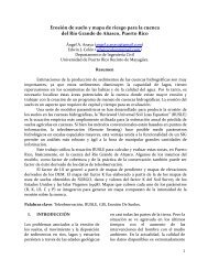
mapa de riesgo de erosión de suelo para la cuenca del rio yagüez ...
mapa de riesgo de erosión de suelo para la cuenca del rio yagüez ...
mapa de riesgo de erosión de suelo para la cuenca del rio yagüez ...

You also want an ePaper? Increase the reach of your titles
YUMPU automatically turns print PDFs into web optimized ePapers that Google loves.
Tab<strong>la</strong> 3: Intensidad <strong>de</strong> Erosión <strong>para</strong> <strong>la</strong> <strong>cuenca</strong> <strong>de</strong>l <strong>rio</strong> Yagüez<br />
“The Average Annual Soil Erosion by Water on Cultivated Crop<strong>la</strong>nd as a Portion of the<br />
Tolerable Rate, 1997.” muestra valores promedio <strong>para</strong> Puerto Rico entre 2 y 4 ton/ha/año,<br />
observando que un 62% en promedio <strong>de</strong> <strong>la</strong> <strong>cuenca</strong> se encuentra <strong>de</strong>ntro <strong>de</strong> ese rango.<br />
WWW.<strong>la</strong>ndsat.org<br />
Referencias<br />
www.ssurgo.usgs.gov<br />
www.gers.uprm.edu<br />
Land use/Land cover of two bioluminescent bays in Puerto Rico. Yadira Soto.<br />
Departamento <strong>de</strong> Geologia. Universidad <strong>de</strong> Puerto Rico.2007.<br />
Using ASTER Imagery in Land Use/cover C<strong>la</strong>ssification of Eastern Mediterranean<br />
Landscapes According to CORINE Land Cover Project. A<strong>la</strong>addin Yuksel, A. E. Akay and R.<br />
Gundogan. Sensors. Agosto, 2009.<br />
15