Informe Completo - Ir al sitio antiguo - Ministerio de Energía
Informe Completo - Ir al sitio antiguo - Ministerio de Energía
Informe Completo - Ir al sitio antiguo - Ministerio de Energía

You also want an ePaper? Increase the reach of your titles
YUMPU automatically turns print PDFs into web optimized ePapers that Google loves.
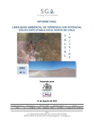
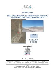
INFORME FINAL: SITIO SIERRA GORDA I<br />
LÍNEA BASE AMBIENTAL DE TERRENOS CON POTENCIAL<br />
EÓLICO EXPLOTABLE EN EL NORTE DE CHILE<br />
En los sectores ligeramente ondulados, se aprecia un pavimento superfici<strong>al</strong> pedregoso, el que<br />
no es evi<strong>de</strong>nte en sectores con menor pendiente (Figura 17).<br />
La superficie y los primeros centímetros <strong>de</strong>l <strong>de</strong>pósito, presenta una ligera efervescencia <strong>al</strong> HCl,<br />
la que disminuye en profundidad y, <strong>de</strong>saparece a los 30 cm profundidad.<br />
Se observa un incipiente <strong>de</strong>sarrollo <strong>de</strong> costra s<strong>al</strong>ina en escasos y pequeños sectores.<br />
El <strong>de</strong>pósito no presenta aptitud frut<strong>al</strong>, no es apto para el regadío y su drenaje es excesivo. Se<br />
clasifica en Clase VIII <strong>de</strong> Capacidad <strong>de</strong> Uso.<br />
Ubicación <strong>de</strong> la observación<br />
La <strong>de</strong>scripción se re<strong>al</strong>izó en las siguientes coor<strong>de</strong>nadas (DATUM WGS 84)<br />
484106,94489 N 7461583,32742E<br />
Clasificación <strong>de</strong> la unidad<br />
El suelo correspon<strong>de</strong> a un <strong>de</strong>pósito <strong>al</strong>uvion<strong>al</strong>, muy <strong>de</strong>lgado, con topografía suavemente<br />
inclinada a ligeramente ondulada, con pendientes <strong>de</strong> 1 a 5 %, con rasgos <strong>de</strong> erosión eólica<br />
mo<strong>de</strong>rada, excesivamente drenada. Pedregosidad superfici<strong>al</strong> abundante. Se clasifica en<br />
Capacidad <strong>de</strong> Uso : VIII Clase <strong>de</strong> Drenaje : 6<br />
Categoría <strong>de</strong> Riego : 6 Aptitud Frut<strong>al</strong> : E<br />
Erosión Actu<strong>al</strong> : 2<br />
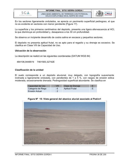
Figura Nº 15: Vista gener<strong>al</strong> <strong>de</strong>l abanico <strong>al</strong>uvi<strong>al</strong> asociado <strong>al</strong> Pedón1<br />
INFORME FINAL: SITIO SIERRA GORDA I PÁGINA 38 DE 200