basin development and tectonic history of the llanos
basin development and tectonic history of the llanos
basin development and tectonic history of the llanos

Create successful ePaper yourself
Turn your PDF publications into a flip-book with our unique Google optimized e-Paper software.
BASIN DEVELOPMENT AND TECTONIC HISTORY OF THE LLANOS BASIN,<br />
EASTERN CORDILLERA AND MIDDLE MAGDALENA VALLEY, COLOMBIA<br />
by<br />
M.A.Cooper, F.T.Addison, R.Alvarez, M.Coral, R.H.Graham, A.B.Hayward, S.Howe,<br />
J.Martinez, J.Naar, R.Penas, A.J.Pulham <strong>and</strong> A.Taborda<br />
AAPG Bulletin, Volume 79, Number 10, October 1995, pages 1421-1443.<br />
BP Exploration (Colombia) Ltd., Carrera 9A no 99-02, Piso 9, A.A. 59824, Bogotá,<br />
Colombia<br />
Correspondence address,<br />
PanCanadian Petroleum, 150 9th Ave SW, Calgary, Alberta, Canada T2P 2S5<br />
Telephone (403) 290 2964<br />
E-mail Mark_Cooper@pcp.ca<br />
REFERENCES USED TO CONSTRUCT THE CHRONOSTRATIGRAPHIC<br />
CORRELATION DIAGRAMS AND PALEOGEOGRAPHIC MAPS OF GROSS<br />
DEPOSITIONAL ENVIRONMENTS.<br />
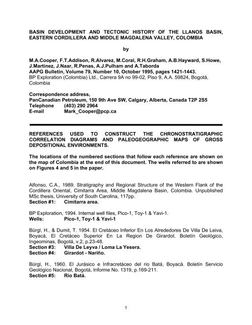
The locations <strong>of</strong> <strong>the</strong> numbered sections that follow each reference are shown on<br />
<strong>the</strong> map <strong>of</strong> Colombia at <strong>the</strong> end <strong>of</strong> this document. The wells referred to are shown<br />
on Figures 4 <strong>and</strong> 5 in <strong>the</strong> paper.<br />
Alfonso, C.A., 1989. Stratigraphy <strong>and</strong> Regional Structure <strong>of</strong> <strong>the</strong> Western Flank <strong>of</strong> <strong>the</strong><br />
Cordillera Oriental, Cimitarra Area, Middle Magdalena Basin, Colombia. Unpublished<br />
MSc <strong>the</strong>sis, University <strong>of</strong> South Carolina, 117pp.<br />
Section #1: Cimitarra area.<br />
BP Exploration, 1994. Internal well files, Pico-1, Toy-1 & Yavi-1.<br />
Wells: Pico-1, Toy-1 & Yavi-1<br />
Bürgl, H., & Dumit, T. 1954. El Cretáceo Inferior En Los Alrededores De Villa De Leiva,<br />
Boyacá, El Cretáceo Superior En La Region De Girardot. Boletín Geológico,<br />
Ingeominas, Bogotá, v.2, p.23-48.<br />
Section #3: Villa De Leyva / Loma La Yesera.<br />
Section #4: Girardot - Nariño.<br />
Bürgl, H., 1960. El Jurásico e Infracretáceo del rio Batá, Boyacá. Boletín Servicio<br />
Geológico Nacional, Bogotá, Informe No. 1319, p.169-211.<br />
Section #5: Rio Batá.<br />
1
Cediel, F., Mojica, J. & Macia, C., 1980. Definición Estratigráfica del Triásico en<br />
Colombia, Sur America, Formaciónes Luisa, Pay<strong>and</strong>é <strong>and</strong> Saldaña. Newsletters on<br />
Stratigraphy, v.9, p.73-104.<br />
Section #6: Pay<strong>and</strong>é.<br />
Section #7: Saldaña.<br />
Cediel, F., 1969. Geología del Macizo de Floresta. First International Congress <strong>of</strong><br />
Colombian Geologists Memoir, p.17-29, Bogotá.<br />
Section #8: North <strong>of</strong> Belencito area.<br />
Cooper, M.A. & Penas, H.R., 1992. The Llanos Foothills <strong>and</strong> Llanos Basin Well<br />
Database. BPX Internal Report TR1894. Bogotá.<br />
Wells: Caño Duya-1, Entrerrios-1, Guarrojo-1, La Cabana-1, La Maria-1,<br />
Santiago-1, Simon-1, Surimena-1, ST-GU-15.<br />
Crux, J.A., 1985. A Biostratigraphical Review <strong>of</strong> Six Wells from <strong>the</strong> Pacific Basin <strong>and</strong><br />
Middle Magdalena Valley, Colombia. BPX Internal Report Str/63/85t.<br />
Section #9: Middle Magdalena.<br />
Section #10: Cesar Basin.<br />
Section #11: Catatumbo Basin.<br />
Eaton, G., 1992. The biostratigraphy <strong>of</strong> <strong>the</strong> interval 6000'-15053' (T.D) in well Cusiana<br />
2a. BPX Internal Report.<br />
Well: Cusiana 2a<br />
Etayo, F., Renzoni, G. & Barrero, D., 1969. Contornos sucesivos del mar Cretáceo en<br />
Colombia. First International Congress <strong>of</strong> Colombian Geologists Memoir, p.217-252,<br />
Bogotá.<br />
Section #4: Girardot.<br />
Section #6: Pay<strong>and</strong>e Area.<br />
Section #12: Girardot Sub,-<strong>basin</strong> Ortega area.<br />
Section #13: Neiva Sub-<strong>basin</strong>, Neiva area.<br />
Section #14: Simiti-Morales area.<br />
Section #15: Becerril area.<br />
Section #16: Pailitas area.<br />
Section #17: Sibundoy area.<br />
Section #18: Tibu area.<br />
Section #19: San Andres<br />
Section #20: Rionegro River<br />
Section #21: Puente Baraya area.<br />
Section #3: Villa de Leyva<br />
Section #22: Moniquira.<br />
Section #23: Tibasosa.<br />
Section #24: Santa Maria de Bata area<br />
Etayo, F., 1979. Zonation <strong>of</strong> <strong>the</strong> Cretaceous <strong>of</strong> Central Colombia by Ammonites.<br />
Publicacion Especial Ingeominas, No. 2, p.1-186.<br />
2
Section #3: Villa de Leyva, Sachica, Samaca, Sora areas.<br />
Section #25: Apulo.<br />
Section #26: Biota, Las Mesitas Region.<br />
Fabre, A. 1985. Estratigrafia de la Sierra Nevada del Cocu . Boyaca y Arauca, Cordillera<br />
Oriental (Colombia). Geología Nor<strong>and</strong>ina, v.4, p.3-12.<br />
Section #27: Sierra Nevada del Cocuy.<br />
Garcia, C., 1958. Investigacion Palinologica de la Formacion Guaduas del Anticlinal de<br />
Guacheta-Lenguazaque-Tausa. Boletín Geológico, Universidad Industrial de Sant<strong>and</strong>er,<br />
Bucaramanga, v.2, p.27-31.<br />
Section #28: Guacheta, Lenguazaque.<br />
Section #29: Tausa anticline area.<br />
Hebrard, F., 1985. Les foothills de la Cordillère Orientale de Colombie entre les rios<br />
Casanare et Cusiana. Evolution géodynamique depuis l'Eo Crétacé. Thèse Doctorale<br />
3ème Cycle, Université Pierre et Marie Curie, Paris VI. Janvier, No. 85-08, Paris.<br />
Section #30: Rio Cusiana.<br />
Section #31: Rio Cravo Sur.<br />
Herrera, R. Mcclure, N.M. & Ramirez, M., 1971. Geological Report On The Eastern<br />
Cordillera Foothills Survey. BPX Internal Report OC 6908/1.<br />
Section #31: Rio Charte & Rio Cravo Sur.<br />
Huertas, G., 1960. De La Flora Fosil De La Sabana. Boletín Geológico, Universidad<br />
Industrial de Sant<strong>and</strong>er, Bucaramanga, v.5, p.53-57.<br />
Section #2: Zipaquira, Minas de Hulla.<br />
Julivert M., 1963. Estratigrafía y sedimentología de la parte inferior de la Formación<br />
Guaduas, al S de la Sabana de Bogotá (Cordillera Oriental). Boletín Geológico,<br />
Universidad Industrial de Sant<strong>and</strong>er, Bucaramanga, v.12, p.85-99.<br />
Section #32: Salto de Tequendama.<br />
Section #33: Tunjuelito.<br />
Langenheim, J., 1960. Late Paleozoic <strong>and</strong> Early Mesozoic Plant Fossils from <strong>the</strong><br />
Cordillera Oriental <strong>of</strong> Colombia <strong>and</strong> Correlation <strong>of</strong> <strong>the</strong> Giron Formation". Boletín<br />
Geológico, Ingeominas, Bogotá, v.8, p.95-132.<br />
Section #34: Lebrija Gorge.<br />
Lopez, C., Briceno, A. & Buitrago, J., 1991. Edad y Origen de los Diapiros de Sal de la<br />
Sabana de Bogotá. Universidad Nacional De Colombia. Memorias IV Simposio<br />
Bolivariano de Exploración Petrolera, Bogotá, Colombia. Trabajo 19, 40 pp.<br />
Section #2: Zipaquira <strong>and</strong> Nemocón.<br />
McClure N. M., Wainwringht, A., & Ochoa, M., 1972 Geological Report <strong>of</strong> <strong>the</strong> North-<br />
West Llanos Geological Survey. BPX Internal Report OC 8203/1.<br />
Section #35: Samore-Cubara Road / Cobugon River.<br />
3
Miller, T. & Etayo, F., 1972. The Geology Of The Eastern Cordillera Between Aguazul -<br />
Sogamoso - Villa De Leyva. In, Geological Fieldtrips Colombia 1959-1978. Colombian<br />
Society <strong>of</strong> Petroleum Geologist <strong>and</strong> Geophysicists. p.349-396. (Re-printed 1992 by<br />
Geotec Ltda, Bogotá, Colombia.<br />
Section #36: Sogamoso-Aguazul road cut.<br />
Mojica, J. & Macia, C., 1983. Características Estratigráficas y Edad de la Fm Yavi<br />
Mezosoico de la Region entre Prado y Dolores, Tolima, Colombia. Geología<br />
Colombiana, Universidad Nacional de Colombia, Bogotá, v.12, p.7-32<br />
Section #37: Prado area.<br />
Mojica, J., 1985. Avances en el Conocimiento del Paleozoico Superior del Macizo de<br />
Garzon, Tercio Meridional de la Cordillera Oriental de Colombia. Abstracts <strong>of</strong> Annual<br />
Meeting, IGCP Project 211, Bogotá, October 9-11, 7pp.<br />
Section #38: East San Antonio.<br />
Morales, L.G., <strong>and</strong> <strong>the</strong> Colombian Petroleum Industry, 1956, General Geology <strong>and</strong> oil<br />
occurrences <strong>of</strong> Middle Magdalena Valley, Colombia, in L. G. Weeks, ed., Habitat <strong>of</strong><br />
Middle <strong>and</strong> Upper Magdalena Basins, Colombia. Oil-a symposium: AAPG, p. 641-695<br />
Section #9 Middle Magdalena.<br />
Navarrette, R.S. & Robles, C. (pers. comm.). Ostracoda from <strong>the</strong> Cuche Formation<br />
Robles, Stratigraphy <strong>and</strong> Sedimentology. Contact C. Robles, Amoco Colombia, Bogotá.<br />
Section #39: Floresta Massif / Quebrada Potrero Rincon.<br />
Pearce, J.M., 1987. Re-Evaluation Of The Biostratigraphy Of The Wells Cascajal-1,<br />
Dina-12, Florentina-1 And Yaguara-1 From The Neiva Sub-Basin, Upper Magdalena<br />
Valley, Colombia. BPX Internal Report.<br />
Wells: Cascajal-1, Dina-12, Florentina-1, Yaguara-1, Manila-2, Corinto-1.<br />
Perez, G. & Salazar, A., 1978. Estratigrafía y Facies del Grupo Guadalupe: Geología<br />
Colombiana, Universidad Nacional de Colombia, Bogotá, v.10, p.7-87.<br />
Section #40: East <strong>of</strong> Bogotá.<br />
Polania, H. & Rodriguez, G. 1978. Posibles Turbiditas del Cretáceo Inferior (Mbr.<br />
Socota) en el area de Anapoima (Cund.). Geología Colombiana, Universidad Nacional<br />
de Colombia, Bogotá, v.10, p.87-113.<br />
Section #26: Socota Creek, Anapoima-Apulo road.<br />
Royo y Gomez, J., 1949. Mapas Geológicos de Bogotá y del Centro y Sur de su<br />
Sabana. Breve Explicación. Servicio Geológico Nacional Informe, Ministerio de Minas y<br />
Petróleos, Bogotá, Colombia.<br />
Section #41: Sabana de Bogotá.<br />
Robertson Research. 1989. Tectonic And Stratigraphic Study Of The Middle And Upper<br />
Magdalena Valley. BPX Internal Report.<br />
4
Wells: Rio Negro-5, Guayabito-1, Puerto Pinzon-1, Cascajales-1,<br />
Canaletal-1, Norean-1, Muz<strong>and</strong>a-1, Cayumba-1, Madrigal-1,<br />
Guineal-1, Morales-1, Llanito-1<br />
Rubiano, J.L., 1989. Petrography <strong>and</strong> Stratigraphy <strong>of</strong> <strong>the</strong> Villeta Group, Cordillera<br />
Oriental Colombia, South America. Unpublished MSc <strong>the</strong>sis, University <strong>of</strong> South<br />
Carolina, Columbia, South Carolina, 96pp.<br />
Section #42: West side <strong>of</strong> <strong>the</strong> Eastern Cordilera.<br />
Sarmiento, G., 1992. Estratigrafía y medios de depósito de la Formación Guaduas,<br />
Boletín Geológico, Ingeominas, Bogotá, No. 32-1, Ingeominas. Bogotá.<br />
Section #29: Sutatausa.<br />
Summerhayes, C.P., 1987. Biozonation for <strong>the</strong> Tertiary <strong>and</strong> Cretaceous Successions <strong>of</strong><br />
<strong>the</strong> Neiva <strong>and</strong> Girardot Sub-Basins, Upper Magdalena Valley, Colombia. BPX Internal<br />
Report.<br />
Well: Suarez-1.<br />
Ujueta, G., 1962. Geología del Noreste de Bogotá. Servicio Geológico Nacional. Annual<br />
Field Conference, Colombia. Boletín Geológico, Ingeominas, Bogotá, v.9, p 35-36.<br />
Section #43: La Calera.<br />
Section #44: Choachi.<br />
Ward D., Goldsmith, R. & Cruz, J. 1973. Geología de los Cuadrangulos H-12<br />
Bucaramanga y H-13. Boletín Geológico, Ingeominas, Bogotá, v.21, p.42-77 & p.85-99.<br />
Section #45: Bucaramanga Rionegro road.<br />
5
20<br />
Lake<br />
78 ºW 74 ºW15<br />
Maracaibo 70 ºW<br />
Caribbean<br />
10<br />
Sea<br />
16<br />
Pasto<br />
Ecuador<br />
Medellin<br />
17<br />
Ibague<br />
Cali<br />
Fig. 5<br />
12<br />
37<br />
6<br />
13<br />
9<br />
34<br />
14<br />
41<br />
6<br />
1<br />
1 2<br />
40<br />
26<br />
25<br />
32<br />
4<br />
7<br />
33<br />
29<br />
43<br />
34<br />
36<br />
39<br />
42<br />
74 ºW<br />
28<br />
22<br />
3<br />
5<br />
24<br />
Bogota<br />
18<br />
44<br />
11<br />
Venezuela<br />
8 ºN<br />
Cucuta<br />
Bucaramanga<br />
21<br />
38<br />
8<br />
19 35<br />
23<br />
36<br />
27<br />
30<br />
Fig. 4<br />
31<br />
COLOMBIA<br />
4 ºN<br />
0 º