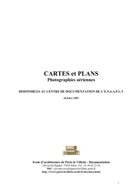
CARTES et PLANS - Ecole Nationale Supérieure d'Architecture de ...
CARTES et PLANS - Ecole Nationale Supérieure d'Architecture de ...
CARTES et PLANS - Ecole Nationale Supérieure d'Architecture de ...

You also want an ePaper? Increase the reach of your titles
YUMPU automatically turns print PDFs into web optimized ePapers that Google loves.
<strong>CARTES</strong> <strong>et</strong> <strong>PLANS</strong><br />
Photographies aériennes<br />
DISPONIBLES AU CENTRE DE DOCUMENTATION DE L’E.N.S.A.P.L.V<br />
Octobre 2005<br />
<strong>Ecole</strong> d’architecture <strong>de</strong> Paris la Vill<strong>et</strong>te - Documentation<br />
144 rue <strong>de</strong> flandre -75019 Paris- Tel : 01 44 65 23 36<br />
Mel : sylviane.ricou@paris-lavill<strong>et</strong>te.archi.fr<br />
http ://www.paris-lavill<strong>et</strong>te.archi.fr/doc/docu.html<br />
1
AVERTISSEMENT<br />
Le centre <strong>de</strong> documentation possè<strong>de</strong> <strong>de</strong>s cartes <strong>et</strong> plans sur Paris <strong>et</strong> la région<br />
parisienne exclusivement.<br />
- Les cartes <strong>et</strong> plans <strong>de</strong> Paris sont classés par échelle, du 1/2 000 e <strong>de</strong>vant,<br />
au 1/500 e au fond du meuble à rangement vertical, à l'exception <strong>de</strong>s atlas géologique<br />
<strong>et</strong> administratif (1/5000 e ), <strong>de</strong>s plans anciens qui sont dans le meuble à tiroir.<br />
- Les cartes <strong>et</strong> plans <strong>de</strong> la région parisienne sont rangés par départements dans le<br />
meuble à tiroir.<br />
- Le mo<strong>de</strong> d'utilisation <strong>de</strong>s cadastres est affiché sur la table, à côté du plan<br />
d'assemblage.<br />
- Les CD-ROM géographiques (plans ou photographies aériennes) sont à <strong>de</strong>man<strong>de</strong>r<br />
au bureau après consultation <strong>de</strong> la liste <strong>de</strong>s titres disponibles <strong>et</strong> <strong>de</strong>s classeurs<br />
présentant une image du contenu du CD.<br />
- Pour ach<strong>et</strong>er un plan <strong>de</strong> cadastre <strong>de</strong> Paris, vous <strong>de</strong>vez vous rendre à c<strong>et</strong>te adresse :<br />
Mairie <strong>de</strong> Paris :<br />
Conservation du plan <strong>de</strong> Paris<br />
17 bd Morland - 75181 Paris<br />
Tel : 01 42 76 35 01 - Métro : Sully-Morland<br />
Ouverture : 10h-13h <strong>et</strong> 14h-16h30 du lundi au vendredi<br />
3
SOMMAIRE<br />
I . PARIS<br />
- Plans <strong>de</strong> Paris antérieurs au XXème siècle ( plans allant <strong>de</strong> 1285 à 1882). 7<br />
- Atlas <strong>de</strong> Paris <strong>et</strong> <strong>de</strong> la région parisienne. 1967. sous la direction <strong>de</strong><br />
BEAUJEU-GARNIER <strong>et</strong> J.BASTIE (cf. liste infra) 9<br />
- CD Géographiques sur Paris (plans ou photographies aériennes) 13<br />
- Photographies aériennes <strong>de</strong> Paris sur papier 15<br />
- 1/50 000 e : Carte hydrogéologique <strong>de</strong> la France. Paris. 1970. En couleur, réalisée<br />
par le BRGM (avec une coupe N.NE , S.SW) 17<br />
- 1/50 000 e : Tableau d'assemblage <strong>de</strong> l'atlas <strong>de</strong>s carrières souterraines, zone <strong>de</strong> terrains 17<br />
exposés à un risque naturel <strong>de</strong> Paris, Hauts <strong>de</strong> Seine, Seine S t Denis, Val <strong>de</strong> Marne.<br />
1998.<br />
- 1/25 000 e : Plan <strong>de</strong> Paris avec les anciennes enceintes <strong>et</strong> limites <strong>de</strong> Paris. 1983. 17<br />
- 1/20 000 e : Plan <strong>de</strong>s carrières <strong>et</strong> zones <strong>de</strong>s terrains exposés à un risque naturel <strong>de</strong> Paris.<br />
1998. (Plan d’assemblage <strong>de</strong>s cartes <strong>de</strong> l’atlas <strong>de</strong>s carrières souterraines au 1/1000 e )<br />
- 1/10 000 e : 17<br />
- 1/5 000 e : Atlas géologique <strong>de</strong> Paris. 1967. ( avec courbes <strong>de</strong> niveau ) 14 feuilles. 17<br />
- 1/5 000 e : Atlas administratif <strong>de</strong> la ville <strong>de</strong> Paris. 1969 à 1986. 15 feuilles. 17<br />
- 1/5 000 e : POS <strong>de</strong> Paris (1996) 17<br />
- 1/5 000 e : Atlas administratif <strong>de</strong> la ville <strong>de</strong> Paris. 1900. 17 feuilles.<br />
- 1/2 000 e : Tous les plans cadastraux sur Paris sont à la Documentation. 19<br />
- 1/2 000 e : Nombreux plans <strong>de</strong> hauteurs d’étages <strong>de</strong> Paris.<br />
- 1/1000 e : cf. liste <strong>de</strong>s plans cadastraux parisiens possédés. 21<br />
- 1/1000 e : Atlas <strong>de</strong>s carrières souterraines <strong>de</strong> Paris. 25<br />
- 1/500 e : cf. liste <strong>de</strong>s plans cadastraux parisiens possédés. 29<br />
5
II . BANLIEUE<br />
- Plans antérieurs à 1950 31<br />
- CD géographiques sur la banlieue (plans ou photographies aériennes) par ville. 33<br />
- CD géographiques sur la banlieue (plans ou photographies aériennes) par département. 37<br />
- Plans <strong>de</strong> la p<strong>et</strong>ite couronne<br />
- 78 (Yvelines) ; 91(Essonne) ; 92 ( Hauts <strong>de</strong> Seine) 41<br />
- 93 (Seine St Denis) : 42<br />
Montreuil-sous-bois 44<br />
Plans <strong>de</strong> Pantin (1/500 e , 1 /1 000 e , 1/5 000 e , 1/10 000 e ) 45<br />
- 94 (Val <strong>de</strong> Marne) ; 95 (Val d’Oise) 47<br />
- POS <strong>de</strong> la plaine <strong>de</strong> St- DENIS (2001) )<br />
- POS <strong>de</strong> MONTREUIL (1998) ) à <strong>de</strong>man<strong>de</strong>r au bureau<br />
- POS <strong>de</strong> PANTIN (1995) )<br />
III. <strong>PLANS</strong> DE TRANPORTS PARISIENS 49<br />
IV. <strong>CARTES</strong> TOPOGRAPHIQUES + GEOLOGIQUES 51<br />
N.B. Pour trouver d’autres plans ou cartes on peut consulter le document suivant :<br />
RICOU (Sylviane).- Cartes <strong>et</strong> plans, photographies aériennes, images <strong>de</strong> satellite<br />
utiles à l’architecte <strong>et</strong>/ou l’urbaniste. Paris, Editions <strong>de</strong> la Vill<strong>et</strong>te, 115 p.<br />
6
<strong>PLANS</strong> DE PARIS ANTERIEURS AU XX e SIECLE<br />
DISPONIBLES AU CENTRE DE DOCUMENTATION DE L’EAPLV<br />
1. Paris <strong>de</strong> 1285 à 1314. Fac-similé du plan dressé par Albert Lenoir d’après les documents<br />
fournis par H. Géraud. (Réduction 1/5 e )<br />
2. Paris en 1380. Plan dressé par Henri Legrand. (L’Est est en haut du plan).<br />
3. Paris en 1530. (Georges Braun). La Seine coule du haut vers le bas <strong>de</strong> la feuille, l’Est étant<br />
placé en haut du plan.<br />
4. Paris vers 1540. Fac-similé <strong>de</strong> la copie du plan dit <strong>de</strong> la Tapisserie, exécutée par<br />
Gaignières en 1690.<br />
5. Plan en perspective <strong>de</strong> la ville <strong>de</strong> Paris. telle qu’elle était sous le règne <strong>de</strong> Charles IX. Gravé<br />
d’après une tapisserie conservée dans l’hôtel <strong>de</strong> ville. = plan <strong>de</strong> Saint Victor vers 1550,<br />
copie <strong>de</strong> Dheulland en 1756.<br />
6. Paris en 1552. Fac-similé du plan <strong>de</strong> Olivier Trusch<strong>et</strong> <strong>et</strong> Germain Hoyau, dit plan <strong>de</strong> Bâle.<br />
7. Paris en 1609. Fac-similé du plan <strong>de</strong> Vassallieu dit Nicolay (réduction <strong>de</strong> 1/5) ≈ 1/6500 (Vue<br />
en perspective, le S est à 20° N.)<br />
8. Plan <strong>de</strong> Paris en 1615. Vue en perspective, l’Est est en haut du plan.<br />
9. Paris en 1630. Fac-similé du plan <strong>de</strong> Melchior Tavernier. Plan <strong>de</strong> la ville, cité, université,<br />
Faubourgs <strong>de</strong> Paris avec la <strong>de</strong>scription <strong>de</strong> son antiquité. (vue en perspective).<br />
10.Plan <strong>de</strong> la ville, cité, université <strong>et</strong> faubourgs <strong>de</strong> Paris... dressé sur les lieux <strong>et</strong> sur les<br />
mémoires <strong>de</strong> Mr Louvin <strong>de</strong> Rochefort vers 1694 chez Nicolas <strong>de</strong> Fer.<br />
11.Paris, ses faubourgs <strong>et</strong> ses environs. Où se trouvent le détail <strong>de</strong>s villages, châteaux, grands<br />
chemins, pavés <strong>et</strong> autres, <strong>de</strong>s hauteurs, bois, vignes, terres <strong>et</strong> prés, levés géométriquement<br />
par le Sieur Roussel. 1731. 2 feuilles.<br />
Plan <strong>de</strong> Turgot. Dressé <strong>de</strong> 1734 à 1739 en 20 planches (le <strong>de</strong>man<strong>de</strong>r au bureau <strong>de</strong> prêt) +<br />
une feuille d’assemblage ; <strong>de</strong>rnier <strong>de</strong>s plans à vol d’oiseau.<br />
12.Carte topographique <strong>de</strong>s environs <strong>et</strong> du plan <strong>de</strong> Paris. Levée par l’abbé De la Grive. 1739.<br />
13. Montmartre, la Chapelle, la Vill<strong>et</strong>te. 1/5000è (sd)<br />
18. Nouveau plan routier <strong>de</strong> la ville <strong>et</strong> faubourgs <strong>de</strong> Paris. 1787 - 1 cm/50 toises ≈ 1/10.000 e<br />
19. Plan <strong>de</strong> la ville <strong>et</strong> faubourg <strong>de</strong> Paris. Divisé en les 48 sections, décrété par l’Assemblée<br />
<strong>Nationale</strong> le 22 juin 1790 <strong>et</strong> sanctionné par le roi. 1791.<br />
7
20. Plan routier <strong>de</strong> la ville <strong>de</strong> Paris... divisé en 12 arrondissements ou mairies <strong>et</strong> en 48<br />
quartiers... chez Picqu<strong>et</strong> 1826. Echelle ≈ 1/12 000 e<br />
21. Plan <strong>de</strong> Paris divisé en 12 arrondissements. 1838 (≈ 1/10 000 e ) avec 30 cartouches <strong>de</strong>s<br />
monuments parisiens.<br />
22. Plan <strong>de</strong> Paris comprenant l’enceinte <strong>de</strong>s fortifications. Publié par J. Andriveau-Goujon.<br />
ed. 1847. Echelle 1/14.000 e<br />
23. Plan <strong>de</strong> Paris + bois <strong>de</strong> Boulogne <strong>et</strong> <strong>de</strong> Vincennes. Publié par E. Andriveau-Goujon. 1882.<br />
Echelle 1/12 500 e .<br />
24. Carte <strong>de</strong> Cassini.- Feuille 1 Paris. 1736, au 1/86 400 e (existe aussi en CD-ROM pour la<br />
France)<br />
EXTRAITS DE <strong>PLANS</strong> ANCIENS SUR PARIS<br />
50. VERNIQUET. Atlas national <strong>de</strong> la ville <strong>de</strong> Paris en 72 feuilles.<br />
51. 1786. Echelle 1/600 e , feuilles 32 <strong>et</strong> 40 sur Charonne.<br />
52. JACOUBET. Atlas général <strong>de</strong> la ville <strong>de</strong> Paris en 54 feuilles.<br />
53. 1831 à 1836. Echelle 1/2 000 e Feuilles 27 <strong>et</strong> 36 <strong>de</strong> Ménilmontant à Charonne.<br />
54. Tableau d'assemblage du plan cadastral <strong>de</strong> la commune <strong>de</strong> Charonne<br />
Levées <strong>de</strong> 1840. Echelle 1/5 000 e<br />
55. Atlas <strong>de</strong>s communes <strong>de</strong> la Seine dressé par Lefèvre. Commune <strong>de</strong> Charonne<br />
1859. Echelle 1/5 000 e<br />
56. Atlas administratif <strong>de</strong> la ville <strong>de</strong> Paris<br />
1875. Echelle 1/5 000 e (<strong>de</strong> Ménilmontant à la rue Daumesnil en passant par le<br />
Père Lachaise. Charonne <strong>et</strong> la Place du Trône)<br />
57. Atlas administratif <strong>de</strong> la ville <strong>de</strong> Paris<br />
1838. Echelle 1/2 500 e , feuilles 23 (du cim<strong>et</strong>ière <strong>de</strong> Charonne au cours <strong>de</strong><br />
Vincennes.20 e arr.)<br />
58. 20è arrondissement. 1859 1/5000 e<br />
59. Atlas général <strong>de</strong> la ville <strong>de</strong> Paris Feuille 18 (Belleville) 1/2000è. JACOUBET<br />
60. Atlas général <strong>de</strong> la ville <strong>de</strong> Paris 1835. Feuille 17. JACOUBET<br />
61. Plan topographique (hachures) <strong>de</strong> la ville <strong>de</strong> Belleville 1/5000è (1845)<br />
62. Elargissement <strong>de</strong> la rue Jourdan – Plan parcellaire 1/500è<br />
63. 16è arrondissement 1/5000è, Atlas administratif <strong>de</strong> la ville <strong>de</strong> Paris.<br />
Voir aussi les CD<br />
CD 5 : Paris 1380, 1552, 1609, 1630<br />
CD 12 : Paris <strong>et</strong> ses environs. Carte <strong>de</strong> l’Abbé <strong>de</strong> la Grive (1740)<br />
CD 38 : Paris 1660<br />
CD 105 : Paris, plans anciens<br />
CD 107 : Paris au fil du temps ( ~ 50 plans anciens du centre <strong>de</strong> Paris)<br />
Voir encore Atlas administratif <strong>de</strong> la Ville <strong>de</strong> Paris 1/5000 è ( 1900) = 17 feuilles<br />
N.B : ATLAS <strong>de</strong> TRUDAINE (1745-1780) paysage <strong>de</strong> la France sur www.culture.gouv.fr<br />
puis base <strong>de</strong> données, Archim, consultation guidée, Atlas <strong>de</strong> Trudaine, Paris, illustré.<br />
8
ATLAS DE PARIS ET DE LA REGION PARISIENNE<br />
1967<br />
Sous la Direction <strong>de</strong> BEAUJEU-GARNIER <strong>et</strong> J. BASTIE<br />
I – GENERALITES<br />
11–1. Paris dans le mon<strong>de</strong>. Paris dans les autres métropoles mondiales.<br />
II – ASPECTS PHYSIQUES<br />
21-1. Géomorphologie <strong>de</strong> la Région Parisienne.<br />
22-1 Hydrogéologie. Hydrographie. Hydrologie <strong>de</strong> la Région Parisienne<br />
23-1 Microclimatologie <strong>de</strong> la Région Parisienne.<br />
III – STRUCTURE URBAINE<br />
31. Paris.<br />
31-1. Epoques <strong>de</strong> formation.<br />
31-2. Voies percées <strong>de</strong>puis 1871. Causes <strong>de</strong> formation <strong>de</strong>s voies.<br />
31-3. Ages <strong>et</strong> types d’immeubles. Histoire du développement <strong>et</strong> qualité <strong>de</strong> la construction.<br />
31-4. Dimensions, confort <strong>et</strong> prix du m 2 <strong>de</strong> plancher <strong>de</strong>s logements.<br />
31-5. Logements démolis <strong>et</strong> construits (1954-1965) <strong>et</strong> îlots insalubres.<br />
31-6. Les espaces verts.<br />
31-7. Utilisation <strong>de</strong> l’espace urbain.<br />
32. Agglomération <strong>et</strong> région.<br />
32-1. Croissance <strong>de</strong> l’agglomération.<br />
32-2. Constructions postérieures à la <strong>de</strong>rnière guerre (1949-1965).<br />
32-3. Pério<strong>de</strong>s <strong>de</strong> construction <strong>de</strong>s logements. Périmètres <strong>et</strong> opérations <strong>de</strong> rénovation.<br />
32-4. Logements dans l’agglomération <strong>et</strong> la région : statut, indice <strong>de</strong> peuplement,<br />
dimensions, confort.<br />
32-5. Occupation du sol.<br />
IV – POPULATION<br />
41. Répartition.<br />
41-1. Répartition <strong>de</strong> la population urbaine <strong>et</strong> rurale.<br />
41.2. Population <strong>de</strong> Paris <strong>et</strong> <strong>de</strong> la proche banlieue par îlot en 1962 <strong>et</strong> variations 1954-1962.<br />
41-3. Evolution <strong>de</strong> la population <strong>de</strong> la région : <strong>de</strong>nsités, variations, types d’évolution,<br />
dates du maximum.<br />
42. Structures.<br />
42-1. Structure par âge <strong>et</strong> sexe (cartes par groupes d’âge <strong>et</strong> carte <strong>de</strong> synthèse) (Paris <strong>et</strong><br />
région).<br />
42-2. Structure socio-professionnelle au lieu <strong>de</strong> rési<strong>de</strong>nce (Paris. agglomération. région).<br />
Taux d’activité global <strong>et</strong> féminin<br />
43. Mouvements.<br />
43-1. Variations <strong>de</strong> la population communale. Natalité <strong>et</strong> mortalité (taux <strong>et</strong> évolution).<br />
Département d’origine <strong>de</strong>s parisiens. Migration d’électeurs.<br />
43-2. Migrations intérieures <strong>et</strong> extérieures.<br />
43-3. Etrangers <strong>et</strong> naturalisés (répartition, structure par nationalité, âges, catégories socioprofessionnelles).<br />
43-4. Population active au lieu <strong>de</strong> travail. Rési<strong>de</strong>nce <strong>et</strong> emploi.<br />
9
43-5. Migrations journalières.<br />
44. Vie politique.<br />
44-1. Opinions politiques. Voix obtenues par les différents partis <strong>de</strong> 1954 à 1966. Tendance<br />
politique <strong>de</strong>s municipalités <strong>de</strong> la Région.<br />
V – TRANSPORTS ET ENERGIE<br />
51. Transports.<br />
51-1. Transports urbains : métro, autobus. circulation automobile.<br />
51-2. Transports péri-urbains : l’équipement routier, autoroutier : les isochrones (temps <strong>de</strong><br />
déplacement dans la Région parisienne). Usagers <strong>de</strong>s gares Saint-Lazare <strong>et</strong> Lyon.<br />
Réseau rapi<strong>de</strong> routier.<br />
51-3. Transports péri-urbains : voies ferrées, autobus, routes nationales, transports privés<br />
<strong>de</strong> voyageurs.<br />
51-4. Liaison <strong>de</strong> paris : trafic marchandises par voies ferrées, par voies navigables.<br />
51-5. Liaisons <strong>de</strong> Paris : trafic ferroviaire voyageurs gran<strong>de</strong>s lignes ; aéroports : temps <strong>de</strong><br />
parcours.<br />
52. Energie.<br />
52-1. Consommation d’électricité <strong>et</strong> <strong>de</strong> gaz.<br />
VI – AGRICULTURE<br />
61. Utilisation du sol.<br />
61-1. Utilisation agricole du sol. Groupements <strong>de</strong>s communes. Régions agricoles.<br />
61-2. Communes conquérantes <strong>et</strong> communes conquises.<br />
61-3. Forêts.<br />
61-4. Principales cultures <strong>et</strong> collecte <strong>de</strong> blé par commune <strong>et</strong> par organisme stockeur.<br />
61-5. Cultures spéciales (maraîchères, fruitières, florales…). Elevage : bovins, brebis mères.<br />
62. Caractéristiques <strong>de</strong> la vie rurale.<br />
62-1. Remembrement, motorisation, coopératives.<br />
62-2. Industries agricoles : transformation <strong>de</strong> la b<strong>et</strong>terave ; du lait ; conserveries<br />
Alimentaires ; meunerie.<br />
62-3. Exploitations agricoles en cultures <strong>de</strong> plein champ.<br />
62-4. Habitat rural.<br />
62-5. Types <strong>de</strong> communes agricoles : caractéristiques économiques <strong>et</strong> démographiques <strong>de</strong>s<br />
communes <strong>de</strong> la Région.<br />
VII – INDUSTRIE<br />
71. Localisation générale.<br />
71-1. Salariés <strong>et</strong> établissements industriels par gran<strong>de</strong> branche dans l’agglomération.<br />
71-2. Salariés <strong>et</strong> établissements industriels par gran<strong>de</strong> branche à Paris.<br />
71-3. Etablissement industriels <strong>de</strong> plus <strong>de</strong> 50 salariés dans la Région.<br />
71-4. Etablissement industriels <strong>de</strong> plus <strong>de</strong> 50 salariés dans l’agglomération.<br />
71-5. Etablissement industriels <strong>de</strong> plus <strong>de</strong> 100 salariés à Paris <strong>et</strong> dans la proche banlieue.<br />
72. Branches industrielles.<br />
72-1. Industries métallurgiques : automobile, aéronautique, métallurgie lour<strong>de</strong> <strong>et</strong> <strong>de</strong> service.<br />
72-2. Industries métallurgiques fines.<br />
72-3. Industries chimiques diverses ; gran<strong>de</strong> industrie : pharmacie ; matières plastiques.<br />
72-4. Industries <strong>de</strong> l’habillement <strong>et</strong> du cuir.<br />
72-5. Industries <strong>et</strong> activités <strong>de</strong> biens à caractère culturel.<br />
72-6. Industries spécifiquement parisiennes : parfums, bijouterie, articles <strong>de</strong> Paris.<br />
10
73. Généralités.<br />
73-1. Types <strong>de</strong> quartiers <strong>et</strong> <strong>de</strong> zones industriels.<br />
73-2. Evolution <strong>de</strong> l’industrie (décentralisation) <strong>et</strong> population active industrielle au lieu <strong>de</strong><br />
travail.<br />
73-3. Evolution industrielle : <strong>de</strong>sserrement (1962-1966), démolitions <strong>et</strong> créations <strong>de</strong> locaux<br />
industriels.<br />
VIII – TERTIAIRE<br />
81. Commerce.<br />
81-1. Physionomie commerciale <strong>de</strong>s rues <strong>de</strong> Paris<br />
81-2. Commerces <strong>de</strong> gros dans Paris.<br />
81-3. Commerces <strong>de</strong> détail <strong>et</strong> commerces alimentaires <strong>de</strong> détail dans Paris.<br />
81-4. Quelques spécialisations commerciales <strong>de</strong>s rues <strong>de</strong> Paris.<br />
81-5. Grands magasins. Equipement commercial <strong>de</strong> Paris <strong>et</strong> <strong>de</strong> la Région Parisienne.<br />
81-6. Equipement commercial dans la Région Parisienne.<br />
81-7. Essai <strong>de</strong> hiérarchie <strong>de</strong>s centres commerciaux.<br />
82. Centre <strong>de</strong>s affaires.<br />
82-1. Superficies <strong>de</strong> planchers <strong>de</strong>s bureaux ; Télescripteurs ; Téléphone.<br />
82-2. Impôts sur les chiffres d’affaires. Valeur locative <strong>de</strong>s locaux commerciaux. Importexport.<br />
Bureaux <strong>de</strong> voyages.<br />
82-3. Sièges <strong>et</strong> importances <strong>de</strong>s gran<strong>de</strong>s sociétés.<br />
83. Equipements divers.<br />
83-1. Equipement bancaire.<br />
83-2. Finances communales.<br />
83-3. Equipement hospitalier. Personnel médical <strong>et</strong> paramédical.<br />
83-4. Equipement scolaire : enseignement du premier <strong>de</strong>gré.<br />
83-5. Equipement scolaire : enseignement du second <strong>de</strong>gré <strong>et</strong> supérieurs.<br />
83-6. Equipement sportif.<br />
83-7. Equipement culturel : cinémas, théâtres, musées…<br />
83-8. Lieux touristiques <strong>et</strong> hôtels.<br />
83-9. Equipement religieux : culte catholique <strong>et</strong> religions minoritaires.<br />
84. Tertiaire public.<br />
84-1. Emplois publics par administration dans Paris.<br />
84-2. Emplois publics par administration dans l’agglomération <strong>et</strong> carte <strong>de</strong> synthèse. Emplois<br />
parapublics (E.D.F. – G.D.F. ; S.N.C.F. ; R.A.T.P.).<br />
84-3. Emplois publics selon <strong>de</strong> ressort géographique <strong>de</strong>s administrations. Ambassa<strong>de</strong>s <strong>et</strong><br />
organismes internationaux.<br />
IX – ROLE NATIONAL ET INTERNATIONAL DE PARIS<br />
91-1. Décentralisation industrielle en France.<br />
91-2. Rési<strong>de</strong>nces secondaires <strong>et</strong> lieux <strong>de</strong> vacances <strong>de</strong>s Parisiens.<br />
91-3. Approvisionnement en énergie <strong>et</strong> en produits alimentaires.<br />
91-4. Rayonnement national <strong>et</strong> international <strong>de</strong> Paris : trafic ferroviaire, transports aériens,<br />
exportation.<br />
91-5. Rayonnement intellectuel <strong>de</strong> Paris. Lieu <strong>de</strong> provenance <strong>et</strong> rési<strong>de</strong>nce <strong>de</strong>s étudiants.<br />
Domicile <strong>de</strong>s cadres formés à Paris. Diffusion <strong>de</strong>s journaux.<br />
X – SCHEMA DIRECTEUR<br />
d’aménagement <strong>et</strong> d’urbanisme <strong>de</strong> la Région Parisienne.<br />
11
CD-ROM GEOGRAPHIQUES sur PARIS<br />
(plans ou photographies aériennes)<br />
DISPONIBLES AU CENTRE DE DOCUMENTATION<br />
Octobre 2005<br />
PARIS 1er,2è,3è,4è . Atlas administratif 1/5000 CD 5<br />
PARIS 1er, 1/2000 n° 70 plan cadastral CD 5<br />
PARIS 1er, 2é coul., photographie aérienne CD 21, CD 21 prêt, CD 79,<br />
CD 74<br />
PARIS 1er,4è,5è,6è coul., photographie aérienne CD 33, CD 79<br />
PARIS 2è,1/2000 n° 71 plan cadastral CD 5<br />
PARIS (2è, 3é), coul., photographie aérienne CD 21, CD 21 prêt, CD 74<br />
PARIS (6è,5è), coul., photographie aérienne CD 4, CD 61<br />
PARIS 7è (16è+15è Nord) coul., photographie aérienne CD 24<br />
PARIS 8è, coul., photographie aérienne<br />
CD 21, CD 21prêt<br />
PARIS 9è, coul., photographie aérienne CD 22, CD 22 prêt =CD 57,<br />
CD 74, CD 79<br />
PARIS 10è, coul. , photographie aérienne CD 22, CD 22 prêt, CD 74,<br />
CD 79<br />
PARIS 11è, coul. , photographie aérienne CD 21, CD 21 prêt, CD 61,<br />
CD 79<br />
PARIS 12è, coul. , photographie aérienne CD 24, CD 61<br />
PARIS 13è + (5è), coul. , photographie aérienne<br />
CD 20, CD 20 prêt<br />
PARIS 13è, 14è, photographie aérienne CD 4<br />
PARIS 13è, Place <strong>de</strong> Rungis, photographie aérienne CD 4<br />
PARIS 13è. Place d’Italie, photographie aérienne CD 14<br />
PARIS 13è. ZAC Massena CD 6<br />
PARIS 14è, coul., photographie aérienne CD 20, CD 20 prêt = CD 58<br />
PARIS 15è, coul. , photographie aérienne<br />
CD 20, CD 20 prêt<br />
PARIS (15è), coul. , photographie aérienne CD 21, CD 21 prêt, CD 24<br />
PARIS 16è, coul.+ Bois <strong>de</strong> Boulogne, photographie aérienne CD 21, CD 21 prêt, CD 71<br />
pour le Sud, CD 79<br />
PARIS 17è, coul., photographie aérienne CD 21, CD 21 prêt, CD 24,<br />
CD 75, CD 79<br />
PARIS 18è, coul., photographie aérienne CD 74, CD 79<br />
PARIS 19è . Atlas administratif 1/5000<br />
CD 17, CD 17 prêt<br />
PARIS 19è, coul., photographie aérienne CD 15<br />
PARIS 19è, coul., photographie aérienne<br />
CD 17, CD 17 prêt<br />
PARIS 19è, coul., photographie aérienne<br />
CD 8 , CD 8 prêt<br />
PARIS 19è, 1/2000, n° 33 +53 nord<br />
CD 17, CD 17 prêt<br />
13
PARIS 19è, magasins généraux ( pl, photogr. aérienne, doc. BHVP) CD 66, CD 66 prêt<br />
PARIS 19 è , doc. BHVP CD 83<br />
PARIS 19è, 20è, photographie aérienne CD 7<br />
PARIS (20è), coul. , photographie aérienne<br />
CD 21, CD 21 prêt<br />
PARIS 1380 ? CD 5<br />
PARIS 1552 ( Plan <strong>de</strong> Bâle = Plan <strong>de</strong> Trusch<strong>et</strong> <strong>et</strong> Hoyau) CD 5<br />
PARIS 1609 CD 5<br />
PARIS 1630 CD 5<br />
PARIS 1660 CD 38<br />
PARIS ET SES ENVIRONS. Carte <strong>de</strong> l’abbé <strong>de</strong> la Grive.1740 CD 12<br />
PARIS, Plans anciens CD 105<br />
PARIS, au fil du temps (~ 50 plans anciens du centre <strong>de</strong> Paris) CD 107<br />
PARIS ET SES QUARTIERS (APUR) : 1é-10è,<br />
PARIS ET SES QUARTIERS (APUR) : 11è-20è<br />
CD 18, CD 18 prêt<br />
CD 19, CD 19 prêt<br />
PARIS, Evolution <strong>de</strong> la population (APUR) CD 84<br />
PARIS, les foyers <strong>de</strong> travailleurs migrants CD 85<br />
PARIS PLU 2005 CD 110<br />
PARIS, Parcellaire + îlots sous Autocad CD 108, 109<br />
(avec signature <strong>de</strong> convention)<br />
PARIS. Carto Explorer : carte topo au 1/25 000 (non copiable) CD 62<br />
PARIS 1/20 000 CD 58<br />
PARIS 1/25 000 CD 12, CD 5<br />
PARIS photographie aérienne coul., par quartiers CD 36<br />
PARIS photographie aérienne CD 3, CD 6, CD 32, CD 44<br />
PARIS N.O photographie aérienne (1é,2é,7é,8é,9é,16é,17é,19é) CD 79<br />
PARIS N.E photographie aérienne (3é,4é,10é,11é,18é,19é,20é) CD 79<br />
PARIS EST+ BANLIEUE EST n.<strong>et</strong> bl., photographie aérienne CD 9 , CD 9 prêt<br />
PARIS EST (5é,11é,12é,13é) coul., photographie aérienne CD 61<br />
PARIS ET PETITE COURONNE (APUR)<br />
CD 13 , CD 13 prêt<br />
PARIS ET L’ILE DE FRANCE. Belin 2002,<br />
Collection Terre <strong>de</strong>s Villes<br />
CD 23, CD 23 prêt<br />
PARIS ET L’ILE DE FRANCE , APUR, la BDU+le SIP CD 53<br />
14
PARIS : PHOTOGRAPHIES AERIENNES<br />
( sur papier)<br />
DISPONIBLES AU CENTRE DE DOCUMENTATION<br />
Octobre 2005<br />
- PARIS NORD-EST : Cim<strong>et</strong>ière <strong>de</strong> Pantin - Parc <strong>de</strong> la Vill<strong>et</strong>te - Buttes <strong>de</strong> Chaumont. /G F<br />
- PARIS 10 e <strong>et</strong> 11 e : Hôpital St Louis – Canal Saint Martin./G F<br />
- PARIS 11 è : Avenue Ledru-Rollin – Bd Voltaire – rue <strong>de</strong> la Roqu<strong>et</strong>te – Place Léon Blum<br />
- PARIS 19 e : Place <strong>de</strong>s Fêtes<br />
- PARIS 19è : Buttes Chaumont/ G F<br />
-.PARIS 19 e + Pantin, (Canal S t Denis + périphérique) 1/2000 e , 50x50<br />
- PARIS 19 e : Gare <strong>de</strong> Charonne, rue <strong>de</strong> Bagnol<strong>et</strong> – rue <strong>de</strong>s Pyrénées. /noir <strong>et</strong> blanc, 1/1000 e<br />
- PARIS 19 e : Rue <strong>de</strong> Crimée<br />
- PARIS 20 e : Père Lachaise, Place <strong>de</strong> la Réunion, 1998<br />
- PARIS 20 e : Quartier <strong>de</strong> la Réunion<br />
- PARIS 20 e : Secteur : Rues <strong>de</strong> la Mare, <strong>de</strong>s Casca<strong>de</strong>s, <strong>de</strong>s Envierges, <strong>de</strong>s Pyrénées, <strong>de</strong><br />
Belleville (IGN).<br />
15
<strong>PLANS</strong> DE PARIS du 1/50 000 e au 1/5 000 e<br />
CARTE HYDROGEOLOGIQUE DE LA FRANCE.AU 1/50 000 e PARIS. 1970.<br />
- en couleur, réalisée par le BRGM (avec une coupe N-NE , S-SW)<br />
<strong>PLANS</strong> DE PARIS AU 1/50 000 e<br />
- Tableau d'assemblage <strong>de</strong> l'atlas <strong>de</strong>s carrières souterraines, zone <strong>de</strong> terrains exposés à un risque naturel<br />
<strong>de</strong> Paris, Hauts <strong>de</strong> Seine, Seine St Denis, Val <strong>de</strong> Marne. 1998.<br />
<strong>PLANS</strong> DE PARIS AU 1/25 000 e<br />
- Plan <strong>de</strong> Paris avec les anciennes enceintes <strong>et</strong> limites <strong>de</strong> Paris. 1983 (2 plans)<br />
<strong>PLANS</strong> DE PARIS AU 1/20 000 e<br />
- Plan <strong>de</strong>s carrières <strong>et</strong> zones <strong>de</strong>s terrains exposés à un risque naturel <strong>de</strong> Paris.1985. (plan d'assemblage<br />
<strong>de</strong>s cartes <strong>de</strong> l'atlas <strong>de</strong>s carrières souterraines au 1/1000 e )<br />
<strong>PLANS</strong> DE PARIS AU 1/10 000 e<br />
- Plan <strong>de</strong> Paris. Tableau d’assemblage <strong>de</strong>s feuilles du plan parcellaire, avec la<br />
nouvelle numérotation en rouge. 1968.<br />
- Plan Directeur <strong>de</strong> Paris NO, feuille <strong>de</strong> Paris-ouest XXIII-14 n°2d., publié par le Service<br />
Géographique <strong>de</strong> l'Armée, levée.1872-79<br />
- Plan <strong>de</strong> Paris-Batignolles-Monceau, coupure 2-d <strong>de</strong> la feuille au 1/50 000 e , 1937<br />
- Plan <strong>de</strong> Paris moitié EST, sur calque, s.d.<br />
<strong>PLANS</strong> AU 1/5 000 e<br />
- PARIS 10 e , 18 e , 19 e , levés stéréotopographiques, feuille X16-SO, 1/5000 e , 1967 révisé en 1973<br />
- PARIS Est 3 e , 4 e , 5 e , 11 e , 20 e levés stéréographiques aériens, feuille X15-NO, 1/5000 e , 1967 révisé en<br />
1974<br />
- PARIS 10 e , 19 e , assemblage1/5000 e<br />
- Atlas géologique <strong>de</strong> Paris. 1967. ( avec courbes <strong>de</strong> niveau ) 14 feuilles.<br />
- Atlas administratif <strong>de</strong> la ville <strong>de</strong> Paris. 1969 à 1986 : 15 feuilles + 1995 : 19 è . Lacunes : 5 è , 6 e .<br />
- Atlas administratif <strong>de</strong> la ville <strong>de</strong> Paris. 1900. 17 feuilles.<br />
- POS <strong>de</strong> Paris (1996), voir aussi le CD 110 pour le PLU <strong>de</strong> Paris (2005).<br />
17
<strong>PLANS</strong> DE PARIS AU 1/2000 e<br />
<strong>PLANS</strong> CADASTRAUX<br />
collection complète<br />
<strong>PLANS</strong> DE HAUTEURS D’ETAGES<br />
28 1981 90 1970 28 1942 91 1979<br />
29 1985 91 1979 92 1978<br />
30 1996 92 1978 30 1955 93 1978<br />
31 1996 93 1978 31 1955 94 1954<br />
32 1988 94 1972 32 1955 94 1979<br />
33<br />
33+53<br />
N- 2001<br />
1999 95 1982 33 1995 95 1954<br />
34 1997 96 1981 34 1955<br />
46 1982 105 1987 46 1956<br />
47 1980 106 1996 47 1955<br />
48 1956 107 1981 48 1956 107 1958<br />
49+<br />
49 c <strong>de</strong><br />
niveau<br />
1970 108 1988 49 1954 108 1955<br />
50 1970 109 1981 50 1954 109 1990<br />
51 1998 110 1942 51 1978<br />
52 1998 111 1981 52 1992<br />
53 N +<br />
53<br />
33- 2001<br />
1999 112 1984 53 1994 112 1992<br />
54 1999 113 1996 54 1993 113 1992<br />
55 1999 114 1996 55 1952 114 1985<br />
66 1996 115 1984 66 1956 115 1955<br />
67 1972 126 1984 67 1955 126 1955<br />
68 1983 127 1986 127 1955<br />
69 1970 128 1988 128 1955<br />
70 1969 129 1996 129 1990<br />
71+ 71 1991 130 1996 71 1992 130 1961<br />
(ABCD)<br />
71 71+35<br />
2002<br />
72 1969 131 1996 72 1979 131 1955<br />
73 1999 132 1996 73 1995 132 1989<br />
74 1991 133 1996 74 1992 133 1992<br />
75 1981 134 1996 74 1955<br />
85 1996 135 1984<br />
86 1966 150 1995 150 1956<br />
87 1982 151 1995 151 1956<br />
88 1971 152 1986<br />
89 1980<br />
19
<strong>PLANS</strong> DE PARIS AU 1/1000e<br />
La présence <strong>de</strong> la date d'édition signifie que l'on possè<strong>de</strong> la feuille référencée<br />
n° A B C D<br />
28<br />
29 1983<br />
30 1985 1987 1988 1982<br />
31<br />
32 2002<br />
33 2002 2001 2002 2002<br />
34 1997 1997 1997 1997<br />
46<br />
47<br />
48 1957<br />
49 1957 1970<br />
50 1970 1970 1970<br />
51 2001 2001<br />
52 2001 1970 2001 2001<br />
53 1997 1997 1956 1998<br />
54 1993 + 1998 1982 1998 1954<br />
55<br />
66<br />
67<br />
68<br />
69<br />
70 1969<br />
71 2001 1991 2001<br />
72 1969 1997 1998 1998<br />
73 1977 1977 1977<br />
74 1991 1955 1988<br />
75 1977<br />
85 1997 1997<br />
86<br />
87 1980 1981 1982 1982<br />
88 2003<br />
89<br />
90 1970 1970 1970 1970<br />
91 1968<br />
92 1995 1969 1969<br />
93 1969 1969 1969<br />
94 1998<br />
95 1980<br />
96<br />
105<br />
106 1957 1985 1953<br />
107<br />
108 1955<br />
109<br />
110 1955<br />
111<br />
112 1996 1984 1995<br />
113 1996 1954 1997 1997<br />
114 2005 1979<br />
115 2005<br />
126<br />
127<br />
128<br />
129 1957 1979 1950<br />
130 1954 1986 1986<br />
131 1957 2005 1982 2005<br />
132 1957 1986 1962 1986<br />
133 1995 1996 1985 1984<br />
134 1984<br />
135<br />
150 1986<br />
151 1986<br />
152 1985 1985<br />
21
PLAN D'ASSSEMBLAGE DE L'ATLAS DES<br />
CARRIERES<br />
1/50 000 e<br />
(Voir aussi au 1/20 000 e pour Paris)<br />
23
ATLAS DES CARRIERES SOUTERRAINES DE<br />
PARIS au 1/1 000 e<br />
(Voir le plan d'assemblage ci-avant)<br />
16-54 1982 Avenue <strong>de</strong> Verdun, Boulevard Rodin<br />
18-41 1957 Rue <strong>de</strong> Longchamp, rue Spontini<br />
18-42 1955 Avenue Henry Martin, Mairie <strong>de</strong> XVI e arrond t<br />
18-43 1957 Avenue Paul Doumer, rue <strong>de</strong> la Pompe<br />
18-44 1954 Rue <strong>de</strong> l'Annonciation, place <strong>et</strong> rue <strong>de</strong> Passy<br />
18/19-40 1956 Rue Spontini, rue <strong>de</strong> Noisiel<br />
19-39 1956 Rue Marbeau, rue Weber<br />
19-41 1956 Avenue Raymond Poincaré, rue S t Didier<br />
19-42 1955 Avenue Raymond Poincaré, avenue Georges Man<strong>de</strong>l, place du Trocadéro<br />
19-43 1957 Avenue Paul Doumer, rue <strong>de</strong> la Tour<br />
19-44 1954 Rue Raynouard, rue <strong>de</strong> Passy, rue <strong>de</strong> l'Annonciation<br />
20-41 1955 Avenue Kléber, avenue d'Iéna, rue <strong>de</strong> Lubeck<br />
20-42 1948 Place d'Iéna, Palais <strong>de</strong> Chaillot<br />
20-50 1957 Rue Olivier <strong>de</strong> Serres, Hôpital <strong>de</strong> Vaugirard<br />
20-51 1964 Boulevard Lefebvre, rue Olivier <strong>de</strong> Serres, avenue <strong>de</strong> la Porte <strong>de</strong> la Plaine<br />
21-41 1955 Avenue Marceau, avenue Pierre 1 er <strong>de</strong> Serbie<br />
21-49 1956 Rue <strong>de</strong> l'Abbé Grouse, Réservoirs <strong>de</strong> Grenelle<br />
21-50 1956 Rue Dombasle, rue <strong>de</strong> Dantzig<br />
21-51 1958 Boulevard Lefebvre, rue <strong>de</strong>s Morillons, rue <strong>de</strong> Dantzig, Abattoirs <strong>de</strong> Vaugirard<br />
22-48 1948 Rue <strong>de</strong> Vaugirard, rue <strong>de</strong>s Volontaires<br />
22-49 1955 Rue Falguière, rue <strong>de</strong> la Procession, rue Paul Barruel<br />
22-51 1964 Rue <strong>de</strong>s Morillons, rue Vercingétorix [SNCF (région <strong>de</strong> l'ouest)]<br />
22-52 1964 Porte <strong>de</strong> Vanves, boulevard Brune<br />
23-47 1955 Rue <strong>de</strong> Vaugirard, Hôpital <strong>de</strong>s Enfants Mala<strong>de</strong>s<br />
23-48 1947 Boulevard Pasteur, boulevard <strong>de</strong> Vaugirard<br />
23-49 1955 Rue du Cotentin, rue du Château, SNCF ligne <strong>de</strong> Paris Montparnasse<br />
23-50 1966 Rue Vercingétorix, rue <strong>de</strong> l'ouest<br />
23-51 1956 Rue d'Alésia, rue Raymond Losserand<br />
23-52 1964 SNCF (région du nord), rue <strong>de</strong>s Plantes, rue Giordano Bruno<br />
24-46 1953 Rue du Cherche-Midi, rue S t Placi<strong>de</strong>, rue du Regard<br />
24-47 1955 Place <strong>de</strong> Rennes, Boulevard Raspail<br />
24-48 1955 Boulevard Edgar- Quin<strong>et</strong>, gare Montparnasse, avenue du Maine<br />
24-49 1987 Cim<strong>et</strong>ière du Sud, rue <strong>de</strong> l’Ouest, rue <strong>de</strong> la Gaîté, avenue du Maine<br />
24-50 1965 Avenue du Maine, rue Daguerre<br />
24-51 1965 Avenue du Maine, rue <strong>de</strong>s Plantes<br />
24-52 1968 Avenue du Général Leclerc, rue d'Alésia, rue <strong>de</strong>s Plantes<br />
24-53 1954 Avenue du Général Leclerc, place du 25 août 1944, avenue <strong>de</strong> la Porte <strong>de</strong><br />
Montrouge<br />
25-34 1966 Rue Marcad<strong>et</strong>, rue Damrémont, rue Lamarck, rue Carpeaux, rue Vauvenargues<br />
25-35 1967 Rue Eugène Carrière, rue Tourlaque, rue Félix Ziem, rue Damrémont, rue Lepic,<br />
rue Caulaincourt<br />
25-36 1967 Rue Caulaincourt, rue <strong>de</strong>s Abbesses, rue Durantin, rue <strong>de</strong> Maistre, rue Burcq,<br />
boulevard <strong>de</strong> Clichy<br />
25-46 1953 Rue <strong>de</strong> Vaugirard, rue Madame, rue Cass<strong>et</strong>te<br />
25-47 1953 Rue d'Assas, jardin du Luxembourg<br />
25-49 1953 Boulevard Raspail, Hospice <strong>de</strong>s Enfants Assistés<br />
25
25-50 1985 Place Denfert-Rochereau,<br />
25-51 1968 Avenue du Général Leclerc, avenue René Coty, Ossuaire Municipal<br />
25-52 1967 Avenue René Coty, rue d'Alésia, rue <strong>de</strong> la Tombe Issoire<br />
25-53 1953 Réservoirs <strong>de</strong> Montsouris, rue <strong>de</strong> la Tombe Issoire, avenue Reille, boulevard<br />
Jourdan<br />
25-54 1957 Avenue <strong>de</strong> la Porte d'Arcueil, avenue André Rivoire, Cité Universitaire<br />
25-55 1966 Aqueducs <strong>de</strong> la Vanne du Loing <strong>et</strong> du Lunain, avenue Paul Vaillant-Couturier,<br />
boulevard périphérique<br />
26-34 1967 Rue Duhesme, rue Diard, Mairie du XVIII e arrond t<br />
26-35 1967 Rue Caulaincourt, rue lamarck, rue Custine, rue Francoeur, rue Nobel, rue du<br />
Baigneur<br />
26-36 1981 Rue Gabrielle, rue Berthe, rue <strong>de</strong>s Abesses, rue Yvonne Le Tac<br />
26-37 1968 Boulevard <strong>de</strong> Clichy, boulevard <strong>de</strong> Rochechouard, rue André Antoine, rue <strong>de</strong><br />
Steinkerque<br />
26-46 1953 Place <strong>et</strong> rue <strong>de</strong> l'Odéon, rue <strong>de</strong> Tournon, rue Casimir Delavigne<br />
26-47 1956 Jardin du Luxembourg, boulevard S t Michel, rue Gay-Lussac<br />
26-49 1956 Boulevard <strong>de</strong> Port Royal, Hôpital Cochin, Hôpital Militaire du Val <strong>de</strong> Grâce<br />
26-50 1948 Boulevard Arago, Maison d'Arrêt <strong>de</strong> la Santé<br />
26-51 1965 Boulevard S t Jacques, rue Cabanis<br />
26-52 1965 Rue <strong>de</strong> la Santé, Hôpital Psychiatrique S te Anne, rue d'Alésia<br />
26-53 1954 Parc Montsouris, avenue Reille<br />
26-54 1957 Boulevard Jourdan, Parc <strong>de</strong> Montsouris, Cité Universitaire<br />
27-47 1955 Place du Panthéon, rue d'Ulm<br />
27-48 1953 Rue Lhomond, rue Pierre Brossol<strong>et</strong>te, rue Rataud, <strong>Ecole</strong> Municipale <strong>de</strong><br />
physique <strong>et</strong> <strong>de</strong> Chimie<br />
27-49 1966 Boulevard <strong>de</strong> Port Royal, avenue <strong>de</strong>s Gobelins<br />
27-51 1966 Boulevard Auguste Blanqui, rue Abel Hovelacque, rue <strong>de</strong>s Cinq Diamants<br />
27-52 1966 Rue <strong>de</strong> la Butte aux Cailles, rue Barrault<br />
28-36 1967 Boulevard <strong>et</strong> place <strong>de</strong> la Chapelle, rue du Faubourg S t Denis, rue Louis Blanc,<br />
rue Max Dormoy (SNCF région du nord)<br />
28-47 1955 Rue Cuvier, Jardin <strong>de</strong>s Plantes (partie nord)<br />
28-48 1956 Rue Geoffroy S t Hilaire, Jardin <strong>de</strong>s Plantes (partie sud)<br />
28-49 1965 Boulevard S t Marcel, boulevard <strong>de</strong> l'Hôpital, rue <strong>de</strong>s Wallons<br />
28-50 1965 Avenue <strong>de</strong>s Gobelins, boulevard <strong>de</strong> l'Hôpital<br />
28-51 1964 P d'Italie, boulevard <strong>de</strong> la Gare, avenue <strong>de</strong>s Gobelins, avenue <strong>de</strong> Choisy<br />
28-52 1964 Avenue d'Italie <strong>et</strong> <strong>de</strong> Choisy<br />
28-53 1965 Avenue d'Italie, rue Damesme<br />
28-54 1957 Avenue d'Italie, boulevard Kellerman<br />
29-49 1965 Hospice <strong>de</strong> la Salpétrière, Hôpital <strong>de</strong> la Pitié<br />
29-50 1966 Boulevard <strong>de</strong> la Gare, place Pinel, rue Jeanne d'Arc<br />
29-51 1964 Rue du Château <strong>de</strong>s Rentiers, rue <strong>Nationale</strong>, rue Jeanne d'Arc<br />
29-52 1966 Avenue Edison, rue Tolbiac, rue <strong>Nationale</strong><br />
29-53 1965 Avenue d'Ivry, rue <strong>Nationale</strong> (SNCF, région du nord), gare <strong>de</strong> "Paris-Gobelins"<br />
29-54 1957 Porte <strong>de</strong> Choisy, boulevard Masséna<br />
30-37 1967 Rue <strong>de</strong> Meaux, avenue Secrétan, rue Edouard Pailleron, rue Armand Carrel<br />
30-38 1967 Boulevard <strong>de</strong> la Vill<strong>et</strong>te, avenue Mathurin Moreau, avenue Simon Bolivard<br />
30-39 1967 Boulevard <strong>de</strong> la Vill<strong>et</strong>te, rue <strong>de</strong> Sambre <strong>et</strong> Meuse, avenue Clau<strong>de</strong> Vellefaux, rue<br />
<strong>de</strong> l'Atlas<br />
30-51 1964 Rue Charcot, rue Xaintrailles<br />
30-52 1966 Rue <strong>de</strong> Pitay, rue <strong>de</strong> Tolbiac<br />
30-53 1963 Rue du Château <strong>de</strong>s Rentiers, boulevard Masséna<br />
30-54 1962 Boulevard Masséna, avenue <strong>de</strong> la Porte d'Ivry<br />
31-36 1966 Avenue Jean Jaurès, rue du Rhin, avenue <strong>de</strong> Laumière, rue André-Dubois<br />
31-37 1964 Rue Manin, Parc <strong>de</strong>s Buttes Chaumont (nord)<br />
31-39 1965 Avenue Simon Bolivar, rue <strong>de</strong> Belleville<br />
31-40 1964 Rue <strong>de</strong>s Couronnes, rue Ramponneau, rue Piat, rue Julien Lacroix<br />
26
32/33-41 1967 Rue <strong>de</strong> Ménilmontant, rue Sorbier, rue <strong>de</strong> la Bidassoa<br />
32-36 1967 Rue Manin, rue d'Alsace-Lorraine, rue <strong>de</strong> la Solidarité, rue Gaston Pinot<br />
32-37 1966 Avenue du Général Brun<strong>et</strong>, rue <strong>de</strong> Mouzaïa, rue d'Hautpoul<br />
32-40 1965 Rue <strong>de</strong>s Couronnes, rue <strong>de</strong> Ménilmontant, rue Boyer<br />
32-42 1965 Avenue. Gamb<strong>et</strong>ta, bd <strong>de</strong> Ménilmontant, cim<strong>et</strong>ière <strong>de</strong> l'Est, dit du Père Lachaise<br />
(partie Nord Ouest)<br />
32-43 1966 Boulevard <strong>de</strong> Ménilmontant, cim<strong>et</strong>ière <strong>de</strong> l'Est, dit du Père Lachaise<br />
32-48 1957 Avenue Daumesnil, gare <strong>de</strong> Reuilly<br />
32-49 1958 Boulevard <strong>de</strong> Reuilly, rue <strong>de</strong> Charenton<br />
32-50 1958 Rue <strong>de</strong> la Brèche aux Loups, rue <strong>de</strong> Charenton<br />
33/34-51 1957 Avenue <strong>de</strong> la Porte <strong>de</strong> Charenton<br />
33-36 1961 Avenue <strong>de</strong> la Porte Brun<strong>et</strong>, Boulevard Serurier<br />
33-37 1963 Boulevard Serrurier, boulevard d'Algérie, Hôpital Hérold, rue David d'Angers,<br />
rue Mouzaïa<br />
33-42 1966 Place Martin Nadaud, rue Ramus, cim<strong>et</strong>ière <strong>de</strong> l'Est, dit du Père Lachaise (partie<br />
Nord-Est)<br />
33-43 1992 Rue <strong>de</strong>s Pyrénées, cim<strong>et</strong>ière <strong>de</strong> l'Est, dit du Père Lachaise (partie Sud-Est)<br />
33-44 1992 Rue <strong>de</strong> Bagnol<strong>et</strong>, rue <strong>de</strong> la Réunion, cim<strong>et</strong>ière du Père Lachaise<br />
33-48/49 1966 Place Félix Eboué, boulevard <strong>de</strong> Reuilly, avenue Daumesnil<br />
34/35-38 1963 Boulevard Serrurier, Boulevard Mortier, Porte <strong>de</strong>s Lilas<br />
34-41/42 1967 Rue Paul Strauss, bd Mortier, rue du Capitaine Ferber, rue Jules Siegfried<br />
34-43 1967 Rue <strong>de</strong>s Pyrénées, rue <strong>de</strong> Bagnol<strong>et</strong>, rue Stendal<br />
34-48/49 1958 Rue du Sahel, rue <strong>de</strong> Montempoivre<br />
34-49/50 1958 Boulevard Soult, avenue du Général Messimy, rue Ernest Lefébure<br />
35-49/50 1958 Cim<strong>et</strong>ière <strong>de</strong> Saint Mandé, boulevard Carnot<br />
36-51 1946 Avenue <strong>de</strong> Saint Maurice, avenue <strong>de</strong>s Tribunes<br />
36-52 1946 Avenue <strong>de</strong> Saint Maurice, caserne <strong>de</strong>s Gar<strong>de</strong>s<br />
1/2500 e - Catacombes <strong>et</strong> vi<strong>de</strong>s <strong>de</strong> carrières existant sous les V, VI e , <strong>et</strong> XIV e arrondissements, <strong>de</strong>rnière<br />
mise à jour juin 1993.<br />
27
<strong>PLANS</strong> DE PARIS AU 1/500 e<br />
la présence <strong>de</strong> la date d'édition signifie que l'on possè<strong>de</strong> la feuille référencée<br />
n° A1 A2 A3 A4 B1 B2 B3 B4 C1 C2 C3 C4 D1 D2 D3 D4<br />
28<br />
29<br />
30 1990<br />
31<br />
32<br />
33 1983 1981 1981 1981 1981 1980 1983 1981<br />
34 1982 1982 1983 1983 1954 1982 1982<br />
46<br />
47 1956<br />
48 1952 1956<br />
49 1970 1992 1970 1970<br />
50 1970 1990 1970 1970<br />
51 1969 1997 1969<br />
52 1986 1970 1988 1970 1970 1970 1993 1970 1970 1970 1970 1970<br />
53 1985 1997 1992 1954 1996 1978 1979 2000 1984 1984 1985 1985 1984 1984 1984<br />
54 1982 1982 1982 1982 1982 1982 1982 1982 1982 1982 1978 1998 1982 1983 1980 1978<br />
55 1993 1993<br />
66<br />
67 1999 1972 1972<br />
68 1999 1998<br />
69 1997 1970 1970<br />
70 1969 1969 1969 1998 1999 1969<br />
71 1968 1990 1991 1990 1988 1991 1991 1997 1995<br />
72 1997 1969 1998<br />
73 1976 1997 1992 1976 1976 1997 1991 1976 1976 1976 1976<br />
74 1977 1978 1991 1978 1989 1991 1989 1989 1995 1988 2000 1988 2000<br />
75 1976<br />
85 1997<br />
86 1990 1982<br />
87 1991 1997 1981 1996 1996<br />
88 1971 2003<br />
89 1971 2005<br />
90 2005 1970 1970 1970 1992 1947<br />
91 1986 1991 1968 1989 1996 1968 2003 2003 2005 2005 2003<br />
92 1969 1992 1969 1995 1990 1990 2003 2003 1990 2003<br />
93 1991 1991 1997 1997 1969 1969 2001 1969 1969<br />
94 2000 2000 2000 1998 1998 1998 1998 1972 1972<br />
95 2000 2000 1980 1976 1954<br />
96<br />
105 1987<br />
106 1986<br />
107<br />
108 1988 1951<br />
109 1951 n.d 1988 1989 1998 2001 1988<br />
110 1988<br />
111<br />
112 1992 1984 1954 1984 1984 1992<br />
113 1983 1983 1984 1983 1984 1983 1983 1983<br />
114 1997 1997 1979 1989 1979 1979 1983<br />
115 2005 1984<br />
126<br />
127<br />
128 1948 1953 1950 1954<br />
129 1987 1950 1952 1978 1989 1996 1948<br />
130 2002 2002 2002 1953 1986 2002 2002 1986 1986<br />
131 2002 1977 2003 2002 1989 1982 1982 1985 1996 1985 1985<br />
132 2005 1985 1955 1986 1953 2005 1944 1986 1986 1986 2005<br />
133 1992 1984 1984 1983 1984 2005 1985 2005<br />
134 1996 1996 1984 1984 1984<br />
135<br />
150 1986 1986<br />
+ 91 B1 <strong>et</strong> B2 - 1970 (2 pl)<br />
29
<strong>PLANS</strong> DE BANLIEUE ANTERIEURS à 1950<br />
DISPONIBLES AU CENTRE DE DOCUMENTATION DE L’ENSAPLV<br />
100 - Carte <strong>de</strong> la commune <strong>de</strong> ROMAINVILLE. Canton <strong>de</strong> Pantin. 1/5000è<br />
101 - Carte <strong>de</strong> la commune <strong>de</strong> BAGNOLET. Canton <strong>de</strong> Pantin. 1/5000è<br />
102 - Carte <strong>de</strong> la commune <strong>de</strong> GENTILLY. Canton <strong>de</strong> Villejuif. 1/5000è<br />
103 - Tableau d’assemblage du plan cadastral parcellaire <strong>de</strong> la commune <strong>de</strong> MONTROUGE.<br />
Canton <strong>et</strong> arrondissement <strong>de</strong> Sceaux. 1846.<br />
104 – Carte <strong>de</strong> MONTROUGE. 14è arrondissement. Section E. 1846. 1/10 000è<br />
105 – Carte <strong>de</strong> la commune du PRE-ST-GERVAIS. Canton <strong>de</strong> Pantin. 1/5000è<br />
106 - Carte <strong>de</strong> la commune <strong>de</strong> ST DENIS. Arrondissement <strong>de</strong> St-Denis.1854, révisé 1870.<br />
107 - Carte <strong>de</strong> la commune <strong>de</strong> BOULOGNE. 1/5000<br />
108 - Carte <strong>de</strong> la commune d’AUBERVILLIERS. Canton <strong>de</strong> Pantin. 1/5000è<br />
109 - Carte <strong>de</strong> la commune d’ISSY. Canton <strong>de</strong> Sceaux.1/5000è<br />
Cartes <strong>de</strong>s chasses du roi. Echelle 1/30 000 e . Levées <strong>de</strong> 1764 à 1773 :<br />
136 - MANTES – feuille 1<br />
137 - POISSY, feuille 2<br />
110-138 - SAINT-DENIS, feuille 3 (carte n° 110)<br />
139 - CREPIERES, feuille 4<br />
111-140 - VERSAILLES, feuille 5 (carte n° 111)<br />
112-141 - PARIS, feuille 6 (carte n° 112)<br />
142 - MONTFORT L’AMAURY, feuille 7<br />
113-143 - CHEVREUSE, feuille 8 (carte n° 113)<br />
114-144 - SCEAUX, feuille 9 (carte n° 114)<br />
145 – RAMBOUILLET, feuille 10<br />
146 - ARPAJON, feuille 11<br />
147 - CORBEIL, feuille 12<br />
115 - Carte <strong>de</strong> Cassini. ~ 1/86 400è. feuille Ile <strong>de</strong> France. ~ 1790 (voir aussi le CD 63)<br />
116 - Carte <strong>de</strong> l’abbé De la Grive. Ile <strong>de</strong> France. 1750. 1/40 000è<br />
117 - Carte <strong>de</strong> l’abbé De la Grive. Ile <strong>de</strong> France est + Montreuil. 1750. 1/20 000è<br />
118 - Carte <strong>de</strong> la France. Paris S-E. 1832. 1/40 000è<br />
119 – Carte <strong>de</strong>s environs <strong>de</strong> Paris exécutée en 1839 au dépôt général <strong>de</strong> la guerre, sous<br />
la direction du lieutenant général B. Pel<strong>et</strong>, d’après les levés <strong>de</strong>s officiers du corps royal<br />
d’état major. 1/40 000è<br />
120 - BONDY, ROSNY, VILLEMOMBLE, MONTFERMEIL 1/20 000, avec courbes <strong>de</strong><br />
niveau, 1887<br />
121 – SEVRAN , 1/20 000, 1887<br />
122 – Carte <strong>de</strong> la France. Arrondissement <strong>de</strong> Pontoise <strong>et</strong> Meaux. Feuille 46, AULNAY,<br />
BONDY , 1/10 000, 1819<br />
123 – Carte <strong>de</strong> la France. Arrondissement <strong>de</strong> Pontoise <strong>et</strong> Meaux. Feuille 46, SEVRAN ,<br />
BONDY, 1/10 000, 1819<br />
124 - Carte <strong>de</strong> Cassini. SAINT-DENIS, 1/20 000è, 1736<br />
125 - PANTIN. AUBERVILLIERS. 1/3000 (1877)<br />
126 - PANTIN 1928-1935, 1/5000è<br />
127 - VINCENNES 1/5000è, 1899<br />
128 - VINCENNES 1/5000è, 1934<br />
129 - PANTIN (+AUBERVILLIERS + BAGNOLET) 1/10 000è (1936)<br />
31
130 - PANTIN (+ PRE ST GERVAIS + LES LILAS avec courbes <strong>de</strong> niveau)1/10 000 (1893)<br />
131 - PARIS – BEAUVAIS 1/80 000è n° 48 (1883)<br />
132 - MELUN 1/80 000è n° 65 (1876), (chemins <strong>de</strong> Fer 1886).<br />
133 - CORBEIL n° 3-4, 1/20 000è (1934)<br />
134 – BONNEUIL, BOISSY ST LEGER (94), 1/20 000è (1901)<br />
EPINAY (93) <strong>et</strong> MONTGERON (91)<br />
135 - L’HAŸ-LES-ROSES (94) 1/20 000è (1901), THIAIS, JUVISY (91)<br />
Voir aussi les CD :<br />
- CD 114-115 : ILE DE FRANCE : Atlas communal du département <strong>de</strong> la Seine,<br />
par O. Th LEFEVRE à partir <strong>de</strong> 1855.<br />
- ANTONY→GENNEVILLIERS (CD 114)<br />
- GENTILLY→VITRY sur SEINE (CD 115)<br />
- CD 119 : ILE DE France, Cartes <strong>de</strong>s Chasses du Roi<br />
Echelle 1/30 000. Levés <strong>de</strong> 1764 à 1773<br />
MANTES, POISSY, SAINT-DENIS, CREPIERES, VERSAILLES, PARIS,<br />
MONTFORT L’AMAURY, CHEVREUSE, SCEAUX, CORBEIL, ARPAJON,<br />
- CD 63 : Cartes <strong>de</strong> Cassini (XVIIIè)<br />
32
CD GEOGRAPHIQUES sur la BANLIEUE<br />
(plans ou photographies aériennes)<br />
classés par villes<br />
Octobre 2005<br />
ARGENTEUIL (Autocad) CD 80<br />
ASNIERES S.E. CD 24, CD 75<br />
AUBERVILLIERS, coul., photographie aérienne<br />
AULNAY/BOIS, photographie aérienne CD 30<br />
ATHIS-MONS, cadastre CD 37<br />
CD 15, CD 17, CD 17 prêt<br />
CD 8 , CD 8 prêt, CD 79<br />
BAGNOLET,coul., photographie aérienne CD 73<br />
BANLIEUE EST : CARTE DES CHASSES DU ROI 1770 CD 5<br />
BOULOGNE BILLANCOURT, coul. photographie aérienne CD 7, CD 7 prêt, CD 59<br />
BOULOGNE BILLANCOURT, n. <strong>et</strong> bl., photographie aérienne CD 9 , CD 9 prêt<br />
BOULOGNE BILLANCOURT, plan cadastral (autocad) CD 43<br />
BOULOGNE BILLANCOURT, plan CD 65<br />
BONDY, photographie aérienne, 1999 CD 39<br />
BLANC-MESNIL CD 39<br />
CHATENAY-MALABRY<br />
CD 81, CD 82, CD 82 prêt<br />
CHOISY-le-ROI, photographie aérienne CD 90<br />
CHOISY-le-ROI, plans cadastraux 1/500 CD 92<br />
AB, AC, G, H, L, M, N, Q<br />
CLAMART, Perdif 1/2000 (courbes <strong>de</strong> niveau)<br />
CD 96, CD 96 prêt<br />
CLICHY (Paris 17, Levallois-Perr<strong>et</strong> Est, Asnières S-E) CD24=CD57=CD75=CD 79<br />
GENEVILLIERS, coul., photographie aérienne CD 28<br />
GENTILLY, coul., photographie aérienne CD 4<br />
ISSY LES MOULINEAUX, n. <strong>et</strong> bl., photographie aérienne CD 9, CD 9 prêt<br />
ISSY LES MOULINEAUX, plan cadastral (autocad) CD 43<br />
ISSY LES MOULINEAUX,<br />
Perdif 1/2000 ème (courbes <strong>de</strong> niveau)<br />
CD 96,CD 96 prêt<br />
JUVISY, cadastre CD 37<br />
KREMLIN BICETRE, coul., photographie aérienne CD 4<br />
LA DEFENSE (1972 + 1988) CD 104<br />
LE PRE ST GERVAIS, coul., photographie aérienne CD 73<br />
LES LILAS 1/2000 n° 75, n° 55 CD 5<br />
LES LILAS, coul., photographie aérienne<br />
CD 7,CD 7 prêt, CD 73, CD79<br />
LEVALLOIS-PERRET, coul., photographie aérienne CD 24 = CD 75 = CD 79<br />
LIVRY GARGAN, plans cadastraux CD 35<br />
LIVRY GARGAN, photographie aérienne CD 39<br />
MARNE-LA-VALLEE (EPA Marne, cadastre) autocad CD 68<br />
MEUDON, plan cadastral (autocad) CD 43<br />
33
MEUDON, plan, photographie aérienne CD 65<br />
MONTREUIL, coul., photographie aérienne<br />
CD25, CD26, CD27, CD60, CD73<br />
MONTREUIL, plans cadastraux CD 16<br />
MONTROUGE, coul., photographie aérienne CD 4<br />
PANTIN photographie aérienne CD1 , CD1 prêt, CD 73<br />
PANTIN plans <strong>de</strong> cadastre CD 2<br />
PANTIN, coul., photographie aérienne<br />
CD 15, CD 79, CD 8 , CD 8 prêt<br />
CD 17, CD 17 prêt<br />
PRE ST GERVAIS, coul., photographie aérienne CD 17, CD 17 prêt, CD 79<br />
CD 7 , CD 7 prêt<br />
ROSNY SOUS BOIS, coul., photographie aérienne CD 73<br />
SEINE ST DENIS, Atlas 2003. Urbanisme-Environnement CD 98, CD 98 prêt<br />
ST DENIS la plaine, coul. photographie aérienne CD 8, CD 8 prêt, CD 28<br />
ST DENIS la plaine, coul. photographie aérienne CD 17, CD 17 prêt, CD 11<br />
ST DENIS la plaine, photographie aérienne, n.<strong>et</strong> bl.<br />
CD 17, CD 17 prêt<br />
STE GENEVIEVE DES BOIS, pl. <strong>et</strong> photographie aérienne CD 10<br />
ST OUEN, coul., photographie aérienne CD 28, CD 79<br />
SEVRES, plan cadastral (autocad) CD 43<br />
SEVRES, coul., photographie aérienne CD 59<br />
VERRIERE-le-BUISSON<br />
CD 81, CD 82, CD 82 prêt<br />
VIGNEUX-SUR-SEINE, 1983, 1/1000 è section AD CD 118<br />
VILLENEUVE-LE-ROI, 1983, 1/1000 è section AO CD 118<br />
VILLENEUVE ST GEORGES, 1983, 1/2000 è section AM ; CD 118<br />
Sections AN, AO, AP, AS, 1/1000 è<br />
VITRY, coul., photographie aérienne CD 72<br />
THIAIS CD 90<br />
*********<br />
ILE DE FRANCE CD 12<br />
. Est : 1/40 000è (1832)<br />
. Est 1750<br />
. Cartes <strong>de</strong>s environs <strong>de</strong> Paris 1/40 000 (1839)<br />
. Cartes <strong>de</strong>s environs <strong>de</strong> Paris 1/25 000<br />
. Cartes <strong>de</strong>s environs <strong>de</strong> Paris Abbé Legris (1750)<br />
. Cartes <strong>de</strong>s Chasses du Roi, Est (1770)<br />
ILE DE FRANCE : Atlas communal du département <strong>de</strong> la Seine,<br />
par O. Th LEFEVRE à partir <strong>de</strong> 1855.<br />
. ANTONY→GENNEVILLIERS CD 114, 116 prêt<br />
. GENTILLY→VITRY sur SEINE CD 115, 117 prêt<br />
ILE DE FRANCE (Belin) CD 23<br />
ILE DE FRANCE, photographie aérienne. jpg CD 44<br />
ILE DE FRANCE, APUR, BDU, SIP CD 53<br />
ILE DE FRANCE, les paysages protégés (600) CD 48<br />
ILE DE FRACE + FRANCE, carte <strong>de</strong> Cassini (1736) CD 63<br />
ILE DE FRANCE + FRANCE, photospace CD 49<br />
34
ILE DE FRANCE, Jardins (Versailles, Sceaux, Vaux le Vicomte, CD 106<br />
Ferrière, Fontainebleau, Courances)<br />
ILE DE France, Cartes <strong>de</strong>s Chasses du Roi (voir aussi sur papier)<br />
Echelle 1/30 000. Levés <strong>de</strong> 1764 à 1773 CD 119<br />
. MANTES, feuille1<br />
. POISSY, feuille 2<br />
. SAINT-DENIS, feuille 3<br />
. CREPIERES, feuille 4<br />
. VERSAILLES, feuille 5<br />
. PARIS, feuille 6<br />
. MONTFORT L’AMAURY, feuille 7<br />
. CHEVREUSE, feuille 8<br />
. SCEAUX, feuille 9<br />
. CORBEIL, feuille 10<br />
. ARPAJON, feuille 11<br />
91-92-93-94 cartes topo. Au 1/25 000 CD 62<br />
91-92-93-94 cartes <strong>de</strong> Cassini (XVIIIè) CD 63<br />
RN3, Proj<strong>et</strong>s <strong>de</strong> développement le long <strong>de</strong> la route nationale à CD 93<br />
Travers Pantin, Romainville, Bobigny, Noisy-le-sec, Bondy,<br />
les Pavillons-sous-bois, Livry-Gargan, Vaujours. (Avril 2003)<br />
BANLIEUES : PHOTOGRAPHIES AERIENNES<br />
(sur papier)<br />
- PANTIN (couleur)<br />
- PANTIN (couleur)<br />
- SAINT DENIS – grand format<br />
35
CD GEOGRAPHIQUES sur la BANLIEUE<br />
(plans ou photographies aériennes)<br />
91 : ESSONNE<br />
classés par département<br />
Octobre 2005<br />
ATHIS-MONS, cadastre CD 37<br />
JUVISY, cadastre CD 37<br />
STE GENEVIEVE DES BOIS, pl. <strong>et</strong> photographie aérienne CD 10<br />
VERRIERE-le-BUISSON<br />
CD 81, CD 82, CD 82 prêt<br />
VIGNEUX-SUR-SEINE, 1983, 1/1000 è section AD CD 118<br />
92 : HAUTS-DE-SEINE<br />
ASNIERES S.E. CD 24, CD 75<br />
BOULOGNE BILLANCOURT, coul. photographie aérienn CD 7, CD 7 prêt, CD 59<br />
BOULOGNE BILLANCOURT, n. <strong>et</strong> bl., photographie aérienne CD 9 , CD 9 prêt<br />
BOULOGNE BILLANCOURT, plan cadastral (autocad) CD 43<br />
BOULOGNE BILLANCOURT, plan CD 65<br />
CHATENAY-MALABRY<br />
CD 81, CD 82, CD 82 prêt<br />
CLAMART, Perdif 1/2000 (courbes <strong>de</strong> niveau)<br />
CD 96, CD 96 prêt<br />
CLICHY (Paris 17, Levallois-Perr<strong>et</strong> Est, Asnières S-E) CD24=CD57=CD75=CD 79<br />
GENEVILLIERS, coul., photographie aérienne CD 28<br />
ISSY LES MOULINEAUX, n. <strong>et</strong> bl., photographie aérienne CD 9, CD 9 prêt<br />
ISSY LES MOULINEAUX, plan cadastral (autocad) CD 43<br />
ISSY LES MOULINEAUX, Perdif 1/2000 ème (courbes <strong>de</strong> niveau) CD 96,CD 96 prêt<br />
LA DEFENSE (1972 + 1988) CD 104<br />
LEVALLOIS-PERRET, coul., photographie aérienne CD 24 = CD 75 = CD 79<br />
MEUDON, plan cadastral (autocad) CD 43<br />
MEUDON, plan, photographie aérienne CD 65<br />
MONTROUGE, coul., photographie aérienne CD 4<br />
SEVRES, plan cadastral (autocad) CD 43<br />
SEVRES, coul., photographie aérienne CD 59<br />
93 : SEINE-SAINT-DENIS<br />
AUBERVILLIERS, coul., photographie aérienne<br />
CD 15, CD 17, CD 17 prêt<br />
AULNAY/BOIS, photographie aérienne CD 30<br />
BAGNOLET,coul., photographie aérienne CD 73<br />
BONDY, photographie aérienne, 1999 CD 39<br />
BLANC-MESNIL CD 39<br />
LE PRE ST GERVAIS, coul., photographie aérienne CD 73<br />
LES LILAS 1/2000 n° 75, n° 55 CD 5<br />
LES LILAS, coul., photographie aérienne<br />
CD 7, CD 7 prêt, CD 73, CD79<br />
LIVRY GARGAN, plans cadastraux CD 35<br />
LIVRY GARGAN, photographie aérienne CD 39<br />
MONTREUIL, coul., photographie aérienne<br />
CD25, CD26, CD27, CD60, CD73<br />
MONTREUIL, plans cadastraux CD 16<br />
PANTIN photographie aérienne CD1 , CD1 prêt, CD 73<br />
37
PANTIN plans <strong>de</strong> cadastre CD 2<br />
PANTIN, coul., photographie aérienne CD 15, CD 79, CD 8,<br />
CD 8 prêt, CD 17, CD 17 prêt<br />
PRE ST GERVAIS, coul., photographie aérienne CD 17, CD 17 prêt, CD 79<br />
ROSNY SOUS BOIS, coul., photographie aérienne CD 73<br />
SEINE ST DENIS, Atlas 2003. Urbanisme-Environnement CD 98, CD 98 prêt<br />
ST DENIS la plaine, coul. photographie aérienne CD 8, CD 8 prêt, CD 28<br />
ST DENIS la plaine, coul. photographie aérienne CD 17, CD 17 prêt, CD 11<br />
ST DENIS la plaine, photographie aérienne, n.<strong>et</strong> bl.<br />
CD 17, CD 17 prêt<br />
ST OUEN, coul., photographie aérienne CD 28, CD 79<br />
94 : VAL DE MARNE<br />
CHOISY-le-ROI, photographie aérienne CD 90<br />
CHOISY-le-ROI, plans cadastraux 1/500 CD 92<br />
AB, AC, G, H, L, M, N, Q<br />
GENTILLY, coul., photographie aérienne CD 4<br />
KREMLIN BICETRE, coul., photographie aérienne CD 4<br />
MARNE-LA-VALLEE (EPA Marne, cadastre) autocad CD 68<br />
VILLENEUVE-LE-ROI, 1983, 1/1000 è section AO CD 118<br />
VILLENEUVE ST GEORGES, 1983, 1/2000 è section AM ; CD 118<br />
Sections AN, AO, AP, AS, 1/1000 è<br />
VITRY, coul., photographie aérienne CD 72<br />
THIAIS CD 90<br />
95 : VAL-D’OISE<br />
ARGENTEUIL (Autocad) CD 80<br />
ILE DE FRANCE en général<br />
ILE DE FRANCE CD 12<br />
. Est : 1/40 000è (1832)<br />
. Est 1750<br />
. Cartes <strong>de</strong>s environs <strong>de</strong> Paris 1/40 000 (1839)<br />
. Cartes <strong>de</strong>s environs <strong>de</strong> Paris 1/25 000<br />
. Cartes <strong>de</strong>s environs <strong>de</strong> Paris Abbé Legris (1750)<br />
. Cartes <strong>de</strong>s Chasses du Roi, Est (1770)<br />
ILE DE FRANCE : Atlas communal du département <strong>de</strong> la Seine,<br />
par O. Th LEFEVRE à partir <strong>de</strong> 1855.<br />
. ANTONY→GENNEVILLIERS CD 114, 116 prêt<br />
.GENTILLY→VITRY sur SEINE<br />
CD 115, 117 prêt<br />
ILE DE FRANCE (Belin) CD 23<br />
ILE DE FRANCE, photographie aérienne. jpg CD 44<br />
ILE DE FRANCE, APUR, BDU, SIP CD 53<br />
ILE DE FRANCE, les paysages protégés (600) CD 48<br />
ILE DE FRACE + FRANCE, carte <strong>de</strong> Cassini (1736) CD 63<br />
ILE DE FRANCE + FRANCE, photospace CD 49<br />
38
ILE DE FRANCE, Jardins (Versailles, Sceaux, Vaux le Vicomte, CD 106<br />
Ferrière, Fontainebleau, Courances)<br />
ILE DE France, Cartes <strong>de</strong>s Chasses du Roi (voir aussi sur papier)<br />
Echelle 1/30 000. Levés <strong>de</strong> 1764 à 1773 CD 119<br />
. MANTES, feuille1<br />
. POISSY, feuille 2<br />
. SAINT-DENIS, feuille 3<br />
. CREPIERES, feuille 4<br />
. VERSAILLES, feuille 5<br />
. PARIS, feuille 6<br />
. MONTFORT L’AMAURY, feuille 7<br />
. CHEVREUSE, feuille 8<br />
. SCEAUX, feuille 9<br />
. CORBEIL, feuille 10<br />
. ARPAJON, feuille 11<br />
91-92-93-94 cartes topo. Au 1/25 000 CD 62<br />
91-92-93-94 cartes <strong>de</strong> Cassini (XVIIIè) CD 63<br />
RN3, Proj<strong>et</strong>s <strong>de</strong> développement le long <strong>de</strong> la route nationale à CD 93<br />
Travers Pantin, Romainville, Bobigny, Noisy-le-sec, Bondy,<br />
les Pavillons-sous-bois, Livry-Gargan, Vaujours. (Avril 2003)<br />
39
<strong>PLANS</strong> DE LA PETITE COURONNE<br />
DISPONIBLES AU CENTRE DE DOCUMENTATION<br />
DEPARTEMENT DES YVELINES (78)<br />
VERSAILLES carte topographique n° 3-4 1/25000e 1969<br />
DEPARTEMENT DE L'ESSONNE (91)<br />
EVRY, CORBEIL-ESSONNES IGN (série bleue) 2315 1/25 000 e 1990<br />
CORBEIL-ESSONNES Feuille XXIII-15 1/20 000 è 1974<br />
BRUNOY N.O 1/5000è 1991<br />
BRUNOY S.O 1/5000è 1994<br />
DEPARTEMENT DES HAUTS DE SEINE (92)<br />
ASNIERES (Gennevilliers, Villeneuve la Garenne, Ile plan topographique feuille IX 16 E 1/2000 e 1968<br />
St Denis, St Denis, St Ouen)<br />
ASNIERES (St Ouen, Clichy, Ile St Denis) plan topographique feuille IX 16 J 1/2000 e 1973<br />
ASNIERES (Paris, St Ouen, Clichy) plan topographique feuille IX 16 O 1/2000 e 1968<br />
ASNIERES SE [Levallois, Neuilly, Paris] plan topographique feuille IX 16 SE 1/5000 e 1972<br />
BOULOGNE-BILLANCOURT plan cadastral section A 1/1000 e 1983<br />
BOULOGNE-BILLANCOURT<br />
PERDIF Section IX 15 P 1/2000 1966<br />
(St Cloud, Sèvres, Boulogne Billancourt)<br />
BOULOGNE-BILLANCOURT<br />
PERDIF Section IX 15 Q 1/2000 1966<br />
( Boulogne Billancourt, île St Germain)<br />
BOULOGNE-BILLANCOURT<br />
PERDIF Section IX 15 R 1/2000 1966<br />
(Issy-les-Mx, Vanves, Paris 15è)<br />
BOULOGNE-BILLANCOURT (Sèvres, Meudon) PERDIF Section IX 15 P 1/2000 1966<br />
BOULOGNE-BILLANCOURT<br />
PERDIF Section IX 15 V 1/2000 1966<br />
(Meudon, Issy-les-Mx)<br />
BOULOGNE BILLANCOURT SE<br />
plan topographique feuille IX 15 SE 1/5000 e 1972<br />
[Issy les Mx, Malakoff, Montrouge, Paris, Vanves]<br />
BOULOGNE-BILLANCOURT (Sèvres) PERDIF feuille IX 15 U 1/2000 1968<br />
BOULOGNE-BILLANCOURT,île Seguin Plan cadastral 1/1500 1999<br />
BOULOGNE-BILLANCOURT (Clamart, Issy les Mx) plan topographique feuille IX 15 W 1/2000 1968<br />
GENNEVILLIERS plan cadastral section AC 1/500 e 1988<br />
GENNEVILLIERS plan cadastral section AD 1/500 e 1981<br />
GENNEVILLIERS plan topographique feuille IX 17 1/2000 e 1969<br />
LA DEFENSE Plan <strong>de</strong> circulation 1/20 è Plan EPAD<br />
NANTERRE levé photogrammétrique feuille VIII 16 SE 1/5000 e 1981<br />
NANTERRE levé photogrammétrique feuille VIII 16 NE 1/5000 e 1989<br />
NANTERRE plan topographique feuille VIII 16 J 1/2000 e 1968<br />
NANTERRE plan topographique feuille VIII 16 N 1/2000 e 1968<br />
NANTERRE plan topographique feuille VIII 16 O 1/2000 e 1968<br />
NANTERRE plan topographique feuille VIII 16 S 1/2000 e 1968<br />
PARIS [Argenteuil, Courbevoie, Gennevilliers..] 1/25000 e 1974<br />
Parc <strong>de</strong> Sceaux 1/2000 e 1989<br />
Département HAUTS DE SEINE<br />
Plan satellite/Inter Atlas<br />
41
DEPARTEMENT DE LA SEINE-ST-DENIS (93)<br />
SEINE-ST-DENIS<br />
carte aménagement – urbanisme<br />
1/25 000 e DDE 93-1988<br />
- environnement<br />
1997/2002-03<br />
SEINE-ST-DENIS Espace économique DDE 93-2001<br />
AUBERVILLIERS (FORT) plan cadastral section B1 1/1000 e 1992<br />
AUBERVILLIERS, LA COURNEUVE, plan topographique feuille X 16 B 1/2000 e 1972<br />
S t DENIS<br />
AUBERVILLIERS, BOBIGNY, LA plan topographique feuille X 16 C 1/2000 e 1993<br />
COURNEUVE, DRANCY, PANTIN<br />
AUBERVILLIERS, S t DENIS plan topographique feuille X 16 G 1/2000 e 1972<br />
AUBERVILLIERS (Fort), BOBIGNY, La<br />
COURNEUVE, PANTIN (Cim<strong>et</strong>ière)<br />
plan topographique feuille X 16 M 1/2000 e 1988<br />
AULNAY-SOUS-BOIS Plan P.E.R.D.I.F. Feuille XI 17 1/2000 e 1972<br />
Coupure L<br />
AULNAY-SOUS-BOIS Plan P.E.R.D.I.F. Feuille XI 17 1/2000 e 1972<br />
Coupure Q<br />
AULNAY-SOUS-BOIS Plan P.E.R.D.I.F. Feuille XI 17 1/2000 e 1972<br />
Coupure V<br />
AULNAY-SOUS-BOIS Plan P.E.R.D.I.F. Feuille XI 17 1/2000 e 1972<br />
Coupure U<br />
AULNAY-SOUS-BOIS 1/500 e 1982<br />
BAGNOLET plan cadastral section J 1/500 e 1983<br />
BAGNOLET plan cadastral section L 1/500 e 1983<br />
BAGNOLET plan cadastral section M 1/500 e 1983<br />
BAGNOLET plan cadastral section N 1/500 e 1983<br />
BAGNOLET Plan cadastral Section Q 1/500 e<br />
BAGNOLET grand format 1/1000 e<br />
BAGNOLET<br />
1/1000 e<br />
BOBIGNY tableau d’assemblage 1/5000 e 1983<br />
BOBIGNY<br />
levés stéréotopographiques feuille X 16-SO 1/5000 e 1973<br />
aériens<br />
BOBIGNY<br />
levés stéréotopographiques Feuille X 16-SE 1/5000 e 1972<br />
aériens<br />
BOBIGNY plan topographique 1/5000 e s.d.<br />
BOBIGNY (St Denis, Ile St Denis, St Ouen) plan topographique coupure A 1/2000 e 1972<br />
BOBIGNY (St Denis, St Ouen) plan topographique coupure F 1/2000 e 1972<br />
BOBIGNY (St Denis, St Ouen, Paris) plan topographique coupure K 1/2000 e 1972<br />
BOBIGNY plan topographique coupure L 1/2000 e 1972<br />
BOBIGNY (St Denis, La Courneuve, plan topographique feuille X 16 B 1/2000 e 1972<br />
Aubervilliers).<br />
BOBIGNY plan topographique feuille X 16 C 1/2000 e 1989<br />
BOBIGNY (St Denis, Aubervilliers) plan topographique feuille X 16 G 1/2000 e 1972<br />
BOBIGNY plan topographique feuille X 16 H 1/2000 e 1988<br />
BONDY Tableau d’assemblage 1/5000 e 1983<br />
BONDY Plan cadastral Section A 1/1000 e 1983<br />
BONDY Plan cadastral Section B 1/1000 e 1983<br />
BONDY Plan cadastral Section C 1/1000 e 1983<br />
BONDY Plan cadastral Section D 1/500 e 1983<br />
BONDY Plan cadastral Section E 1/500 e 1983<br />
BONDY Plan cadastral Section F 1/500 e 1983<br />
BONDY Plan cadastral Section G 1/500 e 1983<br />
BONDY Plan cadastral Section H 1/1000 e 1983<br />
BONDY Plan cadastral Section I 1/500 e 1983<br />
BONDY Plan cadastral Section J 1/500 e 1983<br />
BONDY Plan cadastral Section K 1/500 e 1983<br />
BONDY Plan cadastral Section L 1/500 e 1983<br />
BONDY Plan cadastral Section M 1/500 e 1983<br />
BONDY Plan cadastral Section N 1/500 e 1983<br />
BONDY Plan cadastral Section O 1/500 e 1983<br />
BONDY Plan cadastral Section P 1/500 e 1983<br />
BONDY Plan cadastral Section AF 1/500 e 1983<br />
42
EPINAY /Seine Plan photogammétrique Couleur 1/4000 2001<br />
ILE S t DENIS, S t OUEN plan topographique feuille X 16 A 1/2000 e 1972<br />
LA COURNEUVE, S t DENIS plan topographique feuille X 17 V 1/2000 e 1972<br />
LA COURNEUVE, S t DENIS plan topographique coupure 17, bloc n°1- 1/2000 e 1994<br />
86-27<br />
LE BLANC-MESNIL Tableau d’assemblage 1/10000è 1983<br />
LE BLANC-MESNIL Plan cadastral Section AI 1/2000 e 1983<br />
LE BLANC-MESNIL Plan cadastral Section AK 1/1000 e 1983<br />
LE BLANC-MESNIL Plan cadastral Section AL 1/1000 e 1983<br />
LE BLANC-MESNIL Plan cadastral Section AM 1/1000 e 1983<br />
LE BLANC-MESNIL Plan cadastral Section AN 1/1000 e 1983<br />
LE BLANC-MESNIL Plan cadastral Section AR 1/1000 e 1983<br />
LE BLANC-MESNIL Plan cadastral Section AS 1/1000 e 1983<br />
LE BLANC-MESNIL Plan cadastral Section AT 1/1000 e 1983<br />
LE BLANC-MESNIL Plan cadastral Section AV 1/1000 e 1983<br />
LE BLANC-MESNIL Plan cadastral Section AW 1/1000 e 1983<br />
LE RAINCY XI-16-NO 1/5000 e 1971<br />
LE RAINCY plan cadastral 1/5000 e s.d.<br />
LE RAINCY – XI-16 Plan P.E.R.D.I.F. Coupure A 1/2000 e 1968<br />
LE RAINCY – XI-16 Plan P.E.R.D.I.F. Coupure B 1/2000 e 1968<br />
LE RAINCY – XI-16 Plan P.E.R.D.I.F. Coupure F 1/2000 e 1969<br />
LE RAINCY – XI-16 Plan P.E.R.D.I.F. Coupure G 1/2000 e 1968<br />
LE RAINCY – XI-16 Plan P.E.R.D.I.F. Coupure K 1/2000 e 1968<br />
LE RAINCY – XI-16 Plan P.E.R.D.I.F. Coupure L 1/2000 e 1968<br />
LIVRY GARGAN Tableau d’assemblage 1/10000 e 1983<br />
LIVRY GARGAN Plan cadastral Section A feuille 1 - A1 1/1000 e 1993<br />
LIVRY GARGAN Plan cadastral Section A feuille 2 – A2 1/1000 e 1993<br />
LIVRY GARGAN Plan cadastral Section A feuille 1 – A3 1/1000 e 1994<br />
LIVRY GARGAN Plan cadastral Section A feuille 1 – A4 1/1000 e 1994<br />
LIVRY GARGAN Plan cadastral Section A feuille 5 – A5 1/1000 e 1994<br />
LIVRY GARGAN Plan cadastral Section B feuille 1 - B1 1/1000 e 1983<br />
MONTREUIL : Voir détail feuille ci-après<br />
PANTIN : Voir détail feuille ci-après<br />
S t DENIS, S t OUEN plan topographique feuille X 16 F 1/2000 e 1972<br />
St DENIS feuille X 17 V 1/2000 e 1972<br />
St DENIS <strong>et</strong> environs<br />
plan ancien écrit par Giraldon <strong>et</strong><br />
Lale<br />
feuille n°3<br />
1/25 000 e<br />
- POS <strong>de</strong> la Plaine St DENIS (2001)<br />
- POS <strong>de</strong> PANTIN (1995)<br />
43
MONTREUIL-SOUS-BOIS (93)<br />
MONTREUIL-SOUS-BOIS<br />
3 cartes anciennes<br />
- comprenant les limites actuelles<br />
-<br />
-<br />
- Cartes <strong>de</strong>s Chasses 1/16 000 e (1764-1773)<br />
1870<br />
1940<br />
MONTREUIL-SOUS-BOIS plan <strong>de</strong> l’abbé <strong>de</strong> la Grive 1/80000 è 1754<br />
MONTREUIL-SOUS-BOIS<br />
Atlas communal 42A 1/5000 è 1854 <strong>et</strong> 1874<br />
Pantin-Bagnol<strong>et</strong>-Vincennes<br />
MONTREUIL-SOUS-BOIS<br />
Atlas communal 42B 1/5000 è 1854 <strong>et</strong> 1874<br />
Fontenay s/bois-Rosny s/bois-Vincennes<br />
MONTREUIL-SOUS-BOIS Courbes <strong>de</strong> niveau feuille 41 (3 copies) 1/5000 è 1895, 1898,<br />
1934<br />
MONTREUIL-SOUS-BOIS Courbes <strong>de</strong> niveau feuille 42 (2 copies) 1/5000 è 1897, 1936<br />
MONTREUIL-SOUS-BOIS<br />
Courbes <strong>de</strong> niveau feuille 49 (2 copies) 1/5000 è 1895, 1933<br />
(Paris 20è – Bord <strong>de</strong> Montreuil)<br />
MONTREUIL-SOUS-BOIS Courbes <strong>de</strong> niveau feuille 50 (3 copies) 1/5000 è 1895, 1898,<br />
1933<br />
MONTREUIL-SOUS-BOIS Courbes <strong>de</strong> niveau feuille 51 (3 copies) 1/5000 è 1895, 1897,<br />
1932<br />
MONTREUIL-SOUS-BOIS<br />
Courbes <strong>de</strong> niveau feuille 57 (2 copies) 1/5000 è 1899, 1932<br />
(Paris 20è – St Mandé)<br />
MONTREUIL-SOUS-BOIS tableau d’assemblage du cadastre 1/5000 e 1983<br />
MONTREUIL-SOUS-BOIS tableau d’assemblage du cadastre 1/5000 e 1986<br />
MONTREUIL-SOUS-BOIS<br />
Plan n° 4 a1 DDE<br />
1/5000 e , 1992<br />
servitu<strong>de</strong>s complémentaires<br />
d’après numérique<br />
1/2000 e<br />
MONTREUIL-SOUS-BOIS<br />
levés stéréotopographiques aériens feuille X15 NE 1/5000 e 1972<br />
<strong>de</strong> 1967, révisés en 1972<br />
MONTREUIL-SOUS-BOIS (X-14-NE) 1/5000 e 1967<br />
MONTREUIL-SOUS-BOIS Issue <strong>de</strong> la DDE 93<br />
Les Murs à pêches 1/2200 e 2000<br />
Fonds Perdif (courbes <strong>de</strong> niveau)<br />
MONTREUIL-SOUS-BOIS<br />
levé photogrammétrique effectué coupure 3 1/2000 e 1992<br />
par l’IGN<br />
MONTREUIL-SOUS-BOIS<br />
levé photogrammétrique effectué coupure 3 1/2000 e 1992<br />
par l’IGN (courbes <strong>de</strong> niveau)<br />
MONTREUIL-SOUS-BOIS<br />
levé photogrammétrique effectué coupure 4 1/2000 e 1992<br />
par l’IGN (courbes <strong>de</strong> niveau)<br />
MONTREUIL-SOUS-BOIS<br />
levé photogrammétrique effectué coupure 6 1/2000 e 1992<br />
par l’IGN (courbes <strong>de</strong> niveau)<br />
MONTREUIL-SOUS-BOIS<br />
Levé photogrammétrique effectué Feuille X 15-NE 1/2000 e 1992<br />
par l’IGN<br />
coupure 6<br />
MONTREUIL-SOUS-BOIS feuille X 15 NE 1/5000 e 1995<br />
MONTREUIL-SOUS-BOIS plan cadastral section AH 1/500 e 1981<br />
MONTREUIL-SOUS-BOIS plan cadastral section AJ 1/500 e 1981<br />
MONTREUIL-SOUS-BOIS plan cadastral section AK 1/500 e 1981<br />
MONTREUIL-SOUS-BOIS plan cadastral section AP 1/500 e 1981<br />
MONTREUIL-SOUS-BOIS plan cadastral section AR 1/500 e 1993<br />
MONTREUIL-SOUS-BOIS plan cadastral section AT 1/500 e 1981<br />
Bagnol<strong>et</strong> <strong>et</strong> Montreuil sous Bois atlas <strong>de</strong>s carrières souterraines : feuille 36 - 42 / 43 1/1000 e 1991<br />
rue Blanche, rue Robespierre, rue<br />
<strong>de</strong> la Capsulerie<br />
Bagnol<strong>et</strong> <strong>et</strong> Montreuil sous Bois<br />
atlas <strong>de</strong>s carrières souterraines du feuille 50 G 1/1000 e 1963<br />
département : rue <strong>de</strong>s Clos<br />
Français, rue Désiré Préaux, rue<br />
Hoche<br />
Bagnol<strong>et</strong> <strong>et</strong> Montreuil sous Bois<br />
atlas <strong>de</strong>s carrières souterraines du<br />
département : rue <strong>de</strong>s Bons plants,<br />
rue <strong>de</strong>s Messiers, rue <strong>de</strong>s Guilands.<br />
feuille 50 L 1/1000 e 1963<br />
POS <strong>de</strong> MONTREUIL (1998)<br />
44
<strong>PLANS</strong> DE PANTIN (93)<br />
disponibles au centre <strong>de</strong> documentation<br />
N.B.: si vous avez d'autres plans ou photographies aériennes ayez l'amabilité <strong>de</strong> le signaler à<br />
Sylviane RICOU (01 44 65 23 36).<br />
Plans cadastraux au 1/500 e<br />
• Au nord du canal<br />
section E 1/500 e 1981, 3 e édition<br />
section F 1/500 e 1981, 3 e édition<br />
section G 1/500 e 1981, 3 e édition<br />
section H 1/500 e 1981, 3 e édition<br />
section I 1/500 e 1981, 3 e édition<br />
section J 1/500 e 1981, 3 e édition<br />
section K 1/500 e 1981, 3 e édition<br />
section L 1/500 e 1981, 3 e édition<br />
section M 1/500 e 1993<br />
section O 1/500 e 1981, 3 e édition<br />
section P 1/500 e 1981, 3 e édition<br />
section Q 1/500 e 1994<br />
section R 1/500 e 1981, 3 e édition<br />
• Au sud - ouest du canal<br />
section AG 1/500 e 1981, 3 e édition<br />
section AH 1/500 e 1981, 3 e édition<br />
section AI 1/500 e 1981, 3 e édition<br />
section AJ 1/500 e 1981, 3 e édition<br />
section AK 1/500 e 1981, 3 e édition<br />
section AL 1/500 e 1981, 3 e édition<br />
section AM 1/500 e 1981, 3 e édition<br />
section AN 1/500 e 1981, 3 e édition<br />
section AO 1/500 e 1981, 3 e édition<br />
section AP 1/500 e 1981, 3 e édition<br />
• Au sud - est du canal<br />
section T 1/500 e 1981, 3 e édition<br />
section U 1/500 e 1981, 3 e édition<br />
section V 1/500 e 1981, 3 e édition<br />
section X 1/500 e 1981, 3 e édition<br />
section Y 1/500 e 1981, 3 e édition<br />
section Z 1/500 e 1981, 3 e édition<br />
45
• A la pointe sud <strong>de</strong> Pantin<br />
section AB 1/500 e 1981, 3 e édition<br />
section AC 1/500 e 1981, 3 e édition<br />
section AD 1/500 e 1981, 3 e édition<br />
section AE 1/500 e 1981, 3 e édition<br />
section AF 1/500 e 1981, 3 e édition<br />
Plans cadastraux au 1/1000 e<br />
section A 1/1000 e 1983<br />
section AH<br />
sd<br />
section B 1983<br />
section C 1983<br />
section D 1983<br />
section N 1981<br />
section R 1981<br />
section S 1981<br />
Plans <strong>de</strong>s carrières souterraines au 1/1000e<br />
- Atlas <strong>de</strong>s carrières du département (Pantin – Lilas - Romainville)…….feuille 32 U<br />
- Atlas <strong>de</strong>s carrières du département (Pantin – Lilas - Pré St Gervais)…..feuille 40 E<br />
Plans au 1/2000 e<br />
plan topographique<br />
(sud du canal +<br />
SNCF) planche 4<br />
1/2000 e 1946<br />
Plans au 1/5000 e<br />
tableau d'assemblage 1/5000 e 1944 feuille refaite en 1983<br />
carte <strong>de</strong>s carrières 1/5000 e 1902 (avec courbes <strong>de</strong> niveau)<br />
plan cadastral 1/5000 e 1887<br />
1/5000 e 1928/1935<br />
1/5000 e 1980<br />
Plans au 1/10 000 e<br />
plan 1/10 000 è 1936<br />
plan 1/10 000 è 1894 (avec courbes <strong>de</strong> niveau)<br />
POS <strong>de</strong> PANTIN (janv.1995)<br />
PHOTOGRAPHIE AERIENNE, COULEUR, ≈ 1/700 E ET 1/7 000 E<br />
46
DEPARTEMENT DU VAL DE MARNE (94)<br />
BOIS DE VINCENNES, IVRY, CHARENTON feuille x 15 SO 1/2000 E 1993<br />
CHARENTON -LE-PONT plan <strong>de</strong> la ville 1/2000 e 1994<br />
CHARENTON (Charenton - St Mandé – Bois <strong>de</strong> Vincennes) 1/5000è 1990<br />
CRETEIL (Alfortville, Maison Alfort ) PERDIF feuille X 14 D 1/2000 e 1966<br />
CRETEIL (Maison Alfort, St Maur <strong>de</strong>s Fossés ) PERDIF feuille X 15 V 1/2000 e 1966<br />
CRETEIL (St Maur <strong>de</strong>s Fossés, Maison Alfort, Joinville le Pont) feuille X-14 E 1/2000 e 1966<br />
CRETEIL (Alfortville, Maison Alfort, Vitry sur seine) PERDIF feuille X 14 I 1/2000 e 1966<br />
CRETEIL (Créteil) PERDIF feuille X 14 J 1/2000 e 1966<br />
CRETEIL plan topographique 1/5000 E 1968<br />
CRETEIL N.E (Alfortville, Maison Alfort, Vitry s/Seine, Créteil) feuille X-14.N.E 1/5000 e 1967<br />
« « « « « « 1990<br />
CRETEIL feuille X-14 N.O 1/5000 e 1989<br />
CRETEIL S.E. (Choisy le Roi, Créteil) feuille X-14.S.E. 1/5000 e 1968<br />
« « « « « « 1997<br />
CRETEIL N.O + S.O 1/5000è<br />
CRETEIL feuille X-14 S.O 1/5000 e 1990<br />
IVRY-SUR-SEINE plan <strong>de</strong> la ville 1/5000 e mai 1995<br />
IVRY-SUR-SEINE plan d’ensemble – planche ouest 1/2000 e mai 1995<br />
IVRY-SUR-SEINE plan d’ensemble – planche est 1/2000 e mai 1995<br />
IVRY-SUR-SEINE plan ancien 1/4000 e 1843<br />
IVRY-SUR-SEINE plan ancien 1/4000 e 1819<br />
IVRY-SUR-SEINE plan ancien 1/4000 e 1812<br />
IVRY-SUR-SEINE plan ancien 1/4000 e 1765<br />
SAINT MAUR DES FOSSES S.O 1/5000è 1997<br />
VILLENEUVE ST GEORGES NE (Ablon, Villeneuve St Georges) plan topographique 1/5000è 1967<br />
VILLENEUVE ST GEORGES Levé stéréotopographique X-13 S.E 1/5000 e 1967<br />
VILLENEUVE ST GEORGES S.O 1/5000è 1977<br />
VILLENEUVE ST GEORGES Levé stéréotopographique X-13 N.O 1/5000è 1989<br />
VILLENEUVE ST GEORGES S.E 1/5000è 1991<br />
VILLENEUVE ST GEORGES N.E Levé stéréotopographique X-13 N.E 1/5000 e 1991<br />
VILLENEUVE ST GEORGES N.O 1/5000è<br />
VILLENEUVE ST GEORGES 1/5000è<br />
VITRY-SUR-SEINE PERDIF feuille 148, coupure 8 1/2000è 1980<br />
VITRY-SUR-SEINE PERDIF feuille 149, coupure 9 1/2000è 1980<br />
DEPARTEMENT DU VAL D’OISE (95)<br />
ARGENTEUIL feuille IX-17, coupure Y 1/2000e 1989<br />
PONTOISE carte topographique section 7-8 feuille XXII 13-7-8-1 1/25000e 1974<br />
47
<strong>PLANS</strong> DES TRANSPORTS PARISIENS<br />
(3 e cycle - TSIOMIS...)<br />
(24 plans + dossier Météor)<br />
METEOR 6 pages. C4.I<br />
1.Texte<br />
1) Situation x 2 feuilles<br />
2) Trafic "<br />
3) Accès "<br />
4) Locaux "<br />
2. Avant proj<strong>et</strong> au 1/500 e<br />
Plans situation<br />
3. Plan <strong>et</strong> coupes d'ensemble 1/500 e<br />
4. Accès Lavandières <strong>et</strong> Ste Opportune.<br />
Plans n° :<br />
5. Plans <strong>de</strong> circulation <strong>de</strong> voyageurs.<br />
1.2.3 LIGNE 1 plans n° 170 069 1/3 + 2/3 + 3/3<br />
plan d'aménagement<br />
4.5.6 LIGNE 4 plan n°169 000 1/3 + 2/3 +3/3<br />
Station Les Halles<br />
LIGNE 4 Châtel<strong>et</strong><br />
7.8.9 plan d'aménagement n° 170 070 1/3 + 2/3 + 3/3<br />
170 071<br />
10.11 LIGNE 7 plan n° 170 072 1/2 + 2/2<br />
170 073<br />
12.13.14 LIGNE 11 plan d'aménagement n° 170 074 1/3 + 2/3 + 3/3<br />
170 075<br />
RER salle d'échange Niveau 17.60<br />
plan d'aménagement<br />
15.16 plan n° 183 364 1/2 + 2/2<br />
17.18 plan n° 185 821 1/2 + 2/2<br />
19.20.21 quai plan n° 183 365 1/3 + 2/3 + 3/3<br />
22.23.24 quai plan n° 183 822 1/3 + 2/3 + 3/3<br />
49
<strong>CARTES</strong> TOPOGRAPHIQUES IGN<br />
Série Orange au 1/50 000 è<br />
2314 PARIS 1999<br />
2215 CORBEIL-ESSONNES 1996<br />
2414 LAGNY 1998<br />
2415 BRIE-COMTE-ROBERT 1996<br />
2710 LAON 1986<br />
TOP 25 1/25 000 è<br />
2214 ET VERSAILLES 2002<br />
2215 OT FORET DE RAMBOUILLET 2001<br />
2216 ET ETAMPES – DOURDAN 2003<br />
2312 ET CLERMONT – CREIL 1999<br />
2313 OT FORETS DE MONTMORENCY De L’Isle-Adam <strong>et</strong> <strong>de</strong> Carnelle 2002<br />
2314 OT PARIS, Forêts <strong>de</strong> MEUDON <strong>et</strong> <strong>de</strong> FAUSSES REPOSES 1998<br />
2315 OT PALAISEAU - ARPAJON 1998<br />
2316 ET MILLY- LA –FORET, MALESHERBES, LA FERTE-ALAIS 2003<br />
2412 OT FORETS DE CHANTILLY , D’Halatte <strong>et</strong> d’Ermenonville 2002<br />
2413 OT DAMMARTIN-EN-GOËLE 2002<br />
2414 ET MARNE-LA-VALLEE 2004<br />
2415 E TOURNAN-EN-BRIE 2003<br />
2415 OT EVRY - MELUN 1998<br />
2416 E LE CHâTELET-EN-BRIE, VAUX-LE-VICOMTE 1994<br />
2417 OT FORET DE FONTAINEBLEAU 2003<br />
2511 OT FORET DE COMPIEGNE ET DE LAIGUE 2002<br />
2512 OT VILLERS COTTERETS, Forêt <strong>de</strong> RETZ 2004<br />
2513 OT MEAUX, Vallée <strong>de</strong> l’OURCQ 2001<br />
1/25 000 è série bleue<br />
2315 Est EVRY - CORBEIL-ESSONNES 1988<br />
1/25 000 è<br />
BÉTHUNE 1-2 ; 3-4 ; 5-6 ; 7-8 1958<br />
CARVIN 1-2 ; 5-6 ; 7-8 1959<br />
CORBEIL-ESSONNES 1-2 ; 7-8 1975, 1964<br />
DOUAI 3-4 1956<br />
ETAMPES 3-4 1970<br />
LILLERS 3-4 ; 7-8 1957<br />
PARIS 1-2 1974<br />
PONTOISE 7-8 1975<br />
ST AMAND 5-6 ; 7-8 1959<br />
VALENCIENNES 1-2 ; 3-4 ; 5-6 1959<br />
VERSAILLES 3-4 1962-1963<br />
<strong>CARTES</strong> GEOLOGIQUES DE LA FRANCE : 1/50 000 è<br />
454 ANGERS 1976<br />
306 ST-DIE 1975<br />
341 GERARDMER 1978<br />
N.B : Voir aussi l’Atlas Géologique <strong>de</strong> Paris au 1/5000 è<br />
51