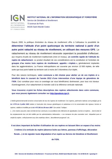
Fiches nivellement - Sauveterre-de-Guyenne
Fiches nivellement - Sauveterre-de-Guyenne
Fiches nivellement - Sauveterre-de-Guyenne
Create successful ePaper yourself
Turn your PDF publications into a flip-book with our unique Google optimized e-Paper software.
ABCDEFEBBDEBEB<br />
ABACDEFFD<br />
C<br />
DA<br />
C F BFD DD AC FFD B FDFCD F BCCFDA <br />
<br />
<br />
DDDACFFDACCDDFBCCFDAD <br />
BCBDFCFFDDDBFCD<br />
BDACFDDCBCADBCCDFBCDDDBDFDD<br />
AAFDFDAC<br />
CFCFBADBCADBBFDCDBDBDFDCDFF<br />
CBDDBDBDDADDBCBDBCFBDCDFD<br />
BCCBCDC <br />
<br />
BCDDBBCDBCAABADBDBCBCD <br />
ADDDDBBDFAADFDBF<br />
<br />
<br />
ABCDEFBDECBEEBDECEEEDEECCEFEEEEBFEBBCABCB <br />
ABCDBEF ECBECEDEBBADEEBDBBECBEBDEABEE <br />
EEBCDEEFDEBCBABBCEDE<br />
CEFBEBEDBCBCFEDECEFFECBECCBEDECFEDEABCBEEEEDCBCEE <br />
CEEFCBEFECEBCEBDFBEEEFEBECECBEDBEE<br />
FCEDEEEEFEDEFBBDEDEECCEFEAEE<br />
<br />
<br />
<br />
<br />
F
FFD CD BD DAFCA AAFD ADFF BD FFDD CD ADA <br />
ACBFFDDFBDCFADFADDBCCDCBFDD<br />
B D E BCE B EE A DE E<br />
ABCE DEEEDEECCEFE EFE CCBE DE<br />
BBE E BE DB CB EE EBCE BBCE<br />
FFEBEEEC<br />
FABCEFEEBCECBEDE<br />
BCBCEBBAEDEBBABEBCB<br />
CB CE CCE CBCE E CE BCEFE C <br />
ECEFE<br />
EFCABCFDBCEDE<br />
D DEFE ECB B D DE E DE<br />
CBDECEDECBEEBCEEEC<br />
<br />
CDAD F FC ABD CBC DC BDFCDC DF C<br />
DC BFFDDAC FBFC ADFCCDC FC B DC<br />
BBDFCDCDCABDCACFFDCDCCDF <br />
DBCCCCDCDADDB<br />
BCBFCCCCBCDDBBFFCDBBDCBBFFCFCBCD<br />
AFCBDFBCD<br />
<br />
EBBDEEEDEBDEECCEFEBECEAEFCABEEFDBCEDE<br />
DFBBBDEDEDDEEAFEEECBBEDEEBBCE <br />
CBDECDEBEECEEEBBEEDEDECEFBEDBEBE <br />
BDECEBADEFDABCBEBFCBEEEEECEEBADEEDEECCEFE<br />
ECBBFEBBCDEEEDEDEAABECBFEEBCFEEDECEFB <br />
EDBE<br />
F
Nivellement Général <strong>de</strong> la France<br />
Repère <strong>de</strong> <strong>nivellement</strong><br />
I<strong>de</strong>ntifiant : 278998<br />
Système d'altitu<strong>de</strong> : NGF-IGN 1969<br />
Matricule : F'.E.F3 - 137 58,583 m<br />
Année <strong>de</strong> <strong>de</strong>rnière détermination : 2012<br />
Repère vu en place en 2012<br />
ALTITUDE NORMALE<br />
Complément :<br />
Type : REPERE SNCF<br />
Système : RGF93 - Ellipsoï<strong>de</strong> : IAG GRS 1980 - Méridien origine : GREENWICH<br />
Longitu<strong>de</strong> (dms) : 0° 05' 20'' O Latitu<strong>de</strong> (dms) : 44° 41' 25'' N<br />
Système : RGF93 - Projection : LAMBERT-93<br />
E (km) : 455.31 N (km) : 6403.81<br />
Département : GIRONDE Numéro INSEE : 33506 Commune : SAUVETERRE-DE-GUYENNE<br />
Voie suivie : D.803<br />
<strong>de</strong> : BORDEAUX à : SAUVETERRE-DE-GUYENNE<br />
Coté : Droit PK : 50,70 km Distance : -<br />
Localisation : A SAUVETERRE-DE-GUYENNE, A 47 M AU SUD-OUEST DU CARREFOUR DE LA D.672 ET DE LA<br />
D.139 E1<br />
Support : PONT DE LA D.672 SUR LE CAMANGON (RUISSEAU)<br />
Partie support : PARAPET SUR MUR EN RETOUR AMONT RIVE DROITE, FACE A LA D.672<br />
Repèrements : A 5.67 M DE L'EXTREMITE RIVE DROITE<br />
A 0.12 M AU-DESSOUS DE L'ARETE SUPERIEURE<br />
Remarques : Exploitable directement par GPS<br />
Ce repère appartient à un triplet<br />
Liste <strong>de</strong>s repères du triplet : F'.E.F3 - 137 , F'.E.F3 - 138 , F'.E.F3N3 - 18 , F'.E.F3N3 - 19 , F'.E.F3N3 - 20 ,<br />
F'.E.F3N3 - 21 , F'.E.F3N3 - 22 , F'.E.N3 - 72 , F'.E.N3 - 73<br />
Le repère est au centre <strong>de</strong> la photo<br />
Carte : 1637 PODENSAC<br />
Avertissement<br />
Compte-tenu <strong>de</strong>s risques <strong>de</strong> déplacement <strong>de</strong>s repères, il est indispensable <strong>de</strong> rattacher vos opérations <strong>de</strong> <strong>nivellement</strong> à plusieurs repères proches, ceci afin <strong>de</strong> contrôler leur stabilité.<br />
La responsabilité <strong>de</strong> l'IGN ne saurait être engagée en l'absence d'un tel contrôle.<br />
Toute remarque concernant la <strong>de</strong>struction, la disparition ou le mauvais état <strong>de</strong>s repères doit être signalée au Service <strong>de</strong> la Géodésie et du Nivellement : sgn@ign.fr<br />
© 2009 IGN - INSTITUT NATIONAL DE L'INFORMATION GÉOGRAPHIQUE ET FORESTIÈRE<br />
73 Avenue <strong>de</strong> Paris 94165 SAINT-MANDE CEDEX<br />
IGN/SGN 11/02/2013 Page 1/1
Nivellement Général <strong>de</strong> la France<br />
Repère <strong>de</strong> <strong>nivellement</strong><br />
I<strong>de</strong>ntifiant : 278999<br />
Système d'altitu<strong>de</strong> : NGF-IGN 1969<br />
Matricule : F'.E.F3 - 138 58,175 m<br />
Année <strong>de</strong> <strong>de</strong>rnière détermination : 2012<br />
Repère vu en place en 2012<br />
ALTITUDE NORMALE<br />
Complément :<br />
Type : REPERE PONTS ET CHAUSSEES<br />
Système : RGF93 - Ellipsoï<strong>de</strong> : IAG GRS 1980 - Méridien origine : GREENWICH<br />
Longitu<strong>de</strong> (dms) : 0° 05' 20'' O Latitu<strong>de</strong> (dms) : 44° 41' 25'' N<br />
Système : RGF93 - Projection : LAMBERT-93<br />
E (km) : 455.31 N (km) : 6403.81<br />
Département : GIRONDE Numéro INSEE : 33506 Commune : SAUVETERRE-DE-GUYENNE<br />
Voie suivie : D.803<br />
<strong>de</strong> : BORDEAUX à : SAUVETERRE-DE-GUYENNE<br />
Coté : Droit PK : 50,70 km Distance : -<br />
Localisation : A SAUVETERRE-DE-GUYENNE, A 47 M AU SUD-OUEST DU CARREFOUR DE LA D.672 ET DE LA<br />
D.139 E1<br />
Support : PONT DE LA D.672 SUR LE CAMAGON (RUISSEAU)<br />
Partie support : PARAPET SUR MUR EN RETOUR AMONT RIVE DROITE, FACE A LA D.672<br />
Repèrements : A 5.96 M DE L'EXTREMITE RIVE DROITE<br />
A 0.50 M AU-DESSOUS DE L'ARETE SUPERIEURE<br />
Remarques : Exploitable directement par GPS<br />
Ce repère appartient à un triplet<br />
Liste <strong>de</strong>s repères du triplet : F'.E.F3 - 137 , F'.E.F3 - 138 , F'.E.F3N3 - 18 , F'.E.F3N3 - 19 , F'.E.F3N3 - 20 ,<br />
F'.E.F3N3 - 21 , F'.E.F3N3 - 22 , F'.E.N3 - 72 , F'.E.N3 - 73<br />
Le repère est au centre <strong>de</strong> la photo<br />
Carte : 1637 PODENSAC<br />
Avertissement<br />
Compte-tenu <strong>de</strong>s risques <strong>de</strong> déplacement <strong>de</strong>s repères, il est indispensable <strong>de</strong> rattacher vos opérations <strong>de</strong> <strong>nivellement</strong> à plusieurs repères proches, ceci afin <strong>de</strong> contrôler leur stabilité.<br />
La responsabilité <strong>de</strong> l'IGN ne saurait être engagée en l'absence d'un tel contrôle.<br />
Toute remarque concernant la <strong>de</strong>struction, la disparition ou le mauvais état <strong>de</strong>s repères doit être signalée au Service <strong>de</strong> la Géodésie et du Nivellement : sgn@ign.fr<br />
© 2009 IGN - INSTITUT NATIONAL DE L'INFORMATION GÉOGRAPHIQUE ET FORESTIÈRE<br />
73 Avenue <strong>de</strong> Paris 94165 SAINT-MANDE CEDEX<br />
IGN/SGN 11/02/2013 Page 1/1
Nivellement Général <strong>de</strong> la France<br />
Repère <strong>de</strong> <strong>nivellement</strong><br />
I<strong>de</strong>ntifiant : 401423<br />
Système d'altitu<strong>de</strong> : NGF-IGN 1969<br />
Matricule : F'.E.F3N3 - 18 80,508 m<br />
Année <strong>de</strong> <strong>de</strong>rnière détermination : 2012<br />
Repère vu en place en 2012<br />
ALTITUDE NORMALE<br />
Complément :<br />
Type : M REPERE CYLINDRIQUE DU NIVELLEMENT GENERAL<br />
Système : RGF93 - Ellipsoï<strong>de</strong> : IAG GRS 1980 - Méridien origine : GREENWICH<br />
Longitu<strong>de</strong> (dms) : 0° 05' 23'' O Latitu<strong>de</strong> (dms) : 44° 41' 42'' N<br />
Système : RGF93 - Projection : LAMBERT-93<br />
E (km) : 455.28 N (km) : 6404.34<br />
Département : GIRONDE Numéro INSEE : 33506 Commune : SAUVETERRE-DE-GUYENNE<br />
Voie suivie : D.671<br />
<strong>de</strong> : LA SAUVE à : SAUVETERRE-DE-GUYENNE<br />
Coté : Droit PK : 33,20 km Distance : -<br />
Localisation : AU BOURG<br />
Support : MUR DE CLOTURE DU CIMETIERE DE SAUVETERRE-DE-GUYENNE<br />
Partie support : CHAINE D'ANGLE NORD-OUEST, FACE NORD-EST, FACE ROUTE<br />
Repèrements : A 0.14 M DE L'EXTREMITE NORD-OUEST<br />
A 0.33 M AU-DESSUS DU SOL<br />
Remarques : Exploitable par GPS <strong>de</strong>puis une station excentrée<br />
Ce repère appartient à un triplet<br />
Liste <strong>de</strong>s repères du triplet : F'.E.F3 - 137 , F'.E.F3 - 138 , F'.E.F3N3 - 18 , F'.E.F3N3 - 19 , F'.E.F3N3 - 20 ,<br />
F'.E.F3N3 - 21 , F'.E.F3N3 - 22 , F'.E.N3 - 72 , F'.E.N3 - 73<br />
Le repère est au centre <strong>de</strong> la photo<br />
Carte : 1637 PODENSAC<br />
Avertissement<br />
Compte-tenu <strong>de</strong>s risques <strong>de</strong> déplacement <strong>de</strong>s repères, il est indispensable <strong>de</strong> rattacher vos opérations <strong>de</strong> <strong>nivellement</strong> à plusieurs repères proches, ceci afin <strong>de</strong> contrôler leur stabilité.<br />
La responsabilité <strong>de</strong> l'IGN ne saurait être engagée en l'absence d'un tel contrôle.<br />
Toute remarque concernant la <strong>de</strong>struction, la disparition ou le mauvais état <strong>de</strong>s repères doit être signalée au Service <strong>de</strong> la Géodésie et du Nivellement : sgn@ign.fr<br />
© 2009 IGN - INSTITUT NATIONAL DE L'INFORMATION GÉOGRAPHIQUE ET FORESTIÈRE<br />
73 Avenue <strong>de</strong> Paris 94165 SAINT-MANDE CEDEX<br />
IGN/SGN 11/02/2013 Page 1/1
Nivellement Général <strong>de</strong> la France<br />
Repère <strong>de</strong> <strong>nivellement</strong><br />
I<strong>de</strong>ntifiant : 278941<br />
Système d'altitu<strong>de</strong> : NGF-IGN 1969<br />
Matricule : F'.E.F3N3 - 19 79,670 m<br />
Année <strong>de</strong> <strong>de</strong>rnière détermination : 2012<br />
Repère vu en place en 2012<br />
ALTITUDE NORMALE<br />
Complément :<br />
Type : REPERE PONTS ET CHAUSSEES<br />
Système : RGF93 - Ellipsoï<strong>de</strong> : IAG GRS 1980 - Méridien origine : GREENWICH<br />
Longitu<strong>de</strong> (dms) : 0° 05' 17'' O Latitu<strong>de</strong> (dms) : 44° 41' 40'' N<br />
Système : RGF93 - Projection : LAMBERT-93<br />
E (km) : 455.39 N (km) : 6404.27<br />
Département : GIRONDE Numéro INSEE : 33506 Commune : SAUVETERRE-DE-GUYENNE<br />
Voie suivie : D.670<br />
<strong>de</strong> : LA SAUVE à : SAUVETERRE-DE-GUYENNE<br />
Coté : Droit PK : 52,22 km Distance : 0,12 km du repère F'.E.F3N3 - 18<br />
Localisation : AU SUD DU CARREFOUR AVEC LA D.670, A SAUVETERRE-DE-GUYENNE<br />
Support : PORTE SAUBOTTE<br />
Partie support : PIEDROIT DU PORCHE, FACE NORD-EST, FACE ROUTE<br />
Repèrements : A 0.80 M DE L'EXTREMITE NORD-OUEST<br />
A 0.42 M AU-DESSUS DU SOL<br />
Remarques : Exploitable par GPS <strong>de</strong>puis une station excentrée<br />
Ce repère appartient à un triplet<br />
Liste <strong>de</strong>s repères du triplet : F'.E.F3 - 137 , F'.E.F3 - 138 , F'.E.F3N3 - 18 , F'.E.F3N3 - 19 , F'.E.F3N3 - 20 ,<br />
F'.E.F3N3 - 21 , F'.E.F3N3 - 22 , F'.E.N3 - 72 , F'.E.N3 - 73<br />
Le repère est au centre <strong>de</strong> la photo<br />
Carte : 1637 PODENSAC<br />
Avertissement<br />
Compte-tenu <strong>de</strong>s risques <strong>de</strong> déplacement <strong>de</strong>s repères, il est indispensable <strong>de</strong> rattacher vos opérations <strong>de</strong> <strong>nivellement</strong> à plusieurs repères proches, ceci afin <strong>de</strong> contrôler leur stabilité.<br />
La responsabilité <strong>de</strong> l'IGN ne saurait être engagée en l'absence d'un tel contrôle.<br />
Toute remarque concernant la <strong>de</strong>struction, la disparition ou le mauvais état <strong>de</strong>s repères doit être signalée au Service <strong>de</strong> la Géodésie et du Nivellement : sgn@ign.fr<br />
© 2009 IGN - INSTITUT NATIONAL DE L'INFORMATION GÉOGRAPHIQUE ET FORESTIÈRE<br />
73 Avenue <strong>de</strong> Paris 94165 SAINT-MANDE CEDEX<br />
IGN/SGN 11/02/2013 Page 1/1
Nivellement Général <strong>de</strong> la France<br />
Repère <strong>de</strong> <strong>nivellement</strong><br />
I<strong>de</strong>ntifiant : 278942<br />
Système d'altitu<strong>de</strong> : NGF-IGN 1969<br />
Matricule : F'.E.F3N3 - 20 76,084 m<br />
Année <strong>de</strong> <strong>de</strong>rnière détermination : 2012<br />
Repère vu en place en 2012<br />
ALTITUDE NORMALE<br />
Complément :<br />
Type : M REPERE CYLINDRIQUE DU NIVELLEMENT GENERAL<br />
Système : RGF93 - Ellipsoï<strong>de</strong> : IAG GRS 1980 - Méridien origine : GREENWICH<br />
Longitu<strong>de</strong> (dms) : 0° 05' 08'' O Latitu<strong>de</strong> (dms) : 44° 41' 35'' N<br />
Système : RGF93 - Projection : LAMBERT-93<br />
E (km) : 455.59 N (km) : 6404.09<br />
Département : GIRONDE Numéro INSEE : 33506 Commune : SAUVETERRE-DE-GUYENNE<br />
Voie suivie : D.670<br />
<strong>de</strong> : LA SAUVE à : SAUVETERRE-DE-GUYENNE<br />
Coté : Gauche PK : 52,52 km Distance : -<br />
Localisation : PLACE DE LA REPUBLIQUE<br />
Support : EGLISE DE SAUVETERRE-DE-GUYENNE<br />
Partie support : SOUBASSEMENT DU MUR PIGNON NORD-OUEST DE LA NEF, FACE RUE SAINT-LEGER<br />
Repèrements : A 1.91 M DU CONTREFORT D'ANGLE EN EQUERRE<br />
A 0.26 M AU-DESSOUS DE L'ARETE SUPERIEURE<br />
Remarques : Exploitable par GPS <strong>de</strong>puis une station excentrée<br />
Ce repère appartient à un triplet<br />
Liste <strong>de</strong>s repères du triplet : F'.E.F3 - 137 , F'.E.F3 - 138 , F'.E.F3N3 - 18 , F'.E.F3N3 - 19 , F'.E.F3N3 - 20 ,<br />
F'.E.F3N3 - 21 , F'.E.F3N3 - 22 , F'.E.N3 - 72 , F'.E.N3 - 73<br />
Le repère est au centre <strong>de</strong> la photo<br />
Carte : 1637 PODENSAC<br />
Avertissement<br />
Compte-tenu <strong>de</strong>s risques <strong>de</strong> déplacement <strong>de</strong>s repères, il est indispensable <strong>de</strong> rattacher vos opérations <strong>de</strong> <strong>nivellement</strong> à plusieurs repères proches, ceci afin <strong>de</strong> contrôler leur stabilité.<br />
La responsabilité <strong>de</strong> l'IGN ne saurait être engagée en l'absence d'un tel contrôle.<br />
Toute remarque concernant la <strong>de</strong>struction, la disparition ou le mauvais état <strong>de</strong>s repères doit être signalée au Service <strong>de</strong> la Géodésie et du Nivellement : sgn@ign.fr<br />
© 2009 IGN - INSTITUT NATIONAL DE L'INFORMATION GÉOGRAPHIQUE ET FORESTIÈRE<br />
73 Avenue <strong>de</strong> Paris 94165 SAINT-MANDE CEDEX<br />
IGN/SGN 11/02/2013 Page 1/1
Nivellement Général <strong>de</strong> la France<br />
Repère <strong>de</strong> <strong>nivellement</strong><br />
I<strong>de</strong>ntifiant : 401425<br />
Système d'altitu<strong>de</strong> : NGF-IGN 1969<br />
Matricule : F'.E.F3N3 - 21 71,783 m<br />
Année <strong>de</strong> <strong>de</strong>rnière détermination : 2012<br />
Repère vu en place en 2012<br />
ALTITUDE NORMALE<br />
Complément :<br />
Type : M REPERE CYLINDRIQUE DU NIVELLEMENT GENERAL<br />
Système : RGF93 - Ellipsoï<strong>de</strong> : IAG GRS 1980 - Méridien origine : GREENWICH<br />
Longitu<strong>de</strong> (dms) : 0° 05' 11'' O Latitu<strong>de</strong> (dms) : 44° 41' 33'' N<br />
Système : RGF93 - Projection : LAMBERT-93<br />
E (km) : 455.53 N (km) : 6404.05<br />
Département : GIRONDE Numéro INSEE : 33506 Commune : SAUVETERRE-DE-GUYENNE<br />
Voie suivie : D.670<br />
<strong>de</strong> : LA SAUVE à : SAUVETERRE-DE-GUYENNE<br />
Coté : Droit PK : 52,61 km Distance : -<br />
Localisation : PLACE DE LA REPUBLIQUE<br />
Support : MAIRIE DE SAUVETERRE-DE-GUYENNE<br />
Partie support : MUR DE FACADE NORD-EST, FACE ROUTE<br />
Repèrements : A 0.14 M DU MUR MITOYEN NORD-OUEST<br />
A 0.41 M AU-DESSUS DU TROTTOIR<br />
Remarques : Exploitable par GPS <strong>de</strong>puis une station excentrée<br />
Ce repère appartient à un triplet<br />
Liste <strong>de</strong>s repères du triplet : F'.E.F3 - 137 , F'.E.F3 - 138 , F'.E.F3N3 - 18 , F'.E.F3N3 - 19 , F'.E.F3N3 - 20 ,<br />
F'.E.F3N3 - 21 , F'.E.F3N3 - 22 , F'.E.N3 - 72 , F'.E.N3 - 73<br />
Le repère est au centre <strong>de</strong> la photo<br />
Carte : 1637 PODENSAC<br />
Avertissement<br />
Compte-tenu <strong>de</strong>s risques <strong>de</strong> déplacement <strong>de</strong>s repères, il est indispensable <strong>de</strong> rattacher vos opérations <strong>de</strong> <strong>nivellement</strong> à plusieurs repères proches, ceci afin <strong>de</strong> contrôler leur stabilité.<br />
La responsabilité <strong>de</strong> l'IGN ne saurait être engagée en l'absence d'un tel contrôle.<br />
Toute remarque concernant la <strong>de</strong>struction, la disparition ou le mauvais état <strong>de</strong>s repères doit être signalée au Service <strong>de</strong> la Géodésie et du Nivellement : sgn@ign.fr<br />
© 2009 IGN - INSTITUT NATIONAL DE L'INFORMATION GÉOGRAPHIQUE ET FORESTIÈRE<br />
73 Avenue <strong>de</strong> Paris 94165 SAINT-MANDE CEDEX<br />
IGN/SGN 11/02/2013 Page 1/1
Nivellement Général <strong>de</strong> la France<br />
Repère <strong>de</strong> <strong>nivellement</strong><br />
I<strong>de</strong>ntifiant : 401414<br />
Système d'altitu<strong>de</strong> : NGF-IGN 1969<br />
Matricule : F'.E.F3N3 - 22 73,625 m<br />
Année <strong>de</strong> <strong>de</strong>rnière détermination : 2012<br />
Repère vu en place en 2012<br />
ALTITUDE NORMALE<br />
Complément :<br />
Type : M REPERE CYLINDRIQUE DU NIVELLEMENT GENERAL<br />
Système : RGF93 - Ellipsoï<strong>de</strong> : IAG GRS 1980 - Méridien origine : GREENWICH<br />
Longitu<strong>de</strong> (dms) : 0° 05' 03'' O Latitu<strong>de</strong> (dms) : 44° 41' 31'' N<br />
Système : RGF93 - Projection : LAMBERT-93<br />
E (km) : 455.69 N (km) : 6403.98<br />
Département : GIRONDE Numéro INSEE : 33506 Commune : SAUVETERRE-DE-GUYENNE<br />
Voie suivie : D.670<br />
<strong>de</strong> : SAUVETERRE-DE-GUYENNE à : LA REOLE<br />
Coté : Gauche PK : 52,82 km Distance : 0,30 km du repère F'.E.F3N3 - 21<br />
Localisation : AU NO 5 DE LA RUE DU 8 MAI 1945<br />
Support : GENDARMERIE DE SAUVETERRE-DE-GUYENNE<br />
Partie support : CHAINE D'ANGLE SUD-EST DU MUR DE FACADE SUD-OUEST, FACE RUE DU 8 MAI 1945<br />
Repèrements : A 0.23 M DE L'EXTREMITE SUD-EST<br />
A 0.70 M AU-DESSUS DU TROTTOIR<br />
Remarques : Exploitable par GPS <strong>de</strong>puis une station excentrée<br />
Ce repère appartient à un triplet<br />
Liste <strong>de</strong>s repères du triplet : F'.E.F3 - 137 , F'.E.F3 - 138 , F'.E.F3N3 - 18 , F'.E.F3N3 - 19 , F'.E.F3N3 - 20 ,<br />
F'.E.F3N3 - 21 , F'.E.F3N3 - 22 , F'.E.N3 - 72 , F'.E.N3 - 73<br />
Le repère est au centre <strong>de</strong> la photo<br />
Carte : 1637 PODENSAC<br />
Avertissement<br />
Compte-tenu <strong>de</strong>s risques <strong>de</strong> déplacement <strong>de</strong>s repères, il est indispensable <strong>de</strong> rattacher vos opérations <strong>de</strong> <strong>nivellement</strong> à plusieurs repères proches, ceci afin <strong>de</strong> contrôler leur stabilité.<br />
La responsabilité <strong>de</strong> l'IGN ne saurait être engagée en l'absence d'un tel contrôle.<br />
Toute remarque concernant la <strong>de</strong>struction, la disparition ou le mauvais état <strong>de</strong>s repères doit être signalée au Service <strong>de</strong> la Géodésie et du Nivellement : sgn@ign.fr<br />
© 2009 IGN - INSTITUT NATIONAL DE L'INFORMATION GÉOGRAPHIQUE ET FORESTIÈRE<br />
73 Avenue <strong>de</strong> Paris 94165 SAINT-MANDE CEDEX<br />
IGN/SGN 11/02/2013 Page 1/1
Nivellement Général <strong>de</strong> la France<br />
Repère <strong>de</strong> <strong>nivellement</strong><br />
I<strong>de</strong>ntifiant : 226377<br />
Système d'altitu<strong>de</strong> : NGF-IGN 1969<br />
Matricule : F'.E.N3 - 72 91,338 m<br />
Année <strong>de</strong> <strong>de</strong>rnière détermination : 2012<br />
Repère vu en place en 2012<br />
ALTITUDE NORMALE<br />
Complément :<br />
Type : M REPERE CYLINDRIQUE DU NIVELLEMENT GENERAL<br />
Système : RGF93 - Ellipsoï<strong>de</strong> : IAG GRS 1980 - Méridien origine : GREENWICH<br />
Longitu<strong>de</strong> (dms) : 0° 05' 02'' O Latitu<strong>de</strong> (dms) : 44° 41' 43'' N<br />
Système : RGF93 - Projection : LAMBERT-93<br />
E (km) : 455.74 N (km) : 6404.33<br />
Département : GIRONDE Numéro INSEE : 33506 Commune : SAUVETERRE-DE-GUYENNE<br />
Voie suivie : D.672<br />
<strong>de</strong> : CLEYRAC à : D.670<br />
Coté : Droit PK : - Distance : 0,26 km du repère F'.E.F3N3 - 20<br />
Localisation : A SAUVETERRE-DE-GUYENNE, A 70 M AU NORD-OUEST DU CARREFOUR AVEC UN V.O., SUR<br />
CE V.O.<br />
Support : CHATEAU D'EAU<br />
Partie support : SOUBASSEMENT DU MUR DE FACADE SUD<br />
Repèrements : A 0.84 M A L'OUEST DE L'OUVERTURE DE LA PORTE<br />
A 0.28 M AU-DESSOUS DE L'ARETE SUPERIEURE<br />
Remarques : Exploitable par GPS <strong>de</strong>puis une station excentrée<br />
Ce repère appartient à un triplet<br />
Liste <strong>de</strong>s repères du triplet : F'.E.F3 - 137 , F'.E.F3 - 138 , F'.E.F3N3 - 18 , F'.E.F3N3 - 19 , F'.E.F3N3 - 20 ,<br />
F'.E.F3N3 - 21 , F'.E.F3N3 - 22 , F'.E.N3 - 72 , F'.E.N3 - 73<br />
Le repère est au centre <strong>de</strong> la photo<br />
Carte : 1637 PODENSAC<br />
Avertissement<br />
Compte-tenu <strong>de</strong>s risques <strong>de</strong> déplacement <strong>de</strong>s repères, il est indispensable <strong>de</strong> rattacher vos opérations <strong>de</strong> <strong>nivellement</strong> à plusieurs repères proches, ceci afin <strong>de</strong> contrôler leur stabilité.<br />
La responsabilité <strong>de</strong> l'IGN ne saurait être engagée en l'absence d'un tel contrôle.<br />
Toute remarque concernant la <strong>de</strong>struction, la disparition ou le mauvais état <strong>de</strong>s repères doit être signalée au Service <strong>de</strong> la Géodésie et du Nivellement : sgn@ign.fr<br />
© 2009 IGN - INSTITUT NATIONAL DE L'INFORMATION GÉOGRAPHIQUE ET FORESTIÈRE<br />
73 Avenue <strong>de</strong> Paris 94165 SAINT-MANDE CEDEX<br />
IGN/SGN 11/02/2013 Page 1/1
Nivellement Général <strong>de</strong> la France<br />
Repère <strong>de</strong> <strong>nivellement</strong><br />
I<strong>de</strong>ntifiant : 226378<br />
Système d'altitu<strong>de</strong> : NGF-IGN 1969<br />
Matricule : F'.E.N3 - 73 87,386 m<br />
Année <strong>de</strong> <strong>de</strong>rnière détermination : 2012<br />
Repère vu en place en 2012<br />
ALTITUDE NORMALE<br />
Complément :<br />
Type : REPERE PONTS ET CHAUSSEES<br />
Système : RGF93 - Ellipsoï<strong>de</strong> : IAG GRS 1980 - Méridien origine : GREENWICH<br />
Longitu<strong>de</strong> (dms) : 0° 05' 01'' O Latitu<strong>de</strong> (dms) : 44° 41' 41'' N<br />
Système : RGF93 - Projection : LAMBERT-93<br />
E (km) : 455.75 N (km) : 6404.28<br />
Département : GIRONDE Numéro INSEE : 33506 Commune : SAUVETERRE-DE-GUYENNE<br />
Voie suivie : D.672<br />
<strong>de</strong> : CLEYRAC à : D.670<br />
Coté : Droit PK : - Distance : 0,26 km du repère F'.E.F3N3 - 20<br />
Localisation : A SAUVETERRE-DE-GUYENNE<br />
Support : PORTE SAINT-LEGER<br />
Partie support : PIEDROIT COTE NORD-EST, FACE ROUTE<br />
Repèrements : A 3.30 M DE L'EXTREMITE SUD-OUEST<br />
A 0.64 M AU-DESSUS DU SOL<br />
Remarques : Exploitable par GPS <strong>de</strong>puis une station excentrée<br />
Ce repère appartient à un triplet<br />
Liste <strong>de</strong>s repères du triplet : F'.E.F3 - 137 , F'.E.F3 - 138 , F'.E.F3N3 - 18 , F'.E.F3N3 - 19 , F'.E.F3N3 - 20 ,<br />
F'.E.F3N3 - 21 , F'.E.F3N3 - 22 , F'.E.N3 - 72 , F'.E.N3 - 73<br />
Le repère est au centre <strong>de</strong> la photo<br />
Carte : 1637 PODENSAC<br />
Avertissement<br />
Compte-tenu <strong>de</strong>s risques <strong>de</strong> déplacement <strong>de</strong>s repères, il est indispensable <strong>de</strong> rattacher vos opérations <strong>de</strong> <strong>nivellement</strong> à plusieurs repères proches, ceci afin <strong>de</strong> contrôler leur stabilité.<br />
La responsabilité <strong>de</strong> l'IGN ne saurait être engagée en l'absence d'un tel contrôle.<br />
Toute remarque concernant la <strong>de</strong>struction, la disparition ou le mauvais état <strong>de</strong>s repères doit être signalée au Service <strong>de</strong> la Géodésie et du Nivellement : sgn@ign.fr<br />
© 2009 IGN - INSTITUT NATIONAL DE L'INFORMATION GÉOGRAPHIQUE ET FORESTIÈRE<br />
73 Avenue <strong>de</strong> Paris 94165 SAINT-MANDE CEDEX<br />
IGN/SGN 11/02/2013 Page 1/1


