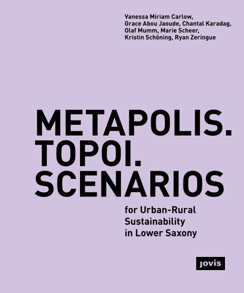
Metapolis. Topoi. Scenarios
ISBN 978-3-86859-725-7
ISBN 978-3-86859-725-7
Create successful ePaper yourself
Turn your PDF publications into a flip-book with our unique Google optimized e-Paper software.
Vanessa Miriam Carlow,<br />
Grace Abou Jaoude, Chantal Karadag,<br />
Olaf Mumm, Marie Scheer,<br />
Kristin Schöning, Ryan Zeringue<br />
METAPOLIS.<br />
TOPOI.<br />
SCENARIOS<br />
for Urban-Rural<br />
Sustainability<br />
in Lower Saxony
INTRO 7<br />
1. The Lower Saxony <strong>Metapolis</strong> –<br />
From an Open Call for Cooperation<br />
to a Fundamental Understanding<br />
of Urban-Rural Relations 8<br />
Vanessa Miriam Carlow<br />
PERSPECTIVES IN<br />
URBAN-RURAL<br />
PLANNING 13<br />
2. TOPOI – A Scientific Approach<br />
for Understanding Urban-Rural<br />
Linkages 14<br />
Vanessa Miriam Carlow, Olaf Mumm<br />
2.1. Introduction 14<br />
2.2. Lower Saxony <strong>Metapolis</strong> 15<br />
2.3. The TOPOI Method 16<br />
2.4. The TOPOI Types of Lower Saxony 21<br />
2.5. Conclusion 24<br />
3. Four <strong>Scenarios</strong> for Lower<br />
Saxony 2050 26<br />
Grace Abou Jaoude, Vanessa Miriam Carlow<br />
3.1. Introduction 26<br />
3.2. Scenario Planning Approaches 30<br />
3.3. Case Study: The METAPOLIS Project 32<br />
3.4. Evaluation of the Scenario Building<br />
Workshop 35<br />
3.5. Four <strong>Scenarios</strong> for Lower Saxony 36<br />
3.6. Conclusion 39<br />
CASE STUDIES 43<br />
Vanessa Miriam Carlow, Chantal Karadag,<br />
Olaf Mumm, Marie Scheer, Kristin Schöning,<br />
Ryan Zeringue<br />
4. PROTOTYPE I:<br />
Eydelstedt, a Disseminated Hamlet 44<br />
4.1. TOPOI Description 47<br />
4.2. Four Futures for Eydelstedt 52<br />
4.3. Scenario A: The Green Communities<br />
of Eydelstedt 54<br />
4.4. Scenario B: A Happy Future<br />
Planned for Eydelstedt? 66<br />
4.5. Scenario C: New Settlers<br />
in Eydelstedt 78<br />
4.6. Scenario D: Eydelstedt Repurposed! 90<br />
5. PROTOTYPE II:<br />
Detmerode, an Exo Satellite Town 102<br />
5.1. TOPOI Description 105<br />
5.2. Four Futures for Detmerode 110<br />
5.3. Scenario A: The Green Communities<br />
of Detmerode 112<br />
5.4. Scenario B: A Happy Future<br />
Planned for Detmerode? 124<br />
5.5. Scenario C: New Settlers<br />
in Detmerode 136<br />
5.6. Scenario D: Detmerode Repurposed! 148
6. PROTOTYPE III:<br />
Schöppenstedt, a Periurban Village 160<br />
6.1. TOPOI Description 163<br />
6.2. Four Futures for Schöppenstedt 168<br />
6.3. Scenario A: The Green Communities<br />
of Schöppenstedt 170<br />
6.4. Scenario B: A Happy Future Planned<br />
for Schöppenstedt? 182<br />
6.5. Scenario C: New Settlers<br />
in Schöppenstedt 194<br />
6.6. Scenario D: Schöppenstedt<br />
Repurposed! 206<br />
URBAN-RURAL<br />
INTERVENTION<br />
CATALOG 223<br />
Vanessa Miriam Carlow, Chantal Karadag,<br />
Olaf Mumm, Marie Scheer, Kristin Schöning<br />
8. Urban-Rural Intervention Catalog 224<br />
8.1. Introduction 224<br />
8.2. Building Types (B) 225<br />
8.3. Streets, Mobility, Public Space (M) 228<br />
8.4. Green and Blue Networks (G+B) 231<br />
8.5. Functions (F) 234<br />
7. Discussion and Evaluation of the<br />
<strong>Scenarios</strong> for the three Prototypes<br />
Eydelstedt, Detmerode, and<br />
Schöppenstedt 218<br />
7.1. Eydelstedt 219<br />
7.2. Detmerode 220<br />
7.3. Schöppenstedt 221<br />
OUTLOOK 239<br />
9. From Local Measures to Regional<br />
Sustainability – An Attempt of<br />
Upscaling 240<br />
Olaf Mumm, Ryan Zeringue,<br />
Vanessa Miriam Carlow<br />
APPENDIX 253<br />
References 254<br />
Acknowledgements 262<br />
Imprint 264
1.<br />
The Lower Saxony<br />
<strong>Metapolis</strong> –<br />
From an Open Call<br />
for Cooperation<br />
to a Fundamental<br />
Understanding of<br />
Urban-Rural Relations<br />
Vanessa Miriam Carlow<br />
In 2015, the ISU – Institute for Sustainable Urbanism<br />
at Technische Universität Braunschweig published<br />
an open call for cooperation: “Have space. Want<br />
ideas? Not afraid of students?” via our professional<br />
networks. The open call was an offer to municipalities<br />
and NGOs worldwide. The ultimate ambition was<br />
to apply the talent of our students and ISU to existing<br />
real-life problems. By cooperating with real-world<br />
actors, we envisioned our students – future urbanists<br />
– to get a glimpse of the everyday reality of their<br />
chosen profession from the very beginning of their<br />
studies. We also wanted to move away from an architectural<br />
and urban design education where students<br />
work on problems that their professors have “made<br />
up”. In addition, we aimed to advocate work in public<br />
administration as a rewarding professional alternative<br />
to the classic career path in an architects’ office.<br />
Through meetings with citizens, mayors, or chief<br />
planners, we hoped to give our students an idea of<br />
the responsibilities and joys the work of an architect<br />
can entail.<br />
The response was amazing! We received feedback<br />
from municipalities around the world. However, most<br />
expressions of interest in cooperation came from<br />
villages and small towns in Lower Saxony, a federal<br />
state in the north of Germany, where ISU and our<br />
Technische Universität Braunschweig are located.<br />
We kept our promise and conducted several urban<br />
design workshops and master classes based on<br />
the responses to our open call. We worked with the<br />
Gowanus Canal Initiative in Brooklyn, New York – and<br />
also held a design-to-build workshop in Brome, a village<br />
near the city of Wolfsburg, and other more rural<br />
municipalities. “We work with Brooklyn and Brome”<br />
soon became a punch line at ISU.<br />
8 INTRO
In response to the open call, we met in person with the<br />
mayors or chief planners of all of the municipalities in<br />
Lower Saxony that had replied. We became intrigued<br />
by the specific challenges those communities, mainly<br />
small towns and villages, were facing. Consequently,<br />
we started to conduct preliminary research and established<br />
the Academy of Rural Spaces (Carlow et al.<br />
2019) – a forum for cooperation between ISU and our<br />
partner municipalities. Eventually, in 2016 we hosted<br />
the international conference RURALISM. The future<br />
of small towns and villages in an urbanizing world<br />
(Carlow and ISU 2016).<br />
We realized a number of things over the course of all<br />
these intense exchanges:<br />
While rural spaces have long been understood as<br />
backward, they have – just like cities – undergone<br />
drastic changes in the past decades, too. The industrialization<br />
of agriculture, the change of lifestyles,<br />
and other effects of the globalized, networked economy<br />
have had a major impact on areas that were formerly<br />
dominated by traditional agriculture, and have<br />
led to enormous, also physical and spatial transformations<br />
that are still on-going. In addition, prevailing<br />
challenges such as resource and land consumption,<br />
the need for better participation, and sustainable mobility<br />
strategies are not only problems that concern<br />
cities but also rural areas (Carlow and ISU 2016;<br />
Carlow et al. 2021; Mühlbach et al. 2021).<br />
Rural spaces are often depicted as peripheral and<br />
being dependent on large cities. However, in Lower<br />
Saxony, as in the whole of Germany and many other<br />
European countries, the majority of the population does<br />
not live in the large metropolises and metropolitan<br />
areas, but outside of these – in towns, small suburbs,<br />
and villages. This ultimately challenges inherited<br />
concepts of urbanity, centrality, and accessibility<br />
(Carlow et al. 2021).<br />
We also observed that for a long time, concepts and<br />
strategies for sustainable transformation have focused<br />
almost exclusively on large cities and metropolitan<br />
regions. However, there are many interlinkages<br />
between spaces once considered urban or rural.<br />
A holistic approach to understanding urban and rural<br />
spaces in an integrated way may offer a new path towards<br />
a more sustainable future. At the same time,<br />
this is being challenged by traditional planning systems<br />
that strongly differentiate between urban and<br />
rural areas (Carlow et al. 2022).<br />
Ultimately, no two places are alike, and rural or urban<br />
are too broad categories to describe the lived reality<br />
in cities, towns, or villages. Prosperous villages and<br />
shrinking cities or vice versa, new functional designations<br />
or changing lifestyles – a closer look is often<br />
needed to understand the challenges that arise in<br />
urban and rural development.<br />
TOPOI. METAPOLIS. SCENARIOS for Urban-Rural<br />
Sustainability in Lower Saxony presents the current<br />
results of our ongoing work and analysis of urban and<br />
rural communities in Lower Saxony. We developed a<br />
new data-driven method called TOPOI to analyze<br />
urban-rural settlement patterns (Carlow et al. 2022).<br />
The method is introduced in Chapter 2. Based on<br />
the insights we gained, we developed scenarios for<br />
the sustainable development of different settlement<br />
types and exemplary communities in the interconnected<br />
network of cities, towns, and villages. In Chapter<br />
3 we elaborate on the method we used to develop<br />
these scenarios. The exemplary proposals we derived<br />
for different possible and sustainable futures are<br />
presented in Chapters 4, 5, and 6. Throughout their<br />
The Lower Saxony <strong>Metapolis</strong><br />
9
development, these have been extensively deliberated<br />
with our cooperating partners. Chapter 7 presents<br />
a summary of our discussions. Chapter 8 is a<br />
summary of the different design proposals that we<br />
developed for the scenarios. In the concluding Chapter<br />
9, we will show how an incremental change in the<br />
communities may have a major impact on the larger<br />
urban-rural system.<br />
I would like to thank all of our cooperation partners,<br />
mayors, planners, local politicians, activists, and<br />
citizens of Barnstorf, Bersenbrück, Braunschweig,<br />
Bremen, Bremerhaven, Brome, Elm-Asse, Detmerode,<br />
Eydelstedt, Nienburg (Weser), Schöppenstedt,<br />
Vechelde, Verden (Aller), Wittingen, Wolfenbüttel,<br />
Wolfsburg, and Wolfshagen (Harz). With this book we<br />
want to acknowledge your passion in the quest for a<br />
good and sustainable future for (y)our communities.<br />
I would also like to thank my colleagues at Technische<br />
Universität Braunschweig and Leibniz Universität<br />
Hannover for their constructive cooperation on our<br />
joined research project METAPOLIS. An inter- and<br />
transdisciplinary platform for a sustainable development<br />
of urban-rural relations, funded by the<br />
Volkswagen Foundation and the Lower Saxony Ministry<br />
of Science and Culture (MWK).<br />
This book is an invitation to continue the discussion<br />
on the fundamental understanding of urban-rural<br />
relations and the future sustainable development.<br />
Amidst a pandemic, severe social disruptions due to<br />
wars, climate change with severe draughts, storm<br />
surges, and floods, and with global resources dwindling,<br />
we all realize that radical shifts in the way we<br />
live are necessary. This book provides a glimpse into<br />
a positive future based on radical changes – we can<br />
do this!<br />
10 INTRO
1.1 Academy of Future<br />
Rural Spaces in Lower<br />
Saxony<br />
Workshop in Barnstorf<br />
2019 – ISU students<br />
together with the mayor<br />
Jürgen Lübbers<br />
1.2 Academy of Future<br />
Rural Spaces in Lower<br />
Saxony<br />
Conference on urbanrural<br />
development at<br />
TU Braunschweig with<br />
experts, ISU students,<br />
and representatives<br />
of our partner municipalities<br />
The Lower Saxony <strong>Metapolis</strong><br />
11
proximity with often unsustainable effects, such as a<br />
high rate of land take and dense commuting patterns,<br />
have been characteristic of recent and current developments<br />
(MSGG 2013; Mühlbach et al. 2021).<br />
Figure 2.1 shows Lower Saxon settlements in relation<br />
to different landscape types based on the classification<br />
of the Lower Saxony State Office for Mining,<br />
Energy and Geology (LBEG 1995). This map includes<br />
the two large cities of Hamburg and Bremen, which<br />
are two independent city states within the German<br />
federal system and surrounded by Lower Saxon territory.<br />
Depending on the landscape type, Lower Saxon<br />
settlements show different sizes and distribution patterns.<br />
The larger cities are situated along the river<br />
bodies and on the foothills with fertile soils, whereas<br />
in the heathland, on the coast, and in the hilly areas<br />
of the Harz Mountains, settlement units are considerably<br />
smaller and more scattered.<br />
For the development and testing of our TOPOI method,<br />
we selected two study regions on the basis of their distinct<br />
development history, urbanization, and landscape<br />
patterns. Both study regions include municipalities<br />
from our partner network. The western study region<br />
Vechta-Diepholz-Verden (A, Figure 2.1) is characterized<br />
by a large number of evenly distributed, mainly<br />
prospering small to medium-sized towns and many<br />
villages in a sandy soil or heath landscape (Geest).<br />
Founded on rather infertile soils, today the region is<br />
characterized by intensive livestock husbandry and agriculture<br />
(Tamásy 2013). The study region of the larger<br />
Braunschweig area (B, Figure 2.1) includes both thriving<br />
cities and declining municipalities in immediate<br />
vicinity. The landscape of foothills is characterized by<br />
very fertile loess soils (Börde), which led to an early and<br />
relatively dense formation of settlements in the region.<br />
2.3. The TOPOI Method<br />
With the data-based TOPOI method, we analyzed the<br />
settlement structures based on eleven planning parameters<br />
of form (area, compactness, building density,<br />
open space ratio), function (functional variety,<br />
population density, retail and services ratio, agricultural<br />
building ratio) and spatial linkages (settlement<br />
density, public transport connectivity, proximity to regional<br />
train stations) (see Table 2.1).<br />
While our method can be studied in detail in several<br />
scientific articles (Carlow et al. 2021; Mühlbach et al.<br />
2021; Carlow et al. 2022; Mumm et al. 2022; Zhu et<br />
al. 2022), in this book, we do not want to focus on the<br />
technicalities of the method but rather on some of the<br />
findings obtained by its application. The first results<br />
concern the definition of settlement units. While the<br />
traditional classification method of the Federal Office<br />
for Building and Regional Planning – BBSR (Figure<br />
2.2) differentiates four main settlement categories,<br />
namely City (independent), Urban County, Rural<br />
County with Densification Tendencies, and Sparsely<br />
Populated Rural County, our TOPOI approach provides<br />
a more detailed and fine-grained understanding<br />
of the diversity of settlement units and their characteristics<br />
due to the defined eleven indicators.<br />
Other findings concern the unequal access to public<br />
transport options, which the TOPOI method helped<br />
us reveal. We found out that roughly 60 % of the area<br />
in our two study regions had a densification potential<br />
based on public transport provision in relation<br />
to population density. On the other hand, approximately<br />
50,000 people have no or only limited access<br />
to public transport (Carlow et al. 2021).<br />
16 PERSPECTIVES IN URBAN-RURAL PLANNING
OLDENBURG BREMEN HANNOVER BRAUNSCHWEIG<br />
A<br />
B<br />
OSNABRÜCK GÖTTINGEN WOLFSBURG<br />
0 20km<br />
Study Regions River / Waterway Foothills<br />
2.1 Built-up Areas and Landscape Types<br />
of Lower Saxony and the two METAPOLIS study regions:<br />
(A) Vechta-Diepholz-Verden and (B) Larger Braunschweig<br />
region. Source: Carlow et Motorway al. 2022; Data: BKG 2012a,b;<br />
ESRI 2018; LBEG 1995.<br />
Main Road<br />
Study Regions<br />
Built-Up Area<br />
Motorway<br />
Main Road<br />
River/ Waterway<br />
Coastal Holocene<br />
River Landscapes<br />
Geest<br />
River Landscapes<br />
Geest<br />
Foothills<br />
Highland<br />
Low Mountain Range<br />
(Harz)<br />
Built up Area Coastal Holocene Highland<br />
Low Mountain Range (<br />
25<br />
km<br />
TOPOI<br />
17
0 1km<br />
0 1km<br />
0 250m<br />
2.6<br />
Exo Satellite Towns, too, can be<br />
found at the urban fringes. As typical<br />
large housing estates from<br />
the 1950s, 60s or 70s, they have a<br />
high functional variety, high population<br />
density, but a low public<br />
transport connectivity. There are<br />
nine Exo Satellite Towns in our<br />
study regions.<br />
2.7<br />
Periurban Villages are also located<br />
at the urban fringes. They are<br />
typically smaller than Periurban<br />
Towns or Exo Satellite Towns.<br />
Nevertheless, they usually have a<br />
medium to high functional diversity<br />
and a medium population density.<br />
A special characteristic is that<br />
they are located close to or have<br />
their own regional train stations.<br />
There are 42 settlement units of<br />
this kind.<br />
2.8<br />
The 37 Small Periurban Villages<br />
we identified usually have a smaller<br />
footprint than the Periurban<br />
Villages but nevertheless a high<br />
functional diversity. However, their<br />
connectivity is relatively low.<br />
0 250m 0 250m<br />
0 250m<br />
2.9<br />
Exo Villages, of which we found<br />
524 in our study regions, are rather<br />
isolated. Nevertheless, they<br />
show a medium to high functional<br />
diversity. They usually have a medium<br />
population density and low<br />
connectivity.<br />
2.10<br />
Small Exo Villages are also isolated.<br />
The 73 we identified show<br />
a high number of buildings with<br />
agricultural use. They are characterized<br />
by a large distance to the<br />
next train station and a low connectivity<br />
in general.<br />
2.11<br />
Disseminated Villages also include<br />
agricultural buildings but at a lower<br />
proportion than Small Exo Villages.<br />
They are dispersed throughout the<br />
territory, are located at a large distance<br />
from train stations, and have<br />
a generally low connectivity.<br />
22<br />
PERSPECTIVES IN URBAN-RURAL PLANNING
0 250m<br />
0 250m<br />
2.12<br />
Agri Villages have a large proportion<br />
of agricultural buildings and<br />
at the same time a high building<br />
density. Like many of the other<br />
village types, they are rather scattered<br />
and have a low connectivity.<br />
There are 35 of them in our study<br />
regions.<br />
2.13<br />
Disseminated Hamlets, of which we<br />
made out 1,071, were the second<br />
most common settlement type.<br />
They are dispersed throughout<br />
the territory, show a high building<br />
density, a large distance from the<br />
nearest train station, and a very<br />
low connectivity.<br />
0 250m<br />
0 250m<br />
2.14<br />
Disseminated Living Agri Hamlets<br />
are the most common TOPOI in<br />
our two study regions, where 4,283<br />
could be identified. This is the<br />
smallest settlement type that is<br />
distinguished by a very low connectivity<br />
and a high building density<br />
with a large share of agricultural<br />
buildings.<br />
2.15<br />
The Exo Industrial Zone is a very<br />
special TOPOS. As a typical industrial<br />
area outside of cities and<br />
towns, it usually contains a small<br />
number of functions, has no population,<br />
a high open space ratio,<br />
low building density, and very low<br />
public transport connectivity.<br />
TOPOI<br />
23
preferred technique – where each axis represents the<br />
range of desirable and undesirable futures. Participants<br />
then explore each scenario’s characteristics,<br />
provide a title for each future, and detail the narratives.<br />
Finally, participants explore the implications of each<br />
scenario through a set of indicators and develop contingent<br />
and robust plans, policies, and strategies that<br />
are refined into recommendations with timelines (Stapleton<br />
2020; Abou Jaoude, Mumm, and Carlow 2022).<br />
Increasing environmental, socioeconomic, or technological<br />
challenges are likely to produce uncertainties<br />
in the built environment and require scenario planning<br />
processes, given their nature and long-term<br />
implications. Thus, exploratory scenario planning is<br />
recommended when external uncertainties (structural<br />
uncertainty) are critical and imminent; conflicting<br />
values and views between stakeholders exist (value<br />
uncertainty); solutions require cooperation between<br />
different scales; or problems and issues are unknown<br />
(Abbott 2005; Avin 2007; Avin, Cambridge Systematica,<br />
and Patnode 2016; Goodspeed 2020). Exploratory<br />
scenario planning fosters systems thinking and seeks<br />
to broaden the range of possible futures. Indeed, this<br />
approach enables users to adequately account and<br />
adapt to uncertainties.<br />
Exploratory approaches to scenario-based planning<br />
ideally result in robust and contingent plans and policies<br />
that help communities better adapt to the future.<br />
However, many scenario planning efforts fail to achieve<br />
this theoretical goal and instead yield only insights<br />
and recommendations or are often not followed up<br />
after presenting the narratives (Avin and Goodspeed<br />
2020). Scenario-based planning projects may involve<br />
public participation and integrate quantitative and<br />
qualitative data (Goodspeed 2020). Various exercises<br />
may use models and sketch tools to generate, assess,<br />
and visualize scenarios and understand future<br />
development patterns and dynamics. Tools and<br />
models are particularly necessary when iterations<br />
are needed to refine and replicate results, or stakeholders<br />
are faced with difficult decisions that require<br />
the consideration of impacts and trade-offs between<br />
scenarios. While many scenario-based planning projects<br />
are essentially qualitative, it is often only regional-scale<br />
projects and large organizations and cities<br />
that undertake and can afford a quantitative level of<br />
analysis. Through various case studies, Stapleton<br />
(2020) demonstrated that effective exploratory scenario<br />
planning does not require the use of tools and<br />
models but rather a structured process and method<br />
that can, alone, yield insights and guide policy. Compared<br />
to traditional urban planning methods, scenario<br />
planning can be a complex, time-consuming, and<br />
costly exercise (Avin 2007). The cost and complexity<br />
of a scenario planning project is contingent upon the<br />
scale (regional, local, etc.), topics, and range of external<br />
forces considered; digital and analysis tools used;<br />
number of experts consulted; meetings held, etc.<br />
3.3. Case Study: The METAPOLIS Project<br />
Several workshops were undertaken as part of the<br />
METAPOLIS research project to formulate four qualitative<br />
scenarios for Lower Saxony. The research<br />
project was conducted at Technische Universität<br />
Braunschweig and Leibniz Universität Hannover in<br />
cooperation with several Lower Saxon municipalities.<br />
The workshops aimed to analyze physical, ecological,<br />
social, and information networks and identify<br />
32<br />
PERSPECTIVES IN URBAN-RURAL PLANNING
3.3 Public Participation<br />
Citizens participating in the scenario process had the opportunity to discuss and<br />
select their preferred futures for the sustainable development of Lower Saxony.<br />
Four <strong>Scenarios</strong> for Lower Saxony 2050<br />
33
synergies across the urban-rural gradient in Lower<br />
Saxony. <strong>Scenarios</strong> were then applied to the three<br />
sample communities of Eydelstedt, Detmerode,<br />
and Schöppenstedt. The expert meetings and workshops<br />
were held between 2018 and 2019. Prior to the<br />
scenario development process, an interdisciplinary<br />
team of architects, planners and geoecologists had<br />
devised a systematized process and considered the<br />
13 identified TOPOI types (Figure 3.5; settlement<br />
types or units) and their characteristics, namely<br />
form, functions, and linkages (Carlow et al. 2022). In<br />
subsequent workshops under the METAPOLIS project,<br />
the participants represented more diverse disciplines<br />
including political scientists, data scientists, environmental<br />
scientists and traffic planners, to depict the<br />
future of settlement types and their relations.<br />
An exploratory scenario planning approach and the<br />
scenario-axis technique were selected prior to the<br />
commencement of the project. Initially, experts, academics,<br />
and municipality representatives convened<br />
to discuss their aspirations and visions for different<br />
towns and villages in Lower Saxony (Figure 3.1). Apart<br />
from stakeholders’ values and interests, three guiding<br />
principles were derived from this workshop, namely<br />
green and blue networks, five-minute city, and livable<br />
communities. Data and GIS-based maps were later<br />
collected and analyzed by the researchers to understand<br />
the current conditions in the selected study<br />
areas. Semi-structured interviews were carried out<br />
with academic experts to gather more insights and<br />
learn about the history, challenges and opportunities<br />
pertaining to each discipline. Drawing on the interviews,<br />
the project team collectively created an extensive<br />
list of drivers, including population, migration, age,<br />
disruptive technologies and energy consumption, and<br />
questions that were later illustrated on cards. Key<br />
drivers were also borrowed from the Sustainability<br />
Strategy for Lower Saxony report (MUEBK 2017). The<br />
indicator report of the German Environment Agency<br />
(2017) and the interviews conducted by Böttger,<br />
Carsten, and Engel (2016) on the future of Germany<br />
were consulted, too. These reports and the book were<br />
also crucial for framing questions that addressed diverse<br />
disciplinary perspectives. For example, questions<br />
regarding future urban development included:<br />
(1) will density increase in major urban centers<br />
in the two study areas or will there be more sprawl<br />
especially around big urban centers? (2) What are<br />
the common building types in the two study areas?<br />
(3) Which spatial configurations will help achieve<br />
higher densities? During a series of meetings, the<br />
identified drivers were presented and the purpose,<br />
scope, and timeframe of the scenario exercise were<br />
determined.<br />
During a second workshop, twelve participants convened<br />
to formulate scenarios for the future of the two<br />
study areas (Figure 3.2). Along with a deck of cards<br />
describing previous studies, the questions were used<br />
to initiate discussions. Participants were divided into<br />
two groups and then encouraged to draw causal loop<br />
diagrams and cluster drivers. Cards and questions<br />
served as generative tools to prompt participants<br />
to think beyond their disciplinary perspectives and<br />
overcome presumed assumptions. An uncertainty<br />
and impact matrix, otherwise known as the Wilson<br />
matrix, was employed to help participants prioritize<br />
and narrow down their selection of critical drivers.<br />
Through the scenario-axis technique and plenary<br />
discussions among groups, ‘lifestyles’ and ‘governance’<br />
were selected as critical drivers to formulate<br />
34<br />
PERSPECTIVES IN URBAN-RURAL PLANNING
four first-generation scenarios, namely: Green Communities,<br />
Planned Happy Futures?, New Settlers, and<br />
Communities Repurposed! (Figure 3.4). Each scenario<br />
narrative depicted diverse disciplinary perspectives<br />
and considered issues that emerged during the discussions.<br />
The scenarios reflected interests of stakeholders<br />
(municipal representatives, funding agents,<br />
and expert groups) and were formulated along the<br />
three main guiding principles. After the workshop,<br />
the project team drafted and refined the narratives,<br />
which were later shared and presented to the participants<br />
to solicit their feedback. The scenarios were<br />
then visualized and presented to the public during a<br />
public event at Technische Universität Braunschweig<br />
(Figure 3.3). In a survey consisting of a series of<br />
multiple-choice questions, visitors could select their<br />
preferences for the future of Lower Saxony. The combination<br />
of preferences was then supposed to lead<br />
to a specific scenario. This exercise was intended to<br />
raise awareness among lay audiences of the implications<br />
of their choices and decisions and to discuss the<br />
scenarios with the public.<br />
3.4. Evaluation of the Scenario Building<br />
Workshop<br />
Various unanticipated challenges emerged throughout<br />
the scenario building process. Although regarded as<br />
a well-established ‘standard’ technique in scenario<br />
planning, the workshop revealed the discrepancy<br />
between theory and implementation of the scenario-<br />
axis technique. The technique’s prevalence and<br />
wide appeal are due to its clear, simple, and communicable<br />
structure (Ramirez and Wilkinson 2014).<br />
However, narrowing down the number of drivers to<br />
two critical driving forces required extensive discussions<br />
among participants a considerable amount of<br />
time. Moreover, reaching consensus among interdisciplinary<br />
experts was not easily achieved. Indeed,<br />
selecting the two most impactful and uncertain<br />
drivers required trade-offs between participants,<br />
who reflected on the interests of various stakeholders.<br />
This process has ultimately led to the loss of<br />
insights gained during discussions on causal relationships<br />
and drivers. Some participants noted<br />
that the critical driving forces – lifestyle and governance<br />
– did not closely relate to the project’s focus<br />
or the two study areas. Throughout the workshop,<br />
contrasting perspectives were not perceived as impediments<br />
but rather as opportunities to consider<br />
a broader range of possibilities. A short questionnaire<br />
containing nine questions was handed out<br />
to participants at the end of the workshop. The<br />
questionnaire consisted of free-text and closeended<br />
questions requiring participants to rank<br />
certain tools. Overall, participants were satisfied<br />
with the tools used in the workshop and the plenary<br />
discussions. However, they were critical of the<br />
scenario-axes technique and the short duration of<br />
the workshop, which lasted four hours. While the<br />
workshop employed an exploratory approach to<br />
develop possible future alternatives, some participants<br />
noted that the guiding principles where<br />
strongly embedded in the scenarios and thus reflected<br />
normative aspirations.<br />
Four <strong>Scenarios</strong> for Lower Saxony 2050<br />
35
4.<br />
PROTOTYPE I:<br />
Eydelstedt,<br />
a Disseminated<br />
Hamlet<br />
4.1 Detached Houses<br />
in the north of Eydelstedt<br />
44 CASE STUDIES
4.2 Historical and Listed Farm Buildings<br />
testify to Eydelstedt’s agricultural origins.<br />
PROTOTYPE I: Eydelstedt<br />
45
4.3 The Bargeriede River<br />
cuts through Eydelstedt and is sometimes more,<br />
sometimes less accessible to all.<br />
46 CASE STUDIES
4.1. TOPOI Description<br />
Eydelstedt is one of the 1,071 Disseminated Hamlets<br />
in our two study regions. Disseminated Hamlets are<br />
the second largest TOPOI group after the Disseminated<br />
Living Agri Hamlet, of which there are 4,283.<br />
Eydelstedt has a population of approximately 250<br />
people. It is part of the municipality of Barnstorf. Altogether,<br />
about 25,000 people live in Disseminated<br />
Hamlets in our two study regions. Most Disseminated<br />
Hamlets are located in the north-western study region<br />
of Vechta-Diepholz-Verden, including Eydelstedt.<br />
Disseminated Hamlets are characterized by their<br />
high building density. They are dispersed throughout<br />
the territory, are located a long distance from train<br />
stations, and have a very low connectivity. Since no or<br />
only a few public transport options are available, they<br />
are primarily reached via individual mobility. On average,<br />
the nearest regional railway station is located<br />
7 km from Disseminated Hamlets. They usually feature<br />
three different functions, including housing, but<br />
no retail. Disseminated Hamlets are usually surrounded<br />
by many other settlements.<br />
Eydelstedt is a village. Spatially, it can be described<br />
as a rather dispersed accumulation of historical<br />
farm ensembles and newer residences, mainly singlefamily<br />
homes. Only few of the historical farms are<br />
still used as such. Today, most former farm buildings<br />
have been converted into residences or small business<br />
premises, such as hair salons or law offices. In<br />
the hamlets, single-family houses have been added<br />
to complement historical buildings. Overall, housing<br />
is the predominant function in Eydelstedt. Vacancies<br />
are not a phenomenon in the village. Besides the few<br />
existing small businesses, there is also an elementary<br />
school and a fire station. However, there is no grocery<br />
store, pub, or café.<br />
The small river Bargeriede is the dominant landscape<br />
feature in Eydelstedt. West of Eydelstedt, it<br />
joins the larger river Hunte. According to a municipal<br />
regulation, areas along the Bargeriede are considered<br />
flood plains where construction is not permitted.<br />
The main potential of Eydelstedt seems to be its remoteness<br />
and the beauty of the surrounding landscape.<br />
The scenic environment with a rich tree population,<br />
tree-lined avenues, and the two rivers offer a<br />
lush environment and many opportunities for outdoor<br />
activities. The building type of historical farm houses<br />
holds enormous potential for reuse. Housing and<br />
small-scale businesses are the dominant uses in the<br />
village. Accessibility by public transport is relatively<br />
low. There is an elementary school bus service eight<br />
times a day. The next train station is located in the<br />
neighboring larger settlement of Barnstorf and approximately<br />
4 kilometers away.<br />
Table 4.1 Attributes of the Disseminated Hamlet of Eydelstedt<br />
A Area [ha] 12.31<br />
C Compactness [%] 65<br />
BD Building Density [buildings/ha] 6.24<br />
OSR Open Space Ratio [%] 93<br />
FR Functional Richness 5.25<br />
PD Population Density [inhabitants/ha] 4.27<br />
RSR Retail and Service Ratio [%] 1<br />
AFR Agricultural Facilities Ratio [%] 14<br />
SUD Settlement Units Density 35.75<br />
PTC Public Transport Connectivity 1.75<br />
PRTS Proximity to Regional Train Station [km] 4.32<br />
PROTOTYPE I: Eydelstedt<br />
47
Scenario A:<br />
The Green Communities of Eydelstedt<br />
LIVING<br />
COMMON<br />
uF.11<br />
FARM<br />
LIVING<br />
FARM CAFÉ<br />
uB.4<br />
uM.2<br />
DENSIFICATION<br />
BETWEEN BUILDINGS<br />
TEMPORARY<br />
STREET GREEN AND<br />
STREET LIGHT<br />
HARVEST<br />
FESTIVAL<br />
DENSIFICATION OF THE<br />
PERIMETER BLOCK<br />
DEVELOPMENT<br />
4.20<br />
64 CASE STUDIES
uF.14<br />
M<br />
FARM<br />
uF.2<br />
uB.13<br />
COMMON<br />
uM.3<br />
LIVING<br />
uG+B.5<br />
COMMON GREEN SPACE<br />
uG+B.8<br />
ACCESS TO BARGERIEDE<br />
MIXED FUNCTIONS WITH<br />
COMMON SPACE<br />
RIDE-SHARE BENCH<br />
PROTOTYPE I: Eydelstedt<br />
65
4.5. Scenario C:<br />
New Settlers in Eydelstedt<br />
E<br />
E<br />
E<br />
E<br />
E<br />
E<br />
E<br />
4.27<br />
78 CASE STUDIES
Dear residents of Eydelstedt,<br />
E<br />
STRIP<br />
It’s nice to have a communal garden that serves as a<br />
multigenerational meeting point! Here in Eydelstedt,<br />
in our new row house, we enjoy all the advantages of<br />
owning our own home, yet without the disadvantage of<br />
having to take care of our own garden. Our children have<br />
the feeling of living at a playground. We enjoy evenings<br />
in the barbecue area. There is always someone who waters<br />
the plants, simply because we are a big neighborhood<br />
community, where people like to help each other.<br />
Whether it’s doing gardening together, having a chat at<br />
one of the charging stations for our e-cars or at a neighborhood<br />
meeting over a delicious cup of coffee: you always<br />
meet someone you know. When I recently removed<br />
the seats from our car to transport a cabinet, Stefan,<br />
my next-door neighbor, offered his help – that’s really<br />
worth a lot! And when we were on our way to Barnstorf,<br />
passing wildflower meadows and fields, he told me that<br />
he was very sceptic about moving into a row house. He<br />
remembered all the row houses from his childhood<br />
with very monotonous facades and gardens as small as<br />
towels. But our houses here in Eydelstedt are anything<br />
but boring and monotonous. The idea of a modular basic<br />
structure that can be expanded according to one’s own<br />
ideas, budget, and needs has really led to great and diverse<br />
houses. I definitely had these concerns too, but<br />
as I said, it was not just the large community garden<br />
that convinced me in the end. I was also impressed by<br />
offers such as the mobile food and medical service for<br />
the elderly or people who are not mobile. Or the idea of<br />
non-hierarchical streets, so that you can let your children<br />
walk to school without worrying: these are strong<br />
arguments for moving here.<br />
Best from the future!<br />
PROTOTYPE I: Eydelstedt<br />
79
Scenario D:<br />
Eydelstedt Repurposed!<br />
4.37 Legend<br />
Residential<br />
Mixed Use<br />
Industrial<br />
Public<br />
Leisure<br />
Forestry<br />
Solidary and Organic<br />
Agriculture<br />
Commercial<br />
Energy<br />
Transformation Area<br />
TOPOS Boundary<br />
Existing Buildings<br />
New Buildings<br />
Existing Streets<br />
New Streets<br />
Green<br />
Water<br />
Agriculture<br />
0.25<br />
km<br />
98 CASE STUDIES
Functions<br />
Since agriculture undergoes a restructuring from<br />
mono-crop farming to vertically organized food production<br />
in modern greenhouses, Eydelstedt, too,<br />
is facing a transformation. New hybrid buildings<br />
emerge that contain spaces for food production,<br />
sales, co-working, for leisure activities, and even<br />
housing.<br />
I. Aquaponics<br />
New production techniques offer the possibility to<br />
grow certain fruit and vegetables with the help of the<br />
circular aquaponic method. This method combines<br />
the rearing of fish or other aquatic animals with food<br />
production. The nutrient-rich water from the fish<br />
tanks is fed to the plants, which are thus not only<br />
watered but also receive valuable nutrients through<br />
the addition of bacteria. The excess water can flow<br />
back into the fish tanks via hoses, closing the circle.<br />
With this method, high-quality food can be produced<br />
on significantly less space with almost no emissions.<br />
II. Hybrid Use<br />
The new Productive Neighborhood or Productive<br />
Rooftop building type allows for hybrid building uses,<br />
contributing to a more vibrant village life. The ground<br />
floor zones are used for public purposes such as a<br />
café or a shop selling the produces grown on the upper<br />
floors, a kindergarten, or other necessary functions.<br />
In addition to this contribution to public life, synergies<br />
are also created between the various uses in the<br />
building, e.g., the use of waste heat for heating the<br />
greenhouses, or the use of geothermal energy via the<br />
foundations of the buildings.<br />
PROTOTYPE I: Eydelstedt<br />
99
5.<br />
PROTOTYPE II:<br />
Detmerode,<br />
an Exo Satellite Town<br />
5.1 Center of Detmerode<br />
The shopping center of the Exo Satellite Town is nearby and<br />
easily accessible for the residents.<br />
102 CASE STUDIES
5.2 Detmerode Residential Area<br />
There are different types of housing in Detmerode.<br />
Here on Geschwister-Scholl-Ring, row houses are lined up.<br />
PROTOTYPE II: Detmerode<br />
103
5.2.<br />
Four Futures<br />
for Detmerode<br />
We developed four scenarios for Detmerode and all<br />
the other sample municipalities. While the scenarios<br />
are equal in terms of their drivers, the way they<br />
develop spatially is, of course, different for each of<br />
the municipalities. However, each scenario follows a<br />
certain development logic.<br />
Scenario A is called Green Communities. It is derived<br />
from a collaborative approach of living and working<br />
in dense settlement structures. Scenario B is called<br />
Planned Happy Future?. Here, the focus is on the efficient<br />
use of land as a resource and the strengthening<br />
of rural and suburban spaces as against the urban<br />
cores in urban-rural agglomerations. Scenario C,<br />
New Settlers, demonstrates how spatial expansion<br />
can be steered in a more sustainable way than with<br />
laissez-faire approaches. The scenario Communities<br />
Repurposed! addresses the spatial and functional<br />
transformation of the different TOPOI types. Unlike<br />
other scenario approaches, all four scenarios are<br />
intended to present a desirable future, even though<br />
some seem to be more desirable and sustainable<br />
than others. All four scenarios follow a certain spatial<br />
logic in the way the community develops as a whole,<br />
in certain subareas, or where transformation takes<br />
place.<br />
Scenario A:<br />
In Green Communities, the focus is on reusing the<br />
existing building stock and internal densification.<br />
Scenario B:<br />
In Planned Happy Future?, the existing building<br />
stock is upgraded in terms of energy efficiency, redeveloped<br />
and potentially extended. In this scenario,<br />
transformation areas are mainly located within today’s<br />
settlement boundaries.<br />
Scenario C:<br />
In New Settlers, today’s settlement boundaries are<br />
expanded to accommodate growth. This scenario is<br />
an exception as it allows new land consumption outside<br />
existing settlement boundaries, whereby new<br />
developments must meet certain sustainability criteria.<br />
Scenario D:<br />
Communities Repurposed! is a scenario that investigates<br />
the redevelopment within existing settlement<br />
boundaries. However, preference is not always given<br />
to maintaining the existing building stock.<br />
110 CASE STUDIES
e1cdb9<br />
Areas of Transformation<br />
5.11 Scenario A: Green Communities 5.12 Scenario B: Planned Happy Future?<br />
5.13 Scenario C: New Settlers 5.14 Scenario D: Communities Repurposed!<br />
Legend<br />
Areas of Transformation<br />
Water<br />
Traffic<br />
TOPOI boundary<br />
Buildings<br />
PROTOTYPE II: Detmerode<br />
111
Scenario C:<br />
New Settlers in Detmerode<br />
uB.17<br />
FRUIT<br />
TREES<br />
uM.7<br />
COMMON GREEN SPACE<br />
uG+B.4<br />
uG+B.8<br />
EXTENSION OF<br />
PUBLIC GREEN<br />
COMMON GARDENS<br />
SHARED GARDEN SPACE<br />
5.32<br />
146<br />
CASE STUDIES
uB.11<br />
LIVING<br />
uF.12<br />
COMMON<br />
LIVING<br />
LIVING<br />
uG+B.12<br />
LIVING<br />
LIVING<br />
uM.6<br />
COMMON<br />
LIVING<br />
COMMON<br />
uF.16<br />
E-VEHICLES AND<br />
CHARGING STATION<br />
HIGH-RISE WITH RESIDENTIAL<br />
COMMON SPACES<br />
MONOCULTURE<br />
PROTOTYPE II: Detmerode<br />
147
6.<br />
PROTOTYPE III:<br />
Schöppenstedt,<br />
a Periurban Village<br />
6.1 Schöppenstedt Railway Station<br />
Mobility hub and the connection to Braunschweig<br />
160<br />
CASE STUDIES
6.2 Schöppenstedt Market Square<br />
Centrally located in the village and with access to the river Altenau<br />
PROTOTYPE III: Schöppenstedt 161
Scenario C:<br />
New Settlers in Schöppenstedt<br />
6.29 Legend<br />
E-Charging Station<br />
Car Lane<br />
Existing Bus Stop<br />
Railway Station<br />
Railway<br />
Railway Station Radius<br />
600m<br />
Bypass Cars<br />
Car Park<br />
Transformation Area<br />
TOPOS Boundary<br />
Existing Buildings<br />
New Buildings<br />
Existing Streets<br />
New Streets<br />
Green<br />
Water<br />
Agriculture<br />
0.5<br />
km<br />
198 CASE STUDIES
Streets, Mobility, Public Space<br />
This scenario entails an increase in traffic areas,<br />
which are designed to be as sustainable as possible<br />
through careful planning. Permeable street surfaces,<br />
the visual separation of lanes, and roadside<br />
greenery make the streets safer.<br />
I. Sustainable Street Design<br />
Since this scenario envisages new development areas,<br />
it allows a new type of street design in terms of<br />
layout and materials used. The newly built roads are<br />
efficient and laid out without dead ends to ensure a<br />
steady traffic flow. In addition, they are designed with<br />
all road users in mind and include a visual separation<br />
of the road space, for example, through differently<br />
colored lanes for cyclists, pedestrians, and motorized<br />
road users. The road surface is permeable to water,<br />
so that rain water can be absorbed in the ground. This<br />
makes the roads both safer for all users and more<br />
environmentally friendly.<br />
II. Charging Stations for E-Cars<br />
In the course of construction works, charging stations<br />
for electric vehicles are installed primarily at the mobility<br />
hubs for arriving motorists and at the most frequented<br />
streets; every new building is equipped with<br />
its own wallbox. In addition, five new charging stations<br />
are distributed across the town, some of them<br />
next to an existing bus stop.<br />
III. Bypass for the Town Center<br />
Even though sustainable private transport is encouraged<br />
in this scenario, motorized traffic should<br />
not run directly through the center. To make this<br />
possible, three parking lots are planned in walking<br />
distance to the town center: one next to the railway<br />
station, another one close to the industrial area, and<br />
the third one at the western edge of the town center.<br />
Furthermore, a new bypass road is constructed<br />
to avoid heavy traffic in the center, which allows the<br />
transformation of historical streets and preservation<br />
of their human scale.<br />
PROTOTYPE III: Schöppenstedt<br />
199
SURFACE FROM<br />
NATURAL,<br />
POROUS<br />
MATERIAL<br />
EFFICIENT<br />
TRAFFIC<br />
8.31<br />
u M.13 PERMEABLE ROAD SURFACES<br />
Sealing of land should be avoided,<br />
as this destroys the habitat for many<br />
creatures and increases the danger<br />
of local flooding in the event of heavy<br />
rainfalls. The permeable road surface<br />
is a solution to decrease gray areas, in<br />
particular in villages. Where asphalt<br />
surfaces disappear, streets built from<br />
natural materials such as stones are a<br />
good option to increase permeability.<br />
(inspired by DAV 2007)<br />
PARKING LOTS<br />
AS PUBLIC SPACE<br />
8.32<br />
u M.14 TRANSFORMED PARKING LOTS<br />
New uses can be envisioned for parking<br />
lots that are empty most of the day.<br />
A pocket garden, a place to play outdoor<br />
chess, an extension of the local<br />
bakery for outdoor seating, a bench to<br />
rest, bike stands etc.; on just 12.5 sqm<br />
of parking space, many uses can be<br />
imagined.<br />
(inspired by Fabian Lippert, LKA Berlin, RBG<br />
(db 2014); Lokale Agenda 21 Wien 2021)<br />
8.33<br />
u M.15 AUTONOMOUS VEHICLES<br />
Autonomous vehicles could be a<br />
solution to make traffic and space<br />
consumption as efficient as possible.<br />
These vehicles transport locally produced<br />
goods from A to B and can also<br />
be used by all inhabitants; they help<br />
transform streets into a safe space for<br />
pedestrians.<br />
(inspired by Senatsverwaltung für Umwelt<br />
Berlin 2021)<br />
CAR LANE<br />
TRANSPORTATION<br />
OF FREIGHT<br />
VIA RAIL<br />
CYCLE LANE<br />
8.34<br />
u M.16 CYCLE LANE<br />
An additional cycle lane is intended to<br />
reduce car traffic in the village. Safe<br />
and convenient use will make it easy<br />
and attractive to switch from car to<br />
bike.<br />
(inspired by Aichinger and Frehn 2017)<br />
8.35<br />
u M.17 RE-ACTIVATION OF<br />
RAILROAD LINES<br />
Reopening old railroad lines shifts<br />
freight traffic back to rails, thereby<br />
reducing car traffic in towns and villages.<br />
Of course, local public transport<br />
around the villages can also benefit<br />
from this. This is a sustainable alternative<br />
to transporting goods by truck<br />
and to individual transport by car.<br />
(inspired by Dostert 2021; MW 2022)<br />
BUS STOPS<br />
SUPPORTING<br />
THE FIVE-MINUTE<br />
CITY PRINCIPLE<br />
8.36<br />
u M.18 SMART DISTRIBUTION OF<br />
PUBLIC TRANSPORT<br />
With a clever distribution of bus stops,<br />
the principle of the five-minute city,<br />
where daily goods and services can<br />
be reached within a five-minute walk,<br />
can be transferred to rural areas,<br />
which often lack public transport options.<br />
On-call mobility solutions could<br />
also benefit from this.<br />
(inspired by Carlow and Hong 2016; Carlow<br />
2022b)<br />
230 URBAN-RURAL INTERVENTION CATALOG
8.4. Green and Blue Networks (G+B)<br />
PLANTS<br />
SPACE FOR<br />
RECREATION<br />
FRUITS +<br />
VEGETABLES<br />
8.37<br />
u G+B.1 GREEN ROOFTOPS<br />
AND FACADES<br />
Due to the shading and thermal buffer<br />
provided by plants, their insulating<br />
effect and evaporative cooling, green<br />
roofs and facades are an innovative<br />
solution for saving energy in buildings<br />
and cooling the immediate surroundings.<br />
In addition, these green spaces<br />
can serve as a habitat for animals.<br />
(inspired by TOPOTEK1 2022)<br />
8.38<br />
u G+B.2 PUBLIC PLAYGROUND<br />
As a meeting place and play area, public<br />
playgrounds are an ideal retreat<br />
for children in cities, small towns, and<br />
sometimes also villages. By greening<br />
them, the relationship to nature can be<br />
strengthened and many things can be<br />
experienced and learned.<br />
(inspired by LML 2022b)<br />
8.39<br />
u G+B.3 LOCAL FOOD PRODUCTION<br />
Food is produced locally using green<br />
areas where fruit and vegetables can<br />
be grown and processed. If done in a<br />
sustainable way, this can decrease the<br />
ecological footprint of food production.<br />
(inspired by Prinzessinnengärten Kollektiv<br />
Berlin 2022)<br />
SOCIAL SPACES<br />
LOCAL GARDENS<br />
8.40<br />
u G+B.4 SPACES OF SOCIAL<br />
ENCOUNTERS<br />
Places of social encounters can have<br />
many forms. They serve as meeting<br />
areas for residents and are important<br />
for a functioning community.<br />
Here, neighbors of all ages and<br />
backgrounds can engage in common<br />
outdoor activities such as gardening,<br />
barbecueing, or playing.<br />
(inspired by LML 2022b; TOPOTEK1 2020)<br />
RECREATIONAL<br />
WATERCOURSE<br />
8.41<br />
u G+B.5 PUBLIC ACCESS TO WATER<br />
Where a watercourse exists, it should<br />
be made accessible to the general<br />
public as a recreational and play area.<br />
(inspired by Atelier Loidl, BPR (Bundesstiftung<br />
Baukultur 2022m))<br />
8.42<br />
u G+B.6 COMMUNITY GARDENING<br />
To provide food locally, new green<br />
spaces are established where the<br />
community can grow seasonal fruit<br />
and vegetables for their own consumption.<br />
For this purpose, underused<br />
green spaces are detected.<br />
(inspired by Gemeinschaftsgarten Allmende-<br />
Kontor e.V. 2022)<br />
Green and Blue Networks<br />
231
IMPRINT<br />
© 2022 by jovis Verlag GmbH<br />
Texts by kind permission of the authors.<br />
Pictures by kind permission of the photographers /<br />
holders of the picture rights.<br />
All rights reserved.<br />
Cover design: Johanna Siebein, Studio Laucke Siebein<br />
Cover image: SpACE Lab at ISU – Institute for Sustainable<br />
Urbanism, TU Braunschweig (spacelab-isu.org)<br />
All diagrams, maps, drawings, and photographs were created<br />
by SpACE Lab at ISU – Institute for Sustainable Urbanism,<br />
unless otherwise noted.<br />
Copyediting: Bianca Murphy<br />
Concept: Vanessa Miriam Carlow, Chantal Karadag,<br />
Olaf Mumm, Kristin Schöning<br />
Design: jovis + Johanna Uhrmann (johannauhrmann.at)<br />
Lithography: Bild1Druck Berlin<br />
Printed in the European Union.<br />
Note by the editors: We have made all possible efforts to<br />
trace references to texts, works or photographs back to their<br />
authors and give them the appropriate credit. We apologize<br />
for any omissions and will correct them in the next issue.<br />
Bibliographic information published by the Deutsche<br />
Nationalbibliothek<br />
The Deutsche Nationalbibliothek lists this publication in the<br />
Deutsche Nationalbibliografie; detailed bibliographic data<br />
are available on the Internet at http://dnb.d-nb.de<br />
jovis Verlag GmbH<br />
Lützowstraße 33<br />
10785 Berlin<br />
www.jovis.de<br />
jovis books are available worldwide in selected bookstores.<br />
Please contact your nearest bookseller or visit www.jovis.de<br />
for information concerning your local distribution.<br />
ISBN 978-3-86859-725-7 (Softcover)<br />
ISBN 978-3-86859-988-6 (E-PDF)


