

Soil Survey of Black Hawk County, Iowa - Soil Data Mart - US ...
Soil Survey of Black Hawk County, Iowa - Soil Data Mart - US ...
Soil Survey of Black Hawk County, Iowa - Soil Data Mart - US ...

Create successful ePaper yourself
Turn your PDF publications into a flip-book with our unique Google optimized e-Paper software.
United States<br />
Department <strong>of</strong><br />
Agriculture<br />
Natural<br />
Resources<br />
Conservation<br />
Service<br />
<strong>Iowa</strong> Department <strong>of</strong><br />
Agriculture and<br />
Land Stewardship<br />
In cooperation with <strong>Iowa</strong><br />
Agriculture and Home<br />
Economics Experiment<br />
Station and Cooperative<br />
Extension Service, <strong>Iowa</strong><br />
State University; and<br />
Division <strong>of</strong> <strong>Soil</strong><br />
Conservation, <strong>Iowa</strong><br />
Department <strong>of</strong> Agriculture<br />
and Land Stewardship<br />
<strong>Soil</strong> <strong>Survey</strong> <strong>of</strong><br />
<strong>Black</strong> <strong>Hawk</strong><br />
<strong>County</strong>, <strong>Iowa</strong>
NRCS Accessibility Statement<br />
The Natural Resources Conservation Service (NRCS) is committed to making its<br />
information accessible to all <strong>of</strong> its customers and employees. If you are experiencing<br />
accessibility issues and need assistance, please contact our Helpdesk by phone at<br />
1-800-457-3642 or by e-mail at ServiceDesk-FTC@ftc.usda.gov. For assistance with<br />
publications that include maps, graphs, or similar forms <strong>of</strong> information, you may also<br />
wish to contact our State or local <strong>of</strong>fice. You can locate the correct <strong>of</strong>fice and phone<br />
number at http://<strong>of</strong>fices.sc.egov.usda.gov/locator/app.
How To Use This <strong>Soil</strong> <strong>Survey</strong><br />
General <strong>Soil</strong> Map<br />
The general soil map, which is a color map, shows the survey area divided into groups <strong>of</strong> associated soils called<br />
general soil map units. This map is useful in planning the use and management <strong>of</strong> large areas.<br />
To find information about your area <strong>of</strong> interest, locate that area on the map, identify the name <strong>of</strong> the map unit in the<br />
area on the color-coded map legend, then refer to the section General <strong>Soil</strong> Map Units for a general description <strong>of</strong><br />
the soils in your area.<br />
Detailed <strong>Soil</strong> Maps<br />
The detailed soil maps can be useful in planning the use and<br />
management <strong>of</strong> small areas.<br />
To find information about your area<br />
<strong>of</strong> interest, locate that area on the<br />
Index to Map Sheets. Note the<br />
number <strong>of</strong> the map sheet and turn<br />
to that sheet.<br />
Locate your area <strong>of</strong> interest on<br />
the map sheet. Note the map unit<br />
symbols that are in that area. Turn<br />
to the Contents, which lists the<br />
map units by symbol and name<br />
and shows the page where each<br />
map unit is described.<br />
The Contents shows which table<br />
has data on a specific land use for<br />
each detailed soil map unit. Also<br />
see the Contents for sections <strong>of</strong><br />
this publication that may address<br />
your specific needs.<br />
i
ii<br />
This soil survey is a publication <strong>of</strong> the National Cooperative <strong>Soil</strong> <strong>Survey</strong>, a joint effort<br />
<strong>of</strong> the United States Department <strong>of</strong> Agriculture and other Federal agencies, State<br />
agencies including the Agricultural Experiment Stations, and local agencies. The<br />
Natural Resources Conservation Service (formerly the <strong>Soil</strong> Conservation Service) has<br />
leadership for the Federal part <strong>of</strong> the National Cooperative <strong>Soil</strong> <strong>Survey</strong>.<br />
Major fieldwork for this soil survey was completed in 2001. <strong>Soil</strong> names and<br />
descriptions were approved in 2001. Unless otherwise indicated, statements in this<br />
publication refer to conditions in the survey area in 2001. This survey was made<br />
cooperatively by the Natural Resources Conservation Service and the <strong>Iowa</strong> Agriculture<br />
and Home Economics Experiment Station. It is part <strong>of</strong> the technical assistance<br />
furnished to the <strong>Black</strong> <strong>Hawk</strong> <strong>County</strong> <strong>Soil</strong> and Water Conservation District. Assistance<br />
with the survey was provided by the Cooperative Extension Service, <strong>Iowa</strong> State<br />
University; the Division <strong>of</strong> <strong>Soil</strong> Conservation, <strong>Iowa</strong> Department <strong>of</strong> Agriculture and Land<br />
Stewardship; and the <strong>Black</strong> <strong>Hawk</strong> <strong>County</strong> Board <strong>of</strong> Supervisors. Funds appropriated by<br />
<strong>Black</strong> <strong>Hawk</strong> <strong>County</strong> were used to defray part <strong>of</strong> the cost <strong>of</strong> the survey.<br />
<strong>Soil</strong> maps in this survey may be copied without permission. Enlargement <strong>of</strong> these<br />
maps, however, could cause misunderstanding <strong>of</strong> the detail <strong>of</strong> mapping. If enlarged,<br />
maps do not show the small areas <strong>of</strong> contrasting soils that could have been shown at a<br />
larger scale.<br />
The U.S. Department <strong>of</strong> Agriculture (<strong>US</strong>DA) prohibits discrimination in all its<br />
programs and activities on the basis <strong>of</strong> race, color, national origin, age, disability, and<br />
where applicable, sex, marital status, familial status, parental status, religion, sexual<br />
orientation, genetic information, political beliefs, reprisal, or because all or a part <strong>of</strong> an<br />
individual’s income is derived from any public assistance program. (Not all prohibited<br />
bases apply to all programs.) Persons with disabilities who require alternative means<br />
for communication <strong>of</strong> program information (Braille, large print, audiotape, etc.) should<br />
contact <strong>US</strong>DA’s TARGET Center at (202) 720-2600 (voice and TDD). To file a complaint<br />
<strong>of</strong> discrimination, write to <strong>US</strong>DA, Director, Office <strong>of</strong> Civil Rights, 1400 Independence<br />
Avenue, S.W., Washington, D.C. 20250-9410, or call (800) 795-3272 (voice) or (202)<br />
720-6382 (TDD). <strong>US</strong>DA is an equal opportunity provider and employer.<br />
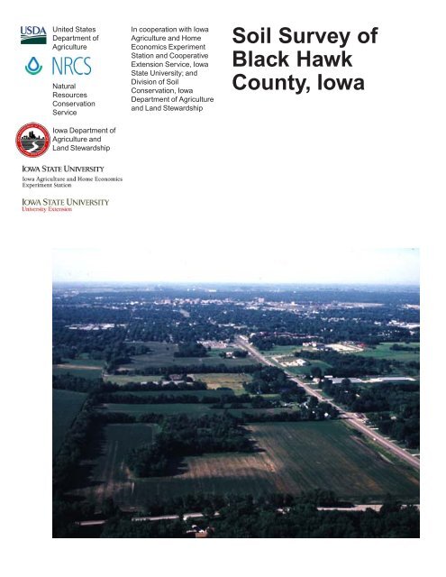
Cover: An aerial view <strong>of</strong> the Sparta-Finchford-Saude association in the Cedar River valley.<br />
Additional information about the Nation’s natural resources is available on the<br />
Natural Resources Conservation Service homepage on the World Wide Web. The<br />
address is http://www.nrcs.usda.gov.
Contents<br />
How To Use This <strong>Soil</strong> <strong>Survey</strong> .................................. i<br />
Foreword ................................................................ ix<br />
General Nature <strong>of</strong> the <strong>County</strong> ................................... 1<br />
History .................................................................. 1<br />
Industry ................................................................ 2<br />
Farming ................................................................ 2<br />
Transportation Facilities ........................................ 2<br />
Recreation ............................................................ 2<br />
Physiography, Drainage, and Geology .................. 2<br />
Climate ................................................................. 2<br />
How This <strong>Survey</strong> Was Made ..................................... 3<br />
General <strong>Soil</strong> Map Units .......................................... 5<br />
1. Dinsmore-Klingmore-Maxmore Association ... 5<br />
2. Dinsdale-Klinger-Maxfield Association ........... 6<br />
3. Kenyon-Clyde-Floyd Association ................... 7<br />
4. Readlyn-Tripoli Association ............................ 8<br />
5. Sparta-Finchford-Saude Association ............. 8<br />
6. Coland-Spillville Association .......................... 9<br />
7. Marquis-Clyde-Floyd Association................. 10<br />
Detailed <strong>Soil</strong> Map Units ........................................ 13<br />
7—Wiota silty clay loam, 0 to 2 percent<br />
slopes .......................................................... 14<br />
41—Sparta loamy fine sand, 0 to 2 percent<br />
slopes .......................................................... 14<br />
41B—Sparta loamy fine sand, 2 to 5 percent<br />
slopes .......................................................... 14<br />
41C—Sparta loamy fine sand, 5 to 9 percent<br />
slopes .......................................................... 14<br />
41D—Sparta loamy fine sand, 9 to 14 percent<br />
slopes .......................................................... 15<br />
63B—Chelsea loamy fine sand, 2 to 5 percent<br />
slopes .......................................................... 15<br />
63C—Chelsea loamy fine sand, 5 to 9 percent<br />
slopes .......................................................... 15<br />
63D—Chelsea loamy fine sand, 9 to 14<br />
percent slopes ............................................. 15<br />
83B—Kenyon loam, 2 to 5 percent slopes .......... 16<br />
83C—Kenyon loam, 5 to 9 percent slopes.......... 16<br />
83C2—Kenyon loam, 5 to 9 percent slopes,<br />
moderately eroded ....................................... 16<br />
83D2—Kenyon loam, 9 to 14 percent slopes,<br />
moderately eroded ....................................... 16<br />
84—Clyde silty clay loam, 0 to 3 percent<br />
slopes .......................................................... 17<br />
88—Nevin silty clay loam, 0 to 2 percent<br />
slopes .......................................................... 17<br />
133—Colo silty clay loam, 0 to 2 percent<br />
slopes, occasionally flooded ........................ 17<br />
135—Coland clay loam, 0 to 2 percent<br />
slopes, occasionally flooded ........................ 18<br />
159—Finchford loamy sand, 0 to 2 percent<br />
slopes .......................................................... 18<br />
159C—Finchford loamy sand, 2 to 9 percent<br />
slopes .......................................................... 18<br />
171B—Bassett loam, 2 to 5 percent slopes ........ 18<br />
175—Dickinson fine sandy loam, 0 to 2<br />
percent slopes ............................................. 19<br />
175B—Dickinson fine sandy loam, 2 to 5<br />
percent slopes ............................................. 19<br />
177—Saude loam, 0 to 2 percent slopes ............ 19<br />
177B—Saude loam, 2 to 5 percent slopes ......... 19<br />
178—Waukee loam, 0 to 2 percent slopes ......... 20<br />
178B—Waukee loam, 2 to 5 percent slopes ....... 20<br />
184—Klinger silty clay loam, 1 to 3 percent<br />
slopes .......................................................... 20<br />
198B—Floyd loam, 1 to 4 percent slopes ........... 20<br />
213B—Rockton loam, 30 to 40 inches to<br />
limestone, 2 to 5 percent slopes .................. 21<br />
221—Klossner muck, 1 to 3 percent slopes ....... 22<br />
284—Flagler sandy loam, 0 to 2 percent<br />
slopes .......................................................... 22<br />
284B—Flagler sandy loam, 2 to 5 percent<br />
slopes .......................................................... 22<br />
290—Dells silt loam, 0 to 2 percent slopes ......... 22<br />
354—Aquolls, ponded, 0 to 1 percent slopes ..... 23<br />
377B—Dinsdale silty clay loam, 2 to 5<br />
percent slopes ............................................. 23<br />
377C—Dinsdale silty clay loam, 5 to 9<br />
percent slopes ............................................. 23<br />
377C2—Dinsdale silty clay loam, 5 to 9<br />
percent slopes, moderately eroded .............. 23<br />
382—Maxfield silty clay loam, 0 to 2 percent<br />
slopes .......................................................... 24<br />
391B—Clyde-Floyd complex, 1 to 4 percent<br />
slopes .......................................................... 24<br />
395B—Marquis loam, 2 to 5 percent slopes ....... 24<br />
398—Tripoli clay loam, 0 to 2 percent slopes ..... 25<br />
399—Readlyn loam, 1 to 3 percent slopes ......... 25<br />
iii
iv<br />
408B—Olin fine sandy loam, 2 to 5 percent<br />
slopes .......................................................... 25<br />
408C—Olin fine sandy loam, 5 to 9 percent<br />
slopes .......................................................... 25<br />
412C—Emeline loam, 2 to 9 percent slopes....... 26<br />
426B—Aredale loam, 2 to 5 percent slopes ....... 26<br />
426C—Aredale loam, 5 to 9 percent slopes ....... 26<br />
426C2—Aredale loam, 5 to 9 percent slopes,<br />
moderately eroded ....................................... 27<br />
468B—Dunkerton sandy loam, 2 to 5 percent<br />
slopes .......................................................... 27<br />
468C—Dunkerton sandy loam, 5 to 9 percent<br />
slopes .......................................................... 27<br />
471—Oran loam, 1 to 3 percent slopes .............. 28<br />
485—Spillville loam, 0 to 2 percent slopes,<br />
occasionally flooded..................................... 28<br />
585—Spillville-Coland complex, 0 to 2 percent<br />
slopes, occasionally flooded ........................ 28<br />
626—Hayfield loam, 24 to 40 inches to sand<br />
and gravel, 0 to 2 percent slopes ................. 29<br />
761—Franklin silt loam, 1 to 3 percent slopes .... 29<br />
771B—Waubeek silt loam, 2 to 5 percent<br />
slopes .......................................................... 29<br />
775B—Billett sandy loam, 2 to 5 percent<br />
slopes .......................................................... 29<br />
776C—Lilah sandy loam, 2 to 9 percent<br />
slopes .......................................................... 30<br />
777—Wapsie loam, 1 to 3 percent slopes .......... 30<br />
781B—Lourdes loam, 2 to 5 percent slopes ....... 30<br />
781C2—Lourdes loam, 5 to 9 percent slopes,<br />
moderately eroded ....................................... 31<br />
782B—Donnan loam, 2 to 5 percent slopes ....... 31<br />
798—Protivin loam, 1 to 3 percent slopes .......... 31<br />
809B—Bertram fine sandy loam, 2 to 5<br />
percent slopes ............................................. 31<br />
877B—Dinsmore silty clay loam, 2 to 5<br />
percent slopes ............................................. 32<br />
884—Klingmore silty clay loam, 1 to 3 percent<br />
slopes .......................................................... 32<br />
911B—Colo-Ely complex, 2 to 5 percent<br />
slopes .......................................................... 32<br />
933—Sawmill silty clay loam, 0 to 2 percent<br />
slopes, occasionally flooded ........................ 33<br />
982—Maxmore silty clay loam, 0 to 2 percent<br />
slopes .......................................................... 33<br />
1152—Marshan clay loam, 24 to 40 inches to<br />
sand and gravel, 0 to 2 percent slopes......... 33<br />
1226—Lawler loam, 24 to 40 inches to sand<br />
and gravel, 0 to 2 percent slopes ................. 33<br />
1285G—Burkhardt-Bassett-Chelsea complex,<br />
18 to 60 percent slopes................................ 34<br />
1585—Spillville-Coland, channeled-Aquolls,<br />
ponded, complex, 0 to 2 percent slopes,<br />
frequently flooded ........................................ 34<br />
1586—Sigglekov-Fluvaquents, channeled-<br />
Aquents, ponded, complex, 0 to 2<br />
percent slopes, frequently flooded ............... 36<br />
4000—Urban land .............................................. 36<br />
4007—Wiota-Urban land complex, 0 to 2<br />
percent slopes ............................................. 36<br />
4041—Sparta-Urban land complex, 0 to 2<br />
percent slopes ............................................. 37<br />
4041B—Sparta-Urban land complex, 2 to 5<br />
percent slopes ............................................. 37<br />
4041C—Sparta-Urban land complex, 5 to 9<br />
percent slopes ............................................. 37<br />
4041D—Sparta-Urban land complex, 9 to 14<br />
percent slopes ............................................. 37<br />
4063B—Chelsea-Urban land complex, 2 to 5<br />
percent slopes ............................................. 38<br />
4063C—Chelsea-Urban land complex, 5 to 9<br />
percent slopes ............................................. 38<br />
4063D—Chelsea-Urban land complex, 9 to<br />
14 percent slopes ........................................ 38<br />
4083B—Kenyon-Urban land complex, 2 to 5<br />
percent slopes ............................................. 39<br />
4083C—Kenyon-Urban land complex, 5 to 9<br />
percent slopes ............................................. 39<br />
4083D—Kenyon-Urban land complex, 9 to 14<br />
percent slopes ............................................. 39<br />
4084—Clyde-Urban land complex, 0 to 3<br />
percent slopes ............................................. 40<br />
4088—Nevin-Urban land complex, 0 to 2<br />
percent slopes ............................................. 40<br />
4133—Colo, occasionally flooded-Urban land<br />
complex, 0 to 2 percent slopes .................... 41<br />
4135—Coland, occasionally flooded-Urban<br />
land complex, 0 to 2 percent slopes ............. 41<br />
4152—Marshan-Urban land complex, 0 to 2<br />
percent slopes ............................................. 41
4159—Finchford-Urban land complex, 0 to 2<br />
percent slopes ............................................. 42<br />
4159C—Finchford-Urban land complex, 2 to 9<br />
percent slopes ............................................. 42<br />
4171B—Bassett-Urban land complex, 2 to 5<br />
percent slopes ............................................. 42<br />
4171D—Bassett-Urban land complex, 5 to 14<br />
percent slopes ............................................. 43<br />
4175—Dickinson-Urban land complex, 0 to 2<br />
percent slopes ............................................. 43<br />
4175B—Dickinson-Urban land complex, 2 to 5<br />
percent slopes ............................................. 43<br />
4177—Saude-Urban land complex, 0 to 2<br />
percent slopes ............................................. 44<br />
4177B—Saude-Urban land complex, 2 to 5<br />
percent slopes ............................................. 44<br />
4178—Waukee-Urban land complex, 0 to 2<br />
percent slopes ............................................. 44<br />
4184—Klinger-Urban land complex, 1 to 3<br />
percent slopes ............................................. 45<br />
4198B—Floyd-Urban land complex, 1 to 4<br />
percent slopes ............................................. 45<br />
4226—Lawler-Urban land complex, 0 to 2<br />
percent slopes ............................................. 45<br />
4284—Flagler-Urban land complex, 0 to 2<br />
percent slopes ............................................. 46<br />
4284B—Flagler-Urban land complex, 2 to 5<br />
percent slopes ............................................. 46<br />
4377B—Dinsdale-Urban land complex, 2 to 5<br />
percent slopes ............................................. 46<br />
4377C—Dinsdale-Urban land complex, 5 to 9<br />
percent slopes ............................................. 47<br />
4382—Maxfield-Urban land complex, 0 to 2<br />
percent slopes ............................................. 47<br />
4391B—Clyde-Floyd-Urban land complex,<br />
1 to 4 percent slopes.................................... 47<br />
4398—Tripoli-Urban land complex, 0 to 2<br />
percent slopes ............................................. 48<br />
4399—Readlyn-Urban land complex, 1 to 3<br />
percent slopes ............................................. 48<br />
4408B—Olin-Urban land complex, 2 to 5<br />
percent slopes ............................................. 48<br />
4408C—Olin-Urban land complex, 5 to 9<br />
percent slopes ............................................. 49<br />
4426B—Aredale-Urban land complex, 2 to 5<br />
percent slopes ............................................. 49<br />
4426C—Aredale-Urban land complex, 5 to 9<br />
percent slopes ............................................. 50<br />
4585—Spillville, occasionally flooded-Coland,<br />
occasionally flooded-Urban land complex,<br />
0 to 2 percent slopes.................................... 50<br />
4761—Franklin-Urban land complex, 1 to 3<br />
percent slopes ............................................. 51<br />
4771B—Waubeek-Urban land complex, 2 to<br />
5 percent slopes .......................................... 51<br />
4771D—Waubeek-Urban land complex, 5 to<br />
14 percent slopes ........................................ 51<br />
4798—Protivin-Urban land complex, 1 to 3<br />
percent slopes ............................................. 52<br />
4911B—Colo-Ely-Urban land complex, 2 to 5<br />
percent slopes ............................................. 52<br />
4933—Sawmill, occasionally flooded-Urban<br />
land complex, 0 to 2 percent slopes ............. 53<br />
4946—Orthents-Urban land complex ................. 53<br />
5010—Pits, sand and gravel ............................... 53<br />
5030—Pits, limestone quarries ........................... 53<br />
5040—Orthents, loamy ...................................... 53<br />
5053—Psammaquents, frequently flooded ......... 53<br />
5080—Orthents, sanitary landfill ........................ 54<br />
AW—Animal waste ............................................. 54<br />
SL—Sewage lagoon ........................................... 54<br />
W—Water ........................................................... 54<br />
Use and Management <strong>of</strong> the <strong>Soil</strong>s ...................... 55<br />
Interpretive Ratings ............................................ 55<br />
Rating Class Terms ........................................ 55<br />
Numerical Ratings.......................................... 55<br />
Crops and Pasture ............................................. 55<br />
Cropland Management Considerations .......... 56<br />
Crop Yield Estimates ...................................... 57<br />
Pasture and Hayland Interpretations .............. 58<br />
Land Capability Classification ........................ 58<br />
Prime Farmland ............................................. 59<br />
Windbreaks and Environmental Plantings .......... 59<br />
Woodland Management and Productivity ........... 60<br />
Recreation .......................................................... 60<br />
Wildlife Habitat ................................................... 61<br />
Engineering ........................................................ 62<br />
Building Site Development ............................. 63<br />
v
vi<br />
Sanitary Facilities ........................................... 64<br />
Construction Materials ................................... 66<br />
Water Management........................................ 67<br />
Agricultural Waste Management ......................... 67<br />
<strong>Soil</strong> Properties ...................................................... 71<br />
Engineering Index Properties ............................. 71<br />
Physical Properties ............................................ 72<br />
Chemical Properties ........................................... 73<br />
Water Features ................................................... 74<br />
<strong>Soil</strong> Features ...................................................... 75<br />
Classification <strong>of</strong> the <strong>Soil</strong>s .................................... 77<br />
<strong>Soil</strong> Series and Their Morphology....................... 77<br />
Aredale Series ............................................... 77<br />
Atkinson Series .............................................. 78<br />
Bassett Series ................................................ 79<br />
Bertram Series ............................................... 80<br />
Billett Series ................................................... 81<br />
Burkhardt Series ............................................ 82<br />
Chelsea Series .............................................. 82<br />
Clyde Series .................................................. 83<br />
Coland Series ................................................ 83<br />
Colo Series .................................................... 84<br />
Dells Series .................................................... 84<br />
Dickinson Series ............................................ 85<br />
Dinsdale Series .............................................. 86<br />
Dinsmore Series ............................................ 87<br />
Donnan Series ............................................... 88<br />
Dunkerton Series ........................................... 88<br />
Ely Series....................................................... 89<br />
Emeline Series ............................................... 90<br />
Finchford Series ............................................. 90<br />
Flagler Series ................................................. 91<br />
Floyd Series ................................................... 91<br />
Franklin Series ............................................... 92<br />
Hayfield Series ............................................... 93<br />
Kenyon Series ................................................ 94<br />
Klinger Series ................................................ 95<br />
Klingmore Series............................................ 95<br />
Klossner Series .............................................. 96<br />
Lawler Series ................................................. 97<br />
Lilah Series .................................................... 97<br />
Lourdes Series ............................................... 98<br />
Marquis Series ............................................... 99<br />
Marshan Series ............................................ 100<br />
Maxfield Series ............................................ 100<br />
Maxmore Series ........................................... 101<br />
Nevin Series................................................. 102<br />
Olin Series ................................................... 103<br />
Oran Series .................................................. 103<br />
Protivin Series .............................................. 104<br />
Readlyn Series ............................................ 105<br />
Riceville Series ............................................ 106<br />
Rockton Series ............................................ 107<br />
Sattre Series ................................................ 107<br />
Saude Series ............................................... 108<br />
Sawmill Series ............................................. 109<br />
Sigglekov Series .......................................... 109<br />
Sparta Series ............................................... 110<br />
Spillville Series ............................................. 110<br />
Tripoli Series ................................................ 111<br />
Wapsie Series .............................................. 111<br />
Watseka Series ............................................ 112<br />
Waubeek Series ........................................... 113<br />
Waukee Series ............................................. 114<br />
Wiota Series ................................................ 114<br />
Formation <strong>of</strong> the <strong>Soil</strong>s ........................................ 117<br />
Climate ............................................................. 117<br />
Living Organisms ............................................. 117<br />
Topography....................................................... 117<br />
Parent Material ................................................. 118<br />
Time ................................................................. 119<br />
References .......................................................... 121<br />
Glossary .............................................................. 123<br />
Tables .................................................................. 139<br />
Table 1.—Temperature and Precipitation .......... 140<br />
Table 2.—Freeze Dates in Spring and Fall........ 141<br />
Table 3.—Growing Season ............................... 141<br />
Table 4.—Acreage and Proportionate Extent<br />
<strong>of</strong> the <strong>Soil</strong>s ................................................. 142<br />
Table 5.—Cropland Management<br />
Considerations ........................................... 145<br />
Table 6.—Land Capability, Corn Suitability<br />
Rating, Subsoil Phosphorus and<br />
Potassium, and Yields per Acre <strong>of</strong><br />
Crops ......................................................... 161<br />
Table 7.—Land Capability and Yields per<br />
Acre <strong>of</strong> Pasture .......................................... 172<br />
Table 8.—Prime Farmland ................................ 181<br />
Table 9.—Windbreaks and Environmental<br />
Plantings .................................................... 182
Table 10.—Forestland Productivity ................... 202<br />
Table 11a.—Recreational Development ............ 206<br />
Table 11b.—Recreational Development ............ 220<br />
Table 12.—Wildlife Habitat ................................ 233<br />
Table 13a.—Building Site Development ............ 243<br />
Table 13b.—Building Site Development ............ 257<br />
Table 14a.—Sanitary Facilities ......................... 274<br />
Table 14b.—Sanitary Facilities.......................... 292<br />
Table 15a.—Construction Materials .................. 308<br />
Table 15b.—Construction Materials .................. 322<br />
Table 16.—Water Management ........................ 341<br />
Issued 2006<br />
Table 17a.—Agricultural Waste<br />
Management .............................................. 356<br />
Table 17b.—Agricultural Waste<br />
Management .............................................. 378<br />
Table 18.—Engineering Index Properties ......... 400<br />
Table 19.—Physical Properties <strong>of</strong> the <strong>Soil</strong>s ...... 448<br />
Table 20.—Chemical Properties <strong>of</strong> the<br />
<strong>Soil</strong>s ........................................................... 466<br />
Table 21.—Water Features ............................... 485<br />
Table 22.—<strong>Soil</strong> Features .................................. 513<br />
Table 23.—Classification <strong>of</strong> the <strong>Soil</strong>s ................ 526<br />
vii
Foreword<br />
This soil survey contains information that affects land use planning in this survey<br />
area. It contains predictions <strong>of</strong> soil behavior for selected land uses. The survey also<br />
highlights soil limitations, improvements needed to overcome the limitations, and the<br />
impact <strong>of</strong> selected land uses on the environment.<br />
This soil survey is designed for many different users. Farmers, foresters, and<br />
agronomists can use it to evaluate the potential <strong>of</strong> the soil and the management needed<br />
for maximum food and fiber production. Planners, community <strong>of</strong>ficials, engineers,<br />
developers, builders, and home buyers can use the survey to plan land use, select sites<br />
for construction, and identify special practices needed to ensure proper performance.<br />
Conservationists, teachers, students, and specialists in recreation, wildlife<br />
management, waste disposal, and pollution control can use the survey to help them<br />
understand, protect, and enhance the environment.<br />
Various land use regulations <strong>of</strong> Federal, State, and local governments may impose<br />
special restrictions on land use or land treatment. The information in this report is<br />
intended to identify soil properties that are used in making various land use or land<br />
treatment decisions. Statements made in this report are intended to help the land users<br />
identify and reduce the effects <strong>of</strong> soil limitations on various land uses. The landowner or<br />
user is responsible for identifying and complying with existing laws and regulations.<br />
Great differences in soil properties can occur within short distances. Some soils are<br />
seasonally wet or subject to flooding. Some are shallow to bedrock. Some are too<br />
unstable to be used as a foundation for buildings or roads. Clayey or wet soils are<br />
poorly suited to use as septic tank absorption fields. A high water table makes a soil<br />
poorly suited to basements or underground installations.<br />
These and many other soil properties that affect land use are described in this soil<br />
survey. Broad areas <strong>of</strong> soils are shown on the general soil map. The location <strong>of</strong> each<br />
soil is shown on the detailed soil maps. Each soil in the survey area is described, and<br />
information on specific uses is given. Help in using this publication and additional<br />
information are available at the local <strong>of</strong>fice <strong>of</strong> the Natural Resources Conservation<br />
Service or the Cooperative Extension Service.<br />
Richard Van Klaveren<br />
State Conservationist<br />
Natural Resources Conservation Service<br />
ix
<strong>Soil</strong> <strong>Survey</strong> <strong>of</strong><br />
<strong>Black</strong> <strong>Hawk</strong> <strong>County</strong>, <strong>Iowa</strong><br />
BLACK HAWK COUNTY is in east-central <strong>Iowa</strong> (fig. 1). It<br />
is bordered on the north by Bremer <strong>County</strong>, on the<br />
south by Tama and Benton Counties, on the east by<br />
Buchanan <strong>County</strong>, and on the west by Butler and<br />
Grundy Counties. The county has an area <strong>of</strong> about<br />
366,600 acres, or approximately 573 square miles. In<br />
2000, the population <strong>of</strong> the county was 128,012 (U.S.<br />
Department <strong>of</strong> Commerce, 2000). Waterloo, the<br />
county seat, had a population <strong>of</strong> 68,747.<br />
About 72 percent <strong>of</strong> the county is cropland; 20<br />
percent is urban land; 5 percent is used for<br />
recreational activities; 2 percent is woodland; and 1<br />
percent is permanent pasture.<br />
This soil survey updates the survey <strong>of</strong> <strong>Black</strong> <strong>Hawk</strong><br />
<strong>County</strong> published in 1978 (Fouts and Highland, 1978).<br />
It provides additional information and has larger maps,<br />
which show the soils in greater detail.<br />
General Nature <strong>of</strong> the <strong>County</strong><br />
This section provides some general information<br />
about the survey area. It describes history; industry;<br />
farming; transportation facilities; recreation;<br />
physiography, drainage, and geology; and climate.<br />
History<br />
By Sam R. Steckly, Natural Resources Conservation Service<br />
Fieldwork by Leland D. Camp, Robert O. Didericksen, Joseph A. Falkenberg, and<br />
Sam R. Steckly, Natural Resources Conservation Service<br />
United States Department <strong>of</strong> Agriculture, Natural Resources Conservation Service,<br />
in cooperation with<br />
the <strong>Iowa</strong> Agriculture and Home Economics Experiment Station; the Cooperative<br />
Extension Service, <strong>Iowa</strong> State University; and the Division <strong>of</strong> <strong>Soil</strong> Conservation, <strong>Iowa</strong><br />
Department <strong>of</strong> Agriculture and Land Stewardship<br />
<strong>Black</strong> <strong>Hawk</strong> <strong>County</strong> was established in 1843. The<br />
Sauk and Fox (Meskwaki) tribes had lived here for<br />
many years, owning the area until 1837. The county<br />
was named after the renowned Sauk Chief <strong>Black</strong><br />
<strong>Hawk</strong>.<br />
Figure 1.—Location <strong>of</strong> <strong>Black</strong> <strong>Hawk</strong> <strong>County</strong> in <strong>Iowa</strong>.<br />
In 1845, the county was attached to Benton <strong>County</strong><br />
for judicial, election, and revenue purposes, and in<br />
1851 it was attached to Buchanan <strong>County</strong>. <strong>Black</strong> <strong>Hawk</strong><br />
<strong>County</strong> did not have its own government until 1853.<br />
One <strong>of</strong> the earliest Europeans to visit the survey<br />
area is believed to have been a Frenchman named<br />
Gervais Paul Somaneaux. He arrived during the spring<br />
<strong>of</strong> 1837, left during the winter, and returned about 10<br />
years later to settle in Cedar Falls, where he lived until<br />
his death in 1850 (Cedar Falls Historical Society).<br />
The first permanent white settlement in <strong>Black</strong> <strong>Hawk</strong><br />
<strong>County</strong> was started in March 1845 by William Sturgis<br />
and his brother-in-law, Erasmus D. Adams. They<br />
named their settlement Sturgis Falls. Sturgis built a<br />
1
2 <strong>Soil</strong> <strong>Survey</strong> <strong>of</strong><br />
double log cabin on the banks <strong>of</strong> the Red Cedar River<br />
and broke 5 acres <strong>of</strong> prairie. This was considered to<br />
be the first breaking <strong>of</strong> prairie land in the county. The<br />
name <strong>of</strong> Sturgis Falls was changed to Cedar Falls in<br />
1851.<br />
<strong>Black</strong> <strong>Hawk</strong> <strong>County</strong> has undergone a fundamental<br />
change from a strictly rural county to a predominantly<br />
urban county. By 1895, more than 50 percent <strong>of</strong> the<br />
population <strong>of</strong> the county lived in the Waterloo-Cedar<br />
Falls urban areas. In 2000, nearly 90 percent <strong>of</strong> the<br />
county’s population lived in urban areas that made up<br />
22 percent <strong>of</strong> the county’s land area (fig. 2).<br />
Industry<br />
Manufacturing is <strong>of</strong> major economic importance in<br />
<strong>Black</strong> <strong>Hawk</strong> <strong>County</strong>. In 1994, manufacturing made up<br />
33.4 percent <strong>of</strong> the earnings <strong>of</strong> employed persons, and<br />
farming accounted for only 1.5 percent.<br />
Farming<br />
In 2000, <strong>Black</strong> <strong>Hawk</strong> <strong>County</strong> had 264,700 acres <strong>of</strong><br />
farmland, according to the <strong>US</strong>DA National Agricultural<br />
Statistics Service. Corn and soybeans were grown on<br />
254,300 acres. The remaining agricultural acreage<br />
was used for hay, corn silage, or oats or was idle land.<br />
In recent years, the number <strong>of</strong> farms in the county<br />
has been decreasing and the average size <strong>of</strong> farms<br />
has been increasing. In 1999, the number <strong>of</strong> farms<br />
was 1,060 and the average size <strong>of</strong> farms was 285<br />
acres. The figures reported in 1993 were 1,160 farms<br />
with an average size <strong>of</strong> 262 acres.<br />
Transportation Facilities<br />
The major highways in <strong>Black</strong> <strong>Hawk</strong> <strong>County</strong> are U.S.<br />
Highway 218 and Interstate 380, which cross the<br />
county from northwest to southeast; U.S. Highway 20,<br />
which crosses from east to west; and U.S. Highway<br />
63, which crosses from north to south. All <strong>of</strong> these<br />
highways intersect in Waterloo. Hard surface state or<br />
county roads connect these highways to all <strong>of</strong> the<br />
other communities in the county. All farms are along<br />
hard surface highways and roads or gravel roads. The<br />
major hard surface county roads are well distributed<br />
throughout the county.<br />
One rail line provides railroad service to the<br />
communities <strong>of</strong> Waterloo, Cedar Falls, Dunkerton,<br />
LaPorte City, Hudson, and Raymond. The county has<br />
one municipal airport on the north end <strong>of</strong> Waterloo.<br />
Motor freight lines serve every trading center in the<br />
county.<br />
Recreation<br />
Many parks have been established throughout the<br />
county. These include <strong>Black</strong> <strong>Hawk</strong> Park, 1.5 miles<br />
north and 1 mile west <strong>of</strong> Cedar Falls; McFarlane Park,<br />
2.5 miles east <strong>of</strong> LaPorte City; Sigglekov Park, 4 miles<br />
north and 1 mile east <strong>of</strong> Dunkerton; Thunder Woman<br />
Park, 4 miles west and 1 mile south <strong>of</strong> Janesville;<br />
Washington Union Access, 4 miles north and 2 miles<br />
west <strong>of</strong> Cedar Falls; and Byron Sergeant Memorial<br />
Park, 1 mile northeast <strong>of</strong> Hudson. The small lakes and<br />
reservoirs, rivers, creeks, and wetlands in the county<br />
provide excellent potential for recreational activities,<br />
such as hunting, fishing, and canoeing.<br />
Physiography, Drainage, and Geology<br />
The topography in most <strong>of</strong> the county is<br />
characterized by long, gentle slopes with open views;<br />
slightly rounded ridges; and broad, nearly level valleys<br />
with unclear valley edges and well established low<br />
gradient drainageways. The Cedar River, the<br />
Wapsipinicon River, and <strong>Black</strong> <strong>Hawk</strong> Creek are the<br />
major drainage systems in the county.<br />
<strong>Black</strong> <strong>Hawk</strong> <strong>County</strong> is in Major Land Resource Area<br />
104, the <strong>Iowa</strong>n Erosional Surface. Erosion on a large<br />
scale is the key to the geological origins <strong>of</strong> the <strong>Iowa</strong>n<br />
Erosional Surface. The landscape was last glaciated in<br />
Pre-Illinoisian time (more than 150,000 years ago) and<br />
since has lain exposed to various episodes <strong>of</strong><br />
weathering and erosion. Extensive freeze-thaw action,<br />
massive dislodgement <strong>of</strong> loosened material,<br />
sheetwash <strong>of</strong> slopes, and violent winds were forms <strong>of</strong><br />
erosional scouring that took place throughout the cold<br />
but ice-free tundra-covered areas some 15,000 to<br />
20,000 years ago. The climatic conditions during this<br />
time wore down the landscape. The Pre-Illinoisian<br />
upland summits and divides were lowered, and only a<br />
small portion <strong>of</strong> the former landscapes remain in the<br />
form <strong>of</strong> a paleosol (Prior, 1991).<br />
Climate<br />
Table 1 gives data on temperature and precipitation<br />
for the survey area as recorded at Waterloo in the period<br />
1961 to 1990. Table 2 shows probable dates <strong>of</strong> the first<br />
freeze in fall and the last freeze in spring. Table 3<br />
provides data on the length <strong>of</strong> the growing season.
<strong>Black</strong> <strong>Hawk</strong> <strong>County</strong>, <strong>Iowa</strong> 3<br />
Figure 2.—An aerial view <strong>of</strong> Waterloo along the Cedar River showing some <strong>of</strong> the urban development that has taken place in the last<br />
150 years.<br />
In winter, the average temperature is 18 degrees F<br />
and the average daily minimum temperature is 9<br />
degrees F. In summer, the average temperature is 71<br />
degrees F and the average daily maximum<br />
temperature is 82 degrees F.<br />
Growing degrees days are shown in table 1. They<br />
are equivalent to “heat units.” During the month,<br />
growing degree days accumulate by the amount that<br />
the average temperature each day exceeds a base<br />
temperature (50 degrees F). The normal monthly<br />
accumulation is used to schedule single or successive<br />
plantings <strong>of</strong> a crop between the last freeze in spring<br />
and the first freeze in fall.<br />
The total annual precipitation is about 34 inches. Of<br />
this total, 24 inches, or more than 70 percent, usually<br />
falls in April through September. The growing season<br />
for most crops falls within this period. In 2 years out <strong>of</strong><br />
10, the rainfall in April through September is less than<br />
13 inches.<br />
The average seasonal snowfall is about 32 inches.<br />
On the average, 69 days <strong>of</strong> the year have at least 1<br />
inch <strong>of</strong> snow on the ground. The number <strong>of</strong> such days<br />
varies greatly from year to year.<br />
How This <strong>Survey</strong> Was Made<br />
This survey was made to provide updated<br />
information about the soils and miscellaneous areas in<br />
the survey area, which is a subset <strong>of</strong> Major Land<br />
Resource Area 104. Major land resource areas<br />
(MLRAs) are geographically associated land resource<br />
units that share a common land use, elevation and<br />
topography, climate, water, soils, and vegetation<br />
(<strong>US</strong>DA, 1981). Map unit design and the detailed soil<br />
descriptions are based on the occurrence <strong>of</strong> each soil<br />
throughout the MLRA. In some cases a soil may be<br />
referred to that does not occur in the <strong>Black</strong> <strong>Hawk</strong><br />
<strong>County</strong> survey area but that is representative <strong>of</strong> the<br />
MLRA.<br />
The information in this survey includes a description
4<br />
<strong>of</strong> the soils and miscellaneous areas and their location<br />
and a discussion <strong>of</strong> their properties and the<br />
subsequent effects on suitability, limitations, and<br />
management for specified uses. <strong>Soil</strong> scientists<br />
observed the steepness, length, and shape <strong>of</strong> the<br />
slopes; the general pattern <strong>of</strong> drainage; the kinds <strong>of</strong><br />
crops and native plants; and the kinds <strong>of</strong> bedrock.<br />
They dug many holes to study the soil pr<strong>of</strong>ile, which is<br />
the sequence <strong>of</strong> natural layers, or horizons, in a soil.<br />
The pr<strong>of</strong>ile extends from the surface down into the<br />
unconsolidated material in which the soil formed. The<br />
unconsolidated material is devoid <strong>of</strong> roots and other<br />
living organisms and has not been changed by other<br />
biological activity.<br />
The soils and miscellaneous areas in the survey<br />
area are in an orderly pattern that is related to the<br />
geology, landforms, relief, climate, and natural<br />
vegetation <strong>of</strong> the area. Each kind <strong>of</strong> soil and<br />
miscellaneous area is associated with a particular kind<br />
or segment <strong>of</strong> the landscape. By observing the soils<br />
and miscellaneous areas in the survey area and<br />
relating their position to specific segments <strong>of</strong> the<br />
landscape, soil scientists develop a concept, or model,<br />
<strong>of</strong> how the soils were formed. Thus, during mapping,<br />
this model enables the soil scientists to predict with a<br />
considerable degree <strong>of</strong> accuracy the kind <strong>of</strong> soil or<br />
miscellaneous area at a specific location on the<br />
landscape.<br />
Individual soils on the landscape commonly merge<br />
into one another as their characteristics gradually<br />
change. To construct an accurate map, however, soil<br />
scientists must determine the boundaries between the<br />
soils. They can observe only a limited number <strong>of</strong> soil<br />
pr<strong>of</strong>iles. Nevertheless, these observations,<br />
supplemented by an understanding <strong>of</strong> the soilvegetation-landscape<br />
relationship, are sufficient to<br />
verify predictions <strong>of</strong> the kinds <strong>of</strong> soil in an area and to<br />
determine the boundaries.<br />
<strong>Soil</strong> scientists recorded the characteristics <strong>of</strong> the<br />
soil pr<strong>of</strong>iles that they studied. They noted soil color,<br />
texture, size and shape <strong>of</strong> soil aggregates, kind and<br />
amount <strong>of</strong> rock fragments, distribution <strong>of</strong> plant roots,<br />
soil reaction, and other features that enable them to<br />
identify soils. After describing the soils in the survey<br />
area and determining their properties, the soil<br />
scientists assigned the soils to taxonomic classes<br />
(units). Taxonomic classes are concepts. Each<br />
taxonomic class has a set <strong>of</strong> soil characteristics with<br />
precisely defined limits. The classes are used as a<br />
basis for comparison to classify soils systematically.<br />
<strong>Soil</strong> taxonomy, the system <strong>of</strong> taxonomic classification<br />
used in the United States, is based mainly on the kind<br />
and character <strong>of</strong> soil properties and the arrangement<br />
<strong>of</strong> horizons within the pr<strong>of</strong>ile. After the soil scientists<br />
classified and named the soils in the survey area, they<br />
compared the individual soils with similar soils in the<br />
same taxonomic class in other areas so that they<br />
could confirm data and assemble additional data<br />
based on experience and research.<br />
While a soil survey is in progress, samples <strong>of</strong> some<br />
<strong>of</strong> the soils in the area generally are collected for<br />
laboratory analyses and for engineering tests. <strong>Soil</strong><br />
scientists interpret the data from these analyses and<br />
tests as well as the field-observed characteristics and<br />
the soil properties to determine the expected behavior<br />
<strong>of</strong> the soils under different uses. Interpretations for all<br />
<strong>of</strong> the soils are field tested through observation <strong>of</strong> the<br />
soils in different uses and under different levels <strong>of</strong><br />
management. Interpretations are modified as<br />
necessary to fit local conditions, and some new<br />
interpretations are developed to meet local needs.<br />
<strong>Data</strong> are assembled from other sources, such as<br />
research information, production records, and field<br />
experience <strong>of</strong> specialists. For example, data on crop<br />
yields under defined levels <strong>of</strong> management are<br />
assembled from farm records and from field or plot<br />
experiments on the same kinds <strong>of</strong> soil.<br />
Predictions about soil behavior are based not only<br />
on soil properties but also on such variables as<br />
climate and biological activity. <strong>Soil</strong> conditions are<br />
predictable over long periods <strong>of</strong> time, but they are not<br />
predictable from year to year. For example, soil<br />
scientists can predict with a fairly high degree <strong>of</strong><br />
accuracy that a given soil will have a water table within<br />
certain depths in most years, but they cannot predict<br />
that the water table will always be at a specific level in<br />
the soil on a specific date.<br />
After soil scientists located and identified the<br />
significant natural bodies <strong>of</strong> soil in the survey area,<br />
they drew the boundaries <strong>of</strong> these bodies on aerial<br />
photographs and identified each as a specific map<br />
unit. Aerial photographs show trees, buildings, fields,<br />
roads, and rivers, all <strong>of</strong> which help in locating<br />
boundaries accurately.<br />
The descriptions, names, and delineations <strong>of</strong> the<br />
soils in this survey may not fully agree with those <strong>of</strong><br />
the soils in adjacent survey areas. Differences are the<br />
result <strong>of</strong> an improved knowledge <strong>of</strong> soils, modifications<br />
in series concepts, or variations in the intensity <strong>of</strong><br />
mapping or in the extent <strong>of</strong> the soils in the survey<br />
areas.
General <strong>Soil</strong> Map Units<br />
The general soil map in this publication shows<br />
broad areas that have a distinctive pattern <strong>of</strong> soils,<br />
relief, and drainage. These broad areas are called<br />
associations. Each association on the general soil<br />
map is a unique natural landscape. Typically, it<br />
consists <strong>of</strong> one or more major soils or miscellaneous<br />
areas and some minor soils or miscellaneous areas. It<br />
is named for the major soils or miscellaneous areas.<br />
The components <strong>of</strong> one association can occur in<br />
another but in a different pattern.<br />
The general soil map can be used to compare the<br />
suitability <strong>of</strong> large areas for general land uses. Areas<br />
<strong>of</strong> suitable soils can be identified on the map. Likewise,<br />
areas where the soils are not suitable can be<br />
identified.<br />
Because <strong>of</strong> its small scale, the map is not suitable<br />
for planning the management <strong>of</strong> a farm or field or for<br />
selecting a site for a road or building or other structure.<br />
The soils in any one association differ from place to<br />
place in slope, depth, drainage, and other<br />
characteristics that affect management.<br />
1. Dinsmore-Klingmore-Maxmore<br />
Association<br />
Extent <strong>of</strong> the association in the survey area: 4 percent<br />
Component Description<br />
Dinsmore and similar soils<br />
Extent: 47 to 57 percent <strong>of</strong> the mapped areas<br />
Geomorphic setting: Uplands; hills<br />
Position on the landform: Summits<br />
Geomorphic component: Interfluves<br />
Slope range: 2 to 5 percent<br />
Depth to restrictive feature: Very deep (more than 60<br />
inches)<br />
Drainage class: Moderately well drained<br />
Parent material: Loess and the underlying glacial till<br />
Flooding: None<br />
Shallowest depth to wet zone: 4 feet (April)<br />
Deepest depth to wet zone: More than 6.7 feet<br />
(September)<br />
Ponding: None<br />
Available water capacity to a depth <strong>of</strong> 60 inches: 11.7<br />
inches<br />
Content <strong>of</strong> organic matter in the upper 10 inches: 3.3<br />
percent<br />
Klingmore and similar soils<br />
Extent: 16 to 26 percent <strong>of</strong> the mapped areas<br />
Geomorphic setting: Uplands; hills<br />
Position on the landform: Summits<br />
Geomorphic component: Interfluves<br />
Slope range: 1 to 3 percent<br />
Depth to restrictive feature: Very deep (more than 60<br />
inches)<br />
Drainage class: Somewhat poorly drained<br />
Parent material: Loess and the underlying glacial till<br />
Flooding: None<br />
Shallowest depth to wet zone: 1 foot (April)<br />
Deepest depth to wet zone: 4 feet (September)<br />
Ponding: None<br />
Available water capacity to a depth <strong>of</strong> 60 inches: 12.1<br />
inches<br />
Content <strong>of</strong> organic matter in the upper 10 inches: 5.3<br />
percent<br />
Maxmore and similar soils<br />
Extent: 14 to 24 percent <strong>of</strong> the mapped areas<br />
Geomorphic setting: Flats; uplands<br />
Position on the landform: Summits<br />
Geomorphic component: Interfluves<br />
Slope range: 0 to 2 percent<br />
Depth to restrictive feature: Very deep (more than 60<br />
inches)<br />
Drainage class: Poorly drained<br />
Parent material: Loess and the underlying glacial till<br />
Flooding: None<br />
Shallowest depth to wet zone: At the surface (April)<br />
Deepest depth to wet zone: 3 feet (September)<br />
Ponding: None<br />
Available water capacity to a depth <strong>of</strong> 60 inches: 11.9<br />
inches<br />
Content <strong>of</strong> organic matter in the upper 10 inches: 6.6<br />
percent<br />
5
6 <strong>Soil</strong> <strong>Survey</strong> <strong>of</strong><br />
Minor Dissimilar Components<br />
Sawmill and similar soils<br />
Extent: 3 to 13 percent <strong>of</strong> the mapped areas<br />
2. Dinsdale-Klinger-Maxfield<br />
Association (fig. 3)<br />
Extent <strong>of</strong> the association in the survey area: 11 percent<br />
Component Description<br />
Dinsdale and similar soils<br />
Extent: 38 to 48 percent <strong>of</strong> the mapped areas<br />
Geomorphic setting: Uplands; hills<br />
Position on the landform: Summits<br />
Geomorphic component: Interfluves<br />
Slope range: 2 to 9 percent<br />
Depth to restrictive feature: Very deep (more than 60<br />
inches)<br />
Drainage class: Moderately well drained<br />
Parent material: Loess and the underlying glacial till<br />
Flooding: None<br />
Shallowest depth to wet zone: 4 feet (April)<br />
Deepest depth to wet zone: More than 6.7 feet<br />
(September)<br />
Ponding: None<br />
Available water capacity to a depth <strong>of</strong> 60 inches: 11.6<br />
inches<br />
Content <strong>of</strong> organic matter in the upper 10 inches: 3.2<br />
percent<br />
Klinger and similar soils<br />
Extent: 16 to 26 percent <strong>of</strong> the mapped areas<br />
Geomorphic setting: Uplands; hills<br />
Position on the landform: Summits<br />
Geomorphic component: Interfluves<br />
Slope range: 1 to 3 percent<br />
Depth to restrictive feature: Very deep (more than 60<br />
inches)<br />
Drainage class: Somewhat poorly drained<br />
Parent material: Loess and the underlying glacial till<br />
Flooding: None<br />
Shallowest depth to wet zone: 1 foot (April)<br />
Deepest depth to wet zone: 4 feet (September)<br />
Ponding: None<br />
Figure 3.—Typical pattern <strong>of</strong> soils and parent material in the Dinsdale-Klinger-Maxfield association.
<strong>Black</strong> <strong>Hawk</strong> <strong>County</strong>, <strong>Iowa</strong> 7<br />
Available water capacity to a depth <strong>of</strong> 60 inches: 11.8<br />
inches<br />
Content <strong>of</strong> organic matter in the upper 10 inches: 5.4<br />
percent<br />
Maxfield and similar soils<br />
Extent: 11 to 21 percent <strong>of</strong> the mapped areas<br />
Geomorphic setting: Flats on uplands<br />
Position on the landform: Summits<br />
Slope range: 0 to 2 percent<br />
Depth to restrictive feature: Very deep (more than 60<br />
inches)<br />
Drainage class: Poorly drained<br />
Parent material: Loess and the underlying glacial till<br />
Flooding: None<br />
Shallowest depth to wet zone: At the surface (April)<br />
Deepest depth to wet zone: 3 feet (September)<br />
Ponding: None<br />
Available water capacity to a depth <strong>of</strong> 60 inches: 11.6<br />
inches<br />
Content <strong>of</strong> organic matter in the upper 10 inches: 6.4<br />
percent<br />
Minor Dissimilar Components<br />
Kenyon and similar soils<br />
Extent: 5 to 15 percent <strong>of</strong> the mapped areas<br />
Sawmill and similar soils<br />
Extent: 5 to 15 percent <strong>of</strong> the mapped areas<br />
3. Kenyon-Clyde-Floyd Association<br />
Extent <strong>of</strong> the association in the survey area: 34 percent<br />
Component Description<br />
Kenyon and similar soils<br />
Extent: 35 to 45 percent <strong>of</strong> the mapped areas<br />
Geomorphic setting: Hills; uplands<br />
Position on the landform: Summits<br />
Geomorphic component: Interfluves<br />
Slope range: 2 to 14 percent<br />
Depth to restrictive feature: Very deep (more than 60<br />
inches)<br />
Drainage class: Moderately well drained<br />
Parent material: Loamy sediments and the underlying<br />
glacial till<br />
Flooding: None<br />
Shallowest depth to wet zone: 4 feet (April)<br />
Deepest depth to wet zone: More than 6.7 feet<br />
(September)<br />
Ponding: None<br />
Available water capacity to a depth <strong>of</strong> 60 inches: 11.3<br />
inches<br />
Content <strong>of</strong> organic matter in the upper 10 inches: 3.3<br />
percent<br />
Clyde and similar soils<br />
Extent: 14 to 24 percent <strong>of</strong> the mapped areas<br />
Geomorphic setting: Drainageways on uplands<br />
Slope range: 0 to 3 percent<br />
Depth to restrictive feature: Very deep (more than 60<br />
inches)<br />
Drainage class: Poorly drained<br />
Parent material: Loamy sediments and the underlying<br />
glacial till<br />
Flooding: None<br />
Shallowest depth to wet zone: At the surface (April)<br />
Deepest depth to wet zone: 3 feet (September)<br />
Ponding: None<br />
Available water capacity to a depth <strong>of</strong> 60 inches: 11.7<br />
inches<br />
Content <strong>of</strong> organic matter in the upper 10 inches: 7<br />
percent<br />
Floyd and similar soils<br />
Extent: 12 to 22 percent <strong>of</strong> the mapped areas<br />
Geomorphic setting: Hills; uplands<br />
Position on the landform: Footslopes<br />
Geomorphic component: Base slopes<br />
Slope range: 1 to 4 percent<br />
Depth to restrictive feature: Very deep (more than 60<br />
inches)<br />
Drainage class: Somewhat poorly drained<br />
Parent material: Loamy sediments and the underlying<br />
glacial till<br />
Flooding: None<br />
Shallowest depth to wet zone: 1 foot (April)<br />
Deepest depth to wet zone: 4 feet (September)<br />
Ponding: None<br />
Available water capacity to a depth <strong>of</strong> 60 inches: 10.7<br />
inches<br />
Content <strong>of</strong> organic matter in the upper 10 inches: 5.2<br />
percent<br />
Minor Dissimilar Components<br />
Olin and similar soils<br />
Extent: 0 to 9 percent <strong>of</strong> the mapped areas<br />
Marquis and similar soils<br />
Extent: 0 to 9 percent <strong>of</strong> the mapped areas<br />
Sparta and similar soils<br />
Extent: 0 to 9 percent <strong>of</strong> the mapped areas
8 <strong>Soil</strong> <strong>Survey</strong> <strong>of</strong><br />
Klinger and similar soils<br />
Extent: 0 to 8 percent <strong>of</strong> the mapped areas<br />
Maxfield and similar soils<br />
Extent: 0 to 8 percent <strong>of</strong> the mapped areas<br />
Dinsdale and similar soils<br />
Extent: 0 to 8 percent <strong>of</strong> the mapped areas<br />
Sawmill and similar soils<br />
Extent: 0 to 8 percent <strong>of</strong> the mapped areas<br />
4. Readlyn-Tripoli Association<br />
Extent <strong>of</strong> the association in the survey area: 6 percent<br />
Component Description<br />
Readlyn and similar soils<br />
Extent: 51 to 61 percent <strong>of</strong> the mapped areas<br />
Geomorphic setting: Hills; uplands<br />
Position on the landform: Summits<br />
Geomorphic component: Interfluves<br />
Slope range: 1 to 3 percent<br />
Depth to restrictive feature: Very deep (more than 60<br />
inches)<br />
Drainage class: Somewhat poorly drained<br />
Parent material: Loamy sediments and the underlying<br />
glacial till<br />
Flooding: None<br />
Shallowest depth to wet zone: 1 foot (April)<br />
Deepest depth to wet zone: 4 feet (September)<br />
Ponding: None<br />
Available water capacity to a depth <strong>of</strong> 60 inches: 11.3<br />
inches<br />
Content <strong>of</strong> organic matter in the upper 10 inches: 4.7<br />
percent<br />
Tripoli and similar soils<br />
Extent: 31 to 41 percent <strong>of</strong> the mapped areas<br />
Geomorphic setting: Flats on uplands<br />
Position on the landform: Summits<br />
Slope range: 0 to 2 percent<br />
Depth to restrictive feature: Very deep (more than 60<br />
inches)<br />
Drainage class: Poorly drained<br />
Parent material: Loamy sediments and the underlying<br />
glacial till<br />
Flooding: None<br />
Shallowest depth to wet zone: At the surface (April)<br />
Deepest depth to wet zone: 3 feet (September)<br />
Ponding: None<br />
Available water capacity to a depth <strong>of</strong> 60 inches: 11.1<br />
inches<br />
Content <strong>of</strong> organic matter in the upper 10 inches: 6.4<br />
percent<br />
Minor Dissimilar Components<br />
Marquis and similar soils<br />
Extent: 0 to 10 percent <strong>of</strong> the mapped areas<br />
Kenyon and similar soils<br />
Extent: 0 to 8 percent <strong>of</strong> the mapped areas<br />
5. Sparta-Finchford-Saude Association<br />
Extent <strong>of</strong> the association in the survey area: 23<br />
percent<br />
Sparta and similar soils<br />
Component Description<br />
Extent: 17 to 27 percent <strong>of</strong> the mapped areas<br />
Geomorphic setting: Uplands; stream terraces<br />
Position on the landform: Summits<br />
Slope range: 0 to 9 percent<br />
Depth to restrictive feature: Very deep (more than 60<br />
inches)<br />
Drainage class: Excessively drained<br />
Parent material: Eolian sands<br />
Flooding: None<br />
Depth to wet zone: More than 6.7 feet all year<br />
Ponding: None<br />
Available water capacity to a depth <strong>of</strong> 60 inches: 4.7<br />
inches<br />
Content <strong>of</strong> organic matter in the upper 10 inches: 1.5<br />
percent<br />
Finchford and similar soils<br />
Extent: 16 to 26 percent <strong>of</strong> the mapped areas<br />
Geomorphic setting: Stream terraces<br />
Geomorphic component: Treads<br />
Slope range: 0 to 9 percent<br />
Depth to restrictive feature: Very deep (more than 60<br />
inches)<br />
Drainage class: Excessively drained<br />
Parent material: Alluvium<br />
Flooding: None<br />
Depth to wet zone: More than 6.7 feet all year<br />
Ponding: None<br />
Available water capacity to a depth <strong>of</strong> 60 inches: 3.5<br />
inches<br />
Content <strong>of</strong> organic matter in the upper 10 inches: 1.3<br />
percent
<strong>Black</strong> <strong>Hawk</strong> <strong>County</strong>, <strong>Iowa</strong> 9<br />
Saude and similar soils<br />
Extent: 13 to 23 percent <strong>of</strong> the mapped areas<br />
Geomorphic setting: Stream terraces<br />
Geomorphic component: Treads<br />
Slope range: 0 to 5 percent<br />
Depth to restrictive feature: Very deep (more than 60<br />
inches)<br />
Drainage class: Well drained<br />
Parent material: Alluvium<br />
Flooding: None<br />
Depth to wet zone: More than 6.7 feet all year<br />
Ponding: None<br />
Available water capacity to a depth <strong>of</strong> 60 inches: 6.5<br />
inches<br />
Content <strong>of</strong> organic matter in the upper 10 inches: 3.4<br />
percent<br />
Minor Dissimilar Components<br />
Marshan and similar soils<br />
Extent: 7 to 17 percent <strong>of</strong> the mapped areas<br />
Lawler and similar soils<br />
Extent: 4 to 14 percent <strong>of</strong> the mapped areas<br />
Spillville and similar soils<br />
Extent: 2 to 12 percent <strong>of</strong> the mapped areas<br />
Coland and similar soils<br />
Extent: 2 to 12 percent <strong>of</strong> the mapped areas<br />
Wiota and similar soils<br />
Extent: 0 to 9 percent <strong>of</strong> the mapped areas<br />
6. Coland-Spillville Association (fig. 4)<br />
Extent <strong>of</strong> the association in the survey area: 11<br />
percent<br />
Coland and similar soils<br />
Component Description<br />
Extent: 37 to 47 percent <strong>of</strong> the mapped areas<br />
Geomorphic setting: Flood plains<br />
Slope range: 0 to 2 percent<br />
Depth to restrictive feature: Very deep (more than 60<br />
inches)<br />
Drainage class: Poorly drained<br />
Parent material: Alluvium<br />
Months in which flooding does not occur: January,<br />
December<br />
Highest frequency <strong>of</strong> flooding: Occasional (February,<br />
March, April, May, June, July, August, September,<br />
October, November)<br />
Shallowest depth to wet zone: At the surface (April)<br />
Deepest depth to wet zone: 3 feet (September)<br />
Ponding: None<br />
Available water capacity to a depth <strong>of</strong> 60 inches: 11.4<br />
inches<br />
Content <strong>of</strong> organic matter in the upper 10 inches: 5.7<br />
percent<br />
Spillville and similar soils<br />
Extent: 23 to 33 percent <strong>of</strong> the mapped areas<br />
Geomorphic setting: Flood plains<br />
Slope range: 0 to 2 percent<br />
Depth to restrictive feature: Very deep (more than 60<br />
inches)<br />
Drainage class: Somewhat poorly drained<br />
Parent material: Alluvium<br />
Months in which flooding does not occur: January,<br />
December<br />
Highest frequency <strong>of</strong> flooding: Occasional (February,<br />
March, April, May, June, July, August, September,<br />
October, November)<br />
Shallowest depth to wet zone: 1 foot (April)<br />
Deepest depth to wet zone: 4 feet (September)<br />
Ponding: None<br />
Available water capacity to a depth <strong>of</strong> 60 inches: 11.8<br />
inches<br />
Content <strong>of</strong> organic matter in the upper 10 inches: 4.1<br />
percent<br />
Minor Dissimilar Components<br />
Sigglekov and similar soils<br />
Extent: 2 to 12 percent <strong>of</strong> the mapped areas<br />
Saude and similar soils<br />
Extent: 1 to 11 percent <strong>of</strong> the mapped areas<br />
Finchford and similar soils<br />
Extent: 0 to 10 percent <strong>of</strong> the mapped areas<br />
Nevin and similar soils<br />
Extent: 0 to 10 percent <strong>of</strong> the mapped areas<br />
Lawler and similar soils<br />
Extent: 0 to 8 percent <strong>of</strong> the mapped areas<br />
Sparta and similar soils<br />
Extent: 0 to 7 percent <strong>of</strong> the mapped areas<br />
Marshan and similar soils<br />
Extent: 0 to 7 percent <strong>of</strong> the mapped areas
10 <strong>Soil</strong> <strong>Survey</strong> <strong>of</strong><br />
7. Marquis-Clyde-Floyd Association<br />
(fig. 5)<br />
Extent <strong>of</strong> the association in the survey area: 11 percent<br />
Component Description<br />
Marquis and similar soils<br />
Figure 4.—Typical pattern <strong>of</strong> soils and parent material in the Coland-Spillville association.<br />
Extent: 43 to 53 percent <strong>of</strong> the mapped areas<br />
Geomorphic setting: Uplands; hills<br />
Position on the landform: Summits<br />
Geomorphic component: Interfluves<br />
Slope range: 2 to 5 percent<br />
Depth to restrictive feature: Very deep (more than 60<br />
inches)<br />
Drainage class: Moderately well drained<br />
Parent material: Loamy sediments and the underlying<br />
glacial till<br />
Flooding: None<br />
Shallowest depth to wet zone: 2 feet (April)<br />
Deepest depth to wet zone: 5 feet (September)<br />
Ponding: None<br />
Available water capacity to a depth <strong>of</strong> 60 inches: 11.3<br />
inches<br />
Content <strong>of</strong> organic matter in the upper 10 inches: 3.5<br />
percent<br />
Clyde and similar soils<br />
Extent: 18 to 28 percent <strong>of</strong> the mapped areas<br />
Geomorphic setting: Drainageways on uplands<br />
Slope range: 0 to 3 percent<br />
Depth to restrictive feature: Very deep (more than 60<br />
inches)<br />
Drainage class: Poorly drained<br />
Parent material: Loamy sediments and the underlying<br />
glacial till<br />
Flooding: None<br />
Shallowest depth to wet zone: At the surface (April)<br />
Deepest depth to wet zone: 3 feet (September)<br />
Ponding: None<br />
Available water capacity to a depth <strong>of</strong> 60 inches: 11.7<br />
inches<br />
Content <strong>of</strong> organic matter in the upper 10 inches: 7<br />
percent<br />
Floyd and similar soils<br />
Extent: 15 to 25 percent <strong>of</strong> the mapped areas<br />
Geomorphic setting: Hills; uplands
<strong>Black</strong> <strong>Hawk</strong> <strong>County</strong>, <strong>Iowa</strong> 11<br />
Position on the landform: Footslopes<br />
Geomorphic component: Base slopes<br />
Slope range: 1 to 4 percent<br />
Depth to restrictive feature: Very deep (more than 60<br />
inches)<br />
Drainage class: Somewhat poorly drained<br />
Parent material: Loamy sediments and the underlying<br />
glacial till<br />
Flooding: None<br />
Shallowest depth to wet zone: 1 foot (April)<br />
Deepest depth to wet zone: 4 feet (September)<br />
Ponding: None<br />
Available water capacity to a depth <strong>of</strong> 60 inches: 10.7<br />
inches<br />
Content <strong>of</strong> organic matter in the upper 10 inches: 5.2<br />
percent<br />
Minor Dissimilar Components<br />
Kenyon and similar soils<br />
Extent: 1 to 11 percent <strong>of</strong> the mapped areas<br />
Olin and similar soils<br />
Extent: 0 to 8 percent <strong>of</strong> the mapped areas<br />
Figure 5.—Typical pattern <strong>of</strong> soils and parent material in the Marquis-Clyde-Floyd association.
Detailed <strong>Soil</strong> Map Units<br />
The map units delineated on the detailed soil maps<br />
in this survey represent the soils or miscellaneous<br />
areas in the survey area. The map unit descriptions in<br />
this section, along with the maps, can be used to<br />
determine the suitability and potential <strong>of</strong> a unit for<br />
specific uses. They also can be used to plan the<br />
management needed for those uses.<br />
A map unit delineation on a soil map represents an<br />
area dominated by one or more major kinds <strong>of</strong> soil or<br />
miscellaneous areas. A map unit is identified and<br />
named according to the taxonomic classification <strong>of</strong> the<br />
dominant soils. Within a taxonomic class there are<br />
precisely defined limits for the properties <strong>of</strong> the soils.<br />
On the landscape, however, the soils are natural<br />
phenomena, and they have the characteristic<br />
variability <strong>of</strong> all natural phenomena. Thus, the range <strong>of</strong><br />
some observed properties may extend beyond the<br />
limits defined for a taxonomic class. Areas <strong>of</strong> soils <strong>of</strong> a<br />
single taxonomic class rarely, if ever, can be mapped<br />
without including areas <strong>of</strong> other taxonomic classes.<br />
Consequently, every map unit is made up <strong>of</strong> the soils<br />
or miscellaneous areas for which it is named and<br />
some minor components that belong to taxonomic<br />
classes other than those <strong>of</strong> the major soils.<br />
Most minor soils have properties similar to those <strong>of</strong><br />
the dominant soil or soils in the map unit, and thus<br />
they do not affect use and management. These are<br />
called noncontrasting, or similar, components. They<br />
may or may not be mentioned in a particular map unit<br />
description. Other minor components, however, have<br />
properties and behavioral characteristics divergent<br />
enough to affect use or to require different<br />
management. These are called contrasting, or<br />
dissimilar, components. They generally are in small<br />
areas and could not be mapped separately because <strong>of</strong><br />
the scale used. Some small areas <strong>of</strong> strongly<br />
contrasting soils or miscellaneous areas are identified<br />
by a special symbol on the maps. The contrasting<br />
components are mentioned in the map unit<br />
descriptions. A few areas <strong>of</strong> minor components may<br />
not have been observed, and consequently they are<br />
not mentioned in the descriptions, especially where<br />
the pattern was so complex that it was impractical to<br />
13<br />
make enough observations to identify all the soils and<br />
miscellaneous areas on the landscape.<br />
The presence <strong>of</strong> minor components in a map unit in<br />
no way diminishes the usefulness or accuracy <strong>of</strong> the<br />
data. The objective <strong>of</strong> mapping is not to delineate pure<br />
taxonomic classes but rather to separate the<br />
landscape into landforms or landform segments that<br />
have similar use and management requirements. The<br />
delineation <strong>of</strong> such segments on the map provides<br />
sufficient information for the development <strong>of</strong> resource<br />
plans. If intensive use <strong>of</strong> small areas is planned,<br />
however, onsite investigation is needed to define and<br />
locate the soils and miscellaneous areas.<br />
An identifying symbol precedes the map unit name<br />
in the map unit descriptions. Each description includes<br />
general facts about the unit and gives the principal<br />
hazards and limitations to be considered in planning<br />
for specific uses.<br />
<strong>Soil</strong>s that have pr<strong>of</strong>iles that are almost alike make<br />
up a soil series. Except for differences in texture <strong>of</strong> the<br />
surface layer, all the soils <strong>of</strong> a series have major<br />
horizons that are similar in composition, thickness,<br />
and arrangement.<br />
<strong>Soil</strong>s <strong>of</strong> one series can differ in texture <strong>of</strong> the<br />
surface layer, slope, stoniness, salinity, degree <strong>of</strong><br />
erosion, and other characteristics that affect their use.<br />
On the basis <strong>of</strong> such differences, a soil series is<br />
divided into soil phases. Most <strong>of</strong> the areas shown on<br />
the detailed soil maps are phases <strong>of</strong> soil series. The<br />
name <strong>of</strong> a soil phase commonly indicates a feature<br />
that affects use or management. For example, Kenyon<br />
loam, 2 to 5 percent slopes, is a phase <strong>of</strong> the Kenyon<br />
series.<br />
Some map units are made up <strong>of</strong> two or more major<br />
soils or miscellaneous areas. These map units are<br />
called complexes. A complex consists <strong>of</strong> two or more<br />
soils or miscellaneous areas in such an intricate<br />
pattern or in such small areas that they cannot be<br />
shown separately on the maps. The pattern and<br />
proportion <strong>of</strong> the soils or miscellaneous areas are<br />
somewhat similar in all areas. Spillville-Coland<br />
complex, 0 to 2 percent slopes, occasionally flooded,<br />
is an example.
14 <strong>Soil</strong> <strong>Survey</strong> <strong>of</strong><br />
This survey includes miscellaneous areas. Such<br />
areas have little or no soil material and support little or<br />
no vegetation. Pits, sand and gravel, is an example.<br />
Table 4 gives the acreage and proportionate extent<br />
<strong>of</strong> each map unit. Other tables give properties <strong>of</strong> the<br />
soils and the limitations, capabilities, and potentials for<br />
many uses. The Glossary defines many <strong>of</strong> the terms<br />
used in describing the soils or miscellaneous areas.<br />
7—Wiota silty clay loam, 0 to 2 percent<br />
slopes<br />
Wiota and similar soils<br />
Component Description<br />
Extent: 70 to 90 percent <strong>of</strong> the mapped areas<br />
Geomorphic setting: Stream terraces<br />
Geomorphic component: Treads<br />
Slope range: 0 to 2 percent<br />
Depth to restrictive feature: Very deep (more than 60<br />
inches)<br />
Drainage class: Well drained<br />
Parent material: Alluvium<br />
Flooding: None<br />
Depth to wet zone: More than 6.7 feet all year<br />
Ponding: None<br />
Available water capacity to a depth <strong>of</strong> 60 inches: 11.4<br />
inches<br />
Content <strong>of</strong> organic matter in the upper 10 inches: 3.6<br />
percent<br />
Minor Dissimilar Components<br />
Nevin and similar soils<br />
Extent: 0 to 20 percent <strong>of</strong> the mapped areas<br />
Waukee and similar soils<br />
Extent: 0 to 20 percent <strong>of</strong> the mapped areas<br />
41—Sparta loamy fine sand, 0 to 2<br />
percent slopes<br />
Sparta and similar soils<br />
Component Description<br />
Extent: 80 to 100 percent <strong>of</strong> the mapped areas<br />
Geomorphic setting: Stream terraces<br />
Geomorphic component: Treads<br />
Slope range: 0 to 2 percent<br />
Depth to restrictive feature: Very deep (more than 60<br />
inches)<br />
Drainage class: Excessively drained<br />
Parent material: Eolian sands<br />
Flooding: None<br />
Depth to wet zone: More than 6.7 feet all year<br />
Ponding: None<br />
Available water capacity to a depth <strong>of</strong> 60 inches: 4.7<br />
inches<br />
Content <strong>of</strong> organic matter in the upper 10 inches: 1.5<br />
percent<br />
Minor Dissimilar Components<br />
Watseka and similar soils<br />
Extent: 0 to 20 percent <strong>of</strong> the mapped areas<br />
41B—Sparta loamy fine sand, 2 to 5<br />
percent slopes<br />
Sparta and similar soils<br />
Component Description<br />
Extent: 100 percent <strong>of</strong> the map unit<br />
Geomorphic setting: Uplands; stream terraces<br />
Position on the landform: Summits<br />
Slope range: 2 to 5 percent<br />
Depth to restrictive feature: Very deep (more than 60<br />
inches)<br />
Drainage class: Excessively drained<br />
Parent material: Eolian sands<br />
Flooding: None<br />
Depth to wet zone: More than 6.7 feet all year<br />
Ponding: None<br />
Available water capacity to a depth <strong>of</strong> 60 inches: 4.7<br />
inches<br />
Content <strong>of</strong> organic matter in the upper 10 inches: 1.5<br />
percent<br />
41C—Sparta loamy fine sand, 5 to 9<br />
percent slopes<br />
Sparta and similar soils<br />
Component Description<br />
Extent: 100 percent <strong>of</strong> the map unit<br />
Geomorphic setting: Hillsides; uplands<br />
Position on the landform: Shoulders, backslopes<br />
Geomorphic component: Interfluves<br />
Slope range: 5 to 9 percent<br />
Depth to restrictive feature: Very deep (more than 60<br />
inches)<br />
Drainage class: Excessively drained<br />
Parent material: Eolian sands<br />
Flooding: None<br />
Depth to wet zone: More than 6.7 feet all year<br />
Ponding: None
<strong>Black</strong> <strong>Hawk</strong> <strong>County</strong>, <strong>Iowa</strong> 15<br />
Available water capacity to a depth <strong>of</strong> 60 inches: 4.7<br />
inches<br />
Content <strong>of</strong> organic matter in the upper 10 inches: 1.4<br />
percent<br />
41D—Sparta loamy fine sand, 9 to 14<br />
percent slopes<br />
Sparta and similar soils<br />
Component Description<br />
Extent: 100 percent <strong>of</strong> the map unit<br />
Geomorphic setting: Hillsides; uplands<br />
Position on the landform: Backslopes<br />
Geomorphic component: Side slopes<br />
Slope range: 9 to 14 percent<br />
Depth to restrictive feature: Very deep (more than 60<br />
inches)<br />
Drainage class: Excessively drained<br />
Parent material: Eolian sands<br />
Flooding: None<br />
Depth to wet zone: More than 6.7 feet all year<br />
Ponding: None<br />
Available water capacity to a depth <strong>of</strong> 60 inches: 4.6<br />
inches<br />
Content <strong>of</strong> organic matter in the upper 10 inches: 1.4<br />
percent<br />
63B—Chelsea loamy fine sand, 2 to 5<br />
percent slopes<br />
Component Description<br />
Chelsea and similar soils<br />
Extent: 85 to 95 percent <strong>of</strong> the mapped areas<br />
Geomorphic setting: Stream terraces; uplands<br />
Position on the landform: Summits<br />
Slope range: 2 to 5 percent<br />
Depth to restrictive feature: Very deep (more than 60<br />
inches)<br />
Drainage class: Excessively drained<br />
Parent material: Eolian sands<br />
Flooding: None<br />
Depth to wet zone: More than 6.7 feet all year<br />
Ponding: None<br />
Available water capacity to a depth <strong>of</strong> 60 inches: 4.7<br />
inches<br />
Content <strong>of</strong> organic matter in the upper 10 inches: 0.9<br />
percent<br />
Minor Dissimilar Components<br />
Billett and similar soils<br />
Extent: 5 to 15 percent <strong>of</strong> the mapped areas<br />
63C—Chelsea loamy fine sand, 5 to 9<br />
percent slopes<br />
Component Description<br />
Chelsea and similar soils<br />
Extent: 80 to 90 percent <strong>of</strong> the mapped areas<br />
Geomorphic setting: Uplands; hillsides<br />
Position on the landform: Shoulders, backslopes<br />
Geomorphic component: Interfluves<br />
Slope range: 5 to 9 percent<br />
Depth to restrictive feature: Very deep (more than 60<br />
inches)<br />
Drainage class: Excessively drained<br />
Parent material: Eolian sands<br />
Flooding: None<br />
Depth to wet zone: More than 6.7 feet all year<br />
Ponding: None<br />
Available water capacity to a depth <strong>of</strong> 60 inches: 4.7<br />
inches<br />
Content <strong>of</strong> organic matter in the upper 10 inches: 0.9<br />
percent<br />
Minor Dissimilar Components<br />
Billett and similar soils<br />
Extent: 10 to 20 percent <strong>of</strong> the mapped areas<br />
63D—Chelsea loamy fine sand, 9 to 14<br />
percent slopes<br />
Component Description<br />
Chelsea and similar soils<br />
Extent: 85 to 95 percent <strong>of</strong> the mapped areas<br />
Geomorphic setting: Hillsides; uplands<br />
Position on the landform: Backslopes<br />
Geomorphic component: Side slopes<br />
Slope range: 9 to 14 percent<br />
Depth to restrictive feature: Very deep (more than 60<br />
inches)<br />
Drainage class: Excessively drained<br />
Parent material: Eolian sands<br />
Flooding: None<br />
Depth to wet zone: More than 6.7 feet all year<br />
Ponding: None<br />
Available water capacity to a depth <strong>of</strong> 60 inches: 4.7<br />
inches<br />
Content <strong>of</strong> organic matter in the upper 10 inches: 0.9<br />
percent<br />
Minor Dissimilar Components<br />
Billett and similar soils<br />
Extent: 5 to 15 percent <strong>of</strong> the mapped areas
16 <strong>Soil</strong> <strong>Survey</strong> <strong>of</strong><br />
83B—Kenyon loam, 2 to 5 percent slopes<br />
Component Description<br />
Kenyon and similar soils<br />
Extent: 80 to 100 percent <strong>of</strong> the mapped areas<br />
Geomorphic setting: Uplands; hills<br />
Position on the landform: Summits<br />
Geomorphic component: Interfluves<br />
Slope range: 2 to 5 percent<br />
Depth to restrictive feature: Very deep (more than 60<br />
inches)<br />
Drainage class: Moderately well drained<br />
Parent material: Loamy sediments and the underlying<br />
glacial till<br />
Flooding: None<br />
Shallowest depth to wet zone: 4 feet (April)<br />
Deepest depth to wet zone: More than 6.7 feet<br />
(September)<br />
Ponding: None<br />
Available water capacity to a depth <strong>of</strong> 60 inches: 11.3<br />
inches<br />
Content <strong>of</strong> organic matter in the upper 10 inches: 3.3<br />
percent<br />
Minor Dissimilar Components<br />
Aredale and similar soils<br />
Extent: 0 to 20 percent <strong>of</strong> the mapped areas<br />
83C—Kenyon loam, 5 to 9 percent slopes<br />
Component Description<br />
Kenyon and similar soils<br />
Extent: 70 to 90 percent <strong>of</strong> the mapped areas<br />
Geomorphic setting: Uplands; hillsides<br />
Position on the landform: Shoulders, backslopes<br />
Geomorphic component: Interfluves<br />
Slope range: 5 to 9 percent<br />
Depth to restrictive feature: Very deep (more than 60<br />
inches)<br />
Drainage class: Moderately well drained<br />
Parent material: Loamy sediments and the underlying<br />
glacial till<br />
Flooding: None<br />
Shallowest depth to wet zone: 4 feet (April)<br />
Deepest depth to wet zone: More than 6.7 feet<br />
(September)<br />
Ponding: None<br />
Available water capacity to a depth <strong>of</strong> 60 inches: 11.3<br />
inches<br />
Content <strong>of</strong> organic matter in the upper 10 inches: 3.3<br />
percent<br />
Minor Dissimilar Components<br />
Kenyon, moderately eroded, and similar soils<br />
Extent: 0 to 20 percent <strong>of</strong> the mapped areas<br />
Aredale and similar soils<br />
Extent: 0 to 20 percent <strong>of</strong> the mapped areas<br />
83C2—Kenyon loam, 5 to 9 percent<br />
slopes, moderately eroded<br />
Component Description<br />
Kenyon, moderately eroded, and similar soils<br />
Extent: 65 to 85 percent <strong>of</strong> the mapped areas<br />
Geomorphic setting: Uplands; hillsides<br />
Position on the landform: Backslopes, shoulders<br />
Geomorphic component: Interfluves<br />
Slope range: 5 to 9 percent<br />
Depth to restrictive feature: Very deep (more than 60<br />
inches)<br />
Drainage class: Moderately well drained<br />
Parent material: Loamy sediments and the underlying<br />
glacial till<br />
Flooding: None<br />
Shallowest depth to wet zone: 4 feet (April)<br />
Deepest depth to wet zone: More than 6.7 feet<br />
(September)<br />
Ponding: None<br />
Available water capacity to a depth <strong>of</strong> 60 inches: 11.2<br />
inches<br />
Content <strong>of</strong> organic matter in the upper 10 inches: 2.4<br />
percent<br />
Minor Dissimilar Components<br />
Aredale, moderately eroded, and similar soils<br />
Extent: 5 to 25 percent <strong>of</strong> the mapped areas<br />
Kenyon and similar soils<br />
Extent: 0 to 20 percent <strong>of</strong> the mapped areas<br />
83D2—Kenyon loam, 9 to 14 percent<br />
slopes, moderately eroded<br />
Component Description<br />
Kenyon, moderately eroded, and similar soils<br />
Extent: 80 to 100 percent <strong>of</strong> the mapped areas<br />
Geomorphic setting: Uplands; hillsides<br />
Position on the landform: Backslopes<br />
Geomorphic component: Side slopes<br />
Slope range: 9 to 14 percent
<strong>Black</strong> <strong>Hawk</strong> <strong>County</strong>, <strong>Iowa</strong> 17<br />
Depth to restrictive feature: More than 60 inches<br />
Drainage class: Moderately well drained<br />
Parent material: Loamy sediments and the underlying<br />
glacial till<br />
Flooding: None<br />
Shallowest depth to wet zone: 4 feet (April)<br />
Deepest depth to wet zone: More than 6.7 feet<br />
(September)<br />
Ponding: None<br />
Available water capacity to a depth <strong>of</strong> 60 inches: 11.2<br />
inches<br />
Content <strong>of</strong> organic matter in the upper 10 inches: 2.4<br />
percent<br />
Minor Dissimilar Components<br />
Kenyon and similar soils<br />
Extent: 0 to 20 percent <strong>of</strong> the mapped areas<br />
84—Clyde silty clay loam, 0 to 3 percent<br />
slopes<br />
Clyde and similar soils<br />
Component Description<br />
Extent: 75 to 95 percent <strong>of</strong> the mapped areas<br />
Geomorphic setting: Drainageways on uplands<br />
Slope range: 0 to 3 percent<br />
Depth to restrictive feature: Very deep (more than 60<br />
inches)<br />
Drainage class: Poorly drained<br />
Parent material: Loamy sediments and the underlying<br />
glacial till<br />
Flooding: None<br />
Shallowest depth to wet zone: At the surface (April)<br />
Deepest depth to wet zone: 3 feet (September)<br />
Ponding: None<br />
Available water capacity to a depth <strong>of</strong> 60 inches: 11.7<br />
inches<br />
Content <strong>of</strong> organic matter in the upper 10 inches: 7<br />
percent<br />
Minor Dissimilar Components<br />
Floyd and similar soils<br />
Extent: 5 to 25 percent <strong>of</strong> the mapped areas<br />
88—Nevin silty clay loam, 0 to 2 percent<br />
slopes<br />
Nevin and similar soils<br />
Component Description<br />
Extent: 60 to 80 percent <strong>of</strong> the mapped areas<br />
Geomorphic setting: Stream terraces<br />
Geomorphic component: Treads<br />
Slope range: 0 to 2 percent<br />
Depth to restrictive feature: Very deep (more than 60<br />
inches)<br />
Drainage class: Somewhat poorly drained<br />
Parent material: Alluvium<br />
Months in which flooding does not occur: January,<br />
February, December<br />
Highest frequency <strong>of</strong> flooding: Rare (March, April, May,<br />
June, July, August,<br />
September, October, November)<br />
Shallowest depth to wet zone: 1 foot (April)<br />
Deepest depth to wet zone: 4 feet (September)<br />
Ponding: None<br />
Available water capacity to a depth <strong>of</strong> 60 inches: 12.1<br />
inches<br />
Content <strong>of</strong> organic matter in the upper 10 inches: 4.6<br />
percent<br />
Minor Dissimilar Components<br />
Wiota and similar soils<br />
Extent: 10 to 30 percent <strong>of</strong> the mapped areas<br />
Colo, occasionally flooded, and similar soils<br />
Extent: 0 to 20 percent <strong>of</strong> the mapped areas<br />
133—Colo silty clay loam, 0 to 2 percent<br />
slopes, occasionally flooded<br />
Component Description<br />
Colo, occasionally flooded, and similar soils<br />
Extent: 100 percent <strong>of</strong> the mapped areas<br />
Geomorphic setting: Flood plains<br />
Slope range: 0 to 2 percent<br />
Depth to restrictive feature: Very deep (more than 60<br />
inches)<br />
Drainage class: Poorly drained<br />
Parent material: Alluvium<br />
Months in which flooding does not occur: January,<br />
December<br />
Highest frequency <strong>of</strong> flooding: Occasional (February,<br />
March, April, May,<br />
June, July, August, September, October, November)<br />
Shallowest depth to wet zone: At the surface (April)<br />
Deepest depth to wet zone: 3 feet (September)<br />
Ponding: None<br />
Available water capacity to a depth <strong>of</strong> 60 inches: 12.6<br />
inches<br />
Content <strong>of</strong> organic matter in the upper 10 inches: 5.7<br />
percent
18 <strong>Soil</strong> <strong>Survey</strong> <strong>of</strong><br />
135—Coland clay loam, 0 to 2 percent<br />
slopes, occasionally flooded<br />
Component Description<br />
Coland, occasionally flooded, and similar soils<br />
Extent: 100 percent <strong>of</strong> the map unit<br />
Geomorphic setting: Flood plains<br />
Slope range: 0 to 2 percent<br />
Depth to restrictive feature: Very deep (more than 60<br />
inches)<br />
Drainage class: Poorly drained<br />
Parent material: Alluvium<br />
Months in which flooding does not occur: January,<br />
December<br />
Highest frequency <strong>of</strong> flooding: Occasional (February,<br />
March, April, May, June, July, August, September,<br />
October, November)<br />
Shallowest depth to wet zone: At the surface (April)<br />
Deepest depth to wet zone: 3 feet (September)<br />
Ponding: None<br />
Available water capacity to a depth <strong>of</strong> 60 inches: 11.4<br />
inches<br />
Content <strong>of</strong> organic matter in the upper 10 inches: 5.7<br />
percent<br />
159—Finchford loamy sand, 0 to 2 percent<br />
slopes<br />
Component Description<br />
Finchford and similar soils<br />
Extent: 80 to 100 percent <strong>of</strong> the mapped areas<br />
Geomorphic setting: Stream terraces<br />
Geomorphic component: Treads<br />
Slope range: 0 to 2 percent<br />
Depth to restrictive feature: Very deep (more than 60<br />
inches)<br />
Drainage class: Excessively drained<br />
Parent material: Alluvium<br />
Flooding: None<br />
Depth to wet zone: More than 6.7 feet all year<br />
Ponding: None<br />
Available water capacity to a depth <strong>of</strong> 60 inches: 3.5<br />
inches<br />
Content <strong>of</strong> organic matter in the upper 10 inches: 1.3<br />
percent<br />
Minor Dissimilar Components<br />
Flagler and similar soils<br />
Extent: 0 to 20 percent <strong>of</strong> the mapped areas<br />
159C—Finchford loamy sand, 2 to 9<br />
percent slopes<br />
Component Description<br />
Finchford and similar soils<br />
Extent: 100 percent <strong>of</strong> the map unit<br />
Geomorphic setting: Stream terraces<br />
Geomorphic component: Risers<br />
Slope range: 2 to 9 percent<br />
Depth to restrictive feature: Very deep (more than 60<br />
inches)<br />
Drainage class: Excessively drained<br />
Parent material: Alluvium<br />
Flooding: None<br />
Depth to wet zone: More than 6.7 feet all year<br />
Ponding: None<br />
Available water capacity to a depth <strong>of</strong> 60 inches: 3.2<br />
inches<br />
Content <strong>of</strong> organic matter in the upper 10 inches: 1.3<br />
percent<br />
171B—Bassett loam, 2 to 5 percent<br />
slopes<br />
Component Description<br />
Bassett and similar soils<br />
Extent: 80 to 100 percent <strong>of</strong> the mapped areas<br />
Geomorphic setting: Hills; uplands<br />
Position on the landform: Summits<br />
Geomorphic component: Interfluves<br />
Slope range: 2 to 5 percent<br />
Depth to restrictive feature: Very deep (more than 60<br />
inches)<br />
Drainage class: Moderately well drained<br />
Parent material: Loamy sediments and the underlying<br />
glacial till<br />
Flooding: None<br />
Shallowest depth to wet zone: 2 feet (April)<br />
Deepest depth to wet zone: 5 feet (September)<br />
Ponding: None<br />
Available water capacity to a depth <strong>of</strong> 60 inches: 11.1<br />
inches<br />
Content <strong>of</strong> organic matter in the upper 10 inches: 2.5<br />
percent<br />
Minor Dissimilar Components<br />
Kenyon and similar soils<br />
Extent: 0 to 20 percent <strong>of</strong> the mapped areas
<strong>Black</strong> <strong>Hawk</strong> <strong>County</strong>, <strong>Iowa</strong> 19<br />
175—Dickinson fine sandy loam, 0 to 2<br />
percent slopes<br />
Component Description<br />
Dickinson and similar soils<br />
Extent: 70 to 90 percent <strong>of</strong> the mapped areas<br />
Geomorphic setting: Stream terraces<br />
Geomorphic component: Treads<br />
Slope range: 0 to 2 percent<br />
Depth to restrictive feature: Very deep (more than 60<br />
inches)<br />
Drainage class: Well drained<br />
Parent material: Eolian sands<br />
Flooding: None<br />
Depth to wet zone: More than 6.7 feet all year<br />
Ponding: None<br />
Available water capacity to a depth <strong>of</strong> 60 inches: 5.4<br />
inches<br />
Content <strong>of</strong> organic matter in the upper 10 inches: 2.4<br />
percent<br />
Minor Dissimilar Components<br />
Finchford and similar soils<br />
Extent: 0 to 20 percent <strong>of</strong> the mapped areas<br />
Sparta and similar soils<br />
Extent: 0 to 20 percent <strong>of</strong> the mapped areas<br />
175B—Dickinson fine sandy loam, 2 to 5<br />
percent slopes<br />
Component Description<br />
Dickinson and similar soils<br />
Extent: 80 to 100 percent <strong>of</strong> the mapped areas<br />
Geomorphic setting: Uplands; stream terraces<br />
Position on the landform: Summits<br />
Slope range: 2 to 5 percent<br />
Depth to restrictive feature: Very deep (more than 60<br />
inches)<br />
Drainage class: Well drained<br />
Parent material: Eolian sands<br />
Flooding: None<br />
Depth to wet zone: More than 6.7 feet all year<br />
Ponding: None<br />
Available water capacity to a depth <strong>of</strong> 60 inches: 5.4<br />
inches<br />
Content <strong>of</strong> organic matter in the upper 10 inches: 2<br />
percent<br />
Minor Dissimilar Components<br />
Sparta and similar soils<br />
Extent: 0 to 20 percent <strong>of</strong> the mapped areas<br />
177—Saude loam, 0 to 2 percent slopes<br />
Saude and similar soils<br />
Component Description<br />
Extent: 80 to 100 percent <strong>of</strong> the mapped areas<br />
Geomorphic setting: Stream terraces<br />
Geomorphic component: Treads<br />
Slope range: 0 to 2 percent<br />
Depth to restrictive feature: Very deep (more than 60<br />
inches)<br />
Drainage class: Well drained<br />
Parent material: Alluvium<br />
Flooding: None<br />
Depth to wet zone: More than 6.7 feet all year<br />
Ponding: None<br />
Available water capacity to a depth <strong>of</strong> 60 inches: 6.5<br />
inches<br />
Content <strong>of</strong> organic matter in the upper 10 inches: 3.4<br />
percent<br />
Minor Dissimilar Components<br />
Lawler soils that are 24 to 40 inches to sand and<br />
gravel<br />
Extent: 0 to 20 percent <strong>of</strong> the mapped areas<br />
177B—Saude loam, 2 to 5 percent slopes<br />
Saude and similar soils<br />
Component Description<br />
Extent: 80 to 100 percent <strong>of</strong> the mapped areas<br />
Geomorphic setting: Stream terraces<br />
Geomorphic component: Treads<br />
Slope range: 2 to 5 percent<br />
Depth to restrictive feature: Very deep (more than 60<br />
inches)<br />
Drainage class: Well drained<br />
Parent material: Alluvium<br />
Flooding: None<br />
Depth to wet zone: More than 6.7 feet all year<br />
Ponding: None<br />
Available water capacity to a depth <strong>of</strong> 60 inches: 6.5<br />
inches
20 <strong>Soil</strong> <strong>Survey</strong> <strong>of</strong><br />
Content <strong>of</strong> organic matter in the upper 10 inches: 3.4<br />
percent<br />
Minor Dissimilar Components<br />
Finchford and similar soils<br />
Extent: 0 to 20 percent <strong>of</strong> the mapped areas<br />
178—Waukee loam, 0 to 2 percent slopes<br />
Component Description<br />
Waukee and similar soils<br />
Extent: 70 to 90 percent <strong>of</strong> the mapped areas<br />
Geomorphic setting: Stream terraces<br />
Geomorphic component: Treads<br />
Slope range: 0 to 2 percent<br />
Depth to restrictive feature: Very deep (more than 60<br />
inches)<br />
Drainage class: Well drained<br />
Parent material: Alluvium (fig. 6)<br />
Flooding: None<br />
Depth to wet zone: More than 6.7 feet all year<br />
Ponding: None<br />
Available water capacity to a depth <strong>of</strong> 60 inches: 7.6<br />
inches<br />
Content <strong>of</strong> organic matter in the upper 10 inches: 3.3<br />
percent<br />
Minor Dissimilar Components<br />
Saude and similar soils<br />
Extent: 0 to 20 percent <strong>of</strong> the mapped areas<br />
Wiota and similar soils<br />
Extent: 0 to 20 percent <strong>of</strong> the mapped areas<br />
178B—Waukee loam, 2 to 5 percent<br />
slopes<br />
Component Description<br />
Waukee and similar soils<br />
Extent: 70 to 90 percent <strong>of</strong> the mapped areas<br />
Geomorphic setting: Stream terraces<br />
Geomorphic component: Treads<br />
Slope range: 2 to 5 percent<br />
Depth to restrictive feature: Very deep (more than 60<br />
inches)<br />
Drainage class: Well drained<br />
Parent material: Alluvium<br />
Flooding: None<br />
Depth to wet zone: More than 6.7 feet all year<br />
Ponding: None<br />
Available water capacity to a depth <strong>of</strong> 60 inches: 7.6<br />
inches<br />
Content <strong>of</strong> organic matter in the upper 10 inches: 3.3<br />
percent<br />
Minor Dissimilar Components<br />
Saude and similar soils<br />
Extent: 0 to 20 percent <strong>of</strong> the mapped areas<br />
Wiota and similar soils<br />
Extent: 0 to 20 percent <strong>of</strong> the mapped areas<br />
184—Klinger silty clay loam, 1 to 3<br />
percent slopes<br />
Component Description<br />
Klinger and similar soils<br />
Extent: 100 percent <strong>of</strong> the map unit<br />
Geomorphic setting: Hills; uplands<br />
Position on the landform: Summits<br />
Geomorphic component: Interfluves<br />
Slope range: 1 to 3 percent<br />
Depth to restrictive feature: Very deep (more than 60<br />
inches)<br />
Drainage class: Somewhat poorly drained<br />
Parent material: Loess and the underlying glacial till<br />
Flooding: None<br />
Shallowest depth to wet zone: 1 foot (April)<br />
Deepest depth to wet zone: 4 feet (September)<br />
Ponding: None<br />
Available water capacity to a depth <strong>of</strong> 60 inches: 11.8<br />
inches<br />
Content <strong>of</strong> organic matter in the upper 10 inches: 5.4<br />
percent<br />
198B—Floyd loam, 1 to 4 percent slopes<br />
Floyd and similar soils<br />
Component Description<br />
Extent: 80 to 100 percent <strong>of</strong> the mapped areas<br />
Geomorphic setting: Uplands; hills<br />
Position on the landform: Footslopes<br />
Geomorphic component: Base slopes<br />
Slope range: 1 to 4 percent<br />
Depth to restrictive feature: Very deep (more than 60<br />
inches)
<strong>Black</strong> <strong>Hawk</strong> <strong>County</strong>, <strong>Iowa</strong> 21<br />
Figure 6.—An area <strong>of</strong> Waukee loam in the Cedar River valley. Large, flat alluvial terraces stretch for miles along either side <strong>of</strong> the<br />
Cedar River.<br />
Drainage class: Somewhat poorly drained<br />
Parent material: Loamy sediments and the underlying<br />
glacial till<br />
Flooding: None<br />
Shallowest depth to wet zone: 1 foot (April)<br />
Deepest depth to wet zone: 4 feet (September)<br />
Ponding: None<br />
Available water capacity to a depth <strong>of</strong> 60 inches: 10.7<br />
inches<br />
Content <strong>of</strong> organic matter in the upper 10 inches: 5.2<br />
percent<br />
Minor Dissimilar Components<br />
Clyde and similar soils<br />
Extent: 0 to 20 percent <strong>of</strong> the mapped areas<br />
213B—Rockton loam, 30 to 40 inches to<br />
limestone, 2 to 5 percent slopes<br />
Component Description<br />
Rockton, 30 to 40 inches to limestone, and similar<br />
soils<br />
Extent: 60 to 80 percent <strong>of</strong> the mapped areas<br />
Geomorphic setting: Uplands; hills<br />
Position on the landform: Shoulders, summits<br />
Slope range: 2 to 5 percent<br />
Depth to restrictive feature: 30 to 40 inches to bedrock<br />
(lithic)<br />
Drainage class: Well drained<br />
Parent material: Loamy sediments and the underlying<br />
clayey residuum from limestone bedrock
22 <strong>Soil</strong> <strong>Survey</strong> <strong>of</strong><br />
Flooding: None<br />
Depth to wet zone: More than 6.7 feet all year<br />
Ponding: None<br />
Available water capacity to a depth <strong>of</strong> 60 inches: 6.4<br />
inches<br />
Content <strong>of</strong> organic matter in the upper 10 inches: 3.5<br />
percent<br />
Minor Dissimilar Components<br />
Atkinson and similar soils<br />
Extent: 5 to 25 percent <strong>of</strong> the mapped areas<br />
Emeline and similar soils<br />
Extent: 5 to 25 percent <strong>of</strong> the mapped areas<br />
221—Klossner muck, 1 to 3 percent<br />
slopes<br />
Component Description<br />
Klossner and similar soils<br />
Extent: 100 percent <strong>of</strong> the map unit<br />
Geomorphic setting: Fens; uplands<br />
Position on the landform: Shoulders<br />
Slope range: 1 to 3 percent<br />
Depth to restrictive feature: Very deep (more than 60<br />
inches)<br />
Drainage class: Very poorly drained<br />
Parent material: Organic material overlying loamy<br />
deposits<br />
Flooding: None<br />
Wet zone: At the surface all year<br />
Ponding: None<br />
Available water capacity to a depth <strong>of</strong> 60 inches: 21.3<br />
inches<br />
Content <strong>of</strong> organic matter in the upper 10 inches: 75<br />
percent<br />
284—Flagler sandy loam, 0 to 2 percent<br />
slopes<br />
Flagler and similar soils<br />
Component Description<br />
Extent: 70 to 90 percent <strong>of</strong> the mapped areas<br />
Geomorphic setting: Stream terraces<br />
Geomorphic component: Treads<br />
Slope range: 0 to 2 percent<br />
Depth to restrictive feature: Very deep (more than 60<br />
inches)<br />
Drainage class: Somewhat excessively drained<br />
Parent material: Alluvium<br />
Flooding: None<br />
Depth to wet zone: More than 6.7 feet all year<br />
Ponding: None<br />
Available water capacity to a depth <strong>of</strong> 60 inches: 5<br />
inches<br />
Content <strong>of</strong> organic matter in the upper 10 inches: 1.9<br />
percent<br />
Minor Dissimilar Components<br />
Finchford and similar soils<br />
Extent: 0 to 20 percent <strong>of</strong> the mapped areas<br />
Saude and similar soils<br />
Extent: 0 to 20 percent <strong>of</strong> the mapped areas<br />
284B—Flagler sandy loam, 2 to 5 percent<br />
slopes<br />
Flagler and similar soils<br />
Component Description<br />
Extent: 80 to 100 percent <strong>of</strong> the mapped areas<br />
Geomorphic setting: Stream terraces<br />
Geomorphic component: Treads<br />
Slope range: 2 to 5 percent<br />
Depth to restrictive feature: Very deep (more than 60<br />
inches)<br />
Drainage class: Somewhat excessively drained<br />
Parent material: Alluvium<br />
Flooding: None<br />
Depth to wet zone: More than 6.7 feet all year<br />
Ponding: None<br />
Available water capacity to a depth <strong>of</strong> 60 inches: 5<br />
inches<br />
Content <strong>of</strong> organic matter in the upper 10 inches: 1.9<br />
percent<br />
Minor Dissimilar Components<br />
Finchford and similar soils<br />
Extent: 0 to 20 percent <strong>of</strong> the mapped areas<br />
290—Dells silt loam, 0 to 2 percent slopes<br />
Dells and similar soils<br />
Component Description<br />
Extent: 80 to 100 percent <strong>of</strong> the mapped areas<br />
Geomorphic setting: Stream terraces<br />
Geomorphic component: Treads<br />
Slope range: 0 to 2 percent<br />
Depth to restrictive feature: Very deep (more than 60<br />
inches)<br />
Drainage class: Somewhat poorly drained
<strong>Black</strong> <strong>Hawk</strong> <strong>County</strong>, <strong>Iowa</strong> 23<br />
Parent material: Loess and the underlying alluvium<br />
Flooding: None<br />
Shallowest depth to wet zone: 1 foot (April)<br />
Deepest depth to wet zone: 4 feet (September)<br />
Ponding: None<br />
Available water capacity to a depth <strong>of</strong> 60 inches: 9<br />
inches<br />
Content <strong>of</strong> organic matter in the upper 10 inches: 2.6<br />
percent<br />
Minor Dissimilar Components<br />
Nevin and similar soils<br />
Extent: 0 to 20 percent <strong>of</strong> the mapped areas<br />
354—Aquolls, ponded, 0 to 1 percent<br />
slopes<br />
Component Description<br />
Aquolls, ponded, and similar soils<br />
Extent: 80 to 100 percent <strong>of</strong> the mapped areas<br />
Geomorphic setting: Depressions<br />
Slope range: 0 to 1 percent<br />
Depth to restrictive feature: Very deep (more than 60<br />
inches)<br />
Drainage class: Very poorly drained<br />
Parent material: Alluvium<br />
Flooding: None<br />
Wet zone: At the surface all year<br />
Shallowest ponding: 0.5 foot (August, September,<br />
October)<br />
Deepest ponding: 2 feet (April, May)<br />
Minor Dissimilar Components<br />
Marshan and similar soils<br />
Extent: 0 to 20 percent <strong>of</strong> the mapped areas<br />
377B—Dinsdale silty clay loam, 2 to 5<br />
percent slopes<br />
Component Description<br />
Dinsdale and similar soils<br />
Extent: 100 percent <strong>of</strong> the mapped areas<br />
Geomorphic setting: Uplands; hills<br />
Position on the landform: Summits<br />
Geomorphic component: Interfluves<br />
Slope range: 2 to 5 percent<br />
Depth to restrictive feature: Very deep (more than 60<br />
inches)<br />
Drainage class: Moderately well drained<br />
Parent material: Loess and the underlying glacial till<br />
Flooding: None<br />
Shallowest depth to wet zone: 4 feet (April)<br />
Deepest depth to wet zone: More than 6.7 feet<br />
(September)<br />
Ponding: None<br />
Available water capacity to a depth <strong>of</strong> 60 inches: 11.6<br />
inches<br />
Content <strong>of</strong> organic matter in the upper 10 inches: 3.2<br />
percent<br />
377C—Dinsdale silty clay loam, 5 to 9<br />
percent slopes<br />
Component Description<br />
Dinsdale and similar soils<br />
Extent: 70 to 90 percent <strong>of</strong> the mapped areas<br />
Geomorphic setting: Uplands; hillsides<br />
Position on the landform: Backslopes, shoulders<br />
Geomorphic component: Interfluves<br />
Slope range: 5 to 9 percent<br />
Depth to restrictive feature: Very deep (more than 60<br />
inches)<br />
Drainage class: Moderately well drained<br />
Parent material: Loess and the underlying glacial till<br />
Flooding: None<br />
Shallowest depth to wet zone: 4 feet (April)<br />
Deepest depth to wet zone: More than 6.7 feet<br />
(September)<br />
Ponding: None<br />
Available water capacity to a depth <strong>of</strong> 60 inches: 11.6<br />
inches<br />
Content <strong>of</strong> organic matter in the upper 10 inches: 3.2<br />
percent<br />
Minor Dissimilar Components<br />
Dinsdale, moderately eroded, and similar soils<br />
Extent: 10 to 30 percent <strong>of</strong> the mapped areas<br />
377C2—Dinsdale silty clay loam, 5 to 9<br />
percent slopes, moderately eroded<br />
Component Description<br />
Dinsdale, moderately eroded, and similar soils<br />
Extent: 70 to 90 percent <strong>of</strong> the mapped areas<br />
Geomorphic setting: Uplands; hillsides<br />
Position on the landform: Backslopes, shoulders<br />
Geomorphic component: Interfluves<br />
Slope range: 5 to 9 percent<br />
Depth to restrictive feature: Very deep (more than 60<br />
inches)
24 <strong>Soil</strong> <strong>Survey</strong> <strong>of</strong><br />
Drainage class: Moderately well drained<br />
Parent material: Loess and the underlying glacial till<br />
Flooding: None<br />
Shallowest depth to wet zone: 4 feet (April)<br />
Deepest depth to wet zone: More than 6.7 feet<br />
(September)<br />
Ponding: None<br />
Available water capacity to a depth <strong>of</strong> 60 inches: 11.3<br />
inches<br />
Content <strong>of</strong> organic matter in the upper 10 inches: 2.4<br />
percent<br />
Minor Dissimilar Components<br />
Dinsdale and similar soils<br />
Extent: 10 to 30 percent <strong>of</strong> the mapped areas<br />
382—Maxfield silty clay loam, 0 to 2<br />
percent slopes<br />
Component Description<br />
Maxfield and similar soils<br />
Extent: 100 percent <strong>of</strong> the map unit<br />
Geomorphic setting: Flats on uplands<br />
Position on the landform: Summits<br />
Slope range: 0 to 2 percent<br />
Depth to restrictive feature: Very deep (more than 60<br />
inches)<br />
Drainage class: Poorly drained<br />
Parent material: Loess and the underlying glacial till<br />
Flooding: None<br />
Shallowest depth to wet zone: At the surface (April)<br />
Deepest depth to wet zone: 3 feet (September)<br />
Ponding: None<br />
Available water capacity to a depth <strong>of</strong> 60 inches: 11.6<br />
inches<br />
Content <strong>of</strong> organic matter in the upper 10 inches: 6.4<br />
percent<br />
391B—Clyde-Floyd complex, 1 to 4<br />
percent slopes<br />
Clyde and similar soils<br />
Component Description<br />
Extent: 55 to 75 percent <strong>of</strong> the mapped areas<br />
Geomorphic setting: Drainageways on uplands<br />
Position on the landform: Footslopes<br />
Slope range: 1 to 3 percent<br />
Depth to restrictive feature: Very deep (more than 60<br />
inches)<br />
Drainage class: Poorly drained<br />
Parent material: Loamy sediments and the underlying<br />
glacial till<br />
Flooding: None<br />
Shallowest depth to wet zone: At the surface (April)<br />
Deepest depth to wet zone: 3 feet (September)<br />
Ponding: None<br />
Available water capacity to a depth <strong>of</strong> 60 inches: 11.7<br />
inches<br />
Content <strong>of</strong> organic matter in the upper 10 inches: 7<br />
percent<br />
Floyd and similar soils<br />
Extent: 25 to 45 percent <strong>of</strong> the mapped areas<br />
Geomorphic setting: Uplands; hills<br />
Slope range: 1 to 4 percent<br />
Depth to restrictive feature: Very deep (more than 60<br />
inches)<br />
Drainage class: Somewhat poorly drained<br />
Parent material: Loamy sediments and the underlying<br />
glacial till<br />
Flooding: None<br />
Shallowest depth to wet zone: 1 foot (April)<br />
Deepest depth to wet zone: 4 feet (September)<br />
Ponding: None<br />
Available water capacity to a depth <strong>of</strong> 60 inches: 10.7<br />
inches<br />
Content <strong>of</strong> organic matter in the upper 10 inches: 5.2<br />
percent<br />
395B—Marquis loam, 2 to 5 percent<br />
slopes<br />
Component Description<br />
Marquis and similar soils<br />
Extent: 80 to 90 percent <strong>of</strong> the mapped areas<br />
Geomorphic setting: Hills; uplands<br />
Position on the landform: Summits<br />
Geomorphic component: Interfluves<br />
Slope range: 2 to 5 percent<br />
Depth to restrictive feature: Very deep (more than 60<br />
inches)<br />
Drainage class: Moderately well drained<br />
Parent material: Loamy sediments and the underlying<br />
glacial till<br />
Flooding: None<br />
Shallowest depth to wet zone: 2 feet (April)<br />
Deepest depth to wet zone: 5 feet (September)<br />
Ponding: None<br />
Available water capacity to a depth <strong>of</strong> 60 inches: 11.3<br />
inches<br />
Content <strong>of</strong> organic matter in the upper 10 inches: 3.5<br />
percent
<strong>Black</strong> <strong>Hawk</strong> <strong>County</strong>, <strong>Iowa</strong> 25<br />
Minor Dissimilar Components<br />
Kenyon and similar soils<br />
Extent: 5 to 15 percent <strong>of</strong> the mapped areas<br />
Aredale and similar soils<br />
Extent: 0 to 10 percent <strong>of</strong> the mapped areas<br />
398—Tripoli clay loam, 0 to 2 percent<br />
slopes<br />
Tripoli and similar soils<br />
Component Description<br />
Extent: 80 to 100 percent <strong>of</strong> the mapped areas<br />
Geomorphic setting: Flats on uplands<br />
Position on the landform: Summits<br />
Slope range: 0 to 2 percent<br />
Depth to restrictive feature: Very deep (more than 60<br />
inches)<br />
Drainage class: Poorly drained<br />
Parent material: Loamy sediments and the underlying<br />
glacial till<br />
Flooding: None<br />
Shallowest depth to wet zone: At the surface (April)<br />
Deepest depth to wet zone: 3 feet (September)<br />
Ponding: None<br />
Available water capacity to a depth <strong>of</strong> 60 inches: 11.1<br />
inches<br />
Content <strong>of</strong> organic matter in the upper 10 inches: 6.4<br />
percent<br />
Minor Dissimilar Components<br />
Readlyn and similar soils<br />
Extent: 0 to 20 percent <strong>of</strong> the mapped areas<br />
399—Readlyn loam, 1 to 3 percent slopes<br />
Component Description<br />
Readlyn and similar soils<br />
Extent: 75 to 95 percent <strong>of</strong> the mapped areas<br />
Geomorphic setting: Uplands; hills<br />
Position on the landform: Summits<br />
Geomorphic component: Interfluves<br />
Slope range: 1 to 3 percent<br />
Depth to restrictive feature: Very deep (more than 60<br />
inches)<br />
Drainage class: Somewhat poorly drained<br />
Parent material: Loamy sediments and the underlying<br />
glacial till<br />
Flooding: None<br />
Shallowest depth to wet zone: 1 foot (April)<br />
Deepest depth to wet zone: 4 feet (September)<br />
Ponding: None<br />
Available water capacity to a depth <strong>of</strong> 60 inches: 11.3<br />
inches<br />
Content <strong>of</strong> organic matter in the upper 10 inches: 4.7<br />
percent<br />
Minor Dissimilar Components<br />
Tripoli and similar soils<br />
Extent: 5 to 25 percent <strong>of</strong> the mapped areas<br />
408B—Olin fine sandy loam, 2 to 5<br />
percent slopes<br />
Olin and similar soils<br />
Component Description<br />
Extent: 70 to 90 percent <strong>of</strong> the mapped areas<br />
Geomorphic setting: Hills; uplands<br />
Position on the landform: Summits<br />
Geomorphic component: Interfluves<br />
Slope range: 2 to 5 percent<br />
Depth to restrictive feature: Very deep (more than 60<br />
inches)<br />
Drainage class: Well drained<br />
Parent material: Sandy sediments and the underlying<br />
glacial till<br />
Flooding: None<br />
Depth to wet zone: More than 6.7 feet all year<br />
Ponding: None<br />
Available water capacity to a depth <strong>of</strong> 60 inches: 9.5<br />
inches<br />
Content <strong>of</strong> organic matter in the upper 10 inches: 1.9<br />
percent<br />
Minor Dissimilar Components<br />
Sparta and similar soils<br />
Extent: 5 to 15 percent <strong>of</strong> the mapped areas<br />
Kenyon and similar soils<br />
Extent: 0 to 20 percent <strong>of</strong> the mapped areas<br />
408C—Olin fine sandy loam, 5 to 9<br />
percent slopes<br />
Olin and similar soils<br />
Component Description<br />
Extent: 65 to 85 percent <strong>of</strong> the mapped areas<br />
Geomorphic setting: Hillsides; uplands<br />
Position on the landform: Shoulders, backslopes<br />
Geomorphic component: Interfluves
26 <strong>Soil</strong> <strong>Survey</strong> <strong>of</strong><br />
Slope range: 5 to 9 percent<br />
Depth to restrictive feature: Very deep (more than 60<br />
inches)<br />
Drainage class: Well drained<br />
Parent material: Sandy sediments and the underlying<br />
glacial till<br />
Flooding: None<br />
Depth to wet zone: More than 6.7 feet all year<br />
Ponding: None<br />
Available water capacity to a depth <strong>of</strong> 60 inches: 9.5<br />
inches<br />
Content <strong>of</strong> organic matter in the upper 10 inches: 1.9<br />
percent<br />
Minor Dissimilar Components<br />
Sparta and similar soils<br />
Extent: 5 to 25 percent <strong>of</strong> the mapped areas<br />
Kenyon and similar soils<br />
Extent: 0 to 20 percent <strong>of</strong> the mapped areas<br />
412C—Emeline loam, 2 to 9 percent<br />
slopes<br />
Component Description<br />
Emeline and similar soils<br />
Extent: 65 to 85 percent <strong>of</strong> the mapped areas<br />
Geomorphic setting: Uplands; hillsides<br />
Position on the landform: Backslopes<br />
Slope range: 2 to 9 percent<br />
Depth to restrictive feature: 4 to 12 inches to bedrock<br />
(lithic)<br />
Drainage class: Somewhat excessively drained<br />
Parent material: Loamy sediments overlying limestone<br />
bedrock<br />
Flooding: None<br />
Depth to wet zone: More than 6.7 feet all year<br />
Ponding: None<br />
Available water capacity to a depth <strong>of</strong> 60 inches: 1.8<br />
inches<br />
Content <strong>of</strong> organic matter in the upper 10 inches: 2.8<br />
percent<br />
Minor Dissimilar Components<br />
Rockton soils that are 30 to 40 inches to limestone<br />
Extent: 5 to 25 percent <strong>of</strong> the mapped areas<br />
Rock outcrop<br />
Extent: 0 to 20 percent <strong>of</strong> the mapped areas<br />
426B—Aredale loam, 2 to 5 percent<br />
slopes<br />
Component Description<br />
Aredale and similar soils<br />
Extent: 70 to 90 percent <strong>of</strong> the mapped areas<br />
Geomorphic setting: Uplands; hills<br />
Position on the landform: Summits<br />
Geomorphic component: Interfluves<br />
Slope range: 2 to 5 percent<br />
Depth to restrictive feature: Very deep (more than 60<br />
inches)<br />
Drainage class: Well drained<br />
Parent material: Loamy sediments and the underlying<br />
glacial till<br />
Flooding: None<br />
Depth to wet zone: More than 6.7 feet all year<br />
Ponding: None<br />
Available water capacity to a depth <strong>of</strong> 60 inches: 10<br />
inches<br />
Content <strong>of</strong> organic matter in the upper 10 inches: 3.2<br />
percent<br />
Minor Dissimilar Components<br />
Kenyon and similar soils<br />
Extent: 10 to 30 percent <strong>of</strong> the mapped areas<br />
426C—Aredale loam, 5 to 9 percent<br />
slopes<br />
Component Description<br />
Aredale and similar soils<br />
Extent: 65 to 85 percent <strong>of</strong> the mapped areas<br />
Geomorphic setting: Uplands; hillsides<br />
Position on the landform: Shoulders, backslopes<br />
Geomorphic component: Interfluves<br />
Slope range: 5 to 9 percent<br />
Depth to restrictive feature: Very deep (more than 60<br />
inches)<br />
Drainage class: Well drained<br />
Parent material: Loamy sediments and the underlying<br />
glacial till<br />
Flooding: None<br />
Depth to wet zone: More than 6.7 feet all year<br />
Ponding: None<br />
Available water capacity to a depth <strong>of</strong> 60 inches: 10<br />
inches<br />
Content <strong>of</strong> organic matter in the upper 10 inches: 3.2<br />
percent
<strong>Black</strong> <strong>Hawk</strong> <strong>County</strong>, <strong>Iowa</strong> 27<br />
Minor Dissimilar Components<br />
Kenyon and similar soils<br />
Extent: 5 to 25 percent <strong>of</strong> the mapped areas<br />
Aredale, moderately eroded, and similar soils<br />
Extent: 0 to 20 percent <strong>of</strong> the mapped areas<br />
426C2—Aredale loam, 5 to 9 percent<br />
slopes, moderately eroded<br />
Component Description<br />
Aredale, moderately eroded, and similar soils<br />
Extent: 65 to 85 percent <strong>of</strong> the mapped areas<br />
Geomorphic setting: Uplands; hillsides<br />
Position on the landform: Shoulders, backslopes<br />
Geomorphic component: Interfluves<br />
Slope range: 5 to 9 percent<br />
Depth to restrictive feature: Very deep (more than 60<br />
inches)<br />
Drainage class: Well drained<br />
Parent material: Loamy sediments and the underlying<br />
glacial till<br />
Flooding: None<br />
Depth to wet zone: More than 6.7 feet all year<br />
Ponding: None<br />
Available water capacity to a depth <strong>of</strong> 60 inches: 9.9<br />
inches<br />
Content <strong>of</strong> organic matter in the upper 10 inches: 2.3<br />
percent<br />
Minor Dissimilar Components<br />
Kenyon and similar soils<br />
Extent: 5 to 25 percent <strong>of</strong> the mapped areas<br />
Aredale and similar soils<br />
Extent: 0 to 20 percent <strong>of</strong> the mapped areas<br />
468B—Dunkerton sandy loam, 2 to 5<br />
percent slopes<br />
Component Description<br />
Dunkerton and similar soils<br />
Extent: 60 to 80 percent <strong>of</strong> the mapped areas<br />
Geomorphic setting: Uplands; hills<br />
Position on the landform: Summits<br />
Geomorphic component: Interfluves<br />
Slope range: 2 to 5 percent<br />
Depth to restrictive feature: More than 60 inches<br />
Drainage class: Somewhat poorly drained<br />
Parent material: Sandy sediments and the underlying<br />
glacial till<br />
Flooding: None<br />
Shallowest depth to wet zone: 1 foot (April)<br />
Deepest depth to wet zone: 4 feet (September)<br />
Ponding: None<br />
Available water capacity to a depth <strong>of</strong> 60 inches: 9.8<br />
inches<br />
Content <strong>of</strong> organic matter in the upper 10 inches: 1<br />
percent<br />
Minor Dissimilar Components<br />
Bassett and similar soils<br />
Extent: 10 to 30 percent <strong>of</strong> the mapped areas<br />
Olin and similar soils<br />
Extent: 0 to 20 percent <strong>of</strong> the mapped areas<br />
468C—Dunkerton sandy loam, 5 to 9<br />
percent slopes<br />
Component Description<br />
Dunkerton and similar soils<br />
Extent: 60 to 80 percent <strong>of</strong> the mapped areas<br />
Geomorphic setting: Hillsides; uplands<br />
Position on the landform: Shoulders, backslopes<br />
Geomorphic component: Interfluves<br />
Slope range: 5 to 9 percent<br />
Depth to restrictive feature: Very deep (more than 60<br />
inches)<br />
Drainage class: Somewhat poorly drained<br />
Parent material: Sandy sediments and the underlying<br />
glacial till<br />
Flooding: None<br />
Shallowest depth to wet zone: 1 foot (April)<br />
Deepest depth to wet zone: 4 feet (September)<br />
Ponding: None<br />
Available water capacity to a depth <strong>of</strong> 60 inches: 9.8<br />
inches<br />
Content <strong>of</strong> organic matter in the upper 10 inches: 1<br />
percent<br />
Minor Dissimilar Components<br />
Bassett and similar soils<br />
Extent: 10 to 30 percent <strong>of</strong> the mapped areas<br />
Sparta and similar soils<br />
Extent: 0 to 20 percent <strong>of</strong> the mapped areas
28 <strong>Soil</strong> <strong>Survey</strong> <strong>of</strong><br />
471—Oran loam, 1 to 3 percent slopes<br />
Oran and similar soils<br />
Component Description<br />
Extent: 75 to 95 percent <strong>of</strong> the mapped areas<br />
Geomorphic setting: Uplands; hills<br />
Position on the landform: Summits<br />
Geomorphic component: Interfluves<br />
Slope range: 1 to 3 percent<br />
Depth to restrictive feature: Very deep (more than 60<br />
inches)<br />
Drainage class: Somewhat poorly drained<br />
Parent material: Loamy sediments and the underlying<br />
glacial till<br />
Flooding: None<br />
Shallowest depth to wet zone: 1 foot (April)<br />
Deepest depth to wet zone: 4 feet (September)<br />
Ponding: None<br />
Available water capacity to a depth <strong>of</strong> 60 inches: 11<br />
inches<br />
Content <strong>of</strong> organic matter in the upper 10 inches: 2.9<br />
percent<br />
Minor Dissimilar Components<br />
Tripoli and similar soils<br />
Extent: 5 to 25 percent <strong>of</strong> the mapped areas<br />
485—Spillville loam, 0 to 2 percent<br />
slopes, occasionally flooded<br />
Component Description<br />
Spillville, occasionally flooded, and similar soils<br />
Extent: 75 to 85 percent <strong>of</strong> the mapped areas<br />
Geomorphic setting: Flood plains<br />
Slope range: 0 to 2 percent<br />
Depth to restrictive feature: Very deep (more than 60<br />
inches)<br />
Drainage class: Somewhat poorly drained<br />
Parent material: Alluvium<br />
Months in which flooding does not occur: January,<br />
December<br />
Highest frequency <strong>of</strong> flooding: Occasional (February,<br />
March, April, May, June, July, August, September,<br />
October, November)<br />
Shallowest depth to wet zone: 1 foot (April)<br />
Deepest depth to wet zone: 4 feet (September)<br />
Ponding: None<br />
Available water capacity to a depth <strong>of</strong> 60 inches: 11.8<br />
inches<br />
Content <strong>of</strong> organic matter in the upper 10 inches: 4.1<br />
percent<br />
Minor Dissimilar Components<br />
Coland, occasionally flooded, and similar soils<br />
Extent: 0 to 20 percent <strong>of</strong> the mapped areas<br />
Marshan soils that are 24 to 40 inches to sand and<br />
gravel<br />
Extent: 0 to 15 percent <strong>of</strong> the mapped areas<br />
585—Spillville-Coland complex, 0 to 2<br />
percent slopes, occasionally flooded<br />
Component Description<br />
Spillville, occasionally flooded, and similar soils<br />
Extent: 40 to 60 percent <strong>of</strong> the mapped areas<br />
Geomorphic setting: Flood plains<br />
Slope range: 0 to 2 percent<br />
Depth to restrictive feature: Very deep (more than 60<br />
inches)<br />
Drainage class: Somewhat poorly drained<br />
Parent material: Alluvium<br />
Months in which flooding does not occur: January,<br />
December<br />
Highest frequency <strong>of</strong> flooding: Occasional (February,<br />
March, April, May, June, July, August, September,<br />
October, November)<br />
Shallowest depth to wet zone: 1 foot (April)<br />
Deepest depth to wet zone: 4 feet (September)<br />
Ponding: None<br />
Available water capacity to a depth <strong>of</strong> 60 inches: 11.8<br />
inches<br />
Content <strong>of</strong> organic matter in the upper 10 inches: 4.1<br />
percent<br />
Coland, occasionally flooded, and similar soils<br />
Extent: 20 to 40 percent <strong>of</strong> the mapped areas<br />
Geomorphic setting: Flood plains<br />
Slope range: 0 to 2 percent<br />
Depth to restrictive feature: Very deep (more than 60<br />
inches)<br />
Drainage class: Poorly drained<br />
Parent material: Alluvium<br />
Months in which flooding does not occur: January,<br />
December<br />
Highest frequency <strong>of</strong> flooding: Occasional (February,<br />
March, April, May, June, July, August, September,<br />
October, November)<br />
Shallowest depth to wet zone: At the surface (April)<br />
Deepest depth to wet zone: 3 feet (September)<br />
Ponding: None<br />
Available water capacity to a depth <strong>of</strong> 60 inches: 11.4<br />
inches
<strong>Black</strong> <strong>Hawk</strong> <strong>County</strong>, <strong>Iowa</strong> 29<br />
Content <strong>of</strong> organic matter in the upper 10 inches: 5.7<br />
percent<br />
Minor Dissimilar Components<br />
Marshan soils that are 24 to 40 inches to sand and<br />
gravel<br />
Extent: 10 to 30 percent <strong>of</strong> the mapped areas<br />
626—Hayfield loam, 24 to 40 inches to<br />
sand and gravel, 0 to 2 percent slopes<br />
Component Description<br />
Hayfield, 24 to 40 inches to sand and gravel, and<br />
similar soils<br />
Extent: 70 to 90 percent <strong>of</strong> the mapped areas<br />
Geomorphic setting: Stream terraces<br />
Geomorphic component: Treads<br />
Slope range: 0 to 2 percent<br />
Depth to restrictive feature: Very deep (more than 60<br />
inches)<br />
Drainage class: Somewhat poorly drained<br />
Parent material: Alluvium<br />
Flooding: None<br />
Shallowest depth to wet zone: 1 foot (April)<br />
Deepest depth to wet zone: 4 feet (September)<br />
Ponding: None<br />
Available water capacity to a depth <strong>of</strong> 60 inches: 7<br />
inches<br />
Content <strong>of</strong> organic matter in the upper 10 inches: 2.9<br />
percent<br />
Minor Dissimilar Components<br />
Nevin and similar soils<br />
Extent: 0 to 20 percent <strong>of</strong> the mapped areas<br />
Saude and similar soils<br />
Extent: 0 to 20 percent <strong>of</strong> the mapped areas<br />
761—Franklin silt loam, 1 to 3 percent<br />
slopes<br />
Component Description<br />
Franklin and similar soils<br />
Extent: 100 percent <strong>of</strong> the map unit<br />
Geomorphic setting: Hills; uplands<br />
Position on the landform: Summits<br />
Geomorphic component: Interfluves<br />
Slope range: 1 to 3 percent<br />
Depth to restrictive feature: Very deep (more than 60<br />
inches)<br />
Drainage class: Somewhat poorly drained<br />
Parent material: Loess and the underlying glacial till<br />
Flooding: None<br />
Shallowest depth to wet zone: 1 foot (April)<br />
Deepest depth to wet zone: 4 feet (September)<br />
Ponding: None<br />
Available water capacity to a depth <strong>of</strong> 60 inches: 11.4<br />
inches<br />
Content <strong>of</strong> organic matter in the upper 10 inches: 2.4<br />
percent<br />
771B—Waubeek silt loam, 2 to 5 percent<br />
slopes<br />
Component Description<br />
Waubeek and similar soils<br />
Extent: 60 to 80 percent <strong>of</strong> the mapped areas<br />
Geomorphic setting: Uplands; hills<br />
Position on the landform: Summits<br />
Geomorphic component: Interfluves<br />
Slope range: 2 to 5 percent<br />
Depth to restrictive feature: Very deep (more than 60<br />
inches)<br />
Drainage class: Moderately well drained<br />
Parent material: Loess and the underlying glacial till<br />
Flooding: None<br />
Shallowest depth to wet zone: 4 feet (April)<br />
Deepest depth to wet zone: More than 6.7 feet<br />
(September)<br />
Ponding: None<br />
Available water capacity to a depth <strong>of</strong> 60 inches: 11.5<br />
inches<br />
Content <strong>of</strong> organic matter in the upper 10 inches: 2.4<br />
percent<br />
Minor Dissimilar Components<br />
Franklin and similar soils<br />
Extent: 10 to 20 percent <strong>of</strong> the mapped areas<br />
Billett and similar soils<br />
Extent: 0 to 20 percent <strong>of</strong> the mapped areas<br />
775B—Billett sandy loam, 2 to 5 percent<br />
slopes<br />
Billett and similar soils<br />
Component Description<br />
Extent: 100 percent <strong>of</strong> the map unit<br />
Geomorphic setting: Hills; uplands<br />
Position on the landform: Summits
30 <strong>Soil</strong> <strong>Survey</strong> <strong>of</strong><br />
Geomorphic component: Interfluves<br />
Slope range: 2 to 5 percent<br />
Depth to restrictive feature: Very deep (more than 60<br />
inches)<br />
Drainage class: Well drained<br />
Parent material: Eolian sands<br />
Flooding: None<br />
Depth to wet zone: More than 6.7 feet all year<br />
Ponding: None<br />
Available water capacity to a depth <strong>of</strong> 60 inches: 5.8<br />
inches<br />
Content <strong>of</strong> organic matter in the upper 10 inches: 1.3<br />
percent<br />
776C—Lilah sandy loam, 2 to 9 percent<br />
slopes<br />
Lilah and similar soils<br />
Component Description<br />
Extent: 50 to 70 percent <strong>of</strong> the mapped areas<br />
Geomorphic setting: Stream terraces<br />
Geomorphic component: Treads<br />
Slope range: 2 to 9 percent<br />
Depth to restrictive feature: Very deep (more than 60<br />
inches)<br />
Drainage class: Excessively drained<br />
Parent material: Loamy sediments and the underlying<br />
gravels and sands<br />
Flooding: None<br />
Depth to wet zone: More than 6.7 feet all year<br />
Ponding: None<br />
Available water capacity to a depth <strong>of</strong> 60 inches: 3.1<br />
inches<br />
Content <strong>of</strong> organic matter in the upper 10 inches: 1<br />
percent<br />
Minor Dissimilar Components<br />
Burkhardt and similar soils<br />
Extent: 10 to 30 percent <strong>of</strong> the mapped areas<br />
Flagler and similar soils<br />
Extent: 0 to 20 percent <strong>of</strong> the mapped areas<br />
Dickinson and similar soils<br />
Extent: 0 to 20 percent <strong>of</strong> the mapped areas<br />
777—Wapsie loam, 1 to 3 percent slopes<br />
Component Description<br />
Wapsie and similar soils<br />
Extent: 70 to 90 percent <strong>of</strong> the mapped areas<br />
Geomorphic setting: Stream terraces<br />
Geomorphic component: Treads<br />
Slope range: 1 to 3 percent<br />
Depth to restrictive feature: Very deep (more than 60<br />
inches)<br />
Drainage class: Well drained<br />
Parent material: Alluvium<br />
Flooding: None<br />
Depth to wet zone: More than 6.7 feet all year<br />
Ponding: None<br />
Available water capacity to a depth <strong>of</strong> 60 inches: 6.3<br />
inches<br />
Content <strong>of</strong> organic matter in the upper 10 inches: 2.9<br />
percent<br />
Minor Dissimilar Components<br />
Sattre and similar soils<br />
Extent: 0 to 20 percent <strong>of</strong> the mapped areas<br />
Hayfield soils that are 24 to 40 inches to sand and<br />
gravel<br />
Extent: 0 to 20 percent <strong>of</strong> the mapped areas<br />
781B—Lourdes loam, 2 to 5 percent<br />
slopes<br />
Component Description<br />
Lourdes and similar soils<br />
Extent: 85 to 95 percent <strong>of</strong> the mapped areas<br />
Geomorphic setting: Uplands; hills<br />
Position on the landform: Summits<br />
Geomorphic component: Interfluves<br />
Slope range: 2 to 5 percent<br />
Depth to restrictive feature: Very deep (more than 60<br />
inches)<br />
Drainage class: Moderately well drained<br />
Parent material: Loamy sediments and the underlying<br />
glacial till<br />
Flooding: None<br />
Shallowest depth to wet zone: 4 feet (April)<br />
Deepest depth to wet zone: More than 6.7 feet<br />
(September)<br />
Ponding: None<br />
Available water capacity to a depth <strong>of</strong> 60 inches: 9.9<br />
inches<br />
Content <strong>of</strong> organic matter in the upper 10 inches: 2.9<br />
percent<br />
Minor Dissimilar Components<br />
Riceville and similar soils<br />
Extent: 5 to 15 percent <strong>of</strong> the mapped areas
<strong>Black</strong> <strong>Hawk</strong> <strong>County</strong>, <strong>Iowa</strong> 31<br />
781C2—Lourdes loam, 5 to 9 percent<br />
slopes, moderately eroded<br />
Component Description<br />
Lourdes, moderately eroded, and similar soils<br />
Extent: 90 to 100 percent <strong>of</strong> the mapped areas<br />
Geomorphic setting: Hillsides; uplands<br />
Position on the landform: Backslopes, shoulders<br />
Geomorphic component: Interfluves<br />
Slope range: 5 to 9 percent<br />
Depth to restrictive feature: Very deep (more than 60<br />
inches)<br />
Drainage class: Moderately well drained<br />
Parent material: Loamy sediments and the underlying<br />
glacial till<br />
Flooding: None<br />
Shallowest depth to wet zone: 4 feet (April)<br />
Deepest depth to wet zone: More than 6.7 feet<br />
(September)<br />
Ponding: None<br />
Available water capacity to a depth <strong>of</strong> 60 inches: 9.8<br />
inches<br />
Content <strong>of</strong> organic matter in the upper 10 inches: 2.2<br />
percent<br />
Minor Dissimilar Components<br />
Riceville and similar soils<br />
Extent: 0 to 10 percent <strong>of</strong> the mapped areas<br />
782B—Donnan loam, 2 to 5 percent<br />
slopes<br />
Component Description<br />
Donnan and similar soils<br />
Extent: 70 to 90 percent <strong>of</strong> the mapped areas<br />
Geomorphic setting: Uplands; hills<br />
Position on the landform: Summits<br />
Geomorphic component: Interfluves<br />
Slope range: 2 to 5 percent<br />
Depth to restrictive feature: More than 60 inches<br />
Drainage class: Somewhat poorly drained<br />
Parent material: Loamy sediments and the underlying<br />
clayey paleosol<br />
Flooding: None<br />
Shallowest depth to wet zone: 1 foot (April)<br />
Deepest depth to wet zone: 4 feet (September)<br />
Ponding: None<br />
Available water capacity to a depth <strong>of</strong> 60 inches: 10.1<br />
inches<br />
Content <strong>of</strong> organic matter in the upper 10 inches: 2.5<br />
percent<br />
Minor Dissimilar Components<br />
Bassett and similar soils<br />
Extent: 0 to 20 percent <strong>of</strong> the mapped areas<br />
Oran and similar soils<br />
Extent: 0 to 20 percent <strong>of</strong> the mapped areas<br />
798—Protivin loam, 1 to 3 percent slopes<br />
Component Description<br />
Protivin and similar soils<br />
Extent: 75 to 95 percent <strong>of</strong> the mapped areas<br />
Geomorphic setting: Hills; uplands<br />
Position on the landform: Summits<br />
Geomorphic component: Interfluves<br />
Slope range: 1 to 3 percent<br />
Depth to restrictive feature: More than 60 inches<br />
Drainage class: Somewhat poorly drained<br />
Parent material: Loamy sediments and the underlying<br />
glacial till<br />
Flooding: None<br />
Shallowest depth to wet zone: 1 foot (April)<br />
Deepest depth to wet zone: 4 feet (September)<br />
Ponding: None<br />
Available water capacity to a depth <strong>of</strong> 60 inches: 10.2<br />
inches<br />
Content <strong>of</strong> organic matter in the upper 10 inches: 6.4<br />
percent<br />
Minor Dissimilar Components<br />
Readlyn and similar soils<br />
Extent: 0 to 20 percent <strong>of</strong> the mapped areas<br />
Donnan and similar soils<br />
Extent: 0 to 10 percent <strong>of</strong> the mapped areas<br />
809B—Bertram fine sandy loam, 2 to 5<br />
percent slopes<br />
Component Description<br />
Bertram and similar soils<br />
Extent: 65 to 85 percent <strong>of</strong> the mapped areas<br />
Geomorphic setting: Hills; uplands<br />
Position on the landform: Summits<br />
Slope range: 2 to 5 percent<br />
Depth to restrictive feature: 20 to 40 inches to bedrock<br />
(lithic)<br />
Drainage class: Well drained<br />
Parent material: Loamy sediments overlying limestone<br />
bedrock
32 <strong>Soil</strong> <strong>Survey</strong> <strong>of</strong><br />
Flooding: None<br />
Depth to wet zone: More than 6.7 feet all year<br />
Ponding: None<br />
Available water capacity to a depth <strong>of</strong> 60 inches: 4.6<br />
inches<br />
Content <strong>of</strong> organic matter in the upper 10 inches: 2<br />
percent<br />
Minor Dissimilar Components<br />
Atkinson and similar soils<br />
Extent: 0 to 20 percent <strong>of</strong> the mapped areas<br />
Emeline and similar soils<br />
Extent: 0 to 20 percent <strong>of</strong> the mapped areas<br />
Dickinson and similar soils<br />
Extent: 0 to 10 percent <strong>of</strong> the mapped areas<br />
877B—Dinsmore silty clay loam, 2 to 5<br />
percent slopes<br />
Component Description<br />
Dinsmore and similar soils<br />
Extent: 100 percent <strong>of</strong> the map unit<br />
Geomorphic setting: Uplands; hills<br />
Position on the landform: Summits<br />
Geomorphic component: Interfluves<br />
Slope range: 2 to 5 percent<br />
Depth to restrictive feature: More than 60 inches<br />
Drainage class: Moderately well drained<br />
Parent material: Loess and the underlying glacial till<br />
Flooding: None<br />
Shallowest depth to wet zone: 4 feet (April)<br />
Deepest depth to wet zone: More than 6.7 feet<br />
(September)<br />
Ponding: None<br />
Available water capacity to a depth <strong>of</strong> 60 inches: 11.7<br />
inches<br />
Content <strong>of</strong> organic matter in the upper 10 inches: 3.3<br />
percent<br />
884—Klingmore silty clay loam, 1 to 3<br />
percent slopes<br />
Component Description<br />
Klingmore and similar soils<br />
Extent: 100 percent <strong>of</strong> the map unit<br />
Geomorphic setting: Uplands; hills<br />
Position on the landform: Summits<br />
Geomorphic component: Interfluves<br />
Slope range: 1 to 3 percent<br />
Depth to restrictive feature: Very deep (more than 60<br />
inches)<br />
Drainage class: Somewhat poorly drained<br />
Parent material: Loess and the underlying glacial till<br />
Flooding: None<br />
Shallowest depth to wet zone: 1 foot (April)<br />
Deepest depth to wet zone: 4 feet (September)<br />
Ponding: None<br />
Available water capacity to a depth <strong>of</strong> 60 inches: 12.1<br />
inches<br />
Content <strong>of</strong> organic matter in the upper 10 inches: 5.3<br />
percent<br />
911B—Colo-Ely complex, 2 to 5 percent<br />
slopes<br />
Colo and similar soils<br />
Component Description<br />
Extent: 50 to 70 percent <strong>of</strong> the mapped areas<br />
Geomorphic setting: Drainageways on uplands<br />
Slope range: 2 to 3 percent<br />
Depth to restrictive feature: Very deep (more than 60<br />
inches)<br />
Drainage class: Poorly drained<br />
Parent material: Alluvium<br />
Flooding: None<br />
Shallowest depth to wet zone: At the surface (April)<br />
Deepest depth to wet zone: 3 feet (September)<br />
Ponding: None<br />
Available water capacity to a depth <strong>of</strong> 60 inches: 12.6<br />
inches<br />
Content <strong>of</strong> organic matter in the upper 10 inches: 5.7<br />
percent<br />
Ely and similar soils<br />
Extent: 30 to 50 percent <strong>of</strong> the mapped areas<br />
Geomorphic setting: Uplands; hills<br />
Position on the landform: Footslopes<br />
Geomorphic component: Base slopes<br />
Slope range: 3 to 5 percent<br />
Depth to restrictive feature: Very deep (more than 60<br />
inches)<br />
Drainage class: Somewhat poorly drained<br />
Parent material: Local alluvium<br />
Flooding: None<br />
Shallowest depth to wet zone: 1 foot (April)<br />
Deepest depth to wet zone: 4 feet (September)<br />
Ponding: None<br />
Available water capacity to a depth <strong>of</strong> 60 inches: 12.3<br />
inches<br />
Content <strong>of</strong> organic matter in the upper 10 inches: 5<br />
percent
<strong>Black</strong> <strong>Hawk</strong> <strong>County</strong>, <strong>Iowa</strong> 33<br />
933—Sawmill silty clay loam, 0 to 2<br />
percent slopes, occasionally flooded<br />
Component Description<br />
Sawmill, occasionally flooded, and similar soils<br />
Extent: 80 to 100 percent <strong>of</strong> the mapped areas<br />
Geomorphic setting: Flood plains<br />
Slope range: 0 to 2 percent<br />
Depth to restrictive feature: Very deep (more than 60<br />
inches)<br />
Drainage class: Poorly drained<br />
Parent material: Alluvium<br />
Months in which flooding does not occur: January,<br />
December<br />
Highest frequency <strong>of</strong> flooding: Occasional (February,<br />
March, April, May,<br />
June, July, August, September, October, November)<br />
Shallowest depth to wet zone: At the surface (April)<br />
Deepest depth to wet zone: 3 feet (September)<br />
Ponding: None<br />
Available water capacity to a depth <strong>of</strong> 60 inches: 12.3<br />
inches<br />
Content <strong>of</strong> organic matter in the upper 10 inches: 6<br />
percent<br />
Minor Dissimilar Components<br />
Nevin and similar soils<br />
Extent: 0 to 20 percent <strong>of</strong> the mapped areas<br />
982—Maxmore silty clay loam, 0 to 2<br />
percent slopes<br />
Component Description<br />
Maxmore and similar soils<br />
Extent: 100 percent <strong>of</strong> the map unit<br />
Geomorphic setting: Flats; uplands<br />
Position on the landform: Summits<br />
Geomorphic component: Interfluves<br />
Slope range: 0 to 2 percent<br />
Depth to restrictive feature: Very deep (more than 60<br />
inches)<br />
Drainage class: Poorly drained<br />
Parent material: Loess and the underlying glacial till<br />
Flooding: None<br />
Shallowest depth to wet zone: At the surface (April)<br />
Deepest depth to wet zone: 3 feet (September)<br />
Ponding: None<br />
Available water capacity to a depth <strong>of</strong> 60 inches: 11.9<br />
inches<br />
Content <strong>of</strong> organic matter in the upper 10 inches: 6.6<br />
percent<br />
1152—Marshan clay loam, 24 to 40 inches<br />
to sand and gravel, 0 to 2 percent<br />
slopes<br />
Component Description<br />
Marshan, 24 to 40 inches to sand and gravel, and<br />
similar soils<br />
Extent: 65 to 85 percent <strong>of</strong> the mapped areas<br />
Geomorphic setting: Stream terraces<br />
Geomorphic component: Treads<br />
Slope range: 0 to 2 percent<br />
Depth to restrictive feature: Very deep (more than 60<br />
inches)<br />
Drainage class: Poorly drained<br />
Parent material: Alluvium<br />
Flooding: None<br />
Shallowest depth to wet zone: At the surface (April)<br />
Deepest depth to wet zone: 3 feet (September)<br />
Ponding: None<br />
Available water capacity to a depth <strong>of</strong> 60 inches: 7<br />
inches<br />
Content <strong>of</strong> organic matter in the upper 10 inches: 5.5<br />
percent<br />
Minor Dissimilar Components<br />
Coland, occasionally flooded, and similar soils<br />
Extent: 10 to 20 percent <strong>of</strong> the mapped areas<br />
Lawler soils that are 24 to 40 inches to sand and<br />
gravel<br />
Extent: 5 to 10 percent <strong>of</strong> the mapped areas<br />
Saude and similar soils<br />
Extent: 0 to 5 percent <strong>of</strong> the mapped areas<br />
1226—Lawler loam, 24 to 40 inches to<br />
sand and gravel, 0 to 2 percent slopes<br />
Component Description<br />
Lawler, 24 to 40 inches to sand and gravel, and<br />
similar soils<br />
Extent: 65 to 75 percent <strong>of</strong> the mapped areas<br />
Geomorphic setting: Stream terraces<br />
Geomorphic component: Treads<br />
Slope range: 0 to 2 percent<br />
Depth to restrictive feature: Very deep (more than 60<br />
inches)<br />
Drainage class: Somewhat poorly drained<br />
Parent material: Alluvium<br />
Flooding: None<br />
Shallowest depth to wet zone: 1 foot (April)
34 <strong>Soil</strong> <strong>Survey</strong> <strong>of</strong><br />
Deepest depth to wet zone: 4 feet (September)<br />
Ponding: None<br />
Available water capacity to a depth <strong>of</strong> 60 inches: 7.8<br />
inches<br />
Content <strong>of</strong> organic matter in the upper 10 inches: 4.3<br />
percent<br />
Minor Dissimilar Components<br />
Waukee and similar soils<br />
Extent: 5 to 15 percent <strong>of</strong> the mapped areas<br />
Marshan, 24 to 40 inches to sand and gravel, and<br />
similar soils<br />
Extent: 0 to 20 percent <strong>of</strong> the mapped areas<br />
Nevin and similar soils<br />
Extent: 5 to 15 percent <strong>of</strong> the mapped areas<br />
1285G—Burkhardt-Bassett-Chelsea<br />
complex, 18 to 60 percent slopes<br />
Component Description<br />
Burkhardt and similar soils<br />
Extent: 30 to 50 percent <strong>of</strong> the mapped areas<br />
Geomorphic setting: Hillsides; uplands<br />
Position on the landform: Backslopes<br />
Slope range: 18 to 60 percent<br />
Depth to restrictive feature: Very deep (more than 60<br />
inches)<br />
Drainage class: Somewhat excessively drained<br />
Parent material: Alluvium and outwash<br />
Flooding: None<br />
Depth to wet zone: More than 6.7 feet all year<br />
Ponding: None<br />
Available water capacity to a depth <strong>of</strong> 60 inches: 4.1<br />
inches<br />
Content <strong>of</strong> organic matter in the upper 10 inches: 1.5<br />
percent<br />
Bassett and similar soils<br />
Extent: 25 to 45 percent <strong>of</strong> the mapped areas<br />
Geomorphic setting: Uplands; hillsides<br />
Position on the landform: Backslopes<br />
Slope range: 18 to 60 percent<br />
Depth to restrictive feature: Very deep (more than 60<br />
inches)<br />
Drainage class: Moderately well drained<br />
Parent material: Loamy sediments and the underlying<br />
glacial till<br />
Flooding: None<br />
Shallowest depth to wet zone: 2 feet (April)<br />
Deepest depth to wet zone: 5 feet (September)<br />
Ponding: None<br />
Available water capacity to a depth <strong>of</strong> 60 inches: 11.1<br />
inches<br />
Content <strong>of</strong> organic matter in the upper 10 inches: 1.9<br />
percent<br />
Chelsea and similar soils<br />
Extent: 10 to 30 percent <strong>of</strong> the mapped areas<br />
Geomorphic setting: Uplands; hillsides<br />
Position on the landform: Backslopes<br />
Slope range: 18 to 60 percent<br />
Depth to restrictive feature: Very deep (more than 60<br />
inches)<br />
Drainage class: Excessively drained<br />
Parent material: Eolian sands<br />
Flooding: None<br />
Depth to wet zone: More than 6.7 feet all year<br />
Ponding: None<br />
Available water capacity to a depth <strong>of</strong> 60 inches: 4.4<br />
inches<br />
Content <strong>of</strong> organic matter in the upper 10 inches: 0.6<br />
percent<br />
Minor Dissimilar Components<br />
Emeline and similar soils<br />
Extent: 0 to 10 percent <strong>of</strong> the mapped areas<br />
1585—Spillville-Coland, channeled-<br />
Aquolls, ponded, complex, 0 to 2<br />
percent slopes, frequently flooded<br />
(fig. 7)<br />
Component Description<br />
Spillville, frequently flooded, and similar soils<br />
Extent: 35 to 45 percent <strong>of</strong> the mapped areas<br />
Geomorphic setting: Flood plains<br />
Slope range: 0 to 2 percent<br />
Depth to restrictive feature: Very deep (more than 60<br />
inches)<br />
Drainage class: Somewhat poorly drained<br />
Parent material: Alluvium<br />
Months in which flooding does not occur: January,<br />
December<br />
Highest frequency <strong>of</strong> flooding: Frequent (February,<br />
March, April, May, June, July, August, September,<br />
October, November)<br />
Shallowest depth to wet zone: 1 foot (April)<br />
Deepest depth to wet zone: 4 feet (September)<br />
Ponding: None<br />
Available water capacity to a depth <strong>of</strong> 60 inches: 11.8<br />
inches
<strong>Black</strong> <strong>Hawk</strong> <strong>County</strong>, <strong>Iowa</strong> 35<br />
Figure 7.—An area <strong>of</strong> Spillville-Coland, channeled-Aquolls, ponded, complex, frequently flooded, along the Cedar River north <strong>of</strong><br />
Cedar Falls. Flooding occurs nearly every year in this area, depositing new sediment and slightly changing the appearance <strong>of</strong><br />
the flood plain.<br />
Content <strong>of</strong> organic matter in the upper 10 inches: 4<br />
percent<br />
Coland, frequently flooded, and similar soils<br />
Extent: 25 to 45 percent <strong>of</strong> the mapped areas<br />
Geomorphic setting: Flood plains<br />
Slope range: 0 to 2 percent<br />
Depth to restrictive feature: Very deep (more than 60<br />
inches)<br />
Drainage class: Poorly drained<br />
Parent material: Alluvium<br />
Months in which flooding does not occur: January,<br />
December<br />
Highest frequency <strong>of</strong> flooding: Frequent (February,<br />
March, April, May, June, July, August, September,<br />
October, November)<br />
Shallowest depth to wet zone: At the surface (April)<br />
Deepest depth to wet zone: 3 feet (September)<br />
Ponding: None<br />
Available water capacity to a depth <strong>of</strong> 60 inches: 11.4<br />
inches<br />
Content <strong>of</strong> organic matter in the upper 10 inches: 4.5<br />
percent<br />
Aquolls, ponded, and similar soils<br />
Extent: 5 to 25 percent <strong>of</strong> the mapped areas<br />
Geomorphic setting: Oxbows on flood plains<br />
Slope range: 0 to 1 percent<br />
Depth to restrictive feature: Very deep (more than 60<br />
inches)<br />
Drainage class: Very poorly drained<br />
Flooding: None<br />
Wet zone: At the surface all year<br />
Shallowest ponding: 0.5 foot (August, September,<br />
October)<br />
Deepest ponding: 2 feet (April, May)<br />
Minor Dissimilar Components<br />
Marshan, 24 to 40 inches to sand and gravel, and<br />
similar soils<br />
Extent: 5 to 15 percent <strong>of</strong> the mapped areas
36 <strong>Soil</strong> <strong>Survey</strong> <strong>of</strong><br />
1586—Sigglekov-Fluvaquents, channeled-<br />
Aquents, ponded, complex, 0 to 2<br />
percent slopes, frequently flooded<br />
Component Description<br />
Sigglekov, frequently flooded, and similar soils<br />
Extent: 45 to 65 percent <strong>of</strong> the mapped areas<br />
Geomorphic setting: Flood plains<br />
Slope range: 0 to 2 percent<br />
Depth to restrictive feature: Very deep (more than 60<br />
inches)<br />
Drainage class: Somewhat poorly drained<br />
Parent material: Alluvium<br />
Months in which flooding does not occur: January,<br />
December<br />
Highest frequency <strong>of</strong> flooding: Frequent (February,<br />
March, April, May, June, July, August, September,<br />
October, November)<br />
Shallowest depth to wet zone: 1 foot (April)<br />
Deepest depth to wet zone: 4 feet (September)<br />
Ponding: None<br />
Available water capacity to a depth <strong>of</strong> 60 inches: 2.8<br />
inches<br />
Content <strong>of</strong> organic matter in the upper 10 inches: 0.9<br />
percent<br />
Fluvaquents, frequently flooded, and similar soils<br />
Extent: 20 to 40 percent <strong>of</strong> the mapped areas<br />
Geomorphic setting: Flood plains<br />
Slope range: 0 to 2 percent<br />
Depth to restrictive feature: Very deep (more than 60<br />
inches)<br />
Drainage class: Very poorly drained<br />
Parent material: Alluvium<br />
Months in which flooding does not occur: January,<br />
December<br />
Highest frequency <strong>of</strong> flooding: Frequent (February,<br />
March, April, May, June, July, August, September,<br />
October, November)<br />
Shallowest depth to wet zone: At the surface (April)<br />
Deepest depth to wet zone: 3 feet (September)<br />
Ponding: None<br />
Aquents, ponded, and similar soils<br />
Extent: 5 to 25 percent <strong>of</strong> the mapped areas<br />
Geomorphic setting: Oxbows on flood plains<br />
Slope range: 0 to 1 percent<br />
Depth to restrictive feature: Very deep (more than 60<br />
inches)<br />
Drainage class: Very poorly drained<br />
Flooding: None<br />
Wet zone: At the surface all year<br />
Shallowest ponding: 0.5 foot (August, September,<br />
October)<br />
Deepest ponding: 2 feet (April, May)<br />
4000—Urban land<br />
This map unit consists <strong>of</strong> areas that are covered by<br />
buildings, roads, streets, parking lots, mobile home<br />
parks, and other structures. The original soils can no<br />
longer be identified.<br />
4007—Wiota-Urban land complex, 0 to 2<br />
percent slopes<br />
Wiota and similar soils<br />
Component Description<br />
Extent: 30 to 50 percent <strong>of</strong> the mapped areas<br />
Geomorphic setting: Stream terraces<br />
Geomorphic component: Treads<br />
Slope range: 0 to 2 percent<br />
Depth to restrictive feature: Very deep (more than 60<br />
inches)<br />
Drainage class: Well drained<br />
Parent material: Alluvium<br />
Flooding: None<br />
Depth to wet zone: More than 6.7 feet all year<br />
Ponding: None<br />
Available water capacity to a depth <strong>of</strong> 60 inches: 11.4<br />
inches<br />
Content <strong>of</strong> organic matter in the upper 10 inches: 3.6<br />
percent<br />
Urban land<br />
General description: This component consists <strong>of</strong> areas<br />
that are covered by buildings, roads, streets,<br />
parking lots, mobile home parks, and other<br />
structures. The original soils can no longer be<br />
identified.<br />
Extent: 30 to 50 percent <strong>of</strong> the mapped areas<br />
Minor Dissimilar Components<br />
Nevin and similar soils<br />
Extent: 0 to 20 percent <strong>of</strong> the mapped areas<br />
Waukee and similar soils<br />
Extent: 0 to 20 percent <strong>of</strong> the mapped areas
<strong>Black</strong> <strong>Hawk</strong> <strong>County</strong>, <strong>Iowa</strong> 37<br />
4041—Sparta-Urban land complex, 0 to 2<br />
percent slopes<br />
Sparta and similar soils<br />
Component Description<br />
Extent: 35 to 55 percent <strong>of</strong> the mapped areas<br />
Geomorphic setting: Stream terraces<br />
Geomorphic component: Treads<br />
Slope range: 0 to 2 percent<br />
Depth to restrictive feature: Very deep (more than 60<br />
inches)<br />
Drainage class: Excessively drained<br />
Parent material: Eolian sands<br />
Flooding: None<br />
Depth to wet zone: More than 6.7 feet all year<br />
Ponding: None<br />
Available water capacity to a depth <strong>of</strong> 60 inches: 4.7<br />
inches<br />
Content <strong>of</strong> organic matter in the upper 10 inches: 1.5<br />
percent<br />
Urban land<br />
General description: This component consists <strong>of</strong> areas<br />
that are covered by buildings, roads, streets,<br />
parking lots, mobile home parks, and other<br />
structures. The original soils can no longer be<br />
identified.<br />
Extent: 35 to 55 percent <strong>of</strong> the mapped areas<br />
Minor Dissimilar Components<br />
Watseka and similar soils<br />
Extent: 0 to 20 percent <strong>of</strong> the mapped areas<br />
4041B—Sparta-Urban land complex, 2 to<br />
5 percent slopes<br />
Sparta and similar soils<br />
Component Description<br />
Extent: 40 to 60 percent <strong>of</strong> the mapped areas<br />
Geomorphic setting: Uplands; stream terraces<br />
Position on the landform: Summits<br />
Slope range: 2 to 5 percent<br />
Depth to restrictive feature: Very deep (more than 60<br />
inches)<br />
Drainage class: Excessively drained<br />
Parent material: Eolian sands<br />
Flooding: None<br />
Depth to wet zone: More than 6.7 feet all year<br />
Ponding: None<br />
Available water capacity to a depth <strong>of</strong> 60 inches: 4.7<br />
inches<br />
Content <strong>of</strong> organic matter in the upper 10 inches: 1.5<br />
percent<br />
Urban land<br />
General description: This component consists <strong>of</strong> areas<br />
that are covered by buildings, roads, streets,<br />
parking lots, mobile home parks, and other<br />
structures. The original soils can no longer be<br />
identified.<br />
Extent: 40 to 60 percent <strong>of</strong> the mapped areas<br />
4041C—Sparta-Urban land complex, 5 to<br />
9 percent slopes<br />
Sparta and similar soils<br />
Component Description<br />
Extent: 40 to 60 percent <strong>of</strong> the mapped areas<br />
Geomorphic setting: Hillsides; uplands<br />
Position on the landform: Shoulders, backslopes<br />
Geomorphic component: Interfluves<br />
Slope range: 5 to 9 percent<br />
Depth to restrictive feature: Very deep (more than 60<br />
inches)<br />
Drainage class: Excessively drained<br />
Parent material: Eolian sands<br />
Flooding: None<br />
Depth to wet zone: More than 6.7 feet all year<br />
Ponding: None<br />
Available water capacity to a depth <strong>of</strong> 60 inches: 4.7<br />
inches<br />
Content <strong>of</strong> organic matter in the upper 10 inches: 1.4<br />
percent<br />
Urban land<br />
General description: This component consists <strong>of</strong> areas<br />
that are covered by buildings, roads, streets,<br />
parking lots, mobile home parks, and other<br />
structures. The original soils can no longer be<br />
identified.<br />
Extent: 40 to 60 percent <strong>of</strong> the mapped areas<br />
4041D—Sparta-Urban land complex, 9 to<br />
14 percent slopes<br />
Sparta and similar soils<br />
Component Description<br />
Extent: 40 to 60 percent <strong>of</strong> the mapped areas
38 <strong>Soil</strong> <strong>Survey</strong> <strong>of</strong><br />
Geomorphic setting: Hillsides; uplands<br />
Position on the landform: Backslopes<br />
Geomorphic component: Side slopes<br />
Slope range: 9 to 14 percent<br />
Depth to restrictive feature: Very deep (more than 60<br />
inches)<br />
Drainage class: Excessively drained<br />
Parent material: Eolian sands<br />
Flooding: None<br />
Depth to wet zone: More than 6.7 feet all year<br />
Ponding: None<br />
Available water capacity to a depth <strong>of</strong> 60 inches: 4.6<br />
inches<br />
Content <strong>of</strong> organic matter in the upper 10 inches: 1.4<br />
percent<br />
Urban land<br />
General description: This component consists <strong>of</strong> areas<br />
that are covered by buildings, roads, streets,<br />
parking lots, mobile home parks, and other<br />
structures. The original soils can no longer be<br />
identified.<br />
Extent: 40 to 60 percent <strong>of</strong> the mapped areas<br />
4063B—Chelsea-Urban land complex, 2 to<br />
5 percent slopes<br />
Component Description<br />
Chelsea and similar soils<br />
Extent: 35 to 55 percent <strong>of</strong> the mapped areas<br />
Geomorphic setting: Stream terraces; uplands<br />
Position on the landform: Summits<br />
Slope range: 2 to 5 percent<br />
Depth to restrictive feature: Very deep (more than 60<br />
inches)<br />
Drainage class: Excessively drained<br />
Parent material: Eolian sands<br />
Flooding: None<br />
Depth to wet zone: More than 6.7 feet all year<br />
Ponding: None<br />
Available water capacity to a depth <strong>of</strong> 60 inches: 4.7<br />
inches<br />
Content <strong>of</strong> organic matter in the upper 10 inches: 0.9<br />
percent<br />
Urban land<br />
General description: This component consists <strong>of</strong> areas<br />
that are covered by buildings, roads, streets,<br />
parking lots, mobile home parks, and other<br />
structures. The original soils can no longer be<br />
identified.<br />
Extent: 35 to 55 percent <strong>of</strong> the mapped areas<br />
Minor Dissimilar Components<br />
Billett and similar soils<br />
Extent: 5 to 15 percent <strong>of</strong> the mapped areas<br />
4063C—Chelsea-Urban land complex, 5 to<br />
9 percent slopes<br />
Component Description<br />
Chelsea and similar soils<br />
Extent: 35 to 55 percent <strong>of</strong> the mapped areas<br />
Geomorphic setting: Uplands; hillsides<br />
Position on the landform: Shoulders, backslopes<br />
Geomorphic component: Interfluves<br />
Slope range: 5 to 9 percent<br />
Depth to restrictive feature: Very deep (more than 60<br />
inches)<br />
Drainage class: Excessively drained<br />
Parent material: Eolian sands<br />
Flooding: None<br />
Depth to wet zone: More than 6.7 feet all year<br />
Ponding: None<br />
Available water capacity to a depth <strong>of</strong> 60 inches: 4.7<br />
inches<br />
Content <strong>of</strong> organic matter in the upper 10 inches: 0.9<br />
percent<br />
Urban land<br />
General description: This component consists <strong>of</strong> areas<br />
that are covered by buildings, roads, streets,<br />
parking lots, mobile home parks, and other<br />
structures. The original soils can no longer be<br />
identified.<br />
Extent: 30 to 50 percent <strong>of</strong> the mapped areas<br />
Minor Dissimilar Components<br />
Billett and similar soils<br />
Extent: 10 to 20 percent <strong>of</strong> the mapped areas<br />
4063D—Chelsea-Urban land complex, 9 to<br />
14 percent slopes<br />
Component Description<br />
Chelsea and similar soils<br />
Extent: 35 to 55 percent <strong>of</strong> the mapped areas<br />
Geomorphic setting: Uplands; hillsides<br />
Position on the landform: Backslopes<br />
Geomorphic component: Side slopes<br />
Slope range: 9 to 14 percent
<strong>Black</strong> <strong>Hawk</strong> <strong>County</strong>, <strong>Iowa</strong> 39<br />
Depth to restrictive feature: Very deep (more than 60<br />
inches)<br />
Drainage class: Excessively drained<br />
Parent material: Eolian sands<br />
Flooding: None<br />
Depth to wet zone: More than 6.7 feet all year<br />
Ponding: None<br />
Available water capacity to a depth <strong>of</strong> 60 inches: 4.7<br />
inches<br />
Content <strong>of</strong> organic matter in the upper 10 inches: 0.9<br />
percent<br />
Urban land<br />
General description: This component consists <strong>of</strong> areas<br />
that are covered by buildings, roads, streets,<br />
parking lots, mobile home parks, and other<br />
structures. The original soils can no longer be<br />
identified.<br />
Extent: 35 to 55 percent <strong>of</strong> the mapped areas<br />
Minor Dissimilar Components<br />
Billett and similar soils<br />
Extent: 5 to 15 percent <strong>of</strong> the mapped areas<br />
4083B—Kenyon-Urban land complex, 2 to<br />
5 percent slopes<br />
Component Description<br />
Kenyon and similar soils<br />
Extent: 35 to 55 percent <strong>of</strong> the mapped areas<br />
Geomorphic setting: Uplands; hills<br />
Position on the landform: Summits<br />
Geomorphic component: Interfluves<br />
Slope range: 2 to 5 percent<br />
Depth to restrictive feature: More than 60 inches<br />
Drainage class: Moderately well drained<br />
Parent material: Loamy sediments and the underlying<br />
glacial till<br />
Flooding: None<br />
Shallowest depth to wet zone: 4 feet (April)<br />
Deepest depth to wet zone: More than 6.7 feet<br />
(September)<br />
Ponding: None<br />
Available water capacity to a depth <strong>of</strong> 60 inches: 11.3<br />
inches<br />
Content <strong>of</strong> organic matter in the upper 10 inches: 3.3<br />
percent<br />
Urban land<br />
General description: This component consists <strong>of</strong> areas<br />
that are covered by buildings, roads, streets,<br />
parking lots, mobile home parks, and other<br />
structures. The original soils can no longer be<br />
identified.<br />
Extent: 35 to 55 percent <strong>of</strong> the mapped areas<br />
Minor Dissimilar Components<br />
Aredale and similar soils<br />
Extent: 0 to 20 percent <strong>of</strong> the mapped areas<br />
4083C—Kenyon-Urban land complex, 5 to<br />
9 percent slopes<br />
Component Description<br />
Kenyon and similar soils<br />
Extent: 35 to 55 percent <strong>of</strong> the mapped areas<br />
Geomorphic setting: Uplands; hillsides<br />
Position on the landform: Backslopes, shoulders<br />
Geomorphic component: Interfluves<br />
Slope range: 5 to 9 percent<br />
Depth to restrictive feature: More than 60 inches<br />
Drainage class: Moderately well drained<br />
Parent material: Loamy sediments and the underlying<br />
glacial till<br />
Flooding: None<br />
Shallowest depth to wet zone: 4 feet (April)<br />
Deepest depth to wet zone: More than 6.7 feet<br />
(September)<br />
Ponding: None<br />
Available water capacity to a depth <strong>of</strong> 60 inches: 11.3<br />
inches<br />
Content <strong>of</strong> organic matter in the upper 10 inches: 3.3<br />
percent<br />
Urban land<br />
General description: This component consists <strong>of</strong> areas<br />
that are covered by buildings, roads, streets,<br />
parking lots, mobile home parks, and other<br />
structures. The original soils can no longer be<br />
identified.<br />
Extent: 35 to 55 percent <strong>of</strong> the mapped areas<br />
Minor Dissimilar Components<br />
Aredale and similar soils<br />
Extent: 0 to 20 percent <strong>of</strong> the mapped areas<br />
4083D—Kenyon-Urban land complex, 9 to<br />
14 percent slopes<br />
Component Description<br />
Kenyon and similar soils<br />
Extent: 35 to 55 percent <strong>of</strong> the mapped areas
40 <strong>Soil</strong> <strong>Survey</strong> <strong>of</strong><br />
Geomorphic setting: Uplands; hillsides<br />
Position on the landform: Backslopes, shoulders<br />
Geomorphic component: Side slopes<br />
Slope range: 9 to 14 percent<br />
Depth to restrictive feature: Very deep (more than 60<br />
inches)<br />
Drainage class: Moderately well drained<br />
Parent material: Loamy sediments and the underlying<br />
glacial till<br />
Flooding: None<br />
Shallowest depth to wet zone: 4 feet (April)<br />
Deepest depth to wet zone: More than 6.7 feet<br />
(September)<br />
Ponding: None<br />
Available water capacity to a depth <strong>of</strong> 60 inches: 11.3<br />
inches<br />
Content <strong>of</strong> organic matter in the upper 10 inches: 3.3<br />
percent<br />
Urban land<br />
General description: This component consists <strong>of</strong> areas<br />
that are covered by buildings, roads, streets,<br />
parking lots, mobile home parks, and other<br />
structures. The original soils can no longer be<br />
identified.<br />
Extent: 35 to 55 percent <strong>of</strong> the mapped areas<br />
Minor Dissimilar Components<br />
Aredale and similar soils<br />
Extent: 0 to 20 percent <strong>of</strong> the mapped areas<br />
4084—Clyde-Urban land complex, 0 to 3<br />
percent slopes<br />
Clyde and similar soils<br />
Component Description<br />
Extent: 35 to 55 percent <strong>of</strong> the mapped areas<br />
Geomorphic setting: Drainageways on uplands<br />
Slope range: 0 to 3 percent<br />
Depth to restrictive feature: Very deep (more than 60<br />
inches)<br />
Drainage class: Poorly drained<br />
Parent material: Loamy sediments and the underlying<br />
glacial till<br />
Flooding: None<br />
Shallowest depth to wet zone: At the surface (April)<br />
Deepest depth to wet zone: 3 feet (September)<br />
Ponding: None<br />
Available water capacity to a depth <strong>of</strong> 60 inches: 11.7<br />
inches<br />
Content <strong>of</strong> organic matter in the upper 10 inches: 7<br />
percent<br />
Urban land<br />
General description: This component consists <strong>of</strong> areas<br />
that are covered by buildings, roads, streets,<br />
parking lots, mobile home parks, and other<br />
structures. The original soils can no longer be<br />
identified.<br />
Extent: 30 to 50 percent <strong>of</strong> the mapped areas<br />
Minor Dissimilar Components<br />
Floyd and similar soils<br />
Extent: 5 to 25 percent <strong>of</strong> the mapped areas<br />
4088—Nevin-Urban land complex, 0 to 2<br />
percent slopes<br />
Nevin and similar soils<br />
Component Description<br />
Extent: 25 to 45 percent <strong>of</strong> the mapped areas<br />
Geomorphic setting: Stream terraces<br />
Geomorphic component: Treads<br />
Slope range: 0 to 2 percent<br />
Depth to restrictive feature: More than 60 inches<br />
Drainage class: Somewhat poorly drained<br />
Parent material: Alluvium<br />
Months in which flooding does not occur: January,<br />
February, December<br />
Highest frequency <strong>of</strong> flooding: Rare (March, April, May,<br />
June, July, August, September, October,<br />
November)<br />
Shallowest depth to wet zone: 1 foot (April)<br />
Deepest depth to wet zone: 4 feet (September)<br />
Ponding: None<br />
Available water capacity to a depth <strong>of</strong> 60 inches: 12.1<br />
inches<br />
Content <strong>of</strong> organic matter in the upper 10 inches: 4.6<br />
percent<br />
Urban land<br />
General description: This component consists <strong>of</strong> areas<br />
that are covered by buildings, roads, streets,<br />
parking lots, mobile home parks, and other<br />
structures. The original soils can no longer be<br />
identified.<br />
Extent: 25 to 45 percent <strong>of</strong> the mapped areas<br />
Minor Dissimilar Components<br />
Wiota and similar soils<br />
Extent: 10 to 30 percent <strong>of</strong> the mapped areas<br />
Colo, occasionally flooded, and similar soils<br />
Extent: 0 to 20 percent <strong>of</strong> the mapped areas
<strong>Black</strong> <strong>Hawk</strong> <strong>County</strong>, <strong>Iowa</strong> 41<br />
4133—Colo, occasionally flooded-Urban<br />
land complex, 0 to 2 percent slopes<br />
Component Description<br />
Colo, occasionally flooded, and similar soils<br />
Extent: 40 to 60 percent <strong>of</strong> the mapped areas<br />
Geomorphic setting: Flood plains<br />
Slope range: 0 to 2 percent<br />
Depth to restrictive feature: Very deep (more than 60<br />
inches)<br />
Drainage class: Poorly drained<br />
Parent material: Alluvium<br />
Months in which flooding does not occur: January,<br />
December<br />
Highest frequency <strong>of</strong> flooding: Occasional (February,<br />
March, April, May, June, July, August, September,<br />
October, November)<br />
Shallowest depth to wet zone: At the surface (April)<br />
Deepest depth to wet zone: 3 feet (September)<br />
Ponding: None<br />
Available water capacity to a depth <strong>of</strong> 60 inches: 12.6<br />
inches<br />
Content <strong>of</strong> organic matter in the upper 10 inches: 5.7<br />
percent<br />
Urban land<br />
General description: This component consists <strong>of</strong> areas<br />
that are covered by buildings, roads, streets,<br />
parking lots, mobile home parks, and other<br />
structures. The original soils can no longer be<br />
identified.<br />
Extent: 40 to 60 percent <strong>of</strong> the mapped areas<br />
4135—Coland, occasionally flooded-<br />
Urban land complex, 0 to 2 percent<br />
slopes<br />
Component Description<br />
Coland, occasionally flooded, and similar soils<br />
Extent: 40 to 60 percent <strong>of</strong> the mapped areas<br />
Geomorphic setting: Flood plains<br />
Slope range: 0 to 2 percent<br />
Depth to restrictive feature: More than 60 inches<br />
Drainage class: Poorly drained<br />
Parent material: Alluvium<br />
Months in which flooding does not occur: January,<br />
December<br />
Highest frequency <strong>of</strong> flooding: Occasional (February,<br />
March, April, May, June, July, August, September,<br />
October, November)<br />
Shallowest depth to wet zone: At the surface (April)<br />
Deepest depth to wet zone: 3 feet (September)<br />
Ponding: None<br />
Available water capacity to a depth <strong>of</strong> 60 inches: 11.4<br />
inches<br />
Content <strong>of</strong> organic matter in the upper 10 inches: 5.7<br />
percent<br />
Urban land<br />
General description: This component consists <strong>of</strong> areas<br />
that are covered by buildings, roads, streets,<br />
parking lots, mobile home parks, and other<br />
structures. The original soils can no longer be<br />
identified.<br />
Extent: 40 to 60 percent <strong>of</strong> the mapped areas<br />
4152—Marshan-Urban land complex, 0 to<br />
2 percent slopes<br />
Component Description<br />
Marshan, 24 to 40 inches to sand and gravel, and<br />
similar soils<br />
Extent: 30 to 50 percent <strong>of</strong> the mapped areas<br />
Geomorphic setting: Stream terraces<br />
Geomorphic component: Treads<br />
Slope range: 0 to 2 percent<br />
Depth to restrictive feature: Very deep (more than 60<br />
inches)<br />
Drainage class: Poorly drained<br />
Parent material: Alluvium<br />
Flooding: None<br />
Shallowest depth to wet zone: At the surface (April)<br />
Deepest depth to wet zone: 3 feet (September)<br />
Ponding: None<br />
Available water capacity to a depth <strong>of</strong> 60 inches: 7<br />
inches<br />
Content <strong>of</strong> organic matter in the upper 10 inches: 5.5<br />
percent<br />
Urban land<br />
General description: This component consists <strong>of</strong> areas<br />
that are covered by buildings, roads, streets,<br />
parking lots, mobile home parks, and other<br />
structures. The original soils can no longer be<br />
identified.<br />
Extent: 25 to 45 percent <strong>of</strong> the mapped areas<br />
Minor Dissimilar Components<br />
Coland, occasionally flooded, and similar soils<br />
Extent: 10 to 20 percent <strong>of</strong> the mapped areas
42 <strong>Soil</strong> <strong>Survey</strong> <strong>of</strong><br />
Lawler soils that are 24 to 40 inches to sand and<br />
gravel<br />
Extent: 5 to 10 percent <strong>of</strong> the mapped areas<br />
Saude and similar soils<br />
Extent: 0 to 5 percent <strong>of</strong> the mapped areas<br />
4159—Finchford-Urban land complex, 0 to<br />
2 percent slopes<br />
Component Description<br />
Finchford and similar soils<br />
Extent: 35 to 55 percent <strong>of</strong> the mapped areas<br />
Geomorphic setting: Stream terraces<br />
Geomorphic component: Treads<br />
Slope range: 0 to 2 percent<br />
Depth to restrictive feature: Very deep (more than 60<br />
inches)<br />
Drainage class: Excessively drained<br />
Parent material: Alluvium<br />
Flooding: None<br />
Depth to wet zone: More than 6.7 feet all year<br />
Ponding: None<br />
Available water capacity to a depth <strong>of</strong> 60 inches: 3.5<br />
inches<br />
Content <strong>of</strong> organic matter in the upper 10 inches: 1.3<br />
percent<br />
Urban land<br />
General description: This component consists <strong>of</strong> areas<br />
that are covered by buildings, roads, streets,<br />
parking lots, mobile home parks, and other<br />
structures. The original soils can no longer be<br />
identified.<br />
Extent: 35 to 55 percent <strong>of</strong> the mapped areas<br />
Minor Dissimilar Components<br />
Flagler and similar soils<br />
Extent: 0 to 20 percent <strong>of</strong> the mapped areas<br />
4159C—Finchford-Urban land complex, 2<br />
to 9 percent slopes<br />
Component Description<br />
Finchford and similar soils<br />
Extent: 40 to 60 percent <strong>of</strong> the mapped areas<br />
Geomorphic setting: Stream terraces<br />
Geomorphic component: Risers<br />
Slope range: 2 to 9 percent<br />
Depth to restrictive feature: Very deep (more than 60<br />
inches)<br />
Drainage class: Excessively drained<br />
Parent material: Alluvium<br />
Flooding: None<br />
Depth to wet zone: More than 6.7 feet all year<br />
Ponding: None<br />
Available water capacity to a depth <strong>of</strong> 60 inches: 3.2<br />
inches<br />
Content <strong>of</strong> organic matter in the upper 10 inches: 1.3<br />
percent<br />
Urban land<br />
General description: This component consists <strong>of</strong> areas<br />
that are covered by buildings, roads, streets,<br />
parking lots, mobile home parks, and other<br />
structures. The original soils can no longer be<br />
identified.<br />
Extent: 40 to 60 percent <strong>of</strong> the mapped areas<br />
4171B—Bassett-Urban land complex, 2 to<br />
5 percent slopes<br />
Component Description<br />
Bassett and similar soils<br />
Extent: 35 to 55 percent <strong>of</strong> the mapped areas<br />
Geomorphic setting: Hills; uplands<br />
Position on the landform: Summits<br />
Geomorphic component: Interfluves<br />
Slope range: 2 to 5 percent<br />
Depth to restrictive feature: Very deep (more than 60<br />
inches)<br />
Drainage class: Moderately well drained<br />
Parent material: Loamy sediments and the underlying<br />
glacial till<br />
Flooding: None<br />
Shallowest depth to wet zone: 2 feet (April)<br />
Deepest depth to wet zone: 5 feet (September)<br />
Ponding: None<br />
Available water capacity to a depth <strong>of</strong> 60 inches: 11.1<br />
inches<br />
Content <strong>of</strong> organic matter in the upper 10 inches: 2.5<br />
percent<br />
Urban land<br />
General description: This component consists <strong>of</strong> areas<br />
that are covered by buildings, roads, streets,<br />
parking lots, mobile home parks, and other<br />
structures. The original soils can no longer be<br />
identified.<br />
Extent: 35 to 55 percent <strong>of</strong> the mapped areas
<strong>Black</strong> <strong>Hawk</strong> <strong>County</strong>, <strong>Iowa</strong> 43<br />
Minor Dissimilar Components<br />
Kenyon and similar soils<br />
Extent: 0 to 20 percent <strong>of</strong> the mapped areas<br />
4171D—Bassett-Urban land complex, 5 to<br />
14 percent slopes<br />
Component Description<br />
Bassett and similar soils<br />
Extent: 40 to 60 percent <strong>of</strong> the mapped areas<br />
Geomorphic setting: Hillsides; uplands<br />
Position on the landform: Summits<br />
Geomorphic component: Side slopes<br />
Slope range: 5 to 14 percent<br />
Depth to restrictive feature: Very deep (more than 60<br />
inches)<br />
Drainage class: Moderately well drained<br />
Parent material: Loamy sediments and the underlying<br />
glacial till<br />
Flooding: None<br />
Shallowest depth to wet zone: 2 feet (April)<br />
Deepest depth to wet zone: 5 feet (September)<br />
Ponding: None<br />
Available water capacity to a depth <strong>of</strong> 60 inches: 11.1<br />
inches<br />
Content <strong>of</strong> organic matter in the upper 10 inches: 2.5<br />
percent<br />
Urban land<br />
General description: This component consists <strong>of</strong> areas<br />
that are covered by buildings, roads, streets,<br />
parking lots, mobile home parks, and other<br />
structures. The original soils can no longer be<br />
identified.<br />
Extent: 35 to 55 percent <strong>of</strong> the mapped areas<br />
Minor Dissimilar Components<br />
Kenyon and similar soils<br />
Extent: 0 to 10 percent <strong>of</strong> the mapped areas<br />
4175—Dickinson-Urban land complex, 0<br />
to 2 percent slopes<br />
Component Description<br />
Dickinson and similar soils<br />
Extent: 30 to 50 percent <strong>of</strong> the mapped areas<br />
Geomorphic setting: Stream terraces<br />
Geomorphic component: Treads<br />
Slope range: 0 to 2 percent<br />
Depth to restrictive feature: Very deep (more than 60<br />
inches)<br />
Drainage class: Well drained<br />
Parent material: Eolian sands<br />
Flooding: None<br />
Depth to wet zone: More than 6.7 feet all year<br />
Ponding: None<br />
Available water capacity to a depth <strong>of</strong> 60 inches: 5.4<br />
inches<br />
Content <strong>of</strong> organic matter in the upper 10 inches: 2.4<br />
percent<br />
Urban land<br />
General description: This component consists <strong>of</strong> areas<br />
that are covered by buildings, roads, streets,<br />
parking lots, mobile home parks, and other<br />
structures. The original soils can no longer be<br />
identified.<br />
Extent: 30 to 50 percent <strong>of</strong> the mapped areas<br />
Minor Dissimilar Components<br />
Sparta and similar soils<br />
Extent: 0 to 20 percent <strong>of</strong> the mapped areas<br />
Finchford and similar soils<br />
Extent: 0 to 20 percent <strong>of</strong> the mapped areas<br />
4175B—Dickinson-Urban land complex, 2<br />
to 5 percent slopes<br />
Component Description<br />
Dickinson and similar soils<br />
Extent: 35 to 55 percent <strong>of</strong> the mapped areas<br />
Geomorphic setting: Stream terraces; uplands<br />
Position on the landform: Summits<br />
Slope range: 2 to 5 percent<br />
Depth to restrictive feature: Very deep (more than 60<br />
inches)<br />
Drainage class: Well drained<br />
Parent material: Eolian sands<br />
Flooding: None<br />
Depth to wet zone: More than 6.7 feet all year<br />
Ponding: None<br />
Available water capacity to a depth <strong>of</strong> 60 inches: 5.4<br />
inches<br />
Content <strong>of</strong> organic matter in the upper 10 inches: 2<br />
percent<br />
Urban land<br />
General description: This component consists <strong>of</strong> areas<br />
that are covered by buildings, roads, streets,<br />
parking lots, mobile home parks, and other
44 <strong>Soil</strong> <strong>Survey</strong> <strong>of</strong><br />
structures. The original soils can no longer be<br />
identified.<br />
Extent: 35 to 55 percent <strong>of</strong> the mapped areas<br />
Minor Dissimilar Components<br />
Sparta and similar soils<br />
Extent: 0 to 20 percent <strong>of</strong> the mapped areas<br />
4177—Saude-Urban land complex, 0 to 2<br />
percent slopes<br />
Saude and similar soils<br />
Component Description<br />
Extent: 35 to 55 percent <strong>of</strong> the mapped areas<br />
Geomorphic setting: Stream terraces<br />
Geomorphic component: Treads<br />
Slope range: 0 to 2 percent<br />
Depth to restrictive feature: Very deep (more than 60<br />
inches)<br />
Drainage class: Well drained<br />
Parent material: Alluvium<br />
Flooding: None<br />
Depth to wet zone: More than 6.7 feet all year<br />
Ponding: None<br />
Available water capacity to a depth <strong>of</strong> 60 inches: 6.5<br />
inches<br />
Content <strong>of</strong> organic matter in the upper 10 inches: 3.4<br />
percent<br />
Urban land<br />
General description: This component consists <strong>of</strong> areas<br />
that are covered by buildings, roads, streets,<br />
parking lots, mobile home parks, and other<br />
structures. The original soils can no longer be<br />
identified.<br />
Extent: 35 to 55 percent <strong>of</strong> the mapped areas<br />
Minor Dissimilar Components<br />
Lawler soils that are 24 to 40 inches to sand and<br />
gravel<br />
Extent: 0 to 20 percent <strong>of</strong> the mapped areas<br />
4177B—Saude-Urban land complex, 2 to 5<br />
percent slopes<br />
Saude and similar soils<br />
Component Description<br />
Extent: 35 to 55 percent <strong>of</strong> the mapped areas<br />
Geomorphic setting: Stream terraces<br />
Geomorphic component: Treads<br />
Slope range: 2 to 5 percent<br />
Depth to restrictive feature: Very deep (more than 60<br />
inches)<br />
Drainage class: Well drained<br />
Parent material: Alluvium<br />
Flooding: None<br />
Depth to wet zone: More than 6.7 feet all year<br />
Ponding: None<br />
Available water capacity to a depth <strong>of</strong> 60 inches: 6.5<br />
inches<br />
Content <strong>of</strong> organic matter in the upper 10 inches: 3.4<br />
percent<br />
Urban land<br />
General description: This component consists <strong>of</strong> areas<br />
that are covered by buildings, roads, streets,<br />
parking lots, mobile home parks, and other<br />
structures. The original soils can no longer be<br />
identified.<br />
Extent: 35 to 55 percent <strong>of</strong> the mapped areas<br />
Minor Dissimilar Components<br />
Finchford and similar soils<br />
Extent: 0 to 20 percent <strong>of</strong> the mapped areas<br />
4178—Waukee-Urban land complex, 0 to 2<br />
percent slopes<br />
Component Description<br />
Waukee and similar soils<br />
Extent: 30 to 50 percent <strong>of</strong> the mapped areas<br />
Geomorphic setting: Stream terraces<br />
Geomorphic component: Treads<br />
Slope range: 0 to 2 percent<br />
Depth to restrictive feature: Very deep (more than 60<br />
inches)<br />
Drainage class: Well drained<br />
Parent material: Alluvium<br />
Flooding: None<br />
Depth to wet zone: More than 6.7 feet all year<br />
Ponding: None<br />
Available water capacity to a depth <strong>of</strong> 60 inches: 7.6<br />
inches<br />
Content <strong>of</strong> organic matter in the upper 10 inches: 3.3<br />
percent<br />
Urban land<br />
General description: This component consists <strong>of</strong> areas<br />
that are covered by buildings, roads, streets,<br />
parking lots, mobile home parks, and other<br />
structures. The original soils can no longer be<br />
identified.
<strong>Black</strong> <strong>Hawk</strong> <strong>County</strong>, <strong>Iowa</strong> 45<br />
Extent: 30 to 50 percent <strong>of</strong> the mapped areas<br />
Minor Dissimilar Components<br />
Wiota and similar soils<br />
Extent: 0 to 20 percent <strong>of</strong> the mapped areas<br />
Saude and similar soils<br />
Extent: 0 to 20 percent <strong>of</strong> the mapped areas<br />
4184—Klinger-Urban land complex, 1 to 3<br />
percent slopes<br />
Component Description<br />
Klinger and similar soils<br />
Extent: 40 to 60 percent <strong>of</strong> the mapped areas<br />
Geomorphic setting: Uplands; hills<br />
Position on the landform: Summits<br />
Geomorphic component: Interfluves<br />
Slope range: 1 to 3 percent<br />
Depth to restrictive feature: Very deep (more than 60<br />
inches)<br />
Drainage class: Somewhat poorly drained<br />
Parent material: Loess and the underlying glacial till<br />
Flooding: None<br />
Shallowest depth to wet zone: 1 foot (April)<br />
Deepest depth to wet zone: 4 feet (September)<br />
Ponding: None<br />
Available water capacity to a depth <strong>of</strong> 60 inches: 11.8<br />
inches<br />
Content <strong>of</strong> organic matter in the upper 10 inches: 5.4<br />
percent<br />
Urban land<br />
General description: This component consists <strong>of</strong> areas<br />
that are covered by buildings, roads, streets,<br />
parking lots, mobile home parks, and other<br />
structures. The original soils can no longer be<br />
identified.<br />
Extent: 40 to 60 percent <strong>of</strong> the mapped areas<br />
4198B—Floyd-Urban land complex, 1 to 4<br />
percent slopes<br />
Floyd and similar soils<br />
Component Description<br />
Extent: 35 to 55 percent <strong>of</strong> the mapped areas<br />
Geomorphic setting: Hills; uplands<br />
Position on the landform: Footslopes<br />
Geomorphic component: Base slopes<br />
Slope range: 1 to 4 percent<br />
Depth to restrictive feature: Very deep (more than 60<br />
inches)<br />
Drainage class: Somewhat poorly drained<br />
Parent material: Loamy sediments and the underlying<br />
glacial till<br />
Flooding: None<br />
Shallowest depth to wet zone: 1 foot (April)<br />
Deepest depth to wet zone: 4 feet (September)<br />
Ponding: None<br />
Available water capacity to a depth <strong>of</strong> 60 inches: 10.7<br />
inches<br />
Content <strong>of</strong> organic matter in the upper 10 inches: 5.2<br />
percent<br />
Urban land<br />
General description: This component consists <strong>of</strong> areas<br />
that are covered by buildings, roads, streets,<br />
parking lots, mobile home parks, and other<br />
structures. The original soils can no longer be<br />
identified.<br />
Extent: 35 to 55 percent <strong>of</strong> the mapped areas<br />
Minor Dissimilar Components<br />
Clyde and similar soils<br />
Extent: 0 to 20 percent <strong>of</strong> the mapped areas<br />
4226—Lawler-Urban land complex, 0 to 2<br />
percent slopes<br />
Component Description<br />
Lawler, 24 to 40 inches to sand and gravel, and<br />
similar soils<br />
Extent: 25 to 45 percent <strong>of</strong> the mapped areas<br />
Geomorphic setting: Stream terraces<br />
Geomorphic component: Treads<br />
Slope range: 0 to 2 percent<br />
Depth to restrictive feature: Very deep (more than 60<br />
inches)<br />
Drainage class: Somewhat poorly drained<br />
Parent material: Alluvium<br />
Flooding: None<br />
Shallowest depth to wet zone: 1 foot (April)<br />
Deepest depth to wet zone: 4 feet (September)<br />
Ponding: None<br />
Available water capacity to a depth <strong>of</strong> 60 inches: 7.8<br />
inches<br />
Content <strong>of</strong> organic matter in the upper 10 inches: 4.3<br />
percent<br />
Urban land<br />
General description: This component consists <strong>of</strong> areas<br />
that are covered by buildings, roads, streets,
46 <strong>Soil</strong> <strong>Survey</strong> <strong>of</strong><br />
parking lots, mobile home parks, and other<br />
structures. The original soils can no longer be<br />
identified.<br />
Extent: 25 to 45 percent <strong>of</strong> the mapped areas<br />
Minor Dissimilar Components<br />
Waukee and similar soils<br />
Extent: 5 to 15 percent <strong>of</strong> the mapped areas<br />
Marshan soils that are 24 to 40 inches to sand and<br />
gravel<br />
Extent: 0 to 20 percent <strong>of</strong> the mapped areas<br />
Nevin and similar soils<br />
Extent: 5 to 15 percent <strong>of</strong> the mapped areas<br />
4284—Flagler-Urban land complex, 0 to 2<br />
percent slopes<br />
Flagler and similar soils<br />
Component Description<br />
Extent: 30 to 50 percent <strong>of</strong> the mapped areas<br />
Geomorphic setting: Stream terraces<br />
Geomorphic component: Treads<br />
Slope range: 0 to 2 percent<br />
Depth to restrictive feature: Very deep (more than 60<br />
inches)<br />
Drainage class: Somewhat excessively drained<br />
Parent material: Alluvium<br />
Flooding: None<br />
Depth to wet zone: More than 6.7 feet all year<br />
Ponding: None<br />
Available water capacity to a depth <strong>of</strong> 60 inches: 5<br />
inches<br />
Content <strong>of</strong> organic matter in the upper 10 inches: 1.9<br />
percent<br />
Urban land<br />
General description: This component consists <strong>of</strong> areas<br />
that are covered by buildings, roads, streets,<br />
parking lots, mobile home parks, and other<br />
structures. The original soils can no longer be<br />
identified.<br />
Extent: 30 to 50 percent <strong>of</strong> the mapped areas<br />
Minor Dissimilar Components<br />
Saude and similar soils<br />
Extent: 0 to 20 percent <strong>of</strong> the mapped areas<br />
Finchford and similar soils<br />
Extent: 0 to 20 percent <strong>of</strong> the mapped areas<br />
4284B—Flagler-Urban land complex, 2 to<br />
5 percent slopes<br />
Flagler and similar soils<br />
Component Description<br />
Extent: 35 to 55 percent <strong>of</strong> the mapped areas<br />
Geomorphic setting: Stream terraces<br />
Geomorphic component: Treads<br />
Slope range: 2 to 5 percent<br />
Depth to restrictive feature: Very deep (more than 60<br />
inches)<br />
Drainage class: Somewhat excessively drained<br />
Parent material: Alluvium<br />
Flooding: None<br />
Depth to wet zone: More than 6.7 feet all year<br />
Ponding: None<br />
Available water capacity to a depth <strong>of</strong> 60 inches: 5<br />
inches<br />
Content <strong>of</strong> organic matter in the upper 10 inches: 1.9<br />
percent<br />
Urban land<br />
General description: This component consists <strong>of</strong> areas<br />
that are covered by buildings, roads, streets,<br />
parking lots, mobile home parks, and other<br />
structures. The original soils can no longer be<br />
identified.<br />
Extent: 35 to 55 percent <strong>of</strong> the mapped areas<br />
Minor Dissimilar Components<br />
Finchford and similar soils<br />
Extent: 0 to 20 percent <strong>of</strong> the mapped areas<br />
4377B—Dinsdale-Urban land complex, 2<br />
to 5 percent slopes<br />
Component Description<br />
Dinsdale and similar soils<br />
Extent: 40 to 60 percent <strong>of</strong> the mapped areas<br />
Geomorphic setting: Hills; uplands<br />
Position on the landform: Summits<br />
Geomorphic component: Interfluves<br />
Slope range: 2 to 5 percent<br />
Depth to restrictive feature: Very deep (more than 60<br />
inches)<br />
Drainage class: Moderately well drained<br />
Parent material: Loess and the underlying glacial till<br />
Flooding: None<br />
Shallowest depth to wet zone: 4 feet (April)<br />
Deepest depth to wet zone: More than 6.7 feet<br />
(September)
<strong>Black</strong> <strong>Hawk</strong> <strong>County</strong>, <strong>Iowa</strong> 47<br />
Ponding: None<br />
Available water capacity to a depth <strong>of</strong> 60 inches: 11.6<br />
inches<br />
Content <strong>of</strong> organic matter in the upper 10 inches: 3.2<br />
percent<br />
Urban land<br />
General description: This component consists <strong>of</strong> areas<br />
that are covered by buildings, roads, streets,<br />
parking lots, mobile home parks, and other<br />
structures. The original soils can no longer be<br />
identified.<br />
Extent: 40 to 60 percent <strong>of</strong> the mapped areas<br />
4377C—Dinsdale-Urban land complex, 5<br />
to 9 percent slopes<br />
Component Description<br />
Dinsdale and similar soils<br />
Extent: 40 to 60 percent <strong>of</strong> the mapped areas<br />
Geomorphic setting: Hillsides; uplands<br />
Position on the landform: Shoulders, backslopes<br />
Geomorphic component: Interfluves<br />
Slope range: 5 to 9 percent<br />
Depth to restrictive feature: More than 60 inches<br />
Drainage class: Moderately well drained<br />
Parent material: Loess and the underlying glacial till<br />
Flooding: None<br />
Shallowest depth to wet zone: 4 feet (April)<br />
Deepest depth to wet zone: More than 6.7 feet<br />
(September)<br />
Ponding: None<br />
Available water capacity to a depth <strong>of</strong> 60 inches: 11.6<br />
inches<br />
Content <strong>of</strong> organic matter in the upper 10 inches: 3.2<br />
percent<br />
Urban land<br />
General description: This component consists <strong>of</strong> areas<br />
that are covered by buildings, roads, streets,<br />
parking lots, mobile home parks, and other<br />
structures. The original soils can no longer be<br />
identified.<br />
Extent: 40 to 60 percent <strong>of</strong> the mapped areas<br />
4382—Maxfield-Urban land complex, 0 to<br />
2 percent slopes<br />
Component Description<br />
Maxfield and similar soils<br />
Extent: 40 to 60 percent <strong>of</strong> the mapped areas<br />
Geomorphic setting: Flats on uplands<br />
Position on the landform: Summits<br />
Slope range: 0 to 2 percent<br />
Depth to restrictive feature: Very deep (more than 60<br />
inches)<br />
Drainage class: Poorly drained<br />
Parent material: Loess and the underlying glacial till<br />
Flooding: None<br />
Shallowest depth to wet zone: At the surface (April)<br />
Deepest depth to wet zone: 3 feet (September)<br />
Ponding: None<br />
Available water capacity to a depth <strong>of</strong> 60 inches: 11.6<br />
inches<br />
Content <strong>of</strong> organic matter in the upper 10 inches: 6.4<br />
percent<br />
Urban land<br />
General description: This component consists <strong>of</strong> areas<br />
that are covered by buildings, roads, streets,<br />
parking lots, mobile home parks, and other<br />
structures. The original soils can no longer be<br />
identified.<br />
Extent: 40 to 60 percent <strong>of</strong> the mapped areas<br />
4391B—Clyde-Floyd-Urban land complex,<br />
1 to 4 percent slopes<br />
Clyde and similar soils<br />
Component Description<br />
Extent: 30 to 40 percent <strong>of</strong> the mapped areas<br />
Geomorphic setting: Drainageways on uplands<br />
Slope range: 1 to 3 percent<br />
Depth to restrictive feature: Very deep (more than 60<br />
inches)<br />
Drainage class: Poorly drained<br />
Parent material: Loamy sediments and the underlying<br />
glacial till<br />
Flooding: None<br />
Shallowest depth to wet zone: At the surface (April)<br />
Deepest depth to wet zone: 3 feet (September)<br />
Ponding: None<br />
Available water capacity to a depth <strong>of</strong> 60 inches: 11.7<br />
inches<br />
Content <strong>of</strong> organic matter in the upper 10 inches: 7<br />
percent<br />
Floyd and similar soils<br />
Extent: 30 to 40 percent <strong>of</strong> the mapped areas<br />
Geomorphic setting: Hills on uplands<br />
Slope range: 1 to 4 percent<br />
Depth to restrictive feature: Very deep (more than 60<br />
inches)
48 <strong>Soil</strong> <strong>Survey</strong> <strong>of</strong><br />
Drainage class: Somewhat poorly drained<br />
Parent material: Loamy sediments and the underlying<br />
glacial till<br />
Flooding: None<br />
Shallowest depth to wet zone: 1 foot (April)<br />
Deepest depth to wet zone: 4 feet (September)<br />
Ponding: None<br />
Available water capacity to a depth <strong>of</strong> 60 inches: 10.7<br />
inches<br />
Content <strong>of</strong> organic matter in the upper 10 inches: 5.2<br />
percent<br />
Urban land<br />
General description: This component consists <strong>of</strong> areas<br />
that are covered by buildings, roads, streets,<br />
parking lots, mobile home parks, and other<br />
structures. The original soils can no longer be<br />
identified.<br />
Extent: 20 to 40 percent <strong>of</strong> the mapped areas<br />
4398—Tripoli-Urban land complex, 0 to 2<br />
percent slopes<br />
Tripoli and similar soils<br />
Component Description<br />
Extent: 35 to 55 percent <strong>of</strong> the mapped areas<br />
Geomorphic setting: Flats on uplands<br />
Position on the landform: Summits<br />
Slope range: 0 to 2 percent<br />
Depth to restrictive feature: Very deep (more than 60<br />
inches)<br />
Drainage class: Poorly drained<br />
Parent material: Loamy sediments and the underlying<br />
glacial till<br />
Flooding: None<br />
Shallowest depth to wet zone: At the surface (April)<br />
Deepest depth to wet zone: 3 feet (September)<br />
Ponding: None<br />
Available water capacity to a depth <strong>of</strong> 60 inches: 11.1<br />
inches<br />
Content <strong>of</strong> organic matter in the upper 10 inches: 6.4<br />
percent<br />
Urban land<br />
General description: This component consists <strong>of</strong> areas<br />
that are covered by buildings, roads, streets,<br />
parking lots, mobile home parks, and other<br />
structures. The original soils can no longer be<br />
identified.<br />
Extent: 35 to 55 percent <strong>of</strong> the mapped areas<br />
Minor Dissimilar Components<br />
Readlyn and similar soils<br />
Extent: 0 to 20 percent <strong>of</strong> the mapped areas<br />
4399—Readlyn-Urban land complex, 1 to<br />
3 percent slopes<br />
Component Description<br />
Readlyn and similar soils<br />
Extent: 35 to 55 percent <strong>of</strong> the mapped areas<br />
Geomorphic setting: Hills; uplands<br />
Position on the landform: Summits<br />
Geomorphic component: Interfluves<br />
Slope range: 1 to 3 percent<br />
Depth to restrictive feature: Very deep (more than 60<br />
inches)<br />
Drainage class: Somewhat poorly drained<br />
Parent material: Loamy sediments and the underlying<br />
glacial till<br />
Flooding: None<br />
Shallowest depth to wet zone: 1 foot (April)<br />
Deepest depth to wet zone: 4 feet (September)<br />
Ponding: None<br />
Available water capacity to a depth <strong>of</strong> 60 inches: 11.3<br />
inches<br />
Content <strong>of</strong> organic matter in the upper 10 inches: 4.7<br />
percent<br />
Urban land<br />
General description: This component consists <strong>of</strong> areas<br />
that are covered by buildings, roads, streets,<br />
parking lots, mobile home parks, and other<br />
structures. The original soils can no longer be<br />
identified.<br />
Extent: 30 to 50 percent <strong>of</strong> the mapped areas<br />
Minor Dissimilar Components<br />
Tripoli and similar soils<br />
Extent: 5 to 25 percent <strong>of</strong> the mapped areas<br />
4408B—Olin-Urban land complex, 2 to 5<br />
percent slopes<br />
Olin and similar soils<br />
Component Description<br />
Extent: 30 to 50 percent <strong>of</strong> the mapped areas<br />
Geomorphic setting: Uplands; hills
<strong>Black</strong> <strong>Hawk</strong> <strong>County</strong>, <strong>Iowa</strong> 49<br />
Position on the landform: Summits<br />
Geomorphic component: Interfluves<br />
Slope range: 2 to 5 percent<br />
Depth to restrictive feature: Very deep (more than 60<br />
inches)<br />
Drainage class: Well drained<br />
Parent material: Sandy sediments and the underlying<br />
glacial till<br />
Flooding: None<br />
Depth to wet zone: More than 6.7 feet all year<br />
Ponding: None<br />
Available water capacity to a depth <strong>of</strong> 60 inches: 9.5<br />
inches<br />
Content <strong>of</strong> organic matter in the upper 10 inches: 1.9<br />
percent<br />
Urban land<br />
General description: This component consists <strong>of</strong> areas<br />
that are covered by buildings, roads, streets,<br />
parking lots, mobile home parks, and other<br />
structures. The original soils can no longer be<br />
identified.<br />
Extent: 30 to 50 percent <strong>of</strong> the mapped areas<br />
Minor Dissimilar Components<br />
Kenyon and similar soils<br />
Extent: 0 to 20 percent <strong>of</strong> the mapped areas<br />
Sparta and similar soils<br />
Extent: 5 to 15 percent <strong>of</strong> the mapped areas<br />
4408C—Olin-Urban land complex, 5 to 9<br />
percent slopes<br />
Olin and similar soils<br />
Component Description<br />
Extent: 30 to 50 percent <strong>of</strong> the mapped areas<br />
Geomorphic setting: Uplands; hillsides<br />
Position on the landform: Shoulders, backslopes<br />
Geomorphic component: Interfluves<br />
Slope range: 5 to 9 percent<br />
Depth to restrictive feature: Very deep (more than 60<br />
inches)<br />
Drainage class: Well drained<br />
Parent material: Sandy sediments and the underlying<br />
glacial till<br />
Flooding: None<br />
Depth to wet zone: More than 6.7 feet all year<br />
Ponding: None<br />
Available water capacity to a depth <strong>of</strong> 60 inches: 9.5<br />
inches<br />
Content <strong>of</strong> organic matter in the upper 10 inches: 1.9<br />
percent<br />
Urban land<br />
General description: This component consists <strong>of</strong> areas<br />
that are covered by buildings, roads, streets,<br />
parking lots, mobile home parks, and other<br />
structures. The original soils can no longer be<br />
identified.<br />
Extent: 25 to 45 percent <strong>of</strong> the mapped areas<br />
Minor Dissimilar Components<br />
Sparta and similar soils<br />
Extent: 5 to 25 percent <strong>of</strong> the mapped areas<br />
Kenyon and similar soils<br />
Extent: 0 to 20 percent <strong>of</strong> the mapped areas<br />
4426B—Aredale-Urban land complex, 2 to<br />
5 percent slopes<br />
Component Description<br />
Aredale and similar soils<br />
Extent: 30 to 50 percent <strong>of</strong> the mapped areas<br />
Geomorphic setting: Uplands; hills<br />
Position on the landform: Summits<br />
Geomorphic component: Interfluves<br />
Slope range: 2 to 5 percent<br />
Depth to restrictive feature: More than 60 inches<br />
Drainage class: Well drained<br />
Parent material: Loamy sediments and the underlying<br />
glacial till<br />
Flooding: None<br />
Depth to wet zone: More than 6.7 feet all year<br />
Ponding: None<br />
Available water capacity to a depth <strong>of</strong> 60 inches: 10<br />
inches<br />
Content <strong>of</strong> organic matter in the upper 10 inches: 3.2<br />
percent<br />
Urban land<br />
General description: This component consists <strong>of</strong> areas<br />
that are covered by buildings, roads, streets,<br />
parking lots, mobile home parks, and other<br />
structures. The original soils can no longer be<br />
identified.<br />
Extent: 30 to 50 percent <strong>of</strong> the mapped areas
50 <strong>Soil</strong> <strong>Survey</strong> <strong>of</strong><br />
Minor Dissimilar Components<br />
Kenyon and similar soils<br />
Extent: 10 to 30 percent <strong>of</strong> the mapped areas<br />
4426C—Aredale-Urban land complex, 5 to<br />
9 percent slopes<br />
Component Description<br />
Aredale and similar soils<br />
Extent: 35 to 55 percent <strong>of</strong> the mapped areas<br />
Geomorphic setting: Hillsides; uplands<br />
Position on the landform: Backslopes, shoulders<br />
Geomorphic component: Interfluves<br />
Slope range: 5 to 9 percent<br />
Depth to restrictive feature: Very deep (more than 60<br />
inches)<br />
Drainage class: Well drained<br />
Parent material: Loamy sediments and the underlying<br />
glacial till<br />
Flooding: None<br />
Depth to wet zone: More than 6.7 feet all year<br />
Ponding: None<br />
Available water capacity to a depth <strong>of</strong> 60 inches: 10<br />
inches<br />
Content <strong>of</strong> organic matter in the upper 10 inches: 3.2<br />
percent<br />
Urban land<br />
General description: This component consists <strong>of</strong> areas<br />
that are covered by buildings, roads, streets,<br />
parking lots, mobile home parks, and other<br />
structures. The original soils can no longer be<br />
identified.<br />
Extent: 30 to 50 percent <strong>of</strong> the mapped areas<br />
Minor Dissimilar Components<br />
Kenyon and similar soils<br />
Extent: 5 to 25 percent <strong>of</strong> the mapped areas<br />
4585—Spillville, occasionally flooded-<br />
Coland, occasionally flooded-Urban<br />
land complex, 0 to 2 percent slopes<br />
Component Description<br />
Spillville, occasionally flooded, and similar soils<br />
Extent: 25 to 45 percent <strong>of</strong> the mapped areas<br />
Geomorphic setting: Flood plains<br />
Slope range: 0 to 2 percent<br />
Depth to restrictive feature: Very deep (more than 60<br />
inches)<br />
Drainage class: Somewhat poorly drained<br />
Parent material: Alluvium<br />
Months in which flooding does not occur: January,<br />
December<br />
Highest frequency <strong>of</strong> flooding: Occasional (February,<br />
March, April, May, June, July, August, September,<br />
October, November)<br />
Shallowest depth to wet zone: 1 foot (April)<br />
Deepest depth to wet zone: 4 feet (September)<br />
Ponding: None<br />
Available water capacity to a depth <strong>of</strong> 60 inches: 11.8<br />
inches<br />
Content <strong>of</strong> organic matter in the upper 10 inches: 4.1<br />
percent<br />
Coland, occasionally flooded, and similar soils<br />
Extent: 15 to 35 percent <strong>of</strong> the mapped areas<br />
Geomorphic setting: Flood plains<br />
Slope range: 0 to 2 percent<br />
Depth to restrictive feature: Very deep (more than 60<br />
inches)<br />
Drainage class: Poorly drained<br />
Parent material: Alluvium<br />
Months in which flooding does not occur: January,<br />
December<br />
Highest frequency <strong>of</strong> flooding: Occasional (February,<br />
March, April, May, June, July, August, September,<br />
October, November)<br />
Shallowest depth to wet zone: At the surface (April)<br />
Deepest depth to wet zone: 3 feet (September)<br />
Ponding: None<br />
Available water capacity to a depth <strong>of</strong> 60 inches: 11.4<br />
inches<br />
Content <strong>of</strong> organic matter in the upper 10 inches: 5.7<br />
percent<br />
Urban land<br />
General description: This component consists <strong>of</strong> areas<br />
that are covered by buildings, roads, streets,<br />
parking lots, mobile home parks, and other<br />
structures. The original soils can no longer be<br />
identified.<br />
Extent: 15 to 35 percent <strong>of</strong> the mapped areas<br />
Minor Dissimilar Components<br />
Marshan soils that are 24 to 40 inches to sand and<br />
gravel<br />
Extent: 5 to 25 percent <strong>of</strong> the mapped areas
<strong>Black</strong> <strong>Hawk</strong> <strong>County</strong>, <strong>Iowa</strong> 51<br />
4761—Franklin-Urban land complex, 1 to<br />
3 percent slopes<br />
Component Description<br />
Franklin and similar soils<br />
Extent: 40 to 60 percent <strong>of</strong> the mapped areas<br />
Geomorphic setting: Uplands; hills<br />
Position on the landform: Summits<br />
Geomorphic component: Interfluves<br />
Slope range: 1 to 3 percent<br />
Depth to restrictive feature: Very deep (more than 60<br />
inches)<br />
Drainage class: Somewhat poorly drained<br />
Parent material: Loess and the underlying glacial till<br />
Flooding: None<br />
Shallowest depth to wet zone: 1 foot (April)<br />
Deepest depth to wet zone: 4 feet (September)<br />
Ponding: None<br />
Available water capacity to a depth <strong>of</strong> 60 inches: 11.4<br />
inches<br />
Content <strong>of</strong> organic matter in the upper 10 inches: 2.4<br />
percent<br />
Urban land<br />
General description: This component consists <strong>of</strong> areas<br />
that are covered by buildings, roads, streets,<br />
parking lots, mobile home parks, and other<br />
structures. The original soils can no longer be<br />
identified.<br />
Extent: 40 to 60 percent <strong>of</strong> the mapped areas<br />
4771B—Waubeek-Urban land complex, 2<br />
to 5 percent slopes<br />
Component Description<br />
Waubeek and similar soils<br />
Extent: 30 to 50 percent <strong>of</strong> the mapped areas<br />
Geomorphic setting: Uplands; hills<br />
Position on the landform: Summits<br />
Geomorphic component: Interfluves<br />
Slope range: 2 to 5 percent<br />
Depth to restrictive feature: Very deep (more than 60<br />
inches)<br />
Drainage class: Moderately well drained<br />
Parent material: Loess and the underlying glacial till<br />
Flooding: None<br />
Shallowest depth to wet zone: 4 feet (April)<br />
Deepest depth to wet zone: More than 6.7 feet<br />
(September)<br />
Ponding: None<br />
Available water capacity to a depth <strong>of</strong> 60 inches: 11.5<br />
inches<br />
Content <strong>of</strong> organic matter in the upper 10 inches: 2.4<br />
percent<br />
Urban land<br />
General description: This component consists <strong>of</strong> areas<br />
that are covered by buildings, roads, streets,<br />
parking lots, mobile home parks, and other<br />
structures. The original soils can no longer be<br />
identified.<br />
Extent: 25 to 45 percent <strong>of</strong> the mapped areas<br />
Minor Dissimilar Components<br />
Franklin and similar soils<br />
Extent: 10 to 20 percent <strong>of</strong> the mapped areas<br />
Billett and similar soils<br />
Extent: 0 to 20 percent <strong>of</strong> the mapped areas<br />
4771D—Waubeek-Urban land complex, 5<br />
to 14 percent slopes<br />
Component Description<br />
Waubeek and similar soils<br />
Extent: 35 to 55 percent <strong>of</strong> the mapped areas<br />
Geomorphic setting: Hillsides; uplands<br />
Position on the landform: Summits<br />
Geomorphic component: Side slopes<br />
Slope range: 5 to 14 percent<br />
Depth to restrictive feature: Very deep (more than 60<br />
inches)<br />
Drainage class: Moderately well drained<br />
Parent material: Loess and the underlying glacial till<br />
Flooding: None<br />
Shallowest depth to wet zone: 4 feet (April)<br />
Deepest depth to wet zone: More than 6.7 feet<br />
(September)<br />
Ponding: None<br />
Available water capacity to a depth <strong>of</strong> 60 inches: 11.5<br />
inches<br />
Content <strong>of</strong> organic matter in the upper 10 inches: 2.4<br />
percent<br />
Urban land<br />
General description: This component consists <strong>of</strong> areas<br />
that are covered by buildings, roads, streets,
52 <strong>Soil</strong> <strong>Survey</strong> <strong>of</strong><br />
parking lots, mobile home parks, and other<br />
structures. The original soils can no longer be<br />
identified.<br />
Extent: 30 to 50 percent <strong>of</strong> the mapped areas<br />
Minor Dissimilar Components<br />
Billett and similar soils<br />
Extent: 5 to 25 percent <strong>of</strong> the mapped areas<br />
4798—Protivin-Urban land complex, 1 to 3<br />
percent slopes<br />
Component Description<br />
Protivin and similar soils<br />
Extent: 35 to 55 percent <strong>of</strong> the mapped areas<br />
Geomorphic setting: Hills; uplands<br />
Position on the landform: Summits<br />
Geomorphic component: Interfluves<br />
Slope range: 1 to 3 percent<br />
Depth to restrictive feature: Very deep (more than 60<br />
inches)<br />
Drainage class: Somewhat poorly drained<br />
Parent material: Loamy sediments and the underlying<br />
glacial till<br />
Flooding: None<br />
Shallowest depth to wet zone: 1 foot (April)<br />
Deepest depth to wet zone: 4 feet (September)<br />
Ponding: None<br />
Available water capacity to a depth <strong>of</strong> 60 inches: 10.2<br />
inches<br />
Content <strong>of</strong> organic matter in the upper 10 inches: 6.4<br />
percent<br />
Urban land<br />
General description: This component consists <strong>of</strong> areas<br />
that are covered by buildings, roads, streets,<br />
parking lots, mobile home parks, and other<br />
structures. The original soils can no longer be<br />
identified.<br />
Extent: 30 to 50 percent <strong>of</strong> the mapped areas<br />
Minor Dissimilar Components<br />
Readlyn and similar soils<br />
Extent: 0 to 20 percent <strong>of</strong> the mapped areas<br />
Donnan and similar soils<br />
Extent: 0 to 10 percent <strong>of</strong> the mapped areas<br />
4911B—Colo-Ely-Urban land complex, 2<br />
to 5 percent slopes<br />
Colo and similar soils<br />
Component Description<br />
Extent: 30 to 50 percent <strong>of</strong> the mapped areas<br />
Geomorphic setting: Drainageways on uplands<br />
Slope range: 2 to 3 percent<br />
Depth to restrictive feature: Very deep (more than 60<br />
inches)<br />
Drainage class: Poorly drained<br />
Parent material: Alluvium<br />
Months in which flooding does not occur: January,<br />
December<br />
Highest frequency <strong>of</strong> flooding: Frequent (February,<br />
March, April, May, June, July, August, September,<br />
October, November)<br />
Shallowest depth to wet zone: At the surface (April)<br />
Deepest depth to wet zone: 3 feet (September)<br />
Ponding: None<br />
Available water capacity to a depth <strong>of</strong> 60 inches: 12.6<br />
inches<br />
Content <strong>of</strong> organic matter in the upper 10 inches: 5.7<br />
percent<br />
Ely and similar soils<br />
Extent: 20 to 40 percent <strong>of</strong> the mapped areas<br />
Geomorphic setting: Uplands; hills<br />
Position on the landform: Footslopes<br />
Geomorphic component: Base slopes<br />
Slope range: 3 to 5 percent<br />
Depth to restrictive feature: Very deep (more than 60<br />
inches)<br />
Drainage class: Somewhat poorly drained<br />
Parent material: Local alluvium<br />
Flooding: None<br />
Shallowest depth to wet zone: 1 foot (April)<br />
Deepest depth to wet zone: 4 feet (September)<br />
Ponding: None<br />
Available water capacity to a depth <strong>of</strong> 60 inches: 12.3<br />
inches<br />
Content <strong>of</strong> organic matter in the upper 10 inches: 5<br />
percent<br />
Urban land<br />
General description: This component consists <strong>of</strong> areas<br />
that are covered by buildings, roads, streets,<br />
parking lots, mobile home parks, and other
<strong>Black</strong> <strong>Hawk</strong> <strong>County</strong>, <strong>Iowa</strong> 53<br />
structures. The original soils can no longer be<br />
identified.<br />
Extent: 20 to 40 percent <strong>of</strong> the mapped areas<br />
4933—Sawmill, occasionally flooded-<br />
Urban land complex, 0 to 2 percent<br />
slopes<br />
Component Description<br />
Sawmill, occasionally flooded, and similar soils<br />
Extent: 35 to 55 percent <strong>of</strong> the mapped areas<br />
Geomorphic setting: Flood plains<br />
Slope range: 0 to 2 percent<br />
Depth to restrictive feature: Very deep (more than 60<br />
inches)<br />
Drainage class: Poorly drained<br />
Parent material: Alluvium<br />
Months in which flooding does not occur: January,<br />
December<br />
Highest frequency <strong>of</strong> flooding: Occasional (February,<br />
March, April, May, June, July, August, September,<br />
October, November)<br />
Shallowest depth to wet zone: At the surface (April)<br />
Deepest depth to wet zone: 3 feet (September)<br />
Ponding: None<br />
Available water capacity to a depth <strong>of</strong> 60 inches: 12.3<br />
inches<br />
Content <strong>of</strong> organic matter in the upper 10 inches: 6<br />
percent<br />
Urban land<br />
General description: This component consists <strong>of</strong> areas<br />
that are covered by buildings, roads, streets,<br />
parking lots, mobile home parks, and other<br />
structures. The original soils can no longer be<br />
identified.<br />
Extent: 35 to 55 percent <strong>of</strong> the mapped areas<br />
Minor Dissimilar Components<br />
Nevin and similar soils<br />
Extent: 0 to 20 percent <strong>of</strong> the mapped areas<br />
4946—Orthents-Urban land complex<br />
Component Description<br />
Orthents, loamy, and similar soils<br />
Extent: 40 to 60 percent <strong>of</strong> the mapped areas<br />
Depth to restrictive feature: More than 60 inches<br />
Flooding: None<br />
Ponding: None<br />
Urban land<br />
General description: This component consists <strong>of</strong> areas<br />
that are covered by buildings, roads, streets,<br />
parking lots, mobile home parks, and other<br />
structures. The original soils can no longer be<br />
identified.<br />
Extent: 40 to 60 percent <strong>of</strong> the mapped areas<br />
5010—Pits, sand and gravel<br />
Definition: This map unit consists <strong>of</strong> areas from which<br />
sand and gravel have been removed.<br />
Extent: 100 percent <strong>of</strong> the map unit<br />
5030—Pits, limestone quarries<br />
Definition: This map unit consists <strong>of</strong> areas from which<br />
limestone has been removed.<br />
Extent: 100 percent <strong>of</strong> the map unit<br />
5040—Orthents, loamy<br />
Component Description<br />
Orthents, loamy, and similar soils<br />
Extent: 100 percent <strong>of</strong> the map unit<br />
Depth to restrictive feature: More than 60 inches<br />
Flooding: None<br />
Ponding: None<br />
5053—Psammaquents, frequently flooded<br />
Component Description<br />
Psammaquents, frequently flooded, and similar<br />
soils<br />
Extent: 100 percent <strong>of</strong> the map unit<br />
Geomorphic setting: Flood plains<br />
Slope range: 0 to 2 percent<br />
Depth to restrictive feature: More than 60 inches<br />
Drainage class: Very poorly drained<br />
Months in which flooding does not occur: January,<br />
December<br />
Highest frequency <strong>of</strong> flooding: Frequent (February,<br />
March, April, May, June, July, August, September,<br />
October, November)
54<br />
Shallowest depth to wet zone: 0.5 foot (January,<br />
February, March, April, May, June, July,<br />
November, December)<br />
Deepest depth to wet zone: More than 6 feet (August,<br />
September, October)<br />
Ponding: None<br />
5080—Orthents, sanitary landfill<br />
Component Description<br />
Orthents, sanitary landfill, and similar soils<br />
Extent: 100 percent <strong>of</strong> the map unit<br />
Depth to restrictive feature: More than 60 inches<br />
Flooding: None<br />
Ponding: None<br />
AW—Animal waste<br />
This map unit consists <strong>of</strong> shallow ponds constructed<br />
to hold animal waste from farm feedlots.<br />
SL—Sewage lagoon<br />
This map unit consists <strong>of</strong> shallow ponds constructed<br />
to hold sewage while aerobic bacteria decompose the<br />
solid and liquid waste.<br />
W—Water<br />
This map unit consists <strong>of</strong> natural bodies <strong>of</strong> water.
Use and Management <strong>of</strong> the <strong>Soil</strong>s<br />
This soil survey is an inventory and evaluation <strong>of</strong><br />
the soils in the survey area. It can be used to adjust<br />
land uses to the limitations and potentials <strong>of</strong> natural<br />
resources and the environment. Also, it can help to<br />
prevent soil-related failures in land uses.<br />
In preparing a soil survey, soil scientists,<br />
conservationists, engineers, and others collect<br />
extensive field data about the nature and behavioral<br />
characteristics <strong>of</strong> the soils. They collect data on<br />
erosion, droughtiness, flooding, and other factors that<br />
affect various soil uses and management. Field<br />
experience and collected data on soil properties and<br />
performance are used as a basis in predicting soil<br />
behavior.<br />
Information in this section can be used to plan the<br />
use and management <strong>of</strong> soils for crops and pasture;<br />
as forestland; as sites for buildings, sanitary facilities,<br />
highways and other transportation systems, and parks<br />
and other recreational facilities; and as wildlife habitat.<br />
It can be used to identify the potentials and limitations<br />
<strong>of</strong> each soil for specific land uses and to help prevent<br />
construction failures caused by unfavorable soil<br />
properties.<br />
Planners and others using soil survey information<br />
can evaluate the effect <strong>of</strong> specific land uses on<br />
productivity and on the environment in all or part <strong>of</strong> the<br />
survey area. The survey can help planners to maintain<br />
or create a land use pattern in harmony with the<br />
natural soil.<br />
Contractors can use this survey to locate sources<br />
<strong>of</strong> sand, gravel, and topsoil. They can use it to identify<br />
areas where bedrock, wetness, or very firm soil layers<br />
can cause difficulty in excavation.<br />
Health <strong>of</strong>ficials, highway <strong>of</strong>ficials, engineers, and<br />
others may also find this survey useful. The survey<br />
can help them plan the safe disposal <strong>of</strong> wastes and<br />
locate sites for pavements, sidewalks, campgrounds,<br />
playgrounds, lawns, and trees and shrubs.<br />
Interpretive Ratings<br />
The interpretive tables in this survey rate the soils in<br />
the survey area for various uses. Many <strong>of</strong> the tables<br />
identify the limitations that affect specified uses and<br />
indicate the severity <strong>of</strong> those limitations. The ratings in<br />
these tables are both verbal and numerical.<br />
Rating Class Terms<br />
55<br />
Rating classes are expressed in the tables in terms<br />
that indicate the extent to which the soils are limited by<br />
all <strong>of</strong> the soil features that affect a specified use or in<br />
terms that indicate the suitability <strong>of</strong> the soils for the<br />
use. Thus, the tables may show limitation classes or<br />
suitability classes. Terms for the limitation classes are<br />
not limited, somewhat limited, and very limited. The<br />
suitability ratings are expressed as well suited,<br />
moderately suited, poorly suited, and unsuited or as<br />
good, fair, and poor.<br />
Numerical Ratings<br />
Numerical ratings in the tables indicate the relative<br />
severity <strong>of</strong> individual limitations. The ratings are shown<br />
as decimal fractions ranging from 0.00 to 1.00. They<br />
indicate gradations between the point at which a soil<br />
feature has the greatest negative impact on the use<br />
and the point at which the soil feature is not a<br />
limitation. The limitations appear in order from the<br />
most limiting to the least limiting. Thus, if more than<br />
one limitation is identified, the most severe limitation is<br />
listed first and the least severe one is listed last.<br />
Crops and Pasture<br />
General management needed for crops and pasture<br />
is suggested in this section. The estimated yields <strong>of</strong><br />
the main crops and pasture plants are listed, the<br />
system <strong>of</strong> land capability classification used by the<br />
Natural Resources Conservation Service is explained,<br />
and prime farmland is described.<br />
Planners <strong>of</strong> management systems for individual<br />
fields or farms should consider the detailed<br />
information given in the description <strong>of</strong> each soil under<br />
the heading “Detailed <strong>Soil</strong> Map Units.” Specific<br />
information can be obtained from the local <strong>of</strong>fice <strong>of</strong> the<br />
Natural Resources Conservation Service or the<br />
Cooperative Extension Service.
56 <strong>Soil</strong> <strong>Survey</strong> <strong>of</strong><br />
Cropland Management Considerations<br />
The management concerns affecting the use <strong>of</strong> the<br />
detailed soil map units for crops are shown in table 5.<br />
The main concerns in managing nonirrigated cropland<br />
are conserving moisture, controlling wind erosion and<br />
water erosion, and maintaining soil fertility.<br />
Conserving moisture consists primarily <strong>of</strong> reducing<br />
the evaporation and run<strong>of</strong>f rates and increasing the<br />
water infiltration rate. Applying conservation tillage and<br />
conservation cropping systems, farming on the<br />
contour, stripcropping, establishing field windbreaks,<br />
and leaving crop residue on the surface conserve<br />
moisture.<br />
Generally, a combination <strong>of</strong> several practices is<br />
needed to control wind erosion and water erosion.<br />
Conservation tillage, stripcropping, field windbreaks,<br />
contour farming, conservation cropping systems, crop<br />
residue management, terraces, diversions, and<br />
grassed waterways help to prevent excessive soil loss.<br />
Measures that are effective in maintaining soil<br />
fertility include applying fertilizer, both organic and<br />
inorganic, including manure; incorporating crop<br />
residue or green manure crops into the soil; and using<br />
proper crop rotations. Controlling erosion helps to<br />
prevent the loss <strong>of</strong> organic matter and plant nutrients<br />
and thus helps to maintain productivity, although the<br />
level <strong>of</strong> fertility can be reduced even in areas where<br />
erosion is controlled. All soils used for nonirrigated<br />
crops respond well to applications <strong>of</strong> fertilizer.<br />
Some <strong>of</strong> the considerations shown in the table<br />
cannot be easily overcome. These are channels,<br />
flooding, gullies, and ponding.<br />
Additional considerations include the following:<br />
Lime content, limited available water capacity,<br />
potential poor tilth and compaction, and restricted<br />
permeability.—These limitations can be minimized by<br />
incorporating green manure crops, manure, or crop<br />
residue into the soil; applying a system <strong>of</strong><br />
conservation tillage; and using conservation cropping<br />
systems. Also, crops may respond well to additions <strong>of</strong><br />
phosphate fertilizer in areas <strong>of</strong> soils that have a high<br />
content <strong>of</strong> lime.<br />
Potential for ground-water contamination.—The<br />
proper use <strong>of</strong> nutrients and pesticides can reduce the<br />
risk <strong>of</strong> ground-water contamination.<br />
Potential for surface-water contamination.—The risk<br />
<strong>of</strong> surface-water contamination can be reduced by the<br />
proper use <strong>of</strong> nutrients and pesticides and by<br />
conservation farming practices that reduce the run<strong>of</strong>f<br />
rate.<br />
Surface crusting.—This limitation retards seedling<br />
development after periods <strong>of</strong> heavy rainfall.<br />
Surface rock fragments.—This limitation causes<br />
rapid wear <strong>of</strong> tillage equipment. It cannot be easily<br />
overcome.<br />
Surface stones.—Stones or boulders on or near the<br />
surface can hinder normal tillage unless they are<br />
removed.<br />
Salt content.—In areas where this is a limitation,<br />
only salt-tolerant crops should be grown.<br />
On irrigated soils the main management concerns<br />
are efficient water use, nutrient management, control<br />
<strong>of</strong> erosion, pest and weed control, and timely planting<br />
and harvesting for a successful crop. An irrigation<br />
system that provides optimum control and distribution<br />
<strong>of</strong> water at minimum cost is needed. Overirrigation<br />
wastes water, leaches plant nutrients, and causes<br />
erosion. Also, it can increase wetness and soil salinity.<br />
Explanation <strong>of</strong> Criteria<br />
Acid soil.—The pH is less than 6.1.<br />
Channeled.—The word “channeled” is included in<br />
the map unit name.<br />
Dense layer.—The bulk density is 1.80 g/cc or<br />
greater within the soil pr<strong>of</strong>ile.<br />
Depth to rock.—The depth to bedrock is less than<br />
40 inches.<br />
Eroded.—The word “eroded” is included in the map<br />
unit name.<br />
Excessive permeability.—Saturated hydraulic<br />
conductivity is 42 micrometers per second or more<br />
within the soil pr<strong>of</strong>ile.<br />
Flooding.—Flooding is occasional, frequent, or very<br />
frequent.<br />
Gullied.—The word “gullied” is included in the map<br />
unit name.<br />
High content <strong>of</strong> organic matter.—The surface layer<br />
has more than 20 percent organic matter.<br />
Lime content.—The pH is 7.4 or more in the surface<br />
layer, or the wind erodibility group is 4L.<br />
Limited available water capacity.—The available<br />
water capacity calculated to a depth <strong>of</strong> 60 inches or to<br />
a root-limiting layer is 6 inches or less.<br />
Limited content <strong>of</strong> organic matter.—The content <strong>of</strong><br />
organic matter is 2 percent or less in the surface layer.<br />
Ponding.—Ponding duration is assigned to the map<br />
unit component. Water is above the surface.<br />
Potential poor tilth and compaction.—The content <strong>of</strong><br />
clay is 27 percent or more in the surface layer.<br />
Potential for ground-water contamination (by<br />
nutrients or pesticides).—The depth to a seasonal<br />
high water table is 4 feet or less, the saturated<br />
hydraulic conductivity <strong>of</strong> any layer is more than 42<br />
micrometers per second, or the depth to bedrock is<br />
less than 60 inches.<br />
Potential for surface-water contamination (by<br />
nutrients or pesticides).—The map unit component is
<strong>Black</strong> <strong>Hawk</strong> <strong>County</strong>, <strong>Iowa</strong> 57<br />
occasionally, frequently, or very frequently flooded, is<br />
subject to ponding, is assigned to hydrologic group C<br />
or D and has a slope <strong>of</strong> more than 2 percent, is<br />
assigned to hydrologic group A and has a slope <strong>of</strong><br />
more than 6 percent, or is assigned to hydrologic<br />
group B, has a slope <strong>of</strong> 3 percent or more, and has a<br />
K factor <strong>of</strong> more than 0.17.<br />
Restricted permeability.—Saturated hydraulic<br />
conductivity is less than 0.42 micrometer per second<br />
within the soil pr<strong>of</strong>ile.<br />
Salt content.—The electrical conductivity is 4 or<br />
more in the surface layer or 8 or more within a depth<br />
<strong>of</strong> 30 inches.<br />
Seasonal high water table.—The water table is<br />
within 2.5 feet <strong>of</strong> the surface.<br />
Slope (equipment limitation).—The slope is more<br />
than 15 percent.<br />
Surface crusting.—The content <strong>of</strong> clay in the<br />
surface layer is 27 percent or more, and the content <strong>of</strong><br />
organic matter is 2 percent or less.<br />
Surface rock fragments (equipment limitation).—<br />
The terms describing the texture <strong>of</strong> the surface layer<br />
include any rock fragment modifier, except for gravelly,<br />
channery, stony, very stony, extremely stony, bouldery,<br />
very bouldery, and extremely bouldery.<br />
Surface stones (equipment limitation).—The word<br />
“stony” or “bouldery” is included in the description <strong>of</strong><br />
the surface layer, or at least 0.01 percent <strong>of</strong> the<br />
surface is covered with boulders.<br />
Water erosion.—Either the slope is 6 percent or<br />
more, or the slope is more than 3 percent and less<br />
than 6 percent and the surface layer is not sandy.<br />
Wind erosion.—The wind erodibility group is 1, 2, 3,<br />
or 4L.<br />
Hydrologic groups are described under the heading<br />
“Water Features.” Erosion factors (e.g., K factor) and<br />
wind erodibility groups are described under the<br />
heading “Physical Properties.”<br />
Crop Yield Estimates<br />
The average yields per acre that can be expected<br />
<strong>of</strong> the principal crops under a high level <strong>of</strong><br />
management are shown in table 6. In any given year,<br />
yields may be higher or lower than those indicated in<br />
the table because <strong>of</strong> variations in rainfall and other<br />
climatic factors. The land capability classification <strong>of</strong><br />
each soil also is shown in the table.<br />
The yields are based mainly on the experience and<br />
records <strong>of</strong> farmers, conservationists, and extension<br />
agents. Available yield data from nearby counties and<br />
results <strong>of</strong> field trials and demonstrations also are<br />
considered.<br />
The management needed to obtain the indicated<br />
yields <strong>of</strong> the various crops depends on the kind <strong>of</strong> soil<br />
and the crop. Management can include drainage,<br />
erosion control, and protection from flooding; the<br />
proper planting and seeding rates; suitable highyielding<br />
crop varieties; appropriate and timely tillage;<br />
control <strong>of</strong> weeds, plant diseases, and harmful insects;<br />
favorable soil reaction and optimum levels <strong>of</strong> nitrogen,<br />
phosphorus, potassium, and trace elements for each<br />
crop; effective use <strong>of</strong> crop residue, barnyard manure,<br />
and green manure crops; and harvesting that ensures<br />
the smallest possible loss.<br />
The estimated yields reflect the productive capacity<br />
<strong>of</strong> each soil for each <strong>of</strong> the principal crops. Yields are<br />
likely to increase as new production technology is<br />
developed. The productivity <strong>of</strong> a given soil compared<br />
with that <strong>of</strong> other soils, however, is not likely to<br />
change.<br />
Crops other than those shown in table 6 are grown<br />
in the survey area, but estimated yields are not listed<br />
because the acreage <strong>of</strong> such crops is small. The local<br />
<strong>of</strong>fice <strong>of</strong> the Natural Resources Conservation Service<br />
or <strong>of</strong> the Cooperative Extension Service can provide<br />
information about the management and productivity <strong>of</strong><br />
the soils for those crops.<br />
Table 6 also shows the corn suitability rating (CSR)<br />
for the soils in the survey area. Corn suitability ratings<br />
provide a relative ranking <strong>of</strong> all soils mapped in the<br />
State <strong>of</strong> <strong>Iowa</strong> based on their potential to be utilized for<br />
the intensive production <strong>of</strong> row crops. The CSR is an<br />
index that can be used to rate the potential production<br />
<strong>of</strong> one soil compared with another over a period <strong>of</strong><br />
time. The CSR considers average weather conditions<br />
and frequency <strong>of</strong> use <strong>of</strong> the soil for row crops. Ratings<br />
range from 100 for soils that have no physical<br />
limitations, are on minimal slopes, and can be<br />
continuously row cropped to as low as 5 for soils that<br />
have severe limitations affecting the production <strong>of</strong> row<br />
crops. The ratings listed in this table assume adequate<br />
management, natural weather conditions (no<br />
irrigation), artificial drainage where required, and no<br />
land leveling or terracing. They also assume that soils<br />
in the lower positions on the landscape are not<br />
affected by frequent damaging floods. The weighted<br />
CSR for a given field can be modified by the<br />
occurrence <strong>of</strong> sandy spots, local deposits, rock and<br />
gravel outcrops, field boundaries, and noncrossable<br />
drainageways. Even though predicted average yields<br />
will change with time, the CSRs are expected to<br />
remain relatively constant in relation to one another.<br />
The CSRs in <strong>Black</strong> <strong>Hawk</strong> <strong>County</strong> range from 95 (for<br />
map unit 7) to 5 (for map unit 159C, for example). No<br />
ratings are provided for miscellaneous areas because<br />
<strong>of</strong> the variability <strong>of</strong> properties and use <strong>of</strong> these areas.<br />
Inherent subsoil fertility levels, in terms <strong>of</strong> potential
58 <strong>Soil</strong> <strong>Survey</strong> <strong>of</strong><br />
plant-available phosphorus and potassium, also are<br />
given in table 6. <strong>Soil</strong> tests <strong>of</strong> the tilled layer are used to<br />
determine the most pr<strong>of</strong>itable rates <strong>of</strong> fertilizers for<br />
various crops. Nutrient levels in the subsurface layers<br />
influence crop yields, particularly in the drier seasons<br />
when the nutrients in the dry tilled layer become<br />
temporarily unavailable to plants. The availability <strong>of</strong><br />
nutrients in the tilled layer and the subsoil influences<br />
the relative uptake from the two zones in the soil<br />
pr<strong>of</strong>ile. Fertilizer recommendations based on soil<br />
tests <strong>of</strong> the tilled layer may be adjusted by the<br />
average nutrient levels in the subsoil <strong>of</strong> each soil<br />
series. The ratings given in the table are described as<br />
follows:<br />
Subsoil phosphorus.—The amount <strong>of</strong> plantavailable<br />
phosphorus in the subsoil expressed in<br />
parts per million and based on the weighted average<br />
<strong>of</strong> air-dried soil samples from the subsoil (at a depth<br />
<strong>of</strong> 30 to 42 inches). (The value listed for complexes is<br />
the most limiting value <strong>of</strong> the soils identified in the<br />
map unit name.) A rating <strong>of</strong> very low (VL) indicates<br />
less than 7.5 ppm; low (L), 7.5 to 13.0 ppm; medium<br />
(M), 13.0 to 22.5 ppm; and high (H), more than 22.5<br />
ppm.<br />
Subsoil potassium.—The amount <strong>of</strong> plant-available<br />
potassium in the subsoil expressed in parts per million<br />
and based on the weighted average <strong>of</strong> air-dried soil<br />
samples from the subsoil (at a depth <strong>of</strong> 12 to 24<br />
inches). (The value listed for complexes is the most<br />
limiting value <strong>of</strong> the soils identified in the map unit<br />
name.) A rating <strong>of</strong> very low (VL) indicates less than 50<br />
ppm; low (L), 50 to 79 ppm; medium (M), 79 to 125<br />
ppm; and high (H), more than 125 ppm.<br />
Pasture and Hayland Interpretations<br />
Under good management, proper grazing is<br />
essential for the production <strong>of</strong> high-quality forage,<br />
stand survival, and erosion control. Proper grazing<br />
helps plants to maintain sufficient and generally<br />
vigorous top growth during the growing season. Brush<br />
control is essential in many areas, and weed control<br />
generally is needed. Rotation grazing and renovation<br />
also are important management practices.<br />
The average yields per acre that can be expected<br />
<strong>of</strong> the principal pasture and hay crops under a high<br />
level <strong>of</strong> management are shown in table 7. Yield<br />
estimates are <strong>of</strong>ten provided in animal unit months<br />
(AUM), or the amount <strong>of</strong> forage or feed required to<br />
feed one animal unit (one cow, one horse, one mule,<br />
five sheep, or five goats) for 30 days.<br />
The local <strong>of</strong>fice <strong>of</strong> the Natural Resources<br />
Conservation Service or <strong>of</strong> the Cooperative Extension<br />
Service can provide information about forage yields<br />
other than those shown in the table.<br />
Land Capability Classification<br />
Land capability classification shows, in a general<br />
way, the suitability <strong>of</strong> soils for most kinds <strong>of</strong> field crops.<br />
Crops that require special management are excluded.<br />
The soils are grouped according to their limitations for<br />
field crops, the risk <strong>of</strong> damage if they are used for<br />
crops, and the way they respond to management. The<br />
criteria used in grouping the soils do not take into<br />
account major and generally expensive landforming<br />
that would change slope, depth, or other<br />
characteristics <strong>of</strong> the soils, nor do they include<br />
possible but unlikely major reclamation projects.<br />
Capability classification is not a substitute for<br />
interpretations designed to show suitability and<br />
limitations <strong>of</strong> groups <strong>of</strong> soils for woodland or for<br />
engineering purposes.<br />
In the capability system, soils generally are grouped<br />
at three levels—capability class, subclass, and unit<br />
(<strong>US</strong>DA, 1961). These categories indicate the degree<br />
and kinds <strong>of</strong> limitations affecting mechanized farming<br />
systems that produce the more commonly grown field<br />
crops, such as corn, small grain, cotton, hay, and fieldgrown<br />
vegetables. Only class and subclass are used<br />
in this survey.<br />
Capability classes, the broadest groups, are<br />
designated by the numbers 1 through 8. The numbers<br />
indicate progressively greater limitations and narrower<br />
choices for practical use.<br />
If properly managed, soils in classes 1, 2, 3, and 4<br />
are suitable for the mechanized production <strong>of</strong><br />
commonly grown field crops and for pasture and<br />
woodland. The degree <strong>of</strong> the soil limitations affecting<br />
the production <strong>of</strong> cultivated crops increases<br />
progressively from class 1 to class 4. The limitations<br />
can affect levels <strong>of</strong> production and the risk <strong>of</strong><br />
permanent soil deterioration caused by erosion and<br />
other factors.<br />
<strong>Soil</strong>s in classes 5, 6, and 7 are generally not suited<br />
to the mechanized production <strong>of</strong> commonly grown field<br />
crops without special management, but they are<br />
suitable for plants that provide a permanent cover,<br />
such as grasses and trees. The severity <strong>of</strong> the soil<br />
limitations affecting crops increases progressively<br />
from class 5 to class 7.<br />
Areas in class 8 are generally not suitable for crops,<br />
pasture, or woodland without a level <strong>of</strong> management<br />
that is impractical. These areas may have potential for<br />
other uses, such as recreational facilities and wildlife<br />
habitat.
<strong>Black</strong> <strong>Hawk</strong> <strong>County</strong>, <strong>Iowa</strong> 59<br />
Capability subclasses identify the dominant kind <strong>of</strong><br />
limitation in the class. They are designated by adding a<br />
small letter, e, w, s, or c, to the class numeral, for<br />
example, 2e. The letter e shows that the main hazard<br />
is the risk <strong>of</strong> erosion unless a close-growing plant<br />
cover is maintained; w shows that water in or on the<br />
soil interferes with plant growth or cultivation (in some<br />
soils the wetness has been partly corrected by<br />
artificial drainage); s shows that the soil is limited<br />
mainly because it is shallow, droughty, or stony; and c,<br />
used in only some parts <strong>of</strong> the United States, shows<br />
that the chief limitation is climate that is very cold or<br />
very dry.<br />
There are no subclasses in class 1 because the<br />
soils <strong>of</strong> this class have few limitations. Class 5<br />
contains only the subclasses indicated by w, s, or c<br />
because the soils in class 5 are subject to little or no<br />
erosion. They have other limitations that restrict their<br />
use mainly to pasture, woodland, wildlife habitat, or<br />
recreation.<br />
The capability classification <strong>of</strong> the soils in the<br />
survey area is given in tables 6 and 7.<br />
Prime Farmland<br />
Prime farmland is <strong>of</strong> major importance in meeting<br />
the Nation’s short- and long-range needs for food and<br />
fiber. The acreage <strong>of</strong> high-quality farmland is limited,<br />
and the U.S. Department <strong>of</strong> Agriculture recognizes<br />
that government at local, State, and Federal levels, as<br />
well as individuals, must encourage and facilitate the<br />
wise use <strong>of</strong> our Nation’s prime farmland.<br />
Prime farmland soils, as defined by the U.S.<br />
Department <strong>of</strong> Agriculture, are soils that are best<br />
suited to food, feed, forage, fiber, and oilseed crops.<br />
Such soils have properties that favor the economic<br />
production <strong>of</strong> sustained high yields <strong>of</strong> crops. The soils<br />
need only to be treated and managed by acceptable<br />
farming methods. An adequate moisture supply and a<br />
sufficiently long growing season are required. Prime<br />
farmland soils produce the highest yields with minimal<br />
expenditure <strong>of</strong> energy and economic resources, and<br />
farming these soils results in the least damage to the<br />
environment.<br />
Prime farmland soils may presently be used as<br />
cropland, pasture, or woodland or for other purposes.<br />
They either are used for food and fiber or are available<br />
for these uses. Urban or built-up land, public land, and<br />
water areas cannot be considered prime farmland.<br />
Urban or built-up land is any contiguous unit <strong>of</strong> land 10<br />
acres or more in size that is used for such purposes<br />
as housing, industrial, and commercial sites, sites for<br />
institutions or public buildings, small parks, golf<br />
courses, cemeteries, railroad yards, airports, sanitary<br />
landfills, sewage treatment plants, and water-control<br />
structures. Public land is land not available for farming<br />
in National forests, National parks, military<br />
reservations, and State parks.<br />
Prime farmland soils commonly receive an<br />
adequate and dependable supply <strong>of</strong> moisture from<br />
precipitation or irrigation. The temperature and growing<br />
season are favorable, and the level <strong>of</strong> acidity or<br />
alkalinity and the content <strong>of</strong> salts and sodium are<br />
acceptable. The soils have few, if any, rocks and are<br />
permeable to water and air. They are not excessively<br />
erodible or saturated with water for long periods, and<br />
they are not frequently flooded during the growing<br />
season or are protected from flooding. Slopes range<br />
mainly from 0 to 6 percent.<br />
<strong>Soil</strong>s that have a high water table or are subject to<br />
flooding may qualify as prime farmland where these<br />
limitations are overcome by drainage measures or<br />
flood control. Onsite evaluation is necessary to<br />
determine the effectiveness <strong>of</strong> corrective measures.<br />
More information about the criteria for prime farmland<br />
can be obtained at the local <strong>of</strong>fice <strong>of</strong> the Natural<br />
Resources Conservation Service.<br />
A recent trend in land use has been the conversion<br />
<strong>of</strong> prime farmland to urban and industrial uses. The<br />
loss <strong>of</strong> prime farmland to other uses puts pressure on<br />
lands that are less productive than prime farmland.<br />
The map units in the survey area that meet the<br />
requirements for prime farmland are listed in table 8.<br />
This list does not constitute a recommendation for a<br />
particular land use. On some soils included in the<br />
table, measures that overcome limitations are needed.<br />
The need for these measures is indicated in<br />
parentheses after the map unit name. The location <strong>of</strong><br />
each map unit is shown on the detailed soil maps. The<br />
soil qualities that affect use and management are<br />
described in the section “Detailed <strong>Soil</strong> Map Units.”<br />
Windbreaks and Environmental<br />
Plantings<br />
Windbreaks protect livestock, buildings, yards, fruit<br />
trees, gardens, and cropland from wind and snow;<br />
help to keep snow on fields; and provide food and<br />
cover for wildlife. Field windbreaks are narrow<br />
plantings made at right angles to the prevailing wind<br />
and at specific intervals across the field. The interval<br />
depends on the erodibility <strong>of</strong> the soil.<br />
Environmental plantings help to beautify and screen<br />
houses and other buildings and to abate noise. The<br />
plants, mostly evergreen shrubs and trees, are closely<br />
spaced. To ensure plant survival, a healthy planting<br />
stock <strong>of</strong> suitable species should be planted properly
60 <strong>Soil</strong> <strong>Survey</strong> <strong>of</strong><br />
on a well prepared site and maintained in good<br />
condition.<br />
Table 9 shows the height that locally grown trees<br />
and shrubs are expected to reach in 20 years on<br />
various soils. The estimates in table 9 are based on<br />
measurements and observation <strong>of</strong> established<br />
plantings that have been given adequate care. They<br />
can be used as a guide in planning windbreaks and<br />
screens. Additional information on planning<br />
windbreaks and screens and planting and caring for<br />
trees and shrubs can be obtained from the local <strong>of</strong>fice<br />
<strong>of</strong> the Natural Resources Conservation Service or <strong>of</strong><br />
the Cooperative Extension Service or from a<br />
commercial nursery.<br />
Woodland Management and<br />
Productivity<br />
Table 10 can help woodland owners or forest<br />
managers plan the use <strong>of</strong> soils for wood crops. Only<br />
the soils commonly used for wood crops are listed.<br />
The potential productivity <strong>of</strong> merchantable or<br />
common trees on a soil is expressed as a site index<br />
and as a volume number. The site index is the average<br />
height, in feet, that dominant and codominant trees <strong>of</strong><br />
a given species attain in a specified number <strong>of</strong> years.<br />
The site index applies to fully stocked, even-aged,<br />
unmanaged stands. Commonly grown trees are those<br />
that woodland managers generally favor in<br />
intermediate or improvement cuttings. They are<br />
selected on the basis <strong>of</strong> growth rate, quality, value,<br />
and marketability.<br />
The volume, a number, is the yield likely to be<br />
produced by the most important trees. This number,<br />
expressed as cubic feet per acre per year, indicates<br />
the amount <strong>of</strong> fiber produced in a fully stocked, evenaged,<br />
unmanaged stand.<br />
Trees to manage are those that are suitable for<br />
commercial wood production.<br />
Recreation<br />
The soils <strong>of</strong> the survey area are rated in tables 11a<br />
and 11b according to limitations that affect their<br />
suitability for recreation. The ratings are both verbal<br />
and numerical. Rating class terms indicate the extent<br />
to which the soils are limited by all <strong>of</strong> the soil features<br />
that affect the recreational uses. Not limited indicates<br />
that the soil has features that are very favorable for the<br />
specified use. Good performance and very low<br />
maintenance can be expected. Somewhat limited<br />
indicates that the soil has features that are moderately<br />
favorable for the specified use. The limitations can be<br />
overcome or minimized by special planning, design, or<br />
installation. Fair performance and moderate<br />
maintenance can be expected. Very limited indicates<br />
that the soil has one or more features that are<br />
unfavorable for the specified use. The limitations<br />
generally cannot be overcome without major soil<br />
reclamation, special design, or expensive installation<br />
procedures. Poor performance and high maintenance<br />
can be expected.<br />
Numerical ratings in the tables indicate the severity<br />
<strong>of</strong> individual limitations. The ratings are shown as<br />
decimal fractions ranging from 0.01 to 1.00. They<br />
indicate gradations between the point at which a soil<br />
feature has the greatest negative impact on the use<br />
(1.00) and the point at which the soil feature is not a<br />
limitation (0.00).<br />
The ratings in the tables are based on restrictive<br />
soil features, such as wetness, slope, and texture <strong>of</strong><br />
the surface layer. Susceptibility to flooding is<br />
considered. Not considered in the ratings, but<br />
important in evaluating a site, are the location and<br />
accessibility <strong>of</strong> the area, the size and shape <strong>of</strong> the<br />
area and its scenic quality, vegetation, access to<br />
water, potential water impoundment sites, and access<br />
to public sewer lines. The capacity <strong>of</strong> the soil to absorb<br />
septic tank effluent and the ability <strong>of</strong> the soil to support<br />
vegetation also are important. <strong>Soil</strong>s that are subject to<br />
flooding are limited for recreational uses by the<br />
duration and intensity <strong>of</strong> flooding and the season when<br />
flooding occurs. In planning recreational facilities,<br />
onsite assessment <strong>of</strong> the height, duration, intensity,<br />
and frequency <strong>of</strong> flooding is essential.<br />
The information in tables 11a and 11b can be<br />
supplemented by other information in this survey, for<br />
example, interpretations for building site development,<br />
construction materials, sanitary facilities, and water<br />
management.<br />
Camp areas require site preparation, such as<br />
shaping and leveling the tent and parking areas,<br />
stabilizing roads and intensively used areas, and<br />
installing sanitary facilities and utility lines. Camp<br />
areas are subject to heavy foot traffic and some<br />
vehicular traffic. The ratings are based on the soil<br />
properties that affect the ease <strong>of</strong> developing camp<br />
areas and the performance <strong>of</strong> the areas after<br />
development. Slope, stoniness, and depth to bedrock<br />
or a cemented pan are the main concerns affecting<br />
the development <strong>of</strong> camp areas. The soil properties<br />
that affect the performance <strong>of</strong> the areas after<br />
development are those that influence trafficability and<br />
promote the growth <strong>of</strong> vegetation, especially in heavily<br />
used areas. For good trafficability, the surface <strong>of</strong> camp<br />
areas should absorb rainfall readily, remain firm under<br />
heavy foot traffic, and not be dusty when dry. The soil
<strong>Black</strong> <strong>Hawk</strong> <strong>County</strong>, <strong>Iowa</strong> 61<br />
properties that influence trafficability are texture <strong>of</strong> the<br />
surface layer, depth to a water table, ponding, flooding,<br />
permeability, and large stones. The soil properties that<br />
affect the growth <strong>of</strong> plants are depth to bedrock or a<br />
cemented pan, permeability, and toxic substances in<br />
the soil.<br />
Picnic areas are subject to heavy foot traffic. Most<br />
vehicular traffic is confined to access roads and<br />
parking areas. The ratings are based on the soil<br />
properties that affect the ease <strong>of</strong> developing picnic<br />
areas and that influence trafficability and the growth <strong>of</strong><br />
vegetation after development. Slope and stoniness are<br />
the main concerns affecting the development <strong>of</strong> picnic<br />
areas. For good trafficability, the surface <strong>of</strong> picnic<br />
areas should absorb rainfall readily, remain firm under<br />
heavy foot traffic, and not be dusty when dry. The soil<br />
properties that influence trafficability are texture <strong>of</strong> the<br />
surface layer, depth to a water table, ponding, flooding,<br />
permeability, and large stones. The soil properties that<br />
affect the growth <strong>of</strong> plants are depth to bedrock or a<br />
cemented pan, permeability, and toxic substances in<br />
the soil.<br />
Playgrounds require soils that are nearly level, are<br />
free <strong>of</strong> stones, and can withstand intensive foot traffic.<br />
The ratings are based on the soil properties that affect<br />
the ease <strong>of</strong> developing playgrounds and that influence<br />
trafficability and the growth <strong>of</strong> vegetation after<br />
development. Slope and stoniness are the main<br />
concerns affecting the development <strong>of</strong> playgrounds.<br />
For good trafficability, the surface <strong>of</strong> the playgrounds<br />
should absorb rainfall readily, remain firm under heavy<br />
foot traffic, and not be dusty when dry. The soil<br />
properties that influence trafficability are texture <strong>of</strong> the<br />
surface layer, depth to a water table, ponding, flooding,<br />
permeability, and large stones. The soil properties that<br />
affect the growth <strong>of</strong> plants are depth to bedrock or a<br />
cemented pan, permeability, and toxic substances in<br />
the soil.<br />
Paths and trails for hiking and horseback riding<br />
should require little or no slope modification through<br />
cutting and filling. The ratings are based on the soil<br />
properties that affect trafficability and erodibility. These<br />
properties are stoniness, depth to a water table,<br />
ponding, flooding, slope, and texture <strong>of</strong> the surface<br />
layer.<br />
Off-road motorcycle trails require little or no site<br />
preparation. They are not covered with surfacing<br />
material or vegetation. Considerable compaction <strong>of</strong> the<br />
soil material is likely. The ratings are based on the soil<br />
properties that influence erodibility, trafficability,<br />
dustiness, and the ease <strong>of</strong> revegetation. These<br />
properties are stoniness, slope, depth to a water table,<br />
ponding, flooding, and texture <strong>of</strong> the surface layer.<br />
Golf fairways are subject to heavy foot traffic and<br />
some light vehicular traffic. Cutting or filling may be<br />
required. Irrigation is not considered in the ratings. The<br />
ratings are based on the soil properties that affect<br />
plant growth and trafficability after vegetation is<br />
established. The properties that affect plant growth are<br />
reaction; depth to a water table; ponding; depth to<br />
bedrock or a cemented pan; the available water<br />
capacity in the upper 40 inches; the content <strong>of</strong> salts,<br />
sodium, or calcium carbonate; and sulfidic materials.<br />
The properties that affect trafficability are flooding,<br />
depth to a water table, ponding, slope, stoniness, and<br />
the amount <strong>of</strong> sand, clay, or organic matter in the<br />
surface layer. The suitability <strong>of</strong> the soil for traps, tees,<br />
roughs, and greens is not considered in the ratings.<br />
Wildlife Habitat<br />
<strong>Soil</strong>s affect the kind and amount <strong>of</strong> vegetation that<br />
is available to wildlife as food and cover. They also<br />
affect the construction <strong>of</strong> water impoundments. The<br />
kind and abundance <strong>of</strong> wildlife depend largely on the<br />
amount and distribution <strong>of</strong> food, cover, and water.<br />
Wildlife habitat can be created or improved by planting<br />
appropriate vegetation, by maintaining the existing<br />
plant cover, or by promoting the natural establishment<br />
<strong>of</strong> desirable plants.<br />
In table 12, the soils in the survey area are rated<br />
according to their potential for providing habitat for<br />
various kinds <strong>of</strong> wildlife. This information can be used<br />
in planning parks, wildlife refuges, nature study areas,<br />
and other developments for wildlife; in selecting soils<br />
that are suitable for establishing, improving, or<br />
maintaining specific elements <strong>of</strong> wildlife habitat; and in<br />
determining the intensity <strong>of</strong> management needed for<br />
each element <strong>of</strong> the habitat.<br />
The potential <strong>of</strong> the soil is rated good, fair, poor, or<br />
very poor. A rating <strong>of</strong> good indicates that the element<br />
or kind <strong>of</strong> habitat is easily established, improved, or<br />
maintained. Few or no limitations affect management,<br />
and satisfactory results can be expected. A rating <strong>of</strong><br />
fair indicates that the element or kind <strong>of</strong> habitat can be<br />
established, improved, or maintained in most places.<br />
Moderately intensive management is required for<br />
satisfactory results. A rating <strong>of</strong> poor indicates that<br />
limitations are severe for the designated element or<br />
kind <strong>of</strong> habitat. Habitat can be created, improved, or<br />
maintained in most places, but management is difficult<br />
and must be intensive. A rating <strong>of</strong> very poor indicates<br />
that restrictions for the element or kind <strong>of</strong> habitat are<br />
very severe and that unsatisfactory results can be<br />
expected. Creating, improving, or maintaining habitat<br />
is impractical or impossible.<br />
The elements <strong>of</strong> wildlife habitat are described in the<br />
following paragraphs.
62 <strong>Soil</strong> <strong>Survey</strong> <strong>of</strong><br />
Grain and seed crops are domestic grains and<br />
seed-producing herbaceous plants. <strong>Soil</strong> properties<br />
and features that affect the growth <strong>of</strong> grain and seed<br />
crops are depth <strong>of</strong> the root zone, texture <strong>of</strong> the surface<br />
layer, available water capacity, wetness, slope, surface<br />
stoniness, and flooding. <strong>Soil</strong> temperature and soil<br />
moisture also are considerations. Examples <strong>of</strong> grain<br />
and seed crops are corn, soybeans, wheat, oats, and<br />
barley.<br />
Grasses and legumes are domestic perennial<br />
grasses and herbaceous legumes. <strong>Soil</strong> properties and<br />
features that affect the growth <strong>of</strong> grasses and legumes<br />
are depth <strong>of</strong> the root zone, texture <strong>of</strong> the surface layer,<br />
available water capacity, wetness, surface stoniness,<br />
flooding, and slope. <strong>Soil</strong> temperature and soil moisture<br />
also are considerations. Examples <strong>of</strong> grasses and<br />
legumes are bromegrass, timothy, orchardgrass,<br />
clover, and alfalfa.<br />
Wild herbaceous plants are native or naturally<br />
established grasses and forbs, including weeds. <strong>Soil</strong><br />
properties and features that affect the growth <strong>of</strong> these<br />
plants are depth <strong>of</strong> the root zone, texture <strong>of</strong> the<br />
surface layer, available water capacity, wetness,<br />
surface stoniness, and flooding. <strong>Soil</strong> temperature and<br />
soil moisture also are considerations. Examples <strong>of</strong> wild<br />
herbaceous plants are bluestem, bluegrass,<br />
dandelion, goldenrod, ragweed, wheatgrass, and<br />
nightshade.<br />
Hardwood trees and woody understory produce<br />
nuts or other fruit, buds, catkins, twigs, bark, and<br />
foliage. <strong>Soil</strong> properties and features that affect the<br />
growth <strong>of</strong> hardwood trees and shrubs are depth <strong>of</strong> the<br />
root zone, available water capacity, and wetness.<br />
Examples <strong>of</strong> these plants are oak, poplar, box elder,<br />
birch, maple, green ash, willow, and American elm.<br />
Examples <strong>of</strong> fruit-producing shrubs that are suitable<br />
for planting on soils rated good are Russian-olive,<br />
autumn-olive, and crabapple.<br />
Coniferous plants furnish browse and seeds. <strong>Soil</strong><br />
properties and features that affect the growth <strong>of</strong><br />
coniferous trees, shrubs, and ground cover are depth<br />
<strong>of</strong> the root zone, available water capacity, and<br />
wetness. Examples <strong>of</strong> coniferous plants are pine,<br />
spruce, fir, cedar, and juniper.<br />
Wetland plants are annual and perennial wild<br />
herbaceous plants that grow on moist or wet sites.<br />
Submerged or floating aquatic plants are excluded.<br />
<strong>Soil</strong> properties and features affecting wetland plants<br />
are texture <strong>of</strong> the surface layer, wetness, reaction,<br />
salinity, slope, and surface stoniness. Examples <strong>of</strong><br />
wetland plants are smartweed, wild millet, wildrice,<br />
rushes, sedges, and reeds.<br />
Shallow water areas have an average depth <strong>of</strong> less<br />
than 5 feet. Some are naturally wet areas. Others are<br />
created by dams, levees, or other water-control<br />
structures. <strong>Soil</strong> properties and features affecting<br />
shallow water areas are depth to bedrock, wetness,<br />
surface stoniness, slope, and permeability. Examples<br />
<strong>of</strong> shallow water areas are marshes, waterfowl feeding<br />
areas, and ponds.<br />
The habitat for various kinds <strong>of</strong> wildlife is described<br />
in the following paragraphs.<br />
Habitat for openland wildlife consists <strong>of</strong> cropland,<br />
pasture, meadows, and areas that are overgrown with<br />
grasses, herbs, shrubs, and vines. These areas<br />
produce grain and seed crops, grasses and legumes,<br />
and wild herbaceous plants. Wildlife attracted to these<br />
areas include Hungarian partridge, ring-necked<br />
pheasant, bobwhite quail, sharp-tailed grouse,<br />
meadowlark, field sparrow, killdeer, cottontail rabbit,<br />
and red fox.<br />
Habitat for woodland wildlife consists <strong>of</strong> areas <strong>of</strong><br />
deciduous and/or coniferous plants and associated<br />
grasses, legumes, and wild herbaceous plants. Wildlife<br />
attracted to these areas include wild turkey, ruffed<br />
grouse, woodcock, thrushes, woodpeckers, owls, tree<br />
squirrels, gray fox, raccoon, and deer.<br />
Habitat for wetland wildlife consists <strong>of</strong> open, marshy<br />
or swampy shallow water areas. Some <strong>of</strong> the wildlife<br />
attracted to such areas are ducks, geese, herons,<br />
shore birds, muskrat, mink, and beaver.<br />
Engineering<br />
This section provides information for planning land<br />
uses related to urban development and to water<br />
management. <strong>Soil</strong>s are rated for various uses, and the<br />
most limiting features are identified. Ratings are given<br />
for building site development, sanitary facilities,<br />
construction materials, and water management. The<br />
ratings are based on observed performance <strong>of</strong> the<br />
soils and on the data in the tables described under the<br />
heading “<strong>Soil</strong> Properties.”<br />
Information in this section is intended for land use<br />
planning, for evaluating land use alternatives, and for<br />
planning site investigations prior to design and<br />
construction. The information, however, has limitations.<br />
For example, estimates and other data generally apply<br />
only to that part <strong>of</strong> the soil between the surface and a<br />
depth <strong>of</strong> 5 to 7 feet. Because <strong>of</strong> the map scale, small<br />
areas <strong>of</strong> different soils may be included within the<br />
mapped areas <strong>of</strong> a specific soil.<br />
The information is not site specific and does not<br />
eliminate the need for onsite investigation <strong>of</strong> the soils<br />
or for testing and analysis by personnel experienced in<br />
the design and construction <strong>of</strong> engineering works.<br />
Government ordinances and regulations that<br />
restrict certain land uses or impose specific design
<strong>Black</strong> <strong>Hawk</strong> <strong>County</strong>, <strong>Iowa</strong> 63<br />
criteria were not considered in preparing the<br />
information in this section. Local ordinances and<br />
regulations should be considered in planning, in site<br />
selection, and in design.<br />
<strong>Soil</strong> properties, site features, and observed<br />
performance were considered in determining the<br />
ratings in this section. During the fieldwork for this soil<br />
survey, determinations were made about particle-size<br />
distribution, liquid limit, plasticity index, soil reaction,<br />
depth to bedrock, hardness <strong>of</strong> bedrock within 5 to 7<br />
feet <strong>of</strong> the surface, soil wetness, depth to a water<br />
table, ponding, slope, likelihood <strong>of</strong> flooding, natural soil<br />
structure aggregation, and soil density. <strong>Data</strong> were<br />
collected about kinds <strong>of</strong> clay minerals, mineralogy <strong>of</strong><br />
the sand and silt fractions, and the kinds <strong>of</strong> adsorbed<br />
cations. Estimates were made for erodibility,<br />
permeability, corrosivity, shrink-swell potential,<br />
available water capacity, and other behavioral<br />
characteristics affecting engineering uses.<br />
This information can be used to evaluate the<br />
potential <strong>of</strong> areas for residential, commercial,<br />
industrial, and recreational uses; make preliminary<br />
estimates <strong>of</strong> construction conditions; evaluate<br />
alternative routes for roads, streets, highways,<br />
pipelines, and underground cables; evaluate<br />
alternative sites for sanitary landfills, septic tank<br />
absorption fields, and sewage lagoons; plan detailed<br />
onsite investigations <strong>of</strong> soils and geology; locate<br />
potential sources <strong>of</strong> gravel, sand, earthfill, and topsoil;<br />
plan drainage systems, irrigation systems, ponds,<br />
terraces, and other structures for soil and water<br />
conservation; and predict performance <strong>of</strong> proposed<br />
small structures and pavements by comparing the<br />
performance <strong>of</strong> existing similar structures on the same<br />
or similar soils.<br />
The information in the tables, along with the soil<br />
maps, the soil descriptions, and other data provided in<br />
this survey, can be used to make additional<br />
interpretations.<br />
Some <strong>of</strong> the terms used in this soil survey have a<br />
special meaning in soil science and are defined in the<br />
Glossary.<br />
Building Site Development<br />
<strong>Soil</strong> properties influence the development <strong>of</strong><br />
building sites, including the selection <strong>of</strong> the site, the<br />
design <strong>of</strong> the structure, construction, performance<br />
after construction, and maintenance. Tables 13a and<br />
13b show the degree and kind <strong>of</strong> soil limitations that<br />
affect dwellings with and without basements, small<br />
commercial buildings, local roads and streets, shallow<br />
excavations, and lawns and landscaping.<br />
The ratings in the tables are both verbal and<br />
numerical. Rating class terms indicate the extent to<br />
which the soils are limited by all <strong>of</strong> the soil features<br />
that affect building site development. Not limited<br />
indicates that the soil has features that are very<br />
favorable for the specified use. Good performance and<br />
very low maintenance can be expected. Somewhat<br />
limited indicates that the soil has features that are<br />
moderately favorable for the specified use. The<br />
limitations can be overcome or minimized by special<br />
planning, design, or installation. Fair performance and<br />
moderate maintenance can be expected. Very limited<br />
indicates that the soil has one or more features that<br />
are unfavorable for the specified use. The limitations<br />
generally cannot be overcome without major soil<br />
reclamation, special design, or expensive installation<br />
procedures. Poor performance and high maintenance<br />
can be expected.<br />
Numerical ratings in the tables indicate the severity<br />
<strong>of</strong> individual limitations. The ratings are shown as<br />
decimal fractions ranging from 0.01 to 1.00. They<br />
indicate gradations between the point at which a soil<br />
feature has the greatest negative impact on the use<br />
(1.00) and the point at which the soil feature is not a<br />
limitation (0.00).<br />
Dwellings are single-family houses <strong>of</strong> three stories<br />
or less. For dwellings without basements, the<br />
foundation is assumed to consist <strong>of</strong> spread footings <strong>of</strong><br />
reinforced concrete built on undisturbed soil at a depth<br />
<strong>of</strong> 2 feet or at the depth <strong>of</strong> maximum frost penetration,<br />
whichever is deeper. For dwellings with basements,<br />
the foundation is assumed to consist <strong>of</strong> spread<br />
footings <strong>of</strong> reinforced concrete built on undisturbed soil<br />
at a depth <strong>of</strong> about 7 feet. The ratings for dwellings are<br />
based on the soil properties that affect the capacity <strong>of</strong><br />
the soil to support a load without movement and on<br />
the properties that affect excavation and construction<br />
costs. The properties that affect the load-supporting<br />
capacity include depth to a water table, ponding,<br />
flooding, subsidence, linear extensibility (shrink-swell<br />
potential), and compressibility. Compressibility is<br />
inferred from the Unified classification. The properties<br />
that affect the ease and amount <strong>of</strong> excavation include<br />
depth to a water table, ponding, flooding, slope, depth<br />
to bedrock or a cemented pan, hardness <strong>of</strong> bedrock or<br />
a cemented pan, and the amount and size <strong>of</strong> rock<br />
fragments.<br />
Small commercial buildings are structures that are<br />
less than three stories high and do not have<br />
basements. The foundation is assumed to consist <strong>of</strong><br />
spread footings <strong>of</strong> reinforced concrete built on<br />
undisturbed soil at a depth <strong>of</strong> 2 feet or at the depth <strong>of</strong><br />
maximum frost penetration, whichever is deeper. The<br />
ratings are based on the soil properties that affect the<br />
capacity <strong>of</strong> the soil to support a load without
64 <strong>Soil</strong> <strong>Survey</strong> <strong>of</strong><br />
movement and on the properties that affect excavation<br />
and construction costs. The properties that affect the<br />
load-supporting capacity include depth to a water<br />
table, ponding, flooding, subsidence, linear<br />
extensibility (shrink-swell potential), and<br />
compressibility (which is inferred from the Unified<br />
classification). The properties that affect the ease and<br />
amount <strong>of</strong> excavation include flooding, depth to a<br />
water table, ponding, slope, depth to bedrock or a<br />
cemented pan, hardness <strong>of</strong> bedrock or a cemented<br />
pan, and the amount and size <strong>of</strong> rock fragments.<br />
Local roads and streets have an all-weather surface<br />
and carry automobile and light truck traffic all year.<br />
They have a subgrade <strong>of</strong> cut or fill soil material; a base<br />
<strong>of</strong> gravel, crushed rock, or soil material stabilized by<br />
lime or cement; and a surface <strong>of</strong> flexible material<br />
(asphalt), rigid material (concrete), or gravel with a<br />
binder. The ratings are based on the soil properties<br />
that affect the ease <strong>of</strong> excavation and grading and the<br />
traffic-supporting capacity. The properties that affect<br />
the ease <strong>of</strong> excavation and grading are depth to<br />
bedrock or a cemented pan, hardness <strong>of</strong> bedrock or a<br />
cemented pan, depth to a water table, ponding,<br />
flooding, the amount <strong>of</strong> large stones, and slope. The<br />
properties that affect the traffic-supporting capacity<br />
are soil strength (as inferred from the AASHTO group<br />
index number), subsidence, linear extensibility (shrinkswell<br />
potential), the potential for frost action, depth to a<br />
water table, and ponding.<br />
Shallow excavations are trenches or holes dug to a<br />
maximum depth <strong>of</strong> 5 or 6 feet for graves, utility lines,<br />
open ditches, or other purposes. The ratings are<br />
based on the soil properties that influence the ease <strong>of</strong><br />
digging and the resistance to sloughing. Depth to<br />
bedrock or a cemented pan, hardness <strong>of</strong> bedrock or a<br />
cemented pan, the amount <strong>of</strong> large stones, and dense<br />
layers influence the ease <strong>of</strong> digging, filling, and<br />
compacting. Depth to the seasonal high water table,<br />
flooding, and ponding may restrict the period when<br />
excavations can be made. Slope influences the ease<br />
<strong>of</strong> using machinery. <strong>Soil</strong> texture, depth to the water<br />
table, and linear extensibility (shrink-swell potential)<br />
influence the resistance to sloughing.<br />
Lawns and landscaping require soils on which turf<br />
and ornamental trees and shrubs can be established<br />
and maintained. Irrigation is not considered in the<br />
ratings. The ratings are based on the soil properties<br />
that affect plant growth and trafficability after<br />
vegetation is established. The properties that affect<br />
plant growth are reaction; depth to a water table;<br />
ponding; depth to bedrock or a cemented pan; the<br />
available water capacity in the upper 40 inches; the<br />
content <strong>of</strong> salts, sodium, or calcium carbonate; and<br />
sulfidic materials. The properties that affect<br />
trafficability are flooding, depth to a water table,<br />
ponding, slope, stoniness, and the amount <strong>of</strong> sand,<br />
clay, or organic matter in the surface layer.<br />
Sanitary Facilities<br />
Tables 14a and 14b show the degree and kind <strong>of</strong><br />
soil limitations that affect septic tank absorption fields,<br />
sewage lagoons, sanitary landfills, and daily cover for<br />
landfill. The ratings are both verbal and numerical.<br />
Rating class terms indicate the extent to which the<br />
soils are limited by all <strong>of</strong> the soil features that affect<br />
these uses. Not limited indicates that the soil has<br />
features that are very favorable for the specified use.<br />
Good performance and very low maintenance can be<br />
expected. Somewhat limited indicates that the soil has<br />
features that are moderately favorable for the specified<br />
use. The limitations can be overcome or minimized by<br />
special planning, design, or installation. Fair<br />
performance and moderate maintenance can be<br />
expected. Very limited indicates that the soil has one<br />
or more features that are unfavorable for the specified<br />
use. The limitations generally cannot be overcome<br />
without major soil reclamation, special design, or<br />
expensive installation procedures. Poor performance<br />
and high maintenance can be expected.<br />
Numerical ratings in the tables indicate the severity<br />
<strong>of</strong> individual limitations. The ratings are shown as<br />
decimal fractions ranging from 0.01 to 1.00. They<br />
indicate gradations between the point at which a soil<br />
feature has the greatest negative impact on the use<br />
(1.00) and the point at which the soil feature is not a<br />
limitation (0.00).<br />
Septic tank absorption fields are areas in which<br />
effluent from a septic tank is distributed into the soil<br />
through subsurface tiles or perforated pipe. Only that<br />
part <strong>of</strong> the soil between depths <strong>of</strong> 24 and 72 inches or<br />
between a depth <strong>of</strong> 24 inches and a restrictive layer is<br />
evaluated. The ratings are based on the soil properties<br />
that affect absorption <strong>of</strong> the effluent, construction and<br />
maintenance <strong>of</strong> the system, and public health.<br />
Permeability, depth to a water table, ponding, depth to<br />
bedrock or a cemented pan, and flooding affect<br />
absorption <strong>of</strong> the effluent. Stones and boulders, ice, and<br />
bedrock or a cemented pan interfere with installation.<br />
Subsidence interferes with installation and maintenance.<br />
Excessive slope may cause lateral seepage and<br />
surfacing <strong>of</strong> the effluent in downslope areas.<br />
Some soils are underlain by loose sand and gravel<br />
or fractured bedrock at a depth <strong>of</strong> less than 4 feet<br />
below the distribution lines. In these soils the<br />
absorption field may not adequately filter the effluent,<br />
particularly when the system is new. As a result, the<br />
ground water may become contaminated.
<strong>Black</strong> <strong>Hawk</strong> <strong>County</strong>, <strong>Iowa</strong> 65<br />
Sewage lagoons are shallow ponds constructed to<br />
hold sewage while aerobic bacteria decompose the<br />
solid and liquid wastes. Lagoons should have a nearly<br />
level floor surrounded by cut slopes or embankments<br />
<strong>of</strong> compacted soil. Nearly impervious soil material for<br />
the lagoon floor and sides is required to minimize<br />
seepage and contamination <strong>of</strong> ground water.<br />
Considered in the ratings are slope, permeability,<br />
depth to a water table, ponding, depth to bedrock or a<br />
cemented pan, flooding, large stones, and content <strong>of</strong><br />
organic matter.<br />
<strong>Soil</strong> permeability is a critical property affecting the<br />
suitability for sewage lagoons. Most porous soils<br />
eventually become sealed when they are used as sites<br />
for sewage lagoons. Until sealing occurs, however, the<br />
hazard <strong>of</strong> pollution is severe. <strong>Soil</strong>s that have a<br />
permeability rate <strong>of</strong> more than 2 inches per hour are<br />
too porous for the proper functioning <strong>of</strong> sewage<br />
lagoons. In these soils, seepage <strong>of</strong> the effluent can<br />
result in contamination <strong>of</strong> the ground water. Groundwater<br />
contamination is also a hazard if fractured<br />
bedrock is within a depth <strong>of</strong> 40 inches, if the water<br />
table is high enough to raise the level <strong>of</strong> sewage in the<br />
lagoon, or if floodwater overtops the lagoon.<br />
A high content <strong>of</strong> organic matter is detrimental to<br />
proper functioning <strong>of</strong> the lagoon because it inhibits<br />
aerobic activity. Slope, bedrock, and cemented pans<br />
can cause construction problems, and large stones<br />
can hinder compaction <strong>of</strong> the lagoon floor. If the<br />
lagoon is to be uniformly deep throughout, the slope<br />
must be gentle enough and the soil material must be<br />
thick enough over bedrock or a cemented pan to make<br />
land smoothing practical.<br />
A trench sanitary landfill is an area where solid<br />
waste is placed in successive layers in an excavated<br />
trench. The waste is spread, compacted, and covered<br />
daily with a thin layer <strong>of</strong> soil excavated at the site.<br />
When the trench is full, a final cover <strong>of</strong> soil material at<br />
least 2 feet thick is placed over the landfill. The ratings<br />
in the table are based on the soil properties that affect<br />
the risk <strong>of</strong> pollution, the ease <strong>of</strong> excavation,<br />
trafficability, and revegetation. These properties<br />
include permeability, depth to bedrock or a cemented<br />
pan, depth to a water table, ponding, slope, flooding,<br />
texture, stones and boulders, highly organic layers,<br />
soil reaction, and content <strong>of</strong> salts and sodium. Unless<br />
otherwise stated, the ratings apply only to that part <strong>of</strong><br />
the soil within a depth <strong>of</strong> about 6 feet. For deeper<br />
trenches, onsite investigation may be needed.<br />
Hard, nonrippable bedrock, creviced bedrock, or<br />
highly permeable strata in or directly below the<br />
proposed trench bottom can affect the ease <strong>of</strong><br />
excavation and the hazard <strong>of</strong> ground-water pollution.<br />
Slope affects construction <strong>of</strong> the trenches and the<br />
movement <strong>of</strong> surface water around the landfill. It also<br />
affects the construction and performance <strong>of</strong> roads in<br />
areas <strong>of</strong> the landfill.<br />
<strong>Soil</strong> texture and consistence affect the ease with<br />
which the trench is dug and the ease with which the<br />
soil can be used as daily or final cover. They<br />
determine the workability <strong>of</strong> the soil when dry and<br />
when wet. <strong>Soil</strong>s that are plastic and sticky when wet<br />
are difficult to excavate, grade, or compact and are<br />
difficult to place as a uniformly thick cover over a layer<br />
<strong>of</strong> refuse.<br />
The soil material used as the final cover for a trench<br />
landfill should be suitable for plants. It should not have<br />
excess sodium or salts and should not be too acid.<br />
The surface layer generally has the best workability,<br />
the highest content <strong>of</strong> organic matter, and the best<br />
potential for plants. Material from the surface layer<br />
should be stockpiled for use as the final cover.<br />
In an area sanitary landfill, solid waste is placed in<br />
successive layers on the surface <strong>of</strong> the soil. The waste<br />
is spread, compacted, and covered daily with a thin<br />
layer <strong>of</strong> soil from a source away from the site. A final<br />
cover <strong>of</strong> soil material at least 2 feet thick is placed over<br />
the completed landfill. The ratings in the table are<br />
based on the soil properties that affect trafficability and<br />
the risk <strong>of</strong> pollution. These properties include flooding,<br />
permeability, depth to a water table, ponding, slope,<br />
and depth to bedrock or a cemented pan.<br />
Flooding is a serious problem because it can result<br />
in pollution in areas downstream from the landfill. If<br />
permeability is too rapid or if fractured bedrock, a<br />
fractured cemented pan, or the water table is close to<br />
the surface, the leachate can contaminate the water<br />
supply. Slope is a consideration because <strong>of</strong> the extra<br />
grading required to maintain roads in the steeper<br />
areas <strong>of</strong> the landfill. Also, leachate may flow along the<br />
surface <strong>of</strong> the soils in the steeper areas and cause<br />
difficult seepage problems.<br />
Daily cover for landfill is the soil material that is<br />
used to cover compacted solid waste in an area<br />
sanitary landfill. The soil material is obtained <strong>of</strong>fsite,<br />
transported to the landfill, and spread over the waste.<br />
The ratings in the table also apply to the final cover for<br />
a landfill. They are based on the soil properties that<br />
affect workability, the ease <strong>of</strong> digging, and the ease <strong>of</strong><br />
moving and spreading the material over the refuse<br />
daily during wet and dry periods. These properties<br />
include soil texture, depth to a water table, ponding,<br />
rock fragments, slope, depth to bedrock or a cemented<br />
pan, reaction, and content <strong>of</strong> salts, sodium, or lime.<br />
Loamy or silty soils that are free <strong>of</strong> large stones and<br />
excess gravel are the best cover for a landfill. Clayey<br />
soils may be sticky and difficult to spread; sandy soils<br />
are subject to wind erosion.
66 <strong>Soil</strong> <strong>Survey</strong> <strong>of</strong><br />
Slope affects the ease <strong>of</strong> excavation and <strong>of</strong> moving<br />
the cover material. Also, it can influence run<strong>of</strong>f,<br />
erosion, and reclamation <strong>of</strong> the borrow area.<br />
After soil material has been removed, the soil<br />
material remaining in the borrow area must be thick<br />
enough over bedrock, a cemented pan, or the water<br />
table to permit revegetation. The soil material used as<br />
the final cover for a landfill should be suitable for<br />
plants. It should not have excess sodium, salts, or lime<br />
and should not be too acid.<br />
Construction Materials<br />
Tables 15a and 15b give information about the soils<br />
as potential sources <strong>of</strong> gravel, sand, reclamation<br />
material, roadfill, and topsoil. Normal compaction,<br />
minor processing, and other standard construction<br />
practices are assumed.<br />
Sand and gravel are natural aggregates suitable for<br />
commercial use with a minimum <strong>of</strong> processing. They<br />
are used in many kinds <strong>of</strong> construction. Specifications<br />
for each use vary widely. In table 15a, only the<br />
likelihood <strong>of</strong> finding material in suitable quantity is<br />
evaluated. The suitability <strong>of</strong> the material for specific<br />
purposes is not evaluated, nor are factors that affect<br />
excavation <strong>of</strong> the material. The properties used to<br />
evaluate the soil as a source <strong>of</strong> sand or gravel are<br />
gradation <strong>of</strong> grain sizes (as indicated by the Unified<br />
classification <strong>of</strong> the soil), the thickness <strong>of</strong> suitable<br />
material, and the content <strong>of</strong> rock fragments. If the<br />
bottom layer <strong>of</strong> the soil contains sand or gravel, the<br />
soil is considered a likely source regardless <strong>of</strong><br />
thickness. The assumption is that the sand or gravel<br />
layer below the depth <strong>of</strong> observation exceeds the<br />
minimum thickness.<br />
The soils are rated as possible, probable, or<br />
improbable sources <strong>of</strong> gravel and are rated good, fair,<br />
or poor as potential sources <strong>of</strong> sand. In this table,<br />
gravel is defined as particles ranging from 0.2 inch to<br />
3.0 inches in diameter. <strong>Soil</strong>s rated as a possible<br />
source <strong>of</strong> gravel contain at least 25 percent gravel, by<br />
weight. <strong>Soil</strong>s rated as a probable source contain at<br />
least 50 percent gravel, by weight. The likelihood <strong>of</strong> the<br />
soil being a source <strong>of</strong> gravel is reduced by the content<br />
<strong>of</strong> rock fragments larger than 3 inches in diameter. For<br />
sand, a rating <strong>of</strong> good or fair means that the source<br />
material is likely to be in or below the soil. For both<br />
sand and gravel, the bottom layer and the thickest<br />
layer <strong>of</strong> the soils are assigned numerical ratings.<br />
These ratings indicate the likelihood that the layer is a<br />
source <strong>of</strong> sand or gravel. The number 0.00 indicates<br />
that the layer is a poor source. The number 1.00<br />
indicates that the layer is a good source. A number<br />
between 0.00 and 1.00 indicates the degree to which<br />
the layer is a likely source.<br />
The soils are rated good, fair, or poor as potential<br />
sources <strong>of</strong> reclamation material, roadfill, and topsoil.<br />
The features that limit the soils as sources <strong>of</strong> these<br />
materials are specified in the table. The numerical<br />
ratings given after the specified features indicate the<br />
degree to which the features limit the soils as sources<br />
<strong>of</strong> reclamation material, roadfill, or topsoil. The lower<br />
the number, the greater the limitation.<br />
Reclamation material is used in areas that have<br />
been drastically disturbed by surface mining or similar<br />
activities. When these areas are reclaimed, layers <strong>of</strong><br />
soil material or unconsolidated geological material, or<br />
both, are replaced in a vertical sequence. The<br />
reconstructed soil favors plant growth. The ratings in<br />
the table do not apply to quarries and other mined<br />
areas that require an <strong>of</strong>fsite source <strong>of</strong> reconstruction<br />
material. The ratings are based on the soil properties<br />
that affect erosion and stability <strong>of</strong> the surface and the<br />
productive potential <strong>of</strong> the reconstructed soil. These<br />
properties include the content <strong>of</strong> sodium, salts, and<br />
calcium carbonate; reaction; available water capacity;<br />
erodibility; texture; content <strong>of</strong> rock fragments; and<br />
content <strong>of</strong> organic matter and other features that affect<br />
fertility.<br />
Roadfill is soil material that is excavated in one<br />
place and used in road embankments in another<br />
place. In this table, the soils are rated as a source <strong>of</strong><br />
roadfill for low embankments, generally less than 6<br />
feet high and less exacting in design than higher<br />
embankments.<br />
The ratings are for the whole soil, from the surface<br />
to a depth <strong>of</strong> about 5 feet. It is assumed that soil layers<br />
will be mixed when the soil material is excavated and<br />
spread.<br />
The ratings are based on the amount <strong>of</strong> suitable<br />
material and on soil properties that affect the ease <strong>of</strong><br />
excavation and the performance <strong>of</strong> the material after it<br />
is in place. The thickness <strong>of</strong> the suitable material is a<br />
major consideration. The ease <strong>of</strong> excavation is<br />
affected by large stones, depth to a water table, and<br />
slope. How well the soil performs in place after it has<br />
been compacted and drained is determined by its<br />
strength (as inferred from the AASHTO classification<br />
<strong>of</strong> the soil) and linear extensibility (shrink-swell<br />
potential).<br />
Topsoil is used to cover an area so that vegetation<br />
can be established and maintained. The upper 40<br />
inches <strong>of</strong> a soil is evaluated for use as topsoil. Also<br />
evaluated is the reclamation potential <strong>of</strong> the borrow<br />
area. The ratings are based on the soil properties that<br />
affect plant growth; the ease <strong>of</strong> excavating, loading,
<strong>Black</strong> <strong>Hawk</strong> <strong>County</strong>, <strong>Iowa</strong> 67<br />
and spreading the material; and reclamation <strong>of</strong> the<br />
borrow area. Toxic substances, soil reaction, and the<br />
properties that are inferred from soil texture, such as<br />
available water capacity and fertility, affect plant<br />
growth. The ease <strong>of</strong> excavating, loading, and<br />
spreading is affected by rock fragments, slope, depth<br />
to a water table, soil texture, and thickness <strong>of</strong> suitable<br />
material. Reclamation <strong>of</strong> the borrow area is affected by<br />
slope, depth to a water table, rock fragments, depth to<br />
bedrock or a cemented pan, and toxic material.<br />
The surface layer <strong>of</strong> most soils is generally<br />
preferred for topsoil because <strong>of</strong> its organic matter<br />
content. Organic matter greatly increases the<br />
absorption and retention <strong>of</strong> moisture and nutrients for<br />
plant growth.<br />
Water Management<br />
Table 16 gives information on the soil properties<br />
and site features that affect water management. The<br />
degree and kind <strong>of</strong> soil limitations are given for pond<br />
reservoir areas; embankments, dikes, and levees; and<br />
aquifer-fed excavated ponds. The ratings are both<br />
verbal and numerical. Rating class terms indicate the<br />
extent to which the soils are limited by all <strong>of</strong> the soil<br />
features that affect these uses. Not limited indicates<br />
that the soil has features that are very favorable for the<br />
specified use. Good performance and very low<br />
maintenance can be expected. Somewhat limited<br />
indicates that the soil has features that are moderately<br />
favorable for the specified use. The limitations can be<br />
overcome or minimized by special planning, design, or<br />
installation. Fair performance and moderate<br />
maintenance can be expected. Very limited indicates<br />
that the soil has one or more features that are<br />
unfavorable for the specified use. The limitations<br />
generally cannot be overcome without major soil<br />
reclamation, special design, or expensive installation<br />
procedures. Poor performance and high maintenance<br />
can be expected.<br />
Numerical ratings in the table indicate the severity<br />
<strong>of</strong> individual limitations. The ratings are shown as<br />
decimal fractions ranging from 0.01 to 1.00. They<br />
indicate gradations between the point at which a soil<br />
feature has the greatest negative impact on the use<br />
(1.00) and the point at which the soil feature is not a<br />
limitation (0.00).<br />
Pond reservoir areas hold water behind a dam or<br />
embankment. <strong>Soil</strong>s best suited to this use have low<br />
seepage potential in the upper 60 inches. The<br />
seepage potential is determined by the permeability <strong>of</strong><br />
the soil and the depth to fractured bedrock or other<br />
permeable material. Excessive slope can affect the<br />
storage capacity <strong>of</strong> the reservoir area.<br />
Embankments, dikes, and levees are raised<br />
structures <strong>of</strong> soil material, generally less than 20 feet<br />
high, constructed to impound water or to protect land<br />
against overflow. Embankments that have zoned<br />
construction (core and shell) are not considered. In<br />
this table, the soils are rated as a source <strong>of</strong> material<br />
for embankment fill. The ratings apply to the soil<br />
material below the surface layer to a depth <strong>of</strong> 5 or 6<br />
feet. It is assumed that soil layers will be uniformly<br />
mixed and compacted during construction.<br />
The ratings do not indicate the ability <strong>of</strong> the natural<br />
soil to support an embankment. <strong>Soil</strong> properties to a<br />
depth even greater than the height <strong>of</strong> the embankment<br />
can affect performance and safety <strong>of</strong> the embankment.<br />
Generally, deeper onsite investigation is needed to<br />
determine these properties.<br />
<strong>Soil</strong> material in embankments must be resistant to<br />
seepage, piping, and erosion and have favorable<br />
compaction characteristics. Unfavorable features<br />
include less than 5 feet <strong>of</strong> suitable material and a high<br />
content <strong>of</strong> stones or boulders, organic matter, or salts<br />
or sodium. A high water table affects the amount <strong>of</strong><br />
usable material. It also affects trafficability.<br />
Aquifer-fed excavated ponds are pits or dugouts<br />
that extend to a ground-water aquifer or to a depth<br />
below a permanent water table. Excluded are ponds<br />
that are fed only by surface run<strong>of</strong>f and embankment<br />
ponds that impound water 3 feet or more above the<br />
original surface. Excavated ponds are affected by<br />
depth to a permanent water table, permeability <strong>of</strong> the<br />
aquifer, and quality <strong>of</strong> the water as inferred from the<br />
salinity <strong>of</strong> the soil. Depth to bedrock and the content <strong>of</strong><br />
large stones affect the ease <strong>of</strong> excavation.<br />
Agricultural Waste Management<br />
<strong>Soil</strong> properties are important considerations in<br />
areas where soils are used as sites for the treatment<br />
and disposal <strong>of</strong> organic waste and wastewater.<br />
Selection <strong>of</strong> soils with properties that favor waste<br />
management can help to prevent environmental<br />
damage.<br />
Tables 17a and 17b show the degree and kind <strong>of</strong><br />
soil limitations affecting the treatment <strong>of</strong> agricultural<br />
waste, including municipal and food-processing<br />
wastewater and effluent from lagoons or storage<br />
ponds. Municipal wastewater is the waste stream from<br />
a municipality. It contains domestic waste and may<br />
contain industrial waste. It may have received primary<br />
or secondary treatment. It is rarely untreated sewage.<br />
Food-processing wastewater results from the<br />
preparation <strong>of</strong> fruits, vegetables, milk, cheese, and<br />
meats for public consumption. In places it is high in<br />
content <strong>of</strong> sodium and chloride. In the context <strong>of</strong> these
68 <strong>Soil</strong> <strong>Survey</strong> <strong>of</strong><br />
tables, the effluent in lagoons and storage ponds is<br />
from facilities used to treat or store food-processing<br />
wastewater or domestic or animal waste. Domestic<br />
and food-processing wastewater is very dilute, and the<br />
effluent from the facilities that treat or store it<br />
commonly is very low in content <strong>of</strong> carbonaceous and<br />
nitrogenous material; the content <strong>of</strong> nitrogen<br />
commonly ranges from 10 to 30 milligrams per liter.<br />
The wastewater from animal waste treatment lagoons<br />
or storage ponds, however, has much higher<br />
concentrations <strong>of</strong> these materials, mainly because the<br />
manure has not been diluted as much as the domestic<br />
waste. The content <strong>of</strong> nitrogen in this wastewater<br />
generally ranges from 50 to 2,000 milligrams per liter.<br />
When wastewater is applied, checks should be made<br />
to ensure that nitrogen, heavy metals, and salts are<br />
not added in excessive amounts.<br />
The ratings in the tables are for waste management<br />
systems that not only dispose <strong>of</strong> and treat organic<br />
waste or wastewater but also are beneficial to crops<br />
(application <strong>of</strong> manure and food-processing waste,<br />
application <strong>of</strong> sewage sludge, and disposal <strong>of</strong><br />
wastewater by irrigation) and for waste management<br />
systems that are designed only for the purpose <strong>of</strong><br />
wastewater disposal and treatment (overland flow <strong>of</strong><br />
wastewater, rapid infiltration <strong>of</strong> wastewater, and slow<br />
rate treatment <strong>of</strong> wastewater).<br />
The ratings are both verbal and numerical. Rating<br />
class terms indicate the extent to which the soils are<br />
limited by all <strong>of</strong> the soil features that affect agricultural<br />
waste management. Not limited indicates that the soil<br />
has features that are very favorable for the specified<br />
use. Good performance and very low maintenance<br />
can be expected. Somewhat limited indicates that the<br />
soil has features that are moderately favorable for the<br />
specified use. The limitations can be overcome or<br />
minimized by special planning, design, or installation.<br />
Fair performance and moderate maintenance can be<br />
expected. Very limited indicates that the soil has one<br />
or more features that are unfavorable for the specified<br />
use. The limitations generally cannot be overcome<br />
without major soil reclamation, special design, or<br />
expensive installation procedures. Poor performance<br />
and high maintenance can be expected.<br />
Numerical ratings in the tables indicate the severity<br />
<strong>of</strong> individual limitations. The ratings are shown as<br />
decimal fractions ranging from 0.01 to 1.00. They<br />
indicate gradations between the point at which a soil<br />
feature has the greatest negative impact on the use<br />
(1.00) and the point at which the soil feature is not a<br />
limitation (0.00).<br />
Application <strong>of</strong> manure and food-processing waste<br />
not only disposes <strong>of</strong> waste material but also can<br />
improve crop production by increasing the supply <strong>of</strong><br />
nutrients in the soils where the material is applied.<br />
Manure is the excrement <strong>of</strong> livestock and poultry, and<br />
food-processing waste is damaged fruit and<br />
vegetables and the peelings, stems, leaves, pits, and<br />
soil particles removed in food preparation. The manure<br />
and food-processing waste are either solid, slurry, or<br />
liquid. Their nitrogen content varies. A high content <strong>of</strong><br />
nitrogen limits the application rate. Toxic or otherwise<br />
dangerous wastes, such as those mixed with the lye<br />
used in food processing, are not considered in the<br />
ratings.<br />
The ratings are based on the soil properties that<br />
affect absorption, plant growth, microbial activity,<br />
erodibility, the rate at which the waste is applied, and<br />
the method by which the waste is applied. The<br />
properties that affect absorption include permeability,<br />
depth to a water table, ponding, the sodium adsorption<br />
ratio, depth to bedrock or a cemented pan, and<br />
available water capacity. The properties that affect<br />
plant growth and microbial activity include reaction, the<br />
sodium adsorption ratio, salinity, and bulk density. The<br />
wind erodibility group, the soil erodibility factor K, and<br />
slope are considered in estimating the likelihood that<br />
wind erosion or water erosion will transport the waste<br />
material from the application site. Stones, cobbles, a<br />
water table, ponding, and flooding can hinder the<br />
application <strong>of</strong> waste. Permanently frozen soils are<br />
unsuitable for waste treatment.<br />
Application <strong>of</strong> sewage sludge not only disposes <strong>of</strong><br />
waste material but also can improve crop production<br />
by increasing the supply <strong>of</strong> nutrients in the soils where<br />
the material is applied. In the context <strong>of</strong> this table,<br />
sewage sludge is the residual product <strong>of</strong> the treatment<br />
<strong>of</strong> municipal sewage. The solid component consists<br />
mainly <strong>of</strong> cell mass, primarily bacteria cells that<br />
developed during secondary treatment and have<br />
incorporated soluble organics into their own bodies.<br />
The sludge has small amounts <strong>of</strong> sand, silt, and other<br />
solid debris. The content <strong>of</strong> nitrogen varies. Some<br />
sludge has constituents that are toxic to plants or<br />
hazardous to the food chain, such as heavy metals<br />
and exotic organic compounds, and should be<br />
analyzed chemically prior to use.<br />
The content <strong>of</strong> water in the sludge ranges from<br />
about 98 percent to less than 40 percent. The sludge<br />
is considered liquid if it is more than about 90 percent<br />
water, slurry if it is about 50 to 90 percent water, and<br />
solid if it is less than about 50 percent water.<br />
The ratings in the table are based on the soil<br />
properties that affect absorption, plant growth,<br />
microbial activity, erodibility, the rate at which the<br />
sludge is applied, and the method by which the sludge<br />
is applied. The properties that affect absorption, plant<br />
growth, and microbial activity include permeability,
<strong>Black</strong> <strong>Hawk</strong> <strong>County</strong>, <strong>Iowa</strong> 69<br />
depth to a water table, ponding, the sodium adsorption<br />
ratio, depth to bedrock or a cemented pan, available<br />
water capacity, reaction, salinity, and bulk density. The<br />
wind erodibility group, the soil erodibility factor K, and<br />
slope are considered in estimating the likelihood that<br />
wind erosion or water erosion will transport the waste<br />
material from the application site. Stones, cobbles, a<br />
water table, ponding, and flooding can hinder the<br />
application <strong>of</strong> sludge. Permanently frozen soils are<br />
unsuitable for waste treatment.<br />
Disposal <strong>of</strong> wastewater by irrigation not only<br />
disposes <strong>of</strong> municipal wastewater and wastewater<br />
from food-processing plants, lagoons, and storage<br />
ponds but also can improve crop production by<br />
increasing the amount <strong>of</strong> water available to crops. The<br />
ratings in the table are based on the soil properties<br />
that affect the design, construction, management, and<br />
performance <strong>of</strong> the irrigation system. The properties<br />
that affect design and management include the<br />
sodium adsorption ratio, depth to a water table,<br />
ponding, available water capacity, permeability, slope,<br />
and flooding. The properties that affect construction<br />
include stones, cobbles, depth to bedrock or a<br />
cemented pan, depth to a water table, and ponding.<br />
The properties that affect performance include depth<br />
to bedrock or a cemented pan, bulk density, the<br />
sodium adsorption ratio, salinity, reaction, and the<br />
cation-exchange capacity, which is used to estimate<br />
the capacity <strong>of</strong> a soil to adsorb heavy metals.<br />
Permanently frozen soils are not suitable for disposal<br />
<strong>of</strong> wastewater by irrigation.<br />
Overland flow <strong>of</strong> wastewater is a process in which<br />
wastewater is applied to the upper reaches <strong>of</strong> sloped<br />
land and allowed to flow across vegetated surfaces,<br />
sometimes called terraces, to run<strong>of</strong>f-collection ditches.<br />
The length <strong>of</strong> the run generally is 150 to 300 feet. The<br />
application rate ranges from 2.5 to 16.0 inches per<br />
week. It commonly exceeds the rate needed for<br />
irrigation <strong>of</strong> cropland. The wastewater leaves solids<br />
and nutrients on the vegetated surfaces as it flows<br />
downslope in a thin film. Most <strong>of</strong> the water reaches<br />
the collection ditch, some is lost through<br />
evapotranspiration, and a small amount may percolate<br />
to the ground water.<br />
The ratings in the table are based on the soil<br />
properties that affect absorption, plant growth,<br />
microbial activity, and the design and construction <strong>of</strong><br />
the system. Reaction and the cation-exchange<br />
capacity affect absorption. Reaction, salinity, and the<br />
sodium adsorption ratio affect plant growth and<br />
microbial activity. Slope, permeability, depth to a water<br />
table, ponding, flooding, depth to bedrock or a<br />
cemented pan, stones, and cobbles affect design and<br />
construction. Permanently frozen soils are unsuitable<br />
for waste treatment.<br />
Rapid infiltration <strong>of</strong> wastewater is a process in<br />
which wastewater applied in a level basin at a rate <strong>of</strong> 4<br />
to 120 inches per week percolates through the soil.<br />
The wastewater may eventually reach the ground<br />
water. The application rate commonly exceeds the rate<br />
needed for irrigation <strong>of</strong> cropland. Vegetation is not a<br />
necessary part <strong>of</strong> the treatment; hence, the basins<br />
may or may not be vegetated. The thickness <strong>of</strong> the soil<br />
material needed for proper treatment <strong>of</strong> the<br />
wastewater is more than 72 inches. As a result,<br />
geologic and hydrologic investigation is needed to<br />
ensure proper design and performance and to<br />
determine the risk <strong>of</strong> ground-water pollution.<br />
The ratings in the table are based on the soil<br />
properties that affect the risk <strong>of</strong> pollution and the<br />
design, construction, and performance <strong>of</strong> the system.<br />
Depth to a water table, ponding, flooding, and depth to<br />
bedrock or a cemented pan affect the risk <strong>of</strong> pollution<br />
and the design and construction <strong>of</strong> the system. Slope,<br />
stones, and cobbles also affect design and<br />
construction. Permeability and reaction affect<br />
performance. Permanently frozen soils are unsuitable<br />
for waste treatment.<br />
Slow rate treatment <strong>of</strong> wastewater is a process in<br />
which wastewater is applied to land at a rate normally<br />
between 0.5 inch and 4.0 inches per week. The<br />
application rate commonly exceeds the rate needed<br />
for irrigation <strong>of</strong> cropland. The applied wastewater is<br />
treated as it moves through the soil. Much <strong>of</strong> the<br />
treated water may percolate to the ground water,<br />
and some enters the atmosphere through<br />
evapotranspiration. The applied water generally is not<br />
allowed to run <strong>of</strong>f the surface. Waterlogging is<br />
prevented either through control <strong>of</strong> the application rate<br />
or through the use <strong>of</strong> tile drains, or both.<br />
The ratings in the table are based on the soil<br />
properties that affect absorption, plant growth,<br />
microbial activity, erodibility, and the application <strong>of</strong><br />
waste. The properties that affect absorption include<br />
the sodium adsorption ratio, depth to a water table,<br />
ponding, available water capacity, permeability, depth<br />
to bedrock or a cemented pan, reaction, the cationexchange<br />
capacity, and slope. Reaction, the sodium<br />
adsorption ratio, salinity, and bulk density affect plant<br />
growth and microbial activity. The wind erodibility<br />
group, the soil erodibility factor K, and slope are<br />
considered in estimating the likelihood <strong>of</strong> wind erosion<br />
or water erosion. Stones, cobbles, a water table,<br />
ponding, and flooding can hinder the application <strong>of</strong><br />
waste. Permanently frozen soils are unsuitable for<br />
waste treatment.
<strong>Soil</strong> Properties<br />
<strong>Data</strong> relating to soil properties are collected during<br />
the course <strong>of</strong> the soil survey.<br />
<strong>Soil</strong> properties are ascertained by field examination<br />
<strong>of</strong> the soils and by laboratory index testing <strong>of</strong> some<br />
benchmark soils. Established standard procedures are<br />
followed. During the survey, many shallow borings are<br />
made and examined to identify and classify the soils<br />
and to delineate them on the soil maps. Samples are<br />
taken from some typical pr<strong>of</strong>iles and tested in the<br />
laboratory to determine particle-size distribution,<br />
plasticity, and compaction characteristics.<br />
Estimates <strong>of</strong> soil properties are based on field<br />
examinations, on laboratory tests <strong>of</strong> samples from the<br />
survey area, and on laboratory tests <strong>of</strong> samples <strong>of</strong><br />
similar soils in nearby areas. Tests verify field<br />
observations, verify properties that cannot be<br />
estimated accurately by field observation, and help to<br />
characterize key soils.<br />
The estimates <strong>of</strong> soil properties are shown in<br />
tables. They include engineering index properties,<br />
physical and chemical properties, and pertinent soil<br />
and water features.<br />
Engineering Index Properties<br />
Table 18 gives the engineering classifications and<br />
the range <strong>of</strong> index properties for the layers <strong>of</strong> each soil<br />
in the survey area.<br />
Depth to the upper and lower boundaries <strong>of</strong> each<br />
layer is indicated.<br />
Texture is given in the standard terms used by the<br />
U.S. Department <strong>of</strong> Agriculture. These terms are<br />
defined according to percentages <strong>of</strong> sand, silt, and<br />
clay in the fraction <strong>of</strong> the soil that is less than 2<br />
millimeters in diameter (fig. 8). “Loam,” for example, is<br />
soil that is 7 to 27 percent clay, 28 to 50 percent silt,<br />
and less than 52 percent sand. If the content <strong>of</strong><br />
particles coarser than sand is 15 percent or more, an<br />
appropriate modifier is added, for example, “gravelly.”<br />
Textural terms are defined in the Glossary.<br />
Classification <strong>of</strong> the soils is determined according to<br />
the Unified soil classification system (ASTM, 2005)<br />
and the system adopted by the American Association<br />
Figure 8.—Percentages <strong>of</strong> clay, silt, and sand in the basic<br />
<strong>US</strong>DA soil textural classes.<br />
71<br />
<strong>of</strong> State Highway and Transportation Officials<br />
(AASHTO, 2004).<br />
The Unified system classifies soils according to<br />
properties that affect their use as construction<br />
material. <strong>Soil</strong>s are classified according to particle-size<br />
distribution <strong>of</strong> the fraction less than 3 inches in<br />
diameter and according to plasticity index, liquid limit,<br />
and organic matter content. Sandy and gravelly soils<br />
are identified as GW, GP, GM, GC, SW, SP, SM, and<br />
SC; silty and clayey soils as ML, CL, OL, MH, CH, and<br />
OH; and highly organic soils as PT. <strong>Soil</strong>s exhibiting<br />
engineering properties <strong>of</strong> two groups can have a dual<br />
classification, for example, CL-ML.<br />
The AASHTO system classifies soils according to<br />
those properties that affect roadway construction and<br />
maintenance. In this system, the fraction <strong>of</strong> a mineral<br />
soil that is less than 3 inches in diameter is classified<br />
in one <strong>of</strong> seven groups from A-1 through A-7 on the<br />
basis <strong>of</strong> particle-size distribution, liquid limit, and<br />
plasticity index. <strong>Soil</strong>s in group A-1 are coarse grained
72 <strong>Soil</strong> <strong>Survey</strong> <strong>of</strong><br />
and low in content <strong>of</strong> fines (silt and clay). At the other<br />
extreme, soils in group A-7 are fine grained. Highly<br />
organic soils are classified in group A-8 on the basis <strong>of</strong><br />
visual inspection.<br />
If laboratory data are available, the A-1, A-2, and<br />
A-7 groups are further classified as A-1-a, A-1-b,<br />
A-2-4, A-2-5, A-2-6, A-2-7, A-7-5, or A-7-6. As an<br />
additional refinement, the suitability <strong>of</strong> a soil as<br />
subgrade material can be indicated by a group index<br />
number. Group index numbers range from 0 for the<br />
best subgrade material to 20 or higher for the poorest.<br />
Rock fragments larger than 10 inches in diameter<br />
and 3 to 10 inches in diameter are indicated as a<br />
percentage <strong>of</strong> the total soil on a dry-weight basis. The<br />
percentages are estimates determined mainly by<br />
converting volume percentage in the field to weight<br />
percentage.<br />
Percentage (<strong>of</strong> soil particles) passing designated<br />
sieves is the percentage <strong>of</strong> the soil fraction less than 3<br />
inches in diameter based on an ovendry weight. The<br />
sieves, numbers 4, 10, 40, and 200 (<strong>US</strong>A Standard<br />
Series), have openings <strong>of</strong> 4.76, 2.00, 0.420, and 0.074<br />
millimeters, respectively. Estimates are based on<br />
laboratory tests <strong>of</strong> soils sampled in the survey area<br />
and in nearby areas and on estimates made in the<br />
field.<br />
Liquid limit and plasticity index (Atterberg limits)<br />
indicate the plasticity characteristics <strong>of</strong> a soil. The<br />
estimates are based on test data from the survey area<br />
or from nearby areas and on field examination.<br />
The estimates <strong>of</strong> particle-size distribution, liquid<br />
limit, and plasticity index are generally rounded to the<br />
nearest 5 percent. Thus, if the ranges <strong>of</strong> gradation and<br />
Atterberg limits extend a marginal amount (1 or 2<br />
percentage points) across classification boundaries,<br />
the classification in the marginal zone is generally<br />
omitted in the table.<br />
Physical Properties<br />
Table 19 shows estimates <strong>of</strong> some physical<br />
characteristics and features that affect soil behavior.<br />
These estimates are given for the layers <strong>of</strong> each soil in<br />
the survey area. The estimates are based on field<br />
observations and on test data for these and similar<br />
soils.<br />
Depth to the upper and lower boundaries <strong>of</strong> each<br />
layer is indicated.<br />
Clay as a soil separate consists <strong>of</strong> mineral soil<br />
particles that are less than 0.002 millimeter in<br />
diameter. In table 19, the estimated clay content <strong>of</strong><br />
each soil layer is given as a percentage, by weight, <strong>of</strong><br />
the soil material that is less than 2 millimeters in<br />
diameter.<br />
The amount and kind <strong>of</strong> clay affect the fertility and<br />
physical condition <strong>of</strong> the soil and the ability <strong>of</strong> the soil<br />
to adsorb cations and to retain moisture. They<br />
influence shrink-swell potential, permeability, plasticity,<br />
the ease <strong>of</strong> soil dispersion, and other soil properties.<br />
The amount and kind <strong>of</strong> clay in a soil also affect tillage<br />
and earthmoving operations.<br />
Moist bulk density is the weight <strong>of</strong> soil (ovendry) per<br />
unit volume. Volume is measured when the soil is at<br />
field moisture capacity, that is, the moisture content at<br />
1 /3- or 1 /10-bar (33kPa or 10kPa) moisture tension.<br />
Weight is determined after the soil is dried at 105<br />
degrees C. In the table, the estimated moist bulk<br />
density <strong>of</strong> each soil horizon is expressed in grams per<br />
cubic centimeter <strong>of</strong> soil material that is less than 2<br />
millimeters in diameter. Bulk density data are used to<br />
compute shrink-swell potential, available water<br />
capacity, total pore space, and other soil properties.<br />
The moist bulk density <strong>of</strong> a soil indicates the pore<br />
space available for water and roots. Depending on soil<br />
texture, a bulk density <strong>of</strong> more than 1.4 can restrict<br />
water storage and root penetration. Moist bulk density<br />
is influenced by texture, kind <strong>of</strong> clay, content <strong>of</strong> organic<br />
matter, and soil structure.<br />
Permeability refers to the ability <strong>of</strong> a soil to transmit<br />
water or air. The term “permeability,” as used in soil<br />
surveys, indicates saturated hydraulic conductivity<br />
(K sat ). The estimates in the table indicate the rate <strong>of</strong><br />
water movement, in inches per hour, when the soil is<br />
saturated. They are based on soil characteristics<br />
observed in the field, particularly structure, porosity,<br />
and texture. Permeability is considered in the design <strong>of</strong><br />
soil drainage systems and septic tank absorption<br />
fields.<br />
Available water capacity refers to the quantity <strong>of</strong><br />
water that the soil is capable <strong>of</strong> storing for use by<br />
plants. The capacity for water storage is given in<br />
inches <strong>of</strong> water per inch <strong>of</strong> soil for each soil layer. The<br />
capacity varies, depending on soil properties that<br />
affect retention <strong>of</strong> water. The most important<br />
properties are the content <strong>of</strong> organic matter, soil<br />
texture, bulk density, and soil structure. Available water<br />
capacity is an important factor in the choice <strong>of</strong> plants<br />
or crops to be grown and in the design and<br />
management <strong>of</strong> irrigation systems. Available water<br />
capacity is not an estimate <strong>of</strong> the quantity <strong>of</strong> water<br />
actually available to plants at any given time.<br />
Linear extensibility refers to the change in length <strong>of</strong><br />
an unconfined clod as moisture content is decreased<br />
from a moist to a dry state. It is an expression <strong>of</strong> the<br />
volume change between the water content <strong>of</strong> the clod<br />
at 1 /3- or 1 /10-bar tension (33kPa or 10kPa tension) and<br />
oven dryness. The volume change is reported in the<br />
table as percent change for the whole soil. Volume
<strong>Black</strong> <strong>Hawk</strong> <strong>County</strong>, <strong>Iowa</strong> 73<br />
change is influenced by the amount and type <strong>of</strong> clay<br />
minerals in the soil.<br />
Linear extensibility is used to determine the shrinkswell<br />
potential <strong>of</strong> soils. The shrink-swell potential is low<br />
if the soil has a linear extensibility <strong>of</strong> less than 3<br />
percent; moderate if 3 to 6 percent; high if 6 to 9<br />
percent; and very high if more than 9 percent. If the<br />
linear extensibility is more than 3, shrinking and<br />
swelling can cause damage to buildings, roads, and<br />
other structures and to plant roots. Special design<br />
commonly is needed.<br />
Organic matter is the plant and animal residue in<br />
the soil at various stages <strong>of</strong> decomposition. In table<br />
19, the estimated content <strong>of</strong> organic matter is<br />
expressed as a percentage, by weight, <strong>of</strong> the soil<br />
material that is less than 2 millimeters in diameter.<br />
The content <strong>of</strong> organic matter in a soil can be<br />
maintained by returning crop residue to the soil.<br />
Organic matter has a positive effect on available water<br />
capacity, water infiltration, soil organism activity, and<br />
tilth. It is a source <strong>of</strong> nitrogen and other nutrients for<br />
crops and soil organisms.<br />
Erosion factors are shown in table 19 as the K<br />
factor (Kw and Kf) and the T factor. Erosion factor K<br />
indicates the susceptibility <strong>of</strong> a soil to sheet and rill<br />
erosion by water. Factor K is one <strong>of</strong> six factors used in<br />
the Universal <strong>Soil</strong> Loss Equation (<strong>US</strong>LE) and the<br />
Revised Universal <strong>Soil</strong> Loss Equation (R<strong>US</strong>LE) to<br />
predict the average annual rate <strong>of</strong> soil loss by sheet<br />
and rill erosion in tons per acre per year. The<br />
estimates are based primarily on percentage <strong>of</strong> silt,<br />
sand, and organic matter and on soil structure and<br />
permeability. Values <strong>of</strong> K range from 0.02 to 0.69.<br />
Other factors being equal, the higher the value, the<br />
more susceptible the soil is to sheet and rill erosion by<br />
water.<br />
Erosion factor Kw indicates the erodibility <strong>of</strong> the<br />
whole soil. The estimates are modified by the<br />
presence <strong>of</strong> rock fragments.<br />
Erosion factor Kf indicates the erodibility <strong>of</strong> the fineearth<br />
fraction, or the material less than 2 millimeters in<br />
size.<br />
Erosion factor T is an estimate <strong>of</strong> the maximum<br />
average annual rate <strong>of</strong> soil erosion by wind or water<br />
that can occur without affecting crop productivity over<br />
a sustained period. The rate is in tons per acre per<br />
year.<br />
Wind erodibility groups are made up <strong>of</strong> soils that<br />
have similar properties affecting their susceptibility to<br />
wind erosion in cultivated areas. The soils assigned to<br />
group 1 are the most susceptible to wind erosion, and<br />
those assigned to group 8 are the least susceptible.<br />
Descriptions <strong>of</strong> these groups are available in the<br />
National <strong>Soil</strong> <strong>Survey</strong> Handbook (<strong>US</strong>DA/NRCS).<br />
Wind erodibility index is a numerical value indicating<br />
the susceptibility <strong>of</strong> soil to wind erosion, or the tons<br />
per acre per year that can be expected to be lost to<br />
wind erosion. There is a close correlation between<br />
wind erosion and the texture <strong>of</strong> the surface layer, the<br />
size and durability <strong>of</strong> surface clods, rock fragments,<br />
organic matter, and a calcareous reaction. <strong>Soil</strong><br />
moisture and frozen soil layers also influence wind<br />
erosion.<br />
Chemical Properties<br />
Table 20 shows estimates <strong>of</strong> some chemical<br />
characteristics and features that affect soil behavior.<br />
These estimates are given for the layers <strong>of</strong> each soil in<br />
the survey area. The estimates are based on field<br />
observations and on test data for these and similar<br />
soils.<br />
Depth to the upper and lower boundaries <strong>of</strong> each<br />
layer is indicated.<br />
Cation-exchange capacity is the total amount <strong>of</strong><br />
extractable bases that can be held by the soil,<br />
expressed in terms <strong>of</strong> milliequivalents per 100 grams<br />
<strong>of</strong> soil at neutrality (pH 7.0) or at some other stated pH<br />
value. <strong>Soil</strong>s having a low cation-exchange capacity<br />
hold fewer cations and may require more frequent<br />
applications <strong>of</strong> fertilizer than soils having a high cationexchange<br />
capacity. The ability to retain cations<br />
reduces the hazard <strong>of</strong> ground-water pollution.<br />
Effective cation-exchange capacity refers to the<br />
sum <strong>of</strong> extractable bases plus aluminum expressed in<br />
terms <strong>of</strong> milliequivalents per 100 grams <strong>of</strong> soil. It is<br />
determined for soils that have pH <strong>of</strong> less than 5.5.<br />
<strong>Soil</strong> reaction is a measure <strong>of</strong> acidity or alkalinity.<br />
The pH <strong>of</strong> each soil horizon is based on many field<br />
tests. For many soils, values have been verified by<br />
laboratory analyses. <strong>Soil</strong> reaction is important in<br />
selecting crops and other plants, in evaluating soil<br />
amendments for fertility and stabilization, and in<br />
determining the risk <strong>of</strong> corrosion.<br />
Calcium carbonate equivalent is the percent <strong>of</strong><br />
carbonates, by weight, in the fraction <strong>of</strong> the soil less<br />
than 2 millimeters in size. The availability <strong>of</strong> plant<br />
nutrients is influenced by the amount <strong>of</strong> carbonates in<br />
the soil. Incorporating nitrogen fertilizer into calcareous<br />
soils helps to prevent nitrite accumulation and<br />
ammonium-N volatilization.<br />
Salinity is a measure <strong>of</strong> soluble salts in the soil at<br />
saturation. It is expressed as the electrical conductivity<br />
<strong>of</strong> the saturation extract, in millimhos per centimeter at<br />
25 degrees C. Estimates are based on field and<br />
laboratory measurements at representative sites <strong>of</strong><br />
nonirrigated soils. The salinity <strong>of</strong> irrigated soils is<br />
affected by the quality <strong>of</strong> the irrigation water and by the
74 <strong>Soil</strong> <strong>Survey</strong> <strong>of</strong><br />
frequency <strong>of</strong> water application. Hence, the salinity <strong>of</strong><br />
soils in individual fields can differ greatly from the<br />
value given in the table. Salinity affects the suitability <strong>of</strong><br />
a soil for crop production, the stability <strong>of</strong> soil if used as<br />
construction material, and the potential <strong>of</strong> the soil to<br />
corrode metal and concrete.<br />
Water Features<br />
Table 21 gives estimates <strong>of</strong> various water features.<br />
The estimates are used in land use planning that<br />
involves engineering considerations.<br />
Hydrologic soil groups are based on estimates <strong>of</strong><br />
run<strong>of</strong>f potential. <strong>Soil</strong>s are assigned to one <strong>of</strong> four<br />
groups according to the rate <strong>of</strong> water infiltration when<br />
the soils are not protected by vegetation, are<br />
thoroughly wet, and receive precipitation from longduration<br />
storms.<br />
The four hydrologic soil groups are:<br />
Group A. <strong>Soil</strong>s having a high infiltration rate (low<br />
run<strong>of</strong>f potential) when thoroughly wet. These consist<br />
mainly <strong>of</strong> deep, well drained to excessively drained<br />
sands or gravelly sands. These soils have a high rate<br />
<strong>of</strong> water transmission.<br />
Group B. <strong>Soil</strong>s having a moderate infiltration rate<br />
when thoroughly wet. These consist chiefly <strong>of</strong><br />
moderately deep or deep, moderately well drained or<br />
well drained soils that have moderately fine texture to<br />
moderately coarse texture. These soils have a<br />
moderate rate <strong>of</strong> water transmission.<br />
Group C. <strong>Soil</strong>s having a slow infiltration rate when<br />
thoroughly wet. These consist chiefly <strong>of</strong> soils having a<br />
layer that impedes the downward movement <strong>of</strong> water<br />
or soils <strong>of</strong> moderately fine texture or fine texture.<br />
These soils have a slow rate <strong>of</strong> water transmission.<br />
Group D. <strong>Soil</strong>s having a very slow infiltration rate<br />
(high run<strong>of</strong>f potential) when thoroughly wet. These<br />
consist chiefly <strong>of</strong> clays that have a high shrink-swell<br />
potential, soils that have a high water table, soils that<br />
have a claypan or clay layer at or near the surface,<br />
and soils that are shallow over nearly impervious<br />
material. These soils have a very slow rate <strong>of</strong> water<br />
transmission.<br />
If a soil is assigned to a dual hydrologic group (A/D,<br />
B/D, or C/D), the first letter is for drained areas and the<br />
second is for undrained areas.<br />
The months in the table indicate the portion <strong>of</strong> the<br />
year in which the feature is most likely to be a<br />
concern.<br />
Water table refers to a saturated zone in the soil.<br />
Table 21 indicates, by month, depth to the top (upper<br />
limit) and base (lower limit) <strong>of</strong> the saturated zone in<br />
most years. Estimates <strong>of</strong> the upper and lower limits<br />
are based mainly on observations <strong>of</strong> the water table at<br />
selected sites and on evidence <strong>of</strong> a saturated zone,<br />
namely grayish colors or mottles (redoximorphic<br />
features) in the soil. A saturated zone that lasts for<br />
less than a month is not considered a water table.<br />
Ponding is standing water in a closed depression.<br />
Unless a drainage system is installed, the water is<br />
removed only by percolation, transpiration, or<br />
evaporation. Table 21 indicates surface water depth<br />
and the duration and frequency <strong>of</strong> ponding. Duration is<br />
expressed as very brief if less than 2 days, brief if 2 to<br />
7 days, long if 7 to 30 days, and very long if more than<br />
30 days. Frequency is expressed as none, rare,<br />
occasional, and frequent. None means that ponding is<br />
not probable; rare that it is unlikely but possible under<br />
unusual weather conditions (the chance <strong>of</strong> ponding is<br />
nearly 0 percent to 5 percent in any year); occasional<br />
that it occurs, on the average, once or less in 2 years<br />
(the chance <strong>of</strong> ponding is 5 to 50 percent in any year);<br />
and frequent that it occurs, on the average, more than<br />
once in 2 years (the chance <strong>of</strong> ponding is more than<br />
50 percent in any year).<br />
Flooding is the temporary inundation <strong>of</strong> an area<br />
caused by overflowing streams, by run<strong>of</strong>f from<br />
adjacent slopes, or by tides. Water standing for short<br />
periods after rainfall or snowmelt is not considered<br />
flooding, and water standing in swamps and marshes<br />
is considered ponding rather than flooding.<br />
Duration and frequency are estimated. Duration is<br />
expressed as extremely brief if 0.1 hour to 4 hours,<br />
very brief if 4 hours to 2 days, brief if 2 to 7 days, long<br />
if 7 to 30 days, and very long if more than 30 days.<br />
Frequency is expressed as none, very rare, rare,<br />
occasional, frequent, and very frequent. None means<br />
that flooding is not probable; very rare that it is very<br />
unlikely but possible under extremely unusual weather<br />
conditions (the chance <strong>of</strong> flooding is less than 1<br />
percent in any year); rare that it is unlikely but possible<br />
under unusual weather conditions (the chance <strong>of</strong><br />
flooding is 1 to 5 percent in any year); occasional that<br />
it occurs infrequently under normal weather conditions<br />
(the chance <strong>of</strong> flooding is 5 to 50 percent in any year);<br />
frequent that it is likely to occur <strong>of</strong>ten under normal<br />
weather conditions (the chance <strong>of</strong> flooding is more<br />
than 50 percent in any year but is less than 50 percent<br />
in all months in any year); and very frequent that it is<br />
likely to occur very <strong>of</strong>ten under normal weather<br />
conditions (the chance <strong>of</strong> flooding is more than 50<br />
percent in all months <strong>of</strong> any year).<br />
The information is based on evidence in the soil<br />
pr<strong>of</strong>ile, namely thin strata <strong>of</strong> gravel, sand, silt, or clay<br />
deposited by floodwater; irregular decrease in organic<br />
matter content with increasing depth; and little or no<br />
horizon development.<br />
Also considered are local information about the
<strong>Black</strong> <strong>Hawk</strong> <strong>County</strong>, <strong>Iowa</strong> 75<br />
extent and levels <strong>of</strong> flooding and the relation <strong>of</strong> each<br />
soil on the landscape to historic floods. Information on<br />
the extent <strong>of</strong> flooding based on soil data is less<br />
specific than that provided by detailed engineering<br />
surveys that delineate flood-prone areas at specific<br />
flood frequency levels.<br />
<strong>Soil</strong> Features<br />
Table 22 gives estimates <strong>of</strong> various soil features.<br />
The estimates are used in land use planning that<br />
involves engineering considerations.<br />
A restrictive layer is a nearly continuous layer that<br />
has one or more physical, chemical, or thermal<br />
properties that significantly impede the movement <strong>of</strong><br />
water and air through the soil or that restrict roots or<br />
otherwise provide an unfavorable root environment.<br />
Examples are bedrock, cemented layers, dense<br />
layers, and frozen layers. The table indicates the<br />
hardness and thickness <strong>of</strong> the restrictive layer, both <strong>of</strong><br />
which significantly affect the ease <strong>of</strong> excavation. Depth<br />
to top is the vertical distance from the soil surface to<br />
the upper boundary <strong>of</strong> the restrictive layer.<br />
Subsidence is the settlement <strong>of</strong> organic soils or <strong>of</strong><br />
saturated mineral soils <strong>of</strong> very low density. Subsidence<br />
generally results from either desiccation and<br />
shrinkage or oxidation <strong>of</strong> organic material, or both,<br />
following drainage. Subsidence takes place gradually,<br />
usually over a period <strong>of</strong> several years. The table shows<br />
the expected initial subsidence, which usually is a<br />
result <strong>of</strong> drainage, and total subsidence, which results<br />
from a combination <strong>of</strong> factors.<br />
Potential for frost action is the likelihood <strong>of</strong> upward<br />
or lateral expansion <strong>of</strong> the soil caused by the formation<br />
<strong>of</strong> segregated ice lenses (frost heave) and the<br />
subsequent collapse <strong>of</strong> the soil and loss <strong>of</strong> strength on<br />
thawing. Frost action occurs when moisture moves<br />
into the freezing zone <strong>of</strong> the soil. Temperature, texture,<br />
density, permeability, content <strong>of</strong> organic matter, and<br />
depth to the water table are the most important factors<br />
considered in evaluating the potential for frost action. It<br />
is assumed that the soil is not insulated by vegetation<br />
or snow and is not artificially drained. Silty and highly<br />
structured, clayey soils that have a high water table in<br />
winter are the most susceptible to frost action. Well<br />
drained, very gravelly, or very sandy soils are the least<br />
susceptible. Frost heave and low soil strength during<br />
thawing cause damage to pavements and other rigid<br />
structures.<br />
Risk <strong>of</strong> corrosion pertains to potential soil-induced<br />
electrochemical or chemical action that corrodes or<br />
weakens uncoated steel or concrete. The rate <strong>of</strong><br />
corrosion <strong>of</strong> uncoated steel is related to such factors<br />
as soil moisture, particle-size distribution, acidity, and<br />
electrical conductivity <strong>of</strong> the soil. The rate <strong>of</strong> corrosion<br />
<strong>of</strong> concrete is based mainly on the sulfate and sodium<br />
content, texture, moisture content, and acidity <strong>of</strong> the<br />
soil. Special site examination and design may be<br />
needed if the combination <strong>of</strong> factors results in a severe<br />
hazard <strong>of</strong> corrosion. The steel or concrete in<br />
installations that intersect soil boundaries or soil layers<br />
is more susceptible to corrosion than the steel or<br />
concrete in installations that are entirely within one<br />
kind <strong>of</strong> soil or within one soil layer.<br />
For uncoated steel, the risk <strong>of</strong> corrosion, expressed<br />
as low, moderate, or high, is based on soil drainage<br />
class, total acidity, electrical resistivity near field<br />
capacity, and electrical conductivity <strong>of</strong> the saturation<br />
extract.<br />
For concrete, the risk <strong>of</strong> corrosion also is expressed<br />
as low, moderate, or high. It is based on soil texture,<br />
acidity, and amount <strong>of</strong> sulfates in the saturation<br />
extract.
Classification <strong>of</strong> the <strong>Soil</strong>s<br />
The system <strong>of</strong> soil classification used by the<br />
National Cooperative <strong>Soil</strong> <strong>Survey</strong> has six categories<br />
(<strong>Soil</strong> <strong>Survey</strong> Staff, 1998 and 1999). Beginning with the<br />
broadest, these categories are the order, suborder,<br />
great group, subgroup, family, and series.<br />
Classification is based on soil properties observed in<br />
the field or inferred from those observations or from<br />
laboratory measurements. Table 23 shows the<br />
classification <strong>of</strong> the soils in the survey area. The<br />
categories are defined in the following paragraphs.<br />
ORDER. Twelve soil orders are recognized. The<br />
differences among orders reflect the dominant soilforming<br />
processes and the degree <strong>of</strong> soil formation.<br />
Each order is identified by a word ending in sol. An<br />
example is Mollisol.<br />
SUBORDER. Each order is divided into suborders<br />
primarily on the basis <strong>of</strong> properties that influence soil<br />
genesis and are important to plant growth or<br />
properties that reflect the most important variables<br />
within the orders. The last syllable in the name <strong>of</strong> a<br />
suborder indicates the order. An example is Aquolls<br />
(Aqu, meaning water, plus oll, from Mollisol).<br />
GREAT GROUP. Each suborder is divided into<br />
great groups on the basis <strong>of</strong> close similarities in kind,<br />
arrangement, and degree <strong>of</strong> development <strong>of</strong><br />
pedogenic horizons; soil moisture and temperature<br />
regimes; type <strong>of</strong> saturation; and base status. Each<br />
great group is identified by the name <strong>of</strong> a suborder<br />
and by a prefix that indicates a property <strong>of</strong> the soil. An<br />
example is Endoaquolls (Endo, meaning within, plus<br />
aquoll, the suborder <strong>of</strong> the Mollisols that has an aquic<br />
moisture regime).<br />
SUBGROUP. Each great group has a typic<br />
subgroup. Other subgroups are intergrades or<br />
extragrades. The typic subgroup is the central concept<br />
<strong>of</strong> the great group; it is not necessarily the most<br />
extensive. Intergrades are transitions to other orders,<br />
suborders, or great groups. Extragrades have some<br />
properties that are not representative <strong>of</strong> the great<br />
group but do not indicate transitions to any other<br />
taxonomic class. Each subgroup is identified by one or<br />
more adjectives preceding the name <strong>of</strong> the great<br />
group. The adjective Typic identifies the subgroup that<br />
typifies the great group. An example is Typic<br />
Endoaquolls.<br />
77<br />
FAMILY. Families are established within a<br />
subgroup on the basis <strong>of</strong> physical and chemical<br />
properties and other characteristics that affect<br />
management. Generally, the properties are those <strong>of</strong><br />
horizons below plow depth where there is much<br />
biological activity. Among the properties and<br />
characteristics considered are particle-size class,<br />
mineralogy class, cation-exchange activity class, soil<br />
temperature regime, soil depth, and reaction class. A<br />
family name consists <strong>of</strong> the name <strong>of</strong> a subgroup<br />
preceded by terms that indicate soil properties. An<br />
example is fine-loamy, mixed, superactive, mesic Typic<br />
Endoaquolls.<br />
SERIES. The series consists <strong>of</strong> soils within a<br />
family that have horizons similar in color, texture,<br />
structure, reaction, consistence, mineral and chemical<br />
composition, and arrangement in the pr<strong>of</strong>ile.<br />
<strong>Soil</strong> Series and Their Morphology<br />
In this section, each soil series recognized in the<br />
survey area is described. Characteristics <strong>of</strong> the soil<br />
and the material in which it formed are identified for<br />
each series. A pedon, a small three-dimensional area<br />
<strong>of</strong> soil, that is typical <strong>of</strong> the series in the survey area is<br />
described. The detailed description <strong>of</strong> each soil<br />
horizon follows standards in the “<strong>Soil</strong> <strong>Survey</strong> Manual”<br />
(<strong>Soil</strong> <strong>Survey</strong> Division Staff, 1993). Many <strong>of</strong> the<br />
technical terms used in the descriptions are defined in<br />
“<strong>Soil</strong> Taxonomy” (<strong>Soil</strong> <strong>Survey</strong> Staff, 1999) and in “Keys<br />
to <strong>Soil</strong> Taxonomy” (<strong>Soil</strong> <strong>Survey</strong> Staff, 1998). Unless<br />
otherwise indicated, colors in the descriptions are for<br />
moist soil. Following the pedon description is the range<br />
<strong>of</strong> important characteristics <strong>of</strong> the soils in the series.<br />
Aredale Series<br />
Typical Pedon<br />
Aredale loam, 2 to 5 percent slopes, in a cultivated<br />
field; 1,500 feet south and 80 feet east <strong>of</strong> the<br />
northwest corner <strong>of</strong> sec. 2, T. 89 N., R. 11 W.; <strong>US</strong>GS<br />
Littleton SW topographic quarter quadrangle; lat. 42<br />
degrees 33 minutes 03.9 seconds N. and long. 92<br />
degrees 07 minutes 15.75 seconds W., NAD 83:
78 <strong>Soil</strong> <strong>Survey</strong> <strong>of</strong><br />
Ap—0 to 8 inches; black (10YR 2/1) loam, very dark<br />
gray (10YR 3/1) dry; weak fine granular structure;<br />
friable; common fine roots; common fine tubular<br />
pores; neutral; clear smooth boundary.<br />
A1—8 to 14 inches; black (10YR 2/1) loam, very dark<br />
gray (10YR 3/1) dry; weak fine granular structure;<br />
friable; common fine roots; common fine tubular<br />
pores; neutral; clear smooth boundary.<br />
A2—14 to 18 inches; about 60 percent very dark<br />
brown (10YR 2/2) and 40 percent very dark<br />
grayish brown (10YR 3/2) loam, dark grayish<br />
brown (10YR 4/2) dry; weak fine subangular<br />
blocky structure parting to weak fine and medium<br />
granular; friable; common very fine roots; common<br />
fine tubular pores; neutral; clear smooth boundary.<br />
AB—18 to 24 inches; about 50 percent dark brown<br />
(10YR 3/3) and 50 percent brown (10YR 4/3)<br />
loam; weak fine subangular blocky structure<br />
parting to weak fine and medium granular; friable;<br />
common very fine roots; common fine tubular<br />
pores; neutral; clear smooth boundary.<br />
Bw1—24 to 29 inches; dark yellowish brown (10YR<br />
4/4) and brown (10YR 4/3) loam; weak fine<br />
subangular blocky structure parting to weak fine<br />
and medium granular; friable; few very fine roots;<br />
common fine tubular pores; slightly acid; gradual<br />
smooth boundary.<br />
Bw2—29 to 35 inches; yellowish brown (10YR 5/4)<br />
loam; weak fine subangular blocky structure;<br />
friable; few very fine roots; common fine tubular<br />
pores; slightly acid; gradual smooth boundary.<br />
Bw3—35 to 44 inches; yellowish brown (10YR 5/4)<br />
loam; weak fine and medium subangular blocky<br />
structure; friable; few fine tubular pores; few fine<br />
very dark grayish brown (10YR 3/2) masses <strong>of</strong><br />
iron-manganese; discontinuous stone line<br />
consisting <strong>of</strong> rounded gravel and cobbles 1 to 6<br />
inches in diameter (5 to 10 percent <strong>of</strong> this<br />
horizon); few fine prominent strong brown (7.5YR<br />
5/8) redoximorphic concentrations; slightly acid;<br />
gradual smooth boundary.<br />
2Bw4—44 to 60 inches; yellowish brown (10YR 5/6)<br />
loam; weak fine and medium subangular blocky<br />
structure; firm; few very fine tubular pores;<br />
common fine very dark brown (10YR 2/2) masses<br />
<strong>of</strong> iron-manganese; about 2 percent subrounded<br />
mixed gravel; common fine distinct strong brown<br />
(7.5YR 5/8) redoximorphic concentrations;<br />
common fine prominent grayish brown (10YR 5/2)<br />
redoximorphic depletions; slightly acid; gradual<br />
wavy boundary.<br />
2BC—60 to 68 inches; yellowish brown (10YR 5/6)<br />
loam; moderate fine prismatic and moderate fine<br />
and medium subangular blocky structure; firm;<br />
common fine very dark brown (10YR 2/2) masses<br />
<strong>of</strong> iron-manganese; about 2 percent subrounded<br />
mixed gravel; common fine prominent grayish<br />
brown (10YR 5/2) redoximorphic depletions;<br />
moderately acid; abrupt smooth boundary.<br />
2Cg—68 to 80 inches; grayish brown (10YR 5/2) loam;<br />
massive; firm; common fine prominent strong<br />
brown (7.5YR 5/8) redoximorphic concentrations;<br />
moderately acid.<br />
Range in Characteristics<br />
Thickness <strong>of</strong> the mollic epipedon: 12 to 24 inches<br />
Depth to till: 42 to 60 inches<br />
Depth to carbonates: More than 48 inches<br />
Ap and A horizons:<br />
Hue—10YR<br />
Value—2 or 3<br />
Chroma—1 to 3<br />
Texture—loam<br />
Bw horizon:<br />
Hue—10YR<br />
Value—4 or 5<br />
Chroma—3 or 4<br />
Texture—loam or sandy loam; a stone line is<br />
commonly at the lower boundary <strong>of</strong> this horizon<br />
2Bw horizon:<br />
Hue—10YR or 7.5YR<br />
Value—4 or 5<br />
Chroma—2 to 6<br />
Texture—loam or sandy loam<br />
2BC and 2C horizons:<br />
Hue—10YR or 7.5YR<br />
Value—4 or 5<br />
Chroma—2 to 6<br />
Texture—loam<br />
Taxadjunct features: The Aredale soil in map unit 462C2<br />
is a taxadjunct because the surface layer does not<br />
meet the requirements for a mollic epipedon.<br />
Atkinson Series<br />
Typical Pedon<br />
Atkinson loam, 2 to 5 percent slopes, in a cultivated<br />
field; Winneshiek <strong>County</strong>, <strong>Iowa</strong>; 465 feet east and 45<br />
feet south <strong>of</strong> the northwest corner <strong>of</strong> sec. 18, T. 96 N.,<br />
R. 10 W.; <strong>US</strong>GS Protivin SW topographic quarter<br />
quadrangle; lat. 43 degrees 08 minutes 27.08 seconds<br />
N. and long. 92 degrees 04 minutes 46.16 seconds W.,<br />
NAD 83:<br />
Ap—0 to 7 inches; very dark grayish brown (10YR 3/2)
<strong>Black</strong> <strong>Hawk</strong> <strong>County</strong>, <strong>Iowa</strong> 79<br />
loam, dark grayish brown (10YR 4/2) dry; weak<br />
and moderate fine granular structure; friable;<br />
neutral; abrupt smooth boundary.<br />
A—7 to 13 inches; very dark grayish brown (10YR 3/2)<br />
loam, dark grayish brown (10YR 4/2) dry; weak<br />
and moderate fine granular structure; friable;<br />
slightly acid; clear smooth boundary.<br />
BA—13 to 19 inches; dark brown (10YR 3/3) loam,<br />
brown (10YR 4/3) dry; weak fine and medium<br />
subangular blocky structure; friable; many fine and<br />
medium pores; few very dark brown (10YR 2/2)<br />
coatings on faces <strong>of</strong> peds; moderately acid; clear<br />
smooth boundary.<br />
Bt1—19 to 24 inches; brown (10YR 4/3) loam; weak<br />
fine and medium subangular blocky structure;<br />
friable; common faint discontinuous dark yellowish<br />
brown (10YR 3/4) clay films on faces <strong>of</strong> peds and<br />
in pores; stone line with a few stones up to 6<br />
inches in diameter; moderately acid; abrupt<br />
smooth boundary.<br />
Bt2—24 to 35 inches; yellowish brown (10YR 5/4) clay<br />
loam; moderate medium subangular blocky<br />
structure; firm; common fine pores; many faint<br />
discontinuous dark yellowish brown (10YR 4/4)<br />
clay films on faces <strong>of</strong> peds and in pores; about 5<br />
percent pebbles; moderately acid; clear smooth<br />
boundary.<br />
Bt3—35 to 45 inches; yellowish brown (10YR 5/4 and<br />
5/6) clay loam; moderate medium subangular<br />
blocky structure; firm; many fine pores; many faint<br />
discontinuous dark yellowish brown (10YR 4/4)<br />
clay films on faces <strong>of</strong> peds and in pores; about 5<br />
percent pebbles; moderately acid; abrupt wavy<br />
boundary.<br />
2Bt4—45 to 50 inches; strong brown (7.5YR 5/6) clay;<br />
moderate fine and medium subangular blocky<br />
structure; very firm; moderately acid; abrupt wavy<br />
boundary.<br />
2R—50 inches; hard, fractured limestone bedrock.<br />
Range in Characteristics<br />
Thickness <strong>of</strong> the mollic epipedon: 10 to 20 inches<br />
Depth to bedrock: 40 to 55 inches<br />
Ap or A horizon:<br />
Hue—10YR<br />
Value—2 or 3<br />
Chroma—1 or 2<br />
Texture—loam or silt loam<br />
BA horizon:<br />
Hue—10YR<br />
Value—3 or 4<br />
Chroma—2 or 3<br />
Texture—loam or silt loam<br />
Bt horizon:<br />
Hue—10YR or 7.5YR<br />
Value—4 or 5<br />
Chroma—3 to 6<br />
Texture—clay loam, sandy clay loam, or loam<br />
2Bt horizon:<br />
Hue—7.5YR, 5YR, or 10YR<br />
Value—3 to 6<br />
Chroma—3 to 8<br />
Texture—clay or silty clay<br />
Bassett Series<br />
Typical Pedon<br />
Bassett loam, 2 to 5 percent slopes, in a cultivated<br />
field; 2,600 feet north and 630 feet west <strong>of</strong> the<br />
southeast corner <strong>of</strong> sec. 8, T. 90 N., R. 14 W.; <strong>US</strong>GS<br />
New Hartford NE topographic quarter quadrangle; lat.<br />
42 degrees 37 minutes 16.2 seconds N. and long. 92<br />
degrees 31 minutes 01.3 seconds W., NAD 83:<br />
Ap—0 to 8 inches; very dark brown (10YR 2/2) loam,<br />
very dark grayish brown (10YR 3/2) dry; weak fine<br />
granular structure; friable; common fine roots;<br />
common fine tubular pores; neutral; clear smooth<br />
boundary.<br />
E—8 to 14 inches; dark grayish brown (10YR 4/2) and<br />
brown (10YR 4/3) loam; weak fine and medium<br />
subangular blocky structure; friable; common fine<br />
roots; common fine tubular pores; common distinct<br />
discontinuous dark brown (10YR 3/3) organic<br />
coatings on faces <strong>of</strong> peds; slightly acid; clear<br />
smooth boundary.<br />
BE—14 to 19 inches; brown (10YR 4/3) loam; weak<br />
fine and medium subangular blocky structure;<br />
friable; common very fine roots; common fine<br />
tubular pores; few faint discontinuous very dark<br />
grayish brown (10YR 3/3) organic coatings on<br />
faces <strong>of</strong> peds; moderately acid; clear smooth<br />
boundary.<br />
Bt1—19 to 24 inches; dark yellowish brown (10YR 4/4)<br />
and yellowish brown (10YR 5/4) loam; moderate<br />
fine and medium subangular blocky structure;<br />
friable; few very fine roots; common fine tubular<br />
pores; few faint discontinuous very dark grayish<br />
brown (10YR 4/3) clay films on faces <strong>of</strong> peds;<br />
about 2 percent subrounded mixed gravel;<br />
discontinuous stone line consisting <strong>of</strong> rounded<br />
gravel and cobbles 1 to 6 inches in diameter (5 to<br />
10 percent <strong>of</strong> this horizon); common fine<br />
prominent yellowish brown (10YR 5/8)<br />
redoximorphic concentrations; moderately acid;<br />
gradual smooth boundary.
80 <strong>Soil</strong> <strong>Survey</strong> <strong>of</strong><br />
2Bt2—24 to 32 inches; yellowish brown (10YR 5/6 and<br />
5/8) loam; moderate fine and medium subangular<br />
blocky structure; firm; few prominent discontinuous<br />
very dark grayish brown (10YR 3/2) clay films;<br />
common fine black (10YR 2/1) masses <strong>of</strong> ironmanganese;<br />
about 5 percent subrounded mixed<br />
gravel; common fine prominent grayish brown<br />
(10YR 5/2) redoximorphic depletions; moderately<br />
acid; gradual smooth boundary.<br />
2Bt3—32 to 48 inches; yellowish brown (10YR 5/6)<br />
and grayish brown (10YR 5/2) loam; moderate<br />
medium prismatic structure; firm; few prominent<br />
discontinuous very dark grayish brown (10YR 3/2)<br />
clay films; few prominent continuous light brownish<br />
gray (10YR 6/2) silt coatings on faces <strong>of</strong> peds;<br />
common fine very dark brown (10YR 2/2) masses<br />
<strong>of</strong> iron-manganese; about 5 percent subrounded<br />
mixed gravel; common fine prominent strong<br />
brown (7.5YR 5/8) redoximorphic concentrations;<br />
slightly acid; gradual smooth boundary.<br />
2Bt4—48 to 60 inches; yellowish brown (10YR 5/6)<br />
and grayish brown (10YR 5/2) clay loam;<br />
moderate medium and coarse prismatic structure;<br />
firm; few prominent discontinuous very dark<br />
grayish brown (10YR 3/2) clay films; few<br />
prominent continuous light brownish gray (10YR<br />
6/2) silt coatings on faces <strong>of</strong> peds; common fine<br />
very dark brown (10YR 2/2) masses <strong>of</strong> ironmanganese;<br />
about 8 percent subrounded mixed<br />
gravel; common fine prominent strong brown<br />
(7.5YR 5/8) redoximorphic concentrations; slightly<br />
acid; gradual smooth boundary.<br />
2BC—60 to 72 inches; yellowish brown (10YR 5/6)<br />
and grayish brown (10YR 5/2) clay loam; weak<br />
medium and coarse prismatic structure; firm;<br />
common fine very dark brown (10YR 2/2) masses<br />
<strong>of</strong> iron-manganese; about 8 percent subrounded<br />
mixed gravel; common fine prominent strong<br />
brown (7.5YR 5/8) redoximorphic concentrations;<br />
slightly acid; gradual smooth boundary.<br />
2C—72 to 80 inches; yellowish brown (10YR 5/6) and<br />
grayish brown (10YR 5/2) clay loam; massive; firm;<br />
common fine very dark brown (10YR 2/2) masses<br />
<strong>of</strong> iron-manganese; about 8 percent subrounded<br />
mixed gravel; common fine prominent strong<br />
brown (7.5YR 5/8) redoximorphic concentrations;<br />
slightly acid.<br />
Range in Characteristics<br />
Thickness <strong>of</strong> the mollic epipedon: 6 to 10 inches<br />
Depth to till: 12 to 26 inches<br />
Ap or A horizon:<br />
Hue—10YR<br />
Value—2 or 3<br />
Chroma—2 or 3<br />
Texture—loam<br />
E and BE horizons:<br />
Hue—10YR<br />
Value—4<br />
Chroma—2 or 3<br />
Texture—loam<br />
Bt horizon:<br />
Hue—10YR<br />
Value—4 or 5<br />
Chroma—2 to 8<br />
Texture—loam; a stone line is commonly at the<br />
lower boundary <strong>of</strong> this horizon<br />
2Bt horizon:<br />
Hue—10YR or 7.5YR<br />
Value—4 or 5<br />
Chroma—2 to 8<br />
Texture—loam, clay loam, or sandy clay loam<br />
2BC or 2C horizon:<br />
Hue—10YR or 7.5YR<br />
Value—4 or 5<br />
Chroma—2 to 8<br />
Texture—loam, clay loam, or sandy clay loam<br />
Bertram Series<br />
Typical Pedon<br />
Bertram fine sandy loam, 2 to 5 percent slopes, in a<br />
grass field; 550 feet south and 50 feet east <strong>of</strong> the<br />
northwest corner <strong>of</strong> sec. 1, T. 88 N., R. 11 W.; <strong>US</strong>GS<br />
Jesup NW topographic quarter quadrangle; lat. 42<br />
degrees 27 minutes 59.1 seconds N. and long. 92<br />
degrees 05 minutes 02.2 seconds W., NAD 83:<br />
A1—0 to 9 inches; very dark brown (10YR 2/2) fine<br />
sandy loam, dark grayish brown (10YR 4/2) dry;<br />
weak fine granular structure; very friable; many<br />
very fine and fine roots; neutral; clear smooth<br />
boundary.<br />
A2—9 to 18 inches; very dark grayish brown (10YR<br />
3/2) fine sandy loam, grayish brown (10YR 5/2)<br />
dry; weak medium subangular blocky structure;<br />
very friable; common very fine roots; slightly acid;<br />
gradual smooth boundary.<br />
Bw1—18 to 27 inches; brown (10YR 4/3) fine sandy<br />
loam; weak medium subangular blocky structure;<br />
very friable; common very fine roots; slightly acid;<br />
gradual smooth boundary.<br />
2Bw2—27 to 31 inches; dark yellowish brown (10YR<br />
4/4) sandy clay loam; weak fine subangular blocky
<strong>Black</strong> <strong>Hawk</strong> <strong>County</strong>, <strong>Iowa</strong> 81<br />
structure; friable; few very fine roots; slightly<br />
alkaline; abrupt smooth boundary.<br />
2C—31 to 34 inches; brown (10YR 4/3) sandy clay<br />
loam; massive; friable; few very fine roots; slightly<br />
alkaline; abrupt smooth boundary.<br />
2R—34 inches; limestone bedrock.<br />
Range in Characteristics<br />
Thickness <strong>of</strong> the mollic epipedon: 10 to 20 inches<br />
Depth to bedrock: 20 to 40 inches<br />
Ap or A horizon:<br />
Hue—10YR<br />
Value—2 or 3<br />
Chroma—2 or 3<br />
Texture—fine sandy loam or sandy loam<br />
Bw horizon:<br />
Hue—10YR<br />
Value—3 to 5<br />
Chroma—3 or 4<br />
Texture—fine sandy loam or sandy loam<br />
2Bw horizon:<br />
Hue—10YR<br />
Value—4 or 5<br />
Chroma—3 or 4<br />
Texture—sandy clay loam or clay loam<br />
2C horizon:<br />
Hue—10YR<br />
Value—4 or 5<br />
Chroma—3 or 4<br />
Texture—sandy clay loam or sandy loam<br />
Billett Series<br />
Typical Pedon<br />
Billett sandy loam, 2 to 5 percent slopes, in a<br />
cultivated field; 2,240 feet north and 2,500 feet west <strong>of</strong><br />
the southeast corner <strong>of</strong> sec. 28, T. 87 N., R. 11 W.;<br />
<strong>US</strong>GS LaPorte City NE topographic quarter<br />
quadrangle; lat. 42 degrees 19 minutes 04.4 seconds<br />
N. and long. 92 degrees 07 minutes 56.4 seconds W.,<br />
NAD 83:<br />
Ap—0 to 7 inches; very dark grayish brown (10YR 3/2)<br />
sandy loam, grayish brown (10YR 5/2) dry; weak<br />
medium subangular blocky structure; very friable;<br />
common very fine and fine roots; common very<br />
fine and fine tubular pores; neutral; clear smooth<br />
boundary.<br />
BE—7 to 15 inches; brown (10YR 4/3) fine sandy<br />
loam; moderate thin platy structure; very friable;<br />
common very fine roots; common very fine and<br />
fine interstitial and tubular pores; common faint<br />
discontinuous dark brown (10YR 3/3) organic<br />
coatings on faces <strong>of</strong> peds; neutral; clear smooth<br />
boundary.<br />
Bt1—15 to 24 inches; dark yellowish brown (10YR 4/4)<br />
fine sandy loam; moderate fine and medium<br />
subangular blocky structure; very friable; few very<br />
fine roots; common very fine and fine interstitial<br />
and tubular pores; few faint discontinuous brown<br />
(10YR 4/3) clay films on faces <strong>of</strong> peds; moderately<br />
acid; gradual smooth boundary.<br />
Bt2—24 to 38 inches; strong brown (7.5YR 5/6) fine<br />
sandy loam; moderate fine and medium<br />
subangular blocky structure; very friable; few very<br />
fine roots; many very fine and fine interstitial<br />
pores; few distinct discontinuous brown (7.5YR<br />
4/4) clay films on faces <strong>of</strong> peds; moderately acid;<br />
gradual smooth boundary.<br />
BC—38 to 51 inches; strong brown (7.5YR 5/6) and<br />
grayish brown (10YR 5/3) fine sandy loam; weak<br />
coarse subangular blocky structure; very friable;<br />
many very fine and fine interstitial pores; few<br />
prominent discontinuous dark yellowish brown<br />
(10YR 4/4) clay films on faces <strong>of</strong> peds; moderately<br />
acid; gradual smooth boundary.<br />
C—51 to 80 inches; light yellowish brown (10YR 6/4)<br />
loamy fine sand; single grain; loose; few medium<br />
and coarse prominent strong brown (7.5YR 5/6)<br />
redoximorphic concentrations; moderately acid.<br />
Range in Characteristics<br />
Ap or A horizon:<br />
Hue—10YR or 7.5YR<br />
Value—2 or 3<br />
Chroma—1 to 3<br />
Texture—fine sandy loam, sandy loam, or loam<br />
BE horizon:<br />
Hue—10YR or 7.5YR<br />
Value—4 or 5<br />
Chroma—2 to 4<br />
Texture—sandy loam or fine sandy loam<br />
Bt horizon:<br />
Hue—10YR or 7.5YR<br />
Value—4 to 6<br />
Chroma—3 to 6<br />
Texture—sandy loam, fine sandy loam, sandy clay<br />
loam, or loam<br />
BC and C horizons:<br />
Hue—10YR or 7.5YR<br />
Value—4 to 7
82 <strong>Soil</strong> <strong>Survey</strong> <strong>of</strong><br />
Chroma—3 to 6<br />
Texture—loamy sand, fine sandy loam, sand,<br />
loamy fine sand or fine sand or the gravelly<br />
analogs <strong>of</strong> these textures<br />
Burkhardt Series<br />
Typical Pedon<br />
Burkhardt sandy loam, in an area <strong>of</strong> Burkhardt-<br />
Bassett-Chelsea complex, 18 to 60 percent slopes; in<br />
a wooded area; 2,100 feet west and 25 feet south <strong>of</strong><br />
the northeast corner <strong>of</strong> sec. 32, T. 90 N., R. 14 W.;<br />
<strong>US</strong>GS New Hartford NE topographic quarter<br />
quadrangle; lat. 42 degrees 34 minutes 12.64 seconds<br />
N. and long. 92 degrees 31 minutes 20.80 seconds W.,<br />
NAD 83:<br />
A—0 to 7 inches; dark brown (10YR 3/3) sandy loam,<br />
brown (10YR 5/3) dry; weak fine and medium<br />
subangular blocky structure; very friable; common<br />
very fine and fine roots; many very fine and fine<br />
interstitial and tubular pores; slightly acid; clear<br />
smooth boundary.<br />
Bt—7 to 20 inches; brown (10YR 4/3) sandy loam;<br />
weak fine and medium subangular blocky<br />
structure; very friable; common very fine roots;<br />
many very fine and fine interstitial and tubular<br />
pores; few faint discontinuous dark grayish brown<br />
(10YR 4/2) clay films; slightly acid; clear smooth<br />
boundary.<br />
2C1—20 to 32 inches; brown (7.5YR 5/4) sand; single<br />
grain; loose; common very fine roots; moderately<br />
acid; gradual smooth boundary.<br />
2C2—32 to 80 inches; strong brown (7.5YR 5/6) sand;<br />
single grain; loose; moderately acid.<br />
Range in Characteristics<br />
Thickness <strong>of</strong> the mollic epipedon: 7 to 20 inches<br />
Depth to sandy material: 10 to 20 inches<br />
A horizon:<br />
Hue—10YR or 7.5YR<br />
Value—2 or 3<br />
Chroma—1 to 3<br />
Texture—sandy loam, loam, or gravelly sandy<br />
loam<br />
Bt horizon:<br />
Hue—10YR or 7.5YR<br />
Value—3 or 4<br />
Chroma—2 to 4<br />
Texture—sandy loam or gravelly sandy loam<br />
2C horizon:<br />
Hue—10YR or 7.5YR<br />
Value—4 to 6<br />
Chroma—4 to 6<br />
Texture—sand or coarse sand or the gravelly and<br />
very gravelly analogs <strong>of</strong> these textures<br />
Chelsea Series<br />
Typical Pedon<br />
Chelsea loamy fine sand, 2 to 5 percent slopes, in a<br />
cultivated field; 340 feet south and 2,400 feet east <strong>of</strong><br />
the northwest corner <strong>of</strong> sec. 23, T. 90 N., R. 11 W.;<br />
<strong>US</strong>GS Littleton SW topographic quarter quadrangle;<br />
lat. 42 degrees 35 minutes 51.91 seconds N. and long.<br />
92 degrees 06 minutes 44.87 seconds W., NAD 83:<br />
Ap—0 to 6 inches; dark brown (10YR 3/3) loamy fine<br />
sand, brown (10YR 5/3) dry; weak coarse<br />
subangular blocky structure; very friable; common<br />
fine roots; neutral; clear smooth boundary.<br />
E1—6 to 11 inches; dark grayish brown (10YR 4/2)<br />
and dark yellowish brown (10YR 4/4) fine sand;<br />
single grain; loose; few very fine roots; slightly<br />
acid; gradual smooth boundary.<br />
E2—11 to 26 inches; yellowish brown (10YR 4/4) fine<br />
sand; single grain; loose; few very fine roots;<br />
strongly acid; clear smooth boundary.<br />
E&Bt1—26 to 53 inches; light yellowish brown (10YR<br />
6/4) and brownish yellow (10YR 6/6) fine sand (E);<br />
single grain; loose; brown (7.5YR 4/4 and 5/4)<br />
lamellae <strong>of</strong> fine sandy loam 1 /2 inch to 2 inches<br />
thick (Bt); strongly acid; gradual smooth boundary.<br />
E&Bt2—53 to 80 inches; pale brown (10YR 6/3) fine<br />
sand (E); single grain; loose; brown (7.5YR 4/4<br />
and 5/4) lamellae <strong>of</strong> fine sandy loam 1 /2 inch to 2<br />
inches thick (Bt); strongly acid.<br />
Range in Characteristics<br />
Ap or A horizon:<br />
Hue—10YR<br />
Value—3 or 4<br />
Chroma—2 to 4<br />
Texture—loamy fine sand or fine sand<br />
E horizon:<br />
Hue—10YR or 7.5YR<br />
Value—4<br />
Chroma—2 to 6<br />
Texture—fine sand or loamy fine sand<br />
E part <strong>of</strong> the E&Bt horizon:<br />
Hue—7.5YR or 10YR<br />
Value—4 to 6<br />
Chroma—3 to 6<br />
Texture—loamy fine sand or fine sand
<strong>Black</strong> <strong>Hawk</strong> <strong>County</strong>, <strong>Iowa</strong> 83<br />
Bt part <strong>of</strong> the E&Bt horizon:<br />
Hue—7.5YR or 10YR<br />
Value—3 to 5<br />
Chroma—3 to 6<br />
Texture—sandy loam, loamy sand, fine sandy<br />
loam, or loamy fine sand<br />
Clyde Series<br />
Typical Pedon<br />
Clyde silty clay loam, 0 to 3 percent slopes, in a<br />
cultivated field; 1,250 feet north and 250 feet east <strong>of</strong><br />
the southwest corner <strong>of</strong> sec. 9, T. 90 N., R. 14 W.; <strong>US</strong>GS<br />
New Hartford NE topographic quarter quadrangle; lat. 42<br />
degrees 37 minutes 02.46 seconds N. and long. 92<br />
degrees 30 minutes 48.78 seconds W., NAD 83:<br />
Ap—0 to 8 inches; black (10YR 2/1) silty clay loam,<br />
very dark gray (10YR 3/1) dry; weak fine granular<br />
structure; friable; common fine and medium roots;<br />
common very fine tubular pores; common fine<br />
prominent yellowish red (5YR 5/6) masses <strong>of</strong> iron;<br />
slightly acid; abrupt smooth boundary.<br />
A—8 to 18 inches; very dark gray (5Y 3/1) clay loam,<br />
gray (5Y 4/1) dry; moderate fine subangular blocky<br />
structure; friable; common fine roots; common<br />
very fine tubular pores; common fine prominent<br />
olive brown (2.5Y 4/4) redoximorphic<br />
concentrations; slightly acid; clear smooth<br />
boundary.<br />
Bg1—18 to 28 inches; gray (2.5Y 4/1) clay loam;<br />
moderate fine and medium subangular blocky<br />
structure; friable; common very fine roots;<br />
common very fine tubular pores; common fine<br />
prominent yellowish brown (10YR 5/6)<br />
redoximorphic concentrations; slightly acid;<br />
gradual wavy boundary.<br />
Bg2—28 to 36 inches; gray (2.5Y 5/1) clay loam;<br />
moderate fine and medium subangular blocky<br />
structure; friable; few very fine roots; common very<br />
fine tubular pores; discontinuous stone line<br />
consisting <strong>of</strong> rounded gravel and cobbles 1 to 6<br />
inches in diameter (5 to 10 percent <strong>of</strong> this<br />
horizon); common fine prominent yellowish brown<br />
(10YR 5/6) redoximorphic concentrations; slightly<br />
acid; gradual wavy boundary.<br />
2BCg—36 to 41 inches; about 60 percent gray (2.5Y<br />
5/1) and 40 percent yellowish brown (10YR 5/6)<br />
loam; weak fine and medium subangular blocky<br />
structure; firm; about 2 percent subrounded mixed<br />
gravel; slightly acid; gradual wavy boundary.<br />
2Cg—41 to 80 inches; about 70 percent grayish brown<br />
(2.5Y 5/2) and 30 percent yellowish brown (10YR<br />
5/6) loam; massive; firm; about 2 percent<br />
subrounded mixed gravel; neutral.<br />
Range in Characteristics<br />
Thickness <strong>of</strong> the mollic epipedon: 18 to 24 inches<br />
Depth to carbonates: 45 to more than 80 inches<br />
Depth to till: 30 to 50 inches<br />
Ap and A horizons:<br />
Hue—10YR to 5Y or N<br />
Value—2 or 3<br />
Chroma—0 to 2<br />
Texture—silty clay loam, clay loam, loam, or silt<br />
loam<br />
Bg horizon:<br />
Hue—2.5Y or 5Y<br />
Value—4 to 6<br />
Chroma—1 to 8<br />
Texture—loam or clay loam; a stone line is<br />
commonly at the lower boundary <strong>of</strong> this horizon<br />
2BCg and 2Cg horizons:<br />
Hue—7.5YR to 5Y<br />
Value—5 or 6<br />
Chroma—1 to 8<br />
Texture—loam or clay loam<br />
Coland Series<br />
Typical Pedon<br />
Coland clay loam, 0 to 2 percent slopes, occasionally<br />
flooded, in a cultivated field; 300 feet south and 1,450<br />
feet east <strong>of</strong> the northwest corner <strong>of</strong> sec. 15, T. 90 N.,<br />
R. 12 W.; <strong>US</strong>GS Waterloo North NE topographic<br />
quarter quadrangle; lat. 42 degrees 36 minutes 47.8<br />
seconds N. and long. 92 degrees 15 minutes 11.9<br />
seconds W., NAD 83:<br />
Ap—0 to 9 inches; black (10YR 2/1) clay loam, very<br />
dark gray (10YR 3/1) dry; weak fine and medium<br />
subangular blocky structure; friable; common very<br />
fine and fine roots; common very fine tubular<br />
pores; neutral; abrupt smooth boundary.<br />
A1—9 to 20 inches; black (10YR 2/1) clay loam, very<br />
dark gray (10YR 3/1) dry; weak fine subangular<br />
blocky structure; friable; common very fine roots;<br />
common very fine tubular pores; few fine<br />
prominent brown (7.5YR 4/4) redoximorphic<br />
concentrations; moderately acid; gradual smooth<br />
boundary.<br />
A2—20 to 31 inches; black (10YR 2/1) clay loam, dark<br />
gray (10YR 3/1) dry; weak fine subangular blocky<br />
structure; friable; few very fine roots; common very
84 <strong>Soil</strong> <strong>Survey</strong> <strong>of</strong><br />
fine tubular pores; few fine prominent brown<br />
(7.5YR 4/4) redoximorphic concentrations;<br />
moderately acid; clear smooth boundary.<br />
A3—31 to 42 inches; very dark gray (10YR 3/1) clay<br />
loam, dark gray (10YR 4/1) dry; weak fine and<br />
medium subangular blocky structure; friable; few<br />
very fine roots; few very fine tubular pores;<br />
common fine prominent strong brown (7.5YR 4/6)<br />
redoximorphic concentrations; moderately acid;<br />
clear smooth boundary.<br />
Cg1—42 to 55 inches; gray (2.5Y 5/1) clay loam;<br />
massive; friable; few very fine tubular pores;<br />
common fine and medium prominent strong brown<br />
(7.5YR 5/6) redoximorphic concentrations; slightly<br />
acid; clear smooth boundary.<br />
2Cg2—55 to 80 inches; grayish brown (2.5Y 5/2)<br />
loamy sand; single grain; loose; few fine and<br />
medium black (10YR 2/1) masses <strong>of</strong> ironmanganese;<br />
many medium prominent yellowish<br />
brown (10YR 5/6) redoximorphic concentrations;<br />
neutral.<br />
Range in Characteristics<br />
Thickness <strong>of</strong> the mollic epipedon: More than 36 inches<br />
Depth to carbonates: 48 to more than 60 inches<br />
Ap and A horizons:<br />
Hue—10YR<br />
Value—2 or 3<br />
Chroma—1<br />
Texture—clay loam or silty clay loam<br />
Cg horizon:<br />
Hue—2.5Y, 5Y, or N<br />
Value—2 to 5<br />
Chroma—0 to 2<br />
Texture—clay loam, loam, sandy loam, or loamy<br />
sand<br />
Colo Series<br />
Typical Pedon<br />
Colo silty clay loam, 0 to 2 percent slopes,<br />
occasionally flooded, in a cultivated field; 1,360 feet<br />
south and 1,280 feet east <strong>of</strong> the northwest corner <strong>of</strong><br />
sec. 6, T. 87 N., R. 14 W.; <strong>US</strong>GS Zaneta SE<br />
topographic quarter quadrangle; lat. 42 degrees 22<br />
minutes 51.6 seconds N. and long. 92 degrees 31<br />
minutes 27.2 seconds W., NAD 83:<br />
Ap—0 to 8 inches; black (10YR 2/1) silty clay loam,<br />
very dark gray (10YR 3/1) dry; weak medium<br />
subangular blocky structure; friable; common very<br />
fine and fine roots; common very fine tubular<br />
pores; neutral; abrupt smooth boundary.<br />
A1—8 to 17 inches; black (10YR 2/1) silty clay loam,<br />
very dark gray (10YR 3/1) dry; moderate fine<br />
subangular blocky structure; friable; common very<br />
fine roots; common very fine tubular pores;<br />
neutral; clear smooth boundary.<br />
A2—17 to 26 inches; very dark gray (10YR 3/1) silty<br />
clay loam, dark gray (10YR 4/1) dry; moderate fine<br />
subangular blocky structure; friable; few very fine<br />
roots; common very fine tubular pores; neutral;<br />
clear smooth boundary.<br />
A3—26 to 40 inches; very dark gray (10YR 3/1) silty<br />
clay loam, dark gray (10YR 4/1) dry; moderate fine<br />
and medium subangular blocky structure; friable;<br />
few very fine roots; common very fine tubular<br />
pores; few fine prominent strong brown (7.5YR<br />
4/6) redoximorphic concentrations; neutral;<br />
gradual smooth boundary.<br />
Bg—40 to 57 inches; dark gray (2.5Y 4/1) silty clay<br />
loam; weak medium subangular blocky structure;<br />
friable; common very fine tubular pores; common<br />
fine prominent strong brown (7.5YR 4/6)<br />
redoximorphic concentrations; neutral; gradual<br />
smooth boundary.<br />
Cg—57 to 80 inches; dark gray (2.5Y 4/1) silty clay<br />
loam; massive; firm; many fine prominent strong<br />
brown (7.5YR 4/6) redoximorphic concentrations;<br />
neutral.<br />
Range in Characteristics<br />
Thickness <strong>of</strong> the mollic epipedon: More than 36 inches<br />
Ap and A horizons:<br />
Hue—10YR or N<br />
Value—2 or 3<br />
Chroma—0 or 1<br />
Texture—silty clay loam or silt loam<br />
Bg horizon:<br />
Hue—10YR or 2.5Y<br />
Value—3 or 4<br />
Chroma—1<br />
Texture—silty clay loam<br />
Cg horizon:<br />
Hue—10YR, 2.5Y, or 5Y<br />
Value—3 to 6<br />
Chroma—1 or 2<br />
Texture—silty clay loam<br />
Dells Series<br />
Typical Pedon<br />
Dells silt loam, 0 to 2 percent slopes, in a cultivated<br />
field; 2,200 feet west and 2,400 feet south <strong>of</strong> the<br />
northeast corner <strong>of</strong> sec. 12, T. 87 N., R. 13 W.; <strong>US</strong>GS
<strong>Black</strong> <strong>Hawk</strong> <strong>County</strong>, <strong>Iowa</strong> 85<br />
Eagle Center NE topographic quarter quadrangle; lat.<br />
42 degrees 21 minutes 47.82 seconds N. and long. 92<br />
degrees 18 minutes 24.51 seconds W., NAD 83:<br />
Ap—0 to 8 inches; very dark brown (10YR 2/2) silt<br />
loam, dark grayish brown (10YR 4/2) dry; weak<br />
medium subangular blocky structure; friable;<br />
common very fine roots; common very fine tubular<br />
pores; neutral; abrupt smooth boundary.<br />
E—8 to 12 inches; dark grayish brown (10YR 4/2) silt<br />
loam; weak medium subangular blocky structure<br />
parting to weak fine granular; friable; common<br />
very fine roots; common very fine tubular pores;<br />
common faint discontinuous very dark grayish<br />
brown (10YR 3/2) organic coatings on faces <strong>of</strong><br />
peds; moderately acid; clear smooth boundary.<br />
BE—12 to 19 inches; brown (10YR 4/3) silt loam;<br />
moderate fine and medium subangular blocky<br />
structure; friable; few very fine roots; common very<br />
fine tubular pores; common faint discontinuous<br />
very dark grayish brown (10YR 3/2) organic<br />
coatings on faces <strong>of</strong> peds; moderately acid; clear<br />
smooth boundary.<br />
Bt1—19 to 29 inches; brown (10YR 5/3) silty clay<br />
loam; moderate fine and medium subangular<br />
blocky structure; friable; few very fine roots;<br />
common very fine tubular pores; few faint thin very<br />
dark grayish brown (10YR 4/3) clay films on faces<br />
<strong>of</strong> peds; few fine distinct yellowish brown (10YR<br />
5/6) redoximorphic concentrations; few fine faint<br />
grayish brown (10YR 5/2) redoximorphic<br />
depletions; moderately acid; abrupt smooth<br />
boundary.<br />
Bt2—29 to 33 inches; brown (10YR 5/3) silt loam;<br />
weak fine and medium subangular blocky<br />
structure; friable; few faint thin very dark grayish<br />
brown (10YR 4/3) clay films on faces <strong>of</strong> peds;<br />
common fine faint dark yellowish brown (10YR<br />
4/4) redoximorphic concentrations; few fine faint<br />
light brownish gray (10YR 6/2) redoximorphic<br />
depletions; moderately acid; gradual smooth<br />
boundary.<br />
2Bt3—33 to 36 inches; yellowish brown (10YR 5/3)<br />
loam; weak fine and medium subangular blocky<br />
structure; friable; few faint thin brown (10YR 5/3)<br />
clay films on faces <strong>of</strong> peds; common fine faint dark<br />
yellowish brown (10YR 4/4) redoximorphic<br />
concentrations; few fine faint light brownish gray<br />
(10YR 6/2) redoximorphic depletions; moderately<br />
acid; clear smooth boundary.<br />
2C1—36 to 44 inches; light brownish gray (10YR 6/2)<br />
and yellowish brown (10YR 5/4) loamy sand;<br />
single grain; loose; common medium prominent<br />
brown (7.5YR 4/4) redoximorphic concentrations;<br />
moderately acid; gradual smooth boundary.<br />
2C2—44 to 80 inches; yellowish brown (10YR 5/4)<br />
loamy sand; single grain; loose; few fine prominent<br />
strong brown (7.5YR 5/6) redoximorphic<br />
concentrations; about 12 percent gravel;<br />
moderately acid.<br />
Range in Characteristics<br />
Depth to sandy material: 20 to 36 inches<br />
Ap or A horizon:<br />
Hue—10YR<br />
Value—2 or 3<br />
Chroma—1 or 2<br />
Texture—silt loam<br />
E horizon:<br />
Hue—10YR<br />
Value—4 or 5<br />
Chroma—2 or 3<br />
Texture—silt loam<br />
BE horizon:<br />
Hue—10YR or 7.5YR<br />
Value—4 or 5<br />
Chroma—3 to 5<br />
Texture—silt loam<br />
Bt horizon:<br />
Hue—10YR or 7.5YR<br />
Value—4 to 6<br />
Chroma—3 to 5<br />
Texture—silt loam or silty clay loam<br />
2Bt horizon:<br />
Hue—10YR or 7.5YR<br />
Value—4 to 6<br />
Chroma—3 to 5<br />
Texture—sandy loam, loam, or sandy clay loam<br />
2C horizon:<br />
Hue—10YR or 7.5YR<br />
Value—4 to 8<br />
Chroma—2 to 4<br />
Texture—loamy sand, sand, sandy loam, or loam<br />
Dickinson Series<br />
Typical Pedon<br />
Dickinson fine sandy loam, 2 to 5 percent slopes, in a<br />
cultivated field; 240 feet south and 2,200 feet west <strong>of</strong><br />
the northeast corner <strong>of</strong> sec. 7, T. 90 N., R. 13 W.;<br />
<strong>US</strong>GS Waverly SE topographic quarter quadrangle;<br />
lat. 42 degrees 37 minutes 40.3 seconds N. and long.<br />
92 degrees 25 minutes 28 seconds W., NAD 83:<br />
Ap—0 to 8 inches; very dark grayish brown (10YR 3/2)<br />
fine sandy loam, dark grayish brown (10YR 4/2)
86 <strong>Soil</strong> <strong>Survey</strong> <strong>of</strong><br />
dry; weak medium subangular blocky structure;<br />
very friable; common very fine and fine roots;<br />
slightly acid; clear smooth boundary.<br />
A—8 to 16 inches; very dark grayish brown (10YR 3/2)<br />
fine sandy loam, dark grayish brown (10YR 4/2)<br />
dry; weak fine and medium subangular blocky<br />
structure; very friable; common very fine roots;<br />
slightly acid; clear smooth boundary.<br />
Bw—16 to 28 inches; dark yellowish brown (10YR 4/4)<br />
fine sandy loam; weak medium subangular blocky<br />
structure; very friable; few very fine roots;<br />
moderately acid; gradual smooth boundary.<br />
C1—28 to 49 inches; yellowish brown (10YR 5/4)<br />
loamy fine sand; single grain; loose; slightly acid;<br />
gradual smooth boundary.<br />
C2—49 to 80 inches; brown (10YR 5/6) loamy sand;<br />
single grain; loose; slightly acid.<br />
Range in Characteristics<br />
Thickness <strong>of</strong> the mollic epipedon: 12 to 24 inches<br />
Depth to sandy material: 20 to 42 inches<br />
Ap and A horizons:<br />
Hue—10YR<br />
Value—2 or 3<br />
Chroma—1 to 3<br />
Texture—fine sandy loam, sandy loam, or loam<br />
Bw horizon:<br />
Hue—10YR<br />
Value—3 to 5<br />
Chroma—2 to 4<br />
Texture—sandy loam or fine sandy loam<br />
C horizon:<br />
Hue—10YR<br />
Value—4 or 5<br />
Chroma—3 to 6<br />
Texture—loamy fine sand, loamy sand, fine sand,<br />
or sand<br />
Dinsdale Series<br />
Typical Pedon<br />
Dinsdale silty clay loam, 2 to 5 percent slopes, in a<br />
cultivated field; 1,500 feet west and 1,680 feet north <strong>of</strong><br />
the southeast corner <strong>of</strong> sec. 25, T. 87 N., R. 13 W.;<br />
<strong>US</strong>GS Eagle Center NE topographic quarter<br />
quadrangle; lat. 42 degrees 18 minutes 59.76 seconds<br />
N. and long. 92 degrees 18 minutes 15.17 seconds W.,<br />
NAD 83:<br />
Ap—0 to 7 inches; black (10YR 2/1) silty clay loam,<br />
very dark gray (10YR 3/1) dry; weak fine and<br />
medium subangular blocky structure; friable;<br />
common very fine and fine roots; common very<br />
fine tubular pores; moderately acid; abrupt smooth<br />
boundary.<br />
A—7 to 12 inches; very dark brown (10YR 2/2) silty<br />
clay loam, dark grayish brown (10YR 4/2) dry;<br />
moderate fine subangular blocky structure parting<br />
to moderate fine granular; friable; common very<br />
fine roots; common very fine tubular pores;<br />
strongly acid; clear smooth boundary.<br />
AB—12 to 19 inches; dark brown (10YR 3/3) silty clay<br />
loam, brown (10YR 4/3) dry; moderate fine<br />
subangular blocky structure; friable; few very fine<br />
roots; common very fine tubular pores; strongly<br />
acid; gradual smooth boundary.<br />
Bt1—19 to 28 inches; brown (10YR 4/3) silty clay<br />
loam; moderate fine subangular blocky structure;<br />
friable; few very fine roots; common very fine<br />
tubular pores; few distinct dark brown (10YR 3/3)<br />
clay films on vertical faces <strong>of</strong> peds; strongly acid;<br />
clear smooth boundary.<br />
Bt2—28 to 34 inches; dark yellowish brown (10YR 4/4)<br />
silty clay loam; weak fine and medium subangular<br />
blocky structure; friable; common very fine tubular<br />
pores; few distinct brown (10YR 4/3) clay films on<br />
vertical faces <strong>of</strong> peds; discontinuous stone line<br />
consisting <strong>of</strong> rounded gravel and cobbles 1 to 6<br />
inches in diameter (5 to 10 percent <strong>of</strong> this<br />
horizon); strongly acid; clear smooth boundary.<br />
2Bt3—34 to 46 inches; about 50 percent brown (10YR<br />
5/3) and 50 percent yellowish brown (10YR 5/6)<br />
loam; weak coarse subangular blocky structure;<br />
firm; few distinct brown (10YR 4/3) clay films on<br />
vertical faces <strong>of</strong> peds; about 3 percent<br />
subrounded gravel; common fine distinct gray<br />
(10YR 6/1) redoximorphic depletions; moderately<br />
acid; gradual smooth boundary.<br />
2BC—46 to 58 inches; about 60 percent yellowish<br />
brown (10YR 5/4) and 40 percent yellowish brown<br />
(10YR 5/6) loam; weak coarse prismatic structure;<br />
firm; about 3 percent subrounded gravel; common<br />
fine distinct gray (10YR 6/1) redoximorphic<br />
depletions; neutral; gradual smooth boundary.<br />
2C—58 to 80 inches; yellowish brown (10YR 5/6)<br />
loam; massive; firm; about 3 percent subrounded<br />
gravel; common fine and medium prominent gray<br />
(10YR 6/1) redoximorphic depletions; strongly<br />
effervescent; moderately alkaline.<br />
Range in Characteristics<br />
Thickness <strong>of</strong> the mollic epipedon: 10 to 20 inches<br />
Depth to till: 20 to 40 inches<br />
Ap, A, and AB horizons:<br />
Hue—10YR<br />
Value—2 or 3
<strong>Black</strong> <strong>Hawk</strong> <strong>County</strong>, <strong>Iowa</strong> 87<br />
Chroma—1 to 3<br />
Texture—silty clay loam or silt loam<br />
Bt horizon:<br />
Hue—10YR<br />
Value—3 or 4<br />
Chroma—3 or 4<br />
Texture—silty clay loam; a stone line is commonly<br />
at the lower boundary <strong>of</strong> this horizon<br />
2Bt and 2BC horizons:<br />
Hue—10YR or 7.5YR<br />
Value—4 or 5<br />
Chroma—3 to 6<br />
Texture—loam or clay loam<br />
2C horizon:<br />
Hue—10YR or 7.5YR<br />
Value—4 or 5<br />
Chroma—4 to 8<br />
Texture—loam or clay loam<br />
Taxadjunct features: The Dinsdale soil in map unit<br />
377C2 is a taxadjunct because the surface layer<br />
does not meet the requirements for a mollic<br />
epipedon.<br />
Dinsmore Series<br />
Typical Pedon<br />
Dinsmore silty clay loam, 2 to 5 percent slopes, in a<br />
cultivated field; 800 feet east and 300 feet north <strong>of</strong> the<br />
southwest corner <strong>of</strong> sec. 30, T. 87 N., R. 14 W.; <strong>US</strong>GS<br />
Reinbeck NE topographic quarter quadrangle; lat. 42<br />
degrees 18 minutes 59.76 seconds N. and long. 92<br />
degrees 18 minutes 15.17 seconds W., NAD 83:<br />
Ap—0 to 8 inches; very dark brown (10YR 2/2) silty<br />
clay loam, very dark grayish brown (10YR 3/2)<br />
dry; weak fine granular structure; friable; common<br />
fine roots; common very fine tubular pores; slightly<br />
acid; clear smooth boundary.<br />
A1—8 to 12 inches; very dark brown (10YR 2/2) silty<br />
clay loam, very dark grayish brown (10YR 3/2)<br />
dry; weak very fine subangular blocky structure;<br />
friable; common fine roots; common very fine<br />
tubular pores; moderately acid; clear smooth<br />
boundary.<br />
A2—12 to 16 inches; very dark grayish brown (10YR<br />
3/2) silty clay loam, dark grayish brown (10YR 4/2)<br />
dry; moderate fine subangular blocky structure;<br />
friable; common very fine roots; common very fine<br />
tubular pores; moderately acid; gradual smooth<br />
boundary.<br />
Bt1—16 to 22 inches; brown (10YR 4/3) silty clay<br />
loam; moderate fine and medium subangular<br />
blocky structure; friable; few very fine roots;<br />
common very fine tubular pores; few distinct dark<br />
grayish brown (10YR 4/2) clay films on vertical<br />
faces <strong>of</strong> peds; moderately acid; gradual smooth<br />
boundary.<br />
Bt2—22 to 30 inches; brown (10YR 4/3) silty clay<br />
loam; moderate medium subangular blocky<br />
structure; friable; few very fine roots; common very<br />
fine tubular pores; few distinct dark grayish brown<br />
(10YR 4/2) clay films on vertical faces <strong>of</strong> peds;<br />
strongly acid; gradual smooth boundary.<br />
Bt3—30 to 36 inches; brown (10YR 5/3) silty clay<br />
loam; weak medium subangular blocky structure;<br />
friable; few very fine roots; common very fine<br />
tubular pores; few distinct grayish brown (10YR<br />
5/2) clay films on vertical faces <strong>of</strong> peds;<br />
moderately acid; gradual smooth boundary.<br />
Bt4—36 to 48 inches; yellowish brown (10YR 5/4) silty<br />
clay loam; weak medium subangular blocky<br />
structure; friable; common very fine tubular pores;<br />
few distinct grayish brown (10YR 5/2) clay films on<br />
vertical faces <strong>of</strong> peds; discontinuous stone line<br />
consisting <strong>of</strong> rounded gravel and cobbles 1 to 6<br />
inches in diameter (5 to 10 percent <strong>of</strong> this<br />
horizon); slightly acid; gradual smooth boundary.<br />
2C—48 to 80 inches; yellowish brown (10YR 5/4)<br />
loam; massive; friable; few very fine tubular pores;<br />
common fine and medium distinct grayish brown<br />
(10YR 5/2) redoximorphic depletions; common<br />
medium distinct (7.5YR 5/6) redoximorphic<br />
concentrations; slightly alkaline.<br />
Range in Characteristics<br />
Thickness <strong>of</strong> the mollic epipedon: 10 to 20 inches<br />
Depth to till: 40 to 60 inches<br />
Depth to carbonates: 40 to more than 80 inches<br />
Ap and A horizons:<br />
Hue—10YR<br />
Value—2 or 3<br />
Chroma—1 to 3<br />
Texture—silty clay loam or silt loam<br />
Bt horizon:<br />
Hue—10YR<br />
Value—4 or 5<br />
Chroma—3 to 6<br />
Texture—silty clay loam; a stone line is commonly<br />
at the lower boundary <strong>of</strong> this horizon<br />
2BC or 2C horizon:<br />
Hue—10YR or 7.5YR<br />
Value—4 or 5<br />
Chroma—3 to 8<br />
Texture—loam, clay loam, sandy loam, or sandy<br />
clay loam
88 <strong>Soil</strong> <strong>Survey</strong> <strong>of</strong><br />
Donnan Series<br />
Typical Pedon<br />
Donnan loam, 2 to 5 percent slopes, in a cultivated<br />
field; 1,290 feet south and 600 feet east <strong>of</strong> the<br />
northwest corner <strong>of</strong> sec. 35, T. 89 N., R. 11 W.; <strong>US</strong>GS<br />
Jesup NW topographic quarter quadrangle; lat. 42<br />
degrees 28 minutes 45.7 seconds N. and long. 92<br />
degrees 07 minutes 08.1 seconds W., NAD 83:<br />
Ap—0 to 8 inches; very dark brown (10YR 2/2) loam,<br />
very dark grayish brown (10YR 3/2) dry; weak<br />
medium subangular blocky structure; friable;<br />
common very fine and fine roots; common very<br />
fine tubular pores; neutral; abrupt smooth<br />
boundary.<br />
E—8 to 13 inches; dark grayish brown (10YR 4/2)<br />
loam; weak fine and medium subangular blocky<br />
structure; friable; common very fine roots;<br />
common very fine tubular pores; slightly acid; clear<br />
smooth boundary.<br />
Bt—13 to 23 inches; brown (10YR 4/3) loam; weak<br />
fine and medium subangular blocky structure;<br />
friable; few very fine roots; few very fine tubular<br />
pores; few faint discontinuous dark grayish brown<br />
(10YR 4/2) clay films on faces <strong>of</strong> peds; few fine<br />
distinct dark grayish brown (2.5Y 4/2)<br />
redoximorphic depletions; strongly acid; clear<br />
smooth boundary.<br />
2Btg1—23 to 36 inches; gray (2.5Y 5/1) clay;<br />
moderate fine and medium subangular blocky<br />
structure; very firm; common faint discontinuous<br />
dark gray (2.5Y 4/1) clay films on faces <strong>of</strong> peds;<br />
few fine prominent strong brown (7.5YR 5/6)<br />
redoximorphic concentrations; strongly acid;<br />
gradual smooth boundary.<br />
2Btg2—36 to 56 inches; gray (2.5Y 5/1) clay;<br />
moderate fine and medium subangular blocky<br />
structure; very firm; common faint discontinuous<br />
dark gray (2.5Y 4/1) clay films on faces <strong>of</strong> peds;<br />
common fine and medium prominent strong brown<br />
(7.5YR 5/6) redoximorphic concentrations;<br />
strongly acid; clear smooth boundary.<br />
2Btg3—56 to 67 inches; gray (2.5Y 5/2) clay; weak<br />
medium subangular blocky structure; firm; few<br />
faint discontinuous dark gray (2.5Y 4/1) clay films<br />
on faces <strong>of</strong> peds; common fine and medium<br />
prominent strong brown (7.5YR 5/6)<br />
redoximorphic concentrations; moderately acid;<br />
gradual smooth boundary.<br />
2Cg—67 to 80 inches; grayish brown (2.5Y 5/2) loam;<br />
massive; friable; common fine and medium<br />
prominent strong brown (7.5YR 5/6)<br />
redoximorphic concentrations; moderately acid.<br />
Range in Characteristics<br />
Depth to the clayey paleosol: 20 to 36 inches<br />
Ap or A horizon:<br />
Hue—10YR<br />
Value—2 or 3<br />
Chroma—1 or 2<br />
Texture—loam or silt loam<br />
E horizon:<br />
Hue—10YR<br />
Value—4 or 5<br />
Chroma—2 or 3<br />
Texture—loam or silt loam<br />
Bt horizon:<br />
Hue—10YR or 2.5Y<br />
Value—4 or 5<br />
Chroma—3 or 4<br />
Texture—clay loam, loam, or silty clay loam<br />
2Btg horizon:<br />
Hue—2.5Y or 5Y<br />
Value—3 to 6<br />
Chroma—1 or 2<br />
Texture—silty clay or clay<br />
2Cg horizon:<br />
Hue—7.5YR, 10YR, or 2.5Y<br />
Value—4 or 5<br />
Chroma—2 to 6<br />
Texture—loam or clay loam<br />
Dunkerton Series<br />
Typical Pedon<br />
Dunkerton sandy loam, 2 to 5 percent slopes, in a<br />
cultivated field; 640 feet south and 2,540 feet east <strong>of</strong><br />
the northwest corner <strong>of</strong> sec. 36, T. 90 N., R. 11 W.;<br />
<strong>US</strong>GS Littleton NW topographic quarter quadrangle;<br />
lat. 42 degrees 34 minutes 04.9 seconds N. and long.<br />
92 degrees 05 minutes 31.5 seconds W., NAD 83:<br />
Ap—0 to 9 inches; very dark grayish brown (10YR 3/2)<br />
sandy loam, dark grayish brown (10YR 4/2) dry;<br />
weak fine granular structure; friable; common fine<br />
roots; common fine tubular pores; neutral; abrupt<br />
smooth boundary.<br />
BE—9 to 15 inches; about 50 percent dark grayish<br />
brown (10YR 4/2) and 50 percent brown (10YR<br />
4/3) sandy loam; weak thick platy and weak fine<br />
subangular blocky structure; friable; common fine<br />
roots; common fine tubular pores; slightly acid;<br />
clear smooth boundary.<br />
Bt1—15 to 25 inches; brown (7.5YR 4/4) sandy loam;
<strong>Black</strong> <strong>Hawk</strong> <strong>County</strong>, <strong>Iowa</strong> 89<br />
weak fine subangular blocky structure; friable;<br />
common very fine roots; common fine tubular<br />
pores; few distinct dark grayish brown (10YR 4/2)<br />
clay films on vertical faces <strong>of</strong> peds; discontinuous<br />
stone line consisting <strong>of</strong> rounded gravel and<br />
cobbles 1 to 6 inches in diameter (5 to 10 percent<br />
<strong>of</strong> this horizon); common fine distinct grayish<br />
brown (10YR 5/2) redoximorphic depletions;<br />
slightly acid; abrupt smooth boundary.<br />
2Bt2—25 to 36 inches; about 60 percent strong brown<br />
(7.5YR 5/6) and 40 percent light brownish gray<br />
(10YR 6/2) sandy clay loam; weak fine and<br />
medium subangular blocky structure; firm; few<br />
very fine roots; few distinct dark grayish brown<br />
(10YR 4/2) clay films on vertical faces <strong>of</strong> peds;<br />
common fine very dark brown (10YR 2/2) masses<br />
<strong>of</strong> iron-manganese; about 2 percent subrounded<br />
mixed gravel; moderately acid; gradual smooth<br />
boundary.<br />
2Bt3—36 to 49 inches; about 50 percent strong brown<br />
(7.5YR 5/6) and 50 percent light brownish gray<br />
(10YR 6/2) loam; weak fine prismatic structure;<br />
firm; few distinct dark grayish brown (10YR 4/2)<br />
clay films on vertical faces <strong>of</strong> peds; common fine<br />
very dark brown (10YR 2/2) masses <strong>of</strong> ironmanganese;<br />
about 2 percent subrounded mixed<br />
gravel; common fine distinct yellowish brown<br />
(10YR 5/6) redoximorphic concentrations; strongly<br />
acid; gradual wavy boundary.<br />
2C—49 to 80 inches; about 50 percent strong brown<br />
(7.5YR 5/6) and 50 percent pinkish gray (7.5YR<br />
6/2) loam; massive; firm; common fine very dark<br />
brown (10YR 2/2) masses <strong>of</strong> iron-manganese;<br />
about 2 percent subrounded mixed gravel;<br />
common fine prominent reddish brown (5YR 4/4)<br />
redoximorphic concentrations; moderately acid.<br />
Range in Characteristics<br />
Depth to till: 24 to 36 inches<br />
Ap or A horizon:<br />
Hue—10YR<br />
Value—2 or 3<br />
Chroma—2 or 3<br />
Texture—sandy loam, fine sandy loam, loamy<br />
sand, or loamy fine sand<br />
BE horizon:<br />
Hue—10YR<br />
Value—4 or 5<br />
Chroma—2 to 4<br />
Texture—sandy loam, fine sandy loam, loamy<br />
sand, or loamy fine sand<br />
Bt horizon:<br />
Hue—10YR or 7.5YR<br />
Value—4 to 6<br />
Chroma—2 to 6<br />
Texture—sandy clay loam or sandy loam; a stone<br />
line is commonly at the lower boundary <strong>of</strong> this<br />
horizon<br />
2Bt horizon:<br />
Hue—2.5Y, 10YR, 7.5YR, or 5YR<br />
Value—4 to 6<br />
Chroma—1 to 8<br />
Texture—loam, clay loam, or sandy clay loam<br />
2BC or 2C horizon:<br />
Hue—2.5Y, 10YR, 7.5YR, or 5YR<br />
Value—4 to 6<br />
Chroma—1 to 8<br />
Texture—loam, clay loam, or sandy clay loam<br />
Ely Series<br />
Typical Pedon<br />
Ely silty clay loam, in an area <strong>of</strong> Colo-Ely complex, 2<br />
to 5 percent slopes, in a cultivated field; 890 feet north<br />
and 120 feet west <strong>of</strong> the southeast corner <strong>of</strong> sec. 14, T.<br />
87 N., R. 13 W.; <strong>US</strong>GS Eagle Center NW topographic<br />
quarter quadrangle; lat. 42 degrees 20 minutes 36.5<br />
seconds N. and long. 92 degrees 19 minutes 07.3<br />
seconds W., NAD 83:<br />
Ap—0 to 8 inches; black (10YR 2/1) silty clay loam,<br />
very dark gray (10YR 3/1) dry; weak fine and<br />
medium subangular blocky structure parting to<br />
weak fine granular; friable; common very fine and<br />
fine roots; common very fine tubular pores;<br />
neutral; abrupt smooth boundary.<br />
A1—8 to 17 inches; black (10YR 2/1) silty clay loam,<br />
very dark gray (10YR 3/1) dry; weak fine<br />
subangular blocky structure parting to moderate<br />
fine and medium granular; friable; common very<br />
fine roots; common very fine tubular pores;<br />
neutral; clear smooth boundary.<br />
A2—17 to 28 inches; very dark gray (10YR 3/1) silty<br />
clay loam, dark gray (10YR 4/1) dry; moderate fine<br />
subangular blocky structure parting to moderate<br />
fine and medium granular; friable; common very<br />
fine roots; common very fine tubular pores;<br />
neutral; clear smooth boundary.<br />
Bg1—28 to 37 inches; dark grayish brown (10YR 4/2)<br />
silty clay loam; moderate fine and medium<br />
subangular blocky structure; friable; few very fine<br />
roots; common very fine tubular pores; few fine<br />
prominent strong brown (7.5YR 5/6)<br />
redoximorphic concentrations; neutral; clear<br />
smooth boundary.<br />
Bg2—37 to 48 inches; grayish brown (10YR 5/2) silty
90 <strong>Soil</strong> <strong>Survey</strong> <strong>of</strong><br />
clay loam; weak fine and medium subangular<br />
blocky structure; friable; few very fine roots;<br />
common very fine tubular pores; common fine and<br />
medium prominent strong brown (7.5YR 5/6)<br />
redoximorphic concentrations; neutral; clear<br />
smooth boundary.<br />
BCg—48 to 63 inches; grayish brown (2.5Y 5/2) silty<br />
clay loam; weak medium subangular blocky<br />
structure; friable; common very fine tubular pores;<br />
common medium prominent strong brown (7.5YR<br />
5/6) redoximorphic concentrations; neutral; clear<br />
smooth boundary.<br />
Cg—63 to 80 inches; grayish brown (2.5Y 5/2),<br />
stratified silty clay loam and sandy loam; massive;<br />
friable; few very fine tubular pores; many medium<br />
prominent strong brown (7.5YR 5/6)<br />
redoximorphic concentrations; neutral.<br />
Range in Characteristics<br />
Thickness <strong>of</strong> the mollic epipedon: 20 to 30 inches<br />
Ap and A horizons:<br />
Hue—10YR<br />
Value—2 or 3<br />
Chroma—1 or 2<br />
Texture—silty clay loam or silt loam<br />
Bg horizon:<br />
Hue—2.5Y or 10YR<br />
Value—4 or 5<br />
Chroma—2<br />
Texture—silty clay loam or silt loam<br />
BCg and Cg horizons:<br />
Hue—2.5Y or 10YR<br />
Value—4 or 5<br />
Chroma—1 or 2<br />
Texture—silty clay loam, silt loam, clay loam,<br />
loam, or sandy loam<br />
Emeline Series<br />
Typical Pedon<br />
Emeline loam, 2 to 9 percent slopes, in a grass field;<br />
260 feet north and 1,100 feet east <strong>of</strong> the southwest<br />
corner <strong>of</strong> sec. 23, T. 87 N., R. 12 W.; <strong>US</strong>GS LaPorte<br />
City NW topographic quarter quadrangle; lat. 42<br />
degrees 19 minutes 38.5 seconds N. and long. 92<br />
degrees 12 minutes 59.2 seconds W., NAD 83:<br />
A—0 to 9 inches; very dark brown (10YR 2/2) loam,<br />
dark grayish brown (10YR 4/2) dry; moderate fine<br />
granular structure; friable; many very fine and fine<br />
roots; many very fine tubular pores; abrupt wavy<br />
boundary.<br />
2R—9 inches; limestone bedrock.<br />
Range in Characteristics<br />
Thickness <strong>of</strong> the mollic epipedon: 4 to 10 inches<br />
Depth to bedrock: 4 to 10 inches<br />
A horizon:<br />
Hue—10YR or 7.5YR<br />
Value—2 or 3<br />
Chroma—1 to 3<br />
Texture—loam, clay loam, or silt loam<br />
Finchford Series<br />
Typical Pedon<br />
Finchford loamy sand, 0 to 2 percent slopes, in a<br />
cultivated field; 1,700 feet south and 1,450 feet west <strong>of</strong><br />
the northeast corner <strong>of</strong> sec. 13, T. 87 N., R. 12 W.;<br />
<strong>US</strong>GS LaPorte City NE topographic quarter<br />
quadrangle; lat. 42 degrees 21 minutes 3.4 seconds N.<br />
and long. 92 degrees 11 minutes 10.9 seconds W.,<br />
NAD 83:<br />
Ap—0 to 8 inches; very dark brown (10YR 2/2) loamy<br />
sand, dark grayish brown (10YR 4/2) dry; weak<br />
fine granular structure parting to single grain; very<br />
friable; common very fine and fine roots; about 4<br />
percent fine gravel; neutral; clear smooth<br />
boundary.<br />
A1—8 to 18 inches; very dark grayish brown (10YR<br />
3/2) loamy sand, dark grayish brown (10YR 4/2)<br />
dry; weak fine subangular blocky structure parting<br />
to single grain; very friable; common very fine<br />
roots; about 8 percent fine gravel; slightly acid;<br />
clear smooth boundary.<br />
A2—18 to 30 inches; dark brown (7.5YR 3/2) sand,<br />
brown (7.5YR 5/2) dry; single grain; loose; about<br />
12 percent fine gravel; strongly acid; gradual<br />
smooth boundary.<br />
C1—30 to 55 inches; brown (7.5YR 4/4) gravelly<br />
coarse sand; single grain; loose; about 20 percent<br />
fine gravel; moderately acid; gradual smooth<br />
boundary.<br />
C2—55 to 70 inches; pale brown (10YR 6/3) coarse<br />
sand; single grain; loose; about 10 percent fine<br />
gravel; moderately acid; gradual smooth boundary.<br />
C3—70 to 80 inches; pale brown (10YR 6/3) gravelly<br />
coarse sand; single grain; loose; about 16 percent<br />
fine gravel; moderately acid.
<strong>Black</strong> <strong>Hawk</strong> <strong>County</strong>, <strong>Iowa</strong> 91<br />
Range in Characteristics<br />
Thickness <strong>of</strong> the mollic epipedon: 10 to 34 inches<br />
Ap and A horizons:<br />
Hue—10YR or 7.5YR<br />
Value—2 or 3<br />
Chroma—1 or 2<br />
Texture—loamy sand, sand, or sandy loam<br />
Bw horizon (if it occurs):<br />
Hue—10YR or 7.5YR<br />
Value—3 to 5<br />
Chroma—2 or 3<br />
Texture—sand, coarse sand, loamy coarse sand,<br />
or loamy sand or the gravelly analogs <strong>of</strong> these<br />
textures<br />
C horizon:<br />
Hue—7.5YR or 10YR<br />
Value—3 to 6<br />
Chroma—3 to 6<br />
Texture—coarse sand, sand, gravelly coarse<br />
sand, or gravelly sand<br />
Flagler Series<br />
Typical Pedon<br />
Flagler sandy loam, 0 to 2 percent slopes, in a<br />
cultivated field; 40 feet north and 1,040 feet west <strong>of</strong> the<br />
southeast corner <strong>of</strong> sec. 28, T. 90 N., R. 14 W.; <strong>US</strong>GS<br />
New Hartford NE topographic quarter quadrangle; lat.<br />
42 degrees 34 minutes 40 seconds N. and long. 92<br />
degrees 30 minutes 01 second W., NAD 83:<br />
Ap—0 to 8 inches; very dark brown (10YR 2/2) sandy<br />
loam, dark grayish brown (10YR 4/2) dry; weak<br />
fine granular structure; friable; common fine roots;<br />
common fine interstitial and tubular pores; slightly<br />
acid; abrupt smooth boundary.<br />
A—8 to 20 inches; very dark grayish brown (10YR 3/2)<br />
and very dark brown (10YR 2/2) sandy loam, dark<br />
grayish brown (10YR 4/2) dry; weak fine granular<br />
structure; friable; common fine roots; common fine<br />
interstitial and tubular pores; moderately acid;<br />
clear smooth boundary.<br />
Bw—20 to 28 inches; brown (10YR 4/3) and dark<br />
brown (10YR 3/3) sandy loam; weak fine granular<br />
structure; friable; common fine roots; common fine<br />
interstitial and tubular pores; moderately acid;<br />
clear smooth boundary.<br />
2BC—28 to 35 inches; dark yellowish brown (10YR<br />
4/4 and 3/4) loamy sand; weak fine granular<br />
structure; very friable; common fine roots;<br />
common fine interstitial and tubular pores;<br />
moderately acid; clear smooth boundary.<br />
2C1—35 to 42 inches; light yellowish brown (10YR<br />
6/4) and brownish yellow (10YR 6/6) sand; single<br />
grain; loose; about 5 percent subrounded mixed<br />
gravel; moderately acid; gradual smooth boundary.<br />
2C2—42 to 80 inches; light yellowish brown (10YR<br />
6/4) and brownish yellow (10YR 6/6) gravelly<br />
coarse sand; single grain; loose; about 30 percent<br />
subrounded mixed gravel; slightly acid.<br />
Range in Characteristics<br />
Thickness <strong>of</strong> the mollic epipedon: 12 to 24 inches<br />
Depth to sandy material: 20 to 36 inches<br />
Ap and A horizons:<br />
Hue—10YR<br />
Value—2 or 3<br />
Chroma—1 or 2<br />
Texture—sandy loam or fine sandy loam<br />
Bw horizon:<br />
Hue—10YR or 7.5YR<br />
Value—3 to 5<br />
Chroma—3 to 6<br />
Texture—sandy loam<br />
2BC horizon:<br />
Hue—10YR or 7.5YR<br />
Value—3 to 5<br />
Chroma—4 to 6<br />
Texture—loamy sand or sand<br />
2C horizon:<br />
Hue—10YR<br />
Value—4 to 6<br />
Chroma—4 to 6<br />
Texture—loamy sand, sand, or coarse sand or the<br />
gravelly analogs <strong>of</strong> these textures<br />
Floyd Series<br />
Typical Pedon<br />
Floyd loam, in an area <strong>of</strong> Clyde-Floyd complex, 1 to 4<br />
percent slopes, in a grass fence row; 1,850 feet west<br />
and 450 feet north <strong>of</strong> the southeast corner <strong>of</strong> sec. 14,<br />
T. 88 N., R. 13 W.; <strong>US</strong>GS Waterloo South SW<br />
topographic quarter quadrangle; lat. 42 degrees 25<br />
minutes 47.2 seconds N. and long. 92 degrees 19<br />
minutes 28.8 seconds W., NAD 83:<br />
A1—0 to 11 inches; black (10YR 2/1) loam, very dark<br />
gray (10YR 3/1) dry; weak fine granular structure;<br />
friable; common fine roots; common very fine and<br />
fine tubular pores; neutral; clear smooth boundary.<br />
A2—11 to 18 inches; very dark brown (10YR 2/2) and<br />
very dark grayish brown (10YR 3/2) loam, dark<br />
grayish brown (10YR 4/2) dry; weak fine
92 <strong>Soil</strong> <strong>Survey</strong> <strong>of</strong><br />
subangular blocky and weak fine granular<br />
structure; friable; common fine roots; common<br />
very fine and fine tubular pores; neutral; clear<br />
smooth boundary.<br />
Bw1—18 to 25 inches; brown (10YR 4/2) loam; weak<br />
fine subangular blocky structure; friable; common<br />
fine roots; common very fine and fine tubular<br />
pores; neutral; clear smooth boundary.<br />
Bw2—25 to 34 inches; brown (10YR 4/2) loam; weak<br />
fine subangular blocky structure; friable; common<br />
fine roots; common very fine and fine tubular<br />
pores; discontinuous stone line consisting <strong>of</strong><br />
rounded gravel and cobbles 1 to 6 inches in<br />
diameter (5 to 10 percent <strong>of</strong> this horizon); common<br />
fine prominent strong brown (7.5YR 5/6)<br />
redoximorphic concentrations; neutral; gradual<br />
smooth boundary.<br />
2Bw3—34 to 46 inches; yellowish brown (10YR 5/4)<br />
and grayish brown (10YR 5/2) loam; weak fine and<br />
medium subangular blocky structure; firm;<br />
common fine roots; common very fine and fine<br />
tubular pores; common fine black (10YR 2/1)<br />
masses <strong>of</strong> iron-manganese accumulation; about 5<br />
percent subrounded mixed gravel; neutral; gradual<br />
wavy boundary.<br />
2Bw4—46 to 54 inches; yellowish brown (10YR 5/6)<br />
and grayish brown (10YR 5/2) loam; weak medium<br />
subangular blocky structure; firm; common fine<br />
roots; common fine black (10YR 2/1) masses <strong>of</strong><br />
iron-manganese; about 5 percent subrounded<br />
mixed gravel; neutral; gradual wavy boundary.<br />
2C—54 to 80 inches; yellowish brown (10YR 5/6) and<br />
grayish brown (10YR 5/2) loam; massive; firm;<br />
common fine black (10YR 2/1) masses <strong>of</strong> ironmanganese;<br />
about 2 percent subrounded mixed<br />
gravel; common fine prominent strong brown<br />
(7.5YR 5/8) redoximorphic concentrations; slightly<br />
alkaline.<br />
Range in Characteristics<br />
Thickness <strong>of</strong> the mollic epipedon: 16 to 24 inches<br />
Depth to till: 32 to 46 inches<br />
Ap or A horizon:<br />
Hue—10YR<br />
Value—2 or 3<br />
Chroma—1 or 2<br />
Texture—loam, clay loam, silty clay loam, or silt<br />
loam<br />
Bw horizon:<br />
Hue—10YR or 2.5Y<br />
Value—4 or 5<br />
Chroma—2 or 3<br />
Texture—loam, sandy clay loam, or sandy loam; a<br />
stone line is commonly at the lower boundary <strong>of</strong><br />
this horizon<br />
2Bw horizon:<br />
Hue—7.5YR, 10YR, or 2.5Y<br />
Value—4 or 5<br />
Chroma—2 to 8<br />
Texture—loam, clay loam, or sandy clay loam<br />
2C horizon:<br />
Hue—7.5YR, 10YR, or 2.5Y<br />
Value—4 or 5<br />
Chroma—2 to 8<br />
Texture—loam, clay loam, or sandy clay loam<br />
Franklin Series<br />
Typical Pedon<br />
Franklin silt loam, 1 to 3 percent slopes, in a cultivated<br />
field; 700 feet south and 480 feet west <strong>of</strong> the northeast<br />
corner <strong>of</strong> sec. 24, T. 90 N., R. 11 W.; <strong>US</strong>GS Littleton<br />
NW topographic quarter quadrangle; lat. 42 degrees<br />
35 minutes 48.1 seconds N. and long. 92 degrees 05<br />
minutes 0.7 second W., NAD 83:<br />
Ap—0 to 8 inches; very dark gray (10YR 3/1) silt loam,<br />
dark gray (10YR 4/1) dry; weak fine granular<br />
structure; friable; common very fine and fine roots;<br />
common very fine tubular pores; slightly acid;<br />
abrupt smooth boundary.<br />
E—8 to 14 inches; dark grayish brown (10YR 4/2) silt<br />
loam; weak thin platy structure; friable; common<br />
very fine roots; common very fine tubular pores;<br />
moderately acid; clear smooth boundary.<br />
Btg—14 to 26 inches; grayish brown (10YR 5/2) and<br />
brown (10YR 5/3) silty clay loam; weak fine<br />
subangular blocky structure; friable; few very fine<br />
roots; common very fine tubular pores; common<br />
discontinuous dark grayish brown (10YR 4/2) clay<br />
films; strongly acid; clear smooth boundary.<br />
2Bt—26 to 42 inches; 60 percent yellowish brown<br />
(10YR 5/6) and 40 percent gray (10YR 5/2) loam;<br />
weak fine and medium subangular blocky<br />
structure; firm; few very fine roots; few very fine<br />
tubular pores; common discontinuous dark grayish<br />
brown (10YR 4/2) clay films; strongly acid; fine<br />
very dark brown (7.5YR 2/2) masses <strong>of</strong> ironmanganese;<br />
strongly acid; gradual smooth<br />
boundary.<br />
2BC—42 to 52 inches; 80 percent yellowish brown<br />
(10YR 5/6) and 20 percent gray (10YR 5/2) loam;<br />
weak coarse prismatic structure; firm; fine very<br />
dark brown (7.5YR 2/2) masses <strong>of</strong> ironmanganese;<br />
slightly acid; gradual smooth<br />
boundary.
<strong>Black</strong> <strong>Hawk</strong> <strong>County</strong>, <strong>Iowa</strong> 93<br />
2C1—52 to 62 inches; 60 percent yellowish brown<br />
(10YR 5/6) and 40 percent gray (10YR 5/2) loam;<br />
massive; very firm; fine very dark brown (7.5YR<br />
2/2) masses <strong>of</strong> iron-manganese; slightly<br />
effervescent; slightly alkaline; clear smooth<br />
boundary.<br />
2C2—62 to 80 inches; 80 percent yellowish brown<br />
(10YR 5/6) and 20 percent gray (10YR 5/2) loam;<br />
massive; very firm; fine very dark brown (7.5YR<br />
2/2) masses <strong>of</strong> iron-manganese; strongly<br />
effervescent; moderately alkaline.<br />
Range in Characteristics<br />
Depth to till: 24 to 40 inches<br />
Ap or A horizon:<br />
Hue—10YR<br />
Value—2 or 3<br />
Chroma—1 or 2<br />
Texture—silt loam<br />
E horizon:<br />
Hue—10YR<br />
Value—4 or 5<br />
Chroma—1 or 2<br />
Texture—silt loam<br />
Btg horizon:<br />
Hue—2.5Y or 10YR<br />
Value—4 or 5<br />
Chroma—2 to 4<br />
Texture—silty clay loam<br />
2Bt horizon:<br />
Hue—7.5YR or 10YR<br />
Value—4 to 6<br />
Chroma—2 to 8<br />
Texture—loam, clay loam, or sandy clay loam<br />
2BC and 2C horizons:<br />
Hue—7.5YR or 10YR<br />
Value—4 to 6<br />
Chroma—2 to 8<br />
Texture—loam, clay loam, or sandy clay loam<br />
Hayfield Series<br />
Typical Pedon<br />
Hayfield loam, 24 to 40 inches to sand and gravel, 0 to<br />
2 percent slopes, in a cultivated field; 130 feet north<br />
and 400 feet west <strong>of</strong> the southeast corner <strong>of</strong> sec. 22, T.<br />
90 N., R. 11 W.; <strong>US</strong>GS Littleton NW topographic<br />
quarter quadrangle; lat. 42 degrees 55 minutes 04.1<br />
seconds N. and long. 92 degrees 07 minutes 25.9<br />
seconds W., NAD 83:<br />
Ap—0 to 9 inches; very dark brown (10YR 2/2) loam,<br />
dark grayish brown (10YR 4/2) dry; weak fine<br />
granular structure; friable; common fine roots;<br />
common fine interstitial and tubular pores;<br />
moderately acid; abrupt smooth boundary.<br />
BE—9 to 13 inches; 50 percent brown (10YR 4/3) and<br />
50 percent dark brown (10YR 3/3) loam; weak fine<br />
and medium subangular blocky structure; friable;<br />
common fine roots; common fine interstitial and<br />
tubular pores; moderately acid; clear smooth<br />
boundary.<br />
Bt—13 to 25 inches; dark grayish brown (10YR 4/3)<br />
clay loam; moderate medium subangular blocky<br />
structure; friable; common fine roots; common fine<br />
interstitial and tubular pores; few faint patchy very<br />
dark grayish brown (10YR 3/2) clay films on faces<br />
<strong>of</strong> peds; few fine faint dark grayish brown (2.5Y<br />
4/2) redoximorphic depletions and common fine<br />
prominent strong brown (7.5YR 5/6 and 5/8)<br />
redoximorphic concentrations; moderately acid;<br />
abrupt smooth boundary.<br />
2BC—25 to 33 inches; brown (10YR 5/3) gravelly<br />
sandy loam; single grain; loose; about 30 percent<br />
subrounded mixed gravel; many fine distinct<br />
yellowish brown (10YR 5/6) redoximorphic<br />
concentrations; strongly acid; gradual smooth<br />
boundary.<br />
2C1—33 to 38 inches; yellowish brown (10YR 5/6)<br />
gravelly loamy sand; single grain; loose; about 15<br />
percent subrounded mixed gravel; strongly acid;<br />
gradual smooth boundary.<br />
2C2—38 to 45 inches; 60 percent strong brown<br />
(7.5YR 5/6) and 40 percent grayish brown (10YR<br />
5/2) gravelly sand; single grain; loose; about 15<br />
percent subrounded mixed gravel; strongly acid;<br />
gradual wavy boundary.<br />
2C3—45 to 56 inches; light brownish gray (10YR 6/2)<br />
coarse sand; single grain; loose; about 5 percent<br />
subrounded mixed gravel; common medium and<br />
coarse prominent strong brown (7.5YR 5/8)<br />
redoximorphic concentrations; moderately acid;<br />
gradual wavy boundary.<br />
2C4—56 to 80 inches; 60 percent grayish brown<br />
(10YR 5/2) and 40 percent light brownish gray<br />
(10YR 6/2) gravelly coarse sand; about 25 percent<br />
subrounded mixed gravel; moderately acid.<br />
Range in Characteristics<br />
Depth to sand and gravel: 20 to 40 inches<br />
Ap or A horizon:<br />
Hue—10YR<br />
Value—2 or 3<br />
Chroma—1 or 2<br />
Texture—loam or silt loam
94 <strong>Soil</strong> <strong>Survey</strong> <strong>of</strong><br />
BE or E horizon:<br />
Hue—10YR<br />
Value—4 or 5<br />
Chroma—1 or 2<br />
Texture—loam or silt loam<br />
Bt horizon:<br />
Hue—10YR or 2.5Y<br />
Value—4 or 5<br />
Chroma—3 or 4<br />
Texture—clay loam, loam, sandy clay loam, silt<br />
loam, or silty clay loam<br />
2BC horizon:<br />
Hue—10YR or 2.5Y<br />
Value—4 to 6<br />
Chroma—2 to 6<br />
Texture—sandy loam or gravelly sandy loam<br />
2C horizon:<br />
Hue—7.5YR, 10YR, or 2.5Y<br />
Value—4 to 6<br />
Chroma—2 to 6<br />
Texture—stratified coarse sand, loamy coarse<br />
sand, sand, or loamy sand or the gravelly<br />
analogs <strong>of</strong> these textures<br />
Kenyon Series<br />
Typical Pedon<br />
Kenyon loam, 2 to 5 percent slopes, in a cultivated<br />
field; 400 feet north and 1,215 feet west <strong>of</strong> the<br />
southeast corner <strong>of</strong> sec. 14, T. 88 N., R. 13 W.; <strong>US</strong>GS<br />
Waterloo South SW topographic quarter quadrangle;<br />
lat. 42 degrees 25 minutes 48.5 seconds N. and long.<br />
92 degrees 19 minutes 17.3 seconds W., NAD 83:<br />
Ap—0 to 8 inches; black (10YR 2/1) loam, very dark<br />
gray (10YR 3/1) dry; weak fine granular structure;<br />
friable; common fine and medium roots; neutral;<br />
clear smooth boundary.<br />
A—8 to 14 inches; black (10YR 2/1) and very dark<br />
brown (10YR 2/2) loam, dark gray (10YR 4/1) dry;<br />
weak fine granular structure; friable; common fine<br />
roots; neutral; clear smooth boundary.<br />
AB—14 to 20 inches; very dark brown (10YR 2/2) and<br />
very dark grayish brown (10YR 3/2) loam, dark<br />
grayish brown (10YR 4/2) dry; weak fine<br />
subangular blocky and weak fine granular<br />
structure; friable; common fine roots;<br />
discontinuous stone line consisting <strong>of</strong> rounded<br />
gravel and cobbles 1 to 6 inches in diameter (5 to<br />
10 percent <strong>of</strong> this horizon); slightly acid; clear<br />
smooth boundary.<br />
2Bw1—20 to 28 inches; dark yellowish brown (10YR<br />
4/4) loam; weak fine subangular blocky structure;<br />
friable; common fine roots; slightly acid; gradual<br />
smooth boundary.<br />
2Bw2—28 to 42 inches; yellowish brown (10YR 5/6)<br />
loam; weak fine subangular blocky structure; firm;<br />
common fine roots; about 2 percent subrounded<br />
mixed gravel; moderately acid; gradual smooth<br />
boundary.<br />
2Bw3—42 to 51 inches; yellowish brown (10YR 5/6)<br />
loam; weak fine and medium subangular blocky<br />
structure; firm; common fine roots; about 2 percent<br />
subrounded mixed gravel; common fine prominent<br />
grayish brown (10YR 5/2) redoximorphic<br />
depletions; moderately acid; clear smooth<br />
boundary.<br />
2Bw4—51 to 61 inches; yellowish brown (10YR 5/6)<br />
loam; weak medium subangular blocky structure;<br />
firm; common fine roots; about 2 percent<br />
subrounded mixed gravel; common fine prominent<br />
grayish brown (10YR 5/2) redoximorphic<br />
depletions; slightly effervescent; slightly alkaline;<br />
clear smooth boundary.<br />
2C—61 to 80 inches; yellowish brown (10YR 5/6)<br />
loam; massive; firm; about 2 percent subrounded<br />
mixed gravel; many fine prominent grayish brown<br />
(10YR 5/2) redoximorphic depletions; strongly<br />
effervescent; moderately alkaline.<br />
Range in Characteristics<br />
Thickness <strong>of</strong> the mollic epipedon: 10 to 20 inches<br />
Depth to till: 13 to 24 inches<br />
Depth to carbonates: 45 to 66 inches<br />
Ap and A horizons:<br />
Hue—10YR<br />
Value—2 or 3<br />
Chroma—1 to 3<br />
Texture—loam or silt loam<br />
Bw horizon (if it occurs):<br />
Hue—10YR<br />
Value—4 or 5<br />
Chroma—3 or 4<br />
Texture—loam or silt loam; a stone line is<br />
commonly at the lower boundary <strong>of</strong> this horizon<br />
2Bw horizon:<br />
Hue—10YR or 2.5Y<br />
Value—4 or 5<br />
Chroma—2 to 6<br />
Texture—loam, clay loam, or sandy clay loam<br />
2C horizon:<br />
Hue—10YR or 2.5Y
<strong>Black</strong> <strong>Hawk</strong> <strong>County</strong>, <strong>Iowa</strong> 95<br />
Value—4 to 6<br />
Chroma—1 to 6<br />
Texture—loam, clay loam, or sandy clay loam<br />
Taxadjunct features: The Kenyon soils in map units<br />
83C2 and 83D2 are taxadjuncts because the<br />
surface layer does not meet the requirements for a<br />
mollic epipedon.<br />
Klinger Series<br />
Typical Pedon<br />
Klinger silty clay loam, 1 to 3 percent slopes, in a<br />
cultivated field; 1,440 feet north and 2,360 feet west <strong>of</strong><br />
the southeast corner <strong>of</strong> sec. 5, T. 89 N., R. 14 W.; <strong>US</strong>GS<br />
New Hartford SE topographic quarter quadrangle; lat. 42<br />
degrees 32 minutes 46.9 seconds N. and long. 92<br />
degrees 31 minutes 24.6 seconds W., NAD 83:<br />
Ap—0 to 8 inches; black (10YR 2/1) silty clay loam,<br />
very dark gray (10YR 3/1) dry; weak medium<br />
subangular blocky structure; friable; common very<br />
fine and fine roots; common very fine tubular<br />
pores; neutral; abrupt smooth boundary.<br />
A—8 to 18 inches; very dark brown (10YR 2/2) silty<br />
clay loam, very dark grayish brown (10YR 3/2)<br />
dry; moderate fine and medium subangular blocky<br />
structure; friable; common very fine roots;<br />
common very fine tubular pores; slightly acid; clear<br />
smooth boundary.<br />
Bg1—18 to 26 inches; dark grayish brown (10YR 4/2)<br />
silty clay loam; moderate fine and medium<br />
subangular blocky structure; friable; few very fine<br />
roots; common very fine tubular pores; common<br />
faint discontinuous very dark gray (10YR 3/1)<br />
organic coatings on faces <strong>of</strong> peds; slightly acid;<br />
clear smooth boundary.<br />
Bg2—26 to 33 inches; dark grayish brown (2.5Y 4/2)<br />
silty clay loam; moderate fine and medium<br />
subangular blocky structure; friable; few very fine<br />
roots; common very fine tubular pores;<br />
discontinuous stone line consisting <strong>of</strong> rounded<br />
gravel and cobbles 1 to 6 inches in diameter (5 to<br />
10 percent <strong>of</strong> this horizon); few fine prominent<br />
yellowish brown (10YR 5/6) redoximorphic<br />
concentrations; slightly acid; clear smooth<br />
boundary.<br />
2Bg3—33 to 44 inches; about 70 percent yellowish<br />
brown (10YR 5/6) and 30 percent grayish brown<br />
(2.5Y 5/2) loam; weak fine and medium<br />
subangular blocky structure; firm; neutral; gradual<br />
smooth boundary.<br />
2BC—44 to 52 inches; about 60 percent yellowish<br />
brown (10YR 5/6) and 40 percent grayish brown<br />
(2.5Y 5/2) loam; weak medium subangular blocky<br />
structure; firm; neutral; clear smooth boundary.<br />
2C—52 to 80 inches; yellowish brown (10YR 5/6)<br />
loam; massive; firm; few fine black (10YR 2/1)<br />
masses <strong>of</strong> iron-manganese; common fine<br />
carbonate concretions; strongly effervescent;<br />
moderately alkaline.<br />
Range in Characteristics<br />
Thickness <strong>of</strong> the mollic epipedon: 12 to 24 inches<br />
Depth to till: 20 to 40 inches<br />
Ap and A horizons:<br />
Hue—10YR<br />
Value—2 or 3<br />
Chroma—1 or 2<br />
Texture—silty clay loam or silt loam<br />
Bg horizon:<br />
Hue—10YR or 2.5Y<br />
Value—4 or 5<br />
Chroma—2 to 4<br />
Texture—silty clay loam; a stone line is commonly<br />
at the lower boundary <strong>of</strong> this horizon<br />
2Bg and 2BC horizons:<br />
Hue—10YR or 2.5Y<br />
Value—5 or 6<br />
Chroma—2 to 6<br />
Texture—loam or clay loam<br />
2C horizon:<br />
Hue—10YR or 2.5Y<br />
Value—5 or 6<br />
Chroma—2 to 6<br />
Texture—loam or clay loam<br />
Klingmore Series<br />
Typical Pedon<br />
Klingmore silty clay loam, 1 to 3 percent slopes, in a<br />
cultivated field; 300 feet south and 200 feet east <strong>of</strong> the<br />
northwest corner <strong>of</strong> sec. 29, T. 87 N., R. 14 W.; <strong>US</strong>GS<br />
Reinbeck NE topographic quarter quadrangle; lat. 42<br />
degrees 19 minutes 31.20 seconds N. and long. 92<br />
degrees 30 minutes 49.34 seconds W., NAD 83:<br />
Ap—0 to 8 inches; black (10YR 2/1) silty clay loam,<br />
very dark gray (10YR 3/1) dry; moderate fine<br />
granular structure; friable; common fine roots;<br />
common very fine tubular pores; slightly acid; clear<br />
smooth boundary.<br />
A1—8 to 14 inches; very dark brown (10YR 2/2) silty<br />
clay loam, very dark grayish brown (10YR 3/2)<br />
dry; moderate fine subangular blocky structure;
96 <strong>Soil</strong> <strong>Survey</strong> <strong>of</strong><br />
friable; common very fine roots; common very fine<br />
tubular pores; moderately acid; clear smooth<br />
boundary.<br />
A2—14 to 19 inches; very dark brown (10YR 2/2) silty<br />
clay loam, very dark grayish brown (10YR 3/2)<br />
dry; moderate fine subangular blocky structure;<br />
friable; common very fine roots; common very fine<br />
tubular pores; moderately acid; gradual smooth<br />
boundary.<br />
Btg1—19 to 25 inches; dark grayish brown (10YR 4/2)<br />
silty clay loam; moderate medium subangular<br />
blocky structure; friable; few very fine roots;<br />
common very fine tubular pores; few distinct dark<br />
gray (10YR 4/1) clay films on vertical faces <strong>of</strong><br />
peds; moderately acid; gradual smooth boundary.<br />
Btg2—25 to 34 inches; dark grayish brown (2.5Y 4/2)<br />
silty clay loam; moderate fine subangular blocky<br />
structure; friable; few very fine roots; common very<br />
fine tubular pores; few distinct dark gray (10YR<br />
4/1) clay films on vertical faces <strong>of</strong> peds; strongly<br />
acid; gradual smooth boundary.<br />
Btg3—34 to 42 inches; dark grayish brown (2.5Y 4/2)<br />
silty clay loam; moderate medium subangular<br />
blocky structure; friable; few very fine roots;<br />
common very fine tubular pores; few distinct dark<br />
gray (10YR 4/1) clay films on vertical faces <strong>of</strong><br />
peds; few fine prominent strong brown (7.5YR 5/6)<br />
redoximorphic concentrations; moderately acid;<br />
gradual smooth boundary.<br />
Btg4—42 to 56 inches; dark grayish brown (10YR 4/2)<br />
silty clay loam; weak medium subangular blocky<br />
structure; friable; common very fine tubular pores;<br />
few distinct dark gray (10YR 4/1) clay films on<br />
vertical faces <strong>of</strong> peds; discontinuous stone line<br />
consisting <strong>of</strong> rounded gravel and cobbles 1 to 6<br />
inches in diameter (5 to 10 percent <strong>of</strong> this<br />
horizon); few fine prominent strong brown (7.5YR<br />
5/6) redoximorphic concentrations; slightly acid;<br />
gradual smooth boundary.<br />
2Cg1—56 to 70 inches; about 60 percent grayish<br />
brown (2.5Y 5/2) and 40 percent strong brown<br />
(7.5YR 5/6) loam; massive; friable; few very fine<br />
tubular pores; about 3 percent subrounded gravel;<br />
slightly alkaline; gradual smooth boundary.<br />
2Cg2—70 to 80 inches; about 60 percent grayish<br />
brown (10YR 5/2) and 40 percent yellowish brown<br />
(10YR 5/6) loam; massive; friable; about 3 percent<br />
subrounded gravel; slightly alkaline.<br />
Range in Characteristics<br />
Thickness <strong>of</strong> the mollic epipedon: 14 to 20 inches<br />
Depth to till: 40 to 60 inches<br />
Depth to carbonates: 40 to more than 80 inches<br />
Ap and A horizons:<br />
Hue—10YR<br />
Value—2 or 3<br />
Chroma—1 to 3<br />
Texture—silty clay loam or silt loam<br />
Btg horizon:<br />
Hue—2.5Y or 10YR<br />
Value—4 to 6<br />
Chroma—1 or 2<br />
Texture—silty clay loam; a stone line is commonly<br />
at the lower boundary <strong>of</strong> this horizon<br />
2Btg horizon or 2BCg horizon (if it occurs):<br />
Hue—7.5YR, 10YR, or 2.5Y<br />
Value—4 to 6<br />
Chroma—1 to 8<br />
Texture—loam, clay loam, or sandy clay loam<br />
2Cg horizon:<br />
Hue—7.5YR, 10YR, or 2.5Y<br />
Value—4 to 6<br />
Chroma—1 to 8<br />
Texture—loam, clay loam, or sandy clay loam<br />
Klossner Series<br />
Typical Pedon<br />
Klossner muck, 1 to 3 percent slopes, in an area <strong>of</strong><br />
wetland vegetation; 1,900 feet north and 1,650 feet<br />
west <strong>of</strong> the southeast corner <strong>of</strong> sec. 15, T. 87 N., R. 13<br />
W.; <strong>US</strong>GS Eagle Center NW topographic quarter<br />
quadrangle; lat. 42 degrees 20 minutes 46.4 seconds<br />
N. and long. 92 degrees 20 minutes 38.6 seconds W.,<br />
NAD 83:<br />
Oa1—0 to 6 inches; black (N 2/0) muck; weak fine<br />
subangular blocky structure; very friable; many<br />
very fine and fine roots; slightly acid; clear smooth<br />
boundary.<br />
Oa2—6 to 24 inches; black (N 2/0) muck; weak fine<br />
subangular blocky structure; very friable; many<br />
very fine and fine roots; moderately acid; clear<br />
smooth boundary.<br />
2A1—24 to 32 inches; black (N 2/0) mucky silt loam;<br />
weak fine subangular blocky structure; very friable;<br />
common very fine roots; neutral; gradual smooth<br />
boundary.<br />
2A2—32 to 41 inches; black (N 2/0) mucky silt loam;<br />
weak fine subangular blocky structure; very friable;<br />
few very fine roots; slightly alkaline; clear smooth<br />
boundary.<br />
2A3—41 to 49 inches; black (N 2/0) mucky silt loam;<br />
massive; very friable; few medium prominent
<strong>Black</strong> <strong>Hawk</strong> <strong>County</strong>, <strong>Iowa</strong> 97<br />
greenish gray (5GY 6/1) redoximorphic depletions;<br />
slightly alkaline; clear smooth boundary.<br />
2Cg—49 to 80 inches; greenish gray (5GY 6/1) silt<br />
loam; massive; friable; slightly alkaline.<br />
Range in Characteristics<br />
Thickness <strong>of</strong> the organic material: 16 to 50 inches<br />
O horizon:<br />
Hue—10YR, 5YR, or N<br />
Value—2 or 3<br />
Chroma—0 to 2<br />
Texture—muck<br />
2A horizon:<br />
Hue—10YR, 2.5Y, 5Y, or N<br />
Value—2 or 3<br />
Chroma—0 or 1<br />
Texture—loam, silt loam, sandy clay loam, or silty<br />
clay loam or the mucky analogs <strong>of</strong> these<br />
textures<br />
2Cg horizon:<br />
Hue—10YR, 2.5Y, 5Y, 5GY, or N<br />
Value—2 to 7<br />
Chroma—0 to 2<br />
Texture—loam, silt loam, silty clay loam, clay<br />
loam, sandy clay loam, sandy loam, or fine<br />
sandy loam or the gravelly or cobbly analogs <strong>of</strong><br />
these textures<br />
Lawler Series<br />
Typical Pedon<br />
Lawler loam, 24 to 40 inches to sand and gravel, 0 to 2<br />
percent slopes, in a cultivated field; 1,100 feet south<br />
and 1,200 feet east <strong>of</strong> the northwest corner <strong>of</strong> sec. 7,<br />
T. 87 N., R. 11 W.; <strong>US</strong>GS LaPorte City NE topographic<br />
quarter quadrangle; lat. 42 degrees 21 minutes 59.3<br />
seconds N. and long. 92 degrees 10 minutes 37.4<br />
seconds W., NAD 83:<br />
Ap—0 to 7 inches; black (10YR 2/1) loam, very dark<br />
gray (10YR 3/1) dry; weak medium subangular<br />
blocky structure; friable; common very fine and<br />
fine roots; common very fine tubular pores;<br />
neutral; abrupt smooth boundary.<br />
A—7 to 18 inches; black (10YR 2/1) loam, very dark<br />
gray (10YR 3/1) dry; weak fine and medium<br />
subangular blocky structure; friable; common very<br />
fine roots; common very fine tubular pores;<br />
neutral; clear smooth boundary.<br />
Bg1—18 to 26 inches; dark grayish brown (2.5Y 4/2)<br />
loam; weak fine and medium subangular blocky<br />
structure; friable; few very fine roots; common very<br />
fine tubular pores; common fine and medium<br />
prominent strong brown (7.5YR 4/6)<br />
redoximorphic concentrations; moderately acid;<br />
clear smooth boundary.<br />
Bg2—26 to 33 inches; dark grayish brown (10YR 4/2)<br />
sandy clay loam; weak medium subangular blocky<br />
structure; friable; few very fine roots; few very fine<br />
tubular pores; common fine and medium<br />
prominent strong brown (7.5YR 4/6)<br />
redoximorphic concentrations; moderately acid;<br />
clear smooth boundary.<br />
2C1—33 to 48 inches; brown (7.5YR 5/4) gravelly<br />
loamy sand; single grain; loose; common fine and<br />
medium faint brown (7.5YR 4/4) redoximorphic<br />
concentrations; about 25 percent mixed gravel;<br />
moderately acid; gradual smooth boundary.<br />
2C2—48 to 80 inches; about 80 percent brown (7.5YR<br />
5/4) and 20 percent grayish brown (2.5Y 5/2)<br />
gravelly sand; single grain; loose; about 20 percent<br />
mixed gravel; moderately acid.<br />
Range in Characteristics<br />
Thickness <strong>of</strong> the mollic epipedon: 10 to 20 inches<br />
Depth to sandy material: 24 to 40 inches<br />
Ap and A horizons:<br />
Hue—10YR<br />
Value—2 or 3<br />
Chroma—1 or 2<br />
Texture—loam or silt loam<br />
Bg horizon:<br />
Hue—2.5Y or 10YR<br />
Value—4 to 6<br />
Chroma—2 to 6<br />
Texture—loam or sandy clay loam<br />
2C horizon:<br />
Hue—7.5YR, 10YR, or 2.5Y<br />
Value—4 to 8<br />
Chroma—1 to 6<br />
Texture—gravelly loamy sand, gravelly sand, very<br />
gravelly sand, or loamy coarse sand<br />
Lilah Series<br />
Typical Pedon<br />
Lilah sandy loam, 2 to 9 percent slopes, in a cultivated<br />
field; 600 feet south and 350 feet east <strong>of</strong> the northwest<br />
corner <strong>of</strong> sec. 2, T. 89 N., R. 11 W.; <strong>US</strong>GS Littleton SW<br />
topographic quarter quadrangle; lat. 42 degrees 33<br />
minutes 12.96 seconds N. and long. 92 degrees 07<br />
minutes 11.28 seconds W., NAD 83:<br />
Ap—0 to 7 inches; very dark brown (10YR 2/2) sandy
98 <strong>Soil</strong> <strong>Survey</strong> <strong>of</strong><br />
loam, dark grayish brown (10YR 4/2) dry; weak<br />
fine granular structure; friable; common fine roots;<br />
neutral; abrupt smooth boundary.<br />
Bt1—7 to 15 inches; brown (7.5YR 4/4) gravelly sandy<br />
loam; weak fine granular structure; friable;<br />
common fine roots; few prominent discontinuous<br />
very dark brown (10YR 4/2) clay films; about 15<br />
percent subrounded mixed gravel; neutral; abrupt<br />
smooth boundary.<br />
2Bt2—15 to 25 inches; brown (7.5YR 5/4) gravelly<br />
loamy sand; weak fine and medium subangular<br />
blocky structure; friable; common fine roots; few<br />
prominent discontinuous very dark brown (10YR<br />
4/4) clay films; about 15 percent subrounded<br />
mixed gravel; slightly acid; clear smooth boundary.<br />
2Bt3—25 to 36 inches; brown (7.5YR 4/4) gravelly<br />
loamy sand; single grain; loose; common fine<br />
roots; few prominent discontinuous very dark<br />
grayish brown (10YR 4/3) clay films; about 15<br />
percent mixed gravel; slightly acid; gradual smooth<br />
boundary.<br />
2C—36 to 80 inches; strong brown (7.5YR 5/6)<br />
gravelly coarse sand; single grain; loose; about 25<br />
percent mixed gravel and 5 percent mixed<br />
cobbles; moderately acid.<br />
Range in Characteristics<br />
Depth to sandy material: 12 to 20 inches<br />
Ap or A horizon:<br />
Hue—10YR<br />
Value—2 or 3<br />
Chroma—1 to 3<br />
Texture—sandy loam<br />
Bt horizon:<br />
Hue—10YR or 7.5YR<br />
Value—4 or 5<br />
Chroma—3 to 6<br />
Texture—sandy loam or gravelly sandy loam<br />
2Bt horizon:<br />
Hue—10YR or 7.5YR<br />
Value—4 or 5<br />
Chroma—3 to 8<br />
Texture—loamy sand, sand, gravelly loamy sand,<br />
or gravelly sand<br />
2C horizon:<br />
Hue—10YR or 7.5YR<br />
Value—4 or 5<br />
Chroma—4 to 8<br />
Texture—loamy sand, sand, or coarse sand or the<br />
gravelly analogs <strong>of</strong> these textures<br />
Lourdes Series<br />
Typical Pedon<br />
Lourdes loam, 2 to 5 percent slopes, in a cultivated<br />
field; 800 feet north and 1,800 feet west <strong>of</strong> the<br />
southeast corner <strong>of</strong> sec. 8, T. 90 N., R. 14 W.; <strong>US</strong>GS<br />
New Hartford NE topographic quarter quadrangle; lat.<br />
42 degrees 36 minutes 58.7 seconds N. and long. 92<br />
degrees 30 minutes 51.3 seconds W., NAD 83:<br />
Ap—0 to 8 inches; black (10YR 2/1) and very dark<br />
brown (10YR 2/2) loam, grayish brown (10YR 5/2)<br />
dry; weak fine granular structure; friable; neutral;<br />
abrupt smooth boundary.<br />
BE—8 to 15 inches; brown (10YR 4/3) loam; weak fine<br />
subangular blocky structure; friable; common faint<br />
discontinuous dark brown (10YR 3/3) organic<br />
coatings on faces <strong>of</strong> peds; discontinuous stone<br />
line consisting <strong>of</strong> rounded gravel and cobbles 1 to<br />
6 inches in diameter (5 to 10 percent <strong>of</strong> this<br />
horizon); slightly acid; clear smooth boundary.<br />
2Bt1—15 to 22 inches; dark yellowish brown (10YR<br />
4/4) clay loam; weak fine and medium subangular<br />
blocky structure; firm; few faint discontinuous very<br />
dark grayish brown (10YR 4/3) clay films on faces<br />
<strong>of</strong> peds; about 5 percent mixed gravel; slightly<br />
acid; clear smooth boundary.<br />
2Bt2—22 to 30 inches; strong brown (7.5YR 5/6) clay<br />
loam; moderate fine and medium subangular<br />
blocky structure; very firm; few distinct<br />
discontinuous very dark grayish brown (10YR 4/3)<br />
clay films on faces <strong>of</strong> peds; about 5 percent mixed<br />
gravel; few fine prominent grayish brown (10YR<br />
5/2) redoximorphic depletions; moderately acid;<br />
gradual smooth boundary.<br />
2Bt3—30 to 37 inches; about 70 percent strong brown<br />
(7.5YR 5/6) and 30 percent grayish brown (10YR<br />
5/2) clay loam; moderate fine prismatic structure;<br />
very firm; few distinct discontinuous very dark<br />
grayish brown (10YR 4/3) clay films on faces <strong>of</strong><br />
peds; common fine black (10YR 2/1) masses <strong>of</strong><br />
iron-manganese; about 10 percent mixed gravel;<br />
slightly acid; gradual smooth boundary.<br />
2Bt4—37 to 52 inches; about 60 percent yellowish<br />
brown (10YR 5/6) and 40 percent grayish brown<br />
(10YR 5/2) clay loam; moderate fine prismatic<br />
structure; very firm; common fine very dark brown<br />
(10YR 2/2) masses <strong>of</strong> iron-manganese; very few<br />
distinct discontinuous very dark grayish brown<br />
(10YR 4/3) clay films on faces <strong>of</strong> peds; about 10<br />
percent subrounded mixed gravel; common fine<br />
and medium distinct strong brown (7.5YR 5/6)
<strong>Black</strong> <strong>Hawk</strong> <strong>County</strong>, <strong>Iowa</strong> 99<br />
redoximorphic concentrations; slightly acid;<br />
gradual smooth boundary.<br />
2C—52 to 80 inches; about 60 percent yellowish<br />
brown (10YR 5/6) and 40 percent grayish brown<br />
(10YR 5/2) clay loam; massive; very firm; neutral.<br />
Range in Characteristics<br />
Depth to till: 12 to 22 inches<br />
Ap or A horizon:<br />
Hue—10YR<br />
Value—2 or 3<br />
Chroma—1 or 2<br />
Texture—loam or silt loam<br />
BE horizon:<br />
Hue—10YR<br />
Value—4<br />
Chroma—3 or 4<br />
Texture—loam or silt loam; a stone line is<br />
commonly at the lower boundary <strong>of</strong> this horizon<br />
2Bt horizon:<br />
Hue—7.5YR, 10YR, 2.5Y, or 5Y<br />
Value—4 to 6<br />
Chroma—1 to 8<br />
Texture—clay loam<br />
2C horizon:<br />
Hue—7.5YR, 10YR, 2.5Y, or 5Y<br />
Value—4 to 6<br />
Chroma—1 to 8<br />
Texture—clay loam<br />
Marquis Series<br />
Typical Pedon<br />
Marquis loam, 2 to 5 percent slopes, in a cultivated<br />
field; 100 feet north and 100 feet east <strong>of</strong> the southwest<br />
corner <strong>of</strong> sec. 17, T. 90 N., R. 12 W.; <strong>US</strong>GS Waterloo<br />
North topographic quadrangle; lat. 42 degrees 35<br />
minutes 59.5 seconds N. and long. 92 degrees 17<br />
minutes 50.5 seconds W., NAD 83:<br />
Ap—0 to 9 inches; black (10YR 2/1) loam, very dark<br />
gray (10YR 3/1) dry; weak fine granular structure;<br />
friable; common fine roots; common very fine<br />
tubular pores; neutral; clear smooth boundary.<br />
A—9 to 19 inches; very dark brown (10YR 2/2) and<br />
very dark grayish brown (10YR 3/2) loam, dark<br />
grayish brown (10YR 4/2) dry; weak fine<br />
subangular blocky structure; friable; common fine<br />
roots; common very fine tubular pores; neutral;<br />
clear smooth boundary.<br />
Bw1—19 to 24 inches; brown (10YR 4/3) loam; weak<br />
fine subangular blocky structure; friable; few fine<br />
roots throughout; common very fine moderatecontinuity<br />
tubular pores; common faint very dark<br />
grayish brown (10YR 3/2) organic coatings on<br />
faces <strong>of</strong> peds; discontinuous stone line consisting<br />
<strong>of</strong> rounded gravel and cobbles 1 to 6 inches in<br />
diameter (5 to 10 percent <strong>of</strong> this horizon); slightly<br />
acid; clear smooth boundary.<br />
2Bw2—24 to 32 inches; yellowish brown (10YR 5/6)<br />
loam; moderate fine and medium subangular<br />
blocky structure; friable; few fine roots; few very<br />
fine tubular pores; about 2 percent mixed gravel;<br />
common fine and medium prominent grayish<br />
brown (2.5Y 5/2) redoximorphic depletions; slightly<br />
acid; gradual wavy boundary.<br />
2Bw3—32 to 42 inches; yellowish brown (10YR 5/6)<br />
loam; moderate fine and medium subangular<br />
blocky structure; firm; common fine roots; common<br />
fine black (10YR 2/1) masses <strong>of</strong> iron-manganese;<br />
about 2 percent mixed gravel; common fine<br />
prominent grayish brown (2.5Y 5/2) redoximorphic<br />
depletions; slightly acid; gradual wavy boundary.<br />
2Bw4—42 to 54 inches; yellowish brown (10YR 5/6)<br />
loam; moderate fine prismatic structure; firm;<br />
common fine very dark brown (10YR 2/2) masses<br />
<strong>of</strong> iron-manganese; about 2 percent mixed gravel;<br />
common fine and medium prominent grayish<br />
brown (2.5Y 5/2) redoximorphic depletions; slightly<br />
acid; gradual wavy boundary.<br />
2C—54 to 80 inches; strong brown (7.5YR 5/6) loam;<br />
massive; firm; common fine very dark brown<br />
(10YR 2/2) masses <strong>of</strong> iron-manganese; about 2<br />
percent mixed gravel; common fine prominent gray<br />
(2.5Y 5/1) redoximorphic depletions; slightly acid.<br />
Range in Characteristics<br />
Thickness <strong>of</strong> the mollic epipedon: 12 to 20 inches<br />
Depth to till: 14 to 26 inches<br />
Depth to carbonates: 45 to more than 80 inches<br />
Ap and A horizons:<br />
Hue—10YR<br />
Value—2 or 3<br />
Chroma—1 to 3<br />
Texture—loam or silt loam<br />
Bw horizon:<br />
Hue—10YR or 2.5Y<br />
Value—4 or 5<br />
Chroma—2 to 6<br />
Texture—loam, silt loam, clay loam, or sandy clay<br />
loam; a stone line is commonly at the lower<br />
boundary <strong>of</strong> this horizon<br />
2Bw horizon:<br />
Hue—7.5YR to 2.5Y<br />
Value—4 to 6
100 <strong>Soil</strong> <strong>Survey</strong> <strong>of</strong><br />
Chroma—1 to 8<br />
Texture—loam, clay loam, or sandy clay loam;<br />
vertical seams or wedges <strong>of</strong> sand or loamy<br />
sand 2 to 6 inches wide throughout the horizon<br />
in some pedons<br />
2BC or 2C horizon:<br />
Hue—7.5YR to 2.5Y<br />
Value—4 to 6<br />
Chroma—1 to 8<br />
Texture—loam, clay loam, or sandy clay loam;<br />
vertical seams or wedges <strong>of</strong> sand or loamy<br />
sand 2 to 6 inches wide throughout the horizon<br />
in some pedons<br />
Marshan Series<br />
Typical Pedon<br />
Marshan clay loam, 24 to 40 inches to sand and<br />
gravel, 0 to 2 percent slopes, in a cultivated field; 150<br />
feet north and 1,100 feet east <strong>of</strong> the southwest corner<br />
<strong>of</strong> sec. 23, T. 89 N., R. 12 W.; <strong>US</strong>GS Gilbertville NW<br />
topographic quarter quadrangle; lat. 42 degrees 29<br />
minutes 54.4 seconds N. and long. 92 degrees 14<br />
minutes 05.7 seconds W., NAD 83:<br />
Ap—0 to 9 inches; black (10YR 2/1) clay loam, very<br />
dark gray (10YR 3/1) dry; weak fine granular<br />
structure; friable; common fine roots; common fine<br />
tubular pores; slightly acid; abrupt smooth<br />
boundary.<br />
A—9 to 18 inches; black (10YR 2/1) clay loam, dark<br />
gray (10YR 4/1) dry; weak fine subangular blocky<br />
structure; friable; common fine roots; common fine<br />
tubular pores; moderately acid; clear smooth<br />
boundary.<br />
Bg1—18 to 26 inches; dark gray (2.5Y 4/1) clay loam;<br />
weak fine subangular blocky structure; friable; few<br />
fine roots; common fine tubular pores; common<br />
distinct discontinuous very dark gray (10YR 3/1)<br />
organic coatings on faces <strong>of</strong> peds; common fine<br />
and medium prominent strong brown (7.5YR 4/6)<br />
redoximorphic concentrations; moderately acid;<br />
clear smooth boundary.<br />
Bg2—26 to 34 inches; gray (2.5Y 5/1) clay loam; weak<br />
fine subangular blocky structure; friable; common<br />
fine tubular pores; many coarse prominent strong<br />
brown (7.5Y 5/6) redoximorphic concentrations;<br />
moderately acid; clear smooth boundary.<br />
2C1—34 to 51 inches; gray (10YR 6/1) sand; single<br />
grain; loose; about 3 percent mixed gravel; few fine<br />
prominent strong brown (7.5YR 5/6)<br />
redoximorphic concentrations; neutral; gradual<br />
smooth boundary.<br />
2C2—51 to 80 inches; light brownish gray (10YR 6/2)<br />
sand; single grain; loose; about 10 percent mixed<br />
gravel; slightly alkaline.<br />
Range in Characteristics<br />
Thickness <strong>of</strong> the mollic epipedon: 12 to 24 inches<br />
Depth to sandy material: 24 to 40 inches<br />
Ap and A horizons:<br />
Hue—10YR, 2.5Y, 5Y, or N<br />
Value—2 or 3<br />
Chroma—0 to 2<br />
Texture—loam, clay loam, silty clay loam, or silt<br />
loam<br />
Bg horizon:<br />
Hue—2.5Y or 5Y<br />
Value—4 to 6<br />
Chroma—1 or 2<br />
Texture—loam, clay loam, sandy loam, silty clay<br />
loam, or silt loam<br />
2C horizon:<br />
Hue—10YR, 2.5Y, or 5Y<br />
Value—4 to 6<br />
Chroma—1 to 6<br />
Texture—sand, loamy sand, gravelly sand, or<br />
gravelly loamy sand<br />
Maxfield Series<br />
Typical Pedon<br />
Maxfield silty clay loam, 0 to 2 percent slopes, in a<br />
cultivated field; 1,700 feet west and 1,340 feet north <strong>of</strong><br />
the southeast corner <strong>of</strong> sec. 5, T. 89 N., R. 14 W.;<br />
<strong>US</strong>GS New Hartford SE topographic quarter<br />
quadrangle; lat. 42 degrees 32 minutes 45.8 seconds<br />
N. and long. 92 degrees 31 minutes 16.1 seconds W.,<br />
NAD 83:<br />
Ap—0 to 8 inches; black (N 2/0) silty clay loam, black<br />
(10YR 2/1) dry; weak medium subangular blocky<br />
structure; friable; common very fine and fine roots;<br />
common very fine tubular pores; neutral; abrupt<br />
smooth boundary.<br />
A1—8 to 13 inches; black (N 2/0) silty clay loam, black<br />
(10YR 2/1) dry; weak fine and medium subangular<br />
blocky structure; friable; common very fine roots;<br />
common very fine tubular pores; neutral; clear<br />
smooth boundary.<br />
A2—13 to 19 inches; very dark gray (10YR 3/1) silty<br />
clay loam, dark gray (10YR 4/1) dry; weak fine<br />
and medium subangular blocky structure; friable;<br />
few very fine roots; common very fine tubular<br />
pores; few fine distinct dark grayish brown (2.5Y
<strong>Black</strong> <strong>Hawk</strong> <strong>County</strong>, <strong>Iowa</strong> 101<br />
4/2) redoximorphic depletions; neutral; clear<br />
smooth boundary.<br />
Bg—19 to 28 inches; dark grayish brown (2.5Y 4/2)<br />
silty clay loam; weak fine and medium subangular<br />
blocky structure; friable; few very fine roots;<br />
common very fine tubular pores; common faint<br />
discontinuous dark gray (2.5Y 4/1) coatings on<br />
faces <strong>of</strong> peds; discontinuous stone line consisting<br />
<strong>of</strong> rounded gravel and cobbles 1 to 6 inches in<br />
diameter (5 to 10 percent <strong>of</strong> this horizon); few fine<br />
prominent strong brown (7.5YR 5/6)<br />
redoximorphic concentrations; neutral; abrupt<br />
smooth boundary.<br />
2Bw1—28 to 34 inches; olive brown (10YR 5/4) loam;<br />
weak coarse subangular blocky structure; very<br />
friable; common medium distinct dark grayish<br />
brown (2.5Y 4/2) redoximorphic depletions;<br />
neutral; clear smooth boundary.<br />
2Bw2—34 to 48 inches; yellowish brown (10YR 5/6)<br />
loam; weak medium prismatic structure; firm;<br />
many medium prominent gray (2.5Y 6/2)<br />
redoximorphic depletions; neutral; clear smooth<br />
boundary.<br />
2Cg—48 to 80 inches; gray (2.5Y 6/2) and yellowish<br />
brown (10YR 5/6) loam; massive; firm; strongly<br />
effervescent; moderately alkaline.<br />
Range in Characteristics<br />
Thickness <strong>of</strong> the mollic epipedon: 14 to 24 inches<br />
Depth to till: 20 to 40 inches<br />
Ap and A horizons:<br />
Hue—10YR or N<br />
Value—2 or 3<br />
Chroma—0 or 1<br />
Texture—silty clay loam or silt loam<br />
Bg horizon:<br />
Hue—2.5Y or 5Y<br />
Value—4 or 5<br />
Chroma—2<br />
Texture—silty clay loam or silt loam; a stone line is<br />
commonly at the lower boundary <strong>of</strong> this horizon<br />
2Bw horizon:<br />
Hue—10YR or 7.5YR<br />
Value—5<br />
Chroma—4 to 8<br />
Texture—loam or clay loam<br />
2Cg horizon:<br />
Hue—2.5Y, 10YR, or 7.5YR<br />
Value—5 or 6<br />
Chroma—2 to 8<br />
Texture—loam or clay loam<br />
Maxmore Series<br />
Typical Pedon<br />
Maxmore silty clay loam, 0 to 2 percent slopes, in a<br />
cultivated field; 300 feet south and 1,700 feet east <strong>of</strong><br />
the northwest corner <strong>of</strong> sec. 29, T. 87 N., R. 14 W.;<br />
<strong>US</strong>GS Reinbeck NE topographic quarter quadrangle;<br />
lat. 42 degrees 19 minutes 31.14 seconds N. and long.<br />
92 degrees 30 minutes 29.33 seconds W., NAD 83:<br />
Ap—0 to 8 inches; black (N 2/0) silty clay loam, black<br />
(10YR 2/1) dry; weak medium subangular blocky<br />
structure; friable; common fine roots; common<br />
very fine tubular pores; neutral; clear smooth<br />
boundary.<br />
A1—8 to 14 inches; black (N 2/0) silty clay loam, black<br />
(10YR 2/1) dry; weak fine subangular blocky<br />
structure; friable; common very fine roots;<br />
common very fine tubular pores; neutral; gradual<br />
smooth boundary.<br />
A2—14 to 20 inches; very dark gray (10YR 3/1) silty<br />
clay loam, dark gray (10YR 4/1) dry; weak fine<br />
subangular blocky structure; friable; few very fine<br />
roots; common very fine tubular pores; neutral;<br />
gradual smooth boundary.<br />
Btg1—20 to 26 inches; dark gray (2.5Y 4/1) silty clay<br />
loam; weak medium subangular blocky structure;<br />
friable; few very fine roots; common very fine<br />
tubular pores; few distinct clay films on vertical<br />
faces <strong>of</strong> peds; few fine prominent brown (7.5YR<br />
4/4) iron concentrations; slightly acid; gradual<br />
smooth boundary.<br />
Btg2—26 to 36 inches; dark gray (2.5Y 4/1) silty clay<br />
loam; weak medium subangular blocky structure;<br />
friable; few very fine roots; common very fine<br />
tubular pores; few distinct clay films on vertical<br />
faces <strong>of</strong> peds; common fine prominent yellowish<br />
red (5YR 4/6) redoximorphic concentrations;<br />
neutral; gradual smooth boundary.<br />
Btg3—36 to 44 inches; dark gray (5Y 4/1) silty clay<br />
loam; weak medium subangular blocky structure;<br />
friable; common very fine tubular pores; few<br />
distinct clay films on vertical faces <strong>of</strong> peds;<br />
common fine prominent yellowish red (5YR 4/6)<br />
redoximorphic concentrations; neutral; gradual<br />
smooth boundary.<br />
Btg4—44 to 50 inches; olive brown (5Y 5/1) silty clay<br />
loam; weak medium prismatic structure; friable;<br />
common very fine tubular pores; few distinct clay<br />
films on vertical faces <strong>of</strong> peds; discontinuous<br />
stone line consisting <strong>of</strong> rounded gravel and<br />
cobbles 1 to 6 inches in diameter (5 to 10 percent<br />
<strong>of</strong> this horizon); common fine prominent yellowish
102 <strong>Soil</strong> <strong>Survey</strong> <strong>of</strong><br />
red (5YR 4/6) redoximorphic concentrations;<br />
neutral; gradual smooth boundary.<br />
2BC—50 to 80 inches; about 50 percent yellowish<br />
brown (10YR 5/6) and 50 percent grayish brown<br />
(2.5Y 5/2) loam; massive; friable; few very fine<br />
tubular pores; slightly alkaline.<br />
Range in Characteristics<br />
Thickness <strong>of</strong> the mollic epipedon: 14 to 24 inches<br />
Depth to till: 40 to 60 inches<br />
Depth to carbonates: 40 to more than 80 inches<br />
Ap and A horizons:<br />
Hue—10YR or N<br />
Value—2 or 3<br />
Chroma—0 to 2<br />
Texture—silty clay loam or silt loam<br />
Btg horizon:<br />
Hue—2.5Y or 5Y<br />
Value—4 or 5<br />
Chroma—1 or 2<br />
Texture—silty clay loam; a stone line is commonly<br />
at the lower boundary <strong>of</strong> this horizon<br />
2BC or 2C horizon:<br />
Hue—7.5YR, 10YR, or 2.5Y<br />
Value—4 to 6<br />
Chroma—1 to 8<br />
Texture—loam, clay loam, or sandy clay loam<br />
Nevin Series<br />
Typical Pedon<br />
Nevin silty clay loam, 0 to 2 percent slopes, in a<br />
cultivated field; 1,300 feet east and 1,350 feet south <strong>of</strong><br />
the northwest corner <strong>of</strong> sec. 6, T. 87 N., R. 14 W.;<br />
<strong>US</strong>GS Zaneta SE topographic quarter quadrangle; lat.<br />
42 degrees 22 minutes 51.7 seconds N. and long. 92<br />
degrees 31 minutes 44.9 seconds W., NAD 83:<br />
Ap—0 to 8 inches; black (10YR 2/1) silty clay loam,<br />
very dark gray (10YR 3/1) dry; weak medium<br />
subangular blocky structure; friable; common very<br />
fine and fine roots; common very fine tubular<br />
pores; neutral; abrupt smooth boundary.<br />
A1—8 to 14 inches; black (10YR 2/1) silty clay loam,<br />
very dark gray (10YR 3/1) dry; moderate fine<br />
subangular blocky structure parting to moderate<br />
fine granular; friable; common very fine roots;<br />
common very fine tubular pores; neutral; clear<br />
smooth boundary.<br />
A2—14 to 22 inches; very dark gray (10YR 3/1) silty<br />
clay loam, dark gray (10YR 4/1) dry; moderate fine<br />
and medium subangular blocky structure; friable;<br />
few very fine roots; common very fine tubular<br />
pores; neutral; clear smooth boundary.<br />
Btg1—22 to 30 inches; dark grayish brown (10YR 4/2)<br />
silty clay loam; moderate fine and medium<br />
subangular blocky structure; friable; few very fine<br />
roots; common very fine tubular pores; common<br />
faint discontinuous dark gray (10YR 4/1) clay films<br />
on faces <strong>of</strong> peds; few fine distinct dark yellowish<br />
brown (10YR 4/4) redoximorphic concentrations;<br />
neutral; clear smooth boundary.<br />
Btg2—30 to 41 inches; dark grayish brown (2.5Y 4/2)<br />
silty clay loam; moderate fine and medium<br />
subangular blocky structure; friable; common very<br />
fine tubular pores; common distinct discontinuous<br />
dark gray (10YR 4/1) clay films on faces <strong>of</strong> peds;<br />
common fine prominent brown (7.5YR 4/4)<br />
redoximorphic concentrations; neutral; gradual<br />
smooth boundary.<br />
Btg3—41 to 50 inches; grayish brown (2.5Y 5/2) silty<br />
clay loam; moderate medium subangular blocky<br />
structure; friable; common very fine tubular pores;<br />
common distinct discontinuous gray (10YR 5/1)<br />
clay films on faces <strong>of</strong> peds; many fine and medium<br />
prominent strong brown (7.5YR 5/6)<br />
redoximorphic concentrations; neutral; gradual<br />
smooth boundary.<br />
BCg—50 to 62 inches; grayish brown (2.5Y 5/2) silt<br />
loam; weak coarse subangular blocky structure;<br />
friable; few distinct discontinuous gray (10YR 5/1)<br />
clay films on faces <strong>of</strong> peds; many fine and medium<br />
prominent strong brown (7.5YR 5/6)<br />
redoximorphic concentrations; neutral; gradual<br />
smooth boundary.<br />
2Cg—62 to 80 inches; olive gray (2.5Y 5/2) fine sand;<br />
single grain; loose; many fine and medium<br />
prominent strong brown (7.5YR 5/6)<br />
redoximorphic concentrations; neutral.<br />
Range in Characteristics<br />
Thickness <strong>of</strong> the mollic epipedon: 10 to 24 inches<br />
Depth to sandy alluvium: 60 to 80 inches<br />
Depth to carbonates: More than 60 inches<br />
Ap and A horizons:<br />
Hue—10YR<br />
Value—2 or 3<br />
Chroma—1 or 2<br />
Texture—silt loam or silty clay loam<br />
Btg and BCg horizons:<br />
Hue—10YR or 2.5Y<br />
Value—4 or 5<br />
Chroma—2 to 4<br />
Texture—silty clay loam or silt loam
<strong>Black</strong> <strong>Hawk</strong> <strong>County</strong>, <strong>Iowa</strong> 103<br />
Cg horizon (if it occurs):<br />
Hue—10YR or 2.5Y<br />
Value—4 to 6<br />
Chroma—1 to 4<br />
Texture—silty clay loam or silt loam<br />
2Cg horizon:<br />
Hue—10YR or 2.5Y<br />
Value—4 to 6<br />
Chroma—1 to 4<br />
Texture—fine sand, loamy sand, or sand or the<br />
gravelly analogs <strong>of</strong> these textures<br />
Olin Series<br />
Typical Pedon<br />
Olin fine sandy loam, 2 to 5 percent slopes, in a<br />
cultivated field; 230 feet north and 270 feet west <strong>of</strong> the<br />
southeast corner <strong>of</strong> sec. 2, T. 89 N., R. 11 W.; <strong>US</strong>GS<br />
Littleton SW topographic quarter quadrangle; lat. 42<br />
degrees 32 minutes 29.3 seconds N. and long. 92<br />
degrees 06 minutes 11.6 seconds W., NAD 83:<br />
Ap—0 to 8 inches; very dark brown (10YR 2/2) fine<br />
sandy loam, dark grayish brown (10YR 4/2) dry;<br />
weak medium subangular blocky structure; very<br />
friable; common very fine and fine roots; neutral;<br />
abrupt smooth boundary.<br />
A—8 to 19 inches; very dark brown (10YR 2/2) fine<br />
sandy loam, dark grayish brown (10YR 4/2) dry;<br />
weak fine and medium subangular blocky<br />
structure; very friable; common very fine roots;<br />
slightly acid; clear smooth boundary.<br />
Bw1—19 to 25 inches; brown (10YR 4/3) sandy loam;<br />
weak medium subangular blocky structure; very<br />
friable; few very fine roots; few faint discontinuous<br />
dark brown (10YR 3/3) organic coatings on faces<br />
<strong>of</strong> peds; moderately acid; clear smooth boundary.<br />
Bw2—25 to 31 inches; dark yellowish brown (10YR<br />
4/4) sandy loam; weak medium subangular blocky<br />
structure; very friable; few very fine roots;<br />
discontinuous stone line consisting <strong>of</strong> rounded<br />
gravel and cobbles 1 to 6 inches in diameter (5 to<br />
10 percent <strong>of</strong> this horizon); strongly acid; clear<br />
smooth boundary.<br />
2Bw3—31 to 53 inches; 60 percent strong brown<br />
(10YR 4/6) and 40 percent gray (10YR 5/3) loam;<br />
weak medium prismatic structure; firm; common<br />
fine dark reddish brown (5YR 3/2) masses <strong>of</strong> ironmanganese;<br />
moderately acid; gradual smooth<br />
boundary.<br />
2C1—53 to 67 inches; strong brown (7.5YR 5/6) loam;<br />
massive; firm; common fine strong brown (7.5YR<br />
2/2) masses <strong>of</strong> iron-manganese; common medium<br />
prominent gray (2.5Y 6/2) redoximorphic<br />
depletions; slightly acid; gradual smooth boundary.<br />
2C2—67 to 80 inches; strong brown (7.5YR 5/6) loam;<br />
massive; firm; common fine strong brown (7.5YR<br />
2/2) masses <strong>of</strong> iron-manganese; neutral.<br />
Range in Characteristics<br />
Thickness <strong>of</strong> the mollic epipedon: 16 to 20 inches<br />
Depth to till: 24 to 36 inches<br />
Ap and A horizons:<br />
Hue—10YR<br />
Value—2 or 3<br />
Chroma—2<br />
Texture—sandy loam or fine sandy loam<br />
Bw horizon:<br />
Hue—10YR<br />
Value—4 or 5<br />
Chroma—3 or 4<br />
Texture—sandy loam or loamy sand; a stone line<br />
is commonly at the lower boundary <strong>of</strong> this<br />
horizon<br />
2Bw horizon:<br />
Hue—10YR<br />
Value—4 or 5<br />
Chroma—3 to 6<br />
Texture—loam, clay loam, or sandy clay loam<br />
2C horizon:<br />
Hue—10YR or 7.5YR<br />
Value—4 to 6<br />
Chroma—4 to 8<br />
Texture—loam or clay loam<br />
Oran Series<br />
Typical Pedon<br />
Oran loam, 1 to 3 percent slopes, in a cultivated field;<br />
940 feet south and 2,570 feet east <strong>of</strong> the northwest<br />
corner <strong>of</strong> sec. 2, T. 90 N., R. 11 W.; <strong>US</strong>GS Fairbank<br />
SW topographic quarter quadrangle; lat. 42 degrees<br />
38 minutes 22.1 seconds N. and long. 92 degrees 06<br />
minutes 40.7 seconds W., NAD 83:<br />
Ap—0 to 9 inches; very dark brown (10YR 2/2) loam,<br />
very dark grayish brown (10YR 3/2) dry; weak fine<br />
granular structure; friable; common fine roots;<br />
common fine tubular pores; neutral; abrupt smooth<br />
boundary.<br />
BE—9 to 16 inches; olive brown (10YR 4/3) loam;<br />
weak thin platy and weak fine subangular blocky<br />
structure; friable; common very fine roots;<br />
common very fine tubular pores; common fine faint
104 <strong>Soil</strong> <strong>Survey</strong> <strong>of</strong><br />
light olive brown (2.5Y 5/4) redoximorphic<br />
concentrations; slightly acid; clear smooth<br />
boundary.<br />
Bt1—16 to 23 inches; dark yellowish brown (10YR 4/6)<br />
sandy clay loam; weak fine subangular blocky<br />
structure; friable; few very fine roots; common very<br />
fine tubular pores; few faint thin very dark<br />
yellowish brown (10YR 4/4) clay films on faces <strong>of</strong><br />
peds; about 2 percent rounded mixed gravel;<br />
discontinuous stone line consisting <strong>of</strong> rounded<br />
gravel and cobbles 1 to 6 inches in diameter (5 to<br />
10 percent <strong>of</strong> this horizon); moderately acid; clear<br />
smooth boundary.<br />
2Bt2—23 to 44 inches; grayish brown (10YR 5/2) and<br />
yellowish brown (10YR 5/6) clay loam; moderate<br />
fine prismatic structure; firm; few very fine roots;<br />
few very fine tubular pores; few faint thin very dark<br />
grayish brown (10YR 5/1) clay films on faces <strong>of</strong><br />
peds; common fine black (10YR 2/1) masses <strong>of</strong><br />
iron-manganese; strongly acid; clear smooth<br />
boundary.<br />
2Bt3—44 to 54 inches; grayish brown (10YR 5/2) and<br />
yellowish brown (10YR 5/6) clay loam; moderate<br />
medium prismatic structure; firm; few faint thin<br />
gray (10YR 5/1) clay films on faces <strong>of</strong> peds;<br />
common fine black (10YR 2/1) masses <strong>of</strong> ironmanganese;<br />
moderately acid; gradual smooth<br />
boundary.<br />
2C—54 to 80 inches; yellowish brown (10YR 5/6)<br />
loam; massive; firm; common fine black (10YR<br />
2/1) masses <strong>of</strong> iron-manganese; many medium<br />
prominent grayish brown (10YR 5/2)<br />
redoximorphic depletions; neutral.<br />
Range in Characteristics<br />
Depth to till: 14 to 24 inches<br />
Ap or A horizon:<br />
Hue—10YR<br />
Value—2 or 3<br />
Chroma—1 or 2<br />
Texture—loam or silt loam<br />
E or BE horizon:<br />
Hue—10YR or 2.5Y<br />
Value—4 or 5<br />
Chroma—2 or 3<br />
Texture—loam or silt loam<br />
Bt horizon:<br />
Hue—10YR<br />
Value—4 or 5<br />
Chroma—4 to 6<br />
Texture—sandy clay loam or loam; a stone line is<br />
commonly at the lower boundary <strong>of</strong> this horizon<br />
2Bt or 2BC horizon:<br />
Hue—7.5YR, 10YR, or 2.5Y<br />
Value—4 to 6<br />
Chroma—2 to 8<br />
Texture—loam, clay loam, or sandy clay loam<br />
2C horizon:<br />
Hue—7.5YR or 10YR<br />
Value—5<br />
Chroma—6<br />
Texture—loam, clay loam, or sandy clay loam<br />
Protivin Series<br />
Typical Pedon<br />
Protivin loam, 1 to 3 percent slopes, in a cultivated<br />
field; 820 feet north and 480 feet east <strong>of</strong> the southwest<br />
corner <strong>of</strong> sec. 5, T. 89 N., R. 12 W.; <strong>US</strong>GS Waterloo<br />
North SE topographic quarter quadrangle; lat. 42<br />
degrees 32 minutes 39.9 seconds N. and long. 92<br />
degrees 17 minutes 45.6 seconds W., NAD 83:<br />
Ap—0 to 7 inches; black (10YR 2/1) loam, very dark<br />
gray (10YR 3/1) dry; weak medium subangular<br />
blocky structure; friable; common very fine and<br />
fine roots; common very fine tubular pores; slightly<br />
acid; abrupt smooth boundary.<br />
A1—7 to 13 inches; black (10YR 2/1) clay loam, very<br />
dark gray (10YR 3/1) dry; moderate fine and<br />
medium subangular blocky structure; friable;<br />
common very fine roots; common very fine tubular<br />
pores; slightly acid; clear smooth boundary.<br />
A2—13 to 19 inches; very dark gray (10YR 3/1) clay<br />
loam, dark gray (10YR 4/1) dry; moderate fine and<br />
medium subangular blocky structure; friable; few<br />
very fine roots; common very fine tubular pores;<br />
discontinuous stone line consisting <strong>of</strong> rounded<br />
gravel and cobbles 1 to 6 inches in diameter (5 to<br />
10 percent <strong>of</strong> this horizon); moderately acid; clear<br />
smooth boundary.<br />
2Btg1—19 to 30 inches; dark grayish brown (10YR<br />
4/2) clay loam; moderate medium subangular<br />
blocky structure; very firm; few very fine roots; few<br />
faint discontinuous very dark gray (10YR 3/1) clay<br />
films on faces <strong>of</strong> peds; slightly acid; clear smooth<br />
boundary.<br />
2Btg2—30 to 36 inches; dark grayish brown (2.5Y 4/2)<br />
and dark yellowish brown (10YR 4/4) clay loam;<br />
moderate medium subangular blocky structure;<br />
very firm; few distinct discontinuous very dark gray<br />
(10YR 3/1) clay films on faces <strong>of</strong> peds; neutral;<br />
clear smooth boundary.<br />
2Btg3—36 to 43 inches; grayish brown (2.5Y 5/2) clay<br />
loam; weak medium subangular blocky structure;
<strong>Black</strong> <strong>Hawk</strong> <strong>County</strong>, <strong>Iowa</strong> 105<br />
very firm; few distinct discontinuous very dark gray<br />
(10YR 3/1) clay films on faces <strong>of</strong> peds; neutral;<br />
gradual smooth boundary.<br />
2BC—43 to 62 inches; dark grayish brown (2.5Y 4/2)<br />
and dark yellowish brown (10YR 4/4) clay loam;<br />
weak medium subangular blocky structure; very<br />
firm; neutral; gradual smooth boundary.<br />
2C—62 to 80 inches; dark grayish brown (2.5Y 4/2)<br />
and dark yellowish brown (10YR 4/4) clay loam;<br />
massive; very firm; neutral.<br />
Range in Characteristics<br />
Thickness <strong>of</strong> the mollic epipedon: 12 to 20 inches<br />
Depth to till: 14 to 28 inches<br />
Ap and A horizons:<br />
Hue—10YR<br />
Value—2 or 3<br />
Chroma—1 or 2<br />
Texture—loam, clay loam, or silt loam; a stone line<br />
is commonly at the lower boundary <strong>of</strong> this<br />
horizon<br />
2Btg horizon:<br />
Hue—7.5YR, 10YR, 2.5Y, or 5Y<br />
Value—4 to 6<br />
Chroma—1 to 8<br />
Texture—clay loam<br />
2BC and 2C horizons:<br />
Hue—7.5YR, 10YR, 2.5Y, or 5Y<br />
Value—4 to 6<br />
Chroma—1 to 8<br />
Texture—clay loam<br />
Readlyn Series<br />
Typical Pedon<br />
Readlyn loam, 1 to 3 percent slopes, in a cultivated<br />
field; 790 feet north and 130 feet west <strong>of</strong> the southeast<br />
corner <strong>of</strong> sec. 18, T. 90 N., R. 12 W.; <strong>US</strong>GS Waterloo<br />
North NE topographic quarter quadrangle; lat. 42<br />
degrees 36 minutes 06.5 seconds N. and long. 92<br />
degrees 17 minutes 54.1 seconds W., NAD 83:<br />
Ap—0 to 8 inches; black (10YR 2/1) loam, very dark<br />
gray (10YR 3/1) dry; weak fine granular structure;<br />
friable; common fine roots; neutral; abrupt smooth<br />
boundary.<br />
A—8 to 16 inches; black (10YR 2/1) loam, dark gray<br />
(10YR 4/1) dry; weak fine granular structure;<br />
friable; common fine roots; moderately acid; clear<br />
smooth boundary.<br />
Bg—16 to 24 inches; dark grayish brown (10YR 4/2)<br />
loam; weak fine subangular blocky structure;<br />
friable; common fine roots; common faint<br />
continuous very dark grayish brown (10YR 3/2)<br />
stains on faces <strong>of</strong> peds and in pores;<br />
discontinuous stone line consisting <strong>of</strong> rounded<br />
gravel and cobbles 1 to 6 inches in diameter (5 to<br />
10 percent <strong>of</strong> this horizon); moderately acid; clear<br />
smooth boundary.<br />
2Bw1—24 to 31 inches; about 50 percent dark grayish<br />
brown (2.5Y 4/2) and 50 percent olive brown (2.5Y<br />
4/4) clay loam; weak fine subangular blocky<br />
structure; friable; common fine roots; few distinct<br />
discontinuous very dark grayish brown (10YR 3/2)<br />
stains on faces <strong>of</strong> peds and in pores; strongly acid;<br />
gradual smooth boundary.<br />
2Bw2—31 to 40 inches; about 50 percent light olive<br />
brown (2.5Y 5/6) and 50 percent grayish brown<br />
(2.5Y 5/2) loam; moderate fine subangular blocky<br />
structure; firm; common fine roots; about 2 percent<br />
mixed gravel; moderately acid; gradual wavy<br />
boundary.<br />
2Bw3—40 to 52 inches; about 50 percent yellowish<br />
brown (10YR 5/6) and 50 percent grayish brown<br />
(10YR 5/2) loam; moderate fine and medium<br />
subangular blocky structure; firm; common fine<br />
roots; about 2 percent mixed gravel; neutral;<br />
gradual wavy boundary.<br />
2C—52 to 80 inches; yellowish brown (10YR 5/8)<br />
loam; massive; firm; common fine light gray (10YR<br />
7/1) s<strong>of</strong>t carbonate threads; about 2 percent mixed<br />
gravel; common fine and medium prominent<br />
grayish brown (2.5YR 5/2) redoximorphic<br />
depletions; strongly effervescent; moderately<br />
alkaline.<br />
Range in Characteristics<br />
Thickness <strong>of</strong> the mollic epipedon: 14 to 20 inches<br />
Depth to till: 14 to 26 inches<br />
Ap and A horizons:<br />
Hue—10YR<br />
Value—2 or 3<br />
Chroma—1 or 2<br />
Texture—loam, clay loam, silty clay loam, or silt<br />
loam<br />
Bg or Bw horizon:<br />
Hue—10YR or 2.5Y<br />
Value—4 or 5<br />
Chroma—2 to 4<br />
Texture—loam, clay loam, silty clay loam, or silt<br />
loam; a stone line is commonly at the lower<br />
boundary <strong>of</strong> this horizon<br />
2Bw horizon:<br />
Hue—10YR or 2.5Y<br />
Value—4 or 5
106 <strong>Soil</strong> <strong>Survey</strong> <strong>of</strong><br />
Chroma—2 to 8<br />
Texture—loam, clay loam, or sandy clay loam<br />
2C horizon:<br />
Hue—10YR or 7.5YR<br />
Value—5<br />
Chroma—3 to 8<br />
Texture—loam or sandy clay loam<br />
Riceville Series<br />
Typical Pedon<br />
Riceville loam, 1 to 4 percent slopes, in a cultivated<br />
field; Howard <strong>County</strong>, <strong>Iowa</strong>; 510 feet west and 73 feet<br />
south <strong>of</strong> the northeast corner <strong>of</strong> sec. 25, T. 99 N., R. 13<br />
W.; <strong>US</strong>GS Lourdes NW topographic quarter<br />
quadrangle; lat. 43 degrees 22 minutes 14.0 seconds<br />
N. and long. 92 degrees 19 minutes 07.98 seconds W.,<br />
NAD 83:<br />
Ap—0 to 6 inches; black (10YR 2/1) loam, very dark<br />
brown (10YR 2/2) kneaded, dark gray (10YR 4/1)<br />
dry; moderate fine granular structure; friable; many<br />
roots; strongly acid; abrupt smooth boundary.<br />
E—6 to 9 inches; dark grayish brown (10YR 4/2) loam;<br />
weak medium platy structure parting to weak fine<br />
subangular blocky; friable; discontinuous very dark<br />
grayish brown (10YR 3/2) coatings and some<br />
mixing <strong>of</strong> very dark brown (10YR 2/2); few fine<br />
faint dark yellowish brown (10YR 4/4)<br />
redoximorphic concentrations; very strongly acid;<br />
clear smooth boundary.<br />
EB—9 to 15 inches; dark grayish brown (2.5Y 4/2) and<br />
brown (10YR 4/3) loam; weak fine subangular<br />
blocky structure; friable; discontinuous dark<br />
grayish brown (2.5Y 4/2) silt and very fine sand<br />
coatings on faces <strong>of</strong> peds; common fine faint dark<br />
yellowish brown (10YR 4/4) redoximorphic<br />
concentrations; very strongly acid; gradual smooth<br />
boundary.<br />
Bt1—15 to 20 inches; dark grayish brown (2.5Y 4/2)<br />
clay loam; weak fine subangular blocky structure;<br />
firm; few thin discontinuous clay films; nearly<br />
continuous dark grayish brown (2.5Y 4/2) silt and<br />
very fine sand coatings on faces <strong>of</strong> peds; pebble<br />
band at a depth <strong>of</strong> 20 inches; common fine<br />
prominent yellowish brown (10YR 5/6)<br />
redoximorphic concentrations; very strongly acid;<br />
clear smooth boundary.<br />
2Bt2—20 to 27 inches; mottled gray (5Y 5/1) and<br />
yellowish brown (10YR 5/6) clay loam; gray (5Y<br />
5/1) on faces <strong>of</strong> peds; moderate medium<br />
subangular blocky structure; very firm; few thin<br />
discontinuous clay films; some pebbles; few fine<br />
prominent strong brown (7.5YR 5/8)<br />
redoximorphic concentrations; very strongly acid;<br />
clear wavy boundary.<br />
2Bt3—27 to 42 inches; mottled gray (5Y 5/1) and<br />
yellowish brown (10YR 5/6) clay loam; moderate<br />
coarse prismatic structure parting to moderate<br />
medium subangular blocky; very firm; faces <strong>of</strong><br />
large prisms and smaller peds are gray (5Y 5/1) in<br />
very thin coatings with a few sand grains showing<br />
through; few thin discontinuous very dark gray (N<br />
3/0) clay films on faces <strong>of</strong> prisms and peds in the<br />
upper part and in a few root channels; some<br />
pebbles; few fine prominent strong brown (7.5YR<br />
5/8) redoximorphic concentrations; strongly acid;<br />
clear wavy boundary.<br />
2BC—42 to 60 inches; mottled gray (5Y 5/1) and<br />
yellowish brown (10YR 5/8) clay loam; weak<br />
coarse prismatic structure parting to weak coarse<br />
subangular blocky; firm; some pebbles; slightly<br />
effervescent; slightly alkaline.<br />
Range in Characteristics<br />
Depth to till: 14 to 24 inches<br />
Depth to carbonates: 30 to 50 inches<br />
Ap or A horizon:<br />
Hue—10YR<br />
Value—2 or 3<br />
Chroma—1 or 2<br />
Texture—loam or silt loam<br />
E and EB horizons:<br />
Hue—10YR or 2.5Y<br />
Value—3 to 5<br />
Chroma—2<br />
Texture—loam or silt loam<br />
Bt horizon:<br />
Hue—10YR or 2.5Y<br />
Value—4<br />
Chroma—2 or 3<br />
Texture—clay loam<br />
2Bt horizon:<br />
Hue—10YR, 7.5YR, 2.5Y, or 5Y<br />
Value—5 or 6<br />
Chroma—1 to 8<br />
Texture—clay loam<br />
2C horizon (if it occurs):<br />
Hue—10YR, 7.5YR, 2.5Y, or 5Y<br />
Value—5 or 6<br />
Chroma—1 to 8<br />
Texture—clay loam
<strong>Black</strong> <strong>Hawk</strong> <strong>County</strong>, <strong>Iowa</strong> 107<br />
Rockton Series<br />
Typical Pedon<br />
Rockton loam, 30 to 40 inches to limestone, 2 to 5<br />
percent slopes, in a grass field; 130 feet north and<br />
1,150 feet east <strong>of</strong> the southwest corner <strong>of</strong> sec. 23, T.<br />
87 N., R. 12 W.; <strong>US</strong>GS LaPorte City NW topographic<br />
quarter quadrangle; lat. 42 degrees 19 minutes 37<br />
seconds N. and long. 92 degrees 12 minutes 59<br />
seconds W., NAD 83:<br />
A—0 to 13 inches; very dark brown (10YR 2/2) loam,<br />
dark grayish brown (10YR 4/2) dry; moderate fine<br />
granular structure; friable; many very fine and fine<br />
roots; many very fine tubular pores; neutral;<br />
gradual smooth boundary.<br />
Bt1—13 to 21 inches; brown (10YR 4/3) loam; weak<br />
fine subangular blocky structure; friable; common<br />
very fine roots; common very fine tubular pores;<br />
common faint discontinuous dark brown (10YR<br />
3/3) clay films on faces <strong>of</strong> peds; slightly acid; clear<br />
smooth boundary.<br />
Bt2—21 to 28 inches; dark yellowish brown (10YR 4/4)<br />
loam; weak fine subangular blocky structure;<br />
friable; common very fine roots; common very fine<br />
tubular pores; common faint discontinuous brown<br />
(10YR 4/3) clay films on faces <strong>of</strong> peds; slightly<br />
acid; gradual smooth boundary.<br />
Bt3—28 to 33 inches; yellowish brown (10YR 5/4)<br />
sandy clay loam; weak medium subangular<br />
blocky structure; friable; few very fine roots;<br />
common very fine tubular pores; few faint<br />
discontinuous dark yellowish brown (10YR 4/4)<br />
clay films on faces <strong>of</strong> peds; slightly acid; clear<br />
smooth boundary.<br />
2R—33 inches; limestone bedrock.<br />
Range in Characteristics<br />
Thickness <strong>of</strong> the mollic epipedon: 10 to 18 inches<br />
Depth to bedrock: 30 to 40 inches<br />
Ap or A horizon:<br />
Hue—10YR<br />
Value—2 or 3<br />
Chroma—1 or 2<br />
Texture—loam, fine sandy loam, or silt loam<br />
Bt horizon:<br />
Hue—10YR, 7.5YR, or 5YR<br />
Value—4 or 5<br />
Chroma—3 or 4<br />
Texture—loam, sandy clay loam, or clay loam<br />
Sattre Series<br />
Typical Pedon<br />
Sattre loam, 0 to 2 percent slopes, in a hayfield;<br />
Benton <strong>County</strong>, <strong>Iowa</strong>; 550 feet east and 1,250 feet<br />
south <strong>of</strong> the center <strong>of</strong> sec. 2, T. 85 N., R. 10 W.; <strong>US</strong>GS<br />
Center Point Northwest NW topographic quarter<br />
quadrangle; lat. 42 degrees 11 minutes 57.0 seconds<br />
N. and long. 91 degrees 58 minutes 42.13 seconds W.,<br />
NAD 83:<br />
Ap—0 to 8 inches; very dark grayish brown (10YR 3/2)<br />
loam, grayish brown (10YR 5/2) dry; weak fine<br />
granular structure; friable; slightly acid; clear<br />
smooth boundary.<br />
E—8 to 13 inches; dark grayish brown (10YR 4/2)<br />
loam; weak medium platy structure; friable; very<br />
dark grayish brown (10YR 3/2) organic coatings<br />
on vertical faces <strong>of</strong> peds; distinct light brownish<br />
gray (10YR 6/2) (dry) sand and silt coatings on<br />
vertical faces <strong>of</strong> peds; slightly acid; clear wavy<br />
boundary.<br />
BE—13 to 17 inches; brown (10YR 4/3) loam;<br />
moderate medium subangular blocky structure<br />
parting to moderate fine subangular blocky; friable;<br />
dark brown (10YR 3/3) organic coatings on<br />
vertical faces <strong>of</strong> peds; slightly acid; gradual<br />
smooth boundary.<br />
Bt1—17 to 24 inches; dark yellowish brown (10YR 4/4)<br />
loam; moderate medium angular and subangular<br />
blocky structure; friable; few distinct clay films on<br />
vertical faces <strong>of</strong> peds; clay-lined surfaces along<br />
pores and root channels; brown (10YR 4/3)<br />
organic coatings on vertical faces <strong>of</strong> peds; light<br />
brownish gray (10YR 6/2) (dry) silt and sand<br />
coatings on vertical faces <strong>of</strong> peds; moderately<br />
acid; gradual smooth boundary.<br />
Bt2—24 to 32 inches; dark yellowish brown (10YR 4/4)<br />
loam; moderate medium angular and subangular<br />
blocky structure; friable; many distinct clay films on<br />
vertical faces <strong>of</strong> peds; dark brown (10YR 4/3)<br />
organic coatings on peds; moderately acid; clear<br />
smooth boundary.<br />
BC—32 to 35 inches; yellowish brown (10YR 5/6)<br />
sandy loam; moderate coarse subangular blocky<br />
structure; friable; few distinct dark yellowish brown<br />
(10YR 4/3) clay films on vertical faces <strong>of</strong> peds;<br />
moderately acid; clear smooth boundary.<br />
2E—35 to 40 inches; yellowish brown (10YR 5/6)<br />
sand; weak coarse subangular blocky structure;<br />
very friable; clay bridging between sand grains;<br />
moderately acid; gradual smooth boundary.
108 <strong>Soil</strong> <strong>Survey</strong> <strong>of</strong><br />
2E&Bt—40 to 60 inches; brownish yellow (10YR 6/6)<br />
sand (E); single grain; loose; lamellae <strong>of</strong> brown<br />
(7.5YR 5/4) sandy loam 1 inch thick (Bt) at depths<br />
<strong>of</strong> 45, 49, and 53 inches; about 10 percent gravel;<br />
moderately acid.<br />
Range in Characteristics<br />
Depth to sand and gravel: 32 to 40 inches<br />
Ap or A horizon:<br />
Hue—10YR<br />
Value—2 or 3<br />
Chroma—1 or 2<br />
Texture—loam<br />
E and BE horizons:<br />
Hue—10YR<br />
Value—4<br />
Chroma—2 or 3<br />
Texture—loam<br />
Bt horizon:<br />
Hue—10YR or 7.5YR<br />
Value—4 or 5<br />
Chroma—3 to 6<br />
Texture—loam, clay loam, or sandy clay loam<br />
BC horizon (if it occurs):<br />
Hue—10YR<br />
Value—4 or 5<br />
Chroma—4 to 6<br />
Texture—sandy loam<br />
2E horizon and E part <strong>of</strong> the 2E&Bt horizon:<br />
Hue—10YR or 7.5YR<br />
Value—5 or 6<br />
Chroma—4 to 6<br />
Texture—sand, coarse sand, gravelly sand, or<br />
gravelly coarse sand<br />
Bt part <strong>of</strong> the 2E&Bt horizon:<br />
Hue—7.5YR or 10YR<br />
Value—5 or 6<br />
Chroma—4 to 6<br />
Texture—sandy loam or sandy clay loam<br />
Saude Series<br />
Typical Pedon<br />
Saude loam, 0 to 2 percent slopes, in a cultivated field;<br />
1,500 feet north and 450 feet west <strong>of</strong> the southeast<br />
corner <strong>of</strong> sec. 24, T. 88 N., R. 12 W.; <strong>US</strong>GS Gilbertville<br />
SE topographic quarter quadrangle; lat. 42 degrees 25<br />
minutes 02.6 seconds N. and long. 92 degrees 10<br />
minutes 55.4 seconds W., NAD 83:<br />
Ap—0 to 8 inches; very dark brown (10YR 2/2) loam,<br />
very dark grayish brown (10YR 3/2) dry; weak<br />
medium subangular blocky structure; friable;<br />
common very fine and fine roots; common very<br />
fine tubular pores; moderately acid; abrupt smooth<br />
boundary.<br />
A—8 to 16 inches; very dark grayish brown (10YR 3/2)<br />
loam, grayish brown (10YR 5/2) dry; weak fine<br />
and medium subangular blocky structure; friable;<br />
common very fine roots; common very fine<br />
tubular pores; moderately acid; clear smooth<br />
boundary.<br />
Bw1—16 to 25 inches; brown (10YR 4/3) loam; weak<br />
fine and medium subangular blocky structure;<br />
friable; few very fine roots; common very fine<br />
tubular pores; common faint discontinuous dark<br />
brown (10YR 3/3) organic coatings on faces <strong>of</strong><br />
peds; moderately acid; gradual smooth boundary.<br />
Bw2—25 to 30 inches; dark yellowish brown (10YR<br />
4/4) sandy loam; weak medium subangular blocky<br />
structure; very friable; few very fine roots; common<br />
faint discontinuous brown (10YR 4/3) organic<br />
coatings on faces <strong>of</strong> peds; moderately acid; clear<br />
smooth boundary.<br />
2C1—30 to 42 inches; strong brown (7.5YR 5/6)<br />
loamy sand; single grain; loose; about 10 percent<br />
mixed gravel; moderately acid; gradual smooth<br />
boundary.<br />
2C2—42 to 80 inches; yellowish brown (10YR 5/6)<br />
gravelly coarse sand; single grain; loose; about 20<br />
percent mixed gravel; slightly acid.<br />
Range in Characteristics<br />
Thickness <strong>of</strong> the mollic epipedon: 11 to 16 inches<br />
Depth to sand and gravel: 20 to 30 inches<br />
Ap and A horizons:<br />
Hue—10YR<br />
Value—2 or 3<br />
Chroma—1 or 2<br />
Texture—loam<br />
Bw horizon:<br />
Hue—10YR or 7.5YR<br />
Value—4 or 5<br />
Chroma—3 to 6<br />
Texture—loam or sandy loam<br />
2BC or 2C horizon:<br />
Hue—10YR or 7.5YR<br />
Value—4 or 5<br />
Chroma—4 to 6<br />
Texture—loamy sand, sand, or coarse sand or the<br />
gravelly analogs <strong>of</strong> these textures
<strong>Black</strong> <strong>Hawk</strong> <strong>County</strong>, <strong>Iowa</strong> 109<br />
Sawmill Series<br />
Typical Pedon<br />
Sawmill silty clay loam, 0 to 2 percent slopes,<br />
occasionally flooded, in a cultivated field; 900 feet<br />
north and 150 feet west <strong>of</strong> the southeast corner <strong>of</strong> sec.<br />
18, T. 87 N., R. 13 W.; <strong>US</strong>GS Buckingham NE<br />
topographic quarter quadrangle; lat. 42 degrees 20<br />
minutes 36 seconds N. and long. 92 degrees 23<br />
minutes 49.3 seconds W., NAD 83:<br />
Ap—0 to 10 inches; black (10YR 2/1) silty clay loam,<br />
very dark gray (10YR 3/1) dry; weak fine and<br />
medium subangular blocky structure; friable;<br />
common very fine and fine roots; common very<br />
fine tubular pores; neutral; abrupt smooth<br />
boundary.<br />
A1—10 to 19 inches; very dark gray (10YR 3/1) silty<br />
clay loam, dark gray (10YR 4/1) dry; moderate fine<br />
subangular blocky structure parting to moderate<br />
fine granular; friable; common very fine roots;<br />
common very fine tubular pores; neutral; gradual<br />
smooth boundary.<br />
A2—19 to 29 inches; very dark gray (10YR 3/1) silty<br />
clay loam, dark gray (10YR 4/1) dry; moderate fine<br />
subangular blocky structure; friable; few very fine<br />
roots; common very fine tubular pores; neutral;<br />
clear smooth boundary.<br />
Bg1—29 to 35 inches; dark gray (2.5Y 4/1) silty clay<br />
loam; moderate fine subangular blocky structure;<br />
friable; few very fine roots; common very fine<br />
tubular pores; common distinct discontinuous very<br />
dark gray (10YR 3/1) organic coatings on faces <strong>of</strong><br />
peds; neutral; clear smooth boundary.<br />
Bg2—35 to 46 inches; dark grayish brown (2.5Y 4/2)<br />
silty clay loam; weak fine and medium subangular<br />
blocky structure; friable; common very fine tubular<br />
pores; few fine and medium very dark gray (7.5YR<br />
3/1) masses <strong>of</strong> iron-manganese; common fine and<br />
medium prominent strong brown (7.5YR 5/6)<br />
redoximorphic concentrations; neutral; gradual<br />
smooth boundary.<br />
Bg3—46 to 59 inches; grayish brown (2.5Y 5/2) silty<br />
clay loam; weak coarse subangular blocky<br />
structure; friable; few very fine tubular pores;<br />
common fine and medium prominent strong brown<br />
(7.5YR 5/6) redoximorphic concentrations; neutral;<br />
clear smooth boundary.<br />
Cg—59 to 80 inches; grayish brown (2.5Y 5/2) clay<br />
loam; massive; friable; few fine prominent strong<br />
brown (7.5YR 5/6) redoximorphic concentrations;<br />
neutral.<br />
Range in Characteristics<br />
Thickness <strong>of</strong> the mollic epipedon: 24 to 36 inches<br />
Ap and A horizons:<br />
Hue—10YR, 2.5Y, 5Y, or N<br />
Value—2 or 3<br />
Chroma—0 to 2<br />
Texture—silty clay loam<br />
Bg horizon:<br />
Hue—10YR, 2.5Y, or 5Y<br />
Value—3 to 6<br />
Chroma—1 or 2<br />
Texture—silty clay loam, clay loam, or loam<br />
Cg horizon:<br />
Hue—10YR, 2.5Y, or 5Y<br />
Value—3 to 6<br />
Chroma—1 or 2<br />
Texture—clay loam, sandy loam, silt loam, silty<br />
clay loam, or silty clay<br />
Sigglekov Series<br />
Typical Pedon<br />
Sigglekov loam, in an area <strong>of</strong> Sigglekov-Fluvaquents,<br />
channeled-Aquents, ponded, complex, 0 to 2 percent<br />
slopes, frequently flooded; in a timbered area <strong>of</strong><br />
bottom land; 2,450 feet north and 350 feet east <strong>of</strong> the<br />
southwest corner <strong>of</strong> sec. 23, T. 90 N., R. 11 W.; <strong>US</strong>GS<br />
Littleton NW topographic quarter quadrangle; lat. 42<br />
degrees 35 minutes 34.30 seconds N. and long. 92<br />
degrees 07 minutes 12.19 seconds W., NAD 83:<br />
A—0 to 9 inches; about 50 percent very dark grayish<br />
brown (10YR 3/2) and 50 percent very dark gray<br />
(10YR 3/1) loam, dark grayish brown (10YR 4/2)<br />
dry; moderate fine granular structure; friable;<br />
common fine and medium roots; common fine<br />
tubular pores; neutral; clear smooth boundary.<br />
C1—9 to 15 inches; dark yellowish brown (10YR 4/4)<br />
sandy loam; massive; very friable; common fine<br />
and medium roots; common fine prominent strong<br />
brown (7.5YR 5/8) redoximorphic concentrations;<br />
common fine distinct light brownish gray (10YR<br />
6/2) redoximorphic depletions; neutral; clear<br />
smooth boundary.<br />
C2—15 to 20 inches; strong brown (7.5YR 4/6) sand;<br />
single grain; loose; common fine roots; neutral;<br />
clear smooth boundary.<br />
C3—20 to 35 inches; yellowish brown (10YR 5/4)<br />
sand; single grain; loose; neutral; clear smooth<br />
boundary.
110 <strong>Soil</strong> <strong>Survey</strong> <strong>of</strong><br />
C4—35 to 80 inches; yellowish brown (10YR 5/4)<br />
coarse sand; single grain; loose; neutral.<br />
Range in Characteristics<br />
A horizon:<br />
Hue—10YR<br />
Value—2 or 3<br />
Chroma—1 to 3<br />
Texture—loam, silt loam, or sandy loam<br />
C horizon:<br />
Hue—2.5Y, 10YR, or 7.5YR<br />
Value—4 to 6<br />
Chroma—1 to 6<br />
Texture—loamy sand, sand, coarse sand, or<br />
sandy loam<br />
Sparta Series<br />
Typical Pedon<br />
Sparta loamy fine sand, 2 to 5 percent slopes, in a<br />
cultivated field; 1,280 feet north and 320 feet east <strong>of</strong><br />
the southwest corner <strong>of</strong> sec. 6, T. 90 N., R. 13 W.;<br />
<strong>US</strong>GS Waverly SE topographic quarter quadrangle;<br />
lat. 42 degrees 37 minutes 54.8 seconds N. and long.<br />
92 degrees 26 minutes 05.9 seconds W., NAD 83:<br />
Ap—0 to 9 inches; very dark grayish brown (10YR 3/2)<br />
loamy fine sand, dark grayish brown (10YR 4/2)<br />
dry; weak coarse subangular blocky structure;<br />
very friable; common very fine and fine roots;<br />
moderately acid; clear smooth boundary.<br />
A—9 to 19 inches; very dark grayish brown (10YR 3/2)<br />
loamy fine sand, dark grayish brown (10YR 4/2)<br />
dry; weak coarse subangular blocky structure;<br />
very friable; common very fine roots; moderately<br />
acid; gradual smooth boundary.<br />
Bw—19 to 38 inches; brown (7.5YR 4/4) loamy fine<br />
sand; weak coarse subangular blocky structure;<br />
very friable; few very fine roots; moderately acid;<br />
gradual smooth boundary.<br />
C1—38 to 65 inches; brown (7.5YR 5/4) fine sand;<br />
single grain; loose; moderately acid; gradual<br />
smooth boundary.<br />
C2—65 to 80 inches; brownish yellow (10YR 6/6) fine<br />
sand; single grain; loose; slightly acid.<br />
Range in Characteristics<br />
Thickness <strong>of</strong> the mollic epipedon: 10 to 24 inches<br />
Ap and A horizons:<br />
Hue—10YR or 7.5YR<br />
Value—2 or 3<br />
Chroma—1 or 2<br />
Texture—loamy fine sand, loamy sand, fine sand,<br />
or sand<br />
Bw horizon:<br />
Hue—10YR or 7.5YR<br />
Value—3 to 6<br />
Chroma—3 to 6<br />
Texture—loamy fine sand, loamy sand, fine sand,<br />
or sand<br />
C horizon:<br />
Hue—10YR or 7.5YR<br />
Value—4 to 6<br />
Chroma—3 to 6<br />
Texture—sand or fine sand<br />
Spillville Series<br />
Typical Pedon<br />
Spillville loam, in an area <strong>of</strong> Spillville-Coland complex,<br />
0 to 2 percent slopes, occasionally flooded, in a<br />
cultivated field; 2,100 feet north and 1,050 feet west <strong>of</strong><br />
the southeast corner <strong>of</strong> sec. 19, T. 87 N., R. 11 W.;<br />
<strong>US</strong>GS LaPorte City NE topographic quarter<br />
quadrangle; lat. 42 degrees 19 minutes 55.8 seconds<br />
N. and long. 92 degrees 09 minutes 58.4 seconds W.,<br />
NAD 83:<br />
Ap—0 to 8 inches; black (10YR 2/1) loam, very dark<br />
gray (10YR 3/1) dry; weak medium subangular<br />
blocky structure; friable; many very fine and fine<br />
roots; common fine tubular pores; neutral; abrupt<br />
smooth boundary.<br />
A1—8 to 15 inches; very dark brown (10YR 2/2) loam,<br />
very dark grayish brown (10YR 3/2) dry; weak fine<br />
and medium subangular blocky structure; friable;<br />
common very fine and fine roots; common very<br />
fine tubular pores; neutral; clear smooth boundary.<br />
A2—15 to 22 inches; very dark brown (10YR 2/2)<br />
loam, very dark grayish brown (10YR 3/2) dry;<br />
weak fine and medium subangular blocky<br />
structure; friable; common very fine roots;<br />
common very fine tubular pores; neutral; clear<br />
smooth boundary.<br />
A3—22 to 37 inches; very dark grayish brown (10YR<br />
3/2) loam, dark grayish brown (10YR 4/2) dry;<br />
weak medium subangular blocky structure; friable;<br />
few very fine roots; common very fine tubular<br />
pores; neutral; clear smooth boundary.<br />
A4—37 to 55 inches; very dark gray (10YR 3/1) loam;<br />
weak coarse subangular blocky structure; friable;<br />
few fine prominent dark yellowish brown (10YR<br />
4/6) redoximorphic concentrations; neutral; clear<br />
smooth boundary.
<strong>Black</strong> <strong>Hawk</strong> <strong>County</strong>, <strong>Iowa</strong> 111<br />
C—55 to 80 inches; very dark gray (10YR 3/1) and<br />
light brownish gray (10YR 4/2), stratified loam and<br />
loamy sand; single grain; loose; few fine prominent<br />
dark yellowish brown (10YR 4/6) redoximorphic<br />
concentrations; neutral.<br />
Range in Characteristics<br />
Thickness <strong>of</strong> the mollic epipedon: More than 36 inches<br />
Depth to carbonates: More than 40 inches<br />
Ap and A horizons:<br />
Hue—10YR<br />
Value—2 or 3<br />
Chroma—1 or 2<br />
Texture—loam or silt loam<br />
C horizon:<br />
Hue—10YR or 2.5Y<br />
Value—3 or 4<br />
Chroma—1 or 2<br />
Texture—loam, sandy clay loam, sandy loam, or<br />
loamy sand<br />
Tripoli Series<br />
Typical Pedon<br />
Tripoli clay loam, 0 to 2 percent slopes, in a cultivated<br />
field; 2,550 feet south and 800 feet west <strong>of</strong> the<br />
northeast corner <strong>of</strong> sec. 10, T. 90 N., R. 12 W.; <strong>US</strong>GS<br />
Dunkerton NW topographic quarter quadrangle; lat. 42<br />
degrees 37 minutes 17.2 seconds N. and long. 92<br />
degrees 14 minutes 27.9 seconds W., NAD 83:<br />
Ap—0 to 8 inches; black (10YR 2/1) clay loam, very<br />
dark gray (10YR 3/1) dry; weak fine and medium<br />
subangular blocky structure; friable; common very<br />
fine and fine roots; common very fine tubular<br />
pores; neutral; abrupt smooth boundary.<br />
A—8 to 17 inches; black (10YR 2/1) clay loam, very<br />
dark gray (10YR 3/1) dry; weak fine subangular<br />
blocky structure; friable; common very fine roots;<br />
common very fine tubular pores; neutral; clear<br />
smooth boundary.<br />
Bg—17 to 26 inches; dark grayish brown (2.5Y 4/2)<br />
loam; weak fine subangular blocky structure;<br />
friable; few very fine roots; common very fine<br />
tubular pores; discontinuous stone line consisting<br />
<strong>of</strong> rounded gravel and cobbles 1 to 6 inches in<br />
diameter (5 to 10 percent <strong>of</strong> this horizon); common<br />
fine and medium prominent strong brown (7.5YR<br />
5/6) redoximorphic concentrations; neutral; clear<br />
smooth boundary.<br />
2Bw—26 to 41 inches; about 60 percent yellowish<br />
brown (10YR 5/6) and 40 percent yellowish brown<br />
(10YR 5/4) loam; weak medium subangular blocky<br />
structure; firm; few very fine roots; common very<br />
fine tubular pores; common fine and medium<br />
prominent strong brown (7.5YR 5/8) redoximorphic<br />
concentrations; neutral; abrupt smooth boundary.<br />
2C1—41 to 63 inches; about 60 percent yellowish<br />
brown (10YR 5/6) and 40 percent brown (2.5Y<br />
5/2) loam; massive; firm; common fine and<br />
medium masses <strong>of</strong> lime; common fine and<br />
medium prominent strong brown (7.5YR 5/8)<br />
redoximorphic concentrations; strongly effervescent;<br />
moderately alkaline; gradual smooth boundary.<br />
2C2—63 to 80 inches; about 70 percent yellowish<br />
brown (10YR 5/6) and 30 percent grayish brown<br />
(10YR 5/2) loam; massive; firm; common fine and<br />
medium masses <strong>of</strong> lime; common fine and<br />
medium prominent strong brown (7.5YR 5/8)<br />
redoximorphic concentrations; strongly<br />
effervescent; moderately alkaline.<br />
Range in Characteristics<br />
Thickness <strong>of</strong> the mollic epipedon: 14 to 20 inches<br />
Depth to till: 18 to 28 inches<br />
Depth to carbonates: 36 to 42 inches<br />
Ap and A horizons:<br />
Hue—10YR or N<br />
Value—2 or 3<br />
Chroma—0 or 1<br />
Texture—clay loam or silty clay loam<br />
Bg or Bw horizon:<br />
Hue—10YR, 2.5Y, or 5Y<br />
Value—3 to 5<br />
Chroma—1 to 6<br />
Texture—clay loam or loam; a stone line is<br />
commonly at the lower boundary <strong>of</strong> this horizon<br />
2Bw horizon:<br />
Hue—10YR, 2.5Y, or 5Y<br />
Value—3 to 5<br />
Chroma—1 to 6<br />
Texture—loam, clay loam, or sandy clay loam<br />
2C horizon:<br />
Hue—10YR, 2.5Y, or 5Y<br />
Value—3 to 5<br />
Chroma—1 to 6<br />
Texture—loam, clay loam, or sandy clay loam<br />
Wapsie Series<br />
Typical Pedon<br />
Wapsie loam, 1 to 3 percent slopes, in a cultivated<br />
field; 230 feet north and 640 feet west <strong>of</strong> the southeast<br />
corner <strong>of</strong> sec. 15, T. 90 N., R. 11 W.; <strong>US</strong>GS Littleton
112 <strong>Soil</strong> <strong>Survey</strong> <strong>of</strong><br />
NW topographic quarter quadrangle; lat. 42 degrees<br />
35 minutes 57.7 seconds N. and long. 92 degrees 07<br />
minutes 28.5 seconds W., NAD 83:<br />
Ap—0 to 8 inches; very dark brown (10YR 2/2) loam,<br />
very dark grayish brown (10YR 3/2) dry; weak<br />
medium subangular blocky structure; friable;<br />
common very fine and fine roots; common very<br />
fine tubular pores; neutral; abrupt smooth<br />
boundary.<br />
BE—8 to 13 inches; brown (10YR 4/3) loam; weak fine<br />
and medium subangular blocky structure; friable;<br />
common very fine roots; common very fine tubular<br />
pores; neutral; clear smooth boundary.<br />
Bt1—13 to 20 inches; dark yellowish brown (10YR 4/4)<br />
loam; weak fine and medium subangular blocky<br />
structure; very friable; few very fine roots; common<br />
very fine tubular pores; few faint discontinuous<br />
brown (10YR 4/3) clay films on faces <strong>of</strong> peds;<br />
slightly acid; clear smooth boundary.<br />
Bt2—20 to 29 inches; yellowish brown (10YR 5/6)<br />
loam; weak medium subangular blocky structure;<br />
very friable; few very fine roots; few very fine<br />
tubular pores; few distinct discontinuous yellowish<br />
brown (10YR 5/4) clay films on faces <strong>of</strong> peds;<br />
slightly acid; clear smooth boundary.<br />
2C1—29 to 36 inches; yellowish brown (10YR 5/4)<br />
loamy sand; single grain; loose; about 5 percent<br />
gravel; moderately acid; clear smooth boundary.<br />
2C2—36 to 42 inches; brown (10YR 5/4) gravelly<br />
sand; single grain; loose; about 15 percent gravel;<br />
moderately acid; gradual smooth boundary.<br />
2C3—42 to 80 inches; light yellowish brown (10YR<br />
5/4) sand; single grain; loose; about 5 percent<br />
gravel; moderately acid.<br />
Range in Characteristics<br />
Depth to sand and gravel: 20 to 36 inches<br />
Ap or A horizon:<br />
Hue—10YR<br />
Value—2 or 3<br />
Chroma—1 or 2<br />
Texture—sandy loam, sandy clay loam, loam, or<br />
silt loam<br />
BE or E horizon:<br />
Hue—10YR<br />
Value—4 or 5<br />
Chroma—2 or 3<br />
Texture—sandy loam, sandy clay loam, loam, or<br />
silt loam<br />
Bt or BC horizon:<br />
Hue—10YR or 7.5YR<br />
Value—4 or 5<br />
Chroma—3 to 8<br />
Texture—sandy loam, sandy clay loam, or loam<br />
2C horizon:<br />
Hue—10YR or 7.5YR<br />
Value—5<br />
Chroma—4 to 6<br />
Texture—loamy sand, sand, gravelly loamy sand,<br />
or gravelly sand<br />
Watseka Series<br />
Typical Pedon<br />
Watseka loamy fine sand, 1 to 3 percent slopes;<br />
Buchanan <strong>County</strong>, <strong>Iowa</strong>; 2,013 feet east and 130 feet<br />
north <strong>of</strong> the southwest corner <strong>of</strong> sec. 31, T. 90 N., R.<br />
10 W.; <strong>US</strong>GS Littleton NW topographic quarter<br />
quadrangle; lat. 42 degrees 33 minutes 17.80 seconds<br />
N. and long. 92 degrees 04 minutes 55.32 seconds W.,<br />
NAD 83:<br />
Ap—0 to 8 inches; very dark grayish brown (10YR 3/2)<br />
loamy fine sand, dark grayish brown (10YR 4/2)<br />
dry; weak fine granular structure; very friable;<br />
neutral; abrupt smooth boundary.<br />
A—8 to 17 inches; very dark grayish brown (10YR 3/2)<br />
loamy fine sand, dark grayish brown (10YR 4/2)<br />
dry; weak coarse subangular blocky structure;<br />
very friable; slightly acid; clear smooth boundary.<br />
Bg—17 to 23 inches; mottled grayish brown (2.5Y 5/2),<br />
dark grayish brown (10YR 4/2), and brown (7.5YR<br />
4/4) loamy fine sand; weak coarse subangular<br />
blocky structure; very friable; slightly acid; gradual<br />
smooth boundary.<br />
BCg—23 to 34 inches; brown (10YR 4/3) loamy fine<br />
sand; weak fine subangular blocky structure; very<br />
friable; common medium distinct grayish brown<br />
(2.5Y 5/2) and few medium distinct brown (7.5YR<br />
4/2) redoximorphic depletions; a 1 /4- to 1 /2-inch<br />
reddish brown horizontal band at a depth <strong>of</strong> 29<br />
inches; slightly acid; abrupt wavy boundary.<br />
Cg—34 to 60 inches; light brownish gray (2.5Y 6/2)<br />
sand; single grain; loose; slightly acid.<br />
Range in Characteristics<br />
Thickness <strong>of</strong> the mollic epipedon: 10 to 20 inches<br />
Ap or A horizon:<br />
Hue—10YR<br />
Value—2 or 3<br />
Chroma—1 to 3<br />
Texture—loamy fine sand, loamy sand, fine sand,<br />
or sand
<strong>Black</strong> <strong>Hawk</strong> <strong>County</strong>, <strong>Iowa</strong> 113<br />
Bg or BCg horizon:<br />
Hue—10YR, 2.5Y, or 5Y<br />
Value—4 to 7<br />
Chroma—2 to 4<br />
Texture—loamy fine sand, loamy sand, fine sand,<br />
or sand<br />
Cg horizon:<br />
Hue—10YR, 2.5Y, or 5Y<br />
Value—4 to 7<br />
Chroma—1 to 4<br />
Texture—loamy fine sand, loamy sand, fine sand,<br />
or sand<br />
Waubeek Series<br />
Typical Pedon<br />
Waubeek silt loam, in an area <strong>of</strong> Waubeek-Urban land<br />
complex, 5 to 14 percent slopes; in a wooded area;<br />
1,750 feet south and 250 feet west <strong>of</strong> the northeast<br />
corner <strong>of</strong> sec. 18, T. 89 N., R. 13 W.; <strong>US</strong>GS Cedar<br />
Falls SE topographic quarter quadrangle; lat. 42<br />
degrees 31 minutes 18.2 seconds N. and long. 92<br />
degrees 24 minutes 52.8 seconds W., NAD 83:<br />
A—0 to 8 inches; very dark brown (10YR 2/2) silt<br />
loam, dark grayish brown (10YR 4/2) dry; weak<br />
fine granular structure; friable; common fine roots;<br />
neutral; abrupt smooth boundary.<br />
E1—8 to 12 inches; dark grayish brown (10YR 4/2)<br />
and brown (10YR 4/3) silt loam; weak thin platy<br />
and weak fine granular structure; friable; common<br />
fine roots; common faint continuous dark brown<br />
(10YR 3/3) organic coatings on faces <strong>of</strong> peds;<br />
slightly acid; clear smooth boundary.<br />
E2—12 to 16 inches; very dark grayish brown (10YR<br />
4/3) silt loam; weak thick platy structure; friable;<br />
common fine and medium roots; few faint<br />
discontinuous dark brown (10YR 3/3) organic<br />
coatings on faces <strong>of</strong> peds; moderately acid; clear<br />
smooth boundary.<br />
Bt1—16 to 23 inches; yellowish brown (10YR 5/4) silty<br />
clay loam; weak fine subangular blocky structure;<br />
friable; common fine and medium roots; few<br />
distinct discontinuous dark brown (10YR 4/3) clay<br />
films on faces <strong>of</strong> peds; moderately acid; clear<br />
smooth boundary.<br />
Bt2—23 to 31 inches; yellowish brown (10YR 5/4) silty<br />
clay loam; weak fine and medium subangular<br />
blocky structure; friable; common fine roots; few<br />
distinct discontinuous dark brown (10YR 4/3) clay<br />
films on faces <strong>of</strong> peds; discontinuous stone line<br />
consisting <strong>of</strong> rounded gravel and cobbles 1 to 6<br />
inches in diameter (5 to 10 percent <strong>of</strong> this<br />
horizon); moderately acid; gradual smooth<br />
boundary.<br />
2Bt3—31 to 45 inches; strong brown (7.5YR 5/8) clay<br />
loam; moderate fine prismatic structure; firm;<br />
common fine roots; few prominent discontinuous<br />
light brownish gray (10YR 6/2) silt coatings on<br />
faces <strong>of</strong> peds; about 2 percent mixed gravel;<br />
common fine prominent grayish brown (10YR 5/2)<br />
redoximorphic depletions; moderately acid;<br />
gradual smooth boundary.<br />
2BC—45 to 53 inches; strong brown (7.5YR 5/8) loam;<br />
moderate medium prismatic structure; firm;<br />
common fine roots; few prominent continuous very<br />
dark grayish brown (10YR 3/2) clay films in root<br />
channels and/or pores; about 2 percent mixed<br />
gravel; common fine prominent grayish brown<br />
(10YR 5/2) redoximorphic depletions; common<br />
fine prominent reddish brown (5YR 4/4)<br />
redoximorphic concentrations; strongly acid;<br />
gradual smooth boundary.<br />
2C—53 to 80 inches; yellowish brown (10YR 5/6)<br />
loam; massive; firm; common fine very dark brown<br />
(10YR 2/2) masses <strong>of</strong> iron-manganese; common<br />
fine prominent grayish brown (10YR 5/2)<br />
redoximorphic depletions; about 2 percent mixed<br />
gravel; neutral.<br />
Range in Characteristics<br />
Depth to till: 20 to 40 inches<br />
Depth to carbonates: More than 45 inches<br />
Ap or A horizon:<br />
Hue—10YR<br />
Value—2 or 3<br />
Chroma—1 or 2<br />
Texture—silt loam<br />
E or BE horizon:<br />
Hue—10YR<br />
Value—4 or 5<br />
Chroma—2 or 3<br />
Texture—silt loam<br />
Bt horizon:<br />
Hue—10YR<br />
Value—4 or 5<br />
Chroma—3 or 4<br />
Texture—silty clay loam or silt loam; a stone line<br />
is commonly at the lower boundary <strong>of</strong> this<br />
horizon<br />
2Bt horizon:<br />
Hue—10YR or 7.5YR<br />
Value—5
114 <strong>Soil</strong> <strong>Survey</strong> <strong>of</strong><br />
Chroma—4 to 8<br />
Texture—loam, sandy clay loam, or clay loam<br />
2BC or 2C horizon:<br />
Hue—10YR or 7.5YR<br />
Value—5<br />
Chroma—4 to 8<br />
Texture—loam, sandy clay loam, or clay loam<br />
Waukee Series<br />
Typical Pedon<br />
Waukee loam, 0 to 2 percent slopes, in a cultivated<br />
field; 380 feet north and 2,300 feet west <strong>of</strong> the<br />
southeast corner <strong>of</strong> sec. 6, T. 89 N., R. 14 W.; <strong>US</strong>GS<br />
New Hartford SE topographic quadrangle; lat. 42<br />
degrees 32 minutes 36 seconds N. and long. 92<br />
degrees 32 minutes 36.5 seconds W., NAD 83:<br />
Ap—0 to 8 inches; black (10YR 2/1) loam, very dark<br />
gray (10YR 3/1) dry; weak medium subangular<br />
blocky structure; friable; common very fine and<br />
fine roots; common very fine tubular pores;<br />
neutral; abrupt smooth boundary.<br />
A—8 to 18 inches; very dark brown (10YR 2/2) loam,<br />
dark grayish brown (10YR 4/2) dry; weak fine and<br />
medium subangular blocky structure; friable;<br />
common very fine roots; common very fine tubular<br />
pores; neutral; clear smooth boundary.<br />
Bw1—18 to 24 inches; brown (10YR 4/3) loam; weak<br />
fine and medium subangular blocky structure;<br />
friable; few very fine roots; common very fine<br />
tubular pores; common faint discontinuous dark<br />
brown (10YR 3/3) organic coatings on faces <strong>of</strong><br />
peds; moderately acid; clear smooth boundary.<br />
Bw2—24 to 33 inches; brown (10YR 4/3) loam; weak<br />
coarse subangular blocky structure; friable; few<br />
very fine roots; common very fine tubular pores;<br />
common faint discontinuous dark brown (10YR<br />
3/3) organic coatings on faces <strong>of</strong> peds; moderately<br />
acid; clear smooth boundary.<br />
2C1—33 to 48 inches; yellowish brown (10YR 5/4)<br />
loamy sand; single grain; loose; about 10 percent<br />
mixed gravel; moderately acid; gradual smooth<br />
boundary.<br />
2C2—48 to 80 inches; yellowish brown (10YR 5/4)<br />
sand; single grain; loose; few fine distinct brown<br />
(7.5YR 4/4) redoximorphic concentrations; about<br />
10 percent mixed gravel; slightly acid.<br />
Range in Characteristics<br />
Thickness <strong>of</strong> the mollic epipedon: 12 to 18 inches<br />
Depth to sand and gravel: 30 to 40 inches<br />
Ap and A horizons:<br />
Hue—10YR<br />
Value—2<br />
Chroma—1 or 2<br />
Texture—loam or silt loam<br />
Bw horizon:<br />
Hue—10YR or 7.5YR<br />
Value—3 to 5<br />
Chroma—3 to 6<br />
Texture—loam or sandy clay loam<br />
2BC or 2C horizon:<br />
Hue—10YR or 7.5YR<br />
Value—4 to 6<br />
Chroma—3 to 8<br />
Texture—loamy sand, sand, gravelly loamy sand,<br />
or gravelly sand<br />
Wiota Series<br />
Typical Pedon<br />
Wiota silty clay loam, 0 to 2 percent slopes, in a<br />
cultivated field; Adams <strong>County</strong>, <strong>Iowa</strong>; 2,100 feet north<br />
and 200 feet west <strong>of</strong> the center <strong>of</strong> sec. 27, T. 73 N., R.<br />
34 W.; <strong>US</strong>GS Corning North topographic quadrangle;<br />
lat. 41 degrees 06 minutes 05.5 seconds N. and long.<br />
94 degrees 44 minutes 54.4 seconds W., NAD 83:<br />
Ap—0 to 8 inches; black (10YR 2/1) silty clay loam,<br />
very dark gray (10YR 3/1) dry; weak very fine<br />
granular structure; friable; strongly acid; gradual<br />
smooth boundary.<br />
A1—8 to 15 inches; very dark gray (10YR 3/1) silty<br />
clay loam, dark gray (10YR 4/1) dry; weak very<br />
fine granular structure; friable; moderately acid;<br />
gradual smooth boundary.<br />
A2—15 to 22 inches; very dark gray (10YR 3/1) silty<br />
clay loam, dark gray (10YR 4/1) dry, very dark<br />
grayish brown (10YR 3/2) kneaded; moderate very<br />
fine subangular blocky structure; friable;<br />
moderately acid; gradual smooth boundary.<br />
AB—22 to 28 inches; very dark grayish brown (10YR<br />
3/2) and dark brown (10YR 3/3) silty clay loam,<br />
dark grayish brown (10YR 4/2) and brown (10YR<br />
5/3) dry; faces <strong>of</strong> peds are very dark gray (10YR<br />
3/1); moderate fine and very fine subangular<br />
blocky structure; friable; moderately acid; gradual<br />
smooth boundary.<br />
Bt1—28 to 38 inches; brown (10YR 4/3) silty clay<br />
loam; weak fine subangular blocky structure;<br />
friable; few thin discontinuous clay films; some<br />
very dark gray wormcasts; some very dark gray
<strong>Black</strong> <strong>Hawk</strong> <strong>County</strong>, <strong>Iowa</strong> 115<br />
(10YR 3/1) coatings on a few peds; moderately<br />
acid; gradual smooth boundary.<br />
Bt2—38 to 48 inches; brown (10YR 4/3) silty clay<br />
loam; weak medium subangular blocky structure;<br />
firm; few thin discontinuous clay films; few medium<br />
faint grayish brown (10YR 5/2) redoximorphic<br />
depletions; slightly acid; gradual smooth boundary.<br />
C—48 to 64 inches; brown (10YR 4/3) silty clay loam;<br />
massive; some vertical cleavage; firm; many dark<br />
concretions; few fine faint grayish brown (10YR<br />
5/2) redoximorphic depletions and few fine faint<br />
yellowish brown (10YR 5/4) redoximorphic<br />
concentrations; slightly acid.<br />
Range in Characteristics<br />
Thickness <strong>of</strong> the mollic epipedon: 18 to 32 inches<br />
Depth to carbonates: More than 60 inches<br />
Ap and A horizons:<br />
Hue—10YR<br />
Value—2 or 3<br />
Chroma—1 or 2<br />
Texture—silty clay loam or silt loam<br />
Bt horizon:<br />
Hue—10YR<br />
Value—4 or 5<br />
Chroma—3 or 4<br />
Texture—silty clay loam<br />
C horizon:<br />
Hue—10YR or 2.5Y<br />
Value—4 or 5<br />
Chroma—2 to 6<br />
Texture—silty clay loam or silt loam
Formation <strong>of</strong> the <strong>Soil</strong>s<br />
This section describes the major factors <strong>of</strong> soil<br />
formation as they relate to the soils in <strong>Black</strong> <strong>Hawk</strong><br />
<strong>County</strong>. These factors are climate; living organisms;<br />
topography, or relief; parent material; and time.<br />
Climate<br />
The soils in <strong>Black</strong> <strong>Hawk</strong> <strong>County</strong> formed under the<br />
influence <strong>of</strong> a midcontinental, subhumid climate for at<br />
least 5,000 years (Ruhe, 1956a). Between 5,000 and<br />
16,000 years ago, the climate was conducive to the<br />
growth <strong>of</strong> forest vegetation. The morphology and<br />
properties <strong>of</strong> most <strong>of</strong> the soils indicate that the climate<br />
under which they formed was similar to the present<br />
one. The climate is fairly uniform throughout the county<br />
but is marked by wide seasonal extremes in<br />
temperature. Precipitation is distributed throughout the<br />
year.<br />
Climate is a major factor in determining what soils<br />
form in the various kinds <strong>of</strong> parent material. It affects<br />
the rate and intensity <strong>of</strong> hydrolysis, carbonation,<br />
oxidation, and other important chemical reactions in<br />
the soil. Temperature, rainfall, relative humidity, and<br />
length <strong>of</strong> the frost-free period affect the kind <strong>of</strong><br />
vegetation on the soil.<br />
The influence <strong>of</strong> the general climate in a region is<br />
modified by local conditions in or near the developing<br />
soils. For example, soils on south-facing slopes formed<br />
under a microclimate that is warmer and drier than the<br />
average climate <strong>of</strong> nearby areas, and the poorly<br />
drained soils on bottom land formed under a wetter<br />
and cooler climate than most <strong>of</strong> the soils around them.<br />
These local differences influence the characteristics <strong>of</strong><br />
the soil and account for some <strong>of</strong> the differences<br />
among soils in the same climatic region.<br />
Living Organisms<br />
Many changes in climate and vegetation have taken<br />
place in <strong>Iowa</strong> during the past 28,000 years. The<br />
vegetation 28,000 to 11,000 years ago was dominated<br />
by coniferous forest with a transitional period <strong>of</strong> birch<br />
and alder. Deciduous forest dominated the vegetation<br />
11,000 to 9,000 years ago. A very dry period occurred<br />
between 9,000 and 3,200 years ago. Prairie vegetation<br />
117<br />
was dominant during that period. Trees, especially<br />
oak, have invaded the prairie since about 3,200 years<br />
ago, but the prairie vegetation is still dominant.<br />
For the past 3,200 years, the soils in the county<br />
have been influenced by two main kinds <strong>of</strong><br />
vegetation—prairie grasses and trees. Big bluestem<br />
and little bluestem were the main prairie grasses. The<br />
trees, which were mainly deciduous, included oak,<br />
hickory, ash, elm, and maple.<br />
Studies <strong>of</strong> the effects <strong>of</strong> vegetation on soils similar<br />
to those in the county indicate that vegetation shifted<br />
while soils developed in areas bordering both trees<br />
and grasses. The morphology <strong>of</strong> the Bassett,<br />
Dunkerton, Franklin, Hayfield, and Wapsie soils<br />
reflects the influence <strong>of</strong> trees and grasses. Chelsea<br />
soils reflect the influence <strong>of</strong> trees. Dinsdale, Kenyon,<br />
Readlyn, and Colo soils reflect the influence <strong>of</strong><br />
grasses.<br />
In most places, soils that formed under trees are<br />
lighter colored and more acid than soils that formed<br />
under grasses. Also, they have a thinner surface layer<br />
that is lower in organic matter content. The soils in the<br />
county that formed under a shifting vegetation or<br />
mixed grasses and trees have properties that are<br />
intermediate between the properties <strong>of</strong> soils that<br />
formed under grasses and those <strong>of</strong> soils that formed<br />
under trees.<br />
Burrowing animals and earthworms help to keep<br />
the soil open and porous. Bacteria and fungi help to<br />
decompose vegetation, thus releasing nutrients for<br />
plants.<br />
Topography<br />
Topography can cause important differences among<br />
soils. It indirectly influences soil formation through its<br />
effect on drainage. The soils in the county range from<br />
level to moderately steep. In many areas <strong>of</strong> bottom<br />
land, the nearly level soils are frequently flooded and<br />
have a permanent or seasonal high water table. Water<br />
soaks into the nearly level soils that are not flooded.<br />
Much <strong>of</strong> the rainfall runs <strong>of</strong>f the moderately steep soils<br />
on uplands. The level soils in the county are on broad<br />
upland flats and on stream terraces. The moderately<br />
steep soils are generally on slopes near the major
118 <strong>Soil</strong> <strong>Survey</strong> <strong>of</strong><br />
streams and their tributaries. The intricate pattern <strong>of</strong><br />
upland drainageways indicates that in most <strong>of</strong> the<br />
county the landscape has been modified by geologic<br />
processes.<br />
Generally, the soils in <strong>Black</strong> <strong>Hawk</strong> <strong>County</strong> that<br />
formed in areas where the seasonal high water table<br />
was well below the subsoil have a yellowish brown<br />
subsoil. These include the Aredale, Dinsdale, and<br />
Dinsmore soils. Klinger, Klingmore, Marquis, Nevin,<br />
and Readlyn soils formed in areas where the seasonal<br />
high water table fluctuated and was periodically high.<br />
Colo, Maxfield, Maxmore, Sawmill, and Tripoli soils<br />
formed under prairie grasses. They have a seasonal<br />
high water table and are poorly drained. They have a<br />
higher organic matter content in the surface layer than<br />
well drained soils that formed under prairie grasses.<br />
Chelsea, Dinsdale, Kenyon, and Sparta soils, which<br />
have a wide range <strong>of</strong> slope, have some properties that<br />
change as slope increases. Two <strong>of</strong> these properties<br />
are the depth to carbonates and the thickness <strong>of</strong> the<br />
surface layer. These properties decrease as the slope<br />
increases.<br />
Parent Material<br />
The accumulation <strong>of</strong> parent material is the first step<br />
in the development <strong>of</strong> a soil. Most <strong>of</strong> the soils in the<br />
county formed in material that was transported from<br />
other locations and redeposited through the action <strong>of</strong><br />
glacial ice, water, wind, or gravity. The main kinds <strong>of</strong><br />
parent material in the county are drift, alluvium, sandy<br />
eolian material, and loess.<br />
The landscape in the county has been studied in<br />
detail (Ruhe and others, 1968). It was previously<br />
thought <strong>of</strong> as the <strong>Iowa</strong>n Surface; however, subsurface<br />
investigations and studies have shown that <strong>Iowa</strong>n till<br />
does not exist but that an erosion-surface complex<br />
does exist in the <strong>Iowa</strong>n till region. The <strong>Iowa</strong>n erosional<br />
surface is multilevel. It is arranged in a series <strong>of</strong> steps<br />
from the major drainageways toward boundary divides.<br />
The highest areas on the <strong>Iowa</strong>n erosional surface,<br />
although not found in the county, are small elliptical<br />
hills or elongated ridges called pahas. Below the<br />
pahas, the <strong>Iowa</strong>n erosional surface cuts into the<br />
Kansan till and a stone line or a layer <strong>of</strong> sand<br />
separates the loess and the glacial till. The stone line<br />
occurs on all levels <strong>of</strong> the stepped surfaces. It also<br />
underlies upland drainageways.<br />
Drift is all rock material transported and deposited<br />
by glacial ice, including till and the material sorted by<br />
meltwater. Till is unsorted sediment in which particles<br />
range in size from boulders to clay. The Nebraskan<br />
Glaciation, which was the first <strong>of</strong> the glacial advances<br />
in the survey area, occurred 750,000 years ago<br />
(Ruhe, 1956a and 1956b). It was followed by the<br />
Kansan Glaciation, which occurred about 500,000<br />
years ago.<br />
In the southwestern part <strong>of</strong> the county, loess, a silty<br />
material deposited by wind, overlies the till <strong>of</strong> the<br />
Kansan or Nebraskan Glaciation. The loess is 2 to 5<br />
feet thick. The different kinds <strong>of</strong> till are not readily<br />
differentiated in the county. Geologic erosion has<br />
removed the loess on some <strong>of</strong> the side slopes. The till<br />
and paleosols <strong>of</strong> the glaciations and interglacial<br />
periods have been exposed on these side slopes. The<br />
paleosols developed in the till during the Yarmouth and<br />
Sangamon interglacial stages. This soil development<br />
occurred before the loess was deposited. The soils<br />
were strongly developed and had a gray clayey<br />
subsoil. Donnan soils formed in the gray paleosol. The<br />
gray paleosols remain in a few areas; however, in most<br />
areas geologic erosion has cut into and below the<br />
paleosols into the Kansan and Nebraskan till. In these<br />
places the till is only slightly weathered at the surface.<br />
It was exposed during the Wisconsin Stage <strong>of</strong> the<br />
Quaternary period (Ruhe, 1969).<br />
The Dinsdale-Klinger-Maxfield association has<br />
some areas <strong>of</strong> exposed till. The till in this part <strong>of</strong> the<br />
county was truncated during the early part <strong>of</strong> the loess<br />
deposition in the Wisconsin age. The truncated till<br />
surface is known as the <strong>Iowa</strong>n erosional surface<br />
(Ruhe, 1969). Several levels <strong>of</strong> summits occur in a<br />
gradual progression from the stream valleys towards<br />
the low crests that mark the drainage divides. Other<br />
features typical <strong>of</strong> the <strong>Iowa</strong>n erosional surface are<br />
erratics and pahas. The erratics are large boulders<br />
that are partially buried or lying on the surface <strong>of</strong> the<br />
soil. The core <strong>of</strong> the paha is an erosional remnant <strong>of</strong><br />
the Kansan till. The Yarmouth-Sangamon paleosol is<br />
intact in the areas <strong>of</strong> the pahas (Ruhe and others,<br />
1968).<br />
Alluvium is material deposited by water. Alluvial<br />
deposits <strong>of</strong> Late Wisconsin and Holocene age are on<br />
flood plains and terraces in <strong>Black</strong> <strong>Hawk</strong> <strong>County</strong>. About<br />
20 percent <strong>of</strong> the soils in the county formed in<br />
alluvium. The major areas <strong>of</strong> these soils are along the<br />
Cedar River, the Wapsipinicon River, and <strong>Black</strong> <strong>Hawk</strong><br />
Creek and their tributaries. The flood plains and<br />
alluvial terraces along these major drainageways can<br />
be quite large. The flood plain along the Cedar River<br />
south <strong>of</strong> Waterloo is 0.25 mile to 1.5 miles wide. If<br />
alluvial terraces are added with the flood plain, the<br />
valley is more than 3 miles wide.<br />
Much <strong>of</strong> the alluvium in the county washed from<br />
soils in the uplands. Because the uplands in the<br />
northern three-quarters <strong>of</strong> the county are loamy, the<br />
alluvial sediments are loamy. Examples <strong>of</strong> loamy soils<br />
on flood plains are Coland and Spillville soils. The
<strong>Black</strong> <strong>Hawk</strong> <strong>County</strong>, <strong>Iowa</strong> 119<br />
alluvium in which the frequently flooded Coland and<br />
Spillville soils formed was deposited very recently. As<br />
a result, these soils exhibit very little soil development.<br />
The occasionally flooded Coland and Spillville soils<br />
generally show some soil development in the subsoil.<br />
The soils on terraces or second bottoms are above<br />
the existing flood plain and generally are not flooded.<br />
Most are underlain by coarser textured material within<br />
a depth <strong>of</strong> 2 to 5 feet. The coarser textured material is<br />
commonly coarse sand and gravel, but in some areas<br />
it is coarse sand. The silty alluvial soils on terraces<br />
occur in the southwestern one-quarter <strong>of</strong> the county<br />
and include Nevin, Sawmill, and Wiota soils.<br />
Although the soils on flood plains and terraces<br />
formed in similar kinds <strong>of</strong> material, the texture <strong>of</strong> the<br />
soils differs. Nevin, Sawmill, and Wiota soils are silty<br />
and have less than 15 percent sand. Marshan, Lawler,<br />
Saude, and Waukee soils are loamy and contain more<br />
than 15 percent sand. Finchford and Flagler soils are<br />
sandy and are shallower to gravel than the other soils<br />
on flood plains and terraces.<br />
Some <strong>of</strong> the alluvium has been transported only a<br />
short distance and has accumulated at the foot <strong>of</strong> the<br />
slope on which it originated. This material is called<br />
local alluvium. It retains many <strong>of</strong> the characteristics <strong>of</strong><br />
the soils from which it has eroded. Ely and Floyd soils<br />
formed in local alluvium.<br />
Sandy eolian material, which is deposited by wind,<br />
covers about 10 percent <strong>of</strong> the county. It is in the<br />
uplands and on stream terraces along the Cedar and<br />
Wapsipinicon Rivers. It has a much higher content <strong>of</strong><br />
sand than the loess deposits and a lower content <strong>of</strong><br />
clay. This material occurs on uplands as low mounds<br />
or dunes on ridgetops and side slopes, and it occurs<br />
on stream terraces as flats or gently rolling areas.<br />
The sandy eolian material mainly consists <strong>of</strong> fine<br />
and very fine quartz that is highly resistant to<br />
weathering. It has been altered appreciably since it<br />
was deposited. Billett, Chelsea, Dickinson, and Sparta<br />
soils formed mainly in sandy eolian material.<br />
Loess covers about 20 percent <strong>of</strong> the county. It<br />
ranges in depth from about 2 feet to 5 feet. It occurs in<br />
the southwestern part <strong>of</strong> the county and overlies till.<br />
Dinsdale, Klinger, and Maxfield soils formed in 20 to<br />
40 inches <strong>of</strong> loess, and Dinsmore, Klingmore, and<br />
Maxmore soils formed in 40 to 60 inches <strong>of</strong> loess<br />
(fig. 9). All <strong>of</strong> these soils are on the stable upland<br />
divides <strong>of</strong> the Kansan till plain.<br />
Time<br />
Time is required for a soil to develop. A young soil<br />
has weakly defined horizons or does not show<br />
evidence <strong>of</strong> horizon development. Most <strong>of</strong> the soils on<br />
Figure 9.—An area <strong>of</strong> the Dinsmore-Klingmore-Maxmore association in southwestern <strong>Black</strong> <strong>Hawk</strong> <strong>County</strong>. These soils formed in 40<br />
to 60 inches <strong>of</strong> loess overlying till.
120<br />
the flood plains are young soils because the soil<br />
material continues to accumulate and has not been in<br />
place long enough for distinct horizons to develop.<br />
The effects <strong>of</strong> time are evidenced by the increase <strong>of</strong><br />
clay in the subsoil. A higher content <strong>of</strong> clay in the<br />
subsoil than in the surface layer is an indication that a<br />
high degree <strong>of</strong> soil pr<strong>of</strong>ile development has taken<br />
place. This information can be important because soils<br />
that have a high content <strong>of</strong> clay in the subsoil generally<br />
have poorer drainage.<br />
<strong>Soil</strong> material generally is removed from soils on<br />
steep slopes before the soils have time to develop a<br />
thick pr<strong>of</strong>ile and strong horizons. Also, much <strong>of</strong> the<br />
water runs <strong>of</strong>f the slopes rather than infiltrating into the<br />
soil material, so that even though the material has<br />
been in place for a long time, the soil may exhibit little<br />
development.<br />
Most <strong>of</strong> the parent material in the survey area is<br />
thousands <strong>of</strong> years old. The present land surface and<br />
many <strong>of</strong> the soils are much younger because <strong>of</strong> recent<br />
geologic erosion (Ruhe, 1969). The oldest soils in the<br />
county formed on upland summits. They include the<br />
Dinsdale, Dinsmore, Kenyon, Readlyn, Klinger,<br />
Klingmore, Marquis, Maxfield, and Maxmore soils.<br />
They may be 14,000 years old (Ruhe, 1956a). <strong>Soil</strong>s<br />
that formed in alluvium or in sandy eolian material are<br />
only a few thousand years old. Hayfield, Saude,<br />
Waukee, and Wiota soils formed on stream terraces,<br />
and Coland and Colo soils formed in alluvium on flood<br />
plains. Chelsea, Dickinson, and Sparta soils, which<br />
formed in sandy eolian material, are younger than the<br />
Hayfield, Saude, Waukee, and Wiota soils. Coland and<br />
Colo soils are younger than the Chelsea, Dickinson,<br />
and Sparta soils. The frequently flooded Spillville and<br />
Sigglekov soils formed in alluvium and are less than<br />
150 years old.
References<br />
American Association <strong>of</strong> State Highway and Transportation Officials (AASHTO). 2004.<br />
Standard specifications for transportation materials and methods <strong>of</strong> sampling and<br />
testing. 24th edition.<br />
American Society for Testing and Materials (ASTM). 2005. Standard classification <strong>of</strong><br />
soils for engineering purposes. ASTM Standard D2487–00.<br />
Cedar Falls Historical Society. Historical tour <strong>of</strong> <strong>Black</strong> <strong>Hawk</strong> <strong>County</strong>. [Online]<br />
http://www.cedarnet.org/tour/. Accessed March 26, 2001.<br />
Fouts, William L., and John D. Highland. 1978. <strong>Soil</strong> survey <strong>of</strong> <strong>Black</strong> <strong>Hawk</strong> <strong>County</strong>, <strong>Iowa</strong>.<br />
U.S. Department <strong>of</strong> Agriculture, <strong>Soil</strong> Conservation Service.<br />
Prior, Jean C. 1991. Landforms <strong>of</strong> <strong>Iowa</strong>. <strong>Iowa</strong> Department <strong>of</strong> Natural Resources, <strong>Iowa</strong><br />
Geological <strong>Survey</strong> Bureau.<br />
Ruhe, Robert V. 1956a. Ages and development <strong>of</strong> soil landscapes in relation to climatic<br />
and vegetational changes in <strong>Iowa</strong>. <strong>Soil</strong> Science Society <strong>of</strong> America Proceedings 20:<br />
264–273.<br />
Ruhe, Robert V. 1956b. Geomorphic surfaces and the nature <strong>of</strong> soils. <strong>Soil</strong> Science 82:<br />
441–445.<br />
Ruhe, Robert V. 1969. Quaternary landscapes in <strong>Iowa</strong>.<br />
Ruhe, Robert V., W.P. Dietz, T.E. Fenton, and G.F. Hall. 1968. <strong>Iowa</strong>n drift problem <strong>of</strong><br />
northeastern <strong>Iowa</strong>. <strong>Iowa</strong> Geological <strong>Survey</strong> Report <strong>of</strong> Investigations 7: 1–40.<br />
Ruhe, Robert V., and P.H. Walker. 1968. Hillslope models and soil formation: I, Open<br />
systems. Transactions <strong>of</strong> the 9th International Congress <strong>of</strong> <strong>Soil</strong> Science, Adelaide,<br />
Australia, volume 4, pp. 551–560.<br />
<strong>Soil</strong> <strong>Survey</strong> Division Staff. 1993. <strong>Soil</strong> survey manual. <strong>Soil</strong> Conservation Service. U.S.<br />
Department <strong>of</strong> Agriculture Handbook 18.<br />
<strong>Soil</strong> <strong>Survey</strong> Staff. 1998. Keys to soil taxonomy. 8th edition. U.S. Department <strong>of</strong><br />
Agriculture, Natural Resources Conservation Service.<br />
<strong>Soil</strong> <strong>Survey</strong> Staff. 1999. <strong>Soil</strong> taxonomy: A basic system <strong>of</strong> soil classification for making<br />
and interpreting soil surveys. 2nd edition. Natural Resources Conservation Service.<br />
U.S. Department <strong>of</strong> Agriculture Handbook 436.<br />
121
122<br />
United States Department <strong>of</strong> Agriculture. 1961. Land capability classification. U.S.<br />
Department <strong>of</strong> Agriculture Handbook 210.<br />
United States Department <strong>of</strong> Agriculture. 1981. Land resource regions and major land<br />
resource areas <strong>of</strong> the United States. <strong>Soil</strong> Conservation Service. U.S. Department <strong>of</strong><br />
Agriculture Handbook 296.<br />
United States Department <strong>of</strong> Agriculture, Natural Resources Conservation Service.<br />
National soil survey handbook, title 430–VI. [http://soils.usda.gov/technical/]<br />
United States Department <strong>of</strong> Commerce, Bureau <strong>of</strong> the Census. 2000. 2000 census—<br />
Redistricting data (Public Law 940–171) summary file, matrices PL1, PL2, PL3, and<br />
PL4.
Glossary<br />
Many <strong>of</strong> the terms relating to landforms, geology,<br />
and geomorphology are defined in more detail in the<br />
“National <strong>Soil</strong> <strong>Survey</strong> Handbook” (available in local<br />
<strong>of</strong>fices <strong>of</strong> the Natural Resources Conservation Service<br />
or on the Internet).<br />
Ablation till. Loose, relatively permeable earthy<br />
material deposited during the downwasting <strong>of</strong><br />
nearly static glacial ice, either contained within or<br />
accumulated on the surface <strong>of</strong> the glacier.<br />
Aeration, soil. The exchange <strong>of</strong> air in soil with air from<br />
the atmosphere. The air in a well aerated soil is<br />
similar to that in the atmosphere; the air in a<br />
poorly aerated soil is considerably higher in<br />
carbon dioxide and lower in oxygen.<br />
Aggregate, soil. Many fine particles held in a single<br />
mass or cluster. Natural soil aggregates, such as<br />
granules, blocks, or prisms, are called peds. Clods<br />
are aggregates produced by tillage or logging.<br />
Alluvium. Unconsolidated material, such as gravel,<br />
sand, silt, clay, and various mixtures <strong>of</strong> these,<br />
deposited on land by running water.<br />
Alpha,alpha-dipyridyl. A compound that when<br />
dissolved in ammonium acetate is used to detect<br />
the presence <strong>of</strong> reduced iron (Fe II) in the soil. A<br />
positive reaction implies reducing conditions and<br />
the likely presence <strong>of</strong> redoximorphic features.<br />
Animal unit month (AUM). The amount <strong>of</strong> forage<br />
required by one mature cow <strong>of</strong> approximately<br />
1,000 pounds weight, with or without a calf, for 1<br />
month.<br />
Aquic conditions. Current soil wetness characterized<br />
by saturation, reduction, and redoximorphic<br />
features.<br />
Argillic horizon. A subsoil horizon characterized by<br />
an accumulation <strong>of</strong> illuvial clay.<br />
Aspect. The direction toward which a slope faces.<br />
Also called slope aspect.<br />
Association, soil. A group <strong>of</strong> soils or miscellaneous<br />
areas geographically associated in a characteristic<br />
repeating pattern and defined and delineated as a<br />
single map unit.<br />
Available water capacity (available moisture<br />
capacity). The capacity <strong>of</strong> soils to hold water<br />
available for use by most plants. It is commonly<br />
123<br />
defined as the difference between the amount <strong>of</strong><br />
soil water at field moisture capacity and the<br />
amount at wilting point. It is commonly expressed<br />
as inches <strong>of</strong> water per inch <strong>of</strong> soil. The capacity, in<br />
inches, in a 60-inch pr<strong>of</strong>ile or to a limiting layer is<br />
expressed as:<br />
Very low ............................................................ 0 to 3<br />
Low ................................................................... 3 to 6<br />
Moderate .......................................................... 6 to 9<br />
High ................................................................ 9 to 12<br />
Very high .............................................. more than 12<br />
Backslope. The position that forms the steepest and<br />
generally linear, middle portion <strong>of</strong> a hillslope<br />
(fig. 10). In pr<strong>of</strong>ile, backslopes are commonly<br />
bounded by a convex shoulder above and a<br />
concave footslope below.<br />
Basal till. Compact till deposited beneath the ice.<br />
Base saturation. The degree to which material having<br />
cation-exchange properties is saturated with<br />
exchangeable bases (sum <strong>of</strong> Ca, Mg, Na, and K),<br />
expressed as a percentage <strong>of</strong> the total cationexchange<br />
capacity.<br />
Base slope (geomorphology). A geomorphic<br />
component <strong>of</strong> hills (fig. 10) consisting <strong>of</strong> the<br />
concave to linear (perpendicular to the contour)<br />
slope that, regardless <strong>of</strong> the lateral shape, forms<br />
an apron or wedge at the bottom <strong>of</strong> a hillside<br />
dominated by colluvium and slope-wash<br />
sediments (for example, slope alluvium).<br />
Beach deposits. Material, such as sand and gravel,<br />
that is generally laid down parallel to an active or<br />
relict shoreline <strong>of</strong> a post-glacial or glacial lake.<br />
Bedding plane. A planar or nearly planar bedding<br />
surface that visibly separates each successive<br />
layer <strong>of</strong> stratified sediment or rock (<strong>of</strong> the same or<br />
different lithology) from the preceding or following<br />
layer; a plane <strong>of</strong> deposition. It commonly marks a<br />
change in the circumstances <strong>of</strong> deposition and<br />
may show a parting, a color difference, a change<br />
in particle size, or various combinations <strong>of</strong> these.<br />
The term is commonly applied to any bedding<br />
surface, even one that is conspicuously bent or<br />
deformed by folding.<br />
Bedrock. The solid rock that underlies the soil and
124 <strong>Soil</strong> <strong>Survey</strong> <strong>of</strong><br />
Figure 10.—Landscape relationship <strong>of</strong> geomorphic components and hillslope positions (modified after Ruhe and Walker, 1968).<br />
other unconsolidated material or that is exposed at<br />
the surface.<br />
Bedrock-controlled topography. A landscape where<br />
the configuration and relief <strong>of</strong> the landforms are<br />
determined or strongly influenced by the<br />
underlying bedrock.<br />
Bench terrace. A raised, level or nearly level strip <strong>of</strong><br />
earth constructed on or nearly on a contour,<br />
supported by a barrier <strong>of</strong> rocks or similar material,<br />
and designed to make the soil suitable for tillage<br />
and to prevent accelerated erosion.<br />
Bisequum. Two sequences <strong>of</strong> soil horizons, each <strong>of</strong><br />
which consists <strong>of</strong> an illuvial horizon and the<br />
overlying eluvial horizons.<br />
Blowout. A saucer-, cup-, or trough-shaped<br />
depression formed by wind erosion on a<br />
preexisting dune or other sand deposit, especially<br />
in an area <strong>of</strong> shifting sand or loose soil or where<br />
protective vegetation is disturbed or destroyed; the<br />
adjoining accumulation <strong>of</strong> sand derived from the<br />
depression, where recognizable, is commonly<br />
included. Blowouts are commonly small.<br />
Bottom land. An informal term loosely applied to<br />
various portions <strong>of</strong> a flood plain.<br />
Boulders. Rock fragments larger than 2 feet (60<br />
centimeters) in diameter.<br />
Brush management. Use <strong>of</strong> mechanical, chemical, or<br />
biological methods to make conditions favorable<br />
for reseeding or to reduce or eliminate competition<br />
from woody vegetation and thus allow understory<br />
grasses and forbs to recover. Brush management<br />
increases forage production and thus reduces the<br />
hazard <strong>of</strong> erosion. It can improve the habitat for<br />
some species <strong>of</strong> wildlife.<br />
Calcareous soil. A soil containing enough calcium<br />
carbonate (commonly combined with magnesium<br />
carbonate) to effervesce visibly when treated with<br />
cold, dilute hydrochloric acid.<br />
Canopy. The leafy crown <strong>of</strong> trees or shrubs. (See<br />
Crown.)<br />
Capillary water. Water held as a film around soil<br />
particles and in tiny spaces between particles.<br />
Surface tension is the adhesive force that holds<br />
capillary water in the soil.<br />
Catena. A sequence, or “chain,” <strong>of</strong> soils on a<br />
landscape that formed in similar kinds <strong>of</strong> parent<br />
material and under similar climatic conditions but<br />
that have different characteristics as a result <strong>of</strong><br />
differences in relief and drainage.<br />
Cation. An ion carrying a positive charge <strong>of</strong> electricity.<br />
The common soil cations are calcium, potassium,<br />
magnesium, sodium, and hydrogen.<br />
Cation-exchange capacity. The total amount <strong>of</strong><br />
exchangeable cations that can be held by the soil,
<strong>Black</strong> <strong>Hawk</strong> <strong>County</strong>, <strong>Iowa</strong> 125<br />
expressed in terms <strong>of</strong> milliequivalents per 100<br />
grams <strong>of</strong> soil at neutrality (pH 7.0) or at some<br />
other stated pH value. The term, as applied to<br />
soils, is synonymous with base-exchange capacity<br />
but is more precise in meaning.<br />
Catsteps. See Terracettes.<br />
Channery soil material. <strong>Soil</strong> material that has, by<br />
volume, 15 to 35 percent thin, flat fragments <strong>of</strong><br />
sandstone, shale, slate, limestone, or schist as<br />
much as 6 inches (15 centimeters) along the<br />
longest axis. A single piece is called a channer.<br />
Chemical treatment. Control <strong>of</strong> unwanted vegetation<br />
through the use <strong>of</strong> chemicals.<br />
Chiseling. Tillage with an implement having one or<br />
more soil-penetrating points that shatter or loosen<br />
hard, compacted layers to a depth below normal<br />
plow depth.<br />
Clay. As a soil separate, the mineral soil particles less<br />
than 0.002 millimeter in diameter. As a soil textural<br />
class, soil material that is 40 percent or more clay,<br />
less than 45 percent sand, and less than 40<br />
percent silt.<br />
Clay depletions. See Redoximorphic features.<br />
Clay film. A thin coating <strong>of</strong> oriented clay on the<br />
surface <strong>of</strong> a soil aggregate or lining pores or root<br />
channels. Synonyms: clay coating, clay skin.<br />
Claypan. A dense, compact, slowly permeable<br />
subsoil layer that contains much more clay than<br />
the overlying materials, from which it is separated<br />
by a sharply defined boundary. A claypan is<br />
commonly hard when dry and plastic and sticky<br />
when wet.<br />
Climax plant community. The stabilized plant<br />
community on a particular site. The plant cover<br />
reproduces itself and does not change so long as<br />
the environment remains the same.<br />
Coarse textured soil. Sand or loamy sand.<br />
Cobble (or cobblestone). A rounded or partly<br />
rounded fragment <strong>of</strong> rock 3 to 10 inches (7.6 to 25<br />
centimeters) in diameter.<br />
Cobbly soil material. Material that has 15 to 35<br />
percent, by volume, rounded or partially rounded<br />
rock fragments 3 to 10 inches (7.6 to 25<br />
centimeters) in diameter. Very cobbly soil material<br />
has 35 to 60 percent <strong>of</strong> these rock fragments, and<br />
extremely cobbly soil material has more than 60<br />
percent.<br />
Colluvium. Unconsolidated, unsorted earth material<br />
being transported or deposited on side slopes<br />
and/or at the base <strong>of</strong> slopes by mass movement<br />
(e.g., direct gravitational action) and by local,<br />
unconcentrated run<strong>of</strong>f.<br />
Complex slope. Irregular or variable slope. Planning<br />
or establishing terraces, diversions, and other<br />
water-control structures on a complex slope is<br />
difficult.<br />
Complex, soil. A map unit <strong>of</strong> two or more kinds <strong>of</strong> soil<br />
or miscellaneous areas in such an intricate pattern<br />
or so small in area that it is not practical to map<br />
them separately at the selected scale <strong>of</strong> mapping.<br />
The pattern and proportion <strong>of</strong> the soils or<br />
miscellaneous areas are somewhat similar in all<br />
areas.<br />
Concretions. See Redoximorphic features.<br />
Conservation cropping system. Growing crops in<br />
combination with needed cultural and<br />
management practices. In a good conservation<br />
cropping system, the soil-improving crops and<br />
practices more than <strong>of</strong>fset the effects <strong>of</strong> the soildepleting<br />
crops and practices. Cropping systems<br />
are needed on all tilled soils. <strong>Soil</strong>-improving<br />
practices in a conservation cropping system<br />
include the use <strong>of</strong> rotations that contain grasses<br />
and legumes and the return <strong>of</strong> crop residue to the<br />
soil. Other practices include the use <strong>of</strong> green<br />
manure crops <strong>of</strong> grasses and legumes, proper<br />
tillage, adequate fertilization, and weed and pest<br />
control.<br />
Conservation tillage. A tillage system that does not<br />
invert the soil and that leaves a protective amount<br />
<strong>of</strong> crop residue on the surface throughout the year.<br />
Consistence, soil. Refers to the degree <strong>of</strong> cohesion<br />
and adhesion <strong>of</strong> soil material and its resistance to<br />
deformation when ruptured. Consistence includes<br />
resistance <strong>of</strong> soil material to rupture and to<br />
penetration; plasticity, toughness, and stickiness <strong>of</strong><br />
puddled soil material; and the manner in which the<br />
soil material behaves when subject to<br />
compression. Terms describing consistence are<br />
defined in the “<strong>Soil</strong> <strong>Survey</strong> Manual.”<br />
Contour stripcropping. Growing crops in strips that<br />
follow the contour. Strips <strong>of</strong> grass or close-growing<br />
crops are alternated with strips <strong>of</strong> clean-tilled<br />
crops or summer fallow.<br />
Control section. The part <strong>of</strong> the soil on which<br />
classification is based. The thickness varies<br />
among different kinds <strong>of</strong> soil, but for many it is that<br />
part <strong>of</strong> the soil pr<strong>of</strong>ile between depths <strong>of</strong> 10 inches<br />
and 40 or 80 inches.<br />
Coprogenous earth (sedimentary peat). A type <strong>of</strong><br />
limnic layer composed predominantly <strong>of</strong> fecal<br />
material derived from aquatic animals.<br />
Corrosion (geomorphology). A process <strong>of</strong> erosion<br />
whereby rocks and soil are removed or worn away<br />
by natural chemical processes, especially by the<br />
solvent action <strong>of</strong> running water, but also by other<br />
reactions, such as hydrolysis, hydration,<br />
carbonation, and oxidation.
126 <strong>Soil</strong> <strong>Survey</strong> <strong>of</strong><br />
Corrosion (soil survey interpretations). <strong>Soil</strong>-induced<br />
electrochemical or chemical action that dissolves<br />
or weakens concrete or uncoated steel.<br />
Cover crop. A close-growing crop grown primarily to<br />
improve and protect the soil between periods <strong>of</strong><br />
regular crop production, or a crop grown between<br />
trees and vines in orchards and vineyards.<br />
Crop residue management. Returning crop residue<br />
to the soil, which helps to maintain soil structure,<br />
organic matter content, and fertility and helps to<br />
control erosion.<br />
Cropping system. Growing crops according to a<br />
planned system <strong>of</strong> rotation and management<br />
practices.<br />
Cross-slope farming. Deliberately conducting<br />
farming operations on sloping farmland in such a<br />
way that tillage is across the general slope.<br />
Crown. The upper part <strong>of</strong> a tree or shrub, including the<br />
living branches and their foliage.<br />
Culmination <strong>of</strong> the mean annual increment (CMAI).<br />
The average annual increase per acre in the<br />
volume <strong>of</strong> a stand. Computed by dividing the total<br />
volume <strong>of</strong> the stand by its age. As the stand<br />
increases in age, the mean annual increment<br />
continues to increase until mortality begins to<br />
reduce the rate <strong>of</strong> increase. The point where the<br />
stand reaches its maximum annual rate <strong>of</strong> growth<br />
is called the culmination <strong>of</strong> the mean annual<br />
increment.<br />
Cutbanks cave (in tables). The walls <strong>of</strong> excavations<br />
tend to cave in or slough.<br />
Deferred grazing. Postponing grazing or resting<br />
grazing land for a prescribed period.<br />
Delta. A body <strong>of</strong> alluvium having a surface that is fan<br />
shaped and nearly flat; deposited at or near the<br />
mouth <strong>of</strong> a river or stream where it enters a body<br />
<strong>of</strong> relatively quiet water, generally a sea or lake.<br />
Dense layer (in tables). A very firm, massive layer that<br />
has a bulk density <strong>of</strong> more than 1.8 grams per<br />
cubic centimeter. Such a layer affects the ease <strong>of</strong><br />
digging and can affect filling and compacting.<br />
Depth, soil. Generally, the thickness <strong>of</strong> the soil over<br />
bedrock. Very deep soils are more than 60 inches<br />
deep over bedrock; deep soils, 40 to 60 inches;<br />
moderately deep, 20 to 40 inches; shallow, 10 to<br />
20 inches; and very shallow, less than 10 inches.<br />
Diversion (or diversion terrace). A ridge <strong>of</strong> earth,<br />
generally a terrace, built to protect downslope<br />
areas by diverting run<strong>of</strong>f from its natural course.<br />
Divide. (a) The line <strong>of</strong> separation, or (b) the summit<br />
area, or narrow tract <strong>of</strong> higher ground that<br />
constitutes the watershed boundary between two<br />
adjacent drainage basins (fig. 10); it divides the<br />
surface waters that flow naturally in one direction<br />
from those that flow in the opposite direction.<br />
Drainage class (natural). Refers to the frequency and<br />
duration <strong>of</strong> wet periods under conditions similar to<br />
those under which the soil formed. Alterations <strong>of</strong><br />
the water regime by human activities, either<br />
through drainage or irrigation, are not a<br />
consideration unless they have significantly<br />
changed the morphology <strong>of</strong> the soil. Seven<br />
classes <strong>of</strong> natural soil drainage are recognized—<br />
excessively drained, somewhat excessively<br />
drained, well drained, moderately well drained,<br />
somewhat poorly drained, poorly drained, and<br />
very poorly drained. These classes are defined in<br />
the “<strong>Soil</strong> <strong>Survey</strong> Manual.”<br />
Drainage, surface. Run<strong>of</strong>f, or surface flow <strong>of</strong> water,<br />
from an area.<br />
Drift. A general term applied to all mineral material<br />
(clay, silt, sand, gravel, and boulders) transported<br />
by a glacier and deposited directly by or from the<br />
ice or transported by running water emanating<br />
from a glacier. Drift includes unstratified material<br />
(till) that forms moraines and stratified deposits<br />
that form outwash plains, eskers, kames, varves,<br />
and glaci<strong>of</strong>luvial sediments. The term is generally<br />
applied to Pleistocene glacial deposits in areas<br />
that no longer contain glaciers.<br />
Drumlin. A low, smooth, elongated oval hill, mound, or<br />
ridge <strong>of</strong> compact till that has a core <strong>of</strong> bedrock or<br />
drift. It commonly has a blunt nose facing the<br />
direction from which the ice approached and a<br />
gentler slope tapering in the other direction. The<br />
longer axis is parallel to the general direction <strong>of</strong><br />
glacier flow. Drumlins are products <strong>of</strong> streamline<br />
(laminar) flow <strong>of</strong> glaciers, which molded the<br />
subglacial floor through a combination <strong>of</strong> erosion<br />
and deposition.<br />
Duff. A generally firm organic layer on the surface <strong>of</strong><br />
mineral soils. It consists <strong>of</strong> fallen plant material<br />
that is in the process <strong>of</strong> decomposition and<br />
includes everything from the litter on the surface to<br />
underlying pure humus.<br />
Earthy fill. See Mine spoil.<br />
Eluviation. The movement <strong>of</strong> material in true solution<br />
or colloidal suspension from one place to another<br />
within the soil. <strong>Soil</strong> horizons that have lost material<br />
through eluviation are eluvial; those that have<br />
received material are illuvial.<br />
Endosaturation. A type <strong>of</strong> saturation <strong>of</strong> the soil in<br />
which all horizons between the upper boundary <strong>of</strong><br />
saturation and a depth <strong>of</strong> 2 meters are saturated.<br />
Eolian deposit. Sand-, silt-, or clay-sized clastic<br />
material transported and deposited primarily by
<strong>Black</strong> <strong>Hawk</strong> <strong>County</strong>, <strong>Iowa</strong> 127<br />
wind, commonly in the form <strong>of</strong> a dune or a sheet<br />
<strong>of</strong> sand or loess.<br />
Ephemeral stream. A stream, or reach <strong>of</strong> a stream,<br />
that flows only in direct response to precipitation. It<br />
receives no long-continued supply from melting<br />
snow or other source, and its channel is above the<br />
water table at all times.<br />
Episaturation. A type <strong>of</strong> saturation indicating a<br />
perched water table in a soil in which saturated<br />
layers are underlain by one or more unsaturated<br />
layers within 2 meters <strong>of</strong> the surface.<br />
Erosion. The wearing away <strong>of</strong> the land surface by<br />
water, wind, ice, or other geologic agents and by<br />
such processes as gravitational creep.<br />
Erosion (geologic). Erosion caused by geologic<br />
processes acting over long geologic periods and<br />
resulting in the wearing away <strong>of</strong> mountains and<br />
the building up <strong>of</strong> such landscape features as<br />
flood plains and coastal plains. Synonym: natural<br />
erosion.<br />
Erosion (accelerated). Erosion much more rapid<br />
than geologic erosion, mainly as a result <strong>of</strong> human<br />
or animal activities or <strong>of</strong> a catastrophe in nature,<br />
such as a fire, that exposes the surface.<br />
Erosion pavement. A surficial lag concentration or<br />
layer <strong>of</strong> gravel and other rock fragments that<br />
remains on the soil surface after sheet or rill<br />
erosion or wind has removed the finer soil<br />
particles and that tends to protect the underlying<br />
soil from further erosion.<br />
Escarpment. A relatively continuous and steep slope<br />
or cliff breaking the general continuity <strong>of</strong> more<br />
gently sloping land surfaces and resulting from<br />
erosion or faulting. Most commonly applied to cliffs<br />
produced by differential erosion. Synonym: scarp.<br />
Esker. A long, narrow, sinuous, steep-sided ridge <strong>of</strong><br />
stratified sand and gravel deposited as the bed <strong>of</strong><br />
a stream flowing in an ice tunnel within or below<br />
the ice (subglacial) or between ice walls on top <strong>of</strong><br />
the ice <strong>of</strong> a wasting glacier and left behind as high<br />
ground when the ice melted. Eskers range in<br />
length from less than a kilometer to more than 160<br />
kilometers and in height from 3 to 30 meters.<br />
Fertility, soil. The quality that enables a soil to provide<br />
plant nutrients, in adequate amounts and in proper<br />
balance, for the growth <strong>of</strong> specified plants when<br />
light, moisture, temperature, tilth, and other growth<br />
factors are favorable.<br />
Fibric soil material (peat). The least decomposed <strong>of</strong><br />
all organic soil material. Peat contains a large<br />
amount <strong>of</strong> well preserved fiber that is readily<br />
identifiable according to botanical origin. Peat has<br />
the lowest bulk density and the highest water<br />
content at saturation <strong>of</strong> all organic soil material.<br />
Field moisture capacity. The moisture content <strong>of</strong> a<br />
soil, expressed as a percentage <strong>of</strong> the ovendry<br />
weight, after the gravitational, or free, water has<br />
drained away; the field moisture content 2 or 3<br />
days after a soaking rain; also called normal field<br />
capacity, normal moisture capacity, or capillary<br />
capacity.<br />
Fine textured soil. Sandy clay, silty clay, or clay.<br />
First bottom. An obsolete, informal term loosely<br />
applied to the lowest flood-plain steps that are<br />
subject to regular flooding.<br />
Flaggy soil material. Material that has, by volume, 15<br />
to 35 percent flagstones. Very flaggy soil material<br />
has 35 to 60 percent flagstones, and extremely<br />
flaggy soil material has more than 60 percent<br />
flagstones.<br />
Flagstone. A thin fragment <strong>of</strong> sandstone, limestone,<br />
slate, shale, or (rarely) schist 6 to 15 inches (15 to<br />
38 centimeters) long.<br />
Flood plain. The nearly level plain that borders a<br />
stream and is subject to flooding unless protected<br />
artificially.<br />
Flood-plain landforms. A variety <strong>of</strong> constructional<br />
and erosional features produced by stream<br />
channel migration and flooding. Examples include<br />
backswamps, flood-plain splays, meanders,<br />
meander belts, meander scrolls, oxbow lakes, and<br />
natural levees.<br />
Flood-plain splay. A fan-shaped deposit or other<br />
outspread deposit formed where an overloaded<br />
stream breaks through a levee (natural or artificial)<br />
and deposits its material (commonly coarse<br />
grained) on the flood plain.<br />
Flood-plain step. An essentially flat, terrace-like<br />
alluvial surface within a valley that is frequently<br />
covered by floodwater from the present stream;<br />
any approximately horizontal surface still actively<br />
modified by fluvial scour and/or deposition. May<br />
occur individually or as a series <strong>of</strong> steps.<br />
Fluvial. Of or pertaining to rivers or streams; produced<br />
by stream or river action.<br />
Footslope. The concave surface at the base <strong>of</strong> a<br />
hillslope (fig. 10). A footslope is a transition zone<br />
between upslope sites <strong>of</strong> erosion and transport<br />
(shoulders and backslopes) and downslope sites<br />
<strong>of</strong> deposition (toeslopes).<br />
Forb. Any herbaceous plant not a grass or a sedge.<br />
Fragipan. A loamy, brittle subsurface horizon low in<br />
porosity and content <strong>of</strong> organic matter and low or<br />
moderate in clay but high in silt or very fine sand.<br />
A fragipan appears cemented and restricts roots.<br />
When dry, it is hard or very hard and has a<br />
higher bulk density than the horizon or<br />
horizons above. When moist, it tends to rupture
128 <strong>Soil</strong> <strong>Survey</strong> <strong>of</strong><br />
suddenly under pressure rather than to deform<br />
slowly.<br />
Genesis, soil. The mode <strong>of</strong> origin <strong>of</strong> the soil. Refers<br />
especially to the processes or soil-forming factors<br />
responsible for the formation <strong>of</strong> the solum, or true<br />
soil, from the unconsolidated parent material.<br />
Glaci<strong>of</strong>luvial deposits. Material moved by glaciers<br />
and subsequently sorted and deposited by<br />
streams flowing from the melting ice. The deposits<br />
are stratified and occur in the form <strong>of</strong> outwash<br />
plains, valley trains, deltas, kames, eskers, and<br />
kame terraces.<br />
Glaciolacustrine deposits. Material ranging from fine<br />
clay to sand derived from glaciers and deposited<br />
in glacial lakes mainly by glacial meltwater. Many<br />
deposits are bedded or laminated.<br />
Gleyed soil. <strong>Soil</strong> that formed under poor drainage,<br />
resulting in the reduction <strong>of</strong> iron and other<br />
elements in the pr<strong>of</strong>ile and in gray colors.<br />
Graded stripcropping. Growing crops in strips that<br />
grade toward a protected waterway.<br />
Grassed waterway. A natural or constructed<br />
waterway, typically broad and shallow, seeded to<br />
grass as protection against erosion. Conducts<br />
surface water away from cropland.<br />
Gravel. Rounded or angular fragments <strong>of</strong> rock as<br />
much as 3 inches (2 millimeters to 7.6<br />
centimeters) in diameter. An individual piece is a<br />
pebble.<br />
Gravelly soil material. Material that has 15 to 35<br />
percent, by volume, rounded or angular rock<br />
fragments, not prominently flattened, as much as<br />
3 inches (7.6 centimeters) in diameter.<br />
Green manure crop (agronomy). A soil-improving<br />
crop grown to be plowed under in an early stage<br />
<strong>of</strong> maturity or soon after maturity.<br />
Ground water. Water filling all the unblocked pores <strong>of</strong><br />
the material below the water table.<br />
Gully. A small channel with steep sides caused by<br />
erosion and cut in unconsolidated materials by<br />
concentrated but intermittent flow <strong>of</strong> water. The<br />
distinction between a gully and a rill is one <strong>of</strong><br />
depth. A gully generally is an obstacle to farm<br />
machinery and is too deep to be obliterated by<br />
ordinary tillage; a rill is <strong>of</strong> lesser depth and can be<br />
smoothed over by ordinary tillage.<br />
Hard bedrock. Bedrock that cannot be excavated<br />
except by blasting or by the use <strong>of</strong> special<br />
equipment that is not commonly used in<br />
construction.<br />
Hard to reclaim (in tables). Reclamation is difficult<br />
after the removal <strong>of</strong> soil for construction and other<br />
uses. Revegetation and erosion control are<br />
extremely difficult.<br />
Hardpan. A hardened or cemented soil horizon, or<br />
layer. The soil material is sandy, loamy, or clayey<br />
and is cemented by iron oxide, silica, calcium<br />
carbonate, or other substance.<br />
Head slope (geomorphology). A geomorphic<br />
component <strong>of</strong> hills consisting <strong>of</strong> a laterally<br />
concave area <strong>of</strong> a hillside, especially at the head<br />
<strong>of</strong> a drainageway (fig. 10). The overland waterflow<br />
is converging.<br />
Hemic soil material (mucky peat). Organic soil<br />
material intermediate in degree <strong>of</strong> decomposition<br />
between the less decomposed fibric material and<br />
the more decomposed sapric material.<br />
High-residue crops. Such crops as small grain and<br />
corn used for grain. If properly managed, residue<br />
from these crops can be used to control erosion<br />
until the next crop in the rotation is established.<br />
These crops return large amounts <strong>of</strong> organic<br />
matter to the soil.<br />
Hill. A generic term for an elevated area <strong>of</strong> the land<br />
surface, rising as much as 1,000 feet above<br />
surrounding lowlands, commonly <strong>of</strong> limited summit<br />
area and having a well defined outline. Slopes are<br />
generally more than 15 percent. The distinction<br />
between a hill and a mountain is arbitrary and may<br />
depend on local usage.<br />
Hillslope. A generic term for the steeper part <strong>of</strong> a hill<br />
between its summit and the drainage line, valley flat,<br />
or depression floor at the base <strong>of</strong> a hill (fig. 10).<br />
Horizon, soil. A layer <strong>of</strong> soil, approximately parallel to<br />
the surface, having distinct characteristics<br />
produced by soil-forming processes. In the<br />
identification <strong>of</strong> soil horizons, an uppercase letter<br />
represents the major horizons. Numbers or<br />
lowercase letters that follow represent<br />
subdivisions <strong>of</strong> the major horizons. An explanation<br />
<strong>of</strong> the subdivisions is given in the “<strong>Soil</strong> <strong>Survey</strong><br />
Manual.” The major horizons <strong>of</strong> mineral soil are as<br />
follows:<br />
O horizon.—An organic layer <strong>of</strong> fresh and<br />
decaying plant residue.<br />
L horizon.—A layer <strong>of</strong> organic and mineral limnic<br />
materials, including coprogenous earth<br />
(sedimentary peat), diatomaceous earth, and<br />
marl.<br />
A horizon.—The mineral horizon at or near the<br />
surface in which an accumulation <strong>of</strong> humified<br />
organic matter is mixed with the mineral material.<br />
Also, a plowed surface horizon, most <strong>of</strong> which was<br />
originally part <strong>of</strong> a B horizon.<br />
E horizon.—The mineral horizon in which the main<br />
feature is loss <strong>of</strong> silicate clay, iron, aluminum, or<br />
some combination <strong>of</strong> these.<br />
B horizon.—The mineral horizon below an A
<strong>Black</strong> <strong>Hawk</strong> <strong>County</strong>, <strong>Iowa</strong> 129<br />
horizon. The B horizon is in part a layer <strong>of</strong><br />
transition from the overlying A to the underlying C<br />
horizon. The B horizon also has distinctive<br />
characteristics, such as (1) accumulation <strong>of</strong> clay,<br />
sesquioxides, humus, or a combination <strong>of</strong> these;<br />
(2) prismatic or blocky structure; (3) redder or<br />
browner colors than those in the A horizon; or (4)<br />
a combination <strong>of</strong> these.<br />
C horizon.—The mineral horizon or layer,<br />
excluding indurated bedrock, that is little affected<br />
by soil-forming processes and does not have the<br />
properties typical <strong>of</strong> the overlying soil material.<br />
The material <strong>of</strong> a C horizon may be either like or<br />
unlike that in which the solum formed. If the<br />
material is known to differ from that in the solum,<br />
an Arabic numeral, commonly a 2, precedes the<br />
letter C.<br />
Cr horizon.—S<strong>of</strong>t, consolidated bedrock beneath<br />
the soil.<br />
R layer.—Consolidated bedrock beneath the soil.<br />
The bedrock commonly underlies a C horizon, but<br />
it can be directly below an A or a B horizon.<br />
Humus. The well decomposed, more or less stable<br />
part <strong>of</strong> the organic matter in mineral soils.<br />
Hydrologic soil groups. Refers to soils grouped<br />
according to their run<strong>of</strong>f potential. The soil<br />
properties that influence this potential are those<br />
that affect the minimum rate <strong>of</strong> water infiltration on<br />
a bare soil during periods after prolonged wetting<br />
when the soil is not frozen. These properties are<br />
depth to a seasonal high water table, the<br />
infiltration rate and permeability after prolonged<br />
wetting, and depth to a very slowly permeable<br />
layer. The slope and the kind <strong>of</strong> plant cover are not<br />
considered but are separate factors in predicting<br />
run<strong>of</strong>f.<br />
Ice-walled lake plain. A relict surface marking the<br />
floor <strong>of</strong> an extinct lake basin that was formed on<br />
solid ground and surrounded by stagnant ice in a<br />
stable or unstable superglacial environment on<br />
stagnation moraines. As the ice melted, the lake<br />
plain became perched above the adjacent<br />
landscape. The lake plain is well sorted, generally<br />
fine textured, stratified deposits.<br />
Igneous rock. Rock that was formed by cooling and<br />
solidification <strong>of</strong> magma and that has not been<br />
changed appreciably by weathering since its<br />
formation. Major varieties include plutonic and<br />
volcanic rock (e.g., andesite, basalt, and granite).<br />
Illuviation. The movement <strong>of</strong> soil material from one<br />
horizon to another in the soil pr<strong>of</strong>ile. Generally,<br />
material is removed from an upper horizon and<br />
deposited in a lower horizon.<br />
Impervious soil. A soil through which water, air, or<br />
roots penetrate slowly or not at all. No soil is<br />
absolutely impervious to air and water all the time.<br />
Infiltration. The downward entry <strong>of</strong> water into the<br />
immediate surface <strong>of</strong> soil or other material, as<br />
contrasted with percolation, which is movement <strong>of</strong><br />
water through soil layers or material.<br />
Infiltration capacity. The maximum rate at which<br />
water can infiltrate into a soil under a given set <strong>of</strong><br />
conditions.<br />
Infiltration rate. The rate at which water penetrates<br />
the surface <strong>of</strong> the soil at any given instant, usually<br />
expressed in inches per hour. The rate can be<br />
limited by the infiltration capacity <strong>of</strong> the soil or the<br />
rate at which water is applied at the surface.<br />
Intake rate. The average rate <strong>of</strong> water entering the<br />
soil under irrigation. Most soils have a fast initial<br />
rate; the rate decreases with application time.<br />
Therefore, intake rate for design purposes is not a<br />
constant but is a variable depending on the net<br />
irrigation application. The rate <strong>of</strong> water intake, in<br />
inches per hour, is expressed as follows:<br />
Less than 0.2 ............................................... very low<br />
0.2 to 0.4 .............................................................. low<br />
0.4 to 0.75 ......................................... moderately low<br />
0.75 to 1.25 ................................................ moderate<br />
1.25 to 1.75 ..................................... moderately high<br />
1.75 to 2.5 .......................................................... high<br />
More than 2.5 ............................................. very high<br />
Interfluve. A landform composed <strong>of</strong> the relatively<br />
undissected upland or ridge between two adjacent<br />
valleys containing streams flowing in the same<br />
general direction. An elevated area between two<br />
drainageways that sheds water to those<br />
drainageways.<br />
Interfluve (geomorphology). A geomorphic<br />
component <strong>of</strong> hills consisting <strong>of</strong> the uppermost,<br />
comparatively level or gently sloping area <strong>of</strong> a hill<br />
(fig. 10); shoulders <strong>of</strong> backwearing hillslopes can<br />
narrow the upland or can merge, resulting in a<br />
strongly convex shape.<br />
Intermittent stream. A stream, or reach <strong>of</strong> a stream,<br />
that does not flow year-round but that is commonly<br />
dry for 3 or more months out <strong>of</strong> 12 and whose<br />
channel is generally below the local water table. It<br />
flows only during wet periods or when it receives<br />
ground-water discharge or long, continued<br />
contributions from melting snow or other surface<br />
and shallow subsurface sources.<br />
Iron depletions. See Redoximorphic features.<br />
Irrigation. Application <strong>of</strong> water to soils to assist in<br />
production <strong>of</strong> crops. Methods <strong>of</strong> irrigation are:<br />
Basin.—Water is applied rapidly to nearly level<br />
plains surrounded by levees or dikes.
130 <strong>Soil</strong> <strong>Survey</strong> <strong>of</strong><br />
Border.—Water is applied at the upper end <strong>of</strong> a<br />
strip in which the lateral flow <strong>of</strong> water is controlled<br />
by small earth ridges called border dikes, or<br />
borders.<br />
Controlled flooding.—Water is released at<br />
intervals from closely spaced field ditches and<br />
distributed uniformly over the field.<br />
Corrugation.—Water is applied to small, closely<br />
spaced furrows or ditches in fields <strong>of</strong> closegrowing<br />
crops or in orchards so that it flows in only<br />
one direction.<br />
Drip (or trickle).—Water is applied slowly and<br />
under low pressure to the surface <strong>of</strong> the soil or<br />
into the soil through such applicators as emitters,<br />
porous tubing, or perforated pipe.<br />
Furrow.—Water is applied in small ditches made<br />
by cultivation implements. Furrows are used for<br />
tree and row crops.<br />
Sprinkler.—Water is sprayed over the soil surface<br />
through pipes or nozzles from a pressure system.<br />
Subirrigation.—Water is applied in open ditches or<br />
tile lines until the water table is raised enough to<br />
wet the soil.<br />
Wild flooding.—Water, released at high points, is<br />
allowed to flow onto an area without controlled<br />
distribution.<br />
Kame. A low mound, knob, hummock, or short<br />
irregular ridge composed <strong>of</strong> stratified sand and<br />
gravel deposited by a subglacial stream as a fan<br />
or delta at the margin <strong>of</strong> a melting glacier; by a<br />
supraglacial stream in a low place or hole on the<br />
surface <strong>of</strong> the glacier; or as a ponded deposit on<br />
the surface or at the margin <strong>of</strong> stagnant ice.<br />
Kame moraine. An end moraine that contains<br />
numerous kames. A group <strong>of</strong> kames along the<br />
front <strong>of</strong> a stagnant glacier, commonly comprising<br />
the slumped remnants <strong>of</strong> a formerly continuous<br />
outwash plain built up over the foot <strong>of</strong> rapidly<br />
wasting or stagnant ice.<br />
Karst (topography). A kind <strong>of</strong> topography that formed<br />
in limestone, gypsum, or other soluble rocks by<br />
dissolution and that is characterized by closed<br />
depressions, sinkholes, caves, and underground<br />
drainage.<br />
Knoll. A small, low, rounded hill rising above adjacent<br />
landforms.<br />
K sat . Saturated hydraulic conductivity. (See<br />
Permeability.)<br />
Lacustrine deposit. Material deposited in lake water<br />
and exposed when the water level is lowered or<br />
the elevation <strong>of</strong> the land is raised.<br />
Lake bed. The bottom <strong>of</strong> a lake; a lake basin.<br />
Lake plain. A nearly level surface marking the floor <strong>of</strong><br />
an extinct lake filled by well sorted, generally fine<br />
textured, stratified deposits, commonly containing<br />
varves.<br />
Lake terrace. A narrow shelf, partly cut and partly<br />
built, produced along a lakeshore in front <strong>of</strong> a<br />
scarp line <strong>of</strong> low cliffs and later exposed when the<br />
water level falls.<br />
Landslide. A general, encompassing term for most<br />
types <strong>of</strong> mass movement landforms and<br />
processes involving the downslope transport and<br />
outward deposition <strong>of</strong> soil and rock materials<br />
caused by gravitational forces; the movement may<br />
or may not involve saturated materials. The speed<br />
and distance <strong>of</strong> movement, as well as the amount<br />
<strong>of</strong> soil and rock material, vary greatly.<br />
Large stones (in tables). Rock fragments 3 inches<br />
(7.6 centimeters) or more across. Large stones<br />
adversely affect the specified use <strong>of</strong> the soil.<br />
Leaching. The removal <strong>of</strong> soluble material from soil or<br />
other material by percolating water.<br />
Linear extensibility. Refers to the change in length <strong>of</strong><br />
an unconfined clod as moisture content is<br />
decreased from a moist to a dry state. Linear<br />
extensibility is used to determine the shrink-swell<br />
potential <strong>of</strong> soils. It is an expression <strong>of</strong> the volume<br />
change between the water content <strong>of</strong> the clod at<br />
1 /3- or 1 /10-bar tension (33kPa or 10kPa tension)<br />
and oven dryness. Volume change is influenced by<br />
the amount and type <strong>of</strong> clay minerals in the soil.<br />
The volume change is the percent change for the<br />
whole soil. If it is expressed as a fraction, the<br />
resulting value is COLE, coefficient <strong>of</strong> linear<br />
extensibility.<br />
Liquid limit. The moisture content at which the soil<br />
passes from a plastic to a liquid state.<br />
Loam. <strong>Soil</strong> material that is 7 to 27 percent clay<br />
particles, 28 to 50 percent silt particles, and less<br />
than 52 percent sand particles.<br />
Loess. Material transported and deposited by wind<br />
and consisting dominantly <strong>of</strong> silt-sized particles.<br />
Low strength. The soil is not strong enough to<br />
support loads.<br />
Low-residue crops. Such crops as corn used for<br />
silage, peas, beans, and potatoes. Residue from<br />
these crops is not adequate to control erosion until<br />
the next crop in the rotation is established. These<br />
crops return little organic matter to the soil.<br />
Marl. An earthy, unconsolidated deposit consisting<br />
chiefly <strong>of</strong> calcium carbonate mixed with clay in<br />
approximately equal proportions; formed primarily<br />
under freshwater lacustrine conditions but also<br />
formed in more saline environments.<br />
Masses. See Redoximorphic features.
<strong>Black</strong> <strong>Hawk</strong> <strong>County</strong>, <strong>Iowa</strong> 131<br />
Meander belt. The zone within which migration <strong>of</strong> a<br />
meandering channel occurs; the flood-plain area<br />
included between two imaginary lines drawn<br />
tangential to the outer bends <strong>of</strong> active channel<br />
loops.<br />
Meander scar. A crescent-shaped, concave or linear<br />
mark on the face <strong>of</strong> a bluff or valley wall, produced<br />
by the lateral erosion <strong>of</strong> a meandering stream that<br />
impinged upon and undercut the bluff.<br />
Meander scroll. One <strong>of</strong> a series <strong>of</strong> long, parallel,<br />
close-fitting, crescent-shaped ridges and troughs<br />
formed along the inner bank <strong>of</strong> a stream meander<br />
as the channel migrated laterally down-valley and<br />
toward the outer bank.<br />
Mechanical treatment. Use <strong>of</strong> mechanical equipment<br />
for seeding, brush management, and other<br />
management practices.<br />
Medium textured soil. Very fine sandy loam, loam,<br />
silt loam, or silt.<br />
Metamorphic rock. Rock <strong>of</strong> any origin altered in<br />
mineralogical composition, chemical composition,<br />
or structure by heat, pressure, and movement at<br />
depth in the earth’s crust. Nearly all such rocks<br />
are crystalline.<br />
Mine spoil. An accumulation <strong>of</strong> displaced earthy<br />
material, rock, or other waste material removed<br />
during mining or excavation. Also called earthy fill.<br />
Mineral soil. <strong>Soil</strong> that is mainly mineral material and<br />
low in organic material. Its bulk density is more<br />
than that <strong>of</strong> organic soil.<br />
Minimum tillage. Only the tillage essential to crop<br />
production and prevention <strong>of</strong> soil damage.<br />
Miscellaneous area. A kind <strong>of</strong> map unit that has little<br />
or no natural soil and supports little or no<br />
vegetation.<br />
MLRA (major land resource area). A geographic<br />
area characterized by a particular pattern <strong>of</strong> land<br />
uses, elevation and topography, soils, climate,<br />
water resources, and potential natural vegetation.<br />
Moderately coarse textured soil. Coarse sandy<br />
loam, sandy loam, or fine sandy loam.<br />
Moderately fine textured soil. Clay loam, sandy clay<br />
loam, or silty clay loam.<br />
Mollic epipedon. A thick, dark, humus-rich surface<br />
horizon (or horizons) that has high base saturation<br />
and pedogenic soil structure. It may include the<br />
upper part <strong>of</strong> the subsoil.<br />
Moraine. In terms <strong>of</strong> glacial geology, a mound, ridge,<br />
or other topographically distinct accumulation <strong>of</strong><br />
unsorted, unstratified drift, predominantly till,<br />
deposited primarily by the direct action <strong>of</strong> glacial<br />
ice in a variety <strong>of</strong> landforms. Also, a general term<br />
for a landform composed mainly <strong>of</strong> till (except for<br />
kame moraines, which are composed mainly <strong>of</strong><br />
stratified outwash) that has been deposited by a<br />
glacier. Some types <strong>of</strong> moraines are disintegration,<br />
end, ground, kame, lateral, recessional, and<br />
terminal.<br />
Morphology, soil. The physical makeup <strong>of</strong> the soil,<br />
including the texture, structure, porosity,<br />
consistence, color, and other physical, mineral,<br />
and biological properties <strong>of</strong> the various horizons,<br />
and the thickness and arrangement <strong>of</strong> those<br />
horizons in the soil pr<strong>of</strong>ile.<br />
Mottling, soil. Irregular spots <strong>of</strong> different colors that<br />
vary in number and size. Descriptive terms are as<br />
follows: abundance—few, common, and many;<br />
size—fine, medium, and coarse; and contrast—<br />
faint, distinct, and prominent. The size<br />
measurements are <strong>of</strong> the diameter along the<br />
greatest dimension. Fine indicates less than 5<br />
millimeters (about 0.2 inch); medium, from 5 to 15<br />
millimeters (about 0.2 to 0.6 inch); and coarse,<br />
more than 15 millimeters (about 0.6 inch).<br />
Muck. Dark, finely divided, well decomposed organic<br />
soil material. (See Sapric soil material.)<br />
Mudstone. A blocky or massive, fine grained<br />
sedimentary rock in which the proportions <strong>of</strong> clay<br />
and silt are approximately equal. Also, a general<br />
term for such material as clay, silt, claystone,<br />
siltstone, shale, and argillite and that should be<br />
used only when the amounts <strong>of</strong> clay and silt are<br />
not known or cannot be precisely identified.<br />
Munsell notation. A designation <strong>of</strong> color by degrees<br />
<strong>of</strong> three simple variables—hue, value, and<br />
chroma. For example, a notation <strong>of</strong> 10YR 6/4 is<br />
a color with hue <strong>of</strong> 10YR, value <strong>of</strong> 6, and chroma<br />
<strong>of</strong> 4.<br />
Natric horizon. A special kind <strong>of</strong> argillic horizon that<br />
contains enough exchangeable sodium to have an<br />
adverse effect on the physical condition <strong>of</strong> the<br />
subsoil.<br />
Neutral soil. A soil having a pH value <strong>of</strong> 6.6 to 7.3.<br />
(See Reaction, soil.)<br />
Nodules. See Redoximorphic features.<br />
Nose slope (geomorphology). A geomorphic<br />
component <strong>of</strong> hills consisting <strong>of</strong> the projecting end<br />
(laterally convex area) <strong>of</strong> a hillside (fig. 10). The<br />
overland waterflow is predominantly divergent.<br />
Nose slopes consist dominantly <strong>of</strong> colluvium and<br />
slope-wash sediments (for example, slope<br />
alluvium).<br />
Nutrient, plant. Any element taken in by a plant<br />
essential to its growth. Plant nutrients are mainly<br />
nitrogen, phosphorus, potassium, calcium,<br />
magnesium, sulfur, iron, manganese, copper,
132 <strong>Soil</strong> <strong>Survey</strong> <strong>of</strong><br />
boron, and zinc obtained from the soil and carbon,<br />
hydrogen, and oxygen obtained from the air and<br />
water.<br />
Organic matter. Plant and animal residue in the soil in<br />
various stages <strong>of</strong> decomposition. The content <strong>of</strong><br />
organic matter in the surface layer is described as<br />
follows:<br />
Very low ................................... less than 0.5 percent<br />
Low ................................................ 0.5 to 1.0 percent<br />
Moderately low .............................. 1.0 to 2.0 percent<br />
Moderate ....................................... 2.0 to 4.0 percent<br />
High ............................................... 4.0 to 8.0 percent<br />
Very high ............................... more than 8.0 percent<br />
Outwash. Stratified and sorted sediments (chiefly<br />
sand and gravel) removed or “washed out” from a<br />
glacier by meltwater streams and deposited in<br />
front <strong>of</strong> or beyond the end moraine or the margin<br />
<strong>of</strong> a glacier. The coarser material is deposited<br />
nearer to the ice.<br />
Outwash plain. An extensive lowland area <strong>of</strong> coarse<br />
textured glaci<strong>of</strong>luvial material. An outwash plain is<br />
commonly smooth; where pitted, it generally is low<br />
in relief.<br />
Paleoterrace. An erosional remnant <strong>of</strong> a terrace that<br />
retains the surface form and alluvial deposits <strong>of</strong> its<br />
origin but was not emplaced by, and commonly<br />
does not grade to, a present-day stream or<br />
drainage network.<br />
Pan. A compact, dense layer in a soil that impedes the<br />
movement <strong>of</strong> water and the growth <strong>of</strong> roots. For<br />
example, hardpan, fragipan, claypan, plowpan,<br />
and traffic pan.<br />
Parent material. The unconsolidated organic and<br />
mineral material in which soil forms.<br />
Parts per million (ppm). The concentration <strong>of</strong> a<br />
substance in the soil, such as phosphorus or<br />
potassium, in one million parts <strong>of</strong> air-dried soil on<br />
a weight per weight basis.<br />
Peat. Unconsolidated material, largely undecomposed<br />
organic matter, that has accumulated under<br />
excess moisture. (See Fibric soil material.)<br />
Ped. An individual natural soil aggregate, such as a<br />
granule, a prism, or a block.<br />
Pedisediment. A layer <strong>of</strong> sediment, eroded from the<br />
shoulder and backslope <strong>of</strong> an erosional slope, that<br />
lies on and is being (or was) transported across a<br />
gently sloping erosional surface at the foot <strong>of</strong> a<br />
receding hill or mountain slope.<br />
Pedon. The smallest volume that can be called “a soil.”<br />
A pedon is three dimensional and large enough to<br />
permit study <strong>of</strong> all horizons. Its area ranges from<br />
about 10 to 100 square feet (1 square meter to 10<br />
square meters), depending on the variability <strong>of</strong> the<br />
soil.<br />
Percolation. The movement <strong>of</strong> water through the<br />
soil.<br />
Permeability. The quality <strong>of</strong> the soil that enables water<br />
or air to move downward through the pr<strong>of</strong>ile. The<br />
rate at which a saturated soil transmits water is<br />
accepted as a measure <strong>of</strong> this quality. In soil<br />
physics, the rate is referred to as “saturated<br />
hydraulic conductivity,” which is defined in the “<strong>Soil</strong><br />
<strong>Survey</strong> Manual.” In line with conventional usage in<br />
the engineering pr<strong>of</strong>ession and with traditional<br />
usage in published soil surveys, this rate <strong>of</strong> flow<br />
continues to be expressed as “permeability.” Terms<br />
describing permeability, measured in inches per<br />
hour, are as follows:<br />
Impermeable ........................... less than 0.0015 inch<br />
Very slow .................................... 0.0015 to 0.06 inch<br />
Slow .................................................. 0.06 to 0.2 inch<br />
Moderately slow ................................. 0.2 to 0.6 inch<br />
Moderate ................................ 0.6 inch to 2.0 inches<br />
Moderately rapid ............................ 2.0 to 6.0 inches<br />
Rapid ............................................... 6.0 to 20 inches<br />
Very rapid ................................. more than 20 inches<br />
pH value. A numerical designation <strong>of</strong> acidity and<br />
alkalinity in soil. (See Reaction, soil.)<br />
Phase, soil. A subdivision <strong>of</strong> a soil series based on<br />
features that affect its use and management, such<br />
as slope, stoniness, and flooding.<br />
Phosphorus. The amount <strong>of</strong> phosphorus available to<br />
plants at a depth <strong>of</strong> 30 to 42 inches is expressed<br />
in parts per million and based on the weighted<br />
average <strong>of</strong> air-dried soil samples. Terms<br />
describing the amount <strong>of</strong> available phosphorus<br />
are:<br />
Very low ........................................ less than 7.5 ppm<br />
Low ................................................... 7.5 to 13.0 ppm<br />
Medium .......................................... 13.0 to 22.5 ppm<br />
High .......................................... more than 22.5 ppm<br />
Piping (in tables). Formation <strong>of</strong> subsurface tunnels or<br />
pipelike cavities by water moving through the soil.<br />
Pitted outwash plain. An outwash plain marked by<br />
many irregular depressions, such as kettles,<br />
shallow pits, and potholes, which formed by<br />
melting <strong>of</strong> incorporated ice masses.<br />
Plastic limit. The moisture content at which a soil<br />
changes from semisolid to plastic.<br />
Plasticity index. The numerical difference between<br />
the liquid limit and the plastic limit; the range <strong>of</strong>
<strong>Black</strong> <strong>Hawk</strong> <strong>County</strong>, <strong>Iowa</strong> 133<br />
moisture content within which the soil remains<br />
plastic.<br />
Plateau (geomorphology). A comparatively flat area <strong>of</strong><br />
great extent and elevation; specifically, an<br />
extensive land region that is considerably elevated<br />
(more than 100 meters) above the adjacent lower<br />
lying terrain, is commonly limited on at least one<br />
side by an abrupt descent, and has a flat or nearly<br />
level surface. A comparatively large part <strong>of</strong> a<br />
plateau surface is near summit level.<br />
Plowpan. A compacted layer formed in the soil<br />
directly below the plowed layer.<br />
Ponding. Standing water on soils in closed<br />
depressions. Unless the soils are artificially<br />
drained, the water can be removed only by<br />
percolation or evapotranspiration.<br />
Poorly graded. Refers to a coarse grained soil or soil<br />
material consisting mainly <strong>of</strong> particles <strong>of</strong> nearly<br />
the same size. Because there is little difference in<br />
size <strong>of</strong> the particles, density can be increased only<br />
slightly by compaction.<br />
Pore linings. See Redoximorphic features.<br />
Potassium. The amount <strong>of</strong> potassium available to<br />
plants at a depth <strong>of</strong> 12 to 24 inches is expressed<br />
in parts per million and based on the weighted<br />
average <strong>of</strong> air-dried soil samples. Terms<br />
describing the amount <strong>of</strong> available potassium are:<br />
Very low ......................................... less than 50 ppm<br />
Low ....................................................... 50 to 79 ppm<br />
Medium .............................................. 79 to 125 ppm<br />
High ............................................ more than 125 ppm<br />
Potential native plant community. See Climax plant<br />
community.<br />
Potential rooting depth (effective rooting depth).<br />
Depth to which roots could penetrate if the content<br />
<strong>of</strong> moisture in the soil were adequate. The soil has<br />
no properties restricting the penetration <strong>of</strong> roots to<br />
this depth.<br />
Prescribed burning. Deliberately burning an area for<br />
specific management purposes, under the<br />
appropriate conditions <strong>of</strong> weather and soil<br />
moisture and at the proper time <strong>of</strong> day.<br />
Productivity, soil. The capability <strong>of</strong> a soil for<br />
producing a specified plant or sequence <strong>of</strong> plants<br />
under specific management.<br />
Pr<strong>of</strong>ile, soil. A vertical section <strong>of</strong> the soil extending<br />
through all its horizons and into the parent<br />
material.<br />
Reaction, soil. A measure <strong>of</strong> acidity or alkalinity <strong>of</strong> a<br />
soil, expressed as pH values. A soil that tests to<br />
pH 7.0 is described as precisely neutral in reaction<br />
because it is neither acid nor alkaline. The<br />
degrees <strong>of</strong> acidity or alkalinity, expressed as pH<br />
values, are:<br />
Ultra acid .............................................. less than 3.5<br />
Extremely acid ........................................... 3.5 to 4.4<br />
Very strongly acid ...................................... 4.5 to 5.0<br />
Strongly acid .............................................. 5.1 to 5.5<br />
Moderately acid .......................................... 5.6 to 6.0<br />
Slightly acid ................................................ 6.1 to 6.5<br />
Neutral ........................................................ 6.6 to 7.3<br />
Slightly alkaline .......................................... 7.4 to 7.8<br />
Moderately alkaline .................................... 7.9 to 8.4<br />
Strongly alkaline ........................................ 8.5 to 9.0<br />
Very strongly alkaline ......................... 9.1 and higher<br />
Redoximorphic concentrations. See Redoximorphic<br />
features.<br />
Redoximorphic depletions. See Redoximorphic<br />
features.<br />
Redoximorphic features. Redoximorphic features<br />
are associated with wetness and result from<br />
alternating periods <strong>of</strong> reduction and oxidation <strong>of</strong><br />
iron and manganese compounds in the soil.<br />
Reduction occurs during saturation with water,<br />
and oxidation occurs when the soil is not<br />
saturated. Characteristic color patterns are<br />
created by these processes. The reduced iron and<br />
manganese ions may be removed from a soil if<br />
vertical or lateral fluxes <strong>of</strong> water occur, in which<br />
case there is no iron or manganese precipitation<br />
in that soil. Wherever the iron and manganese are<br />
oxidized and precipitated, they form either s<strong>of</strong>t<br />
masses or hard concretions or nodules.<br />
Movement <strong>of</strong> iron and manganese as a result <strong>of</strong><br />
redoximorphic processes in a soil may result in<br />
redoximorphic features that are defined as follows:<br />
1. Redoximorphic concentrations.—These are<br />
zones <strong>of</strong> apparent accumulation <strong>of</strong> ironmanganese<br />
oxides, including:<br />
A. Nodules and concretions, which are<br />
cemented bodies that can be removed from the<br />
soil intact. Concretions are distinguished from<br />
nodules on the basis <strong>of</strong> internal organization. A<br />
concretion typically has concentric layers that<br />
are visible to the naked eye. Nodules do not<br />
have visible organized internal structure; and<br />
B. Masses, which are noncemented<br />
concentrations <strong>of</strong> substances within the soil<br />
matrix; and<br />
C. Pore linings, i.e., zones <strong>of</strong> accumulation<br />
along pores that may be either coatings on pore<br />
surfaces or impregnations from the matrix<br />
adjacent to the pores.
134 <strong>Soil</strong> <strong>Survey</strong> <strong>of</strong><br />
2. Redoximorphic depletions.—These are zones <strong>of</strong><br />
low chroma (chromas less than those in the<br />
matrix) where either iron-manganese oxides<br />
alone or both iron-manganese oxides and clay<br />
have been stripped out, including:<br />
A. Iron depletions, i.e., zones that contain<br />
low amounts <strong>of</strong> iron and manganese oxides but<br />
have a clay content similar to that <strong>of</strong> the<br />
adjacent matrix; and<br />
B. Clay depletions, i.e., zones that contain<br />
low amounts <strong>of</strong> iron, manganese, and clay<br />
(<strong>of</strong>ten referred to as silt coatings or skeletans).<br />
3. Reduced matrix.—This is a soil matrix that has<br />
low chroma in situ but undergoes a change in<br />
hue or chroma within 30 minutes after the soil<br />
material has been exposed to air.<br />
Reduced matrix. See Redoximorphic features.<br />
Regolith. All unconsolidated earth materials above<br />
the solid bedrock. It includes material weathered in<br />
place from all kinds <strong>of</strong> bedrock and alluvial,<br />
glacial, eolian, lacustrine, and pyroclastic deposits.<br />
Relief. The relative difference in elevation between the<br />
upland summits and the lowlands or valleys <strong>of</strong> a<br />
given region.<br />
Residuum (residual soil material). Unconsolidated,<br />
weathered or partly weathered mineral material<br />
that accumulated as bedrock disintegrated in<br />
place.<br />
Rill. A very small, steep-sided channel resulting from<br />
erosion and cut in unconsolidated materials by<br />
concentrated but intermittent flow <strong>of</strong> water. A rill<br />
generally is not an obstacle to wheeled vehicles<br />
and is shallow enough to be smoothed over by<br />
ordinary tillage.<br />
Riser. The vertical or steep side slope (e.g.,<br />
escarpment) <strong>of</strong> terraces, flood-plain steps, or<br />
other stepped landforms; commonly a recurring<br />
part <strong>of</strong> a series <strong>of</strong> natural, steplike landforms, such<br />
as successive stream terraces.<br />
Road cut. A sloping surface produced by mechanical<br />
means during road construction. It is commonly on<br />
the uphill side <strong>of</strong> the road.<br />
Rock fragments. Rock or mineral fragments having a<br />
diameter <strong>of</strong> 2 millimeters or more; for example,<br />
pebbles, cobbles, stones, and boulders.<br />
Root zone. The part <strong>of</strong> the soil that can be penetrated<br />
by plant roots.<br />
Run<strong>of</strong>f. The precipitation discharged into stream<br />
channels from an area. The water that flows <strong>of</strong>f the<br />
surface <strong>of</strong> the land without sinking into the soil is<br />
called surface run<strong>of</strong>f. Water that enters the soil<br />
before reaching surface streams is called groundwater<br />
run<strong>of</strong>f or seepage flow from ground water.<br />
Saline soil. A soil containing soluble salts in an<br />
amount that impairs growth <strong>of</strong> plants. A saline soil<br />
does not contain excess exchangeable sodium.<br />
Sand. As a soil separate, individual rock or mineral<br />
fragments from 0.05 millimeter to 2.0 millimeters in<br />
diameter. Most sand grains consist <strong>of</strong> quartz. As a<br />
soil textural class, a soil that is 85 percent or more<br />
sand and not more than 10 percent clay.<br />
Sandstone. Sedimentary rock containing dominantly<br />
sand-sized particles.<br />
Sapric soil material (muck). The most highly<br />
decomposed <strong>of</strong> all organic soil material. Muck has<br />
the least amount <strong>of</strong> plant fiber, the highest bulk<br />
density, and the lowest water content at saturation<br />
<strong>of</strong> all organic soil material.<br />
Saturated hydraulic conductivity (K sat ). See<br />
Permeability.<br />
Saturation. Wetness characterized by zero or positive<br />
pressure <strong>of</strong> the soil water. Under conditions <strong>of</strong><br />
saturation, the water will flow from the soil matrix<br />
into an unlined auger hole.<br />
Scarification. The act <strong>of</strong> abrading, scratching,<br />
loosening, crushing, or modifying the surface to<br />
increase water absorption or to provide a more<br />
tillable soil.<br />
Second bottom. The first terrace above the normal<br />
flood plain (or first bottom) <strong>of</strong> a river.<br />
Sedimentary rock. A consolidated deposit <strong>of</strong> clastic<br />
particles, chemical precipitates, or organic<br />
remains accumulated at or near the surface <strong>of</strong> the<br />
earth under normal low temperature and pressure<br />
conditions. Sedimentary rocks include<br />
consolidated equivalents <strong>of</strong> alluvium, colluvium,<br />
drift, and eolian, lacustrine, and marine deposits.<br />
Examples are sandstone, siltstone, mudstone,<br />
claystone, shale, conglomerate, limestone,<br />
dolomite, and coal.<br />
Seepage (in tables). The movement <strong>of</strong> water through<br />
the soil. Seepage adversely affects the specified<br />
use.<br />
Sequum. A sequence consisting <strong>of</strong> an illuvial horizon<br />
and the overlying eluvial horizon. (See Eluviation.)<br />
Series, soil. A group <strong>of</strong> soils that have pr<strong>of</strong>iles that are<br />
almost alike, except for differences in texture <strong>of</strong><br />
the surface layer. All the soils <strong>of</strong> a series have<br />
horizons that are similar in composition, thickness,<br />
and arrangement.<br />
Shale. Sedimentary rock that formed by the hardening<br />
<strong>of</strong> a deposit <strong>of</strong> clay, silty clay, or silty clay loam and<br />
that has a tendency to split into thin layers.<br />
Sheet erosion. The removal <strong>of</strong> a fairly uniform layer <strong>of</strong><br />
soil material from the land surface by the action <strong>of</strong><br />
rainfall and surface run<strong>of</strong>f.<br />
Shoulder. The convex, erosional surface near the top
<strong>Black</strong> <strong>Hawk</strong> <strong>County</strong>, <strong>Iowa</strong> 135<br />
<strong>of</strong> a hillslope (fig. 10). A shoulder is a transition<br />
from summit to backslope.<br />
Shrink-swell (in tables). The shrinking <strong>of</strong> soil when<br />
dry and the swelling when wet. Shrinking and<br />
swelling can damage roads, dams, building<br />
foundations, and other structures. It can also<br />
damage plant roots.<br />
Side slope (geomorphology). A geomorphic<br />
component <strong>of</strong> hills consisting <strong>of</strong> a laterally planar<br />
area <strong>of</strong> a hillside (fig. 10). The overland waterflow<br />
is predominantly parallel. Side slopes are<br />
dominantly colluvium and slope-wash sediments.<br />
Silica. A combination <strong>of</strong> silicon and oxygen. The<br />
mineral form is called quartz.<br />
Silt. As a soil separate, individual mineral particles<br />
that range in diameter from the upper limit <strong>of</strong> clay<br />
(0.002 millimeter) to the lower limit <strong>of</strong> very fine<br />
sand (0.05 millimeter). As a soil textural class, soil<br />
that is 80 percent or more silt and less than 12<br />
percent clay.<br />
Siltstone. An indurated silt having the texture and<br />
composition <strong>of</strong> shale but lacking its fine lamination<br />
or fissility; a massive mudstone in which silt<br />
predominates over clay.<br />
Similar soils. <strong>Soil</strong>s that share limits <strong>of</strong> diagnostic<br />
criteria, behave and perform in a similar manner,<br />
and have similar conservation needs or<br />
management requirements for the major land uses<br />
in the survey area.<br />
Sinkhole. A closed, circular or elliptical depression,<br />
commonly funnel shaped, characterized by<br />
subsurface drainage and formed either by<br />
dissolution <strong>of</strong> the surface <strong>of</strong> underlying bedrock<br />
(e.g., limestone, gypsum, or salt) or by collapse <strong>of</strong><br />
underlying caves within bedrock. Complexes <strong>of</strong><br />
sinkholes in carbonate-rock terrain are the main<br />
components <strong>of</strong> karst topography.<br />
Slickensides (pedogenic). Grooved, striated, and/or<br />
glossy (shiny) slip faces on structural peds, such<br />
as wedges; produced by shrink-swell processes,<br />
most commonly in soils that have a high content <strong>of</strong><br />
expansive clays.<br />
Slope. The inclination <strong>of</strong> the land surface from the<br />
horizontal. Percentage <strong>of</strong> slope is the vertical<br />
distance divided by horizontal distance, then<br />
multiplied by 100. Thus, a slope <strong>of</strong> 20 percent is a<br />
drop <strong>of</strong> 20 feet in 100 feet <strong>of</strong> horizontal distance.<br />
Slope (in tables). Slope is great enough that special<br />
practices are required to ensure satisfactory<br />
performance <strong>of</strong> the soil for a specific use.<br />
Slope alluvium. Sediment gradually transported down<br />
the slopes <strong>of</strong> mountains or hills primarily by<br />
nonchannel alluvial processes (i.e., slope-wash<br />
processes) and characterized by particle sorting.<br />
Lateral particle sorting is evident on long slopes.<br />
In a pr<strong>of</strong>ile sequence, sediments may be<br />
distinguished by differences in size and/or specific<br />
gravity <strong>of</strong> rock fragments and may be separated<br />
by stone lines. Burnished peds and sorting <strong>of</strong><br />
rounded or subrounded pebbles or cobbles<br />
distinguish these materials from unsorted colluvial<br />
deposits.<br />
Slow refill (in tables). The slow filling <strong>of</strong> ponds,<br />
resulting from restricted permeability in the soil.<br />
Sodium adsorption ratio (SAR). A measure <strong>of</strong> the<br />
amount <strong>of</strong> sodium (Na) relative to calcium (Ca)<br />
and magnesium (Mg) in the water extract from<br />
saturated soil paste. It is the ratio <strong>of</strong> the Na<br />
concentration divided by the square root <strong>of</strong> onehalf<br />
<strong>of</strong> the Ca + Mg concentration.<br />
S<strong>of</strong>t bedrock. Bedrock that can be excavated with<br />
trenching machines, backhoes, small rippers, and<br />
other equipment commonly used in construction.<br />
<strong>Soil</strong>. A natural, three-dimensional body at the earth’s<br />
surface. It is capable <strong>of</strong> supporting plants and has<br />
properties resulting from the integrated effect <strong>of</strong><br />
climate and living matter acting on earthy parent<br />
material, as conditioned by relief and by the<br />
passage <strong>of</strong> time.<br />
<strong>Soil</strong> separates. Mineral particles less than 2<br />
millimeters in equivalent diameter and ranging<br />
between specified size limits. The names and<br />
sizes, in millimeters, <strong>of</strong> separates recognized in<br />
the United States are as follows:<br />
Very coarse sand ....................................... 2.0 to 1.0<br />
Coarse sand ............................................... 1.0 to 0.5<br />
Medium sand ........................................... 0.5 to 0.25<br />
Fine sand ............................................... 0.25 to 0.10<br />
Very fine sand ........................................ 0.10 to 0.05<br />
Silt ........................................................ 0.05 to 0.002<br />
Clay .................................................. less than 0.002<br />
Solum. The upper part <strong>of</strong> a soil pr<strong>of</strong>ile, above the C<br />
horizon, in which the processes <strong>of</strong> soil formation<br />
are active. The solum in soil consists <strong>of</strong> the A, E,<br />
and B horizons. Generally, the characteristics <strong>of</strong><br />
the material in these horizons are unlike those <strong>of</strong><br />
the material below the solum. The living roots and<br />
plant and animal activities are largely confined to<br />
the solum.<br />
Stagnation moraine. A body <strong>of</strong> drift released by the<br />
melting <strong>of</strong> a glacier that ceased flowing.<br />
Commonly but not always occurs near ice<br />
margins; composed <strong>of</strong> till, ice-contact stratified<br />
drift, and small areas <strong>of</strong> glacial lake sediment.<br />
Typical landforms are knob-and-kettle topography,<br />
locally including ice-walled lake plains.<br />
Stone line. In a vertical cross section, a line formed
136 <strong>Soil</strong> <strong>Survey</strong> <strong>of</strong><br />
by scattered fragments or a discrete layer <strong>of</strong><br />
angular and subangular rock fragments<br />
(commonly a gravel- or cobble-sized lag<br />
concentration) that formerly was draped across a<br />
topographic surface and was later buried by<br />
additional sediments. A stone line generally caps<br />
material that was subject to weathering, soil<br />
formation, and erosion before burial. Many stone<br />
lines seem to be buried erosion pavements,<br />
originally formed by sheet and rill erosion across<br />
the land surface.<br />
Stones. Rock fragments 10 to 24 inches (25 to 60<br />
centimeters) in diameter if rounded or 15 to 24<br />
inches (38 to 60 centimeters) in length if flat.<br />
Stony. Refers to a soil containing stones in numbers<br />
that interfere with or prevent tillage.<br />
Strath terrace. A type <strong>of</strong> stream terrace; formed as an<br />
erosional surface cut on bedrock and thinly<br />
mantled with stream deposits (alluvium).<br />
Stream terrace. One <strong>of</strong> a series <strong>of</strong> platforms in a<br />
stream valley, flanking and more or less parallel to<br />
the stream channel, originally formed near the<br />
level <strong>of</strong> the stream; represents the remnants <strong>of</strong> an<br />
abandoned flood plain, stream bed, or valley floor<br />
produced during a former state <strong>of</strong> fluvial erosion or<br />
deposition.<br />
Stripcropping. Growing crops in a systematic<br />
arrangement <strong>of</strong> strips or bands that provide<br />
vegetative barriers to wind erosion and water<br />
erosion.<br />
Structure, soil. The arrangement <strong>of</strong> primary soil<br />
particles into compound particles or aggregates.<br />
The principal forms <strong>of</strong> soil structure are—platy<br />
(laminated), prismatic (vertical axis <strong>of</strong> aggregates<br />
longer than horizontal), columnar (prisms with<br />
rounded tops), blocky (angular or subangular),<br />
and granular. Structureless soils are either single<br />
grain (each grain by itself, as in dune sand) or<br />
massive (the particles adhering without any<br />
regular cleavage, as in many hardpans).<br />
Stubble mulch. Stubble or other crop residue left on<br />
the soil or partly worked into the soil. It protects<br />
the soil from wind erosion and water erosion after<br />
harvest, during preparation <strong>of</strong> a seedbed for the<br />
next crop, and during the early growing period <strong>of</strong><br />
the new crop.<br />
Subsoil. Technically, the B horizon; roughly, the part <strong>of</strong><br />
the solum below plow depth.<br />
Subsoiling. Tilling a soil below normal plow depth,<br />
ordinarily to shatter a hardpan or claypan.<br />
Substratum. The part <strong>of</strong> the soil below the solum.<br />
Subsurface layer. Any surface soil horizon (A, E, AB,<br />
or EB) below the surface layer.<br />
Summit. The topographically highest position <strong>of</strong> a<br />
hillslope (fig. 10). It has a nearly level (planar or<br />
only slightly convex) surface.<br />
Surface layer. The soil ordinarily moved in tillage, or<br />
its equivalent in uncultivated soil, ranging in depth<br />
from 4 to 10 inches (10 to 25 centimeters).<br />
Frequently designated as the “plow layer,” or the<br />
“Ap horizon.”<br />
Surface soil. The A, E, AB, and EB horizons,<br />
considered collectively. It includes all subdivisions<br />
<strong>of</strong> these horizons.<br />
Swale. A slight depression in the midst <strong>of</strong> generally<br />
level land. A shallow depression in an undulating<br />
ground moraine caused by uneven glacial<br />
deposition.<br />
Taxadjuncts. <strong>Soil</strong>s that cannot be classified in a<br />
series recognized in the classification system.<br />
Such soils are named for a series they strongly<br />
resemble and are designated as taxadjuncts to<br />
that series because they differ in ways too small to<br />
be <strong>of</strong> consequence in interpreting their use and<br />
behavior. <strong>Soil</strong>s are recognized as taxadjuncts only<br />
when one or more <strong>of</strong> their characteristics are<br />
slightly outside the range defined for the family <strong>of</strong><br />
the series for which the soils are named.<br />
Terminal moraine. An end moraine that marks the<br />
farthest advance <strong>of</strong> a glacier. It typically has the<br />
form <strong>of</strong> a massive arcuate or concentric ridge, or<br />
complex <strong>of</strong> ridges, and is underlain by till and<br />
other types <strong>of</strong> drift.<br />
Terrace (conservation). An embankment, or ridge,<br />
constructed across sloping soils on the contour or<br />
at a slight angle to the contour. The terrace<br />
intercepts surface run<strong>of</strong>f so that water soaks into<br />
the soil or flows slowly to a prepared outlet. A<br />
terrace in a field generally is built so that the field<br />
can be farmed. A terrace intended mainly for<br />
drainage has a deep channel that is maintained in<br />
permanent sod.<br />
Terrace (geomorphology). A steplike surface,<br />
bordering a valley floor or shoreline, that<br />
represents the former position <strong>of</strong> a flood plain,<br />
lake, or seashore. The term is usually applied both<br />
to the relatively flat summit surface (tread) that<br />
was cut or built by stream or wave action and to<br />
the steeper descending slope (scarp or riser) that<br />
has graded to a lower base level <strong>of</strong> erosion.<br />
Terracettes. Small, irregular steplike forms on steep<br />
hillslopes, especially in pasture, formed by creep<br />
or erosion <strong>of</strong> surficial materials that may be<br />
induced or enhanced by trampling <strong>of</strong> livestock,<br />
such as sheep or cattle.<br />
Texture, soil. The relative proportions <strong>of</strong> sand, silt,<br />
and clay particles in a mass <strong>of</strong> soil. The basic<br />
textural classes, in order <strong>of</strong> increasing proportion
<strong>Black</strong> <strong>Hawk</strong> <strong>County</strong>, <strong>Iowa</strong> 137<br />
<strong>of</strong> fine particles, are sand, loamy sand, sandy<br />
loam, loam, silt loam, silt, sandy clay loam, clay<br />
loam, silty clay loam, sandy clay, silty clay, and<br />
clay. The sand, loamy sand, and sandy loam<br />
classes may be further divided by specifying<br />
“coarse,” “fine,” or “very fine.”<br />
Till. Dominantly unsorted and nonstratified drift,<br />
generally unconsolidated and deposited directly by<br />
a glacier without subsequent reworking by<br />
meltwater, and consisting <strong>of</strong> a heterogeneous<br />
mixture <strong>of</strong> clay, silt, sand, gravel, stones, and<br />
boulders; rock fragments <strong>of</strong> various lithologies are<br />
embedded within a finer matrix that can range<br />
from clay to sandy loam.<br />
Till plain. An extensive area <strong>of</strong> level to gently<br />
undulating soils underlain predominantly by till and<br />
bounded at the distal end by subordinate<br />
recessional or end moraines.<br />
Tilth, soil. The physical condition <strong>of</strong> the soil as related<br />
to tillage, seedbed preparation, seedling<br />
emergence, and root penetration.<br />
Toeslope. The gently inclined surface at the base <strong>of</strong> a<br />
hillslope (fig. 10). Toeslopes in pr<strong>of</strong>ile are<br />
commonly gentle and linear and are constructional<br />
surfaces forming the lower part <strong>of</strong> a hillslope<br />
continuum that grades to valley or closeddepression<br />
floors.<br />
Topsoil. The upper part <strong>of</strong> the soil, which is the most<br />
favorable material for plant growth. It is ordinarily<br />
rich in organic matter and is used to topdress<br />
roadbanks, lawns, and land affected by mining.<br />
Trace elements. Chemical elements, for example,<br />
zinc, cobalt, manganese, copper, and iron, in soils<br />
in extremely small amounts. They are essential to<br />
plant growth.<br />
Tread. The flat to gently sloping, topmost, laterally<br />
extensive slope <strong>of</strong> terraces, flood-plain steps, or<br />
other stepped landforms; commonly a recurring<br />
part <strong>of</strong> a series <strong>of</strong> natural steplike landforms, such<br />
as successive stream terraces.<br />
Upland. An informal, general term for the higher<br />
ground <strong>of</strong> a region, in contrast with a low-lying<br />
adjacent area, such as a valley or plain, or for land<br />
at a higher elevation than the flood plain or low<br />
stream terrace; land above the footslope zone <strong>of</strong><br />
the hillslope continuum.<br />
Valley fill. The unconsolidated sediment deposited by<br />
any agent (water, wind, ice, or mass wasting) so<br />
as to fill or partly fill a valley.<br />
Variegation. Refers to patterns <strong>of</strong> contrasting colors<br />
assumed to be inherited from the parent material<br />
rather than to be the result <strong>of</strong> poor drainage.<br />
Varve. A sedimentary layer or a lamina or sequence <strong>of</strong><br />
laminae deposited in a body <strong>of</strong> still water within a<br />
year. Specifically, a thin pair <strong>of</strong> graded<br />
glaciolacustrine layers seasonally deposited,<br />
usually by meltwater streams, in a glacial lake or<br />
other body <strong>of</strong> still water in front <strong>of</strong> a glacier.<br />
Water bars. Smooth, shallow ditches or depressional<br />
areas that are excavated at an angle across a<br />
sloping road. They are used to reduce the<br />
downward velocity <strong>of</strong> water and divert it <strong>of</strong>f and<br />
away from the road surface. Water bars can easily<br />
be driven over if constructed properly.<br />
Weathering. All physical disintegration, chemical<br />
decomposition, and biologically induced changes<br />
in rocks or other deposits at or near the earth’s<br />
surface by atmospheric or biologic agents or by<br />
circulating surface waters but involving essentially<br />
no transport <strong>of</strong> the altered material.<br />
Well graded. Refers to soil material consisting <strong>of</strong><br />
coarse grained particles that are well distributed<br />
over a wide range in size or diameter. Such soil<br />
normally can be easily increased in density and<br />
bearing properties by compaction. Contrasts with<br />
poorly graded soil.<br />
Wilting point (or permanent wilting point). The<br />
moisture content <strong>of</strong> soil, on an ovendry basis, at<br />
which a plant (specifically a sunflower) wilts so<br />
much that it does not recover when placed in a<br />
humid, dark chamber.
Tables<br />
139
140 <strong>Soil</strong> <strong>Survey</strong> <strong>of</strong><br />
Table 1.--Temperature and Precipitation<br />
(Recorded in the period 1961-90 at Waterloo, <strong>Iowa</strong>)<br />
_______________________________________________________________________________________________________________<br />
| |<br />
| Temperature | Precipitation<br />
| |<br />
__________________________________________________________________________________________________<br />
| | | | 2 years in | | |2 years in 10| |<br />
| | | | 10 will have-- | | | will have-- | |<br />
_______________________ _____________<br />
Month |Average|Average|Average| | | Average |Average| | | Average |Average<br />
| daily | daily | | Maximum | Minimum |number <strong>of</strong>| | Less | More |number <strong>of</strong>|snowfall<br />
|maximum|minimum| |temperature|temperature| growing | |than--|than--|days with|<br />
| | | | higher | lower | degree | | | |0.10 inch|<br />
| | | | than-- | than-- | days* | | | | or more |<br />
_______________________________________________________________________________________________________________<br />
| o F | o F | o F | o F | o F | Units | In | In | In | | In<br />
| | | | | | | | | | |<br />
January----| 23.7 | 5.4 | 14.6 | 50 | -25 | 0 | 0.80 | 0.35| 1.18| 2 | 6.3<br />
| | | | | | | | | | |<br />
February---| 29.4 | 10.7 | 20.0 | 56 | -22 | 0 | 1.08 | .33| 1.69| 2 | 6.9<br />
| | | | | | | | | | |<br />
March------| 42.6 | 24.1 | 33.4 | 78 | -6 | 13 | 2.30 | 1.19| 3.27| 5 | 5.7<br />
| | | | | | | | | | |<br />
April------| 58.7 | 36.2 | 47.5 | 87 | 14 | 84 | 3.30 | 1.95| 4.51| 6 | 1.7<br />
| | | | | | | | | | |<br />
May--------| 71.0 | 47.8 | 59.4 | 91 | 29 | 310 | 4.08 | 2.38| 5.60| 7 | .0<br />
| | | | | | | | | | |<br />
June-------| 80.5 | 57.6 | 69.0 | 96 | 41 | 572 | 4.47 | 2.94| 5.87| 6 | .0<br />
| | | | | | | | | | |<br />
July-------| 83.9 | 62.2 | 73.0 | 98 | 47 | 714 | 4.83 | 2.64| 6.76| 6 | .0<br />
| | | | | | | | | | |<br />
August-----| 81.5 | 59.0 | 70.3 | 97 | 42 | 628 | 3.64 | 1.53| 5.43| 5 | .0<br />
| | | | | | | | | | |<br />
September--| 73.2 | 50.0 | 61.6 | 93 | 29 | 358 | 3.51 | 1.46| 5.24| 5 | .0<br />
| | | | | | | | | | |<br />
October----| 61.4 | 38.4 | 49.9 | 86 | 17 | 118 | 2.57 | 1.08| 3.83| 5 | .1<br />
| | | | | | | | | | |<br />
November---| 44.8 | 26.2 | 35.5 | 70 | 0 | 12 | 1.82 | .64| 2.80| 3 | 3.2<br />
| | | | | | | | | | |<br />
December---| 29.1 | 12.0 | 20.6 | 58 | -19 | 1 | 1.33 | .67| 1.91| 3 | 7.9<br />
| | | | | | | | | | |<br />
Yearly: | | | | | | | | | | |<br />
| | | | | | | | | | |<br />
Average---| 56.7 | 35.8 | 46.2 | --- | --- | --- | --- | ---| ---| --- | ---<br />
| | | | | | | | | | |<br />
Extreme---| 105 | -34 | --- | 100 | -27 | --- | --- | ---| ---| --- | ---<br />
| | | | | | | | | | |<br />
Total-----| --- | --- | --- | --- | --- | 2,809 | 33.72 | 27.38| 39.67| 55 | 31.8<br />
| | | | | | | | | | |<br />
_______________________________________________________________________________________________________________<br />
* A growing degree day is a unit <strong>of</strong> heat available for plant growth. It can be calculated by adding the<br />
maximum and minimum daily temperatures, dividing the sum by 2, and subtracting the temperature below which<br />
growth is minimal for the principal crops in the area (50 degrees F).
<strong>Black</strong> <strong>Hawk</strong> <strong>County</strong>, <strong>Iowa</strong> 141<br />
Table 2.--Freeze Dates in Spring and Fall<br />
(Recorded in the period 1961-90 at Waterloo, <strong>Iowa</strong>)<br />
_____________________________________________________________<br />
|<br />
| Temperature<br />
|__________________________________________<br />
Probability | | |<br />
| 24 o F | 28 o F | 32 o F<br />
| or lower | or lower | or lower<br />
_____________________________________________________________<br />
| | |<br />
| | |<br />
Last freezing | | |<br />
temperature | | |<br />
in spring: | | |<br />
| | |<br />
1 year in 10 | | |<br />
later than-- | Apr. 20 | May 2 | May 18<br />
| | |<br />
2 years in 10 | | |<br />
later than-- | Apr. 16 | Apr. 27 | May 13<br />
| | |<br />
5 years in 10 | | |<br />
later than-- | Apr. 8 | Apr. 18 | May 3<br />
| | |<br />
First freezing | | |<br />
temperature | | |<br />
in fall: | | |<br />
| | |<br />
1 year in 10 | | |<br />
earlier than-- | Oct. 6 | Sept. 27 | Sept. 17<br />
| | |<br />
2 years in 10 | | |<br />
earlier than-- | Oct. 11 | Oct. 2 | Sept. 22<br />
| | |<br />
5 years in 10 | | |<br />
earlier than-- | Oct. 21 | Oct. 11 | Sept. 30<br />
| | |<br />
_____________________________________________________________<br />
Table 3.--Growing Season<br />
(Recorded in the period 1961-90 at Waterloo,<br />
<strong>Iowa</strong>)<br />
__________________________________________________<br />
|<br />
| Daily minimum temperature<br />
| during growing season<br />
|___________________________________<br />
Probability | | |<br />
| Higher | Higher | Higher<br />
| than | than | than<br />
| 24 o F | 28 o F | 32 o F<br />
__________________________________________________<br />
| Days | Days | Days<br />
| | |<br />
9 years in 10 | 177 | 154 | 133<br />
| | |<br />
8 years in 10 | 183 | 161 | 138<br />
| | |<br />
5 years in 10 | 195 | 175 | 149<br />
| | |<br />
2 years in 10 | 207 | 189 | 160<br />
| | |<br />
1 year in 10 | 213 | 196 | 165<br />
| | |<br />
__________________________________________________
142 <strong>Soil</strong> <strong>Survey</strong> <strong>of</strong><br />
Table 4.--Acreage and Proportionate Extent <strong>of</strong> the <strong>Soil</strong>s<br />
_______________________________________________________________________________________________________<br />
| | |<br />
Map | <strong>Soil</strong> name | Acres |Percent<br />
symbol | | |<br />
| | |<br />
_______________________________________________________________________________________________________<br />
| | |<br />
7 |Wiota silty clay loam, 0 to 2 percent slopes-----------------------------| 3,088 | 0.8<br />
41 |Sparta loamy fine sand, 0 to 2 percent slopes----------------------------| 2,609 | 0.7<br />
41B |Sparta loamy fine sand, 2 to 5 percent slopes----------------------------| 8,097 | 2.2<br />
41C |Sparta loamy fine sand, 5 to 9 percent slopes----------------------------| 1,853 | 0.5<br />
41D |Sparta loamy fine sand, 9 to 14 percent slopes---------------------------| 401 | 0.1<br />
63B |Chelsea loamy fine sand, 2 to 5 percent slopes---------------------------| 1,463 | 0.4<br />
63C |Chelsea loamy fine sand, 5 to 9 percent slopes---------------------------| 541 | 0.1<br />
63D |Chelsea loamy fine sand, 9 to 14 percent slopes--------------------------| 212 | *<br />
83B |Kenyon loam, 2 to 5 percent slopes---------------------------------------| 29,389 | 8.0<br />
83C |Kenyon loam, 5 to 9 percent slopes---------------------------------------| 2,859 | 0.8<br />
83C2 |Kenyon loam, 5 to 9 percent slopes, moderately eroded--------------------| 3,804 | 1.0<br />
83D2 |Kenyon loam, 9 to 14 percent slopes, moderately eroded-------------------| 165 | *<br />
84 |Clyde silty clay loam, 0 to 3 percent slopes-----------------------------| 11,639 | 3.2<br />
88 |Nevin silty clay loam, 0 to 2 percent slopes-----------------------------| 3,989 | 1.1<br />
133 |Colo silty clay loam, 0 to 2 percent slopes, occasionally flooded--------| 3,961 | 1.1<br />
135 |Coland clay loam, 0 to 2 percent slopes, occasionally flooded------------| 1,398 | 0.4<br />
159 |Finchford loamy sand, 0 to 2 percent slopes------------------------------| 3,854 | 1.1<br />
159C |Finchford loamy sand, 2 to 9 percent slopes------------------------------| 576 | 0.2<br />
171B |Bassett loam, 2 to 5 percent slopes--------------------------------------| 915 | 0.2<br />
175 |Dickinson fine sandy loam, 0 to 2 percent slopes-------------------------| 1,080 | 0.3<br />
175B |Dickinson fine sandy loam, 2 to 5 percent slopes-------------------------| 2,007 | 0.5<br />
177 |Saude loam, 0 to 2 percent slopes----------------------------------------| 6,580 | 1.8<br />
177B |Saude loam, 2 to 5 percent slopes----------------------------------------| 1,594 | 0.4<br />
178 |Waukee loam, 0 to 2 percent slopes---------------------------------------| 4,712 | 1.3<br />
178B |Waukee loam, 2 to 5 percent slopes---------------------------------------| 1,489 | 0.4<br />
184 |Klinger silty clay loam, 1 to 3 percent slopes---------------------------| 11,109 | 3.0<br />
198B |Floyd loam, 1 to 4 percent slopes----------------------------------------| 3,786 | 1.0<br />
213B |Rockton loam, 30 to 40 inches to limestone, 2 to 5 percent slopes--------| 567 | 0.2<br />
221 |Klossner muck, 1 to 3 percent slopes-------------------------------------| 204 | *<br />
284 |Flagler sandy loam, 0 to 2 percent slopes--------------------------------| 5,103 | 1.4<br />
284B |Flagler sandy loam, 2 to 5 percent slopes--------------------------------| 1,143 | 0.3<br />
290 |Dells silt loam, 0 to 2 percent slopes-----------------------------------| 860 | 0.2<br />
354 |Aquolls, ponded, 0 to 1 percent slopes-----------------------------------| 339 | *<br />
377B |Dinsdale silty clay loam, 2 to 5 percent slopes--------------------------| 17,701 | 4.8<br />
377C |Dinsdale silty clay loam, 5 to 9 percent slopes--------------------------| 1,068 | 0.3<br />
377C2 |Dinsdale silty clay loam, 5 to 9 percent slopes, moderately eroded-------| 585 | 0.2<br />
382 |Maxfield silty clay loam, 0 to 2 percent slopes--------------------------| 8,508 | 2.3<br />
391B |Clyde-Floyd complex, 1 to 4 percent slopes-------------------------------| 32,180 | 8.8<br />
395B |Marquis loam, 2 to 5 percent slopes--------------------------------------| 24,176 | 6.6<br />
398 |Tripoli clay loam, 0 to 2 percent slopes---------------------------------| 8,923 | 2.4<br />
399 |Readlyn loam, 1 to 3 percent slopes--------------------------------------| 18,082 | 4.9<br />
408B |Olin fine sandy loam, 2 to 5 percent slopes------------------------------| 3,263 | 0.9<br />
408C |Olin fine sandy loam, 5 to 9 percent slopes------------------------------| 422 | 0.1<br />
412C |Emeline loam, 2 to 9 percent slopes--------------------------------------| 217 | *<br />
426B |Aredale loam, 2 to 5 percent slopes--------------------------------------| 4,484 | 1.2<br />
426C |Aredale loam, 5 to 9 percent slopes--------------------------------------| 1,802 | 0.5<br />
426C2 |Aredale loam, 5 to 9 percent slopes, moderately eroded-------------------| 1,559 | 0.4<br />
468B |Dunkerton sandy loam, 2 to 5 percent slopes------------------------------| 2,208 | 0.6<br />
468C |Dunkerton sandy loam, 5 to 9 percent slopes------------------------------| 187 | *<br />
471 |Oran loam, 1 to 3 percent slopes-----------------------------------------| 1,212 | 0.3<br />
485 |Spillville loam, 0 to 2 percent slopes, occasionally flooded-------------| 2,113 | 0.6<br />
585 |Spillville-Coland complex, 0 to 2 percent slopes, occasionally flooded---| 4,664 | 1.3<br />
626 |Hayfield loam, 24 to 40 inches to sand and gravel, 0 to 2 percent slopes | 2,668 | 0.7<br />
761 |Franklin silt loam, 1 to 3 percent slopes--------------------------------| 876 | 0.2<br />
771B |Waubeek silt loam, 2 to 5 percent slopes---------------------------------| 498 | 0.1<br />
775B |Billett sandy loam, 2 to 5 percent slopes--------------------------------| 711 | 0.2<br />
776C |Lilah sandy loam, 2 to 9 percent slopes----------------------------------| 414 | 0.1<br />
777 |Wapsie loam, 1 to 3 percent slopes---------------------------------------| 933 | 0.3<br />
781B |Lourdes loam, 2 to 5 percent slopes--------------------------------------| 474 | 0.1<br />
781C2 |Lourdes loam, 5 to 9 percent slopes, moderately eroded-------------------| 212 | *<br />
782B |Donnan loam, 2 to 5 percent slopes---------------------------------------| 1,121 | 0.3<br />
798 |Protivin loam, 1 to 3 percent slopes-------------------------------------| 790 | 0.2<br />
| | |<br />
See footnote at end <strong>of</strong> table.
<strong>Black</strong> <strong>Hawk</strong> <strong>County</strong>, <strong>Iowa</strong> 143<br />
Table 4.--Acreage and Proportionate Extent <strong>of</strong> the <strong>Soil</strong>s--Continued<br />
_______________________________________________________________________________________________________<br />
| | |<br />
Map | <strong>Soil</strong> name | Acres |Percent<br />
symbol | | |<br />
| | |<br />
_______________________________________________________________________________________________________<br />
| | |<br />
809B |Bertram fine sandy loam, 2 to 5 percent slopes---------------------------| 396 | 0.1<br />
877B |Dinsmore silty clay loam, 2 to 5 percent slopes--------------------------| 6,086 | 1.7<br />
884 |Klingmore silty clay loam, 1 to 3 percent slopes-------------------------| 3,295 | 0.9<br />
911B |Colo-Ely complex, 2 to 5 percent slopes----------------------------------| 5,884 | 1.6<br />
933 |Sawmill silty clay loam, 0 to 2 percent slopes, occasionally flooded-----| 8,955 | 2.4<br />
982 |Maxmore silty clay loam, 0 to 2 percent slopes---------------------------| 2,958 | 0.8<br />
1152 |Marshan clay loam, 24 to 40 inches to sand and gravel, 0 to 2 percent | |<br />
| slopes------------------------------------------------------------------| 9,403 | 2.6<br />
1226 |Lawler loam, 24 to 40 inches to sand and gravel, 0 to 2 percent slopes---| 4,402 | 1.2<br />
1285G |Burkhardt-Bassett-Chelsea complex, 18 to 60 percent slopes---------------| 349 | *<br />
1585 |Spillville-Coland, channeled-Aquolls, ponded, complex, 0 to 2 percent | |<br />
| slopes, frequently flooded----------------------------------------------| 19,351 | 5.3<br />
1586 |Sigglekov-Fluvaquents, channeled-Aquents, ponded, complex, 0 to 2 percent| |<br />
| slopes, frequently flooded----------------------------------------------| 2,297 | 0.6<br />
4000 |Urban land---------------------------------------------------------------| 547 | 0.1<br />
4007 |Wiota-Urban land complex, 0 to 2 percent slopes--------------------------| 1,156 | 0.3<br />
4041 |Sparta-Urban land complex, 0 to 2 percent slopes-------------------------| 679 | 0.2<br />
4041B |Sparta-Urban land complex, 2 to 5 percent slopes-------------------------| 1,535 | 0.4<br />
4041C |Sparta-Urban land complex, 5 to 9 percent slopes-------------------------| 886 | 0.2<br />
4041D |Sparta-Urban land complex, 9 to 14 percent slopes------------------------| 27 | *<br />
4063B |Chelsea-Urban land complex, 2 to 5 percent slopes------------------------| 6 | *<br />
4063C |Chelsea-Urban land complex, 5 to 9 percent slopes------------------------| 76 | *<br />
4063D |Chelsea-Urban land complex, 9 to 14 percent slopes-----------------------| 39 | *<br />
4083B |Kenyon-Urban land complex, 2 to 5 percent slopes-------------------------| 4,028 | 1.1<br />
4083C |Kenyon-Urban land complex, 5 to 9 percent slopes-------------------------| 2,624 | 0.7<br />
4083D |Kenyon-Urban land complex, 9 to 14 percent slopes------------------------| 29 | *<br />
4084 |Clyde-Urban land complex, 0 to 3 percent slopes--------------------------| 23 | *<br />
4088 |Nevin-Urban land complex, 0 to 2 percent slopes--------------------------| 307 | *<br />
4133 |Colo, occasionally flooded-Urban land complex, 0 to 2 percent slopes-----| 253 | *<br />
4135 |Coland, occasionally flooded-Urban land complex, 0 to 2 percent slopes---| 22 | *<br />
4152 |Marshan-Urban land complex, 0 to 2 percent slopes------------------------| 552 | 0.2<br />
4159 |Finchford-Urban land complex, 0 to 2 percent slopes----------------------| 6,075 | 1.7<br />
4159C |Finchford-Urban land complex, 2 to 9 percent slopes----------------------| 142 | *<br />
4171B |Bassett-Urban land complex, 2 to 5 percent slopes------------------------| 171 | *<br />
4171D |Bassett-Urban land complex, 5 to 14 percent slopes-----------------------| 418 | 0.1<br />
4175 |Dickinson-Urban land complex, 0 to 2 percent slopes----------------------| 76 | *<br />
4175B |Dickinson-Urban land complex, 2 to 5 percent slopes----------------------| 143 | *<br />
4177 |Saude-Urban land complex, 0 to 2 percent slopes--------------------------| 1,679 | 0.5<br />
4177B |Saude-Urban land complex, 2 to 5 percent slopes--------------------------| 123 | *<br />
4178 |Waukee-Urban land complex, 0 to 2 percent slopes-------------------------| 303 | *<br />
4184 |Klinger-Urban land complex, 1 to 3 percent slopes------------------------| 421 | 0.1<br />
4198B |Floyd-Urban land complex, 1 to 4 percent slopes--------------------------| 41 | *<br />
4226 |Lawler-Urban land complex, 0 to 2 percent slopes-------------------------| 342 | *<br />
4284 |Flagler-Urban land complex, 0 to 2 percent slopes------------------------| 895 | 0.2<br />
4284B |Flagler-Urban land complex, 2 to 5 percent slopes------------------------| 161 | *<br />
4377B |Dinsdale-Urban land complex, 2 to 5 percent slopes-----------------------| 643 | 0.2<br />
4377C |Dinsdale-Urban land complex, 5 to 9 percent slopes-----------------------| 23 | *<br />
4382 |Maxfield-Urban land complex, 0 to 2 percent slopes-----------------------| 333 | *<br />
4391B |Clyde-Floyd-Urban land complex, 1 to 4 percent slopes--------------------| 2,452 | 0.7<br />
4398 |Tripoli-Urban land complex, 0 to 2 percent slopes------------------------| 26 | *<br />
4399 |Readlyn-Urban land complex, 1 to 3 percent slopes------------------------| 77 | *<br />
4408B |Olin-Urban land complex, 2 to 5 percent slopes---------------------------| 211 | *<br />
4408C |Olin-Urban land complex, 5 to 9 percent slopes---------------------------| 111 | *<br />
4426B |Aredale-Urban land complex, 2 to 5 percent slopes------------------------| 77 | *<br />
4426C |Aredale-Urban land complex, 5 to 9 percent slopes------------------------| 402 | 0.1<br />
4585 |Spillville, occasionally flooded-Coland, occasionally flooded-Urban land | |<br />
| complex, 0 to 2 percent slopes------------------------------------------| 388 | 0.1<br />
4761 |Franklin-Urban land complex, 1 to 3 percent slopes-----------------------| 8 | *<br />
4771B |Waubeek-Urban land complex, 2 to 5 percent slopes------------------------| 152 | *<br />
4771D |Waubeek-Urban land complex, 5 to 14 percent slopes-----------------------| 85 | *<br />
| | |<br />
See footnote at end <strong>of</strong> table.
144 <strong>Soil</strong> <strong>Survey</strong> <strong>of</strong><br />
Table 4.--Acreage and Proportionate Extent <strong>of</strong> the <strong>Soil</strong>s--Continued<br />
_______________________________________________________________________________________________________<br />
| | |<br />
Map | <strong>Soil</strong> name | Acres |Percent<br />
symbol | | |<br />
| | |<br />
_______________________________________________________________________________________________________<br />
| | |<br />
4798 |Protivin-Urban land complex, 1 to 3 percent slopes-----------------------| 6 | *<br />
4911B |Colo-Ely-Urban land complex, 2 to 5 percent slopes-----------------------| 483 | 0.1<br />
4933 |Sawmill, occasionally flooded-Urban land complex, 0 to 2 percent slopes--| 104 | *<br />
4946 |Orthents-Urban land complex----------------------------------------------| 2,800 | 0.8<br />
5010 |Pits, sand and gravel----------------------------------------------------| 852 | 0.2<br />
5030 |Pits, limestone quarries-------------------------------------------------| 305 | *<br />
5040 |Orthents, loamy----------------------------------------------------------| 1,122 | 0.3<br />
5053 |Psammaquents, frequently flooded-----------------------------------------| 342 | *<br />
5080 |Orthents, sanitary landfill----------------------------------------------| 149 | *<br />
AW |Animal waste-------------------------------------------------------------| 5 | *<br />
SL |Sewage lagoon------------------------------------------------------------| 24 | *<br />
W |Water--------------------------------------------------------------------| 4,828 | 1.3<br />
| |____________|________<br />
| Total---------------------------------------------------------------| 366,600 | 100.0<br />
| | |<br />
_______________________________________________________________________________________________________<br />
* Less than 0.1 percent.
<strong>Black</strong> <strong>Hawk</strong> <strong>County</strong>, <strong>Iowa</strong> 145<br />
Table 5.--Cropland Management Considerations<br />
(See text for a description <strong>of</strong> the considerations listed in this table)<br />
__________________________________________________________________________<br />
Map symbol | Cropland management<br />
and | considerations<br />
soil name |<br />
__________________________________________________________________________<br />
|<br />
7: |<br />
Wiota------------------------| Excessive permeability<br />
| Potential for ground-water contamination<br />
|<br />
41: |<br />
Sparta-----------------------| Acid soil<br />
| Excessive permeability<br />
| Limited available water capacity<br />
| Limited content <strong>of</strong> organic matter<br />
| Potential for ground-water contamination<br />
| Wind erosion<br />
|<br />
41B: |<br />
Sparta-----------------------| Acid soil<br />
| Excessive permeability<br />
| Limited available water capacity<br />
| Limited content <strong>of</strong> organic matter<br />
| Potential for ground-water contamination<br />
| Wind erosion<br />
|<br />
41C: |<br />
Sparta-----------------------| Acid soil<br />
| Excessive permeability<br />
| Limited available water capacity<br />
| Limited content <strong>of</strong> organic matter<br />
| Potential for ground-water contamination<br />
| Potential for surface-water contamination<br />
| Wind erosion<br />
|<br />
41D: |<br />
Sparta-----------------------| Acid soil<br />
| Excessive permeability<br />
| Limited available water capacity<br />
| Limited content <strong>of</strong> organic matter<br />
| Potential for ground-water contamination<br />
| Potential for surface-water contamination<br />
| Water erosion<br />
| Wind erosion<br />
|<br />
63B: |<br />
Chelsea----------------------| Excessive permeability<br />
| Limited available water capacity<br />
| Limited content <strong>of</strong> organic matter<br />
| Potential for ground-water contamination<br />
| Wind erosion<br />
|<br />
63C: |<br />
Chelsea----------------------| Excessive permeability<br />
| Limited available water capacity<br />
| Limited content <strong>of</strong> organic matter<br />
| Potential for ground-water contamination<br />
| Potential for surface-water contamination<br />
| Wind erosion<br />
|<br />
63D: |<br />
Chelsea----------------------| Excessive permeability<br />
| Limited available water capacity<br />
| Limited content <strong>of</strong> organic matter<br />
| Potential for ground-water contamination<br />
| Potential for surface-water contamination<br />
| Water erosion<br />
| Wind erosion<br />
|
146 <strong>Soil</strong> <strong>Survey</strong> <strong>of</strong><br />
Table 5.--Cropland Management Considerations--Continued<br />
__________________________________________________________________________<br />
Map symbol | Cropland management<br />
and | considerations<br />
soil name |<br />
__________________________________________________________________________<br />
|<br />
83B: |<br />
Kenyon-----------------------| Potential for ground-water contamination<br />
| Potential for surface-water contamination<br />
| Water erosion<br />
|<br />
83C: |<br />
Kenyon-----------------------| Potential for ground-water contamination<br />
| Potential for surface-water contamination<br />
| Water erosion<br />
|<br />
83C2: |<br />
Kenyon, moderately eroded----| Potential for ground-water contamination<br />
| Potential for surface-water contamination<br />
| Previously eroded<br />
| Water erosion<br />
|<br />
83D2: |<br />
Kenyon, moderately eroded----| Potential for ground-water contamination<br />
| Potential for surface-water contamination<br />
| Previously eroded<br />
| Water erosion<br />
|<br />
84: |<br />
Clyde------------------------| Potential for ground-water contamination<br />
| Seasonal high water table<br />
|<br />
88: |<br />
Nevin------------------------| Acid soil<br />
| Potential for ground-water contamination<br />
| Seasonal high water table<br />
|<br />
133: |<br />
Colo, occasionally flooded---| Flooding<br />
| Potential for ground-water contamination<br />
| Potential for surface-water contamination<br />
| Seasonal high water table<br />
|<br />
135: |<br />
Coland, occasionally flooded | Flooding<br />
| Potential poor tilth and compaction<br />
| Potential for ground-water contamination<br />
| Potential for surface-water contamination<br />
| Seasonal high water table<br />
|<br />
159: |<br />
Finchford--------------------| Acid soil<br />
| Excessive permeability<br />
| Limited available water capacity<br />
| Limited content <strong>of</strong> organic matter<br />
| Potential for ground-water contamination<br />
| Wind erosion<br />
|<br />
159C: |<br />
Finchford--------------------| Acid soil<br />
| Excessive permeability<br />
| Limited available water capacity<br />
| Limited content <strong>of</strong> organic matter<br />
| Potential for ground-water contamination<br />
| Potential for surface-water contamination<br />
| Wind erosion<br />
|
<strong>Black</strong> <strong>Hawk</strong> <strong>County</strong>, <strong>Iowa</strong> 147<br />
Table 5.--Cropland Management Considerations--Continued<br />
__________________________________________________________________________<br />
Map symbol | Cropland management<br />
and | considerations<br />
soil name |<br />
__________________________________________________________________________<br />
|<br />
171B: |<br />
Bassett----------------------| Potential for ground-water contamination<br />
| Potential for surface-water contamination<br />
| Water erosion<br />
| Seasonal high water table<br />
|<br />
175: |<br />
Dickinson--------------------| Excessive permeability<br />
| Limited available water capacity<br />
| Potential for ground-water contamination<br />
| Wind erosion<br />
|<br />
175B: |<br />
Dickinson--------------------| Excessive permeability<br />
| Limited available water capacity<br />
| Potential for ground-water contamination<br />
| Potential for surface-water contamination<br />
| Water erosion<br />
| Wind erosion<br />
|<br />
177: |<br />
Saude------------------------| Acid soil<br />
| Excessive permeability<br />
| Potential for ground-water contamination<br />
|<br />
177B: |<br />
Saude------------------------| Acid soil<br />
| Excessive permeability<br />
| Potential for ground-water contamination<br />
| Potential for surface-water contamination<br />
| Water erosion<br />
|<br />
178: |<br />
Waukee-----------------------| Acid soil<br />
| Excessive permeability<br />
| Potential for ground-water contamination<br />
|<br />
178B: |<br />
Waukee-----------------------| Acid soil<br />
| Excessive permeability<br />
| Potential for ground-water contamination<br />
| Potential for surface-water contamination<br />
| Water erosion<br />
|<br />
184: |<br />
Klinger----------------------| Potential for ground-water contamination<br />
| Seasonal high water table<br />
|<br />
198B: |<br />
Floyd------------------------| Potential for ground-water contamination<br />
| Potential for surface-water contamination<br />
| Water erosion<br />
| Seasonal high water table<br />
|<br />
213B: |<br />
Rockton, 30 to 40 inches to |<br />
limestone-------------------| Depth to rock<br />
| Potential for ground-water contamination<br />
| Potential for surface-water contamination<br />
| Restricted permeability<br />
| Water erosion<br />
|
148 <strong>Soil</strong> <strong>Survey</strong> <strong>of</strong><br />
Table 5.--Cropland Management Considerations--Continued<br />
__________________________________________________________________________<br />
Map symbol | Cropland management<br />
and | considerations<br />
soil name |<br />
__________________________________________________________________________<br />
|<br />
221: |<br />
Klossner---------------------| High content <strong>of</strong> organic matter<br />
| Potential for ground-water contamination<br />
| Seasonal high water table<br />
| Wind erosion<br />
|<br />
284: |<br />
Flagler----------------------| Excessive permeability<br />
| Limited available water capacity<br />
| Potential for ground-water contamination<br />
| Wind erosion<br />
|<br />
284B: |<br />
Flagler----------------------| Excessive permeability<br />
| Limited available water capacity<br />
| Potential for ground-water contamination<br />
| Potential for surface-water contamination<br />
| Water erosion<br />
| Wind erosion<br />
|<br />
290: |<br />
Dells------------------------| Excessive permeability<br />
| Potential for ground-water contamination<br />
| Seasonal high water table<br />
|<br />
354: |<br />
Aquolls, ponded--------------| Ponding<br />
| Potential for ground-water contamination<br />
| Potential for surface-water contamination<br />
| Seasonal high water table<br />
|<br />
377B: |<br />
Dinsdale---------------------| Potential for ground-water contamination<br />
| Potential for surface-water contamination<br />
| Water erosion<br />
|<br />
377C: |<br />
Dinsdale---------------------| Potential for ground-water contamination<br />
| Potential for surface-water contamination<br />
| Water erosion<br />
|<br />
377C2: |<br />
Dinsdale, moderately eroded--| Potential for ground-water contamination<br />
| Potential for surface-water contamination<br />
| Previously eroded<br />
| Water erosion<br />
|<br />
382: |<br />
Maxfield---------------------| Potential poor tilth and compaction<br />
| Potential for ground-water contamination<br />
| Seasonal high water table<br />
|<br />
391B: |<br />
Clyde------------------------| Potential for ground-water contamination<br />
| Seasonal high water table<br />
|<br />
Floyd------------------------| Potential for ground-water contamination<br />
| Potential for surface-water contamination<br />
| Water erosion<br />
| Seasonal high water table<br />
|
<strong>Black</strong> <strong>Hawk</strong> <strong>County</strong>, <strong>Iowa</strong> 149<br />
Table 5.--Cropland Management Considerations--Continued<br />
__________________________________________________________________________<br />
Map symbol | Cropland management<br />
and | considerations<br />
soil name |<br />
__________________________________________________________________________<br />
|<br />
395B: |<br />
Marquis----------------------| Potential for ground-water contamination<br />
| Potential for surface-water contamination<br />
| Water erosion<br />
| Seasonal high water table<br />
|<br />
398: |<br />
Tripoli----------------------| Potential poor tilth and compaction<br />
| Potential for ground-water contamination<br />
| Seasonal high water table<br />
|<br />
399: |<br />
Readlyn----------------------| Potential for ground-water contamination<br />
| Seasonal high water table<br />
|<br />
408B: |<br />
Olin-------------------------| Acid soil<br />
| Potential for ground-water contamination<br />
| Potential for surface-water contamination<br />
| Water erosion<br />
| Wind erosion<br />
|<br />
408C: |<br />
Olin-------------------------| Acid soil<br />
| Potential for ground-water contamination<br />
| Potential for surface-water contamination<br />
| Water erosion<br />
| Wind erosion<br />
|<br />
412C: |<br />
Emeline----------------------| Depth to rock<br />
| Limited available water capacity<br />
| Potential for ground-water contamination<br />
| Potential for surface-water contamination<br />
| Restricted permeability<br />
| Water erosion<br />
|<br />
426B: |<br />
Aredale----------------------| Acid soil<br />
| Potential for ground-water contamination<br />
| Potential for surface-water contamination<br />
| Water erosion<br />
|<br />
426C: |<br />
Aredale----------------------| Acid soil<br />
| Potential for ground-water contamination<br />
| Potential for surface-water contamination<br />
| Water erosion<br />
|<br />
426C2: |<br />
Aredale, moderately eroded---| Acid soil<br />
| Potential for ground-water contamination<br />
| Potential for surface-water contamination<br />
| Previously eroded<br />
| Water erosion<br />
|<br />
468B: |<br />
Dunkerton--------------------| Limited content <strong>of</strong> organic matter<br />
| Potential for ground-water contamination<br />
| Potential for surface-water contamination<br />
| Water erosion<br />
| Seasonal high water table<br />
| Wind erosion<br />
|
150 <strong>Soil</strong> <strong>Survey</strong> <strong>of</strong><br />
Table 5.--Cropland Management Considerations--Continued<br />
__________________________________________________________________________<br />
Map symbol | Cropland management<br />
and | considerations<br />
soil name |<br />
__________________________________________________________________________<br />
|<br />
468C: |<br />
Dunkerton--------------------| Limited content <strong>of</strong> organic matter<br />
| Potential for ground-water contamination<br />
| Potential for surface-water contamination<br />
| Water erosion<br />
| Seasonal high water table<br />
| Wind erosion<br />
|<br />
471: |<br />
Oran-------------------------| Potential for ground-water contamination<br />
| Seasonal high water table<br />
|<br />
485: |<br />
Spillville, occasionally |<br />
flooded---------------------| Flooding<br />
| Potential for ground-water contamination<br />
| Potential for surface-water contamination<br />
| Seasonal high water table<br />
|<br />
585: |<br />
Spillville, occasionally |<br />
flooded---------------------| Flooding<br />
| Potential for ground-water contamination<br />
| Potential for surface-water contamination<br />
| Seasonal high water table<br />
|<br />
Coland, occasionally flooded | Flooding<br />
| Potential poor tilth and compaction<br />
| Potential for ground-water contamination<br />
| Potential for surface-water contamination<br />
| Seasonal high water table<br />
|<br />
626: |<br />
Hayfield, 24 to 40 inches to |<br />
sand and gravel-------------| Acid soil<br />
| Excessive permeability<br />
| Potential for ground-water contamination<br />
| Seasonal high water table<br />
|<br />
761: |<br />
Franklin---------------------| Acid soil<br />
| Potential for ground-water contamination<br />
| Seasonal high water table<br />
|<br />
771B: |<br />
Waubeek----------------------| Acid soil<br />
| Potential for ground-water contamination<br />
| Potential for surface-water contamination<br />
| Water erosion<br />
|<br />
775B: |<br />
Billett----------------------| Excessive permeability<br />
| Limited content <strong>of</strong> organic matter<br />
| Potential for ground-water contamination<br />
| Potential for surface-water contamination<br />
| Water erosion<br />
| Wind erosion<br />
|
<strong>Black</strong> <strong>Hawk</strong> <strong>County</strong>, <strong>Iowa</strong> 151<br />
Table 5.--Cropland Management Considerations--Continued<br />
__________________________________________________________________________<br />
Map symbol | Cropland management<br />
and | considerations<br />
soil name |<br />
__________________________________________________________________________<br />
|<br />
776C: |<br />
Lilah------------------------| Acid soil<br />
| Excessive permeability<br />
| Limited available water capacity<br />
| Limited content <strong>of</strong> organic matter<br />
| Potential for ground-water contamination<br />
| Potential for surface-water contamination<br />
| Water erosion<br />
| Wind erosion<br />
|<br />
777: |<br />
Wapsie-----------------------| Acid soil<br />
| Excessive permeability<br />
| Potential for ground-water contamination<br />
|<br />
781B: |<br />
Lourdes----------------------| Acid soil<br />
| Potential for ground-water contamination<br />
| Potential for surface-water contamination<br />
| Water erosion<br />
|<br />
781C2: |<br />
Lourdes, moderately eroded---| Potential for ground-water contamination<br />
| Potential for surface-water contamination<br />
| Previously eroded<br />
| Water erosion<br />
|<br />
782B: |<br />
Donnan-----------------------| Acid soil<br />
| Potential for ground-water contamination<br />
| Potential for surface-water contamination<br />
| Restricted permeability<br />
| Water erosion<br />
| Seasonal high water table<br />
|<br />
798: |<br />
Protivin---------------------| Acid soil<br />
| Potential for ground-water contamination<br />
| Potential for surface-water contamination<br />
| Seasonal high water table<br />
|<br />
809B: |<br />
Bertram----------------------| Acid soil<br />
| Depth to rock<br />
| Limited available water capacity<br />
| Potential for ground-water contamination<br />
| Potential for surface-water contamination<br />
| Restricted permeability<br />
| Water erosion<br />
| Wind erosion<br />
|<br />
877B: |<br />
Dinsmore---------------------| Acid soil<br />
| Potential for ground-water contamination<br />
| Potential for surface-water contamination<br />
| Water erosion<br />
|<br />
884: |<br />
Klingmore--------------------| Potential for ground-water contamination<br />
| Seasonal high water table<br />
|
152 <strong>Soil</strong> <strong>Survey</strong> <strong>of</strong><br />
Table 5.--Cropland Management Considerations--Continued<br />
__________________________________________________________________________<br />
Map symbol | Cropland management<br />
and | considerations<br />
soil name |<br />
__________________________________________________________________________<br />
|<br />
911B: |<br />
Colo-------------------------| Potential for ground-water contamination<br />
| Seasonal high water table<br />
|<br />
Ely--------------------------| Potential for ground-water contamination<br />
| Potential for surface-water contamination<br />
| Water erosion<br />
| Seasonal high water table<br />
|<br />
933: |<br />
Sawmill, occasionally flooded| Flooding<br />
| Potential poor tilth and compaction<br />
| Potential for ground-water contamination<br />
| Potential for surface-water contamination<br />
| Seasonal high water table<br />
|<br />
982: |<br />
Maxmore----------------------| Potential for ground-water contamination<br />
| Seasonal high water table<br />
|<br />
1152: |<br />
Marshan, 24 to 40 inches to |<br />
sand and gravel-------------| Excessive permeability<br />
| Potential for ground-water contamination<br />
| Seasonal high water table<br />
|<br />
1226: |<br />
Lawler, 24 to 40 inches to |<br />
sand and gravel-------------| Excessive permeability<br />
| Potential for ground-water contamination<br />
| Seasonal high water table<br />
|<br />
1285G: |<br />
Burkhardt--------------------| Slope<br />
| Excessive permeability<br />
| Limited available water capacity<br />
| Limited content <strong>of</strong> organic matter<br />
| Potential for ground-water contamination<br />
| Potential for surface-water contamination<br />
| Water erosion<br />
| Wind erosion<br />
|<br />
Bassett----------------------| Slope<br />
| Potential for ground-water contamination<br />
| Water erosion<br />
| Seasonal high water table<br />
|<br />
Chelsea----------------------| Slope<br />
| Excessive permeability<br />
| Limited available water capacity<br />
| Limited content <strong>of</strong> organic matter<br />
| Potential for ground-water contamination<br />
| Water erosion<br />
| Wind erosion<br />
|<br />
1585: |<br />
Spillville, frequently |<br />
flooded---------------------| Flooding<br />
| Channeled<br />
| Potential for ground-water contamination<br />
| Potential for surface-water contamination<br />
| Seasonal high water table<br />
|
<strong>Black</strong> <strong>Hawk</strong> <strong>County</strong>, <strong>Iowa</strong> 153<br />
Table 5.--Cropland Management Considerations--Continued<br />
__________________________________________________________________________<br />
Map symbol | Cropland management<br />
and | considerations<br />
soil name |<br />
__________________________________________________________________________<br />
|<br />
1585: |<br />
Coland, frequently flooded---| Flooding<br />
| Channeled<br />
| Potential poor tilth and compaction<br />
| Potential for ground-water contamination<br />
| Potential for surface-water contamination<br />
| Seasonal high water table<br />
|<br />
Aquolls, ponded--------------| Channeled<br />
| Ponding<br />
| Potential for ground-water contamination<br />
| Potential for surface-water contamination<br />
| Seasonal high water table<br />
|<br />
1586: |<br />
Sigglekov, frequently flooded| Flooding<br />
| Channeled<br />
| Excessive permeability<br />
| Limited available water capacity<br />
| Limited content <strong>of</strong> organic matter<br />
| Potential for ground-water contamination<br />
| Potential for surface-water contamination<br />
| Seasonal high water table<br />
| Wind erosion<br />
|<br />
Fluvaquents, frequently |<br />
flooded---------------------| Flooding<br />
| Channeled<br />
| Potential for ground-water contamination<br />
| Potential for surface-water contamination<br />
| Seasonal high water table<br />
|<br />
Aquents, ponded--------------| Channeled<br />
| Ponding<br />
| Potential for ground-water contamination<br />
| Potential for surface-water contamination<br />
| Seasonal high water table<br />
|<br />
4000. |<br />
Urban land |<br />
|<br />
4007: |<br />
Wiota------------------------| Excessive permeability<br />
| Potential for ground-water contamination<br />
|<br />
Urban land. |<br />
|<br />
4041: |<br />
Sparta-----------------------| Acid soil<br />
| Excessive permeability<br />
| Limited available water capacity<br />
| Limited content <strong>of</strong> organic matter<br />
| Potential for ground-water contamination<br />
| Wind erosion<br />
|<br />
Urban land. |<br />
|<br />
4041B: |<br />
Sparta-----------------------| Acid soil<br />
| Excessive permeability<br />
| Limited available water capacity<br />
| Limited content <strong>of</strong> organic matter<br />
| Potential for ground-water contamination<br />
| Wind erosion<br />
|
154 <strong>Soil</strong> <strong>Survey</strong> <strong>of</strong><br />
Table 5.--Cropland Management Considerations--Continued<br />
__________________________________________________________________________<br />
Map symbol | Cropland management<br />
and | considerations<br />
soil name |<br />
__________________________________________________________________________<br />
|<br />
4041B: |<br />
Urban land. |<br />
|<br />
4041C: |<br />
Sparta-----------------------| Acid soil<br />
| Excessive permeability<br />
| Limited available water capacity<br />
| Limited content <strong>of</strong> organic matter<br />
| Potential for ground-water contamination<br />
| Potential for surface-water contamination<br />
| Wind erosion<br />
|<br />
Urban land. |<br />
|<br />
4041D: |<br />
Sparta-----------------------| Acid soil<br />
| Excessive permeability<br />
| Limited available water capacity<br />
| Limited content <strong>of</strong> organic matter<br />
| Potential for ground-water contamination<br />
| Potential for surface-water contamination<br />
| Water erosion<br />
| Wind erosion<br />
|<br />
Urban land. |<br />
|<br />
4063B: |<br />
Chelsea----------------------| Excessive permeability<br />
| Limited available water capacity<br />
| Limited content <strong>of</strong> organic matter<br />
| Potential for ground-water contamination<br />
| Wind erosion<br />
|<br />
Urban land. |<br />
|<br />
4063C: |<br />
Chelsea----------------------| Excessive permeability<br />
| Limited available water capacity<br />
| Limited content <strong>of</strong> organic matter<br />
| Potential for ground-water contamination<br />
| Potential for surface-water contamination<br />
| Wind erosion<br />
|<br />
Urban land. |<br />
|<br />
4063D: |<br />
Chelsea----------------------| Excessive permeability<br />
| Limited available water capacity<br />
| Limited content <strong>of</strong> organic matter<br />
| Potential for ground-water contamination<br />
| Potential for surface-water contamination<br />
| Water erosion<br />
| Wind erosion<br />
|<br />
Urban land. |<br />
|<br />
4083B: |<br />
Kenyon-----------------------| Potential for ground-water contamination<br />
| Potential for surface-water contamination<br />
| Water erosion<br />
|<br />
Urban land. |<br />
|
<strong>Black</strong> <strong>Hawk</strong> <strong>County</strong>, <strong>Iowa</strong> 155<br />
Table 5.--Cropland Management Considerations--Continued<br />
__________________________________________________________________________<br />
Map symbol | Cropland management<br />
and | considerations<br />
soil name |<br />
__________________________________________________________________________<br />
|<br />
4083C: |<br />
Kenyon-----------------------| Potential for ground-water contamination<br />
| Potential for surface-water contamination<br />
| Water erosion<br />
|<br />
Urban land. |<br />
|<br />
4083D: |<br />
Kenyon-----------------------| Potential for ground-water contamination<br />
| Potential for surface-water contamination<br />
| Water erosion<br />
|<br />
Urban land. |<br />
|<br />
4084: |<br />
Clyde------------------------| Potential for ground-water contamination<br />
| Seasonal high water table<br />
|<br />
Urban land. |<br />
|<br />
4088: |<br />
Nevin------------------------| Acid soil<br />
| Potential for ground-water contamination<br />
| Seasonal high water table<br />
|<br />
Urban land. |<br />
|<br />
4133: |<br />
Colo, occasionally flooded---| Flooding<br />
| Potential for ground-water contamination<br />
| Potential for surface-water contamination<br />
| Seasonal high water table<br />
|<br />
Urban land. |<br />
|<br />
4135: |<br />
Coland, occasionally flooded | Flooding<br />
| Potential poor tilth and compaction<br />
| Potential for ground-water contamination<br />
| Potential for surface-water contamination<br />
| Seasonal high water table<br />
|<br />
Urban land. |<br />
|<br />
4152: |<br />
Marshan, 24 to 40 inches to |<br />
sand and gravel-------------| Excessive permeability<br />
| Potential for ground-water contamination<br />
| Seasonal high water table<br />
|<br />
Urban land. |<br />
|<br />
4159: |<br />
Finchford--------------------| Acid soil<br />
| Excessive permeability<br />
| Limited available water capacity<br />
| Limited content <strong>of</strong> organic matter<br />
| Potential for ground-water contamination<br />
| Wind erosion<br />
|<br />
Urban land. |<br />
|
156 <strong>Soil</strong> <strong>Survey</strong> <strong>of</strong><br />
Table 5.--Cropland Management Considerations--Continued<br />
__________________________________________________________________________<br />
Map symbol | Cropland management<br />
and | considerations<br />
soil name |<br />
__________________________________________________________________________<br />
|<br />
4159C: |<br />
Finchford--------------------| Acid soil<br />
| Excessive permeability<br />
| Limited available water capacity<br />
| Limited content <strong>of</strong> organic matter<br />
| Potential for ground-water contamination<br />
| Potential for surface-water contamination<br />
| Wind erosion<br />
|<br />
Urban land. |<br />
|<br />
4171B: |<br />
Bassett----------------------| Potential for ground-water contamination<br />
| Potential for surface-water contamination<br />
| Water erosion<br />
| Seasonal high water table<br />
|<br />
Urban land. |<br />
|<br />
4171D: |<br />
Bassett----------------------| Potential for ground-water contamination<br />
| Potential for surface-water contamination<br />
| Water erosion<br />
| Seasonal high water table<br />
|<br />
Urban land. |<br />
|<br />
4175: |<br />
Dickinson--------------------| Excessive permeability<br />
| Limited available water capacity<br />
| Potential for ground-water contamination<br />
| Wind erosion<br />
|<br />
Urban land. |<br />
|<br />
4175B: |<br />
Dickinson--------------------| Excessive permeability<br />
| Limited available water capacity<br />
| Potential for ground-water contamination<br />
| Potential for surface-water contamination<br />
| Water erosion<br />
| Wind erosion<br />
|<br />
Urban land. |<br />
|<br />
4177: |<br />
Saude------------------------| Acid soil<br />
| Excessive permeability<br />
| Potential for ground-water contamination<br />
|<br />
Urban land. |<br />
|<br />
4177B: |<br />
Saude------------------------| Acid soil<br />
| Excessive permeability<br />
| Potential for ground-water contamination<br />
| Potential for surface-water contamination<br />
| Water erosion<br />
|<br />
Urban land. |<br />
|
<strong>Black</strong> <strong>Hawk</strong> <strong>County</strong>, <strong>Iowa</strong> 157<br />
Table 5.--Cropland Management Considerations--Continued<br />
__________________________________________________________________________<br />
Map symbol | Cropland management<br />
and | considerations<br />
soil name |<br />
__________________________________________________________________________<br />
|<br />
4178: |<br />
Waukee-----------------------| Acid soil<br />
| Excessive permeability<br />
| Potential for ground-water contamination<br />
|<br />
Urban land. |<br />
|<br />
4184: |<br />
Klinger----------------------| Potential for ground-water contamination<br />
| Seasonal high water table<br />
|<br />
Urban land. |<br />
|<br />
4198B: |<br />
Floyd------------------------| Potential for ground-water contamination<br />
| Potential for surface-water contamination<br />
| Water erosion<br />
| Seasonal high water table<br />
|<br />
Urban land. |<br />
|<br />
4226: |<br />
Lawler, 24 to 40 inches to |<br />
sand and gravel-------------| Excessive permeability<br />
| Potential for ground-water contamination<br />
| Seasonal high water table<br />
|<br />
Urban land. |<br />
|<br />
4284: |<br />
Flagler----------------------| Excessive permeability<br />
| Limited available water capacity<br />
| Potential for ground-water contamination<br />
| Wind erosion<br />
|<br />
Urban land. |<br />
|<br />
4284B: |<br />
Flagler----------------------| Excessive permeability<br />
| Limited available water capacity<br />
| Potential for ground-water contamination<br />
| Potential for surface-water contamination<br />
| Water erosion<br />
| Wind erosion<br />
|<br />
Urban land. |<br />
|<br />
4377B: |<br />
Dinsdale---------------------| Potential for ground-water contamination<br />
| Potential for surface-water contamination<br />
| Water erosion<br />
|<br />
Urban land. |<br />
|<br />
4377C: |<br />
Dinsdale---------------------| Potential for ground-water contamination<br />
| Potential for surface-water contamination<br />
| Water erosion<br />
|<br />
Urban land. |<br />
|
158 <strong>Soil</strong> <strong>Survey</strong> <strong>of</strong><br />
Table 5.--Cropland Management Considerations--Continued<br />
__________________________________________________________________________<br />
Map symbol | Cropland management<br />
and | considerations<br />
soil name |<br />
__________________________________________________________________________<br />
|<br />
4382: |<br />
Maxfield---------------------| Potential poor tilth and compaction<br />
| Potential for ground-water contamination<br />
| Seasonal high water table<br />
|<br />
Urban land. |<br />
|<br />
4391B: |<br />
Clyde------------------------| Potential for ground-water contamination<br />
| Seasonal high water table<br />
|<br />
Floyd------------------------| Potential for ground-water contamination<br />
| Potential for surface-water contamination<br />
| Water erosion<br />
| Seasonal high water table<br />
|<br />
Urban land. |<br />
|<br />
4398: |<br />
Tripoli----------------------| Potential poor tilth and compaction<br />
| Potential for ground-water contamination<br />
| Seasonal high water table<br />
|<br />
Urban land. |<br />
|<br />
4399: |<br />
Readlyn----------------------| Potential for ground-water contamination<br />
| Seasonal high water table<br />
|<br />
Urban land. |<br />
|<br />
4408B: |<br />
Olin-------------------------| Acid soil<br />
| Potential for ground-water contamination<br />
| Potential for surface-water contamination<br />
| Water erosion<br />
| Wind erosion<br />
|<br />
Urban land. |<br />
|<br />
4408C: |<br />
Olin-------------------------| Acid soil<br />
| Potential for ground-water contamination<br />
| Potential for surface-water contamination<br />
| Water erosion<br />
| Wind erosion<br />
|<br />
Urban land. |<br />
|<br />
4426B: |<br />
Aredale----------------------| Acid soil<br />
| Potential for ground-water contamination<br />
| Potential for surface-water contamination<br />
| Water erosion<br />
|<br />
Urban land. |<br />
|<br />
4426C: |<br />
Aredale----------------------| Acid soil<br />
| Potential for ground-water contamination<br />
| Potential for surface-water contamination<br />
| Water erosion<br />
|<br />
Urban land. |<br />
|
<strong>Black</strong> <strong>Hawk</strong> <strong>County</strong>, <strong>Iowa</strong> 159<br />
Table 5.--Cropland Management Considerations--Continued<br />
__________________________________________________________________________<br />
Map symbol | Cropland management<br />
and | considerations<br />
soil name |<br />
__________________________________________________________________________<br />
|<br />
4585: |<br />
Spillville, occasionally |<br />
flooded---------------------| Flooding<br />
| Potential for ground-water contamination<br />
| Potential for surface-water contamination<br />
| Seasonal high water table<br />
|<br />
Coland, occasionally flooded | Flooding<br />
| Potential poor tilth and compaction<br />
| Potential for ground-water contamination<br />
| Potential for surface-water contamination<br />
| Seasonal high water table<br />
|<br />
Urban land. |<br />
|<br />
4761: |<br />
Franklin---------------------| Acid soil<br />
| Potential for ground-water contamination<br />
| Seasonal high water table<br />
|<br />
Urban land. |<br />
|<br />
4771B: |<br />
Waubeek----------------------| Acid soil<br />
| Potential for ground-water contamination<br />
| Potential for surface-water contamination<br />
| Water erosion<br />
|<br />
Urban land. |<br />
|<br />
4771D: |<br />
Waubeek----------------------| Acid soil<br />
| Potential for ground-water contamination<br />
| Potential for surface-water contamination<br />
| Water erosion<br />
|<br />
Urban land. |<br />
|<br />
4798: |<br />
Protivin---------------------| Acid soil<br />
| Potential for ground-water contamination<br />
| Potential for surface-water contamination<br />
| Seasonal high water table<br />
|<br />
Urban land. |<br />
|<br />
4911B: |<br />
Colo-------------------------| Flooding<br />
| Potential for ground-water contamination<br />
| Potential for surface-water contamination<br />
| Seasonal high water table<br />
|<br />
Ely--------------------------| Potential for ground-water contamination<br />
| Potential for surface-water contamination<br />
| Water erosion<br />
| Seasonal high water table<br />
|<br />
Urban land. |<br />
|
160 <strong>Soil</strong> <strong>Survey</strong> <strong>of</strong><br />
Table 5.--Cropland Management Considerations--Continued<br />
__________________________________________________________________________<br />
Map symbol | Cropland management<br />
and | considerations<br />
soil name |<br />
__________________________________________________________________________<br />
|<br />
4933: |<br />
Sawmill, occasionally flooded| Flooding<br />
| Potential poor tilth and compaction<br />
| Potential for ground-water contamination<br />
| Potential for surface-water contamination<br />
| Seasonal high water table<br />
|<br />
Urban land. |<br />
|<br />
4946: |<br />
Orthents, loamy--------------| Onsite investigation required<br />
|<br />
Urban land. |<br />
|<br />
5010. |<br />
Pits, sand and gravel |<br />
|<br />
5030. |<br />
Pits, limestone quarries |<br />
|<br />
5040: |<br />
Udorthents, loamy------------| Onsite investigation required<br />
|<br />
5053: |<br />
Psammaquents, frequently |<br />
flooded---------------------| Flooding<br />
| Potential for ground-water contamination<br />
| Potential for surface-water contamination<br />
| Seasonal high water table<br />
|<br />
5080: |<br />
Orthents, sanitary landfill--| Onsite investigation required<br />
|<br />
AW. |<br />
Animal waste |<br />
|<br />
SL. |<br />
Sewage lagoon |<br />
|<br />
W. |<br />
Water |<br />
|<br />
__________________________________________________________________________
Table 6.--Land Capability, Corn Suitability Rating, Subsoil Phosphorus and Potassium, and Yields per Acre <strong>of</strong> Crops<br />
(Yields are those that can be expected under a high level <strong>of</strong> management. They are for nonirrigated areas. Absence <strong>of</strong> a yield<br />
indicates that the soil is not suited to the crop or the crop generally is not grown on the soil. See text for an explanation<br />
<strong>of</strong> ratings in this table)<br />
___________________________________________________________________________________________________________________________________<br />
| | | | | | | |<br />
Map symbol | Land | Corn | Subsoil | Subsoil |Bromegrass- | Corn | Oats | Soybeans<br />
and soil name | capability |suitability | phosphorus | potassium |alfalfa hay | | |<br />
| | rating | | | | | |<br />
___________________________________________________________________________________________________________________________________<br />
| | | | | Tons | Bu | Bu | Bu<br />
| | | | | | | |<br />
7------------------------| 1 | 95 | L | L | 6.8 | 194 | 98 | 55<br />
Wiota | | | | | | | |<br />
| | | | | | | |<br />
41-----------------------| 4s | 45 | L | L | 3.4 | 81 | 48 | 27<br />
Sparta | | | | | | | |<br />
| | | | | | | |<br />
41B----------------------| 4s | 40 | L | L | 3.2 | 77 | 46 | 26<br />
Sparta | | | | | | | |<br />
| | | | | | | |<br />
41C----------------------| 4s | 25 | L | L | 3.0 | 72 | 43 | 24<br />
Sparta | | | | | | | |<br />
| | | | | | | |<br />
41D----------------------| 6s | 13 | L | L | 2.6 | --- | 38 | ---<br />
Sparta | | | | | | | |<br />
| | | | | | | |<br />
63B----------------------| 4s | 36 | L | L | 2.9 | 71 | 41 | 23<br />
Chelsea | | | | | | | |<br />
| | | | | | | |<br />
63C----------------------| 4s | 21 | L | L | 2.6 | 69 | 38 | 21<br />
Chelsea | | | | | | | |<br />
| | | | | | | |<br />
63D----------------------| 6s | 11 | L | L | 2.3 | --- | 32 | ---<br />
Chelsea | | | | | | | |<br />
| | | | | | | |<br />
83B----------------------| 2e | 86 | L | L | 6.6 | 192 | 92 | 48<br />
Kenyon | | | | | | | |<br />
| | | | | | | |<br />
83C----------------------| 3e | 71 | L | L | 6.3 | 186 | 91 | 46<br />
Kenyon | | | | | | | |<br />
| | | | | | | |<br />
83C2---------------------| 3e | 69 | L | L | 6.2 | 182 | 88 | 45<br />
Kenyon, moderately | | | | | | | |<br />
eroded | | | | | | | |<br />
| | | | | | | |<br />
83D2---------------------| 3e | 59 | L | L | 5.8 | 172 | 83 | 42<br />
Kenyon, moderately | | | | | | | |<br />
eroded | | | | | | | |<br />
| | | | | | | |<br />
84-----------------------| 2w | 76 | L | L | 4.3 | 179 | 85 | 43<br />
Clyde | | | | | | | |<br />
| | | | | | | |<br />
<strong>Black</strong> <strong>Hawk</strong> <strong>County</strong>, <strong>Iowa</strong> 161
Table 6.--Land Capability, Corn Suitability Rating, Subsoil Phosphorus and Potassium, and Yields per Acre <strong>of</strong> Crops--Continued<br />
___________________________________________________________________________________________________________________________________<br />
| | | | | | | |<br />
Map symbol | Land | Corn | Subsoil | Subsoil |Bromegrass- | Corn | Oats | Soybeans<br />
and soil name | capability |suitability | phosphorus | potassium |alfalfa hay | | |<br />
| | rating | | | | | |<br />
___________________________________________________________________________________________________________________________________<br />
| | | | | Tons | Bu | Bu | Bu<br />
| | | | | | | |<br />
88-----------------------| 1 | 90 | L | L | 6.5 | 198 | 98 | 55<br />
Nevin | | | | | | | |<br />
| | | | | | | |<br />
133----------------------| 2w | 80 | L | L | 4.1 | 168 | 82 | 46<br />
Colo, occasionally | | | | | | | |<br />
flooded | | | | | | | |<br />
| | | | | | | |<br />
135----------------------| 2w | 80 | L | L | 4.1 | 168 | 82 | 41<br />
Coland, occasionally | | | | | | | |<br />
flooded | | | | | | | |<br />
| | | | | | | |<br />
159----------------------| 4s | 30 | L | L | 2.3 | 58 | 32 | 18<br />
Finchford | | | | | | | |<br />
| | | | | | | |<br />
159C---------------------| 4s | 5 | L | L | 1.9 | --- | 28 | ---<br />
Finchford | | | | | | | |<br />
| | | | | | | |<br />
171B---------------------| 2e | 81 | L | L | 6.2 | 167 | 88 | 45<br />
Bassett | | | | | | | |<br />
| | | | | | | |<br />
175----------------------| 3s | 60 | L | L | 4.7 | 103 | 67 | 38<br />
Dickinson | | | | | | | |<br />
| | | | | | | |<br />
175B---------------------| 3e | 55 | L | L | 4.6 | 106 | 65 | 37<br />
Dickinson | | | | | | | |<br />
| | | | | | | |<br />
177----------------------| 2s | 63 | L | L | 4.5 | 109 | 64 | 33<br />
Saude | | | | | | | |<br />
| | | | | | | |<br />
177B---------------------| 2e | 58 | L | L | 4.4 | 99 | 62 | 32<br />
Saude | | | | | | | |<br />
| | | | | | | |<br />
178----------------------| 2s | 79 | L | L | 5.5 | 137 | 79 | 40<br />
Waukee | | | | | | | |<br />
| | | | | | | |<br />
178B---------------------| 2e | 74 | L | L | 5.4 | 133 | 77 | 39<br />
Waukee | | | | | | | |<br />
| | | | | | | |<br />
184----------------------| 1 | 90 | L | L | 6.4 | 197 | 95 | 53<br />
Klinger | | | | | | | |<br />
| | | | | | | |<br />
198B---------------------| 2w | 80 | L | L | 6.2 | 189 | 92 | 47<br />
Floyd | | | | | | | |<br />
| | | | | | | |<br />
162 <strong>Soil</strong> <strong>Survey</strong> <strong>of</strong>
Table 6.--Land Capability, Corn Suitability Rating, Subsoil Phosphorus and Potassium, and Yields per Acre <strong>of</strong> Crops--Continued<br />
___________________________________________________________________________________________________________________________________<br />
| | | | | | | |<br />
Map symbol | Land | Corn | Subsoil | Subsoil |Bromegrass- | Corn | Oats | Soybeans<br />
and soil name | capability |suitability | phosphorus | potassium |alfalfa hay | | |<br />
| | rating | | | | | |<br />
___________________________________________________________________________________________________________________________________<br />
| | | | | Tons | Bu | Bu | Bu<br />
| | | | | | | |<br />
213B---------------------| 2e | 71 | L | L | 5.2 | 117 | 74 | 38<br />
Rockton, 30 to 40 inches| | | | | | | |<br />
to limestone | | | | | | | |<br />
| | | | | | | |<br />
221----------------------| 3w | 50 | L | L | 3.5 | 142 | 69 | 35<br />
Klossner | | | | | | | |<br />
| | | | | | | |<br />
284----------------------| 3s | 50 | L | L | 3.7 | 86 | 52 | 29<br />
Flagler | | | | | | | |<br />
| | | | | | | |<br />
284B---------------------| 3e | 45 | L | L | 3.5 | 81 | 50 | 28<br />
Flagler | | | | | | | |<br />
| | | | | | | |<br />
290----------------------| 2w | 74 | L | L | 5.0 | 133 | 76 | 42<br />
Dells | | | | | | | |<br />
| | | | | | | |<br />
354----------------------| 7w | 5 | L | L | --- | --- | --- | ---<br />
Aquolls, ponded | | | | | | | |<br />
| | | | | | | |<br />
377B---------------------| 2e | 90 | L | L | 6.7 | 198 | 96 | 54<br />
Dinsdale | | | | | | | |<br />
| | | | | | | |<br />
377C---------------------| 3e | 75 | L | L | 6.5 | 191 | 93 | 52<br />
Dinsdale | | | | | | | |<br />
| 3e | | | | | | |<br />
377C2--------------------| | 73 | L | L | 6.3 | 188 | 91 | 51<br />
Dinsdale, moderately | | | | | | | |<br />
eroded | | | | | | | |<br />
| | | | | | | |<br />
382----------------------| 2w | 90 | L | L | 4.8 | 198 | 96 | 54<br />
Maxfield | | | | | | | |<br />
| | | | | | | |<br />
391B---------------------| | 72 | L | L | 4.2 | 181 | 84 | 43<br />
Clyde-------------------| 2w | | | | | | |<br />
Floyd-------------------| 2w | | | | | | |<br />
| | | | | | | |<br />
395B---------------------| 2e | 89 | L | L | 6.6 | 193 | 94 | 48<br />
Marquis | | | | | | | |<br />
| | | | | | | |<br />
398----------------------| 2w | 81 | L | L | 4.7 | 193 | 93 | 47<br />
Tripoli | | | | | | | |<br />
| | | | | | | |<br />
399----------------------| 1 | 91 | L | L | 6.4 | 196 | 95 | 48<br />
Readlyn | | | | | | | |<br />
| | | | | | | |<br />
<strong>Black</strong> <strong>Hawk</strong> <strong>County</strong>, <strong>Iowa</strong> 163
Table 6.--Land Capability, Corn Suitability Rating, Subsoil Phosphorus and Potassium, and Yields per Acre <strong>of</strong> Crops--Continued<br />
___________________________________________________________________________________________________________________________________<br />
| | | | | | | |<br />
Map symbol | Land | Corn | Subsoil | Subsoil |Bromegrass- | Corn | Oats | Soybeans<br />
and soil name | capability |suitability | phosphorus | potassium |alfalfa hay | | |<br />
| | rating | | | | | |<br />
___________________________________________________________________________________________________________________________________<br />
| | | | | Tons | Bu | Bu | Bu<br />
| | | | | | | |<br />
408B---------------------| 2e | 66 | L | L | 5.5 | 132 | 79 | 44<br />
Olin | | | | | | | |<br />
| | | | | | | |<br />
408C---------------------| 3e | 51 | L | L | 5.3 | 125 | 76 | 42<br />
Olin | | | | | | | |<br />
| | | | | | | |<br />
412C---------------------| 4s | 13 | L | L | 2.6 | 65 | 37 | 20<br />
Emeline | | | | | | | |<br />
| | | | | | | |<br />
426B---------------------| 2e | 85 | L | L | 6.3 | 189 | 89 | 45<br />
Aredale | | | | | | | |<br />
| | | | | | | |<br />
426C---------------------| 3e | 70 | L | L | 6.0 | 179 | 86 | 44<br />
Aredale | | | | | | | |<br />
| | | | | | | |<br />
426C2--------------------| 3e | 68 | L | L | 5.9 | 176 | 84 | 43<br />
Aredale, moderately | | | | | | | |<br />
eroded | | | | | | | |<br />
| | | | | | | |<br />
468B---------------------| 2e | 62 | L | L | 5.2 | 133 | 74 | 38<br />
Dunkerton | | | | | | | |<br />
| | | | | | | |<br />
468C---------------------| 3e | 47 | L | L | 5.0 | 123 | 71 | 36<br />
Dunkerton | | | | | | | |<br />
| | | | | | | |<br />
471----------------------| 1 | 86 | L | L | 6.0 | 189 | 90 | 46<br />
Oran | | | | | | | |<br />
| | | | | | | |<br />
485----------------------| 2w | 92 | L | L | 6.2 | 183 | 94 | 48<br />
Spillville, occasionally| | | | | | | |<br />
flooded | | | | | | | |<br />
| | | | | | | |<br />
585----------------------| | 60 | L | L | 4.4 | 171 | 88 | 45<br />
Spillville, occasionally| | | | | | | |<br />
flooded----------------| 2w | | | | | | |<br />
Coland, occasionally | | | | | | | |<br />
flooded----------------| 2w | | | | | | |<br />
| | | | | | | |<br />
626----------------------| 2s | 67 | L | L | 4.8 | 126 | 72 | 37<br />
Hayfield, 24 to 40 | | | | | | | |<br />
inches to sand and | | | | | | | |<br />
gravel | | | | | | | |<br />
| | | | | | | |<br />
761----------------------| 1 | 90 | L | L | 6.2 | 190 | 92 | 52<br />
Franklin | | | | | | | |<br />
| | | | | | | |<br />
164 <strong>Soil</strong> <strong>Survey</strong> <strong>of</strong>
Table 6.--Land Capability, Corn Suitability Rating, Subsoil Phosphorus and Potassium, and Yields per Acre <strong>of</strong> Crops--Continued<br />
___________________________________________________________________________________________________________________________________<br />
| | | | | | | |<br />
Map symbol | Land | Corn | Subsoil | Subsoil |Bromegrass- | Corn | Oats | Soybeans<br />
and soil name | capability |suitability | phosphorus | potassium |alfalfa hay | | |<br />
| | rating | | | | | |<br />
___________________________________________________________________________________________________________________________________<br />
| | | | | Tons | Bu | Bu | Bu<br />
| | | | | | | |<br />
771B---------------------| 2e | 87 | L | L | 6.5 | 183 | 93 | 52<br />
Waubeek | | | | | | | |<br />
| | | | | | | |<br />
775B---------------------| 2e | 52 | L | L | 4.2 | 101 | 60 | 31<br />
Billett | | | | | | | |<br />
| | | | | | | |<br />
776C---------------------| 4s | 7 | L | L | 1.6 | --- | 23 | ---<br />
Lilah | | | | | | | |<br />
| | | | | | | |<br />
777----------------------| 2s | 58 | L | L | 4.0 | 100 | 57 | 29<br />
Wapsie | | | | | | | |<br />
| | | | | | | |<br />
781B---------------------| 2e | 62 | L | L | 5.0 | 123 | 74 | 38<br />
Lourdes | | | | | | | |<br />
| | | | | | | |<br />
781C2--------------------| 3e | 47 | L | L | 4.6 | 115 | 69 | 35<br />
Lourdes, moderately | | | | | | | |<br />
eroded | | | | | | | |<br />
| | | | | | | |<br />
782B---------------------| 2e | 50 | L | L | 3.7 | 126 | 55 | 28<br />
Donnan | | | | | | | |<br />
| | | | | | | |<br />
798----------------------| 2w | 60 | L | L | 3.8 | 159 | 76 | 38<br />
Protivin | | | | | | | |<br />
| | | | | | | |<br />
809B---------------------| 4s | 25 | L | L | 2.1 | 62 | 29 | 15<br />
Bertram | | | | | | | |<br />
| | | | | | | |<br />
877B---------------------| 2e | 93 | L | L | 6.8 | 201 | 98 | 55<br />
Dinsmore | | | | | | | |<br />
| | | | | | | |<br />
884----------------------| 1 | 95 | L | L | 6.6 | 204 | 99 | 55<br />
Klingmore | | | | | | | |<br />
| | | | | | | |<br />
911B---------------------| | 75 | L | L | 4.3 | 180 | 86 | 48<br />
Colo--------------------| 2w | | | | | | |<br />
Ely---------------------| 2e | | | | | | |<br />
| | | | | | | |<br />
933----------------------| 2w | 80 | L | L | 4.1 | 171 | 82 | 46<br />
Sawmill, occasionally | | | | | | | |<br />
flooded | | | | | | | |<br />
| | | | | | | |<br />
982----------------------| 2w | 93 | L | L | 4.9 | 201 | 98 | 55<br />
Maxmore | | | | | | | |<br />
| | | | | | | |<br />
<strong>Black</strong> <strong>Hawk</strong> <strong>County</strong>, <strong>Iowa</strong> 165
Table 6.--Land Capability, Corn Suitability Rating, Subsoil Phosphorus and Potassium, and Yields per Acre <strong>of</strong> Crops--Continued<br />
___________________________________________________________________________________________________________________________________<br />
| | | | | | | |<br />
Map symbol | Land | Corn | Subsoil | Subsoil |Bromegrass- | Corn | Oats | Soybeans<br />
and soil name | capability |suitability | phosphorus | potassium |alfalfa hay | | |<br />
| | rating | | | | | |<br />
___________________________________________________________________________________________________________________________________<br />
| | | | | Tons | Bu | Bu | Bu<br />
| | | | | | | |<br />
1152---------------------| 2w | 68 | L | L | 3.6 | 126 | 72 | 36<br />
Marshan, 24 to 40 inches| | | | | | | |<br />
to sand and gravel | | | | | | | |<br />
| | | | | | | |<br />
1226---------------------| 2s | 72 | L | L | 5.2 | 135 | 77 | 39<br />
Lawler, 24 to 40 inches | | | | | | | |<br />
to sand and gravel | | | | | | | |<br />
| | | | | | | |<br />
1285G--------------------| | 5 | L | L | --- | --- | --- | ---<br />
Burkhardt---------------| 7e | | | | | | |<br />
Bassett-----------------| --- | | | | | | |<br />
Chelsea-----------------| --- | | | | | | |<br />
| | | | | | | |<br />
1585---------------------| | 5 | L | L | --- | --- | --- | ---<br />
Spillville, frequently | | | | | | | |<br />
flooded----------------| 5w | | | | | | |<br />
Coland, frequently | | | | | | | |<br />
flooded----------------| 5w | | | | | | |<br />
Aquolls, ponded---------| --- | | | | | | |<br />
| | | | | | | |<br />
1586---------------------| | 5 | L | L | --- | --- | --- | ---<br />
Sigglekov, frequently | | | | | | | |<br />
flooded----------------| 5w | | | | | | |<br />
Fluvaquents, frequently | | | | | | | |<br />
flooded----------------| 7w | | | | | | |<br />
Aquents, ponded---------| --- | | | | | | |<br />
| | | | | | | |<br />
4000. | | | | | | | |<br />
Urban land | | | | | | | |<br />
| | | | | | | |<br />
4007: | | | | | | | |<br />
Wiota-------------------| 1 | --- | --- | --- | --- | --- | --- | ---<br />
Urban land. | | | | | | | |<br />
| | | | | | | |<br />
4041: | | | | | | | |<br />
Sparta------------------| 4s | --- | --- | --- | --- | --- | --- | ---<br />
Urban land. | | | | | | | |<br />
| | | | | | | |<br />
4041B: | | | | | | | |<br />
Sparta------------------| 4s | --- | --- | --- | --- | --- | --- | ---<br />
Urban land. | | | | | | | |<br />
| | | | | | | |<br />
4041C: | | | | | | | |<br />
Sparta------------------| 4s | --- | --- | --- | --- | --- | --- | ---<br />
Urban land. | | | | | | | |<br />
| | | | | | | |<br />
166 <strong>Soil</strong> <strong>Survey</strong> <strong>of</strong>
Table 6.--Land Capability, Corn Suitability Rating, Subsoil Phosphorus and Potassium, and Yields per Acre <strong>of</strong> Crops--Continued<br />
___________________________________________________________________________________________________________________________________<br />
| | | | | | | |<br />
Map symbol | Land | Corn | Subsoil | Subsoil |Bromegrass- | Corn | Oats | Soybeans<br />
and soil name | capability |suitability | phosphorus | potassium |alfalfa hay | | |<br />
| | rating | | | | | |<br />
___________________________________________________________________________________________________________________________________<br />
| | | | | Tons | Bu | Bu | Bu<br />
| | | | | | | |<br />
4041D: | | | | | | | |<br />
Sparta------------------| 6s | --- | --- | --- | --- | --- | --- | ---<br />
Urban land. | | | | | | | |<br />
| | | | | | | |<br />
4063B: | | | | | | | |<br />
Chelsea-----------------| 4s | --- | --- | --- | --- | --- | --- | ---<br />
Urban land. | | | | | | | |<br />
| | | | | | | |<br />
4063C: | | | | | | | |<br />
Chelsea-----------------| 4s | --- | --- | --- | --- | --- | --- | ---<br />
Urban land. | | | | | | | |<br />
| | | | | | | |<br />
4063D: | | | | | | | |<br />
Chelsea-----------------| 6s | --- | --- | --- | --- | --- | --- | ---<br />
Urban land. | | | | | | | |<br />
| | | | | | | |<br />
4083B: | | | | | | | |<br />
Kenyon------------------| 2e | --- | --- | --- | --- | --- | --- | ---<br />
Urban land. | | | | | | | |<br />
| | | | | | | |<br />
4083C: | | | | | | | |<br />
Kenyon------------------| 3e | --- | --- | --- | --- | --- | --- | ---<br />
Urban land. | | | | | | | |<br />
| | | | | | | |<br />
4083D: | | | | | | | |<br />
Kenyon------------------| 3e | --- | --- | --- | --- | --- | --- | ---<br />
Urban land. | | | | | | | |<br />
| | | | | | | |<br />
4084: | | | | | | | |<br />
Clyde-------------------| 2w | --- | --- | --- | --- | --- | --- | ---<br />
Urban land. | | | | | | | |<br />
| | | | | | | |<br />
4088: | | | | | | | |<br />
Nevin-------------------| 1 | --- | --- | --- | --- | --- | --- | ---<br />
Urban land. | | | | | | | |<br />
| | | | | | | |<br />
4133: | | | | | | | |<br />
Colo, occasionally | | | | | | | |<br />
flooded----------------| 2w | --- | --- | --- | --- | --- | --- | ---<br />
Urban land. | | | | | | | |<br />
| | | | | | | |<br />
4135: | | | | | | | |<br />
Coland, occasionally | | | | | | | |<br />
flooded----------------| 2w | --- | --- | --- | --- | --- | --- | ---<br />
Urban land. | | | | | | | |<br />
| | | | | | | |<br />
<strong>Black</strong> <strong>Hawk</strong> <strong>County</strong>, <strong>Iowa</strong> 167
Table 6.--Land Capability, Corn Suitability Rating, Subsoil Phosphorus and Potassium, and Yields per Acre <strong>of</strong> Crops--Continued<br />
___________________________________________________________________________________________________________________________________<br />
| | | | | | | |<br />
Map symbol | Land | Corn | Subsoil | Subsoil |Bromegrass- | Corn | Oats | Soybeans<br />
and soil name | capability |suitability | phosphorus | potassium |alfalfa hay | | |<br />
| | rating | | | | | |<br />
___________________________________________________________________________________________________________________________________<br />
| | | | | Tons | Bu | Bu | Bu<br />
| | | | | | | |<br />
4152: | | | | | | | |<br />
Marshan, 24 to 40 inches| | | | | | | |<br />
to sand and gravel-----| 2w | --- | --- | --- | --- | --- | --- | ---<br />
Urban land. | | | | | | | |<br />
| | | | | | | |<br />
4159: | | | | | | | |<br />
Finchford---------------| 4s | --- | --- | --- | --- | --- | --- | ---<br />
Urban land. | | | | | | | |<br />
| | | | | | | |<br />
4159C: | | | | | | | |<br />
Finchford---------------| 4s | --- | --- | --- | --- | --- | --- | ---<br />
Urban land. | | | | | | | |<br />
| | | | | | | |<br />
4171B: | | | | | | | |<br />
Bassett-----------------| 2e | --- | --- | --- | --- | --- | --- | ---<br />
Urban land. | | | | | | | |<br />
| | | | | | | |<br />
4171D: | | | | | | | |<br />
Bassett-----------------| 3e | --- | --- | --- | --- | --- | --- | ---<br />
Urban land. | | | | | | | |<br />
| | | | | | | |<br />
4175: | | | | | | | |<br />
Dickinson---------------| 3s | --- | --- | --- | --- | --- | --- | ---<br />
Urban land. | | | | | | | |<br />
| | | | | | | |<br />
4175B: | | | | | | | |<br />
Dickinson---------------| 3e | --- | --- | --- | --- | --- | --- | ---<br />
Urban land. | | | | | | | |<br />
| | | | | | | |<br />
4177: | | | | | | | |<br />
Saude-------------------| 2s | --- | --- | --- | --- | --- | --- | ---<br />
Urban land. | | | | | | | |<br />
| | | | | | | |<br />
4177B: | | | | | | | |<br />
Saude-------------------| 2e | --- | --- | --- | --- | --- | --- | ---<br />
Urban land. | | | | | | | |<br />
| | | | | | | |<br />
4178: | | | | | | | |<br />
Waukee------------------| 2s | --- | --- | --- | --- | --- | --- | ---<br />
Urban land. | | | | | | | |<br />
| | | | | | | |<br />
4184: | | | | | | | |<br />
Klinger-----------------| 1 | --- | --- | --- | --- | --- | --- | ---<br />
Urban land. | | | | | | | |<br />
| | | | | | | |<br />
168 <strong>Soil</strong> <strong>Survey</strong> <strong>of</strong>
Table 6.--Land Capability, Corn Suitability Rating, Subsoil Phosphorus and Potassium, and Yields per Acre <strong>of</strong> Crops--Continued<br />
___________________________________________________________________________________________________________________________________<br />
| | | | | | | |<br />
Map symbol | Land | Corn | Subsoil | Subsoil |Bromegrass- | Corn | Oats | Soybeans<br />
and soil name | capability |suitability | phosphorus | potassium |alfalfa hay | | |<br />
| | rating | | | | | |<br />
___________________________________________________________________________________________________________________________________<br />
| | | | | Tons | Bu | Bu | Bu<br />
| | | | | | | |<br />
4198B: | | | | | | | |<br />
Floyd-------------------| 2w | --- | --- | --- | --- | --- | --- | ---<br />
Urban land. | | | | | | | |<br />
| | | | | | | |<br />
4226: | | | | | | | |<br />
Lawler, 24 to 40 inches | | | | | | | |<br />
to sand and gravel-----| 2s | --- | --- | --- | --- | --- | --- | ---<br />
Urban land. | | | | | | | |<br />
| | | | | | | |<br />
4284: | | | | | | | |<br />
Flagler-----------------| 3s | --- | --- | --- | --- | --- | --- | ---<br />
Urban land. | | | | | | | |<br />
| | | | | | | |<br />
4284B: | | | | | | | |<br />
Flagler-----------------| 3e | --- | --- | --- | --- | --- | --- | ---<br />
Urban land. | | | | | | | |<br />
| | | | | | | |<br />
4377B: | | | | | | | |<br />
Dinsdale----------------| 2e | --- | --- | --- | --- | --- | --- | ---<br />
Urban land. | | | | | | | |<br />
| | | | | | | |<br />
4377C: | | | | | | | |<br />
Dinsdale----------------| 3e | --- | --- | --- | --- | --- | --- | ---<br />
Urban land. | | | | | | | |<br />
| | | | | | | |<br />
4382: | | | | | | | |<br />
Maxfield----------------| 2w | --- | --- | --- | --- | --- | --- | ---<br />
Urban land. | | | | | | | |<br />
| | | | | | | |<br />
4391B--------------------| | --- | --- | --- | --- | --- | --- | ---<br />
Clyde-------------------| 2w | | | | | | |<br />
Floyd-------------------| 2w | | | | | | |<br />
Urban land. | | | | | | | |<br />
| | | | | | | |<br />
4398: | | | | | | | |<br />
Tripoli-----------------| 2w | --- | --- | --- | --- | --- | --- | ---<br />
Urban land. | | | | | | | |<br />
| | | | | | | |<br />
4399: | | | | | | | |<br />
Readlyn-----------------| 1 | --- | --- | --- | --- | --- | --- | ---<br />
Urban land. | | | | | | | |<br />
| | | | | | | |<br />
4408B: | | | | | | | |<br />
Olin--------------------| 2e | --- | --- | --- | --- | --- | --- | ---<br />
Urban land. | | | | | | | |<br />
| | | | | | | |<br />
<strong>Black</strong> <strong>Hawk</strong> <strong>County</strong>, <strong>Iowa</strong> 169
Table 6.--Land Capability, Corn Suitability Rating, Subsoil Phosphorus and Potassium, and Yields per Acre <strong>of</strong> Crops--Continued<br />
___________________________________________________________________________________________________________________________________<br />
| | | | | | | |<br />
Map symbol | Land | Corn | Subsoil | Subsoil |Bromegrass- | Corn | Oats | Soybeans<br />
and soil name | capability |suitability | phosphorus | potassium |alfalfa hay | | |<br />
| | rating | | | | | |<br />
___________________________________________________________________________________________________________________________________<br />
| | | | | Tons | Bu | Bu | Bu<br />
| | | | | | | |<br />
4408C: | | | | | | | |<br />
Olin--------------------| 3e | --- | --- | --- | --- | --- | --- | ---<br />
Urban land. | | | | | | | |<br />
| | | | | | | |<br />
4426B: | | | | | | | |<br />
Aredale-----------------| 2e | --- | --- | --- | --- | --- | --- | ---<br />
Urban land. | | | | | | | |<br />
| | | | | | | |<br />
4426C: | | | | | | | |<br />
Aredale-----------------| 3e | | | | | | |<br />
Urban land. | | | | | | | |<br />
| | | | | | | |<br />
4585---------------------| | --- | --- | --- | --- | --- | --- | ---<br />
Spillville, occasionally| | | | | | | |<br />
flooded----------------| 2w | | | | | | |<br />
Coland, occasionally | | | | | | | |<br />
flooded----------------| 2w | | | | | | |<br />
Urban land. | | | | | | | |<br />
| | | | | | | |<br />
4761: | | | | | | | |<br />
Franklin----------------| 1 | --- | --- | --- | --- | --- | --- | ---<br />
Urban land. | | | | | | | |<br />
| | | | | | | |<br />
4771B: | | | | | | | |<br />
Waubeek-----------------| 2e | --- | L | L | --- | --- | --- | ---<br />
Urban land. | | | | | | | |<br />
| | | | | | | |<br />
4771D: | | | | | | | |<br />
Waubeek-----------------| 2e | --- | --- | --- | --- | --- | --- | ---<br />
Urban land. | | | | | | | |<br />
| | | | | | | |<br />
4798: | | | | | | | |<br />
Protivin----------------| 2w | --- | --- | --- | --- | --- | --- | ---<br />
Urban land. | | | | | | | |<br />
| | | | | | | |<br />
4911B--------------------| | --- | --- | --- | --- | --- | --- | ---<br />
Colo--------------------| 2w | | | | | | |<br />
Ely---------------------| 2e | | | | | | |<br />
Urban land. | | | | | | | |<br />
| | | | | | | |<br />
4933: | | | | | | | |<br />
Sawmill, occasionally | | | | | | | |<br />
flooded----------------| 2w | --- | --- | --- | --- | --- | --- | ---<br />
Urban land. | | | | | | | |<br />
| | | | | | | |<br />
170 <strong>Soil</strong> <strong>Survey</strong> <strong>of</strong>
Table 6.--Land Capability, Corn Suitability Rating, Subsoil Phosphorus and Potassium, and Yields per Acre <strong>of</strong> Crops--Continued<br />
___________________________________________________________________________________________________________________________________<br />
| | | | | | | |<br />
Map symbol | Land | Corn | Subsoil | Subsoil |Bromegrass- | Corn | Oats | Soybeans<br />
and soil name | capability |suitability | phosphorus | potassium |alfalfa hay | | |<br />
| | rating | | | | | |<br />
___________________________________________________________________________________________________________________________________<br />
| | | | | Tons | Bu | Bu | Bu<br />
| | | | | | | |<br />
4946: | | | | | | | |<br />
Orthents, loamy. | | | | | | | |<br />
Urban land. | | | | | | | |<br />
| | | | | | | |<br />
5010. | | | | | | | |<br />
Pits, sand and gravel | | | | | | | |<br />
| | | | | | | |<br />
5030. | | | | | | | |<br />
Pits, limestone quarries| | | | | | | |<br />
| | | | | | | |<br />
5040. | | | | | | | |<br />
Orthents, loamy | | | | | | | |<br />
| | | | | | | |<br />
5053. | | | | | | | |<br />
Psammaquents, frequently| | | | | | | |<br />
flooded | | | | | | | |<br />
| | | | | | | |<br />
5080. | | | | | | | |<br />
Orthents, sanitary | | | | | | | |<br />
landfill | | | | | | | |<br />
| | | | | | | |<br />
AW. | | | | | | | |<br />
Animal waste | | | | | | | |<br />
| | | | | | | |<br />
SL. | | | | | | | |<br />
Sewage lagoon | | | | | | | |<br />
| | | | | | | |<br />
W. | | | | | | | |<br />
Water | | | | | | | |<br />
| | | | | | | |<br />
___________________________________________________________________________________________________________________________________<br />
<strong>Black</strong> <strong>Hawk</strong> <strong>County</strong>, <strong>Iowa</strong> 171
172 <strong>Soil</strong> <strong>Survey</strong> <strong>of</strong><br />
Table 7.--Land Capability and Yields per Acre <strong>of</strong> Pasture<br />
(Yields are those that can be expected under a high level <strong>of</strong> management. They<br />
are for nonirrigated areas. Absence <strong>of</strong> a yield indicates that the soil<br />
is not suited to the crop or the crop generally is not grown on the<br />
soil)<br />
_____________________________________________________________________________<br />
| | | |<br />
Map symbol | Land |Bromegrass- | Kentucky | Smooth<br />
and soil name | capability | alfalfa | bluegrass | bromegrass<br />
_____________________________________________________________________________<br />
| | AUM* | AUM* | AUM*<br />
| | | |<br />
7------------------------| 1 | 11.4 | 4.0 | 6.7<br />
Wiota | | | |<br />
| | | |<br />
41-----------------------| 4s | 5.6 | 2.0 | 3.3<br />
Sparta | | | |<br />
| | | |<br />
41B----------------------| 4s | 5.4 | 1.9 | 3.2<br />
Sparta | | | |<br />
| | | |<br />
41C----------------------| 4s | 5.1 | 1.8 | 3.0<br />
Sparta | | | |<br />
| | | |<br />
41D----------------------| 6s | 4.3 | 1.5 | 2.6<br />
Sparta | | | |<br />
| | | |<br />
63B----------------------| 4s | 4.8 | 1.7 | 2.8<br />
Chelsea | | | |<br />
| | | |<br />
63C----------------------| 4s | 4.4 | 1.5 | 2.6<br />
Chelsea | | | |<br />
| | | |<br />
63D----------------------| 6s | 3.8 | 1.3 | 2.2<br />
Chelsea | | | |<br />
| | | |<br />
83B----------------------| 2e | 10.9 | 3.8 | 6.4<br />
Kenyon | | | |<br />
| | | |<br />
83C----------------------| 3e | 10.6 | 3.7 | 6.2<br />
Kenyon | | | |<br />
| | | |<br />
83C2---------------------| 3e | 10.3 | 3.6 | 6.0<br />
Kenyon, moderately | | | |<br />
eroded | | | |<br />
| | | |<br />
83D2---------------------| 3e | 9.7 | 3.4 | 5.7<br />
Kenyon, moderately | | | |<br />
eroded | | | |<br />
| | | |<br />
84-----------------------| 2w | 7.1 | 3.5 | 5.8<br />
Clyde | | | |<br />
| | | |<br />
88-----------------------| 1 | 10.9 | 4.0 | 6.7<br />
Nevin | | | |<br />
| | | |<br />
133----------------------| 2w | 6.8 | 3.3 | 5.6<br />
Colo, occasionally | | | |<br />
flooded | | | |<br />
| | | |<br />
135----------------------| 2w | 6.8 | 3.3 | 5.6<br />
Coland, occasionally | | | |<br />
flooded | | | |<br />
| | | |<br />
See footnote at end <strong>of</strong> table.
<strong>Black</strong> <strong>Hawk</strong> <strong>County</strong>, <strong>Iowa</strong> 173<br />
Table 7.--Land Capability and Yields per Acre <strong>of</strong> Pasture--Continued<br />
_____________________________________________________________________________<br />
| | | |<br />
Map symbol | Land |Bromegrass- | Kentucky | Smooth<br />
and soil name | capability | alfalfa | bluegrass | bromegrass<br />
_____________________________________________________________________________<br />
| | AUM* | AUM* | AUM*<br />
| | | |<br />
159----------------------| 4s | 3.8 | 1.3 | 2.2<br />
Finchford | | | |<br />
| | | |<br />
159C---------------------| 4s | 3.2 | 1.1 | 1.9<br />
Finchford | | | |<br />
| | | |<br />
171B---------------------| 2e | 10.3 | 3.6 | 6.0<br />
Bassett | | | |<br />
| | | |<br />
175----------------------| 3s | 7.9 | 2.7 | 4.6<br />
Dickinson | | | |<br />
| | | |<br />
175B---------------------| 3e | 7.6 | 2.7 | 4.5<br />
Dickinson | | | |<br />
| | | |<br />
177----------------------| 2s | 7.5 | 2.6 | 4.4<br />
Saude | | | |<br />
| | | |<br />
177B---------------------| 2e | 7.3 | 2.5 | 4.3<br />
Saude | | | |<br />
| | | |<br />
178----------------------| 2s | 9.3 | 3.2 | 5.4<br />
Waukee | | | |<br />
| | | |<br />
178B---------------------| 2e | 9.0 | 3.2 | 5.3<br />
Waukee | | | |<br />
| | | |<br />
184----------------------| 1 | 10.6 | 3.9 | 6.5<br />
Klinger | | | |<br />
| | | |<br />
198B---------------------| 2w | 10.3 | 3.8 | 6.3<br />
Floyd | | | |<br />
| | | |<br />
213B---------------------| 2e | 8.7 | 3.0 | 5.1<br />
Rockton, 30 to 40 inches| | | |<br />
to limestone | | | |<br />
| | | |<br />
221----------------------| 3w | 5.8 | 2.8 | 4.7<br />
Klossner | | | |<br />
| | | |<br />
284----------------------| 3s | 6.1 | 2.1 | 3.6<br />
Flagler | | | |<br />
| | | |<br />
284B---------------------| 3e | 5.9 | 2.1 | 3.4<br />
Flagler | | | |<br />
| | | |<br />
290----------------------| 2w | 8.4 | 3.1 | 5.2<br />
Dells | | | |<br />
| | | |<br />
354----------------------| 7w | --- | --- | ---<br />
Aquolls, ponded | | | |<br />
| | | |<br />
377B---------------------| 2e | 11.2 | 3.9 | 6.6<br />
Dinsdale | | | |<br />
| | | |<br />
377C---------------------| 3e | 10.9 | 3.8 | 6.4<br />
Dinsdale | | | |<br />
| | | |<br />
See footnote at end <strong>of</strong> table.
174 <strong>Soil</strong> <strong>Survey</strong> <strong>of</strong><br />
Table 7.--Land Capability and Yields per Acre <strong>of</strong> Pasture--Continued<br />
_____________________________________________________________________________<br />
| | | |<br />
Map symbol | Land |Bromegrass- | Kentucky | Smooth<br />
and soil name | capability | alfalfa | bluegrass | bromegrass<br />
_____________________________________________________________________________<br />
| | AUM* | AUM* | AUM*<br />
| | | |<br />
377C2--------------------| 3e | 10.6 | 3.7 | 6.2<br />
Dinsdale, moderately | | | |<br />
eroded | | | |<br />
| | | |<br />
382----------------------| 2w | 8.0 | 3.9 | 6.6<br />
Maxfield | | | |<br />
| | | |<br />
391B---------------------| | 7.0 | 3.4 | 5.7<br />
Clyde-------------------| 2w | | |<br />
Floyd-------------------| 2w | | |<br />
| | | |<br />
395B---------------------| 2e | 11.0 | 3.8 | 6.4<br />
Marquis | | | |<br />
| | | |<br />
398----------------------| 2w | 7.8 | 3.8 | 6.4<br />
Tripoli | | | |<br />
| | | |<br />
399----------------------| 1 | 10.6 | 3.9 | 6.5<br />
Readlyn | | | |<br />
| | | |<br />
408B---------------------| 2e | 9.2 | 3.2 | 5.4<br />
Olin | | | |<br />
| | | |<br />
408C---------------------| 3e | 8.8 | 3.1 | 5.2<br />
Olin | | | |<br />
| | | |<br />
412C---------------------| 4s | 4.3 | 1.5 | 2.5<br />
Emeline | | | |<br />
| | | |<br />
426B---------------------| 2e | 10.5 | 3.7 | 6.1<br />
Aredale | | | |<br />
| | | |<br />
426C---------------------| 3e | 10.1 | 3.5 | 5.9<br />
Aredale | | | |<br />
| | | |<br />
426C2--------------------| 3e | 9.8 | 3.4 | 5.7<br />
Aredale, moderately | | | |<br />
eroded | | | |<br />
| | | |<br />
468B---------------------| 2e | 8.7 | 3.0 | 5.1<br />
Dunkerton | | | |<br />
| | | |<br />
468C---------------------| 3e | 8.3 | 2.9 | 4.9<br />
Dunkerton | | | |<br />
| | | |<br />
471----------------------| 1 | 10.0 | 3.7 | 6.2<br />
Oran | | | |<br />
| | | |<br />
485----------------------| 2w | 10.4 | 3.8 | 6.4<br />
Spillville, occasionally| | | |<br />
flooded | | | |<br />
| | | |<br />
585----------------------| | 7.3 | 3.6 | 6.0<br />
Spillville, occasionally| | | |<br />
flooded----------------| 2w | | |<br />
Coland, occasionally | | | |<br />
flooded----------------| 2w | | |<br />
| | | |<br />
See footnote at end <strong>of</strong> table.
<strong>Black</strong> <strong>Hawk</strong> <strong>County</strong>, <strong>Iowa</strong> 175<br />
Table 7.--Land Capability and Yields per Acre <strong>of</strong> Pasture--Continued<br />
_____________________________________________________________________________<br />
| | | |<br />
Map symbol | Land |Bromegrass- | Kentucky | Smooth<br />
and soil name | capability | alfalfa | bluegrass | bromegrass<br />
_____________________________________________________________________________<br />
| | AUM* | AUM* | AUM*<br />
| | | |<br />
626----------------------| 2s | 8.0 | 2.9 | 4.9<br />
Hayfield, 24 to 40 | | | |<br />
inches to sand and | | | |<br />
gravel | | | |<br />
| | | |<br />
761----------------------| 1 | 10.3 | 3.8 | 6.3<br />
Franklin | | | |<br />
| | | |<br />
771B---------------------| 2e | 10.9 | 3.8 | 6.4<br />
Waubeek | | | |<br />
| | | |<br />
775B---------------------| 2e | 7.1 | 2.5 | 4.1<br />
Billett | | | |<br />
| | | |<br />
776C---------------------| 4s | 2.7 | 0.9 | 1.6<br />
Lilah | | | |<br />
| | | |<br />
777----------------------| 2s | 6.7 | 2.3 | 3.9<br />
Wapsie | | | |<br />
| | | |<br />
781B---------------------| 2e | 8.3 | 3.0 | 5.1<br />
Lourdes | | | |<br />
| | | |<br />
781C2--------------------| 3e | 7.7 | 2.8 | 4.7<br />
Lourdes, moderately | | | |<br />
eroded | | | |<br />
| | | |<br />
782B---------------------| 2e | 6.1 | 2.3 | 3.8<br />
Donnan | | | |<br />
| | | |<br />
798----------------------| 2w | 6.3 | 3.1 | 5.2<br />
Protivin | | | |<br />
| | | |<br />
809B---------------------| 4s | 3.4 | 1.2 | 2.0<br />
Bertram | | | |<br />
| | | |<br />
877B---------------------| 2e | 11.4 | 4.0 | 6.7<br />
Dinsmore | | | |<br />
| | | |<br />
884----------------------| 1 | 11.0 | 4.0 | 6.8<br />
Klingmore | | | |<br />
| | | |<br />
911B---------------------| | 7.2 | 3.5 | 5.9<br />
Colo--------------------| 2w | | |<br />
Ely---------------------| 2e | | |<br />
| | | |<br />
933----------------------| 2w | 6.8 | 3.3 | 5.6<br />
Sawmill, occasionally | | | |<br />
flooded | | | |<br />
| | | |<br />
982----------------------| 2w | 8.2 | 4.0 | 6.7<br />
Maxmore | | | |<br />
| | | |<br />
1152---------------------| 2w | 6.0 | 3.0 | 4.8<br />
Marshan, 24 to 40 inches| | | |<br />
to sand and gravel | | | |<br />
| | | |<br />
1226---------------------| 2s | 8.7 | 3.2 | 5.3<br />
Lawler, 24 to 40 inches | | | |<br />
to sand and gravel | | | |<br />
| | | |<br />
See footnote at end <strong>of</strong> table.
176 <strong>Soil</strong> <strong>Survey</strong> <strong>of</strong><br />
Table 7.--Land Capability and Yields per Acre <strong>of</strong> Pasture--Continued<br />
_____________________________________________________________________________<br />
| | | |<br />
Map symbol | Land |Bromegrass- | Kentucky | Smooth<br />
and soil name | capability | alfalfa | bluegrass | bromegrass<br />
_____________________________________________________________________________<br />
| | AUM* | AUM* | AUM*<br />
| | | |<br />
1285G--------------------| | --- | 0.4 | ---<br />
Burkhardt---------------| 7e | | |<br />
Bassett-----------------| --- | | |<br />
Chelsea-----------------| --- | | |<br />
| | | |<br />
1585---------------------| | --- | 3.6 | ---<br />
Spillville, frequently | | | |<br />
flooded----------------| 5w | | |<br />
Coland, frequently | | | |<br />
flooded----------------| 5w | | |<br />
Aquolls, ponded---------| --- | | |<br />
| | | |<br />
1586---------------------| | --- | 1.5 | ---<br />
Sigglekov, frequently | | | |<br />
flooded----------------| 5w | | |<br />
Fluvaquents, frequently | | | |<br />
flooded----------------| 7w | | |<br />
Aquents, ponded---------| --- | | |<br />
| | | |<br />
4000. | | | |<br />
Urban land | | | |<br />
| | | |<br />
4007: | | | |<br />
Wiota-------------------| 1 | --- | --- | ---<br />
Urban land. | | | |<br />
| | | |<br />
4041: | | | |<br />
Sparta------------------| 4s | --- | --- | ---<br />
Urban land. | | | |<br />
| | | |<br />
4041B: | | | |<br />
Sparta------------------| 4s | --- | --- | ---<br />
Urban land. | | | |<br />
| | | |<br />
4041C: | | | |<br />
Sparta------------------| 4s | --- | --- | ---<br />
Urban land. | | | |<br />
| | | |<br />
4041D: | | | |<br />
Sparta------------------| 6s | --- | --- | ---<br />
Urban land. | | | |<br />
| | | |<br />
4063B: | | | |<br />
Chelsea-----------------| 4s | --- | --- | ---<br />
Urban land. | | | |<br />
| | | |<br />
4063C: | | | |<br />
Chelsea-----------------| 4s | --- | --- | ---<br />
Urban land. | | | |<br />
| | | |<br />
4063D: | | | |<br />
Chelsea-----------------| 6s | --- | --- | ---<br />
Urban land. | | | |<br />
| | | |<br />
4083B: | | | |<br />
Kenyon------------------| 2e | --- | --- | ---<br />
Urban land. | | | |<br />
| | | |<br />
See footnote at end <strong>of</strong> table.
<strong>Black</strong> <strong>Hawk</strong> <strong>County</strong>, <strong>Iowa</strong> 177<br />
Table 7.--Land Capability and Yields per Acre <strong>of</strong> Pasture--Continued<br />
_____________________________________________________________________________<br />
| | | |<br />
Map symbol | Land |Bromegrass- | Kentucky | Smooth<br />
and soil name | capability | alfalfa | bluegrass | bromegrass<br />
_____________________________________________________________________________<br />
| | AUM* | AUM* | AUM*<br />
| | | |<br />
4083C: | | | |<br />
Kenyon------------------| 3e | --- | --- | ---<br />
Urban land. | | | |<br />
| | | |<br />
4083D: | | | |<br />
Kenyon------------------| 3e | --- | --- | ---<br />
Urban land. | | | |<br />
| | | |<br />
4084: | | | |<br />
Clyde-------------------| 2w | --- | --- | ---<br />
Urban land. | | | |<br />
| | | |<br />
4088: | | | |<br />
Nevin-------------------| 1 | --- | --- | ---<br />
Urban land. | | | |<br />
| | | |<br />
4133: | | | |<br />
Colo, occasionally | | | |<br />
flooded----------------| 2w | --- | --- | ---<br />
Urban land. | | | |<br />
| | | |<br />
4135: | | | |<br />
Coland, occasionally | | | |<br />
flooded----------------| 2w | --- | --- | ---<br />
Urban land. | | | |<br />
| | | |<br />
4152: | | | |<br />
Marshan, 24 to 40 inches| | | |<br />
to sand and gravel-----| 2w | --- | --- | ---<br />
Urban land. | | | |<br />
| | | |<br />
4159: | | | |<br />
Finchford---------------| 4s | --- | --- | ---<br />
Urban land. | | | |<br />
| | | |<br />
4159C: | | | |<br />
Finchford---------------| 4s | --- | --- | ---<br />
Urban land. | | | |<br />
| | | |<br />
4171B: | | | |<br />
Bassett-----------------| 2e | --- | --- | ---<br />
Urban land. | | | |<br />
| | | |<br />
4171D: | | | |<br />
Bassett-----------------| 3e | --- | --- | ---<br />
Urban land. | | | |<br />
| | | |<br />
4175: | | | |<br />
Dickinson---------------| 3s | --- | --- | ---<br />
Urban land. | | | |<br />
| | | |<br />
4175B: | | | |<br />
Dickinson---------------| 3e | --- | --- | ---<br />
Urban land. | | | |<br />
| | | |<br />
4177: | | | |<br />
Saude-------------------| 2s | --- | --- | ---<br />
Urban land. | | | |<br />
| | | |<br />
See footnote at end <strong>of</strong> table.
178 <strong>Soil</strong> <strong>Survey</strong> <strong>of</strong><br />
Table 7.--Land Capability and Yields per Acre <strong>of</strong> Pasture--Continued<br />
_____________________________________________________________________________<br />
| | | |<br />
Map symbol | Land |Bromegrass- | Kentucky | Smooth<br />
and soil name | capability | alfalfa | bluegrass | bromegrass<br />
_____________________________________________________________________________<br />
| | AUM* | AUM* | AUM*<br />
| | | |<br />
4177B: | | | |<br />
Saude-------------------| 2e | --- | --- | ---<br />
Urban land. | | | |<br />
| | | |<br />
4178: | | | |<br />
Waukee------------------| 2s | --- | --- | ---<br />
Urban land. | | | |<br />
| | | |<br />
4184: | | | |<br />
Klinger-----------------| 1 | --- | --- | ---<br />
Urban land. | | | |<br />
| | | |<br />
4198B: | | | |<br />
Floyd-------------------| 2w | --- | --- | ---<br />
Urban land. | | | |<br />
| | | |<br />
4226: | | | |<br />
Lawler, 24 to 40 inches | | | |<br />
to sand and gravel-----| 2s | --- | --- | ---<br />
Urban land. | | | |<br />
| | | |<br />
4284: | | | |<br />
Flagler-----------------| 3s | --- | --- | ---<br />
Urban land. | | | |<br />
| | | |<br />
4284B: | | | |<br />
Flagler-----------------| 3e | --- | --- | ---<br />
Urban land. | | | |<br />
| | | |<br />
4377B: | | | |<br />
Dinsdale----------------| 2e | --- | --- | ---<br />
Urban land. | | | |<br />
| | | |<br />
4377C: | | | |<br />
Dinsdale----------------| 3e | --- | --- | ---<br />
Urban land. | | | |<br />
| | | |<br />
4382: | | | |<br />
Maxfield----------------| 2w | --- | --- | ---<br />
Urban land. | | | |<br />
| | | |<br />
4391B--------------------| | --- | --- | ---<br />
Clyde-------------------| 2w | | |<br />
Floyd-------------------| 2w | | |<br />
Urban land. | | | |<br />
| | | |<br />
4398: | | | |<br />
Tripoli-----------------| 2w | --- | --- | ---<br />
Urban land. | | | |<br />
| | | |<br />
4399: | | | |<br />
Readlyn-----------------| 1 | --- | --- | ---<br />
Urban land. | | | |<br />
| | | |<br />
4408B: | | | |<br />
Olin--------------------| 2e | --- | --- | ---<br />
Urban land. | | | |<br />
| | | |<br />
See footnote at end <strong>of</strong> table.
<strong>Black</strong> <strong>Hawk</strong> <strong>County</strong>, <strong>Iowa</strong> 179<br />
Table 7.--Land Capability and Yields per Acre <strong>of</strong> Pasture--Continued<br />
_____________________________________________________________________________<br />
| | | |<br />
Map symbol | Land |Bromegrass- | Kentucky | Smooth<br />
and soil name | capability | alfalfa | bluegrass | bromegrass<br />
_____________________________________________________________________________<br />
| | AUM* | AUM* | AUM*<br />
| | | |<br />
4408C: | | | |<br />
Olin--------------------| 3e | --- | --- | ---<br />
Urban land. | | | |<br />
| | | |<br />
4426B: | | | |<br />
Aredale-----------------| 2e | --- | --- | ---<br />
Urban land. | | | |<br />
| | | |<br />
4426C: | | | |<br />
Aredale-----------------| 3e | --- | --- | ---<br />
Urban land. | | | |<br />
| | | |<br />
4585---------------------| | --- | --- | ---<br />
Spillville, occasionally| | | |<br />
flooded----------------| 2w | | |<br />
Coland, occasionally | | | |<br />
flooded----------------| 2w | | |<br />
Urban land. | | | |<br />
| | | |<br />
4761: | | | |<br />
Franklin----------------| 1 | --- | --- | ---<br />
Urban land. | | | |<br />
| | | |<br />
4771B: | | | |<br />
Waubeek-----------------| 2e | --- | --- | ---<br />
Urban land. | | | |<br />
| | | |<br />
4771D: | | | |<br />
Waubeek-----------------| 2e | --- | --- | ---<br />
Urban land. | | | |<br />
| | | |<br />
4798: | | | |<br />
Protivin----------------| 2w | --- | --- | ---<br />
Urban land. | | | |<br />
| | | |<br />
4911B--------------------| | --- | --- | ---<br />
Colo--------------------| 2w | | |<br />
Ely---------------------| 2e | | |<br />
Urban land. | | | |<br />
| | | |<br />
4933: | | | |<br />
Sawmill, occasionally | | | |<br />
flooded----------------| 2w | --- | --- | ---<br />
Urban land. | | | |<br />
| | | |<br />
4946: | | | |<br />
Orthents, loamy. | | | |<br />
Urban land. | | | |<br />
| | | |<br />
5010. | | | |<br />
Pits, sand and gravel | | | |<br />
| | | |<br />
5030. | | | |<br />
Pits, limestone quarries| | | |<br />
| | | |<br />
5040. | | | |<br />
Orthents, loamy | | | |<br />
| | | |<br />
See footnote at end <strong>of</strong> table.
180 <strong>Soil</strong> <strong>Survey</strong> <strong>of</strong><br />
Table 7.--Land Capability and Yields per Acre <strong>of</strong> Pasture--Continued<br />
_____________________________________________________________________________<br />
| | | |<br />
Map symbol | Land |Bromegrass- | Kentucky | Smooth<br />
and soil name | capability | alfalfa | bluegrass | bromegrass<br />
_____________________________________________________________________________<br />
| | AUM* | AUM* | AUM*<br />
| | | |<br />
5053. | | | |<br />
Psammaquents, frequently| | | |<br />
flooded | | | |<br />
| | | |<br />
5080. | | | |<br />
Orthents, sanitary | | | |<br />
landfill | | | |<br />
| | | |<br />
AW. | | | |<br />
Animal waste | | | |<br />
| | | |<br />
SL. | | | |<br />
Sewage lagoon | | | |<br />
| | | |<br />
W. | | | |<br />
Water | | | |<br />
| | | |<br />
_____________________________________________________________________________<br />
* Animal unit month: The amount <strong>of</strong> forage or feed required to feed one<br />
animal unit (one cow, one horse, one mule, five goats, or five sheep) for 30<br />
days.
<strong>Black</strong> <strong>Hawk</strong> <strong>County</strong>, <strong>Iowa</strong> 181<br />
Table 8.--Prime Farmland<br />
(Only the soils considered prime farmland are listed. Urban or built-up areas <strong>of</strong> the soils listed are<br />
not considered prime farmland. If a soil is prime farmland only under certain conditions, the<br />
conditions are specified in parentheses after the soil name)<br />
_______________________________________________________________________________________________________<br />
|<br />
Map | <strong>Soil</strong> name<br />
symbol |<br />
_______________________________________________________________________________________________________<br />
|<br />
7 |Wiota silty clay loam, 0 to 2 percent slopes<br />
83B |Kenyon loam, 2 to 5 percent slopes<br />
84 |Clyde silty clay loam, 0 to 3 percent slopes (where drained)<br />
88 |Nevin silty clay loam, 0 to 2 percent slopes<br />
133 |Colo silty clay loam, 0 to 2 percent slopes, occasionally flooded (where drained and<br />
| either protected from flooding or not frequently flooded during the growing season)<br />
135 |Coland clay loam, 0 to 2 percent slopes, occasionally flooded (where drained and either<br />
| protected from flooding or not frequently flooded during the growing season)<br />
171B |Bassett loam, 2 to 5 percent slopes<br />
175 |Dickinson fine sandy loam, 0 to 2 percent slopes<br />
175B |Dickinson fine sandy loam, 2 to 5 percent slopes<br />
177 |Saude loam, 0 to 2 percent slopes<br />
177B |Saude loam, 2 to 5 percent slopes<br />
178 |Waukee loam, 0 to 2 percent slopes<br />
178B |Waukee loam, 2 to 5 percent slopes<br />
184 |Klinger silty clay loam, 1 to 3 percent slopes<br />
198B |Floyd loam, 1 to 4 percent slopes<br />
213B |Rockton loam, 30 to 40 inches to limestone, 2 to 5 percent slopes<br />
290 |Dells silt loam, 0 to 2 percent slopes<br />
377B |Dinsdale silty clay loam, 2 to 5 percent slopes<br />
382 |Maxfield silty clay loam, 0 to 2 percent slopes (where drained)<br />
391B |Clyde-Floyd complex, 1 to 4 percent slopes (where drained)<br />
395B |Marquis loam, 2 to 5 percent slopes<br />
398 |Tripoli clay loam, 0 to 2 percent slopes (where drained)<br />
399 |Readlyn loam, 1 to 3 percent slopes<br />
408B |Olin fine sandy loam, 2 to 5 percent slopes<br />
426B |Aredale loam, 2 to 5 percent slopes<br />
468B |Dunkerton sandy loam, 2 to 5 percent slopes<br />
471 |Oran loam, 1 to 3 percent slopes (where drained)<br />
485 |Spillville loam, 0 to 2 percent slopes, occasionally flooded (where protected from flooding<br />
| or not frequently flooded during the growing season)<br />
585 |Spillville-Coland complex, 0 to 2 percent slopes, occasionally flooded (where drained and<br />
| either protected from flooding or not frequently flooded during the growing season)<br />
626 |Hayfield loam, 24 to 40 inches to sand and gravel, 0 to 2 percent slopes<br />
761 |Franklin silt loam, 1 to 3 percent slopes<br />
771B |Waubeek silt loam, 2 to 5 percent slopes<br />
775B |Billett sandy loam, 2 to 5 percent slopes<br />
777 |Wapsie loam, 1 to 3 percent slopes<br />
781B |Lourdes loam, 2 to 5 percent slopes<br />
782B |Donnan loam, 2 to 5 percent slopes<br />
798 |Protivin loam, 1 to 3 percent slopes<br />
877B |Dinsmore silty clay loam, 2 to 5 percent slopes<br />
884 |Klingmore silty clay loam, 1 to 3 percent slopes<br />
911B |Colo-Ely complex, 2 to 5 percent slopes (where drained and either protected from flooding<br />
| or not frequently flooded during the growing season)<br />
933 |Sawmill silty clay loam, 0 to 2 percent slopes, occasionally flooded (where drained and<br />
| either protected from flooding or not frequently flooded during the growing season)<br />
982 |Maxmore silty clay loam, 0 to 2 percent slopes (where drained)<br />
1152 |Marshan clay loam, 24 to 40 inches to sand and gravel, 0 to 2 percent slopes (where drained)<br />
1226 |Lawler loam, 24 to 40 inches to sand and gravel, 0 to 2 percent slopes<br />
|<br />
_______________________________________________________________________________________________________
Table 9.--Windbreaks and Environmental Plantings<br />
(Absence <strong>of</strong> an entry indicates that trees generally do not grow to the given height)<br />
__________________________________________________________________________________________________________________________________<br />
| Trees having predicted 20-year average height, in feet, <strong>of</strong>--<br />
Map symbol |________________________________________________________________________________________________________<br />
and soil name | 35<br />
__________________________________________________________________________________________________________________________________<br />
| | | | |<br />
7: | | | | |<br />
Wiota-------------------|Silky dogwood-------|American |Washington hawthorn,|Austrian pine, |Pin oak, eastern<br />
| | cranberrybush, Amur| blue spruce, | Norway spruce | white pine<br />
| | honeysuckle, Amur | eastern arborvitae,| |<br />
| | privet | white fir | |<br />
| | | | |<br />
41, 41B. | | | | |<br />
Sparta | | | | |<br />
| | | | |<br />
41C: | | | | |<br />
Sparta------------------|Siberian peashrub, |Eastern redcedar----|Russian olive, jack |Eastern white pine | ---<br />
| common lilac | | pine, red pine, | |<br />
| | | Austrian pine, | |<br />
| | | Siberian elm, green| |<br />
| | | ash, honeylocust | |<br />
| | | | |<br />
41D: | | | | |<br />
Sparta------------------|Siberian peashrub, |American |Norway spruce-------|Eastern white pine, | ---<br />
| gray dogwood, | cranberrybush, Amur| | jack pine, red pine|<br />
| manyflower | maple, common | | |<br />
| cotoneaster, silky | lilac, eastern | | |<br />
| dogwood | redcedar | | |<br />
| | | | |<br />
63B: | | | | |<br />
Chelsea-----------------|Siberian peashrub, |Eastern redcedar----|Jack pine, red pine,|Eastern white pine | ---<br />
| common lilac | | Austrian pine | |<br />
| | | | |<br />
63C: | | | | |<br />
Chelsea-----------------|Siberian peashrub, |Eastern redcedar----|Jack pine, red pine,|Eastern white pine | ---<br />
| common lilac | | Austrian pine | |<br />
| | | | |<br />
63D: | | | | |<br />
Chelsea-----------------|Siberian peashrub, |Eastern redcedar----|Jack pine, red pine,|Eastern white pine | ---<br />
| common lilac | | Austrian pine | |<br />
| | | | |<br />
83B: | | | | |<br />
Kenyon------------------| --- |Siberian peashrub, |Eastern arborvitae, |Russian olive, | ---<br />
| | common lilac, gray | eastern redcedar, | common hackberry, |<br />
| | dogwood, redosier | Amur maple, blue | green ash, eastern |<br />
| | dogwood | spruce | white pine |<br />
| | | | |<br />
182 <strong>Soil</strong> <strong>Survey</strong> <strong>of</strong>
Table 9.--Windbreaks and Environmental Plantings--Continued<br />
__________________________________________________________________________________________________________________________________<br />
| Trees having predicted 20-year average height, in feet, <strong>of</strong>--<br />
Map symbol |________________________________________________________________________________________________________<br />
and soil name | 35<br />
__________________________________________________________________________________________________________________________________<br />
| | | | |<br />
83C: | | | | |<br />
Kenyon------------------| --- |Siberian peashrub, |Eastern arborvitae, |Russian olive, | ---<br />
| | common lilac, gray | eastern redcedar, | common hackberry, |<br />
| | dogwood, redosier | Amur maple, blue | green ash, eastern |<br />
| | dogwood | spruce | white pine |<br />
| | | | |<br />
83C2: | | | | |<br />
Kenyon, moderately | | | | |<br />
eroded-----------------| --- |Siberian peashrub, |Eastern arborvitae, |Russian olive, | ---<br />
| | common lilac, gray | eastern redcedar, | common hackberry, |<br />
| | dogwood, redosier | Amur maple, blue | green ash, eastern |<br />
| | dogwood | spruce | white pine |<br />
| | | | |<br />
83D2: | | | | |<br />
Kenyon, moderately | | | | |<br />
eroded-----------------| --- |Siberian peashrub, |Eastern arborvitae, |Russian olive, | ---<br />
| | common lilac, gray | eastern redcedar, | common hackberry, |<br />
| | dogwood, redosier | Amur maple, blue | green ash, eastern |<br />
| | dogwood | spruce | white pine |<br />
| | | | |<br />
84: | | | | |<br />
Clyde-------------------| --- |American plum, |Amur maple, eastern |Golden willow-------|Green ash, silver<br />
| | redosier dogwood | arborvitae, white | | maple, eastern<br />
| | | spruce, common | | cottonwood<br />
| | | hackberry, tall | |<br />
| | | purple willow | |<br />
| | | | |<br />
88: | | | | |<br />
Nevin-------------------|Silky dogwood-------|American |Washington hawthorn,|Austrian pine, |Pin oak, eastern<br />
| | cranberrybush, Amur| blue spruce, | Norway spruce | white pine<br />
| | honeysuckle, Amur | eastern arborvitae,| |<br />
| | privet | white fir | |<br />
| | | | |<br />
133: | | | | |<br />
Colo, occasionally | | | | |<br />
flooded----------------| --- |American plum, |Amur maple, white |Golden willow-------|Green ash, silver<br />
| | redosier dogwood | fir, white spruce, | | maple, eastern<br />
| | | common hackberry, | | cottonwood<br />
| | | tall purple willow | |<br />
| | | | |<br />
135: | | | | |<br />
Coland, occasionally | | | | |<br />
flooded----------------| --- |American plum, |Amur maple, eastern |Golden willow-------|Green ash, silver<br />
| | cotoneaster, | arborvitae, white | | maple, eastern<br />
| | redosier dogwood | spruce, common | | cottonwood<br />
| | | hackberry, tall | |<br />
| | | purple willow | |<br />
| | | | |<br />
<strong>Black</strong> <strong>Hawk</strong> <strong>County</strong>, <strong>Iowa</strong> 183
Table 9.--Windbreaks and Environmental Plantings--Continued<br />
__________________________________________________________________________________________________________________________________<br />
| Trees having predicted 20-year average height, in feet, <strong>of</strong>--<br />
Map symbol |________________________________________________________________________________________________________<br />
and soil name | 35<br />
__________________________________________________________________________________________________________________________________<br />
| | | | |<br />
159: | | | | |<br />
Finchford---------------|Siberian peashrub, |Sargent crabapple, |Russian olive, jack |Eastern white pine | ---<br />
| common lilac | eastern redcedar | pine, red pine, | |<br />
| | | Austrian pine, | |<br />
| | | Siberian elm, green| |<br />
| | | ash | |<br />
| | | | |<br />
159C: | | | | |<br />
Finchford---------------|Siberian peashrub, |Sargent crabapple, |Russian olive, jack |Eastern white pine | ---<br />
| common lilac | eastern redcedar | pine, red pine, | |<br />
| | | Austrian pine, | |<br />
| | | Siberian elm, green| |<br />
| | | ash | |<br />
| | | | |<br />
171B: | | | | |<br />
Bassett-----------------| --- |Siberian peashrub, |Eastern arborvitae, |Russian olive, | ---<br />
| | common lilac, gray | eastern redcedar, | common hackberry, |<br />
| | dogwood, redosier | Amur maple, blue | green ash, eastern |<br />
| | dogwood | spruce | white pine |<br />
| | | | |<br />
175: | | | | |<br />
Dickinson---------------|Common lilac--------|Siberian peashrub, |Amur maple, common |Norway spruce, | ---<br />
| | Russian olive, | hackberry, red | honeylocust |<br />
| | eastern redcedar | pine, eastern white| |<br />
| | | pine, green ash | |<br />
| | | | |<br />
175B: | | | | |<br />
Dickinson---------------|Common lilac--------|Siberian peashrub, |Amur maple, common |Norway spruce, | ---<br />
| | Russian olive, | hackberry, red | honeylocust |<br />
| | eastern redcedar | pine, eastern white| |<br />
| | | pine, green ash | |<br />
| | | | |<br />
177: | | | | |<br />
Saude-------------------|Siberian peashrub, |Manchurian |Russian olive, bur | --- | ---<br />
| common lilac | crabapple, common | oak, green ash, | |<br />
| | hackberry, eastern | eastern white pine,| |<br />
| | redcedar | jack pine, | |<br />
| | | honeylocust | |<br />
| | | | |<br />
177B: | | | | |<br />
Saude-------------------|Siberian peashrub, |Manchurian |Russian olive, bur | --- | ---<br />
| common lilac | crabapple, common | oak, green ash, | |<br />
| | hackberry, eastern | eastern white pine,| |<br />
| | redcedar | jack pine, | |<br />
| | | honeylocust | |<br />
| | | | |<br />
184 <strong>Soil</strong> <strong>Survey</strong> <strong>of</strong>
Table 9.--Windbreaks and Environmental Plantings--Continued<br />
__________________________________________________________________________________________________________________________________<br />
| Trees having predicted 20-year average height, in feet, <strong>of</strong>--<br />
Map symbol |________________________________________________________________________________________________________<br />
and soil name | 35<br />
__________________________________________________________________________________________________________________________________<br />
| | | | |<br />
178: | | | | |<br />
Waukee------------------|Siberian peashrub, |Manchurian |Russian olive, bur | --- | ---<br />
| common lilac | crabapple, common | oak, green ash, | |<br />
| | hackberry, eastern | eastern white pine,| |<br />
| | redcedar | jack pine, | |<br />
| | | honeylocust | |<br />
| | | | |<br />
178B: | | | | |<br />
Waukee------------------|Siberian peashrub, |Manchurian |Russian olive, bur | --- | ---<br />
| common lilac | crabapple, common | oak, green ash, | |<br />
| | hackberry, eastern | eastern white pine,| |<br />
| | redcedar | jack pine, | |<br />
| | | honeylocust | |<br />
| | | | |<br />
184: | | | | |<br />
Klinger-----------------| --- |Common lilac, |Eastern arborvitae, |Austrian pine, |Silver maple<br />
| | redosier dogwood | white spruce, Amur | eastern white pine,|<br />
| | | maple, blue spruce | common hackberry, |<br />
| | | | green ash |<br />
| | | | |<br />
198B: | | | | |<br />
Floyd-------------------| --- |Common lilac, |Eastern arborvitae, |Austrian pine, |Silver maple<br />
| | redosier dogwood | white spruce, Amur | eastern white pine,|<br />
| | | maple, blue spruce | common hackberry, |<br />
| | | | green ash |<br />
| | | | |<br />
213B: | | | | |<br />
Rockton, 30 to 40 inches| | | | |<br />
to limestone-----------|Siberian peashrub, |Eastern redcedar----|Manchurian |Siberian elm, | ---<br />
| common lilac, | | crabapple, Russian | honeylocust |<br />
| cotoneaster | | olive, common | |<br />
| | | hackberry, eastern | |<br />
| | | white pine, green | |<br />
| | | ash, jack pine | |<br />
| | | | |<br />
221: | | | | |<br />
Klossner----------------|Common ninebark, |American |<strong>Black</strong> Hills spruce, |Manchurian |Imperial Carolina<br />
| silky dogwood | cranberrybush, | eastern arborvitae,| crabapple, Norway | poplar<br />
| | nannyberry | white spruce | spruce, eastern |<br />
| | | | white pine, green |<br />
| | | | ash |<br />
| | | | |<br />
<strong>Black</strong> <strong>Hawk</strong> <strong>County</strong>, <strong>Iowa</strong> 185
Table 9.--Windbreaks and Environmental Plantings--Continued<br />
__________________________________________________________________________________________________________________________________<br />
| Trees having predicted 20-year average height, in feet, <strong>of</strong>--<br />
Map symbol |________________________________________________________________________________________________________<br />
and soil name | 35<br />
__________________________________________________________________________________________________________________________________<br />
| | | | |<br />
284: | | | | |<br />
Flagler-----------------|Siberian peashrub, |Manchurian |Russian olive, bur | --- | ---<br />
| common lilac | crabapple, common | oak, green ash, | |<br />
| | hackberry, eastern | eastern white pine,| |<br />
| | redcedar | jack pine, | |<br />
| | | honeylocust | |<br />
| | | | |<br />
284B: | | | | |<br />
Flagler-----------------|Siberian peashrub, |Manchurian |Russian olive, bur | --- | ---<br />
| common lilac | crabapple, common | oak, green ash, | |<br />
| | hackberry, eastern | eastern white pine,| |<br />
| | redcedar | jack pine, | |<br />
| | | honeylocust | |<br />
| | | | |<br />
290: | | | | |<br />
Dells-------------------|Nannyberry, redosier|American |White spruce--------|Eastern white pine, | ---<br />
| dogwood | cranberrybush, | | red maple, red |<br />
| | common lilac, silky| | pine, silver maple,|<br />
| | dogwood, eastern | | white ash |<br />
| | arborvitae | | |<br />
| | | | |<br />
354. | | | | |<br />
Aquolls, ponded | | | | |<br />
| | | | |<br />
377B: | | | | |<br />
Dinsdale----------------| --- |Siberian peashrub, |Eastern arborvitae, |Russian olive, | ---<br />
| | common lilac, gray | eastern redcedar, | common hackberry, |<br />
| | dogwood, redosier | Amur maple, blue | green ash, eastern |<br />
| | dogwood | spruce | white pine |<br />
| | | | |<br />
377C: | | | | |<br />
Dinsdale----------------| --- |Siberian peashrub, |Eastern arborvitae, |Russian olive, | ---<br />
| | common lilac, gray | eastern redcedar, | common hackberry, |<br />
| | dogwood, redosier | Amur maple, blue | green ash, eastern |<br />
| | dogwood | spruce | white pine |<br />
| | | | |<br />
377C2: | | | | |<br />
Dinsdale, moderately | | | | |<br />
eroded-----------------| --- |Siberian peashrub, |Eastern arborvitae, |Russian olive, | ---<br />
| | common lilac, gray | eastern redcedar, | common hackberry, |<br />
| | dogwood, redosier | Amur maple, blue | green ash, eastern |<br />
| | dogwood | spruce | white pine |<br />
| | | | |<br />
186 <strong>Soil</strong> <strong>Survey</strong> <strong>of</strong>
Table 9.--Windbreaks and Environmental Plantings--Continued<br />
__________________________________________________________________________________________________________________________________<br />
| Trees having predicted 20-year average height, in feet, <strong>of</strong>--<br />
Map symbol |________________________________________________________________________________________________________<br />
and soil name | 35<br />
__________________________________________________________________________________________________________________________________<br />
| | | | |<br />
382: | | | | |<br />
Maxfield----------------| --- |American plum, |Amur maple, eastern |Golden willow-------|Green ash, silver<br />
| | redosier dogwood | arborvitae, white | | maple, eastern<br />
| | | spruce, common | | cottonwood<br />
| | | hackberry, tall | |<br />
| | | purple willow | |<br />
| | | | |<br />
391B: | | | | |<br />
Clyde-------------------| --- |American plum, |Amur maple, eastern |Golden willow-------|Green ash, silver<br />
| | redosier dogwood | arborvitae, white | | maple, eastern<br />
| | | spruce, common | | cottonwood<br />
| | | hackberry, tall | |<br />
| | | purple willow | |<br />
| | | | |<br />
Floyd-------------------| --- |Common lilac, |Eastern arborvitae, |Austrian pine, |Silver maple<br />
| | redosier dogwood | white spruce, Amur | eastern white pine,|<br />
| | | maple, blue spruce | common hackberry, |<br />
| | | | green ash |<br />
| | | | |<br />
395B: | | | | |<br />
Marquis-----------------| --- |Siberian peashrub, |Eastern arborvitae, |Russian olive, | ---<br />
| | common lilac, gray | eastern redcedar, | common hackberry, |<br />
| | dogwood, redosier | Amur maple, blue | green ash, eastern |<br />
| | dogwood | spruce | white pine |<br />
| | | | |<br />
398: | | | | |<br />
Tripoli-----------------| --- |Siberian peashrub, |Eastern redcedar, |Green ash, golden |Eastern cottonwood<br />
| | common lilac, | bur oak, white | willow, honeylocust|<br />
| | eastern arborvitae | spruce, common | |<br />
| | | hackberry | |<br />
| | | | |<br />
399: | | | | |<br />
Readlyn-----------------| --- |Common lilac, |Eastern arborvitae, |Austrian pine, |Silver maple<br />
| | redosier dogwood | white spruce, Amur | eastern white pine,|<br />
| | | maple, blue spruce | common hackberry, |<br />
| | | | green ash |<br />
| | | | |<br />
408B: | | | | |<br />
Olin--------------------|Common lilac--------|Siberian peashrub, |Amur maple, common |Norway spruce, | ---<br />
| | cotoneaster, | hackberry, red | honeylocust |<br />
| | Russian olive, | pine, eastern white| |<br />
| | eastern redcedar | pine, green ash | |<br />
| | | | |<br />
<strong>Black</strong> <strong>Hawk</strong> <strong>County</strong>, <strong>Iowa</strong> 187
Table 9.--Windbreaks and Environmental Plantings--Continued<br />
__________________________________________________________________________________________________________________________________<br />
| Trees having predicted 20-year average height, in feet, <strong>of</strong>--<br />
Map symbol |________________________________________________________________________________________________________<br />
and soil name | 35<br />
__________________________________________________________________________________________________________________________________<br />
| | | | |<br />
408C: | | | | |<br />
Olin--------------------|Common lilac--------|Siberian peashrub, |Amur maple, common |Norway spruce, | ---<br />
| | cotoneaster, | hackberry, red | honeylocust |<br />
| | Russian olive, | pine, eastern white| |<br />
| | eastern redcedar | pine, green ash | |<br />
| | | | |<br />
412C. | | | | |<br />
Emeline | | | | |<br />
| | | | |<br />
426B, 426C, 426C2. | | | | |<br />
Aredale | | | | |<br />
| | | | |<br />
468B: | | | | |<br />
Dunkerton---------------|Common lilac--------|Siberian peashrub, |Amur maple, common |Norway spruce, | ---<br />
| | cotoneaster, | hackberry, red | honeylocust |<br />
| | Russian olive, | pine, eastern white| |<br />
| | eastern redcedar | pine, green ash | |<br />
| | | | |<br />
468C: | | | | |<br />
Dunkerton---------------|Common lilac--------|Siberian peashrub, |Amur maple, common |Norway spruce, | ---<br />
| | cotoneaster, | hackberry, red | honeylocust |<br />
| | Russian olive, | pine, eastern white| |<br />
| | eastern redcedar | pine, green ash | |<br />
| | | | |<br />
471: | | | | |<br />
Oran--------------------| --- |Common lilac, |Eastern arborvitae, |Austrian pine, |Silver maple<br />
| | redosier dogwood | white spruce, Amur | eastern white pine,|<br />
| | | maple, blue spruce | common hackberry, |<br />
| | | | green ash |<br />
| | | | |<br />
485: | | | | |<br />
Spillville, occasionally| | | | |<br />
flooded----------------| --- |Common lilac, |Eastern arborvitae, |Austrian pine, |Silver maple<br />
| | redosier dogwood | white spruce, Amur | eastern white pine,|<br />
| | | maple, blue spruce | common hackberry, |<br />
| | | | green ash |<br />
| | | | |<br />
585: | | | | |<br />
Spillville, occasionally| | | | |<br />
flooded----------------| --- |Common lilac, |Eastern arborvitae, |Austrian pine, |Silver maple<br />
| | redosier dogwood | white spruce, Amur | eastern white pine,|<br />
| | | maple, blue spruce | common hackberry, |<br />
| | | | green ash |<br />
| | | | |<br />
188 <strong>Soil</strong> <strong>Survey</strong> <strong>of</strong>
Table 9.--Windbreaks and Environmental Plantings--Continued<br />
__________________________________________________________________________________________________________________________________<br />
| Trees having predicted 20-year average height, in feet, <strong>of</strong>--<br />
Map symbol |________________________________________________________________________________________________________<br />
and soil name | 35<br />
__________________________________________________________________________________________________________________________________<br />
| | | | |<br />
585: | | | | |<br />
Coland, occasionally | | | | |<br />
flooded----------------| --- |American plum, |Amur maple, eastern |Golden willow-------|Green ash, silver<br />
| | cotoneaster, | arborvitae, white | | maple, eastern<br />
| | redosier dogwood | spruce, common | | cottonwood<br />
| | | hackberry, tall | |<br />
| | | purple willow | |<br />
| | | | |<br />
626: | | | | |<br />
Hayfield, 24 to 40 | | | | |<br />
inches to sand and | | | | |<br />
gravel-----------------|Nannyberry, redosier|American |White spruce--------|Eastern white pine, | ---<br />
| dogwood, silky | cranberrybush, | | red maple, red |<br />
| dogwood | common lilac, | | pine, silver maple,|<br />
| | eastern arborvitae | | white ash |<br />
| | | | |<br />
761: | | | | |<br />
Franklin----------------| --- |Common lilac, |Eastern arborvitae, |Austrian pine, |Silver maple<br />
| | redosier dogwood | white spruce, Amur | eastern white pine,|<br />
| | | maple, blue spruce | common hackberry, |<br />
| | | | green ash |<br />
| | | | |<br />
771B: | | | | |<br />
Waubeek-----------------| --- |Siberian peashrub, |Eastern arborvitae, |Russian olive, | ---<br />
| | common lilac, gray | eastern redcedar, | common hackberry, |<br />
| | dogwood, redosier | Amur maple, blue | green ash, eastern |<br />
| | dogwood | spruce | white pine |<br />
| | | | |<br />
775B: | | | | |<br />
Billett-----------------|Siberian peashrub, |American |Norway spruce-------|Eastern white pine, | ---<br />
| gray dogwood, | cranberrybush, Amur| | jack pine, red pine|<br />
| manyflower | maple, common | | |<br />
| cotoneaster, silky | lilac, eastern | | |<br />
| dogwood | redcedar | | |<br />
| | | | |<br />
776C: | | | | |<br />
Lilah-------------------|Siberian peashrub, |Eastern redcedar----|Jack pine, red pine,|Eastern white pine | ---<br />
| common lilac | | Austrian pine | |<br />
| | | | |<br />
777: | | | | |<br />
Wapsie------------------|Siberian peashrub, |Manchurian |Russian olive, bur | --- | ---<br />
| common lilac | crabapple, common | oak, green ash, | |<br />
| | hackberry, eastern | eastern white pine,| |<br />
| | redcedar | jack pine, | |<br />
| | | honeylocust | |<br />
| | | | |<br />
<strong>Black</strong> <strong>Hawk</strong> <strong>County</strong>, <strong>Iowa</strong> 189
Table 9.--Windbreaks and Environmental Plantings--Continued<br />
__________________________________________________________________________________________________________________________________<br />
| Trees having predicted 20-year average height, in feet, <strong>of</strong>--<br />
Map symbol |________________________________________________________________________________________________________<br />
and soil name | 35<br />
__________________________________________________________________________________________________________________________________<br />
| | | | |<br />
781B: | | | | |<br />
Lourdes-----------------| --- |Siberian peashrub, |Eastern arborvitae, |Russian olive, | ---<br />
| | common lilac, gray | eastern redcedar, | common hackberry, |<br />
| | dogwood, redosier | Amur maple, blue | green ash, eastern |<br />
| | dogwood | spruce | white pine |<br />
| | | | |<br />
781C2: | | | | |<br />
Lourdes, moderately | | | | |<br />
eroded-----------------| --- |Siberian peashrub, |Eastern arborvitae, |Russian olive, | ---<br />
| | common lilac, gray | eastern redcedar, | common hackberry, |<br />
| | dogwood, redosier | Amur maple, blue | green ash, eastern |<br />
| | dogwood | spruce | white pine |<br />
| | | | |<br />
782B: | | | | |<br />
Donnan------------------| --- |Common lilac, |Eastern arborvitae, |Austrian pine, |Silver maple<br />
| | redosier dogwood | white spruce, Amur | eastern white pine,|<br />
| | | maple, blue spruce | common hackberry, |<br />
| | | | green ash |<br />
| | | | |<br />
798: | | | | |<br />
Protivin----------------|Gray dogwood, silky |American plum, |Amur maple, eastern |Norway spruce, |Silver maple,<br />
| dogwood | redosier dogwood | redcedar | common hackberry, | eastern cottonwood<br />
| | | | red pine |<br />
| | | | |<br />
809B: | | | | |<br />
Bertram-----------------|Siberian peashrub, |Eastern redcedar----|Manchurian |Siberian elm, | ---<br />
| common lilac | | crabapple, Russian | honeylocust |<br />
| | | olive, common | |<br />
| | | hackberry, eastern | |<br />
| | | white pine, green | |<br />
| | | ash | |<br />
| | | | |<br />
877B: | | | | |<br />
Dinsmore----------------|Silky dogwood-------|American |Washington hawthorn,|Austrian pine, |Pin oak, eastern<br />
| | cranberrybush, Amur| blue spruce, | Norway spruce | white pine<br />
| | honeysuckle, Amur | eastern arborvitae,| |<br />
| | privet | white fir | |<br />
| | | | |<br />
884: | | | | |<br />
Klingmore---------------|Silky dogwood-------|American |Washington hawthorn,|Austrian pine, |Pin oak, eastern<br />
| | cranberrybush, Amur| blue spruce, | Norway spruce | white pine<br />
| | honeysuckle, Amur | eastern arborvitae,| |<br />
| | privet | white fir | |<br />
| | | | |<br />
190 <strong>Soil</strong> <strong>Survey</strong> <strong>of</strong>
Table 9.--Windbreaks and Environmental Plantings--Continued<br />
__________________________________________________________________________________________________________________________________<br />
| Trees having predicted 20-year average height, in feet, <strong>of</strong>--<br />
Map symbol |________________________________________________________________________________________________________<br />
and soil name | 35<br />
__________________________________________________________________________________________________________________________________<br />
| | | | |<br />
911B: | | | | |<br />
Colo--------------------| --- |American plum, |Amur maple, white |Golden willow-------|Green ash, silver<br />
| | redosier dogwood | fir, white spruce, | | maple, eastern<br />
| | | common hackberry, | | cottonwood<br />
| | | tall purple willow | |<br />
| | | | |<br />
Ely---------------------|Silky dogwood-------|American |Washington hawthorn,|Austrian pine, |Pin oak, eastern<br />
| | cranberrybush, Amur| blue spruce, | Norway spruce | white pine<br />
| | honeysuckle, Amur | eastern arborvitae,| |<br />
| | privet | white fir | |<br />
| | | | |<br />
933: | | | | |<br />
Sawmill, occasionally | | | | |<br />
flooded----------------| --- |American plum, |Amur maple, eastern |Golden willow-------|Green ash, silver<br />
| | redosier dogwood | arborvitae, white | | maple, eastern<br />
| | | spruce, common | | cottonwood<br />
| | | hackberry, tall | |<br />
| | | purple willow | |<br />
| | | | |<br />
982: | | | | |<br />
Maxmore-----------------| --- |American plum, |Amur maple, eastern |Golden willow-------|Green ash, silver<br />
| | redosier dogwood | arborvitae, white | | maple, eastern<br />
| | | spruce, common | | cottonwood<br />
| | | hackberry, tall | |<br />
| | | purple willow | |<br />
| | | | |<br />
1152: | | | | |<br />
Marshan, 24 to 40 inches| | | | |<br />
to sand and gravel-----|Common ninebark, |American |Balsam fir, white |Green ash, red | ---<br />
| nannyberry, | cranberrybush, | spruce | maple, silver |<br />
| redosier dogwood, | eastern arborvitae | | maple, white ash |<br />
| silky dogwood | | | |<br />
| | | | |<br />
1226: | | | | |<br />
Lawler, 24 to 40 inches | | | | |<br />
to sand and gravel-----| --- |Common lilac, |Eastern arborvitae, |Austrian pine, |Silver maple<br />
| | redosier dogwood | white spruce, Amur | eastern white pine,|<br />
| | | maple, blue spruce | common hackberry, |<br />
| | | | green ash |<br />
| | | | |<br />
1285G: | | | | |<br />
Burkhardt---------------|Siberian peashrub, |American |Norway spruce-------|Eastern white pine, | ---<br />
| gray dogwood, | cranberrybush, Amur| | jack pine, red pine|<br />
| manyflower | maple, common | | |<br />
| cotoneaster, silky | lilac, eastern | | |<br />
| dogwood | redcedar | | |<br />
| | | | |<br />
<strong>Black</strong> <strong>Hawk</strong> <strong>County</strong>, <strong>Iowa</strong> 191
Table 9.--Windbreaks and Environmental Plantings--Continued<br />
__________________________________________________________________________________________________________________________________<br />
| Trees having predicted 20-year average height, in feet, <strong>of</strong>--<br />
Map symbol |________________________________________________________________________________________________________<br />
and soil name | 35<br />
__________________________________________________________________________________________________________________________________<br />
| | | | |<br />
1285G: | | | | |<br />
Bassett. | | | | |<br />
| | | | |<br />
Chelsea. | | | | |<br />
| | | | |<br />
1585: | | | | |<br />
Spillville, frequently | | | | |<br />
flooded----------------| --- |Common lilac, |Eastern arborvitae, |Austrian pine, |Silver maple<br />
| | redosier dogwood | white spruce, Amur | eastern white pine,|<br />
| | | maple, blue spruce | common hackberry, |<br />
| | | | green ash |<br />
| | | | |<br />
Coland, frequently | | | | |<br />
flooded. | | | | |<br />
| | | | |<br />
Aquolls, ponded. | | | | |<br />
| | | | |<br />
1586: | | | | |<br />
Sigglekov, frequently | | | | |<br />
flooded. | | | | |<br />
| | | | |<br />
Fluvaquents, frequently | | | | |<br />
flooded. | | | | |<br />
| | | | |<br />
Aquents, ponded. | | | | |<br />
| | | | |<br />
4000. | | | | |<br />
Urban land | | | | |<br />
| | | | |<br />
4007: | | | | |<br />
Wiota-------------------|Silky dogwood-------|American |Washington hawthorn,|Austrian pine, |Pin oak, eastern<br />
| | cranberrybush, Amur| blue spruce, | Norway spruce | white pine<br />
| | honeysuckle, Amur | eastern arborvitae,| |<br />
| | privet | white fir | |<br />
| | | | |<br />
Urban land. | | | | |<br />
| | | | |<br />
4041, 4041B. | | | | |<br />
Sparta-Urban land | | | | |<br />
| | | | |<br />
4041C: | | | | |<br />
Sparta------------------|Siberian peashrub, |Eastern redcedar----|Russian olive, jack |Eastern white pine | ---<br />
| common lilac | | pine, red pine, | |<br />
| | | Austrian pine, | |<br />
| | | Siberian elm, green| |<br />
| | | ash, honeylocust | |<br />
| | | | |<br />
192 <strong>Soil</strong> <strong>Survey</strong> <strong>of</strong>
Table 9.--Windbreaks and Environmental Plantings--Continued<br />
__________________________________________________________________________________________________________________________________<br />
| Trees having predicted 20-year average height, in feet, <strong>of</strong>--<br />
Map symbol |________________________________________________________________________________________________________<br />
and soil name | 35<br />
__________________________________________________________________________________________________________________________________<br />
| | | | |<br />
4041C: | | | | |<br />
Urban land. | | | | |<br />
| | | | |<br />
4041D: | | | | |<br />
Sparta------------------|Siberian peashrub, |American |Norway spruce-------|Eastern white pine, | ---<br />
| gray dogwood, | cranberrybush, Amur| | jack pine, red pine|<br />
| manyflower | maple, common | | |<br />
| cotoneaster, silky | lilac, eastern | | |<br />
| dogwood | redcedar | | |<br />
| | | | |<br />
Urban land. | | | | |<br />
| | | | |<br />
4063B: | | | | |<br />
Chelsea-----------------|Siberian peashrub, |Eastern redcedar----|Jack pine, red pine,|Eastern white pine | ---<br />
| common lilac | | Austrian pine | |<br />
| | | | |<br />
Urban land. | | | | |<br />
| | | | |<br />
4063C: | | | | |<br />
Chelsea-----------------|Siberian peashrub, |Eastern redcedar----|Jack pine, red pine,|Eastern white pine | ---<br />
| common lilac | | Austrian pine | |<br />
| | | | |<br />
Urban land. | | | | |<br />
| | | | |<br />
4063D: | | | | |<br />
Chelsea-----------------|Siberian peashrub, |Eastern redcedar----|Jack pine, red pine,|Eastern white pine | ---<br />
| common lilac | | Austrian pine | |<br />
| | | | |<br />
Urban land. | | | | |<br />
| | | | |<br />
4083B: | | | | |<br />
Kenyon------------------| --- |Siberian peashrub, |Eastern arborvitae, |Russian olive, | ---<br />
| | common lilac, gray | eastern redcedar, | common hackberry, |<br />
| | dogwood, redosier | Amur maple, blue | green ash, eastern |<br />
| | dogwood | spruce | white pine |<br />
| | | | |<br />
Urban land. | | | | |<br />
| | | | |<br />
4083C: | | | | |<br />
Kenyon------------------| --- |Siberian peashrub, |Eastern arborvitae, |Russian olive, | ---<br />
| | common lilac, gray | eastern redcedar, | common hackberry, |<br />
| | dogwood, redosier | Amur maple, blue | green ash, eastern |<br />
| | dogwood | spruce | white pine |<br />
| | | | |<br />
Urban land. | | | | |<br />
| | | | |<br />
<strong>Black</strong> <strong>Hawk</strong> <strong>County</strong>, <strong>Iowa</strong> 193
Table 9.--Windbreaks and Environmental Plantings--Continued<br />
__________________________________________________________________________________________________________________________________<br />
| Trees having predicted 20-year average height, in feet, <strong>of</strong>--<br />
Map symbol |________________________________________________________________________________________________________<br />
and soil name | 35<br />
__________________________________________________________________________________________________________________________________<br />
| | | | |<br />
4083D: | | | | |<br />
Kenyon------------------| --- |Siberian peashrub, |Eastern arborvitae, |Russian olive, | ---<br />
| | common lilac, gray | eastern redcedar, | common hackberry, |<br />
| | dogwood, redosier | Amur maple, blue | green ash, eastern |<br />
| | dogwood | spruce | white pine |<br />
| | | | |<br />
Urban land. | | | | |<br />
| | | | |<br />
4084: | | | | |<br />
Clyde-------------------| --- |American plum, |Amur maple, eastern |Golden willow-------|Green ash, silver<br />
| | redosier dogwood | arborvitae, white | | maple, eastern<br />
| | | spruce, common | | cottonwood<br />
| | | hackberry, tall | |<br />
| | | purple willow | |<br />
| | | | |<br />
Urban land. | | | | |<br />
| | | | |<br />
4088: | | | | |<br />
Nevin-------------------|Silky dogwood-------|American |Washington hawthorn,|Austrian pine, |Pin oak, eastern<br />
| | cranberrybush, Amur| blue spruce, | Norway spruce | white pine<br />
| | honeysuckle, Amur | eastern arborvitae,| |<br />
| | privet | white fir | |<br />
| | | | |<br />
Urban land. | | | | |<br />
| | | | |<br />
4133: | | | | |<br />
Colo, occasionally | | | | |<br />
flooded----------------| --- |American plum, |Amur maple, white |Golden willow-------|Green ash, silver<br />
| | redosier dogwood | fir, white spruce, | | maple, eastern<br />
| | | common hackberry, | | cottonwood<br />
| | | tall purple willow | |<br />
| | | | |<br />
Urban land. | | | | |<br />
| | | | |<br />
4135: | | | | |<br />
Coland, occasionally | | | | |<br />
flooded----------------| --- |American plum, |Amur maple, eastern |Golden willow-------|Green ash, silver<br />
| | cotoneaster, | arborvitae, white | | maple, eastern<br />
| | redosier dogwood | spruce, common | | cottonwood<br />
| | | hackberry, tall | |<br />
| | | purple willow | |<br />
| | | | |<br />
Urban land. | | | | |<br />
| | | | |<br />
194 <strong>Soil</strong> <strong>Survey</strong> <strong>of</strong>
Table 9.--Windbreaks and Environmental Plantings--Continued<br />
__________________________________________________________________________________________________________________________________<br />
| Trees having predicted 20-year average height, in feet, <strong>of</strong>--<br />
Map symbol |________________________________________________________________________________________________________<br />
and soil name | 35<br />
__________________________________________________________________________________________________________________________________<br />
| | | | |<br />
4152: | | | | |<br />
Marshan, 24 to 40 inches| | | | |<br />
to sand and gravel-----|Common ninebark, |American |Balsam fir, white |Green ash, red | ---<br />
| nannyberry, | cranberrybush, | spruce | maple, silver |<br />
| redosier dogwood, | eastern arborvitae | | maple, white ash |<br />
| silky dogwood | | | |<br />
| | | | |<br />
Urban land. | | | | |<br />
| | | | |<br />
4159: | | | | |<br />
Finchford---------------|Siberian peashrub, |Sargent crabapple, |Russian olive, jack |Eastern white pine | ---<br />
| common lilac | eastern redcedar | pine, red pine, | |<br />
| | | Austrian pine, | |<br />
| | | Siberian elm, green| |<br />
| | | ash | |<br />
| | | | |<br />
Urban land. | | | | |<br />
| | | | |<br />
4159C: | | | | |<br />
Finchford---------------|Siberian peashrub, |Sargent crabapple, |Russian olive, jack |Eastern white pine | ---<br />
| common lilac | eastern redcedar | pine, red pine, | |<br />
| | | Austrian pine, | |<br />
| | | Siberian elm, green| |<br />
| | | ash | |<br />
| | | | |<br />
Urban land. | | | | |<br />
| | | | |<br />
4171B: | | | | |<br />
Bassett-----------------| --- |Siberian peashrub, |Eastern arborvitae, |Russian olive, | ---<br />
| | common lilac, gray | eastern redcedar, | common hackberry, |<br />
| | dogwood, redosier | Amur maple, blue | green ash, eastern |<br />
| | dogwood | spruce | white pine |<br />
| | | | |<br />
Urban land. | | | | |<br />
| | | | |<br />
4171D: | | | | |<br />
Bassett-----------------| --- |Siberian peashrub, |Eastern arborvitae, |Russian olive, | ---<br />
| | common lilac, gray | eastern redcedar, | common hackberry, |<br />
| | dogwood, redosier | Amur maple, blue | green ash, eastern |<br />
| | dogwood | spruce | white pine |<br />
| | | | |<br />
Urban land. | | | | |<br />
| | | | |<br />
<strong>Black</strong> <strong>Hawk</strong> <strong>County</strong>, <strong>Iowa</strong> 195
Table 9.--Windbreaks and Environmental Plantings--Continued<br />
__________________________________________________________________________________________________________________________________<br />
| Trees having predicted 20-year average height, in feet, <strong>of</strong>--<br />
Map symbol |________________________________________________________________________________________________________<br />
and soil name | 35<br />
__________________________________________________________________________________________________________________________________<br />
| | | | |<br />
4175: | | | | |<br />
Dickinson---------------|Common lilac--------|Siberian peashrub, |Amur maple, common |Norway spruce, | ---<br />
| | Russian olive, | hackberry, red | honeylocust |<br />
| | eastern redcedar | pine, eastern white| |<br />
| | | pine, green ash | |<br />
| | | | |<br />
Urban land. | | | | |<br />
| | | | |<br />
4175B: | | | | |<br />
Dickinson---------------|Common lilac--------|Siberian peashrub, |Amur maple, common |Norway spruce, | ---<br />
| | Russian olive, | hackberry, red | honeylocust |<br />
| | eastern redcedar | pine, eastern white| |<br />
| | | pine, green ash | |<br />
| | | | |<br />
Urban land. | | | | |<br />
| | | | |<br />
4177: | | | | |<br />
Saude-------------------|Siberian peashrub, |Manchurian |Russian olive, bur | --- | ---<br />
| common lilac | crabapple, common | oak, green ash, | |<br />
| | hackberry, eastern | eastern white pine,| |<br />
| | redcedar | jack pine, | |<br />
| | | honeylocust | |<br />
| | | | |<br />
Urban land. | | | | |<br />
| | | | |<br />
4177B: | | | | |<br />
Saude-------------------|Siberian peashrub, |Manchurian |Russian olive, bur | --- | ---<br />
| common lilac | crabapple, common | oak, green ash, | |<br />
| | hackberry, eastern | eastern white pine,| |<br />
| | redcedar | jack pine, | |<br />
| | | honeylocust | |<br />
| | | | |<br />
Urban land. | | | | |<br />
| | | | |<br />
4178: | | | | |<br />
Waukee------------------|Siberian peashrub, |Manchurian |Russian olive, bur | --- | ---<br />
| common lilac | crabapple, common | oak, green ash, | |<br />
| | hackberry, eastern | eastern white pine,| |<br />
| | redcedar | jack pine, | |<br />
| | | honeylocust | |<br />
| | | | |<br />
Urban land. | | | | |<br />
| | | | |<br />
196 <strong>Soil</strong> <strong>Survey</strong> <strong>of</strong>
Table 9.--Windbreaks and Environmental Plantings--Continued<br />
__________________________________________________________________________________________________________________________________<br />
| Trees having predicted 20-year average height, in feet, <strong>of</strong>--<br />
Map symbol |________________________________________________________________________________________________________<br />
and soil name | 35<br />
__________________________________________________________________________________________________________________________________<br />
| | | | |<br />
4184: | | | | |<br />
Klinger-----------------| --- |Common lilac, |Eastern arborvitae, |Austrian pine, |Silver maple<br />
| | redosier dogwood | white spruce, Amur | eastern white pine,|<br />
| | | maple, blue spruce | common hackberry, |<br />
| | | | green ash |<br />
| | | | |<br />
Urban land. | | | | |<br />
| | | | |<br />
4198B: | | | | |<br />
Floyd-------------------| --- |Common lilac, |Eastern arborvitae, |Austrian pine, |Silver maple<br />
| | redosier dogwood | white spruce, Amur | eastern white pine,|<br />
| | | maple, blue spruce | common hackberry, |<br />
| | | | green ash |<br />
| | | | |<br />
Urban land. | | | | |<br />
| | | | |<br />
4226: | | | | |<br />
Lawler, 24 to 40 inches | | | | |<br />
to sand and gravel-----| --- |Common lilac, |Eastern arborvitae, |Austrian pine, |Silver maple<br />
| | redosier dogwood | white spruce, Amur | eastern white pine,|<br />
| | | maple, blue spruce | common hackberry, |<br />
| | | | green ash |<br />
| | | | |<br />
Urban land. | | | | |<br />
| | | | |<br />
4284: | | | | |<br />
Flagler-----------------|Siberian peashrub, |Manchurian |Russian olive, bur | --- | ---<br />
| common lilac | crabapple, common | oak, green ash, | |<br />
| | hackberry, eastern | eastern white pine,| |<br />
| | redcedar | jack pine, | |<br />
| | | honeylocust | |<br />
| | | | |<br />
Urban land. | | | | |<br />
| | | | |<br />
4284B: | | | | |<br />
Flagler-----------------|Siberian peashrub, |Manchurian |Russian olive, bur | --- | ---<br />
| common lilac | crabapple, common | oak, green ash, | |<br />
| | hackberry, eastern | eastern white pine,| |<br />
| | redcedar | jack pine, | |<br />
| | | honeylocust | |<br />
| | | | |<br />
Urban land. | | | | |<br />
| | | | |<br />
<strong>Black</strong> <strong>Hawk</strong> <strong>County</strong>, <strong>Iowa</strong> 197
Table 9.--Windbreaks and Environmental Plantings--Continued<br />
__________________________________________________________________________________________________________________________________<br />
| Trees having predicted 20-year average height, in feet, <strong>of</strong>--<br />
Map symbol |________________________________________________________________________________________________________<br />
and soil name | 35<br />
__________________________________________________________________________________________________________________________________<br />
| | | | |<br />
4377B: | | | | |<br />
Dinsdale----------------| --- |Siberian peashrub, |Eastern arborvitae, |Russian olive, | ---<br />
| | common lilac, gray | eastern redcedar, | common hackberry, |<br />
| | dogwood, redosier | Amur maple, blue | green ash, eastern |<br />
| | dogwood | spruce | white pine |<br />
| | | | |<br />
Urban land. | | | | |<br />
| | | | |<br />
4377C: | | | | |<br />
Dinsdale----------------| --- |Siberian peashrub, |Eastern arborvitae, |Russian olive, | ---<br />
| | common lilac, gray | eastern redcedar, | common hackberry, |<br />
| | dogwood, redosier | Amur maple, blue | green ash, eastern |<br />
| | dogwood | spruce | white pine |<br />
| | | | |<br />
Urban land. | | | | |<br />
| | | | |<br />
4382: | | | | |<br />
Maxfield----------------| --- |American plum, |Amur maple, eastern |Golden willow-------|Green ash, silver<br />
| | redosier dogwood | arborvitae, white | | maple, eastern<br />
| | | spruce, common | | cottonwood<br />
| | | hackberry, tall | |<br />
| | | purple willow | |<br />
| | | | |<br />
Urban land. | | | | |<br />
| | | | |<br />
4391B: | | | | |<br />
Clyde-------------------| --- |American plum, |Amur maple, eastern |Golden willow-------|Green ash, silver<br />
| | redosier dogwood | arborvitae, white | | maple, eastern<br />
| | | spruce, common | | cottonwood<br />
| | | hackberry, tall | |<br />
| | | purple willow | |<br />
| | | | |<br />
Floyd-------------------| --- |Common lilac, |Eastern arborvitae, |Austrian pine, |Silver maple<br />
| | redosier dogwood | white spruce, Amur | eastern white pine,|<br />
| | | maple, blue spruce | common hackberry, |<br />
| | | | green ash |<br />
| | | | |<br />
Urban land. | | | | |<br />
| | | | |<br />
4398: | | | | |<br />
Tripoli-----------------| --- |Siberian peashrub, |Eastern redcedar, |Green ash, golden |Eastern cottonwood<br />
| | common lilac, | bur oak, white | willow, honeylocust|<br />
| | eastern arborvitae | spruce, common | |<br />
| | | hackberry | |<br />
| | | | |<br />
Urban land. | | | | |<br />
| | | | |<br />
198 <strong>Soil</strong> <strong>Survey</strong> <strong>of</strong>
Table 9.--Windbreaks and Environmental Plantings--Continued<br />
__________________________________________________________________________________________________________________________________<br />
| Trees having predicted 20-year average height, in feet, <strong>of</strong>--<br />
Map symbol |________________________________________________________________________________________________________<br />
and soil name | 35<br />
__________________________________________________________________________________________________________________________________<br />
| | | | |<br />
4399: | | | | |<br />
Readlyn-----------------| --- |Common lilac, |Eastern arborvitae, |Austrian pine, |Silver maple<br />
| | redosier dogwood | white spruce, Amur | eastern white pine,|<br />
| | | maple, blue spruce | common hackberry, |<br />
| | | | green ash |<br />
| | | | |<br />
Urban land. | | | | |<br />
| | | | |<br />
4408B: | | | | |<br />
Olin--------------------|Common lilac--------|Siberian peashrub, |Amur maple, common |Norway spruce, | ---<br />
| | cotoneaster, | hackberry, red | honeylocust |<br />
| | Russian olive, | pine, eastern white| |<br />
| | eastern redcedar | pine, green ash | |<br />
| | | | |<br />
Urban land. | | | | |<br />
| | | | |<br />
4408C: | | | | |<br />
Olin--------------------|Common lilac--------|Siberian peashrub, |Amur maple, common |Norway spruce, | ---<br />
| | cotoneaster, | hackberry, red | honeylocust |<br />
| | Russian olive, | pine, eastern white| |<br />
| | eastern redcedar | pine, green ash | |<br />
| | | | |<br />
Urban land. | | | | |<br />
| | | | |<br />
4426B, 4426C. | | | | |<br />
Aredale-Urban land | | | | |<br />
| | | | |<br />
4585: | | | | |<br />
Spillville, occasionally| | | | |<br />
flooded----------------| --- |Common lilac, |Eastern arborvitae, |Austrian pine, |Silver maple<br />
| | redosier dogwood | white spruce, Amur | eastern white pine,|<br />
| | | maple, blue spruce | common hackberry, |<br />
| | | | green ash |<br />
| | | | |<br />
Coland, occasionally | | | | |<br />
flooded----------------| --- |American plum, |Amur maple, eastern |Golden willow-------|Green ash, silver<br />
| | cotoneaster, | arborvitae, white | | maple, eastern<br />
| | redosier dogwood | spruce, common | | cottonwood<br />
| | | hackberry, tall | |<br />
| | | purple willow | |<br />
| | | | |<br />
Urban land. | | | | |<br />
| | | | |<br />
<strong>Black</strong> <strong>Hawk</strong> <strong>County</strong>, <strong>Iowa</strong> 199
Table 9.--Windbreaks and Environmental Plantings--Continued<br />
__________________________________________________________________________________________________________________________________<br />
| Trees having predicted 20-year average height, in feet, <strong>of</strong>--<br />
Map symbol |________________________________________________________________________________________________________<br />
and soil name | 35<br />
__________________________________________________________________________________________________________________________________<br />
| | | | |<br />
4761: | | | | |<br />
Franklin----------------| --- |Common lilac, |Eastern arborvitae, |Austrian pine, |Silver maple<br />
| | redosier dogwood | white spruce, Amur | eastern white pine,|<br />
| | | maple, blue spruce | common hackberry, |<br />
| | | | green ash |<br />
| | | | |<br />
Urban land. | | | | |<br />
| | | | |<br />
4771B: | | | | |<br />
Waubeek-----------------| --- |Siberian peashrub, |Eastern arborvitae, |Russian olive, | ---<br />
| | common lilac, gray | eastern redcedar, | common hackberry, |<br />
| | dogwood, redosier | Amur maple, blue | green ash, eastern |<br />
| | dogwood | spruce | white pine |<br />
| | | | |<br />
Urban land. | | | | |<br />
| | | | |<br />
4771D: | | | | |<br />
Waubeek-----------------| --- |Siberian peashrub, |Eastern arborvitae, |Russian olive, | ---<br />
| | common lilac, gray | eastern redcedar, | common hackberry, |<br />
| | dogwood, redosier | Amur maple, blue | green ash, eastern |<br />
| | dogwood | spruce | white pine |<br />
| | | | |<br />
Urban land. | | | | |<br />
| | | | |<br />
4798: | | | | |<br />
Protivin----------------|Gray dogwood, silky |American plum, |Amur maple, eastern |Norway spruce, |Silver maple,<br />
| dogwood | redosier dogwood | redcedar | common hackberry, | eastern cottonwood<br />
| | | | red pine |<br />
| | | | |<br />
Urban land. | | | | |<br />
| | | | |<br />
4911B: | | | | |<br />
Colo--------------------| --- |American plum, |Amur maple, white |Golden willow-------|Green ash, silver<br />
| | redosier dogwood | fir, white spruce, | | maple, eastern<br />
| | | common hackberry, | | cottonwood<br />
| | | tall purple willow | |<br />
| | | | |<br />
Ely---------------------|Silky dogwood-------|American |Washington hawthorn,|Austrian pine, |Pin oak, eastern<br />
| | cranberrybush, Amur| blue spruce, | Norway spruce | white pine<br />
| | honeysuckle, Amur | eastern arborvitae,| |<br />
| | privet | white fir | |<br />
| | | | |<br />
Urban land. | | | | |<br />
| | | | |<br />
200 <strong>Soil</strong> <strong>Survey</strong> <strong>of</strong>
Table 9.--Windbreaks and Environmental Plantings--Continued<br />
__________________________________________________________________________________________________________________________________<br />
| Trees having predicted 20-year average height, in feet, <strong>of</strong>--<br />
Map symbol |________________________________________________________________________________________________________<br />
and soil name | 35<br />
__________________________________________________________________________________________________________________________________<br />
| | | | |<br />
4933: | | | | |<br />
Sawmill, occasionally | | | | |<br />
flooded----------------| --- |American plum, |Amur maple, eastern |Golden willow-------|Green ash, silver<br />
| | redosier dogwood | arborvitae, white | | maple, eastern<br />
| | | spruce, common | | cottonwood<br />
| | | hackberry, tall | |<br />
| | | purple willow | |<br />
| | | | |<br />
Urban land. | | | | |<br />
| | | | |<br />
4946. | | | | |<br />
Orthents, loamy-Urban | | | | |<br />
land | | | | |<br />
| | | | |<br />
5010. | | | | |<br />
Pits, sand and gravel | | | | |<br />
| | | | |<br />
5030. | | | | |<br />
Pits, limestone quarries| | | | |<br />
| | | | |<br />
5040. | | | | |<br />
Orthents, loamy | | | | |<br />
| | | | |<br />
5053. | | | | |<br />
Psammaquents, frequently| | | | |<br />
flooded | | | | |<br />
| | | | |<br />
5080. | | | | |<br />
Orthents, sanitary | | | | |<br />
landfill | | | | |<br />
| | | | |<br />
AW. | | | | |<br />
Animal waste | | | | |<br />
| | | | |<br />
SL. | | | | |<br />
Sewage lagoon | | | | |<br />
| | | | |<br />
W. | | | | |<br />
Water | | | | |<br />
| | | | |<br />
__________________________________________________________________________________________________________________________________<br />
<strong>Black</strong> <strong>Hawk</strong> <strong>County</strong>, <strong>Iowa</strong> 201
202 <strong>Soil</strong> <strong>Survey</strong> <strong>of</strong><br />
Table 10.--Forestland Productivity<br />
(Only the soils that are commonly used as forestland are listed. See text for an<br />
explanation <strong>of</strong> terms used in this table)<br />
_________________________________________________________________________________<br />
| Potential productivity |<br />
___________________________________<br />
Map symbol and | | | |<br />
soil name | Common trees |Site | Volume | Trees to manage<br />
| |index|<strong>of</strong> wood |<br />
| | | fiber |<br />
_________________________________________________________________________________<br />
| | |cu ft/ac|<br />
| | | |<br />
41D: | | | |<br />
Sparta------------------|Jack pine-----------| 57 | 86 |Eastern white pine,<br />
|Northern red oak----| 47 | 29 | jack pine, red<br />
|Red pine------------| --- | --- | pine<br />
| | | |<br />
63B: | | | |<br />
Chelsea-----------------|Eastern white pine--| 83 | 186 |Eastern white pine,<br />
|Jack pine-----------| 70 | 100 | jack pine, red<br />
|Northern red oak----| 70 | 72 | pine<br />
|Quaking aspen-------| 72 | 86 |<br />
|Red pine------------| 72 | 129 |<br />
|White oak-----------| 70 | 72 |<br />
| | | |<br />
63C: | | | |<br />
Chelsea-----------------|Eastern white pine--| 83 | 186 |Eastern white pine,<br />
|Jack pine-----------| 70 | 100 | jack pine, red<br />
|Northern red oak----| 70 | 72 | pine<br />
|Quaking aspen-------| 72 | 86 |<br />
|Red pine------------| 72 | 129 |<br />
|White oak-----------| 70 | 72 |<br />
| | | |<br />
63D: | | | |<br />
Chelsea-----------------|Eastern white pine--| 83 | 186 |Eastern white pine,<br />
|Jack pine-----------| 70 | 100 | jack pine, red<br />
|Northern red oak----| 70 | 72 | pine<br />
|Quaking aspen-------| 72 | 86 |<br />
|Red pine------------| 72 | 129 |<br />
|White oak-----------| 70 | 72 |<br />
| | | |<br />
171B: | | | |<br />
Bassett-----------------|Northern red oak----| 55 | 43 |<strong>Black</strong> walnut,<br />
|White oak-----------| 55 | 43 | eastern white<br />
| | | | pine, red pine,<br />
| | | | sugar maple<br />
| | | |<br />
221: | | | |<br />
Klossner----------------|<strong>Black</strong> ash-----------| --- | --- |Eastern arborvitae,<br />
|Eastern arborvitae--| --- | --- | tamarack<br />
|Quaking aspen-------| --- | --- |<br />
|Red maple-----------| 55 | 29 |<br />
|Silver maple--------| 80 | 29 |<br />
|Tamarack------------| --- | --- |<br />
|White ash-----------| --- | --- |<br />
| | | |<br />
290: | | | |<br />
Dells-------------------|Northern red oak----| --- | --- |Silver maple, white<br />
|Silver maple--------| 80 | 29 | ash, white spruce<br />
|White ash-----------| --- | --- |<br />
| | | |<br />
412C: | | | |<br />
Emeline-----------------|American elm--------| 50 | --- |Bur oak, eastern<br />
|<strong>Black</strong> oak-----------| 50 | 29 | redcedar, eastern<br />
|Bur oak-------------| 50 | 29 | white pine, jack<br />
|Eastern redcedar----| 50 | 57 | pine, red pine<br />
|Northern red oak----| 50 | 29 |<br />
|Shagbark hickory----| 50 | --- |<br />
| | | |
<strong>Black</strong> <strong>Hawk</strong> <strong>County</strong>, <strong>Iowa</strong> 203<br />
Table 10.--Forestland Productivity--Continued<br />
_________________________________________________________________________________<br />
| Potential productivity |<br />
___________________________________<br />
Map symbol and | | | |<br />
soil name | Common trees |Site | Volume | Trees to manage<br />
| |index|<strong>of</strong> wood |<br />
| | | fiber |<br />
_________________________________________________________________________________<br />
| | |cu ft/ac|<br />
| | | |<br />
471: | | | |<br />
Oran--------------------|Northern red oak----| 55 | 43 |<strong>Black</strong> walnut,<br />
|White oak-----------| 55 | 43 | eastern white<br />
| | | | pine, red pine,<br />
| | | | sugar maple<br />
| | | |<br />
626: | | | |<br />
Hayfield----------------|Eastern white pine--| 60 | 114 |<strong>Black</strong> walnut,<br />
|Northern red oak----| 65 | 57 | eastern white<br />
|White oak-----------| 65 | 57 | pine, northern red<br />
| | | | oak, red pine,<br />
| | | | silver maple,<br />
| | | | white ash, white<br />
| | | | oak, white spruce<br />
| | | |<br />
761: | | | |<br />
Franklin----------------|Northern red oak----| 65 | 57 |<strong>Black</strong> walnut,<br />
|White oak-----------| 65 | 57 | eastern white<br />
| | | | pine, northern red<br />
| | | | oak, sugar maple,<br />
| | | | white oak<br />
| | | |<br />
771B: | | | |<br />
Waubeek-----------------|Northern red oak----| 65 | 57 |<strong>Black</strong> walnut,<br />
|White oak-----------| 65 | 57 | eastern white<br />
| | | | pine, red pine,<br />
| | | | sugar maple<br />
| | | |<br />
775B: | | | |<br />
Billett-----------------|<strong>Black</strong> oak-----------| --- | --- |Norway spruce,<br />
|Northern pin oak----| --- | --- | eastern white<br />
|Northern red oak----| 60 | 57 | pine, red pine,<br />
|Shagbark hickory----| --- | --- | white spruce<br />
|White oak-----------| --- | --- |<br />
| | | |<br />
776C: | | | |<br />
Lilah-------------------|Northern red oak----| 55 | 43 |Eastern redcedar,<br />
| | | | eastern white<br />
| | | | pine, white oak<br />
| | | |<br />
777: | | | |<br />
Wapsie------------------|Northern red oak----| 55 | 43 |<strong>Black</strong> walnut,<br />
|White oak-----------| 55 | 43 | eastern white<br />
| | | | pine, red pine,<br />
| | | | sugar maple<br />
| | | |<br />
781B: | | | |<br />
Lourdes-----------------|Northern red oak----| 55 | 43 |<strong>Black</strong> walnut,<br />
|White oak-----------| 55 | 43 | eastern white<br />
| | | | pine, red pine,<br />
| | | | sugar maple<br />
| | | |<br />
781C2: | | | |<br />
Lourdes-----------------|Northern red oak----| 55 | 43 |<strong>Black</strong> walnut,<br />
|White oak-----------| 55 | 43 | eastern white<br />
| | | | pine, red pine,<br />
| | | | sugar maple<br />
| | | |
204 <strong>Soil</strong> <strong>Survey</strong> <strong>of</strong><br />
Table 10.--Forestland Productivity--Continued<br />
_________________________________________________________________________________<br />
| Potential productivity |<br />
___________________________________<br />
Map symbol and | | | |<br />
soil name | Common trees |Site | Volume | Trees to manage<br />
| |index|<strong>of</strong> wood |<br />
| | | fiber |<br />
_________________________________________________________________________________<br />
| | |cu ft/ac|<br />
| | | |<br />
782B: | | | |<br />
Donnan------------------|Northern red oak----| 55 | 43 |<strong>Black</strong> walnut,<br />
|White oak-----------| 55 | 43 | eastern white<br />
| | | | pine, red pine,<br />
| | | | silver maple<br />
| | | |<br />
1285G: | | | |<br />
Burkhardt---------------|<strong>Black</strong> oak-----------| --- | --- |Norway spruce,<br />
|Jack pine-----------| --- | --- | eastern white<br />
|Northern pin oak----| 52 | 29 | pine, jack pine,<br />
| | | | red pine<br />
| | | |<br />
Bassett. | | | |<br />
| | | |<br />
Chelsea. | | | |<br />
| | | |<br />
1586: | | | |<br />
Sigglekov---------------|White oak-----------| 55 | 43 |Eastern white pine<br />
| | | |<br />
Fluvaquents. | | | |<br />
| | | |<br />
Aquents. | | | |<br />
| | | |<br />
4041D: | | | |<br />
Sparta------------------|Jack pine-----------| 57 | 86 |Eastern white pine,<br />
|Northern red oak----| 47 | 29 | jack pine, red<br />
|Red pine------------| --- | --- | pine<br />
| | | |<br />
Urban land. | | | |<br />
| | | |<br />
4063B: | | | |<br />
Chelsea-----------------|Eastern white pine--| 83 | 186 |Eastern white pine,<br />
|Jack pine-----------| 70 | 100 | jack pine, red<br />
|Northern red oak----| 70 | 72 | pine<br />
|Quaking aspen-------| 72 | 86 |<br />
|Red pine------------| 72 | 129 |<br />
|White oak-----------| 70 | 72 |<br />
| | | |<br />
Urban land. | | | |<br />
| | | |<br />
4063C: | | | |<br />
Chelsea-----------------|Eastern white pine--| 83 | 186 |Eastern white pine,<br />
|Jack pine-----------| 70 | 100 | jack pine, red<br />
|Northern red oak----| 70 | 72 | pine<br />
|Quaking aspen-------| 72 | 86 |<br />
|Red pine------------| 72 | 129 |<br />
|White oak-----------| 70 | 72 |<br />
| | | |<br />
Urban land. | | | |<br />
| | | |<br />
4063D: | | | |<br />
Chelsea-----------------|Eastern white pine--| 83 | 186 |Eastern white pine,<br />
|Jack pine-----------| 70 | 100 | jack pine, red<br />
|Northern red oak----| 70 | 72 | pine<br />
|Quaking aspen-------| 72 | 86 |<br />
|Red pine------------| 72 | 129 |<br />
|White oak-----------| 70 | 72 |<br />
| | | |<br />
Urban land. | | | |<br />
| | | |
<strong>Black</strong> <strong>Hawk</strong> <strong>County</strong>, <strong>Iowa</strong> 205<br />
Table 10.--Forestland Productivity--Continued<br />
_________________________________________________________________________________<br />
| Potential productivity |<br />
___________________________________<br />
Map symbol and | | | |<br />
soil name | Common trees |Site | Volume | Trees to manage<br />
| |index|<strong>of</strong> wood |<br />
| | | fiber |<br />
_________________________________________________________________________________<br />
| | |cu ft/ac|<br />
| | | |<br />
4171B: | | | |<br />
Bassett-----------------|Northern red oak----| 55 | 43 |<strong>Black</strong> walnut,<br />
|White oak-----------| 55 | 43 | eastern white<br />
| | | | pine, red pine,<br />
| | | | sugar maple<br />
| | | |<br />
Urban land. | | | |<br />
| | | |<br />
4171D: | | | |<br />
Bassett-----------------|Northern red oak----| 55 | 43 |<strong>Black</strong> walnut,<br />
|White oak-----------| 55 | 43 | eastern white<br />
| | | | pine, red pine,<br />
| | | | sugar maple<br />
| | | |<br />
Urban land. | | | |<br />
| | | |<br />
4761: | | | |<br />
Franklin----------------|Northern red oak----| 65 | 57 |<strong>Black</strong> walnut,<br />
|White oak-----------| 65 | 57 | eastern white<br />
| | | | pine, northern red<br />
| | | | oak, sugar maple,<br />
| | | | white oak<br />
| | | |<br />
Urban land. | | | |<br />
| | | |<br />
4771B: | | | |<br />
Waubeek-----------------|Northern red oak----| 65 | 57 |<strong>Black</strong> walnut,<br />
|White oak-----------| 65 | 57 | eastern white<br />
| | | | pine, red pine,<br />
| | | | sugar maple<br />
| | | |<br />
Urban land. | | | |<br />
| | | |<br />
4771D: | | | |<br />
Waubeek-----------------|Northern red oak----| 65 | 57 |<strong>Black</strong> walnut,<br />
|White oak-----------| 65 | 57 | eastern white<br />
| | | | pine, red pine,<br />
| | | | sugar maple<br />
| | | |<br />
Urban land. | | | |<br />
| | | |<br />
_________________________________________________________________________________
206 <strong>Soil</strong> <strong>Survey</strong> <strong>of</strong><br />
Table 11a.--Recreational Development<br />
(The information in this table indicates the dominant soil condition but does not eliminate the<br />
need for onsite investigation. The numbers in the value columns range from 0.01 to 1.00. The<br />
larger the value, the greater the limitation. "Not rated" indicates that data are not<br />
available or that no rating is applicable. See text for further explanation <strong>of</strong> ratings in<br />
this table)<br />
___________________________________________________________________________________________________<br />
| | |<br />
Map symbol | Camp areas | Picnic areas | Playgrounds<br />
and soil name | | |<br />
| | |<br />
_____________________________________________________________________________<br />
| Rating class and |Value| Rating class and |Value| Rating class and |Value<br />
| limiting features | | limiting features | | limiting features |<br />
___________________________________________________________________________________________________<br />
| | | | | |<br />
7: | | | | | |<br />
Wiota---------------|Not limited | |Not limited | |Not limited |<br />
| | | | | |<br />
41: | | | | | |<br />
Sparta--------------|Somewhat limited | |Somewhat limited | |Somewhat limited |<br />
| Too sandy |0.95 | Too sandy |0.95 | Too sandy |0.95<br />
| | | | | |<br />
41B: | | | | | |<br />
Sparta--------------|Somewhat limited | |Somewhat limited | |Somewhat limited |<br />
| Too sandy |0.95 | Too sandy |0.95 | Too sandy |0.95<br />
| | | | | Slope |0.50<br />
| | | | | |<br />
41C: | | | | | |<br />
Sparta--------------|Somewhat limited | |Somewhat limited | |Very limited |<br />
| Too sandy |0.95 | Too sandy |0.95 | Slope |1.00<br />
| | | | | Too sandy |0.95<br />
| | | | | |<br />
41D: | | | | | |<br />
Sparta--------------|Somewhat limited | |Somewhat limited | |Very limited |<br />
| Too sandy |0.95 | Too sandy |0.95 | Slope |1.00<br />
| Slope |0.63 | Slope |0.63 | Too sandy |0.95<br />
| | | | | |<br />
63B: | | | | | |<br />
Chelsea-------------|Somewhat limited | |Somewhat limited | |Somewhat limited |<br />
| Too sandy |0.95 | Too sandy |0.95 | Too sandy |0.95<br />
| | | | | Slope |0.50<br />
| | | | | |<br />
63C: | | | | | |<br />
Chelsea-------------|Somewhat limited | |Somewhat limited | |Very limited |<br />
| Too sandy |0.95 | Too sandy |0.95 | Slope |1.00<br />
| | | | | Too sandy |0.95<br />
| | | | | |<br />
63D: | | | | | |<br />
Chelsea-------------|Somewhat limited | |Somewhat limited | |Very limited |<br />
| Too sandy |0.95 | Too sandy |0.95 | Slope |1.00<br />
| Slope |0.63 | Slope |0.63 | Too sandy |0.95<br />
| | | | | |<br />
83B: | | | | | |<br />
Kenyon--------------|Not limited | |Not limited | |Somewhat limited |<br />
| | | | | Slope |0.50<br />
| | | | | |<br />
83C: | | | | | |<br />
Kenyon--------------|Not limited | |Not limited | |Very limited |<br />
| | | | | Slope |1.00<br />
| | | | | |<br />
83C2: | | | | | |<br />
Kenyon, moderately | | | | | |<br />
eroded-------------|Not limited | |Not limited | |Very limited |<br />
| | | | | Slope |1.00<br />
| | | | | |<br />
83D2: | | | | | |<br />
Kenyon, moderately | | | | | |<br />
eroded-------------|Somewhat limited | |Somewhat limited | |Very limited |<br />
| Slope |0.63 | Slope |0.63 | Slope |1.00<br />
| | | | | |
<strong>Black</strong> <strong>Hawk</strong> <strong>County</strong>, <strong>Iowa</strong> 207<br />
Table 11a.--Recreational Development--Continued<br />
___________________________________________________________________________________________________<br />
| | |<br />
Map symbol | Camp areas | Picnic areas | Playgrounds<br />
and soil name | | |<br />
| | |<br />
_____________________________________________________________________________<br />
| Rating class and |Value| Rating class and |Value| Rating class and |Value<br />
| limiting features | | limiting features | | limiting features |<br />
___________________________________________________________________________________________________<br />
| | | | | |<br />
84: | | | | | |<br />
Clyde---------------|Very limited | |Very limited | |Very limited |<br />
| Depth to |1.00 | Depth to |1.00 | Depth to |1.00<br />
| saturated zone | | saturated zone | | saturated zone |<br />
| | | | | |<br />
88: | | | | | |<br />
Nevin---------------|Very limited | |Very limited | |Very limited |<br />
| Depth to |1.00 | Depth to |1.00 | Depth to |1.00<br />
| saturated zone | | saturated zone | | saturated zone |<br />
| Flooding |1.00 | | | |<br />
| | | | | |<br />
133: | | | | | |<br />
Colo, occasionally | | | | | |<br />
flooded------------|Very limited | |Very limited | |Very limited |<br />
| Depth to |1.00 | Depth to |1.00 | Depth to |1.00<br />
| saturated zone | | saturated zone | | saturated zone |<br />
| Flooding |1.00 | | | Flooding |0.60<br />
| | | | | |<br />
135: | | | | | |<br />
Coland, occasionally| | | | | |<br />
flooded------------|Very limited | |Very limited | |Very limited |<br />
| Depth to |1.00 | Depth to |1.00 | Depth to |1.00<br />
| saturated zone | | saturated zone | | saturated zone |<br />
| Flooding |1.00 | | | Flooding |0.60<br />
| | | | | |<br />
159: | | | | | |<br />
Finchford-----------|Somewhat limited | |Somewhat limited | |Somewhat limited |<br />
| Too sandy |0.82 | Too sandy |0.82 | Too sandy |0.82<br />
| | | | | |<br />
159C: | | | | | |<br />
Finchford-----------|Somewhat limited | |Somewhat limited | |Very limited |<br />
| Too sandy |0.82 | Too sandy |0.82 | Slope |1.00<br />
| | | | | Too sandy |0.82<br />
| | | | | |<br />
171B: | | | | | |<br />
Bassett-------------|Somewhat limited | |Somewhat limited | |Somewhat limited |<br />
| Depth to |0.39 | Depth to |0.19 | Slope |0.50<br />
| saturated zone | | saturated zone | | Depth to |0.39<br />
| | | | | saturated zone |<br />
| | | | | |<br />
175: | | | | | |<br />
Dickinson-----------|Not limited | |Not limited | |Not limited |<br />
| | | | | |<br />
175B: | | | | | |<br />
Dickinson-----------|Not limited | |Not limited | |Somewhat limited |<br />
| | | | | Slope |0.50<br />
| | | | | |<br />
177: | | | | | |<br />
Saude---------------|Not limited | |Not limited | |Not limited |<br />
| | | | | |<br />
177B: | | | | | |<br />
Saude---------------|Not limited | |Not limited | |Somewhat limited |<br />
| | | | | Slope |0.50<br />
| | | | | |<br />
178: | | | | | |<br />
Waukee--------------|Not limited | |Not limited | |Not limited |<br />
| | | | | |<br />
178B: | | | | | |<br />
Waukee--------------|Not limited | |Not limited | |Somewhat limited |<br />
| | | | | Slope |0.50<br />
| | | | | |
208 <strong>Soil</strong> <strong>Survey</strong> <strong>of</strong><br />
Table 11a.--Recreational Development--Continued<br />
___________________________________________________________________________________________________<br />
| | |<br />
Map symbol | Camp areas | Picnic areas | Playgrounds<br />
and soil name | | |<br />
| | |<br />
_____________________________________________________________________________<br />
| Rating class and |Value| Rating class and |Value| Rating class and |Value<br />
| limiting features | | limiting features | | limiting features |<br />
___________________________________________________________________________________________________<br />
| | | | | |<br />
184: | | | | | |<br />
Klinger-------------|Very limited | |Very limited | |Very limited |<br />
| Depth to |1.00 | Depth to |1.00 | Depth to |1.00<br />
| saturated zone | | saturated zone | | saturated zone |<br />
| | | | | |<br />
198B: | | | | | |<br />
Floyd---------------|Very limited | |Very limited | |Very limited |<br />
| Depth to |1.00 | Depth to |1.00 | Depth to |1.00<br />
| saturated zone | | saturated zone | | saturated zone |<br />
| | | | | Slope |0.12<br />
| | | | | |<br />
213B: | | | | | |<br />
Rockton, 30 to 40 | | | | | |<br />
inches to limestone|Not limited | |Not limited | |Somewhat limited |<br />
| | | | | Slope |0.50<br />
| | | | | Depth to bedrock |0.10<br />
| | | | | |<br />
221: | | | | | |<br />
Klossner------------|Very limited | |Very limited | |Very limited |<br />
| Depth to |1.00 | Depth to |1.00 | Depth to |1.00<br />
| saturated zone | | saturated zone | | saturated zone |<br />
| | | | | |<br />
284: | | | | | |<br />
Flagler-------------|Not limited | |Not limited | |Not limited |<br />
| | | | | |<br />
284B: | | | | | |<br />
Flagler-------------|Not limited | |Not limited | |Somewhat limited |<br />
| | | | | Slope |0.50<br />
| | | | | |<br />
290: | | | | | |<br />
Dells---------------|Very limited | |Very limited | |Very limited |<br />
| Depth to |1.00 | Depth to |1.00 | Depth to |1.00<br />
| saturated zone | | saturated zone | | saturated zone |<br />
| | | | | |<br />
354: | | | | | |<br />
Aquolls, ponded-----|Not rated | |Not rated | |Not rated |<br />
| | | | | |<br />
377B: | | | | | |<br />
Dinsdale------------|Not limited | |Not limited | |Somewhat limited |<br />
| | | | | Slope |0.50<br />
| | | | | |<br />
377C: | | | | | |<br />
Dinsdale------------|Not limited | |Not limited | |Very limited |<br />
| | | | | Slope |1.00<br />
| | | | | |<br />
377C2: | | | | | |<br />
Dinsdale, moderately| | | | | |<br />
eroded-------------|Not limited | |Not limited | |Very limited |<br />
| | | | | Slope |1.00<br />
| | | | | |<br />
382: | | | | | |<br />
Maxfield------------|Very limited | |Very limited | |Very limited |<br />
| Depth to |1.00 | Depth to |1.00 | Depth to |1.00<br />
| saturated zone | | saturated zone | | saturated zone |<br />
| | | | | |<br />
391B: | | | | | |<br />
Clyde---------------|Very limited | |Very limited | |Very limited |<br />
| Depth to |1.00 | Depth to |1.00 | Depth to |1.00<br />
| saturated zone | | saturated zone | | saturated zone |<br />
| | | | | |
<strong>Black</strong> <strong>Hawk</strong> <strong>County</strong>, <strong>Iowa</strong> 209<br />
Table 11a.--Recreational Development--Continued<br />
___________________________________________________________________________________________________<br />
| | |<br />
Map symbol | Camp areas | Picnic areas | Playgrounds<br />
and soil name | | |<br />
| | |<br />
_____________________________________________________________________________<br />
| Rating class and |Value| Rating class and |Value| Rating class and |Value<br />
| limiting features | | limiting features | | limiting features |<br />
___________________________________________________________________________________________________<br />
| | | | | |<br />
391B: | | | | | |<br />
Floyd---------------|Very limited | |Very limited | |Very limited |<br />
| Depth to |1.00 | Depth to |1.00 | Depth to |1.00<br />
| saturated zone | | saturated zone | | saturated zone |<br />
| | | | | Slope |0.12<br />
| | | | | |<br />
395B: | | | | | |<br />
Marquis-------------|Somewhat limited | |Somewhat limited | |Somewhat limited |<br />
| Depth to |0.39 | Depth to |0.19 | Slope |0.50<br />
| saturated zone | | saturated zone | | Depth to |0.39<br />
| | | | | saturated zone |<br />
| | | | | |<br />
398: | | | | | |<br />
Tripoli-------------|Very limited | |Very limited | |Very limited |<br />
| Depth to |1.00 | Depth to |1.00 | Depth to |1.00<br />
| saturated zone | | saturated zone | | saturated zone |<br />
| | | | | |<br />
399: | | | | | |<br />
Readlyn-------------|Very limited | |Very limited | |Very limited |<br />
| Depth to |1.00 | Depth to |1.00 | Depth to |1.00<br />
| saturated zone | | saturated zone | | saturated zone |<br />
| | | | | |<br />
408B: | | | | | |<br />
Olin----------------|Not limited | |Not limited | |Somewhat limited |<br />
| | | | | Slope |0.50<br />
| | | | | |<br />
408C: | | | | | |<br />
Olin----------------|Not limited | |Not limited | |Very limited |<br />
| | | | | Slope |1.00<br />
| | | | | |<br />
412C: | | | | | |<br />
Emeline-------------|Very limited | |Very limited | |Very limited |<br />
| Depth to bedrock |1.00 | Depth to bedrock |1.00 | Depth to bedrock |1.00<br />
| | | | | Slope |1.00<br />
| | | | | Content <strong>of</strong> large |0.01<br />
| | | | | stones |<br />
| | | | | |<br />
426B: | | | | | |<br />
Aredale-------------|Not limited | |Not limited | |Somewhat limited |<br />
| | | | | Slope |0.50<br />
| | | | | |<br />
426C: | | | | | |<br />
Aredale-------------|Not limited | |Not limited | |Very limited |<br />
| | | | | Slope |1.00<br />
| | | | | |<br />
426C2: | | | | | |<br />
Aredale, moderately | | | | | |<br />
eroded-------------|Not limited | |Not limited | |Very limited |<br />
| | | | | Slope |1.00<br />
| | | | | |<br />
468B: | | | | | |<br />
Dunkerton-----------|Very limited | |Very limited | |Very limited |<br />
| Depth to |1.00 | Depth to |1.00 | Depth to |1.00<br />
| saturated zone | | saturated zone | | saturated zone |<br />
| Restricted |0.15 | Restricted |0.15 | Slope |0.50<br />
| permeability | | permeability | | Restricted |0.15<br />
| | | | | permeability |<br />
| | | | | |
210 <strong>Soil</strong> <strong>Survey</strong> <strong>of</strong><br />
Table 11a.--Recreational Development--Continued<br />
___________________________________________________________________________________________________<br />
| | |<br />
Map symbol | Camp areas | Picnic areas | Playgrounds<br />
and soil name | | |<br />
| | |<br />
_____________________________________________________________________________<br />
| Rating class and |Value| Rating class and |Value| Rating class and |Value<br />
| limiting features | | limiting features | | limiting features |<br />
___________________________________________________________________________________________________<br />
| | | | | |<br />
468C: | | | | | |<br />
Dunkerton-----------|Very limited | |Very limited | |Very limited |<br />
| Depth to |1.00 | Depth to |1.00 | Depth to |1.00<br />
| saturated zone | | saturated zone | | saturated zone |<br />
| Restricted |0.15 | Restricted |0.15 | Slope |1.00<br />
| permeability | | permeability | | Restricted |0.15<br />
| | | | | permeability |<br />
| | | | | |<br />
471: | | | | | |<br />
Oran----------------|Very limited | |Very limited | |Very limited |<br />
| Depth to |1.00 | Depth to |1.00 | Depth to |1.00<br />
| saturated zone | | saturated zone | | saturated zone |<br />
| | | | | |<br />
485: | | | | | |<br />
Spillville, | | | | | |<br />
occasionally | | | | | |<br />
flooded------------|Very limited | |Very limited | |Very limited |<br />
| Depth to |1.00 | Depth to |1.00 | Depth to |1.00<br />
| saturated zone | | saturated zone | | saturated zone |<br />
| Flooding |1.00 | | | Flooding |0.60<br />
| | | | | |<br />
585: | | | | | |<br />
Spillville, | | | | | |<br />
occasionally | | | | | |<br />
flooded------------|Very limited | |Very limited | |Very limited |<br />
| Depth to |1.00 | Depth to |1.00 | Depth to |1.00<br />
| saturated zone | | saturated zone | | saturated zone |<br />
| Flooding |1.00 | | | Flooding |0.60<br />
| | | | | |<br />
Coland, occasionally| | | | | |<br />
flooded------------|Very limited | |Very limited | |Very limited |<br />
| Depth to |1.00 | Depth to |1.00 | Depth to |1.00<br />
| saturated zone | | saturated zone | | saturated zone |<br />
| Flooding |1.00 | | | Flooding |0.60<br />
| | | | | |<br />
626: | | | | | |<br />
Hayfield, 24 to 40 | | | | | |<br />
inches to sand and | | | | | |<br />
gravel-------------|Very limited | |Very limited | |Very limited |<br />
| Depth to |1.00 | Depth to |1.00 | Depth to |1.00<br />
| saturated zone | | saturated zone | | saturated zone |<br />
| | | | | |<br />
761: | | | | | |<br />
Franklin------------|Very limited | |Very limited | |Very limited |<br />
| Depth to |1.00 | Depth to |1.00 | Depth to |1.00<br />
| saturated zone | | saturated zone | | saturated zone |<br />
| | | | | |<br />
771B: | | | | | |<br />
Waubeek-------------|Not limited | |Not limited | |Somewhat limited |<br />
| | | | | Slope |0.50<br />
| | | | | |<br />
775B: | | | | | |<br />
Billett-------------|Not limited | |Not limited | |Somewhat limited |<br />
| | | | | Slope |0.50<br />
| | | | | |<br />
776C: | | | | | |<br />
Lilah---------------|Not limited | |Not limited | |Very limited |<br />
| | | | | Slope |1.00<br />
| | | | | |
<strong>Black</strong> <strong>Hawk</strong> <strong>County</strong>, <strong>Iowa</strong> 211<br />
Table 11a.--Recreational Development--Continued<br />
___________________________________________________________________________________________________<br />
| | |<br />
Map symbol | Camp areas | Picnic areas | Playgrounds<br />
and soil name | | |<br />
| | |<br />
_____________________________________________________________________________<br />
| Rating class and |Value| Rating class and |Value| Rating class and |Value<br />
| limiting features | | limiting features | | limiting features |<br />
___________________________________________________________________________________________________<br />
| | | | | |<br />
777: | | | | | |<br />
Wapsie--------------|Not limited | |Not limited | |Not limited |<br />
| | | | | |<br />
781B: | | | | | |<br />
Lourdes-------------|Somewhat limited | |Somewhat limited | |Somewhat limited |<br />
| Restricted |0.15 | Restricted |0.15 | Slope |0.50<br />
| permeability | | permeability | | Restricted |0.15<br />
| | | | | permeability |<br />
| | | | | |<br />
781C2: | | | | | |<br />
Lourdes, moderately | | | | | |<br />
eroded-------------|Somewhat limited | |Somewhat limited | |Very limited |<br />
| Restricted |0.15 | Restricted |0.15 | Slope |1.00<br />
| permeability | | permeability | | Restricted |0.15<br />
| | | | | permeability |<br />
| | | | | |<br />
782B: | | | | | |<br />
Donnan--------------|Very limited | |Very limited | |Very limited |<br />
| Depth to |1.00 | Depth to |1.00 | Depth to |1.00<br />
| saturated zone | | saturated zone | | saturated zone |<br />
| Restricted |1.00 | Restricted |1.00 | Restricted |1.00<br />
| permeability | | permeability | | permeability |<br />
| | | | | Slope |0.50<br />
| | | | | |<br />
798: | | | | | |<br />
Protivin------------|Very limited | |Very limited | |Very limited |<br />
| Depth to |1.00 | Depth to |1.00 | Depth to |1.00<br />
| saturated zone | | saturated zone | | saturated zone |<br />
| Restricted |0.15 | Restricted |0.15 | Restricted |0.15<br />
| permeability | | permeability | | permeability |<br />
| | | | | |<br />
809B: | | | | | |<br />
Bertram-------------|Not limited | |Not limited | |Somewhat limited |<br />
| | | | | Slope |0.50<br />
| | | | | Depth to bedrock |0.46<br />
| | | | | |<br />
877B: | | | | | |<br />
Dinsmore------------|Not limited | |Not limited | |Somewhat limited |<br />
| | | | | Slope |0.50<br />
| | | | | |<br />
884: | | | | | |<br />
Klingmore-----------|Very limited | |Very limited | |Very limited |<br />
| Depth to |1.00 | Depth to |1.00 | Depth to |1.00<br />
| saturated zone | | saturated zone | | saturated zone |<br />
| | | | | |<br />
911B: | | | | | |<br />
Colo----------------|Very limited | |Very limited | |Very limited |<br />
| Depth to |1.00 | Depth to |1.00 | Depth to |1.00<br />
| saturated zone | | saturated zone | | saturated zone |<br />
| | | | | |<br />
Ely-----------------|Very limited | |Very limited | |Very limited |<br />
| Depth to |1.00 | Depth to |1.00 | Depth to |1.00<br />
| saturated zone | | saturated zone | | saturated zone |<br />
| | | | | Slope |0.50<br />
| | | | | |
212 <strong>Soil</strong> <strong>Survey</strong> <strong>of</strong><br />
Table 11a.--Recreational Development--Continued<br />
___________________________________________________________________________________________________<br />
| | |<br />
Map symbol | Camp areas | Picnic areas | Playgrounds<br />
and soil name | | |<br />
| | |<br />
_____________________________________________________________________________<br />
| Rating class and |Value| Rating class and |Value| Rating class and |Value<br />
| limiting features | | limiting features | | limiting features |<br />
___________________________________________________________________________________________________<br />
| | | | | |<br />
933: | | | | | |<br />
Sawmill, | | | | | |<br />
occasionally | | | | | |<br />
flooded------------|Very limited | |Very limited | |Very limited |<br />
| Depth to |1.00 | Depth to |1.00 | Depth to |1.00<br />
| saturated zone | | saturated zone | | saturated zone |<br />
| Flooding |1.00 | | | Flooding |0.60<br />
| | | | | |<br />
982: | | | | | |<br />
Maxmore-------------|Very limited | |Very limited | |Very limited |<br />
| Depth to |1.00 | Depth to |1.00 | Depth to |1.00<br />
| saturated zone | | saturated zone | | saturated zone |<br />
| | | | | |<br />
1152: | | | | | |<br />
Marshan, 24 to 40 | | | | | |<br />
inches to sand and | | | | | |<br />
gravel-------------|Very limited | |Very limited | |Very limited |<br />
| Depth to |1.00 | Depth to |1.00 | Depth to |1.00<br />
| saturated zone | | saturated zone | | saturated zone |<br />
| | | | | |<br />
1226: | | | | | |<br />
Lawler, 24 to 40 | | | | | |<br />
inches to sand and | | | | | |<br />
gravel-------------|Very limited | |Very limited | |Very limited |<br />
| Depth to |1.00 | Depth to |1.00 | Depth to |1.00<br />
| saturated zone | | saturated zone | | saturated zone |<br />
| | | | | |<br />
1285G: | | | | | |<br />
Burkhardt-----------|Very limited | |Very limited | |Very limited |<br />
| Slope |1.00 | Slope |1.00 | Slope |1.00<br />
| | | | | Gravel content |0.08<br />
| | | | | |<br />
Bassett-------------|Very limited | |Very limited | |Very limited |<br />
| Slope |1.00 | Slope |1.00 | Slope |1.00<br />
| Depth to |0.39 | Depth to |0.19 | Depth to |0.39<br />
| saturated zone | | saturated zone | | saturated zone |<br />
| | | | | |<br />
Chelsea-------------|Very limited | |Very limited | |Very limited |<br />
| Slope |1.00 | Slope |1.00 | Slope |1.00<br />
| Too sandy |0.95 | Too sandy |0.95 | Too sandy |0.95<br />
| | | | | |<br />
1585: | | | | | |<br />
Spillville, | | | | | |<br />
frequently flooded |Very limited | |Very limited | |Very limited |<br />
| Depth to |1.00 | Depth to |1.00 | Depth to |1.00<br />
| saturated zone | | saturated zone | | saturated zone |<br />
| Flooding |1.00 | Flooding |0.40 | Flooding |1.00<br />
| | | | | |<br />
Coland, frequently | | | | | |<br />
flooded------------|Very limited | |Very limited | |Very limited |<br />
| Depth to |1.00 | Depth to |1.00 | Depth to |1.00<br />
| saturated zone | | saturated zone | | saturated zone |<br />
| Flooding |1.00 | Flooding |0.40 | Flooding |1.00<br />
| | | | | |<br />
Aquolls, ponded-----|Not rated | |Not rated | |Not rated |<br />
| | | | | |
<strong>Black</strong> <strong>Hawk</strong> <strong>County</strong>, <strong>Iowa</strong> 213<br />
Table 11a.--Recreational Development--Continued<br />
___________________________________________________________________________________________________<br />
| | |<br />
Map symbol | Camp areas | Picnic areas | Playgrounds<br />
and soil name | | |<br />
| | |<br />
_____________________________________________________________________________<br />
| Rating class and |Value| Rating class and |Value| Rating class and |Value<br />
| limiting features | | limiting features | | limiting features |<br />
___________________________________________________________________________________________________<br />
| | | | | |<br />
1586: | | | | | |<br />
Sigglekov, | | | | | |<br />
frequently flooded |Very limited | |Very limited | |Very limited |<br />
| Depth to |1.00 | Depth to |1.00 | Depth to |1.00<br />
| saturated zone | | saturated zone | | saturated zone |<br />
| Flooding |1.00 | Flooding |0.40 | Flooding |1.00<br />
| | | | | |<br />
Fluvaquents, | | | | | |<br />
frequently flooded |Not rated | |Not rated | |Not rated |<br />
| | | | | |<br />
Aquents, ponded-----|Not rated | |Not rated | |Not rated |<br />
| | | | | |<br />
4000: | | | | | |<br />
Urban land----------|Not rated | |Not rated | |Not rated |<br />
| | | | | |<br />
4007: | | | | | |<br />
Wiota---------------|Not limited | |Not limited | |Not limited |<br />
| | | | | |<br />
Urban land----------|Not rated | |Not rated | |Not rated |<br />
| | | | | |<br />
4041: | | | | | |<br />
Sparta--------------|Somewhat limited | |Somewhat limited | |Somewhat limited |<br />
| Too sandy |0.95 | Too sandy |0.95 | Too sandy |0.95<br />
| | | | | |<br />
Urban land----------|Not rated | |Not rated | |Not rated |<br />
| | | | | |<br />
4041B: | | | | | |<br />
Sparta--------------|Somewhat limited | |Somewhat limited | |Somewhat limited |<br />
| Too sandy |0.95 | Too sandy |0.95 | Too sandy |0.95<br />
| | | | | Slope |0.50<br />
| | | | | |<br />
Urban land----------|Not rated | |Not rated | |Not rated |<br />
| | | | | |<br />
4041C: | | | | | |<br />
Sparta--------------|Somewhat limited | |Somewhat limited | |Very limited |<br />
| Too sandy |0.95 | Too sandy |0.95 | Slope |1.00<br />
| | | | | Too sandy |0.95<br />
| | | | | |<br />
Urban land----------|Not rated | |Not rated | |Not rated |<br />
| | | | | |<br />
4041D: | | | | | |<br />
Sparta--------------|Somewhat limited | |Somewhat limited | |Very limited |<br />
| Too sandy |0.95 | Too sandy |0.95 | Slope |1.00<br />
| Slope |0.63 | Slope |0.63 | Too sandy |0.95<br />
| | | | | |<br />
Urban land----------|Not rated | |Not rated | |Not rated |<br />
| | | | | |<br />
4063B: | | | | | |<br />
Chelsea-------------|Somewhat limited | |Somewhat limited | |Somewhat limited |<br />
| Too sandy |0.95 | Too sandy |0.95 | Too sandy |0.95<br />
| | | | | Slope |0.50<br />
| | | | | |<br />
Urban land----------|Not rated | |Not rated | |Not rated |<br />
| | | | | |<br />
4063C: | | | | | |<br />
Chelsea-------------|Somewhat limited | |Somewhat limited | |Very limited |<br />
| Too sandy |0.95 | Too sandy |0.95 | Slope |1.00<br />
| | | | | Too sandy |0.95<br />
| | | | | |<br />
Urban land----------|Not rated | |Not rated | |Not rated |<br />
| | | | | |
214 <strong>Soil</strong> <strong>Survey</strong> <strong>of</strong><br />
Table 11a.--Recreational Development--Continued<br />
___________________________________________________________________________________________________<br />
| | |<br />
Map symbol | Camp areas | Picnic areas | Playgrounds<br />
and soil name | | |<br />
| | |<br />
_____________________________________________________________________________<br />
| Rating class and |Value| Rating class and |Value| Rating class and |Value<br />
| limiting features | | limiting features | | limiting features |<br />
___________________________________________________________________________________________________<br />
| | | | | |<br />
4063D: | | | | | |<br />
Chelsea-------------|Somewhat limited | |Somewhat limited | |Very limited |<br />
| Too sandy |0.95 | Too sandy |0.95 | Slope |1.00<br />
| Slope |0.63 | Slope |0.63 | Too sandy |0.95<br />
| | | | | |<br />
Urban land----------|Not rated | |Not rated | |Not rated |<br />
| | | | | |<br />
4083B: | | | | | |<br />
Kenyon--------------|Not limited | |Not limited | |Somewhat limited |<br />
| | | | | Slope |0.50<br />
| | | | | |<br />
Urban land----------|Not rated | |Not rated | |Not rated |<br />
| | | | | |<br />
4083C: | | | | | |<br />
Kenyon--------------|Not limited | |Not limited | |Very limited |<br />
| | | | | Slope |1.00<br />
| | | | | |<br />
Urban land----------|Not rated | |Not rated | |Not rated |<br />
| | | | | |<br />
4083D: | | | | | |<br />
Kenyon--------------|Somewhat limited | |Somewhat limited | |Very limited |<br />
| Slope |0.63 | Slope |0.63 | Slope |1.00<br />
| | | | | |<br />
Urban land----------|Not rated | |Not rated | |Not rated |<br />
| | | | | |<br />
4084: | | | | | |<br />
Clyde---------------|Very limited | |Very limited | |Very limited |<br />
| Depth to |1.00 | Depth to |1.00 | Depth to |1.00<br />
| saturated zone | | saturated zone | | saturated zone |<br />
| | | | | |<br />
Urban land----------|Not rated | |Not rated | |Not rated |<br />
| | | | | |<br />
4088: | | | | | |<br />
Nevin---------------|Very limited | |Very limited | |Very limited |<br />
| Depth to |1.00 | Depth to |1.00 | Depth to |1.00<br />
| saturated zone | | saturated zone | | saturated zone |<br />
| Flooding |1.00 | | | |<br />
| | | | | |<br />
Urban land----------|Not rated | |Not rated | |Not rated |<br />
| | | | | |<br />
4133: | | | | | |<br />
Colo, occasionally | | | | | |<br />
flooded------------|Very limited | |Very limited | |Very limited |<br />
| Depth to |1.00 | Depth to |1.00 | Depth to |1.00<br />
| saturated zone | | saturated zone | | saturated zone |<br />
| Flooding |1.00 | | | Flooding |0.60<br />
| | | | | |<br />
Urban land----------|Not rated | |Not rated | |Not rated |<br />
| | | | | |<br />
4135: | | | | | |<br />
Coland, occasionally| | | | | |<br />
flooded------------|Very limited | |Very limited | |Very limited |<br />
| Depth to |1.00 | Depth to |1.00 | Depth to |1.00<br />
| saturated zone | | saturated zone | | saturated zone |<br />
| Flooding |1.00 | | | Flooding |0.60<br />
| | | | | |<br />
Urban land----------|Not rated | |Not rated | |Not rated |<br />
| | | | | |
<strong>Black</strong> <strong>Hawk</strong> <strong>County</strong>, <strong>Iowa</strong> 215<br />
Table 11a.--Recreational Development--Continued<br />
___________________________________________________________________________________________________<br />
| | |<br />
Map symbol | Camp areas | Picnic areas | Playgrounds<br />
and soil name | | |<br />
| | |<br />
_____________________________________________________________________________<br />
| Rating class and |Value| Rating class and |Value| Rating class and |Value<br />
| limiting features | | limiting features | | limiting features |<br />
___________________________________________________________________________________________________<br />
| | | | | |<br />
4152: | | | | | |<br />
Marshan, 24 to 40 | | | | | |<br />
inches to sand and | | | | | |<br />
gravel-------------|Very limited | |Very limited | |Very limited |<br />
| Depth to |1.00 | Depth to |1.00 | Depth to |1.00<br />
| saturated zone | | saturated zone | | saturated zone |<br />
| | | | | |<br />
Urban land----------|Not rated | |Not rated | |Not rated |<br />
| | | | | |<br />
4159: | | | | | |<br />
Finchford-----------|Somewhat limited | |Somewhat limited | |Somewhat limited |<br />
| Too sandy |0.82 | Too sandy |0.82 | Too sandy |0.82<br />
| | | | | |<br />
Urban land----------|Not rated | |Not rated | |Not rated |<br />
| | | | | |<br />
4159C: | | | | | |<br />
Finchford-----------|Somewhat limited | |Somewhat limited | |Very limited |<br />
| Too sandy |0.82 | Too sandy |0.82 | Slope |1.00<br />
| | | | | Too sandy |0.82<br />
| | | | | |<br />
Urban land----------|Not rated | |Not rated | |Not rated |<br />
| | | | | |<br />
4171B: | | | | | |<br />
Bassett-------------|Somewhat limited | |Somewhat limited | |Somewhat limited |<br />
| Depth to |0.39 | Depth to |0.19 | Slope |0.50<br />
| saturated zone | | saturated zone | | Depth to |0.39<br />
| | | | | saturated zone |<br />
| | | | | |<br />
Urban land----------|Not rated | |Not rated | |Not rated |<br />
| | | | | |<br />
4171D: | | | | | |<br />
Bassett-------------|Somewhat limited | |Somewhat limited | |Very limited |<br />
| Slope |0.63 | Slope |0.63 | Slope |1.00<br />
| Depth to |0.39 | Depth to |0.19 | Depth to |0.39<br />
| saturated zone | | saturated zone | | saturated zone |<br />
| | | | | |<br />
Urban land----------|Not rated | |Not rated | |Not rated |<br />
| | | | | |<br />
4175: | | | | | |<br />
Dickinson-----------|Not limited | |Not limited | |Not limited |<br />
| | | | | |<br />
Urban land----------|Not rated | |Not rated | |Not rated |<br />
| | | | | |<br />
4175B: | | | | | |<br />
Dickinson-----------|Not limited | |Not limited | |Somewhat limited |<br />
| | | | | Slope |0.50<br />
| | | | | |<br />
Urban land----------|Not rated | |Not rated | |Not rated |<br />
| | | | | |<br />
4177: | | | | | |<br />
Saude---------------|Not limited | |Not limited | |Not limited |<br />
| | | | | |<br />
Urban land----------|Not rated | |Not rated | |Not rated |<br />
| | | | | |<br />
4177B: | | | | | |<br />
Saude---------------|Not limited | |Not limited | |Somewhat limited |<br />
| | | | | Slope |0.50<br />
| | | | | |<br />
Urban land----------|Not rated | |Not rated | |Not rated |<br />
| | | | | |
216 <strong>Soil</strong> <strong>Survey</strong> <strong>of</strong><br />
Table 11a.--Recreational Development--Continued<br />
___________________________________________________________________________________________________<br />
| | |<br />
Map symbol | Camp areas | Picnic areas | Playgrounds<br />
and soil name | | |<br />
| | |<br />
_____________________________________________________________________________<br />
| Rating class and |Value| Rating class and |Value| Rating class and |Value<br />
| limiting features | | limiting features | | limiting features |<br />
___________________________________________________________________________________________________<br />
| | | | | |<br />
4178: | | | | | |<br />
Waukee--------------|Not limited | |Not limited | |Not limited |<br />
| | | | | |<br />
Urban land----------|Not rated | |Not rated | |Not rated |<br />
| | | | | |<br />
4184: | | | | | |<br />
Klinger-------------|Very limited | |Very limited | |Very limited |<br />
| Depth to |1.00 | Depth to |1.00 | Depth to |1.00<br />
| saturated zone | | saturated zone | | saturated zone |<br />
| | | | | |<br />
Urban land----------|Not rated | |Not rated | |Not rated |<br />
| | | | | |<br />
4198B: | | | | | |<br />
Floyd---------------|Very limited | |Very limited | |Very limited |<br />
| Depth to |1.00 | Depth to |1.00 | Depth to |1.00<br />
| saturated zone | | saturated zone | | saturated zone |<br />
| | | | | Slope |0.12<br />
| | | | | |<br />
Urban land----------|Not rated | |Not rated | |Not rated |<br />
| | | | | |<br />
4226: | | | | | |<br />
Lawler, 24 to 40 | | | | | |<br />
inches to sand and | | | | | |<br />
gravel-------------|Very limited | |Very limited | |Very limited |<br />
| Depth to |1.00 | Depth to |1.00 | Depth to |1.00<br />
| saturated zone | | saturated zone | | saturated zone |<br />
| | | | | |<br />
Urban land----------|Not rated | |Not rated | |Not rated |<br />
| | | | | |<br />
4284: | | | | | |<br />
Flagler-------------|Not limited | |Not limited | |Not limited |<br />
| | | | | |<br />
Urban land----------|Not rated | |Not rated | |Not rated |<br />
| | | | | |<br />
4284B: | | | | | |<br />
Flagler-------------|Not limited | |Not limited | |Somewhat limited |<br />
| | | | | Slope |0.50<br />
| | | | | |<br />
Urban land----------|Not rated | |Not rated | |Not rated |<br />
| | | | | |<br />
4377B: | | | | | |<br />
Dinsdale------------|Not limited | |Not limited | |Somewhat limited |<br />
| | | | | Slope |0.50<br />
| | | | | |<br />
Urban land----------|Not rated | |Not rated | |Not rated |<br />
| | | | | |<br />
4377C: | | | | | |<br />
Dinsdale------------|Not limited | |Not limited | |Very limited |<br />
| | | | | Slope |1.00<br />
| | | | | |<br />
Urban land----------|Not rated | |Not rated | |Not rated |<br />
| | | | | |<br />
4382: | | | | | |<br />
Maxfield------------|Very limited | |Very limited | |Very limited |<br />
| Depth to |1.00 | Depth to |1.00 | Depth to |1.00<br />
| saturated zone | | saturated zone | | saturated zone |<br />
| | | | | |<br />
Urban land----------|Not rated | |Not rated | |Not rated |<br />
| | | | | |
<strong>Black</strong> <strong>Hawk</strong> <strong>County</strong>, <strong>Iowa</strong> 217<br />
Table 11a.--Recreational Development--Continued<br />
___________________________________________________________________________________________________<br />
| | |<br />
Map symbol | Camp areas | Picnic areas | Playgrounds<br />
and soil name | | |<br />
| | |<br />
_____________________________________________________________________________<br />
| Rating class and |Value| Rating class and |Value| Rating class and |Value<br />
| limiting features | | limiting features | | limiting features |<br />
___________________________________________________________________________________________________<br />
| | | | | |<br />
4391B: | | | | | |<br />
Clyde---------------|Very limited | |Very limited | |Very limited |<br />
| Depth to |1.00 | Depth to |1.00 | Depth to |1.00<br />
| saturated zone | | saturated zone | | saturated zone |<br />
| | | | | |<br />
Floyd---------------|Very limited | |Very limited | |Very limited |<br />
| Depth to |1.00 | Depth to |1.00 | Depth to |1.00<br />
| saturated zone | | saturated zone | | saturated zone |<br />
| | | | | Slope |0.12<br />
| | | | | |<br />
Urban land----------|Not rated | |Not rated | |Not rated |<br />
| | | | | |<br />
4398: | | | | | |<br />
Tripoli-------------|Very limited | |Very limited | |Very limited |<br />
| Depth to |1.00 | Depth to |1.00 | Depth to |1.00<br />
| saturated zone | | saturated zone | | saturated zone |<br />
| | | | | |<br />
Urban land----------|Not rated | |Not rated | |Not rated |<br />
| | | | | |<br />
4399: | | | | | |<br />
Readlyn-------------|Very limited | |Very limited | |Very limited |<br />
| Depth to |1.00 | Depth to |1.00 | Depth to |1.00<br />
| saturated zone | | saturated zone | | saturated zone |<br />
| | | | | |<br />
Urban land----------|Not rated | |Not rated | |Not rated |<br />
| | | | | |<br />
4408B: | | | | | |<br />
Olin----------------|Not limited | |Not limited | |Somewhat limited |<br />
| | | | | Slope |0.50<br />
| | | | | |<br />
Urban land----------|Not rated | |Not rated | |Not rated |<br />
| | | | | |<br />
4408C: | | | | | |<br />
Olin----------------|Not limited | |Not limited | |Very limited |<br />
| | | | | Slope |1.00<br />
| | | | | |<br />
Urban land----------|Not rated | |Not rated | |Not rated |<br />
| | | | | |<br />
4426B: | | | | | |<br />
Aredale-------------|Not limited | |Not limited | |Somewhat limited |<br />
| | | | | Slope |0.50<br />
| | | | | |<br />
Urban land----------|Not rated | |Not rated | |Not rated |<br />
| | | | | |<br />
4426C: | | | | | |<br />
Aredale-------------|Not limited | |Not limited | |Very limited |<br />
| | | | | Slope |1.00<br />
| | | | | |<br />
Urban land----------|Not rated | |Not rated | |Not rated |<br />
| | | | | |<br />
4585: | | | | | |<br />
Spillville, | | | | | |<br />
occasionally | | | | | |<br />
flooded------------|Very limited | |Very limited | |Very limited |<br />
| Depth to |1.00 | Depth to |1.00 | Depth to |1.00<br />
| saturated zone | | saturated zone | | saturated zone |<br />
| Flooding |1.00 | | | Flooding |0.60<br />
| | | | | |
218 <strong>Soil</strong> <strong>Survey</strong> <strong>of</strong><br />
Table 11a.--Recreational Development--Continued<br />
___________________________________________________________________________________________________<br />
| | |<br />
Map symbol | Camp areas | Picnic areas | Playgrounds<br />
and soil name | | |<br />
| | |<br />
_____________________________________________________________________________<br />
| Rating class and |Value| Rating class and |Value| Rating class and |Value<br />
| limiting features | | limiting features | | limiting features |<br />
___________________________________________________________________________________________________<br />
| | | | | |<br />
4585: | | | | | |<br />
Coland, occasionally| | | | | |<br />
flooded------------|Very limited | |Very limited | |Very limited |<br />
| Depth to |1.00 | Depth to |1.00 | Depth to |1.00<br />
| saturated zone | | saturated zone | | saturated zone |<br />
| Flooding |1.00 | | | Flooding |0.60<br />
| | | | | |<br />
Urban land----------|Not rated | |Not rated | |Not rated |<br />
| | | | | |<br />
4761: | | | | | |<br />
Franklin------------|Very limited | |Very limited | |Very limited |<br />
| Depth to |1.00 | Depth to |1.00 | Depth to |1.00<br />
| saturated zone | | saturated zone | | saturated zone |<br />
| | | | | |<br />
Urban land----------|Not rated | |Not rated | |Not rated |<br />
| | | | | |<br />
4771B: | | | | | |<br />
Waubeek-------------|Not limited | |Not limited | |Somewhat limited |<br />
| | | | | Slope |0.50<br />
| | | | | |<br />
Urban land----------|Not rated | |Not rated | |Not rated |<br />
| | | | | |<br />
4771D: | | | | | |<br />
Waubeek-------------|Somewhat limited | |Somewhat limited | |Very limited |<br />
| Slope |0.04 | Slope |0.04 | Slope |1.00<br />
| | | | | |<br />
Urban land----------|Not rated | |Not rated | |Not rated |<br />
| | | | | |<br />
4798: | | | | | |<br />
Protivin------------|Very limited | |Very limited | |Very limited |<br />
| Depth to |1.00 | Depth to |1.00 | Depth to |1.00<br />
| saturated zone | | saturated zone | | saturated zone |<br />
| Restricted |0.15 | Restricted |0.15 | Restricted |0.15<br />
| permeability | | permeability | | permeability |<br />
| | | | | |<br />
Urban land----------|Not rated | |Not rated | |Not rated |<br />
| | | | | |<br />
4911B: | | | | | |<br />
Colo----------------|Very limited | |Very limited | |Very limited |<br />
| Depth to |1.00 | Depth to |1.00 | Depth to |1.00<br />
| saturated zone | | saturated zone | | saturated zone |<br />
| Flooding |1.00 | Flooding |0.40 | Flooding |1.00<br />
| | | | | |<br />
Ely-----------------|Very limited | |Very limited | |Very limited |<br />
| Depth to |1.00 | Depth to |1.00 | Depth to |1.00<br />
| saturated zone | | saturated zone | | saturated zone |<br />
| | | | | Slope |0.50<br />
| | | | | |<br />
Urban land----------|Not rated | |Not rated | |Not rated |<br />
| | | | | |<br />
4933: | | | | | |<br />
Sawmill, | | | | | |<br />
occasionally | | | | | |<br />
flooded------------|Very limited | |Very limited | |Very limited |<br />
| Depth to |1.00 | Depth to |1.00 | Depth to |1.00<br />
| saturated zone | | saturated zone | | saturated zone |<br />
| Flooding |1.00 | | | Flooding |0.60<br />
| | | | | |<br />
Urban land----------|Not rated | |Not rated | |Not rated |<br />
| | | | | |
<strong>Black</strong> <strong>Hawk</strong> <strong>County</strong>, <strong>Iowa</strong> 219<br />
Table 11a.--Recreational Development--Continued<br />
___________________________________________________________________________________________________<br />
| | |<br />
Map symbol | Camp areas | Picnic areas | Playgrounds<br />
and soil name | | |<br />
| | |<br />
_____________________________________________________________________________<br />
| Rating class and |Value| Rating class and |Value| Rating class and |Value<br />
| limiting features | | limiting features | | limiting features |<br />
___________________________________________________________________________________________________<br />
| | | | | |<br />
4946: | | | | | |<br />
Orthents, loamy-----|Not rated | |Not rated | |Not rated |<br />
| | | | | |<br />
Urban land----------|Not rated | |Not rated | |Not rated |<br />
| | | | | |<br />
5010: | | | | | |<br />
Pits, sand and | | | | | |<br />
gravel-------------|Not rated | |Not rated | |Not rated |<br />
| | | | | |<br />
5030: | | | | | |<br />
Pits, limestone | | | | | |<br />
quarries-----------|Not rated | |Not rated | |Not rated |<br />
| | | | | |<br />
5040: | | | | | |<br />
Orthents, loamy-----|Not rated | |Not rated | |Not rated |<br />
| | | | | |<br />
5053: | | | | | |<br />
Psammaquents, | | | | | |<br />
frequently flooded |Not rated | |Not rated | |Not rated |<br />
| | | | | |<br />
5080: | | | | | |<br />
Orthents, sanitary | | | | | |<br />
landfill-----------|Not rated | |Not rated | |Not rated |<br />
| | | | | |<br />
AW: | | | | | |<br />
Animal waste--------|Not rated | |Not rated | |Not rated |<br />
| | | | | |<br />
SL: | | | | | |<br />
Sewage lagoon-------|Not rated | |Not rated | |Not rated |<br />
| | | | | |<br />
W: | | | | | |<br />
Water---------------|Not rated | |Not rated | |Not rated |<br />
| | | | | |<br />
___________________________________________________________________________________________________
220 <strong>Soil</strong> <strong>Survey</strong> <strong>of</strong><br />
Table 11b.--Recreational Development<br />
(The information in this table indicates the dominant soil condition but does not eliminate the<br />
need for onsite investigation. The numbers in the value columns range from 0.01 to 1.00. The<br />
larger the value, the greater the limitation. "Not rated" indicates that data are not<br />
available or that no rating is applicable. See text for further explanation <strong>of</strong> ratings in<br />
this table)<br />
___________________________________________________________________________________________________<br />
| | |<br />
Map symbol | Paths and trails | Off-road | Golf fairways<br />
and soil name | | motorcycle trails |<br />
| | |<br />
_____________________________________________________________________________<br />
| Rating class and |Value| Rating class and |Value| Rating class and |Value<br />
| limiting features | | limiting features | | limiting features |<br />
___________________________________________________________________________________________________<br />
| | | | | |<br />
7: | | | | | |<br />
Wiota---------------|Not limited | |Not limited | |Not limited |<br />
| | | | | |<br />
41: | | | | | |<br />
Sparta--------------|Somewhat limited | |Somewhat limited | |Somewhat limited |<br />
| Too sandy |0.95 | Too sandy |0.95 | Droughty |0.12<br />
| | | | | |<br />
41B: | | | | | |<br />
Sparta--------------|Somewhat limited | |Somewhat limited | |Somewhat limited |<br />
| Too sandy |0.95 | Too sandy |0.95 | Droughty |0.12<br />
| | | | | |<br />
41C: | | | | | |<br />
Sparta--------------|Somewhat limited | |Somewhat limited | |Somewhat limited |<br />
| Too sandy |0.95 | Too sandy |0.95 | Droughty |0.15<br />
| | | | | |<br />
41D: | | | | | |<br />
Sparta--------------|Somewhat limited | |Somewhat limited | |Somewhat limited |<br />
| Too sandy |0.95 | Too sandy |0.95 | Slope |0.63<br />
| | | | | Droughty |0.17<br />
| | | | | |<br />
63B: | | | | | |<br />
Chelsea-------------|Somewhat limited | |Somewhat limited | |Somewhat limited |<br />
| Too sandy |0.95 | Too sandy |0.95 | Droughty |0.28<br />
| | | | | |<br />
63C: | | | | | |<br />
Chelsea-------------|Somewhat limited | |Somewhat limited | |Somewhat limited |<br />
| Too sandy |0.95 | Too sandy |0.95 | Droughty |0.28<br />
| | | | | |<br />
63D: | | | | | |<br />
Chelsea-------------|Somewhat limited | |Somewhat limited | |Somewhat limited |<br />
| Too sandy |0.95 | Too sandy |0.95 | Slope |0.63<br />
| | | | | Droughty |0.28<br />
| | | | | |<br />
83B: | | | | | |<br />
Kenyon--------------|Not limited | |Not limited | |Not limited |<br />
| | | | | |<br />
83C: | | | | | |<br />
Kenyon--------------|Not limited | |Not limited | |Not limited |<br />
| | | | | |<br />
83C2: | | | | | |<br />
Kenyon, moderately | | | | | |<br />
eroded-------------|Not limited | |Not limited | |Not limited |<br />
| | | | | |<br />
83D2: | | | | | |<br />
Kenyon, moderately | | | | | |<br />
eroded-------------|Somewhat limited | |Somewhat limited | |Somewhat limited |<br />
| Water erosion |0.27 | Water erosion |0.27 | Slope |0.63<br />
| | | | | |<br />
84: | | | | | |<br />
Clyde---------------|Very limited | |Very limited | |Very limited |<br />
| Depth to |1.00 | Depth to |1.00 | Depth to |1.00<br />
| saturated zone | | saturated zone | | saturated zone |<br />
| | | | | |
<strong>Black</strong> <strong>Hawk</strong> <strong>County</strong>, <strong>Iowa</strong> 221<br />
Table 11b.--Recreational Development--Continued<br />
___________________________________________________________________________________________________<br />
| | |<br />
Map symbol | Paths and trails | Off-road | Golf fairways<br />
and soil name | | motorcycle trails |<br />
| | |<br />
_____________________________________________________________________________<br />
| Rating class and |Value| Rating class and |Value| Rating class and |Value<br />
| limiting features | | limiting features | | limiting features |<br />
___________________________________________________________________________________________________<br />
| | | | | |<br />
88: | | | | | |<br />
Nevin---------------|Very limited | |Very limited | |Very limited |<br />
| Depth to |1.00 | Depth to |1.00 | Depth to |1.00<br />
| saturated zone | | saturated zone | | saturated zone |<br />
| | | | | |<br />
133: | | | | | |<br />
Colo, occasionally | | | | | |<br />
flooded------------|Very limited | |Very limited | |Very limited |<br />
| Depth to |1.00 | Depth to |1.00 | Depth to |1.00<br />
| saturated zone | | saturated zone | | saturated zone |<br />
| | | | | Flooding |0.60<br />
| | | | | |<br />
135: | | | | | |<br />
Coland, occasionally| | | | | |<br />
flooded------------|Very limited | |Very limited | |Very limited |<br />
| Depth to |1.00 | Depth to |1.00 | Depth to |1.00<br />
| saturated zone | | saturated zone | | saturated zone |<br />
| | | | | Flooding |0.60<br />
| | | | | |<br />
159: | | | | | |<br />
Finchford-----------|Somewhat limited | |Somewhat limited | |Somewhat limited |<br />
| Too sandy |0.82 | Too sandy |0.82 | Droughty |0.60<br />
| | | | | |<br />
159C: | | | | | |<br />
Finchford-----------|Somewhat limited | |Somewhat limited | |Somewhat limited |<br />
| Too sandy |0.82 | Too sandy |0.82 | Droughty |0.80<br />
| | | | | |<br />
171B: | | | | | |<br />
Bassett-------------|Not limited | |Not limited | |Somewhat limited |<br />
| | | | | Depth to |0.19<br />
| | | | | saturated zone |<br />
| | | | | |<br />
175: | | | | | |<br />
Dickinson-----------|Not limited | |Not limited | |Not limited |<br />
| | | | | |<br />
175B: | | | | | |<br />
Dickinson-----------|Not limited | |Not limited | |Not limited |<br />
| | | | | |<br />
177: | | | | | |<br />
Saude---------------|Not limited | |Not limited | |Not limited |<br />
| | | | | |<br />
177B: | | | | | |<br />
Saude---------------|Not limited | |Not limited | |Not limited |<br />
| | | | | |<br />
178: | | | | | |<br />
Waukee--------------|Not limited | |Not limited | |Not limited |<br />
| | | | | |<br />
178B: | | | | | |<br />
Waukee--------------|Not limited | |Not limited | |Not limited |<br />
| | | | | |<br />
184: | | | | | |<br />
Klinger-------------|Very limited | |Very limited | |Very limited |<br />
| Depth to |1.00 | Depth to |1.00 | Depth to |1.00<br />
| saturated zone | | saturated zone | | saturated zone |<br />
| | | | | |<br />
198B: | | | | | |<br />
Floyd---------------|Very limited | |Very limited | |Very limited |<br />
| Depth to |1.00 | Depth to |1.00 | Depth to |1.00<br />
| saturated zone | | saturated zone | | saturated zone |<br />
| | | | | |
222 <strong>Soil</strong> <strong>Survey</strong> <strong>of</strong><br />
Table 11b.--Recreational Development--Continued<br />
___________________________________________________________________________________________________<br />
| | |<br />
Map symbol | Paths and trails | Off-road | Golf fairways<br />
and soil name | | motorcycle trails |<br />
| | |<br />
_____________________________________________________________________________<br />
| Rating class and |Value| Rating class and |Value| Rating class and |Value<br />
| limiting features | | limiting features | | limiting features |<br />
___________________________________________________________________________________________________<br />
| | | | | |<br />
213B: | | | | | |<br />
Rockton, 30 to 40 | | | | | |<br />
inches to limestone|Not limited | |Not limited | |Somewhat limited |<br />
| | | | | Depth to bedrock |0.10<br />
| | | | | |<br />
221: | | | | | |<br />
Klossner------------|Very limited | |Very limited | |Very limited |<br />
| Depth to |1.00 | Depth to |1.00 | Depth to |1.00<br />
| saturated zone | | saturated zone | | saturated zone |<br />
| | | | | |<br />
284: | | | | | |<br />
Flagler-------------|Not limited | |Not limited | |Not limited |<br />
| | | | | |<br />
284B: | | | | | |<br />
Flagler-------------|Not limited | |Not limited | |Not limited |<br />
| | | | | |<br />
290: | | | | | |<br />
Dells---------------|Very limited | |Very limited | |Very limited |<br />
| Depth to |1.00 | Depth to |1.00 | Depth to |1.00<br />
| saturated zone | | saturated zone | | saturated zone |<br />
| | | | | |<br />
354: | | | | | |<br />
Aquolls, ponded-----|Not rated | |Not rated | |Not rated |<br />
| | | | | |<br />
377B: | | | | | |<br />
Dinsdale------------|Not limited | |Not limited | |Not limited |<br />
| | | | | |<br />
377C: | | | | | |<br />
Dinsdale------------|Not limited | |Not limited | |Not limited |<br />
| | | | | |<br />
377C2: | | | | | |<br />
Dinsdale, moderately| | | | | |<br />
eroded-------------|Not limited | |Not limited | |Not limited |<br />
| | | | | |<br />
382: | | | | | |<br />
Maxfield------------|Very limited | |Very limited | |Very limited |<br />
| Depth to |1.00 | Depth to |1.00 | Depth to |1.00<br />
| saturated zone | | saturated zone | | saturated zone |<br />
| | | | | |<br />
391B: | | | | | |<br />
Clyde---------------|Very limited | |Very limited | |Very limited |<br />
| Depth to |1.00 | Depth to |1.00 | Depth to |1.00<br />
| saturated zone | | saturated zone | | saturated zone |<br />
| | | | | |<br />
Floyd---------------|Very limited | |Very limited | |Very limited |<br />
| Depth to |1.00 | Depth to |1.00 | Depth to |1.00<br />
| saturated zone | | saturated zone | | saturated zone |<br />
| | | | | |<br />
395B: | | | | | |<br />
Marquis-------------|Not limited | |Not limited | |Somewhat limited |<br />
| | | | | Depth to |0.19<br />
| | | | | saturated zone |<br />
| | | | | |<br />
398: | | | | | |<br />
Tripoli-------------|Very limited | |Very limited | |Very limited |<br />
| Depth to |1.00 | Depth to |1.00 | Depth to |1.00<br />
| saturated zone | | saturated zone | | saturated zone |<br />
| | | | | |
<strong>Black</strong> <strong>Hawk</strong> <strong>County</strong>, <strong>Iowa</strong> 223<br />
Table 11b.--Recreational Development--Continued<br />
___________________________________________________________________________________________________<br />
| | |<br />
Map symbol | Paths and trails | Off-road | Golf fairways<br />
and soil name | | motorcycle trails |<br />
| | |<br />
_____________________________________________________________________________<br />
| Rating class and |Value| Rating class and |Value| Rating class and |Value<br />
| limiting features | | limiting features | | limiting features |<br />
___________________________________________________________________________________________________<br />
| | | | | |<br />
399: | | | | | |<br />
Readlyn-------------|Very limited | |Very limited | |Very limited |<br />
| Depth to |1.00 | Depth to |1.00 | Depth to |1.00<br />
| saturated zone | | saturated zone | | saturated zone |<br />
| | | | | |<br />
408B: | | | | | |<br />
Olin----------------|Not limited | |Not limited | |Not limited |<br />
| | | | | |<br />
408C: | | | | | |<br />
Olin----------------|Not limited | |Not limited | |Not limited |<br />
| | | | | |<br />
412C: | | | | | |<br />
Emeline-------------|Not limited | |Not limited | |Very limited |<br />
| | | | | Depth to bedrock |1.00<br />
| | | | | Droughty |1.00<br />
| | | | | Content <strong>of</strong> large |0.01<br />
| | | | | stones |<br />
| | | | | |<br />
426B: | | | | | |<br />
Aredale-------------|Not limited | |Not limited | |Not limited |<br />
| | | | | |<br />
426C: | | | | | |<br />
Aredale-------------|Not limited | |Not limited | |Not limited |<br />
| | | | | |<br />
426C2: | | | | | |<br />
Aredale, moderately | | | | | |<br />
eroded-------------|Not limited | |Not limited | |Not limited |<br />
| | | | | |<br />
468B: | | | | | |<br />
Dunkerton-----------|Very limited | |Very limited | |Very limited |<br />
| Depth to |1.00 | Depth to |1.00 | Depth to |1.00<br />
| saturated zone | | saturated zone | | saturated zone |<br />
| | | | | |<br />
468C: | | | | | |<br />
Dunkerton-----------|Very limited | |Very limited | |Very limited |<br />
| Depth to |1.00 | Depth to |1.00 | Depth to |1.00<br />
| saturated zone | | saturated zone | | saturated zone |<br />
| | | | | |<br />
471: | | | | | |<br />
Oran----------------|Very limited | |Very limited | |Very limited |<br />
| Depth to |1.00 | Depth to |1.00 | Depth to |1.00<br />
| saturated zone | | saturated zone | | saturated zone |<br />
| | | | | |<br />
485: | | | | | |<br />
Spillville, | | | | | |<br />
occasionally | | | | | |<br />
flooded------------|Very limited | |Very limited | |Very limited |<br />
| Depth to |1.00 | Depth to |1.00 | Depth to |1.00<br />
| saturated zone | | saturated zone | | saturated zone |<br />
| | | | | Flooding |0.60<br />
| | | | | |<br />
585: | | | | | |<br />
Spillville, | | | | | |<br />
occasionally | | | | | |<br />
flooded------------|Very limited | |Very limited | |Very limited |<br />
| Depth to |1.00 | Depth to |1.00 | Depth to |1.00<br />
| saturated zone | | saturated zone | | saturated zone |<br />
| | | | | Flooding |0.60<br />
| | | | | |
224 <strong>Soil</strong> <strong>Survey</strong> <strong>of</strong><br />
Table 11b.--Recreational Development--Continued<br />
___________________________________________________________________________________________________<br />
| | |<br />
Map symbol | Paths and trails | Off-road | Golf fairways<br />
and soil name | | motorcycle trails |<br />
| | |<br />
_____________________________________________________________________________<br />
| Rating class and |Value| Rating class and |Value| Rating class and |Value<br />
| limiting features | | limiting features | | limiting features |<br />
___________________________________________________________________________________________________<br />
| | | | | |<br />
585: | | | | | |<br />
Coland, occasionally| | | | | |<br />
flooded------------|Very limited | |Very limited | |Very limited |<br />
| Depth to |1.00 | Depth to |1.00 | Depth to |1.00<br />
| saturated zone | | saturated zone | | saturated zone |<br />
| | | | | Flooding |0.60<br />
| | | | | |<br />
626: | | | | | |<br />
Hayfield, 24 to 40 | | | | | |<br />
inches to sand and | | | | | |<br />
gravel-------------|Very limited | |Very limited | |Very limited |<br />
| Depth to |1.00 | Depth to |1.00 | Depth to |1.00<br />
| saturated zone | | saturated zone | | saturated zone |<br />
| | | | | |<br />
761: | | | | | |<br />
Franklin------------|Very limited | |Very limited | |Very limited |<br />
| Depth to |1.00 | Depth to |1.00 | Depth to |1.00<br />
| saturated zone | | saturated zone | | saturated zone |<br />
| | | | | |<br />
771B: | | | | | |<br />
Waubeek-------------|Not limited | |Not limited | |Not limited |<br />
| | | | | |<br />
775B: | | | | | |<br />
Billett-------------|Not limited | |Not limited | |Not limited |<br />
| | | | | |<br />
776C: | | | | | |<br />
Lilah---------------|Not limited | |Not limited | |Somewhat limited |<br />
| | | | | Droughty |0.89<br />
| | | | | |<br />
777: | | | | | |<br />
Wapsie--------------|Not limited | |Not limited | |Not limited |<br />
| | | | | |<br />
781B: | | | | | |<br />
Lourdes-------------|Not limited | |Not limited | |Not limited |<br />
| | | | | |<br />
781C2: | | | | | |<br />
Lourdes, moderately | | | | | |<br />
eroded-------------|Not limited | |Not limited | |Not limited |<br />
| | | | | |<br />
782B: | | | | | |<br />
Donnan--------------|Very limited | |Very limited | |Very limited |<br />
| Depth to |1.00 | Depth to |1.00 | Depth to |1.00<br />
| saturated zone | | saturated zone | | saturated zone |<br />
| | | | | |<br />
798: | | | | | |<br />
Protivin------------|Very limited | |Very limited | |Very limited |<br />
| Depth to |1.00 | Depth to |1.00 | Depth to |1.00<br />
| saturated zone | | saturated zone | | saturated zone |<br />
| | | | | |<br />
809B: | | | | | |<br />
Bertram-------------|Not limited | |Not limited | |Somewhat limited |<br />
| | | | | Depth to bedrock |0.46<br />
| | | | | Droughty |0.02<br />
| | | | | |<br />
877B: | | | | | |<br />
Dinsmore------------|Not limited | |Not limited | |Not limited |<br />
| | | | | |<br />
884: | | | | | |<br />
Klingmore-----------|Very limited | |Very limited | |Very limited |<br />
| Depth to |1.00 | Depth to |1.00 | Depth to |1.00<br />
| saturated zone | | saturated zone | | saturated zone |<br />
| | | | | |
<strong>Black</strong> <strong>Hawk</strong> <strong>County</strong>, <strong>Iowa</strong> 225<br />
Table 11b.--Recreational Development--Continued<br />
___________________________________________________________________________________________________<br />
| | |<br />
Map symbol | Paths and trails | Off-road | Golf fairways<br />
and soil name | | motorcycle trails |<br />
| | |<br />
_____________________________________________________________________________<br />
| Rating class and |Value| Rating class and |Value| Rating class and |Value<br />
| limiting features | | limiting features | | limiting features |<br />
___________________________________________________________________________________________________<br />
| | | | | |<br />
911B: | | | | | |<br />
Colo----------------|Very limited | |Very limited | |Very limited |<br />
| Depth to |1.00 | Depth to |1.00 | Depth to |1.00<br />
| saturated zone | | saturated zone | | saturated zone |<br />
| | | | | |<br />
Ely-----------------|Very limited | |Very limited | |Very limited |<br />
| Depth to |1.00 | Depth to |1.00 | Depth to |1.00<br />
| saturated zone | | saturated zone | | saturated zone |<br />
| | | | | |<br />
933: | | | | | |<br />
Sawmill, | | | | | |<br />
occasionally | | | | | |<br />
flooded------------|Very limited | |Very limited | |Very limited |<br />
| Depth to |1.00 | Depth to |1.00 | Depth to |1.00<br />
| saturated zone | | saturated zone | | saturated zone |<br />
| | | | | Flooding |0.60<br />
| | | | | |<br />
982: | | | | | |<br />
Maxmore-------------|Very limited | |Very limited | |Very limited |<br />
| Depth to |1.00 | Depth to |1.00 | Depth to |1.00<br />
| saturated zone | | saturated zone | | saturated zone |<br />
| | | | | |<br />
1152: | | | | | |<br />
Marshan, 24 to 40 | | | | | |<br />
inches to sand and | | | | | |<br />
gravel-------------|Very limited | |Very limited | |Very limited |<br />
| Depth to |1.00 | Depth to |1.00 | Depth to |1.00<br />
| saturated zone | | saturated zone | | saturated zone |<br />
| | | | | |<br />
1226: | | | | | |<br />
Lawler, 24 to 40 | | | | | |<br />
inches to sand and | | | | | |<br />
gravel-------------|Very limited | |Very limited | |Very limited |<br />
| Depth to |1.00 | Depth to |1.00 | Depth to |1.00<br />
| saturated zone | | saturated zone | | saturated zone |<br />
| | | | | |<br />
1285G: | | | | | |<br />
Burkhardt-----------|Very limited | |Somewhat limited | |Very limited |<br />
| Slope |1.00 | Slope |0.22 | Slope |1.00<br />
| Water erosion |0.01 | Water erosion |0.01 | Droughty |0.14<br />
| | | | | |<br />
Bassett-------------|Very limited | |Somewhat limited | |Very limited |<br />
| Slope |1.00 | Water erosion |0.53 | Slope |1.00<br />
| Water erosion |0.53 | Slope |0.22 | Depth to |0.19<br />
| | | | | saturated zone |<br />
| | | | | |<br />
Chelsea-------------|Very limited | |Somewhat limited | |Very limited |<br />
| Slope |1.00 | Too sandy |0.95 | Slope |1.00<br />
| Too sandy |0.95 | Slope |0.22 | Droughty |0.48<br />
| | | | | |<br />
1585: | | | | | |<br />
Spillville, | | | | | |<br />
frequently flooded |Very limited | |Very limited | |Very limited |<br />
| Depth to |1.00 | Depth to |1.00 | Flooding |1.00<br />
| saturated zone | | saturated zone | | Depth to |1.00<br />
| Flooding |0.40 | Flooding |0.40 | saturated zone |<br />
| | | | | |
226 <strong>Soil</strong> <strong>Survey</strong> <strong>of</strong><br />
Table 11b.--Recreational Development--Continued<br />
___________________________________________________________________________________________________<br />
| | |<br />
Map symbol | Paths and trails | Off-road | Golf fairways<br />
and soil name | | motorcycle trails |<br />
| | |<br />
_____________________________________________________________________________<br />
| Rating class and |Value| Rating class and |Value| Rating class and |Value<br />
| limiting features | | limiting features | | limiting features |<br />
___________________________________________________________________________________________________<br />
| | | | | |<br />
1585: | | | | | |<br />
Coland, frequently | | | | | |<br />
flooded------------|Very limited | |Very limited | |Very limited |<br />
| Depth to |1.00 | Depth to |1.00 | Flooding |1.00<br />
| saturated zone | | saturated zone | | Depth to |1.00<br />
| Flooding |0.40 | Flooding |0.40 | saturated zone |<br />
| | | | | |<br />
Aquolls, ponded-----|Not rated | |Not rated | |Not rated |<br />
| | | | | |<br />
1586: | | | | | |<br />
Sigglekov, | | | | | |<br />
frequently flooded |Very limited | |Very limited | |Very limited |<br />
| Depth to |1.00 | Depth to |1.00 | Flooding |1.00<br />
| saturated zone | | saturated zone | | Depth to |1.00<br />
| Flooding |0.40 | Flooding |0.40 | saturated zone |<br />
| | | | | Droughty |0.98<br />
| | | | | |<br />
Fluvaquents, | | | | | |<br />
frequently flooded |Not rated | |Not rated | |Not rated |<br />
| | | | | |<br />
Aquents, ponded-----|Not rated | |Not rated | |Not rated |<br />
| | | | | |<br />
4000: | | | | | |<br />
Urban land----------|Not rated | |Not rated | |Not rated |<br />
| | | | | |<br />
4007: | | | | | |<br />
Wiota---------------|Not limited | |Not limited | |Not limited |<br />
| | | | | |<br />
Urban land----------|Not rated | |Not rated | |Not rated |<br />
| | | | | |<br />
4041: | | | | | |<br />
Sparta--------------|Somewhat limited | |Somewhat limited | |Somewhat limited |<br />
| Too sandy |0.95 | Too sandy |0.95 | Droughty |0.12<br />
| | | | | |<br />
Urban land----------|Not rated | |Not rated | |Not rated |<br />
| | | | | |<br />
4041B: | | | | | |<br />
Sparta--------------|Somewhat limited | |Somewhat limited | |Somewhat limited |<br />
| Too sandy |0.95 | Too sandy |0.95 | Droughty |0.12<br />
| | | | | |<br />
Urban land----------|Not rated | |Not rated | |Not rated |<br />
| | | | | |<br />
4041C: | | | | | |<br />
Sparta--------------|Somewhat limited | |Somewhat limited | |Somewhat limited |<br />
| Too sandy |0.95 | Too sandy |0.95 | Droughty |0.15<br />
| | | | | |<br />
Urban land----------|Not rated | |Not rated | |Not rated |<br />
| | | | | |<br />
4041D: | | | | | |<br />
Sparta--------------|Somewhat limited | |Somewhat limited | |Somewhat limited |<br />
| Too sandy |0.95 | Too sandy |0.95 | Slope |0.63<br />
| | | | | Droughty |0.17<br />
| | | | | |<br />
Urban land----------|Not rated | |Not rated | |Not rated |<br />
| | | | | |<br />
4063B: | | | | | |<br />
Chelsea-------------|Somewhat limited | |Somewhat limited | |Somewhat limited |<br />
| Too sandy |0.95 | Too sandy |0.95 | Droughty |0.28<br />
| | | | | |<br />
Urban land----------|Not rated | |Not rated | |Not rated |<br />
| | | | | |
<strong>Black</strong> <strong>Hawk</strong> <strong>County</strong>, <strong>Iowa</strong> 227<br />
Table 11b.--Recreational Development--Continued<br />
___________________________________________________________________________________________________<br />
| | |<br />
Map symbol | Paths and trails | Off-road | Golf fairways<br />
and soil name | | motorcycle trails |<br />
| | |<br />
_____________________________________________________________________________<br />
| Rating class and |Value| Rating class and |Value| Rating class and |Value<br />
| limiting features | | limiting features | | limiting features |<br />
___________________________________________________________________________________________________<br />
| | | | | |<br />
4063C: | | | | | |<br />
Chelsea-------------|Somewhat limited | |Somewhat limited | |Somewhat limited |<br />
| Too sandy |0.95 | Too sandy |0.95 | Droughty |0.28<br />
| | | | | |<br />
Urban land----------|Not rated | |Not rated | |Not rated |<br />
| | | | | |<br />
4063D: | | | | | |<br />
Chelsea-------------|Somewhat limited | |Somewhat limited | |Somewhat limited |<br />
| Too sandy |0.95 | Too sandy |0.95 | Slope |0.63<br />
| | | | | Droughty |0.28<br />
| | | | | |<br />
Urban land----------|Not rated | |Not rated | |Not rated |<br />
| | | | | |<br />
4083B: | | | | | |<br />
Kenyon--------------|Not limited | |Not limited | |Not limited |<br />
| | | | | |<br />
Urban land----------|Not rated | |Not rated | |Not rated |<br />
| | | | | |<br />
4083C: | | | | | |<br />
Kenyon--------------|Not limited | |Not limited | |Not limited |<br />
| | | | | |<br />
Urban land----------|Not rated | |Not rated | |Not rated |<br />
| | | | | |<br />
4083D: | | | | | |<br />
Kenyon--------------|Somewhat limited | |Somewhat limited | |Somewhat limited |<br />
| Water erosion |0.27 | Water erosion |0.27 | Slope |0.63<br />
| | | | | |<br />
Urban land----------|Not rated | |Not rated | |Not rated |<br />
| | | | | |<br />
4084: | | | | | |<br />
Clyde---------------|Very limited | |Very limited | |Very limited |<br />
| Depth to |1.00 | Depth to |1.00 | Depth to |1.00<br />
| saturated zone | | saturated zone | | saturated zone |<br />
| | | | | |<br />
Urban land----------|Not rated | |Not rated | |Not rated |<br />
| | | | | |<br />
4088: | | | | | |<br />
Nevin---------------|Very limited | |Very limited | |Very limited |<br />
| Depth to |1.00 | Depth to |1.00 | Depth to |1.00<br />
| saturated zone | | saturated zone | | saturated zone |<br />
| | | | | |<br />
Urban land----------|Not rated | |Not rated | |Not rated |<br />
| | | | | |<br />
4133: | | | | | |<br />
Colo, occasionally | | | | | |<br />
flooded------------|Very limited | |Very limited | |Very limited |<br />
| Depth to |1.00 | Depth to |1.00 | Depth to |1.00<br />
| saturated zone | | saturated zone | | saturated zone |<br />
| | | | | Flooding |0.60<br />
| | | | | |<br />
Urban land----------|Not rated | |Not rated | |Not rated |<br />
| | | | | |<br />
4135: | | | | | |<br />
Coland, occasionally| | | | | |<br />
flooded------------|Very limited | |Very limited | |Very limited |<br />
| Depth to |1.00 | Depth to |1.00 | Depth to |1.00<br />
| saturated zone | | saturated zone | | saturated zone |<br />
| | | | | Flooding |0.60<br />
| | | | | |<br />
Urban land----------|Not rated | |Not rated | |Not rated |<br />
| | | | | |
228 <strong>Soil</strong> <strong>Survey</strong> <strong>of</strong><br />
Table 11b.--Recreational Development--Continued<br />
___________________________________________________________________________________________________<br />
| | |<br />
Map symbol | Paths and trails | Off-road | Golf fairways<br />
and soil name | | motorcycle trails |<br />
| | |<br />
_____________________________________________________________________________<br />
| Rating class and |Value| Rating class and |Value| Rating class and |Value<br />
| limiting features | | limiting features | | limiting features |<br />
___________________________________________________________________________________________________<br />
| | | | | |<br />
4152: | | | | | |<br />
Marshan, 24 to 40 | | | | | |<br />
inches to sand and | | | | | |<br />
gravel-------------|Very limited | |Very limited | |Very limited |<br />
| Depth to |1.00 | Depth to |1.00 | Depth to |1.00<br />
| saturated zone | | saturated zone | | saturated zone |<br />
| | | | | |<br />
Urban land----------|Not rated | |Not rated | |Not rated |<br />
| | | | | |<br />
4159: | | | | | |<br />
Finchford-----------|Somewhat limited | |Somewhat limited | |Somewhat limited |<br />
| Too sandy |0.82 | Too sandy |0.82 | Droughty |0.60<br />
| | | | | |<br />
Urban land----------|Not rated | |Not rated | |Not rated |<br />
| | | | | |<br />
4159C: | | | | | |<br />
Finchford-----------|Somewhat limited | |Somewhat limited | |Somewhat limited |<br />
| Too sandy |0.82 | Too sandy |0.82 | Droughty |0.80<br />
| | | | | |<br />
Urban land----------|Not rated | |Not rated | |Not rated |<br />
| | | | | |<br />
4171B: | | | | | |<br />
Bassett-------------|Not limited | |Not limited | |Somewhat limited |<br />
| | | | | Depth to |0.19<br />
| | | | | saturated zone |<br />
| | | | | |<br />
Urban land----------|Not rated | |Not rated | |Not rated |<br />
| | | | | |<br />
4171D: | | | | | |<br />
Bassett-------------|Somewhat limited | |Somewhat limited | |Somewhat limited |<br />
| Water erosion |0.53 | Water erosion |0.53 | Slope |0.63<br />
| | | | | Depth to |0.19<br />
| | | | | saturated zone |<br />
| | | | | |<br />
Urban land----------|Not rated | |Not rated | |Not rated |<br />
| | | | | |<br />
4175: | | | | | |<br />
Dickinson-----------|Not limited | |Not limited | |Not limited |<br />
| | | | | |<br />
Urban land----------|Not rated | |Not rated | |Not rated |<br />
| | | | | |<br />
4175B: | | | | | |<br />
Dickinson-----------|Not limited | |Not limited | |Not limited |<br />
| | | | | |<br />
Urban land----------|Not rated | |Not rated | |Not rated |<br />
| | | | | |<br />
4177: | | | | | |<br />
Saude---------------|Not limited | |Not limited | |Not limited |<br />
| | | | | |<br />
Urban land----------|Not rated | |Not rated | |Not rated |<br />
| | | | | |<br />
4177B: | | | | | |<br />
Saude---------------|Not limited | |Not limited | |Not limited |<br />
| | | | | |<br />
Urban land----------|Not rated | |Not rated | |Not rated |<br />
| | | | | |<br />
4178: | | | | | |<br />
Waukee--------------|Not limited | |Not limited | |Not limited |<br />
| | | | | |<br />
Urban land----------|Not rated | |Not rated | |Not rated |<br />
| | | | | |
<strong>Black</strong> <strong>Hawk</strong> <strong>County</strong>, <strong>Iowa</strong> 229<br />
Table 11b.--Recreational Development--Continued<br />
___________________________________________________________________________________________________<br />
| | |<br />
Map symbol | Paths and trails | Off-road | Golf fairways<br />
and soil name | | motorcycle trails |<br />
| | |<br />
_____________________________________________________________________________<br />
| Rating class and |Value| Rating class and |Value| Rating class and |Value<br />
| limiting features | | limiting features | | limiting features |<br />
___________________________________________________________________________________________________<br />
| | | | | |<br />
4184: | | | | | |<br />
Klinger-------------|Very limited | |Very limited | |Very limited |<br />
| Depth to |1.00 | Depth to |1.00 | Depth to |1.00<br />
| saturated zone | | saturated zone | | saturated zone |<br />
| | | | | |<br />
Urban land----------|Not rated | |Not rated | |Not rated |<br />
| | | | | |<br />
4198B: | | | | | |<br />
Floyd---------------|Very limited | |Very limited | |Very limited |<br />
| Depth to |1.00 | Depth to |1.00 | Depth to |1.00<br />
| saturated zone | | saturated zone | | saturated zone |<br />
| | | | | |<br />
Urban land----------|Not rated | |Not rated | |Not rated |<br />
| | | | | |<br />
4226: | | | | | |<br />
Lawler, 24 to 40 | | | | | |<br />
inches to sand and | | | | | |<br />
gravel-------------|Very limited | |Very limited | |Very limited |<br />
| Depth to |1.00 | Depth to |1.00 | Depth to |1.00<br />
| saturated zone | | saturated zone | | saturated zone |<br />
| | | | | |<br />
Urban land----------|Not rated | |Not rated | |Not rated |<br />
| | | | | |<br />
4284: | | | | | |<br />
Flagler-------------|Not limited | |Not limited | |Not limited |<br />
| | | | | |<br />
Urban land----------|Not rated | |Not rated | |Not rated |<br />
| | | | | |<br />
4284B: | | | | | |<br />
Flagler-------------|Not limited | |Not limited | |Not limited |<br />
| | | | | |<br />
Urban land----------|Not rated | |Not rated | |Not rated |<br />
| | | | | |<br />
4377B: | | | | | |<br />
Dinsdale------------|Not limited | |Not limited | |Not limited |<br />
| | | | | |<br />
Urban land----------|Not rated | |Not rated | |Not rated |<br />
| | | | | |<br />
4377C: | | | | | |<br />
Dinsdale------------|Not limited | |Not limited | |Not limited |<br />
| | | | | |<br />
Urban land----------|Not rated | |Not rated | |Not rated |<br />
| | | | | |<br />
4382: | | | | | |<br />
Maxfield------------|Very limited | |Very limited | |Very limited |<br />
| Depth to |1.00 | Depth to |1.00 | Depth to |1.00<br />
| saturated zone | | saturated zone | | saturated zone |<br />
| | | | | |<br />
Urban land----------|Not rated | |Not rated | |Not rated |<br />
| | | | | |<br />
4391B: | | | | | |<br />
Clyde---------------|Very limited | |Very limited | |Very limited |<br />
| Depth to |1.00 | Depth to |1.00 | Depth to |1.00<br />
| saturated zone | | saturated zone | | saturated zone |<br />
| | | | | |<br />
Floyd---------------|Very limited | |Very limited | |Very limited |<br />
| Depth to |1.00 | Depth to |1.00 | Depth to |1.00<br />
| saturated zone | | saturated zone | | saturated zone |<br />
| | | | | |<br />
Urban land----------|Not rated | |Not rated | |Not rated |<br />
| | | | | |
230 <strong>Soil</strong> <strong>Survey</strong> <strong>of</strong><br />
Table 11b.--Recreational Development--Continued<br />
___________________________________________________________________________________________________<br />
| | |<br />
Map symbol | Paths and trails | Off-road | Golf fairways<br />
and soil name | | motorcycle trails |<br />
| | |<br />
_____________________________________________________________________________<br />
| Rating class and |Value| Rating class and |Value| Rating class and |Value<br />
| limiting features | | limiting features | | limiting features |<br />
___________________________________________________________________________________________________<br />
| | | | | |<br />
4398: | | | | | |<br />
Tripoli-------------|Very limited | |Very limited | |Very limited |<br />
| Depth to |1.00 | Depth to |1.00 | Depth to |1.00<br />
| saturated zone | | saturated zone | | saturated zone |<br />
| | | | | |<br />
Urban land----------|Not rated | |Not rated | |Not rated |<br />
| | | | | |<br />
4399: | | | | | |<br />
Readlyn-------------|Very limited | |Very limited | |Very limited |<br />
| Depth to |1.00 | Depth to |1.00 | Depth to |1.00<br />
| saturated zone | | saturated zone | | saturated zone |<br />
| | | | | |<br />
Urban land----------|Not rated | |Not rated | |Not rated |<br />
| | | | | |<br />
4408B: | | | | | |<br />
Olin----------------|Not limited | |Not limited | |Not limited |<br />
| | | | | |<br />
Urban land----------|Not rated | |Not rated | |Not rated |<br />
| | | | | |<br />
4408C: | | | | | |<br />
Olin----------------|Not limited | |Not limited | |Not limited |<br />
| | | | | |<br />
Urban land----------|Not rated | |Not rated | |Not rated |<br />
| | | | | |<br />
4426B: | | | | | |<br />
Aredale-------------|Not limited | |Not limited | |Not limited |<br />
| | | | | |<br />
Urban land----------|Not rated | |Not rated | |Not rated |<br />
| | | | | |<br />
4426C: | | | | | |<br />
Aredale-------------|Not limited | |Not limited | |Not limited |<br />
| | | | | |<br />
Urban land----------|Not rated | |Not rated | |Not rated |<br />
| | | | | |<br />
4585: | | | | | |<br />
Spillville, | | | | | |<br />
occasionally | | | | | |<br />
flooded------------|Very limited | |Very limited | |Very limited |<br />
| Depth to |1.00 | Depth to |1.00 | Depth to |1.00<br />
| saturated zone | | saturated zone | | saturated zone |<br />
| | | | | Flooding |0.60<br />
| | | | | |<br />
Coland, occasionally| | | | | |<br />
flooded------------|Very limited | |Very limited | |Very limited |<br />
| Depth to |1.00 | Depth to |1.00 | Depth to |1.00<br />
| saturated zone | | saturated zone | | saturated zone |<br />
| | | | | Flooding |0.60<br />
| | | | | |<br />
Urban land----------|Not rated | |Not rated | |Not rated |<br />
| | | | | |<br />
4761: | | | | | |<br />
Franklin------------|Very limited | |Very limited | |Very limited |<br />
| Depth to |1.00 | Depth to |1.00 | Depth to |1.00<br />
| saturated zone | | saturated zone | | saturated zone |<br />
| | | | | |<br />
Urban land----------|Not rated | |Not rated | |Not rated |<br />
| | | | | |<br />
4771B: | | | | | |<br />
Waubeek-------------|Not limited | |Not limited | |Not limited |<br />
| | | | | |<br />
Urban land----------|Not rated | |Not rated | |Not rated |<br />
| | | | | |
<strong>Black</strong> <strong>Hawk</strong> <strong>County</strong>, <strong>Iowa</strong> 231<br />
Table 11b.--Recreational Development--Continued<br />
___________________________________________________________________________________________________<br />
| | |<br />
Map symbol | Paths and trails | Off-road | Golf fairways<br />
and soil name | | motorcycle trails |<br />
| | |<br />
_____________________________________________________________________________<br />
| Rating class and |Value| Rating class and |Value| Rating class and |Value<br />
| limiting features | | limiting features | | limiting features |<br />
___________________________________________________________________________________________________<br />
| | | | | |<br />
4771D: | | | | | |<br />
Waubeek-------------|Somewhat limited | |Somewhat limited | |Somewhat limited |<br />
| Water erosion |0.53 | Water erosion |0.53 | Slope |0.04<br />
| | | | | |<br />
Urban land----------|Not rated | |Not rated | |Not rated |<br />
| | | | | |<br />
4798: | | | | | |<br />
Protivin------------|Very limited | |Very limited | |Very limited |<br />
| Depth to |1.00 | Depth to |1.00 | Depth to |1.00<br />
| saturated zone | | saturated zone | | saturated zone |<br />
| | | | | |<br />
Urban land----------|Not rated | |Not rated | |Not rated |<br />
| | | | | |<br />
4911B: | | | | | |<br />
Colo----------------|Very limited | |Very limited | |Very limited |<br />
| Depth to |1.00 | Depth to |1.00 | Flooding |1.00<br />
| saturated zone | | saturated zone | | Depth to |1.00<br />
| Flooding |0.40 | Flooding |0.40 | saturated zone |<br />
| | | | | |<br />
Ely-----------------|Very limited | |Very limited | |Very limited |<br />
| Depth to |1.00 | Depth to |1.00 | Depth to |1.00<br />
| saturated zone | | saturated zone | | saturated zone |<br />
| | | | | |<br />
Urban land----------|Not rated | |Not rated | |Not rated |<br />
| | | | | |<br />
4933: | | | | | |<br />
Sawmill, | | | | | |<br />
occasionally | | | | | |<br />
flooded------------|Very limited | |Very limited | |Very limited |<br />
| Depth to |1.00 | Depth to |1.00 | Depth to |1.00<br />
| saturated zone | | saturated zone | | saturated zone |<br />
| | | | | Flooding |0.60<br />
| | | | | |<br />
Urban land----------|Not rated | |Not rated | |Not rated |<br />
| | | | | |<br />
4946: | | | | | |<br />
Orthents, loamy-----|Not rated | |Not rated | |Not rated |<br />
| | | | | |<br />
Urban land----------|Not rated | |Not rated | |Not rated |<br />
| | | | | |<br />
5010: | | | | | |<br />
Pits, sand and | | | | | |<br />
gravel-------------|Not rated | |Not rated | |Not rated |<br />
| | | | | |<br />
5030: | | | | | |<br />
Pits, limestone | | | | | |<br />
quarries-----------|Not rated | |Not rated | |Not rated |<br />
| | | | | |<br />
5040: | | | | | |<br />
Orthents, loamy-----|Not rated | |Not rated | |Not rated |<br />
| | | | | |<br />
5053: | | | | | |<br />
Psammaquents, | | | | | |<br />
frequently flooded |Not rated | |Not rated | |Not rated |<br />
| | | | | |<br />
5080: | | | | | |<br />
Orthents, sanitary | | | | | |<br />
landfill-----------|Not rated | |Not rated | |Not rated |<br />
| | | | | |<br />
AW: | | | | | |<br />
Animal waste--------|Not rated | |Not rated | |Not rated |<br />
| | | | | |
232 <strong>Soil</strong> <strong>Survey</strong> <strong>of</strong><br />
Table 11b.--Recreational Development--Continued<br />
___________________________________________________________________________________________________<br />
| | |<br />
Map symbol | Paths and trails | Off-road | Golf fairways<br />
and soil name | | motorcycle trails |<br />
| | |<br />
_____________________________________________________________________________<br />
| Rating class and |Value| Rating class and |Value| Rating class and |Value<br />
| limiting features | | limiting features | | limiting features |<br />
___________________________________________________________________________________________________<br />
| | | | | |<br />
SL: | | | | | |<br />
Sewage lagoon-------|Not rated | |Not rated | |Not rated |<br />
| | | | | |<br />
W: | | | | | |<br />
Water---------------|Not rated | |Not rated | |Not rated |<br />
| | | | | |<br />
___________________________________________________________________________________________________
<strong>Black</strong> <strong>Hawk</strong> <strong>County</strong>, <strong>Iowa</strong> 233<br />
Table 12.--Wildlife Habitat<br />
(See text for definitions <strong>of</strong> terms used in this table. Absence <strong>of</strong> an entry indicates that no rating is<br />
applicable)<br />
____________________________________________________________________________________________________________<br />
| Potential for habitat elements |Potential as habitat for--<br />
__________________________________________________________________________________<br />
Map symbol | Grain | | Wild | | | | | Open- | Wood- | Wetland<br />
and | and |Grasses|herba- | Hard- |Conif- |Wetland|Shallow| land | land | wildsoil<br />
name | seed | and | ceous | wood | erous |plants | water | wild- | wild- | life<br />
| crops |legumes|plants | trees |plants | | areas | life | life |<br />
____________________________________________________________________________________________________________<br />
| | | | | | | | | |<br />
7: | | | | | | | | | |<br />
Wiota-------------------|Good |Good |Good |Good |Good |Poor |Poor |Good |Good |Poor<br />
| | | | | | | | | |<br />
41: | | | | | | | | | |<br />
Sparta------------------|Fair |Fair |Fair |Fair |Fair |Very |Very |Fair |Fair |Very<br />
| | | | | | poor | poor | | | poor<br />
| | | | | | | | | |<br />
41B: | | | | | | | | | |<br />
Sparta------------------|Fair |Fair |Fair |Fair |Fair |Very |Very |Fair |Fair |Very<br />
| | | | | | poor | poor | | | poor<br />
| | | | | | | | | |<br />
41C: | | | | | | | | | |<br />
Sparta------------------|Poor |Fair |Fair |Fair |Fair |Very |Very |Fair |Fair |Very<br />
| | | | | | poor | poor | | | poor<br />
| | | | | | | | | |<br />
41D: | | | | | | | | | |<br />
Sparta------------------|Poor |Fair |Fair |Fair |Fair |Very |Very |Fair |Fair |Very<br />
| | | | | | poor | poor | | | poor<br />
| | | | | | | | | |<br />
63B: | | | | | | | | | |<br />
Chelsea-----------------|Poor |Fair |Fair |Poor |Poor |Very |Very |Fair |Poor |Very<br />
| | | | | | poor | poor | | | poor<br />
| | | | | | | | | |<br />
63C: | | | | | | | | | |<br />
Chelsea-----------------|Poor |Fair |Fair |Poor |Poor |Very |Very |Fair |Poor |Very<br />
| | | | | | poor | poor | | | poor<br />
| | | | | | | | | |<br />
63D: | | | | | | | | | |<br />
Chelsea-----------------|Very |Fair |Fair |Poor |Poor |Very |Very |Poor |Poor |Very<br />
| poor | | | | | poor | poor | | | poor<br />
| | | | | | | | | |<br />
83B: | | | | | | | | | |<br />
Kenyon------------------|Good |Good |Good |Good |Good |Poor |Poor |Good |Good |Poor<br />
| | | | | | | | | |<br />
83C: | | | | | | | | | |<br />
Kenyon------------------|Good |Good |Good |Good |Good |Poor |Poor |Good |Good |Poor<br />
| | | | | | | | | |<br />
83C2: | | | | | | | | | |<br />
Kenyon, moderately | | | | | | | | | |<br />
eroded-----------------|Good |Good |Good |Good |Good |Poor |Poor |Good |Good |Poor<br />
| | | | | | | | | |<br />
83D2: | | | | | | | | | |<br />
Kenyon, moderately | | | | | | | | | |<br />
eroded-----------------|Good |Good |Good |Good |Good |Poor |Poor |Good |Good |Poor<br />
| | | | | | | | | |<br />
84: | | | | | | | | | |<br />
Clyde-------------------|Good |Good |Good |Fair |Poor |Good |Good |Good |Fair |Good<br />
| | | | | | | | | |<br />
88: | | | | | | | | | |<br />
Nevin-------------------|Good |Good |Good |Good |Good |Fair |Fair |Good |Good |Fair<br />
| | | | | | | | | |<br />
133: | | | | | | | | | |<br />
Colo, occasionally | | | | | | | | | |<br />
flooded----------------|Good |Fair |Good |Fair |Poor |Good |Good |Fair |Fair |Good<br />
| | | | | | | | | |<br />
135: | | | | | | | | | |<br />
Coland, occasionally | | | | | | | | | |<br />
flooded----------------|Good |Good |Good |Fair |Fair |Good |Good |Good |Fair |Good<br />
| | | | | | | | | |
234 <strong>Soil</strong> <strong>Survey</strong> <strong>of</strong><br />
Table 12.--Wildlife Habitat--Continued<br />
____________________________________________________________________________________________________________<br />
| Potential for habitat elements |Potential as habitat for--<br />
__________________________________________________________________________________<br />
Map symbol | Grain | | Wild | | | | | Open- | Wood- | Wetland<br />
and | and |Grasses|herba- | Hard- |Conif- |Wetland|Shallow| land | land | wildsoil<br />
name | seed | and | ceous | wood | erous |plants | water | wild- | wild- | life<br />
| crops |legumes|plants | trees |plants | | areas | life | life |<br />
____________________________________________________________________________________________________________<br />
| | | | | | | | | |<br />
159: | | | | | | | | | |<br />
Finchford---------------|Poor |Poor |Fair |Poor |Poor |Very |Very |Poor |Poor |Very<br />
| | | | | | poor | poor | | | poor<br />
| | | | | | | | | |<br />
159C: | | | | | | | | | |<br />
Finchford---------------|Poor |Poor |Fair |Poor |Poor |Very |Very |Poor |Poor |Very<br />
| | | | | | poor | poor | | | poor<br />
| | | | | | | | | |<br />
171B: | | | | | | | | | |<br />
Bassett-----------------|Good |Good |Good |Good |Good |Fair |Fair |Good |Good |Fair<br />
| | | | | | | | | |<br />
175: | | | | | | | | | |<br />
Dickinson---------------|Good |Good |Good |Good |Good |Poor |Very |Good |Good |Very<br />
| | | | | | | poor | | | poor<br />
| | | | | | | | | |<br />
175B: | | | | | | | | | |<br />
Dickinson---------------|Good |Good |Good |Good |Good |Poor |Very |Good |Good |Very<br />
| | | | | | | poor | | | poor<br />
| | | | | | | | | |<br />
177: | | | | | | | | | |<br />
Saude-------------------|Good |Good |Good |Good |Good |Poor |Very |Good |Good |Very<br />
| | | | | | | poor | | | poor<br />
| | | | | | | | | |<br />
177B: | | | | | | | | | |<br />
Saude-------------------|Good |Good |Good |Good |Good |Poor |Very |Good |Good |Very<br />
| | | | | | | poor | | | poor<br />
| | | | | | | | | |<br />
178: | | | | | | | | | |<br />
Waukee------------------|Good |Good |Good |Good |Good |Poor |Very |Good |Good |Very<br />
| | | | | | | poor | | | poor<br />
| | | | | | | | | |<br />
178B: | | | | | | | | | |<br />
Waukee------------------|Good |Good |Good |Good |Good |Poor |Very |Good |Good |Very<br />
| | | | | | | poor | | | poor<br />
| | | | | | | | | |<br />
184: | | | | | | | | | |<br />
Klinger-----------------|Good |Good |Good |Good |Good |Fair |Fair |Good |Good |Fair<br />
| | | | | | | | | |<br />
198B: | | | | | | | | | |<br />
Floyd-------------------|Good |Good |Good |Good |Good |Good |Good |Good |Good |Good<br />
| | | | | | | | | |<br />
213B: | | | | | | | | | |<br />
Rockton, 30 to 40 inches| | | | | | | | | |<br />
to limestone-----------|Fair |Good |Good |Good |Good |Poor |Very |Good |Good |Very<br />
| | | | | | | poor | | | poor<br />
| | | | | | | | | |<br />
221: | | | | | | | | | |<br />
Klossner----------------|Poor |Poor |Poor |Poor |Poor |Good |Good |Poor |Poor |Good<br />
| | | | | | | | | |<br />
284: | | | | | | | | | |<br />
Flagler-----------------|Fair |Fair |Fair |Fair |Fair |Very |Very |Fair |Fair |Very<br />
| | | | | | poor | poor | | | poor<br />
| | | | | | | | | |<br />
284B: | | | | | | | | | |<br />
Flagler-----------------|Fair |Fair |Fair |Fair |Fair |Very |Very |Fair |Fair |Very<br />
| | | | | | poor | poor | | | poor<br />
| | | | | | | | | |<br />
290: | | | | | | | | | |<br />
Dells-------------------|Good |Good |Good |Good |Good |Fair |Fair |Good |Good |Fair<br />
| | | | | | | | | |
<strong>Black</strong> <strong>Hawk</strong> <strong>County</strong>, <strong>Iowa</strong> 235<br />
Table 12.--Wildlife Habitat--Continued<br />
____________________________________________________________________________________________________________<br />
| Potential for habitat elements |Potential as habitat for--<br />
__________________________________________________________________________________<br />
Map symbol | Grain | | Wild | | | | | Open- | Wood- | Wetland<br />
and | and |Grasses|herba- | Hard- |Conif- |Wetland|Shallow| land | land | wildsoil<br />
name | seed | and | ceous | wood | erous |plants | water | wild- | wild- | life<br />
| crops |legumes|plants | trees |plants | | areas | life | life |<br />
____________________________________________________________________________________________________________<br />
| | | | | | | | | |<br />
354. | | | | | | | | | |<br />
Aquolls, ponded | | | | | | | | | |<br />
| | | | | | | | | |<br />
377B: | | | | | | | | | |<br />
Dinsdale----------------|Good |Good |Good |Good |Good |Poor |Poor |Good |Good |Poor<br />
| | | | | | | | | |<br />
377C: | | | | | | | | | |<br />
Dinsdale----------------|Fair |Good |Good |Good |Good |Poor |Very |Good |Good |Very<br />
| | | | | | | poor | | | poor<br />
| | | | | | | | | |<br />
377C2: | | | | | | | | | |<br />
Dinsdale, moderately | | | | | | | | | |<br />
eroded-----------------|Fair |Good |Good |Good |Good |Poor |Very |Good |Good |Very<br />
| | | | | | | poor | | | poor<br />
| | | | | | | | | |<br />
382: | | | | | | | | | |<br />
Maxfield----------------|Good |Good |Good |Fair |Poor |Good |Good |Good |Fair |Good<br />
| | | | | | | | | |<br />
391B: | | | | | | | | | |<br />
Clyde-------------------|Good |Good |Good |Fair |Poor |Good |Good |Good |Fair |Good<br />
| | | | | | | | | |<br />
Floyd-------------------|Good |Good |Good |Good |Good |Good |Good |Good |Good |Good<br />
| | | | | | | | | |<br />
395B: | | | | | | | | | |<br />
Marquis-----------------|Good |Good |Good |Good |Good |Poor |Poor |Good |Good |Poor<br />
| | | | | | | | | |<br />
398: | | | | | | | | | |<br />
Tripoli-----------------|Good |Good |Good |Fair |Poor |Good |Good |Good |Fair |Good<br />
| | | | | | | | | |<br />
399: | | | | | | | | | |<br />
Readlyn-----------------|Good |Good |Good |Fair |Fair |Fair |Fair |Good |Fair |Fair<br />
| | | | | | | | | |<br />
408B: | | | | | | | | | |<br />
Olin--------------------|Good |Good |Good |Good |Good |Poor |Poor |Good |Good |Poor<br />
| | | | | | | | | |<br />
408C: | | | | | | | | | |<br />
Olin--------------------|Fair |Good |Good |Good |Good |Poor |Poor |Good |Good |Poor<br />
| | | | | | | | | |<br />
412C: | | | | | | | | | |<br />
Emeline-----------------|Very |Very |Poor |Fair |Fair |Very |Very |Very |Fair |Very<br />
| poor | poor | | | | poor | poor | poor | | poor<br />
| | | | | | | | | |<br />
426B: | | | | | | | | | |<br />
Aredale-----------------|Good |Good |Good |Good |Good |Poor |Poor |Good |Good |Poor<br />
| | | | | | | | | |<br />
426C: | | | | | | | | | |<br />
Aredale-----------------|Fair |Good |Good |Good |Good |Very |Poor |Good |Good |Poor<br />
| | | | | | poor | | | |<br />
| | | | | | | | | |<br />
426C2: | | | | | | | | | |<br />
Aredale, moderately | | | | | | | | | |<br />
eroded-----------------|Fair |Good |Good |Good |Good |Very |Poor |Good |Good |Poor<br />
| | | | | | poor | | | |<br />
| | | | | | | | | |<br />
468B: | | | | | | | | | |<br />
Dunkerton---------------|Good |Good |Good |Good |Good |Poor |Poor |Good |Good |Poor<br />
| | | | | | | | | |<br />
468C: | | | | | | | | | |<br />
Dunkerton---------------|Fair |Good |Good |Good |Good |Poor |Poor |Good |Good |Poor<br />
| | | | | | | | | |
236 <strong>Soil</strong> <strong>Survey</strong> <strong>of</strong><br />
Table 12.--Wildlife Habitat--Continued<br />
____________________________________________________________________________________________________________<br />
| Potential for habitat elements |Potential as habitat for--<br />
__________________________________________________________________________________<br />
Map symbol | Grain | | Wild | | | | | Open- | Wood- | Wetland<br />
and | and |Grasses|herba- | Hard- |Conif- |Wetland|Shallow| land | land | wildsoil<br />
name | seed | and | ceous | wood | erous |plants | water | wild- | wild- | life<br />
| crops |legumes|plants | trees |plants | | areas | life | life |<br />
____________________________________________________________________________________________________________<br />
| | | | | | | | | |<br />
471: | | | | | | | | | |<br />
Oran--------------------|Good |Good |Good |Good |Good |Fair |Fair |Good |Good |Fair<br />
| | | | | | | | | |<br />
485: | | | | | | | | | |<br />
Spillville, occasionally| | | | | | | | | |<br />
flooded----------------|Good |Good |Good |Good |Good |Fair |Fair |Good |Good |Fair<br />
| | | | | | | | | |<br />
585: | | | | | | | | | |<br />
Spillville, occasionally| | | | | | | | | |<br />
flooded----------------|Good |Good |Good |Good |Good |Fair |Fair |Good |Good |Fair<br />
| | | | | | | | | |<br />
Coland, occasionally | | | | | | | | | |<br />
flooded----------------|Good |Good |Good |Fair |Fair |Good |Good |Good |Fair |Good<br />
| | | | | | | | | |<br />
626: | | | | | | | | | |<br />
Hayfield, 24 to 40 | | | | | | | | | |<br />
inches to sand and | | | | | | | | | |<br />
gravel-----------------|Good |Good |Good |Good |Good |Poor |Poor |Good |Good |Poor<br />
| | | | | | | | | |<br />
761: | | | | | | | | | |<br />
Franklin----------------|Good |Good |Good |Good |Good |Fair |Fair |Good |Good |Fair<br />
| | | | | | | | | |<br />
771B: | | | | | | | | | |<br />
Waubeek-----------------|Good |Good |Good |Good |Good |Poor |Poor |Good |Good |Poor<br />
| | | | | | | | | |<br />
775B: | | | | | | | | | |<br />
Billett-----------------|Good |Good |Good |Good |Good |Poor |Very |Good |Good |Very<br />
| | | | | | | poor | | | poor<br />
| | | | | | | | | |<br />
776C: | | | | | | | | | |<br />
Lilah-------------------|Poor |Fair |Fair |Fair |Fair |Very |Very |Poor |Fair |Very<br />
| | | | | | poor | poor | | | poor<br />
| | | | | | | | | |<br />
777: | | | | | | | | | |<br />
Wapsie------------------|Good |Good |Good |Good |Good |Poor |Very |Good |Good |Very<br />
| | | | | | | poor | | | poor<br />
| | | | | | | | | |<br />
781B: | | | | | | | | | |<br />
Lourdes-----------------|Good |Good |Good |Good |Good |Fair |Fair |Good |Good |Fair<br />
| | | | | | | | | |<br />
781C2: | | | | | | | | | |<br />
Lourdes, moderately | | | | | | | | | |<br />
eroded-----------------|Fair |Good |Good |Good |Good |Poor |Poor |Good |Good |Poor<br />
| | | | | | | | | |<br />
782B: | | | | | | | | | |<br />
Donnan------------------|Good |Good |Good |Good |Good |Fair |Fair |Good |Good |Fair<br />
| | | | | | | | | |<br />
798: | | | | | | | | | |<br />
Protivin----------------|Good |Fair |Good |Fair |Fair |Good |Good |Fair |Fair |Good<br />
| | | | | | | | | |<br />
809B: | | | | | | | | | |<br />
Bertram-----------------|Fair |Fair |Fair |Fair |Fair |Very |Very |Fair |Fair |Very<br />
| | | | | | poor | poor | | | poor<br />
| | | | | | | | | |<br />
877B: | | | | | | | | | |<br />
Dinsmore----------------|Good |Good |Good |Good |Good |Poor |Very |Good |Good |Very<br />
| | | | | | | poor | | | poor<br />
| | | | | | | | | |<br />
884: | | | | | | | | | |<br />
Klingmore---------------|Good |Good |Good |Good |Good |Fair |Fair |Good |Good |Fair<br />
| | | | | | | | | |
<strong>Black</strong> <strong>Hawk</strong> <strong>County</strong>, <strong>Iowa</strong> 237<br />
Table 12.--Wildlife Habitat--Continued<br />
____________________________________________________________________________________________________________<br />
| Potential for habitat elements |Potential as habitat for--<br />
__________________________________________________________________________________<br />
Map symbol | Grain | | Wild | | | | | Open- | Wood- | Wetland<br />
and | and |Grasses|herba- | Hard- |Conif- |Wetland|Shallow| land | land | wildsoil<br />
name | seed | and | ceous | wood | erous |plants | water | wild- | wild- | life<br />
| crops |legumes|plants | trees |plants | | areas | life | life |<br />
____________________________________________________________________________________________________________<br />
| | | | | | | | | |<br />
911B: | | | | | | | | | |<br />
Colo--------------------|Good |Fair |Good |Fair |Poor |Good |Good |Fair |Fair |Good<br />
| | | | | | | | | |<br />
Ely---------------------|Good |Good |Good |Good |Good |Fair |Very |Good |Good |Poor<br />
| | | | | | | poor | | |<br />
| | | | | | | | | |<br />
933: | | | | | | | | | |<br />
Sawmill, occasionally | | | | | | | | | |<br />
flooded----------------|Good |Good |Good |Fair |Fair |Good |Fair |Good |Fair |Fair<br />
| | | | | | | | | |<br />
982: | | | | | | | | | |<br />
Maxmore-----------------|Good |Good |Good |Fair |Poor |Good |Good |Good |Fair |Good<br />
| | | | | | | | | |<br />
1152: | | | | | | | | | |<br />
Marshan, 24 to 40 inches| | | | | | | | | |<br />
to sand and gravel-----|Good |Good |Good |Fair |Poor |Good |Good |Good |Fair |Good<br />
| | | | | | | | | |<br />
1226: | | | | | | | | | |<br />
Lawler, 24 to 40 inches | | | | | | | | | |<br />
to sand and gravel-----|Good |Good |Good |Good |Good |Fair |Fair |Good |Good |Fair<br />
| | | | | | | | | |<br />
1285G: | | | | | | | | | |<br />
Burkhardt---------------|Poor |Fair |Fair |Fair |Fair |Very |Very |Fair |Fair |Very<br />
| | | | | | poor | poor | | | poor<br />
| | | | | | | | | |<br />
Bassett. | | | | | | | | | |<br />
| | | | | | | | | |<br />
Chelsea. | | | | | | | | | |<br />
| | | | | | | | | |<br />
1585: | | | | | | | | | |<br />
Spillville, frequently | | | | | | | | | |<br />
flooded----------------|Good |Good |Good |Good |Good |Fair |Fair |Good |Good |Fair<br />
| | | | | | | | | |<br />
Coland, frequently | | | | | | | | | |<br />
flooded----------------|Poor |Fair |Fair |Poor |Poor |Good |Good |Poor |Poor |Good<br />
| | | | | | | | | |<br />
Aquolls, ponded. | | | | | | | | | |<br />
| | | | | | | | | |<br />
1586: | | | | | | | | | |<br />
Sigglekov, frequently | | | | | | | | | |<br />
flooded----------------|Very |Very |Very |Very |Very |Very |Very |Fair |Poor |Very<br />
| poor | poor | poor | poor | poor | poor | poor | | | poor<br />
| | | | | | | | | |<br />
Fluvaquents, frequently | | | | | | | | | |<br />
flooded. | | | | | | | | | |<br />
| | | | | | | | | |<br />
Aquents, ponded. | | | | | | | | | |<br />
| | | | | | | | | |<br />
4000. | | | | | | | | | |<br />
Urban land | | | | | | | | | |<br />
| | | | | | | | | |<br />
4007: | | | | | | | | | |<br />
Wiota-------------------|Good |Good |Good |Good |Good |Poor |Poor |Good |Good |Poor<br />
| | | | | | | | | |<br />
Urban land. | | | | | | | | | |<br />
| | | | | | | | | |<br />
4041: | | | | | | | | | |<br />
Sparta------------------|Fair |Fair |Fair |Fair |Fair |Very |Very |Fair |Fair |Very<br />
| | | | | | poor | poor | | | poor<br />
| | | | | | | | | |<br />
Urban land. | | | | | | | | | |<br />
| | | | | | | | | |
238 <strong>Soil</strong> <strong>Survey</strong> <strong>of</strong><br />
Table 12.--Wildlife Habitat--Continued<br />
____________________________________________________________________________________________________________<br />
| Potential for habitat elements |Potential as habitat for--<br />
__________________________________________________________________________________<br />
Map symbol | Grain | | Wild | | | | | Open- | Wood- | Wetland<br />
and | and |Grasses|herba- | Hard- |Conif- |Wetland|Shallow| land | land | wildsoil<br />
name | seed | and | ceous | wood | erous |plants | water | wild- | wild- | life<br />
| crops |legumes|plants | trees |plants | | areas | life | life |<br />
____________________________________________________________________________________________________________<br />
| | | | | | | | | |<br />
4041B: | | | | | | | | | |<br />
Sparta------------------|Fair |Fair |Fair |Fair |Fair |Very |Very |Fair |Fair |Very<br />
| | | | | | poor | poor | | | poor<br />
| | | | | | | | | |<br />
Urban land. | | | | | | | | | |<br />
| | | | | | | | | |<br />
4041C: | | | | | | | | | |<br />
Sparta------------------|Poor |Fair |Fair |Fair |Fair |Very |Very |Fair |Fair |Very<br />
| | | | | | poor | poor | | | poor<br />
| | | | | | | | | |<br />
Urban land. | | | | | | | | | |<br />
| | | | | | | | | |<br />
4041D: | | | | | | | | | |<br />
Sparta------------------|Poor |Fair |Fair |Fair |Fair |Very |Very |Fair |Fair |Very<br />
| | | | | | poor | poor | | | poor<br />
| | | | | | | | | |<br />
Urban land. | | | | | | | | | |<br />
| | | | | | | | | |<br />
4063B: | | | | | | | | | |<br />
Chelsea-----------------|Poor |Fair |Fair |Poor |Poor |Very |Very |Fair |Poor |Very<br />
| | | | | | poor | poor | | | poor<br />
| | | | | | | | | |<br />
Urban land. | | | | | | | | | |<br />
| | | | | | | | | |<br />
4063C: | | | | | | | | | |<br />
Chelsea-----------------|Poor |Fair |Fair |Poor |Poor |Very |Very |Fair |Poor |Very<br />
| | | | | | poor | poor | | | poor<br />
| | | | | | | | | |<br />
Urban land. | | | | | | | | | |<br />
| | | | | | | | | |<br />
4063D: | | | | | | | | | |<br />
Chelsea-----------------|Very |Fair |Fair |Poor |Poor |Very |Very |Poor |Poor |Very<br />
| poor | | | | | poor | poor | | | poor<br />
| | | | | | | | | |<br />
Urban land. | | | | | | | | | |<br />
| | | | | | | | | |<br />
4083B: | | | | | | | | | |<br />
Kenyon------------------|Good |Good |Good |Good |Good |Poor |Poor |Good |Good |Poor<br />
| | | | | | | | | |<br />
Urban land. | | | | | | | | | |<br />
| | | | | | | | | |<br />
4083C: | | | | | | | | | |<br />
Kenyon------------------|Good |Good |Good |Good |Good |Poor |Poor |Good |Good |Poor<br />
| | | | | | | | | |<br />
Urban land. | | | | | | | | | |<br />
| | | | | | | | | |<br />
4083D: | | | | | | | | | |<br />
Kenyon------------------|Good |Good |Good |Good |Good |Poor |Poor |Good |Good |Poor<br />
| | | | | | | | | |<br />
Urban land. | | | | | | | | | |<br />
| | | | | | | | | |<br />
4084: | | | | | | | | | |<br />
Clyde-------------------|Good |Good |Good |Fair |Poor |Good |Good |Good |Fair |Good<br />
| | | | | | | | | |<br />
Urban land. | | | | | | | | | |<br />
| | | | | | | | | |<br />
4088: | | | | | | | | | |<br />
Nevin-------------------|Good |Good |Good |Good |Good |Fair |Fair |Good |Good |Fair<br />
| | | | | | | | | |<br />
Urban land. | | | | | | | | | |<br />
| | | | | | | | | |
<strong>Black</strong> <strong>Hawk</strong> <strong>County</strong>, <strong>Iowa</strong> 239<br />
Table 12.--Wildlife Habitat--Continued<br />
____________________________________________________________________________________________________________<br />
| Potential for habitat elements |Potential as habitat for--<br />
__________________________________________________________________________________<br />
Map symbol | Grain | | Wild | | | | | Open- | Wood- | Wetland<br />
and | and |Grasses|herba- | Hard- |Conif- |Wetland|Shallow| land | land | wildsoil<br />
name | seed | and | ceous | wood | erous |plants | water | wild- | wild- | life<br />
| crops |legumes|plants | trees |plants | | areas | life | life |<br />
____________________________________________________________________________________________________________<br />
| | | | | | | | | |<br />
4133: | | | | | | | | | |<br />
Colo, occasionally | | | | | | | | | |<br />
flooded----------------|Good |Fair |Good |Fair |Poor |Good |Good |Fair |Fair |Good<br />
| | | | | | | | | |<br />
Urban land. | | | | | | | | | |<br />
| | | | | | | | | |<br />
4135: | | | | | | | | | |<br />
Coland, occasionally | | | | | | | | | |<br />
flooded----------------|Good |Good |Good |Fair |Fair |Good |Good |Good |Fair |Good<br />
| | | | | | | | | |<br />
Urban land. | | | | | | | | | |<br />
| | | | | | | | | |<br />
4152: | | | | | | | | | |<br />
Marshan, 24 to 40 inches| | | | | | | | | |<br />
to sand and gravel-----|Good |Good |Good |Fair |Poor |Good |Good |Good |Fair |Good<br />
| | | | | | | | | |<br />
Urban land. | | | | | | | | | |<br />
| | | | | | | | | |<br />
4159: | | | | | | | | | |<br />
Finchford---------------|Poor |Poor |Fair |Poor |Poor |Very |Very |Poor |Poor |Very<br />
| | | | | | poor | poor | | | poor<br />
| | | | | | | | | |<br />
Urban land. | | | | | | | | | |<br />
| | | | | | | | | |<br />
4159C: | | | | | | | | | |<br />
Finchford---------------|Poor |Poor |Fair |Poor |Poor |Very |Very |Poor |Poor |Very<br />
| | | | | | poor | poor | | | poor<br />
| | | | | | | | | |<br />
Urban land. | | | | | | | | | |<br />
| | | | | | | | | |<br />
4171B: | | | | | | | | | |<br />
Bassett-----------------|Good |Good |Good |Good |Good |Fair |Fair |Good |Good |Fair<br />
| | | | | | | | | |<br />
Urban land. | | | | | | | | | |<br />
| | | | | | | | | |<br />
4171D: | | | | | | | | | |<br />
Bassett-----------------|Good |Good |Good |Good |Good |Fair |Fair |Good |Good |Fair<br />
| | | | | | | | | |<br />
Urban land. | | | | | | | | | |<br />
| | | | | | | | | |<br />
4175: | | | | | | | | | |<br />
Dickinson---------------|Good |Good |Good |Good |Good |Poor |Very |Good |Good |Very<br />
| | | | | | | poor | | | poor<br />
| | | | | | | | | |<br />
Urban land. | | | | | | | | | |<br />
| | | | | | | | | |<br />
4175B: | | | | | | | | | |<br />
Dickinson---------------|Good |Good |Good |Good |Good |Poor |Very |Good |Good |Very<br />
| | | | | | | poor | | | poor<br />
| | | | | | | | | |<br />
Urban land. | | | | | | | | | |<br />
| | | | | | | | | |<br />
4177: | | | | | | | | | |<br />
Saude-------------------|Good |Good |Good |Good |Good |Poor |Very |Good |Good |Very<br />
| | | | | | | poor | | | poor<br />
| | | | | | | | | |<br />
Urban land. | | | | | | | | | |<br />
| | | | | | | | | |<br />
4177B: | | | | | | | | | |<br />
Saude-------------------|Good |Good |Good |Good |Good |Poor |Very |Good |Good |Very<br />
| | | | | | | poor | | | poor<br />
| | | | | | | | | |
240 <strong>Soil</strong> <strong>Survey</strong> <strong>of</strong><br />
Table 12.--Wildlife Habitat--Continued<br />
____________________________________________________________________________________________________________<br />
| Potential for habitat elements |Potential as habitat for--<br />
__________________________________________________________________________________<br />
Map symbol | Grain | | Wild | | | | | Open- | Wood- | Wetland<br />
and | and |Grasses|herba- | Hard- |Conif- |Wetland|Shallow| land | land | wildsoil<br />
name | seed | and | ceous | wood | erous |plants | water | wild- | wild- | life<br />
| crops |legumes|plants | trees |plants | | areas | life | life |<br />
____________________________________________________________________________________________________________<br />
| | | | | | | | | |<br />
4177B: | | | | | | | | | |<br />
Urban land. | | | | | | | | | |<br />
| | | | | | | | | |<br />
4178: | | | | | | | | | |<br />
Waukee------------------|Good |Good |Good |Good |Good |Poor |Very |Good |Good |Very<br />
| | | | | | | poor | | | poor<br />
| | | | | | | | | |<br />
Urban land. | | | | | | | | | |<br />
| | | | | | | | | |<br />
4184: | | | | | | | | | |<br />
Klinger-----------------|Good |Good |Good |Good |Good |Fair |Fair |Good |Good |Fair<br />
| | | | | | | | | |<br />
Urban land. | | | | | | | | | |<br />
| | | | | | | | | |<br />
4198B: | | | | | | | | | |<br />
Floyd-------------------|Good |Good |Good |Good |Good |Good |Good |Good |Good |Good<br />
| | | | | | | | | |<br />
Urban land. | | | | | | | | | |<br />
| | | | | | | | | |<br />
4226: | | | | | | | | | |<br />
Lawler, 24 to 40 inches | | | | | | | | | |<br />
to sand and gravel-----|Good |Good |Good |Good |Good |Fair |Fair |Good |Good |Fair<br />
| | | | | | | | | |<br />
Urban land. | | | | | | | | | |<br />
| | | | | | | | | |<br />
4284: | | | | | | | | | |<br />
Flagler-----------------|Fair |Fair |Fair |Fair |Fair |Very |Very |Fair |Fair |Very<br />
| | | | | | poor | poor | | | poor<br />
| | | | | | | | | |<br />
Urban land. | | | | | | | | | |<br />
| | | | | | | | | |<br />
4284B: | | | | | | | | | |<br />
Flagler-----------------|Fair |Fair |Fair |Fair |Fair |Very |Very |Fair |Fair |Very<br />
| | | | | | poor | poor | | | poor<br />
| | | | | | | | | |<br />
Urban land. | | | | | | | | | |<br />
| | | | | | | | | |<br />
4377B: | | | | | | | | | |<br />
Dinsdale----------------|Good |Good |Good |Good |Good |Poor |Poor |Good |Good |Poor<br />
| | | | | | | | | |<br />
Urban land. | | | | | | | | | |<br />
| | | | | | | | | |<br />
4377C: | | | | | | | | | |<br />
Dinsdale----------------|Fair |Good |Good |Good |Good |Poor |Very |Good |Good |Very<br />
| | | | | | | poor | | | poor<br />
| | | | | | | | | |<br />
Urban land. | | | | | | | | | |<br />
| | | | | | | | | |<br />
4382: | | | | | | | | | |<br />
Maxfield----------------|Good |Good |Good |Fair |Poor |Good |Good |Good |Fair |Good<br />
| | | | | | | | | |<br />
Urban land. | | | | | | | | | |<br />
| | | | | | | | | |<br />
4391B: | | | | | | | | | |<br />
Clyde-------------------|Good |Good |Good |Fair |Poor |Good |Good |Good |Fair |Good<br />
| | | | | | | | | |<br />
Floyd-------------------|Good |Good |Good |Good |Good |Good |Good |Good |Good |Good<br />
| | | | | | | | | |<br />
Urban land. | | | | | | | | | |<br />
| | | | | | | | | |
<strong>Black</strong> <strong>Hawk</strong> <strong>County</strong>, <strong>Iowa</strong> 241<br />
Table 12.--Wildlife Habitat--Continued<br />
____________________________________________________________________________________________________________<br />
| Potential for habitat elements |Potential as habitat for--<br />
__________________________________________________________________________________<br />
Map symbol | Grain | | Wild | | | | | Open- | Wood- | Wetland<br />
and | and |Grasses|herba- | Hard- |Conif- |Wetland|Shallow| land | land | wildsoil<br />
name | seed | and | ceous | wood | erous |plants | water | wild- | wild- | life<br />
| crops |legumes|plants | trees |plants | | areas | life | life |<br />
____________________________________________________________________________________________________________<br />
| | | | | | | | | |<br />
4398: | | | | | | | | | |<br />
Tripoli-----------------|Good |Good |Good |Fair |Poor |Good |Good |Good |Fair |Good<br />
| | | | | | | | | |<br />
Urban land. | | | | | | | | | |<br />
| | | | | | | | | |<br />
4399: | | | | | | | | | |<br />
Readlyn-----------------|Good |Good |Good |Fair |Fair |Fair |Fair |Good |Fair |Fair<br />
| | | | | | | | | |<br />
Urban land. | | | | | | | | | |<br />
| | | | | | | | | |<br />
4408B: | | | | | | | | | |<br />
Olin--------------------|Good |Good |Good |Good |Good |Poor |Poor |Good |Good |Poor<br />
| | | | | | | | | |<br />
Urban land. | | | | | | | | | |<br />
| | | | | | | | | |<br />
4408C: | | | | | | | | | |<br />
Olin--------------------|Fair |Good |Good |Good |Good |Poor |Poor |Good |Good |Poor<br />
| | | | | | | | | |<br />
Urban land. | | | | | | | | | |<br />
| | | | | | | | | |<br />
4426B: | | | | | | | | | |<br />
Aredale-----------------|Good |Good |Good |Good |Good |Poor |Poor |Good |Good |Poor<br />
| | | | | | | | | |<br />
Urban land. | | | | | | | | | |<br />
| | | | | | | | | |<br />
4426C: | | | | | | | | | |<br />
Aredale-----------------|Fair |Good |Good |Good |Good |Very |Poor |Good |Good |Poor<br />
| | | | | | poor | | | |<br />
| | | | | | | | | |<br />
Urban land. | | | | | | | | | |<br />
| | | | | | | | | |<br />
4585: | | | | | | | | | |<br />
Spillville, occasionally| | | | | | | | | |<br />
flooded----------------|Good |Good |Good |Good |Good |Fair |Fair |Good |Good |Fair<br />
| | | | | | | | | |<br />
Coland, occasionally | | | | | | | | | |<br />
flooded----------------|Good |Good |Good |Fair |Fair |Good |Good |Good |Fair |Good<br />
| | | | | | | | | |<br />
Urban land. | | | | | | | | | |<br />
| | | | | | | | | |<br />
4761: | | | | | | | | | |<br />
Franklin----------------|Good |Good |Good |Good |Good |Fair |Fair |Good |Good |Fair<br />
| | | | | | | | | |<br />
Urban land. | | | | | | | | | |<br />
| | | | | | | | | |<br />
4771B: | | | | | | | | | |<br />
Waubeek-----------------|Good |Good |Good |Good |Good |Poor |Poor |Good |Good |Poor<br />
| | | | | | | | | |<br />
Urban land. | | | | | | | | | |<br />
| | | | | | | | | |<br />
4771D: | | | | | | | | | |<br />
Waubeek-----------------|Good |Good |Good |Good |Good |Poor |Poor |Good |Good |Poor<br />
| | | | | | | | | |<br />
Urban land. | | | | | | | | | |<br />
| | | | | | | | | |<br />
4798: | | | | | | | | | |<br />
Protivin----------------|Good |Fair |Good |Fair |Fair |Good |Good |Fair |Fair |Good<br />
| | | | | | | | | |<br />
Urban land. | | | | | | | | | |<br />
| | | | | | | | | |
242 <strong>Soil</strong> <strong>Survey</strong> <strong>of</strong><br />
Table 12.--Wildlife Habitat--Continued<br />
____________________________________________________________________________________________________________<br />
| Potential for habitat elements |Potential as habitat for--<br />
__________________________________________________________________________________<br />
Map symbol | Grain | | Wild | | | | | Open- | Wood- | Wetland<br />
and | and |Grasses|herba- | Hard- |Conif- |Wetland|Shallow| land | land | wildsoil<br />
name | seed | and | ceous | wood | erous |plants | water | wild- | wild- | life<br />
| crops |legumes|plants | trees |plants | | areas | life | life |<br />
____________________________________________________________________________________________________________<br />
| | | | | | | | | |<br />
4911B: | | | | | | | | | |<br />
Colo--------------------|Good |Fair |Good |Fair |Poor |Good |Good |Fair |Fair |Good<br />
| | | | | | | | | |<br />
Ely---------------------|Good |Good |Good |Good |Good |Fair |Very |Good |Good |Poor<br />
| | | | | | | poor | | |<br />
| | | | | | | | | |<br />
Urban land. | | | | | | | | | |<br />
| | | | | | | | | |<br />
4933: | | | | | | | | | |<br />
Sawmill, occasionally | | | | | | | | | |<br />
flooded----------------|Good |Good |Good |Fair |Fair |Good |Fair |Good |Fair |Fair<br />
| | | | | | | | | |<br />
Urban land. | | | | | | | | | |<br />
| | | | | | | | | |<br />
4946: | | | | | | | | | |<br />
Orthents, loamy. | | | | | | | | | |<br />
| | | | | | | | | |<br />
Urban land. | | | | | | | | | |<br />
| | | | | | | | | |<br />
5010. | | | | | | | | | |<br />
Pits, sand and gravel | | | | | | | | | |<br />
| | | | | | | | | |<br />
5030. | | | | | | | | | |<br />
Pits, limestone quarries| | | | | | | | | |<br />
| | | | | | | | | |<br />
5040. | | | | | | | | | |<br />
Orthents, loamy | | | | | | | | | |<br />
| | | | | | | | | |<br />
5053. | | | | | | | | | |<br />
Psammaquents, frequently| | | | | | | | | |<br />
flooded | | | | | | | | | |<br />
| | | | | | | | | |<br />
5080. | | | | | | | | | |<br />
Orthents, sanitary | | | | | | | | | |<br />
landfill | | | | | | | | | |<br />
| | | | | | | | | |<br />
AW. | | | | | | | | | |<br />
Animal waste | | | | | | | | | |<br />
| | | | | | | | | |<br />
SL. | | | | | | | | | |<br />
Sewage lagoon | | | | | | | | | |<br />
| | | | | | | | | |<br />
W. | | | | | | | | | |<br />
Water | | | | | | | | | |<br />
| | | | | | | | | |<br />
____________________________________________________________________________________________________________
<strong>Black</strong> <strong>Hawk</strong> <strong>County</strong>, <strong>Iowa</strong> 243<br />
Table 13a.--Building Site Development<br />
(The information in this table indicates the dominant soil condition but does not eliminate the<br />
need for onsite investigation. The numbers in the value columns range from 0.01 to 1.00. The<br />
larger the value, the greater the limitation. "Not rated" indicates that data are not<br />
available or that no rating is applicable. See text for further explanation <strong>of</strong> ratings in<br />
this table)<br />
___________________________________________________________________________________________________<br />
| | |<br />
Map symbol | Dwellings without | Dwellings with | Small commercial<br />
and soil name | basements | basements | buildings<br />
| | |<br />
_____________________________________________________________________________<br />
| Rating class and |Value| Rating class and |Value| Rating class and |Value<br />
| limiting features | | limiting features | | limiting features |<br />
___________________________________________________________________________________________________<br />
| | | | | |<br />
7: | | | | | |<br />
Wiota---------------|Somewhat limited | |Somewhat limited | |Somewhat limited |<br />
| Shrink-swell |0.06 | Shrink-swell |0.32 | Shrink-swell |0.06<br />
| | | | | |<br />
41: | | | | | |<br />
Sparta--------------|Not limited | |Not limited | |Not limited |<br />
| | | | | |<br />
41B: | | | | | |<br />
Sparta--------------|Not limited | |Not limited | |Not limited |<br />
| | | | | |<br />
41C: | | | | | |<br />
Sparta--------------|Not limited | |Not limited | |Somewhat limited |<br />
| | | | | Slope |0.88<br />
| | | | | |<br />
41D: | | | | | |<br />
Sparta--------------|Somewhat limited | |Somewhat limited | |Very limited |<br />
| Slope |0.63 | Slope |0.63 | Slope |1.00<br />
| | | | | |<br />
63B: | | | | | |<br />
Chelsea-------------|Not limited | |Not limited | |Not limited |<br />
| | | | | |<br />
63C: | | | | | |<br />
Chelsea-------------|Not limited | |Not limited | |Somewhat limited |<br />
| | | | | Slope |0.88<br />
| | | | | |<br />
63D: | | | | | |<br />
Chelsea-------------|Somewhat limited | |Somewhat limited | |Very limited |<br />
| Slope |0.63 | Slope |0.63 | Slope |1.00<br />
| | | | | |<br />
83B: | | | | | |<br />
Kenyon--------------|Not limited | |Somewhat limited | |Not limited |<br />
| | | Depth to |0.61 | |<br />
| | | saturated zone | | |<br />
| | | | | |<br />
83C: | | | | | |<br />
Kenyon--------------|Not limited | |Somewhat limited | |Somewhat limited |<br />
| | | Depth to |0.61 | Slope |0.88<br />
| | | saturated zone | | |<br />
| | | | | |<br />
83C2: | | | | | |<br />
Kenyon, moderately | | | | | |<br />
eroded-------------|Not limited | |Somewhat limited | |Somewhat limited |<br />
| | | Depth to |0.61 | Slope |0.88<br />
| | | saturated zone | | |<br />
| | | | | |<br />
83D2: | | | | | |<br />
Kenyon, moderately | | | | | |<br />
eroded-------------|Somewhat limited | |Somewhat limited | |Very limited |<br />
| Slope |0.63 | Slope |0.63 | Slope |1.00<br />
| | | Depth to |0.61 | |<br />
| | | saturated zone | | |<br />
| | | | | |
244 <strong>Soil</strong> <strong>Survey</strong> <strong>of</strong><br />
Table 13a.--Building Site Development--Continued<br />
___________________________________________________________________________________________________<br />
| | |<br />
Map symbol | Dwellings without | Dwellings with | Small commercial<br />
and soil name | basements | basements | buildings<br />
| | |<br />
_____________________________________________________________________________<br />
| Rating class and |Value| Rating class and |Value| Rating class and |Value<br />
| limiting features | | limiting features | | limiting features |<br />
___________________________________________________________________________________________________<br />
| | | | | |<br />
84: | | | | | |<br />
Clyde---------------|Very limited | |Very limited | |Very limited |<br />
| Depth to |1.00 | Depth to |1.00 | Depth to |1.00<br />
| saturated zone | | saturated zone | | saturated zone |<br />
| Shrink-swell |0.18 | Shrink-swell |0.18 | Shrink-swell |0.18<br />
| | | | | |<br />
88: | | | | | |<br />
Nevin---------------|Very limited | |Very limited | |Very limited |<br />
| Flooding |1.00 | Flooding |1.00 | Flooding |1.00<br />
| Depth to |1.00 | Depth to |1.00 | Depth to |1.00<br />
| saturated zone | | saturated zone | | saturated zone |<br />
| Shrink-swell |0.06 | Shrink-swell |0.68 | Shrink-swell |0.06<br />
| | | | | |<br />
133: | | | | | |<br />
Colo, occasionally | | | | | |<br />
flooded------------|Very limited | |Very limited | |Very limited |<br />
| Flooding |1.00 | Flooding |1.00 | Flooding |1.00<br />
| Depth to |1.00 | Depth to |1.00 | Depth to |1.00<br />
| saturated zone | | saturated zone | | saturated zone |<br />
| Shrink-swell |0.50 | Shrink-swell |0.50 | Shrink-swell |0.50<br />
| | | | | |<br />
135: | | | | | |<br />
Coland, occasionally| | | | | |<br />
flooded------------|Very limited | |Very limited | |Very limited |<br />
| Flooding |1.00 | Flooding |1.00 | Flooding |1.00<br />
| Depth to |1.00 | Depth to |1.00 | Depth to |1.00<br />
| saturated zone | | saturated zone | | saturated zone |<br />
| Shrink-swell |0.50 | Shrink-swell |0.50 | Shrink-swell |0.50<br />
| | | | | |<br />
159: | | | | | |<br />
Finchford-----------|Not limited | |Not limited | |Not limited |<br />
| | | | | |<br />
159C: | | | | | |<br />
Finchford-----------|Not limited | |Not limited | |Somewhat limited |<br />
| | | | | Slope |0.50<br />
| | | | | |<br />
171B: | | | | | |<br />
Bassett-------------|Somewhat limited | |Very limited | |Somewhat limited |<br />
| Depth to |0.39 | Depth to |1.00 | Depth to |0.39<br />
| saturated zone | | saturated zone | | saturated zone |<br />
| | | | | |<br />
175: | | | | | |<br />
Dickinson-----------|Not limited | |Not limited | |Not limited |<br />
| | | | | |<br />
175B: | | | | | |<br />
Dickinson-----------|Not limited | |Not limited | |Not limited |<br />
| | | | | |<br />
177: | | | | | |<br />
Saude---------------|Not limited | |Not limited | |Not limited |<br />
| | | | | |<br />
177B: | | | | | |<br />
Saude---------------|Not limited | |Not limited | |Not limited |<br />
| | | | | |<br />
178: | | | | | |<br />
Waukee--------------|Not limited | |Not limited | |Not limited |<br />
| | | | | |<br />
178B: | | | | | |<br />
Waukee--------------|Not limited | |Not limited | |Not limited |<br />
| | | | | |
<strong>Black</strong> <strong>Hawk</strong> <strong>County</strong>, <strong>Iowa</strong> 245<br />
Table 13a.--Building Site Development--Continued<br />
___________________________________________________________________________________________________<br />
| | |<br />
Map symbol | Dwellings without | Dwellings with | Small commercial<br />
and soil name | basements | basements | buildings<br />
| | |<br />
_____________________________________________________________________________<br />
| Rating class and |Value| Rating class and |Value| Rating class and |Value<br />
| limiting features | | limiting features | | limiting features |<br />
___________________________________________________________________________________________________<br />
| | | | | |<br />
184: | | | | | |<br />
Klinger-------------|Very limited | |Very limited | |Very limited |<br />
| Depth to |1.00 | Depth to |1.00 | Depth to |1.00<br />
| saturated zone | | saturated zone | | saturated zone |<br />
| Shrink-swell |0.32 | | | Shrink-swell |0.32<br />
| | | | | |<br />
198B: | | | | | |<br />
Floyd---------------|Very limited | |Very limited | |Very limited |<br />
| Depth to |1.00 | Depth to |1.00 | Depth to |1.00<br />
| saturated zone | | saturated zone | | saturated zone |<br />
| | | | | |<br />
213B: | | | | | |<br />
Rockton, 30 to 40 | | | | | |<br />
inches to limestone|Somewhat limited | |Very limited | |Somewhat limited |<br />
| Shrink-swell |0.32 | Depth to hard |1.00 | Shrink-swell |0.32<br />
| Depth to hard |0.10 | bedrock | | Depth to hard |0.10<br />
| bedrock | | Shrink-swell |0.32 | bedrock |<br />
| | | | | |<br />
221: | | | | | |<br />
Klossner------------|Very limited | |Very limited | |Very limited |<br />
| Subsidence |1.00 | Subsidence |1.00 | Subsidence |1.00<br />
| Depth to |1.00 | Depth to |1.00 | Depth to |1.00<br />
| saturated zone | | saturated zone | | saturated zone |<br />
| Content <strong>of</strong> |1.00 | Shrink-swell |0.32 | Content <strong>of</strong> |1.00<br />
| organic matter | | | | organic matter |<br />
| | | | | |<br />
284: | | | | | |<br />
Flagler-------------|Not limited | |Not limited | |Not limited |<br />
| | | | | |<br />
284B: | | | | | |<br />
Flagler-------------|Not limited | |Not limited | |Not limited |<br />
| | | | | |<br />
290: | | | | | |<br />
Dells---------------|Very limited | |Very limited | |Very limited |<br />
| Depth to |1.00 | Depth to |1.00 | Depth to |1.00<br />
| saturated zone | | saturated zone | | saturated zone |<br />
| Shrink-swell |0.18 | | | Shrink-swell |0.18<br />
| | | | | |<br />
354: | | | | | |<br />
Aquolls, ponded-----|Very limited | |Very limited | |Very limited |<br />
| Ponding |1.00 | Ponding |1.00 | Ponding |1.00<br />
| Depth to |1.00 | Depth to |1.00 | Depth to |1.00<br />
| saturated zone | | saturated zone | | saturated zone |<br />
| | | | | |<br />
377B: | | | | | |<br />
Dinsdale------------|Somewhat limited | |Somewhat limited | |Somewhat limited |<br />
| Shrink-swell |0.68 | Depth to |0.61 | Shrink-swell |0.68<br />
| | | saturated zone | | |<br />
| | | | | |<br />
377C: | | | | | |<br />
Dinsdale------------|Somewhat limited | |Somewhat limited | |Somewhat limited |<br />
| Shrink-swell |0.68 | Depth to |0.61 | Slope |0.88<br />
| | | saturated zone | | Shrink-swell |0.68<br />
| | | | | |<br />
377C2: | | | | | |<br />
Dinsdale, moderately| | | | | |<br />
eroded-------------|Somewhat limited | |Somewhat limited | |Somewhat limited |<br />
| Shrink-swell |0.68 | Depth to |0.61 | Slope |0.88<br />
| | | saturated zone | | Shrink-swell |0.68<br />
| | | | | |
246 <strong>Soil</strong> <strong>Survey</strong> <strong>of</strong><br />
Table 13a.--Building Site Development--Continued<br />
___________________________________________________________________________________________________<br />
| | |<br />
Map symbol | Dwellings without | Dwellings with | Small commercial<br />
and soil name | basements | basements | buildings<br />
| | |<br />
_____________________________________________________________________________<br />
| Rating class and |Value| Rating class and |Value| Rating class and |Value<br />
| limiting features | | limiting features | | limiting features |<br />
___________________________________________________________________________________________________<br />
| | | | | |<br />
382: | | | | | |<br />
Maxfield------------|Very limited | |Very limited | |Very limited |<br />
| Depth to |1.00 | Depth to |1.00 | Depth to |1.00<br />
| saturated zone | | saturated zone | | saturated zone |<br />
| | | | | |<br />
391B: | | | | | |<br />
Clyde---------------|Very limited | |Very limited | |Very limited |<br />
| Depth to |1.00 | Depth to |1.00 | Depth to |1.00<br />
| saturated zone | | saturated zone | | saturated zone |<br />
| Shrink-swell |0.18 | Shrink-swell |0.18 | Shrink-swell |0.18<br />
| | | | | |<br />
Floyd---------------|Very limited | |Very limited | |Very limited |<br />
| Depth to |1.00 | Depth to |1.00 | Depth to |1.00<br />
| saturated zone | | saturated zone | | saturated zone |<br />
| | | | | |<br />
395B: | | | | | |<br />
Marquis-------------|Somewhat limited | |Very limited | |Somewhat limited |<br />
| Depth to |0.39 | Depth to |1.00 | Depth to |0.39<br />
| saturated zone | | saturated zone | | saturated zone |<br />
| | | | | |<br />
398: | | | | | |<br />
Tripoli-------------|Very limited | |Very limited | |Very limited |<br />
| Depth to |1.00 | Depth to |1.00 | Depth to |1.00<br />
| saturated zone | | saturated zone | | saturated zone |<br />
| | | | | |<br />
399: | | | | | |<br />
Readlyn-------------|Very limited | |Very limited | |Very limited |<br />
| Depth to |1.00 | Depth to |1.00 | Depth to |1.00<br />
| saturated zone | | saturated zone | | saturated zone |<br />
| | | | | |<br />
408B: | | | | | |<br />
Olin----------------|Not limited | |Not limited | |Not limited |<br />
| | | | | |<br />
408C: | | | | | |<br />
Olin----------------|Not limited | |Not limited | |Somewhat limited |<br />
| | | | | Slope |0.88<br />
| | | | | |<br />
412C: | | | | | |<br />
Emeline-------------|Very limited | |Very limited | |Very limited |<br />
| Depth to hard |1.00 | Depth to hard |1.00 | Depth to hard |1.00<br />
| bedrock | | bedrock | | bedrock |<br />
| | | | | Slope |0.50<br />
| | | | | |<br />
426B: | | | | | |<br />
Aredale-------------|Not limited | |Not limited | |Not limited |<br />
| | | | | |<br />
426C: | | | | | |<br />
Aredale-------------|Not limited | |Not limited | |Somewhat limited |<br />
| | | | | Slope |0.88<br />
| | | | | |<br />
426C2: | | | | | |<br />
Aredale, moderately | | | | | |<br />
eroded-------------|Not limited | |Not limited | |Somewhat limited |<br />
| | | | | Slope |0.88<br />
| | | | | |<br />
468B: | | | | | |<br />
Dunkerton-----------|Very limited | |Very limited | |Very limited |<br />
| Depth to |1.00 | Depth to |1.00 | Depth to |1.00<br />
| saturated zone | | saturated zone | | saturated zone |<br />
| Shrink-swell |0.06 | Shrink-swell |0.06 | Shrink-swell |0.06<br />
| | | | | |
<strong>Black</strong> <strong>Hawk</strong> <strong>County</strong>, <strong>Iowa</strong> 247<br />
Table 13a.--Building Site Development--Continued<br />
___________________________________________________________________________________________________<br />
| | |<br />
Map symbol | Dwellings without | Dwellings with | Small commercial<br />
and soil name | basements | basements | buildings<br />
| | |<br />
_____________________________________________________________________________<br />
| Rating class and |Value| Rating class and |Value| Rating class and |Value<br />
| limiting features | | limiting features | | limiting features |<br />
___________________________________________________________________________________________________<br />
| | | | | |<br />
468C: | | | | | |<br />
Dunkerton-----------|Very limited | |Very limited | |Very limited |<br />
| Depth to |1.00 | Depth to |1.00 | Depth to |1.00<br />
| saturated zone | | saturated zone | | saturated zone |<br />
| Shrink-swell |0.06 | Shrink-swell |0.06 | Slope |0.88<br />
| | | | | Shrink-swell |0.06<br />
| | | | | |<br />
471: | | | | | |<br />
Oran----------------|Very limited | |Very limited | |Very limited |<br />
| Depth to |1.00 | Depth to |1.00 | Depth to |1.00<br />
| saturated zone | | saturated zone | | saturated zone |<br />
| | | | | |<br />
485: | | | | | |<br />
Spillville, | | | | | |<br />
occasionally | | | | | |<br />
flooded------------|Very limited | |Very limited | |Very limited |<br />
| Flooding |1.00 | Flooding |1.00 | Flooding |1.00<br />
| Depth to |1.00 | Depth to |1.00 | Depth to |1.00<br />
| saturated zone | | saturated zone | | saturated zone |<br />
| | | | | |<br />
585: | | | | | |<br />
Spillville, | | | | | |<br />
occasionally | | | | | |<br />
flooded------------|Very limited | |Very limited | |Very limited |<br />
| Flooding |1.00 | Flooding |1.00 | Flooding |1.00<br />
| Depth to |1.00 | Depth to |1.00 | Depth to |1.00<br />
| saturated zone | | saturated zone | | saturated zone |<br />
| | | | | |<br />
Coland, occasionally| | | | | |<br />
flooded------------|Very limited | |Very limited | |Very limited |<br />
| Flooding |1.00 | Flooding |1.00 | Flooding |1.00<br />
| Depth to |1.00 | Depth to |1.00 | Depth to |1.00<br />
| saturated zone | | saturated zone | | saturated zone |<br />
| Shrink-swell |0.50 | Shrink-swell |0.50 | Shrink-swell |0.50<br />
| | | | | |<br />
626: | | | | | |<br />
Hayfield, 24 to 40 | | | | | |<br />
inches to sand and | | | | | |<br />
gravel-------------|Very limited | |Very limited | |Very limited |<br />
| Depth to |1.00 | Depth to |1.00 | Depth to |1.00<br />
| saturated zone | | saturated zone | | saturated zone |<br />
| | | | | |<br />
761: | | | | | |<br />
Franklin------------|Very limited | |Very limited | |Very limited |<br />
| Depth to |1.00 | Depth to |1.00 | Depth to |1.00<br />
| saturated zone | | saturated zone | | saturated zone |<br />
| Shrink-swell |0.68 | | | Shrink-swell |0.68<br />
| | | | | |<br />
771B: | | | | | |<br />
Waubeek-------------|Somewhat limited | |Somewhat limited | |Somewhat limited |<br />
| Shrink-swell |0.18 | Depth to |0.61 | Shrink-swell |0.18<br />
| | | saturated zone | | |<br />
| | | | | |<br />
775B: | | | | | |<br />
Billett-------------|Not limited | |Not limited | |Not limited |<br />
| | | | | |<br />
776C: | | | | | |<br />
Lilah---------------|Not limited | |Not limited | |Somewhat limited |<br />
| | | | | Slope |0.50<br />
| | | | | |
248 <strong>Soil</strong> <strong>Survey</strong> <strong>of</strong><br />
Table 13a.--Building Site Development--Continued<br />
___________________________________________________________________________________________________<br />
| | |<br />
Map symbol | Dwellings without | Dwellings with | Small commercial<br />
and soil name | basements | basements | buildings<br />
| | |<br />
_____________________________________________________________________________<br />
| Rating class and |Value| Rating class and |Value| Rating class and |Value<br />
| limiting features | | limiting features | | limiting features |<br />
___________________________________________________________________________________________________<br />
| | | | | |<br />
777: | | | | | |<br />
Wapsie--------------|Not limited | |Not limited | |Not limited |<br />
| | | | | |<br />
781B: | | | | | |<br />
Lourdes-------------|Somewhat limited | |Somewhat limited | |Somewhat limited |<br />
| Shrink-swell |0.32 | Depth to |0.61 | Shrink-swell |0.32<br />
| | | saturated zone | | |<br />
| | | Shrink-swell |0.32 | |<br />
| | | | | |<br />
781C2: | | | | | |<br />
Lourdes, moderately | | | | | |<br />
eroded-------------|Somewhat limited | |Somewhat limited | |Somewhat limited |<br />
| Shrink-swell |0.32 | Depth to |0.61 | Slope |0.88<br />
| | | saturated zone | | Shrink-swell |0.32<br />
| | | Shrink-swell |0.32 | |<br />
| | | | | |<br />
782B: | | | | | |<br />
Donnan--------------|Very limited | |Very limited | |Very limited |<br />
| Depth to |1.00 | Depth to |1.00 | Depth to |1.00<br />
| saturated zone | | saturated zone | | saturated zone |<br />
| Shrink-swell |1.00 | Shrink-swell |1.00 | Shrink-swell |1.00<br />
| | | | | |<br />
798: | | | | | |<br />
Protivin------------|Very limited | |Very limited | |Very limited |<br />
| Depth to |1.00 | Depth to |1.00 | Depth to |1.00<br />
| saturated zone | | saturated zone | | saturated zone |<br />
| Shrink-swell |0.32 | Shrink-swell |0.32 | Shrink-swell |0.32<br />
| | | | | |<br />
809B: | | | | | |<br />
Bertram-------------|Somewhat limited | |Very limited | |Somewhat limited |<br />
| Depth to hard |0.46 | Depth to hard |1.00 | Depth to hard |0.46<br />
| bedrock | | bedrock | | bedrock |<br />
| | | | | |<br />
877B: | | | | | |<br />
Dinsmore------------|Somewhat limited | |Somewhat limited | |Somewhat limited |<br />
| Shrink-swell |0.50 | Depth to |0.61 | Shrink-swell |0.50<br />
| | | saturated zone | | |<br />
| | | Shrink-swell |0.50 | |<br />
| | | | | |<br />
884: | | | | | |<br />
Klingmore-----------|Very limited | |Very limited | |Very limited |<br />
| Depth to |1.00 | Depth to |1.00 | Depth to |1.00<br />
| saturated zone | | saturated zone | | saturated zone |<br />
| Shrink-swell |0.50 | Shrink-swell |0.50 | Shrink-swell |0.50<br />
| | | | | |<br />
911B: | | | | | |<br />
Colo----------------|Very limited | |Very limited | |Very limited |<br />
| Depth to |1.00 | Depth to |1.00 | Depth to |1.00<br />
| saturated zone | | saturated zone | | saturated zone |<br />
| Shrink-swell |0.50 | Shrink-swell |0.50 | Shrink-swell |0.50<br />
| | | | | |<br />
Ely-----------------|Very limited | |Very limited | |Very limited |<br />
| Depth to |1.00 | Depth to |1.00 | Depth to |1.00<br />
| saturated zone | | saturated zone | | saturated zone |<br />
| Shrink-swell |0.01 | Shrink-swell |0.50 | Shrink-swell |0.01<br />
| | | | | |
<strong>Black</strong> <strong>Hawk</strong> <strong>County</strong>, <strong>Iowa</strong> 249<br />
Table 13a.--Building Site Development--Continued<br />
___________________________________________________________________________________________________<br />
| | |<br />
Map symbol | Dwellings without | Dwellings with | Small commercial<br />
and soil name | basements | basements | buildings<br />
| | |<br />
_____________________________________________________________________________<br />
| Rating class and |Value| Rating class and |Value| Rating class and |Value<br />
| limiting features | | limiting features | | limiting features |<br />
___________________________________________________________________________________________________<br />
| | | | | |<br />
933: | | | | | |<br />
Sawmill, | | | | | |<br />
occasionally | | | | | |<br />
flooded------------|Very limited | |Very limited | |Very limited |<br />
| Flooding |1.00 | Flooding |1.00 | Flooding |1.00<br />
| Depth to |1.00 | Depth to |1.00 | Depth to |1.00<br />
| saturated zone | | saturated zone | | saturated zone |<br />
| Shrink-swell |0.50 | Shrink-swell |0.32 | Shrink-swell |0.50<br />
| | | | | |<br />
982: | | | | | |<br />
Maxmore-------------|Very limited | |Very limited | |Very limited |<br />
| Depth to |1.00 | Depth to |1.00 | Depth to |1.00<br />
| saturated zone | | saturated zone | | saturated zone |<br />
| Shrink-swell |0.68 | Shrink-swell |0.68 | Shrink-swell |0.68<br />
| | | | | |<br />
1152: | | | | | |<br />
Marshan, 24 to 40 | | | | | |<br />
inches to sand and | | | | | |<br />
gravel-------------|Very limited | |Very limited | |Very limited |<br />
| Depth to |1.00 | Depth to |1.00 | Depth to |1.00<br />
| saturated zone | | saturated zone | | saturated zone |<br />
| | | | | |<br />
1226: | | | | | |<br />
Lawler, 24 to 40 | | | | | |<br />
inches to sand and | | | | | |<br />
gravel-------------|Very limited | |Very limited | |Very limited |<br />
| Depth to |1.00 | Depth to |1.00 | Depth to |1.00<br />
| saturated zone | | saturated zone | | saturated zone |<br />
| | | | | |<br />
1285G: | | | | | |<br />
Burkhardt-----------|Very limited | |Very limited | |Very limited |<br />
| Slope |1.00 | Slope |1.00 | Slope |1.00<br />
| | | | | |<br />
Bassett-------------|Very limited | |Very limited | |Very limited |<br />
| Slope |1.00 | Slope |1.00 | Slope |1.00<br />
| Depth to |0.39 | Depth to |1.00 | Depth to |0.39<br />
| saturated zone | | saturated zone | | saturated zone |<br />
| | | | | |<br />
Chelsea-------------|Very limited | |Very limited | |Very limited |<br />
| Slope |1.00 | Slope |1.00 | Slope |1.00<br />
| | | | | |<br />
1585: | | | | | |<br />
Spillville, | | | | | |<br />
frequently flooded |Very limited | |Very limited | |Very limited |<br />
| Flooding |1.00 | Flooding |1.00 | Flooding |1.00<br />
| Depth to |1.00 | Depth to |1.00 | Depth to |1.00<br />
| saturated zone | | saturated zone | | saturated zone |<br />
| | | | | |<br />
Coland, frequently | | | | | |<br />
flooded------------|Very limited | |Very limited | |Very limited |<br />
| Flooding |1.00 | Flooding |1.00 | Flooding |1.00<br />
| Depth to |1.00 | Depth to |1.00 | Depth to |1.00<br />
| saturated zone | | saturated zone | | saturated zone |<br />
| Shrink-swell |0.50 | Shrink-swell |0.50 | Shrink-swell |0.50<br />
| | | | | |<br />
Aquolls, ponded-----|Very limited | |Very limited | |Very limited |<br />
| Ponding |1.00 | Ponding |1.00 | Ponding |1.00<br />
| Depth to |1.00 | Depth to |1.00 | Depth to |1.00<br />
| saturated zone | | saturated zone | | saturated zone |<br />
| | | | | |
250 <strong>Soil</strong> <strong>Survey</strong> <strong>of</strong><br />
Table 13a.--Building Site Development--Continued<br />
___________________________________________________________________________________________________<br />
| | |<br />
Map symbol | Dwellings without | Dwellings with | Small commercial<br />
and soil name | basements | basements | buildings<br />
| | |<br />
_____________________________________________________________________________<br />
| Rating class and |Value| Rating class and |Value| Rating class and |Value<br />
| limiting features | | limiting features | | limiting features |<br />
___________________________________________________________________________________________________<br />
| | | | | |<br />
1586: | | | | | |<br />
Sigglekov, | | | | | |<br />
frequently flooded |Very limited | |Very limited | |Very limited |<br />
| Flooding |1.00 | Flooding |1.00 | Flooding |1.00<br />
| Depth to |1.00 | Depth to |1.00 | Depth to |1.00<br />
| saturated zone | | saturated zone | | saturated zone |<br />
| | | | | |<br />
Fluvaquents, | | | | | |<br />
frequently flooded |Very limited | |Very limited | |Very limited |<br />
| Flooding |1.00 | Flooding |1.00 | Flooding |1.00<br />
| Depth to |1.00 | Depth to |1.00 | Depth to |1.00<br />
| saturated zone | | saturated zone | | saturated zone |<br />
| | | | | |<br />
Aquents, ponded-----|Very limited | |Very limited | |Very limited |<br />
| Ponding |1.00 | Ponding |1.00 | Ponding |1.00<br />
| Depth to |1.00 | Depth to |1.00 | Depth to |1.00<br />
| saturated zone | | saturated zone | | saturated zone |<br />
| | | | | |<br />
4000: | | | | | |<br />
Urban land----------|Not rated | |Not rated | |Not rated |<br />
| | | | | |<br />
4007: | | | | | |<br />
Wiota---------------|Somewhat limited | |Somewhat limited | |Somewhat limited |<br />
| Shrink-swell |0.06 | Shrink-swell |0.82 | Shrink-swell |0.06<br />
| | | | | |<br />
Urban land----------|Not rated | |Not rated | |Not rated |<br />
| | | | | |<br />
4041: | | | | | |<br />
Sparta--------------|Not limited | |Not limited | |Not limited |<br />
| | | | | |<br />
Urban land----------|Not rated | |Not rated | |Not rated |<br />
| | | | | |<br />
4041B: | | | | | |<br />
Sparta--------------|Not limited | |Not limited | |Not limited |<br />
| | | | | |<br />
Urban land----------|Not rated | |Not rated | |Not rated |<br />
| | | | | |<br />
4041C: | | | | | |<br />
Sparta--------------|Not limited | |Not limited | |Somewhat limited |<br />
| | | | | Slope |0.88<br />
| | | | | |<br />
Urban land----------|Not rated | |Not rated | |Not rated |<br />
| | | | | |<br />
4041D: | | | | | |<br />
Sparta--------------|Somewhat limited | |Somewhat limited | |Very limited |<br />
| Slope |0.63 | Slope |0.63 | Slope |1.00<br />
| | | | | |<br />
Urban land----------|Not rated | |Not rated | |Not rated |<br />
| | | | | |<br />
4063B: | | | | | |<br />
Chelsea-------------|Not limited | |Not limited | |Not limited |<br />
| | | | | |<br />
Urban land----------|Not rated | |Not rated | |Not rated |<br />
| | | | | |<br />
4063C: | | | | | |<br />
Chelsea-------------|Not limited | |Not limited | |Somewhat limited |<br />
| | | | | Slope |0.88<br />
| | | | | |<br />
Urban land----------|Not rated | |Not rated | |Not rated |<br />
| | | | | |
<strong>Black</strong> <strong>Hawk</strong> <strong>County</strong>, <strong>Iowa</strong> 251<br />
Table 13a.--Building Site Development--Continued<br />
___________________________________________________________________________________________________<br />
| | |<br />
Map symbol | Dwellings without | Dwellings with | Small commercial<br />
and soil name | basements | basements | buildings<br />
| | |<br />
_____________________________________________________________________________<br />
| Rating class and |Value| Rating class and |Value| Rating class and |Value<br />
| limiting features | | limiting features | | limiting features |<br />
___________________________________________________________________________________________________<br />
| | | | | |<br />
4063D: | | | | | |<br />
Chelsea-------------|Somewhat limited | |Somewhat limited | |Very limited |<br />
| Slope |0.63 | Slope |0.63 | Slope |1.00<br />
| | | | | |<br />
Urban land----------|Not rated | |Not rated | |Not rated |<br />
| | | | | |<br />
4083B: | | | | | |<br />
Kenyon--------------|Not limited | |Somewhat limited | |Not limited |<br />
| | | Depth to |0.61 | |<br />
| | | saturated zone | | |<br />
| | | | | |<br />
Urban land----------|Not rated | |Not rated | |Not rated |<br />
| | | | | |<br />
4083C: | | | | | |<br />
Kenyon--------------|Not limited | |Somewhat limited | |Somewhat limited |<br />
| | | Depth to |0.61 | Slope |0.88<br />
| | | saturated zone | | |<br />
| | | | | |<br />
Urban land----------|Not rated | |Not rated | |Not rated |<br />
| | | | | |<br />
4083D: | | | | | |<br />
Kenyon--------------|Somewhat limited | |Somewhat limited | |Very limited |<br />
| Slope |0.63 | Slope |0.63 | Slope |1.00<br />
| | | Depth to |0.61 | |<br />
| | | saturated zone | | |<br />
| | | | | |<br />
Urban land----------|Not rated | |Not rated | |Not rated |<br />
| | | | | |<br />
4084: | | | | | |<br />
Clyde---------------|Very limited | |Very limited | |Very limited |<br />
| Depth to |1.00 | Depth to |1.00 | Depth to |1.00<br />
| saturated zone | | saturated zone | | saturated zone |<br />
| Shrink-swell |0.18 | Shrink-swell |0.18 | Shrink-swell |0.18<br />
| | | | | |<br />
Urban land----------|Not rated | |Not rated | |Not rated |<br />
| | | | | |<br />
4088: | | | | | |<br />
Nevin---------------|Very limited | |Very limited | |Very limited |<br />
| Flooding |1.00 | Flooding |1.00 | Flooding |1.00<br />
| Depth to |1.00 | Depth to |1.00 | Depth to |1.00<br />
| saturated zone | | saturated zone | | saturated zone |<br />
| Shrink-swell |0.06 | Shrink-swell |0.68 | Shrink-swell |0.06<br />
| | | | | |<br />
Urban land----------|Not rated | |Not rated | |Not rated |<br />
| | | | | |<br />
4133: | | | | | |<br />
Colo, occasionally | | | | | |<br />
flooded------------|Very limited | |Very limited | |Very limited |<br />
| Flooding |1.00 | Flooding |1.00 | Flooding |1.00<br />
| Depth to |1.00 | Depth to |1.00 | Depth to |1.00<br />
| saturated zone | | saturated zone | | saturated zone |<br />
| Shrink-swell |0.50 | Shrink-swell |0.50 | Shrink-swell |0.50<br />
| | | | | |<br />
Urban land----------|Not rated | |Not rated | |Not rated |<br />
| | | | | |
252 <strong>Soil</strong> <strong>Survey</strong> <strong>of</strong><br />
Table 13a.--Building Site Development--Continued<br />
___________________________________________________________________________________________________<br />
| | |<br />
Map symbol | Dwellings without | Dwellings with | Small commercial<br />
and soil name | basements | basements | buildings<br />
| | |<br />
_____________________________________________________________________________<br />
| Rating class and |Value| Rating class and |Value| Rating class and |Value<br />
| limiting features | | limiting features | | limiting features |<br />
___________________________________________________________________________________________________<br />
| | | | | |<br />
4135: | | | | | |<br />
Coland, occasionally| | | | | |<br />
flooded------------|Very limited | |Very limited | |Very limited |<br />
| Flooding |1.00 | Flooding |1.00 | Flooding |1.00<br />
| Depth to |1.00 | Depth to |1.00 | Depth to |1.00<br />
| saturated zone | | saturated zone | | saturated zone |<br />
| Shrink-swell |0.50 | Shrink-swell |0.50 | Shrink-swell |0.50<br />
| | | | | |<br />
Urban land----------|Not rated | |Not rated | |Not rated |<br />
| | | | | |<br />
4152: | | | | | |<br />
Marshan, 24 to 40 | | | | | |<br />
inches to sand and | | | | | |<br />
gravel-------------|Very limited | |Very limited | |Very limited |<br />
| Depth to |1.00 | Depth to |1.00 | Depth to |1.00<br />
| saturated zone | | saturated zone | | saturated zone |<br />
| | | | | |<br />
Urban land----------|Not rated | |Not rated | |Not rated |<br />
| | | | | |<br />
4159: | | | | | |<br />
Finchford-----------|Not limited | |Not limited | |Not limited |<br />
| | | | | |<br />
Urban land----------|Not rated | |Not rated | |Not rated |<br />
| | | | | |<br />
4159C: | | | | | |<br />
Finchford-----------|Not limited | |Not limited | |Somewhat limited |<br />
| | | | | Slope |0.50<br />
| | | | | |<br />
Urban land----------|Not rated | |Not rated | |Not rated |<br />
| | | | | |<br />
4171B: | | | | | |<br />
Bassett-------------|Somewhat limited | |Very limited | |Somewhat limited |<br />
| Depth to |0.39 | Depth to |1.00 | Depth to |0.39<br />
| saturated zone | | saturated zone | | saturated zone |<br />
| | | | | |<br />
Urban land----------|Not rated | |Not rated | |Not rated |<br />
| | | | | |<br />
4171D: | | | | | |<br />
Bassett-------------|Somewhat limited | |Very limited | |Very limited |<br />
| Slope |0.63 | Depth to |1.00 | Slope |1.00<br />
| Depth to |0.39 | saturated zone | | Depth to |0.39<br />
| saturated zone | | Slope |0.63 | saturated zone |<br />
| | | | | |<br />
Urban land----------|Not rated | |Not rated | |Not rated |<br />
| | | | | |<br />
4175: | | | | | |<br />
Dickinson-----------|Not limited | |Not limited | |Not limited |<br />
| | | | | |<br />
Urban land----------|Not rated | |Not rated | |Not rated |<br />
| | | | | |<br />
4175B: | | | | | |<br />
Dickinson-----------|Not limited | |Not limited | |Not limited |<br />
| | | | | |<br />
Urban land----------|Not rated | |Not rated | |Not rated |<br />
| | | | | |<br />
4177: | | | | | |<br />
Saude---------------|Not limited | |Not limited | |Not limited |<br />
| | | | | |<br />
Urban land----------|Not rated | |Not rated | |Not rated |<br />
| | | | | |
<strong>Black</strong> <strong>Hawk</strong> <strong>County</strong>, <strong>Iowa</strong> 253<br />
Table 13a.--Building Site Development--Continued<br />
___________________________________________________________________________________________________<br />
| | |<br />
Map symbol | Dwellings without | Dwellings with | Small commercial<br />
and soil name | basements | basements | buildings<br />
| | |<br />
_____________________________________________________________________________<br />
| Rating class and |Value| Rating class and |Value| Rating class and |Value<br />
| limiting features | | limiting features | | limiting features |<br />
___________________________________________________________________________________________________<br />
| | | | | |<br />
4177B: | | | | | |<br />
Saude---------------|Not limited | |Not limited | |Not limited |<br />
| | | | | |<br />
Urban land----------|Not rated | |Not rated | |Not rated |<br />
| | | | | |<br />
4178: | | | | | |<br />
Waukee--------------|Not limited | |Not limited | |Not limited |<br />
| | | | | |<br />
Urban land----------|Not rated | |Not rated | |Not rated |<br />
| | | | | |<br />
4184: | | | | | |<br />
Klinger-------------|Very limited | |Very limited | |Very limited |<br />
| Depth to |1.00 | Depth to |1.00 | Depth to |1.00<br />
| saturated zone | | saturated zone | | saturated zone |<br />
| Shrink-swell |0.32 | | | Shrink-swell |0.32<br />
| | | | | |<br />
Urban land----------|Not rated | |Not rated | |Not rated |<br />
| | | | | |<br />
4198B: | | | | | |<br />
Floyd---------------|Very limited | |Very limited | |Very limited |<br />
| Depth to |1.00 | Depth to |1.00 | Depth to |1.00<br />
| saturated zone | | saturated zone | | saturated zone |<br />
| | | | | |<br />
Urban land----------|Not rated | |Not rated | |Not rated |<br />
| | | | | |<br />
4226: | | | | | |<br />
Lawler, 24 to 40 | | | | | |<br />
inches to sand and | | | | | |<br />
gravel-------------|Very limited | |Very limited | |Very limited |<br />
| Depth to |1.00 | Depth to |1.00 | Depth to |1.00<br />
| saturated zone | | saturated zone | | saturated zone |<br />
| | | | | |<br />
Urban land----------|Not rated | |Not rated | |Not rated |<br />
| | | | | |<br />
4284: | | | | | |<br />
Flagler-------------|Not limited | |Not limited | |Not limited |<br />
| | | | | |<br />
Urban land----------|Not rated | |Not rated | |Not rated |<br />
| | | | | |<br />
4284B: | | | | | |<br />
Flagler-------------|Not limited | |Not limited | |Not limited |<br />
| | | | | |<br />
Urban land----------|Not rated | |Not rated | |Not rated |<br />
| | | | | |<br />
4377B: | | | | | |<br />
Dinsdale------------|Somewhat limited | |Somewhat limited | |Somewhat limited |<br />
| Shrink-swell |0.68 | Depth to |0.61 | Shrink-swell |0.68<br />
| | | saturated zone | | |<br />
| | | | | |<br />
Urban land----------|Not rated | |Not rated | |Not rated |<br />
| | | | | |<br />
4377C: | | | | | |<br />
Dinsdale------------|Somewhat limited | |Somewhat limited | |Somewhat limited |<br />
| Shrink-swell |0.68 | Depth to |0.61 | Slope |0.88<br />
| | | saturated zone | | Shrink-swell |0.68<br />
| | | | | |<br />
Urban land----------|Not rated | |Not rated | |Not rated |<br />
| | | | | |
254 <strong>Soil</strong> <strong>Survey</strong> <strong>of</strong><br />
Table 13a.--Building Site Development--Continued<br />
___________________________________________________________________________________________________<br />
| | |<br />
Map symbol | Dwellings without | Dwellings with | Small commercial<br />
and soil name | basements | basements | buildings<br />
| | |<br />
_____________________________________________________________________________<br />
| Rating class and |Value| Rating class and |Value| Rating class and |Value<br />
| limiting features | | limiting features | | limiting features |<br />
___________________________________________________________________________________________________<br />
| | | | | |<br />
4382: | | | | | |<br />
Maxfield------------|Very limited | |Very limited | |Very limited |<br />
| Depth to |1.00 | Depth to |1.00 | Depth to |1.00<br />
| saturated zone | | saturated zone | | saturated zone |<br />
| | | | | |<br />
Urban land----------|Not rated | |Not rated | |Not rated |<br />
| | | | | |<br />
4391B: | | | | | |<br />
Clyde---------------|Very limited | |Very limited | |Very limited |<br />
| Depth to |1.00 | Depth to |1.00 | Depth to |1.00<br />
| saturated zone | | saturated zone | | saturated zone |<br />
| Shrink-swell |0.18 | Shrink-swell |0.18 | Shrink-swell |0.18<br />
| | | | | |<br />
Floyd---------------|Very limited | |Very limited | |Very limited |<br />
| Depth to |1.00 | Depth to |1.00 | Depth to |1.00<br />
| saturated zone | | saturated zone | | saturated zone |<br />
| | | | | |<br />
Urban land----------|Not rated | |Not rated | |Not rated |<br />
| | | | | |<br />
4398: | | | | | |<br />
Tripoli-------------|Very limited | |Very limited | |Very limited |<br />
| Depth to |1.00 | Depth to |1.00 | Depth to |1.00<br />
| saturated zone | | saturated zone | | saturated zone |<br />
| | | | | |<br />
Urban land----------|Not rated | |Not rated | |Not rated |<br />
| | | | | |<br />
4399: | | | | | |<br />
Readlyn-------------|Very limited | |Very limited | |Very limited |<br />
| Depth to |1.00 | Depth to |1.00 | Depth to |1.00<br />
| saturated zone | | saturated zone | | saturated zone |<br />
| | | | | |<br />
Urban land----------|Not rated | |Not rated | |Not rated |<br />
| | | | | |<br />
4408B: | | | | | |<br />
Olin----------------|Not limited | |Not limited | |Not limited |<br />
| | | | | |<br />
Urban land----------|Not rated | |Not rated | |Not rated |<br />
| | | | | |<br />
4408C: | | | | | |<br />
Olin----------------|Not limited | |Not limited | |Somewhat limited |<br />
| | | | | Slope |0.88<br />
| | | | | |<br />
Urban land----------|Not rated | |Not rated | |Not rated |<br />
| | | | | |<br />
4426B: | | | | | |<br />
Aredale-------------|Not limited | |Not limited | |Not limited |<br />
| | | | | |<br />
Urban land----------|Not rated | |Not rated | |Not rated |<br />
| | | | | |<br />
4426C: | | | | | |<br />
Aredale-------------|Not limited | |Not limited | |Somewhat limited |<br />
| | | | | Slope |0.88<br />
| | | | | |<br />
Urban land----------|Not rated | |Not rated | |Not rated |<br />
| | | | | |
<strong>Black</strong> <strong>Hawk</strong> <strong>County</strong>, <strong>Iowa</strong> 255<br />
Table 13a.--Building Site Development--Continued<br />
___________________________________________________________________________________________________<br />
| | |<br />
Map symbol | Dwellings without | Dwellings with | Small commercial<br />
and soil name | basements | basements | buildings<br />
| | |<br />
_____________________________________________________________________________<br />
| Rating class and |Value| Rating class and |Value| Rating class and |Value<br />
| limiting features | | limiting features | | limiting features |<br />
___________________________________________________________________________________________________<br />
| | | | | |<br />
4585: | | | | | |<br />
Spillville, | | | | | |<br />
occasionally | | | | | |<br />
flooded------------|Very limited | |Very limited | |Very limited |<br />
| Flooding |1.00 | Flooding |1.00 | Flooding |1.00<br />
| Depth to |1.00 | Depth to |1.00 | Depth to |1.00<br />
| saturated zone | | saturated zone | | saturated zone |<br />
| | | | | |<br />
Coland, occasionally| | | | | |<br />
flooded------------|Very limited | |Very limited | |Very limited |<br />
| Flooding |1.00 | Flooding |1.00 | Flooding |1.00<br />
| Depth to |1.00 | Depth to |1.00 | Depth to |1.00<br />
| saturated zone | | saturated zone | | saturated zone |<br />
| Shrink-swell |0.50 | Shrink-swell |0.50 | Shrink-swell |0.50<br />
| | | | | |<br />
Urban land----------|Not rated | |Not rated | |Not rated |<br />
| | | | | |<br />
4761: | | | | | |<br />
Franklin------------|Very limited | |Very limited | |Very limited |<br />
| Depth to |1.00 | Depth to |1.00 | Depth to |1.00<br />
| saturated zone | | saturated zone | | saturated zone |<br />
| Shrink-swell |0.68 | | | Shrink-swell |0.68<br />
| | | | | |<br />
Urban land----------|Not rated | |Not rated | |Not rated |<br />
| | | | | |<br />
4771B: | | | | | |<br />
Waubeek-------------|Somewhat limited | |Somewhat limited | |Somewhat limited |<br />
| Shrink-swell |0.18 | Depth to |0.61 | Shrink-swell |0.18<br />
| | | saturated zone | | |<br />
| | | | | |<br />
Urban land----------|Not rated | |Not rated | |Not rated |<br />
| | | | | |<br />
4771D: | | | | | |<br />
Waubeek-------------|Somewhat limited | |Somewhat limited | |Very limited |<br />
| Shrink-swell |0.18 | Depth to |0.61 | Slope |1.00<br />
| Slope |0.04 | saturated zone | | Shrink-swell |0.18<br />
| | | Slope |0.04 | |<br />
| | | | | |<br />
Urban land----------|Not rated | |Not rated | |Not rated |<br />
| | | | | |<br />
4798: | | | | | |<br />
Protivin------------|Very limited | |Very limited | |Very limited |<br />
| Depth to |1.00 | Depth to |1.00 | Depth to |1.00<br />
| saturated zone | | saturated zone | | saturated zone |<br />
| Shrink-swell |0.32 | Shrink-swell |0.32 | Shrink-swell |0.32<br />
| | | | | |<br />
Urban land----------|Not rated | |Not rated | |Not rated |<br />
| | | | | |<br />
4911B: | | | | | |<br />
Colo----------------|Very limited | |Very limited | |Very limited |<br />
| Flooding |1.00 | Flooding |1.00 | Flooding |1.00<br />
| Depth to |1.00 | Depth to |1.00 | Depth to |1.00<br />
| saturated zone | | saturated zone | | saturated zone |<br />
| Shrink-swell |0.50 | Shrink-swell |0.50 | Shrink-swell |0.50<br />
| | | | | |<br />
Ely-----------------|Very limited | |Very limited | |Very limited |<br />
| Depth to |1.00 | Depth to |1.00 | Depth to |1.00<br />
| saturated zone | | saturated zone | | saturated zone |<br />
| Shrink-swell |0.01 | Shrink-swell |0.50 | Shrink-swell |0.01<br />
| | | | | |<br />
Urban land----------|Not rated | |Not rated | |Not rated |<br />
| | | | | |
256 <strong>Soil</strong> <strong>Survey</strong> <strong>of</strong><br />
Table 13a.--Building Site Development--Continued<br />
___________________________________________________________________________________________________<br />
| | |<br />
Map symbol | Dwellings without | Dwellings with | Small commercial<br />
and soil name | basements | basements | buildings<br />
| | |<br />
_____________________________________________________________________________<br />
| Rating class and |Value| Rating class and |Value| Rating class and |Value<br />
| limiting features | | limiting features | | limiting features |<br />
___________________________________________________________________________________________________<br />
| | | | | |<br />
4933: | | | | | |<br />
Sawmill, | | | | | |<br />
occasionally | | | | | |<br />
flooded------------|Very limited | |Very limited | |Very limited |<br />
| Flooding |1.00 | Flooding |1.00 | Flooding |1.00<br />
| Depth to |1.00 | Depth to |1.00 | Depth to |1.00<br />
| saturated zone | | saturated zone | | saturated zone |<br />
| Shrink-swell |0.50 | Shrink-swell |0.32 | Shrink-swell |0.50<br />
| | | | | |<br />
Urban land----------|Not rated | |Not rated | |Not rated |<br />
| | | | | |<br />
4946: | | | | | |<br />
Orthents, loamy-----|Not rated | |Not rated | |Not rated |<br />
| | | | | |<br />
Urban land----------|Not rated | |Not rated | |Not rated |<br />
| | | | | |<br />
5010: | | | | | |<br />
Pits, sand and | | | | | |<br />
gravel-------------|Not rated | |Not rated | |Not rated |<br />
| | | | | |<br />
5030: | | | | | |<br />
Pits, limestone | | | | | |<br />
quarries-----------|Not rated | |Not rated | |Not rated |<br />
| | | | | |<br />
5040: | | | | | |<br />
Orthents, loamy-----|Not rated | |Not rated | |Not rated |<br />
| | | | | |<br />
5053: | | | | | |<br />
Psammaquents, | | | | | |<br />
frequently flooded |Very limited | |Very limited | |Very limited |<br />
| Flooding |1.00 | Flooding |1.00 | Flooding |1.00<br />
| Depth to |1.00 | Depth to |1.00 | Depth to |1.00<br />
| saturated zone | | saturated zone | | saturated zone |<br />
| | | | | |<br />
5080: | | | | | |<br />
Orthents, sanitary | | | | | |<br />
landfill-----------|Not rated | |Not rated | |Not rated |<br />
| | | | | |<br />
AW: | | | | | |<br />
Animal waste--------|Not rated | |Not rated | |Not rated |<br />
| | | | | |<br />
SL: | | | | | |<br />
Sewage lagoon-------|Not rated | |Not rated | |Not rated |<br />
| | | | | |<br />
W: | | | | | |<br />
Water---------------|Not rated | |Not rated | |Not rated |<br />
| | | | | |<br />
___________________________________________________________________________________________________
<strong>Black</strong> <strong>Hawk</strong> <strong>County</strong>, <strong>Iowa</strong> 257<br />
Table 13b.--Building Site Development<br />
(The information in this table indicates the dominant soil condition but does not eliminate the<br />
need for onsite investigation. The numbers in the value columns range from 0.01 to 1.00. The<br />
larger the value, the greater the limitation. "Not rated" indicates that data are not<br />
available or that no rating is applicable. See text for further explanation <strong>of</strong> ratings in<br />
this table)<br />
___________________________________________________________________________________________________<br />
| | |<br />
Map symbol | Local roads and | Shallow excavations | Lawns and landscaping<br />
and soil name | streets | |<br />
| | |<br />
_____________________________________________________________________________<br />
| Rating class and |Value| Rating class and |Value| Rating class and |Value<br />
| limiting features | | limiting features | | limiting features |<br />
___________________________________________________________________________________________________<br />
| | | | | |<br />
7: | | | | | |<br />
Wiota---------------|Very limited | |Very limited | |Not limited |<br />
| Frost action |1.00 | Cutbanks cave |1.00 | |<br />
| Low strength |1.00 | | | |<br />
| Shrink-swell |0.06 | | | |<br />
| | | | | |<br />
41: | | | | | |<br />
Sparta--------------|Not limited | |Very limited | |Somewhat limited |<br />
| | | Cutbanks cave |1.00 | Droughty |0.12<br />
| | | | | |<br />
41B: | | | | | |<br />
Sparta--------------|Not limited | |Very limited | |Somewhat limited |<br />
| | | Cutbanks cave |1.00 | Droughty |0.12<br />
| | | | | |<br />
41C: | | | | | |<br />
Sparta--------------|Not limited | |Very limited | |Somewhat limited |<br />
| | | Cutbanks cave |1.00 | Droughty |0.15<br />
| | | | | |<br />
41D: | | | | | |<br />
Sparta--------------|Somewhat limited | |Very limited | |Somewhat limited |<br />
| Slope |0.63 | Cutbanks cave |1.00 | Slope |0.63<br />
| | | Slope |0.63 | Droughty |0.17<br />
| | | | | |<br />
63B: | | | | | |<br />
Chelsea-------------|Not limited | |Very limited | |Somewhat limited |<br />
| | | Cutbanks cave |1.00 | Droughty |0.28<br />
| | | | | |<br />
63C: | | | | | |<br />
Chelsea-------------|Not limited | |Very limited | |Somewhat limited |<br />
| | | Cutbanks cave |1.00 | Droughty |0.28<br />
| | | | | |<br />
63D: | | | | | |<br />
Chelsea-------------|Somewhat limited | |Very limited | |Somewhat limited |<br />
| Slope |0.63 | Cutbanks cave |1.00 | Slope |0.63<br />
| | | Slope |0.63 | Droughty |0.28<br />
| | | | | |<br />
83B: | | | | | |<br />
Kenyon--------------|Somewhat limited | |Somewhat limited | |Not limited |<br />
| Frost action |0.50 | Depth to |0.61 | |<br />
| Low strength |0.22 | saturated zone | | |<br />
| | | Cutbanks cave |0.10 | |<br />
| | | | | |<br />
83C: | | | | | |<br />
Kenyon--------------|Somewhat limited | |Somewhat limited | |Not limited |<br />
| Frost action |0.50 | Depth to |0.61 | |<br />
| Low strength |0.22 | saturated zone | | |<br />
| | | Cutbanks cave |0.10 | |<br />
| | | | | |<br />
83C2: | | | | | |<br />
Kenyon, moderately | | | | | |<br />
eroded-------------|Somewhat limited | |Somewhat limited | |Not limited |<br />
| Frost action |0.50 | Depth to |0.61 | |<br />
| Low strength |0.22 | saturated zone | | |<br />
| | | Cutbanks cave |0.10 | |<br />
| | | | | |
258 <strong>Soil</strong> <strong>Survey</strong> <strong>of</strong><br />
Table 13b.--Building Site Development--Continued<br />
___________________________________________________________________________________________________<br />
| | |<br />
Map symbol | Local roads and | Shallow excavations | Lawns and landscaping<br />
and soil name | streets | |<br />
| | |<br />
_____________________________________________________________________________<br />
| Rating class and |Value| Rating class and |Value| Rating class and |Value<br />
| limiting features | | limiting features | | limiting features |<br />
___________________________________________________________________________________________________<br />
| | | | | |<br />
83D2: | | | | | |<br />
Kenyon, moderately | | | | | |<br />
eroded-------------|Somewhat limited | |Somewhat limited | |Somewhat limited |<br />
| Slope |0.63 | Slope |0.63 | Slope |0.63<br />
| Frost action |0.50 | Depth to |0.61 | |<br />
| Low strength |0.22 | saturated zone | | |<br />
| | | Cutbanks cave |0.10 | |<br />
| | | | | |<br />
84: | | | | | |<br />
Clyde---------------|Very limited | |Very limited | |Very limited |<br />
| Depth to |1.00 | Depth to |1.00 | Depth to |1.00<br />
| saturated zone | | saturated zone | | saturated zone |<br />
| Frost action |1.00 | Cutbanks cave |0.10 | |<br />
| Low strength |0.78 | | | |<br />
| Shrink-swell |0.18 | | | |<br />
| | | | | |<br />
88: | | | | | |<br />
Nevin---------------|Very limited | |Very limited | |Very limited |<br />
| Low strength |1.00 | Cutbanks cave |1.00 | Depth to |1.00<br />
| Depth to |1.00 | Depth to |1.00 | saturated zone |<br />
| saturated zone | | saturated zone | | |<br />
| Frost action |1.00 | | | |<br />
| Flooding |0.40 | | | |<br />
| Shrink-swell |0.06 | | | |<br />
| | | | | |<br />
133: | | | | | |<br />
Colo, occasionally | | | | | |<br />
flooded------------|Very limited | |Very limited | |Very limited |<br />
| Low strength |1.00 | Depth to |1.00 | Depth to |1.00<br />
| Depth to |1.00 | saturated zone | | saturated zone |<br />
| saturated zone | | Flooding |0.60 | Flooding |0.60<br />
| Frost action |1.00 | Cutbanks cave |0.10 | |<br />
| Flooding |1.00 | | | |<br />
| Shrink-swell |0.50 | | | |<br />
| | | | | |<br />
135: | | | | | |<br />
Coland, occasionally| | | | | |<br />
flooded------------|Very limited | |Very limited | |Very limited |<br />
| Depth to |1.00 | Depth to |1.00 | Depth to |1.00<br />
| saturated zone | | saturated zone | | saturated zone |<br />
| Frost action |1.00 | Flooding |0.60 | Flooding |0.60<br />
| Flooding |1.00 | Cutbanks cave |0.10 | |<br />
| Low strength |1.00 | | | |<br />
| Shrink-swell |0.50 | | | |<br />
| | | | | |<br />
159: | | | | | |<br />
Finchford-----------|Not limited | |Very limited | |Somewhat limited |<br />
| | | Cutbanks cave |1.00 | Droughty |0.60<br />
| | | | | |<br />
159C: | | | | | |<br />
Finchford-----------|Not limited | |Very limited | |Somewhat limited |<br />
| | | Cutbanks cave |1.00 | Droughty |0.80<br />
| | | | | |<br />
171B: | | | | | |<br />
Bassett-------------|Somewhat limited | |Very limited | |Somewhat limited |<br />
| Frost action |0.50 | Depth to |1.00 | Depth to |0.19<br />
| Low strength |0.22 | saturated zone | | saturated zone |<br />
| Depth to |0.19 | Cutbanks cave |0.10 | |<br />
| saturated zone | | | | |<br />
| | | | | |
<strong>Black</strong> <strong>Hawk</strong> <strong>County</strong>, <strong>Iowa</strong> 259<br />
Table 13b.--Building Site Development--Continued<br />
___________________________________________________________________________________________________<br />
| | |<br />
Map symbol | Local roads and | Shallow excavations | Lawns and landscaping<br />
and soil name | streets | |<br />
| | |<br />
_____________________________________________________________________________<br />
| Rating class and |Value| Rating class and |Value| Rating class and |Value<br />
| limiting features | | limiting features | | limiting features |<br />
___________________________________________________________________________________________________<br />
| | | | | |<br />
175: | | | | | |<br />
Dickinson-----------|Somewhat limited | |Very limited | |Not limited |<br />
| Frost action |0.50 | Cutbanks cave |1.00 | |<br />
| | | | | |<br />
175B: | | | | | |<br />
Dickinson-----------|Somewhat limited | |Very limited | |Not limited |<br />
| Frost action |0.50 | Cutbanks cave |1.00 | |<br />
| | | | | |<br />
177: | | | | | |<br />
Saude---------------|Not limited | |Very limited | |Not limited |<br />
| | | Cutbanks cave |1.00 | |<br />
| | | | | |<br />
177B: | | | | | |<br />
Saude---------------|Not limited | |Very limited | |Not limited |<br />
| | | Cutbanks cave |1.00 | |<br />
| | | | | |<br />
178: | | | | | |<br />
Waukee--------------|Not limited | |Very limited | |Not limited |<br />
| | | Cutbanks cave |1.00 | |<br />
| | | | | |<br />
178B: | | | | | |<br />
Waukee--------------|Not limited | |Very limited | |Not limited |<br />
| | | Cutbanks cave |1.00 | |<br />
| | | | | |<br />
184: | | | | | |<br />
Klinger-------------|Very limited | |Very limited | |Very limited |<br />
| Low strength |1.00 | Depth to |1.00 | Depth to |1.00<br />
| Depth to |1.00 | saturated zone | | saturated zone |<br />
| saturated zone | | Cutbanks cave |0.10 | |<br />
| Frost action |1.00 | | | |<br />
| Shrink-swell |0.32 | | | |<br />
| | | | | |<br />
198B: | | | | | |<br />
Floyd---------------|Very limited | |Very limited | |Very limited |<br />
| Depth to |1.00 | Depth to |1.00 | Depth to |1.00<br />
| saturated zone | | saturated zone | | saturated zone |<br />
| Frost action |1.00 | Cutbanks cave |0.10 | |<br />
| | | | | |<br />
213B: | | | | | |<br />
Rockton, 30 to 40 | | | | | |<br />
inches to limestone|Somewhat limited | |Very limited | |Somewhat limited |<br />
| Frost action |0.50 | Depth to hard |1.00 | Depth to bedrock |0.10<br />
| Shrink-swell |0.32 | bedrock | | |<br />
| Low strength |0.22 | Too clayey |0.32 | |<br />
| Depth to hard |0.10 | Cutbanks cave |0.10 | |<br />
| bedrock | | | | |<br />
| | | | | |<br />
221: | | | | | |<br />
Klossner------------|Very limited | |Very limited | |Very limited |<br />
| Depth to |1.00 | Depth to |1.00 | Depth to |1.00<br />
| saturated zone | | saturated zone | | saturated zone |<br />
| Subsidence |1.00 | Content <strong>of</strong> |1.00 | |<br />
| Frost action |1.00 | organic matter | | |<br />
| | | Cutbanks cave |0.10 | |<br />
| | | | | |<br />
284: | | | | | |<br />
Flagler-------------|Not limited | |Very limited | |Not limited |<br />
| | | Cutbanks cave |1.00 | |<br />
| | | | | |
260 <strong>Soil</strong> <strong>Survey</strong> <strong>of</strong><br />
Table 13b.--Building Site Development--Continued<br />
___________________________________________________________________________________________________<br />
| | |<br />
Map symbol | Local roads and | Shallow excavations | Lawns and landscaping<br />
and soil name | streets | |<br />
| | |<br />
_____________________________________________________________________________<br />
| Rating class and |Value| Rating class and |Value| Rating class and |Value<br />
| limiting features | | limiting features | | limiting features |<br />
___________________________________________________________________________________________________<br />
| | | | | |<br />
284B: | | | | | |<br />
Flagler-------------|Not limited | |Very limited | |Not limited |<br />
| | | Cutbanks cave |1.00 | |<br />
| | | | | |<br />
290: | | | | | |<br />
Dells---------------|Very limited | |Very limited | |Very limited |<br />
| Low strength |1.00 | Cutbanks cave |1.00 | Depth to |1.00<br />
| Depth to |1.00 | Depth to |1.00 | saturated zone |<br />
| saturated zone | | saturated zone | | |<br />
| Frost action |1.00 | | | |<br />
| Shrink-swell |0.18 | | | |<br />
| | | | | |<br />
354: | | | | | |<br />
Aquolls, ponded-----|Not rated | |Very limited | |Not rated |<br />
| | | Ponding |1.00 | |<br />
| | | Depth to |1.00 | |<br />
| | | saturated zone | | |<br />
| | | Cutbanks cave |0.10 | |<br />
| | | | | |<br />
377B: | | | | | |<br />
Dinsdale------------|Very limited | |Somewhat limited | |Not limited |<br />
| Low strength |1.00 | Depth to |0.61 | |<br />
| Frost action |1.00 | saturated zone | | |<br />
| Shrink-swell |0.68 | Cutbanks cave |0.10 | |<br />
| | | | | |<br />
377C: | | | | | |<br />
Dinsdale------------|Very limited | |Somewhat limited | |Not limited |<br />
| Low strength |1.00 | Depth to |0.61 | |<br />
| Frost action |1.00 | saturated zone | | |<br />
| Shrink-swell |0.68 | Cutbanks cave |0.10 | |<br />
| | | | | |<br />
377C2: | | | | | |<br />
Dinsdale, moderately| | | | | |<br />
eroded-------------|Very limited | |Somewhat limited | |Not limited |<br />
| Low strength |1.00 | Depth to |0.61 | |<br />
| Frost action |1.00 | saturated zone | | |<br />
| Shrink-swell |0.68 | Cutbanks cave |0.10 | |<br />
| | | | | |<br />
382: | | | | | |<br />
Maxfield------------|Very limited | |Very limited | |Very limited |<br />
| Low strength |1.00 | Depth to |1.00 | Depth to |1.00<br />
| Depth to |1.00 | saturated zone | | saturated zone |<br />
| saturated zone | | Cutbanks cave |0.10 | |<br />
| Frost action |1.00 | | | |<br />
| | | | | |<br />
391B: | | | | | |<br />
Clyde---------------|Very limited | |Very limited | |Very limited |<br />
| Depth to |1.00 | Depth to |1.00 | Depth to |1.00<br />
| saturated zone | | saturated zone | | saturated zone |<br />
| Frost action |1.00 | Cutbanks cave |0.10 | |<br />
| Low strength |0.78 | | | |<br />
| Shrink-swell |0.18 | | | |<br />
| | | | | |<br />
Floyd---------------|Very limited | |Very limited | |Very limited |<br />
| Depth to |1.00 | Depth to |1.00 | Depth to |1.00<br />
| saturated zone | | saturated zone | | saturated zone |<br />
| Frost action |1.00 | Cutbanks cave |0.10 | |<br />
| | | | | |
<strong>Black</strong> <strong>Hawk</strong> <strong>County</strong>, <strong>Iowa</strong> 261<br />
Table 13b.--Building Site Development--Continued<br />
___________________________________________________________________________________________________<br />
| | |<br />
Map symbol | Local roads and | Shallow excavations | Lawns and landscaping<br />
and soil name | streets | |<br />
| | |<br />
_____________________________________________________________________________<br />
| Rating class and |Value| Rating class and |Value| Rating class and |Value<br />
| limiting features | | limiting features | | limiting features |<br />
___________________________________________________________________________________________________<br />
| | | | | |<br />
395B: | | | | | |<br />
Marquis-------------|Somewhat limited | |Very limited | |Somewhat limited |<br />
| Frost action |0.50 | Depth to |1.00 | Depth to |0.19<br />
| Depth to |0.19 | saturated zone | | saturated zone |<br />
| saturated zone | | Cutbanks cave |0.10 | |<br />
| | | | | |<br />
398: | | | | | |<br />
Tripoli-------------|Very limited | |Very limited | |Very limited |<br />
| Depth to |1.00 | Depth to |1.00 | Depth to |1.00<br />
| saturated zone | | saturated zone | | saturated zone |<br />
| Frost action |1.00 | Cutbanks cave |0.10 | |<br />
| Low strength |0.22 | | | |<br />
| | | | | |<br />
399: | | | | | |<br />
Readlyn-------------|Very limited | |Very limited | |Very limited |<br />
| Depth to |1.00 | Depth to |1.00 | Depth to |1.00<br />
| saturated zone | | saturated zone | | saturated zone |<br />
| Frost action |1.00 | Cutbanks cave |0.10 | |<br />
| | | | | |<br />
408B: | | | | | |<br />
Olin----------------|Somewhat limited | |Somewhat limited | |Not limited |<br />
| Frost action |0.50 | Cutbanks cave |0.10 | |<br />
| | | | | |<br />
408C: | | | | | |<br />
Olin----------------|Somewhat limited | |Somewhat limited | |Not limited |<br />
| Frost action |0.50 | Cutbanks cave |0.10 | |<br />
| | | | | |<br />
412C: | | | | | |<br />
Emeline-------------|Very limited | |Very limited | |Very limited |<br />
| Depth to hard |1.00 | Depth to hard |1.00 | Depth to bedrock |1.00<br />
| bedrock | | bedrock | | Droughty |1.00<br />
| Low strength |1.00 | Cutbanks cave |0.10 | Content <strong>of</strong> large |0.01<br />
| Frost action |0.50 | | | stones |<br />
| | | | | |<br />
426B: | | | | | |<br />
Aredale-------------|Somewhat limited | |Somewhat limited | |Not limited |<br />
| Frost action |0.50 | Cutbanks cave |0.10 | |<br />
| Low strength |0.22 | | | |<br />
| | | | | |<br />
426C: | | | | | |<br />
Aredale-------------|Somewhat limited | |Somewhat limited | |Not limited |<br />
| Frost action |0.50 | Cutbanks cave |0.10 | |<br />
| Low strength |0.22 | | | |<br />
| | | | | |<br />
426C2: | | | | | |<br />
Aredale, moderately | | | | | |<br />
eroded-------------|Somewhat limited | |Somewhat limited | |Not limited |<br />
| Frost action |0.50 | Cutbanks cave |0.10 | |<br />
| Low strength |0.22 | | | |<br />
| | | | | |<br />
468B: | | | | | |<br />
Dunkerton-----------|Very limited | |Very limited | |Very limited |<br />
| Depth to |1.00 | Depth to |1.00 | Depth to |1.00<br />
| saturated zone | | saturated zone | | saturated zone |<br />
| Frost action |0.50 | Cutbanks cave |0.10 | |<br />
| Shrink-swell |0.06 | | | |<br />
| | | | | |
262 <strong>Soil</strong> <strong>Survey</strong> <strong>of</strong><br />
Table 13b.--Building Site Development--Continued<br />
___________________________________________________________________________________________________<br />
| | |<br />
Map symbol | Local roads and | Shallow excavations | Lawns and landscaping<br />
and soil name | streets | |<br />
| | |<br />
_____________________________________________________________________________<br />
| Rating class and |Value| Rating class and |Value| Rating class and |Value<br />
| limiting features | | limiting features | | limiting features |<br />
___________________________________________________________________________________________________<br />
| | | | | |<br />
468C: | | | | | |<br />
Dunkerton-----------|Very limited | |Very limited | |Very limited |<br />
| Depth to |1.00 | Depth to |1.00 | Depth to |1.00<br />
| saturated zone | | saturated zone | | saturated zone |<br />
| Frost action |0.50 | Cutbanks cave |0.10 | |<br />
| Shrink-swell |0.06 | | | |<br />
| | | | | |<br />
471: | | | | | |<br />
Oran----------------|Very limited | |Very limited | |Very limited |<br />
| Depth to |1.00 | Depth to |1.00 | Depth to |1.00<br />
| saturated zone | | saturated zone | | saturated zone |<br />
| Frost action |1.00 | Cutbanks cave |0.10 | |<br />
| Low strength |0.22 | | | |<br />
| | | | | |<br />
485: | | | | | |<br />
Spillville, | | | | | |<br />
occasionally | | | | | |<br />
flooded------------|Very limited | |Very limited | |Very limited |<br />
| Depth to |1.00 | Depth to |1.00 | Depth to |1.00<br />
| saturated zone | | saturated zone | | saturated zone |<br />
| Flooding |1.00 | Flooding |0.60 | Flooding |0.60<br />
| Low strength |1.00 | Cutbanks cave |0.10 | |<br />
| Frost action |0.50 | | | |<br />
| | | | | |<br />
585: | | | | | |<br />
Spillville, | | | | | |<br />
occasionally | | | | | |<br />
flooded------------|Very limited | |Very limited | |Very limited |<br />
| Depth to |1.00 | Depth to |1.00 | Depth to |1.00<br />
| saturated zone | | saturated zone | | saturated zone |<br />
| Flooding |1.00 | Flooding |0.60 | Flooding |0.60<br />
| Low strength |1.00 | Cutbanks cave |0.10 | |<br />
| Frost action |0.50 | | | |<br />
| | | | | |<br />
Coland, occasionally| | | | | |<br />
flooded------------|Very limited | |Very limited | |Very limited |<br />
| Depth to |1.00 | Depth to |1.00 | Depth to |1.00<br />
| saturated zone | | saturated zone | | saturated zone |<br />
| Frost action |1.00 | Flooding |0.60 | Flooding |0.60<br />
| Flooding |1.00 | Cutbanks cave |0.10 | |<br />
| Low strength |1.00 | | | |<br />
| Shrink-swell |0.50 | | | |<br />
| | | | | |<br />
626: | | | | | |<br />
Hayfield, 24 to 40 | | | | | |<br />
inches to sand and | | | | | |<br />
gravel-------------|Very limited | |Very limited | |Very limited |<br />
| Depth to |1.00 | Cutbanks cave |1.00 | Depth to |1.00<br />
| saturated zone | | Depth to |1.00 | saturated zone |<br />
| Frost action |1.00 | saturated zone | | |<br />
| | | | | |<br />
761: | | | | | |<br />
Franklin------------|Very limited | |Very limited | |Very limited |<br />
| Low strength |1.00 | Depth to |1.00 | Depth to |1.00<br />
| Depth to |1.00 | saturated zone | | saturated zone |<br />
| saturated zone | | Cutbanks cave |0.10 | |<br />
| Frost action |1.00 | | | |<br />
| Shrink-swell |0.68 | | | |<br />
| | | | | |
<strong>Black</strong> <strong>Hawk</strong> <strong>County</strong>, <strong>Iowa</strong> 263<br />
Table 13b.--Building Site Development--Continued<br />
___________________________________________________________________________________________________<br />
| | |<br />
Map symbol | Local roads and | Shallow excavations | Lawns and landscaping<br />
and soil name | streets | |<br />
| | |<br />
_____________________________________________________________________________<br />
| Rating class and |Value| Rating class and |Value| Rating class and |Value<br />
| limiting features | | limiting features | | limiting features |<br />
___________________________________________________________________________________________________<br />
| | | | | |<br />
771B: | | | | | |<br />
Waubeek-------------|Very limited | |Somewhat limited | |Not limited |<br />
| Low strength |1.00 | Depth to |0.61 | |<br />
| Frost action |1.00 | saturated zone | | |<br />
| Shrink-swell |0.18 | Cutbanks cave |0.10 | |<br />
| | | | | |<br />
775B: | | | | | |<br />
Billett-------------|Somewhat limited | |Very limited | |Not limited |<br />
| Frost action |0.50 | Cutbanks cave |1.00 | |<br />
| | | | | |<br />
776C: | | | | | |<br />
Lilah---------------|Not limited | |Very limited | |Somewhat limited |<br />
| | | Cutbanks cave |1.00 | Droughty |0.89<br />
| | | | | |<br />
777: | | | | | |<br />
Wapsie--------------|Not limited | |Very limited | |Not limited |<br />
| | | Cutbanks cave |1.00 | |<br />
| | | | | |<br />
781B: | | | | | |<br />
Lourdes-------------|Very limited | |Somewhat limited | |Not limited |<br />
| Frost action |1.00 | Depth to |0.61 | |<br />
| Low strength |1.00 | saturated zone | | |<br />
| Shrink-swell |0.32 | Cutbanks cave |0.10 | |<br />
| | | | | |<br />
781C2: | | | | | |<br />
Lourdes, moderately | | | | | |<br />
eroded-------------|Very limited | |Somewhat limited | |Not limited |<br />
| Frost action |1.00 | Depth to |0.61 | |<br />
| Low strength |1.00 | saturated zone | | |<br />
| Shrink-swell |0.32 | Cutbanks cave |0.10 | |<br />
| | | | | |<br />
782B: | | | | | |<br />
Donnan--------------|Very limited | |Very limited | |Very limited |<br />
| Low strength |1.00 | Depth to |1.00 | Depth to |1.00<br />
| Shrink-swell |1.00 | saturated zone | | saturated zone |<br />
| Depth to |1.00 | Too clayey |0.41 | |<br />
| saturated zone | | Cutbanks cave |0.10 | |<br />
| Frost action |1.00 | | | |<br />
| | | | | |<br />
798: | | | | | |<br />
Protivin------------|Very limited | |Very limited | |Very limited |<br />
| Depth to |1.00 | Depth to |1.00 | Depth to |1.00<br />
| saturated zone | | saturated zone | | saturated zone |<br />
| Frost action |1.00 | Cutbanks cave |0.10 | |<br />
| Low strength |1.00 | | | |<br />
| Shrink-swell |0.32 | | | |<br />
| | | | | |<br />
809B: | | | | | |<br />
Bertram-------------|Somewhat limited | |Very limited | |Somewhat limited |<br />
| Frost action |0.50 | Cutbanks cave |1.00 | Depth to bedrock |0.46<br />
| Depth to hard |0.46 | Depth to hard |1.00 | Droughty |0.02<br />
| bedrock | | bedrock | | |<br />
| | | | | |<br />
877B: | | | | | |<br />
Dinsmore------------|Very limited | |Somewhat limited | |Not limited |<br />
| Low strength |1.00 | Depth to |0.61 | |<br />
| Frost action |1.00 | saturated zone | | |<br />
| Shrink-swell |0.50 | Cutbanks cave |0.10 | |<br />
| | | | | |
264 <strong>Soil</strong> <strong>Survey</strong> <strong>of</strong><br />
Table 13b.--Building Site Development--Continued<br />
___________________________________________________________________________________________________<br />
| | |<br />
Map symbol | Local roads and | Shallow excavations | Lawns and landscaping<br />
and soil name | streets | |<br />
| | |<br />
_____________________________________________________________________________<br />
| Rating class and |Value| Rating class and |Value| Rating class and |Value<br />
| limiting features | | limiting features | | limiting features |<br />
___________________________________________________________________________________________________<br />
| | | | | |<br />
884: | | | | | |<br />
Klingmore-----------|Very limited | |Very limited | |Very limited |<br />
| Low strength |1.00 | Depth to |1.00 | Depth to |1.00<br />
| Depth to |1.00 | saturated zone | | saturated zone |<br />
| saturated zone | | Cutbanks cave |0.10 | |<br />
| Frost action |1.00 | | | |<br />
| Shrink-swell |0.50 | | | |<br />
| | | | | |<br />
911B: | | | | | |<br />
Colo----------------|Very limited | |Very limited | |Very limited |<br />
| Low strength |1.00 | Depth to |1.00 | Depth to |1.00<br />
| Depth to |1.00 | saturated zone | | saturated zone |<br />
| saturated zone | | Cutbanks cave |0.10 | |<br />
| Frost action |1.00 | | | |<br />
| Shrink-swell |0.50 | | | |<br />
| | | | | |<br />
Ely-----------------|Very limited | |Very limited | |Very limited |<br />
| Low strength |1.00 | Depth to |1.00 | Depth to |1.00<br />
| Depth to |1.00 | saturated zone | | saturated zone |<br />
| saturated zone | | Cutbanks cave |0.10 | |<br />
| Frost action |1.00 | | | |<br />
| Shrink-swell |0.01 | | | |<br />
| | | | | |<br />
933: | | | | | |<br />
Sawmill, | | | | | |<br />
occasionally | | | | | |<br />
flooded------------|Very limited | |Very limited | |Very limited |<br />
| Low strength |1.00 | Depth to |1.00 | Depth to |1.00<br />
| Depth to |1.00 | saturated zone | | saturated zone |<br />
| saturated zone | | Flooding |0.60 | Flooding |0.60<br />
| Frost action |1.00 | Cutbanks cave |0.10 | |<br />
| Flooding |1.00 | | | |<br />
| Shrink-swell |0.50 | | | |<br />
| | | | | |<br />
982: | | | | | |<br />
Maxmore-------------|Very limited | |Very limited | |Very limited |<br />
| Low strength |1.00 | Depth to |1.00 | Depth to |1.00<br />
| Depth to |1.00 | saturated zone | | saturated zone |<br />
| saturated zone | | Cutbanks cave |0.10 | |<br />
| Frost action |1.00 | | | |<br />
| Shrink-swell |0.68 | | | |<br />
| | | | | |<br />
1152: | | | | | |<br />
Marshan, 24 to 40 | | | | | |<br />
inches to sand and | | | | | |<br />
gravel-------------|Very limited | |Very limited | |Very limited |<br />
| Depth to |1.00 | Cutbanks cave |1.00 | Depth to |1.00<br />
| saturated zone | | Depth to |1.00 | saturated zone |<br />
| Frost action |1.00 | saturated zone | | |<br />
| | | | | |<br />
1226: | | | | | |<br />
Lawler, 24 to 40 | | | | | |<br />
inches to sand and | | | | | |<br />
gravel-------------|Very limited | |Very limited | |Very limited |<br />
| Depth to |1.00 | Cutbanks cave |1.00 | Depth to |1.00<br />
| saturated zone | | Depth to |1.00 | saturated zone |<br />
| Frost action |1.00 | saturated zone | | |<br />
| | | | | |
<strong>Black</strong> <strong>Hawk</strong> <strong>County</strong>, <strong>Iowa</strong> 265<br />
Table 13b.--Building Site Development--Continued<br />
___________________________________________________________________________________________________<br />
| | |<br />
Map symbol | Local roads and | Shallow excavations | Lawns and landscaping<br />
and soil name | streets | |<br />
| | |<br />
_____________________________________________________________________________<br />
| Rating class and |Value| Rating class and |Value| Rating class and |Value<br />
| limiting features | | limiting features | | limiting features |<br />
___________________________________________________________________________________________________<br />
| | | | | |<br />
1285G: | | | | | |<br />
Burkhardt-----------|Very limited | |Very limited | |Very limited |<br />
| Slope |1.00 | Cutbanks cave |1.00 | Slope |1.00<br />
| | | Slope |1.00 | Droughty |0.14<br />
| | | | | |<br />
Bassett-------------|Very limited | |Very limited | |Very limited |<br />
| Slope |1.00 | Slope |1.00 | Slope |1.00<br />
| Low strength |0.22 | Depth to |1.00 | Depth to |0.19<br />
| Depth to |0.19 | saturated zone | | saturated zone |<br />
| saturated zone | | Cutbanks cave |0.10 | |<br />
| | | | | |<br />
Chelsea-------------|Very limited | |Very limited | |Very limited |<br />
| Slope |1.00 | Cutbanks cave |1.00 | Slope |1.00<br />
| | | Slope |1.00 | Droughty |0.48<br />
| | | | | |<br />
1585: | | | | | |<br />
Spillville, | | | | | |<br />
frequently flooded |Very limited | |Very limited | |Very limited |<br />
| Depth to |1.00 | Depth to |1.00 | Flooding |1.00<br />
| saturated zone | | saturated zone | | Depth to |1.00<br />
| Flooding |1.00 | Flooding |0.80 | saturated zone |<br />
| Low strength |1.00 | Cutbanks cave |0.10 | |<br />
| Frost action |0.50 | | | |<br />
| | | | | |<br />
Coland, frequently | | | | | |<br />
flooded------------|Very limited | |Very limited | |Very limited |<br />
| Depth to |1.00 | Depth to |1.00 | Flooding |1.00<br />
| saturated zone | | saturated zone | | Depth to |1.00<br />
| Frost action |1.00 | Flooding |0.80 | saturated zone |<br />
| Flooding |1.00 | Cutbanks cave |0.10 | |<br />
| Low strength |1.00 | | | |<br />
| Shrink-swell |0.50 | | | |<br />
| | | | | |<br />
Aquolls, ponded-----|Not rated | |Very limited | |Not rated |<br />
| | | Ponding |1.00 | |<br />
| | | Depth to |1.00 | |<br />
| | | saturated zone | | |<br />
| | | Cutbanks cave |0.10 | |<br />
| | | | | |<br />
1586: | | | | | |<br />
Sigglekov, | | | | | |<br />
frequently flooded |Very limited | |Very limited | |Very limited |<br />
| Depth to |1.00 | Cutbanks cave |1.00 | Flooding |1.00<br />
| saturated zone | | Depth to |1.00 | Depth to |1.00<br />
| Flooding |1.00 | saturated zone | | saturated zone |<br />
| | | Flooding |0.80 | Droughty |0.98<br />
| | | | | |<br />
Fluvaquents, | | | | | |<br />
frequently flooded |Not rated | |Very limited | |Not rated |<br />
| | | Depth to |1.00 | |<br />
| | | saturated zone | | |<br />
| | | Flooding |0.80 | |<br />
| | | Cutbanks cave |0.10 | |<br />
| | | | | |<br />
Aquents, ponded-----|Not rated | |Very limited | |Not rated |<br />
| | | Ponding |1.00 | |<br />
| | | Depth to |1.00 | |<br />
| | | saturated zone | | |<br />
| | | Cutbanks cave |0.10 | |<br />
| | | | | |
266 <strong>Soil</strong> <strong>Survey</strong> <strong>of</strong><br />
Table 13b.--Building Site Development--Continued<br />
___________________________________________________________________________________________________<br />
| | |<br />
Map symbol | Local roads and | Shallow excavations | Lawns and landscaping<br />
and soil name | streets | |<br />
| | |<br />
_____________________________________________________________________________<br />
| Rating class and |Value| Rating class and |Value| Rating class and |Value<br />
| limiting features | | limiting features | | limiting features |<br />
___________________________________________________________________________________________________<br />
| | | | | |<br />
4000: | | | | | |<br />
Urban land----------|Not rated | |Not rated | |Not rated |<br />
| | | | | |<br />
4007: | | | | | |<br />
Wiota---------------|Very limited | |Very limited | |Not limited |<br />
| Frost action |1.00 | Cutbanks cave |1.00 | |<br />
| Low strength |1.00 | | | |<br />
| Shrink-swell |0.06 | | | |<br />
| | | | | |<br />
Urban land----------|Not rated | |Not rated | |Not rated |<br />
| | | | | |<br />
4041: | | | | | |<br />
Sparta--------------|Not limited | |Very limited | |Somewhat limited |<br />
| | | Cutbanks cave |1.00 | Droughty |0.12<br />
| | | | | |<br />
Urban land----------|Not rated | |Not rated | |Not rated |<br />
| | | | | |<br />
4041B: | | | | | |<br />
Sparta--------------|Not limited | |Very limited | |Somewhat limited |<br />
| | | Cutbanks cave |1.00 | Droughty |0.12<br />
| | | | | |<br />
Urban land----------|Not rated | |Not rated | |Not rated |<br />
| | | | | |<br />
4041C: | | | | | |<br />
Sparta--------------|Not limited | |Very limited | |Somewhat limited |<br />
| | | Cutbanks cave |1.00 | Droughty |0.15<br />
| | | | | |<br />
Urban land----------|Not rated | |Not rated | |Not rated |<br />
| | | | | |<br />
4041D: | | | | | |<br />
Sparta--------------|Somewhat limited | |Very limited | |Somewhat limited |<br />
| Slope |0.63 | Cutbanks cave |1.00 | Slope |0.63<br />
| | | Slope |0.63 | Droughty |0.17<br />
| | | | | |<br />
Urban land----------|Not rated | |Not rated | |Not rated |<br />
| | | | | |<br />
4063B: | | | | | |<br />
Chelsea-------------|Not limited | |Very limited | |Somewhat limited |<br />
| | | Cutbanks cave |1.00 | Droughty |0.28<br />
| | | | | |<br />
Urban land----------|Not rated | |Not rated | |Not rated |<br />
| | | | | |<br />
4063C: | | | | | |<br />
Chelsea-------------|Not limited | |Very limited | |Somewhat limited |<br />
| | | Cutbanks cave |1.00 | Droughty |0.28<br />
| | | | | |<br />
Urban land----------|Not rated | |Not rated | |Not rated |<br />
| | | | | |<br />
4063D: | | | | | |<br />
Chelsea-------------|Somewhat limited | |Very limited | |Somewhat limited |<br />
| Slope |0.63 | Cutbanks cave |1.00 | Slope |0.63<br />
| | | Slope |0.63 | Droughty |0.28<br />
| | | | | |<br />
Urban land----------|Not rated | |Not rated | |Not rated |<br />
| | | | | |<br />
4083B: | | | | | |<br />
Kenyon--------------|Somewhat limited | |Somewhat limited | |Not limited |<br />
| Frost action |0.50 | Depth to |0.61 | |<br />
| Low strength |0.22 | saturated zone | | |<br />
| | | Cutbanks cave |0.10 | |<br />
| | | | | |
<strong>Black</strong> <strong>Hawk</strong> <strong>County</strong>, <strong>Iowa</strong> 267<br />
Table 13b.--Building Site Development--Continued<br />
___________________________________________________________________________________________________<br />
| | |<br />
Map symbol | Local roads and | Shallow excavations | Lawns and landscaping<br />
and soil name | streets | |<br />
| | |<br />
_____________________________________________________________________________<br />
| Rating class and |Value| Rating class and |Value| Rating class and |Value<br />
| limiting features | | limiting features | | limiting features |<br />
___________________________________________________________________________________________________<br />
| | | | | |<br />
4083B: | | | | | |<br />
Urban land----------|Not rated | |Not rated | |Not rated |<br />
| | | | | |<br />
4083C: | | | | | |<br />
Kenyon--------------|Somewhat limited | |Somewhat limited | |Not limited |<br />
| Frost action |0.50 | Depth to |0.61 | |<br />
| Low strength |0.22 | saturated zone | | |<br />
| | | Cutbanks cave |0.10 | |<br />
| | | | | |<br />
Urban land----------|Not rated | |Not rated | |Not rated |<br />
| | | | | |<br />
4083D: | | | | | |<br />
Kenyon--------------|Somewhat limited | |Somewhat limited | |Somewhat limited |<br />
| Slope |0.63 | Slope |0.63 | Slope |0.63<br />
| Frost action |0.50 | Depth to |0.61 | |<br />
| Low strength |0.22 | saturated zone | | |<br />
| | | Cutbanks cave |0.10 | |<br />
| | | | | |<br />
Urban land----------|Not rated | |Not rated | |Not rated |<br />
| | | | | |<br />
4084: | | | | | |<br />
Clyde---------------|Very limited | |Very limited | |Very limited |<br />
| Depth to |1.00 | Depth to |1.00 | Depth to |1.00<br />
| saturated zone | | saturated zone | | saturated zone |<br />
| Frost action |1.00 | Cutbanks cave |0.10 | |<br />
| Low strength |0.78 | | | |<br />
| Shrink-swell |0.18 | | | |<br />
| | | | | |<br />
Urban land----------|Not rated | |Not rated | |Not rated |<br />
| | | | | |<br />
4088: | | | | | |<br />
Nevin---------------|Very limited | |Very limited | |Very limited |<br />
| Low strength |1.00 | Cutbanks cave |1.00 | Depth to |1.00<br />
| Depth to |1.00 | Depth to |1.00 | saturated zone |<br />
| saturated zone | | saturated zone | | |<br />
| Frost action |1.00 | | | |<br />
| Flooding |0.40 | | | |<br />
| Shrink-swell |0.06 | | | |<br />
| | | | | |<br />
Urban land----------|Not rated | |Not rated | |Not rated |<br />
| | | | | |<br />
4133: | | | | | |<br />
Colo, occasionally | | | | | |<br />
flooded------------|Very limited | |Very limited | |Very limited |<br />
| Low strength |1.00 | Depth to |1.00 | Depth to |1.00<br />
| Depth to |1.00 | saturated zone | | saturated zone |<br />
| saturated zone | | Flooding |0.60 | Flooding |0.60<br />
| Frost action |1.00 | Cutbanks cave |0.10 | |<br />
| Flooding |1.00 | | | |<br />
| Shrink-swell |0.50 | | | |<br />
| | | | | |<br />
Urban land----------|Not rated | |Not rated | |Not rated |<br />
| | | | | |
268 <strong>Soil</strong> <strong>Survey</strong> <strong>of</strong><br />
Table 13b.--Building Site Development--Continued<br />
___________________________________________________________________________________________________<br />
| | |<br />
Map symbol | Local roads and | Shallow excavations | Lawns and landscaping<br />
and soil name | streets | |<br />
| | |<br />
_____________________________________________________________________________<br />
| Rating class and |Value| Rating class and |Value| Rating class and |Value<br />
| limiting features | | limiting features | | limiting features |<br />
___________________________________________________________________________________________________<br />
| | | | | |<br />
4135: | | | | | |<br />
Coland, occasionally| | | | | |<br />
flooded------------|Very limited | |Very limited | |Very limited |<br />
| Depth to |1.00 | Depth to |1.00 | Depth to |1.00<br />
| saturated zone | | saturated zone | | saturated zone |<br />
| Frost action |1.00 | Flooding |0.60 | Flooding |0.60<br />
| Flooding |1.00 | Cutbanks cave |0.10 | |<br />
| Low strength |1.00 | | | |<br />
| Shrink-swell |0.50 | | | |<br />
| | | | | |<br />
Urban land----------|Not rated | |Not rated | |Not rated |<br />
| | | | | |<br />
4152: | | | | | |<br />
Marshan, 24 to 40 | | | | | |<br />
inches to sand and | | | | | |<br />
gravel-------------|Very limited | |Very limited | |Very limited |<br />
| Depth to |1.00 | Cutbanks cave |1.00 | Depth to |1.00<br />
| saturated zone | | Depth to |1.00 | saturated zone |<br />
| Frost action |1.00 | saturated zone | | |<br />
| | | | | |<br />
Urban land----------|Not rated | |Not rated | |Not rated |<br />
| | | | | |<br />
4159: | | | | | |<br />
Finchford-----------|Not limited | |Very limited | |Somewhat limited |<br />
| | | Cutbanks cave |1.00 | Droughty |0.60<br />
| | | | | |<br />
Urban land----------|Not rated | |Not rated | |Not rated |<br />
| | | | | |<br />
4159C: | | | | | |<br />
Finchford-----------|Not limited | |Very limited | |Somewhat limited |<br />
| | | Cutbanks cave |1.00 | Droughty |0.80<br />
| | | | | |<br />
Urban land----------|Not rated | |Not rated | |Not rated |<br />
| | | | | |<br />
4171B: | | | | | |<br />
Bassett-------------|Somewhat limited | |Very limited | |Somewhat limited |<br />
| Frost action |0.50 | Depth to |1.00 | Depth to |0.19<br />
| Low strength |0.22 | saturated zone | | saturated zone |<br />
| Depth to |0.19 | Cutbanks cave |0.10 | |<br />
| saturated zone | | | | |<br />
| | | | | |<br />
Urban land----------|Not rated | |Not rated | |Not rated |<br />
| | | | | |<br />
4171D: | | | | | |<br />
Bassett-------------|Somewhat limited | |Very limited | |Somewhat limited |<br />
| Slope |0.63 | Depth to |1.00 | Slope |0.63<br />
| Frost action |0.50 | saturated zone | | Depth to |0.19<br />
| Low strength |0.22 | Slope |0.63 | saturated zone |<br />
| Depth to |0.19 | Cutbanks cave |0.10 | |<br />
| saturated zone | | | | |<br />
| | | | | |<br />
Urban land----------|Not rated | |Not rated | |Not rated |<br />
| | | | | |<br />
4175: | | | | | |<br />
Dickinson-----------|Somewhat limited | |Very limited | |Not limited |<br />
| Frost action |0.50 | Cutbanks cave |1.00 | |<br />
| | | | | |<br />
Urban land----------|Not rated | |Not rated | |Not rated |<br />
| | | | | |
<strong>Black</strong> <strong>Hawk</strong> <strong>County</strong>, <strong>Iowa</strong> 269<br />
Table 13b.--Building Site Development--Continued<br />
___________________________________________________________________________________________________<br />
| | |<br />
Map symbol | Local roads and | Shallow excavations | Lawns and landscaping<br />
and soil name | streets | |<br />
| | |<br />
_____________________________________________________________________________<br />
| Rating class and |Value| Rating class and |Value| Rating class and |Value<br />
| limiting features | | limiting features | | limiting features |<br />
___________________________________________________________________________________________________<br />
| | | | | |<br />
4175B: | | | | | |<br />
Dickinson-----------|Somewhat limited | |Very limited | |Not limited |<br />
| Frost action |0.50 | Cutbanks cave |1.00 | |<br />
| | | | | |<br />
Urban land----------|Not rated | |Not rated | |Not rated |<br />
| | | | | |<br />
4177: | | | | | |<br />
Saude---------------|Not limited | |Very limited | |Not limited |<br />
| | | Cutbanks cave |1.00 | |<br />
| | | | | |<br />
Urban land----------|Not rated | |Not rated | |Not rated |<br />
| | | | | |<br />
4177B: | | | | | |<br />
Saude---------------|Not limited | |Very limited | |Not limited |<br />
| | | Cutbanks cave |1.00 | |<br />
| | | | | |<br />
Urban land----------|Not rated | |Not rated | |Not rated |<br />
| | | | | |<br />
4178: | | | | | |<br />
Waukee--------------|Not limited | |Very limited | |Not limited |<br />
| | | Cutbanks cave |1.00 | |<br />
| | | | | |<br />
Urban land----------|Not rated | |Not rated | |Not rated |<br />
| | | | | |<br />
4184: | | | | | |<br />
Klinger-------------|Very limited | |Very limited | |Very limited |<br />
| Low strength |1.00 | Depth to |1.00 | Depth to |1.00<br />
| Depth to |1.00 | saturated zone | | saturated zone |<br />
| saturated zone | | Cutbanks cave |0.10 | |<br />
| Frost action |1.00 | | | |<br />
| Shrink-swell |0.32 | | | |<br />
| | | | | |<br />
Urban land----------|Not rated | |Not rated | |Not rated |<br />
| | | | | |<br />
4198B: | | | | | |<br />
Floyd---------------|Very limited | |Very limited | |Very limited |<br />
| Depth to |1.00 | Depth to |1.00 | Depth to |1.00<br />
| saturated zone | | saturated zone | | saturated zone |<br />
| Frost action |1.00 | Cutbanks cave |0.10 | |<br />
| | | | | |<br />
Urban land----------|Not rated | |Not rated | |Not rated |<br />
| | | | | |<br />
4226: | | | | | |<br />
Lawler, 24 to 40 | | | | | |<br />
inches to sand and | | | | | |<br />
gravel-------------|Very limited | |Very limited | |Very limited |<br />
| Depth to |1.00 | Cutbanks cave |1.00 | Depth to |1.00<br />
| saturated zone | | Depth to |1.00 | saturated zone |<br />
| Frost action |1.00 | saturated zone | | |<br />
| | | | | |<br />
Urban land----------|Not rated | |Not rated | |Not rated |<br />
| | | | | |<br />
4284: | | | | | |<br />
Flagler-------------|Not limited | |Very limited | |Not limited |<br />
| | | Cutbanks cave |1.00 | |<br />
| | | | | |<br />
Urban land----------|Not rated | |Not rated | |Not rated |<br />
| | | | | |
270 <strong>Soil</strong> <strong>Survey</strong> <strong>of</strong><br />
Table 13b.--Building Site Development--Continued<br />
___________________________________________________________________________________________________<br />
| | |<br />
Map symbol | Local roads and | Shallow excavations | Lawns and landscaping<br />
and soil name | streets | |<br />
| | |<br />
_____________________________________________________________________________<br />
| Rating class and |Value| Rating class and |Value| Rating class and |Value<br />
| limiting features | | limiting features | | limiting features |<br />
___________________________________________________________________________________________________<br />
| | | | | |<br />
4284B: | | | | | |<br />
Flagler-------------|Not limited | |Very limited | |Not limited |<br />
| | | Cutbanks cave |1.00 | |<br />
| | | | | |<br />
Urban land----------|Not rated | |Not rated | |Not rated |<br />
| | | | | |<br />
4377B: | | | | | |<br />
Dinsdale------------|Very limited | |Somewhat limited | |Not limited |<br />
| Low strength |1.00 | Depth to |0.61 | |<br />
| Frost action |1.00 | saturated zone | | |<br />
| Shrink-swell |0.68 | Cutbanks cave |0.10 | |<br />
| | | | | |<br />
Urban land----------|Not rated | |Not rated | |Not rated |<br />
| | | | | |<br />
4377C: | | | | | |<br />
Dinsdale------------|Very limited | |Somewhat limited | |Not limited |<br />
| Low strength |1.00 | Depth to |0.61 | |<br />
| Frost action |1.00 | saturated zone | | |<br />
| Shrink-swell |0.68 | Cutbanks cave |0.10 | |<br />
| | | | | |<br />
Urban land----------|Not rated | |Not rated | |Not rated |<br />
| | | | | |<br />
4382: | | | | | |<br />
Maxfield------------|Very limited | |Very limited | |Very limited |<br />
| Low strength |1.00 | Depth to |1.00 | Depth to |1.00<br />
| Depth to |1.00 | saturated zone | | saturated zone |<br />
| saturated zone | | Cutbanks cave |0.10 | |<br />
| Frost action |1.00 | | | |<br />
| | | | | |<br />
Urban land----------|Not rated | |Not rated | |Not rated |<br />
| | | | | |<br />
4391B: | | | | | |<br />
Clyde---------------|Very limited | |Very limited | |Very limited |<br />
| Depth to |1.00 | Depth to |1.00 | Depth to |1.00<br />
| saturated zone | | saturated zone | | saturated zone |<br />
| Frost action |1.00 | Cutbanks cave |0.10 | |<br />
| Low strength |0.78 | | | |<br />
| Shrink-swell |0.18 | | | |<br />
| | | | | |<br />
Floyd---------------|Very limited | |Very limited | |Very limited |<br />
| Depth to |1.00 | Depth to |1.00 | Depth to |1.00<br />
| saturated zone | | saturated zone | | saturated zone |<br />
| Frost action |1.00 | Cutbanks cave |0.10 | |<br />
| | | | | |<br />
Urban land----------|Not rated | |Not rated | |Not rated |<br />
| | | | | |<br />
4398: | | | | | |<br />
Tripoli-------------|Very limited | |Very limited | |Very limited |<br />
| Depth to |1.00 | Depth to |1.00 | Depth to |1.00<br />
| saturated zone | | saturated zone | | saturated zone |<br />
| Frost action |1.00 | Cutbanks cave |0.10 | |<br />
| Low strength |0.22 | | | |<br />
| | | | | |<br />
Urban land----------|Not rated | |Not rated | |Not rated |<br />
| | | | | |<br />
4399: | | | | | |<br />
Readlyn-------------|Very limited | |Very limited | |Very limited |<br />
| Depth to |1.00 | Depth to |1.00 | Depth to |1.00<br />
| saturated zone | | saturated zone | | saturated zone |<br />
| Frost action |1.00 | Cutbanks cave |0.10 | |<br />
| | | | | |
<strong>Black</strong> <strong>Hawk</strong> <strong>County</strong>, <strong>Iowa</strong> 271<br />
Table 13b.--Building Site Development--Continued<br />
___________________________________________________________________________________________________<br />
| | |<br />
Map symbol | Local roads and | Shallow excavations | Lawns and landscaping<br />
and soil name | streets | |<br />
| | |<br />
_____________________________________________________________________________<br />
| Rating class and |Value| Rating class and |Value| Rating class and |Value<br />
| limiting features | | limiting features | | limiting features |<br />
___________________________________________________________________________________________________<br />
| | | | | |<br />
4399: | | | | | |<br />
Urban land----------|Not rated | |Not rated | |Not rated |<br />
| | | | | |<br />
4408B: | | | | | |<br />
Olin----------------|Somewhat limited | |Somewhat limited | |Not limited |<br />
| Frost action |0.50 | Cutbanks cave |0.10 | |<br />
| | | | | |<br />
Urban land----------|Not rated | |Not rated | |Not rated |<br />
| | | | | |<br />
4408C: | | | | | |<br />
Olin----------------|Somewhat limited | |Somewhat limited | |Not limited |<br />
| Frost action |0.50 | Cutbanks cave |0.10 | |<br />
| | | | | |<br />
Urban land----------|Not rated | |Not rated | |Not rated |<br />
| | | | | |<br />
4426B: | | | | | |<br />
Aredale-------------|Somewhat limited | |Somewhat limited | |Not limited |<br />
| Frost action |0.50 | Cutbanks cave |0.10 | |<br />
| Low strength |0.22 | | | |<br />
| | | | | |<br />
Urban land----------|Not rated | |Not rated | |Not rated |<br />
| | | | | |<br />
4426C: | | | | | |<br />
Aredale-------------|Somewhat limited | |Somewhat limited | |Not limited |<br />
| Frost action |0.50 | Cutbanks cave |0.10 | |<br />
| Low strength |0.22 | | | |<br />
| | | | | |<br />
Urban land----------|Not rated | |Not rated | |Not rated |<br />
| | | | | |<br />
4585: | | | | | |<br />
Spillville, | | | | | |<br />
occasionally | | | | | |<br />
flooded------------|Very limited | |Very limited | |Very limited |<br />
| Depth to |1.00 | Depth to |1.00 | Depth to |1.00<br />
| saturated zone | | saturated zone | | saturated zone |<br />
| Flooding |1.00 | Flooding |0.60 | Flooding |0.60<br />
| Low strength |1.00 | Cutbanks cave |0.10 | |<br />
| Frost action |0.50 | | | |<br />
| | | | | |<br />
Coland, occasionally| | | | | |<br />
flooded------------|Very limited | |Very limited | |Very limited |<br />
| Depth to |1.00 | Depth to |1.00 | Depth to |1.00<br />
| saturated zone | | saturated zone | | saturated zone |<br />
| Frost action |1.00 | Flooding |0.60 | Flooding |0.60<br />
| Flooding |1.00 | Cutbanks cave |0.10 | |<br />
| Low strength |1.00 | | | |<br />
| Shrink-swell |0.50 | | | |<br />
| | | | | |<br />
Urban land----------|Not rated | |Not rated | |Not rated |<br />
| | | | | |<br />
4761: | | | | | |<br />
Franklin------------|Very limited | |Very limited | |Very limited |<br />
| Low strength |1.00 | Depth to |1.00 | Depth to |1.00<br />
| Depth to |1.00 | saturated zone | | saturated zone |<br />
| saturated zone | | Cutbanks cave |0.10 | |<br />
| Frost action |1.00 | | | |<br />
| Shrink-swell |0.68 | | | |<br />
| | | | | |<br />
Urban land----------|Not rated | |Not rated | |Not rated |<br />
| | | | | |
272 <strong>Soil</strong> <strong>Survey</strong> <strong>of</strong><br />
Table 13b.--Building Site Development--Continued<br />
___________________________________________________________________________________________________<br />
| | |<br />
Map symbol | Local roads and | Shallow excavations | Lawns and landscaping<br />
and soil name | streets | |<br />
| | |<br />
_____________________________________________________________________________<br />
| Rating class and |Value| Rating class and |Value| Rating class and |Value<br />
| limiting features | | limiting features | | limiting features |<br />
___________________________________________________________________________________________________<br />
| | | | | |<br />
4771B: | | | | | |<br />
Waubeek-------------|Very limited | |Somewhat limited | |Not limited |<br />
| Low strength |1.00 | Depth to |0.61 | |<br />
| Frost action |1.00 | saturated zone | | |<br />
| Shrink-swell |0.18 | Cutbanks cave |0.10 | |<br />
| | | | | |<br />
Urban land----------|Not rated | |Not rated | |Not rated |<br />
| | | | | |<br />
4771D: | | | | | |<br />
Waubeek-------------|Very limited | |Somewhat limited | |Somewhat limited |<br />
| Low strength |1.00 | Depth to |0.61 | Slope |0.04<br />
| Frost action |1.00 | saturated zone | | |<br />
| Shrink-swell |0.18 | Cutbanks cave |0.10 | |<br />
| Slope |0.04 | Slope |0.04 | |<br />
| | | | | |<br />
Urban land----------|Not rated | |Not rated | |Not rated |<br />
| | | | | |<br />
4798: | | | | | |<br />
Protivin------------|Very limited | |Very limited | |Very limited |<br />
| Depth to |1.00 | Depth to |1.00 | Depth to |1.00<br />
| saturated zone | | saturated zone | | saturated zone |<br />
| Frost action |1.00 | Cutbanks cave |0.10 | |<br />
| Low strength |1.00 | | | |<br />
| Shrink-swell |0.32 | | | |<br />
| | | | | |<br />
Urban land----------|Not rated | |Not rated | |Not rated |<br />
| | | | | |<br />
4911B: | | | | | |<br />
Colo----------------|Very limited | |Very limited | |Very limited |<br />
| Low strength |1.00 | Depth to |1.00 | Flooding |1.00<br />
| Depth to |1.00 | saturated zone | | Depth to |1.00<br />
| saturated zone | | Flooding |0.80 | saturated zone |<br />
| Frost action |1.00 | Cutbanks cave |0.10 | |<br />
| Flooding |1.00 | | | |<br />
| Shrink-swell |0.50 | | | |<br />
| | | | | |<br />
Ely-----------------|Very limited | |Very limited | |Very limited |<br />
| Low strength |1.00 | Depth to |1.00 | Depth to |1.00<br />
| Depth to |1.00 | saturated zone | | saturated zone |<br />
| saturated zone | | Cutbanks cave |0.10 | |<br />
| Frost action |1.00 | | | |<br />
| Shrink-swell |0.01 | | | |<br />
| | | | | |<br />
Urban land----------|Not rated | |Not rated | |Not rated |<br />
| | | | | |<br />
4933: | | | | | |<br />
Sawmill, | | | | | |<br />
occasionally | | | | | |<br />
flooded------------|Very limited | |Very limited | |Very limited |<br />
| Low strength |1.00 | Depth to |1.00 | Depth to |1.00<br />
| Depth to |1.00 | saturated zone | | saturated zone |<br />
| saturated zone | | Flooding |0.60 | Flooding |0.60<br />
| Frost action |1.00 | Cutbanks cave |0.10 | |<br />
| Flooding |1.00 | | | |<br />
| Shrink-swell |0.50 | | | |<br />
| | | | | |<br />
Urban land----------|Not rated | |Not rated | |Not rated |<br />
| | | | | |
<strong>Black</strong> <strong>Hawk</strong> <strong>County</strong>, <strong>Iowa</strong> 273<br />
Table 13b.--Building Site Development--Continued<br />
___________________________________________________________________________________________________<br />
| | |<br />
Map symbol | Local roads and | Shallow excavations | Lawns and landscaping<br />
and soil name | streets | |<br />
| | |<br />
_____________________________________________________________________________<br />
| Rating class and |Value| Rating class and |Value| Rating class and |Value<br />
| limiting features | | limiting features | | limiting features |<br />
___________________________________________________________________________________________________<br />
| | | | | |<br />
4946: | | | | | |<br />
Orthents, loamy-----|Not rated | |Not rated | |Not rated |<br />
| | | | | |<br />
Urban land----------|Not rated | |Not rated | |Not rated |<br />
| | | | | |<br />
5010: | | | | | |<br />
Pits, sand and | | | | | |<br />
gravel-------------|Not rated | |Not rated | |Not rated |<br />
| | | | | |<br />
5030: | | | | | |<br />
Pits, limestone | | | | | |<br />
quarries-----------|Not rated | |Not rated | |Not rated |<br />
| | | | | |<br />
5040: | | | | | |<br />
Orthents, loamy-----|Not rated | |Not rated | |Not rated |<br />
| | | | | |<br />
5053: | | | | | |<br />
Psammaquents, | | | | | |<br />
frequently flooded |Not rated | |Very limited | |Not rated |<br />
| | | Depth to |1.00 | |<br />
| | | saturated zone | | |<br />
| | | Flooding |0.80 | |<br />
| | | Cutbanks cave |0.10 | |<br />
| | | | | |<br />
5080: | | | | | |<br />
Orthents, sanitary | | | | | |<br />
landfill-----------|Not rated | |Not rated | |Not rated |<br />
| | | | | |<br />
AW: | | | | | |<br />
Animal waste--------|Not rated | |Not rated | |Not rated |<br />
| | | | | |<br />
SL: | | | | | |<br />
Sewage lagoon-------|Not rated | |Not rated | |Not rated |<br />
| | | | | |<br />
W: | | | | | |<br />
Water---------------|Not rated | |Not rated | |Not rated |<br />
| | | | | |<br />
___________________________________________________________________________________________________
274 <strong>Soil</strong> <strong>Survey</strong> <strong>of</strong><br />
Table 14a.--Sanitary Facilities<br />
(The information in this table indicates the dominant soil condition but<br />
does not eliminate the need for onsite investigation. The numbers in<br />
the value columns range from 0.01 to 1.00. The larger the value, the<br />
greater the limitation. "Not rated" indicates that data are not<br />
available or that no rating is applicable. See text for further<br />
explanation <strong>of</strong> ratings in this table)<br />
_________________________________________________________________________<br />
| |<br />
Map symbol | Septic tank | Sewage lagoons<br />
and soil name | absorption fields |<br />
| |<br />
___________________________________________________<br />
| Rating class and |Value| Rating class and |Value<br />
| limiting features | | limiting features |<br />
_________________________________________________________________________<br />
| | | |<br />
7: | | | |<br />
Wiota---------------|Very limited | |Very limited |<br />
| Filtering |1.00 | Seepage |1.00<br />
| capacity | | |<br />
| Restricted |0.25 | |<br />
| permeability | | |<br />
| | | |<br />
41: | | | |<br />
Sparta--------------|Very limited | |Very limited |<br />
| Filtering |1.00 | Seepage |1.00<br />
| capacity | | |<br />
| | | |<br />
41B: | | | |<br />
Sparta--------------|Very limited | |Very limited |<br />
| Filtering |1.00 | Seepage |1.00<br />
| capacity | | Slope |0.32<br />
| | | |<br />
41C: | | | |<br />
Sparta--------------|Very limited | |Very limited |<br />
| Filtering |1.00 | Seepage |1.00<br />
| capacity | | Slope |1.00<br />
| | | |<br />
41D: | | | |<br />
Sparta--------------|Very limited | |Very limited |<br />
| Filtering |1.00 | Slope |1.00<br />
| capacity | | Seepage |1.00<br />
| Slope |0.63 | |<br />
| | | |<br />
63B: | | | |<br />
Chelsea-------------|Very limited | |Very limited |<br />
| Filtering |1.00 | Seepage |1.00<br />
| capacity | | Slope |0.32<br />
| | | |<br />
63C: | | | |<br />
Chelsea-------------|Very limited | |Very limited |<br />
| Filtering |1.00 | Seepage |1.00<br />
| capacity | | Slope |1.00<br />
| | | |<br />
63D: | | | |<br />
Chelsea-------------|Very limited | |Very limited |<br />
| Filtering |1.00 | Slope |1.00<br />
| capacity | | Seepage |1.00<br />
| Slope |0.63 | |<br />
| | | |<br />
83B: | | | |<br />
Kenyon--------------|Very limited | |Somewhat limited |<br />
| Depth to |1.00 | Depth to |0.71<br />
| saturated zone | | saturated zone |<br />
| Restricted |0.25 | Seepage |0.50<br />
| permeability | | Slope |0.32<br />
| | | |
<strong>Black</strong> <strong>Hawk</strong> <strong>County</strong>, <strong>Iowa</strong> 275<br />
Table 14a.--Sanitary Facilities--Continued<br />
_________________________________________________________________________<br />
| |<br />
Map symbol | Septic tank | Sewage lagoons<br />
and soil name | absorption fields |<br />
| |<br />
___________________________________________________<br />
| Rating class and |Value| Rating class and |Value<br />
| limiting features | | limiting features |<br />
_________________________________________________________________________<br />
| | | |<br />
83C: | | | |<br />
Kenyon--------------|Very limited | |Very limited |<br />
| Depth to |1.00 | Slope |1.00<br />
| saturated zone | | Depth to |0.71<br />
| Restricted |0.25 | saturated zone |<br />
| permeability | | Seepage |0.50<br />
| | | |<br />
83C2: | | | |<br />
Kenyon, moderately | | | |<br />
eroded-------------|Very limited | |Very limited |<br />
| Depth to |1.00 | Slope |1.00<br />
| saturated zone | | Depth to |0.71<br />
| Restricted |0.25 | saturated zone |<br />
| permeability | | Seepage |0.50<br />
| | | |<br />
83D2: | | | |<br />
Kenyon, moderately | | | |<br />
eroded-------------|Very limited | |Very limited |<br />
| Depth to |1.00 | Slope |1.00<br />
| saturated zone | | Depth to |0.71<br />
| Slope |0.63 | saturated zone |<br />
| Restricted |0.25 | Seepage |0.50<br />
| permeability | | |<br />
| | | |<br />
84: | | | |<br />
Clyde---------------|Very limited | |Very limited |<br />
| Depth to |1.00 | Depth to |1.00<br />
| saturated zone | | saturated zone |<br />
| Restricted |0.25 | Seepage |0.50<br />
| permeability | | |<br />
| | | |<br />
88: | | | |<br />
Nevin---------------|Very limited | |Very limited |<br />
| Depth to |1.00 | Depth to |1.00<br />
| saturated zone | | saturated zone |<br />
| Flooding |0.40 | Seepage |0.50<br />
| Restricted |0.25 | Flooding |0.40<br />
| permeability | | |<br />
| | | |<br />
133: | | | |<br />
Colo, occasionally | | | |<br />
flooded------------|Very limited | |Very limited |<br />
| Flooding |1.00 | Depth to |1.00<br />
| Depth to |1.00 | saturated zone |<br />
| saturated zone | | Flooding |1.00<br />
| Restricted |0.25 | Seepage |0.50<br />
| permeability | | |<br />
| | | |<br />
135: | | | |<br />
Coland, occasionally| | | |<br />
flooded------------|Very limited | |Very limited |<br />
| Flooding |1.00 | Depth to |1.00<br />
| Depth to |1.00 | saturated zone |<br />
| saturated zone | | Flooding |1.00<br />
| Restricted |0.25 | Seepage |1.00<br />
| permeability | | |<br />
| | | |<br />
159: | | | |<br />
Finchford-----------|Very limited | |Very limited |<br />
| Filtering |1.00 | Seepage |1.00<br />
| capacity | | |<br />
| | | |
276 <strong>Soil</strong> <strong>Survey</strong> <strong>of</strong><br />
Table 14a.--Sanitary Facilities--Continued<br />
_________________________________________________________________________<br />
| |<br />
Map symbol | Septic tank | Sewage lagoons<br />
and soil name | absorption fields |<br />
| |<br />
___________________________________________________<br />
| Rating class and |Value| Rating class and |Value<br />
| limiting features | | limiting features |<br />
_________________________________________________________________________<br />
| | | |<br />
159C: | | | |<br />
Finchford-----------|Very limited | |Very limited |<br />
| Filtering |1.00 | Seepage |1.00<br />
| capacity | | Slope |0.92<br />
| | | |<br />
171B: | | | |<br />
Bassett-------------|Very limited | |Very limited |<br />
| Depth to |1.00 | Depth to |1.00<br />
| saturated zone | | saturated zone |<br />
| Restricted |0.35 | Seepage |0.50<br />
| permeability | | Slope |0.32<br />
| | | |<br />
175: | | | |<br />
Dickinson-----------|Very limited | |Very limited |<br />
| Filtering |1.00 | Seepage |1.00<br />
| capacity | | |<br />
| | | |<br />
175B: | | | |<br />
Dickinson-----------|Very limited | |Very limited |<br />
| Filtering |1.00 | Seepage |1.00<br />
| capacity | | Slope |0.32<br />
| | | |<br />
177: | | | |<br />
Saude---------------|Very limited | |Very limited |<br />
| Filtering |1.00 | Seepage |1.00<br />
| capacity | | |<br />
| | | |<br />
177B: | | | |<br />
Saude---------------|Very limited | |Very limited |<br />
| Filtering |1.00 | Seepage |1.00<br />
| capacity | | Slope |0.32<br />
| | | |<br />
178: | | | |<br />
Waukee--------------|Very limited | |Very limited |<br />
| Filtering |1.00 | Seepage |1.00<br />
| capacity | | |<br />
| Restricted |0.25 | |<br />
| permeability | | |<br />
| | | |<br />
178B: | | | |<br />
Waukee--------------|Very limited | |Very limited |<br />
| Filtering |1.00 | Seepage |1.00<br />
| capacity | | Slope |0.32<br />
| Restricted |0.25 | |<br />
| permeability | | |<br />
| | | |<br />
184: | | | |<br />
Klinger-------------|Very limited | |Very limited |<br />
| Depth to |1.00 | Depth to |1.00<br />
| saturated zone | | saturated zone |<br />
| Restricted |0.25 | Seepage |0.50<br />
| permeability | | |<br />
| | | |<br />
198B: | | | |<br />
Floyd---------------|Very limited | |Very limited |<br />
| Depth to |1.00 | Depth to |1.00<br />
| saturated zone | | saturated zone |<br />
| Restricted |0.25 | Seepage |1.00<br />
| permeability | | Slope |0.08<br />
| | | |
<strong>Black</strong> <strong>Hawk</strong> <strong>County</strong>, <strong>Iowa</strong> 277<br />
Table 14a.--Sanitary Facilities--Continued<br />
_________________________________________________________________________<br />
| |<br />
Map symbol | Septic tank | Sewage lagoons<br />
and soil name | absorption fields |<br />
| |<br />
___________________________________________________<br />
| Rating class and |Value| Rating class and |Value<br />
| limiting features | | limiting features |<br />
_________________________________________________________________________<br />
| | | |<br />
213B: | | | |<br />
Rockton, 30 to 40 | | | |<br />
inches to limestone|Very limited | |Very limited |<br />
| Depth to bedrock |1.00 | Depth to hard |1.00<br />
| Restricted |0.25 | bedrock |<br />
| permeability | | Seepage |0.50<br />
| | | Slope |0.32<br />
| | | |<br />
221: | | | |<br />
Klossner------------|Very limited | |Very limited |<br />
| Depth to |1.00 | Depth to |1.00<br />
| saturated zone | | saturated zone |<br />
| Subsidence |1.00 | Seepage |1.00<br />
| Restricted |0.25 | Content <strong>of</strong> |1.00<br />
| permeability | | organic matter |<br />
| | | |<br />
284: | | | |<br />
Flagler-------------|Very limited | |Very limited |<br />
| Filtering |1.00 | Seepage |1.00<br />
| capacity | | |<br />
| | | |<br />
284B: | | | |<br />
Flagler-------------|Very limited | |Very limited |<br />
| Filtering |1.00 | Seepage |1.00<br />
| capacity | | Slope |0.32<br />
| | | |<br />
290: | | | |<br />
Dells---------------|Very limited | |Very limited |<br />
| Depth to |1.00 | Depth to |1.00<br />
| saturated zone | | saturated zone |<br />
| Filtering |1.00 | Seepage |1.00<br />
| capacity | | |<br />
| Restricted |0.35 | |<br />
| permeability | | |<br />
| | | |<br />
354: | | | |<br />
Aquolls, ponded-----|Very limited | |Not rated |<br />
| Ponding |1.00 | |<br />
| Depth to |1.00 | |<br />
| saturated zone | | |<br />
| | | |<br />
377B: | | | |<br />
Dinsdale------------|Very limited | |Somewhat limited |<br />
| Depth to |1.00 | Depth to |0.71<br />
| saturated zone | | saturated zone |<br />
| Restricted |0.25 | Seepage |0.50<br />
| permeability | | Slope |0.32<br />
| | | |<br />
377C: | | | |<br />
Dinsdale------------|Very limited | |Very limited |<br />
| Depth to |1.00 | Slope |1.00<br />
| saturated zone | | Depth to |0.71<br />
| Restricted |0.25 | saturated zone |<br />
| permeability | | Seepage |0.50<br />
| | | |
278 <strong>Soil</strong> <strong>Survey</strong> <strong>of</strong><br />
Table 14a.--Sanitary Facilities--Continued<br />
_________________________________________________________________________<br />
| |<br />
Map symbol | Septic tank | Sewage lagoons<br />
and soil name | absorption fields |<br />
| |<br />
___________________________________________________<br />
| Rating class and |Value| Rating class and |Value<br />
| limiting features | | limiting features |<br />
_________________________________________________________________________<br />
| | | |<br />
377C2: | | | |<br />
Dinsdale, moderately| | | |<br />
eroded-------------|Very limited | |Very limited |<br />
| Depth to |1.00 | Slope |1.00<br />
| saturated zone | | Depth to |0.71<br />
| Restricted |0.25 | saturated zone |<br />
| permeability | | Seepage |0.50<br />
| | | |<br />
382: | | | |<br />
Maxfield------------|Very limited | |Very limited |<br />
| Depth to |1.00 | Depth to |1.00<br />
| saturated zone | | saturated zone |<br />
| Restricted |0.25 | Seepage |0.50<br />
| permeability | | |<br />
| | | |<br />
391B: | | | |<br />
Clyde---------------|Very limited | |Very limited |<br />
| Depth to |1.00 | Depth to |1.00<br />
| saturated zone | | saturated zone |<br />
| Restricted |0.25 | Seepage |0.50<br />
| permeability | | |<br />
| | | |<br />
Floyd---------------|Very limited | |Very limited |<br />
| Depth to |1.00 | Depth to |1.00<br />
| saturated zone | | saturated zone |<br />
| Restricted |0.25 | Seepage |1.00<br />
| permeability | | Slope |0.08<br />
| | | |<br />
395B: | | | |<br />
Marquis-------------|Very limited | |Very limited |<br />
| Depth to |1.00 | Depth to |1.00<br />
| saturated zone | | saturated zone |<br />
| Restricted |0.25 | Seepage |0.50<br />
| permeability | | Slope |0.32<br />
| | | |<br />
398: | | | |<br />
Tripoli-------------|Very limited | |Very limited |<br />
| Depth to |1.00 | Depth to |1.00<br />
| saturated zone | | saturated zone |<br />
| Restricted |0.25 | Seepage |0.50<br />
| permeability | | |<br />
| | | |<br />
399: | | | |<br />
Readlyn-------------|Very limited | |Very limited |<br />
| Depth to |1.00 | Depth to |1.00<br />
| saturated zone | | saturated zone |<br />
| Restricted |0.25 | Seepage |0.50<br />
| permeability | | |<br />
| | | |<br />
408B: | | | |<br />
Olin----------------|Not limited | |Very limited |<br />
| Restricted |0.25 | Seepage |1.00<br />
| permeability | | Slope |0.32<br />
| | | |<br />
408C: | | | |<br />
Olin----------------|Not limited | |Very limited |<br />
| Restricted |0.25 | Seepage |1.00<br />
| permeability | | Slope |1.00<br />
| | | |
<strong>Black</strong> <strong>Hawk</strong> <strong>County</strong>, <strong>Iowa</strong> 279<br />
Table 14a.--Sanitary Facilities--Continued<br />
_________________________________________________________________________<br />
| |<br />
Map symbol | Septic tank | Sewage lagoons<br />
and soil name | absorption fields |<br />
| |<br />
___________________________________________________<br />
| Rating class and |Value| Rating class and |Value<br />
| limiting features | | limiting features |<br />
_________________________________________________________________________<br />
| | | |<br />
412C: | | | |<br />
Emeline-------------|Very limited | |Very limited |<br />
| Depth to bedrock |1.00 | Depth to hard |1.00<br />
| | | bedrock |<br />
| | | Slope |0.92<br />
| | | |<br />
426B: | | | |<br />
Aredale-------------|Somewhat limited | |Very limited |<br />
| Restricted |0.91 | Seepage |1.00<br />
| permeability | | Slope |0.32<br />
| | | |<br />
426C: | | | |<br />
Aredale-------------|Somewhat limited | |Very limited |<br />
| Restricted |0.91 | Seepage |1.00<br />
| permeability | | Slope |1.00<br />
| | | |<br />
426C2: | | | |<br />
Aredale, moderately | | | |<br />
eroded-------------|Somewhat limited | |Very limited |<br />
| Restricted |0.91 | Seepage |1.00<br />
| permeability | | Slope |1.00<br />
| | | |<br />
468B: | | | |<br />
Dunkerton-----------|Very limited | |Very limited |<br />
| Depth to |1.00 | Depth to |1.00<br />
| saturated zone | | saturated zone |<br />
| Restricted |0.91 | Seepage |1.00<br />
| permeability | | Slope |0.32<br />
| | | |<br />
468C: | | | |<br />
Dunkerton-----------|Very limited | |Very limited |<br />
| Depth to |1.00 | Depth to |1.00<br />
| saturated zone | | saturated zone |<br />
| Restricted |0.91 | Seepage |1.00<br />
| permeability | | Slope |1.00<br />
| | | |<br />
471: | | | |<br />
Oran----------------|Very limited | |Very limited |<br />
| Depth to |1.00 | Depth to |1.00<br />
| saturated zone | | saturated zone |<br />
| Restricted |0.35 | Seepage |0.50<br />
| permeability | | |<br />
| | | |<br />
485: | | | |<br />
Spillville, | | | |<br />
occasionally | | | |<br />
flooded------------|Very limited | |Very limited |<br />
| Flooding |1.00 | Depth to |1.00<br />
| Depth to |1.00 | saturated zone |<br />
| saturated zone | | Flooding |1.00<br />
| Restricted |0.25 | Seepage |1.00<br />
| permeability | | |<br />
| | | |
280 <strong>Soil</strong> <strong>Survey</strong> <strong>of</strong><br />
Table 14a.--Sanitary Facilities--Continued<br />
_________________________________________________________________________<br />
| |<br />
Map symbol | Septic tank | Sewage lagoons<br />
and soil name | absorption fields |<br />
| |<br />
___________________________________________________<br />
| Rating class and |Value| Rating class and |Value<br />
| limiting features | | limiting features |<br />
_________________________________________________________________________<br />
| | | |<br />
585: | | | |<br />
Spillville, | | | |<br />
occasionally | | | |<br />
flooded------------|Very limited | |Very limited |<br />
| Flooding |1.00 | Depth to |1.00<br />
| Depth to |1.00 | saturated zone |<br />
| saturated zone | | Flooding |1.00<br />
| Restricted |0.25 | Seepage |1.00<br />
| permeability | | |<br />
| | | |<br />
Coland, occasionally| | | |<br />
flooded------------|Very limited | |Very limited |<br />
| Flooding |1.00 | Depth to |1.00<br />
| Depth to |1.00 | saturated zone |<br />
| saturated zone | | Flooding |1.00<br />
| Restricted |0.25 | Seepage |1.00<br />
| permeability | | |<br />
| | | |<br />
626: | | | |<br />
Hayfield, 24 to 40 | | | |<br />
inches to sand and | | | |<br />
gravel-------------|Very limited | |Very limited |<br />
| Depth to |1.00 | Depth to |1.00<br />
| saturated zone | | saturated zone |<br />
| Filtering |1.00 | Seepage |1.00<br />
| capacity | | |<br />
| Restricted |0.35 | |<br />
| permeability | | |<br />
| | | |<br />
761: | | | |<br />
Franklin------------|Very limited | |Very limited |<br />
| Depth to |1.00 | Depth to |1.00<br />
| saturated zone | | saturated zone |<br />
| Restricted |0.35 | Seepage |0.50<br />
| permeability | | |<br />
| | | |<br />
771B: | | | |<br />
Waubeek-------------|Very limited | |Somewhat limited |<br />
| Depth to |1.00 | Depth to |0.71<br />
| saturated zone | | saturated zone |<br />
| Restricted |0.35 | Seepage |0.50<br />
| permeability | | Slope |0.32<br />
| | | |<br />
775B: | | | |<br />
Billett-------------|Very limited | |Very limited |<br />
| Filtering |1.00 | Seepage |1.00<br />
| capacity | | Slope |0.32<br />
| | | |<br />
776C: | | | |<br />
Lilah---------------|Very limited | |Very limited |<br />
| Filtering |1.00 | Seepage |1.00<br />
| capacity | | Slope |0.92<br />
| | | |<br />
777: | | | |<br />
Wapsie--------------|Very limited | |Very limited |<br />
| Filtering |1.00 | Seepage |1.00<br />
| capacity | | |<br />
| Restricted |0.35 | |<br />
| permeability | | |<br />
| | | |
<strong>Black</strong> <strong>Hawk</strong> <strong>County</strong>, <strong>Iowa</strong> 281<br />
Table 14a.--Sanitary Facilities--Continued<br />
_________________________________________________________________________<br />
| |<br />
Map symbol | Septic tank | Sewage lagoons<br />
and soil name | absorption fields |<br />
| |<br />
___________________________________________________<br />
| Rating class and |Value| Rating class and |Value<br />
| limiting features | | limiting features |<br />
_________________________________________________________________________<br />
| | | |<br />
781B: | | | |<br />
Lourdes-------------|Very limited | |Somewhat limited |<br />
| Restricted |1.00 | Depth to |0.71<br />
| permeability | | saturated zone |<br />
| Depth to |1.00 | Seepage |0.50<br />
| saturated zone | | Slope |0.32<br />
| | | |<br />
781C2: | | | |<br />
Lourdes, moderately | | | |<br />
eroded-------------|Very limited | |Very limited |<br />
| Restricted |1.00 | Slope |1.00<br />
| permeability | | Depth to |0.71<br />
| Depth to |1.00 | saturated zone |<br />
| saturated zone | | |<br />
| | | |<br />
782B: | | | |<br />
Donnan--------------|Very limited | |Very limited |<br />
| Restricted |1.00 | Depth to |1.00<br />
| permeability | | saturated zone |<br />
| Depth to |1.00 | Seepage |0.50<br />
| saturated zone | | Slope |0.32<br />
| | | |<br />
798: | | | |<br />
Protivin------------|Very limited | |Very limited |<br />
| Depth to |1.00 | Depth to |1.00<br />
| saturated zone | | saturated zone |<br />
| Restricted |0.91 | Seepage |0.50<br />
| permeability | | |<br />
| | | |<br />
809B: | | | |<br />
Bertram-------------|Very limited | |Very limited |<br />
| Depth to bedrock |1.00 | Depth to hard |1.00<br />
| | | bedrock |<br />
| | | Seepage |1.00<br />
| | | Slope |0.32<br />
| | | |<br />
877B: | | | |<br />
Dinsmore------------|Very limited | |Somewhat limited |<br />
| Depth to |1.00 | Depth to |0.71<br />
| saturated zone | | saturated zone |<br />
| Restricted |0.25 | Seepage |0.50<br />
| permeability | | Slope |0.32<br />
| | | |<br />
884: | | | |<br />
Klingmore-----------|Very limited | |Very limited |<br />
| Depth to |1.00 | Depth to |1.00<br />
| saturated zone | | saturated zone |<br />
| Restricted |0.25 | Seepage |0.50<br />
| permeability | | |<br />
| | | |<br />
911B: | | | |<br />
Colo----------------|Very limited | |Very limited |<br />
| Depth to |1.00 | Depth to |1.00<br />
| saturated zone | | saturated zone |<br />
| Restricted |0.25 | Seepage |0.50<br />
| permeability | | |<br />
| | | |
282 <strong>Soil</strong> <strong>Survey</strong> <strong>of</strong><br />
Table 14a.--Sanitary Facilities--Continued<br />
_________________________________________________________________________<br />
| |<br />
Map symbol | Septic tank | Sewage lagoons<br />
and soil name | absorption fields |<br />
| |<br />
___________________________________________________<br />
| Rating class and |Value| Rating class and |Value<br />
| limiting features | | limiting features |<br />
_________________________________________________________________________<br />
| | | |<br />
911B: | | | |<br />
Ely-----------------|Very limited | |Very limited |<br />
| Depth to |1.00 | Depth to |1.00<br />
| saturated zone | | saturated zone |<br />
| Restricted |0.25 | Seepage |0.50<br />
| permeability | | Slope |0.32<br />
| | | |<br />
933: | | | |<br />
Sawmill, | | | |<br />
occasionally | | | |<br />
flooded------------|Very limited | |Very limited |<br />
| Flooding |1.00 | Depth to |1.00<br />
| Depth to |1.00 | saturated zone |<br />
| saturated zone | | Flooding |1.00<br />
| Restricted |0.25 | Seepage |0.50<br />
| permeability | | |<br />
| | | |<br />
982: | | | |<br />
Maxmore-------------|Very limited | |Very limited |<br />
| Depth to |1.00 | Depth to |1.00<br />
| saturated zone | | saturated zone |<br />
| Restricted |0.25 | Seepage |0.50<br />
| permeability | | |<br />
| | | |<br />
1152: | | | |<br />
Marshan, 24 to 40 | | | |<br />
inches to sand and | | | |<br />
gravel-------------|Very limited | |Very limited |<br />
| Depth to |1.00 | Depth to |1.00<br />
| saturated zone | | saturated zone |<br />
| Filtering |1.00 | Seepage |1.00<br />
| capacity | | |<br />
| Restricted |0.25 | |<br />
| permeability | | |<br />
| | | |<br />
1226: | | | |<br />
Lawler, 24 to 40 | | | |<br />
inches to sand and | | | |<br />
gravel-------------|Very limited | |Very limited |<br />
| Depth to |1.00 | Depth to |1.00<br />
| saturated zone | | saturated zone |<br />
| Filtering |1.00 | Seepage |1.00<br />
| capacity | | |<br />
| Restricted |0.25 | |<br />
| permeability | | |<br />
| | | |<br />
1285G: | | | |<br />
Burkhardt-----------|Very limited | |Very limited |<br />
| Filtering |1.00 | Slope |1.00<br />
| capacity | | Seepage |1.00<br />
| Slope |1.00 | |<br />
| | | |<br />
Bassett-------------|Very limited | |Very limited |<br />
| Depth to |1.00 | Depth to |1.00<br />
| saturated zone | | saturated zone |<br />
| Slope |1.00 | Slope |1.00<br />
| Restricted |0.35 | Seepage |0.50<br />
| permeability | | |<br />
| | | |
<strong>Black</strong> <strong>Hawk</strong> <strong>County</strong>, <strong>Iowa</strong> 283<br />
Table 14a.--Sanitary Facilities--Continued<br />
_________________________________________________________________________<br />
| |<br />
Map symbol | Septic tank | Sewage lagoons<br />
and soil name | absorption fields |<br />
| |<br />
___________________________________________________<br />
| Rating class and |Value| Rating class and |Value<br />
| limiting features | | limiting features |<br />
_________________________________________________________________________<br />
| | | |<br />
1285G: | | | |<br />
Chelsea-------------|Very limited | |Very limited |<br />
| Filtering |1.00 | Slope |1.00<br />
| capacity | | Seepage |1.00<br />
| Slope |1.00 | |<br />
| | | |<br />
1585: | | | |<br />
Spillville, | | | |<br />
frequently flooded |Very limited | |Very limited |<br />
| Flooding |1.00 | Depth to |1.00<br />
| Depth to |1.00 | saturated zone |<br />
| saturated zone | | Flooding |1.00<br />
| Restricted |0.25 | Seepage |1.00<br />
| permeability | | |<br />
| | | |<br />
Coland, frequently | | | |<br />
flooded------------|Very limited | |Very limited |<br />
| Flooding |1.00 | Depth to |1.00<br />
| Depth to |1.00 | saturated zone |<br />
| saturated zone | | Flooding |1.00<br />
| Restricted |0.25 | Seepage |1.00<br />
| permeability | | |<br />
| | | |<br />
Aquolls, ponded-----|Very limited | |Not rated |<br />
| Ponding |1.00 | |<br />
| Depth to |1.00 | |<br />
| saturated zone | | |<br />
| | | |<br />
1586: | | | |<br />
Sigglekov, | | | |<br />
frequently flooded |Very limited | |Very limited |<br />
| Flooding |1.00 | Depth to |1.00<br />
| Depth to |1.00 | saturated zone |<br />
| saturated zone | | Flooding |1.00<br />
| Filtering |1.00 | Seepage |1.00<br />
| capacity | | |<br />
| | | |<br />
Fluvaquents, | | | |<br />
frequently flooded |Very limited | |Not rated |<br />
| Flooding |1.00 | |<br />
| Depth to |1.00 | |<br />
| saturated zone | | |<br />
| | | |<br />
Aquents, ponded-----|Very limited | |Not rated |<br />
| Ponding |1.00 | |<br />
| Depth to |1.00 | |<br />
| saturated zone | | |<br />
| | | |<br />
4000: | | | |<br />
Urban land----------|Not rated | |Not rated |<br />
| | | |<br />
4007: | | | |<br />
Wiota---------------|Very limited | |Very limited |<br />
| Filtering |1.00 | Seepage |1.00<br />
| capacity | | |<br />
| Restricted |0.25 | |<br />
| permeability | | |<br />
| | | |<br />
Urban land----------|Not rated | |Not rated |<br />
| | | |
284 <strong>Soil</strong> <strong>Survey</strong> <strong>of</strong><br />
Table 14a.--Sanitary Facilities--Continued<br />
_________________________________________________________________________<br />
| |<br />
Map symbol | Septic tank | Sewage lagoons<br />
and soil name | absorption fields |<br />
| |<br />
___________________________________________________<br />
| Rating class and |Value| Rating class and |Value<br />
| limiting features | | limiting features |<br />
_________________________________________________________________________<br />
| | | |<br />
4041: | | | |<br />
Sparta--------------|Very limited | |Very limited |<br />
| Filtering |1.00 | Seepage |1.00<br />
| capacity | | |<br />
| | | |<br />
Urban land----------|Not rated | |Not rated |<br />
| | | |<br />
4041B: | | | |<br />
Sparta--------------|Very limited | |Very limited |<br />
| Filtering |1.00 | Seepage |1.00<br />
| capacity | | Slope |0.32<br />
| | | |<br />
Urban land----------|Not rated | |Not rated |<br />
| | | |<br />
4041C: | | | |<br />
Sparta--------------|Very limited | |Very limited |<br />
| Filtering |1.00 | Seepage |1.00<br />
| capacity | | Slope |1.00<br />
| | | |<br />
Urban land----------|Not rated | |Not rated |<br />
| | | |<br />
4041D: | | | |<br />
Sparta--------------|Very limited | |Very limited |<br />
| Filtering |1.00 | Slope |1.00<br />
| capacity | | Seepage |1.00<br />
| Slope |0.63 | |<br />
| | | |<br />
Urban land----------|Not rated | |Not rated |<br />
| | | |<br />
4063B: | | | |<br />
Chelsea-------------|Very limited | |Very limited |<br />
| Filtering |1.00 | Seepage |1.00<br />
| capacity | | Slope |0.32<br />
| | | |<br />
Urban land----------|Not rated | |Not rated |<br />
| | | |<br />
4063C: | | | |<br />
Chelsea-------------|Very limited | |Very limited |<br />
| Filtering |1.00 | Seepage |1.00<br />
| capacity | | Slope |1.00<br />
| | | |<br />
Urban land----------|Not rated | |Not rated |<br />
| | | |<br />
4063D: | | | |<br />
Chelsea-------------|Very limited | |Very limited |<br />
| Filtering |1.00 | Slope |1.00<br />
| capacity | | Seepage |1.00<br />
| Slope |0.63 | |<br />
| | | |<br />
Urban land----------|Not rated | |Not rated |<br />
| | | |<br />
4083B: | | | |<br />
Kenyon--------------|Very limited | |Somewhat limited |<br />
| Depth to |1.00 | Depth to |0.71<br />
| saturated zone | | saturated zone |<br />
| Restricted |0.25 | Seepage |0.50<br />
| permeability | | Slope |0.32<br />
| | | |<br />
Urban land----------|Not rated | |Not rated |<br />
| | | |
<strong>Black</strong> <strong>Hawk</strong> <strong>County</strong>, <strong>Iowa</strong> 285<br />
Table 14a.--Sanitary Facilities--Continued<br />
_________________________________________________________________________<br />
| |<br />
Map symbol | Septic tank | Sewage lagoons<br />
and soil name | absorption fields |<br />
| |<br />
___________________________________________________<br />
| Rating class and |Value| Rating class and |Value<br />
| limiting features | | limiting features |<br />
_________________________________________________________________________<br />
| | | |<br />
4083C: | | | |<br />
Kenyon--------------|Very limited | |Very limited |<br />
| Depth to |1.00 | Slope |1.00<br />
| saturated zone | | Depth to |0.71<br />
| Restricted |0.25 | saturated zone |<br />
| permeability | | Seepage |0.50<br />
| | | |<br />
Urban land----------|Not rated | |Not rated |<br />
| | | |<br />
4083D: | | | |<br />
Kenyon--------------|Very limited | |Very limited |<br />
| Depth to |1.00 | Slope |1.00<br />
| saturated zone | | Depth to |0.71<br />
| Slope |0.63 | saturated zone |<br />
| Restricted |0.25 | Seepage |0.50<br />
| permeability | | |<br />
| | | |<br />
Urban land----------|Not rated | |Not rated |<br />
| | | |<br />
4084: | | | |<br />
Clyde---------------|Very limited | |Very limited |<br />
| Depth to |1.00 | Depth to |1.00<br />
| saturated zone | | saturated zone |<br />
| Restricted |0.25 | Seepage |0.50<br />
| permeability | | |<br />
| | | |<br />
Urban land----------|Not rated | |Not rated |<br />
| | | |<br />
4088: | | | |<br />
Nevin---------------|Very limited | |Very limited |<br />
| Depth to |1.00 | Depth to |1.00<br />
| saturated zone | | saturated zone |<br />
| Flooding |0.40 | Seepage |0.50<br />
| Restricted |0.25 | Flooding |0.40<br />
| permeability | | |<br />
| | | |<br />
Urban land----------|Not rated | |Not rated |<br />
| | | |<br />
4133: | | | |<br />
Colo, occasionally | | | |<br />
flooded------------|Very limited | |Very limited |<br />
| Flooding |1.00 | Depth to |1.00<br />
| Depth to |1.00 | saturated zone |<br />
| saturated zone | | Flooding |1.00<br />
| Restricted |0.25 | Seepage |0.50<br />
| permeability | | |<br />
| | | |<br />
Urban land----------|Not rated | |Not rated |<br />
| | | |<br />
4135: | | | |<br />
Coland, occasionally| | | |<br />
flooded------------|Very limited | |Very limited |<br />
| Flooding |1.00 | Depth to |1.00<br />
| Depth to |1.00 | saturated zone |<br />
| saturated zone | | Flooding |1.00<br />
| Restricted |0.25 | Seepage |1.00<br />
| permeability | | |<br />
| | | |<br />
Urban land----------|Not rated | |Not rated |<br />
| | | |
286 <strong>Soil</strong> <strong>Survey</strong> <strong>of</strong><br />
Table 14a.--Sanitary Facilities--Continued<br />
_________________________________________________________________________<br />
| |<br />
Map symbol | Septic tank | Sewage lagoons<br />
and soil name | absorption fields |<br />
| |<br />
___________________________________________________<br />
| Rating class and |Value| Rating class and |Value<br />
| limiting features | | limiting features |<br />
_________________________________________________________________________<br />
| | | |<br />
4152: | | | |<br />
Marshan, 24 to 40 | | | |<br />
inches to sand and | | | |<br />
gravel-------------|Very limited | |Very limited |<br />
| Depth to |1.00 | Depth to |1.00<br />
| saturated zone | | saturated zone |<br />
| Filtering |1.00 | Seepage |1.00<br />
| capacity | | |<br />
| Restricted |0.25 | |<br />
| permeability | | |<br />
| | | |<br />
Urban land----------|Not rated | |Not rated |<br />
| | | |<br />
4159: | | | |<br />
Finchford-----------|Very limited | |Very limited |<br />
| Filtering |1.00 | Seepage |1.00<br />
| capacity | | |<br />
| | | |<br />
Urban land----------|Not rated | |Not rated |<br />
| | | |<br />
4159C: | | | |<br />
Finchford-----------|Very limited | |Very limited |<br />
| Filtering |1.00 | Seepage |1.00<br />
| capacity | | Slope |0.92<br />
| | | |<br />
Urban land----------|Not rated | |Not rated |<br />
| | | |<br />
4171B: | | | |<br />
Bassett-------------|Very limited | |Very limited |<br />
| Depth to |1.00 | Depth to |1.00<br />
| saturated zone | | saturated zone |<br />
| Restricted |0.35 | Seepage |0.50<br />
| permeability | | Slope |0.32<br />
| | | |<br />
Urban land----------|Not rated | |Not rated |<br />
| | | |<br />
4171D: | | | |<br />
Bassett-------------|Very limited | |Very limited |<br />
| Depth to |1.00 | Depth to |1.00<br />
| saturated zone | | saturated zone |<br />
| Slope |0.63 | Slope |1.00<br />
| Restricted |0.35 | Seepage |0.50<br />
| permeability | | |<br />
| | | |<br />
Urban land----------|Not rated | |Not rated |<br />
| | | |<br />
4175: | | | |<br />
Dickinson-----------|Very limited | |Very limited |<br />
| Filtering |1.00 | Seepage |1.00<br />
| capacity | | |<br />
| | | |<br />
Urban land----------|Not rated | |Not rated |<br />
| | | |<br />
4175B: | | | |<br />
Dickinson-----------|Very limited | |Very limited |<br />
| Filtering |1.00 | Seepage |1.00<br />
| capacity | | Slope |0.32<br />
| | | |<br />
Urban land----------|Not rated | |Not rated |<br />
| | | |
<strong>Black</strong> <strong>Hawk</strong> <strong>County</strong>, <strong>Iowa</strong> 287<br />
Table 14a.--Sanitary Facilities--Continued<br />
_________________________________________________________________________<br />
| |<br />
Map symbol | Septic tank | Sewage lagoons<br />
and soil name | absorption fields |<br />
| |<br />
___________________________________________________<br />
| Rating class and |Value| Rating class and |Value<br />
| limiting features | | limiting features |<br />
_________________________________________________________________________<br />
| | | |<br />
4177: | | | |<br />
Saude---------------|Very limited | |Very limited |<br />
| Filtering |1.00 | Seepage |1.00<br />
| capacity | | |<br />
| | | |<br />
Urban land----------|Not rated | |Not rated |<br />
| | | |<br />
4177B: | | | |<br />
Saude---------------|Very limited | |Very limited |<br />
| Filtering |1.00 | Seepage |1.00<br />
| capacity | | Slope |0.32<br />
| | | |<br />
Urban land----------|Not rated | |Not rated |<br />
| | | |<br />
4178: | | | |<br />
Waukee--------------|Very limited | |Very limited |<br />
| Filtering |1.00 | Seepage |1.00<br />
| capacity | | |<br />
| Restricted |0.25 | |<br />
| permeability | | |<br />
| | | |<br />
Urban land----------|Not rated | |Not rated |<br />
| | | |<br />
4184: | | | |<br />
Klinger-------------|Very limited | |Very limited |<br />
| Depth to |1.00 | Depth to |1.00<br />
| saturated zone | | saturated zone |<br />
| Restricted |0.25 | Seepage |0.50<br />
| permeability | | |<br />
| | | |<br />
Urban land----------|Not rated | |Not rated |<br />
| | | |<br />
4198B: | | | |<br />
Floyd---------------|Very limited | |Very limited |<br />
| Depth to |1.00 | Depth to |1.00<br />
| saturated zone | | saturated zone |<br />
| Restricted |0.25 | Seepage |1.00<br />
| permeability | | Slope |0.08<br />
| | | |<br />
Urban land----------|Not rated | |Not rated |<br />
| | | |<br />
4226: | | | |<br />
Lawler, 24 to 40 | | | |<br />
inches to sand and | | | |<br />
gravel-------------|Very limited | |Very limited |<br />
| Depth to |1.00 | Depth to |1.00<br />
| saturated zone | | saturated zone |<br />
| Filtering |1.00 | Seepage |1.00<br />
| capacity | | |<br />
| Restricted |0.25 | |<br />
| permeability | | |<br />
| | | |<br />
Urban land----------|Not rated | |Not rated |<br />
| | | |<br />
4284: | | | |<br />
Flagler-------------|Very limited | |Very limited |<br />
| Filtering |1.00 | Seepage |1.00<br />
| capacity | | |<br />
| | | |<br />
Urban land----------|Not rated | |Not rated |<br />
| | | |
288 <strong>Soil</strong> <strong>Survey</strong> <strong>of</strong><br />
Table 14a.--Sanitary Facilities--Continued<br />
_________________________________________________________________________<br />
| |<br />
Map symbol | Septic tank | Sewage lagoons<br />
and soil name | absorption fields |<br />
| |<br />
___________________________________________________<br />
| Rating class and |Value| Rating class and |Value<br />
| limiting features | | limiting features |<br />
_________________________________________________________________________<br />
| | | |<br />
4284B: | | | |<br />
Flagler-------------|Very limited | |Very limited |<br />
| Filtering |1.00 | Seepage |1.00<br />
| capacity | | Slope |0.32<br />
| | | |<br />
Urban land----------|Not rated | |Not rated |<br />
| | | |<br />
4377B: | | | |<br />
Dinsdale------------|Very limited | |Somewhat limited |<br />
| Depth to |1.00 | Depth to |0.71<br />
| saturated zone | | saturated zone |<br />
| Restricted |0.25 | Seepage |0.50<br />
| permeability | | Slope |0.32<br />
| | | |<br />
Urban land----------|Not rated | |Not rated |<br />
| | | |<br />
4377C: | | | |<br />
Dinsdale------------|Very limited | |Very limited |<br />
| Depth to |1.00 | Slope |1.00<br />
| saturated zone | | Depth to |0.71<br />
| Restricted |0.25 | saturated zone |<br />
| permeability | | Seepage |0.50<br />
| | | |<br />
Urban land----------|Not rated | |Not rated |<br />
| | | |<br />
4382: | | | |<br />
Maxfield------------|Very limited | |Very limited |<br />
| Depth to |1.00 | Depth to |1.00<br />
| saturated zone | | saturated zone |<br />
| Restricted |0.25 | Seepage |0.50<br />
| permeability | | |<br />
| | | |<br />
Urban land----------|Not rated | |Not rated |<br />
| | | |<br />
4391B: | | | |<br />
Clyde---------------|Very limited | |Very limited |<br />
| Depth to |1.00 | Depth to |1.00<br />
| saturated zone | | saturated zone |<br />
| Restricted |0.25 | Seepage |0.50<br />
| permeability | | |<br />
| | | |<br />
Floyd---------------|Very limited | |Very limited |<br />
| Depth to |1.00 | Depth to |1.00<br />
| saturated zone | | saturated zone |<br />
| Restricted |0.25 | Seepage |1.00<br />
| permeability | | Slope |0.08<br />
| | | |<br />
Urban land----------|Not rated | |Not rated |<br />
| | | |<br />
4398: | | | |<br />
Tripoli-------------|Very limited | |Very limited |<br />
| Depth to |1.00 | Depth to |1.00<br />
| saturated zone | | saturated zone |<br />
| Restricted |0.25 | Seepage |0.50<br />
| permeability | | |<br />
| | | |<br />
Urban land----------|Not rated | |Not rated |<br />
| | | |
<strong>Black</strong> <strong>Hawk</strong> <strong>County</strong>, <strong>Iowa</strong> 289<br />
Table 14a.--Sanitary Facilities--Continued<br />
_________________________________________________________________________<br />
| |<br />
Map symbol | Septic tank | Sewage lagoons<br />
and soil name | absorption fields |<br />
| |<br />
___________________________________________________<br />
| Rating class and |Value| Rating class and |Value<br />
| limiting features | | limiting features |<br />
_________________________________________________________________________<br />
| | | |<br />
4399: | | | |<br />
Readlyn-------------|Very limited | |Very limited |<br />
| Depth to |1.00 | Depth to |1.00<br />
| saturated zone | | saturated zone |<br />
| Restricted |0.25 | Seepage |0.50<br />
| permeability | | |<br />
| | | |<br />
Urban land----------|Not rated | |Not rated |<br />
| | | |<br />
4408B: | | | |<br />
Olin----------------|Not limited | |Very limited |<br />
| Restricted |0.25 | Seepage |1.00<br />
| permeability | | Slope |0.32<br />
| | | |<br />
Urban land----------|Not rated | |Not rated |<br />
| | | |<br />
4408C: | | | |<br />
Olin----------------|Not limited | |Very limited |<br />
| Restricted |0.25 | Seepage |1.00<br />
| permeability | | |<br />
| | | Slope |1.00<br />
| | | |<br />
Urban land----------|Not rated | |Not rated |<br />
| | | |<br />
4426B: | | | |<br />
Aredale-------------|Somewhat limited | |Very limited |<br />
| Restricted |0.91 | Seepage |1.00<br />
| permeability | | Slope |0.32<br />
| | | |<br />
Urban land----------|Not rated | |Not rated |<br />
| | | |<br />
4426C: | | | |<br />
Aredale-------------|Somewhat limited | |Very limited |<br />
| Restricted |0.91 | Seepage |1.00<br />
| permeability | | Slope |1.00<br />
| | | |<br />
Urban land----------|Not rated | |Not rated |<br />
| | | |<br />
4585: | | | |<br />
Spillville, | | | |<br />
occasionally | | | |<br />
flooded------------|Very limited | |Very limited |<br />
| Flooding |1.00 | Depth to |1.00<br />
| Depth to |1.00 | saturated zone |<br />
| saturated zone | | Flooding |1.00<br />
| Restricted |0.25 | Seepage |1.00<br />
| permeability | | |<br />
| | | |<br />
Coland, occasionally| | | |<br />
flooded------------|Very limited | |Very limited |<br />
| Flooding |1.00 | Depth to |1.00<br />
| Depth to |1.00 | saturated zone |<br />
| saturated zone | | Flooding |1.00<br />
| Restricted |0.25 | Seepage |1.00<br />
| permeability | | |<br />
| | | |<br />
Urban land----------|Not rated | |Not rated |<br />
| | | |
290 <strong>Soil</strong> <strong>Survey</strong> <strong>of</strong><br />
Table 14a.--Sanitary Facilities--Continued<br />
_________________________________________________________________________<br />
| |<br />
Map symbol | Septic tank | Sewage lagoons<br />
and soil name | absorption fields |<br />
| |<br />
___________________________________________________<br />
| Rating class and |Value| Rating class and |Value<br />
| limiting features | | limiting features |<br />
_________________________________________________________________________<br />
| | | |<br />
4761: | | | |<br />
Franklin------------|Very limited | |Very limited |<br />
| Depth to |1.00 | Depth to |1.00<br />
| saturated zone | | saturated zone |<br />
| Restricted |0.35 | Seepage |0.50<br />
| permeability | | |<br />
| | | |<br />
Urban land----------|Not rated | |Not rated |<br />
| | | |<br />
4771B: | | | |<br />
Waubeek-------------|Very limited | |Somewhat limited |<br />
| Depth to |1.00 | Depth to |0.71<br />
| saturated zone | | saturated zone |<br />
| Restricted |0.35 | Seepage |0.50<br />
| permeability | | Slope |0.32<br />
| | | |<br />
Urban land----------|Not rated | |Not rated |<br />
| | | |<br />
4771D: | | | |<br />
Waubeek-------------|Very limited | |Very limited |<br />
| Depth to |1.00 | Slope |1.00<br />
| saturated zone | | Depth to |0.71<br />
| Restricted |0.35 | saturated zone |<br />
| permeability | | Seepage |0.50<br />
| Slope |0.04 | |<br />
| | | |<br />
Urban land----------|Not rated | |Not rated |<br />
| | | |<br />
4798: | | | |<br />
Protivin------------|Very limited | |Very limited |<br />
| Depth to |1.00 | Depth to |1.00<br />
| saturated zone | | saturated zone |<br />
| Restricted |0.91 | Seepage |0.50<br />
| permeability | | |<br />
| | | |<br />
Urban land----------|Not rated | |Not rated |<br />
| | | |<br />
4911B: | | | |<br />
Colo----------------|Very limited | |Very limited |<br />
| Flooding |1.00 | Depth to |1.00<br />
| Depth to |1.00 | saturated zone |<br />
| saturated zone | | Flooding |1.00<br />
| Restricted |0.25 | Seepage |0.50<br />
| permeability | | |<br />
| | | |<br />
Ely-----------------|Very limited | |Very limited |<br />
| Depth to |1.00 | Depth to |1.00<br />
| saturated zone | | saturated zone |<br />
| Restricted |0.25 | Seepage |0.50<br />
| permeability | | Slope |0.32<br />
| | | |<br />
Urban land----------|Not rated | |Not rated |<br />
| | | |
<strong>Black</strong> <strong>Hawk</strong> <strong>County</strong>, <strong>Iowa</strong> 291<br />
Table 14a.--Sanitary Facilities--Continued<br />
_________________________________________________________________________<br />
| |<br />
Map symbol | Septic tank | Sewage lagoons<br />
and soil name | absorption fields |<br />
| |<br />
___________________________________________________<br />
| Rating class and |Value| Rating class and |Value<br />
| limiting features | | limiting features |<br />
_________________________________________________________________________<br />
| | | |<br />
4933: | | | |<br />
Sawmill, | | | |<br />
occasionally | | | |<br />
flooded------------|Very limited | |Very limited |<br />
| Flooding |1.00 | Depth to |1.00<br />
| Depth to |1.00 | saturated zone |<br />
| saturated zone | | Flooding |1.00<br />
| Restricted |0.25 | Seepage |0.50<br />
| permeability | | |<br />
| | | |<br />
Urban land----------|Not rated | |Not rated |<br />
| | | |<br />
4946: | | | |<br />
Orthents, loamy-----|Not rated | |Not rated |<br />
| | | |<br />
Urban land----------|Not rated | |Not rated |<br />
| | | |<br />
5010: | | | |<br />
Pits, sand and | | | |<br />
gravel-------------|Not rated | |Not rated |<br />
| | | |<br />
5030: | | | |<br />
Pits, limestone | | | |<br />
quarries-----------|Not rated | |Not rated |<br />
| | | |<br />
5040: | | | |<br />
Orthents, loamy-----|Not rated | |Not rated |<br />
| | | |<br />
5053: | | | |<br />
Psammaquents, | | | |<br />
frequently flooded |Very limited | |Not rated |<br />
| Flooding |1.00 | |<br />
| Depth to |1.00 | |<br />
| saturated zone | | |<br />
| | | |<br />
5080: | | | |<br />
Orthents, sanitary | | | |<br />
landfill-----------|Not rated | |Not rated |<br />
| | | |<br />
AW: | | | |<br />
Animal waste--------|Not rated | |Not rated |<br />
| | | |<br />
SL: | | | |<br />
Sewage lagoon-------|Not rated | |Not rated |<br />
| | | |<br />
W: | | | |<br />
Water---------------|Not rated | |Not rated |<br />
| | | |<br />
_________________________________________________________________________
292 <strong>Soil</strong> <strong>Survey</strong> <strong>of</strong><br />
Table 14b.--Sanitary Facilities<br />
(The information in this table indicates the dominant soil condition but does not eliminate the<br />
need for onsite investigation. The numbers in the value columns range from 0.01 to 1.00. The<br />
larger the value, the greater the limitation. "Not rated" indicates that data are not<br />
available or that no rating is applicable. See text for further explanation <strong>of</strong> ratings in<br />
this table)<br />
___________________________________________________________________________________________________<br />
| | |<br />
Map symbol | Trench sanitary | Area sanitary | Daily cover for<br />
and soil name | landfill | landfill | landfill<br />
| | |<br />
_____________________________________________________________________________<br />
| Rating class and |Value| Rating class and |Value| Rating class and |Value<br />
| limiting features | | limiting features | | limiting features |<br />
___________________________________________________________________________________________________<br />
| | | | | |<br />
7: | | | | | |<br />
Wiota---------------|Very limited | |Not limited | |Very limited |<br />
| Seepage |1.00 | | | Seepage |1.00<br />
| Too clayey |0.50 | | | Too clayey |0.50<br />
| | | | | |<br />
41: | | | | | |<br />
Sparta--------------|Very limited | |Very limited | |Very limited |<br />
| Too sandy |1.00 | Seepage |1.00 | Too sandy |1.00<br />
| Seepage |1.00 | | | Seepage |1.00<br />
| | | | | |<br />
41B: | | | | | |<br />
Sparta--------------|Very limited | |Very limited | |Very limited |<br />
| Too sandy |1.00 | Seepage |1.00 | Too sandy |1.00<br />
| Seepage |1.00 | | | Seepage |1.00<br />
| | | | | |<br />
41C: | | | | | |<br />
Sparta--------------|Very limited | |Very limited | |Very limited |<br />
| Too sandy |1.00 | Seepage |1.00 | Too sandy |1.00<br />
| Seepage |1.00 | | | Seepage |1.00<br />
| | | | | |<br />
41D: | | | | | |<br />
Sparta--------------|Very limited | |Very limited | |Very limited |<br />
| Too sandy |1.00 | Seepage |1.00 | Too sandy |1.00<br />
| Seepage |1.00 | Slope |0.63 | Seepage |1.00<br />
| Slope |0.63 | | | Slope |0.63<br />
| | | | | |<br />
63B: | | | | | |<br />
Chelsea-------------|Very limited | |Very limited | |Very limited |<br />
| Too sandy |1.00 | Seepage |1.00 | Too sandy |1.00<br />
| Seepage |1.00 | | | Seepage |1.00<br />
| | | | | |<br />
63C: | | | | | |<br />
Chelsea-------------|Very limited | |Very limited | |Very limited |<br />
| Seepage |1.00 | Seepage |1.00 | Seepage |1.00<br />
| | | | | |<br />
63D: | | | | | |<br />
Chelsea-------------|Very limited | |Very limited | |Very limited |<br />
| Too sandy |1.00 | Seepage |1.00 | Too sandy |1.00<br />
| Seepage |1.00 | Slope |0.63 | Seepage |1.00<br />
| Slope |0.63 | | | Slope |0.63<br />
| | | | | |<br />
83B: | | | | | |<br />
Kenyon--------------|Very limited | |Very limited | |Not limited |<br />
| Depth to |1.00 | Depth to |1.00 | |<br />
| saturated zone | | saturated zone | | |<br />
| | | | | |<br />
83C: | | | | | |<br />
Kenyon--------------|Very limited | |Very limited | |Not limited |<br />
| Depth to |1.00 | Depth to |1.00 | |<br />
| saturated zone | | saturated zone | | |<br />
| | | | | |
<strong>Black</strong> <strong>Hawk</strong> <strong>County</strong>, <strong>Iowa</strong> 293<br />
Table 14b.--Sanitary Facilities--Continued<br />
___________________________________________________________________________________________________<br />
| | |<br />
Map symbol | Trench sanitary | Area sanitary | Daily cover for<br />
and soil name | landfill | landfill | landfill<br />
| | |<br />
_____________________________________________________________________________<br />
| Rating class and |Value| Rating class and |Value| Rating class and |Value<br />
| limiting features | | limiting features | | limiting features |<br />
___________________________________________________________________________________________________<br />
| | | | | |<br />
83C2: | | | | | |<br />
Kenyon, moderately | | | | | |<br />
eroded-------------|Very limited | |Very limited | |Not limited |<br />
| Depth to |1.00 | Depth to |1.00 | |<br />
| saturated zone | | saturated zone | | |<br />
| | | | | |<br />
83D2: | | | | | |<br />
Kenyon, moderately | | | | | |<br />
eroded-------------|Very limited | |Very limited | |Somewhat limited |<br />
| Depth to |1.00 | Depth to |1.00 | Slope |0.63<br />
| saturated zone | | saturated zone | | |<br />
| Slope |0.63 | Slope |0.63 | |<br />
| | | | | |<br />
84: | | | | | |<br />
Clyde---------------|Very limited | |Very limited | |Very limited |<br />
| Depth to |1.00 | Depth to |1.00 | Depth to |1.00<br />
| saturated zone | | saturated zone | | saturated zone |<br />
| Too clayey |0.50 | | | Too clayey |0.50<br />
| | | | | |<br />
88: | | | | | |<br />
Nevin---------------|Very limited | |Very limited | |Very limited |<br />
| Depth to |1.00 | Depth to |1.00 | Depth to |1.00<br />
| saturated zone | | saturated zone | | saturated zone |<br />
| Too clayey |0.50 | Flooding |0.40 | Too clayey |0.50<br />
| Flooding |0.40 | | | |<br />
| | | | | |<br />
133: | | | | | |<br />
Colo, occasionally | | | | | |<br />
flooded------------|Very limited | |Very limited | |Very limited |<br />
| Flooding |1.00 | Flooding |1.00 | Depth to |1.00<br />
| Depth to |1.00 | Depth to |1.00 | saturated zone |<br />
| saturated zone | | saturated zone | | Too clayey |0.50<br />
| Too clayey |0.50 | | | |<br />
| | | | | |<br />
135: | | | | | |<br />
Coland, occasionally| | | | | |<br />
flooded------------|Very limited | |Very limited | |Very limited |<br />
| Flooding |1.00 | Flooding |1.00 | Depth to |1.00<br />
| Depth to |1.00 | Depth to |1.00 | saturated zone |<br />
| saturated zone | | saturated zone | | Too clayey |0.50<br />
| Seepage |1.00 | | | |<br />
| Too clayey |0.50 | | | |<br />
| | | | | |<br />
159: | | | | | |<br />
Finchford-----------|Very limited | |Very limited | |Very limited |<br />
| Too sandy |1.00 | Seepage |1.00 | Too sandy |1.00<br />
| Seepage |1.00 | | | Seepage |1.00<br />
| | | | | |<br />
159C: | | | | | |<br />
Finchford-----------|Very limited | |Very limited | |Very limited |<br />
| Too sandy |1.00 | Seepage |1.00 | Too sandy |1.00<br />
| Seepage |1.00 | | | Seepage |1.00<br />
| | | | | Gravel content |0.01<br />
| | | | | |<br />
171B: | | | | | |<br />
Bassett-------------|Very limited | |Very limited | |Somewhat limited |<br />
| Depth to |1.00 | Depth to |1.00 | Depth to |0.86<br />
| saturated zone | | saturated zone | | saturated zone |<br />
| | | | | |
294 <strong>Soil</strong> <strong>Survey</strong> <strong>of</strong><br />
Table 14b.--Sanitary Facilities--Continued<br />
___________________________________________________________________________________________________<br />
| | |<br />
Map symbol | Trench sanitary | Area sanitary | Daily cover for<br />
and soil name | landfill | landfill | landfill<br />
| | |<br />
_____________________________________________________________________________<br />
| Rating class and |Value| Rating class and |Value| Rating class and |Value<br />
| limiting features | | limiting features | | limiting features |<br />
___________________________________________________________________________________________________<br />
| | | | | |<br />
175: | | | | | |<br />
Dickinson-----------|Very limited | |Very limited | |Very limited |<br />
| Too sandy |1.00 | Seepage |1.00 | Too sandy |1.00<br />
| Seepage |1.00 | | | Seepage |1.00<br />
| | | | | |<br />
175B: | | | | | |<br />
Dickinson-----------|Very limited | |Very limited | |Very limited |<br />
| Too sandy |1.00 | Seepage |1.00 | Too sandy |1.00<br />
| Seepage |1.00 | | | Seepage |1.00<br />
| | | | | |<br />
177: | | | | | |<br />
Saude---------------|Very limited | |Very limited | |Very limited |<br />
| Too sandy |1.00 | Seepage |1.00 | Too sandy |1.00<br />
| Seepage |1.00 | | | Seepage |1.00<br />
| | | | | |<br />
177B: | | | | | |<br />
Saude---------------|Very limited | |Very limited | |Very limited |<br />
| Too sandy |1.00 | Seepage |1.00 | Too sandy |1.00<br />
| Seepage |1.00 | | | Seepage |1.00<br />
| | | | | |<br />
178: | | | | | |<br />
Waukee--------------|Very limited | |Very limited | |Very limited |<br />
| Too sandy |1.00 | Seepage |1.00 | Too sandy |1.00<br />
| Seepage |1.00 | | | Seepage |1.00<br />
| | | | | |<br />
178B: | | | | | |<br />
Waukee--------------|Very limited | |Very limited | |Very limited |<br />
| Too sandy |1.00 | Seepage |1.00 | Too sandy |1.00<br />
| Seepage |1.00 | | | Seepage |1.00<br />
| | | | | |<br />
184: | | | | | |<br />
Klinger-------------|Very limited | |Very limited | |Very limited |<br />
| Depth to |1.00 | Depth to |1.00 | Depth to |1.00<br />
| saturated zone | | saturated zone | | saturated zone |<br />
| | | | | |<br />
198B: | | | | | |<br />
Floyd---------------|Very limited | |Very limited | |Very limited |<br />
| Depth to |1.00 | Depth to |1.00 | Depth to |1.00<br />
| saturated zone | | saturated zone | | saturated zone |<br />
| | | Seepage |1.00 | |<br />
| | | | | |<br />
213B: | | | | | |<br />
Rockton, 30 to 40 | | | | | |<br />
inches to limestone|Very limited | |Very limited | |Very limited |<br />
| Depth to bedrock |1.00 | Depth to bedrock |1.00 | Depth to bedrock |1.00<br />
| | | | | |<br />
221: | | | | | |<br />
Klossner------------|Very limited | |Very limited | |Very limited |<br />
| Depth to |1.00 | Depth to |1.00 | Depth to |1.00<br />
| saturated zone | | saturated zone | | saturated zone |<br />
| Too clayey |0.50 | Seepage |1.00 | |<br />
| | | | | |<br />
284: | | | | | |<br />
Flagler-------------|Very limited | |Very limited | |Very limited |<br />
| Seepage |1.00 | Seepage |1.00 | Seepage |1.00<br />
| Too sandy |0.50 | | | Too sandy |0.50<br />
| | | | | |
<strong>Black</strong> <strong>Hawk</strong> <strong>County</strong>, <strong>Iowa</strong> 295<br />
Table 14b.--Sanitary Facilities--Continued<br />
___________________________________________________________________________________________________<br />
| | |<br />
Map symbol | Trench sanitary | Area sanitary | Daily cover for<br />
and soil name | landfill | landfill | landfill<br />
| | |<br />
_____________________________________________________________________________<br />
| Rating class and |Value| Rating class and |Value| Rating class and |Value<br />
| limiting features | | limiting features | | limiting features |<br />
___________________________________________________________________________________________________<br />
| | | | | |<br />
284B: | | | | | |<br />
Flagler-------------|Very limited | |Very limited | |Very limited |<br />
| Seepage |1.00 | Seepage |1.00 | Seepage |1.00<br />
| Too sandy |0.50 | | | Too sandy |0.50<br />
| | | | | |<br />
290: | | | | | |<br />
Dells---------------|Very limited | |Very limited | |Very limited |<br />
| Too sandy |1.00 | Depth to |1.00 | Depth to |1.00<br />
| Depth to |1.00 | saturated zone | | saturated zone |<br />
| saturated zone | | Seepage |1.00 | Too sandy |1.00<br />
| Seepage |1.00 | | | Seepage |1.00<br />
| | | | | |<br />
354: | | | | | |<br />
Aquolls, ponded-----|Not rated | |Very limited | |Not rated |<br />
| | | Ponding |1.00 | |<br />
| | | Depth to |1.00 | |<br />
| | | saturated zone | | |<br />
| | | | | |<br />
377B: | | | | | |<br />
Dinsdale------------|Very limited | |Very limited | |Somewhat limited |<br />
| Depth to |1.00 | Depth to |1.00 | Too clayey |0.50<br />
| saturated zone | | saturated zone | | |<br />
| | | | | |<br />
377C: | | | | | |<br />
Dinsdale------------|Very limited | |Very limited | |Somewhat limited |<br />
| Depth to |1.00 | Depth to |1.00 | Too clayey |0.50<br />
| saturated zone | | saturated zone | | |<br />
| | | | | |<br />
377C2: | | | | | |<br />
Dinsdale, moderately| | | | | |<br />
eroded-------------|Very limited | |Very limited | |Not limited |<br />
| Depth to |1.00 | Depth to |1.00 | |<br />
| saturated zone | | saturated zone | | |<br />
| | | | | |<br />
382: | | | | | |<br />
Maxfield------------|Very limited | |Very limited | |Very limited |<br />
| Depth to |1.00 | Depth to |1.00 | Depth to |1.00<br />
| saturated zone | | saturated zone | | saturated zone |<br />
| | | | | |<br />
391B: | | | | | |<br />
Clyde---------------|Very limited | |Very limited | |Very limited |<br />
| Depth to |1.00 | Depth to |1.00 | Depth to |1.00<br />
| saturated zone | | saturated zone | | saturated zone |<br />
| Too clayey |0.50 | | | Too clayey |0.50<br />
| | | | | |<br />
Floyd---------------|Very limited | |Very limited | |Very limited |<br />
| Depth to |1.00 | Depth to |1.00 | Depth to |1.00<br />
| saturated zone | | saturated zone | | saturated zone |<br />
| | | Seepage |1.00 | |<br />
| | | | | |<br />
395B: | | | | | |<br />
Marquis-------------|Very limited | |Very limited | |Somewhat limited |<br />
| Depth to |1.00 | Depth to |1.00 | Depth to |0.86<br />
| saturated zone | | saturated zone | | saturated zone |<br />
| | | | | |<br />
398: | | | | | |<br />
Tripoli-------------|Very limited | |Very limited | |Very limited |<br />
| Depth to |1.00 | Depth to |1.00 | Depth to |1.00<br />
| saturated zone | | saturated zone | | saturated zone |<br />
| | | | | |
296 <strong>Soil</strong> <strong>Survey</strong> <strong>of</strong><br />
Table 14b.--Sanitary Facilities--Continued<br />
___________________________________________________________________________________________________<br />
| | |<br />
Map symbol | Trench sanitary | Area sanitary | Daily cover for<br />
and soil name | landfill | landfill | landfill<br />
| | |<br />
_____________________________________________________________________________<br />
| Rating class and |Value| Rating class and |Value| Rating class and |Value<br />
| limiting features | | limiting features | | limiting features |<br />
___________________________________________________________________________________________________<br />
| | | | | |<br />
399: | | | | | |<br />
Readlyn-------------|Very limited | |Very limited | |Very limited |<br />
| Depth to |1.00 | Depth to |1.00 | Depth to |1.00<br />
| saturated zone | | saturated zone | | saturated zone |<br />
| | | | | |<br />
408B: | | | | | |<br />
Olin----------------|Not limited | |Very limited | |Not limited |<br />
| | | Seepage |1.00 | |<br />
| | | | | |<br />
408C: | | | | | |<br />
Olin----------------|Not limited | |Very limited | |Not limited |<br />
| | | Seepage |1.00 | |<br />
| | | | | |<br />
412C: | | | | | |<br />
Emeline-------------|Very limited | |Very limited | |Very limited |<br />
| Depth to bedrock |1.00 | Depth to bedrock |1.00 | Depth to bedrock |1.00<br />
| | | | | |<br />
426B: | | | | | |<br />
Aredale-------------|Not limited | |Very limited | |Somewhat limited |<br />
| | | Seepage |1.00 | Seepage |0.50<br />
| | | | | |<br />
426C: | | | | | |<br />
Aredale-------------|Not limited | |Very limited | |Somewhat limited |<br />
| | | Seepage |1.00 | Seepage |0.50<br />
| | | | | |<br />
426C2: | | | | | |<br />
Aredale, moderately | | | | | |<br />
eroded-------------|Not limited | |Very limited | |Not limited |<br />
| | | Seepage |1.00 | |<br />
| | | | | |<br />
468B: | | | | | |<br />
Dunkerton-----------|Very limited | |Very limited | |Very limited |<br />
| Depth to |1.00 | Depth to |1.00 | Depth to |1.00<br />
| saturated zone | | saturated zone | | saturated zone |<br />
| Too clayey |0.50 | Seepage |1.00 | Too clayey |0.50<br />
| | | | | |<br />
468C: | | | | | |<br />
Dunkerton-----------|Very limited | |Very limited | |Very limited |<br />
| Depth to |1.00 | Depth to |1.00 | Depth to |1.00<br />
| saturated zone | | saturated zone | | saturated zone |<br />
| Too clayey |0.50 | Seepage |1.00 | Too clayey |0.50<br />
| | | | | |<br />
471: | | | | | |<br />
Oran----------------|Very limited | |Very limited | |Very limited |<br />
| Depth to |1.00 | Depth to |1.00 | Depth to |1.00<br />
| saturated zone | | saturated zone | | saturated zone |<br />
| | | | | |<br />
485: | | | | | |<br />
Spillville, | | | | | |<br />
occasionally | | | | | |<br />
flooded------------|Very limited | |Very limited | |Very limited |<br />
| Flooding |1.00 | Flooding |1.00 | Depth to |1.00<br />
| Depth to |1.00 | Depth to |1.00 | saturated zone |<br />
| saturated zone | | saturated zone | | |<br />
| Seepage |1.00 | | | |<br />
| | | | | |
<strong>Black</strong> <strong>Hawk</strong> <strong>County</strong>, <strong>Iowa</strong> 297<br />
Table 14b.--Sanitary Facilities--Continued<br />
___________________________________________________________________________________________________<br />
| | |<br />
Map symbol | Trench sanitary | Area sanitary | Daily cover for<br />
and soil name | landfill | landfill | landfill<br />
| | |<br />
_____________________________________________________________________________<br />
| Rating class and |Value| Rating class and |Value| Rating class and |Value<br />
| limiting features | | limiting features | | limiting features |<br />
___________________________________________________________________________________________________<br />
| | | | | |<br />
585: | | | | | |<br />
Spillville, | | | | | |<br />
occasionally | | | | | |<br />
flooded------------|Very limited | |Very limited | |Very limited |<br />
| Flooding |1.00 | Flooding |1.00 | Depth to |1.00<br />
| Depth to |1.00 | Depth to |1.00 | saturated zone |<br />
| saturated zone | | saturated zone | | |<br />
| Seepage |1.00 | | | |<br />
| | | | | |<br />
Coland, occasionally| | | | | |<br />
flooded------------|Very limited | |Very limited | |Very limited |<br />
| Flooding |1.00 | Flooding |1.00 | Depth to |1.00<br />
| Depth to |1.00 | Depth to |1.00 | saturated zone |<br />
| saturated zone | | saturated zone | | Too clayey |0.50<br />
| Seepage |1.00 | | | |<br />
| Too clayey |0.50 | | | |<br />
| | | | | |<br />
626: | | | | | |<br />
Hayfield, 24 to 40 | | | | | |<br />
inches to sand and | | | | | |<br />
gravel-------------|Very limited | |Very limited | |Very limited |<br />
| Too sandy |1.00 | Depth to |1.00 | Depth to |1.00<br />
| Depth to |1.00 | saturated zone | | saturated zone |<br />
| saturated zone | | Seepage |1.00 | Too sandy |1.00<br />
| Seepage |1.00 | | | Seepage |1.00<br />
| | | | | |<br />
761: | | | | | |<br />
Franklin------------|Very limited | |Very limited | |Very limited |<br />
| Depth to |1.00 | Depth to |1.00 | Depth to |1.00<br />
| saturated zone | | saturated zone | | saturated zone |<br />
| | | | | |<br />
771B: | | | | | |<br />
Waubeek-------------|Very limited | |Very limited | |Somewhat limited |<br />
| Depth to |1.00 | Depth to |1.00 | Too clayey |0.50<br />
| saturated zone | | saturated zone | | |<br />
| | | | | |<br />
775B: | | | | | |<br />
Billett-------------|Very limited | |Very limited | |Somewhat limited |<br />
| Seepage |1.00 | Seepage |1.00 | Seepage |0.50<br />
| | | | | |<br />
776C: | | | | | |<br />
Lilah---------------|Very limited | |Very limited | |Very limited |<br />
| Seepage |1.00 | Seepage |1.00 | Seepage |1.00<br />
| Too sandy |0.50 | | | Too sandy |0.50<br />
| | | | | |<br />
777: | | | | | |<br />
Wapsie--------------|Very limited | |Very limited | |Very limited |<br />
| Too sandy |1.00 | Seepage |1.00 | Too sandy |1.00<br />
| Seepage |1.00 | | | Seepage |1.00<br />
| | | | | |<br />
781B: | | | | | |<br />
Lourdes-------------|Very limited | |Very limited | |Somewhat limited |<br />
| Depth to |1.00 | Depth to |1.00 | Too clayey |0.50<br />
| saturated zone | | saturated zone | | |<br />
| Too clayey |0.50 | | | |<br />
| | | | | |
298 <strong>Soil</strong> <strong>Survey</strong> <strong>of</strong><br />
Table 14b.--Sanitary Facilities--Continued<br />
___________________________________________________________________________________________________<br />
| | |<br />
Map symbol | Trench sanitary | Area sanitary | Daily cover for<br />
and soil name | landfill | landfill | landfill<br />
| | |<br />
_____________________________________________________________________________<br />
| Rating class and |Value| Rating class and |Value| Rating class and |Value<br />
| limiting features | | limiting features | | limiting features |<br />
___________________________________________________________________________________________________<br />
| | | | | |<br />
781C2: | | | | | |<br />
Lourdes, moderately | | | | | |<br />
eroded-------------|Very limited | |Very limited | |Somewhat limited |<br />
| Depth to |1.00 | Depth to |1.00 | Too clayey |0.50<br />
| saturated zone | | saturated zone | | |<br />
| Too clayey |0.50 | | | |<br />
| | | | | |<br />
782B: | | | | | |<br />
Donnan--------------|Very limited | |Very limited | |Very limited |<br />
| Depth to |1.00 | Depth to |1.00 | Hard to compact |1.00<br />
| saturated zone | | saturated zone | | Depth to |1.00<br />
| Too clayey |1.00 | | | saturated zone |<br />
| | | | | Too clayey |1.00<br />
| | | | | |<br />
798: | | | | | |<br />
Protivin------------|Very limited | |Very limited | |Very limited |<br />
| Depth to |1.00 | Depth to |1.00 | Depth to |1.00<br />
| saturated zone | | saturated zone | | saturated zone |<br />
| Too clayey |0.50 | | | Too clayey |0.50<br />
| | | | | |<br />
809B: | | | | | |<br />
Bertram-------------|Very limited | |Very limited | |Very limited |<br />
| Depth to bedrock |1.00 | Seepage |1.00 | Depth to bedrock |1.00<br />
| Seepage |1.00 | Depth to bedrock |1.00 | Seepage |0.50<br />
| | | | | |<br />
877B: | | | | | |<br />
Dinsmore------------|Very limited | |Very limited | |Somewhat limited |<br />
| Depth to |1.00 | Depth to |1.00 | Too clayey |0.50<br />
| saturated zone | | saturated zone | | |<br />
| Too clayey |0.50 | | | |<br />
| | | | | |<br />
884: | | | | | |<br />
Klingmore-----------|Very limited | |Very limited | |Very limited |<br />
| Depth to |1.00 | Depth to |1.00 | Depth to |1.00<br />
| saturated zone | | saturated zone | | saturated zone |<br />
| Too clayey |0.50 | | | Too clayey |0.50<br />
| | | | | |<br />
911B: | | | | | |<br />
Colo----------------|Very limited | |Very limited | |Very limited |<br />
| Depth to |1.00 | Depth to |1.00 | Depth to |1.00<br />
| saturated zone | | saturated zone | | saturated zone |<br />
| Too clayey |0.50 | | | Too clayey |0.50<br />
| | | | | |<br />
Ely-----------------|Very limited | |Very limited | |Very limited |<br />
| Depth to |1.00 | Depth to |1.00 | Depth to |1.00<br />
| saturated zone | | saturated zone | | saturated zone |<br />
| Too clayey |0.50 | | | Too clayey |0.50<br />
| | | | | |<br />
933: | | | | | |<br />
Sawmill, | | | | | |<br />
occasionally | | | | | |<br />
flooded------------|Very limited | |Very limited | |Very limited |<br />
| Flooding |1.00 | Flooding |1.00 | Depth to |1.00<br />
| Depth to |1.00 | Depth to |1.00 | saturated zone |<br />
| saturated zone | | saturated zone | | Too clayey |0.50<br />
| Too clayey |0.50 | | | |<br />
| | | | | |
<strong>Black</strong> <strong>Hawk</strong> <strong>County</strong>, <strong>Iowa</strong> 299<br />
Table 14b.--Sanitary Facilities--Continued<br />
___________________________________________________________________________________________________<br />
| | |<br />
Map symbol | Trench sanitary | Area sanitary | Daily cover for<br />
and soil name | landfill | landfill | landfill<br />
| | |<br />
_____________________________________________________________________________<br />
| Rating class and |Value| Rating class and |Value| Rating class and |Value<br />
| limiting features | | limiting features | | limiting features |<br />
___________________________________________________________________________________________________<br />
| | | | | |<br />
982: | | | | | |<br />
Maxmore-------------|Very limited | |Very limited | |Very limited |<br />
| Depth to |1.00 | Depth to |1.00 | Hard to compact |1.00<br />
| saturated zone | | saturated zone | | Depth to |1.00<br />
| Too clayey |0.50 | | | saturated zone |<br />
| | | | | Too clayey |0.50<br />
| | | | | |<br />
1152: | | | | | |<br />
Marshan, 24 to 40 | | | | | |<br />
inches to sand and | | | | | |<br />
gravel-------------|Very limited | |Very limited | |Very limited |<br />
| Too sandy |1.00 | Depth to |1.00 | Depth to |1.00<br />
| Depth to |1.00 | saturated zone | | saturated zone |<br />
| saturated zone | | Seepage |1.00 | Too sandy |1.00<br />
| Seepage |1.00 | | | Seepage |1.00<br />
| | | | | |<br />
1226: | | | | | |<br />
Lawler, 24 to 40 | | | | | |<br />
inches to sand and | | | | | |<br />
gravel-------------|Very limited | |Very limited | |Very limited |<br />
| Depth to |1.00 | Depth to |1.00 | Depth to |1.00<br />
| saturated zone | | saturated zone | | saturated zone |<br />
| Seepage |1.00 | Seepage |1.00 | Seepage |1.00<br />
| Too sandy |0.50 | | | Too sandy |0.50<br />
| | | | | |<br />
1285G: | | | | | |<br />
Burkhardt-----------|Very limited | |Very limited | |Very limited |<br />
| Too sandy |1.00 | Slope |1.00 | Slope |1.00<br />
| Slope |1.00 | Seepage |1.00 | Too sandy |1.00<br />
| Seepage |1.00 | | | Seepage |1.00<br />
| | | | | Gravel content |0.03<br />
| | | | | |<br />
Bassett-------------|Very limited | |Very limited | |Very limited |<br />
| Depth to |1.00 | Slope |1.00 | Slope |1.00<br />
| saturated zone | | Depth to |1.00 | Depth to |0.86<br />
| Slope |1.00 | saturated zone | | saturated zone |<br />
| | | | | |<br />
Chelsea-------------|Very limited | |Very limited | |Very limited |<br />
| Too sandy |1.00 | Slope |1.00 | Slope |1.00<br />
| Slope |1.00 | Seepage |1.00 | Too sandy |1.00<br />
| Seepage |1.00 | | | Seepage |1.00<br />
| | | | | |<br />
1585: | | | | | |<br />
Spillville, | | | | | |<br />
frequently flooded |Very limited | |Very limited | |Very limited |<br />
| Flooding |1.00 | Flooding |1.00 | Depth to |1.00<br />
| Depth to |1.00 | Depth to |1.00 | saturated zone |<br />
| saturated zone | | saturated zone | | |<br />
| Seepage |1.00 | | | |<br />
| | | | | |<br />
Coland, frequently | | | | | |<br />
flooded------------|Very limited | |Very limited | |Very limited |<br />
| Flooding |1.00 | Flooding |1.00 | Depth to |1.00<br />
| Depth to |1.00 | Depth to |1.00 | saturated zone |<br />
| saturated zone | | saturated zone | | Too clayey |0.50<br />
| Seepage |1.00 | | | |<br />
| Too clayey |0.50 | | | |<br />
| | | | | |
300 <strong>Soil</strong> <strong>Survey</strong> <strong>of</strong><br />
Table 14b.--Sanitary Facilities--Continued<br />
___________________________________________________________________________________________________<br />
| | |<br />
Map symbol | Trench sanitary | Area sanitary | Daily cover for<br />
and soil name | landfill | landfill | landfill<br />
| | |<br />
_____________________________________________________________________________<br />
| Rating class and |Value| Rating class and |Value| Rating class and |Value<br />
| limiting features | | limiting features | | limiting features |<br />
___________________________________________________________________________________________________<br />
| | | | | |<br />
1585: | | | | | |<br />
Aquolls, ponded-----|Not rated | |Very limited | |Not rated |<br />
| | | Ponding |1.00 | |<br />
| | | Depth to |1.00 | |<br />
| | | saturated zone | | |<br />
| | | | | |<br />
1586: | | | | | |<br />
Sigglekov, | | | | | |<br />
frequently flooded |Very limited | |Very limited | |Very limited |<br />
| Too sandy |1.00 | Flooding |1.00 | Depth to |1.00<br />
| Flooding |1.00 | Depth to |1.00 | saturated zone |<br />
| Depth to |1.00 | saturated zone | | Too sandy |1.00<br />
| saturated zone | | Seepage |1.00 | Seepage |1.00<br />
| Seepage |1.00 | | | |<br />
| | | | | |<br />
Fluvaquents, | | | | | |<br />
frequently flooded |Not rated | |Very limited | |Not rated |<br />
| | | Flooding |1.00 | |<br />
| | | Depth to |1.00 | |<br />
| | | saturated zone | | |<br />
| | | | | |<br />
Aquents, ponded-----|Not rated | |Very limited | |Not rated |<br />
| | | Ponding |1.00 | |<br />
| | | Depth to |1.00 | |<br />
| | | saturated zone | | |<br />
| | | | | |<br />
4000: | | | | | |<br />
Urban land----------|Not rated | |Not rated | |Not rated |<br />
| | | | | |<br />
4007: | | | | | |<br />
Wiota---------------|Very limited | |Not limited | |Very limited |<br />
| Seepage |1.00 | | | Seepage |1.00<br />
| Too clayey |0.50 | | | Too clayey |0.50<br />
| | | | | |<br />
Urban land----------|Not rated | |Not rated | |Not rated |<br />
| | | | | |<br />
4041: | | | | | |<br />
Sparta--------------|Very limited | |Very limited | |Very limited |<br />
| Too sandy |1.00 | Seepage |1.00 | Too sandy |1.00<br />
| Seepage |1.00 | | | Seepage |1.00<br />
| | | | | |<br />
Urban land----------|Not rated | |Not rated | |Not rated |<br />
| | | | | |<br />
4041B: | | | | | |<br />
Sparta--------------|Very limited | |Very limited | |Very limited |<br />
| Too sandy |1.00 | Seepage |1.00 | Too sandy |1.00<br />
| Seepage |1.00 | | | Seepage |1.00<br />
| | | | | |<br />
Urban land----------|Not rated | |Not rated | |Not rated |<br />
| | | | | |<br />
4041C: | | | | | |<br />
Sparta--------------|Very limited | |Very limited | |Very limited |<br />
| Too sandy |1.00 | Seepage |1.00 | Too sandy |1.00<br />
| Seepage |1.00 | | | Seepage |1.00<br />
| | | | | |<br />
Urban land----------|Not rated | |Not rated | |Not rated |<br />
| | | | | |
<strong>Black</strong> <strong>Hawk</strong> <strong>County</strong>, <strong>Iowa</strong> 301<br />
Table 14b.--Sanitary Facilities--Continued<br />
___________________________________________________________________________________________________<br />
| | |<br />
Map symbol | Trench sanitary | Area sanitary | Daily cover for<br />
and soil name | landfill | landfill | landfill<br />
| | |<br />
_____________________________________________________________________________<br />
| Rating class and |Value| Rating class and |Value| Rating class and |Value<br />
| limiting features | | limiting features | | limiting features |<br />
___________________________________________________________________________________________________<br />
| | | | | |<br />
4041D: | | | | | |<br />
Sparta--------------|Very limited | |Very limited | |Very limited |<br />
| Too sandy |1.00 | Seepage |1.00 | Too sandy |1.00<br />
| Seepage |1.00 | Slope |0.63 | Seepage |1.00<br />
| Slope |0.63 | | | Slope |0.63<br />
| | | | | |<br />
Urban land----------|Not rated | |Not rated | |Not rated |<br />
| | | | | |<br />
4063B: | | | | | |<br />
Chelsea-------------|Very limited | |Very limited | |Very limited |<br />
| Seepage |1.00 | Seepage |1.00 | Seepage |1.00<br />
| | | | | |<br />
Urban land----------|Not rated | |Not rated | |Not rated |<br />
| | | | | |<br />
4063C: | | | | | |<br />
Chelsea-------------|Very limited | |Very limited | |Very limited |<br />
| Seepage |1.00 | Seepage |1.00 | Seepage |1.00<br />
| | | | | |<br />
Urban land----------|Not rated | |Not rated | |Not rated |<br />
| | | | | |<br />
4063D: | | | | | |<br />
Chelsea-------------|Very limited | |Very limited | |Very limited |<br />
| Seepage |1.00 | Seepage |1.00 | Seepage |1.00<br />
| Slope |0.63 | Slope |0.63 | Slope |0.63<br />
| | | | | |<br />
Urban land----------|Not rated | |Not rated | |Not rated |<br />
| | | | | |<br />
4083B: | | | | | |<br />
Kenyon--------------|Very limited | |Very limited | |Not limited |<br />
| Depth to |1.00 | Depth to |1.00 | |<br />
| saturated zone | | saturated zone | | |<br />
| | | | | |<br />
Urban land----------|Not rated | |Not rated | |Not rated |<br />
| | | | | |<br />
4083C: | | | | | |<br />
Kenyon--------------|Very limited | |Very limited | |Not limited |<br />
| Depth to |1.00 | Depth to |1.00 | |<br />
| saturated zone | | saturated zone | | |<br />
| | | | | |<br />
Urban land----------|Not rated | |Not rated | |Not rated |<br />
| | | | | |<br />
4083D: | | | | | |<br />
Kenyon--------------|Very limited | |Very limited | |Somewhat limited |<br />
| Depth to |1.00 | Depth to |1.00 | Slope |0.63<br />
| saturated zone | | saturated zone | | |<br />
| Slope |0.63 | Slope |0.63 | |<br />
| | | | | |<br />
Urban land----------|Not rated | |Not rated | |Not rated |<br />
| | | | | |<br />
4084: | | | | | |<br />
Clyde---------------|Very limited | |Very limited | |Very limited |<br />
| Depth to |1.00 | Depth to |1.00 | Depth to |1.00<br />
| saturated zone | | saturated zone | | saturated zone |<br />
| Too clayey |0.50 | | | Too clayey |0.50<br />
| | | | | |<br />
Urban land----------|Not rated | |Not rated | |Not rated |<br />
| | | | | |
302 <strong>Soil</strong> <strong>Survey</strong> <strong>of</strong><br />
Table 14b.--Sanitary Facilities--Continued<br />
___________________________________________________________________________________________________<br />
| | |<br />
Map symbol | Trench sanitary | Area sanitary | Daily cover for<br />
and soil name | landfill | landfill | landfill<br />
| | |<br />
_____________________________________________________________________________<br />
| Rating class and |Value| Rating class and |Value| Rating class and |Value<br />
| limiting features | | limiting features | | limiting features |<br />
___________________________________________________________________________________________________<br />
| | | | | |<br />
4088: | | | | | |<br />
Nevin---------------|Very limited | |Very limited | |Very limited |<br />
| Depth to |1.00 | Depth to |1.00 | Depth to |1.00<br />
| saturated zone | | saturated zone | | saturated zone |<br />
| Too clayey |0.50 | Flooding |0.40 | Too clayey |0.50<br />
| Flooding |0.40 | | | |<br />
| | | | | |<br />
Urban land----------|Not rated | |Not rated | |Not rated |<br />
| | | | | |<br />
4133: | | | | | |<br />
Colo, occasionally | | | | | |<br />
flooded------------|Very limited | |Very limited | |Very limited |<br />
| Flooding |1.00 | Flooding |1.00 | Depth to |1.00<br />
| Depth to |1.00 | Depth to |1.00 | saturated zone |<br />
| saturated zone | | saturated zone | | Too clayey |0.50<br />
| Too clayey |0.50 | | | |<br />
| | | | | |<br />
Urban land----------|Not rated | |Not rated | |Not rated |<br />
| | | | | |<br />
4135: | | | | | |<br />
Coland, occasionally| | | | | |<br />
flooded------------|Very limited | |Very limited | |Very limited |<br />
| Flooding |1.00 | Flooding |1.00 | Depth to |1.00<br />
| Depth to |1.00 | Depth to |1.00 | saturated zone |<br />
| saturated zone | | saturated zone | | Too clayey |0.50<br />
| Seepage |1.00 | | | |<br />
| Too clayey |0.50 | | | |<br />
| | | | | |<br />
Urban land----------|Not rated | |Not rated | |Not rated |<br />
| | | | | |<br />
4152: | | | | | |<br />
Marshan, 24 to 40 | | | | | |<br />
inches to sand and | | | | | |<br />
gravel-------------|Very limited | |Very limited | |Very limited |<br />
| Too sandy |1.00 | Depth to |1.00 | Depth to |1.00<br />
| Depth to |1.00 | saturated zone | | saturated zone |<br />
| saturated zone | | Seepage |1.00 | Too sandy |1.00<br />
| Seepage |1.00 | | | Seepage |1.00<br />
| | | | | |<br />
Urban land----------|Not rated | |Not rated | |Not rated |<br />
| | | | | |<br />
4159: | | | | | |<br />
Finchford-----------|Very limited | |Very limited | |Very limited |<br />
| Too sandy |1.00 | Seepage |1.00 | Too sandy |1.00<br />
| Seepage |1.00 | | | Seepage |1.00<br />
| | | | | |<br />
Urban land----------|Not rated | |Not rated | |Not rated |<br />
| | | | | |<br />
4159C: | | | | | |<br />
Finchford-----------|Very limited | |Very limited | |Very limited |<br />
| Too sandy |1.00 | Seepage |1.00 | Too sandy |1.00<br />
| Seepage |1.00 | | | Seepage |1.00<br />
| | | | | Gravel content |0.01<br />
| | | | | |<br />
Urban land----------|Not rated | |Not rated | |Not rated |<br />
| | | | | |<br />
4171B: | | | | | |<br />
Bassett-------------|Very limited | |Very limited | |Somewhat limited |<br />
| Depth to |1.00 | Depth to |1.00 | Depth to |0.86<br />
| saturated zone | | saturated zone | | saturated zone |<br />
| | | | | |
<strong>Black</strong> <strong>Hawk</strong> <strong>County</strong>, <strong>Iowa</strong> 303<br />
Table 14b.--Sanitary Facilities--Continued<br />
___________________________________________________________________________________________________<br />
| | |<br />
Map symbol | Trench sanitary | Area sanitary | Daily cover for<br />
and soil name | landfill | landfill | landfill<br />
| | |<br />
_____________________________________________________________________________<br />
| Rating class and |Value| Rating class and |Value| Rating class and |Value<br />
| limiting features | | limiting features | | limiting features |<br />
___________________________________________________________________________________________________<br />
| | | | | |<br />
4171B: | | | | | |<br />
Urban land----------|Not rated | |Not rated | |Not rated |<br />
| | | | | |<br />
4171D: | | | | | |<br />
Bassett-------------|Very limited | |Very limited | |Somewhat limited |<br />
| Depth to |1.00 | Depth to |1.00 | Depth to |0.86<br />
| saturated zone | | saturated zone | | saturated zone |<br />
| Slope |0.63 | Slope |0.63 | Slope |0.63<br />
| | | | | |<br />
Urban land----------|Not rated | |Not rated | |Not rated |<br />
| | | | | |<br />
4175: | | | | | |<br />
Dickinson-----------|Very limited | |Very limited | |Very limited |<br />
| Too sandy |1.00 | Seepage |1.00 | Too sandy |1.00<br />
| Seepage |1.00 | | | Seepage |1.00<br />
| | | | | |<br />
Urban land----------|Not rated | |Not rated | |Not rated |<br />
| | | | | |<br />
4175B: | | | | | |<br />
Dickinson-----------|Very limited | |Very limited | |Very limited |<br />
| Too sandy |1.00 | Seepage |1.00 | Too sandy |1.00<br />
| Seepage |1.00 | | | Seepage |1.00<br />
| | | | | |<br />
Urban land----------|Not rated | |Not rated | |Not rated |<br />
| | | | | |<br />
4177: | | | | | |<br />
Saude---------------|Very limited | |Very limited | |Very limited |<br />
| Too sandy |1.00 | Seepage |1.00 | Too sandy |1.00<br />
| Seepage |1.00 | | | Seepage |1.00<br />
| | | | | |<br />
Urban land----------|Not rated | |Not rated | |Not rated |<br />
| | | | | |<br />
4177B: | | | | | |<br />
Saude---------------|Very limited | |Very limited | |Very limited |<br />
| Too sandy |1.00 | Seepage |1.00 | Too sandy |1.00<br />
| Seepage |1.00 | | | Seepage |1.00<br />
| | | | | |<br />
Urban land----------|Not rated | |Not rated | |Not rated |<br />
| | | | | |<br />
4178: | | | | | |<br />
Waukee--------------|Very limited | |Very limited | |Very limited |<br />
| Too sandy |1.00 | Seepage |1.00 | Too sandy |1.00<br />
| Seepage |1.00 | | | Seepage |1.00<br />
| | | | | |<br />
Urban land----------|Not rated | |Not rated | |Not rated |<br />
| | | | | |<br />
4184: | | | | | |<br />
Klinger-------------|Very limited | |Very limited | |Very limited |<br />
| Depth to |1.00 | Depth to |1.00 | Depth to |1.00<br />
| saturated zone | | saturated zone | | saturated zone |<br />
| | | | | |<br />
Urban land----------|Not rated | |Not rated | |Not rated |<br />
| | | | | |<br />
4198B: | | | | | |<br />
Floyd---------------|Very limited | |Very limited | |Very limited |<br />
| Depth to |1.00 | Depth to |1.00 | Depth to |1.00<br />
| saturated zone | | saturated zone | | saturated zone |<br />
| | | Seepage |1.00 | |<br />
| | | | | |<br />
Urban land----------|Not rated | |Not rated | |Not rated |<br />
| | | | | |
304 <strong>Soil</strong> <strong>Survey</strong> <strong>of</strong><br />
Table 14b.--Sanitary Facilities--Continued<br />
___________________________________________________________________________________________________<br />
| | |<br />
Map symbol | Trench sanitary | Area sanitary | Daily cover for<br />
and soil name | landfill | landfill | landfill<br />
| | |<br />
_____________________________________________________________________________<br />
| Rating class and |Value| Rating class and |Value| Rating class and |Value<br />
| limiting features | | limiting features | | limiting features |<br />
___________________________________________________________________________________________________<br />
| | | | | |<br />
4226: | | | | | |<br />
Lawler, 24 to 40 | | | | | |<br />
inches to sand and | | | | | |<br />
gravel-------------|Very limited | |Very limited | |Very limited |<br />
| Depth to |1.00 | Depth to |1.00 | Depth to |1.00<br />
| saturated zone | | saturated zone | | saturated zone |<br />
| Seepage |1.00 | Seepage |1.00 | Seepage |1.00<br />
| Too sandy |0.50 | | | Too sandy |0.50<br />
| | | | | |<br />
Urban land----------|Not rated | |Not rated | |Not rated |<br />
| | | | | |<br />
4284: | | | | | |<br />
Flagler-------------|Very limited | |Very limited | |Very limited |<br />
| Seepage |1.00 | Seepage |1.00 | Seepage |1.00<br />
| Too sandy |0.50 | | | Too sandy |0.50<br />
| | | | | |<br />
Urban land----------|Not rated | |Not rated | |Not rated |<br />
| | | | | |<br />
4284B: | | | | | |<br />
Flagler-------------|Very limited | |Very limited | |Very limited |<br />
| Seepage |1.00 | Seepage |1.00 | Seepage |1.00<br />
| Too sandy |0.50 | | | Too sandy |0.50<br />
| | | | | |<br />
Urban land----------|Not rated | |Not rated | |Not rated |<br />
| | | | | |<br />
4377B: | | | | | |<br />
Dinsdale------------|Very limited | |Very limited | |Somewhat limited |<br />
| Depth to |1.00 | Depth to |1.00 | Too clayey |0.50<br />
| saturated zone | | saturated zone | | |<br />
| | | | | |<br />
Urban land----------|Not rated | |Not rated | |Not rated |<br />
| | | | | |<br />
4377C: | | | | | |<br />
Dinsdale------------|Very limited | |Very limited | |Somewhat limited |<br />
| Depth to |1.00 | Depth to |1.00 | Too clayey |0.50<br />
| saturated zone | | saturated zone | | |<br />
| | | | | |<br />
Urban land----------|Not rated | |Not rated | |Not rated |<br />
| | | | | |<br />
4382: | | | | | |<br />
Maxfield------------|Very limited | |Very limited | |Very limited |<br />
| Depth to |1.00 | Depth to |1.00 | Depth to |1.00<br />
| saturated zone | | saturated zone | | saturated zone |<br />
| | | | | |<br />
Urban land----------|Not rated | |Not rated | |Not rated |<br />
| | | | | |<br />
4391B: | | | | | |<br />
Clyde---------------|Very limited | |Very limited | |Very limited |<br />
| Depth to |1.00 | Depth to |1.00 | Depth to |1.00<br />
| saturated zone | | saturated zone | | saturated zone |<br />
| Too clayey |0.50 | | | Too clayey |0.50<br />
| | | | | |<br />
Floyd---------------|Very limited | |Very limited | |Very limited |<br />
| Depth to |1.00 | Depth to |1.00 | Depth to |1.00<br />
| saturated zone | | saturated zone | | saturated zone |<br />
| | | Seepage |1.00 | |<br />
| | | | | |<br />
Urban land----------|Not rated | |Not rated | |Not rated |<br />
| | | | | |
<strong>Black</strong> <strong>Hawk</strong> <strong>County</strong>, <strong>Iowa</strong> 305<br />
Table 14b.--Sanitary Facilities--Continued<br />
___________________________________________________________________________________________________<br />
| | |<br />
Map symbol | Trench sanitary | Area sanitary | Daily cover for<br />
and soil name | landfill | landfill | landfill<br />
| | |<br />
_____________________________________________________________________________<br />
| Rating class and |Value| Rating class and |Value| Rating class and |Value<br />
| limiting features | | limiting features | | limiting features |<br />
___________________________________________________________________________________________________<br />
| | | | | |<br />
4398: | | | | | |<br />
Tripoli-------------|Very limited | |Very limited | |Very limited |<br />
| Depth to |1.00 | Depth to |1.00 | Depth to |1.00<br />
| saturated zone | | saturated zone | | saturated zone |<br />
| | | | | |<br />
Urban land----------|Not rated | |Not rated | |Not rated |<br />
| | | | | |<br />
4399: | | | | | |<br />
Readlyn-------------|Very limited | |Very limited | |Very limited |<br />
| Depth to |1.00 | Depth to |1.00 | Depth to |1.00<br />
| saturated zone | | saturated zone | | saturated zone |<br />
| | | | | |<br />
Urban land----------|Not rated | |Not rated | |Not rated |<br />
| | | | | |<br />
4408B: | | | | | |<br />
Olin----------------|Not limited | |Very limited | |Not limited |<br />
| | | Seepage |1.00 | |<br />
| | | | | |<br />
Urban land----------|Not rated | |Not rated | |Not rated |<br />
| | | | | |<br />
4408C: | | | | | |<br />
Olin----------------|Not limited | |Very limited | |Not limited |<br />
| | | Seepage |1.00 | |<br />
| | | | | |<br />
Urban land----------|Not rated | |Not rated | |Not rated |<br />
| | | | | |<br />
4426B: | | | | | |<br />
Aredale-------------|Not limited | |Very limited | |Somewhat limited |<br />
| | | Seepage |1.00 | Seepage |0.50<br />
| | | | | |<br />
Urban land----------|Not rated | |Not rated | |Not rated |<br />
| | | | | |<br />
4426C: | | | | | |<br />
Aredale-------------|Not limited | |Very limited | |Somewhat limited |<br />
| | | Seepage |1.00 | Seepage |0.50<br />
| | | | | |<br />
Urban land----------|Not rated | |Not rated | |Not rated |<br />
| | | | | |<br />
4585: | | | | | |<br />
Spillville, | | | | | |<br />
occasionally | | | | | |<br />
flooded------------|Very limited | |Very limited | |Very limited |<br />
| Flooding |1.00 | Flooding |1.00 | Depth to |1.00<br />
| Depth to |1.00 | Depth to |1.00 | saturated zone |<br />
| saturated zone | | saturated zone | | |<br />
| Seepage |1.00 | | | |<br />
| | | | | |<br />
Coland, occasionally| | | | | |<br />
flooded------------|Very limited | |Very limited | |Very limited |<br />
| Flooding |1.00 | Flooding |1.00 | Depth to |1.00<br />
| Depth to |1.00 | Depth to |1.00 | saturated zone |<br />
| saturated zone | | saturated zone | | Too clayey |0.50<br />
| Seepage |1.00 | | | |<br />
| Too clayey |0.50 | | | |<br />
| | | | | |<br />
Urban land----------|Not rated | |Not rated | |Not rated |<br />
| | | | | |
306 <strong>Soil</strong> <strong>Survey</strong> <strong>of</strong><br />
Table 14b.--Sanitary Facilities--Continued<br />
___________________________________________________________________________________________________<br />
| | |<br />
Map symbol | Trench sanitary | Area sanitary | Daily cover for<br />
and soil name | landfill | landfill | landfill<br />
| | |<br />
_____________________________________________________________________________<br />
| Rating class and |Value| Rating class and |Value| Rating class and |Value<br />
| limiting features | | limiting features | | limiting features |<br />
___________________________________________________________________________________________________<br />
| | | | | |<br />
4761: | | | | | |<br />
Franklin------------|Very limited | |Very limited | |Very limited |<br />
| Depth to |1.00 | Depth to |1.00 | Depth to |1.00<br />
| saturated zone | | saturated zone | | saturated zone |<br />
| | | | | |<br />
Urban land----------|Not rated | |Not rated | |Not rated |<br />
| | | | | |<br />
4771B: | | | | | |<br />
Waubeek-------------|Very limited | |Very limited | |Somewhat limited |<br />
| Depth to |1.00 | Depth to |1.00 | Too clayey |0.50<br />
| saturated zone | | saturated zone | | |<br />
| | | | | |<br />
Urban land----------|Not rated | |Not rated | |Not rated |<br />
| | | | | |<br />
4771D: | | | | | |<br />
Waubeek-------------|Very limited | |Very limited | |Somewhat limited |<br />
| Depth to |1.00 | Depth to |1.00 | Too clayey |0.50<br />
| saturated zone | | saturated zone | | Slope |0.04<br />
| Slope |0.04 | Slope |0.04 | |<br />
| | | | | |<br />
Urban land----------|Not rated | |Not rated | |Not rated |<br />
| | | | | |<br />
4798: | | | | | |<br />
Protivin------------|Very limited | |Very limited | |Very limited |<br />
| Depth to |1.00 | Depth to |1.00 | Depth to |1.00<br />
| saturated zone | | saturated zone | | saturated zone |<br />
| Too clayey |0.50 | | | Too clayey |0.50<br />
| | | | | |<br />
Urban land----------|Not rated | |Not rated | |Not rated |<br />
| | | | | |<br />
4911B: | | | | | |<br />
Colo----------------|Very limited | |Very limited | |Very limited |<br />
| Flooding |1.00 | Flooding |1.00 | Depth to |1.00<br />
| Depth to |1.00 | Depth to |1.00 | saturated zone |<br />
| saturated zone | | saturated zone | | Too clayey |0.50<br />
| Too clayey |0.50 | | | |<br />
| | | | | |<br />
Ely-----------------|Very limited | |Very limited | |Very limited |<br />
| Depth to |1.00 | Depth to |1.00 | Depth to |1.00<br />
| saturated zone | | saturated zone | | saturated zone |<br />
| Too clayey |0.50 | | | Too clayey |0.50<br />
| | | | | |<br />
Urban land----------|Not rated | |Not rated | |Not rated |<br />
| | | | | |<br />
4933: | | | | | |<br />
Sawmill, | | | | | |<br />
occasionally | | | | | |<br />
flooded------------|Very limited | |Very limited | |Very limited |<br />
| Flooding |1.00 | Flooding |1.00 | Depth to |1.00<br />
| Depth to |1.00 | Depth to |1.00 | saturated zone |<br />
| saturated zone | | saturated zone | | Too clayey |0.50<br />
| Too clayey |0.50 | | | |<br />
| | | | | |<br />
Urban land----------|Not rated | |Not rated | |Not rated |<br />
| | | | | |<br />
4946: | | | | | |<br />
Orthents, loamy-----|Not rated | |Not rated | |Not rated |<br />
| | | | | |<br />
Urban land----------|Not rated | |Not rated | |Not rated |<br />
| | | | | |
<strong>Black</strong> <strong>Hawk</strong> <strong>County</strong>, <strong>Iowa</strong> 307<br />
Table 14b.--Sanitary Facilities--Continued<br />
___________________________________________________________________________________________________<br />
| | |<br />
Map symbol | Trench sanitary | Area sanitary | Daily cover for<br />
and soil name | landfill | landfill | landfill<br />
| | |<br />
_____________________________________________________________________________<br />
| Rating class and |Value| Rating class and |Value| Rating class and |Value<br />
| limiting features | | limiting features | | limiting features |<br />
___________________________________________________________________________________________________<br />
| | | | | |<br />
5010: | | | | | |<br />
Pits, sand and | | | | | |<br />
gravel-------------|Not rated | |Not rated | |Not rated |<br />
| | | | | |<br />
5030: | | | | | |<br />
Pits, limestone | | | | | |<br />
quarries-----------|Not rated | |Not rated | |Not rated |<br />
| | | | | |<br />
5040: | | | | | |<br />
Orthents, loamy-----|Not rated | |Not rated | |Not rated |<br />
| | | | | |<br />
5053: | | | | | |<br />
Psammaquents, | | | | | |<br />
frequently flooded |Not rated | |Very limited | |Not rated |<br />
| | | Flooding |1.00 | |<br />
| | | Depth to |1.00 | |<br />
| | | saturated zone | | |<br />
| | | | | |<br />
5080: | | | | | |<br />
Orthents, sanitary | | | | | |<br />
landfill-----------|Not rated | |Not rated | |Not rated |<br />
| | | | | |<br />
AW: | | | | | |<br />
Animal waste--------|Not rated | |Not rated | |Not rated |<br />
| | | | | |<br />
SL: | | | | | |<br />
Sewage lagoon-------|Not rated | |Not rated | |Not rated |<br />
| | | | | |<br />
W: | | | | | |<br />
Water---------------|Not rated | |Not rated | |Not rated |<br />
| | | | | |<br />
___________________________________________________________________________________________________
308 <strong>Soil</strong> <strong>Survey</strong> <strong>of</strong><br />
Table 15a.--Construction Materials<br />
(The information in this table indicates the dominant condition but does<br />
not eliminate the need for onsite investigation. The numbers in the<br />
value columns range from 0.00 to 0.99. The larger the value, the<br />
greater the likelihood that the soil is a source <strong>of</strong> the material.<br />
"Not rated" indicates that data are not available or that no rating<br />
is applicable. See text for further explanation <strong>of</strong> ratings in this<br />
table)<br />
_________________________________________________________________________<br />
| |<br />
Map symbol | Potential as source | Potential as source<br />
and soil name | <strong>of</strong> gravel | <strong>of</strong> sand<br />
| |<br />
___________________________________________________<br />
| Rating class |Value| Rating class |Value<br />
_________________________________________________________________________<br />
| | | |<br />
7: | | | |<br />
Wiota---------------|Improbable | |Fair |<br />
| Thickest layer |0.00 | Thickest layer |0.00<br />
| Bottom layer |0.00 | Bottom layer |0.10<br />
| | | |<br />
41: | | | |<br />
Sparta--------------|Improbable | |Fair |<br />
| Thickest layer |0.00 | Thickest layer |0.27<br />
| Bottom layer |0.00 | Bottom layer |0.35<br />
| | | |<br />
41B: | | | |<br />
Sparta--------------|Improbable | |Fair |<br />
| Thickest layer |0.00 | Thickest layer |0.27<br />
| Bottom layer |0.00 | Bottom layer |0.35<br />
| | | |<br />
41C: | | | |<br />
Sparta--------------|Improbable | |Fair |<br />
| Thickest layer |0.00 | Thickest layer |0.27<br />
| Bottom layer |0.00 | Bottom layer |0.35<br />
| | | |<br />
41D: | | | |<br />
Sparta--------------|Improbable | |Fair |<br />
| Thickest layer |0.00 | Thickest layer |0.27<br />
| Bottom layer |0.00 | Bottom layer |0.35<br />
| | | |<br />
63B: | | | |<br />
Chelsea-------------|Improbable | |Fair |<br />
| Thickest layer |0.00 | Bottom layer |0.12<br />
| Bottom layer |0.00 | Thickest layer |0.12<br />
| | | |<br />
63C: | | | |<br />
Chelsea-------------|Improbable | |Fair |<br />
| Thickest layer |0.00 | Bottom layer |0.12<br />
| Bottom layer |0.00 | Thickest layer |0.12<br />
| | | |<br />
63D: | | | |<br />
Chelsea-------------|Improbable | |Fair |<br />
| Thickest layer |0.00 | Bottom layer |0.12<br />
| Bottom layer |0.00 | Thickest layer |0.12<br />
| | | |<br />
83B: | | | |<br />
Kenyon--------------|Improbable | |Poor |<br />
| Thickest layer |0.00 | Bottom layer |0.00<br />
| Bottom layer |0.00 | Thickest layer |0.00<br />
| | | |<br />
83C: | | | |<br />
Kenyon--------------|Improbable | |Poor |<br />
| Thickest layer |0.00 | Bottom layer |0.00<br />
| Bottom layer |0.00 | Thickest layer |0.00<br />
| | | |
<strong>Black</strong> <strong>Hawk</strong> <strong>County</strong>, <strong>Iowa</strong> 309<br />
Table 15a.--Construction Materials--Continued<br />
_________________________________________________________________________<br />
| |<br />
Map symbol | Potential as source | Potential as source<br />
and soil name | <strong>of</strong> gravel | <strong>of</strong> sand<br />
| |<br />
___________________________________________________<br />
| Rating class |Value| Rating class |Value<br />
_________________________________________________________________________<br />
| | | |<br />
83C2: | | | |<br />
Kenyon, moderately | | | |<br />
eroded-------------|Improbable | |Poor |<br />
| Thickest layer |0.00 | Bottom layer |0.00<br />
| Bottom layer |0.00 | Thickest layer |0.00<br />
| | | |<br />
83D2: | | | |<br />
Kenyon, moderately | | | |<br />
eroded-------------|Improbable | |Poor |<br />
| Thickest layer |0.00 | Bottom layer |0.00<br />
| Bottom layer |0.00 | Thickest layer |0.00<br />
| | | |<br />
84: | | | |<br />
Clyde---------------|Improbable | |Poor |<br />
| Thickest layer |0.00 | Bottom layer |0.00<br />
| Bottom layer |0.00 | Thickest layer |0.00<br />
| | | |<br />
88: | | | |<br />
Nevin---------------|Improbable | |Fair |<br />
| Thickest layer |0.00 | Thickest layer |0.00<br />
| Bottom layer |0.00 | Bottom layer |0.42<br />
| | | |<br />
133: | | | |<br />
Colo, occasionally | | | |<br />
flooded------------|Improbable | |Poor |<br />
| Thickest layer |0.00 | Bottom layer |0.00<br />
| Bottom layer |0.00 | Thickest layer |0.00<br />
| | | |<br />
135: | | | |<br />
Coland, occasionally| | | |<br />
flooded------------|Improbable | |Poor |<br />
| Thickest layer |0.00 | Thickest layer |0.00<br />
| Bottom layer |0.00 | Bottom layer |0.03<br />
| | | |<br />
159: | | | |<br />
Finchford-----------|Possible | |Fair |<br />
| Thickest layer |0.08 | Bottom layer |0.46<br />
| Bottom layer |0.08 | Thickest layer |0.46<br />
| | | |<br />
159C: | | | |<br />
Finchford-----------|Possible | |Fair |<br />
| Thickest layer |0.08 | Thickest layer |0.44<br />
| Bottom layer |0.08 | Bottom layer |0.46<br />
| | | |<br />
171B: | | | |<br />
Bassett-------------|Improbable | |Poor |<br />
| Thickest layer |0.00 | Bottom layer |0.00<br />
| Bottom layer |0.00 | Thickest layer |0.00<br />
| | | |<br />
175: | | | |<br />
Dickinson-----------|Improbable | |Fair |<br />
| Thickest layer |0.00 | Thickest layer |0.00<br />
| Bottom layer |0.00 | Bottom layer |0.36<br />
| | | |<br />
175B: | | | |<br />
Dickinson-----------|Improbable | |Fair |<br />
| Thickest layer |0.00 | Thickest layer |0.00<br />
| Bottom layer |0.00 | Bottom layer |0.36<br />
| | | |
310 <strong>Soil</strong> <strong>Survey</strong> <strong>of</strong><br />
Table 15a.--Construction Materials--Continued<br />
_________________________________________________________________________<br />
| |<br />
Map symbol | Potential as source | Potential as source<br />
and soil name | <strong>of</strong> gravel | <strong>of</strong> sand<br />
| |<br />
___________________________________________________<br />
| Rating class |Value| Rating class |Value<br />
_________________________________________________________________________<br />
| | | |<br />
177: | | | |<br />
Saude---------------|Possible | |Fair |<br />
| Thickest layer |0.00 | Thickest layer |0.08<br />
| Bottom layer |0.04 | Bottom layer |0.60<br />
| | | |<br />
177B: | | | |<br />
Saude---------------|Possible | |Fair |<br />
| Thickest layer |0.00 | Thickest layer |0.08<br />
| Bottom layer |0.04 | Bottom layer |0.60<br />
| | | |<br />
178: | | | |<br />
Waukee--------------|Possible | |Fair |<br />
| Thickest layer |0.00 | Thickest layer |0.00<br />
| Bottom layer |0.04 | Bottom layer |0.67<br />
| | | |<br />
178B: | | | |<br />
Waukee--------------|Possible | |Fair |<br />
| Thickest layer |0.00 | Thickest layer |0.00<br />
| Bottom layer |0.04 | Bottom layer |0.67<br />
| | | |<br />
184: | | | |<br />
Klinger-------------|Improbable | |Poor |<br />
| Thickest layer |0.00 | Bottom layer |0.00<br />
| Bottom layer |0.00 | Thickest layer |0.00<br />
| | | |<br />
198B: | | | |<br />
Floyd---------------|Improbable | |Poor |<br />
| Thickest layer |0.00 | Bottom layer |0.00<br />
| Bottom layer |0.00 | Thickest layer |0.00<br />
| | | |<br />
213B: | | | |<br />
Rockton, 30 to 40 | | | |<br />
inches to limestone|Improbable | |Poor |<br />
| Thickest layer |0.00 | Bottom layer |0.00<br />
| Bottom layer |0.00 | Thickest layer |0.00<br />
| | | |<br />
221: | | | |<br />
Klossner------------|Improbable | |Poor |<br />
| Thickest layer |0.00 | Bottom layer |0.00<br />
| Bottom layer |0.00 | Thickest layer |0.00<br />
| | | |<br />
284: | | | |<br />
Flagler-------------|Improbable | |Poor |<br />
| Thickest layer |0.00 | Thickest layer |0.04<br />
| Bottom layer |0.00 | Bottom layer |0.08<br />
| | | |<br />
284B: | | | |<br />
Flagler-------------|Improbable | |Poor |<br />
| Thickest layer |0.00 | Thickest layer |0.04<br />
| Bottom layer |0.00 | Bottom layer |0.08<br />
| | | |<br />
290: | | | |<br />
Dells---------------|Improbable | |Fair |<br />
| Thickest layer |0.00 | Thickest layer |0.00<br />
| Bottom layer |0.00 | Bottom layer |0.67<br />
| | | |<br />
354: | | | |<br />
Aquolls, ponded-----|Not rated | |Not rated |<br />
| | | |
<strong>Black</strong> <strong>Hawk</strong> <strong>County</strong>, <strong>Iowa</strong> 311<br />
Table 15a.--Construction Materials--Continued<br />
_________________________________________________________________________<br />
| |<br />
Map symbol | Potential as source | Potential as source<br />
and soil name | <strong>of</strong> gravel | <strong>of</strong> sand<br />
| |<br />
___________________________________________________<br />
| Rating class |Value| Rating class |Value<br />
_________________________________________________________________________<br />
| | | |<br />
377B: | | | |<br />
Dinsdale------------|Improbable | |Poor |<br />
| Thickest layer |0.00 | Bottom layer |0.00<br />
| Bottom layer |0.00 | Thickest layer |0.00<br />
| | | |<br />
377C: | | | |<br />
Dinsdale------------|Improbable | |Poor |<br />
| Thickest layer |0.00 | Bottom layer |0.00<br />
| Bottom layer |0.00 | Thickest layer |0.00<br />
| | | |<br />
377C2: | | | |<br />
Dinsdale, moderately| | | |<br />
eroded-------------|Improbable | |Poor |<br />
| Thickest layer |0.00 | Bottom layer |0.00<br />
| Bottom layer |0.00 | Thickest layer |0.00<br />
| | | |<br />
382: | | | |<br />
Maxfield------------|Improbable | |Poor |<br />
| Thickest layer |0.00 | Bottom layer |0.00<br />
| Bottom layer |0.00 | Thickest layer |0.00<br />
| | | |<br />
391B: | | | |<br />
Clyde---------------|Improbable | |Poor |<br />
| Thickest layer |0.00 | Bottom layer |0.00<br />
| Bottom layer |0.00 | Thickest layer |0.00<br />
| | | |<br />
Floyd---------------|Improbable | |Poor |<br />
| Thickest layer |0.00 | Bottom layer |0.00<br />
| Bottom layer |0.00 | Thickest layer |0.00<br />
| | | |<br />
395B: | | | |<br />
Marquis-------------|Improbable | |Poor |<br />
| Thickest layer |0.00 | Bottom layer |0.00<br />
| Bottom layer |0.00 | Thickest layer |0.00<br />
| | | |<br />
398: | | | |<br />
Tripoli-------------|Improbable | |Poor |<br />
| Thickest layer |0.00 | Bottom layer |0.00<br />
| Bottom layer |0.00 | Thickest layer |0.00<br />
| | | |<br />
399: | | | |<br />
Readlyn-------------|Improbable | |Poor |<br />
| Thickest layer |0.00 | Bottom layer |0.00<br />
| Bottom layer |0.00 | Thickest layer |0.00<br />
| | | |<br />
408B: | | | |<br />
Olin----------------|Improbable | |Poor |<br />
| Thickest layer |0.00 | Bottom layer |0.00<br />
| Bottom layer |0.00 | Thickest layer |0.00<br />
| | | |<br />
408C: | | | |<br />
Olin----------------|Improbable | |Poor |<br />
| Thickest layer |0.00 | Bottom layer |0.00<br />
| Bottom layer |0.00 | Thickest layer |0.00<br />
| | | |<br />
412C: | | | |<br />
Emeline-------------|Improbable | |Poor |<br />
| Thickest layer |0.00 | Bottom layer |0.00<br />
| Bottom layer |0.00 | Thickest layer |0.00<br />
| | | |
312 <strong>Soil</strong> <strong>Survey</strong> <strong>of</strong><br />
Table 15a.--Construction Materials--Continued<br />
_________________________________________________________________________<br />
| |<br />
Map symbol | Potential as source | Potential as source<br />
and soil name | <strong>of</strong> gravel | <strong>of</strong> sand<br />
| |<br />
___________________________________________________<br />
| Rating class |Value| Rating class |Value<br />
_________________________________________________________________________<br />
| | | |<br />
426B: | | | |<br />
Aredale-------------|Improbable | |Poor |<br />
| Thickest layer |0.00 | Bottom layer |0.00<br />
| Bottom layer |0.00 | Thickest layer |0.02<br />
| | | |<br />
426C: | | | |<br />
Aredale-------------|Improbable | |Poor |<br />
| Thickest layer |0.00 | Bottom layer |0.00<br />
| Bottom layer |0.00 | Thickest layer |0.02<br />
| | | |<br />
426C2: | | | |<br />
Aredale, moderately | | | |<br />
eroded-------------|Improbable | |Poor |<br />
| Thickest layer |0.00 | Bottom layer |0.00<br />
| Bottom layer |0.00 | Thickest layer |0.00<br />
| | | |<br />
468B: | | | |<br />
Dunkerton-----------|Improbable | |Poor |<br />
| Thickest layer |0.00 | Bottom layer |0.00<br />
| Bottom layer |0.00 | Thickest layer |0.00<br />
| | | |<br />
468C: | | | |<br />
Dunkerton-----------|Improbable | |Poor |<br />
| Thickest layer |0.00 | Bottom layer |0.00<br />
| Bottom layer |0.00 | Thickest layer |0.00<br />
| | | |<br />
471: | | | |<br />
Oran----------------|Improbable | |Poor |<br />
| Thickest layer |0.00 | Bottom layer |0.00<br />
| Bottom layer |0.00 | Thickest layer |0.00<br />
| | | |<br />
485: | | | |<br />
Spillville, | | | |<br />
occasionally | | | |<br />
flooded------------|Improbable | |Poor |<br />
| Thickest layer |0.00 | Bottom layer |0.00<br />
| Bottom layer |0.00 | Thickest layer |0.00<br />
| | | |<br />
585: | | | |<br />
Spillville, | | | |<br />
occasionally | | | |<br />
flooded------------|Improbable | |Poor |<br />
| Thickest layer |0.00 | Bottom layer |0.00<br />
| Bottom layer |0.00 | Thickest layer |0.00<br />
| | | |<br />
Coland, occasionally| | | |<br />
flooded------------|Improbable | |Poor |<br />
| Thickest layer |0.00 | Thickest layer |0.00<br />
| Bottom layer |0.00 | Bottom layer |0.03<br />
| | | |<br />
626: | | | |<br />
Hayfield, 24 to 40 | | | |<br />
inches to sand and | | | |<br />
gravel-------------|Improbable | |Fair |<br />
| Thickest layer |0.00 | Thickest layer |0.00<br />
| Bottom layer |0.00 | Bottom layer |0.54<br />
| | | |<br />
761: | | | |<br />
Franklin------------|Improbable | |Poor |<br />
| Thickest layer |0.00 | Bottom layer |0.00<br />
| Bottom layer |0.00 | Thickest layer |0.00<br />
| | | |
<strong>Black</strong> <strong>Hawk</strong> <strong>County</strong>, <strong>Iowa</strong> 313<br />
Table 15a.--Construction Materials--Continued<br />
_________________________________________________________________________<br />
| |<br />
Map symbol | Potential as source | Potential as source<br />
and soil name | <strong>of</strong> gravel | <strong>of</strong> sand<br />
| |<br />
___________________________________________________<br />
| Rating class |Value| Rating class |Value<br />
_________________________________________________________________________<br />
| | | |<br />
771B: | | | |<br />
Waubeek-------------|Improbable | |Poor |<br />
| Thickest layer |0.00 | Bottom layer |0.00<br />
| Bottom layer |0.00 | Thickest layer |0.00<br />
| | | |<br />
775B: | | | |<br />
Billett-------------|Improbable | |Poor |<br />
| Thickest layer |0.00 | Thickest layer |0.04<br />
| Bottom layer |0.00 | Bottom layer |0.08<br />
| | | |<br />
776C: | | | |<br />
Lilah---------------|Possible | |Fair |<br />
| Bottom layer |0.00 | Bottom layer |0.08<br />
| Thickest layer |0.04 | Thickest layer |0.11<br />
| | | |<br />
777: | | | |<br />
Wapsie--------------|Possible | |Fair |<br />
| Thickest layer |0.00 | Thickest layer |0.00<br />
| Bottom layer |0.04 | Bottom layer |0.41<br />
| | | |<br />
781B: | | | |<br />
Lourdes-------------|Improbable | |Poor |<br />
| Thickest layer |0.00 | Bottom layer |0.00<br />
| Bottom layer |0.00 | Thickest layer |0.00<br />
| | | |<br />
781C2: | | | |<br />
Lourdes, moderately | | | |<br />
eroded-------------|Improbable | |Poor |<br />
| Thickest layer |0.00 | Bottom layer |0.00<br />
| Bottom layer |0.00 | Thickest layer |0.00<br />
| | | |<br />
782B: | | | |<br />
Donnan--------------|Improbable | |Poor |<br />
| Thickest layer |0.00 | Bottom layer |0.00<br />
| Bottom layer |0.00 | Thickest layer |0.00<br />
| | | |<br />
798: | | | |<br />
Protivin------------|Improbable | |Poor |<br />
| Thickest layer |0.00 | Bottom layer |0.00<br />
| Bottom layer |0.00 | Thickest layer |0.00<br />
| | | |<br />
809B: | | | |<br />
Bertram-------------|Improbable | |Poor |<br />
| Thickest layer |0.00 | Bottom layer |0.03<br />
| Bottom layer |0.00 | Thickest layer |0.03<br />
| | | |<br />
877B: | | | |<br />
Dinsmore------------|Improbable | |Poor |<br />
| Thickest layer |0.00 | Bottom layer |0.00<br />
| Bottom layer |0.00 | Thickest layer |0.00<br />
| | | |<br />
884: | | | |<br />
Klingmore-----------|Improbable | |Poor |<br />
| Thickest layer |0.00 | Bottom layer |0.00<br />
| Bottom layer |0.00 | Thickest layer |0.00<br />
| | | |<br />
911B: | | | |<br />
Colo----------------|Improbable | |Poor |<br />
| Thickest layer |0.00 | Bottom layer |0.00<br />
| Bottom layer |0.00 | Thickest layer |0.00<br />
| | | |
314 <strong>Soil</strong> <strong>Survey</strong> <strong>of</strong><br />
Table 15a.--Construction Materials--Continued<br />
_________________________________________________________________________<br />
| |<br />
Map symbol | Potential as source | Potential as source<br />
and soil name | <strong>of</strong> gravel | <strong>of</strong> sand<br />
| |<br />
___________________________________________________<br />
| Rating class |Value| Rating class |Value<br />
_________________________________________________________________________<br />
| | | |<br />
911B: | | | |<br />
Ely-----------------|Improbable | |Poor |<br />
| Thickest layer |0.00 | Bottom layer |0.00<br />
| Bottom layer |0.00 | Thickest layer |0.00<br />
| | | |<br />
933: | | | |<br />
Sawmill, | | | |<br />
occasionally | | | |<br />
flooded------------|Improbable | |Poor |<br />
| Thickest layer |0.00 | Bottom layer |0.00<br />
| Bottom layer |0.00 | Thickest layer |0.00<br />
| | | |<br />
982: | | | |<br />
Maxmore-------------|Improbable | |Poor |<br />
| Thickest layer |0.00 | Bottom layer |0.00<br />
| Bottom layer |0.00 | Thickest layer |0.00<br />
| | | |<br />
1152: | | | |<br />
Marshan, 24 to 40 | | | |<br />
inches to sand and | | | |<br />
gravel-------------|Possible | |Fair |<br />
| Thickest layer |0.00 | Thickest layer |0.29<br />
| Bottom layer |0.04 | Bottom layer |0.82<br />
| | | |<br />
1226: | | | |<br />
Lawler, 24 to 40 | | | |<br />
inches to sand and | | | |<br />
gravel-------------|Possible | |Poor |<br />
| Thickest layer |0.00 | Thickest layer |0.00<br />
| Bottom layer |0.04 | Bottom layer |0.08<br />
| | | |<br />
1285G: | | | |<br />
Burkhardt-----------|Possible | |Fair |<br />
| Thickest layer |0.00 | Thickest layer |0.03<br />
| Bottom layer |0.12 | Bottom layer |0.87<br />
| | | |<br />
Bassett-------------|Improbable | |Poor |<br />
| Thickest layer |0.00 | Bottom layer |0.00<br />
| Bottom layer |0.00 | Thickest layer |0.00<br />
| | | |<br />
Chelsea-------------|Improbable | |Fair |<br />
| Thickest layer |0.00 | Thickest layer |0.12<br />
| Bottom layer |0.00 | Bottom layer |0.19<br />
| | | |<br />
1585: | | | |<br />
Spillville, | | | |<br />
frequently flooded |Improbable | |Poor |<br />
| Thickest layer |0.00 | Bottom layer |0.00<br />
| Bottom layer |0.00 | Thickest layer |0.00<br />
| | | |<br />
Coland, frequently | | | |<br />
flooded------------|Improbable | |Poor |<br />
| Thickest layer |0.00 | Thickest layer |0.00<br />
| Bottom layer |0.00 | Bottom layer |0.03<br />
| | | |<br />
Aquolls, ponded-----|Not rated | |Not rated |<br />
| | | |
<strong>Black</strong> <strong>Hawk</strong> <strong>County</strong>, <strong>Iowa</strong> 315<br />
Table 15a.--Construction Materials--Continued<br />
_________________________________________________________________________<br />
| |<br />
Map symbol | Potential as source | Potential as source<br />
and soil name | <strong>of</strong> gravel | <strong>of</strong> sand<br />
| |<br />
___________________________________________________<br />
| Rating class |Value| Rating class |Value<br />
_________________________________________________________________________<br />
| | | |<br />
1586: | | | |<br />
Sigglekov, | | | |<br />
frequently flooded |Improbable | |Fair |<br />
| Thickest layer |0.00 | Thickest layer |0.41<br />
| Bottom layer |0.00 | Bottom layer |0.52<br />
| | | |<br />
Fluvaquents, | | | |<br />
frequently flooded |Not rated | |Not rated |<br />
| | | |<br />
Aquents, ponded-----|Not rated | |Not rated |<br />
| | | |<br />
4000: | | | |<br />
Urban land----------|Not rated | |Not rated |<br />
| | | |<br />
4007: | | | |<br />
Wiota---------------|Improbable | |Fair |<br />
| Thickest layer |0.00 | Thickest layer |0.00<br />
| Bottom layer |0.00 | Bottom layer |0.10<br />
| | | |<br />
Urban land----------|Not rated | |Not rated |<br />
| | | |<br />
4041: | | | |<br />
Sparta--------------|Improbable | |Fair |<br />
| Thickest layer |0.00 | Thickest layer |0.27<br />
| Bottom layer |0.00 | Bottom layer |0.35<br />
| | | |<br />
Urban land----------|Not rated | |Not rated |<br />
| | | |<br />
4041B: | | | |<br />
Sparta--------------|Improbable | |Fair |<br />
| Thickest layer |0.00 | Thickest layer |0.27<br />
| Bottom layer |0.00 | Bottom layer |0.35<br />
| | | |<br />
Urban land----------|Not rated | |Not rated |<br />
| | | |<br />
4041C: | | | |<br />
Sparta--------------|Improbable | |Fair |<br />
| Thickest layer |0.00 | Thickest layer |0.27<br />
| Bottom layer |0.00 | Bottom layer |0.35<br />
| | | |<br />
Urban land----------|Not rated | |Not rated |<br />
| | | |<br />
4041D: | | | |<br />
Sparta--------------|Improbable | |Fair |<br />
| Thickest layer |0.00 | Thickest layer |0.27<br />
| Bottom layer |0.00 | Bottom layer |0.35<br />
| | | |<br />
Urban land----------|Not rated | |Not rated |<br />
| | | |<br />
4063B: | | | |<br />
Chelsea-------------|Improbable | |Fair |<br />
| Thickest layer |0.00 | Bottom layer |0.12<br />
| Bottom layer |0.00 | Thickest layer |0.12<br />
| | | |<br />
Urban land----------|Not rated | |Not rated |<br />
| | | |<br />
4063C: | | | |<br />
Chelsea-------------|Improbable | |Fair |<br />
| Thickest layer |0.00 | Bottom layer |0.12<br />
| Bottom layer |0.00 | Thickest layer |0.12<br />
| | | |
316 <strong>Soil</strong> <strong>Survey</strong> <strong>of</strong><br />
Table 15a.--Construction Materials--Continued<br />
_________________________________________________________________________<br />
| |<br />
Map symbol | Potential as source | Potential as source<br />
and soil name | <strong>of</strong> gravel | <strong>of</strong> sand<br />
| |<br />
___________________________________________________<br />
| Rating class |Value| Rating class |Value<br />
_________________________________________________________________________<br />
| | | |<br />
4063C: | | | |<br />
Urban land----------|Not rated | |Not rated |<br />
| | | |<br />
4063D: | | | |<br />
Chelsea-------------|Improbable | |Fair |<br />
| Thickest layer |0.00 | Bottom layer |0.12<br />
| Bottom layer |0.00 | Thickest layer |0.12<br />
| | | |<br />
Urban land----------|Not rated | |Not rated |<br />
| | | |<br />
4083B: | | | |<br />
Kenyon--------------|Improbable | |Poor |<br />
| Thickest layer |0.00 | Bottom layer |0.00<br />
| Bottom layer |0.00 | Thickest layer |0.00<br />
| | | |<br />
Urban land----------|Not rated | |Not rated |<br />
| | | |<br />
4083C: | | | |<br />
Kenyon--------------|Improbable | |Poor |<br />
| Thickest layer |0.00 | Bottom layer |0.00<br />
| Bottom layer |0.00 | Thickest layer |0.00<br />
| | | |<br />
Urban land----------|Not rated | |Not rated |<br />
| | | |<br />
4083D: | | | |<br />
Kenyon--------------|Improbable | |Poor |<br />
| Thickest layer |0.00 | Bottom layer |0.00<br />
| Bottom layer |0.00 | Thickest layer |0.00<br />
| | | |<br />
Urban land----------|Not rated | |Not rated |<br />
| | | |<br />
4084: | | | |<br />
Clyde---------------|Improbable | |Poor |<br />
| Thickest layer |0.00 | Bottom layer |0.00<br />
| Bottom layer |0.00 | Thickest layer |0.00<br />
| | | |<br />
Urban land----------|Not rated | |Not rated |<br />
| | | |<br />
4088: | | | |<br />
Nevin---------------|Improbable | |Fair |<br />
| Thickest layer |0.00 | Thickest layer |0.00<br />
| Bottom layer |0.00 | Bottom layer |0.42<br />
| | | |<br />
Urban land----------|Not rated | |Not rated |<br />
| | | |<br />
4133: | | | |<br />
Colo, occasionally | | | |<br />
flooded------------|Improbable | |Poor |<br />
| Thickest layer |0.00 | Bottom layer |0.00<br />
| Bottom layer |0.00 | Thickest layer |0.00<br />
| | | |<br />
Urban land----------|Not rated | |Not rated |<br />
| | | |<br />
4135: | | | |<br />
Coland, occasionally| | | |<br />
flooded------------|Improbable | |Poor |<br />
| Thickest layer |0.00 | Thickest layer |0.00<br />
| Bottom layer |0.00 | Bottom layer |0.03<br />
| | | |<br />
Urban land----------|Not rated | |Not rated |<br />
| | | |
<strong>Black</strong> <strong>Hawk</strong> <strong>County</strong>, <strong>Iowa</strong> 317<br />
Table 15a.--Construction Materials--Continued<br />
_________________________________________________________________________<br />
| |<br />
Map symbol | Potential as source | Potential as source<br />
and soil name | <strong>of</strong> gravel | <strong>of</strong> sand<br />
| |<br />
___________________________________________________<br />
| Rating class |Value| Rating class |Value<br />
_________________________________________________________________________<br />
| | | |<br />
4152: | | | |<br />
Marshan, 24 to 40 | | | |<br />
inches to sand and | | | |<br />
gravel-------------|Possible | |Fair |<br />
| Thickest layer |0.00 | Thickest layer |0.29<br />
| Bottom layer |0.04 | Bottom layer |0.82<br />
| | | |<br />
Urban land----------|Not rated | |Not rated |<br />
| | | |<br />
4159: | | | |<br />
Finchford-----------|Possible | |Fair |<br />
| Thickest layer |0.08 | Bottom layer |0.46<br />
| Bottom layer |0.08 | Thickest layer |0.46<br />
| | | |<br />
Urban land----------|Not rated | |Not rated |<br />
| | | |<br />
4159C: | | | |<br />
Finchford-----------|Possible | |Fair |<br />
| Thickest layer |0.08 | Thickest layer |0.44<br />
| Bottom layer |0.08 | Bottom layer |0.46<br />
| | | |<br />
Urban land----------|Not rated | |Not rated |<br />
| | | |<br />
4171B: | | | |<br />
Bassett-------------|Improbable | |Poor |<br />
| Thickest layer |0.00 | Bottom layer |0.00<br />
| Bottom layer |0.00 | Thickest layer |0.00<br />
| | | |<br />
Urban land----------|Not rated | |Not rated |<br />
| | | |<br />
4171D: | | | |<br />
Bassett-------------|Improbable | |Poor |<br />
| Thickest layer |0.00 | Bottom layer |0.00<br />
| Bottom layer |0.00 | Thickest layer |0.00<br />
| | | |<br />
Urban land----------|Not rated | |Not rated |<br />
| | | |<br />
4175: | | | |<br />
Dickinson-----------|Improbable | |Fair |<br />
| Thickest layer |0.00 | Thickest layer |0.00<br />
| Bottom layer |0.00 | Bottom layer |0.36<br />
| | | |<br />
Urban land----------|Not rated | |Not rated |<br />
| | | |<br />
4175B: | | | |<br />
Dickinson-----------|Improbable | |Fair |<br />
| Thickest layer |0.00 | Thickest layer |0.00<br />
| Bottom layer |0.00 | Bottom layer |0.36<br />
| | | |<br />
Urban land----------|Not rated | |Not rated |<br />
| | | |<br />
4177: | | | |<br />
Saude---------------|Possible | |Fair |<br />
| Thickest layer |0.00 | Thickest layer |0.08<br />
| Bottom layer |0.04 | Bottom layer |0.60<br />
| | | |<br />
Urban land----------|Not rated | |Not rated |<br />
| | | |
318 <strong>Soil</strong> <strong>Survey</strong> <strong>of</strong><br />
Table 15a.--Construction Materials--Continued<br />
_________________________________________________________________________<br />
| |<br />
Map symbol | Potential as source | Potential as source<br />
and soil name | <strong>of</strong> gravel | <strong>of</strong> sand<br />
| |<br />
___________________________________________________<br />
| Rating class |Value| Rating class |Value<br />
_________________________________________________________________________<br />
| | | |<br />
4177B: | | | |<br />
Saude---------------|Possible | |Fair |<br />
| Thickest layer |0.00 | Thickest layer |0.08<br />
| Bottom layer |0.04 | Bottom layer |0.60<br />
| | | |<br />
Urban land----------|Not rated | |Not rated |<br />
| | | |<br />
4178: | | | |<br />
Waukee--------------|Possible | |Fair |<br />
| Thickest layer |0.00 | Thickest layer |0.00<br />
| Bottom layer |0.04 | Bottom layer |0.67<br />
| | | |<br />
Urban land----------|Not rated | |Not rated |<br />
| | | |<br />
4184: | | | |<br />
Klinger-------------|Improbable | |Poor |<br />
| Thickest layer |0.00 | Bottom layer |0.00<br />
| Bottom layer |0.00 | Thickest layer |0.00<br />
| | | |<br />
Urban land----------|Not rated | |Not rated |<br />
| | | |<br />
4198B: | | | |<br />
Floyd---------------|Improbable | |Poor |<br />
| Thickest layer |0.00 | Bottom layer |0.00<br />
| Bottom layer |0.00 | Thickest layer |0.00<br />
| | | |<br />
Urban land----------|Not rated | |Not rated |<br />
| | | |<br />
4226: | | | |<br />
Lawler, 24 to 40 | | | |<br />
inches to sand and | | | |<br />
gravel-------------|Possible | |Poor |<br />
| Thickest layer |0.00 | Thickest layer |0.00<br />
| Bottom layer |0.04 | Bottom layer |0.08<br />
| | | |<br />
Urban land----------|Not rated | |Not rated |<br />
| | | |<br />
4284: | | | |<br />
Flagler-------------|Improbable | |Poor |<br />
| Thickest layer |0.00 | Thickest layer |0.04<br />
| Bottom layer |0.00 | Bottom layer |0.08<br />
| | | |<br />
Urban land----------|Not rated | |Not rated |<br />
| | | |<br />
4284B: | | | |<br />
Flagler-------------|Improbable | |Poor |<br />
| Thickest layer |0.00 | Thickest layer |0.04<br />
| Bottom layer |0.00 | Bottom layer |0.08<br />
| | | |<br />
Urban land----------|Not rated | |Not rated |<br />
| | | |<br />
4377B: | | | |<br />
Dinsdale------------|Improbable | |Poor |<br />
| Thickest layer |0.00 | Bottom layer |0.00<br />
| Bottom layer |0.00 | Thickest layer |0.00<br />
| | | |<br />
Urban land----------|Not rated | |Not rated |<br />
| | | |
<strong>Black</strong> <strong>Hawk</strong> <strong>County</strong>, <strong>Iowa</strong> 319<br />
Table 15a.--Construction Materials--Continued<br />
_________________________________________________________________________<br />
| |<br />
Map symbol | Potential as source | Potential as source<br />
and soil name | <strong>of</strong> gravel | <strong>of</strong> sand<br />
| |<br />
___________________________________________________<br />
| Rating class |Value| Rating class |Value<br />
_________________________________________________________________________<br />
| | | |<br />
4377C: | | | |<br />
Dinsdale------------|Improbable | |Poor |<br />
| Thickest layer |0.00 | Bottom layer |0.00<br />
| Bottom layer |0.00 | Thickest layer |0.00<br />
| | | |<br />
Urban land----------|Not rated | |Not rated |<br />
| | | |<br />
4382: | | | |<br />
Maxfield------------|Improbable | |Poor |<br />
| Thickest layer |0.00 | Bottom layer |0.00<br />
| Bottom layer |0.00 | Thickest layer |0.00<br />
| | | |<br />
Urban land----------|Not rated | |Not rated |<br />
| | | |<br />
4391B: | | | |<br />
Clyde---------------|Improbable | |Poor |<br />
| Thickest layer |0.00 | Bottom layer |0.00<br />
| Bottom layer |0.00 | Thickest layer |0.00<br />
| | | |<br />
Floyd---------------|Improbable | |Poor |<br />
| Thickest layer |0.00 | Bottom layer |0.00<br />
| Bottom layer |0.00 | Thickest layer |0.00<br />
| | | |<br />
Urban land----------|Not rated | |Not rated |<br />
| | | |<br />
4398: | | | |<br />
Tripoli-------------|Improbable | |Poor |<br />
| Thickest layer |0.00 | Bottom layer |0.00<br />
| Bottom layer |0.00 | Thickest layer |0.00<br />
| | | |<br />
Urban land----------|Not rated | |Not rated |<br />
| | | |<br />
4399: | | | |<br />
Readlyn-------------|Improbable | |Poor |<br />
| Thickest layer |0.00 | Bottom layer |0.00<br />
| Bottom layer |0.00 | Thickest layer |0.00<br />
| | | |<br />
Urban land----------|Not rated | |Not rated |<br />
| | | |<br />
4408B: | | | |<br />
Olin----------------|Improbable | |Poor |<br />
| Thickest layer |0.00 | Bottom layer |0.00<br />
| Bottom layer |0.00 | Thickest layer |0.00<br />
| | | |<br />
Urban land----------|Not rated | |Not rated |<br />
| | | |<br />
4408C: | | | |<br />
Olin----------------|Improbable | |Poor |<br />
| Thickest layer |0.00 | Bottom layer |0.00<br />
| Bottom layer |0.00 | Thickest layer |0.00<br />
| | | |<br />
Urban land----------|Not rated | |Not rated |<br />
| | | |<br />
4426B: | | | |<br />
Aredale-------------|Improbable | |Poor |<br />
| Thickest layer |0.00 | Bottom layer |0.00<br />
| Bottom layer |0.00 | Thickest layer |0.02<br />
| | | |<br />
Urban land----------|Not rated | |Not rated |<br />
| | | |
320 <strong>Soil</strong> <strong>Survey</strong> <strong>of</strong><br />
Table 15a.--Construction Materials--Continued<br />
_________________________________________________________________________<br />
| |<br />
Map symbol | Potential as source | Potential as source<br />
and soil name | <strong>of</strong> gravel | <strong>of</strong> sand<br />
| |<br />
___________________________________________________<br />
| Rating class |Value| Rating class |Value<br />
_________________________________________________________________________<br />
| | | |<br />
4426C: | | | |<br />
Aredale-------------|Improbable | |Poor |<br />
| Thickest layer |0.00 | Bottom layer |0.00<br />
| Bottom layer |0.00 | Thickest layer |0.02<br />
| | | |<br />
Urban land----------|Not rated | |Not rated |<br />
| | | |<br />
4585: | | | |<br />
Spillville, | | | |<br />
occasionally | | | |<br />
flooded------------|Improbable | |Poor |<br />
| Thickest layer |0.00 | Bottom layer |0.00<br />
| Bottom layer |0.00 | Thickest layer |0.00<br />
| | | |<br />
Coland, occasionally| | | |<br />
flooded------------|Improbable | |Poor |<br />
| Thickest layer |0.00 | Thickest layer |0.00<br />
| Bottom layer |0.00 | Bottom layer |0.03<br />
| | | |<br />
Urban land----------|Not rated | |Not rated |<br />
| | | |<br />
4761: | | | |<br />
Franklin------------|Improbable | |Poor |<br />
| Thickest layer |0.00 | Bottom layer |0.00<br />
| Bottom layer |0.00 | Thickest layer |0.00<br />
| | | |<br />
Urban land----------|Not rated | |Not rated |<br />
| | | |<br />
4771B: | | | |<br />
Waubeek-------------|Improbable | |Poor |<br />
| Thickest layer |0.00 | Bottom layer |0.00<br />
| Bottom layer |0.00 | Thickest layer |0.00<br />
| | | |<br />
Urban land----------|Not rated | |Not rated |<br />
| | | |<br />
4771D: | | | |<br />
Waubeek-------------|Improbable | |Poor |<br />
| Thickest layer |0.00 | Bottom layer |0.00<br />
| Bottom layer |0.00 | Thickest layer |0.00<br />
| | | |<br />
Urban land----------|Not rated | |Not rated |<br />
| | | |<br />
4798: | | | |<br />
Protivin------------|Improbable | |Poor |<br />
| Thickest layer |0.00 | Bottom layer |0.00<br />
| Bottom layer |0.00 | Thickest layer |0.00<br />
| | | |<br />
Urban land----------|Not rated | |Not rated |<br />
| | | |<br />
4911B: | | | |<br />
Colo----------------|Improbable | |Poor |<br />
| Thickest layer |0.00 | Bottom layer |0.00<br />
| Bottom layer |0.00 | Thickest layer |0.00<br />
| | | |<br />
Ely-----------------|Improbable | |Poor |<br />
| Thickest layer |0.00 | Bottom layer |0.00<br />
| Bottom layer |0.00 | Thickest layer |0.00<br />
| | | |<br />
Urban land----------|Not rated | |Not rated |<br />
| | | |
<strong>Black</strong> <strong>Hawk</strong> <strong>County</strong>, <strong>Iowa</strong> 321<br />
Table 15a.--Construction Materials--Continued<br />
_________________________________________________________________________<br />
| |<br />
Map symbol | Potential as source | Potential as source<br />
and soil name | <strong>of</strong> gravel | <strong>of</strong> sand<br />
| |<br />
___________________________________________________<br />
| Rating class |Value| Rating class |Value<br />
_________________________________________________________________________<br />
| | | |<br />
4933: | | | |<br />
Sawmill, | | | |<br />
occasionally | | | |<br />
flooded------------|Improbable | |Poor |<br />
| Thickest layer |0.00 | Bottom layer |0.00<br />
| Bottom layer |0.00 | Thickest layer |0.00<br />
| | | |<br />
Urban land----------|Not rated | |Not rated |<br />
| | | |<br />
4946: | | | |<br />
Orthents, loamy-----|Not rated | |Not rated |<br />
| | | |<br />
Urban land----------|Not rated | |Not rated |<br />
| | | |<br />
5010: | | | |<br />
Pits, sand and | | | |<br />
gravel-------------|Not rated | |Not rated |<br />
| | | |<br />
5030: | | | |<br />
Pits, limestone | | | |<br />
quarries-----------|Not rated | |Not rated |<br />
| | | |<br />
5040: | | | |<br />
Orthents, loamy-----|Not rated | |Not rated |<br />
| | | |<br />
5053: | | | |<br />
Psammaquents, | | | |<br />
frequently flooded |Not rated | |Not rated |<br />
| | | |<br />
5080: | | | |<br />
Orthents, sanitary | | | |<br />
landfill-----------|Not rated | |Not rated |<br />
| | | |<br />
AW: | | | |<br />
Animal waste--------|Not rated | |Not rated |<br />
| | | |<br />
SL: | | | |<br />
Sewage lagoon-------|Not rated | |Not rated |<br />
| | | |<br />
W: | | | |<br />
Water---------------|Not rated | |Not rated |<br />
| | | |<br />
_________________________________________________________________________
322 <strong>Soil</strong> <strong>Survey</strong> <strong>of</strong><br />
Table 15b.--Construction Materials<br />
(The information in this table indicates the dominant soil condition but does not eliminate the<br />
need for onsite investigation. The numbers in the value columns range from 0.00 to 0.99. The<br />
smaller the value, the greater the limitation. "Not rated" indicates that data are not<br />
available or that no rating is applicable. See text for further explanation <strong>of</strong> ratings in<br />
this table)<br />
___________________________________________________________________________________________________<br />
| | |<br />
Map symbol | Potential as source | Potential as source | Potential as source<br />
and soil name | <strong>of</strong> reclamation material | <strong>of</strong> roadfill | <strong>of</strong> topsoil<br />
| | |<br />
_____________________________________________________________________________<br />
| Rating class and |Value| Rating class and |Value| Rating class and |Value<br />
| limiting features | | limiting features | | limiting features |<br />
___________________________________________________________________________________________________<br />
| | | | | |<br />
7: | | | | | |<br />
Wiota---------------|Fair | |Fair | |Good |<br />
| Low content <strong>of</strong> |0.88 | Shrink-swell |0.99 | |<br />
| organic matter | | | | |<br />
| Water erosion |0.90 | | | |<br />
| Too acid |0.92 | | | |<br />
| | | | | |<br />
41: | | | | | |<br />
Sparta--------------|Poor | |Good | |Poor |<br />
| Too sandy |0.00 | | | Too sandy |0.00<br />
| Wind erosion |0.00 | | | |<br />
| Low content <strong>of</strong> |0.12 | | | |<br />
| organic matter | | | | |<br />
| Droughty |0.68 | | | |<br />
| Too acid |0.68 | | | |<br />
| | | | | |<br />
41B: | | | | | |<br />
Sparta--------------|Poor | |Good | |Poor |<br />
| Too sandy |0.00 | | | Too sandy |0.00<br />
| Wind erosion |0.00 | | | |<br />
| Low content <strong>of</strong> |0.12 | | | |<br />
| organic matter | | | | |<br />
| Droughty |0.68 | | | |<br />
| Too acid |0.68 | | | |<br />
| | | | | |<br />
41C: | | | | | |<br />
Sparta--------------|Poor | |Good | |Poor |<br />
| Too sandy |0.00 | | | Too sandy |0.00<br />
| Wind erosion |0.00 | | | |<br />
| Low content <strong>of</strong> |0.12 | | | |<br />
| organic matter | | | | |<br />
| Droughty |0.64 | | | |<br />
| Too acid |0.68 | | | |<br />
| | | | | |<br />
41D: | | | | | |<br />
Sparta--------------|Poor | |Good | |Poor |<br />
| Too sandy |0.00 | | | Too sandy |0.00<br />
| Wind erosion |0.00 | | | Slope |0.37<br />
| Low content <strong>of</strong> |0.12 | | | |<br />
| organic matter | | | | |<br />
| Droughty |0.62 | | | |<br />
| Too acid |0.68 | | | |<br />
| | | | | |<br />
63B: | | | | | |<br />
Chelsea-------------|Poor | |Good | |Poor |<br />
| Too sandy |0.00 | | | Too sandy |0.00<br />
| Wind erosion |0.00 | | | |<br />
| Low content <strong>of</strong> |0.12 | | | |<br />
| organic matter | | | | |<br />
| Too acid |0.84 | | | |<br />
| Droughty |0.94 | | | |<br />
| | | | | |
<strong>Black</strong> <strong>Hawk</strong> <strong>County</strong>, <strong>Iowa</strong> 323<br />
Table 15b.--Construction Materials<br />
___________________________________________________________________________________________________<br />
| | |<br />
Map symbol | Potential as source | Potential as source | Potential as source<br />
and soil name | <strong>of</strong> reclamation material | <strong>of</strong> roadfill | <strong>of</strong> topsoil<br />
| | |<br />
_____________________________________________________________________________<br />
| Rating class and |Value| Rating class and |Value| Rating class and |Value<br />
| limiting features | | limiting features | | limiting features |<br />
___________________________________________________________________________________________________<br />
| | | | | |<br />
63C: | | | | | |<br />
Chelsea-------------|Poor | |Good | |Poor |<br />
| Too sandy |0.00 | | | Too sandy |0.00<br />
| Wind erosion |0.00 | | | |<br />
| Low content <strong>of</strong> |0.12 | | | |<br />
| organic matter | | | | |<br />
| Too acid |0.84 | | | |<br />
| Droughty |0.94 | | | |<br />
| | | | | |<br />
63D: | | | | | |<br />
Chelsea-------------|Poor | |Good | |Poor |<br />
| Too sandy |0.00 | | | Too sandy |0.00<br />
| Wind erosion |0.00 | | | Slope |0.37<br />
| Low content <strong>of</strong> |0.12 | | | |<br />
| organic matter | | | | |<br />
| Too acid |0.84 | | | |<br />
| Droughty |0.94 | | | |<br />
| | | | | |<br />
83B: | | | | | |<br />
Kenyon--------------|Fair | |Fair | |Good |<br />
| Low content <strong>of</strong> |0.50 | Low strength |0.78 | |<br />
| organic matter | | | | |<br />
| Too acid |0.97 | | | |<br />
| | | | | |<br />
83C: | | | | | |<br />
Kenyon--------------|Fair | |Fair | |Good |<br />
| Low content <strong>of</strong> |0.50 | Low strength |0.78 | |<br />
| organic matter | | | | |<br />
| Too acid |0.97 | | | |<br />
| | | | | |<br />
83C2: | | | | | |<br />
Kenyon, moderately | | | | | |<br />
eroded-------------|Fair | |Good | |Good |<br />
| Low content <strong>of</strong> |0.50 | | | |<br />
| organic matter | | | | |<br />
| Too acid |0.97 | | | |<br />
| | | | | |<br />
83D2: | | | | | |<br />
Kenyon, moderately | | | | | |<br />
eroded-------------|Fair | |Good | |Fair |<br />
| Low content <strong>of</strong> |0.50 | | | Slope |0.37<br />
| organic matter | | | | |<br />
| Too acid |0.97 | | | |<br />
| | | | | |<br />
84: | | | | | |<br />
Clyde---------------|Fair | |Poor | |Poor |<br />
| Water erosion |0.99 | Depth to |0.00 | Depth to |0.00<br />
| | | saturated zone | | saturated zone |<br />
| | | Low strength |0.22 | |<br />
| | | Shrink-swell |0.99 | |<br />
| | | | | |<br />
88: | | | | | |<br />
Nevin---------------|Fair | |Poor | |Fair |<br />
| Too acid |0.99 | Depth to |0.00 | Depth to |0.50<br />
| | | saturated zone | | saturated zone |<br />
| | | Shrink-swell |0.94 | |<br />
| | | | | |
324 <strong>Soil</strong> <strong>Survey</strong> <strong>of</strong><br />
Table 15b.--Construction Materials<br />
___________________________________________________________________________________________________<br />
| | |<br />
Map symbol | Potential as source | Potential as source | Potential as source<br />
and soil name | <strong>of</strong> reclamation material | <strong>of</strong> roadfill | <strong>of</strong> topsoil<br />
| | |<br />
_____________________________________________________________________________<br />
| Rating class and |Value| Rating class and |Value| Rating class and |Value<br />
| limiting features | | limiting features | | limiting features |<br />
___________________________________________________________________________________________________<br />
| | | | | |<br />
133: | | | | | |<br />
Colo, occasionally | | | | | |<br />
flooded------------|Fair | |Poor | |Poor |<br />
| Too clayey |0.98 | Depth to |0.00 | Depth to |0.00<br />
| | | saturated zone | | saturated zone |<br />
| | | Low strength |0.00 | Too clayey |0.00<br />
| | | Shrink-swell |0.90 | |<br />
| | | | | |<br />
135: | | | | | |<br />
Coland, occasionally| | | | | |<br />
flooded------------|Fair | |Poor | |Poor |<br />
| Too clayey |0.98 | Depth to |0.00 | Depth to |0.00<br />
| | | saturated zone | | saturated zone |<br />
| | | Low strength |0.00 | Too clayey |0.00<br />
| | | | | |<br />
159: | | | | | |<br />
Finchford-----------|Poor | |Good | |Poor |<br />
| Too sandy |0.00 | | | Too sandy |0.00<br />
| Wind erosion |0.00 | | | Hard to reclaim |0.68<br />
| Low content <strong>of</strong> |0.12 | | | |<br />
| organic matter | | | | |<br />
| Droughty |0.29 | | | |<br />
| Too acid |0.74 | | | |<br />
| | | | | |<br />
159C: | | | | | |<br />
Finchford-----------|Poor | |Good | |Poor |<br />
| Too sandy |0.00 | | | Too sandy |0.00<br />
| Wind erosion |0.00 | | | Rock fragments |0.00<br />
| Low content <strong>of</strong> |0.12 | | | Hard to reclaim |0.68<br />
| organic matter | | | | |<br />
| Droughty |0.17 | | | |<br />
| Too acid |0.74 | | | |<br />
| | | | | |<br />
171B: | | | | | |<br />
Bassett-------------|Fair | |Fair | |Good |<br />
| Low content <strong>of</strong> |0.12 | Depth to |0.53 | |<br />
| organic matter | | saturated zone | | |<br />
| Too acid |0.88 | Low strength |0.78 | |<br />
| | | | | |<br />
175: | | | | | |<br />
Dickinson-----------|Fair | |Good | |Good |<br />
| Low content <strong>of</strong> |0.12 | | | |<br />
| organic matter | | | | |<br />
| Too acid |0.84 | | | |<br />
| Droughty |0.95 | | | |<br />
| | | | | |<br />
175B: | | | | | |<br />
Dickinson-----------|Fair | |Good | |Good |<br />
| Low content <strong>of</strong> |0.12 | | | |<br />
| organic matter | | | | |<br />
| Too acid |0.84 | | | |<br />
| Droughty |0.95 | | | |<br />
| | | | | |<br />
177: | | | | | |<br />
Saude---------------|Fair | |Good | |Fair |<br />
| Low content <strong>of</strong> |0.12 | | | Hard to reclaim |0.82<br />
| organic matter | | | | |<br />
| Too acid |0.74 | | | |<br />
| | | | | |
<strong>Black</strong> <strong>Hawk</strong> <strong>County</strong>, <strong>Iowa</strong> 325<br />
Table 15b.--Construction Materials<br />
___________________________________________________________________________________________________<br />
| | |<br />
Map symbol | Potential as source | Potential as source | Potential as source<br />
and soil name | <strong>of</strong> reclamation material | <strong>of</strong> roadfill | <strong>of</strong> topsoil<br />
| | |<br />
_____________________________________________________________________________<br />
| Rating class and |Value| Rating class and |Value| Rating class and |Value<br />
| limiting features | | limiting features | | limiting features |<br />
___________________________________________________________________________________________________<br />
| | | | | |<br />
177B: | | | | | |<br />
Saude---------------|Fair | |Good | |Fair |<br />
| Low content <strong>of</strong> |0.12 | | | Hard to reclaim |0.82<br />
| organic matter | | | | |<br />
| Too acid |0.74 | | | |<br />
| | | | | |<br />
178: | | | | | |<br />
Waukee--------------|Fair | |Good | |Good |<br />
| Low content <strong>of</strong> |0.12 | | | Hard to reclaim |0.98<br />
| organic matter | | | | |<br />
| Too acid |0.74 | | | |<br />
| | | | | |<br />
178B: | | | | | |<br />
Waukee--------------|Fair | |Good | |Good |<br />
| Low content <strong>of</strong> |0.12 | | | Hard to reclaim |0.98<br />
| organic matter | | | | |<br />
| Too acid |0.74 | | | |<br />
| | | | | |<br />
184: | | | | | |<br />
Klinger-------------|Fair | |Poor | |Fair |<br />
| Low content <strong>of</strong> |0.12 | Depth to |0.00 | Depth to |0.50<br />
| organic matter | | saturated zone | | saturated zone |<br />
| Too acid |0.84 | Low strength |0.78 | |<br />
| Water erosion |0.90 | | | |<br />
| | | | | |<br />
198B: | | | | | |<br />
Floyd---------------|Good | |Poor | |Fair |<br />
| | | Depth to |0.00 | Depth to |0.50<br />
| | | saturated zone | | saturated zone |<br />
| | | | | |<br />
213B: | | | | | |<br />
Rockton, 30 to 40 | | | | | |<br />
inches to limestone|Fair | |Poor | |Good |<br />
| Too acid |0.84 | Depth to bedrock |0.00 | Depth to bedrock |0.90<br />
| Depth to bedrock |0.90 | Low strength |0.78 | |<br />
| | | Shrink-swell |0.88 | |<br />
| | | | | |<br />
221: | | | | | |<br />
Klossner------------|Poor | |Poor | |Poor |<br />
| Wind erosion |0.00 | Depth to |0.00 | Depth to |0.00<br />
| Too acid |0.97 | saturated zone | | saturated zone |<br />
| Water erosion |0.99 | | | Content <strong>of</strong> |0.00<br />
| | | | | organic matter |<br />
| | | | | |<br />
284: | | | | | |<br />
Flagler-------------|Fair | |Good | |Good |<br />
| Low content <strong>of</strong> |0.12 | | | |<br />
| organic matter | | | | |<br />
| Too acid |0.84 | | | |<br />
| Droughty |0.87 | | | |<br />
| | | | | |<br />
284B: | | | | | |<br />
Flagler-------------|Fair | |Good | |Good |<br />
| Low content <strong>of</strong> |0.12 | | | |<br />
| organic matter | | | | |<br />
| Too acid |0.84 | | | |<br />
| Droughty |0.87 | | | |<br />
| | | | | |
326 <strong>Soil</strong> <strong>Survey</strong> <strong>of</strong><br />
Table 15b.--Construction Materials<br />
___________________________________________________________________________________________________<br />
| | |<br />
Map symbol | Potential as source | Potential as source | Potential as source<br />
and soil name | <strong>of</strong> reclamation material | <strong>of</strong> roadfill | <strong>of</strong> topsoil<br />
| | |<br />
_____________________________________________________________________________<br />
| Rating class and |Value| Rating class and |Value| Rating class and |Value<br />
| limiting features | | limiting features | | limiting features |<br />
___________________________________________________________________________________________________<br />
| | | | | |<br />
290: | | | | | |<br />
Dells---------------|Fair | |Poor | |Fair |<br />
| Low content <strong>of</strong> |0.12 | Depth to |0.00 | Depth to |0.50<br />
| organic matter | | saturated zone | | saturated zone |<br />
| Too acid |0.97 | | | |<br />
| Water erosion |0.99 | | | |<br />
| | | | | |<br />
354: | | | | | |<br />
Aquolls, ponded-----|Not rated | |Not rated | |Not rated |<br />
| | | | | |<br />
377B: | | | | | |<br />
Dinsdale------------|Fair | |Fair | |Poor |<br />
| Low content <strong>of</strong> |0.12 | Low strength |0.78 | Too clayey |0.00<br />
| organic matter | | Shrink-swell |0.99 | |<br />
| Water erosion |0.90 | | | |<br />
| Too clayey |0.92 | | | |<br />
| Too acid |0.97 | | | |<br />
| | | | | |<br />
377C: | | | | | |<br />
Dinsdale------------|Fair | |Fair | |Poor |<br />
| Low content <strong>of</strong> |0.12 | Low strength |0.78 | Too clayey |0.00<br />
| organic matter | | Shrink-swell |0.99 | |<br />
| Water erosion |0.90 | | | |<br />
| Too clayey |0.92 | | | |<br />
| Too acid |0.97 | | | |<br />
| | | | | |<br />
377C2: | | | | | |<br />
Dinsdale, moderately| | | | | |<br />
eroded-------------|Fair | |Fair | |Poor |<br />
| Low content <strong>of</strong> |0.12 | Low strength |0.78 | Too clayey |0.00<br />
| organic matter | | | | |<br />
| Water erosion |0.90 | | | |<br />
| Too clayey |0.92 | | | |<br />
| Too acid |0.97 | | | |<br />
| | | | | |<br />
382: | | | | | |<br />
Maxfield------------|Fair | |Poor | |Poor |<br />
| Low content <strong>of</strong> |0.12 | Depth to |0.00 | Depth to |0.00<br />
| organic matter | | saturated zone | | saturated zone |<br />
| Too clayey |0.98 | Low strength |0.78 | Too clayey |0.00<br />
| | | | | |<br />
391B: | | | | | |<br />
Clyde---------------|Fair | |Poor | |Poor |<br />
| Water erosion |0.99 | Depth to |0.00 | Depth to |0.00<br />
| | | saturated zone | | saturated zone |<br />
| | | Low strength |0.22 | |<br />
| | | Shrink-swell |0.99 | |<br />
| | | | | |<br />
Floyd---------------|Good | |Poor | |Fair |<br />
| | | Depth to |0.00 | Depth to |0.50<br />
| | | saturated zone | | saturated zone |<br />
| | | | | |<br />
395B: | | | | | |<br />
Marquis-------------|Fair | |Fair | |Good |<br />
| Low content <strong>of</strong> |0.50 | Depth to |0.53 | |<br />
| organic matter | | saturated zone | | |<br />
| Too acid |0.97 | | | |<br />
| Water erosion |0.99 | | | |<br />
| | | | | |
<strong>Black</strong> <strong>Hawk</strong> <strong>County</strong>, <strong>Iowa</strong> 327<br />
Table 15b.--Construction Materials<br />
___________________________________________________________________________________________________<br />
| | |<br />
Map symbol | Potential as source | Potential as source | Potential as source<br />
and soil name | <strong>of</strong> reclamation material | <strong>of</strong> roadfill | <strong>of</strong> topsoil<br />
| | |<br />
_____________________________________________________________________________<br />
| Rating class and |Value| Rating class and |Value| Rating class and |Value<br />
| limiting features | | limiting features | | limiting features |<br />
___________________________________________________________________________________________________<br />
| | | | | |<br />
398: | | | | | |<br />
Tripoli-------------|Fair | |Poor | |Poor |<br />
| Low content <strong>of</strong> |0.12 | Depth to |0.00 | Depth to |0.00<br />
| organic matter | | saturated zone | | saturated zone |<br />
| | | | | |<br />
399: | | | | | |<br />
Readlyn-------------|Fair | |Poor | |Fair |<br />
| Too acid |0.84 | Depth to |0.00 | Depth to |0.50<br />
| | | saturated zone | | saturated zone |<br />
| | | | | |<br />
408B: | | | | | |<br />
Olin----------------|Fair | |Good | |Good |<br />
| Low content <strong>of</strong> |0.12 | | | |<br />
| organic matter | | | | |<br />
| Too acid |0.74 | | | |<br />
| Water erosion |0.99 | | | |<br />
| | | | | |<br />
408C: | | | | | |<br />
Olin----------------|Fair | |Good | |Good |<br />
| Low content <strong>of</strong> |0.12 | | | |<br />
| organic matter | | | | |<br />
| Too acid |0.74 | | | |<br />
| Water erosion |0.99 | | | |<br />
| | | | | |<br />
412C: | | | | | |<br />
Emeline-------------|Poor | |Poor | |Poor |<br />
| Droughty |0.00 | Depth to bedrock |0.00 | Depth to bedrock |0.00<br />
| Depth to bedrock |0.00 | Low strength |0.00 | |<br />
| | | | | |<br />
426B: | | | | | |<br />
Aredale-------------|Fair | |Good | |Good |<br />
| Low content <strong>of</strong> |0.12 | | | |<br />
| organic matter | | | | |<br />
| Too acid |0.74 | | | |<br />
| | | | | |<br />
426C: | | | | | |<br />
Aredale-------------|Fair | |Good | |Good |<br />
| Low content <strong>of</strong> |0.12 | | | |<br />
| organic matter | | | | |<br />
| Too acid |0.74 | | | |<br />
| | | | | |<br />
426C2: | | | | | |<br />
Aredale, moderately | | | | | |<br />
eroded-------------|Fair | |Fair | |Good |<br />
| Too acid |0.74 | Low strength |0.78 | |<br />
| Low content <strong>of</strong> |0.88 | | | |<br />
| organic matter | | | | |<br />
| | | | | |<br />
468B: | | | | | |<br />
Dunkerton-----------|Fair | |Poor | |Fair |<br />
| Low content <strong>of</strong> |0.12 | Depth to |0.00 | Depth to |0.50<br />
| organic matter | | saturated zone | | saturated zone |<br />
| Too acid |0.97 | | | |<br />
| Water erosion |0.99 | | | |<br />
| | | | | |<br />
468C: | | | | | |<br />
Dunkerton-----------|Fair | |Poor | |Fair |<br />
| Low content <strong>of</strong> |0.12 | Depth to |0.00 | Depth to |0.50<br />
| organic matter | | saturated zone | | saturated zone |<br />
| Too acid |0.97 | | | |<br />
| Water erosion |0.99 | | | |<br />
| | | | | |
328 <strong>Soil</strong> <strong>Survey</strong> <strong>of</strong><br />
Table 15b.--Construction Materials<br />
___________________________________________________________________________________________________<br />
| | |<br />
Map symbol | Potential as source | Potential as source | Potential as source<br />
and soil name | <strong>of</strong> reclamation material | <strong>of</strong> roadfill | <strong>of</strong> topsoil<br />
| | |<br />
_____________________________________________________________________________<br />
| Rating class and |Value| Rating class and |Value| Rating class and |Value<br />
| limiting features | | limiting features | | limiting features |<br />
___________________________________________________________________________________________________<br />
| | | | | |<br />
471: | | | | | |<br />
Oran----------------|Fair | |Poor | |Fair |<br />
| Low content <strong>of</strong> |0.12 | Depth to |0.00 | Depth to |0.50<br />
| organic matter | | saturated zone | | saturated zone |<br />
| Too acid |0.84 | Low strength |0.78 | Rock fragments |0.97<br />
| Water erosion |0.99 | | | |<br />
| | | | | |<br />
485: | | | | | |<br />
Spillville, | | | | | |<br />
occasionally | | | | | |<br />
flooded------------|Good | |Poor | |Fair |<br />
| | | Depth to |0.00 | Depth to |0.50<br />
| | | saturated zone | | saturated zone |<br />
| | | Low strength |0.00 | |<br />
| | | | | |<br />
585: | | | | | |<br />
Spillville, | | | | | |<br />
occasionally | | | | | |<br />
flooded------------|Good | |Poor | |Fair |<br />
| | | Depth to |0.00 | Depth to |0.50<br />
| | | saturated zone | | saturated zone |<br />
| | | Low strength |0.00 | |<br />
| | | | | |<br />
Coland, occasionally| | | | | |<br />
flooded------------|Fair | |Poor | |Poor |<br />
| Too clayey |0.98 | Depth to |0.00 | Depth to |0.00<br />
| | | saturated zone | | saturated zone |<br />
| | | Low strength |0.00 | Too clayey |0.00<br />
| | | | | |<br />
626: | | | | | |<br />
Hayfield, 24 to 40 | | | | | |<br />
inches to sand and | | | | | |<br />
gravel-------------|Fair | |Poor | |Fair |<br />
| Low content <strong>of</strong> |0.12 | Depth to |0.00 | Depth to |0.50<br />
| organic matter | | saturated zone | | saturated zone |<br />
| Too acid |0.74 | | | |<br />
| | | | | |<br />
761: | | | | | |<br />
Franklin------------|Fair | |Poor | |Poor |<br />
| Low content <strong>of</strong> |0.12 | Depth to |0.00 | Too clayey |0.00<br />
| organic matter | | saturated zone | | Depth to |0.50<br />
| Too acid |0.74 | Low strength |0.78 | saturated zone |<br />
| Too clayey |0.92 | | | |<br />
| Water erosion |0.99 | | | |<br />
| | | | | |<br />
771B: | | | | | |<br />
Waubeek-------------|Fair | |Good | |Good |<br />
| Low content <strong>of</strong> |0.12 | | | |<br />
| organic matter | | | | |<br />
| Too acid |0.74 | | | |<br />
| Water erosion |0.99 | | | |<br />
| | | | | |<br />
775B: | | | | | |<br />
Billett-------------|Fair | |Good | |Poor |<br />
| Low content <strong>of</strong> |0.12 | | | Hard to reclaim |0.00<br />
| organic matter | | | | |<br />
| Too acid |0.84 | | | |<br />
| | | | | |
<strong>Black</strong> <strong>Hawk</strong> <strong>County</strong>, <strong>Iowa</strong> 329<br />
Table 15b.--Construction Materials<br />
___________________________________________________________________________________________________<br />
| | |<br />
Map symbol | Potential as source | Potential as source | Potential as source<br />
and soil name | <strong>of</strong> reclamation material | <strong>of</strong> roadfill | <strong>of</strong> topsoil<br />
| | |<br />
_____________________________________________________________________________<br />
| Rating class and |Value| Rating class and |Value| Rating class and |Value<br />
| limiting features | | limiting features | | limiting features |<br />
___________________________________________________________________________________________________<br />
| | | | | |<br />
776C: | | | | | |<br />
Lilah---------------|Poor | |Good | |Poor |<br />
| Too sandy |0.00 | | | Too sandy |0.00<br />
| Droughty |0.00 | | | Rock fragments |0.00<br />
| Low content <strong>of</strong> |0.12 | | | Too acid |0.98<br />
| organic matter | | | | |<br />
| Too acid |0.54 | | | |<br />
| | | | | |<br />
777: | | | | | |<br />
Wapsie--------------|Fair | |Good | |Good |<br />
| Low content <strong>of</strong> |0.12 | | | Rock fragments |0.97<br />
| organic matter | | | | Hard to reclaim |0.98<br />
| Too acid |0.84 | | | |<br />
| | | | | |<br />
781B: | | | | | |<br />
Lourdes-------------|Fair | |Poor | |Poor |<br />
| Low content <strong>of</strong> |0.12 | Low strength |0.00 | Too clayey |0.00<br />
| organic matter | | Shrink-swell |0.93 | |<br />
| Too acid |0.32 | | | |<br />
| Too clayey |0.98 | | | |<br />
| Water erosion |0.99 | | | |<br />
| | | | | |<br />
781C2: | | | | | |<br />
Lourdes, moderately | | | | | |<br />
eroded-------------|Fair | |Poor | |Poor |<br />
| Low content <strong>of</strong> |0.12 | Low strength |0.00 | Too clayey |0.00<br />
| organic matter | | Shrink-swell |0.91 | |<br />
| Too acid |0.88 | | | |<br />
| Too clayey |0.98 | | | |<br />
| Water erosion |0.99 | | | |<br />
| | | | | |<br />
782B: | | | | | |<br />
Donnan--------------|Poor | |Poor | |Poor |<br />
| Too clayey |0.00 | Depth to |0.00 | Too clayey |0.00<br />
| Low content <strong>of</strong> |0.12 | saturated zone | | Depth to |0.50<br />
| organic matter | | Low strength |0.00 | saturated zone |<br />
| Too acid |0.54 | Shrink-swell |0.41 | |<br />
| | | | | |<br />
798: | | | | | |<br />
Protivin------------|Fair | |Poor | |Poor |<br />
| Low content <strong>of</strong> |0.12 | Depth to |0.00 | Too clayey |0.00<br />
| organic matter | | saturated zone | | Depth to |0.50<br />
| Too acid |0.74 | Low strength |0.00 | saturated zone |<br />
| Too clayey |0.98 | Shrink-swell |0.97 | |<br />
| Water erosion |0.99 | | | |<br />
| | | | | |<br />
809B: | | | | | |<br />
Bertram-------------|Fair | |Poor | |Fair |<br />
| Droughty |0.15 | Depth to bedrock |0.00 | Depth to bedrock |0.54<br />
| Depth to bedrock |0.54 | | | |<br />
| Too acid |0.74 | | | |<br />
| Low content <strong>of</strong> |0.88 | | | |<br />
| organic matter | | | | |<br />
| | | | | |<br />
877B: | | | | | |<br />
Dinsmore------------|Fair | |Fair | |Poor |<br />
| Too acid |0.74 | Low strength |0.78 | Too clayey |0.00<br />
| Too clayey |0.98 | Shrink-swell |0.96 | |<br />
| Water erosion |0.99 | | | |<br />
| | | | | |
330 <strong>Soil</strong> <strong>Survey</strong> <strong>of</strong><br />
Table 15b.--Construction Materials<br />
___________________________________________________________________________________________________<br />
| | |<br />
Map symbol | Potential as source | Potential as source | Potential as source<br />
and soil name | <strong>of</strong> reclamation material | <strong>of</strong> roadfill | <strong>of</strong> topsoil<br />
| | |<br />
_____________________________________________________________________________<br />
| Rating class and |Value| Rating class and |Value| Rating class and |Value<br />
| limiting features | | limiting features | | limiting features |<br />
___________________________________________________________________________________________________<br />
| | | | | |<br />
884: | | | | | |<br />
Klingmore-----------|Fair | |Poor | |Poor |<br />
| Too acid |0.84 | Depth to |0.00 | Too clayey |0.00<br />
| Low content <strong>of</strong> |0.88 | saturated zone | | Depth to |0.50<br />
| organic matter | | Low strength |0.00 | saturated zone |<br />
| Too clayey |0.98 | Shrink-swell |0.92 | |<br />
| Water erosion |0.99 | | | |<br />
| | | | | |<br />
911B: | | | | | |<br />
Colo----------------|Fair | |Poor | |Poor |<br />
| Too clayey |0.98 | Depth to |0.00 | Depth to |0.00<br />
| | | saturated zone | | saturated zone |<br />
| | | Low strength |0.00 | Too clayey |0.00<br />
| | | Shrink-swell |0.90 | |<br />
| | | | | |<br />
Ely-----------------|Fair | |Poor | |Fair |<br />
| Water erosion |0.90 | Depth to |0.00 | Depth to |0.50<br />
| | | saturated zone | | saturated zone |<br />
| | | Low strength |0.00 | |<br />
| | | Shrink-swell |0.99 | |<br />
| | | | | |<br />
933: | | | | | |<br />
Sawmill, | | | | | |<br />
occasionally | | | | | |<br />
flooded------------|Fair | |Poor | |Poor |<br />
| Too clayey |0.98 | Depth to |0.00 | Depth to |0.00<br />
| | | saturated zone | | saturated zone |<br />
| | | Low strength |0.00 | Too clayey |0.00<br />
| | | Shrink-swell |0.90 | |<br />
| | | | | |<br />
982: | | | | | |<br />
Maxmore-------------|Fair | |Poor | |Poor |<br />
| Too clayey |0.92 | Depth to |0.00 | Depth to |0.00<br />
| | | saturated zone | | saturated zone |<br />
| | | Low strength |0.78 | Too clayey |0.00<br />
| | | Shrink-swell |0.90 | |<br />
| | | | | |<br />
1152: | | | | | |<br />
Marshan, 24 to 40 | | | | | |<br />
inches to sand and | | | | | |<br />
gravel-------------|Fair | |Poor | |Poor |<br />
| Low content <strong>of</strong> |0.12 | Depth to |0.00 | Depth to |0.00<br />
| organic matter | | saturated zone | | saturated zone |<br />
| | | | | Hard to reclaim |0.92<br />
| | | | | |<br />
1226: | | | | | |<br />
Lawler, 24 to 40 | | | | | |<br />
inches to sand and | | | | | |<br />
gravel-------------|Fair | |Poor | |Fair |<br />
| Low content <strong>of</strong> |0.12 | Depth to |0.00 | Depth to |0.50<br />
| organic matter | | saturated zone | | saturated zone |<br />
| Too acid |0.84 | | | Hard to reclaim |0.82<br />
| | | | | |<br />
1285G: | | | | | |<br />
Burkhardt-----------|Poor | |Poor | |Poor |<br />
| Too sandy |0.00 | Slope |0.00 | Slope |0.00<br />
| Low content <strong>of</strong> |0.12 | | | Too sandy |0.00<br />
| organic matter | | | | Rock fragments |0.00<br />
| Droughty |0.28 | | | Hard to reclaim |0.68<br />
| Too acid |0.74 | | | |<br />
| | | | | |
<strong>Black</strong> <strong>Hawk</strong> <strong>County</strong>, <strong>Iowa</strong> 331<br />
Table 15b.--Construction Materials<br />
___________________________________________________________________________________________________<br />
| | |<br />
Map symbol | Potential as source | Potential as source | Potential as source<br />
and soil name | <strong>of</strong> reclamation material | <strong>of</strong> roadfill | <strong>of</strong> topsoil<br />
| | |<br />
_____________________________________________________________________________<br />
| Rating class and |Value| Rating class and |Value| Rating class and |Value<br />
| limiting features | | limiting features | | limiting features |<br />
___________________________________________________________________________________________________<br />
| | | | | |<br />
1285G: | | | | | |<br />
Bassett-------------|Fair | |Poor | |Poor |<br />
| Low content <strong>of</strong> |0.12 | Slope |0.00 | Slope |0.00<br />
| organic matter | | Depth to |0.53 | |<br />
| Too acid |0.88 | saturated zone | | |<br />
| | | Low strength |0.78 | |<br />
| | | | | |<br />
Chelsea-------------|Poor | |Poor | |Poor |<br />
| Too sandy |0.00 | Slope |0.00 | Slope |0.00<br />
| Wind erosion |0.00 | | | Too sandy |0.00<br />
| Low content <strong>of</strong> |0.12 | | | |<br />
| organic matter | | | | |<br />
| Too acid |0.84 | | | |<br />
| Droughty |0.87 | | | |<br />
| | | | | |<br />
1585: | | | | | |<br />
Spillville, | | | | | |<br />
frequently flooded |Good | |Poor | |Fair |<br />
| | | Depth to |0.00 | Depth to |0.50<br />
| | | saturated zone | | saturated zone |<br />
| | | Low strength |0.00 | |<br />
| | | | | |<br />
Coland, frequently | | | | | |<br />
flooded------------|Fair | |Poor | |Poor |<br />
| Too clayey |0.98 | Depth to |0.00 | Depth to |0.00<br />
| | | saturated zone | | saturated zone |<br />
| | | Low strength |0.00 | Too clayey |0.00<br />
| | | | | |<br />
Aquolls, ponded-----|Not rated | |Not rated | |Not rated |<br />
| | | | | |<br />
1586: | | | | | |<br />
Sigglekov, | | | | | |<br />
frequently flooded |Poor | |Poor | |Poor |<br />
| Too sandy |0.00 | Depth to |0.00 | Too sandy |0.00<br />
| Droughty |0.04 | saturated zone | | Depth to |0.50<br />
| Low content <strong>of</strong> |0.12 | | | saturated zone |<br />
| organic matter | | | | |<br />
| Too acid |0.95 | | | |<br />
| | | | | |<br />
Fluvaquents, | | | | | |<br />
frequently flooded |Not rated | |Not rated | |Not rated |<br />
| | | | | |<br />
Aquents, ponded-----|Not rated | |Not rated | |Not rated |<br />
| | | | | |<br />
4000: | | | | | |<br />
Urban land----------|Not rated | |Not rated | |Not rated |<br />
| | | | | |<br />
4007: | | | | | |<br />
Wiota---------------|Fair | |Fair | |Good |<br />
| Low content <strong>of</strong> |0.88 | Shrink-swell |0.94 | |<br />
| organic matter | | | | |<br />
| Water erosion |0.90 | | | |<br />
| Too acid |0.92 | | | |<br />
| | | | | |<br />
Urban land----------|Not rated | |Not rated | |Not rated |<br />
| | | | | |
332 <strong>Soil</strong> <strong>Survey</strong> <strong>of</strong><br />
Table 15b.--Construction Materials<br />
___________________________________________________________________________________________________<br />
| | |<br />
Map symbol | Potential as source | Potential as source | Potential as source<br />
and soil name | <strong>of</strong> reclamation material | <strong>of</strong> roadfill | <strong>of</strong> topsoil<br />
| | |<br />
_____________________________________________________________________________<br />
| Rating class and |Value| Rating class and |Value| Rating class and |Value<br />
| limiting features | | limiting features | | limiting features |<br />
___________________________________________________________________________________________________<br />
| | | | | |<br />
4041: | | | | | |<br />
Sparta--------------|Poor | |Good | |Poor |<br />
| Too sandy |0.00 | | | Too sandy |0.00<br />
| Wind erosion |0.00 | | | |<br />
| Low content <strong>of</strong> |0.12 | | | |<br />
| organic matter | | | | |<br />
| Droughty |0.68 | | | |<br />
| Too acid |0.68 | | | |<br />
| | | | | |<br />
Urban land----------|Not rated | |Not rated | |Not rated |<br />
| | | | | |<br />
4041B: | | | | | |<br />
Sparta--------------|Poor | |Good | |Poor |<br />
| Too sandy |0.00 | | | Too sandy |0.00<br />
| Wind erosion |0.00 | | | |<br />
| Low content <strong>of</strong> |0.12 | | | |<br />
| organic matter | | | | |<br />
| Droughty |0.68 | | | |<br />
| Too acid |0.68 | | | |<br />
| | | | | |<br />
Urban land----------|Not rated | |Not rated | |Not rated |<br />
| | | | | |<br />
4041C: | | | | | |<br />
Sparta--------------|Poor | |Good | |Poor |<br />
| Too sandy |0.00 | | | Too sandy |0.00<br />
| Wind erosion |0.00 | | | |<br />
| Low content <strong>of</strong> |0.12 | | | |<br />
| organic matter | | | | |<br />
| Droughty |0.64 | | | |<br />
| Too acid |0.68 | | | |<br />
| | | | | |<br />
Urban land----------|Not rated | |Not rated | |Not rated |<br />
| | | | | |<br />
4041D: | | | | | |<br />
Sparta--------------|Poor | |Good | |Poor |<br />
| Too sandy |0.00 | | | Too sandy |0.00<br />
| Wind erosion |0.00 | | | Slope |0.37<br />
| Low content <strong>of</strong> |0.12 | | | |<br />
| organic matter | | | | |<br />
| Droughty |0.62 | | | |<br />
| Too acid |0.68 | | | |<br />
| | | | | |<br />
Urban land----------|Not rated | |Not rated | |Not rated |<br />
| | | | | |<br />
4063B: | | | | | |<br />
Chelsea-------------|Poor | |Good | |Poor |<br />
| Too sandy |0.00 | | | Too sandy |0.00<br />
| Wind erosion |0.00 | | | |<br />
| Low content <strong>of</strong> |0.12 | | | |<br />
| organic matter | | | | |<br />
| Too acid |0.84 | | | |<br />
| Droughty |0.94 | | | |<br />
| | | | | |<br />
Urban land----------|Not rated | |Not rated | |Not rated |<br />
| | | | | |
<strong>Black</strong> <strong>Hawk</strong> <strong>County</strong>, <strong>Iowa</strong> 333<br />
Table 15b.--Construction Materials<br />
___________________________________________________________________________________________________<br />
| | |<br />
Map symbol | Potential as source | Potential as source | Potential as source<br />
and soil name | <strong>of</strong> reclamation material | <strong>of</strong> roadfill | <strong>of</strong> topsoil<br />
| | |<br />
_____________________________________________________________________________<br />
| Rating class and |Value| Rating class and |Value| Rating class and |Value<br />
| limiting features | | limiting features | | limiting features |<br />
___________________________________________________________________________________________________<br />
| | | | | |<br />
4063C: | | | | | |<br />
Chelsea-------------|Poor | |Good | |Poor |<br />
| Too sandy |0.00 | | | Too sandy |0.00<br />
| Wind erosion |0.00 | | | |<br />
| Low content <strong>of</strong> |0.12 | | | |<br />
| organic matter | | | | |<br />
| Too acid |0.84 | | | |<br />
| Droughty |0.94 | | | |<br />
| | | | | |<br />
Urban land----------|Not rated | |Not rated | |Not rated |<br />
| | | | | |<br />
4063D: | | | | | |<br />
Chelsea-------------|Poor | |Good | |Poor |<br />
| Too sandy |0.00 | | | Too sandy |0.00<br />
| Wind erosion |0.00 | | | Slope |0.37<br />
| Low content <strong>of</strong> |0.12 | | | |<br />
| organic matter | | | | |<br />
| Too acid |0.84 | | | |<br />
| Droughty |0.94 | | | |<br />
| | | | | |<br />
Urban land----------|Not rated | |Not rated | |Not rated |<br />
| | | | | |<br />
4083B: | | | | | |<br />
Kenyon--------------|Fair | |Fair | |Good |<br />
| Low content <strong>of</strong> |0.50 | Low strength |0.78 | |<br />
| organic matter | | | | |<br />
| Too acid |0.97 | | | |<br />
| | | | | |<br />
Urban land----------|Not rated | |Not rated | |Not rated |<br />
| | | | | |<br />
4083C: | | | | | |<br />
Kenyon--------------|Fair | |Fair | |Good |<br />
| Low content <strong>of</strong> |0.50 | Low strength |0.78 | |<br />
| organic matter | | | | |<br />
| Too acid |0.97 | | | |<br />
| | | | | |<br />
Urban land----------|Not rated | |Not rated | |Not rated |<br />
| | | | | |<br />
4083D: | | | | | |<br />
Kenyon--------------|Fair | |Fair | |Fair |<br />
| Low content <strong>of</strong> |0.50 | Low strength |0.78 | Slope |0.37<br />
| organic matter | | | | |<br />
| Too acid |0.97 | | | |<br />
| | | | | |<br />
Urban land----------|Not rated | |Not rated | |Not rated |<br />
| | | | | |<br />
4084: | | | | | |<br />
Clyde---------------|Fair | |Poor | |Poor |<br />
| Water erosion |0.99 | Depth to |0.00 | Depth to |0.00<br />
| | | saturated zone | | saturated zone |<br />
| | | Low strength |0.22 | |<br />
| | | Shrink-swell |0.99 | |<br />
| | | | | |<br />
Urban land----------|Not rated | |Not rated | |Not rated |<br />
| | | | | |<br />
4088: | | | | | |<br />
Nevin---------------|Fair | |Poor | |Fair |<br />
| Too acid |0.99 | Depth to |0.00 | Depth to |0.50<br />
| | | saturated zone | | saturated zone |<br />
| | | Shrink-swell |0.92 | |<br />
| | | | | |
334 <strong>Soil</strong> <strong>Survey</strong> <strong>of</strong><br />
Table 15b.--Construction Materials<br />
___________________________________________________________________________________________________<br />
| | |<br />
Map symbol | Potential as source | Potential as source | Potential as source<br />
and soil name | <strong>of</strong> reclamation material | <strong>of</strong> roadfill | <strong>of</strong> topsoil<br />
| | |<br />
_____________________________________________________________________________<br />
| Rating class and |Value| Rating class and |Value| Rating class and |Value<br />
| limiting features | | limiting features | | limiting features |<br />
___________________________________________________________________________________________________<br />
| | | | | |<br />
4088: | | | | | |<br />
Urban land----------|Not rated | |Not rated | |Not rated |<br />
| | | | | |<br />
4133: | | | | | |<br />
Colo, occasionally | | | | | |<br />
flooded------------|Fair | |Poor | |Poor |<br />
| Too clayey |0.98 | Depth to |0.00 | Depth to |0.00<br />
| | | saturated zone | | saturated zone |<br />
| | | Low strength |0.00 | Too clayey |0.00<br />
| | | Shrink-swell |0.90 | |<br />
| | | | | |<br />
Urban land----------|Not rated | |Not rated | |Not rated |<br />
| | | | | |<br />
4135: | | | | | |<br />
Coland, occasionally| | | | | |<br />
flooded------------|Fair | |Poor | |Poor |<br />
| Too clayey |0.98 | Depth to |0.00 | Depth to |0.00<br />
| | | saturated zone | | saturated zone |<br />
| | | Low strength |0.00 | Too clayey |0.00<br />
| | | | | |<br />
Urban land----------|Not rated | |Not rated | |Not rated |<br />
| | | | | |<br />
4152: | | | | | |<br />
Marshan, 24 to 40 | | | | | |<br />
inches to sand and | | | | | |<br />
gravel-------------|Fair | |Poor | |Poor |<br />
| Low content <strong>of</strong> |0.12 | Depth to |0.00 | Depth to |0.00<br />
| organic matter | | saturated zone | | saturated zone |<br />
| | | | | Hard to reclaim |0.92<br />
| | | | | |<br />
Urban land----------|Not rated | |Not rated | |Not rated |<br />
| | | | | |<br />
4159: | | | | | |<br />
Finchford-----------|Poor | |Good | |Poor |<br />
| Too sandy |0.00 | | | Too sandy |0.00<br />
| Wind erosion |0.00 | | | Hard to reclaim |0.68<br />
| Low content <strong>of</strong> |0.12 | | | |<br />
| organic matter | | | | |<br />
| Droughty |0.29 | | | |<br />
| Too acid |0.74 | | | |<br />
| | | | | |<br />
Urban land----------|Not rated | |Not rated | |Not rated |<br />
| | | | | |<br />
4159C: | | | | | |<br />
Finchford-----------|Poor | |Good | |Poor |<br />
| Too sandy |0.00 | | | Too sandy |0.00<br />
| Wind erosion |0.00 | | | Rock fragments |0.00<br />
| Low content <strong>of</strong> |0.12 | | | Hard to reclaim |0.68<br />
| organic matter | | | | |<br />
| Droughty |0.17 | | | |<br />
| Too acid |0.74 | | | |<br />
| | | | | |<br />
Urban land----------|Not rated | |Not rated | |Not rated |<br />
| | | | | |<br />
4171B: | | | | | |<br />
Bassett-------------|Fair | |Fair | |Good |<br />
| Low content <strong>of</strong> |0.12 | Depth to |0.53 | |<br />
| organic matter | | saturated zone | | |<br />
| Too acid |0.88 | Low strength |0.78 | |<br />
| | | | | |<br />
Urban land----------|Not rated | |Not rated | |Not rated |<br />
| | | | | |
<strong>Black</strong> <strong>Hawk</strong> <strong>County</strong>, <strong>Iowa</strong> 335<br />
Table 15b.--Construction Materials<br />
___________________________________________________________________________________________________<br />
| | |<br />
Map symbol | Potential as source | Potential as source | Potential as source<br />
and soil name | <strong>of</strong> reclamation material | <strong>of</strong> roadfill | <strong>of</strong> topsoil<br />
| | |<br />
_____________________________________________________________________________<br />
| Rating class and |Value| Rating class and |Value| Rating class and |Value<br />
| limiting features | | limiting features | | limiting features |<br />
___________________________________________________________________________________________________<br />
| | | | | |<br />
4171D: | | | | | |<br />
Bassett-------------|Fair | |Fair | |Fair |<br />
| Low content <strong>of</strong> |0.12 | Depth to |0.53 | Slope |0.37<br />
| organic matter | | saturated zone | | |<br />
| Too acid |0.88 | Low strength |0.78 | |<br />
| | | | | |<br />
Urban land----------|Not rated | |Not rated | |Not rated |<br />
| | | | | |<br />
4175: | | | | | |<br />
Dickinson-----------|Fair | |Good | |Good |<br />
| Low content <strong>of</strong> |0.12 | | | |<br />
| organic matter | | | | |<br />
| Too acid |0.84 | | | |<br />
| Droughty |0.95 | | | |<br />
| | | | | |<br />
Urban land----------|Not rated | |Not rated | |Not rated |<br />
| | | | | |<br />
4175B: | | | | | |<br />
Dickinson-----------|Fair | |Good | |Good |<br />
| Low content <strong>of</strong> |0.12 | | | |<br />
| organic matter | | | | |<br />
| Too acid |0.84 | | | |<br />
| Droughty |0.95 | | | |<br />
| | | | | |<br />
Urban land----------|Not rated | |Not rated | |Not rated |<br />
| | | | | |<br />
4177: | | | | | |<br />
Saude---------------|Fair | |Good | |Fair |<br />
| Low content <strong>of</strong> |0.12 | | | Hard to reclaim |0.82<br />
| organic matter | | | | |<br />
| Too acid |0.74 | | | |<br />
| | | | | |<br />
Urban land----------|Not rated | |Not rated | |Not rated |<br />
| | | | | |<br />
4177B: | | | | | |<br />
Saude---------------|Fair | |Good | |Fair |<br />
| Low content <strong>of</strong> |0.12 | | | Hard to reclaim |0.82<br />
| organic matter | | | | |<br />
| Too acid |0.74 | | | |<br />
| | | | | |<br />
Urban land----------|Not rated | |Not rated | |Not rated |<br />
| | | | | |<br />
4178: | | | | | |<br />
Waukee--------------|Fair | |Good | |Good |<br />
| Low content <strong>of</strong> |0.12 | | | Hard to reclaim |0.98<br />
| organic matter | | | | |<br />
| Too acid |0.74 | | | |<br />
| | | | | |<br />
Urban land----------|Not rated | |Not rated | |Not rated |<br />
| | | | | |<br />
4184: | | | | | |<br />
Klinger-------------|Fair | |Poor | |Fair |<br />
| Low content <strong>of</strong> |0.12 | Depth to |0.00 | Depth to |0.50<br />
| organic matter | | saturated zone | | saturated zone |<br />
| Too acid |0.84 | Low strength |0.78 | |<br />
| Water erosion |0.90 | | | |<br />
| | | | | |<br />
Urban land----------|Not rated | |Not rated | |Not rated |<br />
| | | | | |
336 <strong>Soil</strong> <strong>Survey</strong> <strong>of</strong><br />
Table 15b.--Construction Materials<br />
___________________________________________________________________________________________________<br />
| | |<br />
Map symbol | Potential as source | Potential as source | Potential as source<br />
and soil name | <strong>of</strong> reclamation material | <strong>of</strong> roadfill | <strong>of</strong> topsoil<br />
| | |<br />
_____________________________________________________________________________<br />
| Rating class and |Value| Rating class and |Value| Rating class and |Value<br />
| limiting features | | limiting features | | limiting features |<br />
___________________________________________________________________________________________________<br />
| | | | | |<br />
4198B: | | | | | |<br />
Floyd---------------|Good | |Poor | |Fair |<br />
| | | Depth to |0.00 | Depth to |0.50<br />
| | | saturated zone | | saturated zone |<br />
| | | | | |<br />
Urban land----------|Not rated | |Not rated | |Not rated |<br />
| | | | | |<br />
4226: | | | | | |<br />
Lawler, 24 to 40 | | | | | |<br />
inches to sand and | | | | | |<br />
gravel-------------|Fair | |Poor | |Fair |<br />
| Low content <strong>of</strong> |0.12 | Depth to |0.00 | Depth to |0.50<br />
| organic matter | | saturated zone | | saturated zone |<br />
| Too acid |0.84 | | | Hard to reclaim |0.82<br />
| | | | | |<br />
Urban land----------|Not rated | |Not rated | |Not rated |<br />
| | | | | |<br />
4284: | | | | | |<br />
Flagler-------------|Fair | |Good | |Good |<br />
| Low content <strong>of</strong> |0.12 | | | |<br />
| organic matter | | | | |<br />
| Too acid |0.84 | | | |<br />
| Droughty |0.87 | | | |<br />
| | | | | |<br />
Urban land----------|Not rated | |Not rated | |Not rated |<br />
| | | | | |<br />
4284B: | | | | | |<br />
Flagler-------------|Fair | |Good | |Good |<br />
| Low content <strong>of</strong> |0.12 | | | |<br />
| organic matter | | | | |<br />
| Too acid |0.84 | | | |<br />
| Droughty |0.87 | | | |<br />
| | | | | |<br />
Urban land----------|Not rated | |Not rated | |Not rated |<br />
| | | | | |<br />
4377B: | | | | | |<br />
Dinsdale------------|Fair | |Fair | |Poor |<br />
| Low content <strong>of</strong> |0.12 | Low strength |0.78 | Too clayey |0.00<br />
| organic matter | | Shrink-swell |0.99 | |<br />
| Water erosion |0.90 | | | |<br />
| Too clayey |0.92 | | | |<br />
| Too acid |0.97 | | | |<br />
| | | | | |<br />
Urban land----------|Not rated | |Not rated | |Not rated |<br />
| | | | | |<br />
4377C: | | | | | |<br />
Dinsdale------------|Fair | |Fair | |Poor |<br />
| Low content <strong>of</strong> |0.12 | Low strength |0.78 | Too clayey |0.00<br />
| organic matter | | Shrink-swell |0.99 | |<br />
| Water erosion |0.90 | | | |<br />
| Too clayey |0.92 | | | |<br />
| Too acid |0.97 | | | |<br />
| | | | | |<br />
Urban land----------|Not rated | |Not rated | |Not rated |<br />
| | | | | |<br />
4382: | | | | | |<br />
Maxfield------------|Fair | |Poor | |Poor |<br />
| Low content <strong>of</strong> |0.12 | Depth to |0.00 | Depth to |0.00<br />
| organic matter | | saturated zone | | saturated zone |<br />
| Too clayey |0.98 | Low strength |0.78 | Too clayey |0.00<br />
| | | | | |
<strong>Black</strong> <strong>Hawk</strong> <strong>County</strong>, <strong>Iowa</strong> 337<br />
Table 15b.--Construction Materials<br />
___________________________________________________________________________________________________<br />
| | |<br />
Map symbol | Potential as source | Potential as source | Potential as source<br />
and soil name | <strong>of</strong> reclamation material | <strong>of</strong> roadfill | <strong>of</strong> topsoil<br />
| | |<br />
_____________________________________________________________________________<br />
| Rating class and |Value| Rating class and |Value| Rating class and |Value<br />
| limiting features | | limiting features | | limiting features |<br />
___________________________________________________________________________________________________<br />
| | | | | |<br />
4382: | | | | | |<br />
Urban land----------|Not rated | |Not rated | |Not rated |<br />
| | | | | |<br />
4391B: | | | | | |<br />
Clyde---------------|Fair | |Poor | |Poor |<br />
| Water erosion |0.99 | Depth to |0.00 | Depth to |0.00<br />
| | | saturated zone | | saturated zone |<br />
| | | Low strength |0.22 | |<br />
| | | Shrink-swell |0.99 | |<br />
| | | | | |<br />
Floyd---------------|Good | |Poor | |Fair |<br />
| | | Depth to |0.00 | Depth to |0.50<br />
| | | saturated zone | | saturated zone |<br />
| | | | | |<br />
Urban land----------|Not rated | |Not rated | |Not rated |<br />
| | | | | |<br />
4398: | | | | | |<br />
Tripoli-------------|Fair | |Poor | |Poor |<br />
| Low content <strong>of</strong> |0.12 | Depth to |0.00 | Depth to |0.00<br />
| organic matter | | saturated zone | | saturated zone |<br />
| | | | | |<br />
Urban land----------|Not rated | |Not rated | |Not rated |<br />
| | | | | |<br />
4399: | | | | | |<br />
Readlyn-------------|Fair | |Poor | |Fair |<br />
| Low content <strong>of</strong> |0.50 | Depth to |0.00 | Depth to |0.50<br />
| organic matter | | saturated zone | | saturated zone |<br />
| Too acid |0.84 | | | |<br />
| | | | | |<br />
Urban land----------|Not rated | |Not rated | |Not rated |<br />
| | | | | |<br />
4408B: | | | | | |<br />
Olin----------------|Fair | |Good | |Good |<br />
| Low content <strong>of</strong> |0.12 | | | |<br />
| organic matter | | | | |<br />
| Too acid |0.74 | | | |<br />
| Water erosion |0.99 | | | |<br />
| | | | | |<br />
Urban land----------|Not rated | |Not rated | |Not rated |<br />
| | | | | |<br />
4408C: | | | | | |<br />
Olin----------------|Fair | |Good | |Good |<br />
| Low content <strong>of</strong> |0.12 | | | |<br />
| organic matter | | | | |<br />
| Too acid |0.74 | | | |<br />
| Water erosion |0.99 | | | |<br />
| | | | | |<br />
Urban land----------|Not rated | |Not rated | |Not rated |<br />
| | | | | |<br />
4426B: | | | | | |<br />
Aredale-------------|Fair | |Good | |Good |<br />
| Low content <strong>of</strong> |0.12 | | | |<br />
| organic matter | | | | |<br />
| Too acid |0.74 | | | |<br />
| | | | | |<br />
Urban land----------|Not rated | |Not rated | |Not rated |<br />
| | | | | |
338 <strong>Soil</strong> <strong>Survey</strong> <strong>of</strong><br />
Table 15b.--Construction Materials<br />
___________________________________________________________________________________________________<br />
| | |<br />
Map symbol | Potential as source | Potential as source | Potential as source<br />
and soil name | <strong>of</strong> reclamation material | <strong>of</strong> roadfill | <strong>of</strong> topsoil<br />
| | |<br />
_____________________________________________________________________________<br />
| Rating class and |Value| Rating class and |Value| Rating class and |Value<br />
| limiting features | | limiting features | | limiting features |<br />
___________________________________________________________________________________________________<br />
| | | | | |<br />
4426C: | | | | | |<br />
Aredale-------------|Fair | |Good | |Good |<br />
| Low content <strong>of</strong> |0.12 | | | |<br />
| organic matter | | | | |<br />
| Too acid |0.74 | | | |<br />
| | | | | |<br />
Urban land----------|Not rated | |Not rated | |Not rated |<br />
| | | | | |<br />
4585: | | | | | |<br />
Spillville, | | | | | |<br />
occasionally | | | | | |<br />
flooded------------|Good | |Poor | |Fair |<br />
| | | Depth to |0.00 | Depth to |0.50<br />
| | | saturated zone | | saturated zone |<br />
| | | Low strength |0.00 | |<br />
| | | | | |<br />
Coland, occasionally| | | | | |<br />
flooded------------|Fair | |Poor | |Poor |<br />
| Too clayey |0.98 | Depth to |0.00 | Depth to |0.00<br />
| | | saturated zone | | saturated zone |<br />
| | | Low strength |0.00 | Too clayey |0.00<br />
| | | | | |<br />
Urban land----------|Not rated | |Not rated | |Not rated |<br />
| | | | | |<br />
4761: | | | | | |<br />
Franklin------------|Fair | |Poor | |Poor |<br />
| Low content <strong>of</strong> |0.12 | Depth to |0.00 | Too clayey |0.00<br />
| organic matter | | saturated zone | | Depth to |0.50<br />
| Too acid |0.54 | Low strength |0.78 | saturated zone |<br />
| Too clayey |0.92 | | | Too acid |0.98<br />
| Water erosion |0.99 | | | |<br />
| | | | | |<br />
Urban land----------|Not rated | |Not rated | |Not rated |<br />
| | | | | |<br />
4771B: | | | | | |<br />
Waubeek-------------|Fair | |Good | |Good |<br />
| Low content <strong>of</strong> |0.12 | | | |<br />
| organic matter | | | | |<br />
| Too acid |0.74 | | | |<br />
| Water erosion |0.99 | | | |<br />
| | | | | |<br />
Urban land----------|Not rated | |Not rated | |Not rated |<br />
| | | | | |<br />
4771D: | | | | | |<br />
Waubeek-------------|Fair | |Good | |Good |<br />
| Low content <strong>of</strong> |0.12 | | | Slope |0.96<br />
| organic matter | | | | |<br />
| Too acid |0.74 | | | |<br />
| Water erosion |0.99 | | | |<br />
| | | | | |<br />
Urban land----------|Not rated | |Not rated | |Not rated |<br />
| | | | | |<br />
4798: | | | | | |<br />
Protivin------------|Fair | |Poor | |Poor |<br />
| Low content <strong>of</strong> |0.12 | Depth to |0.00 | Too clayey |0.00<br />
| organic matter | | saturated zone | | Depth to |0.50<br />
| Too acid |0.74 | Low strength |0.00 | saturated zone |<br />
| Too clayey |0.98 | Shrink-swell |0.97 | |<br />
| Water erosion |0.99 | | | |<br />
| | | | | |<br />
Urban land----------|Not rated | |Not rated | |Not rated |<br />
| | | | | |
<strong>Black</strong> <strong>Hawk</strong> <strong>County</strong>, <strong>Iowa</strong> 339<br />
Table 15b.--Construction Materials<br />
___________________________________________________________________________________________________<br />
| | |<br />
Map symbol | Potential as source | Potential as source | Potential as source<br />
and soil name | <strong>of</strong> reclamation material | <strong>of</strong> roadfill | <strong>of</strong> topsoil<br />
| | |<br />
_____________________________________________________________________________<br />
| Rating class and |Value| Rating class and |Value| Rating class and |Value<br />
| limiting features | | limiting features | | limiting features |<br />
___________________________________________________________________________________________________<br />
| | | | | |<br />
4911B: | | | | | |<br />
Colo----------------|Fair | |Poor | |Poor |<br />
| Too clayey |0.98 | Depth to |0.00 | Depth to |0.00<br />
| | | saturated zone | | saturated zone |<br />
| | | Low strength |0.00 | Too clayey |0.00<br />
| | | Shrink-swell |0.90 | |<br />
| | | | | |<br />
Ely-----------------|Fair | |Poor | |Fair |<br />
| Water erosion |0.90 | Depth to |0.00 | Depth to |0.50<br />
| | | saturated zone | | saturated zone |<br />
| | | Low strength |0.00 | |<br />
| | | Shrink-swell |0.99 | |<br />
| | | | | |<br />
Urban land----------|Not rated | |Not rated | |Not rated |<br />
| | | | | |<br />
4933: | | | | | |<br />
Sawmill, | | | | | |<br />
occasionally | | | | | |<br />
flooded------------|Fair | |Poor | |Poor |<br />
| Too clayey |0.98 | Depth to |0.00 | Depth to |0.00<br />
| | | saturated zone | | saturated zone |<br />
| | | Low strength |0.00 | Too clayey |0.00<br />
| | | Shrink-swell |0.90 | |<br />
| | | | | |<br />
Urban land----------|Not rated | |Not rated | |Not rated |<br />
| | | | | |<br />
4946: | | | | | |<br />
Orthents, loamy-----|Not rated | |Not rated | |Not rated |<br />
| | | | | |<br />
| | | | | |<br />
Urban land----------|Not rated | |Not rated | |Not rated |<br />
| | | | | |<br />
5010: | | | | | |<br />
Pits, sand and | | | | | |<br />
gravel-------------|Not rated | |Not rated | |Not rated |<br />
| | | | | |<br />
5030: | | | | | |<br />
Pits, limestone | | | | | |<br />
quarries-----------|Not rated | |Not rated | |Not rated |<br />
| | | | | |<br />
5040: | | | | | |<br />
Orthents, loamy-----|Not rated | |Not rated | |Not rated |<br />
| | | | | |<br />
5053: | | | | | |<br />
Psammaquents, | | | | | |<br />
frequently flooded |Not rated | |Not rated | |Not rated |<br />
| | | | | |<br />
5080: | | | | | |<br />
Orthents, sanitary | | | | | |<br />
landfill-----------|Not rated | |Not rated | |Not rated |<br />
| | | | | |<br />
AW: | | | | | |<br />
Animal waste--------|Not rated | |Not rated | |Not rated |<br />
| | | | | |<br />
SL: | | | | | |<br />
Sewage lagoon-------|Not rated | |Not rated | |Not rated |<br />
| | | | | |
340 <strong>Soil</strong> <strong>Survey</strong> <strong>of</strong><br />
Table 15b.--Construction Materials<br />
___________________________________________________________________________________________________<br />
| | |<br />
Map symbol | Potential as source | Potential as source | Potential as source<br />
and soil name | <strong>of</strong> reclamation material | <strong>of</strong> roadfill | <strong>of</strong> topsoil<br />
| | |<br />
_____________________________________________________________________________<br />
| Rating class and |Value| Rating class and |Value| Rating class and |Value<br />
| limiting features | | limiting features | | limiting features |<br />
___________________________________________________________________________________________________<br />
| | | | | |<br />
W: | | | | | |<br />
Water---------------|Not rated | |Not rated | |Not rated |<br />
| | | | | |<br />
___________________________________________________________________________________________________
<strong>Black</strong> <strong>Hawk</strong> <strong>County</strong>, <strong>Iowa</strong> 341<br />
Table 16.--Water Management<br />
(The information in this table indicates the dominant soil condition but does not eliminate the<br />
need for onsite investigation. The numbers in the value columns range from 0.01 to 1.00. The<br />
larger the value, the greater the limitation. "Not rated" indicates that data are not<br />
available or that no rating is applicable. See text for further explanation <strong>of</strong> ratings in<br />
this table)<br />
___________________________________________________________________________________________________<br />
| | |<br />
Map symbol | Pond reservoir areas | Embankments, dikes, and | Aquifer-fed<br />
and soil name | | levees | excavated ponds<br />
| | |<br />
_____________________________________________________________________________<br />
| Rating class and |Value| Rating class and |Value| Rating class and |Value<br />
| limiting features | | limiting features | | limiting features |<br />
___________________________________________________________________________________________________<br />
| | | | | |<br />
7: | | | | | |<br />
Wiota---------------|Very limited | |Somewhat limited | |Very limited |<br />
| Seepage |1.00 | Piping |0.81 | No ground water |1.00<br />
| | | Seepage |0.10 | |<br />
| | | | | |<br />
41: | | | | | |<br />
Sparta--------------|Very limited | |Somewhat limited | |Very limited |<br />
| Seepage |1.00 | Seepage |0.35 | No ground water |1.00<br />
| | | | | |<br />
41B: | | | | | |<br />
Sparta--------------|Very limited | |Somewhat limited | |Very limited |<br />
| Seepage |1.00 | Seepage |0.35 | No ground water |1.00<br />
| | | | | |<br />
41C: | | | | | |<br />
Sparta--------------|Very limited | |Somewhat limited | |Very limited |<br />
| Seepage |1.00 | Seepage |0.35 | No ground water |1.00<br />
| | | | | |<br />
41D: | | | | | |<br />
Sparta--------------|Very limited | |Somewhat limited | |Very limited |<br />
| Seepage |1.00 | Seepage |0.35 | No ground water |1.00<br />
| Slope |0.01 | | | |<br />
| | | | | |<br />
63B: | | | | | |<br />
Chelsea-------------|Very limited | |Somewhat limited | |Very limited |<br />
| Seepage |1.00 | Seepage |0.12 | No ground water |1.00<br />
| | | | | |<br />
63C: | | | | | |<br />
Chelsea-------------|Very limited | |Somewhat limited | |Very limited |<br />
| Seepage |1.00 | Seepage |0.12 | No ground water |1.00<br />
| | | | | |<br />
63D: | | | | | |<br />
Chelsea-------------|Very limited | |Somewhat limited | |Very limited |<br />
| Seepage |1.00 | Seepage |0.12 | No ground water |1.00<br />
| Slope |0.01 | | | |<br />
| | | | | |<br />
83B: | | | | | |<br />
Kenyon--------------|Somewhat limited | |Somewhat limited | |Somewhat limited |<br />
| Seepage |0.70 | Piping |0.50 | Depth to water |0.81<br />
| | | | | Slow refill |0.30<br />
| | | | | Cutbanks cave |0.10<br />
| | | | | |<br />
83C: | | | | | |<br />
Kenyon--------------|Somewhat limited | |Somewhat limited | |Somewhat limited |<br />
| Seepage |0.70 | Piping |0.50 | Depth to water |0.81<br />
| | | | | Slow refill |0.30<br />
| | | | | Cutbanks cave |0.10<br />
| | | | | |<br />
83C2: | | | | | |<br />
Kenyon, moderately | | | | | |<br />
eroded-------------|Somewhat limited | |Somewhat limited | |Somewhat limited |<br />
| Seepage |0.70 | Piping |0.50 | Depth to water |0.81<br />
| | | | | Slow refill |0.30<br />
| | | | | Cutbanks cave |0.10<br />
| | | | | |
342 <strong>Soil</strong> <strong>Survey</strong> <strong>of</strong><br />
Table 16.--Water Management--Continued<br />
___________________________________________________________________________________________________<br />
| | |<br />
Map symbol | Pond reservoir areas | Embankments, dikes, and | Aquifer-fed<br />
and soil name | | levees | excavated ponds<br />
| | |<br />
_____________________________________________________________________________<br />
| Rating class and |Value| Rating class and |Value| Rating class and |Value<br />
| limiting features | | limiting features | | limiting features |<br />
___________________________________________________________________________________________________<br />
| | | | | |<br />
83D2: | | | | | |<br />
Kenyon, moderately | | | | | |<br />
eroded-------------|Somewhat limited | |Somewhat limited | |Somewhat limited |<br />
| Seepage |0.70 | Piping |0.50 | Depth to water |0.81<br />
| Slope |0.01 | | | Slow refill |0.30<br />
| | | | | Cutbanks cave |0.10<br />
| | | | | |<br />
84: | | | | | |<br />
Clyde---------------|Somewhat limited | |Very limited | |Somewhat limited |<br />
| Seepage |0.70 | Depth to |1.00 | Slow refill |0.30<br />
| | | saturated zone | | Cutbanks cave |0.10<br />
| | | Piping |0.30 | |<br />
| | | | | |<br />
88: | | | | | |<br />
Nevin---------------|Somewhat limited | |Very limited | |Very limited |<br />
| Seepage |0.70 | Depth to |1.00 | Cutbanks cave |1.00<br />
| | | saturated zone | | Slow refill |0.30<br />
| | | Piping |0.49 | |<br />
| | | Seepage |0.42 | |<br />
| | | | | |<br />
133: | | | | | |<br />
Colo, occasionally | | | | | |<br />
flooded------------|Somewhat limited | |Very limited | |Somewhat limited |<br />
| Seepage |0.70 | Depth to |1.00 | Slow refill |0.30<br />
| | | saturated zone | | Cutbanks cave |0.10<br />
| | | | | |<br />
135: | | | | | |<br />
Coland, occasionally| | | | | |<br />
flooded------------|Very limited | |Very limited | |Somewhat limited |<br />
| Seepage |1.00 | Depth to |1.00 | Cutbanks cave |0.10<br />
| | | saturated zone | | |<br />
| | | Piping |0.31 | |<br />
| | | Seepage |0.03 | |<br />
| | | | | |<br />
159: | | | | | |<br />
Finchford-----------|Very limited | |Somewhat limited | |Very limited |<br />
| Seepage |1.00 | Seepage |0.46 | No ground water |1.00<br />
| | | | | |<br />
159C: | | | | | |<br />
Finchford-----------|Very limited | |Somewhat limited | |Very limited |<br />
| Seepage |1.00 | Seepage |0.46 | No ground water |1.00<br />
| | | | | |<br />
171B: | | | | | |<br />
Bassett-------------|Somewhat limited | |Very limited | |Somewhat limited |<br />
| Seepage |0.70 | Depth to |1.00 | Slow refill |0.30<br />
| | | saturated zone | | Cutbanks cave |0.10<br />
| | | Piping |0.61 | Depth to water |0.01<br />
| | | | | |<br />
175: | | | | | |<br />
Dickinson-----------|Very limited | |Somewhat limited | |Very limited |<br />
| Seepage |1.00 | Seepage |0.36 | No ground water |1.00<br />
| | | | | |<br />
175B: | | | | | |<br />
Dickinson-----------|Very limited | |Somewhat limited | |Very limited |<br />
| Seepage |1.00 | Seepage |0.36 | No ground water |1.00<br />
| | | | | |<br />
177: | | | | | |<br />
Saude---------------|Very limited | |Somewhat limited | |Very limited |<br />
| Seepage |1.00 | Seepage |0.60 | No ground water |1.00<br />
| | | | | |
<strong>Black</strong> <strong>Hawk</strong> <strong>County</strong>, <strong>Iowa</strong> 343<br />
Table 16.--Water Management--Continued<br />
___________________________________________________________________________________________________<br />
| | |<br />
Map symbol | Pond reservoir areas | Embankments, dikes, and | Aquifer-fed<br />
and soil name | | levees | excavated ponds<br />
| | |<br />
_____________________________________________________________________________<br />
| Rating class and |Value| Rating class and |Value| Rating class and |Value<br />
| limiting features | | limiting features | | limiting features |<br />
___________________________________________________________________________________________________<br />
| | | | | |<br />
177B: | | | | | |<br />
Saude---------------|Very limited | |Somewhat limited | |Very limited |<br />
| Seepage |1.00 | Seepage |0.60 | No ground water |1.00<br />
| | | | | |<br />
178: | | | | | |<br />
Waukee--------------|Very limited | |Somewhat limited | |Very limited |<br />
| Seepage |1.00 | Seepage |0.67 | No ground water |1.00<br />
| | | | | |<br />
178B: | | | | | |<br />
Waukee--------------|Very limited | |Somewhat limited | |Very limited |<br />
| Seepage |1.00 | Seepage |0.67 | No ground water |1.00<br />
| | | | | |<br />
184: | | | | | |<br />
Klinger-------------|Somewhat limited | |Very limited | |Somewhat limited |<br />
| Seepage |0.70 | Depth to |1.00 | Slow refill |0.30<br />
| | | saturated zone | | Cutbanks cave |0.10<br />
| | | Piping |0.05 | |<br />
| | | | | |<br />
198B: | | | | | |<br />
Floyd---------------|Very limited | |Very limited | |Somewhat limited |<br />
| Seepage |1.00 | Depth to |1.00 | Cutbanks cave |0.10<br />
| | | saturated zone | | |<br />
| | | Piping |0.95 | |<br />
| | | | | |<br />
213B: | | | | | |<br />
Rockton, 30 to 40 | | | | | |<br />
inches to limestone|Somewhat limited | |Somewhat limited | |Very limited |<br />
| Seepage |0.70 | Piping |0.74 | No ground water |1.00<br />
| Depth to bedrock |0.69 | Thin layer |0.70 | |<br />
| | | | | |<br />
221: | | | | | |<br />
Klossner------------|Very limited | |Very limited | |Somewhat limited |<br />
| Seepage |1.00 | Depth to |1.00 | Cutbanks cave |0.10<br />
| | | saturated zone | | |<br />
| | | | | |<br />
284: | | | | | |<br />
Flagler-------------|Very limited | |Somewhat limited | |Very limited |<br />
| Seepage |1.00 | Seepage |0.08 | No ground water |1.00<br />
| | | | | |<br />
284B: | | | | | |<br />
Flagler-------------|Very limited | |Somewhat limited | |Very limited |<br />
| Seepage |1.00 | Seepage |0.08 | No ground water |1.00<br />
| | | | | |<br />
290: | | | | | |<br />
Dells---------------|Very limited | |Very limited | |Very limited |<br />
| Seepage |1.00 | Depth to |1.00 | Cutbanks cave |1.00<br />
| | | saturated zone | | |<br />
| | | Piping |1.00 | |<br />
| | | Seepage |0.67 | |<br />
| | | | | |<br />
354: | | | | | |<br />
Aquolls, ponded-----|Not limited | |Very limited | |Somewhat limited |<br />
| | | Ponding |1.00 | Cutbanks cave |0.10<br />
| | | Depth to |1.00 | |<br />
| | | saturated zone | | |<br />
| | | | | |<br />
377B: | | | | | |<br />
Dinsdale------------|Somewhat limited | |Somewhat limited | |Somewhat limited |<br />
| Seepage |0.70 | Piping |0.22 | Depth to water |0.81<br />
| | | | | Slow refill |0.30<br />
| | | | | Cutbanks cave |0.10<br />
| | | | | |
344 <strong>Soil</strong> <strong>Survey</strong> <strong>of</strong><br />
Table 16.--Water Management--Continued<br />
___________________________________________________________________________________________________<br />
| | |<br />
Map symbol | Pond reservoir areas | Embankments, dikes, and | Aquifer-fed<br />
and soil name | | levees | excavated ponds<br />
| | |<br />
_____________________________________________________________________________<br />
| Rating class and |Value| Rating class and |Value| Rating class and |Value<br />
| limiting features | | limiting features | | limiting features |<br />
___________________________________________________________________________________________________<br />
| | | | | |<br />
377C: | | | | | |<br />
Dinsdale------------|Somewhat limited | |Somewhat limited | |Somewhat limited |<br />
| Seepage |0.70 | Piping |0.22 | Depth to water |0.81<br />
| | | | | Slow refill |0.30<br />
| | | | | Cutbanks cave |0.10<br />
| | | | | |<br />
377C2: | | | | | |<br />
Dinsdale, moderately| | | | | |<br />
eroded-------------|Somewhat limited | |Somewhat limited | |Somewhat limited |<br />
| Seepage |0.70 | Piping |0.28 | Depth to water |0.81<br />
| | | | | Slow refill |0.30<br />
| | | | | Cutbanks cave |0.10<br />
| | | | | |<br />
382: | | | | | |<br />
Maxfield------------|Somewhat limited | |Very limited | |Somewhat limited |<br />
| Seepage |0.70 | Depth to |1.00 | Slow refill |0.30<br />
| | | saturated zone | | Cutbanks cave |0.10<br />
| | | | | |<br />
391B: | | | | | |<br />
Clyde---------------|Somewhat limited | |Very limited | |Somewhat limited |<br />
| Seepage |0.70 | Depth to |1.00 | Slow refill |0.30<br />
| | | saturated zone | | Cutbanks cave |0.10<br />
| | | Piping |0.30 | |<br />
| | | | | |<br />
Floyd---------------|Very limited | |Very limited | |Somewhat limited |<br />
| Seepage |1.00 | Depth to |1.00 | Cutbanks cave |0.10<br />
| | | saturated zone | | |<br />
| | | Piping |0.95 | |<br />
| | | | | |<br />
395B: | | | | | |<br />
Marquis-------------|Somewhat limited | |Very limited | |Somewhat limited |<br />
| Seepage |0.70 | Depth to |1.00 | Slow refill |0.30<br />
| | | saturated zone | | Cutbanks cave |0.10<br />
| | | Piping |0.50 | Depth to water |0.01<br />
| | | | | |<br />
398: | | | | | |<br />
Tripoli-------------|Somewhat limited | |Very limited | |Somewhat limited |<br />
| Seepage |0.70 | Depth to |1.00 | Slow refill |0.30<br />
| | | saturated zone | | Cutbanks cave |0.10<br />
| | | Piping |0.21 | |<br />
| | | | | |<br />
399: | | | | | |<br />
Readlyn-------------|Somewhat limited | |Very limited | |Somewhat limited |<br />
| Seepage |0.70 | Depth to |1.00 | Slow refill |0.30<br />
| | | saturated zone | | Cutbanks cave |0.10<br />
| | | Piping |0.26 | |<br />
| | | | | |<br />
408B: | | | | | |<br />
Olin----------------|Very limited | |Somewhat limited | |Very limited |<br />
| Seepage |1.00 | Piping |0.91 | No ground water |1.00<br />
| | | | | |<br />
408C: | | | | | |<br />
Olin----------------|Very limited | |Somewhat limited | |Very limited |<br />
| Seepage |1.00 | Piping |0.91 | No ground water |1.00<br />
| | | | | |<br />
412C: | | | | | |<br />
Emeline-------------|Very limited | |Very limited | |Very limited |<br />
| Depth to bedrock |1.00 | Thin layer |1.00 | No ground water |1.00<br />
| Seepage |0.01 | Piping |0.18 | |<br />
| | | | | |
<strong>Black</strong> <strong>Hawk</strong> <strong>County</strong>, <strong>Iowa</strong> 345<br />
Table 16.--Water Management--Continued<br />
___________________________________________________________________________________________________<br />
| | |<br />
Map symbol | Pond reservoir areas | Embankments, dikes, and | Aquifer-fed<br />
and soil name | | levees | excavated ponds<br />
| | |<br />
_____________________________________________________________________________<br />
| Rating class and |Value| Rating class and |Value| Rating class and |Value<br />
| limiting features | | limiting features | | limiting features |<br />
___________________________________________________________________________________________________<br />
| | | | | |<br />
426B: | | | | | |<br />
Aredale-------------|Very limited | |Very limited | |Very limited |<br />
| Seepage |1.00 | Piping |0.99 | No ground water |1.00<br />
| | | Seepage |0.02 | |<br />
| | | | | |<br />
426C: | | | | | |<br />
Aredale-------------|Very limited | |Very limited | |Very limited |<br />
| Seepage |1.00 | Piping |0.99 | No ground water |1.00<br />
| | | Seepage |0.02 | |<br />
| | | | | |<br />
426C2: | | | | | |<br />
Aredale, moderately | | | | | |<br />
eroded-------------|Very limited | |Somewhat limited | |Very limited |<br />
| Seepage |1.00 | Piping |0.92 | No ground water |1.00<br />
| | | | | |<br />
468B: | | | | | |<br />
Dunkerton-----------|Very limited | |Very limited | |Somewhat limited |<br />
| Seepage |1.00 | Depth to |1.00 | Cutbanks cave |0.10<br />
| | | saturated zone | | |<br />
| | | Piping |0.86 | |<br />
| | | | | |<br />
468C: | | | | | |<br />
Dunkerton-----------|Very limited | |Very limited | |Somewhat limited |<br />
| Seepage |1.00 | Depth to |1.00 | Cutbanks cave |0.10<br />
| | | saturated zone | | |<br />
| | | Piping |0.86 | |<br />
| | | | | |<br />
471: | | | | | |<br />
Oran----------------|Somewhat limited | |Very limited | |Somewhat limited |<br />
| Seepage |0.70 | Depth to |1.00 | Slow refill |0.30<br />
| | | saturated zone | | Cutbanks cave |0.10<br />
| | | Piping |0.71 | |<br />
| | | | | |<br />
485: | | | | | |<br />
Spillville, | | | | | |<br />
occasionally | | | | | |<br />
flooded------------|Very limited | |Very limited | |Somewhat limited |<br />
| Seepage |1.00 | Depth to |1.00 | Cutbanks cave |0.10<br />
| | | saturated zone | | |<br />
| | | Piping |0.59 | |<br />
| | | | | |<br />
585: | | | | | |<br />
Spillville, | | | | | |<br />
occasionally | | | | | |<br />
flooded------------|Very limited | |Very limited | |Somewhat limited |<br />
| Seepage |1.00 | Depth to |1.00 | Cutbanks cave |0.10<br />
| | | saturated zone | | |<br />
| | | Piping |0.59 | |<br />
| | | | | |<br />
Coland, occasionally| | | | | |<br />
flooded------------|Very limited | |Very limited | |Somewhat limited |<br />
| Seepage |1.00 | Depth to |1.00 | Cutbanks cave |0.10<br />
| | | saturated zone | | |<br />
| | | Piping |0.22 | |<br />
| | | Seepage |0.03 | |<br />
| | | | | |
346 <strong>Soil</strong> <strong>Survey</strong> <strong>of</strong><br />
Table 16.--Water Management--Continued<br />
___________________________________________________________________________________________________<br />
| | |<br />
Map symbol | Pond reservoir areas | Embankments, dikes, and | Aquifer-fed<br />
and soil name | | levees | excavated ponds<br />
| | |<br />
_____________________________________________________________________________<br />
| Rating class and |Value| Rating class and |Value| Rating class and |Value<br />
| limiting features | | limiting features | | limiting features |<br />
___________________________________________________________________________________________________<br />
| | | | | |<br />
626: | | | | | |<br />
Hayfield, 24 to 40 | | | | | |<br />
inches to sand and | | | | | |<br />
gravel-------------|Very limited | |Very limited | |Very limited |<br />
| Seepage |1.00 | Depth to |1.00 | Cutbanks cave |1.00<br />
| | | saturated zone | | |<br />
| | | Seepage |0.54 | |<br />
| | | | | |<br />
761: | | | | | |<br />
Franklin------------|Somewhat limited | |Very limited | |Somewhat limited |<br />
| Seepage |0.70 | Depth to |1.00 | Slow refill |0.30<br />
| | | saturated zone | | Cutbanks cave |0.10<br />
| | | Piping |0.30 | |<br />
| | | | | |<br />
771B: | | | | | |<br />
Waubeek-------------|Somewhat limited | |Somewhat limited | |Somewhat limited |<br />
| Seepage |0.70 | Piping |0.45 | Depth to water |0.81<br />
| | | | | Slow refill |0.30<br />
| | | | | Cutbanks cave |0.10<br />
| | | | | |<br />
775B: | | | | | |<br />
Billett-------------|Very limited | |Somewhat limited | |Very limited |<br />
| Seepage |1.00 | Seepage |0.08 | No ground water |1.00<br />
| | | | | |<br />
776C: | | | | | |<br />
Lilah---------------|Very limited | |Somewhat limited | |Very limited |<br />
| Seepage |1.00 | Seepage |0.11 | No ground water |1.00<br />
| | | | | |<br />
777: | | | | | |<br />
Wapsie--------------|Very limited | |Somewhat limited | |Very limited |<br />
| Seepage |1.00 | Seepage |0.41 | No ground water |1.00<br />
| | | | | |<br />
781B: | | | | | |<br />
Lourdes-------------|Somewhat limited | |Somewhat limited | |Somewhat limited |<br />
| Seepage |0.05 | Piping |0.18 | Slow refill |0.95<br />
| | | | | Depth to water |0.81<br />
| | | | | Cutbanks cave |0.10<br />
| | | | | |<br />
781C2: | | | | | |<br />
Lourdes, moderately | | | | | |<br />
eroded-------------|Somewhat limited | |Somewhat limited | |Somewhat limited |<br />
| Seepage |0.05 | Piping |0.15 | Slow refill |0.95<br />
| | | | | Depth to water |0.81<br />
| | | | | Cutbanks cave |0.10<br />
| | | | | |<br />
782B: | | | | | |<br />
Donnan--------------|Somewhat limited | |Very limited | |Somewhat limited |<br />
| Seepage |0.70 | Depth to |1.00 | Slow refill |0.30<br />
| | | saturated zone | | Cutbanks cave |0.10<br />
| | | | | |<br />
798: | | | | | |<br />
Protivin------------|Somewhat limited | |Very limited | |Somewhat limited |<br />
| Seepage |0.05 | Depth to |1.00 | Slow refill |0.30<br />
| | | saturated zone | | Cutbanks cave |0.10<br />
| | | Piping |0.02 | |<br />
| | | | | |<br />
809B: | | | | | |<br />
Bertram-------------|Very limited | |Somewhat limited | |Very limited |<br />
| Seepage |1.00 | Thin layer |0.86 | No ground water |1.00<br />
| Depth to bedrock |0.86 | Seepage |0.03 | |<br />
| | | | | |
<strong>Black</strong> <strong>Hawk</strong> <strong>County</strong>, <strong>Iowa</strong> 347<br />
Table 16.--Water Management--Continued<br />
___________________________________________________________________________________________________<br />
| | |<br />
Map symbol | Pond reservoir areas | Embankments, dikes, and | Aquifer-fed<br />
and soil name | | levees | excavated ponds<br />
| | |<br />
_____________________________________________________________________________<br />
| Rating class and |Value| Rating class and |Value| Rating class and |Value<br />
| limiting features | | limiting features | | limiting features |<br />
___________________________________________________________________________________________________<br />
| | | | | |<br />
877B: | | | | | |<br />
Dinsmore------------|Somewhat limited | |Somewhat limited | |Somewhat limited |<br />
| Seepage |0.70 | Piping |0.18 | Depth to water |0.81<br />
| | | | | Slow refill |0.30<br />
| | | | | Cutbanks cave |0.10<br />
| | | | | |<br />
884: | | | | | |<br />
Klingmore-----------|Somewhat limited | |Very limited | |Somewhat limited |<br />
| Seepage |0.70 | Depth to |1.00 | Slow refill |0.30<br />
| | | saturated zone | | Cutbanks cave |0.10<br />
| | | | | |<br />
911B: | | | | | |<br />
Colo----------------|Somewhat limited | |Very limited | |Somewhat limited |<br />
| Seepage |0.70 | Depth to |1.00 | Slow refill |0.30<br />
| | | saturated zone | | Cutbanks cave |0.10<br />
| | | | | |<br />
Ely-----------------|Somewhat limited | |Very limited | |Somewhat limited |<br />
| Seepage |0.70 | Depth to |1.00 | Slow refill |0.30<br />
| | | saturated zone | | Cutbanks cave |0.10<br />
| | | Piping |0.25 | |<br />
| | | | | |<br />
933: | | | | | |<br />
Sawmill, | | | | | |<br />
occasionally | | | | | |<br />
flooded------------|Somewhat limited | |Very limited | |Somewhat limited |<br />
| Seepage |0.70 | Depth to |1.00 | Slow refill |0.30<br />
| | | saturated zone | | Cutbanks cave |0.10<br />
| | | Piping |0.01 | |<br />
| | | | | |<br />
982: | | | | | |<br />
Maxmore-------------|Somewhat limited | |Very limited | |Somewhat limited |<br />
| Seepage |0.70 | Depth to |1.00 | Slow refill |0.30<br />
| | | saturated zone | | Cutbanks cave |0.10<br />
| | | | | |<br />
1152: | | | | | |<br />
Marshan, 24 to 40 | | | | | |<br />
inches to sand and | | | | | |<br />
gravel-------------|Very limited | |Very limited | |Very limited |<br />
| Seepage |1.00 | Depth to |1.00 | Cutbanks cave |1.00<br />
| | | saturated zone | | |<br />
| | | Seepage |0.82 | |<br />
| | | | | |<br />
1226: | | | | | |<br />
Lawler, 24 to 40 | | | | | |<br />
inches to sand and | | | | | |<br />
gravel-------------|Very limited | |Very limited | |Very limited |<br />
| Seepage |1.00 | Depth to |1.00 | Cutbanks cave |1.00<br />
| | | saturated zone | | |<br />
| | | Seepage |0.08 | |<br />
| | | | | |<br />
1285G: | | | | | |<br />
Burkhardt-----------|Very limited | |Somewhat limited | |Very limited |<br />
| Seepage |1.00 | Seepage |0.87 | No ground water |1.00<br />
| Slope |0.50 | | | |<br />
| | | | | |<br />
Bassett-------------|Somewhat limited | |Very limited | |Somewhat limited |<br />
| Seepage |0.70 | Depth to |1.00 | Slow refill |0.30<br />
| Slope |0.50 | saturated zone | | Cutbanks cave |0.10<br />
| | | Piping |0.61 | Depth to water |0.01<br />
| | | | | |
348 <strong>Soil</strong> <strong>Survey</strong> <strong>of</strong><br />
Table 16.--Water Management--Continued<br />
___________________________________________________________________________________________________<br />
| | |<br />
Map symbol | Pond reservoir areas | Embankments, dikes, and | Aquifer-fed<br />
and soil name | | levees | excavated ponds<br />
| | |<br />
_____________________________________________________________________________<br />
| Rating class and |Value| Rating class and |Value| Rating class and |Value<br />
| limiting features | | limiting features | | limiting features |<br />
___________________________________________________________________________________________________<br />
| | | | | |<br />
1285G: | | | | | |<br />
Chelsea-------------|Very limited | |Somewhat limited | |Very limited |<br />
| Seepage |1.00 | Seepage |0.19 | No ground water |1.00<br />
| Slope |0.50 | | | |<br />
| | | | | |<br />
1585: | | | | | |<br />
Spillville, | | | | | |<br />
frequently flooded |Very limited | |Very limited | |Somewhat limited |<br />
| Seepage |1.00 | Depth to |1.00 | Cutbanks cave |0.10<br />
| | | saturated zone | | |<br />
| | | Piping |0.59 | |<br />
| | | | | |<br />
Coland, frequently | | | | | |<br />
flooded------------|Very limited | |Very limited | |Somewhat limited |<br />
| Seepage |1.00 | Depth to |1.00 | Cutbanks cave |0.10<br />
| | | saturated zone | | |<br />
| | | Piping |0.22 | |<br />
| | | Seepage |0.03 | |<br />
| | | | | |<br />
Aquolls, ponded-----|Not limited | |Very limited | |Somewhat limited |<br />
| | | Ponding |1.00 | Cutbanks cave |0.10<br />
| | | Depth to |1.00 | |<br />
| | | saturated zone | | |<br />
| | | | | |<br />
1586: | | | | | |<br />
Sigglekov, | | | | | |<br />
frequently flooded |Very limited | |Very limited | |Very limited |<br />
| Seepage |1.00 | Depth to |1.00 | Cutbanks cave |1.00<br />
| | | saturated zone | | |<br />
| | | Seepage |0.52 | |<br />
| | | | | |<br />
Fluvaquents, | | | | | |<br />
frequently flooded |Not limited | |Very limited | |Somewhat limited |<br />
| | | Depth to | | Cutbanks cave |0.10<br />
| | | saturated zone | | |<br />
| | | | | |<br />
Aquents, ponded-----|Not limited | |Very limited | |Somewhat limited |<br />
| | | Ponding |1.00 | Cutbanks cave |0.10<br />
| | | Depth to |1.00 | |<br />
| | | saturated zone | | |<br />
| | | | | |<br />
4000: | | | | | |<br />
Urban land----------|Not rated | |Not rated | |Not rated |<br />
| | | | | |<br />
4007: | | | | | |<br />
Wiota---------------|Very limited | |Somewhat limited | |Very limited |<br />
| Seepage |1.00 | Piping |0.81 | No ground water |1.00<br />
| | | Seepage |0.10 | |<br />
| | | | | |<br />
Urban land----------|Not rated | |Not rated | |Not rated |<br />
| | | | | |<br />
4041: | | | | | |<br />
Sparta--------------|Very limited | |Somewhat limited | |Very limited |<br />
| Seepage |1.00 | Seepage |0.35 | No ground water |1.00<br />
| | | | | |<br />
Urban land----------|Not rated | |Not rated | |Not rated |<br />
| | | | | |
<strong>Black</strong> <strong>Hawk</strong> <strong>County</strong>, <strong>Iowa</strong> 349<br />
Table 16.--Water Management--Continued<br />
___________________________________________________________________________________________________<br />
| | |<br />
Map symbol | Pond reservoir areas | Embankments, dikes, and | Aquifer-fed<br />
and soil name | | levees | excavated ponds<br />
| | |<br />
_____________________________________________________________________________<br />
| Rating class and |Value| Rating class and |Value| Rating class and |Value<br />
| limiting features | | limiting features | | limiting features |<br />
___________________________________________________________________________________________________<br />
| | | | | |<br />
4041B: | | | | | |<br />
Sparta--------------|Very limited | |Somewhat limited | |Very limited |<br />
| Seepage |1.00 | Seepage |0.35 | No ground water |1.00<br />
| | | | | |<br />
Urban land----------|Not rated | |Not rated | |Not rated |<br />
| | | | | |<br />
4041C: | | | | | |<br />
Sparta--------------|Very limited | |Somewhat limited | |Very limited |<br />
| Seepage |1.00 | Seepage |0.35 | No ground water |1.00<br />
| | | | | |<br />
Urban land----------|Not rated | |Not rated | |Not rated |<br />
| | | | | |<br />
4041D: | | | | | |<br />
Sparta--------------|Very limited | |Somewhat limited | |Very limited |<br />
| Seepage |1.00 | Seepage |0.35 | No ground water |1.00<br />
| Slope |0.01 | | | |<br />
| | | | | |<br />
Urban land----------|Not rated | |Not rated | |Not rated |<br />
| | | | | |<br />
4063B: | | | | | |<br />
Chelsea-------------|Very limited | |Somewhat limited | |Very limited |<br />
| Seepage |1.00 | Seepage |0.12 | No ground water |1.00<br />
| | | | | |<br />
Urban land----------|Not rated | |Not rated | |Not rated |<br />
| | | | | |<br />
4063C: | | | | | |<br />
Chelsea-------------|Very limited | |Somewhat limited | |Very limited |<br />
| Seepage |1.00 | Seepage |0.12 | No ground water |1.00<br />
| | | | | |<br />
Urban land----------|Not rated | |Not rated | |Not rated |<br />
| | | | | |<br />
4063D: | | | | | |<br />
Chelsea-------------|Very limited | |Somewhat limited | |Very limited |<br />
| Seepage |1.00 | Seepage |0.12 | No ground water |1.00<br />
| Slope |0.01 | | | |<br />
| | | | | |<br />
Urban land----------|Not rated | |Not rated | |Not rated |<br />
| | | | | |<br />
4083B: | | | | | |<br />
Kenyon--------------|Somewhat limited | |Somewhat limited | |Somewhat limited |<br />
| Seepage |0.70 | Piping |0.50 | Depth to water |0.81<br />
| | | | | Slow refill |0.30<br />
| | | | | Cutbanks cave |0.10<br />
| | | | | |<br />
Urban land----------|Not rated | |Not rated | |Not rated |<br />
| | | | | |<br />
4083C: | | | | | |<br />
Kenyon--------------|Somewhat limited | |Somewhat limited | |Somewhat limited |<br />
| Seepage |0.70 | Piping |0.50 | Depth to water |0.81<br />
| | | | | Slow refill |0.30<br />
| | | | | Cutbanks cave |0.10<br />
| | | | | |<br />
Urban land----------|Not rated | |Not rated | |Not rated |<br />
| | | | | |<br />
4083D: | | | | | |<br />
Kenyon--------------|Somewhat limited | |Somewhat limited | |Somewhat limited |<br />
| Seepage |0.70 | Piping |0.50 | Depth to water |0.81<br />
| Slope |0.01 | | | Slow refill |0.30<br />
| | | | | Cutbanks cave |0.10<br />
| | | | | |<br />
Urban land----------|Not rated | |Not rated | |Not rated |<br />
| | | | | |
350 <strong>Soil</strong> <strong>Survey</strong> <strong>of</strong><br />
Table 16.--Water Management--Continued<br />
___________________________________________________________________________________________________<br />
| | |<br />
Map symbol | Pond reservoir areas | Embankments, dikes, and | Aquifer-fed<br />
and soil name | | levees | excavated ponds<br />
| | |<br />
_____________________________________________________________________________<br />
| Rating class and |Value| Rating class and |Value| Rating class and |Value<br />
| limiting features | | limiting features | | limiting features |<br />
___________________________________________________________________________________________________<br />
| | | | | |<br />
4084: | | | | | |<br />
Clyde---------------|Somewhat limited | |Very limited | |Somewhat limited |<br />
| Seepage |0.70 | Depth to |1.00 | Slow refill |0.30<br />
| | | saturated zone | | Cutbanks cave |0.10<br />
| | | Piping |0.30 | |<br />
| | | | | |<br />
Urban land----------|Not rated | |Not rated | |Not rated |<br />
| | | | | |<br />
4088: | | | | | |<br />
Nevin---------------|Somewhat limited | |Very limited | |Very limited |<br />
| Seepage |0.70 | Depth to |1.00 | Cutbanks cave |1.00<br />
| | | saturated zone | | Slow refill |0.30<br />
| | | Piping |0.49 | |<br />
| | | Seepage |0.42 | |<br />
| | | | | |<br />
Urban land----------|Not rated | |Not rated | |Not rated |<br />
| | | | | |<br />
4133: | | | | | |<br />
Colo, occasionally | | | | | |<br />
flooded------------|Somewhat limited | |Very limited | |Somewhat limited |<br />
| Seepage |0.70 | Depth to |1.00 | Slow refill |0.30<br />
| | | saturated zone | | Cutbanks cave |0.10<br />
| | | | | |<br />
Urban land----------|Not rated | |Not rated | |Not rated |<br />
| | | | | |<br />
4135: | | | | | |<br />
Coland, occasionally| | | | | |<br />
flooded------------|Very limited | |Very limited | |Somewhat limited |<br />
| Seepage |1.00 | Depth to |1.00 | Cutbanks cave |0.10<br />
| | | saturated zone | | |<br />
| | | Piping |0.31 | |<br />
| | | Seepage |0.03 | |<br />
| | | | | |<br />
Urban land----------|Not rated | |Not rated | |Not rated |<br />
| | | | | |<br />
4152: | | | | | |<br />
Marshan, 24 to 40 | | | | | |<br />
inches to sand and | | | | | |<br />
gravel-------------|Very limited | |Very limited | |Very limited |<br />
| Seepage |1.00 | Depth to |1.00 | Cutbanks cave |1.00<br />
| | | saturated zone | | |<br />
| | | Seepage |0.82 | |<br />
| | | | | |<br />
Urban land----------|Not rated | |Not rated | |Not rated |<br />
| | | | | |<br />
4159: | | | | | |<br />
Finchford-----------|Very limited | |Somewhat limited | |Very limited |<br />
| Seepage |1.00 | Seepage |0.46 | No ground water |1.00<br />
| | | | | |<br />
Urban land----------|Not rated | |Not rated | |Not rated |<br />
| | | | | |<br />
4159C: | | | | | |<br />
Finchford-----------|Very limited | |Somewhat limited | |Very limited |<br />
| Seepage |1.00 | Seepage |0.46 | No ground water |1.00<br />
| | | | | |<br />
Urban land----------|Not rated | |Not rated | |Not rated |<br />
| | | | | |
<strong>Black</strong> <strong>Hawk</strong> <strong>County</strong>, <strong>Iowa</strong> 351<br />
Table 16.--Water Management--Continued<br />
___________________________________________________________________________________________________<br />
| | |<br />
Map symbol | Pond reservoir areas | Embankments, dikes, and | Aquifer-fed<br />
and soil name | | levees | excavated ponds<br />
| | |<br />
_____________________________________________________________________________<br />
| Rating class and |Value| Rating class and |Value| Rating class and |Value<br />
| limiting features | | limiting features | | limiting features |<br />
___________________________________________________________________________________________________<br />
| | | | | |<br />
4171B: | | | | | |<br />
Bassett-------------|Somewhat limited | |Very limited | |Somewhat limited |<br />
| Seepage |0.70 | Depth to |1.00 | Slow refill |0.30<br />
| | | saturated zone | | Cutbanks cave |0.10<br />
| | | Piping |0.61 | Depth to water |0.01<br />
| | | | | |<br />
Urban land----------|Not rated | |Not rated | |Not rated |<br />
| | | | | |<br />
4171D: | | | | | |<br />
Bassett-------------|Somewhat limited | |Very limited | |Somewhat limited |<br />
| Seepage |0.70 | Depth to |1.00 | Slow refill |0.30<br />
| Slope |0.01 | saturated zone | | Cutbanks cave |0.10<br />
| | | Piping |0.61 | Depth to water |0.01<br />
| | | | | |<br />
Urban land----------|Not rated | |Not rated | |Not rated |<br />
| | | | | |<br />
4175: | | | | | |<br />
Dickinson-----------|Very limited | |Somewhat limited | |Very limited |<br />
| Seepage |1.00 | Seepage |0.36 | No ground water |1.00<br />
| | | | | |<br />
Urban land----------|Not rated | |Not rated | |Not rated |<br />
| | | | | |<br />
4175B: | | | | | |<br />
Dickinson-----------|Very limited | |Somewhat limited | |Very limited |<br />
| Seepage |1.00 | Seepage |0.36 | No ground water |1.00<br />
| | | | | |<br />
Urban land----------|Not rated | |Not rated | |Not rated |<br />
| | | | | |<br />
4177: | | | | | |<br />
Saude---------------|Very limited | |Somewhat limited | |Very limited |<br />
| Seepage |1.00 | Seepage |0.60 | No ground water |1.00<br />
| | | | | |<br />
Urban land----------|Not rated | |Not rated | |Not rated |<br />
| | | | | |<br />
4177B: | | | | | |<br />
Saude---------------|Very limited | |Somewhat limited | |Very limited |<br />
| Seepage |1.00 | Seepage |0.60 | No ground water |1.00<br />
| | | | | |<br />
Urban land----------|Not rated | |Not rated | |Not rated |<br />
| | | | | |<br />
4178: | | | | | |<br />
Waukee--------------|Very limited | |Somewhat limited | |Very limited |<br />
| Seepage |1.00 | Seepage |0.67 | No ground water |1.00<br />
| | | | | |<br />
Urban land----------|Not rated | |Not rated | |Not rated |<br />
| | | | | |<br />
4184: | | | | | |<br />
Klinger-------------|Somewhat limited | |Very limited | |Somewhat limited |<br />
| Seepage |0.70 | Depth to |1.00 | Slow refill |0.30<br />
| | | saturated zone | | Cutbanks cave |0.10<br />
| | | Piping |0.05 | |<br />
| | | | | |<br />
Urban land----------|Not rated | |Not rated | |Not rated |<br />
| | | | | |<br />
4198B: | | | | | |<br />
Floyd---------------|Very limited | |Very limited | |Somewhat limited |<br />
| Seepage |1.00 | Depth to |1.00 | Cutbanks cave |0.10<br />
| | | saturated zone | | |<br />
| | | Piping |0.95 | |<br />
| | | | | |<br />
Urban land----------|Not rated | |Not rated | |Not rated |<br />
| | | | | |
352 <strong>Soil</strong> <strong>Survey</strong> <strong>of</strong><br />
Table 16.--Water Management--Continued<br />
___________________________________________________________________________________________________<br />
| | |<br />
Map symbol | Pond reservoir areas | Embankments, dikes, and | Aquifer-fed<br />
and soil name | | levees | excavated ponds<br />
| | |<br />
_____________________________________________________________________________<br />
| Rating class and |Value| Rating class and |Value| Rating class and |Value<br />
| limiting features | | limiting features | | limiting features |<br />
___________________________________________________________________________________________________<br />
| | | | | |<br />
4226: | | | | | |<br />
Lawler, 24 to 40 | | | | | |<br />
inches to sand and | | | | | |<br />
gravel-------------|Very limited | |Very limited | |Very limited |<br />
| Seepage |1.00 | Depth to |1.00 | Cutbanks cave |1.00<br />
| | | saturated zone | | |<br />
| | | Seepage |0.08 | |<br />
| | | | | |<br />
Urban land----------|Not rated | |Not rated | |Not rated |<br />
| | | | | |<br />
4284: | | | | | |<br />
Flagler-------------|Very limited | |Somewhat limited | |Very limited |<br />
| Seepage |1.00 | Seepage |0.08 | No ground water |1.00<br />
| | | | | |<br />
Urban land----------|Not rated | |Not rated | |Not rated |<br />
| | | | | |<br />
4284B: | | | | | |<br />
Flagler-------------|Very limited | |Somewhat limited | |Very limited |<br />
| Seepage |1.00 | Seepage |0.08 | No ground water |1.00<br />
| | | | | |<br />
Urban land----------|Not rated | |Not rated | |Not rated |<br />
| | | | | |<br />
4377B: | | | | | |<br />
Dinsdale------------|Somewhat limited | |Somewhat limited | |Somewhat limited |<br />
| Seepage |0.70 | Piping |0.22 | Depth to water |0.81<br />
| | | | | Slow refill |0.30<br />
| | | | | Cutbanks cave |0.10<br />
| | | | | |<br />
Urban land----------|Not rated | |Not rated | |Not rated |<br />
| | | | | |<br />
4377C: | | | | | |<br />
Dinsdale------------|Somewhat limited | |Somewhat limited | |Somewhat limited |<br />
| Seepage |0.70 | Piping |0.22 | Depth to water |0.81<br />
| | | | | Slow refill |0.30<br />
| | | | | Cutbanks cave |0.10<br />
| | | | | |<br />
Urban land----------|Not rated | |Not rated | |Not rated |<br />
| | | | | |<br />
4382: | | | | | |<br />
Maxfield------------|Somewhat limited | |Very limited | |Somewhat limited |<br />
| Seepage |0.70 | Depth to |1.00 | Slow refill |0.30<br />
| | | saturated zone | | Cutbanks cave |0.10<br />
| | | | | |<br />
Urban land----------|Not rated | |Not rated | |Not rated |<br />
| | | | | |<br />
4391B: | | | | | |<br />
Clyde---------------|Somewhat limited | |Very limited | |Somewhat limited |<br />
| Seepage |0.70 | Depth to |1.00 | Slow refill |0.30<br />
| | | saturated zone | | Cutbanks cave |0.10<br />
| | | Piping |0.30 | |<br />
| | | | | |<br />
Floyd---------------|Very limited | |Very limited | |Somewhat limited |<br />
| Seepage |1.00 | Depth to |1.00 | Cutbanks cave |0.10<br />
| | | saturated zone | | |<br />
| | | Piping |0.95 | |<br />
| | | | | |<br />
Urban land----------|Not rated | |Not rated | |Not rated |<br />
| | | | | |
<strong>Black</strong> <strong>Hawk</strong> <strong>County</strong>, <strong>Iowa</strong> 353<br />
Table 16.--Water Management--Continued<br />
___________________________________________________________________________________________________<br />
| | |<br />
Map symbol | Pond reservoir areas | Embankments, dikes, and | Aquifer-fed<br />
and soil name | | levees | excavated ponds<br />
| | |<br />
_____________________________________________________________________________<br />
| Rating class and |Value| Rating class and |Value| Rating class and |Value<br />
| limiting features | | limiting features | | limiting features |<br />
___________________________________________________________________________________________________<br />
| | | | | |<br />
4398: | | | | | |<br />
Tripoli-------------|Somewhat limited | |Very limited | |Somewhat limited |<br />
| Seepage |0.70 | Depth to |1.00 | Slow refill |0.30<br />
| | | saturated zone | | Cutbanks cave |0.10<br />
| | | Piping |0.21 | |<br />
| | | | | |<br />
Urban land----------|Not rated | |Not rated | |Not rated |<br />
| | | | | |<br />
4399: | | | | | |<br />
Readlyn-------------|Somewhat limited | |Very limited | |Somewhat limited |<br />
| Seepage |0.70 | Depth to |1.00 | Slow refill |0.30<br />
| | | saturated zone | | Cutbanks cave |0.10<br />
| | | Piping |0.26 | |<br />
| | | | | |<br />
Urban land----------|Not rated | |Not rated | |Not rated |<br />
| | | | | |<br />
4408B: | | | | | |<br />
Olin----------------|Very limited | |Somewhat limited | |Very limited |<br />
| Seepage |1.00 | Piping |0.91 | No ground water |1.00<br />
| | | | | |<br />
Urban land----------|Not rated | |Not rated | |Not rated |<br />
| | | | | |<br />
4408C: | | | | | |<br />
Olin----------------|Very limited | |Somewhat limited | |Very limited |<br />
| Seepage |1.00 | Piping |0.91 | No ground water |1.00<br />
| | | | | |<br />
Urban land----------|Not rated | |Not rated | |Not rated |<br />
| | | | | |<br />
4426B: | | | | | |<br />
Aredale-------------|Very limited | |Very limited | |Very limited |<br />
| Seepage |1.00 | Piping |0.99 | No ground water |1.00<br />
| | | Seepage |0.02 | |<br />
| | | | | |<br />
Urban land----------|Not rated | |Not rated | |Not rated |<br />
| | | | | |<br />
4426C: | | | | | |<br />
Aredale-------------|Very limited | |Very limited | |Very limited |<br />
| Seepage |1.00 | Piping |0.99 | No ground water |1.00<br />
| | | Seepage |0.02 | |<br />
| | | | | |<br />
Urban land----------|Not rated | |Not rated | |Not rated |<br />
| | | | | |<br />
4585: | | | | | |<br />
Spillville, | | | | | |<br />
occasionally | | | | | |<br />
flooded------------|Very limited | |Very limited | |Somewhat limited |<br />
| Seepage |1.00 | Depth to |1.00 | Cutbanks cave |0.10<br />
| | | saturated zone | | |<br />
| | | Piping |0.59 | |<br />
| | | | | |<br />
Coland, occasionally| | | | | |<br />
flooded------------|Very limited | |Very limited | |Somewhat limited |<br />
| Seepage |1.00 | Depth to |1.00 | Cutbanks cave |0.10<br />
| | | saturated zone | | |<br />
| | | Piping |0.22 | |<br />
| | | Seepage |0.03 | |<br />
| | | | | |<br />
Urban land----------|Not rated | |Not rated | |Not rated |<br />
| | | | | |
354 <strong>Soil</strong> <strong>Survey</strong> <strong>of</strong><br />
Table 16.--Water Management--Continued<br />
___________________________________________________________________________________________________<br />
| | |<br />
Map symbol | Pond reservoir areas | Embankments, dikes, and | Aquifer-fed<br />
and soil name | | levees | excavated ponds<br />
| | |<br />
_____________________________________________________________________________<br />
| Rating class and |Value| Rating class and |Value| Rating class and |Value<br />
| limiting features | | limiting features | | limiting features |<br />
___________________________________________________________________________________________________<br />
| | | | | |<br />
4761: | | | | | |<br />
Franklin------------|Somewhat limited | |Very limited | |Somewhat limited |<br />
| Seepage |0.70 | Depth to |1.00 | Slow refill |0.30<br />
| | | saturated zone | | Cutbanks cave |0.10<br />
| | | Piping |0.30 | |<br />
| | | | | |<br />
Urban land----------|Not rated | |Not rated | |Not rated |<br />
| | | | | |<br />
4771B: | | | | | |<br />
Waubeek-------------|Somewhat limited | |Somewhat limited | |Somewhat limited |<br />
| Seepage |0.70 | Piping |0.45 | Depth to water |0.81<br />
| | | | | Slow refill |0.30<br />
| | | | | Cutbanks cave |0.10<br />
| | | | | |<br />
Urban land----------|Not rated | |Not rated | |Not rated |<br />
| | | | | |<br />
4771D: | | | | | |<br />
Waubeek-------------|Somewhat limited | |Somewhat limited | |Somewhat limited |<br />
| Seepage |0.70 | Piping |0.45 | Depth to water |0.81<br />
| | | | | Slow refill |0.30<br />
| | | | | Cutbanks cave |0.10<br />
| | | | | |<br />
Urban land----------|Not rated | |Not rated | |Not rated |<br />
| | | | | |<br />
4798: | | | | | |<br />
Protivin------------|Somewhat limited | |Very limited | |Somewhat limited |<br />
| Seepage |0.05 | Depth to |1.00 | Slow refill |0.30<br />
| | | saturated zone | | Cutbanks cave |0.10<br />
| | | Piping |0.02 | |<br />
| | | | | |<br />
Urban land----------|Not rated | |Not rated | |Not rated |<br />
| | | | | |<br />
4911B: | | | | | |<br />
Colo----------------|Somewhat limited | |Very limited | |Somewhat limited |<br />
| Seepage |0.70 | Depth to |1.00 | Slow refill |0.30<br />
| | | saturated zone | | Cutbanks cave |0.10<br />
| | | | | |<br />
Ely-----------------|Somewhat limited | |Very limited | |Somewhat limited |<br />
| Seepage |0.70 | Depth to |1.00 | Slow refill |0.30<br />
| | | saturated zone | | Cutbanks cave |0.10<br />
| | | Piping |0.25 | |<br />
| | | | | |<br />
Urban land----------|Not rated | |Not rated | |Not rated |<br />
| | | | | |<br />
4933: | | | | | |<br />
Sawmill, | | | | | |<br />
occasionally | | | | | |<br />
flooded------------|Somewhat limited | |Very limited | |Somewhat limited |<br />
| Seepage |0.70 | Depth to |1.00 | Slow refill |0.30<br />
| | | saturated zone | | Cutbanks cave |0.10<br />
| | | Piping |0.01 | |<br />
| | | | | |<br />
Urban land----------|Not rated | |Not rated | |Not rated |<br />
| | | | | |<br />
4946: | | | | | |<br />
Orthents, loamy-----|Not rated | |Not rated | |Not rated |<br />
| | | | | |<br />
Urban land----------|Not rated | |Not rated | |Not rated |<br />
| | | | | |
<strong>Black</strong> <strong>Hawk</strong> <strong>County</strong>, <strong>Iowa</strong> 355<br />
Table 16.--Water Management--Continued<br />
___________________________________________________________________________________________________<br />
| | |<br />
Map symbol | Pond reservoir areas | Embankments, dikes, and | Aquifer-fed<br />
and soil name | | levees | excavated ponds<br />
| | |<br />
_____________________________________________________________________________<br />
| Rating class and |Value| Rating class and |Value| Rating class and |Value<br />
| limiting features | | limiting features | | limiting features |<br />
___________________________________________________________________________________________________<br />
| | | | | |<br />
5010: | | | | | |<br />
Pits, sand and | | | | | |<br />
gravel-------------|Not rated | |Not rated | |Not rated |<br />
| | | | | |<br />
5030: | | | | | |<br />
Pits, limestone | | | | | |<br />
quarries-----------|Not rated | |Not rated | |Not rated |<br />
| | | | | |<br />
5040: | | | | | |<br />
Orthents, loamy-----|Not rated | |Not rated | |Not rated |<br />
| | | | | |<br />
5053: | | | | | |<br />
Psammaquents, | | | | | |<br />
frequently flooded |Not limited | |Very limited | |Somewhat limited |<br />
| | | Depth to |1.00 | Cutbanks cave |0.10<br />
| | | saturated zone | | |<br />
| | | | | |<br />
5080: | | | | | |<br />
Orthents, sanitary | | | | | |<br />
landfill-----------|Not rated | |Not rated | |Not rated |<br />
| | | | | |<br />
AW: | | | | | |<br />
Animal waste--------|Not rated | |Not rated | |Not rated |<br />
| | | | | |<br />
SL: | | | | | |<br />
Sewage lagoon-------|Not rated | |Not rated | |Not rated |<br />
| | | | | |<br />
W: | | | | | |<br />
Water---------------|Not rated | |Not rated | |Not rated |<br />
| | | | | |<br />
___________________________________________________________________________________________________
356 <strong>Soil</strong> <strong>Survey</strong> <strong>of</strong><br />
Table 17a.--Agricultural Waste Management<br />
(The information in this table indicates the dominant soil condition but does not eliminate the<br />
need for onsite investigation. The numbers in the value columns range from 0.01 to 1.00. The<br />
larger the value, the greater the limitation. "Not rated" indicates that data are not<br />
available or that no rating is applicable. See text for further explanation <strong>of</strong> ratings in<br />
this table)<br />
___________________________________________________________________________________________________<br />
| | |<br />
Map symbol | Application <strong>of</strong> | Application | Disposal <strong>of</strong><br />
and soil name | manure and food- | <strong>of</strong> sewage sludge | wastewater<br />
| processing waste | | by irrigation<br />
_____________________________________________________________________________<br />
| Rating class and |Value| Rating class and |Value| Rating class and |Value<br />
| limiting features | | limiting features | | limiting features |<br />
___________________________________________________________________________________________________<br />
| | | | | |<br />
7: | | | | | |<br />
Wiota---------------|Very limited | |Very limited | |Very limited |<br />
| Filtering |1.00 | Filtering |1.00 | Filtering |1.00<br />
| capacity | | capacity | | capacity |<br />
| | | | | |<br />
41: | | | | | |<br />
Sparta--------------|Very limited | |Very limited | |Very limited |<br />
| Filtering |1.00 | Filtering |1.00 | Filtering |1.00<br />
| capacity | | capacity | | capacity |<br />
| Leaching |0.45 | Droughty |0.32 | Droughty |0.32<br />
| Droughty |0.32 | Too acid |0.07 | Too acid |0.07<br />
| Too acid |0.02 | | | |<br />
| | | | | |<br />
41B: | | | | | |<br />
Sparta--------------|Very limited | |Very limited | |Very limited |<br />
| Filtering |1.00 | Filtering |1.00 | Filtering |1.00<br />
| capacity | | capacity | | capacity |<br />
| Leaching |0.45 | Droughty |0.32 | Droughty |0.32<br />
| Droughty |0.32 | Too acid |0.07 | Too steep for |0.08<br />
| Too acid |0.02 | | | surface |<br />
| | | | | application |<br />
| | | | | Too acid |0.07<br />
| | | | | |<br />
41C: | | | | | |<br />
Sparta--------------|Very limited | |Very limited | |Very limited |<br />
| Filtering |1.00 | Filtering |1.00 | Filtering |1.00<br />
| capacity | | capacity | | capacity |<br />
| Leaching |0.45 | Droughty |0.36 | Too steep for |0.92<br />
| Droughty |0.36 | Too acid |0.07 | surface |<br />
| Too acid |0.02 | | | application |<br />
| | | | | Droughty |0.36<br />
| | | | | Too acid |0.07<br />
| | | | | Too steep for |0.02<br />
| | | | | sprinkler |<br />
| | | | | application |<br />
| | | | | |<br />
41D: | | | | | |<br />
Sparta--------------|Very limited | |Very limited | |Very limited |<br />
| Filtering |1.00 | Filtering |1.00 | Filtering |1.00<br />
| capacity | | capacity | | capacity |<br />
| Slope |0.63 | Slope |0.63 | Too steep for |1.00<br />
| Leaching |0.45 | Droughty |0.38 | surface |<br />
| Droughty |0.38 | Too acid |0.07 | application |<br />
| Too acid |0.02 | | | Too steep for |0.78<br />
| | | | | sprinkler |<br />
| | | | | application |<br />
| | | | | Droughty |0.38<br />
| | | | | Too acid |0.07<br />
| | | | | |
<strong>Black</strong> <strong>Hawk</strong> <strong>County</strong>, <strong>Iowa</strong> 357<br />
Table 17a.--Agricultural Waste Management--Continued<br />
___________________________________________________________________________________________________<br />
| | |<br />
Map symbol | Application <strong>of</strong> | Application | Disposal <strong>of</strong><br />
and soil name | manure and food- | <strong>of</strong> sewage sludge | wastewater<br />
| processing waste | | by irrigation<br />
_____________________________________________________________________________<br />
| Rating class and |Value| Rating class and |Value| Rating class and |Value<br />
| limiting features | | limiting features | | limiting features |<br />
___________________________________________________________________________________________________<br />
| | | | | |<br />
63B: | | | | | |<br />
Chelsea-------------|Very limited | |Very limited | |Very limited |<br />
| Filtering |1.00 | Filtering |1.00 | Filtering |1.00<br />
| capacity | | capacity | | capacity |<br />
| Leaching |0.45 | Droughty |0.06 | Too steep for |0.08<br />
| Droughty |0.06 | | | surface |<br />
| | | | | application |<br />
| | | | | Droughty |0.06<br />
| | | | | |<br />
63C: | | | | | |<br />
Chelsea-------------|Very limited | |Very limited | |Very limited |<br />
| Filtering |1.00 | Filtering |1.00 | Filtering |1.00<br />
| capacity | | capacity | | capacity |<br />
| Leaching |0.45 | Droughty |0.06 | Too steep for |0.92<br />
| Droughty |0.06 | | | surface |<br />
| | | | | application |<br />
| | | | | Droughty |0.06<br />
| | | | | Too steep for |0.02<br />
| | | | | sprinkler |<br />
| | | | | application |<br />
| | | | | |<br />
63D: | | | | | |<br />
Chelsea-------------|Very limited | |Very limited | |Very limited |<br />
| Filtering |1.00 | Filtering |1.00 | Filtering |1.00<br />
| capacity | | capacity | | capacity |<br />
| Slope |0.63 | Slope |0.63 | Too steep for |1.00<br />
| Leaching |0.45 | Droughty |0.06 | surface |<br />
| Droughty |0.06 | | | application |<br />
| | | | | Too steep for |0.78<br />
| | | | | sprinkler |<br />
| | | | | application |<br />
| | | | | Droughty |0.06<br />
| | | | | |<br />
83B: | | | | | |<br />
Kenyon--------------|Not limited | |Not limited | |Somewhat limited |<br />
| | | | | Too steep for |0.08<br />
| | | | | surface |<br />
| | | | | application |<br />
| | | | | |<br />
83C: | | | | | |<br />
Kenyon--------------|Not limited | |Not limited | |Somewhat limited |<br />
| | | | | Too steep for |0.92<br />
| | | | | surface |<br />
| | | | | application |<br />
| | | | | Too steep for |0.02<br />
| | | | | sprinkler |<br />
| | | | | application |<br />
| | | | | |<br />
83C2: | | | | | |<br />
Kenyon, moderately | | | | | |<br />
eroded-------------|Not limited | |Not limited | |Somewhat limited |<br />
| | | | | Too steep for |0.92<br />
| | | | | surface |<br />
| | | | | application |<br />
| | | | | Too steep for |0.02<br />
| | | | | sprinkler |<br />
| | | | | application |<br />
| | | | | |
358 <strong>Soil</strong> <strong>Survey</strong> <strong>of</strong><br />
Table 17a.--Agricultural Waste Management--Continued<br />
___________________________________________________________________________________________________<br />
| | |<br />
Map symbol | Application <strong>of</strong> | Application | Disposal <strong>of</strong><br />
and soil name | manure and food- | <strong>of</strong> sewage sludge | wastewater<br />
| processing waste | | by irrigation<br />
_____________________________________________________________________________<br />
| Rating class and |Value| Rating class and |Value| Rating class and |Value<br />
| limiting features | | limiting features | | limiting features |<br />
___________________________________________________________________________________________________<br />
| | | | | |<br />
83D2: | | | | | |<br />
Kenyon, moderately | | | | | |<br />
eroded-------------|Somewhat limited | |Somewhat limited | |Very limited |<br />
| Slope |0.63 | Slope |0.63 | Too steep for |1.00<br />
| | | | | surface |<br />
| | | | | application |<br />
| | | | | Too steep for |0.78<br />
| | | | | sprinkler |<br />
| | | | | application |<br />
| | | | | |<br />
84: | | | | | |<br />
Clyde---------------|Very limited | |Very limited | |Very limited |<br />
| Depth to |1.00 | Depth to |1.00 | Depth to |1.00<br />
| saturated zone | | saturated zone | | saturated zone |<br />
| (Nov-Jul) | | (Nov-Jul) | | (Nov-Jul) |<br />
| Leaching |0.70 | | | |<br />
| | | | | |<br />
88: | | | | | |<br />
Nevin---------------|Very limited | |Very limited | |Very limited |<br />
| Depth to |1.00 | Depth to |1.00 | Depth to |1.00<br />
| saturated zone | | saturated zone | | saturated zone |<br />
| (Nov-Jul) | | (Nov-Jul) | | (Nov-Jul) |<br />
| | | Flooding |0.40 | |<br />
| | | | | |<br />
133: | | | | | |<br />
Colo, occasionally | | | | | |<br />
flooded------------|Very limited | |Very limited | |Very limited |<br />
| Depth to |1.00 | Depth to |1.00 | Depth to |1.00<br />
| saturated zone | | saturated zone | | saturated zone |<br />
| (Nov-Jul) | | (Nov-Jul) | | (Nov-Jul) |<br />
| Leaching |0.70 | Flooding |1.00 | Flooding |0.60<br />
| Flooding |0.60 | | | |<br />
| | | | | |<br />
135: | | | | | |<br />
Coland, occasionally| | | | | |<br />
flooded------------|Very limited | |Very limited | |Very limited |<br />
| Depth to |1.00 | Depth to |1.00 | Depth to |1.00<br />
| saturated zone | | saturated zone | | saturated zone |<br />
| (Nov-Jul) | | (Nov-Jul) | | (Nov-Jul) |<br />
| Leaching |0.70 | Flooding |1.00 | Flooding |0.60<br />
| Flooding |0.60 | | | |<br />
| | | | | |<br />
159: | | | | | |<br />
Finchford-----------|Very limited | |Very limited | |Very limited |<br />
| Filtering |1.00 | Filtering |1.00 | Filtering |1.00<br />
| capacity | | capacity | | capacity |<br />
| Droughty |0.71 | Droughty |0.71 | Droughty |0.71<br />
| Leaching |0.45 | | | |<br />
| | | | | |<br />
159C: | | | | | |<br />
Finchford-----------|Very limited | |Very limited | |Very limited |<br />
| Filtering |1.00 | Filtering |1.00 | Filtering |1.00<br />
| capacity | | capacity | | capacity |<br />
| Droughty |0.83 | Droughty |0.83 | Droughty |0.83<br />
| Leaching |0.45 | | | Too steep for |0.68<br />
| | | | | surface |<br />
| | | | | application |<br />
| | | | | |
<strong>Black</strong> <strong>Hawk</strong> <strong>County</strong>, <strong>Iowa</strong> 359<br />
Table 17a.--Agricultural Waste Management--Continued<br />
___________________________________________________________________________________________________<br />
| | |<br />
Map symbol | Application <strong>of</strong> | Application | Disposal <strong>of</strong><br />
and soil name | manure and food- | <strong>of</strong> sewage sludge | wastewater<br />
| processing waste | | by irrigation<br />
_____________________________________________________________________________<br />
| Rating class and |Value| Rating class and |Value| Rating class and |Value<br />
| limiting features | | limiting features | | limiting features |<br />
___________________________________________________________________________________________________<br />
| | | | | |<br />
171B: | | | | | |<br />
Bassett-------------|Very limited | |Very limited | |Very limited |<br />
| Depth to |1.00 | Depth to |1.00 | Depth to |1.00<br />
| saturated zone | | saturated zone | | saturated zone |<br />
| (Nov-Jul) | | (Nov-Jul) | | (Nov-Jul) |<br />
| Too acid |0.02 | Too acid |0.07 | Too steep for |0.08<br />
| | | | | surface |<br />
| | | | | application |<br />
| | | | | Too acid |0.07<br />
| | | | | |<br />
175: | | | | | |<br />
Dickinson-----------|Very limited | |Very limited | |Very limited |<br />
| Filtering |1.00 | Filtering |1.00 | Filtering |1.00<br />
| capacity | | capacity | | capacity |<br />
| Droughty |0.05 | Droughty |0.05 | Droughty |0.05<br />
| | | | | |<br />
175B: | | | | | |<br />
Dickinson-----------|Very limited | |Very limited | |Very limited |<br />
| Filtering |1.00 | Filtering |1.00 | Filtering |1.00<br />
| capacity | | capacity | | capacity |<br />
| Droughty |0.05 | Droughty |0.05 | Too steep for |0.08<br />
| | | | | surface |<br />
| | | | | application |<br />
| | | | | Droughty |0.05<br />
| | | | | |<br />
177: | | | | | |<br />
Saude---------------|Very limited | |Very limited | |Very limited |<br />
| Filtering |1.00 | Filtering |1.00 | Filtering |1.00<br />
| capacity | | capacity | | capacity |<br />
| | | | | |<br />
177B: | | | | | |<br />
Saude---------------|Very limited | |Very limited | |Very limited |<br />
| Filtering |1.00 | Filtering |1.00 | Filtering |1.00<br />
| capacity | | capacity | | capacity |<br />
| | | | | Too steep for |0.08<br />
| | | | | surface |<br />
| | | | | application |<br />
| | | | | |<br />
178: | | | | | |<br />
Waukee--------------|Very limited | |Very limited | |Very limited |<br />
| Filtering |1.00 | Filtering |1.00 | Filtering |1.00<br />
| capacity | | capacity | | capacity |<br />
| Too acid |0.03 | Too acid |0.14 | Too acid |0.14<br />
| | | | | |<br />
178B: | | | | | |<br />
Waukee--------------|Very limited | |Very limited | |Very limited |<br />
| Filtering |1.00 | Filtering |1.00 | Filtering |1.00<br />
| capacity | | capacity | | capacity |<br />
| Too acid |0.03 | Too acid |0.14 | Too acid |0.14<br />
| | | | | Too steep for |0.08<br />
| | | | | surface |<br />
| | | | | application |<br />
| | | | | |<br />
184: | | | | | |<br />
Klinger-------------|Very limited | |Very limited | |Very limited |<br />
| Depth to |1.00 | Depth to |1.00 | Depth to |1.00<br />
| saturated zone | | saturated zone | | saturated zone |<br />
| (Nov-Jul) | | (Nov-Jul) | | (Nov-Jul) |<br />
| Too acid |0.02 | Too acid |0.07 | Too acid |0.07<br />
| | | | | |
360 <strong>Soil</strong> <strong>Survey</strong> <strong>of</strong><br />
Table 17a.--Agricultural Waste Management--Continued<br />
___________________________________________________________________________________________________<br />
| | |<br />
Map symbol | Application <strong>of</strong> | Application | Disposal <strong>of</strong><br />
and soil name | manure and food- | <strong>of</strong> sewage sludge | wastewater<br />
| processing waste | | by irrigation<br />
_____________________________________________________________________________<br />
| Rating class and |Value| Rating class and |Value| Rating class and |Value<br />
| limiting features | | limiting features | | limiting features |<br />
___________________________________________________________________________________________________<br />
| | | | | |<br />
198B: | | | | | |<br />
Floyd---------------|Very limited | |Very limited | |Very limited |<br />
| Depth to |1.00 | Depth to |1.00 | Depth to |1.00<br />
| saturated zone | | saturated zone | | saturated zone |<br />
| (Nov-Jul) | | (Nov-Jul) | | (Nov-Jul) |<br />
| Filtering |0.01 | Filtering |0.01 | Filtering |0.01<br />
| capacity | | capacity | | capacity |<br />
| | | | | |<br />
213B: | | | | | |<br />
Rockton, 30 to 40 | | | | | |<br />
inches to limestone|Somewhat limited | |Very limited | |Somewhat limited |<br />
| Too acid |0.11 | Low adsorption |1.00 | Too acid |0.42<br />
| Depth to bedrock |0.10 | Too acid |0.42 | Depth to bedrock |0.10<br />
| | | Depth to bedrock |0.10 | Too steep for |0.08<br />
| | | | | surface |<br />
| | | | | application |<br />
| | | | | |<br />
221: | | | | | |<br />
Klossner------------|Very limited | |Very limited | |Very limited |<br />
| Depth to |1.00 | Depth to |1.00 | Depth to |1.00<br />
| saturated zone | | saturated zone | | saturated zone |<br />
| (Nov-Jul) | | (Nov-Jul) | | (Nov-Jul) |<br />
| Leaching |0.90 | Too acid |0.07 | Too acid |0.07<br />
| Too acid |0.02 | | | |<br />
| | | | | |<br />
284: | | | | | |<br />
Flagler-------------|Very limited | |Very limited | |Very limited |<br />
| Filtering |1.00 | Filtering |1.00 | Filtering |1.00<br />
| capacity | | capacity | | capacity |<br />
| Droughty |0.13 | Droughty |0.13 | Droughty |0.13<br />
| | | | | |<br />
284B: | | | | | |<br />
Flagler-------------|Very limited | |Very limited | |Very limited |<br />
| Filtering |1.00 | Filtering |1.00 | Filtering |1.00<br />
| capacity | | capacity | | capacity |<br />
| Droughty |0.13 | Droughty |0.13 | Droughty |0.13<br />
| | | | | Too steep for |0.08<br />
| | | | | surface |<br />
| | | | | application |<br />
| | | | | |<br />
290: | | | | | |<br />
Dells---------------|Very limited | |Very limited | |Very limited |<br />
| Filtering |1.00 | Filtering |1.00 | Filtering |1.00<br />
| capacity | | capacity | | capacity |<br />
| Depth to |1.00 | Depth to |1.00 | Depth to |1.00<br />
| saturated zone | | saturated zone | | saturated zone |<br />
| (Nov-Jul) | | (Nov-Jul) | | (Nov-Jul) |<br />
| | | | | |<br />
354: | | | | | |<br />
Aquolls, ponded-----|Not rated | |Not rated | |Not rated |<br />
| | | | | |<br />
377B: | | | | | |<br />
Dinsdale------------|Somewhat limited | |Somewhat limited | |Somewhat limited |<br />
| Too acid |0.02 | Too acid |0.07 | Too steep for |0.08<br />
| | | | | surface |<br />
| | | | | application |<br />
| | | | | Too acid |0.07<br />
| | | | | |
<strong>Black</strong> <strong>Hawk</strong> <strong>County</strong>, <strong>Iowa</strong> 361<br />
Table 17a.--Agricultural Waste Management--Continued<br />
___________________________________________________________________________________________________<br />
| | |<br />
Map symbol | Application <strong>of</strong> | Application | Disposal <strong>of</strong><br />
and soil name | manure and food- | <strong>of</strong> sewage sludge | wastewater<br />
| processing waste | | by irrigation<br />
_____________________________________________________________________________<br />
| Rating class and |Value| Rating class and |Value| Rating class and |Value<br />
| limiting features | | limiting features | | limiting features |<br />
___________________________________________________________________________________________________<br />
| | | | | |<br />
377C: | | | | | |<br />
Dinsdale------------|Somewhat limited | |Somewhat limited | |Somewhat limited |<br />
| Too acid |0.02 | Too acid |0.07 | Too steep for |0.92<br />
| | | | | surface |<br />
| | | | | application |<br />
| | | | | Too acid |0.07<br />
| | | | | Too steep for |0.02<br />
| | | | | sprinkler |<br />
| | | | | application |<br />
| | | | | |<br />
377C2: | | | | | |<br />
Dinsdale, moderately| | | | | |<br />
eroded-------------|Somewhat limited | |Somewhat limited | |Somewhat limited |<br />
| Too acid |0.02 | Too acid |0.07 | Too steep for |0.92<br />
| | | | | surface |<br />
| | | | | application |<br />
| | | | | Too acid |0.07<br />
| | | | | Too steep for |0.02<br />
| | | | | sprinkler |<br />
| | | | | application |<br />
| | | | | |<br />
382: | | | | | |<br />
Maxfield------------|Very limited | |Very limited | |Very limited |<br />
| Depth to |1.00 | Depth to |1.00 | Depth to |1.00<br />
| saturated zone | | saturated zone | | saturated zone |<br />
| (Nov-Jul) | | (Nov-Jul) | | (Nov-Jul) |<br />
| Leaching |0.70 | | | |<br />
| | | | | |<br />
391B: | | | | | |<br />
Clyde---------------|Very limited | |Very limited | |Very limited |<br />
| Depth to |1.00 | Depth to |1.00 | Depth to |1.00<br />
| saturated zone | | saturated zone | | saturated zone |<br />
| (Nov-Jul) | | (Nov-Jul) | | (Nov-Jul) |<br />
| Leaching |0.70 | | | |<br />
| | | | | |<br />
Floyd---------------|Very limited | |Very limited | |Very limited |<br />
| Depth to |1.00 | Depth to |1.00 | Depth to |1.00<br />
| saturated zone | | saturated zone | | saturated zone |<br />
| (Nov-Jul) | | (Nov-Jul) | | (Nov-Jul) |<br />
| Filtering |0.01 | Filtering |0.01 | Filtering |0.01<br />
| capacity | | capacity | | capacity |<br />
| | | | | |<br />
395B: | | | | | |<br />
Marquis-------------|Very limited | |Very limited | |Very limited |<br />
| Depth to |1.00 | Depth to |1.00 | Depth to |1.00<br />
| saturated zone | | saturated zone | | saturated zone |<br />
| (Nov-Jul) | | (Nov-Jul) | | (Nov-Jul) |<br />
| | | | | Too steep for |0.08<br />
| | | | | surface |<br />
| | | | | application |<br />
| | | | | |<br />
398: | | | | | |<br />
Tripoli-------------|Very limited | |Very limited | |Very limited |<br />
| Depth to |1.00 | Depth to |1.00 | Depth to |1.00<br />
| saturated zone | | saturated zone | | saturated zone |<br />
| (Nov-Jul) | | (Nov-Jul) | | (Nov-Jul) |<br />
| Leaching |0.70 | | | |<br />
| | | | | |
362 <strong>Soil</strong> <strong>Survey</strong> <strong>of</strong><br />
Table 17a.--Agricultural Waste Management--Continued<br />
___________________________________________________________________________________________________<br />
| | |<br />
Map symbol | Application <strong>of</strong> | Application | Disposal <strong>of</strong><br />
and soil name | manure and food- | <strong>of</strong> sewage sludge | wastewater<br />
| processing waste | | by irrigation<br />
_____________________________________________________________________________<br />
| Rating class and |Value| Rating class and |Value| Rating class and |Value<br />
| limiting features | | limiting features | | limiting features |<br />
___________________________________________________________________________________________________<br />
| | | | | |<br />
399: | | | | | |<br />
Readlyn-------------|Very limited | |Very limited | |Very limited |<br />
| Depth to |1.00 | Depth to |1.00 | Depth to |1.00<br />
| saturated zone | | saturated zone | | saturated zone |<br />
| (Nov-Jul) | | (Nov-Jul) | | (Nov-Jul) |<br />
| Too acid |0.02 | Too acid |0.07 | Too acid |0.07<br />
| | | | | |<br />
408B: | | | | | |<br />
Olin----------------|Somewhat limited | |Somewhat limited | |Somewhat limited |<br />
| Filtering |0.01 | Filtering |0.01 | Too steep for |0.08<br />
| capacity | | capacity | | surface |<br />
| | | | | application |<br />
| | | | | Filtering |0.01<br />
| | | | | capacity |<br />
| | | | | |<br />
408C: | | | | | |<br />
Olin----------------|Somewhat limited | |Somewhat limited | |Somewhat limited |<br />
| Filtering |0.01 | Filtering |0.01 | Too steep for |0.92<br />
| capacity | | capacity | | surface |<br />
| | | | | application |<br />
| | | | | Too steep for |0.02<br />
| | | | | sprinkler |<br />
| | | | | application |<br />
| | | | | Filtering |0.01<br />
| | | | | capacity |<br />
| | | | | |<br />
412C: | | | | | |<br />
Emeline-------------|Not rated | |Not rated | |Not rated |<br />
| | | | | |<br />
426B: | | | | | |<br />
Aredale-------------|Somewhat limited | |Somewhat limited | |Somewhat limited |<br />
| Restricted |0.30 | Restricted |0.22 | Restricted |0.22<br />
| permeability | | permeability | | permeability |<br />
| Filtering |0.01 | Filtering |0.01 | Too steep for |0.08<br />
| capacity | | capacity | | surface |<br />
| | | | | application |<br />
| | | | | Filtering |0.01<br />
| | | | | capacity |<br />
| | | | | |<br />
426C: | | | | | |<br />
Aredale-------------|Somewhat limited | |Somewhat limited | |Somewhat limited |<br />
| Restricted |0.30 | Restricted |0.22 | Too steep for |0.92<br />
| permeability | | permeability | | surface |<br />
| Filtering |0.01 | Filtering |0.01 | application |<br />
| capacity | | capacity | | Restricted |0.22<br />
| | | | | permeability |<br />
| | | | | Too steep for |0.02<br />
| | | | | sprinkler |<br />
| | | | | application |<br />
| | | | | Filtering |0.01<br />
| | | | | capacity |<br />
| | | | | |
<strong>Black</strong> <strong>Hawk</strong> <strong>County</strong>, <strong>Iowa</strong> 363<br />
Table 17a.--Agricultural Waste Management--Continued<br />
___________________________________________________________________________________________________<br />
| | |<br />
Map symbol | Application <strong>of</strong> | Application | Disposal <strong>of</strong><br />
and soil name | manure and food- | <strong>of</strong> sewage sludge | wastewater<br />
| processing waste | | by irrigation<br />
_____________________________________________________________________________<br />
| Rating class and |Value| Rating class and |Value| Rating class and |Value<br />
| limiting features | | limiting features | | limiting features |<br />
___________________________________________________________________________________________________<br />
| | | | | |<br />
426C2: | | | | | |<br />
Aredale, moderately | | | | | |<br />
eroded-------------|Somewhat limited | |Somewhat limited | |Somewhat limited |<br />
| Restricted |0.30 | Restricted |0.22 | Too steep for |0.92<br />
| permeability | | permeability | | surface |<br />
| Filtering |0.01 | Filtering |0.01 | application |<br />
| capacity | | capacity | | Restricted |0.22<br />
| | | | | permeability |<br />
| | | | | Too steep for |0.02<br />
| | | | | sprinkler |<br />
| | | | | application |<br />
| | | | | Filtering |0.01<br />
| | | | | capacity |<br />
| | | | | |<br />
468B: | | | | | |<br />
Dunkerton-----------|Very limited | |Very limited | |Very limited |<br />
| Depth to |1.00 | Depth to |1.00 | Depth to |1.00<br />
| saturated zone | | saturated zone | | saturated zone |<br />
| (Nov-Jul) | | (Nov-Jul) | | (Nov-Jul) |<br />
| Restricted |0.30 | Restricted |0.22 | Restricted |0.22<br />
| permeability | | permeability | | permeability |<br />
| Filtering |0.01 | Filtering |0.01 | Too steep for |0.08<br />
| capacity | | capacity | | surface |<br />
| | | | | application |<br />
| | | | | Filtering |0.01<br />
| | | | | capacity |<br />
| | | | | |<br />
468C: | | | | | |<br />
Dunkerton-----------|Very limited | |Very limited | |Very limited |<br />
| Depth to |1.00 | Depth to |1.00 | Depth to |1.00<br />
| saturated zone | | saturated zone | | saturated zone |<br />
| (Nov-Jul) | | (Nov-Jul) | | (Nov-Jul) |<br />
| Restricted |0.30 | Restricted |0.22 | Too steep for |0.92<br />
| permeability | | permeability | | surface |<br />
| Filtering |0.01 | Filtering |0.01 | application |<br />
| capacity | | capacity | | Restricted |0.22<br />
| | | | | permeability |<br />
| | | | | Too steep for |0.02<br />
| | | | | sprinkler |<br />
| | | | | application |<br />
| | | | | Filtering |0.01<br />
| | | | | capacity |<br />
| | | | | |<br />
471: | | | | | |<br />
Oran----------------|Very limited | |Very limited | |Very limited |<br />
| Depth to |1.00 | Depth to |1.00 | Depth to |1.00<br />
| saturated zone | | saturated zone | | saturated zone |<br />
| (Nov-Jul) | | (Nov-Jul) | | (Nov-Jul) |<br />
| Too acid |0.02 | Too acid |0.07 | Too acid |0.07<br />
| | | | | |<br />
485: | | | | | |<br />
Spillville, | | | | | |<br />
occasionally | | | | | |<br />
flooded------------|Very limited | |Very limited | |Very limited |<br />
| Depth to |1.00 | Depth to |1.00 | Depth to |1.00<br />
| saturated zone | | saturated zone | | saturated zone |<br />
| (Nov-Jul) | | (Nov-Jul) | | (Nov-Jul) |<br />
| Flooding |0.60 | Flooding |1.00 | Flooding |0.60<br />
| | | | | |
364 <strong>Soil</strong> <strong>Survey</strong> <strong>of</strong><br />
Table 17a.--Agricultural Waste Management--Continued<br />
___________________________________________________________________________________________________<br />
| | |<br />
Map symbol | Application <strong>of</strong> | Application | Disposal <strong>of</strong><br />
and soil name | manure and food- | <strong>of</strong> sewage sludge | wastewater<br />
| processing waste | | by irrigation<br />
_____________________________________________________________________________<br />
| Rating class and |Value| Rating class and |Value| Rating class and |Value<br />
| limiting features | | limiting features | | limiting features |<br />
___________________________________________________________________________________________________<br />
| | | | | |<br />
585: | | | | | |<br />
Spillville, | | | | | |<br />
occasionally | | | | | |<br />
flooded------------|Very limited | |Very limited | |Very limited |<br />
| Depth to |1.00 | Depth to |1.00 | Depth to |1.00<br />
| saturated zone | | saturated zone | | saturated zone |<br />
| (Nov-Jul) | | (Nov-Jul) | | (Nov-Jul) |<br />
| Flooding |0.60 | Flooding |1.00 | Flooding |0.60<br />
| | | | | |<br />
Coland, occasionally| | | | | |<br />
flooded------------|Very limited | |Very limited | |Very limited |<br />
| Depth to |1.00 | Depth to |1.00 | Depth to |1.00<br />
| saturated zone | | saturated zone | | saturated zone |<br />
| (Nov-Jul) | | (Nov-Jul) | | (Nov-Jul) |<br />
| Leaching |0.70 | Flooding |1.00 | Flooding |0.60<br />
| Flooding |0.60 | | | |<br />
| | | | | |<br />
626: | | | | | |<br />
Hayfield, 24 to 40 | | | | | |<br />
inches to sand and | | | | | |<br />
gravel-------------|Very limited | |Very limited | |Very limited |<br />
| Filtering |1.00 | Filtering |1.00 | Filtering |1.00<br />
| capacity | | capacity | | capacity |<br />
| Depth to |1.00 | Depth to |1.00 | Depth to |1.00<br />
| saturated zone | | saturated zone | | saturated zone |<br />
| (Nov-Jul) | | (Nov-Jul) | | (Nov-Jul) |<br />
| | | | | |<br />
761: | | | | | |<br />
Franklin------------|Very limited | |Very limited | |Very limited |<br />
| Depth to |1.00 | Depth to |1.00 | Depth to |1.00<br />
| saturated zone | | saturated zone | | saturated zone |<br />
| (Nov-Jul) | | (Nov-Jul) | | (Nov-Jul) |<br />
| Too acid |0.08 | Too acid |0.31 | Too acid |0.31<br />
| | | | | |<br />
771B: | | | | | |<br />
Waubeek-------------|Not limited | |Not limited | |Somewhat limited |<br />
| | | | | Too steep for |0.08<br />
| | | | | surface |<br />
| | | | | application |<br />
| | | | | |<br />
775B: | | | | | |<br />
Billett-------------|Very limited | |Very limited | |Very limited |<br />
| Filtering |1.00 | Filtering |1.00 | Filtering |1.00<br />
| capacity | | capacity | | capacity |<br />
| Too acid |0.02 | Too acid |0.07 | Too steep for |0.08<br />
| | | | | surface |<br />
| | | | | application |<br />
| | | | | Too acid |0.07<br />
| | | | | |<br />
776C: | | | | | |<br />
Lilah---------------|Very limited | |Very limited | |Very limited |<br />
| Filtering |1.00 | Filtering |1.00 | Filtering |1.00<br />
| capacity | | capacity | | capacity |<br />
| Droughty |1.00 | Droughty |1.00 | Droughty |1.00<br />
| Leaching |0.45 | Too acid |0.67 | Too steep for |0.68<br />
| Too acid |0.18 | | | surface |<br />
| | | | | application |<br />
| | | | | Too acid |0.67<br />
| | | | | |
<strong>Black</strong> <strong>Hawk</strong> <strong>County</strong>, <strong>Iowa</strong> 365<br />
Table 17a.--Agricultural Waste Management--Continued<br />
___________________________________________________________________________________________________<br />
| | |<br />
Map symbol | Application <strong>of</strong> | Application | Disposal <strong>of</strong><br />
and soil name | manure and food- | <strong>of</strong> sewage sludge | wastewater<br />
| processing waste | | by irrigation<br />
_____________________________________________________________________________<br />
| Rating class and |Value| Rating class and |Value| Rating class and |Value<br />
| limiting features | | limiting features | | limiting features |<br />
___________________________________________________________________________________________________<br />
| | | | | |<br />
777: | | | | | |<br />
Wapsie--------------|Very limited | |Very limited | |Very limited |<br />
| Filtering |1.00 | Filtering |1.00 | Filtering |1.00<br />
| capacity | | capacity | | capacity |<br />
| | | | | |<br />
781B: | | | | | |<br />
Lourdes-------------|Somewhat limited | |Somewhat limited | |Somewhat limited |<br />
| Restricted |0.30 | Restricted |0.22 | Restricted |0.22<br />
| permeability | | permeability | | permeability |<br />
| | | | | Too steep for |0.08<br />
| | | | | surface |<br />
| | | | | application |<br />
| | | | | |<br />
781C2: | | | | | |<br />
Lourdes, moderately | | | | | |<br />
eroded-------------|Somewhat limited | |Somewhat limited | |Somewhat limited |<br />
| Restricted |0.30 | Restricted |0.22 | Too steep for |0.92<br />
| permeability | | permeability | | surface |<br />
| | | | | application |<br />
| | | | | Restricted |0.22<br />
| | | | | permeability |<br />
| | | | | Too steep for |0.02<br />
| | | | | sprinkler |<br />
| | | | | application |<br />
| | | | | |<br />
782B: | | | | | |<br />
Donnan--------------|Very limited | |Very limited | |Very limited |<br />
| Restricted |1.00 | Restricted |1.00 | Restricted |1.00<br />
| permeability | | permeability | | permeability |<br />
| Depth to |1.00 | Depth to |1.00 | Depth to |1.00<br />
| saturated zone | | saturated zone | | saturated zone |<br />
| (Nov-Jul) | | (Nov-Jul) | | (Nov-Jul) |<br />
| Too acid |0.02 | Too acid |0.07 | Too steep for |0.08<br />
| | | | | surface |<br />
| | | | | application |<br />
| | | | | Too acid |0.07<br />
| | | | | |<br />
798: | | | | | |<br />
Protivin------------|Very limited | |Very limited | |Very limited |<br />
| Depth to |1.00 | Depth to |1.00 | Depth to |1.00<br />
| saturated zone | | saturated zone | | saturated zone |<br />
| (Nov-Jul) | | (Nov-Jul) | | (Nov-Jul) |<br />
| Restricted |0.30 | Restricted |0.22 | Restricted |0.22<br />
| permeability | | permeability | | permeability |<br />
| Too acid |0.02 | Too acid |0.07 | Too acid |0.07<br />
| | | | | |<br />
809B: | | | | | |<br />
Bertram-------------|Somewhat limited | |Very limited | |Somewhat limited |<br />
| Droughty |0.85 | Low adsorption |1.00 | Droughty |0.85<br />
| Depth to bedrock |0.46 | Droughty |0.85 | Depth to bedrock |0.46<br />
| Filtering |0.01 | Depth to bedrock |0.46 | Too steep for |0.08<br />
| capacity | | Filtering |0.01 | surface |<br />
| | | capacity | | application |<br />
| | | | | Filtering |0.01<br />
| | | | | capacity |<br />
| | | | | |
366 <strong>Soil</strong> <strong>Survey</strong> <strong>of</strong><br />
Table 17a.--Agricultural Waste Management--Continued<br />
___________________________________________________________________________________________________<br />
| | |<br />
Map symbol | Application <strong>of</strong> | Application | Disposal <strong>of</strong><br />
and soil name | manure and food- | <strong>of</strong> sewage sludge | wastewater<br />
| processing waste | | by irrigation<br />
_____________________________________________________________________________<br />
| Rating class and |Value| Rating class and |Value| Rating class and |Value<br />
| limiting features | | limiting features | | limiting features |<br />
___________________________________________________________________________________________________<br />
| | | | | |<br />
877B: | | | | | |<br />
Dinsmore------------|Somewhat limited | |Somewhat limited | |Somewhat limited |<br />
| Too acid |0.02 | Too acid |0.07 | Too steep for |0.08<br />
| | | | | surface |<br />
| | | | | application |<br />
| | | | | Too acid |0.07<br />
| | | | | |<br />
884: | | | | | |<br />
Klingmore-----------|Very limited | |Very limited | |Very limited |<br />
| Depth to |1.00 | Depth to |1.00 | Depth to |1.00<br />
| saturated zone | | saturated zone | | saturated zone |<br />
| (Nov-Jul) | | (Nov-Jul) | | (Nov-Jul) |<br />
| Too acid |0.02 | Too acid |0.07 | Too acid |0.07<br />
| | | | | |<br />
911B: | | | | | |<br />
Colo----------------|Very limited | |Very limited | |Very limited |<br />
| Depth to |1.00 | Depth to |1.00 | Depth to |1.00<br />
| saturated zone | | saturated zone | | saturated zone |<br />
| (Nov-Jul) | | (Nov-Jul) | | (Nov-Jul) |<br />
| Leaching |0.70 | | | |<br />
| | | | | |<br />
Ely-----------------|Very limited | |Very limited | |Very limited |<br />
| Depth to |1.00 | Depth to |1.00 | Depth to |1.00<br />
| saturated zone | | saturated zone | | saturated zone |<br />
| (Nov-Jul) | | (Nov-Jul) | | (Nov-Jul) |<br />
| | | | | Too steep for |0.08<br />
| | | | | surface |<br />
| | | | | application |<br />
| | | | | |<br />
933: | | | | | |<br />
Sawmill, | | | | | |<br />
occasionally | | | | | |<br />
flooded------------|Very limited | |Very limited | |Very limited |<br />
| Depth to |1.00 | Depth to |1.00 | Depth to |1.00<br />
| saturated zone | | saturated zone | | saturated zone |<br />
| (Nov-Jul) | | (Nov-Jul) | | (Nov-Jul) |<br />
| Leaching |0.70 | Flooding |1.00 | Flooding |0.60<br />
| Flooding |0.60 | | | |<br />
| | | | | |<br />
982: | | | | | |<br />
Maxmore-------------|Very limited | |Very limited | |Very limited |<br />
| Depth to |1.00 | Depth to |1.00 | Depth to |1.00<br />
| saturated zone | | saturated zone | | saturated zone |<br />
| (Nov-Jul) | | (Nov-Jul) | | (Nov-Jul) |<br />
| Leaching |0.70 | | | |<br />
| | | | | |<br />
1152: | | | | | |<br />
Marshan, 24 to 40 | | | | | |<br />
inches to sand and | | | | | |<br />
gravel-------------|Very limited | |Very limited | |Very limited |<br />
| Filtering |1.00 | Filtering |1.00 | Filtering |1.00<br />
| capacity | | capacity | | capacity |<br />
| Depth to |1.00 | Depth to |1.00 | Depth to |1.00<br />
| saturated zone | | saturated zone | | saturated zone |<br />
| (Nov-Jul) | | (Nov-Jul) | | (Nov-Jul) |<br />
| Leaching |0.70 | | | |<br />
| | | | | |
<strong>Black</strong> <strong>Hawk</strong> <strong>County</strong>, <strong>Iowa</strong> 367<br />
Table 17a.--Agricultural Waste Management--Continued<br />
___________________________________________________________________________________________________<br />
| | |<br />
Map symbol | Application <strong>of</strong> | Application | Disposal <strong>of</strong><br />
and soil name | manure and food- | <strong>of</strong> sewage sludge | wastewater<br />
| processing waste | | by irrigation<br />
_____________________________________________________________________________<br />
| Rating class and |Value| Rating class and |Value| Rating class and |Value<br />
| limiting features | | limiting features | | limiting features |<br />
___________________________________________________________________________________________________<br />
| | | | | |<br />
1226: | | | | | |<br />
Lawler, 24 to 40 | | | | | |<br />
inches to sand and | | | | | |<br />
gravel-------------|Very limited | |Very limited | |Very limited |<br />
| Filtering |1.00 | Filtering |1.00 | Filtering |1.00<br />
| capacity | | capacity | | capacity |<br />
| Depth to |1.00 | Depth to |1.00 | Depth to |1.00<br />
| saturated zone | | saturated zone | | saturated zone |<br />
| (Nov-Jul) | | (Nov-Jul) | | (Nov-Jul) |<br />
| | | | | |<br />
1285G: | | | | | |<br />
Burkhardt-----------|Very limited | |Very limited | |Very limited |<br />
| Slope |1.00 | Filtering |1.00 | Filtering |1.00<br />
| Filtering |1.00 | capacity | | capacity |<br />
| capacity | | Slope |1.00 | Too steep for |1.00<br />
| Droughty |0.72 | Droughty |0.72 | sprinkler |<br />
| Too acid |0.18 | Too acid |0.67 | application |<br />
| | | | | Too steep for |1.00<br />
| | | | | surface |<br />
| | | | | application |<br />
| | | | | Droughty |0.72<br />
| | | | | Too acid |0.67<br />
| | | | | |<br />
Bassett-------------|Not rated | |Very limited | |Very limited |<br />
| | | Slope |1.00 | Too steep for |1.00<br />
| | | Depth to |1.00 | sprinkler |<br />
| | | saturated zone | | application |<br />
| | | (Nov-Jul) | | Too steep for |1.00<br />
| | | Too acid |0.07 | surface |<br />
| | | | | application |<br />
| | | | | Depth to |1.00<br />
| | | | | saturated zone |<br />
| | | | | (Nov-Jul) |<br />
| | | | | Too acid |0.07<br />
| | | | | |<br />
Chelsea-------------|Not rated | |Very limited | |Very limited |<br />
| | | Filtering |1.00 | Filtering |1.00<br />
| | | capacity | | capacity |<br />
| | | Slope |1.00 | Too steep for |1.00<br />
| | | Droughty |0.13 | sprinkler |<br />
| | | | | application |<br />
| | | | | Too steep for |1.00<br />
| | | | | surface |<br />
| | | | | application |<br />
| | | | | Droughty |0.13<br />
| | | | | |<br />
1585: | | | | | |<br />
Spillville, | | | | | |<br />
frequently flooded |Very limited | |Very limited | |Very limited |<br />
| Depth to |1.00 | Depth to |1.00 | Depth to |1.00<br />
| saturated zone | | saturated zone | | saturated zone |<br />
| (Nov-Jul) | | (Nov-Jul) | | (Nov-Jul) |<br />
| Flooding |1.00 | Flooding |1.00 | Flooding |1.00<br />
| | | | | |<br />
Coland, frequently | | | | | |<br />
flooded------------|Very limited | |Very limited | |Very limited |<br />
| Depth to |1.00 | Depth to |1.00 | Depth to |1.00<br />
| saturated zone | | saturated zone | | saturated zone |<br />
| (Nov-Jul) | | (Nov-Jul) | | (Nov-Jul) |<br />
| Flooding |1.00 | Flooding |1.00 | Flooding |1.00<br />
| Leaching |0.70 | | | |<br />
| | | | | |
368 <strong>Soil</strong> <strong>Survey</strong> <strong>of</strong><br />
Table 17a.--Agricultural Waste Management--Continued<br />
___________________________________________________________________________________________________<br />
| | |<br />
Map symbol | Application <strong>of</strong> | Application | Disposal <strong>of</strong><br />
and soil name | manure and food- | <strong>of</strong> sewage sludge | wastewater<br />
| processing waste | | by irrigation<br />
_____________________________________________________________________________<br />
| Rating class and |Value| Rating class and |Value| Rating class and |Value<br />
| limiting features | | limiting features | | limiting features |<br />
___________________________________________________________________________________________________<br />
| | | | | |<br />
1585: | | | | | |<br />
Aquolls, ponded-----|Not rated | |Not rated | |Not rated |<br />
| | | | | |<br />
1586: | | | | | |<br />
Sigglekov, | | | | | |<br />
frequently flooded |Very limited | |Very limited | |Very limited |<br />
| Filtering |1.00 | Filtering |1.00 | Filtering |1.00<br />
| capacity | | capacity | | capacity |<br />
| Depth to |1.00 | Depth to |1.00 | Depth to |1.00<br />
| saturated zone | | saturated zone | | saturated zone |<br />
| (Nov-Jul) | | (Nov-Jul) | | (Nov-Jul) |<br />
| Flooding |1.00 | Flooding |1.00 | Flooding |1.00<br />
| Droughty |0.96 | Droughty |0.96 | Droughty |0.96<br />
| Leaching |0.45 | Too acid |0.14 | Too acid |0.14<br />
| | | | | |<br />
Fluvaquents, | | | | | |<br />
frequently flooded |Not rated | |Not rated | |Not rated |<br />
| | | | | |<br />
Aquents, ponded-----|Not rated | |Not rated | |Not rated |<br />
| | | | | |<br />
4000: | | | | | |<br />
Urban land----------|Not rated | |Not rated | |Not rated |<br />
| | | | | |<br />
4007: | | | | | |<br />
Wiota---------------|Very limited | |Very limited | |Very limited |<br />
| Filtering |1.00 | Filtering |1.00 | Filtering |1.00<br />
| capacity | | capacity | | capacity |<br />
| | | | | |<br />
Urban land----------|Not rated | |Not rated | |Not rated |<br />
| | | | | |<br />
4041: | | | | | |<br />
Sparta--------------|Very limited | |Very limited | |Very limited |<br />
| Filtering |1.00 | Filtering |1.00 | Filtering |1.00<br />
| capacity | | capacity | | capacity |<br />
| Leaching |0.45 | Droughty |0.32 | Droughty |0.32<br />
| Droughty |0.32 | Too acid |0.07 | Too acid |0.07<br />
| Too acid |0.02 | | | |<br />
| | | | | |<br />
Urban land----------|Not rated | |Not rated | |Not rated |<br />
| | | | | |<br />
4041B: | | | | | |<br />
Sparta--------------|Very limited | |Very limited | |Very limited |<br />
| Filtering |1.00 | Filtering |1.00 | Filtering |1.00<br />
| capacity | | capacity | | capacity |<br />
| Leaching |0.45 | Droughty |0.32 | Droughty |0.32<br />
| Droughty |0.32 | Too acid |0.07 | Too steep for |0.08<br />
| Too acid |0.02 | | | surface |<br />
| | | | | application |<br />
| | | | | Too acid |0.07<br />
| | | | | |<br />
Urban land----------|Not rated | |Not rated | |Not rated |<br />
| | | | | |
<strong>Black</strong> <strong>Hawk</strong> <strong>County</strong>, <strong>Iowa</strong> 369<br />
Table 17a.--Agricultural Waste Management--Continued<br />
___________________________________________________________________________________________________<br />
| | |<br />
Map symbol | Application <strong>of</strong> | Application | Disposal <strong>of</strong><br />
and soil name | manure and food- | <strong>of</strong> sewage sludge | wastewater<br />
| processing waste | | by irrigation<br />
_____________________________________________________________________________<br />
| Rating class and |Value| Rating class and |Value| Rating class and |Value<br />
| limiting features | | limiting features | | limiting features |<br />
___________________________________________________________________________________________________<br />
| | | | | |<br />
4041C: | | | | | |<br />
Sparta--------------|Very limited | |Very limited | |Very limited |<br />
| Filtering |1.00 | Filtering |1.00 | Filtering |1.00<br />
| capacity | | capacity | | capacity |<br />
| Leaching |0.45 | Droughty |0.36 | Too steep for |0.92<br />
| Droughty |0.36 | Too acid |0.07 | surface |<br />
| Too acid |0.02 | | | application |<br />
| | | | | Droughty |0.36<br />
| | | | | Too acid |0.07<br />
| | | | | Too steep for |0.02<br />
| | | | | sprinkler |<br />
| | | | | application |<br />
| | | | | |<br />
Urban land----------|Not rated | |Not rated | |Not rated |<br />
| | | | | |<br />
4041D: | | | | | |<br />
Sparta--------------|Very limited | |Very limited | |Very limited |<br />
| Filtering |1.00 | Filtering |1.00 | Filtering |1.00<br />
| capacity | | capacity | | capacity |<br />
| Slope |0.63 | Slope |0.63 | Too steep for |1.00<br />
| Leaching |0.45 | Droughty |0.38 | surface |<br />
| Droughty |0.38 | Too acid |0.07 | application |<br />
| Too acid |0.02 | | | Too steep for |0.78<br />
| | | | | sprinkler |<br />
| | | | | application |<br />
| | | | | Droughty |0.38<br />
| | | | | Too acid |0.07<br />
| | | | | |<br />
Urban land----------|Not rated | |Not rated | |Not rated |<br />
| | | | | |<br />
4063B: | | | | | |<br />
Chelsea-------------|Very limited | |Very limited | |Very limited |<br />
| Filtering |1.00 | Filtering |1.00 | Filtering |1.00<br />
| capacity | | capacity | | capacity |<br />
| Leaching |0.45 | Droughty |0.06 | Too steep for |0.08<br />
| Droughty |0.06 | | | surface |<br />
| | | | | application |<br />
| | | | | Droughty |0.06<br />
| | | | | |<br />
Urban land----------|Not rated | |Not rated | |Not rated |<br />
| | | | | |<br />
4063C: | | | | | |<br />
Chelsea-------------|Very limited | |Very limited | |Very limited |<br />
| Filtering |1.00 | Filtering |1.00 | Filtering |1.00<br />
| capacity | | capacity | | capacity |<br />
| Leaching |0.45 | Droughty |0.06 | Too steep for |0.92<br />
| Droughty |0.06 | | | surface |<br />
| | | | | application |<br />
| | | | | Droughty |0.06<br />
| | | | | Too steep for |0.02<br />
| | | | | sprinkler |<br />
| | | | | application |<br />
| | | | | |<br />
Urban land----------|Not rated | |Not rated | |Not rated |<br />
| | | | | |
370 <strong>Soil</strong> <strong>Survey</strong> <strong>of</strong><br />
Table 17a.--Agricultural Waste Management--Continued<br />
___________________________________________________________________________________________________<br />
| | |<br />
Map symbol | Application <strong>of</strong> | Application | Disposal <strong>of</strong><br />
and soil name | manure and food- | <strong>of</strong> sewage sludge | wastewater<br />
| processing waste | | by irrigation<br />
_____________________________________________________________________________<br />
| Rating class and |Value| Rating class and |Value| Rating class and |Value<br />
| limiting features | | limiting features | | limiting features |<br />
___________________________________________________________________________________________________<br />
| | | | | |<br />
4063D: | | | | | |<br />
Chelsea-------------|Very limited | |Very limited | |Very limited |<br />
| Filtering |1.00 | Filtering |1.00 | Filtering |1.00<br />
| capacity | | capacity | | capacity |<br />
| Slope |0.63 | Slope |0.63 | Too steep for |1.00<br />
| Leaching |0.45 | Droughty |0.06 | surface |<br />
| Droughty |0.06 | | | application |<br />
| | | | | Too steep for |0.78<br />
| | | | | sprinkler |<br />
| | | | | application |<br />
| | | | | Droughty |0.06<br />
| | | | | |<br />
Urban land----------|Not rated | |Not rated | |Not rated |<br />
| | | | | |<br />
4083B: | | | | | |<br />
Kenyon--------------|Not limited | |Not limited | |Somewhat limited |<br />
| | | | | Too steep for |0.08<br />
| | | | | surface |<br />
| | | | | application |<br />
| | | | | |<br />
Urban land----------|Not rated | |Not rated | |Not rated |<br />
| | | | | |<br />
4083C: | | | | | |<br />
Kenyon--------------|Not limited | |Not limited | |Somewhat limited |<br />
| | | | | Too steep for |0.92<br />
| | | | | surface |<br />
| | | | | application |<br />
| | | | | Too steep for |0.02<br />
| | | | | sprinkler |<br />
| | | | | application |<br />
| | | | | |<br />
Urban land----------|Not rated | |Not rated | |Not rated |<br />
| | | | | |<br />
4083D: | | | | | |<br />
Kenyon--------------|Somewhat limited | |Somewhat limited | |Very limited |<br />
| Slope |0.63 | Slope |0.63 | Too steep for |1.00<br />
| | | | | surface |<br />
| | | | | application |<br />
| | | | | Too steep for |0.78<br />
| | | | | sprinkler |<br />
| | | | | application |<br />
| | | | | |<br />
Urban land----------|Not rated | |Not rated | |Not rated |<br />
| | | | | |<br />
4084: | | | | | |<br />
Clyde---------------|Very limited | |Very limited | |Very limited |<br />
| Depth to |1.00 | Depth to |1.00 | Depth to |1.00<br />
| saturated zone | | saturated zone | | saturated zone |<br />
| (Nov-Jul) | | (Nov-Jul) | | (Nov-Jul) |<br />
| Leaching |0.70 | | | |<br />
| | | | | |<br />
Urban land----------|Not rated | |Not rated | |Not rated |<br />
| | | | | |<br />
4088: | | | | | |<br />
Nevin---------------|Very limited | |Very limited | |Very limited |<br />
| Depth to |1.00 | Depth to |1.00 | Depth to |1.00<br />
| saturated zone | | saturated zone | | saturated zone |<br />
| (Nov-Jul) | | (Nov-Jul) | | (Nov-Jul) |<br />
| | | Flooding |0.40 | |<br />
| | | | | |<br />
Urban land----------|Not rated | |Not rated | |Not rated |<br />
| | | | | |
<strong>Black</strong> <strong>Hawk</strong> <strong>County</strong>, <strong>Iowa</strong> 371<br />
Table 17a.--Agricultural Waste Management--Continued<br />
___________________________________________________________________________________________________<br />
| | |<br />
Map symbol | Application <strong>of</strong> | Application | Disposal <strong>of</strong><br />
and soil name | manure and food- | <strong>of</strong> sewage sludge | wastewater<br />
| processing waste | | by irrigation<br />
_____________________________________________________________________________<br />
| Rating class and |Value| Rating class and |Value| Rating class and |Value<br />
| limiting features | | limiting features | | limiting features |<br />
___________________________________________________________________________________________________<br />
| | | | | |<br />
4133: | | | | | |<br />
Colo, occasionally | | | | | |<br />
flooded------------|Very limited | |Very limited | |Very limited |<br />
| Depth to |1.00 | Depth to |1.00 | Depth to |1.00<br />
| saturated zone | | saturated zone | | saturated zone |<br />
| (Nov-Jul) | | (Nov-Jul) | | (Nov-Jul) |<br />
| Leaching |0.70 | Flooding |1.00 | Flooding |0.60<br />
| Flooding |0.60 | | | |<br />
| | | | | |<br />
Urban land----------|Not rated | |Not rated | |Not rated |<br />
| | | | | |<br />
4135: | | | | | |<br />
Coland, occasionally| | | | | |<br />
flooded------------|Very limited | |Very limited | |Very limited |<br />
| Depth to |1.00 | Depth to |1.00 | Depth to |1.00<br />
| saturated zone | | saturated zone | | saturated zone |<br />
| (Nov-Jul) | | (Nov-Jul) | | (Nov-Jul) |<br />
| Leaching |0.70 | Flooding |1.00 | Flooding |0.60<br />
| Flooding |0.60 | | | |<br />
| | | | | |<br />
Urban land----------|Not rated | |Not rated | |Not rated |<br />
| | | | | |<br />
4152: | | | | | |<br />
Marshan, 24 to 40 | | | | | |<br />
inches to sand and | | | | | |<br />
gravel-------------|Very limited | |Very limited | |Very limited |<br />
| Filtering |1.00 | Filtering |1.00 | Filtering |1.00<br />
| capacity | | capacity | | capacity |<br />
| Depth to |1.00 | Depth to |1.00 | Depth to |1.00<br />
| saturated zone | | saturated zone | | saturated zone |<br />
| (Nov-Jul) | | (Nov-Jul) | | (Nov-Jul) |<br />
| Leaching |0.70 | | | |<br />
| | | | | |<br />
Urban land----------|Not rated | |Not rated | |Not rated |<br />
| | | | | |<br />
4159: | | | | | |<br />
Finchford-----------|Very limited | |Very limited | |Very limited |<br />
| Filtering |1.00 | Filtering |1.00 | Filtering |1.00<br />
| capacity | | capacity | | capacity |<br />
| Droughty |0.71 | Droughty |0.71 | Droughty |0.71<br />
| Leaching |0.45 | | | |<br />
| | | | | |<br />
Urban land----------|Not rated | |Not rated | |Not rated |<br />
| | | | | |<br />
4159C: | | | | | |<br />
Finchford-----------|Very limited | |Very limited | |Very limited |<br />
| Filtering |1.00 | Filtering |1.00 | Filtering |1.00<br />
| capacity | | capacity | | capacity |<br />
| Droughty |0.83 | Droughty |0.83 | Droughty |0.83<br />
| Leaching |0.45 | | | Too steep for |0.68<br />
| | | | | surface |<br />
| | | | | application |<br />
| | | | | |<br />
Urban land----------|Not rated | |Not rated | |Not rated |<br />
| | | | | |
372 <strong>Soil</strong> <strong>Survey</strong> <strong>of</strong><br />
Table 17a.--Agricultural Waste Management--Continued<br />
___________________________________________________________________________________________________<br />
| | |<br />
Map symbol | Application <strong>of</strong> | Application | Disposal <strong>of</strong><br />
and soil name | manure and food- | <strong>of</strong> sewage sludge | wastewater<br />
| processing waste | | by irrigation<br />
_____________________________________________________________________________<br />
| Rating class and |Value| Rating class and |Value| Rating class and |Value<br />
| limiting features | | limiting features | | limiting features |<br />
___________________________________________________________________________________________________<br />
| | | | | |<br />
4171B: | | | | | |<br />
Bassett-------------|Very limited | |Very limited | |Very limited |<br />
| Depth to |1.00 | Depth to |1.00 | Depth to |1.00<br />
| saturated zone | | saturated zone | | saturated zone |<br />
| (Nov-Jul) | | (Nov-Jul) | | (Nov-Jul) |<br />
| Too acid |0.02 | Too acid |0.07 | Too steep for |0.08<br />
| | | | | surface |<br />
| | | | | application |<br />
| | | | | Too acid |0.07<br />
| | | | | |<br />
Urban land----------|Not rated | |Not rated | |Not rated |<br />
| | | | | |<br />
4171D: | | | | | |<br />
Bassett-------------|Very limited | |Very limited | |Very limited |<br />
| Depth to |1.00 | Depth to |1.00 | Too steep for |1.00<br />
| saturated zone | | saturated zone | | surface |<br />
| (Nov-Jul) | | (Nov-Jul) | | application |<br />
| Slope |0.63 | Slope |0.63 | Depth to |1.00<br />
| Too acid |0.02 | Too acid |0.07 | saturated zone |<br />
| | | | | (Nov-Jul) |<br />
| | | | | Too steep for |0.78<br />
| | | | | sprinkler |<br />
| | | | | application |<br />
| | | | | Too acid |0.07<br />
| | | | | |<br />
Urban land----------|Not rated | |Not rated | |Not rated |<br />
| | | | | |<br />
4175: | | | | | |<br />
Dickinson-----------|Very limited | |Very limited | |Very limited |<br />
| Filtering |1.00 | Filtering |1.00 | Filtering |1.00<br />
| capacity | | capacity | | capacity |<br />
| Droughty |0.05 | Droughty |0.05 | Droughty |0.05<br />
| | | | | |<br />
Urban land----------|Not rated | |Not rated | |Not rated |<br />
| | | | | |<br />
4175B: | | | | | |<br />
Dickinson-----------|Very limited | |Very limited | |Very limited |<br />
| Filtering |1.00 | Filtering |1.00 | Filtering |1.00<br />
| capacity | | capacity | | capacity |<br />
| Droughty |0.05 | Droughty |0.05 | Too steep for |0.08<br />
| | | | | surface |<br />
| | | | | application |<br />
| | | | | Droughty |0.05<br />
| | | | | |<br />
Urban land----------|Not rated | |Not rated | |Not rated |<br />
| | | | | |<br />
4177: | | | | | |<br />
Saude---------------|Very limited | |Very limited | |Very limited |<br />
| Filtering |1.00 | Filtering |1.00 | Filtering |1.00<br />
| capacity | | capacity | | capacity |<br />
| | | | | |<br />
Urban land----------|Not rated | |Not rated | |Not rated |<br />
| | | | | |<br />
4177B: | | | | | |<br />
Saude---------------|Very limited | |Very limited | |Very limited |<br />
| Filtering |1.00 | Filtering |1.00 | Filtering |1.00<br />
| capacity | | capacity | | capacity |<br />
| | | | | Too steep for |0.08<br />
| | | | | surface |<br />
| | | | | application |<br />
| | | | | |
<strong>Black</strong> <strong>Hawk</strong> <strong>County</strong>, <strong>Iowa</strong> 373<br />
Table 17a.--Agricultural Waste Management--Continued<br />
___________________________________________________________________________________________________<br />
| | |<br />
Map symbol | Application <strong>of</strong> | Application | Disposal <strong>of</strong><br />
and soil name | manure and food- | <strong>of</strong> sewage sludge | wastewater<br />
| processing waste | | by irrigation<br />
_____________________________________________________________________________<br />
| Rating class and |Value| Rating class and |Value| Rating class and |Value<br />
| limiting features | | limiting features | | limiting features |<br />
___________________________________________________________________________________________________<br />
| | | | | |<br />
4177B: | | | | | |<br />
Urban land----------|Not rated | |Not rated | |Not rated |<br />
| | | | | |<br />
4178: | | | | | |<br />
Waukee--------------|Very limited | |Very limited | |Very limited |<br />
| Filtering |1.00 | Filtering |1.00 | Filtering |1.00<br />
| capacity | | capacity | | capacity |<br />
| Too acid |0.03 | Too acid |0.14 | Too acid |0.14<br />
| | | | | |<br />
Urban land----------|Not rated | |Not rated | |Not rated |<br />
| | | | | |<br />
4184: | | | | | |<br />
Klinger-------------|Very limited | |Very limited | |Very limited |<br />
| Depth to |1.00 | Depth to |1.00 | Depth to |1.00<br />
| saturated zone | | saturated zone | | saturated zone |<br />
| (Nov-Jul) | | (Nov-Jul) | | (Nov-Jul) |<br />
| Too acid |0.02 | Too acid |0.07 | Too acid |0.07<br />
| | | | | |<br />
Urban land----------|Not rated | |Not rated | |Not rated |<br />
| | | | | |<br />
4198B: | | | | | |<br />
Floyd---------------|Very limited | |Very limited | |Very limited |<br />
| Depth to |1.00 | Depth to |1.00 | Depth to |1.00<br />
| saturated zone | | saturated zone | | saturated zone |<br />
| (Nov-Jul) | | (Nov-Jul) | | (Nov-Jul) |<br />
| Filtering |0.01 | Filtering |0.01 | Filtering |0.01<br />
| capacity | | capacity | | capacity |<br />
| | | | | |<br />
Urban land----------|Not rated | |Not rated | |Not rated |<br />
| | | | | |<br />
4226: | | | | | |<br />
Lawler, 24 to 40 | | | | | |<br />
inches to sand and | | | | | |<br />
gravel-------------|Very limited | |Very limited | |Very limited |<br />
| Filtering |1.00 | Filtering |1.00 | Filtering |1.00<br />
| capacity | | capacity | | capacity |<br />
| Depth to |1.00 | Depth to |1.00 | Depth to |1.00<br />
| saturated zone | | saturated zone | | saturated zone |<br />
| (Nov-Jul) | | (Nov-Jul) | | (Nov-Jul) |<br />
| | | | | |<br />
Urban land----------|Not rated | |Not rated | |Not rated |<br />
| | | | | |<br />
4284: | | | | | |<br />
Flagler-------------|Very limited | |Very limited | |Very limited |<br />
| Filtering |1.00 | Filtering |1.00 | Filtering |1.00<br />
| capacity | | capacity | | capacity |<br />
| Droughty |0.13 | Droughty |0.13 | Droughty |0.13<br />
| | | | | |<br />
Urban land----------|Not rated | |Not rated | |Not rated |<br />
| | | | | |<br />
4284B: | | | | | |<br />
Flagler-------------|Very limited | |Very limited | |Very limited |<br />
| Filtering |1.00 | Filtering |1.00 | Filtering |1.00<br />
| capacity | | capacity | | capacity |<br />
| Droughty |0.13 | Droughty |0.13 | Droughty |0.13<br />
| | | | | Too steep for |0.08<br />
| | | | | surface |<br />
| | | | | application |<br />
| | | | | |<br />
Urban land----------|Not rated | |Not rated | |Not rated |<br />
| | | | | |
374 <strong>Soil</strong> <strong>Survey</strong> <strong>of</strong><br />
Table 17a.--Agricultural Waste Management--Continued<br />
___________________________________________________________________________________________________<br />
| | |<br />
Map symbol | Application <strong>of</strong> | Application | Disposal <strong>of</strong><br />
and soil name | manure and food- | <strong>of</strong> sewage sludge | wastewater<br />
| processing waste | | by irrigation<br />
_____________________________________________________________________________<br />
| Rating class and |Value| Rating class and |Value| Rating class and |Value<br />
| limiting features | | limiting features | | limiting features |<br />
___________________________________________________________________________________________________<br />
| | | | | |<br />
4377B: | | | | | |<br />
Dinsdale------------|Somewhat limited | |Somewhat limited | |Somewhat limited |<br />
| Too acid |0.02 | Too acid |0.07 | Too steep for |0.08<br />
| | | | | surface |<br />
| | | | | application |<br />
| | | | | Too acid |0.07<br />
| | | | | |<br />
Urban land----------|Not rated | |Not rated | |Not rated |<br />
| | | | | |<br />
4377C: | | | | | |<br />
Dinsdale------------|Somewhat limited | |Somewhat limited | |Somewhat limited |<br />
| Too acid |0.02 | Too acid |0.07 | Too steep for |0.92<br />
| | | | | surface |<br />
| | | | | application |<br />
| | | | | Too acid |0.07<br />
| | | | | Too steep for |0.02<br />
| | | | | sprinkler |<br />
| | | | | application |<br />
| | | | | |<br />
Urban land----------|Not rated | |Not rated | |Not rated |<br />
| | | | | |<br />
4382: | | | | | |<br />
Maxfield------------|Very limited | |Very limited | |Very limited |<br />
| Depth to |1.00 | Depth to |1.00 | Depth to |1.00<br />
| saturated zone | | saturated zone | | saturated zone |<br />
| (Nov-Jul) | | (Nov-Jul) | | (Nov-Jul) |<br />
| Leaching |0.70 | | | |<br />
| | | | | |<br />
Urban land----------|Not rated | |Not rated | |Not rated |<br />
| | | | | |<br />
4391B: | | | | | |<br />
Clyde---------------|Very limited | |Very limited | |Very limited |<br />
| Depth to |1.00 | Depth to |1.00 | Depth to |1.00<br />
| saturated zone | | saturated zone | | saturated zone |<br />
| (Nov-Jul) | | (Nov-Jul) | | (Nov-Jul) |<br />
| Leaching |0.70 | | | |<br />
| | | | | |<br />
Floyd---------------|Very limited | |Very limited | |Very limited |<br />
| Depth to |1.00 | Depth to |1.00 | Depth to |1.00<br />
| saturated zone | | saturated zone | | saturated zone |<br />
| (Nov-Jul) | | (Nov-Jul) | | (Nov-Jul) |<br />
| Filtering |0.01 | Filtering |0.01 | Filtering |0.01<br />
| capacity | | capacity | | capacity |<br />
| | | | | |<br />
Urban land----------|Not rated | |Not rated | |Not rated |<br />
| | | | | |<br />
4398: | | | | | |<br />
Tripoli-------------|Very limited | |Very limited | |Very limited |<br />
| Depth to |1.00 | Depth to |1.00 | Depth to |1.00<br />
| saturated zone | | saturated zone | | saturated zone |<br />
| (Nov-Jul) | | (Nov-Jul) | | (Nov-Jul) |<br />
| Leaching |0.70 | | | |<br />
| | | | | |<br />
Urban land----------|Not rated | |Not rated | |Not rated |<br />
| | | | | |<br />
4399: | | | | | |<br />
Readlyn-------------|Very limited | |Very limited | |Very limited |<br />
| Depth to |1.00 | Depth to |1.00 | Depth to |1.00<br />
| saturated zone | | saturated zone | | saturated zone |<br />
| (Nov-Jul) | | (Nov-Jul) | | (Nov-Jul) |<br />
| Too acid |0.02 | Too acid |0.07 | Too acid |0.07<br />
| | | | | |
<strong>Black</strong> <strong>Hawk</strong> <strong>County</strong>, <strong>Iowa</strong> 375<br />
Table 17a.--Agricultural Waste Management--Continued<br />
___________________________________________________________________________________________________<br />
| | |<br />
Map symbol | Application <strong>of</strong> | Application | Disposal <strong>of</strong><br />
and soil name | manure and food- | <strong>of</strong> sewage sludge | wastewater<br />
| processing waste | | by irrigation<br />
_____________________________________________________________________________<br />
| Rating class and |Value| Rating class and |Value| Rating class and |Value<br />
| limiting features | | limiting features | | limiting features |<br />
___________________________________________________________________________________________________<br />
| | | | | |<br />
4399: | | | | | |<br />
Urban land----------|Not rated | |Not rated | |Not rated |<br />
| | | | | |<br />
4408B: | | | | | |<br />
Olin----------------|Somewhat limited | |Somewhat limited | |Somewhat limited |<br />
| Filtering |0.01 | Filtering |0.01 | Too steep for |0.08<br />
| capacity | | capacity | | surface |<br />
| | | | | application |<br />
| | | | | Filtering |0.01<br />
| | | | | capacity |<br />
| | | | | |<br />
Urban land----------|Not rated | |Not rated | |Not rated |<br />
| | | | | |<br />
4408C: | | | | | |<br />
Olin----------------|Somewhat limited | |Somewhat limited | |Somewhat limited |<br />
| Filtering |0.01 | Filtering |0.01 | Too steep for |0.92<br />
| capacity | | capacity | | surface |<br />
| | | | | application |<br />
| | | | | Too steep for |0.02<br />
| | | | | sprinkler |<br />
| | | | | application |<br />
| | | | | Filtering |0.01<br />
| | | | | capacity |<br />
| | | | | |<br />
Urban land----------|Not rated | |Not rated | |Not rated |<br />
| | | | | |<br />
4426B: | | | | | |<br />
Aredale-------------|Somewhat limited | |Somewhat limited | |Somewhat limited |<br />
| Restricted |0.30 | Restricted |0.22 | Restricted |0.22<br />
| permeability | | permeability | | permeability |<br />
| Filtering |0.01 | Filtering |0.01 | Too steep for |0.08<br />
| capacity | | capacity | | surface |<br />
| | | | | application |<br />
| | | | | Filtering |0.01<br />
| | | | | capacity |<br />
| | | | | |<br />
Urban land----------|Not rated | |Not rated | |Not rated |<br />
| | | | | |<br />
4426C: | | | | | |<br />
Aredale-------------|Somewhat limited | |Somewhat limited | |Somewhat limited |<br />
| Restricted |0.30 | Restricted |0.22 | Too steep for |0.92<br />
| permeability | | permeability | | surface |<br />
| Filtering |0.01 | Filtering |0.01 | application |<br />
| capacity | | capacity | | Restricted |0.22<br />
| | | | | permeability |<br />
| | | | | Too steep for |0.02<br />
| | | | | sprinkler |<br />
| | | | | application |<br />
| | | | | Filtering |0.01<br />
| | | | | capacity |<br />
| | | | | |<br />
Urban land----------|Not rated | |Not rated | |Not rated |<br />
| | | | | |<br />
4585: | | | | | |<br />
Spillville, | | | | | |<br />
occasionally | | | | | |<br />
flooded------------|Very limited | |Very limited | |Very limited |<br />
| Depth to |1.00 | Depth to |1.00 | Depth to |1.00<br />
| saturated zone | | saturated zone | | saturated zone |<br />
| (Nov-Jul) | | (Nov-Jul) | | (Nov-Jul) |<br />
| Flooding |0.60 | Flooding |1.00 | Flooding |0.60<br />
| | | | | |
376 <strong>Soil</strong> <strong>Survey</strong> <strong>of</strong><br />
Table 17a.--Agricultural Waste Management--Continued<br />
___________________________________________________________________________________________________<br />
| | |<br />
Map symbol | Application <strong>of</strong> | Application | Disposal <strong>of</strong><br />
and soil name | manure and food- | <strong>of</strong> sewage sludge | wastewater<br />
| processing waste | | by irrigation<br />
_____________________________________________________________________________<br />
| Rating class and |Value| Rating class and |Value| Rating class and |Value<br />
| limiting features | | limiting features | | limiting features |<br />
___________________________________________________________________________________________________<br />
| | | | | |<br />
4585: | | | | | |<br />
Coland, occasionally| | | | | |<br />
flooded------------|Very limited | |Very limited | |Very limited |<br />
| Depth to |1.00 | Depth to |1.00 | Depth to |1.00<br />
| saturated zone | | saturated zone | | saturated zone |<br />
| (Nov-Jul) | | (Nov-Jul) | | (Nov-Jul) |<br />
| Leaching |0.70 | Flooding |1.00 | Flooding |0.60<br />
| Flooding |0.60 | | | |<br />
| | | | | |<br />
Urban land----------|Not rated | |Not rated | |Not rated |<br />
| | | | | |<br />
4761: | | | | | |<br />
Franklin------------|Very limited | |Very limited | |Very limited |<br />
| Depth to |1.00 | Depth to |1.00 | Depth to |1.00<br />
| saturated zone | | saturated zone | | saturated zone |<br />
| (Nov-Jul) | | (Nov-Jul) | | (Nov-Jul) |<br />
| Too acid |0.08 | Too acid |0.31 | Too acid |0.31<br />
| | | | | |<br />
Urban land----------|Not rated | |Not rated | |Not rated |<br />
| | | | | |<br />
4771B: | | | | | |<br />
Waubeek-------------|Not limited | |Not limited | |Somewhat limited |<br />
| | | | | Too steep for |0.08<br />
| | | | | surface |<br />
| | | | | application |<br />
| | | | | |<br />
Urban land----------|Not rated | |Not rated | |Not rated |<br />
| | | | | |<br />
4771D: | | | | | |<br />
Waubeek-------------|Somewhat limited | |Somewhat limited | |Very limited |<br />
| Slope |0.04 | Slope |0.04 | Too steep for |1.00<br />
| | | | | surface |<br />
| | | | | application |<br />
| | | | | Too steep for |0.22<br />
| | | | | sprinkler |<br />
| | | | | application |<br />
| | | | | |<br />
Urban land----------|Not rated | |Not rated | |Not rated |<br />
| | | | | |<br />
4798: | | | | | |<br />
Protivin------------|Very limited | |Very limited | |Very limited |<br />
| Depth to |1.00 | Depth to |1.00 | Depth to |1.00<br />
| saturated zone | | saturated zone | | saturated zone |<br />
| (Nov-Jul) | | (Nov-Jul) | | (Nov-Jul) |<br />
| Restricted |0.30 | Restricted |0.22 | Restricted |0.22<br />
| permeability | | permeability | | permeability |<br />
| Too acid |0.02 | Too acid |0.07 | Too acid |0.07<br />
| | | | | |<br />
Urban land----------|Not rated | |Not rated | |Not rated |<br />
| | | | | |<br />
4911B: | | | | | |<br />
Colo----------------|Very limited | |Very limited | |Very limited |<br />
| Depth to |1.00 | Depth to |1.00 | Depth to |1.00<br />
| saturated zone | | saturated zone | | saturated zone |<br />
| (Nov-Jul) | | (Nov-Jul) | | (Nov-Jul) |<br />
| Flooding |1.00 | Flooding |1.00 | Flooding |1.00<br />
| Leaching |0.70 | | | |<br />
| | | | | |
<strong>Black</strong> <strong>Hawk</strong> <strong>County</strong>, <strong>Iowa</strong> 377<br />
Table 17a.--Agricultural Waste Management--Continued<br />
___________________________________________________________________________________________________<br />
| | |<br />
Map symbol | Application <strong>of</strong> | Application | Disposal <strong>of</strong><br />
and soil name | manure and food- | <strong>of</strong> sewage sludge | wastewater<br />
| processing waste | | by irrigation<br />
_____________________________________________________________________________<br />
| Rating class and |Value| Rating class and |Value| Rating class and |Value<br />
| limiting features | | limiting features | | limiting features |<br />
___________________________________________________________________________________________________<br />
| | | | | |<br />
4911B: | | | | | |<br />
Ely-----------------|Very limited | |Very limited | |Very limited |<br />
| Depth to |1.00 | Depth to |1.00 | Depth to |1.00<br />
| saturated zone | | saturated zone | | saturated zone |<br />
| (Nov-Jul) | | (Nov-Jul) | | (Nov-Jul) |<br />
| | | | | Too steep for |0.08<br />
| | | | | surface |<br />
| | | | | application |<br />
| | | | | |<br />
Urban land----------|Not rated | |Not rated | |Not rated |<br />
| | | | | |<br />
4933: | | | | | |<br />
Sawmill, | | | | | |<br />
occasionally | | | | | |<br />
flooded------------|Very limited | |Very limited | |Very limited |<br />
| Depth to |1.00 | Depth to |1.00 | Depth to |1.00<br />
| saturated zone | | saturated zone | | saturated zone |<br />
| (Nov-Jul) | | (Nov-Jul) | | (Nov-Jul) |<br />
| Leaching |0.70 | Flooding |1.00 | Flooding |0.60<br />
| Flooding |0.60 | | | |<br />
| | | | | |<br />
Urban land----------|Not rated | |Not rated | |Not rated |<br />
| | | | | |<br />
4946: | | | | | |<br />
Orthents, loamy-----|Not rated | |Not rated | |Not rated |<br />
| | | | | |<br />
Urban land----------|Not rated | |Not rated | |Not rated |<br />
| | | | | |<br />
5010: | | | | | |<br />
Pits, sand and | | | | | |<br />
gravel-------------|Not rated | |Not rated | |Not rated |<br />
| | | | | |<br />
5030: | | | | | |<br />
Pits, limestone | | | | | |<br />
quarries-----------|Not rated | |Not rated | |Not rated |<br />
| | | | | |<br />
5040: | | | | | |<br />
Orthents, loamy-----|Not rated | |Not rated | |Not rated |<br />
| | | | | |<br />
5053: | | | | | |<br />
Psammaquents, | | | | | |<br />
frequently flooded |Not rated | |Not rated | |Not rated |<br />
| | | | | |<br />
5080: | | | | | |<br />
Orthents, sanitary | | | | | |<br />
landfill-----------|Not rated | |Not rated | |Not rated |<br />
| | | | | |<br />
AW: | | | | | |<br />
Animal waste--------|Not rated | |Not rated | |Not rated |<br />
| | | | | |<br />
SL: | | | | | |<br />
Sewage lagoon-------|Not rated | |Not rated | |Not rated |<br />
| | | | | |<br />
W: | | | | | |<br />
Water---------------|Not rated | |Not rated | |Not rated |<br />
| | | | | |<br />
___________________________________________________________________________________________________
378 <strong>Soil</strong> <strong>Survey</strong> <strong>of</strong><br />
Table 17b.--Agricultural Waste Management<br />
(The information in this table indicates the dominant soil condition but does not eliminate the<br />
need for onsite investigation. The numbers in the value columns range from 0.01 to 1.00. The<br />
larger the value, the greater the limitation. "Not rated" indicates that data are not<br />
available or that no rating is applicable. See text for further explanation <strong>of</strong> ratings in<br />
this table)<br />
___________________________________________________________________________________________________<br />
| | |<br />
Map symbol | Overland flow | Rapid infiltration | Slow rate treatment<br />
and soil name | <strong>of</strong> wastewater | <strong>of</strong> wastewater | <strong>of</strong> wastewater<br />
| | |<br />
_____________________________________________________________________________<br />
| Rating class and |Value| Rating class and |Value| Rating class and |Value<br />
| limiting features | | limiting features | | limiting features |<br />
___________________________________________________________________________________________________<br />
| | | | | |<br />
7: | | | | | |<br />
Wiota---------------|Very limited | |Very limited | |Very limited |<br />
| Seepage |1.00 | Restricted |1.00 | Filtering |1.00<br />
| | | permeability | | capacity |<br />
| | | | | |<br />
41: | | | | | |<br />
Sparta--------------|Very limited | |Somewhat limited | |Very limited |<br />
| Seepage |1.00 | Restricted |0.32 | Filtering |1.00<br />
| Too acid |0.07 | permeability | | capacity |<br />
| | | | | Too acid |0.07<br />
| | | | | |<br />
41B: | | | | | |<br />
Sparta--------------|Very limited | |Somewhat limited | |Very limited |<br />
| Seepage |1.00 | Restricted |0.32 | Filtering |1.00<br />
| Too acid |0.07 | permeability | | capacity |<br />
| | | | | Too steep for |0.08<br />
| | | | | surface |<br />
| | | | | application |<br />
| | | | | Too acid |0.07<br />
| | | | | |<br />
41C: | | | | | |<br />
Sparta--------------|Very limited | |Somewhat limited | |Very limited |<br />
| Seepage |1.00 | Slope |0.88 | Filtering |1.00<br />
| Too acid |0.07 | Restricted |0.32 | capacity |<br />
| Too steep for |0.06 | permeability | | Too steep for |0.92<br />
| surface | | | | surface |<br />
| application | | | | application |<br />
| | | | | Too acid |0.07<br />
| | | | | Too steep for |0.06<br />
| | | | | sprinkler |<br />
| | | | | application |<br />
| | | | | |<br />
41D: | | | | | |<br />
Sparta--------------|Very limited | |Very limited | |Very limited |<br />
| Seepage |1.00 | Slope |1.00 | Filtering |1.00<br />
| Too steep for |1.00 | Restricted |0.32 | capacity |<br />
| surface | | permeability | | Too steep for |1.00<br />
| application | | | | surface |<br />
| Too acid |0.07 | | | application |<br />
| | | | | Too steep for |1.00<br />
| | | | | sprinkler |<br />
| | | | | application |<br />
| | | | | Too acid |0.07<br />
| | | | | |<br />
63B: | | | | | |<br />
Chelsea-------------|Very limited | |Not limited | |Very limited |<br />
| Seepage |1.00 | | | Filtering |1.00<br />
| | | | | capacity |<br />
| | | | | Too steep for |0.08<br />
| | | | | surface |<br />
| | | | | application |<br />
| | | | | |
<strong>Black</strong> <strong>Hawk</strong> <strong>County</strong>, <strong>Iowa</strong> 379<br />
Table 17b.--Agricultural Waste Management--Continued<br />
___________________________________________________________________________________________________<br />
| | |<br />
Map symbol | Overland flow | Rapid infiltration | Slow rate treatment<br />
and soil name | <strong>of</strong> wastewater | <strong>of</strong> wastewater | <strong>of</strong> wastewater<br />
| | |<br />
_____________________________________________________________________________<br />
| Rating class and |Value| Rating class and |Value| Rating class and |Value<br />
| limiting features | | limiting features | | limiting features |<br />
___________________________________________________________________________________________________<br />
| | | | | |<br />
63C: | | | | | |<br />
Chelsea-------------|Very limited | |Somewhat limited | |Very limited |<br />
| Seepage |1.00 | Slope |0.88 | Filtering |1.00<br />
| Too steep for |0.06 | | | capacity |<br />
| surface | | | | Too steep for |0.92<br />
| application | | | | surface |<br />
| | | | | application |<br />
| | | | | Too steep for |0.06<br />
| | | | | sprinkler |<br />
| | | | | application |<br />
| | | | | |<br />
63D: | | | | | |<br />
Chelsea-------------|Very limited | |Very limited | |Very limited |<br />
| Seepage |1.00 | Slope |1.00 | Filtering |1.00<br />
| Too steep for |1.00 | | | capacity |<br />
| surface | | | | Too steep for |1.00<br />
| application | | | | surface |<br />
| | | | | application |<br />
| | | | | Too steep for |1.00<br />
| | | | | sprinkler |<br />
| | | | | application |<br />
| | | | | |<br />
83B: | | | | | |<br />
Kenyon--------------|Very limited | |Very limited | |Somewhat limited |<br />
| Seepage |1.00 | Depth to |1.00 | Too steep for |0.08<br />
| | | saturated zone | | surface |<br />
| | | Restricted |1.00 | application |<br />
| | | permeability | | |<br />
| | | | | |<br />
83C: | | | | | |<br />
Kenyon--------------|Very limited | |Very limited | |Somewhat limited |<br />
| Seepage |1.00 | Depth to |1.00 | Too steep for |0.92<br />
| Too steep for |0.06 | saturated zone | | surface |<br />
| surface | | Restricted |1.00 | application |<br />
| application | | permeability | | Too steep for |0.06<br />
| | | Slope |0.88 | sprinkler |<br />
| | | | | application |<br />
| | | | | |<br />
83C2: | | | | | |<br />
Kenyon, moderately | | | | | |<br />
eroded-------------|Very limited | |Very limited | |Somewhat limited |<br />
| Seepage |1.00 | Depth to |1.00 | Too steep for |0.92<br />
| Too steep for |0.06 | saturated zone | | surface |<br />
| surface | | Restricted |1.00 | application |<br />
| application | | permeability | | Too steep for |0.06<br />
| | | Slope |0.88 | sprinkler |<br />
| | | | | application |<br />
| | | | | |<br />
83D2: | | | | | |<br />
Kenyon, moderately | | | | | |<br />
eroded-------------|Very limited | |Very limited | |Very limited |<br />
| Seepage |1.00 | Slope |1.00 | Too steep for |1.00<br />
| Too steep for |1.00 | Depth to |1.00 | surface |<br />
| surface | | saturated zone | | application |<br />
| application | | Restricted |1.00 | Too steep for |1.00<br />
| | | permeability | | sprinkler |<br />
| | | | | application |<br />
| | | | | |
380 <strong>Soil</strong> <strong>Survey</strong> <strong>of</strong><br />
Table 17b.--Agricultural Waste Management--Continued<br />
___________________________________________________________________________________________________<br />
| | |<br />
Map symbol | Overland flow | Rapid infiltration | Slow rate treatment<br />
and soil name | <strong>of</strong> wastewater | <strong>of</strong> wastewater | <strong>of</strong> wastewater<br />
| | |<br />
_____________________________________________________________________________<br />
| Rating class and |Value| Rating class and |Value| Rating class and |Value<br />
| limiting features | | limiting features | | limiting features |<br />
___________________________________________________________________________________________________<br />
| | | | | |<br />
84: | | | | | |<br />
Clyde---------------|Very limited | |Very limited | |Very limited |<br />
| Seepage |1.00 | Depth to |1.00 | Depth to |1.00<br />
| Depth to |1.00 | saturated zone | | saturated zone |<br />
| saturated zone | | Restricted |1.00 | |<br />
| | | permeability | | |<br />
| | | | | |<br />
88: | | | | | |<br />
Nevin---------------|Very limited | |Very limited | |Very limited |<br />
| Seepage |1.00 | Depth to |1.00 | Depth to |1.00<br />
| Depth to |1.00 | saturated zone | | saturated zone |<br />
| saturated zone | | Restricted |1.00 | |<br />
| Flooding |0.40 | permeability | | |<br />
| | | | | |<br />
133: | | | | | |<br />
Colo, occasionally | | | | | |<br />
flooded------------|Very limited | |Very limited | |Very limited |<br />
| Flooding |1.00 | Depth to |1.00 | Depth to |1.00<br />
| Seepage |1.00 | saturated zone | | saturated zone |<br />
| Depth to |1.00 | Restricted |1.00 | Flooding |0.60<br />
| saturated zone | | permeability | | |<br />
| | | Flooding |0.60 | |<br />
| | | | | |<br />
135: | | | | | |<br />
Coland, occasionally| | | | | |<br />
flooded------------|Very limited | |Very limited | |Very limited |<br />
| Flooding |1.00 | Depth to |1.00 | Depth to |1.00<br />
| Seepage |1.00 | saturated zone | | saturated zone |<br />
| Depth to |1.00 | Restricted |1.00 | Flooding |0.60<br />
| saturated zone | | permeability | | |<br />
| | | Flooding |0.60 | |<br />
| | | | | |<br />
159: | | | | | |<br />
Finchford-----------|Very limited | |Not limited | |Very limited |<br />
| Seepage |1.00 | | | Filtering |1.00<br />
| | | | | capacity |<br />
| | | | | |<br />
159C: | | | | | |<br />
Finchford-----------|Very limited | |Somewhat limited | |Very limited |<br />
| Seepage |1.00 | Slope |0.50 | Filtering |1.00<br />
| | | | | capacity |<br />
| | | | | Too steep for |0.68<br />
| | | | | surface |<br />
| | | | | application |<br />
| | | | | |<br />
171B: | | | | | |<br />
Bassett-------------|Very limited | |Very limited | |Very limited |<br />
| Seepage |1.00 | Depth to |1.00 | Depth to |1.00<br />
| Depth to |1.00 | saturated zone | | saturated zone |<br />
| saturated zone | | Restricted |1.00 | Too steep for |0.08<br />
| Too acid |0.07 | permeability | | surface |<br />
| | | | | application |<br />
| | | | | Too acid |0.07<br />
| | | | | |<br />
175: | | | | | |<br />
Dickinson-----------|Very limited | |Somewhat limited | |Very limited |<br />
| Seepage |1.00 | Restricted |0.32 | Filtering |1.00<br />
| | | permeability | | capacity |<br />
| | | | | |
<strong>Black</strong> <strong>Hawk</strong> <strong>County</strong>, <strong>Iowa</strong> 381<br />
Table 17b.--Agricultural Waste Management--Continued<br />
___________________________________________________________________________________________________<br />
| | |<br />
Map symbol | Overland flow | Rapid infiltration | Slow rate treatment<br />
and soil name | <strong>of</strong> wastewater | <strong>of</strong> wastewater | <strong>of</strong> wastewater<br />
| | |<br />
_____________________________________________________________________________<br />
| Rating class and |Value| Rating class and |Value| Rating class and |Value<br />
| limiting features | | limiting features | | limiting features |<br />
___________________________________________________________________________________________________<br />
| | | | | |<br />
175B: | | | | | |<br />
Dickinson-----------|Very limited | |Somewhat limited | |Very limited |<br />
| Seepage |1.00 | Restricted |0.32 | Filtering |1.00<br />
| | | permeability | | capacity |<br />
| | | | | Too steep for |0.08<br />
| | | | | surface |<br />
| | | | | application |<br />
| | | | | |<br />
177: | | | | | |<br />
Saude---------------|Very limited | |Very limited | |Very limited |<br />
| Seepage |1.00 | Restricted |1.00 | Filtering |1.00<br />
| | | permeability | | capacity |<br />
| | | | | |<br />
177B: | | | | | |<br />
Saude---------------|Very limited | |Very limited | |Very limited |<br />
| Seepage |1.00 | Restricted |1.00 | Filtering |1.00<br />
| | | permeability | | capacity |<br />
| | | | | Too steep for |0.08<br />
| | | | | surface |<br />
| | | | | application |<br />
| | | | | |<br />
178: | | | | | |<br />
Waukee--------------|Very limited | |Very limited | |Very limited |<br />
| Seepage |1.00 | Restricted |1.00 | Filtering |1.00<br />
| Too acid |0.14 | permeability | | capacity |<br />
| | | | | Too acid |0.14<br />
| | | | | |<br />
178B: | | | | | |<br />
Waukee--------------|Very limited | |Very limited | |Very limited |<br />
| Seepage |1.00 | Restricted |1.00 | Filtering |1.00<br />
| Too acid |0.14 | permeability | | capacity |<br />
| | | | | Too acid |0.14<br />
| | | | | Too steep for |0.08<br />
| | | | | surface |<br />
| | | | | application |<br />
| | | | | |<br />
184: | | | | | |<br />
Klinger-------------|Very limited | |Very limited | |Very limited |<br />
| Seepage |1.00 | Depth to |1.00 | Depth to |1.00<br />
| Depth to |1.00 | saturated zone | | saturated zone |<br />
| saturated zone | | Restricted |1.00 | Too acid |0.07<br />
| Too acid |0.07 | permeability | | |<br />
| | | | | |<br />
198B: | | | | | |<br />
Floyd---------------|Very limited | |Very limited | |Very limited |<br />
| Seepage |1.00 | Depth to |1.00 | Depth to |1.00<br />
| Depth to |1.00 | saturated zone | | saturated zone |<br />
| saturated zone | | Restricted |1.00 | Filtering |0.01<br />
| | | permeability | | capacity |<br />
| | | | | |<br />
213B: | | | | | |<br />
Rockton, 30 to 40 | | | | | |<br />
inches to limestone|Very limited | |Very limited | |Very limited |<br />
| Seepage |1.00 | Depth to bedrock |1.00 | Depth to bedrock |1.00<br />
| Depth to bedrock |1.00 | Restricted |1.00 | Too acid |0.42<br />
| Too acid |0.42 | permeability | | Too steep for |0.08<br />
| | | | | surface |<br />
| | | | | application |<br />
| | | | | |
382 <strong>Soil</strong> <strong>Survey</strong> <strong>of</strong><br />
Table 17b.--Agricultural Waste Management--Continued<br />
___________________________________________________________________________________________________<br />
| | |<br />
Map symbol | Overland flow | Rapid infiltration | Slow rate treatment<br />
and soil name | <strong>of</strong> wastewater | <strong>of</strong> wastewater | <strong>of</strong> wastewater<br />
| | |<br />
_____________________________________________________________________________<br />
| Rating class and |Value| Rating class and |Value| Rating class and |Value<br />
| limiting features | | limiting features | | limiting features |<br />
___________________________________________________________________________________________________<br />
| | | | | |<br />
221: | | | | | |<br />
Klossner------------|Very limited | |Very limited | |Very limited |<br />
| Depth to |1.00 | Depth to |1.00 | Depth to |1.00<br />
| saturated zone | | saturated zone | | saturated zone |<br />
| Seepage |1.00 | Restricted |1.00 | Too acid |0.07<br />
| Too acid |0.07 | permeability | | |<br />
| | | | | |<br />
284: | | | | | |<br />
Flagler-------------|Very limited | |Somewhat limited | |Very limited |<br />
| Seepage |1.00 | Restricted |0.32 | Filtering |1.00<br />
| | | permeability | | capacity |<br />
| | | | | |<br />
284B: | | | | | |<br />
Flagler-------------|Very limited | |Somewhat limited | |Very limited |<br />
| Seepage |1.00 | Restricted |0.32 | Filtering |1.00<br />
| | | permeability | | capacity |<br />
| | | | | Too steep for |0.08<br />
| | | | | surface |<br />
| | | | | application |<br />
| | | | | |<br />
290: | | | | | |<br />
Dells---------------|Very limited | |Very limited | |Very limited |<br />
| Seepage |1.00 | Depth to |1.00 | Filtering |1.00<br />
| Depth to |1.00 | saturated zone | | capacity |<br />
| saturated zone | | Restricted |1.00 | Depth to |1.00<br />
| | | permeability | | saturated zone |<br />
| | | | | |<br />
354: | | | | | |<br />
Aquolls, ponded-----|Not rated | |Not rated | |Not rated |<br />
| | | | | |<br />
377B: | | | | | |<br />
Dinsdale------------|Very limited | |Very limited | |Somewhat limited |<br />
| Seepage |1.00 | Depth to |1.00 | Too steep for |0.08<br />
| Too acid |0.07 | saturated zone | | surface |<br />
| | | Restricted |1.00 | application |<br />
| | | permeability | | Too acid |0.07<br />
| | | | | |<br />
377C: | | | | | |<br />
Dinsdale------------|Very limited | |Very limited | |Somewhat limited |<br />
| Seepage |1.00 | Depth to |1.00 | Too steep for |0.92<br />
| Too acid |0.07 | saturated zone | | surface |<br />
| Too steep for |0.06 | Restricted |1.00 | application |<br />
| surface | | permeability | | Too acid |0.07<br />
| application | | Slope |0.88 | Too steep for |0.06<br />
| | | | | sprinkler |<br />
| | | | | application |<br />
| | | | | |<br />
377C2: | | | | | |<br />
Dinsdale, moderately| | | | | |<br />
eroded-------------|Very limited | |Very limited | |Somewhat limited |<br />
| Seepage |1.00 | Depth to |1.00 | Too steep for |0.92<br />
| Too acid |0.07 | saturated zone | | surface |<br />
| Too steep for |0.06 | Restricted |1.00 | application |<br />
| surface | | permeability | | Too acid |0.07<br />
| application | | Slope |0.88 | Too steep for |0.06<br />
| | | | | sprinkler |<br />
| | | | | application |<br />
| | | | | |
<strong>Black</strong> <strong>Hawk</strong> <strong>County</strong>, <strong>Iowa</strong> 383<br />
Table 17b.--Agricultural Waste Management--Continued<br />
___________________________________________________________________________________________________<br />
| | |<br />
Map symbol | Overland flow | Rapid infiltration | Slow rate treatment<br />
and soil name | <strong>of</strong> wastewater | <strong>of</strong> wastewater | <strong>of</strong> wastewater<br />
| | |<br />
_____________________________________________________________________________<br />
| Rating class and |Value| Rating class and |Value| Rating class and |Value<br />
| limiting features | | limiting features | | limiting features |<br />
___________________________________________________________________________________________________<br />
| | | | | |<br />
382: | | | | | |<br />
Maxfield------------|Very limited | |Very limited | |Very limited |<br />
| Seepage |1.00 | Depth to |1.00 | Depth to |1.00<br />
| Depth to |1.00 | saturated zone | | saturated zone |<br />
| saturated zone | | Restricted |1.00 | |<br />
| | | permeability | | |<br />
| | | | | |<br />
391B: | | | | | |<br />
Clyde---------------|Very limited | |Very limited | |Very limited |<br />
| Seepage |1.00 | Depth to |1.00 | Depth to |1.00<br />
| Depth to |1.00 | saturated zone | | saturated zone |<br />
| saturated zone | | Restricted |1.00 | |<br />
| | | permeability | | |<br />
| | | | | |<br />
Floyd---------------|Very limited | |Very limited | |Very limited |<br />
| Seepage |1.00 | Depth to |1.00 | Depth to |1.00<br />
| Depth to |1.00 | saturated zone | | saturated zone |<br />
| saturated zone | | Restricted |1.00 | Filtering |0.01<br />
| | | permeability | | capacity |<br />
| | | | | |<br />
395B: | | | | | |<br />
Marquis-------------|Very limited | |Very limited | |Very limited |<br />
| Seepage |1.00 | Depth to |1.00 | Depth to |1.00<br />
| Depth to |1.00 | saturated zone | | saturated zone |<br />
| saturated zone | | Restricted |1.00 | Too steep for |0.08<br />
| | | permeability | | surface |<br />
| | | | | application |<br />
| | | | | |<br />
398: | | | | | |<br />
Tripoli-------------|Very limited | |Very limited | |Very limited |<br />
| Seepage |1.00 | Depth to |1.00 | Depth to |1.00<br />
| Depth to |1.00 | saturated zone | | saturated zone |<br />
| saturated zone | | Restricted |1.00 | |<br />
| | | permeability | | |<br />
| | | | | |<br />
399: | | | | | |<br />
Readlyn-------------|Very limited | |Very limited | |Very limited |<br />
| Seepage |1.00 | Depth to |1.00 | Depth to |1.00<br />
| Depth to |1.00 | saturated zone | | saturated zone |<br />
| saturated zone | | Restricted |1.00 | Too acid |0.07<br />
| Too acid |0.07 | permeability | | |<br />
| | | | | |<br />
408B: | | | | | |<br />
Olin----------------|Very limited | |Very limited | |Somewhat limited |<br />
| Seepage |1.00 | Restricted |1.00 | Too steep for |0.08<br />
| | | permeability | | surface |<br />
| | | | | application |<br />
| | | | | Filtering |0.01<br />
| | | | | capacity |<br />
| | | | | |<br />
408C: | | | | | |<br />
Olin----------------|Very limited | |Very limited | |Somewhat limited |<br />
| Seepage |1.00 | Restricted |1.00 | Too steep for |0.92<br />
| Too steep for |0.06 | permeability | | surface |<br />
| surface | | Slope |0.88 | application |<br />
| application | | | | Too steep for |0.06<br />
| | | | | sprinkler |<br />
| | | | | application |<br />
| | | | | Filtering |0.01<br />
| | | | | capacity |<br />
| | | | | |
384 <strong>Soil</strong> <strong>Survey</strong> <strong>of</strong><br />
Table 17b.--Agricultural Waste Management--Continued<br />
___________________________________________________________________________________________________<br />
| | |<br />
Map symbol | Overland flow | Rapid infiltration | Slow rate treatment<br />
and soil name | <strong>of</strong> wastewater | <strong>of</strong> wastewater | <strong>of</strong> wastewater<br />
| | |<br />
_____________________________________________________________________________<br />
| Rating class and |Value| Rating class and |Value| Rating class and |Value<br />
| limiting features | | limiting features | | limiting features |<br />
___________________________________________________________________________________________________<br />
| | | | | |<br />
412C: | | | | | |<br />
Emeline-------------|Very limited | |Very limited | |Very limited |<br />
| Seepage |1.00 | Depth to bedrock |1.00 | Depth to bedrock |1.00<br />
| Depth to bedrock |1.00 | Slope |0.50 | Too steep for |0.68<br />
| | | | | surface |<br />
| | | | | application |<br />
| | | | | |<br />
426B: | | | | | |<br />
Aredale-------------|Very limited | |Very limited | |Somewhat limited |<br />
| Seepage |1.00 | Restricted |1.00 | Restricted |0.15<br />
| | | permeability | | permeability |<br />
| | | | | Too steep for |0.08<br />
| | | | | surface |<br />
| | | | | application |<br />
| | | | | Filtering |0.01<br />
| | | | | capacity |<br />
| | | | | |<br />
426C: | | | | | |<br />
Aredale-------------|Very limited | |Very limited | |Somewhat limited |<br />
| Seepage |1.00 | Restricted |1.00 | Too steep for |0.92<br />
| Too steep for |0.06 | permeability | | surface |<br />
| surface | | Slope |0.88 | application |<br />
| application | | | | Restricted |0.15<br />
| | | | | permeability |<br />
| | | | | Too steep for |0.06<br />
| | | | | sprinkler |<br />
| | | | | application |<br />
| | | | | Filtering |0.01<br />
| | | | | capacity |<br />
| | | | | |<br />
426C2: | | | | | |<br />
Aredale, moderately | | | | | |<br />
eroded-------------|Very limited | |Very limited | |Somewhat limited |<br />
| Seepage |1.00 | Restricted |1.00 | Too steep for |0.92<br />
| Too steep for |0.06 | permeability | | surface |<br />
| surface | | Slope |0.08 | application |<br />
| application | | | | Restricted |0.15<br />
| | | | | permeability |<br />
| | | | | Too steep for |0.06<br />
| | | | | sprinkler |<br />
| | | | | application |<br />
| | | | | Filtering |0.01<br />
| | | | | capacity |<br />
| | | | | |<br />
468B: | | | | | |<br />
Dunkerton-----------|Very limited | |Very limited | |Very limited |<br />
| Seepage |1.00 | Restricted |1.00 | Depth to |1.00<br />
| Depth to |1.00 | permeability | | saturated zone |<br />
| saturated zone | | Depth to |1.00 | Restricted |0.15<br />
| | | saturated zone | | permeability |<br />
| | | | | Too steep for |0.08<br />
| | | | | surface |<br />
| | | | | application |<br />
| | | | | Filtering |0.01<br />
| | | | | capacity |<br />
| | | | | |
<strong>Black</strong> <strong>Hawk</strong> <strong>County</strong>, <strong>Iowa</strong> 385<br />
Table 17b.--Agricultural Waste Management--Continued<br />
___________________________________________________________________________________________________<br />
| | |<br />
Map symbol | Overland flow | Rapid infiltration | Slow rate treatment<br />
and soil name | <strong>of</strong> wastewater | <strong>of</strong> wastewater | <strong>of</strong> wastewater<br />
| | |<br />
_____________________________________________________________________________<br />
| Rating class and |Value| Rating class and |Value| Rating class and |Value<br />
| limiting features | | limiting features | | limiting features |<br />
___________________________________________________________________________________________________<br />
| | | | | |<br />
468C: | | | | | |<br />
Dunkerton-----------|Very limited | |Very limited | |Very limited |<br />
| Seepage |1.00 | Restricted |1.00 | Depth to |1.00<br />
| Depth to |1.00 | permeability | | saturated zone |<br />
| saturated zone | | Depth to |1.00 | Too steep for |0.92<br />
| Too steep for |0.06 | saturated zone | | surface |<br />
| surface | | Slope |0.88 | application |<br />
| application | | | | Restricted |0.15<br />
| | | | | permeability |<br />
| | | | | Too steep for |0.06<br />
| | | | | sprinkler |<br />
| | | | | application |<br />
| | | | | Filtering |0.01<br />
| | | | | capacity |<br />
| | | | | |<br />
471: | | | | | |<br />
Oran----------------|Very limited | |Very limited | |Very limited |<br />
| Seepage |1.00 | Depth to |1.00 | Depth to |1.00<br />
| Depth to |1.00 | saturated zone | | saturated zone |<br />
| saturated zone | | Restricted |1.00 | Too acid |0.07<br />
| Too acid |0.07 | permeability | | |<br />
| | | | | |<br />
485: | | | | | |<br />
Spillville, | | | | | |<br />
occasionally | | | | | |<br />
flooded------------|Very limited | |Very limited | |Very limited |<br />
| Flooding |1.00 | Depth to |1.00 | Depth to |1.00<br />
| Seepage |1.00 | saturated zone | | saturated zone |<br />
| Depth to |1.00 | Restricted |1.00 | Flooding |0.60<br />
| saturated zone | | permeability | | |<br />
| | | Flooding |0.60 | |<br />
| | | | | |<br />
| | | | | |<br />
585: | | | | | |<br />
Spillville, | | | | | |<br />
occasionally | | | | | |<br />
flooded------------|Very limited | |Very limited | |Very limited |<br />
| Flooding |1.00 | Depth to |1.00 | Depth to |1.00<br />
| Seepage |1.00 | saturated zone | | saturated zone |<br />
| Depth to |1.00 | Restricted |1.00 | Flooding |0.60<br />
| saturated zone | | permeability | | |<br />
| | | Flooding |0.60 | |<br />
| | | | | |<br />
Coland, occasionally| | | | | |<br />
flooded------------|Very limited | |Very limited | |Very limited |<br />
| Flooding |1.00 | Depth to |1.00 | Depth to |1.00<br />
| Seepage |1.00 | saturated zone | | saturated zone |<br />
| Depth to |1.00 | Restricted |1.00 | Flooding |0.60<br />
| saturated zone | | permeability | | |<br />
| | | Flooding |0.60 | |<br />
| | | | | |<br />
626: | | | | | |<br />
Hayfield, 24 to 40 | | | | | |<br />
inches to sand and | | | | | |<br />
gravel-------------|Very limited | |Very limited | |Very limited |<br />
| Seepage |1.00 | Depth to |1.00 | Filtering |1.00<br />
| Depth to |1.00 | saturated zone | | capacity |<br />
| saturated zone | | Restricted |1.00 | Depth to |1.00<br />
| | | permeability | | saturated zone |<br />
| | | | | |
386 <strong>Soil</strong> <strong>Survey</strong> <strong>of</strong><br />
Table 17b.--Agricultural Waste Management--Continued<br />
___________________________________________________________________________________________________<br />
| | |<br />
Map symbol | Overland flow | Rapid infiltration | Slow rate treatment<br />
and soil name | <strong>of</strong> wastewater | <strong>of</strong> wastewater | <strong>of</strong> wastewater<br />
| | |<br />
_____________________________________________________________________________<br />
| Rating class and |Value| Rating class and |Value| Rating class and |Value<br />
| limiting features | | limiting features | | limiting features |<br />
___________________________________________________________________________________________________<br />
| | | | | |<br />
761: | | | | | |<br />
Franklin------------|Very limited | |Very limited | |Very limited |<br />
| Seepage |1.00 | Depth to |1.00 | Depth to |1.00<br />
| Depth to |1.00 | saturated zone | | saturated zone |<br />
| saturated zone | | Restricted |1.00 | Too acid |0.31<br />
| Too acid |0.31 | permeability | | |<br />
| | | | | |<br />
771B: | | | | | |<br />
Waubeek-------------|Very limited | |Very limited | |Somewhat limited |<br />
| Seepage |1.00 | Depth to |1.00 | Too steep for |0.08<br />
| | | saturated zone | | surface |<br />
| | | Restricted |1.00 | application |<br />
| | | permeability | | |<br />
| | | | | |<br />
775B: | | | | | |<br />
Billett-------------|Very limited | |Somewhat limited | |Very limited |<br />
| Seepage |1.00 | Restricted |0.32 | Filtering |1.00<br />
| Too acid |0.07 | permeability | | capacity |<br />
| | | | | Too steep for |0.08<br />
| | | | | surface |<br />
| | | | | application |<br />
| | | | | Too acid |0.07<br />
| | | | | |<br />
776C: | | | | | |<br />
Lilah---------------|Very limited | |Somewhat limited | |Very limited |<br />
| Seepage |1.00 | Slope |0.50 | Filtering |1.00<br />
| Too acid |0.67 | Restricted |0.32 | capacity |<br />
| | | permeability | | Too steep for |0.68<br />
| | | | | surface |<br />
| | | | | application |<br />
| | | | | Too acid |0.67<br />
| | | | | |<br />
777: | | | | | |<br />
Wapsie--------------|Very limited | |Very limited | |Very limited |<br />
| Seepage |1.00 | Restricted |1.00 | Filtering |1.00<br />
| | | permeability | | capacity |<br />
| | | | | |<br />
781B: | | | | | |<br />
Lourdes-------------|Very limited | |Very limited | |Somewhat limited |<br />
| Seepage |1.00 | Restricted |1.00 | Restricted |0.15<br />
| | | permeability | | permeability |<br />
| | | Depth to |1.00 | Too steep for |0.08<br />
| | | saturated zone | | surface |<br />
| | | | | application |<br />
| | | | | |<br />
781C2: | | | | | |<br />
Lourdes, moderately | | | | | |<br />
eroded-------------|Very limited | |Very limited | |Somewhat limited |<br />
| Seepage |1.00 | Restricted |1.00 | Too steep for |0.92<br />
| Too steep for |0.06 | permeability | | surface |<br />
| surface | | Depth to |1.00 | application |<br />
| application | | saturated zone | | Restricted |0.15<br />
| | | Slope |0.88 | permeability |<br />
| | | | | Too steep for |0.06<br />
| | | | | sprinkler |<br />
| | | | | application |<br />
| | | | | |
<strong>Black</strong> <strong>Hawk</strong> <strong>County</strong>, <strong>Iowa</strong> 387<br />
Table 17b.--Agricultural Waste Management--Continued<br />
___________________________________________________________________________________________________<br />
| | |<br />
Map symbol | Overland flow | Rapid infiltration | Slow rate treatment<br />
and soil name | <strong>of</strong> wastewater | <strong>of</strong> wastewater | <strong>of</strong> wastewater<br />
| | |<br />
_____________________________________________________________________________<br />
| Rating class and |Value| Rating class and |Value| Rating class and |Value<br />
| limiting features | | limiting features | | limiting features |<br />
___________________________________________________________________________________________________<br />
| | | | | |<br />
782B: | | | | | |<br />
Donnan--------------|Very limited | |Very limited | |Very limited |<br />
| Seepage |1.00 | Restricted |1.00 | Depth to |1.00<br />
| Depth to |1.00 | permeability | | saturated zone |<br />
| saturated zone | | Depth to |1.00 | Restricted |1.00<br />
| Too acid |0.07 | saturated zone | | permeability |<br />
| | | | | Too steep for |0.08<br />
| | | | | surface |<br />
| | | | | application |<br />
| | | | | Too acid |0.07<br />
| | | | | |<br />
798: | | | | | |<br />
Protivin------------|Very limited | |Very limited | |Very limited |<br />
| Seepage |1.00 | Restricted |1.00 | Depth to |1.00<br />
| Depth to |1.00 | permeability | | saturated zone |<br />
| saturated zone | | Depth to |1.00 | Restricted |0.15<br />
| Too acid |0.07 | saturated zone | | permeability |<br />
| | | | | Too acid |0.07<br />
| | | | | |<br />
809B: | | | | | |<br />
Bertram-------------|Very limited | |Very limited | |Very limited |<br />
| Seepage |1.00 | Depth to bedrock |1.00 | Depth to bedrock |1.00<br />
| Depth to bedrock |1.00 | Restricted |0.32 | Too steep for |0.08<br />
| | | permeability | | surface |<br />
| | | | | application |<br />
| | | | | Filtering |0.01<br />
| | | | | capacity |<br />
| | | | | |<br />
877B: | | | | | |<br />
Dinsmore------------|Very limited | |Very limited | |Somewhat limited |<br />
| Seepage |1.00 | Depth to |1.00 | Too steep for |0.08<br />
| Too acid |0.07 | saturated zone | | surface |<br />
| | | Restricted |1.00 | application |<br />
| | | permeability | | Too acid |0.07<br />
| | | | | |<br />
884: | | | | | |<br />
Klingmore-----------|Very limited | |Very limited | |Very limited |<br />
| Seepage |1.00 | Depth to |1.00 | Depth to |1.00<br />
| Depth to |1.00 | saturated zone | | saturated zone |<br />
| saturated zone | | Restricted |1.00 | Too acid |0.07<br />
| Too acid |0.07 | permeability | | |<br />
| | | | | |<br />
911B: | | | | | |<br />
Colo----------------|Very limited | |Very limited | |Very limited |<br />
| Seepage |1.00 | Depth to |1.00 | Depth to |1.00<br />
| Depth to |1.00 | saturated zone | | saturated zone |<br />
| saturated zone | | Restricted |1.00 | |<br />
| | | permeability | | |<br />
| | | | | |<br />
Ely-----------------|Very limited | |Very limited | |Very limited |<br />
| Seepage |1.00 | Depth to |1.00 | Depth to |1.00<br />
| Depth to |1.00 | saturated zone | | saturated zone |<br />
| saturated zone | | Restricted |1.00 | Too steep for |0.08<br />
| | | permeability | | surface |<br />
| | | | | application |<br />
| | | | | |
388 <strong>Soil</strong> <strong>Survey</strong> <strong>of</strong><br />
Table 17b.--Agricultural Waste Management--Continued<br />
___________________________________________________________________________________________________<br />
| | |<br />
Map symbol | Overland flow | Rapid infiltration | Slow rate treatment<br />
and soil name | <strong>of</strong> wastewater | <strong>of</strong> wastewater | <strong>of</strong> wastewater<br />
| | |<br />
_____________________________________________________________________________<br />
| Rating class and |Value| Rating class and |Value| Rating class and |Value<br />
| limiting features | | limiting features | | limiting features |<br />
___________________________________________________________________________________________________<br />
| | | | | |<br />
933: | | | | | |<br />
Sawmill, | | | | | |<br />
occasionally | | | | | |<br />
flooded------------|Very limited | |Very limited | |Very limited |<br />
| Flooding |1.00 | Depth to |1.00 | Depth to |1.00<br />
| Seepage |1.00 | saturated zone | | saturated zone |<br />
| Depth to |1.00 | Restricted |1.00 | Flooding |0.60<br />
| saturated zone | | permeability | | |<br />
| | | Flooding |0.60 | |<br />
| | | | | |<br />
982: | | | | | |<br />
Maxmore-------------|Very limited | |Very limited | |Very limited |<br />
| Seepage |1.00 | Depth to |1.00 | Depth to |1.00<br />
| Depth to |1.00 | saturated zone | | saturated zone |<br />
| saturated zone | | Restricted |1.00 | |<br />
| | | permeability | | |<br />
| | | | | |<br />
1152: | | | | | |<br />
Marshan, 24 to 40 | | | | | |<br />
inches to sand and | | | | | |<br />
gravel-------------|Very limited | |Very limited | |Very limited |<br />
| Seepage |1.00 | Depth to |1.00 | Filtering |1.00<br />
| Depth to |1.00 | saturated zone | | capacity |<br />
| saturated zone | | Restricted |1.00 | Depth to |1.00<br />
| | | permeability | | saturated zone |<br />
| | | | | |<br />
1226: | | | | | |<br />
Lawler, 24 to 40 | | | | | |<br />
inches to sand and | | | | | |<br />
gravel-------------|Very limited | |Very limited | |Very limited |<br />
| Seepage |1.00 | Depth to |1.00 | Filtering |1.00<br />
| Depth to |1.00 | saturated zone | | capacity |<br />
| saturated zone | | Restricted |1.00 | Depth to |1.00<br />
| | | permeability | | saturated zone |<br />
| | | | | |<br />
1285G: | | | | | |<br />
Burkhardt-----------|Very limited | |Very limited | |Very limited |<br />
| Seepage |1.00 | Slope |1.00 | Filtering |1.00<br />
| Too steep for |1.00 | Restricted |0.32 | capacity |<br />
| surface | | permeability | | Too steep for |1.00<br />
| application | | | | surface |<br />
| Too acid |0.67 | | | application |<br />
| | | | | Too steep for |1.00<br />
| | | | | sprinkler |<br />
| | | | | application |<br />
| | | | | Too acid |0.67<br />
| | | | | |<br />
Bassett-------------|Very limited | |Very limited | |Very limited |<br />
| Seepage |1.00 | Slope |1.00 | Too steep for |1.00<br />
| Too steep for |1.00 | Depth to |1.00 | surface |<br />
| surface | | saturated zone | | application |<br />
| application | | Restricted |1.00 | Too steep for |1.00<br />
| Depth to |1.00 | permeability | | sprinkler |<br />
| saturated zone | | | | application |<br />
| Too acid |0.07 | | | Depth to |1.00<br />
| | | | | saturated zone |<br />
| | | | | Too acid |0.07<br />
| | | | | |
<strong>Black</strong> <strong>Hawk</strong> <strong>County</strong>, <strong>Iowa</strong> 389<br />
Table 17b.--Agricultural Waste Management--Continued<br />
___________________________________________________________________________________________________<br />
| | |<br />
Map symbol | Overland flow | Rapid infiltration | Slow rate treatment<br />
and soil name | <strong>of</strong> wastewater | <strong>of</strong> wastewater | <strong>of</strong> wastewater<br />
| | |<br />
_____________________________________________________________________________<br />
| Rating class and |Value| Rating class and |Value| Rating class and |Value<br />
| limiting features | | limiting features | | limiting features |<br />
___________________________________________________________________________________________________<br />
| | | | | |<br />
1285G: | | | | | |<br />
Chelsea-------------|Very limited | |Very limited | |Very limited |<br />
| Seepage |1.00 | Slope |1.00 | Filtering |1.00<br />
| Too steep for |1.00 | | | capacity |<br />
| surface | | | | Too steep for |1.00<br />
| application | | | | surface |<br />
| | | | | application |<br />
| | | | | Too steep for |1.00<br />
| | | | | sprinkler |<br />
| | | | | application |<br />
| | | | | |<br />
1585: | | | | | |<br />
Spillville, | | | | | |<br />
frequently flooded |Very limited | |Very limited | |Very limited |<br />
| Flooding |1.00 | Flooding |1.00 | Depth to |1.00<br />
| Seepage |1.00 | Depth to |1.00 | saturated zone |<br />
| Depth to |1.00 | saturated zone | | Flooding |1.00<br />
| saturated zone | | Restricted |1.00 | |<br />
| | | permeability | | |<br />
| | | | | |<br />
Coland, frequently | | | | | |<br />
flooded------------|Very limited | |Very limited | |Very limited |<br />
| Flooding |1.00 | Flooding |1.00 | Depth to |1.00<br />
| Seepage |1.00 | Depth to |1.00 | saturated zone |<br />
| Depth to |1.00 | saturated zone | | Flooding |1.00<br />
| saturated zone | | Restricted |1.00 | |<br />
| | | permeability | | |<br />
| | | | | |<br />
Aquolls, ponded-----|Not rated | |Not rated | |Not rated |<br />
| | | | | |<br />
1586: | | | | | |<br />
Sigglekov, | | | | | |<br />
frequently flooded |Very limited | |Very limited | |Very limited |<br />
| Flooding |1.00 | Flooding |1.00 | Filtering |1.00<br />
| Seepage |1.00 | Depth to |1.00 | capacity |<br />
| Depth to |1.00 | saturated zone | | Depth to |1.00<br />
| saturated zone | | Restricted |0.32 | saturated zone |<br />
| Too acid |0.14 | permeability | | Flooding |1.00<br />
| | | | | Too acid |0.14<br />
| | | | | |<br />
Fluvaquents, | | | | | |<br />
frequently flooded |Very limited | |Very limited | |Very limited |<br />
| Not rated; pH | | Flooding |1.00 | Depth to |1.00<br />
| Flooding |1.00 | Depth to |1.00 | saturated zone |<br />
| Depth to |1.00 | saturated zone | | Flooding |1.00<br />
| saturated zone | | | | |<br />
| | | | | |<br />
Aquents, ponded-----|Not rated | |Not rated | |Not rated |<br />
| | | | | |<br />
4000: | | | | | |<br />
Urban land----------|Not rated | |Not rated | |Not rated |<br />
| | | | | |<br />
4007: | | | | | |<br />
Wiota---------------|Very limited | |Very limited | |Very limited |<br />
| Seepage |1.00 | Restricted |1.00 | Filtering |1.00<br />
| | | permeability | | capacity |<br />
| | | | | |<br />
Urban land----------|Not rated | |Not rated | |Not rated |<br />
| | | | | |
390 <strong>Soil</strong> <strong>Survey</strong> <strong>of</strong><br />
Table 17b.--Agricultural Waste Management--Continued<br />
___________________________________________________________________________________________________<br />
| | |<br />
Map symbol | Overland flow | Rapid infiltration | Slow rate treatment<br />
and soil name | <strong>of</strong> wastewater | <strong>of</strong> wastewater | <strong>of</strong> wastewater<br />
| | |<br />
_____________________________________________________________________________<br />
| Rating class and |Value| Rating class and |Value| Rating class and |Value<br />
| limiting features | | limiting features | | limiting features |<br />
___________________________________________________________________________________________________<br />
| | | | | |<br />
4041: | | | | | |<br />
Sparta--------------|Very limited | |Somewhat limited | |Very limited |<br />
| Seepage |1.00 | Restricted |0.32 | Filtering |1.00<br />
| Too acid |0.07 | permeability | | capacity |<br />
| | | | | Too acid |0.07<br />
| | | | | |<br />
Urban land----------|Not rated | |Not rated | |Not rated |<br />
| | | | | |<br />
4041B: | | | | | |<br />
Sparta--------------|Very limited | |Somewhat limited | |Very limited |<br />
| Seepage |1.00 | Restricted |0.32 | Filtering |1.00<br />
| Too acid |0.07 | permeability | | capacity |<br />
| | | | | Too steep for |0.08<br />
| | | | | surface |<br />
| | | | | application |<br />
| | | | | Too acid |0.07<br />
| | | | | |<br />
Urban land----------|Not rated | |Not rated | |Not rated |<br />
| | | | | |<br />
4041C: | | | | | |<br />
Sparta--------------|Very limited | |Somewhat limited | |Very limited |<br />
| Seepage |1.00 | Slope |0.88 | Filtering |1.00<br />
| Too acid |0.07 | Restricted |0.32 | capacity |<br />
| Too steep for |0.06 | permeability | | Too steep for |0.92<br />
| surface | | | | surface |<br />
| application | | | | application |<br />
| | | | | Too acid |0.07<br />
| | | | | Too steep for |0.06<br />
| | | | | sprinkler |<br />
| | | | | application |<br />
| | | | | |<br />
Urban land----------|Not rated | |Not rated | |Not rated |<br />
| | | | | |<br />
4041D: | | | | | |<br />
Sparta--------------|Very limited | |Very limited | |Very limited |<br />
| Seepage |1.00 | Slope |1.00 | Filtering |1.00<br />
| Too steep for |1.00 | Restricted |0.32 | capacity |<br />
| surface | | permeability | | Too steep for |1.00<br />
| application | | | | surface |<br />
| Too acid |0.07 | | | application |<br />
| | | | | Too steep for |1.00<br />
| | | | | sprinkler |<br />
| | | | | application |<br />
| | | | | Too acid |0.07<br />
| | | | | |<br />
Urban land----------|Not rated | |Not rated | |Not rated |<br />
| | | | | |<br />
4063B: | | | | | |<br />
Chelsea-------------|Very limited | |Not limited | |Very limited |<br />
| Seepage |1.00 | | | Filtering |1.00<br />
| | | | | capacity |<br />
| | | | | Too steep for |0.08<br />
| | | | | surface |<br />
| | | | | application |<br />
| | | | | |<br />
Urban land----------|Not rated | |Not rated | |Not rated |<br />
| | | | | |
<strong>Black</strong> <strong>Hawk</strong> <strong>County</strong>, <strong>Iowa</strong> 391<br />
Table 17b.--Agricultural Waste Management--Continued<br />
___________________________________________________________________________________________________<br />
| | |<br />
Map symbol | Overland flow | Rapid infiltration | Slow rate treatment<br />
and soil name | <strong>of</strong> wastewater | <strong>of</strong> wastewater | <strong>of</strong> wastewater<br />
| | |<br />
_____________________________________________________________________________<br />
| Rating class and |Value| Rating class and |Value| Rating class and |Value<br />
| limiting features | | limiting features | | limiting features |<br />
___________________________________________________________________________________________________<br />
| | | | | |<br />
4063C: | | | | | |<br />
Chelsea-------------|Very limited | |Somewhat limited | |Very limited |<br />
| Seepage |1.00 | Slope |0.88 | Filtering |1.00<br />
| Too steep for |0.06 | | | capacity |<br />
| surface | | | | Too steep for |0.92<br />
| application | | | | surface |<br />
| | | | | application |<br />
| | | | | Too steep for |0.06<br />
| | | | | sprinkler |<br />
| | | | | application |<br />
| | | | | |<br />
Urban land----------|Not rated | |Not rated | |Not rated |<br />
| | | | | |<br />
4063D: | | | | | |<br />
Chelsea-------------|Very limited | |Very limited | |Very limited |<br />
| Seepage |1.00 | Slope |1.00 | Filtering |1.00<br />
| Too steep for |1.00 | | | capacity |<br />
| surface | | | | Too steep for |1.00<br />
| application | | | | surface |<br />
| | | | | application |<br />
| | | | | Too steep for |1.00<br />
| | | | | sprinkler |<br />
| | | | | application |<br />
| | | | | |<br />
Urban land----------|Not rated | |Not rated | |Not rated |<br />
| | | | | |<br />
4083B: | | | | | |<br />
Kenyon--------------|Very limited | |Very limited | |Somewhat limited |<br />
| Seepage |1.00 | Depth to |1.00 | Too steep for |0.08<br />
| | | saturated zone | | surface |<br />
| | | Restricted |1.00 | application |<br />
| | | permeability | | |<br />
| | | | | |<br />
Urban land----------|Not rated | |Not rated | |Not rated |<br />
| | | | | |<br />
4083C: | | | | | |<br />
Kenyon--------------|Very limited | |Very limited | |Somewhat limited |<br />
| Seepage |1.00 | Depth to |1.00 | Too steep for |0.92<br />
| Too steep for |0.06 | saturated zone | | surface |<br />
| surface | | Restricted |1.00 | application |<br />
| application | | permeability | | Too steep for |0.06<br />
| | | Slope |0.88 | sprinkler |<br />
| | | | | application |<br />
| | | | | |<br />
Urban land----------|Not rated | |Not rated | |Not rated |<br />
| | | | | |<br />
4083D: | | | | | |<br />
Kenyon--------------|Very limited | |Very limited | |Very limited |<br />
| Seepage |1.00 | Slope |1.00 | Too steep for |1.00<br />
| Too steep for |1.00 | Depth to |1.00 | surface |<br />
| surface | | saturated zone | | application |<br />
| application | | Restricted |1.00 | Too steep for |1.00<br />
| | | permeability | | sprinkler |<br />
| | | | | application |<br />
| | | | | |<br />
Urban land----------|Not rated | |Not rated | |Not rated |<br />
| | | | | |
392 <strong>Soil</strong> <strong>Survey</strong> <strong>of</strong><br />
Table 17b.--Agricultural Waste Management--Continued<br />
___________________________________________________________________________________________________<br />
| | |<br />
Map symbol | Overland flow | Rapid infiltration | Slow rate treatment<br />
and soil name | <strong>of</strong> wastewater | <strong>of</strong> wastewater | <strong>of</strong> wastewater<br />
| | |<br />
_____________________________________________________________________________<br />
| Rating class and |Value| Rating class and |Value| Rating class and |Value<br />
| limiting features | | limiting features | | limiting features |<br />
___________________________________________________________________________________________________<br />
| | | | | |<br />
4084: | | | | | |<br />
Clyde---------------|Very limited | |Very limited | |Very limited |<br />
| Seepage |1.00 | Depth to |1.00 | Depth to |1.00<br />
| Depth to |1.00 | saturated zone | | saturated zone |<br />
| saturated zone | | Restricted |1.00 | |<br />
| | | permeability | | |<br />
| | | | | |<br />
Urban land----------|Not rated | |Not rated | |Not rated |<br />
| | | | | |<br />
4088: | | | | | |<br />
Nevin---------------|Very limited | |Very limited | |Very limited |<br />
| Seepage |1.00 | Depth to |1.00 | Depth to |1.00<br />
| Depth to |1.00 | saturated zone | | saturated zone |<br />
| saturated zone | | Restricted |1.00 | |<br />
| Flooding |0.40 | permeability | | |<br />
| | | | | |<br />
Urban land----------|Not rated | |Not rated | |Not rated |<br />
| | | | | |<br />
4133: | | | | | |<br />
Colo, occasionally | | | | | |<br />
flooded------------|Very limited | |Very limited | |Very limited |<br />
| Flooding |1.00 | Depth to |1.00 | Depth to |1.00<br />
| Seepage |1.00 | saturated zone | | saturated zone |<br />
| Depth to |1.00 | Restricted |1.00 | Flooding |0.60<br />
| saturated zone | | permeability | | |<br />
| | | Flooding |0.60 | |<br />
| | | | | |<br />
Urban land----------|Not rated | |Not rated | |Not rated |<br />
| | | | | |<br />
4135: | | | | | |<br />
Coland, occasionally| | | | | |<br />
flooded------------|Very limited | |Very limited | |Very limited |<br />
| Flooding |1.00 | Depth to |1.00 | Depth to |1.00<br />
| Seepage |1.00 | saturated zone | | saturated zone |<br />
| Depth to |1.00 | Restricted |1.00 | Flooding |0.60<br />
| saturated zone | | permeability | | |<br />
| | | Flooding |0.60 | |<br />
| | | | | |<br />
Urban land----------|Not rated | |Not rated | |Not rated |<br />
| | | | | |<br />
4152: | | | | | |<br />
Marshan, 24 to 40 | | | | | |<br />
inches to sand and | | | | | |<br />
gravel-------------|Very limited | |Very limited | |Very limited |<br />
| Seepage |1.00 | Depth to |1.00 | Filtering |1.00<br />
| Depth to |1.00 | saturated zone | | capacity |<br />
| saturated zone | | Restricted |1.00 | Depth to |1.00<br />
| | | permeability | | saturated zone |<br />
| | | | | |<br />
Urban land----------|Not rated | |Not rated | |Not rated |<br />
| | | | | |<br />
4159: | | | | | |<br />
Finchford-----------|Very limited | |Not limited | |Very limited |<br />
| Seepage |1.00 | | | Filtering |1.00<br />
| | | | | capacity |<br />
| | | | | |<br />
Urban land----------|Not rated | |Not rated | |Not rated |<br />
| | | | | |
<strong>Black</strong> <strong>Hawk</strong> <strong>County</strong>, <strong>Iowa</strong> 393<br />
Table 17b.--Agricultural Waste Management--Continued<br />
___________________________________________________________________________________________________<br />
| | |<br />
Map symbol | Overland flow | Rapid infiltration | Slow rate treatment<br />
and soil name | <strong>of</strong> wastewater | <strong>of</strong> wastewater | <strong>of</strong> wastewater<br />
| | |<br />
_____________________________________________________________________________<br />
| Rating class and |Value| Rating class and |Value| Rating class and |Value<br />
| limiting features | | limiting features | | limiting features |<br />
___________________________________________________________________________________________________<br />
| | | | | |<br />
4159C: | | | | | |<br />
Finchford-----------|Very limited | |Somewhat limited | |Very limited |<br />
| Seepage |1.00 | Slope |0.50 | Filtering |1.00<br />
| | | | | capacity |<br />
| | | | | Too steep for |0.68<br />
| | | | | surface |<br />
| | | | | application |<br />
| | | | | |<br />
Urban land----------|Not rated | |Not rated | |Not rated |<br />
| | | | | |<br />
4171B: | | | | | |<br />
Bassett-------------|Very limited | |Very limited | |Very limited |<br />
| Seepage |1.00 | Depth to |1.00 | Depth to |1.00<br />
| Depth to |1.00 | saturated zone | | saturated zone |<br />
| saturated zone | | Restricted |1.00 | Too steep for |0.08<br />
| Too acid |0.07 | permeability | | surface |<br />
| | | | | application |<br />
| | | | | Too acid |0.07<br />
| | | | | |<br />
Urban land----------|Not rated | |Not rated | |Not rated |<br />
| | | | | |<br />
4171D: | | | | | |<br />
Bassett-------------|Very limited | |Very limited | |Very limited |<br />
| Seepage |1.00 | Depth to |1.00 | Too steep for |1.00<br />
| Too steep for |1.00 | saturated zone | | surface |<br />
| surface | | Restricted |1.00 | application |<br />
| application | | permeability | | Too steep for |1.00<br />
| Depth to |1.00 | Slope |1.00 | sprinkler |<br />
| saturated zone | | | | application |<br />
| Too acid |0.07 | | | Depth to |1.00<br />
| | | | | saturated zone |<br />
| | | | | Too acid |0.07<br />
| | | | | |<br />
Urban land----------|Not rated | |Not rated | |Not rated |<br />
| | | | | |<br />
4175: | | | | | |<br />
Dickinson-----------|Very limited | |Somewhat limited | |Very limited |<br />
| Seepage |1.00 | Restricted |0.32 | Filtering |1.00<br />
| | | permeability | | capacity |<br />
| | | | | |<br />
Urban land----------|Not rated | |Not rated | |Not rated |<br />
| | | | | |<br />
4175B: | | | | | |<br />
Dickinson-----------|Very limited | |Somewhat limited | |Very limited |<br />
| Seepage |1.00 | Restricted |0.32 | Filtering |1.00<br />
| | | permeability | | capacity |<br />
| | | | | Too steep for |0.08<br />
| | | | | surface |<br />
| | | | | application |<br />
| | | | | |<br />
Urban land----------|Not rated | |Not rated | |Not rated |<br />
| | | | | |<br />
4177: | | | | | |<br />
Saude---------------|Very limited | |Very limited | |Very limited |<br />
| Seepage |1.00 | Restricted |1.00 | Filtering |1.00<br />
| | | permeability | | capacity |<br />
| | | | | |<br />
Urban land----------|Not rated | |Not rated | |Not rated |<br />
| | | | | |
394 <strong>Soil</strong> <strong>Survey</strong> <strong>of</strong><br />
Table 17b.--Agricultural Waste Management--Continued<br />
___________________________________________________________________________________________________<br />
| | |<br />
Map symbol | Overland flow | Rapid infiltration | Slow rate treatment<br />
and soil name | <strong>of</strong> wastewater | <strong>of</strong> wastewater | <strong>of</strong> wastewater<br />
| | |<br />
_____________________________________________________________________________<br />
| Rating class and |Value| Rating class and |Value| Rating class and |Value<br />
| limiting features | | limiting features | | limiting features |<br />
___________________________________________________________________________________________________<br />
| | | | | |<br />
4177B: | | | | | |<br />
Saude---------------|Very limited | |Very limited | |Very limited |<br />
| Seepage |1.00 | Restricted |1.00 | Filtering |1.00<br />
| | | permeability | | capacity |<br />
| | | | | Too steep for |0.08<br />
| | | | | surface |<br />
| | | | | application |<br />
| | | | | |<br />
Urban land----------|Not rated | |Not rated | |Not rated |<br />
| | | | | |<br />
4178: | | | | | |<br />
Waukee--------------|Very limited | |Very limited | |Very limited |<br />
| Seepage |1.00 | Restricted |1.00 | Filtering |1.00<br />
| Too acid |0.14 | permeability | | capacity |<br />
| | | | | Too acid |0.14<br />
| | | | | |<br />
Urban land----------|Not rated | |Not rated | |Not rated |<br />
| | | | | |<br />
4184: | | | | | |<br />
Klinger-------------|Very limited | |Very limited | |Very limited |<br />
| Seepage |1.00 | Depth to |1.00 | Depth to |1.00<br />
| Depth to |1.00 | saturated zone | | saturated zone |<br />
| saturated zone | | Restricted |1.00 | Too acid |0.07<br />
| Too acid |0.07 | permeability | | |<br />
| | | | | |<br />
Urban land----------|Not rated | |Not rated | |Not rated |<br />
| | | | | |<br />
4198B: | | | | | |<br />
Floyd---------------|Very limited | |Very limited | |Very limited |<br />
| Seepage |1.00 | Depth to |1.00 | Depth to |1.00<br />
| Depth to |1.00 | saturated zone | | saturated zone |<br />
| saturated zone | | Restricted |1.00 | Filtering |0.01<br />
| | | permeability | | capacity |<br />
| | | | | |<br />
Urban land----------|Not rated | |Not rated | |Not rated |<br />
| | | | | |<br />
4226: | | | | | |<br />
Lawler, 24 to 40 | | | | | |<br />
inches to sand and | | | | | |<br />
gravel-------------|Very limited | |Very limited | |Very limited |<br />
| Seepage |1.00 | Depth to |1.00 | Filtering |1.00<br />
| Depth to |1.00 | saturated zone | | capacity |<br />
| saturated zone | | Restricted |1.00 | Depth to |1.00<br />
| | | permeability | | saturated zone |<br />
| | | | | |<br />
Urban land----------|Not rated | |Not rated | |Not rated |<br />
| | | | | |<br />
4284: | | | | | |<br />
Flagler-------------|Very limited | |Somewhat limited | |Very limited |<br />
| Seepage |1.00 | Restricted |0.32 | Filtering |1.00<br />
| | | permeability | | capacity |<br />
| | | | | |<br />
Urban land----------|Not rated | |Not rated | |Not rated |<br />
| | | | | |
<strong>Black</strong> <strong>Hawk</strong> <strong>County</strong>, <strong>Iowa</strong> 395<br />
Table 17b.--Agricultural Waste Management--Continued<br />
___________________________________________________________________________________________________<br />
| | |<br />
Map symbol | Overland flow | Rapid infiltration | Slow rate treatment<br />
and soil name | <strong>of</strong> wastewater | <strong>of</strong> wastewater | <strong>of</strong> wastewater<br />
| | |<br />
_____________________________________________________________________________<br />
| Rating class and |Value| Rating class and |Value| Rating class and |Value<br />
| limiting features | | limiting features | | limiting features |<br />
___________________________________________________________________________________________________<br />
| | | | | |<br />
4284B: | | | | | |<br />
Flagler-------------|Very limited | |Somewhat limited | |Very limited |<br />
| Seepage |1.00 | Restricted |0.32 | Filtering |1.00<br />
| | | permeability | | capacity |<br />
| | | | | Too steep for |0.08<br />
| | | | | surface |<br />
| | | | | application |<br />
| | | | | |<br />
Urban land----------|Not rated | |Not rated | |Not rated |<br />
| | | | | |<br />
4377B: | | | | | |<br />
Dinsdale------------|Very limited | |Very limited | |Somewhat limited |<br />
| Seepage |1.00 | Depth to |1.00 | Too steep for |0.08<br />
| Too acid |0.07 | saturated zone | | surface |<br />
| | | Restricted |1.00 | application |<br />
| | | permeability | | Too acid |0.07<br />
| | | | | |<br />
Urban land----------|Not rated | |Not rated | |Not rated |<br />
| | | | | |<br />
4377C: | | | | | |<br />
Dinsdale------------|Very limited | |Very limited | |Somewhat limited |<br />
| Seepage |1.00 | Depth to |1.00 | Too steep for |0.92<br />
| Too acid |0.07 | saturated zone | | surface |<br />
| Too steep for |0.06 | Restricted |1.00 | application |<br />
| surface | | permeability | | Too acid |0.07<br />
| application | | Slope |0.88 | Too steep for |0.06<br />
| | | | | sprinkler |<br />
| | | | | application |<br />
| | | | | |<br />
Urban land----------|Not rated | |Not rated | |Not rated |<br />
| | | | | |<br />
4382: | | | | | |<br />
Maxfield------------|Very limited | |Very limited | |Very limited |<br />
| Seepage |1.00 | Depth to |1.00 | Depth to |1.00<br />
| Depth to |1.00 | saturated zone | | saturated zone |<br />
| saturated zone | | Restricted |1.00 | |<br />
| | | permeability | | |<br />
| | | | | |<br />
Urban land----------|Not rated | |Not rated | |Not rated |<br />
| | | | | |<br />
4391B: | | | | | |<br />
Clyde---------------|Very limited | |Very limited | |Very limited |<br />
| Seepage |1.00 | Depth to |1.00 | Depth to |1.00<br />
| Depth to |1.00 | saturated zone | | saturated zone |<br />
| saturated zone | | Restricted |1.00 | |<br />
| | | permeability | | |<br />
| | | | | |<br />
Floyd---------------|Very limited | |Very limited | |Very limited |<br />
| Seepage |1.00 | Depth to |1.00 | Depth to |1.00<br />
| Depth to |1.00 | saturated zone | | saturated zone |<br />
| saturated zone | | Restricted |1.00 | Filtering |0.01<br />
| | | permeability | | capacity |<br />
| | | | | |<br />
Urban land----------|Not rated | |Not rated | |Not rated |<br />
| | | | | |
396 <strong>Soil</strong> <strong>Survey</strong> <strong>of</strong><br />
Table 17b.--Agricultural Waste Management--Continued<br />
___________________________________________________________________________________________________<br />
| | |<br />
Map symbol | Overland flow | Rapid infiltration | Slow rate treatment<br />
and soil name | <strong>of</strong> wastewater | <strong>of</strong> wastewater | <strong>of</strong> wastewater<br />
| | |<br />
_____________________________________________________________________________<br />
| Rating class and |Value| Rating class and |Value| Rating class and |Value<br />
| limiting features | | limiting features | | limiting features |<br />
___________________________________________________________________________________________________<br />
| | | | | |<br />
4398: | | | | | |<br />
Tripoli-------------|Very limited | |Very limited | |Very limited |<br />
| Seepage |1.00 | Depth to |1.00 | Depth to |1.00<br />
| Depth to |1.00 | saturated zone | | saturated zone |<br />
| saturated zone | | Restricted |1.00 | |<br />
| | | permeability | | |<br />
| | | | | |<br />
Urban land----------|Not rated | |Not rated | |Not rated |<br />
| | | | | |<br />
4399: | | | | | |<br />
Readlyn-------------|Very limited | |Very limited | |Very limited |<br />
| Seepage |1.00 | Depth to |1.00 | Depth to |1.00<br />
| Depth to |1.00 | saturated zone | | saturated zone |<br />
| saturated zone | | Restricted |1.00 | Too acid |0.07<br />
| Too acid |0.07 | permeability | | |<br />
| | | | | |<br />
Urban land----------|Not rated | |Not rated | |Not rated |<br />
| | | | | |<br />
4408B: | | | | | |<br />
Olin----------------|Very limited | |Very limited | |Somewhat limited |<br />
| Seepage |1.00 | Restricted |1.00 | Too steep for |0.08<br />
| | | permeability | | surface |<br />
| | | | | application |<br />
| | | | | Filtering |0.01<br />
| | | | | capacity |<br />
| | | | | |<br />
Urban land----------|Not rated | |Not rated | |Not rated |<br />
| | | | | |<br />
4408C: | | | | | |<br />
Olin----------------|Very limited | |Very limited | |Somewhat limited |<br />
| Seepage |1.00 | Restricted |1.00 | Too steep for |0.92<br />
| Too steep for |0.06 | permeability | | surface |<br />
| surface | | Slope |0.88 | application |<br />
| application | | | | Too steep for |0.06<br />
| | | | | sprinkler |<br />
| | | | | application |<br />
| | | | | Filtering |0.01<br />
| | | | | capacity |<br />
| | | | | |<br />
Urban land----------|Not rated | |Not rated | |Not rated |<br />
| | | | | |<br />
4426B: | | | | | |<br />
Aredale-------------|Very limited | |Very limited | |Somewhat limited |<br />
| Seepage |1.00 | Restricted |1.00 | Restricted |0.15<br />
| | | permeability | | permeability |<br />
| | | | | Too steep for |0.08<br />
| | | | | surface |<br />
| | | | | application |<br />
| | | | | Filtering |0.01<br />
| | | | | capacity |<br />
| | | | | |<br />
Urban land----------|Not rated | |Not rated | |Not rated |<br />
| | | | | |
<strong>Black</strong> <strong>Hawk</strong> <strong>County</strong>, <strong>Iowa</strong> 397<br />
Table 17b.--Agricultural Waste Management--Continued<br />
___________________________________________________________________________________________________<br />
| | |<br />
Map symbol | Overland flow | Rapid infiltration | Slow rate treatment<br />
and soil name | <strong>of</strong> wastewater | <strong>of</strong> wastewater | <strong>of</strong> wastewater<br />
| | |<br />
_____________________________________________________________________________<br />
| Rating class and |Value| Rating class and |Value| Rating class and |Value<br />
| limiting features | | limiting features | | limiting features |<br />
___________________________________________________________________________________________________<br />
| | | | | |<br />
4426C: | | | | | |<br />
Aredale-------------|Very limited | |Very limited | |Somewhat limited |<br />
| Seepage |1.00 | Restricted |1.00 | Too steep for |0.92<br />
| Too steep for |0.06 | permeability | | surface |<br />
| surface | | Slope |0.88 | application |<br />
| application | | | | Restricted |0.15<br />
| | | | | permeability |<br />
| | | | | Too steep for |0.06<br />
| | | | | sprinkler |<br />
| | | | | application |<br />
| | | | | Filtering |0.01<br />
| | | | | capacity |<br />
| | | | | |<br />
Urban land----------|Not rated | |Not rated | |Not rated |<br />
| | | | | |<br />
4585: | | | | | |<br />
Spillville, | | | | | |<br />
occasionally | | | | | |<br />
flooded------------|Very limited | |Very limited | |Very limited |<br />
| Flooding |1.00 | Depth to |1.00 | Depth to |1.00<br />
| Seepage |1.00 | saturated zone | | saturated zone |<br />
| Depth to |1.00 | Restricted |1.00 | Flooding |0.60<br />
| saturated zone | | permeability | | |<br />
| | | Flooding |0.60 | |<br />
| | | | | |<br />
Coland, occasionally| | | | | |<br />
flooded------------|Very limited | |Very limited | |Very limited |<br />
| Flooding |1.00 | Depth to |1.00 | Depth to |1.00<br />
| Seepage |1.00 | saturated zone | | saturated zone |<br />
| Depth to |1.00 | Restricted |1.00 | Flooding |0.60<br />
| saturated zone | | permeability | | |<br />
| | | Flooding |0.60 | |<br />
| | | | | |<br />
| | | | | |<br />
Urban land----------|Not rated | |Not rated | |Not rated |<br />
| | | | | |<br />
4761: | | | | | |<br />
Franklin------------|Very limited | |Very limited | |Very limited |<br />
| Seepage |1.00 | Depth to |1.00 | Depth to |1.00<br />
| Depth to |1.00 | saturated zone | | saturated zone |<br />
| saturated zone | | Restricted |1.00 | Too acid |0.31<br />
| Too acid |0.31 | permeability | | |<br />
| | | | | |<br />
Urban land----------|Not rated | |Not rated | |Not rated |<br />
| | | | | |<br />
4771B: | | | | | |<br />
Waubeek-------------|Very limited | |Very limited | |Somewhat limited |<br />
| Seepage |1.00 | Depth to |1.00 | Too steep for |0.08<br />
| | | saturated zone | | surface |<br />
| | | Restricted |1.00 | application |<br />
| | | permeability | | |<br />
| | | | | |<br />
Urban land----------|Not rated | |Not rated | |Not rated |<br />
| | | | | |
398 <strong>Soil</strong> <strong>Survey</strong> <strong>of</strong><br />
Table 17b.--Agricultural Waste Management--Continued<br />
___________________________________________________________________________________________________<br />
| | |<br />
Map symbol | Overland flow | Rapid infiltration | Slow rate treatment<br />
and soil name | <strong>of</strong> wastewater | <strong>of</strong> wastewater | <strong>of</strong> wastewater<br />
| | |<br />
_____________________________________________________________________________<br />
| Rating class and |Value| Rating class and |Value| Rating class and |Value<br />
| limiting features | | limiting features | | limiting features |<br />
___________________________________________________________________________________________________<br />
| | | | | |<br />
4771D: | | | | | |<br />
Waubeek-------------|Very limited | |Very limited | |Very limited |<br />
| Seepage |1.00 | Depth to |1.00 | Too steep for |1.00<br />
| Too steep for |0.50 | saturated zone | | surface |<br />
| surface | | Restricted |1.00 | application |<br />
| application | | permeability | | Too steep for |0.50<br />
| | | Slope |1.00 | sprinkler |<br />
| | | | | application |<br />
| | | | | |<br />
Urban land----------|Not rated | |Not rated | |Not rated |<br />
| | | | | |<br />
4798: | | | | | |<br />
Protivin------------|Very limited | |Very limited | |Very limited |<br />
| Seepage |1.00 | Restricted |1.00 | Depth to |1.00<br />
| Depth to |1.00 | permeability | | saturated zone |<br />
| saturated zone | | Depth to |1.00 | Restricted |0.15<br />
| Too acid |0.07 | saturated zone | | permeability |<br />
| | | | | Too acid |0.07<br />
| | | | | |<br />
Urban land----------|Not rated | |Not rated | |Not rated |<br />
| | | | | |<br />
4911B: | | | | | |<br />
Colo----------------|Very limited | |Very limited | |Very limited |<br />
| Flooding |1.00 | Flooding |1.00 | Depth to |1.00<br />
| Seepage |1.00 | Depth to |1.00 | saturated zone |<br />
| Depth to |1.00 | saturated zone | | Flooding |1.00<br />
| saturated zone | | Restricted |1.00 | |<br />
| | | permeability | | |<br />
| | | | | |<br />
Ely-----------------|Very limited | |Very limited | |Very limited |<br />
| Seepage |1.00 | Depth to |1.00 | Depth to |1.00<br />
| Depth to |1.00 | saturated zone | | saturated zone |<br />
| saturated zone | | Restricted |1.00 | Too steep for |0.08<br />
| | | permeability | | surface |<br />
| | | | | application |<br />
| | | | | |<br />
Urban land----------|Not rated | |Not rated | |Not rated |<br />
| | | | | |<br />
4933: | | | | | |<br />
Sawmill, | | | | | |<br />
occasionally | | | | | |<br />
flooded------------|Very limited | |Very limited | |Very limited |<br />
| Flooding |1.00 | Depth to |1.00 | Depth to |1.00<br />
| Seepage |1.00 | saturated zone | | saturated zone |<br />
| Depth to |1.00 | Restricted |1.00 | Flooding |0.60<br />
| saturated zone | | permeability | | |<br />
| | | Flooding |0.60 | |<br />
| | | | | |<br />
Urban land----------|Not rated | |Not rated | |Not rated |<br />
| | | | | |<br />
4946: | | | | | |<br />
Orthents, loamy-----|Not rated | |Not rated | |Not rated |<br />
| | | | | |<br />
Urban land----------|Not rated | |Not rated | |Not rated |<br />
| | | | | |<br />
5010: | | | | | |<br />
Pits, sand and | | | | | |<br />
gravel-------------|Not rated | |Not rated | |Not rated |<br />
| | | | | |
<strong>Black</strong> <strong>Hawk</strong> <strong>County</strong>, <strong>Iowa</strong> 399<br />
Table 17b.--Agricultural Waste Management--Continued<br />
___________________________________________________________________________________________________<br />
| | |<br />
Map symbol | Overland flow | Rapid infiltration | Slow rate treatment<br />
and soil name | <strong>of</strong> wastewater | <strong>of</strong> wastewater | <strong>of</strong> wastewater<br />
| | |<br />
_____________________________________________________________________________<br />
| Rating class and |Value| Rating class and |Value| Rating class and |Value<br />
| limiting features | | limiting features | | limiting features |<br />
___________________________________________________________________________________________________<br />
| | | | | |<br />
5030: | | | | | |<br />
Pits, limestone | | | | | |<br />
quarries-----------|Not rated | |Not rated | |Not rated |<br />
| | | | | |<br />
5040: | | | | | |<br />
Orthents, loamy-----|Not rated | |Not rated | |Not rated |<br />
| | | | | |<br />
5053: | | | | | |<br />
Psammaquents, | | | | | |<br />
frequently flooded |Not rated | |Not rated | |Not rated |<br />
| | | | | |<br />
5080: | | | | | |<br />
Orthents, sanitary | | | | | |<br />
landfill-----------|Not rated | |Not rated | |Not rated |<br />
| | | | | |<br />
AW: | | | | | |<br />
Animal waste--------|Not rated | |Not rated | |Not rated |<br />
| | | | | |<br />
SL: | | | | | |<br />
Sewage lagoon-------|Not rated | |Not rated | |Not rated |<br />
| | | | | |<br />
W: | | | | | |<br />
Water---------------|Not rated | |Not rated | |Not rated |<br />
| | | | | |<br />
___________________________________________________________________________________________________
Table 18.--Engineering Index Properties<br />
(Absence <strong>of</strong> an entry indicates that data were not estimated)<br />
_____________________________________________________________________________________________________________________________<br />
| | | Classification | Fragments | Percentage passing | |<br />
Map symbol | Depth | <strong>US</strong>DA texture |___________________________|_____________| sieve number-- |Liquid| Plasand<br />
| | | | | >10 | 3-10 |___________________________|limit |ticity<br />
soil name | | | Unified | AASHTO |inches|inches| 4 | 10 | 40 | 200 | |index<br />
_____________________________________________________________________________________________________________________________<br />
| In | | | | Pct | Pct | | | | | Pct |<br />
| | | | | | | | | | | |<br />
7: | | | | | | | | | | | |<br />
Wiota-----------| 0-8 |Silt loam, |CL |A-6 | 0 | 0 | 100 | 100 | 100 |90-95 |25-35 |10-20<br />
| | silty clay | | | | | | | | | |<br />
| | loam | | | | | | | | | |<br />
| 8-22 |Silt loam, |CL |A-6 | 0 | 0 | 100 | 100 | 100 |90-95 |25-35 |10-20<br />
| | silty clay | | | | | | | | | |<br />
| | loam | | | | | | | | | |<br />
| 22-28 |Silty clay loam|CL |A-7 | 0 | 0 | 100 | 100 |95-100|85-95 |40-50 |15-25<br />
| 28-48 |Silty clay loam|CL |A-7 | 0 | 0 | 100 | 100 |95-100|85-95 |40-50 |15-25<br />
| 48-54 |Silt loam, |CL |A-7, A-6 | 0 | 0 | 100 | 100 |95-100|85-95 |30-50 |15-30<br />
| | silty clay | | | | | | | | | |<br />
| | loam | | | | | | | | | |<br />
| 54-80 |Sand, loamy |SC-SM, SM |A-2-4, A-3 | 0 | 0 | 100 |95-100|60-80 | 5-20 |10-20 |NP-5<br />
| | sand | | | | | | | | | |<br />
| | | | | | | | | | | |<br />
41: | | | | | | | | | | | |<br />
Sparta----------| 0-11 |Sand, fine |SM |A-2-4, A-3 | 0 | 0 |95-100|90-100|50-95 | 5-35 | 0-14 | NP<br />
| | sand, loamy | | | | | | | | | |<br />
| | sand, loamy | | | | | | | | | |<br />
| | fine sand | | | | | | | | | |<br />
| 11-15 |Sand, fine |SM |A-2-4, A-3 | 0 | 0 |95-100|90-100|50-95 | 5-35 | 0-14 | NP<br />
| | sand, loamy | | | | | | | | | |<br />
| | sand, loamy | | | | | | | | | |<br />
| | fine sand | | | | | | | | | |<br />
| 15-34 |Sand, loamy |SP-SM, SM |A-2-4, A-3 | 0 | 0 |95-100|90-100|50-95 | 5-35 | 0-14 | NP<br />
| | sand, loamy | | | | | | | | | |<br />
| | fine sand, | | | | | | | | | |<br />
| | fine sand | | | | | | | | | |<br />
| 34-60 |Sand, fine sand|SP-SM, SM, SP|A-2-4, A-3 | 0 | 0 |95-100|90-100|50-95 | 2-20 | 0-14 | NP<br />
| | | | | | | | | | | |<br />
400 <strong>Soil</strong> <strong>Survey</strong> <strong>of</strong>
Table 18.--Engineering Index Properties--Continued<br />
_____________________________________________________________________________________________________________________________<br />
| | | Classification | Fragments | Percentage passing | |<br />
Map symbol | Depth | <strong>US</strong>DA texture |___________________________|_____________| sieve number-- |Liquid| Plasand<br />
| | | | | >10 | 3-10 |___________________________|limit |ticity<br />
soil name | | | Unified | AASHTO |inches|inches| 4 | 10 | 40 | 200 | |index<br />
_____________________________________________________________________________________________________________________________<br />
| In | | | | Pct | Pct | | | | | Pct |<br />
| | | | | | | | | | | |<br />
41B: | | | | | | | | | | | |<br />
Sparta----------| 0-11 |Sand, fine |SM |A-2-4, A-3 | 0 | 0 |95-100|90-100|50-95 | 5-35 | 0-14 | NP<br />
| | sand, loamy | | | | | | | | | |<br />
| | sand, loamy | | | | | | | | | |<br />
| | fine sand | | | | | | | | | |<br />
| 11-15 |Sand, fine |SM |A-2-4, A-3 | 0 | 0 |95-100|90-100|50-95 | 5-35 | 0-14 | NP<br />
| | sand, loamy | | | | | | | | | |<br />
| | sand, loamy | | | | | | | | | |<br />
| | fine sand | | | | | | | | | |<br />
| 15-34 |Sand, loamy |SP-SM, SM |A-2-4, A-3 | 0 | 0 |95-100|90-100|50-95 | 5-35 | 0-14 | NP<br />
| | sand, loamy | | | | | | | | | |<br />
| | fine sand, | | | | | | | | | |<br />
| | fine sand | | | | | | | | | |<br />
| 34-60 |Sand, fine sand|SP-SM, SM, SP|A-2-4, A-3 | 0 | 0 |95-100|90-100|50-95 | 2-20 | 0-14 | NP<br />
| | | | | | | | | | | |<br />
41C: | | | | | | | | | | | |<br />
Sparta----------| 0-9 |Sand, fine |SM |A-2-4, A-3 | 0 | 0 |95-100|90-100|50-95 | 5-35 | 0-14 | NP<br />
| | sand, loamy | | | | | | | | | |<br />
| | sand, loamy | | | | | | | | | |<br />
| | fine sand | | | | | | | | | |<br />
| 9-14 |Sand, fine |SM |A-2-4, A-3 | 0 | 0 |95-100|90-100|50-95 | 5-35 | 0-14 | NP<br />
| | sand, loamy | | | | | | | | | |<br />
| | sand, loamy | | | | | | | | | |<br />
| | fine sand | | | | | | | | | |<br />
| 14-32 |Sand, loamy |SP-SM, SM |A-2-4, A-3 | 0 | 0 |95-100|90-100|50-95 | 5-35 | 0-14 | NP<br />
| | sand, loamy | | | | | | | | | |<br />
| | fine sand, | | | | | | | | | |<br />
| | fine sand | | | | | | | | | |<br />
| 32-60 |Sand, fine sand|SP-SM, SM, SP|A-2-4, A-3 | 0 | 0 |95-100|90-100|50-95 | 2-20 | 0-14 | NP<br />
| | | | | | | | | | | |<br />
41D: | | | | | | | | | | | |<br />
Sparta----------| 0-9 |Sand, fine |SM |A-2-4, A-3 | 0 | 0 |95-100|90-100|50-95 | 5-35 | 0-14 | NP<br />
| | sand, loamy | | | | | | | | | |<br />
| | sand, loamy | | | | | | | | | |<br />
| | fine sand | | | | | | | | | |<br />
| 9-14 |Sand, fine |SM |A-2-4, A-3 | 0 | 0 |95-100|90-100|50-95 | 5-35 | 0-14 | NP<br />
| | sand, loamy | | | | | | | | | |<br />
| | sand, loamy | | | | | | | | | |<br />
| | fine sand | | | | | | | | | |<br />
| 14-30 |Sand, loamy |SP-SM, SM |A-2-4, A-3 | 0 | 0 |95-100|90-100|50-95 | 5-35 | 0-14 | NP<br />
| | sand, loamy | | | | | | | | | |<br />
| | fine sand, | | | | | | | | | |<br />
| | fine sand | | | | | | | | | |<br />
| 30-60 |Sand, fine sand|SP-SM, SM, SP|A-2-4, A-3 | 0 | 0 |95-100|90-100|50-95 | 2-20 | 0-14 | NP<br />
| | | | | | | | | | | |<br />
<strong>Black</strong> <strong>Hawk</strong> <strong>County</strong>, <strong>Iowa</strong> 401
Table 18.--Engineering Index Properties--Continued<br />
_____________________________________________________________________________________________________________________________<br />
| | | Classification | Fragments | Percentage passing | |<br />
Map symbol | Depth | <strong>US</strong>DA texture |___________________________|_____________| sieve number-- |Liquid| Plasand<br />
| | | | | >10 | 3-10 |___________________________|limit |ticity<br />
soil name | | | Unified | AASHTO |inches|inches| 4 | 10 | 40 | 200 | |index<br />
_____________________________________________________________________________________________________________________________<br />
| In | | | | Pct | Pct | | | | | Pct |<br />
| | | | | | | | | | | |<br />
63B: | | | | | | | | | | | |<br />
Chelsea---------| 0-8 |Fine sand, |SM, SP-SM |A-2-4 | 0 | 0 | 100 | 100 |65-80 |10-35 | 0-14 | NP<br />
| | loamy fine | | | | | | | | | |<br />
| | sand | | | | | | | | | |<br />
| 8-36 |Loamy fine |SM, SP, SP-SM|A-3, A-2-4 | 0 | 0 | 100 | 100 |65-85 | 3-15 | 0-14 | NP<br />
| | sand, fine | | | | | | | | | |<br />
| | sand | | | | | | | | | |<br />
| 36-70 |Loamy fine |SM, SP, SP-SM|A-3, A-2-4 | 0 | 0 | 100 | 100 |65-85 | 3-15 | 0-14 | NP<br />
| | sand, fine | | | | | | | | | |<br />
| | sandy loam, | | | | | | | | | |<br />
| | loamy sand, | | | | | | | | | |<br />
| | fine sand, | | | | | | | | | |<br />
| | sandy loam | | | | | | | | | |<br />
| | | | | | | | | | | |<br />
63C: | | | | | | | | | | | |<br />
Chelsea---------| 0-8 |Fine sand, |SM, SP-SM |A-2-4 | 0 | 0 | 100 | 100 |65-80 |10-35 | 0-14 | NP<br />
| | loamy fine | | | | | | | | | |<br />
| | sand | | | | | | | | | |<br />
| 8-36 |Loamy fine |SM, SP, SP-SM|A-3, A-2-4 | 0 | 0 | 100 | 100 |65-85 | 3-15 | 0-14 | NP<br />
| | sand, fine | | | | | | | | | |<br />
| | sand | | | | | | | | | |<br />
| 36-70 |Loamy fine |SM, SP, SP-SM|A-3, A-2-4 | 0 | 0 | 100 | 100 |65-85 | 3-15 | 0-14 | NP<br />
| | sand, fine | | | | | | | | | |<br />
| | sandy loam, | | | | | | | | | |<br />
| | loamy sand, | | | | | | | | | |<br />
| | fine sand, | | | | | | | | | |<br />
| | sandy loam | | | | | | | | | |<br />
| | | | | | | | | | | |<br />
63D: | | | | | | | | | | | |<br />
Chelsea---------| 0-8 |Fine sand, |SM, SP-SM |A-2-4 | 0 | 0 | 100 | 100 |65-80 |10-35 | 0-14 | NP<br />
| | loamy fine | | | | | | | | | |<br />
| | sand | | | | | | | | | |<br />
| 8-32 |Loamy fine |SM, SP, SP-SM|A-3, A-2-4 | 0 | 0 | 100 | 100 |65-85 | 3-15 | 0-14 | NP<br />
| | sand, fine | | | | | | | | | |<br />
| | sand | | | | | | | | | |<br />
| 32-70 |Fine sand, |SM, SP, SP-SM|A-3, A-2-4 | 0 | 0 | 100 | 100 |65-85 | 3-15 | 0-14 | NP<br />
| | sandy loam, | | | | | | | | | |<br />
| | loamy fine | | | | | | | | | |<br />
| | sand, fine | | | | | | | | | |<br />
| | sandy loam, | | | | | | | | | |<br />
| | loamy sand | | | | | | | | | |<br />
| | | | | | | | | | | |<br />
402 <strong>Soil</strong> <strong>Survey</strong> <strong>of</strong>
Table 18.--Engineering Index Properties--Continued<br />
_____________________________________________________________________________________________________________________________<br />
| | | Classification | Fragments | Percentage passing | |<br />
Map symbol | Depth | <strong>US</strong>DA texture |___________________________|_____________| sieve number-- |Liquid| Plasand<br />
| | | | | >10 | 3-10 |___________________________|limit |ticity<br />
soil name | | | Unified | AASHTO |inches|inches| 4 | 10 | 40 | 200 | |index<br />
_____________________________________________________________________________________________________________________________<br />
| In | | | | Pct | Pct | | | | | Pct |<br />
| | | | | | | | | | | |<br />
83B: | | | | | | | | | | | |<br />
Kenyon----------| 0-8 |Loam, silt loam|CL |A-6 | 0 | 0-5 |95-100|95-100|85-95 |65-75 |30-40 |10-20<br />
| 8-14 |Loam, silt loam|CL |A-6 | 0 | 0-5 |95-100|95-100|85-95 |65-75 |30-40 |10-20<br />
| 14-19 |Loam, sandy |CL |A-6 | 0 | 0-5 |95-100|95-100|85-95 |65-75 |30-40 |10-20<br />
| | clay loam, | | | | | | | | | |<br />
| | silt loam | | | | | | | | | |<br />
| 19-47 |Loam, clay |CL |A-6 | 0 | 0-5 |90-95 |85-95 |80-90 |50-65 |30-40 |10-20<br />
| | loam, sandy | | | | | | | | | |<br />
| | clay loam | | | | | | | | | |<br />
| 47-54 |Loam |CL |A-6 | 0 | 0-5 |90-95 |85-95 |80-90 |50-65 |25-35 |10-20<br />
| 54-76 |Loam |CL |A-6 | 0 | 0-5 |90-95 |85-95 |80-90 |50-65 |25-35 |10-20<br />
| | | | | | | | | | | |<br />
83C: | | | | | | | | | | | |<br />
Kenyon----------| 0-8 |Loam, silt loam|CL |A-6 | 0 | 0-5 |95-100|95-100|85-95 |65-75 |30-40 |10-20<br />
| 8-14 |Loam, silt loam|CL |A-6 | 0 | 0-5 |95-100|95-100|85-95 |65-75 |30-40 |10-20<br />
| 14-19 |Loam, sandy |CL |A-6 | 0 | 0-5 |95-100|95-100|85-95 |65-75 |30-40 |10-20<br />
| | clay loam, | | | | | | | | | |<br />
| | silt loam | | | | | | | | | |<br />
| 19-47 |Loam, clay |CL |A-6 | 0 | 0-5 |90-95 |85-95 |80-90 |50-65 |30-40 |10-20<br />
| | loam, sandy | | | | | | | | | |<br />
| | clay loam | | | | | | | | | |<br />
| 47-54 |Loam |CL |A-6 | 0 | 0-5 |90-95 |85-95 |80-90 |50-65 |25-35 |10-20<br />
| 54-76 |Loam |CL |A-6 | 0 | 0-5 |90-95 |85-95 |80-90 |50-65 |25-35 |10-20<br />
| | | | | | | | | | | |<br />
83C2: | | | | | | | | | | | |<br />
Kenyon, | | | | | | | | | | | |<br />
moderately | | | | | | | | | | | |<br />
eroded---------| 0-8 |Loam |CL |A-6 | 0 | 0-5 |95-100|95-100|85-95 |65-75 |30-40 |10-20<br />
| 8-14 |Loam, sandy |CL |A-6 | 0 | 0-5 |95-100|95-100|85-95 |65-75 |30-40 |10-20<br />
| | clay loam | | | | | | | | | |<br />
| 14-40 |Loam, sandy |CL |A-6 | 0 | 0-5 |90-95 |85-95 |80-90 |50-65 |30-40 |10-20<br />
| | clay loam, | | | | | | | | | |<br />
| | clay loam | | | | | | | | | |<br />
| 40-46 |Loam |CL |A-6 | 0 | 0-5 |90-95 |85-95 |80-90 |50-65 |25-35 |10-20<br />
| 46-76 |Loam |CL |A-6 | 0 | 0-5 |90-95 |85-95 |80-90 |50-65 |25-35 |10-20<br />
| | | | | | | | | | | |<br />
<strong>Black</strong> <strong>Hawk</strong> <strong>County</strong>, <strong>Iowa</strong> 403
Table 18.--Engineering Index Properties--Continued<br />
_____________________________________________________________________________________________________________________________<br />
| | | Classification | Fragments | Percentage passing | |<br />
Map symbol | Depth | <strong>US</strong>DA texture |___________________________|_____________| sieve number-- |Liquid| Plasand<br />
| | | | | >10 | 3-10 |___________________________|limit |ticity<br />
soil name | | | Unified | AASHTO |inches|inches| 4 | 10 | 40 | 200 | |index<br />
_____________________________________________________________________________________________________________________________<br />
| In | | | | Pct | Pct | | | | | Pct |<br />
| | | | | | | | | | | |<br />
83D2: | | | | | | | | | | | |<br />
Kenyon, | | | | | | | | | | | |<br />
moderately | | | | | | | | | | | |<br />
eroded---------| 0-8 |Loam |CL |A-6 | 0 | 0-5 |95-100|95-100|85-95 |65-75 |30-40 |10-20<br />
| 8-14 |Sandy clay |CL |A-6 | 0 | 0-5 |95-100|95-100|85-95 |65-75 |30-40 |10-20<br />
| | loam, loam | | | | | | | | | |<br />
| 14-40 |Clay loam, |CL |A-6 | 0 | 0-5 |90-95 |85-95 |80-90 |50-65 |30-40 |10-20<br />
| | sandy clay | | | | | | | | | |<br />
| | loam, loam | | | | | | | | | |<br />
| 40-46 |Loam |CL |A-6 | 0 | 0-5 |90-95 |85-95 |80-90 |50-65 |25-35 |10-20<br />
| 46-76 |Loam |CL |A-6 | 0 | 0-5 |90-95 |85-95 |80-90 |50-65 |25-35 |10-20<br />
| | | | | | | | | | | |<br />
84: | | | | | | | | | | | |<br />
Clyde-----------| 0-8 |Clay loam, |OL, MH, ML, |A-7 | 0 | 0-5 |95-100|95-100|80-90 |55-75 |45-60 |15-25<br />
| | silty clay | OH | | | | | | | | |<br />
| | loam, loam | | | | | | | | | |<br />
| 8-17 |Silty clay |OL, MH, ML, |A-7 | 0 | 0-5 |95-100|95-100|80-90 |55-75 |45-60 |15-25<br />
| | loam, clay | OH | | | | | | | | |<br />
| | loam | | | | | | | | | |<br />
| 17-23 |Clay loam, |OL, MH, ML, |A-7 | 0 | 0-5 |95-100|95-100|80-90 |55-75 |45-60 |15-25<br />
| | silty clay | OH | | | | | | | | |<br />
| | loam | | | | | | | | | |<br />
| 23-41 |Clay loam, |CL, ML |A-6, A-7 | 0 | 0-5 |95-100|90-95 |75-90 |50-75 |30-50 |10-20<br />
| | silty clay | | | | | | | | | |<br />
| | loam | | | | | | | | | |<br />
| 41-44 |Sandy loam, |SM, SC-SM |A-2-4 | 0 | 2-5 |85-95 |85-95 |50-80 |15-35 |15-20 |NP-5<br />
| | loam | | | | | | | | | |<br />
| 44-54 |Loam, clay loam|CL, SC |A-6 | 0-5 | 2-5 |90-95 |85-95 |75-90 |45-65 |25-35 |10-20<br />
| 54-66 |Clay loam, loam|CL, SC |A-6 | 0-5 | 2-5 |90-95 |85-95 |75-90 |45-65 |25-35 |10-20<br />
| | | | | | | | | | | |<br />
88: | | | | | | | | | | | |<br />
Nevin-----------| 0-8 |Silty clay loam|CL, OL |A-6, A-7 | 0 | 0 | 100 | 100 | 100 |90-95 |35-45 |10-20<br />
| 8-24 |Silty clay |CL, OL |A-6, A-7 | 0 | 0 | 100 | 100 | 100 |90-95 |35-45 |10-20<br />
| | loam, silt | | | | | | | | | |<br />
| | loam | | | | | | | | | |<br />
| 24-30 |Silt loam, |CL |A-7, A-6 | 0 | 0 | 100 | 100 |95-100|90-95 |35-45 |10-20<br />
| | silty clay | | | | | | | | | |<br />
| | loam | | | | | | | | | |<br />
| 30-46 |Silty clay loam|CL |A-7-6 | 0 | 0 | 100 | 100 |95-100|90-95 |40-50 |20-30<br />
| 46-58 |Silty clay loam|CL |A-7-6 | 0 | 0 | 100 | 100 |95-100|90-95 |40-50 |20-30<br />
| 58-80 |Loamy sand, |SM, SC-SM |A-2-4, A-3 | 0 | 0 | 100 |95-100|60-80 | 5-20 |10-18 |NP-5<br />
| | sandy loam, | | | | | | | | | |<br />
| | sand | | | | | | | | | |<br />
| | | | | | | | | | | |<br />
404 <strong>Soil</strong> <strong>Survey</strong> <strong>of</strong>
Table 18.--Engineering Index Properties--Continued<br />
_____________________________________________________________________________________________________________________________<br />
| | | Classification | Fragments | Percentage passing | |<br />
Map symbol | Depth | <strong>US</strong>DA texture |___________________________|_____________| sieve number-- |Liquid| Plasand<br />
| | | | | >10 | 3-10 |___________________________|limit |ticity<br />
soil name | | | Unified | AASHTO |inches|inches| 4 | 10 | 40 | 200 | |index<br />
_____________________________________________________________________________________________________________________________<br />
| In | | | | Pct | Pct | | | | | Pct |<br />
| | | | | | | | | | | |<br />
133: | | | | | | | | | | | |<br />
Colo, | | | | | | | | | | | |<br />
occasionally | | | | | | | | | | | |<br />
flooded--------| 0-8 |Silt loam, |CL, CH |A-7 | 0 | 0 | 100 | 100 |90-100|90-100|40-60 |15-30<br />
| | silty clay | | | | | | | | | |<br />
| | loam | | | | | | | | | |<br />
| 8-34 |Silt loam, |CL, CH |A-7 | 0 | 0 | 100 | 100 |90-100|90-100|40-60 |15-30<br />
| | silty clay | | | | | | | | | |<br />
| | loam | | | | | | | | | |<br />
| 34-40 |Silty clay loam|CL, CH |A-7 | 0 | 0 | 100 | 100 |90-100|90-100|40-60 |15-30<br />
| 40-46 |Silty clay loam|CL, CH |A-7 | 0 | 0 | 100 | 100 |90-100|90-100|40-55 |20-30<br />
| 46-52 |Silty clay loam|CL, CH |A-7 | 0 | 0 | 100 | 100 |90-100|90-100|40-55 |20-30<br />
| 52-60 |Clay loam, |CL, CH |A-7 | 0 | 0 | 100 | 100 |95-100|80-100|40-55 |15-30<br />
| | silty clay | | | | | | | | | |<br />
| | loam, silt | | | | | | | | | |<br />
| | loam | | | | | | | | | |<br />
| | | | | | | | | | | |<br />
135: | | | | | | | | | | | |<br />
Coland, | | | | | | | | | | | |<br />
occasionally | | | | | | | | | | | |<br />
flooded--------| 0-8 |Clay loam, |CL |A-7-6 | 0 | 0 | 100 | 100 |95-100|65-80 |35-50 |15-25<br />
| | silty clay | | | | | | | | | |<br />
| | loam | | | | | | | | | |<br />
| 8-32 |Clay loam, |CL |A-7-6 | 0 | 0 | 100 | 100 |95-100|65-80 |35-50 |15-25<br />
| | silty clay | | | | | | | | | |<br />
| | loam | | | | | | | | | |<br />
| 32-40 |Clay loam, loam|CL |A-7-6 | 0 | 0 | 100 | 100 |95-100|65-80 |35-50 |15-25<br />
| 40-44 |Sandy loam, |CL, SC, |A-4, A-6 | 0 | 0 | 100 |90-100|60-70 |40-60 |20-40 | 5-15<br />
| | loam, clay | CL-ML, SC-SM| | | | | | | | |<br />
| | loam | | | | | | | | | |<br />
| 44-52 |Sandy loam, |CL, SC, |A-4, A-6 | 0 | 0 | 100 |90-100|60-70 |40-60 |20-40 | 5-15<br />
| | clay loam, | CL-ML, SC-SM| | | | | | | | |<br />
| | loam | | | | | | | | | |<br />
| 52-66 |Loam, clay |CL, SC, |A-4, A-6 | 0 | 0 | 100 |90-100|60-70 |40-60 |20-40 | 5-15<br />
| | loam, sandy | CL-ML, SC-SM| | | | | | | | |<br />
| | loam | | | | | | | | | |<br />
| | | | | | | | | | | |<br />
<strong>Black</strong> <strong>Hawk</strong> <strong>County</strong>, <strong>Iowa</strong> 405
Table 18.--Engineering Index Properties--Continued<br />
_____________________________________________________________________________________________________________________________<br />
| | | Classification | Fragments | Percentage passing | |<br />
Map symbol | Depth | <strong>US</strong>DA texture |___________________________|_____________| sieve number-- |Liquid| Plasand<br />
| | | | | >10 | 3-10 |___________________________|limit |ticity<br />
soil name | | | Unified | AASHTO |inches|inches| 4 | 10 | 40 | 200 | |index<br />
_____________________________________________________________________________________________________________________________<br />
| In | | | | Pct | Pct | | | | | Pct |<br />
| | | | | | | | | | | |<br />
159: | | | | | | | | | | | |<br />
Finchford-------| 0-8 |Loamy sand, |SM |A-2-4, A-3 | 0 | 0 |90-95 |85-95 |50-60 | 5-15 | 0-14 | NP<br />
| | sandy loam, | | | | | | | | | |<br />
| | sand | | | | | | | | | |<br />
| 8-18 |Loamy sand, |SM |A-2-4, A-3 | 0 | 0 |90-95 |85-95 |50-60 | 5-15 | 0-14 | NP<br />
| | sandy loam, | | | | | | | | | |<br />
| | sand | | | | | | | | | |<br />
| 18-30 |Sand, loamy |SP-SM |A-1-b | 0 | 0 |90-95 |85-95 |25-40 | 5-10 | 0-14 | NP<br />
| | sand, loamy | | | | | | | | | |<br />
| | coarse sand, | | | | | | | | | |<br />
| | coarse sand | | | | | | | | | |<br />
| 30-55 |Gravelly coarse|SW, SW-SM |A-1 | 0 | 0-5 |50-75 |50-75 |20-35 | 3-5 | 0-14 | NP<br />
| | sand, gravelly| | | | | | | | | |<br />
| | sand, sand, | | | | | | | | | |<br />
| | coarse sand | | | | | | | | | |<br />
| 55-70 |Coarse sand, |SW, SW-SM |A-1 | 0 | 0-5 |50-75 |50-75 |20-35 | 3-5 | 0-14 | NP<br />
| | gravelly | | | | | | | | | |<br />
| | coarse sand, | | | | | | | | | |<br />
| | gravelly sand,| | | | | | | | | |<br />
| | sand | | | | | | | | | |<br />
| 70-80 |Gravelly coarse|SW, SW-SM |A-1 | 0 | 0-5 |50-75 |50-75 |20-35 | 3-5 | 0-14 | NP<br />
| | sand, gravelly| | | | | | | | | |<br />
| | sand, sand, | | | | | | | | | |<br />
| | coarse sand | | | | | | | | | |<br />
| | | | | | | | | | | |<br />
406 <strong>Soil</strong> <strong>Survey</strong> <strong>of</strong>
Table 18.--Engineering Index Properties--Continued<br />
_____________________________________________________________________________________________________________________________<br />
| | | Classification | Fragments | Percentage passing | |<br />
Map symbol | Depth | <strong>US</strong>DA texture |___________________________|_____________| sieve number-- |Liquid| Plasand<br />
| | | | | >10 | 3-10 |___________________________|limit |ticity<br />
soil name | | | Unified | AASHTO |inches|inches| 4 | 10 | 40 | 200 | |index<br />
_____________________________________________________________________________________________________________________________<br />
| In | | | | Pct | Pct | | | | | Pct |<br />
| | | | | | | | | | | |<br />
159C: | | | | | | | | | | | |<br />
Finchford-------| 0-8 |Loamy sand, |SM |A-2-4, A-3 | 0 | 0 |90-95 |85-95 |50-60 | 5-15 | 0-14 | NP<br />
| | sandy loam, | | | | | | | | | |<br />
| | sand | | | | | | | | | |<br />
| 8-15 |Loamy sand, |SM |A-2-4, A-3 | 0 | 0 |90-95 |85-95 |50-60 | 5-15 | 0-14 | NP<br />
| | sandy loam, | | | | | | | | | |<br />
| | sand | | | | | | | | | |<br />
| 15-26 |Sand, loamy |SP-SM |A-1-b | 0 | 0 |90-95 |85-95 |25-40 | 5-10 | 0-14 | NP<br />
| | sand, loamy | | | | | | | | | |<br />
| | coarse sand, | | | | | | | | | |<br />
| | coarse sand | | | | | | | | | |<br />
| 26-50 |Gravelly coarse|SW, SW-SM |A-1 | 0 | 0-5 |50-75 |50-75 |20-35 | 3-5 | 0-14 | NP<br />
| | sand, gravelly| | | | | | | | | |<br />
| | sand, sand, | | | | | | | | | |<br />
| | coarse sand | | | | | | | | | |<br />
| 50-65 |Coarse sand, |SW, SW-SM |A-1 | 0 | 0-5 |50-75 |50-75 |20-35 | 3-5 | 0-14 | NP<br />
| | gravelly | | | | | | | | | |<br />
| | coarse sand, | | | | | | | | | |<br />
| | gravelly sand,| | | | | | | | | |<br />
| | sand | | | | | | | | | |<br />
| 65-80 |Gravelly coarse|SW, SW-SM |A-1 | 0 | 0-5 |50-75 |50-75 |20-35 | 3-5 | 0-14 | NP<br />
| | sand, gravelly| | | | | | | | | |<br />
| | sand, sand, | | | | | | | | | |<br />
| | coarse sand | | | | | | | | | |<br />
| | | | | | | | | | | |<br />
171B: | | | | | | | | | | | |<br />
Bassett---------| 0-8 |Silt loam, loam|CL, CL-ML |A-4, A-6 | 0 | 0-5 |95-100|95-100|85-95 |65-85 |20-30 | 5-15<br />
| 8-10 |Silt loam, loam|CL |A-4, A-6 | 0 | 0-5 |95-100|95-100|85-95 |65-85 |20-30 | 5-15<br />
| 10-14 |Loam |CL |A-4, A-6 | 0 | 0-5 |95-100|95-100|85-95 |65-85 |20-30 | 5-15<br />
| 14-43 |Sandy clay |CL |A-6 | 0 | 2-5 |90-95 |85-95 |80-90 |50-65 |30-40 |11-20<br />
| | loam, clay | | | | | | | | | |<br />
| | loam, loam | | | | | | | | | |<br />
| 43-59 |Loam |CL |A-6 | 0 | 2-5 |90-95 |85-95 |80-90 |50-65 |30-40 |11-20<br />
| 59-73 |Loam |CL |A-6 | 0 | 2-5 |90-95 |85-95 |80-90 |50-65 |30-40 |11-20<br />
| | | | | | | | | | | |<br />
<strong>Black</strong> <strong>Hawk</strong> <strong>County</strong>, <strong>Iowa</strong> 407
Table 18.--Engineering Index Properties--Continued<br />
_____________________________________________________________________________________________________________________________<br />
| | | Classification | Fragments | Percentage passing | |<br />
Map symbol | Depth | <strong>US</strong>DA texture |___________________________|_____________| sieve number-- |Liquid| Plasand<br />
| | | | | >10 | 3-10 |___________________________|limit |ticity<br />
soil name | | | Unified | AASHTO |inches|inches| 4 | 10 | 40 | 200 | |index<br />
_____________________________________________________________________________________________________________________________<br />
| In | | | | Pct | Pct | | | | | Pct |<br />
| | | | | | | | | | | |<br />
175: | | | | | | | | | | | |<br />
Dickinson-------| 0-9 |Loam, sandy |SM, SC, SC-SM|A-4, A-2 | 0 | 0 | 100 | 100 |85-95 |30-50 |15-30 |NP-10<br />
| | loam, fine | | | | | | | | | |<br />
| | sandy loam | | | | | | | | | |<br />
| 9-18 |Loam, sandy |SM, SC, SC-SM|A-4 | 0 | 0 | 100 | 100 |85-95 |30-50 |15-30 |NP-10<br />
| | loam, fine | | | | | | | | | |<br />
| | sandy loam | | | | | | | | | |<br />
| 18-30 |Sandy loam, |SM, SC, SC-SM|A-4 | 0 | 0 | 100 | 100 |85-95 |35-50 |15-30 |NP-10<br />
| | fine sandy | | | | | | | | | |<br />
| | loam | | | | | | | | | |<br />
| 30-36 |Sand, fine |SM, SC-SM |A-2-4, A-3 | 0 | 0 | 100 | 100 |80-95 | 5-20 |10-20 |NP-5<br />
| | sand, loamy | | | | | | | | | |<br />
| | fine sand, | | | | | | | | | |<br />
| | loamy sand | | | | | | | | | |<br />
| 36-60 |Fine sand, |SM |A-3, A-2 | 0 | 0 | 100 | 100 |70-90 | 5-15 | 0-14 | NP<br />
| | loamy fine | | | | | | | | | |<br />
| | sand, loamy | | | | | | | | | |<br />
| | sand, sand | | | | | | | | | |<br />
| | | | | | | | | | | |<br />
175B: | | | | | | | | | | | |<br />
Dickinson-------| 0-9 |Loam, sandy |SM, SC, SC-SM|A-4, A-2 | 0 | 0 | 100 | 100 |85-95 |30-50 |15-30 |NP-10<br />
| | loam, fine | | | | | | | | | |<br />
| | sandy loam | | | | | | | | | |<br />
| 9-18 |Loam, sandy |SM, SC, SC-SM|A-4 | 0 | 0 | 100 | 100 |85-95 |30-50 |15-30 |NP-10<br />
| | loam, fine | | | | | | | | | |<br />
| | sandy loam | | | | | | | | | |<br />
| 18-30 |Sandy loam, |SM, SC, SC-SM|A-4 | 0 | 0 | 100 | 100 |85-95 |35-50 |15-30 |NP-10<br />
| | fine sandy | | | | | | | | | |<br />
| | loam | | | | | | | | | |<br />
| 30-36 |Loamy sand, |SM, SC-SM |A-2-4, A-3 | 0 | 0 | 100 | 100 |80-95 | 5-20 |10-20 |NP-5<br />
| | sand, fine | | | | | | | | | |<br />
| | sand, loamy | | | | | | | | | |<br />
| | fine sand | | | | | | | | | |<br />
| 36-60 |Fine sand, |SM |A-3, A-2 | 0 | 0 | 100 | 100 |70-90 | 5-15 | 0-14 | NP<br />
| | loamy fine | | | | | | | | | |<br />
| | sand, loamy | | | | | | | | | |<br />
| | sand, sand | | | | | | | | | |<br />
| | | | | | | | | | | |<br />
408 <strong>Soil</strong> <strong>Survey</strong> <strong>of</strong>
Table 18.--Engineering Index Properties--Continued<br />
_____________________________________________________________________________________________________________________________<br />
| | | Classification | Fragments | Percentage passing | |<br />
Map symbol | Depth | <strong>US</strong>DA texture |___________________________|_____________| sieve number-- |Liquid| Plasand<br />
| | | | | >10 | 3-10 |___________________________|limit |ticity<br />
soil name | | | Unified | AASHTO |inches|inches| 4 | 10 | 40 | 200 | |index<br />
_____________________________________________________________________________________________________________________________<br />
| In | | | | Pct | Pct | | | | | Pct |<br />
| | | | | | | | | | | |<br />
177: | | | | | | | | | | | |<br />
Saude-----------| 0-7 |Loam |CL |A-6 | 0 | 0 | 100 |90-100|70-90 |50-75 |25-35 |10-15<br />
| 7-13 |Loam |CL |A-6 | 0 | 0 | 100 |90-100|70-90 |50-75 |25-35 |10-15<br />
| 13-16 |Loam |CL, CL-ML, |A-4, A-6 | 0 | 0-3 |90-95 |90-95 |70-90 |50-75 |20-30 | 5-15<br />
| | | SC-SM | | | | | | | | |<br />
| 16-24 |Loam |CL, CL-ML, |A-4, A-6 | 0 | 0-3 |90-95 |90-95 |70-90 |50-75 |20-30 | 5-15<br />
| | | SC-SM | | | | | | | | |<br />
| 24-28 |Sandy loam |CL, SC, |A-4, A-6 | 0 | 0-3 |90-95 |90-95 |60-85 |45-60 |20-30 | 5-15<br />
| | | CL-ML, SC-SM| | | | | | | | |<br />
| 28-36 |Loamy sand |SW, SM |A-1-b | 0 | 0-3 |85-95 |85-95 |20-40 | 3-25 | 0-14 | NP<br />
| 36-60 |Sand, loamy |SW, SM, GP, |A-1-b | 0 | 2-10 |50-90 |50-85 |15-35 | 3-25 | 0-14 | NP<br />
| | sand, gravelly| GM | | | | | | | | |<br />
| | coarse sand | | | | | | | | | |<br />
| | | | | | | | | | | |<br />
177B: | | | | | | | | | | | |<br />
Saude-----------| 0-7 |Loam |CL |A-6 | 0 | 0 | 100 |90-100|70-90 |50-75 |25-35 |10-15<br />
| 7-13 |Loam |CL |A-6 | 0 | 0 | 100 |90-100|70-90 |50-75 |25-35 |10-15<br />
| 13-16 |Loam |CL, CL-ML, |A-4, A-6 | 0 | 0-3 |90-95 |90-95 |70-90 |50-75 |20-30 | 5-15<br />
| | | SC-SM | | | | | | | | |<br />
| 16-24 |Loam |CL, CL-ML, |A-4, A-6 | 0 | 0-3 |90-95 |90-95 |70-90 |50-75 |20-30 | 5-15<br />
| | | SC-SM | | | | | | | | |<br />
| 24-28 |Sandy loam |CL, SC, |A-4, A-6 | 0 | 0-3 |90-95 |90-95 |60-85 |45-60 |20-30 | 5-15<br />
| | | CL-ML, SC-SM| | | | | | | | |<br />
| 28-36 |Loamy sand |SW, SM |A-1-b | 0 | 0-3 |85-95 |85-95 |20-40 | 3-25 | 0-14 | NP<br />
| 36-60 |Sand, loamy |SW, SM, GP, |A-1-b | 0 | 2-10 |50-90 |50-85 |15-35 | 3-25 | 0-14 | NP<br />
| | sand, gravelly| GM | | | | | | | | |<br />
| | coarse sand | | | | | | | | | |<br />
| | | | | | | | | | | |<br />
178: | | | | | | | | | | | |<br />
Waukee----------| 0-8 |Silt loam, loam|CL |A-6 | 0 | 0 | 100 |90-100|70-90 |50-75 |30-40 |10-20<br />
| 8-16 |Silt loam, loam|CL |A-6 | 0 | 0 | 100 |90-100|70-90 |50-75 |30-40 |10-20<br />
| 16-20 |Loam, sandy |CL, SC-SM, |A-6, A-4 | 0 | 0-3 |90-95 |90-95 |65-85 |40-60 |20-35 | 5-15<br />
| | clay loam | SC, CL-ML | | | | | | | | |<br />
| 20-35 |Loam, sandy |CL, SC-SM, |A-6, A-4 | 0 | 0-3 |90-95 |90-95 |65-85 |40-60 |20-35 | 5-15<br />
| | clay loam | SC, CL-ML | | | | | | | | |<br />
| 35-44 |Gravelly loamy |SW, SM, |A-1-b | 0-5 | 0-10 |60-90 |60-85 |20-40 | 3-25 | 0-14 | NP<br />
| | coarse sand | SP-SM, SP | | | | | | | | |<br />
| 44-66 |Gravelly loamy |SW, SM, |A-1-b | 0-5 | 0-10 |60-90 |60-85 |20-40 | 3-25 | 0-14 | NP<br />
| | coarse sand, | SP-SM, SP | | | | | | | | |<br />
| | gravelly sand | | | | | | | | | |<br />
| | | | | | | | | | | |<br />
<strong>Black</strong> <strong>Hawk</strong> <strong>County</strong>, <strong>Iowa</strong> 409
Table 18.--Engineering Index Properties--Continued<br />
_____________________________________________________________________________________________________________________________<br />
| | | Classification | Fragments | Percentage passing | |<br />
Map symbol | Depth | <strong>US</strong>DA texture |___________________________|_____________| sieve number-- |Liquid| Plasand<br />
| | | | | >10 | 3-10 |___________________________|limit |ticity<br />
soil name | | | Unified | AASHTO |inches|inches| 4 | 10 | 40 | 200 | |index<br />
_____________________________________________________________________________________________________________________________<br />
| In | | | | Pct | Pct | | | | | Pct |<br />
| | | | | | | | | | | |<br />
178B: | | | | | | | | | | | |<br />
Waukee----------| 0-8 |Silt loam, loam|CL |A-6 | 0 | 0 | 100 |90-100|70-90 |50-75 |30-40 |10-20<br />
| 8-16 |Silt loam, loam|CL |A-6 | 0 | 0 | 100 |90-100|70-90 |50-75 |30-40 |10-20<br />
| 16-20 |Loam, sandy |CL, SC-SM, |A-6, A-4 | 0 | 0-3 |90-95 |90-95 |65-85 |40-60 |20-35 | 5-15<br />
| | clay loam | SC, CL-ML | | | | | | | | |<br />
| 20-35 |Sandy clay |CL, SC-SM, |A-6, A-4 | 0 | 0-3 |90-95 |90-95 |65-85 |40-60 |20-35 | 5-15<br />
| | loam, loam | SC, CL-ML | | | | | | | | |<br />
| 35-44 |Gravelly loamy |SW, SM, |A-1-b | 0-5 | 0-10 |60-90 |60-85 |20-40 | 3-25 | 0-14 | NP<br />
| | coarse sand | SP-SM, SP | | | | | | | | |<br />
| 44-66 |Gravelly loamy |SW, SM, |A-1-b | 0-5 | 0-10 |60-90 |60-85 |20-40 | 3-25 | 0-14 | NP<br />
| | coarse sand, | SP-SM, SP | | | | | | | | |<br />
| | gravelly sand | | | | | | | | | |<br />
| | | | | | | | | | | |<br />
184: | | | | | | | | | | | |<br />
Klinger---------| 0-9 |Silt loam, |CL |A-7-6 | 0 | 0 | 100 | 100 | 100 |95-100|40-50 |15-25<br />
| | silty clay | | | | | | | | | |<br />
| | loam | | | | | | | | | |<br />
| 9-13 |Silt loam, |CL |A-7-6 | 0 | 0 | 100 | 100 | 100 |95-100|40-50 |15-25<br />
| | silty clay | | | | | | | | | |<br />
| | loam | | | | | | | | | |<br />
| 13-19 |Silty clay loam|CL |A-7-6 | 0 | 0 | 100 | 100 | 100 |95-100|40-50 |15-25<br />
| 19-31 |Silty clay loam|CL |A-7-6 | 0 | 0 | 100 | 100 | 100 |95-100|40-50 |20-30<br />
| 31-40 |Clay loam, loam|CL |A-6 | 0 | 0-5 |90-95 |85-95 |75-85 |55-65 |25-35 |10-20<br />
| 40-46 |Loam, clay loam|CL |A-6 | 0 | 0-5 |90-95 |85-95 |75-85 |55-65 |25-35 |10-20<br />
| 46-64 |Loam |CL |A-6 | 0 | 0-5 |90-95 |85-95 |75-85 |55-65 |25-35 |10-20<br />
| | | | | | | | | | | |<br />
198B: | | | | | | | | | | | |<br />
Floyd-----------| 0-8 |Clay loam, loam|OL, ML, CL |A-4, A-6 | 0 | 0 | 100 | 100 |80-90 |55-75 |30-40 | 5-15<br />
| 8-24 |Clay loam, loam|OL, ML, CL |A-4, A-6 | 0 | 0 | 100 | 100 |80-90 |55-75 |30-40 | 5-15<br />
| 24-33 |Loam, sandy |CL |A-6 | 0 | 0-5 |90-95 |85-95 |50-70 |50-65 |25-35 |11-20<br />
| | clay loam | | | | | | | | | |<br />
| 33-41 |Sandy loam, |SM, SC-SM |A-2-4 | 0 | 0-5 |90-95 |85-95 |50-70 |15-35 |10-20 |NP-5<br />
| | sandy clay | | | | | | | | | |<br />
| | loam, loam | | | | | | | | | |<br />
| 41-50 |Clay loam, loam|CL |A-6 | 0 | 0-5 |90-95 |85-95 |80-90 |50-65 |25-35 |11-20<br />
| 50-60 |Clay loam, loam|CL |A-6 | 0 | 0-5 |90-95 |85-95 |80-90 |50-65 |25-35 |11-20<br />
| | | | | | | | | | | |<br />
410 <strong>Soil</strong> <strong>Survey</strong> <strong>of</strong>
Table 18.--Engineering Index Properties--Continued<br />
_____________________________________________________________________________________________________________________________<br />
| | | Classification | Fragments | Percentage passing | |<br />
Map symbol | Depth | <strong>US</strong>DA texture |___________________________|_____________| sieve number-- |Liquid| Plasand<br />
| | | | | >10 | 3-10 |___________________________|limit |ticity<br />
soil name | | | Unified | AASHTO |inches|inches| 4 | 10 | 40 | 200 | |index<br />
_____________________________________________________________________________________________________________________________<br />
| In | | | | Pct | Pct | | | | | Pct |<br />
| | | | | | | | | | | |<br />
213B: | | | | | | | | | | | |<br />
Rockton, 30 to | | | | | | | | | | | |<br />
40 inches to | | | | | | | | | | | |<br />
limestone------| 0-10 |Silt loam, loam|ML, CL-ML, CL|A-4 | 0 | 0 |90-100|90-100|85-95 |50-75 |25-35 | 5-10<br />
| 10-15 |Silt loam, loam|ML, CL-ML, CL|A-4 | 0 | 0 |90-100|90-100|85-95 |50-75 |25-35 | 5-10<br />
| 15-21 |Sandy clay |CL, SC |A-6, A-7 | 0 | 0 |90-100|90-100|75-90 |45-70 |30-45 |10-20<br />
| | loam, clay | | | | | | | | | |<br />
| | loam, loam | | | | | | | | | |<br />
| 21-30 |Loam, clay |CL, SC |A-6, A-7 | 0 | 0 |90-100|90-100|75-90 |45-70 |30-45 |10-20<br />
| | loam, sandy | | | | | | | | | |<br />
| | clay loam | | | | | | | | | |<br />
| 30-35 |Silty clay, |CH, CL |A-7-6 | 0 | 0-2 |90-100|90-100|90-95 |70-90 |40-60 |20-35<br />
| | silty clay | | | | | | | | | |<br />
| | loam, clay | | | | | | | | | |<br />
| 35-80 |Bedrock | --- | --- | 0 | 0 | --- | --- | --- | --- | --- | ---<br />
| | | | | | | | | | | |<br />
221: | | | | | | | | | | | |<br />
Klossner--------| 0-10 |Muck |PT |A-8 | 0 | 0 | --- | 100 | --- | --- | --- | ---<br />
| 10-26 |Muck |PT |A-8 | 0 | 0 | --- | 100 | --- | --- | --- | ---<br />
| 26-36 |Mucky clay |CL-ML, CL |A-4, A-6 | 0 | 0 | 100 | 100 |95-100|80-95 |20-45 | 6-20<br />
| | loam, mucky | | | | | | | | | |<br />
| | silty clay | | | | | | | | | |<br />
| | loam | | | | | | | | | |<br />
| 36-48 |Silty clay loam|CL-ML, CL |A-4, A-6 | 0 | 0 | 100 | 100 |95-100|80-95 |20-45 | 6-20<br />
| 48-65 |Clay loam, loam|CL-ML, CL |A-4, A-6 | 0 | 0 |90-100|80-100|80-95 |45-65 |20-45 | 6-20<br />
| 65-80 |Clay loam, loam|CL-ML, CL |A-4, A-6 | 0 | 0 |90-100|80-100|80-95 |45-65 |20-45 | 6-20<br />
| | | | | | | | | | | |<br />
284: | | | | | | | | | | | |<br />
Flagler---------| 0-8 |Sandy loam, |SC, SC-SM |A-2-4, A-4 | 0 | 0 |95-100|90-95 |60-70 |25-40 |15-25 | 5-10<br />
| | fine sandy | | | | | | | | | |<br />
| | loam | | | | | | | | | |<br />
| 8-15 |Sandy loam, |SC, SC-SM |A-2-4, A-4 | 0 | 0 |95-100|90-95 |60-70 |25-40 |15-25 | 5-10<br />
| | fine sandy | | | | | | | | | |<br />
| | loam | | | | | | | | | |<br />
| 15-22 |Sandy loam |SC, SC-SM |A-2-4, A-4 | 0 | 0 |95-100|90-95 |50-70 |25-40 |15-25 | 5-10<br />
| 22-33 |Sandy loam |SC, SC-SM |A-2-4, A-4 | 0 | 0 |95-100|90-95 |50-70 |25-40 |15-25 | 5-10<br />
| 33-65 |Sand, loamy |SP-SM, SW, |A-1-b | 0 | 0-2 |85-95 |85-95 |20-40 | 3-12 | 0-14 | NP<br />
| | sand | SP, SW-SM | | | | | | | | |<br />
| | | | | | | | | | | |<br />
<strong>Black</strong> <strong>Hawk</strong> <strong>County</strong>, <strong>Iowa</strong> 411
Table 18.--Engineering Index Properties--Continued<br />
_____________________________________________________________________________________________________________________________<br />
| | | Classification | Fragments | Percentage passing | |<br />
Map symbol | Depth | <strong>US</strong>DA texture |___________________________|_____________| sieve number-- |Liquid| Plasand<br />
| | | | | >10 | 3-10 |___________________________|limit |ticity<br />
soil name | | | Unified | AASHTO |inches|inches| 4 | 10 | 40 | 200 | |index<br />
_____________________________________________________________________________________________________________________________<br />
| In | | | | Pct | Pct | | | | | Pct |<br />
| | | | | | | | | | | |<br />
284B: | | | | | | | | | | | |<br />
Flagler---------| 0-8 |Sandy loam, |SC, SC-SM |A-2-4, A-4 | 0 | 0 |95-100|90-95 |60-70 |25-40 |15-25 | 5-10<br />
| | fine sandy | | | | | | | | | |<br />
| | loam | | | | | | | | | |<br />
| 8-15 |Sandy loam, |SC, SC-SM |A-2-4, A-4 | 0 | 0 |95-100|90-95 |60-70 |25-40 |15-25 | 5-10<br />
| | fine sandy | | | | | | | | | |<br />
| | loam | | | | | | | | | |<br />
| 15-22 |Sandy loam |SC, SC-SM |A-2-4, A-4 | 0 | 0 |95-100|90-95 |50-70 |25-40 |15-25 | 5-10<br />
| 22-33 |Sandy loam |SC, SC-SM |A-2-4, A-4 | 0 | 0 |95-100|90-95 |50-70 |25-40 |15-25 | 5-10<br />
| 33-65 |Sand, loamy |SP-SM, SW, |A-1-b | 0 | 0-2 |85-95 |85-95 |20-40 | 3-12 | 0-14 | NP<br />
| | sand | SP, SW-SM | | | | | | | | |<br />
| | | | | | | | | | | |<br />
290: | | | | | | | | | | | |<br />
Dells-----------| 0-7 |Silt loam |CL |A-4 | 0 | 0 | 100 | 100 |95-100|90-95 |25-30 | 7-10<br />
| 7-16 |Silt loam |CL |A-4 | 0 | 0 | 100 | 100 |95-100|90-95 |25-30 | 7-10<br />
| 16-28 |Silt loam, |CL |A-6, A-7 | 0 | 0 | 100 | 100 |90-100|85-95 |30-45 |11-20<br />
| | silty clay | | | | | | | | | |<br />
| | loam | | | | | | | | | |<br />
| 28-33 |Loam, sandy |CL, CL-ML, |A-4, A-6 | 0 | 0 | 100 | 100 |60-100|40-75 |20-35 | 4-14<br />
| | loam, sandy | SC, SC-SM | | | | | | | | |<br />
| | clay loam | | | | | | | | | |<br />
| 33-60 |Loamy sand, |SP-SM, SM, SP|A-3, A-2, A-1| 0 | 0 |90-100|90-100|45-100| 0-15 | 0-14 | NP<br />
| | sand | | | | | | | | | |<br />
| | | | | | | | | | | |<br />
354. | | | | | | | | | | | |<br />
Aquolls, ponded | | | | | | | | | | | |<br />
| | | | | | | | | | | |<br />
377B: | | | | | | | | | | | |<br />
Dinsdale--------| 0-7 |Silt loam, |CL |A-6, A-7-6 | 0 | 0 | 100 | 100 | 100 |95-100|35-50 |12-23<br />
| | silty clay | | | | | | | | | |<br />
| | loam | | | | | | | | | |<br />
| 7-15 |Silt loam, |CL |A-6, A-7-6 | 0 | 0 | 100 | 100 | 100 |95-100|35-50 |12-23<br />
| | silty clay | | | | | | | | | |<br />
| | loam | | | | | | | | | |<br />
| 15-21 |Silty clay loam|CL |A-7-6 | 0 | 0 | 100 | 100 | 100 |95-100|40-50 |15-25<br />
| 21-36 |Silty clay loam|CL |A-7-6 | 0 | 0 | 100 | 100 | 100 |95-100|40-50 |15-25<br />
| 36-50 |Clay loam, loam|CL |A-6 | 0 | 0-5 |90-95 |90-95 |75-85 |55-65 |25-35 |10-20<br />
| 50-80 |Clay loam, loam|CL |A-6 | 0 | 0-5 |90-95 |90-95 |75-85 |55-65 |25-35 |10-20<br />
| | | | | | | | | | | |<br />
412 <strong>Soil</strong> <strong>Survey</strong> <strong>of</strong>
Table 18.--Engineering Index Properties--Continued<br />
_____________________________________________________________________________________________________________________________<br />
| | | Classification | Fragments | Percentage passing | |<br />
Map symbol | Depth | <strong>US</strong>DA texture |___________________________|_____________| sieve number-- |Liquid| Plasand<br />
| | | | | >10 | 3-10 |___________________________|limit |ticity<br />
soil name | | | Unified | AASHTO |inches|inches| 4 | 10 | 40 | 200 | |index<br />
_____________________________________________________________________________________________________________________________<br />
| In | | | | Pct | Pct | | | | | Pct |<br />
| | | | | | | | | | | |<br />
377C: | | | | | | | | | | | |<br />
Dinsdale--------| 0-7 |Silt loam, |CL |A-6, A-7-6 | 0 | 0 | 100 | 100 | 100 |95-100|35-50 |12-23<br />
| | silty clay | | | | | | | | | |<br />
| | loam | | | | | | | | | |<br />
| 7-15 |Silt loam, |CL |A-6, A-7-6 | 0 | 0 | 100 | 100 | 100 |95-100|35-50 |12-23<br />
| | silty clay | | | | | | | | | |<br />
| | loam | | | | | | | | | |<br />
| 15-21 |Silty clay loam|CL |A-7-6 | 0 | 0 | 100 | 100 | 100 |95-100|40-50 |15-25<br />
| 21-36 |Silty clay loam|CL |A-7-6 | 0 | 0 | 100 | 100 | 100 |95-100|40-50 |15-25<br />
| 36-50 |Clay loam, loam|CL |A-6 | 0 | 0-5 |90-95 |90-95 |75-85 |55-65 |25-35 |10-20<br />
| 50-80 |Clay loam, loam|CL |A-6 | 0 | 0-5 |90-95 |90-95 |75-85 |55-65 |25-35 |10-20<br />
| | | | | | | | | | | |<br />
377C2: | | | | | | | | | | | |<br />
Dinsdale, | | | | | | | | | | | |<br />
moderately | | | | | | | | | | | |<br />
eroded---------| 0-8 |Silt loam, |CL |A-6, A-7-6 | 0 | 0 | 100 | 100 | 100 |95-100|35-50 |12-23<br />
| | silty clay | | | | | | | | | |<br />
| | loam | | | | | | | | | |<br />
| 8-25 |Silty clay loam|CL |A-7-6 | 0 | 0 | 100 | 100 | 100 |95-100|40-50 |15-25<br />
| 25-40 |Clay loam, loam|CL |A-6 | 0 | 0-5 |90-95 |90-95 |75-85 |55-65 |25-35 |10-20<br />
| 40-80 |Clay loam, loam|CL |A-6 | 0 | 0-5 |90-95 |90-95 |75-85 |55-65 |25-35 |10-20<br />
| | | | | | | | | | | |<br />
382: | | | | | | | | | | | |<br />
Maxfield--------| 0-7 |Silty clay loam|CL, CH |A-7-6 | 0 | 0 | 100 | 100 | 100 |95-100|45-55 |20-30<br />
| 7-17 |Silty clay loam|CL, CH |A-7-6 | 0 | 0 | 100 | 100 | 100 |95-100|45-55 |20-30<br />
| 17-23 |Silty clay loam|CH, CL |A-7-6 | 0 | 0 | 100 | 100 | 100 |95-100|45-55 |25-35<br />
| 23-32 |Silt loam |CH, CL |A-7-6 | 0 | 0 | 100 | 100 | 100 |95-100|45-55 |25-35<br />
| 32-45 |Loam |CL |A-6 | 0 | 0-5 |90-95 |90-95 |75-85 |55-65 |25-35 |10-20<br />
| 45-66 |Loam |CL |A-6 | 0 | 0-5 |90-95 |90-95 |75-85 |55-65 |25-35 |10-20<br />
| | | | | | | | | | | |<br />
<strong>Black</strong> <strong>Hawk</strong> <strong>County</strong>, <strong>Iowa</strong> 413
Table 18.--Engineering Index Properties--Continued<br />
_____________________________________________________________________________________________________________________________<br />
| | | Classification | Fragments | Percentage passing | |<br />
Map symbol | Depth | <strong>US</strong>DA texture |___________________________|_____________| sieve number-- |Liquid| Plasand<br />
| | | | | >10 | 3-10 |___________________________|limit |ticity<br />
soil name | | | Unified | AASHTO |inches|inches| 4 | 10 | 40 | 200 | |index<br />
_____________________________________________________________________________________________________________________________<br />
| In | | | | Pct | Pct | | | | | Pct |<br />
| | | | | | | | | | | |<br />
391B: | | | | | | | | | | | |<br />
Clyde-----------| 0-8 |Loam, silty |OL, MH, ML, |A-7 | 0 | 0-5 |95-100|95-100|80-90 |55-75 |45-60 |15-25<br />
| | clay loam, | OH | | | | | | | | |<br />
| | clay loam | | | | | | | | | |<br />
| 8-17 |Silty clay |OL, MH, ML, |A-7 | 0 | 0-5 |95-100|95-100|80-90 |55-75 |45-60 |15-25<br />
| | loam, clay | OH | | | | | | | | |<br />
| | loam | | | | | | | | | |<br />
| 17-23 |Silty clay |OL, MH, ML, |A-7 | 0 | 0-5 |95-100|95-100|80-90 |55-75 |45-60 |15-25<br />
| | loam, clay | OH | | | | | | | | |<br />
| | loam | | | | | | | | | |<br />
| 23-41 |Silty clay |CL, ML |A-6, A-7 | 0 | 0-5 |95-100|90-95 |75-90 |50-75 |30-50 |10-20<br />
| | loam, clay | | | | | | | | | |<br />
| | loam | | | | | | | | | |<br />
| 41-44 |Sandy loam, |SM, SC-SM |A-2-4 | 0 | 2-5 |85-95 |85-95 |50-80 |15-35 |15-20 |NP-5<br />
| | loam | | | | | | | | | |<br />
| 44-54 |Loam, clay loam|CL, SC |A-6 | 0-5 | 2-5 |90-95 |85-95 |75-90 |45-65 |25-35 |10-20<br />
| 54-66 |Loam, clay loam|CL, SC |A-6 | 0-5 | 2-5 |90-95 |85-95 |75-90 |45-65 |25-35 |10-20<br />
| | | | | | | | | | | |<br />
Floyd-----------| 0-8 |Clay loam, loam|OL, ML, CL |A-4, A-6 | 0 | 0 | 100 | 100 |80-90 |55-75 |30-40 | 5-15<br />
| 8-24 |Clay loam, loam|OL, ML, CL |A-4, A-6 | 0 | 0 | 100 | 100 |80-90 |55-75 |30-40 | 5-15<br />
| 24-33 |Loam, sandy |CL |A-6 | 0 | 0-5 |90-95 |85-95 |50-70 |50-65 |25-35 |11-20<br />
| | clay loam | | | | | | | | | |<br />
| 33-41 |Sandy loam, |SM, SC-SM |A-2-4 | 0 | 0-5 |90-95 |85-95 |50-70 |15-35 |10-20 |NP-5<br />
| | sandy clay | | | | | | | | | |<br />
| | loam, loam | | | | | | | | | |<br />
| 41-50 |Clay loam, loam|CL |A-6 | 0 | 0-5 |90-95 |85-95 |80-90 |50-65 |25-35 |11-20<br />
| 50-60 |Clay loam, loam|CL |A-6 | 0 | 0-5 |90-95 |85-95 |80-90 |50-65 |25-35 |11-20<br />
| | | | | | | | | | | |<br />
395B: | | | | | | | | | | | |<br />
Marquis---------| 0-8 |Loam |CL |A-6 | 0 | 0-5 |95-100|95-100|85-95 |65-75 |30-40 |10-20<br />
| 8-19 |Loam |CL |A-6 | 0 | 0-5 |95-100|95-100|85-95 |65-75 |30-40 |10-20<br />
| 19-24 |Loam |CL |A-6 | 0 | 0-5 |95-100|95-100|85-95 |65-75 |30-40 |10-20<br />
| 24-54 |Loam |CL |A-6 | 0 | 0-5 |90-95 |90-95 |80-90 |50-65 |25-35 |10-20<br />
| 54-80 |Loam |CL |A-6 | 0 | 0-5 |90-95 |90-95 |80-90 |50-65 |25-35 |10-20<br />
| | | | | | | | | | | |<br />
398: | | | | | | | | | | | |<br />
Tripoli---------| 0-9 |Silty clay |CL |A-6, A-7 | 0 | 0 |95-100|95-100|85-95 |55-75 |35-45 |15-25<br />
| | loam, clay | | | | | | | | | |<br />
| | loam | | | | | | | | | |<br />
| 9-18 |Silty clay |CL |A-6, A-7 | 0 | 0 |95-100|95-100|85-95 |55-75 |35-45 |15-25<br />
| | loam, clay | | | | | | | | | |<br />
| | loam | | | | | | | | | |<br />
| 18-24 |Clay loam |CL |A-6 | 0 | 0-5 |90-95 |90-95 |75-85 |55-65 |30-40 |11-20<br />
| 24-38 |Loam |CL |A-6 | 0 | 0-5 |90-95 |90-95 |75-85 |55-65 |30-40 |11-20<br />
| 38-66 |Clay loam, loam|CL, SC |A-6 | 0 | 0-5 |90-95 |90-95 |75-85 |45-65 |30-40 |11-20<br />
| | | | | | | | | | | |<br />
414 <strong>Soil</strong> <strong>Survey</strong> <strong>of</strong>
Table 18.--Engineering Index Properties--Continued<br />
_____________________________________________________________________________________________________________________________<br />
| | | Classification | Fragments | Percentage passing | |<br />
Map symbol | Depth | <strong>US</strong>DA texture |___________________________|_____________| sieve number-- |Liquid| Plasand<br />
| | | | | >10 | 3-10 |___________________________|limit |ticity<br />
soil name | | | Unified | AASHTO |inches|inches| 4 | 10 | 40 | 200 | |index<br />
_____________________________________________________________________________________________________________________________<br />
| In | | | | Pct | Pct | | | | | Pct |<br />
| | | | | | | | | | | |<br />
399: | | | | | | | | | | | |<br />
Readlyn---------| 0-7 |Clay loam, loam|CL |A-6 | 0 | 0 |95-100|95-100|85-95 |55-75 |30-40 |15-25<br />
| 7-17 |Clay loam, loam|CL |A-6 | 0 | 0 |95-100|95-100|85-95 |55-75 |30-40 |15-25<br />
| 17-43 |Loam |CL, SC |A-6 | 0 | 0-5 |90-95 |90-95 |75-85 |45-65 |30-40 |10-20<br />
| 43-52 |Loam |CL, SC |A-6 | 0 | 0-5 |90-95 |90-95 |75-85 |45-65 |25-35 |10-20<br />
| 52-60 |Loam |CL, SC |A-6 | 0 | 0-5 |90-95 |90-95 |75-85 |45-65 |25-35 |10-20<br />
| | | | | | | | | | | |<br />
408B: | | | | | | | | | | | |<br />
Olin------------| 0-7 |Sandy loam, |SC-SM, SC |A-2, A-4 | 0 | 0 | 100 |95-100|85-95 |30-50 |20-30 | 5-10<br />
| | fine sandy | | | | | | | | | |<br />
| | loam | | | | | | | | | |<br />
| 7-23 |Fine sandy |SC-SM, SC |A-2, A-4 | 0 | 0 | 100 |95-100|85-95 |30-50 |20-30 | 5-10<br />
| | loam, sandy | | | | | | | | | |<br />
| | loam | | | | | | | | | |<br />
| 23-31 |Sandy loam |SC-SM, SC |A-2, A-4 | 0 | 0 | 100 |95-100|85-95 |30-50 |20-30 | 5-10<br />
| 31-52 |Sandy clay |CL |A-6 | 0 | 0-5 |90-95 |90-95 |80-90 |50-65 |25-35 |10-20<br />
| | loam, clay | | | | | | | | | |<br />
| | loam, loam | | | | | | | | | |<br />
| 52-80 |Clay loam, loam|CL |A-6 | 0 | 0-5 |90-95 |90-95 |80-90 |50-65 |25-35 |10-20<br />
| | | | | | | | | | | |<br />
408C: | | | | | | | | | | | |<br />
Olin------------| 0-7 |Sandy loam, |SC-SM, SC |A-2, A-4 | 0 | 0 | 100 |95-100|85-95 |30-50 |20-30 | 5-10<br />
| | fine sandy | | | | | | | | | |<br />
| | loam | | | | | | | | | |<br />
| 7-23 |Fine sandy |SC-SM, SC |A-2, A-4 | 0 | 0 | 100 |95-100|85-95 |30-50 |20-30 | 5-10<br />
| | loam, sandy | | | | | | | | | |<br />
| | loam | | | | | | | | | |<br />
| 23-31 |Sandy loam |SC-SM, SC |A-2, A-4 | 0 | 0 | 100 |95-100|85-95 |30-50 |20-30 | 5-10<br />
| 31-52 |Sandy clay |CL |A-6 | 0 | 0-5 |90-95 |90-95 |80-90 |50-65 |25-35 |10-20<br />
| | loam, clay | | | | | | | | | |<br />
| | loam, loam | | | | | | | | | |<br />
| 52-80 |Clay loam, loam|CL |A-6 | 0 | 0-5 |90-95 |90-95 |80-90 |50-65 |25-35 |10-20<br />
| | | | | | | | | | | |<br />
412C: | | | | | | | | | | | |<br />
Emeline---------| 0-9 |Silt loam, clay|CL |A-6 | 0 | 0-10 |85-100|85-100|85-100|70-100|25-40 |11-23<br />
| | loam, loam | | | | | | | | | |<br />
| 9-80 |Bedrock | --- | --- | 0 | 0 | --- | --- | --- | --- | --- | ---<br />
| | | | | | | | | | | |<br />
426B: | | | | | | | | | | | |<br />
Aredale---------| 0-7 |Loam |CL, CL-ML |A-4, A-6 | 0 | 0 |95-100|95-100|85-95 |55-75 |25-35 | 5-15<br />
| 7-19 |Loam |CL, CL-ML |A-4, A-6 | 0 | 0 |95-100|95-100|85-95 |55-75 |25-35 | 5-15<br />
| 19-33 |Clay loam, loam|CL |A-6 | 0 | 0-5 |95-100|95-100|80-90 |50-70 |30-40 |10-20<br />
| 33-55 |Sandy loam |SC, SM, SC-SM|A-2-4, A-4 | 0 | 0-5 |95-100|95-100|70-90 |20-50 |15-25 |NP-10<br />
| 55-70 |Loam |CL |A-6 | 0 | 0-5 |90-95 |85-95 |80-90 |50-65 |25-35 |11-20<br />
| | | | | | | | | | | |<br />
<strong>Black</strong> <strong>Hawk</strong> <strong>County</strong>, <strong>Iowa</strong> 415
Table 18.--Engineering Index Properties--Continued<br />
_____________________________________________________________________________________________________________________________<br />
| | | Classification | Fragments | Percentage passing | |<br />
Map symbol | Depth | <strong>US</strong>DA texture |___________________________|_____________| sieve number-- |Liquid| Plasand<br />
| | | | | >10 | 3-10 |___________________________|limit |ticity<br />
soil name | | | Unified | AASHTO |inches|inches| 4 | 10 | 40 | 200 | |index<br />
_____________________________________________________________________________________________________________________________<br />
| In | | | | Pct | Pct | | | | | Pct |<br />
| | | | | | | | | | | |<br />
426C: | | | | | | | | | | | |<br />
Aredale---------| 0-7 |Loam |CL, CL-ML |A-6, A-4 | 0 | 0 |95-100|95-100|85-95 |55-75 |25-35 | 5-15<br />
| 7-19 |Loam |CL, CL-ML |A-6, A-4 | 0 | 0 |95-100|95-100|85-95 |55-75 |25-35 | 5-15<br />
| 19-33 |Clay loam, loam|CL |A-6 | 0 | 0-5 |95-100|95-100|80-90 |50-70 |30-40 |10-20<br />
| 33-55 |Sandy loam |SC, SM, SC-SM|A-2-4, A-4 | 0 | 0-5 |95-100|95-100|70-90 |20-50 |15-25 |NP-10<br />
| 55-70 |Loam |CL |A-6 | 0 | 0-5 |90-95 |85-95 |80-90 |50-65 |25-35 |11-20<br />
| | | | | | | | | | | |<br />
426C2: | | | | | | | | | | | |<br />
Aredale, | | | | | | | | | | | |<br />
moderately | | | | | | | | | | | |<br />
eroded---------| 0-8 |Loam |CL, CL-ML |A-4, A-6 | 0 | 0 |95-100|95-100|85-95 |55-75 |25-35 | 5-15<br />
| 8-32 |Clay loam, loam|CL |A-6 | 0 | 0-5 |95-100|95-100|80-90 |50-70 |30-40 |10-20<br />
| 32-50 |Sandy loam |SC, SM, SC-SM|A-2-4, A-4 | 0 | 0-5 |95-100|95-100|70-90 |20-50 |15-25 |NP-10<br />
| 50-70 |Loam |CL |A-6 | 0 | 0-5 |90-95 |85-95 |80-90 |50-65 |25-35 |11-20<br />
| | | | | | | | | | | |<br />
468B: | | | | | | | | | | | |<br />
Dunkerton-------| 0-9 |Loamy fine |SC-SM, SC |A-2, A-4 | 0 | 0 | 100 |95-100|85-95 |30-50 |20-30 | 5-10<br />
| | sand, loamy | | | | | | | | | |<br />
| | sand, fine | | | | | | | | | |<br />
| | sandy loam, | | | | | | | | | |<br />
| | sandy loam | | | | | | | | | |<br />
| 9-15 |Fine sandy |SC, SC-SM |A-2, A-4 | 0 | 0 | 100 |95-100|85-95 |30-50 |20-30 | 5-10<br />
| | loam, loamy | | | | | | | | | |<br />
| | sand, loamy | | | | | | | | | |<br />
| | fine sand, | | | | | | | | | |<br />
| | sandy loam | | | | | | | | | |<br />
| 15-25 |Sandy loam, |SC-SM, SC |A-2, A-4 | 0 | 0 | 100 |95-100|85-95 |30-50 |20-30 | 5-10<br />
| | sandy clay | | | | | | | | | |<br />
| | loam | | | | | | | | | |<br />
| 25-49 |Loam, clay loam|CL |A-6 | 0 | 0-5 |90-95 |85-95 |80-90 |50-65 |25-35 |10-20<br />
| 49-80 |Loam, clay loam|CL |A-6 | 0 | 0-5 |90-95 |85-95 |80-90 |50-65 |25-35 |10-20<br />
| | | | | | | | | | | |<br />
416 <strong>Soil</strong> <strong>Survey</strong> <strong>of</strong>
Table 18.--Engineering Index Properties--Continued<br />
_____________________________________________________________________________________________________________________________<br />
| | | Classification | Fragments | Percentage passing | |<br />
Map symbol | Depth | <strong>US</strong>DA texture |___________________________|_____________| sieve number-- |Liquid| Plasand<br />
| | | | | >10 | 3-10 |___________________________|limit |ticity<br />
soil name | | | Unified | AASHTO |inches|inches| 4 | 10 | 40 | 200 | |index<br />
_____________________________________________________________________________________________________________________________<br />
| In | | | | Pct | Pct | | | | | Pct |<br />
| | | | | | | | | | | |<br />
468C: | | | | | | | | | | | |<br />
Dunkerton-------| 0-9 |Loamy fine |SC-SM, SC |A-2, A-4 | 0 | 0 | 100 |95-100|85-95 |30-50 |20-30 | 5-10<br />
| | sand, loamy | | | | | | | | | |<br />
| | sand, fine | | | | | | | | | |<br />
| | sandy loam, | | | | | | | | | |<br />
| | sandy loam | | | | | | | | | |<br />
| 9-15 |Loamy fine |SC-SM, SC |A-2, A-4 | 0 | 0 | 100 |95-100|85-95 |30-50 |20-30 | 5-10<br />
| | sand, loamy | | | | | | | | | |<br />
| | sand, fine | | | | | | | | | |<br />
| | sandy loam, | | | | | | | | | |<br />
| | sandy loam | | | | | | | | | |<br />
| 15-25 |Sandy loam, |SC-SM, SC |A-2, A-4 | 0 | 0 | 100 |95-100|85-95 |30-50 |20-30 | 5-10<br />
| | sandy clay | | | | | | | | | |<br />
| | loam | | | | | | | | | |<br />
| 25-49 |Loam, clay loam|CL |A-6 | 0 | 0-5 |90-95 |85-95 |80-90 |50-65 |25-35 |10-20<br />
| 49-80 |Loam, clay loam|CL |A-6 | 0 | 0-5 |90-95 |85-95 |80-90 |50-65 |25-35 |10-20<br />
| | | | | | | | | | | |<br />
471: | | | | | | | | | | | |<br />
Oran------------| 0-8 |Silt loam, loam|CL, CL-ML |A-4, A-6 | 0 | 0 |95-100|95-100|85-95 |55-75 |25-35 | 5-15<br />
| 8-14 |Silt loam, loam|CL, CL-ML |A-4, A-6 | 0 | 0 |95-100|95-100|85-95 |55-75 |25-35 | 5-15<br />
| 14-19 |Loam |CL, CL-ML |A-4, A-6 | 0 | 0 |95-100|95-100|85-95 |55-75 |25-35 | 5-15<br />
| 19-42 |Clay loam, |CL |A-6 | 0 | 0-5 |90-95 |85-90 |75-85 |55-65 |30-40 |10-20<br />
| | sandy clay | | | | | | | | | |<br />
| | loam, loam | | | | | | | | | |<br />
| 42-80 |Loam |CL |A-6 | 0 | 0-5 |90-95 |85-90 |75-85 |55-65 |30-40 |10-20<br />
| | | | | | | | | | | |<br />
485: | | | | | | | | | | | |<br />
Spillville, | | | | | | | | | | | |<br />
occasionally | | | | | | | | | | | |<br />
flooded--------| 0-8 |Loam |CL |A-6 | 0 | 0 | 100 |95-100|85-95 |60-80 |25-40 |10-20<br />
| 8-54 |Loam |CL |A-6 | 0 | 0 | 100 |95-100|85-95 |60-80 |25-40 |10-20<br />
| 54-60 |Sandy loam, |CL, CL-ML, |A-6, A-4 | 0 | 0 | 100 |95-100|80-90 |35-75 |20-40 | 5-15<br />
| | sandy clay | SC-SM, SC | | | | | | | | |<br />
| | loam, loam | | | | | | | | | |<br />
| | | | | | | | | | | |<br />
585: | | | | | | | | | | | |<br />
Spillville, | | | | | | | | | | | |<br />
occasionally | | | | | | | | | | | |<br />
flooded--------| 0-8 |Loam |CL |A-6 | 0 | 0 | 100 |95-100|85-95 |60-80 |25-40 |10-20<br />
| 8-54 |Loam |CL |A-6 | 0 | 0 | 100 |95-100|85-95 |60-80 |25-40 |10-20<br />
| 54-60 |Sandy loam, |CL, CL-ML, |A-4, A-6 | 0 | 0 | 100 |95-100|80-90 |35-75 |20-40 | 5-15<br />
| | sandy clay | SC-SM, SC | | | | | | | | |<br />
| | loam, loam | | | | | | | | | |<br />
| | | | | | | | | | | |<br />
<strong>Black</strong> <strong>Hawk</strong> <strong>County</strong>, <strong>Iowa</strong> 417
Table 18.--Engineering Index Properties--Continued<br />
_____________________________________________________________________________________________________________________________<br />
| | | Classification | Fragments | Percentage passing | |<br />
Map symbol | Depth | <strong>US</strong>DA texture |___________________________|_____________| sieve number-- |Liquid| Plasand<br />
| | | | | >10 | 3-10 |___________________________|limit |ticity<br />
soil name | | | Unified | AASHTO |inches|inches| 4 | 10 | 40 | 200 | |index<br />
_____________________________________________________________________________________________________________________________<br />
| In | | | | Pct | Pct | | | | | Pct |<br />
| | | | | | | | | | | |<br />
585: | | | | | | | | | | | |<br />
Coland, | | | | | | | | | | | |<br />
occasionally | | | | | | | | | | | |<br />
flooded--------| 0-8 |Clay loam, |CL |A-7-6, A-6 | 0 | 0 | 100 | 100 |95-100|65-80 |35-50 |15-25<br />
| | silty clay | | | | | | | | | |<br />
| | loam | | | | | | | | | |<br />
| 8-32 |Clay loam, |CL |A-7-6, A-6 | 0 | 0 | 100 | 100 |95-100|65-80 |35-50 |15-25<br />
| | silty clay | | | | | | | | | |<br />
| | loam | | | | | | | | | |<br />
| 32-40 |Loam, clay loam|CL |A-7-6, A-6 | 0 | 0 | 100 | 100 |95-100|65-80 |35-50 |15-25<br />
| 40-44 |Clay loam, |CL, SC, |A-4, A-6 | 0 | 0 | 100 |90-100|60-70 |40-60 |20-40 | 5-15<br />
| | loam, sandy | CL-ML, SC-SM| | | | | | | | |<br />
| | loam | | | | | | | | | |<br />
| 44-52 |Sandy loam, |CL, SC, |A-4, A-6 | 0 | 0 | 100 |90-100|60-70 |40-60 |20-40 | 5-15<br />
| | clay loam, | CL-ML, SC-SM| | | | | | | | |<br />
| | loam | | | | | | | | | |<br />
| 52-60 |Loam, clay |CL, SC, |A-4, A-6 | 0 | 0 | 100 |90-100|60-70 |40-60 |20-40 | 5-15<br />
| | loam, sandy | CL-ML, SC-SM| | | | | | | | |<br />
| | loam | | | | | | | | | |<br />
| | | | | | | | | | | |<br />
626: | | | | | | | | | | | |<br />
Hayfield, 24 to | | | | | | | | | | | |<br />
40 inches to | | | | | | | | | | | |<br />
sand and gravel| 0-8 |Silt loam, loam|CL-ML, CL |A-6, A-4 | 0 | 0 | 100 | 100 |90-98 |70-90 |25-40 | 6-15<br />
| 8-13 |Silt loam, loam|CL-ML, CL |A-6, A-4 | 0 | 0 | 100 | 100 |90-98 |70-90 |25-40 | 6-15<br />
| 13-29 |Sandy clay |CL-ML, CL |A-4, A-6 | 0 | 0 |95-100|90-100|70-90 |40-75 |25-40 | 6-15<br />
| | loam, clay | | | | | | | | | |<br />
| | loam, loam | | | | | | | | | |<br />
| 29-80 |Loamy sand, |SP, SP-SM |A-1-b | 0 | 0-3 |85-100|80-95 |25-50 | 0-15 | 0-14 | NP<br />
| | sand, loamy | | | | | | | | | |<br />
| | coarse sand, | | | | | | | | | |<br />
| | coarse sand | | | | | | | | | |<br />
| | | | | | | | | | | |<br />
761: | | | | | | | | | | | |<br />
Franklin--------| 0-6 |Silt loam |CL-ML, CL |A-4, A-6 | 0 | 0 | 100 | 100 | 100 |95-100|25-35 | 5-15<br />
| 6-13 |Silt loam |CL-ML, CL |A-4, A-6 | 0 | 0 | 100 | 100 | 100 |95-100|25-35 | 5-15<br />
| 13-18 |Silty clay loam|CL |A-7-6 | 0 | 0 | 100 | 100 | 100 |95-100|40-50 |20-30<br />
| 18-28 |Silty clay loam|CL |A-7-6 | 0 | 0 | 100 | 100 | 100 |95-100|40-50 |20-30<br />
| 28-37 |Clay loam, loam|CL |A-6 | 0 | 0-5 |95-100|90-95 |75-85 |55-65 |25-35 |10-20<br />
| 37-46 |Loam, clay loam|CL |A-6 | 0 | 0-5 |95-100|90-95 |75-85 |55-65 |25-35 |10-20<br />
| 46-64 |Loam, clay loam|CL |A-6 | 0 | 0-5 |95-100|90-95 |75-85 |55-65 |25-35 |10-20<br />
| 64-74 |Clay loam, loam|CL |A-6 | 0 | 0-5 |95-100|90-95 |75-85 |55-65 |25-35 |10-20<br />
| | | | | | | | | | | |<br />
418 <strong>Soil</strong> <strong>Survey</strong> <strong>of</strong>
Table 18.--Engineering Index Properties--Continued<br />
_____________________________________________________________________________________________________________________________<br />
| | | Classification | Fragments | Percentage passing | |<br />
Map symbol | Depth | <strong>US</strong>DA texture |___________________________|_____________| sieve number-- |Liquid| Plasand<br />
| | | | | >10 | 3-10 |___________________________|limit |ticity<br />
soil name | | | Unified | AASHTO |inches|inches| 4 | 10 | 40 | 200 | |index<br />
_____________________________________________________________________________________________________________________________<br />
| In | | | | Pct | Pct | | | | | Pct |<br />
| | | | | | | | | | | |<br />
771B: | | | | | | | | | | | |<br />
Waubeek---------| 0-7 |Silt loam |CL-ML, CL |A-6, A-4 | 0 | 0 | 100 | 100 | 100 |95-100|25-35 | 5-15<br />
| 7-13 |Silt loam |CL-ML, CL |A-4, A-6 | 0 | 0 | 100 | 100 | 100 |95-100|25-35 | 5-15<br />
| 13-29 |Silt loam, |CL |A-7-6 | 0 | 0 | 100 | 100 | 100 |95-100|40-50 |15-25<br />
| | silty clay | | | | | | | | | |<br />
| | loam | | | | | | | | | |<br />
| 29-34 |Clay loam, loam|CL |A-6 | 0 | 0-5 |90-95 |85-95 |75-85 |50-65 |25-35 |10-20<br />
| 34-45 |Loam, clay loam|CL |A-6 | 0 | 0-5 |90-95 |85-95 |75-85 |50-65 |25-35 |10-20<br />
| 45-67 |Clay loam, loam|CL |A-6 | 0 | 0-5 |90-95 |85-95 |75-85 |50-65 |25-35 |10-20<br />
| | | | | | | | | | | |<br />
775B: | | | | | | | | | | | |<br />
Billett---------| 0-8 |Sandy loam, |SM, SC-SM, SC|A-2-4, A-4 | 0 | 0 | 100 |95-100|60-100|25-50 |15-25 | 2-10<br />
| | fine sandy | | | | | | | | | |<br />
| | loam | | | | | | | | | |<br />
| 8-13 |Fine sandy |SC-SM, SC |A-2-4, A-4, | 0 | 0 | 100 |95-100|60-100|25-50 |20-30 | 5-15<br />
| | loam, sandy | | A-6 | | | | | | | |<br />
| | loam | | | | | | | | | |<br />
| 13-28 |Fine sandy |SC-SM, SC |A-2-4, A-4, | 0 | 0 | 100 |95-100|60-100|25-50 |20-30 | 5-15<br />
| | loam, sandy | | A-6 | | | | | | | |<br />
| | loam | | | | | | | | | |<br />
| 28-41 |Loamy sand, |SM, SC-SM, SC|A-2-4, A-4, | 0 | 0 |95-100|85-100|75-90 |20-45 |15-30 | 3-15<br />
| | fine sandy | | A-6 | | | | | | | |<br />
| | loam | | | | | | | | | |<br />
| 41-47 |Sandy loam, |SM, SC-SM, SC|A-2-4, A-4, | 0 | 0 |95-100|85-100|75-90 |20-45 |15-30 | 3-15<br />
| | fine sandy | | A-6 | | | | | | | |<br />
| | loam | | | | | | | | | |<br />
| 47-52 |Loamy sand, |SM, SC-SM, |A-2, A-1-b, | 0 | 0-5 |85-100|80-100|20-75 | 5-30 |15-25 |NP-5<br />
| | fine sand, | SW-SM | A-3 | | | | | | | |<br />
| | loamy fine | | | | | | | | | |<br />
| | sand, sand | | | | | | | | | |<br />
| 52-60 |Gravelly sand, |SM, SP-SM |A-2, A-1-b, | 0 | 0-5 |85-100|75-100|20-75 | 5-30 |15-25 |NP-5<br />
| | sand, loamy | | A-3 | | | | | | | |<br />
| | sand, gravelly| | | | | | | | | |<br />
| | loamy sand | | | | | | | | | |<br />
| | | | | | | | | | | |<br />
<strong>Black</strong> <strong>Hawk</strong> <strong>County</strong>, <strong>Iowa</strong> 419
Table 18.--Engineering Index Properties--Continued<br />
_____________________________________________________________________________________________________________________________<br />
| | | Classification | Fragments | Percentage passing | |<br />
Map symbol | Depth | <strong>US</strong>DA texture |___________________________|_____________| sieve number-- |Liquid| Plasand<br />
| | | | | >10 | 3-10 |___________________________|limit |ticity<br />
soil name | | | Unified | AASHTO |inches|inches| 4 | 10 | 40 | 200 | |index<br />
_____________________________________________________________________________________________________________________________<br />
| In | | | | Pct | Pct | | | | | Pct |<br />
| | | | | | | | | | | |<br />
776C: | | | | | | | | | | | |<br />
Lilah-----------| 0-6 |Sandy loam |SC-SM, SC |A-2-4, A-4 | 0 | 0-5 |90-95 |85-95 |60-70 |25-40 |15-25 | 5-10<br />
| 6-15 |Sandy loam, |SM, SC-SM, SC|A-2-4, A-1-b | 0 | 0-5 |80-95 |60-90 |40-60 |15-30 |15-25 | 3-10<br />
| | gravelly sandy| | | | | | | | | |<br />
| | loam | | | | | | | | | |<br />
| 15-28 |Gravelly loamy |SW, SW-SM |A-1-b | 0 | 0-10 |70-90 |50-70 |30-50 | 3-12 | 0-14 | NP<br />
| | sand, sand | | | | | | | | | |<br />
| 28-39 |Sand, gravelly |SW, SW-SM, |A-1-b | 0 | 0-5 |85-95 |85-95 |30-50 | 3-12 | 0-14 | NP<br />
| | loamy sand | SP, SP-SM | | | | | | | | |<br />
| 39-60 |Sand, loamy |SP, SP-SM |A-1-b | 0 | 0-5 |80-100|80-100|30-50 | 3-12 | 0-14 | NP<br />
| | sand | | | | | | | | | |<br />
| | | | | | | | | | | |<br />
777: | | | | | | | | | | | |<br />
Wapsie----------| 0-8 |Sandy clay |CL, ML, CL-ML|A-4 | 0 | 0 | 100 |90-100|70-90 |45-75 |25-35 | 5-10<br />
| | loam, sandy | | | | | | | | | |<br />
| | loam, loam | | | | | | | | | |<br />
| 8-13 |Sandy clay |CL, ML, CL-ML|A-4 | 0 | 0 | 100 |90-100|70-90 |45-75 |25-35 | 5-10<br />
| | loam, sandy | | | | | | | | | |<br />
| | loam, loam | | | | | | | | | |<br />
| 13-17 |Loam |CL, CL-ML, |A-4, A-6 | 0 | 0 |85-95 |80-95 |70-85 |55-75 |20-35 | 5-15<br />
| | | SC-SM | | | | | | | | |<br />
| 17-27 |Sandy clay loam|CL, SC, |A-4, A-6 | 0 | 0 |85-95 |80-95 |70-85 |40-60 |20-35 | 5-15<br />
| | | CL-ML, SC-SM| | | | | | | | |<br />
| 27-29 |Loam, sandy |CL, SC, |A-4, A-6 | 0 | 0 |85-95 |80-95 |70-85 |40-60 |20-35 | 5-15<br />
| | loam | CL-ML, SC-SM| | | | | | | | |<br />
| 29-38 |Gravelly loamy |SW, SM, SP, |A-1-b | 0 | 0 |85-95 |80-95 |20-40 | 3-25 | 0-14 | NP<br />
| | sand, sand, | SP-SM | | | | | | | | |<br />
| | gravelly sand | | | | | | | | | |<br />
| 38-60 |Sand, gravelly |SW, SM, SP, |A-1-b | 0 | 0 |60-90 |60-85 |20-40 | 3-25 | 0-14 | NP<br />
| | loamy sand, | SP-SM | | | | | | | | |<br />
| | gravelly sand | | | | | | | | | |<br />
| | | | | | | | | | | |<br />
781B: | | | | | | | | | | | |<br />
Lourdes---------| 0-8 |Loam |CL, ML |A-6, A-7 | 0 | 0 |95-100|95-100|90-95 |65-80 |35-45 |10-20<br />
| 8-11 |Loam |CL |A-6 | 0 | 0 |95-100|95-100|80-90 |50-70 |30-40 |10-20<br />
| 11-15 |Clay loam |CL |A-6 | 0 | 0 |95-100|95-100|80-90 |50-70 |30-40 |10-20<br />
| 15-44 |Clay loam |CL |A-6 | 0 | 0-5 |90-95 |85-95 |80-90 |55-75 |35-40 |15-20<br />
| 44-51 |Clay loam |CL |A-6 | 0 | 0-5 |90-95 |85-95 |80-90 |55-70 |35-40 |15-20<br />
| 51-76 |Clay loam |CL |A-6 | 0 | 0-5 |90-95 |85-95 |80-90 |55-70 |35-40 |15-20<br />
| | | | | | | | | | | |<br />
420 <strong>Soil</strong> <strong>Survey</strong> <strong>of</strong>
Table 18.--Engineering Index Properties--Continued<br />
_____________________________________________________________________________________________________________________________<br />
| | | Classification | Fragments | Percentage passing | |<br />
Map symbol | Depth | <strong>US</strong>DA texture |___________________________|_____________| sieve number-- |Liquid| Plasand<br />
| | | | | >10 | 3-10 |___________________________|limit |ticity<br />
soil name | | | Unified | AASHTO |inches|inches| 4 | 10 | 40 | 200 | |index<br />
_____________________________________________________________________________________________________________________________<br />
| In | | | | Pct | Pct | | | | | Pct |<br />
| | | | | | | | | | | |<br />
781C2: | | | | | | | | | | | |<br />
Lourdes, | | | | | | | | | | | |<br />
moderately | | | | | | | | | | | |<br />
eroded---------| 0-8 |Loam |CL, ML |A-6, A-7 | 0 | 0 |95-100|95-100|90-95 |65-80 |35-45 |10-20<br />
| 8-14 |Clay loam |CL |A-6 | 0 | 0-5 |90-95 |85-95 |80-90 |55-75 |35-40 |15-20<br />
| 14-42 |Clay loam |CL |A-6 | 0 | 0-5 |90-95 |85-95 |80-90 |55-70 |35-40 |15-20<br />
| 42-47 |Clay loam |CL |A-6 | 0 | 0-5 |90-95 |85-95 |80-90 |55-70 |35-40 |15-20<br />
| 47-76 |Clay loam |CL |A-6 | 0 | 0-5 |90-95 |85-95 |80-90 |55-70 |35-40 |15-20<br />
| | | | | | | | | | | |<br />
782B: | | | | | | | | | | | |<br />
Donnan----------| 0-8 |Silt loam, loam|CL, ML |A-4, A-6 | 0 | 0 | 100 | 100 |85-95 |65-80 |30-40 | 5-15<br />
| 8-13 |Silt loam, loam|ML, CL |A-4, A-6 | 0 | 0 | 100 | 100 |85-95 |65-80 |30-40 | 5-15<br />
| 13-18 |Loam, silt loam|ML, CL |A-4, A-6 | 0 | 0 | 100 | 100 |85-95 |65-80 |30-40 | 5-15<br />
| 18-24 |Silty clay |CL |A-6 | 0 | 0-5 |95-100|90-95 |80-90 |60-85 |30-40 |10-20<br />
| | loam, loam, | | | | | | | | | |<br />
| | clay loam | | | | | | | | | |<br />
| 24-48 |Silty clay |CH |A-7-6 | 0 | 0-3 |95-100|90-95 |85-95 |85-95 |55-70 |30-40<br />
| 48-60 |Clay loam, loam|CL |A-6, A-7 | 0 | 0-5 |95-100|85-95 |80-90 |55-75 |35-45 |15-25<br />
| | | | | | | | | | | |<br />
798: | | | | | | | | | | | |<br />
Protivin--------| 0-8 |Clay loam, loam|CL |A-7, A-6 | 0 | 0 |95-100|95-100|85-95 |60-75 |30-45 |10-25<br />
| 8-15 |Clay loam, loam|CL |A-7, A-6 | 0 | 0 |95-100|95-100|85-95 |60-75 |30-45 |10-25<br />
| 15-19 |Loam, clay loam|CL |A-6 | 0 | 0-5 |90-95 |85-95 |75-85 |55-65 |35-40 |15-20<br />
| 19-23 |Loam, clay loam|CL |A-6 | 0 | 0-5 |90-95 |85-95 |75-85 |55-65 |35-40 |15-20<br />
| 23-45 |Clay loam |CL |A-6 | 0 | 0-5 |90-95 |85-95 |75-85 |55-65 |30-40 |15-25<br />
| 45-60 |Clay loam |CL |A-6 | 0 | 2-5 |90-95 |85-95 |75-85 |55-65 |30-40 |15-25<br />
| | | | | | | | | | | |<br />
809B: | | | | | | | | | | | |<br />
Bertram---------| 0-8 |Sandy loam |SC-SM, SC, SM|A-2, A-4 | 0 | 0 | 100 |95-100|85-95 |30-50 |25-35 | 5-10<br />
| 8-17 |Sandy loam |SC-SM, SC, SM|A-2, A-4 | 0 | 0 | 100 |95-100|85-95 |30-50 |25-35 | 5-10<br />
| 17-30 |Sandy loam |SC-SM, SC |A-2-4, A-4 | 0 | 0 | 100 |95-100|80-90 |25-40 |15-25 | 5-10<br />
| 30-34 |Clay loam, |SC, CL |A-6, A-7 | 0 | 0 |85-95 |85-95 |70-80 |45-65 |35-45 |20-30<br />
| | sandy clay | | | | | | | | | |<br />
| | loam | | | | | | | | | |<br />
| 34-36 |Loamy sand |SC |A-2-6, A-2-7 | 0 | 0 |85-95 |85-95 |30-70 |15-30 |35-45 |20-30<br />
| 36-80 |Bedrock | --- | --- | 0 | 0 | --- | --- | --- | --- | --- | ---<br />
| | | | | | | | | | | |<br />
<strong>Black</strong> <strong>Hawk</strong> <strong>County</strong>, <strong>Iowa</strong> 421
Table 18.--Engineering Index Properties--Continued<br />
_____________________________________________________________________________________________________________________________<br />
| | | Classification | Fragments | Percentage passing | |<br />
Map symbol | Depth | <strong>US</strong>DA texture |___________________________|_____________| sieve number-- |Liquid| Plasand<br />
| | | | | >10 | 3-10 |___________________________|limit |ticity<br />
soil name | | | Unified | AASHTO |inches|inches| 4 | 10 | 40 | 200 | |index<br />
_____________________________________________________________________________________________________________________________<br />
| In | | | | Pct | Pct | | | | | Pct |<br />
| | | | | | | | | | | |<br />
877B: | | | | | | | | | | | |<br />
Dinsmore--------| 0-8 |Silt loam, |ML, CL |A-6, A-7-6 | 0 | 0 | 100 | 100 | 100 |95-100|30-50 |10-20<br />
| | silty clay | | | | | | | | | |<br />
| | loam | | | | | | | | | |<br />
| 8-16 |Silt loam, |ML, CL |A-6, A-7-6 | 0 | 0 | 100 | 100 | 100 |95-100|30-50 |10-20<br />
| | silty clay | | | | | | | | | |<br />
| | loam | | | | | | | | | |<br />
| 16-48 |Silt loam, |CL |A-6, A-7-6 | 0 | 0 | 100 | 100 | 100 |95-100|40-50 |15-25<br />
| | silty clay | | | | | | | | | |<br />
| | loam | | | | | | | | | |<br />
| 48-80 |Clay loam, loam|CL |A-6 | 0 | 0-5 |90-95 |85-95 |75-85 |55-65 |25-35 |10-20<br />
| | | | | | | | | | | |<br />
884: | | | | | | | | | | | |<br />
Klingmore-------| 0-8 |Silt loam, |CL |A-7-6 | 0 | 0 | 100 | 100 | 100 |95-100|40-50 |15-25<br />
| | silty clay | | | | | | | | | |<br />
| | loam | | | | | | | | | |<br />
| 8-19 |Silt loam, |CL |A-7-6 | 0 | 0 | 100 | 100 | 100 |95-100|40-50 |15-25<br />
| | silty clay | | | | | | | | | |<br />
| | loam | | | | | | | | | |<br />
| 19-56 |Silt loam, |CL |A-7-6 | 0 | 0 | 100 | 100 | 100 |95-100|40-50 |20-30<br />
| | silty clay | | | | | | | | | |<br />
| | loam | | | | | | | | | |<br />
| 56-80 |Clay loam, loam|CL |A-6 | 0 | 0-5 |90-95 |85-95 |75-85 |55-65 |25-35 |10-20<br />
| | | | | | | | | | | |<br />
911B: | | | | | | | | | | | |<br />
Colo------------| 0-8 |Silt loam, |CL, CH |A-7 | 0 | 0 | 100 | 100 |90-100|90-100|40-60 |15-30<br />
| | silty clay | | | | | | | | | |<br />
| | loam | | | | | | | | | |<br />
| 8-34 |Silt loam, |CL, CH |A-7 | 0 | 0 | 100 | 100 |90-100|90-100|40-60 |15-30<br />
| | silty clay | | | | | | | | | |<br />
| | loam | | | | | | | | | |<br />
| 34-40 |Silty clay loam|CL, CH |A-7 | 0 | 0 | 100 | 100 |90-100|90-100|40-60 |15-30<br />
| 40-46 |Silty clay loam|CL, CH |A-7 | 0 | 0 | 100 | 100 |90-100|90-100|40-55 |20-30<br />
| 46-52 |Silty clay loam|CL, CH |A-7 | 0 | 0 | 100 | 100 |90-100|90-100|40-55 |20-30<br />
| 52-60 |Clay loam, |CL, CH |A-7 | 0 | 0 | 100 | 100 |95-100|80-100|40-55 |15-30<br />
| | silty clay | | | | | | | | | |<br />
| | loam, silt | | | | | | | | | |<br />
| | loam | | | | | | | | | |<br />
| | | | | | | | | | | |<br />
422 <strong>Soil</strong> <strong>Survey</strong> <strong>of</strong>
Table 18.--Engineering Index Properties--Continued<br />
_____________________________________________________________________________________________________________________________<br />
| | | Classification | Fragments | Percentage passing | |<br />
Map symbol | Depth | <strong>US</strong>DA texture |___________________________|_____________| sieve number-- |Liquid| Plasand<br />
| | | | | >10 | 3-10 |___________________________|limit |ticity<br />
soil name | | | Unified | AASHTO |inches|inches| 4 | 10 | 40 | 200 | |index<br />
_____________________________________________________________________________________________________________________________<br />
| In | | | | Pct | Pct | | | | | Pct |<br />
| | | | | | | | | | | |<br />
911B: | | | | | | | | | | | |<br />
Ely-------------| 0-8 |Silt loam, |CL, OL, OH, |A-7-6, A-6 | 0 | 0 | 100 | 100 |95-100|95-100|30-55 |10-25<br />
| | silty clay | MH | | | | | | | | |<br />
| | loam | | | | | | | | | |<br />
| 8-24 |Silt loam, |CL, OL, OH, |A-7-6, A-6 | 0 | 0 | 100 | 100 |95-100|95-100|30-55 |10-25<br />
| | silty clay | MH | | | | | | | | |<br />
| | loam | | | | | | | | | |<br />
| 24-32 |Silty clay loam|CL, ML |A-6, A-7-6 | 0 | 0 | 100 | 100 |95-100|95-100|30-55 |10-25<br />
| 32-47 |Silty clay loam|CL, ML |A-7-6, A-6 | 0 | 0 | 100 | 100 |95-100|95-100|35-50 |10-25<br />
| 47-58 |Silty clay loam|CL |A-6 | 0 | 0 | 100 | 100 |90-100|85-100|25-40 |10-20<br />
| 58-80 |Loam, clay |CL |A-6 | 0 | 0 |95-100|95-100|80-95 |65-95 |25-40 |10-20<br />
| | loam, silt | | | | | | | | | |<br />
| | loam, silty | | | | | | | | | |<br />
| | clay loam | | | | | | | | | |<br />
| | | | | | | | | | | |<br />
933: | | | | | | | | | | | |<br />
Sawmill, | | | | | | | | | | | |<br />
occasionally | | | | | | | | | | | |<br />
flooded--------| 0-10 |Silty clay loam|CL |A-6, A-7 | 0 | 0 | 100 | 100 |95-100|85-100|30-50 |15-30<br />
| 10-25 |Silty clay loam|CL |A-6, A-7 | 0 | 0 | 100 | 100 |95-100|85-100|30-50 |15-30<br />
| 25-32 |Silty clay loam|CL |A-6, A-7 | 0 | 0 | 100 | 100 |95-100|85-100|30-50 |15-30<br />
| 32-40 |Silty clay loam|CL |A-6, A-7, A-4| 0 | 0 | 100 | 100 |85-100|80-95 |25-50 | 8-25<br />
| 40-58 |Silty clay |CL |A-6, A-7, A-4| 0 | 0 | 100 | 100 |85-100|70-95 |25-50 | 8-25<br />
| | loam, clay | | | | | | | | | |<br />
| | loam, loam | | | | | | | | | |<br />
| 58-65 |Clay loam, |CL |A-4, A-6, A-7| 0 | 0 | 100 | 100 |75-100|65-95 |20-50 | 8-30<br />
| | loam, silty | | | | | | | | | |<br />
| | clay loam | | | | | | | | | |<br />
| | | | | | | | | | | |<br />
982: | | | | | | | | | | | |<br />
Maxmore---------| 0-8 |Silt loam, |CL, CH |A-7-6 | 0 | 0 | 100 | 100 | 100 |95-100|45-55 |20-30<br />
| | silty clay | | | | | | | | | |<br />
| | loam | | | | | | | | | |<br />
| 8-20 |Silt loam, |CL, CH |A-7-6 | 0 | 0 | 100 | 100 | 100 |95-100|45-55 |20-30<br />
| | silty clay | | | | | | | | | |<br />
| | loam | | | | | | | | | |<br />
| 20-50 |Silt loam, |CH, CL |A-7-6 | 0 | 0 | 100 | 100 | 100 |95-100|45-55 |25-35<br />
| | silty clay | | | | | | | | | |<br />
| | loam | | | | | | | | | |<br />
| 50-80 |Clay loam, loam|CL |A-6 | 0 | 0-5 |90-95 |85-95 |75-85 |55-65 |25-35 |10-20<br />
| | | | | | | | | | | |<br />
<strong>Black</strong> <strong>Hawk</strong> <strong>County</strong>, <strong>Iowa</strong> 423
Table 18.--Engineering Index Properties--Continued<br />
_____________________________________________________________________________________________________________________________<br />
| | | Classification | Fragments | Percentage passing | |<br />
Map symbol | Depth | <strong>US</strong>DA texture |___________________________|_____________| sieve number-- |Liquid| Plasand<br />
| | | | | >10 | 3-10 |___________________________|limit |ticity<br />
soil name | | | Unified | AASHTO |inches|inches| 4 | 10 | 40 | 200 | |index<br />
_____________________________________________________________________________________________________________________________<br />
| In | | | | Pct | Pct | | | | | Pct |<br />
| | | | | | | | | | | |<br />
1152: | | | | | | | | | | | |<br />
Marshan, 24 to | | | | | | | | | | | |<br />
40 inches to | | | | | | | | | | | |<br />
sand and gravel| 0-10 |Loam, clay |CL |A-7-6, A-6 | 0 | 0 |95-100|95-100|75-100|65-95 |35-50 |15-25<br />
| | loam, silty | | | | | | | | | |<br />
| | clay loam | | | | | | | | | |<br />
| 10-14 |Loam, clay |CL |A-7-6, A-6 | 0 | 0 |95-100|95-100|75-100|65-95 |35-50 |15-25<br />
| | loam, silty | | | | | | | | | |<br />
| | clay loam | | | | | | | | | |<br />
| 14-18 |Silty clay |CL |A-7-6, A-6 | 0 | 0 |95-100|95-100|75-100|65-95 |30-50 |15-30<br />
| | loam, loam, | | | | | | | | | |<br />
| | clay loam | | | | | | | | | |<br />
| 18-23 |Silty clay |CL |A-7-6, A-6 | 0 | 0 |95-100|95-100|75-100|65-95 |30-50 |15-30<br />
| | loam, loam, | | | | | | | | | |<br />
| | clay loam | | | | | | | | | |<br />
| 23-30 |Sandy loam, |CL, CL-ML, |A-6, A-4 | 0 | 0 |95-100|75-100|70-90 |35-75 |25-40 | 5-15<br />
| | clay loam, | SC, SC-SM | | | | | | | | |<br />
| | loam | | | | | | | | | |<br />
| 30-40 |Sand, gravelly |SP, SW, SP-SM|A-1 | 0 | 0-3 |90-95 |80-95 |20-45 | 2-5 | 0-0 | NP<br />
| | sand | | | | | | | | | |<br />
| 40-60 |Sand, gravelly |SP, SW, SP-SM|A-1 | 0 | 0-3 |65-95 |45-95 |20-45 | 2-5 | 0-0 | NP<br />
| | sand | | | | | | | | | |<br />
| | | | | | | | | | | |<br />
1226: | | | | | | | | | | | |<br />
Lawler, 24 to 40| | | | | | | | | | | |<br />
inches to sand | | | | | | | | | | | |<br />
and gravel-----| 0-8 |Silt loam, loam|CL, ML |A-6, A-7 | 0 | 0 | 100 |90-100|70-90 |55-90 |35-45 |10-20<br />
| 8-15 |Silt loam, loam|CL, ML |A-6, A-7 | 0 | 0 | 100 |90-100|70-90 |55-90 |35-45 |10-20<br />
| 15-21 |Loam, clay loam|CL, ML |A-6, A-7 | 0 | 0 | 100 |90-100|70-90 |55-75 |35-45 |10-20<br />
| 21-32 |Sandy clay |CL, SC |A-6 | 0 | 0-5 |90-95 |85-95 |70-85 |45-65 |25-40 |10-20<br />
| | loam, loam | | | | | | | | | |<br />
| 32-37 |Sandy clay loam|CL, SC |A-6 | 0 | 0-5 |90-95 |85-95 |70-85 |45-65 |25-40 |10-20<br />
| 37-60 |Coarse sand, |SW, GP, SP, |A-1 | 0 | 0-10 |50-90 |50-85 |15-35 | 3-10 | 0-14 | NP<br />
| | loamy coarse | SW-SM | | | | | | | | |<br />
| | sand, very | | | | | | | | | |<br />
| | gravelly sand,| | | | | | | | | |<br />
| | very gravelly | | | | | | | | | |<br />
| | loamy sand | | | | | | | | | |<br />
| | | | | | | | | | | |<br />
424 <strong>Soil</strong> <strong>Survey</strong> <strong>of</strong>
Table 18.--Engineering Index Properties--Continued<br />
_____________________________________________________________________________________________________________________________<br />
| | | Classification | Fragments | Percentage passing | |<br />
Map symbol | Depth | <strong>US</strong>DA texture |___________________________|_____________| sieve number-- |Liquid| Plasand<br />
| | | | | >10 | 3-10 |___________________________|limit |ticity<br />
soil name | | | Unified | AASHTO |inches|inches| 4 | 10 | 40 | 200 | |index<br />
_____________________________________________________________________________________________________________________________<br />
| In | | | | Pct | Pct | | | | | Pct |<br />
| | | | | | | | | | | |<br />
1285G: | | | | | | | | | | | |<br />
Burkhardt-------| 0-10 |Gravelly sandy |SM, SC-SM |A-2-4, A-4 | 0 | 0 |85-95 |80-95 |55-70 |25-40 |15-26 | 2-7<br />
| | loam, loam, | | | | | | | | | |<br />
| | sandy loam | | | | | | | | | |<br />
| 10-17 |Gravelly sandy |SM, ML, SC, |A-2, A-4 | 0 | 0 |85-100|80-100|50-95 |25-75 |15-30 | 2-10<br />
| | loam, loam, | CL | | | | | | | | |<br />
| | sandy loam | | | | | | | | | |<br />
| 17-19 |Gravelly sand, |SP, SP-SM |A-1 | 0 | 0 |80-95 |80-95 |20-35 | 1-5 | 0-14 | NP<br />
| | gravelly loamy| | | | | | | | | |<br />
| | sand, sand, | | | | | | | | | |<br />
| | loamy sand | | | | | | | | | |<br />
| 19-60 |Stratified sand|SP, SP-SM, |A-1 | 0 | 0 |50-85 |45-85 |10-20 | 1-5 | 0-14 | NP<br />
| | to gravelly | GP, GP-GM | | | | | | | | |<br />
| | coarse sand | | | | | | | | | |<br />
| | | | | | | | | | | |<br />
Bassett---------| 0-5 |Silt loam, loam|CL, CL-ML |A-4, A-6 | 0 | 0-5 |95-100|95-100|85-95 |65-85 |20-30 | 5-15<br />
| 5-10 |Silt loam, loam|CL |A-6, A-4 | 0 | 0-5 |95-100|95-100|85-95 |65-85 |20-30 | 5-15<br />
| 10-14 |Loam |CL |A-6, A-4 | 0 | 0-5 |95-100|95-100|85-95 |65-85 |20-30 | 5-15<br />
| 14-43 |Sandy clay |CL |A-6 | 0 | 0-5 |90-95 |85-95 |80-90 |50-65 |30-40 |11-20<br />
| | loam, clay | | | | | | | | | |<br />
| | loam, loam | | | | | | | | | |<br />
| 43-59 |Loam |CL |A-6 | 0 | 0-5 |90-95 |85-95 |80-90 |50-65 |30-40 |11-20<br />
| 59-73 |Loam |CL |A-6 | 0 | 0-5 |90-95 |85-95 |80-90 |50-65 |30-40 |11-20<br />
| | | | | | | | | | | |<br />
Chelsea---------| 0-4 |Fine sand, |SM, SP-SM |A-2-4 | 0 | 0 | 100 | 100 |65-80 |10-35 | 0-14 | NP<br />
| | loamy fine | | | | | | | | | |<br />
| | sand | | | | | | | | | |<br />
| 4-30 |Loamy fine |SP, SM, SP-SM|A-3, A-2-4 | 0 | 0 | 100 | 100 |65-85 | 3-15 | 0-14 | NP<br />
| | sand, fine | | | | | | | | | |<br />
| | sand | | | | | | | | | |<br />
| 30-70 |Loamy fine |SP, SM, SP-SM|A-3, A-2-4 | 0 | 0 | 100 | 100 |65-85 | 3-15 | 0-14 | NP<br />
| | sand, fine | | | | | | | | | |<br />
| | sandy loam, | | | | | | | | | |<br />
| | loamy sand, | | | | | | | | | |<br />
| | fine sand, | | | | | | | | | |<br />
| | sandy loam | | | | | | | | | |<br />
| | | | | | | | | | | |<br />
1585: | | | | | | | | | | | |<br />
Spillville, | | | | | | | | | | | |<br />
frequently | | | | | | | | | | | |<br />
flooded--------| 0-54 |Loam |CL |A-6 | 0 | 0 | 100 |95-100|85-95 |60-80 |25-40 |10-20<br />
| 54-60 |Sandy loam, |CL, CL-ML, |A-6, A-4 | 0 | 0 | 100 |95-100|80-90 |35-75 |20-40 | 5-15<br />
| | sandy clay | SC-SM, SC | | | | | | | | |<br />
| | loam, loam | | | | | | | | | |<br />
| | | | | | | | | | | |<br />
<strong>Black</strong> <strong>Hawk</strong> <strong>County</strong>, <strong>Iowa</strong> 425
Table 18.--Engineering Index Properties--Continued<br />
_____________________________________________________________________________________________________________________________<br />
| | | Classification | Fragments | Percentage passing | |<br />
Map symbol | Depth | <strong>US</strong>DA texture |___________________________|_____________| sieve number-- |Liquid| Plasand<br />
| | | | | >10 | 3-10 |___________________________|limit |ticity<br />
soil name | | | Unified | AASHTO |inches|inches| 4 | 10 | 40 | 200 | |index<br />
_____________________________________________________________________________________________________________________________<br />
| In | | | | Pct | Pct | | | | | Pct |<br />
| | | | | | | | | | | |<br />
1585: | | | | | | | | | | | |<br />
Coland, | | | | | | | | | | | |<br />
frequently | | | | | | | | | | | |<br />
flooded--------| 0-32 |Clay loam, |CL |A-6, A-7-6 | 0 | 0 | 100 | 100 |95-100|65-80 |35-50 |15-25<br />
| | silty clay | | | | | | | | | |<br />
| | loam | | | | | | | | | |<br />
| 32-40 |Loam, clay loam|CL |A-7-6, A-6 | 0 | 0 | 100 | 100 |95-100|65-80 |35-50 |15-25<br />
| 40-44 |Loam, clay |CL, SC, |A-4, A-6 | 0 | 0 | 100 |90-100|60-70 |40-60 |20-40 | 5-15<br />
| | loam, sandy | CL-ML, SC-SM| | | | | | | | |<br />
| | loam | | | | | | | | | |<br />
| 44-52 |Sandy loam, |SC, CL, |A-6, A-4 | 0 | 0 | 100 |90-100|60-70 |40-60 |20-40 | 5-15<br />
| | clay loam, | CL-ML, SC-SM| | | | | | | | |<br />
| | loam | | | | | | | | | |<br />
| 52-60 |Loam, clay |CL, SC, |A-4, A-6 | 0 | 0 | 100 |90-100|60-70 |40-60 |20-40 | 5-15<br />
| | loam, sandy | CL-ML, SC-SM| | | | | | | | |<br />
| | loam | | | | | | | | | |<br />
| | | | | | | | | | | |<br />
Aquolls, ponded.| | | | | | | | | | | |<br />
| | | | | | | | | | | |<br />
1586: | | | | | | | | | | | |<br />
Sigglekov, | | | | | | | | | | | |<br />
frequently | | | | | | | | | | | |<br />
flooded--------| 0-9 |Loam, sandy |ML, SC-SM, SM|A-2, A-4 | 0 | 0 | 100 | 100 |75-80 |30-80 |15-30 |NP-10<br />
| | loam, silt | | | | | | | | | |<br />
| | loam | | | | | | | | | |<br />
| 9-15 |Sand, sandy |SM, SW, |A-1-b | 0 | 0 |90-100|90-95 |30-50 | 3-20 | 0-14 | NP<br />
| | loam, loamy | SW-SM, SP-SM| | | | | | | | |<br />
| | sand | | | | | | | | | |<br />
| 15-35 |Sand, sandy |SM, SW, |A-1-b | 0 | 0 |90-100|90-95 |30-50 | 3-20 | 0-14 | NP<br />
| | loam, loamy | SW-SM, SP-SM| | | | | | | | |<br />
| | sand | | | | | | | | | |<br />
| 35-80 |Coarse sand, |SM, SW, |A-1-b | 0 | 0 |90-100|90-95 |30-50 | 3-20 | 0-14 | NP<br />
| | sandy loam, | SW-SM, SP-SM| | | | | | | | |<br />
| | loamy sand | | | | | | | | | |<br />
| | | | | | | | | | | |<br />
Fluvaquents, | | | | | | | | | | | |<br />
frequently | | | | | | | | | | | |<br />
flooded. | | | | | | | | | | | |<br />
| | | | | | | | | | | |<br />
Aquents, ponded.| | | | | | | | | | | |<br />
| | | | | | | | | | | |<br />
4000: | | | | | | | | | | | |<br />
Urban land. | | | | | | | | | | | |<br />
| | | | | | | | | | | |<br />
426 <strong>Soil</strong> <strong>Survey</strong> <strong>of</strong>
Table 18.--Engineering Index Properties--Continued<br />
_____________________________________________________________________________________________________________________________<br />
| | | Classification | Fragments | Percentage passing | |<br />
Map symbol | Depth | <strong>US</strong>DA texture |___________________________|_____________| sieve number-- |Liquid| Plasand<br />
| | | | | >10 | 3-10 |___________________________|limit |ticity<br />
soil name | | | Unified | AASHTO |inches|inches| 4 | 10 | 40 | 200 | |index<br />
_____________________________________________________________________________________________________________________________<br />
| In | | | | Pct | Pct | | | | | Pct |<br />
| | | | | | | | | | | |<br />
4007: | | | | | | | | | | | |<br />
Wiota-----------| 0-8 |Silt loam, |CL |A-6 | 0 | 0 | 100 | 100 | 100 |90-95 |25-35 |10-20<br />
| | silty clay | | | | | | | | | |<br />
| | loam | | | | | | | | | |<br />
| 8-22 |Silt loam, |CL |A-6 | 0 | 0 | 100 | 100 | 100 |90-95 |25-35 |10-20<br />
| | silty clay | | | | | | | | | |<br />
| | loam | | | | | | | | | |<br />
| 22-28 |Silty clay loam|CL |A-7 | 0 | 0 | 100 | 100 |95-100|85-95 |40-50 |15-25<br />
| 28-48 |Silty clay loam|CL |A-7 | 0 | 0 | 100 | 100 |95-100|85-95 |40-50 |15-25<br />
| 48-54 |Silt loam, |CL |A-7, A-6 | 0 | 0 | 100 | 100 |95-100|85-95 |30-50 |15-30<br />
| | silty clay | | | | | | | | | |<br />
| | loam | | | | | | | | | |<br />
| 54-80 |Sand, loamy |SM, SC-SM |A-2-4, A-3 | 0 | 0 | 100 |95-100|60-80 | 5-20 |10-20 |NP-5<br />
| | sand | | | | | | | | | |<br />
| | | | | | | | | | | |<br />
Urban land. | | | | | | | | | | | |<br />
| | | | | | | | | | | |<br />
4041: | | | | | | | | | | | |<br />
Sparta----------| 0-11 |Sand, fine |SM |A-2-4, A-3 | 0 | 0 |95-100|90-100|50-95 | 5-35 | 0-14 | NP<br />
| | sand, loamy | | | | | | | | | |<br />
| | sand, loamy | | | | | | | | | |<br />
| | fine sand | | | | | | | | | |<br />
| 11-15 |Sand, fine |SM |A-2-4, A-3 | 0 | 0 |95-100|90-100|50-95 | 5-35 | 0-14 | NP<br />
| | sand, loamy | | | | | | | | | |<br />
| | sand, loamy | | | | | | | | | |<br />
| | fine sand | | | | | | | | | |<br />
| 15-34 |Sand, loamy |SP-SM, SM |A-2-4, A-3 | 0 | 0 |95-100|90-100|50-95 | 5-35 | 0-14 | NP<br />
| | sand, loamy | | | | | | | | | |<br />
| | fine sand, | | | | | | | | | |<br />
| | fine sand | | | | | | | | | |<br />
| 34-60 |Sand, fine sand|SP-SM, SM, SP|A-2-4, A-3 | 0 | 0 |95-100|90-100|50-95 | 2-20 | 0-14 | NP<br />
| | | | | | | | | | | |<br />
Urban land. | | | | | | | | | | | |<br />
| | | | | | | | | | | |<br />
<strong>Black</strong> <strong>Hawk</strong> <strong>County</strong>, <strong>Iowa</strong> 427
Table 18.--Engineering Index Properties--Continued<br />
_____________________________________________________________________________________________________________________________<br />
| | | Classification | Fragments | Percentage passing | |<br />
Map symbol | Depth | <strong>US</strong>DA texture |___________________________|_____________| sieve number-- |Liquid| Plasand<br />
| | | | | >10 | 3-10 |___________________________|limit |ticity<br />
soil name | | | Unified | AASHTO |inches|inches| 4 | 10 | 40 | 200 | |index<br />
_____________________________________________________________________________________________________________________________<br />
| In | | | | Pct | Pct | | | | | Pct |<br />
| | | | | | | | | | | |<br />
4041B: | | | | | | | | | | | |<br />
Sparta----------| 0-11 |Sand, fine |SM |A-2-4, A-3 | 0 | 0 |95-100|90-100|50-95 | 5-35 | 0-14 | NP<br />
| | sand, loamy | | | | | | | | | |<br />
| | sand, loamy | | | | | | | | | |<br />
| | fine sand | | | | | | | | | |<br />
| 11-15 |Sand, fine |SM |A-2-4, A-3 | 0 | 0 |95-100|90-100|50-95 | 5-35 | 0-14 | NP<br />
| | sand, loamy | | | | | | | | | |<br />
| | sand, loamy | | | | | | | | | |<br />
| | fine sand | | | | | | | | | |<br />
| 15-34 |Sand, loamy |SP-SM, SM |A-2-4, A-3 | 0 | 0 |95-100|90-100|50-95 | 5-35 | 0-14 | NP<br />
| | sand, loamy | | | | | | | | | |<br />
| | fine sand, | | | | | | | | | |<br />
| | fine sand | | | | | | | | | |<br />
| 34-60 |Sand, fine sand|SP-SM, SM, SP|A-2-4, A-3 | 0 | 0 |95-100|90-100|50-95 | 2-20 | 0-14 | NP<br />
| | | | | | | | | | | |<br />
Urban land. | | | | | | | | | | | |<br />
| | | | | | | | | | | |<br />
4041C: | | | | | | | | | | | |<br />
Sparta----------| 0-9 |Sand, fine |SM |A-2-4, A-3 | 0 | 0 |95-100|90-100|50-95 | 5-35 | 0-14 | NP<br />
| | sand, loamy | | | | | | | | | |<br />
| | sand, loamy | | | | | | | | | |<br />
| | fine sand | | | | | | | | | |<br />
| 9-14 |Sand, fine |SM |A-2-4, A-3 | 0 | 0 |95-100|90-100|50-95 | 5-35 | 0-14 | NP<br />
| | sand, loamy | | | | | | | | | |<br />
| | sand, loamy | | | | | | | | | |<br />
| | fine sand | | | | | | | | | |<br />
| 14-32 |Sand, loamy |SP-SM, SM |A-2-4, A-3 | 0 | 0 |95-100|90-100|50-95 | 5-35 | 0-14 | NP<br />
| | sand, loamy | | | | | | | | | |<br />
| | fine sand, | | | | | | | | | |<br />
| | fine sand | | | | | | | | | |<br />
| 32-60 |Sand, fine sand|SP-SM, SM, SP|A-2-4, A-3 | 0 | 0 |95-100|90-100|50-95 | 2-20 | 0-14 | NP<br />
| | | | | | | | | | | |<br />
Urban land. | | | | | | | | | | | |<br />
| | | | | | | | | | | |<br />
428 <strong>Soil</strong> <strong>Survey</strong> <strong>of</strong>
Table 18.--Engineering Index Properties--Continued<br />
_____________________________________________________________________________________________________________________________<br />
| | | Classification | Fragments | Percentage passing | |<br />
Map symbol | Depth | <strong>US</strong>DA texture |___________________________|_____________| sieve number-- |Liquid| Plasand<br />
| | | | | >10 | 3-10 |___________________________|limit |ticity<br />
soil name | | | Unified | AASHTO |inches|inches| 4 | 10 | 40 | 200 | |index<br />
_____________________________________________________________________________________________________________________________<br />
| In | | | | Pct | Pct | | | | | Pct |<br />
| | | | | | | | | | | |<br />
4041D: | | | | | | | | | | | |<br />
Sparta----------| 0-9 |Sand, fine |SM |A-2-4, A-3 | 0 | 0 |95-100|90-100|50-95 | 5-35 | 0-14 | NP<br />
| | sand, loamy | | | | | | | | | |<br />
| | sand, loamy | | | | | | | | | |<br />
| | fine sand | | | | | | | | | |<br />
| 9-14 |Sand, fine |SM |A-2-4, A-3 | 0 | 0 |95-100|90-100|50-95 | 5-35 | 0-14 | NP<br />
| | sand, loamy | | | | | | | | | |<br />
| | sand, loamy | | | | | | | | | |<br />
| | fine sand | | | | | | | | | |<br />
| 14-30 |Sand, loamy |SP-SM, SM |A-2-4, A-3 | 0 | 0 |95-100|90-100|50-95 | 5-35 | 0-14 | NP<br />
| | sand, loamy | | | | | | | | | |<br />
| | fine sand, | | | | | | | | | |<br />
| | fine sand | | | | | | | | | |<br />
| 30-60 |Sand, fine sand|SP-SM, SM, SP|A-2-4, A-3 | 0 | 0 |95-100|90-100|50-95 | 2-20 | 0-14 | NP<br />
| | | | | | | | | | | |<br />
Urban land. | | | | | | | | | | | |<br />
| | | | | | | | | | | |<br />
4063B: | | | | | | | | | | | |<br />
Chelsea---------| 0-8 |Fine sand, |SM, SP-SM |A-2-4 | 0 | 0 | 100 | 100 |65-80 |10-35 | 0-14 | NP<br />
| | loamy fine | | | | | | | | | |<br />
| | sand | | | | | | | | | |<br />
| 8-36 |Loamy fine |SM, SP, SP-SM|A-3, A-2-4 | 0 | 0 | 100 | 100 |65-85 | 3-15 | 0-14 | NP<br />
| | sand, fine | | | | | | | | | |<br />
| | sand | | | | | | | | | |<br />
| 36-70 |Loamy fine |SM, SP, SP-SM|A-3, A-2-4 | 0 | 0 | 100 | 100 |65-85 | 3-15 | 0-14 | NP<br />
| | sand, fine | | | | | | | | | |<br />
| | sandy loam, | | | | | | | | | |<br />
| | loamy sand, | | | | | | | | | |<br />
| | fine sand, | | | | | | | | | |<br />
| | sandy loam | | | | | | | | | |<br />
| | | | | | | | | | | |<br />
Urban land. | | | | | | | | | | | |<br />
| | | | | | | | | | | |<br />
<strong>Black</strong> <strong>Hawk</strong> <strong>County</strong>, <strong>Iowa</strong> 429
Table 18.--Engineering Index Properties--Continued<br />
_____________________________________________________________________________________________________________________________<br />
| | | Classification | Fragments | Percentage passing | |<br />
Map symbol | Depth | <strong>US</strong>DA texture |___________________________|_____________| sieve number-- |Liquid| Plasand<br />
| | | | | >10 | 3-10 |___________________________|limit |ticity<br />
soil name | | | Unified | AASHTO |inches|inches| 4 | 10 | 40 | 200 | |index<br />
_____________________________________________________________________________________________________________________________<br />
| In | | | | Pct | Pct | | | | | Pct |<br />
| | | | | | | | | | | |<br />
4063C: | | | | | | | | | | | |<br />
Chelsea---------| 0-8 |Fine sand, |SM, SP-SM |A-2-4 | 0 | 0 | 100 | 100 |65-80 |10-35 | 0-14 | NP<br />
| | loamy fine | | | | | | | | | |<br />
| | sand | | | | | | | | | |<br />
| 8-36 |Loamy fine |SM, SP, SP-SM|A-3, A-2-4 | 0 | 0 | 100 | 100 |65-85 | 3-15 | 0-14 | NP<br />
| | sand, fine | | | | | | | | | |<br />
| | sand | | | | | | | | | |<br />
| 36-70 |Loamy fine |SM, SP, SP-SM|A-3, A-2-4 | 0 | 0 | 100 | 100 |65-85 | 3-15 | 0-14 | NP<br />
| | sand, fine | | | | | | | | | |<br />
| | sandy loam, | | | | | | | | | |<br />
| | loamy sand, | | | | | | | | | |<br />
| | fine sand, | | | | | | | | | |<br />
| | sandy loam | | | | | | | | | |<br />
| | | | | | | | | | | |<br />
Urban land. | | | | | | | | | | | |<br />
| | | | | | | | | | | |<br />
4063D: | | | | | | | | | | | |<br />
Chelsea---------| 0-8 |Fine sand, |SM, SP-SM |A-2-4 | 0 | 0 | 100 | 100 |65-80 |10-35 | 0-14 | NP<br />
| | loamy fine | | | | | | | | | |<br />
| | sand | | | | | | | | | |<br />
| 8-32 |Loamy fine |SM, SP, SP-SM|A-3, A-2-4 | 0 | 0 | 100 | 100 |65-85 | 3-15 | 0-14 | NP<br />
| | sand, fine | | | | | | | | | |<br />
| | sand | | | | | | | | | |<br />
| 32-70 |Fine sand, |SM, SP, SP-SM|A-3, A-2-4 | 0 | 0 | 100 | 100 |65-85 | 3-15 | 0-14 | NP<br />
| | sandy loam, | | | | | | | | | |<br />
| | loamy fine | | | | | | | | | |<br />
| | sand, fine | | | | | | | | | |<br />
| | sandy loam, | | | | | | | | | |<br />
| | loamy sand | | | | | | | | | |<br />
| | | | | | | | | | | |<br />
Urban land. | | | | | | | | | | | |<br />
| | | | | | | | | | | |<br />
4083B: | | | | | | | | | | | |<br />
Kenyon----------| 0-8 |Loam, silt loam|CL |A-6 | 0 | 0-5 |95-100|95-100|85-95 |65-75 |30-40 |10-20<br />
| 8-14 |Loam, silt loam|CL |A-6 | 0 | 0-5 |95-100|95-100|85-95 |65-75 |30-40 |10-20<br />
| 14-19 |Loam, sandy |CL |A-6 | 0 | 0-5 |95-100|95-100|85-95 |65-75 |30-40 |10-20<br />
| | clay loam, | | | | | | | | | |<br />
| | silt loam | | | | | | | | | |<br />
| 19-47 |Loam, clay |CL |A-6 | 0 | 0-5 |90-95 |85-95 |80-90 |50-65 |30-40 |10-20<br />
| | loam, sandy | | | | | | | | | |<br />
| | clay loam | | | | | | | | | |<br />
| 47-54 |Loam |CL |A-6 | 0 | 0-5 |90-95 |85-95 |80-90 |50-65 |25-35 |10-20<br />
| 54-76 |Loam |CL |A-6 | 0 | 0-5 |90-95 |85-95 |80-90 |50-65 |25-35 |10-20<br />
| | | | | | | | | | | |<br />
Urban land. | | | | | | | | | | | |<br />
| | | | | | | | | | | |<br />
430 <strong>Soil</strong> <strong>Survey</strong> <strong>of</strong>
Table 18.--Engineering Index Properties--Continued<br />
_____________________________________________________________________________________________________________________________<br />
| | | Classification | Fragments | Percentage passing | |<br />
Map symbol | Depth | <strong>US</strong>DA texture |___________________________|_____________| sieve number-- |Liquid| Plasand<br />
| | | | | >10 | 3-10 |___________________________|limit |ticity<br />
soil name | | | Unified | AASHTO |inches|inches| 4 | 10 | 40 | 200 | |index<br />
_____________________________________________________________________________________________________________________________<br />
| In | | | | Pct | Pct | | | | | Pct |<br />
| | | | | | | | | | | |<br />
4083C: | | | | | | | | | | | |<br />
Kenyon----------| 0-8 |Loam, silt loam|CL |A-6 | 0 | 0-5 |95-100|95-100|85-95 |65-75 |30-40 |10-20<br />
| 8-14 |Loam, silt loam|CL |A-6 | 0 | 0-5 |95-100|95-100|85-95 |65-75 |30-40 |10-20<br />
| 14-19 |Loam, sandy |CL |A-6 | 0 | 0-5 |95-100|95-100|85-95 |65-75 |30-40 |10-20<br />
| | clay loam, | | | | | | | | | |<br />
| | silt loam | | | | | | | | | |<br />
| 19-47 |Loam, clay |CL |A-6 | 0 | 0-5 |90-95 |85-95 |80-90 |50-65 |30-40 |10-20<br />
| | loam, sandy | | | | | | | | | |<br />
| | clay loam | | | | | | | | | |<br />
| 47-54 |Loam |CL |A-6 | 0 | 0-5 |90-95 |85-95 |80-90 |50-65 |25-35 |10-20<br />
| 54-76 |Loam |CL |A-6 | 0 | 0-5 |90-95 |85-95 |80-90 |50-65 |25-35 |10-20<br />
| | | | | | | | | | | |<br />
Urban land. | | | | | | | | | | | |<br />
| | | | | | | | | | | |<br />
4083D: | | | | | | | | | | | |<br />
Kenyon----------| 0-8 |Loam, silt loam|CL |A-6 | 0 | 0-5 |95-100|95-100|85-95 |65-75 |30-40 |10-20<br />
| 8-14 |Loam, silt loam|CL |A-6 | 0 | 0-5 |95-100|95-100|85-95 |65-75 |30-40 |10-20<br />
| 14-19 |Loam, sandy |CL |A-6 | 0 | 0-5 |95-100|95-100|85-95 |65-75 |30-40 |10-20<br />
| | clay loam, | | | | | | | | | |<br />
| | silt loam | | | | | | | | | |<br />
| 19-47 |Loam, clay |CL |A-6 | 0 | 0-5 |90-95 |85-95 |80-90 |50-65 |30-40 |10-20<br />
| | loam, sandy | | | | | | | | | |<br />
| | clay loam | | | | | | | | | |<br />
| 47-54 |Loam |CL |A-6 | 0 | 0-5 |90-95 |85-95 |80-90 |50-65 |25-35 |10-20<br />
| 54-76 |Loam |CL |A-6 | 0 | 0-5 |90-95 |85-95 |80-90 |50-65 |25-35 |10-20<br />
| | | | | | | | | | | |<br />
Urban land. | | | | | | | | | | | |<br />
| | | | | | | | | | | |<br />
4084: | | | | | | | | | | | |<br />
Clyde-----------| 0-8 |Clay loam, |OL, MH, ML, |A-7 | 0 | 0-5 |95-100|95-100|80-90 |55-75 |45-60 |15-25<br />
| | silty clay | OH | | | | | | | | |<br />
| | loam, loam | | | | | | | | | |<br />
| 8-17 |Silty clay |OL, MH, ML, |A-7 | 0 | 0-5 |95-100|95-100|80-90 |55-75 |45-60 |15-25<br />
| | loam, clay | OH | | | | | | | | |<br />
| | loam | | | | | | | | | |<br />
| 17-23 |Clay loam, |OL, MH, ML, |A-7 | 0 | 0-5 |95-100|95-100|80-90 |55-75 |45-60 |15-25<br />
| | silty clay | OH | | | | | | | | |<br />
| | loam | | | | | | | | | |<br />
| 23-41 |Clay loam, |CL, ML |A-6, A-7 | 0 | 0-5 |95-100|90-95 |75-90 |50-75 |30-50 |10-20<br />
| | silty clay | | | | | | | | | |<br />
| | loam | | | | | | | | | |<br />
| 41-44 |Sandy loam, |SM, SC-SM |A-2-4 | 0 | 2-5 |85-95 |85-95 |50-80 |15-35 |15-20 |NP-5<br />
| | loam | | | | | | | | | |<br />
| 44-54 |Loam, clay loam|CL, SC |A-6 | 0-5 | 2-5 |90-95 |85-95 |75-90 |45-65 |25-35 |10-20<br />
| 54-66 |Clay loam, loam|CL, SC |A-6 | 0-5 | 2-5 |90-95 |85-95 |75-90 |45-65 |25-35 |10-20<br />
| | | | | | | | | | | |<br />
<strong>Black</strong> <strong>Hawk</strong> <strong>County</strong>, <strong>Iowa</strong> 431
Table 18.--Engineering Index Properties--Continued<br />
_____________________________________________________________________________________________________________________________<br />
| | | Classification | Fragments | Percentage passing | |<br />
Map symbol | Depth | <strong>US</strong>DA texture |___________________________|_____________| sieve number-- |Liquid| Plasand<br />
| | | | | >10 | 3-10 |___________________________|limit |ticity<br />
soil name | | | Unified | AASHTO |inches|inches| 4 | 10 | 40 | 200 | |index<br />
_____________________________________________________________________________________________________________________________<br />
| In | | | | Pct | Pct | | | | | Pct |<br />
| | | | | | | | | | | |<br />
4084: | | | | | | | | | | | |<br />
Urban land. | | | | | | | | | | | |<br />
| | | | | | | | | | | |<br />
4088: | | | | | | | | | | | |<br />
Nevin-----------| 0-8 |Silt loam, |CL, OL |A-6, A-7 | 0 | 0 | 100 | 100 | 100 |90-95 |35-45 |10-20<br />
| | silty clay | | | | | | | | | |<br />
| | loam | | | | | | | | | |<br />
| 8-24 |Silty clay |CL, OL |A-6, A-7 | 0 | 0 | 100 | 100 | 100 |90-95 |35-45 |10-20<br />
| | loam, silt | | | | | | | | | |<br />
| | loam | | | | | | | | | |<br />
| 24-30 |Silt loam, |CL |A-7, A-6 | 0 | 0 | 100 | 100 |95-100|90-95 |35-45 |10-20<br />
| | silty clay | | | | | | | | | |<br />
| | loam | | | | | | | | | |<br />
| 30-46 |Silty clay loam|CL |A-7-6 | 0 | 0 | 100 | 100 |95-100|90-95 |40-50 |20-30<br />
| 46-58 |Silty clay loam|CL |A-7-6 | 0 | 0 | 100 | 100 |95-100|90-95 |40-50 |20-30<br />
| 58-80 |Loamy sand, |SM, SC-SM |A-2-4, A-3 | 0 | 0 | 100 |95-100|60-80 | 5-20 |10-18 |NP-5<br />
| | sandy loam, | | | | | | | | | |<br />
| | sand | | | | | | | | | |<br />
| | | | | | | | | | | |<br />
Urban land. | | | | | | | | | | | |<br />
| | | | | | | | | | | |<br />
4133: | | | | | | | | | | | |<br />
Colo, | | | | | | | | | | | |<br />
occasionally | | | | | | | | | | | |<br />
flooded--------| 0-8 |Silt loam, |CL, CH |A-7 | 0 | 0 | 100 | 100 |90-100|90-100|40-60 |15-30<br />
| | silty clay | | | | | | | | | |<br />
| | loam | | | | | | | | | |<br />
| 8-34 |Silt loam, |CL, CH |A-7 | 0 | 0 | 100 | 100 |90-100|90-100|40-60 |15-30<br />
| | silty clay | | | | | | | | | |<br />
| | loam | | | | | | | | | |<br />
| 34-40 |Silty clay loam|CL, CH |A-7 | 0 | 0 | 100 | 100 |90-100|90-100|40-60 |15-30<br />
| 40-46 |Silty clay loam|CL, CH |A-7 | 0 | 0 | 100 | 100 |90-100|90-100|40-55 |20-30<br />
| 46-52 |Silty clay loam|CL, CH |A-7 | 0 | 0 | 100 | 100 |90-100|90-100|40-55 |20-30<br />
| 52-60 |Clay loam, |CL, CH |A-7 | 0 | 0 | 100 | 100 |95-100|80-100|40-55 |15-30<br />
| | silty clay | | | | | | | | | |<br />
| | loam, silt | | | | | | | | | |<br />
| | loam | | | | | | | | | |<br />
| | | | | | | | | | | |<br />
Urban land. | | | | | | | | | | | |<br />
| | | | | | | | | | | |<br />
432 <strong>Soil</strong> <strong>Survey</strong> <strong>of</strong>
Table 18.--Engineering Index Properties--Continued<br />
_____________________________________________________________________________________________________________________________<br />
| | | Classification | Fragments | Percentage passing | |<br />
Map symbol | Depth | <strong>US</strong>DA texture |___________________________|_____________| sieve number-- |Liquid| Plasand<br />
| | | | | >10 | 3-10 |___________________________|limit |ticity<br />
soil name | | | Unified | AASHTO |inches|inches| 4 | 10 | 40 | 200 | |index<br />
_____________________________________________________________________________________________________________________________<br />
| In | | | | Pct | Pct | | | | | Pct |<br />
| | | | | | | | | | | |<br />
4135: | | | | | | | | | | | |<br />
Coland, | | | | | | | | | | | |<br />
occasionally | | | | | | | | | | | |<br />
flooded--------| 0-8 |Clay loam, |CL |A-7-6 | 0 | 0 | 100 | 100 |95-100|65-80 |35-50 |15-25<br />
| | silty clay | | | | | | | | | |<br />
| | loam | | | | | | | | | |<br />
| 8-32 |Clay loam, |CL |A-7-6 | 0 | 0 | 100 | 100 |95-100|65-80 |35-50 |15-25<br />
| | silty clay | | | | | | | | | |<br />
| | loam | | | | | | | | | |<br />
| 32-40 |Clay loam, loam|CL |A-7-6 | 0 | 0 | 100 | 100 |95-100|65-80 |35-50 |15-25<br />
| 40-44 |Sandy loam, |CL, SC, |A-4, A-6 | 0 | 0 | 100 |90-100|60-70 |40-60 |20-40 | 5-15<br />
| | loam, clay | CL-ML, SC-SM| | | | | | | | |<br />
| | loam | | | | | | | | | |<br />
| 44-52 |Sandy loam, |CL, SC, |A-4, A-6 | 0 | 0 | 100 |90-100|60-70 |40-60 |20-40 | 5-15<br />
| | clay loam, | CL-ML, SC-SM| | | | | | | | |<br />
| | loam | | | | | | | | | |<br />
| 52-66 |Loam, clay |CL, SC, |A-4, A-6 | 0 | 0 | 100 |90-100|60-70 |40-60 |20-40 | 5-15<br />
| | loam, sandy | CL-ML, SC-SM| | | | | | | | |<br />
| | loam | | | | | | | | | |<br />
| | | | | | | | | | | |<br />
Urban land. | | | | | | | | | | | |<br />
| | | | | | | | | | | |<br />
4152: | | | | | | | | | | | |<br />
Marshan, 24 to | | | | | | | | | | | |<br />
40 inches to | | | | | | | | | | | |<br />
sand and gravel| 0-10 |Loam, clay |CL |A-7-6, A-6 | 0 | 0 |95-100|95-100|75-100|65-95 |35-50 |15-25<br />
| | loam, silty | | | | | | | | | |<br />
| | clay loam | | | | | | | | | |<br />
| 10-14 |Loam, clay |CL |A-7-6, A-6 | 0 | 0 |95-100|95-100|75-100|65-95 |35-50 |15-25<br />
| | loam, silty | | | | | | | | | |<br />
| | clay loam | | | | | | | | | |<br />
| 14-18 |Silty clay |CL |A-7-6, A-6 | 0 | 0 |95-100|95-100|75-100|65-95 |30-50 |15-30<br />
| | loam, loam, | | | | | | | | | |<br />
| | clay loam | | | | | | | | | |<br />
| 18-23 |Silty clay |CL |A-7-6, A-6 | 0 | 0 |95-100|95-100|75-100|65-95 |30-50 |15-30<br />
| | loam, loam, | | | | | | | | | |<br />
| | clay loam | | | | | | | | | |<br />
| 23-30 |Sandy loam, |CL, CL-ML, |A-6, A-4 | 0 | 0 |95-100|75-100|70-90 |35-75 |25-40 | 5-15<br />
| | clay loam, | SC, SC-SM | | | | | | | | |<br />
| | loam | | | | | | | | | |<br />
| 30-40 |Sand, gravelly |SP, SW, SP-SM|A-1 | 0 | 0-3 |90-95 |80-95 |20-45 | 2-5 | 0-0 | NP<br />
| | sand | | | | | | | | | |<br />
| 40-60 |Sand, gravelly |SP, SW, SP-SM|A-1 | 0 | 0-3 |65-95 |45-95 |20-45 | 2-5 | 0-0 | NP<br />
| | sand | | | | | | | | | |<br />
| | | | | | | | | | | |<br />
<strong>Black</strong> <strong>Hawk</strong> <strong>County</strong>, <strong>Iowa</strong> 433
Table 18.--Engineering Index Properties--Continued<br />
_____________________________________________________________________________________________________________________________<br />
| | | Classification | Fragments | Percentage passing | |<br />
Map symbol | Depth | <strong>US</strong>DA texture |___________________________|_____________| sieve number-- |Liquid| Plasand<br />
| | | | | >10 | 3-10 |___________________________|limit |ticity<br />
soil name | | | Unified | AASHTO |inches|inches| 4 | 10 | 40 | 200 | |index<br />
_____________________________________________________________________________________________________________________________<br />
| In | | | | Pct | Pct | | | | | Pct |<br />
| | | | | | | | | | | |<br />
4152: | | | | | | | | | | | |<br />
Urban land. | | | | | | | | | | | |<br />
| | | | | | | | | | | |<br />
4159: | | | | | | | | | | | |<br />
Finchford-------| 0-8 |Loamy sand, |SM |A-2-4, A-3 | 0 | 0 |90-95 |85-95 |50-60 | 5-15 | 0-14 | NP<br />
| | sandy loam, | | | | | | | | | |<br />
| | sand | | | | | | | | | |<br />
| 8-18 |Loamy sand, |SM |A-2-4, A-3 | 0 | 0 |90-95 |85-95 |50-60 | 5-15 | 0-14 | NP<br />
| | sandy loam, | | | | | | | | | |<br />
| | sand | | | | | | | | | |<br />
| 18-30 |Sand, loamy |SP-SM |A-1-b | 0 | 0 |90-95 |85-95 |25-40 | 5-10 | 0-14 | NP<br />
| | sand, loamy | | | | | | | | | |<br />
| | coarse sand, | | | | | | | | | |<br />
| | coarse sand | | | | | | | | | |<br />
| 30-55 |Gravelly coarse|SW, SW-SM |A-1 | 0 | 0-5 |50-75 |50-75 |20-35 | 3-5 | 0-14 | NP<br />
| | sand, gravelly| | | | | | | | | |<br />
| | sand, sand, | | | | | | | | | |<br />
| | coarse sand | | | | | | | | | |<br />
| 55-70 |Coarse sand, |SW, SW-SM |A-1 | 0 | 0-5 |50-75 |50-75 |20-35 | 3-5 | 0-14 | NP<br />
| | gravelly | | | | | | | | | |<br />
| | coarse sand, | | | | | | | | | |<br />
| | gravelly sand,| | | | | | | | | |<br />
| | sand | | | | | | | | | |<br />
| 70-80 |Gravelly coarse|SW, SW-SM |A-1 | 0 | 0-5 |50-75 |50-75 |20-35 | 3-5 | 0-14 | NP<br />
| | sand, gravelly| | | | | | | | | |<br />
| | sand, sand, | | | | | | | | | |<br />
| | coarse sand | | | | | | | | | |<br />
| | | | | | | | | | | |<br />
Urban land. | | | | | | | | | | | |<br />
| | | | | | | | | | | |<br />
434 <strong>Soil</strong> <strong>Survey</strong> <strong>of</strong>
Table 18.--Engineering Index Properties--Continued<br />
_____________________________________________________________________________________________________________________________<br />
| | | Classification | Fragments | Percentage passing | |<br />
Map symbol | Depth | <strong>US</strong>DA texture |___________________________|_____________| sieve number-- |Liquid| Plasand<br />
| | | | | >10 | 3-10 |___________________________|limit |ticity<br />
soil name | | | Unified | AASHTO |inches|inches| 4 | 10 | 40 | 200 | |index<br />
_____________________________________________________________________________________________________________________________<br />
| In | | | | Pct | Pct | | | | | Pct |<br />
| | | | | | | | | | | |<br />
4159C: | | | | | | | | | | | |<br />
Finchford-------| 0-8 |Loamy sand, |SM |A-2-4, A-3 | 0 | 0 |90-95 |85-95 |50-60 | 5-15 | 0-14 | NP<br />
| | sandy loam, | | | | | | | | | |<br />
| | sand | | | | | | | | | |<br />
| 8-15 |Loamy sand, |SM |A-2-4, A-3 | 0 | 0 |90-95 |85-95 |50-60 | 5-15 | 0-14 | NP<br />
| | sandy loam, | | | | | | | | | |<br />
| | sand | | | | | | | | | |<br />
| 15-26 |Sand, loamy |SP-SM |A-1-b | 0 | 0 |90-95 |85-95 |25-40 | 5-10 | 0-14 | NP<br />
| | sand, loamy | | | | | | | | | |<br />
| | coarse sand, | | | | | | | | | |<br />
| | coarse sand | | | | | | | | | |<br />
| 26-50 |Gravelly coarse|SW, SW-SM |A-1 | 0 | 0-5 |50-75 |50-75 |20-35 | 3-5 | 0-14 | NP<br />
| | sand, gravelly| | | | | | | | | |<br />
| | sand, sand, | | | | | | | | | |<br />
| | coarse sand | | | | | | | | | |<br />
| 50-65 |Coarse sand, |SW, SW-SM |A-1 | 0 | 0-5 |50-75 |50-75 |20-35 | 3-5 | 0-14 | NP<br />
| | gravelly | | | | | | | | | |<br />
| | coarse sand, | | | | | | | | | |<br />
| | gravelly sand,| | | | | | | | | |<br />
| | sand | | | | | | | | | |<br />
| 65-80 |Gravelly coarse|SW, SW-SM |A-1 | 0 | 0-5 |50-75 |50-75 |20-35 | 3-5 | 0-14 | NP<br />
| | sand, gravelly| | | | | | | | | |<br />
| | sand, sand, | | | | | | | | | |<br />
| | coarse sand | | | | | | | | | |<br />
| | | | | | | | | | | |<br />
Urban land. | | | | | | | | | | | |<br />
| | | | | | | | | | | |<br />
4171B: | | | | | | | | | | | |<br />
Bassett---------| 0-8 |Silt loam, loam|CL, CL-ML |A-4, A-6 | 0 | 0-5 |95-100|95-100|85-95 |65-85 |20-30 | 5-15<br />
| 8-10 |Silt loam, loam|CL |A-4, A-6 | 0 | 0-5 |95-100|95-100|85-95 |65-85 |20-30 | 5-15<br />
| 10-14 |Loam |CL |A-4, A-6 | 0 | 0-5 |95-100|95-100|85-95 |65-85 |20-30 | 5-15<br />
| 14-43 |Sandy clay |CL |A-6 | 0 | 2-5 |90-95 |85-95 |80-90 |50-65 |30-40 |11-20<br />
| | loam, clay | | | | | | | | | |<br />
| | loam, loam | | | | | | | | | |<br />
| 43-59 |Loam |CL |A-6 | 0 | 2-5 |90-95 |85-95 |80-90 |50-65 |30-40 |11-20<br />
| 59-73 |Loam |CL |A-6 | 0 | 2-5 |90-95 |85-95 |80-90 |50-65 |30-40 |11-20<br />
| | | | | | | | | | | |<br />
Urban land. | | | | | | | | | | | |<br />
| | | | | | | | | | | |<br />
<strong>Black</strong> <strong>Hawk</strong> <strong>County</strong>, <strong>Iowa</strong> 435
Table 18.--Engineering Index Properties--Continued<br />
_____________________________________________________________________________________________________________________________<br />
| | | Classification | Fragments | Percentage passing | |<br />
Map symbol | Depth | <strong>US</strong>DA texture |___________________________|_____________| sieve number-- |Liquid| Plasand<br />
| | | | | >10 | 3-10 |___________________________|limit |ticity<br />
soil name | | | Unified | AASHTO |inches|inches| 4 | 10 | 40 | 200 | |index<br />
_____________________________________________________________________________________________________________________________<br />
| In | | | | Pct | Pct | | | | | Pct |<br />
| | | | | | | | | | | |<br />
4171D: | | | | | | | | | | | |<br />
Bassett---------| 0-8 |Silt loam, loam|CL, CL-ML |A-4, A-6 | 0 | 0-5 |95-100|95-100|85-95 |65-85 |20-30 | 5-15<br />
| 8-10 |Silt loam, loam|CL |A-4, A-6 | 0 | 0-5 |95-100|95-100|85-95 |65-85 |20-30 | 5-15<br />
| 10-14 |Loam |CL |A-4, A-6 | 0 | 0-5 |95-100|95-100|85-95 |65-85 |20-30 | 5-15<br />
| 14-43 |Sandy clay |CL |A-6 | 0 | 2-5 |90-95 |85-95 |80-90 |50-65 |30-40 |11-20<br />
| | loam, clay | | | | | | | | | |<br />
| | loam, loam | | | | | | | | | |<br />
| 43-59 |Loam |CL |A-6 | 0 | 2-5 |90-95 |85-95 |80-90 |50-65 |30-40 |11-20<br />
| 59-73 |Loam |CL |A-6 | 0 | 2-5 |90-95 |85-95 |80-90 |50-65 |30-40 |11-20<br />
| | | | | | | | | | | |<br />
Urban land. | | | | | | | | | | | |<br />
| | | | | | | | | | | |<br />
4175: | | | | | | | | | | | |<br />
Dickinson-------| 0-9 |Loam, sandy |SM, SC, SC-SM|A-4, A-2 | 0 | 0 | 100 | 100 |85-95 |30-50 |15-30 |NP-10<br />
| | loam, fine | | | | | | | | | |<br />
| | sandy loam | | | | | | | | | |<br />
| 9-18 |Loam, sandy |SM, SC, SC-SM|A-4 | 0 | 0 | 100 | 100 |85-95 |30-50 |15-30 |NP-10<br />
| | loam, fine | | | | | | | | | |<br />
| | sandy loam | | | | | | | | | |<br />
| 18-30 |Sandy loam, |SM, SC, SC-SM|A-4 | 0 | 0 | 100 | 100 |85-95 |35-50 |15-30 |NP-10<br />
| | fine sandy | | | | | | | | | |<br />
| | loam | | | | | | | | | |<br />
| 30-36 |Sand, fine |SM, SC-SM |A-2-4, A-3 | 0 | 0 | 100 | 100 |80-95 | 5-20 |10-20 |NP-5<br />
| | sand, loamy | | | | | | | | | |<br />
| | fine sand, | | | | | | | | | |<br />
| | loamy sand | | | | | | | | | |<br />
| 36-60 |Fine sand, |SM |A-3, A-2 | 0 | 0 | 100 | 100 |70-90 | 5-15 | 0-14 | NP<br />
| | loamy fine | | | | | | | | | |<br />
| | sand, loamy | | | | | | | | | |<br />
| | sand, sand | | | | | | | | | |<br />
| | | | | | | | | | | |<br />
Urban land. | | | | | | | | | | | |<br />
| | | | | | | | | | | |<br />
436 <strong>Soil</strong> <strong>Survey</strong> <strong>of</strong>
Table 18.--Engineering Index Properties--Continued<br />
_____________________________________________________________________________________________________________________________<br />
| | | Classification | Fragments | Percentage passing | |<br />
Map symbol | Depth | <strong>US</strong>DA texture |___________________________|_____________| sieve number-- |Liquid| Plasand<br />
| | | | | >10 | 3-10 |___________________________|limit |ticity<br />
soil name | | | Unified | AASHTO |inches|inches| 4 | 10 | 40 | 200 | |index<br />
_____________________________________________________________________________________________________________________________<br />
| In | | | | Pct | Pct | | | | | Pct |<br />
| | | | | | | | | | | |<br />
4175B: | | | | | | | | | | | |<br />
Dickinson-------| 0-9 |Loam, sandy |SM, SC, SC-SM|A-4, A-2 | 0 | 0 | 100 | 100 |85-95 |30-50 |15-30 |NP-10<br />
| | loam, fine | | | | | | | | | |<br />
| | sandy loam | | | | | | | | | |<br />
| 9-18 |Loam, sandy |SM, SC, SC-SM|A-4 | 0 | 0 | 100 | 100 |85-95 |30-50 |15-30 |NP-10<br />
| | loam, fine | | | | | | | | | |<br />
| | sandy loam | | | | | | | | | |<br />
| 18-30 |Sandy loam, |SM, SC, SC-SM|A-4 | 0 | 0 | 100 | 100 |85-95 |35-50 |15-30 |NP-10<br />
| | fine sandy | | | | | | | | | |<br />
| | loam | | | | | | | | | |<br />
| 30-36 |Loamy sand, |SM, SC-SM |A-2-4, A-3 | 0 | 0 | 100 | 100 |80-95 | 5-20 |10-20 |NP-5<br />
| | sand, fine | | | | | | | | | |<br />
| | sand, loamy | | | | | | | | | |<br />
| | fine sand | | | | | | | | | |<br />
| 36-60 |Fine sand, |SM |A-3, A-2 | 0 | 0 | 100 | 100 |70-90 | 5-15 | 0-14 | NP<br />
| | loamy fine | | | | | | | | | |<br />
| | sand, loamy | | | | | | | | | |<br />
| | sand, sand | | | | | | | | | |<br />
| | | | | | | | | | | |<br />
Urban land. | | | | | | | | | | | |<br />
| | | | | | | | | | | |<br />
4177: | | | | | | | | | | | |<br />
Saude-----------| 0-7 |Loam |CL |A-6 | 0 | 0 | 100 |90-100|70-90 |50-75 |25-35 |10-15<br />
| 7-13 |Loam |CL |A-6 | 0 | 0 | 100 |90-100|70-90 |50-75 |25-35 |10-15<br />
| 13-16 |Loam |CL, CL-ML, |A-4, A-6 | 0 | 0-3 |90-95 |90-95 |70-90 |50-75 |20-30 | 5-15<br />
| | | SC-SM | | | | | | | | |<br />
| 16-24 |Loam |CL, CL-ML, |A-4, A-6 | 0 | 0-3 |90-95 |90-95 |70-90 |50-75 |20-30 | 5-15<br />
| | | SC-SM | | | | | | | | |<br />
| 24-28 |Sandy loam |CL, SC, |A-4, A-6 | 0 | 0-3 |90-95 |90-95 |60-85 |45-60 |20-30 | 5-15<br />
| | | CL-ML, SC-SM| | | | | | | | |<br />
| 28-36 |Loamy sand |SW, SM |A-1-b | 0 | 0-3 |85-95 |85-95 |20-40 | 3-25 | 0-14 | NP<br />
| 36-60 |Sand, loamy |SW, SM, GP, |A-1-b | 0 | 2-10 |50-90 |50-85 |15-35 | 3-25 | 0-14 | NP<br />
| | sand, gravelly| GM | | | | | | | | |<br />
| | coarse sand | | | | | | | | | |<br />
| | | | | | | | | | | |<br />
Urban land. | | | | | | | | | | | |<br />
| | | | | | | | | | | |<br />
<strong>Black</strong> <strong>Hawk</strong> <strong>County</strong>, <strong>Iowa</strong> 437
Table 18.--Engineering Index Properties--Continued<br />
_____________________________________________________________________________________________________________________________<br />
| | | Classification | Fragments | Percentage passing | |<br />
Map symbol | Depth | <strong>US</strong>DA texture |___________________________|_____________| sieve number-- |Liquid| Plasand<br />
| | | | | >10 | 3-10 |___________________________|limit |ticity<br />
soil name | | | Unified | AASHTO |inches|inches| 4 | 10 | 40 | 200 | |index<br />
_____________________________________________________________________________________________________________________________<br />
| In | | | | Pct | Pct | | | | | Pct |<br />
| | | | | | | | | | | |<br />
4177B: | | | | | | | | | | | |<br />
Saude-----------| 0-7 |Loam |CL |A-6 | 0 | 0 | 100 |90-100|70-90 |50-75 |25-35 |10-15<br />
| 7-13 |Loam |CL |A-6 | 0 | 0 | 100 |90-100|70-90 |50-75 |25-35 |10-15<br />
| 13-16 |Loam |CL, CL-ML, |A-4, A-6 | 0 | 0-3 |90-95 |90-95 |70-90 |50-75 |20-30 | 5-15<br />
| | | SC-SM | | | | | | | | |<br />
| 16-24 |Loam |CL, CL-ML, |A-4, A-6 | 0 | 0-3 |90-95 |90-95 |70-90 |50-75 |20-30 | 5-15<br />
| | | SC-SM | | | | | | | | |<br />
| 24-28 |Sandy loam |CL, SC, |A-4, A-6 | 0 | 0-3 |90-95 |90-95 |60-85 |45-60 |20-30 | 5-15<br />
| | | CL-ML, SC-SM| | | | | | | | |<br />
| 28-36 |Loamy sand |SW, SM |A-1-b | 0 | 0-3 |85-95 |85-95 |20-40 | 3-25 | 0-14 | NP<br />
| 36-60 |Sand, loamy |SW, SM, GP, |A-1-b | 0 | 2-10 |50-90 |50-85 |15-35 | 3-25 | 0-14 | NP<br />
| | sand, gravelly| GM | | | | | | | | |<br />
| | coarse sand | | | | | | | | | |<br />
| | | | | | | | | | | |<br />
Urban land. | | | | | | | | | | | |<br />
| | | | | | | | | | | |<br />
4178: | | | | | | | | | | | |<br />
Waukee----------| 0-8 |Silt loam, loam|CL |A-6 | 0 | 0 | 100 |90-100|70-90 |50-75 |30-40 |10-20<br />
| 8-16 |Silt loam, loam|CL |A-6 | 0 | 0 | 100 |90-100|70-90 |50-75 |30-40 |10-20<br />
| 16-20 |Loam, sandy |CL, SC-SM, |A-6, A-4 | 0 | 0-3 |90-95 |90-95 |65-85 |40-60 |20-35 | 5-15<br />
| | clay loam | SC, CL-ML | | | | | | | | |<br />
| 20-35 |Loam, sandy |CL, SC-SM, |A-6, A-4 | 0 | 0-3 |90-95 |90-95 |65-85 |40-60 |20-35 | 5-15<br />
| | clay loam | SC, CL-ML | | | | | | | | |<br />
| 35-44 |Gravelly loamy |SW, SM, |A-1-b | 0-5 | 0-10 |60-90 |60-85 |20-40 | 3-25 | 0-14 | NP<br />
| | coarse sand | SP-SM, SP | | | | | | | | |<br />
| 44-66 |Gravelly loamy |SW, SM, |A-1-b | 0-5 | 0-10 |60-90 |60-85 |20-40 | 3-25 | 0-14 | NP<br />
| | coarse sand, | SP-SM, SP | | | | | | | | |<br />
| | gravelly sand | | | | | | | | | |<br />
| | | | | | | | | | | |<br />
Urban land. | | | | | | | | | | | |<br />
| | | | | | | | | | | |<br />
4184: | | | | | | | | | | | |<br />
Klinger---------| 0-9 |Silt loam, |CL |A-7-6 | 0 | 0 | 100 | 100 | 100 |95-100|40-50 |15-25<br />
| | silty clay | | | | | | | | | |<br />
| | loam | | | | | | | | | |<br />
| 9-13 |Silt loam, |CL |A-7-6 | 0 | 0 | 100 | 100 | 100 |95-100|40-50 |15-25<br />
| | silty clay | | | | | | | | | |<br />
| | loam | | | | | | | | | |<br />
| 13-19 |Silty clay loam|CL |A-7-6 | 0 | 0 | 100 | 100 | 100 |95-100|40-50 |15-25<br />
| 19-31 |Silty clay loam|CL |A-7-6 | 0 | 0 | 100 | 100 | 100 |95-100|40-50 |20-30<br />
| 31-40 |Clay loam, loam|CL |A-6 | 0 | 0-5 |90-95 |85-95 |75-85 |55-65 |25-35 |10-20<br />
| 40-46 |Loam, clay loam|CL |A-6 | 0 | 0-5 |90-95 |85-95 |75-85 |55-65 |25-35 |10-20<br />
| 46-64 |Loam |CL |A-6 | 0 | 0-5 |90-95 |85-95 |75-85 |55-65 |25-35 |10-20<br />
| | | | | | | | | | | |<br />
Urban land. | | | | | | | | | | | |<br />
| | | | | | | | | | | |<br />
438 <strong>Soil</strong> <strong>Survey</strong> <strong>of</strong>
Table 18.--Engineering Index Properties--Continued<br />
_____________________________________________________________________________________________________________________________<br />
| | | Classification | Fragments | Percentage passing | |<br />
Map symbol | Depth | <strong>US</strong>DA texture |___________________________|_____________| sieve number-- |Liquid| Plasand<br />
| | | | | >10 | 3-10 |___________________________|limit |ticity<br />
soil name | | | Unified | AASHTO |inches|inches| 4 | 10 | 40 | 200 | |index<br />
_____________________________________________________________________________________________________________________________<br />
| In | | | | Pct | Pct | | | | | Pct |<br />
| | | | | | | | | | | |<br />
4198B: | | | | | | | | | | | |<br />
Floyd-----------| 0-8 |Clay loam, loam|OL, ML, CL |A-4, A-6 | 0 | 0 | 100 | 100 |80-90 |55-75 |30-40 | 5-15<br />
| 8-24 |Clay loam, loam|OL, ML, CL |A-4, A-6 | 0 | 0 | 100 | 100 |80-90 |55-75 |30-40 | 5-15<br />
| 24-33 |Loam, sandy |CL |A-6 | 0 | 0-5 |90-95 |85-95 |50-70 |50-65 |25-35 |11-20<br />
| | clay loam | | | | | | | | | |<br />
| 33-41 |Sandy loam, |SM, SC-SM |A-2-4 | 0 | 0-5 |90-95 |85-95 |50-70 |15-35 |10-20 |NP-5<br />
| | sandy clay | | | | | | | | | |<br />
| | loam, loam | | | | | | | | | |<br />
| 41-50 |Clay loam, loam|CL |A-6 | 0 | 0-5 |90-95 |85-95 |80-90 |50-65 |25-35 |11-20<br />
| 50-60 |Clay loam, loam|CL |A-6 | 0 | 0-5 |90-95 |85-95 |80-90 |50-65 |25-35 |11-20<br />
| | | | | | | | | | | |<br />
Urban land. | | | | | | | | | | | |<br />
| | | | | | | | | | | |<br />
4226: | | | | | | | | | | | |<br />
Lawler, 24 to 40| | | | | | | | | | | |<br />
inches to sand | | | | | | | | | | | |<br />
and gravel-----| 0-8 |Silt loam, loam|CL, ML |A-6, A-7 | 0 | 0 | 100 |90-100|70-90 |55-90 |35-45 |10-20<br />
| 8-15 |Silt loam, loam|CL, ML |A-6, A-7 | 0 | 0 | 100 |90-100|70-90 |55-90 |35-45 |10-20<br />
| 15-21 |Loam, clay loam|CL, ML |A-6, A-7 | 0 | 0 | 100 |90-100|70-90 |55-75 |35-45 |10-20<br />
| 21-32 |Sandy clay |CL, SC |A-6 | 0 | 0-5 |90-95 |85-95 |70-85 |45-65 |25-40 |10-20<br />
| | loam, loam | | | | | | | | | |<br />
| 32-37 |Sandy clay loam|CL, SC |A-6 | 0 | 0-5 |90-95 |85-95 |70-85 |45-65 |25-40 |10-20<br />
| 37-60 |Coarse sand, |SW, GP, SP, |A-1 | 0 | 0-10 |50-90 |50-85 |15-35 | 3-10 | 0-14 | NP<br />
| | loamy coarse | SW-SM | | | | | | | | |<br />
| | sand, very | | | | | | | | | |<br />
| | gravelly sand,| | | | | | | | | |<br />
| | very gravelly | | | | | | | | | |<br />
| | loamy sand | | | | | | | | | |<br />
| | | | | | | | | | | |<br />
Urban land. | | | | | | | | | | | |<br />
| | | | | | | | | | | |<br />
4284: | | | | | | | | | | | |<br />
Flagler---------| 0-8 |Sandy loam, |SC, SC-SM |A-2-4, A-4 | 0 | 0 |95-100|90-95 |60-70 |25-40 |15-25 | 5-10<br />
| | fine sandy | | | | | | | | | |<br />
| | loam | | | | | | | | | |<br />
| 8-15 |Sandy loam, |SC, SC-SM |A-2-4, A-4 | 0 | 0 |95-100|90-95 |60-70 |25-40 |15-25 | 5-10<br />
| | fine sandy | | | | | | | | | |<br />
| | loam | | | | | | | | | |<br />
| 15-22 |Sandy loam |SC, SC-SM |A-2-4, A-4 | 0 | 0 |95-100|90-95 |50-70 |25-40 |15-25 | 5-10<br />
| 22-33 |Sandy loam |SC, SC-SM |A-2-4, A-4 | 0 | 0 |95-100|90-95 |50-70 |25-40 |15-25 | 5-10<br />
| 33-65 |Sand, loamy |SP-SM, SW, |A-1-b | 0 | 0-2 |85-95 |85-95 |20-40 | 3-12 | 0-14 | NP<br />
| | sand | SP, SW-SM | | | | | | | | |<br />
| | | | | | | | | | | |<br />
Urban land. | | | | | | | | | | | |<br />
| | | | | | | | | | | |<br />
<strong>Black</strong> <strong>Hawk</strong> <strong>County</strong>, <strong>Iowa</strong> 439
Table 18.--Engineering Index Properties--Continued<br />
_____________________________________________________________________________________________________________________________<br />
| | | Classification | Fragments | Percentage passing | |<br />
Map symbol | Depth | <strong>US</strong>DA texture |___________________________|_____________| sieve number-- |Liquid| Plasand<br />
| | | | | >10 | 3-10 |___________________________|limit |ticity<br />
soil name | | | Unified | AASHTO |inches|inches| 4 | 10 | 40 | 200 | |index<br />
_____________________________________________________________________________________________________________________________<br />
| In | | | | Pct | Pct | | | | | Pct |<br />
| | | | | | | | | | | |<br />
4284B: | | | | | | | | | | | |<br />
Flagler---------| 0-8 |Sandy loam, |SC, SC-SM |A-2-4, A-4 | 0 | 0 |95-100|90-95 |60-70 |25-40 |15-25 | 5-10<br />
| | fine sandy | | | | | | | | | |<br />
| | loam | | | | | | | | | |<br />
| 8-15 |Sandy loam, |SC, SC-SM |A-2-4, A-4 | 0 | 0 |95-100|90-95 |60-70 |25-40 |15-25 | 5-10<br />
| | fine sandy | | | | | | | | | |<br />
| | loam | | | | | | | | | |<br />
| 15-22 |Sandy loam |SC, SC-SM |A-2-4, A-4 | 0 | 0 |95-100|90-95 |50-70 |25-40 |15-25 | 5-10<br />
| 22-33 |Sandy loam |SC, SC-SM |A-2-4, A-4 | 0 | 0 |95-100|90-95 |50-70 |25-40 |15-25 | 5-10<br />
| 33-65 |Sand, loamy |SP-SM, SW, |A-1-b | 0 | 0-2 |85-95 |85-95 |20-40 | 3-12 | 0-14 | NP<br />
| | sand | SP, SW-SM | | | | | | | | |<br />
| | | | | | | | | | | |<br />
Urban land. | | | | | | | | | | | |<br />
| | | | | | | | | | | |<br />
4377B: | | | | | | | | | | | |<br />
Dinsdale--------| 0-7 |Silt loam, |CL |A-6, A-7-6 | 0 | 0 | 100 | 100 | 100 |95-100|35-50 |12-23<br />
| | silty clay | | | | | | | | | |<br />
| | loam | | | | | | | | | |<br />
| 7-15 |Silt loam, |CL |A-6, A-7-6 | 0 | 0 | 100 | 100 | 100 |95-100|35-50 |12-23<br />
| | silty clay | | | | | | | | | |<br />
| | loam | | | | | | | | | |<br />
| 15-21 |Silty clay loam|CL |A-7-6 | 0 | 0 | 100 | 100 | 100 |95-100|40-50 |15-25<br />
| 21-36 |Silty clay loam|CL |A-7-6 | 0 | 0 | 100 | 100 | 100 |95-100|40-50 |15-25<br />
| 36-50 |Clay loam, loam|CL |A-6 | 0 | 0-5 |90-95 |90-95 |75-85 |55-65 |25-35 |10-20<br />
| 50-80 |Clay loam, loam|CL |A-6 | 0 | 0-5 |90-95 |90-95 |75-85 |55-65 |25-35 |10-20<br />
| | | | | | | | | | | |<br />
Urban land. | | | | | | | | | | | |<br />
| | | | | | | | | | | |<br />
4377C: | | | | | | | | | | | |<br />
Dinsdale--------| 0-7 |Silt loam, |CL |A-6, A-7-6 | 0 | 0 | 100 | 100 | 100 |95-100|35-50 |12-23<br />
| | silty clay | | | | | | | | | |<br />
| | loam | | | | | | | | | |<br />
| 7-15 |Silt loam, |CL |A-6, A-7-6 | 0 | 0 | 100 | 100 | 100 |95-100|35-50 |12-23<br />
| | silty clay | | | | | | | | | |<br />
| | loam | | | | | | | | | |<br />
| 15-21 |Silty clay loam|CL |A-7-6 | 0 | 0 | 100 | 100 | 100 |95-100|40-50 |15-25<br />
| 21-36 |Silty clay loam|CL |A-7-6 | 0 | 0 | 100 | 100 | 100 |95-100|40-50 |15-25<br />
| 36-50 |Clay loam, loam|CL |A-6 | 0 | 0-5 |90-95 |90-95 |75-85 |55-65 |25-35 |10-20<br />
| 50-80 |Clay loam, loam|CL |A-6 | 0 | 0-5 |90-95 |90-95 |75-85 |55-65 |25-35 |10-20<br />
| | | | | | | | | | | |<br />
Urban land. | | | | | | | | | | | |<br />
| | | | | | | | | | | |<br />
440 <strong>Soil</strong> <strong>Survey</strong> <strong>of</strong>
Table 18.--Engineering Index Properties--Continued<br />
_____________________________________________________________________________________________________________________________<br />
| | | Classification | Fragments | Percentage passing | |<br />
Map symbol | Depth | <strong>US</strong>DA texture |___________________________|_____________| sieve number-- |Liquid| Plasand<br />
| | | | | >10 | 3-10 |___________________________|limit |ticity<br />
soil name | | | Unified | AASHTO |inches|inches| 4 | 10 | 40 | 200 | |index<br />
_____________________________________________________________________________________________________________________________<br />
| In | | | | Pct | Pct | | | | | Pct |<br />
| | | | | | | | | | | |<br />
4382: | | | | | | | | | | | |<br />
Maxfield--------| 0-7 |Silty clay loam|CL, CH |A-7-6 | 0 | 0 | 100 | 100 | 100 |95-100|45-55 |20-30<br />
| 7-17 |Silty clay loam|CL, CH |A-7-6 | 0 | 0 | 100 | 100 | 100 |95-100|45-55 |20-30<br />
| 17-23 |Silty clay loam|CH, CL |A-7-6 | 0 | 0 | 100 | 100 | 100 |95-100|45-55 |25-35<br />
| 23-32 |Silt loam |CH, CL |A-7-6 | 0 | 0 | 100 | 100 | 100 |95-100|45-55 |25-35<br />
| 32-45 |Loam |CL |A-6 | 0 | 0-5 |90-95 |90-95 |75-85 |55-65 |25-35 |10-20<br />
| 45-66 |Loam |CL |A-6 | 0 | 0-5 |90-95 |90-95 |75-85 |55-65 |25-35 |10-20<br />
| | | | | | | | | | | |<br />
Urban land. | | | | | | | | | | | |<br />
| | | | | | | | | | | |<br />
4391B: | | | | | | | | | | | |<br />
Clyde-----------| 0-8 |Loam, silty |OL, MH, ML, |A-7 | 0 | 0-5 |95-100|95-100|80-90 |55-75 |45-60 |15-25<br />
| | clay loam, | OH | | | | | | | | |<br />
| | clay loam | | | | | | | | | |<br />
| 8-17 |Silty clay |OL, MH, ML, |A-7 | 0 | 0-5 |95-100|95-100|80-90 |55-75 |45-60 |15-25<br />
| | loam, clay | OH | | | | | | | | |<br />
| | loam | | | | | | | | | |<br />
| 17-23 |Silty clay |OL, MH, ML, |A-7 | 0 | 0-5 |95-100|95-100|80-90 |55-75 |45-60 |15-25<br />
| | loam, clay | OH | | | | | | | | |<br />
| | loam | | | | | | | | | |<br />
| 23-41 |Silty clay |CL, ML |A-6, A-7 | 0 | 0-5 |95-100|90-95 |75-90 |50-75 |30-50 |10-20<br />
| | loam, clay | | | | | | | | | |<br />
| | loam | | | | | | | | | |<br />
| 41-44 |Sandy loam, |SM, SC-SM |A-2-4 | 0 | 2-5 |85-95 |85-95 |50-80 |15-35 |15-20 |NP-5<br />
| | loam | | | | | | | | | |<br />
| 44-54 |Loam, clay loam|CL, SC |A-6 | 0-5 | 2-5 |90-95 |85-95 |75-90 |45-65 |25-35 |10-20<br />
| 54-66 |Loam, clay loam|CL, SC |A-6 | 0-5 | 2-5 |90-95 |85-95 |75-90 |45-65 |25-35 |10-20<br />
| | | | | | | | | | | |<br />
Floyd-----------| 0-8 |Clay loam, loam|OL, ML, CL |A-4, A-6 | 0 | 0 | 100 | 100 |80-90 |55-75 |30-40 | 5-15<br />
| 8-24 |Clay loam, loam|OL, ML, CL |A-4, A-6 | 0 | 0 | 100 | 100 |80-90 |55-75 |30-40 | 5-15<br />
| 24-33 |Loam, sandy |CL |A-6 | 0 | 0-5 |90-95 |85-95 |50-70 |50-65 |25-35 |11-20<br />
| | clay loam | | | | | | | | | |<br />
| 33-41 |Sandy loam, |SM, SC-SM |A-2-4 | 0 | 0-5 |90-95 |85-95 |50-70 |15-35 |10-20 |NP-5<br />
| | sandy clay | | | | | | | | | |<br />
| | loam, loam | | | | | | | | | |<br />
| 41-50 |Clay loam, loam|CL |A-6 | 0 | 0-5 |90-95 |85-95 |80-90 |50-65 |25-35 |11-20<br />
| 50-60 |Clay loam, loam|CL |A-6 | 0 | 0-5 |90-95 |85-95 |80-90 |50-65 |25-35 |11-20<br />
| | | | | | | | | | | |<br />
Urban land. | | | | | | | | | | | |<br />
| | | | | | | | | | | |<br />
<strong>Black</strong> <strong>Hawk</strong> <strong>County</strong>, <strong>Iowa</strong> 441
Table 18.--Engineering Index Properties--Continued<br />
_____________________________________________________________________________________________________________________________<br />
| | | Classification | Fragments | Percentage passing | |<br />
Map symbol | Depth | <strong>US</strong>DA texture |___________________________|_____________| sieve number-- |Liquid| Plasand<br />
| | | | | >10 | 3-10 |___________________________|limit |ticity<br />
soil name | | | Unified | AASHTO |inches|inches| 4 | 10 | 40 | 200 | |index<br />
_____________________________________________________________________________________________________________________________<br />
| In | | | | Pct | Pct | | | | | Pct |<br />
| | | | | | | | | | | |<br />
4398: | | | | | | | | | | | |<br />
Tripoli---------| 0-9 |Silty clay |CL |A-6, A-7 | 0 | 0 |95-100|95-100|85-95 |55-75 |35-45 |15-25<br />
| | loam, clay | | | | | | | | | |<br />
| | loam | | | | | | | | | |<br />
| 9-18 |Silty clay |CL |A-6, A-7 | 0 | 0 |95-100|95-100|85-95 |55-75 |35-45 |15-25<br />
| | loam, clay | | | | | | | | | |<br />
| | loam | | | | | | | | | |<br />
| 18-24 |Clay loam |CL |A-6 | 0 | 0-5 |90-95 |90-95 |75-85 |55-65 |30-40 |11-20<br />
| 24-38 |Loam |CL |A-6 | 0 | 0-5 |90-95 |90-95 |75-85 |55-65 |30-40 |11-20<br />
| 38-66 |Clay loam, loam|CL, SC |A-6 | 0 | 0-5 |90-95 |90-95 |75-85 |45-65 |30-40 |11-20<br />
| | | | | | | | | | | |<br />
Urban land. | | | | | | | | | | | |<br />
| | | | | | | | | | | |<br />
4399: | | | | | | | | | | | |<br />
Readlyn---------| 0-7 |Clay loam, loam|CL |A-6 | 0 | 0 |95-100|95-100|85-95 |55-75 |30-40 |15-25<br />
| 7-17 |Clay loam, loam|CL |A-6 | 0 | 0 |95-100|95-100|85-95 |55-75 |30-40 |15-25<br />
| 17-43 |Loam |CL, SC |A-6 | 0 | 0-5 |90-95 |90-95 |75-85 |45-65 |30-40 |10-20<br />
| 43-52 |Loam |CL, SC |A-6 | 0 | 0-5 |90-95 |90-95 |75-85 |45-65 |25-35 |10-20<br />
| 52-60 |Loam |CL, SC |A-6 | 0 | 0-5 |90-95 |90-95 |75-85 |45-65 |25-35 |10-20<br />
| | | | | | | | | | | |<br />
Urban land. | | | | | | | | | | | |<br />
| | | | | | | | | | | |<br />
4408B: | | | | | | | | | | | |<br />
Olin------------| 0-7 |Sandy loam, |SC-SM, SC |A-2, A-4 | 0 | 0 | 100 |95-100|85-95 |30-50 |20-30 | 5-10<br />
| | fine sandy | | | | | | | | | |<br />
| | loam | | | | | | | | | |<br />
| 7-23 |Fine sandy |SC-SM, SC |A-2, A-4 | 0 | 0 | 100 |95-100|85-95 |30-50 |20-30 | 5-10<br />
| | loam, sandy | | | | | | | | | |<br />
| | loam | | | | | | | | | |<br />
| 23-31 |Sandy loam |SC-SM, SC |A-2, A-4 | 0 | 0 | 100 |95-100|85-95 |30-50 |20-30 | 5-10<br />
| 31-52 |Sandy clay |CL |A-6 | 0 | 0-5 |90-95 |90-95 |80-90 |50-65 |25-35 |10-20<br />
| | loam, clay | | | | | | | | | |<br />
| | loam, loam | | | | | | | | | |<br />
| 52-80 |Clay loam, loam|CL |A-6 | 0 | 0-5 |90-95 |90-95 |80-90 |50-65 |25-35 |10-20<br />
| | | | | | | | | | | |<br />
Urban land. | | | | | | | | | | | |<br />
| | | | | | | | | | | |<br />
442 <strong>Soil</strong> <strong>Survey</strong> <strong>of</strong>
Table 18.--Engineering Index Properties--Continued<br />
_____________________________________________________________________________________________________________________________<br />
| | | Classification | Fragments | Percentage passing | |<br />
Map symbol | Depth | <strong>US</strong>DA texture |___________________________|_____________| sieve number-- |Liquid| Plasand<br />
| | | | | >10 | 3-10 |___________________________|limit |ticity<br />
soil name | | | Unified | AASHTO |inches|inches| 4 | 10 | 40 | 200 | |index<br />
_____________________________________________________________________________________________________________________________<br />
| In | | | | Pct | Pct | | | | | Pct |<br />
| | | | | | | | | | | |<br />
4408C: | | | | | | | | | | | |<br />
Olin------------| 0-7 |Sandy loam, |SC-SM, SC |A-2, A-4 | 0 | 0 | 100 |95-100|85-95 |30-50 |20-30 | 5-10<br />
| | fine sandy | | | | | | | | | |<br />
| | loam | | | | | | | | | |<br />
| 7-23 |Fine sandy |SC-SM, SC |A-2, A-4 | 0 | 0 | 100 |95-100|85-95 |30-50 |20-30 | 5-10<br />
| | loam, sandy | | | | | | | | | |<br />
| | loam | | | | | | | | | |<br />
| 23-31 |Sandy loam |SC-SM, SC |A-2, A-4 | 0 | 0 | 100 |95-100|85-95 |30-50 |20-30 | 5-10<br />
| 31-52 |Sandy clay |CL |A-6 | 0 | 0-5 |90-95 |90-95 |80-90 |50-65 |25-35 |10-20<br />
| | loam, clay | | | | | | | | | |<br />
| | loam, loam | | | | | | | | | |<br />
| 52-80 |Clay loam, loam|CL |A-6 | 0 | 0-5 |90-95 |90-95 |80-90 |50-65 |25-35 |10-20<br />
| | | | | | | | | | | |<br />
Urban land. | | | | | | | | | | | |<br />
| | | | | | | | | | | |<br />
4426B: | | | | | | | | | | | |<br />
Aredale---------| 0-7 |Loam |CL, CL-ML |A-4, A-6 | 0 | 0 |95-100|95-100|85-95 |55-75 |25-35 | 5-15<br />
| 7-19 |Loam |CL, CL-ML |A-4, A-6 | 0 | 0 |95-100|95-100|85-95 |55-75 |25-35 | 5-15<br />
| 19-33 |Clay loam, loam|CL |A-6 | 0 | 0-5 |95-100|95-100|80-90 |50-70 |30-40 |10-20<br />
| 33-55 |Sandy loam |SC, SM, SC-SM|A-2-4, A-4 | 0 | 0-5 |95-100|95-100|70-90 |20-50 |15-25 |NP-10<br />
| 55-70 |Loam |CL |A-6 | 0 | 0-5 |90-95 |85-95 |80-90 |50-65 |25-35 |11-20<br />
| | | | | | | | | | | |<br />
Urban land. | | | | | | | | | | | |<br />
| | | | | | | | | | | |<br />
4426C: | | | | | | | | | | | |<br />
Aredale---------| 0-7 |Loam |CL, CL-ML |A-6, A-4 | 0 | 0 |95-100|95-100|85-95 |55-75 |25-35 | 5-15<br />
| 7-19 |Loam |CL, CL-ML |A-6, A-4 | 0 | 0 |95-100|95-100|85-95 |55-75 |25-35 | 5-15<br />
| 19-33 |Clay loam, loam|CL |A-6 | 0 | 0-5 |95-100|95-100|80-90 |50-70 |30-40 |10-20<br />
| 33-55 |Sandy loam |SC, SM, SC-SM|A-2-4, A-4 | 0 | 0-5 |95-100|95-100|70-90 |20-50 |15-25 |NP-10<br />
| 55-70 |Loam |CL |A-6 | 0 | 0-5 |90-95 |85-95 |80-90 |50-65 |25-35 |11-20<br />
| | | | | | | | | | | |<br />
Urban land. | | | | | | | | | | | |<br />
| | | | | | | | | | | |<br />
4585: | | | | | | | | | | | |<br />
Spillville, | | | | | | | | | | | |<br />
occasionally | | | | | | | | | | | |<br />
flooded--------| 0-8 |Loam |CL |A-6 | 0 | 0 | 100 |95-100|85-95 |60-80 |25-40 |10-20<br />
| 8-54 |Loam |CL |A-6 | 0 | 0 | 100 |95-100|85-95 |60-80 |25-40 |10-20<br />
| 54-60 |Sandy loam, |CL, CL-ML, |A-4, A-6 | 0 | 0 | 100 |95-100|80-90 |35-75 |20-40 | 5-15<br />
| | sandy clay | SC-SM, SC | | | | | | | | |<br />
| | loam, loam | | | | | | | | | |<br />
| | | | | | | | | | | |<br />
<strong>Black</strong> <strong>Hawk</strong> <strong>County</strong>, <strong>Iowa</strong> 443
Table 18.--Engineering Index Properties--Continued<br />
_____________________________________________________________________________________________________________________________<br />
| | | Classification | Fragments | Percentage passing | |<br />
Map symbol | Depth | <strong>US</strong>DA texture |___________________________|_____________| sieve number-- |Liquid| Plasand<br />
| | | | | >10 | 3-10 |___________________________|limit |ticity<br />
soil name | | | Unified | AASHTO |inches|inches| 4 | 10 | 40 | 200 | |index<br />
_____________________________________________________________________________________________________________________________<br />
| In | | | | Pct | Pct | | | | | Pct |<br />
| | | | | | | | | | | |<br />
4585: | | | | | | | | | | | |<br />
Coland, | | | | | | | | | | | |<br />
occasionally | | | | | | | | | | | |<br />
flooded--------| 0-8 |Clay loam, |CL |A-7-6, A-6 | 0 | 0 | 100 | 100 |95-100|65-80 |35-50 |15-25<br />
| | silty clay | | | | | | | | | |<br />
| | loam | | | | | | | | | |<br />
| 8-32 |Clay loam, |CL |A-7-6, A-6 | 0 | 0 | 100 | 100 |95-100|65-80 |35-50 |15-25<br />
| | silty clay | | | | | | | | | |<br />
| | loam | | | | | | | | | |<br />
| 32-40 |Loam, clay loam|CL |A-7-6, A-6 | 0 | 0 | 100 | 100 |95-100|65-80 |35-50 |15-25<br />
| 40-44 |Clay loam, |CL, SC, |A-4, A-6 | 0 | 0 | 100 |90-100|60-70 |40-60 |20-40 | 5-15<br />
| | loam, sandy | CL-ML, SC-SM| | | | | | | | |<br />
| | loam | | | | | | | | | |<br />
| 44-52 |Sandy loam, |CL, SC, |A-4, A-6 | 0 | 0 | 100 |90-100|60-70 |40-60 |20-40 | 5-15<br />
| | clay loam, | CL-ML, SC-SM| | | | | | | | |<br />
| | loam | | | | | | | | | |<br />
| 52-60 |Loam, clay |CL, SC, |A-4, A-6 | 0 | 0 | 100 |90-100|60-70 |40-60 |20-40 | 5-15<br />
| | loam, sandy | CL-ML, SC-SM| | | | | | | | |<br />
| | loam | | | | | | | | | |<br />
| | | | | | | | | | | |<br />
Urban land. | | | | | | | | | | | |<br />
| | | | | | | | | | | |<br />
4761: | | | | | | | | | | | |<br />
Franklin--------| 0-6 |Silt loam |CL-ML, CL |A-4, A-6 | 0 | 0 | 100 | 100 | 100 |95-100|25-35 | 5-15<br />
| 6-13 |Silt loam |CL-ML, CL |A-4, A-6 | 0 | 0 | 100 | 100 | 100 |95-100|25-35 | 5-15<br />
| 13-18 |Silty clay loam|CL |A-7-6 | 0 | 0 | 100 | 100 | 100 |95-100|40-50 |20-30<br />
| 18-28 |Silty clay loam|CL |A-7-6 | 0 | 0 | 100 | 100 | 100 |95-100|40-50 |20-30<br />
| 28-37 |Clay loam, loam|CL |A-6 | 0 | 0-5 |95-100|90-95 |75-85 |55-65 |25-35 |10-20<br />
| 37-46 |Loam, clay loam|CL |A-6 | 0 | 0-5 |95-100|90-95 |75-85 |55-65 |25-35 |10-20<br />
| 46-64 |Loam, clay loam|CL |A-6 | 0 | 0-5 |95-100|90-95 |75-85 |55-65 |25-35 |10-20<br />
| 64-74 |Clay loam, loam|CL |A-6 | 0 | 0-5 |95-100|90-95 |75-85 |55-65 |25-35 |10-20<br />
| | | | | | | | | | | |<br />
Urban land. | | | | | | | | | | | |<br />
| | | | | | | | | | | |<br />
4771B: | | | | | | | | | | | |<br />
Waubeek---------| 0-7 |Silt loam |CL-ML, CL |A-6, A-4 | 0 | 0 | 100 | 100 | 100 |95-100|25-35 | 5-15<br />
| 7-13 |Silt loam |CL-ML, CL |A-4, A-6 | 0 | 0 | 100 | 100 | 100 |95-100|25-35 | 5-15<br />
| 13-29 |Silt loam, |CL |A-7-6 | 0 | 0 | 100 | 100 | 100 |95-100|40-50 |15-25<br />
| | silty clay | | | | | | | | | |<br />
| | loam | | | | | | | | | |<br />
| 29-34 |Clay loam, loam|CL |A-6 | 0 | 0-5 |90-95 |85-95 |75-85 |50-65 |25-35 |10-20<br />
| 34-45 |Loam, clay loam|CL |A-6 | 0 | 0-5 |90-95 |85-95 |75-85 |50-65 |25-35 |10-20<br />
| 45-67 |Clay loam, loam|CL |A-6 | 0 | 0-5 |90-95 |85-95 |75-85 |50-65 |25-35 |10-20<br />
| | | | | | | | | | | |<br />
Urban land. | | | | | | | | | | | |<br />
| | | | | | | | | | | |<br />
444 <strong>Soil</strong> <strong>Survey</strong> <strong>of</strong>
Table 18.--Engineering Index Properties--Continued<br />
_____________________________________________________________________________________________________________________________<br />
| | | Classification | Fragments | Percentage passing | |<br />
Map symbol | Depth | <strong>US</strong>DA texture |___________________________|_____________| sieve number-- |Liquid| Plasand<br />
| | | | | >10 | 3-10 |___________________________|limit |ticity<br />
soil name | | | Unified | AASHTO |inches|inches| 4 | 10 | 40 | 200 | |index<br />
_____________________________________________________________________________________________________________________________<br />
| In | | | | Pct | Pct | | | | | Pct |<br />
| | | | | | | | | | | |<br />
4771D: | | | | | | | | | | | |<br />
Waubeek---------| 0-7 |Silt loam |CL-ML, CL |A-6, A-4 | 0 | 0 | 100 | 100 | 100 |95-100|25-35 | 5-15<br />
| 7-13 |Silt loam |CL-ML, CL |A-4, A-6 | 0 | 0 | 100 | 100 | 100 |95-100|25-35 | 5-15<br />
| 13-29 |Silt loam, |CL |A-7-6 | 0 | 0 | 100 | 100 | 100 |95-100|40-50 |15-25<br />
| | silty clay | | | | | | | | | |<br />
| | loam | | | | | | | | | |<br />
| 29-34 |Clay loam, loam|CL |A-6 | 0 | 0-5 |90-95 |85-95 |75-85 |50-65 |25-35 |10-20<br />
| 34-45 |Loam, clay loam|CL |A-6 | 0 | 0-5 |90-95 |85-95 |75-85 |50-65 |25-35 |10-20<br />
| 45-67 |Clay loam, loam|CL |A-6 | 0 | 0-5 |90-95 |85-95 |75-85 |50-65 |25-35 |10-20<br />
| | | | | | | | | | | |<br />
Urban land. | | | | | | | | | | | |<br />
| | | | | | | | | | | |<br />
4798: | | | | | | | | | | | |<br />
Protivin--------| 0-8 |Clay loam, loam|CL |A-7, A-6 | 0 | 0 |95-100|95-100|85-95 |60-75 |30-45 |10-25<br />
| 8-15 |Clay loam, loam|CL |A-7, A-6 | 0 | 0 |95-100|95-100|85-95 |60-75 |30-45 |10-25<br />
| 15-19 |Loam, clay loam|CL |A-6 | 0 | 0-5 |90-95 |85-95 |75-85 |55-65 |35-40 |15-20<br />
| 19-23 |Loam, clay loam|CL |A-6 | 0 | 0-5 |90-95 |85-95 |75-85 |55-65 |35-40 |15-20<br />
| 23-45 |Clay loam |CL |A-6 | 0 | 0-5 |90-95 |85-95 |75-85 |55-65 |30-40 |15-25<br />
| 45-60 |Clay loam |CL |A-6 | 0 | 2-5 |90-95 |85-95 |75-85 |55-65 |30-40 |15-25<br />
| | | | | | | | | | | |<br />
Urban land. | | | | | | | | | | | |<br />
| | | | | | | | | | | |<br />
4911B: | | | | | | | | | | | |<br />
Colo------------| 0-8 |Silt loam, |CL, CH |A-7 | 0 | 0 | 100 | 100 |90-100|90-100|40-60 |15-30<br />
| | silty clay | | | | | | | | | |<br />
| | loam | | | | | | | | | |<br />
| 8-34 |Silt loam, |CL, CH |A-7 | 0 | 0 | 100 | 100 |90-100|90-100|40-60 |15-30<br />
| | silty clay | | | | | | | | | |<br />
| | loam | | | | | | | | | |<br />
| 34-40 |Silty clay loam|CL, CH |A-7 | 0 | 0 | 100 | 100 |90-100|90-100|40-60 |15-30<br />
| 40-46 |Silty clay loam|CL, CH |A-7 | 0 | 0 | 100 | 100 |90-100|90-100|40-55 |20-30<br />
| 46-52 |Silty clay loam|CL, CH |A-7 | 0 | 0 | 100 | 100 |90-100|90-100|40-55 |20-30<br />
| 52-60 |Clay loam, |CL, CH |A-7 | 0 | 0 | 100 | 100 |95-100|80-100|40-55 |15-30<br />
| | silty clay | | | | | | | | | |<br />
| | loam, silt | | | | | | | | | |<br />
| | loam | | | | | | | | | |<br />
| | | | | | | | | | | |<br />
<strong>Black</strong> <strong>Hawk</strong> <strong>County</strong>, <strong>Iowa</strong> 445
Table 18.--Engineering Index Properties--Continued<br />
_____________________________________________________________________________________________________________________________<br />
| | | Classification | Fragments | Percentage passing | |<br />
Map symbol | Depth | <strong>US</strong>DA texture |___________________________|_____________| sieve number-- |Liquid| Plasand<br />
| | | | | >10 | 3-10 |___________________________|limit |ticity<br />
soil name | | | Unified | AASHTO |inches|inches| 4 | 10 | 40 | 200 | |index<br />
_____________________________________________________________________________________________________________________________<br />
| In | | | | Pct | Pct | | | | | Pct |<br />
| | | | | | | | | | | |<br />
4911B: | | | | | | | | | | | |<br />
Ely-------------| 0-8 |Silt loam, |CL, OL, OH, |A-7-6, A-6 | 0 | 0 | 100 | 100 |95-100|95-100|30-55 |10-25<br />
| | silty clay | MH | | | | | | | | |<br />
| | loam | | | | | | | | | |<br />
| 8-24 |Silt loam, |CL, OL, OH, |A-7-6, A-6 | 0 | 0 | 100 | 100 |95-100|95-100|30-55 |10-25<br />
| | silty clay | MH | | | | | | | | |<br />
| | loam | | | | | | | | | |<br />
| 24-32 |Silty clay loam|CL, ML |A-6, A-7-6 | 0 | 0 | 100 | 100 |95-100|95-100|30-55 |10-25<br />
| 32-47 |Silty clay loam|CL, ML |A-7-6, A-6 | 0 | 0 | 100 | 100 |95-100|95-100|35-50 |10-25<br />
| 47-58 |Silty clay loam|CL |A-6 | 0 | 0 | 100 | 100 |90-100|85-100|25-40 |10-20<br />
| 58-80 |Loam, clay |CL |A-6 | 0 | 0 |95-100|95-100|80-95 |65-95 |25-40 |10-20<br />
| | loam, silt | | | | | | | | | |<br />
| | loam, silty | | | | | | | | | |<br />
| | clay loam | | | | | | | | | |<br />
| | | | | | | | | | | |<br />
Urban land. | | | | | | | | | | | |<br />
| | | | | | | | | | | |<br />
4933: | | | | | | | | | | | |<br />
Sawmill, | | | | | | | | | | | |<br />
occasionally | | | | | | | | | | | |<br />
flooded--------| 0-10 |Silty clay loam|CL |A-6, A-7 | 0 | 0 | 100 | 100 |95-100|85-100|30-50 |15-30<br />
| 10-25 |Silty clay loam|CL |A-6, A-7 | 0 | 0 | 100 | 100 |95-100|85-100|30-50 |15-30<br />
| 25-32 |Silty clay loam|CL |A-6, A-7 | 0 | 0 | 100 | 100 |95-100|85-100|30-50 |15-30<br />
| 32-40 |Silty clay loam|CL |A-6, A-7, A-4| 0 | 0 | 100 | 100 |85-100|80-95 |25-50 | 8-25<br />
| 40-58 |Silty clay |CL |A-6, A-7, A-4| 0 | 0 | 100 | 100 |85-100|70-95 |25-50 | 8-25<br />
| | loam, clay | | | | | | | | | |<br />
| | loam, loam | | | | | | | | | |<br />
| 58-65 |Clay loam, |CL |A-4, A-6, A-7| 0 | 0 | 100 | 100 |75-100|65-95 |20-50 | 8-30<br />
| | loam, silty | | | | | | | | | |<br />
| | clay loam | | | | | | | | | |<br />
| | | | | | | | | | | |<br />
Urban land. | | | | | | | | | | | |<br />
| | | | | | | | | | | |<br />
4946: | | | | | | | | | | | |<br />
Orthents, loamy.| | | | | | | | | | | |<br />
| | | | | | | | | | | |<br />
Urban land. | | | | | | | | | | | |<br />
| | | | | | | | | | | |<br />
5010. | | | | | | | | | | | |<br />
Pits, sand and | | | | | | | | | | | |<br />
gravel | | | | | | | | | | | |<br />
| | | | | | | | | | | |<br />
5030. | | | | | | | | | | | |<br />
Pits, limestone | | | | | | | | | | | |<br />
quarries | | | | | | | | | | | |<br />
| | | | | | | | | | | |<br />
446 <strong>Soil</strong> <strong>Survey</strong> <strong>of</strong>
Table 18.--Engineering Index Properties--Continued<br />
_____________________________________________________________________________________________________________________________<br />
| | | Classification | Fragments | Percentage passing | |<br />
Map symbol | Depth | <strong>US</strong>DA texture |___________________________|_____________| sieve number-- |Liquid| Plasand<br />
| | | | | >10 | 3-10 |___________________________|limit |ticity<br />
soil name | | | Unified | AASHTO |inches|inches| 4 | 10 | 40 | 200 | |index<br />
_____________________________________________________________________________________________________________________________<br />
| In | | | | Pct | Pct | | | | | Pct |<br />
| | | | | | | | | | | |<br />
5040. | | | | | | | | | | | |<br />
Orthents, loamy | | | | | | | | | | | |<br />
| | | | | | | | | | | |<br />
5053. | | | | | | | | | | | |<br />
Psammaquents, | | | | | | | | | | | |<br />
frequently | | | | | | | | | | | |<br />
flooded | | | | | | | | | | | |<br />
| | | | | | | | | | | |<br />
5080. | | | | | | | | | | | |<br />
Orthents, | | | | | | | | | | | |<br />
sanitary | | | | | | | | | | | |<br />
landfill | | | | | | | | | | | |<br />
| | | | | | | | | | | |<br />
AW. | | | | | | | | | | | |<br />
Animal waste | | | | | | | | | | | |<br />
| | | | | | | | | | | |<br />
SL. | | | | | | | | | | | |<br />
Sewage lagoon | | | | | | | | | | | |<br />
| | | | | | | | | | | |<br />
W. | | | | | | | | | | | |<br />
Water | | | | | | | | | | | |<br />
| | | | | | | | | | | |<br />
_____________________________________________________________________________________________________________________________<br />
<strong>Black</strong> <strong>Hawk</strong> <strong>County</strong>, <strong>Iowa</strong> 447
448 <strong>Soil</strong> <strong>Survey</strong> <strong>of</strong><br />
Table 19.--Physical Properties <strong>of</strong> the <strong>Soil</strong>s<br />
(Entries under "Erosion factors--T" apply to the entire pr<strong>of</strong>ile. Entries under "Wind erodibility group" and "Wind<br />
erodibility index" apply only to the surface layer. Absence <strong>of</strong> an entry indicates that data were not estimated)<br />
________________________________________________________________________________________________________________________<br />
| | | | | | | |Erosion factors|Wind |Wind<br />
Map symbol | Depth | Clay | Moist | Permea- |Available| Linear | Organic |_______________|erodi-|erodiand<br />
soil name | | | bulk | bility | water |extensi- | matter | | | |bility|bility<br />
| | | density | |capacity | bility | | Kw | Kf | T |group |index<br />
________________________________________________________________________________________________________________________<br />
| In | Pct | g/cc | In/hr | In/in | Pct | Pct | | | | |<br />
| | | | | | | | | | | |<br />
7: | | | | | | | | | | | |<br />
Wiota-----------------| 0-8 | 24-32|1.30-1.35| 0.6-2 |0.21-0.23| 2.3-4.8 | 3.5-4.5 | .28 | .28 | 5 | 6 | 48<br />
| 8-22 | 24-32|1.30-1.35| 0.6-2 |0.21-0.23| 2.3-4.8 | 1.0-3.0 | .28 | .28 | | |<br />
| 22-28 | 30-36|1.30-1.35| 0.6-2 |0.18-0.20| 4.2-6.1 | 1.0-2.0 | .28 | .28 | | |<br />
| 28-48 | 30-36|1.30-1.40| 0.6-2 |0.18-0.20| 4.2-6.1 | 0.5-1.0 | .43 | .43 | | |<br />
| 48-54 | 25-34|1.40-1.45| 0.6-2 |0.18-0.20| 2.6-5.4 | 0.0-0.5 | .43 | .43 | | |<br />
| 54-80 | 4-10|1.55-1.65| 6-20 |0.08-0.10| 0.0-0.0 | 0.0-0.5 | .20 | .20 | | |<br />
| | | | | | | | | | | |<br />
41: | | | | | | | | | | | |<br />
Sparta----------------| 0-11 | 3-10|1.20-1.40| 2-6 |0.09-0.12| 0.0-0.0 | 1.0-2.0 | .17 | .17 | 5 | 2 | 134<br />
| 11-15 | 3-10|1.20-1.40| 2-6 |0.09-0.12| 0.0-0.0 | 0.5-1.0 | .17 | .17 | | |<br />
| 15-34 | 1-8 |1.40-1.60| 6-20 |0.05-0.11| 0.0-0.0 | 0.0-0.5 | .15 | .15 | | |<br />
| 34-60 | 0-5 |1.50-1.70| 6-20 |0.04-0.07| 0.0-0.0 | 0.0-0.5 | .15 | .15 | | |<br />
| | | | | | | | | | | |<br />
41B: | | | | | | | | | | | |<br />
Sparta----------------| 0-11 | 3-10|1.20-1.40| 2-6 |0.09-0.12| 0.0-0.0 | 1.0-2.0 | .17 | .17 | 5 | 2 | 134<br />
| 11-15 | 3-10|1.20-1.40| 2-6 |0.09-0.12| 0.0-0.0 | 0.5-1.0 | .17 | .17 | | |<br />
| 15-34 | 1-8 |1.40-1.60| 6-20 |0.05-0.11| 0.0-0.0 | 0.0-0.5 | .15 | .15 | | |<br />
| 34-60 | 0-5 |1.50-1.70| 6-20 |0.04-0.07| 0.0-0.0 | 0.0-0.5 | .15 | .15 | | |<br />
| | | | | | | | | | | |<br />
41C: | | | | | | | | | | | |<br />
Sparta----------------| 0-9 | 3-10|1.20-1.40| 2-6 |0.09-0.12| 0.0-0.0 | 1.0-2.0 | .17 | .17 | 5 | 2 | 134<br />
| 9-14 | 3-10|1.20-1.40| 2-6 |0.09-0.12| 0.0-0.0 | 0.5-1.0 | .17 | .17 | | |<br />
| 14-32 | 1-8 |1.40-1.60| 6-20 |0.05-0.11| 0.0-0.0 | 0.0-0.5 | .15 | .15 | | |<br />
| 32-60 | 0-5 |1.50-1.70| 6-20 |0.04-0.07| 0.0-0.0 | 0.0-0.5 | .15 | .15 | | |<br />
| | | | | | | | | | | |<br />
41D: | | | | | | | | | | | |<br />
Sparta----------------| 0-9 | 3-10|1.20-1.40| 2-6 |0.09-0.12| 0.0-0.0 | 1.0-2.0 | .17 | .17 | 5 | 2 | 134<br />
| 9-14 | 3-10|1.20-1.40| 2-6 |0.09-0.12| 0.0-0.0 | 0.5-1.0 | .17 | .17 | | |<br />
| 14-30 | 1-8 |1.40-1.60| 6-20 |0.05-0.11| 0.0-0.0 | 0.0-0.5 | .15 | .15 | | |<br />
| 30-60 | 0-5 |1.50-1.70| 6-20 |0.04-0.07| 0.0-0.0 | 0.0-0.5 | .15 | .15 | | |<br />
| | | | | | | | | | | |<br />
63B: | | | | | | | | | | | |<br />
Chelsea---------------| 0-8 | 8-15|1.50-1.55| 6-20 |0.10-0.15| 0.0-0.0 | 0.5-1.5 | .17 | .17 | 5 | 2 | 134<br />
| 8-36 | 5-10|1.55-1.70| 6-20 |0.06-0.08| 0.0-0.0 | 0.0-0.5 | .17 | .17 | | |<br />
| 36-70 | 5-10|1.55-1.70| 6-20 |0.06-0.08| 0.0-0.0 | 0.0-0.5 | .17 | .17 | | |<br />
| | | | | | | | | | | |<br />
63C: | | | | | | | | | | | |<br />
Chelsea---------------| 0-8 | 8-15|1.50-1.55| 6-20 |0.10-0.15| 0.0-0.0 | 0.5-1.5 | .17 | .17 | 5 | 2 | 134<br />
| 8-36 | 5-10|1.55-1.70| 6-20 |0.06-0.08| 0.0-0.0 | 0.0-0.5 | .17 | .17 | | |<br />
| 36-70 | 5-10|1.55-1.70| 6-20 |0.06-0.08| 0.0-0.0 | 0.0-0.5 | .17 | .17 | | |<br />
| | | | | | | | | | | |<br />
63D: | | | | | | | | | | | |<br />
Chelsea---------------| 0-8 | 8-15|1.50-1.55| 6-20 |0.10-0.15| 0.0-0.0 | 0.5-1.5 | .17 | .17 | 5 | 2 | 134<br />
| 8-32 | 5-10|1.55-1.70| 6-20 |0.06-0.08| 0.0-0.0 | 0.0-0.5 | .17 | .17 | | |<br />
| 32-70 | 5-10|1.55-1.70| 6-20 |0.06-0.08| 0.0-0.0 | 0.0-0.5 | .17 | .17 | | |<br />
| | | | | | | | | | | |<br />
83B: | | | | | | | | | | | |<br />
Kenyon----------------| 0-8 | 18-26|1.40-1.45| 0.6-2 |0.20-0.22| 0.4-2.9 | 3.0-4.0 | .24 | .24 | 5 | 6 | 48<br />
| 8-14 | 18-26|1.40-1.45| 0.6-2 |0.20-0.22| 0.4-2.9 | 2.0-3.0 | .24 | .24 | | |<br />
| 14-19 | 18-26|1.40-1.45| 0.6-2 |0.20-0.22| 0.4-2.9 | 1.0-3.0 | .24 | .24 | | |<br />
| 19-47 | 20-30|1.45-1.65| 0.6-2 |0.17-0.19| 1.0-4.2 | 0.0-1.0 | .28 | .28 | | |<br />
| 47-54 | 20-24|1.65-1.75| 0.6-2 |0.17-0.19| 1.0-2.3 | 0.0-0.5 | .37 | .37 | | |<br />
| 54-76 | 20-24|1.65-1.75| 0.6-2 |0.17-0.19| 1.0-2.3 | 0.0-0.5 | .37 | .37 | | |<br />
| | | | | | | | | | | |
<strong>Black</strong> <strong>Hawk</strong> <strong>County</strong>, <strong>Iowa</strong> 449<br />
Table 19.--Physical Properties <strong>of</strong> the <strong>Soil</strong>s--Continued<br />
________________________________________________________________________________________________________________________<br />
| | | | | | | |Erosion factors|Wind |Wind<br />
Map symbol | Depth | Clay | Moist | Permea- |Available| Linear | Organic |_______________|erodi-|erodiand<br />
soil name | | | bulk | bility | water |extensi- | matter | | | |bility|bility<br />
| | | density | |capacity | bility | | Kw | Kf | T |group |index<br />
________________________________________________________________________________________________________________________<br />
| In | Pct | g/cc | In/hr | In/in | Pct | Pct | | | | |<br />
| | | | | | | | | | | |<br />
83C: | | | | | | | | | | | |<br />
Kenyon----------------| 0-8 | 18-26|1.40-1.45| 0.6-2 |0.20-0.22| 0.4-2.9 | 3.0-4.0 | .24 | .24 | 5 | 6 | 48<br />
| 8-14 | 18-26|1.40-1.45| 0.6-2 |0.20-0.22| 0.4-2.9 | 2.0-3.0 | .24 | .24 | | |<br />
| 14-19 | 18-26|1.40-1.45| 0.6-2 |0.20-0.22| 0.4-2.9 | 1.0-3.0 | .24 | .24 | | |<br />
| 19-47 | 20-30|1.45-1.65| 0.6-2 |0.17-0.19| 1.0-4.2 | 0.0-1.0 | .28 | .28 | | |<br />
| 47-54 | 20-24|1.65-1.75| 0.6-2 |0.17-0.19| 1.0-2.3 | 0.0-0.5 | .37 | .37 | | |<br />
| 54-76 | 20-24|1.65-1.75| 0.6-2 |0.17-0.19| 1.0-2.3 | 0.0-0.5 | .37 | .37 | | |<br />
| | | | | | | | | | | |<br />
83C2: | | | | | | | | | | | |<br />
Kenyon, moderately | | | | | | | | | | | |<br />
eroded---------------| 0-8 | 18-26|1.40-1.45| 0.6-2 |0.20-0.22| 0.4-2.9 | 2.2-3.2 | .24 | .24 | 5 | 6 | 48<br />
| 8-14 | 18-26|1.40-1.45| 0.6-2 |0.20-0.22| 0.4-2.9 | 0.5-2.0 | .24 | .24 | | |<br />
| 14-40 | 20-30|1.45-1.65| 0.6-2 |0.17-0.19| 1.0-4.2 | 0.0-1.0 | .28 | .28 | | |<br />
| 40-46 | 20-24|1.65-1.75| 0.6-2 |0.17-0.19| 1.0-2.3 | 0.0-0.5 | .37 | .37 | | |<br />
| 46-76 | 20-24|1.65-1.75| 0.6-2 |0.17-0.19| 1.0-2.3 | 0.0-0.5 | .37 | .37 | | |<br />
| | | | | | | | | | | |<br />
83D2: | | | | | | | | | | | |<br />
Kenyon, moderately | | | | | | | | | | | |<br />
eroded---------------| 0-8 | 18-26|1.40-1.45| 0.6-2 |0.20-0.22| 0.4-2.9 | 2.2-3.2 | .24 | .24 | 5 | 6 | 48<br />
| 8-14 | 18-26|1.40-1.45| 0.6-2 |0.20-0.22| 0.4-2.9 | 0.5-2.0 | .24 | .24 | | |<br />
| 14-40 | 20-30|1.45-1.65| 0.6-2 |0.17-0.19| 1.0-4.2 | 0.0-1.0 | .28 | .28 | | |<br />
| 40-46 | 20-24|1.65-1.75| 0.6-2 |0.17-0.19| 1.0-2.3 | 0.0-0.5 | .37 | .37 | | |<br />
| 46-76 | 20-24|1.65-1.75| 0.6-2 |0.17-0.19| 1.0-2.3 | 0.0-0.5 | .37 | .37 | | |<br />
| | | | | | | | | | | |<br />
84: | | | | | | | | | | | |<br />
Clyde-----------------| 0-8 | 25-32|1.35-1.40| 0.6-2 |0.21-0.23| 2.6-4.8 | 6.0-9.0 | .28 | .28 | 5 | 7 | 38<br />
| 8-17 | 28-32|1.35-1.40| 0.6-2 |0.21-0.23| 3.5-4.8 | 2.0-6.0 | .28 | .28 | | |<br />
| 17-23 | 28-32|1.35-1.40| 0.6-2 |0.21-0.23| 3.5-4.8 | 1.0-4.0 | .28 | .28 | | |<br />
| 23-41 | 22-30|1.45-1.65| 0.6-2 |0.18-0.20| 1.6-4.2 | 0.5-2.0 | .37 | .37 | | |<br />
| 41-44 | 10-15|1.60-1.70| 0.6-2 |0.11-0.13| 0.0-0.0 | 0.5-1.0 | .37 | .37 | | |<br />
| 44-54 | 20-28|1.65-1.75| 0.6-2 |0.17-0.19| 1.0-3.5 | 0.0-0.5 | .37 | .37 | | |<br />
| 54-66 | 20-28|1.65-1.75| 0.6-2 |0.17-0.19| 1.0-3.5 | 0.0-0.5 | .37 | .37 | | |<br />
| | | | | | | | | | | |<br />
88: | | | | | | | | | | | |<br />
Nevin-----------------| 0-8 | 26-29|1.30-1.35| 0.6-2 |0.21-0.23| 2.9-3.9 | 4.0-6.0 | .28 | .28 | 5 | 7 | 38<br />
| 8-24 | 26-29|1.30-1.35| 0.6-2 |0.21-0.23| 2.9-3.9 | 2.0-4.0 | .28 | .28 | | |<br />
| 24-30 | 26-29|1.30-1.35| 0.6-2 |0.21-0.23| 2.9-3.9 | 1.0-3.0 | .28 | .28 | | |<br />
| 30-46 | 30-35|1.30-1.40| 0.6-2 |0.18-0.20| 4.2-5.8 | 0.5-2.0 | .32 | .32 | | |<br />
| 46-58 | 25-36|1.25-1.35| 0.6-2 |0.18-0.20| 2.6-6.1 | 0.5-2.0 | .28 | .28 | | |<br />
| 58-80 | 3-10|1.30-1.35| 0.6-2 |0.05-0.10| 0.0-0.0 | 0.0-0.5 | .15 | .15 | | |<br />
| | | | | | | | | | | |<br />
133: | | | | | | | | | | | |<br />
Colo, occasionally | | | | | | | | | | | |<br />
flooded--------------| 0-8 | 25-36|1.28-1.32| 0.6-2 |0.21-0.23| 2.6-6.1 | 5.0-7.0 | .28 | .28 | 5 | 7 | 38<br />
| 8-34 | 25-36|1.28-1.32| 0.6-2 |0.21-0.23| 2.6-6.1 | 3.0-6.0 | .28 | .28 | | |<br />
| 34-40 | 27-36|1.28-1.32| 0.6-2 |0.21-0.23| 3.2-6.1 | 2.0-4.0 | .28 | .28 | | |<br />
| 40-46 | 30-35|1.25-1.35| 0.6-2 |0.18-0.20| 4.2-5.8 | 1.0-3.0 | .28 | .28 | | |<br />
| 46-52 | 30-35|1.25-1.35| 0.6-2 |0.18-0.20| 4.2-5.8 | 0.5-2.0 | .28 | .28 | | |<br />
| 52-60 | 25-35|1.35-1.45| 0.6-2 |0.18-0.20| 2.6-5.8 | 0.0-2.0 | .32 | .32 | | |<br />
| | | | | | | | | | | |<br />
135: | | | | | | | | | | | |<br />
Coland, occasionally | | | | | | | | | | | |<br />
flooded--------------| 0-8 | 27-35|1.40-1.50| 0.6-2 |0.20-0.22| 3.2-5.8 | 5.0-7.0 | .24 | .24 | 5 | 6 | 48<br />
| 8-32 | 27-35|1.40-1.50| 0.6-2 |0.20-0.22| 3.2-5.8 | 3.0-6.0 | .24 | .24 | | |<br />
| 32-40 | 25-35|1.40-1.50| 0.6-2 |0.20-0.22| 2.6-5.8 | 2.0-4.0 | .24 | .24 | | |<br />
| 40-44 | 12-28|1.50-1.65| 0.6-6 |0.13-0.17| 0.0-3.5 | 0.0-2.0 | .28 | .28 | | |<br />
| 44-52 | 12-28|1.50-1.65| 0.6-6 |0.13-0.17| 0.0-3.5 | 0.0-2.0 | .28 | .28 | | |<br />
| 52-66 | 12-28|1.50-1.65| 0.6-6 |0.13-0.17| 0.0-3.5 | 0.0-1.0 | .28 | .28 | | |<br />
| | | | | | | | | | | |
450 <strong>Soil</strong> <strong>Survey</strong> <strong>of</strong><br />
Table 19.--Physical Properties <strong>of</strong> the <strong>Soil</strong>s--Continued<br />
________________________________________________________________________________________________________________________<br />
| | | | | | | |Erosion factors|Wind |Wind<br />
Map symbol | Depth | Clay | Moist | Permea- |Available| Linear | Organic |_______________|erodi-|erodiand<br />
soil name | | | bulk | bility | water |extensi- | matter | | | |bility|bility<br />
| | | density | |capacity | bility | | Kw | Kf | T |group |index<br />
________________________________________________________________________________________________________________________<br />
| In | Pct | g/cc | In/hr | In/in | Pct | Pct | | | | |<br />
| | | | | | | | | | | |<br />
159: | | | | | | | | | | | |<br />
Finchford-------------| 0-8 | 5-10|1.50-1.55| 6-20 |0.10-0.12| 0.0-0.0 | 1.0-2.0 | .17 | .17 | 5 | 2 | 134<br />
| 8-18 | 5-10|1.50-1.55| 6-20 |0.10-0.12| 0.0-0.0 | 0.5-1.0 | .17 | .17 | | |<br />
| 18-30 | 2-8 |1.50-1.60| 20-101 |0.04-0.06| 0.0-0.0 | 0.0-0.5 | .15 | .15 | | |<br />
| 30-55 | 2-5 |1.60-1.70| 20-101 |0.02-0.04| 0.0-0.0 | 0.0-0.5 | .15 | .15 | | |<br />
| 55-70 | 2-5 |1.60-1.70| 20-101 |0.02-0.04| 0.0-0.0 | 0.0-0.5 | .15 | .15 | | |<br />
| 70-80 | 2-5 |1.60-1.70| 20-101 |0.02-0.04| 0.0-0.0 | 0.0-0.5 | .15 | .15 | | |<br />
| | | | | | | | | | | |<br />
159C: | | | | | | | | | | | |<br />
Finchford-------------| 0-8 | 5-10|1.50-1.55| 6-20 |0.10-0.12| 0.0-0.0 | 1.0-2.0 | .17 | .17 | 5 | 2 | 134<br />
| 8-15 | 5-10|1.50-1.55| 6-20 |0.10-0.12| 0.0-0.0 | 0.5-1.0 | .17 | .17 | | |<br />
| 15-26 | 2-8 |1.50-1.60| 20-101 |0.04-0.06| 0.0-0.0 | 0.0-0.5 | .15 | .15 | | |<br />
| 26-50 | 2-5 |1.60-1.70| 20-101 |0.02-0.04| 0.0-0.0 | 0.0-0.5 | .15 | .15 | | |<br />
| 50-65 | 2-5 |1.60-1.70| 20-101 |0.02-0.04| 0.0-0.0 | 0.0-0.5 | .15 | .15 | | |<br />
| 65-80 | 2-5 |1.60-1.70| 20-101 |0.02-0.04| 0.0-0.0 | 0.0-0.5 | .15 | .15 | | |<br />
| | | | | | | | | | | |<br />
171B: | | | | | | | | | | | |<br />
Bassett---------------| 0-8 | 18-25|1.45-1.50| 0.6-2 |0.19-0.21| 0.4-2.6 | 2.5-3.5 | .28 | .28 | 5 | 6 | 48<br />
| 8-10 | 18-25|1.45-1.50| 0.6-2 |0.19-0.21| 0.4-2.6 | 0.5-1.0 | .28 | .28 | | |<br />
| 10-14 | 18-25|1.45-1.50| 0.6-2 |0.19-0.21| 0.4-2.6 | 0.5-1.0 | .28 | .28 | | |<br />
| 14-43 | 20-28|1.55-1.65| 0.6-2 |0.17-0.19| 1.0-3.5 | 0.0-0.5 | .28 | .28 | | |<br />
| 43-59 | 20-28|1.55-1.65| 0.6-2 |0.17-0.19| 1.0-3.5 | 0.0-0.5 | .28 | .28 | | |<br />
| 59-73 | 20-24|1.65-1.75| 0.6-2 |0.17-0.19| 1.0-2.3 | 0.0-0.5 | .37 | .37 | | |<br />
| | | | | | | | | | | |<br />
175: | | | | | | | | | | | |<br />
Dickinson-------------| 0-9 | 12-18|1.50-1.55| 2-6 |0.12-0.15| 0.0-0.4 | 2.0-3.0 | .20 | .20 | 4 | 3 | 86<br />
| 9-18 | 10-18|1.45-1.55| 2-6 |0.12-0.15| 0.0-0.4 | 0.5-2.5 | .20 | .20 | | |<br />
| 18-30 | 10-18|1.45-1.55| 6-20 |0.12-0.15| 0.0-0.4 | 0.0-0.5 | .20 | .20 | | |<br />
| 30-36 | 5-10|1.55-1.65| 6-20 |0.08-0.10| 0.0-0.0 | 0.0-0.5 | .20 | .20 | | |<br />
| 36-60 | 5-10|1.60-1.70| 6-20 |0.02-0.04| 0.0-0.0 | 0.0-0.5 | .15 | .15 | | |<br />
| | | | | | | | | | | |<br />
175B: | | | | | | | | | | | |<br />
Dickinson-------------| 0-9 | 12-18|1.50-1.55| 2-6 |0.12-0.15| 0.0-0.4 | 1.5-2.5 | .20 | .20 | 4 | 3 | 86<br />
| 9-18 | 10-18|1.45-1.55| 2-6 |0.12-0.15| 0.0-0.4 | 0.5-2.5 | .20 | .20 | | |<br />
| 18-30 | 10-18|1.45-1.55| 6-20 |0.12-0.15| 0.0-0.4 | 0.0-0.5 | .20 | .20 | | |<br />
| 30-36 | 5-10|1.55-1.65| 6-20 |0.08-0.10| 0.0-0.0 | 0.0-0.5 | .20 | .20 | | |<br />
| 36-60 | 5-10|1.60-1.70| 6-20 |0.02-0.04| 0.0-0.0 | 0.0-0.5 | .15 | .15 | | |<br />
| | | | | | | | | | | |<br />
177: | | | | | | | | | | | |<br />
Saude-----------------| 0-7 | 18-24|1.40-1.45| 0.6-2 |0.20-0.22| 0.4-2.3 | 3.0-4.0 | .24 | .24 | 4 | 6 | 48<br />
| 7-13 | 18-24|1.40-1.45| 0.6-2 |0.20-0.22| 0.4-2.3 | 2.0-4.0 | .24 | .24 | | |<br />
| 13-16 | 12-18|1.40-1.50| 0.6-6 |0.15-0.19| 0.0-0.4 | 1.0-3.0 | .24 | .24 | | |<br />
| 16-24 | 12-18|1.40-1.50| 0.6-6 |0.15-0.19| 0.0-0.4 | 0.5-1.0 | .24 | .24 | | |<br />
| 24-28 | 12-18|1.40-1.50| 0.6-6 |0.15-0.19| 0.0-0.4 | 0.5-1.0 | .24 | .24 | | |<br />
| 28-36 | 2-8 |1.50-1.75| 20-101 |0.02-0.06| 0.0-0.0 | 0.0-0.5 | .10 | .20 | | |<br />
| 36-60 | 2-8 |1.50-1.75| 20-101 |0.02-0.06| 0.0-0.0 | 0.0-0.5 | .10 | .20 | | |<br />
| | | | | | | | | | | |<br />
177B: | | | | | | | | | | | |<br />
Saude-----------------| 0-7 | 18-24|1.40-1.45| 0.6-2 |0.20-0.22| 0.4-2.3 | 3.0-4.0 | .24 | .24 | 4 | 6 | 48<br />
| 7-13 | 18-24|1.40-1.45| 0.6-2 |0.20-0.22| 0.4-2.3 | 2.0-4.0 | .24 | .24 | | |<br />
| 13-16 | 12-18|1.40-1.50| 0.6-6 |0.15-0.19| 0.0-0.4 | 1.0-3.0 | .24 | .24 | | |<br />
| 16-24 | 12-18|1.40-1.50| 0.6-6 |0.15-0.19| 0.0-0.4 | 0.5-1.0 | .24 | .24 | | |<br />
| 24-28 | 12-18|1.40-1.50| 0.6-6 |0.15-0.19| 0.0-0.4 | 0.5-1.0 | .24 | .24 | | |<br />
| 28-36 | 2-8 |1.50-1.75| 20-101 |0.02-0.06| 0.0-0.0 | 0.0-0.5 | .10 | .20 | | |<br />
| 36-60 | 2-8 |1.50-1.75| 20-101 |0.02-0.06| 0.0-0.0 | 0.0-0.5 | .10 | .20 | | |<br />
| | | | | | | | | | | |<br />
178: | | | | | | | | | | | |<br />
Waukee----------------| 0-8 | 18-24|1.40-1.45| 0.6-2 |0.20-0.22| 0.4-2.3 | 3.0-4.0 | .24 | .24 | 4 | 6 | 48<br />
| 8-16 | 18-24|1.40-1.45| 0.6-2 |0.20-0.22| 0.4-2.3 | 2.0-3.0 | .24 | .24 | | |<br />
| 16-20 | 18-27|1.40-1.45| 0.6-2 |0.15-0.19| 0.4-3.2 | 0.5-2.0 | .28 | .28 | | |<br />
| 20-35 | 18-27|1.40-1.50| 0.6-2 |0.15-0.19| 0.4-3.2 | 0.5-2.0 | .28 | .28 | | |<br />
| 35-44 | 2-8 |1.50-1.75| 20-101 |0.02-0.06| 0.0-0.0 | 0.0-0.5 | .10 | .17 | | |<br />
| 44-66 | 2-8 |1.50-1.75| 20-101 |0.02-0.06| 0.0-0.0 | 0.0-0.5 | .10 | .17 | | |<br />
| | | | | | | | | | | |
<strong>Black</strong> <strong>Hawk</strong> <strong>County</strong>, <strong>Iowa</strong> 451<br />
Table 19.--Physical Properties <strong>of</strong> the <strong>Soil</strong>s--Continued<br />
________________________________________________________________________________________________________________________<br />
| | | | | | | |Erosion factors|Wind |Wind<br />
Map symbol | Depth | Clay | Moist | Permea- |Available| Linear | Organic |_______________|erodi-|erodiand<br />
soil name | | | bulk | bility | water |extensi- | matter | | | |bility|bility<br />
| | | density | |capacity | bility | | Kw | Kf | T |group |index<br />
________________________________________________________________________________________________________________________<br />
| In | Pct | g/cc | In/hr | In/in | Pct | Pct | | | | |<br />
| | | | | | | | | | | |<br />
178B: | | | | | | | | | | | |<br />
Waukee----------------| 0-8 | 18-24|1.40-1.45| 0.6-2 |0.20-0.22| 0.4-2.3 | 3.0-4.0 | .24 | .24 | 4 | 6 | 48<br />
| 8-16 | 18-24|1.40-1.45| 0.6-2 |0.20-0.22| 0.4-2.3 | 2.0-3.0 | .24 | .24 | | |<br />
| 16-20 | 18-27|1.40-1.45| 0.6-2 |0.15-0.19| 0.4-3.2 | 0.5-2.0 | .28 | .28 | | |<br />
| 20-35 | 18-27|1.40-1.50| 0.6-2 |0.15-0.19| 0.4-3.2 | 0.5-2.0 | .28 | .28 | | |<br />
| 35-44 | 2-8 |1.50-1.75| 20-101 |0.02-0.06| 0.0-0.0 | 0.0-0.5 | .10 | .17 | | |<br />
| 44-66 | 2-8 |1.50-1.75| 20-101 |0.02-0.06| 0.0-0.0 | 0.0-0.5 | .10 | .17 | | |<br />
| | | | | | | | | | | |<br />
184: | | | | | | | | | | | |<br />
Klinger---------------| 0-9 | 25-30|1.30-1.35| 0.6-2 |0.22-0.24| 2.6-4.2 | 5.0-6.0 | .28 | .28 | 5 | 7 | 38<br />
| 9-13 | 25-30|1.30-1.35| 0.6-2 |0.22-0.24| 2.6-4.2 | 2.0-5.0 | .28 | .28 | | |<br />
| 13-19 | 27-30|1.30-1.35| 0.6-2 |0.22-0.24| 3.2-4.2 | 1.0-4.0 | .28 | .28 | | |<br />
| 19-31 | 28-35|1.35-1.45| 0.6-2 |0.18-0.20| 3.5-5.8 | 0.5-2.0 | .43 | .43 | | |<br />
| 31-40 | 20-28|1.65-1.75| 0.6-2 |0.17-0.19| 1.0-3.5 | 0.0-0.5 | .43 | .43 | | |<br />
| 40-46 | 20-28|1.65-1.75| 0.6-2 |0.17-0.19| 1.0-3.5 | 0.0-0.5 | .43 | .43 | | |<br />
| 46-64 | 20-28|1.65-1.75| 0.6-2 |0.17-0.19| 1.0-3.5 | 0.0-0.5 | .43 | .43 | | |<br />
| | | | | | | | | | | |<br />
198B: | | | | | | | | | | | |<br />
Floyd-----------------| 0-8 | 20-28|1.35-1.40| 0.6-2 |0.20-0.22| 1.0-3.5 | 5.0-6.0 | .24 | .24 | 5 | 6 | 48<br />
| 8-24 | 20-28|1.35-1.40| 0.6-2 |0.20-0.22| 1.0-3.5 | 2.0-5.0 | .24 | .24 | | |<br />
| 24-33 | 18-24|1.40-1.60| 0.6-2 |0.16-0.18| 0.4-2.3 | 1.0-2.0 | .32 | .32 | | |<br />
| 33-41 | 6-24|1.35-1.40| 2-6 |0.11-0.13| 0.0-2.3 | 0.5-1.0 | .32 | .32 | | |<br />
| 41-50 | 18-30|1.40-1.65| 0.6-2 |0.16-0.18| 0.4-4.2 | 0.0-1.0 | .32 | .32 | | |<br />
| 50-60 | 18-30|1.65-1.80| 0.6-2 |0.16-0.18| 0.4-4.2 | 0.0-0.5 | .32 | .32 | | |<br />
| | | | | | | | | | | |<br />
213B: | | | | | | | | | | | |<br />
Rockton, 30 to 40 | | | | | | | | | | | |<br />
inches to limestone--| 0-10 | 18-27|1.30-1.40| 0.6-2 |0.20-0.22| 0.4-3.2 | 3.0-4.0 | .28 | .28 | 3 | 6 | 48<br />
| 10-15 | 18-27|1.30-1.40| 0.6-2 |0.20-0.22| 0.4-3.2 | 2.0-4.0 | .28 | .28 | | |<br />
| 15-21 | 25-35|1.40-1.55| 0.6-2 |0.17-0.19| 2.6-5.8 | 0.0-1.0 | .28 | .28 | | |<br />
| 21-30 | 25-35|1.40-1.55| 0.6-2 |0.17-0.19| 2.6-5.8 | 0.0-1.0 | .28 | .28 | | |<br />
| 30-35 | 35-60|1.35-1.45| 0.6-2 |0.10-0.14| 5.8-13.7| 0.0-1.0 | .28 | .28 | | |<br />
| 35-80 | --- | --- | 0.0-0.6 | --- | --- | --- | --- | --- | | |<br />
| | | | | | | | | | | |<br />
221: | | | | | | | | | | | |<br />
Klossner--------------| 0-10 | 25-30|0.30-0.40| 0.2-6 |0.35-0.45| --- | 50-100 | .28 | .28 | 2 | 2 | 134<br />
| 10-26 | 25-30|0.30-0.40| 0.2-6 |0.35-0.45| --- | 50-100 | .28 | .28 | | |<br />
| 26-36 | 15-35|0.15-0.30| 0.6-2 |0.35-0.45| 0.0-5.8 | 5.0-20 | .37 | .37 | | |<br />
| 36-48 | 15-35|0.15-0.30| 0.6-2 |0.35-0.45| 0.0-5.8 | 5.0-20 | .37 | .37 | | |<br />
| 48-65 | 7-35|1.45-1.75| 0.6-2 |0.14-0.22| 0.0-5.8 | 0.0-5.0 | .37 | .37 | | |<br />
| 65-80 | 7-35|1.45-1.75| 0.6-2 |0.14-0.22| 0.0-5.8 | 0.0-5.0 | .37 | .37 | | |<br />
| | | | | | | | | | | |<br />
284: | | | | | | | | | | | |<br />
Flagler---------------| 0-8 | 12-18|1.50-1.55| 2-6 |0.12-0.14| 0.0-0.4 | 1.5-2.5 | .20 | .20 | 4 | 3 | 86<br />
| 8-15 | 12-18|1.50-1.55| 2-6 |0.12-0.14| 0.0-0.4 | 1.0-2.5 | .20 | .20 | | |<br />
| 15-22 | 12-18|1.50-1.55| 2-6 |0.12-0.14| 0.0-0.4 | 1.0-2.5 | .20 | .20 | | |<br />
| 22-33 | 10-15|1.55-1.60| 2-6 |0.11-0.13| 0.0-0.0 | 0.0-1.0 | .20 | .20 | | |<br />
| 33-65 | 2-8 |1.60-1.75| 20-101 |0.02-0.04| 0.0-0.0 | 0.0-0.5 | .20 | .20 | | |<br />
| | | | | | | | | | | |<br />
284B: | | | | | | | | | | | |<br />
Flagler---------------| 0-8 | 12-18|1.50-1.55| 2-6 |0.12-0.14| 0.0-0.4 | 1.5-2.5 | .20 | .20 | 4 | 3 | 86<br />
| 8-15 | 12-18|1.50-1.55| 2-6 |0.12-0.14| 0.0-0.4 | 1.0-2.5 | .20 | .20 | | |<br />
| 15-22 | 12-18|1.50-1.55| 2-6 |0.12-0.14| 0.0-0.4 | 1.0-2.5 | .20 | .20 | | |<br />
| 22-33 | 10-15|1.55-1.60| 2-6 |0.11-0.13| 0.0-0.0 | 0.0-1.0 | .20 | .20 | | |<br />
| 33-65 | 2-8 |1.60-1.75| 20-101 |0.02-0.04| 0.0-0.0 | 0.0-0.5 | .20 | .20 | | |<br />
| | | | | | | | | | | |<br />
290: | | | | | | | | | | | |<br />
Dells-----------------| 0-7 | 14-18|1.35-1.55| 0.6-2 |0.22-0.24| 0.0-0.4 | 3.0-4.0 | .32 | .32 | 4 | 5 | 56<br />
| 7-16 | 14-18|1.35-1.55| 0.6-2 |0.22-0.24| 0.0-0.4 | 0.0-0.5 | .32 | .32 | | |<br />
| 16-28 | 20-32|1.55-1.65| 0.6-2 |0.18-0.22| 1.0-4.8 | 0.0-0.5 | .37 | .37 | | |<br />
| 28-33 | 10-25|1.55-1.65| 0.6-2 |0.12-0.19| 0.0-2.6 | 0.0-0.5 | .37 | .37 | | |<br />
| 33-60 | 2-8 |1.55-1.70| 6-20 |0.05-0.10| 0.0-0.0 | 0.0-0.5 | .15 | .15 | | |<br />
| | | | | | | | | | | |
452 <strong>Soil</strong> <strong>Survey</strong> <strong>of</strong><br />
Table 19.--Physical Properties <strong>of</strong> the <strong>Soil</strong>s--Continued<br />
________________________________________________________________________________________________________________________<br />
| | | | | | | |Erosion factors|Wind |Wind<br />
Map symbol | Depth | Clay | Moist | Permea- |Available| Linear | Organic |_______________|erodi-|erodiand<br />
soil name | | | bulk | bility | water |extensi- | matter | | | |bility|bility<br />
| | | density | |capacity | bility | | Kw | Kf | T |group |index<br />
________________________________________________________________________________________________________________________<br />
| In | Pct | g/cc | In/hr | In/in | Pct | Pct | | | | |<br />
| | | | | | | | | | | |<br />
354. | | | | | | | | | | | |<br />
Aquolls, ponded | | | | | | | | | | | |<br />
| | | | | | | | | | | |<br />
377B: | | | | | | | | | | | |<br />
Dinsdale--------------| 0-7 | 25-29|1.25-1.30| 0.6-2 |0.21-0.23| 2.6-3.9 | 3.0-4.0 | .28 | .28 | 5 | 7 | 38<br />
| 7-15 | 25-29|1.25-1.30| 0.6-2 |0.21-0.23| 2.6-3.9 | 2.0-3.0 | .28 | .28 | | |<br />
| 15-21 | 30-34|1.30-1.35| 0.6-2 |0.18-0.20| 4.2-5.4 | 1.0-2.0 | .28 | .28 | | |<br />
| 21-36 | 30-34|1.30-1.35| 0.6-2 |0.18-0.20| 4.2-5.4 | 0.5-2.0 | .43 | .43 | | |<br />
| 36-50 | 20-28|1.65-1.75| 0.6-2 |0.17-0.19| 1.0-3.5 | 0.0-0.5 | .43 | .43 | | |<br />
| 50-80 | 20-28|1.65-1.75| 0.6-2 |0.17-0.19| 1.0-3.5 | 0.0-0.5 | .43 | .43 | | |<br />
| | | | | | | | | | | |<br />
377C: | | | | | | | | | | | |<br />
Dinsdale--------------| 0-7 | 25-29|1.25-1.30| 0.6-2 |0.21-0.23| 2.6-3.9 | 3.0-4.0 | .28 | .28 | 5 | 7 | 38<br />
| 7-15 | 25-29|1.25-1.30| 0.6-2 |0.21-0.23| 2.6-3.9 | 2.0-3.0 | .28 | .28 | | |<br />
| 15-21 | 30-34|1.30-1.35| 0.6-2 |0.18-0.20| 4.2-5.4 | 1.0-2.0 | .28 | .28 | | |<br />
| 21-36 | 30-34|1.30-1.35| 0.6-2 |0.18-0.20| 4.2-5.4 | 0.5-2.0 | .43 | .43 | | |<br />
| 36-50 | 20-28|1.65-1.75| 0.6-2 |0.17-0.19| 1.0-3.5 | 0.0-0.5 | .43 | .43 | | |<br />
| 50-80 | 20-28|1.65-1.75| 0.6-2 |0.17-0.19| 1.0-3.5 | 0.0-0.5 | .43 | .43 | | |<br />
| | | | | | | | | | | |<br />
377C2: | | | | | | | | | | | |<br />
Dinsdale, moderately | | | | | | | | | | | |<br />
eroded---------------| 0-8 | 25-29|1.25-1.30| 0.6-2 |0.21-0.23| 2.6-3.9 | 2.2-3.2 | .32 | .32 | 5 | 7 | 38<br />
| 8-25 | 30-34|1.30-1.35| 0.6-2 |0.18-0.20| 4.2-5.4 | 0.5-2.0 | .43 | .43 | | |<br />
| 25-40 | 20-28|1.65-1.75| 0.6-2 |0.17-0.19| 1.0-3.5 | 0.0-0.5 | .43 | .43 | | |<br />
| 40-80 | 20-28|1.65-1.75| 0.6-2 |0.17-0.19| 1.0-3.5 | 0.0-0.5 | .43 | .43 | | |<br />
| | | | | | | | | | | |<br />
382: | | | | | | | | | | | |<br />
Maxfield--------------| 0-7 | 27-35|1.35-1.40| 0.6-2 |0.21-0.23| 3.2-5.8 | 6.0-8.0 | .28 | .28 | 5 | 7 | 38<br />
| 7-17 | 27-35|1.35-1.40| 0.6-2 |0.21-0.23| 3.2-5.8 | 3.0-6.0 | .28 | .28 | | |<br />
| 17-23 | 25-34|1.40-1.50| 0.6-2 |0.18-0.20| 2.6-5.4 | 0.5-2.0 | .32 | .32 | | |<br />
| 23-32 | 25-34|1.40-1.50| 0.6-2 |0.18-0.20| 2.6-5.4 | 0.5-2.0 | .32 | .32 | | |<br />
| 32-45 | 20-26|1.65-1.75| 0.6-2 |0.17-0.19| 1.0-2.9 | 0.0-0.5 | .32 | .32 | | |<br />
| 45-66 | 20-26|1.65-1.75| 0.6-2 |0.17-0.19| 1.0-2.9 | 0.0-0.5 | .32 | .32 | | |<br />
| | | | | | | | | | | |<br />
391B: | | | | | | | | | | | |<br />
Clyde-----------------| 0-8 | 25-32|1.35-1.40| 0.6-2 |0.21-0.23| 2.6-4.8 | 6.0-9.0 | .28 | .28 | 5 | 7 | 48<br />
| 8-17 | 28-32|1.35-1.40| 0.6-2 |0.21-0.23| 3.5-4.8 | 2.0-6.0 | .28 | .28 | | |<br />
| 17-23 | 28-32|1.35-1.40| 0.6-2 |0.21-0.23| 3.5-4.8 | 1.0-4.0 | .28 | .28 | | |<br />
| 23-41 | 22-30|1.45-1.65| 0.6-2 |0.18-0.20| 1.6-4.2 | 0.5-2.0 | .37 | .37 | | |<br />
| 41-44 | 10-15|1.60-1.70| 0.6-2 |0.11-0.13| 0.0-0.0 | 0.5-1.0 | .37 | .37 | | |<br />
| 44-54 | 20-28|1.65-1.75| 0.6-2 |0.17-0.19| 1.0-3.5 | 0.0-0.5 | .37 | .37 | | |<br />
| 54-66 | 20-28|1.65-1.75| 0.6-2 |0.17-0.19| 1.0-3.5 | 0.0-0.5 | .37 | .37 | | |<br />
| | | | | | | | | | | |<br />
Floyd-----------------| 0-8 | 20-28|1.35-1.40| 0.6-2 |0.20-0.22| 1.0-3.5 | 5.0-6.0 | .24 | .24 | 5 | 7 | 48<br />
| 8-24 | 20-28|1.35-1.40| 0.6-2 |0.20-0.22| 1.0-3.5 | 2.0-5.0 | .24 | .24 | | |<br />
| 24-33 | 18-24|1.40-1.60| 0.6-2 |0.16-0.18| 0.4-2.3 | 1.0-2.0 | .32 | .32 | | |<br />
| 33-41 | 6-24|1.35-1.40| 2-6 |0.11-0.13| 0.0-2.3 | 0.5-1.0 | .32 | .32 | | |<br />
| 41-50 | 18-30|1.40-1.65| 0.6-2 |0.16-0.18| 0.4-4.2 | 0.0-1.0 | .32 | .32 | | |<br />
| 50-60 | 18-30|1.65-1.80| 0.6-2 |0.16-0.18| 0.4-4.2 | 0.0-0.5 | .32 | .32 | | |<br />
| | | | | | | | | | | |<br />
395B: | | | | | | | | | | | |<br />
Marquis---------------| 0-8 | 18-26|1.40-1.45| 0.6-2 |0.20-0.22| 0.4-2.9 | 3.0-4.0 | .24 | .24 | 5 | 6 | 48<br />
| 8-19 | 18-26|1.40-1.45| 0.6-2 |0.20-0.22| 0.4-2.9 | 3.0-4.0 | .24 | .24 | | |<br />
| 19-24 | 20-30|1.45-1.65| 0.6-2 |0.17-0.19| 1.0-4.2 | 1.0-2.0 | .28 | .28 | | |<br />
| 24-54 | 20-24|1.65-1.75| 0.6-2 |0.17-0.19| 1.0-2.3 | 0.0-1.0 | .37 | .37 | | |<br />
| 54-80 | 20-24|1.65-1.75| 0.6-2 |0.17-0.19| 1.0-2.3 | 0.0-0.5 | .37 | .37 | | |<br />
| | | | | | | | | | | |<br />
398: | | | | | | | | | | | |<br />
Tripoli---------------| 0-9 | 28-32|1.40-1.45| 0.6-2 |0.19-0.21| 3.5-4.8 | 6.0-7.0 | .24 | .24 | 5 | 6 | 48<br />
| 9-18 | 28-32|1.40-1.45| 0.6-2 |0.19-0.21| 3.5-4.8 | 4.0-6.0 | .24 | .24 | | |<br />
| 18-24 | 22-28|1.45-1.70| 0.6-2 |0.17-0.19| 1.6-3.5 | 0.5-2.0 | .24 | .24 | | |<br />
| 24-38 | 22-28|1.45-1.70| 0.6-2 |0.17-0.19| 1.6-3.5 | 0.0-1.0 | .28 | .28 | | |<br />
| 38-66 | 20-28|1.65-1.75| 0.6-2 |0.17-0.19| 1.0-3.5 | 0.0-0.5 | .28 | .28 | | |<br />
| | | | | | | | | | | |
<strong>Black</strong> <strong>Hawk</strong> <strong>County</strong>, <strong>Iowa</strong> 453<br />
Table 19.--Physical Properties <strong>of</strong> the <strong>Soil</strong>s--Continued<br />
________________________________________________________________________________________________________________________<br />
| | | | | | | |Erosion factors|Wind |Wind<br />
Map symbol | Depth | Clay | Moist | Permea- |Available| Linear | Organic |_______________|erodi-|erodiand<br />
soil name | | | bulk | bility | water |extensi- | matter | | | |bility|bility<br />
| | | density | |capacity | bility | | Kw | Kf | T |group |index<br />
________________________________________________________________________________________________________________________<br />
| In | Pct | g/cc | In/hr | In/in | Pct | Pct | | | | |<br />
| | | | | | | | | | | |<br />
399: | | | | | | | | | | | |<br />
Readlyn---------------| 0-7 | 18-28|1.35-1.40| 0.6-2 |0.20-0.22| 0.4-3.5 | 4.5-5.5 | .24 | .24 | 5 | 6 | 48<br />
| 7-17 | 18-28|1.35-1.40| 0.6-2 |0.20-0.22| 0.4-3.5 | 3.0-4.5 | .24 | .24 | | |<br />
| 17-43 | 22-28|1.45-1.70| 0.6-2 |0.17-0.19| 1.6-3.5 | 1.0-3.0 | .32 | .32 | | |<br />
| 43-52 | 18-24|1.70-1.80| 0.6-2 |0.17-0.19| 0.4-2.3 | 0.0-0.5 | .32 | .32 | | |<br />
| 52-60 | 18-24|1.70-1.80| 0.6-2 |0.17-0.19| 0.4-2.3 | 0.0-0.5 | .32 | .32 | | |<br />
| | | | | | | | | | | |<br />
408B: | | | | | | | | | | | |<br />
Olin------------------| 0-7 | 12-18|1.45-1.50| 2-6 |0.13-0.15| 0.0-0.4 | 1.5-2.5 | .20 | .20 | 5 | 3 | 86<br />
| 7-23 | 12-18|1.45-1.50| 2-6 |0.13-0.15| 0.0-0.4 | 1.0-2.0 | .20 | .20 | | |<br />
| 23-31 | 12-18|1.45-1.50| 2-6 |0.13-0.15| 0.0-0.4 | 0.0-1.0 | .20 | .20 | | |<br />
| 31-52 | 20-28|1.50-1.70| 0.6-2 |0.17-0.19| 1.0-3.5 | 0.0-0.5 | .37 | .37 | | |<br />
| 52-80 | 20-28|1.65-1.75| 0.6-2 |0.17-0.19| 1.0-3.5 | 0.0-0.5 | .37 | .37 | | |<br />
| | | | | | | | | | | |<br />
408C: | | | | | | | | | | | |<br />
Olin------------------| 0-7 | 12-18|1.45-1.50| 2-6 |0.13-0.15| 0.0-0.4 | 1.5-2.5 | .20 | .20 | 5 | 3 | 86<br />
| 7-23 | 12-18|1.45-1.50| 2-6 |0.13-0.15| 0.0-0.4 | 1.0-2.0 | .20 | .20 | | |<br />
| 23-31 | 12-18|1.45-1.50| 2-6 |0.13-0.15| 0.0-0.4 | 0.0-1.0 | .20 | .20 | | |<br />
| 31-52 | 20-28|1.50-1.70| 0.6-2 |0.17-0.19| 1.0-3.5 | 0.0-0.5 | .37 | .37 | | |<br />
| 52-80 | 20-28|1.65-1.75| 0.6-2 |0.17-0.19| 1.0-3.5 | 0.0-0.5 | .37 | .37 | | |<br />
| | | | | | | | | | | |<br />
412C: | | | | | | | | | | | |<br />
Emeline---------------| 0-9 | 12-27|1.15-1.20| 0.6-2 |0.17-0.22| 0.0-3.2 | 2.5-3.5 | .28 | .28 | 1 | 6 | 48<br />
| 9-80 | --- | --- | 0.0-0.6 | --- | --- | --- | --- | --- | | |<br />
| | | | | | | | | | | |<br />
426B: | | | | | | | | | | | |<br />
Aredale---------------| 0-7 | 18-26|1.40-1.45| 0.6-2 |0.20-0.22| 0.4-2.9 | 3.0-4.0 | .24 | .24 | 5 | 6 | 48<br />
| 7-19 | 18-26|1.40-1.45| 0.6-2 |0.20-0.22| 0.4-2.9 | 2.0-3.0 | .24 | .24 | | |<br />
| 19-33 | 18-28|1.45-1.65| 0.6-2 |0.17-0.19| 0.4-3.5 | 0.5-1.0 | .32 | .32 | | |<br />
| 33-55 | 8-15|1.60-1.70| 2-6 |0.11-0.13| 0.0-0.0 | 0.0-0.5 | .20 | .20 | | |<br />
| 55-70 | 18-24|1.70-1.80| 0.2-0.6 |0.17-0.19| 0.4-2.3 | 0.0-0.5 | .37 | .37 | | |<br />
| | | | | | | | | | | |<br />
426C: | | | | | | | | | | | |<br />
Aredale---------------| 0-7 | 18-26|1.40-1.45| 0.6-2 |0.20-0.22| 0.4-2.9 | 3.0-4.0 | .24 | .24 | 5 | 6 | 48<br />
| 7-19 | 18-26|1.40-1.45| 0.6-2 |0.20-0.22| 0.4-2.9 | 2.0-3.0 | .24 | .24 | | |<br />
| 19-33 | 18-28|1.45-1.65| 0.6-2 |0.17-0.19| 0.4-3.5 | 0.5-1.0 | .32 | .32 | | |<br />
| 33-55 | 8-15|1.60-1.70| 2-6 |0.11-0.13| 0.0-0.0 | 0.0-0.5 | .20 | .20 | | |<br />
| 55-70 | 18-24|1.70-1.80| 0.2-0.6 |0.17-0.19| 0.4-2.3 | 0.0-0.5 | .37 | .37 | | |<br />
| | | | | | | | | | | |<br />
426C2: | | | | | | | | | | | |<br />
Aredale, moderately | | | | | | | | | | | |<br />
eroded---------------| 0-8 | 18-26|1.40-1.45| 0.6-2 |0.20-0.22| 0.4-2.9 | 2.2-3.2 | .24 | .24 | 5 | 6 | 48<br />
| 8-32 | 18-28|1.45-1.65| 0.6-2 |0.17-0.19| 0.4-3.5 | 0.5-1.0 | .32 | .32 | | |<br />
| 32-50 | 8-15|1.60-1.70| 2-6 |0.11-0.13| 0.0-0.0 | 0.0-0.5 | .20 | .20 | | |<br />
| 50-70 | 18-24|1.70-1.80| 0.2-0.6 |0.17-0.19| 0.4-2.3 | 0.0-0.5 | .37 | .37 | | |<br />
| | | | | | | | | | | |<br />
468B: | | | | | | | | | | | |<br />
Dunkerton-------------| 0-9 | 5-18|1.45-1.50| 2-6 |0.13-0.15| 0.0-0.4 | 0.5-1.5 | .20 | .20 | 5 | 3 | 86<br />
| 9-15 | 5-18|1.45-1.50| 2-6 |0.13-0.15| 0.0-0.4 | 0.5-1.0 | .20 | .20 | | |<br />
| 15-25 | 10-22|1.45-1.50| 2-6 |0.13-0.15| 0.0-1.6 | 0.0-0.5 | .20 | .20 | | |<br />
| 25-49 | 20-30|1.65-1.75| 0.2-0.6 |0.17-0.19| 1.0-4.2 | 0.0-0.5 | .37 | .37 | | |<br />
| 49-80 | 20-30|1.65-1.75| 0.2-0.6 |0.17-0.19| 1.0-4.2 | 0.0-0.5 | .37 | .37 | | |<br />
| | | | | | | | | | | |<br />
468C: | | | | | | | | | | | |<br />
Dunkerton-------------| 0-9 | 5-18|1.45-1.50| 2-6 |0.13-0.15| 0.0-0.4 | 0.5-1.5 | .20 | .20 | 5 | 3 | 86<br />
| 9-15 | 5-18|1.45-1.50| 2-6 |0.13-0.15| 0.0-0.4 | 0.5-1.0 | .20 | .20 | | |<br />
| 15-25 | 10-30|1.45-1.50| 2-6 |0.13-0.15| 0.0-4.2 | 0.0-0.5 | .20 | .20 | | |<br />
| 25-49 | 20-30|1.65-1.75| 0.2-0.6 |0.17-0.19| 1.0-4.2 | 0.0-0.5 | .37 | .37 | | |<br />
| 49-80 | 20-30|1.65-1.75| 0.2-0.6 |0.17-0.19| 1.0-4.2 | 0.0-0.5 | .37 | .37 | | |<br />
| | | | | | | | | | | |
454 <strong>Soil</strong> <strong>Survey</strong> <strong>of</strong><br />
Table 19.--Physical Properties <strong>of</strong> the <strong>Soil</strong>s--Continued<br />
________________________________________________________________________________________________________________________<br />
| | | | | | | |Erosion factors|Wind |Wind<br />
Map symbol | Depth | Clay | Moist | Permea- |Available| Linear | Organic |_______________|erodi-|erodiand<br />
soil name | | | bulk | bility | water |extensi- | matter | | | |bility|bility<br />
| | | density | |capacity | bility | | Kw | Kf | T |group |index<br />
________________________________________________________________________________________________________________________<br />
| In | Pct | g/cc | In/hr | In/in | Pct | Pct | | | | |<br />
| | | | | | | | | | | |<br />
471: | | | | | | | | | | | |<br />
Oran------------------| 0-8 | 16-24|1.40-1.45| 0.6-2 |0.18-0.20| 0.0-2.3 | 3.0-4.0 | .24 | .24 | 5 | 6 | 48<br />
| 8-14 | 16-24|1.40-1.45| 0.6-2 |0.18-0.20| 0.0-2.3 | 0.5-1.0 | .32 | .32 | | |<br />
| 14-19 | 16-24|1.40-1.45| 0.6-2 |0.18-0.20| 0.0-2.3 | 0.5-1.0 | .32 | .32 | | |<br />
| 19-42 | 22-28|1.45-1.70| 0.6-2 |0.17-0.19| 1.6-3.5 | 0.0-0.5 | .37 | .37 | | |<br />
| 42-80 | 20-26|1.45-1.70| 0.6-2 |0.17-0.19| 1.0-2.9 | 0.0-0.5 | .37 | .37 | | |<br />
| | | | | | | | | | | |<br />
485: | | | | | | | | | | | |<br />
Spillville, | | | | | | | | | | | |<br />
occasionally flooded | 0-8 | 18-26|1.45-1.55| 0.6-2 |0.19-0.21| 0.4-2.9 | 4.0-5.0 | .24 | .24 | 5 | 6 | 48<br />
| 8-54 | 18-26|1.45-1.55| 0.6-2 |0.19-0.21| 0.4-2.9 | 1.0-4.0 | .24 | .24 | | |<br />
| 54-60 | 14-24|1.55-1.70| 0.6-6 |0.15-0.18| 0.0-2.3 | 1.0-2.0 | .28 | .28 | | |<br />
| | | | | | | | | | | |<br />
585: | | | | | | | | | | | |<br />
Spillville, | | | | | | | | | | | |<br />
occasionally flooded | 0-8 | 18-26|1.45-1.55| 0.6-2 |0.19-0.21| 0.4-2.9 | 4.0-5.0 | .24 | .24 | 5 | 6 | 48<br />
| 8-54 | 18-26|1.45-1.55| 0.6-2 |0.19-0.21| 0.4-2.9 | 1.0-4.0 | .24 | .24 | | |<br />
| 54-60 | 14-24|1.55-1.70| 0.6-6 |0.15-0.18| 0.0-2.3 | 1.0-2.0 | .28 | .28 | | |<br />
| | | | | | | | | | | |<br />
Coland, occasionally | | | | | | | | | | | |<br />
flooded--------------| 0-8 | 27-35|1.40-1.50| 0.6-2 |0.20-0.22| 3.2-5.8 | 5.0-7.0 | .24 | .24 | 5 | 6 | 48<br />
| 8-32 | 27-35|1.40-1.50| 0.6-2 |0.20-0.22| 3.2-5.8 | 3.0-6.0 | .24 | .24 | | |<br />
| 32-40 | 25-35|1.40-1.50| 0.6-2 |0.20-0.22| 2.6-5.8 | 1.0-4.0 | .24 | .24 | | |<br />
| 40-44 | 12-28|1.50-1.65| 0.6-6 |0.13-0.17| 0.0-3.5 | 0.0-2.0 | .28 | .28 | | |<br />
| 44-52 | 12-28|1.50-1.65| 0.6-6 |0.13-0.17| 0.0-3.5 | 0.0-2.0 | .28 | .28 | | |<br />
| 52-60 | 12-28|1.50-1.65| 0.6-6 |0.13-0.17| 0.0-3.5 | 0.0-1.0 | .28 | .28 | | |<br />
| | | | | | | | | | | |<br />
626: | | | | | | | | | | | |<br />
Hayfield, 24 to 40 | | | | | | | | | | | |<br />
inches to sand and | | | | | | | | | | | |<br />
gravel---------------| 0-8 | 18-27|1.30-1.50| 0.6-2 |0.20-0.24| 0.4-3.2 | 3.0-4.0 | .32 | .32 | 4 | 6 | 48<br />
| 8-13 | 18-27|1.30-1.50| 0.6-2 |0.20-0.24| 0.4-3.2 | 0.5-1.0 | .32 | .32 | | |<br />
| 13-29 | 18-30|1.40-1.55| 0.6-2 |0.17-0.22| 0.4-4.2 | 0.0-1.0 | .32 | .32 | | |<br />
| 29-80 | 0-5 |1.55-1.65| 6-20 |0.02-0.04| 0.0-0.0 | 0.0-0.5 | .15 | .15 | | |<br />
| | | | | | | | | | | |<br />
761: | | | | | | | | | | | |<br />
Franklin--------------| 0-6 | 18-25|1.30-1.35| 0.6-2 |0.21-0.23| 0.4-2.6 | 3.0-4.0 | .28 | .28 | 5 | 6 | 48<br />
| 6-13 | 18-25|1.30-1.35| 0.6-2 |0.21-0.23| 0.4-2.6 | 0.5-1.0 | .28 | .28 | | |<br />
| 13-18 | 30-34|1.35-1.40| 0.6-2 |0.18-0.20| 4.2-5.4 | 0.5-1.0 | .37 | .37 | | |<br />
| 18-28 | 30-34|1.35-1.40| 0.6-2 |0.18-0.20| 4.2-5.4 | 0.0-0.5 | .37 | .37 | | |<br />
| 28-37 | 20-28|1.65-1.75| 0.6-2 |0.17-0.19| 1.0-3.5 | 0.0-0.5 | .37 | .37 | | |<br />
| 37-46 | 20-28|1.65-1.75| 0.6-2 |0.17-0.19| 1.0-3.5 | 0.0-0.5 | .37 | .37 | | |<br />
| 46-64 | 20-28|1.65-1.75| 0.6-2 |0.17-0.19| 1.0-3.5 | 0.0-0.5 | .37 | .37 | | |<br />
| 64-74 | 20-28|1.65-1.75| 0.6-2 |0.17-0.19| 1.0-3.5 | 0.0-0.5 | .37 | .37 | | |<br />
| | | | | | | | | | | |<br />
771B: | | | | | | | | | | | |<br />
Waubeek---------------| 0-7 | 18-26|1.25-1.30| 0.6-2 |0.21-0.23| 0.4-2.9 | 2.5-3.5 | .28 | .28 | 5 | 6 | 48<br />
| 7-13 | 18-26|1.25-1.30| 0.6-2 |0.21-0.23| 0.4-2.9 | 0.5-1.0 | .28 | .28 | | |<br />
| 13-29 | 25-34|1.25-1.35| 0.6-2 |0.18-0.20| 2.6-3.9 | 0.5-1.0 | .37 | .37 | | |<br />
| 29-34 | 20-28|1.65-1.75| 0.6-2 |0.17-0.19| 1.0-2.3 | 0.0-0.5 | .37 | .37 | | |<br />
| 34-45 | 20-28|1.65-1.75| 0.6-2 |0.17-0.19| 1.0-2.3 | 0.0-0.5 | .37 | .37 | | |<br />
| 45-67 | 20-28|1.65-1.75| 0.6-2 |0.17-0.19| 1.0-2.3 | 0.0-0.5 | .37 | .37 | | |<br />
| | | | | | | | | | | |<br />
775B: | | | | | | | | | | | |<br />
Billett---------------| 0-8 | 5-15|1.40-1.70| 2-6 |0.13-0.18| 0.0-0.0 | 1.0-2.0 | .20 | .20 | 4 | 3 | 86<br />
| 8-13 | 10-18|1.40-1.70| 2-6 |0.10-0.15| 0.0-0.4 | 0.5-1.0 | .20 | .20 | | |<br />
| 13-28 | 10-18|1.40-1.70| 2-6 |0.10-0.15| 0.0-0.4 | 0.0-0.5 | .15 | .15 | | |<br />
| 28-41 | 8-18|1.50-1.80| 2-6 |0.05-0.12| 0.0-0.4 | 0.0-0.5 | .15 | .15 | | |<br />
| 41-47 | 8-18|1.50-1.80| 2-6 |0.05-0.12| 0.0-0.4 | 0.0-0.5 | .15 | .15 | | |<br />
| 47-52 | 2-7 |1.60-1.90| 6-20 |0.02-0.10| 0.0-0.0 | 0.0-0.5 | .10 | .10 | | |<br />
| 52-60 | 2-7 |1.60-1.90| 6-20 |0.02-0.10| 0.0-0.0 | 0.0-0.5 | .10 | .10 | | |<br />
| | | | | | | | | | | |
<strong>Black</strong> <strong>Hawk</strong> <strong>County</strong>, <strong>Iowa</strong> 455<br />
Table 19.--Physical Properties <strong>of</strong> the <strong>Soil</strong>s--Continued<br />
________________________________________________________________________________________________________________________<br />
| | | | | | | |Erosion factors|Wind |Wind<br />
Map symbol | Depth | Clay | Moist | Permea- |Available| Linear | Organic |_______________|erodi-|erodiand<br />
soil name | | | bulk | bility | water |extensi- | matter | | | |bility|bility<br />
| | | density | |capacity | bility | | Kw | Kf | T |group |index<br />
________________________________________________________________________________________________________________________<br />
| In | Pct | g/cc | In/hr | In/in | Pct | Pct | | | | |<br />
| | | | | | | | | | | |<br />
776C: | | | | | | | | | | | |<br />
Lilah-----------------| 0-6 | 5-13|1.50-1.55| 2-6 |0.11-0.13| 0.0-0.0 | 1.0-2.0 | .20 | .20 | 3 | 3 | 86<br />
| 6-15 | 10-15|1.55-1.65| 2-6 |0.10-0.12| 0.0-0.0 | 0.0-0.5 | .20 | .20 | | |<br />
| 15-28 | 2-10|1.55-1.80| 20-101 |0.02-0.04| 0.0-0.0 | 0.0-0.5 | .10 | .10 | | |<br />
| 28-39 | 2-10|1.55-1.80| 20-101 |0.02-0.04| 0.0-0.0 | 0.0-0.5 | .10 | .10 | | |<br />
| 39-60 | 2-6 |1.55-1.80| 20-101 |0.02-0.04| 0.0-0.0 | 0.0-0.5 | .10 | .10 | | |<br />
| | | | | | | | | | | |<br />
777: | | | | | | | | | | | |<br />
Wapsie----------------| 0-8 | 12-20|1.40-1.45| 0.6-2 |0.18-0.20| 0.0-1.0 | 3.0-4.0 | .24 | .24 | 4 | 6 | 56<br />
| 8-13 | 12-20|1.40-1.45| 0.6-2 |0.18-0.20| 0.0-1.0 | 0.5-1.0 | .24 | .24 | | |<br />
| 13-17 | 15-22|1.45-1.50| 0.6-2 |0.15-0.17| 0.0-1.6 | 0.0-0.5 | .28 | .28 | | |<br />
| 17-27 | 15-22|1.45-1.50| 0.6-2 |0.15-0.17| 0.0-1.6 | 0.0-0.5 | .28 | .28 | | |<br />
| 27-29 | 15-22|1.45-1.50| 0.6-2 |0.15-0.17| 0.0-1.6 | 0.0-0.5 | .28 | .28 | | |<br />
| 29-38 | 2-10|1.50-1.75| 20-101 |0.02-0.06| 0.0-0.0 | 0.0-0.5 | .10 | .10 | | |<br />
| 38-60 | 2-10|1.50-1.75| 20-101 |0.02-0.06| 0.0-0.0 | 0.0-0.5 | .10 | .10 | | |<br />
| | | | | | | | | | | |<br />
781B: | | | | | | | | | | | |<br />
Lourdes---------------| 0-8 | 18-27|1.45-1.60| 0.6-2 |0.18-0.20| 0.4-3.2 | 3.0-4.0 | .28 | .28 | 5 | 6 | 48<br />
| 8-11 | 24-33|1.45-1.60| 0.6-2 |0.16-0.18| 2.6-5.1 | 0.5-1.0 | .32 | .32 | | |<br />
| 11-15 | 24-33|1.45-1.60| 0.6-2 |0.16-0.18| 2.6-5.1 | 0.5-1.0 | .32 | .32 | | |<br />
| 15-44 | 28-33|1.45-1.60| 0.2-0.6 |0.15-0.17| 3.5-5.1 | 0.0-0.5 | .37 | .37 | | |<br />
| 44-51 | 28-33|1.60-1.70| 0.2-0.6 |0.15-0.17| 3.5-5.1 | 0.0-0.5 | .37 | .37 | | |<br />
| 51-76 | 28-33|1.60-1.70| 0.2-0.6 |0.15-0.17| 3.5-5.1 | 0.0-0.5 | .37 | .37 | | |<br />
| | | | | | | | | | | |<br />
781C2: | | | | | | | | | | | |<br />
Lourdes, moderately | | | | | | | | | | | |<br />
eroded---------------| 0-8 | 18-27|1.45-1.60| 0.6-2 |0.18-0.20| 0.4-3.2 | 2.2-3.2 | .28 | .28 | 5 | 6 | 48<br />
| 8-14 | 30-35|1.45-1.60| 0.2-0.6 |0.15-0.17| 4.2-5.8 | 0.0-0.5 | .37 | .37 | | |<br />
| 14-42 | 28-33|1.60-1.70| 0.2-0.6 |0.15-0.17| 3.5-5.1 | 0.0-0.5 | .37 | .37 | | |<br />
| 42-47 | 28-33|1.60-1.70| 0.2-0.6 |0.15-0.17| 3.5-5.1 | 0.0-0.5 | .37 | .37 | | |<br />
| 47-76 | 28-33|1.60-1.70| 0.2-0.6 |0.15-0.17| 3.5-5.1 | 0.0-0.5 | .37 | .37 | | |<br />
| | | | | | | | | | | |<br />
782B: | | | | | | | | | | | |<br />
Donnan----------------| 0-8 | 20-26|1.45-1.50| 0.6-2 |0.20-0.22| 1.0-2.9 | 2.5-3.5 | .28 | .28 | 4 | 6 | 48<br />
| 8-13 | 20-26|1.45-1.50| 0.6-2 |0.20-0.22| 1.0-2.9 | 0.5-1.0 | .28 | .28 | | |<br />
| 13-18 | 20-26|1.45-1.50| 0.6-2 |0.20-0.22| 1.0-2.9 | 0.5-1.0 | .28 | .28 | | |<br />
| 18-24 | 20-30|1.45-1.55| 0.6-2 |0.17-0.19| 1.0-4.2 | 0.0-0.5 | .28 | .28 | | |<br />
| 24-48 | 42-55|1.65-1.80|0.0015-0.06|0.11-0.14| 8.0-12.1| 0.0-0.5 | .28 | .28 | | |<br />
| 48-60 | 24-32|1.60-1.70| 0.2-0.6 |0.17-0.19| 2.3-4.8 | 0.0-0.5 | .28 | .28 | | |<br />
| | | | | | | | | | | |<br />
798: | | | | | | | | | | | |<br />
Protivin--------------| 0-8 | 20-27|1.45-1.50| 0.6-2 |0.18-0.20| 1.0-3.2 | 6.0-7.0 | .28 | .28 | 5 | 6 | 48<br />
| 8-15 | 20-27|1.45-1.50| 0.6-2 |0.18-0.20| 1.0-3.2 | 4.0-7.0 | .28 | .28 | | |<br />
| 15-19 | 20-27|1.50-1.60| 0.2-0.6 |0.17-0.19| 1.0-3.2 | 2.0-6.0 | .37 | .37 | | |<br />
| 19-23 | 20-27|1.50-1.60| 0.2-0.6 |0.17-0.19| 1.0-3.2 | 1.0-2.0 | .37 | .37 | | |<br />
| 23-45 | 28-33|1.60-1.70| 0.2-0.6 |0.15-0.17| 3.5-5.1 | 0.0-0.5 | .37 | .37 | | |<br />
| 45-60 | 28-33|1.60-1.70| 0.2-0.6 |0.15-0.17| 3.5-5.1 | 0.0-0.5 | .37 | .37 | | |<br />
| | | | | | | | | | | |<br />
809B: | | | | | | | | | | | |<br />
Bertram---------------| 0-8 | 8-15|1.50-1.55| 2-6 |0.12-0.14| 0.0-0.0 | 1.5-2.5 | .20 | .20 | 3 | 3 | 86<br />
| 8-17 | 8-15|1.50-1.55| 2-6 |0.12-0.14| 0.0-0.0 | 1.0-2.5 | .20 | .20 | | |<br />
| 17-30 | 12-18|1.55-1.60| 2-6 |0.11-0.13| 0.0-0.4 | 0.5-1.0 | .20 | .20 | | |<br />
| 30-34 | 20-32|1.60-1.80| 0.2-0.6 |0.14-0.16| 1.0-4.8 | 0.0-0.5 | .32 | .32 | | |<br />
| 34-36 | 8-12|1.60-1.80| 0.2-0.6 |0.14-0.16| 0.0-0.0 | 0.0-0.5 | .32 | .32 | | |<br />
| 36-80 | --- | --- | 0.0-0.6 | --- | --- | --- | --- | --- | | |<br />
| | | | | | | | | | | |<br />
877B: | | | | | | | | | | | |<br />
Dinsmore--------------| 0-8 | 25-29|1.25-1.30| 0.6-2 |0.21-0.23| 2.6-3.9 | 3.0-4.0 | .28 | .28 | 5 | 7 | 38<br />
| 8-16 | 25-29|1.25-1.30| 0.6-2 |0.21-0.23| 2.6-3.9 | 2.0-3.0 | .28 | .28 | | |<br />
| 16-48 | 25-35|1.30-1.35| 0.6-2 |0.18-0.20| 2.6-5.8 | 0.5-2.0 | .37 | .37 | | |<br />
| 48-80 | 20-28|1.65-1.75| 0.6-2 |0.17-0.19| 1.0-3.5 | 0.0-0.5 | .43 | .43 | | |<br />
| | | | | | | | | | | |
456 <strong>Soil</strong> <strong>Survey</strong> <strong>of</strong><br />
Table 19.--Physical Properties <strong>of</strong> the <strong>Soil</strong>s--Continued<br />
________________________________________________________________________________________________________________________<br />
| | | | | | | |Erosion factors|Wind |Wind<br />
Map symbol | Depth | Clay | Moist | Permea- |Available| Linear | Organic |_______________|erodi-|erodiand<br />
soil name | | | bulk | bility | water |extensi- | matter | | | |bility|bility<br />
| | | density | |capacity | bility | | Kw | Kf | T |group |index<br />
________________________________________________________________________________________________________________________<br />
| In | Pct | g/cc | In/hr | In/in | Pct | Pct | | | | |<br />
| | | | | | | | | | | |<br />
884: | | | | | | | | | | | |<br />
Klingmore-------------| 0-8 | 26-30|1.30-1.35| 0.6-2 |0.22-0.24| 2.9-4.2 | 5.0-6.0 | .28 | .28 | 5 | 6 | 38<br />
| 8-19 | 26-30|1.30-1.35| 0.6-2 |0.22-0.24| 2.9-4.2 | 4.0-5.0 | .28 | .28 | | |<br />
| 19-56 | 26-35|1.35-1.45| 0.6-2 |0.18-0.20| 2.9-5.8 | 0.5-1.0 | .37 | .37 | | |<br />
| 56-80 | 20-28|1.65-1.75| 0.6-2 |0.17-0.19| 1.0-3.5 | 0.0-0.5 | .43 | .43 | | |<br />
| | | | | | | | | | | |<br />
911B: | | | | | | | | | | | |<br />
Colo------------------| 0-8 | 25-36|1.28-1.32| 0.6-2 |0.21-0.23| 2.6-6.1 | 5.0-7.0 | .28 | .28 | 5 | 7 | 38<br />
| 8-34 | 25-36|1.28-1.32| 0.6-2 |0.21-0.23| 2.6-6.1 | 3.0-6.0 | .28 | .28 | | |<br />
| 34-40 | 27-36|1.28-1.32| 0.6-2 |0.21-0.23| 3.2-6.1 | 2.0-4.0 | .28 | .28 | | |<br />
| 40-46 | 30-35|1.25-1.35| 0.6-2 |0.18-0.20| 4.2-5.8 | 1.0-3.0 | .28 | .28 | | |<br />
| 46-52 | 30-35|1.25-1.35| 0.6-2 |0.18-0.20| 4.2-5.8 | 0.5-2.5 | .28 | .28 | | |<br />
| 52-60 | 25-35|1.35-1.45| 0.6-2 |0.18-0.20| 2.6-5.8 | 0.0-2.0 | .32 | .32 | | |<br />
| | | | | | | | | | | |<br />
Ely-------------------| 0-8 | 25-30|1.30-1.35| 0.6-2 |0.21-0.23| 2.6-4.2 | 4.0-6.0 | .28 | .28 | 5 | 7 | 38<br />
| 8-24 | 25-30|1.30-1.35| 0.6-2 |0.21-0.23| 2.6-4.2 | 3.0-6.0 | .28 | .28 | | |<br />
| 24-32 | 25-30|1.30-1.35| 0.6-2 |0.21-0.23| 2.6-4.2 | 2.0-4.0 | .28 | .28 | | |<br />
| 32-47 | 28-35|1.30-1.40| 0.6-2 |0.18-0.20| 3.5-5.8 | 1.0-3.0 | .43 | .43 | | |<br />
| 47-58 | 20-30|1.40-1.45| 0.6-2 |0.18-0.20| 1.0-4.2 | 0.5-2.0 | .43 | .43 | | |<br />
| 58-80 | 20-30|1.40-1.45| 0.6-2 |0.18-0.20| 1.0-4.2 | 0.0-0.5 | .43 | .43 | | |<br />
| | | | | | | | | | | |<br />
933: | | | | | | | | | | | |<br />
Sawmill, occasionally | | | | | | | | | | | |<br />
flooded--------------| 0-10 | 27-35|1.20-1.40| 0.6-2 |0.21-0.23| 3.2-5.8 | 5.0-7.0 | .28 | .28 | 5 | 7 | 38<br />
| 10-25 | 27-35|1.20-1.40| 0.6-2 |0.21-0.23| 3.2-5.8 | 3.0-6.0 | .28 | .28 | | |<br />
| 25-32 | 27-35|1.20-1.40| 0.6-2 |0.21-0.23| 3.2-5.8 | 2.0-4.0 | .28 | .28 | | |<br />
| 32-40 | 25-35|1.30-1.40| 0.6-2 |0.17-0.20| 2.6-5.8 | 0.5-2.0 | .28 | .28 | | |<br />
| 40-58 | 25-35|1.30-1.40| 0.6-2 |0.17-0.20| 2.6-5.8 | 0.5-2.0 | .28 | .28 | | |<br />
| 58-65 | 18-35|1.35-1.50| 0.6-2 |0.15-0.19| 0.4-5.8 | 0.0-1.0 | .28 | .28 | | |<br />
| | | | | | | | | | | |<br />
982: | | | | | | | | | | | |<br />
Maxmore---------------| 0-8 | 25-35|1.35-1.40| 0.6-2 |0.21-0.23| 2.6-5.8 | 6.0-8.0 | .28 | .28 | 5 | 7 | 38<br />
| 8-20 | 25-35|1.35-1.40| 0.6-2 |0.21-0.23| 2.6-5.8 | 3.0-6.0 | .28 | .28 | | |<br />
| 20-50 | 25-35|1.40-1.50| 0.6-2 |0.18-0.20| 2.6-5.8 | 0.5-2.0 | .32 | .32 | | |<br />
| 50-80 | 20-28|1.65-1.75| 0.6-2 |0.17-0.19| 1.0-3.5 | 0.0-0.5 | .32 | .32 | | |<br />
| | | | | | | | | | | |<br />
1152: | | | | | | | | | | | |<br />
Marshan, 24 to 40 | | | | | | | | | | | |<br />
inches to sand and | | | | | | | | | | | |<br />
gravel---------------| 0-10 | 25-35|1.30-1.40| 0.6-2 |0.20-0.22| 2.6-5.8 | 5.0-6.0 | .28 | .28 | 4 | 6 | 48<br />
| 10-14 | 25-35|1.30-1.40| 0.6-2 |0.20-0.22| 2.6-5.8 | 2.0-5.0 | .28 | .28 | | |<br />
| 14-18 | 25-35|1.40-1.55| 0.6-2 |0.17-0.22| 2.6-5.8 | 1.0-3.0 | .28 | .28 | | |<br />
| 18-23 | 25-35|1.40-1.55| 0.6-2 |0.17-0.22| 2.6-5.8 | 0.5-1.0 | .28 | .28 | | |<br />
| 23-30 | 18-30|1.45-1.55| 0.6-2 |0.15-0.19| 0.4-4.2 | 0.5-1.0 | .28 | .28 | | |<br />
| 30-40 | 0-5 |1.55-1.65| 6-20 |0.02-0.05| 0.0-0.0 | 0.0-0.5 | .15 | .15 | | |<br />
| 40-60 | 0-5 |1.55-1.65| 6-20 |0.02-0.05| 0.0-0.0 | 0.0-0.5 | .15 | .15 | | |<br />
| | | | | | | | | | | |<br />
1226: | | | | | | | | | | | |<br />
Lawler, 24 to 40 | | | | | | | | | | | |<br />
inches to sand and | | | | | | | | | | | |<br />
gravel---------------| 0-8 | 18-27|1.40-1.45| 0.6-2 |0.20-0.22| 0.4-3.2 | 4.0-5.0 | .24 | .24 | 4 | 6 | 48<br />
| 8-15 | 18-27|1.40-1.45| 0.6-2 |0.20-0.22| 0.4-3.2 | 2.5-4.0 | .24 | .24 | | |<br />
| 15-21 | 18-27|1.40-1.45| 0.6-2 |0.20-0.22| 0.4-3.2 | 1.5-3.0 | .24 | .24 | | |<br />
| 21-32 | 20-28|1.45-1.60| 0.6-2 |0.16-0.18| 1.0-3.5 | 0.5-2.0 | .28 | .28 | | |<br />
| 32-37 | 20-28|1.45-1.60| 0.6-2 |0.16-0.18| 1.0-3.5 | 0.5-2.0 | .28 | .28 | | |<br />
| 37-60 | 2-8 |1.60-1.75| 20-101 |0.02-0.04| 0.0-0.0 | 0.0-0.5 | .10 | .10 | | |<br />
| | | | | | | | | | | |<br />
1285G: | | | | | | | | | | | |<br />
Burkhardt-------------| 0-10 | 5-13|1.35-1.55| 2-6 |0.11-0.15| 0.0-0.0 | 1.0-2.0 | .20 | .20 | 2 | 3 | 86<br />
| 10-17 | 8-18|1.55-1.65| 2-6 |0.19-0.22| 0.0-0.4 | 0.0-0.5 | .24 | .24 | | |<br />
| 17-19 | 1-6 |1.50-1.60| 6-20 |0.02-0.04| 0.0-0.0 | 0.0-0.5 | .10 | .10 | | |<br />
| 19-60 | 1-6 |1.50-1.60| 6-20 |0.02-0.04| 0.0-0.0 | 0.0-0.5 | .10 | .10 | | |<br />
| | | | | | | | | | | |
<strong>Black</strong> <strong>Hawk</strong> <strong>County</strong>, <strong>Iowa</strong> 457<br />
Table 19.--Physical Properties <strong>of</strong> the <strong>Soil</strong>s--Continued<br />
________________________________________________________________________________________________________________________<br />
| | | | | | | |Erosion factors|Wind |Wind<br />
Map symbol | Depth | Clay | Moist | Permea- |Available| Linear | Organic |_______________|erodi-|erodiand<br />
soil name | | | bulk | bility | water |extensi- | matter | | | |bility|bility<br />
| | | density | |capacity | bility | | Kw | Kf | T |group |index<br />
________________________________________________________________________________________________________________________<br />
| In | Pct | g/cc | In/hr | In/in | Pct | Pct | | | | |<br />
| | | | | | | | | | | |<br />
1285G: | | | | | | | | | | | |<br />
Bassett---------------| 0-5 | 18-25|1.45-1.50| 0.6-2 |0.19-0.21| 0.4-2.6 | 2.5-3.5 | .28 | .28 | 5 | 6 | 48<br />
| 5-10 | 18-25|1.45-1.50| 0.6-2 |0.19-0.21| 0.4-2.6 | 0.5-1.0 | .28 | .28 | | |<br />
| 10-14 | 18-25|1.45-1.50| 0.6-2 |0.19-0.21| 0.4-2.6 | 0.5-1.0 | .28 | .28 | | |<br />
| 14-43 | 20-28|1.55-1.65| 0.6-2 |0.17-0.19| 1.0-3.5 | 0.0-0.5 | .28 | .28 | | |<br />
| 43-59 | 20-28|1.55-1.65| 0.6-2 |0.17-0.19| 1.0-3.5 | 0.0-0.5 | .28 | .28 | | |<br />
| 59-73 | 20-24|1.65-1.75| 0.6-2 |0.17-0.19| 1.0-2.3 | 0.0-0.5 | .37 | .37 | | |<br />
| | | | | | | | | | | |<br />
Chelsea---------------| 0-4 | 8-15|1.50-1.55| 6-20 |0.10-0.15| 0.0-0.0 | 0.5-1.5 | .17 | .17 | 5 | 2 | 134<br />
| 4-30 | 5-10|1.55-1.70| 6-20 |0.06-0.08| 0.0-0.0 | 0.0-0.5 | .17 | .17 | | |<br />
| 30-70 | 5-10|1.55-1.70| 6-20 |0.06-0.08| 0.0-0.0 | 0.0-0.5 | .17 | .17 | | |<br />
| | | | | | | | | | | |<br />
1585: | | | | | | | | | | | |<br />
Spillville, frequently| | | | | | | | | | | |<br />
flooded--------------| 0-54 | 18-26|1.45-1.55| 0.6-2 |0.19-0.21| 0.4-2.9 | 3.0-5.0 | .24 | .24 | 5 | 6 | 48<br />
| 54-60 | 14-24|1.55-1.70| 0.6-6 |0.15-0.18| 0.0-2.3 | 1.0-3.0 | .28 | .28 | | |<br />
| | | | | | | | | | | |<br />
Coland, frequently | | | | | | | | | | | |<br />
flooded--------------| 0-32 | 27-35|1.40-1.50| 0.6-2 |0.20-0.22| 3.2-5.8 | 3.0-6.0 | .24 | .24 | 5 | 6 | 48<br />
| 32-40 | 25-35|1.40-1.50| 0.6-2 |0.20-0.22| 2.6-5.8 | 3.0-6.0 | .24 | .24 | | |<br />
| 40-44 | 12-28|1.50-1.65| 0.6-6 |0.13-0.17| 0.0-3.5 | 0.0-2.0 | .28 | .28 | | |<br />
| 44-52 | 12-28|1.50-1.65| 0.6-6 |0.13-0.17| 0.0-3.5 | 0.0-2.0 | .28 | .28 | | |<br />
| 52-60 | 12-28|1.50-1.65| 0.6-6 |0.13-0.17| 0.0-3.5 | 0.0-1.0 | .28 | .28 | | |<br />
| | | | | | | | | | | |<br />
Aquolls, ponded. | | | | | | | | | | | |<br />
| | | | | | | | | | | |<br />
1586: | | | | | | | | | | | |<br />
Sigglekov, frequently | | | | | | | | | | | |<br />
flooded--------------| 0-9 | 10-15|1.50-1.55| 2-6 |0.12-0.15| 0.0-0.0 | 0.5-1.5 | .24 | .24 | 5 | 3 | 86<br />
| 9-15 | 2-10|1.50-1.75| 6-20 |0.02-0.04| 0.0-0.0 | 0.0-0.5 | .15 | .15 | | |<br />
| 15-35 | 2-10|1.50-1.75| 6-20 |0.02-0.04| 0.0-0.0 | 0.0-0.5 | .15 | .15 | | |<br />
| 35-80 | 2-10|1.50-1.75| 6-20 |0.02-0.04| 0.0-0.0 | 0.0-0.5 | .15 | .15 | | |<br />
| | | | | | | | | | | |<br />
Fluvaquents, | | | | | | | | | | | |<br />
frequently flooded. | | | | | | | | | | | |<br />
| | | | | | | | | | | |<br />
Aquents, ponded. | | | | | | | | | | | |<br />
| | | | | | | | | | | |<br />
4000. | | | | | | | | | | | |<br />
Urban land | | | | | | | | | | | |<br />
| | | | | | | | | | | |<br />
4007: | | | | | | | | | | | |<br />
Wiota-----------------| 0-8 | 24-32|1.30-1.35| 0.6-2 |0.21-0.23| 2.3-4.8 | 3.5-4.5 | .28 | .28 | 5 | 6 | 48<br />
| 8-22 | 24-32|1.30-1.35| 0.6-2 |0.21-0.23| 2.3-4.8 | 1.0-3.0 | .28 | .28 | | |<br />
| 22-28 | 30-36|1.30-1.35| 0.6-2 |0.18-0.20| 4.2-6.1 | 1.0-2.0 | .28 | .28 | | |<br />
| 28-48 | 30-36|1.30-1.40| 0.6-2 |0.18-0.20| 4.2-6.1 | 0.5-1.0 | .43 | .43 | | |<br />
| 48-54 | 25-34|1.40-1.45| 0.6-2 |0.18-0.20| 2.6-5.4 | 0.0-0.5 | .43 | .43 | | |<br />
| 54-80 | 4-10|1.55-1.65| 6-20 |0.08-0.10| 0.0-0.0 | 0.0-0.5 | .20 | .20 | | |<br />
| | | | | | | | | | | |<br />
Urban land. | | | | | | | | | | | |<br />
| | | | | | | | | | | |<br />
4041: | | | | | | | | | | | |<br />
Sparta----------------| 0-11 | 3-10|1.20-1.40| 2-6 |0.09-0.12| 0.0-0.0 | 1.0-2.0 | .17 | .17 | 5 | 2 | 134<br />
| 11-15 | 3-10|1.20-1.40| 2-6 |0.09-0.12| 0.0-0.0 | 0.5-1.0 | .17 | .17 | | |<br />
| 15-34 | 1-8 |1.40-1.60| 6-20 |0.05-0.11| 0.0-0.0 | 0.0-0.5 | .15 | .15 | | |<br />
| 34-60 | 0-5 |1.50-1.70| 6-20 |0.04-0.07| 0.0-0.0 | 0.0-0.5 | .15 | .15 | | |<br />
| | | | | | | | | | | |<br />
Urban land. | | | | | | | | | | | |<br />
| | | | | | | | | | | |
458 <strong>Soil</strong> <strong>Survey</strong> <strong>of</strong><br />
Table 19.--Physical Properties <strong>of</strong> the <strong>Soil</strong>s--Continued<br />
________________________________________________________________________________________________________________________<br />
| | | | | | | |Erosion factors|Wind |Wind<br />
Map symbol | Depth | Clay | Moist | Permea- |Available| Linear | Organic |_______________|erodi-|erodiand<br />
soil name | | | bulk | bility | water |extensi- | matter | | | |bility|bility<br />
| | | density | |capacity | bility | | Kw | Kf | T |group |index<br />
________________________________________________________________________________________________________________________<br />
| In | Pct | g/cc | In/hr | In/in | Pct | Pct | | | | |<br />
| | | | | | | | | | | |<br />
4041B: | | | | | | | | | | | |<br />
Sparta----------------| 0-11 | 3-10|1.20-1.40| 2-6 |0.09-0.12| 0.0-0.0 | 1.0-2.0 | .17 | .17 | 5 | 2 | 134<br />
| 11-15 | 3-10|1.20-1.40| 2-6 |0.09-0.12| 0.0-0.0 | 0.5-1.0 | .17 | .17 | | |<br />
| 15-34 | 1-8 |1.40-1.60| 6-20 |0.05-0.11| 0.0-0.0 | 0.0-0.5 | .15 | .15 | | |<br />
| 34-60 | 0-5 |1.50-1.70| 6-20 |0.04-0.07| 0.0-0.0 | 0.0-0.5 | .15 | .15 | | |<br />
| | | | | | | | | | | |<br />
Urban land. | | | | | | | | | | | |<br />
| | | | | | | | | | | |<br />
4041C: | | | | | | | | | | | |<br />
Sparta----------------| 0-9 | 3-10|1.20-1.40| 2-6 |0.09-0.12| 0.0-0.0 | 1.0-2.0 | .17 | .17 | 5 | 2 | 134<br />
| 9-14 | 3-10|1.20-1.40| 2-6 |0.09-0.12| 0.0-0.0 | 0.5-1.0 | .17 | .17 | | |<br />
| 14-32 | 1-8 |1.40-1.60| 6-20 |0.05-0.11| 0.0-0.0 | 0.0-0.5 | .15 | .15 | | |<br />
| 32-60 | 0-5 |1.50-1.70| 6-20 |0.04-0.07| 0.0-0.0 | 0.0-0.5 | .15 | .15 | | |<br />
| | | | | | | | | | | |<br />
Urban land. | | | | | | | | | | | |<br />
| | | | | | | | | | | |<br />
4041D: | | | | | | | | | | | |<br />
Sparta----------------| 0-9 | 3-10|1.20-1.40| 2-6 |0.09-0.12| 0.0-0.0 | 1.0-2.0 | .17 | .17 | 5 | 2 | 134<br />
| 9-14 | 3-10|1.20-1.40| 2-6 |0.09-0.12| 0.0-0.0 | 0.5-1.0 | .17 | .17 | | |<br />
| 14-30 | 1-8 |1.40-1.60| 6-20 |0.05-0.11| 0.0-0.0 | 0.0-0.5 | .15 | .15 | | |<br />
| 30-60 | 0-5 |1.50-1.70| 6-20 |0.04-0.07| 0.0-0.0 | 0.0-0.5 | .15 | .15 | | |<br />
| | | | | | | | | | | |<br />
Urban land. | | | | | | | | | | | |<br />
| | | | | | | | | | | |<br />
4063B: | | | | | | | | | | | |<br />
Chelsea---------------| 0-8 | 8-15|1.50-1.55| 6-20 |0.10-0.15| 0.0-0.0 | 0.5-1.5 | .17 | .17 | 5 | 2 | 134<br />
| 8-36 | 5-10|1.55-1.70| 6-20 |0.06-0.08| 0.0-0.0 | 0.0-0.5 | .17 | .17 | | |<br />
| 36-70 | 5-10|1.55-1.70| 6-20 |0.06-0.08| 0.0-0.0 | 0.0-0.5 | .17 | .17 | | |<br />
| | | | | | | | | | | |<br />
Urban land. | | | | | | | | | | | |<br />
| | | | | | | | | | | |<br />
4063C: | | | | | | | | | | | |<br />
Chelsea---------------| 0-8 | 8-15|1.50-1.55| 6-20 |0.10-0.15| 0.0-0.0 | 0.5-1.5 | .17 | .17 | 5 | 2 | 134<br />
| 8-36 | 5-10|1.55-1.70| 6-20 |0.06-0.08| 0.0-0.0 | 0.0-0.5 | .17 | .17 | | |<br />
| 36-70 | 5-10|1.55-1.70| 6-20 |0.06-0.08| 0.0-0.0 | 0.0-0.5 | .17 | .17 | | |<br />
| | | | | | | | | | | |<br />
Urban land. | | | | | | | | | | | |<br />
| | | | | | | | | | | |<br />
4063D: | | | | | | | | | | | |<br />
Chelsea---------------| 0-8 | 8-15|1.50-1.55| 6-20 |0.10-0.15| 0.0-0.0 | 0.5-1.5 | .17 | .17 | 5 | 2 | 134<br />
| 8-32 | 5-10|1.55-1.70| 6-20 |0.06-0.08| 0.0-0.0 | 0.0-0.5 | .17 | .17 | | |<br />
| 32-70 | 5-10|1.55-1.70| 6-20 |0.06-0.08| 0.0-0.0 | 0.0-0.5 | .17 | .17 | | |<br />
| | | | | | | | | | | |<br />
Urban land. | | | | | | | | | | | |<br />
| | | | | | | | | | | |<br />
4083B: | | | | | | | | | | | |<br />
Kenyon----------------| 0-8 | 18-26|1.40-1.45| 0.6-2 |0.20-0.22| 0.4-2.9 | 3.0-4.0 | .24 | .24 | 5 | 6 | 48<br />
| 8-14 | 18-26|1.40-1.45| 0.6-2 |0.20-0.22| 0.4-2.9 | 2.0-3.0 | .24 | .24 | | |<br />
| 14-19 | 18-26|1.40-1.45| 0.6-2 |0.20-0.22| 0.4-2.9 | 1.0-3.0 | .24 | .24 | | |<br />
| 19-47 | 20-30|1.45-1.65| 0.6-2 |0.17-0.19| 1.0-4.2 | 0.0-1.0 | .28 | .28 | | |<br />
| 47-54 | 20-24|1.65-1.75| 0.6-2 |0.17-0.19| 1.0-2.3 | 0.0-0.5 | .37 | .37 | | |<br />
| 54-76 | 20-24|1.65-1.75| 0.6-2 |0.17-0.19| 1.0-2.3 | 0.0-0.5 | .37 | .37 | | |<br />
Urban land. | | | | | | | | | | | |<br />
| | | | | | | | | | | |<br />
4083C: | | | | | | | | | | | |<br />
Kenyon----------------| 0-8 | 18-26|1.40-1.45| 0.6-2 |0.20-0.22| 0.4-2.9 | 3.0-4.0 | .24 | .24 | 5 | 6 | 48<br />
| 8-14 | 18-26|1.40-1.45| 0.6-2 |0.20-0.22| 0.4-2.9 | 2.0-3.0 | .24 | .24 | | |<br />
| 14-19 | 18-26|1.40-1.45| 0.6-2 |0.20-0.22| 0.4-2.9 | 1.0-3.0 | .24 | .24 | | |<br />
| 19-47 | 20-30|1.45-1.65| 0.6-2 |0.17-0.19| 1.0-4.2 | 0.0-1.0 | .28 | .28 | | |<br />
| 47-54 | 20-24|1.65-1.75| 0.6-2 |0.17-0.19| 1.0-2.3 | 0.0-0.5 | .37 | .37 | | |<br />
| 54-76 | 20-24|1.65-1.75| 0.6-2 |0.17-0.19| 1.0-2.3 | 0.0-0.5 | .37 | .37 | | |<br />
| | | | | | | | | | | |<br />
Urban land. | | | | | | | | | | | |<br />
| | | | | | | | | | | |
<strong>Black</strong> <strong>Hawk</strong> <strong>County</strong>, <strong>Iowa</strong> 459<br />
Table 19.--Physical Properties <strong>of</strong> the <strong>Soil</strong>s--Continued<br />
________________________________________________________________________________________________________________________<br />
| | | | | | | |Erosion factors|Wind |Wind<br />
Map symbol | Depth | Clay | Moist | Permea- |Available| Linear | Organic |_______________|erodi-|erodiand<br />
soil name | | | bulk | bility | water |extensi- | matter | | | |bility|bility<br />
| | | density | |capacity | bility | | Kw | Kf | T |group |index<br />
________________________________________________________________________________________________________________________<br />
| In | Pct | g/cc | In/hr | In/in | Pct | Pct | | | | |<br />
| | | | | | | | | | | |<br />
4083D: | | | | | | | | | | | |<br />
Kenyon----------------| 0-8 | 18-26|1.40-1.45| 0.6-2 |0.20-0.22| 0.4-2.9 | 3.0-4.0 | .24 | .24 | 5 | 6 | 48<br />
| 8-14 | 18-26|1.40-1.45| 0.6-2 |0.20-0.22| 0.4-2.9 | 2.0-3.0 | .24 | .24 | | |<br />
| 14-19 | 18-26|1.40-1.45| 0.6-2 |0.20-0.22| 0.4-2.9 | 1.0-3.0 | .24 | .24 | | |<br />
| 19-47 | 20-30|1.45-1.65| 0.6-2 |0.17-0.19| 1.0-4.2 | 0.0-1.0 | .28 | .28 | | |<br />
| 47-54 | 20-24|1.65-1.75| 0.6-2 |0.17-0.19| 1.0-2.3 | 0.0-0.5 | .37 | .37 | | |<br />
| 54-76 | 20-24|1.65-1.75| 0.6-2 |0.17-0.19| 1.0-2.3 | 0.0-0.5 | .37 | .37 | | |<br />
| | | | | | | | | | | |<br />
Urban land. | | | | | | | | | | | |<br />
| | | | | | | | | | | |<br />
4084: | | | | | | | | | | | |<br />
Clyde-----------------| 0-8 | 25-32|1.35-1.40| 0.6-2 |0.21-0.23| 2.6-4.8 | 6.0-9.0 | .28 | .28 | 5 | 7 | 38<br />
| 8-17 | 28-32|1.35-1.40| 0.6-2 |0.21-0.23| 3.5-4.8 | 2.0-6.0 | .28 | .28 | | |<br />
| 17-23 | 28-32|1.35-1.40| 0.6-2 |0.21-0.23| 3.5-4.8 | 1.0-4.0 | .28 | .28 | | |<br />
| 23-41 | 22-30|1.45-1.65| 0.6-2 |0.18-0.20| 1.6-4.2 | 0.5-2.0 | .37 | .37 | | |<br />
| 41-44 | 10-15|1.60-1.70| 0.6-2 |0.11-0.13| 0.0-0.0 | 0.5-1.0 | .37 | .37 | | |<br />
| 44-54 | 20-28|1.65-1.75| 0.6-2 |0.17-0.19| 1.0-3.5 | 0.0-0.5 | .37 | .37 | | |<br />
| 54-66 | 20-28|1.65-1.75| 0.6-2 |0.17-0.19| 1.0-3.5 | 0.0-0.5 | .37 | .37 | | |<br />
| | | | | | | | | | | |<br />
Urban land. | | | | | | | | | | | |<br />
| | | | | | | | | | | |<br />
4088: | | | | | | | | | | | |<br />
Nevin-----------------| 0-8 | 26-29|1.30-1.35| 0.6-2 |0.21-0.23| 2.9-3.9 | 4.0-6.0 | .28 | .28 | 5 | 7 | 38<br />
| 8-24 | 26-29|1.30-1.35| 0.6-2 |0.21-0.23| 2.9-3.9 | 2.0-4.0 | .28 | .28 | | |<br />
| 24-30 | 26-29|1.30-1.35| 0.6-2 |0.21-0.23| 2.9-3.9 | 1.0-3.0 | .28 | .28 | | |<br />
| 30-46 | 30-35|1.30-1.40| 0.6-2 |0.18-0.20| 4.2-5.8 | 0.5-2.0 | .32 | .32 | | |<br />
| 46-58 | 25-36|1.25-1.35| 0.6-2 |0.18-0.20| 2.6-6.1 | 0.5-2.0 | .28 | .28 | | |<br />
| 58-80 | 3-10|1.30-1.35| 0.6-2 |0.05-0.10| 0.0-0.0 | 0.0-0.5 | .15 | .15 | | |<br />
| | | | | | | | | | | |<br />
Urban land. | | | | | | | | | | | |<br />
| | | | | | | | | | | |<br />
4133: | | | | | | | | | | | |<br />
Colo, occasionally | | | | | | | | | | | |<br />
flooded--------------| 0-8 | 25-36|1.28-1.32| 0.6-2 |0.21-0.23| 2.6-6.1 | 5.0-7.0 | .28 | .28 | 5 | 7 | 38<br />
| 8-34 | 25-36|1.28-1.32| 0.6-2 |0.21-0.23| 2.6-6.1 | 3.0-6.0 | .28 | .28 | | |<br />
| 34-40 | 27-36|1.28-1.32| 0.6-2 |0.21-0.23| 3.2-6.1 | 2.0-4.0 | .28 | .28 | | |<br />
| 40-46 | 30-35|1.25-1.35| 0.6-2 |0.18-0.20| 4.2-5.8 | 1.0-3.0 | .28 | .28 | | |<br />
| 46-52 | 30-35|1.25-1.35| 0.6-2 |0.18-0.20| 4.2-5.8 | 0.5-2.0 | .28 | .28 | | |<br />
| 52-60 | 25-35|1.35-1.45| 0.6-2 |0.18-0.20| 2.6-5.8 | 0.0-2.0 | .32 | .32 | | |<br />
| | | | | | | | | | | |<br />
Urban land. | | | | | | | | | | | |<br />
| | | | | | | | | | | |<br />
4135: | | | | | | | | | | | |<br />
Coland, occasionally | | | | | | | | | | | |<br />
flooded--------------| 0-8 | 27-35|1.40-1.50| 0.6-2 |0.20-0.22| 3.2-5.8 | 5.0-7.0 | .24 | .24 | 5 | 6 | 48<br />
| 8-32 | 27-35|1.40-1.50| 0.6-2 |0.20-0.22| 3.2-5.8 | 3.0-6.0 | .24 | .24 | | |<br />
| 32-40 | 25-35|1.40-1.50| 0.6-2 |0.20-0.22| 2.6-5.8 | 2.0-4.0 | .24 | .24 | | |<br />
| 40-44 | 12-28|1.50-1.65| 0.6-6 |0.13-0.17| 0.0-3.5 | 0.0-2.0 | .28 | .28 | | |<br />
| 44-52 | 12-28|1.50-1.65| 0.6-6 |0.13-0.17| 0.0-3.5 | 0.0-2.0 | .28 | .28 | | |<br />
| 52-66 | 12-28|1.50-1.65| 0.6-6 |0.13-0.17| 0.0-3.5 | 0.0-1.0 | .28 | .28 | | |<br />
| | | | | | | | | | | |<br />
Urban land. | | | | | | | | | | | |<br />
| | | | | | | | | | | |<br />
4152: | | | | | | | | | | | |<br />
Marshan, 24 to 40 | | | | | | | | | | | |<br />
inches to sand and | | | | | | | | | | | |<br />
gravel---------------| 0-10 | 25-35|1.30-1.40| 0.6-2 |0.20-0.22| 2.6-5.8 | 5.0-6.0 | .28 | .28 | 4 | 6 | 48<br />
| 10-14 | 25-35|1.30-1.40| 0.6-2 |0.20-0.22| 2.6-5.8 | 2.0-5.0 | .28 | .28 | | |<br />
| 14-18 | 25-35|1.40-1.55| 0.6-2 |0.17-0.22| 2.6-5.8 | 1.0-3.0 | .28 | .28 | | |<br />
| 18-23 | 25-35|1.40-1.55| 0.6-2 |0.17-0.22| 2.6-5.8 | 0.5-1.0 | .28 | .28 | | |<br />
| 23-30 | 18-30|1.45-1.55| 0.6-2 |0.15-0.19| 0.4-4.2 | 0.5-1.0 | .28 | .28 | | |<br />
| 30-40 | 0-5 |1.55-1.65| 6-20 |0.02-0.05| 0.0-0.0 | 0.0-0.5 | .15 | .15 | | |<br />
| 40-60 | 0-5 |1.55-1.65| 6-20 |0.02-0.05| 0.0-0.0 | 0.0-0.5 | .15 | .15 | | |<br />
| | | | | | | | | | | |
460 <strong>Soil</strong> <strong>Survey</strong> <strong>of</strong><br />
Table 19.--Physical Properties <strong>of</strong> the <strong>Soil</strong>s--Continued<br />
________________________________________________________________________________________________________________________<br />
| | | | | | | |Erosion factors|Wind |Wind<br />
Map symbol | Depth | Clay | Moist | Permea- |Available| Linear | Organic |_______________|erodi-|erodiand<br />
soil name | | | bulk | bility | water |extensi- | matter | | | |bility|bility<br />
| | | density | |capacity | bility | | Kw | Kf | T |group |index<br />
________________________________________________________________________________________________________________________<br />
| In | Pct | g/cc | In/hr | In/in | Pct | Pct | | | | |<br />
| | | | | | | | | | | |<br />
4152: | | | | | | | | | | | |<br />
Urban land. | | | | | | | | | | | |<br />
| | | | | | | | | | | |<br />
4159: | | | | | | | | | | | |<br />
Finchford-------------| 0-8 | 5-10|1.50-1.55| 6-20 |0.10-0.12| 0.0-0.0 | 1.0-2.0 | .17 | .17 | 5 | 2 | 134<br />
| 8-18 | 5-10|1.50-1.55| 6-20 |0.10-0.12| 0.0-0.0 | 0.5-1.0 | .17 | .17 | | |<br />
| 18-30 | 2-8 |1.50-1.60| 20-101 |0.04-0.06| 0.0-0.0 | 0.0-0.5 | .15 | .15 | | |<br />
| 30-55 | 2-5 |1.60-1.70| 20-101 |0.02-0.04| 0.0-0.0 | 0.0-0.5 | .15 | .15 | | |<br />
| 55-70 | 2-5 |1.60-1.70| 20-101 |0.02-0.04| 0.0-0.0 | 0.0-0.5 | .15 | .15 | | |<br />
| 70-80 | 2-5 |1.60-1.70| 20-101 |0.02-0.04| 0.0-0.0 | 0.0-0.5 | .15 | .15 | | |<br />
| | | | | | | | | | | |<br />
Urban land. | | | | | | | | | | | |<br />
| | | | | | | | | | | |<br />
4159C: | | | | | | | | | | | |<br />
Finchford-------------| 0-8 | 5-10|1.50-1.55| 6-20 |0.10-0.12| 0.0-0.0 | 1.0-2.0 | .17 | .17 | 5 | 2 | 134<br />
| 8-15 | 5-10|1.50-1.55| 6-20 |0.10-0.12| 0.0-0.0 | 0.5-1.0 | .17 | .17 | | |<br />
| 15-26 | 2-8 |1.50-1.60| 20-101 |0.04-0.06| 0.0-0.0 | 0.0-0.5 | .15 | .15 | | |<br />
| 26-50 | 2-5 |1.60-1.70| 20-101 |0.02-0.04| 0.0-0.0 | 0.0-0.5 | .15 | .15 | | |<br />
| 50-65 | 2-5 |1.60-1.70| 20-101 |0.02-0.04| 0.0-0.0 | 0.0-0.5 | .15 | .15 | | |<br />
| 65-80 | 2-5 |1.60-1.70| 20-101 |0.02-0.04| 0.0-0.0 | 0.0-0.5 | .15 | .15 | | |<br />
| | | | | | | | | | | |<br />
Urban land. | | | | | | | | | | | |<br />
| | | | | | | | | | | |<br />
4171B: | | | | | | | | | | | |<br />
Bassett---------------| 0-8 | 18-25|1.45-1.50| 0.6-2 |0.19-0.21| 0.4-2.6 | 2.5-3.5 | .28 | .28 | 5 | 6 | 48<br />
| 8-10 | 18-25|1.45-1.50| 0.6-2 |0.19-0.21| 0.4-2.6 | 0.5-1.0 | .28 | .28 | | |<br />
| 10-14 | 18-25|1.45-1.50| 0.6-2 |0.19-0.21| 0.4-2.6 | 0.5-1.0 | .28 | .28 | | |<br />
| 14-43 | 20-28|1.55-1.65| 0.6-2 |0.17-0.19| 1.0-3.5 | 0.0-0.5 | .28 | .28 | | |<br />
| 43-59 | 20-28|1.55-1.65| 0.6-2 |0.17-0.19| 1.0-3.5 | 0.0-0.5 | .28 | .28 | | |<br />
| 59-73 | 20-24|1.65-1.75| 0.6-2 |0.17-0.19| 1.0-2.3 | 0.0-0.5 | .37 | .37 | | |<br />
| | | | | | | | | | | |<br />
Urban land. | | | | | | | | | | | |<br />
| | | | | | | | | | | |<br />
4171D: | | | | | | | | | | | |<br />
Bassett---------------| 0-8 | 18-25|1.45-1.50| 0.6-2 |0.19-0.21| 0.4-2.6 | 2.5-3.5 | .28 | .28 | 5 | 6 | 48<br />
| 8-10 | 18-25|1.45-1.50| 0.6-2 |0.19-0.21| 0.4-2.6 | 0.5-1.0 | .28 | .28 | | |<br />
| 10-14 | 18-25|1.45-1.50| 0.6-2 |0.19-0.21| 0.4-2.6 | 0.5-1.0 | .28 | .28 | | |<br />
| 14-43 | 20-28|1.55-1.65| 0.6-2 |0.17-0.19| 1.0-3.5 | 0.0-0.5 | .28 | .28 | | |<br />
| 43-59 | 20-28|1.55-1.65| 0.6-2 |0.17-0.19| 1.0-3.5 | 0.0-0.5 | .28 | .28 | | |<br />
| 59-73 | 20-24|1.65-1.75| 0.6-2 |0.17-0.19| 1.0-2.3 | 0.0-0.5 | .37 | .37 | | |<br />
| | | | | | | | | | | |<br />
Urban land. | | | | | | | | | | | |<br />
| | | | | | | | | | | |<br />
4175: | | | | | | | | | | | |<br />
Dickinson-------------| 0-9 | 12-18|1.50-1.55| 2-6 |0.12-0.15| 0.0-0.4 | 2.0-3.0 | .20 | .20 | 4 | 3 | 86<br />
| 9-18 | 10-18|1.45-1.55| 2-6 |0.12-0.15| 0.0-0.4 | 0.5-2.5 | .20 | .20 | | |<br />
| 18-30 | 10-18|1.45-1.55| 6-20 |0.12-0.15| 0.0-0.4 | 0.0-0.5 | .20 | .20 | | |<br />
| 30-36 | 5-10|1.55-1.65| 6-20 |0.08-0.10| 0.0-0.0 | 0.0-0.5 | .20 | .20 | | |<br />
| 36-60 | 5-10|1.60-1.70| 6-20 |0.02-0.04| 0.0-0.0 | 0.0-0.5 | .15 | .15 | | |<br />
| | | | | | | | | | | |<br />
Urban land. | | | | | | | | | | | |<br />
| | | | | | | | | | | |<br />
4175B: | | | | | | | | | | | |<br />
Dickinson-------------| 0-9 | 12-18|1.50-1.55| 2-6 |0.12-0.15| 0.0-0.4 | 1.5-2.5 | .20 | .20 | 4 | 3 | 86<br />
| 9-18 | 10-18|1.45-1.55| 2-6 |0.12-0.15| 0.0-0.4 | 0.5-2.5 | .20 | .20 | | |<br />
| 18-30 | 10-18|1.45-1.55| 6-20 |0.12-0.15| 0.0-0.4 | 0.0-0.5 | .20 | .20 | | |<br />
| 30-36 | 5-10|1.55-1.65| 6-20 |0.08-0.10| 0.0-0.0 | 0.0-0.5 | .20 | .20 | | |<br />
| 36-60 | 5-10|1.60-1.70| 6-20 |0.02-0.04| 0.0-0.0 | 0.0-0.5 | .15 | .15 | | |<br />
| | | | | | | | | | | |<br />
Urban land. | | | | | | | | | | | |<br />
| | | | | | | | | | | |
<strong>Black</strong> <strong>Hawk</strong> <strong>County</strong>, <strong>Iowa</strong> 461<br />
Table 19.--Physical Properties <strong>of</strong> the <strong>Soil</strong>s--Continued<br />
________________________________________________________________________________________________________________________<br />
| | | | | | | |Erosion factors|Wind |Wind<br />
Map symbol | Depth | Clay | Moist | Permea- |Available| Linear | Organic |_______________|erodi-|erodiand<br />
soil name | | | bulk | bility | water |extensi- | matter | | | |bility|bility<br />
| | | density | |capacity | bility | | Kw | Kf | T |group |index<br />
________________________________________________________________________________________________________________________<br />
| In | Pct | g/cc | In/hr | In/in | Pct | Pct | | | | |<br />
| | | | | | | | | | | |<br />
4177: | | | | | | | | | | | |<br />
Saude-----------------| 0-7 | 18-24|1.40-1.45| 0.6-2 |0.20-0.22| 0.4-2.3 | 3.0-4.0 | .24 | .24 | 4 | 6 | 48<br />
| 7-13 | 18-24|1.40-1.45| 0.6-2 |0.20-0.22| 0.4-2.3 | 2.0-4.0 | .24 | .24 | | |<br />
| 13-16 | 12-18|1.40-1.50| 0.6-6 |0.15-0.19| 0.0-0.4 | 1.0-3.0 | .24 | .24 | | |<br />
| 16-24 | 12-18|1.40-1.50| 0.6-6 |0.15-0.19| 0.0-0.4 | 0.5-1.0 | .24 | .24 | | |<br />
| 24-28 | 12-18|1.40-1.50| 0.6-6 |0.15-0.19| 0.0-0.4 | 0.5-1.0 | .24 | .24 | | |<br />
| 28-36 | 2-8 |1.50-1.75| 20-101 |0.02-0.06| 0.0-0.0 | 0.0-0.5 | .10 | .20 | | |<br />
| 36-60 | 2-8 |1.50-1.75| 20-101 |0.02-0.06| 0.0-0.0 | 0.0-0.5 | .10 | .20 | | |<br />
| | | | | | | | | | | |<br />
Urban land. | | | | | | | | | | | |<br />
| | | | | | | | | | | |<br />
4177B: | | | | | | | | | | | |<br />
Saude-----------------| 0-7 | 18-24|1.40-1.45| 0.6-2 |0.20-0.22| 0.4-2.3 | 3.0-4.0 | .24 | .24 | 4 | 6 | 48<br />
| 7-13 | 18-24|1.40-1.45| 0.6-2 |0.20-0.22| 0.4-2.3 | 2.0-4.0 | .24 | .24 | | |<br />
| 13-16 | 12-18|1.40-1.50| 0.6-6 |0.15-0.19| 0.0-0.4 | 1.0-3.0 | .24 | .24 | | |<br />
| 16-24 | 12-18|1.40-1.50| 0.6-6 |0.15-0.19| 0.0-0.4 | 0.5-1.0 | .24 | .24 | | |<br />
| 24-28 | 12-18|1.40-1.50| 0.6-6 |0.15-0.19| 0.0-0.4 | 0.5-1.0 | .24 | .24 | | |<br />
| 28-36 | 2-8 |1.50-1.75| 20-101 |0.02-0.06| 0.0-0.0 | 0.0-0.5 | .10 | .20 | | |<br />
| 36-60 | 2-8 |1.50-1.75| 20-101 |0.02-0.06| 0.0-0.0 | 0.0-0.5 | .10 | .20 | | |<br />
| | | | | | | | | | | |<br />
Urban land. | | | | | | | | | | | |<br />
| | | | | | | | | | | |<br />
4178: | | | | | | | | | | | |<br />
Waukee----------------| 0-8 | 18-24|1.40-1.45| 0.6-2 |0.20-0.22| 0.4-2.3 | 3.0-4.0 | .24 | .24 | 4 | 6 | 48<br />
| 8-16 | 18-24|1.40-1.45| 0.6-2 |0.20-0.22| 0.4-2.3 | 2.0-3.0 | .24 | .24 | | |<br />
| 16-20 | 18-27|1.40-1.45| 0.6-2 |0.15-0.19| 0.4-3.2 | 0.5-2.0 | .28 | .28 | | |<br />
| 20-35 | 18-27|1.40-1.50| 0.6-2 |0.15-0.19| 0.4-3.2 | 0.5-2.0 | .28 | .28 | | |<br />
| 35-44 | 2-8 |1.50-1.75| 20-101 |0.02-0.06| 0.0-0.0 | 0.0-0.5 | .10 | .17 | | |<br />
| 44-66 | 2-8 |1.50-1.75| 20-101 |0.02-0.06| 0.0-0.0 | 0.0-0.5 | .10 | .17 | | |<br />
| | | | | | | | | | | |<br />
Urban land. | | | | | | | | | | | |<br />
| | | | | | | | | | | |<br />
4184: | | | | | | | | | | | |<br />
Klinger---------------| 0-9 | 25-30|1.30-1.35| 0.6-2 |0.22-0.24| 2.6-4.2 | 5.0-6.0 | .28 | .28 | 5 | 7 | 38<br />
| 9-13 | 25-30|1.30-1.35| 0.6-2 |0.22-0.24| 2.6-4.2 | 2.0-5.0 | .28 | .28 | | |<br />
| 13-19 | 27-30|1.30-1.35| 0.6-2 |0.22-0.24| 3.2-4.2 | 1.0-4.0 | .28 | .28 | | |<br />
| 19-31 | 28-35|1.35-1.45| 0.6-2 |0.18-0.20| 3.5-5.8 | 0.5-2.0 | .43 | .43 | | |<br />
| 31-40 | 20-28|1.65-1.75| 0.6-2 |0.17-0.19| 1.0-3.5 | 0.0-0.5 | .43 | .43 | | |<br />
| 40-46 | 20-28|1.65-1.75| 0.6-2 |0.17-0.19| 1.0-3.5 | 0.0-0.5 | .43 | .43 | | |<br />
| 46-64 | 20-28|1.65-1.75| 0.6-2 |0.17-0.19| 1.0-3.5 | 0.0-0.5 | .43 | .43 | | |<br />
| | | | | | | | | | | |<br />
Urban land. | | | | | | | | | | | |<br />
| | | | | | | | | | | |<br />
4198B: | | | | | | | | | | | |<br />
Floyd-----------------| 0-8 | 20-28|1.35-1.40| 0.6-2 |0.20-0.22| 1.0-3.5 | 5.0-6.0 | .24 | .24 | 5 | 6 | 48<br />
| 8-24 | 20-28|1.35-1.40| 0.6-2 |0.20-0.22| 1.0-3.5 | 2.0-5.0 | .24 | .24 | | |<br />
| 24-33 | 18-24|1.40-1.60| 0.6-2 |0.16-0.18| 0.4-2.3 | 1.0-2.0 | .32 | .32 | | |<br />
| 33-41 | 6-24|1.35-1.40| 2-6 |0.11-0.13| 0.0-2.3 | 0.5-1.0 | .32 | .32 | | |<br />
| 41-50 | 18-30|1.40-1.65| 0.6-2 |0.16-0.18| 0.4-4.2 | 0.0-1.0 | .32 | .32 | | |<br />
| 50-60 | 18-30|1.65-1.80| 0.6-2 |0.16-0.18| 0.4-4.2 | 0.0-0.5 | .32 | .32 | | |<br />
| | | | | | | | | | | |<br />
Urban land. | | | | | | | | | | | |<br />
| | | | | | | | | | | |<br />
4226: | | | | | | | | | | | |<br />
Lawler, 24 to 40 | | | | | | | | | | | |<br />
inches to sand and | | | | | | | | | | | |<br />
gravel---------------| 0-8 | 18-27|1.40-1.45| 0.6-2 |0.20-0.22| 0.4-3.2 | 4.0-5.0 | .24 | .24 | 4 | 6 | 48<br />
| 8-15 | 18-27|1.40-1.45| 0.6-2 |0.20-0.22| 0.4-3.2 | 2.5-4.0 | .24 | .24 | | |<br />
| 15-21 | 18-27|1.40-1.45| 0.6-2 |0.20-0.22| 0.4-3.2 | 1.5-3.0 | .24 | .24 | | |<br />
| 21-32 | 20-28|1.45-1.60| 0.6-2 |0.16-0.18| 1.0-3.5 | 0.5-2.0 | .28 | .28 | | |<br />
| 32-37 | 20-28|1.45-1.60| 0.6-2 |0.16-0.18| 1.0-3.5 | 0.5-2.0 | .28 | .28 | | |<br />
| 37-60 | 2-8 |1.60-1.75| 20-101 |0.02-0.04| 0.0-0.0 | 0.0-0.5 | .10 | .10 | | |<br />
| | | | | | | | | | | |
462 <strong>Soil</strong> <strong>Survey</strong> <strong>of</strong><br />
Table 19.--Physical Properties <strong>of</strong> the <strong>Soil</strong>s--Continued<br />
________________________________________________________________________________________________________________________<br />
| | | | | | | |Erosion factors|Wind |Wind<br />
Map symbol | Depth | Clay | Moist | Permea- |Available| Linear | Organic |_______________|erodi-|erodiand<br />
soil name | | | bulk | bility | water |extensi- | matter | | | |bility|bility<br />
| | | density | |capacity | bility | | Kw | Kf | T |group |index<br />
________________________________________________________________________________________________________________________<br />
| In | Pct | g/cc | In/hr | In/in | Pct | Pct | | | | |<br />
| | | | | | | | | | | |<br />
4226: | | | | | | | | | | | |<br />
Urban land. | | | | | | | | | | | |<br />
| | | | | | | | | | | |<br />
4284: | | | | | | | | | | | |<br />
Flagler---------------| 0-8 | 12-18|1.50-1.55| 2-6 |0.12-0.14| 0.0-0.4 | 1.5-2.5 | .20 | .20 | 4 | 3 | 86<br />
| 8-15 | 12-18|1.50-1.55| 2-6 |0.12-0.14| 0.0-0.4 | 1.0-2.5 | .20 | .20 | | |<br />
| 15-22 | 12-18|1.50-1.55| 2-6 |0.12-0.14| 0.0-0.4 | 1.0-2.5 | .20 | .20 | | |<br />
| 22-33 | 10-15|1.55-1.60| 2-6 |0.11-0.13| 0.0-0.0 | 0.0-1.0 | .20 | .20 | | |<br />
| 33-65 | 2-8 |1.60-1.75| 20-101 |0.02-0.04| 0.0-0.0 | 0.0-0.5 | .20 | .20 | | |<br />
| | | | | | | | | | | |<br />
Urban land. | | | | | | | | | | | |<br />
| | | | | | | | | | | |<br />
4284B: | | | | | | | | | | | |<br />
Flagler---------------| 0-8 | 12-18|1.50-1.55| 2-6 |0.12-0.14| 0.0-0.4 | 1.5-2.5 | .20 | .20 | 4 | 3 | 86<br />
| 8-15 | 12-18|1.50-1.55| 2-6 |0.12-0.14| 0.0-0.4 | 1.0-2.5 | .20 | .20 | | |<br />
| 15-22 | 12-18|1.50-1.55| 2-6 |0.12-0.14| 0.0-0.4 | 1.0-2.5 | .20 | .20 | | |<br />
| 22-33 | 10-15|1.55-1.60| 2-6 |0.11-0.13| 0.0-0.0 | 0.0-1.0 | .20 | .20 | | |<br />
| 33-65 | 2-8 |1.60-1.75| 20-101 |0.02-0.04| 0.0-0.0 | 0.0-0.5 | .20 | .20 | | |<br />
| | | | | | | | | | | |<br />
Urban land. | | | | | | | | | | | |<br />
| | | | | | | | | | | |<br />
4377B: | | | | | | | | | | | |<br />
Dinsdale--------------| 0-7 | 25-29|1.25-1.30| 0.6-2 |0.21-0.23| 2.6-3.9 | 3.0-4.0 | .28 | .28 | 5 | 7 | 38<br />
| 7-15 | 25-29|1.25-1.30| 0.6-2 |0.21-0.23| 2.6-3.9 | 2.0-3.0 | .28 | .28 | | |<br />
| 15-21 | 30-34|1.30-1.35| 0.6-2 |0.18-0.20| 4.2-5.4 | 1.0-2.0 | .28 | .28 | | |<br />
| 21-36 | 30-34|1.30-1.35| 0.6-2 |0.18-0.20| 4.2-5.4 | 0.5-2.0 | .43 | .43 | | |<br />
| 36-50 | 20-28|1.65-1.75| 0.6-2 |0.17-0.19| 1.0-3.5 | 0.0-0.5 | .43 | .43 | | |<br />
| 50-80 | 20-28|1.65-1.75| 0.6-2 |0.17-0.19| 1.0-3.5 | 0.0-0.5 | .43 | .43 | | |<br />
| | | | | | | | | | | |<br />
Urban land. | | | | | | | | | | | |<br />
| | | | | | | | | | | |<br />
4377C: | | | | | | | | | | | |<br />
Dinsdale--------------| 0-7 | 25-29|1.25-1.30| 0.6-2 |0.21-0.23| 2.6-3.9 | 3.0-4.0 | .28 | .28 | 5 | 7 | 38<br />
| 7-15 | 25-29|1.25-1.30| 0.6-2 |0.21-0.23| 2.6-3.9 | 2.0-3.0 | .28 | .28 | | |<br />
| 15-21 | 30-34|1.30-1.35| 0.6-2 |0.18-0.20| 4.2-4.8 | 1.0-2.0 | .28 | .28 | | |<br />
| 21-36 | 30-34|1.30-1.35| 0.6-2 |0.18-0.20| 4.2-4.8 | 0.5-2.0 | .43 | .43 | | |<br />
| 36-50 | 20-28|1.65-1.75| 0.6-2 |0.17-0.19| 1.0-2.3 | 0.0-0.5 | .43 | .43 | | |<br />
| 50-80 | 20-28|1.65-1.75| 0.6-2 |0.17-0.19| 1.0-2.3 | 0.0-0.5 | .43 | .43 | | |<br />
| | | | | | | | | | | |<br />
Urban land. | | | | | | | | | | | |<br />
| | | | | | | | | | | |<br />
4382: | | | | | | | | | | | |<br />
Maxfield--------------| 0-7 | 27-35|1.35-1.40| 0.6-2 |0.21-0.23| 3.2-5.8 | 6.0-8.0 | .28 | .28 | 5 | 7 | 38<br />
| 7-17 | 27-35|1.35-1.40| 0.6-2 |0.21-0.23| 3.2-5.8 | 3.0-6.0 | .28 | .28 | | |<br />
| 17-23 | 25-34|1.40-1.50| 0.6-2 |0.18-0.20| 2.6-5.4 | 0.5-2.0 | .32 | .32 | | |<br />
| 23-32 | 25-34|1.40-1.50| 0.6-2 |0.18-0.20| 2.6-5.4 | 0.5-2.0 | .32 | .32 | | |<br />
| 32-45 | 20-26|1.65-1.75| 0.6-2 |0.17-0.19| 1.0-2.9 | 0.0-0.5 | .32 | .32 | | |<br />
| 45-66 | 20-26|1.65-1.75| 0.6-2 |0.17-0.19| 1.0-2.9 | 0.0-0.5 | .32 | .32 | | |<br />
| | | | | | | | | | | |<br />
Urban land. | | | | | | | | | | | |<br />
| | | | | | | | | | | |<br />
4391B: | | | | | | | | | | | |<br />
Clyde-----------------| 0-8 | 25-32|1.35-1.40| 0.6-2 |0.21-0.23| 2.6-4.8 | 6.0-9.0 | .28 | .28 | 5 | 7 | 48<br />
| 8-17 | 28-32|1.35-1.40| 0.6-2 |0.21-0.23| 3.5-4.8 | 2.0-6.0 | .28 | .28 | | |<br />
| 17-23 | 28-32|1.35-1.40| 0.6-2 |0.21-0.23| 3.5-4.8 | 1.0-4.0 | .28 | .28 | | |<br />
| 23-41 | 22-30|1.45-1.65| 0.6-2 |0.18-0.20| 1.6-4.2 | 0.5-2.0 | .37 | .37 | | |<br />
| 41-44 | 10-15|1.60-1.70| 0.6-2 |0.11-0.13| 0.0-0.0 | 0.5-1.0 | .37 | .37 | | |<br />
| 44-54 | 20-28|1.65-1.75| 0.6-2 |0.17-0.19| 1.0-3.5 | 0.0-0.5 | .37 | .37 | | |<br />
| 54-66 | 20-28|1.65-1.75| 0.6-2 |0.17-0.19| 1.0-3.5 | 0.0-0.5 | .37 | .37 | | |<br />
| | | | | | | | | | | |
<strong>Black</strong> <strong>Hawk</strong> <strong>County</strong>, <strong>Iowa</strong> 463<br />
Table 19.--Physical Properties <strong>of</strong> the <strong>Soil</strong>s--Continued<br />
________________________________________________________________________________________________________________________<br />
| | | | | | | |Erosion factors|Wind |Wind<br />
Map symbol | Depth | Clay | Moist | Permea- |Available| Linear | Organic |_______________|erodi-|erodiand<br />
soil name | | | bulk | bility | water |extensi- | matter | | | |bility|bility<br />
| | | density | |capacity | bility | | Kw | Kf | T |group |index<br />
________________________________________________________________________________________________________________________<br />
| In | Pct | g/cc | In/hr | In/in | Pct | Pct | | | | |<br />
| | | | | | | | | | | |<br />
4391B: | | | | | | | | | | | |<br />
Floyd-----------------| 0-8 | 20-28|1.35-1.40| 0.6-2 |0.20-0.22| 1.0-3.5 | 5.0-6.0 | .24 | .24 | 5 | 7 | 48<br />
| 8-24 | 20-28|1.35-1.40| 0.6-2 |0.20-0.22| 1.0-3.5 | 2.0-5.0 | .24 | .24 | | |<br />
| 24-33 | 18-24|1.40-1.60| 0.6-2 |0.16-0.18| 0.4-2.3 | 1.0-2.0 | .32 | .32 | | |<br />
| 33-41 | 6-24|1.35-1.40| 2-6 |0.11-0.13| 0.0-2.3 | 0.5-1.0 | .32 | .32 | | |<br />
| 41-50 | 18-30|1.40-1.65| 0.6-2 |0.16-0.18| 0.4-4.2 | 0.0-1.0 | .32 | .32 | | |<br />
| 50-60 | 18-30|1.65-1.80| 0.6-2 |0.16-0.18| 0.4-4.2 | 0.0-0.5 | .32 | .32 | | |<br />
| | | | | | | | | | | |<br />
Urban land. | | | | | | | | | | | |<br />
| | | | | | | | | | | |<br />
4398: | | | | | | | | | | | |<br />
Tripoli---------------| 0-9 | 28-32|1.40-1.45| 0.6-2 |0.19-0.21| 3.5-4.8 | 6.0-7.0 | .24 | .24 | 5 | 6 | 48<br />
| 9-18 | 28-32|1.40-1.45| 0.6-2 |0.19-0.21| 3.5-4.8 | 4.0-6.0 | .24 | .24 | | |<br />
| 18-24 | 22-28|1.45-1.70| 0.6-2 |0.17-0.19| 1.6-3.5 | 0.5-2.0 | .24 | .24 | | |<br />
| 24-38 | 22-28|1.45-1.70| 0.6-2 |0.17-0.19| 1.6-3.5 | 0.0-1.0 | .28 | .28 | | |<br />
| 38-66 | 20-28|1.65-1.75| 0.6-2 |0.17-0.19| 1.0-3.5 | 0.0-0.5 | .28 | .28 | | |<br />
| | | | | | | | | | | |<br />
Urban land. | | | | | | | | | | | |<br />
| | | | | | | | | | | |<br />
4399: | | | | | | | | | | | |<br />
Readlyn---------------| 0-7 | 18-28|1.35-1.40| 0.6-2 |0.20-0.22| 0.4-3.5 | 4.5-5.5 | .24 | .24 | 5 | 6 | 48<br />
| 7-17 | 18-28|1.35-1.40| 0.6-2 |0.20-0.22| 0.4-3.5 | 3.0-4.5 | .24 | .24 | | |<br />
| 17-43 | 22-28|1.45-1.70| 0.6-2 |0.17-0.19| 1.6-3.5 | 0.0-1.0 | .32 | .32 | | |<br />
| 43-52 | 18-24|1.70-1.80| 0.6-2 |0.17-0.19| 0.4-2.3 | 0.0-0.5 | .32 | .32 | | |<br />
| 52-60 | 18-24|1.70-1.80| 0.6-2 |0.17-0.19| 0.4-2.3 | 0.0-0.5 | .32 | .32 | | |<br />
| | | | | | | | | | | |<br />
Urban land. | | | | | | | | | | | |<br />
| | | | | | | | | | | |<br />
4408B: | | | | | | | | | | | |<br />
Olin------------------| 0-7 | 12-18|1.45-1.50| 2-6 |0.13-0.15| 0.0-0.4 | 1.5-2.5 | .20 | .20 | 5 | 3 | 86<br />
| 7-23 | 12-18|1.45-1.50| 2-6 |0.13-0.15| 0.0-0.4 | 1.0-2.0 | .20 | .20 | | |<br />
| 23-31 | 12-18|1.45-1.50| 2-6 |0.13-0.15| 0.0-0.4 | 0.0-1.0 | .20 | .20 | | |<br />
| 31-52 | 20-28|1.50-1.70| 0.6-2 |0.17-0.19| 1.0-3.5 | 0.0-0.5 | .37 | .37 | | |<br />
| 52-80 | 20-28|1.65-1.75| 0.6-2 |0.17-0.19| 1.0-3.5 | 0.0-0.5 | .37 | .37 | | |<br />
| | | | | | | | | | | |<br />
Urban land. | | | | | | | | | | | |<br />
| | | | | | | | | | | |<br />
4408C: | | | | | | | | | | | |<br />
Olin------------------| 0-7 | 12-18|1.45-1.50| 2-6 |0.13-0.15| 0.0-0.4 | 1.5-2.5 | .20 | .20 | 5 | 3 | 86<br />
| 7-23 | 12-18|1.45-1.50| 2-6 |0.13-0.15| 0.0-0.4 | 1.0-2.0 | .20 | .20 | | |<br />
| 23-31 | 12-18|1.45-1.50| 2-6 |0.13-0.15| 0.0-0.4 | 0.0-1.0 | .20 | .20 | | |<br />
| 31-52 | 20-28|1.50-1.70| 0.6-2 |0.17-0.19| 1.0-3.5 | 0.0-0.5 | .37 | .37 | | |<br />
| 52-80 | 20-28|1.65-1.75| 0.6-2 |0.17-0.19| 1.0-3.5 | 0.0-0.5 | .37 | .37 | | |<br />
| | | | | | | | | | | |<br />
Urban land. | | | | | | | | | | | |<br />
| | | | | | | | | | | |<br />
4426B: | | | | | | | | | | | |<br />
Aredale---------------| 0-7 | 18-26|1.40-1.45| 0.6-2 |0.20-0.22| 0.4-2.9 | 3.0-4.0 | .24 | .24 | 5 | 6 | 48<br />
| 7-19 | 18-26|1.40-1.45| 0.6-2 |0.20-0.22| 0.4-2.9 | 2.0-3.0 | .24 | .24 | | |<br />
| 19-33 | 18-28|1.45-1.65| 0.6-2 |0.17-0.19| 0.4-3.5 | 0.5-1.0 | .32 | .32 | | |<br />
| 33-55 | 8-15|1.60-1.70| 2-6 |0.11-0.13| 0.0-0.0 | 0.0-0.5 | .20 | .20 | | |<br />
| 55-70 | 18-24|1.70-1.80| 0.2-0.6 |0.17-0.19| 0.4-2.3 | 0.0-0.5 | .37 | .37 | | |<br />
| | | | | | | | | | | |<br />
Urban land. | | | | | | | | | | | |<br />
| | | | | | | | | | | |<br />
4426C: | | | | | | | | | | | |<br />
Aredale---------------| 0-7 | 18-26|1.40-1.45| 0.6-2 |0.20-0.22| 0.4-2.9 | 3.0-4.0 | .24 | .24 | 5 | 6 | 48<br />
| 7-19 | 18-26|1.40-1.45| 0.6-2 |0.20-0.22| 0.4-2.9 | 2.0-3.0 | .24 | .24 | | |<br />
| 19-33 | 18-28|1.45-1.65| 0.6-2 |0.17-0.19| 0.4-3.5 | 0.5-1.0 | .32 | .32 | | |<br />
| 33-55 | 8-15|1.60-1.70| 2-6 |0.11-0.13| 0.0-0.0 | 0.0-0.5 | .20 | .20 | | |<br />
| 55-70 | 18-24|1.70-1.80| 0.2-0.6 |0.17-0.19| 0.4-2.3 | 0.0-0.5 | .37 | .37 | | |<br />
| | | | | | | | | | | |<br />
Urban land. | | | | | | | | | | | |<br />
| | | | | | | | | | | |
464 <strong>Soil</strong> <strong>Survey</strong> <strong>of</strong><br />
Table 19.--Physical Properties <strong>of</strong> the <strong>Soil</strong>s--Continued<br />
________________________________________________________________________________________________________________________<br />
| | | | | | | |Erosion factors|Wind |Wind<br />
Map symbol | Depth | Clay | Moist | Permea- |Available| Linear | Organic |_______________|erodi-|erodiand<br />
soil name | | | bulk | bility | water |extensi- | matter | | | |bility|bility<br />
| | | density | |capacity | bility | | Kw | Kf | T |group |index<br />
________________________________________________________________________________________________________________________<br />
| In | Pct | g/cc | In/hr | In/in | Pct | Pct | | | | |<br />
| | | | | | | | | | | |<br />
4585: | | | | | | | | | | | |<br />
Spillville, | | | | | | | | | | | |<br />
occasionally flooded | 0-8 | 18-26|1.45-1.55| 0.6-2 |0.19-0.21| 0.4-2.9 | 4.0-5.0 | .24 | .24 | 5 | 6 | 48<br />
| 8-54 | 18-26|1.45-1.55| 0.6-2 |0.19-0.21| 0.4-2.9 | 1.0-4.0 | .24 | .24 | | |<br />
| 54-60 | 14-24|1.55-1.70| 0.6-6 |0.15-0.18| 0.0-2.3 | 1.0-2.0 | .28 | .28 | | |<br />
| | | | | | | | | | | |<br />
Coland, occasionally | | | | | | | | | | | |<br />
flooded--------------| 0-8 | 27-35|1.40-1.50| 0.6-2 |0.20-0.22| 3.2-5.8 | 5.0-7.0 | .24 | .24 | 5 | 6 | 48<br />
| 8-32 | 27-35|1.40-1.50| 0.6-2 |0.20-0.22| 3.2-5.8 | 3.0-6.0 | .24 | .24 | | |<br />
| 32-40 | 25-35|1.40-1.50| 0.6-2 |0.20-0.22| 2.6-5.8 | 1.0-4.0 | .24 | .24 | | |<br />
| 40-44 | 12-28|1.50-1.65| 0.6-6 |0.13-0.17| 0.0-3.5 | 0.0-2.0 | .28 | .28 | | |<br />
| 44-52 | 12-28|1.50-1.65| 0.6-6 |0.13-0.17| 0.0-3.5 | 0.0-2.0 | .28 | .28 | | |<br />
| 52-60 | 12-28|1.50-1.65| 0.6-6 |0.13-0.17| 0.0-3.5 | 0.0-1.0 | .28 | .28 | | |<br />
| | | | | | | | | | | |<br />
Urban land. | | | | | | | | | | | |<br />
| | | | | | | | | | | |<br />
4761: | | | | | | | | | | | |<br />
Franklin--------------| 0-6 | 18-25|1.30-1.35| 0.6-2 |0.21-0.23| 0.4-2.6 | 3.0-4.0 | .28 | .28 | 5 | 6 | 48<br />
| 6-13 | 18-25|1.30-1.35| 0.6-2 |0.21-0.23| 0.4-2.6 | 0.5-1.0 | .28 | .28 | | |<br />
| 13-18 | 30-34|1.35-1.40| 0.6-2 |0.18-0.20| 4.2-5.4 | 0.5-1.0 | .37 | .37 | | |<br />
| 18-28 | 30-34|1.35-1.40| 0.6-2 |0.18-0.20| 4.2-5.4 | 0.0-0.5 | .37 | .37 | | |<br />
| 28-37 | 20-28|1.65-1.75| 0.6-2 |0.17-0.19| 1.0-3.5 | 0.0-0.5 | .37 | .37 | | |<br />
| 37-46 | 20-28|1.65-1.75| 0.6-2 |0.17-0.19| 1.0-3.5 | 0.0-0.5 | .37 | .37 | | |<br />
| 46-64 | 20-28|1.65-1.75| 0.6-2 |0.17-0.19| 1.0-3.5 | 0.0-0.5 | .37 | .37 | | |<br />
| 64-74 | 20-28|1.65-1.75| 0.6-2 |0.17-0.19| 1.0-3.5 | 0.0-0.5 | .37 | .37 | | |<br />
| | | | | | | | | | | |<br />
Urban land. | | | | | | | | | | | |<br />
| | | | | | | | | | | |<br />
4771B: | | | | | | | | | | | |<br />
Waubeek---------------| 0-7 | 18-26|1.25-1.30| 0.6-2 |0.21-0.23| 0.4-2.9 | 2.5-3.5 | .28 | .28 | 5 | 6 | 48<br />
| 7-13 | 18-26|1.25-1.30| 0.6-2 |0.21-0.23| 0.4-2.9 | 0.5-1.0 | .28 | .28 | | |<br />
| 13-29 | 25-34|1.25-1.35| 0.6-2 |0.18-0.20| 2.6-5.4 | 0.5-1.0 | .37 | .37 | | |<br />
| 29-34 | 20-28|1.65-1.75| 0.6-2 |0.17-0.19| 1.0-3.5 | 0.0-0.5 | .37 | .37 | | |<br />
| 34-45 | 20-28|1.65-1.75| 0.6-2 |0.17-0.19| 1.0-3.5 | 0.0-0.5 | .37 | .37 | | |<br />
| 45-67 | 20-28|1.65-1.75| 0.6-2 |0.17-0.19| 1.0-3.5 | 0.0-0.5 | .37 | .37 | | |<br />
| | | | | | | | | | | |<br />
Urban land. | | | | | | | | | | | |<br />
| | | | | | | | | | | |<br />
4771D: | | | | | | | | | | | |<br />
Waubeek---------------| 0-7 | 18-26|1.25-1.30| 0.6-2 |0.21-0.23| 0.4-2.9 | 2.5-3.5 | .28 | .28 | 5 | 6 | 48<br />
| 7-13 | 18-26|1.25-1.30| 0.6-2 |0.21-0.23| 0.4-2.9 | 0.5-1.0 | .28 | .28 | | |<br />
| 13-29 | 25-34|1.25-1.35| 0.6-2 |0.18-0.20| 2.6-5.4 | 0.5-1.0 | .37 | .37 | | |<br />
| 29-34 | 20-28|1.65-1.75| 0.6-2 |0.17-0.19| 1.0-3.5 | 0.0-0.5 | .37 | .37 | | |<br />
| 34-45 | 20-28|1.65-1.75| 0.6-2 |0.17-0.19| 1.0-3.5 | 0.0-0.5 | .37 | .37 | | |<br />
| 45-67 | 20-28|1.65-1.75| 0.6-2 |0.17-0.19| 1.0-3.5 | 0.0-0.5 | .37 | .37 | | |<br />
| | | | | | | | | | | |<br />
Urban land. | | | | | | | | | | | |<br />
| | | | | | | | | | | |<br />
4798: | | | | | | | | | | | |<br />
Protivin--------------| 0-8 | 20-27|1.45-1.50| 0.6-2 |0.18-0.20| 1.0-3.2 | 6.0-7.0 | .28 | .28 | 5 | 6 | 48<br />
| 8-15 | 20-27|1.45-1.50| 0.6-2 |0.18-0.20| 1.0-3.2 | 4.0-7.0 | .28 | .28 | | |<br />
| 15-19 | 20-27|1.50-1.60| 0.2-0.6 |0.17-0.19| 1.0-3.2 | 2.0-6.0 | .37 | .37 | | |<br />
| 19-23 | 20-27|1.50-1.60| 0.2-0.6 |0.17-0.19| 1.0-3.2 | 1.0-2.0 | .37 | .37 | | |<br />
| 23-45 | 28-33|1.60-1.70| 0.2-0.6 |0.15-0.17| 3.5-5.1 | 0.0-0.5 | .37 | .37 | | |<br />
| 45-60 | 28-33|1.60-1.70| 0.2-0.6 |0.15-0.17| 3.5-5.1 | 0.0-0.5 | .37 | .37 | | |<br />
| | | | | | | | | | | |<br />
Urban land. | | | | | | | | | | | |<br />
| | | | | | | | | | | |
<strong>Black</strong> <strong>Hawk</strong> <strong>County</strong>, <strong>Iowa</strong> 465<br />
Table 19.--Physical Properties <strong>of</strong> the <strong>Soil</strong>s--Continued<br />
________________________________________________________________________________________________________________________<br />
| | | | | | | |Erosion factors|Wind |Wind<br />
Map symbol | Depth | Clay | Moist | Permea- |Available| Linear | Organic |_______________|erodi-|erodiand<br />
soil name | | | bulk | bility | water |extensi- | matter | | | |bility|bility<br />
| | | density | |capacity | bility | | Kw | Kf | T |group |index<br />
________________________________________________________________________________________________________________________<br />
| In | Pct | g/cc | In/hr | In/in | Pct | Pct | | | | |<br />
| | | | | | | | | | | |<br />
4911B: | | | | | | | | | | | |<br />
Colo------------------| 0-8 | 25-36|1.28-1.32| 0.6-2 |0.21-0.23| 2.6-6.1 | 5.0-7.0 | .28 | .28 | 5 | 7 | 38<br />
| 8-34 | 25-36|1.28-1.32| 0.6-2 |0.21-0.23| 2.6-6.1 | 3.0-6.0 | .28 | .28 | | |<br />
| 34-40 | 27-36|1.28-1.32| 0.6-2 |0.21-0.23| 3.2-6.1 | 2.0-4.0 | .28 | .28 | | |<br />
| 40-46 | 30-35|1.25-1.35| 0.6-2 |0.18-0.20| 4.2-5.8 | 1.0-3.0 | .28 | .28 | | |<br />
| 46-52 | 30-35|1.25-1.35| 0.6-2 |0.18-0.20| 4.2-5.8 | 0.5-2.5 | .28 | .28 | | |<br />
| 52-60 | 25-35|1.35-1.45| 0.6-2 |0.18-0.20| 2.6-5.8 | 0.0-2.0 | .32 | .32 | | |<br />
| | | | | | | | | | | |<br />
Ely-------------------| 0-8 | 25-30|1.30-1.35| 0.6-2 |0.21-0.23| 2.6-4.2 | 4.0-6.0 | .28 | .28 | 5 | 7 | 38<br />
| 8-24 | 25-30|1.30-1.35| 0.6-2 |0.21-0.23| 2.6-4.2 | 3.0-6.0 | .28 | .28 | | |<br />
| 24-32 | 25-30|1.30-1.35| 0.6-2 |0.21-0.23| 2.6-4.2 | 2.0-4.0 | .28 | .28 | | |<br />
| 32-47 | 28-35|1.30-1.40| 0.6-2 |0.18-0.20| 3.5-5.8 | 1.0-3.0 | .43 | .43 | | |<br />
| 47-58 | 20-30|1.40-1.45| 0.6-2 |0.18-0.20| 1.0-4.2 | 0.5-2.0 | .43 | .43 | | |<br />
| 58-80 | 20-30|1.40-1.45| 0.6-2 |0.18-0.20| 1.0-4.2 | 0.0-0.5 | .43 | .43 | | |<br />
| | | | | | | | | | | |<br />
Urban land. | | | | | | | | | | | |<br />
| | | | | | | | | | | |<br />
4933: | | | | | | | | | | | |<br />
Sawmill, occasionally | | | | | | | | | | | |<br />
flooded--------------| 0-10 | 27-35|1.20-1.40| 0.6-2 |0.21-0.23| 3.2-5.8 | 5.0-7.0 | .28 | .28 | 5 | 7 | 38<br />
| 10-25 | 27-35|1.20-1.40| 0.6-2 |0.21-0.23| 3.2-5.8 | 3.0-6.0 | .28 | .28 | | |<br />
| 25-32 | 27-35|1.20-1.40| 0.6-2 |0.21-0.23| 3.2-5.8 | 2.0-4.0 | .28 | .28 | | |<br />
| 32-40 | 25-35|1.30-1.40| 0.6-2 |0.17-0.20| 2.6-5.8 | 0.5-2.0 | .28 | .28 | | |<br />
| 40-58 | 25-35|1.30-1.40| 0.6-2 |0.17-0.20| 2.6-5.8 | 0.5-2.0 | .28 | .28 | | |<br />
| 58-65 | 18-35|1.35-1.50| 0.6-2 |0.15-0.19| 0.4-5.8 | 0.0-1.0 | .28 | .28 | | |<br />
| | | | | | | | | | | |<br />
Urban land. | | | | | | | | | | | |<br />
| | | | | | | | | | | |<br />
4946: | | | | | | | | | | | |<br />
Orthents, loamy. | | | | | | | | | | | |<br />
| | | | | | | | | | | |<br />
Urban land. | | | | | | | | | | | |<br />
| | | | | | | | | | | |<br />
5010. | | | | | | | | | | | |<br />
Pits, sand and gravel | | | | | | | | | | | |<br />
| | | | | | | | | | | |<br />
5030. | | | | | | | | | | | |<br />
Pits, limestone | | | | | | | | | | | |<br />
quarries | | | | | | | | | | | |<br />
| | | | | | | | | | | |<br />
5040. | | | | | | | | | | | |<br />
Orthents, loamy | | | | | | | | | | | |<br />
| | | | | | | | | | | |<br />
5053. | | | | | | | | | | | |<br />
Psammaquents, | | | | | | | | | | | |<br />
frequently flooded | | | | | | | | | | | |<br />
| | | | | | | | | | | |<br />
5080. | | | | | | | | | | | |<br />
Orthents, sanitary | | | | | | | | | | | |<br />
landfill | | | | | | | | | | | |<br />
| | | | | | | | | | | |<br />
AW. | | | | | | | | | | | |<br />
Animal waste | | | | | | | | | | | |<br />
| | | | | | | | | | | |<br />
SL. | | | | | | | | | | | |<br />
Sewage lagoon | | | | | | | | | | | |<br />
| | | | | | | | | | | |<br />
W. | | | | | | | | | | | |<br />
Water | | | | | | | | | | | |<br />
| | | | | | | | | | | |<br />
________________________________________________________________________________________________________________________
466 <strong>Soil</strong> <strong>Survey</strong> <strong>of</strong><br />
Table 20.--Chemical Properties <strong>of</strong> the <strong>Soil</strong>s<br />
(Absence <strong>of</strong> an entry indicates that data were not estimated)<br />
____________________________________________________________________________________<br />
| | | | | |<br />
Map symbol | Depth | Cation- |Effective| <strong>Soil</strong> |Calcium| Salinity<br />
and soil name | |exchange | cation- |reaction |carbon-|<br />
| |capacity |exchange | | ate |<br />
| | |capacity | | |<br />
____________________________________________________________________________________<br />
| In |meq/100 g|meq/100 g| pH | Pct | mmhos/cm<br />
| | | | | |<br />
7: | | | | | |<br />
Wiota----------------| 0-8 | 20-25 | --- | 5.6-7.3 | 0 | ---<br />
| 8-22 | 20-25 | --- | 5.6-7.3 | 0 | ---<br />
| 22-28 | 20-25 | --- | 5.6-7.3 | 0 | ---<br />
| 28-48 | 20-25 | --- | 5.6-6.5 | 0 | ---<br />
| 48-54 | 20-25 | --- | 6.1-6.5 | 0 | ---<br />
| 54-80 | 5.0-10 | --- | 5.1-6.5 | 0 | ---<br />
| | | | | |<br />
41: | | | | | |<br />
Sparta---------------| 0-11 | 10-15 | --- | 5.1-7.3 | 0 | ---<br />
| 11-15 | 10-15 | --- | 5.1-7.3 | 0 | ---<br />
| 15-34 | 1.0-6.0 | --- | 5.1-6.5 | 0 | ---<br />
| 34-60 | 1.0-4.0 | --- | 5.1-6.0 | 0 | ---<br />
| | | | | |<br />
41B: | | | | | |<br />
Sparta---------------| 0-11 | 10-15 | --- | 5.1-7.3 | 0 | ---<br />
| 11-15 | 10-15 | --- | 5.1-7.3 | 0 | ---<br />
| 15-34 | 1.0-6.0 | --- | 5.1-6.5 | 0 | ---<br />
| 34-60 | 1.0-4.0 | --- | 5.1-6.0 | 0 | ---<br />
| | | | | |<br />
41C: | | | | | |<br />
Sparta---------------| 0-9 | 10-15 | --- | 5.1-7.3 | 0 | ---<br />
| 9-14 | 10-15 | --- | 5.1-7.3 | 0 | ---<br />
| 14-32 | 1.0-6.0 | --- | 5.1-6.5 | 0 | ---<br />
| 32-60 | 1.0-4.0 | --- | 5.1-6.0 | 0 | ---<br />
| | | | | |<br />
41D: | | | | | |<br />
Sparta---------------| 0-9 | 10-15 | --- | 5.1-7.3 | 0 | ---<br />
| 9-14 | 10-15 | --- | 5.1-7.3 | 0 | ---<br />
| 14-30 | 1.0-6.0 | --- | 5.1-6.5 | 0 | ---<br />
| 30-60 | 1.0-4.0 | --- | 5.1-6.0 | 0 | ---<br />
| | | | | |<br />
63B: | | | | | |<br />
Chelsea--------------| 0-8 | 5.0-10 | --- | 5.6-7.3 | 0 | ---<br />
| 8-36 | 5.0-10 | --- | 5.1-6.5 | 0 | ---<br />
| 36-70 | 5.0-10 | --- | 5.1-6.5 | 0 | ---<br />
| | | | | |<br />
63C: | | | | | |<br />
Chelsea--------------| 0-8 | 5.0-10 | --- | 5.6-7.3 | 0 | ---<br />
| 8-36 | 5.0-10 | --- | 5.1-6.5 | 0 | ---<br />
| 36-70 | 5.0-10 | --- | 5.1-6.5 | 0 | ---<br />
| | | | | |<br />
63D: | | | | | |<br />
Chelsea--------------| 0-8 | 5.0-10 | --- | 5.6-7.3 | 0 | ---<br />
| 8-32 | 5.0-10 | --- | 5.1-6.5 | 0 | ---<br />
| 32-70 | 5.0-10 | --- | 5.1-6.5 | 0 | ---<br />
| | | | | |<br />
83B: | | | | | |<br />
Kenyon---------------| 0-8 | 20-25 | --- | 5.6-7.3 | 0 | ---<br />
| 8-14 | 20-25 | --- | 5.6-7.3 | 0 | ---<br />
| 14-19 | 20-25 | --- | 5.6-7.3 | 0 | ---<br />
| 19-47 | 20-25 | --- | 5.1-7.3 | 0-25 | ---<br />
| 47-54 | 20-25 | --- | 6.6-8.4 | 0-25 | ---<br />
| 54-76 | 20-25 | --- | 6.6-8.4 | 0-25 | ---<br />
| | | | | |
<strong>Black</strong> <strong>Hawk</strong> <strong>County</strong>, <strong>Iowa</strong> 467<br />
Table 20.--Chemical Properties <strong>of</strong> the <strong>Soil</strong>s--Continued<br />
____________________________________________________________________________________<br />
| | | | | |<br />
Map symbol | Depth | Cation- |Effective| <strong>Soil</strong> |Calcium| Salinity<br />
and soil name | |exchange | cation- |reaction |carbon-|<br />
| |capacity |exchange | | ate |<br />
| | |capacity | | |<br />
____________________________________________________________________________________<br />
| In |meq/100 g|meq/100 g| pH | Pct | mmhos/cm<br />
| | | | | |<br />
83C: | | | | | |<br />
Kenyon---------------| 0-8 | 20-25 | --- | 5.6-7.3 | 0 | ---<br />
| 8-14 | 20-25 | --- | 5.6-7.3 | 0 | ---<br />
| 14-19 | 20-25 | --- | 5.6-7.3 | 0 | ---<br />
| 19-47 | 20-25 | --- | 5.1-7.3 | 0-25 | ---<br />
| 47-54 | 20-25 | --- | 6.6-8.4 | 0-25 | ---<br />
| 54-76 | 20-25 | --- | 6.6-8.4 | 0-25 | ---<br />
| | | | | |<br />
83C2: | | | | | |<br />
Kenyon, moderately | | | | | |<br />
eroded--------------| 0-8 | 20-25 | --- | 5.6-7.3 | 0 | ---<br />
| 8-14 | 20-25 | --- | 5.6-7.3 | 0 | ---<br />
| 14-40 | 20-25 | --- | 5.1-7.3 | 0-25 | ---<br />
| 40-46 | 20-25 | --- | 6.6-8.4 | 0-25 | ---<br />
| 46-76 | 20-25 | --- | 6.6-8.4 | 0-25 | ---<br />
| | | | | |<br />
83D2: | | | | | |<br />
Kenyon, moderately | | | | | |<br />
eroded--------------| 0-8 | 20-25 | --- | 5.6-7.3 | 0 | ---<br />
| 8-14 | 20-25 | --- | 5.6-7.3 | 0 | ---<br />
| 14-40 | 20-25 | --- | 5.1-7.3 | 0-25 | ---<br />
| 40-46 | 20-25 | --- | 6.6-8.4 | 0-25 | ---<br />
| 46-76 | 20-25 | --- | 6.6-8.4 | 0-25 | ---<br />
| | | | | |<br />
84: | | | | | |<br />
Clyde----------------| 0-8 | 36-41 | --- | 6.6-7.3 | 0 | ---<br />
| 8-17 | 36-41 | --- | 6.6-7.3 | 0 | ---<br />
| 17-23 | 36-41 | --- | 6.6-7.3 | 0 | ---<br />
| 23-41 | 30-36 | --- | 6.1-7.3 | 0 | ---<br />
| 41-44 | 20-25 | --- | 6.1-7.3 | 0 | ---<br />
| 44-54 | 20-25 | --- | 6.6-8.4 | 0-25 | ---<br />
| 54-66 | 20-25 | --- | 6.6-8.4 | 0-25 | ---<br />
| | | | | |<br />
88: | | | | | |<br />
Nevin----------------| 0-8 | 30-36 | --- | 5.6-7.3 | 0 | ---<br />
| 8-24 | 30-36 | --- | 5.6-7.3 | 0 | ---<br />
| 24-30 | 30-36 | --- | 5.6-7.3 | 0 | ---<br />
| 30-46 | 30-36 | --- | 6.1-6.5 | 0 | ---<br />
| 46-58 | 30-36 | --- | 6.1-6.5 | 0 | ---<br />
| 58-80 | 25-30 | --- | 5.6-6.0 | 0 | ---<br />
| | | | | |<br />
133: | | | | | |<br />
Colo, occasionally | | | | | |<br />
flooded-------------| 0-8 | 36-41 | --- | 5.6-7.3 | 0 | ---<br />
| 8-34 | 36-41 | --- | 5.6-7.3 | 0 | ---<br />
| 34-40 | 36-41 | --- | 5.6-7.3 | 0 | ---<br />
| 40-46 | 36-41 | --- | 5.6-7.3 | 0 | ---<br />
| 46-52 | 36-41 | --- | 5.6-7.3 | 0 | ---<br />
| 52-60 | 30-36 | --- | 6.1-7.3 | 0 | ---<br />
| | | | | |<br />
135: | | | | | |<br />
Coland, occasionally | | | | | |<br />
flooded-------------| 0-8 | 30-36 | --- | 6.1-7.3 | 0 | ---<br />
| 8-32 | 30-36 | --- | 6.1-7.3 | 0 | ---<br />
| 32-40 | 30-36 | --- | 6.1-7.3 | 0 | ---<br />
| 40-44 | 20-30 | --- | 6.1-7.8 | 0-20 | ---<br />
| 44-52 | 20-30 | --- | 6.1-7.8 | 0-20 | ---<br />
| 52-66 | 20-30 | --- | 6.1-7.8 | 0-20 | ---<br />
| | | | | |
468 <strong>Soil</strong> <strong>Survey</strong> <strong>of</strong><br />
Table 20.--Chemical Properties <strong>of</strong> the <strong>Soil</strong>s--Continued<br />
____________________________________________________________________________________<br />
| | | | | |<br />
Map symbol | Depth | Cation- |Effective| <strong>Soil</strong> |Calcium| Salinity<br />
and soil name | |exchange | cation- |reaction |carbon-|<br />
| |capacity |exchange | | ate |<br />
| | |capacity | | |<br />
____________________________________________________________________________________<br />
| In |meq/100 g|meq/100 g| pH | Pct | mmhos/cm<br />
| | | | | |<br />
159: | | | | | |<br />
Finchford------------| 0-8 | 10-15 | --- | 6.1-7.3 | 0 | ---<br />
| 8-18 | 10-15 | --- | 6.1-7.3 | 0 | ---<br />
| 18-30 | 5.0-10 | --- | 5.1-6.0 | 0 | ---<br />
| 30-55 | 5.0-10 | --- | 5.6-6.5 | 0 | ---<br />
| 55-70 | 5.0-10 | --- | 5.6-6.5 | 0 | ---<br />
| 70-80 | 5.0-10 | --- | 5.6-6.5 | 0 | ---<br />
| | | | | |<br />
159C: | | | | | |<br />
Finchford------------| 0-8 | 10-15 | --- | 6.1-7.3 | 0 | ---<br />
| 8-15 | 10-15 | --- | 6.1-7.3 | 0 | ---<br />
| 15-26 | 5.0-10 | --- | 5.1-6.0 | 0 | ---<br />
| 26-50 | 5.0-10 | --- | 5.6-6.5 | 0 | ---<br />
| 50-65 | 5.0-10 | --- | 5.6-6.5 | 0 | ---<br />
| 65-80 | 5.0-10 | --- | 5.6-6.5 | 0 | ---<br />
| | | | | |<br />
171B: | | | | | |<br />
Bassett--------------| 0-8 | 20-25 | --- | 5.1-7.3 | 0 | ---<br />
| 8-10 | 20-25 | --- | 5.1-7.3 | 0 | ---<br />
| 10-14 | 20-25 | --- | 5.1-7.3 | 0 | ---<br />
| 14-43 | 20-25 | --- | 4.5-7.3 | 0-25 | ---<br />
| 43-59 | 20-25 | --- | 4.5-7.3 | 0-25 | ---<br />
| 59-73 | 20-25 | --- | 5.1-8.4 | 0-25 | ---<br />
| | | | | |<br />
175: | | | | | |<br />
Dickinson------------| 0-9 | 15-20 | --- | 5.6-7.3 | 0 | ---<br />
| 9-18 | 15-20 | --- | 5.1-6.5 | 0 | ---<br />
| 18-30 | 5.0-10 | --- | 5.1-6.5 | 0 | ---<br />
| 30-36 | 5.0-10 | --- | 5.1-6.5 | 0 | ---<br />
| 36-60 | 5.0-10 | --- | 5.6-6.5 | 0 | ---<br />
| | | | | |<br />
175B: | | | | | |<br />
Dickinson------------| 0-9 | 15-20 | --- | 5.6-7.3 | 0 | ---<br />
| 9-18 | 15-20 | --- | 5.1-6.5 | 0 | ---<br />
| 18-30 | 5.0-10 | --- | 5.1-6.5 | 0 | ---<br />
| 30-36 | 5.0-10 | --- | 5.1-6.5 | 0 | ---<br />
| 36-60 | 5.0-10 | --- | 5.6-6.5 | 0 | ---<br />
| | | | | |<br />
177: | | | | | |<br />
Saude----------------| 0-7 | 20-25 | --- | 5.6-7.3 | 0 | ---<br />
| 7-13 | 20-25 | --- | 5.6-7.3 | 0 | ---<br />
| 13-16 | 15-20 | --- | 5.1-6.0 | 0 | ---<br />
| 16-24 | 15-20 | --- | 5.1-6.0 | 0 | ---<br />
| 24-28 | 15-20 | --- | 5.1-6.0 | 0 | ---<br />
| 28-36 | 5.0-10 | --- | 5.1-6.5 | 0 | ---<br />
| 36-60 | 5.0-10 | --- | 5.1-6.5 | 0 | ---<br />
| | | | | |<br />
177B: | | | | | |<br />
Saude----------------| 0-7 | 20-25 | --- | 5.6-7.3 | 0 | ---<br />
| 7-13 | 20-25 | --- | 5.6-7.3 | 0 | ---<br />
| 13-16 | 15-20 | --- | 5.1-6.0 | 0 | ---<br />
| 16-24 | 15-20 | --- | 5.1-6.0 | 0 | ---<br />
| 24-28 | 15-20 | --- | 5.1-6.0 | 0 | ---<br />
| 28-36 | 5.0-10 | --- | 5.1-6.5 | 0 | ---<br />
| 36-60 | 5.0-10 | --- | 5.1-6.5 | 0 | ---<br />
| | | | | |
<strong>Black</strong> <strong>Hawk</strong> <strong>County</strong>, <strong>Iowa</strong> 469<br />
Table 20.--Chemical Properties <strong>of</strong> the <strong>Soil</strong>s--Continued<br />
____________________________________________________________________________________<br />
| | | | | |<br />
Map symbol | Depth | Cation- |Effective| <strong>Soil</strong> |Calcium| Salinity<br />
and soil name | |exchange | cation- |reaction |carbon-|<br />
| |capacity |exchange | | ate |<br />
| | |capacity | | |<br />
____________________________________________________________________________________<br />
| In |meq/100 g|meq/100 g| pH | Pct | mmhos/cm<br />
| | | | | |<br />
178: | | | | | |<br />
Waukee---------------| 0-8 | 20-25 | --- | 5.6-6.5 | 0 | ---<br />
| 8-16 | 20-25 | --- | 5.6-6.5 | 0 | ---<br />
| 16-20 | 20-25 | --- | 5.1-6.0 | 0 | ---<br />
| 20-35 | 20-25 | --- | 5.1-6.0 | 0 | ---<br />
| 35-44 | 5.0-10 | --- | 5.6-6.5 | 0 | ---<br />
| 44-66 | 5.0-10 | --- | 5.6-6.5 | 0 | ---<br />
| | | | | |<br />
178B: | | | | | |<br />
Waukee---------------| 0-8 | 20-25 | --- | 5.6-6.5 | 0 | ---<br />
| 8-16 | 20-25 | --- | 5.6-6.5 | 0 | ---<br />
| 16-20 | 20-25 | --- | 5.1-6.0 | 0 | ---<br />
| 20-35 | 20-25 | --- | 5.1-6.0 | 0 | ---<br />
| 35-44 | 5.0-10 | --- | 5.6-6.5 | 0 | ---<br />
| 44-66 | 5.0-10 | --- | 5.6-6.5 | 0 | ---<br />
| | | | | |<br />
184: | | | | | |<br />
Klinger--------------| 0-9 | 30-36 | --- | 5.1-7.3 | 0 | ---<br />
| 9-13 | 30-36 | --- | 5.1-7.3 | 0 | ---<br />
| 13-19 | 30-36 | --- | 5.1-7.3 | 0 | ---<br />
| 19-31 | 25-30 | --- | 5.1-6.5 | 0 | ---<br />
| 31-40 | 15-20 | --- | 5.1-7.8 | 0-25 | ---<br />
| 40-46 | 15-20 | --- | 5.1-7.8 | 0-25 | ---<br />
| 46-64 | 15-20 | --- | 5.1-7.8 | 0-25 | ---<br />
| | | | | |<br />
198B: | | | | | |<br />
Floyd----------------| 0-8 | 25-30 | --- | 6.1-7.3 | 0 | ---<br />
| 8-24 | 25-30 | --- | 6.1-7.3 | 0 | ---<br />
| 24-33 | 25-30 | --- | 6.1-7.3 | 0 | ---<br />
| 33-41 | 5.0-10 | --- | 6.6-7.3 | 0 | ---<br />
| 41-50 | 25-30 | --- | 6.6-8.4 | 0-25 | ---<br />
| 50-60 | 25-30 | --- | 6.6-8.4 | 0-25 | ---<br />
| | | | | |<br />
213B: | | | | | |<br />
Rockton, 30 to 40 | | | | | |<br />
inches to limestone | 0-10 | 20-25 | --- | 5.1-6.5 | 0 | ---<br />
| 10-15 | 20-25 | --- | 5.1-6.5 | 0 | ---<br />
| 15-21 | 20-25 | --- | 5.1-6.5 | 0 | ---<br />
| 21-30 | 20-25 | --- | 5.1-6.5 | 0 | ---<br />
| 30-35 | 30-36 | --- | 5.6-7.3 | 0 | ---<br />
| 35-80 | --- | --- | --- | --- | ---<br />
| | | | | |<br />
221: | | | | | |<br />
Klossner-------------| 0-10 | 150-200 | --- | 5.1-7.4 | 0 | 0.0-2.0<br />
| 10-26 | 150-200 | --- | 5.1-7.4 | 0 | 0.0-2.0<br />
| 26-36 | 10-25 | --- | 5.6-7.4 | 0 | ---<br />
| 36-48 | 10-25 | --- | 5.6-7.4 | 0 | ---<br />
| 48-65 | 2.0-14 | --- | 6.1-7.4 | 0-20 | ---<br />
| 65-80 | 2.0-14 | --- | 6.1-7.4 | 0-20 | ---<br />
| | | | | |<br />
284: | | | | | |<br />
Flagler--------------| 0-8 | 15-20 | --- | 5.6-7.3 | 0 | ---<br />
| 8-15 | 15-20 | --- | 5.6-7.3 | 0 | ---<br />
| 15-22 | 15-20 | --- | 5.6-7.3 | 0 | ---<br />
| 22-33 | 10-15 | --- | 5.1-6.5 | 0 | ---<br />
| 33-65 | 5.0-10 | --- | 5.1-7.3 | 0 | ---<br />
| | | | | |
470 <strong>Soil</strong> <strong>Survey</strong> <strong>of</strong><br />
Table 20.--Chemical Properties <strong>of</strong> the <strong>Soil</strong>s--Continued<br />
____________________________________________________________________________________<br />
| | | | | |<br />
Map symbol | Depth | Cation- |Effective| <strong>Soil</strong> |Calcium| Salinity<br />
and soil name | |exchange | cation- |reaction |carbon-|<br />
| |capacity |exchange | | ate |<br />
| | |capacity | | |<br />
____________________________________________________________________________________<br />
| In |meq/100 g|meq/100 g| pH | Pct | mmhos/cm<br />
| | | | | |<br />
284B: | | | | | |<br />
Flagler--------------| 0-8 | 15-20 | --- | 5.6-7.3 | 0 | ---<br />
| 8-15 | 15-20 | --- | 5.6-7.3 | 0 | ---<br />
| 15-22 | 15-20 | --- | 5.6-7.3 | 0 | ---<br />
| 22-33 | 10-15 | --- | 5.1-6.5 | 0 | ---<br />
| 33-65 | 5.0-10 | --- | 5.1-7.3 | 0 | ---<br />
| | | | | |<br />
290: | | | | | |<br />
Dells----------------| 0-7 | 20-25 | --- | 5.6-7.3 | 0 | ---<br />
| 7-16 | 4.0-25 | --- | 5.6-7.3 | 0 | ---<br />
| 16-28 | 0.0-7.0 | --- | 5.1-7.3 | 0 | ---<br />
| 28-33 | 0.0-7.0 | --- | 5.1-7.3 | 0 | ---<br />
| 33-60 | 0.0-7.0 | --- | 5.1-7.3 | 0 | ---<br />
| | | | | |<br />
354. | | | | | |<br />
Aquolls, ponded | | | | | |<br />
| | | | | |<br />
377B: | | | | | |<br />
Dinsdale-------------| 0-7 | 25-30 | --- | 5.1-7.3 | 0 | ---<br />
| 7-15 | 25-30 | --- | 5.1-7.3 | 0 | ---<br />
| 15-21 | 25-30 | --- | 5.1-7.3 | 0 | ---<br />
| 21-36 | 25-30 | --- | 5.1-7.3 | 0 | ---<br />
| 36-50 | 25-30 | --- | 5.6-8.4 | 0-25 | ---<br />
| 50-80 | 25-30 | --- | 5.6-8.4 | 0-25 | ---<br />
| | | | | |<br />
377C: | | | | | |<br />
Dinsdale-------------| 0-7 | 25-30 | --- | 5.1-7.3 | 0 | ---<br />
| 7-15 | 25-30 | --- | 5.1-7.3 | 0 | ---<br />
| 15-21 | 25-30 | --- | 5.1-7.3 | 0 | ---<br />
| 21-36 | 25-30 | --- | 5.1-7.3 | 0 | ---<br />
| 36-50 | 25-30 | --- | 5.6-8.4 | 0-25 | ---<br />
| 50-80 | 25-30 | --- | 5.6-8.4 | 0-25 | ---<br />
| | | | | |<br />
377C2: | | | | | |<br />
Dinsdale, moderately | | | | | |<br />
eroded--------------| 0-8 | 25-30 | --- | 5.1-7.3 | 0 | ---<br />
| 8-25 | 25-30 | --- | 5.1-7.3 | 0 | ---<br />
| 25-40 | 25-30 | --- | 5.6-8.4 | 0-25 | ---<br />
| 40-80 | 25-30 | --- | 5.6-8.4 | 0-25 | ---<br />
| | | | | |<br />
382: | | | | | |<br />
Maxfield-------------| 0-7 | 36-41 | --- | 6.6-7.3 | 0 | ---<br />
| 7-17 | 36-41 | --- | 6.6-7.3 | 0 | ---<br />
| 17-23 | 30-36 | --- | 6.1-7.3 | 0 | ---<br />
| 23-32 | 30-36 | --- | 6.1-7.3 | 0 | ---<br />
| 32-45 | 25-30 | --- | 6.1-7.8 | 0-25 | ---<br />
| 45-66 | 25-30 | --- | 6.1-7.8 | 0-25 | ---<br />
| | | | | |<br />
391B: | | | | | |<br />
Clyde----------------| 0-8 | 36-41 | --- | 6.6-7.3 | 0 | ---<br />
| 8-17 | 36-41 | --- | 6.6-7.3 | 0 | ---<br />
| 17-23 | 36-41 | --- | 6.6-7.3 | 0 | ---<br />
| 23-41 | 30-36 | --- | 6.1-7.3 | 0 | ---<br />
| 41-44 | 20-25 | --- | 6.1-7.3 | 0 | ---<br />
| 44-54 | 20-25 | --- | 6.6-8.4 | 0-25 | ---<br />
| 54-66 | 20-25 | --- | 6.6-8.4 | 0-25 | ---<br />
| | | | | |
<strong>Black</strong> <strong>Hawk</strong> <strong>County</strong>, <strong>Iowa</strong> 471<br />
Table 20.--Chemical Properties <strong>of</strong> the <strong>Soil</strong>s--Continued<br />
____________________________________________________________________________________<br />
| | | | | |<br />
Map symbol | Depth | Cation- |Effective| <strong>Soil</strong> |Calcium| Salinity<br />
and soil name | |exchange | cation- |reaction |carbon-|<br />
| |capacity |exchange | | ate |<br />
| | |capacity | | |<br />
____________________________________________________________________________________<br />
| In |meq/100 g|meq/100 g| pH | Pct | mmhos/cm<br />
| | | | | |<br />
391B: | | | | | |<br />
Floyd----------------| 0-8 | 25-30 | --- | 6.1-7.3 | 0 | ---<br />
| 8-24 | 25-30 | --- | 6.1-7.3 | 0 | ---<br />
| 24-33 | 25-30 | --- | 6.1-7.3 | 0 | ---<br />
| 33-41 | 5.0-10 | --- | 6.6-7.3 | 0 | ---<br />
| 41-50 | 25-30 | --- | 6.6-8.4 | 0-25 | ---<br />
| 50-60 | 25-30 | --- | 6.6-8.4 | 0-25 | ---<br />
| | | | | |<br />
395B: | | | | | |<br />
Marquis--------------| 0-8 | 20-25 | --- | 5.6-7.3 | 0 | ---<br />
| 8-19 | 20-25 | --- | 5.6-7.3 | 0 | ---<br />
| 19-24 | 20-25 | --- | 5.1-7.3 | 0 | ---<br />
| 24-54 | 20-25 | --- | 6.6-8.4 | 0-25 | ---<br />
| 54-80 | 20-25 | --- | 6.6-8.4 | 0-25 | ---<br />
| | | | | |<br />
398: | | | | | |<br />
Tripoli--------------| 0-9 | 36-41 | --- | 6.6-7.3 | 0 | ---<br />
| 9-18 | 36-41 | --- | 6.6-7.3 | 0 | ---<br />
| 18-24 | 30-36 | --- | 6.6-7.8 | 0 | ---<br />
| 24-38 | 30-36 | --- | 6.6-7.8 | 0-25 | ---<br />
| 38-66 | 25-30 | --- | 7.4-8.4 | 0-25 | ---<br />
| | | | | |<br />
399: | | | | | |<br />
Readlyn--------------| 0-7 | 25-30 | --- | 5.1-7.3 | 0 | ---<br />
| 7-17 | 25-30 | --- | 5.1-7.3 | 0 | ---<br />
| 17-43 | 25-30 | --- | 5.1-6.5 | 0-25 | ---<br />
| 43-52 | 25-30 | --- | 6.6-8.4 | 0-25 | ---<br />
| 52-60 | 25-30 | --- | 6.6-8.4 | 0-25 | ---<br />
| | | | | |<br />
408B: | | | | | |<br />
Olin-----------------| 0-7 | 15-20 | --- | 5.6-7.3 | 0 | ---<br />
| 7-23 | 15-20 | --- | 5.6-7.3 | 0 | ---<br />
| 23-31 | 15-20 | --- | 5.6-7.3 | 0 | ---<br />
| 31-52 | 15-20 | --- | 5.1-6.0 | 0-25 | ---<br />
| 52-80 | 15-20 | --- | 6.1-8.4 | 0-25 | ---<br />
| | | | | |<br />
408C: | | | | | |<br />
Olin-----------------| 0-7 | 15-20 | --- | 5.6-7.3 | 0 | ---<br />
| 7-23 | 15-20 | --- | 5.6-7.3 | 0 | ---<br />
| 23-31 | 15-20 | --- | 5.6-7.3 | 0 | ---<br />
| 31-52 | 15-20 | --- | 5.1-6.0 | 0-25 | ---<br />
| 52-80 | 15-20 | --- | 6.1-8.4 | 0-25 | ---<br />
| | | | | |<br />
412C: | | | | | |<br />
Emeline--------------| 0-9 | 20-25 | --- | 6.1-8.4 | 0-25 | ---<br />
| 9-80 | --- | --- | --- | --- | ---<br />
| | | | | |<br />
426B: | | | | | |<br />
Aredale--------------| 0-7 | 20-25 | --- | 5.6-7.3 | 0 | ---<br />
| 7-19 | 20-25 | --- | 5.6-7.3 | 0 | ---<br />
| 19-33 | 20-25 | --- | 5.1-6.0 | 0 | ---<br />
| 33-55 | 20-25 | --- | 5.1-6.0 | 0 | ---<br />
| 55-70 | 20-25 | --- | 5.6-7.3 | 0-25 | ---<br />
| | | | | |<br />
426C: | | | | | |<br />
Aredale--------------| 0-7 | 20-25 | --- | 5.6-7.3 | 0 | ---<br />
| 7-19 | 20-25 | --- | 5.6-7.3 | 0 | ---<br />
| 19-33 | 20-25 | --- | 5.1-6.0 | 0 | ---<br />
| 33-55 | 20-25 | --- | 5.1-6.0 | 0 | ---<br />
| 55-70 | 20-25 | --- | 5.6-7.3 | 0-25 | ---<br />
| | | | | |
472 <strong>Soil</strong> <strong>Survey</strong> <strong>of</strong><br />
Table 20.--Chemical Properties <strong>of</strong> the <strong>Soil</strong>s--Continued<br />
____________________________________________________________________________________<br />
| | | | | |<br />
Map symbol | Depth | Cation- |Effective| <strong>Soil</strong> |Calcium| Salinity<br />
and soil name | |exchange | cation- |reaction |carbon-|<br />
| |capacity |exchange | | ate |<br />
| | |capacity | | |<br />
____________________________________________________________________________________<br />
| In |meq/100 g|meq/100 g| pH | Pct | mmhos/cm<br />
| | | | | |<br />
426C2: | | | | | |<br />
Aredale, moderately | | | | | |<br />
eroded--------------| 0-8 | 20-25 | --- | 5.6-7.3 | 0 | ---<br />
| 8-32 | 20-25 | --- | 5.1-6.0 | 0 | ---<br />
| 32-50 | 20-25 | --- | 5.1-6.0 | 0 | ---<br />
| 50-70 | 20-25 | --- | 5.6-7.3 | 0-25 | ---<br />
| | | | | |<br />
468B: | | | | | |<br />
Dunkerton------------| 0-9 | 15-20 | --- | 5.6-7.3 | 0 | ---<br />
| 9-15 | 15-20 | --- | 5.6-7.3 | 0 | ---<br />
| 15-25 | 15-20 | --- | 5.1-7.3 | 0 | ---<br />
| 25-49 | 15-20 | --- | 6.1-8.4 | 0-25 | ---<br />
| 49-80 | 15-20 | --- | 6.1-8.4 | 0-25 | ---<br />
| | | | | |<br />
468C: | | | | | |<br />
Dunkerton------------| 0-9 | 15-20 | --- | 5.6-7.3 | 0 | ---<br />
| 9-15 | 15-20 | --- | 5.6-7.3 | 0 | ---<br />
| 15-25 | 15-20 | --- | 5.1-7.3 | 0 | ---<br />
| 25-49 | 15-20 | --- | 6.1-8.4 | 0-25 | ---<br />
| 49-80 | 15-20 | --- | 6.1-8.4 | 0-25 | ---<br />
| | | | | |<br />
471: | | | | | |<br />
Oran-----------------| 0-8 | 20-25 | --- | 5.1-7.3 | 0 | ---<br />
| 8-14 | 20-25 | --- | 5.1-7.3 | 0 | ---<br />
| 14-19 | 20-25 | --- | 5.1-7.3 | 0 | ---<br />
| 19-42 | 20-25 | --- | 5.1-6.5 | 0-25 | ---<br />
| 42-80 | 20-25 | --- | 7.4-7.8 | 0-25 | ---<br />
| | | | | |<br />
485: | | | | | |<br />
Spillville, | | | | | |<br />
occasionally flooded| 0-8 | 20-25 | --- | 5.6-7.3 | 0 | ---<br />
| 8-54 | 20-25 | --- | 5.6-7.3 | 0 | ---<br />
| 54-60 | 20-25 | --- | 5.6-7.3 | 0 | ---<br />
| | | | | |<br />
585: | | | | | |<br />
Spillville, | | | | | |<br />
occasionally flooded| 0-8 | 20-25 | --- | 5.6-7.3 | 0 | ---<br />
| 8-54 | 20-25 | --- | 5.6-7.3 | 0 | ---<br />
| 54-60 | 20-25 | --- | 5.6-7.3 | 0 | ---<br />
| | | | | |<br />
Coland, occasionally | | | | | |<br />
flooded-------------| 0-8 | 30-36 | --- | 6.1-7.3 | 0 | ---<br />
| 8-32 | 30-36 | --- | 6.1-7.3 | 0 | ---<br />
| 32-40 | 30-36 | --- | 6.1-7.3 | 0 | ---<br />
| 40-44 | 20-30 | --- | 6.1-7.8 | 0-20 | ---<br />
| 44-52 | 20-30 | --- | 6.1-7.8 | 0-20 | ---<br />
| 52-60 | 20-30 | --- | 6.1-7.8 | 0-20 | ---<br />
| | | | | |<br />
626: | | | | | |<br />
Hayfield, 24 to 40 | | | | | |<br />
inches to sand and | | | | | |<br />
gravel--------------| 0-8 | 20-25 | --- | 5.6-7.3 | 0 | ---<br />
| 8-13 | 15-20 | --- | 5.6-7.3 | 0 | ---<br />
| 13-29 | 15-20 | --- | 5.1-6.0 | 0 | ---<br />
| 29-80 | 5.0-10 | --- | 5.6-7.8 | 0 | ---<br />
| | | | | |
<strong>Black</strong> <strong>Hawk</strong> <strong>County</strong>, <strong>Iowa</strong> 473<br />
Table 20.--Chemical Properties <strong>of</strong> the <strong>Soil</strong>s--Continued<br />
____________________________________________________________________________________<br />
| | | | | |<br />
Map symbol | Depth | Cation- |Effective| <strong>Soil</strong> |Calcium| Salinity<br />
and soil name | |exchange | cation- |reaction |carbon-|<br />
| |capacity |exchange | | ate |<br />
| | |capacity | | |<br />
____________________________________________________________________________________<br />
| In |meq/100 g|meq/100 g| pH | Pct | mmhos/cm<br />
| | | | | |<br />
761: | | | | | |<br />
Franklin-------------| 0-6 | 20-25 | --- | 5.1-7.3 | 0 | ---<br />
| 6-13 | 20-25 | --- | 5.1-7.3 | 0 | ---<br />
| 13-18 | 20-25 | --- | 5.1-6.0 | 0 | ---<br />
| 18-28 | 20-25 | --- | 5.1-6.0 | 0 | ---<br />
| 28-37 | 20-25 | --- | 5.1-8.4 | 0-25 | ---<br />
| 37-46 | 20-25 | --- | 5.1-8.4 | 0-25 | ---<br />
| 46-64 | 20-25 | --- | 5.1-8.4 | 0-25 | ---<br />
| 64-74 | 20-25 | --- | 5.1-8.4 | 0-25 | ---<br />
| | | | | |<br />
771B: | | | | | |<br />
Waubeek--------------| 0-7 | 20-25 | --- | 5.6-7.3 | 0 | ---<br />
| 7-13 | 20-25 | --- | 5.6-7.3 | 0 | ---<br />
| 13-29 | 20-25 | --- | 5.1-6.0 | 0 | ---<br />
| 29-34 | 20-25 | --- | 5.1-7.3 | 0-25 | ---<br />
| 34-45 | 20-25 | --- | 5.1-7.3 | 0-25 | ---<br />
| 45-67 | 20-25 | --- | 5.1-7.3 | 0-25 | ---<br />
| | | | | |<br />
775B: | | | | | |<br />
Billett--------------| 0-8 | 15-20 | --- | 5.1-7.3 | 0 | ---<br />
| 8-13 | 4.0-13 | --- | 5.1-6.5 | 0 | ---<br />
| 13-28 | 2.0-12 | --- | 5.1-6.5 | 0 | ---<br />
| 28-41 | 2.0-12 | --- | 5.6-7.3 | 0 | ---<br />
| 41-47 | 2.0-12 | --- | 5.6-7.3 | 0 | ---<br />
| 47-52 | 1.0-7.0 | --- | 5.1-7.8 | 0-20 | ---<br />
| 52-60 | 1.0-7.0 | --- | 5.1-7.8 | 0-20 | ---<br />
| | | | | |<br />
776C: | | | | | |<br />
Lilah----------------| 0-6 | 10-15 | --- | 5.1-6.0 | 0 | ---<br />
| 6-15 | 10-15 | 10-15 | 5.1-6.0 | 0 | ---<br />
| 15-28 | 5.0-10 | 5.0-10 | 5.1-6.0 | 0 | ---<br />
| 28-39 | 5.0-10 | 5.0-10 | 5.1-6.0 | 0 | ---<br />
| 39-60 | 5.0-10 | 5.0-10 | 5.1-6.0 | 0 | ---<br />
| | | | | |<br />
777: | | | | | |<br />
Wapsie---------------| 0-8 | 20-25 | --- | 5.6-7.3 | 0 | ---<br />
| 8-13 | 15-20 | --- | 5.6-7.3 | 0 | ---<br />
| 13-17 | 5.0-10 | --- | 5.6-6.0 | 0 | ---<br />
| 17-27 | 5.0-10 | --- | 5.6-6.0 | 0 | ---<br />
| 27-29 | 5.0-10 | --- | 5.6-6.0 | 0 | ---<br />
| 29-38 | 5.0-10 | --- | 5.1-7.3 | 0 | ---<br />
| 38-60 | 5.0-10 | --- | 5.1-7.3 | 0 | ---<br />
| | | | | |<br />
781B: | | | | | |<br />
Lourdes--------------| 0-8 | 20-25 | --- | 5.6-7.3 | 0 | ---<br />
| 8-11 | 20-25 | 20-25 | 4.5-5.5 | 0 | ---<br />
| 11-15 | 20-25 | 20-25 | 4.5-5.5 | 0 | ---<br />
| 15-44 | 20-25 | --- | 4.5-6.5 | 0-25 | ---<br />
| 44-51 | 20-25 | --- | 7.4-7.8 | 0-25 | ---<br />
| 51-76 | 20-25 | --- | 7.4-7.8 | 0-25 | ---<br />
| | | | | |<br />
781C2: | | | | | |<br />
Lourdes, moderately | | | | | |<br />
eroded--------------| 0-8 | 20-25 | --- | 5.6-7.3 | 0 | ---<br />
| 8-14 | 20-25 | --- | 4.5-7.3 | 0 | ---<br />
| 14-42 | 20-25 | --- | 7.4-7.8 | 0-25 | ---<br />
| 42-47 | 20-25 | --- | 7.4-7.8 | 0-25 | ---<br />
| 47-76 | 20-25 | --- | 7.4-7.8 | 0-25 | ---<br />
| | | | | |
474 <strong>Soil</strong> <strong>Survey</strong> <strong>of</strong><br />
Table 20.--Chemical Properties <strong>of</strong> the <strong>Soil</strong>s--Continued<br />
____________________________________________________________________________________<br />
| | | | | |<br />
Map symbol | Depth | Cation- |Effective| <strong>Soil</strong> |Calcium| Salinity<br />
and soil name | |exchange | cation- |reaction |carbon-|<br />
| |capacity |exchange | | ate |<br />
| | |capacity | | |<br />
____________________________________________________________________________________<br />
| In |meq/100 g|meq/100 g| pH | Pct | mmhos/cm<br />
| | | | | |<br />
782B: | | | | | |<br />
Donnan---------------| 0-8 | 20-25 | --- | 5.1-7.3 | 0 | ---<br />
| 8-13 | 20-25 | 20-25 | 5.1-7.3 | 0 | ---<br />
| 13-18 | 20-25 | 20-25 | 5.1-7.3 | 0 | ---<br />
| 18-24 | 30-36 | --- | 5.1-5.5 | 0 | ---<br />
| 24-48 | 20-25 | --- | 5.1-6.5 | 0 | ---<br />
| 48-60 | 20-25 | --- | 5.1-6.5 | 0 | ---<br />
| | | | | |<br />
798: | | | | | |<br />
Protivin-------------| 0-8 | 25-30 | --- | 5.1-7.3 | 0 | ---<br />
| 8-15 | 25-30 | --- | 5.1-7.3 | 0 | ---<br />
| 15-19 | 25-30 | --- | 5.1-6.0 | 0 | ---<br />
| 19-23 | 25-30 | --- | 5.1-6.0 | 0 | ---<br />
| 23-45 | 25-30 | --- | 6.1-7.8 | 0-25 | ---<br />
| 45-60 | 25-30 | --- | 6.1-7.8 | 0-25 | ---<br />
| | | | | |<br />
809B: | | | | | |<br />
Bertram--------------| 0-8 | 15-20 | --- | 6.1-7.3 | 0 | ---<br />
| 8-17 | 15-20 | --- | 6.1-7.3 | 0 | ---<br />
| 17-30 | 15-20 | --- | 5.1-6.0 | 0 | ---<br />
| 30-34 | 20-25 | --- | 5.6-7.8 | 0-20 | ---<br />
| 34-36 | 20-25 | --- | 5.6-7.8 | 0-20 | ---<br />
| 36-80 | --- | --- | --- | --- | ---<br />
| | | | | |<br />
877B: | | | | | |<br />
Dinsmore-------------| 0-8 | 25-30 | --- | 5.1-7.3 | 0 | ---<br />
| 8-16 | 25-30 | --- | 5.1-7.3 | 0 | ---<br />
| 16-48 | 25-30 | --- | 5.1-6.0 | 0 | ---<br />
| 48-80 | 25-30 | --- | 5.6-8.4 | 0-25 | ---<br />
| | | | | |<br />
884: | | | | | |<br />
Klingmore------------| 0-8 | 30-36 | --- | 5.1-7.3 | 0 | ---<br />
| 8-19 | 30-36 | --- | 5.1-7.3 | 0 | ---<br />
| 19-56 | 30-36 | --- | 5.1-6.5 | 0 | ---<br />
| 56-80 | 25-30 | --- | 5.6-8.4 | 0-25 | ---<br />
| | | | | |<br />
911B: | | | | | |<br />
Colo-----------------| 0-8 | 36-41 | --- | 5.6-7.3 | 0 | ---<br />
| 8-34 | 36-41 | --- | 5.6-7.3 | 0 | ---<br />
| 34-40 | 36-41 | --- | 5.6-7.3 | 0 | ---<br />
| 40-46 | 36-41 | --- | 5.6-7.3 | 0 | ---<br />
| 46-52 | 36-41 | --- | 5.6-7.3 | 0 | ---<br />
| 52-60 | 30-36 | --- | 6.1-7.3 | 0 | ---<br />
| | | | | |<br />
Ely------------------| 0-8 | 30-36 | --- | 5.6-7.3 | 0 | ---<br />
| 8-24 | 30-36 | --- | 5.6-7.3 | 0 | ---<br />
| 24-32 | 30-36 | --- | 5.6-7.3 | 0 | ---<br />
| 32-47 | 30-36 | --- | 6.1-7.3 | 0 | ---<br />
| 47-58 | 30-36 | --- | 6.6-8.4 | 0 | ---<br />
| 58-80 | 25-30 | --- | 6.6-8.4 | 0-25 | ---<br />
| | | | | |<br />
933: | | | | | |<br />
Sawmill, occasionally| | | | | |<br />
flooded-------------| 0-10 | 36-41 | --- | 6.1-7.8 | 0 | ---<br />
| 10-25 | 36-41 | --- | 6.1-7.8 | 0 | ---<br />
| 25-32 | 36-41 | --- | 6.1-7.8 | 0 | ---<br />
| 32-40 | 17-27 | --- | 6.1-7.8 | 0 | ---<br />
| 40-58 | 17-27 | --- | 6.1-7.8 | 0 | ---<br />
| 58-65 | 11-22 | --- | 7.4-8.4 | 0-30 | ---<br />
| | | | | |
<strong>Black</strong> <strong>Hawk</strong> <strong>County</strong>, <strong>Iowa</strong> 475<br />
Table 20.--Chemical Properties <strong>of</strong> the <strong>Soil</strong>s--Continued<br />
____________________________________________________________________________________<br />
| | | | | |<br />
Map symbol | Depth | Cation- |Effective| <strong>Soil</strong> |Calcium| Salinity<br />
and soil name | |exchange | cation- |reaction |carbon-|<br />
| |capacity |exchange | | ate |<br />
| | |capacity | | |<br />
____________________________________________________________________________________<br />
| In |meq/100 g|meq/100 g| pH | Pct | mmhos/cm<br />
| | | | | |<br />
982: | | | | | |<br />
Maxmore--------------| 0-8 | 36-41 | --- | 6.6-7.3 | 0 | ---<br />
| 8-20 | 36-41 | --- | 6.6-7.3 | 0 | ---<br />
| 20-50 | 36-41 | --- | 6.1-7.3 | 0 | ---<br />
| 50-80 | 25-30 | --- | 6.1-7.8 | 0-25 | ---<br />
| | | | | |<br />
1152: | | | | | |<br />
Marshan, 24 to 40 | | | | | |<br />
inches to sand and | | | | | |<br />
gravel--------------| 0-10 | 30-36 | --- | 5.6-7.3 | 0 | ---<br />
| 10-14 | 30-36 | --- | 5.6-7.3 | 0 | ---<br />
| 14-18 | 30-36 | --- | 5.6-7.3 | 0 | ---<br />
| 18-23 | 20-25 | --- | 5.6-7.3 | 0 | ---<br />
| 23-30 | 20-25 | --- | 5.6-7.3 | 0 | ---<br />
| 30-40 | 5.0-10 | --- | 6.1-7.3 | 0 | ---<br />
| 40-60 | 5.0-10 | --- | 6.1-7.3 | 0 | ---<br />
| | | | | |<br />
1226: | | | | | |<br />
Lawler, 24 to 40 | | | | | |<br />
inches to sand and | | | | | |<br />
gravel--------------| 0-8 | 20-25 | --- | 5.6-7.3 | 0 | ---<br />
| 8-15 | 20-25 | --- | 5.6-7.3 | 0 | ---<br />
| 15-21 | 20-25 | --- | 5.6-7.3 | 0 | ---<br />
| 21-32 | 15-20 | --- | 5.1-6.5 | 0 | ---<br />
| 32-37 | 15-20 | --- | 5.1-6.5 | 0 | ---<br />
| 37-60 | 5.0-10 | --- | 5.1-7.3 | 0 | ---<br />
| | | | | |<br />
1285G: | | | | | |<br />
Burkhardt------------| 0-10 | 15-20 | --- | 5.1-6.5 | 0 | ---<br />
| 10-17 | 0.0-6.0 | --- | 5.1-6.5 | 0 | ---<br />
| 17-19 | 0.0-6.0 | --- | 5.6-6.5 | 0 | ---<br />
| 19-60 | 0.0-6.0 | --- | 5.6-6.5 | 0 | ---<br />
| | | | | |<br />
Bassett--------------| 0-5 | 20-25 | --- | 5.1-7.3 | 0 | ---<br />
| 5-10 | 20-25 | --- | 5.1-7.3 | 0 | ---<br />
| 10-14 | 20-25 | --- | 5.1-7.3 | 0 | ---<br />
| 14-43 | 20-25 | --- | 4.5-7.3 | 0-25 | ---<br />
| 43-59 | 20-25 | --- | 4.5-7.3 | 0-25 | ---<br />
| 59-73 | 20-25 | --- | 5.1-8.4 | 0-25 | ---<br />
| | | | | |<br />
Chelsea--------------| 0-4 | 5.0-10 | --- | 5.6-7.3 | 0 | ---<br />
| 4-30 | 5.0-10 | --- | 5.1-6.5 | 0 | ---<br />
| 30-70 | 5.0-10 | --- | 5.1-6.5 | 0 | ---<br />
| | | | | |<br />
1585: | | | | | |<br />
Spillville, | | | | | |<br />
frequently flooded--| 0-54 | 20-25 | --- | 5.6-7.3 | 0 | ---<br />
| 54-60 | 20-25 | --- | 5.6-7.3 | 0 | ---<br />
| | | | | |<br />
Coland, frequently | | | | | |<br />
flooded-------------| 0-32 | 30-36 | --- | 6.1-7.3 | 0 | ---<br />
| 32-40 | 30-36 | --- | 6.1-7.3 | 0 | ---<br />
| 40-44 | 20-30 | --- | 6.1-7.8 | 0-20 | ---<br />
| 44-52 | 20-30 | --- | 6.1-7.8 | 0-20 | ---<br />
| 52-60 | 20-30 | --- | 6.1-7.8 | 0-20 | ---<br />
| | | | | |<br />
Aquolls, ponded. | | | | | |<br />
| | | | | |
476 <strong>Soil</strong> <strong>Survey</strong> <strong>of</strong><br />
Table 20.--Chemical Properties <strong>of</strong> the <strong>Soil</strong>s--Continued<br />
____________________________________________________________________________________<br />
| | | | | |<br />
Map symbol | Depth | Cation- |Effective| <strong>Soil</strong> |Calcium| Salinity<br />
and soil name | |exchange | cation- |reaction |carbon-|<br />
| |capacity |exchange | | ate |<br />
| | |capacity | | |<br />
____________________________________________________________________________________<br />
| In |meq/100 g|meq/100 g| pH | Pct | mmhos/cm<br />
| | | | | |<br />
1586: | | | | | |<br />
Sigglekov, frequently| | | | | |<br />
flooded-------------| 0-9 | 10-15 | --- | 5.6-6.5 | 0 | ---<br />
| 9-15 | 5.0-10 | --- | 5.6-7.3 | 0 | ---<br />
| 15-35 | 5.0-10 | --- | 5.6-7.3 | 0 | ---<br />
| 35-80 | 5.0-10 | --- | 5.6-7.3 | 0 | ---<br />
| | | | | |<br />
Fluvaquents, | | | | | |<br />
frequently flooded. | | | | | |<br />
| | | | | |<br />
Aquents, ponded. | | | | | |<br />
| | | | | |<br />
4000. | | | | | |<br />
Urban land | | | | | |<br />
| | | | | |<br />
4007: | | | | | |<br />
Wiota----------------| 0-8 | 20-25 | --- | 5.6-7.3 | 0 | ---<br />
| 8-22 | 20-25 | --- | 5.6-7.3 | 0 | ---<br />
| 22-28 | 20-25 | --- | 5.6-7.3 | 0 | ---<br />
| 28-48 | 20-25 | --- | 5.6-6.5 | 0 | ---<br />
| 48-54 | 20-25 | --- | 6.1-6.5 | 0 | ---<br />
| 54-80 | 5.0-10 | --- | 5.1-6.5 | 0 | ---<br />
| | | | | |<br />
Urban land. | | | | | |<br />
| | | | | |<br />
4041: | | | | | |<br />
Sparta---------------| 0-11 | 10-15 | --- | 5.1-7.3 | 0 | ---<br />
| 11-15 | 10-15 | --- | 5.1-7.3 | 0 | ---<br />
| 15-34 | 1.0-6.0 | --- | 5.1-6.5 | 0 | ---<br />
| 34-60 | 1.0-4.0 | --- | 5.1-6.0 | 0 | ---<br />
| | | | | |<br />
Urban land. | | | | | |<br />
| | | | | |<br />
4041B: | | | | | |<br />
Sparta---------------| 0-11 | 10-15 | --- | 5.1-7.3 | 0 | ---<br />
| 11-15 | 10-15 | --- | 5.1-7.3 | 0 | ---<br />
| 15-34 | 1.0-6.0 | --- | 5.1-6.5 | 0 | ---<br />
| 34-60 | 1.0-4.0 | --- | 5.1-6.0 | 0 | ---<br />
| | | | | |<br />
Urban land. | | | | | |<br />
| | | | | |<br />
4041C: | | | | | |<br />
Sparta---------------| 0-9 | 10-15 | --- | 5.1-7.3 | 0 | ---<br />
| 9-14 | 10-15 | --- | 5.1-7.3 | 0 | ---<br />
| 14-32 | 1.0-6.0 | --- | 5.1-6.5 | 0 | ---<br />
| 32-60 | 1.0-4.0 | --- | 5.1-6.0 | 0 | ---<br />
| | | | | |<br />
Urban land. | | | | | |<br />
| | | | | |<br />
4041D: | | | | | |<br />
Sparta---------------| 0-9 | 10-15 | --- | 5.1-7.3 | 0 | ---<br />
| 9-14 | 10-15 | --- | 5.1-7.3 | 0 | ---<br />
| 14-30 | 1.0-6.0 | --- | 5.1-6.5 | 0 | ---<br />
| 30-60 | 1.0-4.0 | --- | 5.1-6.0 | 0 | ---<br />
| | | | | |<br />
Urban land. | | | | | |<br />
| | | | | |<br />
4063B: | | | | | |<br />
Chelsea--------------| 0-8 | 5.0-10 | --- | 5.6-7.3 | 0 | ---<br />
| 8-36 | 5.0-10 | --- | 5.1-6.5 | 0 | ---<br />
| 36-70 | 5.0-10 | --- | 5.1-6.5 | 0 | ---<br />
| | | | | |
<strong>Black</strong> <strong>Hawk</strong> <strong>County</strong>, <strong>Iowa</strong> 477<br />
Table 20.--Chemical Properties <strong>of</strong> the <strong>Soil</strong>s--Continued<br />
____________________________________________________________________________________<br />
| | | | | |<br />
Map symbol | Depth | Cation- |Effective| <strong>Soil</strong> |Calcium| Salinity<br />
and soil name | |exchange | cation- |reaction |carbon-|<br />
| |capacity |exchange | | ate |<br />
| | |capacity | | |<br />
____________________________________________________________________________________<br />
| In |meq/100 g|meq/100 g| pH | Pct | mmhos/cm<br />
| | | | | |<br />
4063B: | | | | | |<br />
Urban land. | | | | | |<br />
| | | | | |<br />
4063C: | | | | | |<br />
Chelsea--------------| 0-8 | 5.0-10 | --- | 5.6-7.3 | 0 | ---<br />
| 8-36 | 5.0-10 | --- | 5.1-6.5 | 0 | ---<br />
| 36-70 | 5.0-10 | --- | 5.1-6.5 | 0 | ---<br />
| | | | | |<br />
Urban land. | | | | | |<br />
| | | | | |<br />
4063D: | | | | | |<br />
Chelsea--------------| 0-8 | 5.0-10 | --- | 5.6-7.3 | 0 | ---<br />
| 8-32 | 5.0-10 | --- | 5.1-6.5 | 0 | ---<br />
| 32-70 | 5.0-10 | --- | 5.1-6.5 | 0 | ---<br />
| | | | | |<br />
Urban land. | | | | | |<br />
| | | | | |<br />
4083B: | | | | | |<br />
Kenyon---------------| 0-8 | 20-25 | --- | 5.6-7.3 | 0 | ---<br />
| 8-14 | 20-25 | --- | 5.6-7.3 | 0 | ---<br />
| 14-19 | 20-25 | --- | 5.6-7.3 | 0 | ---<br />
| 19-47 | 20-25 | --- | 5.1-7.3 | 0-25 | ---<br />
| 47-54 | 20-25 | --- | 6.6-8.4 | 0-25 | ---<br />
| 54-76 | 20-25 | --- | 6.6-8.4 | 0-25 | ---<br />
| | | | | |<br />
Urban land. | | | | | |<br />
| | | | | |<br />
4083C: | | | | | |<br />
Kenyon---------------| 0-8 | 20-25 | --- | 5.6-7.3 | 0 | ---<br />
| 8-14 | 20-25 | --- | 5.6-7.3 | 0 | ---<br />
| 14-19 | 20-25 | --- | 5.6-7.3 | 0 | ---<br />
| 19-47 | 20-25 | --- | 5.1-7.3 | 0-25 | ---<br />
| 47-54 | 20-25 | --- | 6.6-8.4 | 0-25 | ---<br />
| 54-76 | 20-25 | --- | 6.6-8.4 | 0-25 | ---<br />
| | | | | |<br />
Urban land. | | | | | |<br />
| | | | | |<br />
4083D: | | | | | |<br />
Kenyon---------------| 0-8 | 20-25 | --- | 5.6-7.3 | 0 | ---<br />
| 8-14 | 20-25 | --- | 5.6-7.3 | 0 | ---<br />
| 14-19 | 20-25 | --- | 5.6-7.3 | 0 | ---<br />
| 19-47 | 20-25 | --- | 5.1-7.3 | 0-25 | ---<br />
| 47-54 | 20-25 | --- | 6.6-8.4 | 0-25 | ---<br />
| 54-76 | 20-25 | --- | 6.6-8.4 | 0-25 | ---<br />
| | | | | |<br />
Urban land. | | | | | |<br />
| | | | | |<br />
4084: | | | | | |<br />
Clyde----------------| 0-8 | 36-41 | --- | 6.6-7.3 | 0 | ---<br />
| 8-17 | 36-41 | --- | 6.6-7.3 | 0 | ---<br />
| 17-23 | 36-41 | --- | 6.6-7.3 | 0 | ---<br />
| 23-41 | 30-36 | --- | 6.1-7.3 | 0 | ---<br />
| 41-44 | 20-25 | --- | 6.1-7.3 | 0 | ---<br />
| 44-54 | 20-25 | --- | 6.6-8.4 | 0-25 | ---<br />
| 54-66 | 20-25 | --- | 6.6-8.4 | 0-25 | ---<br />
| | | | | |<br />
Urban land. | | | | | |<br />
| | | | | |
478 <strong>Soil</strong> <strong>Survey</strong> <strong>of</strong><br />
Table 20.--Chemical Properties <strong>of</strong> the <strong>Soil</strong>s--Continued<br />
____________________________________________________________________________________<br />
| | | | | |<br />
Map symbol | Depth | Cation- |Effective| <strong>Soil</strong> |Calcium| Salinity<br />
and soil name | |exchange | cation- |reaction |carbon-|<br />
| |capacity |exchange | | ate |<br />
| | |capacity | | |<br />
____________________________________________________________________________________<br />
| In |meq/100 g|meq/100 g| pH | Pct | mmhos/cm<br />
| | | | | |<br />
4088: | | | | | |<br />
Nevin----------------| 0-8 | 30-36 | --- | 5.6-7.3 | 0 | ---<br />
| 8-24 | 30-36 | --- | 5.6-7.3 | 0 | ---<br />
| 24-30 | 30-36 | --- | 5.6-7.3 | 0 | ---<br />
| 30-46 | 30-36 | --- | 6.1-6.5 | 0 | ---<br />
| 46-58 | 30-36 | --- | 6.1-6.5 | 0 | ---<br />
| 58-80 | 25-30 | --- | 5.6-6.0 | 0 | ---<br />
| | | | | |<br />
Urban land. | | | | | |<br />
| | | | | |<br />
4133: | | | | | |<br />
Colo, occasionally | | | | | |<br />
flooded-------------| 0-8 | 36-41 | --- | 5.6-7.3 | 0 | ---<br />
| 8-34 | 36-41 | --- | 5.6-7.3 | 0 | ---<br />
| 34-40 | 36-41 | --- | 5.6-7.3 | 0 | ---<br />
| 40-46 | 36-41 | --- | 5.6-7.3 | 0 | ---<br />
| 46-52 | 36-41 | --- | 5.6-7.3 | 0 | ---<br />
| 52-60 | 30-36 | --- | 6.1-7.3 | 0 | ---<br />
| | | | | |<br />
Urban land. | | | | | |<br />
| | | | | |<br />
4135: | | | | | |<br />
Coland, occasionally | | | | | |<br />
flooded-------------| 0-8 | 30-36 | --- | 6.1-7.3 | 0 | ---<br />
| 8-32 | 30-36 | --- | 6.1-7.3 | 0 | ---<br />
| 32-40 | 30-36 | --- | 6.1-7.3 | 0 | ---<br />
| 40-44 | 20-30 | --- | 6.1-7.8 | 0-20 | ---<br />
| 44-52 | 20-30 | --- | 6.1-7.8 | 0-20 | ---<br />
| 52-66 | 20-30 | --- | 6.1-7.8 | 0-20 | ---<br />
| | | | | |<br />
Urban land. | | | | | |<br />
| | | | | |<br />
4152: | | | | | |<br />
Marshan, 24 to 40 | | | | | |<br />
inches to sand and | | | | | |<br />
gravel--------------| 0-10 | 30-36 | --- | 5.6-7.3 | 0 | ---<br />
| 10-14 | 30-36 | --- | 5.6-7.3 | 0 | ---<br />
| 14-18 | 30-36 | --- | 5.6-7.3 | 0 | ---<br />
| 18-23 | 20-25 | --- | 5.6-7.3 | 0 | ---<br />
| 23-30 | 20-25 | --- | 5.6-7.3 | 0 | ---<br />
| 30-40 | 5.0-10 | --- | 6.1-7.3 | 0 | ---<br />
| 40-60 | 5.0-10 | --- | 6.1-7.3 | 0 | ---<br />
| | | | | |<br />
Urban land. | | | | | |<br />
| | | | | |<br />
4159: | | | | | |<br />
Finchford------------| 0-8 | 10-15 | --- | 6.1-7.3 | 0 | ---<br />
| 8-18 | 10-15 | --- | 6.1-7.3 | 0 | ---<br />
| 18-30 | 5.0-10 | --- | 5.1-6.0 | 0 | ---<br />
| 30-55 | 5.0-10 | --- | 5.6-6.5 | 0 | ---<br />
| 55-70 | 5.0-10 | --- | 5.6-6.5 | 0 | ---<br />
| 70-80 | 5.0-10 | --- | 5.6-6.5 | 0 | ---<br />
| | | | | |<br />
Urban land. | | | | | |<br />
| | | | | |
<strong>Black</strong> <strong>Hawk</strong> <strong>County</strong>, <strong>Iowa</strong> 479<br />
Table 20.--Chemical Properties <strong>of</strong> the <strong>Soil</strong>s--Continued<br />
____________________________________________________________________________________<br />
| | | | | |<br />
Map symbol | Depth | Cation- |Effective| <strong>Soil</strong> |Calcium| Salinity<br />
and soil name | |exchange | cation- |reaction |carbon-|<br />
| |capacity |exchange | | ate |<br />
| | |capacity | | |<br />
____________________________________________________________________________________<br />
| In |meq/100 g|meq/100 g| pH | Pct | mmhos/cm<br />
| | | | | |<br />
4159C: | | | | | |<br />
Finchford------------| 0-8 | 10-15 | --- | 6.1-7.3 | 0 | ---<br />
| 8-15 | 10-15 | --- | 6.1-7.3 | 0 | ---<br />
| 15-26 | 5.0-10 | --- | 5.1-6.0 | 0 | ---<br />
| 26-50 | 5.0-10 | --- | 5.6-6.5 | 0 | ---<br />
| 50-65 | 5.0-10 | --- | 5.6-6.5 | 0 | ---<br />
| 65-80 | 5.0-10 | --- | 5.6-6.5 | 0 | ---<br />
| | | | | |<br />
Urban land. | | | | | |<br />
| | | | | |<br />
4171B: | | | | | |<br />
Bassett--------------| 0-8 | 20-25 | --- | 5.1-7.3 | 0 | ---<br />
| 8-10 | 20-25 | --- | 5.1-7.3 | 0 | ---<br />
| 10-14 | 20-25 | --- | 5.1-7.3 | 0 | ---<br />
| 14-43 | 20-25 | --- | 4.5-7.3 | 0-25 | ---<br />
| 43-59 | 20-25 | --- | 4.5-7.3 | 0-25 | ---<br />
| 59-73 | 20-25 | --- | 5.1-8.4 | 0-25 | ---<br />
| | | | | |<br />
Urban land. | | | | | |<br />
| | | | | |<br />
4171D: | | | | | |<br />
Bassett--------------| 0-8 | 20-25 | --- | 5.1-7.3 | 0 | ---<br />
| 8-10 | 20-25 | --- | 5.1-7.3 | 0 | ---<br />
| 10-14 | 20-25 | --- | 5.1-7.3 | 0 | ---<br />
| 14-43 | 20-25 | --- | 4.5-7.3 | 0-25 | ---<br />
| 43-59 | 20-25 | --- | 4.5-7.3 | 0-25 | ---<br />
| 59-73 | 20-25 | --- | 5.1-8.4 | 0-25 | ---<br />
| | | | | |<br />
Urban land. | | | | | |<br />
| | | | | |<br />
4175: | | | | | |<br />
Dickinson------------| 0-9 | 15-20 | --- | 5.6-7.3 | 0 | ---<br />
| 9-18 | 15-20 | --- | 5.1-6.5 | 0 | ---<br />
| 18-30 | 5.0-10 | --- | 5.1-6.5 | 0 | ---<br />
| 30-36 | 5.0-10 | --- | 5.1-6.5 | 0 | ---<br />
| 36-60 | 5.0-10 | --- | 5.6-6.5 | 0 | ---<br />
| | | | | |<br />
Urban land. | | | | | |<br />
| | | | | |<br />
4175B: | | | | | |<br />
Dickinson------------| 0-9 | 15-20 | --- | 5.6-7.3 | 0 | ---<br />
| 9-18 | 15-20 | --- | 5.1-6.5 | 0 | ---<br />
| 18-30 | 5.0-10 | --- | 5.1-6.5 | 0 | ---<br />
| 30-36 | 5.0-10 | --- | 5.1-6.5 | 0 | ---<br />
| 36-60 | 5.0-10 | --- | 5.6-6.5 | 0 | ---<br />
| | | | | |<br />
Urban land. | | | | | |<br />
| | | | | |<br />
4177: | | | | | |<br />
Saude----------------| 0-7 | 20-25 | --- | 5.6-7.3 | 0 | ---<br />
| 7-13 | 20-25 | --- | 5.6-7.3 | 0 | ---<br />
| 13-16 | 15-20 | --- | 5.1-6.0 | 0 | ---<br />
| 16-24 | 15-20 | --- | 5.1-6.0 | 0 | ---<br />
| 24-28 | 15-20 | --- | 5.1-6.0 | 0 | ---<br />
| 28-36 | 5.0-10 | --- | 5.1-6.5 | 0 | ---<br />
| 36-60 | 5.0-10 | --- | 5.1-6.5 | 0 | ---<br />
| | | | | |<br />
Urban land. | | | | | |<br />
| | | | | |
480 <strong>Soil</strong> <strong>Survey</strong> <strong>of</strong><br />
Table 20.--Chemical Properties <strong>of</strong> the <strong>Soil</strong>s--Continued<br />
____________________________________________________________________________________<br />
| | | | | |<br />
Map symbol | Depth | Cation- |Effective| <strong>Soil</strong> |Calcium| Salinity<br />
and soil name | |exchange | cation- |reaction |carbon-|<br />
| |capacity |exchange | | ate |<br />
| | |capacity | | |<br />
____________________________________________________________________________________<br />
| In |meq/100 g|meq/100 g| pH | Pct | mmhos/cm<br />
| | | | | |<br />
4177B: | | | | | |<br />
Saude----------------| 0-7 | 20-25 | --- | 5.6-7.3 | 0 | ---<br />
| 7-13 | 20-25 | --- | 5.6-7.3 | 0 | ---<br />
| 13-16 | 15-20 | --- | 5.1-6.0 | 0 | ---<br />
| 16-24 | 15-20 | --- | 5.1-6.0 | 0 | ---<br />
| 24-28 | 15-20 | --- | 5.1-6.0 | 0 | ---<br />
| 28-36 | 5.0-10 | --- | 5.1-6.5 | 0 | ---<br />
| 36-60 | 5.0-10 | --- | 5.1-6.5 | 0 | ---<br />
| | | | | |<br />
Urban land. | | | | | |<br />
| | | | | |<br />
4178: | | | | | |<br />
Waukee---------------| 0-8 | 20-25 | --- | 5.6-6.5 | 0 | ---<br />
| 8-16 | 20-25 | --- | 5.6-6.5 | 0 | ---<br />
| 16-20 | 20-25 | --- | 5.1-6.0 | 0 | ---<br />
| 20-35 | 20-25 | --- | 5.1-6.0 | 0 | ---<br />
| 35-44 | 5.0-10 | --- | 5.6-6.5 | 0 | ---<br />
| 44-66 | 5.0-10 | --- | 5.6-6.5 | 0 | ---<br />
| | | | | |<br />
Urban land. | | | | | |<br />
| | | | | |<br />
4184: | | | | | |<br />
Klinger--------------| 0-9 | 30-36 | --- | 5.1-7.3 | 0 | ---<br />
| 9-13 | 30-36 | --- | 5.1-7.3 | 0 | ---<br />
| 13-19 | 30-36 | --- | 5.1-7.3 | 0 | ---<br />
| 19-31 | 25-30 | --- | 5.1-6.5 | 0 | ---<br />
| 31-40 | 15-20 | --- | 5.1-7.8 | 0-25 | ---<br />
| 40-46 | 15-20 | --- | 5.1-7.8 | 0-25 | ---<br />
| 46-64 | 15-20 | --- | 5.1-7.8 | 0-25 | ---<br />
| | | | | |<br />
Urban land. | | | | | |<br />
| | | | | |<br />
4198B: | | | | | |<br />
Floyd----------------| 0-8 | 25-30 | --- | 6.1-7.3 | 0 | ---<br />
| 8-24 | 25-30 | --- | 6.1-7.3 | 0 | ---<br />
| 24-33 | 25-30 | --- | 6.1-7.3 | 0 | ---<br />
| 33-41 | 5.0-10 | --- | 6.6-7.3 | 0 | ---<br />
| 41-50 | 25-30 | --- | 6.6-8.4 | 0-25 | ---<br />
| 50-60 | 25-30 | --- | 6.6-8.4 | 0-25 | ---<br />
| | | | | |<br />
Urban land. | | | | | |<br />
| | | | | |<br />
4226: | | | | | |<br />
Lawler, 24 to 40 | | | | | |<br />
inches to sand and | | | | | |<br />
gravel--------------| 0-8 | 20-25 | --- | 5.6-7.3 | 0 | ---<br />
| 8-15 | 20-25 | --- | 5.6-7.3 | 0 | ---<br />
| 15-21 | 20-25 | --- | 5.6-7.3 | 0 | ---<br />
| 21-32 | 15-20 | --- | 5.1-6.5 | 0 | ---<br />
| 32-37 | 15-20 | --- | 5.1-6.5 | 0 | ---<br />
| 37-60 | 5.0-10 | --- | 5.1-7.3 | 0 | ---<br />
| | | | | |<br />
Urban land. | | | | | |<br />
| | | | | |<br />
4284: | | | | | |<br />
Flagler--------------| 0-8 | 15-20 | --- | 5.6-7.3 | 0 | ---<br />
| 8-15 | 15-20 | --- | 5.6-7.3 | 0 | ---<br />
| 15-22 | 15-20 | --- | 5.6-7.3 | 0 | ---<br />
| 22-33 | 10-15 | --- | 5.1-6.5 | 0 | ---<br />
| 33-65 | 5.0-10 | --- | 5.1-7.3 | 0 | ---<br />
| | | | | |
<strong>Black</strong> <strong>Hawk</strong> <strong>County</strong>, <strong>Iowa</strong> 481<br />
Table 20.--Chemical Properties <strong>of</strong> the <strong>Soil</strong>s--Continued<br />
____________________________________________________________________________________<br />
| | | | | |<br />
Map symbol | Depth | Cation- |Effective| <strong>Soil</strong> |Calcium| Salinity<br />
and soil name | |exchange | cation- |reaction |carbon-|<br />
| |capacity |exchange | | ate |<br />
| | |capacity | | |<br />
____________________________________________________________________________________<br />
| In |meq/100 g|meq/100 g| pH | Pct | mmhos/cm<br />
| | | | | |<br />
4284: | | | | | |<br />
Urban land. | | | | | |<br />
| | | | | |<br />
4284B: | | | | | |<br />
Flagler--------------| 0-8 | 15-20 | --- | 5.6-7.3 | 0 | ---<br />
| 8-15 | 15-20 | --- | 5.6-7.3 | 0 | ---<br />
| 15-22 | 15-20 | --- | 5.6-7.3 | 0 | ---<br />
| 22-33 | 10-15 | --- | 5.1-6.5 | 0 | ---<br />
| 33-65 | 5.0-10 | --- | 5.1-7.3 | 0 | ---<br />
| | | | | |<br />
Urban land. | | | | | |<br />
| | | | | |<br />
4377B: | | | | | |<br />
Dinsdale-------------| 0-7 | 25-30 | --- | 5.1-7.3 | 0 | ---<br />
| 7-15 | 25-30 | --- | 5.1-7.3 | 0 | ---<br />
| 15-21 | 25-30 | --- | 5.1-7.3 | 0 | ---<br />
| 21-36 | 25-30 | --- | 5.1-7.3 | 0 | ---<br />
| 36-50 | 25-30 | --- | 5.6-8.4 | 0-25 | ---<br />
| 50-80 | 25-30 | --- | 5.6-8.4 | 0-25 | ---<br />
| | | | | |<br />
Urban land. | | | | | |<br />
| | | | | |<br />
4377C: | | | | | |<br />
Dinsdale-------------| 0-7 | 25-30 | --- | 5.1-7.3 | 0 | ---<br />
| 7-15 | 25-30 | --- | 5.1-7.3 | 0 | ---<br />
| 15-21 | 25-30 | --- | 5.1-7.3 | 0 | ---<br />
| 21-36 | 25-30 | --- | 5.1-7.3 | 0 | ---<br />
| 36-50 | 25-30 | --- | 5.6-8.4 | 0-25 | ---<br />
| 50-80 | 25-30 | --- | 5.6-8.4 | 0-25 | ---<br />
| | | | | |<br />
Urban land. | | | | | |<br />
| | | | | |<br />
4382: | | | | | |<br />
Maxfield-------------| 0-7 | 36-41 | --- | 6.6-7.3 | 0 | ---<br />
| 7-17 | 36-41 | --- | 6.6-7.3 | 0 | ---<br />
| 17-23 | 30-36 | --- | 6.1-7.3 | 0 | ---<br />
| 23-32 | 30-36 | --- | 6.1-7.3 | 0 | ---<br />
| 32-45 | 25-30 | --- | 6.1-7.8 | 0-25 | ---<br />
| 45-66 | 25-30 | --- | 6.1-7.8 | 0-25 | ---<br />
| | | | | |<br />
Urban land. | | | | | |<br />
| | | | | |<br />
4391B: | | | | | |<br />
Clyde----------------| 0-8 | 36-41 | --- | 6.6-7.3 | 0 | ---<br />
| 8-17 | 36-41 | --- | 6.6-7.3 | 0 | ---<br />
| 17-23 | 36-41 | --- | 6.6-7.3 | 0 | ---<br />
| 23-41 | 30-36 | --- | 6.1-7.3 | 0 | ---<br />
| 41-44 | 20-25 | --- | 6.1-7.3 | 0 | ---<br />
| 44-54 | 20-25 | --- | 6.6-8.4 | 0-25 | ---<br />
| 54-66 | 20-25 | --- | 6.6-8.4 | 0-25 | ---<br />
| | | | | |<br />
Floyd----------------| 0-8 | 25-30 | --- | 6.1-7.3 | 0 | ---<br />
| 8-24 | 25-30 | --- | 6.1-7.3 | 0 | ---<br />
| 24-33 | 25-30 | --- | 6.1-7.3 | 0 | ---<br />
| 33-41 | 5.0-10 | --- | 6.6-7.3 | 0 | ---<br />
| 41-50 | 25-30 | --- | 6.6-8.4 | 0-25 | ---<br />
| 50-60 | 25-30 | --- | 6.6-8.4 | 0-25 | ---<br />
| | | | | |<br />
Urban land. | | | | | |<br />
| | | | | |
482 <strong>Soil</strong> <strong>Survey</strong> <strong>of</strong><br />
Table 20.--Chemical Properties <strong>of</strong> the <strong>Soil</strong>s--Continued<br />
____________________________________________________________________________________<br />
| | | | | |<br />
Map symbol | Depth | Cation- |Effective| <strong>Soil</strong> |Calcium| Salinity<br />
and soil name | |exchange | cation- |reaction |carbon-|<br />
| |capacity |exchange | | ate |<br />
| | |capacity | | |<br />
____________________________________________________________________________________<br />
| In |meq/100 g|meq/100 g| pH | Pct | mmhos/cm<br />
| | | | | |<br />
4398: | | | | | |<br />
Tripoli--------------| 0-9 | 36-41 | --- | 6.6-7.3 | 0 | ---<br />
| 9-18 | 36-41 | --- | 6.6-7.3 | 0 | ---<br />
| 18-24 | 30-36 | --- | 6.6-7.8 | 0 | ---<br />
| 24-38 | 30-36 | --- | 6.6-7.8 | 0-25 | ---<br />
| 38-66 | 25-30 | --- | 7.4-8.4 | 0-25 | ---<br />
| | | | | |<br />
Urban land. | | | | | |<br />
| | | | | |<br />
4399: | | | | | |<br />
Readlyn--------------| 0-7 | 25-30 | --- | 5.1-7.3 | 0 | ---<br />
| 7-17 | 25-30 | --- | 5.1-7.3 | 0 | ---<br />
| 17-43 | 25-30 | --- | 5.1-6.5 | 0-25 | ---<br />
| 43-52 | 25-30 | --- | 6.6-8.4 | 0-25 | ---<br />
| 52-60 | 25-30 | --- | 6.6-8.4 | 0-25 | ---<br />
| | | | | |<br />
Urban land. | | | | | |<br />
| | | | | |<br />
4408B: | | | | | |<br />
Olin-----------------| 0-7 | 15-20 | --- | 5.6-7.3 | 0 | ---<br />
| 7-23 | 15-20 | --- | 5.6-7.3 | 0 | ---<br />
| 23-31 | 15-20 | --- | 5.6-7.3 | 0 | ---<br />
| 31-52 | 15-20 | --- | 5.1-6.0 | 0-25 | ---<br />
| 52-80 | 15-20 | --- | 6.1-8.4 | 0-25 | ---<br />
| | | | | |<br />
Urban land. | | | | | |<br />
| | | | | |<br />
4408C: | | | | | |<br />
Olin-----------------| 0-7 | 15-20 | --- | 5.6-7.3 | 0 | ---<br />
| 7-23 | 15-20 | --- | 5.6-7.3 | 0 | ---<br />
| 23-31 | 15-20 | --- | 5.6-7.3 | 0 | ---<br />
| 31-52 | 15-20 | --- | 5.1-6.0 | 0-25 | ---<br />
| 52-80 | 15-20 | --- | 6.1-8.4 | 0-25 | ---<br />
| | | | | |<br />
Urban land. | | | | | |<br />
| | | | | |<br />
4426B: | | | | | |<br />
Aredale--------------| 0-7 | 20-25 | --- | 5.6-7.3 | 0 | ---<br />
| 7-19 | 20-25 | --- | 5.6-7.3 | 0 | ---<br />
| 19-33 | 20-25 | --- | 5.1-6.0 | 0 | ---<br />
| 33-55 | 20-25 | --- | 5.1-6.0 | 0 | ---<br />
| 55-70 | 20-25 | --- | 5.6-7.3 | 0-25 | ---<br />
| | | | | |<br />
Urban land. | | | | | |<br />
| | | | | |<br />
4426C: | | | | | |<br />
Aredale--------------| 0-7 | 20-25 | --- | 5.6-7.3 | 0 | ---<br />
| 7-19 | 20-25 | --- | 5.6-7.3 | 0 | ---<br />
| 19-33 | 20-25 | --- | 5.1-6.0 | 0 | ---<br />
| 33-55 | 20-25 | --- | 5.1-6.0 | 0 | ---<br />
| 55-70 | 20-25 | --- | 5.6-7.3 | 0-25 | ---<br />
| | | | | |<br />
Urban land. | | | | | |<br />
| | | | | |<br />
4585: | | | | | |<br />
Spillville, | | | | | |<br />
occasionally flooded| 0-8 | 20-25 | --- | 5.6-7.3 | 0 | ---<br />
| 8-54 | 20-25 | --- | 5.6-7.3 | 0 | ---<br />
| 54-60 | 20-25 | --- | 5.6-7.3 | 0 | ---<br />
| | | | | |
<strong>Black</strong> <strong>Hawk</strong> <strong>County</strong>, <strong>Iowa</strong> 483<br />
Table 20.--Chemical Properties <strong>of</strong> the <strong>Soil</strong>s--Continued<br />
____________________________________________________________________________________<br />
| | | | | |<br />
Map symbol | Depth | Cation- |Effective| <strong>Soil</strong> |Calcium| Salinity<br />
and soil name | |exchange | cation- |reaction |carbon-|<br />
| |capacity |exchange | | ate |<br />
| | |capacity | | |<br />
____________________________________________________________________________________<br />
| In |meq/100 g|meq/100 g| pH | Pct | mmhos/cm<br />
| | | | | |<br />
4585: | | | | | |<br />
Coland, occasionally | | | | | |<br />
flooded-------------| 0-8 | 30-36 | --- | 6.1-7.3 | 0 | ---<br />
| 8-32 | 30-36 | --- | 6.1-7.3 | 0 | ---<br />
| 32-40 | 30-36 | --- | 6.1-7.3 | 0 | ---<br />
| 40-44 | 20-30 | --- | 6.1-7.8 | 0-20 | ---<br />
| 44-52 | 20-30 | --- | 6.1-7.8 | 0-20 | ---<br />
| 52-60 | 20-30 | --- | 6.1-7.8 | 0-20 | ---<br />
| | | | | |<br />
Urban land. | | | | | |<br />
| | | | | |<br />
4761: | | | | | |<br />
Franklin-------------| 0-6 | 20-25 | --- | 4.5-7.3 | 0 | ---<br />
| 6-13 | 20-25 | 20-25 | 4.5-7.3 | 0 | ---<br />
| 13-18 | 20-25 | 20-25 | 4.5-6.0 | 0 | ---<br />
| 18-28 | 20-25 | 20-25 | 4.5-6.0 | 0 | ---<br />
| 28-37 | 20-25 | --- | 5.1-8.4 | 0-25 | ---<br />
| 37-46 | 20-25 | --- | 5.1-8.4 | 0-25 | ---<br />
| 46-64 | 20-25 | --- | 5.1-8.4 | 0-25 | ---<br />
| 64-74 | 20-25 | --- | 5.1-8.4 | 0-25 | ---<br />
| | | | | |<br />
Urban land. | | | | | |<br />
| | | | | |<br />
4771B: | | | | | |<br />
Waubeek--------------| 0-7 | 20-25 | --- | 5.6-7.3 | 0 | ---<br />
| 7-13 | 20-25 | --- | 5.6-7.3 | 0 | ---<br />
| 13-29 | 20-25 | --- | 5.1-6.0 | 0 | ---<br />
| 29-34 | 20-25 | --- | 5.1-7.3 | 0-25 | ---<br />
| 34-45 | 20-25 | --- | 5.1-7.3 | 0-25 | ---<br />
| 45-67 | 20-25 | --- | 5.1-7.3 | 0-25 | ---<br />
| | | | | |<br />
Urban land. | | | | | |<br />
| | | | | |<br />
4771D: | | | | | |<br />
Waubeek--------------| 0-7 | 20-25 | --- | 5.6-7.3 | 0 | ---<br />
| 7-13 | 20-25 | --- | 5.6-7.3 | 0 | ---<br />
| 13-29 | 20-25 | --- | 5.1-6.0 | 0 | ---<br />
| 29-34 | 20-25 | --- | 5.1-7.3 | 0-25 | ---<br />
| 34-45 | 20-25 | --- | 5.1-7.3 | 0-25 | ---<br />
| 45-67 | 20-25 | --- | 5.1-7.3 | 0-25 | ---<br />
| | | | | |<br />
Urban land. | | | | | |<br />
| | | | | |<br />
4798: | | | | | |<br />
Protivin-------------| 0-8 | 25-30 | --- | 5.1-7.3 | 0 | ---<br />
| 8-15 | 25-30 | --- | 5.1-7.3 | 0 | ---<br />
| 15-19 | 25-30 | --- | 5.1-6.0 | 0 | ---<br />
| 19-23 | 25-30 | --- | 5.1-6.0 | 0 | ---<br />
| 23-45 | 25-30 | --- | 6.1-7.8 | 0-25 | ---<br />
| 45-60 | 25-30 | --- | 6.1-7.8 | 0-25 | ---<br />
| | | | | |<br />
Urban land. | | | | | |<br />
| | | | | |<br />
4911B: | | | | | |<br />
Colo-----------------| 0-8 | 36-41 | --- | 5.6-7.3 | 0 | ---<br />
| 8-34 | 36-41 | --- | 5.6-7.3 | 0 | ---<br />
| 34-40 | 36-41 | --- | 5.6-7.3 | 0 | ---<br />
| 40-46 | 36-41 | --- | 5.6-7.3 | 0 | ---<br />
| 46-52 | 36-41 | --- | 5.6-7.3 | 0 | ---<br />
| 52-60 | 30-36 | --- | 6.1-7.3 | 0 | ---<br />
| | | | | |
484 <strong>Soil</strong> <strong>Survey</strong> <strong>of</strong><br />
Table 20.--Chemical Properties <strong>of</strong> the <strong>Soil</strong>s--Continued<br />
____________________________________________________________________________________<br />
| | | | | |<br />
Map symbol | Depth | Cation- |Effective| <strong>Soil</strong> |Calcium| Salinity<br />
and soil name | |exchange | cation- |reaction |carbon-|<br />
| |capacity |exchange | | ate |<br />
| | |capacity | | |<br />
____________________________________________________________________________________<br />
| In |meq/100 g|meq/100 g| pH | Pct | mmhos/cm<br />
| | | | | |<br />
4911B: | | | | | |<br />
Ely------------------| 0-8 | 30-36 | --- | 5.6-7.3 | 0 | ---<br />
| 8-24 | 30-36 | --- | 5.6-7.3 | 0 | ---<br />
| 24-32 | 30-36 | --- | 5.6-7.3 | 0 | ---<br />
| 32-47 | 30-36 | --- | 6.1-7.3 | 0 | ---<br />
| 47-58 | 30-36 | --- | 6.6-8.4 | 0 | ---<br />
| 58-80 | 25-30 | --- | 6.6-8.4 | 0-25 | ---<br />
| | | | | |<br />
Urban land. | | | | | |<br />
| | | | | |<br />
4933: | | | | | |<br />
Sawmill, occasionally| | | | | |<br />
flooded-------------| 0-10 | 36-41 | --- | 6.1-7.8 | 0 | ---<br />
| 10-25 | 36-41 | --- | 6.1-7.8 | 0 | ---<br />
| 25-32 | 36-41 | --- | 6.1-7.8 | 0 | ---<br />
| 32-40 | 17-27 | --- | 6.1-7.8 | 0 | ---<br />
| 40-58 | 17-27 | --- | 6.1-7.8 | 0 | ---<br />
| 58-65 | 11-22 | --- | 7.4-8.4 | 0-30 | ---<br />
| | | | | |<br />
Urban land. | | | | | |<br />
| | | | | |<br />
4946: | | | | | |<br />
Orthents, loamy. | | | | | |<br />
| | | | | |<br />
Urban land. | | | | | |<br />
| | | | | |<br />
5010. | | | | | |<br />
Pits, sand and gravel| | | | | |<br />
| | | | | |<br />
5030. | | | | | |<br />
Pits, limestone | | | | | |<br />
quarries | | | | | |<br />
| | | | | |<br />
5040. | | | | | |<br />
Orthents, loamy | | | | | |<br />
| | | | | |<br />
5053. | | | | | |<br />
Psammaquents, | | | | | |<br />
frequently flooded | | | | | |<br />
| | | | | |<br />
5080. | | | | | |<br />
Orthents, sanitary | | | | | |<br />
landfill | | | | | |<br />
| | | | | |<br />
AW. | | | | | |<br />
Animal waste | | | | | |<br />
| | | | | |<br />
SL. | | | | | |<br />
Sewage lagoon | | | | | |<br />
| | | | | |<br />
W. | | | | | |<br />
Water | | | | | |<br />
| | | | | |<br />
____________________________________________________________________________________
<strong>Black</strong> <strong>Hawk</strong> <strong>County</strong>, <strong>Iowa</strong> 485<br />
Table 21.--Water Features<br />
(See text for definitions <strong>of</strong> terms used in this table. Estimates <strong>of</strong> the frequency <strong>of</strong> ponding and flooding apply to<br />
the whole year rather than to individual months. Absence <strong>of</strong> an entry indicates that the feature is not a<br />
concern or that data were not estimated)<br />
_____________________________________________________________________________________________________________________<br />
| | | Water table | Ponding | Flooding<br />
_______________________________________________________________________<br />
Map symbol |Hydro-| Months | Upper | Lower |Surface| Duration |Frequency | Duration | Frequency<br />
and soil name |logic | | limit | limit | water | | | |<br />
|group | | | | depth | | | |<br />
_____________________________________________________________________________________________________________________<br />
| | | Ft | Ft | Ft | | | |<br />
| | | | | | | | |<br />
7: | | | | | | | | |<br />
Wiota---------------------| B | | | | | | | |<br />
| |Jan-Dec | --- | --- | --- | --- | None | --- | None<br />
| | | | | | | | |<br />
41: | | | | | | | | |<br />
Sparta--------------------| A | | | | | | | |<br />
| |Jan-Dec | --- | --- | --- | --- | None | --- | None<br />
| | | | | | | | |<br />
41B: | | | | | | | | |<br />
Sparta--------------------| A | | | | | | | |<br />
| |Jan-Dec | --- | --- | --- | --- | None | --- | None<br />
| | | | | | | | |<br />
41C: | | | | | | | | |<br />
Sparta--------------------| A | | | | | | | |<br />
| |Jan-Dec | --- | --- | --- | --- | None | --- | None<br />
| | | | | | | | |<br />
41D: | | | | | | | | |<br />
Sparta--------------------| A | | | | | | | |<br />
| |Jan-Dec | --- | --- | --- | --- | None | --- | None<br />
| | | | | | | | |<br />
63B: | | | | | | | | |<br />
Chelsea-------------------| A | | | | | | | |<br />
| |Jan-Dec | --- | --- | --- | --- | None | --- | None<br />
| | | | | | | | |<br />
63C: | | | | | | | | |<br />
Chelsea-------------------| A | | | | | | | |<br />
| |Jan-Dec | --- | --- | --- | --- | None | --- | None<br />
| | | | | | | | |<br />
63D: | | | | | | | | |<br />
Chelsea-------------------| A | | | | | | | |<br />
| |Jan-Dec | --- | --- | --- | --- | None | --- | None<br />
| | | | | | | | |<br />
83B: | | | | | | | | |<br />
Kenyon--------------------| B | | | | | | | |<br />
| |January |6.0-6.7| >6.0 | --- | --- | None | --- | None<br />
| |February |5.5-6.7| >6.0 | --- | --- | None | --- | None<br />
| |March |4.5-6.5| >6.0 | --- | --- | None | --- | None<br />
| |April |4.0-6.0| >6.0 | --- | --- | None | --- | None<br />
| |May |4.5-6.5| >6.0 | --- | --- | None | --- | None<br />
| |June |5.0-6.7| >6.0 | --- | --- | None | --- | None<br />
| |July |6.0-6.7| >6.0 | --- | --- | None | --- | None<br />
| |August |6.5-6.7| >6.0 | --- | --- | None | --- | None<br />
| |October |6.5-6.7| >6.0 | --- | --- | None | --- | None<br />
| |November |5.5-6.7| >6.0 | --- | --- | None | --- | None<br />
| |December |6.0-6.7| >6.0 | --- | --- | None | --- | None<br />
| | | | | | | | |
486 <strong>Soil</strong> <strong>Survey</strong> <strong>of</strong><br />
Table 21.--Water Features--Continued<br />
_____________________________________________________________________________________________________________________<br />
| | | Water table | Ponding | Flooding<br />
_______________________________________________________________________<br />
Map symbol |Hydro-| Months | Upper | Lower |Surface| Duration |Frequency | Duration | Frequency<br />
and soil name |logic | | limit | limit | water | | | |<br />
|group | | | | depth | | | |<br />
_____________________________________________________________________________________________________________________<br />
| | | Ft | Ft | Ft | | | |<br />
| | | | | | | | |<br />
83C: | | | | | | | | |<br />
Kenyon--------------------| B | | | | | | | |<br />
| |January |6.0-6.7| >6.0 | --- | --- | None | --- | None<br />
| |February |5.5-6.7| >6.0 | --- | --- | None | --- | None<br />
| |March |4.5-6.5| >6.0 | --- | --- | None | --- | None<br />
| |April |4.0-6.0| >6.0 | --- | --- | None | --- | None<br />
| |May |4.5-6.5| >6.0 | --- | --- | None | --- | None<br />
| |June |5.0-6.7| >6.0 | --- | --- | None | --- | None<br />
| |July |6.0-6.7| >6.0 | --- | --- | None | --- | None<br />
| |August |6.5-6.7| >6.0 | --- | --- | None | --- | None<br />
| |October |6.5-6.7| >6.0 | --- | --- | None | --- | None<br />
| |November |5.5-6.7| >6.0 | --- | --- | None | --- | None<br />
| |December |6.0-6.7| >6.0 | --- | --- | None | --- | None<br />
| | | | | | | | |<br />
83C2: | | | | | | | | |<br />
Kenyon, moderately eroded | B | | | | | | | |<br />
| |January |6.0-6.7| >6.0 | --- | --- | None | --- | None<br />
| |February |5.5-6.7| >6.0 | --- | --- | None | --- | None<br />
| |March |4.5-6.5| >6.0 | --- | --- | None | --- | None<br />
| |April |4.0-6.0| >6.0 | --- | --- | None | --- | None<br />
| |May |4.5-6.5| >6.0 | --- | --- | None | --- | None<br />
| |June |5.0-6.7| >6.0 | --- | --- | None | --- | None<br />
| |July |6.0-6.7| >6.0 | --- | --- | None | --- | None<br />
| |August |6.5-6.7| >6.0 | --- | --- | None | --- | None<br />
| |October |6.5-6.7| >6.0 | --- | --- | None | --- | None<br />
| |November |5.5-6.7| >6.0 | --- | --- | None | --- | None<br />
| |December |6.0-6.7| >6.0 | --- | --- | None | --- | None<br />
| | | | | | | | |<br />
83D2: | | | | | | | | |<br />
Kenyon, moderately eroded | B | | | | | | | |<br />
| |January |6.0-6.7| >6.0 | --- | --- | None | --- | None<br />
| |February |5.5-6.7| >6.0 | --- | --- | None | --- | None<br />
| |March |4.5-6.5| >6.0 | --- | --- | None | --- | None<br />
| |April |4.0-6.0| >6.0 | --- | --- | None | --- | None<br />
| |May |4.5-6.5| >6.0 | --- | --- | None | --- | None<br />
| |June |5.0-6.7| >6.0 | --- | --- | None | --- | None<br />
| |July |6.0-6.7| >6.0 | --- | --- | None | --- | None<br />
| |August |6.5-6.7| >6.0 | --- | --- | None | --- | None<br />
| |October |6.5-6.7| >6.0 | --- | --- | None | --- | None<br />
| |November |5.5-6.7| >6.0 | --- | --- | None | --- | None<br />
| |December |6.0-6.7| >6.0 | --- | --- | None | --- | None<br />
| | | | | | | | |<br />
84: | | | | | | | | |<br />
Clyde---------------------| B/D | | | | | | | |<br />
| |January |2.0-3.5| >6.0 | --- | --- | None | --- | None<br />
| |February |1.5-3.0| >6.0 | --- | --- | None | --- | None<br />
| |March |0.5-2.0| >6.0 | --- | --- | None | --- | None<br />
| |April |0.0-1.0| >6.0 | --- | --- | None | --- | None<br />
| |May |0.5-1.5| >6.0 | --- | --- | None | --- | None<br />
| |June |1.0-2.0| >6.0 | --- | --- | None | --- | None<br />
| |July |2.0-3.0| >6.0 | --- | --- | None | --- | None<br />
| |August |2.5-3.5| >6.0 | --- | --- | None | --- | None<br />
| |September |3.0-4.0| >6.0 | --- | --- | None | --- | None<br />
| |October |2.5-3.5| >6.0 | --- | --- | None | --- | None<br />
| |November |1.5-3.0| >6.0 | --- | --- | None | --- | None<br />
| |December |2.0-3.5| >6.0 | --- | --- | None | --- | None<br />
| | | | | | | | |
<strong>Black</strong> <strong>Hawk</strong> <strong>County</strong>, <strong>Iowa</strong> 487<br />
Table 21.--Water Features--Continued<br />
_____________________________________________________________________________________________________________________<br />
| | | Water table | Ponding | Flooding<br />
_______________________________________________________________________<br />
Map symbol |Hydro-| Months | Upper | Lower |Surface| Duration |Frequency | Duration | Frequency<br />
and soil name |logic | | limit | limit | water | | | |<br />
|group | | | | depth | | | |<br />
_____________________________________________________________________________________________________________________<br />
| | | Ft | Ft | Ft | | | |<br />
| | | | | | | | |<br />
88: | | | | | | | | |<br />
Nevin---------------------| B | | | | | | | |<br />
| |January |3.0-5.5| >6.0 | --- | --- | None | --- | None<br />
| |February |2.5-5.0| >6.0 | --- | --- | None | --- | None<br />
| |March |1.5-4.0| >6.0 | --- | --- | None | Brief | Rare<br />
| |April |1.0-3.5| >6.0 | --- | --- | None | Brief | Rare<br />
| |May |1.5-4.0| >6.0 | --- | --- | None | Brief | Rare<br />
| |June |2.0-4.5| >6.0 | --- | --- | None | Brief | Rare<br />
| |July |3.0-5.5| >6.0 | --- | --- | None | Brief | Rare<br />
| |August |3.5-6.0| >6.0 | --- | --- | None | Brief | Rare<br />
| |September |4.0-6.5| >6.0 | --- | --- | None | Brief | Rare<br />
| |October |3.5-6.0| >6.0 | --- | --- | None | Brief | Rare<br />
| |November |2.5-5.0| >6.0 | --- | --- | None | Brief | Rare<br />
| |December |3.0-5.5| >6.0 | --- | --- | None | --- | None<br />
| | | | | | | | |<br />
133: | | | | | | | | |<br />
Colo, occasionally flooded| B/D | | | | | | | |<br />
| |January |2.0-3.5| >6.0 | --- | --- | None | --- | None<br />
| |February |1.5-3.0|0.7-6.7| --- | --- | None | Long | Occasional<br />
| |March |0.5-2.0| >6.0 | --- | --- | None | Long | Occasional<br />
| |April |0.0-1.0| >6.0 | --- | --- | None | Long | Occasional<br />
| |May |0.5-1.5| >6.0 | --- | --- | None | Long | Occasional<br />
| |June |1.0-2.0| >6.0 | --- | --- | None | Long | Occasional<br />
| |July |2.0-3.0| >6.0 | --- | --- | None | Long | Occasional<br />
| |August |2.5-3.5| >6.0 | --- | --- | None | Long | Occasional<br />
| |September |3.0-4.0| >6.0 | --- | --- | None | Long | Occasional<br />
| |October |2.5-3.5| >6.0 | --- | --- | None | Long | Occasional<br />
| |November |1.5-3.0| >6.0 | --- | --- | None | Long | Occasional<br />
| |December |2.0-3.5| >6.0 | --- | --- | None | --- | None<br />
| | | | | | | | |<br />
135: | | | | | | | | |<br />
Coland, occasionally | | | | | | | | |<br />
flooded------------------| B/D | | | | | | | |<br />
| |January |2.0-3.5| >6.0 | --- | --- | None | --- | None<br />
| |February |1.5-3.0|0.7-6.7| --- | --- | None | Long | Occasional<br />
| |March |0.5-2.0| >6.0 | --- | --- | None | Long | Occasional<br />
| |April |0.0-1.0| >6.0 | --- | --- | None | Long | Occasional<br />
| |May |0.5-1.5| >6.0 | --- | --- | None | Long | Occasional<br />
| |June |1.0-2.0| >6.0 | --- | --- | None | Long | Occasional<br />
| |July |2.0-3.0| >6.0 | --- | --- | None | Long | Occasional<br />
| |August |2.5-3.5| >6.0 | --- | --- | None | Long | Occasional<br />
| |September |3.0-4.0| >6.0 | --- | --- | None | Long | Occasional<br />
| |October |2.5-3.5| >6.0 | --- | --- | None | Long | Occasional<br />
| |November |1.5-3.0| >6.0 | --- | --- | None | Long | Occasional<br />
| |December |2.0-3.5| >6.0 | --- | --- | None | --- | None<br />
| | | | | | | | |<br />
159: | | | | | | | | |<br />
Finchford-----------------| A | | | | | | | |<br />
| |Jan-Dec | --- | --- | --- | --- | None | --- | None<br />
| | | | | | | | |<br />
159C: | | | | | | | | |<br />
Finchford-----------------| A | | | | | | | |<br />
| |Jan-Dec | --- | --- | --- | --- | None | --- | None<br />
| | | | | | | | |
488 <strong>Soil</strong> <strong>Survey</strong> <strong>of</strong><br />
Table 21.--Water Features--Continued<br />
_____________________________________________________________________________________________________________________<br />
| | | Water table | Ponding | Flooding<br />
_______________________________________________________________________<br />
Map symbol |Hydro-| Months | Upper | Lower |Surface| Duration |Frequency | Duration | Frequency<br />
and soil name |logic | | limit | limit | water | | | |<br />
|group | | | | depth | | | |<br />
_____________________________________________________________________________________________________________________<br />
| | | Ft | Ft | Ft | | | |<br />
| | | | | | | | |<br />
171B: | | | | | | | | |<br />
Bassett-------------------| B | | | | | | | |<br />
| |January |4.0-6.0| >6.0 | --- | --- | None | --- | None<br />
| |February |3.5-5.5| >6.0 | --- | --- | None | --- | None<br />
| |March |2.5-4.5| >6.0 | --- | --- | None | --- | None<br />
| |April |2.0-4.0| >6.0 | --- | --- | None | --- | None<br />
| |May |2.5-4.5| >6.0 | --- | --- | None | --- | None<br />
| |June |3.0-5.0| >6.0 | --- | --- | None | --- | None<br />
| |July |4.0-6.0| >6.0 | --- | --- | None | --- | None<br />
| |August |4.5-6.5| >6.0 | --- | --- | None | --- | None<br />
| |September |5.0-6.7| >6.0 | --- | --- | None | --- | None<br />
| |October |4.5-6.5| >6.0 | --- | --- | None | --- | None<br />
| |November |3.5-5.5| >6.0 | --- | --- | None | --- | None<br />
| |December |4.0-6.0| >6.0 | --- | --- | None | --- | None<br />
| | | | | | | | |<br />
175: | | | | | | | | |<br />
Dickinson-----------------| B | | | | | | | |<br />
| |Jan-Dec | --- | --- | --- | --- | None | --- | None<br />
| | | | | | | | |<br />
175B: | | | | | | | | |<br />
Dickinson-----------------| B | | | | | | | |<br />
| |Jan-Dec | --- | --- | --- | --- | None | --- | None<br />
| | | | | | | | |<br />
177: | | | | | | | | |<br />
Saude---------------------| B | | | | | | | |<br />
| |Jan-Dec | --- | --- | --- | --- | None | --- | None<br />
| | | | | | | | |<br />
177B: | | | | | | | | |<br />
Saude---------------------| B | | | | | | | |<br />
| |Jan-Dec | --- | --- | --- | --- | None | --- | None<br />
| | | | | | | | |<br />
178: | | | | | | | | |<br />
Waukee--------------------| B | | | | | | | |<br />
| |Jan-Dec | --- | --- | --- | --- | None | --- | None<br />
| | | | | | | | |<br />
178B: | | | | | | | | |<br />
Waukee--------------------| B | | | | | | | |<br />
| |Jan-Dec | --- | --- | --- | --- | None | --- | None<br />
| | | | | | | | |<br />
184: | | | | | | | | |<br />
Klinger-------------------| B | | | | | | | |<br />
| |January |3.0-5.5| >6.0 | --- | --- | None | --- | None<br />
| |February |2.5-5.0| >6.0 | --- | --- | None | --- | None<br />
| |March |1.5-4.0| >6.0 | --- | --- | None | --- | None<br />
| |April |1.0-3.5| >6.0 | --- | --- | None | --- | None<br />
| |May |1.5-4.0| >6.0 | --- | --- | None | --- | None<br />
| |June |3.0-5.5| >6.0 | --- | --- | None | --- | None<br />
| |July |3.0-5.5| >6.0 | --- | --- | None | --- | None<br />
| |August |3.5-6.0| >6.0 | --- | --- | None | --- | None<br />
| |September |4.0-6.5| >6.0 | --- | --- | None | --- | None<br />
| |October |3.5-6.0| >6.0 | --- | --- | None | --- | None<br />
| |November |2.5-5.0| >6.0 | --- | --- | None | --- | None<br />
| |December |3.0-5.5| >6.0 | --- | --- | None | --- | None<br />
| | | | | | | | |
<strong>Black</strong> <strong>Hawk</strong> <strong>County</strong>, <strong>Iowa</strong> 489<br />
Table 21.--Water Features--Continued<br />
_____________________________________________________________________________________________________________________<br />
| | | Water table | Ponding | Flooding<br />
_______________________________________________________________________<br />
Map symbol |Hydro-| Months | Upper | Lower |Surface| Duration |Frequency | Duration | Frequency<br />
and soil name |logic | | limit | limit | water | | | |<br />
|group | | | | depth | | | |<br />
_____________________________________________________________________________________________________________________<br />
| | | Ft | Ft | Ft | | | |<br />
| | | | | | | | |<br />
198B: | | | | | | | | |<br />
Floyd---------------------| B | | | | | | | |<br />
| |January |3.0-5.5| >6.0 | --- | --- | None | --- | None<br />
| |February |2.5-5.0| >6.0 | --- | --- | None | --- | None<br />
| |March |1.5-4.0| >6.0 | --- | --- | None | --- | None<br />
| |April |1.0-3.5| >6.0 | --- | --- | None | --- | None<br />
| |May |1.5-4.0| >6.0 | --- | --- | None | --- | None<br />
| |June |3.0-5.5| >6.0 | --- | --- | None | --- | None<br />
| |July |3.0-5.5| >6.0 | --- | --- | None | --- | None<br />
| |August |3.5-6.0| >6.0 | --- | --- | None | --- | None<br />
| |September |4.0-6.5| >6.0 | --- | --- | None | --- | None<br />
| |October |3.5-6.0| >6.0 | --- | --- | None | --- | None<br />
| |November |2.5-5.0| >6.0 | --- | --- | None | --- | None<br />
| |December |3.0-5.5| >6.0 | --- | --- | None | --- | None<br />
| | | | | | | | |<br />
213B: | | | | | | | | |<br />
Rockton, 30 to 40 inches | | | | | | | | |<br />
to limestone-------------| B | | | | | | | |<br />
| |Jan-Dec | --- | --- | --- | --- | None | --- | None<br />
| | | | | | | | |<br />
221: | | | | | | | | |<br />
Klossner------------------| A/D | | | | | | | |<br />
| |January | 0.0 | >6.0 | --- | --- | None | --- | None<br />
| |February | 0.0 | >6.0 | --- | --- | None | --- | None<br />
| |March | 0.0 | >6.0 | --- | --- | None | --- | None<br />
| |April | 0.0 | >6.0 | --- | --- | None | --- | None<br />
| |May | 0.0 | >6.0 | --- | --- | None | --- | None<br />
| |June | 0.0 | >6.0 | --- | --- | None | --- | None<br />
| |July | 0.0 | >6.0 | --- | --- | None | --- | None<br />
| |August | 0.0 | >6.0 | --- | --- | None | --- | None<br />
| |September | 0.0 | >6.0 | --- | --- | None | --- | None<br />
| |October | 0.0 | >6.0 | --- | --- | None | --- | None<br />
| |November | 0.0 | >6.0 | --- | --- | None | --- | None<br />
| |December | 0.0 | >6.0 | --- | --- | None | --- | None<br />
| | | | | | | | |<br />
284: | | | | | | | | |<br />
Flagler-------------------| B | | | | | | | |<br />
| |Jan-Dec | --- | --- | --- | --- | None | --- | None<br />
| | | | | | | | |<br />
284B: | | | | | | | | |<br />
Flagler-------------------| B | | | | | | | |<br />
| |Jan-Dec | --- | --- | --- | --- | None | --- | None<br />
| | | | | | | | |<br />
290: | | | | | | | | |<br />
Dells---------------------| C | | | | | | | |<br />
| |January |3.0-5.5| >6.0 | --- | --- | None | --- | None<br />
| |February |2.5-5.0| >6.0 | --- | --- | None | --- | None<br />
| |March |1.5-4.0| >6.0 | --- | --- | None | --- | None<br />
| |April |1.0-3.5| >6.0 | --- | --- | None | --- | None<br />
| |May |1.5-4.0| >6.0 | --- | --- | None | --- | None<br />
| |June |3.0-5.5| >6.0 | --- | --- | None | --- | None<br />
| |July |3.0-5.5| >6.0 | --- | --- | None | --- | None<br />
| |August |3.5-6.0| >6.0 | --- | --- | None | --- | None<br />
| |September |4.0-6.5| >6.0 | --- | --- | None | --- | None<br />
| |October |3.5-6.0| >6.0 | --- | --- | None | --- | None<br />
| |November |2.5-5.0| >6.0 | --- | --- | None | --- | None<br />
| |December |3.0-5.5| >6.0 | --- | --- | None | --- | None<br />
| | | | | | | | |
490 <strong>Soil</strong> <strong>Survey</strong> <strong>of</strong><br />
Table 21.--Water Features--Continued<br />
_____________________________________________________________________________________________________________________<br />
| | | Water table | Ponding | Flooding<br />
_______________________________________________________________________<br />
Map symbol |Hydro-| Months | Upper | Lower |Surface| Duration |Frequency | Duration | Frequency<br />
and soil name |logic | | limit | limit | water | | | |<br />
|group | | | | depth | | | |<br />
_____________________________________________________________________________________________________________________<br />
| | | Ft | Ft | Ft | | | |<br />
| | | | | | | | |<br />
354: | | | | | | | | |<br />
Aquolls, ponded-----------| A/D | | | | | | | |<br />
| |January | 0.0 | >6.0 |0.7-1.3|Very long | Frequent | --- | None<br />
| |February | 0.0 | >6.0 |0.7-1.3|Very long | Frequent | --- | None<br />
| |March | 0.0 | >6.0 |1.2-1.8|Very long | Frequent | --- | None<br />
| |April | 0.0 | >6.0 |1.7-2.3|Very long | Frequent | --- | None<br />
| |May | 0.0 | >6.0 |1.7-2.3|Very long | Frequent | --- | None<br />
| |June | 0.0 | >6.0 |1.2-1.8|Very long | Frequent | --- | None<br />
| |July | 0.0 | >6.0 |0.7-1.3|Very long | Frequent | --- | None<br />
| |August | 0.0 | >6.0 |0.2-0.8|Very long | Frequent | --- | None<br />
| |September | 0.0 | >6.0 |0.2-0.8|Very long | Frequent | --- | None<br />
| |October | 0.0 | >6.0 |0.2-0.8|Very long | Frequent | --- | None<br />
| |November | 0.0 | >6.0 |0.7-1.3|Very long | Frequent | --- | None<br />
| |December | 0.0 | >6.0 |0.7-1.3|Very long | Frequent | --- | None<br />
| | | | | | | | |<br />
377B: | | | | | | | | |<br />
Dinsdale------------------| B | | | | | | | |<br />
| |January |6.0-6.7| >6.0 | --- | --- | None | --- | None<br />
| |February |5.5-6.7| >6.0 | --- | --- | None | --- | None<br />
| |March |4.5-6.5| >6.0 | --- | --- | None | --- | None<br />
| |April |4.0-6.0| >6.0 | --- | --- | None | --- | None<br />
| |May |4.5-6.5| >6.0 | --- | --- | None | --- | None<br />
| |June |5.0-6.7| >6.0 | --- | --- | None | --- | None<br />
| |July |6.0-6.7| >6.0 | --- | --- | None | --- | None<br />
| |August |6.5-6.7| >6.0 | --- | --- | None | --- | None<br />
| |October |6.5-6.7| >6.0 | --- | --- | None | --- | None<br />
| |November |5.5-6.7| >6.0 | --- | --- | None | --- | None<br />
| |December |6.0-6.7| >6.0 | --- | --- | None | --- | None<br />
| | | | | | | | |<br />
377C: | | | | | | | | |<br />
Dinsdale------------------| B | | | | | | | |<br />
| |January |6.0-6.7| >6.0 | --- | --- | None | --- | None<br />
| |February |5.5-6.7| >6.0 | --- | --- | None | --- | None<br />
| |March |4.5-6.5| >6.0 | --- | --- | None | --- | None<br />
| |April |4.0-6.0| >6.0 | --- | --- | None | --- | None<br />
| |May |4.5-6.5| >6.0 | --- | --- | None | --- | None<br />
| |June |5.0-6.7| >6.0 | --- | --- | None | --- | None<br />
| |July |6.0-6.7| >6.0 | --- | --- | None | --- | None<br />
| |August |6.5-6.7| >6.0 | --- | --- | None | --- | None<br />
| |October |6.5-6.7| >6.0 | --- | --- | None | --- | None<br />
| |November |5.5-6.7| >6.0 | --- | --- | None | --- | None<br />
| |December |6.0-6.7| >6.0 | --- | --- | None | --- | None<br />
| | | | | | | | |<br />
377C2: | | | | | | | | |<br />
Dinsdale, moderately | | | | | | | | |<br />
eroded-------------------| B | | | | | | | |<br />
| |January |6.0-6.7| >6.0 | --- | --- | None | --- | None<br />
| |February |5.5-6.7| >6.0 | --- | --- | None | --- | None<br />
| |March |4.5-6.5| >6.0 | --- | --- | None | --- | None<br />
| |April |4.0-6.0| >6.0 | --- | --- | None | --- | None<br />
| |May |4.5-6.5| >6.0 | --- | --- | None | --- | None<br />
| |June |5.0-6.7| >6.0 | --- | --- | None | --- | None<br />
| |July |6.0-6.7| >6.0 | --- | --- | None | --- | None<br />
| |August |6.5-6.7| >6.0 | --- | --- | None | --- | None<br />
| |October |6.5-6.7| >6.0 | --- | --- | None | --- | None<br />
| |November |5.5-6.7| >6.0 | --- | --- | None | --- | None<br />
| |December |6.0-6.7| >6.0 | --- | --- | None | --- | None<br />
| | | | | | | | |
<strong>Black</strong> <strong>Hawk</strong> <strong>County</strong>, <strong>Iowa</strong> 491<br />
Table 21.--Water Features--Continued<br />
_____________________________________________________________________________________________________________________<br />
| | | Water table | Ponding | Flooding<br />
_______________________________________________________________________<br />
Map symbol |Hydro-| Months | Upper | Lower |Surface| Duration |Frequency | Duration | Frequency<br />
and soil name |logic | | limit | limit | water | | | |<br />
|group | | | | depth | | | |<br />
_____________________________________________________________________________________________________________________<br />
| | | Ft | Ft | Ft | | | |<br />
| | | | | | | | |<br />
382: | | | | | | | | |<br />
Maxfield------------------| B/D | | | | | | | |<br />
| |January |2.0-3.5| >6.0 | --- | --- | None | --- | None<br />
| |February |1.5-3.0| >6.0 | --- | --- | None | --- | None<br />
| |March |0.5-2.0| >6.0 | --- | --- | None | --- | None<br />
| |April |0.0-1.0| >6.0 | --- | --- | None | --- | None<br />
| |May |0.5-1.5| >6.0 | --- | --- | None | --- | None<br />
| |June |1.0-2.0| >6.0 | --- | --- | None | --- | None<br />
| |July |2.0-3.0| >6.0 | --- | --- | None | --- | None<br />
| |August |2.5-3.5| >6.0 | --- | --- | None | --- | None<br />
| |September |3.0-4.0| >6.0 | --- | --- | None | --- | None<br />
| |October |2.5-3.5| >6.0 | --- | --- | None | --- | None<br />
| |November |1.5-3.0| >6.0 | --- | --- | None | --- | None<br />
| |December |2.0-3.5| >6.0 | --- | --- | None | --- | None<br />
| | | | | | | | |<br />
391B: | | | | | | | | |<br />
Clyde---------------------| B/D | | | | | | | |<br />
| |January |2.0-3.5| >6.0 | --- | --- | None | --- | None<br />
| |February |1.5-3.0| >6.0 | --- | --- | None | --- | None<br />
| |March |0.5-2.0| >6.0 | --- | --- | None | --- | None<br />
| |April |0.0-1.0| >6.0 | --- | --- | None | --- | None<br />
| |May |0.5-1.5| >6.0 | --- | --- | None | --- | None<br />
| |June |1.0-2.0| >6.0 | --- | --- | None | --- | None<br />
| |July |2.0-3.0| >6.0 | --- | --- | None | --- | None<br />
| |August |2.5-3.5| >6.0 | --- | --- | None | --- | None<br />
| |September |3.0-4.0| >6.0 | --- | --- | None | --- | None<br />
| |October |2.5-3.5| >6.0 | --- | --- | None | --- | None<br />
| |November |1.5-3.0| >6.0 | --- | --- | None | --- | None<br />
| |December |2.0-3.5| >6.0 | --- | --- | None | --- | None<br />
| | | | | | | | |<br />
Floyd---------------------| B | | | | | | | |<br />
| |January |3.0-5.5| >6.0 | --- | --- | None | --- | None<br />
| |February |2.5-5.0| >6.0 | --- | --- | None | --- | None<br />
| |March |1.5-4.0| >6.0 | --- | --- | None | --- | None<br />
| |April |1.0-3.5| >6.0 | --- | --- | None | --- | None<br />
| |May |1.5-4.0| >6.0 | --- | --- | None | --- | None<br />
| |June |3.0-5.5| >6.0 | --- | --- | None | --- | None<br />
| |July |3.0-5.5| >6.0 | --- | --- | None | --- | None<br />
| |August |3.5-6.0| >6.0 | --- | --- | None | --- | None<br />
| |September |4.0-6.5| >6.0 | --- | --- | None | --- | None<br />
| |October |3.5-6.0| >6.0 | --- | --- | None | --- | None<br />
| |November |2.5-5.0| >6.0 | --- | --- | None | --- | None<br />
| |December |3.0-5.5| >6.0 | --- | --- | None | --- | None<br />
| | | | | | | | |<br />
395B: | | | | | | | | |<br />
Marquis-------------------| B | | | | | | | |<br />
| |January |4.0-6.0| >6.0 | --- | --- | None | --- | None<br />
| |February |3.5-5.5| >6.0 | --- | --- | None | --- | None<br />
| |March |2.5-4.5| >6.0 | --- | --- | None | --- | None<br />
| |April |2.0-4.0| >6.0 | --- | --- | None | --- | None<br />
| |May |2.5-4.5| >6.0 | --- | --- | None | --- | None<br />
| |June |3.0-5.0| >6.0 | --- | --- | None | --- | None<br />
| |July |4.0-6.0| >6.0 | --- | --- | None | --- | None<br />
| |August |4.5-6.5| >6.0 | --- | --- | None | --- | None<br />
| |September |5.0-6.7| >6.0 | --- | --- | None | --- | None<br />
| |October |4.5-6.5| >6.0 | --- | --- | None | --- | None<br />
| |November |3.5-5.5| >6.0 | --- | --- | None | --- | None<br />
| |December |4.0-6.0| >6.0 | --- | --- | None | --- | None<br />
| | | | | | | | |
492 <strong>Soil</strong> <strong>Survey</strong> <strong>of</strong><br />
Table 21.--Water Features--Continued<br />
_____________________________________________________________________________________________________________________<br />
| | | Water table | Ponding | Flooding<br />
_______________________________________________________________________<br />
Map symbol |Hydro-| Months | Upper | Lower |Surface| Duration |Frequency | Duration | Frequency<br />
and soil name |logic | | limit | limit | water | | | |<br />
|group | | | | depth | | | |<br />
_____________________________________________________________________________________________________________________<br />
| | | Ft | Ft | Ft | | | |<br />
| | | | | | | | |<br />
398: | | | | | | | | |<br />
Tripoli-------------------| B/D | | | | | | | |<br />
| |January |2.0-3.5| >6.0 | --- | --- | None | --- | None<br />
| |February |1.5-3.0| >6.0 | --- | --- | None | --- | None<br />
| |March |0.5-2.0| >6.0 | --- | --- | None | --- | None<br />
| |April |0.0-1.0| >6.0 | --- | --- | None | --- | None<br />
| |May |0.5-1.5| >6.0 | --- | --- | None | --- | None<br />
| |June |1.0-2.0| >6.0 | --- | --- | None | --- | None<br />
| |July |2.0-3.0| >6.0 | --- | --- | None | --- | None<br />
| |August |2.5-3.5| >6.0 | --- | --- | None | --- | None<br />
| |September |3.0-4.0| >6.0 | --- | --- | None | --- | None<br />
| |October |2.5-3.5| >6.0 | --- | --- | None | --- | None<br />
| |November |1.5-3.0| >6.0 | --- | --- | None | --- | None<br />
| |December |2.0-3.5| >6.0 | --- | --- | None | --- | None<br />
| | | | | | | | |<br />
399: | | | | | | | | |<br />
Readlyn-------------------| B | | | | | | | |<br />
| |January |3.0-5.5| >6.0 | --- | --- | None | --- | None<br />
| |February |2.5-5.0| >6.0 | --- | --- | None | --- | None<br />
| |March |1.5-4.0| >6.0 | --- | --- | None | --- | None<br />
| |April |1.0-3.5| >6.0 | --- | --- | None | --- | None<br />
| |May |1.5-4.0| >6.0 | --- | --- | None | --- | None<br />
| |June |3.0-5.5| >6.0 | --- | --- | None | --- | None<br />
| |July |3.0-5.5| >6.0 | --- | --- | None | --- | None<br />
| |August |3.5-6.0| >6.0 | --- | --- | None | --- | None<br />
| |September |4.0-6.5| >6.0 | --- | --- | None | --- | None<br />
| |October |3.5-6.0| >6.0 | --- | --- | None | --- | None<br />
| |November |2.5-5.0| >6.0 | --- | --- | None | --- | None<br />
| |December |3.0-5.5| >6.0 | --- | --- | None | --- | None<br />
| | | | | | | | |<br />
408B: | | | | | | | | |<br />
Olin----------------------| B | | | | | | | |<br />
| |Jan-Dec | --- | --- | --- | --- | None | --- | None<br />
| | | | | | | | |<br />
408C: | | | | | | | | |<br />
Olin----------------------| B | | | | | | | |<br />
| |Jan-Dec | --- | --- | --- | --- | None | --- | None<br />
| | | | | | | | |<br />
412C: | | | | | | | | |<br />
Emeline-------------------| D | | | | | | | |<br />
| |Jan-Dec | --- | --- | --- | --- | None | --- | None<br />
| | | | | | | | |<br />
426B: | | | | | | | | |<br />
Aredale-------------------| B | | | | | | | |<br />
| |Jan-Dec | --- | --- | --- | --- | None | --- | None<br />
| | | | | | | | |<br />
426C: | | | | | | | | |<br />
Aredale-------------------| B | | | | | | | |<br />
| |Jan-Dec | --- | --- | --- | --- | None | --- | None<br />
| | | | | | | | |<br />
426C2: | | | | | | | | |<br />
Aredale, moderately eroded| B | | | | | | | |<br />
| |Jan-Dec | --- | --- | --- | --- | None | --- | None<br />
| | | | | | | | |
<strong>Black</strong> <strong>Hawk</strong> <strong>County</strong>, <strong>Iowa</strong> 493<br />
Table 21.--Water Features--Continued<br />
_____________________________________________________________________________________________________________________<br />
| | | Water table | Ponding | Flooding<br />
_______________________________________________________________________<br />
Map symbol |Hydro-| Months | Upper | Lower |Surface| Duration |Frequency | Duration | Frequency<br />
and soil name |logic | | limit | limit | water | | | |<br />
|group | | | | depth | | | |<br />
_____________________________________________________________________________________________________________________<br />
| | | Ft | Ft | Ft | | | |<br />
| | | | | | | | |<br />
468B: | | | | | | | | |<br />
Dunkerton-----------------| B | | | | | | | |<br />
| |January |3.0-5.5| >6.0 | --- | --- | None | --- | None<br />
| |February |2.5-5.0| >6.0 | --- | --- | None | --- | None<br />
| |March |1.5-4.0| >6.0 | --- | --- | None | --- | None<br />
| |April |1.0-3.5| >6.0 | --- | --- | None | --- | None<br />
| |May |1.5-4.0| >6.0 | --- | --- | None | --- | None<br />
| |June |3.0-5.5| >6.0 | --- | --- | None | --- | None<br />
| |July |3.0-5.5| >6.0 | --- | --- | None | --- | None<br />
| |August |3.5-6.0| >6.0 | --- | --- | None | --- | None<br />
| |September |4.0-6.5| >6.0 | --- | --- | None | --- | None<br />
| |October |3.5-6.0| >6.0 | --- | --- | None | --- | None<br />
| |November |2.5-5.0| >6.0 | --- | --- | None | --- | None<br />
| |December |3.0-5.5| >6.0 | --- | --- | None | --- | None<br />
| | | | | | | | |<br />
468C: | | | | | | | | |<br />
Dunkerton-----------------| B | | | | | | | |<br />
| |January |3.0-5.5| >6.0 | --- | --- | None | --- | None<br />
| |February |2.5-5.0| >6.0 | --- | --- | None | --- | None<br />
| |March |1.5-4.0| >6.0 | --- | --- | None | --- | None<br />
| |April |1.0-3.5| >6.0 | --- | --- | None | --- | None<br />
| |May |1.5-4.0| >6.0 | --- | --- | None | --- | None<br />
| |June |3.0-5.5| >6.0 | --- | --- | None | --- | None<br />
| |July |3.0-5.5| >6.0 | --- | --- | None | --- | None<br />
| |August |3.5-6.0| >6.0 | --- | --- | None | --- | None<br />
| |September |4.0-6.5| >6.0 | --- | --- | None | --- | None<br />
| |October |3.5-6.0| >6.0 | --- | --- | None | --- | None<br />
| |November |2.5-5.0| >6.0 | --- | --- | None | --- | None<br />
| |December |3.0-5.5| >6.0 | --- | --- | None | --- | None<br />
| | | | | | | | |<br />
471: | | | | | | | | |<br />
Oran----------------------| B | | | | | | | |<br />
| |January |3.0-5.5| >6.0 | --- | --- | None | --- | None<br />
| |February |2.5-5.0| >6.0 | --- | --- | None | --- | None<br />
| |March |1.5-4.0| >6.0 | --- | --- | None | --- | None<br />
| |April |1.0-3.5| >6.0 | --- | --- | None | --- | None<br />
| |May |1.5-4.0| >6.0 | --- | --- | None | --- | None<br />
| |June |3.0-5.5| >6.0 | --- | --- | None | --- | None<br />
| |July |3.0-5.5| >6.0 | --- | --- | None | --- | None<br />
| |August |3.5-6.0| >6.0 | --- | --- | None | --- | None<br />
| |September |4.0-6.5| >6.0 | --- | --- | None | --- | None<br />
| |October |3.5-6.0| >6.0 | --- | --- | None | --- | None<br />
| |November |2.5-5.0| >6.0 | --- | --- | None | --- | None<br />
| |December |3.0-5.5| >6.0 | --- | --- | None | --- | None<br />
| | | | | | | | |<br />
485: | | | | | | | | |<br />
Spillville, occasionally | | | | | | | | |<br />
flooded------------------| B | | | | | | | |<br />
| |January |3.0-5.5| >6.0 | --- | --- | None | --- | None<br />
| |February |2.5-5.0| >6.0 | --- | --- | None | Long | Occasional<br />
| |March |1.5-4.0| >6.0 | --- | --- | None | Long | Occasional<br />
| |April |1.0-3.5| >6.0 | --- | --- | None | Long | Occasional<br />
| |May |1.5-4.0| >6.0 | --- | --- | None | Long | Occasional<br />
| |June |2.0-4.5| >6.0 | --- | --- | None | Long | Occasional<br />
| |July |3.0-5.5| >6.0 | --- | --- | None | Long | Occasional<br />
| |August |3.5-6.0| >6.0 | --- | --- | None | Long | Occasional<br />
| |September |4.0-6.5| >6.0 | --- | --- | None | Long | Occasional<br />
| |October |3.5-6.0| >6.0 | --- | --- | None | Long | Occasional<br />
| |November |2.5-5.0| >6.0 | --- | --- | None | Long | Occasional<br />
| |December |3.0-5.5| >6.0 | --- | --- | None | --- | None<br />
| | | | | | | | |
494 <strong>Soil</strong> <strong>Survey</strong> <strong>of</strong><br />
Table 21.--Water Features--Continued<br />
_____________________________________________________________________________________________________________________<br />
| | | Water table | Ponding | Flooding<br />
_______________________________________________________________________<br />
Map symbol |Hydro-| Months | Upper | Lower |Surface| Duration |Frequency | Duration | Frequency<br />
and soil name |logic | | limit | limit | water | | | |<br />
|group | | | | depth | | | |<br />
_____________________________________________________________________________________________________________________<br />
| | | Ft | Ft | Ft | | | |<br />
| | | | | | | | |<br />
585: | | | | | | | | |<br />
Spillville, occasionally | | | | | | | | |<br />
flooded------------------| B | | | | | | | |<br />
| |January |3.0-5.5| >6.0 | --- | --- | None | --- | None<br />
| |February |2.5-5.0| >6.0 | --- | --- | None | Long | Occasional<br />
| |March |1.5-4.0| >6.0 | --- | --- | None | Long | Occasional<br />
| |April |1.0-3.5| >6.0 | --- | --- | None | Long | Occasional<br />
| |May |1.5-4.0| >6.0 | --- | --- | None | Long | Occasional<br />
| |June |2.0-4.5| >6.0 | --- | --- | None | Long | Occasional<br />
| |July |3.0-5.5| >6.0 | --- | --- | None | Long | Occasional<br />
| |August |3.5-6.0| >6.0 | --- | --- | None | Long | Occasional<br />
| |September |4.0-6.5| >6.0 | --- | --- | None | Long | Occasional<br />
| |October |3.5-6.0| >6.0 | --- | --- | None | Long | Occasional<br />
| |November |2.5-5.0| >6.0 | --- | --- | None | Long | Occasional<br />
| |December |3.0-5.5| >6.0 | --- | --- | None | --- | None<br />
| | | | | | | | |<br />
Coland, occasionally | | | | | | | | |<br />
flooded------------------| B/D | | | | | | | |<br />
| |January |2.0-3.5| >6.0 | --- | --- | None | --- | None<br />
| |February |1.5-3.0|0.7-6.7| --- | --- | None | Long | Occasional<br />
| |March |0.5-2.0| >6.0 | --- | --- | None | Long | Occasional<br />
| |April |0.0-1.0| >6.0 | --- | --- | None | Long | Occasional<br />
| |May |0.5-1.5| >6.0 | --- | --- | None | Long | Occasional<br />
| |June |1.0-2.0| >6.0 | --- | --- | None | Long | Occasional<br />
| |July |2.0-3.0| >6.0 | --- | --- | None | Long | Occasional<br />
| |August |2.5-3.5| >6.0 | --- | --- | None | Long | Occasional<br />
| |September |3.0-4.0| >6.0 | --- | --- | None | Long | Occasional<br />
| |October |2.5-3.5| >6.0 | --- | --- | None | Long | Occasional<br />
| |November |1.5-3.0| >6.0 | --- | --- | None | Long | Occasional<br />
| |December |2.0-3.5| >6.0 | --- | --- | None | --- | None<br />
| | | | | | | | |<br />
626: | | | | | | | | |<br />
Hayfield, 24 to 40 inches | | | | | | | | |<br />
to sand and gravel-------| B | | | | | | | |<br />
| |January |3.0-5.5| >6.0 | --- | --- | None | --- | None<br />
| |February |2.5-5.0| >6.0 | --- | --- | None | --- | None<br />
| |March |1.5-4.0| >6.0 | --- | --- | None | --- | None<br />
| |April |1.0-3.5| >6.0 | --- | --- | None | --- | None<br />
| |May |1.5-4.0| >6.0 | --- | --- | None | --- | None<br />
| |June |3.0-5.5| >6.0 | --- | --- | None | --- | None<br />
| |July |3.0-5.5| >6.0 | --- | --- | None | --- | None<br />
| |August |3.5-6.0| >6.0 | --- | --- | None | --- | None<br />
| |September |4.0-6.5| >6.0 | --- | --- | None | --- | None<br />
| |October |3.5-6.0| >6.0 | --- | --- | None | --- | None<br />
| |November |2.5-5.0| >6.0 | --- | --- | None | --- | None<br />
| |December |3.0-5.5| >6.0 | --- | --- | None | --- | None<br />
| | | | | | | | |<br />
761: | | | | | | | | |<br />
Franklin------------------| B | | | | | | | |<br />
| |January |3.0-5.5| >6.0 | --- | --- | None | --- | None<br />
| |February |2.5-5.0| >6.0 | --- | --- | None | --- | None<br />
| |March |1.5-4.0| >6.0 | --- | --- | None | --- | None<br />
| |April |1.0-3.5| >6.0 | --- | --- | None | --- | None<br />
| |May |1.5-4.0| >6.0 | --- | --- | None | --- | None<br />
| |June |3.0-5.5| >6.0 | --- | --- | None | --- | None<br />
| |July |3.0-5.5| >6.0 | --- | --- | None | --- | None<br />
| |August |3.5-6.0| >6.0 | --- | --- | None | --- | None<br />
| |September |4.0-6.5| >6.0 | --- | --- | None | --- | None<br />
| |October |3.5-6.0| >6.0 | --- | --- | None | --- | None<br />
| |November |2.5-5.0| >6.0 | --- | --- | None | --- | None<br />
| |December |3.0-5.5| >6.0 | --- | --- | None | --- | None<br />
| | | | | | | | |
<strong>Black</strong> <strong>Hawk</strong> <strong>County</strong>, <strong>Iowa</strong> 495<br />
Table 21.--Water Features--Continued<br />
_____________________________________________________________________________________________________________________<br />
| | | Water table | Ponding | Flooding<br />
_______________________________________________________________________<br />
Map symbol |Hydro-| Months | Upper | Lower |Surface| Duration |Frequency | Duration | Frequency<br />
and soil name |logic | | limit | limit | water | | | |<br />
|group | | | | depth | | | |<br />
_____________________________________________________________________________________________________________________<br />
| | | Ft | Ft | Ft | | | |<br />
| | | | | | | | |<br />
771B: | | | | | | | | |<br />
Waubeek-------------------| B | | | | | | | |<br />
| |January |6.0-6.7| >6.0 | --- | --- | None | --- | None<br />
| |February |5.5-6.7| >6.0 | --- | --- | None | --- | None<br />
| |March |4.5-6.5| >6.0 | --- | --- | None | --- | None<br />
| |April |4.0-6.0| >6.0 | --- | --- | None | --- | None<br />
| |May |4.5-6.5| >6.0 | --- | --- | None | --- | None<br />
| |June |5.0-6.7| >6.0 | --- | --- | None | --- | None<br />
| |July |6.0-6.7| >6.0 | --- | --- | None | --- | None<br />
| |August |6.5-6.7| >6.0 | --- | --- | None | --- | None<br />
| |October |6.5-6.7| >6.0 | --- | --- | None | --- | None<br />
| |November |5.5-6.7| >6.0 | --- | --- | None | --- | None<br />
| |December |6.0-6.7| >6.0 | --- | --- | None | --- | None<br />
| | | | | | | | |<br />
775B: | | | | | | | | |<br />
Billett-------------------| B | | | | | | | |<br />
| |Jan-Dec | --- | --- | --- | --- | None | --- | None<br />
| | | | | | | | |<br />
776C: | | | | | | | | |<br />
Lilah---------------------| A | | | | | | | |<br />
| |Jan-Dec | --- | --- | --- | --- | None | --- | None<br />
| | | | | | | | |<br />
777: | | | | | | | | |<br />
Wapsie--------------------| B | | | | | | | |<br />
| |Jan-Dec | --- | --- | --- | --- | None | --- | None<br />
| | | | | | | | |<br />
781B: | | | | | | | | |<br />
Lourdes-------------------| C | | | | | | | |<br />
| |January |6.0-6.7| >6.0 | --- | --- | None | --- | None<br />
| |February |5.5-6.7| >6.0 | --- | --- | None | --- | None<br />
| |March |4.5-6.5| >6.0 | --- | --- | None | --- | None<br />
| |April |4.0-6.0| >6.0 | --- | --- | None | --- | None<br />
| |May |4.5-6.5| >6.0 | --- | --- | None | --- | None<br />
| |June |5.0-6.7| >6.0 | --- | --- | None | --- | None<br />
| |July |6.0-6.7| >6.0 | --- | --- | None | --- | None<br />
| |August |6.5-6.7| >6.0 | --- | --- | None | --- | None<br />
| |October |6.5-6.7| >6.0 | --- | --- | None | --- | None<br />
| |November |5.5-6.7| >6.0 | --- | --- | None | --- | None<br />
| |December |6.0-6.7| >6.0 | --- | --- | None | --- | None<br />
| | | | | | | | |<br />
781C2: | | | | | | | | |<br />
Lourdes, moderately eroded| C | | | | | | | |<br />
| |January |6.0-6.7| >6.0 | --- | --- | None | --- | None<br />
| |February |5.5-6.7| >6.0 | --- | --- | None | --- | None<br />
| |March |4.5-6.5| >6.0 | --- | --- | None | --- | None<br />
| |April |4.0-6.0| >6.0 | --- | --- | None | --- | None<br />
| |May |4.5-6.5| >6.0 | --- | --- | None | --- | None<br />
| |June |5.0-6.7| >6.0 | --- | --- | None | --- | None<br />
| |July |6.0-6.7| >6.0 | --- | --- | None | --- | None<br />
| |August |6.5-6.7| >6.0 | --- | --- | None | --- | None<br />
| |October |6.5-6.7| >6.0 | --- | --- | None | --- | None<br />
| |November |5.5-6.7| >6.0 | --- | --- | None | --- | None<br />
| |December |6.0-6.7| >6.0 | --- | --- | None | --- | None<br />
| | | | | | | | |
496 <strong>Soil</strong> <strong>Survey</strong> <strong>of</strong><br />
Table 21.--Water Features--Continued<br />
_____________________________________________________________________________________________________________________<br />
| | | Water table | Ponding | Flooding<br />
_______________________________________________________________________<br />
Map symbol |Hydro-| Months | Upper | Lower |Surface| Duration |Frequency | Duration | Frequency<br />
and soil name |logic | | limit | limit | water | | | |<br />
|group | | | | depth | | | |<br />
_____________________________________________________________________________________________________________________<br />
| | | Ft | Ft | Ft | | | |<br />
| | | | | | | | |<br />
782B: | | | | | | | | |<br />
Donnan--------------------| C | | | | | | | |<br />
| |January |3.0-5.5| >6.0 | --- | --- | None | --- | None<br />
| |February |2.5-5.0| >6.0 | --- | --- | None | --- | None<br />
| |March |1.5-4.0| >6.0 | --- | --- | None | --- | None<br />
| |April |1.0-3.5| >6.0 | --- | --- | None | --- | None<br />
| |May |1.5-4.0| >6.0 | --- | --- | None | --- | None<br />
| |June |3.0-5.5| >6.0 | --- | --- | None | --- | None<br />
| |July |3.0-5.5| >6.0 | --- | --- | None | --- | None<br />
| |August |3.5-6.0| >6.0 | --- | --- | None | --- | None<br />
| |September |4.0-6.5| >6.0 | --- | --- | None | --- | None<br />
| |October |3.5-6.0| >6.0 | --- | --- | None | --- | None<br />
| |November |2.5-5.0| >6.0 | --- | --- | None | --- | None<br />
| |December |3.0-5.5| >6.0 | --- | --- | None | --- | None<br />
| | | | | | | | |<br />
798: | | | | | | | | |<br />
Protivin------------------| C | | | | | | | |<br />
| |January |3.0-5.5| >6.0 | --- | --- | None | --- | None<br />
| |February |2.5-5.0| >6.0 | --- | --- | None | --- | None<br />
| |March |1.5-4.0| >6.0 | --- | --- | None | --- | None<br />
| |April |1.0-3.5| >6.0 | --- | --- | None | --- | None<br />
| |May |1.5-4.0| >6.0 | --- | --- | None | --- | None<br />
| |June |3.0-5.5| >6.0 | --- | --- | None | --- | None<br />
| |July |3.0-5.5| >6.0 | --- | --- | None | --- | None<br />
| |August |3.5-6.0| >6.0 | --- | --- | None | --- | None<br />
| |September |4.0-6.5| >6.0 | --- | --- | None | --- | None<br />
| |October |3.5-6.0| >6.0 | --- | --- | None | --- | None<br />
| |November |2.5-5.0| >6.0 | --- | --- | None | --- | None<br />
| |December |3.0-5.5| >6.0 | --- | --- | None | --- | None<br />
| | | | | | | | |<br />
809B: | | | | | | | | |<br />
Bertram-------------------| B | | | | | | | |<br />
| |Jan-Dec | --- | --- | --- | --- | None | --- | None<br />
| | | | | | | | |<br />
877B: | | | | | | | | |<br />
Dinsmore------------------| B | | | | | | | |<br />
| |January |6.0-6.7| >6.0 | --- | --- | None | --- | None<br />
| |February |5.5-6.7| >6.0 | --- | --- | None | --- | None<br />
| |March |4.5-6.5| >6.0 | --- | --- | None | --- | None<br />
| |April |4.0-6.0| >6.0 | --- | --- | None | --- | None<br />
| |May |4.5-6.5| >6.0 | --- | --- | None | --- | None<br />
| |June |5.0-6.7| >6.0 | --- | --- | None | --- | None<br />
| |July |6.0-6.7| >6.0 | --- | --- | None | --- | None<br />
| |August |6.5-6.7| >6.0 | --- | --- | None | --- | None<br />
| |October |6.5-6.7| >6.0 | --- | --- | None | --- | None<br />
| |November |5.5-6.7| >6.0 | --- | --- | None | --- | None<br />
| |December |6.0-6.7| >6.0 | --- | --- | None | --- | None<br />
| | | | | | | | |<br />
884: | | | | | | | | |<br />
Klingmore-----------------| B | | | | | | | |<br />
| |January |3.0-5.5| >6.0 | --- | --- | None | --- | None<br />
| |February |2.5-5.0| >6.0 | --- | --- | None | --- | None<br />
| |March |1.5-4.0| >6.0 | --- | --- | None | --- | None<br />
| |April |1.0-3.5| >6.0 | --- | --- | None | --- | None<br />
| |May |1.5-4.0| >6.0 | --- | --- | None | --- | None<br />
| |June |3.0-5.5| >6.0 | --- | --- | None | --- | None<br />
| |July |3.0-5.5| >6.0 | --- | --- | None | --- | None<br />
| |August |3.5-6.0| >6.0 | --- | --- | None | --- | None<br />
| |September |4.0-6.5| >6.0 | --- | --- | None | --- | None<br />
| |October |3.5-6.0| >6.0 | --- | --- | None | --- | None<br />
| |November |2.5-5.0| >6.0 | --- | --- | None | --- | None<br />
| |December |3.0-5.5| >6.0 | --- | --- | None | --- | None<br />
| | | | | | | | |
<strong>Black</strong> <strong>Hawk</strong> <strong>County</strong>, <strong>Iowa</strong> 497<br />
Table 21.--Water Features--Continued<br />
_____________________________________________________________________________________________________________________<br />
| | | Water table | Ponding | Flooding<br />
_______________________________________________________________________<br />
Map symbol |Hydro-| Months | Upper | Lower |Surface| Duration |Frequency | Duration | Frequency<br />
and soil name |logic | | limit | limit | water | | | |<br />
|group | | | | depth | | | |<br />
_____________________________________________________________________________________________________________________<br />
| | | Ft | Ft | Ft | | | |<br />
| | | | | | | | |<br />
911B: | | | | | | | | |<br />
Colo----------------------| B/D | | | | | | | |<br />
| |January |2.0-3.5| >6.0 | --- | --- | None | --- | None<br />
| |February |1.5-3.0| >6.0 | --- | --- | None | --- | None<br />
| |March |0.5-2.0| >6.0 | --- | --- | None | --- | None<br />
| |April |0.0-1.0| >6.0 | --- | --- | None | --- | None<br />
| |May |0.5-1.5| >6.0 | --- | --- | None | --- | None<br />
| |June |1.0-2.0| >6.0 | --- | --- | None | --- | None<br />
| |July |2.0-3.0| >6.0 | --- | --- | None | --- | None<br />
| |August |2.5-3.5| >6.0 | --- | --- | None | --- | None<br />
| |September |3.0-4.0| >6.0 | --- | --- | None | --- | None<br />
| |October |2.5-3.5| >6.0 | --- | --- | None | --- | None<br />
| |November |1.5-3.0| >6.0 | --- | --- | None | --- | None<br />
| |December |2.0-3.5| >6.0 | --- | --- | None | --- | None<br />
| | | | | | | | |<br />
Ely-----------------------| B | | | | | | | |<br />
| |January |3.0-5.5| >6.0 | --- | --- | None | --- | None<br />
| |February |2.5-5.0| >6.0 | --- | --- | None | --- | None<br />
| |March |1.5-4.0| >6.0 | --- | --- | None | --- | None<br />
| |April |1.0-3.5| >6.0 | --- | --- | None | --- | None<br />
| |May |1.5-4.0| >6.0 | --- | --- | None | --- | None<br />
| |June |3.0-5.5| >6.0 | --- | --- | None | --- | None<br />
| |July |3.0-5.5| >6.0 | --- | --- | None | --- | None<br />
| |August |3.5-6.0| >6.0 | --- | --- | None | --- | None<br />
| |September |4.0-6.5| >6.0 | --- | --- | None | --- | None<br />
| |October |3.5-6.0| >6.0 | --- | --- | None | --- | None<br />
| |November |2.5-5.0| >6.0 | --- | --- | None | --- | None<br />
| |December |3.0-5.5| >6.0 | --- | --- | None | --- | None<br />
| | | | | | | | |<br />
933: | | | | | | | | |<br />
Sawmill, occasionally | | | | | | | | |<br />
flooded------------------| B/D | | | | | | | |<br />
| |January |2.0-3.5| >6.0 | --- | --- | None | --- | None<br />
| |February |1.5-3.0|0.7-6.7| --- | --- | None | Long | Occasional<br />
| |March |0.5-2.0| >6.0 | --- | --- | None | Long | Occasional<br />
| |April |0.0-1.0| >6.0 | --- | --- | None | Long | Occasional<br />
| |May |0.5-1.5| >6.0 | --- | --- | None | Long | Occasional<br />
| |June |1.0-2.0| >6.0 | --- | --- | None | Long | Occasional<br />
| |July |2.0-3.0| >6.0 | --- | --- | None | Long | Occasional<br />
| |August |2.5-3.5| >6.0 | --- | --- | None | Long | Occasional<br />
| |September |3.0-4.0| >6.0 | --- | --- | None | Long | Occasional<br />
| |October |2.5-3.5| >6.0 | --- | --- | None | Long | Occasional<br />
| |November |1.5-3.0| >6.0 | --- | --- | None | Long | Occasional<br />
| |December |2.0-3.5| >6.0 | --- | --- | None | --- | None<br />
| | | | | | | | |<br />
982: | | | | | | | | |<br />
Maxmore-------------------| B/D | | | | | | | |<br />
| |January |2.0-3.5| >6.0 | --- | --- | None | --- | None<br />
| |February |1.5-3.0| >6.0 | --- | --- | None | --- | None<br />
| |March |0.5-2.0| >6.0 | --- | --- | None | --- | None<br />
| |April |0.0-1.0| >6.0 | --- | --- | None | --- | None<br />
| |May |0.5-1.5| >6.0 | --- | --- | None | --- | None<br />
| |June |1.0-2.0| >6.0 | --- | --- | None | --- | None<br />
| |July |2.0-3.0| >6.0 | --- | --- | None | --- | None<br />
| |August |2.5-3.5| >6.0 | --- | --- | None | --- | None<br />
| |September |3.0-4.0| >6.0 | --- | --- | None | --- | None<br />
| |October |2.5-3.5| >6.0 | --- | --- | None | --- | None<br />
| |November |1.5-3.0| >6.0 | --- | --- | None | --- | None<br />
| |December |2.0-3.5| >6.0 | --- | --- | None | --- | None<br />
| | | | | | | | |
498 <strong>Soil</strong> <strong>Survey</strong> <strong>of</strong><br />
Table 21.--Water Features--Continued<br />
_____________________________________________________________________________________________________________________<br />
| | | Water table | Ponding | Flooding<br />
_______________________________________________________________________<br />
Map symbol |Hydro-| Months | Upper | Lower |Surface| Duration |Frequency | Duration | Frequency<br />
and soil name |logic | | limit | limit | water | | | |<br />
|group | | | | depth | | | |<br />
_____________________________________________________________________________________________________________________<br />
| | | Ft | Ft | Ft | | | |<br />
| | | | | | | | |<br />
1152: | | | | | | | | |<br />
Marshan, 24 to 40 inches | | | | | | | | |<br />
to sand and gravel-------| B/D | | | | | | | |<br />
| |January |2.0-3.5| >6.0 | --- | --- | None | --- | None<br />
| |February |1.5-3.0| >6.0 | --- | --- | None | --- | None<br />
| |March |0.5-2.0| >6.0 | --- | --- | None | --- | None<br />
| |April |0.0-1.0| >6.0 | --- | --- | None | --- | None<br />
| |May |0.5-1.5| >6.0 | --- | --- | None | --- | None<br />
| |June |1.0-2.0| >6.0 | --- | --- | None | --- | None<br />
| |July |2.0-3.0| >6.0 | --- | --- | None | --- | None<br />
| |August |2.5-3.5| >6.0 | --- | --- | None | --- | None<br />
| |September |3.0-4.0| >6.0 | --- | --- | None | --- | None<br />
| |October |2.5-3.5| >6.0 | --- | --- | None | --- | None<br />
| |November |1.5-3.0| >6.0 | --- | --- | None | --- | None<br />
| |December |2.0-3.5| >6.0 | --- | --- | None | --- | None<br />
| | | | | | | | |<br />
1226: | | | | | | | | |<br />
Lawler, 24 to 40 inches to| | | | | | | | |<br />
sand and gravel----------| B | | | | | | | |<br />
| |January |3.0-5.5| >6.0 | --- | --- | None | --- | None<br />
| |February |2.5-5.0| >6.0 | --- | --- | None | --- | None<br />
| |March |1.5-4.0| >6.0 | --- | --- | None | --- | None<br />
| |April |1.0-3.5| >6.0 | --- | --- | None | --- | None<br />
| |May |1.5-4.0| >6.0 | --- | --- | None | --- | None<br />
| |June |3.0-5.5| >6.0 | --- | --- | None | --- | None<br />
| |July |3.0-5.5| >6.0 | --- | --- | None | --- | None<br />
| |August |3.5-6.0| >6.0 | --- | --- | None | --- | None<br />
| |September |4.0-6.5| >6.0 | --- | --- | None | --- | None<br />
| |October |3.5-6.0| >6.0 | --- | --- | None | --- | None<br />
| |November |2.5-5.0| >6.0 | --- | --- | None | --- | None<br />
| |December |3.0-5.5| >6.0 | --- | --- | None | --- | None<br />
| | | | | | | | |<br />
1285G: | | | | | | | | |<br />
Burkhardt-----------------| B | | | | | | | |<br />
| |Jan-Dec | --- | --- | --- | --- | None | --- | None<br />
| | | | | | | | |<br />
Bassett-------------------| --- | | | | | | | |<br />
| |January |4.0-6.0| >6.0 | --- | --- | None | --- | None<br />
| |February |3.5-5.5| >6.0 | --- | --- | None | --- | None<br />
| |March |2.5-4.5| >6.0 | --- | --- | None | --- | None<br />
| |April |2.0-4.0| >6.0 | --- | --- | None | --- | None<br />
| |May |2.5-4.5| >6.0 | --- | --- | None | --- | None<br />
| |June |3.0-5.0| >6.0 | --- | --- | None | --- | None<br />
| |July |4.0-6.0| >6.0 | --- | --- | None | --- | None<br />
| |August |4.5-6.5| >6.0 | --- | --- | None | --- | None<br />
| |September |5.0-6.7| >6.0 | --- | --- | None | --- | None<br />
| |October |4.5-6.5| >6.0 | --- | --- | None | --- | None<br />
| |November |3.5-5.5| >6.0 | --- | --- | None | --- | None<br />
| |December |4.0-6.0| >6.0 | --- | --- | None | --- | None<br />
| | | | | | | | |<br />
Chelsea-------------------| --- | | | | | | | |<br />
| |Jan-Dec | --- | --- | --- | --- | None | --- | None<br />
| | | | | | | | |
<strong>Black</strong> <strong>Hawk</strong> <strong>County</strong>, <strong>Iowa</strong> 499<br />
Table 21.--Water Features--Continued<br />
_____________________________________________________________________________________________________________________<br />
| | | Water table | Ponding | Flooding<br />
_______________________________________________________________________<br />
Map symbol |Hydro-| Months | Upper | Lower |Surface| Duration |Frequency | Duration | Frequency<br />
and soil name |logic | | limit | limit | water | | | |<br />
|group | | | | depth | | | |<br />
_____________________________________________________________________________________________________________________<br />
| | | Ft | Ft | Ft | | | |<br />
| | | | | | | | |<br />
1585: | | | | | | | | |<br />
Spillville, frequently | | | | | | | | |<br />
flooded------------------| B | | | | | | | |<br />
| |January |3.0-5.5| >6.0 | --- | --- | None | --- | None<br />
| |February |2.5-5.0| >6.0 | --- | --- | None | Long | Frequent<br />
| |March |1.5-4.0| >6.0 | --- | --- | None | Long | Frequent<br />
| |April |1.0-3.5| >6.0 | --- | --- | None | Long | Frequent<br />
| |May |1.5-4.0| >6.0 | --- | --- | None | Long | Frequent<br />
| |June |2.0-4.5| >6.0 | --- | --- | None | Long | Frequent<br />
| |July |3.0-5.5| >6.0 | --- | --- | None | Long | Frequent<br />
| |August |3.5-6.0| >6.0 | --- | --- | None | Long | Frequent<br />
| |September |4.0-6.5| >6.0 | --- | --- | None | Long | Frequent<br />
| |October |3.5-6.0| >6.0 | --- | --- | None | Long | Frequent<br />
| |November |2.5-5.0| >6.0 | --- | --- | None | Long | Frequent<br />
| |December |3.0-5.5| >6.0 | --- | --- | None | --- | None<br />
| | | | | | | | |<br />
Coland, frequently flooded| B/D | | | | | | | |<br />
| |January |2.0-3.5| >6.0 | --- | --- | None | --- | None<br />
| |February |1.5-3.0|0.7-6.7| --- | --- | None | Long | Frequent<br />
| |March |0.5-2.0| >6.0 | --- | --- | None | Long | Frequent<br />
| |April |0.0-1.0| >6.0 | --- | --- | None | Long | Frequent<br />
| |May |0.5-1.5| >6.0 | --- | --- | None | Long | Frequent<br />
| |June |1.0-2.0| >6.0 | --- | --- | None | Long | Frequent<br />
| |July |2.0-3.0| >6.0 | --- | --- | None | Long | Frequent<br />
| |August |2.5-3.5| >6.0 | --- | --- | None | Long | Frequent<br />
| |September |3.0-4.0| >6.0 | --- | --- | None | Long | Frequent<br />
| |October |2.5-3.5| >6.0 | --- | --- | None | Long | Frequent<br />
| |November |1.5-3.0| >6.0 | --- | --- | None | Long | Frequent<br />
| |December |2.0-3.5| >6.0 | --- | --- | None | --- | None<br />
| | | | | | | | |<br />
Aquolls, ponded-----------| A/D | | | | | | | |<br />
| |January | 0.0 | >6.0 |0.7-1.3|Very long | Frequent | --- | None<br />
| |February | 0.0 | >6.0 |0.7-1.3|Very long | Frequent | --- | None<br />
| |March | 0.0 | >6.0 |1.2-1.8|Very long | Frequent | --- | None<br />
| |April | 0.0 | >6.0 |1.7-2.3|Very long | Frequent | --- | None<br />
| |May | 0.0 | >6.0 |1.7-2.3|Very long | Frequent | --- | None<br />
| |June | 0.0 | >6.0 |1.2-1.8|Very long | Frequent | --- | None<br />
| |July | 0.0 | >6.0 |0.7-1.3|Very long | Frequent | --- | None<br />
| |August | 0.0 | >6.0 |0.2-0.8|Very long | Frequent | --- | None<br />
| |September | 0.0 | >6.0 |0.2-0.8|Very long | Frequent | --- | None<br />
| |October | 0.0 | >6.0 |0.2-0.8|Very long | Frequent | --- | None<br />
| |November | 0.0 | >6.0 |0.7-1.3|Very long | Frequent | --- | None<br />
| |December | 0.0 | >6.0 |0.7-1.3|Very long | Frequent | --- | None<br />
| | | | | | | | |<br />
1586: | | | | | | | | |<br />
Sigglekov, frequently | | | | | | | | |<br />
flooded------------------| A | | | | | | | |<br />
| |January |3.0-5.5| >6.0 | --- | --- | None | --- | None<br />
| |February |2.5-5.0| >6.0 | --- | --- | None | Long | Frequent<br />
| |March |1.5-4.0| >6.0 | --- | --- | None | Long | Frequent<br />
| |April |1.0-3.5| >6.0 | --- | --- | None | Long | Frequent<br />
| |May |1.5-4.0| >6.0 | --- | --- | None | Long | Frequent<br />
| |June |2.0-4.5| >6.0 | --- | --- | None | Long | Frequent<br />
| |July |3.0-5.5| >6.0 | --- | --- | None | Long | Frequent<br />
| |August |3.5-6.0| >6.0 | --- | --- | None | Long | Frequent<br />
| |September |4.0-6.5| >6.0 | --- | --- | None | Long | Frequent<br />
| |October |3.5-6.0| >6.0 | --- | --- | None | Long | Frequent<br />
| |November |2.5-5.0| >6.0 | --- | --- | None | Long | Frequent<br />
| |December |3.0-5.5| >6.0 | --- | --- | None | --- | None<br />
| | | | | | | | |
500 <strong>Soil</strong> <strong>Survey</strong> <strong>of</strong><br />
Table 21.--Water Features--Continued<br />
_____________________________________________________________________________________________________________________<br />
| | | Water table | Ponding | Flooding<br />
_______________________________________________________________________<br />
Map symbol |Hydro-| Months | Upper | Lower |Surface| Duration |Frequency | Duration | Frequency<br />
and soil name |logic | | limit | limit | water | | | |<br />
|group | | | | depth | | | |<br />
_____________________________________________________________________________________________________________________<br />
| | | Ft | Ft | Ft | | | |<br />
| | | | | | | | |<br />
1586: | | | | | | | | |<br />
Fluvaquents, frequently | | | | | | | | |<br />
flooded------------------| B | | | | | | | |<br />
| |January |2.0-3.5| >6.0 | --- | --- | None | --- | None<br />
| |February |1.5-3.0| >6.0 | --- | --- | None | Long | Frequent<br />
| |March |0.5-2.0| >6.0 | --- | --- | None | Long | Frequent<br />
| |April |0.0-1.0| >6.0 | --- | --- | None | Long | Frequent<br />
| |May |0.5-1.5| >6.0 | --- | --- | None | Long | Frequent<br />
| |June |1.0-2.0| >6.0 | --- | --- | None | Long | Frequent<br />
| |July |2.0-3.0| >6.0 | --- | --- | None | Long | Frequent<br />
| |August |2.5-3.5| >6.0 | --- | --- | None | Long | Frequent<br />
| |September |3.0-4.0| >6.0 | --- | --- | None | Long | Frequent<br />
| |October |2.5-3.5| >6.0 | --- | --- | None | Long | Frequent<br />
| |November |1.5-3.0| >6.0 | --- | --- | None | Long | Frequent<br />
| |December |2.0-3.5| >6.0 | --- | --- | None | --- | None<br />
| | | | | | | | |<br />
Aquents, ponded-----------| A/D | | | | | | | |<br />
| |January | 0.0 | >6.0 |0.7-1.3|Very long | Frequent | --- | None<br />
| |February | 0.0 | >6.0 |0.7-1.3|Very long | Frequent | --- | None<br />
| |March | 0.0 | >6.0 |1.2-1.8|Very long | Frequent | --- | None<br />
| |April | 0.0 | >6.0 |1.7-2.3|Very long | Frequent | --- | None<br />
| |May | 0.0 | >6.0 |1.7-2.3|Very long | Frequent | --- | None<br />
| |June | 0.0 | >6.0 |1.2-1.8|Very long | Frequent | --- | None<br />
| |July | 0.0 | >6.0 |0.7-1.3|Very long | Frequent | --- | None<br />
| |August | 0.0 | >6.0 |0.2-0.8|Very long | Frequent | --- | None<br />
| |September | 0.0 | >6.0 |0.2-0.8|Very long | Frequent | --- | None<br />
| |October | 0.0 | >6.0 |0.2-0.8|Very long | Frequent | --- | None<br />
| |November | 0.0 | >6.0 |0.7-1.3|Very long | Frequent | --- | None<br />
| |December | 0.0 | >6.0 |0.7-1.3|Very long | Frequent | --- | None<br />
| | | | | | | | |<br />
4000. | | | | | | | | |<br />
Urban land | | | | | | | | |<br />
| | | | | | | | |<br />
4007: | | | | | | | | |<br />
Wiota---------------------| B | | | | | | | |<br />
| |Jan-Dec | --- | --- | --- | --- | None | --- | None<br />
| | | | | | | | |<br />
Urban land. | | | | | | | | |<br />
| | | | | | | | |<br />
4041: | | | | | | | | |<br />
Sparta--------------------| A | | | | | | | |<br />
| |Jan-Dec | --- | --- | --- | --- | None | --- | None<br />
| | | | | | | | |<br />
Urban land. | | | | | | | | |<br />
| | | | | | | | |<br />
4041B: | | | | | | | | |<br />
Sparta--------------------| A | | | | | | | |<br />
| |Jan-Dec | --- | --- | --- | --- | None | --- | None<br />
| | | | | | | | |<br />
Urban land. | | | | | | | | |<br />
| | | | | | | | |<br />
4041C: | | | | | | | | |<br />
Sparta--------------------| A | | | | | | | |<br />
| |Jan-Dec | --- | --- | --- | --- | None | --- | None<br />
| | | | | | | | |<br />
Urban land. | | | | | | | | |<br />
| | | | | | | | |<br />
4041D: | | | | | | | | |<br />
Sparta--------------------| A | | | | | | | |<br />
| |Jan-Dec | --- | --- | --- | --- | None | --- | None<br />
| | | | | | | | |
<strong>Black</strong> <strong>Hawk</strong> <strong>County</strong>, <strong>Iowa</strong> 501<br />
Table 21.--Water Features--Continued<br />
_____________________________________________________________________________________________________________________<br />
| | | Water table | Ponding | Flooding<br />
_______________________________________________________________________<br />
Map symbol |Hydro-| Months | Upper | Lower |Surface| Duration |Frequency | Duration | Frequency<br />
and soil name |logic | | limit | limit | water | | | |<br />
|group | | | | depth | | | |<br />
_____________________________________________________________________________________________________________________<br />
| | | Ft | Ft | Ft | | | |<br />
| | | | | | | | |<br />
4041D: | | | | | | | | |<br />
Urban land. | | | | | | | | |<br />
| | | | | | | | |<br />
4063B: | | | | | | | | |<br />
Chelsea-------------------| A | | | | | | | |<br />
| |Jan-Dec | --- | --- | --- | --- | None | --- | None<br />
| | | | | | | | |<br />
Urban land. | | | | | | | | |<br />
| | | | | | | | |<br />
4063C: | | | | | | | | |<br />
Chelsea-------------------| A | | | | | | | |<br />
| |Jan-Dec | --- | --- | --- | --- | None | --- | None<br />
| | | | | | | | |<br />
Urban land. | | | | | | | | |<br />
| | | | | | | | |<br />
4063D: | | | | | | | | |<br />
Chelsea-------------------| A | | | | | | | |<br />
| |Jan-Dec | --- | --- | --- | --- | None | --- | None<br />
| | | | | | | | |<br />
Urban land. | | | | | | | | |<br />
| | | | | | | | |<br />
4083B: | | | | | | | | |<br />
Kenyon--------------------| B | | | | | | | |<br />
| |January |6.0-6.7| >6.0 | --- | --- | None | --- | None<br />
| |February |5.5-6.7| >6.0 | --- | --- | None | --- | None<br />
| |March |4.5-6.5| >6.0 | --- | --- | None | --- | None<br />
| |April |4.0-6.0| >6.0 | --- | --- | None | --- | None<br />
| |May |4.5-6.5| >6.0 | --- | --- | None | --- | None<br />
| |June |5.0-6.7| >6.0 | --- | --- | None | --- | None<br />
| |July |6.0-6.7| >6.0 | --- | --- | None | --- | None<br />
| |August |6.5-6.7| >6.0 | --- | --- | None | --- | None<br />
| |October |6.5-6.7| >6.0 | --- | --- | None | --- | None<br />
| |November |5.5-6.7| >6.0 | --- | --- | None | --- | None<br />
| |December |6.0-6.7| >6.0 | --- | --- | None | --- | None<br />
| | | | | | | | |<br />
Urban land. | | | | | | | | |<br />
| | | | | | | | |<br />
4083C: | | | | | | | | |<br />
Kenyon--------------------| B | | | | | | | |<br />
| |January |6.0-6.7| >6.0 | --- | --- | None | --- | None<br />
| |February |5.5-6.7| >6.0 | --- | --- | None | --- | None<br />
| |March |4.5-6.5| >6.0 | --- | --- | None | --- | None<br />
| |April |4.0-6.0| >6.0 | --- | --- | None | --- | None<br />
| |May |4.5-6.5| >6.0 | --- | --- | None | --- | None<br />
| |June |5.0-6.7| >6.0 | --- | --- | None | --- | None<br />
| |July |6.0-6.7| >6.0 | --- | --- | None | --- | None<br />
| |August |6.5-6.7| >6.0 | --- | --- | None | --- | None<br />
| |October |6.5-6.7| >6.0 | --- | --- | None | --- | None<br />
| |November |5.5-6.7| >6.0 | --- | --- | None | --- | None<br />
| |December |6.0-6.7| >6.0 | --- | --- | None | --- | None<br />
| | | | | | | | |<br />
Urban land. | | | | | | | | |<br />
| | | | | | | | |
502 <strong>Soil</strong> <strong>Survey</strong> <strong>of</strong><br />
Table 21.--Water Features--Continued<br />
_____________________________________________________________________________________________________________________<br />
| | | Water table | Ponding | Flooding<br />
_______________________________________________________________________<br />
Map symbol |Hydro-| Months | Upper | Lower |Surface| Duration |Frequency | Duration | Frequency<br />
and soil name |logic | | limit | limit | water | | | |<br />
|group | | | | depth | | | |<br />
_____________________________________________________________________________________________________________________<br />
| | | Ft | Ft | Ft | | | |<br />
| | | | | | | | |<br />
4083D: | | | | | | | | |<br />
Kenyon--------------------| B | | | | | | | |<br />
| |January |6.0-6.7| >6.0 | --- | --- | None | --- | None<br />
| |February |5.5-6.7| >6.0 | --- | --- | None | --- | None<br />
| |March |4.5-6.5| >6.0 | --- | --- | None | --- | None<br />
| |April |4.0-6.0| >6.0 | --- | --- | None | --- | None<br />
| |May |4.5-6.5| >6.0 | --- | --- | None | --- | None<br />
| |June |5.0-6.7| >6.0 | --- | --- | None | --- | None<br />
| |July |6.0-6.7| >6.0 | --- | --- | None | --- | None<br />
| |August |6.5-6.7| >6.0 | --- | --- | None | --- | None<br />
| |October |6.5-6.7| >6.0 | --- | --- | None | --- | None<br />
| |November |5.5-6.7| >6.0 | --- | --- | None | --- | None<br />
| |December |6.0-6.7| >6.0 | --- | --- | None | --- | None<br />
| | | | | | | | |<br />
Urban land. | | | | | | | | |<br />
| | | | | | | | |<br />
4084: | | | | | | | | |<br />
Clyde---------------------| B/D | | | | | | | |<br />
| |January |2.0-3.5| >6.0 | --- | --- | None | --- | None<br />
| |February |1.5-3.0| >6.0 | --- | --- | None | --- | None<br />
| |March |0.5-2.0| >6.0 | --- | --- | None | --- | None<br />
| |April |0.0-1.0| >6.0 | --- | --- | None | --- | None<br />
| |May |0.5-1.5| >6.0 | --- | --- | None | --- | None<br />
| |June |1.0-2.0| >6.0 | --- | --- | None | --- | None<br />
| |July |2.0-3.0| >6.0 | --- | --- | None | --- | None<br />
| |August |2.5-3.5| >6.0 | --- | --- | None | --- | None<br />
| |September |3.0-4.0| >6.0 | --- | --- | None | --- | None<br />
| |October |2.5-3.5| >6.0 | --- | --- | None | --- | None<br />
| |November |1.5-3.0| >6.0 | --- | --- | None | --- | None<br />
| |December |2.0-3.5| >6.0 | --- | --- | None | --- | None<br />
| | | | | | | | |<br />
Urban land. | | | | | | | | |<br />
| | | | | | | | |<br />
4088: | | | | | | | | |<br />
Nevin---------------------| B | | | | | | | |<br />
| |January |3.0-5.5| >6.0 | --- | --- | None | --- | None<br />
| |February |2.5-5.0| >6.0 | --- | --- | None | --- | None<br />
| |March |1.5-4.0| >6.0 | --- | --- | None | Brief | Rare<br />
| |April |1.0-3.5| >6.0 | --- | --- | None | Brief | Rare<br />
| |May |1.5-4.0| >6.0 | --- | --- | None | Brief | Rare<br />
| |June |2.0-4.5| >6.0 | --- | --- | None | Brief | Rare<br />
| |July |3.0-5.5| >6.0 | --- | --- | None | Brief | Rare<br />
| |August |3.5-6.0| >6.0 | --- | --- | None | Brief | Rare<br />
| |September |4.0-6.5| >6.0 | --- | --- | None | Brief | Rare<br />
| |October |3.5-6.0| >6.0 | --- | --- | None | Brief | Rare<br />
| |November |2.5-5.0| >6.0 | --- | --- | None | Brief | Rare<br />
| |December |3.0-5.5| >6.0 | --- | --- | None | --- | None<br />
| | | | | | | | |<br />
Urban land. | | | | | | | | |<br />
| | | | | | | | |
<strong>Black</strong> <strong>Hawk</strong> <strong>County</strong>, <strong>Iowa</strong> 503<br />
Table 21.--Water Features--Continued<br />
_____________________________________________________________________________________________________________________<br />
| | | Water table | Ponding | Flooding<br />
_______________________________________________________________________<br />
Map symbol |Hydro-| Months | Upper | Lower |Surface| Duration |Frequency | Duration | Frequency<br />
and soil name |logic | | limit | limit | water | | | |<br />
|group | | | | depth | | | |<br />
_____________________________________________________________________________________________________________________<br />
| | | Ft | Ft | Ft | | | |<br />
| | | | | | | | |<br />
4133: | | | | | | | | |<br />
Colo, occasionally flooded| B/D | | | | | | | |<br />
| |January |2.0-3.5| >6.0 | --- | --- | None | --- | None<br />
| |February |1.5-3.0|0.7-6.7| --- | --- | None | Long | Occasional<br />
| |March |0.5-2.0| >6.0 | --- | --- | None | Long | Occasional<br />
| |April |0.0-1.0| >6.0 | --- | --- | None | Long | Occasional<br />
| |May |0.5-1.5| >6.0 | --- | --- | None | Long | Occasional<br />
| |June |1.0-2.0| >6.0 | --- | --- | None | Long | Occasional<br />
| |July |2.0-3.0| >6.0 | --- | --- | None | Long | Occasional<br />
| |August |2.5-3.5| >6.0 | --- | --- | None | Long | Occasional<br />
| |September |3.0-4.0| >6.0 | --- | --- | None | Long | Occasional<br />
| |October |2.5-3.5| >6.0 | --- | --- | None | Long | Occasional<br />
| |November |1.5-3.0| >6.0 | --- | --- | None | Long | Occasional<br />
| |December |2.0-3.5| >6.0 | --- | --- | None | --- | None<br />
| | | | | | | | |<br />
Urban land. | | | | | | | | |<br />
| | | | | | | | |<br />
4135: | | | | | | | | |<br />
Coland, occasionally | | | | | | | | |<br />
flooded------------------| B/D | | | | | | | |<br />
| |January |2.0-3.5| >6.0 | --- | --- | None | --- | None<br />
| |February |1.5-3.0|0.7-6.7| --- | --- | None | Long | Occasional<br />
| |March |0.5-2.0| >6.0 | --- | --- | None | Long | Occasional<br />
| |April |0.0-1.0| >6.0 | --- | --- | None | Long | Occasional<br />
| |May |0.5-1.5| >6.0 | --- | --- | None | Long | Occasional<br />
| |June |1.0-2.0| >6.0 | --- | --- | None | Long | Occasional<br />
| |July |2.0-3.0| >6.0 | --- | --- | None | Long | Occasional<br />
| |August |2.5-3.5| >6.0 | --- | --- | None | Long | Occasional<br />
| |September |3.0-4.0| >6.0 | --- | --- | None | Long | Occasional<br />
| |October |2.5-3.5| >6.0 | --- | --- | None | Long | Occasional<br />
| |November |1.5-3.0| >6.0 | --- | --- | None | Long | Occasional<br />
| |December |2.0-3.5| >6.0 | --- | --- | None | --- | None<br />
| | | | | | | | |<br />
Urban land. | | | | | | | | |<br />
| | | | | | | | |<br />
4152: | | | | | | | | |<br />
Marshan, 24 to 40 inches | | | | | | | | |<br />
to sand and gravel-------| B/D | | | | | | | |<br />
| |January |2.0-3.5| >6.0 | --- | --- | None | --- | None<br />
| |February |1.5-3.0| >6.0 | --- | --- | None | --- | None<br />
| |March |0.5-2.0| >6.0 | --- | --- | None | --- | None<br />
| |April |0.0-1.0| >6.0 | --- | --- | None | --- | None<br />
| |May |0.5-1.5| >6.0 | --- | --- | None | --- | None<br />
| |June |1.0-2.0| >6.0 | --- | --- | None | --- | None<br />
| |July |2.0-3.0| >6.0 | --- | --- | None | --- | None<br />
| |August |2.5-3.5| >6.0 | --- | --- | None | --- | None<br />
| |September |3.0-4.0| >6.0 | --- | --- | None | --- | None<br />
| |October |2.5-3.5| >6.0 | --- | --- | None | --- | None<br />
| |November |1.5-3.0| >6.0 | --- | --- | None | --- | None<br />
| |December |2.0-3.5| >6.0 | --- | --- | None | --- | None<br />
| | | | | | | | |<br />
Urban land. | | | | | | | | |<br />
| | | | | | | | |<br />
4159: | | | | | | | | |<br />
Finchford-----------------| A | | | | | | | |<br />
| |Jan-Dec | --- | --- | --- | --- | None | --- | None<br />
| | | | | | | | |<br />
Urban land. | | | | | | | | |<br />
| | | | | | | | |
504 <strong>Soil</strong> <strong>Survey</strong> <strong>of</strong><br />
Table 21.--Water Features--Continued<br />
_____________________________________________________________________________________________________________________<br />
| | | Water table | Ponding | Flooding<br />
_______________________________________________________________________<br />
Map symbol |Hydro-| Months | Upper | Lower |Surface| Duration |Frequency | Duration | Frequency<br />
and soil name |logic | | limit | limit | water | | | |<br />
|group | | | | depth | | | |<br />
_____________________________________________________________________________________________________________________<br />
| | | Ft | Ft | Ft | | | |<br />
| | | | | | | | |<br />
4159C: | | | | | | | | |<br />
Finchford-----------------| A | | | | | | | |<br />
| |Jan-Dec | --- | --- | --- | --- | None | --- | None<br />
| | | | | | | | |<br />
Urban land. | | | | | | | | |<br />
| | | | | | | | |<br />
4171B: | | | | | | | | |<br />
Bassett-------------------| B | | | | | | | |<br />
| |January |4.0-6.0| >6.0 | --- | --- | None | --- | None<br />
| |February |3.5-5.5| >6.0 | --- | --- | None | --- | None<br />
| |March |2.5-4.5| >6.0 | --- | --- | None | --- | None<br />
| |April |2.0-4.0| >6.0 | --- | --- | None | --- | None<br />
| |May |2.5-4.5| >6.0 | --- | --- | None | --- | None<br />
| |June |3.0-5.0| >6.0 | --- | --- | None | --- | None<br />
| |July |4.0-6.0| >6.0 | --- | --- | None | --- | None<br />
| |August |4.5-6.5| >6.0 | --- | --- | None | --- | None<br />
| |September |5.0-6.7| >6.0 | --- | --- | None | --- | None<br />
| |October |4.5-6.5| >6.0 | --- | --- | None | --- | None<br />
| |November |3.5-5.5| >6.0 | --- | --- | None | --- | None<br />
| |December |4.0-6.0| >6.0 | --- | --- | None | --- | None<br />
| | | | | | | | |<br />
Urban land. | | | | | | | | |<br />
| | | | | | | | |<br />
4171D: | | | | | | | | |<br />
Bassett-------------------| B | | | | | | | |<br />
| |January |4.0-6.0| >6.0 | --- | --- | None | --- | None<br />
| |February |3.5-5.5| >6.0 | --- | --- | None | --- | None<br />
| |March |2.5-4.5| >6.0 | --- | --- | None | --- | None<br />
| |April |2.0-4.0| >6.0 | --- | --- | None | --- | None<br />
| |May |2.5-4.5| >6.0 | --- | --- | None | --- | None<br />
| |June |3.0-5.0| >6.0 | --- | --- | None | --- | None<br />
| |July |4.0-6.0| >6.0 | --- | --- | None | --- | None<br />
| |August |4.5-6.5| >6.0 | --- | --- | None | --- | None<br />
| |September |5.0-6.7| >6.0 | --- | --- | None | --- | None<br />
| |October |4.5-6.5| >6.0 | --- | --- | None | --- | None<br />
| |November |3.5-5.5| >6.0 | --- | --- | None | --- | None<br />
| |December |4.0-6.0| >6.0 | --- | --- | None | --- | None<br />
| | | | | | | | |<br />
Urban land. | | | | | | | | |<br />
| | | | | | | | |<br />
4175: | | | | | | | | |<br />
Dickinson-----------------| B | | | | | | | |<br />
| |Jan-Dec | --- | --- | --- | --- | None | --- | None<br />
| | | | | | | | |<br />
Urban land. | | | | | | | | |<br />
| | | | | | | | |<br />
4175B: | | | | | | | | |<br />
Dickinson-----------------| B | | | | | | | |<br />
| |Jan-Dec | --- | --- | --- | --- | None | --- | None<br />
| | | | | | | | |<br />
Urban land. | | | | | | | | |<br />
| | | | | | | | |<br />
4177: | | | | | | | | |<br />
Saude---------------------| B | | | | | | | |<br />
| |Jan-Dec | --- | --- | --- | --- | None | --- | None<br />
| | | | | | | | |<br />
Urban land. | | | | | | | | |<br />
| | | | | | | | |
<strong>Black</strong> <strong>Hawk</strong> <strong>County</strong>, <strong>Iowa</strong> 505<br />
Table 21.--Water Features--Continued<br />
_____________________________________________________________________________________________________________________<br />
| | | Water table | Ponding | Flooding<br />
_______________________________________________________________________<br />
Map symbol |Hydro-| Months | Upper | Lower |Surface| Duration |Frequency | Duration | Frequency<br />
and soil name |logic | | limit | limit | water | | | |<br />
|group | | | | depth | | | |<br />
_____________________________________________________________________________________________________________________<br />
| | | Ft | Ft | Ft | | | |<br />
| | | | | | | | |<br />
4177B: | | | | | | | | |<br />
Saude---------------------| B | | | | | | | |<br />
| |Jan-Dec | --- | --- | --- | --- | None | --- | None<br />
| | | | | | | | |<br />
Urban land. | | | | | | | | |<br />
| | | | | | | | |<br />
4178: | | | | | | | | |<br />
Waukee--------------------| B | | | | | | | |<br />
| |Jan-Dec | --- | --- | --- | --- | None | --- | None<br />
| | | | | | | | |<br />
Urban land. | | | | | | | | |<br />
| | | | | | | | |<br />
4184: | | | | | | | | |<br />
Klinger-------------------| B | | | | | | | |<br />
| |January |3.0-5.5| >6.0 | --- | --- | None | --- | None<br />
| |February |2.5-5.0| >6.0 | --- | --- | None | --- | None<br />
| |March |1.5-4.0| >6.0 | --- | --- | None | --- | None<br />
| |April |1.0-3.5| >6.0 | --- | --- | None | --- | None<br />
| |May |1.5-4.0| >6.0 | --- | --- | None | --- | None<br />
| |June |3.0-5.5| >6.0 | --- | --- | None | --- | None<br />
| |July |3.0-5.5| >6.0 | --- | --- | None | --- | None<br />
| |August |3.5-6.0| >6.0 | --- | --- | None | --- | None<br />
| |September |4.0-6.5| >6.0 | --- | --- | None | --- | None<br />
| |October |3.5-6.0| >6.0 | --- | --- | None | --- | None<br />
| |November |2.5-5.0| >6.0 | --- | --- | None | --- | None<br />
| |December |3.0-5.5| >6.0 | --- | --- | None | --- | None<br />
| | | | | | | | |<br />
Urban land. | | | | | | | | |<br />
| | | | | | | | |<br />
4198B: | | | | | | | | |<br />
Floyd---------------------| B | | | | | | | |<br />
| |January |3.0-5.5| >6.0 | --- | --- | None | --- | None<br />
| |February |2.5-5.0| >6.0 | --- | --- | None | --- | None<br />
| |March |1.5-4.0| >6.0 | --- | --- | None | --- | None<br />
| |April |1.0-3.5| >6.0 | --- | --- | None | --- | None<br />
| |May |1.5-4.0| >6.0 | --- | --- | None | --- | None<br />
| |June |3.0-5.5| >6.0 | --- | --- | None | --- | None<br />
| |July |3.0-5.5| >6.0 | --- | --- | None | --- | None<br />
| |August |3.5-6.0| >6.0 | --- | --- | None | --- | None<br />
| |September |4.0-6.5| >6.0 | --- | --- | None | --- | None<br />
| |October |3.5-6.0| >6.0 | --- | --- | None | --- | None<br />
| |November |2.5-5.0| >6.0 | --- | --- | None | --- | None<br />
| |December |3.0-5.5| >6.0 | --- | --- | None | --- | None<br />
| | | | | | | | |<br />
Urban land. | | | | | | | | |<br />
| | | | | | | | |<br />
4226: | | | | | | | | |<br />
Lawler, 24 to 40 inches to| | | | | | | | |<br />
sand and gravel----------| B | | | | | | | |<br />
| |January |3.0-5.5| >6.0 | --- | --- | None | --- | None<br />
| |February |2.5-5.0| >6.0 | --- | --- | None | --- | None<br />
| |March |1.5-4.0| >6.0 | --- | --- | None | --- | None<br />
| |April |1.0-3.5| >6.0 | --- | --- | None | --- | None<br />
| |May |1.5-4.0| >6.0 | --- | --- | None | --- | None<br />
| |June |3.0-5.5| >6.0 | --- | --- | None | --- | None<br />
| |July |3.0-5.5| >6.0 | --- | --- | None | --- | None<br />
| |August |3.5-6.0| >6.0 | --- | --- | None | --- | None<br />
| |September |4.0-6.5| >6.0 | --- | --- | None | --- | None<br />
| |October |3.5-6.0| >6.0 | --- | --- | None | --- | None<br />
| |November |2.5-5.0| >6.0 | --- | --- | None | --- | None<br />
| |December |3.0-5.5| >6.0 | --- | --- | None | --- | None<br />
| | | | | | | | |
506 <strong>Soil</strong> <strong>Survey</strong> <strong>of</strong><br />
Table 21.--Water Features--Continued<br />
_____________________________________________________________________________________________________________________<br />
| | | Water table | Ponding | Flooding<br />
_______________________________________________________________________<br />
Map symbol |Hydro-| Months | Upper | Lower |Surface| Duration |Frequency | Duration | Frequency<br />
and soil name |logic | | limit | limit | water | | | |<br />
|group | | | | depth | | | |<br />
_____________________________________________________________________________________________________________________<br />
| | | Ft | Ft | Ft | | | |<br />
| | | | | | | | |<br />
4226: | | | | | | | | |<br />
Urban land. | | | | | | | | |<br />
| | | | | | | | |<br />
4284: | | | | | | | | |<br />
Flagler-------------------| B | | | | | | | |<br />
| |Jan-Dec | --- | --- | --- | --- | None | --- | None<br />
| | | | | | | | |<br />
Urban land. | | | | | | | | |<br />
| | | | | | | | |<br />
4284B: | | | | | | | | |<br />
Flagler-------------------| B | | | | | | | |<br />
| |Jan-Dec | --- | --- | --- | --- | None | --- | None<br />
| | | | | | | | |<br />
Urban land. | | | | | | | | |<br />
| | | | | | | | |<br />
4377B: | | | | | | | | |<br />
Dinsdale------------------| B | | | | | | | |<br />
| |January |6.0-6.7| >6.0 | --- | --- | None | --- | None<br />
| |February |5.5-6.7| >6.0 | --- | --- | None | --- | None<br />
| |March |4.5-6.5| >6.0 | --- | --- | None | --- | None<br />
| |April |4.0-6.0| >6.0 | --- | --- | None | --- | None<br />
| |May |4.5-6.5| >6.0 | --- | --- | None | --- | None<br />
| |June |5.0-6.7| >6.0 | --- | --- | None | --- | None<br />
| |July |6.0-6.7| >6.0 | --- | --- | None | --- | None<br />
| |August |6.5-6.7| >6.0 | --- | --- | None | --- | None<br />
| |October |6.5-6.7| >6.0 | --- | --- | None | --- | None<br />
| |November |5.5-6.7| >6.0 | --- | --- | None | --- | None<br />
| |December |6.0-6.7| >6.0 | --- | --- | None | --- | None<br />
| | | | | | | | |<br />
Urban land. | | | | | | | | |<br />
| | | | | | | | |<br />
4377C: | | | | | | | | |<br />
Dinsdale------------------| B | | | | | | | |<br />
| |January |6.0-6.7| >6.0 | --- | --- | None | --- | None<br />
| |February |5.5-6.7| >6.0 | --- | --- | None | --- | None<br />
| |March |4.5-6.5| >6.0 | --- | --- | None | --- | None<br />
| |April |4.0-6.0| >6.0 | --- | --- | None | --- | None<br />
| |May |4.5-6.5| >6.0 | --- | --- | None | --- | None<br />
| |June |5.0-6.7| >6.0 | --- | --- | None | --- | None<br />
| |July |6.0-6.7| >6.0 | --- | --- | None | --- | None<br />
| |August |6.5-6.7| >6.0 | --- | --- | None | --- | None<br />
| |October |6.5-6.7| >6.0 | --- | --- | None | --- | None<br />
| |November |5.5-6.7| >6.0 | --- | --- | None | --- | None<br />
| |December |6.0-6.7| >6.0 | --- | --- | None | --- | None<br />
| | | | | | | | |<br />
Urban land. | | | | | | | | |<br />
| | | | | | | | |<br />
4382: | | | | | | | | |<br />
Maxfield------------------| B/D | | | | | | | |<br />
| |January |2.0-3.5| >6.0 | --- | --- | None | --- | None<br />
| |February |1.5-3.0| >6.0 | --- | --- | None | --- | None<br />
| |March |0.5-2.0| >6.0 | --- | --- | None | --- | None<br />
| |April |0.0-1.0| >6.0 | --- | --- | None | --- | None<br />
| |May |0.5-1.5| >6.0 | --- | --- | None | --- | None<br />
| |June |1.0-2.0| >6.0 | --- | --- | None | --- | None<br />
| |July |2.0-3.0| >6.0 | --- | --- | None | --- | None<br />
| |August |2.5-3.5| >6.0 | --- | --- | None | --- | None<br />
| |September |3.0-4.0| >6.0 | --- | --- | None | --- | None<br />
| |October |2.5-3.5| >6.0 | --- | --- | None | --- | None<br />
| |November |1.5-3.0| >6.0 | --- | --- | None | --- | None<br />
| |December |2.0-3.5| >6.0 | --- | --- | None | --- | None<br />
| | | | | | | | |
<strong>Black</strong> <strong>Hawk</strong> <strong>County</strong>, <strong>Iowa</strong> 507<br />
Table 21.--Water Features--Continued<br />
_____________________________________________________________________________________________________________________<br />
| | | Water table | Ponding | Flooding<br />
_______________________________________________________________________<br />
Map symbol |Hydro-| Months | Upper | Lower |Surface| Duration |Frequency | Duration | Frequency<br />
and soil name |logic | | limit | limit | water | | | |<br />
|group | | | | depth | | | |<br />
_____________________________________________________________________________________________________________________<br />
| | | Ft | Ft | Ft | | | |<br />
| | | | | | | | |<br />
4382: | | | | | | | | |<br />
Urban land. | | | | | | | | |<br />
| | | | | | | | |<br />
4391B: | | | | | | | | |<br />
Clyde---------------------| B/D | | | | | | | |<br />
| |January |2.0-3.5| >6.0 | --- | --- | None | --- | None<br />
| |February |1.5-3.0| >6.0 | --- | --- | None | --- | None<br />
| |March |0.5-2.0| >6.0 | --- | --- | None | --- | None<br />
| |April |0.0-1.0| >6.0 | --- | --- | None | --- | None<br />
| |May |0.5-1.5| >6.0 | --- | --- | None | --- | None<br />
| |June |1.0-2.0| >6.0 | --- | --- | None | --- | None<br />
| |July |2.0-3.0| >6.0 | --- | --- | None | --- | None<br />
| |August |2.5-3.5| >6.0 | --- | --- | None | --- | None<br />
| |September |3.0-4.0| >6.0 | --- | --- | None | --- | None<br />
| |October |2.5-3.5| >6.0 | --- | --- | None | --- | None<br />
| |November |1.5-3.0| >6.0 | --- | --- | None | --- | None<br />
| |December |2.0-3.5| >6.0 | --- | --- | None | --- | None<br />
| | | | | | | | |<br />
Floyd---------------------| B | | | | | | | |<br />
| |January |3.0-5.5| >6.0 | --- | --- | None | --- | None<br />
| |February |2.5-5.0| >6.0 | --- | --- | None | --- | None<br />
| |March |1.5-4.0| >6.0 | --- | --- | None | --- | None<br />
| |April |1.0-3.5| >6.0 | --- | --- | None | --- | None<br />
| |May |1.5-4.0| >6.0 | --- | --- | None | --- | None<br />
| |June |3.0-5.5| >6.0 | --- | --- | None | --- | None<br />
| |July |3.0-5.5| >6.0 | --- | --- | None | --- | None<br />
| |August |3.5-6.0| >6.0 | --- | --- | None | --- | None<br />
| |September |4.0-6.5| >6.0 | --- | --- | None | --- | None<br />
| |October |3.5-6.0| >6.0 | --- | --- | None | --- | None<br />
| |November |2.5-5.0| >6.0 | --- | --- | None | --- | None<br />
| |December |3.0-5.5| >6.0 | --- | --- | None | --- | None<br />
| | | | | | | | |<br />
Urban land. | | | | | | | | |<br />
| | | | | | | | |<br />
4398: | | | | | | | | |<br />
Tripoli-------------------| B/D | | | | | | | |<br />
| |January |2.0-3.5| >6.0 | --- | --- | None | --- | None<br />
| |February |1.5-3.0| >6.0 | --- | --- | None | --- | None<br />
| |March |0.5-2.0| >6.0 | --- | --- | None | --- | None<br />
| |April |0.0-1.0| >6.0 | --- | --- | None | --- | None<br />
| |May |0.5-1.5| >6.0 | --- | --- | None | --- | None<br />
| |June |1.0-2.0| >6.0 | --- | --- | None | --- | None<br />
| |July |2.0-3.0| >6.0 | --- | --- | None | --- | None<br />
| |August |2.5-3.5| >6.0 | --- | --- | None | --- | None<br />
| |September |3.0-4.0| >6.0 | --- | --- | None | --- | None<br />
| |October |2.5-3.5| >6.0 | --- | --- | None | --- | None<br />
| |November |1.5-3.0| >6.0 | --- | --- | None | --- | None<br />
| |December |2.0-3.5| >6.0 | --- | --- | None | --- | None<br />
| | | | | | | | |<br />
Urban land. | | | | | | | | |<br />
| | | | | | | | |
508 <strong>Soil</strong> <strong>Survey</strong> <strong>of</strong><br />
Table 21.--Water Features--Continued<br />
_____________________________________________________________________________________________________________________<br />
| | | Water table | Ponding | Flooding<br />
_______________________________________________________________________<br />
Map symbol |Hydro-| Months | Upper | Lower |Surface| Duration |Frequency | Duration | Frequency<br />
and soil name |logic | | limit | limit | water | | | |<br />
|group | | | | depth | | | |<br />
_____________________________________________________________________________________________________________________<br />
| | | Ft | Ft | Ft | | | |<br />
| | | | | | | | |<br />
4399: | | | | | | | | |<br />
Readlyn-------------------| B | | | | | | | |<br />
| |January |3.0-5.5| >6.0 | --- | --- | None | --- | None<br />
| |February |2.5-5.0| >6.0 | --- | --- | None | --- | None<br />
| |March |1.5-4.0| >6.0 | --- | --- | None | --- | None<br />
| |April |1.0-3.5| >6.0 | --- | --- | None | --- | None<br />
| |May |1.5-4.0| >6.0 | --- | --- | None | --- | None<br />
| |June |3.0-5.5| >6.0 | --- | --- | None | --- | None<br />
| |July |3.0-5.5| >6.0 | --- | --- | None | --- | None<br />
| |August |3.5-6.0| >6.0 | --- | --- | None | --- | None<br />
| |September |4.0-6.5| >6.0 | --- | --- | None | --- | None<br />
| |October |3.5-6.0| >6.0 | --- | --- | None | --- | None<br />
| |November |2.5-5.0| >6.0 | --- | --- | None | --- | None<br />
| |December |3.0-5.5| >6.0 | --- | --- | None | --- | None<br />
| | | | | | | | |<br />
Urban land. | | | | | | | | |<br />
| | | | | | | | |<br />
4408B: | | | | | | | | |<br />
Olin----------------------| B | | | | | | | |<br />
| |Jan-Dec | --- | --- | --- | --- | None | --- | None<br />
| | | | | | | | |<br />
Urban land. | | | | | | | | |<br />
| | | | | | | | |<br />
4408C: | | | | | | | | |<br />
Olin----------------------| B | | | | | | | |<br />
| |Jan-Dec | --- | --- | --- | --- | None | --- | None<br />
| | | | | | | | |<br />
Urban land. | | | | | | | | |<br />
| | | | | | | | |<br />
4426B: | | | | | | | | |<br />
Aredale-------------------| B | | | | | | | |<br />
| |Jan-Dec | --- | --- | --- | --- | None | --- | None<br />
| | | | | | | | |<br />
Urban land. | | | | | | | | |<br />
| | | | | | | | |<br />
4426C: | | | | | | | | |<br />
Aredale-------------------| B | | | | | | | |<br />
| |Jan-Dec | --- | --- | --- | --- | None | --- | None<br />
| | | | | | | | |<br />
Urban land. | | | | | | | | |<br />
| | | | | | | | |<br />
4585: | | | | | | | | |<br />
Spillville, occasionally | | | | | | | | |<br />
flooded------------------| B | | | | | | | |<br />
| |January |3.0-5.5| >6.0 | --- | --- | None | --- | None<br />
| |February |2.5-5.0| >6.0 | --- | --- | None | Long | Occasional<br />
| |March |1.5-4.0| >6.0 | --- | --- | None | Long | Occasional<br />
| |April |1.0-3.5| >6.0 | --- | --- | None | Long | Occasional<br />
| |May |1.5-4.0| >6.0 | --- | --- | None | Long | Occasional<br />
| |June |2.0-4.5| >6.0 | --- | --- | None | Long | Occasional<br />
| |July |3.0-5.5| >6.0 | --- | --- | None | Long | Occasional<br />
| |August |3.5-6.0| >6.0 | --- | --- | None | Long | Occasional<br />
| |September |4.0-6.5| >6.0 | --- | --- | None | Long | Occasional<br />
| |October |3.5-6.0| >6.0 | --- | --- | None | Long | Occasional<br />
| |November |2.5-5.0| >6.0 | --- | --- | None | Long | Occasional<br />
| |December |3.0-5.5| >6.0 | --- | --- | None | --- | None<br />
| | | | | | | | |
<strong>Black</strong> <strong>Hawk</strong> <strong>County</strong>, <strong>Iowa</strong> 509<br />
Table 21.--Water Features--Continued<br />
_____________________________________________________________________________________________________________________<br />
| | | Water table | Ponding | Flooding<br />
_______________________________________________________________________<br />
Map symbol |Hydro-| Months | Upper | Lower |Surface| Duration |Frequency | Duration | Frequency<br />
and soil name |logic | | limit | limit | water | | | |<br />
|group | | | | depth | | | |<br />
_____________________________________________________________________________________________________________________<br />
| | | Ft | Ft | Ft | | | |<br />
| | | | | | | | |<br />
4585: | | | | | | | | |<br />
Coland, occasionally | | | | | | | | |<br />
flooded------------------| B/D | | | | | | | |<br />
| |January |2.0-3.5| >6.0 | --- | --- | None | --- | None<br />
| |February |1.5-3.0|0.7-6.7| --- | --- | None | Long | Occasional<br />
| |March |0.5-2.0| >6.0 | --- | --- | None | Long | Occasional<br />
| |April |0.0-1.0| >6.0 | --- | --- | None | Long | Occasional<br />
| |May |0.5-1.5| >6.0 | --- | --- | None | Long | Occasional<br />
| |June |1.0-2.0| >6.0 | --- | --- | None | Long | Occasional<br />
| |July |2.0-3.0| >6.0 | --- | --- | None | Long | Occasional<br />
| |August |2.5-3.5| >6.0 | --- | --- | None | Long | Occasional<br />
| |September |3.0-4.0| >6.0 | --- | --- | None | Long | Occasional<br />
| |October |2.5-3.5| >6.0 | --- | --- | None | Long | Occasional<br />
| |November |1.5-3.0| >6.0 | --- | --- | None | Long | Occasional<br />
| |December |2.0-3.5| >6.0 | --- | --- | None | --- | None<br />
| | | | | | | | |<br />
Urban land. | | | | | | | | |<br />
| | | | | | | | |<br />
4761: | | | | | | | | |<br />
Franklin------------------| B | | | | | | | |<br />
| |January |3.0-5.5| >6.0 | --- | --- | None | --- | None<br />
| |February |2.5-5.0| >6.0 | --- | --- | None | --- | None<br />
| |March |1.5-4.0| >6.0 | --- | --- | None | --- | None<br />
| |April |1.0-3.5| >6.0 | --- | --- | None | --- | None<br />
| |May |1.5-4.0| >6.0 | --- | --- | None | --- | None<br />
| |June |3.0-5.5| >6.0 | --- | --- | None | --- | None<br />
| |July |3.0-5.5| >6.0 | --- | --- | None | --- | None<br />
| |August |3.5-6.0| >6.0 | --- | --- | None | --- | None<br />
| |September |4.0-6.5| >6.0 | --- | --- | None | --- | None<br />
| |October |3.5-6.0| >6.0 | --- | --- | None | --- | None<br />
| |November |2.5-5.0| >6.0 | --- | --- | None | --- | None<br />
| |December |3.0-5.5| >6.0 | --- | --- | None | --- | None<br />
| | | | | | | | |<br />
Urban land. | | | | | | | | |<br />
| | | | | | | | |<br />
4771B: | | | | | | | | |<br />
Waubeek-------------------| B | | | | | | | |<br />
| |January |6.0-6.7| >6.0 | --- | --- | None | --- | None<br />
| |February |5.5-6.7| >6.0 | --- | --- | None | --- | None<br />
| |March |4.5-6.5| >6.0 | --- | --- | None | --- | None<br />
| |April |4.0-6.0| >6.0 | --- | --- | None | --- | None<br />
| |May |4.5-6.5| >6.0 | --- | --- | None | --- | None<br />
| |June |5.0-6.7| >6.0 | --- | --- | None | --- | None<br />
| |July |6.0-6.7| >6.0 | --- | --- | None | --- | None<br />
| |August |6.5-6.7| >6.0 | --- | --- | None | --- | None<br />
| |October |6.5-6.7| >6.0 | --- | --- | None | --- | None<br />
| |November |5.5-6.7| >6.0 | --- | --- | None | --- | None<br />
| |December |6.0-6.7| >6.0 | --- | --- | None | --- | None<br />
| | | | | | | | |<br />
Urban land. | | | | | | | | |<br />
| | | | | | | | |
510 <strong>Soil</strong> <strong>Survey</strong> <strong>of</strong><br />
Table 21.--Water Features--Continued<br />
_____________________________________________________________________________________________________________________<br />
| | | Water table | Ponding | Flooding<br />
_______________________________________________________________________<br />
Map symbol |Hydro-| Months | Upper | Lower |Surface| Duration |Frequency | Duration | Frequency<br />
and soil name |logic | | limit | limit | water | | | |<br />
|group | | | | depth | | | |<br />
_____________________________________________________________________________________________________________________<br />
| | | Ft | Ft | Ft | | | |<br />
| | | | | | | | |<br />
4771D: | | | | | | | | |<br />
Waubeek-------------------| B | | | | | | | |<br />
| |January |6.0-6.7| >6.0 | --- | --- | None | --- | None<br />
| |February |5.5-6.7| >6.0 | --- | --- | None | --- | None<br />
| |March |4.5-6.5| >6.0 | --- | --- | None | --- | None<br />
| |April |4.0-6.0| >6.0 | --- | --- | None | --- | None<br />
| |May |4.5-6.5| >6.0 | --- | --- | None | --- | None<br />
| |June |5.0-6.7| >6.0 | --- | --- | None | --- | None<br />
| |July |6.0-6.7| >6.0 | --- | --- | None | --- | None<br />
| |August |6.5-6.7| >6.0 | --- | --- | None | --- | None<br />
| |October |6.5-6.7| >6.0 | --- | --- | None | --- | None<br />
| |November |5.5-6.7| >6.0 | --- | --- | None | --- | None<br />
| |December |6.0-6.7| >6.0 | --- | --- | None | --- | None<br />
| | | | | | | | |<br />
Urban land. | | | | | | | | |<br />
| | | | | | | | |<br />
4798: | | | | | | | | |<br />
Protivin------------------| C | | | | | | | |<br />
| |January |3.0-5.5| >6.0 | --- | --- | None | --- | None<br />
| |February |2.5-5.0| >6.0 | --- | --- | None | --- | None<br />
| |March |1.5-4.0| >6.0 | --- | --- | None | --- | None<br />
| |April |1.0-3.5| >6.0 | --- | --- | None | --- | None<br />
| |May |1.5-4.0| >6.0 | --- | --- | None | --- | None<br />
| |June |3.0-5.5| >6.0 | --- | --- | None | --- | None<br />
| |July |3.0-5.5| >6.0 | --- | --- | None | --- | None<br />
| |August |3.5-6.0| >6.0 | --- | --- | None | --- | None<br />
| |September |4.0-6.5| >6.0 | --- | --- | None | --- | None<br />
| |October |3.5-6.0| >6.0 | --- | --- | None | --- | None<br />
| |November |2.5-5.0| >6.0 | --- | --- | None | --- | None<br />
| |December |3.0-5.5| >6.0 | --- | --- | None | --- | None<br />
| | | | | | | | |<br />
Urban land. | | | | | | | | |<br />
| | | | | | | | |<br />
4911B: | | | | | | | | |<br />
Colo----------------------| B/D | | | | | | | |<br />
| |January |2.0-3.5| >6.0 | --- | --- | None | --- | None<br />
| |February |1.5-3.0| >6.0 | --- | --- | None | Very brief | Frequent<br />
| |March |0.5-2.0| >6.0 | --- | --- | None | Very brief | Frequent<br />
| |April |0.0-1.0| >6.0 | --- | --- | None | Very brief | Frequent<br />
| |May |0.5-1.5| >6.0 | --- | --- | None | Very brief | Frequent<br />
| |June |1.0-2.0| >6.0 | --- | --- | None | Very brief | Frequent<br />
| |July |2.0-3.0| >6.0 | --- | --- | None | Very brief | Frequent<br />
| |August |2.5-3.5| >6.0 | --- | --- | None | Very brief | Frequent<br />
| |September |3.0-4.0| >6.0 | --- | --- | None | Very brief | Frequent<br />
| |October |2.5-3.5| >6.0 | --- | --- | None | Very brief | Frequent<br />
| |November |1.5-3.0| >6.0 | --- | --- | None | Very brief | Frequent<br />
| |December |2.0-3.5| >6.0 | --- | --- | None | --- | None<br />
| | | | | | | | |<br />
Ely-----------------------| B | | | | | | | |<br />
| |January |3.0-5.5| >6.0 | --- | --- | None | --- | None<br />
| |February |2.5-5.0| >6.0 | --- | --- | None | --- | None<br />
| |March |1.5-4.0| >6.0 | --- | --- | None | --- | None<br />
| |April |1.0-3.5| >6.0 | --- | --- | None | --- | None<br />
| |May |1.5-4.0| >6.0 | --- | --- | None | --- | None<br />
| |June |3.0-5.5| >6.0 | --- | --- | None | --- | None<br />
| |July |3.0-5.5| >6.0 | --- | --- | None | --- | None<br />
| |August |3.5-6.0| >6.0 | --- | --- | None | --- | None<br />
| |September |4.0-6.5| >6.0 | --- | --- | None | --- | None<br />
| |October |3.5-6.0| >6.0 | --- | --- | None | --- | None<br />
| |November |2.5-5.0| >6.0 | --- | --- | None | --- | None<br />
| |December |3.0-5.5| >6.0 | --- | --- | None | --- | None<br />
| | | | | | | | |
<strong>Black</strong> <strong>Hawk</strong> <strong>County</strong>, <strong>Iowa</strong> 511<br />
Table 21.--Water Features--Continued<br />
_____________________________________________________________________________________________________________________<br />
| | | Water table | Ponding | Flooding<br />
_______________________________________________________________________<br />
Map symbol |Hydro-| Months | Upper | Lower |Surface| Duration |Frequency | Duration | Frequency<br />
and soil name |logic | | limit | limit | water | | | |<br />
|group | | | | depth | | | |<br />
_____________________________________________________________________________________________________________________<br />
| | | Ft | Ft | Ft | | | |<br />
| | | | | | | | |<br />
4911B: | | | | | | | | |<br />
Urban land. | | | | | | | | |<br />
| | | | | | | | |<br />
4933: | | | | | | | | |<br />
Sawmill, occasionally | | | | | | | | |<br />
flooded------------------| B/D | | | | | | | |<br />
| |January |2.0-3.5| >6.0 | --- | --- | None | --- | None<br />
| |February |1.5-3.0|0.7-6.7| --- | --- | None | Long | Occasional<br />
| |March |0.5-2.0| >6.0 | --- | --- | None | Long | Occasional<br />
| |April |0.0-1.0| >6.0 | --- | --- | None | Long | Occasional<br />
| |May |0.5-1.5| >6.0 | --- | --- | None | Long | Occasional<br />
| |June |1.0-2.0| >6.0 | --- | --- | None | Long | Occasional<br />
| |July |2.0-3.0| >6.0 | --- | --- | None | Long | Occasional<br />
| |August |2.5-3.5| >6.0 | --- | --- | None | Long | Occasional<br />
| |September |3.0-4.0| >6.0 | --- | --- | None | Long | Occasional<br />
| |October |2.5-3.5| >6.0 | --- | --- | None | Long | Occasional<br />
| |November |1.5-3.0| >6.0 | --- | --- | None | Long | Occasional<br />
| |December |2.0-3.5| >6.0 | --- | --- | None | --- | None<br />
| | | | | | | | |<br />
Urban land. | | | | | | | | |<br />
| | | | | | | | |<br />
4946: | | | | | | | | |<br />
Orthents, loamy. | | | | | | | | |<br />
| | | | | | | | |<br />
Urban land. | | | | | | | | |<br />
| | | | | | | | |<br />
5010. | | | | | | | | |<br />
Pits, sand and gravel | | | | | | | | |<br />
| | | | | | | | |<br />
5030. | | | | | | | | |<br />
Pits, limestone quarries | | | | | | | | |<br />
| | | | | | | | |<br />
5040. | | | | | | | | |<br />
Orthents, loamy | | | | | | | | |<br />
| | | | | | | | |<br />
5053: | | | | | | | | |<br />
Psammaquents, frequently | | | | | | | | |<br />
flooded------------------| A/D | | | | | | | |<br />
| |January |0.0-1.0| >6.0 | --- | --- | None | --- | None<br />
| |February |0.0-1.0| >6.0 | --- | --- | None | Long | Frequent<br />
| |March |0.0-1.0| >6.0 | --- | --- | None | Long | Frequent<br />
| |April |0.0-1.0| >6.0 | --- | --- | None | Long | Frequent<br />
| |May |0.0-1.0| >6.0 | --- | --- | None | Long | Frequent<br />
| |June |0.0-1.0| >6.0 | --- | --- | None | Long | Frequent<br />
| |July |0.0-1.0| >6.0 | --- | --- | None | Long | Frequent<br />
| |August | --- | --- | --- | --- | None | Long | Frequent<br />
| |September | --- | --- | --- | --- | None | Long | Frequent<br />
| |October | --- | --- | --- | --- | None | Long | Frequent<br />
| |November |0.0-1.0| >6.0 | --- | --- | None | Long | Frequent<br />
| |December |0.0-1.0| >6.0 | --- | --- | None | --- | None<br />
| | | | | | | | |<br />
5080. | | | | | | | | |<br />
Orthents, sanitary | | | | | | | | |<br />
landfill | | | | | | | | |<br />
| | | | | | | | |<br />
AW. | | | | | | | | |<br />
Animal waste | | | | | | | | |<br />
| | | | | | | | |<br />
SL. | | | | | | | | |<br />
Sewage lagoon | | | | | | | | |<br />
| | | | | | | | |
512 <strong>Soil</strong> <strong>Survey</strong> <strong>of</strong><br />
Table 21.--Water Features--Continued<br />
_____________________________________________________________________________________________________________________<br />
| | | Water table | Ponding | Flooding<br />
_______________________________________________________________________<br />
Map symbol |Hydro-| Months | Upper | Lower |Surface| Duration |Frequency | Duration | Frequency<br />
and soil name |logic | | limit | limit | water | | | |<br />
|group | | | | depth | | | |<br />
_____________________________________________________________________________________________________________________<br />
| | | Ft | Ft | Ft | | | |<br />
| | | | | | | | |<br />
W. | | | | | | | | |<br />
Water | | | | | | | | |<br />
| | | | | | | | |<br />
_____________________________________________________________________________________________________________________
Table 22.--<strong>Soil</strong> Features<br />
(See text for definitions <strong>of</strong> terms used in this table. Absence <strong>of</strong> an entry indicates that the feature is not a concern or that<br />
data were not estimated)<br />
_________________________________________________________________________________________________________________________________<br />
| Restrictive layer | Subsidence | | Risk <strong>of</strong> corrosion<br />
Map symbol |_____________________________________________________|_______________| Potential |_________________________<br />
and soil name | | Depth | | | | | for | Uncoated |<br />
| Kind |to top |Thickness| Hardness |Initial| Total |frost action| steel | Concrete<br />
_________________________________________________________________________________________________________________________________<br />
| | In | In | | In | In | | |<br />
| | | | | | | | |<br />
7: | | | | | | | | |<br />
Wiota--------------| --- | >80 | --- | --- | --- | --- |High--------|Moderate----|Moderate.<br />
| | | | | | | | |<br />
41: | | | | | | | | |<br />
Sparta-------------| --- | >80 | --- | --- | --- | --- |Low---------|Low---------|Moderate.<br />
| | | | | | | | |<br />
41B: | | | | | | | | |<br />
Sparta-------------| --- | >80 | --- | --- | --- | --- |Low---------|Low---------|Moderate.<br />
| | | | | | | | |<br />
41C: | | | | | | | | |<br />
Sparta-------------| --- | >80 | --- | --- | --- | --- |Low---------|Low---------|Moderate.<br />
| | | | | | | | |<br />
41D: | | | | | | | | |<br />
Sparta-------------| --- | >80 | --- | --- | --- | --- |Low---------|Low---------|Moderate.<br />
| | | | | | | | |<br />
63B: | | | | | | | | |<br />
Chelsea------------| --- | >80 | --- | --- | --- | --- |Low---------|Low---------|Low.<br />
| | | | | | | | |<br />
63C: | | | | | | | | |<br />
Chelsea------------| --- | >80 | --- | --- | --- | --- |Low---------|Low---------|Low.<br />
| | | | | | | | |<br />
63D: | | | | | | | | |<br />
Chelsea------------| --- | >80 | --- | --- | --- | --- |Low---------|Low---------|Low.<br />
| | | | | | | | |<br />
83B: | | | | | | | | |<br />
Kenyon-------------| --- | >80 | --- | --- | --- | --- |Moderate----|Moderate----|Moderate.<br />
| | | | | | | | |<br />
83C: | | | | | | | | |<br />
Kenyon-------------| --- | >80 | --- | --- | --- | --- |Moderate----|Moderate----|Moderate.<br />
| | | | | | | | |<br />
83C2: | | | | | | | | |<br />
Kenyon, moderately | | | | | | | | |<br />
eroded------------| --- | >80 | --- | --- | --- | --- |Moderate----|Moderate----|Moderate.<br />
| | | | | | | | |<br />
83D2: | | | | | | | | |<br />
Kenyon, moderately | | | | | | | | |<br />
eroded------------| --- | >80 | --- | --- | --- | --- |Moderate----|Moderate----|Moderate.<br />
| | | | | | | | |<br />
84: | | | | | | | | |<br />
Clyde--------------| --- | >80 | --- | --- | --- | --- |High--------|High--------|Low.<br />
| | | | | | | | |<br />
<strong>Black</strong> <strong>Hawk</strong> <strong>County</strong>, <strong>Iowa</strong> 513
Table 22.--<strong>Soil</strong> Features--Continued<br />
_________________________________________________________________________________________________________________________________<br />
| Restrictive layer | Subsidence | | Risk <strong>of</strong> corrosion<br />
Map symbol |_____________________________________________________|_______________| Potential |_________________________<br />
and soil name | | Depth | | | | | for | Uncoated |<br />
| Kind |to top |Thickness| Hardness |Initial| Total |frost action| steel | Concrete<br />
_________________________________________________________________________________________________________________________________<br />
| | In | In | | In | In | | |<br />
| | | | | | | | |<br />
88: | | | | | | | | |<br />
Nevin--------------| --- | >80 | --- | --- | --- | --- |High--------|High--------|Low.<br />
| | | | | | | | |<br />
133: | | | | | | | | |<br />
Colo, occasionally | | | | | | | | |<br />
flooded-----------| --- | >80 | --- | --- | --- | --- |High--------|High--------|Moderate.<br />
| | | | | | | | |<br />
135: | | | | | | | | |<br />
Coland, | | | | | | | | |<br />
occasionally | | | | | | | | |<br />
flooded-----------| --- | >80 | --- | --- | --- | --- |High--------|High--------|Low.<br />
| | | | | | | | |<br />
159: | | | | | | | | |<br />
Finchford----------| --- | >80 | --- | --- | --- | --- |Low---------|Low---------|Low.<br />
| | | | | | | | |<br />
159C: | | | | | | | | |<br />
Finchford----------| --- | >80 | --- | --- | --- | --- |Low---------|Low---------|Low.<br />
| | | | | | | | |<br />
171B: | | | | | | | | |<br />
Bassett------------| --- | >80 | --- | --- | --- | --- |Moderate----|Moderate----|Moderate.<br />
| | | | | | | | |<br />
175: | | | | | | | | |<br />
Dickinson----------| --- | >80 | --- | --- | --- | --- |Moderate----|Low---------|Moderate.<br />
| | | | | | | | |<br />
175B: | | | | | | | | |<br />
Dickinson----------| --- | >80 | --- | --- | --- | --- |Moderate----|Low---------|Moderate.<br />
| | | | | | | | |<br />
177: | | | | | | | | |<br />
Saude--------------| --- | >80 | --- | --- | --- | --- |Low---------|Low---------|Moderate.<br />
| | | | | | | | |<br />
177B: | | | | | | | | |<br />
Saude--------------| --- | >80 | --- | --- | --- | --- |Low---------|Low---------|Moderate.<br />
| | | | | | | | |<br />
178: | | | | | | | | |<br />
Waukee-------------| --- | >80 | --- | --- | --- | --- |Low---------|Low---------|Moderate.<br />
| | | | | | | | |<br />
178B: | | | | | | | | |<br />
Waukee-------------| --- | >80 | --- | --- | --- | --- |Low---------|Low---------|Moderate.<br />
| | | | | | | | |<br />
184: | | | | | | | | |<br />
Klinger------------| --- | >80 | --- | --- | --- | --- |High--------|High--------|Moderate.<br />
| | | | | | | | |<br />
198B: | | | | | | | | |<br />
Floyd--------------| --- | >80 | --- | --- | --- | --- |High--------|High--------|Low.<br />
| | | | | | | | |<br />
514 <strong>Soil</strong> <strong>Survey</strong> <strong>of</strong>
Table 22.--<strong>Soil</strong> Features--Continued<br />
_________________________________________________________________________________________________________________________________<br />
| Restrictive layer | Subsidence | | Risk <strong>of</strong> corrosion<br />
Map symbol |_____________________________________________________|_______________| Potential |_________________________<br />
and soil name | | Depth | | | | | for | Uncoated |<br />
| Kind |to top |Thickness| Hardness |Initial| Total |frost action| steel | Concrete<br />
_________________________________________________________________________________________________________________________________<br />
| | In | In | | In | In | | |<br />
| | | | | | | | |<br />
213B: | | | | | | | | |<br />
Rockton, 30 to 40 | | | | | | | | |<br />
inches to | | | | | | | | |<br />
limestone---------|Bedrock (lithic) | 30-40 | 40-50 |Strongly cemented| --- | --- |Moderate----|Low---------|Low.<br />
| | | | | | | | |<br />
221: | | | | | | | | |<br />
Klossner-----------| --- | >80 | --- | --- | 4-15 | 25-32 |High--------|High--------|Moderate.<br />
| | | | | | | | |<br />
284: | | | | | | | | |<br />
Flagler------------| --- | >80 | --- | --- | --- | --- |Low---------|Moderate----|Low.<br />
| | | | | | | | |<br />
284B: | | | | | | | | |<br />
Flagler------------| --- | >80 | --- | --- | --- | --- |Low---------|Moderate----|Low.<br />
| | | | | | | | |<br />
290: | | | | | | | | |<br />
Dells--------------| --- | >80 | --- | --- | --- | --- |High--------|Low---------|Moderate.<br />
| | | | | | | | |<br />
354. | | | | | | | | |<br />
Aquolls, ponded | | | | | | | | |<br />
| | | | | | | | |<br />
377B: | | | | | | | | |<br />
Dinsdale-----------| --- | >80 | --- | --- | --- | --- |High--------|Moderate----|Moderate.<br />
| | | | | | | | |<br />
377C: | | | | | | | | |<br />
Dinsdale-----------| --- | >80 | --- | --- | --- | --- |High--------|Moderate----|Moderate.<br />
| | | | | | | | |<br />
377C2: | | | | | | | | |<br />
Dinsdale, | | | | | | | | |<br />
moderately eroded | --- | >80 | --- | --- | --- | --- |High--------|Moderate----|Moderate.<br />
| | | | | | | | |<br />
382: | | | | | | | | |<br />
Maxfield-----------| --- | >80 | --- | --- | --- | --- |High--------|High--------|Moderate.<br />
| | | | | | | | |<br />
391B: | | | | | | | | |<br />
Clyde--------------| --- | >80 | --- | --- | --- | --- |High--------|High--------|Low.<br />
| | | | | | | | |<br />
Floyd--------------| --- | >80 | --- | --- | --- | --- |High--------|High--------|Low.<br />
| | | | | | | | |<br />
395B: | | | | | | | | |<br />
Marquis------------| --- | >80 | --- | --- | --- | --- |Moderate----|Moderate----|Moderate.<br />
| | | | | | | | |<br />
398: | | | | | | | | |<br />
Tripoli------------| --- | >80 | --- | --- | --- | --- |High--------|High--------|Moderate.<br />
| | | | | | | | |<br />
<strong>Black</strong> <strong>Hawk</strong> <strong>County</strong>, <strong>Iowa</strong> 515
Table 22.--<strong>Soil</strong> Features--Continued<br />
_________________________________________________________________________________________________________________________________<br />
| Restrictive layer | Subsidence | | Risk <strong>of</strong> corrosion<br />
Map symbol |_____________________________________________________|_______________| Potential |_________________________<br />
and soil name | | Depth | | | | | for | Uncoated |<br />
| Kind |to top |Thickness| Hardness |Initial| Total |frost action| steel | Concrete<br />
_________________________________________________________________________________________________________________________________<br />
| | In | In | | In | In | | |<br />
| | | | | | | | |<br />
399: | | | | | | | | |<br />
Readlyn------------| --- | >80 | --- | --- | --- | --- |High--------|High--------|Moderate.<br />
| | | | | | | | |<br />
408B: | | | | | | | | |<br />
Olin---------------| --- | >80 | --- | --- | --- | --- |Moderate----|Moderate----|Moderate.<br />
| | | | | | | | |<br />
408C: | | | | | | | | |<br />
Olin---------------| --- | >80 | --- | --- | --- | --- |Moderate----|Moderate----|Moderate.<br />
| | | | | | | | |<br />
412C: | | | | | | | | |<br />
Emeline------------|Bedrock (lithic) | 4-12 | --- | --- | --- | --- |Moderate----|Low---------|Low.<br />
| | | | | | | | |<br />
426B: | | | | | | | | |<br />
Aredale------------| --- | >80 | --- | --- | --- | --- |Moderate----|Moderate----|Moderate.<br />
| | | | | | | | |<br />
426C: | | | | | | | | |<br />
Aredale------------| --- | >80 | --- | --- | --- | --- |Moderate----|Moderate----|Moderate.<br />
| | | | | | | | |<br />
426C2: | | | | | | | | |<br />
Aredale, moderately| | | | | | | | |<br />
eroded------------| --- | >80 | --- | --- | --- | --- |Moderate----|Moderate----|Moderate.<br />
| | | | | | | | |<br />
468B: | | | | | | | | |<br />
Dunkerton----------| --- | >80 | --- | --- | --- | --- |Moderate----|Moderate----|Moderate.<br />
| | | | | | | | |<br />
468C: | | | | | | | | |<br />
Dunkerton----------| --- | >80 | --- | --- | --- | --- |Moderate----|Moderate----|Moderate.<br />
| | | | | | | | |<br />
471: | | | | | | | | |<br />
Oran---------------| --- | >80 | --- | --- | --- | --- |High--------|High--------|Moderate.<br />
| | | | | | | | |<br />
485: | | | | | | | | |<br />
Spillville, | | | | | | | | |<br />
occasionally | | | | | | | | |<br />
flooded-----------| --- | >80 | --- | --- | --- | --- |Moderate----|High--------|Moderate.<br />
| | | | | | | | |<br />
585: | | | | | | | | |<br />
Spillville, | | | | | | | | |<br />
occasionally | | | | | | | | |<br />
flooded-----------| --- | >80 | --- | --- | --- | --- |Moderate----|High--------|Moderate.<br />
| | | | | | | | |<br />
Coland, | | | | | | | | |<br />
occasionally | | | | | | | | |<br />
flooded-----------| --- | >80 | --- | --- | --- | --- |High--------|High--------|Low.<br />
| | | | | | | | |<br />
516 <strong>Soil</strong> <strong>Survey</strong> <strong>of</strong>
Table 22.--<strong>Soil</strong> Features--Continued<br />
_________________________________________________________________________________________________________________________________<br />
| Restrictive layer | Subsidence | | Risk <strong>of</strong> corrosion<br />
Map symbol |_____________________________________________________|_______________| Potential |_________________________<br />
and soil name | | Depth | | | | | for | Uncoated |<br />
| Kind |to top |Thickness| Hardness |Initial| Total |frost action| steel | Concrete<br />
_________________________________________________________________________________________________________________________________<br />
| | In | In | | In | In | | |<br />
| | | | | | | | |<br />
626: | | | | | | | | |<br />
Hayfield, 24 to 40 | | | | | | | | |<br />
inches to sand and| | | | | | | | |<br />
gravel------------| --- | >80 | --- | --- | --- | --- |High--------|Low---------|Moderate.<br />
| | | | | | | | |<br />
761: | | | | | | | | |<br />
Franklin-----------| --- | >80 | --- | --- | --- | --- |High--------|High--------|Moderate.<br />
| | | | | | | | |<br />
771B: | | | | | | | | |<br />
Waubeek------------| --- | >80 | --- | --- | --- | --- |High--------|Moderate----|Moderate.<br />
| | | | | | | | |<br />
775B: | | | | | | | | |<br />
Billett------------| --- | >80 | --- | --- | --- | --- |Moderate----|Low---------|Moderate.<br />
| | | | | | | | |<br />
776C: | | | | | | | | |<br />
Lilah--------------| --- | >80 | --- | --- | --- | --- |Low---------|Low---------|High.<br />
| | | | | | | | |<br />
777: | | | | | | | | |<br />
Wapsie-------------| --- | >80 | --- | --- | --- | --- |Low---------|Low---------|Moderate.<br />
| | | | | | | | |<br />
781B: | | | | | | | | |<br />
Lourdes------------| --- | >80 | --- | --- | --- | --- |High--------|High--------|Moderate.<br />
| | | | | | | | |<br />
781C2: | | | | | | | | |<br />
Lourdes, moderately| | | | | | | | |<br />
eroded------------| --- | >80 | --- | --- | --- | --- |High--------|High--------|Moderate.<br />
| | | | | | | | |<br />
782B: | | | | | | | | |<br />
Donnan-------------| --- | >80 | --- | --- | --- | --- |High--------|High--------|Moderate.<br />
| | | | | | | | |<br />
798: | | | | | | | | |<br />
Protivin-----------| --- | >80 | --- | --- | --- | --- |High--------|High--------|Moderate.<br />
| | | | | | | | |<br />
809B: | | | | | | | | |<br />
Bertram------------|Bedrock (lithic) | 20-40 | --- | --- | --- | --- |Moderate----|Low---------|Moderate.<br />
| | | | | | | | |<br />
877B: | | | | | | | | |<br />
Dinsmore-----------| --- | >80 | --- | --- | --- | --- |High--------|Moderate----|Moderate.<br />
| | | | | | | | |<br />
884: | | | | | | | | |<br />
Klingmore----------| --- | >80 | --- | --- | --- | --- |High--------|High--------|Moderate.<br />
| | | | | | | | |<br />
911B: | | | | | | | | |<br />
Colo---------------| --- | >80 | --- | --- | --- | --- |High--------|High--------|Moderate.<br />
| | | | | | | | |<br />
<strong>Black</strong> <strong>Hawk</strong> <strong>County</strong>, <strong>Iowa</strong> 517
Table 22.--<strong>Soil</strong> Features--Continued<br />
_________________________________________________________________________________________________________________________________<br />
| Restrictive layer | Subsidence | | Risk <strong>of</strong> corrosion<br />
Map symbol |_____________________________________________________|_______________| Potential |_________________________<br />
and soil name | | Depth | | | | | for | Uncoated |<br />
| Kind |to top |Thickness| Hardness |Initial| Total |frost action| steel | Concrete<br />
_________________________________________________________________________________________________________________________________<br />
| | In | In | | In | In | | |<br />
| | | | | | | | |<br />
911B: | | | | | | | | |<br />
Ely----------------| --- | >80 | --- | --- | --- | --- |High--------|High--------|Moderate.<br />
| | | | | | | | |<br />
933: | | | | | | | | |<br />
Sawmill, | | | | | | | | |<br />
occasionally | | | | | | | | |<br />
flooded-----------| --- | >80 | --- | --- | --- | --- |High--------|High--------|Low.<br />
| | | | | | | | |<br />
982: | | | | | | | | |<br />
Maxmore------------| --- | >80 | --- | --- | --- | --- |High--------|High--------|Moderate.<br />
| | | | | | | | |<br />
1152: | | | | | | | | |<br />
Marshan, 24 to 40 | | | | | | | | |<br />
inches to sand and| | | | | | | | |<br />
gravel------------| --- | >80 | --- | --- | --- | --- |High--------|High--------|Moderate.<br />
| | | | | | | | |<br />
1226: | | | | | | | | |<br />
Lawler, 24 to 40 | | | | | | | | |<br />
inches to sand and| | | | | | | | |<br />
gravel------------| --- | >80 | --- | --- | --- | --- |High--------|High--------|Moderate.<br />
| | | | | | | | |<br />
1285G: | | | | | | | | |<br />
Burkhardt----------| --- | >80 | --- | --- | --- | --- |Low---------|Low---------|High.<br />
| | | | | | | | |<br />
Bassett------------| --- | >80 | --- | --- | --- | --- | --- | --- | ---<br />
| | | | | | | | |<br />
Chelsea------------| --- | >80 | --- | --- | --- | --- | --- | --- | ---<br />
| | | | | | | | |<br />
1585: | | | | | | | | |<br />
Spillville, | | | | | | | | |<br />
frequently flooded| --- | >80 | --- | --- | --- | --- |Moderate----|High--------|Moderate.<br />
| | | | | | | | |<br />
Coland, frequently | | | | | | | | |<br />
flooded-----------| --- | >80 | --- | --- | --- | --- |High--------|High--------|Low.<br />
| | | | | | | | |<br />
Aquolls, ponded. | | | | | | | | |<br />
| | | | | | | | |<br />
1586: | | | | | | | | |<br />
Sigglekov, | | | | | | | | |<br />
frequently flooded| --- | >80 | --- | --- | --- | --- |Low---------|Low---------|Moderate.<br />
| | | | | | | | |<br />
Fluvaquents, | | | | | | | | |<br />
frequently flooded| | | | | | | | |<br />
| | | | | | | | |<br />
Aquents, ponded. | | | | | | | | |<br />
| | | | | | | | |<br />
518 <strong>Soil</strong> <strong>Survey</strong> <strong>of</strong>
Table 22.--<strong>Soil</strong> Features--Continued<br />
_________________________________________________________________________________________________________________________________<br />
| Restrictive layer | Subsidence | | Risk <strong>of</strong> corrosion<br />
Map symbol |_____________________________________________________|_______________| Potential |_________________________<br />
and soil name | | Depth | | | | | for | Uncoated |<br />
| Kind |to top |Thickness| Hardness |Initial| Total |frost action| steel | Concrete<br />
_________________________________________________________________________________________________________________________________<br />
| | In | In | | In | In | | |<br />
| | | | | | | | |<br />
4000. | | | | | | | | |<br />
Urban land | | | | | | | | |<br />
| | | | | | | | |<br />
4007: | | | | | | | | |<br />
Wiota--------------| --- | >80 | --- | --- | --- | --- |High--------|Moderate----|Moderate.<br />
| | | | | | | | |<br />
Urban land. | | | | | | | | |<br />
| | | | | | | | |<br />
4041: | | | | | | | | |<br />
Sparta-------------| --- | >80 | --- | --- | --- | --- |Low---------|Low---------|Moderate.<br />
| | | | | | | | |<br />
Urban land. | | | | | | | | |<br />
| | | | | | | | |<br />
4041B: | | | | | | | | |<br />
Sparta-------------| --- | >80 | --- | --- | --- | --- |Low---------|Low---------|Moderate.<br />
| | | | | | | | |<br />
Urban land. | | | | | | | | |<br />
| | | | | | | | |<br />
4041C: | | | | | | | | |<br />
Sparta-------------| --- | >80 | --- | --- | --- | --- |Low---------|Low---------|Moderate.<br />
| | | | | | | | |<br />
Urban land. | | | | | | | | |<br />
| | | | | | | | |<br />
4041D: | | | | | | | | |<br />
Sparta-------------| --- | >80 | --- | --- | --- | --- |Low---------|Low---------|Moderate.<br />
| | | | | | | | |<br />
Urban land. | | | | | | | | |<br />
| | | | | | | | |<br />
4063B: | | | | | | | | |<br />
Chelsea------------| --- | >80 | --- | --- | --- | --- |Low---------|Low---------|Low.<br />
| | | | | | | | |<br />
Urban land. | | | | | | | | |<br />
| | | | | | | | |<br />
4063C: | | | | | | | | |<br />
Chelsea------------| --- | >80 | --- | --- | --- | --- |Low---------|Low---------|Low.<br />
| | | | | | | | |<br />
Urban land. | | | | | | | | |<br />
| | | | | | | | |<br />
4063D: | | | | | | | | |<br />
Chelsea------------| --- | >80 | --- | --- | --- | --- |Low---------|Low---------|Low.<br />
| | | | | | | | |<br />
Urban land. | | | | | | | | |<br />
| | | | | | | | |<br />
<strong>Black</strong> <strong>Hawk</strong> <strong>County</strong>, <strong>Iowa</strong> 519
Table 22.--<strong>Soil</strong> Features--Continued<br />
_________________________________________________________________________________________________________________________________<br />
| Restrictive layer | Subsidence | | Risk <strong>of</strong> corrosion<br />
Map symbol |_____________________________________________________|_______________| Potential |_________________________<br />
and soil name | | Depth | | | | | for | Uncoated |<br />
| Kind |to top |Thickness| Hardness |Initial| Total |frost action| steel | Concrete<br />
_________________________________________________________________________________________________________________________________<br />
| | In | In | | In | In | | |<br />
| | | | | | | | |<br />
4083B: | | | | | | | | |<br />
Kenyon-------------| --- | >80 | --- | --- | --- | --- |Moderate----|Moderate----|Moderate.<br />
| | | | | | | | |<br />
Urban land. | | | | | | | | |<br />
| | | | | | | | |<br />
4083C: | | | | | | | | |<br />
Kenyon-------------| --- | >80 | --- | --- | --- | --- |Moderate----|Moderate----|Moderate.<br />
| | | | | | | | |<br />
Urban land. | | | | | | | | |<br />
| | | | | | | | |<br />
4083D: | | | | | | | | |<br />
Kenyon-------------| --- | >80 | --- | --- | --- | --- |Moderate----|Moderate----|Moderate.<br />
| | | | | | | | |<br />
Urban land. | | | | | | | | |<br />
| | | | | | | | |<br />
4084: | | | | | | | | |<br />
Clyde--------------| --- | >80 | --- | --- | --- | --- |High--------|High--------|Low.<br />
| | | | | | | | |<br />
Urban land. | | | | | | | | |<br />
| | | | | | | | |<br />
4088: | | | | | | | | |<br />
Nevin--------------| --- | >80 | --- | --- | --- | --- |High--------|High--------|Low.<br />
| | | | | | | | |<br />
Urban land. | | | | | | | | |<br />
| | | | | | | | |<br />
4133: | | | | | | | | |<br />
Colo, occasionally | | | | | | | | |<br />
flooded-----------| --- | >80 | --- | --- | --- | --- |High--------|High--------|Moderate.<br />
| | | | | | | | |<br />
Urban land. | | | | | | | | |<br />
| | | | | | | | |<br />
4135: | | | | | | | | |<br />
Coland, | | | | | | | | |<br />
occasionally | | | | | | | | |<br />
flooded-----------| --- | >80 | --- | --- | --- | --- |High--------|High--------|Low.<br />
| | | | | | | | |<br />
Urban land. | | | | | | | | |<br />
| | | | | | | | |<br />
4152: | | | | | | | | |<br />
Marshan, 24 to 40 | | | | | | | | |<br />
inches to sand and| | | | | | | | |<br />
gravel------------| --- | >80 | --- | --- | --- | --- |High--------|High--------|Moderate.<br />
| | | | | | | | |<br />
Urban land. | | | | | | | | |<br />
| | | | | | | | |<br />
520 <strong>Soil</strong> <strong>Survey</strong> <strong>of</strong>
Table 22.--<strong>Soil</strong> Features--Continued<br />
_________________________________________________________________________________________________________________________________<br />
| Restrictive layer | Subsidence | | Risk <strong>of</strong> corrosion<br />
Map symbol |_____________________________________________________|_______________| Potential |_________________________<br />
and soil name | | Depth | | | | | for | Uncoated |<br />
| Kind |to top |Thickness| Hardness |Initial| Total |frost action| steel | Concrete<br />
_________________________________________________________________________________________________________________________________<br />
| | In | In | | In | In | | |<br />
| | | | | | | | |<br />
4159: | | | | | | | | |<br />
Finchford----------| --- | >80 | --- | --- | --- | --- |Low---------|Low---------|Low.<br />
| | | | | | | | |<br />
Urban land. | | | | | | | | |<br />
| | | | | | | | |<br />
4159C: | | | | | | | | |<br />
Finchford----------| --- | >80 | --- | --- | --- | --- |Low---------|Low---------|Low.<br />
| | | | | | | | |<br />
Urban land. | | | | | | | | |<br />
| | | | | | | | |<br />
4171B: | | | | | | | | |<br />
Bassett------------| --- | >80 | --- | --- | --- | --- |Moderate----|Moderate----|Moderate.<br />
| | | | | | | | |<br />
Urban land. | | | | | | | | |<br />
| | | | | | | | |<br />
4171D: | | | | | | | | |<br />
Bassett------------| --- | >80 | --- | --- | --- | --- |Moderate----|Moderate----|Moderate.<br />
| | | | | | | | |<br />
Urban land. | | | | | | | | |<br />
| | | | | | | | |<br />
4175: | | | | | | | | |<br />
Dickinson----------| --- | >80 | --- | --- | --- | --- |Moderate----|Low---------|Moderate.<br />
| | | | | | | | |<br />
Urban land. | | | | | | | | |<br />
| | | | | | | | |<br />
4175B: | | | | | | | | |<br />
Dickinson----------| --- | >80 | --- | --- | --- | --- |Moderate----|Low---------|Moderate.<br />
| | | | | | | | |<br />
Urban land. | | | | | | | | |<br />
| | | | | | | | |<br />
4177: | | | | | | | | |<br />
Saude--------------| --- | >80 | --- | --- | --- | --- |Low---------|Low---------|Moderate.<br />
| | | | | | | | |<br />
Urban land. | | | | | | | | |<br />
| | | | | | | | |<br />
4177B: | | | | | | | | |<br />
Saude--------------| --- | >80 | --- | --- | --- | --- |Low---------|Low---------|Moderate.<br />
| | | | | | | | |<br />
Urban land. | | | | | | | | |<br />
| | | | | | | | |<br />
4178: | | | | | | | | |<br />
Waukee-------------| --- | >80 | --- | --- | --- | --- |Low---------|Low---------|Moderate.<br />
| | | | | | | | |<br />
Urban land. | | | | | | | | |<br />
| | | | | | | | |<br />
<strong>Black</strong> <strong>Hawk</strong> <strong>County</strong>, <strong>Iowa</strong> 521
Table 22.--<strong>Soil</strong> Features--Continued<br />
_________________________________________________________________________________________________________________________________<br />
| Restrictive layer | Subsidence | | Risk <strong>of</strong> corrosion<br />
Map symbol |_____________________________________________________|_______________| Potential |_________________________<br />
and soil name | | Depth | | | | | for | Uncoated |<br />
| Kind |to top |Thickness| Hardness |Initial| Total |frost action| steel | Concrete<br />
_________________________________________________________________________________________________________________________________<br />
| | In | In | | In | In | | |<br />
| | | | | | | | |<br />
4184: | | | | | | | | |<br />
Klinger------------| --- | >80 | --- | --- | --- | --- |High--------|High--------|Moderate.<br />
| | | | | | | | |<br />
Urban land. | | | | | | | | |<br />
| | | | | | | | |<br />
4198B: | | | | | | | | |<br />
Floyd--------------| --- | >80 | --- | --- | --- | --- |High--------|High--------|Low.<br />
| | | | | | | | |<br />
Urban land. | | | | | | | | |<br />
| | | | | | | | |<br />
4226: | | | | | | | | |<br />
Lawler, 24 to 40 | | | | | | | | |<br />
inches to sand and| | | | | | | | |<br />
gravel------------| --- | >80 | --- | --- | --- | --- |High--------|High--------|Moderate.<br />
| | | | | | | | |<br />
Urban land. | | | | | | | | |<br />
| | | | | | | | |<br />
4284: | | | | | | | | |<br />
Flagler------------| --- | >80 | --- | --- | --- | --- |Low---------|Moderate----|Low.<br />
| | | | | | | | |<br />
Urban land. | | | | | | | | |<br />
| | | | | | | | |<br />
4284B: | | | | | | | | |<br />
Flagler------------| --- | >80 | --- | --- | --- | --- |Low---------|Moderate----|Low.<br />
| | | | | | | | |<br />
Urban land. | | | | | | | | |<br />
| | | | | | | | |<br />
4377B: | | | | | | | | |<br />
Dinsdale-----------| --- | >80 | --- | --- | --- | --- |High--------|Moderate----|Moderate.<br />
| | | | | | | | |<br />
Urban land. | | | | | | | | |<br />
| | | | | | | | |<br />
4377C: | | | | | | | | |<br />
Dinsdale-----------| --- | >80 | --- | --- | --- | --- |High--------|Moderate----|Moderate.<br />
| | | | | | | | |<br />
Urban land. | | | | | | | | |<br />
| | | | | | | | |<br />
4382: | | | | | | | | |<br />
Maxfield-----------| --- | >80 | --- | --- | --- | --- |High--------|High--------|Moderate.<br />
| | | | | | | | |<br />
Urban land. | | | | | | | | |<br />
| | | | | | | | |<br />
4391B: | | | | | | | | |<br />
Clyde--------------| --- | >80 | --- | --- | --- | --- |High--------|High--------|Low.<br />
| | | | | | | | |<br />
522 <strong>Soil</strong> <strong>Survey</strong> <strong>of</strong>
Table 22.--<strong>Soil</strong> Features--Continued<br />
_________________________________________________________________________________________________________________________________<br />
| Restrictive layer | Subsidence | | Risk <strong>of</strong> corrosion<br />
Map symbol |_____________________________________________________|_______________| Potential |_________________________<br />
and soil name | | Depth | | | | | for | Uncoated |<br />
| Kind |to top |Thickness| Hardness |Initial| Total |frost action| steel | Concrete<br />
_________________________________________________________________________________________________________________________________<br />
| | In | In | | In | In | | |<br />
| | | | | | | | |<br />
4391B: | | | | | | | | |<br />
Floyd--------------| --- | >80 | --- | --- | --- | --- |High--------|High--------|Low.<br />
| | | | | | | | |<br />
Urban land. | | | | | | | | |<br />
| | | | | | | | |<br />
4398: | | | | | | | | |<br />
Tripoli------------| --- | >80 | --- | --- | --- | --- |High--------|High--------|Moderate.<br />
| | | | | | | | |<br />
Urban land. | | | | | | | | |<br />
| | | | | | | | |<br />
4399: | | | | | | | | |<br />
Readlyn------------| --- | >80 | --- | --- | --- | --- |High--------|High--------|Moderate.<br />
| | | | | | | | |<br />
Urban land. | | | | | | | | |<br />
| | | | | | | | |<br />
4408B: | | | | | | | | |<br />
Olin---------------| --- | >80 | --- | --- | --- | --- |Moderate----|Moderate----|Moderate.<br />
| | | | | | | | |<br />
Urban land. | | | | | | | | |<br />
| | | | | | | | |<br />
4408C: | | | | | | | | |<br />
Olin---------------| --- | >80 | --- | --- | --- | --- |Moderate----|Moderate----|Moderate.<br />
| | | | | | | | |<br />
Urban land. | | | | | | | | |<br />
| | | | | | | | |<br />
4426B: | | | | | | | | |<br />
Aredale------------| --- | >80 | --- | --- | --- | --- |Moderate----|Moderate----|Moderate.<br />
| | | | | | | | |<br />
Urban land. | | | | | | | | |<br />
| | | | | | | | |<br />
4426C: | | | | | | | | |<br />
Aredale------------| --- | >80 | --- | --- | --- | --- |Moderate----|Moderate----|Moderate.<br />
| | | | | | | | |<br />
Urban land. | | | | | | | | |<br />
| | | | | | | | |<br />
4585: | | | | | | | | |<br />
Spillville, | | | | | | | | |<br />
occasionally | | | | | | | | |<br />
flooded-----------| --- | >80 | --- | --- | --- | --- |Moderate----|High--------|Moderate.<br />
| | | | | | | | |<br />
Coland, | | | | | | | | |<br />
occasionally | | | | | | | | |<br />
flooded-----------| --- | >80 | --- | --- | --- | --- |High--------|High--------|Low.<br />
| | | | | | | | |<br />
Urban land. | | | | | | | | |<br />
| | | | | | | | |<br />
<strong>Black</strong> <strong>Hawk</strong> <strong>County</strong>, <strong>Iowa</strong> 523
Table 22.--<strong>Soil</strong> Features--Continued<br />
_________________________________________________________________________________________________________________________________<br />
| Restrictive layer | Subsidence | | Risk <strong>of</strong> corrosion<br />
Map symbol |_____________________________________________________|_______________| Potential |_________________________<br />
and soil name | | Depth | | | | | for | Uncoated |<br />
| Kind |to top |Thickness| Hardness |Initial| Total |frost action| steel | Concrete<br />
_________________________________________________________________________________________________________________________________<br />
| | In | In | | In | In | | |<br />
| | | | | | | | |<br />
4761: | | | | | | | | |<br />
Franklin-----------| --- | >80 | --- | --- | --- | --- |High--------|High--------|Moderate.<br />
| | | | | | | | |<br />
Urban land. | | | | | | | | |<br />
| | | | | | | | |<br />
4771B: | | | | | | | | |<br />
Waubeek------------| --- | >80 | --- | --- | --- | --- |High--------|Moderate----|Moderate.<br />
| | | | | | | | |<br />
Urban land. | | | | | | | | |<br />
| | | | | | | | |<br />
4771D: | | | | | | | | |<br />
Waubeek------------| --- | >80 | --- | --- | --- | --- |High--------|Moderate----|Moderate.<br />
| | | | | | | | |<br />
Urban land. | | | | | | | | |<br />
| | | | | | | | |<br />
4798: | | | | | | | | |<br />
Protivin-----------| --- | >80 | --- | --- | --- | --- |High--------|High--------|Moderate.<br />
| | | | | | | | |<br />
Urban land. | | | | | | | | |<br />
| | | | | | | | |<br />
4911B: | | | | | | | | |<br />
Colo---------------| --- | >80 | --- | --- | --- | --- |High--------|High--------|Moderate.<br />
| | | | | | | | |<br />
Ely----------------| --- | >80 | --- | --- | --- | --- |High--------|High--------|Moderate.<br />
| | | | | | | | |<br />
Urban land. | | | | | | | | |<br />
| | | | | | | | |<br />
4933: | | | | | | | | |<br />
Sawmill, | | | | | | | | |<br />
occasionally | | | | | | | | |<br />
flooded-----------| --- | >80 | --- | --- | --- | --- |High--------|High--------|Low.<br />
| | | | | | | | |<br />
Urban land. | | | | | | | | |<br />
| | | | | | | | |<br />
4946: | | | | | | | | |<br />
Orthents, loamy. | | | | | | | | |<br />
| | | | | | | | |<br />
Urban land. | | | | | | | | |<br />
| | | | | | | | |<br />
5010. | | | | | | | | |<br />
Pits, sand and | | | | | | | | |<br />
gravel | | | | | | | | |<br />
| | | | | | | | |<br />
524 <strong>Soil</strong> <strong>Survey</strong> <strong>of</strong>
Table 22.--<strong>Soil</strong> Features--Continued<br />
_________________________________________________________________________________________________________________________________<br />
| Restrictive layer | Subsidence | | Risk <strong>of</strong> corrosion<br />
Map symbol |_____________________________________________________|_______________| Potential |_________________________<br />
and soil name | | Depth | | | | | for | Uncoated |<br />
| Kind |to top |Thickness| Hardness |Initial| Total |frost action| steel | Concrete<br />
_________________________________________________________________________________________________________________________________<br />
| | In | In | | In | In | | |<br />
| | | | | | | | |<br />
5030. | | | | | | | | |<br />
Pits, limestone | | | | | | | | |<br />
quarries | | | | | | | | |<br />
| | | | | | | | |<br />
5040. | | | | | | | | |<br />
Orthents, loamy | | | | | | | | |<br />
| | | | | | | | |<br />
5053. | | | | | | | | |<br />
Psammaquents, | | | | | | | | |<br />
frequently flooded| | | | | | | | |<br />
| | | | | | | | |<br />
5080. | | | | | | | | |<br />
Orthents, sanitary | | | | | | | | |<br />
landfill | | | | | | | | |<br />
| | | | | | | | |<br />
AW. | | | | | | | | |<br />
Animal waste | | | | | | | | |<br />
| | | | | | | | |<br />
SL. | | | | | | | | |<br />
Sewage lagoon | | | | | | | | |<br />
| | | | | | | | |<br />
W. | | | | | | | | |<br />
Water | | | | | | | | |<br />
| | | | | | | | |<br />
_________________________________________________________________________________________________________________________________<br />
<strong>Black</strong> <strong>Hawk</strong> <strong>County</strong>, <strong>Iowa</strong> 525
526<br />
Table 23.--Classification <strong>of</strong> the <strong>Soil</strong>s<br />
__________________________________________________________________________________________________________________________<br />
|<br />
<strong>Soil</strong> name | Family or higher taxonomic class<br />
|<br />
__________________________________________________________________________________________________________________________<br />
|<br />
Aredale------------------|Fine-loamy, mixed, superactive, mesic Typic Hapludolls<br />
Atkinson-----------------|Fine-loamy, mixed, superactive, mesic Typic Argiudolls<br />
Bassett------------------|Fine-loamy, mixed, superactive, mesic Oxyaquic Hapludalfs<br />
Bertram------------------|Coarse-loamy, mixed, superactive, mesic Typic Hapludolls<br />
Billett------------------|Coarse-loamy, mixed, superactive, mesic Mollic Hapludalfs<br />
Burkhardt----------------|Sandy, mixed, mesic Typic Hapludolls<br />
Chelsea------------------|Mixed, mesic Lamellic Udipsamments<br />
Clyde--------------------|Fine-loamy, mixed, superactive, mesic Typic Endoaquolls<br />
Coland-------------------|Fine-loamy, mixed, superactive, mesic Cumulic Endoaquolls<br />
Colo---------------------|Fine-silty, mixed, superactive, mesic Cumulic Endoaquolls<br />
Dells--------------------|Fine-silty over sandy or sandy-skeletal, mixed, superactive, mesic Aquollic Hapludalfs<br />
Dickinson----------------|Coarse-loamy, mixed, superactive, mesic Typic Hapludolls<br />
Dinsdale-----------------|Fine-silty, mixed, superactive, mesic Typic Argiudolls<br />
Dinsmore-----------------|Fine-silty, mixed, superactive, mesic Typic Hapludolls<br />
Donnan-------------------|Fine-loamy over clayey, mixed, superactive, mesic Aquollic Hapludalfs<br />
Dunkerton----------------|Coarse-loamy, mixed, superactive, mesic Aquollic Hapludalfs<br />
Ely----------------------|Fine-silty, mixed, superactive, mesic Aquic Cumulic Hapludolls<br />
Emeline------------------|Loamy, mixed, superactive, mesic Lithic Hapludolls<br />
Finchford----------------|Sandy, mixed, mesic Entic Hapludolls<br />
Flagler------------------|Coarse-loamy, mixed, superactive, mesic Typic Hapludolls<br />
Floyd--------------------|Fine-loamy, mixed, superactive, mesic Aquic Hapludolls<br />
Franklin-----------------|Fine-silty, mixed, superactive, mesic Udollic Endoaqualfs<br />
Hayfield-----------------|Fine-loamy over sandy or sandy-skeletal, mixed, superactive, mesic Aquollic Hapludalfs<br />
Kenyon-------------------|Fine-loamy, mixed, superactive, mesic Typic Hapludolls<br />
Klinger------------------|Fine-silty, mixed, superactive, mesic Aquic Hapludolls<br />
Klingmore----------------|Fine-silty, mixed, superactive, mesic Aquic Hapludolls<br />
Klossner-----------------|Loamy, mixed, euic, mesic Terric Haplosaprists<br />
Lawler-------------------|Fine-loamy over sandy or sandy-skeletal, mixed, superactive, mesic Aquic Hapludolls<br />
Lilah--------------------|Mixed, mesic Psammentic Hapludalfs<br />
Lourdes------------------|Fine-loamy, mixed, superactive, mesic Aquollic Hapludalfs<br />
Marquis------------------|Fine-loamy, mixed, superactive, mesic Oxyaquic Hapludolls<br />
Marshan------------------|Fine-loamy over sandy or sandy-skeletal, mixed, superactive, mesic Typic Endoaquolls<br />
Maxfield-----------------|Fine-silty, mixed, superactive, mesic Typic Endoaquolls<br />
Maxmore------------------|Fine-silty, mixed, superactive, mesic Typic Endoaquolls<br />
Nevin--------------------|Fine-silty, mixed, superactive, mesic Aquic Argiudolls<br />
Olin---------------------|Coarse-loamy, mixed, superactive, mesic Typic Hapludolls<br />
Oran---------------------|Fine-loamy, mixed, superactive, mesic Aquollic Hapludalfs<br />
Protivin-----------------|Fine-loamy, mixed, superactive, mesic Aquic Argiudolls<br />
Readlyn------------------|Fine-loamy, mixed, superactive, mesic Aquic Hapludolls<br />
Riceville----------------|Fine-loamy, mixed, superactive, mesic Udollic Endoaqualfs<br />
Rockton------------------|Fine-loamy, mixed, superactive, mesic Typic Argiudolls<br />
Sattre-------------------|Fine-loamy over sandy or sandy-skeletal, mixed, superactive, mesic Mollic Hapludalfs<br />
Saude--------------------|Coarse-loamy over sandy or sandy-skeletal, mixed, superactive, mesic Typic Hapludolls<br />
Sawmill------------------|Fine-silty, mixed, superactive, mesic Cumulic Endoaquolls<br />
Sigglekov----------------|Sandy, mixed, mesic Aquic Udorthents<br />
Sparta-------------------|Sandy, mixed, mesic Entic Hapludolls<br />
Spillville---------------|Fine-loamy, mixed, superactive, mesic Cumulic Hapludolls<br />
Tripoli------------------|Fine-loamy, mixed, superactive, mesic Typic Endoaquolls<br />
Wapsie-------------------|Coarse-loamy over sandy or sandy-skeletal, mixed, superactive, mesic Mollic Hapludalfs<br />
Watseka------------------|Sandy, mixed, mesic Aquic Hapludolls<br />
Waubeek------------------|Fine-silty, mixed, superactive, mesic Mollic Hapludalfs<br />
Waukee-------------------|Fine-loamy over sandy or sandy-skeletal, mixed, superactive, mesic Typic Hapludolls<br />
Wiota--------------------|Fine-silty, mixed, superactive, mesic Typic Argiudolls<br />
|<br />
__________________________________________________________________________________________________________________________


