

Soil Survey of Murray and Whitfield Counties, Georgia
Soil Survey of Murray and Whitfield Counties, Georgia
Soil Survey of Murray and Whitfield Counties, Georgia

Create successful ePaper yourself
Turn your PDF publications into a flip-book with our unique Google optimized e-Paper software.
United States<br />
Department <strong>of</strong><br />
Agriculture<br />
Natural<br />
Resources<br />
Conservation<br />
Service<br />
In cooperation with<br />
United States Department<br />
<strong>of</strong> Agriculture, Forest<br />
Service <strong>and</strong> University <strong>of</strong><br />
<strong>Georgia</strong>, College <strong>of</strong><br />
Agricultural <strong>and</strong><br />
Environmental Sciences,<br />
Agricultural Experiment<br />
Stations<br />
<strong>Soil</strong> <strong>Survey</strong> <strong>of</strong><br />
<strong>Murray</strong> <strong>and</strong><br />
<strong>Whitfield</strong> <strong>Counties</strong>,<br />
<strong>Georgia</strong>
How To Use This <strong>Soil</strong> <strong>Survey</strong><br />
General <strong>Soil</strong> Map<br />
The general soil map, which is a color map, shows the survey area divided into<br />
groups <strong>of</strong> associated soils called general soil map units. This map is useful in planning<br />
the use <strong>and</strong> management <strong>of</strong> large areas.<br />
To find information about your area <strong>of</strong> interest, locate that area on the map, identify<br />
the name <strong>of</strong> the map unit in the area on the color-coded map legend, then refer to the<br />
section General <strong>Soil</strong> Map Units for a general description <strong>of</strong> the soils in your area.<br />
Detailed <strong>Soil</strong> Maps<br />
The detailed soil maps can be useful in planning the use <strong>and</strong> management <strong>of</strong> small<br />
areas.<br />
To find information about your area <strong>of</strong> interest, locate that area on the Index to Map<br />
Sheets. Note the number <strong>of</strong> the map sheet <strong>and</strong> turn to that sheet.<br />
Locate your area <strong>of</strong> interest on the map sheet. Note the map unit symbols that are in<br />
that area. Turn to the Contents, which lists the map units by symbol <strong>and</strong> name <strong>and</strong><br />
shows the page where each map unit is described.<br />
The Contents shows which table has data on a specific l<strong>and</strong> use for each detailed<br />
soil map unit. Also see the Contents for sections <strong>of</strong> this publication that may address<br />
your specific needs.<br />
i
ii<br />
National Cooperative <strong>Soil</strong> <strong>Survey</strong><br />
This soil survey is a publication <strong>of</strong> the National Cooperative <strong>Soil</strong> <strong>Survey</strong>, a joint effort<br />
<strong>of</strong> the United States Department <strong>of</strong> Agriculture <strong>and</strong> other Federal agencies, State<br />
agencies including the Agricultural Experiment Stations, <strong>and</strong> local agencies. The Natural<br />
Resources Conservation Service (formerly the <strong>Soil</strong> Conservation Service) has<br />
leadership for the Federal part <strong>of</strong> the National Cooperative <strong>Soil</strong> <strong>Survey</strong>. This survey was<br />
made cooperatively by the Natural Resources Conservation Service; the United States<br />
Department <strong>of</strong> Agriculture, Forest Service; <strong>and</strong> the University <strong>of</strong> <strong>Georgia</strong>, College <strong>of</strong><br />
Agricultural <strong>and</strong> Environmental Sciences, Agricultural Experiment Stations. The survey<br />
is part <strong>of</strong> the technical assistance furnished to the Limestone Valley <strong>Soil</strong> <strong>and</strong> Water<br />
Conservation District. The <strong>Murray</strong> County Board <strong>of</strong> Commissioners <strong>and</strong> the <strong>Whitfield</strong><br />
County Board <strong>of</strong> Commissioners provided financial assistance for the survey.<br />
Major fieldwork for this soil survey was completed in 1997. <strong>Soil</strong> names <strong>and</strong><br />
descriptions were approved in 2001. Unless otherwise indicated, statements in this<br />
publication refer to conditions in the survey area in 2001. The most current <strong>of</strong>ficial data<br />
are available on the Internet at http://websoilsurvey.nrcs.usda.gov.<br />
<strong>Soil</strong> maps in this survey may be copied without permission. Enlargement <strong>of</strong> these<br />
maps, however, could cause misunderst<strong>and</strong>ing <strong>of</strong> the detail <strong>of</strong> mapping. If enlarged,<br />
maps do not show the small areas <strong>of</strong> contrasting soils that could have been shown at a<br />
larger scale.<br />
Nondiscrimination Statement<br />
The U.S. Department <strong>of</strong> Agriculture (USDA) prohibits discrimination in all its programs<br />
<strong>and</strong> activities on the basis <strong>of</strong> race, color, national origin, age, disability, <strong>and</strong> where<br />
applicable, sex, marital status, familial status, parental status, religion, sexual<br />
orientation, genetic information, political beliefs, reprisal, or because all or a part <strong>of</strong> an<br />
individual’s income is derived from any public assistance program. (Not all prohibited<br />
bases apply to all programs.) Persons with disabilities who require alternative means for<br />
communication <strong>of</strong> program information (Braille, large print, audiotape, etc.) should<br />
contact USDA’s TARGET Center at (202) 720-2600 (voice <strong>and</strong> TDD). To file a complaint<br />
<strong>of</strong> discrimination, write to USDA, Director, Office <strong>of</strong> Civil Rights, 1400 Independence<br />
Avenue, S.W., Washington, D.C. 20250-9410 or call (800) 795-3272 (voice) or (202) 720-<br />
6382 (TDD). USDA is an equal opportunity provider <strong>and</strong> employer.<br />
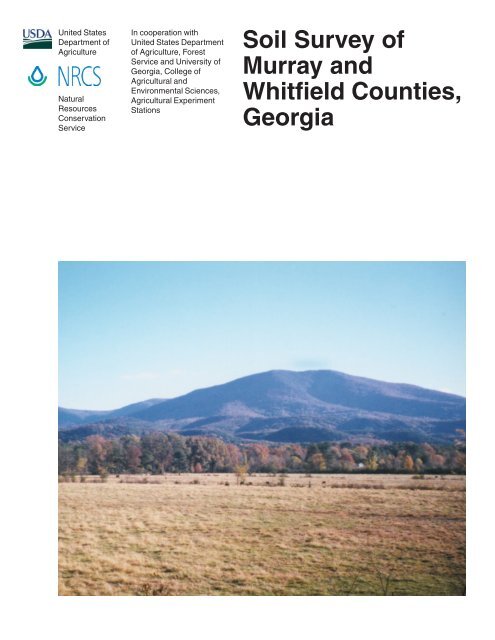
Cover: A pasture in an area <strong>of</strong> Arkabutla silt loam, 0 to 2 percent slopes, occasionally flooded.<br />
This soil is well suited to pasture. The Montevallo <strong>and</strong> Townley soils on the lower hills <strong>and</strong> ridges<br />
beyond the pasture primarily are used for woodl<strong>and</strong>. The Junaluska, Tsali, <strong>and</strong> Cataska soils on<br />
the mountains in the background are managed for woodl<strong>and</strong>, recreation, <strong>and</strong> wildlife habitat.<br />
Additional information about the Nation’s natural resources is available online<br />
from the Natural Resources Conservation Service at http://www.nrcs.usda.gov.
Contents<br />
How To Use This <strong>Soil</strong> <strong>Survey</strong> .......................................................................................i<br />
Foreword ..................................................................................................................... ix<br />
General Nature <strong>of</strong> the <strong>Survey</strong> Area .............................................................................. 2<br />
Settlement <strong>and</strong> History............................................................................................. 2<br />
Geology.................................................................................................................... 3<br />
Farming .................................................................................................................... 5<br />
Physiography, Relief, <strong>and</strong> Drainage ......................................................................... 5<br />
Industries, Utilities, <strong>and</strong> Transportation .................................................................... 6<br />
Mines <strong>and</strong> Minerals .................................................................................................. 6<br />
Water Resources ..................................................................................................... 7<br />
Woodl<strong>and</strong>s ............................................................................................................... 7<br />
Climate ..................................................................................................................... 8<br />
How This <strong>Survey</strong> Was Made ........................................................................................ 8<br />
General <strong>Soil</strong> Map Units ............................................................................................ 11<br />
<strong>Soil</strong>s in <strong>Murray</strong> County ............................................................................................... 11<br />
1. Townley-Conasauga-Montevallo ...................................................................... 11<br />
2. Montevallo-Townley ......................................................................................... 12<br />
3. Fullerton-Shack-Minvale .................................................................................. 12<br />
4. Waynesboro-Holston-Dewey ........................................................................... 13<br />
5. Chenneby-Shellbluff-Arkabutla ........................................................................ 14<br />
6. Junaluska-Tsali-Cataska ................................................................................. 15<br />
7. Nauvoo-Townley-Allen ..................................................................................... 15<br />
<strong>Soil</strong>s in <strong>Whitfield</strong> County ............................................................................................. 16<br />
1. Townley-Conasauga ........................................................................................ 16<br />
2. Montevallo-Townley ......................................................................................... 17<br />
3. Shack-Bodine-Minvale-Fullerton ..................................................................... 17<br />
4. Townley-Nella .................................................................................................. 18<br />
5. Chenneby-Shellbluff-Arkabutla ........................................................................ 19<br />
6. Bodine-Nella-Townley ...................................................................................... 19<br />
7. Fullerton-Hanceville ......................................................................................... 20<br />
8. Panama-Enders ............................................................................................... 21<br />
Detailed <strong>Soil</strong> Map Units ........................................................................................... 23<br />
AbB—Albertville silt loam, 2 to 6 percent slopes.................................................... 24<br />
AbD—Albertville silt loam, 6 to 15 percent slopes ................................................. 25<br />
AnB—Allen loam, 2 to 6 percent slopes ................................................................. 26<br />
AnD—Allen loam, 6 to 15 percent slopes .............................................................. 27<br />
AnE—Allen loam, 15 to 30 percent slopes ............................................................. 28<br />
ArC—Allen-Urban l<strong>and</strong> complex, 2 to 15 percent slopes ....................................... 29<br />
ArE—Allen-Urban l<strong>and</strong> complex, 15 to 30 percent slopes ..................................... 30<br />
AuA—Arkabutla silt loam, 0 to 2 percent slopes, occasionally flooded .................. 31<br />
BoD—Bodine very gravelly silt loam, 6 to 15 percent slopes ................................. 32<br />
BoE—Bodine very gravelly silt loam, 15 to 30 percent slopes ............................... 34<br />
BoF—Bodine very gravelly silt loam, 30 to 60 percent slopes ............................... 35<br />
CaA—Capshaw silt loam, 0 to 2 percent slopes .................................................... 36<br />
CaB—Capshaw silt loam, 2 to 6 percent slopes .................................................... 37<br />
iii
CkE—Cataska channery silt loam, 5 to 25 percent slopes .................................... 38<br />
CkF—Cataska channery silt loam, 25 to 45 percent slopes .................................. 39<br />
CkG—Cataska channery silt loam, 45 to 70 percent slopes .................................. 40<br />
CnA—Chenneby silt loam, 0 to 2 percent slopes, occasionally flooded................. 41<br />
CoA—Chenneby-Urban l<strong>and</strong> complex, 0 to 2 percent slopes, occasionally<br />
flooded ............................................................................................................. 42<br />
CrE—Cheoah-Edneytown complex, 15 to 35 percent slopes ................................ 43<br />
CsC—Conasauga silt loam, 6 to 10 percent slopes ............................................... 45<br />
CuC—Conasauga-Urban l<strong>and</strong> complex, 2 to 10 percent slopes ............................ 46<br />
CvB—Craigsville gravelly s<strong>and</strong>y loam, 0 to 5 percent slopes, occasionally<br />
flooded ............................................................................................................. 47<br />
CxB—Cunningham silt loam, 2 to 6 percent slopes ............................................... 48<br />
CxD—Cunningham silt loam, 6 to 15 percent slopes ............................................. 49<br />
CxE—Cunningham silt loam, 15 to 30 percent slopes ........................................... 50<br />
CxF—Cunningham silt loam, 30 to 60 percent slopes ........................................... 52<br />
DeB—Dewey silt loam, 2 to 6 percent slopes ........................................................ 53<br />
DeD—Dewey silt loam, 6 to 15 percent slopes ...................................................... 54<br />
DoA—Docena silt loam, 0 to 2 percent slopes, occasionally flooded .................... 55<br />
DsB—Docena-Conasauga complex, 2 to 6 percent slopes ................................... 56<br />
Du—Dumps, sediment basins................................................................................ 57<br />
EdF—Edneytown loam, 25 to 45 percent slopes, rubbly........................................ 58<br />
EdG—Edneytown loam, 45 to 70 percent slopes, rubbly ....................................... 59<br />
EnB—Enders silt loam, 2 to 6 percent slopes ........................................................ 60<br />
EnD—Enders silt loam, 6 to 15 percent slopes ...................................................... 61<br />
EuC—Enders-Urban l<strong>and</strong> complex, 2 to 15 percent slopes ................................... 62<br />
FtB—Fullerton gravelly silt loam, 2 to 6 percent slopes ......................................... 63<br />
FtD—Fullerton gravelly silt loam, 6 to 15 percent slopes ....................................... 64<br />
FtE—Fullerton gravelly silt loam, 15 to 30 percent slopes ..................................... 65<br />
FtF—Fullerton gravelly silt loam, 30 to 60 percent slopes ..................................... 66<br />
FuE—Fullerton-Urban l<strong>and</strong> complex, 15 to 30 percent slopes .............................. 67<br />
GrA—Guthrie silt loam, 0 to 2 percent slopes, occasionally flooded ..................... 68<br />
HcB—Hanceville loam, 2 to 6 percent slopes ........................................................ 70<br />
HcD—Hanceville loam, 6 to 15 percent slopes ...................................................... 71<br />
HcE—Hanceville loam, 15 to 30 percent slopes .................................................... 72<br />
HnC—Hanceville-Urban l<strong>and</strong> complex, 2 to 15 percent slopes.............................. 73<br />
HrF—Hector-Townley-Rock outcrop complex, 5 to 35 percent slopes ................... 74<br />
HsB—Holston fine s<strong>and</strong>y loam, 2 to 6 percent slopes ........................................... 75<br />
HsD—Holston fine s<strong>and</strong>y loam, 6 to 15 percent slopes ......................................... 76<br />
JfF—Jefferson gravelly s<strong>and</strong>y loam, 25 to 45 percent slopes ................................ 77<br />
JfG—Jefferson gravelly s<strong>and</strong>y loam, 45 to 70 percent slopes, very stony ............. 78<br />
JsE—Junaluska loam, 5 to 25 percent slopes ....................................................... 79<br />
JsF—Junaluska loam, 25 to 45 percent slopes ..................................................... 80<br />
JsG—Junaluska loam, 45 to 70 percent slopes ..................................................... 81<br />
JtE—Junaluska-Tsali complex, 5 to 25 percent slopes .......................................... 82<br />
JtF—Junaluska-Tsali complex, 25 to 45 percent slopes ........................................ 84<br />
iv
KtA—Ketona silt loam, 0 to 2 percent slopes, occasionally flooded ....................... 85<br />
LyE—Lily fine s<strong>and</strong>y loam, 5 to 25 percent slopes, rubbly ..................................... 86<br />
MnC—Minvale-Urban l<strong>and</strong> complex, 2 to 15 percent slopes ................................. 87<br />
MoF—Montevallo very channery loam, 30 to 60 percent slopes ........................... 88<br />
MtD—Montevallo-Townley complex, 6 to 15 percent slopes .................................. 89<br />
MtE—Montevallo-Townley complex, 15 to 30 percent slopes ................................ 91<br />
MuE—Montevallo-Urban l<strong>and</strong> complex, 10 to 25 percent slopes ........................... 92<br />
NaD—Nauvoo fine s<strong>and</strong>y loam, 6 to 15 percent slopes......................................... 93<br />
NaE—Nauvoo fine s<strong>and</strong>y loam, 15 to 35 percent slopes ....................................... 94<br />
NeB—Nella gravelly fine s<strong>and</strong>y loam, 2 to 6 percent slopes .................................. 95<br />
NeD—Nella gravelly fine s<strong>and</strong>y loam, 6 to 15 percent slopes................................ 96<br />
NeE—Nella gravelly fine s<strong>and</strong>y loam, 15 to 30 percent slopes .............................. 98<br />
NeF—Nella gravelly fine s<strong>and</strong>y loam, 30 to 60 percent slopes .............................. 99<br />
NtF—Nella-Hector-Townley complex, 30 to 60 percent slopes, rubbly ................ 100<br />
PaE—Panama very gravelly fine s<strong>and</strong>y loam, 15 to 30 percent slopes ............... 102<br />
PaF—Panama very gravelly fine s<strong>and</strong>y loam, 30 to 60 percent slopes ............... 103<br />
PcD—Pigeonroost-Cheoah complex, 5 to 15 percent slopes .............................. 104<br />
Qu—Pits, quarries................................................................................................ 105<br />
Rk—Rock outcrop ................................................................................................ 105<br />
SaA—Sequatchie loam, 0 to 2 percent slopes, occasionally flooded .................. 106<br />
SaB—Sequatchie loam, 2 to 6 percent slopes ..................................................... 107<br />
ScB—Shack gravelly silt loam, 2 to 6 percent slopes .......................................... 108<br />
SdD—Shack-Minvale-Bodine complex, 6 to 15 percent slopes ........................... 109<br />
SdE—Shack-Minvale-Bodine complex, 15 to 30 percent slopes ......................... 111<br />
SeA—Shellbluff silt loam, 0 to 2 percent slopes, occasionally flooded ................ 112<br />
ShC—Shelocta channery loam, 2 to 15 percent slopes....................................... 113<br />
SpD—Sipsey fine s<strong>and</strong>y loam, 4 to 15 percent slopes ........................................ 114<br />
SpE—Sipsey fine s<strong>and</strong>y loam, 15 to 30 percent slopes....................................... 115<br />
SuB—Subligna extremely gravelly s<strong>and</strong>y loam, 0 to 5 percent slopes,<br />
occasionally flooded ...................................................................................... 116<br />
SxA—Suches loam, 0 to 2 percent slopes, occasionally flooded......................... 117<br />
TnB—Townley silt loam, 2 to 6 percent slopes..................................................... 118<br />
TnD—Townley silt loam, 6 to 15 percent slopes .................................................. 119<br />
TnE—Townley silt loam, 15 to 30 percent slopes................................................. 121<br />
TnF—Townley silt loam, 30 to 45 percent slopes ................................................. 122<br />
TrC—Townley-Urban l<strong>and</strong> complex, 2 to 15 percent slopes ................................. 123<br />
TsE—Tsali channery loam, 5 to 25 percent slopes ............................................. 124<br />
TsF—Tsali channery loam, 25 to 45 percent slopes ............................................ 125<br />
TsG—Tsali channery loam, 45 to 70 percent slopes ........................................... 126<br />
Uc—Ultic Udarents, channery.............................................................................. 127<br />
Ug—Ultic Udarents, gravelly ................................................................................ 127<br />
UrC—Urban l<strong>and</strong>, 2 to 10 percent slopes ............................................................ 127<br />
W—Water............................................................................................................. 127<br />
WaA—Wax fine s<strong>and</strong>y loam, 0 to 2 percent slopes, occasionally flooded ........... 128<br />
WaB—Wax fine s<strong>and</strong>y loam, 2 to 6 percent slopes, rarely flooded ...................... 129<br />
v
WnB—Waynesboro s<strong>and</strong>y loam, 2 to 6 percent slopes ....................................... 130<br />
WnD—Waynesboro s<strong>and</strong>y loam, 6 to 15 percent slopes ..................................... 131<br />
WsC—Waynesboro-Urban l<strong>and</strong> complex, 2 to 15 percent slopes ....................... 132<br />
WtA—Whitwell silt loam, 0 to 2 percent slopes, occasionally flooded .................. 133<br />
WtB—Whitwell silt loam, 2 to 6 percent slopes .................................................... 134<br />
WuA—Whitwell-Urban l<strong>and</strong> complex, 0 to 2 percent slopes, occasionally<br />
flooded ........................................................................................................... 135<br />
Use <strong>and</strong> Management <strong>of</strong> the <strong>Soil</strong>s ........................................................................ 137<br />
Interpretive Ratings .............................................................................................. 137<br />
Rating Class Terms.......................................................................................... 137<br />
Numerical Ratings ........................................................................................... 137<br />
Crops <strong>and</strong> Pasture ............................................................................................... 138<br />
Yields per Acre ................................................................................................ 139<br />
L<strong>and</strong> Capability Classification .......................................................................... 139<br />
Prime Farml<strong>and</strong> <strong>and</strong> Other Important Farml<strong>and</strong>s ................................................ 140<br />
Forestl<strong>and</strong> Productivity <strong>and</strong> Management ............................................................ 141<br />
Forestl<strong>and</strong> Productivity .................................................................................... 142<br />
Forestl<strong>and</strong> Management .................................................................................. 142<br />
Recreational Development ................................................................................... 143<br />
Hydric <strong>Soil</strong>s .......................................................................................................... 145<br />
Engineering .......................................................................................................... 146<br />
Building Site Development ............................................................................... 147<br />
Sanitary Facilities............................................................................................. 148<br />
Construction Materials ..................................................................................... 149<br />
Water Management ......................................................................................... 150<br />
<strong>Soil</strong> Properties ........................................................................................................ 153<br />
Engineering Properties ........................................................................................ 153<br />
Physical <strong>and</strong> Chemical <strong>Soil</strong> Properties ................................................................ 154<br />
Water Features .................................................................................................... 155<br />
<strong>Soil</strong> Features ........................................................................................................ 157<br />
Classification <strong>of</strong> the <strong>Soil</strong>s ..................................................................................... 159<br />
<strong>Soil</strong> Series <strong>and</strong> Their Morphology ............................................................................ 159<br />
Albertville Series .................................................................................................. 160<br />
Allen Series .......................................................................................................... 161<br />
Arkabutla Series................................................................................................... 163<br />
Bodine Series....................................................................................................... 165<br />
Capshaw Series ................................................................................................... 166<br />
Cataska Series .................................................................................................... 167<br />
Chenneby Series ................................................................................................. 169<br />
Cheoah Series ..................................................................................................... 170<br />
Conasauga Series ............................................................................................... 172<br />
Craigsville Series ................................................................................................. 173<br />
Cunningham Series ............................................................................................. 174<br />
Dewey Series ....................................................................................................... 176<br />
Docena Series ..................................................................................................... 177<br />
vi
Edneytown Series ................................................................................................ 179<br />
Enders Series ...................................................................................................... 180<br />
Fullerton Series .................................................................................................... 182<br />
Guthrie Series ...................................................................................................... 184<br />
Hanceville Series ................................................................................................. 185<br />
Hector Series ....................................................................................................... 186<br />
Holston Series...................................................................................................... 187<br />
Jefferson Series ................................................................................................... 189<br />
Junaluska Series.................................................................................................. 190<br />
Ketona Series ...................................................................................................... 191<br />
Lily Series ............................................................................................................ 193<br />
Minvale Series ..................................................................................................... 194<br />
Montevallo Series................................................................................................. 195<br />
Nauvoo Series ..................................................................................................... 196<br />
Nella Series.......................................................................................................... 198<br />
Panama Series..................................................................................................... 200<br />
Pigeonroost Series............................................................................................... 201<br />
Sequatchie Series ................................................................................................ 202<br />
Shack Series ........................................................................................................ 204<br />
Shellbluff Series ................................................................................................... 206<br />
Shelocta Series .................................................................................................... 208<br />
Sipsey Series ....................................................................................................... 209<br />
Subligna Series .................................................................................................... 210<br />
Suches Series ...................................................................................................... 211<br />
Townley Series ..................................................................................................... 212<br />
Tsali Series .......................................................................................................... 214<br />
Wax Series ........................................................................................................... 215<br />
Waynesboro Series .............................................................................................. 217<br />
Whitwell Series .................................................................................................... 218<br />
Formation <strong>of</strong> the <strong>Soil</strong>s ........................................................................................... 221<br />
Factors <strong>of</strong> <strong>Soil</strong> Formation ..................................................................................... 221<br />
Parent Material ................................................................................................ 221<br />
Plants <strong>and</strong> Animals .......................................................................................... 222<br />
Climate ............................................................................................................ 222<br />
Relief ............................................................................................................... 223<br />
Time ................................................................................................................. 223<br />
Processes <strong>of</strong> Horizon Differentiation .................................................................... 223<br />
References .............................................................................................................. 225<br />
Glossary .................................................................................................................. 227<br />
Tables ...................................................................................................................... 241<br />
Temperature <strong>and</strong> Precipitation ............................................................................. 242<br />
Freeze Dates in Spring <strong>and</strong> Fall ........................................................................... 243<br />
Growing Season .................................................................................................. 243<br />
Acreage <strong>and</strong> Proportionate Extent <strong>of</strong> the <strong>Soil</strong>s .................................................... 244<br />
Nonirrigated Yields by Map Unit Component ....................................................... 247<br />
vii
Prime Farml<strong>and</strong> <strong>and</strong> Other Important Farml<strong>and</strong>s ................................................ 254<br />
Forestl<strong>and</strong> Productivity ........................................................................................ 255<br />
Log L<strong>and</strong>ings, Hazard <strong>of</strong> Erosion, <strong>and</strong> Suitability for Roads on Forestl<strong>and</strong> ......... 270<br />
Forestl<strong>and</strong> Planting <strong>and</strong> Harvesting ..................................................................... 282<br />
Camp Areas <strong>and</strong> Picnic Areas ............................................................................. 295<br />
Playgrounds <strong>and</strong> Paths <strong>and</strong> Trails ........................................................................ 308<br />
Dwellings .............................................................................................................. 322<br />
Roads <strong>and</strong> Streets <strong>and</strong> Shallow Excavations ....................................................... 335<br />
Sewage Disposal ................................................................................................. 350<br />
Source <strong>of</strong> S<strong>and</strong>, Roadfill, <strong>and</strong> Topsoil .................................................................. 367<br />
Ponds <strong>and</strong> Embankments .................................................................................... 384<br />
Engineering Properties ........................................................................................ 397<br />
Physical <strong>and</strong> Chemical <strong>Soil</strong> Properties ................................................................ 428<br />
Water Features .................................................................................................... 442<br />
<strong>Soil</strong> Features ........................................................................................................ 450<br />
Taxonomic Classification <strong>of</strong> the <strong>Soil</strong>s ................................................................... 457<br />
Issued 2007<br />
viii
Foreword<br />
<strong>Soil</strong> surveys contain information that affects l<strong>and</strong> use planning in survey areas. They<br />
include predictions <strong>of</strong> soil behavior for selected l<strong>and</strong> uses. The surveys highlight soil<br />
limitations, improvements needed to overcome the limitations, <strong>and</strong> the impact <strong>of</strong><br />
selected l<strong>and</strong> uses on the environment.<br />
<strong>Soil</strong> surveys are designed for many different users. Farmers, foresters, <strong>and</strong><br />
agronomists can use the surveys to evaluate the potential <strong>of</strong> the soil <strong>and</strong> the<br />
management needed for maximum food <strong>and</strong> fiber production. Planners, community<br />
<strong>of</strong>ficials, engineers, developers, builders, <strong>and</strong> home buyers can use the surveys to<br />
plan l<strong>and</strong> use, select sites for construction, <strong>and</strong> identify special practices needed to<br />
ensure proper performance. Conservationists, teachers, students, <strong>and</strong> specialists in<br />
recreation, wildlife management, waste disposal, <strong>and</strong> pollution control can use the<br />
surveys to help them underst<strong>and</strong>, protect, <strong>and</strong> enhance the environment.<br />
Various l<strong>and</strong> use regulations <strong>of</strong> Federal, State, <strong>and</strong> local governments may impose<br />
special restrictions on l<strong>and</strong> use or l<strong>and</strong> treatment. The information in this report is<br />
intended to identify soil properties that are used in making various l<strong>and</strong> use or l<strong>and</strong><br />
treatment decisions. Statements made in this report are intended to help the l<strong>and</strong><br />
users identify <strong>and</strong> reduce the effects <strong>of</strong> soil limitations on various l<strong>and</strong> uses. The<br />
l<strong>and</strong>owner or user is responsible for identifying <strong>and</strong> complying with existing laws <strong>and</strong><br />
regulations.<br />
Great differences in soil properties can occur within short distances. Some soils are<br />
seasonally wet or subject to flooding. Some are too unstable to be used as a<br />
foundation for buildings or roads. Clayey or wet soils are poorly suited to use as septic<br />
tank absorption fields. A high water table makes a soil poorly suited to basements or<br />
underground installations.<br />
These <strong>and</strong> many other soil properties that affect l<strong>and</strong> use are described in this soil<br />
survey. The location <strong>of</strong> each soil is shown on the detailed soil maps. Each soil in the<br />
survey area is described, <strong>and</strong> information on specific uses is given. Help in using this<br />
publication <strong>and</strong> additional information are available at the local <strong>of</strong>fice <strong>of</strong> the Natural<br />
Resources Conservation Service or the Cooperative Extension Service.<br />
James E. Tillman, Sr.<br />
State Conservationist<br />
Natural Resources Conservation Service<br />
ix
<strong>Soil</strong> <strong>Survey</strong> <strong>of</strong><br />
<strong>Murray</strong> <strong>and</strong> <strong>Whitfield</strong><br />
<strong>Counties</strong>, <strong>Georgia</strong><br />
By Catherine E. Scott <strong>and</strong> Douglas E. Cabe, Natural Resources Conservation Service<br />
Fieldwork by Douglas E. Cabe, Joan B. Howard, K. Steve Lawrence, Edward E.<br />
Looper, J. Greg Taylor, <strong>and</strong> Gloria J. York, Natural Resources Conservation Service;<br />
Chattahoochee National Forest l<strong>and</strong>s surveyed under Forest Service contract by<br />
consultant soil scientists James H. Brown, Edward L. O’Brien, <strong>and</strong> Johnny Woodruff<br />
United States Department <strong>of</strong> Agriculture, Natural Resources Conservation Service,<br />
in cooperation with<br />
United States Department <strong>of</strong> Agriculture, Forest Service <strong>and</strong> the University <strong>of</strong> <strong>Georgia</strong>,<br />
College <strong>of</strong> Agricultural <strong>and</strong> Environmental Sciences, Agricultural Experiment Stations<br />
MURRAY <strong>and</strong> WHITFIELD COUNTIES are located in the northwestern part <strong>of</strong> <strong>Georgia</strong> (fig.<br />
1). The survey area is bordered on the east by Fannin <strong>and</strong> Gilmer <strong>Counties</strong>, on the<br />
west by Catoosa <strong>and</strong> Walker <strong>Counties</strong>, <strong>and</strong> on the south by Gordon County.<br />
Tennessee forms the northern boundary <strong>of</strong> the survey area.<br />
<strong>Murray</strong> County consists <strong>of</strong> about 347 square miles, or 222,200 acres. According to<br />
the 2000 census, the population <strong>of</strong> the county was about 36,500 (USDC, 2000). The<br />
Figure 1.—Location <strong>of</strong> <strong>Murray</strong> <strong>and</strong> <strong>Whitfield</strong> <strong>Counties</strong> in <strong>Georgia</strong>.<br />
1
2 <strong>Soil</strong> <strong>Survey</strong><br />
county seat, Chatsworth, is centrally located <strong>and</strong> had a population <strong>of</strong> about 3,500.<br />
Chatsworth is approximately 90 miles northwest <strong>of</strong> Atlanta.<br />
<strong>Whitfield</strong> County consists <strong>of</strong> about 291 square miles, or 186,200 acres. The<br />
population in 2000 was about 83,525 (USDC, 2000). The city <strong>of</strong> Dalton, the county<br />
seat, had a population <strong>of</strong> about 27,900. Dalton is located in the central part <strong>of</strong> the<br />
county <strong>and</strong> is approximately 90 miles northwest <strong>of</strong> Atlanta <strong>and</strong> about 30 miles<br />
southeast <strong>of</strong> Chattanooga, Tennessee.<br />
As <strong>of</strong> 2006, approximately 63,079 acres <strong>of</strong> the Chattahoochee National Forest was<br />
in <strong>Murray</strong> <strong>and</strong> <strong>Whitfield</strong> <strong>Counties</strong>. <strong>Soil</strong> surveys on National Forest l<strong>and</strong>s were<br />
coordinated by the United States Department <strong>of</strong> Agriculture, Forest Service using soil<br />
scientists under contract with the Forest Service. The Natural Resources Conservation<br />
Service cooperated with the Forest Service in correlating the contract soil survey for<br />
inclusion in this survey.<br />
The Congressionally designated Cohutta Wilderness Area covers approximately<br />
5,158 acres <strong>of</strong> the Chattahoochee National Forest in <strong>Murray</strong> County. These acres are<br />
managed for minimal human intervention <strong>and</strong> were not surveyed for this soil survey.<br />
This area is identified on the soil survey sheets <strong>and</strong> is excluded from the general soil<br />
map <strong>of</strong> <strong>Murray</strong> County.<br />
General Nature <strong>of</strong> the <strong>Survey</strong> Area<br />
This section provides general information concerning the survey area. It describes<br />
settlement <strong>and</strong> history; geology; farming; physiography, relief, <strong>and</strong> drainage; industries,<br />
utilities, <strong>and</strong> transportation; mines <strong>and</strong> minerals; water resources; woodl<strong>and</strong>s; <strong>and</strong><br />
climate.<br />
Settlement <strong>and</strong> History<br />
<strong>Murray</strong> <strong>and</strong> <strong>Whitfield</strong> <strong>Counties</strong> were once part <strong>of</strong> the vast county <strong>of</strong> Cherokee.<br />
Created in 1831 by a legislative act, Cherokee County was in the heart <strong>of</strong> the<br />
Cherokee Nation. Later in 1832, a treaty signed by the United States Government<br />
allowed the state to take control <strong>of</strong> the l<strong>and</strong>s from the Cherokee. A l<strong>and</strong> lottery was<br />
then commenced that granted white settlers parcels <strong>of</strong> 160 acres. During 1838 <strong>and</strong><br />
1839, the Cherokee people were forcibly removed from the area. This removal became<br />
part <strong>of</strong> the legendary “Trail <strong>of</strong> Tears” (Howard, 1996; <strong>Whitfield</strong>-<strong>Murray</strong> Historical<br />
Society, 1999).<br />
<strong>Murray</strong> County was created in 1832 <strong>and</strong> named in honor <strong>of</strong> the former speaker <strong>of</strong><br />
the <strong>Georgia</strong> House, Mr. Thomas W. <strong>Murray</strong>. Spring Place, a Moravian mission to the<br />
Cherokee Indians, became the county seat. The area was completely agricultural <strong>and</strong><br />
somewhat secluded until 1906 when a railroad was built through the county along the<br />
mountains. This allowed resources, such as timber <strong>and</strong> talc, to be shipped out <strong>of</strong> the<br />
mountains. However, the railroad bypassed Spring Place <strong>and</strong> ran through the infant<br />
town <strong>of</strong> Chatsworth. Because it was more accessible, Chatsworth quickly began to<br />
grow <strong>and</strong> prosper. In 1913, after bitter controversy, Chatsworth was named the new<br />
county seat (Howard, 1996).<br />
In 1847, another settlement called Cross Plains became part <strong>of</strong> the newly<br />
established city <strong>of</strong> Dalton. Four years later, in 1851, <strong>Whitfield</strong> County was created from<br />
<strong>Murray</strong> County. It was named for George Whitefield who was a noted Christian<br />
minister who came to <strong>Georgia</strong> from Engl<strong>and</strong> in the late 1700s. Dalton was chosen as<br />
the county seat. The town grew rapidly because <strong>of</strong> trade <strong>and</strong> the arrival <strong>of</strong> the railroad<br />
(<strong>Whitfield</strong>-<strong>Murray</strong> Historical Society, 1999).<br />
During the Civil War, Dalton became an important place to the Confederates for its<br />
manufacturing <strong>and</strong> its hospital. Dalton was also the headquarters for General Joseph
<strong>Murray</strong> <strong>and</strong> <strong>Whitfield</strong> <strong>Counties</strong>, <strong>Georgia</strong> 3<br />
E. Johnston during the winter <strong>of</strong> 1863-1864. Thous<strong>and</strong>s <strong>of</strong> Confederate troops camped<br />
in <strong>and</strong> around Dalton. In early May 1864, fierce battles were fought at Rocky Face<br />
Ridge <strong>and</strong> Dug Gap for control <strong>of</strong> Johnston’s fortified position at Dalton. Eventually, in<br />
the early morning <strong>of</strong> May 11, 1864, the larger Union Army was able to circle south <strong>and</strong><br />
advance towards Johnston’s Army from the rear. Johnston was forced to withdraw.<br />
Dalton was occupied by Federal troops until 1865 (Golden, 2007; <strong>Whitfield</strong>-<strong>Murray</strong><br />
Historical Society, 1999).<br />
In 1885, the Crown Cotton Mill opened in Dalton <strong>and</strong> provided much needed<br />
employment to the area. It was the first large manufacturing plant in <strong>Whitfield</strong> County.<br />
Other industries followed as Dalton grew. In 1900, a cottage industry that made h<strong>and</strong>made,<br />
tufted bedspreads was started by Catherine Evans Whitener. Bedspreads were<br />
sold by hanging them on clotheslines along the sides <strong>of</strong> roads. U.S. Highway 41 was<br />
known as “Peacock Alley” for the popular peacock design on the bedspreads that hung<br />
on lines by the road. By the 1930s, the labor intensive h<strong>and</strong>-tufting process <strong>of</strong> making<br />
bedspreads was replaced by machines (Golden, 2007; <strong>Whitfield</strong>-<strong>Murray</strong> Historical<br />
Society, 1999).<br />
After World War II, the machines used to tuft bedspreads became larger <strong>and</strong> more<br />
efficient. Manufacturers began to produce rugs <strong>and</strong> carpets with these machines. As<br />
the carpet industry grew, it became the primary source <strong>of</strong> employment <strong>and</strong> economic<br />
development in the area <strong>of</strong> <strong>Murray</strong> <strong>and</strong> <strong>Whitfield</strong> <strong>Counties</strong>. Today, it is estimated that<br />
90 percent <strong>of</strong> the functional carpet produced in the world is made within a 65-mile<br />
radius <strong>of</strong> the city <strong>of</strong> Dalton. Dalton is now known as the “Carpet Capital <strong>of</strong> the World”<br />
(Golden, 2007; <strong>Whitfield</strong>-<strong>Murray</strong> Historical Society, 1999).<br />
The USDA Forest Service began acquiring cut-over private forest l<strong>and</strong>s in <strong>Murray</strong><br />
<strong>and</strong> <strong>Whitfield</strong> <strong>Counties</strong> in the 1930s to provide watershed protection <strong>and</strong> conservation.<br />
These l<strong>and</strong>s became part <strong>of</strong> the Chattahoochee National Forest in 1936 <strong>and</strong> they<br />
continue to be managed for multiple uses, including wildlife habitat, recreation,<br />
watershed protection, wilderness, <strong>and</strong> timber. Acquisition <strong>of</strong> these l<strong>and</strong>s provided<br />
forest conservation to the southern Appalachian Mountains within the Conasauga<br />
River <strong>and</strong> the Coosawattee River watersheds in <strong>Murray</strong> County. In <strong>Whitfield</strong> County,<br />
the creation <strong>of</strong> National Forest l<strong>and</strong>s instituted conservation <strong>of</strong> upl<strong>and</strong> ridges within the<br />
Valley <strong>and</strong> Ridge physiographic province.<br />
Geology<br />
William R. Fulmer, geologist, Natural Resources Conservation Service, helped prepare this section.<br />
<strong>Murray</strong> <strong>and</strong> <strong>Whitfield</strong> <strong>Counties</strong> lie mainly within the Valley <strong>and</strong> Ridge physiographic<br />
province <strong>of</strong> northwest <strong>Georgia</strong>. Rocks in this area range from early Cambrian to<br />
Mississippian age. The east edge <strong>of</strong> <strong>Murray</strong> County extends into the Blue Ridge<br />
physiographic province <strong>and</strong> is underlain by metasedimentary <strong>and</strong> igneous rocks <strong>of</strong><br />
pre-Cambrian, <strong>and</strong> possibly Cambrian, age. The dividing line between these two<br />
physiographic provinces is the Great Smoky Fault, which is a major thrust fault in the<br />
area that passes along the eastern edge <strong>of</strong> <strong>Murray</strong> County <strong>and</strong> generally runs parallel<br />
to the nearby U.S. Highway 411. This fault brings the metamorphic rocks <strong>of</strong> the Blue<br />
Ridge province in contact with the Paleozoic rocks <strong>of</strong> the Valley <strong>and</strong> Ridge province.<br />
The Valley <strong>and</strong> Ridge province is dominated by northward-trending valleys<br />
separated by low, rounded ridges <strong>and</strong> by high, steep-sided ridges. Most <strong>of</strong> the valley<br />
areas have deviations ranging from 640 to 800 feet, while the ridges range from 1,000<br />
to 1,600 feet above mean sea level. The part <strong>of</strong> <strong>Murray</strong> County in the Blue Ridge<br />
province includes mountain peaks that rise 3,000 feet or more above sea level.<br />
Rocks <strong>of</strong> the Blue Ridge province belong to the Great Smoky group. Types <strong>of</strong> rock<br />
in this group include slate, phyllite, quartzite, graywacke, schist, <strong>and</strong> gneiss. Typical<br />
soils derived from these parent materials include Cataska, Cheoah, Edneytown,
4 <strong>Soil</strong> <strong>Survey</strong><br />
Junaluska, Pigeonroost, <strong>and</strong> Tsali. Additional soils on the more moderate to gentle<br />
slopes include Craigsville, Shelocta, <strong>and</strong> Suches.<br />
Parent material that formed the soils <strong>of</strong> the Valley <strong>and</strong> Ridge portion <strong>of</strong> <strong>Murray</strong> <strong>and</strong><br />
<strong>Whitfield</strong> <strong>Counties</strong> was derived from the weathering <strong>of</strong> Paleozoic sedimentary rocks<br />
laid down between Early Cambrian <strong>and</strong> Pennsylvanian age. These geologic formations<br />
were originally flat until compressional forces from the southeast formed them into<br />
faulted folds. Erosion <strong>of</strong> the folded <strong>and</strong> faulted rocks produced a varied outcrop pattern<br />
with alternating ridges <strong>and</strong> valleys.<br />
Taylor Ridge <strong>and</strong> Rocky Face Mountain represent prominent ridges surrounding the<br />
Chickamauga <strong>and</strong> Mill Creek Valleys <strong>of</strong> western <strong>Whitfield</strong> County. These ridges<br />
comprise the Red Mountain Formation, which consists essentially <strong>of</strong> s<strong>and</strong>stone <strong>and</strong><br />
shale <strong>and</strong> small amounts <strong>of</strong> fossil iron ore <strong>and</strong> limestone. <strong>Soil</strong>s range from shallow to<br />
very deep on the ridges <strong>and</strong> on steeper slopes, <strong>and</strong> they <strong>of</strong>ten have extensive gravel.<br />
Stony soils or stony surface soils, such as Tidings, Allen, Enders, Hector, Holston,<br />
Montevallo, Nauvoo, Nella, <strong>and</strong> Townley, normally occur on the l<strong>and</strong>scapes.<br />
The Rome Formation, which is <strong>of</strong> early Cambrian age, crops out on the lower<br />
elevations along the eastern edge <strong>of</strong> Taylor Ridge in <strong>Whitfield</strong> County. This formation<br />
consists almost entirely <strong>of</strong> s<strong>and</strong>stone, siltstone, <strong>and</strong> claystone. Weathering produces<br />
variable colors from red to brown to green for shaley soils from claystone <strong>and</strong> siltstone,<br />
while weathered s<strong>and</strong>stone varies from green to white. Albertville, Conasauga,<br />
Enders, Montevallo, <strong>and</strong> Townley soils are common to the ridges <strong>and</strong> lower slopes <strong>of</strong><br />
this formation.<br />
The Bays Formation, which is <strong>of</strong> Ordovician age, consists <strong>of</strong> red <strong>and</strong> yellow soils<br />
derived from weathered s<strong>and</strong>stone, siltstone, quartzite, <strong>and</strong> minor conglomerate. This<br />
formation occupies much <strong>of</strong> Mill Creek Valley, which is west <strong>of</strong> Dalton, underlies<br />
Hamilton Mountain, <strong>and</strong> outcrops under much <strong>of</strong> downtown Dalton. <strong>Soil</strong>s common to<br />
these parent materials include Enders, Nauvoo, <strong>and</strong> Panama.<br />
The Conasauga Formation, which is <strong>of</strong> Cambrian age, is very extensive in <strong>Murray</strong><br />
<strong>and</strong> <strong>Whitfield</strong> <strong>Counties</strong>. It provides most <strong>of</strong> the parent materials east <strong>of</strong> Dalton in<br />
<strong>Whitfield</strong> County <strong>and</strong> most <strong>of</strong> western <strong>Murray</strong> County. The Conasauga Formation<br />
consists <strong>of</strong> alternating units <strong>of</strong> shale <strong>and</strong> limestone <strong>of</strong> varying thickness <strong>and</strong> is<br />
generally divided into three main units.<br />
The lower unit consists <strong>of</strong> olive green, tan, <strong>and</strong> pale red s<strong>and</strong>y <strong>and</strong> silty shale that<br />
has siltstone <strong>and</strong> limestone lenses. This unit is common in southern <strong>Murray</strong> County. It<br />
occupies much <strong>of</strong> the Holly Creek drainage basin <strong>and</strong> occurs in a north to south belt<br />
east <strong>of</strong> Dalton.<br />
The middle unit consists <strong>of</strong> light green <strong>and</strong> yellow clay shale that contains layers<br />
<strong>and</strong> lenses <strong>of</strong> limestone. This unit begins in Gordon County <strong>and</strong> extends northward<br />
through east Dalton <strong>and</strong> forms the Conasauga River Valley, which is north <strong>of</strong> the<br />
Dalton airport. Typical topography consists <strong>of</strong> shale ridges <strong>and</strong> limestone valleys.<br />
The Maynardville Limestone is the upper unit <strong>of</strong> the Conasauga Formation. It forms<br />
the contact between the more extensive Conasauga units <strong>and</strong> the surrounding<br />
formations, such as the Knox group. Conasauga, Docena, Montevallo, <strong>and</strong> Townley<br />
soils are typical <strong>of</strong> Conasauga parent materials where limestone <strong>and</strong> shale are the<br />
dominant bedrock.<br />
The Knox group, which is <strong>of</strong> late Cambrian <strong>and</strong> early Ordovician age, forms<br />
extensive north to south ridges in both <strong>Murray</strong> <strong>and</strong> <strong>Whitfield</strong> <strong>Counties</strong>. This formation is<br />
highly siliceous <strong>and</strong> has extensive bedded <strong>and</strong> nodular chert residue in a clay matrix.<br />
Chert fragments litter the soil surface. <strong>Soil</strong>s <strong>of</strong> the Knox group include Bodine,<br />
Fullerton, Minvale, Sequatchie, <strong>and</strong> Waynesboro.<br />
To a lesser extent, other formations crop out within these counties. These<br />
formations consist <strong>of</strong> shales, limestone, <strong>and</strong> s<strong>and</strong>stone <strong>and</strong> form the parent materials<br />
for soils similar to those identified in the more extensive outcrop areas.
<strong>Murray</strong> <strong>and</strong> <strong>Whitfield</strong> <strong>Counties</strong>, <strong>Georgia</strong> 5<br />
Farming<br />
Cindy Askew, district conservationist, Natural Resources Conservation Service, helped prepare this<br />
section.<br />
When <strong>Whitfield</strong> <strong>and</strong> <strong>Murray</strong> <strong>Counties</strong> were first settled, most <strong>of</strong> the farms were<br />
diverse <strong>and</strong> self-sustaining. Farm size ranged from 600 to 4,000 acres. The nearest<br />
market for farm products was in Augusta, <strong>Georgia</strong>. Corn, wheat, <strong>and</strong> hogs were<br />
important agricultural products after the Civil War. During the 1880s, the size <strong>of</strong> farms<br />
decreased <strong>and</strong> tenant farming was common. The production <strong>of</strong> corn, wheat, <strong>and</strong> hogs<br />
declined, but the production <strong>of</strong> cotton increased. During this period, dairy <strong>and</strong> beef<br />
cattle operations became common. These operations were typically included with<br />
general farming, which continued until about 1914.<br />
The increased production <strong>of</strong> cotton resulted in an increased hazard <strong>of</strong> erosion <strong>and</strong> a<br />
reduction <strong>of</strong> soil fertility. During the 1930s, however, farmers began to apply<br />
conservation measures, such as reforestation, cropping systems that include grasses<br />
<strong>and</strong> legumes <strong>and</strong> winter cover crops, <strong>and</strong> terraces. They also began to improve soil<br />
fertility by applying limestone <strong>and</strong> fertilizer.<br />
Cotton production dominated the area’s agriculture from 1914 until about 1950.<br />
Since the early 1950s, much <strong>of</strong> the l<strong>and</strong> has been converted to pasture or to other<br />
nonfarm uses.<br />
The establishment <strong>of</strong> sawmills in the late 1800s led to the disappearance <strong>of</strong> nearly<br />
all <strong>of</strong> the virgin forest in the survey area <strong>and</strong> to the decision by the Federal<br />
Government to purchase much <strong>of</strong> the mountain l<strong>and</strong> in <strong>Murray</strong> County <strong>and</strong> establish<br />
the Cohutta District <strong>of</strong> the Chattahoochee National Forest.<br />
Currently, about 73,000 acres <strong>of</strong> the survey area is in farm production. The current<br />
trend in <strong>Whitfield</strong> <strong>and</strong> <strong>Murray</strong> <strong>Counties</strong> is toward smaller farms <strong>and</strong> part-time farmers.<br />
Poultry production in the area has increased steadily through the 1990s to the level <strong>of</strong><br />
33 million broilers per year. The dairy farms in the area have declined in number, but<br />
there are more cows per farm than in the past. Cropl<strong>and</strong> <strong>and</strong> hayl<strong>and</strong> make up 19,000<br />
acres <strong>of</strong> the survey area. Corn <strong>and</strong> soybeans are the dominant field crops, but most <strong>of</strong><br />
the corn is grown for silage. Some grain sorghum is also grown. Most <strong>of</strong> the row crop<br />
production occurs in the bottom l<strong>and</strong>s near the Conasauga <strong>and</strong> Coosawattee Rivers.<br />
Physiography, Relief, <strong>and</strong> Drainage<br />
Most <strong>of</strong> <strong>Murray</strong> <strong>and</strong> <strong>Whitfield</strong> <strong>Counties</strong> lie in the Southern Appalachian Ridges <strong>and</strong><br />
Valleys Major L<strong>and</strong> Resource Area (MLRA). The eastern-most part <strong>of</strong> <strong>Murray</strong> County<br />
is in the Southern Blue Ridge MLRA.<br />
Prominent northeast- to southwest-running s<strong>and</strong>stone ridges on the western<br />
boundary <strong>and</strong> steep or very steep mountainous ridges on the eastern boundary<br />
characterize the survey area. The mountainous areas consist <strong>of</strong> large valleys<br />
dissected by less prominent ridges. Slopes range from 0 to 90 percent, but most are<br />
from 6 to 15 percent.<br />
Grassy Mountain, located in northeastern <strong>Murray</strong> County, is the highest peak in the<br />
survey area at an elevation <strong>of</strong> 3,692 feet. Bald Mountain, also in <strong>Murray</strong> County, has<br />
an elevation <strong>of</strong> 4,005 feet, but it is located in the Cohutta Wilderness Area <strong>and</strong> was not<br />
mapped in this soil survey. Other prominent points include Fort Mountain at an<br />
elevation 2,800 feet, Rocky Face Mountain at an elevation <strong>of</strong> 1,600 feet, Dicks Ridge<br />
<strong>and</strong> Taylor Ridge at elevations <strong>of</strong> 1,400 feet, <strong>and</strong> Camp Ground Mountain at an<br />
elevation <strong>of</strong> 1,100 feet.<br />
The lowest elevation in the survey area is 640 feet. This point occurs at the<br />
southern boundary <strong>of</strong> <strong>Murray</strong> <strong>and</strong> <strong>Whitfield</strong> <strong>Counties</strong> where the Conasauga River<br />
enters Gordon County.
6 <strong>Soil</strong> <strong>Survey</strong><br />
The Tennessee Valley Divide, located in <strong>Whitfield</strong> County, separates the two main<br />
watersheds in the survey area. The divide runs along ridges that start in the northern<br />
part <strong>of</strong> the county near the town <strong>of</strong> Cohutta <strong>and</strong> travels southwest <strong>and</strong> enters Walker<br />
County north <strong>of</strong> the town <strong>of</strong> Villanow. Drainage west <strong>of</strong> the Tennessee Valley Divide<br />
flows north into Catoosa County <strong>and</strong> eventually empties into the Tennessee River.<br />
Drainage for the remainder <strong>of</strong> <strong>Whitfield</strong> County <strong>and</strong> all <strong>of</strong> <strong>Murray</strong> County flows south<br />
into Gordon County via the Conasauga <strong>and</strong> Coosawattee Rivers. Both sources <strong>of</strong><br />
drainage flow south into the Gulf <strong>of</strong> Mexico.<br />
The Conasauga River <strong>and</strong> its many tributaries provide the major avenue <strong>of</strong> drainage<br />
for the survey area. The river starts in the upper northeast section <strong>of</strong> <strong>Murray</strong> County,<br />
flows into Tennessee for a short distance, <strong>and</strong> then turns south <strong>and</strong> travels through the<br />
survey area <strong>and</strong> exits into Gordon County. The Conasauga River forms the boundary<br />
between <strong>Murray</strong> <strong>and</strong> <strong>Whitfield</strong> <strong>Counties</strong> except for a small section in the northern part<br />
<strong>of</strong> the survey area where the two counties are separated by Sugar Creek.<br />
Major tributaries that feed into the Conasauga <strong>and</strong> Coosawattee Rivers in <strong>Murray</strong><br />
County include Holly Creek, Mill Creek, Perry Creek, Rock Creek, Sugar Creek,<br />
Sumac Creek, <strong>and</strong> Talking Rock Creek. The main tributaries flowing into the<br />
Conasauga River from <strong>Whitfield</strong> County are Coahulla Creek, Drowning Bear Creek,<br />
Haig Mill Creek, Jobs Creek, Mill Creek, North Fork Creek, Renyon Creek, Spring<br />
Creek, Stover Creek, Sugar Creek, <strong>and</strong> Swamp Creek. Drainage for areas west <strong>of</strong> the<br />
Tennessee Valley Divide includes Chickamauga Creek, Dry Creek, Tanyard Creek,<br />
<strong>and</strong> Tiger Creek.<br />
Industries, Utilities, <strong>and</strong> Transportation<br />
Carpet manufacturing <strong>and</strong> related industries provide the main source <strong>of</strong><br />
employment <strong>and</strong> income for <strong>Murray</strong> <strong>and</strong> <strong>Whitfield</strong> <strong>Counties</strong>. The carpet industry also<br />
supplies jobs for many <strong>of</strong> the surrounding counties in <strong>Georgia</strong> <strong>and</strong> Tennessee. It is<br />
estimated that approximately 90 percent <strong>of</strong> all functional carpet in the world comes<br />
from the greater Dalton area.<br />
Other important industries for the survey area include agriculture, appliance,<br />
chemical, housing, medical, poultry, retail, recreation, <strong>and</strong> timber. Talc mining was<br />
once an important industry for <strong>Murray</strong> County. Mines were located along the base <strong>of</strong><br />
Fort Mountain, but impurities in the talc <strong>and</strong> the expense <strong>of</strong> mining caused the mines<br />
to close.<br />
Public utilities in <strong>Murray</strong> <strong>and</strong> <strong>Whitfield</strong> <strong>Counties</strong> include electricity, natural gas,<br />
sewage treatment, telephone service, <strong>and</strong> water. Areas not served by county sewer or<br />
water depend on septic tank absorption fields for sewage disposal <strong>and</strong> drilled wells for<br />
water.<br />
<strong>Murray</strong> <strong>and</strong> <strong>Whitfield</strong> <strong>Counties</strong> contain an adequate network <strong>of</strong> federal, state, <strong>and</strong><br />
local highways. Most roads are paved, except in remote areas <strong>and</strong> on National Forest<br />
l<strong>and</strong>. Interstate 75, which runs north <strong>and</strong> south through <strong>Whitfield</strong> County, provides the<br />
primary source <strong>of</strong> transportation for the survey area. Additional transportation includes<br />
air, bus, <strong>and</strong> rail services.<br />
Mines <strong>and</strong> Minerals<br />
Many minerals are found in <strong>Murray</strong> <strong>and</strong> <strong>Whitfield</strong> <strong>Counties</strong>, but mining is not as<br />
common today as it once was. Some mines <strong>and</strong> quarries were exhausted <strong>and</strong> others<br />
were closed because it was not cost effective to keep them in operation.<br />
The materials mined <strong>and</strong> quarried included alluvial clay deposits, manganese,<br />
shale, talc, <strong>and</strong> tripoli. While some mining operations still exist, much <strong>of</strong> the clay,<br />
minerals, <strong>and</strong> rocks in the survey area are no longer mined or quarried. As areas were<br />
mined, both the quantity <strong>and</strong> quality <strong>of</strong> the mining materials <strong>of</strong>ten became exhausted
<strong>Murray</strong> <strong>and</strong> <strong>Whitfield</strong> <strong>Counties</strong>, <strong>Georgia</strong> 7<br />
over time. The economic burden also became an issue for enabling most mines <strong>and</strong><br />
quarries to stay open. These factors forced many operations in this survey area to<br />
close.<br />
Shale <strong>and</strong> alluvial clay deposits can be used to make bricks. Both Dalton <strong>and</strong><br />
Chatsworth had brick-making plants. These operations utilized the alluvial clay<br />
deposits found on local flood plains.<br />
Manganese was mined for its use in coloring <strong>and</strong> decoloring other materials. It is<br />
also used in making chemical compounds, both for industry <strong>and</strong> medicine.<br />
Crayon talc <strong>and</strong> Blue John talc were the two types <strong>of</strong> talc that were mined in the<br />
survey area. Crayon talc, also called saw talc, was mined for the purpose <strong>of</strong><br />
manufacturing crayons for metal workers. Crayon talc was mined in whole sections.<br />
Scrap crayon talc, which had impurities, was mixed with Blue John talc <strong>and</strong> pulverized.<br />
The pulverized talc was used in the manufacturing <strong>of</strong> products such as ceramics,<br />
cosmetics, insecticides, paint, ro<strong>of</strong>ing, <strong>and</strong> rubber. All <strong>of</strong> the talc mines were located<br />
on the northern, western, or southern faces <strong>of</strong> Fort Mountain <strong>and</strong> Cohutta Mountain.<br />
Tripoli was mined for its high content <strong>of</strong> silica. Tripoli deposits were found <strong>and</strong> mined<br />
in Spring Place, <strong>and</strong> it was also found in insignificant amounts in Dalton.<br />
Today there are still some quarries in the survey area that are operational. The<br />
materials acquired from these quarries or pits include chert, limestone, <strong>and</strong> shale.<br />
Many small chert <strong>and</strong> shale pits are in operation throughout the survey area. Chert<br />
<strong>and</strong> shale are mainly excavated for road material. Limestone is quarried for agricultural<br />
use, asphalt, concrete, construction purposes, crushed stone, railroad construction,<br />
<strong>and</strong> road material. It is still being quarried in <strong>Whitfield</strong> County.<br />
Other materials that can be found in the county include barite, iron-ore, <strong>and</strong> gold,<br />
which are found in insignificant amounts. There are also legends passed down from<br />
American Indians <strong>and</strong> early settlers <strong>of</strong> finding <strong>and</strong> mining lead <strong>and</strong> silver.<br />
Water Resources<br />
<strong>Murray</strong> <strong>and</strong> <strong>Whitfield</strong> <strong>Counties</strong> possess an abundant supply <strong>of</strong> quality water. Both<br />
counties utilize surface <strong>and</strong> subsurface water sources. Each county also contains<br />
large, man-made water impoundments.<br />
Carters Lake in <strong>Murray</strong> County was built by the Army Corps <strong>of</strong> Engineers as a<br />
supplemental water source to the water that is supplied by the Chatsworth Water<br />
Works. Carters Lake also provides electricity, flood-control, <strong>and</strong> recreation. <strong>Murray</strong><br />
County’s water primarily is supplied by Holly Creek <strong>and</strong> several springs throughout the<br />
county.<br />
Haig Mill Reservoir in <strong>Whitfield</strong> County was built by Dalton Utilities <strong>and</strong> is relatively<br />
new. Dalton Utilities built it as a supplemental water source. <strong>Whitfield</strong> County’s water<br />
supply comes from a combination <strong>of</strong> sources, including Coahulla Creek, Conasauga<br />
River, Mill Creek, <strong>and</strong> Freeman Spring.<br />
Wells provide water in areas <strong>of</strong> both counties that are not served by a public water<br />
system. Streams <strong>and</strong> farm ponds supply most <strong>of</strong> the water for livestock.<br />
Woodl<strong>and</strong>s<br />
The United States Department <strong>of</strong> Agriculture, Forest Service manages<br />
approximately 63,415 acres <strong>of</strong> the Chattahoochee National Forest in this survey area.<br />
Of this, 51,696 acres are in <strong>Murray</strong> County <strong>and</strong> 11,719 acres are in <strong>Whitfield</strong> County<br />
(USDA, 2007). The management <strong>of</strong> these l<strong>and</strong>s is guided by a L<strong>and</strong> <strong>and</strong> Resource<br />
Management Plan that is an adaptive approach to forest management. The National<br />
Forest is used for timber, recreation, wildlife habitat, <strong>and</strong> watershed protection.<br />
Congress designated the Cohutta Wilderness Area in 1974 <strong>and</strong> allocating 5,158 acres<br />
in <strong>Murray</strong> County to this area. The focus <strong>of</strong> management <strong>of</strong> this area is to allow
8 <strong>Soil</strong> <strong>Survey</strong><br />
ecological <strong>and</strong> biological processes to progress naturally with little or no human<br />
influence or intervention. <strong>Soil</strong>s were not surveyed within the boundaries <strong>of</strong> the Cohutta<br />
Wilderness Area.<br />
Climate<br />
Prepared by the Natural Resources Conservation Service, National Water <strong>and</strong> Climate Center,<br />
Portl<strong>and</strong>, Oregon.<br />
Climate data are provided in the tables “Temperature <strong>and</strong> Precipitation,” “Freeze<br />
Dates in Spring <strong>and</strong> Fall,” <strong>and</strong> “Growing Season.” The data were recorded at Dalton,<br />
<strong>Georgia</strong>, in the period 1971 to 2000.<br />
Thunderstorm days, relative humidity, percent sunshine, <strong>and</strong> wind information are<br />
estimated from the First Order Station in Chattanooga, Tennessee.<br />
In winter, the average temperature is 41.8 degrees F <strong>and</strong> the average daily<br />
minimum temperature is 31.5 degrees. The lowest temperature on record, which<br />
occurred on January 21, 1985, is -10 degrees. In summer, the average temperature is<br />
77.1 degrees <strong>and</strong> the average daily maximum temperature is 87.9 degrees. The<br />
highest recorded temperature, which occurred on June 27, 1988, is 103 degrees.<br />
Growing degree days are shown in the table “Temperature <strong>and</strong> Precipitation.” They<br />
are equivalent to “heat units.” During the month, growing degree days accumulate by<br />
the amount that the average temperature each day exceeds a base temperature (50<br />
degrees F). The normal monthly accumulation is used to schedule single or<br />
successive plantings <strong>of</strong> a crop between the last freeze in spring <strong>and</strong> the first freeze in<br />
fall.<br />
The total annual precipitation is about 56.4 inches. Of this, 29.8 inches, or 53<br />
percent, usually falls in April through October. The growing season for most crops falls<br />
within this period. The heaviest 1-day rainfall during the period <strong>of</strong> record was 10.4<br />
inches on September 24, 1975. Thunderstorms occur on about 56 days each year,<br />
<strong>and</strong> most occur in July.<br />
The average seasonal snowfall is about 2.2 inches. The greatest snow depth at any<br />
one time was 18 inches on March 15, 1993. On the average, no days during the year<br />
have at least 1 inch <strong>of</strong> snow on the ground.<br />
The average relative humidity in midafternoon is about 57 percent. Humidity is<br />
higher at night, <strong>and</strong> the average at dawn is about 87 percent. The sun shines 64<br />
percent <strong>of</strong> the time possible in summer <strong>and</strong> 44 percent in winter. The prevailing wind is<br />
from the south. Average windspeed is highest, around 6.6 miles per hour, in March.<br />
How This <strong>Survey</strong> Was Made<br />
This survey was made to provide information about the soils <strong>and</strong> miscellaneous<br />
areas in the survey area. The information includes a description <strong>of</strong> the soils <strong>and</strong><br />
miscellaneous areas <strong>and</strong> their location <strong>and</strong> a discussion <strong>of</strong> their suitability, limitations,<br />
<strong>and</strong> management for specified uses. <strong>Soil</strong> scientists observed the steepness, length,<br />
<strong>and</strong> shape <strong>of</strong> the slopes; the general pattern <strong>of</strong> drainage; the kinds <strong>of</strong> crops <strong>and</strong> native<br />
plants; <strong>and</strong> the kinds <strong>of</strong> bedrock. They dug many holes to study the soil pr<strong>of</strong>ile, which<br />
is the sequence <strong>of</strong> natural layers, or horizons, in a soil. The pr<strong>of</strong>ile extends from the<br />
surface down into the unconsolidated material in which the soil formed. The<br />
unconsolidated material is devoid <strong>of</strong> roots <strong>and</strong> other living organisms <strong>and</strong> has not<br />
been changed by other biological activity.<br />
Currently, soils are mapped according to the boundaries <strong>of</strong> major l<strong>and</strong> resource<br />
areas (MLRAs). MLRAs are geographically associated l<strong>and</strong> resource units that share<br />
common characteristics related to physiography, geology, climate, water resources,<br />
soils, biological resources, <strong>and</strong> l<strong>and</strong> uses (USDA, 2006). <strong>Soil</strong> survey areas typically<br />
consist <strong>of</strong> parts <strong>of</strong> one or more MLRA.
<strong>Murray</strong> <strong>and</strong> <strong>Whitfield</strong> <strong>Counties</strong>, <strong>Georgia</strong> 9<br />
The soils <strong>and</strong> miscellaneous areas in the survey area occur in an orderly pattern<br />
that is related to the geology, l<strong>and</strong>forms, relief, climate, <strong>and</strong> natural vegetation <strong>of</strong> the<br />
area. Each kind <strong>of</strong> soil <strong>and</strong> miscellaneous area is associated with a particular kind <strong>of</strong><br />
l<strong>and</strong>form or with a segment <strong>of</strong> the l<strong>and</strong>form. By observing the soils <strong>and</strong> miscellaneous<br />
areas in the survey area <strong>and</strong> relating their position to specific segments <strong>of</strong> the<br />
l<strong>and</strong>form, a soil scientist develops a concept, or model, <strong>of</strong> how they were formed.<br />
Thus, during mapping, this model enables the soil scientist to predict with a<br />
considerable degree <strong>of</strong> accuracy the kind <strong>of</strong> soil or miscellaneous area at a specific<br />
location on the l<strong>and</strong>scape.<br />
Commonly, individual soils on the l<strong>and</strong>scape merge into one another as their<br />
characteristics gradually change. To construct an accurate soil map, however, soil<br />
scientists must determine the boundaries between the soils. They can observe only a<br />
limited number <strong>of</strong> soil pr<strong>of</strong>iles. Nevertheless, these observations, supplemented by an<br />
underst<strong>and</strong>ing <strong>of</strong> the soil-vegetation-l<strong>and</strong>scape relationship, are sufficient to verify<br />
predictions <strong>of</strong> the kinds <strong>of</strong> soil in an area <strong>and</strong> to determine the boundaries.<br />
<strong>Soil</strong> scientists recorded the characteristics <strong>of</strong> the soil pr<strong>of</strong>iles that they studied. They<br />
noted soil color, texture, size <strong>and</strong> shape <strong>of</strong> soil aggregates, kind <strong>and</strong> amount <strong>of</strong> rock<br />
fragments, distribution <strong>of</strong> plant roots, reaction, <strong>and</strong> other features that enable them to<br />
identify soils. After describing the soils in the survey area <strong>and</strong> determining their<br />
properties, the soil scientists assigned the soils to taxonomic classes (units).<br />
Taxonomic classes are concepts. Each taxonomic class has a set <strong>of</strong> soil<br />
characteristics with precisely defined limits. The classes are used as a basis for<br />
comparison to classify soils systematically. <strong>Soil</strong> taxonomy, the system <strong>of</strong> taxonomic<br />
classification used in the United States, is based mainly on the kind <strong>and</strong> character <strong>of</strong><br />
soil properties <strong>and</strong> the arrangement <strong>of</strong> horizons within the pr<strong>of</strong>ile. After the soil<br />
scientists classified <strong>and</strong> named the soils in the survey area, they compared the<br />
individual soils with similar soils in the same taxonomic class in other areas so that<br />
they could confirm data <strong>and</strong> assemble additional data based on experience <strong>and</strong><br />
research.<br />
While a soil survey is in progress, samples <strong>of</strong> some <strong>of</strong> the soils in the area generally<br />
are collected for laboratory analyses <strong>and</strong> for engineering tests. <strong>Soil</strong> scientists interpret<br />
the data from these analyses <strong>and</strong> tests as well as the field-observed characteristics<br />
<strong>and</strong> the soil properties to determine the expected behavior <strong>of</strong> the soils under different<br />
uses. Interpretations for all <strong>of</strong> the soils are field tested through observation <strong>of</strong> the soils<br />
in different uses <strong>and</strong> under different levels <strong>of</strong> management. Some interpretations are<br />
modified to fit local conditions, <strong>and</strong> some new interpretations are developed to meet<br />
local needs. Data are assembled from other sources, such as research information,<br />
production records, <strong>and</strong> field experience <strong>of</strong> specialists. For example, data on crop<br />
yields under defined levels <strong>of</strong> management are assembled from farm records <strong>and</strong> from<br />
field or plot experiments on the same kinds <strong>of</strong> soil.<br />
Predictions about soil behavior are based not only on soil properties but also on<br />
such variables as climate <strong>and</strong> biological activity. <strong>Soil</strong> conditions are predictable over<br />
long periods <strong>of</strong> time, but they are not predictable from year to year. For example, soil<br />
scientists can predict with a fairly high degree <strong>of</strong> accuracy that a given soil will have a<br />
high water table within certain depths in most years, but they cannot predict that a high<br />
water table will always be at a specific level in the soil on a specific date.<br />
After soil scientists located <strong>and</strong> identified the significant natural bodies <strong>of</strong> soil in the<br />
survey area, they drew the boundaries <strong>of</strong> these bodies on aerial photographs <strong>and</strong><br />
identified each as a specific map unit. Aerial photographs show trees, buildings, fields,<br />
roads, <strong>and</strong> rivers, all <strong>of</strong> which help in locating boundaries accurately.<br />
The descriptions, names, <strong>and</strong> delineations <strong>of</strong> the soils in this survey area do not<br />
fully agree with those <strong>of</strong> the soils in adjacent survey areas. Differences are the result<br />
<strong>of</strong> a better knowledge <strong>of</strong> soils, modifications in series concepts, or variations in the<br />
intensity <strong>of</strong> mapping or in the extent <strong>of</strong> the soils in the survey areas.
10<br />
About 3,820 acres <strong>of</strong> the Chattahoochee National Forest in <strong>Murray</strong> County is not<br />
included in this soil survey. The unmapped section is part <strong>of</strong> the Cohutta Wilderness<br />
Area <strong>and</strong> was not surveyed in order to preserve its wilderness state. The area is<br />
outlined <strong>and</strong> identified on soil survey sheets.
General <strong>Soil</strong> Map Units<br />
The general soil maps in this publication shows broad areas that have a distinctive<br />
pattern <strong>of</strong> soils, relief, <strong>and</strong> drainage. Each map unit on the general soil maps is a<br />
unique natural l<strong>and</strong>scape. Typically, it consists <strong>of</strong> one or more major soils or<br />
miscellaneous areas <strong>and</strong> some minor soils or miscellaneous areas. It is named for the<br />
major soils or miscellaneous areas. The components <strong>of</strong> one map unit can occur in<br />
another but in a different pattern.<br />
The general soil maps can be used to compare the suitability <strong>of</strong> large areas for<br />
general l<strong>and</strong> uses. Areas <strong>of</strong> suitable soils can be identified on the maps. Likewise,<br />
areas where the soils are not suitable can be identified.<br />
Because <strong>of</strong> their small scale, the maps are not suitable for planning the<br />
management <strong>of</strong> a farm or field or for selecting a site for a road or building or other<br />
structure. The soils in any one map unit differ from place to place in slope, depth,<br />
drainage, <strong>and</strong> other characteristics that affect management.<br />
<strong>Soil</strong> names <strong>and</strong> boundaries on the general soil maps do not always match those <strong>of</strong><br />
adjacent counties. Differences are the result <strong>of</strong> variations in soil patterns over the<br />
survey area <strong>and</strong> recent improvements in soil classification, particularly soil series<br />
concepts.<br />
<strong>Soil</strong>s in <strong>Murray</strong> County<br />
1. Townley-Conasauga-Montevallo<br />
Gently sloping to moderately steep, well drained or moderately well drained,<br />
moderately deep or shallow soils that have a clayey or loamy subsoil <strong>and</strong> formed in<br />
residuum from acid shale<br />
Setting<br />
Major l<strong>and</strong> resource area: Southern Appalachian Ridges <strong>and</strong> Valleys<br />
L<strong>and</strong>form: Low hills <strong>and</strong> ridges<br />
Slope range: 2 to 30 percent<br />
Composition<br />
Percent <strong>of</strong> <strong>Murray</strong> County: 12 percent<br />
Townley soils: 30 percent<br />
Conasauga soils: 15 percent<br />
Montevallo soils: 15 percent<br />
Minor components: 40 percent<br />
<strong>Soil</strong> Properties <strong>and</strong> Qualities<br />
Townley<br />
Slope range: Gently sloping to moderately steep<br />
Drainage class: Well drained<br />
Depth class: Moderately deep<br />
11
12 <strong>Soil</strong> <strong>Survey</strong><br />
Conasauga<br />
Slope range: Gently sloping or strongly sloping<br />
Drainage class: Moderately well drained<br />
Depth class: Moderately deep<br />
Montevallo<br />
Slope range: Gently sloping to moderately steep<br />
Drainage class: Well drained<br />
Depth class: Shallow<br />
Use <strong>and</strong> Management<br />
Major uses: Pasture, hayl<strong>and</strong>, woodl<strong>and</strong>, <strong>and</strong> urban development<br />
Management concerns: Depth to bedrock, erosion hazard, shrink-swell potential,<br />
slope, <strong>and</strong> slow water movement<br />
2. Montevallo-Townley<br />
Strongly sloping to very steep, well drained, shallow or moderately deep soils that<br />
have a loamy or clayey subsoil <strong>and</strong> formed in residuum from acid shale<br />
Setting<br />
Major l<strong>and</strong> resource area: Southern Appalachian Ridges <strong>and</strong> Valleys<br />
L<strong>and</strong>form: Hills <strong>and</strong> ridges<br />
Slope range: 6 to 60 percent<br />
Composition<br />
Percent <strong>of</strong> <strong>Murray</strong> County: 25 percent<br />
Montevallo soils: 50 percent<br />
Townley soils: 30 percent<br />
Minor components: 20 percent<br />
<strong>Soil</strong> Properties <strong>and</strong> Qualities<br />
Montevallo<br />
Slope range: Strongly sloping to very steep<br />
Drainage class: Well drained<br />
Depth class: Shallow<br />
Townley<br />
Slope range: Strongly sloping or moderately steep<br />
Drainage class: Well drained<br />
Depth class: Moderately deep<br />
Use <strong>and</strong> Management<br />
Major uses: Woodl<strong>and</strong> <strong>and</strong> pasture<br />
Management concerns: Depth to bedrock, low available water capacity, erosion<br />
hazard, slope, slow water movement, <strong>and</strong> gravel content<br />
3. Fullerton-Shack-Minvale<br />
Gently sloping to moderately steep, well drained or moderately well drained,<br />
moderately deep to very deep soils that have a loamy or clayey subsoil <strong>and</strong> formed in<br />
residuum <strong>and</strong> colluvium from cherty limestone
<strong>Murray</strong> <strong>and</strong> <strong>Whitfield</strong> <strong>Counties</strong>, <strong>Georgia</strong> 13<br />
Setting<br />
Major l<strong>and</strong> resource area: Southern Appalachian Ridges <strong>and</strong> Valleys<br />
L<strong>and</strong>form: Hills <strong>and</strong> ridges<br />
Slope range: 2 to 30 percent<br />
Composition<br />
Percent <strong>of</strong> <strong>Murray</strong> County: 5 percent<br />
Fullerton soils: 30 percent<br />
Shack soils: 20 percent<br />
Minvale soils: 15 percent<br />
Minor components: 35 percent<br />
<strong>Soil</strong> Properties <strong>and</strong> Qualities<br />
Fullerton<br />
Slope range: Gently sloping to moderately steep<br />
Drainage class: Well drained<br />
Depth class: Very deep<br />
Shack<br />
Slope range: Gently sloping to moderately steep<br />
Drainage class: Moderately well drained<br />
Depth class: Very deep<br />
Minvale<br />
Slope range: Gently sloping to moderately steep<br />
Drainage class: Well drained<br />
Depth class: Very deep<br />
Use <strong>and</strong> Management<br />
Major uses: Pasture, hayl<strong>and</strong>, <strong>and</strong> woodl<strong>and</strong><br />
Management concerns: Erosion hazard, perched water tables, slope, slow water<br />
movement, <strong>and</strong> gravel content<br />
4. Waynesboro-Holston-Dewey<br />
Gently sloping or strongly sloping, well drained, very deep soils that have a loamy or<br />
clayey subsoil <strong>and</strong> formed in alluvium, colluvium, <strong>and</strong> residuum from acid shale, cherty<br />
limestone, limestone, <strong>and</strong> s<strong>and</strong>stone<br />
Setting<br />
Major l<strong>and</strong> resource area: Southern Appalachian Ridges <strong>and</strong> Valleys<br />
L<strong>and</strong>form: Low hills <strong>and</strong> stream terraces<br />
Slope range: 2 to 15 percent<br />
Composition<br />
Percent <strong>of</strong> <strong>Murray</strong> County: 10 percent<br />
Waynesboro soils: 45 percent<br />
Holston soils: 10 percent<br />
Dewey soils: 10 percent<br />
Minor components: 35 percent<br />
<strong>Soil</strong> Properties <strong>and</strong> Qualities<br />
Waynesboro<br />
Slope range: Gently sloping or strongly sloping
14 <strong>Soil</strong> <strong>Survey</strong><br />
Drainage class: Well drained<br />
Depth class: Very deep<br />
Holston<br />
Slope range: Gently sloping or strongly sloping<br />
Drainage class: Well drained<br />
Depth class: Very deep<br />
Dewey<br />
Slope range: Gently sloping or strongly sloping<br />
Drainage class: Well drained<br />
Depth class: Very deep<br />
Use <strong>and</strong> Management<br />
Major uses: Pasture, hayl<strong>and</strong>, urban development, <strong>and</strong> cropl<strong>and</strong><br />
Management concerns: Erosion hazard, slope, slow water movement, <strong>and</strong> gravel<br />
content<br />
5. Chenneby-Shellbluff-Arkabutla<br />
Nearly level, somewhat poorly drained to well drained, very deep soils that have a<br />
loamy subsoil <strong>and</strong> formed in mixed alluvium<br />
Setting<br />
Major l<strong>and</strong> resource area: Southern Appalachian Ridges <strong>and</strong> Valleys<br />
L<strong>and</strong>form: Flood plains<br />
Slope range: 0 to 2 percent<br />
Composition<br />
Percent <strong>of</strong> <strong>Murray</strong> County: 10 percent<br />
Chenneby soils: 20 percent<br />
Shellbluff soils: 20 percent<br />
Arkabutla soils: 15 percent<br />
Minor components: 45 percent<br />
<strong>Soil</strong> Properties <strong>and</strong> Qualities<br />
Chenneby<br />
Slope range: Nearly level<br />
Drainage class: Somewhat poorly drained<br />
Depth class: Very deep<br />
Shellbluff<br />
Slope range: Nearly level<br />
Drainage class: Well drained<br />
Depth class: Very deep<br />
Arkabutla<br />
Slope range: Nearly level<br />
Drainage class: Somewhat poorly drained<br />
Depth class: Very deep<br />
Use <strong>and</strong> Management<br />
Major uses: Cropl<strong>and</strong>, pasture, hayl<strong>and</strong>, <strong>and</strong> woodl<strong>and</strong><br />
Management concerns: Flooding <strong>and</strong> wetness
<strong>Murray</strong> <strong>and</strong> <strong>Whitfield</strong> <strong>Counties</strong>, <strong>Georgia</strong> 15<br />
6. Junaluska-Tsali-Cataska<br />
Gently sloping to very steep, well drained, shallow or moderately deep soils that have<br />
a loamy subsoil <strong>and</strong> formed in colluvium <strong>and</strong> residuum from metasedimentary rock<br />
Setting<br />
Major l<strong>and</strong> resource area: Southern Blue Ridge<br />
L<strong>and</strong>form: Mountains<br />
Slope range: 5 to 70 percent<br />
Composition<br />
Percent <strong>of</strong> <strong>Murray</strong> County: 37 percent<br />
Tsali soils: 40 percent<br />
Junaluska soils: 20 percent<br />
Cataska soils: 20 percent<br />
Minor components: 20 percent<br />
<strong>Soil</strong> Properties <strong>and</strong> Qualities<br />
Junaluska<br />
Slope range: Gently sloping to very steep<br />
Drainage class: Well drained<br />
Depth class: Moderately deep<br />
Tsali<br />
Slope range: Gently sloping to very steep<br />
Drainage class: Well drained<br />
Depth class: Shallow<br />
Cataska<br />
Slope range: Gently sloping to very steep<br />
Drainage class: Well drained<br />
Depth class: Shallow<br />
Use <strong>and</strong> Management<br />
Major uses: Woodl<strong>and</strong> <strong>and</strong> pasture<br />
Management concerns: Depth to bedrock, low available water capacity, erosion<br />
hazard, <strong>and</strong> slope<br />
7. Nauvoo-Townley-Allen<br />
Gently sloping to moderately steep, well drained, moderately deep to very deep soils<br />
that have a loamy or clayey subsoil <strong>and</strong> formed in colluvium <strong>and</strong> residuum from<br />
s<strong>and</strong>stone <strong>and</strong> acid shale<br />
Setting<br />
Major l<strong>and</strong> resource area: Southern Appalachian Ridges <strong>and</strong> Valleys<br />
L<strong>and</strong>form: Ridges<br />
Slope range: 2 to 30 percent<br />
Composition<br />
Percent <strong>of</strong> <strong>Murray</strong> County: 1 percent<br />
Nauvoo soils: 50 percent<br />
Townley soils: 10 percent<br />
Allen soils: 10 percent<br />
Minor components: 30 percent
16 <strong>Soil</strong> <strong>Survey</strong><br />
<strong>Soil</strong> Properties <strong>and</strong> Qualities<br />
Nauvoo<br />
Slope range: Strongly sloping or moderately steep<br />
Drainage class: Well drained<br />
Depth class: Deep<br />
Townley<br />
Slope range: Gently sloping to moderately steep<br />
Drainage class: Well drained<br />
Depth class: Moderately deep<br />
Position on l<strong>and</strong>scape: Gently sloping to moderately steep ridges <strong>and</strong> side slopes<br />
Allen<br />
Slope range: Gently sloping or strongly sloping<br />
Drainage class: Well drained<br />
Depth class: Very deep<br />
Position on l<strong>and</strong>scape: Gently sloping or strongly sloping ridges <strong>and</strong> side slopes<br />
Use <strong>and</strong> Management<br />
Major uses: Woodl<strong>and</strong> <strong>and</strong> pasture<br />
Management concerns: Depth to bedrock, low available water capacity, erosion<br />
hazard, slope, slow water movement, <strong>and</strong> gravel content<br />
<strong>Soil</strong>s in <strong>Whitfield</strong> County<br />
1. Townley-Conasauga<br />
Gently sloping to moderately steep, moderately well drained or well drained,<br />
moderately deep soils that have a clayey subsoil <strong>and</strong> formed in residuum from acid<br />
shale<br />
Setting<br />
Major l<strong>and</strong> resource area: Southern Appalachian Ridges <strong>and</strong> Valleys<br />
L<strong>and</strong>form: Low hills <strong>and</strong> ridges<br />
Slope range: 2 to 30 percent<br />
Composition<br />
Percent <strong>of</strong> <strong>Whitfield</strong> County: 26 percent<br />
Townley soils: 30 percent<br />
Conasauga soils: 20 percent<br />
Minor components: 50 percent<br />
<strong>Soil</strong> Properties <strong>and</strong> Qualities<br />
Townley<br />
Slope range: Gently sloping to moderately steep<br />
Drainage class: Well drained<br />
Depth class: Moderately deep<br />
Conasauga<br />
Slope range: Gently sloping or strongly sloping<br />
Drainage class: Moderately well drained<br />
Depth class: Moderately deep
<strong>Murray</strong> <strong>and</strong> <strong>Whitfield</strong> <strong>Counties</strong>, <strong>Georgia</strong> 17<br />
Use <strong>and</strong> Management<br />
Major uses: Pasture, hayl<strong>and</strong>, woodl<strong>and</strong>, <strong>and</strong> urban development<br />
Management concerns: Depth to bedrock, erosion hazard, shrink-swell potential,<br />
slope, <strong>and</strong> slow water movement<br />
2. Montevallo-Townley<br />
Strongly sloping to very steep, well drained, shallow or moderately deep soils that a<br />
have loamy or clayey subsoil <strong>and</strong> formed in residuum from acid shale<br />
Setting<br />
Major l<strong>and</strong> resource area: Southern Appalachian Ridges <strong>and</strong> Valleys<br />
L<strong>and</strong>form: Ridges<br />
Slope range: 6 to 60 percent slopes<br />
Composition<br />
Percent <strong>of</strong> <strong>Whitfield</strong> County: 16 percent<br />
Montevallo soils: 65 percent<br />
Townley soils: 15 percent<br />
Minor components: 20 percent<br />
<strong>Soil</strong> Properties <strong>and</strong> Qualities<br />
Montevallo<br />
Slope range: Strongly sloping to very steep<br />
Drainage class: Well drained<br />
Depth class: Shallow<br />
Townley<br />
Slope range: Strongly sloping to steep<br />
Drainage class: Well drained<br />
Depth class: Moderately deep<br />
Use <strong>and</strong> Management<br />
Major uses: Woodl<strong>and</strong> <strong>and</strong> pasture<br />
Management concerns: Depth to bedrock, low available water capacity, erosion<br />
hazard, slope, slow water movement, <strong>and</strong> gravel content<br />
3. Shack-Bodine-Minvale-Fullerton<br />
Gently sloping to very steep, moderately well drained or well drained, moderately deep<br />
to very deep soils that have a loamy or clayey subsoil <strong>and</strong> formed in colluvium <strong>and</strong><br />
residuum from cherty limestone<br />
Setting<br />
Major l<strong>and</strong> resource area: Southern Appalachian Ridges <strong>and</strong> Valleys<br />
L<strong>and</strong>form: Hills <strong>and</strong> ridges<br />
Slope range: 2 to 60 percent slopes<br />
Composition<br />
Percent <strong>of</strong> <strong>Whitfield</strong> County: 30 percent<br />
Shack soils: 30 percent<br />
Bodine soils: 20 percent<br />
Minvale soils: 20 percent
18 <strong>Soil</strong> <strong>Survey</strong><br />
Fullerton soils: 15 percent<br />
Minor components: 15 percent<br />
<strong>Soil</strong> Properties <strong>and</strong> Qualities<br />
Shack<br />
Slope range: Gently sloping to moderately steep<br />
Drainage class: Moderately well drained<br />
Depth class: Very deep<br />
Bodine<br />
Slope range: Strongly sloping to very steep<br />
Drainage class: Somewhat excessively drained<br />
Depth class: Very deep<br />
Minvale<br />
Slope range: Gently sloping to moderately steep<br />
Drainage class: Well drained<br />
Depth class: Very deep<br />
Fullerton<br />
Slope range: Gently sloping to moderately steep<br />
Drainage class: Well drained<br />
Depth class: Very deep<br />
Use <strong>and</strong> Management<br />
Major uses: Pasture, hayl<strong>and</strong>, <strong>and</strong> woodl<strong>and</strong><br />
Management concerns: Erosion hazard, perched water tables, slope, slow water<br />
movement, <strong>and</strong> gravel content<br />
4. Townley-Nella<br />
Gently sloping to very steep, well drained, moderately deep to very deep soils that<br />
have a loamy or clayey subsoil <strong>and</strong> formed in colluvium <strong>and</strong> residuum from s<strong>and</strong>stone<br />
<strong>and</strong> acid shale<br />
Setting<br />
Major l<strong>and</strong> resource area: Southern Appalachian Ridges <strong>and</strong> Valleys<br />
L<strong>and</strong>form: Hills <strong>and</strong> ridges<br />
Slope range: 2 to 60 percent slopes<br />
Composition<br />
Percent <strong>of</strong> <strong>Whitfield</strong> County: 14 percent<br />
Townley soils: 20 percent<br />
Nella <strong>and</strong> similar soils: 20 percent<br />
Minor components: 60 percent<br />
<strong>Soil</strong> Properties <strong>and</strong> Qualities<br />
Townley<br />
Slope range: Gently sloping to steep<br />
Drainage class: Well drained<br />
Depth class: Moderately deep<br />
Nella<br />
Slope range: Gently sloping to very steep<br />
Drainage class: Well drained<br />
Depth class: Very deep
<strong>Murray</strong> <strong>and</strong> <strong>Whitfield</strong> <strong>Counties</strong>, <strong>Georgia</strong> 19<br />
Use <strong>and</strong> Management<br />
Major uses: Woodl<strong>and</strong> <strong>and</strong> pasture<br />
Management concerns: Slope, erosion hazard, slow water movement, <strong>and</strong> gravel<br />
content<br />
5. Chenneby-Shellbluff-Arkabutla<br />
Nearly level, well drained to somewhat poorly drained, very deep soils that have a<br />
loamy subsoil <strong>and</strong> formed in mixed alluvium<br />
Setting<br />
Major l<strong>and</strong> resource area: Southern Appalachian Ridges <strong>and</strong> Valleys<br />
L<strong>and</strong>form: Flood plains<br />
Slope range: 0 to 2 percent slopes<br />
Composition<br />
Percent <strong>of</strong> <strong>Whitfield</strong> County: 4 percent<br />
Chenneby soils: 20 percent<br />
Shellbluff soils: 15 percent<br />
Arkabutla soils: 15 percent<br />
Minor components: 50 percent<br />
<strong>Soil</strong> Properties <strong>and</strong> Qualities<br />
Chenneby<br />
Slope range: Nearly level<br />
Drainage class: Somewhat poorly drained<br />
Depth class: Very deep<br />
Shellbluff<br />
Slope range: Nearly level<br />
Drainage class: Well drained<br />
Depth class: Very deep<br />
Arkabutla<br />
Slope range: Nearly level<br />
Drainage class: Somewhat poorly drained<br />
Depth class: Very deep<br />
Use <strong>and</strong> Management<br />
Major uses: Cropl<strong>and</strong>, pasture, hayl<strong>and</strong>, <strong>and</strong> woodl<strong>and</strong><br />
Management concerns: Flooding, erosion hazard, <strong>and</strong> wetness<br />
6. Bodine-Nella-Townley<br />
Gently sloping to very steep, well drained, moderately deep to very deep soils that<br />
have a loamy or clayey subsoil <strong>and</strong> formed in colluvium <strong>and</strong> residuum from cherty<br />
limestone, shale, <strong>and</strong> s<strong>and</strong>stone<br />
Setting<br />
Major l<strong>and</strong> resource area: Southern Appalachian Ridges <strong>and</strong> Valleys<br />
L<strong>and</strong>form: Ridges<br />
Slope range: 2 to 60 percent slopes
20 <strong>Soil</strong> <strong>Survey</strong><br />
Composition<br />
Percent <strong>of</strong> <strong>Whitfield</strong> County: 2 percent<br />
Bodine soils: 40 percent<br />
Nella soils: 15 percent<br />
Townley soils: 15 percent<br />
Minor components: 30 percent<br />
<strong>Soil</strong> Properties <strong>and</strong> Qualities<br />
Bodine<br />
Slope range: Strongly sloping to very steep<br />
Drainage class: Somewhat excessively drained<br />
Depth class: Very deep<br />
Nella<br />
Slope range: Gently sloping to very steep<br />
Drainage class: Well drained<br />
Depth class: Very deep<br />
Townley<br />
Slope range: Gently sloping to steep<br />
Drainage class: Well drained<br />
Depth class: Moderately deep<br />
Use <strong>and</strong> Management<br />
Major uses: Woodl<strong>and</strong>, pasture, <strong>and</strong> hayl<strong>and</strong><br />
Management concerns: Slope, erosion hazard, slow water movement, <strong>and</strong> gravel<br />
content<br />
7. Fullerton-Hanceville<br />
Gently sloping to moderately steep, well drained, very deep soils that have a clayey<br />
subsoil <strong>and</strong> formed in alluvium, colluvium, <strong>and</strong> residuum from acid shale, cherty<br />
limestone, limestone, <strong>and</strong> s<strong>and</strong>stone<br />
Setting<br />
Major l<strong>and</strong> resource area: Southern Appalachian Ridges <strong>and</strong> Valleys<br />
L<strong>and</strong>form: Hills <strong>and</strong> ridges<br />
Slope range: 2 to 30 percent slopes<br />
Composition<br />
Percent <strong>of</strong> <strong>Whitfield</strong> County: 3 percent<br />
Fullerton soils: 30 percent<br />
Hanceville soils: 20 percent<br />
Minor components: 50 percent<br />
<strong>Soil</strong> Properties <strong>and</strong> Qualities<br />
Fullerton<br />
Slope range: Gently sloping to moderately steep<br />
Drainage class: Well drained<br />
Depth class: Very deep<br />
Hanceville<br />
Slope range: Gently sloping or strongly sloping<br />
Drainage class: Well drained<br />
Depth class: Very deep
<strong>Murray</strong> <strong>and</strong> <strong>Whitfield</strong> <strong>Counties</strong>, <strong>Georgia</strong> 21<br />
Use <strong>and</strong> Management<br />
Major uses: Pasture, hayl<strong>and</strong>, <strong>and</strong> woodl<strong>and</strong><br />
Management concerns: Erosion hazard, slope, slow water movement, <strong>and</strong> gravel<br />
content<br />
8. Panama-Enders<br />
Strongly sloping to very steep, well drained, very deep or deep soils that have a loamy<br />
or clayey subsoil <strong>and</strong> formed in residuum from acid shale <strong>and</strong> s<strong>and</strong>stone<br />
Setting<br />
Major l<strong>and</strong> resource area: Southern Appalachian Ridges <strong>and</strong> Valleys<br />
L<strong>and</strong>form: Ridges<br />
Slope range: 6 to 60 percent slopes<br />
Composition<br />
Percent <strong>of</strong> <strong>Whitfield</strong> County: 5 percent<br />
Panama soils: 25 percent<br />
Enders soils: 25 percent<br />
Minor components: 50 percent<br />
<strong>Soil</strong> Properties <strong>and</strong> Qualities<br />
Panama<br />
Slope range: Moderately steep to very steep<br />
Drainage class: Well drained<br />
Depth class: Very deep<br />
Enders<br />
Slope range: Strongly sloping to very steep<br />
Drainage class: Well drained<br />
Depth class: Deep<br />
Use <strong>and</strong> Management<br />
Major uses: Woodl<strong>and</strong>, pasture, <strong>and</strong> hayl<strong>and</strong><br />
Management concerns: Erosion hazard, slope, <strong>and</strong> gravel content
Detailed <strong>Soil</strong> Map Units<br />
The map units delineated on the detailed soil maps in this survey represent the<br />
soils or miscellaneous areas in the survey area. The map unit descriptions in this<br />
section, along with the maps, can be used to determine the suitability <strong>and</strong> potential <strong>of</strong><br />
a unit for specific uses. They also can be used to plan the management needed for<br />
those uses. A soil is considered well suited to a specific use if it has properties that are<br />
favorable to the use, moderately suited if it has properties that require special planning<br />
<strong>and</strong> management to obtain satisfactory performance, <strong>and</strong> poorly suited if it has<br />
properties that are unfavorable to the use. A soil is considered not suited if it has<br />
properties that are so unfavorable that they are impractical to overcome. More<br />
information about suitability for specific uses is given in the section “Use <strong>and</strong><br />
Management <strong>of</strong> the <strong>Soil</strong>s,” <strong>and</strong> the suitability ratings are explained in the Glossary.<br />
A map unit delineation on a soil map represents an area dominated by one or more<br />
major kinds <strong>of</strong> soil or miscellaneous areas. A map unit is identified <strong>and</strong> named<br />
according to the taxonomic classification <strong>of</strong> the dominant soils. Within a taxonomic<br />
class there are precisely defined limits for the properties <strong>of</strong> the soils. On the<br />
l<strong>and</strong>scape, however, the soils are natural phenomena, <strong>and</strong> they have the characteristic<br />
variability <strong>of</strong> all natural phenomena. Thus, the range <strong>of</strong> some observed properties may<br />
extend beyond the limits defined for a taxonomic class. Areas <strong>of</strong> soils <strong>of</strong> a single<br />
taxonomic class rarely, if ever, can be mapped without including areas <strong>of</strong> other<br />
taxonomic classes. Consequently, every map unit is made up <strong>of</strong> the soils or<br />
miscellaneous areas for which it is named <strong>and</strong> some minor components that belong to<br />
taxonomic classes other than those <strong>of</strong> the major soils.<br />
Most minor soils have properties similar to those <strong>of</strong> the dominant soil or soils in the<br />
map unit, <strong>and</strong> thus they do not affect use <strong>and</strong> management. These are called<br />
noncontrasting, or similar, components. They may or may not be mentioned in a<br />
particular map unit description. Other minor components, however, have properties<br />
<strong>and</strong> behavioral characteristics divergent enough to affect use or to require different<br />
management. These are called contrasting, or dissimilar, components. They generally<br />
are in small areas <strong>and</strong> could not be mapped separately because <strong>of</strong> the scale used.<br />
Some small areas <strong>of</strong> strongly contrasting soils or miscellaneous areas are identified by<br />
a special symbol on the maps. The contrasting components are mentioned in the map<br />
unit descriptions. A few areas <strong>of</strong> minor components may not have been observed, <strong>and</strong><br />
consequently they are not mentioned in the descriptions, especially where the pattern<br />
was so complex that it was impractical to make enough observations to identify all the<br />
soils <strong>and</strong> miscellaneous areas on the l<strong>and</strong>scape.<br />
The presence <strong>of</strong> minor components in a map unit in no way diminishes the<br />
usefulness or accuracy <strong>of</strong> the data. The objective <strong>of</strong> mapping is not to delineate pure<br />
taxonomic classes but rather to separate the l<strong>and</strong>scape into l<strong>and</strong>forms or l<strong>and</strong>form<br />
segments that have similar use <strong>and</strong> management requirements. The delineation <strong>of</strong><br />
such segments on the map provides sufficient information for the development <strong>of</strong><br />
resource plans. If intensive use <strong>of</strong> small areas is planned, however, onsite investigation<br />
is needed to define <strong>and</strong> locate the soils <strong>and</strong> miscellaneous areas.<br />
An identifying symbol precedes the map unit name in the map unit descriptions.<br />
Each description includes general facts about the unit <strong>and</strong> gives the principal hazards<br />
<strong>and</strong> limitations to be considered in planning for specific uses.<br />
23
24 <strong>Soil</strong> <strong>Survey</strong><br />
<strong>Soil</strong>s that have pr<strong>of</strong>iles that are almost alike make up a soil series. Except for<br />
differences in texture <strong>of</strong> the surface layer, all the soils <strong>of</strong> a series have major horizons<br />
that are similar in composition, thickness, <strong>and</strong> arrangement.<br />
<strong>Soil</strong>s <strong>of</strong> one series can differ in texture <strong>of</strong> the surface layer, slope, stoniness,<br />
salinity, degree <strong>of</strong> erosion, <strong>and</strong> other characteristics that affect their use. On the basis<br />
<strong>of</strong> such differences, a soil series is divided into soil phases. Most <strong>of</strong> the areas shown<br />
on the detailed soil maps are phases <strong>of</strong> soil series. The name <strong>of</strong> a soil phase<br />
commonly indicates a feature that affects use or management. For example, Fullerton<br />
gravelly silt loam, 6 to 15 percent slopes, is a phase <strong>of</strong> the Fullerton series.<br />
Some map units are made up <strong>of</strong> two or more major soils or miscellaneous areas.<br />
These map units are complexes. A complex consists <strong>of</strong> two or more soils or<br />
miscellaneous areas in such an intricate pattern or in such small areas that they<br />
cannot be shown separately on the maps. The pattern <strong>and</strong> proportion <strong>of</strong> the soils or<br />
miscellaneous areas are somewhat similar in all areas. Shack-Minvale-Bodine<br />
complex, 15 to 30 percent slopes, is an example.<br />
This survey includes miscellaneous areas. Such areas have little or no soil material<br />
<strong>and</strong> support little or no vegetation. Urban l<strong>and</strong>, 2 to 10 percent slopes, is an example.<br />
The table “Acreage <strong>and</strong> Proportionate Extent <strong>of</strong> the <strong>Soil</strong>s” lists the map units in this<br />
survey area. Other tables give properties <strong>of</strong> the soils <strong>and</strong> the limitations, capabilities,<br />
<strong>and</strong> potentials for many uses. The Glossary defines many <strong>of</strong> the terms used in<br />
describing the soils.<br />
AbB—Albertville silt loam, 2 to 6 percent slopes<br />
L<strong>and</strong>form: Hills<br />
L<strong>and</strong>form position: Footslopes<br />
Flooding: None<br />
Slope: Gently sloping<br />
Surface layer:<br />
0 to 6 inches—yellowish brown silt loam<br />
Setting<br />
Typical Pr<strong>of</strong>ile<br />
Subsoil:<br />
6 to 9 inches—brownish yellow silty clay loam that has pale yellow mottles<br />
9 to 24 inches—brownish yellow silty clay that has red <strong>and</strong> pale yellow mottles<br />
24 to 35 inches—brownish yellow silty clay that has red <strong>and</strong> strong brown mottles<br />
35 to 47 inches—brownish yellow silty clay that has red, very pale brown, <strong>and</strong> strong<br />
brown mottles<br />
Underlying material:<br />
47 to 60 inches—multicolored, rippable shale bedrock<br />
<strong>Soil</strong> Properties <strong>and</strong> Qualities<br />
Drainage class: Moderately well drained<br />
Seasonal high water table: Apparent; at a depth <strong>of</strong> 2.5 to 3.5 feet<br />
Permeability: Moderately slow<br />
Available water capacity: Moderate<br />
Root zone: Deep<br />
Minor Components<br />
Conasauga <strong>and</strong> Docena soils, which are in similar l<strong>and</strong>form positions<br />
Cunningham <strong>and</strong> Townley soils, which are in the higher l<strong>and</strong>form positions
<strong>Murray</strong> <strong>and</strong> <strong>Whitfield</strong> <strong>Counties</strong>, <strong>Georgia</strong> 25<br />
<strong>Soil</strong>s that are deeper than 60 inches to shale bedrock<br />
Use <strong>and</strong> Management<br />
L<strong>and</strong> use: Pasture, woodl<strong>and</strong>, <strong>and</strong> cropl<strong>and</strong><br />
Cropl<strong>and</strong>, hayl<strong>and</strong>, <strong>and</strong> pasture<br />
Suitability to field crops: Well suited<br />
Suitability to hay: Well suited<br />
Suitability to pasture: Well suited<br />
Management concerns: Hazard <strong>of</strong> erosion<br />
Woodl<strong>and</strong><br />
Potential productivity: Moderate<br />
Preferred trees to plant: Loblolly pine <strong>and</strong> shortleaf pine<br />
Management concerns: Erodibility, low strength, stickiness, high plasticity index, <strong>and</strong><br />
content <strong>of</strong> rock fragments<br />
Urban development<br />
Suitability: Moderately suited<br />
Limitations: Depth to bedrock, shrink-swell potential, slow water movement, <strong>and</strong> low<br />
strength<br />
Recreational development<br />
Suitability: Moderately suited<br />
Limitations: Slow water movement <strong>and</strong> slope<br />
L<strong>and</strong> capability classification: 2E<br />
Interpretive Group<br />
AbD—Albertville silt loam, 6 to 15 percent slopes<br />
Setting<br />
L<strong>and</strong>form: Low hills<br />
L<strong>and</strong>form position: Summits <strong>and</strong> backslopes<br />
Flooding: None<br />
Slope: Strongly sloping<br />
Surface layer:<br />
0 to 6 inches—yellowish brown silt loam<br />
Typical Pr<strong>of</strong>ile<br />
Subsoil:<br />
6 to 9 inches—brownish yellow silty clay loam that has pale yellow mottles<br />
9 to 24 inches—brownish yellow silty clay that has red <strong>and</strong> pale yellow mottles<br />
24 to 35 inches—brownish yellow silty clay that has red <strong>and</strong> strong brown mottles<br />
35 to 47 inches—brownish yellow silty clay that has red, very pale brown, <strong>and</strong> strong<br />
brown mottles<br />
Underlying material:<br />
47 to 60 inches—multicolored, rippable shale bedrock<br />
<strong>Soil</strong> Properties <strong>and</strong> Qualities<br />
Drainage class: Moderately well drained<br />
Seasonal high water table: Apparent; at a depth <strong>of</strong> 2.5 to 3.5 feet<br />
Permeability: Moderately slow
26 <strong>Soil</strong> <strong>Survey</strong><br />
Available water capacity: Moderate<br />
Root zone: Deep<br />
Minor Components<br />
Enders, Montevallo, <strong>and</strong> Townley soils, which are in similar l<strong>and</strong>form positions<br />
Conasauga <strong>and</strong> Docena soils, in the slightly lower l<strong>and</strong>form positions<br />
<strong>Soil</strong>s that are deeper than 60 inches to shale bedrock<br />
<strong>Soil</strong>s that formed in alluvial sediments along drainageways<br />
Use <strong>and</strong> Management<br />
L<strong>and</strong> use: Pasture, woodl<strong>and</strong>, <strong>and</strong> cropl<strong>and</strong><br />
Cropl<strong>and</strong>, hayl<strong>and</strong>, <strong>and</strong> pasture<br />
Suitability to field crops: Poorly suited<br />
Suitability to hay: Moderately suited<br />
Suitability to pasture: Moderately suited<br />
Management concerns: Hazard <strong>of</strong> erosion<br />
Woodl<strong>and</strong><br />
Potential productivity: Moderate<br />
Preferred trees to plant: Loblolly pine <strong>and</strong> shortleaf pine<br />
Management concerns: Erodibility, slope, low strength, stickiness, high plasticity index,<br />
<strong>and</strong> content <strong>of</strong> rock fragments<br />
Urban development<br />
Suitability: Moderately suited<br />
Limitations: Slope, depth to bedrock, slow water movement, low strength, <strong>and</strong> shrinkswell<br />
potential<br />
Recreational development<br />
Suitability: Moderately suited<br />
Limitations: Slow water movement <strong>and</strong> slope<br />
Interpretive Group<br />
L<strong>and</strong> capability classification: 4E<br />
AnB—Allen loam, 2 to 6 percent slopes<br />
L<strong>and</strong>form: Hills<br />
L<strong>and</strong>form position: Footslopes<br />
Flooding: None<br />
Slope: Gently sloping<br />
Surface layer:<br />
0 to 5 inches—brown loam<br />
Setting<br />
Typical Pr<strong>of</strong>ile<br />
Subsoil:<br />
5 to 14 inches—yellowish red clay loam<br />
14 to 51 inches—red clay loam<br />
51 to 60 inches—red clay<br />
<strong>Soil</strong> Properties <strong>and</strong> Qualities<br />
Drainage class: Well drained<br />
Depth to seasonal high water table: More than 6.0 feet
<strong>Murray</strong> <strong>and</strong> <strong>Whitfield</strong> <strong>Counties</strong>, <strong>Georgia</strong> 27<br />
Permeability: Moderate<br />
Available water capacity: Moderate<br />
Root zone: Very deep<br />
Minor Components<br />
Enders, Holston, Nauvoo, Nella, <strong>and</strong> Sipsey soils, which are in similar l<strong>and</strong>form<br />
positions<br />
Townley soils, which are in the higher l<strong>and</strong>form positions<br />
L<strong>and</strong> use: Pasture, woodl<strong>and</strong>, <strong>and</strong> hayl<strong>and</strong><br />
Cropl<strong>and</strong>, hayl<strong>and</strong>, <strong>and</strong> pasture<br />
Suitability to field crops: Well suited<br />
Suitability to hay: Well suited<br />
Suitability to pasture: Well suited<br />
Management concerns: Hazard <strong>of</strong> erosion<br />
Use <strong>and</strong> Management<br />
Woodl<strong>and</strong><br />
Potential productivity: Moderate<br />
Preferred trees to plant: Loblolly pine, shortleaf pine, <strong>and</strong> yellow-poplar<br />
Management concerns: Erodibility, slope, <strong>and</strong> low strength<br />
Urban development<br />
Suitability: Well suited<br />
Limitations: Low strength <strong>and</strong> slow water movement<br />
Recreational development<br />
Suitability: Well suited<br />
Limitations: Slope <strong>and</strong> content <strong>of</strong> gravel<br />
L<strong>and</strong> capability classification: 2E<br />
Interpretive Group<br />
AnD—Allen loam, 6 to 15 percent slopes<br />
Setting<br />
L<strong>and</strong>form: Hills, ridges, <strong>and</strong> high stream terraces<br />
L<strong>and</strong>form position: Footslopes <strong>of</strong> hills <strong>and</strong> ridges<br />
Flooding: None<br />
Slope: Strongly sloping<br />
Surface layer:<br />
0 to 5 inches—brown loam<br />
Typical Pr<strong>of</strong>ile<br />
Subsoil:<br />
5 to 14 inches—yellowish red clay loam<br />
14 to 51 inches—red clay loam<br />
51 to 60 inches—red clay<br />
<strong>Soil</strong> Properties <strong>and</strong> Qualities<br />
Drainage class: Well drained<br />
Depth to seasonal high water table: More than 6.0 feet<br />
Permeability: Moderate
28 <strong>Soil</strong> <strong>Survey</strong><br />
Available water capacity: Moderate<br />
Root zone: Very deep<br />
Minor Components<br />
Enders, Holston, Nella, <strong>and</strong> Sipsey soils, which are in similar l<strong>and</strong>form positions<br />
Townley soils, which are in the higher l<strong>and</strong>form positions<br />
<strong>Soil</strong>s that formed in alluvial sediments along drainageways<br />
Use <strong>and</strong> Management<br />
L<strong>and</strong> use: Woodl<strong>and</strong> <strong>and</strong> pasture<br />
Cropl<strong>and</strong>, hayl<strong>and</strong>, <strong>and</strong> pasture<br />
Suitability to field crops: Poorly suited<br />
Suitability to hay: Moderately suited<br />
Suitability to pasture: Moderately suited<br />
Management concerns: Hazard <strong>of</strong> erosion<br />
Woodl<strong>and</strong><br />
Potential productivity: Moderate<br />
Preferred trees to plant: Loblolly pine, shortleaf pine, <strong>and</strong> yellow-poplar<br />
Management concerns: Erodibility, slope, <strong>and</strong> low strength<br />
Urban development<br />
Suitability: Moderately suited<br />
Limitations: Slope, slow water movement, <strong>and</strong> low strength<br />
Recreational development<br />
Suitability: Moderately suited<br />
Limitations: Slope <strong>and</strong> content <strong>of</strong> gravel<br />
Interpretive Group<br />
L<strong>and</strong> capability classification: 4E<br />
AnE—Allen loam, 15 to 30 percent slopes<br />
Setting<br />
L<strong>and</strong>form: Hills <strong>and</strong> ridges<br />
L<strong>and</strong>form position: Backslopes <strong>and</strong> footslopes<br />
Flooding: None<br />
Slope: Moderately steep<br />
Typical Pr<strong>of</strong>ile<br />
Surface layer:<br />
0 to 5 inches—brown loam<br />
Subsoil:<br />
5 to 14 inches—yellowish red clay loam<br />
14 to 51 inches—red clay loam<br />
51 to 60 inches—red clay<br />
<strong>Soil</strong> Properties <strong>and</strong> Qualities<br />
Drainage class: Well drained<br />
Depth to seasonal high water table: More than 6.0 feet<br />
Permeability: Moderate
<strong>Murray</strong> <strong>and</strong> <strong>Whitfield</strong> <strong>Counties</strong>, <strong>Georgia</strong> 29<br />
Available water capacity: Moderate<br />
Root zone: Very deep<br />
Minor Components<br />
Enders, Nella, Panama, <strong>and</strong> Sipsey soils, which are in similar l<strong>and</strong>form positions<br />
Townley soils, which are in the higher l<strong>and</strong>form positions<br />
<strong>Soil</strong>s that are shallow to s<strong>and</strong>stone bedrock<br />
<strong>Soil</strong>s that formed in alluvial sediments along drainageways<br />
Use <strong>and</strong> Management<br />
L<strong>and</strong> use: Woodl<strong>and</strong><br />
Cropl<strong>and</strong>, hayl<strong>and</strong>, <strong>and</strong> pasture<br />
Suitability to field crops: Unsuited<br />
Suitability to hay: Unsuited<br />
Suitability to pasture: Poorly suited<br />
Management concerns: Hazard <strong>of</strong> erosion<br />
Woodl<strong>and</strong><br />
Potential productivity: Moderate<br />
Preferred trees to plant: Loblolly pine <strong>and</strong> shortleaf pine<br />
Management concerns: Erodibility, slope, low strength, <strong>and</strong> low available water<br />
capacity<br />
Urban development<br />
Suitability: Poorly suited<br />
Limitations: Slope, slow water movement, <strong>and</strong> low strength<br />
Recreational development<br />
Suitability: Poorly suited<br />
Limitations: Slope <strong>and</strong> content <strong>of</strong> gravel<br />
Interpretive Group<br />
L<strong>and</strong> capability classification: 6E<br />
ArC—Allen-Urban l<strong>and</strong> complex, 2 to 15 percent slopes<br />
Setting<br />
L<strong>and</strong>form: Hills <strong>and</strong> ridges in urban areas<br />
L<strong>and</strong>form position: Backslopes <strong>and</strong> footslopes<br />
Flooding: None<br />
Slope: Gently sloping or strongly sloping<br />
Composition<br />
Allen soils—about 60 percent<br />
Urban l<strong>and</strong>—about 40 percent<br />
Allen<br />
Surface layer:<br />
0 to 5 inches—brown loam<br />
Subsoil:<br />
5 to 14 inches—yellowish red clay loam<br />
Typical Pr<strong>of</strong>ile
30 <strong>Soil</strong> <strong>Survey</strong><br />
14 to 51 inches—red clay loam<br />
51 to 60 inches—red clay<br />
Urban l<strong>and</strong><br />
Urban l<strong>and</strong> consists <strong>of</strong> areas that have been altered by cutting, filling, <strong>and</strong> shaping.<br />
Schools, parking lots, streets, commercial buildings, residential dwellings, or other<br />
structures are located in these areas.<br />
<strong>Soil</strong> Properties <strong>and</strong> Qualities<br />
Drainage class: Allen—well drained<br />
Seasonal high water table: Allen—more than 6.0 feet<br />
Permeability: Allen—moderate<br />
Available water capacity: Allen—moderate<br />
Root zone: Allen—very deep<br />
Minor Components<br />
Cunningham, Nauvoo, Nella, Panama, <strong>and</strong> Sipsey soils, which are in similar<br />
l<strong>and</strong>form positions<br />
Townley soils, which are in the higher l<strong>and</strong>form positions<br />
<strong>Soil</strong>s that formed in alluvial sediments along drainageways<br />
Use <strong>and</strong> Management<br />
L<strong>and</strong> use: Allen—lawns, gardens, <strong>and</strong> idle acres; Urban l<strong>and</strong>—buildings, streets,<br />
parking lots, sidewalks, <strong>and</strong> other structures<br />
Urban development<br />
Suitability: Moderately suited<br />
Limitations: Slope, slow water movement, <strong>and</strong> low strength<br />
Recreational development<br />
Suitability: Moderately suited<br />
Limitations: Slope <strong>and</strong> content <strong>of</strong> gravel<br />
Interpretive Group<br />
L<strong>and</strong> capability classification: Allen—3E; Urban l<strong>and</strong>—none assigned<br />
ArE—Allen-Urban l<strong>and</strong> complex, 15 to 30 percent slopes<br />
Setting<br />
L<strong>and</strong>form: Hills <strong>and</strong> ridges in urban areas<br />
L<strong>and</strong>form position: Backslopes <strong>and</strong> footslopes<br />
Flooding: None<br />
Slope: Moderately steep<br />
Composition<br />
Allen soils—about 60 percent<br />
Urban l<strong>and</strong>—about 40 percent<br />
Allen<br />
Surface layer:<br />
0 to 5 inches—brown loam<br />
Typical Pr<strong>of</strong>ile
<strong>Murray</strong> <strong>and</strong> <strong>Whitfield</strong> <strong>Counties</strong>, <strong>Georgia</strong> 31<br />
Subsoil:<br />
5 to 14 inches—yellowish red clay loam<br />
14 to 51 inches—red clay loam<br />
51 to 60 inches—red clay<br />
Urban l<strong>and</strong><br />
Urban l<strong>and</strong> consists <strong>of</strong> areas that have been altered by cutting, filling, <strong>and</strong> shaping.<br />
Schools, parking lots, streets, commercial buildings, residential dwellings, or other<br />
structures are located in these areas.<br />
<strong>Soil</strong> Properties <strong>and</strong> Qualities<br />
Drainage class: Allen—well drained<br />
Seasonal high water table: Allen—more than 6.0 feet<br />
Permeability: Allen—moderate<br />
Available water capacity: Allen—moderate<br />
Root zone: Allen—very deep<br />
Minor Components<br />
Cunningham, Nauvoo, Nella, Panama, <strong>and</strong> Sipsey soils, which are in similar<br />
l<strong>and</strong>form positions<br />
Townley soils, which are in the higher l<strong>and</strong>form positions<br />
<strong>Soil</strong>s that formed in alluvial sediments along drainageways<br />
Use <strong>and</strong> Management<br />
L<strong>and</strong> use: Allen—lawns, gardens, <strong>and</strong> idle acres; Urban l<strong>and</strong>—buildings, streets,<br />
parking lots, sidewalks, <strong>and</strong> other structures<br />
Urban development<br />
Suitability: Poorly suited<br />
Limitations: Slope, slow water movement, <strong>and</strong> low strength<br />
Recreational development<br />
Suitability: Poorly suited<br />
Limitations: Slope <strong>and</strong> content <strong>of</strong> gravel<br />
Interpretive Group<br />
L<strong>and</strong> capability classification: Allen—6E; Urban l<strong>and</strong>—none assigned<br />
AuA—Arkabutla silt loam, 0 to 2 percent slopes,<br />
occasionally flooded<br />
L<strong>and</strong>form: Flood plains<br />
Flooding: Occasional<br />
Slope: Nearly level<br />
Surface layer:<br />
0 to 6 inches—brown silt loam<br />
Setting<br />
Typical Pr<strong>of</strong>ile<br />
Subsurface layer:<br />
6 to 13 inches—brown silt loam that has grayish brown mottles
32 <strong>Soil</strong> <strong>Survey</strong><br />
Subsoil:<br />
13 to 18 inches—brown silt loam that has grayish brown <strong>and</strong> dark yellowish brown<br />
mottles<br />
18 to 21 inches—grayish brown silty clay loam that has pale brown <strong>and</strong> yellowish<br />
brown mottles<br />
21 to 31 inches—grayish brown silty clay loam that has light yellowish brown <strong>and</strong><br />
strong brown mottles<br />
31 to 63 inches—gray silty clay loam that has yellowish brown <strong>and</strong> light yellowish<br />
brown mottles<br />
<strong>Soil</strong> Properties <strong>and</strong> Qualities<br />
Drainage class: Somewhat poorly drained<br />
Seasonal high water table: Apparent; at a depth <strong>of</strong> 1.0 foot to 1.5 feet<br />
Permeability: Moderate<br />
Available water capacity: High<br />
Root zone: Very deep<br />
Minor Components<br />
Shellbluff <strong>and</strong> Chenneby soils, which are in the slightly higher l<strong>and</strong>form positions<br />
Ketona soils, which are in the slightly lower l<strong>and</strong>form positions<br />
<strong>Soil</strong>s that have gravel layers at a depth <strong>of</strong> less than 60 inches<br />
Use <strong>and</strong> Management<br />
L<strong>and</strong> use: Cropl<strong>and</strong>, woodl<strong>and</strong>, hayl<strong>and</strong>, <strong>and</strong> pasture<br />
Cropl<strong>and</strong>, hayl<strong>and</strong>, <strong>and</strong> pasture<br />
Suitability to field crops: Moderately suited<br />
Suitability to hay: Moderately suited<br />
Suitability to pasture: Moderately suited<br />
Management concerns: Flooding <strong>and</strong> wetness<br />
Woodl<strong>and</strong><br />
Potential productivity: High<br />
Preferred trees to plant: Loblolly pine, American sycamore, cherrybark oak, eastern<br />
cottonwood, green ash, <strong>and</strong> sweetgum<br />
Management concerns: Flooding, low strength, <strong>and</strong> wetness<br />
Urban development<br />
Suitability: Poorly suited<br />
Limitations: Flooding, depth to saturated zone, low strength, <strong>and</strong> slow water movement<br />
Recreational development<br />
Suitability: Poorly suited<br />
Limitations: Flooding <strong>and</strong> depth to saturated zone<br />
Interpretive Group<br />
L<strong>and</strong> capability classification: 2W<br />
BoD—Bodine very gravelly silt loam, 6 to 15 percent<br />
slopes<br />
Setting<br />
L<strong>and</strong>form: Hills <strong>and</strong> ridges<br />
L<strong>and</strong>form position: Summits <strong>and</strong> backslopes
<strong>Murray</strong> <strong>and</strong> <strong>Whitfield</strong> <strong>Counties</strong>, <strong>Georgia</strong> 33<br />
Flooding: None<br />
Slope: Strongly sloping<br />
Typical Pr<strong>of</strong>ile<br />
Surface layer:<br />
0 to 4 inches—pale brown very gravelly silt loam<br />
Subsurface layer:<br />
4 to 16 inches—light yellowish brown very gravelly silt loam<br />
Subsoil:<br />
16 to 26 inches—light brown extremely gravelly silty clay loam<br />
26 to 60 inches—reddish yellow extremely gravelly clay loam that has very pale brown<br />
<strong>and</strong> yellowish red mottles<br />
<strong>Soil</strong> Properties <strong>and</strong> Qualities<br />
Drainage class: Somewhat excessively drained<br />
Depth to seasonal high water table: More than 6.0 feet<br />
Permeability: Moderately rapid<br />
Available water capacity: Low<br />
Root zone: Very deep<br />
Minor Components<br />
Fullerton, Holston, Minvale, Nella, <strong>and</strong> Shack soils, which are in similar l<strong>and</strong>form<br />
positions<br />
Wax soils, which are in the lower l<strong>and</strong>form positions <strong>and</strong> in drainageways<br />
L<strong>and</strong> use: Woodl<strong>and</strong> <strong>and</strong> pasture<br />
Use <strong>and</strong> Management<br />
Cropl<strong>and</strong>, hayl<strong>and</strong>, <strong>and</strong> pasture<br />
Suitability to field crops: Unsuited<br />
Suitability to hay: Poorly suited<br />
Suitability to pasture: Poorly suited<br />
Management concerns: Hazard <strong>of</strong> erosion, low available water capacity, <strong>and</strong> content <strong>of</strong><br />
gravel <strong>and</strong> large stones<br />
Woodl<strong>and</strong><br />
Potential productivity: Moderate<br />
Preferred trees to plant: Loblolly pine <strong>and</strong> shortleaf pine<br />
Management concerns: Slope, erodibility, <strong>and</strong> content <strong>of</strong> rock fragments<br />
Urban development<br />
Suitability: Moderately suited<br />
Limitations: Slope <strong>and</strong> seepage<br />
Recreational development<br />
Suitability: Poorly suited<br />
Limitations: Content <strong>of</strong> gravel <strong>and</strong> large stones <strong>and</strong> slope<br />
L<strong>and</strong> capability classification: 6S<br />
Interpretive Group
34 <strong>Soil</strong> <strong>Survey</strong><br />
BoE—Bodine very gravelly silt loam, 15 to 30 percent<br />
slopes<br />
Setting<br />
L<strong>and</strong>form: Hills <strong>and</strong> ridges<br />
L<strong>and</strong>form position: Summits <strong>and</strong> backslopes<br />
Flooding: None<br />
Slope: Moderately steep<br />
Typical Pr<strong>of</strong>ile<br />
Surface layer:<br />
0 to 4 inches—pale brown very gravelly silt loam<br />
Subsurface:<br />
4 to 16 inches—light yellowish brown very gravelly silt loam<br />
Subsoil:<br />
16 to 26 inches—light brown extremely gravelly silty clay loam<br />
26 to 60 inches—reddish yellow extremely gravelly clay loam that has very pale brown<br />
<strong>and</strong> yellowish red mottles<br />
<strong>Soil</strong> Properties <strong>and</strong> Qualities<br />
Drainage class: Somewhat excessively drained<br />
Depth to seasonal high water table: More than 6.0 feet<br />
Permeability: Moderately rapid<br />
Available water capacity: Low<br />
Root zone: Very deep<br />
Minor Components<br />
Fullerton, Holston, Minvale, Nella, <strong>and</strong> Shack soils, which are in similar l<strong>and</strong>form<br />
positions<br />
<strong>Soil</strong>s that formed in alluvial sediments along drainageways<br />
Use <strong>and</strong> Management<br />
L<strong>and</strong> use: Woodl<strong>and</strong> <strong>and</strong> pasture<br />
Cropl<strong>and</strong>, hayl<strong>and</strong>, <strong>and</strong> pasture<br />
Suitability to field crops: Unsuited<br />
Suitability to hay: Unsuited<br />
Suitability to pasture: Poorly suited<br />
Management concerns: Hazard <strong>of</strong> erosion, low available water capacity, <strong>and</strong> content <strong>of</strong><br />
gravel <strong>and</strong> large stones<br />
Woodl<strong>and</strong><br />
Potential productivity: Moderate<br />
Preferred trees to plant: Loblolly pine <strong>and</strong> shortleaf pine<br />
Management concerns: Slope, erodibility, content <strong>of</strong> rock fragments, <strong>and</strong> low available<br />
water capacity<br />
Urban development<br />
Suitability: Poorly suited<br />
Limitations: Slope <strong>and</strong> seepage<br />
Recreational development<br />
Suitability: Poorly suited<br />
Limitations: Content <strong>of</strong> gravel <strong>and</strong> large stones <strong>and</strong> slope
<strong>Murray</strong> <strong>and</strong> <strong>Whitfield</strong> <strong>Counties</strong>, <strong>Georgia</strong> 35<br />
L<strong>and</strong> capability classification: 7S<br />
Interpretive Group<br />
BoF—Bodine very gravelly silt loam, 30 to 60 percent<br />
slopes<br />
Setting<br />
L<strong>and</strong>form: Hills <strong>and</strong> ridges<br />
L<strong>and</strong>form position: Summits <strong>and</strong> backslopes<br />
Flooding: None<br />
Slope: Steep to very steep<br />
Typical Pr<strong>of</strong>ile<br />
Surface layer:<br />
0 to 4 inches—pale brown very gravelly silt loam<br />
Subsurface layer:<br />
4 to 16 inches—light yellowish brown very gravelly silt loam<br />
Subsoil:<br />
16 to 26 inches—light brown extremely gravelly silty clay loam<br />
26 to 60 inches—reddish yellow extremely gravelly clay loam that has very pale brown<br />
<strong>and</strong> yellowish red mottles<br />
<strong>Soil</strong> Properties <strong>and</strong> Qualities<br />
Drainage class: Somewhat excessively drained<br />
Depth to seasonal high water table: More than 6.0 feet<br />
Permeability: Moderately rapid<br />
Available water capacity: Low<br />
Root zone: Very deep<br />
Minor Components<br />
Fullerton, Minvale, Nella, <strong>and</strong> Shack soils, which are in similar l<strong>and</strong>form positions<br />
<strong>Soil</strong>s that formed in alluvial sediments along drainageways<br />
Use <strong>and</strong> Management<br />
L<strong>and</strong> use: Woodl<strong>and</strong><br />
Cropl<strong>and</strong>, hayl<strong>and</strong>, <strong>and</strong> pasture<br />
Suitability to field crops: Unsuited<br />
Suitability to hay: Unsuited<br />
Suitability to pasture: Unsuited<br />
Management concerns: Hazard <strong>of</strong> erosion, low available water capacity, <strong>and</strong> content <strong>of</strong><br />
gravel <strong>and</strong> large stones<br />
Woodl<strong>and</strong><br />
Potential productivity: Moderate<br />
Preferred trees to plant: Loblolly pine <strong>and</strong> shortleaf pine<br />
Management concerns: Slope, erodibility, content <strong>of</strong> rock fragments, <strong>and</strong> low available<br />
water capacity<br />
Urban development<br />
Suitability: Poorly suited<br />
Limitations: Slope <strong>and</strong> seepage
36 <strong>Soil</strong> <strong>Survey</strong><br />
Recreational development<br />
Suitability: Poorly suited<br />
Limitations: Content <strong>of</strong> gravel <strong>and</strong> large stones <strong>and</strong> slope<br />
L<strong>and</strong> capability classification: 7S<br />
Interpretive Group<br />
CaA—Capshaw silt loam, 0 to 2 percent slopes<br />
Setting<br />
L<strong>and</strong>form: Stream terraces, depressions, <strong>and</strong> broad upl<strong>and</strong> flats<br />
Surface features: Outcropping <strong>of</strong> limestone near drainage areas<br />
Flooding: None<br />
Slope: Nearly level<br />
Surface layer:<br />
0 to 7 inches—brown silt loam<br />
Typical Pr<strong>of</strong>ile<br />
Subsoil:<br />
7 to 14 inches—brownish yellow silty clay loam that has very pale brown mottles<br />
14 to 22 inches—brownish yellow silty clay that has light yellowish brown mottles<br />
22 to 55 inches—brownish yellow clay that has light gray, strong brown, reddish yellow,<br />
<strong>and</strong> light yellowish brown mottles<br />
Underlying material:<br />
55 inches—hard limestone bedrock<br />
<strong>Soil</strong> Properties <strong>and</strong> Qualities<br />
Drainage class: Moderately well drained<br />
Seasonal high water table: Apparent; at a depth <strong>of</strong> 2.0 to 3.5 feet<br />
Permeability: Slow<br />
Available water capacity: Moderate or high<br />
Root zone: Deep or very deep<br />
Minor Components<br />
Conasauga, Docena, <strong>and</strong> Whitwell soils, which are in the slightly higher l<strong>and</strong>form<br />
positions<br />
Chenneby, Guthrie, <strong>and</strong> Ketona soils, which are adjacent to the major soil on flood<br />
plains, in drainageways, <strong>and</strong> in depressions<br />
Use <strong>and</strong> Management<br />
L<strong>and</strong> use: Pasture, woodl<strong>and</strong>, hayl<strong>and</strong>, <strong>and</strong> cropl<strong>and</strong><br />
Cropl<strong>and</strong>, hayl<strong>and</strong>, <strong>and</strong> pasture<br />
Suitability to field crops: Well suited<br />
Suitability to hay: Well suited<br />
Suitability to pasture: Well suited<br />
Management concerns: Wetness<br />
Woodl<strong>and</strong><br />
Potential productivity: High<br />
Preferred trees to plant: Loblolly pine, shortleaf pine, <strong>and</strong> yellow-poplar<br />
Management concerns: Low strength, stickiness, <strong>and</strong> high plasticity index
<strong>Murray</strong> <strong>and</strong> <strong>Whitfield</strong> <strong>Counties</strong>, <strong>Georgia</strong> 37<br />
Urban development<br />
Suitability: Poorly suited<br />
Limitations: Depth to bedrock, depth to saturated zone, shrink-swell potential, low<br />
strength, <strong>and</strong> slow water movement<br />
Recreational development<br />
Suitability: Moderately suited<br />
Limitations: Slow water movement<br />
L<strong>and</strong> capability classification: 2W<br />
Interpretive Group<br />
CaB—Capshaw silt loam, 2 to 6 percent slopes<br />
Setting<br />
L<strong>and</strong>form: Stream terraces <strong>and</strong> broad upl<strong>and</strong> flats<br />
Surface features: Outcropping <strong>of</strong> limestone near drainage areas<br />
Flooding: None<br />
Slope: Gently sloping<br />
Surface layer:<br />
0 to 7 inches—brown silt loam<br />
Typical Pr<strong>of</strong>ile<br />
Subsoil:<br />
7 to 14 inches—brownish yellow silty clay loam that has very pale brown mottles<br />
14 to 22 inches—brownish yellow silty clay that has light yellowish brown mottles<br />
22 to 55 inches—brownish yellow clay that has light gray, strong brown, reddish yellow,<br />
<strong>and</strong> light yellowish brown mottles<br />
Underlying material:<br />
55 inches—hard limestone bedrock<br />
<strong>Soil</strong> Properties <strong>and</strong> Qualities<br />
Drainage class: Moderately well drained<br />
Seasonal high water table: Apparent; at a depth <strong>of</strong> 2.0 to 3.5 feet<br />
Permeability: Slow<br />
Available water capacity: Moderate or high<br />
Root zone: Deep or very deep<br />
Minor Components<br />
Conasauga, Docena, <strong>and</strong> Whitwell soils, which are in similar l<strong>and</strong>form positions<br />
Chenneby, Guthrie, <strong>and</strong> Ketona soils, which are adjacent to the major soil on flood<br />
plains, in drainageways, <strong>and</strong> in depressions<br />
Use <strong>and</strong> Management<br />
L<strong>and</strong> use: Pasture, woodl<strong>and</strong>, hayl<strong>and</strong>, <strong>and</strong> cropl<strong>and</strong><br />
Cropl<strong>and</strong>, hayl<strong>and</strong>, <strong>and</strong> pasture<br />
Suitability to field crops: Well suited<br />
Suitability to hay: Well suited<br />
Suitability to pasture: Well suited<br />
Management concerns: Hazard <strong>of</strong> erosion
38 <strong>Soil</strong> <strong>Survey</strong><br />
Woodl<strong>and</strong><br />
Potential productivity: High<br />
Preferred trees to plant: Loblolly pine, shortleaf pine, <strong>and</strong> yellow-poplar<br />
Management concerns: Slope, erodibility, low strength, stickiness, <strong>and</strong> high plasticity<br />
index<br />
Urban development<br />
Suitability: Poorly suited<br />
Limitations: Depth to bedrock, depth to saturated zone, shrink-swell potential, low<br />
strength, <strong>and</strong> slow water movement<br />
Recreational development<br />
Suitability: Moderately suited<br />
Limitations: Slow water movement <strong>and</strong> slope<br />
L<strong>and</strong> capability classification: 2E<br />
Interpretive Group<br />
CkE—Cataska channery silt loam, 5 to 25 percent slopes<br />
Setting<br />
L<strong>and</strong>form: Mountains<br />
L<strong>and</strong>form position: Summits <strong>and</strong> backslopes<br />
Surface features: Outcropping <strong>of</strong> metasedimentary bedrock<br />
Flooding: None<br />
Slope: Gently sloping to moderately steep<br />
Typical Pr<strong>of</strong>ile<br />
Surface layer:<br />
0 to 2 inches—very dark grayish brown channery silt loam<br />
Subsoil:<br />
2 to 16 inches—yellowish brown very channery silt loam<br />
Underlying material:<br />
16 to 27 inches—grayish, rippable phyllite<br />
27 inches—hard, grayish, fractured phyllite<br />
<strong>Soil</strong> Properties <strong>and</strong> Qualities<br />
Drainage class: Excessively drained<br />
Depth to seasonal high water table: More than 6.0 feet<br />
Permeability: Moderately rapid<br />
Available water capacity: Very low<br />
Root zone: Shallow<br />
Minor Components<br />
Junaluska, Lily, <strong>and</strong> Tsali soils, which are in similar l<strong>and</strong>form positions<br />
<strong>Soil</strong>s that formed in alluvial sediments along drainageways<br />
Use <strong>and</strong> Management<br />
L<strong>and</strong> use: Woodl<strong>and</strong> <strong>and</strong> pasture<br />
Cropl<strong>and</strong>, hayl<strong>and</strong>, <strong>and</strong> pasture<br />
Suitability to field crops: Unsuited<br />
Suitability to hay: Unsuited<br />
Suitability to pasture: Poorly suited
<strong>Murray</strong> <strong>and</strong> <strong>Whitfield</strong> <strong>Counties</strong>, <strong>Georgia</strong> 39<br />
Management concerns: Depth to bedrock, erosion hazard, <strong>and</strong> low available water<br />
capacity<br />
Woodl<strong>and</strong><br />
Potential productivity: Low<br />
Preferred trees to plant: Virginia pine<br />
Management concerns: Slope, erodibility, <strong>and</strong> content <strong>of</strong> rock fragments<br />
Urban development<br />
Suitability: Poorly suited<br />
Limitations: Depth to bedrock, slope, <strong>and</strong> seepage<br />
Recreational development<br />
Suitability: Poorly suited<br />
Limitations: Depth to bedrock, content <strong>of</strong> gravel <strong>and</strong> large stones, <strong>and</strong> slope<br />
L<strong>and</strong> capability classification: 7S<br />
Interpretive Group<br />
CkF—Cataska channery silt loam, 25 to 45 percent slopes<br />
Setting<br />
L<strong>and</strong>form: Mountains<br />
L<strong>and</strong>form position: Summits <strong>and</strong> backslopes<br />
Surface features: Outcropping <strong>of</strong> metasedimentary bedrock<br />
Flooding: None<br />
Slope: Moderately steep or steep<br />
Typical Pr<strong>of</strong>ile<br />
Surface layer:<br />
0 to 2 inches—very dark grayish brown channery silt loam<br />
Subsoil:<br />
2 to 16 inches—yellowish brown very channery silt loam<br />
Underlying material:<br />
16 to 27 inches—grayish, rippable phyllite<br />
27 inches—hard, grayish, fractured phyllite<br />
<strong>Soil</strong> Properties <strong>and</strong> Qualities<br />
Drainage class: Excessively drained<br />
Depth to seasonal high water table: More than 6.0 feet<br />
Permeability: Moderately rapid<br />
Available water capacity: Very low<br />
Root zone: Shallow<br />
Minor Components<br />
Junaluska, Lily <strong>and</strong> Tsali soils, which are in similar l<strong>and</strong>form positions<br />
<strong>Soil</strong>s that formed in alluvial sediments along drainageways<br />
Use <strong>and</strong> Management<br />
L<strong>and</strong> use: Woodl<strong>and</strong><br />
Cropl<strong>and</strong>, hayl<strong>and</strong>, <strong>and</strong> pasture<br />
Suitability to field crops: Unsuited<br />
Suitability to hay: Unsuited
40 <strong>Soil</strong> <strong>Survey</strong><br />
Suitability to pasture: Unsuited<br />
Management concerns: Depth to bedrock, erosion hazard, <strong>and</strong> low available water<br />
capacity<br />
Woodl<strong>and</strong><br />
Potential productivity: Low<br />
Preferred trees to plant: Virginia pine<br />
Management concerns: Slope, erodibility, content <strong>of</strong> rock fragments, <strong>and</strong> low available<br />
water capacity<br />
Urban development<br />
Suitability: Poorly suited<br />
Limitations: Depth to bedrock, slope, <strong>and</strong> seepage<br />
Recreational development<br />
Suitability: Poorly suited<br />
Limitations: Depth to bedrock, content <strong>of</strong> gravel <strong>and</strong> large stones, <strong>and</strong> slope<br />
L<strong>and</strong> capability classification: 7S<br />
Interpretive Group<br />
CkG—Cataska channery silt loam, 45 to 70 percent slopes<br />
Setting<br />
L<strong>and</strong>form: Mountains<br />
L<strong>and</strong>form position: Backslopes<br />
Surface features: Outcropping <strong>of</strong> metasedimentary bedrock<br />
Flooding: None<br />
Slope: Very steep<br />
Typical Pr<strong>of</strong>ile<br />
Surface layer:<br />
0 to 2 inches—very dark grayish brown channery silt loam<br />
Subsoil:<br />
2 to 16 inches—yellowish brown very channery silt loam<br />
Underlying material:<br />
16 to 27 inches—grayish, rippable phyllite<br />
27 inches—hard, grayish, fractured phyllite<br />
<strong>Soil</strong> Properties <strong>and</strong> Qualities<br />
Drainage class: Excessively drained<br />
Depth to seasonal high water table: More than 6.0 feet<br />
Permeability: Moderately rapid<br />
Available water capacity: Very low<br />
Root zone: Shallow<br />
Minor Components<br />
Junaluska, Lily, <strong>and</strong> Tsali soils, which are in similar l<strong>and</strong>form positions<br />
<strong>Soil</strong>s that formed in alluvial sediments along drainageways<br />
Use <strong>and</strong> Management<br />
L<strong>and</strong> use: Woodl<strong>and</strong>
<strong>Murray</strong> <strong>and</strong> <strong>Whitfield</strong> <strong>Counties</strong>, <strong>Georgia</strong> 41<br />
Cropl<strong>and</strong>, hayl<strong>and</strong>, <strong>and</strong> pasture<br />
Suitability to field crops: Unsuited<br />
Suitability to hay: Unsuited<br />
Suitability to pasture: Unsuited<br />
Management concerns: Depth to bedrock, erosion hazard, <strong>and</strong> low available water<br />
capacity<br />
Woodl<strong>and</strong><br />
Potential productivity: Low<br />
Preferred trees to plant: Virginia pine<br />
Management concerns: Slope, erodibility, content <strong>of</strong> rock fragments, <strong>and</strong> low available<br />
water capacity<br />
Urban development<br />
Suitability: Poorly suited<br />
Limitations: Depth to bedrock, slope, <strong>and</strong> seepage<br />
Recreational development<br />
Suitability: Poorly suited<br />
Limitations: Depth to bedrock, content <strong>of</strong> gravel <strong>and</strong> large stones, <strong>and</strong> slope<br />
L<strong>and</strong> capability classification: 7S<br />
Interpretive Group<br />
CnA—Chenneby silt loam, 0 to 2 percent slopes,<br />
occasionally flooded<br />
L<strong>and</strong>form: Flood plains<br />
Flooding: Occasional<br />
Slope: Nearly level<br />
Surface layer:<br />
0 to 6 inches—brown silt loam<br />
Setting<br />
Typical Pr<strong>of</strong>ile<br />
Subsurface layer:<br />
6 to 11 inches—brown silt loam that has light olive brown mottles<br />
Subsoil:<br />
11 to 20 inches—light olive brown silt loam that has olive <strong>and</strong> yellowish brown mottles<br />
20 to 55 inches—variegated pale olive, olive yellow, light brownish gray, <strong>and</strong> yellowish<br />
brown silt loam<br />
55 to 82 inches—variegated gray, yellowish brown, <strong>and</strong> light olive brown loam<br />
<strong>Soil</strong> Properties <strong>and</strong> Qualities<br />
Drainage class: Somewhat poorly drained<br />
Seasonal high water table: Apparent; at a depth <strong>of</strong> 1.5 to 2.5 feet<br />
Permeability: Moderate<br />
Available water capacity: High<br />
Root zone: Very deep<br />
Minor Components<br />
Shellbluff <strong>and</strong> Whitwell soils, which are in the slightly higher l<strong>and</strong>form positions<br />
Arkabutla <strong>and</strong> Ketona soils, which are in the slightly lower l<strong>and</strong>form positions
42 <strong>Soil</strong> <strong>Survey</strong><br />
Use <strong>and</strong> Management<br />
L<strong>and</strong> use: Cropl<strong>and</strong>, hayl<strong>and</strong>, pasture, <strong>and</strong> woodl<strong>and</strong><br />
Cropl<strong>and</strong>, hayl<strong>and</strong>, <strong>and</strong> pasture<br />
Suitability to field crops: Moderately suited<br />
Suitability to hay: Moderately suited<br />
Suitability to pasture: Moderately suited<br />
Management concerns: Flooding <strong>and</strong> wetness<br />
Woodl<strong>and</strong><br />
Potential productivity: High<br />
Preferred trees to plant: Loblolly pine, American sycamore, sweetgum, water oak, <strong>and</strong><br />
yellow-poplar<br />
Management concerns: Flooding, low strength, <strong>and</strong> wetness<br />
Urban development<br />
Suitability: Poorly suited<br />
Limitations: Flooding, depth to saturated zone, slow water movement, <strong>and</strong> low strength<br />
Recreational development<br />
Suitability: Moderately suited<br />
Limitations: Flooding <strong>and</strong> depth to saturated zone<br />
L<strong>and</strong> capability classification: 2W<br />
Interpretive Group<br />
CoA—Chenneby-Urban l<strong>and</strong> complex, 0 to 2 percent<br />
slopes, occasionally flooded<br />
L<strong>and</strong>form: Flood plains in urban areas<br />
Flooding: Occasional<br />
Slope: Nearly level<br />
Setting<br />
Composition<br />
Chenneby soils—about 60 percent<br />
Urban l<strong>and</strong> soils—about 40 percent<br />
Typical Pr<strong>of</strong>ile<br />
Chenneby<br />
Surface layer:<br />
0 to 6 inches—brown silt loam<br />
Subsurface layer:<br />
6 to 11 inches—brown silt loam that has light olive brown mottles<br />
Subsoil:<br />
11 to 20 inches—light olive brown silt loam that has olive <strong>and</strong> yellowish brown mottles<br />
20 to 30 inches—variegated pale olive, light brownish gray, <strong>and</strong> yellowish brown silt<br />
loam<br />
30 to 55 inches—variegated light brownish gray, olive yellow, <strong>and</strong> yellowish brown silt<br />
loam<br />
55 to 82 inches—variegated gray, yellowish brown, <strong>and</strong> light olive brown loam
<strong>Murray</strong> <strong>and</strong> <strong>Whitfield</strong> <strong>Counties</strong>, <strong>Georgia</strong> 43<br />
Urban l<strong>and</strong><br />
Urban l<strong>and</strong> consists <strong>of</strong> areas that have been altered by cutting, filling, <strong>and</strong> shaping.<br />
Schools, parking lots, streets, commercial buildings, residential dwellings, or other<br />
structures are located in these areas.<br />
<strong>Soil</strong> Properties <strong>and</strong> Qualities<br />
Drainage class: Chenneby—somewhat poorly drained<br />
Seasonal high water table: Chenneby—apparent; at a depth <strong>of</strong> 1.5 to 2.5 feet<br />
Permeability: Chenneby—moderate<br />
Available water capacity: Chenneby—high<br />
Root zone: Chenneby—very deep<br />
Minor Components<br />
Ketona soils, which are in the slightly lower l<strong>and</strong>form positions<br />
Shellbluff <strong>and</strong> Whitwell soils, which are in the slightly higher l<strong>and</strong>form positions<br />
<strong>Soil</strong>s that have gravel layers at a depth <strong>of</strong> less than 60 inches<br />
Use <strong>and</strong> Management<br />
L<strong>and</strong> use: Chenneby soils—wooded drainage areas, lawns, <strong>and</strong> gardens; Urban<br />
l<strong>and</strong>—buildings, streets, parking lots, sidewalks, <strong>and</strong> other structures<br />
Urban development<br />
Suitability: Poorly suited<br />
Limitations: Flooding, depth to saturated zone, slow water movement, <strong>and</strong> low strength<br />
Recreational development<br />
Suitability: Moderately suited<br />
Limitations: Flooding <strong>and</strong> depth to saturated zone<br />
Interpretive Group<br />
L<strong>and</strong> capability classification: Chenneby—2W; Urban l<strong>and</strong>— none assigned<br />
CrE—Cheoah-Edneytown complex, 15 to 35 percent<br />
slopes<br />
Setting<br />
L<strong>and</strong>form: Mountains<br />
L<strong>and</strong>form position: Summits, shoulders, <strong>and</strong> upper backslopes<br />
Flooding: None<br />
Slope: Moderately steep or steep<br />
Composition<br />
Cheoah soils—about 50 percent<br />
Edneytown soils—about 50 percent<br />
Typical Pr<strong>of</strong>ile<br />
Cheoah<br />
Surface layer:<br />
0 to 7 inches—black loam<br />
Subsurface layer:<br />
7 to 12 inches—very dark grayish brown loam<br />
Subsoil:<br />
12 to 32 inches—dark yellowish brown loam that has very dark grayish brown mottles
44 <strong>Soil</strong> <strong>Survey</strong><br />
32 to 54 inches—dark yellowish brown loam that has grayish brown mottles<br />
Substratum:<br />
54 to 59 inches—dark yellowish brown loam that has very pale brown mottles<br />
Underlying material:<br />
59 to 65 inches—multicolored, rippable phyllite <strong>and</strong> metas<strong>and</strong>stone bedrock<br />
Edneytown<br />
Surface layer:<br />
0 to 4 inches—very dark grayish brown loam<br />
Subsurface layer:<br />
4 to 7 inches—brown loam<br />
7 to 10 inches—dark yellowish brown loam<br />
Subsoil:<br />
10 to 35 inches—strong brown s<strong>and</strong>y clay loam<br />
35 to 45 inches—strong brown s<strong>and</strong>y loam<br />
Substratum:<br />
45 to 60 inches—yellowish brown loamy s<strong>and</strong> that has very pale brown mottles<br />
<strong>Soil</strong> Properties <strong>and</strong> Qualities<br />
Drainage class: Well drained<br />
Depth to seasonal high water table: More than 6.0 feet<br />
Permeability: Cheoah—moderately rapid; Edneytown—moderate<br />
Available water capacity: Cheoah—low; Edneytown—moderate<br />
Root zone: Cheoah—deep; Edneytown—very deep<br />
Minor Components<br />
Cataska, Junaluska, Lily, Pigeonroost, <strong>and</strong> Tsali soils, which are in similar l<strong>and</strong>form<br />
positions<br />
A few small areas <strong>of</strong> rock outcrops<br />
Use <strong>and</strong> Management<br />
L<strong>and</strong> use: Woodl<strong>and</strong> <strong>and</strong> pasture<br />
Cropl<strong>and</strong>, hayl<strong>and</strong>, <strong>and</strong> pasture<br />
Suitability to field crops: Unsuited<br />
Suitability to hay: Unsuited<br />
Suitability to pasture: Poorly suited<br />
Management concerns: Hazard <strong>of</strong> erosion <strong>and</strong> slope<br />
Woodl<strong>and</strong><br />
Potential productivity: Moderate<br />
Preferred trees to plant: Eastern white pine, yellow-poplar, northern red oak, <strong>and</strong><br />
shortleaf pine<br />
Management concerns: Slope, erodibility, content <strong>of</strong> rock fragments, <strong>and</strong> low available<br />
water capacity<br />
Urban development<br />
Suitability: Moderately suited<br />
Limitations: Slope, seepage, depth to bedrock, <strong>and</strong> slow water movement<br />
Recreational development<br />
Suitability: Poorly suited<br />
Limitations: Content <strong>of</strong> gravel <strong>and</strong> slope
<strong>Murray</strong> <strong>and</strong> <strong>Whitfield</strong> <strong>Counties</strong>, <strong>Georgia</strong> 45<br />
L<strong>and</strong> capability classification: 6E<br />
Interpretive Group<br />
CsC—Conasauga silt loam, 6 to 10 percent slopes<br />
Setting<br />
L<strong>and</strong>form: Low hills<br />
L<strong>and</strong>form position: Backslopes <strong>and</strong> footslopes<br />
Surface features: Outcropping <strong>of</strong> limestone in places<br />
Flooding: None<br />
Slope: Strongly sloping<br />
Surface layer:<br />
0 to 3 inches—brown silt loam<br />
Subsurface layer:<br />
3 to 6 inches—yellowish brown silt loam<br />
Typical Pr<strong>of</strong>ile<br />
Subsoil:<br />
6 to 15 inches—yellowish brown silty clay loam<br />
15 to 28 inches—light olive brown silty clay that has strong brown <strong>and</strong> yellowish red<br />
mottles<br />
28 to 34 inches—light olive brown silty clay that has strong brown <strong>and</strong> light gray mottles<br />
34 to 38 inches—variegated light olive brown, strong brown, <strong>and</strong> light gray silty clay loam<br />
Underlying material:<br />
38 to 60 inches: multicolored, rippable shale bedrock bedded at angles <strong>of</strong> 35 to 90<br />
degrees<br />
<strong>Soil</strong> Properties <strong>and</strong> Qualities<br />
Drainage class: Moderately well drained<br />
Seasonal high water table: Apparent; at a depth <strong>of</strong> 1.5 to 3.0 feet<br />
Permeability: Slow<br />
Available water capacity: Low<br />
Root zone: Moderately deep<br />
Minor Components<br />
Albertville, Cunningham, Enders, <strong>and</strong> Townley soils, which are in similar l<strong>and</strong>form<br />
positions<br />
Capshaw <strong>and</strong> Docena soils, which are in the slightly lower l<strong>and</strong>form positions<br />
<strong>Soil</strong>s that formed in alluvial sediments along drainageways<br />
Use <strong>and</strong> Management<br />
L<strong>and</strong> use: Pasture, woodl<strong>and</strong>, hayl<strong>and</strong>, <strong>and</strong> cropl<strong>and</strong><br />
Cropl<strong>and</strong>, hayl<strong>and</strong>, <strong>and</strong> pasture<br />
Suitability to field crops: Unsuited<br />
Suitability to hay: Moderately suited<br />
Suitability to pasture: Moderately suited<br />
Management concerns: Hazard <strong>of</strong> erosion<br />
Woodl<strong>and</strong><br />
Potential productivity: Moderate<br />
Preferred trees to plant: Loblolly pine <strong>and</strong> shortleaf pine
46 <strong>Soil</strong> <strong>Survey</strong><br />
Management concerns: Slope, erodibility, low strength, stickiness, high plasticity index,<br />
<strong>and</strong> content <strong>of</strong> rock fragments<br />
Urban development<br />
Suitability: Poorly suited<br />
Limitations: Slope, depth to bedrock, shrink-swell potential, slow water movement, <strong>and</strong><br />
depth to saturated zone<br />
Recreational development<br />
Suitability: Moderately suited<br />
Limitations: Slope, slow water movement, depth to saturated zone, <strong>and</strong> depth to<br />
bedrock<br />
L<strong>and</strong> capability classification: 4E<br />
Interpretive Group<br />
CuC—Conasauga-Urban l<strong>and</strong> complex, 2 to 10 percent<br />
slopes<br />
Setting<br />
L<strong>and</strong>form: Low hills in urban areas<br />
L<strong>and</strong>form position: Backslopes <strong>and</strong> footslopes<br />
Flooding: None<br />
Slope: Gently sloping or strongly sloping<br />
Composition<br />
Conasauga soils—about 60 percent<br />
Urban l<strong>and</strong> soils—about 40 percent<br />
Typical Pr<strong>of</strong>ile<br />
Conasauga<br />
Surface layer:<br />
0 to 3 inches—brown silt loam<br />
Subsurface layer:<br />
3 to 6 inches—yellowish brown silt loam<br />
Subsoil:<br />
6 to 15 inches—yellowish brown silty clay loam<br />
15 to 28 inches—light olive brown silty clay that has strong brown <strong>and</strong> yellowish red<br />
mottles<br />
28 to 34 inches—light olive brown silty clay that has strong brown <strong>and</strong> light gray<br />
mottles<br />
34 to 38 inches—variegated light olive brown, strong brown, <strong>and</strong> light gray silty clay<br />
loam<br />
Underlying material:<br />
38 to 60 inches—multicolored, rippable shale bedrock bedded at angles <strong>of</strong> 35 to 90<br />
degrees<br />
Urban l<strong>and</strong><br />
Urban l<strong>and</strong> consists <strong>of</strong> areas that have been altered by cutting, filling, <strong>and</strong> shaping.<br />
Schools, parking lots, streets, commercial buildings, residential dwellings, or other<br />
structures are located in these areas.
<strong>Murray</strong> <strong>and</strong> <strong>Whitfield</strong> <strong>Counties</strong>, <strong>Georgia</strong> 47<br />
<strong>Soil</strong> Properties <strong>and</strong> Qualities<br />
Drainage class: Conasauga—moderately well drained<br />
Seasonal high water table: Conasauga—apparent; at a depth <strong>of</strong> 1.5 to 3.0 feet<br />
Permeability: Conasauga—slow<br />
Available water capacity: Conasauga—moderate<br />
Root zone: Conasauga—moderately deep<br />
Minor Components<br />
Albertville <strong>and</strong> Townley soils, which are in similar l<strong>and</strong>form positions<br />
Capshaw <strong>and</strong> Docena, which are in the slightly lower l<strong>and</strong>form positions<br />
<strong>Soil</strong>s that formed in alluvial sediments along drainageways<br />
Use <strong>and</strong> Management<br />
L<strong>and</strong> use: Conasauga—buffer areas, lawns, l<strong>and</strong>scaped areas, gardens, parks <strong>and</strong><br />
recreation, <strong>and</strong> idle areas; Urban l<strong>and</strong>—buildings, houses, parking lots, sidewalks,<br />
streets, <strong>and</strong> other structures<br />
Urban development<br />
Suitability: Poorly suited<br />
Limitations: Depth to bedrock, shrink-swell potential, slow water movement, <strong>and</strong> depth<br />
to saturated zone<br />
Recreational development<br />
Suitability: Moderately suited<br />
Limitations: Slope, slow water movement, depth to saturated zone, <strong>and</strong> depth to<br />
bedrock<br />
Interpretive Group<br />
L<strong>and</strong> capability classification: Conasauga—4E; Urban l<strong>and</strong>—none assigned<br />
CvB—Craigsville gravelly s<strong>and</strong>y loam, 0 to 5 percent<br />
slopes, occasionally flooded<br />
Setting<br />
L<strong>and</strong>form: Narrow flood plains<br />
Flooding: Occasional<br />
Slope: Nearly level or gently sloping<br />
Typical Pr<strong>of</strong>ile<br />
Surface layer:<br />
0 to 4 inches—very dark grayish brown gravelly s<strong>and</strong>y loam<br />
Subsoil:<br />
4 to 24 inches—dark yellowish brown extremely gravelly s<strong>and</strong>y loam<br />
Substratum:<br />
24 to 33 inches—dark yellowish brown extremely gravelly coarse s<strong>and</strong>y loam<br />
33 to 60 inches—brown extremely gravelly coarse s<strong>and</strong>y loam<br />
<strong>Soil</strong> Properties <strong>and</strong> Qualities<br />
Drainage class: Well drained<br />
Depth to seasonal high water table: More than 6.0 feet<br />
Permeability: Moderately rapid
48 <strong>Soil</strong> <strong>Survey</strong><br />
Available water capacity: Low<br />
Root zone: Very deep<br />
Minor Components<br />
<strong>Soil</strong>s that have fewer rock fragments throughout the pr<strong>of</strong>ile than the Craigsville soil<br />
<strong>Soil</strong>s that are not well drained<br />
<strong>Soil</strong>s that are not subject to flooding<br />
Use <strong>and</strong> Management<br />
L<strong>and</strong> use: Woodl<strong>and</strong><br />
Cropl<strong>and</strong>, hayl<strong>and</strong>, <strong>and</strong> pasture<br />
Suitability to field crops: Moderately suited<br />
Suitability to hay: Moderately suited<br />
Suitability to pasture: Well suited<br />
Management concerns: Flooding <strong>and</strong> content <strong>of</strong> gravel<br />
Woodl<strong>and</strong><br />
Potential productivity: Moderate<br />
Preferred trees to plant: Eastern white pine <strong>and</strong> yellow-poplar<br />
Management concerns: Flooding <strong>and</strong> rock fragments<br />
Urban development<br />
Suitability: Poorly suited<br />
Limitations: Flooding, seepage, <strong>and</strong> filtering capacity<br />
Recreational development<br />
Suitability: Poorly suited<br />
Limitations: Flooding <strong>and</strong> content <strong>of</strong> gravel<br />
Interpretive Group<br />
L<strong>and</strong> capability classification: 3S<br />
CxB—Cunningham silt loam, 2 to 6 percent slopes<br />
Setting<br />
L<strong>and</strong>form: Low hills<br />
L<strong>and</strong>form position: Backslopes <strong>and</strong> footslopes<br />
Flooding: None<br />
Slope: Gently sloping<br />
Typical Pr<strong>of</strong>ile<br />
Surface layer:<br />
0 to 8 inches—yellowish brown silt loam<br />
Subsoil:<br />
8 to 11 inches—brownish yellow silty clay loam that has strong brown mottles<br />
11 to 20 inches—strong brown silty clay loam<br />
20 to 28 inches—yellowish red silty clay that has red mottles<br />
28 to 36 inches—yellowish red silty clay that has brownish yellow <strong>and</strong> red mottles<br />
36 to 53 inches—variegated red, strong brown, brownish yellow, <strong>and</strong> very pale brown<br />
channery silty clay<br />
Underlying material:<br />
53 to 60 inches—variegated red, strong brown, brownish yellow, <strong>and</strong> very pale brown<br />
highly weathered shale bedrock that crushes to very channery silty clay loam
<strong>Murray</strong> <strong>and</strong> <strong>Whitfield</strong> <strong>Counties</strong>, <strong>Georgia</strong> 49<br />
<strong>Soil</strong> Properties <strong>and</strong> Qualities<br />
Drainage class: Well drained<br />
Depth to seasonal high water table: More than 6.0 feet<br />
Permeability: Slow<br />
Available water capacity: Moderate<br />
Root zone: Deep<br />
Minor Components<br />
Albertville, Conasauga, Enders, <strong>and</strong> Townley soils, which are in similar l<strong>and</strong>form<br />
positions<br />
Capshaw soils, which are in the slightly lower l<strong>and</strong>form positions<br />
<strong>Soil</strong>s that have darker red colors <strong>and</strong> s<strong>and</strong>ier textures than the Cunningham soil<br />
Use <strong>and</strong> Management<br />
L<strong>and</strong> use: Pasture, hayl<strong>and</strong>, woodl<strong>and</strong>, <strong>and</strong> cropl<strong>and</strong><br />
Cropl<strong>and</strong>, hayl<strong>and</strong>, <strong>and</strong> pasture<br />
Suitability to field crops: Well suited<br />
Suitability to hay: Well suited<br />
Suitability to pasture: Well suited<br />
Management concerns: Hazard <strong>of</strong> erosion<br />
Woodl<strong>and</strong><br />
Potential productivity: Moderate<br />
Preferred trees to plant: Loblolly pine <strong>and</strong> shortleaf pine<br />
Management concerns: Slope, erodibility, low strength, stickiness, high plasticity index,<br />
<strong>and</strong> content <strong>of</strong> rock fragments<br />
Urban development<br />
Suitability: Moderately suited<br />
Limitations: Depth to bedrock, slow water movement, low strength, <strong>and</strong> shrink-swell<br />
potential<br />
Recreational development<br />
Suitability: Moderately suited<br />
Limitations: Slope <strong>and</strong> slow water movement<br />
Interpretive Group<br />
L<strong>and</strong> capability classification: 2E<br />
CxD—Cunningham silt loam, 6 to 15 percent slopes<br />
Setting<br />
L<strong>and</strong>form: Low hills<br />
L<strong>and</strong>form position: Summits <strong>and</strong> backslopes<br />
Flooding: None<br />
Slope: Strongly sloping<br />
Typical Pr<strong>of</strong>ile<br />
Surface layer:<br />
0 to 8 inches—yellowish brown silt loam<br />
Subsoil:<br />
8 to 11 inches—brownish yellow silty clay loam that has strong brown mottles<br />
11 to 20 inches—strong brown silty clay loam
50 <strong>Soil</strong> <strong>Survey</strong><br />
20 to 28 inches—yellowish red silty clay that has red mottles<br />
28 to 36 inches—yellowish red silty clay that has brownish yellow <strong>and</strong> red mottles<br />
36 to 53 inches—variegated red, strong brown, brownish yellow, <strong>and</strong> very pale brown<br />
channery silty clay<br />
Underlying material:<br />
53 to 60 inches—variegated red, strong brown, brownish yellow, <strong>and</strong> very pale brown<br />
highly weathered shale bedrock that crushes to very channery silty clay loam<br />
<strong>Soil</strong> Properties <strong>and</strong> Qualities<br />
Drainage class: Well drained<br />
Depth to seasonal high water table: More than 6.0 feet<br />
Permeability: Slow<br />
Available water capacity: Moderate<br />
Root zone: Deep<br />
Minor Components<br />
Albertville, Enders, Montevallo, Townley, <strong>and</strong> Waynesboro soils, which are in similar<br />
l<strong>and</strong>form positions<br />
Capshaw, Conasauga, <strong>and</strong> Docena soils, which are in the slightly lower l<strong>and</strong>form<br />
positions<br />
<strong>Soil</strong>s that have darker red colors <strong>and</strong> s<strong>and</strong>ier textures than the Cunningham soil<br />
<strong>Soil</strong>s that formed in alluvial sediments along drainageways<br />
Use <strong>and</strong> Management<br />
L<strong>and</strong> use: Pasture, hayl<strong>and</strong>, woodl<strong>and</strong>, <strong>and</strong> cropl<strong>and</strong><br />
Cropl<strong>and</strong>, hayl<strong>and</strong>, <strong>and</strong> pasture<br />
Suitability to field crops: Poorly suited<br />
Suitability to hay: Moderately suited<br />
Suitability to pasture: Moderately suited<br />
Management concerns: Hazard <strong>of</strong> erosion<br />
Woodl<strong>and</strong><br />
Potential productivity: Moderate<br />
Preferred trees to plant: Loblolly pine <strong>and</strong> shortleaf pine<br />
Management concerns: Slope, erodibility, low strength, stickiness, high plasticity index,<br />
<strong>and</strong> content <strong>of</strong> rock fragments<br />
Urban development<br />
Suitability: Moderately suited<br />
Limitations: Depth to bedrock, shrink-swell potential, slope, slow water movement, <strong>and</strong><br />
low strength<br />
Recreational development<br />
Suitability: Moderately suited<br />
Limitations: Slope <strong>and</strong> slow water movement<br />
Interpretive Group<br />
L<strong>and</strong> capability classification: 4E<br />
CxE—Cunningham silt loam, 15 to 30 percent slopes<br />
Setting<br />
L<strong>and</strong>form: Low hills<br />
L<strong>and</strong>form position: Summits <strong>and</strong> backslopes
<strong>Murray</strong> <strong>and</strong> <strong>Whitfield</strong> <strong>Counties</strong>, <strong>Georgia</strong> 51<br />
Flooding: None<br />
Slope: Moderately steep<br />
Surface layer:<br />
0 to 8 inches—yellowish brown silt loam<br />
Typical Pr<strong>of</strong>ile<br />
Subsoil:<br />
8 to 11 inches—brownish yellow silty clay loam that has strong brown mottles<br />
11 to 20 inches—strong brown silty clay loam<br />
20 to 28 inches—yellowish red silty clay that has red mottles<br />
28 to 36 inches—yellowish red silty clay that has brownish yellow <strong>and</strong> red mottles<br />
36 to 53 inches—variegated red, strong brown, brownish yellow, <strong>and</strong> very pale brown<br />
channery silty clay<br />
Underlying material:<br />
53 to 60 inches—variegated red, strong brown, brownish yellow, <strong>and</strong> very pale brown<br />
highly weathered shale bedrock that crushes to very channery silty clay loam<br />
<strong>Soil</strong> Properties <strong>and</strong> Qualities<br />
Drainage class: Well drained<br />
Depth to seasonal high water table: More than 6.0 feet<br />
Permeability: Slow<br />
Available water capacity: Moderate<br />
Root zone: Deep<br />
Minor Components<br />
Enders, Montevallo, Nella, Panama, <strong>and</strong> Townley soils, which are on similar<br />
l<strong>and</strong>forms<br />
<strong>Soil</strong>s that have darker red colors <strong>and</strong> s<strong>and</strong>ier textures than the Cunningham soil<br />
Areas <strong>of</strong> soils that have common to many s<strong>and</strong>stone rocks on the surface<br />
<strong>Soil</strong>s that formed in alluvial sediments along drainageways<br />
Use <strong>and</strong> Management<br />
L<strong>and</strong> use: Woodl<strong>and</strong> <strong>and</strong> pasture<br />
Cropl<strong>and</strong>, hayl<strong>and</strong>, <strong>and</strong> pasture<br />
Suitability to field crops: Unsuited<br />
Suitability to hay: Unsuited<br />
Suitability to pasture: Poorly suited<br />
Management concerns: Hazard <strong>of</strong> erosion <strong>and</strong> slope<br />
Woodl<strong>and</strong><br />
Potential productivity: Moderate<br />
Preferred trees to plant: Loblolly pine <strong>and</strong> shortleaf pine<br />
Management concerns: Slope, erodibility, low strength, low available water capacity,<br />
stickiness, high plasticity index, <strong>and</strong> content <strong>of</strong> rock fragments<br />
Urban development<br />
Suitability: Poorly suited<br />
Limitations: Depth to bedrock, shrink-swell potential, slow water movement, low<br />
strength, <strong>and</strong> slope<br />
Recreational development<br />
Suitability: Poorly suited<br />
Limitations: Slope <strong>and</strong> slow water movement
52 <strong>Soil</strong> <strong>Survey</strong><br />
L<strong>and</strong> capability classification: 6E<br />
Interpretive Group<br />
CxF—Cunningham silt loam, 30 to 60 percent slopes<br />
Setting<br />
L<strong>and</strong>form: Low hills<br />
L<strong>and</strong>form position: Summits <strong>and</strong> backslopes<br />
Flooding: None<br />
Slope: Steep to very steep<br />
Surface layer:<br />
0 to 8 inches—yellowish brown silt loam<br />
Typical Pr<strong>of</strong>ile<br />
Subsoil:<br />
8 to 11 inches—brownish yellow silty clay loam that has strong brown mottles<br />
11 to 20 inches—strong brown silty clay loam<br />
20 to 28 inches—yellowish red silty clay that has red mottles<br />
28 to 36 inches—yellowish red silty clay that has brownish yellow <strong>and</strong> red mottles<br />
36 to 53 inches—variegated red, strong brown, brownish yellow, <strong>and</strong> very pale brown<br />
channery silty clay<br />
Underlying material:<br />
53 to 60 inches—variegated red, strong brown, brownish yellow, <strong>and</strong> very pale brown<br />
highly weathered shale bedrock that crushes to very channery silty clay loam<br />
<strong>Soil</strong> Properties <strong>and</strong> Qualities<br />
Drainage class: Well drained<br />
Depth to seasonal high water table: More than 6.0 feet<br />
Permeability: Slow<br />
Available water capacity: Moderate<br />
Root zone: Deep<br />
Minor Components<br />
Enders, Montevallo, Nella, Panama, <strong>and</strong> Townley soils, which are on similar<br />
l<strong>and</strong>forms<br />
<strong>Soil</strong>s that have darker red colors <strong>and</strong> s<strong>and</strong>ier textures than the Cunningham soil<br />
Areas <strong>of</strong> soils that have common to many s<strong>and</strong>stone rocks on the surface<br />
<strong>Soil</strong>s that formed in alluvial sediments along drainageways<br />
Use <strong>and</strong> Management<br />
L<strong>and</strong> use: Woodl<strong>and</strong><br />
Cropl<strong>and</strong>, hayl<strong>and</strong>, <strong>and</strong> pasture<br />
Suitability to field crops: Unsuited<br />
Suitability to hay: Unsuited<br />
Suitability to pasture: Unsuited<br />
Management concerns: Hazard <strong>of</strong> erosion <strong>and</strong> slope<br />
Woodl<strong>and</strong><br />
Potential productivity: Moderate<br />
Preferred trees to plant: Loblolly pine <strong>and</strong> shortleaf pine<br />
Management concerns: Slope, erodibility, low strength, low available water capacity,<br />
stickiness, high plasticity index, <strong>and</strong> content <strong>of</strong> rock fragments
<strong>Murray</strong> <strong>and</strong> <strong>Whitfield</strong> <strong>Counties</strong>, <strong>Georgia</strong> 53<br />
Urban development<br />
Suitability: Poorly suited<br />
Limitations: Depth to bedrock, slow water movement, shrink-swell potential, low<br />
strength, <strong>and</strong> slope<br />
Recreational development<br />
Suitability: Poorly suited<br />
Limitations: Slope <strong>and</strong> slow water movement<br />
L<strong>and</strong> capability classification: 7E<br />
Interpretive Group<br />
DeB—Dewey silt loam, 2 to 6 percent slopes<br />
Setting<br />
L<strong>and</strong>form: Low hills<br />
L<strong>and</strong>form position: Summits <strong>and</strong> backslopes<br />
Flooding: None<br />
Slope: Gently sloping<br />
Surface layer:<br />
0 to 8 inches—reddish brown silt loam<br />
Typical Pr<strong>of</strong>ile<br />
Subsoil:<br />
8 to 14 inches—dark red silty clay<br />
14 to 48 inches—red clay that has yellow <strong>and</strong> brownish yellow mottles<br />
48 to 60 inches—yellowish red clay that has yellow <strong>and</strong> brownish yellow mottles<br />
<strong>Soil</strong> Properties <strong>and</strong> Qualities<br />
Drainage class: Well drained<br />
Depth to seasonal high water table: More than 6.0 feet<br />
Permeability: Moderate<br />
Available water capacity: High<br />
Root zone: Very deep<br />
Minor Components<br />
Enders, Fullerton, Hanceville, <strong>and</strong> Waynesboro soils, which are in similar l<strong>and</strong>form<br />
positions<br />
Sequatchie soils, which are in the lower l<strong>and</strong>form positions<br />
<strong>Soil</strong>s that formed in alluvial sediments along drainageways<br />
Use <strong>and</strong> Management<br />
L<strong>and</strong> use: Cropl<strong>and</strong>, pasture, hayl<strong>and</strong>, <strong>and</strong> woodl<strong>and</strong><br />
Cropl<strong>and</strong>, hayl<strong>and</strong>, <strong>and</strong> pasture<br />
Suitability to field crops: Well suited<br />
Suitability to hay: Well suited<br />
Suitability to pasture: Well suited<br />
Management concerns: Hazard <strong>of</strong> erosion<br />
Woodl<strong>and</strong><br />
Potential productivity: High<br />
Preferred trees to plant: Loblolly pine, shortleaf pine, <strong>and</strong> yellow-poplar<br />
Management concerns: Slope, erodibility, <strong>and</strong> low strength
54 <strong>Soil</strong> <strong>Survey</strong><br />
Urban development<br />
Suitability: Moderately suited<br />
Limitations: Slow water movement, shrink-swell potential, <strong>and</strong> low strength<br />
Recreational development<br />
Suitability: Well suited<br />
Limitations: Slope <strong>and</strong> content <strong>of</strong> gravel<br />
L<strong>and</strong> capability classification: 2E<br />
Interpretive Group<br />
DeD—Dewey silt loam, 6 to 15 percent slopes<br />
Setting<br />
L<strong>and</strong>form: Low hills<br />
L<strong>and</strong>form position: Summits <strong>and</strong> backslopes<br />
Flooding: None<br />
Slope: Strongly sloping<br />
Surface layer:<br />
0 to 8 inches—reddish brown silt loam<br />
Typical Pr<strong>of</strong>ile<br />
Subsoil:<br />
8 to 14 inches—dark red silty clay<br />
14 to 48 inches—red clay that has yellow <strong>and</strong> brownish yellow mottles<br />
48 to 60 inches—yellowish red clay that has yellow <strong>and</strong> brownish yellow mottles<br />
<strong>Soil</strong> Properties <strong>and</strong> Qualities<br />
Drainage class: Well drained<br />
Depth to seasonal high water table: More than 6.0 feet<br />
Permeability: Moderate<br />
Available water capacity: High<br />
Root zone: Very deep<br />
Minor Components<br />
Enders, Fullerton, <strong>and</strong> Hanceville soils, which are on similar l<strong>and</strong>forms<br />
Sequatchie soils, which are on the lower l<strong>and</strong>forms<br />
<strong>Soil</strong>s that formed in alluvial sediments along drainageways<br />
Use <strong>and</strong> Management<br />
L<strong>and</strong> use: Cropl<strong>and</strong>, pasture, hayl<strong>and</strong>, <strong>and</strong> woodl<strong>and</strong><br />
Cropl<strong>and</strong>, hayl<strong>and</strong>, <strong>and</strong> pasture<br />
Suitability to field crops: Poorly suited<br />
Suitability to hay: Moderately suited<br />
Suitability to pasture: Moderately suited<br />
Management concerns: Hazard <strong>of</strong> erosion<br />
Woodl<strong>and</strong><br />
Potential productivity: High<br />
Preferred trees to plant: Loblolly pine, shortleaf pine, <strong>and</strong> yellow-poplar<br />
Management concerns: Slope, erodibility, <strong>and</strong> low strength
<strong>Murray</strong> <strong>and</strong> <strong>Whitfield</strong> <strong>Counties</strong>, <strong>Georgia</strong> 55<br />
Urban development<br />
Suitability: Moderately suited<br />
Limitations: Slope, slow water movement, low strength, <strong>and</strong> shrink-swell potential<br />
Recreational development<br />
Suitability: Moderately suited<br />
Limitations: Slope <strong>and</strong> content <strong>of</strong> gravel<br />
L<strong>and</strong> capability classification: 4E<br />
Interpretive Group<br />
DoA—Docena silt loam, 0 to 2 percent slopes,<br />
occasionally flooded<br />
L<strong>and</strong>form: Narrow drainageways<br />
Flooding: Occasional<br />
Slope: Nearly level<br />
Surface layer:<br />
0 to 3 inches—brown silt loam<br />
Setting<br />
Typical Pr<strong>of</strong>ile<br />
Subsoil:<br />
3 to 7 inches—yellowish brown silt loam that has light yellowish brown mottles<br />
7 to 12 inches—yellowish brown silty clay loam that has pale brown mottles<br />
12 to 44 inches—light yellowish brown silty clay loam that has yellowish brown <strong>and</strong><br />
light gray mottles<br />
44 to 52 inches—variegated light brownish gray, light gray, <strong>and</strong> strong brown clay loam<br />
52 to 60 inches—variegated light brownish gray, yellowish brown, <strong>and</strong> reddish yellow<br />
clay loam that has pockets <strong>of</strong> s<strong>and</strong>y clay loam<br />
<strong>Soil</strong> Properties <strong>and</strong> Qualities<br />
Drainage class: Moderately well drained<br />
Seasonal high water table: Apparent; at a depth <strong>of</strong> 1.5 to 3.0 feet<br />
Permeability: Slow<br />
Available water capacity: High<br />
Root zone: Very deep<br />
Minor Components<br />
Capshaw <strong>and</strong> Conasauga soils, which are in the slightly higher l<strong>and</strong>form positions<br />
Ketona <strong>and</strong> Chenneby soils, which are in similar l<strong>and</strong>form positions<br />
<strong>Soil</strong>s that have shale bedrock within 60 inches <strong>of</strong> the surface<br />
<strong>Soil</strong>s that have a rock fragment content <strong>of</strong> more than 15 percent throughout<br />
Use <strong>and</strong> Management<br />
L<strong>and</strong> use: Woodl<strong>and</strong>, pasture, <strong>and</strong> cropl<strong>and</strong><br />
Cropl<strong>and</strong>, hayl<strong>and</strong>, <strong>and</strong> pasture<br />
Suitability to field crops: Well suited<br />
Suitability to hay: Well suited<br />
Suitability to pasture: Well suited<br />
Management concerns: Flooding <strong>and</strong> wetness
56 <strong>Soil</strong> <strong>Survey</strong><br />
Woodl<strong>and</strong><br />
Potential productivity: High<br />
Preferred trees to plant: Loblolly pine, sweetgum, water oak, <strong>and</strong> yellow-poplar<br />
Management concerns: Flooding, low strength, <strong>and</strong> wetness<br />
Urban development<br />
Suitability: Poorly suited<br />
Limitations: Flooding, depth to saturated zone, shrink-swell potential, low strength, <strong>and</strong><br />
slow water movement<br />
Recreational development<br />
Suitability: Moderately suited<br />
Limitations: Flooding <strong>and</strong> depth to saturated zone<br />
L<strong>and</strong> capability classification: 2W<br />
Interpretive Group<br />
DsB—Docena-Conasauga complex, 2 to 6 percent slopes<br />
Setting<br />
L<strong>and</strong>form: Low hills<br />
L<strong>and</strong>form position: Backslopes, footslopes, <strong>and</strong> toeslopes<br />
Flooding: None<br />
Slope: Gently sloping<br />
Composition<br />
Docena soils—about 50 percent<br />
Conasauga soils—about 50 percent<br />
Typical Pr<strong>of</strong>ile<br />
Docena<br />
Surface layer:<br />
0 to 3 inches—brown silt loam<br />
Subsoil:<br />
3 to 7 inches—yellowish brown silt loam that has light yellowish brown mottles<br />
7 to 12 inches—yellowish brown silty clay loam that has pale brown mottles<br />
12 to 44 inches—light yellowish brown silty clay loam that has yellowish brown <strong>and</strong><br />
light gray mottles<br />
44 to 52 inches—variegated light brownish gray, light gray, <strong>and</strong> strong brown clay loam<br />
52 to 60 inches—variegated light brownish gray, yellowish brown, <strong>and</strong> reddish yellow<br />
clay loam that has pockets <strong>of</strong> s<strong>and</strong>y clay loam<br />
Conasauga<br />
Surface layer:<br />
0 to 3 inches—brown silt loam<br />
Subsurface layer:<br />
3 to 6 inches—yellowish brown silt loam<br />
Subsoil:<br />
6 to 15 inches—yellowish brown silty clay loam<br />
15 to 28 inches—light olive brown silty clay that has strong brown <strong>and</strong> yellowish red<br />
mottles<br />
28 to 34 inches—light olive brown silty clay that has strong brown <strong>and</strong> light gray<br />
mottles
<strong>Murray</strong> <strong>and</strong> <strong>Whitfield</strong> <strong>Counties</strong>, <strong>Georgia</strong> 57<br />
Substratum:<br />
34 to 38 inches—variegated light olive brown, strong brown <strong>and</strong> light gray silty clay<br />
loam<br />
Underlying material:<br />
38 to 60 inches—multicolored, rippable shale bedrock bedded at angles <strong>of</strong> 35 to 90<br />
degrees<br />
<strong>Soil</strong> Properties <strong>and</strong> Qualities<br />
Drainage class: Moderately well drained<br />
Seasonal high water table: Apparent; at a depth <strong>of</strong> 1.5 to 3.0 feet<br />
Permeability: Slow<br />
Available water capacity: Docena—high; Conasauga—moderate<br />
Root zone: Docena—very deep; Conasauga—moderately deep<br />
Minor Components<br />
Albertville <strong>and</strong> Capshaw, which are in similar l<strong>and</strong>form positions<br />
Cunningham, Enders, <strong>and</strong> Townley soils, which are in the slightly higher l<strong>and</strong>form<br />
positions<br />
Chenneby <strong>and</strong> Ketona soils, which are in the slightly lower l<strong>and</strong>form positions<br />
<strong>Soil</strong>s that have a rock fragment content <strong>of</strong> more than 15 percent throughout<br />
Use <strong>and</strong> Management<br />
L<strong>and</strong> use: Pasture, hayl<strong>and</strong>, woodl<strong>and</strong>, <strong>and</strong> cropl<strong>and</strong><br />
Cropl<strong>and</strong>, hayl<strong>and</strong>, <strong>and</strong> pasture<br />
Suitability to field crops: Well suited<br />
Suitability to hay: Well suited<br />
Suitability to pasture: Well suited<br />
Management concerns: Hazard <strong>of</strong> erosion<br />
Woodl<strong>and</strong><br />
Potential productivity: Moderate<br />
Preferred trees to plant: Sweetgum, water oak, yellow-poplar, loblolly pine, <strong>and</strong><br />
shortleaf pine<br />
Management concerns: Slope, erodibility, low strength, wetness, stickiness, high<br />
plasticity index, <strong>and</strong> content <strong>of</strong> rock fragments<br />
Urban development<br />
Suitability: Poorly suited<br />
Limitations: Depth to bedrock, depth to saturated zone, slow water movement, shrinkswell<br />
potential, <strong>and</strong> low strength<br />
Recreational development<br />
Suitability: Moderately suited<br />
Limitations: Slow water movement, depth to saturated zone, <strong>and</strong> slope<br />
Interpretive Group<br />
L<strong>and</strong> capability classification: Docena—2E; Conasauga—3E<br />
Du—Dumps, sediment basins<br />
Typical Pr<strong>of</strong>ile<br />
These areas are spoil piles <strong>and</strong> sediment basins for waste products from mining or<br />
other industries. Areas adjacent to sediment basins have been modified through<br />
cutting, filling, <strong>and</strong> shaping. Some natural soil layers may exist in these areas.
58 <strong>Soil</strong> <strong>Survey</strong><br />
EdF—Edneytown loam, 25 to 45 percent slopes, rubbly<br />
Setting<br />
L<strong>and</strong>form: Mountains<br />
L<strong>and</strong>form position: Summits, shoulders, <strong>and</strong> backslopes<br />
Surface features: Outcropping <strong>of</strong> metamorphic bedrock in places<br />
Flooding: None<br />
Slope: Moderately steep or steep<br />
Typical Pr<strong>of</strong>ile<br />
Surface layer:<br />
0 to 4 inches—very dark grayish brown loam<br />
Subsurface layer:<br />
4 to 7 inches—brown loam<br />
7 to 10 inches—dark yellowish brown loam<br />
Subsoil:<br />
10 to 35 inches—strong brown s<strong>and</strong>y clay loam<br />
35 to 45 inches—strong brown s<strong>and</strong>y loam<br />
Substratum:<br />
45 to 60 inches—yellowish brown loamy s<strong>and</strong> that has very pale brown mottles<br />
<strong>Soil</strong> Properties <strong>and</strong> Qualities<br />
Drainage class: Well drained<br />
Depth to seasonal high water table: More than 6.0 feet<br />
Permeability: Moderate<br />
Available water capacity: Low<br />
Root zone: Very deep<br />
Minor Components<br />
Cataska, Cheoah, Junaluska, Lily, Pigeonroost, <strong>and</strong> Tsali soils, which are in similar<br />
l<strong>and</strong>form positions<br />
<strong>Soil</strong>s that formed in alluvial sediments along drainageways<br />
L<strong>and</strong> use: Woodl<strong>and</strong><br />
Use <strong>and</strong> Management<br />
Cropl<strong>and</strong>, hayl<strong>and</strong>, <strong>and</strong> pasture<br />
Suitability to field crops: Unsuited<br />
Suitability to hay: Unsuited<br />
Suitability to pasture: Unsuited<br />
Management concerns: Hazard <strong>of</strong> erosion <strong>and</strong> content <strong>of</strong> gravel <strong>and</strong> large stones<br />
Woodl<strong>and</strong><br />
Potential productivity: Moderate<br />
Preferred trees to plant: Shortleaf pine<br />
Management concerns: Slope, erodibility, content <strong>of</strong> rock fragments, <strong>and</strong> low available<br />
water capacity<br />
Urban development<br />
Suitability: Poorly suited<br />
Limitations: Slope, seepage, <strong>and</strong> slow water movement
<strong>Murray</strong> <strong>and</strong> <strong>Whitfield</strong> <strong>Counties</strong>, <strong>Georgia</strong> 59<br />
Recreational development<br />
Suitability: Poorly suited<br />
Limitations: Content <strong>of</strong> gravel <strong>and</strong> large stones <strong>and</strong> slope<br />
L<strong>and</strong> capability classification: 7S<br />
Interpretive Group<br />
EdG—Edneytown loam, 45 to 70 percent slopes, rubbly<br />
Setting<br />
L<strong>and</strong>form: Mountains<br />
L<strong>and</strong>form position: Summits, shoulders, <strong>and</strong> backslopes<br />
Surface features: Cobbles, stones, <strong>and</strong> boulders scattered over the surface<br />
Flooding: None<br />
Slope: Very steep<br />
Typical Pr<strong>of</strong>ile<br />
Surface layer:<br />
0 to 4 inches—very dark grayish brown loam<br />
Subsurface layer:<br />
4 to 7 inches—brown loam<br />
7 to 10 inches—dark yellowish brown loam<br />
Subsoil:<br />
10 to 35 inches—strong brown s<strong>and</strong>y clay loam<br />
35 to 45 inches—strong brown s<strong>and</strong>y loam<br />
Substratum:<br />
45 to 60 inches—yellowish brown loamy s<strong>and</strong> that has very pale brown mottles<br />
<strong>Soil</strong> Properties <strong>and</strong> Qualities<br />
Drainage class: Well drained<br />
Depth to seasonal high water table: More than 6.0 feet<br />
Permeability: Moderate<br />
Available water capacity: Low<br />
Root zone: Very deep<br />
Minor Components<br />
Cataska, Junaluska, Lily, Pigeonroost, <strong>and</strong> Tsali soils, which are in similar l<strong>and</strong>form<br />
positions<br />
<strong>Soil</strong>s that formed in alluvial sediments along drainageways<br />
Use <strong>and</strong> Management<br />
L<strong>and</strong> use: Woodl<strong>and</strong><br />
Cropl<strong>and</strong>, hayl<strong>and</strong>, <strong>and</strong> pasture<br />
Suitability to field crops: Unsuited<br />
Suitability to hay: Unsuited<br />
Suitability to pasture: Unsuited<br />
Management concerns: Hazard <strong>of</strong> erosion <strong>and</strong> content <strong>of</strong> gravel <strong>and</strong> large stones<br />
Woodl<strong>and</strong><br />
Potential productivity: Moderate<br />
Preferred trees to plant: Shortleaf pine
60 <strong>Soil</strong> <strong>Survey</strong><br />
Management concerns: Slope, erodibility, content <strong>of</strong> rock fragments, <strong>and</strong> low available<br />
water capacity<br />
Urban development<br />
Suitability: Poorly suited<br />
Limitations: Slope, seepage, <strong>and</strong> slow water movement<br />
Recreational development<br />
Suitability: Poorly suited<br />
Limitations: Content <strong>of</strong> gravel <strong>and</strong> large stones <strong>and</strong> slope<br />
L<strong>and</strong> capability classification: 7S<br />
Interpretive Group<br />
EnB—Enders silt loam, 2 to 6 percent slopes<br />
Setting<br />
L<strong>and</strong>form: Hills<br />
L<strong>and</strong>form position: Summits, backslopes, <strong>and</strong> footslopes<br />
Flooding: None<br />
Slope: Gently sloping<br />
Typical Pr<strong>of</strong>ile<br />
Surface layer:<br />
0 to 6 inches—dark grayish brown silt loam<br />
Subsurface layer:<br />
6 to 10 inches—light yellowish brown silt loam that has yellowish red mottles<br />
Subsoil:<br />
10 to 27 inches—yellowish red clay that has red <strong>and</strong> very pale brown mottles<br />
27 to 43 inches—reddish brown clay loam that has red <strong>and</strong> very pale brown mottles<br />
Underlying material:<br />
43 to 60 inches—highly weathered, dusky red s<strong>and</strong>stone <strong>and</strong> shale bedrock that<br />
crushes to silty clay loam <strong>and</strong> clay loam<br />
<strong>Soil</strong> Properties <strong>and</strong> Qualities<br />
Drainage class: Well drained<br />
Depth to seasonal high water table: More than 6.0 feet<br />
Permeability: Very slow<br />
Available water capacity: Moderate<br />
Root zone: Deep<br />
Minor Components<br />
Albertville, Conasauga, Nauvoo, <strong>and</strong> Townley soils, which are in similar l<strong>and</strong>form<br />
positions<br />
Capshaw soils, which are in the lower l<strong>and</strong>form positions<br />
<strong>Soil</strong>s that formed in alluvial sediments along drainageways<br />
Use <strong>and</strong> Management<br />
L<strong>and</strong> use: Pasture, woodl<strong>and</strong>s, <strong>and</strong> hayl<strong>and</strong><br />
Cropl<strong>and</strong>, hayl<strong>and</strong>, <strong>and</strong> pasture<br />
Suitability to field crops: Well suited<br />
Suitability to hay: Well suited
<strong>Murray</strong> <strong>and</strong> <strong>Whitfield</strong> <strong>Counties</strong>, <strong>Georgia</strong> 61<br />
Suitability to pasture: Well suited<br />
Management concerns: Hazard <strong>of</strong> erosion<br />
Woodl<strong>and</strong><br />
Potential productivity: Moderate<br />
Preferred trees to plant: Loblolly pine <strong>and</strong> shortleaf pine<br />
Management concerns: Slope, erodibility, low strength, content <strong>of</strong> rock fragments,<br />
stickiness, <strong>and</strong> high plasticity index<br />
Urban development<br />
Suitability: Poorly suited<br />
Limitations: Depth to bedrock, slow water movement, low strength, <strong>and</strong> shrink-swell<br />
potential<br />
Recreational development<br />
Suitability: Poorly suited<br />
Limitations: Slope <strong>and</strong> slow water movement<br />
L<strong>and</strong> capability classification: 2E<br />
Interpretive Group<br />
EnD—Enders silt loam, 6 to 15 percent slopes<br />
Setting<br />
L<strong>and</strong>form: Hills<br />
L<strong>and</strong>form position: Summits <strong>and</strong> backslopes<br />
Flooding: None<br />
Slope: Strongly sloping<br />
Typical Pr<strong>of</strong>ile<br />
Surface layer:<br />
0 to 6 inches—dark grayish brown silt loam<br />
Subsurface layer:<br />
6 to 10 inches—light yellowish brown silt loam that has yellowish red mottles<br />
Subsoil:<br />
10 to 27 inches—yellowish red clay that has red <strong>and</strong> very pale brown mottles<br />
27 to 43 inches—reddish brown clay loam that has red <strong>and</strong> very pale brown mottles<br />
Underlying material:<br />
43 to 60 inches—highly weathered, dusky red s<strong>and</strong>stone <strong>and</strong> shale bedrock that<br />
crushes to silty clay loam <strong>and</strong> clay loam<br />
<strong>Soil</strong> Properties <strong>and</strong> Qualities<br />
Drainage class: Well drained<br />
Depth to seasonal high water table: More than 6.0 feet<br />
Permeability: Very slow<br />
Available water capacity: Moderate<br />
Root zone: Deep<br />
Minor Components<br />
Albertville, Montevallo, Nauvoo, <strong>and</strong> Townley soils, which are in similar l<strong>and</strong>form<br />
positions
62 <strong>Soil</strong> <strong>Survey</strong><br />
Capshaw, Conasauga, <strong>and</strong> Docena soils, which are in the slightly lower l<strong>and</strong>scape<br />
positions<br />
<strong>Soil</strong>s that formed in alluvial sediments along drainageways<br />
L<strong>and</strong> use: Pasture, woodl<strong>and</strong>, <strong>and</strong> hayl<strong>and</strong><br />
Cropl<strong>and</strong>, hayl<strong>and</strong>, <strong>and</strong> pasture<br />
Suitability to field crops: Poorly suited<br />
Suitability to hay: Moderately suited<br />
Suitability to pasture: Moderately suited<br />
Management concerns: Hazard <strong>of</strong> erosion<br />
Use <strong>and</strong> Management<br />
Woodl<strong>and</strong><br />
Potential productivity: Moderate<br />
Preferred trees to plant: Loblolly pine <strong>and</strong> shortleaf pine<br />
Management concerns: Slope, erodibility, low strength, content <strong>of</strong> rock fragments,<br />
stickiness, <strong>and</strong> high plasticity index<br />
Urban development<br />
Suitability: Poorly suited<br />
Limitations: Depth to bedrock, slow water movement, low strength, shrink-swell<br />
potential, <strong>and</strong> slope<br />
Recreational development<br />
Suitability: Poorly suited<br />
Limitations: Slope <strong>and</strong> slow water movement<br />
L<strong>and</strong> capability classification: 4E<br />
Interpretive Group<br />
EuC—Enders-Urban l<strong>and</strong> complex, 2 to 15 percent slopes<br />
Setting<br />
L<strong>and</strong>form: Hills in urban areas<br />
L<strong>and</strong>form position: Summits, backslopes, <strong>and</strong> footslopes<br />
Flooding: None<br />
Slope: Gently sloping or strongly sloping<br />
Composition<br />
Enders soils—about 60 percent<br />
Urban l<strong>and</strong> soils—about 40 percent<br />
Typical Pr<strong>of</strong>ile<br />
Enders<br />
Surface layer:<br />
0 to 6 inches—dark grayish brown silt loam<br />
Subsurface layer:<br />
6 to 10 inches—light yellowish brown silt loam that has yellowish red mottles<br />
Subsoil:<br />
10 to 27 inches—yellowish red clay that has red <strong>and</strong> very pale brown mottles<br />
27 to 43 inches—reddish brown clay loam that has red <strong>and</strong> very pale brown mottles
<strong>Murray</strong> <strong>and</strong> <strong>Whitfield</strong> <strong>Counties</strong>, <strong>Georgia</strong> 63<br />
Underlying material:<br />
43 to 60 inches—highly weathered, dusky red s<strong>and</strong>stone <strong>and</strong> shale bedrock that<br />
crushes to silty clay loam <strong>and</strong> clay loam<br />
Urban l<strong>and</strong><br />
Urban l<strong>and</strong> consists <strong>of</strong> areas that have been altered by cutting, filling, <strong>and</strong> shaping.<br />
Schools, parking lots, streets, commercial buildings, residential dwellings, or other<br />
structures are located in these areas.<br />
<strong>Soil</strong> Properties <strong>and</strong> Qualities<br />
Drainage class: Enders—well drained<br />
Seasonal high water table: Enders—more than 6.0 feet<br />
Permeability: Enders—slow or very slow<br />
Available water capacity: Enders—moderate<br />
Root zone: Enders—deep<br />
Minor Components<br />
Montevallo, Townley, <strong>and</strong> Waynesboro soils, which are in similar l<strong>and</strong>form positions<br />
Capshaw, Conasauga, <strong>and</strong> Docena soils, which are in the slightly lower l<strong>and</strong>form<br />
positions<br />
<strong>Soil</strong>s that formed in alluvial sediments along drainageways<br />
Use <strong>and</strong> Management<br />
L<strong>and</strong> use: Enders—lawns, gardens, <strong>and</strong> idle acres; Urban l<strong>and</strong>—buildings, streets,<br />
parking lots, sidewalks, <strong>and</strong> other structures<br />
Urban development<br />
Suitability: Poorly suited<br />
Limitations: Depth to bedrock, slow water movement, low strength, shrink-swell<br />
potential, <strong>and</strong> slope<br />
Recreational development<br />
Suitability: Poorly suited<br />
Limitations: Slope <strong>and</strong> slow water movement<br />
Interpretive Group<br />
L<strong>and</strong> capability classification: Enders—4E; Urban l<strong>and</strong>—none assigned<br />
FtB—Fullerton gravelly silt loam, 2 to 6 percent slopes<br />
Setting<br />
L<strong>and</strong>form: Hills <strong>and</strong> ridges<br />
L<strong>and</strong>form position: Summits <strong>and</strong> footslopes<br />
Flooding: None<br />
Slope: Gently sloping<br />
Typical Pr<strong>of</strong>ile<br />
Surface layer:<br />
0 to 3 inches—dark yellowish brown gravelly silt loam<br />
Subsoil:<br />
3 to 6 inches—strong brown gravelly silt loam<br />
6 to 11 inches—yellowish red gravelly silty clay<br />
11 to 24 inches—red gravelly silty clay<br />
24 to 60 inches—red gravelly silty clay that has strong brown mottles
64 <strong>Soil</strong> <strong>Survey</strong><br />
<strong>Soil</strong> Properties <strong>and</strong> Qualities<br />
Drainage class: Well drained<br />
Depth to seasonal high water table: More than 6.0 feet<br />
Permeability: Moderate<br />
Available water capacity: Moderate<br />
Root zone: Very deep<br />
Minor Components<br />
Dewey, Hanceville, Minvale, Waynesboro soils, which are in similar l<strong>and</strong>form<br />
positions<br />
Wax soils, which are in the slightly lower l<strong>and</strong>form positions<br />
<strong>Soil</strong>s that have a chert fragment content <strong>of</strong> more than 35 percent on the surface <strong>and</strong><br />
throughout the pr<strong>of</strong>ile<br />
Use <strong>and</strong> Management<br />
L<strong>and</strong> use: Pasture, cropl<strong>and</strong>, woodl<strong>and</strong>, <strong>and</strong> hayl<strong>and</strong><br />
Cropl<strong>and</strong>, hayl<strong>and</strong>, <strong>and</strong> pasture<br />
Suitability to field crops: Well suited<br />
Suitability to hay: Well suited<br />
Suitability to pasture: Well suited<br />
Management concerns: Hazard <strong>of</strong> erosion<br />
Woodl<strong>and</strong><br />
Potential productivity: Moderate<br />
Preferred trees to plant: Loblolly pine, shortleaf pine, <strong>and</strong> yellow-poplar<br />
Management concerns: Slope, erodibility, content <strong>of</strong> rock fragments, stickiness, <strong>and</strong><br />
high plasticity index<br />
Urban development<br />
Suitability: Moderately suited<br />
Limitations: Slow water movement, low strength, <strong>and</strong> shrink-swell potential<br />
Recreational development<br />
Suitability: Moderately suited<br />
Limitations: Content <strong>of</strong> gravel <strong>and</strong> slope<br />
Interpretive Group<br />
L<strong>and</strong> capability classification: 2E<br />
FtD—Fullerton gravelly silt loam, 6 to 15 percent slopes<br />
Setting<br />
L<strong>and</strong>form: Hills <strong>and</strong> ridges<br />
L<strong>and</strong>form position: Summits <strong>and</strong> backslopes<br />
Flooding: None<br />
Slope: Strongly sloping<br />
Typical Pr<strong>of</strong>ile<br />
Surface layer:<br />
0 to 3 inches—dark yellowish brown gravelly silt loam<br />
Subsoil:<br />
3 to 6 inches—strong brown gravelly silt loam<br />
6 to 11 inches—yellowish red gravelly silty clay
<strong>Murray</strong> <strong>and</strong> <strong>Whitfield</strong> <strong>Counties</strong>, <strong>Georgia</strong> 65<br />
11 to 24 inches—red gravelly silty clay<br />
24 to 60 inches—red gravelly silty clay that has strong brown mottles<br />
<strong>Soil</strong> Properties <strong>and</strong> Qualities<br />
Drainage class: Well drained<br />
Depth to seasonal high water table: More than 6.0 feet<br />
Permeability: Moderate<br />
Available water capacity: Moderate<br />
Root zone: Very deep<br />
Minor Components<br />
Dewey, Hanceville, Minvale, <strong>and</strong> Waynesboro soils, which are in similar l<strong>and</strong>form<br />
positions<br />
<strong>Soil</strong>s that have a chert fragment content <strong>of</strong> more than 35 percent on the surface <strong>and</strong><br />
throughout the pr<strong>of</strong>ile<br />
<strong>Soil</strong>s that formed in alluvial sediments along drainageways<br />
Use <strong>and</strong> Management<br />
L<strong>and</strong> use: Pasture, woodl<strong>and</strong>, hayl<strong>and</strong>, <strong>and</strong> cropl<strong>and</strong><br />
Cropl<strong>and</strong>, hayl<strong>and</strong>, <strong>and</strong> pasture<br />
Suitability to field crops: Poorly suited<br />
Suitability to hay: Moderately suited<br />
Suitability to pasture: Moderately suited<br />
Management concerns: Hazard <strong>of</strong> erosion<br />
Woodl<strong>and</strong><br />
Potential productivity: Moderate<br />
Preferred trees to plant: Loblolly pine, shortleaf pine, <strong>and</strong> yellow-poplar<br />
Management concerns: Slope, erodibility, content <strong>of</strong> rock fragments, stickiness, <strong>and</strong><br />
high plasticity index<br />
Urban development<br />
Suitability: Moderately suited<br />
Limitations: Slope, shrink-swell potential, low strength, <strong>and</strong> slow water movement<br />
Recreational development<br />
Suitability: Poorly suited<br />
Limitations: Content <strong>of</strong> gravel <strong>and</strong> slope<br />
Interpretive Group<br />
L<strong>and</strong> capability classification: 4E<br />
FtE—Fullerton gravelly silt loam, 15 to 30 percent slopes<br />
L<strong>and</strong>form: Hills <strong>and</strong> ridges<br />
L<strong>and</strong>form position: Backslopes<br />
Flooding: None<br />
Slope: Moderately steep<br />
Setting<br />
Typical Pr<strong>of</strong>ile<br />
Surface layer:<br />
0 to 3 inches—dark yellowish brown gravelly silt loam
66 <strong>Soil</strong> <strong>Survey</strong><br />
Subsoil:<br />
3 to 6 inches—strong brown gravelly silt loam<br />
6 to 11 inches—yellowish red gravelly silty clay<br />
11 to 24 inches—red gravelly silty clay<br />
24 to 60 inches—red gravelly silty clay that has strong brown mottles<br />
<strong>Soil</strong> Properties <strong>and</strong> Qualities<br />
Drainage class: Well drained<br />
Depth to seasonal high water table: More than 6.0 feet<br />
Permeability: Moderate<br />
Available water capacity: Moderate<br />
Root zone: Very deep<br />
Minor Components<br />
Dewey, Hanceville, Minvale, <strong>and</strong> Waynesboro soils, which are in similar l<strong>and</strong>form<br />
positions<br />
<strong>Soil</strong>s that have a chert fragment content <strong>of</strong> more than 35 percent on the surface <strong>and</strong><br />
throughout the pr<strong>of</strong>ile<br />
<strong>Soil</strong>s that formed in alluvial sediments along drainageways<br />
Use <strong>and</strong> Management<br />
L<strong>and</strong> use: Woodl<strong>and</strong> <strong>and</strong> pasture<br />
Cropl<strong>and</strong>, hayl<strong>and</strong>, <strong>and</strong> pasture<br />
Suitability to field crops: Unsuited<br />
Suitability to hay: Unsuited<br />
Suitability to pasture: Poorly suited<br />
Management concerns: Hazard <strong>of</strong> erosion<br />
Woodl<strong>and</strong><br />
Potential productivity: Moderate<br />
Preferred trees to plant: Loblolly pine <strong>and</strong> shortleaf pine<br />
Management concerns: Slope, erodibility, content <strong>of</strong> rock fragments, available water<br />
capacity, stickiness, <strong>and</strong> high plasticity index<br />
Urban development<br />
Suitability: Poorly suited<br />
Limitations: Slope, slow water movement, low strength, <strong>and</strong> shrink-swell potential<br />
Recreational development<br />
Suitability: Poorly suited<br />
Limitations: Content <strong>of</strong> gravel <strong>and</strong> slope<br />
Interpretive Group<br />
L<strong>and</strong> capability classification: 6E<br />
FtF—Fullerton gravelly silt loam, 30 to 60 percent slopes<br />
L<strong>and</strong>form: Hills <strong>and</strong> ridges<br />
L<strong>and</strong>form position: Backslopes<br />
Flooding: None<br />
Slope: Steep<br />
Setting
<strong>Murray</strong> <strong>and</strong> <strong>Whitfield</strong> <strong>Counties</strong>, <strong>Georgia</strong> 67<br />
Typical Pr<strong>of</strong>ile<br />
Surface layer:<br />
0 to 3 inches—dark yellowish brown gravelly silt loam<br />
Subsoil:<br />
3 to 6 inches—strong brown gravelly silt loam<br />
6 to 11 inches—yellowish red gravelly silty clay<br />
11 to 24 inches—red gravelly silty clay<br />
24 to 60 inches—red gravelly silty clay that has strong brown mottles<br />
<strong>Soil</strong> Properties <strong>and</strong> Qualities<br />
Drainage class: Well drained<br />
Depth to seasonal high water table: More than 6.0 feet<br />
Permeability: Moderate<br />
Available water capacity: Moderate<br />
Root zone: Very deep<br />
Minor Components<br />
Dewey, Hanceville, Minvale, <strong>and</strong> Waynesboro soils, which are in similar l<strong>and</strong>form<br />
positions<br />
<strong>Soil</strong>s that have a chert fragment content <strong>of</strong> more than 35 percent on the surface <strong>and</strong><br />
throughout the pr<strong>of</strong>ile<br />
<strong>Soil</strong>s that formed in alluvial sediments along drainageways<br />
Use <strong>and</strong> Management<br />
L<strong>and</strong> use: Woodl<strong>and</strong><br />
Cropl<strong>and</strong>, hayl<strong>and</strong>, <strong>and</strong> pasture<br />
Suitability to field crops: Unsuited<br />
Suitability to hay: Unsuited<br />
Suitability to pasture: Unsuited<br />
Management concerns: Hazard <strong>of</strong> erosion<br />
Woodl<strong>and</strong><br />
Potential productivity: Moderate<br />
Preferred trees to plant: Loblolly pine <strong>and</strong> shortleaf pine<br />
Management concerns: Slope, erodibility, content <strong>of</strong> rock fragments, low available<br />
water capacity, stickiness, <strong>and</strong> high plasticity index<br />
Urban development<br />
Suitability: Poorly suited<br />
Limitations: Slow water movement, low strength, shrink-swell potential, <strong>and</strong> slope<br />
Recreational development<br />
Suitability: Poorly suited<br />
Limitations: Content <strong>of</strong> gravel <strong>and</strong> slope<br />
Interpretive Group<br />
L<strong>and</strong> capability classification: 7E<br />
FuE—Fullerton-Urban l<strong>and</strong> complex, 15 to 30 percent slopes<br />
L<strong>and</strong>form: Hills <strong>and</strong> ridges in urban areas<br />
L<strong>and</strong>form position: Backslopes<br />
Setting
68 <strong>Soil</strong> <strong>Survey</strong><br />
Flooding: None<br />
Slope: Moderately steep<br />
Composition<br />
Fullerton soils—about 60 percent<br />
Urban l<strong>and</strong> soils—about 40 percent<br />
Typical Pr<strong>of</strong>ile<br />
Fullerton<br />
Surface layer:<br />
0 to 3 inches—dark yellowish brown gravelly silt loam<br />
Subsoil:<br />
3 to 6 inches—strong brown gravelly silt loam<br />
6 to 11 inches—yellowish red gravelly silty clay<br />
11 to 24 inches—red gravelly silty clay<br />
24 to 60 inches—red gravelly silty clay that has strong brown mottles<br />
Urban l<strong>and</strong><br />
Urban l<strong>and</strong> consists <strong>of</strong> areas that have been altered by cutting, filling, <strong>and</strong> shaping.<br />
Schools, parking lots, streets, commercial buildings, residential dwellings, or other<br />
structures are located in these areas.<br />
<strong>Soil</strong> Properties <strong>and</strong> Qualities<br />
Drainage class: Fullerton—well drained<br />
Seasonal high water table: Fullerton—more than 6.0 feet<br />
Permeability: Fullerton—moderate<br />
Available water capacity: Fullerton—moderate<br />
Root zone: Fullerton—very deep<br />
Minor Components<br />
Bodine, Minvale, <strong>and</strong> Waynesboro soils, which are in similar l<strong>and</strong>form positions<br />
<strong>Soil</strong>s that formed in alluvial sediments along drainageways<br />
Use <strong>and</strong> Management<br />
L<strong>and</strong> use: Fullerton—lawns, gardens, buffer strips, <strong>and</strong> idle areas; Urban l<strong>and</strong>—<br />
buildings, streets, parking lots, sidewalks, <strong>and</strong> other structures<br />
Urban development<br />
Suitability: Poorly suited<br />
Limitations: Slope, shrink-swell potential, low strength, <strong>and</strong> slow water movement<br />
Recreational development<br />
Suitability: Poorly suited<br />
Limitations: Content <strong>of</strong> gravel <strong>and</strong> slope<br />
Interpretive Group<br />
L<strong>and</strong> capability classification: Fullerton—6E; Urban l<strong>and</strong>—none assigned<br />
GrA—Guthrie silt loam, 0 to 2 percent slopes,<br />
occasionally flooded<br />
Setting<br />
L<strong>and</strong>form: Narrow flood plains <strong>and</strong> depressions<br />
Flooding: Occasional
<strong>Murray</strong> <strong>and</strong> <strong>Whitfield</strong> <strong>Counties</strong>, <strong>Georgia</strong> 69<br />
Slope: Nearly level<br />
Typical Pr<strong>of</strong>ile<br />
Surface layer:<br />
0 to 3 inches—dark grayish brown silt loam<br />
Subsurface layer:<br />
3 to 7 inches—dark grayish brown silt loam that has yellowish brown <strong>and</strong> light<br />
brownish gray mottles<br />
Subsoil:<br />
7 to 18 inches—light gray silty clay loam that has brownish yellow mottles<br />
18 to 25 inches—light gray silty clay loam that has strong brown <strong>and</strong> light yellowish<br />
brown mottles<br />
25 to 40 inches—light gray very gravelly silty clay loam that has brownish yellow <strong>and</strong><br />
strong brown mottles<br />
40 to 60 inches—light gray very gravelly silty clay loam that has strong brown mottles<br />
<strong>Soil</strong> Properties <strong>and</strong> Qualities<br />
Drainage class: Poorly drained<br />
Seasonal high water table: Apparent; at a depth <strong>of</strong> 0.5 to 1.0 foot<br />
Permeability: Slow<br />
Available water capacity: Low<br />
Root zone: Very deep<br />
Minor Components<br />
Wax soils <strong>and</strong> other soils that are somewhat poorly drained <strong>and</strong> in similar l<strong>and</strong>form<br />
positions<br />
Use <strong>and</strong> Management<br />
L<strong>and</strong> use: Woodl<strong>and</strong>, pasture, hayl<strong>and</strong>, <strong>and</strong> cropl<strong>and</strong><br />
Cropl<strong>and</strong>, hayl<strong>and</strong>, <strong>and</strong> pasture<br />
Suitability to field crops: Poorly suited<br />
Suitability to hay: Poorly suited<br />
Suitability to pasture: Poorly suited<br />
Management concerns: Flooding <strong>and</strong> wetness<br />
Woodl<strong>and</strong><br />
Potential productivity: Moderately suited<br />
Preferred trees to plant: Loblolly pine <strong>and</strong> sweetgum<br />
Management concerns: Wetness, ponding, flooding, <strong>and</strong> low strength<br />
Urban development<br />
Suitability: Poorly suited<br />
Limitations: Flooding, depth to saturated zone, slow water movement, <strong>and</strong> low strength<br />
Recreational development<br />
Suitability: Unsuited<br />
Limitations: Flooding, depth to saturated zone, slow water movement, <strong>and</strong> content <strong>of</strong><br />
gravel<br />
Interpretive Group<br />
L<strong>and</strong> capability classification: 4W
70 <strong>Soil</strong> <strong>Survey</strong><br />
HcB—Hanceville loam, 2 to 6 percent slopes<br />
Setting<br />
L<strong>and</strong>form: Low hills<br />
L<strong>and</strong>form position: Summits, backslopes, <strong>and</strong> footslopes<br />
Flooding: None<br />
Slope: Gently sloping<br />
Surface layer:<br />
0 to 3 inches—dark reddish brown loam<br />
Typical Pr<strong>of</strong>ile<br />
Subsurface layer:<br />
3 to 10 inches—dark reddish brown clay loam<br />
Subsoil:<br />
10 to 60 inches—dark reddish brown clay loam<br />
<strong>Soil</strong> Properties <strong>and</strong> Qualities<br />
Drainage class: Well drained<br />
Depth to seasonal high water table: More than 6.0 feet<br />
Permeability: Moderate<br />
Available water capacity: High<br />
Root zone: Very deep<br />
Minor Components<br />
Allen, Cunningham, Fullerton, <strong>and</strong> Waynesboro soils, which are in similar l<strong>and</strong>form<br />
positions<br />
Use <strong>and</strong> Management<br />
L<strong>and</strong> use: Pasture, hayl<strong>and</strong>, cropl<strong>and</strong>, <strong>and</strong> woodl<strong>and</strong><br />
Cropl<strong>and</strong>, hayl<strong>and</strong>, <strong>and</strong> pasture<br />
Suitability to field crops: Well suited<br />
Suitability to hay: Well suited<br />
Suitability to pasture: Well suited<br />
Management concerns: Hazard <strong>of</strong> erosion<br />
Woodl<strong>and</strong><br />
Potential productivity: Moderate<br />
Preferred trees to plant: Loblolly pine <strong>and</strong> Virginia pine<br />
Management concerns: Slope, erodibility, low strength, stickiness, <strong>and</strong> high plasticity<br />
index<br />
Urban development<br />
Suitability: Moderately suited<br />
Limitations: Slow water movement, shrink-swell potential, <strong>and</strong> low strength<br />
Recreational development<br />
Suitability: Well suited<br />
Limitations: Slope<br />
L<strong>and</strong> capability classification: 2E<br />
Interpretive Group
<strong>Murray</strong> <strong>and</strong> <strong>Whitfield</strong> <strong>Counties</strong>, <strong>Georgia</strong> 71<br />
HcD—Hanceville loam, 6 to 15 percent slopes<br />
Setting<br />
L<strong>and</strong>form: Low hills <strong>and</strong> ridges<br />
L<strong>and</strong>form position: Summits <strong>and</strong> backslopes<br />
Flooding: None<br />
Slope: Strongly sloping<br />
Surface layer:<br />
0 to 3 inches—dark reddish brown loam<br />
Typical Pr<strong>of</strong>ile<br />
Subsurface layer:<br />
3 to 10 inches—dark reddish brown clay loam<br />
Subsoil:<br />
10 to 60 inches—dark reddish brown clay loam<br />
<strong>Soil</strong> Properties <strong>and</strong> Qualities<br />
Drainage class: Well drained<br />
Depth to seasonal high water table: More than 6.0 feet<br />
Permeability: Moderate<br />
Available water capacity: High<br />
Root zone: Very deep<br />
Minor Components<br />
Allen, Cunningham, Dewey, Fullerton, <strong>and</strong> Waynesboro soils, which are in similar<br />
l<strong>and</strong>form positions<br />
<strong>Soil</strong>s that formed in alluvial sediments along drainageways<br />
Use <strong>and</strong> Management<br />
L<strong>and</strong> use: Cropl<strong>and</strong>, hayl<strong>and</strong>, pasture, <strong>and</strong> woodl<strong>and</strong><br />
Cropl<strong>and</strong>, hayl<strong>and</strong>, <strong>and</strong> pasture<br />
Suitability to field crops: Poorly suited<br />
Suitability to hay: Moderately suited<br />
Suitability to pasture: Moderately suited<br />
Management concerns: Hazard <strong>of</strong> erosion<br />
Woodl<strong>and</strong><br />
Potential productivity: Moderate<br />
Preferred trees to plant: Loblolly pine <strong>and</strong> shortleaf pine<br />
Management concerns: Slope, erodibility, low strength, stickiness, <strong>and</strong> high plasticity<br />
index<br />
Urban development<br />
Suitability: Moderately suited<br />
Limitations: Slow water movement, shrink-swell potential, low strength, <strong>and</strong> slope<br />
Recreational development<br />
Suitability: Moderately suited<br />
Limitations: Slope<br />
L<strong>and</strong> capability classification: 4E<br />
Interpretive Group
72 <strong>Soil</strong> <strong>Survey</strong><br />
HcE—Hanceville loam, 15 to 30 percent slopes<br />
L<strong>and</strong>form: Low hills <strong>and</strong> ridges<br />
L<strong>and</strong>form position: Backslopes<br />
Flooding: None<br />
Slope: Moderately steep<br />
Surface layer:<br />
0 to 3 inches—dark reddish brown loam<br />
Setting<br />
Typical Pr<strong>of</strong>ile<br />
Subsurface layer:<br />
3 to 10 inches—dark reddish brown clay loam<br />
Subsoil:<br />
10 to 60 inches—dark reddish brown clay loam<br />
<strong>Soil</strong> Properties <strong>and</strong> Qualities<br />
Drainage class: Well drained<br />
Depth to seasonal high water table: More than 6.0 feet<br />
Permeability: Moderate<br />
Available water capacity: High<br />
Root zone: Very deep<br />
Minor Components<br />
Allen, Dewey, Cunningham, Fullerton, Montevallo, Townley, <strong>and</strong> Waynesboro soils,<br />
which are in similar l<strong>and</strong>form positions<br />
<strong>Soil</strong>s that formed in alluvial sediments along drainageways<br />
L<strong>and</strong> use: Pasture, hayl<strong>and</strong>, <strong>and</strong> woodl<strong>and</strong><br />
Cropl<strong>and</strong>, hayl<strong>and</strong>, <strong>and</strong> pasture<br />
Suitability to field crops: Unsuited<br />
Suitability to hay: Poorly suited<br />
Suitability to pasture: Poorly suited<br />
Management concerns: Hazard <strong>of</strong> erosion<br />
Use <strong>and</strong> Management<br />
Woodl<strong>and</strong><br />
Potential productivity: Moderate<br />
Preferred trees to plant: Loblolly pine <strong>and</strong> shortleaf pine<br />
Management concerns: Slope, erodibility, low strength, available water capacity,<br />
stickiness, <strong>and</strong> high plasticity index<br />
Urban development<br />
Suitability: Poorly suited<br />
Limitations: Slope, slow water movement, low strength, <strong>and</strong> shrink-swell potential<br />
Recreational development<br />
Suitability: Poorly suited<br />
Limitations: Slope<br />
L<strong>and</strong> capability classification: 6E<br />
Interpretive Group
<strong>Murray</strong> <strong>and</strong> <strong>Whitfield</strong> <strong>Counties</strong>, <strong>Georgia</strong> 73<br />
HnC—Hanceville-Urban l<strong>and</strong> complex, 2 to 15 percent<br />
slopes<br />
Setting<br />
L<strong>and</strong>form: Low hills <strong>and</strong> ridges in urban areas<br />
L<strong>and</strong>form position: Summits <strong>and</strong> backslopes<br />
Flooding: None<br />
Slope: Gently sloping or strongly sloping<br />
Composition<br />
Hanceville soils—about 60 percent<br />
Urban l<strong>and</strong> soils—about 40 percent<br />
Typical Pr<strong>of</strong>ile<br />
Hanceville<br />
Surface layer:<br />
0 to 3 inches—dark reddish brown loam<br />
Subsurface layer:<br />
3 to 10 inches—dark reddish brown clay loam<br />
Subsoil:<br />
10 to 60 inches—dark reddish brown clay loam<br />
Urban l<strong>and</strong><br />
Urban l<strong>and</strong> consists <strong>of</strong> areas that have been altered by cutting, filling, <strong>and</strong> shaping.<br />
Schools, parking lots, streets, commercial buildings, residential dwellings, or other<br />
structures are located in these areas.<br />
<strong>Soil</strong> Properties <strong>and</strong> Qualities<br />
Drainage class: Hanceville—well drained<br />
Seasonal high water table: Hanceville—more than 6.0 feet<br />
Permeability: Hanceville—moderate<br />
Available water capacity: Hanceville—high<br />
Root zone: Hanceville—very deep<br />
Minor Components<br />
Allen, Cunningham, Fullerton, Montevallo, Townley, <strong>and</strong> Waynesboro soils, which are<br />
in similar l<strong>and</strong>form positions<br />
<strong>Soil</strong>s that formed in alluvial sediments along drainageways<br />
Use <strong>and</strong> Management<br />
L<strong>and</strong> use: Hanceville soils—lawns, gardens, <strong>and</strong> idle acres; Urban l<strong>and</strong>—buildings,<br />
streets, parking lots, sidewalks, <strong>and</strong> other structures<br />
Urban development<br />
Suitability: Moderately suited<br />
Limitations: Slope, slow water movement, low strength, <strong>and</strong> shrink-swell potential<br />
Recreational development<br />
Suitability: Moderately suited<br />
Limitations: Slope<br />
Interpretive Group<br />
L<strong>and</strong> capability classification: Hanceville—4E; Urban l<strong>and</strong>—none assigned
74 <strong>Soil</strong> <strong>Survey</strong><br />
HrF—Hector-Townley-Rock outcrop complex, 5 to 35<br />
percent slopes<br />
Setting<br />
L<strong>and</strong>form: Ridges<br />
L<strong>and</strong>form position: Summits <strong>and</strong> backslopes<br />
Flooding: None<br />
Slope: Gently sloping to steep<br />
Hector—about 50 percent<br />
Townley—about 30 percent<br />
Rock outcrop—about 20 percent<br />
Composition<br />
Typical Pr<strong>of</strong>ile<br />
Hector<br />
Surface layer:<br />
0 to 4 inches—very dark grayish brown very gravelly s<strong>and</strong>y loam<br />
Subsurface layer:<br />
4 to 11 inches—brown gravelly s<strong>and</strong>y loam<br />
Subsoil:<br />
11 to 19 inches—dark yellowish brown gravelly s<strong>and</strong>y loam<br />
Underlying material:<br />
19 inches—hard s<strong>and</strong>stone bedrock<br />
Townley<br />
Surface layer:<br />
0 to 5 inches—yellowish brown silt loam<br />
Subsoil:<br />
5 to 16 inches—strong brown silty clay that has brownish yellow mottles<br />
16 to 27 inches—strong brown channery silty clay loam that has red <strong>and</strong> brownish<br />
yellow mottles<br />
Underlying material:<br />
27 to 60 inches—multicolored, rippable shale bedrock bedded at angles up to 35<br />
degrees<br />
Rock outcrop<br />
Rock outcrop consists <strong>of</strong> outcrops <strong>of</strong> bedrock <strong>and</strong> detached bedrock that cover<br />
almost the entire surface. A few pockets <strong>of</strong> shallow soils can be found between<br />
outcrops. The exposed bedrock ranges from 5 inches to 25 feet in length.<br />
<strong>Soil</strong> Properties <strong>and</strong> Qualities<br />
Drainage class: Hector <strong>and</strong> Townley—well drained<br />
Seasonal high water table: Hector <strong>and</strong> Townley—more than 6.0 feet<br />
Permeability: Hector—moderately rapid; Townley—slow<br />
Available water capacity: Hector—very low; Townley—low<br />
Root zone: Hector—shallow; Townley—moderately deep<br />
Minor Components<br />
Enders, Montevallo, <strong>and</strong> Nella soils, which are in similar l<strong>and</strong>form positions<br />
<strong>Soil</strong>s that formed in alluvial sediments along drainageways
<strong>Murray</strong> <strong>and</strong> <strong>Whitfield</strong> <strong>Counties</strong>, <strong>Georgia</strong> 75<br />
L<strong>and</strong> use: Woodl<strong>and</strong><br />
Use <strong>and</strong> Management<br />
Cropl<strong>and</strong>, hayl<strong>and</strong>, <strong>and</strong> pasture<br />
Suitability to field crops: Unsuited<br />
Suitability to hay: Unsuited<br />
Suitability to pasture: Unsuited<br />
Management concerns: Erosion hazard, depth to bedrock, content <strong>of</strong> gravel <strong>and</strong> large<br />
stones, low available water capacity, <strong>and</strong> slope<br />
Woodl<strong>and</strong><br />
Potential productivity: Moderate<br />
Preferred trees to plant: Loblolly pine <strong>and</strong> shortleaf pine<br />
Management concerns: Slope, erodibility, low strength, content <strong>of</strong> rock fragments, low<br />
available water capacity, stickiness, <strong>and</strong> high plasticity index<br />
Urban development<br />
Suitability: Poorly suited<br />
Limitations: Depth to bedrock, seepage, low strength, <strong>and</strong> slope<br />
Recreational development<br />
Suitability: Poorly suited<br />
Limitations: Depth to bedrock, content <strong>of</strong> gravel <strong>and</strong> large stones, slow water<br />
movement, <strong>and</strong> slope<br />
Interpretive Group<br />
L<strong>and</strong> capability classification: Hector—7E; Townley—7E; Rock outcrop—none<br />
assigned<br />
HsB—Holston fine s<strong>and</strong>y loam, 2 to 6 percent slopes<br />
L<strong>and</strong>form: High stream terraces <strong>and</strong> hills<br />
L<strong>and</strong>form position: Footslopes<br />
Flooding: None<br />
Slope: Gently sloping<br />
Setting<br />
Typical Pr<strong>of</strong>ile<br />
Surface layer:<br />
0 to 7 inches—dark yellowish brown fine s<strong>and</strong>y loam<br />
Subsoil:<br />
7 to 26 inches—yellowish brown clay loam<br />
26 to 36 inches—strong brown clay loam that has yellowish brown mottles<br />
36 to 45 inches—strong brown clay loam that has red <strong>and</strong> yellowish brown mottles<br />
45 to 60 inches—variegated red, strong brown, <strong>and</strong> yellowish brown clay loam<br />
<strong>Soil</strong> Properties <strong>and</strong> Qualities<br />
Drainage class: Well drained<br />
Depth to seasonal high water table: More than 6.0 feet<br />
Permeability: Moderate<br />
Available water capacity: Moderate<br />
Root zone: Very deep
76 <strong>Soil</strong> <strong>Survey</strong><br />
Minor Components<br />
Albertville, Allen, Enders, <strong>and</strong> Sipsey soils, which are in similar l<strong>and</strong>form positions<br />
Conasauga, Docena, <strong>and</strong> Whitwell, which are in the slightly lower l<strong>and</strong>form positions<br />
Use <strong>and</strong> Management<br />
L<strong>and</strong> use: Pasture, hayl<strong>and</strong>, woodl<strong>and</strong>, <strong>and</strong> cropl<strong>and</strong><br />
Cropl<strong>and</strong>, hayl<strong>and</strong>, <strong>and</strong> pasture<br />
Suitability to field crops: Well suited<br />
Suitability to hay: Well suited<br />
Suitability to pasture: Well suited<br />
Management concerns: Hazard <strong>of</strong> erosion<br />
Woodl<strong>and</strong><br />
Potential productivity: Moderate<br />
Preferred trees to plant: Loblolly pine <strong>and</strong> shortleaf pine<br />
Management concerns: Slope <strong>and</strong> erodibility<br />
Urban development<br />
Suitability: Well suited<br />
Limitations: Slow water movement <strong>and</strong> low strength<br />
Recreational development<br />
Suitability: Well suited<br />
Limitations: Slope <strong>and</strong> content <strong>of</strong> gravel<br />
Interpretive Group<br />
L<strong>and</strong> capability classification: 2E<br />
HsD—Holston fine s<strong>and</strong>y loam, 6 to 15 percent slopes<br />
Setting<br />
L<strong>and</strong>form: High stream terraces <strong>and</strong> hills<br />
L<strong>and</strong>form position: Footslopes <strong>of</strong> hills<br />
Flooding: None<br />
Slope: Strongly sloping<br />
Typical Pr<strong>of</strong>ile<br />
Surface layer:<br />
0 to 7 inches—dark yellowish brown fine s<strong>and</strong>y loam<br />
Subsoil:<br />
7 to 26 inches—yellowish brown clay loam<br />
26 to 36 inches—strong brown clay loam that has yellowish brown mottles<br />
36 to 45 inches—strong brown clay loam that has red <strong>and</strong> yellowish brown mottles<br />
45 to 60 inches—variegated red, strong brown, <strong>and</strong> yellowish brown clay loam<br />
<strong>Soil</strong> Properties <strong>and</strong> Qualities<br />
Drainage class: Well drained<br />
Depth to seasonal high water table: More than 6.0 feet<br />
Permeability: Moderate<br />
Available water capacity: Moderate<br />
Root zone: Very deep
<strong>Murray</strong> <strong>and</strong> <strong>Whitfield</strong> <strong>Counties</strong>, <strong>Georgia</strong> 77<br />
Minor Components<br />
Albertville, Allen, Enders, <strong>and</strong> Sipsey soils, which are in similar l<strong>and</strong>form positions<br />
Conasauga, Docena, <strong>and</strong> Whitwell, which are in the slightly lower l<strong>and</strong>form positions<br />
Use <strong>and</strong> Management<br />
L<strong>and</strong> use: Pasture, hayl<strong>and</strong>, woodl<strong>and</strong>, <strong>and</strong> cropl<strong>and</strong><br />
Cropl<strong>and</strong>, hayl<strong>and</strong>, <strong>and</strong> pasture<br />
Suitability to field crops: Poorly suited<br />
Suitability to hay: Moderately suited<br />
Suitability to pasture: Moderately suited<br />
Management concerns: Hazard <strong>of</strong> erosion<br />
Woodl<strong>and</strong><br />
Potential productivity: Moderate<br />
Preferred trees to plant: Loblolly pine <strong>and</strong> shortleaf pine<br />
Management concerns: Slope <strong>and</strong> erodibility<br />
Urban development<br />
Suitability: Moderately suited<br />
Limitations: Slope, slow water movement, <strong>and</strong> low strength<br />
Recreational development<br />
Suitability: Moderately suited<br />
Limitations: Slope <strong>and</strong> content <strong>of</strong> gravel<br />
Interpretive Group<br />
L<strong>and</strong> capability classification: 4E<br />
JfF—Jefferson gravelly s<strong>and</strong>y loam, 25 to 45 percent<br />
slopes<br />
Setting<br />
L<strong>and</strong>form: Low mountains<br />
L<strong>and</strong>form position: Summits, shoulders, <strong>and</strong> backslopes<br />
Surface features: Outcropping <strong>of</strong> s<strong>and</strong>stone bedrock in places<br />
Flooding: None<br />
Slope: Steep<br />
Typical Pr<strong>of</strong>ile<br />
Surface layer:<br />
0 to 5 inches—very dark grayish brown gravelly s<strong>and</strong>y loam<br />
Subsurface layer:<br />
5 to 10 inches—yellowish brown s<strong>and</strong>y loam<br />
Subsoil:<br />
10 to 32 inches—yellowish brown gravelly s<strong>and</strong>y clay loam<br />
32 to 40 inches—yellowish brown very gravelly s<strong>and</strong>y clay loam<br />
40 to 60 inches—yellowish brown extremely gravelly s<strong>and</strong>y loam<br />
<strong>Soil</strong> Properties <strong>and</strong> Qualities<br />
Drainage class: Well drained<br />
Depth to seasonal high water table: More than 6.0 feet<br />
Permeability: Moderately rapid
78 <strong>Soil</strong> <strong>Survey</strong><br />
Available water capacity: Low<br />
Root zone: Very deep<br />
Minor Components<br />
Junaluska, Lily, <strong>and</strong> Tsali soils, which are in similar l<strong>and</strong>form positions<br />
<strong>Soil</strong>s that formed in alluvial sediments along drainageways<br />
Use <strong>and</strong> Management<br />
L<strong>and</strong> use: Woodl<strong>and</strong><br />
Cropl<strong>and</strong>, hayl<strong>and</strong>, <strong>and</strong> pasture<br />
Suitability to field crops: Unsuited<br />
Suitability to hay: Unsuited<br />
Suitability to pasture: Unsuited<br />
Management concerns: Hazard <strong>of</strong> erosion <strong>and</strong> content <strong>of</strong> gravel <strong>and</strong> large stones<br />
Woodl<strong>and</strong><br />
Potential productivity: Moderate<br />
Preferred trees to plant: Shortleaf pine <strong>and</strong> yellow-poplar<br />
Management concerns: Slope, erodibility, low available water capacity, <strong>and</strong> content <strong>of</strong><br />
rock fragments<br />
Urban development<br />
Suitability: Poorly suited<br />
Limitations: Slope <strong>and</strong> seepage<br />
Recreational development<br />
Suitability: Poorly suited<br />
Limitations: Slope <strong>and</strong> content <strong>of</strong> gravel<br />
Interpretive Group<br />
L<strong>and</strong> capability classification: 7E<br />
JfG—Jefferson gravelly s<strong>and</strong>y loam, 45 to 70 percent<br />
slopes, very stony<br />
Setting<br />
L<strong>and</strong>form: Low mountains<br />
L<strong>and</strong>form position: Backslopes<br />
Surface features: Outcropping <strong>of</strong> s<strong>and</strong>stone bedrock in places<br />
Flooding: None<br />
Slope: Very steep<br />
Typical Pr<strong>of</strong>ile<br />
Surface layer:<br />
0 to 5 inches—very dark grayish brown gravelly s<strong>and</strong>y loam<br />
Subsurface layer:<br />
5 to 10 inches—yellowish brown s<strong>and</strong>y loam<br />
Subsoil:<br />
10 to 32 inches—yellowish brown gravelly s<strong>and</strong>y clay loam<br />
32 to 40 inches—yellowish brown very gravelly s<strong>and</strong>y clay loam<br />
40 to 60 inches—yellowish brown extremely gravelly s<strong>and</strong>y loam
<strong>Murray</strong> <strong>and</strong> <strong>Whitfield</strong> <strong>Counties</strong>, <strong>Georgia</strong> 79<br />
<strong>Soil</strong> Properties <strong>and</strong> Qualities<br />
Drainage class: Well drained<br />
Depth to seasonal high water table: More than 6.0 feet<br />
Permeability: Moderately rapid<br />
Available water capacity: Low<br />
Root zone: Very deep<br />
Minor Components<br />
Junaluska, Lily, <strong>and</strong> Tsali soils, which are in similar l<strong>and</strong>form positions<br />
<strong>Soil</strong>s that formed in alluvial sediments along drainageways<br />
Use <strong>and</strong> Management<br />
L<strong>and</strong> use: Woodl<strong>and</strong><br />
Cropl<strong>and</strong>, hayl<strong>and</strong>, <strong>and</strong> pasture<br />
Suitability to field crops: Unsuited<br />
Suitability to hay: Unsuited<br />
Suitability to pasture: Unsuited<br />
Management concerns: Hazard <strong>of</strong> erosion <strong>and</strong> content <strong>of</strong> gravel <strong>and</strong> large stones<br />
Woodl<strong>and</strong><br />
Potential productivity: Moderate<br />
Preferred trees to plant: Shortleaf pine <strong>and</strong> yellow-poplar<br />
Management concerns: Slope, erodibility, low available water capacity, <strong>and</strong> content <strong>of</strong><br />
rock fragments<br />
Urban development<br />
Suitability: Poorly suited<br />
Limitations: Slope <strong>and</strong> seepage<br />
Recreational development<br />
Suitability: Poorly suited<br />
Limitations: Content <strong>of</strong> gravel <strong>and</strong> slope<br />
Interpretive Group<br />
L<strong>and</strong> capability classification: 7E<br />
JsE—Junaluska loam, 5 to 25 percent slopes<br />
Setting<br />
L<strong>and</strong>form: Mountains<br />
L<strong>and</strong>form position: Summits, shoulders, <strong>and</strong> backslopes<br />
Flooding: None<br />
Slope: Gently sloping to moderately steep<br />
Typical Pr<strong>of</strong>ile<br />
Surface layer:<br />
0 to 5 inches—brown loam<br />
Subsoil:<br />
5 to 16 inches—strong brown channery silty clay loam<br />
16 to 29 inches—yellowish red channery silty clay loam<br />
Underlying material:<br />
29 to 60 inches—multicolored, rippable phyllite <strong>and</strong> metas<strong>and</strong>stone bedrock bedded at<br />
angles up to 30 degrees
80 <strong>Soil</strong> <strong>Survey</strong><br />
<strong>Soil</strong> Properties <strong>and</strong> Qualities<br />
Drainage class: Well drained<br />
Depth to seasonal high water table: More than 6.0 feet<br />
Permeability: Moderate<br />
Available water capacity: Low<br />
Root zone: Moderately deep<br />
Minor Components<br />
Cataska, Lily <strong>and</strong> Tsali soils, which are in similar l<strong>and</strong>form positions<br />
<strong>Soil</strong>s that formed in alluvial sediments along drainageways<br />
Use <strong>and</strong> Management<br />
L<strong>and</strong> use: Woodl<strong>and</strong> <strong>and</strong> pasture<br />
Cropl<strong>and</strong>, hayl<strong>and</strong>, <strong>and</strong> pasture<br />
Suitability to field crops: Unsuited<br />
Suitability to hay: Unsuited<br />
Suitability to pasture: Poorly suited<br />
Management concerns: Hazard <strong>of</strong> erosion<br />
Woodl<strong>and</strong><br />
Potential productivity: Moderate<br />
Preferred trees to plant: Shortleaf pine<br />
Management concerns: Slope, erodibility, <strong>and</strong> content <strong>of</strong> rock fragments<br />
Urban development<br />
Suitability: Poorly suited<br />
Limitations: Depth to bedrock, slow water movement, low strength, <strong>and</strong> slope<br />
Recreational development<br />
Suitability: Poorly suited<br />
Limitations: Depth to bedrock, content <strong>of</strong> gravel, <strong>and</strong> slope<br />
Interpretive Group<br />
L<strong>and</strong> capability classification: 6E<br />
JsF—Junaluska loam, 25 to 45 percent slopes<br />
Setting<br />
L<strong>and</strong>form: Mountains<br />
L<strong>and</strong>form position: Summits, shoulders, <strong>and</strong> backslopes<br />
Surface features: Outcropping <strong>of</strong> metasedimentary bedrock in places<br />
Flooding: None<br />
Slope: Steep<br />
Typical Pr<strong>of</strong>ile<br />
Surface layer:<br />
0 to 5 inches—brown loam<br />
Subsoil:<br />
5 to 16 inches—strong brown channery silty clay loam<br />
16 to 29 inches—yellowish red channery silty clay loam<br />
Underlying material:<br />
29 to 60 inches—multicolored, rippable phyllite <strong>and</strong> metas<strong>and</strong>stone bedrock bedded at<br />
angles up to 30 degrees
<strong>Murray</strong> <strong>and</strong> <strong>Whitfield</strong> <strong>Counties</strong>, <strong>Georgia</strong> 81<br />
<strong>Soil</strong> Properties <strong>and</strong> Qualities<br />
Drainage class: Well drained<br />
Depth to seasonal high water table: More than 6.0 feet<br />
Permeability: Moderate<br />
Available water capacity: Low<br />
Root zone: Moderately deep<br />
Minor Components<br />
Cataska, Lily, <strong>and</strong> Tsali soils, which are in similar l<strong>and</strong>form positions<br />
<strong>Soil</strong>s that formed in alluvial sediments along drainageways<br />
Use <strong>and</strong> Management<br />
L<strong>and</strong> use: Woodl<strong>and</strong><br />
Cropl<strong>and</strong>, hayl<strong>and</strong>, <strong>and</strong> pasture<br />
Suitability to field crops: Unsuited<br />
Suitability to hay: Unsuited<br />
Suitability to pasture: Unsuited<br />
Management concerns: Hazard <strong>of</strong> erosion<br />
Woodl<strong>and</strong><br />
Potential productivity: Moderate<br />
Preferred trees to plant: Shortleaf pine<br />
Management concerns: Slope, erodibility, content <strong>of</strong> rock fragments, <strong>and</strong> low available<br />
water capacity<br />
Urban development<br />
Suitability: Poorly suited<br />
Limitations: Depth to bedrock, slow water movement, low strength, <strong>and</strong> slope<br />
Recreational development<br />
Suitability: Poorly suited<br />
Limitations: Depth to bedrock, content <strong>of</strong> gravel, <strong>and</strong> slope<br />
Interpretive Group<br />
L<strong>and</strong> capability classification: 7E<br />
JsG—Junaluska loam, 45 to 70 percent slopes<br />
Setting<br />
L<strong>and</strong>form: Mountains<br />
L<strong>and</strong>form position: Backslopes<br />
Surface features: Outcropping <strong>of</strong> metasedimentary bedrock in places<br />
Flooding: None<br />
Slope: Very steep<br />
Surface layer:<br />
0 to 5 inches—brown loam<br />
Typical Pr<strong>of</strong>ile<br />
Subsoil:<br />
5 to 16 inches—strong brown channery silty clay loam<br />
16 to 29 inches—yellowish red channery silty clay loam
82 <strong>Soil</strong> <strong>Survey</strong><br />
Underlying material:<br />
29 to 60 inches—multicolored, rippable phyllite <strong>and</strong> metas<strong>and</strong>stone bedrock bedded at<br />
angles up to 30 degrees<br />
<strong>Soil</strong> Properties <strong>and</strong> Qualities<br />
Drainage class: Well drained<br />
Depth to seasonal high water table: More than 6.0 feet<br />
Permeability: Moderate<br />
Available water capacity: Low<br />
Root zone: Moderately deep<br />
Minor Components<br />
Cataska, Lily, <strong>and</strong> Tsali soils, which are in similar l<strong>and</strong>form positions<br />
<strong>Soil</strong>s that formed in alluvial sediments along drainageways<br />
L<strong>and</strong> use: Woodl<strong>and</strong><br />
Cropl<strong>and</strong>, hayl<strong>and</strong>, <strong>and</strong> pasture<br />
Suitability to field crops: Unsuited<br />
Suitability to hay: Unsuited<br />
Suitability to pasture: Unsuited<br />
Management concerns: Hazard <strong>of</strong> erosion<br />
Use <strong>and</strong> Management<br />
Woodl<strong>and</strong><br />
Potential productivity: Moderate<br />
Preferred trees to plant: Shortleaf pine<br />
Management concerns: Slope, erodibility, content <strong>of</strong> rock fragments, <strong>and</strong> low available<br />
water capacity<br />
Urban development<br />
Suitability: Poorly suited<br />
Limitations: Depth to bedrock, slow water movement, low strength, <strong>and</strong> slope<br />
Recreational development<br />
Suitability: Poorly suited<br />
Limitations: Depth to bedrock, content <strong>of</strong> gravel, <strong>and</strong> slope<br />
Interpretive Group<br />
L<strong>and</strong> capability classification: 7E<br />
JtE—Junaluska-Tsali complex, 5 to 25 percent slopes<br />
Setting<br />
L<strong>and</strong>form: Mountains<br />
L<strong>and</strong>form position: Summits <strong>and</strong> shoulders<br />
Flooding: None<br />
Slope: Gently sloping to moderately steep<br />
Composition<br />
Junaluska soils—about 50 percent<br />
Tsali soils—about 50 percent
<strong>Murray</strong> <strong>and</strong> <strong>Whitfield</strong> <strong>Counties</strong>, <strong>Georgia</strong> 83<br />
Junaluska<br />
Surface layer:<br />
0 to 5 inches—brown loam<br />
Typical Pr<strong>of</strong>ile<br />
Subsoil:<br />
5 to 16 inches—strong brown channery silty clay loam<br />
16 to 29 inches—yellowish red channery silty clay loam<br />
Underlying material:<br />
29 to 60 inches—multicolored, rippable phyllite <strong>and</strong> metas<strong>and</strong>stone bedrock bedded at<br />
angles up to 30 degrees<br />
Tsali<br />
Surface layer:<br />
0 to 4 inches—strong brown channery loam<br />
Subsoil:<br />
4 to 14 inches—yellowish red clay loam<br />
Underlying material:<br />
14 to 60 inches—multicolored, rippable, interbedded phyllite <strong>and</strong> metas<strong>and</strong>stone<br />
bedrock bedded at angles up to 60 degrees<br />
<strong>Soil</strong> Properties <strong>and</strong> Qualities<br />
Drainage class: Well drained<br />
Depth to seasonal high water table: More than 6.0 feet<br />
Permeability: Moderate<br />
Available water capacity: Junaluska—low; Tsali—very low<br />
Root zone: Junaluska—moderately deep; Tsali—shallow<br />
Minor Components<br />
Cataska <strong>and</strong> Lily soils, which are in similar l<strong>and</strong>form positions<br />
<strong>Soil</strong>s that formed in alluvial sediments along drainageways<br />
Areas <strong>of</strong> rock outcrops<br />
Use <strong>and</strong> Management<br />
L<strong>and</strong> use: Woodl<strong>and</strong><br />
Cropl<strong>and</strong>, hayl<strong>and</strong>, <strong>and</strong> pasture<br />
Suitability to field crops: Unsuited<br />
Suitability to hay: Unsuited<br />
Suitability to pasture: Poorly suited<br />
Management concerns: Hazard <strong>of</strong> erosion <strong>and</strong> depth to bedrock<br />
Woodl<strong>and</strong><br />
Potential productivity: Moderate to low<br />
Preferred trees to plant: Eastern white pine <strong>and</strong> shortleaf pine<br />
Management concerns: Slope, erodibility, <strong>and</strong> content <strong>of</strong> rock fragments<br />
Urban development<br />
Suitability: Poorly suited<br />
Limitations: Depth to bedrock, slope, low strength, <strong>and</strong> slow water movement<br />
Recreational development<br />
Suitability: Poorly suited<br />
Limitations: Depth to bedrock, content <strong>of</strong> gravel, <strong>and</strong> slope
84 <strong>Soil</strong> <strong>Survey</strong><br />
L<strong>and</strong> capability classification: 6E<br />
Interpretive Group<br />
JtF—Junaluska-Tsali complex, 25 to 45 percent slopes<br />
Setting<br />
L<strong>and</strong>form: Mountains<br />
L<strong>and</strong>form position: Shoulders <strong>and</strong> backslopes<br />
Surface features: Outcropping <strong>of</strong> metasedimentary bedrock in places<br />
Flooding: None<br />
Slope: Moderately steep or steep<br />
Composition<br />
Junaluska soils—about 50 percent<br />
Tsali soils—about 50 percent<br />
Typical Pr<strong>of</strong>ile<br />
Junaluska<br />
Surface layer:<br />
0 to 5 inches—brown loam<br />
Subsoil:<br />
5 to 16 inches—strong brown channery silty clay loam<br />
16 to 29 inches—yellowish red channery silty clay loam<br />
Underlying material:<br />
29 to 60 inches—multicolored, rippable phyllite <strong>and</strong> metas<strong>and</strong>stone bedrock bedded at<br />
angles up to 30 degrees<br />
Tsali<br />
Surface layer:<br />
0 to 4 inches—strong brown channery loam<br />
Subsoil:<br />
4 to 14 inches—yellowish red clay loam<br />
Underlying material:<br />
14 to 60 inches—multicolored, rippable, interbedded phyllite <strong>and</strong> metas<strong>and</strong>stone<br />
bedrock bedded at angles up to 60 degrees<br />
<strong>Soil</strong> Properties <strong>and</strong> Qualities<br />
Drainage class: Well drained<br />
Depth to seasonal high water table: More than 6.0 feet<br />
Permeability: Moderate<br />
Available water capacity: Junaluska—low; Tsali—very low<br />
Root zone: Junaluska—moderately deep; Tsali—shallow<br />
Minor Components<br />
Cataska <strong>and</strong> Lily soils, which are in similar l<strong>and</strong>form positions<br />
<strong>Soil</strong>s that formed in alluvial sediments along drainageways<br />
Areas <strong>of</strong> rock outcrops<br />
Use <strong>and</strong> Management<br />
L<strong>and</strong> use: Woodl<strong>and</strong>
<strong>Murray</strong> <strong>and</strong> <strong>Whitfield</strong> <strong>Counties</strong>, <strong>Georgia</strong> 85<br />
Cropl<strong>and</strong>, hayl<strong>and</strong>, <strong>and</strong> pasture<br />
Suitability to field crops: Unsuited<br />
Suitability to hay: Unsuited<br />
Suitability to pasture: Unsuited<br />
Management concerns: Hazard <strong>of</strong> erosion <strong>and</strong> depth to bedrock<br />
Woodl<strong>and</strong><br />
Potential productivity: Moderate or low<br />
Preferred trees to plant: Shortleaf pine<br />
Management concerns: Slope, erodibility, <strong>and</strong> content <strong>of</strong> rock fragments<br />
Urban development<br />
Suitability: Poorly suited<br />
Limitations: Depth to bedrock, slope, low strength, <strong>and</strong> slow water movement<br />
Recreational development<br />
Suitability: Poorly suited<br />
Limitations: Depth to bedrock, content <strong>of</strong> gravel, <strong>and</strong> slope<br />
L<strong>and</strong> capability classification: 7E<br />
Interpretive Group<br />
KtA—Ketona silt loam, 0 to 2 percent slopes, occasionally<br />
flooded<br />
Setting<br />
L<strong>and</strong>form: Flood plains, flats, <strong>and</strong> depressions<br />
Flooding: Occasional<br />
Slope: Nearly level<br />
Surface layer:<br />
0 to 7 inches—brown silt loam<br />
Typical Pr<strong>of</strong>ile<br />
Subsoil:<br />
7 to 22 inches—grayish brown silty clay that has dark yellowish brown mottles<br />
22 to 64 inches—gray silty clay that has yellowish brown <strong>and</strong> light gray mottles<br />
<strong>Soil</strong> Properties <strong>and</strong> Qualities<br />
Drainage class: Poorly drained<br />
Seasonal high water table: Apparent; at a depth <strong>of</strong> 0.5 to 1.0 foot<br />
Permeability: Slow<br />
Available water capacity: Moderate<br />
Root zone: Very deep<br />
Minor Components<br />
Chenneby <strong>and</strong> Shellbluff soils, which are in similar l<strong>and</strong>form positions<br />
Capshaw, Conasauga, Docena, <strong>and</strong> Whitwell soils, which are in the slightly higher<br />
l<strong>and</strong>form positions<br />
Use <strong>and</strong> Management<br />
L<strong>and</strong> use: Pasture, woodl<strong>and</strong>, <strong>and</strong> cropl<strong>and</strong><br />
Cropl<strong>and</strong>, hayl<strong>and</strong>, <strong>and</strong> pasture<br />
Suitability to field crops: Poorly suited
86 <strong>Soil</strong> <strong>Survey</strong><br />
Suitability to hay: Poorly suited<br />
Suitability to pasture: Poorly suited<br />
Management concerns: Flooding <strong>and</strong> wetness<br />
Woodl<strong>and</strong><br />
Potential productivity: Moderate<br />
Preferred trees to plant: Sweetgum, loblolly pine, <strong>and</strong> water oak<br />
Management concerns: Ponding, wetness, flooding, low strength, stickiness, <strong>and</strong> high<br />
plasticity index<br />
Urban development<br />
Suitability: Poorly suited<br />
Limitations: Flooding, depth to saturated zone, slow water movement, low strength,<br />
<strong>and</strong> shrink-swell potential<br />
Recreational development<br />
Suitability: Poorly suited<br />
Limitations: Flooding, depth to saturated zone, <strong>and</strong> slow water movement<br />
L<strong>and</strong> capability classification: 4W<br />
Interpretive Group<br />
LyE—Lily fine s<strong>and</strong>y loam, 5 to 25 percent slopes, rubbly<br />
Setting<br />
L<strong>and</strong>form: Mountains<br />
L<strong>and</strong>form position: Summits, shoulders, <strong>and</strong> backslopes<br />
Surface features: Outcropping <strong>of</strong> metas<strong>and</strong>stone bedrock in places<br />
Flooding: None<br />
Slope: Gently sloping to moderately steep<br />
Typical Pr<strong>of</strong>ile<br />
Surface layer:<br />
0 to 5 inches—dark grayish brown fine s<strong>and</strong>y loam<br />
Subsoil:<br />
5 to 10 inches—yellowish brown s<strong>and</strong>y loam<br />
10 to 14 inches—yellowish brown s<strong>and</strong>y clay loam<br />
14 to 32 inches—strong brown s<strong>and</strong>y clay loam that has pale brown <strong>and</strong> yellowish red<br />
mottles<br />
Substratum:<br />
32 to 39 inches—variegated light yellowish brown, yellowish red, strong brown, <strong>and</strong><br />
very pale brown loamy s<strong>and</strong> that has pockets <strong>of</strong> s<strong>and</strong>y loam<br />
Underlying material:<br />
39 inches—hard metas<strong>and</strong>stone bedrock<br />
<strong>Soil</strong> Properties <strong>and</strong> Qualities<br />
Drainage class: Well drained<br />
Depth to seasonal high water table: More than 6.0 feet<br />
Permeability: Moderately rapid<br />
Available water capacity: Low<br />
Root zone: Moderately deep
<strong>Murray</strong> <strong>and</strong> <strong>Whitfield</strong> <strong>Counties</strong>, <strong>Georgia</strong> 87<br />
Minor Components<br />
Cataska, Junaluska, <strong>and</strong> Tsali soils, which are in similar l<strong>and</strong>form positions<br />
<strong>Soil</strong>s that have metas<strong>and</strong>stone bedrock at a depth <strong>of</strong> more than 40 inches from the<br />
surface<br />
<strong>Soil</strong>s that have metas<strong>and</strong>stone bedrock at a depth <strong>of</strong> less than 20 inches from the<br />
surface<br />
<strong>Soil</strong>s that formed in alluvial sediments along drainageways<br />
Use <strong>and</strong> Management<br />
L<strong>and</strong> use: Woodl<strong>and</strong> <strong>and</strong> pasture<br />
Cropl<strong>and</strong>, hayl<strong>and</strong>, <strong>and</strong> pasture<br />
Suitability to field crops: Unsuited<br />
Suitability to hay: Unsuited<br />
Suitability to pasture: Poorly suited<br />
Management concerns: Hazard <strong>of</strong> erosion <strong>and</strong> content <strong>of</strong> gravel <strong>and</strong> large stones<br />
Woodl<strong>and</strong><br />
Potential productivity: Moderate<br />
Preferred trees to plant: Shortleaf pine <strong>and</strong> white oak<br />
Management concerns: Slope, erodibility, <strong>and</strong> content <strong>of</strong> rock fragments<br />
Urban development<br />
Suitability: Poorly suited<br />
Limitations: Depth to bedrock, slope, <strong>and</strong> seepage<br />
Recreational development<br />
Suitability: Poorly suited<br />
Limitations: Depth to bedrock, content <strong>of</strong> gravel, <strong>and</strong> slope<br />
Interpretive Group<br />
L<strong>and</strong> capability classification: 6S<br />
MnC—Minvale-Urban l<strong>and</strong> complex, 2 to 15 percent<br />
slopes<br />
Setting<br />
L<strong>and</strong>form: Hills <strong>and</strong> ridges in urban areas<br />
L<strong>and</strong>form position: Summits, shoulders, backslopes, <strong>and</strong> footslopes<br />
Flooding: None<br />
Slope: Gently sloping or strongly sloping<br />
Composition<br />
Minvale soils—about 60 percent<br />
Urban l<strong>and</strong> soils—about 40 percent<br />
Typical Pr<strong>of</strong>ile<br />
Minvale<br />
Surface layer:<br />
0 to 5 inches—dark grayish brown gravelly silt loam<br />
Subsoil:<br />
5 to 12 inches—yellowish brown gravelly silty clay loam<br />
12 to 40 inches—yellowish brown gravelly silty clay loam that has pale brown mottles<br />
40 to 60 inches—yellowish brown gravelly silty clay that has yellowish red mottles
88 <strong>Soil</strong> <strong>Survey</strong><br />
Urban l<strong>and</strong><br />
Urban l<strong>and</strong> consists <strong>of</strong> areas that have been altered by cutting, filling, <strong>and</strong> shaping.<br />
Schools, parking lots, streets, commercial buildings, residential dwellings, or other<br />
structures are located in these areas.<br />
<strong>Soil</strong> Properties <strong>and</strong> Qualities<br />
Drainage class: Minvale—well drained<br />
Seasonal high water table: Minvale—more than 6.0 feet<br />
Permeability: Minvale—moderate<br />
Available water capacity: Minvale—moderate<br />
Root zone: Minvale—very deep<br />
Minor Components<br />
Bodine, Fullerton, Holston, Shack, <strong>and</strong> Waynesboro soils, which are in similar<br />
l<strong>and</strong>form positions<br />
Wax soils, which are in the slightly lower l<strong>and</strong>form positions<br />
<strong>Soil</strong>s that formed in alluvial sediments along drainageways<br />
Use <strong>and</strong> Management<br />
L<strong>and</strong> use: Minvale—lawns, gardens, <strong>and</strong> idle acres; Urban l<strong>and</strong>—buildings, streets,<br />
parking lots, sidewalks, <strong>and</strong> other structures<br />
Urban development<br />
Suitability: Moderately suited<br />
Limitations: Slow water movement <strong>and</strong> slope<br />
Recreational development<br />
Suitability: Moderately suited<br />
Limitations: Slope <strong>and</strong> content <strong>of</strong> gravel<br />
Interpretive Group<br />
L<strong>and</strong> capability classification: Minvale—4E; Urban l<strong>and</strong>—none assigned<br />
MoF—Montevallo very channery loam, 30 to 60 percent<br />
slopes<br />
Setting<br />
L<strong>and</strong>form: Hills <strong>and</strong> ridges<br />
L<strong>and</strong>form position: Summits, shoulders, <strong>and</strong> backslopes<br />
Surface features: Shale <strong>and</strong> dissected quartzite fragments on the surface<br />
Flooding: None<br />
Slope: Steep<br />
Typical Pr<strong>of</strong>ile<br />
Surface layer:<br />
0 to 5 inches—dark yellowish brown very channery loam<br />
Subsoil:<br />
5 to 10 inches—yellowish brown very channery loam<br />
Underlying material:<br />
10 to 60 inches—multicolored, rippable shale bedrock bedded at angles up to 70<br />
degrees
<strong>Murray</strong> <strong>and</strong> <strong>Whitfield</strong> <strong>Counties</strong>, <strong>Georgia</strong> 89<br />
<strong>Soil</strong> Properties <strong>and</strong> Qualities<br />
Drainage class: Well drained<br />
Depth to seasonal high water table: More than 6.0 feet<br />
Permeability: Moderate<br />
Available water capacity: Very low<br />
Root zone: Shallow<br />
Minor Components<br />
Enders <strong>and</strong> Townley soils, which are in similar l<strong>and</strong>form positions<br />
<strong>Soil</strong>s that have s<strong>and</strong>stone fragments in the upper part <strong>and</strong> interbedded s<strong>and</strong>stone<br />
<strong>and</strong> shale in the lower part<br />
<strong>Soil</strong>s that have bedrock that is dominantly s<strong>and</strong>stone<br />
<strong>Soil</strong>s that formed in alluvial sediments along drainageways<br />
Use <strong>and</strong> Management<br />
L<strong>and</strong> use: Woodl<strong>and</strong><br />
Cropl<strong>and</strong>, hayl<strong>and</strong>, <strong>and</strong> pasture<br />
Suitability to field crops: Unsuited<br />
Suitability to hay: Unsuited<br />
Suitability to pasture: Unsuited<br />
Management concerns: Hazard <strong>of</strong> erosion, depth to bedrock, content <strong>of</strong> gravel, <strong>and</strong><br />
low available water capacity<br />
Woodl<strong>and</strong><br />
Potential productivity: Moderate<br />
Preferred trees to plant: Loblolly pine <strong>and</strong> shortleaf pine<br />
Management concerns: Slope, erodibility, content <strong>of</strong> rock fragments, low available<br />
water capacity, <strong>and</strong> depth to bedrock<br />
Urban development<br />
Suitability: Poorly suited<br />
Limitations: Depth to bedrock <strong>and</strong> slope<br />
Recreational development<br />
Suitability: Poorly suited<br />
Limitations: Depth to bedrock, slope, <strong>and</strong> content <strong>of</strong> gravel<br />
Interpretive Group<br />
L<strong>and</strong> capability classification: 7E<br />
MtD—Montevallo-Townley complex, 6 to 15 percent<br />
slopes<br />
Setting<br />
L<strong>and</strong>form: Hills <strong>and</strong> ridges<br />
L<strong>and</strong>form position: Summits, shoulders, backslopes, <strong>and</strong> footslopes<br />
Flooding: None<br />
Slope: Strongly sloping<br />
Composition<br />
Montevallo soils—about 65 percent<br />
Townley soils—about 35 percent
90 <strong>Soil</strong> <strong>Survey</strong><br />
Typical Pr<strong>of</strong>ile<br />
Montevallo<br />
Surface layer:<br />
0 to 5 inches—dark yellowish brown very channery loam<br />
Subsoil:<br />
5 to 10 inches—yellowish brown very channery loam<br />
Underlying material:<br />
10 to 60 inches—multicolored, rippable shale bedrock bedded at angles up to 70<br />
degrees<br />
Townley<br />
Surface layer:<br />
0 to 5 inches—yellowish brown silt loam<br />
Subsoil:<br />
5 to 16 inches—strong brown silty clay that has brownish yellow mottles<br />
16 to 27 inches—strong brown channery silty clay loam that has red <strong>and</strong> brownish<br />
yellow mottles<br />
Underlying material:<br />
27 to 60 inches—multicolored, rippable shale bedrock bedded at angles up to 35<br />
degrees<br />
<strong>Soil</strong> Properties <strong>and</strong> Qualities<br />
Drainage class: Well drained<br />
Depth to seasonal high water table: More than 6.0 feet<br />
Permeability: Montevallo—moderate; Townley—slow<br />
Available water capacity: Montevallo—very low; Townley—low<br />
Root zone: Montevallo—shallow; Townley—moderately deep<br />
Minor Components<br />
Albertville, Enders, <strong>and</strong> Sipsey soils, which are in similar l<strong>and</strong>form positions<br />
Conasauga <strong>and</strong> Docena soils, which are in the slightly lower l<strong>and</strong>form positions<br />
<strong>Soil</strong>s that formed in alluvial sediments along drainageways<br />
Use <strong>and</strong> Management<br />
L<strong>and</strong> use: Pasture, woodl<strong>and</strong>, <strong>and</strong> hayl<strong>and</strong><br />
Cropl<strong>and</strong>, hayl<strong>and</strong>, <strong>and</strong> pasture<br />
Suitability to field crops: Unsuited<br />
Suitability to hay: Poorly suited<br />
Suitability to pasture: Poorly suited<br />
Management concerns: Hazard <strong>of</strong> erosion, depth to bedrock, content <strong>of</strong> gravel, <strong>and</strong><br />
low available water capacity<br />
Woodl<strong>and</strong><br />
Potential productivity: Moderate<br />
Preferred trees to plant: Loblolly pine <strong>and</strong> shortleaf pine<br />
Management concerns: Slope, erodibility, content <strong>of</strong> rock fragments, low strength, low<br />
available water capacity, <strong>and</strong> depth to bedrock<br />
Urban development<br />
Suitability: Poorly suited<br />
Limitations: Depth to bedrock, shrink-swell potential, slow water movement, low<br />
strength, <strong>and</strong> slope
<strong>Murray</strong> <strong>and</strong> <strong>Whitfield</strong> <strong>Counties</strong>, <strong>Georgia</strong> 91<br />
Recreational development<br />
Suitability: Moderately suited<br />
Limitations: Depth to bedrock, content <strong>of</strong> gravel, <strong>and</strong> slope<br />
L<strong>and</strong> capability classification: 6E<br />
Interpretive Group<br />
MtE—Montevallo-Townley complex, 15 to 30 percent<br />
slopes<br />
Setting<br />
L<strong>and</strong>form: Hills<br />
L<strong>and</strong>form position: Summits, shoulders, <strong>and</strong> backslopes<br />
Flooding: None<br />
Slope: Moderately steep<br />
Surface features: Shale <strong>and</strong> quartzite fragments on the surface<br />
Montevallo soils—65 percent<br />
Townley soils—35 percent<br />
Composition<br />
Typical Pr<strong>of</strong>ile<br />
Montevallo<br />
Surface layer:<br />
0 to 5 inches—dark yellowish brown very channery loam<br />
Subsoil:<br />
5 to 10 inches—yellowish brown very channery loam<br />
Underlying material:<br />
10 to 60 inches—multicolored, rippable shale bedrock bedded at angles up to 70 degrees<br />
Townley<br />
Surface layer:<br />
0 to 5 inches—yellowish brown silt loam<br />
Subsoil:<br />
5 to 16 inches—strong brown silty clay that has brownish yellow mottles<br />
16 to 27 inches—strong brown channery silty clay loam that has red <strong>and</strong> brownish<br />
yellow mottles<br />
Underlying material:<br />
27 to 60 inches—multicolored, rippable shale bedrock bedded at angles up to 35<br />
degrees<br />
<strong>Soil</strong> Properties <strong>and</strong> Qualities<br />
Drainage class: Well drained<br />
Depth to seasonal high water table: More than 6.0 feet<br />
Permeability: Montevallo—moderate; Townley—slow<br />
Available water capacity: Montevallo—very low; Townley—low<br />
Root zone: Montevallo—shallow; Townley—moderately deep<br />
Minor Components<br />
Albertville, Enders, <strong>and</strong> Sipsey soils, which are in similar l<strong>and</strong>form positions<br />
Conasauga <strong>and</strong> Docena soils, which are in the slightly lower l<strong>and</strong>form positions
92 <strong>Soil</strong> <strong>Survey</strong><br />
<strong>Soil</strong>s that have bedrock that is dominantly s<strong>and</strong>stone<br />
<strong>Soil</strong>s that formed in alluvial sediments along drainageways<br />
Use <strong>and</strong> Management<br />
L<strong>and</strong> use: Woodl<strong>and</strong> <strong>and</strong> pasture<br />
Cropl<strong>and</strong>, hayl<strong>and</strong>, <strong>and</strong> pasture<br />
Suitability to field crops: Unsuited<br />
Suitability to hay: Unsuited<br />
Suitability to pasture: Poorly suited<br />
Management concerns: Hazard <strong>of</strong> erosion, depth to bedrock, content <strong>of</strong> gravel, <strong>and</strong><br />
low available water capacity<br />
Woodl<strong>and</strong><br />
Potential productivity: Moderate<br />
Preferred trees to plant: Loblolly pine <strong>and</strong> shortleaf pine<br />
Management concerns: Slope, erodibility, content <strong>of</strong> rock fragments, low strength, low<br />
available water capacity, <strong>and</strong> depth to bedrock<br />
Urban development<br />
Suitability: Poorly suited<br />
Limitations: Depth to bedrock, slope, slow water movement, shrink-swell potential, <strong>and</strong><br />
low strength<br />
Recreational development<br />
Suitability: Poorly suited<br />
Limitations: Depth to bedrock, content <strong>of</strong> gravel, slow water movement, <strong>and</strong> slope<br />
Interpretive Group<br />
L<strong>and</strong> capability classification: 7E<br />
MuE—Montevallo-Urban l<strong>and</strong> complex, 10 to 25 percent<br />
slopes<br />
Setting<br />
L<strong>and</strong>form: Hills in urban areas<br />
L<strong>and</strong>form position: Summits, shoulders, <strong>and</strong> backslopes<br />
Flooding: None<br />
Slope: Strongly sloping to moderately steep<br />
Composition<br />
Montevallo soils—about 60 percent<br />
Urban soils—about 40 percent<br />
Typical Pr<strong>of</strong>ile<br />
Montevallo<br />
Surface layer:<br />
0 to 5 inches—dark yellowish brown very channery loam<br />
Subsoil:<br />
5 to 10 inches—yellowish brown very channery loam<br />
Underlying material:<br />
10 to 60 inches—multicolored, rippable shale bedrock bedded at angles up to 70<br />
degrees
<strong>Murray</strong> <strong>and</strong> <strong>Whitfield</strong> <strong>Counties</strong>, <strong>Georgia</strong> 93<br />
Urban l<strong>and</strong><br />
Urban l<strong>and</strong> consists <strong>of</strong> areas that have been altered by cutting, filling, <strong>and</strong> shaping.<br />
Schools, parking lots, streets, commercial buildings, residential dwellings, or other<br />
structures are located in these areas.<br />
<strong>Soil</strong> Properties <strong>and</strong> Qualities<br />
Drainage class: Montevallo—well drained<br />
Seasonal high water table: Montevallo—more than 6.0 feet<br />
Permeability: Montevallo—moderate<br />
Available water capacity: Montevallo—very low<br />
Root zone: Montevallo—shallow<br />
Minor Components<br />
Albertville, Cunningham, <strong>and</strong> Townley soils, which are in similar l<strong>and</strong>form positions<br />
<strong>Soil</strong>s that formed in alluvial sediments along drainageways<br />
Use <strong>and</strong> Management<br />
L<strong>and</strong> use: Montevallo—lawns, gardens, <strong>and</strong> idle areas; Urban l<strong>and</strong>—buildings,<br />
streets, parking lots, sidewalks, <strong>and</strong> other structures<br />
Urban development<br />
Suitability: Poorly suited<br />
Limitations: Depth to bedrock <strong>and</strong> slope<br />
Recreational development<br />
Suitability: Poorly suited<br />
Limitations: Depth to bedrock, content <strong>of</strong> gravel, <strong>and</strong> slope<br />
Interpretive Group<br />
L<strong>and</strong> capability classification: Montevallo—7E; Urban l<strong>and</strong>—none assigned<br />
NaD—Nauvoo fine s<strong>and</strong>y loam, 6 to 15 percent slopes<br />
Setting<br />
L<strong>and</strong>form: Hills<br />
L<strong>and</strong>form position: Summits, backslopes, <strong>and</strong> footslopes<br />
Flooding: None<br />
Slope: Strongly sloping<br />
Typical Pr<strong>of</strong>ile<br />
Surface layer:<br />
0 to 5 inches—brown fine s<strong>and</strong>y loam<br />
Subsurface layer:<br />
5 to 12 inches—yellowish brown fine s<strong>and</strong>y loam<br />
Subsoil:<br />
12 to 29 inches—yellowish red clay loam that has brownish yellow mottles<br />
29 to 56 inches—yellowish red s<strong>and</strong>y clay loam that has red <strong>and</strong> brownish yellow mottles<br />
Underlying material:<br />
56 to 60 inches—brownish yellow, rippable s<strong>and</strong>stone bedrock<br />
<strong>Soil</strong> Properties <strong>and</strong> Qualities<br />
Drainage class: Well drained<br />
Depth to seasonal high water table: More than 6.0 feet
94 <strong>Soil</strong> <strong>Survey</strong><br />
Permeability: Moderate<br />
Available water capacity: Moderate<br />
Root zone: Deep<br />
Minor Components<br />
Allen, Holston, Panama, <strong>and</strong> Sipsey soils, which are in similar l<strong>and</strong>form positions<br />
Enders, Montevallo, <strong>and</strong> Townley soils near drainage areas<br />
<strong>Soil</strong>s that have outcroppings <strong>of</strong> s<strong>and</strong>stone<br />
Use <strong>and</strong> Management<br />
L<strong>and</strong> use: Woodl<strong>and</strong> <strong>and</strong> pasture<br />
Cropl<strong>and</strong>, hayl<strong>and</strong>, <strong>and</strong> pasture<br />
Suitability to field crops: Poorly suited<br />
Suitability to hay: Moderately suited<br />
Suitability to pasture: Moderately suited<br />
Management concerns: Erosion hazard<br />
Woodl<strong>and</strong><br />
Potential productivity: Moderate<br />
Preferred trees to plant: Loblolly pine, short leaf pine, <strong>and</strong> yellow-poplar<br />
Management concerns: Slope <strong>and</strong> erodibility<br />
Urban development<br />
Suitability: Moderately suited<br />
Limitations: Depth to bedrock, slow water movement, low strength, <strong>and</strong> slope<br />
Recreational development<br />
Suitability: Moderately suited<br />
Limitations: Slope<br />
L<strong>and</strong> capability classification: 4E<br />
Interpretive Group<br />
NaE—Nauvoo fine s<strong>and</strong>y loam, 15 to 35 percent slopes<br />
Setting<br />
L<strong>and</strong>form: Hills<br />
L<strong>and</strong>form position: Summits <strong>and</strong> backslopes<br />
Flooding: None<br />
Slope: Moderately steep or steep<br />
Typical Pr<strong>of</strong>ile<br />
Surface layer:<br />
0 to 5 inches—brown fine s<strong>and</strong>y loam<br />
Subsurface layer:<br />
5 to 12 inches—yellowish brown fine s<strong>and</strong>y loam<br />
Subsoil:<br />
12 to 29 inches—yellowish red clay loam that has brownish yellow mottles<br />
Substratum:<br />
29 to 56 inches—yellowish red s<strong>and</strong>y clay loam that has red <strong>and</strong> brownish yellow<br />
mottles
<strong>Murray</strong> <strong>and</strong> <strong>Whitfield</strong> <strong>Counties</strong>, <strong>Georgia</strong> 95<br />
Underlying material:<br />
56 to 60 inches—brownish yellow, rippable s<strong>and</strong>stone bedrock<br />
<strong>Soil</strong> Properties <strong>and</strong> Qualities<br />
Drainage class: Well drained<br />
Depth to seasonal high water table: More than 6.0 feet<br />
Permeability: Moderate<br />
Available water capacity: Moderate<br />
Root zone: Deep<br />
Minor Components<br />
Allen, Holston, Panama, <strong>and</strong> Sipsey soils, which are in similar l<strong>and</strong>form positions<br />
Enders, Montevallo, <strong>and</strong> Townley soils near drainage areas<br />
<strong>Soil</strong>s that have outcroppings <strong>of</strong> s<strong>and</strong>stone<br />
Use <strong>and</strong> Management<br />
L<strong>and</strong> use: Woodl<strong>and</strong><br />
Cropl<strong>and</strong>, hayl<strong>and</strong>, <strong>and</strong> pasture<br />
Suitability to field crops: Unsuited<br />
Suitability to hay: Poorly suited<br />
Suitability to pasture: Poorly suited<br />
Management concerns: Erosion hazard<br />
Woodl<strong>and</strong><br />
Potential productivity: Moderate<br />
Preferred trees to plant: Loblolly pine, short leaf pine, <strong>and</strong> yellow-poplar<br />
Management concerns: Slope, erodibility, <strong>and</strong> low available water capacity<br />
Urban development<br />
Suitability: Poorly suited<br />
Limitations: Slope, depth to bedrock, slow water movement, <strong>and</strong> low strength<br />
Recreational development<br />
Suitability: Poorly suited<br />
Limitations: Slope<br />
L<strong>and</strong> capability classification: 7E<br />
Interpretive Group<br />
NeB—Nella gravelly fine s<strong>and</strong>y loam, 2 to 6 percent<br />
slopes<br />
L<strong>and</strong>form: Hills <strong>and</strong> ridges<br />
L<strong>and</strong>form position: Footslopes<br />
Flooding: None<br />
Slope: Gently sloping<br />
Setting<br />
Typical Pr<strong>of</strong>ile<br />
Surface layer:<br />
0 to 5 inches—brown gravelly fine s<strong>and</strong>y loam
96 <strong>Soil</strong> <strong>Survey</strong><br />
Subsurface layer:<br />
5 to 10 inches—yellowish brown gravelly fine s<strong>and</strong>y loam<br />
Subsoil:<br />
10 to 13 inches—brown gravelly s<strong>and</strong>y loam<br />
13 to 38 inches—yellowish red gravelly clay loam<br />
38 to 48 inches—dark red very gravelly s<strong>and</strong>y clay loam that has reddish yellow<br />
mottles<br />
48 to 58 inches—red gravelly s<strong>and</strong>y clay loam that has reddish yellow mottles<br />
58 to 65 inches—red gravelly clay loam that has light yellowish brown <strong>and</strong> reddish<br />
brown mottles<br />
<strong>Soil</strong> Properties <strong>and</strong> Qualities<br />
Drainage class: Well drained<br />
Depth to seasonal high water table: More than 6.0 feet<br />
Permeability: Moderate<br />
Available water capacity: Moderate<br />
Root zone: Very deep<br />
Minor Components<br />
Allen, Enders, Holston, Nauvoo, Sipsey, <strong>and</strong> Townley soils, which are in similar<br />
l<strong>and</strong>form positions<br />
Use <strong>and</strong> Management<br />
L<strong>and</strong> use: Pasture, woodl<strong>and</strong>, <strong>and</strong> hayl<strong>and</strong><br />
Cropl<strong>and</strong>, hayl<strong>and</strong>, <strong>and</strong> pasture<br />
Suitability to field crops: Moderately suited<br />
Suitability to hay: Well suited<br />
Suitability to pasture: Well suited<br />
Management concerns: Hazard <strong>of</strong> erosion<br />
Woodl<strong>and</strong><br />
Potential productivity: Moderate<br />
Preferred trees to plant: Loblolly pine, shortleaf pine, <strong>and</strong> yellow-poplar<br />
Management concerns: Erodibility <strong>and</strong> content <strong>of</strong> rock fragments<br />
Urban development<br />
Suitability: Moderately suited<br />
Limitations: Slow water movement<br />
Recreational development<br />
Suitability: Well suited<br />
Limitations: Content <strong>of</strong> gravel <strong>and</strong> slope<br />
Interpretive Group<br />
L<strong>and</strong> capability classification: 2E<br />
NeD—Nella gravelly fine s<strong>and</strong>y loam, 6 to 15 percent<br />
slopes<br />
Setting<br />
L<strong>and</strong>form: Hills <strong>and</strong> ridges<br />
L<strong>and</strong>form position: Backslopes <strong>and</strong> footslopes
<strong>Murray</strong> <strong>and</strong> <strong>Whitfield</strong> <strong>Counties</strong>, <strong>Georgia</strong> 97<br />
Flooding: None<br />
Slope: Strongly sloping<br />
Typical Pr<strong>of</strong>ile<br />
Surface layer:<br />
0 to 5 inches—brown gravelly fine s<strong>and</strong>y loam<br />
Subsurface layer:<br />
5 to 10 inches—yellowish brown gravelly fine s<strong>and</strong>y loam<br />
Subsoil:<br />
10 to 13 inches—brown gravelly s<strong>and</strong>y loam<br />
13 to 38 inches—yellowish red gravelly clay loam<br />
38 to 48 inches—dark red very gravelly s<strong>and</strong>y clay loam that has reddish yellow<br />
mottles<br />
48 to 58 inches—red gravelly s<strong>and</strong>y clay loam that has reddish yellow mottles<br />
58 to 65 inches—red gravelly clay loam that has light yellowish brown <strong>and</strong> reddish<br />
brown mottles<br />
<strong>Soil</strong> Properties <strong>and</strong> Qualities<br />
Drainage class: Well drained<br />
Depth to seasonal high water table: More than 6.0 feet<br />
Permeability: Moderate<br />
Available water capacity: Moderate<br />
Root zone: Very deep<br />
Minor Components<br />
Allen, Enders, Holston, Nauvoo, Sipsey, <strong>and</strong> Townley soils, which are in similar<br />
l<strong>and</strong>form positions<br />
<strong>Soil</strong>s that formed in alluvial sediments along drainageways<br />
Use <strong>and</strong> Management<br />
L<strong>and</strong> use: Woodl<strong>and</strong>, pasture, <strong>and</strong> hayl<strong>and</strong><br />
Cropl<strong>and</strong>, hayl<strong>and</strong>, <strong>and</strong> pasture<br />
Suitability to field crops: Poorly suited<br />
Suitability to hay: Moderately suited<br />
Suitability to pasture: Moderately suited<br />
Management concerns: Hazard <strong>of</strong> erosion<br />
Woodl<strong>and</strong><br />
Potential productivity: Moderate<br />
Preferred trees to plant: Loblolly pine, shortleaf pine, <strong>and</strong> yellow-poplar<br />
Management concerns: Slope, erodibility, <strong>and</strong> content <strong>of</strong> rock fragments<br />
Urban development<br />
Suitability: Moderately suited<br />
Limitations: Slope <strong>and</strong> slow water movement<br />
Recreational development<br />
Suitability: Moderately suited<br />
Limitations: Content <strong>of</strong> gravel <strong>and</strong> slope<br />
Interpretive Group<br />
L<strong>and</strong> capability classification: 4E
98 <strong>Soil</strong> <strong>Survey</strong><br />
NeE—Nella gravelly fine s<strong>and</strong>y loam, 15 to 30 percent<br />
slopes<br />
Setting<br />
L<strong>and</strong>form: Hills <strong>and</strong> ridges<br />
L<strong>and</strong>form position: Backslopes <strong>and</strong> footslopes<br />
Flooding: None<br />
Slope: Moderately steep<br />
Typical Pr<strong>of</strong>ile<br />
Surface layer:<br />
0 to 5 inches—brown gravelly fine s<strong>and</strong>y loam<br />
Subsurface layer:<br />
5 to 10 inches—yellowish brown gravelly fine s<strong>and</strong>y loam<br />
Subsoil:<br />
10 to 13 inches—brown gravelly s<strong>and</strong>y loam<br />
13 to 38 inches—yellowish red gravelly clay loam<br />
38 to 48 inches—dark red very gravelly s<strong>and</strong>y clay loam that has reddish yellow<br />
mottles<br />
48 to 58 inches—red gravelly s<strong>and</strong>y clay loam that has reddish yellow mottles<br />
58 to 65 inches—red gravelly clay loam that has light yellowish brown <strong>and</strong> reddish<br />
brown mottles<br />
<strong>Soil</strong> Properties <strong>and</strong> Qualities<br />
Drainage class: Well drained<br />
Depth to seasonal high water table: More than 6.0 feet<br />
Permeability: Moderate<br />
Available water capacity: Moderate<br />
Root zone: Very deep<br />
Minor Components<br />
Allen, Enders, Hector, Holston, Panama, Sipsey, <strong>and</strong> Townley soils, which are in<br />
similar l<strong>and</strong>form positions<br />
<strong>Soil</strong>s that formed in alluvial sediments along drainageways<br />
Use <strong>and</strong> Management<br />
L<strong>and</strong> use: Woodl<strong>and</strong> <strong>and</strong> pasture<br />
Cropl<strong>and</strong>, hayl<strong>and</strong>, <strong>and</strong> pasture<br />
Suitability to field crops: Unsuited<br />
Suitability to hay: Poorly suited<br />
Suitability to pasture: Poorly suited<br />
Management concerns: Hazard <strong>of</strong> erosion<br />
Woodl<strong>and</strong><br />
Potential productivity: Moderate<br />
Preferred trees to plant: Loblolly pine <strong>and</strong> shortleaf pine<br />
Management concerns: Slope, erodibility, low available water capacity, <strong>and</strong> content <strong>of</strong><br />
rock fragments<br />
Urban development<br />
Suitability: Poorly suited<br />
Limitations: Slope <strong>and</strong> slow water movement
<strong>Murray</strong> <strong>and</strong> <strong>Whitfield</strong> <strong>Counties</strong>, <strong>Georgia</strong> 99<br />
Recreational development<br />
Suitability: Poorly suited<br />
Limitations: Content <strong>of</strong> gravel <strong>and</strong> slope<br />
L<strong>and</strong> capability classification: 6E<br />
Interpretive Group<br />
NeF—Nella gravelly fine s<strong>and</strong>y loam, 30 to 60 percent<br />
slopes<br />
L<strong>and</strong>form: Hills<br />
L<strong>and</strong>form position: Backslopes<br />
Flooding: None<br />
Slope: Steep<br />
Setting<br />
Typical Pr<strong>of</strong>ile<br />
Surface layer:<br />
0 to 5 inches—brown gravelly fine s<strong>and</strong>y loam<br />
Subsurface layer:<br />
5 to 10 inches—yellowish brown gravelly fine s<strong>and</strong>y loam<br />
Subsoil:<br />
10 to 13 inches—brown gravelly s<strong>and</strong>y loam<br />
13 to 38 inches—yellowish red gravelly clay loam<br />
38 to 48 inches—dark red very gravelly s<strong>and</strong>y clay loam that has reddish yellow<br />
mottles<br />
48 to 58 inches—red gravelly s<strong>and</strong>y clay loam that has reddish yellow mottles<br />
58 to 65 inches—red gravelly clay loam that has light yellowish brown <strong>and</strong> reddish<br />
brown mottles<br />
<strong>Soil</strong> Properties <strong>and</strong> Qualities<br />
Drainage class: Well drained<br />
Depth to seasonal high water table: More than 6.0 feet<br />
Permeability: Moderate<br />
Available water capacity: Moderate<br />
Root zone: Very deep<br />
Minor Components<br />
Allen, Enders, Hector, Panama, Sipsey, <strong>and</strong> Townley soils, which are in similar<br />
l<strong>and</strong>form positions<br />
<strong>Soil</strong>s that formed in alluvial sediments along drainageways<br />
Use <strong>and</strong> Management<br />
L<strong>and</strong> use: Woodl<strong>and</strong><br />
Cropl<strong>and</strong>, hayl<strong>and</strong>, <strong>and</strong> pasture<br />
Suitability to field crops: Unsuited<br />
Suitability to hay: Unsuited<br />
Suitability to pasture: Unsuited<br />
Management concerns: Hazard <strong>of</strong> erosion
100 <strong>Soil</strong> <strong>Survey</strong><br />
Woodl<strong>and</strong><br />
Potential productivity: Moderate<br />
Preferred trees to plant: Loblolly pine <strong>and</strong> shortleaf pine<br />
Management concerns: Slope, erodibility, content <strong>of</strong> rock fragments, <strong>and</strong> low available<br />
water capacity<br />
Urban development<br />
Suitability: Poorly suited<br />
Limitations: Slope <strong>and</strong> slow water movement<br />
Recreational development<br />
Suitability: Poorly suited<br />
Limitations: Content <strong>of</strong> gravel <strong>and</strong> slope<br />
L<strong>and</strong> capability classification: 7E<br />
Interpretive Group<br />
NtF—Nella-Hector-Townley complex, 30 to 60 percent<br />
slopes, rubbly<br />
L<strong>and</strong>form: Ridges<br />
L<strong>and</strong>form position: Backslopes<br />
Flooding: None<br />
Slope: Steep<br />
Nella soils—about 40 percent<br />
Hector soils—about 35 percent<br />
Townley—about 25 percent<br />
Setting<br />
Composition<br />
Typical Pr<strong>of</strong>ile<br />
Nella<br />
Surface layer:<br />
0 to 5 inches—brown gravelly fine s<strong>and</strong>y loam<br />
Subsurface layer:<br />
5 to 10 inches—yellowish brown gravelly fine s<strong>and</strong>y loam<br />
Subsoil:<br />
10 to 13 inches—brown gravelly s<strong>and</strong>y loam<br />
13 to 38 inches—yellowish red gravelly clay loam<br />
38 to 48 inches—dark red very gravelly s<strong>and</strong>y clay loam that has reddish yellow<br />
mottles<br />
48 to 58 inches—red gravelly s<strong>and</strong>y clay loam that has reddish yellow mottles<br />
58 to 65 inches—red gravelly clay loam that has light yellowish brown <strong>and</strong> reddish<br />
brown mottles<br />
Hector<br />
Surface layer:<br />
0 to 4 inches—very dark grayish brown very gravelly s<strong>and</strong>y loam<br />
Subsurface layer:<br />
4 to 11 inches—brown gravelly s<strong>and</strong>y loam
<strong>Murray</strong> <strong>and</strong> <strong>Whitfield</strong> <strong>Counties</strong>, <strong>Georgia</strong> 101<br />
Subsoil:<br />
11 to 19 inches—dark yellowish brown gravelly s<strong>and</strong>y loam<br />
Underlying material:<br />
19 inches—hard s<strong>and</strong>stone bedrock<br />
Townley<br />
Surface layer:<br />
0 to 5 inches—yellowish brown silt loam<br />
Subsoil:<br />
5 to 16 inches—strong brown silty clay that has brownish yellow mottles<br />
16 to 27 inches—strong brown channery silty clay loam that has red <strong>and</strong> brownish<br />
yellow mottles<br />
Underlying material:<br />
27 to 60 inches—multicolored, rippable shale bedrock bedded at angles up to 35<br />
degrees<br />
<strong>Soil</strong> Properties <strong>and</strong> Qualities<br />
Drainage class: Well drained<br />
Depth to seasonal high water table: More than 6.0 feet<br />
Permeability: Nella—moderate; Hector—moderately rapid; Townley—slow<br />
Available water capacity: Nella—moderate; Hector <strong>and</strong> Townley—very low<br />
Root zone: Nella—very deep; Hector—shallow; Townley—moderately deep<br />
Minor Components<br />
Enders <strong>and</strong> Panama soils, which are in similar l<strong>and</strong>form positions<br />
<strong>Soil</strong>s that formed in alluvial sediments along drainageways<br />
Use <strong>and</strong> Management<br />
L<strong>and</strong> use: Woodl<strong>and</strong><br />
Cropl<strong>and</strong>, hayl<strong>and</strong>, <strong>and</strong> pasture<br />
Suitability to field crops: Unsuited<br />
Suitability to hay: Unsuited<br />
Suitability to pasture: Unsuited<br />
Management concerns: Erosion hazard, depth to bedrock, content <strong>of</strong> gravel <strong>and</strong> large<br />
stones, low available water capacity, <strong>and</strong> slope<br />
Woodl<strong>and</strong><br />
Potential productivity: Moderate<br />
Preferred trees to plant: Loblolly pine <strong>and</strong> shortleaf pine<br />
Management concerns: Slope, erodibility, low available water capacity, content <strong>of</strong> rock<br />
fragments, stickiness, high plasticity index, <strong>and</strong> low strength<br />
Urban development<br />
Suitability: Poorly suited<br />
Limitations: Depth to bedrock, slope, shrink-swell potential, low strength, <strong>and</strong> slow<br />
water movement<br />
Recreational development<br />
Suitability: Poorly suited<br />
Limitations: Depth to bedrock, content <strong>of</strong> gravel <strong>and</strong> large stones, <strong>and</strong> slope<br />
Interpretive Group<br />
L<strong>and</strong> capability classification: 7E
102 <strong>Soil</strong> <strong>Survey</strong><br />
PaE—Panama very gravelly fine s<strong>and</strong>y loam, 15 to 30<br />
percent slopes<br />
L<strong>and</strong>form: Hills <strong>and</strong> ridges<br />
L<strong>and</strong>form position: Footslopes<br />
Flooding: None<br />
Slope: Moderately steep<br />
Setting<br />
Typical Pr<strong>of</strong>ile<br />
Surface layer:<br />
0 to 5 inches—dark yellowish brown very gravelly fine s<strong>and</strong>y loam<br />
Subsurface layer:<br />
5 to 13 inches—brown gravelly fine s<strong>and</strong>y loam<br />
13 to 29 inches—reddish brown extremely gravelly fine s<strong>and</strong>y loam<br />
Subsoil:<br />
29 to 55 inches—reddish brown very gravelly s<strong>and</strong>y clay loam<br />
55 to 80 inches—reddish brown channery silty clay loam that has red mottles<br />
<strong>Soil</strong> Properties <strong>and</strong> Qualities<br />
Drainage class: Well drained<br />
Depth to seasonal high water table: More than 6.0 feet<br />
Permeability: Moderately slow<br />
Available water capacity: Moderate<br />
Root zone: Very deep<br />
Minor Components<br />
Albertville, Enders, Montevallo, <strong>and</strong> Townley soils, which are in the slightly lower<br />
l<strong>and</strong>form positions<br />
Sipsey soils, which are in similar l<strong>and</strong>form positions<br />
<strong>Soil</strong>s that have less than a 35 percent s<strong>and</strong>stone fragment content in the upper part<br />
Use <strong>and</strong> Management<br />
L<strong>and</strong> use: Pasture <strong>and</strong> woodl<strong>and</strong><br />
Cropl<strong>and</strong>, hayl<strong>and</strong>, <strong>and</strong> pasture<br />
Suitability to field crops: Unsuited<br />
Suitability to hay: Unsuited<br />
Suitability to pasture: Poorly suited<br />
Management concerns: Erosion, content <strong>of</strong> gravel <strong>and</strong> large stones, <strong>and</strong> slope<br />
Woodl<strong>and</strong><br />
Potential productivity: Moderate<br />
Preferred trees to plant: Loblolly pine <strong>and</strong> shortleaf pine<br />
Management concerns: Slope, erodibility, low available water capacity, <strong>and</strong> content <strong>of</strong><br />
rock fragments<br />
Urban development<br />
Suitability: Poorly suited<br />
Limitations: Slope <strong>and</strong> slow water movement<br />
Recreational development<br />
Suitability: Poorly suited<br />
Limitations: Content <strong>of</strong> gravel <strong>and</strong> large stones <strong>and</strong> slope
<strong>Murray</strong> <strong>and</strong> <strong>Whitfield</strong> <strong>Counties</strong>, <strong>Georgia</strong> 103<br />
L<strong>and</strong> capability classification: 7E<br />
Interpretive Group<br />
PaF—Panama very gravelly fine s<strong>and</strong>y loam, 30 to 60<br />
percent slopes<br />
Setting<br />
L<strong>and</strong>form: Hills <strong>and</strong> ridges<br />
L<strong>and</strong>form position: Summits, backslopes, <strong>and</strong> footslopes<br />
Flooding: None<br />
Slope: Steep<br />
Typical Pr<strong>of</strong>ile<br />
Surface layer:<br />
0 to 5 inches—dark yellowish brown very gravelly fine s<strong>and</strong>y loam<br />
Subsurface layer:<br />
5 to 13 inches—brown gravelly fine s<strong>and</strong>y loam<br />
13 to 29 inches—reddish brown extremely gravelly fine s<strong>and</strong>y loam<br />
Subsoil:<br />
29 to 55 inches—reddish brown very gravelly s<strong>and</strong>y clay loam<br />
55 to 80 inches—reddish brown channery silty clay loam that has red mottles<br />
<strong>Soil</strong> Properties <strong>and</strong> Qualities<br />
Drainage class: Well drained<br />
Depth to seasonal high water table: More than 6.0 feet<br />
Permeability: Moderately slow<br />
Available water capacity: Moderate<br />
Root zone: Very deep<br />
Minor Components<br />
Albertville, Enders, Townley, <strong>and</strong> Montevallo soils, which are in the slightly lower<br />
l<strong>and</strong>form positions<br />
Sipsey soils, which are in similar l<strong>and</strong>form positions<br />
<strong>Soil</strong>s that have less than a 35 percent s<strong>and</strong>stone fragment content in the upper part<br />
Use <strong>and</strong> Management<br />
L<strong>and</strong> use: Woodl<strong>and</strong><br />
Cropl<strong>and</strong>, hayl<strong>and</strong>, <strong>and</strong> pasture<br />
Suitability to field crops: Unsuited<br />
Suitability to hay: Unsuited<br />
Suitability to pasture: Unsuited<br />
Management concerns: Erosion, content <strong>of</strong> gravel <strong>and</strong> large stones, <strong>and</strong> slope<br />
Woodl<strong>and</strong><br />
Potential productivity: Moderate<br />
Preferred trees to plant: Loblolly pine <strong>and</strong> shortleaf pine<br />
Management concerns: Slope, erodibility, low available water capacity, <strong>and</strong> content <strong>of</strong><br />
rock fragments<br />
Urban development<br />
Suitability: Poorly suited<br />
Limitations: Slope <strong>and</strong> slow water movement
104 <strong>Soil</strong> <strong>Survey</strong><br />
Recreational development<br />
Suitability: Poorly suited<br />
Limitations: Content <strong>of</strong> gravel <strong>and</strong> large stones <strong>and</strong> slope<br />
L<strong>and</strong> capability classification: 7E<br />
Interpretive Group<br />
PcD—Pigeonroost-Cheoah complex, 5 to 15 percent<br />
slopes<br />
Setting<br />
L<strong>and</strong>form: Mountains<br />
L<strong>and</strong>form position: Summits, backslopes, <strong>and</strong> footslopes<br />
Flooding: None<br />
Slope: Gently sloping or strongly sloping<br />
Composition<br />
Pigeonroost soils—about 50 percent<br />
Cheoah soils—about 50 percent<br />
Typical Pr<strong>of</strong>ile<br />
Pigeonroost<br />
Surface layer:<br />
0 to 6 inches—dark brown loam<br />
Subsoil:<br />
6 to 12 inches—dark yellowish brown fine s<strong>and</strong>y loam<br />
12 to 34 inches—dark yellowish brown gravelly s<strong>and</strong>y clay loam<br />
Underlying material:<br />
34 to 44 inches—multicolored, rippable metamorphic bedrock grading to hard bedrock<br />
Cheoah<br />
Surface layer:<br />
0 to 7 inches—black loam<br />
Subsurface layer:<br />
7 to 12 inches—very dark grayish brown loam<br />
Subsoil:<br />
12 to 32 inches—dark yellowish brown loam that has very dark grayish brown mottles<br />
32 to 54 inches—dark yellowish brown loam that has grayish brown mottles<br />
Substratum:<br />
54 to 59 inches—dark yellowish brown loam that has very pale brown mottles<br />
Underlying material:<br />
59 to 65 inches—multicolored, rippable phyllite <strong>and</strong> metas<strong>and</strong>stone bedrock<br />
<strong>Soil</strong> Properties <strong>and</strong> Qualities<br />
Drainage class: Well drained<br />
Depth to seasonal high water table: More than 6.0 feet<br />
Permeability: Pigeonroost—moderate; Cheoah—moderately rapid
<strong>Murray</strong> <strong>and</strong> <strong>Whitfield</strong> <strong>Counties</strong>, <strong>Georgia</strong> 105<br />
Available water capacity: Pigeonroost—moderate; Cheoah—low<br />
Root zone: Pigeonroost—moderately deep; Cheoah—deep<br />
Minor Components<br />
Cataska, Edneytown, Junaluska, Lily, <strong>and</strong> Tsali soils, which are in similar l<strong>and</strong>form<br />
positions<br />
Areas <strong>of</strong> rock outcrops<br />
L<strong>and</strong> use: Woodl<strong>and</strong> <strong>and</strong> pasture<br />
Cropl<strong>and</strong>, hayl<strong>and</strong>, <strong>and</strong> pasture<br />
Suitability to field crops: Poorly suited<br />
Suitability to hay: Moderately suited<br />
Suitability to pasture: Moderately suited<br />
Management concerns: Hazard <strong>of</strong> erosion<br />
Use <strong>and</strong> Management<br />
Woodl<strong>and</strong><br />
Potential productivity: Moderate<br />
Preferred trees to plant: Northern red oak <strong>and</strong> yellow-poplar<br />
Management concerns: Slope, erodibility, <strong>and</strong> content <strong>of</strong> rock fragments<br />
Urban development<br />
Suitability: Moderately suited<br />
Limitations: Depth to bedrock, slope, <strong>and</strong> slow water movement<br />
Recreational development<br />
Suitability: Moderately suited<br />
Limitations: Depth to bedrock, content <strong>of</strong> gravel, <strong>and</strong> slope<br />
L<strong>and</strong> capability classification: 4E<br />
Qu—Pits, quarries<br />
Interpretive Group<br />
Typical Pr<strong>of</strong>ile<br />
This map unit consists <strong>of</strong> deep, open pits <strong>and</strong> spoil piles from active or ab<strong>and</strong>oned<br />
limestone, cherty limestone, <strong>and</strong> shaly limestone mining operations. Some pits are<br />
filled with water from surface or subsurface sources. This unit also includes<br />
impoundments for storing wastewater from mining or other industrial uses. Areas<br />
adjacent to pits have been modified through cutting, filling, <strong>and</strong> shaping. Some natural<br />
soil layers may exist in these areas.<br />
Rk—Rock outcrop<br />
Setting<br />
L<strong>and</strong>form: Ridges, hills, <strong>and</strong> mountains<br />
Typical Pr<strong>of</strong>ile<br />
This map unit consists <strong>of</strong> outcrops <strong>of</strong> bedrock <strong>and</strong> detached bedrock that cover<br />
almost the entire surface. A few pockets <strong>of</strong> shallow soils can be found between<br />
outcrops. The exposed bedrock ranges from 5 inches to 25 feet in length.
106 <strong>Soil</strong> <strong>Survey</strong><br />
SaA—Sequatchie loam, 0 to 2 percent slopes,<br />
occasionally flooded<br />
Setting<br />
L<strong>and</strong>form: Stream terraces <strong>and</strong> drainageways<br />
Flooding: Occasional<br />
Slope: Nearly level<br />
Surface layer:<br />
0 to 9 inches—dark brown loam<br />
Typical Pr<strong>of</strong>ile<br />
Subsurface layer:<br />
9 to 15 inches—dark yellowish brown loam that has yellowish brown mottles<br />
Subsoil:<br />
15 to 26 inches—yellowish brown clay loam<br />
26 to 34 inches—yellowish brown clay loam that has red <strong>and</strong> light yellowish brown<br />
mottles<br />
34 to 43 inches—strong brown clay loam that has brownish yellow <strong>and</strong> light yellowish<br />
brown mottles<br />
43 to 55 inches—variegated red, strong brown, brownish yellow, <strong>and</strong> light yellowish<br />
brown clay loam<br />
55 to 60 inches—variegated strong brown, very pale brown, <strong>and</strong> light gray s<strong>and</strong>y clay<br />
loam<br />
<strong>Soil</strong> Properties <strong>and</strong> Qualities<br />
Drainage class: Well drained<br />
Depth to seasonal high water table: More than 6.0 feet<br />
Permeability: Moderate<br />
Available water capacity: Moderate<br />
Root zone: Very deep<br />
Minor Components<br />
Shellbluff <strong>and</strong> Whitwell soils, which are in similar l<strong>and</strong>form positions<br />
<strong>Soil</strong>s that have a lighter surface color than the Sequatchie soil<br />
<strong>Soil</strong>s that have red colors throughout<br />
Use <strong>and</strong> Management<br />
L<strong>and</strong> use: Cropl<strong>and</strong>, pasture, hayl<strong>and</strong>, <strong>and</strong> woodl<strong>and</strong><br />
Cropl<strong>and</strong>, hayl<strong>and</strong>, <strong>and</strong> pasture<br />
Suitability to field crops: Well suited<br />
Suitability to hay: Well suited<br />
Suitability to pasture: Well suited<br />
Management concerns: Flooding<br />
Woodl<strong>and</strong><br />
Potential productivity: Moderate<br />
Preferred trees to plant: Loblolly pine, yellow-poplar, <strong>and</strong> black walnut<br />
Management concerns: Flooding <strong>and</strong> low strength<br />
Urban development<br />
Suitability: Poorly suited<br />
Limitations: Flooding, slow water movement, seepage, <strong>and</strong> low strength
<strong>Murray</strong> <strong>and</strong> <strong>Whitfield</strong> <strong>Counties</strong>, <strong>Georgia</strong> 107<br />
Recreational development<br />
Suitability: Moderately suited<br />
Limitations: Flooding<br />
L<strong>and</strong> capability classification: 2W<br />
Interpretive Group<br />
SaB—Sequatchie loam, 2 to 6 percent slopes<br />
L<strong>and</strong>form: Stream terraces <strong>and</strong> low hills<br />
L<strong>and</strong>form position: Toeslopes <strong>of</strong> low hills<br />
Flooding: None<br />
Slope: Gently sloping<br />
Surface layer:<br />
0 to 9 inches—dark brown loam<br />
Setting<br />
Typical Pr<strong>of</strong>ile<br />
Subsurface layer:<br />
9 to 15 inches—dark yellowish brown loam that has yellowish brown mottles<br />
Subsoil:<br />
15 to 26 inches—yellowish brown clay loam<br />
26 to 34 inches—yellowish brown clay loam that has red <strong>and</strong> light yellowish brown<br />
mottles<br />
34 to 43 inches—strong brown clay loam that has brownish yellow <strong>and</strong> light yellowish<br />
brown mottles<br />
43 to 55 inches—variegated red, strong brown, brownish yellow, <strong>and</strong> light yellowish<br />
brown clay loam<br />
55 to 60 inches—variegated strong brown, very pale brown, <strong>and</strong> light gray s<strong>and</strong>y clay<br />
loam<br />
<strong>Soil</strong> Properties <strong>and</strong> Qualities<br />
Drainage class: Well drained<br />
Depth to seasonal high water table: More than 6.0 feet<br />
Permeability: Moderate<br />
Available water capacity: Moderate<br />
Root zone: Very deep<br />
Minor Components<br />
Holston, Docena, <strong>and</strong> Whitwell soils, which are in similar l<strong>and</strong>form positions<br />
<strong>Soil</strong>s that have a lighter surface color than the Sequatchie soil<br />
<strong>Soil</strong>s that have red colors throughout<br />
Use <strong>and</strong> Management<br />
L<strong>and</strong> use: Cropl<strong>and</strong>, hayl<strong>and</strong>, pasture, <strong>and</strong> woodl<strong>and</strong><br />
Cropl<strong>and</strong>, hayl<strong>and</strong>, <strong>and</strong> pasture<br />
Suitability to field crops: Well suited<br />
Suitability to hay: Well suited<br />
Suitability to pasture: Well suited<br />
Management concerns: Hazard <strong>of</strong> erosion
108 <strong>Soil</strong> <strong>Survey</strong><br />
Woodl<strong>and</strong><br />
Potential productivity: Moderate<br />
Preferred trees to plant: Yellow-poplar, black walnut, <strong>and</strong> loblolly pine<br />
Management concerns: Slope, erodibility, <strong>and</strong> low strength<br />
Urban development<br />
Suitability: Moderately suited<br />
Limitations: Slow water movement, seepage, <strong>and</strong> low strength<br />
Recreational development<br />
Suitability: Moderately suited<br />
Limitations: Slope<br />
L<strong>and</strong> capability classification: 2E<br />
Interpretive Group<br />
ScB—Shack gravelly silt loam, 2 to 6 percent slopes<br />
Setting<br />
L<strong>and</strong>form: Ridges <strong>and</strong> low hills<br />
L<strong>and</strong>form position: Summits, backslopes, <strong>and</strong> footslopes<br />
Flooding: None<br />
Slope: Gently sloping<br />
Surface layer:<br />
0 to 6 inches—brown gravelly silt loam<br />
Typical Pr<strong>of</strong>ile<br />
Subsoil:<br />
6 to 15 inches—light yellowish brown gravelly silt loam<br />
15 to 22 inches—yellowish brown gravelly silty clay loam<br />
22 to 29 inches—variegated yellowish brown, light gray, <strong>and</strong> yellowish red gravelly silty<br />
clay loam<br />
29 to 45 inches—strong brown gravelly silty clay loam that has yellowish red mottles<br />
45 to 60 inches—red gravelly silty clay loam that has strong brown mottles<br />
<strong>Soil</strong> Properties <strong>and</strong> Qualities<br />
Drainage class: Moderately well drained<br />
Seasonal high water table: Perched; at a depth <strong>of</strong> 1.5 to 2.5 feet<br />
Permeability: Moderately slow<br />
Available water capacity: Moderate<br />
Root zone: Moderately deep to a dense <strong>and</strong> brittle layer that is somewhat restrictive<br />
Minor Components<br />
Bodine, Capshaw, Conasauga, Docena, Fullerton, Holston, <strong>and</strong> Waynesboro soils,<br />
which are in similar l<strong>and</strong>form positions<br />
Guthrie <strong>and</strong> Wax soils, which are in the slightly lower l<strong>and</strong>form positions<br />
Use <strong>and</strong> Management<br />
L<strong>and</strong> use: Pasture, hayl<strong>and</strong>, cropl<strong>and</strong>, <strong>and</strong> woodl<strong>and</strong><br />
Cropl<strong>and</strong>, hayl<strong>and</strong>, <strong>and</strong> pasture<br />
Suitability to field crops: Well suited<br />
Suitability to hay: Well suited
<strong>Murray</strong> <strong>and</strong> <strong>Whitfield</strong> <strong>Counties</strong>, <strong>Georgia</strong> 109<br />
Suitability to pasture: Well suited<br />
Management concerns: Hazard <strong>of</strong> erosion<br />
Woodl<strong>and</strong><br />
Potential productivity: Moderate<br />
Preferred trees to plant: Loblolly pine <strong>and</strong> shortleaf pine<br />
Management concerns: Slope, erodibility, wetness, <strong>and</strong> content <strong>of</strong> rock fragments<br />
Urban development<br />
Suitability: Poorly suited<br />
Limitations: Slow water movement, depth to cemented pan, <strong>and</strong> depth to saturated<br />
zone<br />
Recreational development<br />
Suitability: Moderately suited<br />
Limitations: Content <strong>of</strong> gravel, depth to saturated zone, depth to cemented pan, slow<br />
water movement, <strong>and</strong> slope<br />
L<strong>and</strong> capability classification: 2E<br />
Interpretive Group<br />
SdD—Shack-Minvale-Bodine complex, 6 to 15 percent<br />
slopes<br />
Setting<br />
L<strong>and</strong>form: Ridges <strong>and</strong> low hills<br />
L<strong>and</strong>form position: Summits, backslopes, <strong>and</strong> footslopes<br />
Flooding: None<br />
Slope: Strongly sloping<br />
Shack soils—about 35 percent<br />
Minvale soils—about 30 percent<br />
Bodine soils—about 25 percent<br />
Included soils—about 10 percent<br />
Shack<br />
Surface layer:<br />
0 to 6 inches—brown gravelly silt loam<br />
Composition<br />
Typical Pr<strong>of</strong>ile<br />
Subsoil:<br />
6 to 15 inches—light yellowish brown gravelly silt loam<br />
15 to 22 inches—yellowish brown gravelly silty clay loam<br />
22 to 29 inches—variegated yellowish brown, light gray, <strong>and</strong> yellowish red gravelly silty<br />
clay loam<br />
29 to 45 inches—strong brown gravelly silty clay loam that has yellowish red mottles<br />
45 to 60 inches—red gravelly silty clay loam that has strong brown mottles<br />
Minvale<br />
Surface layer:<br />
0 to 5 inches—dark grayish brown gravelly silt loam<br />
Subsoil:<br />
5 to 12 inches—yellowish brown gravelly silty clay loam
110 <strong>Soil</strong> <strong>Survey</strong><br />
12 to 40 inches—yellowish brown gravelly silty clay loam that has pale brown mottles<br />
40 to 60 inches—yellowish brown gravelly silty clay that has yellowish red mottles<br />
Bodine<br />
Surface layer:<br />
0 to 4 inches—pale brown very gravelly silt loam<br />
Subsurface layer:<br />
4 to 16 inches—light yellowish brown very gravelly silt loam<br />
Subsoil:<br />
16 to 26 inches—light brown extremely gravelly silty clay loam<br />
26 to 60 inches—reddish yellow extremely gravelly clay loam that has very pale brown<br />
<strong>and</strong> yellowish red mottles<br />
<strong>Soil</strong> Properties <strong>and</strong> Qualities<br />
Drainage class: Shack—moderately well drained; Minvale—well drained; Bodine—<br />
somewhat excessively drained<br />
Seasonal high water table: Shack—perched; at a depth <strong>of</strong> 1.5 to 2.5 feet; Minvale <strong>and</strong><br />
Bodine—more than 6.0 feet<br />
Permeability: Shack—moderately slow; Minvale—moderate; Bodine—moderately rapid<br />
Available water capacity: Shack <strong>and</strong> Minvale—moderate; Bodine—low<br />
Root zone: Shack—moderately deep to a dense <strong>and</strong> brittle layer that is somewhat<br />
restrictive; Minvale <strong>and</strong> Bodine—very deep<br />
Minor Components<br />
Fullerton, Holston, <strong>and</strong> Waynesboro soils, which are in similar l<strong>and</strong>form positions<br />
<strong>Soil</strong>s that formed in alluvial sediments along drainageways<br />
Use <strong>and</strong> Management<br />
L<strong>and</strong> use: Hayl<strong>and</strong>, pasture, <strong>and</strong> woodl<strong>and</strong><br />
Cropl<strong>and</strong>, hayl<strong>and</strong>, <strong>and</strong> pasture<br />
Suitability to field crops: Poorly suited<br />
Suitability to hay: Moderately suited<br />
Suitability to pasture: Moderately suited<br />
Management concerns: Hazard <strong>of</strong> erosion <strong>and</strong> content <strong>of</strong> gravel <strong>and</strong> large stones<br />
Woodl<strong>and</strong><br />
Potential productivity: Moderate<br />
Preferred trees to plant: Loblolly pine <strong>and</strong> shortleaf pine<br />
Management concerns: Slope, erodibility, wetness, content <strong>of</strong> rock fragments, <strong>and</strong> low<br />
strength<br />
Urban development<br />
Suitability: Moderately suited<br />
Limitations: Depth to cemented pan, depth to saturated zone, slow water movement,<br />
<strong>and</strong> slope<br />
Recreational development<br />
Suitability: Moderately suited<br />
Limitations: Content <strong>of</strong> gravel <strong>and</strong> large stones, slope, depth to saturated zone, depth<br />
to cemented pan, <strong>and</strong> slow water movement<br />
Interpretive Group<br />
L<strong>and</strong> capability classification: Shack <strong>and</strong> Minvale—4E; Bodine—6S
<strong>Murray</strong> <strong>and</strong> <strong>Whitfield</strong> <strong>Counties</strong>, <strong>Georgia</strong> 111<br />
SdE—Shack-Minvale-Bodine complex, 15 to 30 percent<br />
slopes<br />
L<strong>and</strong>form: Ridges <strong>and</strong> low hills<br />
L<strong>and</strong>form position: Backslopes<br />
Flooding: None<br />
Slope: Moderately steep<br />
Shack soils—about 40 percent<br />
Minvale soils—about 30 percent<br />
Bodine soils—about 20 percent<br />
Included soils—about 10 percent<br />
Shack<br />
Surface layer:<br />
0 to 6 inches—brown gravelly silt loam<br />
Setting<br />
Composition<br />
Typical Pr<strong>of</strong>ile<br />
Subsoil:<br />
6 to 15 inches—light yellowish brown gravelly silt loam<br />
15 to 22 inches—yellowish brown gravelly silty clay loam<br />
22 to 29 inches—variegated yellowish brown, light gray, <strong>and</strong> yellowish red gravelly silty<br />
clay loam<br />
29 to 45 inches—strong brown gravelly silty clay loam that has yellowish red mottles<br />
45 to 60 inches—red gravelly silty clay loam that has strong brown mottles<br />
Minvale<br />
Surface layer:<br />
0 to 5 inches—dark grayish brown gravelly silt loam<br />
Subsoil:<br />
5 to 12 inches—yellowish brown gravelly silty clay loam<br />
12 to 40 inches—yellowish brown gravelly silty clay loam that has pale brown mottles<br />
40 to 60 inches—yellowish brown gravelly silty clay that has yellowish red mottles<br />
Bodine<br />
Surface layer:<br />
0 to 4 inches—pale brown very gravelly silt loam<br />
Subsurface layer:<br />
4 to 16 inches—light yellowish brown very gravelly silt loam<br />
Subsoil:<br />
16 to 26 inches—light brown extremely gravelly silty clay loam<br />
26 to 60 inches—reddish yellow extremely gravelly clay loam that has very pale brown<br />
<strong>and</strong> yellowish red mottles<br />
<strong>Soil</strong> Properties <strong>and</strong> Qualities<br />
Drainage class: Shack—moderately well drained; Minvale—well drained; Bodine—<br />
somewhat excessively drained<br />
Seasonal high water table: Shack—perched; at a depth <strong>of</strong> 1.5 to 2.5 feet; Minvale <strong>and</strong><br />
Bodine—more than 6.0 feet<br />
Permeability: Shack—moderately slow; Minvale—moderate; Bodine—moderately rapid<br />
Available water capacity: Shack <strong>and</strong> Minvale—moderate; Bodine—low
112 <strong>Soil</strong> <strong>Survey</strong><br />
Root zone: Shack—moderately deep to a dense <strong>and</strong> brittle layer that is somewhat<br />
restrictive; Minvale <strong>and</strong> Bodine—very deep<br />
Minor Components<br />
Fullerton, Hanceville, <strong>and</strong> Waynesboro soils, which are on similar l<strong>and</strong>forms<br />
<strong>Soil</strong>s that have small to medium chert fragments on the surface<br />
<strong>Soil</strong>s that formed in alluvial sediments along drainageways<br />
Use <strong>and</strong> Management<br />
L<strong>and</strong> use: Pasture <strong>and</strong> woodl<strong>and</strong><br />
Cropl<strong>and</strong>, hayl<strong>and</strong>, <strong>and</strong> pasture<br />
Suitability to field crops: Unsuited<br />
Suitability to hay: Unsuited<br />
Suitability to pasture: Poorly suited<br />
Management concerns: Hazard <strong>of</strong> erosion <strong>and</strong> content <strong>of</strong> gravel <strong>and</strong> large stones<br />
Woodl<strong>and</strong><br />
Potential productivity: Moderate<br />
Preferred trees to plant: Loblolly pine <strong>and</strong> shortleaf pine<br />
Management concerns: Slope, erodibility, wetness, content <strong>of</strong> rock fragments, low<br />
available water capacity, <strong>and</strong> low strength<br />
Urban development<br />
Suitability: Poorly suited<br />
Limitations: Depth to cemented pan, depth to saturated zone, slow water movement,<br />
<strong>and</strong> slope<br />
Recreational development<br />
Suitability: Poorly suited<br />
Limitations: Content <strong>of</strong> gravel <strong>and</strong> large stones, slope, depth to saturated zone, depth<br />
to cemented pan, <strong>and</strong> slow water movement<br />
Interpretive Group<br />
L<strong>and</strong> capability classification: Shack <strong>and</strong> Minvale—6E; Bodine—7S<br />
SeA—Shellbluff silt loam, 0 to 2 percent slopes,<br />
occasionally flooded<br />
L<strong>and</strong>form: Flood plains<br />
Flooding: Occasional<br />
Slope: Nearly level<br />
Surface layer:<br />
0 to 7 inches—brown silt loam<br />
Subsurface layer:<br />
7 to 19 inches—brown loam<br />
Setting<br />
Typical Pr<strong>of</strong>ile<br />
Subsoil:<br />
19 to 29 inches—dark yellowish brown loam<br />
29 to 41 inches—dark yellowish brown silty clay loam<br />
41 to 50 inches—dark yellowish brown silt loam that has yellowish brown mottles
<strong>Murray</strong> <strong>and</strong> <strong>Whitfield</strong> <strong>Counties</strong>, <strong>Georgia</strong> 113<br />
50 to 64 inches—dark yellowish brown fine s<strong>and</strong>y loam that has light olive brown <strong>and</strong><br />
strong brown mottles<br />
64 to 80 inches—dark yellowish brown fine s<strong>and</strong>y loam that has very dark grayish<br />
brown mottles<br />
<strong>Soil</strong> Properties <strong>and</strong> Qualities<br />
Drainage class: Well drained<br />
Seasonal high water table: Apparent; at a depth <strong>of</strong> 2.5 to 6.0 feet<br />
Permeability: Moderate<br />
Available water capacity: Moderate<br />
Root zone: Very deep<br />
Minor Components<br />
Chenneby, Sequatchie, <strong>and</strong> Whitwell soils, which are in similar l<strong>and</strong>form positions<br />
Arkabutla <strong>and</strong> Ketona soil, which are in the slightly lower l<strong>and</strong>form positions<br />
Use <strong>and</strong> Management<br />
L<strong>and</strong> use: Cropl<strong>and</strong>, pasture, hayl<strong>and</strong>, <strong>and</strong> woodl<strong>and</strong><br />
Cropl<strong>and</strong>, hayl<strong>and</strong>, <strong>and</strong> pasture<br />
Suitability to field crops: Well suited<br />
Suitability to hay: Well suited<br />
Suitability to pasture: Well suited<br />
Management concerns: Flooding<br />
Woodl<strong>and</strong><br />
Potential productivity: High<br />
Preferred trees to plant: Loblolly pine, black walnut, <strong>and</strong> yellow-poplar<br />
Management concerns: Flooding <strong>and</strong> low strength<br />
Urban development<br />
Suitability: Poorly suited<br />
Limitations: Flooding, slow water movement, depth to saturated zone, <strong>and</strong> low strength<br />
Recreational development<br />
Suitability: Moderately suited<br />
Limitations: Flooding<br />
L<strong>and</strong> capability classification: 2W<br />
Interpretive Group<br />
ShC—Shelocta channery loam, 2 to 15 percent slopes<br />
Setting<br />
L<strong>and</strong>form: Mountains<br />
L<strong>and</strong>form position: Footslopes<br />
Flooding: None<br />
Slope: Gently sloping or strongly sloping<br />
Typical Pr<strong>of</strong>ile<br />
Surface layer:<br />
0 to 4 inches—dark yellowish brown channery loam<br />
Subsoil:<br />
4 to 30 inches—strong brown channery silty clay loam<br />
30 to 45 inches—strong brown silty clay loam
114 <strong>Soil</strong> <strong>Survey</strong><br />
Substratum:<br />
45 to 52 inches—variegated yellowish brown <strong>and</strong> brownish yellow channery loam<br />
52 to 60 inches—variegated yellowish brown <strong>and</strong> brownish yellow very channery loam<br />
<strong>Soil</strong> Properties <strong>and</strong> Qualities<br />
Drainage class: Well drained<br />
Depth to seasonal high water table: More than 6.0 feet<br />
Permeability: Moderate<br />
Available water capacity: Moderate<br />
Root zone: Very deep<br />
Minor Components<br />
Craigsville soils, which are in the slightly lower l<strong>and</strong>form positions<br />
Junaluska <strong>and</strong> Tsali soils, which are in the slightly higher l<strong>and</strong>form positions<br />
<strong>Soil</strong>s that have slopes greater than 15 percent<br />
Use <strong>and</strong> Management<br />
L<strong>and</strong> use: Woodl<strong>and</strong><br />
Cropl<strong>and</strong>, hayl<strong>and</strong>, <strong>and</strong> pasture<br />
Suitability to field crops: Moderately suited<br />
Suitability to hay: Moderately suited<br />
Suitability to pasture: Moderately suited<br />
Management concerns: Erosion <strong>and</strong> slope<br />
Woodl<strong>and</strong><br />
Potential productivity: Moderate<br />
Preferred trees to plant: Eastern white pine, northern red oak, shortleaf pine, white<br />
ash, white oak, <strong>and</strong> yellow-poplar<br />
Management concerns: Slope, erodibility, <strong>and</strong> content <strong>of</strong> rock fragments<br />
Urban development<br />
Suitability: Moderately suited<br />
Limitations: Slow water movement, seepage, low strength, <strong>and</strong> slope<br />
Recreational development<br />
Suitability: Moderately suited<br />
Limitations: Content <strong>of</strong> gravel <strong>and</strong> slope<br />
Interpretive Group<br />
L<strong>and</strong> capability classification: 4E<br />
SpD—Sipsey fine s<strong>and</strong>y loam, 4 to 15 percent slopes<br />
Setting<br />
L<strong>and</strong>form: Hills <strong>and</strong> ridges<br />
L<strong>and</strong>form position: Backslopes <strong>and</strong> footslopes<br />
Flooding: None<br />
Slope: Gently sloping or strongly sloping<br />
Typical Pr<strong>of</strong>ile<br />
Surface layer:<br />
0 to 7 inches—yellowish brown fine s<strong>and</strong>y loam<br />
Subsoil:<br />
7 to 16 inches—brownish yellow fine s<strong>and</strong>y loam
<strong>Murray</strong> <strong>and</strong> <strong>Whitfield</strong> <strong>Counties</strong>, <strong>Georgia</strong> 115<br />
16 to 34 inches—yellowish red s<strong>and</strong>y clay loam that has strong brown mottles<br />
Underlying material:<br />
34 to 60 inches—multicolored, highly weathered, blocky s<strong>and</strong>stone that has some<br />
shale fragments bedded at angles up to 30 degrees<br />
<strong>Soil</strong> Properties <strong>and</strong> Qualities<br />
Drainage class: Well drained<br />
Depth to seasonal high water table: More than 6.0 feet<br />
Permeability: Moderate<br />
Available water capacity: Moderate<br />
Root zone: Moderately deep<br />
Minor Components<br />
Albertville, Cunningham, Holston, Nauvoo, <strong>and</strong> Townley soils, which are in similar<br />
l<strong>and</strong>form positions<br />
Conasauga <strong>and</strong> Whitwell soils, which are in the slightly lower l<strong>and</strong>form positions<br />
<strong>Soil</strong>s that have a s<strong>and</strong>stone fragment content <strong>of</strong> more than 15 percent on the<br />
surface or in the surface layer<br />
Use <strong>and</strong> Management<br />
L<strong>and</strong> use: Woodl<strong>and</strong>, pasture, <strong>and</strong> hayl<strong>and</strong><br />
Cropl<strong>and</strong>, hayl<strong>and</strong>, <strong>and</strong> pasture<br />
Suitability to field crops: Poorly suited<br />
Suitability to hay: Moderately suited<br />
Suitability to pasture: Moderately suited<br />
Management concerns: Hazard <strong>of</strong> erosion<br />
Woodl<strong>and</strong><br />
Potential productivity: Moderate<br />
Preferred trees to plant: Loblolly pine <strong>and</strong> shortleaf pine<br />
Management concerns: Slope <strong>and</strong> erodibility<br />
Urban development<br />
Suitability: Moderately suited<br />
Limitations: Depth to bedrock, slow water movement, <strong>and</strong> slope<br />
Recreational development<br />
Suitability: Moderately suited<br />
Limitations: Slope <strong>and</strong> depth to bedrock<br />
Interpretive Group<br />
L<strong>and</strong> capability classification: 4E<br />
SpE—Sipsey fine s<strong>and</strong>y loam, 15 to 30 percent slopes<br />
L<strong>and</strong>form: Hills <strong>and</strong> ridges<br />
L<strong>and</strong>form position: Backslopes<br />
Flooding: None<br />
Slope: Moderately steep<br />
Setting<br />
Typical Pr<strong>of</strong>ile<br />
Surface layer:<br />
0 to 7 inches—yellowish brown fine s<strong>and</strong>y loam
116 <strong>Soil</strong> <strong>Survey</strong><br />
Subsoil:<br />
7 to 16 inches—brownish yellow fine s<strong>and</strong>y loam<br />
16 to 34 inches—yellowish red s<strong>and</strong>y clay loam that has strong brown mottles<br />
Underlying material:<br />
34 to 60 inches—multicolored, highly weathered, blocky s<strong>and</strong>stone that has some<br />
shale fragments bedded at angles up to 30 degrees<br />
<strong>Soil</strong> Properties <strong>and</strong> Qualities<br />
Drainage class: Well drained<br />
Depth to seasonal high water table: More than 6.0 feet<br />
Permeability: Moderate<br />
Available water capacity: Low<br />
Root zone: Moderately deep<br />
Minor Components<br />
Albertville, Cunningham, Holston, Nauvoo, Nella, <strong>and</strong> Townley soils, which are in<br />
similar l<strong>and</strong>form positions<br />
<strong>Soil</strong>s that have a s<strong>and</strong>stone fragment content <strong>of</strong> more than 15 percent on the<br />
surface or in the surface layer<br />
Use <strong>and</strong> Management<br />
L<strong>and</strong> use: Woodl<strong>and</strong> <strong>and</strong> pasture<br />
Cropl<strong>and</strong>, hayl<strong>and</strong>, <strong>and</strong> pasture<br />
Suitability to field crops: Unsuited<br />
Suitability to hay: Poorly suited<br />
Suitability to pasture: Poorly suited<br />
Management concerns: Erosion hazard<br />
Woodl<strong>and</strong><br />
Potential productivity: Moderate<br />
Preferred trees to plant: Loblolly pine <strong>and</strong> shortleaf pine<br />
Management concerns: Slope, erodibility, <strong>and</strong> low available water capacity<br />
Urban development<br />
Suitability: Poorly suited<br />
Limitations: Depth to bedrock, slow water movement, <strong>and</strong> slope<br />
Recreational development<br />
Suitability: Poorly suited<br />
Limitations: Slope <strong>and</strong> depth to bedrock<br />
Interpretive Group<br />
L<strong>and</strong> capability classification: 6E<br />
SuB—Subligna extremely gravelly s<strong>and</strong>y loam, 0 to 5<br />
percent slopes, occasionally flooded<br />
L<strong>and</strong>form: Flood plains<br />
Flooding: Occasional<br />
Slope: Nearly level or gently sloping<br />
Setting
<strong>Murray</strong> <strong>and</strong> <strong>Whitfield</strong> <strong>Counties</strong>, <strong>Georgia</strong> 117<br />
Typical Pr<strong>of</strong>ile<br />
Surface layer:<br />
0 to 4 inches—dark grayish brown extremely gravelly s<strong>and</strong>y loam<br />
Subsoil:<br />
4 to 16 inches—strong brown extremely gravelly s<strong>and</strong>y loam<br />
Substratum:<br />
16 to 60 inches—brownish yellow extremely gravelly loamy s<strong>and</strong><br />
<strong>Soil</strong> Properties <strong>and</strong> Qualities<br />
Drainage class: Well drained<br />
Depth to seasonal high water table: More than 6.0 feet<br />
Permeability: Rapid<br />
Available water capacity: Low<br />
Root zone: Very deep<br />
Minor Components<br />
Chenneby, Shellbluff, <strong>and</strong> Wax soils, which are in similar l<strong>and</strong>form positions<br />
Sunlight <strong>and</strong> Shady soils, which are in the higher l<strong>and</strong>form positions<br />
Use <strong>and</strong> Management<br />
L<strong>and</strong> use: Pasture, hayl<strong>and</strong>, cropl<strong>and</strong>, <strong>and</strong> woodl<strong>and</strong><br />
Cropl<strong>and</strong>, hayl<strong>and</strong>, <strong>and</strong> pasture<br />
Suitability to field crops: Moderately suited<br />
Suitability to hay: Moderately suited<br />
Suitability to pasture: Moderately suited<br />
Management concerns: Flooding, content <strong>of</strong> gravel, <strong>and</strong> low available water capacity<br />
Woodl<strong>and</strong><br />
Potential productivity: Moderate<br />
Preferred trees to plant: Loblolly pine <strong>and</strong> yellow-poplar<br />
Management concerns: Flooding <strong>and</strong> rock fragments<br />
Urban development<br />
Suitability: Moderately suited<br />
Limitations: Flooding, seepage, <strong>and</strong> filtering capacity<br />
Recreational development<br />
Suitability: Moderately suited<br />
Limitations: Flooding, content <strong>of</strong> gravel, <strong>and</strong> slope<br />
Interpretive Group<br />
L<strong>and</strong> capability classification: 3S<br />
SxA—Suches loam, 0 to 2 percent slopes, occasionally<br />
flooded<br />
L<strong>and</strong>form: Flood plains<br />
Flooding: Occasional<br />
Slope: Nearly level<br />
Setting
118 <strong>Soil</strong> <strong>Survey</strong><br />
Surface layer:<br />
0 to 6 inches—brown loam<br />
Typical Pr<strong>of</strong>ile<br />
Subsoil:<br />
6 to 16 inches— brown loam<br />
16 to 32 inches—dark brown loam<br />
32 to 45 inches—dark yellowish brown loam<br />
45 to 55 inches—dark yellowish brown s<strong>and</strong>y loam<br />
Substratum:<br />
55 to 60 inches—dark yellowish brown loamy s<strong>and</strong><br />
<strong>Soil</strong> Properties <strong>and</strong> Qualities<br />
Drainage class: Well drained<br />
Seasonal high water table: Apparent; at a depth <strong>of</strong> 3.0 to 6.0 feet<br />
Permeability: Moderate<br />
Available water capacity: Moderate<br />
Root zone: Very deep<br />
Minor Components<br />
<strong>Soil</strong>s that are poorly drained <strong>and</strong> somewhat poorly drained<br />
<strong>Soil</strong>s that are less developed <strong>and</strong> have s<strong>and</strong>ier textures than the Suches soil<br />
Use <strong>and</strong> Management<br />
L<strong>and</strong> use: Cropl<strong>and</strong>, pasture, <strong>and</strong> woodl<strong>and</strong><br />
Cropl<strong>and</strong>, hayl<strong>and</strong>, <strong>and</strong> pasture<br />
Suitability to field crops: Well suited<br />
Suitability to hay: Well suited<br />
Suitability to pasture: Well suited<br />
Management concerns: Flooding<br />
Woodl<strong>and</strong><br />
Potential productivity: High<br />
Preferred trees to plant: Black walnut, northern red oak, <strong>and</strong> yellow-poplar<br />
Management concerns: Flooding <strong>and</strong> low strength<br />
Urban development<br />
Suitability: Poorly suited<br />
Limitations: Flooding, slow water movement, <strong>and</strong> seepage<br />
Recreational development<br />
Suitability: Moderately suited<br />
Limitations: Flooding<br />
L<strong>and</strong> capability classification: 2W<br />
Interpretive Group<br />
TnB—Townley silt loam, 2 to 6 percent slopes<br />
Setting<br />
L<strong>and</strong>form: Low hills<br />
L<strong>and</strong>form position: Summits <strong>and</strong> backslopes<br />
Flooding: None<br />
Slope: Gently sloping
<strong>Murray</strong> <strong>and</strong> <strong>Whitfield</strong> <strong>Counties</strong>, <strong>Georgia</strong> 119<br />
Surface layer:<br />
0 to 5 inches—yellowish brown silt loam<br />
Typical Pr<strong>of</strong>ile<br />
Subsoil:<br />
5 to 16 inches—strong brown silty clay that has brownish yellow mottles<br />
16 to 27 inches—strong brown channery silty clay loam that has red <strong>and</strong> brownish<br />
yellow mottles<br />
Underlying material:<br />
27 to 60 inches—multicolored, rippable shale bedrock bedded at angles up to 35<br />
degrees<br />
<strong>Soil</strong> Properties <strong>and</strong> Qualities<br />
Drainage class: Well drained<br />
Depth to seasonal high water table: More than 6.0 feet<br />
Permeability: Slow<br />
Available water capacity: Low<br />
Root zone: Moderately deep<br />
Minor Components<br />
Albertville, Conasauga, Cunningham, Docena, Enders, Holston, <strong>and</strong> Montevallo<br />
soils, which are in similar l<strong>and</strong>form positions<br />
Use <strong>and</strong> Management<br />
L<strong>and</strong> use: Pasture, hayl<strong>and</strong>, woodl<strong>and</strong>, <strong>and</strong> cropl<strong>and</strong><br />
Cropl<strong>and</strong>, hayl<strong>and</strong>, <strong>and</strong> pasture<br />
Suitability to field crops: Moderately suited<br />
Suitability to hay: Well suited<br />
Suitability to pasture: Well suited<br />
Management concerns: Hazard <strong>of</strong> erosion<br />
Woodl<strong>and</strong><br />
Potential productivity: Moderate<br />
Preferred trees to plant: Loblolly pine <strong>and</strong> shortleaf pine<br />
Management concerns: Slope, erodibility, content <strong>of</strong> rock fragments, low strength,<br />
stickiness, <strong>and</strong> high plasticity index<br />
Urban development<br />
Suitability: Moderately suited<br />
Limitations: Depth to bedrock, slow water movement, low strength, <strong>and</strong> shrink-swell<br />
potential<br />
Recreational development<br />
Suitability: Moderately suited<br />
Limitations: Depth to bedrock, content <strong>of</strong> gravel, slow water movement, <strong>and</strong> slope<br />
Interpretive Group<br />
L<strong>and</strong> capability classification: 3E<br />
TnD—Townley silt loam, 6 to 15 percent slopes<br />
Setting<br />
L<strong>and</strong>form: Low hills <strong>and</strong> ridges<br />
L<strong>and</strong>form position: Summits <strong>and</strong> backslopes
120 <strong>Soil</strong> <strong>Survey</strong><br />
Flooding: None<br />
Slope: Strongly sloping<br />
Surface layer:<br />
0 to 5 inches—yellowish brown silt loam<br />
Typical Pr<strong>of</strong>ile<br />
Subsoil:<br />
5 to 16 inches—strong brown silty clay that has brownish yellow mottles<br />
16 to 27 inches—strong brown channery silty clay loam that has red <strong>and</strong> brownish<br />
yellow mottles<br />
Underlying material:<br />
27 to 60 inches—multicolored, rippable shale bedrock bedded at angles up to 35<br />
degrees<br />
<strong>Soil</strong> Properties <strong>and</strong> Qualities<br />
Drainage class: Well drained<br />
Depth to seasonal high water table: More than 6.0 feet<br />
Permeability: Slow<br />
Available water capacity: Low<br />
Root zone: Moderately deep<br />
Minor Components<br />
Albertville, Cunningham, Enders, Holston, Montevallo, <strong>and</strong> Sipsey soils, which are in<br />
similar l<strong>and</strong>form positions<br />
Conasauga <strong>and</strong> Docena soils, which are in the slightly lower l<strong>and</strong>form positions<br />
<strong>Soil</strong>s that formed in alluvial sediments along drainageways<br />
Use <strong>and</strong> Management<br />
L<strong>and</strong> use: Woodl<strong>and</strong>, pasture, hayl<strong>and</strong>, <strong>and</strong> cropl<strong>and</strong><br />
Cropl<strong>and</strong>, hayl<strong>and</strong>, <strong>and</strong> pasture<br />
Suitability to field crops: Unsuited<br />
Suitability to hay: Moderately suited<br />
Suitability to pasture: Moderately suited<br />
Management concerns: Hazard <strong>of</strong> erosion<br />
Woodl<strong>and</strong><br />
Potential productivity: Moderate<br />
Preferred trees to plant: Loblolly pine <strong>and</strong> shortleaf pine<br />
Management concerns: Slope, erodibility, content <strong>of</strong> rock fragments, low strength,<br />
stickiness, <strong>and</strong> high plasticity index<br />
Urban development<br />
Suitability: Moderately suited<br />
Limitations: Depth to bedrock, slow water movement, low strength, shrink-swell<br />
potential, <strong>and</strong> slope<br />
Recreational development<br />
Suitability: Poorly suited<br />
Limitations: Depth to bedrock, content <strong>of</strong> gravel, slow water movement, <strong>and</strong> slope<br />
Interpretive Group<br />
L<strong>and</strong> capability classification: 6E
<strong>Murray</strong> <strong>and</strong> <strong>Whitfield</strong> <strong>Counties</strong>, <strong>Georgia</strong> 121<br />
TnE—Townley silt loam, 15 to 30 percent slopes<br />
Setting<br />
L<strong>and</strong>form: Low hills <strong>and</strong> ridges<br />
L<strong>and</strong>form position: Summits <strong>and</strong> backslopes<br />
Flooding: None<br />
Slope: Moderately steep<br />
Surface layer:<br />
0 to 5 inches—yellowish brown silt loam<br />
Typical Pr<strong>of</strong>ile<br />
Subsoil:<br />
5 to 16 inches—strong brown silty clay that has brownish yellow mottles<br />
16 to 27 inches—strong brown channery silty clay loam that has red <strong>and</strong> brownish<br />
yellow mottles<br />
Underlying material:<br />
27 to 60 inches—multicolored, rippable shale bedrock bedded at angles up to 35<br />
degrees<br />
<strong>Soil</strong> Properties <strong>and</strong> Qualities<br />
Drainage class: Well drained<br />
Depth to seasonal high water table: More than 6.0 feet<br />
Permeability: Slow<br />
Available water capacity: Low<br />
Root zone: Moderately deep<br />
Minor Components<br />
Albertville, Cunningham, Enders, Montevallo, <strong>and</strong> Sipsey soils, which are in similar<br />
l<strong>and</strong>form positions<br />
<strong>Soil</strong>s that formed in alluvial sediments along drainageways<br />
Use <strong>and</strong> Management<br />
L<strong>and</strong> use: Woodl<strong>and</strong> <strong>and</strong> pasture<br />
Cropl<strong>and</strong>, hayl<strong>and</strong>, <strong>and</strong> pasture<br />
Suitability to field crops: Unsuited<br />
Suitability to hay: Unsuited<br />
Suitability to pasture: Poorly suited<br />
Management concerns: Hazard <strong>of</strong> erosion<br />
Woodl<strong>and</strong><br />
Potential productivity: Moderate<br />
Preferred trees to plant: Loblolly pine <strong>and</strong> shortleaf pine<br />
Management concerns: Slope, erodibility, content <strong>of</strong> rock fragments, low strength, low<br />
available water capacity, stickiness, <strong>and</strong> high plasticity index<br />
Urban development<br />
Suitability: Poorly suited<br />
Limitations: Depth to bedrock, slow water movement, shrink-swell potential, low<br />
strength, <strong>and</strong> slope<br />
Recreational development<br />
Suitability: Poorly suited<br />
Limitations: Depth to bedrock, content <strong>of</strong> gravel, slow water movement, <strong>and</strong> slope
122 <strong>Soil</strong> <strong>Survey</strong><br />
L<strong>and</strong> capability classification: 7E<br />
Interpretive Group<br />
TnF—Townley silt loam, 30 to 45 percent slopes<br />
L<strong>and</strong>form: Hills <strong>and</strong> ridges<br />
L<strong>and</strong>form position: Backslopes<br />
Flooding: None<br />
Slope: Steep<br />
Surface layer:<br />
0 to 5 inches—yellowish brown silt loam<br />
Setting<br />
Typical Pr<strong>of</strong>ile<br />
Subsoil:<br />
5 to 16 inches—strong brown silty clay that has brownish yellow mottles<br />
16 to 27 inches—strong brown channery silty clay loam that has red <strong>and</strong> brownish<br />
yellow mottles<br />
Underlying material:<br />
27 to 60 inches—multicolored, rippable shale bedrock bedded at angles up to 35<br />
degrees<br />
<strong>Soil</strong> Properties <strong>and</strong> Qualities<br />
Drainage class: Well drained<br />
Depth to seasonal high water table: More than 6.0 feet<br />
Permeability: Slow<br />
Available water capacity: Low<br />
Root zone: Moderately deep<br />
Minor Components<br />
Cunningham <strong>and</strong> Montevallo soils, which are in similar l<strong>and</strong>form positions<br />
<strong>Soil</strong>s that formed in alluvial sediments along drainageways<br />
Use <strong>and</strong> Management<br />
L<strong>and</strong> use: Woodl<strong>and</strong><br />
Cropl<strong>and</strong>, hayl<strong>and</strong>, <strong>and</strong> pasture<br />
Suitability to field crops: Unsuited<br />
Suitability to hay: Unsuited<br />
Suitability to pasture: Unsuited<br />
Management concerns: Hazard <strong>of</strong> erosion<br />
Woodl<strong>and</strong><br />
Potential productivity: Moderate<br />
Preferred trees to plant: Loblolly pine <strong>and</strong> shortleaf pine<br />
Management concerns: Slope, erodibility, content <strong>of</strong> rock fragments, low strength, low<br />
available water capacity, stickiness, <strong>and</strong> high plasticity index<br />
Urban development<br />
Suitability: Poorly suited<br />
Limitations: Depth to bedrock, slow water movement, shrink-swell potential, low<br />
strength, <strong>and</strong> slope
<strong>Murray</strong> <strong>and</strong> <strong>Whitfield</strong> <strong>Counties</strong>, <strong>Georgia</strong> 123<br />
Recreational development<br />
Suitability: Poorly suited<br />
Limitations: Depth to bedrock, content <strong>of</strong> gravel, slow water movement, <strong>and</strong> slope<br />
L<strong>and</strong> capability classification: 7E<br />
Interpretive Group<br />
TrC—Townley-Urban l<strong>and</strong> complex, 2 to 15 percent slopes<br />
Setting<br />
L<strong>and</strong>form: Low hills <strong>and</strong> ridges in urban areas<br />
L<strong>and</strong>form position: Summits <strong>and</strong> backslopes<br />
Flooding: None<br />
Slope: Gently sloping or strongly sloping<br />
Townley soils—about 60 percent<br />
Urban soils—about 40 percent<br />
Townley<br />
Surface layer:<br />
0 to 5 inches—yellowish brown silt loam<br />
Composition<br />
Typical Pr<strong>of</strong>ile<br />
Subsoil:<br />
5 to 16 inches—strong brown silty clay that has brownish yellow mottles<br />
16 to 27 inches—strong brown channery silty clay loam that has red <strong>and</strong> brownish<br />
yellow mottles<br />
Underlying material:<br />
27 to 60 inches—multicolored, rippable shale bedrock bedded at angles up to 35<br />
degrees<br />
Urban l<strong>and</strong><br />
Urban l<strong>and</strong> consists <strong>of</strong> areas that have been altered by cutting, filling, <strong>and</strong> shaping.<br />
Schools, parking lots, streets, commercial buildings, residential dwellings, or other<br />
structures are located in these areas.<br />
<strong>Soil</strong> Properties <strong>and</strong> Qualities<br />
Drainage class: Townley—well drained<br />
Seasonal high water table: Townley—more than 6.0 feet<br />
Permeability: Townley—slow<br />
Available water capacity: Townley—low<br />
Root zone: Townley—moderately deep<br />
Minor Components<br />
Albertville, Cunningham, <strong>and</strong> Montevallo soils, which are in similar l<strong>and</strong>form<br />
positions<br />
Conasauga <strong>and</strong> Docena soils, which are in the slightly lower l<strong>and</strong>form positions<br />
<strong>Soil</strong>s that formed in alluvial sediments along drainageways<br />
Use <strong>and</strong> Management<br />
L<strong>and</strong> use: Townley—lawns, gardens, <strong>and</strong> idle areas; Urban l<strong>and</strong>—buildings, streets,<br />
parking lots, sidewalks, <strong>and</strong> other structures
124 <strong>Soil</strong> <strong>Survey</strong><br />
Urban development<br />
Suitability: Moderately suited<br />
Limitations: Depth to bedrock, slow water movement, shrink-swell potential, low<br />
strength, <strong>and</strong> slope<br />
Recreational development<br />
Suitability: Poorly suited<br />
Limitations: Depth to bedrock, content <strong>of</strong> gravel, slow water movement, <strong>and</strong> slope<br />
Interpretive Group<br />
L<strong>and</strong> capability classification: Townley—6E; Urban l<strong>and</strong>—none assigned<br />
TsE—Tsali channery loam, 5 to 25 percent slopes<br />
Setting<br />
L<strong>and</strong>form: Mountains<br />
L<strong>and</strong>form position: Summits, shoulders, <strong>and</strong> backslopes<br />
Flooding: None<br />
Slope: Gently sloping to moderately steep<br />
Typical Pr<strong>of</strong>ile<br />
Surface layer:<br />
0 to 4 inches—strong brown channery loam<br />
Subsoil:<br />
4 to 14 inches—yellowish red clay loam<br />
Underlying material:<br />
14 to 60 inches—multicolored, rippable, interbedded phyllite <strong>and</strong> metas<strong>and</strong>stone<br />
bedrock bedded at angles up to 60 degrees<br />
<strong>Soil</strong> Properties <strong>and</strong> Qualities<br />
Drainage class: Well drained<br />
Depth to seasonal high water table: More than 6.0 feet<br />
Permeability: Moderate<br />
Available water capacity: Very low<br />
Root zone: Shallow<br />
Minor Components<br />
Cataska, Junaluska, <strong>and</strong> Lily soils, which are in similar l<strong>and</strong>form positions<br />
Areas <strong>of</strong> rock outcrops<br />
<strong>Soil</strong>s that formed in alluvial sediments along drainageways<br />
Use <strong>and</strong> Management<br />
L<strong>and</strong> use: Woodl<strong>and</strong> <strong>and</strong> pasture<br />
Cropl<strong>and</strong>, hayl<strong>and</strong>, <strong>and</strong> pasture<br />
Suitability to field crops: Unsuited<br />
Suitability to hay: Unsuited<br />
Suitability to pasture: Poorly suited<br />
Management concerns: Hazard <strong>of</strong> erosion, depth to bedrock, <strong>and</strong> low available water<br />
capacity<br />
Woodl<strong>and</strong><br />
Potential productivity: Low<br />
Preferred trees to plant: Shortleaf pine
<strong>Murray</strong> <strong>and</strong> <strong>Whitfield</strong> <strong>Counties</strong>, <strong>Georgia</strong> 125<br />
Management concerns: Slope, erodibility, <strong>and</strong> content <strong>of</strong> rock fragments<br />
Urban development<br />
Suitability: Poorly suited<br />
Limitations: Depth to bedrock, slope, low strength, <strong>and</strong> seepage<br />
Recreational development<br />
Suitability: Poorly suited<br />
Limitations: Depth to bedrock, content <strong>of</strong> gravel, <strong>and</strong> slope<br />
L<strong>and</strong> capability classification: 6E<br />
Interpretive Group<br />
TsF—Tsali channery loam, 25 to 45 percent slopes<br />
Setting<br />
L<strong>and</strong>form: Mountains<br />
L<strong>and</strong>form position: Summits, shoulders, <strong>and</strong> backslopes<br />
Flooding: None<br />
Slope: Moderately steep or steep<br />
Typical Pr<strong>of</strong>ile<br />
Surface layer:<br />
0 to 4 inches—strong brown channery loam<br />
Subsoil:<br />
4 to 14 inches—yellowish red clay loam<br />
Underlying material:<br />
14 to 60 inches—multicolored, rippable, interbedded phyllite <strong>and</strong> metas<strong>and</strong>stone<br />
bedrock bedded at angles up to 60 degrees<br />
<strong>Soil</strong> Properties <strong>and</strong> Qualities<br />
Drainage class: Well drained<br />
Depth to seasonal high water table: More than 6.0 feet<br />
Permeability: Moderate<br />
Available water capacity: Very low<br />
Root zone: Shallow<br />
Minor Components<br />
Cataska, Junaluska, <strong>and</strong> Lily soils, which are in similar l<strong>and</strong>form positions<br />
Areas <strong>of</strong> rock outcrops<br />
<strong>Soil</strong>s that formed in alluvial sediments along drainageways<br />
Use <strong>and</strong> Management<br />
L<strong>and</strong> use: Woodl<strong>and</strong><br />
Cropl<strong>and</strong>, hayl<strong>and</strong>, <strong>and</strong> pasture<br />
Suitability to field crops: Unsuited<br />
Suitability to hay: Unsuited<br />
Suitability to pasture: Unsuited<br />
Management concerns: Hazard <strong>of</strong> erosion, depth to bedrock, <strong>and</strong> low available water<br />
capacity<br />
Woodl<strong>and</strong><br />
Potential productivity: Low
126 <strong>Soil</strong> <strong>Survey</strong><br />
Preferred trees to plant: Shortleaf pine<br />
Management concerns: Slope, erodibility, content <strong>of</strong> rock fragments, <strong>and</strong> low available<br />
water capacity<br />
Urban development<br />
Suitability: Poorly suited<br />
Limitations: Depth to bedrock, slope, low strength, <strong>and</strong> seepage<br />
Recreational development<br />
Suitability: Poorly suited<br />
Limitations: Depth to bedrock, content <strong>of</strong> gravel, <strong>and</strong> slope<br />
L<strong>and</strong> capability classification: 7E<br />
Interpretive Group<br />
TsG—Tsali channery loam, 45 to 70 percent slopes<br />
L<strong>and</strong>form: Mountains<br />
L<strong>and</strong>form position: Backslopes<br />
Flooding: None<br />
Slope: Very Steep<br />
Setting<br />
Typical Pr<strong>of</strong>ile<br />
Surface layer:<br />
0 to 4 inches—strong brown channery loam<br />
Subsoil:<br />
4 to 14 inches—yellowish red clay loam<br />
Underlying material:<br />
14 to 60 inches—multicolored, rippable, interbedded phyllite <strong>and</strong> metas<strong>and</strong>stone<br />
bedrock bedded at angles up to 60 degrees<br />
<strong>Soil</strong> Properties <strong>and</strong> Qualities<br />
Drainage class: Well drained<br />
Depth to seasonal high water table: More than 6.0 feet<br />
Permeability: Moderate<br />
Available water capacity: Very low<br />
Root zone: Shallow<br />
Minor Components<br />
Cataska, Edneytown, <strong>and</strong> Lily soils, which are in similar l<strong>and</strong>form positions<br />
Areas <strong>of</strong> rock outcrops<br />
<strong>Soil</strong>s that formed in alluvial sediments along drainageways<br />
Use <strong>and</strong> Management<br />
L<strong>and</strong> use: Woodl<strong>and</strong><br />
Cropl<strong>and</strong>, hayl<strong>and</strong>, <strong>and</strong> pasture<br />
Suitability to field crops: Unsuited<br />
Suitability to hay: Unsuited<br />
Suitability to pasture: Unsuited<br />
Management concerns: Hazard <strong>of</strong> erosion, depth to bedrock, <strong>and</strong> low available water<br />
capacity
<strong>Murray</strong> <strong>and</strong> <strong>Whitfield</strong> <strong>Counties</strong>, <strong>Georgia</strong> 127<br />
Woodl<strong>and</strong><br />
Potential productivity: Low<br />
Preferred trees to plant: Shortleaf pine <strong>and</strong> Virginia pine<br />
Management concerns: Slope, erodibility, content <strong>of</strong> rock fragments, <strong>and</strong> low available<br />
water capacity<br />
Urban development<br />
Suitability: Poorly suited<br />
Limitations: Depth to bedrock, slope, low strength, <strong>and</strong> seepage<br />
Recreational development<br />
Suitability: Poorly suited<br />
Limitations: Depth to bedrock, content <strong>of</strong> gravel, <strong>and</strong> slope<br />
L<strong>and</strong> capability classification: 7E<br />
Interpretive Group<br />
Uc—Ultic Udarents, channery<br />
Typical Pr<strong>of</strong>ile<br />
This map unit consists <strong>of</strong> areas that have been modified by cutting, filling, <strong>and</strong><br />
shaping. Some mounds <strong>of</strong> mostly undisturbed soil remain in places. Most sites have<br />
exposed multicolored shale bedrock on the surface. A few areas contain quartzite or<br />
s<strong>and</strong>stone coarse fragments on the surface. Unprotected areas have few to common<br />
gullies that are small or medium in size. These areas generally are borrow areas, level<br />
building sites, firing ranges, l<strong>and</strong>fills, or idle l<strong>and</strong>.<br />
Ug—Ultic Udarents, gravelly<br />
Typical Pr<strong>of</strong>ile<br />
This map unit consists <strong>of</strong> areas that have been modified by cutting, filling, <strong>and</strong><br />
shaping. Some mounds <strong>of</strong> mostly undisturbed soil remain in places. Most sites have<br />
exposed red or dark red subsurface horizons that vary in texture from loamy to clayey.<br />
Areas <strong>of</strong>ten have few to many chert or s<strong>and</strong>stone fragments on the surface. Some<br />
sites contain rock fragments that are the size <strong>of</strong> boulders. Unprotected areas have few<br />
to many gullies that are small or medium in size. These areas generally are borrow<br />
areas, level building sites, firing ranges, l<strong>and</strong>fills, or idle l<strong>and</strong>.<br />
UrC—Urban l<strong>and</strong>, 2 to 10 percent slopes<br />
Typical Pr<strong>of</strong>ile<br />
This map unit consists <strong>of</strong> areas that have been altered by cutting, filling, <strong>and</strong><br />
shaping. These areas generally consist <strong>of</strong> buildings, streets, parking lots, sidewalks, or<br />
other structures.<br />
W—Water<br />
Typical Pr<strong>of</strong>ile<br />
This map unit consists <strong>of</strong> areas <strong>of</strong> water, including ponds, lakes, <strong>and</strong> rivers. This<br />
map unit is not assigned a capability class.
128 <strong>Soil</strong> <strong>Survey</strong><br />
WaA—Wax fine s<strong>and</strong>y loam, 0 to 2 percent slopes,<br />
occasionally flooded<br />
L<strong>and</strong>form: Narrow drainageways <strong>and</strong> flats<br />
Flooding: Occasional<br />
Slope: Nearly level<br />
Surface layer:<br />
0 to 3 inches—brown fine s<strong>and</strong>y loam<br />
Setting<br />
Typical Pr<strong>of</strong>ile<br />
Subsurface layer:<br />
3 to 9 inches—brown silt loam that has light brownish yellow mottles<br />
9 to 22 inches—light yellowish brown silt loam that has brownish yellow mottles<br />
Subsoil:<br />
22 to 29 inches—brownish yellow silty clay loam that has light yellowish brown mottles<br />
29 to 36 inches—light yellowish brown gravelly clay loam that has strong brown <strong>and</strong><br />
light gray mottles<br />
36 to 60 inches—light yellowish brown extremely gravelly clay loam that has strong<br />
brown <strong>and</strong> light gray mottles<br />
<strong>Soil</strong> Properties <strong>and</strong> Qualities<br />
Drainage class: Moderately well drained<br />
Seasonal high water table: Perched; at a depth <strong>of</strong> 1.5 to 3.0 feet<br />
Permeability: Slow<br />
Available water capacity: Low<br />
Root zone: Moderately deep to a dense <strong>and</strong> brittle layer that is restrictive<br />
Minor Components<br />
Chenneby, Guthrie, <strong>and</strong> Whitwell soils, which are in similar l<strong>and</strong>form positions<br />
<strong>Soil</strong>s that have a chert fragment content <strong>of</strong> more than 15 percent in the upper part<br />
Use <strong>and</strong> Management<br />
L<strong>and</strong> use: Woodl<strong>and</strong>, pasture, hayl<strong>and</strong>, <strong>and</strong> cropl<strong>and</strong><br />
Cropl<strong>and</strong>, hayl<strong>and</strong>, <strong>and</strong> pasture<br />
Suitability to field crops: Well suited<br />
Suitability to hay: Well suited<br />
Suitability to pasture: Well suited<br />
Management concerns: Flooding <strong>and</strong> wetness<br />
Woodl<strong>and</strong><br />
Potential productivity: Moderate<br />
Preferred trees to plant: Loblolly pine <strong>and</strong> yellow-poplar<br />
Management concerns: Flooding<br />
Urban development<br />
Suitability: Poorly suited<br />
Limitations: Flooding, slow water movement, depth to cemented pan, <strong>and</strong> depth to<br />
saturated zone<br />
Recreational development<br />
Suitability: Moderately suited
<strong>Murray</strong> <strong>and</strong> <strong>Whitfield</strong> <strong>Counties</strong>, <strong>Georgia</strong> 129<br />
Limitations: Flooding, slow water movement, depth to saturated zone, <strong>and</strong> depth to<br />
cemented pan<br />
L<strong>and</strong> capability classification: 2W<br />
Interpretive Group<br />
WaB—Wax fine s<strong>and</strong>y loam, 2 to 6 percent slopes, rarely<br />
flooded<br />
Setting<br />
L<strong>and</strong>form: Narrow drainageways <strong>and</strong> low hills<br />
L<strong>and</strong>form position: Toeslopes <strong>of</strong> low hills<br />
Flooding: Rare<br />
Slope: Gently sloping<br />
Surface layer:<br />
0 to 3 inches—brown fine s<strong>and</strong>y loam<br />
Typical Pr<strong>of</strong>ile<br />
Subsurface layer:<br />
3 to 9 inches—brown silt loam that has light brownish yellow mottles<br />
9 to 22 inches—light yellowish brown silt loam that has brownish yellow mottles<br />
Subsoil:<br />
22 to 29 inches—brownish yellow silty clay loam that has light yellowish brown mottles<br />
29 to 36 inches—light yellowish brown gravelly clay loam that has strong brown <strong>and</strong><br />
light gray mottles<br />
36 to 60 inches—light yellowish brown extremely gravelly clay loam that has strong<br />
brown <strong>and</strong> light gray mottles<br />
<strong>Soil</strong> Properties <strong>and</strong> Qualities<br />
Drainage class: Moderately well drained<br />
Seasonal high water table: Perched; at a depth <strong>of</strong> 1.5 to 3.0 feet<br />
Permeability: Slow<br />
Available water capacity: Low<br />
Root zone: Moderately deep to a dense <strong>and</strong> brittle layer that is restrictive<br />
Minor Components<br />
Whitwell soils, which are in similar l<strong>and</strong>form positions<br />
Fullerton, Minvale <strong>and</strong> Shack soils, which are in the slightly higher l<strong>and</strong>form<br />
positions<br />
<strong>Soil</strong>s that have a chert fragment content <strong>of</strong> more than 15 percent in the upper part<br />
Use <strong>and</strong> Management<br />
L<strong>and</strong> use: Woodl<strong>and</strong>, pasture, hayl<strong>and</strong>, <strong>and</strong> cropl<strong>and</strong><br />
Cropl<strong>and</strong>, hayl<strong>and</strong>, <strong>and</strong> pasture<br />
Suitability to field crops: Well suited<br />
Suitability to hay: Well suited<br />
Suitability to pasture: Well suited<br />
Management concerns: Hazard <strong>of</strong> erosion, slope, <strong>and</strong> wetness<br />
Woodl<strong>and</strong><br />
Potential productivity: Moderate
130 <strong>Soil</strong> <strong>Survey</strong><br />
Preferred trees to plant: Loblolly pine <strong>and</strong> yellow-poplar<br />
Management concerns: Slope <strong>and</strong> erodibility<br />
Urban development<br />
Suitability: Poorly suited<br />
Limitations: Slow water movement, depth to cemented pan, <strong>and</strong> depth to saturated<br />
zone<br />
Recreational development<br />
Suitability: Moderately suited<br />
Limitations: Slope, slow water movement, depth to saturated zone, <strong>and</strong> depth to<br />
cemented pan<br />
L<strong>and</strong> capability classification: 2E<br />
Interpretive Group<br />
WnB—Waynesboro s<strong>and</strong>y loam, 2 to 6 percent slopes<br />
L<strong>and</strong>form: High stream terraces<br />
Flooding: None<br />
Slope: Gently sloping<br />
Surface layer:<br />
0 to 6 inches—brown s<strong>and</strong>y loam<br />
Setting<br />
Typical Pr<strong>of</strong>ile<br />
Subsoil:<br />
6 to 20 inches—red clay loam<br />
20 to 36 inches—dark red clay loam<br />
36 to 60 inches—dark red clay loam that has strong brown mottles<br />
<strong>Soil</strong> Properties <strong>and</strong> Qualities<br />
Drainage class: Well drained<br />
Depth to seasonal high water table: More than 6.0 feet<br />
Permeability: Moderate<br />
Available water capacity: High<br />
Root zone: Very deep<br />
Minor Components<br />
Dewey, Cunningham, Enders, Fullerton, <strong>and</strong> Hanceville soils, which are in similar<br />
l<strong>and</strong>form positions<br />
Sequatchie soils, which are in the lower l<strong>and</strong>form positions<br />
<strong>Soil</strong>s that formed in alluvial sediments along drainageways<br />
Use <strong>and</strong> Management<br />
L<strong>and</strong> use: Pasture, hayl<strong>and</strong>, cropl<strong>and</strong>, <strong>and</strong> woodl<strong>and</strong><br />
Cropl<strong>and</strong>, hayl<strong>and</strong>, <strong>and</strong> pasture<br />
Suitability to field crops: Well suited<br />
Suitability to hay: Well suited<br />
Suitability to pasture: Well suited<br />
Management concerns: Hazard <strong>of</strong> erosion
<strong>Murray</strong> <strong>and</strong> <strong>Whitfield</strong> <strong>Counties</strong>, <strong>Georgia</strong> 131<br />
Woodl<strong>and</strong><br />
Potential productivity: Moderate<br />
Preferred trees to plant: Loblolly pine, shortleaf pine, <strong>and</strong> yellow-poplar<br />
Management concerns: Slope <strong>and</strong> erodibility<br />
Urban development<br />
Suitability: Well suited<br />
Limitations: Slow water movement <strong>and</strong> low strength<br />
Recreational development<br />
Suitability: Well suited<br />
Limitations: Slope<br />
L<strong>and</strong> capability classification: 2E<br />
Interpretive Group<br />
WnD—Waynesboro s<strong>and</strong>y loam, 6 to 15 percent slopes<br />
Setting<br />
L<strong>and</strong>form: High stream terraces <strong>and</strong> hills<br />
L<strong>and</strong>form position: Backslopes <strong>and</strong> footslopes <strong>of</strong> hills<br />
Flooding: None<br />
Slope: Strongly sloping<br />
Surface layer:<br />
0 to 6 inches—brown s<strong>and</strong>y loam<br />
Typical Pr<strong>of</strong>ile<br />
Subsoil:<br />
6 to 20 inches—red clay loam<br />
20 to 36 inches—dark red clay loam<br />
36 to 60 inches—dark red clay loam that has strong brown mottles<br />
<strong>Soil</strong> Properties <strong>and</strong> Qualities<br />
Drainage class: Well drained<br />
Depth to seasonal high water table: More than 6.0 feet<br />
Permeability: Moderate<br />
Available water capacity: High<br />
Root zone: Very deep<br />
Minor Components<br />
Cunningham, Dewey, Enders, Fullerton, <strong>and</strong> Hanceville soils, which are in similar<br />
l<strong>and</strong>form positions<br />
Sequatchie soils, which are in the lower l<strong>and</strong>form positions<br />
Use <strong>and</strong> Management<br />
L<strong>and</strong> use: Pasture, hayl<strong>and</strong>, cropl<strong>and</strong>, <strong>and</strong> woodl<strong>and</strong><br />
Cropl<strong>and</strong>, hayl<strong>and</strong>, <strong>and</strong> pasture<br />
Suitability to field crops: Poorly suited<br />
Suitability to hay: Moderately suited<br />
Suitability to pasture: Moderately suited<br />
Management concerns: Erosion hazard
132 <strong>Soil</strong> <strong>Survey</strong><br />
Woodl<strong>and</strong><br />
Potential productivity: High<br />
Preferred trees to plant: Loblolly pine, shortleaf pine, <strong>and</strong> yellow-poplar<br />
Management concerns: Slope <strong>and</strong> erodibility<br />
Urban development<br />
Suitability: Moderately suited<br />
Limitations: Slow water movement, low strength, <strong>and</strong> slope<br />
Recreational development<br />
Suitability: Moderately suited<br />
Limitations: Slope<br />
L<strong>and</strong> capability classification: 4E<br />
Interpretive Group<br />
WsC—Waynesboro-Urban l<strong>and</strong> complex, 2 to 15 percent<br />
slopes<br />
Setting<br />
L<strong>and</strong>form: High stream terraces <strong>and</strong> hills<br />
L<strong>and</strong>form position: Backslopes <strong>and</strong> footslopes <strong>of</strong> hills<br />
Flooding: None<br />
Slope: Gently sloping or strongly sloping<br />
Composition<br />
Waynesboro soils—about 60 percent<br />
Urban l<strong>and</strong> soils—about 40 percent<br />
Typical Pr<strong>of</strong>ile<br />
Waynesboro<br />
Surface layer:<br />
0 to 6 inches—brown s<strong>and</strong>y loam<br />
Subsoil:<br />
6 to 20 inches—red clay loam<br />
20 to 36 inches—dark red clay loam<br />
36 to 60 inches—dark red clay loam that has strong brown mottles<br />
Urban l<strong>and</strong><br />
Urban l<strong>and</strong> consists <strong>of</strong> areas that have been altered by cutting, filling, <strong>and</strong> shaping.<br />
Schools, parking lots, streets, commercial buildings, residential dwellings, or other<br />
structures are located in these areas.<br />
<strong>Soil</strong> Properties <strong>and</strong> Qualities<br />
Drainage class: Waynesboro—well drained<br />
Seasonal high water table: Waynesboro—more than 6.0 feet<br />
Permeability: Waynesboro—moderate<br />
Available water capacity: Waynesboro—high<br />
Root zone: Waynesboro—very deep<br />
Minor Components<br />
Dewey, Cunningham, Fullerton, <strong>and</strong> Hanceville soils, which are in similar l<strong>and</strong>form<br />
positions
<strong>Murray</strong> <strong>and</strong> <strong>Whitfield</strong> <strong>Counties</strong>, <strong>Georgia</strong> 133<br />
Sequatchie soils, which are in the slightly lower l<strong>and</strong>form positions<br />
<strong>Soil</strong>s that formed in alluvial sediments along drainageways<br />
Use <strong>and</strong> Management<br />
L<strong>and</strong> use: Waynesboro soils—lawns, gardens, <strong>and</strong> idle acres; Urban l<strong>and</strong>—buildings,<br />
streets, parking lots, sidewalks, <strong>and</strong> other structures<br />
Urban development<br />
Suitability: Moderately suited<br />
Limitations: Slope, slow water movement, <strong>and</strong> low strength<br />
Recreational development<br />
Suitability: Moderately suited<br />
Limitations: Slope<br />
Interpretive Group<br />
L<strong>and</strong> capability classification: Waynesboro—4E; Urban l<strong>and</strong>—none assigned<br />
WtA—Whitwell silt loam, 0 to 2 percent slopes,<br />
occasionally flooded<br />
Setting<br />
L<strong>and</strong>form: Low stream terraces <strong>and</strong> flood plains<br />
Flooding: Occasional<br />
Slope: Nearly level<br />
Typical Pr<strong>of</strong>ile<br />
Surface layer:<br />
0 to 4 inches—brown silt loam<br />
Subsoil:<br />
4 to 6 inches—brown clay loam that has yellowish brown mottles<br />
6 to 19 inches—brownish yellow clay loam<br />
19 to 24 inches—brownish yellow clay loam that has light gray <strong>and</strong> strong brown<br />
mottles<br />
24 to 46 inches—strong brown clay loam that has light brownish gray mottles<br />
Substratum:<br />
46 to 60 inches—yellowish brown s<strong>and</strong>y clay loam that has light gray mottles<br />
<strong>Soil</strong> Properties <strong>and</strong> Qualities<br />
Drainage class: Moderately well drained<br />
Seasonal high water table: Apparent; at a depth <strong>of</strong> 1.5 to 3.0 feet<br />
Permeability: Moderate<br />
Available water capacity: Moderate or high<br />
Root zone: Very deep<br />
Minor Components<br />
Chenneby, Docena, Guthrie, Ketona, <strong>and</strong> Shellbluff soils, which are in similar<br />
l<strong>and</strong>form positions<br />
Conasauga soils, which are in the slightly higher l<strong>and</strong>form positions<br />
Use <strong>and</strong> Management<br />
L<strong>and</strong> use: Cropl<strong>and</strong>, pasture, <strong>and</strong> woodl<strong>and</strong>
134 <strong>Soil</strong> <strong>Survey</strong><br />
Cropl<strong>and</strong>, hayl<strong>and</strong>, <strong>and</strong> pasture<br />
Suitability to field crops: Well suited<br />
Suitability to hay: Well suited<br />
Suitability to pasture: Well suited<br />
Management concerns: Flooding <strong>and</strong> wetness<br />
Woodl<strong>and</strong><br />
Potential productivity: High<br />
Preferred trees to plant: Loblolly pine <strong>and</strong> sweetgum<br />
Management concerns: Flooding, low strength, <strong>and</strong> wetness<br />
Urban development<br />
Suitability: Poorly suited<br />
Limitations: Flooding, depth to saturated zone, slow water movement, <strong>and</strong> low strength<br />
Recreational development<br />
Suitability: Moderately suited<br />
Limitations: Depth to saturated zone <strong>and</strong> flooding<br />
L<strong>and</strong> capability classification: 2W<br />
Interpretive Group<br />
WtB—Whitwell silt loam, 2 to 6 percent slopes<br />
L<strong>and</strong>form: Low stream terraces<br />
Flooding: None<br />
Slope: Gently sloping<br />
Surface layer:<br />
0 to 4 inches—brown silt loam<br />
Setting<br />
Typical Pr<strong>of</strong>ile<br />
Subsoil:<br />
4 to 6 inches—brown clay loam that has yellowish brown mottles<br />
6 to 19 inches—brownish yellow clay loam<br />
19 to 24 inches—brownish yellow clay loam that has light gray <strong>and</strong> strong brown<br />
mottles<br />
24 to 46 inches—strong brown clay loam that has light brownish gray mottles<br />
Substratum:<br />
46 to 60 inches—yellowish brown s<strong>and</strong>y clay loam that has light gray mottles<br />
<strong>Soil</strong> Properties <strong>and</strong> Qualities<br />
Drainage class: Moderately well drained<br />
Seasonal high water table: Apparent; at a depth <strong>of</strong> 1.5 to 3.0 feet<br />
Permeability: Moderate<br />
Available water capacity: Moderate or high<br />
Root zone: Very deep<br />
Minor Components<br />
Conasauga <strong>and</strong> Shellbluff soils, which are in similar l<strong>and</strong>form positions<br />
Use <strong>and</strong> Management<br />
L<strong>and</strong> use: Cropl<strong>and</strong>, pasture, <strong>and</strong> woodl<strong>and</strong>
<strong>Murray</strong> <strong>and</strong> <strong>Whitfield</strong> <strong>Counties</strong>, <strong>Georgia</strong> 135<br />
Cropl<strong>and</strong>, hayl<strong>and</strong>, <strong>and</strong> pasture<br />
Suitability to field crops: Well suited<br />
Suitability to hay: Well suited<br />
Suitability to pasture: Well suited<br />
Management concerns: Slope, erosion hazard, <strong>and</strong> wetness<br />
Woodl<strong>and</strong><br />
Potential productivity: High<br />
Preferred trees to plant: Loblolly pine <strong>and</strong> sweetgum<br />
Management concerns: Slope, erodibility, low strength, <strong>and</strong> wetness<br />
Urban development<br />
Suitability: Moderately suited<br />
Limitations: Depth to saturated zone <strong>and</strong> slow water movement<br />
Recreational development<br />
Suitability: Moderately suited<br />
Limitations: Slope <strong>and</strong> depth to saturated zone<br />
L<strong>and</strong> capability classification: 2E<br />
Interpretive Group<br />
WuA—Whitwell-Urban l<strong>and</strong> complex, 0 to 2 percent<br />
slopes, occasionally flooded<br />
Setting<br />
L<strong>and</strong>form: Low stream terraces <strong>and</strong> flood plains in urban areas<br />
Flooding: Occasional<br />
Slope: Nearly level<br />
Composition<br />
Whitwell soils—about 60 percent<br />
Urban l<strong>and</strong> soils—about 40 percent<br />
Typical Pr<strong>of</strong>ile<br />
Whitwell<br />
Surface layer:<br />
0 to 4 inches—brown silt loam<br />
Subsoil:<br />
4 to 6 inches—brown clay loam that has yellowish brown mottles<br />
6 to 19 inches—brownish yellow clay loam<br />
19 to 24 inches—brownish yellow clay loam that has light gray <strong>and</strong> strong brown<br />
mottles<br />
24 to 46 inches—strong brown clay loam that has light brownish gray mottles<br />
Substratum:<br />
46 to 60 inches—yellowish brown s<strong>and</strong>y clay loam that has light gray mottles<br />
Urban l<strong>and</strong><br />
Urban l<strong>and</strong> consists <strong>of</strong> areas that have been altered by cutting, filling, <strong>and</strong> shaping.<br />
Schools, parking lots, streets, commercial buildings, residential dwellings, or other<br />
structures are located in these areas.
136<br />
<strong>Soil</strong> Properties <strong>and</strong> Qualities<br />
Drainage class: Whitwell—moderately well drained<br />
Seasonal high water table: Whitwell—apparent; at a depth <strong>of</strong> 1.5 to 3.0 feet<br />
Permeability: Whitwell—moderate<br />
Available water capacity: Whitwell—moderate or high<br />
Root zone: Whitwell—very deep<br />
Minor Components<br />
Chenneby, Ketona, <strong>and</strong> Shellbluff soils, which are in similar l<strong>and</strong>form positions<br />
Conasauga <strong>and</strong> Docena soils, which are in the slightly higher l<strong>and</strong>form positions<br />
Use <strong>and</strong> Management<br />
L<strong>and</strong> use: Whitwell soils—lawns, gardens, <strong>and</strong> idle areas; Urban l<strong>and</strong>—buildings,<br />
streets, parking lots, sidewalks, <strong>and</strong> other structures<br />
Urban development<br />
Suitability: Poorly suited<br />
Limitations: Flooding, depth to saturated zone, slow water movement, <strong>and</strong> low strength<br />
Recreational development<br />
Suitability: Moderately suited<br />
Limitations: Flooding <strong>and</strong> depth to saturated zone<br />
Interpretive Group<br />
L<strong>and</strong> capability classification: Whitwell—2W; Urban l<strong>and</strong>—none assigned
Use <strong>and</strong> Management <strong>of</strong> the <strong>Soil</strong>s<br />
137<br />
This soil survey is an inventory <strong>and</strong> evaluation <strong>of</strong> the soils in the survey area. It can<br />
be used to adjust l<strong>and</strong> uses to the limitations <strong>and</strong> potentials <strong>of</strong> natural resources <strong>and</strong><br />
the environment. Also, it can help to prevent soil-related failures in l<strong>and</strong> uses.<br />
In preparing a soil survey, soil scientists, conservationists, engineers, <strong>and</strong> others<br />
collect extensive field data about the nature <strong>and</strong> behavioral characteristics <strong>of</strong> the soils.<br />
They collect data on erosion, droughtiness, flooding, <strong>and</strong> other factors that affect<br />
various soil uses <strong>and</strong> management. Field experience <strong>and</strong> collected data on soil<br />
properties <strong>and</strong> performance are used as a basis in predicting soil behavior.<br />
Information in this section can be used to plan the use <strong>and</strong> management <strong>of</strong> soils for<br />
crops <strong>and</strong> pasture; as forestl<strong>and</strong>; <strong>and</strong> as sites for buildings, sanitary facilities, highways<br />
<strong>and</strong> other transportation systems, <strong>and</strong> parks <strong>and</strong> other recreational facilities. It can be<br />
used to identify the potentials <strong>and</strong> limitations <strong>of</strong> each soil for specific l<strong>and</strong> uses <strong>and</strong> to<br />
help prevent construction failures caused by unfavorable soil properties.<br />
Planners <strong>and</strong> others using soil survey information can evaluate the effect <strong>of</strong> specific<br />
l<strong>and</strong> uses on productivity <strong>and</strong> on the environment in all or part <strong>of</strong> the survey area. The<br />
survey can help planners to maintain or create a l<strong>and</strong> use pattern in harmony with the<br />
natural soil.<br />
Contractors can use this survey to locate sources <strong>of</strong> s<strong>and</strong>, roadfill, <strong>and</strong> topsoil. They<br />
can use it to identify areas where bedrock, wetness, or very firm soil layers can cause<br />
difficulty in excavation.<br />
Health <strong>of</strong>ficials, highway <strong>of</strong>ficials, engineers, <strong>and</strong> others may also find this survey<br />
useful. The survey can help them plan the safe disposal <strong>of</strong> wastes <strong>and</strong> locate sites for<br />
pavements, sidewalks, campgrounds <strong>and</strong> playgrounds, lawns, <strong>and</strong> trees <strong>and</strong> shrubs.<br />
Interpretive Ratings<br />
The interpretive tables in this survey rate the soils in the survey area for various<br />
uses. Many <strong>of</strong> the tables identify the limitations that affect specified uses <strong>and</strong> indicate<br />
the severity <strong>of</strong> those limitations. The ratings in these tables are both verbal <strong>and</strong><br />
numerical.<br />
Rating Class Terms<br />
Rating classes are expressed in the tables in terms that indicate the extent to which<br />
the soils are limited by all <strong>of</strong> the soil features that affect a specified use or in terms that<br />
indicate the suitability <strong>of</strong> the soils for the use. Thus, the tables may show limitation<br />
classes or suitability classes. Terms for the limitation classes are not limited,<br />
somewhat limited, <strong>and</strong> very limited. The suitability ratings are expressed as well suited,<br />
moderately suited, poorly suited, <strong>and</strong> unsuited or as good, fair, <strong>and</strong> poor.<br />
Numerical Ratings<br />
Numerical ratings in the tables indicate the relative severity <strong>of</strong> individual limitations.<br />
The ratings are shown as decimal fractions ranging from 0.00 to 1.00. They indicate<br />
gradations between the point at which a soil feature has the greatest negative impact
138 <strong>Soil</strong> <strong>Survey</strong><br />
on the use <strong>and</strong> the point at which the soil feature is not a limitation. The limitations<br />
appear in order from the most limiting to the least limiting. Thus, if more than one<br />
limitation is identified, the most severe limitation is listed first <strong>and</strong> the least severe one<br />
is listed last.<br />
Crops <strong>and</strong> Pasture<br />
James E. Dean, conservation agronomist, Natural Resources Conservation Service, helped prepare<br />
this section.<br />
General management needed for crops <strong>and</strong> pasture is suggested in this section.<br />
The estimated yields <strong>of</strong> the main crops <strong>and</strong> pasture plants are listed, <strong>and</strong> the system<br />
<strong>of</strong> l<strong>and</strong> capability classification used by the Natural Resources Conservation Service is<br />
explained.<br />
Planners <strong>of</strong> management systems for individual fields or farms should consider the<br />
detailed information given in the description <strong>of</strong> each soil under the heading “Detailed<br />
<strong>Soil</strong> Map Units.” Specific information can be obtained from the local <strong>of</strong>fice <strong>of</strong> the<br />
Natural Resources Conservation Service or the Cooperative Extension Service.<br />
The most important management needs on most <strong>of</strong> the soils used for farming in<br />
<strong>Murray</strong> <strong>and</strong> <strong>Whitfield</strong> <strong>Counties</strong> are controlling water erosion, removing excess water,<br />
<strong>and</strong> maintaining good tilth <strong>and</strong> productivity. Most <strong>of</strong> the soils in the survey area are<br />
susceptible to erosion. The degree <strong>of</strong> erosion depends on the erodibility <strong>of</strong> the soil, the<br />
frequency <strong>and</strong> intensity <strong>of</strong> rainfall, the steepness <strong>and</strong> length <strong>of</strong> slopes, the kinds <strong>of</strong><br />
crops grown, <strong>and</strong> the tillage system used.<br />
Loss <strong>of</strong> the surface layer through erosion is damaging for two major reasons. First,<br />
productivity is reduced as the surface layer is lost <strong>and</strong> part <strong>of</strong> the subsoil is<br />
incorporated into the plow layer. Loss <strong>of</strong> the surface layer is especially damaging on<br />
soils that have a clayey subsoil, such as the Capshaw, Cunningham, Dewey, Enders,<br />
Fullerton, <strong>and</strong> Townley soils. Second, soil erosion on farml<strong>and</strong> results in the<br />
sedimentation <strong>of</strong> streams. Control <strong>of</strong> erosion minimizes this pollution <strong>and</strong> improves the<br />
quality <strong>of</strong> water for municipal use, for recreation, <strong>and</strong> for fish <strong>and</strong> wildlife.<br />
Erosion-control practices provide a protective surface cover, help to control run<strong>of</strong>f,<br />
<strong>and</strong> increase the rate <strong>of</strong> water infiltration. A cropping system that keeps a plant cover<br />
on the surface for extended periods helps to maintain the productive capacity <strong>of</strong> the<br />
soil. On livestock farms, which require pasture <strong>and</strong> hay, including forage crops in the<br />
cropping system reduces the hazard <strong>of</strong> erosion on sloping l<strong>and</strong> <strong>and</strong> improves tilth for<br />
the crops that follow in the rotation.<br />
Applying conservation tillage systems that leave adequate amounts <strong>of</strong> crop residue<br />
on the surface increases the rate <strong>of</strong> water infiltration, helps to control run<strong>of</strong>f, <strong>and</strong><br />
reduces the hazard <strong>of</strong> erosion. This practice can be used on most <strong>of</strong> the soils in<br />
<strong>Murray</strong> <strong>and</strong> <strong>Whitfield</strong> <strong>Counties</strong>. No-till planting is an example <strong>of</strong> a conservation practice<br />
that can be used on most <strong>of</strong> the soils in the survey area.<br />
Terraces <strong>and</strong> diversions reduce the length <strong>of</strong> a slope <strong>and</strong> help to control run<strong>of</strong>f <strong>and</strong><br />
the concentrated flow <strong>of</strong> water on the soil. They are most practical on soils that have<br />
smooth <strong>and</strong> convex slopes, such as the Cunningham, Enders, Dewey, <strong>and</strong> Fullerton soils.<br />
Information about erosion-control <strong>and</strong> drainage practices for each kind <strong>of</strong> soil is<br />
available at the local <strong>of</strong>fice <strong>of</strong> the Natural Resources Conservation Service.<br />
Excess water is a limitation on some soils in the survey area. The type <strong>of</strong> drainage<br />
system needed depends on the soil <strong>and</strong> the kinds <strong>of</strong> crops grown. Arkabutla,<br />
Chenneby, <strong>and</strong> Ketona soils are examples <strong>of</strong> poorly drained or somewhat poorly<br />
drained soils in the county where flooding <strong>and</strong> wetness are management concerns.<br />
Management <strong>of</strong> drainage in conformance with regulations influencing wetl<strong>and</strong>s may<br />
require special permits <strong>and</strong> extra planning.<br />
Natural fertility is low in most <strong>of</strong> the soils in the survey area. The soils in the survey<br />
area are naturally acid. Applications <strong>of</strong> agricultural limestone are needed in order to
<strong>Murray</strong> <strong>and</strong> <strong>Whitfield</strong> <strong>Counties</strong>, <strong>Georgia</strong> 139<br />
obtain high yields <strong>of</strong> legumes <strong>and</strong> other crops that grow best on nearly neutral soils.<br />
On all soils, additions <strong>of</strong> lime <strong>and</strong> fertilizer should be based on the results <strong>of</strong> soil<br />
testing, on the needs <strong>of</strong> the crop, <strong>and</strong> on the desired level <strong>of</strong> yields. The Cooperative<br />
Extension Service can help in determining the kinds <strong>and</strong> amounts <strong>of</strong> fertilizer <strong>and</strong> lime<br />
to be applied.<br />
<strong>Soil</strong> tilth affects the germination <strong>of</strong> seeds <strong>and</strong> the infiltration <strong>of</strong> water into the soil.<br />
<strong>Soil</strong>s that have good tilth are granular <strong>and</strong> porous. Many <strong>of</strong> the soils used for crops in<br />
<strong>Murray</strong> <strong>and</strong> <strong>Whitfield</strong> <strong>Counties</strong> have a surface layer that is low in organic matter. Tilth<br />
generally is good, but it has deteriorated in areas where the soil has eroded <strong>and</strong> the<br />
subsoil is exposed. Regular additions <strong>of</strong> crop residue, manure, <strong>and</strong> other organic<br />
material help to maintain or improve tilth.<br />
Some <strong>of</strong> the more common crops that are suited to the soils <strong>and</strong> the climate <strong>of</strong> the<br />
survey area are corn, soybeans, grain sorghum, <strong>and</strong> wheat. Improved bermudagrass<br />
<strong>and</strong> tall fescue are common pasture grasses that grow well on moderately well<br />
drained, loamy or clayey soils. Somewhat poorly drained soils, which are seasonally<br />
wet, are best suited to tall fescue.<br />
The latest information about growing specialty crops can be obtained from local <strong>of</strong>fices<br />
<strong>of</strong> the Cooperative Extension Service <strong>and</strong> the Natural Resources Conservation Service.<br />
Yields per Acre<br />
The average yields per acre that can be expected <strong>of</strong> the principal crops under a<br />
high level <strong>of</strong> management are shown in the table “Nonirrigated Yields by Map Unit<br />
Component.” In any given year, yields may be higher or lower than those indicated in<br />
the table because <strong>of</strong> variations in rainfall <strong>and</strong> other climatic factors. The l<strong>and</strong> capability<br />
classification <strong>of</strong> map units in the survey area also is shown in the table.<br />
The yields are based mainly on the experience <strong>and</strong> records <strong>of</strong> farmers,<br />
conservationists, <strong>and</strong> extension agents. Available yield data from nearby counties <strong>and</strong><br />
results <strong>of</strong> field trials <strong>and</strong> demonstrations also are considered.<br />
The management needed to obtain the indicated yields <strong>of</strong> the various crops<br />
depends on the kind <strong>of</strong> soil <strong>and</strong> the crop. Management can include drainage, erosion<br />
control, <strong>and</strong> protection from flooding; the proper planting <strong>and</strong> seeding rates; suitable<br />
high-yielding crop varieties; appropriate <strong>and</strong> timely tillage; control <strong>of</strong> weeds, plant<br />
diseases, <strong>and</strong> harmful insects; favorable soil reaction <strong>and</strong> optimum levels <strong>of</strong> nitrogen,<br />
phosphorus, potassium, <strong>and</strong> trace elements for each crop; effective use <strong>of</strong> crop<br />
residue, barnyard manure, <strong>and</strong> green manure crops; <strong>and</strong> harvesting that ensures the<br />
smallest possible loss.<br />
Pasture yields are expressed in terms <strong>of</strong> animal unit months. An animal unit month<br />
(AUM) is the amount <strong>of</strong> forage required by one mature cow <strong>of</strong> approximately 1,000<br />
pounds weight, with or without a calf, for 1 month.<br />
The estimated yields reflect the productive capacity <strong>of</strong> each soil for each <strong>of</strong> the<br />
principal crops. Yields are likely to increase as new production technology is<br />
developed. The productivity <strong>of</strong> a given soil compared with that <strong>of</strong> other soils, however,<br />
is not likely to change.<br />
Crops other than those shown in the yields table are grown in the survey area, but<br />
estimated yields are not listed because the acreage <strong>of</strong> such crops is small. The local<br />
<strong>of</strong>fice <strong>of</strong> the Natural Resources Conservation Service or <strong>of</strong> the Cooperative Extension<br />
Service can provide information about the management <strong>and</strong> productivity <strong>of</strong> the soils<br />
for those crops.<br />
L<strong>and</strong> Capability Classification<br />
L<strong>and</strong> capability classification shows, in a general way, the suitability <strong>of</strong> soils for most<br />
kinds <strong>of</strong> field crops. Crops that require special management are excluded. The soils
140 <strong>Soil</strong> <strong>Survey</strong><br />
are grouped according to their limitations for field crops, the risk <strong>of</strong> damage if they are<br />
used for crops, <strong>and</strong> the way they respond to management. The criteria used in<br />
grouping the soils do not include major <strong>and</strong> generally expensive l<strong>and</strong>forming that<br />
would change slope, depth, or other characteristics <strong>of</strong> the soils, nor do they include<br />
possible but unlikely major reclamation projects. Capability classification is not a<br />
substitute for interpretations designed to show suitability <strong>and</strong> limitations <strong>of</strong> groups <strong>of</strong><br />
soils for rangel<strong>and</strong>, for forestl<strong>and</strong>, or for engineering purposes.<br />
In the capability system, soils are generally grouped at three levels—capability<br />
class, subclass, <strong>and</strong> unit (USDA, 1961).<br />
Capability classes, the broadest groups, are designated by the numbers 1 through<br />
8. The numbers indicate progressively greater limitations <strong>and</strong> narrower choices for<br />
practical use. The classes are defined as follows:<br />
Class 1 soils have slight limitations that restrict their use.<br />
Class 2 soils have moderate limitations that restrict the choice <strong>of</strong> plants or that<br />
require moderate conservation practices.<br />
Class 3 soils have severe limitations that restrict the choice <strong>of</strong> plants or that require<br />
special conservation practices, or both.<br />
Class 4 soils have very severe limitations that restrict the choice <strong>of</strong> plants or that<br />
require very careful management, or both.<br />
Class 5 soils are subject to little or no erosion but have other limitations, impractical<br />
to remove, that restrict their use mainly to pasture, rangel<strong>and</strong>, forestl<strong>and</strong>, or wildlife<br />
habitat.<br />
Class 6 soils have severe limitations that make them generally unsuitable for cultivation<br />
<strong>and</strong> that restrict their use mainly to pasture, rangel<strong>and</strong>, forestl<strong>and</strong>, or wildlife habitat.<br />
Class 7 soils have very severe limitations that make them unsuitable for cultivation<br />
<strong>and</strong> that restrict their use mainly to grazing, forestl<strong>and</strong>, or wildlife habitat.<br />
Class 8 soils <strong>and</strong> miscellaneous areas have limitations that preclude commercial<br />
plant production <strong>and</strong> that restrict their use to recreational purposes, wildlife habitat,<br />
watershed, or esthetic purposes.<br />
Capability subclasses are soil groups within one class. They are designated by<br />
adding a small letter, e, w, s, or c, to the class numeral, for example, 2e. The letter e<br />
shows that the main hazard is the risk <strong>of</strong> erosion unless close-growing plant cover is<br />
maintained; w shows that water in or on the soil interferes with plant growth or<br />
cultivation (in some soils the wetness can be partly corrected by artificial drainage); s<br />
shows that the soil is limited mainly because it is shallow, droughty, or stony; <strong>and</strong> c,<br />
used in only some parts <strong>of</strong> the United States, shows that the chief limitation is climate<br />
that is very cold or very dry.<br />
In class 1 there are no subclasses because the soils <strong>of</strong> this class have few<br />
limitations. Class 5 contains only the subclasses indicated by w, s, or c because the<br />
soils in class 5 are subject to little or no erosion. They have other limitations that<br />
restrict their use to pasture, rangel<strong>and</strong>, forestl<strong>and</strong>, wildlife habitat, or recreation.<br />
Capability units are soil groups within a subclass. The soils in a capability unit are<br />
enough alike to be suited to the same crops <strong>and</strong> pasture plants, to require similar<br />
management, <strong>and</strong> to have similar productivity. Capability units are generally<br />
designated by adding an Arabic numeral to the subclass symbol, for example, 2e-4<br />
<strong>and</strong> 3e-6. These units are not given in all soil surveys.<br />
The capability classification <strong>of</strong> the soils in this survey area is given in the section<br />
“Detailed <strong>Soil</strong> Map Units” <strong>and</strong> in the yields table.<br />
Prime Farml<strong>and</strong> <strong>and</strong> Other Important Farml<strong>and</strong>s<br />
The table “Prime Farml<strong>and</strong> <strong>and</strong> Other Important Farml<strong>and</strong>s” lists the map units in<br />
the survey area that are considered prime farml<strong>and</strong> <strong>and</strong> farml<strong>and</strong> <strong>of</strong> statewide<br />
importance. This list does not constitute a recommendation for a particular l<strong>and</strong> use.
<strong>Murray</strong> <strong>and</strong> <strong>Whitfield</strong> <strong>Counties</strong>, <strong>Georgia</strong> 141<br />
In an effort to identify the extent <strong>and</strong> location <strong>of</strong> important farml<strong>and</strong>s, the Natural<br />
Resources Conservation Service, in cooperation with other interested Federal, State,<br />
<strong>and</strong> local government organizations, has inventoried l<strong>and</strong> that can be used for the<br />
production <strong>of</strong> the Nation’s food supply.<br />
Prime farml<strong>and</strong> is <strong>of</strong> major importance in meeting the Nation’s short- <strong>and</strong> longrange<br />
needs for food <strong>and</strong> fiber. Because the supply <strong>of</strong> high-quality farml<strong>and</strong> is limited,<br />
the U.S. Department <strong>of</strong> Agriculture recognizes that responsible levels <strong>of</strong> government,<br />
as well as individuals, should encourage <strong>and</strong> facilitate the wise use <strong>of</strong> our Nation’s<br />
prime farml<strong>and</strong>.<br />
Prime farml<strong>and</strong>, as defined by the U.S. Department <strong>of</strong> Agriculture, is l<strong>and</strong> that has<br />
the best combination <strong>of</strong> physical <strong>and</strong> chemical characteristics for producing food, feed,<br />
forage, fiber, <strong>and</strong> oilseed crops <strong>and</strong> is available for these uses. It could be cultivated<br />
l<strong>and</strong>, pasturel<strong>and</strong>, forestl<strong>and</strong>, or other l<strong>and</strong>, but it is not urban or built-up l<strong>and</strong> or water<br />
areas. The soil quality, growing season, <strong>and</strong> moisture supply are those needed for the<br />
soil to economically produce sustained high yields <strong>of</strong> crops when proper management,<br />
including water management, <strong>and</strong> acceptable farming methods are applied. In general,<br />
prime farml<strong>and</strong> has an adequate <strong>and</strong> dependable supply <strong>of</strong> moisture from precipitation<br />
or irrigation, a favorable temperature <strong>and</strong> growing season, acceptable acidity or<br />
alkalinity, an acceptable salt <strong>and</strong> sodium content, <strong>and</strong> few or no rocks. The water<br />
supply is dependable <strong>and</strong> <strong>of</strong> adequate quality. Prime farml<strong>and</strong> is permeable to water<br />
<strong>and</strong> air. It is not excessively erodible or saturated with water for long periods, <strong>and</strong> it<br />
either is not frequently flooded during the growing season or is protected from flooding.<br />
Slope ranges mainly from 0 to 6 percent. More detailed information about the criteria<br />
for prime farml<strong>and</strong> is available at the local <strong>of</strong>fice <strong>of</strong> the Natural Resources<br />
Conservation Service.<br />
A recent trend in l<strong>and</strong> use in some areas has been the loss <strong>of</strong> some prime farml<strong>and</strong><br />
to industrial <strong>and</strong> urban uses. The loss <strong>of</strong> prime farml<strong>and</strong> to other uses puts pressure<br />
on marginal l<strong>and</strong>s, which generally are more erodible, droughty, <strong>and</strong> less productive<br />
<strong>and</strong> cannot be easily cultivated.<br />
For some soils identified in the table as prime farml<strong>and</strong>, measures that overcome a<br />
hazard or limitation, such as flooding, wetness, <strong>and</strong> droughtiness, are needed. Onsite<br />
evaluation is needed to determine whether or not the hazard or limitation has been<br />
overcome by corrective measures.<br />
In some areas, l<strong>and</strong> that does not meet the criteria for prime farml<strong>and</strong> is considered<br />
to be farml<strong>and</strong> <strong>of</strong> statewide importance for the production <strong>of</strong> food, feed, fiber, forage,<br />
<strong>and</strong> oilseed crops. The criteria for defining <strong>and</strong> delineating farml<strong>and</strong> <strong>of</strong> statewide<br />
importance are determined by the appropriate State agencies. Generally, this l<strong>and</strong><br />
includes areas <strong>of</strong> soils that nearly meet the requirements for prime farml<strong>and</strong> <strong>and</strong> that<br />
economically produce high yields <strong>of</strong> crops when treated <strong>and</strong> managed according to<br />
acceptable farming methods. Some areas may produce as high a yield as prime<br />
farml<strong>and</strong> if conditions are favorable. Farml<strong>and</strong> <strong>of</strong> statewide importance may include<br />
tracts <strong>of</strong> l<strong>and</strong> that have been designated for agriculture by State law.<br />
Forestl<strong>and</strong> Productivity <strong>and</strong> Management<br />
Josh A. Wheat, state resource conservationist, Natural Resources Conservation Service, helped<br />
prepare this section.<br />
Of the 406,000 acres in <strong>Murray</strong> <strong>and</strong> <strong>Whitfield</strong> <strong>Counties</strong>, over 66 percent, or 260,400<br />
acres, is in forest. About 147,600 acres, or 57 percent, <strong>of</strong> the forestl<strong>and</strong> is privately<br />
owned, 63,079 acres is under National Forest ownership, <strong>and</strong> the remainder is owned<br />
by local governments (USDA, 1997).<br />
Among the most significant forest types in the soil survey area are mixed oakhickory-pine,<br />
which accounts for about 140,700 acres, <strong>and</strong> natural st<strong>and</strong>s <strong>of</strong> loblollyshortleaf<br />
pine, which accounts for about 101,100 acres (USDA, 1997).
142 <strong>Soil</strong> <strong>Survey</strong><br />
Virgin forest once covered most <strong>of</strong> the county. As settlement progressed in the area,<br />
however, most <strong>of</strong> the well drained soils on upl<strong>and</strong>s were cleared for cultivation. The<br />
remaining forestl<strong>and</strong> consists primarily <strong>of</strong> the steeper soils <strong>and</strong> the soils in flood plains<br />
<strong>and</strong> depressions. Farming peaked in the early 1900s <strong>and</strong> then experienced a sharp<br />
decline in the 1920s with what became known as the cotton bust. The trend in l<strong>and</strong><br />
use during the next several decades was away from cultivated crops <strong>and</strong> back to<br />
forest <strong>and</strong> pasture. Since the early 1960s, the rural farm population has decreased<br />
significantly <strong>and</strong> the shift has been toward an urban <strong>and</strong> a non-farming, rural<br />
population. The number <strong>of</strong> farms decreased more than 60 percent from the early<br />
1960s to the late 1990s.<br />
Over 67 percent <strong>of</strong> the forestl<strong>and</strong> in the survey area is considered to be fully or<br />
moderately stocked, <strong>and</strong> the remainder <strong>of</strong> the forestl<strong>and</strong> is considered to be poorly<br />
stocked. Only about 12 percent <strong>of</strong> the forestl<strong>and</strong> is considered to be even moderately<br />
productive, capable <strong>of</strong> producing, under average management, about 1 to 1.5 cords<br />
per acre per year (USDA, 1997). Much <strong>of</strong> the remaining acreage generally produces<br />
less than a cord per acre. Production on much <strong>of</strong> the existing forestl<strong>and</strong> could be<br />
improved by thinning out mature trees <strong>and</strong> undesirable species. Protection from<br />
excessive grazing, fire, disease, <strong>and</strong> insects also could improve the st<strong>and</strong>s. The<br />
Natural Resources Conservation Service, the <strong>Georgia</strong> Forestry Commission, <strong>and</strong> the<br />
Cooperative Extension Service can provide additional information about forestl<strong>and</strong><br />
productivity <strong>and</strong> management in the survey area.<br />
The tables described in this section can help forest owners or managers plan the<br />
use <strong>of</strong> soils for wood crops. They show the potential productivity <strong>of</strong> the soils for wood<br />
crops <strong>and</strong> rate the soils according to the limitations that affect various aspects <strong>of</strong><br />
forestl<strong>and</strong> management.<br />
Forestl<strong>and</strong> Productivity<br />
In the table, “Forestl<strong>and</strong> Productivity,” the potential productivity <strong>of</strong> merchantable or<br />
common trees on a soil is expressed as a site index <strong>and</strong> as a volume number. The site<br />
index is the average height, in feet, that dominant <strong>and</strong> codominant trees <strong>of</strong> a given<br />
species attain in a specified number <strong>of</strong> years. The site index applies to fully stocked,<br />
even-aged, unmanaged st<strong>and</strong>s. Commonly grown trees are those that forest<br />
managers generally favor in intermediate or improvement cuttings. They are selected<br />
on the basis <strong>of</strong> growth rate, quality, value, <strong>and</strong> marketability. More detailed information<br />
regarding site index is available in the “National Forestry Manual,” which is available in<br />
local <strong>of</strong>fices <strong>of</strong> the Natural Resources Conservation Service or on the Internet.<br />
The volume <strong>of</strong> wood fiber, a number, is the yield likely to be produced by the most<br />
important tree species. This number, expressed as cubic feet per acre per year <strong>and</strong><br />
calculated at the age <strong>of</strong> culmination <strong>of</strong> the mean annual increment (CMAI), indicates<br />
the amount <strong>of</strong> fiber produced in a fully stocked, even-aged, unmanaged st<strong>and</strong>.<br />
Trees to manage are those that are preferred for planting, seeding, or natural<br />
regeneration <strong>and</strong> those that remain in the st<strong>and</strong> after thinning or partial harvest.<br />
Forestl<strong>and</strong> Management<br />
The titles <strong>of</strong> the tables described in this section are:<br />
“Log L<strong>and</strong>ings, Hazard <strong>of</strong> Erosion, <strong>and</strong> Suitability for Roads on Forestl<strong>and</strong>”<br />
“Forestl<strong>and</strong> Planting <strong>and</strong> Harvesting”<br />
In these tables, interpretive ratings are given for various aspects <strong>of</strong> forestl<strong>and</strong><br />
management. The ratings are both verbal <strong>and</strong> numerical.<br />
Some rating class terms indicate the degree to which the soils are suited to a<br />
specified aspect <strong>of</strong> forestl<strong>and</strong> management. Well suited indicates that the soil has
<strong>Murray</strong> <strong>and</strong> <strong>Whitfield</strong> <strong>Counties</strong>, <strong>Georgia</strong> 143<br />
features that are favorable for the specified management aspect <strong>and</strong> has no<br />
limitations. Good performance can be expected, <strong>and</strong> little or no maintenance is<br />
needed. Moderately suited indicates that the soil has features that are moderately<br />
favorable for the specified management aspect. One or more soil properties are less<br />
than desirable, <strong>and</strong> fair performance can be expected. Some maintenance is needed.<br />
Poorly suited indicates that the soil has one or more properties that are unfavorable for<br />
the specified management aspect. Overcoming the unfavorable properties requires<br />
special design, extra maintenance, <strong>and</strong> costly alteration. Unsuited indicates that the<br />
expected performance <strong>of</strong> the soil is unacceptable for the specified management<br />
aspect or that extreme measures are needed to overcome the undesirable soil<br />
properties.<br />
Numerical ratings in the tables indicate the severity <strong>of</strong> individual limitations. The<br />
ratings are shown as decimal fractions ranging from 0.01 to 1.00. They indicate<br />
gradations between the point at which a soil feature has the greatest negative impact<br />
on the specified aspect <strong>of</strong> forestl<strong>and</strong> management (1.00) <strong>and</strong> the point at which the<br />
soil feature is not a limitation (0.00).<br />
The paragraphs that follow indicate the soil properties considered in rating the soils.<br />
More detailed information about the criteria used in the ratings is available in the<br />
“National Forestry Manual,” which is available in local <strong>of</strong>fices <strong>of</strong> the Natural Resources<br />
Conservation Service or on the Internet.<br />
The ratings <strong>of</strong> suitability for log l<strong>and</strong>ings are based on slope, rock fragments on the<br />
surface, plasticity index, content <strong>of</strong> s<strong>and</strong>, the Unified classification, depth to a water<br />
table, ponding, flooding, <strong>and</strong> the hazard <strong>of</strong> soil slippage. The soils are described as<br />
well suited, moderately suited, or poorly suited to use as log l<strong>and</strong>ings.<br />
Ratings in the column hazard <strong>of</strong> erosion on roads <strong>and</strong> trails are based on the soil<br />
erosion factor K, slope, <strong>and</strong> content <strong>of</strong> rock fragments. The ratings apply to unsurfaced<br />
roads <strong>and</strong> trails. The hazard is described as slight, moderate, or severe. A rating <strong>of</strong><br />
slight indicates that little or no erosion is likely; moderate indicates that some erosion<br />
is likely, that the roads or trails may require occasional maintenance, <strong>and</strong> that simple<br />
erosion-control measures are needed; <strong>and</strong> severe indicates that significant erosion is<br />
expected, that the roads or trails require frequent maintenance, <strong>and</strong> that costly<br />
erosion-control measures are needed.<br />
Ratings in the column suitability for roads (natural surface) are based on slope, rock<br />
fragments on the surface, plasticity index, content <strong>of</strong> s<strong>and</strong>, the Unified classification,<br />
depth to a water table, ponding, flooding, <strong>and</strong> the hazard <strong>of</strong> soil slippage. The ratings<br />
indicate the suitability for using the natural surface <strong>of</strong> the soil for roads. The soils are<br />
described as well suited, moderately suited, or poorly suited to this use.<br />
Ratings in the columns suitability for h<strong>and</strong> planting <strong>and</strong> suitability for mechanical<br />
planting are based on slope, depth to a restrictive layer, content <strong>of</strong> s<strong>and</strong>, plasticity<br />
index, rock fragments on or below the surface, depth to a water table, <strong>and</strong> ponding.<br />
The soils are described as well suited, moderately suited, poorly suited, or unsuited to<br />
these methods <strong>of</strong> planting. It is assumed that necessary site preparation is completed<br />
before seedlings are planted.<br />
Ratings in the column suitability for use <strong>of</strong> harvesting equipment are based on<br />
slope, rock fragments on the surface, plasticity index, content <strong>of</strong> s<strong>and</strong>, the Unified<br />
classification, depth to a water table, <strong>and</strong> ponding. The soils are described as well<br />
suited, moderately suited, or poorly suited to this use.<br />
Recreational Development<br />
The titles <strong>of</strong> the tables described in this section are:<br />
“Camp Areas <strong>and</strong> Picnic Areas”<br />
“Playgrounds <strong>and</strong> Paths <strong>and</strong> Trails”
144 <strong>Soil</strong> <strong>Survey</strong><br />
In the tables described in this section, the soils <strong>of</strong> the survey area are rated<br />
according to limitations that affect their suitability for recreational development. The<br />
ratings are both verbal <strong>and</strong> numerical. Rating class terms indicate the extent to which<br />
the soils are limited by all <strong>of</strong> the soil features that affect the recreational uses. Not<br />
limited indicates that the soil has features that are very favorable for the specified use.<br />
Good performance <strong>and</strong> very low maintenance can be expected. Somewhat limited<br />
indicates that the soil has features that are moderately favorable for the specified use.<br />
The limitations can be overcome or minimized by special planning, design, or<br />
installation. Fair performance <strong>and</strong> moderate maintenance can be expected. Very<br />
limited indicates that the soil has one or more features that are unfavorable for the<br />
specified use. The limitations generally cannot be overcome without major soil<br />
reclamation, special design, or expensive installation procedures. Poor performance<br />
<strong>and</strong> high maintenance can be expected.<br />
Numerical ratings in the tables indicate the severity <strong>of</strong> individual limitations. The<br />
ratings are shown as decimal fractions ranging from 0.01 to 1.00. They indicate<br />
gradations between the point at which a soil feature has the greatest negative impact<br />
on the use (1.00) <strong>and</strong> the point at which the soil feature is not a limitation (0.00).<br />
The ratings in the tables are based on restrictive soil features, such as wetness,<br />
slope, <strong>and</strong> texture <strong>of</strong> the surface layer. Susceptibility to flooding is considered. Not<br />
considered in the ratings, but important in evaluating a site, are the location <strong>and</strong><br />
accessibility <strong>of</strong> the area, the size <strong>and</strong> shape <strong>of</strong> the area <strong>and</strong> its scenic quality,<br />
vegetation, access to water, potential water impoundment sites, <strong>and</strong> access to public<br />
sewer lines. The capacity <strong>of</strong> the soil to absorb septic tank effluent <strong>and</strong> the ability <strong>of</strong> the<br />
soil to support vegetation also are important. <strong>Soil</strong>s that are subject to flooding are<br />
limited for recreational uses by the duration <strong>and</strong> intensity <strong>of</strong> flooding <strong>and</strong> the season<br />
when flooding occurs. In planning recreational facilities, onsite assessment <strong>of</strong> the<br />
height, duration, intensity, <strong>and</strong> frequency <strong>of</strong> flooding is essential.<br />
The information in these tables can be supplemented by other information in this<br />
survey, for example, interpretations for dwellings without basements, for local roads<br />
<strong>and</strong> streets, <strong>and</strong> for septic tank absorption fields.<br />
Camp areas require site preparation, such as shaping <strong>and</strong> leveling the tent <strong>and</strong><br />
parking areas, stabilizing roads <strong>and</strong> intensively used areas, <strong>and</strong> installing sanitary<br />
facilities <strong>and</strong> utility lines. Camp areas are subject to heavy foot traffic <strong>and</strong> some<br />
vehicular traffic. The ratings are based on the soil properties that affect the ease <strong>of</strong><br />
developing camp areas <strong>and</strong> the performance <strong>of</strong> the areas after development. Slope,<br />
stoniness, <strong>and</strong> depth to bedrock or a cemented pan are the main concerns affecting<br />
the development <strong>of</strong> camp areas. The soil properties that affect the performance <strong>of</strong> the<br />
areas after development are those that influence trafficability <strong>and</strong> promote the growth<br />
<strong>of</strong> vegetation, especially in heavily used areas. For good trafficability, the surface <strong>of</strong><br />
camp areas should absorb rainfall readily, remain firm under heavy foot traffic, <strong>and</strong> not<br />
be dusty when dry. The soil properties that influence trafficability are texture <strong>of</strong> the<br />
surface layer, depth to a water table, ponding, flooding, permeability, <strong>and</strong> large stones.<br />
The soil properties that affect the growth <strong>of</strong> plants are depth to bedrock or a cemented<br />
pan, permeability, <strong>and</strong> toxic substances in the soil.<br />
Picnic areas are subject to heavy foot traffic. Most vehicular traffic is confined to<br />
access roads <strong>and</strong> parking areas. The ratings are based on the soil properties that<br />
affect the ease <strong>of</strong> developing picnic areas <strong>and</strong> that influence trafficability <strong>and</strong> the<br />
growth <strong>of</strong> vegetation after development. Slope <strong>and</strong> stoniness are the main concerns<br />
affecting the development <strong>of</strong> picnic areas. For good trafficability, the surface <strong>of</strong> picnic<br />
areas should absorb rainfall readily, remain firm under heavy foot traffic, <strong>and</strong> not be<br />
dusty when dry. The soil properties that influence trafficability are texture <strong>of</strong> the surface<br />
layer, depth to a water table, ponding, flooding, permeability, <strong>and</strong> large stones. The soil<br />
properties that affect the growth <strong>of</strong> plants are depth to bedrock or a cemented pan,<br />
permeability, <strong>and</strong> toxic substances in the soil.
<strong>Murray</strong> <strong>and</strong> <strong>Whitfield</strong> <strong>Counties</strong>, <strong>Georgia</strong> 145<br />
Playgrounds require soils that are nearly level, are free <strong>of</strong> stones, <strong>and</strong> can<br />
withst<strong>and</strong> intensive foot traffic. The ratings are based on the soil properties that affect<br />
the ease <strong>of</strong> developing playgrounds <strong>and</strong> that influence trafficability <strong>and</strong> the growth <strong>of</strong><br />
vegetation after development. Slope <strong>and</strong> stoniness are the main concerns affecting the<br />
development <strong>of</strong> playgrounds. For good trafficability, the surface <strong>of</strong> the playgrounds<br />
should absorb rainfall readily, remain firm under heavy foot traffic, <strong>and</strong> not be dusty<br />
when dry. The soil properties that influence trafficability are texture <strong>of</strong> the surface layer,<br />
depth to a water table, ponding, flooding, permeability, <strong>and</strong> large stones. The soil<br />
properties that affect the growth <strong>of</strong> plants are depth to bedrock or a cemented pan,<br />
permeability, <strong>and</strong> toxic substances in the soil.<br />
Paths <strong>and</strong> trails for hiking <strong>and</strong> horseback riding should require little or no slope<br />
modification through cutting <strong>and</strong> filling. The ratings are based on the soil properties<br />
that affect trafficability <strong>and</strong> erodibility. These properties are stoniness, depth to a water<br />
table, ponding, flooding, slope, <strong>and</strong> texture <strong>of</strong> the surface layer.<br />
Hydric <strong>Soil</strong>s<br />
This section lists the map units that are rated as hydric soils in the survey area. This<br />
list can help in planning l<strong>and</strong> uses; however, onsite investigation is recommended to<br />
determine the hydric soils on a specific site (National Research Council, 1995; Hurt<br />
<strong>and</strong> others, 2002).<br />
The three essential characteristics <strong>of</strong> wetl<strong>and</strong>s are hydrophytic vegetation, hydric<br />
soils, <strong>and</strong> wetl<strong>and</strong> hydrology (Cowardin <strong>and</strong> others, 1979; U.S. Army Corps <strong>of</strong><br />
Engineers, 1987; National Research Council, 1995; Tiner, 1985). Criteria for all <strong>of</strong> the<br />
characteristics must be met for areas to be identified as wetl<strong>and</strong>s. Undrained hydric<br />
soils that have natural vegetation should support a dominant population <strong>of</strong> ecological<br />
wetl<strong>and</strong> plant species. Hydric soils that have been converted to other uses should be<br />
capable <strong>of</strong> being restored to wetl<strong>and</strong>s.<br />
Hydric soils are defined by the National Technical Committee for Hydric <strong>Soil</strong>s<br />
(NTCHS) as soils that formed under conditions <strong>of</strong> saturation, flooding, or ponding long<br />
enough during the growing season to develop anaerobic conditions in the upper part<br />
(Federal Register, 1994). These soils, under natural conditions, are either saturated or<br />
inundated long enough during the growing season to support the growth <strong>and</strong><br />
reproduction <strong>of</strong> hydrophytic vegetation.<br />
The NTCHS definition identifies general soil properties that are associated with<br />
wetness. In order to determine whether a specific soil is a hydric soil or nonhydric soil,<br />
however, more specific information, such as information about the depth <strong>and</strong> duration<br />
<strong>of</strong> the water table, is needed. Thus, criteria that identify those estimated soil properties<br />
unique to hydric soils have been established (Federal Register, 2002). These criteria<br />
are used to identify map unit components that normally are associated with wetl<strong>and</strong>s.<br />
The criteria used are selected estimated soil properties that are described in “<strong>Soil</strong><br />
Taxonomy” (<strong>Soil</strong> <strong>Survey</strong> Staff, 1999) <strong>and</strong> “Keys to <strong>Soil</strong> Taxonomy” (<strong>Soil</strong> <strong>Survey</strong> Staff,<br />
1998) <strong>and</strong> in the “<strong>Soil</strong> <strong>Survey</strong> Manual” (<strong>Soil</strong> <strong>Survey</strong> Division Staff, 1993).<br />
If soils are wet enough for a long enough period <strong>of</strong> time to be considered hydric,<br />
they should exhibit certain properties that can be easily observed in the field. These<br />
visible properties are indicators <strong>of</strong> hydric soils. The indicators used to make onsite<br />
determinations <strong>of</strong> hydric soils are specified in “Field Indicators <strong>of</strong> Hydric <strong>Soil</strong>s in the<br />
United States” (Hurt <strong>and</strong> others, 2002).<br />
Hydric soils are identified by examining <strong>and</strong> describing the soil to a depth <strong>of</strong> about<br />
20 inches. This depth may be greater if determination <strong>of</strong> an appropriate indicator so<br />
requires. It is always recommended that soils be excavated <strong>and</strong> described to the depth<br />
necessary for an underst<strong>and</strong>ing <strong>of</strong> the redoximorphic processes. Then, using the<br />
completed soil descriptions, soil scientists can compare the soil features required by<br />
each indicator <strong>and</strong> specify which indicators have been matched with the conditions
146 <strong>Soil</strong> <strong>Survey</strong><br />
observed in the soil. The soil can be identified as a hydric soil if at least one <strong>of</strong> the<br />
approved indicators is present.<br />
Map units that are dominantly made up <strong>of</strong> hydric soils may have small areas, or<br />
inclusions, <strong>of</strong> nonhydric soils in the higher positions on the l<strong>and</strong>form, <strong>and</strong> map units<br />
dominantly made up <strong>of</strong> nonhydric soils may have inclusions <strong>of</strong> hydric soils in the lower<br />
positions on the l<strong>and</strong>form.<br />
The following map units meet the definition <strong>of</strong> hydric soils <strong>and</strong>, in addition, have at<br />
least one <strong>of</strong> the hydric soil indicators. This list can help in planning l<strong>and</strong> uses; however,<br />
onsite investigation is recommended to determine the hydric soils on a specific site<br />
(National Research Council, 1995; Hurt <strong>and</strong> others, 2002).<br />
GrA Guthrie silt loam, 0 to 2 percent slopes, occasionally flooded<br />
KtA Ketona silt loam, 0 to 2 percent slopes, occasionally flooded<br />
The following map units, in general, do not meet the definition <strong>of</strong> hydric soils<br />
because they do not have one <strong>of</strong> the hydric soil indicators. A portion <strong>of</strong> these map<br />
units, however, may include hydric soils. Onsite investigation is recommended to<br />
determine whether hydric soils occur <strong>and</strong> the location <strong>of</strong> the included hydric soils.<br />
AuA Arkabutla silt loam, 0 to 2 percent slopes, occasionally flooded<br />
CnA Chenneby silt loam, 0 to 2 percent slopes, occasionally flooded<br />
Engineering<br />
This section provides information for planning l<strong>and</strong> uses related to urban<br />
development <strong>and</strong> to water management. <strong>Soil</strong>s are rated for various uses, <strong>and</strong> the most<br />
limiting features are identified. Ratings are given for building site development, sanitary<br />
facilities, construction materials, <strong>and</strong> water management. The ratings are based on<br />
observed performance <strong>of</strong> the soils <strong>and</strong> on the data in the tables described under the<br />
heading “<strong>Soil</strong> Properties.”<br />
Information in this section is intended for l<strong>and</strong> use planning, for evaluating l<strong>and</strong> use<br />
alternatives, <strong>and</strong> for planning site investigations prior to design <strong>and</strong> construction. The<br />
information, however, has limitations. For example, estimates <strong>and</strong> other data generally<br />
apply only to that part <strong>of</strong> the soil between the surface <strong>and</strong> a depth <strong>of</strong> 5 to 7 feet.<br />
Because <strong>of</strong> the map scale, small areas <strong>of</strong> different soils may be included within the<br />
mapped areas <strong>of</strong> a specific soil.<br />
The information is not site specific <strong>and</strong> does not eliminate the need for onsite<br />
investigation <strong>of</strong> the soils or for testing <strong>and</strong> analysis by personnel experienced in the<br />
design <strong>and</strong> construction <strong>of</strong> engineering works.<br />
Government ordinances <strong>and</strong> regulations that restrict certain l<strong>and</strong> uses or impose<br />
specific design criteria were not considered in preparing the information in this section.<br />
Local ordinances <strong>and</strong> regulations should be considered in planning, in site selection,<br />
<strong>and</strong> in design.<br />
<strong>Soil</strong> properties, site features, <strong>and</strong> observed performance were considered in<br />
determining the ratings in this section. During the fieldwork for this soil survey,<br />
determinations were made about particle-size distribution, liquid limit, plasticity index,<br />
soil reaction, depth to bedrock, hardness <strong>of</strong> bedrock within 5 to 7 feet <strong>of</strong> the surface,<br />
soil wetness, depth to a water table, ponding, slope, likelihood <strong>of</strong> flooding, natural soil<br />
structure aggregation, <strong>and</strong> soil density. Data were collected about kinds <strong>of</strong> clay<br />
minerals, mineralogy <strong>of</strong> the s<strong>and</strong> <strong>and</strong> silt fractions, <strong>and</strong> the kinds <strong>of</strong> adsorbed cations.<br />
Estimates were made for erodibility, permeability, corrosivity, shrink-swell potential,<br />
available water capacity, <strong>and</strong> other behavioral characteristics affecting engineering<br />
uses.
<strong>Murray</strong> <strong>and</strong> <strong>Whitfield</strong> <strong>Counties</strong>, <strong>Georgia</strong> 147<br />
This information can be used to evaluate the potential <strong>of</strong> areas for residential,<br />
commercial, industrial, <strong>and</strong> recreational uses; make preliminary estimates <strong>of</strong><br />
construction conditions; evaluate alternative routes for roads, streets, highways,<br />
pipelines, <strong>and</strong> underground cables; evaluate alternative sites for septic tank absorption<br />
fields <strong>and</strong> sewage lagoons; plan detailed onsite investigations <strong>of</strong> soils <strong>and</strong> geology;<br />
locate potential sources <strong>of</strong> s<strong>and</strong>, roadfill, <strong>and</strong> topsoil; plan structures for water<br />
management; <strong>and</strong> predict performance <strong>of</strong> proposed small structures <strong>and</strong> pavements<br />
by comparing the performance <strong>of</strong> existing similar structures on the same or similar<br />
soils.<br />
The information in the tables, along with the soil maps, the soil descriptions, <strong>and</strong><br />
other data provided in this survey, can be used to make additional interpretations.<br />
Some <strong>of</strong> the terms used in this soil survey have a special meaning in soil science<br />
<strong>and</strong> are defined in the Glossary.<br />
Building Site Development<br />
The titles <strong>of</strong> the tables described in this section are:<br />
“Dwellings”<br />
“Roads <strong>and</strong> Streets <strong>and</strong> Shallow Excavations”<br />
<strong>Soil</strong> properties influence the development <strong>of</strong> building sites, including the selection <strong>of</strong><br />
the site, the design <strong>of</strong> the structure, construction, performance after construction, <strong>and</strong><br />
maintenance. The tables described in this section show the degree <strong>and</strong> kind <strong>of</strong> soil<br />
limitations that affect dwellings with <strong>and</strong> without basements, local roads <strong>and</strong> streets,<br />
<strong>and</strong> shallow excavations.<br />
The ratings in the tables are both verbal <strong>and</strong> numerical. Rating class terms indicate<br />
the extent to which the soils are limited by all <strong>of</strong> the soil features that affect building<br />
site development. Not limited indicates that the soil has features that are very favorable<br />
for the specified use. Good performance <strong>and</strong> very low maintenance can be expected.<br />
Somewhat limited indicates that the soil has features that are moderately favorable for<br />
the specified use. The limitations can be overcome or minimized by special planning,<br />
design, or installation. Fair performance <strong>and</strong> moderate maintenance can be expected.<br />
Very limited indicates that the soil has one or more features that are unfavorable for<br />
the specified use. The limitations generally cannot be overcome without major soil<br />
reclamation, special design, or expensive installation procedures. Poor performance<br />
<strong>and</strong> high maintenance can be expected.<br />
Numerical ratings in the tables indicate the severity <strong>of</strong> individual limitations. The<br />
ratings are shown as decimal fractions ranging from 0.01 to 1.00. They indicate<br />
gradations between the point at which a soil feature has the greatest negative impact<br />
on the use (1.00) <strong>and</strong> the point at which the soil feature is not a limitation (0.00).<br />
Dwellings are single-family houses <strong>of</strong> three stories or less. For dwellings without<br />
basements, the foundation is assumed to consist <strong>of</strong> spread footings <strong>of</strong> reinforced<br />
concrete built on undisturbed soil at a depth <strong>of</strong> 2 feet or at the depth <strong>of</strong> maximum frost<br />
penetration, whichever is deeper. For dwellings with basements, the foundation is<br />
assumed to consist <strong>of</strong> spread footings <strong>of</strong> reinforced concrete built on undisturbed soil<br />
at a depth <strong>of</strong> about 7 feet. The ratings for dwellings are based on the soil properties<br />
that affect the capacity <strong>of</strong> the soil to support a load without movement <strong>and</strong> on the<br />
properties that affect excavation <strong>and</strong> construction costs. The properties that affect the<br />
load-supporting capacity include depth to a water table, ponding, flooding, subsidence,<br />
linear extensibility (shrink-swell potential), <strong>and</strong> compressibility. Compressibility is<br />
inferred from the Unified classification. The properties that affect the ease <strong>and</strong> amount<br />
<strong>of</strong> excavation include depth to a water table, ponding, flooding, slope, depth to bedrock<br />
or a cemented pan, hardness <strong>of</strong> bedrock or a cemented pan, <strong>and</strong> the amount <strong>and</strong> size<br />
<strong>of</strong> rock fragments.
148 <strong>Soil</strong> <strong>Survey</strong><br />
Local roads <strong>and</strong> streets have an all-weather surface <strong>and</strong> carry automobile <strong>and</strong> light<br />
truck traffic all year. They have a subgrade <strong>of</strong> cut or fill soil material; a base <strong>of</strong> gravel,<br />
crushed rock, or soil material stabilized by lime or cement; <strong>and</strong> a surface <strong>of</strong> flexible<br />
material (asphalt), rigid material (concrete), or gravel with a binder. The ratings are<br />
based on the soil properties that affect the ease <strong>of</strong> excavation <strong>and</strong> grading <strong>and</strong> the<br />
traffic-supporting capacity. The properties that affect the ease <strong>of</strong> excavation <strong>and</strong><br />
grading are depth to bedrock or a cemented pan, hardness <strong>of</strong> bedrock or a cemented<br />
pan, depth to a water table, ponding, flooding, the amount <strong>of</strong> large stones, <strong>and</strong> slope.<br />
The properties that affect the traffic-supporting capacity are soil strength (as inferred<br />
from the AASHTO group index number), subsidence, linear extensibility (shrink-swell<br />
potential), the potential for frost action, depth to a water table, <strong>and</strong> ponding.<br />
Shallow excavations are trenches or holes dug to a maximum depth <strong>of</strong> 5 or 6 feet<br />
for graves, utility lines, open ditches, or other purposes. The ratings are based on the<br />
soil properties that influence the ease <strong>of</strong> digging <strong>and</strong> the resistance to sloughing.<br />
Depth to bedrock or a cemented pan, hardness <strong>of</strong> bedrock or a cemented pan, the<br />
amount <strong>of</strong> large stones, <strong>and</strong> dense layers influence the ease <strong>of</strong> digging, filling, <strong>and</strong><br />
compacting. Depth to the seasonal high water table, flooding, <strong>and</strong> ponding may restrict<br />
the period when excavations can be made. Slope influences the ease <strong>of</strong> using<br />
machinery. <strong>Soil</strong> texture, depth to the water table, <strong>and</strong> linear extensibility (shrink-swell<br />
potential) influence the resistance to sloughing.<br />
Sanitary Facilities<br />
The table “Sewage Disposal” shows the degree <strong>and</strong> kind <strong>of</strong> soil limitations that<br />
affect septic tank absorption fields <strong>and</strong> sewage lagoons. The ratings are both verbal<br />
<strong>and</strong> numerical. Rating class terms indicate the extent to which the soils are limited by<br />
all <strong>of</strong> the soil features that affect these uses. Not limited indicates that the soil has<br />
features that are very favorable for the specified use. Good performance <strong>and</strong> very low<br />
maintenance can be expected. Somewhat limited indicates that the soil has features<br />
that are moderately favorable for the specified use. The limitations can be overcome or<br />
minimized by special planning, design, or installation. Fair performance <strong>and</strong> moderate<br />
maintenance can be expected. Very limited indicates that the soil has one or more<br />
features that are unfavorable for the specified use. The limitations generally cannot be<br />
overcome without major soil reclamation, special design, or expensive installation<br />
procedures. Poor performance <strong>and</strong> high maintenance can be expected.<br />
Numerical ratings in the tables indicate the severity <strong>of</strong> individual limitations. The<br />
ratings are shown as decimal fractions ranging from 0.01 to 1.00. They indicate<br />
gradations between the point at which a soil feature has the greatest negative impact<br />
on the use (1.00) <strong>and</strong> the point at which the soil feature is not a limitation (0.00).<br />
Septic tank absorption fields are areas in which effluent from a septic tank is<br />
distributed into the soil through subsurface tiles or perforated pipe. Only that part <strong>of</strong> the<br />
soil between depths <strong>of</strong> 24 <strong>and</strong> 60 inches is evaluated. The ratings are based on the<br />
soil properties that affect absorption <strong>of</strong> the effluent, construction <strong>and</strong> maintenance <strong>of</strong><br />
the system, <strong>and</strong> public health. Permeability, depth to a water table, ponding, depth to<br />
bedrock or a cemented pan, <strong>and</strong> flooding affect absorption <strong>of</strong> the effluent. Stones <strong>and</strong><br />
boulders, ice, <strong>and</strong> bedrock or a cemented pan interfere with installation. Subsidence<br />
interferes with installation <strong>and</strong> maintenance. Excessive slope may cause lateral<br />
seepage <strong>and</strong> surfacing <strong>of</strong> the effluent in downslope areas.<br />
Some soils are underlain by loose s<strong>and</strong> <strong>and</strong> gravel or fractured bedrock at a depth<br />
<strong>of</strong> less than 4 feet below the distribution lines. In these soils the absorption field may<br />
not adequately filter the effluent, particularly when the system is new. As a result, the<br />
ground water may become contaminated.<br />
Sewage lagoons are shallow ponds constructed to hold sewage while aerobic<br />
bacteria decompose the solid <strong>and</strong> liquid wastes. Lagoons should have a nearly level
<strong>Murray</strong> <strong>and</strong> <strong>Whitfield</strong> <strong>Counties</strong>, <strong>Georgia</strong> 149<br />
floor surrounded by cut slopes or embankments <strong>of</strong> compacted soil. Nearly impervious<br />
soil material for the lagoon floor <strong>and</strong> sides is required to minimize seepage <strong>and</strong><br />
contamination <strong>of</strong> ground water. Considered in the ratings are slope, permeability, depth<br />
to a water table, ponding, depth to bedrock or a cemented pan, flooding, large stones,<br />
<strong>and</strong> content <strong>of</strong> organic matter.<br />
<strong>Soil</strong> permeability is a critical property affecting the suitability for sewage lagoons.<br />
Most porous soils eventually become sealed when they are used as sites for sewage<br />
lagoons. Until sealing occurs, however, the hazard <strong>of</strong> pollution is severe. <strong>Soil</strong>s that<br />
have a permeability rate <strong>of</strong> more than 2 inches per hour are too porous for the proper<br />
functioning <strong>of</strong> sewage lagoons. In these soils, seepage <strong>of</strong> the effluent can result in<br />
contamination <strong>of</strong> the ground water. Ground-water contamination is also a hazard if<br />
fractured bedrock is within a depth <strong>of</strong> 40 inches, if the water table is high enough to<br />
raise the level <strong>of</strong> sewage in the lagoon, or if floodwater overtops the lagoon.<br />
A high content <strong>of</strong> organic matter is detrimental to proper functioning <strong>of</strong> the lagoon<br />
because it inhibits aerobic activity. Slope, bedrock, <strong>and</strong> cemented pans can cause<br />
construction problems, <strong>and</strong> large stones can hinder compaction <strong>of</strong> the lagoon floor. If<br />
the lagoon is to be uniformly deep throughout, the slope must be gentle enough <strong>and</strong><br />
the soil material must be thick enough over bedrock or a cemented pan to make l<strong>and</strong><br />
smoothing practical.<br />
Construction Materials<br />
The table “Source <strong>of</strong> S<strong>and</strong>, Roadfill, <strong>and</strong> Topsoil” gives information about the soils<br />
as potential sources <strong>of</strong> s<strong>and</strong>, roadfill, <strong>and</strong> topsoil. Normal compaction, minor<br />
processing, <strong>and</strong> other st<strong>and</strong>ard construction practices are assumed.<br />
S<strong>and</strong> is a natural aggregate suitable for commercial use with a minimum <strong>of</strong><br />
processing. It is used in many kinds <strong>of</strong> construction. Specifications for each use vary<br />
widely. In the table, only the likelihood <strong>of</strong> finding material in suitable quantity is<br />
evaluated. The suitability <strong>of</strong> the material for specific purposes is not evaluated, nor are<br />
factors that affect excavation <strong>of</strong> the material. The properties used to evaluate the soil<br />
as a source <strong>of</strong> s<strong>and</strong> are gradation <strong>of</strong> grain sizes (as indicated by the Unified<br />
classification <strong>of</strong> the soil), the thickness <strong>of</strong> suitable material, <strong>and</strong> the content <strong>of</strong> rock<br />
fragments. If the bottom layer <strong>of</strong> the soil contains s<strong>and</strong>, the soil is considered a likely<br />
source regardless <strong>of</strong> thickness. The assumption is that the s<strong>and</strong> layer below the depth<br />
<strong>of</strong> observation exceeds the minimum thickness.<br />
The soils are rated good, fair, or poor as potential sources <strong>of</strong> s<strong>and</strong>. A rating <strong>of</strong> good<br />
or fair means that the source material is likely to be in or below the soil. The bottom<br />
layer <strong>and</strong> the thickest layer <strong>of</strong> the soils are assigned numerical ratings. These ratings<br />
indicate the likelihood that the layer is a source <strong>of</strong> s<strong>and</strong>. The number 0.00 indicates<br />
that the layer is a poor source. The number 1.00 indicates that the layer is a good<br />
source. A number between 0.00 <strong>and</strong> 1.00 indicates the degree to which the layer is a<br />
likely source.<br />
The soils are rated good, fair, <strong>and</strong> poor as potential sources <strong>of</strong> roadfill <strong>and</strong> topsoil.<br />
The features that limit the soils as sources <strong>of</strong> these materials are specified in the<br />
tables. The numerical ratings given after the specified features indicate the degree to<br />
which the features limit the soils as sources <strong>of</strong> roadfill <strong>and</strong> topsoil. The lower the<br />
number, the greater the limitation.<br />
Roadfill is soil material that is excavated in one place <strong>and</strong> used in road<br />
embankments in another place. In this table, the soils are rated as a source <strong>of</strong> roadfill<br />
for low embankments, generally less than 6 feet high <strong>and</strong> less exacting in design than<br />
higher embankments.<br />
The ratings are for the whole soil, from the surface to a depth <strong>of</strong> about 5 feet. It is<br />
assumed that soil layers will be mixed when the soil material is excavated <strong>and</strong> spread.
150 <strong>Soil</strong> <strong>Survey</strong><br />
The ratings are based on the amount <strong>of</strong> suitable material <strong>and</strong> on soil properties that<br />
affect the ease <strong>of</strong> excavation <strong>and</strong> the performance <strong>of</strong> the material after it is in place.<br />
The thickness <strong>of</strong> the suitable material is a major consideration. The ease <strong>of</strong> excavation<br />
is affected by large stones, depth to a water table, <strong>and</strong> slope. How well the soil<br />
performs in place after it has been compacted <strong>and</strong> drained is determined by its<br />
strength (as inferred from the AASHTO classification <strong>of</strong> the soil) <strong>and</strong> linear extensibility<br />
(shrink-swell potential).<br />
Topsoil is used to cover an area so that vegetation can be established <strong>and</strong><br />
maintained. The upper 40 inches <strong>of</strong> a soil is evaluated for use as topsoil. Also<br />
evaluated is the reclamation potential <strong>of</strong> the borrow area. The ratings are based on the<br />
soil properties that affect plant growth; the ease <strong>of</strong> excavating, loading, <strong>and</strong> spreading<br />
the material; <strong>and</strong> reclamation <strong>of</strong> the borrow area. Toxic substances, soil reaction, <strong>and</strong><br />
the properties that are inferred from soil texture, such as available water capacity <strong>and</strong><br />
fertility, affect plant growth. The ease <strong>of</strong> excavating, loading, <strong>and</strong> spreading is affected<br />
by rock fragments, slope, depth to a water table, soil texture, <strong>and</strong> thickness <strong>of</strong> suitable<br />
material. Reclamation <strong>of</strong> the borrow area is affected by slope, depth to a water table,<br />
rock fragments, depth to bedrock or a cemented pan, <strong>and</strong> toxic material.<br />
The surface layer <strong>of</strong> most soils is generally preferred for topsoil because <strong>of</strong> its<br />
organic matter content. Organic matter greatly increases the absorption <strong>and</strong> retention<br />
<strong>of</strong> moisture <strong>and</strong> nutrients for plant growth.<br />
Water Management<br />
The table “Ponds <strong>and</strong> Embankments” gives information on the soil properties <strong>and</strong><br />
site features that affect water management. The degree <strong>and</strong> kind <strong>of</strong> soil limitations are<br />
given for pond reservoir areas <strong>and</strong> embankments, dikes, <strong>and</strong> levees. The ratings are<br />
both verbal <strong>and</strong> numerical. Rating class terms indicate the extent to which the soils are<br />
limited by all <strong>of</strong> the soil features that affect these uses. Not limited indicates that the<br />
soil has features that are very favorable for the specified use. Good performance <strong>and</strong><br />
very low maintenance can be expected. Somewhat limited indicates that the soil has<br />
features that are moderately favorable for the specified use. The limitations can be<br />
overcome or minimized by special planning, design, or installation. Fair performance<br />
<strong>and</strong> moderate maintenance can be expected. Very limited indicates that the soil has<br />
one or more features that are unfavorable for the specified use. The limitations<br />
generally cannot be overcome without major soil reclamation, special design, or<br />
expensive installation procedures. Poor performance <strong>and</strong> high maintenance can be<br />
expected.<br />
Numerical ratings in the table indicate the severity <strong>of</strong> individual limitations. The<br />
ratings are shown as decimal fractions ranging from 0.01 to 1.00. They indicate<br />
gradations between the point at which a soil feature has the greatest negative impact<br />
on the use (1.00) <strong>and</strong> the point at which the soil feature is not a limitation (0.00).<br />
Pond reservoir areas hold water behind a dam or embankment. <strong>Soil</strong>s best suited to<br />
this use have low seepage potential in the upper 60 inches. The seepage potential is<br />
determined by the permeability <strong>of</strong> the soil <strong>and</strong> the depth to fractured bedrock or other<br />
permeable material. Excessive slope can affect the storage capacity <strong>of</strong> the reservoir<br />
area.<br />
Embankments, dikes, <strong>and</strong> levees are raised structures <strong>of</strong> soil material, generally<br />
less than 20 feet high, constructed to impound water or to protect l<strong>and</strong> against<br />
overflow. Embankments that have zoned construction (core <strong>and</strong> shell) are not<br />
considered. In this table, the soils are rated as a source <strong>of</strong> material for embankment<br />
fill. The ratings apply to the soil material below the surface layer to a depth <strong>of</strong> about 5<br />
feet. It is assumed that soil layers will be uniformly mixed <strong>and</strong> compacted during<br />
construction.
<strong>Murray</strong> <strong>and</strong> <strong>Whitfield</strong> <strong>Counties</strong>, <strong>Georgia</strong> 151<br />
The ratings do not indicate the ability <strong>of</strong> the natural soil to support an embankment.<br />
<strong>Soil</strong> properties to a depth even greater than the height <strong>of</strong> the embankment can affect<br />
performance <strong>and</strong> safety <strong>of</strong> the embankment. Generally, deeper onsite investigation is<br />
needed to determine these properties.<br />
<strong>Soil</strong> material in embankments must be resistant to seepage, piping, <strong>and</strong> erosion<br />
<strong>and</strong> have favorable compaction characteristics. Unfavorable features include less than<br />
5 feet <strong>of</strong> suitable material <strong>and</strong> a high content <strong>of</strong> stones or boulders, organic matter, or<br />
salts or sodium. A high water table affects the amount <strong>of</strong> usable material. It also affects<br />
trafficability.
<strong>Soil</strong> Properties<br />
153<br />
Data relating to soil properties are collected during the course <strong>of</strong> the soil survey.<br />
<strong>Soil</strong> properties are determined by field examination <strong>of</strong> the soils <strong>and</strong> by laboratory<br />
index testing <strong>of</strong> some benchmark soils. Established st<strong>and</strong>ard procedures are followed.<br />
During the survey, many shallow borings are made <strong>and</strong> examined to identify <strong>and</strong><br />
classify the soils <strong>and</strong> to delineate them on the soil maps. Samples are taken from<br />
some typical pr<strong>of</strong>iles <strong>and</strong> tested in the laboratory to determine particle-size<br />
distribution, plasticity, <strong>and</strong> compaction characteristics.<br />
Estimates <strong>of</strong> soil properties are based on field examinations, on laboratory tests <strong>of</strong><br />
samples from the survey area, <strong>and</strong> on laboratory tests <strong>of</strong> samples <strong>of</strong> similar soils in<br />
nearby areas. Tests verify field observations, verify properties that cannot be estimated<br />
accurately by field observation, <strong>and</strong> help to characterize key soils.<br />
The estimates <strong>of</strong> soil properties are shown in tables. They include engineering<br />
properties, physical <strong>and</strong> chemical properties, <strong>and</strong> pertinent soil <strong>and</strong> water features.<br />
Engineering Properties<br />
The table described in this section gives the engineering classifications <strong>and</strong> the<br />
range <strong>of</strong> engineering properties for the layers <strong>of</strong> each soil in the survey area.<br />
Depth to the upper <strong>and</strong> lower boundaries <strong>of</strong> each layer is indicated.<br />
Texture is given in the st<strong>and</strong>ard terms used by the U.S. Department <strong>of</strong> Agriculture.<br />
These terms are defined according to percentages <strong>of</strong> s<strong>and</strong>, silt, <strong>and</strong> clay in the fraction<br />
<strong>of</strong> the soil that is less than 2 millimeters in diameter. “Loam,” for example, is soil that is<br />
7 to 27 percent clay, 28 to 50 percent silt, <strong>and</strong> less than 52 percent s<strong>and</strong>. If the content<br />
<strong>of</strong> particles coarser than s<strong>and</strong> is 15 percent or more, an appropriate modifier is added,<br />
for example, “gravelly.” Textural terms are defined in the Glossary.<br />
Classification <strong>of</strong> the soils is determined according to the Unified soil classification<br />
system (ASTM, 2005) <strong>and</strong> the system adopted by the American Association <strong>of</strong> State<br />
Highway <strong>and</strong> Transportation Officials (AASHTO, 2004).<br />
The Unified system classifies soils according to properties that affect their use as<br />
construction material. <strong>Soil</strong>s are classified according to particle-size distribution <strong>of</strong> the<br />
fraction less than 3 inches in diameter <strong>and</strong> according to plasticity index, liquid limit,<br />
<strong>and</strong> organic matter content. S<strong>and</strong>y <strong>and</strong> gravelly soils are identified as GW, GP, GM,<br />
GC, SW, SP, SM, <strong>and</strong> SC; silty <strong>and</strong> clayey soils as ML, CL, OL, MH, CH, <strong>and</strong> OH; <strong>and</strong><br />
highly organic soils as PT. <strong>Soil</strong>s exhibiting engineering properties <strong>of</strong> two groups can<br />
have a dual classification, for example, CL-ML.<br />
The AASHTO system classifies soils according to those properties that affect<br />
roadway construction <strong>and</strong> maintenance. In this system, the fraction <strong>of</strong> a mineral soil<br />
that is less than 3 inches in diameter is classified in one <strong>of</strong> seven groups from A-1<br />
through A-7 on the basis <strong>of</strong> particle-size distribution, liquid limit, <strong>and</strong> plasticity index.<br />
<strong>Soil</strong>s in group A-1 are coarse grained <strong>and</strong> low in content <strong>of</strong> fines (silt <strong>and</strong> clay). At the<br />
other extreme, soils in group A-7 are fine grained. Highly organic soils are classified in<br />
group A-8 on the basis <strong>of</strong> visual inspection.<br />
If laboratory data are available, the A-1, A-2, <strong>and</strong> A-7 groups are further classified<br />
as A-1-a, A-1-b, A-2-4, A-2-5, A-2-6, A-2-7, A-7-5, or A-7-6. As an additional<br />
refinement, the suitability <strong>of</strong> a soil as subgrade material can be indicated by a group
154 <strong>Soil</strong> <strong>Survey</strong><br />
index number. Group index numbers range from 0 for the best subgrade material to 20<br />
or higher for the poorest. The AASHTO classification for soils tested, with group index<br />
numbers in parentheses, is given in the table “Engineering Index Test Data.”<br />
Rock fragments larger than 10 inches in diameter <strong>and</strong> 3 to 10 inches in diameter<br />
are indicated as a percentage <strong>of</strong> the total soil on a dry-weight basis. The percentages<br />
are estimates determined mainly by converting volume percentage in the field to<br />
weight percentage.<br />
Percentage (<strong>of</strong> soil particles) passing designated sieves is the percentage <strong>of</strong> the<br />
soil fraction less than 3 inches in diameter based on an ovendry weight. The sieves,<br />
numbers 4, 10, 40, <strong>and</strong> 200 (USA St<strong>and</strong>ard Series), have openings <strong>of</strong> 4.76, 2.00,<br />
0.420, <strong>and</strong> 0.074 millimeters, respectively. Estimates are based on laboratory tests <strong>of</strong><br />
soils sampled in the survey area <strong>and</strong> in nearby areas <strong>and</strong> on estimates made in the<br />
field.<br />
Liquid limit <strong>and</strong> plasticity index (Atterberg limits) indicate the plasticity<br />
characteristics <strong>of</strong> a soil. The estimates are based on test data from the survey area or<br />
from nearby areas <strong>and</strong> on field examination.<br />
Physical <strong>and</strong> Chemical <strong>Soil</strong> Properties<br />
The table described in this section shows estimates <strong>of</strong> some physical <strong>and</strong> chemical<br />
characteristics <strong>and</strong> features that affect soil behavior. These estimates are given for the<br />
layers <strong>of</strong> each soil in the survey area. The estimates are based on field observations<br />
<strong>and</strong> on test data for these <strong>and</strong> similar soils.<br />
Depth to the upper <strong>and</strong> lower boundaries <strong>of</strong> each layer is indicated.<br />
Clay as a soil separate consists <strong>of</strong> mineral soil particles that are less than 0.002<br />
millimeter in diameter. In the table, the estimated clay content <strong>of</strong> each soil layer is<br />
given as a percentage, by weight, <strong>of</strong> the soil material that is less than 2 millimeters in<br />
diameter.<br />
The amount <strong>and</strong> kind <strong>of</strong> clay affect the fertility <strong>and</strong> physical condition <strong>of</strong> the soil <strong>and</strong><br />
the ability <strong>of</strong> the soil to adsorb cations <strong>and</strong> to retain moisture. They influence shrinkswell<br />
potential, permeability, plasticity, the ease <strong>of</strong> soil dispersion, <strong>and</strong> other soil<br />
properties. The amount <strong>and</strong> kind <strong>of</strong> clay in a soil also affect tillage <strong>and</strong> earthmoving<br />
operations.<br />
Moist bulk density is the weight <strong>of</strong> soil (ovendry) per unit volume. Volume is<br />
measured when the soil is at field moisture capacity, that is, the moisture content at 1 /3or<br />
1 /10-bar (33kPa or 10kPa) moisture tension. Weight is determined after the soil is<br />
dried at 105 degrees C. In the table, the estimated moist bulk density <strong>of</strong> each soil<br />
horizon is expressed in grams per cubic centimeter <strong>of</strong> soil material that is less than 2<br />
millimeters in diameter. Bulk density data are used to compute linear extensibility,<br />
shrink-swell potential, available water capacity, total pore space, <strong>and</strong> other soil<br />
properties. The moist bulk density <strong>of</strong> a soil indicates the pore space available for water<br />
<strong>and</strong> roots. Depending on soil texture, a bulk density <strong>of</strong> more than 1.4 can restrict water<br />
storage <strong>and</strong> root penetration. Moist bulk density is influenced by texture, kind <strong>of</strong> clay,<br />
content <strong>of</strong> organic matter, <strong>and</strong> soil structure.<br />
Permeability refers to the ability <strong>of</strong> a soil to transmit water or air. The term<br />
“permeability,” as used in soil surveys, indicates saturated hydraulic conductivity (K sat ).<br />
The estimates in the table indicate the rate <strong>of</strong> water movement, in inches per hour,<br />
when the soil is saturated. They are based on soil characteristics observed in the field,<br />
particularly structure, porosity, <strong>and</strong> texture. Permeability is considered in the design <strong>of</strong><br />
soil drainage systems <strong>and</strong> septic tank absorption fields.<br />
Available water capacity refers to the quantity <strong>of</strong> water that the soil is capable <strong>of</strong><br />
storing for use by plants. The capacity for water storage is given in inches <strong>of</strong> water per<br />
inch <strong>of</strong> soil for each soil layer. The capacity varies, depending on soil properties that<br />
affect retention <strong>of</strong> water. The most important properties are the content <strong>of</strong> organic
<strong>Murray</strong> <strong>and</strong> <strong>Whitfield</strong> <strong>Counties</strong>, <strong>Georgia</strong> 155<br />
matter, soil texture, bulk density, <strong>and</strong> soil structure. Available water capacity is an<br />
important factor in the choice <strong>of</strong> plants or crops to be grown <strong>and</strong> in the design <strong>and</strong><br />
management <strong>of</strong> irrigation systems. Available water capacity is not an estimate <strong>of</strong> the<br />
quantity <strong>of</strong> water actually available to plants at any given time.<br />
Linear extensibility refers to the change in length <strong>of</strong> an unconfined clod as moisture<br />
content is decreased from a moist to a dry state. It is an expression <strong>of</strong> the volume<br />
change between the water content <strong>of</strong> the clod at 1 /3- or 1 /10-bar tension (33kPa or<br />
10kPa tension) <strong>and</strong> oven dryness. The volume change is reported in the table as<br />
percent change for the whole soil. Volume change is influenced by the amount <strong>and</strong><br />
type <strong>of</strong> clay minerals in the soil.<br />
Linear extensibility is used to determine the shrink-swell potential <strong>of</strong> soils. The<br />
shrink-swell potential is low if the soil has a linear extensibility <strong>of</strong> less than 3 percent;<br />
moderate if 3 to 6 percent; high if 6 to 9 percent; <strong>and</strong> very high if more than 9 percent.<br />
If the linear extensibility is more than 3, shrinking <strong>and</strong> swelling can cause damage to<br />
buildings, roads, <strong>and</strong> other structures <strong>and</strong> to plant roots. Special design commonly is<br />
needed.<br />
<strong>Soil</strong> reaction is a measure <strong>of</strong> acidity or alkalinity. The pH <strong>of</strong> each soil horizon is<br />
based on many field tests. For many soils, values have been verified by laboratory<br />
analyses. <strong>Soil</strong> reaction is important in selecting crops <strong>and</strong> other plants, in evaluating<br />
soil amendments for fertility <strong>and</strong> stabilization, <strong>and</strong> in determining the risk <strong>of</strong> corrosion.<br />
Organic matter is the plant <strong>and</strong> animal residue in the soil at various stages <strong>of</strong><br />
decomposition. In the table, the estimated content <strong>of</strong> organic matter is expressed as a<br />
percentage, by weight, <strong>of</strong> the soil material that is less than 2 millimeters in diameter.<br />
The content <strong>of</strong> organic matter in a soil can be maintained by returning crop residue<br />
to the soil. Organic matter has a positive effect on available water capacity, water<br />
infiltration, soil organism activity, <strong>and</strong> tilth. It is a source <strong>of</strong> nitrogen <strong>and</strong> other nutrients<br />
for crops <strong>and</strong> soil organisms.<br />
Erosion factors are shown in the table as the K factor (Kw <strong>and</strong> Kf) <strong>and</strong> the T factor.<br />
Erosion factor K indicates the susceptibility <strong>of</strong> a soil to sheet <strong>and</strong> rill erosion by water.<br />
Factor K is one <strong>of</strong> six factors used in the Universal <strong>Soil</strong> Loss Equation (USLE) <strong>and</strong> the<br />
Revised Universal <strong>Soil</strong> Loss Equation (RUSLE) to predict the average annual rate <strong>of</strong><br />
soil loss by sheet <strong>and</strong> rill erosion in tons per acre per year. The estimates are based<br />
primarily on percentage <strong>of</strong> silt, s<strong>and</strong>, <strong>and</strong> organic matter <strong>and</strong> on soil structure <strong>and</strong><br />
permeability. Values <strong>of</strong> K range from 0.02 to 0.69. Other factors being equal, the higher<br />
the value, the more susceptible the soil is to sheet <strong>and</strong> rill erosion by water.<br />
Erosion factor Kw indicates the erodibility <strong>of</strong> the whole soil. The estimates are<br />
modified by the presence <strong>of</strong> rock fragments.<br />
Erosion factor Kf indicates the erodibility <strong>of</strong> the fine-earth fraction, or the material<br />
less than 2 millimeters in size.<br />
Erosion factor T is an estimate <strong>of</strong> the maximum average annual rate <strong>of</strong> soil erosion<br />
by wind or water that can occur without affecting crop productivity over a sustained<br />
period. The rate is in tons per acre per year.<br />
Water Features<br />
The table described in this section gives estimates <strong>of</strong> various water features. The<br />
estimates are used in l<strong>and</strong> use planning that involves engineering considerations.<br />
Hydrologic soil groups are based on estimates <strong>of</strong> run<strong>of</strong>f potential. <strong>Soil</strong>s are<br />
assigned to one <strong>of</strong> four groups according to the rate <strong>of</strong> water infiltration when the soils<br />
are not protected by vegetation, are thoroughly wet, <strong>and</strong> receive precipitation from<br />
long-duration storms.<br />
The four hydrologic soil groups are:<br />
Group A. <strong>Soil</strong>s having a high infiltration rate (low run<strong>of</strong>f potential) when thoroughly
156 <strong>Soil</strong> <strong>Survey</strong><br />
wet. These consist mainly <strong>of</strong> deep, well drained to excessively drained s<strong>and</strong>s or<br />
gravelly s<strong>and</strong>s. These soils have a high rate <strong>of</strong> water transmission.<br />
Group B. <strong>Soil</strong>s having a moderate infiltration rate when thoroughly wet. These<br />
consist chiefly <strong>of</strong> moderately deep or deep, moderately well drained or well drained<br />
soils that have moderately fine texture to moderately coarse texture. These soils have<br />
a moderate rate <strong>of</strong> water transmission.<br />
Group C. <strong>Soil</strong>s having a slow infiltration rate when thoroughly wet. These consist<br />
chiefly <strong>of</strong> soils having a layer that impedes the downward movement <strong>of</strong> water or soils<br />
<strong>of</strong> moderately fine texture or fine texture. These soils have a slow rate <strong>of</strong> water<br />
transmission.<br />
Group D. <strong>Soil</strong>s having a very slow infiltration rate (high run<strong>of</strong>f potential) when<br />
thoroughly wet. These consist chiefly <strong>of</strong> clays that have a high shrink-swell potential,<br />
soils that have a high water table, soils that have a claypan or clay layer at or near the<br />
surface, <strong>and</strong> soils that are shallow over nearly impervious material. These soils have a<br />
very slow rate <strong>of</strong> water transmission.<br />
If a soil is assigned to a dual hydrologic group (A/D, B/D, or C/D), the first letter is<br />
for drained areas <strong>and</strong> the second is for undrained areas.<br />
The months in the table indicate the portion <strong>of</strong> the year in which the feature is most<br />
likely to be a concern.<br />
Water table refers to a saturated zone in the soil. The table indicates, by month <strong>and</strong><br />
depth to the top (upper limit) <strong>of</strong> the saturated zone in most years. Estimates <strong>of</strong> the<br />
upper limits are based mainly on observations <strong>of</strong> the water table at selected sites <strong>and</strong><br />
on evidence <strong>of</strong> a saturated zone, namely grayish colors or mottles (redoximorphic<br />
features) in the soil. A saturated zone that lasts for less than a month is not considered<br />
a water table.<br />
Ponding is st<strong>and</strong>ing water in a closed depression. Unless a drainage system is<br />
installed, the water is removed only by percolation, transpiration, or evaporation. The<br />
table indicates surface water depth <strong>and</strong> the duration <strong>and</strong> frequency <strong>of</strong> ponding.<br />
Duration is expressed as very brief if less than 2 days, brief if 2 to 7 days, long if 7 to<br />
30 days, <strong>and</strong> very long if more than 30 days. Frequency is expressed as none, rare,<br />
occasional, <strong>and</strong> frequent. None means that ponding is not probable; rare that it is<br />
unlikely but possible under unusual weather conditions (the chance <strong>of</strong> ponding is<br />
nearly 0 percent to 5 percent in any year); occasional that it occurs, on the average,<br />
once or less in 2 years (the chance <strong>of</strong> ponding is 5 to 50 percent in any year); <strong>and</strong><br />
frequent that it occurs, on the average, more than once in 2 years (the chance <strong>of</strong><br />
ponding is more than 50 percent in any year).<br />
Flooding is the temporary inundation <strong>of</strong> an area caused by overflowing streams, by<br />
run<strong>of</strong>f from adjacent slopes, or by tides. Water st<strong>and</strong>ing for short periods after rainfall<br />
or snowmelt is not considered flooding, <strong>and</strong> water st<strong>and</strong>ing in swamps <strong>and</strong> marshes is<br />
considered ponding rather than flooding.<br />
Duration <strong>and</strong> frequency are estimated. Duration is expressed as extremely brief if<br />
0.1 hour to 4 hours, very brief if 4 hours to 2 days, brief if 2 to 7 days, long if 7 to 30<br />
days, <strong>and</strong> very long if more than 30 days. Frequency is expressed as none, very rare,<br />
rare, occasional, frequent, <strong>and</strong> very frequent. None means that flooding is not<br />
probable; very rare that it is very unlikely but possible under extremely unusual<br />
weather conditions (the chance <strong>of</strong> flooding is less than 1 percent in any year); rare that<br />
it is unlikely but possible under unusual weather conditions (the chance <strong>of</strong> flooding is 1<br />
to 5 percent in any year); occasional that it occurs infrequently under normal weather<br />
conditions (the chance <strong>of</strong> flooding is 5 to 50 percent in any year); frequent that it is<br />
likely to occur <strong>of</strong>ten under normal weather conditions (the chance <strong>of</strong> flooding is more<br />
than 50 percent in any year but is less than 50 percent in all months in any year); <strong>and</strong><br />
very frequent that it is likely to occur very <strong>of</strong>ten under normal weather conditions (the<br />
chance <strong>of</strong> flooding is more than 50 percent in all months <strong>of</strong> any year).
<strong>Murray</strong> <strong>and</strong> <strong>Whitfield</strong> <strong>Counties</strong>, <strong>Georgia</strong> 157<br />
The information is based on evidence in the soil pr<strong>of</strong>ile, namely thin strata <strong>of</strong> gravel,<br />
s<strong>and</strong>, silt, or clay deposited by floodwater; irregular decrease in organic matter content<br />
with increasing depth; <strong>and</strong> little or no horizon development.<br />
Also considered are local information about the extent <strong>and</strong> levels <strong>of</strong> flooding <strong>and</strong> the<br />
relation <strong>of</strong> each soil on the l<strong>and</strong>scape to historic floods. Information on the extent <strong>of</strong><br />
flooding based on soil data is less specific than that provided by detailed engineering<br />
surveys that delineate flood-prone areas at specific flood frequency levels.<br />
<strong>Soil</strong> Features<br />
The table described in this section gives estimates <strong>of</strong> various soil features. The<br />
estimates are used in l<strong>and</strong> use planning that involves engineering considerations.<br />
A restrictive layer is a nearly continuous layer that has one or more physical,<br />
chemical, or thermal properties that significantly impede the movement <strong>of</strong> water <strong>and</strong><br />
air through the soil or that restrict roots or otherwise provide an unfavorable root<br />
environment. Examples are bedrock, cemented layers, dense layers, <strong>and</strong> frozen<br />
layers. The table indicates the hardness <strong>of</strong> the restrictive layer, which significantly<br />
affects the ease <strong>of</strong> excavation. Depth to top is the vertical distance from the soil<br />
surface to the upper boundary <strong>of</strong> the restrictive layer.<br />
Risk <strong>of</strong> corrosion pertains to potential soil-induced electrochemical or chemical<br />
action that corrodes or weakens uncoated steel or concrete. The rate <strong>of</strong> corrosion <strong>of</strong><br />
uncoated steel is related to such factors as soil moisture, particle-size distribution,<br />
acidity, <strong>and</strong> electrical conductivity <strong>of</strong> the soil. The rate <strong>of</strong> corrosion <strong>of</strong> concrete is based<br />
mainly on the sulfate <strong>and</strong> sodium content, texture, moisture content, <strong>and</strong> acidity <strong>of</strong> the<br />
soil. Special site examination <strong>and</strong> design may be needed if the combination <strong>of</strong> factors<br />
results in a severe hazard <strong>of</strong> corrosion. The steel or concrete in installations that<br />
intersect soil boundaries or soil layers is more susceptible to corrosion than the steel<br />
or concrete in installations that are entirely within one kind <strong>of</strong> soil or within one soil<br />
layer.<br />
For uncoated steel, the risk <strong>of</strong> corrosion, expressed as low, moderate, or high, is<br />
based on soil drainage class, total acidity, electrical resistivity near field capacity, <strong>and</strong><br />
electrical conductivity <strong>of</strong> the saturation extract.<br />
For concrete, the risk <strong>of</strong> corrosion also is expressed as low, moderate, or high. It is<br />
based on soil texture, acidity, <strong>and</strong> amount <strong>of</strong> sulfates in the saturation extract.
Classification <strong>of</strong> the <strong>Soil</strong>s<br />
159<br />
The system <strong>of</strong> soil classification used by the National Cooperative <strong>Soil</strong> <strong>Survey</strong> has<br />
six categories (<strong>Soil</strong> <strong>Survey</strong> Staff, 1999 <strong>and</strong> 1998). Beginning with the broadest, these<br />
categories are the order, suborder, great group, subgroup, family, <strong>and</strong> series.<br />
Classification is based on soil properties observed in the field or inferred from those<br />
observations or from laboratory measurements. The categories are defined in the<br />
following paragraphs.<br />
ORDER. Twelve soil orders are recognized. The differences among orders reflect<br />
the dominant soil-forming processes <strong>and</strong> the degree <strong>of</strong> soil formation. Each order is<br />
identified by a word ending in sol. An example is Ultisol.<br />
SUBORDER. Each order is divided into suborders primarily on the basis <strong>of</strong> properties<br />
that influence soil genesis <strong>and</strong> are important to plant growth or properties that reflect<br />
the most important variables within the orders. The last syllable in the name <strong>of</strong> a suborder<br />
indicates the order. An example is Udult (Ud, meaning humid, plus ult, from Ultisol).<br />
GREAT GROUP. Each suborder is divided into great groups on the basis <strong>of</strong> close<br />
similarities in kind, arrangement, <strong>and</strong> degree <strong>of</strong> development <strong>of</strong> pedogenic horizons;<br />
soil moisture <strong>and</strong> temperature regimes; type <strong>of</strong> saturation; <strong>and</strong> base status. Each great<br />
group is identified by the name <strong>of</strong> a suborder <strong>and</strong> by a prefix that indicates a property<br />
<strong>of</strong> the soil. An example is Hapludults (Hapl, meaning minimal horizonation, plus udult,<br />
the suborder <strong>of</strong> the Ultisols that has a udic moisture regime).<br />
SUBGROUP. Each great group has a typic subgroup. Other subgroups are<br />
intergrades or extragrades. The typic subgroup is the central concept <strong>of</strong> the great<br />
group; it is not necessarily the most extensive. Intergrades are transitions to other<br />
orders, suborders, or great groups. Extragrades have some properties that are not<br />
representative <strong>of</strong> the great group but do not indicate transitions to any other taxonomic<br />
class. Each subgroup is identified by one or more adjectives preceding the name <strong>of</strong><br />
the great group. The adjective Typic identifies the subgroup that typifies the great<br />
group. An example is Typic Hapludults.<br />
FAMILY. Families are established within a subgroup on the basis <strong>of</strong> physical <strong>and</strong><br />
chemical properties <strong>and</strong> other characteristics that affect management. Generally, the<br />
properties are those <strong>of</strong> horizons below plow depth where there is much biological<br />
activity. Among the properties <strong>and</strong> characteristics considered are particle-size class,<br />
mineralogy class, cation-exchange activity class, soil temperature regime, soil depth,<br />
<strong>and</strong> reaction class. A family name consists <strong>of</strong> the name <strong>of</strong> a subgroup preceded by<br />
terms that indicate soil properties. An example is fine, mixed, semiactive, thermic Typic<br />
Hapludults.<br />
SERIES. The series consists <strong>of</strong> soils within a family that have horizons similar in<br />
color, texture, structure, reaction, consistence, mineral <strong>and</strong> chemical composition, <strong>and</strong><br />
arrangement in the pr<strong>of</strong>ile.<br />
The table “Taxonomic Classification <strong>of</strong> the <strong>Soil</strong>s” indicates the order, suborder, great<br />
group, subgroup, <strong>and</strong> family <strong>of</strong> the soil series in the survey area.<br />
<strong>Soil</strong> Series <strong>and</strong> Their Morphology<br />
In this section, each soil series recognized in the survey area is described.<br />
Characteristics <strong>of</strong> the soil <strong>and</strong> the material in which it formed are identified for each
160 <strong>Soil</strong> <strong>Survey</strong><br />
series. A pedon, a small three-dimensional area <strong>of</strong> soil, that is typical <strong>of</strong> the series in<br />
the survey area is described. The detailed description <strong>of</strong> each soil horizon follows<br />
st<strong>and</strong>ards in the “<strong>Soil</strong> <strong>Survey</strong> Manual” (<strong>Soil</strong> <strong>Survey</strong> Division Staff, 1993) <strong>and</strong> in the<br />
“Field Book for Describing <strong>and</strong> Sampling <strong>Soil</strong>s” (Schoeneberger <strong>and</strong> others, 2002).<br />
Many <strong>of</strong> the technical terms used in the descriptions are defined in “<strong>Soil</strong> Taxonomy”<br />
(<strong>Soil</strong> <strong>Survey</strong> Staff, 1999) <strong>and</strong> in “Keys to <strong>Soil</strong> Taxonomy” (<strong>Soil</strong> <strong>Survey</strong> Staff, 1998).<br />
Unless otherwise indicated, colors in the descriptions are for moist soil. Following the<br />
pedon description is the range <strong>of</strong> important characteristics <strong>of</strong> the soils in the series.<br />
Albertville Series<br />
Major l<strong>and</strong> resource area: Southern Appalachian Ridges <strong>and</strong> Valleys<br />
L<strong>and</strong>form: Hills<br />
Parent material: Residuum from shale or interbedded shale <strong>and</strong> s<strong>and</strong>stone<br />
Depth class: Deep<br />
Drainage class: Moderately well drained<br />
Seasonal high water table: Apparent; at a depth <strong>of</strong> 2.5 to 3.5 feet<br />
Permeability: Moderately slow<br />
Slope range: 2 to 15 percent<br />
Classification: Fine, mixed, semiactive, thermic Oxyaquic Hapludults<br />
Geographically Associated <strong>Soil</strong>s<br />
Capshaw soils, which have limestone bedrock at a depth <strong>of</strong> 40 to 80 inches<br />
Conasauga soils, which have shale bedrock at a depth <strong>of</strong> 20 to 40 inches<br />
Cunningham soils, which are well drained <strong>and</strong> have B horizons with a hue <strong>of</strong> 7.5YR<br />
or redder <strong>and</strong> have a slow permeability<br />
Enders soils, which are well drained <strong>and</strong> have B horizons with a hue <strong>of</strong> 5YR or<br />
redder <strong>and</strong> have a very slow permeability<br />
Montevallo soils, which are well drained <strong>and</strong> have shale bedrock at a depth <strong>of</strong> 10 to<br />
20 inches<br />
Sipsey soils, which are well drained <strong>and</strong> have less than 35 percent clay in the control<br />
section <strong>and</strong> have interbedded s<strong>and</strong>stone <strong>and</strong> shale bedrock at a depth <strong>of</strong> 20 to 40<br />
inches<br />
Townley soils, which are well drained <strong>and</strong> have shale or interbedded s<strong>and</strong>stone <strong>and</strong><br />
shale bedrock at a depth <strong>of</strong> 20 to 40 inches<br />
Typical Pedon<br />
Albertville silt loam, 6 to 15 percent slopes; 2.0 miles south on <strong>Georgia</strong> Highway 225<br />
from intersection <strong>of</strong> <strong>Georgia</strong> Highway 52 Alternate <strong>and</strong> <strong>Georgia</strong> Highway 225 at Spring<br />
Place, 1.0 mile southeast on Spring Place Smyrna Road, 1.6 miles south on Bishop<br />
Pond Road, 0.9 mile south on Smyrna Church Road, 150 feet east <strong>of</strong> Smyrna Church<br />
Road, <strong>and</strong> 100 feet north <strong>of</strong> dirt road; <strong>Murray</strong> County, <strong>Georgia</strong>; USGS topographic<br />
quadrangle, Calhoun NE, GA (1972); lat. 34 degrees 42 minutes 44 seconds N. <strong>and</strong><br />
long. 84 degrees 48 minutes 12 seconds W.<br />
A—0 to 6 inches; yellowish brown (10YR 5/4) silt loam; weak fine granular structure;<br />
very friable; many very fine <strong>and</strong> fine <strong>and</strong> common medium roots; moderately acid;<br />
clear smooth boundary.<br />
BE—6 to 9 inches; brownish yellow (10YR 6/6) silty clay loam; common medium<br />
distinct pale yellow (2.5Y 7/4) mottles; weak medium subangular blocky structure;<br />
friable; common very fine <strong>and</strong> fine <strong>and</strong> few medium roots; moderately acid; clear<br />
smooth boundary.<br />
Bt1—9 to 24 inches; brownish yellow (10YR 6/8) silty clay; few medium prominent pale<br />
yellow (2.5Y 7/4) mottles; weak medium subangular blocky structure; firm; few fine
<strong>Murray</strong> <strong>and</strong> <strong>Whitfield</strong> <strong>Counties</strong>, <strong>Georgia</strong> 161<br />
<strong>and</strong> medium roots; few distinct <strong>and</strong> common faint clay films on faces <strong>of</strong> peds;<br />
common medium prominent red (2.5YR 4/8) masses <strong>of</strong> oxidized iron; very strongly<br />
acid; gradual wavy boundary.<br />
Bt2—24 to 35 inches; brownish yellow (10YR 6/8) silty clay; moderate medium<br />
subangular blocky structure; firm; few fine roots; common distinct clay films on<br />
faces <strong>of</strong> peds; few fine shale fragments; common medium prominent red (2.5YR<br />
4/8) <strong>and</strong> few fine faint strong brown (7.5YR 5/8) masses <strong>of</strong> oxidized iron; very<br />
strongly acid; gradual wavy boundary.<br />
Bt3—35 to 47 inches; brownish yellow (10YR 6/8) silty clay; moderate medium<br />
subangular blocky structure; firm; common distinct clay films on faces <strong>of</strong> peds; few<br />
fine <strong>and</strong> medium shale fragments; common medium prominent red (2.5YR 4/8)<br />
<strong>and</strong> few medium faint strong brown (7YR 5/8) masses <strong>of</strong> oxidized iron; few<br />
medium prominent very pale brown (10YR 8/2) iron depletions; very strongly acid;<br />
gradual wavy boundary.<br />
Cr—47 to 60 inches; multicolored, rippable shale bedrock.<br />
Range in Characteristics<br />
Thickness <strong>of</strong> solum: 40 to 60 inches<br />
Depth to s<strong>of</strong>t bedrock: 40 to 60 inches<br />
Depth to hard bedrock: More than 60 inches<br />
Content <strong>of</strong> rock fragments: 0 to 15 percent throughout, except the layer directly above<br />
the rippable bedrock, which ranges up to 40 percent<br />
Reaction: Very strongly acid throughout, except where lime has been applied<br />
A horizon:<br />
Color—hue <strong>of</strong> 10YR or 2.5Y, value <strong>of</strong> 4 or 5, <strong>and</strong> chroma <strong>of</strong> 2 to 4<br />
BE horizon (where present):<br />
Color—hue <strong>of</strong> 7.5YR or 10YR, value <strong>of</strong> 5 to 7, <strong>and</strong> chroma <strong>of</strong> 4 or 6<br />
Texture—silt loam or silty clay loam<br />
Mottles—common in shades <strong>of</strong> yellow<br />
Bt horizon (upper part):<br />
Color—hue <strong>of</strong> 7.5YR or 10YR, value <strong>of</strong> 5 or 6, <strong>and</strong> chroma <strong>of</strong> 6 or 8<br />
Texture—silty clay loam, clay loam, or silty clay<br />
Mottles—few to common in shades <strong>of</strong> red, yellow, brown, <strong>and</strong> gray<br />
Bt horizon (lower part):<br />
Color—hue <strong>of</strong> 7.5YR or 10YR, value <strong>of</strong> 5 or 6, <strong>and</strong> chroma <strong>of</strong> 6 or 8<br />
Texture—silty clay loam, clay loam, or silty clay<br />
Redoximorphic features—none to common in shades <strong>of</strong> red, yellow, brown, <strong>and</strong><br />
gray<br />
Cr horizon:<br />
Type <strong>of</strong> bedrock—multicolored, rippable shale<br />
Note: The Albertville soils in this survey area are taxadjuncts to the series because<br />
they have a zone <strong>of</strong> seasonal saturation (seasonal high water table) within 40 inches<br />
<strong>of</strong> the surface, which is not typical for the series. Albertville soils in the survey area are<br />
moderately well drained, whereas they are generally well drained.<br />
Allen Series<br />
Major l<strong>and</strong> resource area: Southern Appalachian Ridges <strong>and</strong> Valleys<br />
L<strong>and</strong>form: Ridges
162 <strong>Soil</strong> <strong>Survey</strong><br />
Parent material: Colluvium <strong>and</strong> residuum <strong>of</strong> s<strong>and</strong>stone <strong>and</strong> shale<br />
Depth class: Very deep<br />
Drainage class: Well drained<br />
Depth to seasonal high water table: More than 6.0 feet<br />
Permeability: Moderate<br />
Slope range: 2 to 30 percent slopes<br />
Classification: Fine-loamy, siliceous, semiactive, thermic Typic Paleudults<br />
Geographically Associated <strong>Soil</strong>s<br />
Enders soils, which have more than 35 percent clay in the control section <strong>and</strong> have<br />
shale bedrock at a depth <strong>of</strong> 40 to 60 inches<br />
Holston soils, which have B horizons with a hue <strong>of</strong> 7.5YR or yellower<br />
Nauvoo soils, which have s<strong>and</strong>stone bedrock at a depth <strong>of</strong> 40 to 60 inches<br />
Nella soils, which have 15 to 35 percent rock fragments throughout the pr<strong>of</strong>ile<br />
Panama soils, which have more than 35 percent rock fragments in the control<br />
section<br />
Typical Pedon<br />
Allen loam, 15 to 30 percent slopes; 0.3 mile south <strong>of</strong> Catoosa-<strong>Whitfield</strong> County line on<br />
Old Ringgold Road, 0.4 mile west on Bucker Road, in road cut on west side <strong>of</strong> road;<br />
<strong>Whitfield</strong> County, <strong>Georgia</strong>; USGS topographic quadrangle, Tunnel Hill, GA (1972); lat.<br />
34 degrees 48 minutes 58 seconds N. <strong>and</strong> long. 85 degrees 06 minutes 03 seconds W.<br />
Ap—0 to 5 inches; brown (7.5YR 5/4) loam; weak fine granular structure; very friable;<br />
common very fine, fine, medium, <strong>and</strong> coarse roots; 10 percent s<strong>and</strong>stone<br />
fragments; very strongly acid; clear wavy boundary.<br />
BA—5 to 14 inches; yellowish red (5YR 5/6) clay loam; weak fine subangular blocky<br />
structure; friable; common very fine, fine, medium, <strong>and</strong> coarse roots; few faint clay<br />
films on faces <strong>of</strong> peds; 10 percent s<strong>and</strong>stone fragments; very strongly acid;<br />
gradual wavy boundary.<br />
Bt1—14 to 33 inches; red (2.5YR 4/6) clay loam; weak medium subangular blocky<br />
structure; friable; many very fine, fine, medium, <strong>and</strong> coarse roots; common faint<br />
<strong>and</strong> few distinct clay films on faces <strong>of</strong> peds; 10 percent s<strong>and</strong>stone fragments; very<br />
strongly acid; gradual wavy boundary.<br />
Bt2—33 to 51 inches; red (2.5YR 4/8) clay loam; moderate medium subangular blocky<br />
structure; friable; many very fine <strong>and</strong> fine <strong>and</strong> few medium <strong>and</strong> coarse roots;<br />
common distinct <strong>and</strong> faint clay films on faces <strong>of</strong> peds; 10 percent s<strong>and</strong>stone<br />
fragments; very strongly acid; gradual wavy boundary.<br />
Bt3—51 to 60 inches; red (2.5YR 4/8) clay; coarse medium subangular blocky<br />
structure; firm; few very fine <strong>and</strong> fine roots; common prominent clay films on faces<br />
<strong>of</strong> peds; 5 percent s<strong>and</strong>stone fragments; very strongly acid.<br />
Range in Characteristics<br />
Thickness <strong>of</strong> the solum: More than 60 inches<br />
Depth to s<strong>of</strong>t bedrock: More than 60 inches<br />
Depth to hard bedrock: More than 60 inches<br />
Content <strong>of</strong> rock fragments: 0 to 15 percent throughout<br />
Reaction: Very strongly acid throughout<br />
A or Ap horizon:<br />
Color—hue <strong>of</strong> 7.5YR or 10YR, value <strong>of</strong> 3 to 5, <strong>and</strong> chroma <strong>of</strong> 3 or 4<br />
BA horizon (where present):<br />
Color—hue <strong>of</strong> 5YR to 10YR, value <strong>of</strong> 4 or 5, <strong>and</strong> chroma <strong>of</strong> 4 or 6<br />
Texture—loam or clay loam
<strong>Murray</strong> <strong>and</strong> <strong>Whitfield</strong> <strong>Counties</strong>, <strong>Georgia</strong> 163<br />
Bt horizon (upper part):<br />
Color—hue <strong>of</strong> 2.5YR or 5YR, value <strong>of</strong> 4 or 5, <strong>and</strong> chroma <strong>of</strong> 6 or 8<br />
Texture—loam or clay loam<br />
Mottles—none or few in shades <strong>of</strong> red, yellow, <strong>and</strong> brown<br />
Bt horizon (lower part):<br />
Color—hue <strong>of</strong> 2.5YR to 10YR, value <strong>of</strong> 5 or 6, <strong>and</strong> chroma <strong>of</strong> 8; or variegated in<br />
shades <strong>of</strong> red <strong>and</strong> brown<br />
Texture—clay loam or clay<br />
Mottles—few to common in shades <strong>of</strong> red <strong>and</strong> brown<br />
Arkabutla Series<br />
Major l<strong>and</strong> resource area: Southern Appalachian Ridges <strong>and</strong> Valleys<br />
L<strong>and</strong>form: Flood plains<br />
Parent material: Alluvium primarily from sedimentary rocks but includes areas<br />
influenced by metamorphic <strong>and</strong> metasedimentary rocks<br />
Depth class: Very deep<br />
Drainage class: Somewhat poorly drained<br />
Seasonal high water table: Apparent; at a depth <strong>of</strong> 1.0 foot to 1.5 feet<br />
Permeability: Moderate<br />
Slope range: 0 to 2 percent<br />
Classification: Fine-silty, mixed, active, nonacid, thermic Fluvaquentic Endoaquepts<br />
Geographically Associated <strong>Soil</strong>s<br />
Chenneby soils, which do not have a dominantly gray subsoil within 20 inches <strong>of</strong> the<br />
surface<br />
Docena soils, which are on upl<strong>and</strong> flats, toeslopes, <strong>and</strong> drainageways <strong>and</strong> are<br />
moderately well drained<br />
Ketona soils, which have more than 35 percent clay in the control section <strong>and</strong> are<br />
poorly drained<br />
Shellbluff soils, which are well drained<br />
Whitwell soils, which are on stream terraces <strong>and</strong> flood plains <strong>and</strong> are moderately<br />
well drained<br />
Typical Pedon<br />
Arkabutla silt loam, 0 to 2 percent slopes, occasionally flooded; 9.2 miles south <strong>of</strong><br />
<strong>Georgia</strong>-Tennessee state line on <strong>Georgia</strong> Highway 71, about 0.9 mile east on field<br />
road, 1,000 feet southeast <strong>of</strong> road in Coahulla Creek flood plain; <strong>Whitfield</strong> County,<br />
<strong>Georgia</strong>; USGS topographic quadrangle, Dalton North, GA (1972); lat. 34 degrees 51<br />
minutes 04 seconds N. <strong>and</strong> long. 84 degrees 55 minutes 40 seconds W.<br />
Ap—0 to 6 inches; brown (10YR 4/3) silt loam; weak fine granular structure; very<br />
friable; common fine roots; moderately acid; abrupt smooth boundary.<br />
AB—6 to 13 inches; brown (10YR 5/3) silt loam; weak medium subangular blocky<br />
structure; friable; few very fine <strong>and</strong> fine roots; few fine distinct grayish brown (2.5Y<br />
5/2) iron depletions; moderately acid; gradual wavy boundary.<br />
Bw—13 to 18 inches; brown (10YR 5/3) silt loam; weak medium subangular blocky<br />
structure; friable; few very fine <strong>and</strong> fine roots; few medium faint dark yellowish<br />
brown (10YR 4/4) masses <strong>of</strong> oxidized iron; common medium distinct grayish<br />
brown (2.5Y 5/2) iron depletions; moderately acid; clear wavy boundary.<br />
Bg1—18 to 21 inches; grayish brown (2.5Y 5/2) silty clay loam; weak medium<br />
subangular blocky structure; friable; few very fine <strong>and</strong> fine roots; few medium faint
164 <strong>Soil</strong> <strong>Survey</strong><br />
pale brown (10YR 6/3) <strong>and</strong> few fine distinct yellowish brown (10YR 5/6) masses <strong>of</strong><br />
oxidized iron; very strongly acid; gradual wavy boundary.<br />
Bg2—21 to 31 inches; grayish brown (2.5Y 5/2) silty clay loam; weak medium<br />
subangular blocky structure; friable; few very fine <strong>and</strong> fine roots; common medium<br />
distinct light yellowish brown (2.5Y 6/4) <strong>and</strong> few fine prominent strong brown<br />
(7.5YR 5/8) masses <strong>of</strong> oxidized iron; very strongly acid; gradual wavy boundary.<br />
Bg3—31 to 38 inches; gray (5Y 6/1) silty clay loam; weak medium subangular blocky<br />
structure; friable; few very fine <strong>and</strong> fine roots; few medium prominent yellowish<br />
brown (10YR 5/8) <strong>and</strong> common medium prominent light yellowish brown (2.5Y 6/4)<br />
masses <strong>of</strong> oxidized iron; very strongly acid; gradual wavy boundary.<br />
Bg4—38 to 63 inches; gray (5Y 5/1) silty clay loam; weak medium subangular blocky<br />
structure; friable; few very fine <strong>and</strong> fine roots; many medium prominent yellowish<br />
brown (10YR 5/6) <strong>and</strong> few medium prominent light yellowish brown (2.5Y 6/4)<br />
masses <strong>of</strong> oxidized iron; very strongly acid.<br />
Range in Characteristics<br />
Thickness <strong>of</strong> the solum: 40 to more than 60 inches<br />
Depth to s<strong>of</strong>t bedrock: More than 60 inches<br />
Depth to hard bedrock: More than 60 inches<br />
Content <strong>of</strong> rock fragments: 0 to 5 percent throughout<br />
Reaction: Very strongly acid or strongly acid throughout, except where lime has been<br />
applied<br />
Other distinctive features: Few iron-manganese concretions in lower pr<strong>of</strong>ile <strong>of</strong> some<br />
pedons<br />
Ap horizon:<br />
Color—hue <strong>of</strong> 10YR, value <strong>of</strong> 4 or 5, <strong>and</strong> chroma <strong>of</strong> 3<br />
AB horizon (where present):<br />
Color—hue <strong>of</strong> 10YR, value <strong>of</strong> 4 or 5, <strong>and</strong> chroma <strong>of</strong> 3<br />
Texture—silt loam or loam<br />
Redoximorphic features—few in shades <strong>of</strong> brown<br />
Bw horizon:<br />
Color—hue <strong>of</strong> 10YR or 2.5Y, value <strong>of</strong> 5 or 6, <strong>and</strong> chroma <strong>of</strong> 3; or variegated in<br />
shades <strong>of</strong> brown, gray, <strong>and</strong> yellow<br />
Texture—silt loam or silty clay loam<br />
Redoximorphic features—few to many in shades <strong>of</strong> brown, gray, <strong>and</strong> yellow<br />
Bg horizon:<br />
Color—hue <strong>of</strong> 10YR to 5Y, value 5 or 6, <strong>and</strong> chroma <strong>of</strong> 2 or less; or variegated in<br />
shades <strong>of</strong> brown <strong>and</strong> gray<br />
Texture—silt loam or silt clay loam<br />
Redoximorphic features—few to many in shades <strong>of</strong> brown <strong>and</strong> gray<br />
BC horizon (where present):<br />
Color—hue <strong>of</strong> 10YR, value <strong>of</strong> 5, <strong>and</strong> chroma <strong>of</strong> 2; or variegated in shades <strong>of</strong><br />
brown <strong>and</strong> gray<br />
Texture—silt loam or silty clay loam<br />
Redoximorphic features—few to many in shades <strong>of</strong> brown <strong>and</strong> gray<br />
Note: The Arkabutla soils in this survey area are taxadjuncts to the series because<br />
they have a pH that is greater than 5.0 in the control section. This difference does not<br />
significantly affect the use <strong>and</strong> management <strong>of</strong> these soils.
<strong>Murray</strong> <strong>and</strong> <strong>Whitfield</strong> <strong>Counties</strong>, <strong>Georgia</strong> 165<br />
Bodine Series<br />
Major l<strong>and</strong> resource area: Southern Appalachian Ridges <strong>and</strong> Valleys<br />
L<strong>and</strong>form: Ridges<br />
Parent material: Residuum from cherty limestone<br />
Depth class: Very deep<br />
Drainage class: Somewhat excessively drained<br />
Depth to seasonal high water table: More than 6.0 feet<br />
Permeability: Moderately rapid<br />
Slope range: 6 to 60 percent<br />
Classification: Loamy-skeletal, siliceous, semiactive, thermic Typic Paleudults<br />
Geographically Associated <strong>Soil</strong>s<br />
Dewey soils, which have more than 35 percent clay <strong>and</strong> less than 15 percent chert<br />
fragments in the control section<br />
Guthrie soils, which are on flood plains, on flats, <strong>and</strong> in depressions <strong>and</strong> are poorly<br />
drained<br />
Fullerton soils, which have more than 35 percent clay in the control section <strong>and</strong> have<br />
15 to 35 percent chert fragments throughout the pr<strong>of</strong>ile<br />
Minvale <strong>and</strong> Shack soils, which have 15 to 35 percent chert fragments throughout<br />
the pr<strong>of</strong>ile<br />
Wax soils, which are in drainageways <strong>and</strong> are moderately well drained<br />
Typical Pedon<br />
Bodine very gravelly silt loam, 6 to 15 percent slopes; 0.8 mile north <strong>of</strong> <strong>Whitfield</strong>-<br />
Walker county line on <strong>Georgia</strong> Highway 201, about 1.0 mile east on Lowery Road, 0.1<br />
mile north on Utility Road, 0.5 mile east on Lindsey Memorial Road, in road cut on<br />
north side <strong>of</strong> road; <strong>Whitfield</strong> County, <strong>Georgia</strong>; USGS topographic quadrangle, Villanow,<br />
GA (1983); lat. 34 degrees 43 minutes 51 seconds N. <strong>and</strong> long. 85 degrees 04 minutes<br />
51 seconds W.<br />
Ap—0 to 4 inches; pale brown (10YR 6/3) very gravelly silt loam; weak fine granular<br />
structure; very friable; common very fine, fine, medium, <strong>and</strong> coarse roots; 55<br />
percent chert fragments; very strongly acid; clear wavy boundary.<br />
E—4 to 16 inches; light yellowish brown (10YR 6/4) very gravelly silt loam; weak<br />
medium granular structure <strong>and</strong> weak fine subangular blocky structure; friable; few<br />
very fine, fine, medium, <strong>and</strong> coarse roots; 50 percent chert fragments; very<br />
strongly acid; gradual wavy boundary.<br />
Bt1—16 to 26 inches; light brown (7.5YR 6/4) extremely gravelly silty clay loam;<br />
moderate medium subangular blocky structure; friable; few very fine, fine, medium,<br />
<strong>and</strong> coarse roots; few faint clay films on faces <strong>of</strong> peds; 75 percent chert fragments;<br />
very strongly acid; gradual wavy boundary.<br />
Bt2—26 to 60 inches; reddish yellow (7.5YR 6/6) extremely gravelly clay loam;<br />
common medium distinct very pale brown (10YR 7/4) <strong>and</strong> common fine faint<br />
yellowish red (5YR 5/6) mottles; strong medium subangular blocky structure;<br />
friable; few very fine, fine, medium, <strong>and</strong> coarse roots; few distinct <strong>and</strong> common<br />
faint clay films on faces <strong>of</strong> peds; 75 percent chert fragments; very strongly acid.<br />
Range in Characteristics<br />
Thickness <strong>of</strong> the solum: More than 60 inches<br />
Depth to s<strong>of</strong>t bedrock: More than 60 inches<br />
Depth to hard bedrock: More than 60 inches<br />
Content <strong>of</strong> rock fragments: 35 to 70 percent chert fragments in the A <strong>and</strong> E horizons<br />
<strong>and</strong> 60 to 80 percent in the Bt horizons<br />
Reaction: Very strongly acid throughout
166 <strong>Soil</strong> <strong>Survey</strong><br />
A or Ap horizon:<br />
Color—hue <strong>of</strong> 10YR or 2.5Y, value <strong>of</strong> 3 to 6, <strong>and</strong> chroma <strong>of</strong> 2 or 3<br />
E horizon:<br />
Color—hue <strong>of</strong> 10YR or 2.5Y, value <strong>of</strong> 5 or 6, <strong>and</strong> chroma <strong>of</strong> 4<br />
Texture—extremely gravelly silt loam or very gravelly silt loam<br />
Bt horizon (upper part):<br />
Color—hue <strong>of</strong> 7.5YR or 10YR, value <strong>of</strong> 5 or 6, <strong>and</strong> chroma <strong>of</strong> 4 to 8<br />
Texture—extremely gravelly loam, extremely gravelly silty clay loam, or extremely<br />
gravelly clay loam<br />
Mottles—none to common in shades <strong>of</strong> red, yellow, <strong>and</strong> brown<br />
Bt horizon (lower part):<br />
Color—hue <strong>of</strong> 5YR to 10YR, value <strong>of</strong> 5 or 6, <strong>and</strong> chroma <strong>of</strong> 4 to 8<br />
Texture—extremely gravelly loam, extremely gravelly silty clay loam, or extremely<br />
gravelly clay loam<br />
Mottles—none to common in shades <strong>of</strong> red, yellow, <strong>and</strong> brown<br />
Capshaw Series<br />
Major l<strong>and</strong> resource area: Southern Appalachian Ridges <strong>and</strong> Valleys<br />
L<strong>and</strong>form: Stream terraces, depressions, <strong>and</strong> flats<br />
Parent material: Alluvium over clayey residuum weathered from limestone<br />
Depth class: Deep or very deep<br />
Drainage class: Moderately well drained<br />
Seasonal high water table: Apparent; at a depth <strong>of</strong> 2.0 to 3.5 feet<br />
Permeability: Slow<br />
Slope range: 0 to 6 percent<br />
Classification: Fine, mixed, semiactive, thermic Oxyaquic Hapludalfs<br />
Geographically Associated <strong>Soil</strong>s<br />
Albertville soils, which are well drained <strong>and</strong> have shale bedrock at a depth <strong>of</strong> 40 to<br />
60 inches<br />
Conasauga soils, which have shale bedrock at a depth <strong>of</strong> 20 to 40 inches<br />
Docena soils, which have a fine-silty texture<br />
Ketona soils, which are poorly drained<br />
Whitwell soils, which have less than 35 percent clay in the control section<br />
Typical Pedon<br />
Capshaw silt loam, 2 to 6 percent slopes; 0.5 mile south <strong>of</strong> <strong>Georgia</strong>-Tennessee state<br />
line on Sugar Creek Road, 1,350 feet west <strong>of</strong> road; <strong>Murray</strong> County, <strong>Georgia</strong>; USGS<br />
topographic quadrangle, Beaverdale, GA-TN (1972); lat. 34 degrees 58 minutes 48<br />
seconds N. <strong>and</strong> long. 84 degrees 48 minutes 28 seconds W.<br />
A—0 to 7 inches; brown (10YR 5/3) silt loam; many medium faint very pale brown<br />
(10YR 7/3) mottles; weak medium granular structure; very friable; many fine <strong>and</strong><br />
medium <strong>and</strong> common coarse roots; few small pebbles; strongly acid; clear smooth<br />
boundary.<br />
Bt1—7 to 14 inches; brownish yellow (10YR 6/6) silty clay loam; weak medium<br />
subangular blocky structure; friable; common fine <strong>and</strong> few medium roots; few faint<br />
clay films on faces <strong>of</strong> peds; few small pebbles; few fine distinct very pale brown<br />
(10YR 7/3) iron depletions; strongly acid; gradual wavy boundary.<br />
Bt2—14 to 22 inches; brownish yellow (10YR 6/8) silty clay; moderate medium<br />
subangular blocky structure; firm; few fine <strong>and</strong> medium roots; common faint <strong>and</strong>
<strong>Murray</strong> <strong>and</strong> <strong>Whitfield</strong> <strong>Counties</strong>, <strong>Georgia</strong> 167<br />
few distinct clay films on faces <strong>of</strong> peds; few small pebbles; few medium prominent<br />
light yellowish brown (10YR 6/4) iron depletions; strongly acid; gradual wavy<br />
boundary.<br />
Bt3—22 to 35 inches; brownish yellow (10YR 6/8) clay; moderate coarse subangular<br />
blocky structure; very firm; few fine <strong>and</strong> medium roots; common distinct clay films<br />
on faces <strong>of</strong> peds; few s<strong>of</strong>t black manganese concretions; common medium faint<br />
reddish yellow (7.5YR 6/8) masses <strong>of</strong> oxidized iron; few medium prominent light<br />
yellowish brown (10YR 6/4) <strong>and</strong> few medium prominent light gray (10YR 7/2) iron<br />
depletions; strongly acid; gradual wavy boundary.<br />
Bt4—35 to 55 inches; brownish yellow (10YR 6/8) clay; strong coarse subangular<br />
blocky structure; very firm; few fine <strong>and</strong> medium roots; common distinct <strong>and</strong> few<br />
prominent clay films on faces <strong>of</strong> peds; common s<strong>of</strong>t black manganese concretions;<br />
many medium faint strong brown (7.5YR 5/8) masses <strong>of</strong> oxidized iron; common<br />
medium faint light gray (10YR 7/2) <strong>and</strong> few medium prominent light yellowish<br />
brown (10YR 6/4) iron depletions; moderately acid; abrupt wavy boundary.<br />
R—55 inches; hard limestone bedrock.<br />
Range in Characteristics<br />
Thickness <strong>of</strong> the solum: 40 to 60 inches<br />
Depth to s<strong>of</strong>t bedrock: 40 to more than 60 inches<br />
Depth to hard bedrock: 40 to more than 60 inches<br />
Content <strong>of</strong> rock fragments: 0 to 10 percent throughout<br />
Reaction: Strongly acid or moderately acid throughout<br />
A or Ap horizon:<br />
Color—hue <strong>of</strong> 10YR, value <strong>of</strong> 4 or 5, <strong>and</strong> chroma <strong>of</strong> 2 to 4<br />
Mottles—in shades <strong>of</strong> brown<br />
BA horizon (where present):<br />
Color—hue <strong>of</strong> 10YR, value <strong>of</strong> 5 or 6, <strong>and</strong> chroma <strong>of</strong> 4 or 6<br />
Texture—silt loam<br />
Bt horizon:<br />
Color—hue <strong>of</strong> 7.5YR or 10YR, value <strong>of</strong> 4 to 6, <strong>and</strong> chroma <strong>of</strong> 4 to 8<br />
Texture—silty clay loam, silty clay, or clay<br />
Redoximorphic features—few to many in shades <strong>of</strong> red, yellow, brown, <strong>and</strong> gray;<br />
few to common s<strong>of</strong>t black manganese concretions<br />
BC or C horizon (where present):<br />
Color—hue <strong>of</strong> 10YR, value <strong>of</strong> 5 or 6, <strong>and</strong> chroma <strong>of</strong> 2 to 6; or variegated in shades<br />
<strong>of</strong> yellow, brown, <strong>and</strong> gray<br />
Texture—clay loam or clay<br />
Redoximorphic features—few to many in shades <strong>of</strong> yellow, brown, <strong>and</strong> gray<br />
R horizon:<br />
Type <strong>of</strong> bedrock—hard limestone<br />
Cataska Series<br />
Major l<strong>and</strong> resource area: Southern Blue Ridge<br />
L<strong>and</strong>form: Mountains<br />
Parent material: Residuum from phyllite, graywacke, <strong>and</strong> metas<strong>and</strong>stone<br />
Depth class: Shallow<br />
Drainage class: Excessively drained
168 <strong>Soil</strong> <strong>Survey</strong><br />
Depth to seasonal high water table: More than 6.0 feet<br />
Permeability: Moderately rapid<br />
Slope range: 5 to 70 percent<br />
Classification: Loamy-skeletal, mixed, semiactive, mesic, shallow Typic Dystrudepts<br />
Geographically Associated <strong>Soil</strong>s<br />
Jefferson, Junaluska, <strong>and</strong> Lily soils, which have less than 35 percent rock fragments<br />
in the control section <strong>and</strong> are deeper than 20 inches to bedrock<br />
Shelocta soils, which are very deep <strong>and</strong> are on footslopes <strong>and</strong> benches<br />
Suches soils, which are very deep, are well drained, <strong>and</strong> are on flood plains<br />
Tsali soils, which have an argillic horizon <strong>and</strong> have less than 35 percent rock<br />
fragments in the control section<br />
Typical Pedon<br />
Cataska channery silt loam, 5 to 25 percent slopes; 1.0 mile east on <strong>Georgia</strong> Highway<br />
52 from intersection <strong>of</strong> U.S. Highway 411 <strong>and</strong> <strong>Georgia</strong> Highway 52, about 5.0 miles<br />
north on Holly Creek <strong>and</strong> Cool Springs Road, 3.0 miles east on dirt road, north <strong>of</strong><br />
road; <strong>Murray</strong> County, <strong>Georgia</strong>; USGS topographic quadrangle, Cr<strong>and</strong>all, GA (1979);<br />
lat. 34 degrees 46 minutes 51 seconds N. <strong>and</strong> long. 84 degrees 42 minutes 04<br />
seconds W.<br />
A—0 to 2 inches; very dark grayish brown (10YR 3/2) channery silt loam; weak fine<br />
granular structure; very friable; many very fine, fine, medium, <strong>and</strong> coarse roots; 15<br />
percent phyllite channers; very strongly acid; clear smooth boundary.<br />
Bw—2 to 16 inches; yellowish brown (10YR 5/4) very channery silt loam; weak fine<br />
granular structure <strong>and</strong> weak fine subangular blocky structure; very friable; many<br />
very fine <strong>and</strong> fine, common medium, <strong>and</strong> few coarse roots; 35 percent phyllite<br />
channers; very strongly acid; clear wavy boundary.<br />
Cr—16 to 27 inches; grayish, rippable phyllite bedded at angles up to 45 degrees;<br />
abrupt wavy boundary.<br />
R—27 inches; hard, grayish, fractured phyllite; bedded at angles up to 45 degrees.<br />
Range in Characteristics<br />
Thickness <strong>of</strong> the solum: 10 to 20 inches<br />
Depth to s<strong>of</strong>t bedrock: 10 to 20 inches<br />
Depth to hard bedrock: 20 to more than 60 inches<br />
Content <strong>of</strong> rock fragments: 15 to 45 percent in the A horizon <strong>and</strong> 35 to 45 percent in<br />
the Bw horizon<br />
Reaction: Very strongly acid throughout<br />
A horizon:<br />
Color—hue <strong>of</strong> 7.5YR or 10YR, value <strong>of</strong> 3 or 4, <strong>and</strong> chroma <strong>of</strong> 2 or 3<br />
Bw horizon:<br />
Color—hue <strong>of</strong> 7.5YR or 10YR, value <strong>of</strong> 4 to 6, <strong>and</strong> chroma <strong>of</strong> 4 or 6<br />
Texture—very channery silt loam or very channery loam<br />
Cr horizon:<br />
Type <strong>of</strong> bedrock—multicolored, rippable phyllite bedded at angles from 10 to 90<br />
degrees<br />
R horizon:<br />
Type <strong>of</strong> bedrock—multicolored, hard, fractured phyllite bedded at angles from 10<br />
to 90 degrees
<strong>Murray</strong> <strong>and</strong> <strong>Whitfield</strong> <strong>Counties</strong>, <strong>Georgia</strong> 169<br />
Chenneby Series<br />
Major l<strong>and</strong> resource area: Southern Appalachian Ridges <strong>and</strong> Valleys<br />
L<strong>and</strong>form: Flood plains<br />
Parent material: Alluvium from metamorphic, metasedimentary, <strong>and</strong> sedimentary rocks<br />
Depth class: Very deep<br />
Drainage class: Somewhat poorly drained<br />
Seasonal high water table: Apparent; at a depth <strong>of</strong> 1.5 to 2.5 feet<br />
Permeability: Moderate<br />
Slope range: 0 to 2 percent<br />
Classification: Fine-silty, mixed, active, thermic Fluvaquentic Dystrudepts<br />
Geographically Associated <strong>Soil</strong>s<br />
Arkabutla soils, which have a dominantly gray subsoil within 20 inches <strong>of</strong> the surface<br />
Docena soils, which are on upl<strong>and</strong> flats, toeslopes, <strong>and</strong> drainageways <strong>and</strong> are<br />
moderately well drained<br />
Ketona soils, which have more than 35 percent clay in the control section <strong>and</strong> are<br />
poorly drained<br />
Shellbluff soils, which are well drained<br />
Subligna soils, which have more than 35 percent rock fragments in the control<br />
section <strong>and</strong> are well drained<br />
Whitwell soils, which are on stream terraces <strong>and</strong> flood plains <strong>and</strong> are moderately<br />
well drained<br />
Typical Pedon<br />
Chenneby silt loam, 0 to 2 percent slopes, occasionally flooded; 3.2 miles northeast on<br />
<strong>Georgia</strong> Highway 286 from intersection with U.S. Highway 76, about 3.0 miles<br />
northeast on Lower Kings Bridge Road, 1,200 feet north <strong>and</strong> 520 feet east <strong>of</strong> bridge<br />
over Conasauga River; <strong>Whitfield</strong> County, <strong>Georgia</strong>; USGS topographic quadrangle,<br />
Chatsworth, GA (1972); lat. 34 degrees 51 minutes 23 seconds N. <strong>and</strong> long. 84<br />
degrees 50 minutes 20 seconds W.<br />
Ap—0 to 6 inches; brown (10YR 4/3) silt loam; weak fine granular structure; very<br />
friable; common fine <strong>and</strong> few medium roots; strongly acid; abrupt smooth<br />
boundary.<br />
AB—6 to 11 inches; brown (10YR 5/3) silt loam; many medium faint light olive brown<br />
(2.5Y 5/4) mottles; weak fine subangular blocky structure; friable; common very<br />
fine <strong>and</strong> fine roots; moderately acid; abrupt smooth boundary.<br />
Bw1—11 to 20 inches; light olive brown (2.5Y 5/4) silt loam; weak medium subangular<br />
blocky structure; friable; common very fine <strong>and</strong> fine roots; few quartz gravel;<br />
common fine distinct yellowish brown (10YR 5/6) masses <strong>of</strong> oxidized iron;<br />
common medium faint olive (5Y 5/3) iron depletions; strongly acid; gradual wavy<br />
boundary.<br />
Bw2—20 to 30 inches; variegated pale olive (5Y 6/3), light brownish gray (2.5Y 6/2),<br />
<strong>and</strong> yellowish brown (10YR 5/6) silt loam; weak prismatic structure parting to weak<br />
medium subangular blocky; friable; few very fine <strong>and</strong> fine roots; very few faint silt<br />
coats on faces <strong>of</strong> peds <strong>and</strong> in root channels; few fine <strong>and</strong> medium irregular s<strong>of</strong>t<br />
iron-manganese concretions; few quartz gravel; very strongly acid; gradual wavy<br />
boundary.<br />
Bw3—30 to 55 inches; variegated light brownish gray (2.5Y 6/2), olive yellow (2.5Y<br />
6/6), <strong>and</strong> yellowish brown (10YR 5/6) silt loam; weak coarse prismatic structure<br />
parting to weak medium subangular blocky; friable; few very fine <strong>and</strong> fine roots;<br />
very few faint silt coats on faces <strong>of</strong> peds <strong>and</strong> in root channels; few medium <strong>and</strong>
170 <strong>Soil</strong> <strong>Survey</strong><br />
coarse irregular s<strong>of</strong>t iron-manganese concretions; few quartz gravel; very strongly<br />
acid; gradual wavy boundary.<br />
Bw4—55 to 82 inches; variegated gray (5Y 6/1), yellowish brown (10YR 5/8), <strong>and</strong> light<br />
olive brown (2.5Y 5/6) loam; weak medium subangular blocky structure; friable;<br />
few very fine <strong>and</strong> fine roots; very few faint silt coats on faces <strong>of</strong> peds <strong>and</strong> in root<br />
channels; many medium irregular s<strong>of</strong>t iron-manganese concretions; few quartz<br />
gravel; strongly acid.<br />
Range in Characteristics<br />
Thickness <strong>of</strong> the solum: 48 to more than 60 inches<br />
Depth to s<strong>of</strong>t bedrock: More than 60 inches<br />
Depth to hard bedrock: More than 60 inches<br />
Content <strong>of</strong> rock fragments: 0 to 5 percent throughout<br />
Reaction: Very strongly acid to moderately acid throughout, except where lime has<br />
been applied<br />
Other distinctive features: Few to many iron-manganese concretions in the B <strong>and</strong> C<br />
horizons<br />
A or Ap horizon:<br />
Color—hue <strong>of</strong> 10YR, value <strong>of</strong> 4 or 5, <strong>and</strong> chroma <strong>of</strong> 3 or 4<br />
AB horizon (where present):<br />
Color—hue <strong>of</strong> 10YR or 2.5Y, value <strong>of</strong> 5, <strong>and</strong> chroma <strong>of</strong> 3 or 4<br />
Texture—silt loam or loam<br />
Mottles—few to many in shades <strong>of</strong> brown<br />
Bw horizon (where present):<br />
Color—hue <strong>of</strong> 10YR to 5Y, value <strong>of</strong> 5 or 6, <strong>and</strong> chroma <strong>of</strong> 1 to 6; or variegated in<br />
shades <strong>of</strong> red, yellow, brown, olive, <strong>and</strong> gray<br />
Texture—silt loam, loam, silty clay loam, or clay loam<br />
Redoximorphic features—common to many in shades <strong>of</strong> red, yellow, brown, olive,<br />
<strong>and</strong> gray; few s<strong>of</strong>t iron-manganese concretions<br />
BC horizon (where present):<br />
Color—variegated in shades <strong>of</strong> brown <strong>and</strong> gray<br />
Texture—silt loam, loam, or clay loam<br />
Cg horizon (where present):<br />
Color—hue <strong>of</strong> 10YR, value <strong>of</strong> 6, <strong>and</strong> chroma <strong>of</strong> 2; or variegated in shades <strong>of</strong><br />
brown, yellow, <strong>and</strong> gray<br />
Texture—loam or silty clay loam<br />
Redoximorphic features—common to many in shades <strong>of</strong> brown, yellow, <strong>and</strong> gray<br />
Cheoah Series<br />
Major l<strong>and</strong> resource area: Southern Blue Ridge<br />
L<strong>and</strong>form: Mountains<br />
Parent materials: Residuum <strong>and</strong> colluvium from metasedimentary <strong>and</strong> metamorphic<br />
rock<br />
Depth class: Deep<br />
Drainage class: Well drained<br />
Depth to seasonal high water table: More than 6.0 feet<br />
Permeability: Moderately rapid<br />
Slope range: 15 to 35 percent<br />
Classification: Fine-loamy, isotic, mesic Humic Dystrudepts
<strong>Murray</strong> <strong>and</strong> <strong>Whitfield</strong> <strong>Counties</strong>, <strong>Georgia</strong> 171<br />
Geographically Associated <strong>Soil</strong>s<br />
Edneytown, Junaluska, Lily, Pigeonroost, <strong>and</strong> Tsali soils, which have argillic horizons<br />
<strong>and</strong> do not have an umbric epipedon<br />
Typical Pedon<br />
Cheoah loam, in an area <strong>of</strong> Cheoah-Edneytown complex, 15 to 35 percent slopes; 1.5<br />
miles east <strong>of</strong> intersection <strong>of</strong> <strong>Georgia</strong> Highway 286 <strong>and</strong> U.S. Highway 411 in Eton,<br />
<strong>Georgia</strong>, 4.0 miles northeast on Old C.C.C. Camp Road, 3.0 miles east on unimproved<br />
Forest Service Road until road splits, 2.0 miles northeast until road splits again, 4.0<br />
miles northeast on Lake Conasauga Forest Service Road, in road cut on south side <strong>of</strong><br />
road along the <strong>Murray</strong>-Gilmer county line just past residential development; <strong>Murray</strong><br />
County, <strong>Georgia</strong>; USGS topographic quadrangle, Dyer Gap, GA (1959); lat. 34 degrees<br />
44 minutes 52 seconds N. <strong>and</strong> long. 84 degrees 40 minutes 15 seconds W.<br />
A1—0 to 7 inches; black (10YR 2/1) loam; weak fine <strong>and</strong> medium granular structure;<br />
very friable; many very fine, fine, medium, <strong>and</strong> coarse roots; 5 percent phyllite<br />
channers; strongly acid; gradual wavy boundary.<br />
A2—7 to 12 inches; very dark grayish brown (10YR 3/2) loam; weak fine <strong>and</strong> medium<br />
granular structure; very friable; many very fine, fine, medium, <strong>and</strong> coarse roots; 5<br />
percent phyllite channers; strongly acid; clear wavy boundary.<br />
BA—12 to 16 inches; dark yellowish brown (10YR 4/4) loam; common medium distinct<br />
very dark grayish brown (10YR 3/2) mottles; weak fine subangular blocky<br />
structure; very friable; many very fine, fine, medium, <strong>and</strong> coarse roots; 5 percent<br />
phyllite channers; strongly acid; clear wavy boundary.<br />
Bw—16 to 32 inches; dark yellowish brown (10YR 4/6) loam; few medium prominent<br />
very dark grayish brown (10YR 3/2) mottles; weak fine <strong>and</strong> medium subangular<br />
blocky structure; friable; common very fine, fine, <strong>and</strong> medium <strong>and</strong> few coarse<br />
roots; 10 percent phyllite channers; strongly acid; clear wavy boundary.<br />
BC—32 to 54 inches; dark yellowish brown (10YR 4/6) loam; common coarse<br />
prominent grayish brown (10YR 5/2) mottles; weak fine <strong>and</strong> medium subangular<br />
blocky structure; very friable; common very fine, fine, <strong>and</strong> medium roots; 5 percent<br />
phyllite channers; strongly acid; gradual wavy boundary.<br />
C—54 to 59 inches; dark yellowish brown (10YR 4/4) loam; many fine prominent very<br />
pale brown (10YR 8/2) mottles; massive; very friable; 5 percent phyllite channers;<br />
strongly acid; abrupt wavy boundary.<br />
Cr—59 to 65 inches; multicolored, rippable phyllite <strong>and</strong> metas<strong>and</strong>stone bedrock<br />
Range in Characteristics<br />
Thickness <strong>of</strong> the solum: 40 to 56 inches<br />
Depth to s<strong>of</strong>t bedrock: 40 to 60 inches<br />
Depth to hard bedrock: More than 60 inches<br />
Content <strong>of</strong> rock fragments: 5 to 25 percent throughout<br />
Reaction: Strongly acid throughout<br />
A horizon:<br />
Color—hue <strong>of</strong> 10YR, value <strong>of</strong> 2 or 3, <strong>and</strong> chroma <strong>of</strong> 1 or 2<br />
AB or BA horizon (where present):<br />
Color—hue <strong>of</strong> 10YR, value <strong>of</strong> 4, <strong>and</strong> chroma <strong>of</strong> 3 or 4<br />
Mottles—none to common in shades <strong>of</strong> brown <strong>and</strong> gray<br />
Bw horizon:<br />
Color—hue <strong>of</strong> 10YR, value <strong>of</strong> 4 or 5, <strong>and</strong> chroma <strong>of</strong> 4 or 6<br />
Texture—s<strong>and</strong>y loam or loam<br />
Mottles—none to common in shades <strong>of</strong> brown <strong>and</strong> black
172 <strong>Soil</strong> <strong>Survey</strong><br />
BC horizon (where present):<br />
Color—hue <strong>of</strong> 10YR or 2.5Y, value <strong>of</strong> 4 to 6, <strong>and</strong> chroma <strong>of</strong> 3 to 6<br />
Texture—s<strong>and</strong>y loam or loam<br />
Mottles—few to common in shades <strong>of</strong> brown<br />
C horizon:<br />
Color—hue <strong>of</strong> 10YR, value <strong>of</strong> 4 or 5, <strong>and</strong> chroma <strong>of</strong> 4 or 6; or variegated in shades<br />
<strong>of</strong> brown, gray, <strong>and</strong> white<br />
Texture—fine s<strong>and</strong>y loam, s<strong>and</strong>y loam, or loam<br />
Mottles—few to many mottles in shades <strong>of</strong> brown, gray, <strong>and</strong> white<br />
Cr horizon:<br />
Type <strong>of</strong> bedrock—multicolored, rippable metasedimentary <strong>and</strong> metamorphic rock<br />
Conasauga Series<br />
Major l<strong>and</strong> resource area: Southern Appalachian Ridges <strong>and</strong> Valleys<br />
L<strong>and</strong>form: Hills<br />
Parent material: Residuum from shale<br />
Depth class: Moderately deep<br />
Drainage class: Moderately well drained<br />
Seasonal high water table: Apparent; at a depth <strong>of</strong> 1.5 to 3.0 feet<br />
Permeability: Slow<br />
Slope range: 2 to 10 percent<br />
Classification: Fine, mixed, semiactive, thermic Oxyaquic Hapludalfs<br />
Geographically Associated <strong>Soil</strong>s<br />
Albertville, Cunningham, <strong>and</strong> Enders soils, which are well drained <strong>and</strong> have shale<br />
bedrock at a depth <strong>of</strong> 40 to 60 inches<br />
Capshaw soils, which have limestone bedrock at a depth <strong>of</strong> 40 to 80 inches<br />
Docena soils, which are fine-silty <strong>and</strong> are on flats, drainageways, <strong>and</strong> stream<br />
terraces<br />
Montevallo soils, which are well drained <strong>and</strong> have shale bedrock at a depth <strong>of</strong> 10 to<br />
20 inches<br />
Townley soils, which are well drained <strong>and</strong> have B horizons with a hue <strong>of</strong> 7.5YR or<br />
redder<br />
Typical Pedon<br />
Conasauga silt loam, in an area <strong>of</strong> Docena-Conasauga complex, 2 to 6 percent<br />
slopes; 2.2 miles south <strong>of</strong> <strong>Georgia</strong>-Tennessee state line on <strong>Georgia</strong> Highway 71, about<br />
0.9 mile northeast on Old Dalton-Clevel<strong>and</strong> Highway, 1.8 miles east on Hopewell<br />
Road, 0.3 mile northeast on Seaton Road, 75 feet west <strong>of</strong> intersection <strong>of</strong> Seaton Road<br />
<strong>and</strong> Baldwin Road, in road cut on south side <strong>of</strong> Baldwin Road; <strong>Whitfield</strong> County,<br />
<strong>Georgia</strong>; USGS topographic quadrangle, Cohutta, GA-TN (1972); lat. 34 degrees 58<br />
minutes 15 seconds N. <strong>and</strong> long. 84 degrees 54 minutes 24 seconds W.<br />
Ap—0 to 3 inches; brown (10YR 4/3) silt loam; weak fine granular structure; very<br />
friable; common very fine <strong>and</strong> fine roots; very strongly acid; clear smooth<br />
boundary.<br />
E—3 to 6 inches; yellowish brown (10YR 5/4) silt loam; weak medium granular<br />
structure; very friable; common very fine <strong>and</strong> fine roots; very strongly acid; gradual<br />
smooth boundary.<br />
BE—6 to 15 inches; yellowish brown (10YR 5/4) silty clay loam; moderate medium<br />
subangular blocky structure; friable; few fine roots; very strongly acid; clear smooth<br />
boundary.
<strong>Murray</strong> <strong>and</strong> <strong>Whitfield</strong> <strong>Counties</strong>, <strong>Georgia</strong> 173<br />
Bt1—15 to 28 inches; light olive brown (2.5Y 5/6) silty clay; strong medium subangular<br />
blocky structure; firm; few fine roots; common distinct clay films on faces <strong>of</strong> peds;<br />
common medium faint strong brown (7.5YR 5/6) <strong>and</strong> common medium prominent<br />
yellowish red (5YR 5/6) masses <strong>of</strong> oxidized iron; very strongly acid; gradual wavy<br />
boundary.<br />
Bt2—28 to 34 inches; light olive brown (2.5Y 5/6) silty clay; moderate medium<br />
subangular blocky structure; firm; common distinct clay films on faces <strong>of</strong> peds;<br />
common medium faint strong brown (7.5YR 5/6) masses <strong>of</strong> oxidized iron; few<br />
medium prominent light gray (10YR 7/1) iron depletions; moderately acid; clear<br />
irregular boundary.<br />
BC—34 to 38 inches; variegated light olive brown (2.5Y 5/6), strong brown (7.5YR<br />
5/6), <strong>and</strong> light gray (10YR 7/1) silty clay loam; weak medium subangular blocky<br />
structure; firm; moderately acid; abrupt irregular boundary.<br />
Cr—38 to 60 inches; multicolored, rippable shale bedrock bedded at angles from 35 to<br />
90 degrees.<br />
Range in Characteristics<br />
Thickness <strong>of</strong> the solum: 20 to 40 inches<br />
Depth to s<strong>of</strong>t bedrock: 20 to 40 inches<br />
Depth to hard bedrock: More than 60 inches<br />
Content <strong>of</strong> rock fragments: 0 to 5 percent, except in the BC horizon, which ranges from<br />
0 to 20 percent<br />
Reaction: Very strongly acid to moderately acid throughout, except where lime has<br />
been applied<br />
A horizon:<br />
Color—hue <strong>of</strong> 10YR, value <strong>of</strong> 4 or 5, <strong>and</strong> chroma <strong>of</strong> 3 or 4<br />
E or BE horizon (where present):<br />
Color—hue <strong>of</strong> 10YR or 2.5Y, value <strong>of</strong> 4 to 7, <strong>and</strong> chroma <strong>of</strong> 4 or 6<br />
Bt horizon:<br />
Color—hue <strong>of</strong> 10YR or 2.5Y, value <strong>of</strong> 5 or 6, <strong>and</strong> chroma <strong>of</strong> 6 or 8<br />
Texture—silty clay loam or silty clay<br />
Redoximorphic features—few to common in shades <strong>of</strong> red, yellow, brown, <strong>and</strong><br />
gray<br />
BC horizon (where present):<br />
Color—hue <strong>of</strong> 10YR, value <strong>of</strong> 6, <strong>and</strong> chroma <strong>of</strong> 8; or variegated in shades <strong>of</strong><br />
yellow, brown, <strong>and</strong> gray<br />
Redoximorphic features—common to many in shades <strong>of</strong> yellow, brown, <strong>and</strong> gray<br />
Cr horizon:<br />
Type <strong>of</strong> bedrock—multicolored, rippable shale bedded at angles from 35 to 90<br />
degrees<br />
Craigsville Series<br />
Major l<strong>and</strong> resource area: Southern Blue Ridge<br />
L<strong>and</strong>form: Flood plains<br />
Parent material: Alluvium washed from s<strong>and</strong>y <strong>and</strong> gravelly upl<strong>and</strong>s<br />
Depth class: Very deep<br />
Drainage class: Well drained<br />
Depth to seasonal high water table: More than 6.0 feet<br />
Permeability: Moderately rapid or rapid
174 <strong>Soil</strong> <strong>Survey</strong><br />
Slope range: 0 to 5 percent<br />
Classification: Loamy-skeletal, mixed, superactive, mesic Fluventic Dystrudepts<br />
Geographically Associated <strong>Soil</strong>s<br />
Shelocta soils, which are on footslopes <strong>and</strong> benches <strong>and</strong> have less than 35 percent<br />
rock fragments in the control section<br />
Suches soils, which have less than 15 percent rock fragments in the control section<br />
Typical Pedon<br />
Craigsville gravelly s<strong>and</strong>y loam, 0 to 5 percent slopes, occasionally flooded; 4.1 miles<br />
south on Mountain Road from intersection <strong>of</strong> <strong>Georgia</strong> Highway 52 <strong>and</strong> Mountain Road,<br />
4.2 miles east on Peoples Lake Road, approximately 400 feet north <strong>of</strong> road after<br />
crossing bridge over Rock Creek; <strong>Murray</strong> County, <strong>Georgia</strong>; USGS topographic<br />
quadrangle, Ramhurst, GA (1979); lat. 33 degrees 44 minutes 37 seconds N. <strong>and</strong> long.<br />
84 degrees 40 minutes 22 seconds W.<br />
A—0 to 4 inches; very dark grayish brown (10YR 3/2) gravelly s<strong>and</strong>y loam; weak<br />
medium granular structure; very friable; many very fine, fine, medium, <strong>and</strong> coarse<br />
roots; 15 percent gravel; strongly acid; clear wavy boundary.<br />
Bw—4 to 24 inches; dark yellowish brown (10YR 4/4) extremely gravelly s<strong>and</strong>y loam;<br />
weak medium granular structure <strong>and</strong> weak fine subangular blocky structure;<br />
friable; many very fine, fine, medium, <strong>and</strong> coarse roots; 60 percent gravel; strongly<br />
acid; gradual wavy boundary.<br />
C1—24 to 33 inches; dark yellowish brown (10YR 4/4) extremely gravelly coarse<br />
s<strong>and</strong>y loam; massive; very friable; common very fine <strong>and</strong> fine <strong>and</strong> few medium <strong>and</strong><br />
coarse roots; 70 percent gravel; strongly acid; gradual wavy boundary.<br />
C2—33 to 60 inches; brown (10YR 4/3) extremely gravelly coarse s<strong>and</strong>y loam;<br />
massive; very friable; common very fine <strong>and</strong> fine <strong>and</strong> few medium <strong>and</strong> coarse<br />
roots; 70 percent gravel; strongly acid.<br />
Range in Characteristics<br />
Thickness <strong>of</strong> the solum: 20 to 30 inches<br />
Depth to s<strong>of</strong>t bedrock: More than 60 inches<br />
Depth to hard bedrock: More than 60 inches<br />
Content <strong>of</strong> rock fragments: 15 to 70 percent throughout, except for the A horizon,<br />
which ranges from 15 to 60 percent<br />
Reaction: Strongly acid throughout<br />
A horizon:<br />
Color—hue <strong>of</strong> 10YR, value <strong>of</strong> 3 or 4, <strong>and</strong> chroma <strong>of</strong> 2 to 4<br />
Bw horizon:<br />
Color—hue <strong>of</strong> 10YR, value <strong>of</strong> 4 or 5, <strong>and</strong> chroma <strong>of</strong> 4 or 6<br />
Texture—extremely gravelly s<strong>and</strong>y loam or gravelly s<strong>and</strong>y loam<br />
C horizon:<br />
Color—hue <strong>of</strong> 7.5YR or 10YR, value <strong>of</strong> 4, <strong>and</strong> chroma <strong>of</strong> 3 to 6<br />
Texture—extremely gravelly coarse s<strong>and</strong>y loam or very gravelly s<strong>and</strong>y loam<br />
Cunningham Series<br />
Major l<strong>and</strong> resource area: Southern Appalachian Ridges <strong>and</strong> Valleys<br />
L<strong>and</strong>form: Ridges<br />
Parent material: Residuum from interbedded shale <strong>and</strong> s<strong>and</strong>stone<br />
Depth class: Deep<br />
Drainage class: Well drained
<strong>Murray</strong> <strong>and</strong> <strong>Whitfield</strong> <strong>Counties</strong>, <strong>Georgia</strong> 175<br />
Depth to seasonal high water table: More than 6.0 feet<br />
Permeability: Slow<br />
Slope range: 2 to 60 percent<br />
Classification: Fine, mixed, semiactive, thermic Typic Hapludults<br />
Geographically Associated <strong>Soil</strong>s<br />
Albertville soils, which have B horizons with a hue <strong>of</strong> 7.5YR or yellower <strong>and</strong> have a<br />
moderately slow permeability<br />
Conasauga soils, which are moderately well drained <strong>and</strong> have shale bedrock at a<br />
depth <strong>of</strong> 20 to 40 inches<br />
Enders soils, which have B horizons with a hue <strong>of</strong> 5YR or redder <strong>and</strong> have a very<br />
slow permeability<br />
Montevallo soils, which have shale bedrock at a depth <strong>of</strong> 10 to 20 inches<br />
Townley soils, which have shale or interbedded s<strong>and</strong>stone <strong>and</strong> shale bedrock at a<br />
depth <strong>of</strong> 20 to 40 inches<br />
Typical Pedon<br />
Cunningham silt loam, 6 to 15 percent slopes; 2.8 miles north on <strong>Georgia</strong> Highway<br />
411 from Gordon county line, 0.3 mile east on Coniston Road; <strong>Murray</strong> County,<br />
<strong>Georgia</strong>; USGS topographic quadrangle, Ramhurst, GA (1971); lat. 34 degrees 38<br />
minutes 15 seconds N. <strong>and</strong> long. 84 degrees 42 minutes 45 seconds W.<br />
Ap—0 to 8 inches; yellowish brown (10YR 5/4) silt loam; weak fine granular structure;<br />
very friable; many very fine <strong>and</strong> fine <strong>and</strong> common medium roots; 10 percent fine<br />
gravel; moderately acid; clear wavy boundary.<br />
BA—8 to 11 inches; brownish yellow (10YR 6/6) silty clay loam; few fine faint strong<br />
brown (7.5YR 5/6) mottles; weak fine subangular blocky structure; friable; many<br />
very fine <strong>and</strong> fine <strong>and</strong> few medium roots; strongly acid; clear wavy boundary.<br />
Bt1—11 to 20 inches; strong brown (7.5YR 5/6) silty clay loam; weak medium<br />
subangular blocky structure; friable; few very fine, fine, <strong>and</strong> medium roots;<br />
common faint <strong>and</strong> few distinct clay films on faces <strong>of</strong> peds; strongly acid; clear wavy<br />
boundary.<br />
Bt2—20 to 28 inches; yellowish red (5YR 5/6) silty clay; few fine faint red (2.5YR 4/6)<br />
mottles; moderate medium subangular blocky structure; friable; few very fine, fine,<br />
medium, <strong>and</strong> coarse roots; common distinct clay films on faces <strong>of</strong> peds; very<br />
strongly acid; gradual wavy boundary.<br />
Bt3—28 to 36 inches; yellowish red (5YR 5/6) silty clay; common medium faint red<br />
(2.5YR 4/6) <strong>and</strong> common medium prominent brownish yellow (10YR 6/8) mottles;<br />
moderate medium subangular blocky structure; firm; few very fine, fine, medium,<br />
<strong>and</strong> coarse roots; common distinct clay films on faces <strong>of</strong> peds; very strongly acid;<br />
gradual wavy boundary.<br />
BC—36 to 53 inches; variegated red (2.5YR 4/6), strong brown (7.5YR 5/6), brownish<br />
yellow (10YR 6/8), <strong>and</strong> very pale brown (10YR 8/4) channery silty clay; weak<br />
medium subangular blocky structure; friable; few fine roots; few faint <strong>and</strong> common<br />
distinct clay films on faces <strong>of</strong> peds; very strongly acid; gradual wavy boundary.<br />
Cr—53 to 60 inches; multicolored, highly weathered shale bedrock.<br />
Range in Characteristics<br />
Thickness <strong>of</strong> the solum: 30 to 60 inches<br />
Depth to s<strong>of</strong>t bedrock: 40 to 60 inches<br />
Depth to hard bedrock: More than 60 inches<br />
Content <strong>of</strong> rock fragments: 0 to 10 percent in the A, BA, <strong>and</strong> upper Bt horizon; 10 to 25<br />
percent in the lower Bt horizons; <strong>and</strong> 25 to 50 percent in the BC horizon<br />
Reaction: Strongly acid or very strongly acid, except where lime has been applied
176 <strong>Soil</strong> <strong>Survey</strong><br />
A or Ap horizon:<br />
Color—hue <strong>of</strong> 7.5YR or 10YR, value <strong>of</strong> 4 or 5, <strong>and</strong> chroma <strong>of</strong> 4 or 6<br />
BA horizon (where present):<br />
Color—hue <strong>of</strong> 10YR, value <strong>of</strong> 6, <strong>and</strong> chroma <strong>of</strong> 6<br />
Bt horizon (upper part):<br />
Color—hue <strong>of</strong> 2.5YR to 7.5YR, value <strong>of</strong> 4 or 5, <strong>and</strong> chroma <strong>of</strong> 6 or 8<br />
Texture—silty clay loam or clay loam<br />
Bt horizon (lower part):<br />
Color—hue <strong>of</strong> 5YR, value <strong>of</strong> 5, <strong>and</strong> chroma <strong>of</strong> 6<br />
Texture—channery silty clay, silty clay loam, or silty clay<br />
Mottles—common in shades <strong>of</strong> red, yellow, <strong>and</strong> brown<br />
BC horizon:<br />
Color—hue <strong>of</strong> 2.5YR, value <strong>of</strong> 4, <strong>and</strong> chroma <strong>of</strong> 8; or variegated in shades <strong>of</strong> red,<br />
yellow, <strong>and</strong> brown<br />
Texture—very channery silty clay loam or channery silty clay<br />
Cr horizon:<br />
Type <strong>of</strong> bedrock—multicolored, rippable shale<br />
Dewey Series<br />
Major l<strong>and</strong> resource area: Southern Appalachian Ridges <strong>and</strong> Valleys<br />
L<strong>and</strong>form: Ridges<br />
Parent material: Alluvium <strong>and</strong> underlying residuum <strong>of</strong> limestone<br />
Depth class: Very deep<br />
Drainage class: Well drained<br />
Depth to seasonal high water table: More than 6.0 feet<br />
Permeability: Moderate<br />
Slope range: 2 to 15 percent<br />
Classification: Fine, kaolinitic, thermic Typic Paleudults<br />
Geographically Associated <strong>Soil</strong>s<br />
Bodine soils, which have less than 35 percent clay in the control section <strong>and</strong> have<br />
more than 35 percent rock fragments throughout the pr<strong>of</strong>ile<br />
Enders soils, which have a very slow permeability <strong>and</strong> have shale bedrock at a<br />
depth <strong>of</strong> 40 to 60 inches<br />
Fullerton soils, which have 15 to 35 percent chert fragments in the control section<br />
Hanceville soils, which have dark red colors throughout the upper part <strong>of</strong> the subsoil<br />
<strong>and</strong> have s<strong>and</strong>stone bedrock at a depth <strong>of</strong> more than 60 inches<br />
Minvale <strong>and</strong> Shack soils, which have less than 35 percent clay <strong>and</strong> 15 to 35 percent<br />
chert fragments in the control section<br />
Wax soils, which have less than 35 percent clay in the control section, are in<br />
drainageways, <strong>and</strong> are moderately well drained<br />
Waynesboro soils, which have more than 20 percent s<strong>and</strong> in the control section<br />
Typical Pedon<br />
Dewey silt loam, 2 to 6 percent slopes; 2.1 miles south <strong>of</strong> <strong>Georgia</strong>-Tennessee state<br />
line on U.S. Highway 71, about 0.9 mile west on Wolfe Street, 1.8 miles south on<br />
Cohutta-Varnell Road, 0.2 mile west-northwest on St<strong>and</strong>ifer Road, 350 feet west on<br />
St<strong>and</strong>ifer Road in pasture; <strong>Whitfield</strong> County, <strong>Georgia</strong>; USGS topographic quadrangle,<br />
Cohutta, GA-TN (1979); lat. 34 degrees 56 minutes 29 seconds N. <strong>and</strong> long. 84<br />
degrees 58 minutes 50 seconds W.
<strong>Murray</strong> <strong>and</strong> <strong>Whitfield</strong> <strong>Counties</strong>, <strong>Georgia</strong> 177<br />
Ap—0 to 8 inches; reddish brown (2.5YR 4/3) silt loam; weak fine granular structure;<br />
very friable; many fine <strong>and</strong> medium <strong>and</strong> common coarse roots; slightly acid; clear<br />
smooth boundary.<br />
Bt1—8 to 14 inches; dark red (2.5YR 3/6) silty clay; weak medium subangular blocky<br />
structure; very friable; common fine <strong>and</strong> medium <strong>and</strong> few coarse roots; few faint<br />
clay films on faces <strong>of</strong> peds; slightly acid; gradual smooth boundary.<br />
Bt2—14 to 36 inches; red (2.5YR 4/6) clay; few medium prominent yellow (2.5Y 7/8)<br />
mottles; moderate medium subangular blocky structure; friable; common fine roots;<br />
few distinct clay films on faces <strong>of</strong> peds; strongly acid; gradual wavy boundary.<br />
Bt3—36 to 48 inches; red (2.5YR 4/6) clay; common medium prominent brownish<br />
yellow (10YR 6/8) <strong>and</strong> few medium prominent yellow (2.5Y 7/8) mottles; moderate<br />
medium subangular blocky structure; firm; few fine <strong>and</strong> coarse roots; common faint<br />
<strong>and</strong> few distinct clay films on faces <strong>of</strong> peds; very strongly acid; gradual wavy<br />
boundary.<br />
Bt4—48 to 60 inches; yellowish red (5YR 5/6) clay; common medium prominent<br />
brownish yellow (10YR 6/8) <strong>and</strong> yellow (2.5Y 7/8) mottles; moderate medium<br />
subangular blocky structure; firm; few fine roots; common distinct clay films on<br />
faces <strong>of</strong> peds; very strongly acid.<br />
Range in Characteristics<br />
Thickness <strong>of</strong> the solum: More than 60 inches<br />
Depth to s<strong>of</strong>t bedrock: More than 60 inches<br />
Depth to hard bedrock: More than 60 inches<br />
Content <strong>of</strong> rock fragments: 0 to 15 percent throughout<br />
Reaction: Strongly acid or very strongly acid, except where lime has been applied<br />
Ap horizon:<br />
Color—hue <strong>of</strong> 5YR or 7.5YR, value <strong>of</strong> 3 or 4, <strong>and</strong> chroma <strong>of</strong> 3 or 4<br />
Bt horizon (upper part):<br />
Color—hue <strong>of</strong> 2.5YR, value <strong>of</strong> 3 or 4, <strong>and</strong> chroma <strong>of</strong> 4 or 6<br />
Texture—silty clay or clay<br />
Mottles—none to few in shades <strong>of</strong> yellow<br />
Bt horizon (lower part):<br />
Color—hue <strong>of</strong> 2.5YR or 5YR, value <strong>of</strong> 3 to 5, <strong>and</strong> chroma <strong>of</strong> 6 or 8<br />
Texture—silty clay or clay<br />
Mottles—few to common in shades <strong>of</strong> red, yellow, <strong>and</strong> brown<br />
Docena Series<br />
Major l<strong>and</strong> resource area: Southern Appalachian Ridges <strong>and</strong> Valleys<br />
L<strong>and</strong>form: Flats, drainageways, <strong>and</strong> stream terraces<br />
Parent material: Alluvium, colluvium, <strong>and</strong> shaly residuum<br />
Depth class: Very deep<br />
Drainage class: Moderately well drained<br />
Seasonal high water table: Apparent; at a depth <strong>of</strong> 1.5 to 3.0 feet<br />
Permeability: Slow<br />
Slope range: 0 to 6 percent<br />
Classification: Fine-silty, siliceous, subactive, thermic Aquic Hapludults<br />
Geographically Associated <strong>Soil</strong>s<br />
Arkabutla soils, which are on flood plains, have a dominantly gray subsoil within 20<br />
inches <strong>of</strong> the surface, <strong>and</strong> are somewhat poorly drained
178 <strong>Soil</strong> <strong>Survey</strong><br />
Capshaw soils, which have more than 35 percent clay in the control section <strong>and</strong><br />
have limestone bedrock at a depth <strong>of</strong> 40 to 80 inches<br />
Chenneby soils, which are on flood plains <strong>and</strong> are somewhat poorly drained<br />
Conasauga soils, which have more than 35 percent clay in the control section <strong>and</strong><br />
have shale bedrock at a depth <strong>of</strong> 20 to 40 inches<br />
Ketona soils, which have more than 35 percent clay in the control section <strong>and</strong> are<br />
poorly drained<br />
Sequatchie soils, which are fine-loamy, have an umbric epipedon, <strong>and</strong> are well<br />
drained<br />
Shellbluff soils, which are on flood plains <strong>and</strong> are well drained<br />
Whitwell soils, which are fine-loamy<br />
Typical Pedon<br />
Docena silt loam, in an area <strong>of</strong> Docena-Conasauga complex, 2 to 6 percent slopes;<br />
1.7 miles south <strong>of</strong> <strong>Georgia</strong>-Tennessee state line on Sugar Creek Road, 80 feet east <strong>of</strong><br />
road; <strong>Murray</strong> County, <strong>Georgia</strong>; USGS topographic quadrangle, Beaverdale, GA (1977);<br />
lat. 34 degrees 58 minutes 02 seconds N. <strong>and</strong> long. 84 degrees 48 minutes 27<br />
seconds W.<br />
A—0 to 3 inches; brown (10YR 5/3) silt loam; weak medium granular structure; very<br />
friable; common fine <strong>and</strong> medium roots; very strongly acid; clear smooth boundary.<br />
BA—3 to 7 inches; yellowish brown (10YR 5/4) silt loam; common medium faint light<br />
yellowish brown (10YR 6/4) mottles; weak medium subangular blocky structure;<br />
very friable; common fine <strong>and</strong> medium roots; strongly acid; clear smooth boundary.<br />
Bt1—7 to 12 inches; yellowish brown (10YR 5/4) silty clay loam; moderate medium<br />
subangular blocky structure; friable; few fine roots; common medium faint pale<br />
brown (10YR 6/3) iron depletions; strongly acid; gradual smooth boundary.<br />
Bt2—12 to 44 inches; light yellowish brown (10YR 6/4) silty clay loam; moderate<br />
medium subangular blocky structure; friable; few fine roots; few faint <strong>and</strong> distinct<br />
clay films on faces <strong>of</strong> peds; common fine distinct yellowish brown (10YR 5/6)<br />
masses <strong>of</strong> oxidized iron; common medium distinct light gray (10YR 7/2) iron<br />
depletions; strongly acid; clear smooth boundary.<br />
BCg—44 to 52 inches; variegated light brownish gray (10YR 6/2), light gray (10YR<br />
7/2), <strong>and</strong> strong brown (7.5YR 5/6) clay loam; weak medium subangular blocky<br />
structure; friable; moderately acid; clear smooth boundary.<br />
BC—52 to 60 inches; variegated light brownish gray (10YR 6/2), yellowish brown<br />
(10YR 5/6), <strong>and</strong> reddish yellow (7.5YR 6/8) clay loam that has pockets <strong>of</strong> s<strong>and</strong>y<br />
clay loam; weak medium subangular blocky structure; friable to firm; 10 percent<br />
gravel; moderately acid.<br />
Range in Characteristics<br />
Thickness <strong>of</strong> the solum: 40 to 60 inches<br />
Depth to s<strong>of</strong>t bedrock: More than 60 inches<br />
Depth to hard bedrock: More than 60 inches<br />
Content <strong>of</strong> rock fragments: 0 to 15 percent throughout<br />
Reaction: Very strongly acid to moderately acid throughout, except where lime has<br />
been applied<br />
A or Ap horizon:<br />
Color—hue <strong>of</strong> 10YR, value <strong>of</strong> 3 to 5, <strong>and</strong> chroma <strong>of</strong> 3 or 4<br />
BA or BE horizon (where present):<br />
Color—hue <strong>of</strong> 10YR, value <strong>of</strong> 5 or 6, <strong>and</strong> chroma <strong>of</strong> 4 or 6<br />
Mottles—none to common in shades <strong>of</strong> yellow <strong>and</strong> brown
<strong>Murray</strong> <strong>and</strong> <strong>Whitfield</strong> <strong>Counties</strong>, <strong>Georgia</strong> 179<br />
Bt horizon:<br />
Color—hue <strong>of</strong> 7.5YR or 10YR, value <strong>of</strong> 5 or 6, <strong>and</strong> chroma <strong>of</strong> 4 to 8<br />
Texture—silt loam or silty clay loam<br />
Redoximorphic features—few to many in shades <strong>of</strong> red, yellow, brown, <strong>and</strong> gray<br />
BC horizon (where present):<br />
Color—hue <strong>of</strong> 7.5YR or 10YR, value <strong>of</strong> 5 or 6, <strong>and</strong> chroma <strong>of</strong> 6 or 8; or variegated<br />
in shades <strong>of</strong> brown, yellow, <strong>and</strong> gray<br />
Texture—silty clay loam or clay loam<br />
Redoximorphic features—common to many in shades <strong>of</strong> red, yellow, brown, <strong>and</strong><br />
gray<br />
BCg horizon (where present):<br />
Color—hue <strong>of</strong> 10YR, value <strong>of</strong> 6 or 7, <strong>and</strong> chroma <strong>of</strong> 2 or less<br />
Redoximorphic features—common to many in shades <strong>of</strong> brown <strong>and</strong> gray<br />
Edneytown Series<br />
Major l<strong>and</strong> resource area: Southern Blue Ridge<br />
L<strong>and</strong>form: Mountains<br />
Parent material: Colluvium <strong>and</strong> residuum from gneiss, schist, <strong>and</strong> granite<br />
Depth class: Very deep<br />
Drainage class: Well drained<br />
Depth to seasonal high water table: More than 6.0 feet<br />
Permeability: Moderate<br />
Slope range: 15 to 70 percent slopes<br />
Classification: Fine-loamy, mixed, active, mesic Typic Hapludults<br />
Geographically Associated <strong>Soil</strong>s<br />
Cheoah soils, which have an umbric epipedon <strong>and</strong> do not have argillic horizons<br />
Junaluska, Lily, <strong>and</strong> Pigeonroost soils, which have bedrock at a depth <strong>of</strong> 20 to 40<br />
inches<br />
Tsali soils, which have phyllite <strong>and</strong> metas<strong>and</strong>stone bedrock at a depth <strong>of</strong> 10 to 20<br />
inches<br />
Typical Pedon<br />
Edneytown loam, 25 to 45 percent slopes, rubbly; 1.5 miles east <strong>of</strong> intersection <strong>of</strong><br />
<strong>Georgia</strong> Highway 286 <strong>and</strong> U.S. Highway 411 in Eton, <strong>Georgia</strong>, 4.0 miles northeast on<br />
Old C.C.C. Camp Road, 3.0 miles east on unimproved Forest Service Road until road<br />
splits, 2.0 miles northeast until road splits again, 8.0 miles northeast on Lake<br />
Conasauga Forest Service Road, in Lake Conasauga camping area; <strong>Murray</strong> County,<br />
<strong>Georgia</strong>; USGS topographic quadrangle, Cr<strong>and</strong>all, GA (1971); lat. 34 degrees 51<br />
minutes 35 seconds N. <strong>and</strong> long. 84 degrees 38 minutes 57 seconds W.<br />
A1—0 to 4 inches; very dark grayish brown (10YR 3/2) loam; weak fine <strong>and</strong> medium<br />
granular structure; very friable; many very fine, fine, medium, <strong>and</strong> coarse roots; 5<br />
percent gravel; very strongly acid; gradual wavy boundary.<br />
A2—4 to 7 inches; brown (10YR 4/3) loam; weak medium granular structure; very<br />
friable; many very fine, fine, medium, <strong>and</strong> coarse roots; 5 percent gravel; very<br />
strongly acid; gradual wavy boundary.<br />
E—7 to 10 inches; dark yellowish brown (10YR 4/4) loam; weak fine subangular blocky<br />
structure; very friable; many very fine, fine, medium, <strong>and</strong> coarse roots; 10 to 15<br />
percent gravel; very strongly acid; clear wavy boundary.<br />
Bt1—10 to 20 inches; strong brown (7.5YR 4/6) s<strong>and</strong>y clay loam; weak fine <strong>and</strong><br />
medium subangular blocky structure; friable; many very fine <strong>and</strong> fine, common
180 <strong>Soil</strong> <strong>Survey</strong><br />
medium, <strong>and</strong> few coarse roots; common faint clay films on faces <strong>of</strong> peds; 10<br />
percent gravel; very strongly acid; gradual wavy boundary.<br />
Bt2—20 to 35 inches; strong brown (7.5YR 5/6) s<strong>and</strong>y clay loam; weak medium<br />
subangular blocky structure; friable; many very fine <strong>and</strong> fine, common medium,<br />
<strong>and</strong> few coarse roots; common faint clay films on faces <strong>of</strong> peds; 10 percent gravel;<br />
very strongly acid; gradual wavy boundary.<br />
BC—35 to 45 inches; strong brown (7.5YR 5/6) s<strong>and</strong>y loam; weak fine <strong>and</strong> medium<br />
subangular blocky structure; very friable; common very fine <strong>and</strong> fine roots <strong>and</strong> few<br />
medium roots; few faint clay films on faces <strong>of</strong> peds; 10 percent gravel; very<br />
strongly acid; abrupt wavy boundary.<br />
C—45 to 60 inches; yellowish brown (10YR 5/6) loamy s<strong>and</strong>; many fine prominent very<br />
pale brown (10YR 8/2) mottles; massive; very friable; few very fine <strong>and</strong> fine roots;<br />
10 percent gravel; very strongly acid.<br />
Range in Characteristics<br />
Thickness <strong>of</strong> the solum: 20 to 40 inches<br />
Depth to s<strong>of</strong>t bedrock: More than 60 inches<br />
Depth to hard bedrock: More than 60 inches<br />
Content <strong>of</strong> rock fragments: 0 to 15 percent, except in the A <strong>and</strong> E horizons, which<br />
range from 0 to 35 percent<br />
Reaction: Very strongly acid throughout<br />
A horizon:<br />
Color—hue <strong>of</strong> 10YR, value <strong>of</strong> 3 to 6, <strong>and</strong> chroma <strong>of</strong> 1 to 4<br />
E horizon:<br />
Color—hue <strong>of</strong> 10YR, value <strong>of</strong> 4 to 7, <strong>and</strong> chroma <strong>of</strong> 3 to 6<br />
Texture—gravelly loam, loamy fine s<strong>and</strong>, fine s<strong>and</strong>y loam, s<strong>and</strong>y loam, or loam<br />
Bt horizon:<br />
Color—hue <strong>of</strong> 7.5YR or 10YR, value <strong>of</strong> 4 to 7, <strong>and</strong> chroma <strong>of</strong> 4 to 8<br />
Texture—fine s<strong>and</strong>y loam, s<strong>and</strong>y clay loam, or clay loam<br />
BC horizon (where present):<br />
Color—hue <strong>of</strong> 7.5YR or 10YR, value <strong>of</strong> 5 to 7, <strong>and</strong> chroma <strong>of</strong> 6 or 8<br />
Texture—s<strong>and</strong>y loam or s<strong>and</strong>y clay loam<br />
Mottles—none to many in shades <strong>of</strong> brown, white, <strong>and</strong> gray<br />
C horizon (where present):<br />
Color—hue <strong>of</strong> 7.5YR or 10YR, value <strong>of</strong> 5 to 8, <strong>and</strong> chroma <strong>of</strong> 3 to 8<br />
Texture—loamy s<strong>and</strong>, coarse s<strong>and</strong>y loam, s<strong>and</strong>y loam, fine s<strong>and</strong>y loam, or loam<br />
Mottles—none to many in shades <strong>of</strong> brown, white, <strong>and</strong> red<br />
Cr horizon (where present):<br />
Type <strong>of</strong> bedrock—weathered gneiss, schist, or granite that crushes to s<strong>and</strong>y loam<br />
or loamy s<strong>and</strong><br />
Enders Series<br />
Major l<strong>and</strong> resource area: Southern Appalachian Ridges <strong>and</strong> Valleys<br />
L<strong>and</strong>form: Ridges<br />
Parent material: Residuum from interbedded shale <strong>and</strong> s<strong>and</strong>stone<br />
Depth class: Deep<br />
Drainage class: Well drained<br />
Depth to seasonal high water table: More than 6.0 feet<br />
Permeability: Slow or very slow
<strong>Murray</strong> <strong>and</strong> <strong>Whitfield</strong> <strong>Counties</strong>, <strong>Georgia</strong> 181<br />
Slope range: 2 to 15 percent<br />
Classification: Fine, mixed, active, thermic Typic Hapludults<br />
Geographically Associated <strong>Soil</strong>s<br />
Albertville soils, which have B horizons with a hue <strong>of</strong> 7.5YR or yellower <strong>and</strong> have a<br />
moderately slow permeability<br />
Allen soils, which have less than 35 percent clay in the control section <strong>and</strong> have<br />
s<strong>and</strong>stone bedrock at a depth <strong>of</strong> more than 60 inches<br />
Conasauga soils, which are moderately well drained <strong>and</strong> have shale bedrock at a<br />
depth <strong>of</strong> 20 to 40 inches<br />
Cunningham soils, which have B horizons with a hue <strong>of</strong> 7.5YR or redder <strong>and</strong> have a<br />
slow permeability<br />
Dewey soils, which have limestone bedrock at a depth <strong>of</strong> more than 60 inches<br />
Hanceville soils, which have dark red colors throughout the upper part <strong>of</strong> the subsoil<br />
<strong>and</strong> have s<strong>and</strong>stone bedrock at a depth <strong>of</strong> more than 60 inches<br />
Montevallo soils, which have shale bedrock at a depth <strong>of</strong> 10 to 20 inches<br />
Panama soils, which have more than 35 percent s<strong>and</strong>stone fragments in the control<br />
section<br />
Townley soils, which have shale or interbedded s<strong>and</strong>stone <strong>and</strong> shale bedrock at a<br />
depth <strong>of</strong> 20 to 40 inches<br />
Waynesboro soils, which are on old stream terraces, have greater than 20 percent<br />
s<strong>and</strong> in the B horizons, <strong>and</strong> have bedrock at a depth <strong>of</strong> more than 60 inches<br />
Typical Pedon<br />
Enders silt loam, 6 to 15 percent slopes; 0.7 miles north <strong>of</strong> <strong>Murray</strong>-Gordon county line<br />
on U.S. Highway 411, about 0.2 mile southeast on Hiawassee Road, in road cut on<br />
south side <strong>of</strong> road; <strong>Murray</strong> County, <strong>Georgia</strong>; USGS topographic quadrangle, Oakman,<br />
GA (1971); lat. 34 degrees 36 minutes 27 seconds N. <strong>and</strong> long. 84 degrees 42 minutes<br />
34 seconds W.<br />
Ap—0 to 6 inches; dark grayish brown (10YR 4/2) silt loam; weak fine granular<br />
structure; very friable; many fine, medium, <strong>and</strong> coarse roots; 10 percent fine<br />
gravel; strongly acid; clear wavy boundary.<br />
BA—6 to 10 inches; light yellowish brown (10YR 6/4) silt loam; few medium prominent<br />
strong yellowish red (5YR 4/6) mottles; weak medium granular structure <strong>and</strong> weak<br />
fine subangular blocky structure; very friable; many fine, medium, <strong>and</strong> coarse<br />
roots; very strongly acid; clear wavy boundary.<br />
Bt1—10 to 19 inches; yellowish red (5YR 4/6) clay; strong medium subangular blocky<br />
structure; firm; common fine <strong>and</strong> medium <strong>and</strong> few coarse roots; common distinct<br />
clay films on faces <strong>of</strong> peds; extremely acid; gradual wavy boundary.<br />
Bt2—19 to 27 inches; yellowish red (5YR 4/6) clay; common fine faint red (2.5YR 4/6)<br />
<strong>and</strong> few fine prominent very pale brown (10YR 7/4) mottles; strong coarse angular<br />
blocky structure <strong>and</strong> strong coarse subangular blocky structure; firm; common fine<br />
<strong>and</strong> medium roots; common distinct clay films on faces <strong>of</strong> peds; very strongly acid;<br />
gradual wavy boundary.<br />
Bt3—27 to 43 inches; reddish brown (2.5YR 4/4) clay loam; few fine distinct red<br />
(2.5YR 5/6) <strong>and</strong> few fine prominent very pale brown (10YR 7/4) mottles; moderate<br />
medium subangular blocky structure; firm; common fine <strong>and</strong> medium roots;<br />
common distinct clay films on faces <strong>of</strong> peds; extremely acid; gradual wavy<br />
boundary.<br />
Cr—43 to 60 inches; dusky red s<strong>and</strong>stone.<br />
Range in Characteristics<br />
Thickness <strong>of</strong> the solum: 35 to 60 inches<br />
Depth to s<strong>of</strong>t bedrock: 40 to 60 inches
182 <strong>Soil</strong> <strong>Survey</strong><br />
Depth to hard bedrock: More than 60 inches<br />
Content <strong>of</strong> rock fragments: 0 to 35 percent s<strong>and</strong>stone <strong>and</strong> shale, except in the BC <strong>and</strong><br />
C horizons, which range from 5 to 60 percent s<strong>and</strong>stone <strong>and</strong> shale<br />
Reaction: Strongly acid to extremely acid, except where lime has been applied<br />
A or Ap horizon:<br />
Color—hue <strong>of</strong> 7.5YR or 10YR, value <strong>of</strong> 3 to 5, <strong>and</strong> chroma <strong>of</strong> 2 to 6<br />
BA or BE horizon (where present):<br />
Color—hue <strong>of</strong> 5YR or 7.5YR, value <strong>of</strong> 4 to 6, <strong>and</strong> chroma <strong>of</strong> 4 to 8<br />
Texture—gravelly s<strong>and</strong>y clay loam, fine s<strong>and</strong>y loam, silt loam, or silty clay loam<br />
Mottles—none to few mottles in shades <strong>of</strong> red <strong>and</strong> brown<br />
Bt horizon (upper part):<br />
Color—hue <strong>of</strong> 2.5YR to 7.5YR, value <strong>of</strong> 4 or 5, <strong>and</strong> chroma <strong>of</strong> 4 to 8<br />
Texture—gravelly silty clay loam, channery clay loam, silty clay loam, clay loam, or<br />
clay<br />
Mottles—none to common in shades <strong>of</strong> red <strong>and</strong> yellow<br />
Bt horizon (lower part):<br />
Color—hue <strong>of</strong> 2.5YR or 5YR, value <strong>of</strong> 4 or 5, <strong>and</strong> chroma <strong>of</strong> 4 to 8<br />
Texture—gravelly silty clay, channery clay, silty clay, clay loam, or clay<br />
Mottles—few to common in shades <strong>of</strong> red, yellow, <strong>and</strong> brown<br />
BC horizon (where present):<br />
Color—hue <strong>of</strong> 2.5YR or 5YR, value <strong>of</strong> 4 or 5, <strong>and</strong> chroma <strong>of</strong> 3 to 8; or variegated<br />
in shades <strong>of</strong> yellow, brown, <strong>and</strong> gray<br />
Texture—very channery silty clay loam, very channery silty clay, channery silty<br />
clay loam, channery silty clay, or silty clay loam<br />
Mottles—common to many in shades <strong>of</strong> yellow, brown, <strong>and</strong> gray<br />
C horizon (where present):<br />
Color—variegated in shades <strong>of</strong> red, yellow, brown, <strong>and</strong> gray<br />
Texture—highly weathered, rippable s<strong>and</strong>stone <strong>and</strong> shale that crushes to very<br />
channery silty clay loam or very channery silty clay<br />
Cr horizon:<br />
Type <strong>of</strong> bedrock—multicolored, rippable s<strong>and</strong>stone <strong>and</strong> shale bedded at angles up<br />
to 35 degrees<br />
Fullerton Series<br />
Major l<strong>and</strong> resource area: Southern Appalachian Ridges <strong>and</strong> Valleys<br />
L<strong>and</strong>form: Ridges<br />
Parent material: Residuum from cherty limestone<br />
Depth class: Very deep<br />
Drainage class: Well drained<br />
Depth to seasonal high water table: More than 6.0 feet<br />
Permeability: Moderate<br />
Slope range: 2 to 60 percent slopes<br />
Classification: Fine, kaolinitic, thermic Typic Paleudults<br />
Geographically Associated <strong>Soil</strong>s<br />
Bodine soils, which have less than 35 percent clay in the control section <strong>and</strong> have<br />
more than 35 percent chert fragments throughout the pr<strong>of</strong>ile<br />
Dewey <strong>and</strong> Waynesboro soils, which have less than 15 percent rock fragments in the<br />
control section
<strong>Murray</strong> <strong>and</strong> <strong>Whitfield</strong> <strong>Counties</strong>, <strong>Georgia</strong> 183<br />
Guthrie soils, which have less than 35 percent clay in the control section, are poorly<br />
drained, <strong>and</strong> are on flood plains, on flats, <strong>and</strong> in depressions<br />
Hanceville soils, which have less than 15 percent rock fragments in the control<br />
section <strong>and</strong> have s<strong>and</strong>stone bedrock at a depth <strong>of</strong> more than 60 inches<br />
Minvale <strong>and</strong> Shack soils, which have less than 35 percent clay in the control section<br />
Wax soils, which have less than 35 percent clay in the control section, are in<br />
drainageways, <strong>and</strong> are moderately well drained<br />
Typical Pedon<br />
Fullerton gravelly silt loam, 6 to 15 percent slopes; 0.2 mile southeast on <strong>Georgia</strong><br />
Highway 225 from the intersection <strong>of</strong> <strong>Georgia</strong> Highway 225 <strong>and</strong> U.S. Highway 76,<br />
about 1.3 miles southeast on Tibbs Bridge Road, in road cut on southwest side <strong>of</strong><br />
Tibbs Bridge Road; <strong>Murray</strong> County, <strong>Georgia</strong>; USGS topographic quadrangle, Calhoun<br />
NE, GA (1972); lat. 34 degrees 44 minutes 43 seconds N. <strong>and</strong> long. 84 degrees 44<br />
minutes 42 seconds W.<br />
Ap—0 to 3 inches; dark yellowish brown (10YR 4/4) gravelly silt loam; weak fine<br />
granular structure; very friable; common very fine <strong>and</strong> fine roots; 17 percent chert<br />
fragments; strongly acid; clear smooth boundary.<br />
BE—3 to 6 inches; strong brown (7.5YR 4/6) gravelly silt loam; weak medium<br />
subangular blocky structure; friable; few very fine <strong>and</strong> fine roots; 17 percent chert<br />
fragments; strongly acid; clear smooth boundary.<br />
Bt1—6 to 11 inches; yellowish red (5YR 5/6) gravelly silty clay; moderate medium<br />
subangular blocky structure; friable; few very fine <strong>and</strong> fine roots; few faint clay films<br />
on faces <strong>of</strong> peds; 15 percent chert fragments; very strongly acid; gradual wavy<br />
boundary.<br />
Bt2—11 to 24 inches; red (2.5YR 4/6) gravelly silty clay; moderate medium subangular<br />
blocky structure; firm; few very fine <strong>and</strong> fine roots; common distinct clay films on<br />
faces <strong>of</strong> peds; 20 percent chert fragments; very strongly acid; gradual wavy<br />
boundary.<br />
Bt3—24 to 60 inches; red (2.5YR 4/6) gravelly silty clay; few fine prominent strong<br />
brown (7.5YR 5/8) mottles; moderate medium subangular blocky structure; firm;<br />
few fine roots; many distinct clay films on faces <strong>of</strong> peds; 30 percent chert<br />
fragments; very strongly acid.<br />
Range in Characteristics<br />
Thickness <strong>of</strong> the solum: More than 60 inches<br />
Depth to s<strong>of</strong>t bedrock: More than 60 inches<br />
Depth to hard bedrock: More than 60 inches<br />
Content <strong>of</strong> rock fragments: 15 to 35 percent chert fragments throughout<br />
Reaction: Strongly acid or very strongly acid throughout, except where lime has been<br />
applied<br />
A or Ap horizon:<br />
Color—hue <strong>of</strong> 10YR, value <strong>of</strong> 3 or 4, <strong>and</strong> chroma <strong>of</strong> 2 to 4<br />
E horizon (where present):<br />
Color—hue <strong>of</strong> 10YR, value <strong>of</strong> 5 or 6, <strong>and</strong> chroma <strong>of</strong> 3 or 4<br />
Texture—very gravelly loam, gravelly silt loam, or gravelly loam<br />
BE horizon (where present):<br />
Color—hue <strong>of</strong> 7.5YR, value <strong>of</strong> 4 or 5, <strong>and</strong> chroma <strong>of</strong> 6<br />
Bt horizon:<br />
Color—hue <strong>of</strong> 2.5YR or 5YR, value <strong>of</strong> 4 to 6, <strong>and</strong> chroma <strong>of</strong> 6 or 8<br />
Texture—gravelly silty clay loam, gravelly silty clay, or gravelly clay<br />
Mottles—none to common in shades <strong>of</strong> red, yellow, <strong>and</strong> brown
184 <strong>Soil</strong> <strong>Survey</strong><br />
Guthrie Series<br />
Major l<strong>and</strong> resource area: Southern Appalachian Ridges <strong>and</strong> Valleys<br />
L<strong>and</strong>form: Flood plains, flats, <strong>and</strong> depressions<br />
Parent material: Silty alluvium from cherty limestone<br />
Depth class: Very deep<br />
Drainage class: Poorly drained<br />
Seasonal high water table: Apparent; at a depth <strong>of</strong> 0.5 to 1.0 foot<br />
Permeability: Slow<br />
Slope range: 0 to 2 percent<br />
Classification: Fine-silty, siliceous, semiactive, thermic Typic Fragiaquults<br />
Geographically Associated <strong>Soil</strong>s<br />
Bodine, Dewey, Fullerton, <strong>and</strong> Minvale soils, which are on the higher l<strong>and</strong>scapes <strong>and</strong><br />
are well drained<br />
Shack soils, which are on the higher l<strong>and</strong>scapes <strong>and</strong> are moderately well drained<br />
Wax soils, which are moderately well drained<br />
Typical Pedon<br />
Guthrie silt loam, 0 to 2 percent slopes, occasionally flooded; 0.5 mile east <strong>of</strong> Catoosa-<br />
<strong>Whitfield</strong> county line on <strong>Georgia</strong> Highway 2, about 0.3 mile north on Lake Kathy Road,<br />
0.7 mile northeast on St<strong>and</strong>ing Road, 50 feet east <strong>of</strong> road in narrow drainageway;<br />
<strong>Whitfield</strong> County, <strong>Georgia</strong>; USGS topographic quadrangle, Ringgold, GA-TN (1946);<br />
lat. 34 degrees 55 minutes 00 seconds N. <strong>and</strong> long. 85 degrees 00 minutes 13<br />
seconds W.<br />
A—0 to 3 inches; dark grayish brown (10YR 4/2) silt loam; weak fine granular<br />
structure; very friable; many fine <strong>and</strong> medium <strong>and</strong> common coarse roots; strongly<br />
acid; gradual smooth boundary.<br />
Eg—3 to 7 inches; dark grayish brown (10YR 5/2) silt loam; weak medium granular<br />
structure; very friable; many fine, common medium, <strong>and</strong> few coarse roots;<br />
common medium prominent yellowish brown (10YR 5/6) masses <strong>of</strong> oxidized iron;<br />
few medium faint light brownish gray (10YR 6/2) iron depletions; strongly acid;<br />
clear smooth boundary.<br />
Btg1—7 to 18 inches; light gray (10YR 7/2) silty clay loam; weak fine subangular<br />
blocky structure; friable; many fine <strong>and</strong> common medium roots; common faint clay<br />
films on faces <strong>of</strong> peds; 5 percent small chert fragments; common medium<br />
prominent brownish yellow (10YR 6/8) masses <strong>of</strong> oxidized iron; strongly acid;<br />
gradual wavy boundary.<br />
Btg2—18 to 25 inches; light gray (10YR 7/2) silty clay loam; weak medium subangular<br />
blocky structure; friable; few fine <strong>and</strong> common medium roots; common faint clay<br />
films on faces <strong>of</strong> peds; 10 percent small chert fragments; common medium<br />
prominent strong brown (7.5YR 5/8) <strong>and</strong> few medium distinct light yellowish brown<br />
(10YR 6/4) masses <strong>of</strong> oxidized iron; strongly acid; clear wavy boundary.<br />
Btxg1—25 to 33 inches; light gray (10YR 7/2) very gravelly silty clay loam; weak<br />
medium <strong>and</strong> coarse prismatic structure; very firm; brittle; few roots; common faint<br />
clay films on faces <strong>of</strong> prisms; 45 percent small <strong>and</strong> medium chert fragments <strong>and</strong><br />
manganese concretions; common medium prominent brownish yellow (10YR 6/8)<br />
<strong>and</strong> strong brown (7.5YR 5/8) masses <strong>of</strong> oxidized iron; strongly acid; gradual wavy<br />
boundary.<br />
Btxg2—33 to 40 inches; light gray (10YR 7/2) very gravelly silty clay loam; weak<br />
medium <strong>and</strong> coarse prismatic structure; very firm; brittle; few fine roots; common<br />
faint clay films on faces <strong>of</strong> prisms; 55 percent small <strong>and</strong> medium chert fragments<br />
<strong>and</strong> manganese concretions; common medium prominent strong brown (7.5YR<br />
5/8) masses <strong>of</strong> oxidized iron; strongly acid; gradual wavy boundary.
<strong>Murray</strong> <strong>and</strong> <strong>Whitfield</strong> <strong>Counties</strong>, <strong>Georgia</strong> 185<br />
Btxg3—40 to 60 inches; light gray (10YR 7/1) very gravelly silty clay loam; moderate<br />
medium prismatic structure; firm; few fine roots; common faint clay films on faces<br />
<strong>of</strong> peds; 40 percent small <strong>and</strong> medium chert fragments <strong>and</strong> manganese<br />
concretions; common medium prominent strong brown (7.5YR 5/6) masses <strong>of</strong><br />
oxidized iron; strongly acid.<br />
Range in Characteristics<br />
Thickness <strong>of</strong> the solum: More than 60 inches<br />
Depth to s<strong>of</strong>t bedrock: More than 60 inches<br />
Depth to hard bedrock: More than 60 inches<br />
Content <strong>of</strong> rock fragments: 0 to 15 percent, except in the Btxg horizons, which range<br />
from 0 to 60 percent<br />
Depth to layer with fragic properties: 20 to 40 inches<br />
Reaction: Strongly acid or moderately acid throughout<br />
A or Ap horizon:<br />
Color—hue <strong>of</strong> 10YR, value <strong>of</strong> 3 to 5, <strong>and</strong> chroma <strong>of</strong> 2 or 3<br />
Eg horizon:<br />
Color—hue <strong>of</strong> 10YR, value <strong>of</strong> 5 or 6, <strong>and</strong> chroma <strong>of</strong> 2<br />
Redoximorphic features—few to many in shades <strong>of</strong> brown <strong>and</strong> gray<br />
Btg horizon:<br />
Color—hue <strong>of</strong> 10YR or 2.5Y, value <strong>of</strong> 5 to 7, <strong>and</strong> chroma <strong>of</strong> 2 or less<br />
Redoximorphic features—few to many in shades <strong>of</strong> yellow, brown, <strong>and</strong> gray<br />
Btxg horizon:<br />
Color—hue <strong>of</strong> 10YR or 2.5Y, value <strong>of</strong> 6 or 7, <strong>and</strong> chroma <strong>of</strong> 2 or less; or<br />
variegated in shades <strong>of</strong> red, yellow, brown, <strong>and</strong> gray<br />
Texture—very gravelly silt loam, very gravelly silty clay loam, gravelly silty loam, or<br />
gravelly silty clay loam<br />
Redoximorphic features—few to common in shades <strong>of</strong> red, yellow, brown, <strong>and</strong><br />
gray<br />
Hanceville Series<br />
Major l<strong>and</strong> resource area: Southern Appalachian Ridges <strong>and</strong> Valleys<br />
L<strong>and</strong>form: Ridges<br />
Parent material: Residuum from s<strong>and</strong>stone with thin strata <strong>of</strong> shale <strong>and</strong> siltstone<br />
Depth class: Very deep<br />
Drainage class: Well drained<br />
Depth to seasonal high water table: More than 6.0 feet<br />
Permeability: Moderate<br />
Slope range: 2 to 30 percent<br />
Classification: Fine, mixed, subactive, thermic Rhodic Paleudults<br />
Geographically Associated <strong>Soil</strong>s<br />
Dewey soils, which do not have dark red colors throughout the upper part <strong>of</strong> the<br />
subsoil <strong>and</strong> have limestone bedrock at a depth <strong>of</strong> more than 60 inches<br />
Enders soils, which do not have dark red colors throughout the upper part <strong>of</strong> the<br />
subsoil <strong>and</strong> have shale bedrock at a depth <strong>of</strong> 40 to 60 inches<br />
Fullerton soils, which do not have dark red colors throughout the upper part <strong>of</strong> the<br />
subsoil <strong>and</strong> have 15 to 35 percent chert fragments in the control section<br />
Waynesboro soils, which are on old stream terraces, do not have dark red colors<br />
throughout the upper part <strong>of</strong> the subsoil, <strong>and</strong> have more than 20 percent s<strong>and</strong> in the<br />
control section
186 <strong>Soil</strong> <strong>Survey</strong><br />
Typical Pedon<br />
Hanceville loam, 2 to 6 percent slopes; 1.8 miles south <strong>of</strong> <strong>Georgia</strong>-Tennessee state<br />
line on <strong>Georgia</strong> Highway 71, in road cut on the east side <strong>of</strong> <strong>Georgia</strong> Highway 71;<br />
<strong>Whitfield</strong> County, <strong>Georgia</strong>; USGS topographic quadrangle, Cohutta, GA-TN (1972); lat.<br />
34 degrees 56 minutes 51 seconds N. <strong>and</strong> long. 84 degrees 56 minutes 00 seconds W.<br />
Ap—0 to 3 inches; dark reddish brown (2.5YR 2.5/4) loam; weak fine granular<br />
structure; very friable; many very fine <strong>and</strong> fine <strong>and</strong> common medium roots;<br />
moderately acid; clear smooth boundary.<br />
AB—3 to 10 inches; dark reddish brown (2.5YR 2.5/4) clay loam; moderate medium<br />
granular structure; very friable; common very fine, fine, <strong>and</strong> medium roots; strongly<br />
acid; clear smooth boundary.<br />
Bt1—10 to 21 inches; dark reddish brown (2.5YR 3/4) clay loam; moderate medium<br />
subangular blocky structure; friable; common very fine, fine, <strong>and</strong> medium roots;<br />
few faint clay films on faces <strong>of</strong> peds; very strongly acid; gradual wavy boundary.<br />
Bt2—21 to 60 inches; dark reddish brown (2.5YR 3/4) clay loam; moderate medium<br />
subangular blocky structure; friable; few very fine, fine, <strong>and</strong> medium roots; few faint<br />
clay films on faces <strong>of</strong> peds; very strongly acid.<br />
Range in Characteristics<br />
Thickness <strong>of</strong> the solum: More than 60 inches<br />
Depth to s<strong>of</strong>t bedrock: More than 60 inches<br />
Depth to hard bedrock: More than 60 inches<br />
Content <strong>of</strong> rock fragments: 0 to 10 percent throughout<br />
Reaction: Strongly acid or very strongly acid throughout, except where lime has been<br />
applied<br />
Ap horizon:<br />
Color—hue <strong>of</strong> 10R to 7.5YR, value <strong>of</strong> 2.5 or 3, <strong>and</strong> chroma <strong>of</strong> 3 or 4<br />
AB horizon (where present):<br />
Color—hue <strong>of</strong> 2.5YR to 7.5YR, value <strong>of</strong> 2.5 or 3, <strong>and</strong> chroma <strong>of</strong> 4<br />
Texture—loam or clay loam<br />
Bt horizon:<br />
Color—hue <strong>of</strong> 10R or 2.5YR, value <strong>of</strong> 3 or 4, <strong>and</strong> chroma <strong>of</strong> 4 or 6<br />
Texture—clay loam or clay<br />
Mottles—none to common in shades <strong>of</strong> yellow <strong>and</strong> brown<br />
Note: The Hanceville soils in this survey area are taxadjuncts to the series because<br />
they do not have a significant decrease in clay content from the maximum within 60<br />
inches. This difference does not significantly affect the use <strong>and</strong> management <strong>of</strong> these<br />
soils.<br />
Hector Series<br />
Major l<strong>and</strong> resource area: Southern Appalachian Ridges <strong>and</strong> Valleys<br />
L<strong>and</strong>form: Ridges<br />
Parent material: Residuum <strong>and</strong> colluvium from s<strong>and</strong>stone<br />
Depth class: Shallow<br />
Drainage class: Well drained<br />
Depth to seasonal high water table: More than 6.0 feet<br />
Permeability: Moderately rapid<br />
Slope range: 5 to 60 percent<br />
Classification: Loamy, siliceous, subactive, thermic Lithic Dystrudepts
<strong>Murray</strong> <strong>and</strong> <strong>Whitfield</strong> <strong>Counties</strong>, <strong>Georgia</strong> 187<br />
Geographically Associated <strong>Soil</strong>s<br />
Townley soils, which have more than 35 percent clay in the control section <strong>and</strong> have<br />
shale or interbedded shale <strong>and</strong> s<strong>and</strong>stone bedrock at a depth <strong>of</strong> 20 to 40 inches<br />
Nauvoo soils, which have s<strong>and</strong>stone or interbedded s<strong>and</strong>stone <strong>and</strong> shale bedrock at<br />
a depth <strong>of</strong> 40 to 60 inches<br />
Nella soils, which have 15 to 35 percent rock fragments throughout the pr<strong>of</strong>ile <strong>and</strong><br />
have s<strong>and</strong>stone bedrock at a depth <strong>of</strong> more than 60 inches<br />
Panama soils, which have more than 35 percent rock fragment in the control section<br />
<strong>and</strong> have bedrock at a depth <strong>of</strong> more than 60 inches<br />
Typical Pedon<br />
Hector very gravelly s<strong>and</strong>y loam, in an area <strong>of</strong> Hector-Townley-Rock outcrop complex,<br />
5 to 35 percent slopes; 1.0 mile west-southwest from intersection <strong>of</strong> Interstate 75 <strong>and</strong><br />
Walnut Street on Dug Gap Battle Road, in road cut on left side <strong>of</strong> road just past<br />
entrance to Battlefield Subdivision; <strong>Whitfield</strong> County, <strong>Georgia</strong>; USGS topographic<br />
quadrangle, Tunnel Hill, GA (1983); lat. 34 degrees 45 minutes 19 seconds N. <strong>and</strong><br />
long. 85 degrees 00 minutes 27 seconds W.<br />
A—0 to 4 inches; very dark grayish brown (10YR 3/2) very gravelly s<strong>and</strong>y loam; weak<br />
fine <strong>and</strong> medium granular structure; very friable; many very fine, fine, medium, <strong>and</strong><br />
coarse roots; 40 percent s<strong>and</strong>stone fragments; strongly acid; clear wavy boundary.<br />
BA—4 to 11 inches; brown (10YR 4/3) gravelly s<strong>and</strong>y loam; weak medium <strong>and</strong> fine<br />
subangular blocky structure; friable; many very fine, fine, medium, <strong>and</strong> coarse<br />
roots; 20 percent s<strong>and</strong>stone fragments; strongly acid; clear wavy boundary.<br />
Bw—11 to 19 inches; dark yellowish brown (10YR 4/4) gravelly s<strong>and</strong>y loam; weak fine<br />
<strong>and</strong> medium subangular blocky structure; friable; 25 percent s<strong>and</strong>stone fragments;<br />
strongly acid; abrupt wavy boundary.<br />
R—19 inches; hard s<strong>and</strong>stone bedrock.<br />
Range in Characteristics<br />
Thickness <strong>of</strong> the solum: 14 to 20 inches<br />
Depth to s<strong>of</strong>t bedrock: 14 to 20 inches<br />
Depth to hard bedrock: 14 to 20 inches<br />
Content <strong>of</strong> rock fragments: 0 to 40 percent, except in the Bw horizon, which ranges<br />
from 0 to 30 percent<br />
Reaction: Strongly acid throughout<br />
A horizon:<br />
Color—hue <strong>of</strong> 10YR, value <strong>of</strong> 3 or 4, <strong>and</strong> chroma <strong>of</strong> 2 or 3<br />
BA or E horizon (where present):<br />
Color—hue <strong>of</strong> 10YR, value <strong>of</strong> 4 or 5, <strong>and</strong> chroma <strong>of</strong> 3<br />
Texture—gravelly s<strong>and</strong>y loam, loamy s<strong>and</strong>, or s<strong>and</strong>y loam<br />
Bw horizon:<br />
Color—hue <strong>of</strong> 10YR, value <strong>of</strong> 4 or 5, <strong>and</strong> chroma <strong>of</strong> 3 to 6<br />
Texture—gravelly s<strong>and</strong>y loam, loamy s<strong>and</strong>, s<strong>and</strong>y loam, or fine s<strong>and</strong>y loam<br />
R horizon:<br />
Type <strong>of</strong> bedrock—brownish or grayish hard s<strong>and</strong>stone bedded at angles up to 40<br />
percent<br />
Holston Series<br />
Major l<strong>and</strong> resource area: Southern Appalachian Ridges <strong>and</strong> Valleys<br />
L<strong>and</strong>form: Stream terraces <strong>and</strong> ridges
188 <strong>Soil</strong> <strong>Survey</strong><br />
Parent material: Loamy alluvium <strong>and</strong> colluvium from sedimentary rocks<br />
Depth class: Very deep<br />
Drainage class: Well drained<br />
Depth to seasonal high water table: More than 6.0 feet<br />
Permeability: Moderate<br />
Slope range: 2 to 15 percent<br />
Classification: Fine-loamy, siliceous, semiactive, thermic Typic Paleudults<br />
Geographically Associated <strong>Soil</strong>s<br />
Allen soils, which have B horizons with a hue <strong>of</strong> 5YR or redder<br />
Nauvoo soils, which have B horizons with a hue <strong>of</strong> 5YR or redder <strong>and</strong> have<br />
s<strong>and</strong>stone bedrock at a depth <strong>of</strong> 40 to 60 inches<br />
Nella soils, which have B horizons with a hue <strong>of</strong> 5YR or redder <strong>and</strong> have 15 to 35<br />
percent rock fragments throughout the pr<strong>of</strong>ile<br />
Sequatchie soils, which are on the slightly lower l<strong>and</strong>scapes, have an umbric<br />
epipedon, <strong>and</strong> have a solum less than 60 inches thick<br />
Typical Pedon<br />
Holston fine s<strong>and</strong>y loam, 2 to 6 percent slopes; 0.4 mile north <strong>of</strong> Gordon-<strong>Whitfield</strong><br />
county line on U.S. Highway 41, about 2.2 miles northeast on Nance Spring Road, 400<br />
feet south on Tilton road, 1,000 feet east <strong>of</strong> road; <strong>Whitfield</strong> County, <strong>Georgia</strong>; USGS<br />
topographic quadrangle, Dalton South, GA (1972); lat. 34 degrees 38 minutes 42<br />
seconds N. <strong>and</strong> long. 84 degrees 55 minutes 47 seconds W.<br />
Ap—0 to 7 inches; dark yellowish brown (10YR 4/4) fine s<strong>and</strong>y loam; weak medium<br />
granular structure; friable; common very fine, fine, <strong>and</strong> medium roots; very strongly<br />
acid; clear smooth boundary.<br />
Bt1—7 to 26 inches; yellowish brown (10YR 5/6) clay loam; weak medium subangular<br />
blocky structure; friable; few very fine, fine, <strong>and</strong> medium roots; very strongly acid;<br />
gradual wavy boundary.<br />
Bt2—26 to 36 inches; strong brown (7.5YR 5/6) clay loam; moderate medium<br />
subangular blocky structure; friable; few very fine <strong>and</strong> fine roots; common medium<br />
faint yellowish brown (10YR 5/6) iron depletions; strongly acid; gradual wavy<br />
boundary.<br />
Bt3—36 to 45 inches; strong brown (7.5YR 5/6) clay loam; few fine faint yellowish<br />
brown (10YR 5/6) <strong>and</strong> common medium prominent red (2.5YR 4/8) mottles;<br />
moderate medium subangular blocky structure; friable; few very fine <strong>and</strong> fine roots;<br />
strongly acid; gradual wavy boundary.<br />
Bt4—45 to 60 inches; variegated red (2.5YR 4/8), strong brown (7.5YR 5/6), <strong>and</strong><br />
yellowish brown (10YR 5/6) clay loam; moderate medium subangular blocky<br />
structure; friable; strongly acid.<br />
Range in Characteristics<br />
Thickness <strong>of</strong> the solum: More than 60 inches<br />
Depth to s<strong>of</strong>t bedrock: More than 60 inches<br />
Depth to hard bedrock: More than 60 inches<br />
Content <strong>of</strong> rock fragments: 0 to 15 percent above 40 inches <strong>and</strong> 0 to 40 percent below<br />
40 inches<br />
Reaction: Very strongly acid or strongly acid throughout, except where lime has been<br />
applied<br />
A or Ap horizon:<br />
Color—hue <strong>of</strong> 10YR, value <strong>of</strong> 3 to 5, <strong>and</strong> chroma <strong>of</strong> 3 or 4
<strong>Murray</strong> <strong>and</strong> <strong>Whitfield</strong> <strong>Counties</strong>, <strong>Georgia</strong> 189<br />
BE horizon (where present):<br />
Color—hue <strong>of</strong> 10YR, value <strong>of</strong> 4 to 6, <strong>and</strong> chroma <strong>of</strong> 4 or 6<br />
Texture—fine s<strong>and</strong>y loam or loam<br />
Mottles—none to common in shades <strong>of</strong> red <strong>and</strong> brown<br />
Bt horizon (upper part):<br />
Color—hue <strong>of</strong> 7.5YR or 10YR, value <strong>of</strong> 5 or 6, <strong>and</strong> chroma <strong>of</strong> 4 to 8; or variegated<br />
in shades <strong>of</strong> red <strong>and</strong> brown<br />
Texture—loam, s<strong>and</strong>y clay loam, silty clay loam, or clay loam<br />
Mottles—none to many in shades <strong>of</strong> red <strong>and</strong> brown<br />
Bt horizon (lower part):<br />
Color—hue <strong>of</strong> 5YR to 10YR, value <strong>of</strong> 4 to 6, <strong>and</strong> chroma <strong>of</strong> 6 or 8; or variegated in<br />
shades <strong>of</strong> red, yellow, brown, <strong>and</strong> gray<br />
Texture—s<strong>and</strong>y clay loam, silty clay loam, or clay loam<br />
Mottles—few to many in shades <strong>of</strong> red, yellow, brown, <strong>and</strong> gray<br />
Jefferson Series<br />
Major l<strong>and</strong> resource area: Southern Blue Ridge<br />
L<strong>and</strong>form: Mountains<br />
Parent material: Colluvium <strong>and</strong> residuum <strong>of</strong> metas<strong>and</strong>stone<br />
Depth class: Very deep<br />
Drainage class: Well drained<br />
Depth to seasonal high water table: More than 6.0 feet<br />
Permeability: Moderately rapid<br />
Slope range: 25 to 70 percent slopes<br />
Classification: Fine-loamy, siliceous, semiactive, mesic Typic Hapludults<br />
Geographically Associated <strong>Soil</strong>s<br />
Lily soils, which have metas<strong>and</strong>stone bedrock at a depth <strong>of</strong> 20 to 40 inches<br />
Junaluska soils, which have phyllite <strong>and</strong> metas<strong>and</strong>stone bedrock at a depth <strong>of</strong> 20 to<br />
40 inches<br />
Cataska <strong>and</strong> Tsali soils, which have phyllite <strong>and</strong> metas<strong>and</strong>stone bedrock at a depth<br />
<strong>of</strong> 10 to 20 inches<br />
Typical Pedon<br />
Jefferson gravelly s<strong>and</strong>y loam, 25 to 45 percent slopes; 2.75 miles south <strong>of</strong> <strong>Georgia</strong>-<br />
Tennessee state line on U.S. Highway 411, about 5.0 miles east on Old <strong>Georgia</strong><br />
Highway 2, about 1.0 mile northwest on U.S. Forest Service road, in road bank on left<br />
side <strong>of</strong> road; <strong>Whitfield</strong> County, <strong>Georgia</strong>; USGS topographic quadrangle, Tennga, GA-<br />
TN (1968); lat. 34 degrees 57 minutes 44 seconds N. <strong>and</strong> long. 84 degrees 41 minutes<br />
31 seconds W.<br />
A—0 to 5 inches; very dark grayish brown (10YR 3/2) gravelly s<strong>and</strong>y loam; weak fine<br />
<strong>and</strong> medium granular structure; very friable; many very fine, fine, medium, <strong>and</strong><br />
coarse roots; 30 percent metas<strong>and</strong>stone <strong>and</strong> quartzite rocks; strongly acid; clear<br />
wavy boundary.<br />
E—5 to 10 inches; yellowish brown (10YR 5/4) s<strong>and</strong>y loam; weak fine subangular<br />
blocky structure; very friable; many very fine, fine, medium, <strong>and</strong> coarse roots; 10<br />
percent metas<strong>and</strong>stone <strong>and</strong> quartzite fragments; strongly acid; gradual wavy<br />
boundary.<br />
Bt1—10 to 32 inches; yellowish brown (10YR 5/4) gravelly s<strong>and</strong>y clay loam; weak fine<br />
<strong>and</strong> medium subangular blocky structure; friable; many very fine, fine, <strong>and</strong> medium
190 <strong>Soil</strong> <strong>Survey</strong><br />
roots <strong>and</strong> common coarse roots; few faint clay films on faces <strong>of</strong> peds; 30 percent<br />
metas<strong>and</strong>stone fragments; strongly acid; gradual wavy boundary.<br />
Bt2—32 to 40 inches; yellowish brown (10YR 5/6) very gravelly s<strong>and</strong>y clay loam; weak<br />
medium subangular blocky structure; friable; common very fine, fine, <strong>and</strong> medium<br />
<strong>and</strong> common coarse roots; common faint <strong>and</strong> few distinct clay films on faces <strong>of</strong><br />
peds; 35 percent metas<strong>and</strong>stone <strong>and</strong> quartzite fragments; strongly acid; gradual<br />
wavy boundary.<br />
BC—40 to 60 inches; yellowish brown (10YR 5/6) extremely gravelly s<strong>and</strong>y loam; weak<br />
medium subangular blocky structure; firm; few very fine, fine, <strong>and</strong> medium roots;<br />
70 percent metas<strong>and</strong>stone <strong>and</strong> quartzite fragments; strongly acid.<br />
Range in Characteristics<br />
Thickness <strong>of</strong> the solum: 42 to more than 60 inches<br />
Depth to s<strong>of</strong>t bedrock: More than 60 inches<br />
Depth to hard bedrock: More than 60 inches<br />
Content <strong>of</strong> rock fragments: 5 to 35 percent above 40 inches <strong>and</strong> 20 to 80 percent<br />
below 40 inches<br />
Reaction: Strongly acid throughout<br />
A or Ap horizon:<br />
Color—hue <strong>of</strong> 10YR, value <strong>of</strong> 3 to 5, <strong>and</strong> chroma <strong>of</strong> 2 or 3<br />
E or BE horizon (where present):<br />
Color—hue <strong>of</strong> 10YR, value <strong>of</strong> 4 or 5, <strong>and</strong> chroma <strong>of</strong> 3 or 4<br />
Texture—gravelly fine s<strong>and</strong>y loam, s<strong>and</strong>y loam, or loam<br />
Bt horizon:<br />
Color—hue <strong>of</strong> 7.5YR or 10YR, value <strong>of</strong> 5 or 6, <strong>and</strong> chroma <strong>of</strong> 4 to 8<br />
Texture—very gravelly s<strong>and</strong>y clay loam, gravelly s<strong>and</strong>y loam, gravelly s<strong>and</strong>y clay<br />
loam, s<strong>and</strong>y loam, loam, or clay loam<br />
Mottles—none to common in shades brown <strong>and</strong> yellow<br />
BC horizon:<br />
Color—hue <strong>of</strong> 5YR to 10YR, value <strong>of</strong> 5, <strong>and</strong> chroma <strong>of</strong> 6<br />
Texture—extremely gravelly s<strong>and</strong>y loam, very gravelly s<strong>and</strong>y loam, or gravelly<br />
s<strong>and</strong>y loam<br />
Mottles—none to common in shades <strong>of</strong> red <strong>and</strong> brown<br />
Junaluska Series<br />
Major l<strong>and</strong> resource area: Southern Blue Ridge<br />
L<strong>and</strong>form: Mountains<br />
Parent material: Residuum from phyllite <strong>and</strong> metas<strong>and</strong>stone<br />
Depth class: Moderately deep<br />
Drainage class: Well drained<br />
Depth to seasonal high water table: More than 6.0 feet<br />
Permeability: Moderate<br />
Slope range: 5 to 70 percent slopes<br />
Classification: Fine-loamy, mixed, subactive, mesic Typic Hapludults<br />
Geographically Associated <strong>Soil</strong>s<br />
Cataska <strong>and</strong> Tsali soils, which have phyllite <strong>and</strong> metas<strong>and</strong>stone bedrock at a depth<br />
<strong>of</strong> 10 to 20 inches<br />
Cheoah soils, which have an umbric epipedon, do not have argillic horizons, <strong>and</strong><br />
have phyllite <strong>and</strong> metas<strong>and</strong>stone bedrock at a depth <strong>of</strong> 40 to 60 inches
<strong>Murray</strong> <strong>and</strong> <strong>Whitfield</strong> <strong>Counties</strong>, <strong>Georgia</strong> 191<br />
Edneytown, Jefferson, <strong>and</strong> Shelocta soils, which have bedrock at a depth <strong>of</strong> more<br />
than 60 inches<br />
Lily soils, which have lithic metas<strong>and</strong>stone bedrock at a depth <strong>of</strong> 20 to 40 inches<br />
Pigeonroost soils, which have B horizons with a hue <strong>of</strong> 7.5YR or yellower <strong>and</strong> have<br />
metamorphic or igneous bedrock at a depth <strong>of</strong> 20 to 40 inches<br />
Typical Pedon<br />
Junaluska loam, 5 to 25 percent slopes; 1.0 mile east on <strong>Georgia</strong> Highway 52 from the<br />
intersection with U.S. Highway 411 in Chatsworth, <strong>Georgia</strong>, 5.0 miles north on Holly<br />
Creek <strong>and</strong> Cool Springs Road, 2.9 miles east on dirt road, site is 200 feet south <strong>of</strong><br />
road; <strong>Murray</strong> County, <strong>Georgia</strong>; USGS topographic quadrangle, Cr<strong>and</strong>all, GA (1979);<br />
lat. 34 degrees 47 minutes 42 seconds N. <strong>and</strong> long. 84 degrees 42 minutes 02<br />
seconds W.<br />
Ap—0 to 5 inches; brown (7.5YR 4/4) loam; weak fine granular structure; very friable;<br />
many very fine, fine, medium, <strong>and</strong> coarse roots; few fine flakes <strong>of</strong> mica; 14 percent<br />
channers <strong>of</strong> phyllite; very strongly acid; gradual wavy boundary.<br />
Bt1—5 to 16 inches; strong brown (7.5YR 4/6) channery silty clay loam; weak fine <strong>and</strong><br />
medium subangular blocky structure; friable; many very fine <strong>and</strong> fine <strong>and</strong> few<br />
medium <strong>and</strong> coarse roots; few fine flakes <strong>of</strong> mica; 25 percent channers <strong>of</strong> phyllite;<br />
very strongly acid; gradual wavy boundary.<br />
Bt2—16 to 29 inches; yellowish red (5YR 5/8) channery silty clay loam; weak medium<br />
subangular blocky structure; friable; few fine flakes <strong>of</strong> mica; 20 percent channers <strong>of</strong><br />
phyllite; very strongly acid; clear wavy boundary.<br />
Cr—29 to 60 inches; multicolored fractured phyllite <strong>and</strong> metas<strong>and</strong>stone bedrock<br />
bedded at angles up to 30 degrees.<br />
Range in Characteristics<br />
Thickness <strong>of</strong> the solum: 0 to 39 inches<br />
Depth to s<strong>of</strong>t bedrock: 20 to 40 inches<br />
Depth to hard bedrock: More than 40 inches<br />
Content <strong>of</strong> rock fragments: 10 to 35 percent throughout<br />
Reaction: Very strongly acid throughout<br />
A horizon:<br />
Color—hue <strong>of</strong> 7.5YR or 10YR, value <strong>of</strong> 3 to 5, <strong>and</strong> chroma <strong>of</strong> 3 to 6<br />
Bt horizon:<br />
Color—hue <strong>of</strong> 2.5YR to 7.5YR, value <strong>of</strong> 4 or 5, <strong>and</strong> chroma <strong>of</strong> 4 to 8<br />
Texture—channery s<strong>and</strong>y clay loam, channery silty clay loam, silty clay loam, or<br />
clay loam<br />
Cr horizon:<br />
Type <strong>of</strong> bedrock—multicolored, fractured phyllite <strong>and</strong> metas<strong>and</strong>stone bedded at<br />
angles ranging from 10 to 90 degrees<br />
Ketona Series<br />
Major l<strong>and</strong> resource area: Southern Appalachian Ridges <strong>and</strong> Valleys<br />
L<strong>and</strong>form: Flood plains, flats, <strong>and</strong> depressions<br />
Parent material: Alluvium <strong>and</strong> residuum from limestone<br />
Depth class: Very deep<br />
Drainage class: Poorly drained<br />
Seasonal high water table: Apparent; at a depth <strong>of</strong> 0.5 to 1.0 foot<br />
Permeability: Slow
192 <strong>Soil</strong> <strong>Survey</strong><br />
Slope range: 0 to 2 percent<br />
Classification: Fine, mixed, superactive, thermic Chromic Vertic Epiaqualfs<br />
Geographically Associated <strong>Soil</strong>s<br />
Arkabutla <strong>and</strong> Chenneby soils, which have less than 35 percent clay in the control<br />
section <strong>and</strong> are somewhat poorly drained<br />
Capshaw soils, which are moderately well drained<br />
Docena soils, which have less than 35 percent clay in the control section <strong>and</strong> are<br />
moderately well drained<br />
Sequatchie <strong>and</strong> Shellbluff soils, which have less than 35 percent clay in the control<br />
section <strong>and</strong> are well drained<br />
Typical Pedon<br />
Ketona silt loam, 0 to 2 percent slopes, occasionally flooded; 2.1 miles south from<br />
<strong>Georgia</strong>-Tennessee state line on <strong>Georgia</strong> Highway 71, about 0.9 mile north on Old<br />
Dalton Clevel<strong>and</strong> Highway, 1.7 miles east on Hopewell Road, 0.7 mile northeast on<br />
Hopewell Loop Road, 1,200 feet east <strong>of</strong> Hopewell Loop Road in Coahulla Creek flood<br />
plain; <strong>Whitfield</strong> County, <strong>Georgia</strong>; USGS topographic quadrangle, Cohutta, GA-TN<br />
(1972); lat. 34 degrees 58 minutes 48 seconds N. <strong>and</strong> long. 84 degrees 53 minutes 27<br />
seconds W.<br />
Ap—0 to 7 inches; brown (10YR 4/3) silt loam; weak medium granular structure; very<br />
friable; many very fine, fine, <strong>and</strong> medium roots; neutral; clear wavy boundary.<br />
Btg1—7 to 22 inches; grayish brown (2.5Y 5/2) silty clay; strong medium subangular<br />
blocky structure; firm; many very fine <strong>and</strong> fine <strong>and</strong> common medium roots;<br />
common faint <strong>and</strong> few distinct clay films on faces <strong>of</strong> peds; few black concretions;<br />
many medium prominent dark yellowish brown (10YR 4/6) masses <strong>of</strong> oxidized<br />
iron; slightly acid; gradual wavy boundary.<br />
Btg2—22 to 64 inches; gray (10YR 6/1) silty clay; strong medium subangular blocky<br />
structure; firm; common very fine <strong>and</strong> fine <strong>and</strong> few medium roots; common distinct<br />
clay films on faces <strong>of</strong> peds; few black concretions; common medium prominent<br />
yellowish brown (10YR 5/8) masses <strong>of</strong> oxidized iron; common medium faint light<br />
gray (10YR 7/2) iron depletions; slightly alkaline.<br />
Range in Characteristics<br />
Thickness <strong>of</strong> the solum: More than 60 inches<br />
Depth to s<strong>of</strong>t bedrock: More than 60 inches<br />
Depth to hard bedrock: More than 60 inches<br />
Content <strong>of</strong> rock fragments: 0 to 5 percent in the A horizon <strong>and</strong> 5 to 20 percent small<br />
black concretions, calcium carbonate concretions, or gravel in Btg horizons<br />
Reaction: Slightly acid to moderately alkaline throughout<br />
A or Ap horizon:<br />
Color—hue <strong>of</strong> 10YR, value <strong>of</strong> 3 or 4, <strong>and</strong> chroma <strong>of</strong> 2 or 3<br />
BA horizon (where present):<br />
Color—hue <strong>of</strong> 10YR or 2.5Y, value <strong>of</strong> 4 to 6, <strong>and</strong> chroma <strong>of</strong> 2 or less<br />
Texture—silty clay loam or silty clay<br />
Redoximorphic features—none to many in shades <strong>of</strong> yellow, brown, <strong>and</strong> gray<br />
Btg horizon:<br />
Color—hue <strong>of</strong> 10YR or 2.5Y, value <strong>of</strong> 4 to 6, <strong>and</strong> chroma <strong>of</strong> 2 or less; or variegated<br />
in shades <strong>of</strong> yellow, brown, <strong>and</strong> gray<br />
Texture—silty clay or clay<br />
Redoximorphic features—few to many in shades <strong>of</strong> yellow, brown, <strong>and</strong> gray
<strong>Murray</strong> <strong>and</strong> <strong>Whitfield</strong> <strong>Counties</strong>, <strong>Georgia</strong> 193<br />
Note: The Ketona soils in this survey area are taxadjuncts to the series because<br />
they have a color value that ranges to 4 in the A horizon. This difference does not<br />
significantly affect the use <strong>and</strong> management <strong>of</strong> these soils.<br />
Lily Series<br />
Major l<strong>and</strong> resource area: Southern Blue Ridge<br />
L<strong>and</strong>form: Mountains<br />
Parent material: Residuum from metas<strong>and</strong>stone<br />
Depth class: Moderately deep<br />
Drainage class: Well drained<br />
Depth to seasonal high water table: More than 6.0 feet<br />
Permeability: Moderately rapid<br />
Slope range: 5 to 25 percent<br />
Classification: Fine-loamy, siliceous, semiactive, mesic Typic Hapludults<br />
Geographically Associated <strong>Soil</strong>s<br />
Cataska <strong>and</strong> Tsali soils, which have phyllite <strong>and</strong> metas<strong>and</strong>stone bedrock at a depth<br />
<strong>of</strong> 10 to 20 inches<br />
Cheoah soils, which have an umbric epipedon, do not have argillic horizons, <strong>and</strong><br />
have phyllite <strong>and</strong> metas<strong>and</strong>stone bedrock at a depth <strong>of</strong> 40 to 60 inches<br />
Edneytown soils, which have metamorphic or igneous bedrock at a depth <strong>of</strong> more<br />
than 60 inches<br />
Jefferson soils, which have metas<strong>and</strong>stone bedrock at a depth <strong>of</strong> more than 60<br />
inches<br />
Junaluska soils, which have B horizons with a hue <strong>of</strong> 7.5YR or redder <strong>and</strong> have<br />
paralithic phyllite <strong>and</strong> metas<strong>and</strong>stone bedrock at a depth <strong>of</strong> 20 to 40 inches<br />
Typical Pedon<br />
Lily fine s<strong>and</strong>y loam, 5 to 25 percent slopes, rubbly; 2.2 miles northeast on Fort<br />
Mountain State Park Road from junction <strong>of</strong> <strong>Georgia</strong> Highway 52 <strong>and</strong> Fort Mountain<br />
State Park entrance, 150 feet north from Fort Mountain State Park Road parking area;<br />
<strong>Murray</strong> County, GA; USGS topographic quadrangle, Cr<strong>and</strong>all, GA (1979); lat. 34<br />
degrees 46 minutes 48 seconds N. <strong>and</strong> long. 84 degrees 42 minutes 30 seconds W.<br />
Ap—0 to 5 inches; dark grayish brown (10YR 4/2) fine s<strong>and</strong>y loam; weak fine granular<br />
structure; very friable; many very fine, fine, medium, <strong>and</strong> coarse roots; strongly<br />
acid; clear smooth boundary.<br />
BA—5 to 10 inches; yellowish brown (10YR 5/4) s<strong>and</strong>y loam; weak fine subangular<br />
blocky structure; friable; many very fine <strong>and</strong> fine <strong>and</strong> common medium <strong>and</strong> coarse<br />
roots; strongly acid; gradual wavy boundary.<br />
Bt1—10 to 14 inches; yellowish brown (10YR 5/6) s<strong>and</strong>y clay loam; weak fine<br />
subangular blocky structure; friable; many very fine <strong>and</strong> fine <strong>and</strong> few coarse roots;<br />
few faint clay films on faces <strong>of</strong> peds; few pockets <strong>of</strong> highly weathered<br />
metas<strong>and</strong>stone rock; strongly acid; clear wavy boundary.<br />
Bt2—14 to 32 inches; strong brown (7.5YR 5/6) s<strong>and</strong>y clay loam; few fine prominent<br />
pale brown (10YR 6/3) <strong>and</strong> few medium prominent yellowish red (5YR 5/8)<br />
mottles; weak medium subangular blocky structure; friable; common very fine <strong>and</strong><br />
fine <strong>and</strong> few coarse roots; few faint clay films on faces <strong>of</strong> peds; pockets <strong>of</strong> highly<br />
weathered metas<strong>and</strong>stone rock; very strongly acid; clear wavy boundary.<br />
C—32 to 39 inches; variegated light yellowish brown (10YR 6/4), yellowish red (5YR<br />
5/8), strong brown (7.5YR 5/6), <strong>and</strong> very pale brown (10YR 8/3) loamy s<strong>and</strong> with<br />
pockets <strong>of</strong> s<strong>and</strong>y loam; loose; very friable; some fragments <strong>of</strong> decomposing<br />
metas<strong>and</strong>stone; very strongly acid; abrupt wavy boundary.
194 <strong>Soil</strong> <strong>Survey</strong><br />
R—39 inches; hard metas<strong>and</strong>stone bedrock.<br />
Range in Characteristics<br />
Thickness <strong>of</strong> the solum: 20 to 40 inches<br />
Depth to s<strong>of</strong>t bedrock: 20 to 40 inches<br />
Depth to hard bedrock: 20 to 40 inches<br />
Content <strong>of</strong> rock fragments: 0 to 35 percent, except in the A, BA, or BE horizons, which<br />
range from 0 to 30 percent<br />
Reaction: Strongly acid or very strongly acid throughout<br />
A or Ap horizon:<br />
Color—hue <strong>of</strong> 10YR, value <strong>of</strong> 3 or 4, <strong>and</strong> chroma <strong>of</strong> 2 to 4<br />
BE or BA horizon:<br />
Color—hue <strong>of</strong> 7.5YR or 10YR, value <strong>of</strong> 4 or 5, <strong>and</strong> chroma <strong>of</strong> 4 or 6<br />
Texture—gravelly s<strong>and</strong>y loam, gravelly loam, or s<strong>and</strong>y loam<br />
Bt horizon:<br />
Color—hue <strong>of</strong> 7.5YR or 10YR, value <strong>of</strong> 4 or 5, <strong>and</strong> chroma <strong>of</strong> 6 or 8<br />
Texture—very gravelly s<strong>and</strong>y clay loam, gravelly s<strong>and</strong>y clay loam, or s<strong>and</strong>y clay<br />
loam<br />
Mottles—none to common in shades <strong>of</strong> red <strong>and</strong> brown<br />
BC or C horizon (where present):<br />
Color—hue <strong>of</strong> 7.5YR or 10YR, value <strong>of</strong> 5 or 6, <strong>and</strong> chroma <strong>of</strong> 6 or 8; or variegated<br />
in shades <strong>of</strong> red <strong>and</strong> brown<br />
Texture—loamy coarse s<strong>and</strong>, loamy s<strong>and</strong>, coarse s<strong>and</strong>y loam, or s<strong>and</strong>y loam<br />
Mottles—none to common in shades <strong>of</strong> red <strong>and</strong> brown<br />
R horizon:<br />
Type <strong>of</strong> bedrock—hard metas<strong>and</strong>stone rock<br />
Minvale Series<br />
Major l<strong>and</strong> resource area: Southern Appalachian Ridges <strong>and</strong> Valleys<br />
L<strong>and</strong>form: Ridges<br />
Parent material: Residuum from cherty limestone<br />
Depth class: Very deep<br />
Drainage class: Well drained<br />
Depth to seasonal high water table: More than 6.0 feet<br />
Permeability: Moderate<br />
Slope range: 2 to 30 percent<br />
Classification: Fine-loamy, siliceous, subactive, thermic Typic Paleudults<br />
Geographically Associated <strong>Soil</strong>s<br />
Bodine soils, which are excessively drained <strong>and</strong> have more than 35 percent chert<br />
fragments throughout the pr<strong>of</strong>ile<br />
Dewey soils, which have more than 35 percent clay <strong>and</strong> less than 15 percent chert<br />
fragments in the control section<br />
Fullerton soils, which have more than 35 percent clay in the control section<br />
Guthrie soils, which are on flood plains, on flats, <strong>and</strong> in depressions <strong>and</strong> are poorly<br />
drained<br />
Shack soils, which are moderately well drained <strong>and</strong> have fragic properties<br />
Wax soils, which are moderately well drained, have fragic properties, <strong>and</strong> are in<br />
drainageways
<strong>Murray</strong> <strong>and</strong> <strong>Whitfield</strong> <strong>Counties</strong>, <strong>Georgia</strong> 195<br />
Typical Pedon<br />
Minvale gravelly silt loam, in an area <strong>of</strong> Shack-Minvale-Bodine complex, 6 to 15<br />
percent slopes; 2.2 miles south <strong>of</strong> <strong>Georgia</strong>-Tennessee state line on <strong>Georgia</strong> Highway<br />
71, about 5.8 miles west on Cohutta Road, 1.7 miles north on Fraziers Chapel Road,<br />
0.7 mile west on Ledford Road from intersection <strong>of</strong> Fraziers Chapel Road <strong>and</strong> Ledford<br />
Road, in road cut on south side <strong>of</strong> Ledford Road; <strong>Whitfield</strong> County, <strong>Georgia</strong>; USGS<br />
topographic quadrangle, Beaverdale, GA-TN (1972); lat. 34 degrees 59 minutes 02<br />
seconds N. <strong>and</strong> long. 84 degrees 51 minutes 50 seconds W.<br />
Ap—0 to 5 inches; dark grayish brown (10YR 4/2) gravelly silt loam; weak fine granular<br />
structure; very friable; common very fine <strong>and</strong> fine roots; 20 percent chert<br />
fragments; moderately acid; clear smooth boundary.<br />
BA—5 to 12 inches; yellowish brown (10YR 5/4) gravelly silty clay loam; weak fine<br />
subangular blocky structure; friable; common fine <strong>and</strong> medium roots; 20 percent<br />
chert fragments; very strongly acid; gradual wavy boundary.<br />
Bt1—12 to 40 inches; yellowish brown (10YR 5/4) gravelly silty clay loam; common<br />
medium faint pale brown (10YR 6/3) mottles; moderate medium subangular blocky<br />
structure; friable; few fine <strong>and</strong> medium roots; common faint clay films on faces <strong>of</strong><br />
peds; 30 percent chert fragments; very strongly acid; gradual wavy boundary.<br />
Bt2—40 to 60 inches; yellowish brown (10YR 5/6) gravelly silty clay; common medium<br />
distinct yellowish red (5YR 4/6) mottles; moderate medium subangular blocky<br />
structure; firm; common distinct clay films on faces <strong>of</strong> peds; 30 percent chert<br />
fragments; strongly acid.<br />
Range in Characteristics<br />
Thickness <strong>of</strong> the solum: More than 60 inches<br />
Depth to s<strong>of</strong>t bedrock: More than 60 inches<br />
Depth to hard bedrock: More than 60 inches<br />
Content <strong>of</strong> rock fragments: 15 to 35 percent chert fragments throughout<br />
Reaction: Strongly acid or very strongly acid throughout, except where lime has been<br />
applied<br />
A or Ap horizon:<br />
Color—hue <strong>of</strong> 10YR, value <strong>of</strong> 4 or 5, <strong>and</strong> chroma <strong>of</strong> 2 or 3<br />
BA or BE horizon (where present):<br />
Color—hue <strong>of</strong> 10YR, value <strong>of</strong> 5 or 6, <strong>and</strong> chroma <strong>of</strong> 2 to 4<br />
Texture—gravelly silt loam, gravelly loam, or gravelly silty clay loam<br />
Bt horizon (upper part):<br />
Color—hue <strong>of</strong> 5YR to 10YR, value <strong>of</strong> 4 or 5, <strong>and</strong> chroma <strong>of</strong> 4 to 8; or variegated in<br />
shades <strong>of</strong> red, yellow, <strong>and</strong> brown<br />
Texture—gravelly silty clay loam or gravelly clay loam<br />
Mottles—none to many in shades <strong>of</strong> red, yellow, <strong>and</strong> brown<br />
Bt horizon (lower part):<br />
Color—hue <strong>of</strong> 2.5YR to 10YR, value <strong>of</strong> 4 or 5, <strong>and</strong> chroma <strong>of</strong> 6 or 8; or variegated<br />
in shades <strong>of</strong> red, yellow, brown, <strong>and</strong> gray<br />
Texture—gravelly silty clay loam, gravelly clay loam, or gravelly silty clay<br />
Mottles—few to many in shades <strong>of</strong> red, yellow, brown, <strong>and</strong> gray<br />
Montevallo Series<br />
Major l<strong>and</strong> resource area: Southern Appalachian Ridges <strong>and</strong> Valleys<br />
L<strong>and</strong>form: Ridges<br />
Parent material: Residuum from shale
196 <strong>Soil</strong> <strong>Survey</strong><br />
Depth class: Shallow<br />
Drainage class: Well drained<br />
Depth to seasonal high water table: More than 6.0 feet<br />
Permeability: Moderate<br />
Slope range: 6 to 60 percent slopes<br />
Classification: Loamy-skeletal, mixed, subactive, thermic, shallow Typic Dystrudepts<br />
Geographically Associated <strong>Soil</strong>s<br />
Albertville, Cunningham, <strong>and</strong> Enders soils, which have more than 35 percent clay in<br />
the control section <strong>and</strong> have shale bedrock at a depth <strong>of</strong> 40 to 60 inches<br />
Conasauga soils, which have more than 35 percent clay in the control section, are<br />
moderately well drained, <strong>and</strong> have shale bedrock at a depth <strong>of</strong> 20 to 40 inches<br />
Townley soils, which have more than 35 percent clay in the control section <strong>and</strong> have<br />
shale or interbedded s<strong>and</strong>stone <strong>and</strong> shale bedrock at a depth <strong>of</strong> 20 to 40 inches<br />
Typical Pedon<br />
Montevallo very channery loam, 30 to 60 percent slopes; 1.5 miles north <strong>of</strong> the<br />
Coosawattee River on U.S. Highway 411, about 0.6 mile northwest on county dirt road,<br />
500 feet north <strong>of</strong> dirt road on timber harvest road, in road cut on north side <strong>of</strong> road;<br />
<strong>Murray</strong> County, <strong>Georgia</strong>; USGS topographic quadrangle, Ramhurst, GA (1979); lat. 34<br />
degrees 38 minutes 40 seconds N. <strong>and</strong> long. 84 degrees 43 minutes 28 seconds W.<br />
A—0 to 5 inches; dark yellowish brown (10YR 4/4) very channery loam; weak fine<br />
granular structure; very friable; common fine <strong>and</strong> medium roots; 35 percent shale<br />
channers; strongly acid; clear wavy boundary.<br />
Bw—5 to 10 inches; yellowish brown (10YR 5/6) very channery loam; weak fine<br />
subangular blocky structure; friable; few fine <strong>and</strong> medium roots; 50 percent shale<br />
channers; very strongly acid; clear irregular boundary.<br />
Cr—10 to 60 inches; multicolored, rippable shale bedrock.<br />
Range in Characteristics<br />
Thickness <strong>of</strong> the solum: 10 to 20 inches<br />
Depth to s<strong>of</strong>t bedrock: 10 to 20 inches<br />
Depth to hard bedrock: More than 60 inches<br />
Content <strong>of</strong> rock fragments: 15 to 40 percent shale fragments in the A or Ap horizon<br />
<strong>and</strong> 40 to 70 percent shale fragments in the Bw horizon<br />
Reaction: Strongly acid or very strongly acid throughout<br />
A or Ap horizon:<br />
Color—hue <strong>of</strong> 7.5YR or 10YR, value <strong>of</strong> 4 or 5, <strong>and</strong> chroma <strong>of</strong> 3 or 4<br />
Bw horizon<br />
Color—hue <strong>of</strong> 7.5YR or 10YR, value <strong>of</strong> 5 or 6, <strong>and</strong> chroma <strong>of</strong> 4 or 6<br />
Texture—very channery loam, very channery clay loam, extremely channery loam,<br />
or extremely channery silty clay loam<br />
Cr horizon:<br />
Type <strong>of</strong> bedrock—multicolored, rippable shale<br />
Nauvoo Series<br />
Major l<strong>and</strong> resource area: Southern Appalachian Ridges <strong>and</strong> Valleys<br />
L<strong>and</strong>form: Ridges<br />
Parent material: Residuum from s<strong>and</strong>stone or interbedded s<strong>and</strong>stone <strong>and</strong> shale<br />
Slope range: 6 to 35 percent<br />
Depth class: Deep
<strong>Murray</strong> <strong>and</strong> <strong>Whitfield</strong> <strong>Counties</strong>, <strong>Georgia</strong> 197<br />
Drainage class: Well drained<br />
Depth to seasonal high water table: More than 6.0 feet<br />
Permeability: Moderate<br />
Classification: Fine-loamy, siliceous, semiactive, thermic Typic Hapludults<br />
Geographically Associated <strong>Soil</strong>s<br />
Allen soils, which have s<strong>and</strong>stone bedrock at a depth <strong>of</strong> more than 60 inches<br />
Hector soils, which have s<strong>and</strong>stone bedrock at a depth <strong>of</strong> 10 to 20 inches<br />
Holston soils, which have B horizons with a hue <strong>of</strong> 7.5YR or yellower <strong>and</strong> have<br />
bedrock at a depth <strong>of</strong> more than 60 inches<br />
Nella soils, which have 15 to 35 percent rock fragments throughout the pr<strong>of</strong>ile <strong>and</strong><br />
have bedrock at a depth <strong>of</strong> more than 60 inches<br />
Panama soils, which have more than 35 percent rock fragments in the control<br />
section <strong>and</strong> have bedrock at a depth <strong>of</strong> more than 60 inches<br />
Sipsey soils, which have B horizons in hues <strong>of</strong> 7.5YR or yellower <strong>and</strong> have<br />
s<strong>and</strong>stone <strong>and</strong> interbedded s<strong>and</strong>stone <strong>and</strong> shale bedrock at a depth <strong>of</strong> 20 to 40<br />
inches<br />
Typical Pedon<br />
Nauvoo fine s<strong>and</strong>y loam, 6 to 15 percent slopes; 8.3 miles south <strong>of</strong> the <strong>Georgia</strong>-<br />
Tennessee state line on U.S. Highway 411, about 0.4 mile west on Hawkins Branch<br />
Road, approximately 30 feet north <strong>of</strong> road; <strong>Murray</strong> County, <strong>Georgia</strong>; USGS<br />
topographic quadrangle, Chatsworth, GA (1972); lat. 34 degrees 52 minutes 14<br />
seconds N. <strong>and</strong> long. 84 degrees 45 minutes 37 seconds W.<br />
Ap—0 to 5 inches; brown (10YR 4/3) fine s<strong>and</strong>y loam; weak fine granular structure;<br />
very friable; many very fine, fine, medium, <strong>and</strong> coarse roots; 5 percent s<strong>and</strong>stone<br />
fragments; very strongly acid; clear wavy boundary.<br />
BE—5 to 12 inches; yellowish brown (10YR 5/6) fine s<strong>and</strong>y loam; weak fine granular<br />
structure; very friable; many very fine, fine, medium, <strong>and</strong> coarse roots; 5 percent<br />
s<strong>and</strong>stone fragments; very strongly acid; clear wavy boundary.<br />
Bt—12 to 29 inches; yellowish red (5YR 5/8) clay loam; common medium distinct<br />
brownish yellow (10YR 6/8) mottles; moderate medium subangular blocky<br />
structure; friable; many very fine <strong>and</strong> fine <strong>and</strong> few medium roots; common faint<br />
clay films on faces <strong>of</strong> peds; very strongly acid; gradual wavy boundary<br />
BC—29 to 56 inches; yellowish red (5YR 5/8) s<strong>and</strong>y clay loam with pockets <strong>of</strong> loamy<br />
s<strong>and</strong>; common medium faint red (2.5YR 4/8) <strong>and</strong> common medium distinct<br />
brownish yellow (10YR 6/8) mottles; moderate medium subangular blocky<br />
structure; friable; common faint clay films on faces <strong>of</strong> peds; very strongly acid;<br />
clear abrupt boundary.<br />
Cr—56 to 60 inches; brownish yellow rippable s<strong>and</strong>stone bedrock.<br />
Range in Characteristics<br />
Thickness <strong>of</strong> the solum: 40 to 60 inches<br />
Depth to s<strong>of</strong>t bedrock: 40 to 60 inches<br />
Depth to hard bedrock: More than 60 inches<br />
Content <strong>of</strong> rock fragments: 0 to 15 percent, except in the BC <strong>and</strong> C horizons, which<br />
range from 0 to 30 percent<br />
Reaction: Very strongly acid throughout, except where lime has been applied<br />
A horizon:<br />
Color—hue <strong>of</strong> 7.5YR or 10YR, value <strong>of</strong> 3 to 5, <strong>and</strong> chroma <strong>of</strong> 2 or 3<br />
BE horizon:<br />
Color—hue 10YR, value <strong>of</strong> 4 or 5, <strong>and</strong> chroma <strong>of</strong> 4 or 6
198 <strong>Soil</strong> <strong>Survey</strong><br />
Bt horizon:<br />
Color—hue <strong>of</strong> 2.5YR or 5YR, value <strong>of</strong> 4 or 5, <strong>and</strong> chroma <strong>of</strong> 6 or 8<br />
Texture—loam, s<strong>and</strong>y clay loam, or clay loam<br />
Mottles—none to common in shades <strong>of</strong> red <strong>and</strong> yellow<br />
BC horizon:<br />
Color—hue <strong>of</strong> 2.5YR or 5YR, value <strong>of</strong> 3 to 5, <strong>and</strong> chroma <strong>of</strong> 6 or 8; or variegated<br />
in shades <strong>of</strong> red <strong>and</strong> yellow<br />
Texture—very channery fine s<strong>and</strong>y loam, s<strong>and</strong>y loam, s<strong>and</strong>y clay loam, or clay<br />
loam<br />
Mottles—none to common in shades <strong>of</strong> red <strong>and</strong> yellow<br />
C horizon (where present):<br />
Color—hue <strong>of</strong> 5YR to 10YR, value <strong>of</strong> 4 to 6, <strong>and</strong> chroma <strong>of</strong> 3 to 6<br />
Texture—s<strong>and</strong>y loam or loam<br />
Mottles—common to many in shades <strong>of</strong> red, brown, yellow, <strong>and</strong> gray<br />
Cr horizon:<br />
Type <strong>of</strong> bedrock—brown, yellow, or red rippable s<strong>and</strong>stone<br />
Nella Series<br />
Major l<strong>and</strong> resource area: Southern Appalachian Ridges <strong>and</strong> Valleys<br />
L<strong>and</strong>form: Ridges<br />
Parent material: Alluvium, colluvium, <strong>and</strong> residuum from s<strong>and</strong>stone <strong>and</strong> shale<br />
Depth class: Very deep<br />
Drainage class: Well drained<br />
Depth to seasonal high water table: More than 6.0 feet<br />
Permeability: Moderate<br />
Slope range: 2 to 60 percent slopes<br />
Classification: Fine-loamy, siliceous, semiactive, thermic Typic Paleudults<br />
Geographically Associated <strong>Soil</strong>s<br />
Allen soils, which have less than 15 percent rock fragments in the control section<br />
Hector soils, which have s<strong>and</strong>stone bedrock at a depth <strong>of</strong> 10 to 20 inches<br />
Holston soils, which have B horizons with a hue <strong>of</strong> 7.5YR or yellower <strong>and</strong> have less<br />
than 15 percent rock fragments in the control section<br />
Nauvoo soils, which have less than 15 percent rock fragments in the control section<br />
<strong>and</strong> have s<strong>and</strong>stone bedrock at a depth <strong>of</strong> 40 to 60 inches<br />
Panama soils, which have more than 35 percent rock fragments in the control<br />
section<br />
Townley soils, which have more than 35 percent clay in the control section <strong>and</strong> have<br />
shale or interbedded s<strong>and</strong>stone <strong>and</strong> shale bedrock at a depth <strong>of</strong> 20 to 40 inches<br />
Typical Pedon<br />
Nella gravelly fine s<strong>and</strong>y loam, 15 to 30 percent slopes; 0.3 mile west <strong>of</strong> intersection <strong>of</strong><br />
Highway 76 <strong>and</strong> Willowdale Road NW, 0.9 mile north on Crow Valley Road NW, 0.3<br />
mile west on dirt road up Rocky Face Ridge; <strong>Whitfield</strong> County, <strong>Georgia</strong>; USGS<br />
topographic quadrangle, Tunnel Hill, GA (1972); lat. 34 degrees 48 minutes 45<br />
seconds N. <strong>and</strong> long. 85 degrees 00 minutes 24 seconds W.<br />
Ap—0 to 5 inches; brown (10YR 4/3) gravelly fine s<strong>and</strong>y loam; weak fine granular<br />
structure; very friable; many very fine, fine, medium, <strong>and</strong> coarse roots; 15 percent<br />
s<strong>and</strong>stone fragments; strongly acid; clear wavy boundary.
<strong>Murray</strong> <strong>and</strong> <strong>Whitfield</strong> <strong>Counties</strong>, <strong>Georgia</strong> 199<br />
E—5 to 10 inches; yellowish brown (10YR 5/4) gravelly fine s<strong>and</strong>y loam; weak medium<br />
granular structure; very friable; many very fine, fine, medium, <strong>and</strong> coarse roots; 15<br />
percent s<strong>and</strong>stone fragments; very strongly acid; clear wavy boundary.<br />
BE—10 to 13 inches; brown (7.5YR 5/4) gravelly s<strong>and</strong>y loam; weak medium granular<br />
structure <strong>and</strong> weak fine subangular blocky structure; very friable; many very fine<br />
<strong>and</strong> fine <strong>and</strong> common medium <strong>and</strong> coarse roots; 20 percent s<strong>and</strong>stone fragments;<br />
strongly acid; clear wavy boundary.<br />
Bt1—13 to 38 inches; yellowish red (5YR 4/6) gravelly clay loam; weak fine <strong>and</strong><br />
medium subangular blocky structure; friable; common very fine <strong>and</strong> fine <strong>and</strong> few<br />
medium <strong>and</strong> coarse roots; common faint clay films on faces <strong>of</strong> peds; 25 percent<br />
s<strong>and</strong>stone fragments; very strongly acid; gradual wavy boundary.<br />
Bt2—38 to 48 inches; red (2.5YR 4/6) very gravelly s<strong>and</strong>y clay loam; few medium<br />
prominent reddish yellow (7.5YR 6/6) mottles; weak medium subangular blocky<br />
structure; friable; common very fine <strong>and</strong> fine roots; few distinct <strong>and</strong> common faint<br />
clay films on faces <strong>of</strong> peds; 35 percent s<strong>and</strong>stone fragments; very strongly acid;<br />
clear wavy boundary.<br />
Bt3—48 to 58 inches; red (2.5YR 4/6) gravelly s<strong>and</strong>y clay loam; common fine<br />
prominent reddish yellow (7.5YR 6/6) <strong>and</strong> (7.5YR 6/8) mottles; weak medium <strong>and</strong><br />
coarse subangular blocky structure; friable; few very fine <strong>and</strong> fine roots; common<br />
faint, few distinct, <strong>and</strong> few prominent clay films on faces <strong>of</strong> peds; 20 percent<br />
s<strong>and</strong>stone fragments; very strongly acid.<br />
Bt4—58 to 65 inches; red (2.5YR 4/6) gravelly clay loam; common medium prominent<br />
light yellowish brown (10YR 6/4) <strong>and</strong> few fine prominent reddish brown (7.5YR 6/8)<br />
mottles; moderate medium subangular blocky structure; firm; few very fine <strong>and</strong> fine<br />
roots; few prominent <strong>and</strong> common distinct clay films on faces <strong>of</strong> peds; 15 percent<br />
s<strong>and</strong>stone fragments; strongly acid.<br />
Range in Characteristics<br />
Thickness <strong>of</strong> the solum: More than 60 inches<br />
Depth to s<strong>of</strong>t bedrock: More than 60 inches<br />
Depth to hard bedrock: More than 60 inches<br />
Content <strong>of</strong> rock fragments: 15 to 35 percent throughout<br />
Reaction: Strongly acid or very strongly acid throughout<br />
A or Ap horizon:<br />
Color—hue <strong>of</strong> 7.5YR or 10YR, value <strong>of</strong> 3 to 5, <strong>and</strong> chroma <strong>of</strong> 2 to 4<br />
E or BE horizon (where present):<br />
Color—hue <strong>of</strong> 7.5YR or 10YR, value <strong>of</strong> 5 or 6, <strong>and</strong> chroma <strong>of</strong> 4 or 6<br />
Texture—gravelly s<strong>and</strong>y loam, gravelly fine s<strong>and</strong>y loam, s<strong>and</strong>y loam, or fine s<strong>and</strong>y<br />
loam<br />
Bt horizon (upper part):<br />
Color—hue <strong>of</strong> 2.5YR or 5YR, value <strong>of</strong> 4 or 5, <strong>and</strong> chroma <strong>of</strong> 6 or 8<br />
Texture—gravelly loam, gravelly s<strong>and</strong>y clay loam, gravelly clay loam, loam, clay<br />
loam, or s<strong>and</strong>y clay loam<br />
Mottles—none to common in shades <strong>of</strong> red, yellow, <strong>and</strong> brown<br />
Bt horizon (lower part):<br />
Color—hue <strong>of</strong> 2.5YR to 10YR, value <strong>of</strong> 4 or 5, <strong>and</strong> chroma <strong>of</strong> 6 or 8; or variegated<br />
in shades <strong>of</strong> red <strong>and</strong> brown<br />
Texture—very gravelly s<strong>and</strong>y clay loam, gravelly s<strong>and</strong>y clay loam, gravelly clay<br />
loam, s<strong>and</strong>y clay loam, clay loam, or clay<br />
Mottles—none to common in shades <strong>of</strong> red <strong>and</strong> brown
200 <strong>Soil</strong> <strong>Survey</strong><br />
Panama Series<br />
Major l<strong>and</strong> resource area: Southern Appalachian Ridges <strong>and</strong> Valleys<br />
L<strong>and</strong>form: Ridges<br />
Parent material: Colluvium from s<strong>and</strong>stone over residuum from shale<br />
Depth class: Very deep<br />
Drainage class: Well drained<br />
Depth to seasonal high water table: More than 6.0 feet<br />
Permeability: Moderately slow<br />
Slope range: 15 to 60 percent<br />
Classification: Loamy-skeletal, siliceous, active, thermic Typic Paleudults<br />
Geographically Associated <strong>Soil</strong>s<br />
Allen soils, which have less than 15 percent rock fragments in the control section<br />
Enders soils, which have more than 35 percent clay in the control section <strong>and</strong> have<br />
shale bedrock at a depth <strong>of</strong> 40 to 60 inches<br />
Hector soils, which have s<strong>and</strong>stone bedrock at a depth <strong>of</strong> 10 to 20 inches<br />
Nella soils, which have 15 to 35 percent rock fragments throughout the pr<strong>of</strong>ile<br />
Nauvoo soils, which have less than 15 percent rock fragments in the control section<br />
<strong>and</strong> have s<strong>and</strong>stone or interbedded s<strong>and</strong>stone <strong>and</strong> shale bedrock at a depth <strong>of</strong> 40 to<br />
60 inches<br />
Townley soils, which have more than 35 percent clay in the control section <strong>and</strong> have<br />
shale or interbedded s<strong>and</strong>stone <strong>and</strong> shale bedrock at a depth <strong>of</strong> 20 to 40 inches<br />
Typical Pedon<br />
Panama very gravelly fine s<strong>and</strong>y loam, 30 to 60 percent slopes; 3.7 miles southwest <strong>of</strong><br />
Interstate 75 on Dug Gap Mountain Road, 1.4 miles south on Hurricane Road,<br />
approximately 100 feet south on South Hurricane Road, in road cut on left side <strong>of</strong><br />
road; <strong>Whitfield</strong> County, <strong>Georgia</strong>; USGS topographic quadrangle, Villanow, GA (1993);<br />
lat. 34 degrees 44 minutes 54 seconds N. <strong>and</strong> long. 85 degrees 01 minute 54 seconds<br />
W.<br />
A—0 to 5 inches; dark yellowish brown (10YR 4/4) very gravelly fine s<strong>and</strong>y loam; weak<br />
fine granular structure; very friable; many very fine, fine, medium, <strong>and</strong> coarse<br />
roots; 40 percent s<strong>and</strong>stone fragments; slightly acid; clear wavy boundary.<br />
E—5 to 13 inches; brown (7.5YR 5/4) gravelly fine s<strong>and</strong>y loam; weak fine <strong>and</strong> medium<br />
granular structure; friable; many very fine, fine, medium, <strong>and</strong> coarse roots; 20<br />
percent s<strong>and</strong>stone fragments; slightly acid; clear wavy boundary.<br />
BE—13 to 29 inches; reddish brown (5YR 5/4) extremely gravelly fine s<strong>and</strong>y loam;<br />
weak medium granular structure <strong>and</strong> weak fine subangular blocky structure;<br />
friable; many very fine, fine, medium, <strong>and</strong> coarse roots; 60 percent s<strong>and</strong>stone<br />
fragments; slightly acid; clear wavy boundary.<br />
Bt—29 to 55 inches; reddish brown (5YR 5/4) very gravelly s<strong>and</strong>y clay loam; weak<br />
medium subangular blocky structure; friable; common very fine <strong>and</strong> fine <strong>and</strong> few<br />
medium <strong>and</strong> coarse roots; few faint clay films on faces <strong>of</strong> peds; 40 percent<br />
s<strong>and</strong>stone fragments; very strongly acid; clear wavy boundary.<br />
2Bt—55 to 80 inches; reddish brown (5YR 5/4) channery silty clay loam; common<br />
medium prominent red (2.5YR 4/8) mottles; weak medium subangular blocky<br />
structure; firm; common very fine <strong>and</strong> fine <strong>and</strong> few medium <strong>and</strong> coarse roots;<br />
common distinct clay films on faces <strong>of</strong> peds; 25 percent shale <strong>and</strong> s<strong>and</strong>stone<br />
fragments; very strongly acid.<br />
Range in Characteristics<br />
Thickness <strong>of</strong> the solum: More than 60 inches<br />
Depth to s<strong>of</strong>t bedrock: More than 60 inches
<strong>Murray</strong> <strong>and</strong> <strong>Whitfield</strong> <strong>Counties</strong>, <strong>Georgia</strong> 201<br />
Depth to hard bedrock: More than 60 inches<br />
Content <strong>of</strong> rock fragments: 10 to 60 percent in the A, AB, BE, <strong>and</strong> E horizons; 35 to 50<br />
percent in the Bt horizon; <strong>and</strong> 20 to 50 percent in the 2Bt horizon<br />
Reaction: Slightly acid to very strongly acid throughout<br />
A horizon:<br />
Color—hue <strong>of</strong> 5YR to 10YR, value <strong>of</strong> 3 or 4, <strong>and</strong> chroma <strong>of</strong> 2 to 4<br />
E horizon:<br />
Color—hue <strong>of</strong> 7.5YR or 10YR, value <strong>of</strong> 5 or 6, <strong>and</strong> chroma <strong>of</strong> 3 or 4<br />
Texture—extremely gravelly fine s<strong>and</strong>y loam, very gravelly fine s<strong>and</strong>y loam,<br />
gravelly fine s<strong>and</strong>y loam, s<strong>and</strong>y loam, or gravelly loam<br />
BE or AB horizon:<br />
Color—hue <strong>of</strong> 5YR to 10YR, value <strong>of</strong> 4 to 6, <strong>and</strong> chroma <strong>of</strong> 3 or 4<br />
Texture—extremely gravelly fine s<strong>and</strong>y loam, very gravelly fine s<strong>and</strong>y loam,<br />
gravelly fine s<strong>and</strong>y loam, s<strong>and</strong>y loam, gravelly loam, or loam<br />
Bt horizon:<br />
Color—hue <strong>of</strong> 2.5YR to 7.5YR, value <strong>of</strong> 4 or 5, <strong>and</strong> chroma <strong>of</strong> 4 or 6<br />
Texture—very gravelly s<strong>and</strong>y clay loam<br />
2Bt horizon:<br />
Color—hue <strong>of</strong> 2.5YR to 7.5YR, value <strong>of</strong> 3 to 5, <strong>and</strong> chroma <strong>of</strong> 4 to 8<br />
Texture—very gravelly silty clay loam, channery silty clay loam, or silty clay loam<br />
Mottles—none to common in shades <strong>of</strong> red <strong>and</strong> brown<br />
Pigeonroost Series<br />
Major l<strong>and</strong> resource area: Southern Blue Ridge<br />
L<strong>and</strong>form: Mountains<br />
Parent material: Residuum from high-grade metamorphic or igneous rocks<br />
Depth class: Moderately deep<br />
Drainage class: Well drained<br />
Depth to seasonal high water table: More than 6.0 feet<br />
Permeability: Moderate<br />
Slope range: 5 to 15 percent<br />
Classification: Fine-loamy, mixed, active, mesic Typic Hapludults<br />
Geographically Associated <strong>Soil</strong>s<br />
Cheoah soils, which have umbric epipedons, do not have argillic horizons, <strong>and</strong> have<br />
phyllite <strong>and</strong> metas<strong>and</strong>stone bedrock at a depth <strong>of</strong> 40 to 60 inches<br />
Edneytown soils, which have bedrock at a depth <strong>of</strong> more than 60 inches<br />
Junaluska soils, which have B horizons <strong>of</strong> 7.5YR or redder <strong>and</strong> have phyllite <strong>and</strong><br />
metas<strong>and</strong>stone bedrock at a depth <strong>of</strong> 20 to 40 inches<br />
Cataska soils, which are loamy-skeletal <strong>and</strong> are shallow to bedrock<br />
Edgemont soils, which are derived from metas<strong>and</strong>stone <strong>and</strong> quartzite<br />
Tsali soils, which have phyllite <strong>and</strong> metas<strong>and</strong>stone bedrock at a depth <strong>of</strong> 10 to 20<br />
inches<br />
Typical Pedon<br />
Pigeonroost loam, in an area <strong>of</strong> Pigeonroost-Cheoah complex, 5 to 15 percent slopes;<br />
4.1 miles south on Mountain Road from intersection <strong>of</strong> <strong>Georgia</strong> Highway 52 <strong>and</strong><br />
Mountain Road, 4.0 miles east on Peoples Lake Road, 0.3 mile northeast on<br />
secondary Forest Service road, 100 feet east <strong>of</strong> road; <strong>Murray</strong> County, <strong>Georgia</strong>; USGS
202 <strong>Soil</strong> <strong>Survey</strong><br />
topographic quadrangle, Ramhurst, GA (1979); lat. 34 degrees 44 minutes 52 seconds<br />
N. <strong>and</strong> long. 84 degrees 40 minutes 15 seconds W.<br />
A—0 to 6 inches; dark brown (10YR 3/3) loam; weak fine granular structure; very<br />
friable; many very fine, fine, medium, <strong>and</strong> coarse roots; 5 percent gravel; strongly<br />
acid; clear wavy boundary.<br />
BA—6 to 12 inches; dark yellowish brown (10YR 4/4) fine s<strong>and</strong>y loam; weak medium<br />
granular structure <strong>and</strong> weak fine subangular blocky structure; very friable; many<br />
very fine, fine, medium, <strong>and</strong> coarse roots; 10 percent gravel; very strongly acid;<br />
gradual wavy boundary.<br />
Bt1—12 to 24 inches; dark yellowish brown (10YR 4/4) gravelly s<strong>and</strong>y clay loam; weak<br />
fine subangular blocky structure; very friable; common very fine, fine, medium, <strong>and</strong><br />
coarse roots; few faint clay films on faces <strong>of</strong> peds; 15 percent gravel; very strongly<br />
acid; clear wavy boundary.<br />
Bt2—24 to 34 inches; dark yellowish brown (10YR 4/6) gravelly s<strong>and</strong>y clay loam; weak<br />
medium subangular blocky structure; friable; common faint clay films on faces <strong>of</strong><br />
peds; 25 percent phyllite or s<strong>and</strong>stone channers; very strongly acid; abrupt wavy<br />
boundary.<br />
Cr—34 to 44 inches; metamorphic, rippable bedrock.<br />
Range in Characteristics<br />
Thickness <strong>of</strong> the solum: 15 to 40 inches<br />
Depth to s<strong>of</strong>t bedrock: 20 to 40 inches<br />
Depth to hard bedrock: More than 40 inches<br />
Content <strong>of</strong> rock fragments: 0 to 50 percent, except in the A, BA, <strong>and</strong> BE horizons,<br />
which range from 0 to 35 percent<br />
Reaction: Strongly acid or very strongly acid throughout<br />
A or Ap horizon:<br />
Color—hue <strong>of</strong> 7.5YR or 10YR, value <strong>of</strong> 3 to 5, <strong>and</strong> chroma <strong>of</strong> 2 to 4<br />
BA or BE horizon (where present):<br />
Color—hue <strong>of</strong> 10YR, value <strong>of</strong> 6, <strong>and</strong> chroma <strong>of</strong> 4 or 6<br />
Texture—fine s<strong>and</strong>y loam, s<strong>and</strong>y loam, or loam<br />
Bt horizon:<br />
Color—hue <strong>of</strong> 7.5YR or 10YR, value <strong>of</strong> 4 to 6, <strong>and</strong> chroma <strong>of</strong> 4 to 8<br />
Texture—channery silty clay loam, channery clay loam, gravelly s<strong>and</strong>y clay loam,<br />
or clay loam<br />
BC horizon (where present):<br />
Color—hue <strong>of</strong> 7.5YR or 10YR, value <strong>of</strong> 4 to 6, <strong>and</strong> chroma <strong>of</strong> 4 or 6<br />
Texture—channery silty clay loam, gravelly silty clay loam, or silty clay loam<br />
C horizon (where present):<br />
Color—hue <strong>of</strong> 10YR, value <strong>of</strong> 5 to 7, <strong>and</strong> chroma <strong>of</strong> 3 to 6<br />
Texture—very channery loam, very gravelly loam, channery loam, or gravelly silt<br />
loam<br />
Cr horizon:<br />
Type <strong>of</strong> bedrock—rippable, metamorphic rock<br />
Sequatchie Series<br />
Major l<strong>and</strong> resource area: Southern Appalachian Ridges <strong>and</strong> Valleys<br />
L<strong>and</strong>form: Stream terraces<br />
Parent material: Alluvium from sedimentary rocks
<strong>Murray</strong> <strong>and</strong> <strong>Whitfield</strong> <strong>Counties</strong>, <strong>Georgia</strong> 203<br />
Depth class: Very deep<br />
Drainage class: Well drained<br />
Depth to seasonal high water table: More than 6.0 feet<br />
Permeability: Moderate<br />
Slope range: 0 to 6 percent<br />
Classification: Fine-loamy, siliceous, semiactive, thermic Humic Hapludults<br />
Geographically Associated <strong>Soil</strong>s<br />
Docena soils, which do not have an umbric epipedon, are fine-silty, <strong>and</strong> are<br />
moderately well drained<br />
Holston soils, which do not have an umbric epipedon, have a solum more than 60<br />
inches thick, <strong>and</strong> are on the higher terraces<br />
Ketona soils, which have more than 35 percent clay in the control section <strong>and</strong> are<br />
poorly drained<br />
Shellbluff soils, which do not have an umbric epipedon, are fine-silty, <strong>and</strong> are on<br />
flood plains<br />
Waynesboro soils, which do not have an umbric epipedon, have more than 35<br />
percent clay in the control section, have B horizons with a hue <strong>of</strong> 5YR or redder, <strong>and</strong><br />
have a solum more than 60 inches thick<br />
Whitwell soils, which do not have an umbric epipedon <strong>and</strong> are moderately well<br />
drained<br />
Typical Pedon<br />
Sequatchie loam, 0 to 2 percent slopes, occasionally flooded; 0.8 mile east on<br />
Loughridge Road from intersection <strong>of</strong> U.S. Highway 411 <strong>and</strong> Loughridge Road, site is<br />
25 feet south <strong>of</strong> Loughridge Road; <strong>Murray</strong> County, <strong>Georgia</strong>; USGS topographic<br />
quadrangle, Cr<strong>and</strong>all, GA (1971); lat. 34 degrees 50 minutes 55 seconds N. <strong>and</strong> long.<br />
84 degrees 44 minutes 30 seconds W.<br />
Ap—0 to 9 inches; dark brown (7.5YR 3/4) loam; weak fine granular structure; very<br />
friable; many very fine, common fine, <strong>and</strong> few medium roots; strongly acid; clear<br />
smooth boundary.<br />
BA—9 to 15 inches; dark yellowish brown (10YR 4/4) loam; common medium distinct<br />
yellowish brown (10YR 5/6) mottles; weak medium subangular blocky structure;<br />
friable; few very fine, common fine, <strong>and</strong> few medium roots; 2 percent gravel;<br />
strongly acid; clear smooth boundary.<br />
Bt1—15 to 26 inches; yellowish brown (10YR 5/8) clay loam; weak medium subangular<br />
blocky structure; friable; common fine <strong>and</strong> few medium roots; few s<strong>of</strong>t manganese<br />
concretions; few faint clay films on faces <strong>of</strong> peds; very strongly acid; gradual wavy<br />
boundary.<br />
Bt2—26 to 34 inches; yellowish brown (10YR 5/6) clay loam; moderate coarse<br />
subangular blocky structure; firm; few fine roots; common faint <strong>and</strong> few prominent<br />
clay films on faces <strong>of</strong> peds; common medium prominent red (2.5YR 4/8) masses<br />
<strong>of</strong> oxidized iron; few fine distinct light yellowish brown (10YR 6/4) iron depletions;<br />
few s<strong>of</strong>t manganese concretions; very strongly acid; gradual wavy boundary.<br />
Bt3—34 to 43 inches; strong brown (7.5YR 4/6) clay loam; moderate coarse<br />
subangular blocky structure; firm; few fine roots; common faint <strong>and</strong> few distinct clay<br />
films on faces <strong>of</strong> peds; common medium distinct brownish yellow (10YR 6/8)<br />
masses <strong>of</strong> oxidized iron; few medium distinct light yellowish brown (10YR 6/4) iron<br />
depletions; many s<strong>of</strong>t manganese concretions; very strongly acid; gradual wavy<br />
boundary.<br />
Bt4—43 to 55 inches; variegated red (2.5YR 4/8), strong brown (7.5YR 4/6), brownish<br />
yellow (10YR 6/8), <strong>and</strong> light yellowish brown (10YR 6/4) clay loam; moderate
204 <strong>Soil</strong> <strong>Survey</strong><br />
medium subangular blocky structure; firm; common faint <strong>and</strong> few distinct clay films<br />
on faces <strong>of</strong> peds; many s<strong>of</strong>t manganese concretions; very strongly acid; gradual<br />
wavy boundary.<br />
BC—55 to 60 inches; variegated strong brown (7.5YR 4/6), very pale brown (10YR<br />
7/4), <strong>and</strong> light gray (10YR 7/2) s<strong>and</strong>y clay loam with pockets <strong>of</strong> coarse s<strong>and</strong>y<br />
material; weak medium subangular blocky structure; friable; few s<strong>of</strong>t manganese<br />
concretions; very strongly acid.<br />
Range in Characteristics<br />
Thickness <strong>of</strong> the solum: 35 to 60 inches<br />
Depth to s<strong>of</strong>t bedrock: More than 60 inches<br />
Depth to hard bedrock: More than 60 inches<br />
Content <strong>of</strong> rock fragments: 0 to 10 percent throughout<br />
Reaction: Strongly acid or very strongly acid throughout, except where lime has been<br />
applied<br />
A or Ap horizon:<br />
Color—hue <strong>of</strong> 7.5YR or 10YR, value <strong>of</strong> 3, <strong>and</strong> chroma <strong>of</strong> 3 or 4<br />
BA horizon (where present):<br />
Color—hue <strong>of</strong> 10YR, value <strong>of</strong> 4, <strong>and</strong> chroma <strong>of</strong> 4<br />
Texture—loam, silty clay loam, or clay loam<br />
Bt horizon (upper part):<br />
Color—hue <strong>of</strong> 5YR to 10YR, value <strong>of</strong> 4 or 5, <strong>and</strong> chroma <strong>of</strong> 4 to 8<br />
Texture—loam<br />
Bt horizon (lower part):<br />
Color—hue <strong>of</strong> 5YR to 10YR, value <strong>of</strong> 4 or 5, <strong>and</strong> chroma <strong>of</strong> 6 or 8; or variegated in<br />
shades <strong>of</strong> red, brown, <strong>and</strong> yellow<br />
Texture—loam, silty clay loam, or clay loam<br />
Redoximorphic features—none to many in shades <strong>of</strong> red, brown, <strong>and</strong> yellow<br />
BC horizon:<br />
Color—hue <strong>of</strong> 7.5YR, value <strong>of</strong> 4 or 5, <strong>and</strong> chroma <strong>of</strong> 6; or variegated in shades <strong>of</strong><br />
red, brown, yellow, <strong>and</strong> gray<br />
Texture—s<strong>and</strong>y clay loam<br />
Redoximorphic features—none to many in shades <strong>of</strong> red, brown, yellow, <strong>and</strong> gray<br />
C horizon (where present):<br />
Color—hue <strong>of</strong> 7.5YR, value <strong>of</strong> 5, <strong>and</strong> chroma <strong>of</strong> 4 or 6; or variegated in shades <strong>of</strong><br />
red, brown, <strong>and</strong> yellow<br />
Redoximorphic features—none to many in shades <strong>of</strong> red, brown, <strong>and</strong> yellow<br />
Shack Series<br />
Major l<strong>and</strong> resource area: Southern Appalachian Ridges <strong>and</strong> Valleys<br />
Parent material: Residuum from cherty limestone<br />
L<strong>and</strong>form: Ridges<br />
Depth class: Very deep<br />
Drainage class: Moderately well drained<br />
Seasonal high water table: Perched; at a depth <strong>of</strong> 1.5 to 2.5 feet<br />
Permeability: Moderately slow<br />
Slope range: 2 to 30 percent<br />
Classification: Fine-loamy, siliceous, semiactive, thermic Oxyaquic Paleudults
<strong>Murray</strong> <strong>and</strong> <strong>Whitfield</strong> <strong>Counties</strong>, <strong>Georgia</strong> 205<br />
Geographically Associated <strong>Soil</strong>s<br />
Bodine soils, which are somewhat excessively drained, do not have fragic<br />
properties, <strong>and</strong> have more than 35 percent chert fragments throughout the pr<strong>of</strong>ile<br />
Dewey soils, which have more than 35 percent clay <strong>and</strong> less than 15 percent chert<br />
fragments in the control section <strong>and</strong> do not have fragic properties<br />
Fullerton soils, which have more than 35 percent clay in the control section <strong>and</strong> do<br />
not have fragic properties<br />
Guthrie soils, which are on flood plains, on flats, <strong>and</strong> in depressions <strong>and</strong> are poorly<br />
drained<br />
Minvale soils, which do not have fragic properties <strong>and</strong> are well drained<br />
Wax soils, which are in drainageways <strong>and</strong> on low terraces<br />
Typical Pedon<br />
Shack gravelly silt loam, in an area <strong>of</strong> Shack-Minvale-Bodine complex, 6 to 15 percent<br />
slopes; 0.7 mile north on <strong>Georgia</strong> Highway 71 from the intersection <strong>of</strong> <strong>Georgia</strong><br />
Highway 2 <strong>and</strong> <strong>Georgia</strong> Highway 71, about 3.0 miles northeast on McGaughey Chapel<br />
Road, 0.6 mile east on Clark Hill Road, 200 feet north <strong>of</strong> Clark Hill Road; <strong>Whitfield</strong><br />
County, <strong>Georgia</strong>; USGS topographic quadrangle, Cohutta, GA-TN (1972); lat. 34<br />
degrees 56 minutes 17 seconds N. <strong>and</strong> long. 84 degrees 56 minutes 08 seconds W.<br />
A—0 to 6 inches; brown (10YR 4/3) gravelly silt loam; weak fine granular structure;<br />
very friable; common very fine, fine, <strong>and</strong> medium roots; 15 percent chert<br />
fragments; strongly acid; clear smooth boundary.<br />
BA—6 to 15 inches; light yellowish brown (10YR 6/4) gravelly silt loam; weak medium<br />
subangular blocky structure; friable; common very fine, fine, <strong>and</strong> medium roots; 20<br />
percent chert fragments; very strongly acid; gradual wavy boundary.<br />
Bt—15 to 22 inches; yellowish brown (10YR 5/6) gravelly silty clay loam; moderate<br />
medium subangular blocky structure; friable; few very fine <strong>and</strong> few fine roots; few<br />
faint clay films on faces <strong>of</strong> peds; 20 percent chert fragments; very strongly acid;<br />
clear wavy boundary.<br />
Btx—22 to 29 inches; variegated yellowish brown (10YR 5/4), light gray (10YR 7/3),<br />
<strong>and</strong> yellowish red (5YR 5/6) gravelly silty clay loam; weak fine angular blocky<br />
structure; firm; brittle; few faint clay films on faces <strong>of</strong> peds; 30 percent chert<br />
fragments; very strongly acid; gradual wavy boundary.<br />
B´t1—29 to 45 inches; strong brown (7.5YR 5/6) gravelly silty clay loam; common<br />
medium faint yellowish red (5YR 5/6) mottles; weak medium subangular blocky<br />
structure; friable; few faint clay films on faces <strong>of</strong> peds; 20 percent chert fragments;<br />
very strongly acid; gradual wavy boundary.<br />
B´t2—45 to 60 inches; red (2.5YR 4/8) gravelly silty clay loam; common medium<br />
distinct strong brown (7.5YR 5/8) mottles; moderate medium subangular blocky<br />
structure; friable; few faint clay films on faces <strong>of</strong> peds; 20 percent chert fragments;<br />
very strongly acid.<br />
Range in Characteristics<br />
Thickness <strong>of</strong> the solum: More than 60 inches<br />
Depth to s<strong>of</strong>t bedrock: More than 60 inches<br />
Depth to hard bedrock: More than 60 inches<br />
Content <strong>of</strong> rock fragments: 15 to 35 percent chert fragments throughout<br />
Reaction: Strongly acid or very strongly acid throughout, except where lime has been<br />
applied<br />
Other distinctive features: Depth to layers with fragic properties ranges from 20 to 40<br />
inches from surface<br />
A or Ap horizon:<br />
Color—hue <strong>of</strong> 10YR, value <strong>of</strong> 4 or 5, <strong>and</strong> chroma <strong>of</strong> 2 or 3
206 <strong>Soil</strong> <strong>Survey</strong><br />
E horizon (where present):<br />
Color—hue <strong>of</strong> 10YR, value <strong>of</strong> 5 or 6, <strong>and</strong> chroma <strong>of</strong> 3 or 4<br />
Texture—gravelly silt loam or gravelly loam<br />
BA or BE horizon (where present):<br />
Color—hue <strong>of</strong> 10YR or 2.5Y, value <strong>of</strong> 5 or 6, <strong>and</strong> chroma <strong>of</strong> 4<br />
Texture—gravelly silt loam or gravelly loam<br />
Bt horizon:<br />
Color—hue <strong>of</strong> 10YR, value <strong>of</strong> 5 or 6, <strong>and</strong> chroma <strong>of</strong> 4 or 6<br />
Texture—gravelly silt loam, gravelly silty clay loam, or gravelly clay loam<br />
Btx horizon:<br />
Color—hue <strong>of</strong> 10YR, value <strong>of</strong> 5 to 7, <strong>and</strong> chroma <strong>of</strong> 6; or variegated in shades <strong>of</strong><br />
red, brown, <strong>and</strong> gray<br />
Texture—gravelly loam, gravelly silty clay loam, or gravelly clay loam<br />
Redoximorphic features—common to many in shades <strong>of</strong> red, brown, <strong>and</strong> gray<br />
B´t horizon:<br />
Color—hue <strong>of</strong> 2.5YR to 10YR, value <strong>of</strong> 4 or 5, <strong>and</strong> chroma <strong>of</strong> 6 or 8; or variegated<br />
in shades <strong>of</strong> red, brown, <strong>and</strong> gray<br />
Texture—gravelly silty clay loam or gravelly clay loam<br />
Mottles—none to many in shades <strong>of</strong> red, brown, <strong>and</strong> gray<br />
Note: The Shack soils in this survey area are taxadjuncts to the series because they<br />
have a zone <strong>of</strong> seasonal saturation (seasonal high water table) within 40 inches <strong>of</strong> the<br />
surface.<br />
Shellbluff Series<br />
Major l<strong>and</strong> resource area: Southern Appalachian Ridges <strong>and</strong> Valleys<br />
L<strong>and</strong>form: Flood plains<br />
Parent material: Alluvium from sedimentary, metasedimentary, <strong>and</strong> metamorphic<br />
rocks<br />
Depth class: Very deep<br />
Drainage class: Well drained<br />
Seasonal high water table: Apparent; at a depth <strong>of</strong> 2.5 to 6.0 feet<br />
Permeability: Moderate<br />
Slope range: 0 to 2 percent<br />
Classification: Fine-silty, mixed, active, thermic Fluventic Dystrudepts<br />
Geographically Associated <strong>Soil</strong>s<br />
Ketona soils, which are clayey <strong>and</strong> are poorly drained<br />
Arkabutla <strong>and</strong> Chenneby soils, which are somewhat poorly drained<br />
Docena soils, which are on flats, in drainageways, <strong>and</strong> on stream terraces <strong>and</strong> are<br />
moderately well drained<br />
Ketona soils, which have more than 35 percent clay in the control section <strong>and</strong> are<br />
poorly drained<br />
Sequatchie soils, which are fine-loamy, have an umbric epipedon, <strong>and</strong> are on stream<br />
terraces<br />
Subligna soils, which have more than 35 percent rock fragments throughout the<br />
pr<strong>of</strong>ile<br />
Whitwell soils, which are fine-loamy <strong>and</strong> are moderately well drained
<strong>Murray</strong> <strong>and</strong> <strong>Whitfield</strong> <strong>Counties</strong>, <strong>Georgia</strong> 207<br />
Typical Pedon<br />
Shellbluff silt loam, 0 to 2 percent slopes, occasionally flooded; 3.2 miles north <strong>of</strong><br />
intersection <strong>of</strong> U.S. Highway 76 <strong>and</strong> <strong>Georgia</strong> Highway 286 on <strong>Georgia</strong> Highway 86,<br />
about 3.0 miles northeast on Lower Kings Bridge Road, 350 feet north <strong>and</strong> 580 feet<br />
east <strong>of</strong> bridge over Conasauga River; <strong>Whitfield</strong> County, <strong>Georgia</strong>; USGS topographic<br />
quadrangle, Chatsworth, GA (1972); lat. 34 degrees 51 minutes 16 seconds N. <strong>and</strong><br />
long. 84 degrees 50 minutes 20 seconds W.<br />
Ap—0 to 7 inches; brown (10YR 4/3) silt loam; weak fine granular structure; very<br />
friable; common very fine <strong>and</strong> many fine roots; strongly acid; abrupt smooth<br />
boundary.<br />
AB—7 to 19 inches; brown (10YR 4/3) loam; weak coarse subangular blocky structure;<br />
friable; common very fine <strong>and</strong> fine roots; strongly acid; gradual wavy boundary.<br />
Bw1—19 to 29 inches; dark yellowish brown (10YR 4/4) loam; weak coarse prismatic<br />
structure parting to weak medium subangular blocky; friable; common very fine<br />
<strong>and</strong> fine roots; very strongly acid; gradual wavy boundary.<br />
Bw2—29 to 41 inches; dark yellowish brown (10YR 4/4) silty clay loam; weak coarse<br />
prismatic structure parting to weak medium subangular blocky; friable; common<br />
very fine <strong>and</strong> fine roots; very strongly acid; gradual wavy boundary.<br />
Bw3—41 to 50 inches; dark yellowish brown (10YR 4/4) silt loam; weak medium<br />
subangular blocky structure; friable; few very fine roots; few medium faint yellowish<br />
brown (10YR 5/4) iron depletions; very strongly acid; gradual wavy boundary.<br />
BC1—50 to 64 inches; dark yellowish brown (10YR 4/4) fine s<strong>and</strong>y loam; weak<br />
medium subangular blocky structure; very friable; few fine roots; few fine distinct<br />
strong brown (7.5YR 4/6) masses <strong>of</strong> oxidized iron; common medium faint light<br />
olive brown (2.5Y 5/4) iron depletions; very strongly acid; clear wavy boundary.<br />
BC2—64 to 80 inches; dark yellowish brown (10YR 4/4), light brownish gray (2.5Y<br />
6/2), <strong>and</strong> dark yellowish brown (10YR 3/4) <strong>and</strong> (2.5Y 3/2) fine s<strong>and</strong>y loam; weak<br />
medium subangular blocky structure; very friable; few very fine roots; very strongly<br />
acid.<br />
Range in Characteristics<br />
Thickness <strong>of</strong> the solum: 46 to more than 60 inches<br />
Depth to s<strong>of</strong>t bedrock: More than 60 inches<br />
Depth to hard bedrock: More than 60 inches<br />
Content <strong>of</strong> rock fragments: 0 to 5 percent throughout<br />
Reaction: Strongly acid or very strongly acid throughout<br />
Ap or A horizon:<br />
Color—hue <strong>of</strong> 10YR, value <strong>of</strong> 4 or 5, <strong>and</strong> chroma <strong>of</strong> 3 or 4<br />
AB horizon (where present):<br />
Color—hue <strong>of</strong> 10YR, value <strong>of</strong> 4, <strong>and</strong> chroma <strong>of</strong> 3 or 4<br />
Bw horizon:<br />
Color—hue <strong>of</strong> 10YR, value <strong>of</strong> 4 or 5, <strong>and</strong> chroma <strong>of</strong> 4 to 8; or variegated in shades<br />
<strong>of</strong> yellow, brown, <strong>and</strong> gray<br />
Texture—silt loam, loam, silty clay loam, or clay loam<br />
Redoximorphic features—none to common in shades <strong>of</strong> yellow, brown, <strong>and</strong> gray<br />
BC or C horizon (where present):<br />
Color—hue <strong>of</strong> 10YR, value <strong>of</strong> 4, <strong>and</strong> chroma <strong>of</strong> 3 or 4; or variegated in shades <strong>of</strong><br />
yellow, brown, <strong>and</strong> gray<br />
Texture—fine s<strong>and</strong>y loam, silt loam, or loam<br />
Redoximorphic features—few to many in shades <strong>of</strong> yellow, brown, <strong>and</strong> gray
208 <strong>Soil</strong> <strong>Survey</strong><br />
Shelocta Series<br />
Major l<strong>and</strong> resource area: Southern Blue Ridge<br />
L<strong>and</strong>form: Mountains<br />
Parent material: Colluvium from metas<strong>and</strong>stone <strong>and</strong> phyllite<br />
Depth class: Very deep<br />
Drainage class: Well drained<br />
Depth to seasonal high water table: More than 6.0 feet<br />
Permeability: Moderate<br />
Slope range: 2 to 15 percent<br />
Classification: Fine-loamy, mixed, active, thermic Typic Hapludults<br />
Geographically Associated <strong>Soil</strong>s<br />
Cataska <strong>and</strong> Tsali soils, which have phyllite <strong>and</strong> metas<strong>and</strong>stone bedrock at a depth<br />
<strong>of</strong> 10 to 20 inches <strong>and</strong> are in the higher l<strong>and</strong>scape positions<br />
Craigsville soils, which have more than 35 percent rock fragments in the control<br />
section <strong>and</strong> are on flood plains<br />
Junaluska soils, which have phyllite <strong>and</strong> metas<strong>and</strong>stone bedrock at a depth <strong>of</strong> 20 to<br />
40 inches<br />
Suches soils, which have less than 15 percent rock fragments in the control section<br />
<strong>and</strong> are on flood plains<br />
Typical Pedon<br />
Shelocta channery loam, 2 to 15 percent slopes; 4.1 miles south on Mountain Road<br />
from intersection <strong>of</strong> <strong>Georgia</strong> Highway 52 <strong>and</strong> Mountain Road, 4.0 miles east on<br />
Peoples Lake Road, 0.3 mile northeast on Forest Service road, 100 feet east <strong>of</strong> road;<br />
<strong>Murray</strong> County, <strong>Georgia</strong>; USGS topographic quadrangle, Ramhurst, GA (1979); lat. 34<br />
degrees 44 minutes 52 seconds N. <strong>and</strong> long. 84 degrees 40 minutes 15 seconds W.<br />
A—0 to 4 inches; dark yellowish brown (10YR 3/4) channery loam; moderate fine<br />
granular structure; very friable; common fine roots; 15 percent phyllite channers;<br />
strongly acid; abrupt smooth boundary.<br />
Bt1—4 to 12 inches; strong brown (7.5YR 4/6) channery silty clay loam; moderate<br />
medium subangular blocky structure; friable; few fine roots; few faint clay films on<br />
faces <strong>of</strong> peds; 15 percent phyllite channers; very strongly acid; clear wavy<br />
boundary.<br />
Bt2—12 to 30 inches; strong brown (7.5YR 4/6) channery silty clay loam; moderate<br />
medium subangular blocky structure; friable; few fine roots; few faint clay films on<br />
faces <strong>of</strong> peds; 25 percent phyllite channers; very strongly acid; clear wavy<br />
boundary.<br />
Bt3—30 to 45 inches; strong brown (7.5YR 4/6) silty clay loam; moderate coarse<br />
subangular blocky structure; friable; few fine roots; few faint clay films on faces <strong>of</strong><br />
peds; 10 percent phyllite or s<strong>and</strong>stone channers; very strongly acid; clear wavy<br />
boundary.<br />
C1—45 to 52 inches; variegated yellowish brown (10Y 5/6) <strong>and</strong> brownish yellow (10YR<br />
6/6) channery loam; massive; friable; 10 percent phyllite or s<strong>and</strong>stone channers;<br />
very strongly acid; clear wavy boundary.<br />
C2—52 to 60 inches; variegated yellowish brown (10YR 5/6) <strong>and</strong> brownish yellow<br />
(10YR 6/6) very channery loam; massive; friable; 30 percent phyllite channers;<br />
very strongly acid.<br />
Range in Characteristics<br />
Thickness <strong>of</strong> the solum: 40 to more than 60 inches<br />
Depth to s<strong>of</strong>t bedrock: More than 60 inches<br />
Depth to hard bedrock: More than 60 inches
<strong>Murray</strong> <strong>and</strong> <strong>Whitfield</strong> <strong>Counties</strong>, <strong>Georgia</strong> 209<br />
Content <strong>of</strong> rock fragments: 0 to 50 percent, except in the A horizon, which ranges from<br />
0 to 35 percent<br />
Reaction: Strongly acid or very strongly acid throughout<br />
A or Ap horizon:<br />
Color—hue <strong>of</strong> 7.5YR or 10YR, value <strong>of</strong> 3 to 5, <strong>and</strong> chroma <strong>of</strong> 3 or 4<br />
Bt horizon:<br />
Color—hue <strong>of</strong> 7.5YR or 10YR, value <strong>of</strong> 4 to 6, <strong>and</strong> chroma <strong>of</strong> 6 or 8<br />
Texture—channery loam, channery silty clay loam, gravelly silty clay loam, or silty<br />
clay loam<br />
BC horizon (where present):<br />
Color—hue <strong>of</strong> 10YR, value <strong>of</strong> 4 to 6, <strong>and</strong> chroma <strong>of</strong> 4 or 6<br />
Texture—channery silty clay loam, gravelly silty clay loam, or silty clay loam<br />
C horizon (where present):<br />
Color—hue <strong>of</strong> 10YR, value <strong>of</strong> 5 or 6, <strong>and</strong> chroma <strong>of</strong> 4 or 6; or variegated in shades<br />
<strong>of</strong> brown <strong>and</strong> yellow<br />
Texture—very channery loam, very gravelly loam, channery loam, or gravelly silt<br />
loam<br />
Sipsey Series<br />
Major l<strong>and</strong> resource area: Southern Appalachian Ridges <strong>and</strong> Valleys<br />
L<strong>and</strong>form: Ridges<br />
Parent material: Loamy residuum from s<strong>and</strong>stone<br />
Depth class: Moderately deep<br />
Drainage class: Well drained<br />
Depth to seasonal high water table: More than 6.0 feet<br />
Permeability: Moderate<br />
Slope range: 4 to 30 percent<br />
Classification: Fine-loamy, siliceous, semiactive, thermic Typic Hapludults<br />
Geographically Associated <strong>Soil</strong>s<br />
Albertville soils, which have more than 35 percent clay in the control section <strong>and</strong><br />
have shale bedrock at a depth <strong>of</strong> 40 to 60 inches<br />
Nauvoo soils, which have B horizons with a hue <strong>of</strong> 5YR or redder <strong>and</strong> have<br />
s<strong>and</strong>stone or interbedded s<strong>and</strong>stone <strong>and</strong> shale bedrock at a depth <strong>of</strong> 40 to 60<br />
inches<br />
Townley soils, which have more than 35 percent clay in the control section <strong>and</strong> have<br />
shale or interbedded s<strong>and</strong>stone <strong>and</strong> shale bedrock at a depth <strong>of</strong> 20 to 40 inches<br />
Typical Pedon<br />
Sipsey fine s<strong>and</strong>y loam, 4 to 15 percent slopes; 5.8 miles south <strong>of</strong> <strong>Georgia</strong>-Tennessee<br />
state line on U.S. Highway 411, about 400 feet west on logging road, in road cut on<br />
north side <strong>of</strong> road; <strong>Murray</strong> County, <strong>Georgia</strong>; USGS topographic quadrangle, Tennga,<br />
GA-TN (1968); lat. 34 degrees 54 minutes 43 seconds N. <strong>and</strong> long. 84 degrees 44<br />
minutes 57 seconds W.<br />
A—0 to 7 inches; yellowish brown (10YR 5/4) fine s<strong>and</strong>y loam; weak fine granular<br />
structure; very friable; many very fine, fine, medium, <strong>and</strong> coarse roots; strongly<br />
acid; clear wavy boundary.<br />
BA—7 to 16 inches; brownish yellow (10YR 6/6) fine s<strong>and</strong>y loam; weak fine granular<br />
structure <strong>and</strong> weak medium subangular blocky structure; very friable; many very
210 <strong>Soil</strong> <strong>Survey</strong><br />
fine, fine, medium, <strong>and</strong> coarse roots; 10 percent s<strong>and</strong>stone fragments; strongly<br />
acid; clear wavy boundary.<br />
Bt—16 to 34 inches; yellowish red (5YR 5/6) s<strong>and</strong>y clay loam; common medium<br />
distinct strong brown (7.5YR 5/8) mottles; weak medium subangular blocky<br />
structure; friable; many very fine, fine, medium, <strong>and</strong> coarse roots; 10 percent<br />
s<strong>and</strong>stone fragments; very strongly acid; clear wavy boundary.<br />
Cr—34 to 60 inches; multicolored, weathered blocky s<strong>and</strong>stone with some shale<br />
fragments bedded at angles up to 30 degrees.<br />
Range in Characteristics<br />
Thickness <strong>of</strong> the solum: 20 to 40 inches<br />
Depth to s<strong>of</strong>t bedrock: 20 to 40 inches<br />
Depth to hard bedrock: 40 to more than to 60 inches<br />
Content <strong>of</strong> rock fragments: 0 to 15 percent, except for the lower part <strong>of</strong> the Bt horizon,<br />
which may range up to 20 percent<br />
Reaction: Strongly acid or very strongly acid throughout, except where lime has been<br />
applied<br />
A or Ap horizon:<br />
Color—hue <strong>of</strong> 10YR or 2.5Y, value <strong>of</strong> 4 or 5, <strong>and</strong> chroma <strong>of</strong> 3 or 4<br />
E horizon (where present):<br />
Texture—s<strong>and</strong>y loam or fine s<strong>and</strong>y loam<br />
BA or BE horizon (where present):<br />
Color—hue <strong>of</strong> 7.5YR or 10YR, value <strong>of</strong> 4 to 6, <strong>and</strong> chroma <strong>of</strong> 4 or 6<br />
Texture—s<strong>and</strong>y loam or fine s<strong>and</strong>y loam<br />
Bt horizon:<br />
Color—hue <strong>of</strong> 5YR to 10YR, value <strong>of</strong> 5 or 6, <strong>and</strong> chroma <strong>of</strong> 4 to 8<br />
Texture—loam, s<strong>and</strong>y clay loam, or clay loam<br />
Mottles—none to common in shades <strong>of</strong> yellow <strong>and</strong> brown<br />
Cr horizon:<br />
Type <strong>of</strong> bedrock—weathered s<strong>and</strong>stone <strong>and</strong> interbedded shale bedded at angles<br />
from 10 to 70 degrees<br />
Subligna Series<br />
Major l<strong>and</strong> resource area: Southern Appalachian Ridges <strong>and</strong> Valleys<br />
L<strong>and</strong>form: Flood plains<br />
Parent material: Alluvium washed from s<strong>and</strong>y <strong>and</strong> gravelly upl<strong>and</strong> soils<br />
Depth class: Very deep<br />
Drainage class: Well drained<br />
Depth to seasonal high water table: More than 6.0 feet<br />
Permeability: Rapid<br />
Slope range: 0 to 5 percent<br />
Classification: Loamy-skeletal, siliceous, subactive, thermic Fluventic Dystrudepts<br />
Geographically Associated <strong>Soil</strong>s<br />
Chenneby soils, which are fine-silty, have less than 15 percent rock fragments in the<br />
control section, <strong>and</strong> are somewhat poorly drained<br />
Shellbluff soils, which are fine-silty <strong>and</strong> have less than 15 percent rock fragments in<br />
the control section<br />
Wax soils, which have less than 15 percent rock fragments in the control section,<br />
have fragic properties, <strong>and</strong> are moderately well drained
<strong>Murray</strong> <strong>and</strong> <strong>Whitfield</strong> <strong>Counties</strong>, <strong>Georgia</strong> 211<br />
Typical Pedon<br />
Subligna extremely gravelly s<strong>and</strong>y loam, 0 to 5 percent slopes, occasionally flooded;<br />
0.6 mile north <strong>of</strong> U.S. Highway 136 on Chestnut Mountain Road, 40 feet west <strong>of</strong> road<br />
on east side <strong>of</strong> creek bank; <strong>Whitfield</strong> County, <strong>Georgia</strong>; USGS topographic quadrangle,<br />
Sugar Valley, GA (1981); lat. 34 degrees 37 minutes 05 seconds N. <strong>and</strong> long. 85<br />
degrees 02 minutes 52 seconds W.<br />
A—0 to 4 inches; dark grayish brown (10YR 4/2) extremely gravelly s<strong>and</strong>y loam; weak<br />
fine granular structure; very friable; many very fine, fine, medium, <strong>and</strong> coarse<br />
roots; 60 percent s<strong>and</strong>stone gravel; strongly acid; clear wavy boundary.<br />
Bw—4 to 16 inches; strong brown (7.5YR 5/6) extremely gravelly s<strong>and</strong>y loam; weak<br />
medium granular structure <strong>and</strong> weak fine subangular blocky structure; friable;<br />
many very fine, fine, medium, <strong>and</strong> coarse roots; 70 percent s<strong>and</strong>stone gravel; very<br />
strongly acid; abrupt wavy boundary.<br />
C—16 to 60 inches; brownish yellow (10YR 6/6) extremely gravelly loamy s<strong>and</strong>;<br />
massive; very friable; few very fine, fine, medium, <strong>and</strong> coarse roots; 70 percent<br />
s<strong>and</strong>stone gravel; strongly acid.<br />
Range in Characteristics<br />
Thickness <strong>of</strong> the solum: 16 to 45 inches<br />
Depth to s<strong>of</strong>t bedrock: More than 60 inches<br />
Depth to hard bedrock: More than 60 inches<br />
Content <strong>of</strong> rock fragments: 35 to 85 percent throughout<br />
Reaction: Strongly acid or very strongly acid throughout<br />
A horizon:<br />
Color—hue <strong>of</strong> 10YR or 2.5Y, value <strong>of</strong> 3 or 4, <strong>and</strong> chroma <strong>of</strong> 2 to 4<br />
E horizon (where present):<br />
Color—hue <strong>of</strong> 10YR, value <strong>of</strong> 4 to 6, <strong>and</strong> chroma <strong>of</strong> 4<br />
Texture—extremely gravelly s<strong>and</strong>y loam or gravelly loam<br />
Bw horizon:<br />
Color—hue <strong>of</strong> 7.5YR or 10YR, value <strong>of</strong> 4 to 6, <strong>and</strong> chroma <strong>of</strong> 4 or 6<br />
Texture—extremely gravelly s<strong>and</strong>y loam, extremely gravelly silt loam, very gravelly<br />
fine s<strong>and</strong>y loam, or very gravelly silt loam<br />
Mottles—none to few in shades <strong>of</strong> brown<br />
C horizon:<br />
Color—hue <strong>of</strong> 7.5YR or 10YR, value <strong>of</strong> 4 to 7, <strong>and</strong> chroma <strong>of</strong> 4 to 8; or variegated<br />
in shades <strong>of</strong> brown, yellow, <strong>and</strong> gray<br />
Texture—extremely gravelly loamy s<strong>and</strong>, or extremely gravelly s<strong>and</strong>y loam<br />
Mottles—none to many in shades <strong>of</strong> brown, yellow, <strong>and</strong> gray<br />
Suches Series<br />
Major l<strong>and</strong> resource area: Southern Blue Ridge<br />
L<strong>and</strong>form: Flood plains<br />
Parent material: Alluvium from metasedimentary <strong>and</strong> metamorphic rocks<br />
Depth class: Very deep<br />
Drainage class: Well drained<br />
Seasonal high water table: Apparent; at a depth <strong>of</strong> 3.0 to 6.0 feet<br />
Permeability: Moderate<br />
Slope range: 0 to 2 percent<br />
Classification: Fine-loamy, mixed, semiactive, mesic Fluventic Dystrudepts
212 <strong>Soil</strong> <strong>Survey</strong><br />
Geographically Associated <strong>Soil</strong>s<br />
Craigsville soils, which have more than 35 percent rock fragments in the control<br />
section<br />
Shelocta soils, which are on footslopes <strong>and</strong> benches <strong>and</strong> have an argillic horizon<br />
Typical Pedon<br />
Suches loam, 0 to 2 percent slopes, occasionally flooded; 7.6 miles northeast <strong>of</strong> U.S.<br />
Highway 411 on old <strong>Georgia</strong> Highway 2, about 200 feet north <strong>of</strong> road in camp area;<br />
<strong>Murray</strong> County, <strong>Georgia</strong>; USGS topographic quadrangle, Tennga, GA-TN (1968); lat.<br />
34 degrees 58 minutes 46 seconds N. <strong>and</strong> long. 84 degrees 38 minutes 23 seconds W.<br />
Ap—0 to 6 inches; brown (10YR 4/3) loam; weak fine <strong>and</strong> medium granular structure;<br />
very friable; many very fine, fine, medium, <strong>and</strong> coarse roots; moderately acid;<br />
gradual wavy boundary.<br />
Bw1—6 to 16 inches; brown (10YR 4/3) loam; weak medium subangular blocky<br />
structure; friable; many very fine, fine, medium, <strong>and</strong> coarse roots; very strongly<br />
acid; gradual wavy boundary.<br />
Bw2—16 to 32 inches; dark brown (10YR 3/3) loam; weak fine <strong>and</strong> medium<br />
subangular blocky structure; friable; common very fine <strong>and</strong> fine <strong>and</strong> few medium<br />
roots; very strongly acid; clear wavy boundary.<br />
Bw3—32 to 45 inches; dark yellowish brown (10YR 4/4) loam; weak fine <strong>and</strong> medium<br />
subangular blocky structure; friable; very strongly acid; clear wavy boundary.<br />
Bw4—45 to 55 inches; dark yellowish brown (10YR 4/4) s<strong>and</strong>y loam; weak fine <strong>and</strong><br />
medium subangular blocky structure; friable; 10 percent phyllite channers; very<br />
strongly acid; abrupt wavy boundary.<br />
2C—55 to 60 inches; dark yellowish brown (10YR 4/4) loamy s<strong>and</strong>; massive; very<br />
strongly acid.<br />
Range in Characteristics<br />
Thickness <strong>of</strong> the solum: 35 to 60 inches<br />
Depth to s<strong>of</strong>t bedrock: More than 60 inches<br />
Depth to hard bedrock: More than 60 inches<br />
Content <strong>of</strong> rock fragments: 0 to 10 percent throughout<br />
Reaction: Strongly acid or very strongly acid throughout, except where lime has been<br />
applied<br />
Ap or A horizon:<br />
Color—hue <strong>of</strong> 7.5YR or 10YR, value <strong>of</strong> 4 to 6, <strong>and</strong> chroma <strong>of</strong> 2 to 4<br />
Bw horizon:<br />
Color—hue <strong>of</strong> 7.5YR or 10YR, value <strong>of</strong> 4 to 7, <strong>and</strong> chroma <strong>of</strong> 3 to 8<br />
Texture—s<strong>and</strong>y loam, fine s<strong>and</strong>y loam, silt loam, loam, s<strong>and</strong>y clay loam, silty clay<br />
loam, or clay loam<br />
Mottles—none to few in shades <strong>of</strong> red, yellow, <strong>and</strong> brown<br />
BC or C horizon (where present):<br />
Color—hue <strong>of</strong> 7.5YR or 10YR, value <strong>of</strong> 3 to 7, <strong>and</strong> chroma <strong>of</strong> 3 to 8<br />
Texture—loamy s<strong>and</strong>, s<strong>and</strong>y loam, fine s<strong>and</strong>y loam, silt loam, s<strong>and</strong>y clay loam, or<br />
clay loam<br />
Mottles—none to few in shades <strong>of</strong> red, yellow, brown, <strong>and</strong> gray<br />
Townley Series<br />
Major l<strong>and</strong> resource area: Southern Appalachian Ridges <strong>and</strong> Valleys<br />
L<strong>and</strong>form: Ridges
<strong>Murray</strong> <strong>and</strong> <strong>Whitfield</strong> <strong>Counties</strong>, <strong>Georgia</strong> 213<br />
Parent material: Residuum from shale or interbedded s<strong>and</strong>stone <strong>and</strong> shale<br />
Depth class: Moderately deep<br />
Drainage class: Well drained<br />
Depth to seasonal high water table: More than 6.0 feet<br />
Permeability: Slow<br />
Slope range: 2 to 60 percent<br />
Classification: Fine, mixed, semiactive, thermic Typic Hapludults<br />
Geographically Associated <strong>Soil</strong>s<br />
Albertville, Cunningham, <strong>and</strong> Enders soils, which have shale bedrock at a depth <strong>of</strong><br />
40 to 60 inches<br />
Conasauga soils, which have B horizons with a hue <strong>of</strong> 7.5YR <strong>and</strong> yellower <strong>and</strong> are<br />
moderately well drained<br />
Hector soils, which have s<strong>and</strong>stone bedrock at a depth <strong>of</strong> 10 to 20 inches<br />
Montevallo soils, which have shale bedrock at a depth <strong>of</strong> 10 to 20 inches<br />
Nella soils, which have less than 35 percent clay in the control section, have 15 to 35<br />
percent rock fragments throughout the pr<strong>of</strong>ile, <strong>and</strong> have s<strong>and</strong>stone bedrock at a<br />
depth <strong>of</strong> more than 60 inches<br />
Panama soils, which have less than 35 percent clay in the control section, have<br />
more than 35 percent rock fragments in the control section, <strong>and</strong> have shale bedrock<br />
at a depth <strong>of</strong> more than 60 inches<br />
Sipsey soils, which have less than 35 percent clay in the control section<br />
Typical Pedon<br />
Townley silt loam, 6 to 15 percent slopes; 0.2 mile south on Beaverdale Road from<br />
junction <strong>of</strong> Beaverdale Road <strong>and</strong> <strong>Georgia</strong> Highway 2, about 3.9 miles south on River<br />
Road, in road cut on east side <strong>of</strong> River Road; <strong>Whitfield</strong> County, <strong>Georgia</strong>; USGS<br />
topographic quadrangle, Chatsworth, GA (1972); lat. 34 degrees 51 minutes 46<br />
seconds N. <strong>and</strong> long. 84 degrees 50 minutes 37 seconds W.<br />
A—0 to 5 inches; yellowish brown (10YR 5/4) silt loam; weak medium granular<br />
structure; very friable; many very fine, fine, medium, <strong>and</strong> coarse roots; 10 percent<br />
shale fragments; very strongly acid; gradual wavy boundary.<br />
Bt1—5 to 16 inches; strong brown (7.5YR 5/8) silty clay; many fine distinct brownish<br />
yellow (10YR 6/8) mottles; moderate medium subangular blocky structure; friable;<br />
few very fine <strong>and</strong> fine roots; few faint <strong>and</strong> distinct clay films on faces <strong>of</strong> peds; 10<br />
percent shale fragments; very strongly acid; gradual wavy boundary.<br />
Bt2—16 to 27 inches; strong brown (7.5YR 5/8) channery silty clay loam; many<br />
medium distinct brownish yellow (10YR 6/8) <strong>and</strong> few fine prominent red (2.5YR<br />
4/6) mottles; moderate medium subangular blocky structure; friable; few faint <strong>and</strong><br />
distinct clay films on faces <strong>of</strong> peds; 20 percent shale fragments; very strongly acid;<br />
clear wavy boundary.<br />
Cr—27 to 60 inches; multicolored, rippable shale bedrock bedded at angles up to 35<br />
degrees.<br />
Range in Characteristics<br />
Thickness <strong>of</strong> the solum: 20 to 40 inches<br />
Depth to s<strong>of</strong>t bedrock: 20 to 40 inches<br />
Depth to hard bedrock: More than 60 inches<br />
Content <strong>of</strong> rock fragments: 0 to 30 percent s<strong>and</strong>stone pebbles <strong>and</strong> 5 to 10 percent<br />
shale fragments in the A, E, BE, <strong>and</strong> upper Bt horizons <strong>and</strong> 10 to 30 percent shale<br />
<strong>and</strong> s<strong>and</strong>stone fragments in the lower Bt <strong>and</strong> BC horizons<br />
Reaction: Strongly acid or very strongly acid throughout, except where lime has been<br />
applied
214 <strong>Soil</strong> <strong>Survey</strong><br />
A or Ap horizon:<br />
Color—hue <strong>of</strong> 10YR, value <strong>of</strong> 4 to 6, <strong>and</strong> chroma <strong>of</strong> 3 to 6<br />
Bt horizon:<br />
Color—hue <strong>of</strong> 5YR or 7.5YR, value <strong>of</strong> 5, <strong>and</strong> chroma <strong>of</strong> 6 or 8<br />
Texture—channery silty clay loam, silty clay, or clay<br />
Mottles—none to many in shades <strong>of</strong> red, yellow, <strong>and</strong> brown<br />
BC horizon (where present):<br />
Color—hue <strong>of</strong> 5YR to 10YR, value <strong>of</strong> 5 or 6, <strong>and</strong> chroma <strong>of</strong> 6; or variegated in<br />
shades <strong>of</strong> red, yellow, <strong>and</strong> brown<br />
Mottles—few to many in shades <strong>of</strong> red, yellow, <strong>and</strong> brown<br />
Cr horizon:<br />
Type <strong>of</strong> bedrock—multicolored, rippable shale bedded at angles from 35 to 60<br />
degrees<br />
Tsali Series<br />
Major l<strong>and</strong> resource area: Southern Blue Ridge<br />
L<strong>and</strong>form: Mountains<br />
Parent material: Residuum from weathered metas<strong>and</strong>stone <strong>and</strong> phyllite rocks<br />
Depth class: Shallow<br />
Drainage class: Well drained<br />
Depth to seasonal high water table: More than 6.0 feet<br />
Permeability: Moderate<br />
Slope range: 5 to 70 percent<br />
Classification: Loamy, mixed, subactive, mesic, shallow Typic Hapludults<br />
Geographically Associated <strong>Soil</strong>s<br />
Cataska soils, which have more than 35 percent rock fragments in the control<br />
section <strong>and</strong> do not have an argillic horizon<br />
Cheoah soils, which have an umbric epipedon, do not have an argillic horizon, <strong>and</strong><br />
have phyllite <strong>and</strong> metas<strong>and</strong>stone bedrock at a depth <strong>of</strong> 40 to 60 inches<br />
Edneytown soils, which have metamorphic or igneous bedrock at a depth <strong>of</strong> more<br />
than 60 inches<br />
Jefferson soils, which have metas<strong>and</strong>stone bedrock at a depth <strong>of</strong> more than 60<br />
inches<br />
Junaluska soils, which have phyllite <strong>and</strong> metas<strong>and</strong>stone bedrock at a depth <strong>of</strong> 20 to<br />
40 inches<br />
Lily soils, which have lithic metas<strong>and</strong>stone bedrock at a depth <strong>of</strong> 20 to 40 inches<br />
Pigeonroost soils, which have metamorphic or igneous bedrock at a depth <strong>of</strong> 20 to<br />
40 inches<br />
Shelocta soils, which have bedrock at a depth <strong>of</strong> more than 40 inches <strong>and</strong> are on<br />
footslopes <strong>and</strong> benches<br />
Typical Pedon<br />
Tsali channery loam, 5 to 25 percent slopes; 3.7 miles south on Mountain Road from<br />
intersection <strong>of</strong> <strong>Georgia</strong> Highway 52 <strong>and</strong> Mountain Road, 2.2 miles east on Peoples<br />
Lake Road, 0.2 mile southeast on dirt road, in road cut on east side <strong>of</strong> dirt road;<br />
<strong>Murray</strong> County, <strong>Georgia</strong>; USGS topographic quadrangle, Ramhurst, GA (1977); lat. 34<br />
degrees 43 minutes 50 seconds N. <strong>and</strong> long. 84 degrees 41 minutes 45 seconds W.<br />
A—0 to 4 inches; strong brown (7.5YR 5/6) channery loam; weak fine granular<br />
structure; very friable; many very fine <strong>and</strong> fine, common medium, <strong>and</strong> few coarse
<strong>Murray</strong> <strong>and</strong> <strong>Whitfield</strong> <strong>Counties</strong>, <strong>Georgia</strong> 215<br />
roots; 30 percent phyllite <strong>and</strong> metas<strong>and</strong>stone channers; very strongly acid; clear<br />
wavy boundary.<br />
Bt—4 to 14 inches; yellowish red (5YR 5/6) clay loam; weak medium subangular<br />
blocky structure; friable; common very fine <strong>and</strong> fine <strong>and</strong> few medium <strong>and</strong> coarse<br />
roots; many faint <strong>and</strong> common distinct clay films on faces <strong>of</strong> peds; 10 percent<br />
phyllite <strong>and</strong> metas<strong>and</strong>stone channers; strongly acid; clear wavy boundary.<br />
Cr—14 to 60 inches; multicolored, rippable, interbedded phyllite <strong>and</strong> metas<strong>and</strong>stone<br />
bedded at angles up to 60 degrees<br />
Range in Characteristics<br />
Thickness <strong>of</strong> the solum: 10 to 20 inches<br />
Depth to s<strong>of</strong>t bedrock: 10 to 20 inches<br />
Depth to hard bedrock: More than 30 inches<br />
Content <strong>of</strong> rock fragments: 0 to 35 percent in all horizons<br />
Reaction: Very strongly acid or strongly acid throughout<br />
A horizon:<br />
Color—hue <strong>of</strong> 7.5YR or 10YR, value <strong>of</strong> 3 or 4, <strong>and</strong> chroma <strong>of</strong> 3 to 6<br />
Bt horizon:<br />
Color—hue <strong>of</strong> 5YR to 10YR, value <strong>of</strong> 4 or 5, <strong>and</strong> chroma <strong>of</strong> 6 or 8<br />
Texture—channery loam, channery s<strong>and</strong>y clay loam, channery clay loam, or clay<br />
loam<br />
Cr horizon:<br />
Type <strong>of</strong> bedrock—multicolored, rippable, interbedded metasedimentary <strong>and</strong><br />
phyllite rocks bedded from 10 to 90 degrees<br />
Wax Series<br />
Major l<strong>and</strong> resource area: Southern Appalachian Ridges <strong>and</strong> Valleys<br />
L<strong>and</strong>form: Drainageways<br />
Parent material: Loamy alluvium from cherty limestone<br />
Depth class: Moderately deep<br />
Drainage class: Moderately well drained<br />
Seasonal high water table: Perched; at a depth <strong>of</strong> 1.5 to 3.0 feet<br />
Permeability: Slow<br />
Slope range: 0 to 6 percent<br />
Classification: Fine-loamy, siliceous, thermic Typic Fragiudults<br />
Geographically Associated <strong>Soil</strong>s<br />
Bodine soils, which are somewhat excessively drained, have more than 35 percent<br />
chert fragments throughout the pr<strong>of</strong>ile, do not have fragic properties, <strong>and</strong> are on<br />
adjacent upl<strong>and</strong>s<br />
Dewy soils, which have more than 35 percent clay in the control section, are well<br />
drained, do not have fragic properties, <strong>and</strong> are on adjacent upl<strong>and</strong>s<br />
Guthrie soils, which are poorly drained<br />
Fullerton soils, which have more than 35 percent clay in the control section, are well<br />
drained, do not have fragic properties, <strong>and</strong> are on adjacent upl<strong>and</strong>s<br />
Minvale soils, which have 15 to 35 percent chert fragments in the control section, are<br />
well drained, do not have fragic properties, <strong>and</strong> are in the higher l<strong>and</strong>scape positions<br />
Shack soils, which have 15 to 35 percent chert fragments in the control section <strong>and</strong><br />
are on adjacent upl<strong>and</strong>s<br />
Subligna soils, which are well drained, do not have fragic properties, <strong>and</strong> have more<br />
than 35 percent rock fragments throughout the pr<strong>of</strong>ile
216 <strong>Soil</strong> <strong>Survey</strong><br />
Typical Pedon<br />
Wax fine s<strong>and</strong>y loam, 2 to 6 percent slopes, rarely flooded; 1.0 mile west <strong>of</strong> <strong>Georgia</strong><br />
Highway 71 on Wilson Caldwell Road, 0.6 mile south on Red Clay Road, 0.3 mile west<br />
on Old Apison Road, in road cut on left side <strong>of</strong> road; <strong>Whitfield</strong> County, <strong>Georgia</strong>; USGS<br />
topographic quadrangle, Cohutta, GA-TN (1972); lat. 34 degrees 57 minutes 03<br />
seconds N. <strong>and</strong> long. 84 degrees 57 minutes 35 seconds W.<br />
A1—0 to 3 inches; brown (10YR 5/3) fine s<strong>and</strong>y loam; weak fine granular structure;<br />
very friable; many very fine, fine, medium, <strong>and</strong> coarse roots; 10 percent chert<br />
fragments; strongly acid; clear wavy boundary.<br />
A2—3 to 9 inches; brown (10YR 5/3) silt loam; common medium distinct brownish<br />
yellow (10YR 6/6) mottles; weak medium granular structure; very friable; many<br />
very fine, fine, medium, <strong>and</strong> coarse roots; 10 percent chert fragments; strongly<br />
acid; clear wavy boundary.<br />
BE—9 to 22 inches; light yellowish brown (10YR 6/4) silt loam; few medium distinct<br />
brownish yellow (10YR 6/6) mottles; weak medium granular structure <strong>and</strong> weak<br />
medium subangular blocky structure; very friable; many very fine <strong>and</strong> fine <strong>and</strong><br />
common medium <strong>and</strong> coarse roots; 10 percent chert fragments; strongly acid;<br />
clear wavy boundary.<br />
Bt—22 to 29 inches; brownish yellow (10YR 6/6) silty clay loam; common medium<br />
distinct light yellowish brown (10YR 6/4) mottles; weak fine subangular blocky<br />
structure; friable; many very fine <strong>and</strong> fine <strong>and</strong> common medium <strong>and</strong> coarse roots;<br />
few faint <strong>and</strong> distinct clay films on faces <strong>of</strong> peds; 10 percent chert fragments; very<br />
strongly acid; abrupt wavy boundary.<br />
Btx1—29 to 36 inches; light yellowish brown (2.5Y 6/4) gravelly clay loam; weak<br />
medium platy structure <strong>and</strong> weak medium angular blocky structure; firm; few very<br />
fine, fine, <strong>and</strong> medium roots; few faint clay films on faces <strong>of</strong> peds; 30 percent chert<br />
fragments; brittle; few medium prominent strong brown (7.5YR 5/8) masses <strong>of</strong><br />
oxidized iron; common medium distinct light gray (10YR 7/2) iron depletions; very<br />
strongly acid; clear wavy boundary.<br />
Btx2—36 to 60 inches; light yellowish brown (2.5Y 6/4) extremely gravelly clay loam;<br />
moderate medium platy structure <strong>and</strong> moderate medium angular blocky structure;<br />
very firm; few faint clay films on faces <strong>of</strong> peds; 60 percent chert fragments;<br />
extremely brittle; few medium prominent strong brown (7.5YR 5/8) masses <strong>of</strong><br />
oxidized iron; common medium distinct light gray (10YR 7/2) iron depletions; very<br />
strongly acid.<br />
Range in Characteristics<br />
Thickness <strong>of</strong> the solum: More than 60 inches<br />
Depth to s<strong>of</strong>t bedrock: More than 60 inches<br />
Depth to hard bedrock: More than 60 inches<br />
Content <strong>of</strong> rock fragments: 5 to 15 percent, except in the Btx <strong>and</strong> Btxg horizons, which<br />
range from 20 to 60 percent<br />
Reaction: Strongly acid or very strongly acid throughout<br />
Other distinctive features: Depth to horizons with dense <strong>and</strong> brittle properties ranges<br />
from 20 to 40 inches<br />
A horizon:<br />
Color—hue <strong>of</strong> 10YR, value <strong>of</strong> 4 or 5, <strong>and</strong> chroma <strong>of</strong> 2 to 4<br />
BE horizon:<br />
Color—hue <strong>of</strong> 10YR or 2.5Y, value <strong>of</strong> 5 or 6, <strong>and</strong> chroma <strong>of</strong> 4<br />
Texture—silt loam or loam<br />
Bt horizon:<br />
Color—hue <strong>of</strong> 10YR, value <strong>of</strong> 5 or 6, <strong>and</strong> chroma <strong>of</strong> 4
<strong>Murray</strong> <strong>and</strong> <strong>Whitfield</strong> <strong>Counties</strong>, <strong>Georgia</strong> 217<br />
Texture—loam, silty clay loam, or clay loam<br />
Mottles—none to common in shades <strong>of</strong> brown<br />
Btx horizon:<br />
Color—hue <strong>of</strong> 10YR or 2.5Y, value <strong>of</strong> 5 or 6, <strong>and</strong> chroma <strong>of</strong> 4 or 6; or variegated in<br />
shades <strong>of</strong> yellow, brown, <strong>and</strong> gray<br />
Texture—extremely gravelly clay loam, very gravelly s<strong>and</strong>y clay loam, very gravelly<br />
loam, or gravelly clay loam<br />
Redoximorphic features—few to many in shades <strong>of</strong> yellow, brown, <strong>and</strong> gray<br />
Waynesboro Series<br />
Major l<strong>and</strong> resource area: Southern Appalachian Ridges <strong>and</strong> Valleys<br />
L<strong>and</strong>form: Stream terraces <strong>and</strong> hills<br />
Parent material: Old alluvium from sedimentary <strong>and</strong> metasedimentary rocks<br />
Depth class: Very deep<br />
Drainage class: Well drained<br />
Depth to seasonal high water table: More than 6.0 feet<br />
Permeability: Moderate<br />
Slope range: 2 to 15 percent<br />
Classification: Fine, kaolinitic, thermic Typic Paleudults<br />
Geographically Associated <strong>Soil</strong>s<br />
Enders soils, which have very slow permeability <strong>and</strong> have shale bedrock at a depth<br />
<strong>of</strong> 40 to 60 inches<br />
Dewey soils, which have less than 20 percent s<strong>and</strong> in the control section <strong>and</strong> have<br />
limestone bedrock at a depth <strong>of</strong> more than 60 inches<br />
Fullerton soils, which have 15 to 35 percent chert fragments throughout the pr<strong>of</strong>ile<br />
Hanceville soils, which have dark red colors throughout the upper part <strong>of</strong> the subsoil<br />
<strong>and</strong> have s<strong>and</strong>stone bedrock at a depth <strong>of</strong> more than 60 inches<br />
Sequatchie soils, which have less than 35 percent clay in the control section, have<br />
an umbric epipedon, have B horizons with a hue <strong>of</strong> 7.5YR or yellower, <strong>and</strong> have a<br />
solum less than 60 inches thick<br />
Typical Pedon<br />
Waynesboro s<strong>and</strong>y loam, 6 to 15 percent slopes; 1.6 miles north on U.S. Highway 411<br />
from the intersection <strong>of</strong> U.S. Highway 411 <strong>and</strong> <strong>Georgia</strong> Highway 2, about 0.4 mile west<br />
on Booger Bridge Road, 0.5 mile south on Tennga Road, 450 feet north on Shields<br />
Road, 25 feet east <strong>of</strong> Shields Road; <strong>Murray</strong> County, <strong>Georgia</strong>; USGS topographic<br />
quadrangle, Tennga, GA-TN (1968); lat. 34 degrees 58 minutes 27 seconds N. <strong>and</strong><br />
long. 84 degrees 44 minutes 41 seconds W.<br />
Ap—0 to 6 inches; brown (7.5YR 4/4) s<strong>and</strong>y loam; weak fine granular structure; very<br />
friable; many very fine <strong>and</strong> fine roots; 5 percent rounded quartz gravel <strong>and</strong><br />
cobbles; moderately acid; abrupt smooth boundary.<br />
Bt1—6 to 20 inches; red (2.5YR 4/6) clay loam; moderate medium subangular blocky<br />
structure; friable; few fine roots; 5 percent rounded quartz gravel <strong>and</strong> cobbles; very<br />
strongly acid; gradual wavy boundary.<br />
Bt2—20 to 36 inches; dark red (2.5YR 3/6) clay loam; moderate medium subangular<br />
blocky structure; friable; few fine roots; 5 percent rounded quartz gravel <strong>and</strong><br />
cobbles; very strongly acid; gradual wavy boundary.<br />
Bt3—36 to 60 inches; dark red (2.5YR 3/6) clay loam; common medium prominent<br />
strong brown (7.5YR 5/8) mottles; moderate medium subangular blocky structure;<br />
firm; few fine roots; 10 percent rounded quartz gravel <strong>and</strong> cobbles; very strongly<br />
acid.
218 <strong>Soil</strong> <strong>Survey</strong><br />
Range in Characteristics<br />
Thickness <strong>of</strong> the solum: More than 60 inches<br />
Depth to s<strong>of</strong>t bedrock: More than 60 inches<br />
Depth to hard bedrock: More than 60 inches<br />
Content <strong>of</strong> rock fragments: 0 to 15 percent throughout<br />
Reaction: Strongly acid or very strongly acid throughout, except where lime has been<br />
applied<br />
Ap horizon:<br />
Color—hue <strong>of</strong> 5YR or 7.5YR, value <strong>of</strong> 4 or 5, <strong>and</strong> chroma <strong>of</strong> 4 or 6<br />
BE horizon (where present):<br />
Color—hue <strong>of</strong> 5YR or 7.5YR, value <strong>of</strong> 4 to 6, <strong>and</strong> chroma <strong>of</strong> 6<br />
Texture—silt loam or loam<br />
Bt horizon (upper part):<br />
Color—hue <strong>of</strong> 2.5YR or 5YR, value <strong>of</strong> 4 or 5, <strong>and</strong> chroma <strong>of</strong> 6<br />
Texture—s<strong>and</strong>y clay loam, clay loam, or clay<br />
Mottles—none to common in shades <strong>of</strong> red, yellow, <strong>and</strong> brown<br />
Bt horizon (lower part):<br />
Color—hue <strong>of</strong> 2.5YR or 5YR, value <strong>of</strong> 3 to 5, <strong>and</strong> chroma <strong>of</strong> 6 or 8<br />
Texture—clay loam or clay<br />
Mottles—few to many in shades <strong>of</strong> red, yellow, <strong>and</strong> brown<br />
Whitwell Series<br />
Major l<strong>and</strong> resource area: Southern Appalachian Ridges <strong>and</strong> Valleys<br />
L<strong>and</strong>form: Stream terraces <strong>and</strong> flood plains<br />
Parent material: Loamy alluvium<br />
Depth class: Very deep<br />
Drainage class: Moderately well drained<br />
Seasonal high water table: Apparent; at a depth <strong>of</strong> 1.5 to 3.0 feet<br />
Permeability: Moderate<br />
Slope range: 0 to 6 percent<br />
Classification: Fine-loamy, siliceous, semiactive, thermic Aquic Hapludults<br />
Geographically Associated <strong>Soil</strong>s<br />
Arkabutla <strong>and</strong> Chenneby soils, which are fine-silty <strong>and</strong> are somewhat poorly drained<br />
Capshaw soils, which have more than 35 percent clay in the control section <strong>and</strong><br />
have limestone bedrock at a depth <strong>of</strong> 40 to 80 inches<br />
Docena soils, which are fine-silty<br />
Sequatchie soils, which are well drained <strong>and</strong> have an umbric epipedon<br />
Shellbluff soils, which are fine-silty <strong>and</strong> are well drained<br />
Typical Pedon<br />
Whitwell silt loam, 0 to 2 percent slopes, occasionally flooded; 0.2 mile south on<br />
Beaverdale Road from junction <strong>of</strong> Beaverdale Road <strong>and</strong> <strong>Georgia</strong> Highway 2, about 3.3<br />
miles south on River Road, 2,000 feet southeast on farm road in Conasauga River<br />
flood plain; <strong>Whitfield</strong> County, <strong>Georgia</strong>; USGS topographic quadrangle, Chatsworth, GA<br />
(1972); lat. 34 degrees 52 minutes 07 seconds N. <strong>and</strong> long. 84 degrees 49 minutes 49<br />
seconds W.<br />
Ap—0 to 4 inches; brown (10YR 5/3) silt loam; weak medium granular structure;<br />
friable; many very fine <strong>and</strong> fine <strong>and</strong> common medium roots; few quartz gravel;<br />
moderately acid; clear smooth boundary.
<strong>Murray</strong> <strong>and</strong> <strong>Whitfield</strong> <strong>Counties</strong>, <strong>Georgia</strong> 219<br />
BA—4 to 6 inches; brown (10YR 5/3) clay loam; many medium distinct yellowish brown<br />
(10YR 5/6) mottles; weak fine <strong>and</strong> medium subangular blocky structure; friable;<br />
common very fine, fine, <strong>and</strong> medium roots; few quartz gravel; moderately acid;<br />
clear smooth boundary.<br />
Bt1—6 to 19 inches; brownish yellow (10YR 6/6) clay loam; moderate medium<br />
subangular blocky structure; firm; few very fine <strong>and</strong> fine roots; common distinct<br />
<strong>and</strong> common faint clay films on faces <strong>of</strong> peds; few fine manganese concretions;<br />
few quartz gravel; very strongly acid; gradual wavy boundary.<br />
Bt2—19 to 24 inches; brownish yellow (10YR 6/6) clay loam; moderate medium<br />
subangular blocky structure; firm; few very fine roots; common distinct <strong>and</strong> faint<br />
clay films on faces <strong>of</strong> peds; few fine manganese concretions; few quartz gravel;<br />
few fine faint strong brown (7.5YR 5/6) masses <strong>of</strong> oxidized iron; common medium<br />
prominent light gray (2.5Y 7/2) iron depletions; very strongly acid; gradual wavy<br />
boundary.<br />
BC—24 to 46 inches; strong brown (7.5YR 5/6) clay loam; weak medium subangular<br />
blocky structure; friable; few very fine roots; few fine clay films on faces <strong>of</strong> peds;<br />
few fine rounded manganese concretions; common medium prominent light<br />
brownish gray (10YR 6/2) iron depletions; very strongly acid; gradual wavy<br />
boundary.<br />
C—46 to 60 inches; yellowish brown (10YR 5/8) s<strong>and</strong>y clay loam; massive; friable; few<br />
fine manganese concretions; common medium prominent light gray (10YR 7/1)<br />
iron depletions; very strongly acid.<br />
Range in Characteristics<br />
Thickness <strong>of</strong> the solum: 45 to 60 inches<br />
Depth to s<strong>of</strong>t bedrock: More than 60 inches<br />
Depth to hard bedrock: More than 60 inches<br />
Content <strong>of</strong> rock fragments: 0 to 15 percent throughout<br />
Reaction: Moderately acid or strongly acid throughout, except where lime has been<br />
applied<br />
Ap horizon:<br />
Color—hue <strong>of</strong> 10YR, value <strong>of</strong> 4 or 5, <strong>and</strong> chroma <strong>of</strong> 3 or 4<br />
BA, AB, or BE horizon (where present):<br />
Color—hue <strong>of</strong> 7.5YR or 10YR, value <strong>of</strong> 4 or 5, <strong>and</strong> chroma <strong>of</strong> 3 or 4<br />
Texture—s<strong>and</strong>y loam, silty clay loam, or clay loam<br />
Mottles—none to many in shades <strong>of</strong> brown<br />
Bt horizon:<br />
Color—hue <strong>of</strong> 10YR, value <strong>of</strong> 5 or 6, <strong>and</strong> chroma <strong>of</strong> 4 to 8<br />
Texture—silt loam, silty clay loam, or clay loam<br />
Redoximorphic features—few to many in shades <strong>of</strong> red, yellow, brown, <strong>and</strong> gray<br />
BC horizon:<br />
Color—hue <strong>of</strong> 7.5YR or 10YR, value <strong>of</strong> 5, <strong>and</strong> chroma <strong>of</strong> 6 or 8; or variegated in<br />
shades <strong>of</strong> red, yellow, brown, <strong>and</strong> gray<br />
Texture—silt loam or clay loam<br />
Redoximorphic features—common to many in shades <strong>of</strong> red, yellow, brown, <strong>and</strong><br />
gray<br />
C horizon:<br />
Color—hue <strong>of</strong> 7.5YR or 10YR, value <strong>of</strong> 5 or 6, <strong>and</strong> chroma <strong>of</strong> 6 or 8<br />
Texture—s<strong>and</strong>y loam or s<strong>and</strong>y clay loam<br />
Redoximorphic features—few to many in shades <strong>of</strong> yellow, brown, <strong>and</strong> gray
Formation <strong>of</strong> the <strong>Soil</strong>s<br />
This section describes the factors <strong>of</strong> soil formation <strong>and</strong> relates them to the soils in<br />
the survey area.<br />
Factors <strong>of</strong> <strong>Soil</strong> Formation<br />
221<br />
<strong>Soil</strong> characteristics are determined by the physical <strong>and</strong> mineralogical composition <strong>of</strong><br />
the parent material; the plant <strong>and</strong> animal life on <strong>and</strong> in the soil; the climate under which<br />
the parent material accumulated <strong>and</strong> has existed since accumulation; the relief, or lay<br />
<strong>of</strong> the l<strong>and</strong>; <strong>and</strong> the length <strong>of</strong> time that the forces <strong>of</strong> soil formation have acted on the<br />
soil material. All <strong>of</strong> these factors influence every soil, but the significance <strong>of</strong> each factor<br />
varies from place to place. In one area, one factor may dominate soil formation; in<br />
another area, a different factor may be dominant.<br />
The interrelationships among these five factors are complex, <strong>and</strong> the effects <strong>of</strong> any<br />
one factor cannot be isolated <strong>and</strong> completely evaluated. It is convenient, however, to<br />
describe each factor separately <strong>and</strong> to indicate the probable effects <strong>of</strong> each.<br />
Parent Material<br />
Parent material is the unconsolidated mass in which a soil forms. The chemical <strong>and</strong><br />
mineralogical composition <strong>of</strong> the soil is derived largely from the parent material.<br />
The soils in <strong>Whitfield</strong> County <strong>and</strong> western <strong>Murray</strong> County are derived mainly from<br />
deposited sedimentary rocks <strong>of</strong> the Valley <strong>and</strong> Ridge physiographic province. The<br />
mountains <strong>and</strong> high ridges in <strong>Whitfield</strong> County are mainly s<strong>and</strong>stone with some chert.<br />
The soils derived from s<strong>and</strong>stone are Enders, Hector, Hanceville, Nauvoo, Nella, Sipsey,<br />
<strong>and</strong> Panama. The soils derived from chert are Bodine, Minvale, Fullerton, <strong>and</strong> Shack.<br />
The soils in the mountainous eastern side <strong>of</strong> <strong>Murray</strong> County are derived mainly<br />
from slightly metamorphosed sedimentary rocks (metasedimentary) <strong>of</strong> the Blue Ridge<br />
physiographic province. The soils derived from these rocks are shallow to deep <strong>and</strong><br />
are well drained. The metasedimentary rocks in eastern <strong>Murray</strong> County consist<br />
primarily <strong>of</strong> phyllite, metas<strong>and</strong>stone, slate, quartzite, metaconglomerate, <strong>and</strong><br />
greywacke. The dominant soils weathered in these materials are Cataska, Tsali,<br />
Junaluska, Cheoah, <strong>and</strong> Lily. There is also some schist <strong>and</strong> gneiss in this area. The<br />
soils derived from schist <strong>and</strong> gneiss include Pigeonroost <strong>and</strong> Edneytown. The major<br />
l<strong>and</strong> use <strong>of</strong> these soils is limited to recreation <strong>and</strong> timber production because <strong>of</strong> the<br />
strongly sloping to very steep topography.<br />
<strong>Soil</strong>s found on colluvial fans <strong>and</strong> footslopes <strong>of</strong> the high ridges <strong>and</strong> mountains are<br />
shallow to deep <strong>and</strong> are well drained. The soils found in <strong>Whitfield</strong> County that formed<br />
in colluvial fans <strong>and</strong> footslopes are Allen, Holston, Panama, Nella, <strong>and</strong> Subligna. The<br />
soils found on colluvial fans <strong>and</strong> footslopes in <strong>Murray</strong> County include Jefferson <strong>and</strong><br />
Shelocta.<br />
In the Valley <strong>and</strong> Ridge portion <strong>of</strong> <strong>Murray</strong> <strong>and</strong> <strong>Whitfield</strong> <strong>Counties</strong>, soils on the<br />
upl<strong>and</strong>s are weathered from chert, limestone, shale, <strong>and</strong> s<strong>and</strong>stone. These soils range<br />
from shallow to deep <strong>and</strong> are well drained or moderately well drained. The soils that<br />
formed in shale include Albertville, Cunningham, Montevallo, Townley, Enders, <strong>and</strong><br />
Conasauga. <strong>Soil</strong>s that formed in s<strong>and</strong>stone <strong>and</strong> interbedded s<strong>and</strong>stone <strong>and</strong> shale
222 <strong>Soil</strong> <strong>Survey</strong><br />
include Hanceville, Hector, Nella, Allen, Nauvoo, <strong>and</strong> Sipsey. <strong>Soil</strong>s that weathered from<br />
cherty limestone are Fullerton, Minvale, Shack, <strong>and</strong> Bodine. The Dewey <strong>and</strong><br />
Waynesboro soils are derived from highly weathered limestone or very old alluvium on<br />
upl<strong>and</strong>s. Pasture, row crops, <strong>and</strong> timber production comprise the major l<strong>and</strong> use for<br />
these soils.<br />
<strong>Soil</strong>s found at the heads <strong>of</strong> drainageways <strong>and</strong> along narrow drains are deep or very<br />
deep <strong>and</strong> are moderately well drained to poorly drained. In the Valley <strong>and</strong> Ridge<br />
portion <strong>of</strong> <strong>Murray</strong> <strong>and</strong> <strong>Whitfield</strong> <strong>Counties</strong>, the soils formed in materials weathered from<br />
shale, chert, s<strong>and</strong>stone, <strong>and</strong> limestone. These soils include Capshaw, Docena,<br />
Guthrie, Ketona, Subligna, <strong>and</strong> Wax.<br />
<strong>Soil</strong>s on flood plains <strong>and</strong> terraces are the primary soils in the survey area used for<br />
crop <strong>and</strong> sod production. In the Valley <strong>and</strong> Ridge portion <strong>of</strong> <strong>Whitfield</strong> <strong>and</strong> <strong>Murray</strong><br />
<strong>Counties</strong>, the flood plain soils include Arkabutla, Chenneby, <strong>and</strong> Shellbluff. <strong>Soil</strong>s on<br />
stream terraces are Capshaw, Holston, Whitwell, Docena, Waynesboro, <strong>and</strong><br />
Sequatchie. The Capshaw, Docena, <strong>and</strong> Whitwell soils are moderately well drained.<br />
The Holston, Waynesboro, <strong>and</strong> Sequatchie soils are well drained. <strong>Soil</strong>s on flood plains<br />
in the Blue Ridge portion <strong>of</strong> eastern <strong>Murray</strong> County include Craigsville <strong>and</strong> Suches.<br />
These soils are used primarily for pasture, row crops, <strong>and</strong> timber production.<br />
Plants <strong>and</strong> Animals<br />
The effects <strong>of</strong> plants, animals, <strong>and</strong> other organisms on soil formation are significant.<br />
Plants <strong>and</strong> animals increase the content <strong>of</strong> organic matter <strong>and</strong> nitrogen in the soil,<br />
increase or decrease the content <strong>of</strong> plant nutrients, <strong>and</strong> alter soil structure <strong>and</strong> porosity.<br />
Plants recycle nutrients, add organic matter, <strong>and</strong> provide food <strong>and</strong> cover for<br />
animals. They stabilize the surface layer so that soil-forming processes can continue.<br />
They also provide a more stable environment for the soil-forming processes by<br />
protecting the soils from extremes in temperature.<br />
The soils in <strong>Murray</strong> <strong>and</strong> <strong>Whitfield</strong> <strong>Counties</strong> formed under a succession <strong>of</strong> briers,<br />
brambles, <strong>and</strong> woody plants that yielded to pine <strong>and</strong> hardwoods. Later, the hardwoods<br />
suppressed most other plants <strong>and</strong> became the climax vegetation.<br />
Animals rearrange soil material by roughening the surface, forming <strong>and</strong> filling<br />
channels, <strong>and</strong> shaping the peds <strong>and</strong> voids. The soil is mixed by ants, wasps, worms,<br />
<strong>and</strong> spiders, which make channels; by crustaceans, such as crayfish; <strong>and</strong> by turtles<br />
<strong>and</strong> foxes, which dig burrows. Humans affect the soil-forming process by tilling the<br />
crops, removing natural vegetation <strong>and</strong> establishing different plants, <strong>and</strong> reducing or<br />
increasing the level <strong>of</strong> fertility.<br />
Bacteria, fungi, <strong>and</strong> other micro-organisms hasten the decomposition <strong>of</strong> organic<br />
matter <strong>and</strong> increase the rate at which minerals are released for plant growth.<br />
The net gains <strong>and</strong> losses caused by plants <strong>and</strong> animals are important in <strong>Murray</strong><br />
<strong>and</strong> <strong>Whitfield</strong> <strong>Counties</strong>. The relationships among plants <strong>and</strong> animals, climate, <strong>and</strong><br />
parent material, however, are very close; therefore, the soils within the survey area do<br />
not differ significantly because <strong>of</strong> plants <strong>and</strong> animals alone.<br />
Climate<br />
The present climate <strong>of</strong> <strong>Murray</strong> <strong>and</strong> <strong>Whitfield</strong> <strong>Counties</strong> is thought to be similar to the<br />
climate that existed as the soils formed. The relatively high amount <strong>of</strong> rainfall <strong>and</strong> the<br />
warm temperatures contribute to the rapid soil formation <strong>and</strong> are the two most<br />
important climatic features that relate to soil properties.<br />
Climate affects the formation <strong>of</strong> soils through its influence on the type <strong>and</strong> rate <strong>of</strong><br />
weathering <strong>of</strong> rocks, the removal <strong>and</strong> redeposition <strong>of</strong> materials, <strong>and</strong> the decomposition<br />
<strong>of</strong> minerals <strong>and</strong> organic matter. It also affects biological activity in the soils <strong>and</strong> the<br />
leaching <strong>and</strong> movement <strong>of</strong> weathered materials.
<strong>Murray</strong> <strong>and</strong> <strong>Whitfield</strong> <strong>Counties</strong>, <strong>Georgia</strong> 223<br />
The soils in <strong>Whitfield</strong> County <strong>and</strong> in the western two-thirds <strong>of</strong> <strong>Murray</strong> County formed<br />
under a thermic temperature regime; that is, the mean soil temperature at a depth <strong>of</strong><br />
about 20 inches is 59 to 72 degrees F. The soils in the eastern third <strong>of</strong> <strong>Murray</strong> County<br />
formed under a mesic temperature regime in which the mean soil temperature at a<br />
depth <strong>of</strong> about 20 inches is 46 to 59 degrees F. The rate <strong>of</strong> chemical reactions <strong>and</strong><br />
other processes in the soil depends to some extent on temperature. In addition,<br />
temperature affects the type <strong>and</strong> quantity <strong>of</strong> vegetation, the amount <strong>and</strong> kind <strong>of</strong><br />
organic matter, <strong>and</strong> the rate at which the organic matter decomposes. <strong>Soil</strong>s in the<br />
cooler areas on north-facing slopes, such as the Cheoah soils, generally have a higher<br />
content <strong>of</strong> organic matter than soils in the warmer areas on south-facing slopes, such<br />
as the Edneytown <strong>and</strong> Pigeonroost soils.<br />
Relief<br />
Relief is the elevations, or inequalities, <strong>of</strong> the l<strong>and</strong> surface considered collectively.<br />
The color <strong>of</strong> the soil, the degree <strong>of</strong> wetness, the thickness <strong>of</strong> the A horizon, the content<br />
<strong>of</strong> organic matter, <strong>and</strong> the plant cover are commonly related to relief. In <strong>Murray</strong> <strong>and</strong><br />
<strong>Whitfield</strong> <strong>Counties</strong>, the most obvious effects <strong>of</strong> relief are those that relate to the color<br />
<strong>of</strong> the soil <strong>and</strong> the degree <strong>of</strong> wetness.<br />
Fullerton <strong>and</strong> Dewey soils have a mainly reddish subsoil, whereas the subsoil <strong>of</strong><br />
Chenneby soils is mottled primarily in shades <strong>of</strong> brown <strong>and</strong> gray. This difference in<br />
color results from a difference in relief <strong>and</strong> a corresponding difference in internal<br />
drainage. Fullerton <strong>and</strong> Dewey soils are in the higher positions on the l<strong>and</strong>scape <strong>and</strong><br />
are better drained than other soils; therefore, the soil material is better oxidized <strong>and</strong><br />
the subsoil is reddish.<br />
Time<br />
The length <strong>of</strong> time that the soil-forming processes have acted on the parent material<br />
helps to determine the characteristics <strong>of</strong> the soil. Determinations <strong>of</strong> when soil<br />
formation began in the survey area are not exact. Most <strong>of</strong> the soils are considered<br />
mature. Mature soils are in equilibrium with the environment. They are characterized<br />
by readily recognizable pedogenic horizons <strong>and</strong> a regular decrease in content <strong>of</strong><br />
carbon with increasing depth. Some areas <strong>of</strong> upl<strong>and</strong> soils are on rather broad, stable<br />
l<strong>and</strong>scapes where the soil-forming processes have been active for thous<strong>and</strong>s <strong>of</strong> years.<br />
These mature soils have a highly weathered solum <strong>and</strong> a well expressed zone <strong>of</strong><br />
illuviation.<br />
Chenneby soils receive sediment annually from floodwater. These soils are<br />
characterized by an irregular decrease in content <strong>of</strong> carbon with increasing depth.<br />
These young soils are not as highly developed as older terrace soils or upl<strong>and</strong> soils<br />
that have been exposed to soil-forming process for a longer period <strong>of</strong> time.<br />
Processes <strong>of</strong> Horizon Differentiation<br />
The results <strong>of</strong> the soil-forming processes are evidenced by the different layers, or<br />
soil horizons, in a pr<strong>of</strong>ile. The soil pr<strong>of</strong>ile extends from the surface down to materials<br />
that are little altered by the soil-forming processes.<br />
Most soils have three major horizons—the A, B, <strong>and</strong> C horizons. Some soils,<br />
particularly those in forests, also have an O (organic) horizon at the surface. This<br />
horizon is an accumulation <strong>of</strong> organic material, such as twigs <strong>and</strong> leaves, or <strong>of</strong><br />
humified organic material that has little admixture <strong>of</strong> mineral material. The major<br />
horizons can be subdivided to indicate differences within the horizon. For example, the<br />
Bt horizon has an accumulation <strong>of</strong> clay from overlying horizons <strong>and</strong> represents the<br />
best developed part <strong>of</strong> a B horizon. Nella soils, for example, have a Bt horizon.
224<br />
The A horizon is a mineral surface layer. It commonly is darkened by humified<br />
organic matter. An Ap horizon is a plow layer commonly darkened by organic matter.<br />
The maximum extent <strong>of</strong> leaching or eluviation <strong>of</strong> clay <strong>and</strong> iron occurs in the A horizon.<br />
If uneroded or plowed <strong>and</strong> mixed with material from lower horizons, the A horizon<br />
commonly has a granular structure. In an E horizon, considerable leaching has<br />
occurred <strong>and</strong> organic matter has not darkened the soil material. The E horizon, where<br />
it occurs, commonly is the lightest colored horizon in the pr<strong>of</strong>ile <strong>and</strong> is most likely<br />
between the A <strong>and</strong> B horizons.<br />
The B horizon commonly underlies the A horizon <strong>and</strong> is called the subsoil. The<br />
maximum extent <strong>of</strong> accumulation, or illuviation, <strong>of</strong> clay, iron, aluminum, or other<br />
compounds leached from the surface layer occurs in this horizon. The B horizon<br />
commonly has a blocky structure. It generally is firmer <strong>and</strong> lighter colored than the A<br />
horizon, but it is darker than the C or E horizons.<br />
The C horizon underlies the A <strong>and</strong> B horizons. It consists <strong>of</strong> materials that are little<br />
altered by the soil-forming processes, but it may be modified by weathering. The C<br />
horizon generally is presumed to be the parent material in which the A <strong>and</strong> B horizons<br />
above it have formed. Young soils, such as those that formed in recent alluvium or in<br />
manmade deposits <strong>of</strong> fill materials, may have a C horizon that extends nearly to the<br />
surface. In such cases, there may not be a B horizon.<br />
The R layer is continuous, hard bedrock <strong>and</strong> generally is below the other horizons. It<br />
is commonly the parent rock in which the overlying layer or horizon was formed.<br />
One or more soil-forming processes are involved in the formation <strong>of</strong> soil horizons.<br />
These processes are the accumulation <strong>of</strong> organic matter; the chemical weathering,<br />
mainly by hydrolysis, <strong>of</strong> primary minerals into silicate clay minerals; the translocation <strong>of</strong><br />
silicate clay <strong>and</strong> some silt-sized particles from one horizon to another; <strong>and</strong> the<br />
reduction <strong>and</strong> transfer <strong>of</strong> iron.<br />
These processes have been active in the formation <strong>of</strong> most <strong>of</strong> the soils in <strong>Murray</strong><br />
<strong>and</strong> <strong>Whitfield</strong> <strong>Counties</strong>. The interaction <strong>of</strong> the first three processes is indicated by the<br />
strongly expressed horizons in Fullerton <strong>and</strong> Waynesboro soils. All four processes<br />
have probably been active in the formation <strong>of</strong> the moderately well drained Shack <strong>and</strong><br />
Conasauga soils.<br />
Some organic matter has accumulated in all <strong>of</strong> the soils in the survey area. Most <strong>of</strong><br />
the soils contain moderate amounts <strong>of</strong> organic matter in the surface layer. The content<br />
<strong>of</strong> organic matter ranges from low, as in Panama soils, to high, as in Cheoah soils.<br />
Most <strong>of</strong> the soils in the survey area are acid in the upper layers, unless the surface<br />
layer has been limed, because the bases released during the weathering <strong>of</strong> the soil<br />
<strong>and</strong> saprolite have been leached.<br />
The translocation <strong>of</strong> clay minerals is an important process in the development <strong>of</strong><br />
many soils in the survey area. As clay minerals are removed from the A horizon, they<br />
accumulate as clay films on the faces <strong>of</strong> peds, in pores, <strong>and</strong> in root channels in the B<br />
horizon.<br />
As silicate clay forms from primary minerals, some iron is commonly released as<br />
hydrated oxides. These oxides are generally red. Even if they occur in small amounts,<br />
they give the soil material a reddish or brownish color. These colors are best<br />
expressed in the subsoil.<br />
The reduction <strong>and</strong> transfer <strong>of</strong> iron has occurred in all <strong>of</strong> the soils that are not<br />
characterized by good natural drainage. This process, known as gleying, is evidenced<br />
by a gray matrix color <strong>and</strong> by iron or clay depletions. Some <strong>of</strong> the iron may be<br />
reoxidized <strong>and</strong> segregated <strong>and</strong> thus form yellow, brown, red, or other brightly colored<br />
masses <strong>of</strong> iron accumulation in an essentially gray matrix in the subsoil. Nodules or<br />
concretions <strong>of</strong> iron ore or manganese also commonly form as a result <strong>of</strong> this process.<br />
<strong>Soil</strong> features associated with chemically reduced iron are referred to as redoximorphic<br />
features (Vepraskas, 1992).
References<br />
American Association <strong>of</strong> State Highway <strong>and</strong> Transportation Officials (AASHTO). 2004.<br />
St<strong>and</strong>ard specifications for transportation materials <strong>and</strong> methods <strong>of</strong> sampling<br />
<strong>and</strong> testing. 24th edition.<br />
American Society for Testing <strong>and</strong> Materials (ASTM). 2005. St<strong>and</strong>ard classification <strong>of</strong><br />
soils for engineering purposes. ASTM St<strong>and</strong>ard D2487-00.<br />
Cowardin, L.M., V. Carter, F.C. Golet, <strong>and</strong> E.T. LaRoe. 1979. Classification <strong>of</strong> wetl<strong>and</strong>s<br />
<strong>and</strong> deep-water habitats <strong>of</strong> the United States. U.S. Fish <strong>and</strong> Wildlife Service<br />
FWS/OBS-79/31.<br />
Federal Register. July 13, 1994. Changes in hydric soils <strong>of</strong> the United States.<br />
Federal Register. September 18, 2002. Hydric soils <strong>of</strong> the United States.<br />
<strong>Georgia</strong> Department <strong>of</strong> Natural Resources, Geologic <strong>and</strong> Water Resources Division.<br />
1976. Geologic map <strong>of</strong> <strong>Georgia</strong>.<br />
Golden, R<strong>and</strong>y. 2007. The History <strong>of</strong> Dalton, <strong>Georgia</strong> [online]. Dalton Area Convention<br />
<strong>and</strong> Visitor’s Bureau. Available: www.daltoncvb.com/history.html (15 August<br />
2007).<br />
Howard, Tim. 1996. <strong>Murray</strong> County History [online]. Chatsworth-<strong>Murray</strong> County<br />
Chamber <strong>of</strong> Commerce. Available: www.murraycountychamber.org/history2.htm<br />
(15 August 2007).<br />
Hurt, G.W., P.M. Whited, <strong>and</strong> R.F. Pringle, editors. Version 5.0, 2002. Field indicators <strong>of</strong><br />
hydric soils in the United States.<br />
National Research Council. 1995. Wetl<strong>and</strong>s: Characteristics <strong>and</strong> boundaries.<br />
Schoeneberger, P.J., D.A. Wysocki, E.C. Benham, <strong>and</strong> W.D. Broderson, editors. 2002.<br />
Field book for describing <strong>and</strong> sampling soils. Version 2.0. U.S. Department <strong>of</strong><br />
Agriculture, Natural Resources Conservation Service.<br />
<strong>Soil</strong> <strong>Survey</strong> Division Staff. 1993. <strong>Soil</strong> survey manual. <strong>Soil</strong> Conservation Service. U.S.<br />
Department <strong>of</strong> Agriculture H<strong>and</strong>book 18. http://soils.usda.gov/technical/.<br />
<strong>Soil</strong> <strong>Survey</strong> Staff. 1998. Keys to soil taxonomy. 8th edition. U.S. Department <strong>of</strong><br />
Agriculture, Natural Resources Conservation Service.<br />
<strong>Soil</strong> <strong>Survey</strong> Staff. 1999. <strong>Soil</strong> taxonomy: A basic system <strong>of</strong> soil classification for making<br />
<strong>and</strong> interpreting soil surveys. 2nd edition. Natural Resources Conservation<br />
Service. U.S. Department <strong>of</strong> Agriculture H<strong>and</strong>book 436.<br />
225
226<br />
Tiner, R.W., Jr. 1985. Wetl<strong>and</strong>s <strong>of</strong> Delaware. U.S. Fish <strong>and</strong> Wildlife Service <strong>and</strong><br />
Delaware Department <strong>of</strong> Natural Resources <strong>and</strong> Environmental Control,<br />
Wetl<strong>and</strong>s Section.<br />
United States Army Corps <strong>of</strong> Engineers, Environmental Laboratory. 1987. Corps <strong>of</strong><br />
Engineers wetl<strong>and</strong>s delineation manual. Waterways Experiment Station<br />
Technical Report Y-87-1.<br />
United States Department <strong>of</strong> Agriculture, Forest Service. 1997. Southern Research<br />
Station, Forest Statistics for <strong>Georgia</strong>, 1997, Resource Bulletin SRS-36.<br />
United States Department <strong>of</strong> Agriculture, Forest Service. 2007. Chattahoochee-<br />
Oconee National Forests, 2007 Quick Facts [online]. Available: http://<br />
www.fs.fed.us/conf/2007-fact-sheet.pdf (15 August 2007).<br />
United States Department <strong>of</strong> Agriculture, Natural Resources Conservation Service.<br />
National forestry manual. http://soils.usda.gov/.<br />
United States Department <strong>of</strong> Agriculture, Natural Resources Conservation Service.<br />
National soil survey h<strong>and</strong>book, title 430-VI. http://soils.usda.gov/.<br />
United States Department <strong>of</strong> Agriculture, Natural Resources Conservation Service.<br />
2006. L<strong>and</strong> resource regions <strong>and</strong> major l<strong>and</strong> resource areas <strong>of</strong> the United<br />
States, the Caribbean, <strong>and</strong> the Pacific Basin. U.S. Department <strong>of</strong> Agriculture<br />
H<strong>and</strong>book 296. http://soils.usda.gov/.<br />
United States Department <strong>of</strong> Agriculture, <strong>Soil</strong> Conservation Service. 1961. L<strong>and</strong><br />
capability classification. U.S. Department <strong>of</strong> Agriculture H<strong>and</strong>book 210.<br />
United States Department <strong>of</strong> Commerce, Census Bureau. 2000. State <strong>and</strong> County<br />
Quick Facts [online]. Available: http://quickfacts.census.gov/qfd/states/<br />
13000.html (15 August 2007).<br />
Vepraskas, Michael J. 1992. Redoximorphic features for identifying aquic conditions.<br />
N.C. State University., N.C. Agricultural Research Service. Bulletin 301.<br />
<strong>Whitfield</strong>-<strong>Murray</strong> Historical Society. 1999. An Official History <strong>of</strong> <strong>Whitfield</strong> County,<br />
<strong>Georgia</strong>, 1852-1999. Wolf Publishing. Fern<strong>and</strong>ina Beach, FL.
Glossary<br />
227<br />
Many <strong>of</strong> the terms relating to l<strong>and</strong>forms, geology, <strong>and</strong> geomorphology are defined in<br />
more detail in the “National <strong>Soil</strong> <strong>Survey</strong> H<strong>and</strong>book” (available in local <strong>of</strong>fices <strong>of</strong> the<br />
Natural Resources Conservation Service or on the Internet).<br />
Aeration, soil. The exchange <strong>of</strong> air in soil with air from the atmosphere. The air in a<br />
well aerated soil is similar to that in the atmosphere; the air in a poorly aerated soil<br />
is considerably higher in carbon dioxide <strong>and</strong> lower in oxygen.<br />
Aggregate, soil. Many fine particles held in a single mass or cluster. Natural soil<br />
aggregates, such as granules, blocks, or prisms, are called peds. Clods are<br />
aggregates produced by tillage or logging.<br />
Alluvium. Unconsolidated material, such as gravel, s<strong>and</strong>, silt, clay, <strong>and</strong> various<br />
mixtures <strong>of</strong> these, deposited on l<strong>and</strong> by running water.<br />
Animal unit month (AUM). The amount <strong>of</strong> forage required by one mature cow <strong>of</strong><br />
approximately 1,000 pounds weight, with or without a calf, for 1 month.<br />
Aquic conditions. Current soil wetness characterized by saturation, reduction, <strong>and</strong><br />
redoximorphic features.<br />
Argillic horizon. A subsoil horizon characterized by an accumulation <strong>of</strong> illuvial clay.<br />
Aspect. The direction toward which a slope faces. Also called slope aspect.<br />
Association, soil. A group <strong>of</strong> soils or miscellaneous areas geographically associated<br />
in a characteristic repeating pattern <strong>and</strong> defined <strong>and</strong> delineated as a single map<br />
unit.<br />
Available water capacity (available moisture capacity). The capacity <strong>of</strong> soils to hold<br />
water available for use by most plants. It is commonly defined as the difference<br />
between the amount <strong>of</strong> soil water at field moisture capacity <strong>and</strong> the amount at<br />
wilting point. It is commonly expressed as inches <strong>of</strong> water per inch <strong>of</strong> soil. The<br />
capacity, in inches, in a 60-inch pr<strong>of</strong>ile or to a limiting layer is expressed as:<br />
Very low .............................................................. 0 to 3<br />
Low ...................................................................... 3 to 6<br />
Moderate ............................................................. 6 to 9<br />
High ................................................................... 9 to 12<br />
Very high ................................................ more than 12<br />
Backslope. The position that forms the steepest <strong>and</strong> generally linear, middle portion <strong>of</strong><br />
a hillslope. In pr<strong>of</strong>ile, backslopes are commonly bounded by a convex shoulder<br />
above <strong>and</strong> a concave footslope below.<br />
Base saturation. The degree to which material having cation-exchange properties is<br />
saturated with exchangeable bases (sum <strong>of</strong> Ca, Mg, Na, <strong>and</strong> K), expressed as a<br />
percentage <strong>of</strong> the total cation-exchange capacity.<br />
Bedrock. The solid rock that underlies the soil <strong>and</strong> other unconsolidated material or<br />
that is exposed at the surface.<br />
Bottom l<strong>and</strong>. An informal term loosely applied to various portions <strong>of</strong> a flood plain.<br />
Boulders. Rock fragments larger than 2 feet (60 centimeters) in diameter.<br />
Breast height. An average height <strong>of</strong> 4.5 feet above the ground surface; the point on a<br />
tree where diameter measurements are ordinarily taken.
228 <strong>Soil</strong> <strong>Survey</strong><br />
Capillary water. Water held as a film around soil particles <strong>and</strong> in tiny spaces between<br />
particles. Surface tension is the adhesive force that holds capillary water in the<br />
soil.<br />
Cation. An ion carrying a positive charge <strong>of</strong> electricity. The common soil cations are<br />
calcium, potassium, magnesium, sodium, <strong>and</strong> hydrogen.<br />
Cation-exchange capacity. The total amount <strong>of</strong> exchangeable cations that can be<br />
held by the soil, expressed in terms <strong>of</strong> milliequivalents per 100 grams <strong>of</strong> soil at<br />
neutrality (pH 7.0) or at some other stated pH value. The term, as applied to soils,<br />
is synonymous with base-exchange capacity but is more precise in meaning.<br />
Channery soil material. <strong>Soil</strong> material that has, by volume, 15 to 35 percent thin, flat<br />
fragments <strong>of</strong> s<strong>and</strong>stone, shale, slate, limestone, or schist as much as 6 inches (15<br />
centimeters) along the longest axis. A single piece is called a channer.<br />
Clay. As a soil separate, the mineral soil particles less than 0.002 millimeter in<br />
diameter. As a soil textural class, soil material that is 40 percent or more clay, less<br />
than 45 percent s<strong>and</strong>, <strong>and</strong> less than 40 percent silt.<br />
Clay depletions. See Redoximorphic features.<br />
Clay film. A thin coating <strong>of</strong> oriented clay on the surface <strong>of</strong> a soil aggregate or lining<br />
pores or root channels. Synonyms: clay coating, clay skin.<br />
Climax plant community. The stabilized plant community on a particular site. The<br />
plant cover reproduces itself <strong>and</strong> does not change so long as the environment<br />
remains the same.<br />
Coarse textured soil. S<strong>and</strong> or loamy s<strong>and</strong>.<br />
Cobble (or cobblestone). A rounded or partly rounded fragment <strong>of</strong> rock 3 to 10<br />
inches (7.6 to 25 centimeters) in diameter.<br />
Cobbly soil material. Material that has 15 to 35 percent, by volume, rounded or<br />
partially rounded rock fragments 3 to 10 inches (7.6 to 25 centimeters) in<br />
diameter. Very cobbly soil material has 35 to 60 percent <strong>of</strong> these rock fragments,<br />
<strong>and</strong> extremely cobbly soil material has more than 60 percent.<br />
COLE (coefficient <strong>of</strong> linear extensibility). See Linear extensibility.<br />
Colluvium. Unconsolidated, unsorted earth material being transported or deposited<br />
on side slopes <strong>and</strong>/or at the base <strong>of</strong> slopes by mass movement (e.g., direct<br />
gravitational action) <strong>and</strong> by local, unconcentrated run<strong>of</strong>f.<br />
Complex slope. Irregular or variable slope. Planning or establishing terraces,<br />
diversions, <strong>and</strong> other water-control structures on a complex slope is difficult.<br />
Complex, soil. A map unit <strong>of</strong> two or more kinds <strong>of</strong> soil or miscellaneous areas in such<br />
an intricate pattern or so small in area that it is not practical to map them<br />
separately at the selected scale <strong>of</strong> mapping. The pattern <strong>and</strong> proportion <strong>of</strong> the<br />
soils or miscellaneous areas are somewhat similar in all areas.<br />
Concretions. See Redoximorphic features.<br />
Conglomerate. A coarse grained, clastic sedimentary rock composed <strong>of</strong> rounded or<br />
subangular rock fragments more than 2 millimeters in diameter. It commonly has a<br />
matrix <strong>of</strong> s<strong>and</strong> <strong>and</strong> finer textured material. Conglomerate is the consolidated<br />
equivalent <strong>of</strong> gravel.<br />
Conservation tillage. A tillage system that does not invert the soil <strong>and</strong> that leaves a<br />
protective amount <strong>of</strong> crop residue on the surface throughout the year.<br />
Consistence, soil. Refers to the degree <strong>of</strong> cohesion <strong>and</strong> adhesion <strong>of</strong> soil material <strong>and</strong><br />
its resistance to deformation when ruptured. Consistence includes resistance <strong>of</strong><br />
soil material to rupture <strong>and</strong> to penetration; plasticity, toughness, <strong>and</strong> stickiness <strong>of</strong><br />
puddled soil material; <strong>and</strong> the manner in which the soil material behaves when<br />
subject to compression. Terms describing consistence are defined in the “<strong>Soil</strong><br />
<strong>Survey</strong> Manual.”<br />
Contour stripcropping. Growing crops in strips that follow the contour. Strips <strong>of</strong> grass<br />
or close-growing crops are alternated with strips <strong>of</strong> clean-tilled crops or summer<br />
fallow.
<strong>Murray</strong> <strong>and</strong> <strong>Whitfield</strong> <strong>Counties</strong>, <strong>Georgia</strong> 229<br />
Control section. The part <strong>of</strong> the soil on which classification is based. The thickness<br />
varies among different kinds <strong>of</strong> soil, but for many it is that part <strong>of</strong> the soil pr<strong>of</strong>ile<br />
between depths <strong>of</strong> 10 inches <strong>and</strong> 40 or 80 inches.<br />
Corrosion (geomorphology). A process <strong>of</strong> erosion whereby rocks <strong>and</strong> soil are<br />
removed or worn away by natural chemical processes, especially by the solvent<br />
action <strong>of</strong> running water, but also by other reactions, such as hydrolysis, hydration,<br />
carbonation, <strong>and</strong> oxidation.<br />
Corrosion (soil survey interpretations). <strong>Soil</strong>-induced electrochemical or chemical<br />
action that dissolves or weakens concrete or uncoated steel.<br />
Cover crop. A close-growing crop grown primarily to improve <strong>and</strong> protect the soil<br />
between periods <strong>of</strong> regular crop production, or a crop grown between trees <strong>and</strong><br />
vines in orchards <strong>and</strong> vineyards.<br />
Crop residue management. Returning crop residue to the soil, which helps to<br />
maintain soil structure, organic matter content, <strong>and</strong> fertility <strong>and</strong> helps to control<br />
erosion.<br />
Culmination <strong>of</strong> the mean annual increment (CMAI). The average annual increase<br />
per acre in the volume <strong>of</strong> a st<strong>and</strong>. Computed by dividing the total volume <strong>of</strong> the<br />
st<strong>and</strong> by its age. As the st<strong>and</strong> increases in age, the mean annual increment<br />
continues to increase until mortality begins to reduce the rate <strong>of</strong> increase. The<br />
point where the st<strong>and</strong> reaches its maximum annual rate <strong>of</strong> growth is called the<br />
culmination <strong>of</strong> the mean annual increment.<br />
Cutbanks cave (in tables). The walls <strong>of</strong> excavations tend to cave in or slough.<br />
Decreasers. The most heavily grazed climax range plants. Because they are the most<br />
palatable, they are the first to be destroyed by overgrazing.<br />
Deferred grazing. Postponing grazing or resting grazing l<strong>and</strong> for a prescribed period.<br />
Dense layer (in tables). A very firm, massive layer that has a bulk density <strong>of</strong> more than<br />
1.8 grams per cubic centimeter. Such a layer affects the ease <strong>of</strong> digging <strong>and</strong> can<br />
affect filling <strong>and</strong> compacting.<br />
Depth, soil. Generally, the thickness <strong>of</strong> the soil over bedrock. Very deep soils are more<br />
than 60 inches deep over bedrock; deep soils, 40 to 60 inches; moderately deep,<br />
20 to 40 inches; shallow, 10 to 20 inches; <strong>and</strong> very shallow, less than 10 inches.<br />
Drainage class (natural). Refers to the frequency <strong>and</strong> duration <strong>of</strong> wet periods under<br />
conditions similar to those under which the soil formed. Alterations <strong>of</strong> the water<br />
regime by human activities, either through drainage or irrigation, are not a<br />
consideration unless they have significantly changed the morphology <strong>of</strong> the soil.<br />
Seven classes <strong>of</strong> natural soil drainage are recognized—excessively drained,<br />
somewhat excessively drained, well drained, moderately well drained, somewhat<br />
poorly drained, poorly drained, <strong>and</strong> very poorly drained. These classes are defined<br />
in the “<strong>Soil</strong> <strong>Survey</strong> Manual.”<br />
Drainage, surface. Run<strong>of</strong>f, or surface flow <strong>of</strong> water, from an area.<br />
Drainageway. A general term for a course or channel along which water moves in<br />
draining an area. A term restricted to relatively small, linear depressions that at<br />
some time move concentrated water <strong>and</strong> either do not have a defined channel or<br />
have only a small defined channel.<br />
Eluviation. The movement <strong>of</strong> material in true solution or colloidal suspension from one<br />
place to another within the soil. <strong>Soil</strong> horizons that have lost material through<br />
eluviation are eluvial; those that have received material are illuvial.<br />
Erosion. The wearing away <strong>of</strong> the l<strong>and</strong> surface by water, wind, ice, or other geologic<br />
agents <strong>and</strong> by such processes as gravitational creep.<br />
Erosion (geologic). Erosion caused by geologic processes acting over long<br />
geologic periods <strong>and</strong> resulting in the wearing away <strong>of</strong> mountains <strong>and</strong> the building<br />
up <strong>of</strong> such l<strong>and</strong>scape features as flood plains <strong>and</strong> coastal plains. Synonym: natural<br />
erosion.
230 <strong>Soil</strong> <strong>Survey</strong><br />
Erosion (accelerated). Erosion much more rapid than geologic erosion, mainly as<br />
a result <strong>of</strong> human or animal activities or <strong>of</strong> a catastrophe in nature, such as a fire,<br />
that exposes the surface.<br />
Fertility, soil. The quality that enables a soil to provide plant nutrients, in adequate<br />
amounts <strong>and</strong> in proper balance, for the growth <strong>of</strong> specified plants when light,<br />
moisture, temperature, tilth, <strong>and</strong> other growth factors are favorable.<br />
Field moisture capacity. The moisture content <strong>of</strong> a soil, expressed as a percentage<br />
<strong>of</strong> the ovendry weight, after the gravitational, or free, water has drained away; the<br />
field moisture content 2 or 3 days after a soaking rain; also called normal field<br />
capacity, normal moisture capacity, or capillary capacity.<br />
Fill slope. A sloping surface consisting <strong>of</strong> excavated soil material from a road cut. It<br />
commonly is on the downhill side <strong>of</strong> the road.<br />
Fine textured soil. S<strong>and</strong>y clay, silty clay, or clay.<br />
Flagstone. A thin fragment <strong>of</strong> s<strong>and</strong>stone, limestone, slate, shale, or (rarely) schist 6 to<br />
15 inches (15 to 38 centimeters) long.<br />
Flood plain. The nearly level plain that borders a stream <strong>and</strong> is subject to flooding<br />
unless protected artificially.<br />
Flood-plain l<strong>and</strong>forms. A variety <strong>of</strong> constructional <strong>and</strong> erosional features produced<br />
by stream channel migration <strong>and</strong> flooding. Examples include backswamps, floodplain<br />
splays, me<strong>and</strong>ers, me<strong>and</strong>er belts, me<strong>and</strong>er scrolls, oxbow lakes, <strong>and</strong> natural<br />
levees.<br />
Footslope. The concave surface at the base <strong>of</strong> a hillslope. A footslope is a transition<br />
zone between upslope sites <strong>of</strong> erosion <strong>and</strong> transport (shoulders <strong>and</strong> backslopes)<br />
<strong>and</strong> downslope sites <strong>of</strong> deposition (toeslopes).<br />
Forb. Any herbaceous plant not a grass or a sedge.<br />
Forest cover. All trees <strong>and</strong> other woody plants (underbrush) covering the ground in a<br />
forest.<br />
Forest type. A st<strong>and</strong> <strong>of</strong> trees similar in composition <strong>and</strong> development because <strong>of</strong><br />
given physical <strong>and</strong> biological factors by which it may be differentiated from other<br />
st<strong>and</strong>s.<br />
Fragipan. A loamy, brittle subsurface horizon low in porosity <strong>and</strong> content <strong>of</strong> organic<br />
matter <strong>and</strong> low or moderate in clay but high in silt or very fine s<strong>and</strong>. A fragipan<br />
appears cemented <strong>and</strong> restricts roots. When dry, it is hard or very hard <strong>and</strong> has a<br />
higher bulk density than the horizon or horizons above. When moist, it tends to<br />
rupture suddenly under pressure rather than to deform slowly.<br />
Genesis, soil. The mode <strong>of</strong> origin <strong>of</strong> the soil. Refers especially to the processes or<br />
soil-forming factors responsible for the formation <strong>of</strong> the solum, or true soil, from<br />
the unconsolidated parent material.<br />
Gleyed soil. <strong>Soil</strong> that formed under poor drainage, resulting in the reduction <strong>of</strong> iron<br />
<strong>and</strong> other elements in the pr<strong>of</strong>ile <strong>and</strong> in gray colors.<br />
Grassed waterway. A natural or constructed waterway, typically broad <strong>and</strong> shallow,<br />
seeded to grass as protection against erosion. Conducts surface water away from<br />
cropl<strong>and</strong>.<br />
Gravel. Rounded or angular fragments <strong>of</strong> rock as much as 3 inches (2 millimeters to<br />
7.6 centimeters) in diameter. An individual piece is a pebble.<br />
Gravelly soil material. Material that has 15 to 35 percent, by volume, rounded or<br />
angular rock fragments, not prominently flattened, as much as 3 inches (7.6<br />
centimeters) in diameter.<br />
Ground water. Water filling all the unblocked pores <strong>of</strong> the material below the water<br />
table.<br />
Gully. A small channel with steep sides caused by erosion <strong>and</strong> cut in unconsolidated<br />
materials by concentrated but intermittent flow <strong>of</strong> water. The distinction between a<br />
gully <strong>and</strong> a rill is one <strong>of</strong> depth. A gully generally is an obstacle to farm machinery
<strong>Murray</strong> <strong>and</strong> <strong>Whitfield</strong> <strong>Counties</strong>, <strong>Georgia</strong> 231<br />
<strong>and</strong> is too deep to be obliterated by ordinary tillage; a rill is <strong>of</strong> lesser depth <strong>and</strong> can<br />
be smoothed over by ordinary tillage.<br />
Hard bedrock. Bedrock that cannot be excavated except by blasting or by the use <strong>of</strong><br />
special equipment that is not commonly used in construction.<br />
Hard to reclaim (in tables). Reclamation is difficult after the removal <strong>of</strong> soil for<br />
construction <strong>and</strong> other uses. Revegetation <strong>and</strong> erosion control are extremely<br />
difficult.<br />
Hill. A generic term for an elevated area <strong>of</strong> the l<strong>and</strong> surface, rising as much as 1,000<br />
feet above surrounding lowl<strong>and</strong>s, commonly <strong>of</strong> limited summit area <strong>and</strong> having a<br />
well defined outline. Slopes are generally more than 15 percent. The distinction<br />
between a hill <strong>and</strong> a mountain is arbitrary <strong>and</strong> may depend on local usage.<br />
Horizon, soil. A layer <strong>of</strong> soil, approximately parallel to the surface, having distinct<br />
characteristics produced by soil-forming processes. In the identification <strong>of</strong> soil<br />
horizons, an uppercase letter represents the major horizons. Numbers or<br />
lowercase letters that follow represent subdivisions <strong>of</strong> the major horizons. An<br />
explanation <strong>of</strong> the subdivisions is given in the “<strong>Soil</strong> <strong>Survey</strong> Manual.” The major<br />
horizons <strong>of</strong> mineral soil are as follows:<br />
O horizon.—An organic layer <strong>of</strong> fresh <strong>and</strong> decaying plant residue.<br />
A horizon.—The mineral horizon at or near the surface in which an accumulation<br />
<strong>of</strong> humified organic matter is mixed with the mineral material. Also, a plowed<br />
surface horizon, most <strong>of</strong> which was originally part <strong>of</strong> a B horizon.<br />
E horizon.—The mineral horizon in which the main feature is loss <strong>of</strong> silicate clay,<br />
iron, aluminum, or some combination <strong>of</strong> these.<br />
B horizon.—The mineral horizon below an A horizon. The B horizon is in part a<br />
layer <strong>of</strong> transition from the overlying A to the underlying C horizon. The B horizon<br />
also has distinctive characteristics, such as (1) accumulation <strong>of</strong> clay, sesquioxides,<br />
humus, or a combination <strong>of</strong> these; (2) prismatic or blocky structure; (3) redder or<br />
browner colors than those in the A horizon; or (4) a combination <strong>of</strong> these.<br />
C horizon.—The mineral horizon or layer, excluding indurated bedrock, that is little<br />
affected by soil-forming processes <strong>and</strong> does not have the properties typical <strong>of</strong> the<br />
overlying soil material. The material <strong>of</strong> a C horizon may be either like or unlike that<br />
in which the solum formed. If the material is known to differ from that in the solum,<br />
an Arabic numeral, commonly a 2, precedes the letter C.<br />
Cr horizon.—S<strong>of</strong>t, consolidated bedrock beneath the soil.<br />
R layer.—Consolidated bedrock beneath the soil. The bedrock commonly<br />
underlies a C horizon, but it can be directly below an A or a B horizon.<br />
Hydrologic soil groups. Refers to soils grouped according to their run<strong>of</strong>f potential.<br />
The soil properties that influence this potential are those that affect the minimum<br />
rate <strong>of</strong> water infiltration on a bare soil during periods after prolonged wetting when<br />
the soil is not frozen. These properties include depth to a seasonal high water<br />
table, the infiltration rate, <strong>and</strong> depth to a layer that significantly restricts the<br />
downward movement <strong>of</strong> water. The slope <strong>and</strong> the kind <strong>of</strong> plant cover are not<br />
considered but are separate factors in predicting run<strong>of</strong>f.<br />
Igneous rock. Rock that was formed by cooling <strong>and</strong> solidification <strong>of</strong> magma <strong>and</strong> that<br />
has not been changed appreciably by weathering since its formation. Major<br />
varieties include plutonic <strong>and</strong> volcanic rock (e.g., <strong>and</strong>esite, basalt, <strong>and</strong> granite).<br />
Illuviation. The movement <strong>of</strong> soil material from one horizon to another in the soil<br />
pr<strong>of</strong>ile. Generally, material is removed from an upper horizon <strong>and</strong> deposited in a<br />
lower horizon.<br />
Increasers. Species in the climax vegetation that increase in amount as the more<br />
desirable plants are reduced by close grazing. Increasers commonly are the<br />
shorter plants <strong>and</strong> the less palatable to livestock.
232 <strong>Soil</strong> <strong>Survey</strong><br />
Infiltration. The downward entry <strong>of</strong> water into the immediate surface <strong>of</strong> soil or other<br />
material, as contrasted with percolation, which is movement <strong>of</strong> water through soil<br />
layers or material.<br />
Infiltration capacity. The maximum rate at which water can infiltrate into a soil under<br />
a given set <strong>of</strong> conditions.<br />
Infiltration rate. The rate at which water penetrates the surface <strong>of</strong> the soil at any given<br />
instant, usually expressed in inches per hour. The rate can be limited by the<br />
infiltration capacity <strong>of</strong> the soil or the rate at which water is applied at the surface.<br />
Iron depletions. See Redoximorphic features.<br />
Irrigation. Application <strong>of</strong> water to soils to assist in production <strong>of</strong> crops. Methods <strong>of</strong><br />
irrigation are:<br />
Basin.—Water is applied rapidly to nearly level plains surrounded by levees or<br />
dikes.<br />
Border.—Water is applied at the upper end <strong>of</strong> a strip in which the lateral flow <strong>of</strong><br />
water is controlled by small earth ridges called border dikes, or borders.<br />
Controlled flooding.—Water is released at intervals from closely spaced field<br />
ditches <strong>and</strong> distributed uniformly over the field.<br />
Corrugation.—Water is applied to small, closely spaced furrows or ditches in fields<br />
<strong>of</strong> close-growing crops or in orchards so that it flows in only one direction.<br />
Drip (or trickle).—Water is applied slowly <strong>and</strong> under low pressure to the surface <strong>of</strong><br />
the soil or into the soil through such applicators as emitters, porous tubing, or<br />
perforated pipe.<br />
Furrow.—Water is applied in small ditches made by cultivation implements.<br />
Furrows are used for tree <strong>and</strong> row crops.<br />
Sprinkler.—Water is sprayed over the soil surface through pipes or nozzles from a<br />
pressure system.<br />
Subirrigation.—Water is applied in open ditches or tile lines until the water table is<br />
raised enough to wet the soil.<br />
Wild flooding.—Water, released at high points, is allowed to flow onto an area<br />
without controlled distribution.<br />
Ksat. See Saturated hydraulic conductivity.<br />
Large stones (in tables). Rock fragments 3 inches (7.6 centimeters) or more across.<br />
Large stones adversely affect the specified use <strong>of</strong> the soil.<br />
Leaching. The removal <strong>of</strong> soluble material from soil or other material by percolating<br />
water.<br />
Linear extensibility. Refers to the change in length <strong>of</strong> an unconfined clod as moisture<br />
content is decreased from a moist to a dry state. Linear extensibility is used to<br />
determine the shrink-swell potential <strong>of</strong> soils. It is an expression <strong>of</strong> the volume<br />
change between the water content <strong>of</strong> the clod at 1 /3- or 1 /10-bar tension (33kPa or<br />
10kPa tension) <strong>and</strong> oven dryness. Volume change is influenced by the amount <strong>and</strong><br />
type <strong>of</strong> clay minerals in the soil. The volume change is the percent change for the<br />
whole soil. If it is expressed as a fraction, the resulting value is COLE, coefficient<br />
<strong>of</strong> linear extensibility.<br />
Liquid limit. The moisture content at which the soil passes from a plastic to a liquid<br />
state.<br />
Loam. <strong>Soil</strong> material that is 7 to 27 percent clay particles, 28 to 50 percent silt particles,<br />
<strong>and</strong> less than 52 percent s<strong>and</strong> particles.<br />
Low strength. The soil is not strong enough to support loads.<br />
Masses. See Redoximorphic features.<br />
Medium textured soil. Very fine s<strong>and</strong>y loam, loam, silt loam, or silt.<br />
Metamorphic rock. Rock <strong>of</strong> any origin altered in mineralogical composition, chemical<br />
composition, or structure by heat, pressure, <strong>and</strong> movement at depth in the earth’s<br />
crust. Nearly all such rocks are crystalline.
<strong>Murray</strong> <strong>and</strong> <strong>Whitfield</strong> <strong>Counties</strong>, <strong>Georgia</strong> 233<br />
Mineral soil. <strong>Soil</strong> that is mainly mineral material <strong>and</strong> low in organic material. Its bulk<br />
density is more than that <strong>of</strong> organic soil.<br />
Minimum tillage. Only the tillage essential to crop production <strong>and</strong> prevention <strong>of</strong> soil<br />
damage.<br />
Miscellaneous area. A kind <strong>of</strong> map unit that has little or no natural soil <strong>and</strong> supports<br />
little or no vegetation.<br />
Moderately coarse textured soil. Coarse s<strong>and</strong>y loam, s<strong>and</strong>y loam, or fine s<strong>and</strong>y<br />
loam.<br />
Moderately fine textured soil. Clay loam, s<strong>and</strong>y clay loam, or silty clay loam.<br />
Morphology, soil. The physical makeup <strong>of</strong> the soil, including the texture, structure,<br />
porosity, consistence, color, <strong>and</strong> other physical, mineral, <strong>and</strong> biological properties<br />
<strong>of</strong> the various horizons, <strong>and</strong> the thickness <strong>and</strong> arrangement <strong>of</strong> those horizons in<br />
the soil pr<strong>of</strong>ile.<br />
Mottling, soil. Irregular spots <strong>of</strong> different colors that vary in number <strong>and</strong> size.<br />
Descriptive terms are as follows: abundance—few, common, <strong>and</strong> many; size—fine,<br />
medium, <strong>and</strong> coarse; <strong>and</strong> contrast—faint, distinct, <strong>and</strong> prominent. The size<br />
measurements are <strong>of</strong> the diameter along the greatest dimension. Fine indicates<br />
less than 5 millimeters (about 0.2 inch); medium, from 5 to 15 millimeters (about<br />
0.2 to 0.6 inch); <strong>and</strong> coarse, more than 15 millimeters (about 0.6 inch).<br />
Mountain. A generic term for an elevated area <strong>of</strong> the l<strong>and</strong> surface, rising more than<br />
1,000 feet (300 meters) above surrounding lowl<strong>and</strong>s, commonly <strong>of</strong> restricted<br />
summit area (relative to a plateau) <strong>and</strong> generally having steep sides. A mountain<br />
can occur as a single, isolated mass or in a group forming a chain or range.<br />
Mountains are formed primarily by tectonic activity <strong>and</strong>/or volcanic action but can<br />
also be formed by differential erosion.<br />
Munsell notation. A designation <strong>of</strong> color by degrees <strong>of</strong> three simple variables—hue,<br />
value, <strong>and</strong> chroma. For example, a notation <strong>of</strong> 10YR 6/4 is a color with hue <strong>of</strong><br />
10YR, value <strong>of</strong> 6, <strong>and</strong> chroma <strong>of</strong> 4.<br />
Neutral soil. A soil having a pH value <strong>of</strong> 6.6 to 7.3. (See Reaction, soil.)<br />
Nodules. See Redoximorphic features.<br />
Nutrient, plant. Any element taken in by a plant essential to its growth. Plant nutrients<br />
are mainly nitrogen, phosphorus, potassium, calcium, magnesium, sulfur, iron,<br />
manganese, copper, boron, <strong>and</strong> zinc obtained from the soil <strong>and</strong> carbon, hydrogen,<br />
<strong>and</strong> oxygen obtained from the air <strong>and</strong> water.<br />
Organic matter. Plant <strong>and</strong> animal residue in the soil in various stages <strong>of</strong><br />
decomposition. The content <strong>of</strong> organic matter in the surface layer is described as<br />
follows:<br />
Very low .................................... less than 0.5 percent<br />
Low .................................................. 0.5 to 1.0 percent<br />
Moderately low ............................... 1.0 to 2.0 percent<br />
Moderate ......................................... 2.0 to 4.0 percent<br />
High ................................................. 4.0 to 8.0 percent<br />
Very high ................................. more than 8.0 percent<br />
Parent material. The unconsolidated organic <strong>and</strong> mineral material in which soil forms.<br />
Ped. An individual natural soil aggregate, such as a granule, a prism, or a block.<br />
Pedon. The smallest volume that can be called “a soil.” A pedon is three dimensional<br />
<strong>and</strong> large enough to permit study <strong>of</strong> all horizons. Its area ranges from about 10 to<br />
100 square feet (1 square meter to 10 square meters), depending on the variability<br />
<strong>of</strong> the soil.<br />
Percolation. The movement <strong>of</strong> water through the soil.<br />
Permeability. The quality <strong>of</strong> the soil that enables water or air to move downward<br />
through the pr<strong>of</strong>ile. The rate at which a saturated soil transmits water is accepted<br />
as a measure <strong>of</strong> this quality. In soil physics, the rate is referred to as “saturated
234 <strong>Soil</strong> <strong>Survey</strong><br />
hydraulic conductivity,” which is defined in the “<strong>Soil</strong> <strong>Survey</strong> Manual.” In line with<br />
conventional usage in the engineering pr<strong>of</strong>ession <strong>and</strong> with traditional usage in<br />
published soil surveys, this rate <strong>of</strong> flow continues to be expressed as<br />
“permeability.” Terms describing permeability, measured in inches per hour, are as<br />
follows:<br />
Impermeable .............................less than 0.0015 inch<br />
Very slow ..................................... 0.0015 to 0.06 inch<br />
Slow ................................................... 0.06 to 0.2 inch<br />
Moderately slow ................................... 0.2 to 0.6 inch<br />
Moderate .................................. 0.6 inch to 2.0 inches<br />
Moderately rapid .............................. 2.0 to 6.0 inches<br />
Rapid ................................................. 6.0 to 20 inches<br />
Very rapid ................................... more than 20 inches<br />
pH value. A numerical designation <strong>of</strong> acidity <strong>and</strong> alkalinity in soil. (See Reaction, soil.)<br />
Phase, soil. A subdivision <strong>of</strong> a soil series based on features that affect its use <strong>and</strong><br />
management, such as slope, stoniness, <strong>and</strong> flooding.<br />
Piping (in tables). Formation <strong>of</strong> subsurface tunnels or pipelike cavities by water<br />
moving through the soil.<br />
Plastic limit. The moisture content at which a soil changes from semisolid to plastic.<br />
Plasticity index. The numerical difference between the liquid limit <strong>and</strong> the plastic limit;<br />
the range <strong>of</strong> moisture content within which the soil remains plastic.<br />
Ponding. St<strong>and</strong>ing water on soils in closed depressions. Unless the soils are<br />
artificially drained, the water can be removed only by percolation or<br />
evapotranspiration.<br />
Potential rooting depth (effective rooting depth). Depth to which roots could<br />
penetrate if the content <strong>of</strong> moisture in the soil were adequate. The soil has no<br />
properties restricting the penetration <strong>of</strong> roots to this depth.<br />
Productivity, soil. The capability <strong>of</strong> a soil for producing a specified plant or sequence<br />
<strong>of</strong> plants under specific management.<br />
Pr<strong>of</strong>ile, soil. A vertical section <strong>of</strong> the soil extending through all its horizons <strong>and</strong> into<br />
the parent material.<br />
Reaction, soil. A measure <strong>of</strong> acidity or alkalinity <strong>of</strong> a soil, expressed as pH values. A<br />
soil that tests to pH 7.0 is described as precisely neutral in reaction because it is<br />
neither acid nor alkaline. The degrees <strong>of</strong> acidity or alkalinity, expressed as pH<br />
values, are:<br />
Ultra acid ................................................. less than 3.5<br />
Extremely acid ............................................. 3.5 to 4.4<br />
Very strongly acid ........................................ 4.5 to 5.0<br />
Strongly acid ................................................ 5.1 to 5.5<br />
Moderately acid ........................................... 5.6 to 6.0<br />
Slightly acid ................................................. 6.1 to 6.5<br />
Neutral ......................................................... 6.6 to 7.3<br />
Slightly alkaline ........................................... 7.4 to 7.8<br />
Moderately alkaline ..................................... 7.9 to 8.4<br />
Strongly alkaline .......................................... 8.5 to 9.0<br />
Very strongly alkaline .......................... 9.1 <strong>and</strong> higher<br />
Redoximorphic concentrations. See Redoximorphic features.<br />
Redoximorphic depletions. See Redoximorphic features.<br />
Redoximorphic features. Redoximorphic features are associated with wetness <strong>and</strong><br />
result from alternating periods <strong>of</strong> reduction <strong>and</strong> oxidation <strong>of</strong> iron <strong>and</strong> manganese<br />
compounds in the soil. Reduction occurs during saturation with water, <strong>and</strong><br />
oxidation occurs when the soil is not saturated. Characteristic color patterns are
<strong>Murray</strong> <strong>and</strong> <strong>Whitfield</strong> <strong>Counties</strong>, <strong>Georgia</strong> 235<br />
created by these processes. The reduced iron <strong>and</strong> manganese ions may be<br />
removed from a soil if vertical or lateral fluxes <strong>of</strong> water occur, in which case there<br />
is no iron or manganese precipitation in that soil. Wherever the iron <strong>and</strong><br />
manganese are oxidized <strong>and</strong> precipitated, they form either s<strong>of</strong>t masses or hard<br />
concretions or nodules. Movement <strong>of</strong> iron <strong>and</strong> manganese as a result <strong>of</strong><br />
redoximorphic processes in a soil may result in redoximorphic features that are<br />
defined as follows:<br />
1. Redoximorphic concentrations.—These are zones <strong>of</strong> apparent accumulation <strong>of</strong><br />
iron-manganese oxides, including:<br />
A. Nodules <strong>and</strong> concretions, which are cemented bodies that can be removed<br />
from the soil intact. Concretions are distinguished from nodules on the basis <strong>of</strong><br />
internal organization. A concretion typically has concentric layers that are<br />
visible to the naked eye. Nodules do not have visible organized internal<br />
structure; <strong>and</strong><br />
B. Masses, which are noncemented concentrations <strong>of</strong> substances within the<br />
soil matrix; <strong>and</strong><br />
C. Pore linings, i.e., zones <strong>of</strong> accumulation along pores that may be either<br />
coatings on pore surfaces or impregnations from the matrix adjacent to the<br />
pores.<br />
2. Redoximorphic depletions.—These are zones <strong>of</strong> low chroma (chromas less<br />
than those in the matrix) where either iron-manganese oxides alone or both<br />
iron-manganese oxides <strong>and</strong> clay have been stripped out, including:<br />
A. Iron depletions, i.e., zones that contain low amounts <strong>of</strong> iron <strong>and</strong><br />
manganese oxides but have a clay content similar to that <strong>of</strong> the adjacent matrix;<br />
<strong>and</strong><br />
B. Clay depletions, i.e., zones that contain low amounts <strong>of</strong> iron, manganese,<br />
<strong>and</strong> clay (<strong>of</strong>ten referred to as silt coatings or skeletans).<br />
3. Reduced matrix.—This is a soil matrix that has low chroma in situ but<br />
undergoes a change in hue or chroma within 30 minutes after the soil material<br />
has been exposed to air.<br />
Reduced matrix. See Redoximorphic features.<br />
Relief. The relative difference in elevation between the upl<strong>and</strong> summits <strong>and</strong> the<br />
lowl<strong>and</strong>s or valleys <strong>of</strong> a given region.<br />
Residuum (residual soil material). Unconsolidated, weathered or partly weathered<br />
mineral material that accumulated as bedrock disintegrated in place.<br />
Rock fragments. Rock or mineral fragments having a diameter <strong>of</strong> 2 millimeters or<br />
more; for example, pebbles, cobbles, stones, <strong>and</strong> boulders.<br />
Root zone. The part <strong>of</strong> the soil that can be penetrated by plant roots.<br />
Run<strong>of</strong>f. The precipitation discharged into stream channels from an area. The water<br />
that flows <strong>of</strong>f the surface <strong>of</strong> the l<strong>and</strong> without sinking into the soil is called surface<br />
run<strong>of</strong>f. Water that enters the soil before reaching surface streams is called groundwater<br />
run<strong>of</strong>f or seepage flow from ground water.<br />
S<strong>and</strong>. As a soil separate, individual rock or mineral fragments from 0.05 millimeter to<br />
2.0 millimeters in diameter. Most s<strong>and</strong> grains consist <strong>of</strong> quartz. As a soil textural<br />
class, a soil that is 85 percent or more s<strong>and</strong> <strong>and</strong> not more than 10 percent clay.<br />
S<strong>and</strong>stone. Sedimentary rock containing dominantly s<strong>and</strong>-sized particles.<br />
Saturated hydraulic conductivity (Ksat). The ease with which pores <strong>of</strong> a saturated<br />
soil transmit water. Formally, the proportionality coefficient that expresses the<br />
relationship <strong>of</strong> the rate <strong>of</strong> water movement to hydraulic gradient in Darcy’s Law, a<br />
law that describes the rate <strong>of</strong> water movement through porous media. Commonly<br />
abbreviated as “Ksat.” Terms describing saturated hydraulic conductivity are very<br />
high, 100 or more micrometers per second (14.17 or more inches per hour); high,<br />
10 to 100 micrometers per second (1.417 to 14.17 inches per hour); moderately<br />
high, 1 to 10 micrometers per second (0.1417 inch to 1.417 inches per hour);
236 <strong>Soil</strong> <strong>Survey</strong><br />
moderately low, 0.1 to 1 micrometer per second (0.01417 to 0.1417 inch per hour);<br />
low, 0.01 to 0.1 micrometer per second (0.001417 to 0.01417 inch per hour); <strong>and</strong><br />
very low, less than 0.01 micrometer per second (less than 0.001417 inch per<br />
hour). To convert inches per hour to micrometers per second, multiply inches per<br />
hour by 7.0572. To convert micrometers per second to inches per hour, multiply<br />
micrometers per second by 0.1417.<br />
Saturation. Wetness characterized by zero or positive pressure <strong>of</strong> the soil water.<br />
Under conditions <strong>of</strong> saturation, the water will flow from the soil matrix into an<br />
unlined auger hole.<br />
Sedimentary rock. A consolidated deposit <strong>of</strong> clastic particles, chemical precipitates,<br />
or organic remains accumulated at or near the surface <strong>of</strong> the earth under normal<br />
low temperature <strong>and</strong> pressure conditions. Sedimentary rocks include consolidated<br />
equivalents <strong>of</strong> alluvium, colluvium, drift, <strong>and</strong> eolian, lacustrine, <strong>and</strong> marine<br />
deposits. Examples are s<strong>and</strong>stone, siltstone, mudstone, claystone, shale,<br />
conglomerate, limestone, dolomite, <strong>and</strong> coal.<br />
Series, soil. A group <strong>of</strong> soils that have pr<strong>of</strong>iles that are almost alike, except for<br />
differences in texture <strong>of</strong> the surface layer. All the soils <strong>of</strong> a series have horizons<br />
that are similar in composition, thickness, <strong>and</strong> arrangement.<br />
Shale. Sedimentary rock that formed by the hardening <strong>of</strong> a deposit <strong>of</strong> clay, silty clay, or<br />
silty clay loam <strong>and</strong> that has a tendency to split into thin layers.<br />
Shoulder. The convex, erosional surface near the top <strong>of</strong> a hillslope. A shoulder is a<br />
transition from summit to backslope.<br />
Shrink-swell (in tables). The shrinking <strong>of</strong> soil when dry <strong>and</strong> the swelling when wet.<br />
Shrinking <strong>and</strong> swelling can damage roads, dams, building foundations, <strong>and</strong> other<br />
structures. It can also damage plant roots.<br />
Side slope (geomorphology). A geomorphic component <strong>of</strong> hills consisting <strong>of</strong> a laterally<br />
planar area <strong>of</strong> a hillside. The overl<strong>and</strong> waterflow is predominantly parallel. Side<br />
slopes are dominantly colluvium <strong>and</strong> slope-wash sediments.<br />
Silt. As a soil separate, individual mineral particles that range in diameter from the<br />
upper limit <strong>of</strong> clay (0.002 millimeter) to the lower limit <strong>of</strong> very fine s<strong>and</strong> (0.05<br />
millimeter). As a soil textural class, soil that is 80 percent or more silt <strong>and</strong> less than<br />
12 percent clay.<br />
Siltstone. An indurated silt having the texture <strong>and</strong> composition <strong>of</strong> shale but lacking its<br />
fine lamination or fissility; a massive mudstone in which silt predominates over<br />
clay.<br />
Similar soils. <strong>Soil</strong>s that share limits <strong>of</strong> diagnostic criteria, behave <strong>and</strong> perform in a<br />
similar manner, <strong>and</strong> have similar conservation needs or management<br />
requirements for the major l<strong>and</strong> uses in the survey area.<br />
Sinkhole. A closed, circular or elliptical depression, commonly funnel shaped,<br />
characterized by subsurface drainage <strong>and</strong> formed either by dissolution <strong>of</strong> the<br />
surface <strong>of</strong> underlying bedrock (e.g., limestone, gypsum, or salt) or by collapse <strong>of</strong><br />
underlying caves within bedrock. Complexes <strong>of</strong> sinkholes in carbonate-rock terrain<br />
are the main components <strong>of</strong> karst topography.<br />
Site index. A designation <strong>of</strong> the quality <strong>of</strong> a forest site based on the height <strong>of</strong> the<br />
dominant st<strong>and</strong> at an arbitrarily chosen age. For example, if the average height<br />
attained by dominant <strong>and</strong> codominant trees in a fully stocked st<strong>and</strong> at the age <strong>of</strong><br />
50 years is 75 feet, the site index is 75.<br />
Slope. The inclination <strong>of</strong> the l<strong>and</strong> surface from the horizontal. Percentage <strong>of</strong> slope is<br />
the vertical distance divided by horizontal distance, then multiplied by 100. Thus, a<br />
slope <strong>of</strong> 20 percent is a drop <strong>of</strong> 20 feet in 100 feet <strong>of</strong> horizontal distance. In this<br />
survey, classes for simple slopes are as follows:<br />
Nearly level ........................................... 0 to 2 percent<br />
Gently sloping ....................................... 2 to 6 percent<br />
Strongly sloping .................................. 6 to 15 percent
<strong>Murray</strong> <strong>and</strong> <strong>Whitfield</strong> <strong>Counties</strong>, <strong>Georgia</strong> 237<br />
Moderately steep .............................. 15 to 30 percent<br />
Steep ................................................. 30 to 45 percent<br />
Very steep ................................ 45 percent <strong>and</strong> higher<br />
Slow refill (in tables). The slow filling <strong>of</strong> ponds, resulting from restricted water<br />
transmission in the soil.<br />
Slow water movement (in tables). Restricted downward movement <strong>of</strong> water through<br />
the soil. See Saturated hydraulic conductivity.<br />
Sodium adsorption ratio (SAR). A measure <strong>of</strong> the amount <strong>of</strong> sodium (Na) relative to<br />
calcium (Ca) <strong>and</strong> magnesium (Mg) in the water extract from saturated soil paste. It<br />
is the ratio <strong>of</strong> the Na concentration divided by the square root <strong>of</strong> one-half <strong>of</strong> the Ca<br />
+ Mg concentration.<br />
S<strong>of</strong>t bedrock. Bedrock that can be excavated with trenching machines, backhoes,<br />
small rippers, <strong>and</strong> other equipment commonly used in construction.<br />
<strong>Soil</strong>. A natural, three-dimensional body at the earth’s surface. It is capable <strong>of</strong><br />
supporting plants <strong>and</strong> has properties resulting from the integrated effect <strong>of</strong> climate<br />
<strong>and</strong> living matter acting on earthy parent material, as conditioned by relief <strong>and</strong> by<br />
the passage <strong>of</strong> time.<br />
<strong>Soil</strong> separates. Mineral particles less than 2 millimeters in equivalent diameter <strong>and</strong><br />
ranging between specified size limits. The names <strong>and</strong> sizes, in millimeters, <strong>of</strong><br />
separates recognized in the United States are as follows:<br />
Very coarse s<strong>and</strong> ........................................ 2.0 to 1.0<br />
Coarse s<strong>and</strong> ................................................ 1.0 to 0.5<br />
Medium s<strong>and</strong> ............................................. 0.5 to 0.25<br />
Fine s<strong>and</strong> ................................................. 0.25 to 0.10<br />
Very fine s<strong>and</strong> .......................................... 0.10 to 0.05<br />
Silt .......................................................... 0.05 to 0.002<br />
Clay ..................................................... less than 0.002<br />
Solum. The upper part <strong>of</strong> a soil pr<strong>of</strong>ile, above the C horizon, in which the processes <strong>of</strong><br />
soil formation are active. The solum in soil consists <strong>of</strong> the A, E, <strong>and</strong> B horizons.<br />
Generally, the characteristics <strong>of</strong> the material in these horizons are unlike those <strong>of</strong><br />
the material below the solum. The living roots <strong>and</strong> plant <strong>and</strong> animal activities are<br />
largely confined to the solum.<br />
Stones. Rock fragments 10 to 24 inches (25 to 60 centimeters) in diameter if rounded<br />
or 15 to 24 inches (38 to 60 centimeters) in length if flat.<br />
Stony. Refers to a soil containing stones in numbers that interfere with or prevent<br />
tillage.<br />
Stream terrace. One <strong>of</strong> a series <strong>of</strong> platforms in a stream valley, flanking <strong>and</strong> more or<br />
less parallel to the stream channel, originally formed near the level <strong>of</strong> the stream;<br />
represents the remnants <strong>of</strong> an ab<strong>and</strong>oned flood plain, stream bed, or valley floor<br />
produced during a former state <strong>of</strong> fluvial erosion or deposition.<br />
Stripcropping. Growing crops in a systematic arrangement <strong>of</strong> strips or b<strong>and</strong>s that<br />
provide vegetative barriers to wind erosion <strong>and</strong> water erosion.<br />
Structure, soil. The arrangement <strong>of</strong> primary soil particles into compound particles or<br />
aggregates. The principal forms <strong>of</strong> soil structure are—platy (laminated), prismatic<br />
(vertical axis <strong>of</strong> aggregates longer than horizontal), columnar (prisms with rounded<br />
tops), blocky (angular or subangular), <strong>and</strong> granular. Structureless soils are either<br />
single grained (each grain by itself, as in dune s<strong>and</strong>) or massive (the particles<br />
adhering without any regular cleavage, as in many hardpans).<br />
Subsoil. Technically, the B horizon; roughly, the part <strong>of</strong> the solum below plow depth.<br />
Substratum. The part <strong>of</strong> the soil below the solum.<br />
Subsurface layer. Any surface soil horizon (A, E, AB, or EB) below the surface layer.<br />
Summit. The topographically highest position <strong>of</strong> a hillslope. It has a nearly level<br />
(planar or only slightly convex) surface.
238 <strong>Soil</strong> <strong>Survey</strong><br />
Surface layer. The soil ordinarily moved in tillage, or its equivalent in uncultivated soil,<br />
ranging in depth from 4 to 10 inches (10 to 25 centimeters). Frequently designated<br />
as the “plow layer,” or the “Ap horizon.”<br />
Surface soil. The A, E, AB, <strong>and</strong> EB horizons, considered collectively. It includes all<br />
subdivisions <strong>of</strong> these horizons.<br />
Taxadjuncts. <strong>Soil</strong>s that cannot be classified in a series recognized in the classification<br />
system. Such soils are named for a series they strongly resemble <strong>and</strong> are<br />
designated as taxadjuncts to that series because they differ in ways too small to<br />
be <strong>of</strong> consequence in interpreting their use <strong>and</strong> behavior. <strong>Soil</strong>s are recognized as<br />
taxadjuncts only when one or more <strong>of</strong> their characteristics are slightly outside the<br />
range defined for the family <strong>of</strong> the series for which the soils are named.<br />
Terrace (conservation). An embankment, or ridge, constructed across sloping soils on<br />
the contour or at a slight angle to the contour. The terrace intercepts surface run<strong>of</strong>f<br />
so that water soaks into the soil or flows slowly to a prepared outlet. A terrace in a<br />
field generally is built so that the field can be farmed. A terrace intended mainly for<br />
drainage has a deep channel that is maintained in permanent sod.<br />
Terrace (geomorphology). A steplike surface, bordering a valley floor or shoreline, that<br />
represents the former position <strong>of</strong> a flood plain, lake, or seashore. The term is<br />
usually applied both to the relatively flat summit surface (tread) that was cut or<br />
built by stream or wave action <strong>and</strong> to the steeper descending slope (scarp or riser)<br />
that has graded to a lower base level <strong>of</strong> erosion.<br />
Texture, soil. The relative proportions <strong>of</strong> s<strong>and</strong>, silt, <strong>and</strong> clay particles in a mass <strong>of</strong> soil.<br />
The basic textural classes, in order <strong>of</strong> increasing proportion <strong>of</strong> fine particles, are<br />
s<strong>and</strong>, loamy s<strong>and</strong>, s<strong>and</strong>y loam, loam, silt loam, silt, s<strong>and</strong>y clay loam, clay loam,<br />
silty clay loam, s<strong>and</strong>y clay, silty clay, <strong>and</strong> clay. The s<strong>and</strong>, loamy s<strong>and</strong>, <strong>and</strong> s<strong>and</strong>y<br />
loam classes may be further divided by specifying “coarse,” “fine,” or “very fine.”<br />
Thin layer (in tables). Otherwise suitable soil material that is too thin for the specified<br />
use.<br />
Till. Dominantly unsorted <strong>and</strong> nonstratified drift, generally unconsolidated <strong>and</strong><br />
deposited directly by a glacier without subsequent reworking by meltwater, <strong>and</strong><br />
consisting <strong>of</strong> a heterogeneous mixture <strong>of</strong> clay, silt, s<strong>and</strong>, gravel, stones, <strong>and</strong><br />
boulders; rock fragments <strong>of</strong> various lithologies are embedded within a finer matrix<br />
that can range from clay to s<strong>and</strong>y loam.<br />
Till plain. An extensive area <strong>of</strong> level to gently undulating soils underlain predominantly<br />
by till <strong>and</strong> bounded at the distal end by subordinate recessional or end moraines.<br />
Tilth, soil. The physical condition <strong>of</strong> the soil as related to tillage, seedbed preparation,<br />
seedling emergence, <strong>and</strong> root penetration.<br />
Toeslope. The gently inclined surface at the base <strong>of</strong> a hillslope. Toeslopes in pr<strong>of</strong>ile<br />
are commonly gentle <strong>and</strong> linear <strong>and</strong> are constructional surfaces forming the lower<br />
part <strong>of</strong> a hillslope continuum that grades to valley or closed-depression floors.<br />
Topsoil. The upper part <strong>of</strong> the soil, which is the most favorable material for plant<br />
growth. It is ordinarily rich in organic matter <strong>and</strong> is used to topdress roadbanks,<br />
lawns, <strong>and</strong> l<strong>and</strong> affected by mining.<br />
Upl<strong>and</strong>. An informal, general term for the higher ground <strong>of</strong> a region, in contrast with a<br />
low-lying adjacent area, such as a valley or plain, or for l<strong>and</strong> at a higher elevation<br />
than the flood plain or low stream terrace; l<strong>and</strong> above the footslope zone <strong>of</strong> the<br />
hillslope continuum.<br />
Valley fill. The unconsolidated sediment deposited by any agent (water, wind, ice, or<br />
mass wasting) so as to fill or partly fill a valley.<br />
Variegation. Refers to patterns <strong>of</strong> contrasting colors assumed to be inherited from the<br />
parent material rather than to be the result <strong>of</strong> poor drainage.<br />
Water bars. Smooth, shallow ditches or depressional areas that are excavated at an<br />
angle across a sloping road. They are used to reduce the downward velocity <strong>of</strong>
<strong>Murray</strong> <strong>and</strong> <strong>Whitfield</strong> <strong>Counties</strong>, <strong>Georgia</strong> 239<br />
water <strong>and</strong> divert it <strong>of</strong>f <strong>and</strong> away from the road surface. Water bars can easily be<br />
driven over if constructed properly.<br />
Weathering. All physical disintegration, chemical decomposition, <strong>and</strong> biologically<br />
induced changes in rocks or other deposits at or near the earth’s surface by<br />
atmospheric or biologic agents or by circulating surface waters but involving<br />
essentially no transport <strong>of</strong> the altered material.<br />
Wilting point (or permanent wilting point). The moisture content <strong>of</strong> soil, on an<br />
ovendry basis, at which a plant (specifically a sunflower) wilts so much that it does<br />
not recover when placed in a humid, dark chamber.<br />
Windthrow. The uprooting <strong>and</strong> tipping over <strong>of</strong> trees by the wind.
Tables<br />
241
Temperature <strong>and</strong> Precipitation<br />
(Recorded in the period 1971-2000 at Dalton, <strong>Georgia</strong>)<br />
________________________________________________________________________________________________________________<br />
| |<br />
| ___________________________________________________________________________________________________<br />
Temperature | Precipitation<br />
| | | | 2 years in | | |2 years in 10| |<br />
Month | | | | _______________________ 10 will have-- | Average | | _____________<br />
will have-- | Average |Average<br />
|Average|Average|Average| Maximum | Minimum |number <strong>of</strong>|Average| | |number <strong>of</strong>|snowfall<br />
| daily | daily | |temperature|temperature| growing | | Less | More |days with|<br />
|maximum|minimum| | higher | lower | degree | |than--|than--|0.10 inch|<br />
________________________________________________________________________________________________________________<br />
| | | | than | than | days* | | | | or more |<br />
| oF | oF | oF | oF | oF | Units | In | In | In | | In<br />
| | | | | | | | | | |<br />
January-----| 49.4 | 29.4 | 39.4 | 71 | 5 | 19 | 5.72 | 3.70| 7.90| 8 | 0.5<br />
| | | | | | | | | | |<br />
February----| 54.0 | 32.1 | 43.1 | 76 | 11 | 40 | 5.01 | 2.80| 7.32| 7 | 0.8<br />
| | | | | | | | | | |<br />
March-------| 62.8 | 38.9 | 50.8 | 83 | 18 | 129 | 6.13 | 3.51| 8.44| 8 | 0.7<br />
| | | | | | | | | | |<br />
April-------| 71.9 | 46.2 | 59.0 | 89 | 29 | 291 | 4.30 | 2.40| 6.18| 6 | 0.1<br />
| | | | | | | | | | |<br />
May---------| 79.3 | 55.5 | 67.4 | 91 | 39 | 537 | 4.28 | 2.43| 5.94| 6 | 0.0<br />
| | | | | | | | | | |<br />
June--------| 86.0 | 63.7 | 74.9 | 96 | 48 | 745 | 4.36 | 2.22| 6.53| 7 | 0.0<br />
| | | | | | | | | | |<br />
July--------| 89.2 | 68.2 | 78.7 | 99 | 58 | 879 | 4.92 | 3.20| 6.57| 7 | 0.0<br />
| | | | | | | | | | |<br />
August------| 88.5 | 67.2 | 77.8 | 98 | 57 | 853 | 3.76 | 2.18| 5.38| 6 | 0.0<br />
| | | | | | | | | | |<br />
September---| 83.1 | 61.1 | 72.1 | 95 | 43 | 654 | 4.90 | 2.18| 7.16| 6 | 0.0<br />
| | | | | | | | | | |<br />
October-----| 73.0 | 47.5 | 60.3 | 86 | 30 | 325 | 3.27 | 1.20| 5.32| 4 | 0.0<br />
| | | | | | | | | | |<br />
November----| 62.5 | 39.6 | 51.0 | 80 | 22 | 124 | 4.73 | 3.10| 6.14| 6 | 0.0<br />
| | | | | | | | | | |<br />
December----| 53.0 | 32.9 | 43.0 | 73 | 11 | 40 | 5.04 | 2.78| 7.25| 7 | 0.1<br />
| | | | | | | | | | |<br />
| | | | | | | | | | |<br />
Yearly: | | | | | | | | | | |<br />
| | | | | | | | | | |<br />
Average---| 71.1 | 48.5 | 59.8 | --- | --- | --- | --- | ---| ---| --- | ---<br />
| | | | | | | | | | |<br />
Extreme---| 103 | -10 | --- | 100 | 3 | --- | --- | ---| ---| --- | ---<br />
| | | | | | | | | | |<br />
Total-----| --- | --- | --- | --- | --- | 4634 | 56.44 | 46.59| 62.22| 78 | 2.2<br />
_____________________________________________________________________________________________________________________________________<br />
| | | | | | | | | | |<br />
Average # <strong>of</strong> days per year with at least 1 inch <strong>of</strong> snow on the ground: 0<br />
*A growing degree day is a unit <strong>of</strong> heat available for plant growth. It can be calculated by adding the<br />
maximum <strong>and</strong> minimum daily temperatures, dividing the sum by 2, <strong>and</strong> subtracting the temperature below which<br />
growth is minimal for the principal crops in the area (Threshold: 50.0 deg. F)<br />
242 <strong>Soil</strong> <strong>Survey</strong>
<strong>Murray</strong> <strong>and</strong> <strong>Whitfield</strong> <strong>Counties</strong>, <strong>Georgia</strong> 243<br />
Freeze Dates in Spring <strong>and</strong> Fall<br />
(Recorded in the period 1971-2000 at Dalton, <strong>Georgia</strong>)<br />
_________________________________________________________<br />
|<br />
| Temperature<br />
| ______________________________________<br />
Probability | | |<br />
| 24 oF | 28 oF | 32 oF _________________________________________________________<br />
| or lower | or lower | or lower<br />
| | |<br />
Last freezing | | |<br />
temperature | | |<br />
in spring: | | |<br />
| | |<br />
1 year in 10 | | |<br />
later than-- | Mar. 17 | Apr. 7 | Apr. 14<br />
| | |<br />
2 year in 10 | | |<br />
later than-- | Mar. 10 | Mar. 31 | Apr. 9<br />
| | |<br />
5 year in 10 | | |<br />
later than-- | Feb. 27 | Mar. 17 | Mar. 30<br />
| | |<br />
First freezing | | |<br />
temperature | | |<br />
in fall: | | |<br />
| | |<br />
1 yr in 10 | | |<br />
earlier than-- | Nov. 11 | Oct. 26 | Oct. 14<br />
| | |<br />
2 yr in 10 | | |<br />
earlier than-- | Nov. 17 | Nov. 2 | Oct. 20<br />
| | |<br />
5 yr in 10 | | |<br />
earlier than-- | Nov. 30 | Nov. 13 | Nov. 1<br />
| | |<br />
__________________________________________________________<br />
Growing Season<br />
(Recorded for the period 1971-2000 at Dalton, GA)<br />
____________________________________________________<br />
|<br />
| Daily minimum temperature<br />
| _____________________________________<br />
during growing season<br />
Probability | | |<br />
| Higher | Higher | Higher<br />
| than | than | than<br />
| 24 oF | 28 oF | 32 o ____________________________________________________ F<br />
| Days | Days | Days<br />
| | |<br />
9 years in 10 | 257 | 213 | 192<br />
| | |<br />
8 years in 10 | 265 | 223 | 201<br />
| | |<br />
5 years in 10 | 280 | 241 | 217<br />
| | |<br />
2 years in 10 | 295 | 260 | 234<br />
| | |<br />
1 year in 10 | 302 | 269 | 242<br />
| | |<br />
____________________________________________________
244 <strong>Soil</strong> <strong>Survey</strong><br />
Acreage <strong>and</strong> Proportionate Extent <strong>of</strong> the <strong>Soil</strong>s<br />
_______________________________________________________________________________________________<br />
| | | | ___________________<br />
Total<br />
Map | <strong>Soil</strong> name | <strong>Murray</strong> |<strong>Whitfield</strong> | |<br />
symbol _______________________________________________________________________________________________<br />
| | County | County | Area | Extent<br />
| | Acres | Acres | Acres | Pct<br />
| | | | |<br />
AbB |Albertville silt loam, 2 to 6 percent slopes-| 390 | 885 | 1,275 | 0.3<br />
AbD |Albertville silt loam, 6 to 15 percent slopes| 445 | 885 | 1,330 | 0.3<br />
AnB |Allen loam, 2 to 6 percent slopes------------| 150 | 230 | 380 | *<br />
AnD |Allen loam, 6 to 15 percent slopes-----------| 900 | 1,525 | 2,425 | 0.6<br />
AnE |Allen loam, 15 to 30 percent slopes----------| 320 | 320 | 640 | 0.2<br />
ArC |Allen-Urban l<strong>and</strong> complex, 2 to 15 percent | | | |<br />
| slopes--------------------------------------| 245 | 760 | 1,005 | 0.2<br />
ArE |Allen-Urban l<strong>and</strong> complex, 15 to 30 percent | | | |<br />
| slopes--------------------------------------| --- | 150 | 150 | *<br />
AuA |Arkabutla silt loam, 0 to 2 percent slopes, | | | |<br />
| occasionally flooded------------------------| 5,730 | 4,995 | 10,725 | 2.6<br />
BoD |Bodine very gravelly silt loam, 6 to 15 | | | |<br />
| percent slopes------------------------------| --- | 245 | 245 | *<br />
BoE |Bodine very gravelly silt loam, 15 to 30 | | | |<br />
| percent slopes------------------------------| --- | 1,290 | 1,290 | 0.3<br />
BoF |Bodine very gravelly silt loam, 30 to 60 | | | |<br />
| percent slopes------------------------------| --- | 2,855 | 2,855 | 0.7<br />
CaA |Capshaw silt loam, 0 to 2 percent slopes-----| 1,190 | 600 | 1,790 | 0.4<br />
CaB |Capshaw silt loam, 2 to 6 percent slopes-----| 710 | 500 | 1,210 | 0.3<br />
CkE |Cataska channery silt loam, 5 to 25 percent | | | |<br />
| slopes--------------------------------------| 225 | --- | 225 | *<br />
CkF |Cataska channery silt loam, 25 to 45 percent | | | |<br />
| slopes--------------------------------------| 980 | --- | 980 | 0.2<br />
CkG |Cataska channery silt loam, 45 to 70 percent | | | |<br />
| slopes--------------------------------------| 13,105 | --- | 13,105 | 3.2<br />
CnA |Chenneby silt loam, 0 to 2 percent slopes, | | | |<br />
| occasionally flooded------------------------| 6,925 | 6,990 | 13,915 | 3.4<br />
CoA |Chenneby-Urban l<strong>and</strong> complex, 0 to 2 percent | | | |<br />
| slopes, occasionally flooded----------------| 65 | 790 | 855 | 0.2<br />
CrE |Cheoah-Edneytown complex, 15 to 35 percent | | | |<br />
| slopes--------------------------------------| 1,235 | --- | 1,235 | 0.3<br />
CsC |Conasauga silt loam, 6 to 10 percent slopes--| 3,130 | 4,290 | 7,420 | 1.8<br />
CuC |Conasauga-Urban l<strong>and</strong> complex, 2 to 10 percent| | | |<br />
| slopes--------------------------------------| 165 | 1,700 | 1,865 | 0.5<br />
CvB |Craigsville gravelly s<strong>and</strong>y loam, 0 to 5 | | | |<br />
| percent slopes, occasionally flooded--------| 585 | 445 | 1,030 | 0.3<br />
CxB |Cunningham silt loam, 2 to 6 percent slopes--| 445 | 930 | 1,375 | 0.3<br />
CxD |Cunningham silt loam, 6 to 15 percent slopes-| 2,440 | 2,000 | 4,440 | 1.1<br />
CxE |Cunningham silt loam, 15 to 30 percent slopes| 505 | 325 | 830 | 0.2<br />
CxF |Cunningham silt loam, 30 to 60 percent slopes| --- | 650 | 650 | 0.2<br />
DeB |Dewey silt loam, 2 to 6 percent slopes-------| 1,190 | 410 | 1,600 | 0.4<br />
DeD |Dewey silt loam, 6 to 15 percent slopes------| 70 | 340 | 410 | 0.1<br />
DoA |Docena silt loam, 0 to 2 percent slopes, | | | |<br />
| occasionally flooded------------------------| 2,685 | 610 | 3,295 | 0.8<br />
DsB |Docena-Conasauga complex, 2 to 6 percent | | | |<br />
| slopes--------------------------------------| 7,385 | 11,625 | 19,010 | 4.7<br />
Du |Dumps, sediment basins-----------------------| 35 | 45 | 80 | *<br />
EdF |Edneytown loam, 25 to 45 percent slopes, | | | |<br />
| rubbly--------------------------------------| 1,535 | --- | 1,535 | 0.4<br />
EdG |Edneytown loam, 45 to 70 percent slopes, | | | |<br />
| rubbly--------------------------------------| 4,855 | --- | 4,855 | 1.2<br />
EnB |Enders silt loam, 2 to 6 percent slopes------| --- | 645 | 645 | 0.2<br />
EnD |Enders silt loam, 6 to 15 percent slopes-----| 170 | 1,985 | 2,155 | 0.5<br />
EuC |Enders-Urban l<strong>and</strong> complex, 2 to 15 percent | | | |<br />
| slopes--------------------------------------| --- | 360 | 360 | *<br />
FtB |Fullerton gravelly silt loam, 2 to 6 percent | | | |<br />
| slopes--------------------------------------| 775 | 740 | 1,515 | 0.4<br />
FtD |Fullerton gravelly silt loam, 6 to 15 percent| | | |<br />
| slopes--------------------------------------| 3,040 | 4,815 | 7,855 | 1.9<br />
FtE |Fullerton gravelly silt loam, 15 to 30 | | | |<br />
| percent slopes------------------------------| 375 | 2,160 | 2,535 | 0.6<br />
See footnote at end <strong>of</strong> table.
<strong>Murray</strong> <strong>and</strong> <strong>Whitfield</strong> <strong>Counties</strong>, <strong>Georgia</strong> 245<br />
Acreage <strong>and</strong> Proportionate Extent <strong>of</strong> the <strong>Soil</strong>s—Continued<br />
_______________________________________________________________________________________________<br />
| | | | ___________________<br />
Total<br />
Map | <strong>Soil</strong> name | <strong>Murray</strong> |<strong>Whitfield</strong> | |<br />
symbol _______________________________________________________________________________________________<br />
| | County | County | Area | Extent<br />
| | Acres | Acres | Acres | Pct<br />
| | | | |<br />
FtF |Fullerton gravelly silt loam, 30 to 60 | | | |<br />
| percent slopes------------------------------| 20 | 590 | 610 | 0.1<br />
FuE |Fullerton-Urban l<strong>and</strong> complex, 15 to 30 | | | |<br />
| percent slopes------------------------------| --- | 1,560 | 1,560 | 0.4<br />
GrA |Guthrie silt loam, 0 to 2 percent slopes, | | | |<br />
| occasionally flooded------------------------| 75 | 915 | 990 | 0.2<br />
HcB |Hanceville loam, 2 to 6 percent slopes-------| 165 | 310 | 475 | 0.1<br />
HcD |Hanceville loam, 6 to 15 percent slopes------| 435 | 745 | 1,180 | 0.3<br />
HcE |Hanceville loam, 15 to 30 percent slopes-----| 110 | 155 | 265 | *<br />
HnC |Hanceville-Urban l<strong>and</strong> complex, 2 to 15 | | | |<br />
| percent slopes------------------------------| 5 | 500 | 505 | 0.1<br />
HrF |Hector-Townley-Rock outcrop complex, 5 to 35 | | | |<br />
| percent slopes------------------------------| 180 | 1,195 | 1,375 | 0.3<br />
HsB |Holston fine s<strong>and</strong>y loam, 2 to 6 percent | | | |<br />
| slopes--------------------------------------| 2,800 | 1,780 | 4,580 | 1.1<br />
HsD |Holston fine s<strong>and</strong>y loam, 6 to 15 percent | | | |<br />
| slopes--------------------------------------| 1,015 | 1,090 | 2,105 | 0.5<br />
JfF |Jefferson gravelly s<strong>and</strong>y loam, 25 to 45 | | | |<br />
| percent slopes------------------------------| 185 | --- | 185 | *<br />
JfG |Jefferson gravelly s<strong>and</strong>y loam, 45 to 70 | | | |<br />
| percent slopes, very stony------------------| 1,140 | --- | 1,140 | 0.3<br />
JsE |Junaluska loam, 5 to 25 percent slopes-------| 5,725 | --- | 5,725 | 1.4<br />
JsF |Junaluska loam, 25 to 45 percent slopes------| 7,665 | --- | 7,665 | 1.9<br />
JsG |Junaluska loam, 45 to 70 percent slopes------| 9,400 | --- | 9,400 | 2.3<br />
JtE |Junaluska-Tsali complex, 5 to 25 percent | | | |<br />
| slopes--------------------------------------| 6,530 | --- | 6,530 | 1.6<br />
JtF |Junaluska-Tsali complex, 25 to 45 percent | | | |<br />
| slopes--------------------------------------| 9,480 | --- | 9,480 | 2.3<br />
KtA |Ketona silt loam, 0 to 2 percent slopes, | | | |<br />
| occasionally flooded------------------------| 3,695 | 2,200 | 5,895 | 1.4<br />
LyE |Lily fine s<strong>and</strong>y loam, 5 to 25 percent slopes,| | | |<br />
| rubbly--------------------------------------| 670 | --- | 670 | 0.2<br />
MnC |Minvale-Urban l<strong>and</strong> complex, 2 to 15 percent | | | |<br />
| slopes--------------------------------------| 210 | 1,390 | 1,600 | 0.4<br />
MoF |Montevallo very channery loam, 30 to 60 | | | |<br />
| percent slopes------------------------------| 8,550 | 3,130 | 11,680 | 2.9<br />
MtD |Montevallo-Townley complex, 6 to 15 percent | | | |<br />
| slopes--------------------------------------| 23,135 | 12,770 | 35,905 | 8.8<br />
MtE |Montevallo-Townley complex, 15 to 30 percent | | | |<br />
| slopes--------------------------------------| 14,215 | 10,985 | 25,200 | 6.2<br />
MuE |Montevallo-Urban l<strong>and</strong> complex, 10 to 25 | | | |<br />
| percent slopes------------------------------| 85 | 375 | 460 | 0.1<br />
NaD |Nauvoo fine s<strong>and</strong>y loam, 6 to 15 percent | | | |<br />
| slopes--------------------------------------| 480 | 275 | 755 | 0.2<br />
NaE |Nauvoo fine s<strong>and</strong>y loam, 15 to 35 percent | | | |<br />
| slopes--------------------------------------| 675 | 470 | 1,145 | 0.3<br />
NeB |Nella gravelly fine s<strong>and</strong>y loam, 2 to 6 | | | |<br />
| percent slopes------------------------------| --- | 740 | 740 | 0.2<br />
NeD |Nella gravelly fine s<strong>and</strong>y loam, 6 to 15 | | | |<br />
| percent slopes------------------------------| 135 | 1,075 | 1,210 | 0.3<br />
NeE |Nella gravelly fine s<strong>and</strong>y loam, 15 to 30 | | | |<br />
| percent slopes------------------------------| 80 | 1,955 | 2,035 | 0.5<br />
NeF |Nella gravelly fine s<strong>and</strong>y loam, 30 to 60 | | | |<br />
| percent slopes------------------------------| --- | 2,490 | 2,490 | 0.6<br />
NOTCOM |Not Complete (Cohutta Wilderness Area)-------| 5,270 | --- | 5,270 | 1.3<br />
NtF |Nella-Hector-Townley complex, 30 to 60 | | | |<br />
| percent slopes, rubbly----------------------| --- | 1,680 | 1,680 | 0.4<br />
PaE |Panama very gravelly fine s<strong>and</strong>y loam, 15 to | | | |<br />
| 30 percent slopes---------------------------| 150 | 1,005 | 1,155 | 0.3<br />
PaF |Panama very gravelly fine s<strong>and</strong>y loam, 30 to | | | |<br />
| 60 percent slopes---------------------------| 70 | 1,665 | 1,735 | 0.4<br />
See footnote at end <strong>of</strong> table.
246 <strong>Soil</strong> <strong>Survey</strong><br />
Acreage <strong>and</strong> Proportionate Extent <strong>of</strong> the <strong>Soil</strong>s—Continued<br />
_______________________________________________________________________________________________<br />
| | | | ___________________<br />
Total<br />
Map | <strong>Soil</strong> name | <strong>Murray</strong> |<strong>Whitfield</strong> | |<br />
symbol _______________________________________________________________________________________________<br />
| | County | County | Area | Extent<br />
| | Acres | Acres | Acres | Pct<br />
| | | | |<br />
PcD |Pigeonroost-Cheoah complex, 5 to 15 percent | | | |<br />
| slopes--------------------------------------| 515 | --- | 515 | 0.1<br />
Qu |Pits, quarries-------------------------------| 100 | 310 | 410 | 0.1<br />
Rk |Rock outcrop---------------------------------| 35 | 40 | 75 | *<br />
SaA |Sequatchie loam, 0 to 2 percent slopes, | | | |<br />
| occasionally flooded------------------------| 1,755 | 785 | 2,540 | 0.6<br />
SaB |Sequatchie loam, 2 to 6 percent slopes-------| 1,600 | 635 | 2,235 | 0.5<br />
ScB |Shack gravelly silt loam, 2 to 6 percent | | | |<br />
| slopes--------------------------------------| 1,155 | 3,365 | 4,520 | 1.1<br />
SdD |Shack-Minvale-Bodine complex, 6 to 15 percent| | | |<br />
| slopes--------------------------------------| 3,025 | 20,880 | 23,905 | 5.9<br />
SdE |Shack-Minvale-Bodine complex, 15 to 30 | | | |<br />
| percent slopes------------------------------| 550 | 11,805 | 12,355 | 3.0<br />
SeA |Shellbluff silt loam, 0 to 2 percent slopes, | | | |<br />
| occasionally flooded------------------------| 4,425 | 1,935 | 6,360 | 1.6<br />
ShC |Shelocta channery loam, 2 to 15 percent | | | |<br />
| slopes--------------------------------------| 90 | --- | 90 | *<br />
SpD |Sipsey fine s<strong>and</strong>y loam, 4 to 15 percent | | | |<br />
| slopes--------------------------------------| 1,085 | 200 | 1,285 | 0.3<br />
SpE |Sipsey fine s<strong>and</strong>y loam, 15 to 30 percent | | | |<br />
| slopes--------------------------------------| 245 | 135 | 380 | *<br />
SuB |Subligna extremely gravelly s<strong>and</strong>y loam, 0 to | | | |<br />
| 5 percent slopes, occasionally flooded------| 670 | 505 | 1,175 | 0.3<br />
SxA |Suches loam, 0 to 2 percent slopes, | | | |<br />
| occasionally flooded------------------------| 385 | --- | 385 | *<br />
TnB |Townley silt loam, 2 to 6 percent slopes-----| 715 | 1,145 | 1,860 | 0.5<br />
TnD |Townley silt loam, 6 to 15 percent slopes----| 8,360 | 13,455 | 21,815 | 5.3<br />
TnE |Townley silt loam, 15 to 30 percent slopes---| 1,985 | 3,670 | 5,655 | 1.4<br />
TnF |Townley silt loam, 30 to 45 percent slopes---| 705 | 3,300 | 4,005 | 1.0<br />
TrC |Townley-Urban l<strong>and</strong> complex, 2 to 15 percent | | | |<br />
| slopes--------------------------------------| 735 | 2,990 | 3,725 | 0.9<br />
TsE |Tsali channery loam, 5 to 25 percent slopes--| 745 | --- | 745 | 0.2<br />
TsF |Tsali channery loam, 25 to 45 percent slopes-| 7,395 | --- | 7,395 | 1.8<br />
TsG |Tsali channery loam, 45 to 70 percent slopes-| 2,330 | --- | 2,330 | 0.6<br />
Uc |Ultic Udarents, channery---------------------| 490 | 1,320 | 1,810 | 0.4<br />
Ug |Ultic Udarents, gravelly---------------------| 235 | 610 | 845 | 0.2<br />
UrC |Urban l<strong>and</strong>, 2 to 10 percent slopes-----------| 65 | 1,545 | 1,610 | 0.4<br />
W |Water----------------------------------------| 2,275 | 1,780 | 4,055 | 1.0<br />
WaA |Wax fine s<strong>and</strong>y loam, 0 to 2 percent slopes, | | | |<br />
| occasionally flooded------------------------| 495 | 1,740 | 2,235 | 0.5<br />
WaB |Wax fine s<strong>and</strong>y loam, 2 to 6 percent slopes, | | | |<br />
| rarely flooded------------------------------| 850 | 2,930 | 3,780 | 0.9<br />
WnB |Waynesboro s<strong>and</strong>y loam, 2 to 6 percent slopes-| 3,700 | 10 | 3,710 | 0.9<br />
WnD |Waynesboro s<strong>and</strong>y loam, 6 to 15 percent slopes| 6,955 | 580 | 7,535 | 1.8<br />
WsC |Waynesboro-Urban l<strong>and</strong> complex, 2 to 15 | | | |<br />
| percent slopes------------------------------| 660 | --- | 660 | 0.2<br />
WtA |Whitwell silt loam, 0 to 2 percent slopes, | | | |<br />
| occasionally flooded------------------------| 2,340 | 1,485 | 3,825 | 0.9<br />
WtB |Whitwell silt loam, 2 to 6 percent slopes----| 1,070 | 760 | 1,830 | 0.4<br />
WuA |Whitwell-Urban l<strong>and</strong> complex, 0 to 2 percent | | | |<br />
| slopes, occasionally flooded----------------| _________________________________________<br />
110 | 145 | 255 | *<br />
_______________________________________________________________________________________________<br />
| Total-----------------------------------| 222,200 | 186,200 | 408,400 | 100.0<br />
* Less than 0.1 percent.
<strong>Murray</strong> <strong>and</strong> <strong>Whitfield</strong> <strong>Counties</strong>, <strong>Georgia</strong> 247<br />
Nonirrigated Yields by Map Unit Component<br />
(Yields are those that can be expected under a high level <strong>of</strong> management. They are for nonirrigated<br />
areas. Absence <strong>of</strong> a yield indicates that the soil is not suited to the crop or the crop<br />
generally is not grown on the soil.)<br />
_______________________________________________________________________________________________________<br />
| | | | | |<br />
Map symbol | L<strong>and</strong> | Corn |Grass-legume| Improved | Soybeans |Tall fescue<br />
_______________________________________________________________________________________________________<br />
<strong>and</strong> soil name | capability | | hay |bermudagrass| |<br />
| | Bu | Tons | AUM | Bu | AUM<br />
| | | | | |<br />
AbB: | | | | | |<br />
Albertville-------------| 2e | 75.00 | 3.50 | 5.50 | 30.00 | 5.00<br />
| | | | | |<br />
AbD: | | | | | |<br />
Albertville-------------| 4e | 50.00 | 3.00 | 5.50 | 25.00 | 5.00<br />
| | | | | |<br />
AnB: | | | | | |<br />
Allen-------------------| 2e | 90.00 | 3.50 | 6.00 | 35.00 | 5.00<br />
| | | | | |<br />
AnD: | | | | | |<br />
Allen-------------------| 4e | 80.00 | 3.00 | 6.00 | 32.00 | 5.00<br />
| | | | | |<br />
AnE: | | | | | |<br />
Allen-------------------| 6e | --- | 2.50 | 5.00 | --- | 4.00<br />
| | | | | |<br />
ArC: | | | | | |<br />
Allen-------------------| 3e | --- | --- | --- | --- | ---<br />
| | | | | |<br />
Urban l<strong>and</strong>--------------| --- | --- | --- | --- | --- | ---<br />
| | | | | |<br />
ArE: | | | | | |<br />
Allen-------------------| 6e | --- | --- | --- | --- | ---<br />
| | | | | |<br />
Urban l<strong>and</strong>--------------| --- | --- | --- | --- | --- | ---<br />
| | | | | |<br />
AuA: | | | | | |<br />
Arkabutla---------------| 2w | 95.00 | 5.00 | 11.00 | 35.00 | 10.00<br />
| | | | | |<br />
Ketona------------------| 4w | 50.00 | 2.50 | 7.50 | 25.00 | 5.00<br />
| | | | | |<br />
BoD: | | | | | |<br />
Bodine------------------| 6s | --- | 2.00 | 6.00 | --- | 4.50<br />
| | | | | |<br />
BoE: | | | | | |<br />
Bodine------------------| 7s | --- | --- | 5.00 | --- | 3.50<br />
| | | | | |<br />
BoF: | | | | | |<br />
Bodine------------------| 7s | --- | --- | --- | --- | ---<br />
| | | | | |<br />
CaA: | | | | | |<br />
Capshaw-----------------| 2w | 75.00 | 2.50 | 9.00 | 35.00 | 7.00<br />
| | | | | |<br />
Ketona------------------| 4w | --- | 2.50 | 7.50 | 25.00 | 5.00<br />
| | | | | |<br />
Guthrie-----------------| 4w | 50.00 | 2.50 | 7.50 | 30.00 | 5.00<br />
| | | | | |<br />
CaB: | | | | | |<br />
Capshaw-----------------| 2e | 75.00 | 2.50 | 9.00 | 30.00 | 7.00<br />
| | | | | |<br />
Ketona------------------| 4w | --- | 2.50 | 7.50 | 25.00 | 5.00<br />
| | | | | |<br />
Guthrie-----------------| 4w | 50.00 | 2.50 | 7.50 | 30.00 | 5.00<br />
| | | | | |<br />
CkE: | | | | | |<br />
Cataska-----------------| 7s | --- | --- | --- | --- | ---<br />
| | | | | |<br />
CkF: | | | | | |<br />
Cataska-----------------| 7s | --- | --- | --- | --- | ---<br />
| | | | | |
248 <strong>Soil</strong> <strong>Survey</strong><br />
Nonirrigated Yields by Map Unit Component—Continued<br />
_______________________________________________________________________________________________________<br />
| | | | | |<br />
Map symbol | L<strong>and</strong> | Corn |Grass-legume| Improved | Soybeans |Tall fescue<br />
_______________________________________________________________________________________________________<br />
<strong>and</strong> soil name | capability | | hay |bermudagrass| |<br />
| | Bu | Tons | AUM | Bu | AUM<br />
| | | | | |<br />
CkG: | | | | | |<br />
Cataska-----------------| 7s | --- | --- | --- | --- | ---<br />
| | | | | |<br />
CnA: | | | | | |<br />
Chenneby----------------| 2w | 100.00 | 6.00 | 10.00 | 35.00 | 10.00<br />
| | | | | |<br />
Ketona------------------| 4w | 50.00 | 2.50 | 7.50 | 25.00 | 5.00<br />
| | | | | |<br />
CoA: | | | | | |<br />
Chenneby----------------| 2w | --- | --- | --- | --- | ---<br />
| | | | | |<br />
Urban l<strong>and</strong>--------------| --- | --- | --- | --- | --- | ---<br />
| | | | | |<br />
Ketona------------------| 4w | --- | 2.50 | 7.50 | 25.00 | 5.00<br />
| | | | | |<br />
CrE: | | | | | |<br />
Cheoah------------------| 6e | --- | 2.00 | 5.00 | --- | 4.50<br />
| | | | | |<br />
Edneytown---------------| 6e | --- | 2.00 | 5.00 | --- | 4.50<br />
| | | | | |<br />
CsC: | | | | | |<br />
Conasauga---------------| 4e | --- | 3.00 | 6.00 | --- | 5.50<br />
| | | | | |<br />
CuC: | | | | | |<br />
Conasauga---------------| 4e | --- | --- | --- | --- | ---<br />
| | | | | |<br />
Urban l<strong>and</strong>--------------| --- | --- | --- | --- | --- | ---<br />
| | | | | |<br />
CvB: | | | | | |<br />
Craigsville-------------| 3s | 75.00 | 2.00 | 6.00 | 30.00 | 5.00<br />
| | | | | |<br />
CxB: | | | | | |<br />
Cunningham--------------| 2e | 65.00 | 3.50 | 6.00 | 30.00 | 5.50<br />
| | | | | |<br />
CxD: | | | | | |<br />
Cunningham--------------| 4e | 50.00 | 3.00 | 5.50 | 25.00 | 5.00<br />
| | | | | |<br />
CxE: | | | | | |<br />
Cunningham--------------| 6e | --- | 2.00 | 5.00 | --- | 4.00<br />
| | | | | |<br />
CxF: | | | | | |<br />
Cunningham--------------| 7e | --- | --- | --- | --- | ---<br />
| | | | | |<br />
DeB: | | | | | |<br />
Dewey-------------------| 2e | 105.00 | 3.50 | 8.00 | 40.00 | 7.50<br />
| | | | | |<br />
DeD: | | | | | |<br />
Dewey-------------------| 4e | 95.00 | 3.00 | 7.50 | 35.00 | 7.00<br />
| | | | | |<br />
DoA: | | | | | |<br />
Docena------------------| 2w | 90.00 | 3.50 | 6.00 | 40.00 | 7.00<br />
| | | | | |<br />
Ketona------------------| 4w | --- | 2.50 | 7.50 | 25.00 | 5.00<br />
| | | | | |<br />
DsB: | | | | | |<br />
Docena------------------| 2e | 90.00 | 3.50 | 6.00 | 40.00 | 7.00<br />
| | | | | |<br />
Conasauga---------------| 3e | 60.00 | 3.50 | 6.50 | 30.00 | 6.50<br />
| | | | | |<br />
Ketona------------------| 4w | --- | 2.50 | 7.50 | 25.00 | 5.00<br />
| | | | | |
<strong>Murray</strong> <strong>and</strong> <strong>Whitfield</strong> <strong>Counties</strong>, <strong>Georgia</strong> 249<br />
Nonirrigated Yields by Map Unit Component—Continued<br />
_______________________________________________________________________________________________________<br />
| | | | | |<br />
Map symbol | L<strong>and</strong> | Corn |Grass-legume| Improved | Soybeans |Tall fescue<br />
_______________________________________________________________________________________________________<br />
<strong>and</strong> soil name | capability | | hay |bermudagrass| |<br />
| | Bu | Tons | AUM | Bu | AUM<br />
| | | | | |<br />
Du: | | | | | |<br />
Dumps-------------------| --- | --- | --- | --- | --- | ---<br />
| | | | | |<br />
EdF: | | | | | |<br />
Edneytown---------------| 7s | --- | --- | --- | --- | ---<br />
| | | | | |<br />
EdG: | | | | | |<br />
Edneytown---------------| 7s | --- | --- | --- | --- | ---<br />
| | | | | |<br />
EnB: | | | | | |<br />
Enders------------------| 2e | 65.00 | 3.50 | 6.00 | 30.00 | 5.50<br />
| | | | | |<br />
EnD: | | | | | |<br />
Enders------------------| 4e | 50.00 | 3.00 | 5.50 | 25.00 | 5.00<br />
| | | | | |<br />
EuC: | | | | | |<br />
Enders------------------| 6e | --- | --- | --- | --- | ---<br />
| | | | | |<br />
Urban l<strong>and</strong>--------------| --- | --- | --- | --- | --- | ---<br />
| | | | | |<br />
FtB: | | | | | |<br />
Fullerton---------------| 2e | 80.00 | 3.00 | 6.00 | 30.00 | 6.00<br />
| | | | | |<br />
FtD: | | | | | |<br />
Fullerton---------------| 4e | 75.00 | 2.50 | 6.00 | 28.00 | 5.50<br />
| | | | | |<br />
FtE: | | | | | |<br />
Fullerton---------------| 6e | --- | 2.00 | 5.50 | --- | 5.00<br />
| | | | | |<br />
FtF: | | | | | |<br />
Fullerton---------------| 7e | --- | --- | --- | --- | ---<br />
| | | | | |<br />
FuE: | | | | | |<br />
Fullerton---------------| 6e | --- | --- | --- | --- | ---<br />
| | | | | |<br />
Urban l<strong>and</strong>--------------| --- | --- | --- | --- | --- | ---<br />
| | | | | |<br />
GrA: | | | | | |<br />
Guthrie-----------------| 4w | 50.00 | 2.50 | 7.50 | 30.00 | 5.00<br />
| | | | | |<br />
HcB: | | | | | |<br />
Hanceville--------------| 2e | 95.00 | 4.00 | 9.50 | 35.00 | 9.00<br />
| | | | | |<br />
HcD: | | | | | |<br />
Hanceville--------------| 4e | 85.00 | 3.50 | 8.50 | 30.00 | 8.00<br />
| | | | | |<br />
HcE: | | | | | |<br />
Hanceville--------------| 6e | --- | 3.00 | 6.00 | --- | 7.00<br />
| | | | | |<br />
HnC: | | | | | |<br />
Hanceville--------------| 4e | --- | --- | --- | --- | ---<br />
| | | | | |<br />
Urban l<strong>and</strong>--------------| --- | --- | --- | --- | --- | ---<br />
| | | | | |<br />
HrF: | | | | | |<br />
Hector------------------| 7e | --- | --- | --- | --- | ---<br />
| | | | | |<br />
Townley-----------------| 7e | --- | --- | --- | --- | ---<br />
| | | | | |<br />
Rock outcrop------------| --- | --- | --- | --- | --- | ---<br />
| | | | | |
250 <strong>Soil</strong> <strong>Survey</strong><br />
Nonirrigated Yields by Map Unit Component—Continued<br />
_______________________________________________________________________________________________________<br />
| | | | | |<br />
Map symbol | L<strong>and</strong> | Corn |Grass-legume| Improved | Soybeans |Tall fescue<br />
_______________________________________________________________________________________________________<br />
<strong>and</strong> soil name | capability | | hay |bermudagrass| |<br />
| | Bu | Tons | AUM | Bu | AUM<br />
| | | | | |<br />
HsB: | | | | | |<br />
Holston-----------------| 2e | 90.00 | 4.00 | 5.50 | 30.00 | 7.50<br />
| | | | | |<br />
HsD: | | | | | |<br />
Holston-----------------| 4e | 85.00 | 3.50 | 4.50 | 25.00 | 6.50<br />
| | | | | |<br />
JfF: | | | | | |<br />
Jefferson---------------| 7e | --- | --- | --- | --- | ---<br />
| | | | | |<br />
JfG: | | | | | |<br />
Jefferson---------------| 7e | --- | --- | --- | --- | ---<br />
| | | | | |<br />
JsE: | | | | | |<br />
Junaluska---------------| 6e | --- | 3.50 | 5.50 | --- | 4.50<br />
| | | | | |<br />
JsF: | | | | | |<br />
Junaluska---------------| 7e | --- | --- | --- | --- | ---<br />
| | | | | |<br />
JsG: | | | | | |<br />
Junaluska---------------| 7e | --- | --- | --- | --- | ---<br />
| | | | | |<br />
JtE: | | | | | |<br />
Junaluska---------------| 6e | --- | 3.50 | 5.50 | --- | 4.50<br />
| | | | | |<br />
Tsali-------------------| 6e | --- | 2.50 | 5.00 | --- | 4.00<br />
| | | | | |<br />
JtF: | | | | | |<br />
Junaluska---------------| 7e | --- | --- | --- | --- | ---<br />
| | | | | |<br />
Tsali-------------------| 7e | --- | --- | --- | --- | ---<br />
| | | | | |<br />
KtA: | | | | | |<br />
Ketona------------------| 4w | --- | 2.50 | 7.50 | 25.00 | 5.00<br />
| | | | | |<br />
LyE: | | | | | |<br />
Lily--------------------| 6s | --- | 2.50 | 5.00 | --- | 4.00<br />
| | | | | |<br />
MnC: | | | | | |<br />
Minvale-----------------| 4e | --- | --- | --- | --- | ---<br />
| | | | | |<br />
Urban l<strong>and</strong>--------------| --- | --- | --- | --- | --- | ---<br />
| | | | | |<br />
MoF: | | | | | |<br />
Montevallo--------------| 7e | --- | --- | 9.50 | --- | 3.00<br />
| | | | | |<br />
MtD: | | | | | |<br />
Montevallo--------------| 6e | --- | 2.00 | 4.00 | --- | 3.00<br />
| | | | | |<br />
Townley-----------------| 6e | --- | 2.50 | 5.00 | --- | 4.50<br />
| | | | | |<br />
MtE: | | | | | |<br />
Montevallo--------------| 7e | --- | --- | 3.00 | --- | 2.50<br />
| | | | | |<br />
Townley-----------------| 7e | --- | --- | 4.50 | --- | 4.00<br />
| | | | | |<br />
MuE: | | | | | |<br />
Montevallo--------------| 7e | --- | --- | --- | --- | ---<br />
| | | | | |<br />
Urban l<strong>and</strong>--------------| --- | --- | --- | --- | --- | ---<br />
| | | | | |<br />
NaD: | | | | | |<br />
Nauvoo------------------| 4e | 50.00 | 3.50 | 7.00 | 20.00 | 6.50<br />
| | | | | |
<strong>Murray</strong> <strong>and</strong> <strong>Whitfield</strong> <strong>Counties</strong>, <strong>Georgia</strong> 251<br />
Nonirrigated Yields by Map Unit Component—Continued<br />
_______________________________________________________________________________________________________<br />
| | | | | |<br />
Map symbol | L<strong>and</strong> | Corn |Grass-legume| Improved | Soybeans |Tall fescue<br />
_______________________________________________________________________________________________________<br />
<strong>and</strong> soil name | capability | | hay |bermudagrass| |<br />
| | Bu | Tons | AUM | Bu | AUM<br />
| | | | | |<br />
NaE: | | | | | |<br />
Nauvoo------------------| 7e | --- | --- | 6.00 | --- | 5.50<br />
| | | | | |<br />
NeB: | | | | | |<br />
Nella-------------------| 2e | 60.00 | 3.00 | 8.00 | 25.00 | 6.00<br />
| | | | | |<br />
NeD: | | | | | |<br />
Nella-------------------| 4e | 55.00 | 2.50 | 7.00 | 20.00 | 5.00<br />
| | | | | |<br />
NeE: | | | | | |<br />
Nella-------------------| 6e | --- | 2.00 | 6.50 | --- | 4.00<br />
| | | | | |<br />
NeF: | | | | | |<br />
Nella-------------------| 7e | --- | --- | 6.00 | --- | 4.00<br />
| | | | | |<br />
NtF: | | | | | |<br />
Nella-------------------| 7e | --- | --- | --- | --- | ---<br />
| | | | | |<br />
Hector------------------| 7e | --- | --- | --- | --- | ---<br />
| | | | | |<br />
Townley-----------------| 7e | --- | --- | --- | --- | ---<br />
| | | | | |<br />
PaE: | | | | | |<br />
Panama------------------| 7e | --- | --- | 4.50 | --- | 3.50<br />
| | | | | |<br />
PaF: | | | | | |<br />
Panama------------------| 7e | --- | --- | --- | --- | ---<br />
| | | | | |<br />
PcD: | | | | | |<br />
Pigeonroost-------------| 4e | --- | 3.50 | 5.00 | --- | 4.00<br />
| | | | | |<br />
Cheoah------------------| 4e | --- | 3.50 | 5.00 | --- | 4.00<br />
| | | | | |<br />
Qu: | | | | | |<br />
Pits, quarries----------| --- | --- | --- | --- | --- | ---<br />
| | | | | |<br />
Rk: | | | | | |<br />
Rock outcrop------------| --- | --- | --- | --- | --- | ---<br />
| | | | | |<br />
SaA: | | | | | |<br />
Sequatchie--------------| 2w | 105.00 | 3.50 | 10.00 | 40.00 | 8.00<br />
| | | | | |<br />
SaB: | | | | | |<br />
Sequatchie--------------| 2e | 110.00 | 3.50 | 10.00 | 45.00 | 7.50<br />
| | | | | |<br />
ScB: | | | | | |<br />
Shack-------------------| 2e | 75.00 | 3.50 | 6.50 | 30.00 | 6.50<br />
| | | | | |<br />
Guthrie-----------------| 4w | 50.00 | 2.50 | 7.50 | 30.00 | 5.00<br />
| | | | | |<br />
SdD: | | | | | |<br />
Shack-------------------| 4e | 60.00 | 3.00 | 6.00 | 20.00 | 5.50<br />
| | | | | |<br />
Bodine------------------| 6s | --- | 2.00 | 6.00 | --- | 4.50<br />
| | | | | |<br />
Minvale-----------------| 4e | 80.00 | 3.00 | 6.00 | 27.00 | 5.50<br />
| | | | | |<br />
SdE: | | | | | |<br />
Shack-------------------| 6e | --- | 2.50 | 6.00 | --- | 5.00<br />
| | | | | |<br />
Bodine------------------| 7s | --- | --- | 5.00 | --- | 4.00<br />
| | | | | |
252 <strong>Soil</strong> <strong>Survey</strong><br />
Nonirrigated Yields by Map Unit Component—Continued<br />
_______________________________________________________________________________________________________<br />
| | | | | |<br />
Map symbol | L<strong>and</strong> | Corn |Grass-legume| Improved | Soybeans |Tall fescue<br />
_______________________________________________________________________________________________________<br />
<strong>and</strong> soil name | capability | | hay |bermudagrass| |<br />
| | Bu | Tons | AUM | Bu | AUM<br />
| | | | | |<br />
Minvale-----------------| 6e | --- | 2.50 | 6.00 | --- | 5.00<br />
| | | | | |<br />
SeA: | | | | | |<br />
Shellbluff--------------| 2w | 150.00 | 5.00 | 9.50 | 45.00 | 8.00<br />
| | | | | |<br />
Ketona------------------| 4w | --- | 2.50 | 7.50 | 25.00 | 5.00<br />
| | | | | |<br />
ShC: | | | | | |<br />
Shelocta----------------| 4e | 100.00 | 3.00 | 6.00 | 30.00 | 5.00<br />
| | | | | |<br />
SpD: | | | | | |<br />
Sipsey------------------| 4e | 80.00 | 3.50 | 7.50 | 30.00 | 4.00<br />
| | | | | |<br />
SpE: | | | | | |<br />
Sipsey------------------| 6e | --- | 3.00 | 5.00 | --- | 4.00<br />
| | | | | |<br />
SuB: | | | | | |<br />
Subligna----------------| 3s | 75.00 | 2.00 | 6.00 | 30.00 | 5.00<br />
| | | | | |<br />
SxA: | | | | | |<br />
Suches------------------| 2w | 135.00 | 5.00 | 10.00 | 40.00 | 7.50<br />
| | | | | |<br />
TnB: | | | | | |<br />
Townley-----------------| 3e | 60.00 | 2.50 | 6.00 | 25.00 | 5.00<br />
| | | | | |<br />
TnD: | | | | | |<br />
Townley-----------------| 6e | --- | 2.00 | 5.00 | --- | 4.50<br />
| | | | | |<br />
TnE: | | | | | |<br />
Townley-----------------| 7e | --- | --- | 4.00 | --- | 3.50<br />
| | | | | |<br />
TnF: | | | | | |<br />
Townley-----------------| 7e | --- | --- | --- | --- | ---<br />
| | | | | |<br />
TrC: | | | | | |<br />
Townley-----------------| 6e | --- | --- | --- | --- | ---<br />
| | | | | |<br />
Urban l<strong>and</strong>--------------| --- | --- | --- | --- | --- | ---<br />
| | | | | |<br />
TsE: | | | | | |<br />
Tsali-------------------| 6e | --- | 2.50 | 5.00 | --- | 4.00<br />
| | | | | |<br />
TsF: | | | | | |<br />
Tsali-------------------| 7e | --- | --- | --- | --- | ---<br />
| | | | | |<br />
TsG: | | | | | |<br />
Tsali-------------------| 7e | --- | --- | --- | --- | ---<br />
| | | | | |<br />
Uc: | | | | | |<br />
Ultic Udarents, channery| --- | --- | --- | --- | --- | ---<br />
| | | | | |<br />
Ug: | | | | | |<br />
Ultic Udarents, gravelly| --- | --- | --- | --- | --- | ---<br />
| | | | | |<br />
UrC: | | | | | |<br />
Urban l<strong>and</strong>--------------| --- | --- | --- | --- | --- | ---<br />
| | | | | |<br />
WaA: | | | | | |<br />
Wax---------------------| 2w | 65.00 | 3.50 | 7.00 | 30.00 | 6.00<br />
| | | | | |<br />
Guthrie-----------------| 4w | 50.00 | 2.50 | 7.50 | 30.00 | 5.00<br />
| | | | | |
<strong>Murray</strong> <strong>and</strong> <strong>Whitfield</strong> <strong>Counties</strong>, <strong>Georgia</strong> 253<br />
Nonirrigated Yields by Map Unit Component—Continued<br />
_______________________________________________________________________________________________________<br />
| | | | | |<br />
Map symbol | L<strong>and</strong> | Corn |Grass-legume| Improved | Soybeans |Tall fescue<br />
_______________________________________________________________________________________________________<br />
<strong>and</strong> soil name | capability | | hay |bermudagrass| |<br />
| | Bu | Tons | AUM | Bu | AUM<br />
| | | | | |<br />
WaB: | | | | | |<br />
Wax---------------------| 2e | 55.00 | 3.00 | 6.00 | 25.00 | 5.50<br />
| | | | | |<br />
WnB: | | | | | |<br />
Waynesboro--------------| 2e | 105.00 | 3.50 | 8.00 | 40.00 | 7.50<br />
| | | | | |<br />
WnD: | | | | | |<br />
Waynesboro--------------| 4e | 95.00 | 3.00 | 7.50 | 35.00 | 7.00<br />
| | | | | |<br />
WsC: | | | | | |<br />
Waynesboro--------------| 4e | --- | --- | --- | --- | ---<br />
| | | | | |<br />
Urban l<strong>and</strong>--------------| --- | --- | --- | --- | --- | ---<br />
| | | | | |<br />
WtA: | | | | | |<br />
Whitwell----------------| 2w | 85.00 | 5.50 | 10.00 | 35.00 | 7.50<br />
| | | | | |<br />
Guthrie-----------------| 4w | 50.00 | 2.50 | 7.50 | 30.00 | 5.00<br />
| | | | | |<br />
Ketona------------------| 4w | --- | 2.50 | 7.50 | 25.00 | 5.00<br />
| | | | | |<br />
WtB: | | | | | |<br />
Whitwell----------------| 2e | 85.00 | 5.50 | 10.00 | 35.00 | 7.50<br />
| | | | | |<br />
WuA: | | | | | |<br />
Whitwell----------------| 2w | --- | --- | --- | --- | ---<br />
| | | | | |<br />
Urban l<strong>and</strong>--------------| --- | --- | --- | --- | --- | ---<br />
| | | | | |<br />
Ketona------------------| 4w | --- | 2.50 | 7.50 | 25.00 | 5.00<br />
| | | | | |<br />
_______________________________________________________________________________________________________
254 <strong>Soil</strong> <strong>Survey</strong><br />
Prime Farml<strong>and</strong> <strong>and</strong> Other Important Farml<strong>and</strong>s<br />
(Only the soils considered prime or important farml<strong>and</strong> are listed. Urban or built-up areas <strong>of</strong> the soils<br />
listed are not considered prime or important farml<strong>and</strong>. If a soil is prime or important farml<strong>and</strong><br />
only under certain conditions, the conditions are specified in parentheses after the soil name.)<br />
________________________________________________________________________________________________________<br />
Map Map unit name Farml<strong>and</strong> Classification<br />
symbol<br />
________________________________________________________________________________________________________<br />
AbB Albertville silt loam, 2 to 6 percent slopes Prime farml<strong>and</strong> in all areas<br />
AnB Allen loam, 2 to 6 percent slopes Prime farml<strong>and</strong> in all areas<br />
CaA Capshaw silt loam, 0 to 2 percent slopes Prime farml<strong>and</strong> in all areas<br />
CaB Capshaw silt loam, 2 to 6 percent slopes Prime farml<strong>and</strong> in all areas<br />
CxB Cunningham silt loam, 2 to 6 percent slopes Prime farml<strong>and</strong> in all areas<br />
DeB Dewey silt loam, 2 to 6 percent slopes Prime farml<strong>and</strong> in all areas<br />
DoA Docena silt loam, 0 to 2 percent slopes, occasionally Prime farml<strong>and</strong> in all areas<br />
flooded<br />
DsB Docena-Conasauga complex, 2 to 6 percent slopes Prime farml<strong>and</strong> in all areas<br />
EnB Enders silt loam, 2 to 6 percent slopes Prime farml<strong>and</strong> in all areas<br />
FtB Fullerton gravelly silt loam, 2 to 6 percent slopes Prime farml<strong>and</strong> in all areas<br />
HcB Hanceville loam, 2 to 6 percent slopes Prime farml<strong>and</strong> in all areas<br />
HsB Holston fine s<strong>and</strong>y loam, 2 to 6 percent slopes Prime farml<strong>and</strong> in all areas<br />
NeB Nella gravelly fine s<strong>and</strong>y loam, 2 to 6 percent slopes Prime farml<strong>and</strong> in all areas<br />
SaA Sequatchie loam, 0 to 2 percent slopes, occasionally Prime farml<strong>and</strong> in all areas<br />
flooded<br />
SaB Sequatchie loam, 2 to 6 percent slopes Prime farml<strong>and</strong> in all areas<br />
ScB Shack gravelly silt loam, 2 to 6 percent slopes Prime farml<strong>and</strong> in all areas<br />
SeA Shellbluff silt loam, 0 to 2 percent slopes, occasionally Prime farml<strong>and</strong> in all areas<br />
flooded<br />
SxA Suches loam, 0 to 2 percent slopes, occasionally flooded Prime farml<strong>and</strong> in all areas<br />
WnB Waynesboro s<strong>and</strong>y loam, 2 to 6 percent slopes Prime farml<strong>and</strong> in all areas<br />
WtA Whitwell silt loam, 0 to 2 percent slopes, occasionally Prime farml<strong>and</strong> in all areas<br />
flooded<br />
WtB Whitwell silt loam, 2 to 6 percent slopes Prime farml<strong>and</strong> in all areas<br />
AuA Arkabutla silt loam, 0 to 2 percent slopes, occasionally Farml<strong>and</strong> <strong>of</strong> statewide importance<br />
flooded<br />
CnA Chenneby silt loam, 0 to 2 percent slopes, occasionally Farml<strong>and</strong> <strong>of</strong> statewide importance<br />
flooded<br />
CsC Conasauga silt loam, 6 to 10 percent slopes Farml<strong>and</strong> <strong>of</strong> statewide importance<br />
SuB Subligna extremely gravelly s<strong>and</strong>y loam, 0 to 5 percent Farml<strong>and</strong> <strong>of</strong> statewide importance<br />
slopes, occasionally flooded<br />
TnB Townley silt loam, 2 to 6 percent slopes Farml<strong>and</strong> <strong>of</strong> statewide importance<br />
WaA Wax fine s<strong>and</strong>y loam, 0 to 2 percent slopes, occasionally Farml<strong>and</strong> <strong>of</strong> statewide importance<br />
flooded<br />
WaB Wax fine s<strong>and</strong>y loam, 2 to 6 percent slopes, rarely Farml<strong>and</strong> <strong>of</strong> statewide importance<br />
________________________________________________________________________________________________________<br />
flooded
<strong>Murray</strong> <strong>and</strong> <strong>Whitfield</strong> <strong>Counties</strong>, <strong>Georgia</strong> 255<br />
Forestl<strong>and</strong> Productivity<br />
(The information in this table indicates the dominant soil condition but does not eliminate the need for<br />
onsite investigation. The numbers in the value columns range from 0.01 to 1.00. The larger the<br />
value, the greater the limitation. See text for further explanation <strong>of</strong> ratings in this table.)<br />
________________________________________________________________________________________________________<br />
| Potential for | Potential productivity |<br />
| _____________________________________________________________<br />
seedling mortality | |<br />
| | | | | |<br />
Map symbol <strong>and</strong> | Rating class <strong>and</strong> |Value| Common trees |Site | Volume | Trees to manage<br />
soil name | limiting features | | |index|<strong>of</strong> wood |<br />
________________________________________________________________________________________________________<br />
| | | | | fiber |<br />
| | | | |cu ft/ac|<br />
| | | | | |<br />
AbB: | | | | | |<br />
Albertville-----------|Low | |loblolly pine-------| 80 | 114 |loblolly pine,<br />
| | |shortleaf pine------| 71 | 114 | shortleaf pine<br />
| | |Virginia pine-------| 70 | 114 |<br />
| | | | | |<br />
AbD: | | | | | |<br />
Albertville-----------|Low | |loblolly pine-------| 80 | 114 |loblolly pine,<br />
| | |shortleaf pine------| 71 | 114 | shortleaf pine<br />
| | |Virginia pine-------| 70 | 114 |<br />
| | | | | |<br />
AnB: | | | | | |<br />
Allen-----------------|Low | |loblolly pine-------| 80 | 114 |loblolly pine,<br />
| | |shortleaf pine------| 72 | 114 | shortleaf pine,<br />
| | |yellow-poplar-------| 87 | 86 | yellow-poplar<br />
| | | | | |<br />
AnD: | | | | | |<br />
Allen-----------------|Low | |loblolly pine-------| 80 | 114 |loblolly pine,<br />
| | |shortleaf pine------| 72 | 114 | shortleaf pine,<br />
| | |yellow-poplar-------| 87 | 86 | yellow-poplar<br />
| | | | | |<br />
AnE: | | | | | |<br />
Allen-----------------|Moderate | |loblolly pine-------| 70 | 86 |loblolly pine,<br />
| Available water |0.50 |shortleaf pine------| 60 | 86 | shortleaf pine<br />
| | |southern red oak----| 60 | 43 |<br />
| | |Virginia pine-------| 60 | 86 |<br />
| | | | | |<br />
ArC: | | | | | |<br />
Allen-----------------|Low | |loblolly pine-------| 80 | 114 |loblolly pine,<br />
| | |shortleaf pine------| 72 | 114 | shortleaf pine,<br />
| | |yellow-poplar-------| 87 | 86 | yellow-poplar<br />
| | | | | |<br />
Urban l<strong>and</strong>------------|Not rated | | --- | --- | --- | ---<br />
| | | | | |<br />
ArE: | | | | | |<br />
Allen-----------------|Moderate | |loblolly pine-------| 70 | 86 |loblolly pine,<br />
| Available water |0.50 |shortleaf pine------| 60 | 86 | shortleaf pine<br />
| | |southern red oak----| 60 | 43 |<br />
| | |Virginia pine-------| 60 | 86 |<br />
| | | | | |<br />
Urban l<strong>and</strong>------------|Not rated | | --- | --- | --- | ---<br />
| | | | | |<br />
AuA: | | | | | |<br />
Arkabutla-------------|High | |cherrybark oak------| 105 | 57 |American sycamore,<br />
| Wetness |1.00 |green ash-----------| 95 | 57 | cherrybark oak,<br />
| | |loblolly pine-------| 100 | 129 | eastern<br />
| | |sweetgum------------| 100 | 143 | cottonwood, green<br />
| | |water oak-----------| 100 | 0 | ash, loblolly<br />
| | |willow oak----------| 100 | 0 | pine, sweetgum<br />
| | | | | |<br />
Ketona----------------|High | |loblolly pine-------| 80 | 114 |loblolly pine,<br />
| Wetness |1.00 |sweetgum------------| 80 | 86 | sweetgum, water<br />
| | |water oak-----------| 80 | 72 | oak<br />
| | | | | |
256 <strong>Soil</strong> <strong>Survey</strong><br />
Forestl<strong>and</strong> Productivity—Continued<br />
________________________________________________________________________________________________________<br />
| Potential for | Potential productivity |<br />
| _____________________________________________________________<br />
seedling mortality | |<br />
| | | | | |<br />
Map symbol <strong>and</strong> | Rating class <strong>and</strong> |Value| Common trees |Site | Volume | Trees to manage<br />
soil name | limiting features | | |index|<strong>of</strong> wood |<br />
________________________________________________________________________________________________________<br />
| | | | | fiber |<br />
| | | | |cu ft/ac|<br />
| | | | | |<br />
BoD: | | | | | |<br />
Bodine----------------|Low | |black oak-----------| 70 | 57 |loblolly pine,<br />
| | |loblolly pine-------| 80 | 114 | shortleaf pine<br />
| | |shortleaf pine------| 70 | 114 |<br />
| | |southern red oak----| 70 | 57 |<br />
| | |yellow-poplar-------| 90 | 86 |<br />
| | | | | |<br />
BoE: | | | | | |<br />
Bodine----------------|Moderate | |black oak-----------| 70 | 57 |loblolly pine,<br />
| Available water |0.50 |loblolly pine-------| 70 | 86 | shortleaf pine<br />
| | |shortleaf pine------| 60 | 86 |<br />
| | |southern red oak----| 70 | 57 |<br />
| | | | | |<br />
BoF: | | | | | |<br />
Bodine----------------|Moderate | |chestnut oak--------| 60 | 43 |loblolly pine,<br />
| Available water |0.50 |loblolly pine-------| 70 | 86 | shortleaf pine<br />
| | |scarlet oak---------| 60 | 43 |<br />
| | |southern red oak----| 60 | 43 |<br />
| | |Virginia pine-------| 60 | 86 |<br />
| | | | | |<br />
CaA: | | | | | |<br />
Capshaw---------------|Low | |loblolly pine-------| 80 | 114 |loblolly pine,<br />
| | |northern red oak----| 70 | 57 | shortleaf pine,<br />
| | |yellow-poplar-------| 90 | 86 | yellow-poplar<br />
| | | | | |<br />
Ketona----------------|High | |loblolly pine-------| 80 | 114 |loblolly pine,<br />
| Wetness |1.00 |sweetgum------------| 80 | 86 | sweetgum, water<br />
| | |water oak-----------| 80 | 72 | oak<br />
| | | | | |<br />
Guthrie---------------|High | |loblolly pine-------| 80 | 114 |loblolly pine,<br />
| Wetness |1.00 |southern red oak----| 75 | 57 | sweetgum<br />
| | |sweetgum------------| 90 | 100 |<br />
| | |willow oak----------| 85 | 86 |<br />
| | |yellow-poplar-------| 100 | 114 |<br />
| | | | | |<br />
CaB: | | | | | |<br />
Capshaw---------------|Low | |loblolly pine-------| 80 | 114 |loblolly pine,<br />
| | |northern red oak----| 70 | 57 | shortleaf pine,<br />
| | |yellow-poplar-------| 90 | 86 | yellow-poplar<br />
| | | | | |<br />
Ketona----------------|High | |loblolly pine-------| 80 | 114 |loblolly pine,<br />
| Wetness |1.00 |sweetgum------------| 80 | 86 | sweetgum, water<br />
| | |water oak-----------| 80 | 72 | oak<br />
| | | | | |<br />
Guthrie---------------|High | |loblolly pine-------| 80 | 114 |loblolly pine,<br />
| Wetness |1.00 |southern red oak----| 75 | 57 | sweetgum<br />
| | |sweetgum------------| 90 | 100 |<br />
| | |willow oak----------| 85 | 86 |<br />
| | |yellow-poplar-------| 100 | 114 |<br />
| | | | | |<br />
CkE: | | | | | |<br />
Cataska---------------|Low | |chestnut oak--------| 50 | 29 |Virginia pine<br />
| | |scarlet oak---------| 50 | 29 |<br />
| | | | | |<br />
CkF: | | | | | |<br />
Cataska---------------|Moderate | |chestnut oak--------| 50 | 29 |Virginia pine<br />
| Available water |0.50 |scarlet oak---------| 50 | 29 |<br />
| | | | | |
<strong>Murray</strong> <strong>and</strong> <strong>Whitfield</strong> <strong>Counties</strong>, <strong>Georgia</strong> 257<br />
Forestl<strong>and</strong> Productivity—Continued<br />
________________________________________________________________________________________________________<br />
| Potential for | Potential productivity |<br />
| _____________________________________________________________<br />
seedling mortality | |<br />
| | | | | |<br />
Map symbol <strong>and</strong> | Rating class <strong>and</strong> |Value| Common trees |Site | Volume | Trees to manage<br />
soil name | limiting features | | |index|<strong>of</strong> wood |<br />
________________________________________________________________________________________________________<br />
| | | | | fiber |<br />
| | | | |cu ft/ac|<br />
| | | | | |<br />
CkG: | | | | | |<br />
Cataska---------------|Moderate | |chestnut oak--------| 50 | 29 |Virginia pine<br />
| Available water |0.50 |scarlet oak---------| 50 | 29 |<br />
| | | | | |<br />
CnA: | | | | | |<br />
Chenneby--------------|Low | |American sycamore---| 100 | 157 |American sycamore,<br />
| | |loblolly pine-------| 100 | 157 | loblolly pine,<br />
| | |sweetgum------------| 100 | 143 | sweetgum, water<br />
| | |water oak-----------| 100 | 100 | oak, yellow-<br />
| | |yellow-poplar-------| 100 | 129 | poplar<br />
| | | | | |<br />
Ketona----------------|High | |loblolly pine-------| 80 | 114 |loblolly pine,<br />
| Wetness |1.00 |sweetgum------------| 80 | 86 | sweetgum, water<br />
| | |water oak-----------| 80 | 72 | oak<br />
| | | | | |<br />
CoA: | | | | | |<br />
Chenneby--------------|Low | |American sycamore---| 100 | 157 |American sycamore,<br />
| | |loblolly pine-------| 100 | 157 | loblolly pine,<br />
| | |sweetgum------------| 100 | 143 | sweetgum, water<br />
| | |water oak-----------| 100 | 100 | oak, yellow-<br />
| | |yellow-poplar-------| 100 | 129 | poplar<br />
| | | | | |<br />
Urban l<strong>and</strong>------------|Not rated | | --- | --- | --- | ---<br />
| | | | | |<br />
Ketona----------------|High | |loblolly pine-------| 80 | 114 |loblolly pine,<br />
| Wetness |1.00 |sweetgum------------| 80 | 86 | sweetgum, water<br />
| | |water oak-----------| 80 | 72 | oak<br />
| | | | | |<br />
CrE: | | | | | |<br />
Cheoah----------------|Moderate | |black cherry--------| 74 | 43 |northern red oak,<br />
| Available water |0.50 |black oak-----------| --- | 0 | yellow-poplar<br />
| | |northern red oak----| 84 | 72 |<br />
| | |yellow-poplar-------| 103 | 114 |<br />
| | | | | |<br />
Edneytown-------------|Moderate | |eastern white pine--| 80 | 143 |eastern white<br />
| Available water |0.50 |loblolly pine-------| 80 | 114 | pine,<br />
| | |shortleaf pine------| 70 | 114 | loblolly pine<br />
| | |southern red oak----| 60 | 43 | shortleaf pine,<br />
| | |Virginia pine-------| 70 | 114 | yellow-poplar<br />
| | |white oak-----------| 60 | 43 |<br />
| | |yellow-poplar-------| 90 | 86 |<br />
| | | | | |<br />
CsC: | | | | | |<br />
Conasauga-------------|Low | |eastern redcedar----| 50 | 57 |loblolly pine,<br />
| | |loblolly pine-------| 72 | 100 | shortleaf pine<br />
| | |shortleaf pine------| 71 | 114 |<br />
| | |Virginia pine-------| 71 | 114 |<br />
| | | | | |<br />
CuC: | | | | | |<br />
Conasauga-------------|Low | |eastern redcedar----| 50 | 57 |loblolly pine,<br />
| | |loblolly pine-------| 72 | 100 | shortleaf pine<br />
| | |shortleaf pine------| 71 | 114 |<br />
| | |Virginia pine-------| 71 | 114 |<br />
| | | | | |<br />
Urban l<strong>and</strong>------------|Not rated | | --- | --- | --- | ---<br />
| | | | | |
258 <strong>Soil</strong> <strong>Survey</strong><br />
Forestl<strong>and</strong> Productivity—Continued<br />
________________________________________________________________________________________________________<br />
| Potential for | Potential productivity |<br />
| _____________________________________________________________<br />
seedling mortality | |<br />
| | | | | |<br />
Map symbol <strong>and</strong> | Rating class <strong>and</strong> |Value| Common trees |Site | Volume | Trees to manage<br />
soil name | limiting features | | |index|<strong>of</strong> wood |<br />
________________________________________________________________________________________________________<br />
| | | | | fiber |<br />
| | | | |cu ft/ac|<br />
| | | | | |<br />
CvB: | | | | | |<br />
Craigsville-----------|Low | |eastern white pine--| 90 | 172 |eastern white<br />
| | |northern red oak----| 80 | 57 | pine,<br />
| | |Virginia pine-------| 80 | 114 | yellow-poplar<br />
| | |yellow-poplar-------| 95 | 100 |<br />
| | | | | |<br />
CxB: | | | | | |<br />
Cunningham------------|Low | |eastern redcedar----| 40 | 43 |loblolly pine,<br />
| | |loblolly pine-------| 80 | 114 | shortleaf pine<br />
| | |shortleaf pine------| 60 | 86 |<br />
| | |southern red oak----| 60 | 43 |<br />
| | |white oak-----------| 55 | 43 |<br />
| | | | | |<br />
CxD: | | | | | |<br />
Cunningham------------|Low | |eastern redcedar----| 40 | 43 |loblolly pine,<br />
| | |loblolly pine-------| 80 | 114 | shortleaf pine<br />
| | |shortleaf pine------| 60 | 86 |<br />
| | |southern red oak----| 60 | 43 |<br />
| | |white oak-----------| 55 | 43 |<br />
| | | | | |<br />
CxE: | | | | | |<br />
Cunningham------------|Moderate | |eastern redcedar----| 40 | 43 |loblolly pine,<br />
| Available water |0.50 |loblolly pine-------| 70 | 86 | shortleaf pine<br />
| | |shortleaf pine------| 60 | 86 |<br />
| | |southern red oak----| 60 | 43 |<br />
| | |white oak-----------| 55 | 43 |<br />
| | | | | |<br />
CxF: | | | | | |<br />
Cunningham------------|Moderate | |eastern redcedar----| 40 | 43 |loblolly pine,<br />
| Available water |0.50 |loblolly pine-------| 70 | 86 | shortleaf pine<br />
| | |shortleaf pine------| 60 | 86 |<br />
| | |southern red oak----| 60 | 43 |<br />
| | |white oak-----------| 55 | 43 |<br />
| | | | | |<br />
DeB: | | | | | |<br />
Dewey-----------------|Low | |loblolly pine-------| 80 | 114 |loblolly pine,<br />
| | |southern red oak----| 70 | 57 | shortleaf pine,<br />
| | |white oak-----------| 70 | 57 | yellow-poplar<br />
| | |yellow-poplar-------| 90 | 86 |<br />
| | | | | |<br />
DeD: | | | | | |<br />
Dewey-----------------|Low | |loblolly pine-------| 80 | 114 |loblolly pine,<br />
| | |southern red oak----| 70 | 57 | shortleaf pine,<br />
| | |white oak-----------| 70 | 57 | yellow-poplar<br />
| | |yellow-poplar-------| 90 | 86 |<br />
| | | | | |<br />
DoA: | | | | | |<br />
Docena----------------|Low | |loblolly pine-------| 86 | 129 |loblolly pine,<br />
| | |shortleaf pine------| 76 | 114 | sweetgum, water<br />
| | |sweetgum------------| 86 | 100 | oak, yellow-<br />
| | |water oak-----------| 86 | 86 | poplar<br />
| | |yellow-poplar-------| 96 | 100 |<br />
| | | | | |<br />
Ketona----------------|High | |loblolly pine-------| 80 | 114 |loblolly pine,<br />
| Wetness |1.00 |sweetgum------------| 80 | 86 | sweetgum, water<br />
| | |water oak-----------| 80 | 72 | oak<br />
| | | | | |
<strong>Murray</strong> <strong>and</strong> <strong>Whitfield</strong> <strong>Counties</strong>, <strong>Georgia</strong> 259<br />
Forestl<strong>and</strong> Productivity—Continued<br />
________________________________________________________________________________________________________<br />
| Potential for | Potential productivity |<br />
| _____________________________________________________________<br />
seedling mortality | |<br />
| | | | | |<br />
Map symbol <strong>and</strong> | Rating class <strong>and</strong> |Value| Common trees |Site | Volume | Trees to manage<br />
soil name | limiting features | | |index|<strong>of</strong> wood |<br />
________________________________________________________________________________________________________<br />
| | | | | fiber |<br />
| | | | |cu ft/ac|<br />
| | | | | |<br />
DsB: | | | | | |<br />
Docena----------------|Low | |loblolly pine-------| 86 | 129 |loblolly pine,<br />
| | |shortleaf pine------| 76 | 114 | sweetgum, water<br />
| | |sweetgum------------| 86 | 100 | oak, yellow-<br />
| | |water oak-----------| 86 | 86 | poplar<br />
| | |yellow-poplar-------| 96 | 100 |<br />
| | | | | |<br />
Conasauga-------------|Low | |eastern redcedar----| 50 | 57 |loblolly pine,<br />
| | |loblolly pine-------| 72 | 100 | shortleaf pine<br />
| | |shortleaf pine------| 71 | 114 |<br />
| | |Virginia pine-------| 71 | 114 |<br />
| | | | | |<br />
Ketona----------------|High | |loblolly pine-------| 80 | 114 |loblolly pine,<br />
| Wetness |1.00 |sweetgum------------| 80 | 86 | sweetgum, water<br />
| | |water oak-----------| 80 | 72 | oak<br />
| | | | | |<br />
Du: | | | | | |<br />
Dumps-----------------|Not rated | | --- | --- | --- | ---<br />
| | | | | |<br />
EdF: | | | | | |<br />
Edneytown-------------|Moderate | |eastern white pine--| 80 | 143 |shortleaf pine<br />
| Available water |0.50 |loblolly pine-------| 80 | 114 |<br />
| | |shortleaf pine------| 70 | 114 |<br />
| | |southern red oak----| 60 | 43 |<br />
| | |Virginia pine-------| 70 | 114 |<br />
| | |white oak-----------| 60 | 43 |<br />
| | |yellow-poplar-------| 90 | 86 |<br />
| | | | | |<br />
EdG: | | | | | |<br />
Edneytown-------------|Moderate | |eastern white pine--| 80 | 143 |shortleaf pine<br />
| Available water |0.50 |loblolly pine-------| 80 | 114 |<br />
| | |shortleaf pine------| 70 | 114 |<br />
| | |southern red oak----| 60 | 43 |<br />
| | |Virginia pine-------| 70 | 114 |<br />
| | |white oak-----------| 60 | 43 |<br />
| | |yellow-poplar-------| 90 | 86 |<br />
| | | | | |<br />
EnB: | | | | | |<br />
Enders----------------|Low | |eastern redcedar----| 40 | 43 |loblolly pine,<br />
| | |loblolly pine-------| 80 | 114 | shortleaf pine<br />
| | |shortleaf pine------| 60 | 86 |<br />
| | |southern red oak----| 60 | 43 |<br />
| | |white oak-----------| 55 | 43 |<br />
| | | | | |<br />
EnD: | | | | | |<br />
Enders----------------|Low | |eastern redcedar----| 40 | 43 |loblolly pine,<br />
| | |loblolly pine-------| 80 | 114 | shortleaf pine<br />
| | |shortleaf pine------| 60 | 86 |<br />
| | |southern red oak----| 60 | 43 |<br />
| | |white oak-----------| 55 | 43 |<br />
| | | | | |<br />
EuC: | | | | | |<br />
Enders----------------|Low | |eastern redcedar----| 40 | 43 |loblolly pine,<br />
| | |loblolly pine-------| 80 | 114 | shortleaf pine<br />
| | |shortleaf pine------| 60 | 86 |<br />
| | |southern red oak----| 60 | 43 |<br />
| | |white oak-----------| 55 | 43 |<br />
| | | | | |<br />
Urban l<strong>and</strong>------------|Not rated | | --- | --- | --- | ---<br />
| | | | | |
260 <strong>Soil</strong> <strong>Survey</strong><br />
Forestl<strong>and</strong> Productivity—Continued<br />
________________________________________________________________________________________________________<br />
| Potential for | Potential productivity |<br />
| _____________________________________________________________<br />
seedling mortality | |<br />
| | | | | |<br />
Map symbol <strong>and</strong> | Rating class <strong>and</strong> |Value| Common trees |Site | Volume | Trees to manage<br />
soil name | limiting features | | |index|<strong>of</strong> wood |<br />
________________________________________________________________________________________________________<br />
| | | | | fiber |<br />
| | | | |cu ft/ac|<br />
| | | | | |<br />
FtB: | | | | | |<br />
Fullerton-------------|Low | |loblolly pine-------| 80 | 114 |loblolly pine,<br />
| | |shortleaf pine------| 67 | 100 | shortleaf pine,<br />
| | |southern red oak----| 70 | 57 | yellow-poplar<br />
| | |yellow-poplar-------| 90 | 86 |<br />
| | | | | |<br />
FtD: | | | | | |<br />
Fullerton-------------|Low | |loblolly pine-------| 80 | 114 |loblolly pine,<br />
| | |shortleaf pine------| 67 | 100 | shortleaf pine,<br />
| | |southern red oak----| 70 | 57 | yellow-poplar<br />
| | |yellow-poplar-------| 90 | 86 |<br />
| | | | | |<br />
FtE: | | | | | |<br />
Fullerton-------------|Moderate | |loblolly pine-------| 70 | 86 |loblolly pine,<br />
| Available water |0.50 |shortleaf pine------| 60 | 86 | shortleaf pine<br />
| | |southern red oak----| 60 | 43 |<br />
| | | | | |<br />
FtF: | | | | | |<br />
Fullerton-------------|Moderate | |loblolly pine-------| 70 | 86 |loblolly pine,<br />
| Available water |0.50 |shortleaf pine------| 60 | 86 | shortleaf pine<br />
| | |southern red oak----| 60 | 43 |<br />
| | | | | |<br />
FuE: | | | | | |<br />
Fullerton-------------|Moderate | |loblolly pine-------| --- | --- |loblolly pine,<br />
| Available water |0.50 |shortleaf pine------| 60 | 86 | shortleaf pine<br />
| | |southern red oak----| 60 | 43 |<br />
| | | | | |<br />
Urban l<strong>and</strong>------------|Not rated | | --- | --- | --- | ---<br />
| | | | | |<br />
GrA: | | | | | |<br />
Guthrie---------------|High | |loblolly pine-------| 80 | 114 |loblolly pine,<br />
| Wetness |1.00 |southern red oak----| 75 | 57 | sweetgum<br />
| | |sweetgum------------| 90 | 100 |<br />
| | |willow oak----------| 85 | 86 |<br />
| | |yellow-poplar-------| 100 | 114 |<br />
| | | | | |<br />
HcB: | | | | | |<br />
Hanceville------------|Low | |loblolly pine-------| 73 | 100 |loblolly pine,<br />
| | |shortleaf pine------| 65 | 100 | shortleaf pine<br />
| | |Virginia pine-------| 70 | 114 |<br />
| | | | | |<br />
HcD: | | | | | |<br />
Hanceville------------|Low | |loblolly pine-------| 73 | 100 |loblolly pine,<br />
| | |shortleaf pine------| 65 | 100 | shortleaf pine<br />
| | |Virginia pine-------| 70 | 114 |<br />
| | | | | |<br />
HcE: | | | | | |<br />
Hanceville------------|Moderate | |loblolly pine-------| 73 | 100 |loblolly pine,<br />
| Available water |0.50 |shortleaf pine------| 65 | 100 | shortleaf pine<br />
| | |Virginia pine-------| 70 | 114 |<br />
| | | | | |<br />
HnC: | | | | | |<br />
Hanceville------------|Low | |loblolly pine-------| 73 | 100 |loblolly pine,<br />
| | |shortleaf pine------| 65 | 100 | shortleaf pine<br />
| | |Virginia pine-------| 70 | 114 |<br />
| | | | | |<br />
Urban l<strong>and</strong>------------|Not rated | | --- | --- | --- | ---<br />
| | | | | |
<strong>Murray</strong> <strong>and</strong> <strong>Whitfield</strong> <strong>Counties</strong>, <strong>Georgia</strong> 261<br />
Forestl<strong>and</strong> Productivity—Continued<br />
________________________________________________________________________________________________________<br />
| Potential for | Potential productivity |<br />
| _____________________________________________________________<br />
seedling mortality | |<br />
| | | | | |<br />
Map symbol <strong>and</strong> | Rating class <strong>and</strong> |Value| Common trees |Site | Volume | Trees to manage<br />
soil name | limiting features | | |index|<strong>of</strong> wood |<br />
________________________________________________________________________________________________________<br />
| | | | | fiber |<br />
| | | | |cu ft/ac|<br />
| | | | | |<br />
HrF: | | | | | |<br />
Hector----------------|Moderate | |eastern redcedar----| 30 | 57 |loblolly pine,<br />
| Available water |0.50 |loblolly pine-------| 61 | 72 | shortleaf pine<br />
| | |shortleaf pine------| 50 | 114 |<br />
| | | | | |<br />
Townley---------------|Moderate | |loblolly pine-------| 70 | 86 |loblolly pine,<br />
| Available water |0.50 |shortleaf pine------| 60 | 86 | shortleaf pine<br />
| | |Virginia pine-------| 70 | 114 |<br />
| | | | | |<br />
Rock outcrop----------|Not rated | | --- | --- | --- | ---<br />
| | | | | |<br />
HsB: | | | | | |<br />
Holston---------------|Low | |loblolly pine-------| 80 | 114 |loblolly pine,<br />
| | |northern red oak----| 78 | 57 | shortleaf pine<br />
| | |shortleaf pine------| 69 | 114 |<br />
| | |yellow-poplar-------| 86 | 86 |<br />
| | | | | |<br />
HsD: | | | | | |<br />
Holston---------------|Low | |loblolly pine-------| 80 | 114 |loblolly pine,<br />
| | |northern red oak----| 78 | 57 | shortleaf pine<br />
| | |shortleaf pine------| 69 | 114 |<br />
| | |yellow-poplar-------| 86 | 86 |<br />
| | | | | |<br />
JfF: | | | | | |<br />
Jefferson-------------|Moderate | |northern red oak----| 85 | 57 |shortleaf pine,<br />
| Available water |0.50 |shortleaf pine------| --- | 0 | yellow-poplar<br />
| | |white oak-----------| --- | 0 |<br />
| | |yellow-poplar-------| 108 | 114 |<br />
| | | | | |<br />
JfG: | | | | | |<br />
Jefferson-------------|Moderate | |northern red oak----| 85 | 57 |shortleaf pine,<br />
| Available water |0.50 |shortleaf pine------| --- | 0 | yellow-poplar<br />
| | |white oak-----------| --- | 0 |<br />
| | |yellow-poplar-------| 108 | 114 |<br />
| | | | | |<br />
JsE: | | | | | |<br />
Junaluska-------------|Low | |black oak-----------| --- | 0 |shortleaf pine<br />
| | |chestnut oak--------| 65 | 43 |<br />
| | |eastern white pine--| 86 | 157 |<br />
| | |northern red oak----| --- | 0 |<br />
| | |scarlet oak---------| 69 | 43 |<br />
| | |shortleaf pine------| 69 | 114 |<br />
| | |Virginia pine-------| 74 | 114 |<br />
| | |white oak-----------| 61 | 43 |<br />
| | | | | |<br />
JsF: | | | | | |<br />
Junaluska-------------|Moderate | |black oak-----------| --- | 0 |shortleaf pine<br />
| Available water |0.50 |chestnut oak--------| 65 | 43 |<br />
| | |eastern white pine--| 86 | 157 |<br />
| | |northern red oak----| --- | 0 |<br />
| | |scarlet oak---------| 69 | 43 |<br />
| | |shortleaf pine------| 69 | 114 |<br />
| | |Virginia pine-------| 74 | 114 |<br />
| | |white oak-----------| 61 | 43 |<br />
| | | | | |
262 <strong>Soil</strong> <strong>Survey</strong><br />
Forestl<strong>and</strong> Productivity—Continued<br />
________________________________________________________________________________________________________<br />
| Potential for | Potential productivity |<br />
| _____________________________________________________________<br />
seedling mortality | |<br />
| | | | | |<br />
Map symbol <strong>and</strong> | Rating class <strong>and</strong> |Value| Common trees |Site | Volume | Trees to manage<br />
soil name | limiting features | | |index|<strong>of</strong> wood |<br />
________________________________________________________________________________________________________<br />
| | | | | fiber |<br />
| | | | |cu ft/ac|<br />
| | | | | |<br />
JsG: | | | | | |<br />
Junaluska-------------|Moderate | |black oak-----------| --- | 0 |shortleaf pine<br />
| Available water |0.50 |chestnut oak--------| 65 | 43 |<br />
| | |eastern white pine--| 86 | 157 |<br />
| | |northern red oak----| --- | 0 |<br />
| | |scarlet oak---------| 69 | 43 |<br />
| | |shortleaf pine------| 69 | 114 |<br />
| | |Virginia pine-------| 74 | 114 |<br />
| | |white oak-----------| 61 | 43 |<br />
| | | | | |<br />
JtE: | | | | | |<br />
Junaluska-------------|Low | |black oak-----------| --- | 0 |eastern white<br />
| | |chestnut oak--------| 65 | 43 | pine,<br />
| | |eastern white pine--| 86 | 157 | shortleaf pine<br />
| | |northern red oak----| --- | 0 |<br />
| | |scarlet oak---------| 69 | 43 |<br />
| | |shortleaf pine------| 69 | 114 |<br />
| | |Virginia pine-------| 74 | 114 |<br />
| | |white oak-----------| 61 | 43 |<br />
| | | | | |<br />
Tsali-----------------|Low | |black oak-----------| --- | 0 |shortleaf pine<br />
| | |chestnut oak--------| --- | 0 |<br />
| | |scarlet oak---------| 64 | 43 |<br />
| | |shortleaf pine------| 60 | 86 |<br />
| | |southern red oak----| --- | 0 |<br />
| | |Virginia pine-------| 66 | 100 |<br />
| | |white oak-----------| 57 | 43 |<br />
| | | | | |<br />
JtF: | | | | | |<br />
Junaluska-------------|Moderate | |black oak-----------| --- | 0 |shortleaf pine<br />
| Available water |0.50 |chestnut oak--------| 65 | 43 |<br />
| | |eastern white pine--| 86 | 157 |<br />
| | |northern red oak----| --- | 0 |<br />
| | |scarlet oak---------| 69 | 43 |<br />
| | |shortleaf pine------| 69 | 114 |<br />
| | |Virginia pine-------| 74 | 114 |<br />
| | |white oak-----------| 61 | 43 |<br />
| | | | | |<br />
Tsali-----------------|Moderate | |black oak-----------| --- | 0 |shortleaf pine<br />
| Available water |0.50 |chestnut oak--------| --- | 0 |<br />
| | |scarlet oak---------| 64 | 43 |<br />
| | |shortleaf pine------| 60 | 86 |<br />
| | |southern red oak----| --- | 0 |<br />
| | |Virginia pine-------| 66 | 100 |<br />
| | |white oak-----------| 57 | 43 |<br />
| | | | | |<br />
KtA: | | | | | |<br />
Ketona----------------|High | |loblolly pine-------| 80 | 114 |loblolly pine,<br />
| Wetness |1.00 |sweetgum------------| 80 | 86 | sweetgum, water<br />
| | |water oak-----------| 80 | 72 | oak<br />
| | | | | |<br />
LyE: | | | | | |<br />
Lily------------------|Low | |scarlet oak---------| 66 | 0 |shortleaf pine,<br />
| | |shortleaf pine------| 57 | 0 | white oak<br />
| | |Virginia pine-------| 71 | 0 |<br />
| | |white oak-----------| 67 | 0 |<br />
| | |yellow-poplar-------| 88 | 86 |<br />
| | | | | |
<strong>Murray</strong> <strong>and</strong> <strong>Whitfield</strong> <strong>Counties</strong>, <strong>Georgia</strong> 263<br />
Forestl<strong>and</strong> Productivity—Continued<br />
________________________________________________________________________________________________________<br />
| Potential for | Potential productivity |<br />
| _____________________________________________________________<br />
seedling mortality | |<br />
| | | | | |<br />
Map symbol <strong>and</strong> | Rating class <strong>and</strong> |Value| Common trees |Site | Volume | Trees to manage<br />
soil name | limiting features | | |index|<strong>of</strong> wood |<br />
________________________________________________________________________________________________________<br />
| | | | | fiber |<br />
| | | | |cu ft/ac|<br />
| | | | | |<br />
MnC: | | | | | |<br />
Minvale---------------|Low | |loblolly pine-------| 80 | 114 |loblolly pine,<br />
| | |shortleaf pine------| 70 | 114 | yellow-poplar<br />
| | |Virginia pine-------| 70 | 114 |<br />
| | |white oak-----------| 70 | 57 |<br />
| | |yellow-poplar-------| 90 | 86 |<br />
| | | | | |<br />
Urban l<strong>and</strong>------------|Not rated | | --- | --- | --- | ---<br />
| | | | | |<br />
MoF: | | | | | |<br />
Montevallo------------|High | |loblolly pine-------| 61 | 72 |loblolly pine<br />
| Available water |1.00 |shortleaf pine------| 61 | 86 |<br />
| | |Virginia pine-------| 61 | 86 |<br />
| | | | | |<br />
MtD: | | | | | |<br />
Montevallo------------|Moderate | |loblolly pine-------| 66 | 86 |loblolly pine,<br />
| Available water |0.50 |shortleaf pine------| 61 | 86 | shortleaf pine<br />
| | |Virginia pine-------| 61 | 86 |<br />
| | | | | |<br />
Townley---------------|Low | |loblolly pine-------| 70 | 86 |loblolly pine,<br />
| | |shortleaf pine------| 60 | 86 | shortleaf pine<br />
| | |Virginia pine-------| 70 | 114 |<br />
| | | | | |<br />
MtE: | | | | | |<br />
Montevallo------------|High | |loblolly pine-------| 61 | 72 |loblolly pine,<br />
| Available water |1.00 |shortleaf pine------| 61 | 86 | shortleaf pine<br />
| | |Virginia pine-------| 61 | 86 |<br />
| | | | | |<br />
Townley---------------|Moderate | | --- | --- | --- |loblolly pine,<br />
| Available water |0.50 | | | | shortleaf pine<br />
| | | | | |<br />
MuE: | | | | | |<br />
Montevallo------------|High | |loblolly pine-------| 61 | 72 |loblolly pine,<br />
| Available water |1.00 |shortleaf pine------| 61 | 86 | shortleaf pine<br />
| | |Virginia pine-------| 61 | 86 |<br />
| | | | | |<br />
Urban l<strong>and</strong>------------|Not rated | | --- | --- | --- | ---<br />
| | | | | |<br />
NaD: | | | | | |<br />
Nauvoo----------------|Low | |loblolly pine-------| 89 | 129 |loblolly pine,<br />
| | |shortleaf pine------| 80 | 129 | shortleaf pine,<br />
| | |sweetgum------------| 90 | 100 | yellow-poplar<br />
| | |Virginia pine-------| 80 | 114 |<br />
| | |yellow-poplar-------| 100 | 114 |<br />
| | | | | |<br />
NaE: | | | | | |<br />
Nauvoo----------------|Moderate | |loblolly pine-------| 89 | 129 |loblolly pine,<br />
| Available water |0.50 |shortleaf pine------| 80 | 129 | shortleaf pine,<br />
| | |sweetgum------------| 90 | 100 | yellow-poplar<br />
| | |Virginia pine-------| 80 | 114 |<br />
| | |yellow-poplar-------| 100 | 114 |<br />
| | | | | |<br />
NeB: | | | | | |<br />
Nella-----------------|Low | |loblolly pine-------| 80 | 114 |loblolly pine,<br />
| | |shortleaf pine------| 70 | 114 | shortleaf pine,<br />
| | |southern red oak----| 70 | 57 | yellow-poplar<br />
| | |Virginia pine-------| 70 | 114 |<br />
| | |yellow-poplar-------| 96 | 86 |<br />
| | | | | |
264 <strong>Soil</strong> <strong>Survey</strong><br />
Forestl<strong>and</strong> Productivity—Continued<br />
________________________________________________________________________________________________________<br />
| Potential for | Potential productivity |<br />
| _____________________________________________________________<br />
seedling mortality | |<br />
| | | | | |<br />
Map symbol <strong>and</strong> | Rating class <strong>and</strong> |Value| Common trees |Site | Volume | Trees to manage<br />
soil name | limiting features | | |index|<strong>of</strong> wood |<br />
________________________________________________________________________________________________________<br />
| | | | | fiber |<br />
| | | | |cu ft/ac|<br />
| | | | | |<br />
NeD: | | | | | |<br />
Nella-----------------|Low | |loblolly pine-------| 80 | 114 |loblolly pine,<br />
| | |shortleaf pine------| 70 | 114 | shortleaf pine,<br />
| | |southern red oak----| 70 | 57 | yellow-poplar<br />
| | |Virginia pine-------| 70 | 114 |<br />
| | |yellow-poplar-------| 96 | 86 |<br />
| | | | | |<br />
NeE: | | | | | |<br />
Nella-----------------|Moderate | |eastern redcedar----| 30 | 29 |loblolly pine,<br />
| Available water |0.50 |loblolly pine-------| 70 | 86 | shortleaf pine<br />
| | |shortleaf pine------| 60 | 86 |<br />
| | |southern red oak----| 60 | 43 |<br />
| | |Virginia pine-------| 60 | 86 |<br />
| | | | | |<br />
NeF: | | | | | |<br />
Nella-----------------|Moderate | |eastern redcedar----| 30 | 29 |loblolly pine,<br />
| Available water |0.50 |loblolly pine-------| 70 | 86 | shortleaf pine<br />
| | |shortleaf pine------| 60 | 86 |<br />
| | |southern red oak----| 60 | 43 |<br />
| | |Virginia pine-------| 60 | 86 |<br />
| | | | | |<br />
NtF: | | | | | |<br />
Nella-----------------|Moderate | |eastern redcedar----| 30 | 29 |loblolly pine,<br />
| Available water |0.50 |loblolly pine-------| 70 | 86 | shortleaf pine<br />
| | |shortleaf pine------| 60 | 86 |<br />
| | |southern red oak----| 60 | 43 |<br />
| | |Virginia pine-------| 60 | 86 |<br />
| | | | | |<br />
Hector----------------|Moderate | |eastern redcedar----| 30 | 57 |loblolly pine,<br />
| Available water |0.50 |loblolly pine-------| 61 | 72 | shortleaf pine<br />
| | |shortleaf pine------| 50 | 114 |<br />
| | | | | |<br />
Townley---------------|Moderate | |loblolly pine-------| 70 | 86 |loblolly pine,<br />
| Available water |0.50 |shortleaf pine------| 60 | 86 | shortleaf pine<br />
| | |Virginia pine-------| 70 | 114 |<br />
| | | | | |<br />
PaE: | | | | | |<br />
Panama----------------|Moderate | |loblolly pine-------| 70 | 86 |loblolly pine,<br />
| Available water |0.50 |shortleaf pine------| 60 | 86 | shortleaf pine<br />
| | |southern red oak----| 60 | 43 |<br />
| | |white oak-----------| --- | 0 |<br />
| | | | | |<br />
PaF: | | | | | |<br />
Panama----------------|Moderate | |loblolly pine-------| 70 | 86 |shortleaf pine<br />
| Available water |0.50 |shortleaf pine------| 60 | 86 |<br />
| | |southern red oak----| 60 | 43 |<br />
| | |white oak-----------| --- | 0 |<br />
| | | | | |<br />
PcD: | | | | | |<br />
Pigeonroost-----------|Low | |black oak-----------| --- | 0 |chestnut oak,<br />
| | |chestnut oak--------| --- | 0 | eastern white<br />
| | |eastern white pine--| 94 | 172 | pine, white oak,<br />
| | |scarlet oak---------| --- | 0 | yellow-poplar<br />
| | |white oak-----------| 80 | 57 |<br />
| | |yellow-poplar-------| 91 | 86 |<br />
| | | | | |
<strong>Murray</strong> <strong>and</strong> <strong>Whitfield</strong> <strong>Counties</strong>, <strong>Georgia</strong> 265<br />
Forestl<strong>and</strong> Productivity—Continued<br />
________________________________________________________________________________________________________<br />
| Potential for | Potential productivity |<br />
| _____________________________________________________________<br />
seedling mortality | |<br />
| | | | | |<br />
Map symbol <strong>and</strong> | Rating class <strong>and</strong> |Value| Common trees |Site | Volume | Trees to manage<br />
soil name | limiting features | | |index|<strong>of</strong> wood |<br />
________________________________________________________________________________________________________<br />
| | | | | fiber |<br />
| | | | |cu ft/ac|<br />
| | | | | |<br />
Cheoah----------------|Low | |black cherry--------| 74 | 43 |northern red oak,<br />
| | |black oak-----------| --- | 0 | yellow-poplar<br />
| | |northern red oak----| 84 | 72 |<br />
| | |yellow-poplar-------| 103 | 114 |<br />
| | | | | |<br />
Qu: | | | | | |<br />
Pits, quarries--------|Not rated | | --- | --- | --- | ---<br />
| | | | | |<br />
Rk: | | | | | |<br />
Rock outcrop----------|Not rated | | --- | --- | --- | ---<br />
| | | | | |<br />
SaA: | | | | | |<br />
Sequatchie------------|Low | |loblolly pine-------| 90 | 129 |black walnut,<br />
| | |white oak-----------| 80 | 57 | loblolly pine,<br />
| | |yellow-poplar-------| 100 | 114 | yellow-poplar<br />
| | | | | |<br />
SaB: | | | | | |<br />
Sequatchie------------|Low | |loblolly pine-------| 90 | 129 |black walnut,<br />
| | |white oak-----------| 80 | 57 | loblolly pine,<br />
| | |yellow-poplar-------| 100 | 114 | yellow-poplar<br />
| | | | | |<br />
ScB: | | | | | |<br />
Shack-----------------|Low | |loblolly pine-------| 80 | 114 |loblolly pine,<br />
| | |shortleaf pine------| 73 | 114 | shortleaf pine<br />
| | |yellow-poplar-------| 89 | 86 |<br />
| | | | | |<br />
Guthrie---------------|High | |loblolly pine-------| 80 | 114 |loblolly pine,<br />
| Wetness |1.00 |southern red oak----| 75 | 57 | sweetgum<br />
| | |sweetgum------------| 90 | 100 |<br />
| | |willow oak----------| 85 | 86 |<br />
| | |yellow-poplar-------| 100 | 114 |<br />
| | | | | |<br />
SdD: | | | | | |<br />
Shack-----------------|Low | |loblolly pine-------| 80 | 114 |loblolly pine,<br />
| | |shortleaf pine------| 73 | 114 | shortleaf pine<br />
| | |yellow-poplar-------| 89 | 86 |<br />
| | | | | |<br />
Bodine----------------|Low | |black oak-----------| 70 | 57 |loblolly pine,<br />
| | |loblolly pine-------| 80 | 114 | shortleaf pine<br />
| | |shortleaf pine------| 70 | 114 |<br />
| | |southern red oak----| 70 | 57 |<br />
| | |yellow-poplar-------| 90 | 86 |<br />
| | | | | |<br />
Minvale---------------|Low | |loblolly pine-------| 80 | 114 |loblolly pine,<br />
| | |shortleaf pine------| 70 | 114 | shortleaf pine<br />
| | |Virginia pine-------| 70 | 114 |<br />
| | |white oak-----------| 70 | 57 |<br />
| | |yellow-poplar-------| 90 | 86 |<br />
| | | | | |<br />
SdE: | | | | | |<br />
Shack-----------------|Moderate | |loblolly pine-------| 80 | 114 |loblolly pine,<br />
| Available water |0.50 |shortleaf pine------| 73 | 114 | shortleaf pine<br />
| | |yellow-poplar-------| 89 | 86 |<br />
| | | | | |<br />
Bodine----------------|Moderate | |black oak-----------| 70 | 57 |loblolly pine,<br />
| Available water |0.50 |loblolly pine-------| 70 | 86 | shortleaf pine<br />
| | |shortleaf pine------| 60 | 86 |<br />
| | |southern red oak----| 70 | 57 |<br />
| | |yellow-poplar-------| 90 | 86 |<br />
| | | | | |
266 <strong>Soil</strong> <strong>Survey</strong><br />
Forestl<strong>and</strong> Productivity—Continued<br />
________________________________________________________________________________________________________<br />
| Potential for | Potential productivity |<br />
| _____________________________________________________________<br />
seedling mortality | |<br />
| | | | | |<br />
Map symbol <strong>and</strong> | Rating class <strong>and</strong> |Value| Common trees |Site | Volume | Trees to manage<br />
soil name | limiting features | | |index|<strong>of</strong> wood |<br />
________________________________________________________________________________________________________<br />
| | | | | fiber |<br />
| | | | |cu ft/ac|<br />
| | | | | |<br />
Minvale---------------|Moderate | |loblolly pine-------| 70 | 86 |loblolly pine,<br />
| Available water |0.50 |shortleaf pine------| 60 | 86 | shortleaf pine<br />
| | |southern red oak----| 60 | 43 |<br />
| | |Virginia pine-------| 60 | 86 |<br />
| | |white oak-----------| 60 | 43 |<br />
| | | | | |<br />
SeA: | | | | | |<br />
Shellbluff------------|Low | |black walnut--------| 100 | 0 |black walnut,<br />
| | |cherrybark oak------| 105 | 172 | yellow-poplar<br />
| | |loblolly pine-------| 90 | 129 |<br />
| | |scarlet oak---------| 100 | 86 |<br />
| | |sweetgum------------| 100 | 143 |<br />
| | |yellow-poplar-------| 105 | 114 |<br />
| | | | | |<br />
Ketona----------------|High | |loblolly pine-------| 80 | 114 |loblolly pine,<br />
| Wetness |1.00 |sweetgum------------| 80 | 86 | sweetgum, water<br />
| | |water oak-----------| 80 | 72 | oak<br />
| | | | | |<br />
ShC: | | | | | |<br />
Shelocta--------------|Low | |scarlet oak---------| 80 | 57 |eastern white<br />
| | |shortleaf pine------| 77 | 129 | pine,<br />
| | |white oak-----------| 77 | 57 | northern red oak,<br />
| | |yellow-poplar-------| 99 | 100 | shortleaf pine,<br />
| | | | | | white ash, white<br />
| | | | | | oak, yellow-<br />
| | | | | | poplar<br />
| | | | | |<br />
SpD: | | | | | |<br />
Sipsey----------------|Low | |loblolly pine-------| 85 | 114 |loblolly pine,<br />
| | |Virginia pine-------| 75 | 114 | shortleaf pine<br />
| | |white oak-----------| 75 | 57 |<br />
| | | | | |<br />
SpE: | | | | | |<br />
Sipsey----------------|Moderate | |loblolly pine-------| 85 | 114 |loblolly pine,<br />
| Available water |0.50 |Virginia pine-------| 75 | 114 | shortleaf pine<br />
| | |white oak-----------| 75 | 57 |<br />
| | | | | |<br />
SuB: | | | | | |<br />
Subligna--------------|Low | |northern red oak----| 80 | 57 |loblolly pine,<br />
| | |Virginia pine-------| 80 | 114 | yellow-poplar<br />
| | |yellow-poplar-------| 95 | 100 |<br />
| | | | | |<br />
SxA: | | | | | |<br />
Suches----------------|Low | |eastern white pine--| 100 | 186 |black walnut,<br />
| | |loblolly pine-------| 90 | 129 | northern red oak,<br />
| | |northern red oak----| 90 | 57 | yellow-poplar<br />
| | |shortleaf pine------| 80 | 129 |<br />
| | |yellow-poplar-------| 105 | 114 |<br />
| | | | | |<br />
TnB: | | | | | |<br />
Townley---------------|Low | |loblolly pine-------| 70 | 86 |loblolly pine,<br />
| | |shortleaf pine------| 60 | 86 | shortleaf pine<br />
| | |Virginia pine-------| 70 | 114 |<br />
| | | | | |<br />
TnD: | | | | | |<br />
Townley---------------|Low | |loblolly pine-------| 70 | 86 |loblolly pine,<br />
| | |shortleaf pine------| 60 | 86 | shortleaf pine<br />
| | |Virginia pine-------| 70 | 114 |<br />
| | | | | |
<strong>Murray</strong> <strong>and</strong> <strong>Whitfield</strong> <strong>Counties</strong>, <strong>Georgia</strong> 267<br />
Forestl<strong>and</strong> Productivity—Continued<br />
________________________________________________________________________________________________________<br />
| Potential for | Potential productivity |<br />
| _____________________________________________________________<br />
seedling mortality | |<br />
| | | | | |<br />
Map symbol <strong>and</strong> | Rating class <strong>and</strong> |Value| Common trees |Site | Volume | Trees to manage<br />
soil name | limiting features | | |index|<strong>of</strong> wood |<br />
________________________________________________________________________________________________________<br />
| | | | | fiber |<br />
| | | | |cu ft/ac|<br />
| | | | | |<br />
TnE: | | | | | |<br />
Townley---------------|Moderate | |loblolly pine-------| 70 | 86 |loblolly pine,<br />
| Available water |0.50 |shortleaf pine------| 60 | 86 | shortleaf pine<br />
| | |Virginia pine-------| 70 | 114 |<br />
| | | | | |<br />
TnF: | | | | | |<br />
Townley---------------|Moderate | |loblolly pine-------| 70 | 86 |loblolly pine,<br />
| Available water |0.50 |shortleaf pine------| 60 | 86 | shortleaf pine<br />
| | |Virginia pine-------| 70 | 114 |<br />
| | | | | |<br />
TrC: | | | | | |<br />
Townley---------------|Low | |loblolly pine-------| 70 | 86 |loblolly pine,<br />
| | |shortleaf pine------| 60 | 86 | shortleaf pine<br />
| | |Virginia pine-------| 70 | 114 |<br />
| | | | | |<br />
Urban l<strong>and</strong>------------|Not rated | | --- | --- | --- | ---<br />
| | | | | |<br />
TsE: | | | | | |<br />
Tsali-----------------|Low | |black oak-----------| --- | 0 |shortleaf pine<br />
| | |chestnut oak--------| --- | 0 |<br />
| | |scarlet oak---------| 64 | 43 |<br />
| | |shortleaf pine------| 60 | 86 |<br />
| | |southern red oak----| --- | 0 |<br />
| | |Virginia pine-------| 66 | 100 |<br />
| | |white oak-----------| 57 | 43 |<br />
| | | | | |<br />
TsF: | | | | | |<br />
Tsali-----------------|Moderate | |black oak-----------| --- | 0 |shortleaf pine<br />
| Available water |0.50 |chestnut oak--------| --- | 0 |<br />
| | |scarlet oak---------| 64 | 43 |<br />
| | |shortleaf pine------| 60 | 86 |<br />
| | |southern red oak----| --- | 0 |<br />
| | |Virginia pine-------| 66 | 100 |<br />
| | |white oak-----------| 57 | 43 |<br />
| | | | | |<br />
TsG: | | | | | |<br />
Tsali-----------------|Moderate | |black oak-----------| --- | 0 |shortleaf pine,<br />
| Available water |0.50 |chestnut oak--------| --- | 0 | Virginia pine<br />
| | |scarlet oak---------| 64 | 43 |<br />
| | |shortleaf pine------| 60 | 86 |<br />
| | |southern red oak----| --- | 0 |<br />
| | |Virginia pine-------| 66 | 100 |<br />
| | |white oak-----------| 57 | 43 |<br />
| | | | | |<br />
Uc: | | | | | |<br />
Ultic Udarents, |Not rated | | --- | --- | --- | --channery-------------|<br />
| | | | |<br />
| | | | | |<br />
Ug: | | | | | |<br />
Ultic Udarents, |Not rated | | --- | --- | --- | --gravelly-------------|<br />
| | | | |<br />
| | | | | |<br />
UrC: | | | | | |<br />
Urban l<strong>and</strong>------------|Not rated | | --- | --- | --- | ---<br />
| | | | | |
268 <strong>Soil</strong> <strong>Survey</strong><br />
Forestl<strong>and</strong> Productivity—Continued<br />
________________________________________________________________________________________________________<br />
| Potential for | Potential productivity |<br />
| _____________________________________________________________<br />
seedling mortality | |<br />
| | | | | |<br />
Map symbol <strong>and</strong> | Rating class <strong>and</strong> |Value| Common trees |Site | Volume | Trees to manage<br />
soil name | limiting features | | |index|<strong>of</strong> wood |<br />
________________________________________________________________________________________________________<br />
| | | | | fiber |<br />
| | | | |cu ft/ac|<br />
| | | | | |<br />
WaA: | | | | | |<br />
Wax-------------------|Low | |loblolly pine-------| 80 | 114 |loblolly pine,<br />
| | |shortleaf pine------| 70 | 114 | yellow-poplar<br />
| | |sweetgum------------| 80 | 86 |<br />
| | |yellow-poplar-------| 90 | 86 |<br />
| | | | | |<br />
Guthrie---------------|High | |loblolly pine-------| 80 | 114 |loblolly pine,<br />
| Wetness |1.00 |southern red oak----| 75 | 57 | sweetgum<br />
| | |sweetgum------------| 90 | 100 |<br />
| | |willow oak----------| 85 | 86 |<br />
| | |yellow-poplar-------| 100 | 114 |<br />
| | | | | |<br />
WaB: | | | | | |<br />
Wax-------------------|Low | |loblolly pine-------| 80 | 114 |loblolly pine,<br />
| | |shortleaf pine------| 70 | 114 | yellow-poplar<br />
| | |sweetgum------------| 80 | 86 |<br />
| | |yellow-poplar-------| 90 | 86 |<br />
| | | | | |<br />
WnB: | | | | | |<br />
Waynesboro------------|Low | |loblolly pine-------| 80 | 114 |loblolly pine,<br />
| | |southern red oak----| 70 | 57 | shortleaf pine,<br />
| | |white oak-----------| 70 | 57 | yellow-poplar<br />
| | |yellow-poplar-------| 90 | 86 |<br />
| | | | | |<br />
WnD: | | | | | |<br />
Waynesboro------------|Low | |loblolly pine-------| 80 | 114 |loblolly pine,<br />
| | |southern red oak----| 70 | 57 | shortleaf pine,<br />
| | |white oak-----------| 70 | 57 | yellow-poplar<br />
| | |yellow-poplar-------| 90 | 86 |<br />
| | | | | |<br />
WsC: | | | | | |<br />
Waynesboro------------|Low | |loblolly pine-------| 80 | 114 |loblolly pine,<br />
| | |southern red oak----| 70 | 57 | shortleaf pine,<br />
| | |white oak-----------| 70 | 57 | yellow-poplar<br />
| | |yellow-poplar-------| 90 | 86 |<br />
| | | | | |<br />
Urban l<strong>and</strong>------------|Not rated | | --- | --- | --- | ---<br />
| | | | | |<br />
WtA: | | | | | |<br />
Whitwell--------------|Low | |loblolly pine-------| 90 | 129 |loblolly pine,<br />
| | |northern red oak----| 75 | 57 | sweetgum<br />
| | |sweetgum------------| 90 | 100 |<br />
| | |yellow-poplar-------| 95 | 100 |<br />
| | | | | |<br />
Guthrie---------------|High | |loblolly pine-------| 80 | 114 |loblolly pine,<br />
| Wetness |1.00 |southern red oak----| 75 | 57 | sweetgum<br />
| | |sweetgum------------| 90 | 100 |<br />
| | |willow oak----------| 85 | 86 |<br />
| | |yellow-poplar-------| 100 | 114 |<br />
| | | | | |<br />
Ketona----------------|High | |loblolly pine-------| 80 | 114 |loblolly pine,<br />
| Wetness |1.00 |sweetgum------------| 80 | 86 | sweetgum, water<br />
| | |water oak-----------| 80 | 72 | oak<br />
| | | | | |<br />
WtB: | | | | | |<br />
Whitwell--------------|Low | |loblolly pine-------| 90 | 129 |loblolly pine,<br />
| | |northern red oak----| 75 | 57 | sweetgum<br />
| | |sweetgum------------| 90 | 100 |<br />
| | |yellow-poplar-------| 95 | 100 |<br />
| | | | | |
<strong>Murray</strong> <strong>and</strong> <strong>Whitfield</strong> <strong>Counties</strong>, <strong>Georgia</strong> 269<br />
Forestl<strong>and</strong> Productivity—Continued<br />
________________________________________________________________________________________________________<br />
| Potential for | Potential productivity |<br />
| _____________________________________________________________<br />
seedling mortality | |<br />
| | | | | |<br />
Map symbol <strong>and</strong> | Rating class <strong>and</strong> |Value| Common trees |Site | Volume | Trees to manage<br />
soil name | limiting features | | |index|<strong>of</strong> wood |<br />
________________________________________________________________________________________________________<br />
| | | | | fiber |<br />
| | | | |cu ft/ac|<br />
| | | | | |<br />
WuA: | | | | | |<br />
Whitwell--------------|Low | |loblolly pine-------| 90 | 129 |loblolly pine,<br />
| | |northern red oak----| 75 | 57 | sweetgum<br />
| | |sweetgum------------| 90 | 100 |<br />
| | |yellow-poplar-------| 95 | 100 |<br />
| | | | | |<br />
Urban l<strong>and</strong>------------|Not rated | | --- | --- | --- | ---<br />
| | | | | |<br />
Ketona----------------|High | |loblolly pine-------| 80 | 114 |loblolly pine,<br />
| Wetness |1.00 |sweetgum------------| 80 | 86 | sweetgum, water<br />
| | |water oak-----------| 80 | 72 | oak<br />
________________________________________________________________________________________________________<br />
| | | | | |
270 <strong>Soil</strong> <strong>Survey</strong><br />
Log L<strong>and</strong>ings, Hazard <strong>of</strong> Erosion, <strong>and</strong> Suitability for Roads on Forestl<strong>and</strong><br />
(The information in this table indicates the dominant soil condition but does not eliminate the need for<br />
onsite investigation. The numbers in the value columns range from 0.1 to 1.0. The larger the<br />
value, the greater the limitation. See text for further explanation <strong>of</strong> ratings in this table.)<br />
________________________________________________________________________________________________________<br />
| | |<br />
Map symbol | Suitability for | Hazard <strong>of</strong> erosion | Suitability for roads<br />
<strong>and</strong> soil name | _____________________________________________________________________________<br />
log l<strong>and</strong>ings | on roads <strong>and</strong> trails | (natural surface)<br />
| Rating class <strong>and</strong> |Value| Rating class <strong>and</strong> |Value| Rating class <strong>and</strong> |Value<br />
________________________________________________________________________________________________________<br />
| limiting features | | limiting features | | limiting features |<br />
| | | | | |<br />
AbB: | | | | | |<br />
Albertville-------------|Moderately suited | |Moderate | |Moderately suited |<br />
| Low strength |0.50 | Slope/erodibility|0.50 | Low strength |0.50<br />
| | | | | |<br />
AbD: | | | | | |<br />
Albertville-------------|Moderately suited | |Severe | |Moderately suited |<br />
| Slope |0.50 | Slope/erodibility|0.95 | Slope |0.50<br />
| Low strength |0.50 | | | Low strength |0.50<br />
| | | | | |<br />
AnB: | | | | | |<br />
Allen-------------------|Moderately suited | |Moderate | |Moderately suited |<br />
| Low strength |0.50 | Slope/erodibility|0.50 | Low strength |0.50<br />
| | | | | |<br />
AnD: | | | | | |<br />
Allen-------------------|Moderately suited | |Severe | |Moderately suited |<br />
| Slope |0.50 | Slope/erodibility|0.95 | Slope |0.50<br />
| Low strength |0.50 | | | Low strength |0.50<br />
| | | | | |<br />
AnE: | | | | | |<br />
Allen-------------------|Poorly suited | |Severe | |Poorly suited |<br />
| Slope |1.00 | Slope/erodibility|0.95 | Slope |1.00<br />
| Low strength |0.50 | | | Low strength |0.50<br />
| | | | | |<br />
ArC: | | | | | |<br />
Allen-------------------|Moderately suited | |Severe | |Moderately suited |<br />
| Slope |0.50 | Slope/erodibility|0.95 | Slope |0.50<br />
| Low strength |0.50 | | | Low strength |0.50<br />
| | | | | |<br />
Urban l<strong>and</strong>--------------|Not rated | |Not rated | |Not rated |<br />
| | | | | |<br />
| | | | | |<br />
ArE: | | | | | |<br />
Allen-------------------|Poorly suited | |Severe | |Poorly suited |<br />
| Slope |1.00 | Slope/erodibility|0.95 | Slope |1.00<br />
| Low strength |0.50 | | | Low strength |0.50<br />
| | | | | |<br />
Urban l<strong>and</strong>--------------|Not rated | |Not rated | |Not rated |<br />
| | | | | |<br />
| | | | | |<br />
AuA: | | | | | |<br />
Arkabutla---------------|Moderately suited | |Slight | |Moderately suited |<br />
| Flooding |0.50 | | | Flooding |0.50<br />
| Low strength |0.50 | | | Low strength |0.50<br />
| Wetness |0.50 | | | Wetness |0.50<br />
| | | | | |<br />
Ketona------------------|Poorly suited | |Slight | |Poorly suited |<br />
| Ponding |1.00 | | | Ponding |1.00<br />
| Wetness |1.00 | | | Wetness |1.00<br />
| Flooding |0.50 | | | Flooding |0.50<br />
| Low strength |0.50 | | | Low strength |0.50<br />
| | | | | |<br />
BoD: | | | | | |<br />
Bodine------------------|Moderately suited | |Moderate | |Moderately suited |<br />
| Slope |0.50 | Slope/erodibility|0.50 | Slope |0.50<br />
| Rock fragments |0.50 | | | Rock fragments |0.50<br />
| | | | | |
<strong>Murray</strong> <strong>and</strong> <strong>Whitfield</strong> <strong>Counties</strong>, <strong>Georgia</strong> 271<br />
Log L<strong>and</strong>ings, Hazard <strong>of</strong> Erosion, <strong>and</strong> Suitability for Roads on Forestl<strong>and</strong>—Continued<br />
________________________________________________________________________________________________________<br />
| | |<br />
Map symbol | Suitability for | Hazard <strong>of</strong> erosion | Suitability for roads<br />
<strong>and</strong> soil name | _____________________________________________________________________________<br />
log l<strong>and</strong>ings | on roads <strong>and</strong> trails | (natural surface)<br />
| Rating class <strong>and</strong> |Value| Rating class <strong>and</strong> |Value| Rating class <strong>and</strong> |Value<br />
________________________________________________________________________________________________________<br />
| limiting features | | limiting features | | limiting features |<br />
| | | | | |<br />
BoE: | | | | | |<br />
Bodine------------------|Poorly suited | |Severe | |Poorly suited |<br />
| Slope |1.00 | Slope/erodibility|0.95 | Slope |1.00<br />
| Rock fragments |0.50 | | | Rock fragments |0.50<br />
| | | | | |<br />
BoF: | | | | | |<br />
Bodine------------------|Poorly suited | |Severe | |Poorly suited |<br />
| Slope |1.00 | Slope/erodibility|0.95 | Slope |1.00<br />
| Rock fragments |0.50 | | | Rock fragments |0.50<br />
| | | | | |<br />
CaA: | | | | | |<br />
Capshaw-----------------|Moderately suited | |Slight | |Moderately suited |<br />
| Low strength |0.50 | | | Low strength |0.50<br />
| | | | | |<br />
Ketona------------------|Poorly suited | |Slight | |Poorly suited |<br />
| Ponding |1.00 | | | Ponding |1.00<br />
| Wetness |1.00 | | | Wetness |1.00<br />
| Low strength |0.50 | | | Low strength |0.50<br />
| | | | | |<br />
Guthrie-----------------|Poorly suited | |Slight | |Poorly suited |<br />
| Wetness |1.00 | | | Wetness |1.00<br />
| Ponding |0.50 | | | Ponding |0.50<br />
| Low strength |0.50 | | | Low strength |0.50<br />
| | | | | |<br />
CaB: | | | | | |<br />
Capshaw-----------------|Moderately suited | |Moderate | |Moderately suited |<br />
| Low strength |0.50 | Slope/erodibility|0.50 | Low strength |0.50<br />
| | | | | |<br />
Ketona------------------|Poorly suited | |Slight | |Poorly suited |<br />
| Ponding |1.00 | | | Ponding |1.00<br />
| Wetness |1.00 | | | Wetness |1.00<br />
| Low strength |0.50 | | | Low strength |0.50<br />
| | | | | |<br />
Guthrie-----------------|Poorly suited | |Slight | |Poorly suited |<br />
| Wetness |1.00 | | | Wetness |1.00<br />
| Ponding |0.50 | | | Ponding |0.50<br />
| Low strength |0.50 | | | Low strength |0.50<br />
| | | | | |<br />
CkE: | | | | | |<br />
Cataska-----------------|Poorly suited | |Moderate | |Poorly suited |<br />
| Slope |1.00 | Slope/erodibility|0.50 | Slope |1.00<br />
| Rock fragments |0.50 | | | Rock fragments |0.50<br />
| | | | | |<br />
CkF: | | | | | |<br />
Cataska-----------------|Poorly suited | |Severe | |Poorly suited |<br />
| Slope |1.00 | Slope/erodibility|0.95 | Slope |1.00<br />
| Rock fragments |0.50 | | | Rock fragments |0.50<br />
| | | | | |<br />
CkG: | | | | | |<br />
Cataska-----------------|Poorly suited | |Severe | |Poorly suited |<br />
| Slope |1.00 | Slope/erodibility|0.95 | Slope |1.00<br />
| Rock fragments |0.50 | | | Rock fragments |0.50<br />
| | | | | |<br />
CnA: | | | | | |<br />
Chenneby----------------|Moderately suited | |Slight | |Moderately suited |<br />
| Flooding |0.50 | | | Flooding |0.50<br />
| Low strength |0.50 | | | Low strength |0.50<br />
| Wetness |0.50 | | | Wetness |0.50<br />
| | | | | |
272 <strong>Soil</strong> <strong>Survey</strong><br />
Log L<strong>and</strong>ings, Hazard <strong>of</strong> Erosion, <strong>and</strong> Suitability for Roads on Forestl<strong>and</strong>—Continued<br />
________________________________________________________________________________________________________<br />
| | |<br />
Map symbol | Suitability for | Hazard <strong>of</strong> erosion | Suitability for roads<br />
<strong>and</strong> soil name | _____________________________________________________________________________<br />
log l<strong>and</strong>ings | on roads <strong>and</strong> trails | (natural surface)<br />
| Rating class <strong>and</strong> |Value| Rating class <strong>and</strong> |Value| Rating class <strong>and</strong> |Value<br />
________________________________________________________________________________________________________<br />
| limiting features | | limiting features | | limiting features |<br />
| | | | | |<br />
Ketona------------------|Poorly suited | |Slight | |Poorly suited |<br />
| Ponding |1.00 | | | Ponding |1.00<br />
| Wetness |1.00 | | | Wetness |1.00<br />
| Flooding |0.50 | | | Flooding |0.50<br />
| Low strength |0.50 | | | Low strength |0.50<br />
| | | | | |<br />
CoA: | | | | | |<br />
Chenneby----------------|Moderately suited | |Slight | |Moderately suited |<br />
| Flooding |0.50 | | | Flooding |0.50<br />
| Low strength |0.50 | | | Low strength |0.50<br />
| Wetness |0.50 | | | Wetness |0.50<br />
| | | | | |<br />
Urban l<strong>and</strong>--------------|Not rated | |Not rated | |Not rated |<br />
| | | | | |<br />
| | | | | |<br />
Ketona------------------|Poorly suited | |Slight | |Poorly suited |<br />
| Ponding |1.00 | | | Ponding |1.00<br />
| Wetness |1.00 | | | Wetness |1.00<br />
| Flooding |0.50 | | | Flooding |0.50<br />
| Low strength |0.50 | | | Low strength |0.50<br />
| | | | | |<br />
CrE: | | | | | |<br />
Cheoah------------------|Poorly suited | |Severe | |Poorly suited |<br />
| Slope |1.00 | Slope/erodibility|0.95 | Slope |1.00<br />
| | | | | |<br />
Edneytown---------------|Poorly suited | |Severe | |Poorly suited |<br />
| Slope |1.00 | Slope/erodibility|0.95 | Slope |1.00<br />
| | | | | |<br />
CsC: | | | | | |<br />
Conasauga---------------|Moderately suited | |Moderate | |Moderately suited |<br />
| Slope |0.50 | Slope/erodibility|0.50 | Slope |0.50<br />
| Low strength |0.50 | | | Low strength |0.50<br />
| | | | | |<br />
CuC: | | | | | |<br />
Conasauga---------------|Moderately suited | |Moderate | |Moderately suited |<br />
| Low strength |0.50 | Slope/erodibility|0.50 | Low strength |0.50<br />
| Slope |0.50 | | | Slope |0.50<br />
| | | | | |<br />
Urban l<strong>and</strong>--------------|Not rated | |Not rated | |Not rated |<br />
| | | | | |<br />
| | | | | |<br />
CvB: | | | | | |<br />
Craigsville-------------|Moderately suited | |Slight | |Moderately suited |<br />
| Flooding |0.50 | | | Flooding |0.50<br />
| | | | | |<br />
CxB: | | | | | |<br />
Cunningham--------------|Moderately suited | |Moderate | |Moderately suited |<br />
| Low strength |0.50 | Slope/erodibility|0.50 | Low strength |0.50<br />
| | | | | |<br />
CxD: | | | | | |<br />
Cunningham--------------|Moderately suited | |Severe | |Moderately suited |<br />
| Slope |0.50 | Slope/erodibility|0.95 | Slope |0.50<br />
| Low strength |0.50 | | | Low strength |0.50<br />
| | | | | |<br />
CxE: | | | | | |<br />
Cunningham--------------|Poorly suited | |Severe | |Poorly suited |<br />
| Slope |1.00 | Slope/erodibility|0.95 | Slope |1.00<br />
| Low strength |0.50 | | | Low strength |0.50<br />
| | | | | |
<strong>Murray</strong> <strong>and</strong> <strong>Whitfield</strong> <strong>Counties</strong>, <strong>Georgia</strong> 273<br />
Log L<strong>and</strong>ings, Hazard <strong>of</strong> Erosion, <strong>and</strong> Suitability for Roads on Forestl<strong>and</strong>—Continued<br />
________________________________________________________________________________________________________<br />
| | |<br />
Map symbol | Suitability for | Hazard <strong>of</strong> erosion | Suitability for roads<br />
<strong>and</strong> soil name | _____________________________________________________________________________<br />
log l<strong>and</strong>ings | on roads <strong>and</strong> trails | (natural surface)<br />
| Rating class <strong>and</strong> |Value| Rating class <strong>and</strong> |Value| Rating class <strong>and</strong> |Value<br />
________________________________________________________________________________________________________<br />
| limiting features | | limiting features | | limiting features |<br />
| | | | | |<br />
CxF: | | | | | |<br />
Cunningham--------------|Poorly suited | |Severe | |Poorly suited |<br />
| Slope |1.00 | Slope/erodibility|0.95 | Slope |1.00<br />
| Low strength |0.50 | | | Low strength |0.50<br />
| | | | | |<br />
DeB: | | | | | |<br />
Dewey-------------------|Moderately suited | |Moderate | |Moderately suited |<br />
| Low strength |0.50 | Slope/erodibility|0.50 | Low strength |0.50<br />
| | | | | |<br />
DeD: | | | | | |<br />
Dewey-------------------|Moderately suited | |Severe | |Moderately suited |<br />
| Slope |0.50 | Slope/erodibility|0.95 | Slope |0.50<br />
| Low strength |0.50 | | | Low strength |0.50<br />
| | | | | |<br />
DoA: | | | | | |<br />
Docena------------------|Moderately suited | |Slight | |Moderately suited |<br />
| Flooding |0.50 | | | Flooding |0.50<br />
| Low strength |0.50 | | | Low strength |0.50<br />
| Wetness |0.50 | | | Wetness |0.50<br />
| | | | | |<br />
Ketona------------------|Poorly suited | |Slight | |Poorly suited |<br />
| Ponding |1.00 | | | Ponding |1.00<br />
| Wetness |1.00 | | | Wetness |1.00<br />
| Flooding |0.50 | | | Flooding |0.50<br />
| Low strength |0.50 | | | Low strength |0.50<br />
| | | | | |<br />
DsB: | | | | | |<br />
Docena------------------|Moderately suited | |Moderate | |Moderately suited |<br />
| Low strength |0.50 | Slope/erodibility|0.50 | Low strength |0.50<br />
| Wetness |0.50 | | | Wetness |0.50<br />
| | | | | |<br />
Conasauga---------------|Moderately suited | |Moderate | |Moderately suited |<br />
| Low strength |0.50 | Slope/erodibility|0.50 | Low strength |0.50<br />
| | | | | |<br />
Ketona------------------|Poorly suited | |Slight | |Poorly suited |<br />
| Ponding |1.00 | | | Ponding |1.00<br />
| Wetness |1.00 | | | Wetness |1.00<br />
| Low strength |0.50 | | | Low strength |0.50<br />
| | | | | |<br />
Du: | | | | | |<br />
Dumps-------------------|Not rated | |Not rated | |Not rated |<br />
| | | | | |<br />
| | | | | |<br />
EdF: | | | | | |<br />
Edneytown---------------|Poorly suited | |Severe | |Poorly suited |<br />
| Slope |1.00 | Slope/erodibility|0.95 | Slope |1.00<br />
| Rock fragments |0.50 | | | Rock fragments |0.50<br />
| | | | | |<br />
EdG: | | | | | |<br />
Edneytown---------------|Poorly suited | |Severe | |Poorly suited |<br />
| Slope |1.00 | Slope/erodibility|0.95 | Slope |1.00<br />
| Rock fragments |0.50 | | | Rock fragments |0.50<br />
| | | | | |<br />
EnB: | | | | | |<br />
Enders------------------|Moderately suited | |Moderate | |Moderately suited |<br />
| Low strength |0.50 | Slope/erodibility|0.50 | Low strength |0.50<br />
| | | | | |<br />
EnD: | | | | | |<br />
Enders------------------|Moderately suited | |Severe | |Moderately suited |<br />
| Slope |0.50 | Slope/erodibility|0.95 | Slope |0.50<br />
| Low strength |0.50 | | | Low strength |0.50<br />
| | | | | |
274 <strong>Soil</strong> <strong>Survey</strong><br />
Log L<strong>and</strong>ings, Hazard <strong>of</strong> Erosion, <strong>and</strong> Suitability for Roads on Forestl<strong>and</strong>—Continued<br />
________________________________________________________________________________________________________<br />
| | |<br />
Map symbol | Suitability for | Hazard <strong>of</strong> erosion | Suitability for roads<br />
<strong>and</strong> soil name | _____________________________________________________________________________<br />
log l<strong>and</strong>ings | on roads <strong>and</strong> trails | (natural surface)<br />
| Rating class <strong>and</strong> |Value| Rating class <strong>and</strong> |Value| Rating class <strong>and</strong> |Value<br />
________________________________________________________________________________________________________<br />
| limiting features | | limiting features | | limiting features |<br />
| | | | | |<br />
EuC: | | | | | |<br />
Enders------------------|Moderately suited | |Severe | |Moderately suited |<br />
| Slope |0.50 | Slope/erodibility|0.95 | Slope |0.50<br />
| Low strength |0.50 | | | Low strength |0.50<br />
| | | | | |<br />
Urban l<strong>and</strong>--------------|Not rated | |Not rated | |Not rated |<br />
| | | | | |<br />
| | | | | |<br />
FtB: | | | | | |<br />
Fullerton---------------|Well suited | |Moderate | |Well suited |<br />
| | | Slope/erodibility|0.50 | |<br />
| | | | | |<br />
FtD: | | | | | |<br />
Fullerton---------------|Moderately suited | |Severe | |Moderately suited |<br />
| Slope |0.50 | Slope/erodibility|0.95 | Slope |0.50<br />
| | | | | |<br />
FtE: | | | | | |<br />
Fullerton---------------|Poorly suited | |Severe | |Poorly suited |<br />
| Slope |1.00 | Slope/erodibility|0.95 | Slope |1.00<br />
| | | | | |<br />
FtF: | | | | | |<br />
Fullerton---------------|Poorly suited | |Severe | |Poorly suited |<br />
| Slope |1.00 | Slope/erodibility|0.95 | Slope |1.00<br />
| | | | | |<br />
FuE: | | | | | |<br />
Fullerton---------------|Poorly suited | |Severe | |Poorly suited |<br />
| Slope |1.00 | Slope/erodibility|0.95 | Slope |1.00<br />
| | | | | |<br />
Urban l<strong>and</strong>--------------|Not rated | |Not rated | |Not rated |<br />
| | | | | |<br />
| | | | | |<br />
GrA: | | | | | |<br />
Guthrie-----------------|Poorly suited | |Slight | |Poorly suited |<br />
| Wetness |1.00 | | | Wetness |1.00<br />
| Ponding |0.50 | | | Ponding |0.50<br />
| Flooding |0.50 | | | Flooding |0.50<br />
| Low strength |0.50 | | | Low strength |0.50<br />
| | | | | |<br />
HcB: | | | | | |<br />
Hanceville--------------|Moderately suited | |Moderate | |Moderately suited |<br />
| Low strength |0.50 | Slope/erodibility|0.50 | Low strength |0.50<br />
| | | | | |<br />
HcD: | | | | | |<br />
Hanceville--------------|Moderately suited | |Severe | |Moderately suited |<br />
| Slope |0.50 | Slope/erodibility|0.95 | Slope |0.50<br />
| Low strength |0.50 | | | Low strength |0.50<br />
| | | | | |<br />
HcE: | | | | | |<br />
Hanceville--------------|Poorly suited | |Severe | |Poorly suited |<br />
| Slope |1.00 | Slope/erodibility|0.95 | Slope |1.00<br />
| Low strength |0.50 | | | Low strength |0.50<br />
| | | | | |<br />
HnC: | | | | | |<br />
Hanceville--------------|Moderately suited | |Severe | |Moderately suited |<br />
| Slope |0.50 | Slope/erodibility|0.95 | Slope |0.50<br />
| Low strength |0.50 | | | Low strength |0.50<br />
| | | | | |<br />
Urban l<strong>and</strong>--------------|Not rated | |Not rated | |Not rated |<br />
| | | | | |<br />
| | | | | |
<strong>Murray</strong> <strong>and</strong> <strong>Whitfield</strong> <strong>Counties</strong>, <strong>Georgia</strong> 275<br />
Log L<strong>and</strong>ings, Hazard <strong>of</strong> Erosion, <strong>and</strong> Suitability for Roads on Forestl<strong>and</strong>—Continued<br />
________________________________________________________________________________________________________<br />
| | |<br />
Map symbol | Suitability for | Hazard <strong>of</strong> erosion | Suitability for roads<br />
<strong>and</strong> soil name | _____________________________________________________________________________<br />
log l<strong>and</strong>ings | on roads <strong>and</strong> trails | (natural surface)<br />
| Rating class <strong>and</strong> |Value| Rating class <strong>and</strong> |Value| Rating class <strong>and</strong> |Value<br />
________________________________________________________________________________________________________<br />
| limiting features | | limiting features | | limiting features |<br />
| | | | | |<br />
HrF: | | | | | |<br />
Hector------------------|Poorly suited | |Severe | |Poorly suited |<br />
| Slope |1.00 | Slope/erodibility|0.95 | Slope |1.00<br />
| | | | | |<br />
Townley-----------------|Poorly suited | |Severe | |Poorly suited |<br />
| Slope |1.00 | Slope/erodibility|0.95 | Slope |1.00<br />
| Low strength |0.50 | | | Low strength |0.50<br />
| | | | | |<br />
Rock outcrop------------|Not rated | |Not rated | |Not rated |<br />
| | | | | |<br />
| | | | | |<br />
HsB: | | | | | |<br />
Holston-----------------|Well suited | |Moderate | |Well suited |<br />
| | | Slope/erodibility|0.50 | |<br />
| | | | | |<br />
HsD: | | | | | |<br />
Holston-----------------|Moderately suited | |Severe | |Moderately suited |<br />
| Slope |0.50 | Slope/erodibility|0.95 | Slope |0.50<br />
| | | | | |<br />
JfF: | | | | | |<br />
Jefferson---------------|Poorly suited | |Severe | |Poorly suited |<br />
| Slope |1.00 | Slope/erodibility|0.95 | Slope |1.00<br />
| S<strong>and</strong>iness |0.50 | | | S<strong>and</strong>iness |0.50<br />
| | | | | |<br />
JfG: | | | | | |<br />
Jefferson---------------|Poorly suited | |Severe | |Poorly suited |<br />
| Slope |1.00 | Slope/erodibility|0.95 | Slope |1.00<br />
| S<strong>and</strong>iness |0.50 | | | S<strong>and</strong>iness |0.50<br />
| Rock fragments |0.50 | | | Rock fragments |0.50<br />
| | | | | |<br />
JsE: | | | | | |<br />
Junaluska---------------|Poorly suited | |Severe | |Poorly suited |<br />
| Slope |1.00 | Slope/erodibility|0.95 | Slope |1.00<br />
| | | | | |<br />
JsF: | | | | | |<br />
Junaluska---------------|Poorly suited | |Severe | |Poorly suited |<br />
| Slope |1.00 | Slope/erodibility|0.95 | Slope |1.00<br />
| | | | | |<br />
JsG: | | | | | |<br />
Junaluska---------------|Poorly suited | |Severe | |Poorly suited |<br />
| Slope |1.00 | Slope/erodibility|0.95 | Slope |1.00<br />
| | | | | |<br />
JtE: | | | | | |<br />
Junaluska---------------|Poorly suited | |Severe | |Poorly suited |<br />
| Slope |1.00 | Slope/erodibility|0.95 | Slope |1.00<br />
| | | | | |<br />
Tsali-------------------|Poorly suited | |Moderate | |Poorly suited |<br />
| Slope |1.00 | Slope/erodibility|0.50 | Slope |1.00<br />
| Rock fragments |0.50 | | | Rock fragments |0.50<br />
| | | | | |<br />
JtF: | | | | | |<br />
Junaluska---------------|Poorly suited | |Severe | |Poorly suited |<br />
| Slope |1.00 | Slope/erodibility|0.95 | Slope |1.00<br />
| | | | | |<br />
Tsali-------------------|Poorly suited | |Severe | |Poorly suited |<br />
| Slope |1.00 | Slope/erodibility|0.95 | Slope |1.00<br />
| Rock fragments |0.50 | | | Rock fragments |0.50<br />
| | | | | |
276 <strong>Soil</strong> <strong>Survey</strong><br />
Log L<strong>and</strong>ings, Hazard <strong>of</strong> Erosion, <strong>and</strong> Suitability for Roads on Forestl<strong>and</strong>—Continued<br />
________________________________________________________________________________________________________<br />
| | |<br />
Map symbol | Suitability for | Hazard <strong>of</strong> erosion | Suitability for roads<br />
<strong>and</strong> soil name | _____________________________________________________________________________<br />
log l<strong>and</strong>ings | on roads <strong>and</strong> trails | (natural surface)<br />
| Rating class <strong>and</strong> |Value| Rating class <strong>and</strong> |Value| Rating class <strong>and</strong> |Value<br />
________________________________________________________________________________________________________<br />
| limiting features | | limiting features | | limiting features |<br />
| | | | | |<br />
KtA: | | | | | |<br />
Ketona------------------|Poorly suited | |Slight | |Poorly suited |<br />
| Ponding |1.00 | | | Ponding |1.00<br />
| Wetness |1.00 | | | Wetness |1.00<br />
| Flooding |0.50 | | | Flooding |0.50<br />
| Low strength |0.50 | | | Low strength |0.50<br />
| | | | | |<br />
LyE: | | | | | |<br />
Lily--------------------|Poorly suited | |Severe | |Poorly suited |<br />
| Slope |1.00 | Slope/erodibility|0.95 | Slope |1.00<br />
| Rock fragments |0.50 | | | Rock fragments |0.50<br />
| | | | | |<br />
MnC: | | | | | |<br />
Minvale-----------------|Moderately suited | |Severe | |Moderately suited |<br />
| Slope |0.50 | Slope/erodibility|0.95 | Slope |0.50<br />
| Low strength |0.50 | | | Low strength |0.50<br />
| | | | | |<br />
Urban l<strong>and</strong>--------------|Not rated | |Not rated | |Not rated |<br />
| | | | | |<br />
| | | | | |<br />
MoF: | | | | | |<br />
Montevallo--------------|Poorly suited | |Severe | |Poorly suited |<br />
| Slope |1.00 | Slope/erodibility|0.95 | Slope |1.00<br />
| Rock fragments |0.50 | | | Rock fragments |0.50<br />
| | | | | |<br />
MtD: | | | | | |<br />
Montevallo--------------|Moderately suited | |Moderate | |Moderately suited |<br />
| Slope |0.50 | Slope/erodibility|0.50 | Slope |0.50<br />
| Rock fragments |0.50 | | | Rock fragments |0.50<br />
| | | | | |<br />
Townley-----------------|Moderately suited | |Severe | |Moderately suited |<br />
| Slope |0.50 | Slope/erodibility|0.95 | Slope |0.50<br />
| Low strength |0.50 | | | Low strength |0.50<br />
| | | | | |<br />
MtE: | | | | | |<br />
Montevallo--------------|Poorly suited | |Severe | |Poorly suited |<br />
| Slope |1.00 | Slope/erodibility|0.95 | Slope |1.00<br />
| Rock fragments |0.50 | | | Rock fragments |0.50<br />
| | | | | |<br />
Townley-----------------|Poorly suited | |Severe | |Poorly suited |<br />
| Slope |1.00 | Slope/erodibility|0.95 | Slope |1.00<br />
| Low strength |0.50 | | | Low strength |0.50<br />
| | | | | |<br />
MuE: | | | | | |<br />
Montevallo--------------|Poorly suited | |Severe | |Poorly suited |<br />
| Slope |1.00 | Slope/erodibility|0.95 | Slope |1.00<br />
| Rock fragments |0.50 | | | Rock fragments |0.50<br />
| | | | | |<br />
Urban l<strong>and</strong>--------------|Not rated | |Not rated | |Not rated |<br />
| | | | | |<br />
| | | | | |<br />
NaD: | | | | | |<br />
Nauvoo------------------|Moderately suited | |Severe | |Moderately suited |<br />
| Slope |0.50 | Slope/erodibility|0.95 | Slope |0.50<br />
| | | | | |<br />
NaE: | | | | | |<br />
Nauvoo------------------|Poorly suited | |Severe | |Poorly suited |<br />
| Slope |1.00 | Slope/erodibility|0.95 | Slope |1.00<br />
| | | | | |
<strong>Murray</strong> <strong>and</strong> <strong>Whitfield</strong> <strong>Counties</strong>, <strong>Georgia</strong> 277<br />
Log L<strong>and</strong>ings, Hazard <strong>of</strong> Erosion, <strong>and</strong> Suitability for Roads on Forestl<strong>and</strong>—Continued<br />
________________________________________________________________________________________________________<br />
| | |<br />
Map symbol | Suitability for | Hazard <strong>of</strong> erosion | Suitability for roads<br />
<strong>and</strong> soil name | _____________________________________________________________________________<br />
log l<strong>and</strong>ings | on roads <strong>and</strong> trails | (natural surface)<br />
| Rating class <strong>and</strong> |Value| Rating class <strong>and</strong> |Value| Rating class <strong>and</strong> |Value<br />
________________________________________________________________________________________________________<br />
| limiting features | | limiting features | | limiting features |<br />
| | | | | |<br />
NeB: | | | | | |<br />
Nella-------------------|Well suited | |Slight | |Well suited |<br />
| | | | | |<br />
NeD: | | | | | |<br />
Nella-------------------|Moderately suited | |Moderate | |Moderately suited |<br />
| Slope |0.50 | Slope/erodibility|0.50 | Slope |0.50<br />
| | | | | |<br />
NeE: | | | | | |<br />
Nella-------------------|Poorly suited | |Severe | |Poorly suited |<br />
| Slope |1.00 | Slope/erodibility|0.95 | Slope |1.00<br />
| | | | | |<br />
NeF: | | | | | |<br />
Nella-------------------|Poorly suited | |Severe | |Poorly suited |<br />
| Slope |1.00 | Slope/erodibility|0.95 | Slope |1.00<br />
| | | | | |<br />
NtF: | | | | | |<br />
Nella-------------------|Poorly suited | |Severe | |Poorly suited |<br />
| Slope |1.00 | Slope/erodibility|0.95 | Slope |1.00<br />
| Rock fragments |0.50 | | | Rock fragments |0.50<br />
| | | | | |<br />
Hector------------------|Poorly suited | |Severe | |Poorly suited |<br />
| Slope |1.00 | Slope/erodibility|0.95 | Slope |1.00<br />
| Rock fragments |0.50 | | | Rock fragments |0.50<br />
| | | | | |<br />
Townley-----------------|Poorly suited | |Severe | |Poorly suited |<br />
| Slope |1.00 | Slope/erodibility|0.95 | Slope |1.00<br />
| Rock fragments |0.50 | | | Rock fragments |0.50<br />
| Low strength |0.50 | | | Low strength |0.50<br />
| | | | | |<br />
PaE: | | | | | |<br />
Panama------------------|Poorly suited | |Severe | |Poorly suited |<br />
| Slope |1.00 | Slope/erodibility|0.95 | Slope |1.00<br />
| | | | | |<br />
PaF: | | | | | |<br />
Panama------------------|Poorly suited | |Severe | |Poorly suited |<br />
| Slope |1.00 | Slope/erodibility|0.95 | Slope |1.00<br />
| | | | | |<br />
PcD: | | | | | |<br />
Pigeonroost-------------|Moderately suited | |Severe | |Moderately suited |<br />
| Slope |0.50 | Slope/erodibility|0.95 | Slope |0.50<br />
| | | | | |<br />
Cheoah------------------|Moderately suited | |Severe | |Moderately suited |<br />
| Slope |0.50 | Slope/erodibility|0.95 | Slope |0.50<br />
| | | | | |<br />
Qu: | | | | | |<br />
Pits, quarries----------|Not rated | |Not rated | |Not rated |<br />
| | | | | |<br />
| | | | | |<br />
Rk: | | | | | |<br />
Rock outcrop------------|Not rated | |Not rated | |Not rated |<br />
| | | | | |<br />
| | | | | |<br />
SaA: | | | | | |<br />
Sequatchie--------------|Moderately suited | |Slight | |Moderately suited |<br />
| Flooding |0.50 | | | Flooding |0.50<br />
| Low strength |0.50 | | | Low strength |0.50<br />
| | | | | |<br />
SaB: | | | | | |<br />
Sequatchie--------------|Moderately suited | |Moderate | |Moderately suited |<br />
| Low strength |0.50 | Slope/erodibility|0.50 | Low strength |0.50<br />
| | | | | |
278 <strong>Soil</strong> <strong>Survey</strong><br />
Log L<strong>and</strong>ings, Hazard <strong>of</strong> Erosion, <strong>and</strong> Suitability for Roads on Forestl<strong>and</strong>—Continued<br />
________________________________________________________________________________________________________<br />
| | |<br />
Map symbol | Suitability for | Hazard <strong>of</strong> erosion | Suitability for roads<br />
<strong>and</strong> soil name | _____________________________________________________________________________<br />
log l<strong>and</strong>ings | on roads <strong>and</strong> trails | (natural surface)<br />
| Rating class <strong>and</strong> |Value| Rating class <strong>and</strong> |Value| Rating class <strong>and</strong> |Value<br />
________________________________________________________________________________________________________<br />
| limiting features | | limiting features | | limiting features |<br />
| | | | | |<br />
ScB: | | | | | |<br />
Shack-------------------|Moderately suited | |Moderate | |Moderately suited |<br />
| Wetness |0.50 | Slope/erodibility|0.50 | Wetness |0.50<br />
| | | | | |<br />
Guthrie-----------------|Poorly suited | |Slight | |Poorly suited |<br />
| Wetness |1.00 | | | Wetness |1.00<br />
| Ponding |0.50 | | | Ponding |0.50<br />
| Low strength |0.50 | | | Low strength |0.50<br />
| | | | | |<br />
SdD: | | | | | |<br />
Shack-------------------|Moderately suited | |Severe | |Moderately suited |<br />
| Slope |0.50 | Slope/erodibility|0.95 | Slope |0.50<br />
| Wetness |0.50 | | | Wetness |0.50<br />
| | | | | |<br />
Bodine------------------|Moderately suited | |Moderate | |Moderately suited |<br />
| Slope |0.50 | Slope/erodibility|0.50 | Slope |0.50<br />
| Rock fragments |0.50 | | | Rock fragments |0.50<br />
| | | | | |<br />
Minvale-----------------|Moderately suited | |Severe | |Moderately suited |<br />
| Slope |0.50 | Slope/erodibility|0.95 | Slope |0.50<br />
| Low strength |0.50 | | | Low strength |0.50<br />
| | | | | |<br />
SdE: | | | | | |<br />
Shack-------------------|Poorly suited | |Severe | |Poorly suited |<br />
| Slope |1.00 | Slope/erodibility|0.95 | Slope |1.00<br />
| Wetness |0.50 | | | Wetness |0.50<br />
| | | | | |<br />
Bodine------------------|Poorly suited | |Severe | |Poorly suited |<br />
| Slope |1.00 | Slope/erodibility|0.95 | Slope |1.00<br />
| Rock fragments |0.50 | | | Rock fragments |0.50<br />
| | | | | |<br />
Minvale-----------------|Poorly suited | |Severe | |Poorly suited |<br />
| Slope |1.00 | Slope/erodibility|0.95 | Slope |1.00<br />
| Low strength |0.50 | | | Low strength |0.50<br />
| | | | | |<br />
SeA: | | | | | |<br />
Shellbluff--------------|Moderately suited | |Slight | |Moderately suited |<br />
| Flooding |0.50 | | | Flooding |0.50<br />
| Low strength |0.50 | | | Low strength |0.50<br />
| | | | | |<br />
Ketona------------------|Poorly suited | |Slight | |Poorly suited |<br />
| Ponding |1.00 | | | Ponding |1.00<br />
| Wetness |1.00 | | | Wetness |1.00<br />
| Flooding |0.50 | | | Flooding |0.50<br />
| Low strength |0.50 | | | Low strength |0.50<br />
| | | | | |<br />
ShC: | | | | | |<br />
Shelocta----------------|Moderately suited | |Severe | |Moderately suited |<br />
| Slope |0.50 | Slope/erodibility|0.95 | Slope |0.50<br />
| Rock fragments |0.50 | | | Rock fragments |0.50<br />
| | | | | |<br />
SpD: | | | | | |<br />
Sipsey------------------|Moderately suited | |Severe | |Moderately suited |<br />
| Slope |0.50 | Slope/erodibility|0.95 | Slope |0.50<br />
| | | | | |<br />
SpE: | | | | | |<br />
Sipsey------------------|Poorly suited | |Severe | |Poorly suited |<br />
| Slope |1.00 | Slope/erodibility|0.95 | Slope |1.00<br />
| | | | | |
<strong>Murray</strong> <strong>and</strong> <strong>Whitfield</strong> <strong>Counties</strong>, <strong>Georgia</strong> 279<br />
Log L<strong>and</strong>ings, Hazard <strong>of</strong> Erosion, <strong>and</strong> Suitability for Roads on Forestl<strong>and</strong>—Continued<br />
________________________________________________________________________________________________________<br />
| | |<br />
Map symbol | Suitability for | Hazard <strong>of</strong> erosion | Suitability for roads<br />
<strong>and</strong> soil name | _____________________________________________________________________________<br />
log l<strong>and</strong>ings | on roads <strong>and</strong> trails | (natural surface)<br />
| Rating class <strong>and</strong> |Value| Rating class <strong>and</strong> |Value| Rating class <strong>and</strong> |Value<br />
________________________________________________________________________________________________________<br />
| limiting features | | limiting features | | limiting features |<br />
| | | | | |<br />
SuB: | | | | | |<br />
Subligna----------------|Moderately suited | |Slight | |Moderately suited |<br />
| Flooding |0.50 | | | Flooding |0.50<br />
| | | | | |<br />
SxA: | | | | | |<br />
Suches------------------|Moderately suited | |Slight | |Moderately suited |<br />
| Flooding |0.50 | | | Flooding |0.50<br />
| Low strength |0.50 | | | Low strength |0.50<br />
| | | | | |<br />
TnB: | | | | | |<br />
Townley-----------------|Moderately suited | |Moderate | |Moderately suited |<br />
| Low strength |0.50 | Slope/erodibility|0.50 | Low strength |0.50<br />
| | | | | |<br />
TnD: | | | | | |<br />
Townley-----------------|Moderately suited | |Severe | |Moderately suited |<br />
| Slope |0.50 | Slope/erodibility|0.95 | Slope |0.50<br />
| Low strength |0.50 | | | Low strength |0.50<br />
| | | | | |<br />
TnE: | | | | | |<br />
Townley-----------------|Poorly suited | |Severe | |Poorly suited |<br />
| Slope |1.00 | Slope/erodibility|0.95 | Slope |1.00<br />
| Low strength |0.50 | | | Low strength |0.50<br />
| | | | | |<br />
TnF: | | | | | |<br />
Townley-----------------|Poorly suited | |Severe | |Poorly suited |<br />
| Slope |1.00 | Slope/erodibility|0.95 | Slope |1.00<br />
| Low strength |0.50 | | | Low strength |0.50<br />
| | | | | |<br />
TrC: | | | | | |<br />
Townley-----------------|Moderately suited | |Severe | |Moderately suited |<br />
| Slope |0.50 | Slope/erodibility|0.95 | Slope |0.50<br />
| Low strength |0.50 | | | Low strength |0.50<br />
| | | | | |<br />
Urban l<strong>and</strong>--------------|Not rated | |Not rated | |Not rated |<br />
| | | | | |<br />
| | | | | |<br />
TsE: | | | | | |<br />
Tsali-------------------|Poorly suited | |Moderate | |Poorly suited |<br />
| Slope |1.00 | Slope/erodibility|0.50 | Slope |1.00<br />
| Rock fragments |0.50 | | | Rock fragments |0.50<br />
| | | | | |<br />
TsF: | | | | | |<br />
Tsali-------------------|Poorly suited | |Severe | |Poorly suited |<br />
| Slope |1.00 | Slope/erodibility|0.95 | Slope |1.00<br />
| Rock fragments |0.50 | | | Rock fragments |0.50<br />
| | | | | |<br />
TsG: | | | | | |<br />
Tsali-------------------|Poorly suited | |Severe | |Poorly suited |<br />
| Slope |1.00 | Slope/erodibility|0.95 | Slope |1.00<br />
| Rock fragments |0.50 | | | Rock fragments |0.50<br />
| | | | | |<br />
Uc: | | | | | |<br />
Ultic Udarents, channery|Not rated | |Not rated | |Not rated |<br />
| | | | | |<br />
| | | | | |<br />
Ug: | | | | | |<br />
Ultic Udarents, gravelly|Not rated | |Not rated | |Not rated |<br />
| | | | | |<br />
| | | | | |
280 <strong>Soil</strong> <strong>Survey</strong><br />
Log L<strong>and</strong>ings, Hazard <strong>of</strong> Erosion, <strong>and</strong> Suitability for Roads on Forestl<strong>and</strong>—Continued<br />
________________________________________________________________________________________________________<br />
| | |<br />
Map symbol | Suitability for | Hazard <strong>of</strong> erosion | Suitability for roads<br />
<strong>and</strong> soil name | _____________________________________________________________________________<br />
log l<strong>and</strong>ings | on roads <strong>and</strong> trails | (natural surface)<br />
| Rating class <strong>and</strong> |Value| Rating class <strong>and</strong> |Value| Rating class <strong>and</strong> |Value<br />
________________________________________________________________________________________________________<br />
| limiting features | | limiting features | | limiting features |<br />
| | | | | |<br />
UrC: | | | | | |<br />
Urban l<strong>and</strong>--------------|Not rated | |Not rated | |Not rated |<br />
| | | | | |<br />
| | | | | |<br />
WaA: | | | | | |<br />
Wax---------------------|Moderately suited | |Slight | |Moderately suited |<br />
| Flooding |0.50 | | | Flooding |0.50<br />
| | | | | |<br />
Guthrie-----------------|Poorly suited | |Slight | |Poorly suited |<br />
| Wetness |1.00 | | | Wetness |1.00<br />
| Ponding |0.50 | | | Ponding |0.50<br />
| Flooding |0.50 | | | Flooding |0.50<br />
| Low strength |0.50 | | | Low strength |0.50<br />
| | | | | |<br />
WaB: | | | | | |<br />
Wax---------------------|Well suited | |Moderate | |Well suited |<br />
| | | Slope/erodibility|0.50 | |<br />
| | | | | |<br />
WnB: | | | | | |<br />
Waynesboro--------------|Well suited | |Moderate | |Well suited |<br />
| | | Slope/erodibility|0.50 | |<br />
| | | | | |<br />
WnD: | | | | | |<br />
Waynesboro--------------|Moderately suited | |Severe | |Moderately suited |<br />
| Slope |0.50 | Slope/erodibility|0.95 | Slope |0.50<br />
| | | | | |<br />
WsC: | | | | | |<br />
Waynesboro--------------|Moderately suited | |Severe | |Moderately suited |<br />
| Slope |0.50 | Slope/erodibility|0.95 | Slope |0.50<br />
| | | | | |<br />
Urban l<strong>and</strong>--------------|Not rated | |Not rated | |Not rated |<br />
| | | | | |<br />
| | | | | |<br />
WtA: | | | | | |<br />
Whitwell----------------|Moderately suited | |Slight | |Moderately suited |<br />
| Flooding |0.50 | | | Flooding |0.50<br />
| Low strength |0.50 | | | Low strength |0.50<br />
| Wetness |0.50 | | | Wetness |0.50<br />
| | | | | |<br />
Guthrie-----------------|Poorly suited | |Slight | |Poorly suited |<br />
| Wetness |1.00 | | | Wetness |1.00<br />
| Ponding |0.50 | | | Ponding |0.50<br />
| Flooding |0.50 | | | Flooding |0.50<br />
| Low strength |0.50 | | | Low strength |0.50<br />
| | | | | |<br />
Ketona------------------|Poorly suited | |Slight | |Poorly suited |<br />
| Ponding |1.00 | | | Ponding |1.00<br />
| Wetness |1.00 | | | Wetness |1.00<br />
| Flooding |0.50 | | | Flooding |0.50<br />
| Low strength |0.50 | | | Low strength |0.50<br />
| | | | | |<br />
WtB: | | | | | |<br />
Whitwell----------------|Moderately suited | |Moderate | |Moderately suited |<br />
| Low strength |0.50 | Slope/erodibility|0.50 | Low strength |0.50<br />
| Wetness |0.50 | | | Wetness |0.50<br />
| | | | | |
<strong>Murray</strong> <strong>and</strong> <strong>Whitfield</strong> <strong>Counties</strong>, <strong>Georgia</strong> 281<br />
Log L<strong>and</strong>ings, Hazard <strong>of</strong> Erosion, <strong>and</strong> Suitability for Roads on Forestl<strong>and</strong>—Continued<br />
________________________________________________________________________________________________________<br />
| | |<br />
Map symbol | Suitability for | Hazard <strong>of</strong> erosion | Suitability for roads<br />
<strong>and</strong> soil name | _____________________________________________________________________________<br />
log l<strong>and</strong>ings | on roads <strong>and</strong> trails | (natural surface)<br />
| Rating class <strong>and</strong> |Value| Rating class <strong>and</strong> |Value| Rating class <strong>and</strong> |Value<br />
________________________________________________________________________________________________________<br />
| limiting features | | limiting features | | limiting features |<br />
| | | | | |<br />
WuA: | | | | | |<br />
Whitwell----------------|Moderately suited | |Slight | |Moderately suited |<br />
| Flooding |0.50 | | | Flooding |0.50<br />
| Low strength |0.50 | | | Low strength |0.50<br />
| Wetness |0.50 | | | Wetness |0.50<br />
| | | | | |<br />
Urban l<strong>and</strong>--------------|Not rated | |Not rated | |Not rated |<br />
| | | | | |<br />
| | | | | |<br />
Ketona------------------|Poorly suited | |Slight | |Poorly suited |<br />
| Ponding |1.00 | | | Ponding |1.00<br />
| Wetness |1.00 | | | Wetness |1.00<br />
| Flooding |0.50 | | | Flooding |0.50<br />
| Low strength |0.50 | | | Low strength |0.50<br />
| | | | | |<br />
________________________________________________________________________________________________________
282 <strong>Soil</strong> <strong>Survey</strong><br />
Forestl<strong>and</strong> Planting <strong>and</strong> Harvesting<br />
(The information in this table indicates the dominant soil condition but does not eliminate the<br />
need for onsite investigation. The numbers in the value columns range from 0.01 to 1.00. The<br />
larger the value, the greater the limitation. See text for further explanation <strong>of</strong> ratings in<br />
this table.)<br />
___________________________________________________________________________________________________<br />
| | |<br />
Map symbol | Suitability for | Suitability for | Suitability for use <strong>of</strong><br />
<strong>and</strong> soil name | h<strong>and</strong> planting | mechanical planting | harvesting equipment<br />
| | |<br />
| _____________________________________________________________________________<br />
| |<br />
| Rating class <strong>and</strong> |Value| Rating class <strong>and</strong> |Value| Rating class <strong>and</strong> |Value<br />
___________________________________________________________________________________________________<br />
| limiting features | | limiting features | | limiting features |<br />
| | | | | |<br />
AbB: | | | | | |<br />
Albertville---------|Moderately suited | |Poorly suited | |Moderately suited |<br />
| Stickiness; high |0.50 | Rock fragments |0.75 | Low strength |0.50<br />
| plasticity index| | Stickiness; high |0.50 | |<br />
| Rock fragments |0.50 | plasticity index| | |<br />
| | | | | |<br />
AbD: | | | | | |<br />
Albertville---------|Moderately suited | |Poorly suited | |Moderately suited |<br />
| Stickiness; high |0.50 | Rock fragments |0.75 | Low strength |0.50<br />
| plasticity index| | Slope |0.50 | |<br />
| Rock fragments |0.50 | Stickiness; high |0.50 | |<br />
| | | plasticity index| | |<br />
| | | | | |<br />
AnB: | | | | | |<br />
Allen---------------|Well suited | |Well suited | |Moderately suited |<br />
| | | | | Low strength |0.50<br />
| | | | | |<br />
AnD: | | | | | |<br />
Allen---------------|Well suited | |Moderately suited | |Moderately suited |<br />
| | | Slope |0.50 | Low strength |0.50<br />
| | | | | |<br />
AnE: | | | | | |<br />
Allen---------------|Well suited | |Poorly suited | |Moderately suited |<br />
| | | Slope |0.75 | Low strength |0.50<br />
| | | | | Slope |0.50<br />
| | | | | |<br />
ArC: | | | | | |<br />
Allen---------------|Well suited | |Moderately suited | |Moderately suited |<br />
| | | Slope |0.50 | Low strength |0.50<br />
| | | | | |<br />
Urban l<strong>and</strong>----------|Not rated | |Not rated | |Not rated |<br />
| | | | | |<br />
| | | | | |<br />
ArE: | | | | | |<br />
Allen---------------|Well suited | |Poorly suited | |Moderately suited |<br />
| | | Slope |0.75 | Low strength |0.50<br />
| | | | | Slope |0.50<br />
| | | | | |<br />
Urban l<strong>and</strong>----------|Not rated | |Not rated | |Not rated |<br />
| | | | | |<br />
| | | | | |<br />
AuA: | | | | | |<br />
Arkabutla-----------|Well suited | |Well suited | |Moderately suited |<br />
| | | | | Low strength |0.50<br />
| | | | | |<br />
Ketona--------------|Moderately suited | |Moderately suited | |Moderately suited |<br />
| Stickiness; high |0.50 | Stickiness; high |0.50 | Low strength |0.50<br />
| plasticity index| | plasticity index| | |<br />
| | | | | |<br />
BoD: | | | | | |<br />
Bodine--------------|Poorly suited | |Unsuited | |Moderately suited |<br />
| Rock fragments |0.75 | Rock fragments |1.00 | Rock fragments |0.50<br />
| | | Slope |0.50 | |<br />
| | | | | |
<strong>Murray</strong> <strong>and</strong> <strong>Whitfield</strong> <strong>Counties</strong>, <strong>Georgia</strong> 283<br />
Forestl<strong>and</strong> Planting <strong>and</strong> Harvesting—Continued<br />
___________________________________________________________________________________________________<br />
| | |<br />
Map symbol | Suitability for | Suitability for | Suitability for use <strong>of</strong><br />
<strong>and</strong> soil name | h<strong>and</strong> planting | mechanical planting | harvesting equipment<br />
| | |<br />
| _____________________________________________________________________________<br />
| |<br />
| Rating class <strong>and</strong> |Value| Rating class <strong>and</strong> |Value| Rating class <strong>and</strong> |Value<br />
___________________________________________________________________________________________________<br />
| limiting features | | limiting features | | limiting features |<br />
| | | | | |<br />
BoE: | | | | | |<br />
Bodine--------------|Poorly suited | |Unsuited | |Moderately suited |<br />
| Rock fragments |0.75 | Rock fragments |1.00 | Rock fragments |0.50<br />
| | | Slope |0.75 | Slope |0.50<br />
| | | | | |<br />
BoF: | | | | | |<br />
Bodine--------------|Poorly suited | |Unsuited | |Poorly suited |<br />
| Rock fragments |0.75 | Slope |1.00 | Slope |1.00<br />
| Slope |0.50 | Rock fragments |1.00 | Rock fragments |0.50<br />
| | | | | |<br />
CaA: | | | | | |<br />
Capshaw-------------|Moderately suited | |Moderately suited | |Moderately suited |<br />
| Stickiness; high |0.50 | Stickiness; high |0.50 | Low strength |0.50<br />
| plasticity index| | plasticity index| | |<br />
| | | | | |<br />
Ketona--------------|Moderately suited | |Moderately suited | |Moderately suited |<br />
| Stickiness; high |0.50 | Stickiness; high |0.50 | Low strength |0.50<br />
| plasticity index| | plasticity index| | |<br />
| | | | | |<br />
Guthrie-------------|Well suited | |Well suited | |Moderately suited |<br />
| | | | | Low strength |0.50<br />
| | | | | |<br />
CaB: | | | | | |<br />
Capshaw-------------|Moderately suited | |Moderately suited | |Moderately suited |<br />
| Stickiness; high |0.50 | Stickiness; high |0.50 | Low strength |0.50<br />
| plasticity index| | plasticity index| | |<br />
| | | | | |<br />
Ketona--------------|Moderately suited | |Moderately suited | |Moderately suited |<br />
| Stickiness; high |0.50 | Stickiness; high |0.50 | Low strength |0.50<br />
| plasticity index| | plasticity index| | |<br />
| | | | | |<br />
Guthrie-------------|Well suited | |Well suited | |Moderately suited |<br />
| | | | | Low strength |0.50<br />
| | | | | |<br />
CkE: | | | | | |<br />
Cataska-------------|Poorly suited | |Unsuited | |Moderately suited |<br />
| Rock fragments |0.75 | Rock fragments |1.00 | Rock fragments |0.50<br />
| | | Slope |0.50 | |<br />
| | | | | |<br />
CkF: | | | | | |<br />
Cataska-------------|Poorly suited | |Unsuited | |Moderately suited |<br />
| Rock fragments |0.75 | Slope |1.00 | Slope |0.50<br />
| Slope |0.50 | Rock fragments |1.00 | Rock fragments |0.50<br />
| | | | | |<br />
CkG: | | | | | |<br />
Cataska-------------|Poorly suited | |Unsuited | |Poorly suited |<br />
| Rock fragments |0.75 | Slope |1.00 | Slope |1.00<br />
| Slope |0.50 | Rock fragments |1.00 | Rock fragments |0.50<br />
| | | | | |<br />
CnA: | | | | | |<br />
Chenneby------------|Well suited | |Well suited | |Moderately suited |<br />
| | | | | Low strength |0.50<br />
| | | | | |<br />
Ketona--------------|Moderately suited | |Moderately suited | |Moderately suited |<br />
| Stickiness; high |0.50 | Stickiness; high |0.50 | Low strength |0.50<br />
| plasticity index| | plasticity index| | |<br />
| | | | | |
284 <strong>Soil</strong> <strong>Survey</strong><br />
Forestl<strong>and</strong> Planting <strong>and</strong> Harvesting—Continued<br />
___________________________________________________________________________________________________<br />
| | |<br />
Map symbol | Suitability for | Suitability for | Suitability for use <strong>of</strong><br />
<strong>and</strong> soil name | h<strong>and</strong> planting | mechanical planting | harvesting equipment<br />
| | |<br />
| _____________________________________________________________________________<br />
| |<br />
| Rating class <strong>and</strong> |Value| Rating class <strong>and</strong> |Value| Rating class <strong>and</strong> |Value<br />
___________________________________________________________________________________________________<br />
| limiting features | | limiting features | | limiting features |<br />
| | | | | |<br />
CoA: | | | | | |<br />
Chenneby------------|Well suited | |Well suited | |Moderately suited |<br />
| | | | | Low strength |0.50<br />
| | | | | |<br />
Urban l<strong>and</strong>----------|Not rated | |Not rated | |Not rated |<br />
| | | | | |<br />
| | | | | |<br />
Ketona--------------|Moderately suited | |Moderately suited | |Moderately suited |<br />
| Stickiness; high |0.50 | Stickiness; high |0.50 | Low strength |0.50<br />
| plasticity index| | plasticity index| | |<br />
| | | | | |<br />
CrE: | | | | | |<br />
Cheoah--------------|Moderately suited | |Poorly suited | |Moderately suited |<br />
| Rock fragments |0.50 | Rock fragments |0.75 | Slope |0.50<br />
| | | Slope |0.75 | |<br />
| | | | | |<br />
Edneytown-----------|Moderately suited | |Poorly suited | |Moderately suited |<br />
| Rock fragments |0.50 | Slope |0.75 | Slope |0.50<br />
| | | Rock fragments |0.75 | |<br />
| | | | | |<br />
CsC: | | | | | |<br />
Conasauga-----------|Moderately suited | |Moderately suited | |Moderately suited |<br />
| Stickiness; high |0.50 | Stickiness; high |0.50 | Low strength |0.50<br />
| plasticity index| | plasticity index| | |<br />
| Rock fragments |0.50 | Rock fragments |0.50 | |<br />
| | | Slope |0.50 | |<br />
| | | | | |<br />
CuC: | | | | | |<br />
Conasauga-----------|Moderately suited | |Moderately suited | |Moderately suited |<br />
| Stickiness; high |0.50 | Stickiness; high |0.50 | Low strength |0.50<br />
| plasticity index| | plasticity index| | |<br />
| Rock fragments |0.50 | Rock fragments |0.50 | |<br />
| | | Slope |0.50 | |<br />
| | | | | |<br />
Urban l<strong>and</strong>----------|Not rated | |Not rated | |Not rated |<br />
| | | | | |<br />
| | | | | |<br />
CvB: | | | | | |<br />
Craigsville---------|Moderately suited | |Unsuited | |Well suited |<br />
| Rock fragments |0.50 | Rock fragments |1.00 | |<br />
| | | | | |<br />
CxB: | | | | | |<br />
Cunningham----------|Moderately suited | |Poorly suited | |Moderately suited |<br />
| Stickiness; high |0.50 | Rock fragments |0.75 | Low strength |0.50<br />
| plasticity index| | Stickiness; high |0.50 | |<br />
| Rock fragments |0.50 | plasticity index| | |<br />
| | | | | |<br />
CxD: | | | | | |<br />
Cunningham----------|Moderately suited | |Poorly suited | |Moderately suited |<br />
| Stickiness; high |0.50 | Rock fragments |0.75 | Low strength |0.50<br />
| plasticity index| | Slope |0.50 | |<br />
| Rock fragments |0.50 | Stickiness; high |0.50 | |<br />
| | | plasticity index| | |<br />
| | | | | |
<strong>Murray</strong> <strong>and</strong> <strong>Whitfield</strong> <strong>Counties</strong>, <strong>Georgia</strong> 285<br />
Forestl<strong>and</strong> Planting <strong>and</strong> Harvesting—Continued<br />
___________________________________________________________________________________________________<br />
| | |<br />
Map symbol | Suitability for | Suitability for | Suitability for use <strong>of</strong><br />
<strong>and</strong> soil name | h<strong>and</strong> planting | mechanical planting | harvesting equipment<br />
| | |<br />
| _____________________________________________________________________________<br />
| |<br />
| Rating class <strong>and</strong> |Value| Rating class <strong>and</strong> |Value| Rating class <strong>and</strong> |Value<br />
___________________________________________________________________________________________________<br />
| limiting features | | limiting features | | limiting features |<br />
| | | | | |<br />
CxE: | | | | | |<br />
Cunningham----------|Moderately suited | |Poorly suited | |Moderately suited |<br />
| Stickiness; high |0.50 | Slope |0.75 | Low strength |0.50<br />
| plasticity index| | Rock fragments |0.75 | Slope |0.50<br />
| Rock fragments |0.50 | Stickiness; high |0.50 | |<br />
| | | plasticity index| | |<br />
| | | | | |<br />
CxF: | | | | | |<br />
Cunningham----------|Moderately suited | |Unsuited | |Poorly suited |<br />
| Slope |0.50 | Slope |1.00 | Slope |1.00<br />
| Stickiness; high |0.50 | Rock fragments |0.75 | Low strength |0.50<br />
| plasticity index| | Stickiness; high |0.50 | |<br />
| Rock fragments |0.50 | plasticity index| | |<br />
| | | | | |<br />
DeB: | | | | | |<br />
Dewey---------------|Well suited | |Well suited | |Moderately suited |<br />
| | | | | Low strength |0.50<br />
| | | | | |<br />
DeD: | | | | | |<br />
Dewey---------------|Well suited | |Moderately suited | |Moderately suited |<br />
| | | Slope |0.50 | Low strength |0.50<br />
| | | | | |<br />
DoA: | | | | | |<br />
Docena--------------|Well suited | |Well suited | |Moderately suited |<br />
| | | | | Low strength |0.50<br />
| | | | | |<br />
Ketona--------------|Moderately suited | |Moderately suited | |Moderately suited |<br />
| Stickiness; high |0.50 | Stickiness; high |0.50 | Low strength |0.50<br />
| plasticity index| | plasticity index| | |<br />
| | | | | |<br />
DsB: | | | | | |<br />
Docena--------------|Moderately suited | |Poorly suited | |Moderately suited |<br />
| Rock fragments |0.50 | Rock fragments |0.75 | Low strength |0.50<br />
| | | | | |<br />
Conasauga-----------|Moderately suited | |Moderately suited | |Moderately suited |<br />
| Stickiness; high |0.50 | Stickiness; high |0.50 | Low strength |0.50<br />
| plasticity index| | plasticity index| | |<br />
| Rock fragments |0.50 | Rock fragments |0.50 | |<br />
| | | | | |<br />
Ketona--------------|Moderately suited | |Moderately suited | |Moderately suited |<br />
| Stickiness; high |0.50 | Stickiness; high |0.50 | Low strength |0.50<br />
| plasticity index| | plasticity index| | |<br />
| | | | | |<br />
Du: | | | | | |<br />
Dumps---------------|Not rated | |Not rated | |Not rated |<br />
| | | | | |<br />
| | | | | |<br />
| | | | | |<br />
EdF: | | | | | |<br />
Edneytown-----------|Poorly suited | |Unsuited | |Moderately suited |<br />
| Rock fragments |0.75 | Slope |1.00 | Slope |0.50<br />
| Slope |0.50 | Rock fragments |1.00 | Rock fragments |0.50<br />
| | | | | |<br />
EdG: | | | | | |<br />
Edneytown-----------|Poorly suited | |Unsuited | |Poorly suited |<br />
| Rock fragments |0.75 | Slope |1.00 | Slope |1.00<br />
| Slope |0.50 | Rock fragments |1.00 | Rock fragments |0.50<br />
| | | | | |
286 <strong>Soil</strong> <strong>Survey</strong><br />
Forestl<strong>and</strong> Planting <strong>and</strong> Harvesting—Continued<br />
___________________________________________________________________________________________________<br />
| | |<br />
Map symbol | Suitability for | Suitability for | Suitability for use <strong>of</strong><br />
<strong>and</strong> soil name | h<strong>and</strong> planting | mechanical planting | harvesting equipment<br />
| | |<br />
| _____________________________________________________________________________<br />
| |<br />
| Rating class <strong>and</strong> |Value| Rating class <strong>and</strong> |Value| Rating class <strong>and</strong> |Value<br />
___________________________________________________________________________________________________<br />
| limiting features | | limiting features | | limiting features |<br />
| | | | | |<br />
EnB: | | | | | |<br />
Enders--------------|Poorly suited | |Poorly suited | |Moderately suited |<br />
| Stickiness; high |0.75 | Rock fragments |0.75 | Low strength |0.50<br />
| plasticity index| | Stickiness; high |0.75 | |<br />
| Rock fragments |0.50 | plasticity index| | |<br />
| | | | | |<br />
EnD: | | | | | |<br />
Enders--------------|Poorly suited | |Poorly suited | |Moderately suited |<br />
| Stickiness; high |0.75 | Rock fragments |0.75 | Low strength |0.50<br />
| plasticity index| | Stickiness; high |0.75 | |<br />
| Rock fragments |0.50 | plasticity index| | |<br />
| | | Slope |0.50 | |<br />
| | | | | |<br />
EuC: | | | | | |<br />
Enders--------------|Poorly suited | |Poorly suited | |Moderately suited |<br />
| Stickiness; high |0.75 | Rock fragments |0.75 | Low strength |0.50<br />
| plasticity index| | Stickiness; high |0.75 | |<br />
| Rock fragments |0.50 | plasticity index| | |<br />
| | | Slope |0.50 | |<br />
| | | | | |<br />
Urban l<strong>and</strong>----------|Not rated | |Not rated | |Not rated |<br />
| | | | | |<br />
| | | | | |<br />
| | | | | |<br />
FtB: | | | | | |<br />
Fullerton-----------|Moderately suited | |Moderately suited | |Well suited |<br />
| Stickiness; high |0.50 | Rock fragments |0.50 | |<br />
| plasticity index| | Stickiness; high |0.50 | |<br />
| | | plasticity index| | |<br />
| | | | | |<br />
FtD: | | | | | |<br />
Fullerton-----------|Moderately suited | |Moderately suited | |Well suited |<br />
| Stickiness; high |0.50 | Rock fragments |0.50 | |<br />
| plasticity index| | Slope |0.50 | |<br />
| | | Stickiness; high |0.50 | |<br />
| | | plasticity index| | |<br />
| | | | | |<br />
FtE: | | | | | |<br />
Fullerton-----------|Moderately suited | |Poorly suited | |Moderately suited |<br />
| Stickiness; high |0.50 | Slope |0.75 | Slope |0.50<br />
| plasticity index| | Rock fragments |0.50 | |<br />
| | | Stickiness; high |0.50 | |<br />
| | | plasticity index| | |<br />
| | | | | |<br />
FtF: | | | | | |<br />
Fullerton-----------|Moderately suited | |Unsuited | |Poorly suited |<br />
| Slope |0.50 | Slope |1.00 | Slope |1.00<br />
| Stickiness; high |0.50 | Rock fragments |0.50 | |<br />
| plasticity index| | Stickiness; high |0.50 | |<br />
| | | plasticity index| | |<br />
| | | | | |<br />
FuE: | | | | | |<br />
Fullerton-----------|Moderately suited | |Poorly suited | |Moderately suited |<br />
| Stickiness; high |0.50 | Slope |0.75 | Slope |0.50<br />
| plasticity index| | Rock fragments |0.50 | |<br />
| | | Stickiness; high |0.50 | |<br />
| | | plasticity index| | |<br />
| | | | | |<br />
Urban l<strong>and</strong>----------|Not rated | |Not rated | |Not rated |<br />
| | | | | |
<strong>Murray</strong> <strong>and</strong> <strong>Whitfield</strong> <strong>Counties</strong>, <strong>Georgia</strong> 287<br />
Forestl<strong>and</strong> Planting <strong>and</strong> Harvesting—Continued<br />
___________________________________________________________________________________________________<br />
| | |<br />
Map symbol | Suitability for | Suitability for | Suitability for use <strong>of</strong><br />
<strong>and</strong> soil name | h<strong>and</strong> planting | mechanical planting | harvesting equipment<br />
| | |<br />
| _____________________________________________________________________________<br />
| |<br />
| Rating class <strong>and</strong> |Value| Rating class <strong>and</strong> |Value| Rating class <strong>and</strong> |Value<br />
___________________________________________________________________________________________________<br />
| limiting features | | limiting features | | limiting features |<br />
| | | | | |<br />
GrA: | | | | | |<br />
Guthrie-------------|Well suited | |Well suited | |Moderately suited |<br />
| | | | | Low strength |0.50<br />
| | | | | |<br />
HcB: | | | | | |<br />
Hanceville----------|Moderately suited | |Moderately suited | |Moderately suited |<br />
| Stickiness; high |0.50 | Stickiness; high |0.50 | Low strength |0.50<br />
| plasticity index| | plasticity index| | |<br />
| | | | | |<br />
HcD: | | | | | |<br />
Hanceville----------|Moderately suited | |Moderately suited | |Moderately suited |<br />
| Stickiness; high |0.50 | Slope |0.50 | Low strength |0.50<br />
| plasticity index| | Stickiness; high |0.50 | |<br />
| | | plasticity index| | |<br />
| | | | | |<br />
HcE: | | | | | |<br />
Hanceville----------|Moderately suited | |Poorly suited | |Moderately suited |<br />
| Stickiness; high |0.50 | Slope |0.75 | Low strength |0.50<br />
| plasticity index| | Stickiness; high |0.50 | Slope |0.50<br />
| | | plasticity index| | |<br />
| | | | | |<br />
HnC: | | | | | |<br />
Hanceville----------|Moderately suited | |Moderately suited | |Moderately suited |<br />
| Stickiness; high |0.50 | Slope |0.50 | Low strength |0.50<br />
| plasticity index| | Stickiness; high |0.50 | |<br />
| | | plasticity index| | |<br />
| | | | | |<br />
Urban l<strong>and</strong>----------|Not rated | |Not rated | |Not rated |<br />
| | | | | |<br />
| | | | | |<br />
| | | | | |<br />
HrF: | | | | | |<br />
Hector--------------|Well suited | |Poorly suited | |Moderately suited |<br />
| | | Slope |0.75 | Slope |0.50<br />
| | | Rock fragments |0.50 | |<br />
| | | | | |<br />
Townley-------------|Moderately suited | |Poorly suited | |Moderately suited |<br />
| Rock fragments |0.50 | Slope |0.75 | Low strength |0.50<br />
| Stickiness; high |0.50 | Rock fragments |0.75 | Slope |0.50<br />
| plasticity index| | Stickiness; high |0.50 | |<br />
| | | plasticity index| | |<br />
| | | | | |<br />
Rock outcrop--------|Not rated | |Not rated | |Not rated |<br />
| | | | | |<br />
| | | | | |<br />
HsB: | | | | | |<br />
Holston-------------|Well suited | |Well suited | |Well suited |<br />
| | | | | |<br />
HsD: | | | | | |<br />
Holston-------------|Well suited | |Moderately suited | |Well suited |<br />
| | | Slope |0.50 | |<br />
| | | | | |<br />
JfF: | | | | | |<br />
Jefferson-----------|Moderately suited | |Unsuited | |Moderately suited |<br />
| Slope |0.50 | Slope |1.00 | Slope |0.50<br />
| | | Rock fragments |0.50 | S<strong>and</strong>iness |0.50<br />
| | | | | |
288 <strong>Soil</strong> <strong>Survey</strong><br />
Forestl<strong>and</strong> Planting <strong>and</strong> Harvesting—Continued<br />
___________________________________________________________________________________________________<br />
| | |<br />
Map symbol | Suitability for | Suitability for | Suitability for use <strong>of</strong><br />
<strong>and</strong> soil name | h<strong>and</strong> planting | mechanical planting | harvesting equipment<br />
| | |<br />
| _____________________________________________________________________________<br />
| |<br />
| Rating class <strong>and</strong> |Value| Rating class <strong>and</strong> |Value| Rating class <strong>and</strong> |Value<br />
___________________________________________________________________________________________________<br />
| limiting features | | limiting features | | limiting features |<br />
| | | | | |<br />
JfG: | | | | | |<br />
Jefferson-----------|Moderately suited | |Unsuited | |Poorly suited |<br />
| Slope |0.50 | Slope |1.00 | Slope |1.00<br />
| Rock fragments |0.50 | Rock fragments |0.75 | S<strong>and</strong>iness |0.50<br />
| | | | | Rock fragments |0.50<br />
| | | | | |<br />
JsE: | | | | | |<br />
Junaluska-----------|Moderately suited | |Poorly suited | |Well suited |<br />
| Rock fragments |0.50 | Rock fragments |0.75 | |<br />
| | | Slope |0.50 | |<br />
| | | | | |<br />
JsF: | | | | | |<br />
Junaluska-----------|Moderately suited | |Unsuited | |Moderately suited |<br />
| Rock fragments |0.50 | Slope |1.00 | Slope |0.50<br />
| Slope |0.50 | Rock fragments |0.75 | |<br />
| | | | | |<br />
JsG: | | | | | |<br />
Junaluska-----------|Moderately suited | |Unsuited | |Poorly suited |<br />
| Rock fragments |0.50 | Slope |1.00 | Slope |1.00<br />
| Slope |0.50 | Rock fragments |0.75 | |<br />
| | | | | |<br />
JtE: | | | | | |<br />
Junaluska-----------|Moderately suited | |Poorly suited | |Well suited |<br />
| Rock fragments |0.50 | Rock fragments |0.75 | |<br />
| | | Slope |0.50 | |<br />
| | | | | |<br />
Tsali---------------|Poorly suited | |Unsuited | |Moderately suited |<br />
| Rock fragments |0.75 | Rock fragments |1.00 | Rock fragments |0.50<br />
| | | Slope |0.50 | |<br />
| | | | | |<br />
JtF: | | | | | |<br />
Junaluska-----------|Moderately suited | |Unsuited | |Moderately suited |<br />
| Rock fragments |0.50 | Slope |1.00 | Slope |0.50<br />
| Slope |0.50 | Rock fragments |0.75 | |<br />
| | | | | |<br />
Tsali---------------|Poorly suited | |Unsuited | |Moderately suited |<br />
| Rock fragments |0.75 | Slope |1.00 | Slope |0.50<br />
| Slope |0.50 | Rock fragments |1.00 | Rock fragments |0.50<br />
| | | | | |<br />
KtA: | | | | | |<br />
Ketona--------------|Moderately suited | |Moderately suited | |Moderately suited |<br />
| Stickiness; high |0.50 | Stickiness; high |0.50 | Low strength |0.50<br />
| plasticity index| | plasticity index| | |<br />
| | | | | |<br />
LyE: | | | | | |<br />
Lily----------------|Poorly suited | |Unsuited | |Moderately suited |<br />
| Rock fragments |0.75 | Rock fragments |1.00 | Rock fragments |0.50<br />
| | | Slope |0.50 | |<br />
| | | | | |<br />
MnC: | | | | | |<br />
Minvale-------------|Well suited | |Moderately suited | |Moderately suited |<br />
| | | Rock fragments |0.50 | Low strength |0.50<br />
| | | Slope |0.50 | |<br />
| | | | | |<br />
Urban l<strong>and</strong>----------|Not rated | |Not rated | |Not rated |<br />
| | | | | |<br />
| | | | | |
<strong>Murray</strong> <strong>and</strong> <strong>Whitfield</strong> <strong>Counties</strong>, <strong>Georgia</strong> 289<br />
Forestl<strong>and</strong> Planting <strong>and</strong> Harvesting—Continued<br />
___________________________________________________________________________________________________<br />
| | |<br />
Map symbol | Suitability for | Suitability for | Suitability for use <strong>of</strong><br />
<strong>and</strong> soil name | h<strong>and</strong> planting | mechanical planting | harvesting equipment<br />
| | |<br />
| _____________________________________________________________________________<br />
| |<br />
| Rating class <strong>and</strong> |Value| Rating class <strong>and</strong> |Value| Rating class <strong>and</strong> |Value<br />
___________________________________________________________________________________________________<br />
| limiting features | | limiting features | | limiting features |<br />
| | | | | |<br />
MoF: | | | | | |<br />
Montevallo----------|Unsuited | |Unsuited | |Poorly suited |<br />
| Restrictive layer|1.00 | Slope |1.00 | Slope |1.00<br />
| Rock fragments |0.75 | Rock fragments |1.00 | Rock fragments |0.50<br />
| Slope |0.50 | Restrictive layer|0.50 | |<br />
| | | | | |<br />
MtD: | | | | | |<br />
Montevallo----------|Unsuited | |Unsuited | |Moderately suited |<br />
| Restrictive layer|1.00 | Rock fragments |1.00 | Rock fragments |0.50<br />
| Rock fragments |0.75 | Slope |0.50 | |<br />
| | | Restrictive layer|0.50 | |<br />
| | | | | |<br />
Townley-------------|Moderately suited | |Poorly suited | |Moderately suited |<br />
| Rock fragments |0.50 | Rock fragments |0.75 | Low strength |0.50<br />
| Stickiness; high |0.50 | Slope |0.50 | |<br />
| plasticity index| | Stickiness; high |0.50 | |<br />
| | | plasticity index| | |<br />
| | | | | |<br />
MtE: | | | | | |<br />
Montevallo----------|Unsuited | |Unsuited | |Moderately suited |<br />
| Restrictive layer|1.00 | Rock fragments |1.00 | Rock fragments |0.50<br />
| Rock fragments |0.75 | Slope |0.75 | Slope |0.50<br />
| | | Restrictive layer|0.50 | |<br />
| | | | | |<br />
Townley-------------|Moderately suited | |Poorly suited | |Moderately suited |<br />
| Rock fragments |0.50 | Slope |0.75 | Low strength |0.50<br />
| Stickiness; high |0.50 | Rock fragments |0.75 | Slope |0.50<br />
| plasticity index| | Stickiness; high |0.50 | |<br />
| | | plasticity index| | |<br />
| | | | | |<br />
MuE: | | | | | |<br />
Montevallo----------|Unsuited | |Unsuited | |Moderately suited |<br />
| Restrictive layer|1.00 | Rock fragments |1.00 | Rock fragments |0.50<br />
| Rock fragments |0.75 | Slope |0.75 | |<br />
| | | Restrictive layer|0.50 | |<br />
| | | | | |<br />
Urban l<strong>and</strong>----------|Not rated | |Not rated | |Not rated |<br />
| | | | | |<br />
| | | | | |<br />
NaD: | | | | | |<br />
Nauvoo--------------|Well suited | |Moderately suited | |Well suited |<br />
| | | Slope |0.50 | |<br />
| | | | | |<br />
NaE: | | | | | |<br />
Nauvoo--------------|Well suited | |Poorly suited | |Moderately suited |<br />
| | | Slope |0.75 | Slope |0.50<br />
| | | | | |<br />
NeB: | | | | | |<br />
Nella---------------|Well suited | |Moderately suited | |Well suited |<br />
| | | Rock fragments |0.50 | |<br />
| | | | | |<br />
NeD: | | | | | |<br />
Nella---------------|Well suited | |Moderately suited | |Well suited |<br />
| | | Rock fragments |0.50 | |<br />
| | | Slope |0.50 | |<br />
| | | | | |
290 <strong>Soil</strong> <strong>Survey</strong><br />
Forestl<strong>and</strong> Planting <strong>and</strong> Harvesting—Continued<br />
___________________________________________________________________________________________________<br />
| | |<br />
Map symbol | Suitability for | Suitability for | Suitability for use <strong>of</strong><br />
<strong>and</strong> soil name | h<strong>and</strong> planting | mechanical planting | harvesting equipment<br />
| | |<br />
| _____________________________________________________________________________<br />
| |<br />
| Rating class <strong>and</strong> |Value| Rating class <strong>and</strong> |Value| Rating class <strong>and</strong> |Value<br />
___________________________________________________________________________________________________<br />
| limiting features | | limiting features | | limiting features |<br />
| | | | | |<br />
NeE: | | | | | |<br />
Nella---------------|Well suited | |Poorly suited | |Moderately suited |<br />
| | | Slope |0.75 | Slope |0.50<br />
| | | Rock fragments |0.50 | |<br />
| | | | | |<br />
NeF: | | | | | |<br />
Nella---------------|Moderately suited | |Unsuited | |Poorly suited |<br />
| Slope |0.50 | Slope |1.00 | Slope |1.00<br />
| | | Rock fragments |0.50 | |<br />
| | | | | |<br />
NtF: | | | | | |<br />
Nella---------------|Poorly suited | |Unsuited | |Poorly suited |<br />
| Rock fragments |0.75 | Slope |1.00 | Slope |1.00<br />
| Slope |0.50 | Rock fragments |1.00 | Rock fragments |0.50<br />
| | | | | |<br />
Hector--------------|Poorly suited | |Unsuited | |Poorly suited |<br />
| Rock fragments |0.75 | Slope |1.00 | Slope |1.00<br />
| Slope |0.50 | Rock fragments |1.00 | Rock fragments |0.50<br />
| | | | | |<br />
Townley-------------|Poorly suited | |Unsuited | |Poorly suited |<br />
| Rock fragments |0.75 | Slope |1.00 | Slope |1.00<br />
| Slope |0.50 | Rock fragments |1.00 | Rock fragments |0.50<br />
| Stickiness; high |0.50 | Stickiness; high |0.50 | Low strength |0.50<br />
| plasticity index| | plasticity index| | |<br />
| | | | | |<br />
PaE: | | | | | |<br />
Panama--------------|Well suited | |Poorly suited | |Moderately suited |<br />
| | | Slope |0.75 | Slope |0.50<br />
| | | Rock fragments |0.50 | |<br />
| | | | | |<br />
PaF: | | | | | |<br />
Panama--------------|Moderately suited | |Unsuited | |Poorly suited |<br />
| Slope |0.50 | Slope |1.00 | Slope |1.00<br />
| | | Rock fragments |0.50 | |<br />
| | | | | |<br />
PcD: | | | | | |<br />
Pigeonroost---------|Well suited | |Moderately suited | |Well suited |<br />
| | | Slope |0.50 | |<br />
| | | | | |<br />
Cheoah--------------|Moderately suited | |Poorly suited | |Well suited |<br />
| Rock fragments |0.50 | Rock fragments |0.75 | |<br />
| | | Slope |0.50 | |<br />
| | | | | |<br />
Qu: | | | | | |<br />
Pits, quarries------|Not rated | |Not rated | |Not rated |<br />
| | | | | |<br />
| | | | | |<br />
Rk: | | | | | |<br />
Rock outcrop--------|Not rated | |Not rated | |Not rated |<br />
| | | | | |<br />
| | | | | |<br />
SaA: | | | | | |<br />
Sequatchie----------|Well suited | |Well suited | |Moderately suited |<br />
| | | | | Low strength |0.50<br />
| | | | | |<br />
SaB: | | | | | |<br />
Sequatchie----------|Well suited | |Well suited | |Moderately suited |<br />
| | | | | Low strength |0.50<br />
| | | | | |
<strong>Murray</strong> <strong>and</strong> <strong>Whitfield</strong> <strong>Counties</strong>, <strong>Georgia</strong> 291<br />
Forestl<strong>and</strong> Planting <strong>and</strong> Harvesting—Continued<br />
___________________________________________________________________________________________________<br />
| | |<br />
Map symbol | Suitability for | Suitability for | Suitability for use <strong>of</strong><br />
<strong>and</strong> soil name | h<strong>and</strong> planting | mechanical planting | harvesting equipment<br />
| | |<br />
| _____________________________________________________________________________<br />
| |<br />
| Rating class <strong>and</strong> |Value| Rating class <strong>and</strong> |Value| Rating class <strong>and</strong> |Value<br />
___________________________________________________________________________________________________<br />
| limiting features | | limiting features | | limiting features |<br />
| | | | | |<br />
ScB: | | | | | |<br />
Shack---------------|Well suited | |Moderately suited | |Well suited |<br />
| | | Rock fragments |0.50 | |<br />
| | | | | |<br />
Guthrie-------------|Well suited | |Well suited | |Moderately suited |<br />
| | | | | Low strength |0.50<br />
| | | | | |<br />
SdD: | | | | | |<br />
Shack---------------|Well suited | |Moderately suited | |Well suited |<br />
| | | Rock fragments |0.50 | |<br />
| | | Slope |0.50 | |<br />
| | | | | |<br />
Bodine--------------|Poorly suited | |Unsuited | |Moderately suited |<br />
| Rock fragments |0.75 | Rock fragments |1.00 | Rock fragments |0.50<br />
| | | Slope |0.50 | |<br />
| | | | | |<br />
Minvale-------------|Well suited | |Moderately suited | |Moderately suited |<br />
| | | Rock fragments |0.50 | Low strength |0.50<br />
| | | Slope |0.50 | |<br />
| | | | | |<br />
SdE: | | | | | |<br />
Shack---------------|Well suited | |Poorly suited | |Moderately suited |<br />
| | | Slope |0.75 | Slope |0.50<br />
| | | Rock fragments |0.50 | |<br />
| | | | | |<br />
Bodine--------------|Poorly suited | |Unsuited | |Moderately suited |<br />
| Rock fragments |0.75 | Rock fragments |1.00 | Rock fragments |0.50<br />
| | | Slope |0.75 | Slope |0.50<br />
| | | | | |<br />
Minvale-------------|Well suited | |Poorly suited | |Moderately suited |<br />
| | | Slope |0.75 | Low strength |0.50<br />
| | | Rock fragments |0.50 | Slope |0.50<br />
| | | | | |<br />
SeA: | | | | | |<br />
Shellbluff----------|Well suited | |Well suited | |Moderately suited |<br />
| | | | | Low strength |0.50<br />
| | | | | |<br />
Ketona--------------|Moderately suited | |Moderately suited | |Moderately suited |<br />
| Stickiness; high |0.50 | Stickiness; high |0.50 | Low strength |0.50<br />
| plasticity index| | plasticity index| | |<br />
| | | | | |<br />
ShC: | | | | | |<br />
Shelocta------------|Moderately suited | |Poorly suited | |Moderately suited |<br />
| Rock fragments |0.50 | Rock fragments |0.75 | Rock fragments |0.50<br />
| | | Slope |0.50 | |<br />
| | | | | |<br />
SpD: | | | | | |<br />
Sipsey--------------|Well suited | |Moderately suited | |Well suited |<br />
| | | Slope |0.50 | |<br />
| | | | | |<br />
SpE: | | | | | |<br />
Sipsey--------------|Well suited | |Poorly suited | |Moderately suited |<br />
| | | Slope |0.75 | Slope |0.50<br />
| | | | | |<br />
SuB: | | | | | |<br />
Subligna------------|Moderately suited | |Poorly suited | |Well suited |<br />
| Rock fragments |0.50 | Rock fragments |0.75 | |<br />
| S<strong>and</strong>iness |0.50 | S<strong>and</strong>iness |0.50 | |<br />
| | | | | |
292 <strong>Soil</strong> <strong>Survey</strong><br />
Forestl<strong>and</strong> Planting <strong>and</strong> Harvesting—Continued<br />
___________________________________________________________________________________________________<br />
| | |<br />
Map symbol | Suitability for | Suitability for | Suitability for use <strong>of</strong><br />
<strong>and</strong> soil name | h<strong>and</strong> planting | mechanical planting | harvesting equipment<br />
| | |<br />
| _____________________________________________________________________________<br />
| |<br />
| Rating class <strong>and</strong> |Value| Rating class <strong>and</strong> |Value| Rating class <strong>and</strong> |Value<br />
___________________________________________________________________________________________________<br />
| limiting features | | limiting features | | limiting features |<br />
| | | | | |<br />
SxA: | | | | | |<br />
Suches--------------|Well suited | |Well suited | |Moderately suited |<br />
| | | | | Low strength |0.50<br />
| | | | | |<br />
TnB: | | | | | |<br />
Townley-------------|Moderately suited | |Poorly suited | |Moderately suited |<br />
| Rock fragments |0.50 | Rock fragments |0.75 | Low strength |0.50<br />
| Stickiness; high |0.50 | Stickiness; high |0.50 | |<br />
| plasticity index| | plasticity index| | |<br />
| | | | | |<br />
TnD: | | | | | |<br />
Townley-------------|Moderately suited | |Poorly suited | |Moderately suited |<br />
| Rock fragments |0.50 | Rock fragments |0.75 | Low strength |0.50<br />
| Stickiness; high |0.50 | Slope |0.50 | |<br />
| plasticity index| | Stickiness; high |0.50 | |<br />
| | | plasticity index| | |<br />
| | | | | |<br />
TnE: | | | | | |<br />
Townley-------------|Moderately suited | |Poorly suited | |Moderately suited |<br />
| Rock fragments |0.50 | Slope |0.75 | Low strength |0.50<br />
| Stickiness; high |0.50 | Rock fragments |0.75 | Slope |0.50<br />
| plasticity index| | Stickiness; high |0.50 | |<br />
| | | plasticity index| | |<br />
| | | | | |<br />
TnF: | | | | | |<br />
Townley-------------|Moderately suited | |Unsuited | |Poorly suited |<br />
| Rock fragments |0.50 | Slope |1.00 | Slope |1.00<br />
| Slope |0.50 | Rock fragments |0.75 | Low strength |0.50<br />
| Stickiness; high |0.50 | Stickiness; high |0.50 | |<br />
| plasticity index| | plasticity index| | |<br />
| | | | | |<br />
TrC: | | | | | |<br />
Townley-------------|Moderately suited | |Poorly suited | |Moderately suited |<br />
| Rock fragments |0.50 | Rock fragments |0.75 | Low strength |0.50<br />
| Stickiness; high |0.50 | Slope |0.50 | |<br />
| plasticity index| | Stickiness; high |0.50 | |<br />
| | | plasticity index| | |<br />
| | | | | |<br />
Urban l<strong>and</strong>----------|Not rated | |Not rated | |Not rated |<br />
| | | | | |<br />
| | | | | |<br />
TsE: | | | | | |<br />
Tsali---------------|Poorly suited | |Unsuited | |Moderately suited |<br />
| Rock fragments |0.75 | Rock fragments |1.00 | Rock fragments |0.50<br />
| | | Slope |0.50 | |<br />
| | | | | |<br />
TsF: | | | | | |<br />
Tsali---------------|Poorly suited | |Unsuited | |Moderately suited |<br />
| Rock fragments |0.75 | Slope |1.00 | Slope |0.50<br />
| Slope |0.50 | Rock fragments |1.00 | Rock fragments |0.50<br />
| | | | | |<br />
TsG: | | | | | |<br />
Tsali---------------|Poorly suited | |Unsuited | |Poorly suited |<br />
| Rock fragments |0.75 | Slope |1.00 | Slope |1.00<br />
| Slope |0.50 | Rock fragments |1.00 | Rock fragments |0.50<br />
| | | | | |
<strong>Murray</strong> <strong>and</strong> <strong>Whitfield</strong> <strong>Counties</strong>, <strong>Georgia</strong> 293<br />
Forestl<strong>and</strong> Planting <strong>and</strong> Harvesting—Continued<br />
___________________________________________________________________________________________________<br />
| | |<br />
Map symbol | Suitability for | Suitability for | Suitability for use <strong>of</strong><br />
<strong>and</strong> soil name | h<strong>and</strong> planting | mechanical planting | harvesting equipment<br />
| | |<br />
| _____________________________________________________________________________<br />
| |<br />
| Rating class <strong>and</strong> |Value| Rating class <strong>and</strong> |Value| Rating class <strong>and</strong> |Value<br />
___________________________________________________________________________________________________<br />
| limiting features | | limiting features | | limiting features |<br />
| | | | | |<br />
Uc: | | | | | |<br />
Ultic Udarents, | | | | | |<br />
channery-----------|Not rated | |Not rated | |Not rated |<br />
| | | | | |<br />
Ug: | | | | | |<br />
Ultic Udarents, | | | | | |<br />
gravelly-----------|Not rated | |Not rated | |Not rated |<br />
| | | | | |<br />
UrC: | | | | | |<br />
Urban l<strong>and</strong>----------|Not rated | |Not rated | |Not rated |<br />
| | | | | |<br />
| | | | | |<br />
WaA: | | | | | |<br />
Wax-----------------|Well suited | |Well suited | |Well suited |<br />
| | | | | |<br />
Guthrie-------------|Well suited | |Well suited | |Moderately suited |<br />
| | | | | Low strength |0.50<br />
| | | | | |<br />
WaB: | | | | | |<br />
Wax-----------------|Well suited | |Well suited | |Well suited |<br />
| | | | | |<br />
WnB: | | | | | |<br />
Waynesboro----------|Well suited | |Well suited | |Well suited |<br />
| | | | | |<br />
WnD: | | | | | |<br />
Waynesboro----------|Well suited | |Moderately suited | |Well suited |<br />
| | | Slope |0.50 | |<br />
| | | | | |<br />
WsC: | | | | | |<br />
Waynesboro----------|Well suited | |Moderately suited | |Well suited |<br />
| | | Slope |0.50 | |<br />
| | | | | |<br />
Urban l<strong>and</strong>----------|Not rated | |Not rated | |Not rated |<br />
| | | | | |<br />
| | | | | |<br />
WtA: | | | | | |<br />
Whitwell------------|Well suited | |Well suited | |Moderately suited |<br />
| | | | | Low strength |0.50<br />
| | | | | |<br />
Guthrie-------------|Well suited | |Well suited | |Moderately suited |<br />
| | | | | Low strength |0.50<br />
| | | | | |<br />
Ketona--------------|Moderately suited | |Moderately suited | |Moderately suited |<br />
| Stickiness; high |0.50 | Stickiness; high |0.50 | Low strength |0.50<br />
| plasticity index| | plasticity index| | |<br />
| | | | | |<br />
WtB: | | | | | |<br />
Whitwell------------|Well suited | |Well suited | |Moderately suited |<br />
| | | | | Low strength |0.50<br />
| | | | | |
294 <strong>Soil</strong> <strong>Survey</strong><br />
Forestl<strong>and</strong> Planting <strong>and</strong> Harvesting—Continued<br />
___________________________________________________________________________________________________<br />
| | |<br />
Map symbol | Suitability for | Suitability for | Suitability for use <strong>of</strong><br />
<strong>and</strong> soil name | h<strong>and</strong> planting | mechanical planting | harvesting equipment<br />
| | |<br />
| _____________________________________________________________________________<br />
| |<br />
| Rating class <strong>and</strong> |Value| Rating class <strong>and</strong> |Value| Rating class <strong>and</strong> |Value<br />
___________________________________________________________________________________________________<br />
| limiting features | | limiting features | | limiting features |<br />
| | | | | |<br />
WuA: | | | | | |<br />
Whitwell------------|Well suited | |Well suited | |Moderately suited |<br />
| | | | | Low strength |0.50<br />
| | | | | |<br />
Urban l<strong>and</strong>----------|Not rated | |Not rated | |Not rated |<br />
| | | | | |<br />
| | | | | |<br />
| | | | | |<br />
Ketona--------------|Moderately suited | |Moderately suited | |Moderately suited |<br />
| Stickiness; high |0.50 | Stickiness; high |0.50 | Low strength |0.50<br />
| plasticity index| | plasticity index| | |<br />
| | | | | |<br />
________________________________________________________________________________________________________
<strong>Murray</strong> <strong>and</strong> <strong>Whitfield</strong> <strong>Counties</strong>, <strong>Georgia</strong> 295<br />
Camp Areas <strong>and</strong> Picnic Areas<br />
(The information in this table indicates the dominant soil condition but does<br />
not eliminate the need for onsite investigation. The numbers in the<br />
value columns range from 0.01 to 1.00. The larger the value, the greater<br />
the limitation. See text for further explanation <strong>of</strong> ratings in this<br />
table.)<br />
______________________________________________________________________________<br />
| |<br />
Map symbol | Camp areas | Picnic areas<br />
<strong>and</strong> soil name | _______________________________________________________<br />
|<br />
| Rating class <strong>and</strong> |Value| Rating class <strong>and</strong> |Value<br />
______________________________________________________________________________<br />
| limiting features | | limiting features |<br />
| | | |<br />
AbB: | | | |<br />
Albertville---------|Somewhat limited | |Somewhat limited |<br />
| Slow water movement|0.21 | Slow water movement|0.21<br />
| | | |<br />
AbD: | | | |<br />
Albertville---------|Somewhat limited | |Somewhat limited |<br />
| Slope |0.37 | Slope |0.37<br />
| Slow water movement|0.21 | Slow water movement|0.21<br />
| | | |<br />
AnB: | | | |<br />
Allen---------------|Not limited | |Not limited |<br />
| | | |<br />
AnD: | | | |<br />
Allen---------------|Somewhat limited | |Somewhat limited |<br />
| Slope |0.37 | Slope |0.37<br />
| | | |<br />
AnE: | | | |<br />
Allen---------------|Very limited | |Very limited |<br />
| Slope |1.00 | Slope |1.00<br />
| | | |<br />
ArC: | | | |<br />
Allen---------------|Somewhat limited | |Somewhat limited |<br />
| Slope |0.04 | Slope |0.04<br />
| | | |<br />
Urban l<strong>and</strong>----------|Not Rated | |Not Rated |<br />
| | | |<br />
ArE: | | | |<br />
Allen---------------|Very limited | |Very limited |<br />
| Slope |1.00 | Slope |1.00<br />
| | | |<br />
Urban l<strong>and</strong>----------|Not Rated | |Not Rated |<br />
| | | |<br />
AuA: | | | |<br />
Arkabutla-----------|Very limited | |Very limited |<br />
| Depth to saturated |1.00 | Depth to saturated |0.99<br />
| zone | | zone |<br />
| Flooding |1.00 | |<br />
| | | |<br />
Ketona--------------|Very limited | |Very limited |<br />
| Depth to saturated |1.00 | Ponding |1.00<br />
| zone | | Depth to saturated |1.00<br />
| Flooding |1.00 | zone |<br />
| Ponding |1.00 | Slow water movement|0.96<br />
| Slow water movement|0.96 | |<br />
| | | |<br />
BoD: | | | |<br />
Bodine--------------|Very limited | |Very limited |<br />
| Gravel content |1.00 | Gravel content |1.00<br />
| Large stones |1.00 | Large stones |1.00<br />
| content | | content |<br />
| Slope |0.37 | Slope |0.37<br />
| | | |
296 <strong>Soil</strong> <strong>Survey</strong><br />
Camp Areas <strong>and</strong> Picnic Areas—Continued<br />
______________________________________________________________________________<br />
| |<br />
Map symbol | Camp areas | Picnic areas<br />
<strong>and</strong> soil name | _______________________________________________________<br />
|<br />
| Rating class <strong>and</strong> |Value| Rating class <strong>and</strong> |Value<br />
______________________________________________________________________________<br />
| limiting features | | limiting features |<br />
| | | |<br />
BoE: | | | |<br />
Bodine--------------|Very limited | |Very limited |<br />
| Slope |1.00 | Slope |1.00<br />
| Gravel content |1.00 | Gravel content |1.00<br />
| Large stones |1.00 | Large stones |1.00<br />
| content | | content |<br />
| | | |<br />
BoF: | | | |<br />
Bodine--------------|Very limited | |Very limited |<br />
| Slope |1.00 | Slope |1.00<br />
| Gravel content |1.00 | Gravel content |1.00<br />
| Large stones |1.00 | Large stones |1.00<br />
| content | | content |<br />
| | | |<br />
CaA: | | | |<br />
Capshaw-------------|Somewhat limited | |Somewhat limited |<br />
| Slow water movement|0.96 | Slow water movement|0.96<br />
| | | |<br />
Ketona--------------|Very limited | |Very limited |<br />
| Depth to saturated |1.00 | Ponding |1.00<br />
| zone | | Depth to saturated |1.00<br />
| Ponding |1.00 | zone |<br />
| Slow water movement|0.96 | Slow water movement|0.96<br />
| | | |<br />
Guthrie-------------|Very limited | |Very limited |<br />
| Depth to saturated |1.00 | Ponding |1.00<br />
| zone | | Depth to saturated |1.00<br />
| Ponding |1.00 | zone |<br />
| Depth to cemented |0.84 | Depth to cemented |0.84<br />
| pan | | pan |<br />
| Slow water movement|0.21 | Slow water movement|0.21<br />
| | | |<br />
CaB: | | | |<br />
Capshaw-------------|Somewhat limited | |Somewhat limited |<br />
| Slow water movement|0.96 | Slow water movement|0.96<br />
| | | |<br />
Ketona--------------|Very limited | |Very limited |<br />
| Depth to saturated |1.00 | Ponding |1.00<br />
| zone | | Depth to saturated |1.00<br />
| Ponding |1.00 | zone |<br />
| Slow water movement|0.96 | Slow water movement|0.96<br />
| | | |<br />
Guthrie-------------|Very limited | |Very limited |<br />
| Depth to saturated |1.00 | Ponding |1.00<br />
| zone | | Depth to saturated |1.00<br />
| Ponding |1.00 | zone |<br />
| Depth to cemented |0.84 | Depth to cemented |0.84<br />
| pan | | pan |<br />
| Slow water movement|0.21 | Slow water movement|0.21<br />
| | | |<br />
CkE: | | | |<br />
Cataska-------------|Very limited | |Very limited |<br />
| Slope |1.00 | Slope |1.00<br />
| Depth to bedrock |1.00 | Depth to bedrock |1.00<br />
| Gravel content |0.24 | Gravel content |0.24<br />
| Large stones |0.19 | Large stones |0.19<br />
| content | | content |<br />
| | | |
<strong>Murray</strong> <strong>and</strong> <strong>Whitfield</strong> <strong>Counties</strong>, <strong>Georgia</strong> 297<br />
Camp Areas <strong>and</strong> Picnic Areas—Continued<br />
______________________________________________________________________________<br />
| |<br />
Map symbol | Camp areas | Picnic areas<br />
<strong>and</strong> soil name | _______________________________________________________<br />
|<br />
| Rating class <strong>and</strong> |Value| Rating class <strong>and</strong> |Value<br />
______________________________________________________________________________<br />
| limiting features | | limiting features |<br />
| | | |<br />
CkF: | | | |<br />
Cataska-------------|Very limited | |Very limited |<br />
| Slope |1.00 | Slope |1.00<br />
| Depth to bedrock |1.00 | Depth to bedrock |1.00<br />
| Gravel content |0.24 | Gravel content |0.24<br />
| Large stones |0.19 | Large stones |0.19<br />
| content | | content |<br />
| | | |<br />
CkG: | | | |<br />
Cataska-------------|Very limited | |Very limited |<br />
| Slope |1.00 | Slope |1.00<br />
| Depth to bedrock |1.00 | Depth to bedrock |1.00<br />
| Gravel content |0.24 | Gravel content |0.24<br />
| Large stones |0.19 | Large stones |0.19<br />
| content | | content |<br />
| | | |<br />
CnA: | | | |<br />
Chenneby------------|Very limited | |Somewhat limited |<br />
| Flooding |1.00 | Depth to saturated |0.56<br />
| Depth to saturated |0.88 | zone |<br />
| zone | | |<br />
| | | |<br />
Ketona--------------|Very limited | |Very limited |<br />
| Depth to saturated |1.00 | Ponding |1.00<br />
| zone | | Depth to saturated |1.00<br />
| Flooding |1.00 | zone |<br />
| Ponding |1.00 | Slow water movement|0.96<br />
| Slow water movement|0.96 | |<br />
| | | |<br />
CoA: | | | |<br />
Chenneby------------|Very limited | |Somewhat limited |<br />
| Flooding |1.00 | Depth to saturated |0.56<br />
| Depth to saturated |0.88 | zone |<br />
| zone | | |<br />
| | | |<br />
Urban l<strong>and</strong>----------|Not Rated | |Not Rated |<br />
| | | |<br />
Ketona--------------|Very limited | |Very limited |<br />
| Depth to saturated |1.00 | Ponding |1.00<br />
| zone | | Depth to saturated |1.00<br />
| Flooding |1.00 | zone |<br />
| Ponding |1.00 | Slow water movement|0.96<br />
| Slow water movement|0.96 | |<br />
| | | |<br />
CrE: | | | |<br />
Cheoah--------------|Very limited | |Very limited |<br />
| Slope |1.00 | Slope |1.00<br />
| | | |<br />
Edneytown-----------|Very limited | |Very limited |<br />
| Slope |1.00 | Slope |1.00<br />
| | | |<br />
CsC: | | | |<br />
Conasauga-----------|Somewhat limited | |Somewhat limited |<br />
| Slow water movement|0.96 | Slow water movement|0.96<br />
| Depth to saturated |0.03 | Depth to saturated |0.02<br />
| zone | | zone |<br />
| Slope |0.01 | Slope |0.01<br />
| | | |
298 <strong>Soil</strong> <strong>Survey</strong><br />
Camp Areas <strong>and</strong> Picnic Areas—Continued<br />
______________________________________________________________________________<br />
| |<br />
Map symbol | Camp areas | Picnic areas<br />
<strong>and</strong> soil name | _______________________________________________________<br />
|<br />
| Rating class <strong>and</strong> |Value| Rating class <strong>and</strong> |Value<br />
______________________________________________________________________________<br />
| limiting features | | limiting features |<br />
| | | |<br />
CuC: | | | |<br />
Conasauga-----------|Somewhat limited | |Somewhat limited |<br />
| Slow water movement|0.96 | Slow water movement|0.96<br />
| Depth to saturated |0.03 | Depth to saturated |0.02<br />
| zone | | zone |<br />
| | | |<br />
Urban l<strong>and</strong>----------|Not Rated | |Not Rated |<br />
| | | |<br />
CvB: | | | |<br />
Craigsville---------|Very limited | |Somewhat limited |<br />
| Flooding |1.00 | Gravel content |0.22<br />
| Gravel content |0.22 | |<br />
| | | |<br />
CxB: | | | |<br />
Cunningham----------|Somewhat limited | |Somewhat limited |<br />
| Slow water movement|0.96 | Slow water movement|0.96<br />
| | | |<br />
CxD: | | | |<br />
Cunningham----------|Somewhat limited | |Somewhat limited |<br />
| Slow water movement|0.96 | Slow water movement|0.96<br />
| Slope |0.37 | Slope |0.37<br />
| | | |<br />
CxE: | | | |<br />
Cunningham----------|Very limited | |Very limited |<br />
| Slope |1.00 | Slope |1.00<br />
| Slow water movement|0.96 | Slow water movement|0.96<br />
| | | |<br />
CxF: | | | |<br />
Cunningham----------|Very limited | |Very limited |<br />
| Slope |1.00 | Slope |1.00<br />
| Slow water movement|0.96 | Slow water movement|0.96<br />
| | | |<br />
DeB: | | | |<br />
Dewey---------------|Not limited | |Not limited |<br />
| | | |<br />
DeD: | | | |<br />
Dewey---------------|Somewhat limited | |Somewhat limited |<br />
| Slope |0.37 | Slope |0.37<br />
| | | |<br />
DoA: | | | |<br />
Docena--------------|Very limited | |Somewhat limited |<br />
| Flooding |1.00 | Depth to saturated |0.56<br />
| Depth to saturated |0.88 | zone |<br />
| zone | | |<br />
| | | |<br />
Ketona--------------|Very limited | |Very limited |<br />
| Depth to saturated |1.00 | Ponding |1.00<br />
| zone | | Depth to saturated |1.00<br />
| Flooding |1.00 | zone |<br />
| Ponding |1.00 | Slow water movement|0.96<br />
| Slow water movement|0.96 | |<br />
| | | |<br />
DsB: | | | |<br />
Docena--------------|Somewhat limited | |Somewhat limited |<br />
| Depth to saturated |0.88 | Depth to saturated |0.56<br />
| zone | | zone |<br />
| | | |<br />
Conasauga-----------|Somewhat limited | |Somewhat limited |<br />
| Slow water movement|0.96 | Slow water movement|0.96<br />
| Depth to saturated |0.03 | Depth to saturated |0.02<br />
| zone | | zone |<br />
| | | |
<strong>Murray</strong> <strong>and</strong> <strong>Whitfield</strong> <strong>Counties</strong>, <strong>Georgia</strong> 299<br />
Camp Areas <strong>and</strong> Picnic Areas—Continued<br />
______________________________________________________________________________<br />
| |<br />
Map symbol | Camp areas | Picnic areas<br />
<strong>and</strong> soil name | _______________________________________________________<br />
|<br />
| Rating class <strong>and</strong> |Value| Rating class <strong>and</strong> |Value<br />
______________________________________________________________________________<br />
| limiting features | | limiting features |<br />
| | | |<br />
Ketona--------------|Very limited | |Very limited |<br />
| Depth to saturated |1.00 | Ponding |1.00<br />
| zone | | Depth to saturated |1.00<br />
| Ponding |1.00 | zone |<br />
| Slow water movement|0.96 | Slow water movement|0.96<br />
| | | |<br />
Du: | | | |<br />
Dumps---------------|Not Rated | |Not Rated |<br />
| | | |<br />
EdF: | | | |<br />
Edneytown-----------|Very limited | |Very limited |<br />
| Slope |1.00 | Slope |1.00<br />
| Large stones |1.00 | Large stones |1.00<br />
| content | | content |<br />
| | | |<br />
EdG: | | | |<br />
Edneytown-----------|Very limited | |Very limited |<br />
| Slope |1.00 | Slope |1.00<br />
| Large stones |1.00 | Large stones |1.00<br />
| content | | content |<br />
| | | |<br />
EnB: | | | |<br />
Enders--------------|Very limited | |Very limited |<br />
| Slow water movement|1.00 | Slow water movement|1.00<br />
| | | |<br />
EnD: | | | |<br />
Enders--------------|Very limited | |Very limited |<br />
| Slow water movement|1.00 | Slow water movement|1.00<br />
| Slope |0.37 | Slope |0.37<br />
| | | |<br />
EuC: | | | |<br />
Enders--------------|Very limited | |Very limited |<br />
| Slow water movement|1.00 | Slow water movement|1.00<br />
| Slope |0.04 | Slope |0.04<br />
| | | |<br />
Urban l<strong>and</strong>----------|Not Rated | |Not Rated |<br />
| | | |<br />
FtB: | | | |<br />
Fullerton-----------|Somewhat limited | |Somewhat limited |<br />
| Gravel content |0.05 | Gravel content |0.05<br />
| | | |<br />
FtD: | | | |<br />
Fullerton-----------|Somewhat limited | |Somewhat limited |<br />
| Slope |0.37 | Slope |0.37<br />
| Gravel content |0.05 | Gravel content |0.05<br />
| | | |<br />
FtE: | | | |<br />
Fullerton-----------|Very limited | |Very limited |<br />
| Slope |1.00 | Slope |1.00<br />
| Gravel content |0.05 | Gravel content |0.05<br />
| | | |<br />
FtF: | | | |<br />
Fullerton-----------|Very limited | |Very limited |<br />
| Slope |1.00 | Slope |1.00<br />
| Gravel content |0.05 | Gravel content |0.05<br />
| | | |
300 <strong>Soil</strong> <strong>Survey</strong><br />
Camp Areas <strong>and</strong> Picnic Areas—Continued<br />
______________________________________________________________________________<br />
| |<br />
Map symbol | Camp areas | Picnic areas<br />
<strong>and</strong> soil name | _______________________________________________________<br />
|<br />
| Rating class <strong>and</strong> |Value| Rating class <strong>and</strong> |Value<br />
______________________________________________________________________________<br />
| limiting features | | limiting features |<br />
| | | |<br />
FuE: | | | |<br />
Fullerton-----------|Very limited | |Very limited |<br />
| Slope |1.00 | Slope |1.00<br />
| Gravel content |0.05 | Gravel content |0.05<br />
| | | |<br />
Urban l<strong>and</strong>----------|Not Rated | |Not Rated |<br />
| | | |<br />
GrA: | | | |<br />
Guthrie-------------|Very limited | |Very limited |<br />
| Depth to saturated |1.00 | Ponding |1.00<br />
| zone | | Depth to saturated |1.00<br />
| Flooding |1.00 | zone |<br />
| Ponding |1.00 | Depth to cemented |0.84<br />
| Depth to cemented |0.84 | pan |<br />
| pan | | Slow water movement|0.21<br />
| Slow water movement|0.21 | |<br />
| | | |<br />
HcB: | | | |<br />
Hanceville----------|Not limited | |Not limited |<br />
| | | |<br />
HcD: | | | |<br />
Hanceville----------|Somewhat limited | |Somewhat limited |<br />
| Slope |0.37 | Slope |0.37<br />
| | | |<br />
HcE: | | | |<br />
Hanceville----------|Very limited | |Very limited |<br />
| Slope |1.00 | Slope |1.00<br />
| | | |<br />
HnC: | | | |<br />
Hanceville----------|Somewhat limited | |Somewhat limited |<br />
| Slope |0.04 | Slope |0.04<br />
| | | |<br />
Urban l<strong>and</strong>----------|Not Rated | |Not Rated |<br />
| | | |<br />
HrF: | | | |<br />
Hector--------------|Very limited | |Very limited |<br />
| Slope |1.00 | Slope |1.00<br />
| Depth to bedrock |1.00 | Depth to bedrock |1.00<br />
| Gravel content |0.59 | Gravel content |0.59<br />
| | | |<br />
Townley-------------|Very limited | |Very limited |<br />
| Slope |1.00 | Slope |1.00<br />
| Slow water movement|0.96 | Slow water movement|0.96<br />
| | | |<br />
Rock outcrop--------|Not Rated | |Not Rated |<br />
| | | |<br />
HsB: | | | |<br />
Holston-------------|Not limited | |Not limited |<br />
| | | |<br />
HsD: | | | |<br />
Holston-------------|Somewhat limited | |Somewhat limited |<br />
| Slope |0.37 | Slope |0.37<br />
| | | |<br />
JfF: | | | |<br />
Jefferson-----------|Very limited | |Very limited |<br />
| Slope |1.00 | Slope |1.00<br />
| Gravel content |0.87 | Gravel content |0.87<br />
| | | |
<strong>Murray</strong> <strong>and</strong> <strong>Whitfield</strong> <strong>Counties</strong>, <strong>Georgia</strong> 301<br />
Camp Areas <strong>and</strong> Picnic Areas—Continued<br />
______________________________________________________________________________<br />
| |<br />
Map symbol | Camp areas | Picnic areas<br />
<strong>and</strong> soil name | _______________________________________________________<br />
|<br />
| Rating class <strong>and</strong> |Value| Rating class <strong>and</strong> |Value<br />
______________________________________________________________________________<br />
| limiting features | | limiting features |<br />
| | | |<br />
JfG: | | | |<br />
Jefferson-----------|Very limited | |Very limited |<br />
| Slope |1.00 | Slope |1.00<br />
| Large stones |1.00 | Large stones |1.00<br />
| content | | content |<br />
| Gravel content |0.87 | Gravel content |0.87<br />
| | | |<br />
JsE: | | | |<br />
Junaluska-----------|Very limited | |Very limited |<br />
| Slope |1.00 | Slope |1.00<br />
| | | |<br />
JsF: | | | |<br />
Junaluska-----------|Very limited | |Very limited |<br />
| Slope |1.00 | Slope |1.00<br />
| | | |<br />
JsG: | | | |<br />
Junaluska-----------|Very limited | |Very limited |<br />
| Slope |1.00 | Slope |1.00<br />
| | | |<br />
JtE: | | | |<br />
Junaluska-----------|Very limited | |Very limited |<br />
| Slope |1.00 | Slope |1.00<br />
| | | |<br />
Tsali---------------|Very limited | |Very limited |<br />
| Slope |1.00 | Slope |1.00<br />
| Depth to bedrock |1.00 | Depth to bedrock |1.00<br />
| Gravel content |0.12 | Gravel content |0.12<br />
| | | |<br />
JtF: | | | |<br />
Junaluska-----------|Very limited | |Very limited |<br />
| Slope |1.00 | Slope |1.00<br />
| | | |<br />
Tsali---------------|Very limited | |Very limited |<br />
| Slope |1.00 | Slope |1.00<br />
| Depth to bedrock |1.00 | Depth to bedrock |1.00<br />
| Gravel content |0.12 | Gravel content |0.12<br />
| | | |<br />
KtA: | | | |<br />
Ketona--------------|Very limited | |Very limited |<br />
| Depth to saturated |1.00 | Ponding |1.00<br />
| zone | | Depth to saturated |1.00<br />
| Flooding |1.00 | zone |<br />
| Ponding |1.00 | Slow water movement|0.96<br />
| Slow water movement|0.96 | |<br />
| | | |<br />
LyE: | | | |<br />
Lily----------------|Very limited | |Very limited |<br />
| Slope |1.00 | Slope |1.00<br />
| Large stones |1.00 | Large stones |1.00<br />
| content | | content |<br />
| | | |<br />
MnC: | | | |<br />
Minvale-------------|Somewhat limited | |Somewhat limited |<br />
| Gravel content |0.05 | Gravel content |0.05<br />
| Slope |0.04 | Slope |0.04<br />
| | | |<br />
Urban l<strong>and</strong>----------|Not Rated | |Not Rated |<br />
| | | |
302 <strong>Soil</strong> <strong>Survey</strong><br />
Camp Areas <strong>and</strong> Picnic Areas—Continued<br />
______________________________________________________________________________<br />
| |<br />
Map symbol | Camp areas | Picnic areas<br />
<strong>and</strong> soil name | _______________________________________________________<br />
|<br />
| Rating class <strong>and</strong> |Value| Rating class <strong>and</strong> |Value<br />
______________________________________________________________________________<br />
| limiting features | | limiting features |<br />
| | | |<br />
MoF: | | | |<br />
Montevallo----------|Very limited | |Very limited |<br />
| Slope |1.00 | Slope |1.00<br />
| Depth to bedrock |1.00 | Depth to bedrock |1.00<br />
| Gravel content |0.54 | Gravel content |0.54<br />
| | | |<br />
MtD: | | | |<br />
Montevallo----------|Very limited | |Very limited |<br />
| Depth to bedrock |1.00 | Depth to bedrock |1.00<br />
| Gravel content |0.54 | Gravel content |0.54<br />
| Slope |0.37 | Slope |0.37<br />
| | | |<br />
Townley-------------|Somewhat limited | |Somewhat limited |<br />
| Slow water movement|0.96 | Slow water movement|0.96<br />
| Slope |0.37 | Slope |0.37<br />
| | | |<br />
MtE: | | | |<br />
Montevallo----------|Very limited | |Very limited |<br />
| Slope |1.00 | Slope |1.00<br />
| Depth to bedrock |1.00 | Depth to bedrock |1.00<br />
| Gravel content |0.54 | Gravel content |0.54<br />
| | | |<br />
Townley-------------|Very limited | |Very limited |<br />
| Slope |1.00 | Slope |1.00<br />
| Slow water movement|0.96 | Slow water movement|0.96<br />
| | | |<br />
MuE: | | | |<br />
Montevallo----------|Very limited | |Very limited |<br />
| Slope |1.00 | Slope |1.00<br />
| Depth to bedrock |1.00 | Depth to bedrock |1.00<br />
| Gravel content |0.54 | Gravel content |0.54<br />
| | | |<br />
Urban l<strong>and</strong>----------|Not Rated | |Not Rated |<br />
| | | |<br />
NaD: | | | |<br />
Nauvoo--------------|Somewhat limited | |Somewhat limited |<br />
| Slope |0.37 | Slope |0.37<br />
| | | |<br />
NaE: | | | |<br />
Nauvoo--------------|Very limited | |Very limited |<br />
| Slope |1.00 | Slope |1.00<br />
| | | |<br />
NeB: | | | |<br />
Nella---------------|Not limited | |Not limited |<br />
| | | |<br />
NeD: | | | |<br />
Nella---------------|Somewhat limited | |Somewhat limited |<br />
| Slope |0.37 | Slope |0.37<br />
| | | |<br />
NeE: | | | |<br />
Nella---------------|Very limited | |Very limited |<br />
| Slope |1.00 | Slope |1.00<br />
| | | |<br />
NeF: | | | |<br />
Nella---------------|Very limited | |Very limited |<br />
| Slope |1.00 | Slope |1.00<br />
| | | |
<strong>Murray</strong> <strong>and</strong> <strong>Whitfield</strong> <strong>Counties</strong>, <strong>Georgia</strong> 303<br />
Camp Areas <strong>and</strong> Picnic Areas—Continued<br />
______________________________________________________________________________<br />
| |<br />
Map symbol | Camp areas | Picnic areas<br />
<strong>and</strong> soil name | _______________________________________________________<br />
|<br />
| Rating class <strong>and</strong> |Value| Rating class <strong>and</strong> |Value<br />
______________________________________________________________________________<br />
| limiting features | | limiting features |<br />
| | | |<br />
NtF: | | | |<br />
Nella---------------|Very limited | |Very limited |<br />
| Slope |1.00 | Slope |1.00<br />
| Large stones |1.00 | Large stones |1.00<br />
| content | | content |<br />
| | | |<br />
Hector--------------|Very limited | |Very limited |<br />
| Slope |1.00 | Slope |1.00<br />
| Large stones |1.00 | Large stones |1.00<br />
| content | | content |<br />
| Depth to bedrock |1.00 | Depth to bedrock |1.00<br />
| Gravel content |0.59 | Gravel content |0.59<br />
| | | |<br />
Townley-------------|Very limited | |Very limited |<br />
| Slope |1.00 | Slope |1.00<br />
| Large stones |1.00 | Large stones |1.00<br />
| content | | content |<br />
| Slow water movement|0.96 | Slow water movement|0.96<br />
| | | |<br />
PaE: | | | |<br />
Panama--------------|Very limited | |Very limited |<br />
| Slope |1.00 | Slope |1.00<br />
| Gravel content |0.92 | Gravel content |0.92<br />
| | | |<br />
PaF: | | | |<br />
Panama--------------|Very limited | |Very limited |<br />
| Slope |1.00 | Slope |1.00<br />
| Gravel content |0.92 | Gravel content |0.92<br />
| | | |<br />
PcD: | | | |<br />
Pigeonroost---------|Somewhat limited | |Somewhat limited |<br />
| Slope |0.16 | Slope |0.16<br />
| | | |<br />
Cheoah--------------|Somewhat limited | |Somewhat limited |<br />
| Slope |0.16 | Slope |0.16<br />
| | | |<br />
Qu: | | | |<br />
Pits, quarries------|Not Rated | |Not Rated |<br />
| | | |<br />
Rk: | | | |<br />
Rock outcrop--------|Not Rated | |Not Rated |<br />
| | | |<br />
SaA: | | | |<br />
Sequatchie----------|Very limited | |Not limited |<br />
| Flooding |1.00 | |<br />
| | | |<br />
SaB: | | | |<br />
Sequatchie----------|Not limited | |Not limited |<br />
| | | |<br />
ScB: | | | |<br />
Shack---------------|Somewhat limited | |Somewhat limited |<br />
| Depth to saturated |0.67 | Depth to cemented |0.46<br />
| zone | | pan |<br />
| Depth to cemented |0.46 | Depth to saturated |0.35<br />
| pan | | zone |<br />
| Slow water movement|0.21 | Slow water movement|0.21<br />
| Gravel content |0.01 | Gravel content |0.01<br />
| | | |
304 <strong>Soil</strong> <strong>Survey</strong><br />
Camp Areas <strong>and</strong> Picnic Areas—Continued<br />
______________________________________________________________________________<br />
| |<br />
Map symbol | Camp areas | Picnic areas<br />
<strong>and</strong> soil name | _______________________________________________________<br />
|<br />
| Rating class <strong>and</strong> |Value| Rating class <strong>and</strong> |Value<br />
______________________________________________________________________________<br />
| limiting features | | limiting features |<br />
| | | |<br />
Guthrie-------------|Very limited | |Very limited |<br />
| Depth to saturated |1.00 | Ponding |1.00<br />
| zone | | Depth to saturated |1.00<br />
| Ponding |1.00 | zone |<br />
| Depth to cemented |0.84 | Depth to cemented |0.84<br />
| pan | | pan |<br />
| Slow water movement|0.21 | Slow water movement|0.21<br />
| | | |<br />
SdD: | | | |<br />
Shack---------------|Somewhat limited | |Somewhat limited |<br />
| Depth to saturated |0.67 | Depth to cemented |0.46<br />
| zone | | pan |<br />
| Depth to cemented |0.46 | Slope |0.37<br />
| pan | | Depth to saturated |0.35<br />
| Slope |0.37 | zone |<br />
| Slow water movement|0.21 | Slow water movement|0.21<br />
| Gravel content |0.01 | Gravel content |0.01<br />
| | | |<br />
Bodine--------------|Very limited | |Very limited |<br />
| Gravel content |1.00 | Gravel content |1.00<br />
| Large stones |1.00 | Large stones |1.00<br />
| content | | content |<br />
| Slope |0.37 | Slope |0.37<br />
| | | |<br />
Minvale-------------|Somewhat limited | |Somewhat limited |<br />
| Slope |0.37 | Slope |0.37<br />
| Gravel content |0.05 | Gravel content |0.05<br />
| | | |<br />
SdE: | | | |<br />
Shack---------------|Very limited | |Very limited |<br />
| Slope |1.00 | Slope |1.00<br />
| Depth to saturated |0.67 | Depth to cemented |0.46<br />
| zone | | pan |<br />
| Depth to cemented |0.46 | Depth to saturated |0.35<br />
| pan | | zone |<br />
| Slow water movement|0.21 | Slow water movement|0.21<br />
| Gravel content |0.01 | Gravel content |0.01<br />
| | | |<br />
Bodine--------------|Very limited | |Very limited |<br />
| Slope |1.00 | Slope |1.00<br />
| Gravel content |1.00 | Gravel content |1.00<br />
| Large stones |1.00 | Large stones |1.00<br />
| content | | content |<br />
| | | |<br />
Minvale-------------|Very limited | |Very limited |<br />
| Slope |1.00 | Slope |1.00<br />
| Gravel content |0.05 | Gravel content |0.05<br />
| | | |<br />
SeA: | | | |<br />
Shellbluff----------|Very limited | |Not limited |<br />
| Flooding |1.00 | |<br />
| | | |<br />
Ketona--------------|Very limited | |Very limited |<br />
| Depth to saturated |1.00 | Ponding |1.00<br />
| zone | | Depth to saturated |1.00<br />
| Flooding |1.00 | zone |<br />
| Ponding |1.00 | Slow water movement|0.96<br />
| Slow water movement|0.96 | |<br />
| | | |
<strong>Murray</strong> <strong>and</strong> <strong>Whitfield</strong> <strong>Counties</strong>, <strong>Georgia</strong> 305<br />
Camp Areas <strong>and</strong> Picnic Areas—Continued<br />
______________________________________________________________________________<br />
| |<br />
Map symbol | Camp areas | Picnic areas<br />
<strong>and</strong> soil name | _______________________________________________________<br />
|<br />
| Rating class <strong>and</strong> |Value| Rating class <strong>and</strong> |Value<br />
______________________________________________________________________________<br />
| limiting features | | limiting features |<br />
| | | |<br />
ShC: | | | |<br />
Shelocta------------|Somewhat limited | |Somewhat limited |<br />
| Slope |0.04 | Slope |0.04<br />
| Gravel content |0.01 | Gravel content |0.01<br />
| | | |<br />
SpD: | | | |<br />
Sipsey--------------|Somewhat limited | |Somewhat limited |<br />
| Slope |0.16 | Slope |0.16<br />
| | | |<br />
SpE: | | | |<br />
Sipsey--------------|Very limited | |Very limited |<br />
| Slope |1.00 | Slope |1.00<br />
| | | |<br />
SuB: | | | |<br />
Subligna------------|Very limited | |Very limited |<br />
| Flooding |1.00 | Gravel content |1.00<br />
| Gravel content |1.00 | |<br />
| | | |<br />
SxA: | | | |<br />
Suches--------------|Very limited | |Not limited |<br />
| Flooding |1.00 | |<br />
| | | |<br />
TnB: | | | |<br />
Townley-------------|Somewhat limited | |Somewhat limited |<br />
| Slow water movement|0.96 | Slow water movement|0.96<br />
| | | |<br />
TnD: | | | |<br />
Townley-------------|Somewhat limited | |Somewhat limited |<br />
| Slow water movement|0.96 | Slow water movement|0.96<br />
| Slope |0.37 | Slope |0.37<br />
| | | |<br />
TnE: | | | |<br />
Townley-------------|Very limited | |Very limited |<br />
| Slope |1.00 | Slope |1.00<br />
| Slow water movement|0.96 | Slow water movement|0.96<br />
| | | |<br />
TnF: | | | |<br />
Townley-------------|Very limited | |Very limited |<br />
| Slope |1.00 | Slope |1.00<br />
| Slow water movement|0.96 | Slow water movement|0.96<br />
| | | |<br />
TrC: | | | |<br />
Townley-------------|Somewhat limited | |Somewhat limited |<br />
| Slow water movement|0.96 | Slow water movement|0.96<br />
| Slope |0.04 | Slope |0.04<br />
| | | |<br />
Urban l<strong>and</strong>----------|Not Rated | |Not Rated |<br />
| | | |<br />
TsE: | | | |<br />
Tsali---------------|Very limited | |Very limited |<br />
| Slope |1.00 | Slope |1.00<br />
| Depth to bedrock |1.00 | Depth to bedrock |1.00<br />
| Gravel content |0.12 | Gravel content |0.12<br />
| | | |<br />
TsF: | | | |<br />
Tsali---------------|Very limited | |Very limited |<br />
| Slope |1.00 | Slope |1.00<br />
| Depth to bedrock |1.00 | Depth to bedrock |1.00<br />
| Gravel content |0.12 | Gravel content |0.12<br />
| | | |
306 <strong>Soil</strong> <strong>Survey</strong><br />
Camp Areas <strong>and</strong> Picnic Areas—Continued<br />
______________________________________________________________________________<br />
| |<br />
Map symbol | Camp areas | Picnic areas<br />
<strong>and</strong> soil name | _______________________________________________________<br />
|<br />
| Rating class <strong>and</strong> |Value| Rating class <strong>and</strong> |Value<br />
______________________________________________________________________________<br />
| limiting features | | limiting features |<br />
| | | |<br />
TsG: | | | |<br />
Tsali---------------|Very limited | |Very limited |<br />
| Slope |1.00 | Slope |1.00<br />
| Depth to bedrock |1.00 | Depth to bedrock |1.00<br />
| Gravel content |0.12 | Gravel content |0.12<br />
| | | |<br />
Uc: | | | |<br />
Ultic Udarents, |Not Rated | |Not Rated |<br />
channery-----------| | | |<br />
| | | |<br />
Ug: | | | |<br />
Ultic Udarents, |Not Rated | |Not Rated |<br />
gravelly-----------| | | |<br />
| | | |<br />
UrC: | | | |<br />
Urban l<strong>and</strong>----------|Not Rated | |Not Rated |<br />
| | | |<br />
WaA: | | | |<br />
Wax-----------------|Very limited | |Somewhat limited |<br />
| Flooding |1.00 | Depth to cemented |0.54<br />
| Depth to cemented |0.54 | pan |<br />
| pan | | Depth to saturated |0.01<br />
| Depth to saturated |0.01 | zone |<br />
| zone | | |<br />
| | | |<br />
Guthrie-------------|Very limited | |Very limited |<br />
| Depth to saturated |1.00 | Ponding |1.00<br />
| zone | | Depth to saturated |1.00<br />
| Flooding |1.00 | zone |<br />
| Ponding |1.00 | Depth to cemented |0.84<br />
| Depth to cemented |0.84 | pan |<br />
| pan | | Slow water movement|0.21<br />
| Slow water movement|0.21 | |<br />
| | | |<br />
WaB: | | | |<br />
Wax-----------------|Very limited | |Somewhat limited |<br />
| Flooding |1.00 | Depth to cemented |<br />
| Depth to cemented |0.54 | pan |<br />
| pan | | Depth to saturated |0.01<br />
| Depth to saturated |0.01 | zone |<br />
| zone | | |<br />
| | | |<br />
WnB: | | | |<br />
Waynesboro----------|Not limited | |Not limited |<br />
| | | |<br />
WnD: | | | |<br />
Waynesboro----------|Somewhat limited | |Somewhat limited |<br />
| Slope |0.37 | Slope |0.37<br />
| | | |<br />
WsC: | | | |<br />
Waynesboro----------|Somewhat limited | |Somewhat limited |<br />
| Slope |0.04 | Slope |0.04<br />
| | | |<br />
Urban l<strong>and</strong>----------|Not Rated | |Not Rated |<br />
| | | |<br />
WtA: | | | |<br />
Whitwell------------|Very limited | |Somewhat limited |<br />
| Flooding |1.00 | Depth to saturated |<br />
| Depth to saturated |0.95 | zone |<br />
| zone | | |<br />
| | | |
<strong>Murray</strong> <strong>and</strong> <strong>Whitfield</strong> <strong>Counties</strong>, <strong>Georgia</strong> 307<br />
Camp Areas <strong>and</strong> Picnic Areas—Continued<br />
______________________________________________________________________________<br />
| |<br />
Map symbol | Camp areas | Picnic areas<br />
<strong>and</strong> soil name | _______________________________________________________<br />
|<br />
| Rating class <strong>and</strong> |Value| Rating class <strong>and</strong> |Value<br />
______________________________________________________________________________<br />
| limiting features | | limiting features |<br />
| | | |<br />
Guthrie-------------|Very limited | |Very limited |<br />
| Depth to saturated |1.00 | Ponding |1.00<br />
| zone | | Depth to saturated |1.00<br />
| Flooding |1.00 | zone |<br />
| Ponding |1.00 | Depth to cemented |0.84<br />
| Depth to cemented |0.84 | pan |<br />
| pan | | Slow water movement|0.21<br />
| Slow water movement|0.21 | |<br />
| | | |<br />
Ketona--------------|Very limited | |Very limited |<br />
| Depth to saturated |1.00 | Ponding |1.00<br />
| zone | | Depth to saturated |1.00<br />
| Flooding |1.00 | zone |<br />
| Ponding |1.00 | Slow water movement|0.96<br />
| Slow water movement|0.96 | |<br />
| | | |<br />
WtB: | | | |<br />
Whitwell------------|Somewhat limited | |Somewhat limited |<br />
| Depth to saturated |0.95 | Depth to saturated |0.68<br />
| zone | | zone |<br />
| | | |<br />
WuA: | | | |<br />
Whitwell------------|Very limited | |Somewhat limited |<br />
| Flooding |1.00 | Depth to saturated |0.68<br />
| Depth to saturated |0.95 | zone |<br />
| zone | | |<br />
| | | |<br />
Urban l<strong>and</strong>----------|Not Rated | |Not Rated |<br />
| | | |<br />
Ketona--------------|Very limited | |Very limited |<br />
| Depth to saturated |1.00 | Ponding |1.00<br />
| zone | | Depth to saturated |1.00<br />
| Flooding |1.00 | zone |<br />
| Ponding |1.00 | Slow water movement|0.96<br />
| Slow water movement|0.96 | |<br />
| | | |<br />
______________________________________________________________________________
308 <strong>Soil</strong> <strong>Survey</strong><br />
Playgrounds <strong>and</strong> Paths <strong>and</strong> Trails<br />
(The information in this table indicates the dominant soil condition but does<br />
not eliminate the need for onsite investigation. The numbers in the<br />
value columns range from 0.01 to 1.00. The larger the value, the greater<br />
the limitation. See text for further explanation <strong>of</strong> ratings in this<br />
table.)<br />
______________________________________________________________________________<br />
| |<br />
Map symbol | Playgrounds | Paths <strong>and</strong> Trails<br />
<strong>and</strong> soil name | _______________________________________________________<br />
|<br />
| Rating class <strong>and</strong> |Value| Rating class <strong>and</strong> |Value<br />
______________________________________________________________________________<br />
| limiting features | | limiting features |<br />
| | | |<br />
AbB: | | | |<br />
Albertville---------|Somewhat limited | |Not limited |<br />
| Slope |0.50 | |<br />
| Slow water movement|0.21 | |<br />
| | | |<br />
AbD: | | | |<br />
Albertville---------|Very limited | |Not limited |<br />
| Slope |1.00 | |<br />
| Slow water movement|0.21 | |<br />
| | | |<br />
AnB: | | | |<br />
Allen---------------|Somewhat limited | |Not limited |<br />
| Slope |0.50 | |<br />
| Gravel content |0.18 | |<br />
| | | |<br />
AnD: | | | |<br />
Allen---------------|Very limited | |Not limited |<br />
| Slope |1.00 | |<br />
| Gravel content |0.18 | |<br />
| | | |<br />
AnE: | | | |<br />
Allen---------------|Very limited | |Somewhat limited |<br />
| Slope |1.00 | Slope |0.92<br />
| Gravel content |0.18 | |<br />
| | | |<br />
ArC: | | | |<br />
Allen---------------|Very limited | |Not limited |<br />
| Slope |1.00 | |<br />
| Gravel content |0.18 | |<br />
| | | |<br />
Urban l<strong>and</strong>----------|Not Rated | |Not Rated |<br />
| | | |<br />
ArE: | | | |<br />
Allen---------------|Very limited | |Somewhat limited |<br />
| Slope |1.00 | Slope |0.92<br />
| Gravel content |0.18 | |<br />
| | | |<br />
Urban l<strong>and</strong>----------|Not Rated | |Not Rated |<br />
| | | |<br />
AuA: | | | |<br />
Arkabutla-----------|Very limited | |Somewhat limited |<br />
| Depth to saturated |1.00 | Depth to saturated |0.98<br />
| zone | | zone |<br />
| Flooding |0.60 | |<br />
| | | |<br />
Ketona--------------|Very limited | |Very limited |<br />
| Depth to saturated |1.00 | Depth to saturated |1.00<br />
| zone | | zone |<br />
| Ponding |1.00 | Ponding |1.00<br />
| Slow water movement|0.96 | |<br />
| Flooding |0.60 | |<br />
| | | |
<strong>Murray</strong> <strong>and</strong> <strong>Whitfield</strong> <strong>Counties</strong>, <strong>Georgia</strong> 309<br />
Playgrounds <strong>and</strong> Paths <strong>and</strong> Trails—Continued<br />
______________________________________________________________________________<br />
| |<br />
Map symbol | Playgrounds | Paths <strong>and</strong> Trails<br />
<strong>and</strong> soil name | _______________________________________________________<br />
|<br />
| Rating class <strong>and</strong> |Value| Rating class <strong>and</strong> |Value<br />
______________________________________________________________________________<br />
| limiting features | | limiting features |<br />
| | | |<br />
BoD: | | | |<br />
Bodine--------------|Very limited | |Very limited |<br />
| Gravel content |1.00 | Large stones |1.00<br />
| Slope |1.00 | content |<br />
| Large stones |1.00 | |<br />
| content | | |<br />
| | | |<br />
BoE: | | | |<br />
Bodine--------------|Very limited | |Very limited |<br />
| Gravel content |1.00 | Large stones |1.00<br />
| Slope |1.00 | content |<br />
| Large stones |1.00 | Slope |0.92<br />
| content | | |<br />
| | | |<br />
BoF: | | | |<br />
Bodine--------------|Very limited | |Very limited |<br />
| Gravel content |1.00 | Slope |1.00<br />
| Slope |1.00 | Large stones |1.00<br />
| Large stones |1.00 | content |<br />
| content | | |<br />
| | | |<br />
CaA: | | | |<br />
Capshaw-------------|Somewhat limited | |Not limited |<br />
| Slow water movement|0.96 | |<br />
| | | |<br />
Ketona--------------|Very limited | |Very limited |<br />
| Depth to saturated |1.00 | Depth to saturated |1.00<br />
| zone | | zone |<br />
| Ponding |1.00 | Ponding |1.00<br />
| Slow water movement|0.96 | |<br />
| | | |<br />
Guthrie-------------|Very limited | |Very limited |<br />
| Depth to saturated |1.00 | Depth to saturated |1.00<br />
| zone | | zone |<br />
| Ponding |1.00 | Ponding |1.00<br />
| Gravel content |0.22 | |<br />
| Slow water movement|0.21 | |<br />
| | | |<br />
CaB: | | | |<br />
Capshaw-------------|Somewhat limited | |Not limited |<br />
| Slow water movement|0.96 | |<br />
| Slope |0.50 | |<br />
| | | |<br />
Ketona--------------|Very limited | |Very limited |<br />
| Depth to saturated |1.00 | Depth to saturated |1.00<br />
| zone | | zone |<br />
| Ponding |1.00 | Ponding |1.00<br />
| Slow water movement|0.96 | |<br />
| | | |<br />
Guthrie-------------|Very limited | |Very limited |<br />
| Depth to saturated |1.00 | Depth to saturated |1.00<br />
| zone | | zone |<br />
| Ponding |1.00 | Ponding |1.00<br />
| Gravel content |0.22 | |<br />
| Slow water movement|0.21 | |<br />
| | | |
310 <strong>Soil</strong> <strong>Survey</strong><br />
Playgrounds <strong>and</strong> Paths <strong>and</strong> Trails—Continued<br />
______________________________________________________________________________<br />
| |<br />
Map symbol | Playgrounds | Paths <strong>and</strong> Trails<br />
<strong>and</strong> soil name | _______________________________________________________<br />
|<br />
| Rating class <strong>and</strong> |Value| Rating class <strong>and</strong> |Value<br />
______________________________________________________________________________<br />
| limiting features | | limiting features |<br />
| | | |<br />
CkE: | | | |<br />
Cataska-------------|Very limited | |Somewhat limited |<br />
| Depth to bedrock |1.00 | Large stones |0.19<br />
| | | content |<br />
| Slope |1.00 | |<br />
| Gravel content |1.00 | |<br />
| Large stones |0.19 | |<br />
| content | | |<br />
| | | |<br />
CkF: | | | |<br />
Cataska-------------|Very limited | |Very limited |<br />
| Slope |1.00 | Slope |1.00<br />
| Depth to bedrock |1.00 | Large stones |0.19<br />
| Gravel content |1.00 | content |<br />
| Large stones |0.19 | |<br />
| content | | |<br />
| | | |<br />
CkG: | | | |<br />
Cataska-------------|Very limited | |Very limited |<br />
| Slope |1.00 | Slope |1.00<br />
| Depth to bedrock |1.00 | Large stones |0.19<br />
| Gravel content |1.00 | content |<br />
| Large stones |0.19 | |<br />
| content | | |<br />
| | | |<br />
CnA: | | | |<br />
Chenneby------------|Somewhat limited | |Somewhat limited |<br />
| Depth to saturated |0.88 | Depth to saturated |0.18<br />
| zone | | zone |<br />
| Flooding |0.60 | |<br />
| | | |<br />
Ketona--------------|Very limited | |Very limited |<br />
| Depth to saturated |1.00 | Depth to saturated |1.00<br />
| zone | | zone |<br />
| Ponding |1.00 | Ponding |1.00<br />
| Slow water movement|0.96 | |<br />
| Flooding |0.60 | |<br />
| | | |<br />
CoA: | | | |<br />
Chenneby------------|Somewhat limited | |Somewhat limited |<br />
| Depth to saturated |0.88 | Depth to saturated |0.18<br />
| zone | | zone |<br />
| Flooding |0.60 | |<br />
| | | |<br />
Urban l<strong>and</strong>----------|Not Rated | |Not Rated |<br />
| | | |<br />
Ketona--------------|Very limited | |Very limited |<br />
| Depth to saturated |1.00 | Depth to saturated |1.00<br />
| zone | | zone |<br />
| Ponding |1.00 | Ponding |1.00<br />
| Slow water movement|0.96 | |<br />
| Flooding |0.60 | |<br />
| | | |<br />
CrE: | | | |<br />
Cheoah--------------|Very limited | |Very limited |<br />
| Slope |1.00 | Slope |1.00<br />
| Gravel content |0.14 | |<br />
| | | |<br />
Edneytown-----------|Very limited | |Very limited |<br />
| Slope |1.00 | Slope |1.00<br />
| | | |
<strong>Murray</strong> <strong>and</strong> <strong>Whitfield</strong> <strong>Counties</strong>, <strong>Georgia</strong> 311<br />
Playgrounds <strong>and</strong> Paths <strong>and</strong> Trails—Continued<br />
______________________________________________________________________________<br />
| |<br />
Map symbol | Playgrounds | Paths <strong>and</strong> Trails<br />
<strong>and</strong> soil name | _______________________________________________________<br />
|<br />
| Rating class <strong>and</strong> |Value| Rating class <strong>and</strong> |Value<br />
______________________________________________________________________________<br />
| limiting features | | limiting features |<br />
| | | |<br />
CsC: | | | |<br />
Conasauga-----------|Very limited | |Not limited |<br />
| Slope |1.00 | |<br />
| Slow water movement|0.96 | |<br />
| Depth to saturated |0.03 | |<br />
| zone | | |<br />
| Depth to bedrock |0.01 | |<br />
| | | |<br />
CuC: | | | |<br />
Conasauga-----------|Very limited | |Not limited |<br />
| Slope |1.00 | |<br />
| Slow water movement|0.96 | |<br />
| Depth to saturated |0.03 | |<br />
| zone | | |<br />
| Depth to bedrock |0.01 | |<br />
| | | |<br />
Urban l<strong>and</strong>----------|Not Rated | |Not Rated |<br />
| | | |<br />
CvB: | | | |<br />
Craigsville---------|Very limited | |Not limited |<br />
| Gravel content |1.00 | |<br />
| Flooding |0.60 | |<br />
| Slope |0.12 | |<br />
| | | |<br />
CxB: | | | |<br />
Cunningham----------|Somewhat limited | |Not limited |<br />
| Slow water movement|0.96 | |<br />
| Slope |0.50 | |<br />
| | | |<br />
CxD: | | | |<br />
Cunningham----------|Very limited | |Not limited |<br />
| Slope |1.00 | |<br />
| Slow water movement|0.96 | |<br />
| | | |<br />
CxE: | | | |<br />
Cunningham----------|Very limited | |Somewhat limited |<br />
| Slope |1.00 | Slope |0.92<br />
| Slow water movement|0.96 | |<br />
| | | |<br />
CxF: | | | |<br />
Cunningham----------|Very limited | |Very limited |<br />
| Slope |1.00 | Slope |1.00<br />
| Slow water movement|0.96 | |<br />
| | | |<br />
DeB: | | | |<br />
Dewey---------------|Somewhat limited | |Not limited |<br />
| Slope |0.50 | |<br />
| Gravel content |0.22 | |<br />
| | | |<br />
DeD: | | | |<br />
Dewey---------------|Very limited | |Not limited |<br />
| Slope |1.00 | |<br />
| Gravel content |0.22 | |<br />
| | | |<br />
DoA: | | | |<br />
Docena--------------|Somewhat limited | |Somewhat limited |<br />
| Depth to saturated |0.88 | Depth to saturated |0.18<br />
| zone | | zone |<br />
| Flooding |0.60 | |<br />
| | | |
312 <strong>Soil</strong> <strong>Survey</strong><br />
Playgrounds <strong>and</strong> Paths <strong>and</strong> Trails—Continued<br />
______________________________________________________________________________<br />
| |<br />
Map symbol | Playgrounds | Paths <strong>and</strong> Trails<br />
<strong>and</strong> soil name | _______________________________________________________<br />
|<br />
| Rating class <strong>and</strong> |Value| Rating class <strong>and</strong> |Value<br />
______________________________________________________________________________<br />
| limiting features | | limiting features |<br />
| | | |<br />
Ketona--------------|Very limited | |Very limited |<br />
| Depth to saturated |1.00 | Depth to saturated |1.00<br />
| zone | | zone |<br />
| Ponding |1.00 | Ponding |1.00<br />
| Slow water movement|0.96 | |<br />
| Flooding |0.60 | |<br />
| | | |<br />
DsB: | | | |<br />
Docena--------------|Somewhat limited | |Somewhat limited |<br />
| Depth to saturated |0.88 | Depth to saturated |0.18<br />
| zone | | zone |<br />
| Slope |0.50 | |<br />
| | | |<br />
Conasauga-----------|Somewhat limited | |Not limited |<br />
| Slow water movement|0.96 | |<br />
| Slope |0.50 | |<br />
| Depth to saturated |0.03 | |<br />
| zone | | |<br />
| Depth to bedrock |0.01 | |<br />
| | | |<br />
Ketona--------------|Very limited | |Very limited |<br />
| Depth to saturated |1.00 | Depth to saturated |1.00<br />
| zone | | zone |<br />
| Ponding |1.00 | Ponding |1.00<br />
| Slow water movement|0.96 | |<br />
| | | |<br />
Du: | | | |<br />
Dumps---------------|Not Rated | |Not Rated |<br />
| | | |<br />
EdF: | | | |<br />
Edneytown-----------|Very limited | |Very limited |<br />
| Slope |1.00 | Slope |1.00<br />
| Large stones |1.00 | Large stones |1.00<br />
| content | | content |<br />
| | | |<br />
EdG: | | | |<br />
Edneytown-----------|Very limited | |Very limited |<br />
| Slope |1.00 | Slope |1.00<br />
| Large stones |1.00 | Large stones |1.00<br />
| content | | content |<br />
| | | |<br />
EnB: | | | |<br />
Enders--------------|Very limited | |Not limited |<br />
| Slow water movement|1.00 | |<br />
| Slope |0.50 | |<br />
| | | |<br />
EnD: | | | |<br />
Enders--------------|Very limited | |Not limited |<br />
| Slope |1.00 | |<br />
| Slow water movement|1.00 | |<br />
EuC: | | | |<br />
Enders--------------|Very limited | |Not limited |<br />
| Slow water movement|1.00 | |<br />
| Slope |1.00 | |<br />
| | | |<br />
Urban l<strong>and</strong>----------|Not Rated | |Not Rated |<br />
| | | |<br />
FtB: | | | |<br />
Fullerton-----------|Very limited | |Not limited |<br />
| Gravel content |1.00 | |<br />
| Slope |0.50 | |<br />
| | | |
<strong>Murray</strong> <strong>and</strong> <strong>Whitfield</strong> <strong>Counties</strong>, <strong>Georgia</strong> 313<br />
Playgrounds <strong>and</strong> Paths <strong>and</strong> Trails—Continued<br />
______________________________________________________________________________<br />
| |<br />
Map symbol | Playgrounds | Paths <strong>and</strong> Trails<br />
<strong>and</strong> soil name | _______________________________________________________<br />
|<br />
| Rating class <strong>and</strong> |Value| Rating class <strong>and</strong> |Value<br />
______________________________________________________________________________<br />
| limiting features | | limiting features |<br />
| | | |<br />
FtD: | | | |<br />
Fullerton-----------|Very limited | |Not limited |<br />
| Slope |1.00 | |<br />
| Gravel content |1.00 | |<br />
| | | |<br />
FtE: | | | |<br />
Fullerton-----------|Very limited | |Somewhat limited |<br />
| Slope |1.00 | Slope |0.92<br />
| Gravel content |1.00 | |<br />
| | | |<br />
FtF: | | | |<br />
Fullerton-----------|Very limited | |Very limited |<br />
| Slope |1.00 | Slope |1.00<br />
| Gravel content |1.00 | |<br />
| | | |<br />
FuE: | | | |<br />
Fullerton-----------|Very limited | |Somewhat limited |<br />
| Slope |1.00 | Slope |0.92<br />
| Gravel content |1.00 | |<br />
| | | |<br />
Urban l<strong>and</strong>----------|Not Rated | |Not Rated |<br />
| | | |<br />
GrA: | | | |<br />
Guthrie-------------|Very limited | |Very limited |<br />
| Depth to saturated |1.00 | Depth to saturated |1.00<br />
| zone | | zone |<br />
| Ponding |1.00 | Ponding |1.00<br />
| Flooding |0.60 | |<br />
| Gravel content |0.22 | |<br />
| Slow water movement|0.21 | |<br />
| | | |<br />
HcB: | | | |<br />
Hanceville----------|Somewhat limited | |Not limited |<br />
| Slope |0.50 | |<br />
| | | |<br />
HcD: | | | |<br />
Hanceville----------|Very limited | |Not limited |<br />
| Slope |1.00 | |<br />
| | | |<br />
HcE: | | | |<br />
Hanceville----------|Very limited | |Somewhat limited |<br />
| Slope |1.00 | Slope |0.92<br />
| | | |<br />
HnC: | | | |<br />
Hanceville----------|Very limited | |Not limited |<br />
| Slope |1.00 | |<br />
| | | |<br />
Urban l<strong>and</strong>----------|Not Rated | |Not Rated |<br />
| | | |<br />
HrF: | | | |<br />
Hector--------------|Very limited | |Somewhat limited |<br />
| Depth to bedrock |1.00 | Slope |0.50<br />
| Slope |1.00 | |<br />
| Gravel content |1.00 | |<br />
| | | |<br />
Townley-------------|Very limited | |Very limited |<br />
| Slope |1.00 | Water erosion |1.00<br />
| Slow water movement|0.96 | Slope |0.50<br />
| Gravel content |0.78 | |<br />
| Depth to bedrock |0.71 | |<br />
| | | |
314 <strong>Soil</strong> <strong>Survey</strong><br />
Playgrounds <strong>and</strong> Paths <strong>and</strong> Trails—Continued<br />
______________________________________________________________________________<br />
| |<br />
Map symbol | Playgrounds | Paths <strong>and</strong> Trails<br />
<strong>and</strong> soil name | _______________________________________________________<br />
|<br />
| Rating class <strong>and</strong> |Value| Rating class <strong>and</strong> |Value<br />
______________________________________________________________________________<br />
| limiting features | | limiting features |<br />
| | | |<br />
Rock outcrop--------|Not Rated | |Not Rated |<br />
| | | |<br />
HsB: | | | |<br />
Holston-------------|Somewhat limited | |Not limited |<br />
| Slope |0.50 | |<br />
| Gravel content |0.20 | |<br />
| | | |<br />
HsD: | | | |<br />
Holston-------------|Very limited | |Not limited |<br />
| Slope |1.00 | |<br />
| Gravel content |0.20 | |<br />
| | | |<br />
JfF: | | | |<br />
Jefferson-----------|Very limited | |Very limited |<br />
| Slope |1.00 | Slope |1.00<br />
| Gravel content |1.00 | |<br />
| | | |<br />
JfG: | | | |<br />
Jefferson-----------|Very limited | |Very limited |<br />
| Slope |1.00 | Slope |1.00<br />
| Large stones |1.00 | Large stones |1.00<br />
| content | | content |<br />
| Gravel content |1.00 | |<br />
| | | |<br />
JsE: | | | |<br />
Junaluska-----------|Very limited | |Not limited |<br />
| Slope |1.00 | |<br />
| Depth to bedrock |0.54 | |<br />
| Gravel content |0.14 | |<br />
| | | |<br />
JsF: | | | |<br />
Junaluska-----------|Very limited | |Very limited |<br />
| Slope |1.00 | Slope |1.00<br />
| Depth to bedrock |0.54 | |<br />
| Gravel content |0.14 | |<br />
| | | |<br />
JsG: | | | |<br />
Junaluska-----------|Very limited | |Very limited |<br />
| Slope |1.00 | Slope |1.00<br />
| Depth to bedrock |0.54 | |<br />
| Gravel content |0.14 | |<br />
| | | |<br />
JtE: | | | |<br />
Junaluska-----------|Very limited | |Not limited |<br />
| Slope |1.00 | |<br />
| Depth to bedrock |0.54 | |<br />
| Gravel content |0.14 | |<br />
| | | |<br />
Tsali---------------|Very limited | |Not limited |<br />
| Depth to bedrock |1.00 | |<br />
| Slope |1.00 | |<br />
| Gravel content |1.00 | |<br />
| | | |<br />
JtF: | | | |<br />
Junaluska-----------|Very limited | |Very limited |<br />
| Slope |1.00 | Slope |1.00<br />
| Depth to bedrock |0.54 | |<br />
| Gravel content |0.14 | |<br />
| | | |
<strong>Murray</strong> <strong>and</strong> <strong>Whitfield</strong> <strong>Counties</strong>, <strong>Georgia</strong> 315<br />
Playgrounds <strong>and</strong> Paths <strong>and</strong> Trails—Continued<br />
______________________________________________________________________________<br />
| |<br />
Map symbol | Playgrounds | Paths <strong>and</strong> Trails<br />
<strong>and</strong> soil name | _______________________________________________________<br />
|<br />
| Rating class <strong>and</strong> |Value| Rating class <strong>and</strong> |Value<br />
______________________________________________________________________________<br />
| limiting features | | limiting features |<br />
| | | |<br />
Tsali---------------|Very limited | |Very limited |<br />
| Slope |1.00 | Slope |1.00<br />
| Depth to bedrock |1.00 | |<br />
| Gravel content |1.00 | |<br />
| | | |<br />
KtA: | | | |<br />
Ketona--------------|Very limited | |Very limited |<br />
| Depth to saturated |1.00 | Depth to saturated |1.00<br />
| zone | | zone |<br />
| Ponding |1.00 | Ponding |1.00<br />
| Slow water movement|0.96 | |<br />
| Flooding |0.60 | |<br />
| | | |<br />
LyE: | | | |<br />
Lily----------------|Very limited | |Very limited |<br />
| Slope |1.00 | Large stones |1.00<br />
| Large stones |1.00 | content |<br />
| content | | |<br />
| Gravel content |0.17 | |<br />
| Depth to bedrock |0.01 | |<br />
| | | |<br />
MnC: | | | |<br />
Minvale-------------|Very limited | |Not limited |<br />
| Gravel content |1.00 | |<br />
| Slope |1.00 | |<br />
| | | |<br />
Urban l<strong>and</strong>----------|Not Rated | |Not Rated |<br />
| | | |<br />
MoF: | | | |<br />
Montevallo----------|Very limited | |Very limited |<br />
| Slope |1.00 | Slope |1.00<br />
| Depth to bedrock |1.00 | |<br />
| Gravel content |1.00 | |<br />
| | | |<br />
MtD: | | | |<br />
Montevallo----------|Very limited | |Not limited |<br />
| Slope |1.00 | |<br />
| Depth to bedrock |1.00 | |<br />
| Gravel content |1.00 | |<br />
| | | |<br />
Townley-------------|Very limited | |Very limited |<br />
| Slope |1.00 | Water erosion |1.00<br />
| Slow water movement|0.96 | |<br />
| Gravel content |0.78 | |<br />
| Depth to bedrock |0.71 | |<br />
| | | |<br />
MtE: | | | |<br />
Montevallo----------|Very limited | |Somewhat limited |<br />
| Slope |1.00 | Slope |0.92<br />
| Depth to bedrock |1.00 | |<br />
| Gravel content |1.00 | |<br />
| | | |<br />
Townley-------------|Very limited | |Very limited |<br />
| Slope |1.00 | Water erosion |1.00<br />
| Slow water movement|0.96 | Slope |0.92<br />
| Gravel content |0.78 | |<br />
| Depth to bedrock |0.71 | |<br />
| | | |
316 <strong>Soil</strong> <strong>Survey</strong><br />
Playgrounds <strong>and</strong> Paths <strong>and</strong> Trails—Continued<br />
______________________________________________________________________________<br />
| |<br />
Map symbol | Playgrounds | Paths <strong>and</strong> Trails<br />
<strong>and</strong> soil name | _______________________________________________________<br />
|<br />
| Rating class <strong>and</strong> |Value| Rating class <strong>and</strong> |Value<br />
______________________________________________________________________________<br />
| limiting features | | limiting features |<br />
| | | |<br />
MuE: | | | |<br />
Montevallo----------|Very limited | |Somewhat limited |<br />
| Slope |1.00 | Slope |0.18<br />
| Depth to bedrock |1.00 | |<br />
| Gravel content |1.00 | |<br />
| | | |<br />
Urban l<strong>and</strong>----------|Not Rated | |Not Rated |<br />
| | | |<br />
NaD: | | | |<br />
Nauvoo--------------|Very limited | |Not limited |<br />
| Slope |1.00 | |<br />
| | | |<br />
NaE: | | | |<br />
Nauvoo--------------|Very limited | |Very limited |<br />
| Slope |1.00 | Slope |1.00<br />
| | | |<br />
NeB: | | | |<br />
Nella---------------|Somewhat limited | |Not limited |<br />
| Gravel content |0.99 | |<br />
| Slope |0.50 | |<br />
| | | |<br />
NeD: | | | |<br />
Nella---------------|Very limited | |Not limited |<br />
| Slope |1.00 | |<br />
| Gravel content |0.99 | |<br />
| | | |<br />
NeE: | | | |<br />
Nella---------------|Very limited | |Somewhat limited |<br />
| Slope |1.00 | Slope |0.92<br />
| Gravel content |0.99 | |<br />
| | | |<br />
NeF: | | | |<br />
Nella---------------|Very limited | |Very limited |<br />
| Slope |1.00 | Slope |1.00<br />
| Gravel content |0.99 | |<br />
| | | |<br />
NtF: | | | |<br />
Nella---------------|Very limited | |Very limited |<br />
| Large stones |1.00 | Slope |1.00<br />
| content | | Large stones |1.00<br />
| Slope |1.00 | content |<br />
| Gravel content |0.99 | |<br />
| | | |<br />
Hector--------------|Very limited | |Very limited |<br />
| Large stones |1.00 | Slope |1.00<br />
| content | | Large stones |1.00<br />
| Slope |1.00 | content |<br />
| Depth to bedrock |1.00 | |<br />
| Gravel content |1.00 | |<br />
| | | |<br />
Townley-------------|Very limited | |Very limited |<br />
| Large stones |1.00 | Slope |1.00<br />
| content | | Water erosion |1.00<br />
| Slope |1.00 | Large stones |1.00<br />
| Slow water movement|0.96 | content |<br />
| Gravel content |0.78 | |<br />
| Depth to bedrock |0.71 | |<br />
| | | |
<strong>Murray</strong> <strong>and</strong> <strong>Whitfield</strong> <strong>Counties</strong>, <strong>Georgia</strong> 317<br />
Playgrounds <strong>and</strong> Paths <strong>and</strong> Trails—Continued<br />
______________________________________________________________________________<br />
| |<br />
Map symbol | Playgrounds | Paths <strong>and</strong> Trails<br />
<strong>and</strong> soil name | _______________________________________________________<br />
|<br />
| Rating class <strong>and</strong> |Value| Rating class <strong>and</strong> |Value<br />
______________________________________________________________________________<br />
| limiting features | | limiting features |<br />
| | | |<br />
PaE: | | | |<br />
Panama--------------|Very limited | |Somewhat limited |<br />
| Slope |1.00 | Slope |0.92<br />
| Gravel content |1.00 | |<br />
| | | |<br />
PaF: | | | |<br />
Panama--------------|Very limited | |Very limited |<br />
| Slope |1.00 | Slope |1.00<br />
| Gravel content |1.00 | |<br />
| | | |<br />
PcD: | | | |<br />
Pigeonroost---------|Very limited | |Not limited |<br />
| Slope |1.00 | |<br />
| Depth to bedrock |0.16 | |<br />
| | | |<br />
Cheoah--------------|Very limited | |Not limited |<br />
| Slope |1.00 | |<br />
| Gravel content |0.14 | |<br />
| | | |<br />
Qu: | | | |<br />
Pits, quarries------|Not Rated | |Not Rated |<br />
| | | |<br />
Rk: | | | |<br />
Rock outcrop--------|Not Rated | |Not Rated |<br />
| | | |<br />
SaA: | | | |<br />
Sequatchie----------|Somewhat limited | |Not limited |<br />
| Flooding |0.60 | |<br />
| | | |<br />
SaB: | | | |<br />
Sequatchie----------|Somewhat limited | |Not limited |<br />
| Slope |0.50 | |<br />
| | | |<br />
ScB: | | | |<br />
Shack---------------|Very limited | |Somewhat limited |<br />
| Gravel content |1.00 | Depth to saturated |0.04<br />
| Depth to saturated |0.67 | zone |<br />
| zone | | |<br />
| Slope |0.50 | |<br />
| Depth to cemented |0.46 | |<br />
| pan | | |<br />
| Slow water movement|0.21 | |<br />
| | | |<br />
Guthrie-------------|Very limited | |Very limited |<br />
| Depth to saturated |1.00 | Depth to saturated |1.00<br />
| zone | | zone |<br />
| Ponding |1.00 | Ponding |1.00<br />
| Gravel content |0.22 | |<br />
| Slow water movement|0.21 | |<br />
| | | |<br />
SdD: | | | |<br />
Shack---------------|Very limited | |Somewhat limited |<br />
| Gravel content |1.00 | Depth to saturated |0.04<br />
| Slope |1.00 | zone |<br />
| Depth to saturated |0.67 | |<br />
| zone | | |<br />
| Depth to cemented |0.46 | |<br />
| pan | | |<br />
| Slow water movement|0.21 | |<br />
| | | |
318 <strong>Soil</strong> <strong>Survey</strong><br />
Playgrounds <strong>and</strong> Paths <strong>and</strong> Trails—Continued<br />
______________________________________________________________________________<br />
| |<br />
Map symbol | Playgrounds | Paths <strong>and</strong> Trails<br />
<strong>and</strong> soil name | _______________________________________________________<br />
|<br />
| Rating class <strong>and</strong> |Value| Rating class <strong>and</strong> |Value<br />
______________________________________________________________________________<br />
| limiting features | | limiting features |<br />
| | | |<br />
Bodine--------------|Very limited | |Very limited |<br />
| Gravel content |1.00 | Large stones |1.00<br />
| Slope |1.00 | content |<br />
| Large stones |1.00 | |<br />
| content | | |<br />
| | | |<br />
Minvale-------------|Very limited | |Not limited |<br />
| Gravel content |1.00 | |<br />
| Slope |1.00 | |<br />
| | | |<br />
SdE: | | | |<br />
Shack---------------|Very limited | |Somewhat limited |<br />
| Gravel content |1.00 | Slope |0.92<br />
| Slope |1.00 | Depth to saturated |0.04<br />
| Depth to saturated |0.67 | zone |<br />
| zone | | |<br />
| Depth to cemented |0.46 | |<br />
| pan | | |<br />
| Slow water movement|0.21 | |<br />
| | | |<br />
Bodine--------------|Very limited | |Very limited |<br />
| Gravel content |1.00 | Large stones |1.00<br />
| Slope |1.00 | content |<br />
| Large stones |1.00 | Slope |0.92<br />
| content | | |<br />
| | | |<br />
Minvale-------------|Very limited | |Somewhat limited |<br />
| Gravel content |1.00 | Slope |0.92<br />
| Slope |1.00 | |<br />
| | | |<br />
SeA: | | | |<br />
Shellbluff----------|Somewhat limited | |Not limited |<br />
| Flooding |0.60 | |<br />
| | | |<br />
Ketona--------------|Very limited | |Very limited |<br />
| Depth to saturated |1.00 | Depth to saturated |1.00<br />
| zone | | zone |<br />
| Ponding |1.00 | Ponding |1.00<br />
| Slow water movement|0.96 | |<br />
| Flooding |0.60 | |<br />
| | | |<br />
ShC: | | | |<br />
Shelocta------------|Very limited | |Not limited |<br />
| Gravel content |1.00 | |<br />
| Slope |1.00 | |<br />
| | | |<br />
SpD: | | | |<br />
Sipsey--------------|Very limited | |Not limited |<br />
| Slope |1.00 | |<br />
| Depth to bedrock |0.16 | |<br />
| | | |<br />
SpE: | | | |<br />
Sipsey--------------|Very limited | |Somewhat limited |<br />
| Slope |1.00 | Slope |0.92<br />
| Depth to bedrock |0.16 | |<br />
| | | |<br />
SuB: | | | |<br />
Subligna------------|Very limited | |Very limited |<br />
| Gravel content |1.00 | Gravel content |1.00<br />
| Flooding |0.60 | |<br />
| Slope |0.12 | |<br />
| | | |
<strong>Murray</strong> <strong>and</strong> <strong>Whitfield</strong> <strong>Counties</strong>, <strong>Georgia</strong> 319<br />
Playgrounds <strong>and</strong> Paths <strong>and</strong> Trails—Continued<br />
______________________________________________________________________________<br />
| |<br />
Map symbol | Playgrounds | Paths <strong>and</strong> Trails<br />
<strong>and</strong> soil name | _______________________________________________________<br />
|<br />
| Rating class <strong>and</strong> |Value| Rating class <strong>and</strong> |Value<br />
______________________________________________________________________________<br />
| limiting features | | limiting features |<br />
| | | |<br />
SxA: | | | |<br />
Suches--------------|Somewhat limited | |Not limited |<br />
| Flooding |0.60 | |<br />
| | | |<br />
TnB: | | | |<br />
Townley-------------|Somewhat limited | |Not limited |<br />
| Slow water movement|0.96 | |<br />
| Gravel content |0.78 | |<br />
| Depth to bedrock |0.71 | |<br />
| Slope |0.50 | |<br />
| | | |<br />
TnD: | | | |<br />
Townley-------------|Very limited | |Very limited |<br />
| Slope |1.00 | Water erosion |1.00<br />
| Slow water movement|0.96 | |<br />
| Gravel content |0.78 | |<br />
| Depth to bedrock |0.71 | |<br />
| | | |<br />
TnE: | | | |<br />
Townley-------------|Very limited | |Very limited |<br />
| Slope |1.00 | Water erosion |1.00<br />
| Slow water movement|0.96 | Slope |0.92<br />
| Gravel content |0.78 | |<br />
| Depth to bedrock |0.71 | |<br />
| | | |<br />
TnF: | | | |<br />
Townley-------------|Very limited | |Very limited |<br />
| Slope |1.00 | Slope |1.00<br />
| Slow water movement|0.96 | Water erosion |1.00<br />
| Gravel content |0.78 | |<br />
| Depth to bedrock |0.71 | |<br />
| | | |<br />
TrC: | | | |<br />
Townley-------------|Very limited | |Very limited |<br />
| Slope |1.00 | Water erosion |1.00<br />
| Slow water movement|0.96 | |<br />
| Gravel content |0.78 | |<br />
| Depth to bedrock |0.71 | |<br />
| | | |<br />
Urban l<strong>and</strong>----------|Not Rated | |Not Rated |<br />
| | | |<br />
TsE: | | | |<br />
Tsali---------------|Very limited | |Not limited |<br />
| Depth to bedrock |1.00 | |<br />
| Slope |1.00 | |<br />
| Gravel content |1.00 | |<br />
| | | |<br />
TsF: | | | |<br />
Tsali---------------|Very limited | |Very limited |<br />
| Slope |1.00 | Slope |1.00<br />
| Depth to bedrock |1.00 | |<br />
| Gravel content |1.00 | |<br />
| | | |<br />
TsG: | | | |<br />
Tsali---------------|Very limited | |Very limited |<br />
| Slope |1.00 | Slope |1.00<br />
| Depth to bedrock |1.00 | |<br />
| Gravel content |1.00 | |<br />
| | | |
320 <strong>Soil</strong> <strong>Survey</strong><br />
Playgrounds <strong>and</strong> Paths <strong>and</strong> Trails—Continued<br />
______________________________________________________________________________<br />
| |<br />
Map symbol | Playgrounds | Paths <strong>and</strong> Trails<br />
<strong>and</strong> soil name | _______________________________________________________<br />
|<br />
| Rating class <strong>and</strong> |Value| Rating class <strong>and</strong> |Value<br />
______________________________________________________________________________<br />
| limiting features | | limiting features |<br />
| | | |<br />
Uc: | | | |<br />
Ultic Udarents, |Not Rated | |Not Rated |<br />
channery-----------| | | |<br />
| | | |<br />
Ug: | | | |<br />
Ultic Udarents, |Not Rated | |Not Rated |<br />
gravelly-----------| | | |<br />
| | | |<br />
UrC: | | | |<br />
Urban l<strong>and</strong>----------|Not Rated | |Not Rated |<br />
| | | |<br />
WaA: | | | |<br />
Wax-----------------|Somewhat limited | |Not limited |<br />
| Flooding |0.60 | |<br />
| Depth to saturated |0.01 | |<br />
| zone | | |<br />
| | | |<br />
Guthrie-------------|Very limited | |Very limited |<br />
| Depth to saturated |1.00 | Depth to saturated |1.00<br />
| zone | | zone |<br />
| Ponding |1.00 | Ponding |1.00<br />
| Flooding |0.60 | |<br />
| Gravel content |0.22 | |<br />
| Slow water movement|0.21 | |<br />
| | | |<br />
WaB: | | | |<br />
Wax-----------------|Somewhat limited | |Not limited |<br />
| Depth to cemented |0.54 | |<br />
| pan | | |<br />
| Slope |0.50 | |<br />
| Depth to saturated |0.01 | |<br />
| zone | | |<br />
| | | |<br />
WnB: | | | |<br />
Waynesboro----------|Somewhat limited | |Not limited |<br />
| Slope |0.50 | |<br />
| | | |<br />
WnD: | | | |<br />
Waynesboro----------|Very limited | |Not limited |<br />
| Slope |1.00 | |<br />
| | | |<br />
WsC: | | | |<br />
Waynesboro----------|Very limited | |Not limited |<br />
| Slope |1.00 | |<br />
| | | |<br />
Urban l<strong>and</strong>----------|Not Rated | |Not Rated |<br />
| | | |<br />
WtA: | | | |<br />
Whitwell------------|Somewhat limited | |Somewhat limited |<br />
| Depth to saturated |0.95 | Depth to saturated |0.32<br />
| zone | | zone |<br />
| Flooding |0.60 | |<br />
| | | |<br />
Guthrie-------------|Very limited | |Very limited |<br />
| Depth to saturated |1.00 | Depth to saturated |1.00<br />
| zone | | zone |<br />
| Ponding |1.00 | Ponding |1.00<br />
| Flooding |0.60 | |<br />
| Gravel content |0.22 | |<br />
| Slow water movement|0.21 | |<br />
| | | |
<strong>Murray</strong> <strong>and</strong> <strong>Whitfield</strong> <strong>Counties</strong>, <strong>Georgia</strong> 321<br />
Playgrounds <strong>and</strong> Paths <strong>and</strong> Trails—Continued<br />
______________________________________________________________________________<br />
| |<br />
Map symbol | Playgrounds | Paths <strong>and</strong> Trails<br />
<strong>and</strong> soil name | _______________________________________________________<br />
|<br />
| Rating class <strong>and</strong> |Value| Rating class <strong>and</strong> |Value<br />
______________________________________________________________________________<br />
| limiting features | | limiting features |<br />
| | | |<br />
Ketona--------------|Very limited | |Very limited |<br />
| Depth to saturated |1.00 | Depth to saturated |1.00<br />
| zone | | zone |<br />
| Ponding |1.00 | Ponding |1.00<br />
| Slow water movement|0.96 | |<br />
| Flooding |0.60 | |<br />
| | | |<br />
WtB: | | | |<br />
Whitwell------------|Somewhat limited | |Somewhat limited |<br />
| Depth to saturated |0.95 | Depth to saturated |0.32<br />
| zone | | zone |<br />
| Slope |0.50 | |<br />
| | | |<br />
WuA: | | | |<br />
Whitwell------------|Somewhat limited | |Somewhat limited |<br />
| Depth to saturated |0.95 | Depth to saturated |0.32<br />
| zone | | zone |<br />
| Flooding |0.60 | |<br />
| | | |<br />
Urban l<strong>and</strong>----------|Not Rated | |Not Rated |<br />
| | | |<br />
Ketona--------------|Very limited | |Very limited |<br />
| Depth to saturated |1.00 | Depth to saturated |1.00<br />
| zone | | zone |<br />
| Ponding |1.00 | Ponding |1.00<br />
| Slow water movement|0.96 | |<br />
| Flooding |0.60 | |<br />
| | | |<br />
______________________________________________________________________________
322 <strong>Soil</strong> <strong>Survey</strong><br />
Dwellings<br />
(The information in this table indicates the dominant soil condition but does<br />
not eliminate the need for onsite investigation. The numbers in the<br />
value columns range from 0.01 to 1.00. The larger the value, the greater<br />
the limitation. See text for further explanation <strong>of</strong> ratings in this<br />
table.)<br />
______________________________________________________________________________<br />
| |<br />
Map symbol | Dwellings without | Dwellings with<br />
<strong>and</strong> soil name | _______________________________________________________<br />
basements | basements<br />
| Rating class <strong>and</strong> |Value| Rating class <strong>and</strong> |Value<br />
______________________________________________________________________________<br />
| limiting features | | limiting features |<br />
| | | |<br />
AbB: | | | |<br />
Albertville---------|Somewhat limited | |Somewhat limited |<br />
| Shrink-swell |0.50 | Depth to saturated |0.97<br />
| | | zone |<br />
| | | Shrink-swell |0.50<br />
| | | |<br />
AbD: | | | |<br />
Albertville---------|Somewhat limited | |Somewhat limited |<br />
| Shrink-swell |0.50 | Depth to saturated |0.97<br />
| Slope |0.37 | zone |<br />
| | | Shrink-swell |0.50<br />
| | | Slope |0.37<br />
| | | |<br />
AnB: | | | |<br />
Allen---------------|Not limited | |Not limited |<br />
| | | |<br />
AnD: | | | |<br />
Allen---------------|Somewhat limited | |Somewhat limited |<br />
| Slope |0.37 | Slope |0.37<br />
| | | |<br />
AnE: | | | |<br />
Allen---------------|Very limited | |Very limited |<br />
| Slope |1.00 | Slope |1.00<br />
| | | |<br />
ArC: | | | |<br />
Allen---------------|Somewhat limited | |Somewhat limited |<br />
| Slope |0.04 | Slope |0.04<br />
| | | |<br />
Urban l<strong>and</strong>----------|Not rated | |Not rated |<br />
| | | |<br />
ArE: | | | |<br />
Allen---------------|Very limited | |Very limited |<br />
| Slope |1.00 | Slope |1.00<br />
| | | |<br />
Urban l<strong>and</strong>----------|Not rated | |Not rated |<br />
| | | |<br />
AuA: | | | |<br />
Arkabutla-----------|Very limited | |Very limited |<br />
| Flooding |1.00 | Flooding |1.00<br />
| Depth to saturated |1.00 | Depth to saturated |1.00<br />
| zone | | zone |<br />
| | | |<br />
Ketona--------------|Very limited | |Very limited |<br />
| Ponding |1.00 | Ponding |1.00<br />
| Flooding |1.00 | Flooding |1.00<br />
| Depth to saturated |1.00 | Depth to saturated |1.00<br />
| zone | | zone |<br />
| Shrink-swell |1.00 | Shrink-swell |1.00<br />
| | | |<br />
BoD: | | | |<br />
Bodine--------------|Somewhat limited | |Somewhat limited |<br />
| Slope |0.37 | Slope |0.37<br />
| | | |
<strong>Murray</strong> <strong>and</strong> <strong>Whitfield</strong> <strong>Counties</strong>, <strong>Georgia</strong> 323<br />
Dwellings—Continued<br />
______________________________________________________________________________<br />
| |<br />
Map symbol | Dwellings without | Dwellings with<br />
<strong>and</strong> soil name | _______________________________________________________<br />
basements | basements<br />
| Rating class <strong>and</strong> |Value| Rating class <strong>and</strong> |Value<br />
______________________________________________________________________________<br />
| limiting features | | limiting features |<br />
| | | |<br />
BoE: | | | |<br />
Bodine--------------|Very limited | |Very limited |<br />
| Slope |1.00 | Slope |1.00<br />
| | | |<br />
BoF: | | | |<br />
Bodine--------------|Very limited | |Very limited |<br />
| Slope |1.00 | Slope |1.00<br />
| | | |<br />
CaA: | | | |<br />
Capshaw-------------|Somewhat limited | |Somewhat limited |<br />
| Shrink-swell |0.50 | Depth to saturated |0.97<br />
| | | zone |<br />
| | | Shrink-swell |0.50<br />
| | | Depth to hard |0.08<br />
| | | bedrock |<br />
| | | |<br />
Ketona--------------|Very limited | |Very limited |<br />
| Ponding |1.00 | Ponding |1.00<br />
| Depth to saturated |1.00 | Depth to saturated |1.00<br />
| zone | | zone |<br />
| Shrink-swell |1.00 | Shrink-swell |1.00<br />
| | | |<br />
Guthrie-------------|Very limited | |Very limited |<br />
| Ponding |1.00 | Ponding |1.00<br />
| Depth to saturated |1.00 | Depth to saturated |1.00<br />
| zone | | zone |<br />
| | | |<br />
CaB: | | | |<br />
Capshaw-------------|Somewhat limited | |Somewhat limited |<br />
| Shrink-swell |0.50 | Depth to saturated |0.97<br />
| | | zone |<br />
| | | Shrink-swell |0.50<br />
| | | Depth to hard |0.08<br />
| | | bedrock |<br />
| | | |<br />
Ketona--------------|Very limited | |Very limited |<br />
| Ponding |1.00 | Ponding |1.00<br />
| Depth to saturated |1.00 | Depth to saturated |1.00<br />
| zone | | zone |<br />
| Shrink-swell |1.00 | Shrink-swell |1.00<br />
| | | |<br />
Guthrie-------------|Very limited | |Very limited |<br />
| Ponding |1.00 | Ponding |1.00<br />
| Depth to saturated |1.00 | Depth to saturated |1.00<br />
| zone | | zone |<br />
| | | |<br />
CkE: | | | |<br />
Cataska-------------|Very limited | |Very limited |<br />
| Slope |1.00 | Depth to hard |1.00<br />
| Depth to hard |0.71 | bedrock |<br />
| bedrock | | Depth to s<strong>of</strong>t |1.00<br />
| Depth to s<strong>of</strong>t |0.50 | bedrock |<br />
| bedrock | | Slope |1.00<br />
| | | |<br />
CkF: | | | |<br />
Cataska-------------|Very limited | |Very limited |<br />
| Slope |1.00 | Slope |1.00<br />
| Depth to hard |0.71 | Depth to hard |1.00<br />
| bedrock | | bedrock |<br />
| Depth to s<strong>of</strong>t |0.50 | Depth to s<strong>of</strong>t |1.00<br />
| bedrock | | bedrock |<br />
| | | |
324 <strong>Soil</strong> <strong>Survey</strong><br />
Dwellings—Continued<br />
______________________________________________________________________________<br />
| |<br />
Map symbol | Dwellings without | Dwellings with<br />
<strong>and</strong> soil name | _______________________________________________________<br />
basements | basements<br />
| Rating class <strong>and</strong> |Value| Rating class <strong>and</strong> |Value<br />
______________________________________________________________________________<br />
| limiting features | | limiting features |<br />
| | | |<br />
CkG: | | | |<br />
Cataska-------------|Very limited | |Very limited |<br />
| Slope |1.00 | Slope |1.00<br />
| Depth to hard |0.71 | Depth to hard |1.00<br />
| bedrock | | bedrock |<br />
| Depth to s<strong>of</strong>t |0.50 | Depth to s<strong>of</strong>t |1.00<br />
| bedrock | | bedrock |<br />
| | | |<br />
CnA: | | | |<br />
Chenneby------------|Very limited | |Very limited |<br />
| Flooding |1.00 | Flooding |1.00<br />
| Depth to saturated |0.88 | Depth to saturated |1.00<br />
| zone | | zone |<br />
| | | |<br />
Ketona--------------|Very limited | |Very limited |<br />
| Ponding |1.00 | Ponding |1.00<br />
| Flooding |1.00 | Flooding |1.00<br />
| Depth to saturated |1.00 | Depth to saturated |1.00<br />
| zone | | zone |<br />
| Shrink-swell |1.00 | Shrink-swell |1.00<br />
| | | |<br />
CoA: | | | |<br />
Chenneby------------|Very limited | |Very limited |<br />
| Flooding |1.00 | Flooding |1.00<br />
| Depth to saturated |0.88 | Depth to saturated |1.00<br />
| zone | | zone |<br />
| | | |<br />
Urban l<strong>and</strong>----------|Not rated | |Not rated |<br />
| | | |<br />
Ketona--------------|Very limited | |Very limited |<br />
| Ponding |1.00 | Ponding |1.00<br />
| Flooding |1.00 | Flooding |1.00<br />
| Depth to saturated |1.00 | Depth to saturated |1.00<br />
| zone | | zone |<br />
| Shrink-swell |1.00 | Shrink-swell |1.00<br />
| | | |<br />
CrE: | | | |<br />
Cheoah--------------|Very limited | |Very limited |<br />
| Slope |1.00 | Slope |1.00<br />
| | | |<br />
Edneytown-----------|Very limited | |Very limited |<br />
| Slope |1.00 | Slope |1.00<br />
| | | |<br />
CsC: | | | |<br />
Conasauga-----------|Somewhat limited | |Very limited |<br />
| Shrink-swell |0.50 | Depth to saturated |1.00<br />
| Depth to saturated |0.03 | zone |<br />
| zone | | Shrink-swell |0.50<br />
| Slope |0.01 | Depth to s<strong>of</strong>t |0.01<br />
| | | bedrock |<br />
| | | Slope |0.01<br />
| | | |<br />
CuC: | | | |<br />
Conasauga-----------|Somewhat limited | |Very limited |<br />
| Shrink-swell |0.50 | Depth to saturated |1.00<br />
| Depth to saturated |0.03 | zone |<br />
| zone | | Shrink-swell |0.50<br />
| | | Depth to s<strong>of</strong>t |0.01<br />
| | | bedrock |<br />
| | | |<br />
Urban l<strong>and</strong>----------|Not rated | |Not rated |<br />
| | | |
<strong>Murray</strong> <strong>and</strong> <strong>Whitfield</strong> <strong>Counties</strong>, <strong>Georgia</strong> 325<br />
Dwellings—Continued<br />
______________________________________________________________________________<br />
| |<br />
Map symbol | Dwellings without | Dwellings with<br />
<strong>and</strong> soil name | _______________________________________________________<br />
basements | basements<br />
| Rating class <strong>and</strong> |Value| Rating class <strong>and</strong> |Value<br />
______________________________________________________________________________<br />
| limiting features | | limiting features |<br />
| | | |<br />
CvB: | | | |<br />
Craigsville---------|Very limited | |Very limited |<br />
| Flooding |1.00 | Flooding |1.00<br />
| Large stones |0.02 | Large stones |0.02<br />
| content | | content |<br />
| | | |<br />
CxB: | | | |<br />
Cunningham----------|Somewhat limited | |Somewhat limited |<br />
| Shrink-swell |0.50 | Shrink-swell |0.50<br />
| | | |<br />
CxD: | | | |<br />
Cunningham----------|Somewhat limited | |Somewhat limited |<br />
| Shrink-swell |0.50 | Shrink-swell |0.50<br />
| Slope |0.37 | Slope |0.37<br />
| | | |<br />
CxE: | | | |<br />
Cunningham----------|Very limited | |Very limited |<br />
| Slope |1.00 | Slope |1.00<br />
| Shrink-swell |0.50 | Shrink-swell |0.50<br />
| | | |<br />
CxF: | | | |<br />
Cunningham----------|Very limited | |Very limited |<br />
| Slope |1.00 | Slope |1.00<br />
| Shrink-swell |0.50 | Shrink-swell |0.50<br />
| | | |<br />
DeB: | | | |<br />
Dewey---------------|Somewhat limited | |Somewhat limited |<br />
| Shrink-swell |0.50 | Shrink-swell |0.50<br />
| | | |<br />
DeD: | | | |<br />
Dewey---------------|Somewhat limited | |Somewhat limited |<br />
| Shrink-swell |0.50 | Shrink-swell |0.50<br />
| Slope |0.37 | Slope |0.37<br />
| | | |<br />
DoA: | | | |<br />
Docena--------------|Very limited | |Very limited |<br />
| Flooding |1.00 | Flooding |1.00<br />
| Depth to saturated |0.88 | Depth to saturated |1.00<br />
| zone | | zone |<br />
| Shrink-swell |0.50 | Shrink-swell |0.50<br />
| | | |<br />
Ketona--------------|Very limited | |Very limited |<br />
| Ponding |1.00 | Ponding |1.00<br />
| Flooding |1.00 | Flooding |1.00<br />
| Depth to saturated |1.00 | Depth to saturated |1.00<br />
| zone | | zone |<br />
| Shrink-swell |1.00 | Shrink-swell |1.00<br />
| | | |<br />
DsB: | | | |<br />
Docena--------------|Somewhat limited | |Very limited |<br />
| Depth to saturated |0.88 | Depth to saturated |1.00<br />
| zone | | zone |<br />
| Shrink-swell |0.50 | Shrink-swell |0.50<br />
| | | |<br />
Conasauga-----------|Somewhat limited | |Very limited |<br />
| Shrink-swell |0.50 | Depth to saturated |1.00<br />
| Depth to saturated |0.03 | zone |<br />
| zone | | Shrink-swell |0.50<br />
| | | Depth to s<strong>of</strong>t |0.01<br />
| | | bedrock |<br />
| | | |
326 <strong>Soil</strong> <strong>Survey</strong><br />
Dwellings—Continued<br />
______________________________________________________________________________<br />
| |<br />
Map symbol | Dwellings without | Dwellings with<br />
<strong>and</strong> soil name | _______________________________________________________<br />
basements | basements<br />
| Rating class <strong>and</strong> |Value| Rating class <strong>and</strong> |Value<br />
______________________________________________________________________________<br />
| limiting features | | limiting features |<br />
| | | |<br />
Ketona--------------|Very limited | |Very limited |<br />
| Ponding |1.00 | Ponding |1.00<br />
| Depth to saturated |1.00 | Depth to saturated |1.00<br />
| zone | | zone |<br />
| Shrink-swell |1.00 | Shrink-swell |1.00<br />
| | | |<br />
Du: | | | |<br />
Dumps---------------|Not rated | |Not rated |<br />
| | | |<br />
EdF: | | | |<br />
Edneytown-----------|Very limited | |Very limited |<br />
| Slope |1.00 | Slope |1.00<br />
| | | |<br />
EdG: | | | |<br />
Edneytown-----------|Very limited | |Very limited |<br />
| Slope |1.00 | Slope |1.00<br />
| | | |<br />
EnB: | | | |<br />
Enders--------------|Very limited | |Very limited |<br />
| Shrink-swell |1.00 | Shrink-swell |1.00<br />
| | | |<br />
EnD: | | | |<br />
Enders--------------|Very limited | |Very limited |<br />
| Shrink-swell |1.00 | Shrink-swell |1.00<br />
| Slope |0.37 | Slope |0.37<br />
| | | |<br />
EuC: | | | |<br />
Enders--------------|Very limited | |Very limited |<br />
| Shrink-swell |1.00 | Shrink-swell |1.00<br />
| Slope |0.04 | Slope |0.04<br />
| | | |<br />
Urban l<strong>and</strong>----------|Not rated | |Not rated |<br />
| | | |<br />
FtB: | | | |<br />
Fullerton-----------|Somewhat limited | |Somewhat limited |<br />
| Shrink-swell |0.50 | Shrink-swell |0.50<br />
| | | |<br />
FtD: | | | |<br />
Fullerton-----------|Somewhat limited | |Somewhat limited |<br />
| Shrink-swell |0.50 | Shrink-swell |0.50<br />
| Slope |0.37 | Slope |0.37<br />
| | | |<br />
FtE: | | | |<br />
Fullerton-----------|Very limited | |Very limited |<br />
| Slope |1.00 | Slope |1.00<br />
| Shrink-swell |0.50 | Shrink-swell |0.50<br />
| | | |<br />
FtF: | | | |<br />
Fullerton-----------|Very limited | |Very limited |<br />
| Slope |1.00 | Slope |1.00<br />
| Shrink-swell |0.50 | Shrink-swell |0.50<br />
| | | |<br />
FuE: | | | |<br />
Fullerton-----------|Very limited | |Very limited |<br />
| Slope |1.00 | Slope |1.00<br />
| Shrink-swell |0.50 | Shrink-swell |0.50<br />
| | | |<br />
Urban l<strong>and</strong>----------|Not rated | |Not rated |<br />
| | | |
<strong>Murray</strong> <strong>and</strong> <strong>Whitfield</strong> <strong>Counties</strong>, <strong>Georgia</strong> 327<br />
Dwellings—Continued<br />
______________________________________________________________________________<br />
| |<br />
Map symbol | Dwellings without | Dwellings with<br />
<strong>and</strong> soil name | _______________________________________________________<br />
basements | basements<br />
| Rating class <strong>and</strong> |Value| Rating class <strong>and</strong> |Value<br />
______________________________________________________________________________<br />
| limiting features | | limiting features |<br />
| | | |<br />
GrA: | | | |<br />
Guthrie-------------|Very limited | |Very limited |<br />
| Ponding |1.00 | Ponding |1.00<br />
| Flooding |1.00 | Flooding |1.00<br />
| Depth to saturated |1.00 | Depth to saturated |1.00<br />
| zone | | zone |<br />
| | | |<br />
HcB: | | | |<br />
Hanceville----------|Somewhat limited | |Somewhat limited |<br />
| Shrink-swell |0.50 | Shrink-swell |0.50<br />
| | | |<br />
HcD: | | | |<br />
Hanceville----------|Somewhat limited | |Somewhat limited |<br />
| Shrink-swell |0.50 | Shrink-swell |0.50<br />
| Slope |0.37 | Slope |0.37<br />
| | | |<br />
HcE: | | | |<br />
Hanceville----------|Very limited | |Very limited |<br />
| Slope |1.00 | Slope |1.00<br />
| Shrink-swell |0.50 | Shrink-swell |0.50<br />
| | | |<br />
HnC: | | | |<br />
Hanceville----------|Somewhat limited | |Somewhat limited |<br />
| Shrink-swell |0.50 | Shrink-swell |0.50<br />
| Slope |0.04 | Slope |0.04<br />
| | | |<br />
Urban l<strong>and</strong>----------|Not rated | |Not rated |<br />
| | | |<br />
HrF: | | | |<br />
Hector--------------|Very limited | |Very limited |<br />
| Depth to hard |1.00 | Depth to hard |1.00<br />
| bedrock | | bedrock |<br />
| Slope |1.00 | Slope |1.00<br />
| | | |<br />
Townley-------------|Very limited | |Very limited |<br />
| Slope |1.00 | Slope |1.00<br />
| Shrink-swell |0.50 | Depth to s<strong>of</strong>t |0.71<br />
| | | bedrock |<br />
| | | Shrink-swell |0.50<br />
| | | |<br />
Rock outcrop--------|Not rated | |Not rated |<br />
| | | |<br />
HsB: | | | |<br />
Holston-------------|Not limited | |Not limited |<br />
| | | |<br />
HsD: | | | |<br />
Holston-------------|Somewhat limited | |Somewhat limited |<br />
| Slope |0.37 | Slope |0.37<br />
| | | |<br />
JfF: | | | |<br />
Jefferson-----------|Very limited | |Very limited |<br />
| Slope |1.00 | Slope |1.00<br />
| | | |<br />
JfG: | | | |<br />
Jefferson-----------|Very limited | |Very limited |<br />
| Slope |1.00 | Slope |1.00<br />
| | | |
328 <strong>Soil</strong> <strong>Survey</strong><br />
Dwellings—Continued<br />
______________________________________________________________________________<br />
| |<br />
Map symbol | Dwellings without | Dwellings with<br />
<strong>and</strong> soil name | _______________________________________________________<br />
basements | basements<br />
| Rating class <strong>and</strong> |Value| Rating class <strong>and</strong> |Value<br />
______________________________________________________________________________<br />
| limiting features | | limiting features |<br />
| | | |<br />
JsE: | | | |<br />
Junaluska-----------|Very limited | |Very limited |<br />
| Slope |1.00 | Slope |1.00<br />
| | | Depth to s<strong>of</strong>t |0.54<br />
| | | bedrock |<br />
| | | |<br />
JsF: | | | |<br />
Junaluska-----------|Very limited | |Very limited |<br />
| Slope |1.00 | Slope |1.00<br />
| | | Depth to s<strong>of</strong>t |0.54<br />
| | | bedrock |<br />
| | | |<br />
JsG: | | | |<br />
Junaluska-----------|Very limited | |Very limited |<br />
| Slope |1.00 | Slope |1.00<br />
| | | Depth to s<strong>of</strong>t |0.54<br />
| | | bedrock |<br />
| | | |<br />
JtE: | | | |<br />
Junaluska-----------|Very limited | |Very limited |<br />
| Slope |1.00 | Slope |1.00<br />
| | | Depth to s<strong>of</strong>t |0.54<br />
| | | bedrock |<br />
| | | |<br />
Tsali---------------|Very limited | |Very limited |<br />
| Slope |1.00 | Depth to s<strong>of</strong>t |1.00<br />
| | | bedrock |<br />
| Depth to s<strong>of</strong>t |0.50 | Slope |1.00<br />
| bedrock | | |<br />
| | | |<br />
JtF: | | | |<br />
Junaluska-----------|Very limited | |Very limited |<br />
| Slope |1.00 | Slope |1.00<br />
| | | Depth to s<strong>of</strong>t |0.54<br />
| | | bedrock |<br />
| | | |<br />
Tsali---------------|Very limited | |Very limited |<br />
| Slope |1.00 | Slope |1.00<br />
| Depth to s<strong>of</strong>t |0.50 | Depth to s<strong>of</strong>t |1.00<br />
| bedrock | | bedrock |<br />
| | | |<br />
KtA: | | | |<br />
Ketona--------------|Very limited | |Very limited |<br />
| Ponding |1.00 | Ponding |1.00<br />
| Flooding |1.00 | Flooding |1.00<br />
| Depth to saturated |1.00 | Depth to saturated |1.00<br />
| zone | | zone |<br />
| Shrink-swell |1.00 | Shrink-swell |1.00<br />
| | | |<br />
LyE: | | | |<br />
Lily----------------|Very limited | |Very limited |<br />
| Slope |1.00 | Depth to hard |1.00<br />
| Depth to hard |0.01 | bedrock |<br />
| bedrock | | Slope |1.00<br />
| | | |<br />
MnC: | | | |<br />
Minvale-------------|Somewhat limited | |Somewhat limited |<br />
| Slope |0.04 | Slope |0.04<br />
| | | |<br />
Urban l<strong>and</strong>----------|Not rated | |Not rated |<br />
| | | |
<strong>Murray</strong> <strong>and</strong> <strong>Whitfield</strong> <strong>Counties</strong>, <strong>Georgia</strong> 329<br />
Dwellings—Continued<br />
______________________________________________________________________________<br />
| |<br />
Map symbol | Dwellings without | Dwellings with<br />
<strong>and</strong> soil name | _______________________________________________________<br />
basements | basements<br />
| Rating class <strong>and</strong> |Value| Rating class <strong>and</strong> |Value<br />
______________________________________________________________________________<br />
| limiting features | | limiting features |<br />
| | | |<br />
MoF: | | | |<br />
Montevallo----------|Very limited | |Very limited |<br />
| Slope |1.00 | Slope |1.00<br />
| Depth to s<strong>of</strong>t |0.50 | Depth to s<strong>of</strong>t |1.00<br />
| bedrock | | bedrock |<br />
| | | |<br />
MtD: | | | |<br />
Montevallo----------|Somewhat limited | |Very limited |<br />
| Depth to s<strong>of</strong>t |0.50 | Depth to s<strong>of</strong>t |1.00<br />
| bedrock | | bedrock |<br />
| Slope |0.37 | Slope |0.37<br />
| | | |<br />
Townley-------------|Somewhat limited | |Somewhat limited |<br />
| Shrink-swell |0.50 | Depth to s<strong>of</strong>t |0.71<br />
| Slope |0.37 | bedrock |<br />
| | | Shrink-swell |0.50<br />
| | | Slope |0.37<br />
| | | |<br />
MtE: | | | |<br />
Montevallo----------|Very limited | |Very limited |<br />
| Slope |1.00 | Slope |1.00<br />
| Depth to s<strong>of</strong>t |0.50 | Depth to s<strong>of</strong>t |1.00<br />
| bedrock | | bedrock |<br />
| | | |<br />
Townley-------------|Very limited | |Very limited |<br />
| Slope |1.00 | Slope |1.00<br />
| Shrink-swell |0.50 | Depth to s<strong>of</strong>t |0.71<br />
| | | bedrock |<br />
| | | Shrink-swell |0.50<br />
| | | |<br />
MuE: | | | |<br />
Montevallo----------|Very limited | |Very limited |<br />
| Slope |1.00 | Depth to s<strong>of</strong>t |1.00<br />
| Depth to s<strong>of</strong>t |0.50 | bedrock |<br />
| bedrock | | Slope |1.00<br />
| | | |<br />
Urban l<strong>and</strong>----------|Not rated | |Not rated |<br />
| | | |<br />
NaD: | | | |<br />
Nauvoo--------------|Somewhat limited | |Somewhat limited |<br />
| Slope |0.37 | Slope |0.37<br />
| | | |<br />
NaE: | | | |<br />
Nauvoo--------------|Very limited | |Very limited |<br />
| Slope |1.00 | Slope |1.00<br />
| | | |<br />
NeB: | | | |<br />
Nella---------------|Not limited | |Not limited |<br />
| | | |<br />
NeD: | | | |<br />
Nella---------------|Somewhat limited | |Somewhat limited |<br />
| Slope |0.37 | Slope |0.37<br />
| | | |<br />
NeE: | | | |<br />
Nella---------------|Very limited | |Very limited |<br />
| Slope |1.00 | Slope |1.00<br />
| | | |<br />
NeF: | | | |<br />
Nella---------------|Very limited | |Very limited |<br />
| Slope |1.00 | Slope |1.00<br />
| | | |
330 <strong>Soil</strong> <strong>Survey</strong><br />
Dwellings—Continued<br />
______________________________________________________________________________<br />
| |<br />
Map symbol | Dwellings without | Dwellings with<br />
<strong>and</strong> soil name | _______________________________________________________<br />
basements | basements<br />
| Rating class <strong>and</strong> |Value| Rating class <strong>and</strong> |Value<br />
______________________________________________________________________________<br />
| limiting features | | limiting features |<br />
| | | |<br />
NtF: | | | |<br />
Nella---------------|Very limited | |Very limited |<br />
| Slope |1.00 | Slope |1.00<br />
| | | |<br />
Hector--------------|Very limited | |Very limited |<br />
| Slope |1.00 | Slope |1.00<br />
| Depth to hard |1.00 | Depth to hard |1.00<br />
| bedrock | | bedrock |<br />
| | | |<br />
Townley-------------|Very limited | |Very limited |<br />
| Slope |1.00 | Slope |1.00<br />
| Shrink-swell |0.50 | Depth to s<strong>of</strong>t |0.71<br />
| | | bedrock |<br />
| | | Shrink-swell |0.50<br />
| | | |<br />
PaE: | | | |<br />
Panama--------------|Very limited | |Very limited |<br />
| Slope |1.00 | Slope |1.00<br />
| | | |<br />
PaF: | | | |<br />
Panama--------------|Very limited | |Very limited |<br />
| Slope |1.00 | Slope |1.00<br />
| | | |<br />
PcD: | | | |<br />
Pigeonroost---------|Somewhat limited | |Somewhat limited |<br />
| Slope |0.16 | Slope |0.16<br />
| | | Depth to s<strong>of</strong>t |0.15<br />
| | | bedrock |<br />
| | | |<br />
Cheoah--------------|Somewhat limited | |Somewhat limited |<br />
| Slope |0.16 | Slope |0.16<br />
| | | |<br />
Qu: | | | |<br />
Pits, quarries------|Not rated | |Not rated |<br />
| | | |<br />
Rk: | | | |<br />
Rock outcrop--------|Not rated | |Not rated |<br />
| | | |<br />
SaA: | | | |<br />
Sequatchie----------|Very limited | |Very limited |<br />
| Flooding |1.00 | Flooding |1.00<br />
| | | |<br />
SaB: | | | |<br />
Sequatchie----------|Not limited | |Not limited |<br />
| | | |<br />
ScB: | | | |<br />
Shack---------------|Somewhat limited | |Very limited |<br />
| Depth to saturated |0.67 | Depth to saturated |1.00<br />
| zone | | zone |<br />
| | | |<br />
Guthrie-------------|Very limited | |Very limited |<br />
| Ponding |1.00 | Ponding |1.00<br />
| Depth to saturated |1.00 | Depth to saturated |1.00<br />
| zone | | zone |<br />
| | | |<br />
SdD: | | | |<br />
Shack---------------|Somewhat limited | |Very limited |<br />
| Depth to saturated |0.67 | Depth to saturated |1.00<br />
| zone | | zone |<br />
| Slope |0.37 | Slope |0.37<br />
| | | |
<strong>Murray</strong> <strong>and</strong> <strong>Whitfield</strong> <strong>Counties</strong>, <strong>Georgia</strong> 331<br />
Dwellings—Continued<br />
______________________________________________________________________________<br />
| |<br />
Map symbol | Dwellings without | Dwellings with<br />
<strong>and</strong> soil name | _______________________________________________________<br />
basements | basements<br />
| Rating class <strong>and</strong> |Value| Rating class <strong>and</strong> |Value<br />
______________________________________________________________________________<br />
| limiting features | | limiting features |<br />
| | | |<br />
Bodine--------------|Somewhat limited | |Somewhat limited |<br />
| Slope |0.37 | Slope |0.37<br />
| | | |<br />
Minvale-------------|Somewhat limited | |Somewhat limited |<br />
| Slope |0.37 | Slope |0.37<br />
| | | |<br />
SdE: | | | |<br />
Shack---------------|Very limited | |Very limited |<br />
| Slope |1.00 | Slope |1.00<br />
| Depth to saturated |0.67 | Depth to saturated |1.00<br />
| zone | | zone |<br />
| | | |<br />
Bodine--------------|Very limited | |Very limited |<br />
| Slope |1.00 | Slope |1.00<br />
| | | |<br />
Minvale-------------|Very limited | |Very limited |<br />
| Slope |1.00 | Slope |1.00<br />
| | | |<br />
SeA: | | | |<br />
Shellbluff----------|Very limited | |Very limited |<br />
| Flooding |1.00 | Flooding |1.00<br />
| | | Depth to saturated |0.06<br />
| | | zone |<br />
| | | |<br />
Ketona--------------|Very limited | |Very limited |<br />
| Ponding |1.00 | Ponding |1.00<br />
| Flooding |1.00 | Flooding |1.00<br />
| Depth to saturated |1.00 | Depth to saturated |1.00<br />
| zone | | zone |<br />
| Shrink-swell |1.00 | Shrink-swell |1.00<br />
| | | |<br />
ShC: | | | |<br />
Shelocta------------|Somewhat limited | |Somewhat limited |<br />
| Slope |0.04 | Slope |0.04<br />
| | | |<br />
SpD: | | | |<br />
Sipsey--------------|Somewhat limited | |Somewhat limited |<br />
| Slope |0.16 | Slope |0.16<br />
| | | Depth to s<strong>of</strong>t |0.15<br />
| | | bedrock |<br />
| | | |<br />
SpE: | | | |<br />
Sipsey--------------|Very limited | |Very limited |<br />
| Slope |1.00 | Slope |1.00<br />
| | | Depth to s<strong>of</strong>t |0.15<br />
| | | bedrock |<br />
| | | |<br />
SuB: | | | |<br />
Subligna------------|Very limited | |Very limited |<br />
| Flooding |1.00 | Flooding |1.00<br />
| | | |<br />
SxA: | | | |<br />
Suches--------------|Very limited | |Very limited |<br />
| Flooding |1.00 | Flooding |1.00<br />
| | | |<br />
TnB: | | | |<br />
Townley-------------|Somewhat limited | |Somewhat limited |<br />
| Shrink-swell |0.50 | Depth to s<strong>of</strong>t |0.71<br />
| | | bedrock |<br />
| | | Shrink-swell |0.50<br />
| | | |
332 <strong>Soil</strong> <strong>Survey</strong><br />
Dwellings—Continued<br />
______________________________________________________________________________<br />
| |<br />
Map symbol | Dwellings without | Dwellings with<br />
<strong>and</strong> soil name | _______________________________________________________<br />
basements | basements<br />
| Rating class <strong>and</strong> |Value| Rating class <strong>and</strong> |Value<br />
______________________________________________________________________________<br />
| limiting features | | limiting features |<br />
| | | |<br />
TnD: | | | |<br />
Townley-------------|Somewhat limited | |Somewhat limited |<br />
| Shrink-swell |0.50 | Depth to s<strong>of</strong>t |0.71<br />
| Slope |0.37 | bedrock |<br />
| | | Shrink-swell |0.50<br />
| | | Slope |0.37<br />
| | | |<br />
TnE: | | | |<br />
Townley-------------|Very limited | |Very limited |<br />
| Slope |1.00 | Slope |1.00<br />
| Shrink-swell |0.50 | Depth to s<strong>of</strong>t |0.71<br />
| | | bedrock |<br />
| | | Shrink-swell |0.50<br />
| | | |<br />
TnF: | | | |<br />
Townley-------------|Very limited | |Very limited |<br />
| Slope |1.00 | Slope |1.00<br />
| Shrink-swell |0.50 | Depth to s<strong>of</strong>t |0.71<br />
| | | bedrock |<br />
| | | Shrink-swell |0.50<br />
| | | |<br />
TrC: | | | |<br />
Townley-------------|Somewhat limited | |Somewhat limited |<br />
| Shrink-swell |0.50 | Depth to s<strong>of</strong>t |0.71<br />
| Slope |0.04 | bedrock |<br />
| | | Shrink-swell |0.50<br />
| | | Slope |0.04<br />
| | | |<br />
Urban l<strong>and</strong>----------|Not rated | |Not rated |<br />
| | | |<br />
TsE: | | | |<br />
Tsali---------------|Very limited | |Very limited |<br />
| Slope |1.00 | Depth to s<strong>of</strong>t |1.00<br />
| Depth to s<strong>of</strong>t |0.50 | bedrock |<br />
| bedrock | | Slope |1.00<br />
| | | |<br />
TsF: | | | |<br />
Tsali---------------|Very limited | |Very limited |<br />
| Slope |1.00 | Slope |1.00<br />
| Depth to s<strong>of</strong>t |0.50 | Depth to s<strong>of</strong>t |1.00<br />
| bedrock | | bedrock |<br />
| | | |<br />
TsG: | | | |<br />
Tsali---------------|Very limited | |Very limited |<br />
| Slope |1.00 | Slope |1.00<br />
| Depth to s<strong>of</strong>t |0.50 | Depth to s<strong>of</strong>t |1.00<br />
| bedrock | | bedrock |<br />
| | | |<br />
Uc: | | | |<br />
Ultic Udarents, |Not rated | |Not rated |<br />
channery-----------| | | |<br />
| | | |<br />
Ug: | | | |<br />
Ultic Udarents, |Not rated | |Not rated |<br />
gravelly-----------| | | |<br />
| | | |<br />
UrC: | | | |<br />
Urban l<strong>and</strong>----------|Not rated | |Not rated |<br />
| | | |
<strong>Murray</strong> <strong>and</strong> <strong>Whitfield</strong> <strong>Counties</strong>, <strong>Georgia</strong> 333<br />
Dwellings—Continued<br />
______________________________________________________________________________<br />
| |<br />
Map symbol | Dwellings without | Dwellings with<br />
<strong>and</strong> soil name | _______________________________________________________<br />
basements | basements<br />
| Rating class <strong>and</strong> |Value| Rating class <strong>and</strong> |Value<br />
______________________________________________________________________________<br />
| limiting features | | limiting features |<br />
| | | |<br />
WaA: | | | |<br />
Wax-----------------|Very limited | |Very limited |<br />
| Flooding |1.00 | Flooding |1.00<br />
| Depth to saturated |0.01 | Depth to saturated |1.00<br />
| zone | | zone |<br />
| | | |<br />
Guthrie-------------|Very limited | |Very limited |<br />
| Ponding |1.00 | Ponding |1.00<br />
| Flooding |1.00 | Flooding |1.00<br />
| Depth to saturated |1.00 | Depth to saturated |1.00<br />
| zone | | zone |<br />
| | | |<br />
WaB: | | | |<br />
Wax-----------------|Very limited | |Very limited |<br />
| Flooding |1.00 | Flooding |1.00<br />
| Depth to saturated |0.01 | Depth to saturated |1.00<br />
| zone | | zone |<br />
| | | |<br />
WnB: | | | |<br />
Waynesboro----------|Not limited | |Not limited |<br />
| | | |<br />
WnD: | | | |<br />
Waynesboro----------|Somewhat limited | |Somewhat limited |<br />
| Slope |0.37 | Slope |0.37<br />
| | | |<br />
WsC: | | | |<br />
Waynesboro----------|Somewhat limited | |Somewhat limited |<br />
| Slope |0.04 | Slope |0.04<br />
| | | |<br />
Urban l<strong>and</strong>----------|Not rated | |Not rated |<br />
| | | |<br />
WtA: | | | |<br />
Whitwell------------|Very limited | |Very limited |<br />
| Flooding |1.00 | Flooding |1.00<br />
| Depth to saturated |0.95 | Depth to saturated |1.00<br />
| zone | | zone |<br />
| | | |<br />
Guthrie-------------|Very limited | |Very limited |<br />
| Ponding |1.00 | Ponding |1.00<br />
| Flooding |1.00 | Flooding |1.00<br />
| Depth to saturated |1.00 | Depth to saturated |1.00<br />
| zone | | zone |<br />
| | | |<br />
Ketona--------------|Very limited | |Very limited |<br />
| Ponding |1.00 | Ponding |1.00<br />
| Flooding |1.00 | Flooding |1.00<br />
| Depth to saturated |1.00 | Depth to saturated |1.00<br />
| zone | | zone |<br />
| Shrink-swell |1.00 | Shrink-swell |1.00<br />
| | | |<br />
WtB: | | | |<br />
Whitwell------------|Somewhat limited | |Very limited |<br />
| Depth to saturated |0.95 | Depth to saturated |1.00<br />
| zone | | zone |<br />
| | | |
334 <strong>Soil</strong> <strong>Survey</strong><br />
Dwellings—Continued<br />
______________________________________________________________________________<br />
| |<br />
Map symbol | Dwellings without | Dwellings with<br />
<strong>and</strong> soil name | _______________________________________________________<br />
basements | basements<br />
| Rating class <strong>and</strong> |Value| Rating class <strong>and</strong> |Value<br />
______________________________________________________________________________<br />
| limiting features | | limiting features |<br />
| | | |<br />
WuA: | | | |<br />
Whitwell------------|Very limited | |Very limited |<br />
| Flooding |1.00 | Flooding |1.00<br />
| Depth to saturated |0.95 | Depth to saturated |1.00<br />
| zone | | zone |<br />
| | | |<br />
Urban l<strong>and</strong>----------|Not rated | |Not rated |<br />
| | | |<br />
Ketona--------------|Very limited | |Very limited |<br />
| Ponding |1.00 | Ponding |1.00<br />
| Flooding |1.00 | Flooding |1.00<br />
| Depth to saturated |1.00 | Depth to saturated |1.00<br />
| zone | | zone |<br />
| Shrink-swell |1.00 | Shrink-swell |1.00<br />
| | | |<br />
______________________________________________________________________________
<strong>Murray</strong> <strong>and</strong> <strong>Whitfield</strong> <strong>Counties</strong>, <strong>Georgia</strong> 335<br />
Roads <strong>and</strong> Streets <strong>and</strong> Shallow Excavations<br />
(The information in this table indicates the dominant soil condition but does<br />
not eliminate the need for onsite investigation. The numbers in the<br />
value columns range from 0.01 to 1.00. The larger the value, the greater<br />
the limitation. See text for further explanation <strong>of</strong> ratings in this<br />
table.)<br />
______________________________________________________________________________<br />
| |<br />
Map symbol | Local roads | Shallow excavations<br />
<strong>and</strong> soil name | _______________________________________________________<br />
<strong>and</strong> streets |<br />
| Rating class <strong>and</strong> |Value| Rating class <strong>and</strong> |Value<br />
______________________________________________________________________________<br />
| limiting features | | limiting features |<br />
| | | |<br />
AbB: | | | |<br />
Albertville---------|Very limited | |Somewhat limited |<br />
| Low strength |1.00 | Depth to saturated |0.97<br />
| Shrink-swell |0.50 | zone |<br />
| | | Cutbanks cave |0.10<br />
| | | Too clayey |0.08<br />
| | | |<br />
AbD: | | | |<br />
Albertville---------|Very limited | |Somewhat limited |<br />
| Low strength |1.00 | Depth to saturated |0.97<br />
| Shrink-swell |0.50 | zone |<br />
| Slope |0.37 | Slope |0.37<br />
| | | Cutbanks cave |0.10<br />
| | | Too clayey |0.08<br />
| | | |<br />
AnB: | | | |<br />
Allen---------------|Somewhat limited | |Somewhat limited |<br />
| Low strength |0.24 | Cutbanks cave |0.10<br />
| | | |<br />
AnD: | | | |<br />
Allen---------------|Somewhat limited | |Somewhat limited |<br />
| Slope |0.37 | Slope |0.37<br />
| Low strength |0.24 | Cutbanks cave |0.10<br />
| | | |<br />
AnE: | | | |<br />
Allen---------------|Very limited | |Very limited |<br />
| Slope |1.00 | Slope |1.00<br />
| Low strength |0.24 | Cutbanks cave |0.10<br />
| | | |<br />
ArC: | | | |<br />
Allen---------------|Somewhat limited | |Somewhat limited |<br />
| Low strength |0.24 | Cutbanks cave |0.10<br />
| Slope |0.04 | Slope |0.04<br />
| | | |<br />
Urban l<strong>and</strong>----------|Not Rated | |Not rated |<br />
| | | |<br />
ArE: | | | |<br />
Allen---------------|Very limited | |Very limited |<br />
| Slope |1.00 | Slope |1.00<br />
| Low strength |0.24 | Cutbanks cave |0.10<br />
| | | |<br />
Urban l<strong>and</strong>----------|Not Rated | |Not rated |<br />
| | | |<br />
AuA: | | | |<br />
Arkabutla-----------|Very limited | |Very limited |<br />
| Flooding |1.00 | Depth to saturated |1.00<br />
| Low strength |1.00 | zone |<br />
| Depth to saturated |0.99 | Flooding |0.60<br />
| zone | | Cutbanks cave |0.10<br />
| | | |
336 <strong>Soil</strong> <strong>Survey</strong><br />
Roads <strong>and</strong> Streets <strong>and</strong> Shallow Excavations—Continued<br />
______________________________________________________________________________<br />
| |<br />
Map symbol | Local roads | Shallow excavations<br />
<strong>and</strong> soil name | _______________________________________________________<br />
<strong>and</strong> streets |<br />
| Rating class <strong>and</strong> |Value| Rating class <strong>and</strong> |Value<br />
______________________________________________________________________________<br />
| limiting features | | limiting features |<br />
| | | |<br />
Ketona--------------|Very limited | |Very limited |<br />
| Ponding |1.00 | Ponding |1.00<br />
| Depth to saturated |1.00 | Depth to saturated |1.00<br />
| zone | | zone |<br />
| Flooding |1.00 | Flooding |0.60<br />
| Low strength |1.00 | Too clayey |0.12<br />
| Shrink-swell |1.00 | Cutbanks cave |0.10<br />
| | | |<br />
BoD: | | | |<br />
Bodine--------------|Somewhat limited | |Very limited |<br />
| Slope |0.37 | Cutbanks cave |1.00<br />
| | | Slope |0.37<br />
| | | |<br />
BoE: | | | |<br />
Bodine--------------|Very limited | |Very limited |<br />
| Slope |1.00 | Slope |1.00<br />
| | | Cutbanks cave |1.00<br />
| | | |<br />
BoF: | | | |<br />
Bodine--------------|Very limited | |Very limited |<br />
| Slope |1.00 | Slope |1.00<br />
| | | Cutbanks cave |1.00<br />
| | | |<br />
CaA: | | | |<br />
Capshaw-------------|Very limited | |Somewhat limited |<br />
| Low strength |1.00 | Depth to saturated |0.97<br />
| Shrink-swell |0.50 | zone |<br />
| | | Too clayey |0.12<br />
| | | Cutbanks cave |0.10<br />
| | | Depth to hard |0.08<br />
| | | bedrock |<br />
| | | |<br />
Ketona--------------|Very limited | |Very limited |<br />
| Ponding |1.00 | Ponding |1.00<br />
| Depth to saturated |1.00 | Depth to saturated |1.00<br />
| zone | | zone |<br />
| Low strength |1.00 | Too clayey |0.12<br />
| Shrink-swell |1.00 | Cutbanks cave |0.10<br />
| | | |<br />
Guthrie-------------|Very limited | |Very limited |<br />
| Ponding |1.00 | Ponding |1.00<br />
| Depth to saturated |1.00 | Depth to saturated |1.00<br />
| zone | | zone |<br />
| Low strength |1.00 | Cutbanks cave |1.00<br />
| | | |<br />
CaB: | | | |<br />
Capshaw-------------|Very limited | |Somewhat limited |<br />
| Low strength |1.00 | Depth to saturated |0.97<br />
| Shrink-swell |0.50 | zone |<br />
| | | Too clayey |0.12<br />
| | | Cutbanks cave |0.10<br />
| | | Depth to hard |0.08<br />
| | | bedrock |<br />
| | | |<br />
Ketona--------------|Very limited | |Very limited |<br />
| Ponding |1.00 | Ponding |1.00<br />
| Depth to saturated |1.00 | Depth to saturated |1.00<br />
| zone | | zone |<br />
| Low strength |1.00 | Too clayey |0.12<br />
| Shrink-swell |1.00 | Cutbanks cave |0.10<br />
| | | |
<strong>Murray</strong> <strong>and</strong> <strong>Whitfield</strong> <strong>Counties</strong>, <strong>Georgia</strong> 337<br />
Roads <strong>and</strong> Streets <strong>and</strong> Shallow Excavations—Continued<br />
______________________________________________________________________________<br />
| |<br />
Map symbol | Local roads | Shallow excavations<br />
<strong>and</strong> soil name | _______________________________________________________<br />
<strong>and</strong> streets |<br />
| Rating class <strong>and</strong> |Value| Rating class <strong>and</strong> |Value<br />
______________________________________________________________________________<br />
| limiting features | | limiting features |<br />
| | | |<br />
Guthrie-------------|Very limited | |Very limited |<br />
| Ponding |1.00 | Ponding |1.00<br />
| Depth to saturated |1.00 | Depth to saturated |1.00<br />
| zone | | zone |<br />
| Low strength |1.00 | Cutbanks cave |1.00<br />
| | | |<br />
CkE: | | | |<br />
Cataska-------------|Very limited | |Very limited |<br />
| Depth to s<strong>of</strong>t |1.00 | Depth to hard |1.00<br />
| bedrock | | bedrock |<br />
| Slope |1.00 | Depth to s<strong>of</strong>t |<br />
| Depth to hard |0.71 | bedrock |<br />
| bedrock | | Slope |1.00<br />
| Frost action |0.50 | |<br />
| | | |<br />
CkF: | | | |<br />
Cataska-------------|Very limited | |Very limited |<br />
| Slope |1.00 | Depth to hard |1.00<br />
| Depth to s<strong>of</strong>t |1.00 | bedrock |<br />
| bedrock | | Depth to s<strong>of</strong>t |1.00<br />
| Depth to hard |0.71 | bedrock |<br />
| bedrock | | Slope |1.00<br />
| Frost action |0.50 | |<br />
| | | |<br />
CkG: | | | |<br />
Cataska-------------|Very limited | |Very limited |<br />
| Slope |1.00 | Depth to hard |1.00<br />
| Depth to s<strong>of</strong>t |1.00 | bedrock |<br />
| bedrock | | Depth to s<strong>of</strong>t |1.00<br />
| Depth to hard |0.71 | bedrock |<br />
| bedrock | | Slope |1.00<br />
| Frost action |0.50 | |<br />
| | | |<br />
CnA: | | | |<br />
Chenneby------------|Very limited | |Very limited |<br />
| Flooding |1.00 | Depth to saturated |1.00<br />
| Depth to saturated |0.56 | zone |<br />
| zone | | Flooding |0.60<br />
| Low strength |0.24 | Cutbanks cave |0.10<br />
| | | |<br />
Ketona--------------|Very limited | |Very limited |<br />
| Ponding |1.00 | Ponding |1.00<br />
| Depth to saturated |1.00 | Depth to saturated |1.00<br />
| zone | | zone |<br />
| Flooding |1.00 | Flooding |0.60<br />
| Low strength |1.00 | Too clayey |0.12<br />
| Shrink-swell |1.00 | Cutbanks cave |0.10<br />
| | | |<br />
CoA: | | | |<br />
Chenneby------------|Very limited | |Very limited |<br />
| Flooding |1.00 | Depth to saturated |1.00<br />
| Depth to saturated |0.56 | zone |<br />
| zone | | Flooding |0.60<br />
| Low strength |0.24 | Cutbanks cave |0.10<br />
| | | |<br />
Urban l<strong>and</strong>----------|Not Rated | |Not rated |<br />
| | | |
338 <strong>Soil</strong> <strong>Survey</strong><br />
Roads <strong>and</strong> Streets <strong>and</strong> Shallow Excavations—Continued<br />
______________________________________________________________________________<br />
| |<br />
Map symbol | Local roads | Shallow excavations<br />
<strong>and</strong> soil name | _______________________________________________________<br />
<strong>and</strong> streets |<br />
| Rating class <strong>and</strong> |Value| Rating class <strong>and</strong> |Value<br />
______________________________________________________________________________<br />
| limiting features | | limiting features |<br />
| | | |<br />
Ketona--------------|Very limited | |Very limited |<br />
| Ponding |1.00 | Ponding |1.00<br />
| Depth to saturated |1.00 | Depth to saturated |1.00<br />
| zone | | zone |<br />
| Flooding |1.00 | Flooding |0.60<br />
| Low strength |1.00 | Too clayey |0.12<br />
| Shrink-swell |1.00 | Cutbanks cave |0.10<br />
| | | |<br />
CrE: | | | |<br />
Cheoah--------------|Very limited | |Very limited |<br />
| Slope |1.00 | Slope |1.00<br />
| Frost action |0.50 | Cutbanks cave |0.10<br />
| | | |<br />
Edneytown-----------|Very limited | |Very limited |<br />
| Slope |1.00 | Slope |1.00<br />
| Frost action |0.50 | Cutbanks cave |1.00<br />
| | | |<br />
CsC: | | | |<br />
Conasauga-----------|Very limited | |Very limited |<br />
| Low strength |1.00 | Depth to saturated |1.00<br />
| Shrink-swell |0.50 | zone |<br />
| Depth to saturated |0.02 | Too clayey |0.12<br />
| zone | | Cutbanks cave |0.10<br />
| Slope |0.01 | Depth to s<strong>of</strong>t |0.01<br />
| | | bedrock |<br />
| | | Slope |0.01<br />
| | | |<br />
CuC: | | | |<br />
Conasauga-----------|Very limited | |Very limited |<br />
| Low strength |1.00 | Depth to saturated |1.00<br />
| Shrink-swell |0.50 | zone |<br />
| Depth to saturated |0.02 | Too clayey |0.12<br />
| zone | | Cutbanks cave |0.10<br />
| | | Depth to s<strong>of</strong>t |0.01<br />
| | | bedrock |<br />
| | | |<br />
Urban l<strong>and</strong>----------|Not Rated | |Not rated |<br />
| | | |<br />
CvB: | | | |<br />
Craigsville---------|Very limited | |Very limited |<br />
| Flooding |1.00 | Cutbanks cave |1.00<br />
| Frost action |0.50 | Flooding |0.60<br />
| Large stones |0.02 | Large stones |0.02<br />
| content | | content |<br />
| | | |<br />
CxB: | | | |<br />
Cunningham----------|Very limited | |Somewhat limited |<br />
| Low strength |1.00 | Too clayey |0.12<br />
| Shrink-swell |0.50 | Cutbanks cave |0.10<br />
| | | |<br />
CxD: | | | |<br />
Cunningham----------|Very limited | |Somewhat limited |<br />
| Low strength |1.00 | Slope |0.37<br />
| Shrink-swell |0.50 | Too clayey |0.12<br />
| Slope |0.37 | Cutbanks cave |0.10<br />
| | | |<br />
CxE: | | | |<br />
Cunningham----------|Very limited | |Very limited |<br />
| Slope |1.00 | Slope |1.00<br />
| Low strength |1.00 | Too clayey |0.12<br />
| Shrink-swell |0.50 | Cutbanks cave |0.10<br />
| | | |
<strong>Murray</strong> <strong>and</strong> <strong>Whitfield</strong> <strong>Counties</strong>, <strong>Georgia</strong> 339<br />
Roads <strong>and</strong> Streets <strong>and</strong> Shallow Excavations—Continued<br />
______________________________________________________________________________<br />
| |<br />
Map symbol | Local roads | Shallow excavations<br />
<strong>and</strong> soil name | _______________________________________________________<br />
<strong>and</strong> streets |<br />
| Rating class <strong>and</strong> |Value| Rating class <strong>and</strong> |Value<br />
______________________________________________________________________________<br />
| limiting features | | limiting features |<br />
| | | |<br />
CxF: | | | |<br />
Cunningham----------|Very limited | |Very limited |<br />
| Slope |1.00 | Slope |1.00<br />
| Low strength |1.00 | Too clayey |0.12<br />
| Shrink-swell |0.50 | Cutbanks cave |0.10<br />
| | | |<br />
DeB: | | | |<br />
Dewey---------------|Somewhat limited | |Somewhat limited |<br />
| Shrink-swell |0.50 | Too clayey |0.50<br />
| Low strength |0.50 | Cutbanks cave |0.10<br />
| | | |<br />
DeD: | | | |<br />
Dewey---------------|Somewhat limited | |Somewhat limited |<br />
| Shrink-swell |0.50 | Too clayey |0.50<br />
| Low strength |0.50 | Slope |0.37<br />
| Slope |0.37 | Cutbanks cave |0.10<br />
| | | |<br />
DoA: | | | |<br />
Docena--------------|Very limited | |Very limited |<br />
| Flooding |1.00 | Depth to saturated |1.00<br />
| Low strength |1.00 | zone |<br />
| Depth to saturated |0.56 | Flooding |0.60<br />
| zone | | Cutbanks cave |0.10<br />
| Shrink-swell |0.50 | |<br />
| | | |<br />
Ketona--------------|Very limited | |Very limited |<br />
| Ponding |1.00 | Ponding |1.00<br />
| Depth to saturated |1.00 | Depth to saturated |1.00<br />
| zone | | zone |<br />
| Flooding |1.00 | Flooding |0.60<br />
| Low strength |1.00 | Too clayey |0.12<br />
| Shrink-swell |1.00 | Cutbanks cave |0.10<br />
| | | |<br />
DsB: | | | |<br />
Docena--------------|Very limited | |Very limited |<br />
| Low strength |1.00 | Depth to saturated |1.00<br />
| Depth to saturated |0.56 | zone |<br />
| zone | | Cutbanks cave |0.10<br />
| Shrink-swell |0.50 | |<br />
| | | |<br />
Conasauga-----------|Very limited | |Very limited |<br />
| Low strength |1.00 | Depth to saturated |1.00<br />
| Shrink-swell |0.50 | zone |<br />
| Depth to saturated |0.02 | Too clayey |0.12<br />
| zone | | Cutbanks cave |0.10<br />
| | | Depth to s<strong>of</strong>t |0.01<br />
| | | bedrock |<br />
| | | |<br />
Ketona--------------|Very limited | |Very limited |<br />
| Ponding |1.00 | Ponding |1.00<br />
| Depth to saturated |1.00 | Depth to saturated |1.00<br />
| zone | | zone |<br />
| Low strength |1.00 | Too clayey |0.12<br />
| Shrink-swell |1.00 | Cutbanks cave |0.10<br />
| | | |<br />
Du: | | | |<br />
Dumps---------------|Not Rated | |Not rated |<br />
| | | |
340 <strong>Soil</strong> <strong>Survey</strong><br />
Roads <strong>and</strong> Streets <strong>and</strong> Shallow Excavations—Continued<br />
______________________________________________________________________________<br />
| |<br />
Map symbol | Local roads | Shallow excavations<br />
<strong>and</strong> soil name | _______________________________________________________<br />
<strong>and</strong> streets |<br />
| Rating class <strong>and</strong> |Value| Rating class <strong>and</strong> |Value<br />
______________________________________________________________________________<br />
| limiting features | | limiting features |<br />
| | | |<br />
EdF: | | | |<br />
Edneytown-----------|Very limited | |Very limited |<br />
| Slope |1.00 | Slope |1.00<br />
| Frost action |0.50 | Cutbanks cave |1.00<br />
| | | |<br />
EdG: | | | |<br />
Edneytown-----------|Very limited | |Very limited |<br />
| Slope |1.00 | Slope |1.00<br />
| Frost action |0.50 | Cutbanks cave |1.00<br />
| | | |<br />
EnB: | | | |<br />
Enders--------------|Very limited | |Somewhat limited |<br />
| Shrink-swell |1.00 | Too clayey |0.50<br />
| Low strength |1.00 | Cutbanks cave |0.10<br />
| | | |<br />
EnD: | | | |<br />
Enders--------------|Very limited | |Somewhat limited |<br />
| Shrink-swell |1.00 | Too clayey |0.50<br />
| Low strength |1.00 | Slope |0.37<br />
| Slope |0.37 | Cutbanks cave |0.10<br />
| | | |<br />
EuC: | | | |<br />
Enders--------------|Very limited | |Somewhat limited |<br />
| Shrink-swell |1.00 | Too clayey |0.50<br />
| Low strength |1.00 | Cutbanks cave |0.10<br />
| Slope |0.04 | Slope |0.04<br />
| | | |<br />
Urban l<strong>and</strong>----------|Not Rated | |Not rated |<br />
| | | |<br />
FtB: | | | |<br />
Fullerton-----------|Somewhat limited | |Very limited |<br />
| Shrink-swell |0.50 | Cutbanks cave |1.00<br />
| Low strength |0.50 | Too clayey |0.88<br />
| | | |<br />
FtD: | | | |<br />
Fullerton-----------|Somewhat limited | |Very limited |<br />
| Shrink-swell |0.50 | Cutbanks cave |1.00<br />
| Low strength |0.50 | Too clayey |0.88<br />
| Slope |0.37 | Slope |0.37<br />
| | | |<br />
FtE: | | | |<br />
Fullerton-----------|Very limited | |Very limited |<br />
| Slope |1.00 | Slope |1.00<br />
| Shrink-swell |0.50 | Cutbanks cave |1.00<br />
| Low strength |0.50 | Too clayey |0.88<br />
| | | |<br />
FtF: | | | |<br />
Fullerton-----------|Very limited | |Very limited |<br />
| Slope |1.00 | Slope |1.00<br />
| Shrink-swell |0.50 | Cutbanks cave |1.00<br />
| Low strength |0.50 | Too clayey |0.88<br />
| | | |<br />
FuE: | | | |<br />
Fullerton-----------|Very limited | |Very limited |<br />
| Slope |1.00 | Slope |1.00<br />
| Shrink-swell |0.50 | Cutbanks cave |1.00<br />
| Low strength |0.50 | Too clayey |0.88<br />
| | | |<br />
Urban l<strong>and</strong>----------|Not Rated | |Not rated |<br />
| | | |
<strong>Murray</strong> <strong>and</strong> <strong>Whitfield</strong> <strong>Counties</strong>, <strong>Georgia</strong> 341<br />
Roads <strong>and</strong> Streets <strong>and</strong> Shallow Excavations—Continued<br />
______________________________________________________________________________<br />
| |<br />
Map symbol | Local roads | Shallow excavations<br />
<strong>and</strong> soil name | _______________________________________________________<br />
<strong>and</strong> streets |<br />
| Rating class <strong>and</strong> |Value| Rating class <strong>and</strong> |Value<br />
______________________________________________________________________________<br />
| limiting features | | limiting features |<br />
| | | |<br />
GrA: | | | |<br />
Guthrie-------------|Very limited | |Very limited |<br />
| Ponding |1.00 | Ponding |1.00<br />
| Depth to saturated |1.00 | Depth to saturated |1.00<br />
| zone | | zone |<br />
| Flooding |1.00 | Cutbanks cave |1.00<br />
| Low strength |1.00 | Flooding |0.60<br />
| | | |<br />
HcB: | | | |<br />
Hanceville----------|Very limited | |Somewhat limited |<br />
| Low strength |1.00 | Cutbanks cave |0.10<br />
| Shrink-swell |0.50 | |<br />
| | | |<br />
HcD: | | | |<br />
Hanceville----------|Very limited | |Somewhat limited |<br />
| Low strength |1.00 | Slope |0.37<br />
| Shrink-swell |0.50 | Cutbanks cave |0.10<br />
| Slope |0.37 | |<br />
| | | |<br />
HcE: | | | |<br />
Hanceville----------|Very limited | |Very limited |<br />
| Slope |1.00 | Slope |1.00<br />
| Low strength |1.00 | Cutbanks cave |0.10<br />
| Shrink-swell |0.50 | |<br />
| | | |<br />
HnC: | | | |<br />
Hanceville----------|Very limited | |Somewhat limited |<br />
| Low strength |1.00 | Cutbanks cave |0.10<br />
| Shrink-swell |0.50 | Slope |0.04<br />
| Slope |0.04 | |<br />
| | | |<br />
Urban l<strong>and</strong>----------|Not Rated | |Not rated |<br />
| | | |<br />
HrF: | | | |<br />
Hector--------------|Very limited | |Very limited |<br />
| Depth to hard |1.00 | Depth to hard |1.00<br />
| bedrock | | bedrock |<br />
| Slope |1.00 | Slope |1.00<br />
| | | Cutbanks cave |0.10<br />
| | | |<br />
Townley-------------|Very limited | |Very limited |<br />
| Low strength |1.00 | Slope |1.00<br />
| Slope |1.00 | Depth to s<strong>of</strong>t |0.71<br />
| Shrink-swell |0.50 | bedrock |<br />
| | | Cutbanks cave |0.10<br />
| | | |<br />
Rock outcrop--------|Not Rated | |Not rated |<br />
| | | |<br />
HsB: | | | |<br />
Holston-------------|Somewhat limited | |Somewhat limited |<br />
| Low strength |0.24 | Cutbanks cave |0.10<br />
| | | |<br />
HsD: | | | |<br />
Holston-------------|Somewhat limited | |Somewhat limited |<br />
| Slope |0.37 | Slope |0.37<br />
| Low strength |0.24 | Cutbanks cave |0.10<br />
| | | |<br />
JfF: | | | |<br />
Jefferson-----------|Very limited | |Very limited |<br />
| Slope |1.00 | Slope |1.00<br />
| | | Cutbanks cave |1.00<br />
| | | |
342 <strong>Soil</strong> <strong>Survey</strong><br />
Roads <strong>and</strong> Streets <strong>and</strong> Shallow Excavations—Continued<br />
______________________________________________________________________________<br />
| |<br />
Map symbol | Local roads | Shallow excavations<br />
<strong>and</strong> soil name | _______________________________________________________<br />
<strong>and</strong> streets |<br />
| Rating class <strong>and</strong> |Value| Rating class <strong>and</strong> |Value<br />
______________________________________________________________________________<br />
| limiting features | | limiting features |<br />
| | | |<br />
JfG: | | | |<br />
Jefferson-----------|Very limited | |Very limited |<br />
| Slope |1.00 | Slope |1.00<br />
| | | Cutbanks cave |1.00<br />
| | | |<br />
JsE: | | | |<br />
Junaluska-----------|Very limited | |Very limited |<br />
| Slope |1.00 | Slope |1.00<br />
| Frost action |0.50 | Depth to s<strong>of</strong>t |0.54<br />
| Low strength |0.24 | bedrock |<br />
| | | Cutbanks cave |0.10<br />
| | | |<br />
JsF: | | | |<br />
Junaluska-----------|Very limited | |Very limited |<br />
| Slope |1.00 | Slope |1.00<br />
| Frost action |0.50 | Depth to s<strong>of</strong>t |0.54<br />
| Low strength |0.24 | bedrock |<br />
| | | Cutbanks cave |0.10<br />
| | | |<br />
JsG: | | | |<br />
Junaluska-----------|Very limited | |Very limited |<br />
| Slope |1.00 | Slope |1.00<br />
| Frost action |0.50 | Depth to s<strong>of</strong>t |0.54<br />
| Low strength |0.24 | bedrock |<br />
| | | Cutbanks cave |0.10<br />
| | | |<br />
JtE: | | | |<br />
Junaluska-----------|Very limited | |Very limited |<br />
| Slope |1.00 | Slope |1.00<br />
| Frost action |0.50 | Depth to s<strong>of</strong>t |0.54<br />
| Low strength |0.24 | bedrock |<br />
| | | Cutbanks cave |0.10<br />
| | | |<br />
Tsali---------------|Very limited | |Very limited |<br />
| Depth to s<strong>of</strong>t |1.00 | Depth to s<strong>of</strong>t |1.00<br />
| bedrock | | bedrock |<br />
| Slope |1.00 | Slope |1.00<br />
| Frost action |0.50 | Cutbanks cave |0.10<br />
| Low strength |0.24 | |<br />
| | | |<br />
JtF: | | | |<br />
Junaluska-----------|Very limited | |Very limited |<br />
| Slope |1.00 | Slope |1.00<br />
| Frost action |0.50 | Depth to s<strong>of</strong>t |0.54<br />
| Low strength |0.24 | bedrock |<br />
| | | Cutbanks cave |0.10<br />
| | | |<br />
Tsali---------------|Very limited | |Very limited |<br />
| Slope |1.00 | Depth to s<strong>of</strong>t |1.00<br />
| Depth to s<strong>of</strong>t |1.00 | bedrock |<br />
| bedrock | | Slope |1.00<br />
| Frost action |0.50 | Cutbanks cave |0.10<br />
| Low strength |0.24 | |<br />
| | | |
<strong>Murray</strong> <strong>and</strong> <strong>Whitfield</strong> <strong>Counties</strong>, <strong>Georgia</strong> 343<br />
Roads <strong>and</strong> Streets <strong>and</strong> Shallow Excavations—Continued<br />
______________________________________________________________________________<br />
| |<br />
Map symbol | Local roads | Shallow excavations<br />
<strong>and</strong> soil name | _______________________________________________________<br />
<strong>and</strong> streets |<br />
| Rating class <strong>and</strong> |Value| Rating class <strong>and</strong> |Value<br />
______________________________________________________________________________<br />
| limiting features | | limiting features |<br />
| | | |<br />
KtA: | | | |<br />
Ketona--------------|Very limited | |Very limited |<br />
| Ponding |1.00 | Ponding |1.00<br />
| Depth to saturated |1.00 | Depth to saturated |1.00<br />
| zone | | zone |<br />
| Flooding |1.00 | Flooding |0.60<br />
| Low strength |1.00 | Too clayey |0.12<br />
| Shrink-swell |1.00 | Cutbanks cave |0.10<br />
| | | |<br />
LyE: | | | |<br />
Lily----------------|Very limited | |Very limited |<br />
| Slope |1.00 | Depth to hard |1.00<br />
| Depth to hard |0.01 | bedrock |<br />
| bedrock | | Cutbanks cave |1.00<br />
| | | Slope |1.00<br />
| | | |<br />
MnC: | | | |<br />
Minvale-------------|Somewhat limited | |Very limited |<br />
| Slope |0.04 | Cutbanks cave |1.00<br />
| | | Slope |0.04<br />
| | | |<br />
Urban l<strong>and</strong>----------|Not Rated | |Not rated |<br />
| | | |<br />
MoF: | | | |<br />
Montevallo----------|Very limited | |Very limited |<br />
| Slope |1.00 | Depth to s<strong>of</strong>t |1.00<br />
| Depth to s<strong>of</strong>t |1.00 | bedrock |<br />
| bedrock | | Slope |1.00<br />
| | | Cutbanks cave |0.10<br />
| | | |<br />
MtD: | | | |<br />
Montevallo----------|Somewhat limited | |Very limited |<br />
| Depth to s<strong>of</strong>t |1.00 | Depth to s<strong>of</strong>t |1.00<br />
| bedrock | | bedrock |<br />
| Slope |0.37 | Slope |0.37<br />
| | | Cutbanks cave |0.10<br />
| | | |<br />
Townley-------------|Very limited | |Somewhat limited |<br />
| Low strength |1.00 | Depth to s<strong>of</strong>t |0.71<br />
| Shrink-swell |0.50 | bedrock |<br />
| Slope |0.37 | Slope |0.37<br />
| | | Cutbanks cave |0.10<br />
| | | |<br />
MtE: | | | |<br />
Montevallo----------|Very limited | |Very limited |<br />
| Slope |1.00 | Depth to s<strong>of</strong>t |1.00<br />
| Depth to s<strong>of</strong>t |1.00 | bedrock |<br />
| bedrock | | Slope |1.00<br />
| | | Cutbanks cave |0.10<br />
| | | |<br />
Townley-------------|Very limited | |Very limited |<br />
| Slope |1.00 | Slope |1.00<br />
| Low strength |1.00 | Depth to s<strong>of</strong>t |0.71<br />
| Shrink-swell |0.50 | bedrock |<br />
| | | Cutbanks cave |0.10<br />
| | | |
344 <strong>Soil</strong> <strong>Survey</strong><br />
Roads <strong>and</strong> Streets <strong>and</strong> Shallow Excavations—Continued<br />
______________________________________________________________________________<br />
| |<br />
Map symbol | Local roads | Shallow excavations<br />
<strong>and</strong> soil name | _______________________________________________________<br />
<strong>and</strong> streets |<br />
| Rating class <strong>and</strong> |Value| Rating class <strong>and</strong> |Value<br />
______________________________________________________________________________<br />
| limiting features | | limiting features |<br />
| | | |<br />
MuE: | | | |<br />
Montevallo----------|Very limited | |Very limited |<br />
| Depth to s<strong>of</strong>t |1.00 | Depth to s<strong>of</strong>t |1.00<br />
| bedrock | | bedrock |<br />
| Slope |1.00 | Slope |1.00<br />
| | | Cutbanks cave |0.10<br />
| | | |<br />
Urban l<strong>and</strong>----------|Not Rated | |Not rated |<br />
| | | |<br />
NaD: | | | |<br />
Nauvoo--------------|Somewhat limited | |Somewhat limited |<br />
| Slope |0.37 | Slope |0.37<br />
| Low strength |0.01 | Cutbanks cave |0.10<br />
| | | |<br />
NaE: | | | |<br />
Nauvoo--------------|Very limited | |Very limited |<br />
| Slope |1.00 | Slope |1.00<br />
| Low strength |0.01 | Cutbanks cave |0.10<br />
| | | |<br />
NeB: | | | |<br />
Nella---------------|Not limited | |Very limited |<br />
| | | Cutbanks cave |1.00<br />
| | | |<br />
NeD: | | | |<br />
Nella---------------|Somewhat limited | |Very limited |<br />
| Slope |0.37 | Cutbanks cave |1.00<br />
| | | Slope |0.37<br />
| | | |<br />
NeE: | | | |<br />
Nella---------------|Very limited | |Very limited |<br />
| Slope |1.00 | Slope |1.00<br />
| | | Cutbanks cave |1.00<br />
| | | |<br />
NeF: | | | |<br />
Nella---------------|Very limited | |Very limited |<br />
| Slope |1.00 | Slope |1.00<br />
| | | Cutbanks cave |1.00<br />
| | | |<br />
NtF: | | | |<br />
Nella---------------|Very limited | |Very limited |<br />
| Slope |1.00 | Slope |1.00<br />
| | | Cutbanks cave |1.00<br />
| | | |<br />
Hector--------------|Very limited | |Very limited |<br />
| Depth to hard |1.00 | Depth to hard |1.00<br />
| bedrock | | bedrock |<br />
| Slope |1.00 | Slope |1.00<br />
| | | Cutbanks cave |0.10<br />
| | | |<br />
Townley-------------|Very limited | |Very limited |<br />
| Slope |1.00 | Slope |1.00<br />
| Low strength |1.00 | Depth to s<strong>of</strong>t |0.71<br />
| | | bedrock |<br />
| Shrink-swell |0.50 | Cutbanks cave |0.10<br />
| | | |<br />
PaE: | | | |<br />
Panama--------------|Very limited | |Very limited |<br />
| Slope |1.00 | Slope |1.00<br />
| | | Cutbanks cave |1.00<br />
| | | |
<strong>Murray</strong> <strong>and</strong> <strong>Whitfield</strong> <strong>Counties</strong>, <strong>Georgia</strong> 345<br />
Roads <strong>and</strong> Streets <strong>and</strong> Shallow Excavations—Continued<br />
______________________________________________________________________________<br />
| |<br />
Map symbol | Local roads | Shallow excavations<br />
<strong>and</strong> soil name | _______________________________________________________<br />
<strong>and</strong> streets |<br />
| Rating class <strong>and</strong> |Value| Rating class <strong>and</strong> |Value<br />
______________________________________________________________________________<br />
| limiting features | | limiting features |<br />
| | | |<br />
PaF: | | | |<br />
Panama--------------|Very limited | |Very limited |<br />
| Slope |1.00 | Slope |1.00<br />
| | | Cutbanks cave |1.00<br />
| | | |<br />
PcD: | | | |<br />
Pigeonroost---------|Somewhat limited | |Very limited |<br />
| Frost action |0.50 | Cutbanks cave |1.00<br />
| Slope |0.16 | Slope |0.16<br />
| | | Depth to s<strong>of</strong>t |0.15<br />
| | | bedrock |<br />
| | | |<br />
Cheoah--------------|Somewhat limited | |Somewhat limited |<br />
| Frost action |0.50 | Slope |0.16<br />
| Slope |0.16 | Cutbanks cave |0.10<br />
| | | |<br />
Qu: | | | |<br />
Pits, quarries------|Not Rated | |Not rated |<br />
| | | |<br />
Rk: | | | |<br />
Rock outcrop--------|Not Rated | |Not rated |<br />
| | | |<br />
SaA: | | | |<br />
Sequatchie----------|Very limited | |Somewhat limited |<br />
| Flooding |1.00 | Flooding |0.60<br />
| Low strength |1.00 | Cutbanks cave |0.10<br />
| | | |<br />
SaB: | | | |<br />
Sequatchie----------|Very limited | |Somewhat limited |<br />
| Low strength |1.00 | Cutbanks cave |0.10<br />
| | | |<br />
ScB: | | | |<br />
Shack---------------|Very limited | |Very limited |<br />
| Low strength |0.99 | Depth to saturated |1.00<br />
| | | zone |<br />
| Depth to saturated |0.35 | Cutbanks cave |1.00<br />
| zone | | |<br />
| | | |<br />
Guthrie-------------|Very limited | |Very limited |<br />
| Ponding |1.00 | Ponding |1.00<br />
| Depth to saturated |1.00 | Depth to saturated |1.00<br />
| zone | | zone |<br />
| Low strength |1.00 | Cutbanks cave |1.00<br />
| | | |<br />
SdD: | | | |<br />
Shack---------------|Very limited | |Very limited |<br />
| Low strength |0.99 | Depth to saturated |1.00<br />
| Slope |0.37 | zone |<br />
| Depth to saturated |0.35 | Cutbanks cave |1.00<br />
| zone | | Slope |0.37<br />
| | | |<br />
Bodine--------------|Somewhat limited | |Very limited |<br />
| Slope |0.37 | Cutbanks cave |1.00<br />
| | | Slope |0.37<br />
| | | |<br />
Minvale-------------|Somewhat limited | |Very limited |<br />
| Slope |0.37 | Cutbanks cave |1.00<br />
| | | Slope |0.37<br />
| | | |
346 <strong>Soil</strong> <strong>Survey</strong><br />
Roads <strong>and</strong> Streets <strong>and</strong> Shallow Excavations—Continued<br />
______________________________________________________________________________<br />
| |<br />
Map symbol | Local roads | Shallow excavations<br />
<strong>and</strong> soil name | _______________________________________________________<br />
<strong>and</strong> streets |<br />
| Rating class <strong>and</strong> |Value| Rating class <strong>and</strong> |Value<br />
______________________________________________________________________________<br />
| limiting features | | limiting features |<br />
| | | |<br />
SdE: | | | |<br />
Shack---------------|Very limited | |Very limited |<br />
| Slope |1.00 | Slope |1.00<br />
| Low strength |0.99 | Depth to saturated |1.00<br />
| Depth to saturated |0.35 | zone |<br />
| zone | | Cutbanks cave |1.00<br />
| | | |<br />
Bodine--------------|Very limited | |Very limited |<br />
| Slope |1.00 | Slope |1.00<br />
| | | Cutbanks cave |1.00<br />
| | | |<br />
Minvale-------------|Very limited | |Very limited |<br />
| Slope |1.00 | Slope |1.00<br />
| | | Cutbanks cave |1.00<br />
| | | |<br />
SeA: | | | |<br />
Shellbluff----------|Very limited | |Somewhat limited |<br />
| Flooding |1.00 | Flooding |0.60<br />
| Low strength |1.00 | Cutbanks cave |0.10<br />
| | | Depth to saturated |0.06<br />
| | | zone |<br />
| | | |<br />
Ketona--------------|Very limited | |Very limited |<br />
| Ponding |1.00 | Ponding |1.00<br />
| Depth to saturated |1.00 | Depth to saturated |1.00<br />
| zone | | zone |<br />
| Flooding |1.00 | Flooding |0.60<br />
| Low strength |1.00 | Too clayey |0.12<br />
| Shrink-swell |1.00 | Cutbanks cave |0.10<br />
| | | |<br />
ShC: | | | |<br />
Shelocta------------|Somewhat limited | |Somewhat limited |<br />
| Low strength |0.24 | Cutbanks cave |0.10<br />
| Slope |0.04 | Slope |0.04<br />
| | | |<br />
SpD: | | | |<br />
Sipsey--------------|Somewhat limited | |Somewhat limited |<br />
| Slope |0.16 | Slope |0.16<br />
| | | Depth to s<strong>of</strong>t |0.15<br />
| | | bedrock |<br />
| | | Cutbanks cave |0.10<br />
| | | |<br />
SpE: | | | |<br />
Sipsey--------------|Very limited | |Very limited |<br />
| Slope |1.00 | Slope |1.00<br />
| | | Depth to s<strong>of</strong>t |0.15<br />
| | | bedrock |<br />
| | | Cutbanks cave |0.10<br />
| | | |<br />
SuB: | | | |<br />
Subligna------------|Very limited | |Very limited |<br />
| Flooding |1.00 | Cutbanks cave |1.00<br />
| Frost action |0.50 | Flooding |0.60<br />
| | | |<br />
SxA: | | | |<br />
Suches--------------|Very limited | |Very limited |<br />
| Flooding |1.00 | Cutbanks cave |1.00<br />
| | | Flooding |0.60<br />
| | | |
<strong>Murray</strong> <strong>and</strong> <strong>Whitfield</strong> <strong>Counties</strong>, <strong>Georgia</strong> 347<br />
Roads <strong>and</strong> Streets <strong>and</strong> Shallow Excavations—Continued<br />
______________________________________________________________________________<br />
| |<br />
Map symbol | Local roads | Shallow excavations<br />
<strong>and</strong> soil name | _______________________________________________________<br />
<strong>and</strong> streets |<br />
| Rating class <strong>and</strong> |Value| Rating class <strong>and</strong> |Value<br />
______________________________________________________________________________<br />
| limiting features | | limiting features |<br />
| | | |<br />
TnB: | | | |<br />
Townley-------------|Very limited | |Somewhat limited |<br />
| Low strength |1.00 | Depth to s<strong>of</strong>t |0.71<br />
| Shrink-swell |0.50 | bedrock |<br />
| | | Cutbanks cave |0.10<br />
| | | |<br />
TnD: | | | |<br />
Townley-------------|Very limited | |Somewhat limited |<br />
| Low strength |1.00 | Depth to s<strong>of</strong>t |0.71<br />
| Shrink-swell |0.50 | bedrock |<br />
| Slope |0.37 | Slope |0.37<br />
| | | Cutbanks cave |0.10<br />
| | | |<br />
TnE: | | | |<br />
Townley-------------|Very limited | |Very limited |<br />
| Slope |1.00 | Slope |1.00<br />
| Low strength |1.00 | Depth to s<strong>of</strong>t |0.71<br />
| Shrink-swell |0.50 | bedrock |<br />
| | | Cutbanks cave |0.10<br />
| | | |<br />
TnF: | | | |<br />
Townley-------------|Very limited | |Very limited |<br />
| Slope |1.00 | Slope |1.00<br />
| Low strength |1.00 | Depth to s<strong>of</strong>t |0.71<br />
| Shrink-swell |0.50 | bedrock |<br />
| | | Cutbanks cave |0.10<br />
| | | |<br />
TrC: | | | |<br />
Townley-------------|Very limited | |Somewhat limited |<br />
| Low strength |1.00 | Depth to s<strong>of</strong>t |0.71<br />
| Shrink-swell |0.50 | bedrock |<br />
| Slope |0.04 | Cutbanks cave |0.10<br />
| | | Slope |0.04<br />
| | | |<br />
Urban l<strong>and</strong>----------|Not Rated | |Not rated |<br />
| | | |<br />
TsE: | | | |<br />
Tsali---------------|Very limited | |Very limited |<br />
| Depth to s<strong>of</strong>t |1.00 | Depth to s<strong>of</strong>t |1.00<br />
| bedrock | | bedrock |<br />
| Slope |1.00 | Slope |1.00<br />
| Frost action |0.50 | Cutbanks cave |0.10<br />
| Low strength |0.24 | |<br />
| | | |<br />
TsF: | | | |<br />
Tsali---------------|Very limited | |Very limited |<br />
| Slope |1.00 | Depth to s<strong>of</strong>t |1.00<br />
| Depth to s<strong>of</strong>t |1.00 | bedrock |<br />
| bedrock | | Slope |1.00<br />
| Frost action |0.50 | Cutbanks cave |0.10<br />
| Low strength |0.24 | |<br />
| | | |<br />
TsG: | | | |<br />
Tsali---------------|Very limited | |Very limited |<br />
| Slope |1.00 | Depth to s<strong>of</strong>t |1.00<br />
| Depth to s<strong>of</strong>t |1.00 | bedrock |<br />
| bedrock | | Slope |1.00<br />
| Frost action |0.50 | Cutbanks cave |0.10<br />
| Low strength |0.24 | |<br />
| | | |
348 <strong>Soil</strong> <strong>Survey</strong><br />
Roads <strong>and</strong> Streets <strong>and</strong> Shallow Excavations—Continued<br />
______________________________________________________________________________<br />
| |<br />
Map symbol | Local roads | Shallow excavations<br />
<strong>and</strong> soil name | _______________________________________________________<br />
<strong>and</strong> streets |<br />
| Rating class <strong>and</strong> |Value| Rating class <strong>and</strong> |Value<br />
______________________________________________________________________________<br />
| limiting features | | limiting features |<br />
| | | |<br />
Uc: | | | |<br />
Ultic Udarents, |Not Rated | |Not rated |<br />
channery-----------| | | |<br />
| | | |<br />
Ug: | | | |<br />
Ultic Udarents, |Not Rated | |Not rated |<br />
gravelly-----------| | | |<br />
| | | |<br />
UrC: | | | |<br />
Urban l<strong>and</strong>----------|Not Rated | |Not rated |<br />
| | | |<br />
WaA: | | | |<br />
Wax-----------------|Very limited | |Very limited |<br />
| Flooding |1.00 | Depth to saturated |1.00<br />
| Depth to saturated |0.01 | zone |<br />
| zone | | Cutbanks cave |1.00<br />
| | | Flooding |0.60<br />
| | | Dense layer |0.50<br />
| | | |<br />
Guthrie-------------|Very limited | |Very limited |<br />
| Ponding |1.00 | Ponding |1.00<br />
| Depth to saturated |1.00 | Depth to saturated |1.00<br />
| zone | | zone |<br />
| Flooding |1.00 | Cutbanks cave |1.00<br />
| Low strength |1.00 | Flooding |0.60<br />
| | | |<br />
WaB: | | | |<br />
Wax-----------------|Somewhat limited | |Very limited |<br />
| Flooding |0.40 | Depth to saturated |1.00<br />
| Depth to saturated |0.01 | zone |<br />
| zone | | Cutbanks cave |1.00<br />
| | | Dense layer |0.50<br />
| | | |<br />
WnB: | | | |<br />
Waynesboro----------|Somewhat limited | |Somewhat limited |<br />
| Low strength |0.50 | Cutbanks cave |0.10<br />
| | | |<br />
WnD: | | | |<br />
Waynesboro----------|Somewhat limited | |Somewhat limited |<br />
| Low strength |0.50 | Slope |0.37<br />
| Slope |0.37 | Cutbanks cave |0.10<br />
| | | |<br />
WsC: | | | |<br />
Waynesboro----------|Somewhat limited | |Somewhat limited |<br />
| Low strength |0.50 | Cutbanks cave |0.10<br />
| Slope |0.04 | Slope |0.04<br />
| | | |<br />
Urban l<strong>and</strong>----------|Not Rated | |Not rated |<br />
| | | |<br />
WtA: | | | |<br />
Whitwell------------|Very limited | |Very limited |<br />
| Flooding |1.00 | Depth to saturated |1.00<br />
| Low strength |0.99 | zone |<br />
| Depth to saturated |0.68 | Flooding |0.60<br />
| zone | | Cutbanks cave |0.10<br />
| | | |
<strong>Murray</strong> <strong>and</strong> <strong>Whitfield</strong> <strong>Counties</strong>, <strong>Georgia</strong> 349<br />
Roads <strong>and</strong> Streets <strong>and</strong> Shallow Excavations—Continued<br />
______________________________________________________________________________<br />
| |<br />
Map symbol | Local roads | Shallow excavations<br />
<strong>and</strong> soil name | _______________________________________________________<br />
<strong>and</strong> streets |<br />
| Rating class <strong>and</strong> |Value| Rating class <strong>and</strong> |Value<br />
______________________________________________________________________________<br />
| limiting features | | limiting features |<br />
| | | |<br />
Guthrie-------------|Very limited | |Very limited |<br />
| Ponding |1.00 | Ponding |1.00<br />
| Depth to saturated |1.00 | Depth to saturated |1.00<br />
| zone | | zone |<br />
| Flooding |1.00 | Cutbanks cave |1.00<br />
| Low strength |1.00 | Flooding |0.60<br />
| | | |<br />
Ketona--------------|Very limited | |Very limited |<br />
| Ponding |1.00 | Ponding |1.00<br />
| Depth to saturated |1.00 | Depth to saturated |1.00<br />
| zone | | zone |<br />
| Flooding |1.00 | Flooding |0.60<br />
| Low strength |1.00 | Too clayey |0.12<br />
| Shrink-swell |1.00 | Cutbanks cave |0.10<br />
| | | |<br />
WtB: | | | |<br />
Whitwell------------|Very limited | |Very limited |<br />
| Low strength |0.99 | Depth to saturated |1.00<br />
| Depth to saturated |0.68 | zone |<br />
| zone | | Cutbanks cave |0.10<br />
| | | |<br />
WuA: | | | |<br />
Whitwell------------|Very limited | |Very limited |<br />
| Flooding |1.00 | Depth to saturated |1.00<br />
| Low strength |0.99 | zone |<br />
| Depth to saturated |0.68 | Flooding |0.60<br />
| zone | | Cutbanks cave |0.10<br />
| | | |<br />
Urban l<strong>and</strong>----------|Not Rated | |Not rated |<br />
| | | |<br />
Ketona--------------|Very limited | |Very limited |<br />
| Ponding |1.00 | Ponding |1.00<br />
| Depth to saturated |1.00 | Depth to saturated |1.00<br />
| zone | | zone |<br />
| Flooding |1.00 | Flooding |0.60<br />
| Low strength |1.00 | Too clayey |0.12<br />
| Shrink-swell |1.00 | Cutbanks cave |0.10<br />
| | | |<br />
______________________________________________________________________________
350 <strong>Soil</strong> <strong>Survey</strong><br />
Sewage Disposal<br />
(The information in this table indicates the dominant soil condition but<br />
does not eliminate the need for onsite investigation. The numbers<br />
in the value columns range from 0.01 to 1.00. The larger the value,<br />
the greater the limitation. See text for further explanation <strong>of</strong><br />
ratings in this table.)<br />
_________________________________________________________________________<br />
| |<br />
Map symbol | Septic tank | Sewage lagoons<br />
<strong>and</strong> soil name | absorption fields |<br />
| ___________________________________________________<br />
|<br />
| Rating class <strong>and</strong> |Value| Rating class <strong>and</strong> |Value<br />
_________________________________________________________________________<br />
| limiting features | | limiting features |<br />
| | | |<br />
AbB: | | | |<br />
Albertville---------|Very limited | |Somewhat limited |<br />
| Depth to |1.00 | Depth to s<strong>of</strong>t |0.71<br />
| saturated zone | | bedrock |<br />
| Slow water |1.00 | Slope |0.32<br />
| movement | | Depth to |0.01<br />
| Depth to bedrock |0.89 | saturated zone |<br />
| | | |<br />
AbD: | | | |<br />
Albertville---------|Very limited | |Very limited |<br />
| Depth to |1.00 | Slope |1.00<br />
| saturated zone | | Depth to s<strong>of</strong>t |0.71<br />
| Slow water |1.00 | bedrock |<br />
| movement | | Depth to |0.01<br />
| Depth to bedrock |0.89 | saturated zone |<br />
| Slope |0.37 | |<br />
| | | |<br />
AnB: | | | |<br />
Allen---------------|Somewhat limited | |Somewhat limited |<br />
| Slow water |0.46 | Seepage |0.53<br />
| movement | | Slope |0.32<br />
| | | |<br />
AnD: | | | |<br />
Allen---------------|Somewhat limited | |Very limited |<br />
| Slow water |0.46 | Slope |1.00<br />
| movement | | Seepage |0.53<br />
| Slope |0.37 | |<br />
| | | |<br />
AnE: | | | |<br />
Allen---------------|Very limited | |Very limited |<br />
| Slope |1.00 | Slope |1.00<br />
| Slow water |0.46 | Seepage |0.53<br />
| movement | | |<br />
| | | |<br />
ArC: | | | |<br />
Allen---------------|Somewhat limited | |Very limited |<br />
| Slow water |0.46 | Slope |1.00<br />
| movement | | Seepage |0.53<br />
| Slope |0.04 | |<br />
| | | |<br />
Urban l<strong>and</strong>----------|Not rated | |Not rated |<br />
| | | |<br />
ArE: | | | |<br />
Allen---------------|Very limited | |Very limited |<br />
| Slope |1.00 | Slope |1.00<br />
| Slow water |0.46 | Seepage |0.53<br />
| movement | | |<br />
| | | |<br />
Urban l<strong>and</strong>----------|Not rated | |Not rated |<br />
| | | |
<strong>Murray</strong> <strong>and</strong> <strong>Whitfield</strong> <strong>Counties</strong>, <strong>Georgia</strong> 351<br />
Sewage Disposal—Continued<br />
_________________________________________________________________________<br />
| |<br />
Map symbol | Septic tank | Sewage lagoons<br />
<strong>and</strong> soil name | absorption fields |<br />
| ___________________________________________________<br />
|<br />
| Rating class <strong>and</strong> |Value| Rating class <strong>and</strong> |Value<br />
_________________________________________________________________________<br />
| limiting features | | limiting features |<br />
| | | |<br />
AuA: | | | |<br />
Arkabutla-----------|Very limited | |Very limited |<br />
| Flooding |1.00 | Flooding |1.00<br />
| Depth to |1.00 | Depth to |1.00<br />
| saturated zone | | saturated zone |<br />
| Slow water |0.46 | Seepage |0.53<br />
| movement | | |<br />
| | | |<br />
Ketona--------------|Very limited | |Very limited |<br />
| Flooding |1.00 | Ponding |1.00<br />
| Slow water |1.00 | Flooding |1.00<br />
| movement | | Depth to |1.00<br />
| Ponding |1.00 | saturated zone |<br />
| Depth to |1.00 | |<br />
| saturated zone | | |<br />
| | | |<br />
BoD: | | | |<br />
Bodine--------------|Very limited | |Very limited |<br />
| Seepage, bottom |1.00 | Seepage |1.00<br />
| layer | | Slope |1.00<br />
| Slope |0.37 | |<br />
| | | |<br />
BoE: | | | |<br />
Bodine--------------|Very limited | |Very limited |<br />
| Slope |1.00 | Slope |1.00<br />
| Seepage, bottom |1.00 | Seepage |1.00<br />
| layer | | |<br />
| | | |<br />
BoF: | | | |<br />
Bodine--------------|Very limited | |Very limited |<br />
| Slope |1.00 | Slope |1.00<br />
| Seepage, bottom |1.00 | Seepage |1.00<br />
| layer | | |<br />
| | | |<br />
CaA: | | | |<br />
Capshaw-------------|Very limited | |Very limited |<br />
| Slow water |1.00 | Depth to |1.00<br />
| movement | | saturated zone |<br />
| Depth to |1.00 | Depth to hard |0.08<br />
| saturated zone | | bedrock |<br />
| Depth to bedrock |0.52 | |<br />
| | | |<br />
Ketona--------------|Very limited | |Very limited |<br />
| Slow water |1.00 | Ponding |1.00<br />
| movement | | Depth to |1.00<br />
| Ponding |1.00 | saturated zone |<br />
| Depth to |1.00 | |<br />
| saturated zone | | |<br />
| | | |<br />
Guthrie-------------|Very limited | |Very limited |<br />
| Ponding |1.00 | Ponding |1.00<br />
| Depth to cemented|1.00 | Depth to cemented|1.00<br />
| pan | | pan |<br />
| Depth to |1.00 | Depth to |1.00<br />
| saturated zone | | saturated zone |<br />
| Slow water |1.00 | |<br />
| movement | | |<br />
| | | |
352 <strong>Soil</strong> <strong>Survey</strong><br />
Sewage Disposal—Continued<br />
_________________________________________________________________________<br />
| |<br />
Map symbol | Septic tank | Sewage lagoons<br />
<strong>and</strong> soil name | absorption fields |<br />
| ___________________________________________________<br />
|<br />
| Rating class <strong>and</strong> |Value| Rating class <strong>and</strong> |Value<br />
_________________________________________________________________________<br />
| limiting features | | limiting features |<br />
| | | |<br />
CaB: | | | |<br />
Capshaw-------------|Very limited | |Very limited |<br />
| Slow water |1.00 | Depth to |1.00<br />
| movement | | saturated zone |<br />
| Depth to |1.00 | Slope |0.32<br />
| saturated zone | | Depth to hard |0.08<br />
| Depth to bedrock |0.52 | bedrock |<br />
| | | |<br />
Ketona--------------|Very limited | |Very limited |<br />
| Slow water |1.00 | Ponding |1.00<br />
| movement | | Depth to |1.00<br />
| Ponding |1.00 | saturated zone |<br />
| Depth to |1.00 | |<br />
| saturated zone | | |<br />
| | | |<br />
Guthrie-------------|Very limited | |Very limited |<br />
| Ponding |1.00 | Ponding |1.00<br />
| Depth to cemented|1.00 | Depth to cemented|1.00<br />
| pan | | pan |<br />
| Depth to |1.00 | Depth to |1.00<br />
| saturated zone | | saturated zone |<br />
| Slow water |1.00 | |<br />
| movement | | |<br />
| | | |<br />
CkE: | | | |<br />
Cataska-------------|Very limited | |Very limited |<br />
| Depth to bedrock |1.00 | Depth to hard |1.00<br />
| Seepage, bottom |1.00 | bedrock |<br />
| layer | | Depth to s<strong>of</strong>t |1.00<br />
| Slope |1.00 | bedrock |<br />
| | | Seepage |1.00<br />
| | | Slope |1.00<br />
| | | |<br />
CkF: | | | |<br />
Cataska-------------|Very limited | |Very limited |<br />
| Depth to bedrock |1.00 | Depth to hard |1.00<br />
| Slope |1.00 | bedrock |<br />
| Seepage, bottom |1.00 | Depth to s<strong>of</strong>t |1.00<br />
| layer | | bedrock |<br />
| | | Slope |1.00<br />
| | | Seepage |1.00<br />
| | | |<br />
CkG: | | | |<br />
Cataska-------------|Very limited | |Very limited |<br />
| Depth to bedrock |1.00 | Depth to hard |1.00<br />
| Slope |1.00 | bedrock |<br />
| Seepage, bottom |1.00 | Depth to s<strong>of</strong>t |1.00<br />
| layer | | bedrock |<br />
| | | Slope |1.00<br />
| | | Seepage |1.00<br />
| | | |<br />
CnA: | | | |<br />
Chenneby------------|Very limited | |Very limited |<br />
| Flooding |1.00 | Flooding |1.00<br />
| Depth to |1.00 | Depth to |1.00<br />
| saturated zone | | saturated zone |<br />
| Slow water |0.46 | Seepage |0.53<br />
| movement | | |<br />
| | | |
<strong>Murray</strong> <strong>and</strong> <strong>Whitfield</strong> <strong>Counties</strong>, <strong>Georgia</strong> 353<br />
Sewage Disposal—Continued<br />
_________________________________________________________________________<br />
| |<br />
Map symbol | Septic tank | Sewage lagoons<br />
<strong>and</strong> soil name | absorption fields |<br />
| ___________________________________________________<br />
|<br />
| Rating class <strong>and</strong> |Value| Rating class <strong>and</strong> |Value<br />
_________________________________________________________________________<br />
| limiting features | | limiting features |<br />
| | | |<br />
Ketona--------------|Very limited | |Very limited |<br />
| Flooding |1.00 | Ponding |1.00<br />
| Slow water |1.00 | Flooding |1.00<br />
| movement | | Depth to |1.00<br />
| Ponding |1.00 | saturated zone |<br />
| Depth to |1.00 | |<br />
| saturated zone | | |<br />
| | | |<br />
CoA: | | | |<br />
Chenneby------------|Very limited | |Very limited |<br />
| Flooding |1.00 | Flooding |1.00<br />
| Depth to |1.00 | Depth to |1.00<br />
| saturated zone | | saturated zone |<br />
| Slow water |0.46 | Seepage |0.53<br />
| movement | | |<br />
| | | |<br />
Urban l<strong>and</strong>----------|Not rated | |Not rated |<br />
| | | |<br />
Ketona--------------|Very limited | |Very limited |<br />
| Flooding |1.00 | Ponding |1.00<br />
| Slow water |1.00 | Flooding |1.00<br />
| movement | | Depth to |1.00<br />
| Ponding |1.00 | saturated zone |<br />
| Depth to |1.00 | |<br />
| saturated zone | | |<br />
| | | |<br />
CrE: | | | |<br />
Cheoah--------------|Very limited | |Very limited |<br />
| Slope |1.00 | Slope |1.00<br />
| Seepage, bottom |1.00 | Seepage |1.00<br />
| layer | | |<br />
| Depth to bedrock |0.30 | |<br />
| | | |<br />
Edneytown-----------|Very limited | |Very limited |<br />
| Slope |1.00 | Slope |1.00<br />
| Seepage, bottom |1.00 | Seepage |1.00<br />
| layer | | |<br />
| Slow water |0.46 | |<br />
| movement | | |<br />
| | | |<br />
CsC: | | | |<br />
Conasauga-----------|Very limited | |Very limited |<br />
| Slow water |1.00 | Depth to s<strong>of</strong>t |1.00<br />
| movement | | bedrock |<br />
| Depth to |1.00 | Slope |1.00<br />
| saturated zone | | Depth to |0.36<br />
| Depth to bedrock |1.00 | saturated zone |<br />
| Slope |0.01 | |<br />
| | | |<br />
CuC: | | | |<br />
Conasauga-----------|Very limited | |Very limited |<br />
| Slow water |1.00 | Depth to s<strong>of</strong>t |1.00<br />
| movement | | bedrock |<br />
| Depth to |1.00 | Slope |0.92<br />
| saturated zone | | Depth to |0.36<br />
| Depth to bedrock |1.00 | saturated zone |<br />
| | | |<br />
Urban l<strong>and</strong>----------|Not rated | |Not rated |<br />
| | | |
354 <strong>Soil</strong> <strong>Survey</strong><br />
Sewage Disposal—Continued<br />
_________________________________________________________________________<br />
| |<br />
Map symbol | Septic tank | Sewage lagoons<br />
<strong>and</strong> soil name | absorption fields |<br />
| ___________________________________________________<br />
|<br />
| Rating class <strong>and</strong> |Value| Rating class <strong>and</strong> |Value<br />
_________________________________________________________________________<br />
| limiting features | | limiting features |<br />
| | | |<br />
CvB: | | | |<br />
Craigsville---------|Very limited | |Very limited |<br />
| Flooding |1.00 | Flooding |1.00<br />
| Seepage, bottom |1.00 | Seepage |1.00<br />
| layer | | Large stones |0.22<br />
| Filtering |1.00 | content |<br />
| capacity | | Slope |0.08<br />
| Large stones |0.02 | |<br />
| content | | |<br />
| | | |<br />
CxB: | | | |<br />
Cunningham----------|Very limited | |Somewhat limited |<br />
| Slow water |1.00 | Slope |0.32<br />
| movement | | Depth to s<strong>of</strong>t |0.18<br />
| Depth to bedrock |0.63 | bedrock |<br />
| | | |<br />
CxD: | | | |<br />
Cunningham----------|Very limited | |Very limited |<br />
| Slow water |1.00 | Slope |1.00<br />
| movement | | Depth to s<strong>of</strong>t |0.18<br />
| Depth to bedrock |0.63 | bedrock |<br />
| Slope |0.37 | |<br />
| | | |<br />
CxE: | | | |<br />
Cunningham----------|Very limited | |Very limited |<br />
| Slow water |1.00 | Slope |1.00<br />
| movement | | Depth to s<strong>of</strong>t |0.18<br />
| Slope |1.00 | bedrock |<br />
| Depth to bedrock |0.63 | |<br />
| | | |<br />
CxF: | | | |<br />
Cunningham----------|Very limited | |Very limited |<br />
| Slow water |1.00 | Slope |1.00<br />
| movement | | Depth to s<strong>of</strong>t |0.18<br />
| Slope |1.00 | bedrock |<br />
| Depth to bedrock |0.63 | |<br />
| | | |<br />
DeB: | | | |<br />
Dewey---------------|Somewhat limited | |Somewhat limited |<br />
| Slow water |0.46 | Seepage |0.53<br />
| movement | | Slope |0.32<br />
| | | |<br />
DeD: | | | |<br />
Dewey---------------|Somewhat limited | |Very limited |<br />
| Slow water |0.46 | Slope |1.00<br />
| movement | | Seepage |0.53<br />
| Slope |0.37 | |<br />
| | | |<br />
DoA: | | | |<br />
Docena--------------|Very limited | |Very limited |<br />
| Flooding |1.00 | Flooding |1.00<br />
| Slow water |1.00 | Depth to |1.00<br />
| movement | | saturated zone |<br />
| Depth to |1.00 | Seepage |0.21<br />
| saturated zone | | |<br />
| | | |
<strong>Murray</strong> <strong>and</strong> <strong>Whitfield</strong> <strong>Counties</strong>, <strong>Georgia</strong> 355<br />
Sewage Disposal—Continued<br />
_________________________________________________________________________<br />
| |<br />
Map symbol | Septic tank | Sewage lagoons<br />
<strong>and</strong> soil name | absorption fields |<br />
| ___________________________________________________<br />
|<br />
| Rating class <strong>and</strong> |Value| Rating class <strong>and</strong> |Value<br />
_________________________________________________________________________<br />
| limiting features | | limiting features |<br />
| | | |<br />
Ketona--------------|Very limited | |Very limited |<br />
| Flooding |1.00 | Ponding |1.00<br />
| Slow water |1.00 | Flooding |1.00<br />
| movement | | Depth to |1.00<br />
| Ponding |1.00 | saturated zone |<br />
| Depth to |1.00 | |<br />
| saturated zone | | |<br />
| | | |<br />
DsB: | | | |<br />
Docena--------------|Very limited | |Very limited |<br />
| Slow water |1.00 | Depth to |1.00<br />
| movement | | saturated zone |<br />
| Depth to |1.00 | Slope |0.32<br />
| saturated zone | | Seepage |0.21<br />
| | | |<br />
Conasauga-----------|Very limited | |Very limited |<br />
| Slow water |1.00 | Depth to s<strong>of</strong>t |1.00<br />
| movement | | bedrock |<br />
| Depth to |1.00 | Depth to |0.36<br />
| saturated zone | | saturated zone |<br />
| Depth to bedrock |1.00 | Slope |0.32<br />
| | | |<br />
Ketona--------------|Very limited | |Very limited |<br />
| Slow water |1.00 | Ponding |1.00<br />
| movement | | Depth to |1.00<br />
| Ponding |1.00 | saturated zone |<br />
| Depth to |1.00 | |<br />
| saturated zone | | |<br />
| | | |<br />
Du: | | | |<br />
Dumps---------------|Not rated | |Not rated |<br />
| | | |<br />
EdF: | | | |<br />
Edneytown-----------|Very limited | |Very limited |<br />
| Slope |1.00 | Slope |1.00<br />
| Seepage, bottom |1.00 | Seepage |1.00<br />
| layer | | |<br />
| Slow water |0.46 | |<br />
| movement | | |<br />
| | | |<br />
EdG: | | | |<br />
Edneytown-----------|Very limited | |Very limited |<br />
| Slope |1.00 | Slope |1.00<br />
| Seepage, bottom |1.00 | Seepage |1.00<br />
| layer | | |<br />
| Slow water |0.46 | |<br />
| movement | | |<br />
| | | |<br />
EnB: | | | |<br />
Enders--------------|Very limited | |Somewhat limited |<br />
| Slow water |1.00 | Depth to s<strong>of</strong>t |0.93<br />
| movement | | bedrock |<br />
| Depth to bedrock |0.98 | Slope |0.32<br />
| | | |<br />
EnD: | | | |<br />
Enders--------------|Very limited | |Very limited |<br />
| Slow water |1.00 | Slope |1.00<br />
| movement | | Depth to s<strong>of</strong>t |0.93<br />
| Depth to bedrock |0.98 | bedrock |<br />
| Slope |0.37 | |<br />
| | | |
356 <strong>Soil</strong> <strong>Survey</strong><br />
Sewage Disposal—Continued<br />
_________________________________________________________________________<br />
| |<br />
Map symbol | Septic tank | Sewage lagoons<br />
<strong>and</strong> soil name | absorption fields |<br />
| ___________________________________________________<br />
|<br />
| Rating class <strong>and</strong> |Value| Rating class <strong>and</strong> |Value<br />
_________________________________________________________________________<br />
| limiting features | | limiting features |<br />
| | | |<br />
EuC: | | | |<br />
Enders--------------|Very limited | |Very limited |<br />
| Slow water |1.00 | Slope |1.00<br />
| movement | | Depth to s<strong>of</strong>t |0.93<br />
| Depth to bedrock |0.98 | bedrock |<br />
| Slope |0.04 | |<br />
| | | |<br />
Urban l<strong>and</strong>----------|Not rated | |Not rated |<br />
| | | |<br />
FtB: | | | |<br />
Fullerton-----------|Somewhat limited | |Somewhat limited |<br />
| Slow water |0.46 | Seepage |0.53<br />
| movement | | |<br />
| | | Slope |0.32<br />
| | | |<br />
FtD: | | | |<br />
Fullerton-----------|Somewhat limited | |Very limited |<br />
| Slow water |0.46 | Slope |1.00<br />
| movement | | Seepage |0.53<br />
| Slope |0.37 | |<br />
| | | |<br />
FtE: | | | |<br />
Fullerton-----------|Very limited | |Very limited |<br />
| Slope |1.00 | Slope |1.00<br />
| Slow water |0.46 | Seepage |0.53<br />
| movement | | |<br />
| | | |<br />
FtF: | | | |<br />
Fullerton-----------|Very limited | |Very limited |<br />
| Slope |1.00 | Slope |1.00<br />
| Slow water |0.46 | Seepage |0.53<br />
| movement | | |<br />
| | | |<br />
FuE: | | | |<br />
Fullerton-----------|Very limited | |Very limited |<br />
| Slope |1.00 | Slope |1.00<br />
| Slow water |0.46 | Seepage |0.53<br />
| movement | | |<br />
| | | |<br />
Urban l<strong>and</strong>----------|Not rated | |Not rated |<br />
| | | |<br />
GrA: | | | |<br />
Guthrie-------------|Very limited | |Very limited |<br />
| Flooding |1.00 | Ponding |1.00<br />
| Ponding |1.00 | Depth to cemented|1.00<br />
| Depth to cemented|1.00 | pan |<br />
| pan | | Flooding |1.00<br />
| Depth to |1.00 | Depth to |1.00<br />
| saturated zone | | saturated zone |<br />
| Slow water |1.00 | |<br />
| movement | | |<br />
| | | |<br />
HcB: | | | |<br />
Hanceville----------|Somewhat limited | |Somewhat limited |<br />
| Slow water |0.46 | Seepage |0.53<br />
| movement | | Slope |0.32<br />
| | | |
<strong>Murray</strong> <strong>and</strong> <strong>Whitfield</strong> <strong>Counties</strong>, <strong>Georgia</strong> 357<br />
Sewage Disposal—Continued<br />
_________________________________________________________________________<br />
| |<br />
Map symbol | Septic tank | Sewage lagoons<br />
<strong>and</strong> soil name | absorption fields |<br />
| ___________________________________________________<br />
|<br />
| Rating class <strong>and</strong> |Value| Rating class <strong>and</strong> |Value<br />
_________________________________________________________________________<br />
| limiting features | | limiting features |<br />
| | | |<br />
HcD: | | | |<br />
Hanceville----------|Somewhat limited | |Very limited |<br />
| Slow water |0.46 | Slope |1.00<br />
| movement | | Seepage |0.53<br />
| Slope |0.37 | |<br />
| | | |<br />
HcE: | | | |<br />
Hanceville----------|Very limited | |Very limited |<br />
| Slope |1.00 | Slope |1.00<br />
| Slow water |0.46 | Seepage |0.53<br />
| movement | | |<br />
| | | |<br />
HnC: | | | |<br />
Hanceville----------|Somewhat limited | |Very limited |<br />
| Slow water |0.46 | Slope |1.00<br />
| movement | | Seepage |0.53<br />
| Slope |0.04 | |<br />
| | | |<br />
Urban l<strong>and</strong>----------|Not rated | |Not rated |<br />
| | | |<br />
HrF: | | | |<br />
Hector--------------|Very limited | |Very limited |<br />
| Depth to bedrock |1.00 | Depth to hard |1.00<br />
| Seepage, bottom |1.00 | bedrock |<br />
| layer | | Seepage |1.00<br />
| Slope |1.00 | Slope |1.00<br />
| | | |<br />
Townley-------------|Very limited | |Very limited |<br />
| Slow water |1.00 | Depth to s<strong>of</strong>t |1.00<br />
| movement | | bedrock |<br />
| Depth to bedrock |1.00 | Slope |1.00<br />
| Slope |1.00 | |<br />
| | | |<br />
Rock outcrop--------|Not rated | |Not rated |<br />
| | | |<br />
HsB: | | | |<br />
Holston-------------|Somewhat limited | |Somewhat limited |<br />
| Slow water |0.46 | Seepage |0.53<br />
| movement | | |<br />
| | | Slope |0.32<br />
| | | |<br />
HsD: | | | |<br />
Holston-------------|Somewhat limited | |Very limited |<br />
| Slow water |0.46 | Slope |1.00<br />
| movement | | Seepage |0.53<br />
| Slope |0.37 | |<br />
| | | |<br />
JfF: | | | |<br />
Jefferson-----------|Very limited | |Very limited |<br />
| Slope |1.00 | Slope |1.00<br />
| Seepage, bottom |1.00 | Seepage |1.00<br />
| layer | | |<br />
| | | |<br />
JfG: | | | |<br />
Jefferson-----------|Very limited | |Very limited |<br />
| Slope |1.00 | Slope |1.00<br />
| Seepage, bottom |1.00 | Seepage |1.00<br />
| layer | | |<br />
| | | |
358 <strong>Soil</strong> <strong>Survey</strong><br />
Sewage Disposal—Continued<br />
_________________________________________________________________________<br />
| |<br />
Map symbol | Septic tank | Sewage lagoons<br />
<strong>and</strong> soil name | absorption fields |<br />
| ___________________________________________________<br />
|<br />
| Rating class <strong>and</strong> |Value| Rating class <strong>and</strong> |Value<br />
_________________________________________________________________________<br />
| limiting features | | limiting features |<br />
| | | |<br />
JsE: | | | |<br />
Junaluska-----------|Very limited | |Very limited |<br />
| Depth to bedrock |1.00 | Depth to s<strong>of</strong>t |1.00<br />
| Slope |1.00 | bedrock |<br />
| Slow water |0.46 | Slope |1.00<br />
| movement | | Seepage |0.53<br />
| | | |<br />
JsF: | | | |<br />
Junaluska-----------|Very limited | |Very limited |<br />
| Slope |1.00 | Depth to s<strong>of</strong>t |1.00<br />
| Depth to bedrock |1.00 | bedrock |<br />
| Slow water |0.46 | Slope |1.00<br />
| movement | | Seepage |0.53<br />
| | | |<br />
JsG: | | | |<br />
Junaluska-----------|Very limited | |Very limited |<br />
| Slope |1.00 | Depth to s<strong>of</strong>t |1.00<br />
| Depth to bedrock |1.00 | bedrock |<br />
| Slow water |0.46 | Slope |1.00<br />
| movement | | Seepage |0.53<br />
| | | |<br />
JtE: | | | |<br />
Junaluska-----------|Very limited | |Very limited |<br />
| Depth to bedrock |1.00 | Depth to s<strong>of</strong>t |1.00<br />
| Slope |1.00 | bedrock |<br />
| Slow water |0.46 | Slope |1.00<br />
| movement | | Seepage |0.53<br />
| | | |<br />
Tsali---------------|Very limited | |Very limited |<br />
| Depth to bedrock |1.00 | Depth to s<strong>of</strong>t |1.00<br />
| Slope |1.00 | bedrock |<br />
| | | Slope |1.00<br />
| | | Seepage |0.53<br />
| | | |<br />
JtF: | | | |<br />
Junaluska-----------|Very limited | |Very limited |<br />
| Slope |1.00 | Depth to s<strong>of</strong>t |1.00<br />
| Depth to bedrock |1.00 | bedrock |<br />
| Slow water |0.46 | Slope |1.00<br />
| movement | | Seepage |0.53<br />
| | | |<br />
Tsali---------------|Very limited | |Very limited |<br />
| Depth to bedrock |1.00 | Depth to s<strong>of</strong>t |1.00<br />
| Slope |1.00 | bedrock |<br />
| | | Slope |1.00<br />
| | | Seepage |0.53<br />
| | | |<br />
KtA: | | | |<br />
Ketona--------------|Very limited | |Very limited |<br />
| Flooding |1.00 | Ponding |1.00<br />
| Slow water |1.00 | Flooding |1.00<br />
| movement | | Depth to |1.00<br />
| Ponding |1.00 | saturated zone |<br />
| Depth to |1.00 | |<br />
| saturated zone | | |<br />
| | | |
<strong>Murray</strong> <strong>and</strong> <strong>Whitfield</strong> <strong>Counties</strong>, <strong>Georgia</strong> 359<br />
Sewage Disposal—Continued<br />
_________________________________________________________________________<br />
| |<br />
Map symbol | Septic tank | Sewage lagoons<br />
<strong>and</strong> soil name | absorption fields |<br />
| ___________________________________________________<br />
|<br />
| Rating class <strong>and</strong> |Value| Rating class <strong>and</strong> |Value<br />
_________________________________________________________________________<br />
| limiting features | | limiting features |<br />
| | | |<br />
LyE: | | | |<br />
Lily----------------|Very limited | |Very limited |<br />
| Seepage, bottom |1.00 | Depth to hard |1.00<br />
| layer | | bedrock |<br />
| Depth to bedrock |1.00 | Seepage |1.00<br />
| Slope |1.00 | Slope |1.00<br />
| | | |<br />
MnC: | | | |<br />
Minvale-------------|Somewhat limited | |Very limited |<br />
| Slow water |0.46 | Slope |1.00<br />
| movement | | Seepage |0.53<br />
| Slope |0.04 | |<br />
| | | |<br />
Urban l<strong>and</strong>----------|Not rated | |Not rated |<br />
| | | |<br />
MoF: | | | |<br />
Montevallo----------|Very limited | |Very limited |<br />
| Depth to bedrock |1.00 | Depth to s<strong>of</strong>t |1.00<br />
| Slope |1.00 | bedrock |<br />
| | | Slope |1.00<br />
| | | |<br />
MtD: | | | |<br />
Montevallo----------|Very limited | |Very limited |<br />
| Depth to bedrock |1.00 | Depth to s<strong>of</strong>t |1.00<br />
| Slope |0.37 | bedrock |<br />
| | | Slope |1.00<br />
| | | |<br />
Townley-------------|Very limited | |Very limited |<br />
| Slow water |1.00 | Depth to s<strong>of</strong>t |1.00<br />
| movement | | bedrock |<br />
| Depth to bedrock |1.00 | Slope |1.00<br />
| Slope |0.37 | |<br />
| | | |<br />
MtE: | | | |<br />
Montevallo----------|Very limited | |Very limited |<br />
| Depth to bedrock |1.00 | Depth to s<strong>of</strong>t |1.00<br />
| Slope |1.00 | bedrock |<br />
| | | Slope |1.00<br />
| | | |<br />
Townley-------------|Very limited | |Very limited |<br />
| Slow water |1.00 | Depth to s<strong>of</strong>t |1.00<br />
| movement | | bedrock |<br />
| Slope |1.00 | Slope |1.00<br />
| Depth to bedrock |1.00 | |<br />
| | | |<br />
MuE: | | | |<br />
Montevallo----------|Very limited | |Very limited |<br />
| Depth to bedrock |1.00 | Depth to s<strong>of</strong>t |1.00<br />
| Slope |1.00 | bedrock |<br />
| | | Slope |1.00<br />
| | | |<br />
Urban l<strong>and</strong>----------|Not rated | |Not rated |<br />
| | | |<br />
NaD: | | | |<br />
Nauvoo--------------|Somewhat limited | |Very limited |<br />
| Depth to bedrock |0.47 | Slope |1.00<br />
| Slow water |0.46 | Seepage |0.53<br />
| movement | | Depth to s<strong>of</strong>t |0.05<br />
| Slope |0.37 | bedrock |<br />
| | | |
360 <strong>Soil</strong> <strong>Survey</strong><br />
Sewage Disposal—Continued<br />
_________________________________________________________________________<br />
| |<br />
Map symbol | Septic tank | Sewage lagoons<br />
<strong>and</strong> soil name | absorption fields |<br />
| ___________________________________________________<br />
|<br />
| Rating class <strong>and</strong> |Value| Rating class <strong>and</strong> |Value<br />
_________________________________________________________________________<br />
| limiting features | | limiting features |<br />
| | | |<br />
NaE: | | | |<br />
Nauvoo--------------|Very limited | |Very limited |<br />
| Slope |1.00 | Slope |1.00<br />
| Depth to bedrock |0.47 | Seepage |0.53<br />
| Slow water |0.46 | Depth to s<strong>of</strong>t |0.05<br />
| movement | | bedrock |<br />
| | | |<br />
NeB: | | | |<br />
Nella---------------|Somewhat limited | |Somewhat limited |<br />
| Slow water |0.46 | Seepage |0.53<br />
| movement | | Slope |0.32<br />
| | | |<br />
NeD: | | | |<br />
Nella---------------|Somewhat limited | |Very limited |<br />
| Slow water |0.46 | Slope |1.00<br />
| movement | | Seepage |0.53<br />
| Slope |0.37 | |<br />
| | | |<br />
NeE: | | | |<br />
Nella---------------|Very limited | |Very limited |<br />
| Slope |1.00 | Slope |1.00<br />
| Slow water |0.46 | Seepage |0.53<br />
| movement | | |<br />
| | | |<br />
NeF: | | | |<br />
Nella---------------|Very limited | |Very limited |<br />
| Slope |1.00 | Slope |1.00<br />
| Slow water |0.46 | Seepage |0.53<br />
| movement | | |<br />
| | | |<br />
NtF: | | | |<br />
Nella---------------|Very limited | |Very limited |<br />
| Slope |1.00 | Slope |1.00<br />
| Slow water |0.46 | Seepage |0.53<br />
| movement | | |<br />
| | | |<br />
Hector--------------|Very limited | |Very limited |<br />
| Depth to bedrock |1.00 | Depth to hard |1.00<br />
| Slope |1.00 | bedrock |<br />
| Seepage, bottom |1.00 | Slope |1.00<br />
| layer | | Seepage |1.00<br />
| | | |<br />
Townley-------------|Very limited | |Very limited |<br />
| Slow water |1.00 | Depth to s<strong>of</strong>t |1.00<br />
| movement | | bedrock |<br />
| Slope |1.00 | Slope |1.00<br />
| Depth to bedrock |1.00 | |<br />
| | | |<br />
PaE: | | | |<br />
Panama--------------|Very limited | |Very limited |<br />
| Slope |1.00 | Slope |1.00<br />
| Slow water |1.00 | Seepage |0.53<br />
| movement | | |<br />
| | | |<br />
PaF: | | | |<br />
Panama--------------|Very limited | |Very limited |<br />
| Slope |1.00 | Slope |1.00<br />
| Slow water |1.00 | Seepage |0.53<br />
| movement | | |<br />
| | | |
<strong>Murray</strong> <strong>and</strong> <strong>Whitfield</strong> <strong>Counties</strong>, <strong>Georgia</strong> 361<br />
Sewage Disposal—Continued<br />
_________________________________________________________________________<br />
| |<br />
Map symbol | Septic tank | Sewage lagoons<br />
<strong>and</strong> soil name | absorption fields |<br />
| ___________________________________________________<br />
|<br />
| Rating class <strong>and</strong> |Value| Rating class <strong>and</strong> |Value<br />
_________________________________________________________________________<br />
| limiting features | | limiting features |<br />
| | | |<br />
PcD: | | | |<br />
Pigeonroost---------|Very limited | |Very limited |<br />
| Depth to bedrock |1.00 | Depth to s<strong>of</strong>t |1.00<br />
| Slow water |0.46 | bedrock |<br />
| movement | | Slope |1.00<br />
| Slope |0.16 | Seepage |0.53<br />
| | | |<br />
Cheoah--------------|Very limited | |Very limited |<br />
| Seepage, bottom |1.00 | Seepage |1.00<br />
| layer | | Slope |1.00<br />
| Depth to bedrock |0.30 | |<br />
| Slope |0.16 | |<br />
| | | |<br />
Qu: | | | |<br />
Pits, quarries------|Not rated | |Not rated |<br />
| | | |<br />
Rk: | | | |<br />
Rock outcrop--------|Not rated | |Not rated |<br />
| | | |<br />
SaA: | | | |<br />
Sequatchie----------|Very limited | |Very limited |<br />
| Flooding |1.00 | Flooding |1.00<br />
| Seepage, bottom |1.00 | Seepage |1.00<br />
| layer | | |<br />
| Slow water |0.46 | |<br />
| movement | | |<br />
| | | |<br />
SaB: | | | |<br />
Sequatchie----------|Very limited | |Very limited |<br />
| Seepage, bottom |1.00 | Seepage |1.00<br />
| layer | | Slope |0.32<br />
| Slow water |0.46 | |<br />
| movement | | |<br />
| | | |<br />
ScB: | | | |<br />
Shack---------------|Very limited | |Very limited |<br />
| Depth to cemented|1.00 | Depth to cemented|1.00<br />
| pan | | pan |<br />
| Depth to |1.00 | Depth to |0.88<br />
| saturated zone | | saturated zone |<br />
| Slow water |1.00 | Seepage |0.53<br />
| movement | | Slope |0.32<br />
| | | |<br />
Guthrie-------------|Very limited | |Very limited |<br />
| Ponding |1.00 | Ponding |1.00<br />
| Depth to cemented|1.00 | Depth to cemented|1.00<br />
| pan | | pan |<br />
| Depth to |1.00 | Depth to |1.00<br />
| saturated zone | | saturated zone |<br />
| Slow water |1.00 | |<br />
| movement | | |<br />
| | | |
362 <strong>Soil</strong> <strong>Survey</strong><br />
Sewage Disposal—Continued<br />
_________________________________________________________________________<br />
| |<br />
Map symbol | Septic tank | Sewage lagoons<br />
<strong>and</strong> soil name | absorption fields |<br />
| ___________________________________________________<br />
|<br />
| Rating class <strong>and</strong> |Value| Rating class <strong>and</strong> |Value<br />
_________________________________________________________________________<br />
| limiting features | | limiting features |<br />
| | | |<br />
SdD: | | | |<br />
Shack---------------|Very limited | |Very limited |<br />
| Depth to cemented|1.00 | Depth to cemented|1.00<br />
| pan | | pan |<br />
| Depth to |1.00 | Slope |1.00<br />
| saturated zone | | Depth to |0.88<br />
| Slow water |1.00 | saturated zone |<br />
| movement | | Seepage |0.53<br />
| Slope |0.37 | |<br />
| | | |<br />
Bodine--------------|Very limited | |Very limited |<br />
| Seepage, bottom |1.00 | Seepage |1.00<br />
| layer | | Slope |1.00<br />
| Slope |0.37 | |<br />
| | | |<br />
Minvale-------------|Somewhat limited | |Very limited |<br />
| Slow water |0.46 | Slope |1.00<br />
| movement | | Seepage |0.53<br />
| Slope |0.37 | |<br />
| | | |<br />
SdE: | | | |<br />
Shack---------------|Very limited | |Very limited |<br />
| Depth to cemented|1.00 | Depth to cemented|1.00<br />
| pan | | pan |<br />
| Depth to |1.00 | Slope |1.00<br />
| saturated zone | | Depth to |0.88<br />
| Slope |1.00 | saturated zone |<br />
| Slow water |1.00 | Seepage |0.53<br />
| movement | | |<br />
| | | |<br />
Bodine--------------|Very limited | |Very limited |<br />
| Slope |1.00 | Slope |1.00<br />
| Seepage, bottom |1.00 | Seepage |1.00<br />
| layer | | |<br />
| | | |<br />
Minvale-------------|Very limited | |Very limited |<br />
| Slope |1.00 | Slope |1.00<br />
| Slow water |0.46 | Seepage |0.53<br />
| movement | | |<br />
| | | |<br />
SeA: | | | |<br />
Shellbluff----------|Very limited | |Very limited |<br />
| Flooding |1.00 | Flooding |1.00<br />
| Slow water |0.46 | Seepage |0.53<br />
| movement | | |<br />
| Depth to |0.16 | |<br />
| saturated zone | | |<br />
| | | |<br />
Ketona--------------|Very limited | |Very limited |<br />
| Flooding |1.00 | Ponding |1.00<br />
| Slow water |1.00 | Flooding |1.00<br />
| movement | | Depth to |1.00<br />
| Ponding |1.00 | saturated zone |<br />
| Depth to |1.00 | |<br />
| saturated zone | | |<br />
| | | |
<strong>Murray</strong> <strong>and</strong> <strong>Whitfield</strong> <strong>Counties</strong>, <strong>Georgia</strong> 363<br />
Sewage Disposal—Continued<br />
_________________________________________________________________________<br />
| |<br />
Map symbol | Septic tank | Sewage lagoons<br />
<strong>and</strong> soil name | absorption fields |<br />
| ___________________________________________________<br />
|<br />
| Rating class <strong>and</strong> |Value| Rating class <strong>and</strong> |Value<br />
_________________________________________________________________________<br />
| limiting features | | limiting features |<br />
| | | |<br />
ShC: | | | |<br />
Shelocta------------|Very limited | |Very limited |<br />
| Seepage, bottom |1.00 | Seepage |1.00<br />
| layer | | Slope |1.00<br />
| Slow water |0.46 | |<br />
| movement | | |<br />
| Slope |0.04 | |<br />
| | | |<br />
SpD: | | | |<br />
Sipsey--------------|Very limited | |Very limited |<br />
| Depth to bedrock |1.00 | Depth to s<strong>of</strong>t |1.00<br />
| Slow water |0.46 | bedrock |<br />
| movement | | Seepage |1.00<br />
| Slope |0.16 | Slope |1.00<br />
| | | |<br />
SpE: | | | |<br />
Sipsey--------------|Very limited | |Very limited |<br />
| Slope |1.00 | Depth to s<strong>of</strong>t |1.00<br />
| Depth to bedrock |1.00 | bedrock |<br />
| Slow water |0.46 | Slope |1.00<br />
| movement | | Seepage |1.00<br />
| | | |<br />
SuB: | | | |<br />
Subligna------------|Very limited | |Very limited |<br />
| Flooding |1.00 | Flooding |1.00<br />
| Filtering |1.00 | Seepage |1.00<br />
| capacity | | Slope |0.08<br />
| Seepage, bottom |1.00 | |<br />
| layer | | |<br />
| | | |<br />
SxA: | | | |<br />
Suches--------------|Very limited | |Very limited |<br />
| Flooding |1.00 | Flooding |1.00<br />
| Slow water |0.46 | Seepage |0.53<br />
| movement | | |<br />
| | | |<br />
TnB: | | | |<br />
Townley-------------|Very limited | |Very limited |<br />
| Slow water |1.00 | Depth to s<strong>of</strong>t |1.00<br />
| movement | | bedrock |<br />
| Depth to bedrock |1.00 | Slope |0.32<br />
| | | |<br />
TnD: | | | |<br />
Townley-------------|Very limited | |Very limited |<br />
| Slow water |1.00 | Depth to s<strong>of</strong>t |1.00<br />
| movement | | bedrock |<br />
| Depth to bedrock |1.00 | Slope |1.00<br />
| Slope |0.37 | |<br />
| | | |<br />
TnE: | | | |<br />
Townley-------------|Very limited | |Very limited |<br />
| Slow water |1.00 | Depth to s<strong>of</strong>t |1.00<br />
| movement | | bedrock |<br />
| Slope |1.00 | Slope |1.00<br />
| Depth to bedrock |1.00 | |<br />
| | | |
364 <strong>Soil</strong> <strong>Survey</strong><br />
Sewage Disposal—Continued<br />
_________________________________________________________________________<br />
| |<br />
Map symbol | Septic tank | Sewage lagoons<br />
<strong>and</strong> soil name | absorption fields |<br />
| ___________________________________________________<br />
|<br />
| Rating class <strong>and</strong> |Value| Rating class <strong>and</strong> |Value<br />
_________________________________________________________________________<br />
| limiting features | | limiting features |<br />
| | | |<br />
TnF: | | | |<br />
Townley-------------|Very limited | |Very limited |<br />
| Slow water |1.00 | Depth to s<strong>of</strong>t |1.00<br />
| movement | | bedrock |<br />
| Slope |1.00 | Slope |1.00<br />
| Depth to bedrock |1.00 | |<br />
| | | |<br />
TrC: | | | |<br />
Townley-------------|Very limited | |Very limited |<br />
| Slow water |1.00 | Depth to s<strong>of</strong>t |1.00<br />
| movement | | bedrock |<br />
| Depth to bedrock |1.00 | Slope |1.00<br />
| Slope |0.04 | |<br />
| | | |<br />
Urban l<strong>and</strong>----------|Not rated | |Not rated |<br />
| | | |<br />
TsE: | | | |<br />
Tsali---------------|Very limited | |Very limited |<br />
| Depth to bedrock |1.00 | Depth to s<strong>of</strong>t |1.00<br />
| Slope |1.00 | bedrock |<br />
| | | Slope |1.00<br />
| | | Seepage |0.53<br />
| | | |<br />
TsF: | | | |<br />
Tsali---------------|Very limited | |Very limited |<br />
| Depth to bedrock |1.00 | Depth to s<strong>of</strong>t |1.00<br />
| Slope |1.00 | bedrock |<br />
| | | Slope |1.00<br />
| | | Seepage |0.53<br />
| | | |<br />
TsG: | | | |<br />
Tsali---------------|Very limited | |Very limited |<br />
| Depth to bedrock |1.00 | Depth to s<strong>of</strong>t |1.00<br />
| Slope |1.00 | bedrock |<br />
| | | Slope |1.00<br />
| | | Seepage |0.53<br />
| | | |<br />
Uc: | | | |<br />
Ultic Udarents, | | | |<br />
channery-----------|Not rated | |Not rated |<br />
| | | |<br />
Ug: | | | |<br />
Ultic Udarents, | | | |<br />
gravelly-----------|Not rated | |Not rated |<br />
| | | |<br />
UrC: | | | |<br />
Urban l<strong>and</strong>----------|Not rated | |Not rated |<br />
| | | |<br />
WaA: | | | |<br />
Wax-----------------|Very limited | |Very limited |<br />
| Flooding |1.00 | Depth to cemented|1.00<br />
| Slow water |1.00 | pan |<br />
| movement | | Flooding |1.00<br />
| Depth to cemented|1.00 | Seepage |0.53<br />
| pan | | Depth to |0.25<br />
| Depth to |1.00 | saturated zone |<br />
| saturated zone | | |<br />
| | | |
<strong>Murray</strong> <strong>and</strong> <strong>Whitfield</strong> <strong>Counties</strong>, <strong>Georgia</strong> 365<br />
Sewage Disposal—Continued<br />
_________________________________________________________________________<br />
| |<br />
Map symbol | Septic tank | Sewage lagoons<br />
<strong>and</strong> soil name | absorption fields |<br />
| ___________________________________________________<br />
|<br />
| Rating class <strong>and</strong> |Value| Rating class <strong>and</strong> |Value<br />
_________________________________________________________________________<br />
| limiting features | | limiting features |<br />
| | | |<br />
Guthrie-------------|Very limited | |Very limited |<br />
| Flooding |1.00 | Ponding |1.00<br />
| Ponding |1.00 | Depth to cemented|1.00<br />
| Depth to cemented|1.00 | pan |<br />
| pan | | Flooding |1.00<br />
| Depth to |1.00 | Depth to |1.00<br />
| saturated zone | | saturated zone |<br />
| Slow water |1.00 | |<br />
| movement | | |<br />
| | | |<br />
WaB: | | | |<br />
Wax-----------------|Very limited | |Very limited |<br />
| Slow water |1.00 | Depth to cemented|1.00<br />
| movement | | pan |<br />
| Depth to cemented|1.00 | Seepage |0.53<br />
| pan | | Flooding |0.40<br />
| Depth to |1.00 | Slope |0.32<br />
| saturated zone | | Depth to |0.25<br />
| Flooding |0.40 | saturated zone |<br />
| | | |<br />
WnB: | | | |<br />
Waynesboro----------|Somewhat limited | |Somewhat limited |<br />
| Slow water |0.46 | Seepage |0.53<br />
| movement | | Slope |0.32<br />
| | | |<br />
WnD: | | | |<br />
Waynesboro----------|Somewhat limited | |Very limited |<br />
| Slow water |0.46 | Slope |1.00<br />
| movement | | Seepage |0.53<br />
| Slope |0.37 | |<br />
| | | |<br />
WsC: | | | |<br />
Waynesboro----------|Somewhat limited | |Very limited |<br />
| Slow water |0.46 | Slope |1.00<br />
| movement | | Seepage |0.53<br />
| Slope |0.04 | |<br />
| | | |<br />
Urban l<strong>and</strong>----------|Not rated | |Not rated |<br />
| | | |<br />
WtA: | | | |<br />
Whitwell------------|Very limited | |Very limited |<br />
| Flooding |1.00 | Flooding |1.00<br />
| Depth to |1.00 | Depth to |1.00<br />
| saturated zone | | saturated zone |<br />
| Slow water |0.46 | Seepage |0.53<br />
| movement | | |<br />
| | | |<br />
Guthrie-------------|Very limited | |Very limited |<br />
| Flooding |1.00 | Ponding |1.00<br />
| Ponding |1.00 | Depth to cemented|1.00<br />
| Depth to cemented|1.00 | pan |<br />
| pan | | Flooding |1.00<br />
| Depth to |1.00 | Depth to |1.00<br />
| saturated zone | | saturated zone |<br />
| Slow water |1.00 | |<br />
| movement | | |<br />
| | | |
366 <strong>Soil</strong> <strong>Survey</strong><br />
Sewage Disposal—Continued<br />
_________________________________________________________________________<br />
| |<br />
Map symbol | Septic tank | Sewage lagoons<br />
<strong>and</strong> soil name | absorption fields |<br />
| ___________________________________________________<br />
|<br />
| Rating class <strong>and</strong> |Value| Rating class <strong>and</strong> |Value<br />
_________________________________________________________________________<br />
| limiting features | | limiting features |<br />
| | | |<br />
Ketona--------------|Very limited | |Very limited |<br />
| Flooding |1.00 | Ponding |1.00<br />
| Slow water |1.00 | Flooding |1.00<br />
| movement | | Depth to |1.00<br />
| Ponding |1.00 | saturated zone |<br />
| Depth to |1.00 | |<br />
| saturated zone | | |<br />
| | | |<br />
WtB: | | | |<br />
Whitwell------------|Very limited | |Very limited |<br />
| Depth to |1.00 | Depth to |1.00<br />
| saturated zone | | saturated zone |<br />
| Slow water |0.46 | Seepage |0.53<br />
| movement | | Slope |0.32<br />
| | | |<br />
WuA: | | | |<br />
Whitwell------------|Very limited | |Very limited |<br />
| Flooding |1.00 | Flooding |1.00<br />
| Depth to |1.00 | Depth to |1.00<br />
| saturated zone | | saturated zone |<br />
| Slow water |0.46 | Seepage |0.53<br />
| movement | | |<br />
| | | |<br />
Urban l<strong>and</strong>----------|Not rated | |Not rated |<br />
| | | |<br />
Ketona--------------|Very limited | |Very limited |<br />
| Flooding |1.00 | Ponding |1.00<br />
| Slow water |1.00 | Flooding |1.00<br />
| movement | | Depth to |1.00<br />
| Ponding |1.00 | saturated zone |<br />
| Depth to |1.00 | |<br />
| saturated zone | | |<br />
| | | |<br />
_________________________________________________________________________
<strong>Murray</strong> <strong>and</strong> <strong>Whitfield</strong> <strong>Counties</strong>, <strong>Georgia</strong> 367<br />
Source <strong>of</strong> S<strong>and</strong>, Roadfill, <strong>and</strong> Topsoil<br />
(The information in this table indicates the dominant soil condition but does not eliminate the need<br />
for onsite investigation. The numbers in the value columns range from 0.00 to 0.99. The<br />
smaller the value, the greater the limitation. See text for further explanation <strong>of</strong> ratings in<br />
this table.)<br />
_______________________________________________________________________________________________________<br />
| | |<br />
Map symbol | Potential source <strong>of</strong> | Potential source <strong>of</strong> | Potential source <strong>of</strong><br />
<strong>and</strong> soil name | ________________________________________________________________________________<br />
s<strong>and</strong> | roadfill | topsoil<br />
| Rating class <strong>and</strong> |Value| Rating class <strong>and</strong> |Value| Rating class <strong>and</strong> |Value<br />
_______________________________________________________________________________________________________<br />
| limiting features | | limiting features | | limiting features |<br />
| | | | | |<br />
AbB: | | | | | |<br />
Albertville----------|Poor | |Poor | |Poor |<br />
| Thickest layer |0.00 | Low strength |0.00 | Too clayey |0.00<br />
| Bottom layer |0.00 | Depth to bedrock |0.29 | Too acid |0.88<br />
| | | Shrink-swell |0.87 | Wetness depth |0.99<br />
| | | Wetness depth |0.99 | |<br />
| | | | | |<br />
AbD: | | | | | |<br />
Albertville----------|Poor | |Poor | |Poor |<br />
| Thickest layer |0.00 | Low strength |0.00 | Too clayey |0.00<br />
| Bottom layer |0.00 | Depth to bedrock |0.29 | Slope |0.63<br />
| | | Shrink-swell |0.87 | Too acid |0.88<br />
| | | Wetness depth |0.99 | Wetness depth |0.99<br />
| | | | | |<br />
AnB: | | | | | |<br />
Allen----------------|Poor | |Fair | |Fair |<br />
| Thickest layer |0.00 | Low strength |0.76 | Too clayey |0.39<br />
| Bottom layer |0.00 | | | Too acid |0.76<br />
| | | | | Rock fragments |0.88<br />
| | | | | |<br />
AnD: | | | | | |<br />
Allen----------------|Poor | |Fair | |Fair |<br />
| Thickest layer |0.00 | Low strength |0.76 | Too clayey |0.39<br />
| Bottom layer |0.00 | | | Slope |0.63<br />
| | | | | Too acid |0.76<br />
| | | | | Rock fragments |0.88<br />
| | | | | |<br />
AnE: | | | | | |<br />
Allen----------------|Poor | |Fair | |Poor |<br />
| Thickest layer |0.00 | Slope |0.08 | Slope |0.00<br />
| Bottom layer |0.00 | Low strength |0.76 | Too clayey |0.39<br />
| | | | | Too acid |0.76<br />
| | | | | Rock fragments |0.88<br />
| | | | | |<br />
ArC: | | | | | |<br />
Allen----------------|Poor | |Fair | |Fair |<br />
| Thickest layer |0.00 | Low strength |0.76 | Too clayey |0.39<br />
| Bottom layer |0.00 | | | Too acid |0.76<br />
| | | | | Rock fragments |0.88<br />
| | | | | Slope |0.96<br />
| | | | | |<br />
Urban l<strong>and</strong>-----------|Not Rated | |Not rated | |Not Rated |<br />
| | | | | |<br />
| | | | | |<br />
ArE: | | | | | |<br />
Allen----------------|Poor | |Fair | |Poor |<br />
| Thickest layer |0.00 | Slope |0.08 | Slope |0.00<br />
| Bottom layer |0.00 | Low strength |0.76 | Too clayey |0.39<br />
| | | | | Too acid |0.76<br />
| | | | | Rock fragments |0.88<br />
| | | | | |<br />
Urban l<strong>and</strong>-----------|Not Rated | |Not rated | |Not Rated |<br />
| | | | | |<br />
| | | | | |
368 <strong>Soil</strong> <strong>Survey</strong><br />
Source <strong>of</strong> S<strong>and</strong>, Roadfill, <strong>and</strong> Topsoil—Continued<br />
_______________________________________________________________________________________________________<br />
| | |<br />
Map symbol | Potential source <strong>of</strong> | Potential source <strong>of</strong> | Potential source <strong>of</strong><br />
<strong>and</strong> soil name | ________________________________________________________________________________<br />
s<strong>and</strong> | roadfill | topsoil<br />
| Rating class <strong>and</strong> |Value| Rating class <strong>and</strong> |Value| Rating class <strong>and</strong> |Value<br />
_______________________________________________________________________________________________________<br />
| limiting features | | limiting features | | limiting features |<br />
| | | | | |<br />
AuA: | | | | | |<br />
Arkabutla------------|Poor | |Poor | |Fair |<br />
| Thickest layer |0.00 | Low strength |0.00 | Wetness depth |0.01<br />
| Bottom layer |0.00 | Wetness depth |0.01 | Too clayey |0.57<br />
| | | | | Too acid |0.88<br />
| | | | | |<br />
Ketona---------------|Poor | |Poor | |Poor |<br />
| Thickest layer |0.00 | Wetness depth |0.00 | Too clayey |0.00<br />
| Bottom layer |0.00 | Low strength |0.00 | Wetness depth |0.00<br />
| | | Shrink-swell |0.12 | |<br />
| | | | | |<br />
BoD: | | | | | |<br />
Bodine---------------|Poor | |Fair | |Poor |<br />
| Thickest layer |0.00 | Cobble content |0.96 | Hard to reclaim |0.00<br />
| Bottom layer |0.00 | | | (rock fragments) |<br />
| | | | | Rock fragments |0.00<br />
| | | | | Too clayey |0.39<br />
| | | | | Slope |0.63<br />
| | | | | Too acid |0.76<br />
| | | | | |<br />
BoE: | | | | | |<br />
Bodine---------------|Poor | |Fair | |Poor |<br />
| Thickest layer |0.00 | Slope |0.08 | Slope |0.00<br />
| Bottom layer |0.00 | Cobble content |0.96 | Hard to reclaim |0.00<br />
| | | | | (rock fragments) |<br />
| | | | | Rock fragments |0.00<br />
| | | | | Too clayey |0.39<br />
| | | | | Too acid |0.76<br />
| | | | | |<br />
BoF: | | | | | |<br />
Bodine---------------|Poor | |Poor | |Poor |<br />
| Thickest layer |0.00 | Slope |0.00 | Slope |0.00<br />
| Bottom layer |0.00 | Cobble content |0.96 | Hard to reclaim |0.00<br />
| | | | | (rock fragments) |<br />
| | | | | Rock fragments |0.00<br />
| | | | | Too clayey |0.39<br />
| | | | | Too acid |0.76<br />
| | | | | |<br />
CaA: | | | | | |<br />
Capshaw--------------|Poor | |Poor | |Poor |<br />
| Thickest layer |0.00 | Low strength |0.00 | Too clayey |0.00<br />
| Bottom layer |0.00 | Shrink-swell |0.92 | Wetness depth |0.99<br />
| | | Depth to bedrock |0.92 | |<br />
| | | Wetness depth |0.99 | |<br />
| | | | | |<br />
Ketona---------------|Poor | |Poor | |Poor |<br />
| Thickest layer |0.00 | Wetness depth |0.00 | Too clayey |0.00<br />
| Bottom layer |0.00 | Low strength |0.00 | Wetness depth |0.00<br />
| | | Shrink-swell |0.12 | |<br />
| | | | | |<br />
Guthrie--------------|Poor | |Poor | |Poor |<br />
| Thickest layer |0.00 | Wetness depth |0.00 | Wetness depth |0.00<br />
| Bottom layer |0.00 | Depth to cemented |0.00 | Depth to cemented |0.16<br />
| | | pan | | pan |<br />
| | | Low strength |0.00 | Too clayey |0.35<br />
| | | | | |
<strong>Murray</strong> <strong>and</strong> <strong>Whitfield</strong> <strong>Counties</strong>, <strong>Georgia</strong> 369<br />
Source <strong>of</strong> S<strong>and</strong>, Roadfill, <strong>and</strong> Topsoil—Continued<br />
_______________________________________________________________________________________________________<br />
| | |<br />
Map symbol | Potential source <strong>of</strong> | Potential source <strong>of</strong> | Potential source <strong>of</strong><br />
<strong>and</strong> soil name | ________________________________________________________________________________<br />
s<strong>and</strong> | roadfill | topsoil<br />
| Rating class <strong>and</strong> |Value| Rating class <strong>and</strong> |Value| Rating class <strong>and</strong> |Value<br />
_______________________________________________________________________________________________________<br />
| limiting features | | limiting features | | limiting features |<br />
| | | | | |<br />
CaB: | | | | | |<br />
Capshaw--------------|Poor | |Poor | |Poor |<br />
| Thickest layer |0.00 | Low strength |0.00 | Too clayey |0.00<br />
| Bottom layer |0.00 | Shrink-swell |0.92 | Wetness depth |0.99<br />
| | | Depth to bedrock |0.92 | |<br />
| | | Wetness depth |0.99 | |<br />
| | | | | |<br />
Ketona---------------|Poor | |Poor | |Poor |<br />
| Thickest layer |0.00 | Wetness depth |0.00 | Too clayey |0.00<br />
| Bottom layer |0.00 | Low strength |0.00 | Wetness depth |0.00<br />
| | | Shrink-swell |0.12 | |<br />
| | | | | |<br />
Guthrie--------------|Poor | |Poor | |Poor |<br />
| Thickest layer |0.00 | Wetness depth |0.00 | Wetness depth |0.00<br />
| Bottom layer |0.00 | Depth to cemented |0.00 | Depth to cemented |0.16<br />
| | | pan | | pan |<br />
| | | Low strength |0.00 | Too clayey |0.35<br />
| | | | | |<br />
CkE: | | | | | |<br />
Cataska--------------|Poor | |Poor | |Poor |<br />
| Thickest layer |0.00 | Depth to bedrock |0.00 | Rock fragments |0.00<br />
| Bottom layer |0.00 | | | Depth to bedrock |0.00<br />
| | | | | Slope |0.00<br />
| | | | | Too acid |0.76<br />
| | | | | |<br />
CkF: | | | | | |<br />
Cataska--------------|Poor | |Poor | |Poor |<br />
| Thickest layer |0.00 | Depth to bedrock |0.00 | Slope |0.00<br />
| Bottom layer |0.00 | Slope |0.00 | Rock fragments |0.00<br />
| | | | | Depth to bedrock |0.00<br />
| | | | | Too acid |0.76<br />
| | | | | |<br />
CkG: | | | | | |<br />
Cataska--------------|Poor | |Poor | |Poor |<br />
| Thickest layer |0.00 | Depth to bedrock |0.00 | Slope |0.00<br />
| Bottom layer |0.00 | Slope |0.00 | Rock fragments |0.00<br />
| | | | | Depth to bedrock |0.00<br />
| | | | | Too acid |0.76<br />
| | | | | |<br />
CnA: | | | | | |<br />
Chenneby-------------|Poor | |Fair | |Fair |<br />
| Thickest layer |0.00 | Wetness depth |0.24 | Wetness depth |0.24<br />
| Bottom layer |0.00 | | | Too acid |0.98<br />
| | | | | |<br />
Ketona---------------|Poor | |Poor | |Poor |<br />
| Thickest layer |0.00 | Wetness depth |0.00 | Too clayey |0.00<br />
| Bottom layer |0.00 | Low strength |0.00 | Wetness depth |0.00<br />
| | | Shrink-swell |0.12 | |<br />
| | | | | |<br />
CoA: | | | | | |<br />
Chenneby-------------|Poor | |Fair | |Fair |<br />
| Thickest layer |0.00 | Wetness depth |0.24 | Wetness depth |0.24<br />
| Bottom layer |0.00 | | | Too acid |0.98<br />
| | | | | |<br />
Urban l<strong>and</strong>-----------|Not Rated | |Not rated | |Not Rated |<br />
| | | | | |<br />
| | | | | |<br />
Ketona---------------|Poor | |Poor | |Poor |<br />
| Thickest layer |0.00 | Wetness depth |0.00 | Too clayey |0.00<br />
| Bottom layer |0.00 | Low strength |0.00 | Wetness depth |0.00<br />
| | | Shrink-swell |0.12 | |<br />
| | | | | |
370 <strong>Soil</strong> <strong>Survey</strong><br />
Source <strong>of</strong> S<strong>and</strong>, Roadfill, <strong>and</strong> Topsoil—Continued<br />
_______________________________________________________________________________________________________<br />
| | |<br />
Map symbol | Potential source <strong>of</strong> | Potential source <strong>of</strong> | Potential source <strong>of</strong><br />
<strong>and</strong> soil name | ________________________________________________________________________________<br />
s<strong>and</strong> | roadfill | topsoil<br />
| Rating class <strong>and</strong> |Value| Rating class <strong>and</strong> |Value| Rating class <strong>and</strong> |Value<br />
_______________________________________________________________________________________________________<br />
| limiting features | | limiting features | | limiting features |<br />
| | | | | |<br />
CrE: | | | | | |<br />
Cheoah---------------|Poor | |Poor | |Poor |<br />
| Thickest layer |0.00 | Slope |0.00 | Slope |0.00<br />
| Bottom layer |0.00 | | | Rock fragments |0.88<br />
| | | | | Hard to reclaim |0.95<br />
| | | | | (rock fragments) |<br />
| | | | | Too acid |0.98<br />
| | | | | |<br />
Edneytown------------|Poor | |Poor | |Poor |<br />
| Thickest layer |0.00 | Slope |0.00 | Slope |0.00<br />
| Bottom layer |0.00 | | | Too clayey |0.59<br />
| | | | | Too acid |0.76<br />
| | | | | Rock fragments |0.99<br />
| | | | | |<br />
CsC: | | | | | |<br />
Conasauga------------|Poor | |Poor | |Poor |<br />
| Thickest layer |0.00 | Low strength |0.00 | Too clayey |0.00<br />
| Bottom layer |0.00 | Depth to bedrock |0.00 | Wetness depth |0.80<br />
| | | Wetness depth |0.80 | Too acid |0.98<br />
| | | Shrink-swell |0.87 | Depth to bedrock |0.99<br />
| | | | | |<br />
CuC: | | | | | |<br />
Conasauga------------|Poor | |Poor | |Poor |<br />
| Thickest layer |0.00 | Low strength |0.00 | Too clayey |0.00<br />
| Bottom layer |0.00 | Depth to bedrock |0.00 | Wetness depth |0.80<br />
| | | Wetness depth |0.80 | Too acid |0.98<br />
| | | Shrink-swell |0.87 | Depth to bedrock |0.99<br />
| | | | | |<br />
Urban l<strong>and</strong>-----------|Not Rated | |Not rated | |Not Rated |<br />
| | | | | |<br />
| | | | | |<br />
CvB: | | | | | |<br />
Craigsville----------|Poor | |Fair | |Poor |<br />
| Thickest layer |0.00 | Cobble content |0.28 | Rock fragments |0.00<br />
| Bottom layer |0.00 | | | Hard to reclaim |0.00<br />
| | | | | (rock fragments) |<br />
| | | | | Too acid |0.98<br />
| | | | | |<br />
CxB: | | | | | |<br />
Cunningham-----------|Poor | |Poor | |Poor |<br />
| Thickest layer |0.00 | Low strength |0.00 | Too clayey |0.00<br />
| Bottom layer |0.00 | Depth to bedrock |0.82 | Rock fragments |0.12<br />
| | | Shrink-swell |0.89 | Hard to reclaim |0.68<br />
| | | | | (rock fragments) |<br />
| | | | | Too acid |0.88<br />
| | | | | |<br />
CxD: | | | | | |<br />
Cunningham-----------|Poor | |Poor | |Poor |<br />
| Thickest layer |0.00 | Low strength |0.00 | Too clayey |0.00<br />
| Bottom layer |0.00 | Depth to bedrock |0.82 | Rock fragments |0.12<br />
| | | Shrink-swell |0.89 | Slope |0.63<br />
| | | | | Hard to reclaim |0.68<br />
| | | | | (rock fragments) |<br />
| | | | | Too acid |0.88<br />
| | | | | |
<strong>Murray</strong> <strong>and</strong> <strong>Whitfield</strong> <strong>Counties</strong>, <strong>Georgia</strong> 371<br />
Source <strong>of</strong> S<strong>and</strong>, Roadfill, <strong>and</strong> Topsoil—Continued<br />
_______________________________________________________________________________________________________<br />
| | |<br />
Map symbol | Potential source <strong>of</strong> | Potential source <strong>of</strong> | Potential source <strong>of</strong><br />
<strong>and</strong> soil name | ________________________________________________________________________________<br />
s<strong>and</strong> | roadfill | topsoil<br />
| Rating class <strong>and</strong> |Value| Rating class <strong>and</strong> |Value| Rating class <strong>and</strong> |Value<br />
_______________________________________________________________________________________________________<br />
| limiting features | | limiting features | | limiting features |<br />
| | | | | |<br />
CxE: | | | | | |<br />
Cunningham-----------|Poor | |Poor | |Poor |<br />
| Thickest layer |0.00 | Low strength |0.00 | Slope |0.00<br />
| Bottom layer |0.00 | Slope |0.08 | Too clayey |0.00<br />
| | | Depth to bedrock |0.82 | Rock fragments |0.12<br />
| | | Shrink-swell |0.89 | Hard to reclaim |0.68<br />
| | | | | (rock fragments) |<br />
| | | | | Too acid |0.88<br />
| | | | | |<br />
CxF: | | | | | |<br />
Cunningham-----------|Poor | |Poor | |Poor |<br />
| Thickest layer |0.00 | Slope |0.00 | Slope |0.00<br />
| Bottom layer |0.00 | Low strength |0.00 | Too clayey |0.00<br />
| | | Depth to bedrock |0.82 | Rock fragments |0.12<br />
| | | Shrink-swell |0.89 | Hard to reclaim |0.68<br />
| | | | | (rock fragments) |<br />
| | | | | Too acid |0.88<br />
| | | | | |<br />
DeB: | | | | | |<br />
Dewey----------------|Poor | |Fair | |Poor |<br />
| Thickest layer |0.00 | Low strength |0.50 | Too clayey |0.00<br />
| Bottom layer |0.00 | Shrink-swell |0.87 | Too acid |0.88<br />
| | | | | Rock fragments |0.88<br />
| | | | | |<br />
DeD: | | | | | |<br />
Dewey----------------|Poor | |Fair | |Poor |<br />
| Thickest layer |0.00 | Low strength |0.50 | Too clayey |0.00<br />
| Bottom layer |0.00 | Shrink-swell |0.87 | Slope |0.63<br />
| | | | | Too acid |0.88<br />
| | | | | Rock fragments |0.88<br />
| | | | | |<br />
DoA: | | | | | |<br />
Docena---------------|Poor | |Poor | |Fair |<br />
| Thickest layer |0.00 | Low strength |0.00 | Wetness depth |0.24<br />
| Bottom layer |0.00 | Wetness depth |0.24 | Too clayey |0.59<br />
| | | Shrink-swell |0.87 | Too acid |0.98<br />
| | | | | |<br />
Ketona---------------|Poor | |Poor | |Poor |<br />
| Thickest layer |0.00 | Wetness depth |0.00 | Too clayey |0.00<br />
| Bottom layer |0.00 | Low strength |0.00 | Wetness depth |0.00<br />
| | | Shrink-swell |0.12 | |<br />
| | | | | |<br />
DsB: | | | | | |<br />
Docena---------------|Poor | |Poor | |Fair |<br />
| Thickest layer |0.00 | Low strength |0.00 | Wetness depth |0.24<br />
| Bottom layer |0.00 | Wetness depth |0.24 | Too clayey |0.59<br />
| | | Shrink-swell |0.87 | Too acid |0.98<br />
| | | | | |<br />
Conasauga------------|Poor | |Poor | |Poor |<br />
| Thickest layer |0.00 | Low strength |0.00 | Too clayey |0.00<br />
| Bottom layer |0.00 | Depth to bedrock |0.00 | Wetness depth |0.80<br />
| | | Wetness depth |0.80 | Too acid |0.98<br />
| | | Shrink-swell |0.87 | Depth to bedrock |0.99<br />
| | | | | |<br />
Ketona---------------|Poor | |Poor | |Poor |<br />
| Thickest layer |0.00 | Wetness depth |0.00 | Too clayey |0.00<br />
| Bottom layer |0.00 | Low strength |0.00 | Wetness depth |0.00<br />
| | | Shrink-swell |0.12 | |<br />
| | | | | |<br />
Du: | | | | | |<br />
Dumps----------------|Not Rated | |Not rated | |Not Rated |<br />
| | | | | |
372 <strong>Soil</strong> <strong>Survey</strong><br />
Source <strong>of</strong> S<strong>and</strong>, Roadfill, <strong>and</strong> Topsoil—Continued<br />
_______________________________________________________________________________________________________<br />
| | |<br />
Map symbol | Potential source <strong>of</strong> | Potential source <strong>of</strong> | Potential source <strong>of</strong><br />
<strong>and</strong> soil name | ________________________________________________________________________________<br />
s<strong>and</strong> | roadfill | topsoil<br />
| Rating class <strong>and</strong> |Value| Rating class <strong>and</strong> |Value| Rating class <strong>and</strong> |Value<br />
_______________________________________________________________________________________________________<br />
| limiting features | | limiting features | | limiting features |<br />
| | | | | |<br />
EdF: | | | | | |<br />
Edneytown------------|Poor | |Poor | |Poor |<br />
| Thickest layer |0.00 | Slope |0.00 | Slope |0.00<br />
| Bottom layer |0.00 | | | Too clayey |0.59<br />
| | | | | Too acid |0.76<br />
| | | | | Rock fragments |0.99<br />
| | | | | |<br />
EdG: | | | | | |<br />
Edneytown------------|Poor | |Poor | |Poor |<br />
| Thickest layer |0.00 | Slope |0.00 | Slope |0.00<br />
| Bottom layer |0.00 | | | Too clayey |0.59<br />
| | | | | Too acid |0.76<br />
| | | | | Rock fragments |0.99<br />
| | | | | |<br />
EnB: | | | | | |<br />
Enders---------------|Poor | |Poor | |Poor |<br />
| Thickest layer |0.00 | Low strength |0.00 | Too clayey |0.00<br />
| Bottom layer |0.00 | Depth to bedrock |0.07 | Hard to reclaim |0.88<br />
| | | Shrink-swell |0.12 | (rock fragments) |<br />
| | | | | Too acid |0.88<br />
| | | | | Rock fragments |0.99<br />
| | | | | |<br />
EnD: | | | | | |<br />
Enders---------------|Poor | |Poor | |Poor |<br />
| Thickest layer |0.00 | Low strength |0.00 | Too clayey |0.00<br />
| Bottom layer |0.00 | Depth to bedrock |0.07 | Slope |0.63<br />
| | | Shrink-swell |0.12 | Hard to reclaim |0.88<br />
| | | | | (rock fragments) |<br />
| | | | | Too acid |0.88<br />
| | | | | Rock fragments |0.99<br />
| | | | | |<br />
EuC: | | | | | |<br />
Enders---------------|Poor | |Poor | |Poor |<br />
| Thickest layer |0.00 | Low strength |0.00 | Too clayey |0.00<br />
| Bottom layer |0.00 | Depth to bedrock |0.07 | Hard to reclaim |0.88<br />
| | | Shrink-swell |0.12 | (rock fragments) |<br />
| | | | | Too acid |0.88<br />
| | | | | Slope |0.96<br />
| | | | | Rock fragments |0.99<br />
| | | | | |<br />
Urban l<strong>and</strong>-----------|Not Rated | |Not rated | |Not Rated |<br />
| | | | | |<br />
| | | | | |<br />
FtB: | | | | | |<br />
Fullerton------------|Poor | |Fair | |Poor |<br />
| Thickest layer |0.00 | Low strength |0.50 | Too clayey |0.00<br />
| Bottom layer |0.00 | Shrink-swell |0.87 | Rock fragments |0.00<br />
| | | | | Too acid |0.88<br />
| | | | | Hard to reclaim |0.92<br />
| | | | | (rock fragments) |<br />
| | | | | |<br />
FtD: | | | | | |<br />
Fullerton------------|Poor | |Fair | |Poor |<br />
| Thickest layer |0.00 | Low strength |0.50 | Too clayey |0.00<br />
| Bottom layer |0.00 | Shrink-swell |0.87 | Rock fragments |0.00<br />
| | | | | Slope |0.63<br />
| | | | | Too acid |0.88<br />
| | | | | Hard to reclaim |0.92<br />
| | | | | (rock fragments) |<br />
| | | | | |
<strong>Murray</strong> <strong>and</strong> <strong>Whitfield</strong> <strong>Counties</strong>, <strong>Georgia</strong> 373<br />
Source <strong>of</strong> S<strong>and</strong>, Roadfill, <strong>and</strong> Topsoil—Continued<br />
_______________________________________________________________________________________________________<br />
| | |<br />
Map symbol | Potential source <strong>of</strong> | Potential source <strong>of</strong> | Potential source <strong>of</strong><br />
<strong>and</strong> soil name | ________________________________________________________________________________<br />
s<strong>and</strong> | roadfill | topsoil<br />
| Rating class <strong>and</strong> |Value| Rating class <strong>and</strong> |Value| Rating class <strong>and</strong> |Value<br />
_______________________________________________________________________________________________________<br />
| limiting features | | limiting features | | limiting features |<br />
| | | | | |<br />
FtE: | | | | | |<br />
Fullerton------------|Poor | |Fair | |Poor |<br />
| Thickest layer |0.00 | Slope |0.08 | Slope |0.00<br />
| Bottom layer |0.00 | Low strength |0.50 | Too clayey |0.00<br />
| | | Shrink-swell |0.87 | Rock fragments |0.00<br />
| | | | | Too acid |0.88<br />
| | | | | Hard to reclaim |0.92<br />
| | | | | (rock fragments) |<br />
| | | | | |<br />
FtF: | | | | | |<br />
Fullerton------------|Poor | |Poor | |Poor |<br />
| Thickest layer |0.00 | Slope |0.00 | Slope |0.00<br />
| Bottom layer |0.00 | Low strength |0.50 | Too clayey |0.00<br />
| | | Shrink-swell |0.87 | Rock fragments |0.00<br />
| | | | | Too acid |0.88<br />
| | | | | Hard to reclaim |0.92<br />
| | | | | (rock fragments) |<br />
| | | | | |<br />
FuE: | | | | | |<br />
Fullerton------------|Poor | |Fair | |Poor |<br />
| Thickest layer |0.00 | Slope |0.08 | Slope |0.00<br />
| Bottom layer |0.00 | Low strength |0.50 | Too clayey |0.00<br />
| | | Shrink-swell |0.87 | Rock fragments |0.00<br />
| | | | | Too acid |0.88<br />
| | | | | Hard to reclaim |0.92<br />
| | | | | (rock fragments) |<br />
| | | | | |<br />
Urban l<strong>and</strong>-----------|Not Rated | |Not rated | |Not Rated |<br />
| | | | | |<br />
| | | | | |<br />
GrA: | | | | | |<br />
Guthrie--------------|Poor | |Poor | |Poor |<br />
| Thickest layer |0.00 | Wetness depth |0.00 | Wetness depth |0.00<br />
| Bottom layer |0.00 | Depth to cemented |0.00 | Depth to cemented |0.16<br />
| | | pan | | pan |<br />
| | | Low strength |0.00 | Too clayey |0.35<br />
| | | | | |<br />
HcB: | | | | | |<br />
Hanceville-----------|Poor | |Poor | |Poor |<br />
| Thickest layer |0.00 | Low strength |0.00 | Too clayey |0.00<br />
| Bottom layer |0.00 | Shrink-swell |0.87 | Too acid |0.88<br />
| | | | | |<br />
HcD: | | | | | |<br />
Hanceville-----------|Poor | |Poor | |Poor |<br />
| Thickest layer |0.00 | Low strength |0.00 | Too clayey |0.00<br />
| Bottom layer |0.00 | Shrink-swell |0.87 | Slope |0.63<br />
| | | | | Too acid |0.88<br />
| | | | | |<br />
HcE: | | | | | |<br />
Hanceville-----------|Poor | |Poor | |Poor |<br />
| Thickest layer |0.00 | Low strength |0.00 | Slope |0.00<br />
| Bottom layer |0.00 | Slope |0.08 | Too clayey |0.00<br />
| | | Shrink-swell |0.87 | Too acid |0.88<br />
| | | | | |<br />
HnC: | | | | | |<br />
Hanceville-----------|Poor | |Poor | |Poor |<br />
| Thickest layer |0.00 | Low strength |0.00 | Too clayey |0.00<br />
| Bottom layer |0.00 | Shrink-swell |0.87 | Too acid |0.88<br />
| | | | | Slope |0.96<br />
| | | | | |<br />
Urban l<strong>and</strong>-----------|Not Rated | |Not rated | |Not Rated |<br />
| | | | | |
374 <strong>Soil</strong> <strong>Survey</strong><br />
Source <strong>of</strong> S<strong>and</strong>, Roadfill, <strong>and</strong> Topsoil—Continued<br />
_______________________________________________________________________________________________________<br />
| | |<br />
Map symbol | Potential source <strong>of</strong> | Potential source <strong>of</strong> | Potential source <strong>of</strong><br />
<strong>and</strong> soil name | ________________________________________________________________________________<br />
s<strong>and</strong> | roadfill | topsoil<br />
| Rating class <strong>and</strong> |Value| Rating class <strong>and</strong> |Value| Rating class <strong>and</strong> |Value<br />
_______________________________________________________________________________________________________<br />
| limiting features | | limiting features | | limiting features |<br />
| | | | | |<br />
HrF: | | | | | |<br />
Hector---------------|Poor | |Poor | |Poor |<br />
| Thickest layer |0.00 | Depth to bedrock |0.00 | Depth to bedrock |0.00<br />
| Bottom layer |0.00 | Slope |0.50 | Slope |0.00<br />
| | | | | Rock fragments |0.00<br />
| | | | | Too acid |0.98<br />
| | | | | |<br />
Townley--------------|Poor | |Poor | |Poor |<br />
| Thickest layer |0.00 | Depth to bedrock |0.00 | Too clayey |0.00<br />
| Bottom layer |0.00 | Low strength |0.00 | Slope |0.00<br />
| | | Slope |0.50 | Depth to bedrock |0.29<br />
| | | Shrink-swell |0.87 | Rock fragments |0.50<br />
| | | | | Too acid |0.88<br />
| | | | | |<br />
Rock outcrop---------|Not Rated | |Not rated | |Not Rated |<br />
| | | Slope |0.50 | |<br />
| | | | | |<br />
HsB: | | | | | |<br />
Holston--------------|Poor | |Good | |Fair |<br />
| Thickest layer |0.00 | | | Too clayey |0.52<br />
| Bottom layer |0.00 | | | Rock fragments |0.88<br />
| | | | | Too acid |0.98<br />
| | | | | |<br />
HsD: | | | | | |<br />
Holston--------------|Poor | |Good | |Fair |<br />
| Thickest layer |0.00 | | | Too clayey |0.52<br />
| Bottom layer |0.00 | | | Slope |0.63<br />
| | | | | Rock fragments |0.88<br />
| | | | | Too acid |0.98<br />
| | | | | |<br />
JfF: | | | | | |<br />
Jefferson------------|Poor | |Poor | |Poor |<br />
| Thickest layer |0.00 | Slope |0.00 | Slope |0.00<br />
| Bottom layer |0.00 | | | Hard to reclaim |0.00<br />
| | | | | (rock fragments) |<br />
| | | | | Rock fragments |0.00<br />
| | | | | Too acid |0.98<br />
| | | | | |<br />
JfG: | | | | | |<br />
Jefferson------------|Poor | |Poor | |Poor |<br />
| Thickest layer |0.00 | Slope |0.00 | Slope |0.00<br />
| Bottom layer |0.00 | | | Hard to reclaim |0.00<br />
| | | | | (rock fragments) |<br />
| | | | | Rock fragments |0.00<br />
| | | | | Too acid |0.98<br />
| | | | | |<br />
JsE: | | | | | |<br />
Junaluska------------|Poor | |Poor | |Poor |<br />
| Thickest layer |0.00 | Depth to bedrock |0.00 | Slope |0.00<br />
| Bottom layer |0.00 | Low strength |0.76 | Too clayey |0.35<br />
| | | | | Depth to bedrock |0.46<br />
| | | | | Rock fragments |0.50<br />
| | | | | Too acid |0.76<br />
| | | | | |<br />
JsF: | | | | | |<br />
Junaluska------------|Poor | |Poor | |Poor |<br />
| Thickest layer |0.00 | Slope |0.00 | Slope |0.00<br />
| Bottom layer |0.00 | Depth to bedrock |0.00 | Too clayey |0.35<br />
| | | Low strength |0.76 | Depth to bedrock |0.46<br />
| | | | | Rock fragments |0.50<br />
| | | | | Too acid |0.76<br />
| | | | | |
<strong>Murray</strong> <strong>and</strong> <strong>Whitfield</strong> <strong>Counties</strong>, <strong>Georgia</strong> 375<br />
Source <strong>of</strong> S<strong>and</strong>, Roadfill, <strong>and</strong> Topsoil—Continued<br />
_______________________________________________________________________________________________________<br />
| | |<br />
Map symbol | Potential source <strong>of</strong> | Potential source <strong>of</strong> | Potential source <strong>of</strong><br />
<strong>and</strong> soil name | ________________________________________________________________________________<br />
s<strong>and</strong> | roadfill | topsoil<br />
| Rating class <strong>and</strong> |Value| Rating class <strong>and</strong> |Value| Rating class <strong>and</strong> |Value<br />
_______________________________________________________________________________________________________<br />
| limiting features | | limiting features | | limiting features |<br />
| | | | | |<br />
JsG: | | | | | |<br />
Junaluska------------|Poor | |Poor | |Poor |<br />
| Thickest layer |0.00 | Slope |0.00 | Slope |0.00<br />
| Bottom layer |0.00 | Depth to bedrock |0.00 | Too clayey |0.35<br />
| | | Low strength |0.76 | Depth to bedrock |0.46<br />
| | | | | Rock fragments |0.50<br />
| | | | | Too acid |0.76<br />
| | | | | |<br />
JtE: | | | | | |<br />
Junaluska------------|Poor | |Poor | |Poor |<br />
| Thickest layer |0.00 | Depth to bedrock |0.00 | Slope |0.00<br />
| Bottom layer |0.00 | Low strength |0.76 | Too clayey |0.35<br />
| | | | | Depth to bedrock |0.46<br />
| | | | | Rock fragments |0.50<br />
| | | | | Too acid |0.76<br />
| | | | | |<br />
Tsali----------------|Poor | |Poor | |Poor |<br />
| Thickest layer |0.00 | Depth to bedrock |0.00 | Depth to bedrock |0.00<br />
| Bottom layer |0.00 | Low strength |0.76 | Slope |0.00<br />
| | | | | Too clayey |0.52<br />
| | | | | Too acid |0.88<br />
| | | | | Rock fragments |0.99<br />
| | | | | |<br />
JtF: | | | | | |<br />
Junaluska------------|Poor | |Poor | |Poor |<br />
| Thickest layer |0.00 | Slope |0.00 | Slope |0.00<br />
| Bottom layer |0.00 | Depth to bedrock |0.00 | Too clayey |0.35<br />
| | | Low strength |0.76 | Depth to bedrock |0.46<br />
| | | | | Rock fragments |0.50<br />
| | | | | Too acid |0.76<br />
| | | | | |<br />
Tsali----------------|Poor | |Poor | |Poor |<br />
| Thickest layer |0.00 | Depth to bedrock |0.00 | Slope |0.00<br />
| Bottom layer |0.00 | Slope |0.00 | Depth to bedrock |0.00<br />
| | | Low strength |0.76 | Too clayey |0.52<br />
| | | | | Too acid |0.88<br />
| | | | | Rock fragments |0.99<br />
| | | | | |<br />
KtA: | | | | | |<br />
Ketona---------------|Poor | |Poor | |Poor |<br />
| Thickest layer |0.00 | Wetness depth |0.00 | Too clayey |0.00<br />
| Bottom layer |0.00 | Low strength |0.00 | Wetness depth |0.00<br />
| | | Shrink-swell |0.12 | |<br />
| | | | | |<br />
LyE: | | | | | |<br />
Lily-----------------|Poor | |Poor | |Poor |<br />
| Thickest layer |0.00 | Depth to bedrock |0.00 | Slope |0.00<br />
| Bottom layer |0.00 | | | Rock fragments |0.88<br />
| | | | | Too acid |0.88<br />
| | | | | Depth to bedrock |0.99<br />
| | | | | |<br />
MnC: | | | | | |<br />
Minvale--------------|Poor | |Good | |Poor |<br />
| Thickest layer |0.00 | | | Rock fragments |0.00<br />
| Bottom layer |0.00 | | | Too clayey |0.01<br />
| | | | | Hard to reclaim |0.08<br />
| | | | | (rock fragments) |<br />
| | | | | Too acid |0.88<br />
| | | | | Slope |0.96<br />
| | | | | |<br />
Urban l<strong>and</strong>-----------|Not Rated | |Not rated | |Not Rated |<br />
| | | | | |
376 <strong>Soil</strong> <strong>Survey</strong><br />
Source <strong>of</strong> S<strong>and</strong>, Roadfill, <strong>and</strong> Topsoil—Continued<br />
_______________________________________________________________________________________________________<br />
| | |<br />
Map symbol | Potential source <strong>of</strong> | Potential source <strong>of</strong> | Potential source <strong>of</strong><br />
<strong>and</strong> soil name | ________________________________________________________________________________<br />
s<strong>and</strong> | roadfill | topsoil<br />
| Rating class <strong>and</strong> |Value| Rating class <strong>and</strong> |Value| Rating class <strong>and</strong> |Value<br />
_______________________________________________________________________________________________________<br />
| limiting features | | limiting features | | limiting features |<br />
| | | | | |<br />
MoF: | | | | | |<br />
Montevallo-----------|Poor | |Poor | |Poor |<br />
| Thickest layer |0.00 | Depth to bedrock |0.00 | Slope |0.00<br />
| Bottom layer |0.00 | Slope |0.00 | Depth to bedrock |0.00<br />
| | | | | Rock fragments |0.00<br />
| | | | | Too acid |0.88<br />
| | | | | |<br />
MtD: | | | | | |<br />
Montevallo-----------|Poor | |Poor | |Poor |<br />
| Thickest layer |0.00 | Depth to bedrock |0.00 | Depth to bedrock |0.00<br />
| Bottom layer |0.00 | | | Rock fragments |0.00<br />
| | | | | Slope |0.63<br />
| | | | | Too acid |0.88<br />
| | | | | |<br />
Townley--------------|Poor | |Poor | |Poor |<br />
| Thickest layer |0.00 | Depth to bedrock |0.00 | Too clayey |0.00<br />
| Bottom layer |0.00 | Low strength |0.00 | Depth to bedrock |0.29<br />
| | | Shrink-swell |0.87 | Rock fragments |0.50<br />
| | | | | Slope |0.63<br />
| | | | | Too acid |0.88<br />
| | | | | |<br />
MtE: | | | | | |<br />
Montevallo-----------|Poor | |Poor | |Poor |<br />
| Thickest layer |0.00 | Depth to bedrock |0.00 | Slope |0.00<br />
| Bottom layer |0.00 | Slope |0.08 | Depth to bedrock |0.00<br />
| | | | | Rock fragments |0.00<br />
| | | | | Too acid |0.88<br />
| | | | | |<br />
Townley--------------|Poor | |Poor | |Poor |<br />
| Thickest layer |0.00 | Depth to bedrock |0.00 | Slope |0.00<br />
| Bottom layer |0.00 | Low strength |0.00 | Too clayey |0.00<br />
| | | Slope |0.08 | Depth to bedrock |0.29<br />
| | | Shrink-swell |0.87 | Rock fragments |0.50<br />
| | | | | Too acid |0.88<br />
| | | | | |<br />
MuE: | | | | | |<br />
Montevallo-----------|Poor | |Poor | |Poor |<br />
| Thickest layer |0.00 | Depth to bedrock |0.00 | Depth to bedrock |0.00<br />
| Bottom layer |0.00 | Slope |0.82 | Rock fragments |0.00<br />
| | | | | Slope |0.00<br />
| | | | | Too acid |0.88<br />
| | | | | |<br />
Urban l<strong>and</strong>-----------|Not Rated | |Not rated | |Not Rated |<br />
| | | | | |<br />
| | | | | |<br />
NaD: | | | | | |<br />
Nauvoo---------------|Poor | |Fair | |Fair |<br />
| Thickest layer |0.00 | Depth to bedrock |0.95 | Too clayey |0.59<br />
| Bottom layer |0.00 | | | Slope |0.63<br />
| | | | | Too acid |0.76<br />
| | | | | |<br />
NaE: | | | | | |<br />
Nauvoo---------------|Poor | |Poor | |Poor |<br />
| Thickest layer |0.00 | Slope |0.00 | Slope |0.00<br />
| Bottom layer |0.00 | Depth to bedrock |0.95 | Too clayey |0.59<br />
| | | | | Too acid |0.76<br />
| | | | | |
<strong>Murray</strong> <strong>and</strong> <strong>Whitfield</strong> <strong>Counties</strong>, <strong>Georgia</strong> 377<br />
Source <strong>of</strong> S<strong>and</strong>, Roadfill, <strong>and</strong> Topsoil—Continued<br />
_______________________________________________________________________________________________________<br />
| | |<br />
Map symbol | Potential source <strong>of</strong> | Potential source <strong>of</strong> | Potential source <strong>of</strong><br />
<strong>and</strong> soil name | ________________________________________________________________________________<br />
s<strong>and</strong> | roadfill | topsoil<br />
| Rating class <strong>and</strong> |Value| Rating class <strong>and</strong> |Value| Rating class <strong>and</strong> |Value<br />
_______________________________________________________________________________________________________<br />
| limiting features | | limiting features | | limiting features |<br />
| | | | | |<br />
NeB: | | | | | |<br />
Nella----------------|Poor | |Good | |Poor |<br />
| Thickest layer |0.00 | | | Rock fragments |0.00<br />
| Bottom layer |0.00 | | | Hard to reclaim |0.32<br />
| | | | | (rock fragments) |<br />
| | | | | Too clayey |0.52<br />
| | | | | Too acid |0.88<br />
| | | | | |<br />
NeD: | | | | | |<br />
Nella----------------|Poor | |Good | |Poor |<br />
| Thickest layer |0.00 | | | Rock fragments |0.00<br />
| Bottom layer |0.00 | | | Hard to reclaim |0.32<br />
| | | | | (rock fragments) |<br />
| | | | | Too clayey |0.52<br />
| | | | | Slope |0.63<br />
| | | | | Too acid |0.88<br />
| | | | | |<br />
NeE: | | | | | |<br />
Nella----------------|Poor | |Fair | |Poor |<br />
| Thickest layer |0.00 | Slope |0.08 | Slope |0.00<br />
| Bottom layer |0.00 | | | Rock fragments |0.00<br />
| | | | | Hard to reclaim |0.32<br />
| | | | | (rock fragments) |<br />
| | | | | Too clayey |0.52<br />
| | | | | Too acid |0.88<br />
| | | | | |<br />
NeF: | | | | | |<br />
Nella----------------|Poor | |Poor | |Poor |<br />
| Thickest layer |0.00 | Slope |0.00 | Slope |0.00<br />
| Bottom layer |0.00 | | | Rock fragments |0.00<br />
| | | | | Hard to reclaim |0.32<br />
| | | | | (rock fragments) |<br />
| | | | | Too clayey |0.52<br />
| | | | | Too acid |0.88<br />
| | | | | |<br />
NtF: | | | | | |<br />
Nella----------------|Poor | |Poor | |Poor |<br />
| Thickest layer |0.00 | Slope |0.00 | Slope |0.00<br />
| Bottom layer |0.00 | | | Rock fragments |0.00<br />
| | | | | Hard to reclaim |0.32<br />
| | | | | (rock fragments) |<br />
| | | | | Too clayey |0.52<br />
| | | | | Too acid |0.88<br />
| | | | | |<br />
Hector---------------|Poor | |Poor | |Poor |<br />
| Thickest layer |0.00 | Depth to bedrock |0.00 | Slope |0.00<br />
| Bottom layer |0.00 | Slope |0.00 | Depth to bedrock |0.00<br />
| | | | | Rock fragments |0.00<br />
| | | | | Too acid |0.98<br />
| | | | | |<br />
Townley--------------|Poor | |Poor | |Poor |<br />
| Thickest layer |0.00 | Slope |0.00 | Slope |0.00<br />
| Bottom layer |0.00 | Depth to bedrock |0.00 | Too clayey |0.00<br />
| | | Low strength |0.00 | Depth to bedrock |0.29<br />
| | | Shrink-swell |0.87 | Rock fragments |0.50<br />
| | | | | Too acid |0.88<br />
| | | | | |
378 <strong>Soil</strong> <strong>Survey</strong><br />
Source <strong>of</strong> S<strong>and</strong>, Roadfill, <strong>and</strong> Topsoil—Continued<br />
_______________________________________________________________________________________________________<br />
| | |<br />
Map symbol | Potential source <strong>of</strong> | Potential source <strong>of</strong> | Potential source <strong>of</strong><br />
<strong>and</strong> soil name | ________________________________________________________________________________<br />
s<strong>and</strong> | roadfill | topsoil<br />
| Rating class <strong>and</strong> |Value| Rating class <strong>and</strong> |Value| Rating class <strong>and</strong> |Value<br />
_______________________________________________________________________________________________________<br />
| limiting features | | limiting features | | limiting features |<br />
| | | | | |<br />
PaE: | | | | | |<br />
Panama---------------|Poor | |Fair | |Poor |<br />
| Thickest layer |0.00 | Slope |0.08 | Slope |0.00<br />
| Bottom layer |0.00 | | | Rock fragments |0.00<br />
| | | | | Hard to reclaim |0.68<br />
| | | | | (rock fragments) |<br />
| | | | | |<br />
PaF: | | | | | |<br />
Panama---------------|Poor | |Poor | |Poor |<br />
| Thickest layer |0.00 | Slope |0.00 | Slope |0.00<br />
| Bottom layer |0.00 | | | Rock fragments |0.00<br />
| | | | | Hard to reclaim |0.68<br />
| | | | | (rock fragments) |<br />
| | | | | |<br />
PcD: | | | | | |<br />
Pigeonroost----------|Poor | |Poor | |Fair |<br />
| Thickest layer |0.00 | Depth to bedrock |0.00 | Too clayey |0.57<br />
| Bottom layer |0.00 | | | Rock fragments |0.70<br />
| | | | | Slope |0.84<br />
| | | | | Depth to bedrock |0.84<br />
| | | | | Too acid |0.88<br />
| | | | | |<br />
Cheoah---------------|Poor | |Good | |Fair |<br />
| Thickest layer |0.00 | | | Slope |0.84<br />
| Bottom layer |0.00 | | | Rock fragments |0.88<br />
| | | | | Hard to reclaim |0.95<br />
| | | | | (rock fragments) |<br />
| | | | | Too acid |0.98<br />
| | | | | |<br />
Qu: | | | | | |<br />
Pits, quarries-------|Not Rated | |Not rated | |Not Rated |<br />
| | | | | |<br />
| | | | | |<br />
Rk: | | | | | |<br />
Rock outcrop---------|Not Rated | |Not rated | |Not Rated |<br />
| | | | | |<br />
| | | | | |<br />
SaA: | | | | | |<br />
Sequatchie-----------|Poor | |Poor | |Fair |<br />
| Thickest layer |0.00 | Low strength |0.00 | Too clayey |0.26<br />
| Bottom layer |0.00 | | | Too acid |0.88<br />
| | | | | |<br />
SaB: | | | | | |<br />
Sequatchie-----------|Poor | |Poor | |Fair |<br />
| Thickest layer |0.00 | Low strength |0.00 | Too clayey |0.26<br />
| Bottom layer |0.00 | | | Too acid |0.88<br />
| | | | | |<br />
ScB: | | | | | |<br />
Shack----------------|Poor | |Poor | |Poor |<br />
| Thickest layer |0.00 | Low strength |0.00 | Rock fragments |0.00<br />
| Bottom layer |0.00 | Wetness depth |0.38 | Too clayey |0.13<br />
| | | | | Wetness depth |0.38<br />
| | | | | Too acid |0.88<br />
| | | | | Hard to reclaim |0.92<br />
| | | | | (rock fragments) |<br />
| | | | | |<br />
Guthrie--------------|Poor | |Poor | |Poor |<br />
| Thickest layer |0.00 | Wetness depth |0.00 | Wetness depth |0.00<br />
| Bottom layer |0.00 | Depth to cemented |0.00 | Depth to cemented |0.16<br />
| | | pan | | pan |<br />
| | | Low strength |0.00 | Too clayey |0.35<br />
| | | | | |
<strong>Murray</strong> <strong>and</strong> <strong>Whitfield</strong> <strong>Counties</strong>, <strong>Georgia</strong> 379<br />
Source <strong>of</strong> S<strong>and</strong>, Roadfill, <strong>and</strong> Topsoil—Continued<br />
_______________________________________________________________________________________________________<br />
| | |<br />
Map symbol | Potential source <strong>of</strong> | Potential source <strong>of</strong> | Potential source <strong>of</strong><br />
<strong>and</strong> soil name | ________________________________________________________________________________<br />
s<strong>and</strong> | roadfill | topsoil<br />
| Rating class <strong>and</strong> |Value| Rating class <strong>and</strong> |Value| Rating class <strong>and</strong> |Value<br />
_______________________________________________________________________________________________________<br />
| limiting features | | limiting features | | limiting features |<br />
| | | | | |<br />
SdD: | | | | | |<br />
Shack----------------|Poor | |Poor | |Poor |<br />
| Thickest layer |0.00 | Low strength |0.00 | Rock fragments |0.00<br />
| Bottom layer |0.00 | Wetness depth |0.38 | Too clayey |0.13<br />
| | | | | Wetness depth |0.38<br />
| | | | | Slope |0.63<br />
| | | | | Too acid |0.88<br />
| | | | | |<br />
Bodine---------------|Poor | |Fair | |Poor |<br />
| Thickest layer |0.00 | Cobble content |0.96 | Hard to reclaim |0.00<br />
| Bottom layer |0.00 | | | (rock fragments) |<br />
| | | | | Rock fragments |0.00<br />
| | | | | Too clayey |0.39<br />
| | | | | Slope |0.63<br />
| | | | | Too acid |0.76<br />
| | | | | |<br />
Minvale--------------|Poor | |Good | |Poor |<br />
| Thickest layer |0.00 | | | Rock fragments |0.00<br />
| Bottom layer |0.00 | | | Too clayey |0.01<br />
| | | | | Hard to reclaim |0.08<br />
| | | | | (rock fragments) |<br />
| | | | | Slope |0.63<br />
| | | | | Too acid |0.88<br />
| | | | | |<br />
SdE: | | | | | |<br />
Shack----------------|Poor | |Poor | |Poor |<br />
| Thickest layer |0.00 | Low strength |0.00 | Slope |0.00<br />
| Bottom layer |0.00 | Slope |0.08 | Rock fragments |0.00<br />
| | | Wetness depth |0.38 | Too clayey |0.13<br />
| | | | | Wetness depth |0.38<br />
| | | | | Too acid |0.88<br />
| | | | | |<br />
Bodine---------------|Poor | |Fair | |Poor |<br />
| Thickest layer |0.00 | Slope |0.08 | Slope |0.00<br />
| Bottom layer |0.00 | Cobble content |0.96 | Hard to reclaim |0.00<br />
| | | | | (rock fragments) |<br />
| | | | | Rock fragments |0.00<br />
| | | | | Too clayey |0.39<br />
| | | | | Too acid |0.76<br />
| | | | | |<br />
Minvale--------------|Poor | |Fair | |Poor |<br />
| Thickest layer |0.00 | Slope |0.08 | Slope |0.00<br />
| Bottom layer |0.00 | | | Rock fragments |0.00<br />
| | | | | Too clayey |0.01<br />
| | | | | Hard to reclaim |0.08<br />
| | | | | (rock fragments) |<br />
| | | | | Too acid |0.88<br />
| | | | | |<br />
SeA: | | | | | |<br />
Shellbluff-----------|Poor | |Poor | |Fair |<br />
| Thickest layer |0.00 | Low strength |0.00 | Too clayey |0.75<br />
| Bottom layer |0.00 | | | Too acid |0.88<br />
| | | | | |<br />
Ketona---------------|Poor | |Poor | |Poor |<br />
| Thickest layer |0.00 | Wetness depth |0.00 | Too clayey |0.00<br />
| Bottom layer |0.00 | Low strength |0.00 | Wetness depth |0.00<br />
| | | Shrink-swell |0.12 | |<br />
| | | | | |
380 <strong>Soil</strong> <strong>Survey</strong><br />
Source <strong>of</strong> S<strong>and</strong>, Roadfill, <strong>and</strong> Topsoil—Continued<br />
_______________________________________________________________________________________________________<br />
| | |<br />
Map symbol | Potential source <strong>of</strong> | Potential source <strong>of</strong> | Potential source <strong>of</strong><br />
<strong>and</strong> soil name | ________________________________________________________________________________<br />
s<strong>and</strong> | roadfill | topsoil<br />
| Rating class <strong>and</strong> |Value| Rating class <strong>and</strong> |Value| Rating class <strong>and</strong> |Value<br />
_______________________________________________________________________________________________________<br />
| limiting features | | limiting features | | limiting features |<br />
| | | | | |<br />
ShC: | | | | | |<br />
Shelocta-------------|Poor | |Fair | |Fair |<br />
| Thickest layer |0.00 | Low strength |0.76 | Rock fragments |0.12<br />
| Bottom layer |0.00 | | | Too clayey |0.70<br />
| | | | | Hard to reclaim |0.88<br />
| | | | | (rock fragments) |<br />
| | | | | Too acid |0.88<br />
| | | | | Slope |0.96<br />
| | | | | |<br />
SpD: | | | | | |<br />
Sipsey---------------|Poor | |Poor | |Fair |<br />
| Thickest layer |0.00 | Depth to bedrock |0.00 | Too clayey |0.52<br />
| Bottom layer |0.00 | | | Slope |0.84<br />
| | | | | Depth to bedrock |0.84<br />
| | | | | Too acid |0.88<br />
| | | | | Rock fragments |0.88<br />
| | | | | |<br />
SpE: | | | | | |<br />
Sipsey---------------|Poor | |Poor | |Poor |<br />
| Thickest layer |0.00 | Depth to bedrock |0.00 | Slope |0.00<br />
| Bottom layer |0.00 | Slope |0.08 | Too clayey |0.52<br />
| | | | | Depth to bedrock |0.84<br />
| | | | | Too acid |0.88<br />
| | | | | Rock fragments |0.88<br />
| | | | | |<br />
SuB: | | | | | |<br />
Subligna-------------|Poor | |Good | |Poor |<br />
| Thickest layer |0.00 | | | Rock fragments |0.00<br />
| Bottom layer |0.00 | | | Hard to reclaim |0.00<br />
| | | | | (rock fragments) |<br />
| | | | | Too s<strong>and</strong>y |0.04<br />
| | | | | Too acid |0.88<br />
| | | | | |<br />
SxA: | | | | | |<br />
Suches---------------|Poor | |Good | |Fair |<br />
| Thickest layer |0.00 | | | Too acid |0.88<br />
| Bottom layer |0.00 | | | |<br />
| | | | | |<br />
TnB: | | | | | |<br />
Townley--------------|Poor | |Poor | |Poor |<br />
| Thickest layer |0.00 | Depth to bedrock |0.00 | Too clayey |0.00<br />
| Bottom layer |0.00 | Low strength |0.00 | Depth to bedrock |0.29<br />
| | | Shrink-swell |0.87 | Rock fragments |0.50<br />
| | | | | Too acid |0.88<br />
| | | | | |<br />
TnD: | | | | | |<br />
Townley--------------|Poor | |Poor | |Poor |<br />
| Thickest layer |0.00 | Depth to bedrock |0.00 | Too clayey |0.00<br />
| Bottom layer |0.00 | Low strength |0.00 | Depth to bedrock |0.29<br />
| | | Shrink-swell |0.87 | Rock fragments |0.50<br />
| | | | | Slope |0.63<br />
| | | | | Too acid |0.88<br />
| | | | | |<br />
TnE: | | | | | |<br />
Townley--------------|Poor | |Poor | |Poor |<br />
| Thickest layer |0.00 | Depth to bedrock |0.00 | Slope |0.00<br />
| Bottom layer |0.00 | Low strength |0.00 | Too clayey |0.00<br />
| | | Slope |0.08 | Depth to bedrock |0.29<br />
| | | Shrink-swell |0.87 | Rock fragments |0.50<br />
| | | | | Too acid |0.88<br />
| | | | | |
<strong>Murray</strong> <strong>and</strong> <strong>Whitfield</strong> <strong>Counties</strong>, <strong>Georgia</strong> 381<br />
Source <strong>of</strong> S<strong>and</strong>, Roadfill, <strong>and</strong> Topsoil—Continued<br />
_______________________________________________________________________________________________________<br />
| | |<br />
Map symbol | Potential source <strong>of</strong> | Potential source <strong>of</strong> | Potential source <strong>of</strong><br />
<strong>and</strong> soil name | ________________________________________________________________________________<br />
s<strong>and</strong> | roadfill | topsoil<br />
| Rating class <strong>and</strong> |Value| Rating class <strong>and</strong> |Value| Rating class <strong>and</strong> |Value<br />
_______________________________________________________________________________________________________<br />
| limiting features | | limiting features | | limiting features |<br />
| | | | | |<br />
TnF: | | | | | |<br />
Townley--------------|Poor | |Poor | |Poor |<br />
| Thickest layer |0.00 | Slope |0.00 | Slope |0.00<br />
| Bottom layer |0.00 | Depth to bedrock |0.00 | Too clayey |0.00<br />
| | | Low strength |0.00 | Depth to bedrock |0.29<br />
| | | Shrink-swell |0.87 | Rock fragments |0.50<br />
| | | | | Too acid |0.88<br />
| | | | | |<br />
TrC: | | | | | |<br />
Townley--------------|Poor | |Poor | |Poor |<br />
| Thickest layer |0.00 | Depth to bedrock |0.00 | Too clayey |0.00<br />
| Bottom layer |0.00 | Low strength |0.00 | Depth to bedrock |0.29<br />
| | | Shrink-swell |0.87 | Rock fragments |0.50<br />
| | | | | Too acid |0.88<br />
| | | | | Slope |0.96<br />
| | | | | |<br />
Urban l<strong>and</strong>-----------|Not Rated | |Not rated | |Not Rated |<br />
| | | | | |<br />
| | | | | |<br />
TsE: | | | | | |<br />
Tsali----------------|Poor | |Poor | |Poor |<br />
| Thickest layer |0.00 | Depth to bedrock |0.00 | Depth to bedrock |0.00<br />
| Bottom layer |0.00 | Low strength |0.76 | Slope |0.00<br />
| | | | | Too clayey |0.52<br />
| | | | | Too acid |0.88<br />
| | | | | Rock fragments |0.99<br />
| | | | | |<br />
TsF: | | | | | |<br />
Tsali----------------|Poor | |Poor | |Poor |<br />
| Thickest layer |0.00 | Depth to bedrock |0.00 | Slope |0.00<br />
| Bottom layer |0.00 | Slope |0.00 | Depth to bedrock |0.00<br />
| | | Low strength |0.76 | Too clayey |0.52<br />
| | | | | Too acid |0.88<br />
| | | | | Rock fragments |0.99<br />
| | | | | |<br />
TsG: | | | | | |<br />
Tsali----------------|Poor | |Poor | |Poor |<br />
| Thickest layer |0.00 | Depth to bedrock |0.00 | Slope |0.00<br />
| Bottom layer |0.00 | Slope |0.00 | Depth to bedrock |0.00<br />
| | | Low strength |0.76 | Too clayey |0.52<br />
| | | | | Too acid |0.88<br />
| | | | | Rock fragments |0.99<br />
| | | | | |<br />
Uc: | | | | | |<br />
Ultic Udarents, |Not Rated | |Not rated | |Not Rated |<br />
channery------------| | | | | |<br />
| | | | | |<br />
| | | | | |<br />
Ug: | | | | | |<br />
Ultic Udarents, |Not Rated | |Not rated | |Not Rated |<br />
gravelly------------| | | | | |<br />
| | | | | |<br />
| | | | | |<br />
UrC: | | | | | |<br />
Urban l<strong>and</strong>-----------|Not Rated | |Not rated | |Not Rated |<br />
| | | | | |<br />
| | | | | |
382 <strong>Soil</strong> <strong>Survey</strong><br />
Source <strong>of</strong> S<strong>and</strong>, Roadfill, <strong>and</strong> Topsoil—Continued<br />
_______________________________________________________________________________________________________<br />
| | |<br />
Map symbol | Potential source <strong>of</strong> | Potential source <strong>of</strong> | Potential source <strong>of</strong><br />
<strong>and</strong> soil name | ________________________________________________________________________________<br />
s<strong>and</strong> | roadfill | topsoil<br />
| Rating class <strong>and</strong> |Value| Rating class <strong>and</strong> |Value| Rating class <strong>and</strong> |Value<br />
_______________________________________________________________________________________________________<br />
| limiting features | | limiting features | | limiting features |<br />
| | | | | |<br />
WaA: | | | | | |<br />
Wax------------------|Poor | |Fair | |Poor |<br />
| Thickest layer |0.00 | Wetness depth |0.86 | Hard to reclaim |0.00<br />
| Bottom layer |0.00 | | | (rock fragments) |<br />
| | | | | Wetness depth |0.86<br />
| | | | | Too acid |0.88<br />
| | | | | |<br />
Guthrie--------------|Poor | |Poor | |Poor |<br />
| Thickest layer |0.00 | Wetness depth |0.00 | Wetness depth |0.00<br />
| Bottom layer |0.00 | Depth to cemented |0.00 | Depth to cemented |0.16<br />
| | | pan | | pan |<br />
| | | Low strength |0.00 | Too clayey |0.35<br />
| | | | | |<br />
WaB: | | | | | |<br />
Wax------------------|Poor | |Fair | |Poor |<br />
| Thickest layer |0.00 | Wetness depth |0.86 | Hard to reclaim |0.00<br />
| Bottom layer |0.00 | | | (rock fragments) |<br />
| | | | | Wetness depth |0.86<br />
| | | | | Too acid |0.88<br />
| | | | | |<br />
WnB: | | | | | |<br />
Waynesboro-----------|Poor | |Fair | |Poor |<br />
| Thickest layer |0.00 | Low strength |0.50 | Too clayey |0.00<br />
| Bottom layer |0.00 | | | Too acid |0.88<br />
| | | | | |<br />
WnD: | | | | | |<br />
Waynesboro-----------|Poor | |Fair | |Poor |<br />
| Thickest layer |0.00 | Low strength |0.50 | Too clayey |0.00<br />
| Bottom layer |0.00 | | | Slope |0.63<br />
| | | | | Too acid |0.88<br />
| | | | | |<br />
WsC: | | | | | |<br />
Waynesboro-----------|Poor | |Fair | |Poor |<br />
| Thickest layer |0.00 | Low strength |0.50 | Too clayey |0.00<br />
| Bottom layer |0.00 | | | Too acid |0.88<br />
| | | | | Slope |0.96<br />
| | | | | |<br />
Urban l<strong>and</strong>-----------|Not Rated | |Not rated | |Not Rated |<br />
| | | | | |<br />
| | | | | |<br />
WtA: | | | | | |<br />
Whitwell-------------|Poor | |Poor | |Fair |<br />
| Thickest layer |0.00 | Low strength |0.00 | Wetness depth |0.18<br />
| Bottom layer |0.00 | Wetness depth |0.18 | Too clayey |0.43<br />
| | | | | |<br />
Guthrie--------------|Poor | |Poor | |Poor |<br />
| Thickest layer |0.00 | Wetness depth |0.00 | Wetness depth |0.00<br />
| Bottom layer |0.00 | Depth to cemented |0.00 | Depth to cemented |0.16<br />
| | | pan | | pan |<br />
| | | Low strength |0.00 | Too clayey |0.35<br />
| | | | | |<br />
Ketona---------------|Poor | |Poor | |Poor |<br />
| Thickest layer |0.00 | Wetness depth |0.00 | Too clayey |0.00<br />
| Bottom layer |0.00 | Low strength |0.00 | Wetness depth |0.00<br />
| | | Shrink-swell |0.12 | |<br />
| | | | | |<br />
WtB: | | | | | |<br />
Whitwell-------------|Poor | |Poor | |Fair |<br />
| Thickest layer |0.00 | Low strength |0.00 | Wetness depth |0.18<br />
| Bottom layer |0.00 | Wetness depth |0.18 | Too clayey |0.43<br />
| | | | | |
<strong>Murray</strong> <strong>and</strong> <strong>Whitfield</strong> <strong>Counties</strong>, <strong>Georgia</strong> 383<br />
Source <strong>of</strong> S<strong>and</strong>, Roadfill, <strong>and</strong> Topsoil—Continued<br />
_______________________________________________________________________________________________________<br />
| | |<br />
Map symbol | Potential source <strong>of</strong> | Potential source <strong>of</strong> | Potential source <strong>of</strong><br />
<strong>and</strong> soil name | ________________________________________________________________________________<br />
s<strong>and</strong> | roadfill | topsoil<br />
| Rating class <strong>and</strong> |Value| Rating class <strong>and</strong> |Value| Rating class <strong>and</strong> |Value<br />
_______________________________________________________________________________________________________<br />
| limiting features | | limiting features | | limiting features |<br />
| | | | | |<br />
WuA: | | | | | |<br />
Whitwell-------------|Poor | |Poor | |Fair |<br />
| Thickest layer |0.00 | Low strength |0.00 | Wetness depth |0.18<br />
| Bottom layer |0.00 | Wetness depth |0.18 | Too clayey |0.43<br />
| | | | | |<br />
Urban l<strong>and</strong>-----------|Not Rated | |Not rated | |Not Rated |<br />
| | | | | |<br />
| | | | | |<br />
Ketona---------------|Poor | |Poor | |Poor |<br />
| Thickest layer |0.00 | Wetness depth |0.00 | Too clayey |0.00<br />
| Bottom layer |0.00 | Low strength |0.00 | Wetness depth |0.00<br />
| | | Shrink-swell |0.12 | |<br />
| | | | | |<br />
_______________________________________________________________________________________________________
384 <strong>Soil</strong> <strong>Survey</strong><br />
Ponds <strong>and</strong> Embankments<br />
(The information in this table indicates the dominant soil condition but<br />
does not eliminate the need for onsite investigation. The numbers in<br />
the value columns range from 0.01 to 1.00. The larger the value, the<br />
greater the limitation. See text for further explanation <strong>of</strong> ratings in<br />
this table.)<br />
_____________________________________________________________________________<br />
| |<br />
Map symbol | Pond reservoir areas | Embankments, dikes<br />
<strong>and</strong> soil name | _______________________________________________________<br />
| <strong>and</strong> levees<br />
| Rating class <strong>and</strong> |Value| Rating class <strong>and</strong> |Value<br />
_____________________________________________________________________________<br />
| limiting features | | limiting features |<br />
| | | |<br />
AbB: | | | |<br />
Albertville---------|Somewhat limited | |Somewhat limited |<br />
| Seepage |0.04 | Depth to saturated |0.53<br />
| Depth to bedrock |0.01 | zone |<br />
| | | Thin layer |0.19<br />
| | | |<br />
AbD: | | | |<br />
Albertville---------|Somewhat limited | |Somewhat limited |<br />
| Seepage |0.04 | Depth to saturated |0.53<br />
| Slope |0.01 | zone |<br />
| Depth to bedrock |0.01 | Thin layer |0.19<br />
| | | |<br />
AnB: | | | |<br />
Allen---------------|Somewhat limited | |Very limited |<br />
| Seepage |0.72 | Piping |0.99<br />
| | | |<br />
AnD: | | | |<br />
Allen---------------|Somewhat limited | |Very limited |<br />
| Seepage |0.72 | Piping |0.99<br />
| Slope |0.01 | |<br />
| | | |<br />
AnE: | | | |<br />
Allen---------------|Somewhat limited | |Very limited |<br />
| Slope |0.96 | Piping |0.99<br />
| Seepage |0.72 | |<br />
| | | |<br />
ArC: | | | |<br />
Allen---------------|Somewhat limited | |Very limited |<br />
| Seepage |0.72 | Piping |0.99<br />
| | | |<br />
Urban l<strong>and</strong>----------|Not Rated | |Not rated |<br />
| | | |<br />
ArE: | | | |<br />
Allen---------------|Somewhat limited | |Very limited |<br />
| Slope |0.96 | Piping |0.99<br />
| Seepage |0.72 | |<br />
| | | |<br />
Urban l<strong>and</strong>----------|Not Rated | |Not rated |<br />
| | | |<br />
AuA: | | | |<br />
Arkabutla-----------|Somewhat limited | |Very limited |<br />
| Seepage |0.72 | Depth to saturated |1.00<br />
| | | zone |<br />
| | | Piping |1.00<br />
| | | |<br />
Ketona--------------|Not limited | |Very limited |<br />
| | | Ponding |1.00<br />
| | | Depth to saturated |1.00<br />
| | | zone |<br />
| | | Hard to pack |0.25<br />
| | | |<br />
BoD: | | | |<br />
Bodine--------------|Very limited | |Somewhat limited |<br />
| Seepage |1.00 | Seepage |0.12<br />
| Slope |0.01 | |<br />
| | | |
<strong>Murray</strong> <strong>and</strong> <strong>Whitfield</strong> <strong>Counties</strong>, <strong>Georgia</strong> 385<br />
Ponds <strong>and</strong> Embankments—Continued<br />
_____________________________________________________________________________<br />
| |<br />
Map symbol | Pond reservoir areas | Embankments, dikes<br />
<strong>and</strong> soil name | _______________________________________________________<br />
| <strong>and</strong> levees<br />
| Rating class <strong>and</strong> |Value| Rating class <strong>and</strong> |Value<br />
_____________________________________________________________________________<br />
| limiting features | | limiting features |<br />
| | | |<br />
BoE: | | | |<br />
Bodine--------------|Very limited | |Somewhat limited |<br />
| Seepage |1.00 | Seepage |0.12<br />
| Slope |0.96 | |<br />
| | | |<br />
BoF: | | | |<br />
Bodine--------------|Very limited | |Somewhat limited |<br />
| Seepage |1.00 | Seepage |0.12<br />
| Slope |1.00 | |<br />
| | | |<br />
CaA: | | | |<br />
Capshaw-------------|Somewhat limited | |Somewhat limited |<br />
| Depth to bedrock |0.02 | Hard to pack |0.92<br />
| | | Depth to saturated |0.53<br />
| | | zone |<br />
| | | Thin layer |0.02<br />
| | | |<br />
Ketona--------------|Not limited | |Very limited |<br />
| | | Ponding |1.00<br />
| | | Depth to saturated |1.00<br />
| | | zone |<br />
| | | Hard to pack |0.25<br />
| | | |<br />
Guthrie-------------|Somewhat limited | |Very limited |<br />
| Depth to cemented |0.96 | Ponding |1.00<br />
| pan | | Depth to saturated |1.00<br />
| Seepage |0.04 | zone |<br />
| | | Piping |0.99<br />
| | | Thin layer |0.96<br />
| | | |<br />
CaB: | | | |<br />
Capshaw-------------|Somewhat limited | |Somewhat limited |<br />
| Depth to bedrock |0.02 | Hard to pack |0.92<br />
| | | Depth to saturated |0.53<br />
| | | zone |<br />
| | | Thin layer |0.02<br />
| | | |<br />
Ketona--------------|Not limited | |Very limited |<br />
| | | Ponding |1.00<br />
| | | Depth to saturated |1.00<br />
| | | zone |<br />
| | | Hard to pack |0.25<br />
| | | |<br />
Guthrie-------------|Somewhat limited | |Very limited |<br />
| Depth to cemented |0.96 | Ponding |1.00<br />
| pan | | Depth to saturated |1.00<br />
| Seepage |0.04 | zone |<br />
| | | Piping |0.99<br />
| | | Thin layer |0.96<br />
| | | |<br />
CkE: | | | |<br />
Cataska-------------|Very limited | |Very limited |<br />
| Seepage |1.00 | Thin layer |1.00<br />
| Depth to bedrock |0.93 | |<br />
| Slope |0.23 | |<br />
| | | |<br />
CkF: | | | |<br />
Cataska-------------|Very limited | |Very limited |<br />
| Slope |1.00 | Thin layer |1.00<br />
| Seepage |1.00 | |<br />
| Depth to bedrock |0.93 | |<br />
| | | |
386 <strong>Soil</strong> <strong>Survey</strong><br />
Ponds <strong>and</strong> Embankments—Continued<br />
_____________________________________________________________________________<br />
| |<br />
Map symbol | Pond reservoir areas | Embankments, dikes<br />
<strong>and</strong> soil name | _______________________________________________________<br />
| <strong>and</strong> levees<br />
| Rating class <strong>and</strong> |Value| Rating class <strong>and</strong> |Value<br />
_____________________________________________________________________________<br />
| limiting features | | limiting features |<br />
| | | |<br />
CkG: | | | |<br />
Cataska-------------|Very limited | |Very limited |<br />
| Slope |1.00 | Thin layer |1.00<br />
| Seepage |1.00 | |<br />
| Depth to bedrock |0.93 | |<br />
| | | |<br />
CnA: | | | |<br />
Chenneby------------|Somewhat limited | |Very limited |<br />
| Seepage |0.72 | Depth to saturated |1.00<br />
| | | zone |<br />
| | | Piping |1.00<br />
| | | |<br />
Ketona--------------|Not limited | |Very limited |<br />
| | | Ponding |1.00<br />
| | | Depth to saturated |1.00<br />
| | | zone |<br />
| | | Hard to pack |0.25<br />
| | | |<br />
CoA: | | | |<br />
Chenneby------------|Somewhat limited | |Very limited |<br />
| Seepage |0.72 | Depth to saturated |1.00<br />
| | | zone |<br />
| | | Piping |1.00<br />
| | | |<br />
Urban l<strong>and</strong>----------|Not Rated | |Not rated |<br />
| | | |<br />
Ketona--------------|Not limited | |Very limited |<br />
| | | Ponding |1.00<br />
| | | Depth to saturated |1.00<br />
| | | zone |<br />
| | | Hard to pack |0.25<br />
| | | |<br />
CrE: | | | |<br />
Cheoah--------------|Very limited | |Very limited |<br />
| Seepage |1.00 | Piping |1.00<br />
| Slope |0.99 | |<br />
| | | |<br />
Edneytown-----------|Very limited | |Somewhat limited |<br />
| Seepage |1.00 | Seepage |0.10<br />
| Slope |0.99 | |<br />
| | | |<br />
CsC: | | | |<br />
Conasauga-----------|Somewhat limited | |Somewhat limited |<br />
| Depth to bedrock |0.02 | Depth to saturated |0.93<br />
| | | zone |<br />
| | | Thin layer |0.56<br />
| | | Hard to pack |0.11<br />
| | | |<br />
CuC: | | | |<br />
Conasauga-----------|Somewhat limited | |Somewhat limited |<br />
| Depth to bedrock |0.02 | Depth to saturated |0.93<br />
| | | zone |<br />
| | | Thin layer |0.56<br />
| | | Hard to pack |0.11<br />
| | | |<br />
Urban l<strong>and</strong>----------|Not Rated | |Not rated |<br />
| | | |
<strong>Murray</strong> <strong>and</strong> <strong>Whitfield</strong> <strong>Counties</strong>, <strong>Georgia</strong> 387<br />
Ponds <strong>and</strong> Embankments—Continued<br />
_____________________________________________________________________________<br />
| |<br />
Map symbol | Pond reservoir areas | Embankments, dikes<br />
<strong>and</strong> soil name | _______________________________________________________<br />
| <strong>and</strong> levees<br />
| Rating class <strong>and</strong> |Value| Rating class <strong>and</strong> |Value<br />
_____________________________________________________________________________<br />
| limiting features | | limiting features |<br />
| | | |<br />
CvB: | | | |<br />
Craigsville---------|Very limited | |Somewhat limited |<br />
| Seepage |1.00 | Seepage |0.06<br />
| | | Large stones |0.02<br />
| | | content |<br />
| | | |<br />
CxB: | | | |<br />
Cunningham----------|Somewhat limited | |Somewhat limited |<br />
| Seepage |0.04 | Hard to pack |0.08<br />
| Depth to bedrock |0.01 | Thin layer |0.04<br />
| | | |<br />
CxD: | | | |<br />
Cunningham----------|Somewhat limited | |Somewhat limited |<br />
| Seepage |0.04 | Hard to pack |0.08<br />
| Slope |0.01 | Thin layer |0.04<br />
| Depth to bedrock |0.01 | |<br />
| | | |<br />
CxE: | | | |<br />
Cunningham----------|Somewhat limited | |Somewhat limited |<br />
| Slope |0.96 | Hard to pack |0.08<br />
| Seepage |0.04 | Thin layer |0.04<br />
| Depth to bedrock |0.01 | |<br />
| | | |<br />
CxF: | | | |<br />
Cunningham----------|Very limited | |Somewhat limited |<br />
| Slope |1.00 | Hard to pack |0.08<br />
| Seepage |0.04 | Thin layer |0.04<br />
| Depth to bedrock |0.01 | |<br />
| | | |<br />
DeB: | | | |<br />
Dewey---------------|Somewhat limited | |Not limited |<br />
| Seepage |0.72 | |<br />
| | | |<br />
DeD: | | | |<br />
Dewey---------------|Somewhat limited | |Not limited |<br />
| Seepage |0.72 | |<br />
| Slope |0.01 | |<br />
| | | |<br />
DoA: | | | |<br />
Docena--------------|Somewhat limited | |Very limited |<br />
| Seepage |0.47 | Depth to saturated |1.00<br />
| | | zone |<br />
| | | Piping |0.99<br />
| | | |<br />
Ketona--------------|Not limited | |Very limited |<br />
| | | Ponding |1.00<br />
| | | Depth to saturated |1.00<br />
| | | zone |<br />
| | | Hard to pack |0.25<br />
| | | |<br />
DsB: | | | |<br />
Docena--------------|Somewhat limited | |Very limited |<br />
| Seepage |0.47 | Depth to saturated |1.00<br />
| | | zone |<br />
| | | Piping |0.99<br />
| | | |<br />
Conasauga-----------|Somewhat limited | |Somewhat limited |<br />
| Depth to bedrock |0.02 | Depth to saturated |0.93<br />
| | | zone |<br />
| | | Thin layer |0.56<br />
| | | Hard to pack |0.11<br />
| | | |
388 <strong>Soil</strong> <strong>Survey</strong><br />
Ponds <strong>and</strong> Embankments—Continued<br />
_____________________________________________________________________________<br />
| |<br />
Map symbol | Pond reservoir areas | Embankments, dikes<br />
<strong>and</strong> soil name | _______________________________________________________<br />
| <strong>and</strong> levees<br />
| Rating class <strong>and</strong> |Value| Rating class <strong>and</strong> |Value<br />
_____________________________________________________________________________<br />
| limiting features | | limiting features |<br />
| | | |<br />
Ketona--------------|Not limited | |Very limited |<br />
| | | Ponding |1.00<br />
| | | Depth to saturated |1.00<br />
| | | zone |<br />
| | | Hard to pack |0.25<br />
| | | |<br />
Du: | | | |<br />
Dumps---------------|Not Rated | |Not rated |<br />
| | | |<br />
EdF: | | | |<br />
Edneytown-----------|Very limited | |Somewhat limited |<br />
| Seepage |1.00 | Seepage |0.10<br />
| Slope |1.00 | |<br />
| | | |<br />
EdG: | | | |<br />
Edneytown-----------|Very limited | |Somewhat limited |<br />
| Seepage |1.00 | Seepage |0.10<br />
| Slope |1.00 | |<br />
| | | |<br />
EnB: | | | |<br />
Enders--------------|Somewhat limited | |Somewhat limited |<br />
| Depth to bedrock |0.01 | Thin layer |0.34<br />
| | | Hard to pack |0.11<br />
| | | |<br />
EnD: | | | |<br />
Enders--------------|Somewhat limited | |Somewhat limited |<br />
| Slope |0.01 | Thin layer |0.34<br />
| Depth to bedrock |0.01 | Hard to pack |0.11<br />
| | | |<br />
EuC: | | | |<br />
Enders--------------|Somewhat limited | |Somewhat limited |<br />
| Depth to bedrock |0.01 | Thin layer |0.34<br />
| | | Hard to pack |0.11<br />
| | | |<br />
Urban l<strong>and</strong>----------|Not Rated | |Not rated |<br />
| | | |<br />
FtB: | | | |<br />
Fullerton-----------|Somewhat limited | |Not limited |<br />
| Seepage |0.72 | |<br />
| | | |<br />
FtD: | | | |<br />
Fullerton-----------|Somewhat limited | |Not limited |<br />
| Seepage |0.72 | |<br />
| Slope |0.01 | |<br />
| | | |<br />
FtE: | | | |<br />
Fullerton-----------|Somewhat limited | |Not limited |<br />
| Slope |0.96 | |<br />
| Seepage |0.72 | |<br />
| | | |<br />
FtF: | | | |<br />
Fullerton-----------|Very limited | |Not limited |<br />
| Slope |1.00 | |<br />
| Seepage |0.72 | |<br />
| | | |<br />
FuE: | | | |<br />
Fullerton-----------|Somewhat limited | |Not limited |<br />
| Slope |0.96 | |<br />
| Seepage |0.72 | |<br />
| | | |<br />
Urban l<strong>and</strong>----------|Not Rated | |Not rated |<br />
| | | |
<strong>Murray</strong> <strong>and</strong> <strong>Whitfield</strong> <strong>Counties</strong>, <strong>Georgia</strong> 389<br />
Ponds <strong>and</strong> Embankments—Continued<br />
_____________________________________________________________________________<br />
| |<br />
Map symbol | Pond reservoir areas | Embankments, dikes<br />
<strong>and</strong> soil name | _______________________________________________________<br />
| <strong>and</strong> levees<br />
| Rating class <strong>and</strong> |Value| Rating class <strong>and</strong> |Value<br />
_____________________________________________________________________________<br />
| limiting features | | limiting features |<br />
| | | |<br />
GrA: | | | |<br />
Guthrie-------------|Somewhat limited | |Very limited |<br />
| Depth to cemented |0.96 | Ponding |1.00<br />
| pan | | Depth to saturated |1.00<br />
| Seepage |0.04 | zone |<br />
| | | Piping |0.99<br />
| | | Thin layer |0.96<br />
| | | |<br />
HcB: | | | |<br />
Hanceville----------|Somewhat limited | |Not limited |<br />
| Seepage |0.72 | |<br />
| | | |<br />
HcD: | | | |<br />
Hanceville----------|Somewhat limited | |Not limited |<br />
| Seepage |0.72 | |<br />
| Slope |0.01 | |<br />
| | | |<br />
HcE: | | | |<br />
Hanceville----------|Somewhat limited | |Not limited |<br />
| Slope |0.96 | |<br />
| Seepage |0.72 | |<br />
| | | |<br />
HnC: | | | |<br />
Hanceville----------|Somewhat limited | |Not limited |<br />
| Seepage |0.72 | |<br />
| | | |<br />
Urban l<strong>and</strong>----------|Not Rated | |Not rated |<br />
| | | |<br />
HrF: | | | |<br />
Hector--------------|Very limited | |Very limited |<br />
| Depth to bedrock |1.00 | Thin layer |1.00<br />
| Seepage |1.00 | Seepage |0.04<br />
| Slope |0.77 | |<br />
| | | |<br />
Townley-------------|Somewhat limited | |Somewhat limited |<br />
| Slope |0.77 | Thin layer |0.93<br />
| Depth to bedrock |0.19 | |<br />
| | | |<br />
Rock outcrop--------|Very limited | |Not rated |<br />
| Depth to bedrock |1.00 | |<br />
| Slope |0.77 | |<br />
| | | |<br />
HsB: | | | |<br />
Holston-------------|Somewhat limited | |Somewhat limited |<br />
| Seepage |0.72 | Piping |0.93<br />
| | | |<br />
HsD: | | | |<br />
Holston-------------|Somewhat limited | |Somewhat limited |<br />
| Seepage |0.72 | Piping |0.93<br />
| Slope |0.01 | |<br />
| | | |<br />
JfF: | | | |<br />
Jefferson-----------|Very limited | |Somewhat limited |<br />
| Seepage |1.00 | Seepage |0.25<br />
| Slope |1.00 | |<br />
| | | |<br />
JfG: | | | |<br />
Jefferson-----------|Very limited | |Somewhat limited |<br />
| Seepage |1.00 | Seepage |0.25<br />
| Slope |1.00 | |<br />
| | | |
390 <strong>Soil</strong> <strong>Survey</strong><br />
Ponds <strong>and</strong> Embankments—Continued<br />
_____________________________________________________________________________<br />
| |<br />
Map symbol | Pond reservoir areas | Embankments, dikes<br />
<strong>and</strong> soil name | _______________________________________________________<br />
| <strong>and</strong> levees<br />
| Rating class <strong>and</strong> |Value| Rating class <strong>and</strong> |Value<br />
_____________________________________________________________________________<br />
| limiting features | | limiting features |<br />
| | | |<br />
JsE: | | | |<br />
Junaluska-----------|Somewhat limited | |Very limited |<br />
| Seepage |0.72 | Piping |1.00<br />
| Slope |0.23 | Thin layer |0.88<br />
| Depth to bedrock |0.13 | |<br />
| | | |<br />
JsF: | | | |<br />
Junaluska-----------|Very limited | |Very limited |<br />
| Slope |1.00 | Piping |1.00<br />
| Seepage |0.72 | Thin layer |0.88<br />
| Depth to bedrock |0.13 | |<br />
| | | |<br />
JsG: | | | |<br />
Junaluska-----------|Very limited | |Very limited |<br />
| Slope |1.00 | Piping |1.00<br />
| Seepage |0.72 | Thin layer |0.88<br />
| Depth to bedrock |0.13 | |<br />
| | | |<br />
JtE: | | | |<br />
Junaluska-----------|Somewhat limited | |Very limited |<br />
| Seepage |0.72 | Piping |1.00<br />
| Slope |0.23 | Thin layer |0.88<br />
| Depth to bedrock |0.13 | |<br />
| | | |<br />
Tsali---------------|Somewhat limited | |Very limited |<br />
| Depth to bedrock |0.71 | Thin layer |1.00<br />
| Slope |0.23 | Piping |1.00<br />
| | | |<br />
JtF: | | | |<br />
Junaluska-----------|Very limited | |Very limited |<br />
| Slope |1.00 | Piping |1.00<br />
| Seepage |0.72 | Thin layer |0.88<br />
| Depth to bedrock |0.13 | |<br />
| | | |<br />
Tsali---------------|Very limited | |Very limited |<br />
| Slope |1.00 | Thin layer |1.00<br />
| Depth to bedrock |0.71 | Piping |1.00<br />
| | | |<br />
KtA: | | | |<br />
Ketona--------------|Not limited | |Very limited |<br />
| | | Ponding |1.00<br />
| | | Depth to saturated |1.00<br />
| | | zone |<br />
| | | Hard to pack |0.25<br />
| | | |<br />
LyE: | | | |<br />
Lily----------------|Very limited | |Somewhat limited |<br />
| Seepage |1.00 | Thin layer |0.52<br />
| Depth to bedrock |0.52 | Seepage |0.10<br />
| Slope |0.23 | |<br />
| | | |<br />
MnC: | | | |<br />
Minvale-------------|Somewhat limited | |Somewhat limited |<br />
| Seepage |0.72 | Piping |0.61<br />
| | | |<br />
Urban l<strong>and</strong>----------|Not Rated | |Not rated |<br />
| | | |<br />
MoF: | | | |<br />
Montevallo----------|Very limited | |Very limited |<br />
| Slope |1.00 | Thin layer |1.00<br />
| Depth to bedrock |0.83 | |<br />
| | | |
<strong>Murray</strong> <strong>and</strong> <strong>Whitfield</strong> <strong>Counties</strong>, <strong>Georgia</strong> 391<br />
Ponds <strong>and</strong> Embankments—Continued<br />
_____________________________________________________________________________<br />
| |<br />
Map symbol | Pond reservoir areas | Embankments, dikes<br />
<strong>and</strong> soil name | _______________________________________________________<br />
| <strong>and</strong> levees<br />
| Rating class <strong>and</strong> |Value| Rating class <strong>and</strong> |Value<br />
_____________________________________________________________________________<br />
| limiting features | | limiting features |<br />
| | | |<br />
MtD: | | | |<br />
Montevallo----------|Somewhat limited | |Very limited |<br />
| Depth to bedrock |0.83 | Thin layer |1.00<br />
| Slope |0.01 | |<br />
| | | |<br />
Townley-------------|Somewhat limited | |Somewhat limited |<br />
| Depth to bedrock |0.19 | Thin layer |0.93<br />
| Slope |0.01 | |<br />
| | | |<br />
MtE: | | | |<br />
Montevallo----------|Somewhat limited | |Very limited |<br />
| Slope |0.96 | Thin layer |1.00<br />
| Depth to bedrock |0.83 | |<br />
| | | |<br />
Townley-------------|Somewhat limited | |Somewhat limited |<br />
| Slope |0.96 | Thin layer |0.93<br />
| Depth to bedrock |0.19 | |<br />
| | | |<br />
MuE: | | | |<br />
Montevallo----------|Somewhat limited | |Very limited |<br />
| Depth to bedrock |0.83 | Thin layer |1.00<br />
| Slope |0.56 | |<br />
| | | |<br />
Urban l<strong>and</strong>----------|Not Rated | |Not rated |<br />
| | | |<br />
NaD: | | | |<br />
Nauvoo--------------|Somewhat limited | |Somewhat limited |<br />
| Seepage |0.72 | Thin layer |0.01<br />
| Slope |0.01 | |<br />
| Depth to bedrock |0.01 | |<br />
| | | |<br />
NaE: | | | |<br />
Nauvoo--------------|Very limited | |Somewhat limited |<br />
| Slope |0.99 | Thin layer |0.01<br />
| Seepage |0.72 | |<br />
| Depth to bedrock |0.01 | |<br />
| | | |<br />
NeB: | | | |<br />
Nella---------------|Somewhat limited | |Not limited |<br />
| Seepage |0.72 | |<br />
| | | |<br />
NeD: | | | |<br />
Nella---------------|Somewhat limited | |Not limited |<br />
| Seepage |0.72 | |<br />
| Slope |0.01 | |<br />
| | | |<br />
NeE: | | | |<br />
Nella---------------|Somewhat limited | |Not limited |<br />
| Slope |0.96 | |<br />
| Seepage |0.72 | |<br />
| | | |<br />
NeF: | | | |<br />
Nella---------------|Very limited | |Not limited |<br />
| Slope |1.00 | |<br />
| Seepage |0.72 | |<br />
| | | |<br />
NtF: | | | |<br />
Nella---------------|Very limited | |Not limited |<br />
| Slope |1.00 | |<br />
| Seepage |0.72 | |<br />
| | | |
392 <strong>Soil</strong> <strong>Survey</strong><br />
Ponds <strong>and</strong> Embankments—Continued<br />
_____________________________________________________________________________<br />
| |<br />
Map symbol | Pond reservoir areas | Embankments, dikes<br />
<strong>and</strong> soil name | _______________________________________________________<br />
| <strong>and</strong> levees<br />
| Rating class <strong>and</strong> |Value| Rating class <strong>and</strong> |Value<br />
_____________________________________________________________________________<br />
| limiting features | | limiting features |<br />
| | | |<br />
Hector--------------|Very limited | |Very limited |<br />
| Slope |1.00 | Thin layer |1.00<br />
| Depth to bedrock |1.00 | Seepage |0.04<br />
| Seepage |1.00 | |<br />
| | | |<br />
Townley-------------|Very limited | |Somewhat limited |<br />
| Slope |1.00 | Thin layer |0.93<br />
| Depth to bedrock |0.19 | |<br />
| | | |<br />
PaE: | | | |<br />
Panama--------------|Somewhat limited | |Not limited |<br />
| Slope |0.96 | |<br />
| Seepage |0.72 | |<br />
| | | |<br />
PaF: | | | |<br />
Panama--------------|Very limited | |Not limited |<br />
| Slope |1.00 | |<br />
| Seepage |0.72 | |<br />
| | | |<br />
PcD: | | | |<br />
Pigeonroost---------|Somewhat limited | |Somewhat limited |<br />
| Seepage |0.72 | Thin layer |0.74<br />
| Depth to bedrock |0.05 | |<br />
| Slope |0.01 | |<br />
| | | |<br />
Cheoah--------------|Very limited | |Very limited |<br />
| Seepage |1.00 | Piping |1.00<br />
| Slope |0.01 | |<br />
| | | |<br />
Qu: | | | |<br />
Pits, quarries------|Not Rated | |Not rated |<br />
| | | |<br />
Rk: | | | |<br />
Rock outcrop--------|Not Rated | |Not rated |<br />
| | | |<br />
SaA: | | | |<br />
Sequatchie----------|Very limited | |Somewhat limited |<br />
| Seepage |1.00 | Piping |0.94<br />
| | | |<br />
SaB: | | | |<br />
Sequatchie----------|Very limited | |Somewhat limited |<br />
| Seepage |1.00 | Piping |0.94<br />
| | | |<br />
ScB: | | | |<br />
Shack---------------|Somewhat limited | |Very limited |<br />
| Depth to cemented |0.86 | Depth to saturated |1.00<br />
| pan | | zone |<br />
| Seepage |0.72 | Piping |0.98<br />
| | | |<br />
Guthrie-------------|Somewhat limited | |Very limited |<br />
| Depth to cemented |0.96 | Ponding |1.00<br />
| pan | | Depth to saturated |1.00<br />
| Seepage |0.04 | zone |<br />
| | | Piping |0.99<br />
| | | Thin layer |0.96<br />
| | | |
<strong>Murray</strong> <strong>and</strong> <strong>Whitfield</strong> <strong>Counties</strong>, <strong>Georgia</strong> 393<br />
Ponds <strong>and</strong> Embankments—Continued<br />
_____________________________________________________________________________<br />
| |<br />
Map symbol | Pond reservoir areas | Embankments, dikes<br />
<strong>and</strong> soil name | _______________________________________________________<br />
| <strong>and</strong> levees<br />
| Rating class <strong>and</strong> |Value| Rating class <strong>and</strong> |Value<br />
_____________________________________________________________________________<br />
| limiting features | | limiting features |<br />
| | | |<br />
SdD: | | | |<br />
Shack---------------|Somewhat limited | |Very limited |<br />
| Depth to cemented |0.86 | Depth to saturated |1.00<br />
| pan | | zone |<br />
| Seepage |0.72 | Piping |0.98<br />
| Slope |0.01 | |<br />
| | | |<br />
Bodine--------------|Very limited | |Somewhat limited |<br />
| Seepage |1.00 | Seepage |0.12<br />
| Slope |0.01 | |<br />
| | | |<br />
Minvale-------------|Somewhat limited | |Somewhat limited |<br />
| Seepage |0.72 | Piping |0.61<br />
| Slope |0.01 | |<br />
| | | |<br />
SdE: | | | |<br />
Shack---------------|Somewhat limited | |Very limited |<br />
| Slope |0.96 | Depth to saturated |1.00<br />
| Depth to cemented |0.86 | zone |<br />
| pan | | Piping |0.98<br />
| Seepage |0.72 | |<br />
| | | |<br />
Bodine--------------|Very limited | |Somewhat limited |<br />
| Seepage |1.00 | Seepage |0.12<br />
| Slope |0.96 | |<br />
| | | |<br />
Minvale-------------|Somewhat limited | |Somewhat limited |<br />
| Slope |0.96 | Piping |0.61<br />
| Seepage |0.72 | |<br />
| | | |<br />
SeA: | | | |<br />
Shellbluff----------|Somewhat limited | |Very limited |<br />
| Seepage |0.72 | Piping |1.00<br />
| | | Seepage |0.01<br />
| | | |<br />
Ketona--------------|Not limited | |Very limited |<br />
| | | Ponding |1.00<br />
| | | Depth to saturated |1.00<br />
| | | zone |<br />
| | | Hard to pack |0.25<br />
| | | |<br />
ShC: | | | |<br />
Shelocta------------|Very limited | |Very limited |<br />
| Seepage |1.00 | Piping |1.00<br />
| | | |<br />
SpD: | | | |<br />
Sipsey--------------|Somewhat limited | |Somewhat limited |<br />
| Seepage |0.72 | Thin layer |0.74<br />
| Depth to bedrock |0.05 | |<br />
| Slope |0.01 | |<br />
| | | |<br />
SpE: | | | |<br />
Sipsey--------------|Somewhat limited | |Somewhat limited |<br />
| Slope |0.96 | Thin layer |0.74<br />
| Seepage |0.72 | |<br />
| Depth to bedrock |0.05 | |<br />
| | | |<br />
SuB: | | | |<br />
Subligna------------|Very limited | |Somewhat limited |<br />
| Seepage |1.00 | Seepage |0.25<br />
| | | |
394 <strong>Soil</strong> <strong>Survey</strong><br />
Ponds <strong>and</strong> Embankments—Continued<br />
_____________________________________________________________________________<br />
| |<br />
Map symbol | Pond reservoir areas | Embankments, dikes<br />
<strong>and</strong> soil name | _______________________________________________________<br />
| <strong>and</strong> levees<br />
| Rating class <strong>and</strong> |Value| Rating class <strong>and</strong> |Value<br />
_____________________________________________________________________________<br />
| limiting features | | limiting features |<br />
| | | |<br />
SxA: | | | |<br />
Suches--------------|Somewhat limited | |Very limited |<br />
| Seepage |0.72 | Piping |1.00<br />
| | | Seepage |0.11<br />
| | | |<br />
TnB: | | | |<br />
Townley-------------|Somewhat limited | |Somewhat limited |<br />
| Depth to bedrock |0.19 | Thin layer |0.93<br />
| | | |<br />
TnD: | | | |<br />
Townley-------------|Somewhat limited | |Somewhat limited |<br />
| Depth to bedrock |0.19 | Thin layer |0.93<br />
| Slope |0.01 | |<br />
| | | |<br />
TnE: | | | |<br />
Townley-------------|Somewhat limited | |Somewhat limited |<br />
| Slope |0.96 | Thin layer |0.93<br />
| Depth to bedrock |0.19 | |<br />
| | | |<br />
TnF: | | | |<br />
Townley-------------|Very limited | |Somewhat limited |<br />
| Slope |1.00 | Thin layer |0.93<br />
| Depth to bedrock |0.19 | |<br />
| | | |<br />
TrC: | | | |<br />
Townley-------------|Somewhat limited | |Somewhat limited |<br />
| Depth to bedrock |0.19 | Thin layer |0.93<br />
| | | |<br />
Urban l<strong>and</strong>----------|Not Rated | |Not rated |<br />
| | | |<br />
TsE: | | | |<br />
Tsali---------------|Somewhat limited | |Very limited |<br />
| Depth to bedrock |0.71 | Thin layer |1.00<br />
| Slope |0.23 | Piping |1.00<br />
| | | |<br />
TsF: | | | |<br />
Tsali---------------|Very limited | |Very limited |<br />
| Slope |1.00 | Thin layer |1.00<br />
| Depth to bedrock |0.71 | Piping |1.00<br />
| | | |<br />
TsG: | | | |<br />
Tsali---------------|Very limited | |Very limited |<br />
| Slope |1.00 | Thin layer |1.00<br />
| Depth to bedrock |0.71 | Piping |1.00<br />
| | | |<br />
Uc: | | | |<br />
Ultic Udarents, |Not Rated | |Not rated |<br />
channery-----------| | | |<br />
| | | |<br />
Ug: | | | |<br />
Ultic Udarents, |Not Rated | |Not rated |<br />
gravelly-----------| | | |<br />
| | | |<br />
UrC: | | | |<br />
Urban l<strong>and</strong>----------|Not Rated | |Not rated |<br />
| | | |
<strong>Murray</strong> <strong>and</strong> <strong>Whitfield</strong> <strong>Counties</strong>, <strong>Georgia</strong> 395<br />
Ponds <strong>and</strong> Embankments—Continued<br />
_____________________________________________________________________________<br />
| |<br />
Map symbol | Pond reservoir areas | Embankments, dikes<br />
<strong>and</strong> soil name | _______________________________________________________<br />
| <strong>and</strong> levees<br />
| Rating class <strong>and</strong> |Value| Rating class <strong>and</strong> |Value<br />
_____________________________________________________________________________<br />
| limiting features | | limiting features |<br />
| | | |<br />
WaA: | | | |<br />
Wax-----------------|Somewhat limited | |Somewhat limited |<br />
| Depth to cemented |0.88 | Depth to saturated |0.89<br />
| pan | | zone |<br />
| Seepage |0.72 | Seepage |0.12<br />
| | | |<br />
Guthrie-------------|Somewhat limited | |Very limited |<br />
| Depth to cemented |0.96 | Ponding |1.00<br />
| pan | | Depth to saturated |1.00<br />
| Seepage |0.04 | zone |<br />
| | | Piping |0.99<br />
| | | Thin layer |0.96<br />
| | | |<br />
WaB: | | | |<br />
Wax-----------------|Somewhat limited | |Somewhat limited |<br />
| Depth to cemented |0.88 | Depth to saturated |0.89<br />
| pan | | zone |<br />
| Seepage |0.72 | Seepage |0.12<br />
| | | |<br />
WnB: | | | |<br />
Waynesboro----------|Somewhat limited | |Somewhat limited |<br />
| Seepage |0.72 | Piping |0.87<br />
| | | |<br />
WnD: | | | |<br />
Waynesboro----------|Somewhat limited | |Somewhat limited |<br />
| Seepage |0.72 | Piping |0.87<br />
| Slope |0.01 | |<br />
| | | |<br />
WsC: | | | |<br />
Waynesboro----------|Somewhat limited | |Somewhat limited |<br />
| Seepage |0.72 | Piping |0.87<br />
| | | |<br />
Urban l<strong>and</strong>----------|Not Rated | |Not rated |<br />
| | | |<br />
WtA: | | | |<br />
Whitwell------------|Somewhat limited | |Very limited |<br />
| Seepage |0.72 | Depth to saturated |1.00<br />
| | | zone |<br />
| | | Piping |0.92<br />
| | | |<br />
Guthrie-------------|Somewhat limited | |Very limited |<br />
| Depth to cemented |0.96 | Ponding |1.00<br />
| pan | | Depth to saturated |1.00<br />
| Seepage |0.04 | zone |<br />
| | | Piping |0.99<br />
| | | Thin layer |0.96<br />
| | | |<br />
Ketona--------------|Not limited | |Very limited |<br />
| | | Ponding |1.00<br />
| | | Depth to saturated |1.00<br />
| | | zone |<br />
| | | Hard to pack |0.25<br />
| | | |<br />
WtB: | | | |<br />
Whitwell------------|Somewhat limited | |Very limited |<br />
| Seepage |0.72 | Depth to saturated |1.00<br />
| | | zone |<br />
| | | Piping |0.92<br />
| | | |
396 <strong>Soil</strong> <strong>Survey</strong><br />
Ponds <strong>and</strong> Embankments—Continued<br />
_____________________________________________________________________________<br />
| |<br />
Map symbol | Pond reservoir areas | Embankments, dikes<br />
<strong>and</strong> soil name | _______________________________________________________<br />
| <strong>and</strong> levees<br />
| Rating class <strong>and</strong> |Value| Rating class <strong>and</strong> |Value<br />
_____________________________________________________________________________<br />
| limiting features | | limiting features |<br />
| | | |<br />
WuA: | | | |<br />
Whitwell------------|Somewhat limited | |Very limited |<br />
| Seepage |0.72 | Depth to saturated |1.00<br />
| | | zone |<br />
| | | Piping |0.92<br />
| | | |<br />
Urban l<strong>and</strong>----------|Not Rated | |Not rated |<br />
| | | |<br />
Ketona--------------|Not limited | |Very limited |<br />
| | | Ponding |1.00<br />
| | | Depth to saturated |1.00<br />
| | | zone |<br />
| | | Hard to pack |0.25<br />
| | | |<br />
_____________________________________________________________________________
Engineering Properties<br />
(Absence <strong>of</strong> an entry indicates that the data were not estimated.)<br />
______________________________________________________________________________________________________________________________________<br />
| | | _________________________________________<br />
Classification | Fragments | Percentage passing | |<br />
Map symbol | Depth | USDA texture | | | | ___________________________<br />
sieve number-- |Liquid| Plas<strong>and</strong><br />
soil name | | | | | >10 | 3-10 | | | | |limit |ticity<br />
______________________________________________________________________________________________________________________________________<br />
| | | Unified | AASHTO |inches|inches| 4 | 10 | 40 | 200 | |index<br />
| In | | | | Pct | Pct | | | | | Pct |<br />
| | | | | | | | | | | |<br />
AbB: | | | | | | | | | | | |<br />
Albertville-----| 0-6 |Silt loam |ML, CL-ML |A-4 | 0 | 0 |80-100|75-100|70-100|55-90 |28-43 | 6-11<br />
| 6-9 |Silt loam, silty clay |ML, CL, CL-ML|A-4, A-6 | 0 | 0 |80-100|75-100|70-100|55-95 |27-50 | 6-18<br />
| | loam | | | | | | | | | |<br />
| 9-47 |Silty clay loam, silty |ML, CH, CL, |A-6, A-7-5, | 0 | 0 |60-100|45-100|40-100|35-95 |35-66 |11-28<br />
| | clay, clay loam | MH | A-7-6 | | | | | | | |<br />
| 47-60 |Bedrock | | | --- | --- | --- | --- | --- | --- | --- | ---<br />
| | | | | | | | | | | |<br />
AbD: | | | | | | | | | | | |<br />
Albertville-----| 0-6 |Silt loam |CL-ML, ML |A-4 | 0 | 0 |80-100|75-100|70-100|55-90 |28-43 | 6-11<br />
| 6-9 |Silt loam, silty clay |CL, ML, CL-ML|A-4, A-6 | 0 | 0 |80-100|75-100|70-100|55-95 |27-50 | 6-18<br />
| | loam | | | | | | | | | |<br />
| 9-47 |Silty clay loam, silty |CH, CL, MH, |A-6, A-7-5, | 0 | 0 |60-100|45-100|40-100|35-95 |35-66 |11-28<br />
| | clay, clay loam | ML | A-7-6 | | | | | | | |<br />
| 47-60 |Bedrock | | | --- | --- | --- | --- | --- | --- | --- | ---<br />
| | | | | | | | | | | |<br />
AnB: | | | | | | | | | | | |<br />
Allen-----------| 0-5 |Loam |ML |A-4 | 0 | 0-5 | 100 |80-100|70-95 |50-80 |19-41 | 1-11<br />
| 5-14 |Clay loam, loam |ML |A-6, A-4 | 0 | 0-5 |85-100|80-100|70-100|50-80 |19-45 | 1-13<br />
| 14-51 |Clay loam, loam |CL, CL-ML |A-4, A-6 | 0 | 0-5 |90-100|85-100|70-100|50-80 |21-45 | 3-16<br />
| 51-60 |Clay loam, clay |MH, CL |A-6, A-7-6 | 0 | 0-5 |85-100|85-100|75-100|60-80 |35-53 |11-21<br />
| | | | | | | | | | | |<br />
AnD: | | | | | | | | | | | |<br />
Allen-----------| 0-5 |Loam |ML |A-4 | 0 | 0-5 | 100 |80-100|70-95 |50-80 |19-41 | 1-11<br />
| 5-14 |Clay loam, loam |ML |A-6, A-4 | 0 | 0-5 |85-100|80-100|70-100|50-80 |19-45 | 1-13<br />
| 14-51 |Clay loam, loam |CL, CL-ML |A-4, A-6 | 0 | 0-5 |90-100|85-100|70-100|50-80 |21-45 | 3-16<br />
| 51-60 |Clay loam, clay |MH, CL |A-6, A-7-6 | 0 | 0-5 |85-100|85-100|75-100|60-80 |35-53 |11-21<br />
| | | | | | | | | | | |<br />
AnE: | | | | | | | | | | | |<br />
Allen-----------| 0-5 |Loam |ML |A-4 | 0 | 0-5 | 100 |80-100|70-95 |50-80 |19-41 | 1-11<br />
| 5-14 |Clay loam, loam |ML |A-6, A-4 | 0 | 0-5 |85-100|80-100|70-100|50-80 |19-45 | 1-13<br />
| 14-51 |Clay loam, loam |CL, CL-ML |A-4, A-6 | 0 | 0-5 |90-100|85-100|70-100|50-80 |21-45 | 3-16<br />
| 51-60 |Clay loam, clay |CL, MH |A-6, A-7-6 | 0 | 0-5 |85-100|85-100|75-100|60-80 |35-53 |11-21<br />
| | | | | | | | | | | |<br />
ArC: | | | | | | | | | | | |<br />
Allen-----------| 0-5 |Loam |ML |A-4 | 0 | 0-5 | 100 |80-100|70-95 |50-80 |19-41 | 1-11<br />
| 5-14 |Clay loam, loam |ML |A-6, A-4 | 0 | 0-5 |85-100|80-100|70-100|50-80 |19-45 | 1-13<br />
| 14-51 |Clay loam, loam |CL-ML, CL |A-4, A-6 | 0 | 0-5 |90-100|85-100|70-100|50-80 |21-45 | 3-16<br />
| 51-60 |Clay loam, clay |MH, CL |A-6, A-7-6 | 0 | 0-5 |85-100|85-100|75-100|60-80 |35-53 |11-21<br />
| | | | | | | | | | | |<br />
Urban l<strong>and</strong>------| --- | --- | --- | --- | --- | --- | --- | --- | --- | --- | --- | ---<br />
| | | | | | | | | | | |<br />
<strong>Murray</strong> <strong>and</strong> <strong>Whitfield</strong> <strong>Counties</strong>, <strong>Georgia</strong> 397
Engineering Properties—Continued<br />
______________________________________________________________________________________________________________________________________<br />
| | | _________________________________________<br />
Classification | Fragments | Percentage passing | |<br />
Map symbol | Depth | USDA texture | | | | ___________________________<br />
sieve number-- |Liquid| Plas<strong>and</strong><br />
soil name | | | | | >10 | 3-10 | | | | |limit |ticity<br />
______________________________________________________________________________________________________________________________________<br />
| | | Unified | AASHTO |inches|inches| 4 | 10 | 40 | 200 | |index<br />
| In | | | | Pct | Pct | | | | | Pct |<br />
| | | | | | | | | | | |<br />
ArE: | | | | | | | | | | | |<br />
Allen-----------| 0-5 |Loam |ML |A-4 | 0 | 0-5 | 100 |80-100|70-95 |50-80 |19-41 | 1-11<br />
| 5-14 |Clay loam, loam |ML |A-6, A-4 | 0 | 0-5 |85-100|80-100|70-100|50-80 |19-45 | 1-13<br />
| 14-51 |Clay loam, loam |CL, CL-ML |A-4, A-6 | 0 | 0-5 |90-100|85-100|70-100|50-80 |21-45 | 3-16<br />
| 51-60 |Clay loam, clay |CL, MH |A-6, A-7-6 | 0 | 0-5 |85-100|85-100|75-100|60-80 |35-53 |11-21<br />
| | | | | | | | | | | |<br />
Urban l<strong>and</strong>------| --- | --- | --- | --- | --- | --- | --- | --- | --- | --- | --- | ---<br />
| | | | | | | | | | | |<br />
AuA: | | | | | | | | | | | |<br />
Arkabutla-------| 0-6 |Silt loam |CL-ML |A-4 | 0 | 0 |95-100|95-100|85-100|65-90 |18-41 | 1-11<br />
| 6-13 |Silt loam, loam |CL-ML, CL |A-4 | 0 | 0 |95-100|95-100|80-100|55-90 |21-37 | 3-11<br />
| 13-18 |Silty clay loam, silt |CL |A-4, A-6 | 0 | 0 |95-100|95-100|85-100|65-95 |29-44 | 8-16<br />
| | loam | | | | | | | | | |<br />
| 18-63 |Silty clay loam, silt |CL |A-4, A-6 | 0 | 0 |95-100|95-100|85-100|65-95 |29-44 | 8-16<br />
| | loam | | | | | | | | | |<br />
| | | | | | | | | | | |<br />
Ketona----------| 0-7 |Silt loam |CL |A-6 | 0 | 0 |95-100|95-100|85-100|65-90 |30-42 |11-16<br />
| 7-22 |Silty clay, silty clay |CH, CL |A-7-6 | 0 | 0 |85-100|80-100|75-100|70-95 |46-70 |22-39<br />
| | loam | | | | | | | | | |<br />
| 22-64 |Clay, silty clay |CH, CL |A-7-6 | 0 | 0 |90-100|85-100|75-100|65-95 |49-69 |25-39<br />
| | | | | | | | | | | |<br />
BoD: | | | | | | | | | | | |<br />
Bodine----------| 0-4 |Very gravelly silt loam |SC-SM, SC, |A-1, A-6, A- | 0-5 | 5-15 |45-65 |25-50 |20-50 |15-45 |22-41 | 6-19<br />
| | | GC, GC-GM | 2-4 | | | | | | | |<br />
| 4-16 |Extremely gravelly silt |SC-SM, SC, |A-6, A-1, A- | 0-5 | 5-15 |45-65 |25-50 |20-50 |15-45 |21-40 | 6-19<br />
| | loam, very gravelly | GC, GC-GM | 2-4 | | | | | | | |<br />
| | silt loam | | | | | | | | | |<br />
| 16-60 |Extremely gravelly clay |GC |A-2-6 | 0-10 |15-20 |40-45 |20-30 |15-30 |12-30 |29-45 |13-25<br />
| | loam, extremely | | | | | | | | | |<br />
| | gravelly loam, | | | | | | | | | |<br />
| | extremely gravelly | | | | | | | | | |<br />
| | silty clay loam | | | | | | | | | |<br />
| | | | | | | | | | | |<br />
BoE: | | | | | | | | | | | |<br />
Bodine----------| 0-4 |Very gravelly silt loam |GC, SC-SM, |A-1, A-6, A- | 0-5 | 5-15 |45-65 |25-50 |20-50 |15-45 |22-41 | 6-19<br />
| | | SC, GC-GM | 2-4 | | | | | | | |<br />
| 4-16 |Extremely gravelly silt |SC, GC-GM, |A-6, A-1, A- | 0-5 | 5-15 |45-65 |25-50 |20-50 |15-45 |21-40 | 6-19<br />
| | loam, very gravelly | GC, SC-SM | 2-4 | | | | | | | |<br />
| | silt loam | | | | | | | | | |<br />
| 16-60 |Extremely gravelly clay |GC |A-2-6 | 0-10 |15-20 |40-45 |20-30 |15-30 |12-30 |29-45 |13-25<br />
| | loam, extremely | | | | | | | | | |<br />
| | gravelly loam, | | | | | | | | | |<br />
| | extremely gravelly | | | | | | | | | |<br />
| | silty clay loam | | | | | | | | | |<br />
| | | | | | | | | | | |<br />
398 <strong>Soil</strong> <strong>Survey</strong>
Engineering Properties—Continued<br />
______________________________________________________________________________________________________________________________________<br />
| | | _________________________________________<br />
Classification | Fragments | Percentage passing | |<br />
Map symbol | Depth | USDA texture | | | | ___________________________<br />
sieve number-- |Liquid| Plas<strong>and</strong><br />
soil name | | | | | >10 | 3-10 | | | | |limit |ticity<br />
______________________________________________________________________________________________________________________________________<br />
| | | Unified | AASHTO |inches|inches| 4 | 10 | 40 | 200 | |index<br />
| In | | | | Pct | Pct | | | | | Pct |<br />
| | | | | | | | | | | |<br />
BoF: | | | | | | | | | | | |<br />
Bodine----------| 0-4 |Very gravelly silt loam |SC-SM, SC, |A-1, A-6, A- | 0-5 | 5-15 |45-65 |25-50 |20-50 |15-45 |22-41 | 6-19<br />
| | | GC, GC-GM | 2-4 | | | | | | | |<br />
| 4-16 |Extremely gravelly silt |SC-SM, SC, |A-6, A-1, A- | 0-5 | 5-15 |45-65 |25-50 |20-50 |15-45 |21-40 | 6-19<br />
| | loam, very gravelly | GC-GM, GC | 2-4 | | | | | | | |<br />
| | silt loam | | | | | | | | | |<br />
| 16-60 |Extremely gravelly clay |GC |A-2-6 | 0-10 |15-20 |40-45 |20-30 |15-30 |12-30 |29-45 |13-25<br />
| | loam, extremely | | | | | | | | | |<br />
| | gravelly loam, | | | | | | | | | |<br />
| | extremely gravelly | | | | | | | | | |<br />
| | silty clay loam | | | | | | | | | |<br />
| | | | | | | | | | | |<br />
CaA: | | | | | | | | | | | |<br />
Capshaw---------| 0-7 |Silt loam |CL |A-6, A-4 | 0 | 0 |85-100|85-100|75-100|60-90 |27-43 | 9-18<br />
| 7-14 |Silty clay loam, silty |CH, CL |A-6, A-7-6 | 0 | 0 |85-100|85-100|75-100|65-95 |36-54 |17-32<br />
| | clay, clay | | | | | | | | | |<br />
| 14-55 |Clay, silty clay loam, |CL, CH |A-7-6 | 0 | 0-2 |85-100|85-100|75-100|65-95 |43-76 |22-51<br />
| | silty clay | | | | | | | | | |<br />
| 55-64 |Bedrock | | | --- | --- | --- | --- | --- | --- | --- | ---<br />
| | | | | | | | | | | |<br />
Ketona----------| 0-7 |Silt loam |CL |A-6 | 0 | 0 |95-100|95-100|85-100|65-90 |30-42 |11-16<br />
| 7-22 |Silty clay, silty clay |CH, CL |A-7-6 | 0 | 0 |85-100|80-100|75-100|70-95 |46-70 |22-39<br />
| | loam | | | | | | | | | |<br />
| 22-64 |Clay, silty clay |CH, CL |A-7-6 | 0 | 0 |90-100|85-100|75-100|65-95 |49-69 |25-39<br />
| | | | | | | | | | | |<br />
Guthrie---------| 0-3 |Silt loam |ML, CL-ML |A-4 | 0 | 0 |85-100|75-100|70-100|55-90 |22-39 | 3-11<br />
| 3-7 |Silt loam |CL, ML, CL-ML|A-4 | 0 | 0 |85-100|75-100|70-100|55-90 |21-37 | 3-11<br />
| 7-25 |Silty clay loam |ML |A-4, A-6 | 0 | 0 |85-100|80-100|75-100|65-95 |35-44 | 7-14<br />
| 25-60 |Gravelly silty clay |GC-GM, CL, |A-2-4, A-6 | 0 | 0-3 |45-100|30-100|30-100|20-95 |27-44 | 7-16<br />
| | loam, very gravelly | CL-ML, SC, | | | | | | | | |<br />
| | silty clay loam, very | GC | | | | | | | | |<br />
| | gravelly silt loam, | | | | | | | | | |<br />
| | gravelly silt loam | | | | | | | | | |<br />
| | | | | | | | | | | |<br />
CaB: | | | | | | | | | | | |<br />
Capshaw---------| 0-7 |Silt loam |CL |A-6, A-4 | 0 | 0 |85-100|85-100|75-100|60-90 |27-43 | 9-18<br />
| 7-14 |Silty clay loam, silty |CH, CL |A-6, A-7-6 | 0 | 0 |85-100|85-100|75-100|65-95 |36-54 |17-32<br />
| | clay, clay | | | | | | | | | |<br />
| 14-55 |Clay, silty clay loam, |CH, CL |A-7-6 | 0 | 0-2 |85-100|85-100|75-100|65-95 |43-76 |22-51<br />
| | silty clay | | | | | | | | | |<br />
| 55-64 |Bedrock | | | --- | --- | --- | --- | --- | --- | --- | ---<br />
| | | | | | | | | | | |<br />
<strong>Murray</strong> <strong>and</strong> <strong>Whitfield</strong> <strong>Counties</strong>, <strong>Georgia</strong> 399
Engineering Properties—Continued<br />
______________________________________________________________________________________________________________________________________<br />
| | | _________________________________________<br />
Classification | Fragments | Percentage passing | |<br />
Map symbol | Depth | USDA texture | | | | ___________________________<br />
sieve number-- |Liquid| Plas<strong>and</strong><br />
soil name | | | | | >10 | 3-10 | | | | |limit |ticity<br />
______________________________________________________________________________________________________________________________________<br />
| | | Unified | AASHTO |inches|inches| 4 | 10 | 40 | 200 | |index<br />
| In | | | | Pct | Pct | | | | | Pct |<br />
| | | | | | | | | | | |<br />
Ketona----------| 0-7 |Silt loam |CL |A-6 | 0 | 0 |95-100|95-100|85-100|65-90 |30-42 |11-16<br />
| 7-22 |Silty clay, silty clay |CH, CL |A-7-6 | 0 | 0 |85-100|80-100|75-100|70-95 |46-70 |22-39<br />
| | loam | | | | | | | | | |<br />
| 22-64 |Clay, silty clay |CH, CL |A-7-6 | 0 | 0 |90-100|85-100|75-100|65-95 |49-69 |25-39<br />
| | | | | | | | | | | |<br />
Guthrie---------| 0-3 |Silt loam |CL-ML, ML |A-4 | 0 | 0 |85-100|75-100|70-100|55-90 |22-39 | 3-11<br />
| 3-7 |Silt loam |CL, CL-ML, ML|A-4 | 0 | 0 |85-100|75-100|70-100|55-90 |21-37 | 3-11<br />
| 7-25 |Silty clay loam |ML |A-4, A-6 | 0 | 0 |85-100|80-100|75-100|65-95 |35-44 | 7-14<br />
| 25-60 |Very gravelly silt loam,|GC, GC-GM, |A-2-4, A-6 | 0 | 0-3 |45-100|30-100|30-100|20-95 |27-44 | 7-16<br />
| | gravelly silt loam, | SC, CL, CL- | | | | | | | | |<br />
| | gravelly silty clay | ML | | | | | | | | |<br />
| | loam, very gravelly | | | | | | | | | |<br />
| | silty clay loam | | | | | | | | | |<br />
| | | | | | | | | | | |<br />
CkE: | | | | | | | | | | | |<br />
Cataska---------| 0-2 |Channery silt loam |CL-ML, SC-SM |A-4 | 1-3 |10-20 |60-85 |45-80 |45-80 |35-75 |24-39 | 4-9<br />
| 2-16 |Very channery silt loam,|SC-SM, SM |A-4 | 2-5 |15-25 |65-70 |55-60 |50-60 |35-55 |23-36 | 4-9<br />
| | very channery loam | | | | | | | | | |<br />
| 16-27 |Weathered bedrock | | | --- | --- | --- | --- | --- | --- | --- | ---<br />
| 27-60 |Bedrock | | | --- | --- | --- | --- | --- | --- | --- | ---<br />
| | | | | | | | | | | |<br />
CkF: | | | | | | | | | | | |<br />
Cataska---------| 0-2 |Channery silt loam |CL-ML, SC-SM |A-4 | 1-3 |10-20 |60-85 |45-80 |45-80 |35-75 |24-39 | 4-9<br />
| 2-16 |Very channery silt loam,|SC-SM, SM |A-4 | 2-5 |15-25 |65-70 |55-60 |50-60 |35-55 |23-36 | 4-9<br />
| | very channery loam | | | | | | | | | |<br />
| 16-27 |Weathered bedrock | | | --- | --- | --- | --- | --- | --- | --- | ---<br />
| 27-60 |Bedrock | | | --- | --- | --- | --- | --- | --- | --- | ---<br />
| | | | | | | | | | | |<br />
CkG: | | | | | | | | | | | |<br />
Cataska---------| 0-2 |Channery silt loam |SC-SM, CL-ML |A-4 | 1-3 |10-20 |60-85 |45-80 |45-80 |35-75 |24-39 | 4-9<br />
| 2-16 |Very channery silt loam,|SC-SM, SM |A-4 | 2-5 |15-25 |65-70 |55-60 |50-60 |35-55 |23-36 | 4-9<br />
| | very channery loam | | | | | | | | | |<br />
| 16-27 |Weathered bedrock | | | --- | --- | --- | --- | --- | --- | --- | ---<br />
| 27-60 |Bedrock | | | --- | --- | --- | --- | --- | --- | --- | ---<br />
| | | | | | | | | | | |<br />
CnA: | | | | | | | | | | | |<br />
Chenneby--------| 0-11 |Silt loam |CL-ML |A-4 | 0 | 0 | 100 |95-100|95-100|65-90 |23-43 | 4-11<br />
| 11-30 |Loam, silt loam, silty |CL, ML |A-6, A-4 | 0 | 0 | 100 |95-100|95-100|55-95 |22-44 | 4-16<br />
| | clay loam, clay loam | | | | | | | | | |<br />
| 30-82 |Silty clay loam, silt |CL, CL-ML |A-6, A-4 | 0 | 0 | 100 |95-100|95-100|55-95 |20-40 | 3-13<br />
| | loam, loam, clay loam | | | | | | | | | |<br />
| | | | | | | | | | | |<br />
400 <strong>Soil</strong> <strong>Survey</strong>
Engineering Properties—Continued<br />
______________________________________________________________________________________________________________________________________<br />
| | | _________________________________________<br />
Classification | Fragments | Percentage passing | |<br />
Map symbol | Depth | USDA texture | | | | ___________________________<br />
sieve number-- |Liquid| Plas<strong>and</strong><br />
soil name | | | | | >10 | 3-10 | | | | |limit |ticity<br />
______________________________________________________________________________________________________________________________________<br />
| | | Unified | AASHTO |inches|inches| 4 | 10 | 40 | 200 | |index<br />
| In | | | | Pct | Pct | | | | | Pct |<br />
| | | | | | | | | | | |<br />
Ketona----------| 0-7 |Silt loam |CL |A-6 | 0 | 0 |95-100|95-100|85-100|65-90 |30-42 |11-16<br />
| 7-22 |Silty clay, silty clay |CH, CL |A-7-6 | 0 | 0 |85-100|80-100|75-100|70-95 |46-70 |22-39<br />
| | loam | | | | | | | | | |<br />
| 22-64 |Clay, silty clay |CH, CL |A-7-6 | 0 | 0 |90-100|85-100|75-100|65-95 |49-69 |25-39<br />
| | | | | | | | | | | |<br />
CoA: | | | | | | | | | | | |<br />
Chenneby--------| 0-11 |Silt loam |ML, CL-ML |A-4 | 0 | 0 | 100 |95-100|95-100|65-90 |23-43 | 4-11<br />
| 11-30 |Loam, silt loam, silty |ML, CL |A-6, A-4 | 0 | 0 | 100 |95-100|95-100|55-95 |22-44 | 4-16<br />
| | clay loam, clay loam | | | | | | | | | |<br />
| 30-82 |Silty clay loam, silt |CL, CL-ML |A-6, A-4 | 0 | 0 | 100 |95-100|95-100|55-95 |20-40 | 3-13<br />
| | loam, loam, clay loam | | | | | | | | | |<br />
| | | | | | | | | | | |<br />
Urban l<strong>and</strong>------| --- | --- | --- | --- | --- | --- | --- | --- | --- | --- | --- | ---<br />
| | | | | | | | | | | |<br />
Ketona----------| 0-7 |Silt loam |CL |A-6 | 0 | 0 |95-100|95-100|85-100|65-90 |30-42 |11-16<br />
| 7-22 |Silty clay, silty clay |CH, CL |A-7-6 | 0 | 0 |85-100|80-100|75-100|70-95 |46-70 |22-39<br />
| | loam | | | | | | | | | |<br />
| 22-64 |Clay, silty clay |CL, CH |A-7-6 | 0 | 0 |90-100|85-100|75-100|65-95 |49-69 |25-39<br />
| | | | | | | | | | | |<br />
CrE: | | | | | | | | | | | |<br />
Cheoah----------| 0-12 |Loam |SC-SM, ML |A-4 | 0 | 2-10 |80-95 |70-90 |60-85 |50-65 |29-50 | 1-7<br />
| 12-32 |Loam, s<strong>and</strong>y loam |ML, SC-SM |A-4 | 0 | 2-10 |80-95 |70-90 |45-85 |20-70 |17-35 | 1-7<br />
| 32-54 |Loam, s<strong>and</strong>y loam |CL-ML, SC-SM |A-4 | 0 | 5-15 |85-95 |80-95 |70-90 |50-65 |16-30 | 1-7<br />
| 54-59 |Fine s<strong>and</strong>y loam, s<strong>and</strong>y |CL-ML, SC-SM |A-4 | 0 | 5-15 |85-95 |80-95 |50-90 |50-65 |16-30 | 1-7<br />
| | loam, loam | | | | | | | | | |<br />
| 59-65 |Bedrock | | | --- | --- | --- | --- | --- | --- | --- | ---<br />
| | | | | | | | | | | |<br />
Edneytown-------| 0-7 |Loam |SC-SM, ML |A-4 | 0-5 | 0-20 |75-100|70-100|60-95 |40-75 |20-33 | 1-6<br />
| 7-10 |Loam, loamy fine s<strong>and</strong>, |SC-SM, ML |A-1, A-4, A- | 0-5 | 0-20 |75-100|70-100|40-95 |20-75 |19-31 | 1-6<br />
| | s<strong>and</strong>y loam, fine s<strong>and</strong>y | | 2-4 | | | | | | | |<br />
| | loam, gravelly loam | | | | | | | | | |<br />
| 10-35 |S<strong>and</strong>y clay loam, clay |SC-SM, CL-ML,|A-2-4, A-6 | 0-1 | 0-10 |90-100|85-100|60-100|30-80 |25-45 | 6-16<br />
| | loam, fine s<strong>and</strong>y loam | SC, CL | | | | | | | | |<br />
| 35-45 |S<strong>and</strong>y loam, s<strong>and</strong>y clay |SC-SM, ML |A-2-4, A-4 | 0-1 | 0-10 |90-100|85-100|50-90 |25-55 |21-32 | 3-8<br />
| | loam | | | | | | | | | |<br />
| 45-60 |Loam, fine s<strong>and</strong>y loam, |CL-ML, SC-SM |A-1, A-4, A- | 0-1 | 0-10 |90-100|85-100|40-95 |15-75 |15-27 |NP-6<br />
| | loamy s<strong>and</strong>, s<strong>and</strong>y loam,| | 2-4 | | | | | | | |<br />
| | coarse s<strong>and</strong>y loam | | | | | | | | | |<br />
| | | | | | | | | | | |<br />
<strong>Murray</strong> <strong>and</strong> <strong>Whitfield</strong> <strong>Counties</strong>, <strong>Georgia</strong> 401
Engineering Properties—Continued<br />
______________________________________________________________________________________________________________________________________<br />
| | | _________________________________________<br />
Classification | Fragments | Percentage passing | |<br />
Map symbol | Depth | USDA texture | | | | ___________________________<br />
sieve number-- |Liquid| Plas<strong>and</strong><br />
soil name | | | | | >10 | 3-10 | | | | |limit |ticity<br />
______________________________________________________________________________________________________________________________________<br />
| | | Unified | AASHTO |inches|inches| 4 | 10 | 40 | 200 | |index<br />
| In | | | | Pct | Pct | | | | | Pct |<br />
| | | | | | | | | | | |<br />
CsC: | | | | | | | | | | | |<br />
Conasauga-------| 0-3 |Silt loam |CL-ML, CL |A-4, A-6 | 0 | 0 |95-100|90-100|80-100|75-90 |21-39 | 2-13<br />
| 3-6 |Silt loam |CL-ML, CL |A-4, A-6 | 0 | 0 |95-100|90-100|85-100|65-90 |21-39 | 2-13<br />
| 6-34 |Silty clay loam, silty |CL, CH |A-6, A-7-6 | 0 | 0 |95-100|90-100|85-100|80-95 |38-68 |16-39<br />
| | clay | | | | | | | | | |<br />
| 34-38 |Silty clay loam |CL |A-6 | 0 | 0 |80-100|75-100|70-100|65-95 |37-48 |16-23<br />
| 38-60 |Bedrock | | | --- | --- | --- | --- | --- | --- | --- | ---<br />
| | | | | | | | | | | |<br />
CuC: | | | | | | | | | | | |<br />
Conasauga-------| 0-3 |Silt loam |CL, CL-ML |A-4, A-6 | 0 | 0 |95-100|90-100|80-100|75-90 |21-39 | 2-13<br />
| 3-6 |Silt loam |CL, CL-ML |A-4, A-6 | 0 | 0 |95-100|90-100|85-100|65-90 |21-39 | 2-13<br />
| 6-34 |Silty clay loam, silty |CL, CH |A-6, A-7-6 | 0 | 0 |95-100|90-100|85-100|80-95 |38-68 |16-39<br />
| | clay | | | | | | | | | |<br />
| 34-38 |Silty clay loam |CL |A-6 | 0 | 0 |80-100|75-100|70-100|65-95 |37-48 |16-23<br />
| 38-60 |Bedrock | | | --- | --- | --- | --- | --- | --- | --- | ---<br />
| | | | | | | | | | | |<br />
Urban l<strong>and</strong>------| --- | --- | --- | --- | --- | --- | --- | --- | --- | --- | --- | ---<br />
| | | | | | | | | | | |<br />
CvB: | | | | | | | | | | | |<br />
Craigsville-----| 0-4 |Gravelly s<strong>and</strong>y loam |SC-SM, GM |A-1, A-2-4 | 0 | 5-35 |45-85 |30-80 |15-55 |10-30 |18-37 | 1-6<br />
| 4-24 |Gravelly s<strong>and</strong>y loam, |SC-SM, GC-GM |A-1, A-2-4 | 0 |10-35 |45-85 |30-80 |20-55 |10-30 |17-28 | 1-6<br />
| | extremely gravelly | | | | | | | | | |<br />
| | s<strong>and</strong>y loam | | | | | | | | | |<br />
| 24-60 |Extremely gravelly |GC-GM, SC-SM |A-1, A-2-4 | 0 |10-35 |45-85 |30-80 |20-55 |10-30 |16-23 | 1-6<br />
| | coarse s<strong>and</strong>y loam, very| | | | | | | | | |<br />
| | gravelly s<strong>and</strong>y loam | | | | | | | | | |<br />
| | | | | | | | | | | |<br />
CxB: | | | | | | | | | | | |<br />
Cunningham------| 0-8 |Silt loam |CL, CL-ML |A-4, A-6 | 0 | 0-5 |90-100|85-100|80-100|60-90 |22-43 | 4-16<br />
| 8-11 |Silty clay loam |CL |A-6 | 0 | 0-5 |90-100|85-100|85-100|75-95 |37-49 |16-22<br />
| 11-20 |Clay loam, silty clay |CL |A-6 | 0 | 0-5 |90-100|85-100|85-100|75-95 |38-47 |16-22<br />
| | loam | | | | | | | | | |<br />
| 20-36 |Channery silty clay, |CH, SC, CL |A-7-6 | 0 | 0 |65-85 |50-80 |50-80 |45-80 |43-67 |22-39<br />
| | silty clay loam, silty | | | | | | | | | |<br />
| | clay | | | | | | | | | |<br />
| 36-53 |Very channery silty clay|CL, CH |A-7-6 | 0 |10-15 |55-75 |45-65 |40-65 |40-65 |43-67 |22-39<br />
| | loam, channery silty | | | | | | | | | |<br />
| | clay | | | | | | | | | |<br />
| 53-60 |Bedrock | | | --- | --- | --- | --- | --- | --- | --- | ---<br />
| | | | | | | | | | | |<br />
402 <strong>Soil</strong> <strong>Survey</strong>
Engineering Properties—Continued<br />
______________________________________________________________________________________________________________________________________<br />
| | | _________________________________________<br />
Classification | Fragments | Percentage passing | |<br />
Map symbol | Depth | USDA texture | | | | ___________________________<br />
sieve number-- |Liquid| Plas<strong>and</strong><br />
soil name | | | | | >10 | 3-10 | | | | |limit |ticity<br />
______________________________________________________________________________________________________________________________________<br />
| | | Unified | AASHTO |inches|inches| 4 | 10 | 40 | 200 | |index<br />
| In | | | | Pct | Pct | | | | | Pct |<br />
| | | | | | | | | | | |<br />
CxD: | | | | | | | | | | | |<br />
Cunningham------| 0-8 |Silt loam |CL-ML, CL |A-4, A-6 | 0 | 0-5 |90-100|85-100|80-100|60-90 |22-43 | 4-16<br />
| 8-11 |Silty clay loam |CL |A-6 | 0 | 0-5 |90-100|85-100|85-100|75-95 |37-49 |16-22<br />
| 11-20 |Clay loam, silty clay |CL |A-6 | 0 | 0-5 |90-100|85-100|85-100|75-95 |38-47 |16-22<br />
| | loam | | | | | | | | | |<br />
| 20-36 |Channery silty clay, |CL, SC, CH |A-7-6 | 0 | 0 |65-85 |50-80 |50-80 |45-80 |43-67 |22-39<br />
| | silty clay loam, silty | | | | | | | | | |<br />
| | clay | | | | | | | | | |<br />
| 36-53 |Very channery silty clay|CH, CL |A-7-6 | 0 |10-15 |55-75 |45-65 |40-65 |40-65 |43-67 |22-39<br />
| | loam, channery silty | | | | | | | | | |<br />
| | clay | | | | | | | | | |<br />
| 53-60 |Bedrock | | | --- | --- | --- | --- | --- | --- | --- | ---<br />
| | | | | | | | | | | |<br />
CxE: | | | | | | | | | | | |<br />
Cunningham------| 0-8 |Silt loam |CL-ML, CL |A-4, A-6 | 0 | 0-5 |90-100|85-100|80-100|60-90 |22-43 | 4-16<br />
| 8-11 |Silty clay loam |CL |A-6 | 0 | 0-5 |90-100|85-100|85-100|75-95 |37-49 |16-22<br />
| 11-20 |Clay loam, silty clay |CL |A-6 | 0 | 0-5 |90-100|85-100|85-100|75-95 |38-47 |16-22<br />
| | loam | | | | | | | | | |<br />
| 20-36 |Channery silty clay, |CH, CL, SC |A-7-6 | 0 | 0 |65-85 |50-80 |50-80 |45-80 |43-67 |22-39<br />
| | silty clay loam, silty | | | | | | | | | |<br />
| | clay | | | | | | | | | |<br />
| 36-53 |Very channery silty clay|CL, CH |A-7-6 | 0 |10-15 |55-75 |45-65 |40-65 |40-65 |43-67 |22-39<br />
| | loam, channery silty | | | | | | | | | |<br />
| | clay | | | | | | | | | |<br />
| 53-60 |Bedrock | | | --- | --- | --- | --- | --- | --- | --- | ---<br />
| | | | | | | | | | | |<br />
CxF: | | | | | | | | | | | |<br />
Cunningham------| 0-8 |Silt loam |CL, CL-ML |A-4, A-6 | 0 | 0-5 |90-100|85-100|80-100|60-90 |22-43 | 4-16<br />
| 8-11 |Silty clay loam |CL |A-6 | 0 | 0-5 |90-100|85-100|85-100|75-95 |37-49 |16-22<br />
| 11-20 |Clay loam, silty clay |CL |A-6 | 0 | 0-5 |90-100|85-100|85-100|75-95 |38-47 |16-22<br />
| | loam | | | | | | | | | |<br />
| 20-36 |Channery silty clay, |CH, CL, SC |A-7-6 | 0 | 0 |65-85 |50-80 |50-80 |45-80 |43-67 |22-39<br />
| | silty clay loam, silty | | | | | | | | | |<br />
| | clay | | | | | | | | | |<br />
| 36-53 |Very channery silty clay|CH, CL |A-7-6 | 0 |10-15 |55-75 |45-65 |40-65 |40-65 |43-67 |22-39<br />
| | loam, channery silty | | | | | | | | | |<br />
| | clay | | | | | | | | | |<br />
| 53-60 |Bedrock | | | --- | --- | --- | --- | --- | --- | --- | ---<br />
| | | | | | | | | | | |<br />
DeB: | | | | | | | | | | | |<br />
Dewey-----------| 0-8 |Silt loam |ML |A-4 | 0 | 0-3 |85-100|80-100|70-100|55-90 |22-41 | 2-9<br />
| 8-14 |Silty clay, clay |MH, ML |A-6 | 0 | 0-3 |85-100|80-100|70-100|60-95 |40-59 |14-18<br />
| 14-60 |Clay, silty clay |MH, ML |A-7-6, A-6 | 0 | 0-3 |85-100|80-100|70-100|60-95 |40-67 |14-22<br />
| | | | | | | | | | | |<br />
<strong>Murray</strong> <strong>and</strong> <strong>Whitfield</strong> <strong>Counties</strong>, <strong>Georgia</strong> 403
Engineering Properties—Continued<br />
______________________________________________________________________________________________________________________________________<br />
| | | _________________________________________<br />
Classification | Fragments | Percentage passing | |<br />
Map symbol | Depth | USDA texture | | | | ___________________________<br />
sieve number-- |Liquid| Plas<strong>and</strong><br />
soil name | | | | | >10 | 3-10 | | | | |limit |ticity<br />
______________________________________________________________________________________________________________________________________<br />
| | | Unified | AASHTO |inches|inches| 4 | 10 | 40 | 200 | |index<br />
| In | | | | Pct | Pct | | | | | Pct |<br />
| | | | | | | | | | | |<br />
DeD: | | | | | | | | | | | |<br />
Dewey-----------| 0-8 |Silt loam |ML |A-4 | 0 | 0-3 |85-100|80-100|70-100|55-90 |22-41 | 2-9<br />
| 8-14 |Silty clay, clay |MH, ML |A-6 | 0 | 0-3 |85-100|80-100|70-100|60-95 |40-59 |14-18<br />
| 14-60 |Clay, silty clay |ML, MH |A-7-6, A-6 | 0 | 0-3 |85-100|80-100|70-100|60-95 |40-67 |14-22<br />
| | | | | | | | | | | |<br />
DoA: | | | | | | | | | | | |<br />
Docena----------| 0-3 |Silt loam |ML |A-4 | 0 | 0 |90-100|80-100|70-100|55-90 |21-39 | 3-11<br />
| 3-7 |Silt loam |ML, CL-ML, CL|A-4 | 0 | 0 |90-100|80-100|70-100|55-90 |21-37 | 3-11<br />
| 7-44 |Silt loam, silty clay |ML, CL |A-4, A-6 | 0 | 0 |98-100|80-100|70-100|55-95 |29-47 | 7-16<br />
| | loam | | | | | | | | | |<br />
| 44-60 |Silty clay loam, clay |ML |A-4, A-6 | 0 | 0 |98-100|80-100|70-100|55-95 |37-50 | 6-18<br />
| | loam | | | | | | | | | |<br />
| | | | | | | | | | | |<br />
Ketona----------| 0-7 |Silt loam |CL |A-6 | 0 | 0 |95-100|95-100|85-100|65-90 |30-42 |11-16<br />
| 7-22 |Silty clay, silty clay |CL, CH |A-7-6 | 0 | 0 |85-100|80-100|75-100|70-95 |46-70 |22-39<br />
| | loam | | | | | | | | | |<br />
| 22-64 |Clay, silty clay |CL, CH |A-7-6 | 0 | 0 |90-100|85-100|75-100|65-95 |49-69 |25-39<br />
| | | | | | | | | | | |<br />
DsB: | | | | | | | | | | | |<br />
Docena----------| 0-3 |Silt loam |ML |A-4 | 0 | 0 |90-100|80-100|70-100|55-90 |21-39 | 3-11<br />
| 3-7 |Silt loam |CL-ML, CL, ML|A-4 | 0 | 0 |90-100|80-100|70-100|55-90 |21-37 | 3-11<br />
| 7-44 |Silt loam, silty clay |ML, CL |A-4, A-6 | 0 | 0 |98-100|80-100|70-100|55-95 |29-47 | 7-16<br />
| | loam | | | | | | | | | |<br />
| 44-60 |Silty clay loam, clay |ML |A-4, A-6 | 0 | 0 |98-100|80-100|70-100|55-95 |37-50 | 6-18<br />
| | loam | | | | | | | | | |<br />
| | | | | | | | | | | |<br />
Conasauga-------| 0-3 |Silt loam |CL, CL-ML |A-4, A-6 | 0 | 0 |95-100|90-100|80-100|75-90 |21-39 | 2-13<br />
| 3-6 |Silt loam |CL-ML, CL |A-4, A-6 | 0 | 0 |95-100|90-100|85-100|65-90 |21-39 | 2-13<br />
| 6-34 |Silty clay loam, silty |CL, CH |A-6, A-7-6 | 0 | 0 |95-100|90-100|85-100|80-95 |38-68 |16-39<br />
| | clay | | | | | | | | | |<br />
| 34-38 |Silty clay loam |CL |A-6 | 0 | 0 |80-100|75-100|70-100|65-95 |37-48 |16-23<br />
| 38-60 |Bedrock | | | --- | --- | --- | --- | --- | --- | --- | ---<br />
| | | | | | | | | | | |<br />
Ketona----------| 0-7 |Silt loam |CL |A-6 | 0 | 0 |95-100|95-100|85-100|65-90 |30-42 |11-16<br />
| 7-22 |Silty clay, silty clay |CH, CL |A-7-6 | 0 | 0 |85-100|80-100|75-100|70-95 |46-70 |22-39<br />
| | loam | | | | | | | | | |<br />
| 22-64 |Clay, silty clay |CH, CL |A-7-6 | 0 | 0 |90-100|85-100|75-100|65-95 |49-69 |25-39<br />
| | | | | | | | | | | |<br />
Du: | | | | | | | | | | | |<br />
Dumps-----------| --- | --- | --- | --- | --- | --- | --- | --- | --- | --- | --- | ---<br />
| | | | | | | | | | | |<br />
404 <strong>Soil</strong> <strong>Survey</strong>
Engineering Properties—Continued<br />
______________________________________________________________________________________________________________________________________<br />
| | | _________________________________________<br />
Classification | Fragments | Percentage passing | |<br />
Map symbol | Depth | USDA texture | | | | ___________________________<br />
sieve number-- |Liquid| Plas<strong>and</strong><br />
soil name | | | | | >10 | 3-10 | | | | |limit |ticity<br />
______________________________________________________________________________________________________________________________________<br />
| | | Unified | AASHTO |inches|inches| 4 | 10 | 40 | 200 | |index<br />
| In | | | | Pct | Pct | | | | | Pct |<br />
| | | | | | | | | | | |<br />
EdF: | | | | | | | | | | | |<br />
Edneytown-------| 0-7 |Loam |SC-SM, ML |A-4 | 0-5 | 0-20 |75-100|70-100|60-95 |40-75 |20-33 | 1-6<br />
| 7-10 |Loam, loamy fine s<strong>and</strong>, |SC-SM, ML |A-1, A-4, A- | 0-5 | 0-20 |75-100|70-100|40-95 |20-75 |19-31 | 1-6<br />
| | s<strong>and</strong>y loam, fine s<strong>and</strong>y | | 2-4 | | | | | | | |<br />
| | loam, gravelly loam | | | | | | | | | |<br />
| 10-35 |S<strong>and</strong>y clay loam, clay |CL, CL-ML, |A-2-4, A-6 | 0-1 | 0-10 |90-100|85-100|60-100|30-80 |25-45 | 6-16<br />
| | loam, fine s<strong>and</strong>y loam | SC, SC-SM | | | | | | | | |<br />
| 35-45 |S<strong>and</strong>y loam, s<strong>and</strong>y clay |ML, SC-SM |A-2-4, A-4 | 0-1 | 0-10 |90-100|85-100|50-90 |25-55 |21-32 | 3-8<br />
| | loam | | | | | | | | | |<br />
| 45-60 |Loam, fine s<strong>and</strong>y loam, |CL-ML, SC-SM |A-1, A-4, A- | 0-1 | 0-10 |90-100|85-100|40-95 |15-75 |15-27 |NP-6<br />
| | loamy s<strong>and</strong>, s<strong>and</strong>y loam,| | 2-4 | | | | | | | |<br />
| | coarse s<strong>and</strong>y loam | | | | | | | | | |<br />
| | | | | | | | | | | |<br />
EdG: | | | | | | | | | | | |<br />
Edneytown-------| 0-7 |Loam |SC-SM, ML |A-4 | 0-5 | 0-20 |75-100|70-100|60-95 |40-75 |20-33 | 1-6<br />
| 7-10 |Loam, loamy fine s<strong>and</strong>, |SC-SM, ML |A-1, A-4, A- | 0-5 | 0-20 |75-100|70-100|40-95 |20-75 |19-31 | 1-6<br />
| | s<strong>and</strong>y loam, fine s<strong>and</strong>y | | 2-4 | | | | | | | |<br />
| | loam, gravelly loam | | | | | | | | | |<br />
| 10-35 |S<strong>and</strong>y clay loam, clay |SC-SM, SC, |A-2-4, A-6 | 0-1 | 0-10 |90-100|85-100|60-100|30-80 |25-45 | 6-16<br />
| | loam, fine s<strong>and</strong>y loam | CL-ML, CL | | | | | | | | |<br />
| 35-45 |S<strong>and</strong>y loam, s<strong>and</strong>y clay |ML, SC-SM |A-2-4, A-4 | 0-1 | 0-10 |90-100|85-100|50-90 |25-55 |21-32 | 3-8<br />
| | loam | | | | | | | | | |<br />
| 45-60 |Loam, fine s<strong>and</strong>y loam, |CL-ML, SC-SM |A-1, A-4, A- | 0-1 | 0-10 |90-100|85-100|40-95 |15-75 |15-27 |NP-6<br />
| | loamy s<strong>and</strong>, s<strong>and</strong>y loam,| | 2-4 | | | | | | | |<br />
| | coarse s<strong>and</strong>y loam | | | | | | | | | |<br />
| | | | | | | | | | | |<br />
EnB: | | | | | | | | | | | |<br />
Enders----------| 0-6 |Silt loam |CL, CL-ML, |A-4, A-6 | 0-5 | 0-15 |70-100|60-100|55-100|45-90 |22-43 | 4-15<br />
| | | SC, SC-SM | | | | | | | | |<br />
| 6-10 |Fine s<strong>and</strong>y loam, silt |CL, SC |A-6, A-2-4 | 0 | 0-15 |75-100|65-100|45-100|20-95 |27-47 | 8-22<br />
| | loam, silty clay loam, | | | | | | | | | |<br />
| | gravelly s<strong>and</strong>y clay | | | | | | | | | |<br />
| | loam | | | | | | | | | |<br />
| 10-27 |Channery clay loam, clay|CH, CL, SC |A-7-6 | 0 | 0-15 |70-100|60-100|55-100|45-95 |45-69 |22-39<br />
| | loam, silty clay loam, | | | | | | | | | |<br />
| | clay, gravelly silty | | | | | | | | | |<br />
| | clay loam | | | | | | | | | |<br />
| 27-43 |Clay loam, clay, silty |CH, CL |A-7-6 | 0 | 0-35 |85-100|85-100|75-100|60-95 |41-61 |18-32<br />
| | clay, gravelly silty | | | | | | | | | |<br />
| | clay, channery clay | | | | | | | | | |<br />
| 43-60 |Bedrock | | | --- | --- | --- | --- | --- | --- | --- | ---<br />
| | | | | | | | | | | |<br />
<strong>Murray</strong> <strong>and</strong> <strong>Whitfield</strong> <strong>Counties</strong>, <strong>Georgia</strong> 405
Engineering Properties—Continued<br />
______________________________________________________________________________________________________________________________________<br />
| | | _________________________________________<br />
Classification | Fragments | Percentage passing | |<br />
Map symbol | Depth | USDA texture | | | | ___________________________<br />
sieve number-- |Liquid| Plas<strong>and</strong><br />
soil name | | | | | >10 | 3-10 | | | | |limit |ticity<br />
______________________________________________________________________________________________________________________________________<br />
| | | Unified | AASHTO |inches|inches| 4 | 10 | 40 | 200 | |index<br />
| In | | | | Pct | Pct | | | | | Pct |<br />
| | | | | | | | | | | |<br />
EnD: | | | | | | | | | | | |<br />
Enders----------| 0-6 |Silt loam |CL, CL-ML, |A-4, A-6 | 0-5 | 0-15 |70-100|60-100|55-100|45-90 |22-43 | 4-15<br />
| | | SC, SC-SM | | | | | | | | |<br />
| 6-10 |Fine s<strong>and</strong>y loam, silt |SC, CL |A-6, A-2-4 | 0 | 0-15 |75-100|65-100|45-100|20-95 |27-47 | 8-22<br />
| | loam, silty clay loam, | | | | | | | | | |<br />
| | gravelly s<strong>and</strong>y clay | | | | | | | | | |<br />
| | loam | | | | | | | | | |<br />
| 10-27 |Channery clay loam, clay|CH, SC, CL |A-7-6 | 0 | 0-15 |70-100|60-100|55-100|45-95 |45-69 |22-39<br />
| | loam, silty clay loam, | | | | | | | | | |<br />
| | clay, gravelly silty | | | | | | | | | |<br />
| | clay loam | | | | | | | | | |<br />
| 27-43 |Clay loam, clay, silty |CH, CL |A-7-6 | 0 | 0-35 |85-100|85-100|75-100|60-95 |41-61 |18-32<br />
| | clay, gravelly silty | | | | | | | | | |<br />
| | clay, channery clay | | | | | | | | | |<br />
| 43-60 |Bedrock | | | --- | --- | --- | --- | --- | --- | --- | ---<br />
| | | | | | | | | | | |<br />
EuC: | | | | | | | | | | | |<br />
Enders----------| 0-6 |Silt loam |CL-ML, SC, |A-4, A-6 | 0-5 | 0-15 |70-100|60-100|55-100|45-90 |22-43 | 4-15<br />
| | | SC-SM, CL | | | | | | | | |<br />
| 6-10 |Fine s<strong>and</strong>y loam, silt |SC, CL |A-6, A-2-4 | 0 | 0-15 |75-100|65-100|45-100|20-95 |27-47 | 8-22<br />
| | loam, silty clay loam, | | | | | | | | | |<br />
| | gravelly s<strong>and</strong>y clay | | | | | | | | | |<br />
| | loam | | | | | | | | | |<br />
| 10-27 |Channery clay loam, clay|CH, CL, SC |A-7-6 | 0 | 0-15 |70-100|60-100|55-100|45-95 |45-69 |22-39<br />
| | loam, silty clay loam, | | | | | | | | | |<br />
| | clay, gravelly silty | | | | | | | | | |<br />
| | clay loam | | | | | | | | | |<br />
| 27-43 |Clay loam, clay, silty |CH, CL |A-7-6 | 0 | 0-35 |85-100|85-100|75-100|60-95 |41-61 |18-32<br />
| | clay, gravelly silty | | | | | | | | | |<br />
| | clay, channery clay | | | | | | | | | |<br />
| 43-60 |Bedrock | | | --- | --- | --- | --- | --- | --- | --- | ---<br />
| | | | | | | | | | | |<br />
Urban l<strong>and</strong>------| --- | --- | --- | --- | --- | --- | --- | --- | --- | --- | --- | ---<br />
| | | | | | | | | | | |<br />
FtB: | | | | | | | | | | | |<br />
Fullerton-------| 0-3 |Gravelly silt loam |SC-SM, SM, ML|A-4 | 0 | 2-7 |65-80 |55-75 |50-75 |40-70 |21-35 | 2-6<br />
| 3-6 |Gravelly silt loam |CL-ML, SC-SM |A-4 | 0 | 2-7 |65-80 |55-75 |50-75 |40-70 |26-39 | 5-9<br />
| 6-60 |Gravelly clay, gravelly |MH, ML, SM |A-6, A-7-6 | 0 | 2-7 |65-80 |55-75 |50-75 |40-70 |40-76 |13-26<br />
| | silty clay, gravelly | | | | | | | | | |<br />
| | silty clay loam | | | | | | | | | |<br />
| | | | | | | | | | | |<br />
406 <strong>Soil</strong> <strong>Survey</strong>
Engineering Properties—Continued<br />
______________________________________________________________________________________________________________________________________<br />
| | | _________________________________________<br />
Classification | Fragments | Percentage passing | |<br />
Map symbol | Depth | USDA texture | | | | ___________________________<br />
sieve number-- |Liquid| Plas<strong>and</strong><br />
soil name | | | | | >10 | 3-10 | | | | |limit |ticity<br />
______________________________________________________________________________________________________________________________________<br />
| | | Unified | AASHTO |inches|inches| 4 | 10 | 40 | 200 | |index<br />
| In | | | | Pct | Pct | | | | | Pct |<br />
| | | | | | | | | | | |<br />
FtD: | | | | | | | | | | | |<br />
Fullerton-------| 0-3 |Gravelly silt loam |SM, SC-SM, ML|A-4 | 0 | 2-7 |65-80 |55-75 |50-75 |40-70 |21-35 | 2-6<br />
| 3-6 |Gravelly silt loam |CL-ML, SC-SM |A-4 | 0 | 2-7 |65-80 |55-75 |50-75 |40-70 |26-39 | 5-9<br />
| 6-60 |Gravelly clay, gravelly |ML, MH, SM |A-6, A-7-6 | 0 | 2-7 |65-80 |55-75 |50-75 |40-70 |40-76 |13-26<br />
| | silty clay, gravelly | | | | | | | | | |<br />
| | silty clay loam | | | | | | | | | |<br />
| | | | | | | | | | | |<br />
FtE: | | | | | | | | | | | |<br />
Fullerton-------| 0-3 |Gravelly silt loam |SM, ML, SC-SM|A-4 | 0 | 2-7 |65-80 |55-75 |50-75 |40-70 |21-35 | 2-6<br />
| 3-6 |Gravelly silt loam |SC-SM, CL-ML |A-4 | 0 | 2-7 |65-80 |55-75 |50-75 |40-70 |26-39 | 5-9<br />
| 6-60 |Gravelly clay, gravelly |SM, ML, MH |A-6, A-7-6 | 0 | 2-7 |65-80 |55-75 |50-75 |40-70 |40-76 |13-26<br />
| | silty clay, gravelly | | | | | | | | | |<br />
| | silty clay loam | | | | | | | | | |<br />
| | | | | | | | | | | |<br />
FtF: | | | | | | | | | | | |<br />
Fullerton-------| 0-3 |Gravelly silt loam |SM, ML, SC-SM|A-4 | 0 | 2-7 |65-80 |55-75 |50-75 |40-70 |21-35 | 2-6<br />
| 3-6 |Gravelly silt loam |CL-ML, SC-SM |A-4 | 0 | 2-7 |65-80 |55-75 |50-75 |40-70 |26-39 | 5-9<br />
| 6-60 |Gravelly clay, gravelly |SM, ML, MH |A-6, A-7-6 | 0 | 2-7 |65-80 |55-75 |50-75 |40-70 |40-76 |13-26<br />
| | silty clay, gravelly | | | | | | | | | |<br />
| | silty clay loam | | | | | | | | | |<br />
| | | | | | | | | | | |<br />
FuE: | | | | | | | | | | | |<br />
Fullerton-------| 0-3 |Gravelly silt loam |SC-SM, SM, ML|A-4 | 0 | 2-7 |65-80 |55-75 |50-75 |40-70 |21-35 | 2-6<br />
| 3-6 |Gravelly silt loam |SC-SM, CL-ML |A-4 | 0 | 2-7 |65-80 |55-75 |50-75 |40-70 |26-39 | 5-9<br />
| 6-60 |Gravelly clay, gravelly |SM, MH, ML |A-6, A-7-6 | 0 | 2-7 |65-80 |55-75 |50-75 |40-70 |40-76 |13-26<br />
| | silty clay, gravelly | | | | | | | | | |<br />
| | silty clay loam | | | | | | | | | |<br />
| | | | | | | | | | | |<br />
Urban l<strong>and</strong>------| --- | --- | --- | --- | --- | --- | --- | --- | --- | --- | --- | ---<br />
| | | | | | | | | | | |<br />
GrA: | | | | | | | | | | | |<br />
Guthrie---------| 0-3 |Silt loam |CL-ML, ML |A-4 | 0 | 0 |85-100|75-100|70-100|55-90 |22-39 | 3-11<br />
| 3-7 |Silt loam |CL, ML, CL-ML|A-4 | 0 | 0 |85-100|75-100|70-100|55-90 |21-37 | 3-11<br />
| 7-25 |Silty clay loam |ML |A-4, A-6 | 0 | 0 |85-100|80-100|75-100|65-95 |35-44 | 7-14<br />
| 25-60 |Gravelly silty clay |GC, GC-GM, |A-2-4, A-6 | 0 | 0-3 |45-100|30-100|30-100|20-95 |27-44 | 7-16<br />
| | loam, very gravelly | SC, CL-ML, | | | | | | | | |<br />
| | silty clay loam, very | CL | | | | | | | | |<br />
| | gravelly silt loam, | | | | | | | | | |<br />
| | gravelly silt loam | | | | | | | | | |<br />
| | | | | | | | | | | |<br />
HcB: | | | | | | | | | | | |<br />
Hanceville------| 0-3 |Loam |CL, CL-ML |A-4, A-6 | 0 | 0 |90-100|90-100|75-95 |50-75 |23-41 | 6-16<br />
| 3-10 |Clay loam, loam |CL |A-6 | 0 | 0 |95-100|90-100|80-100|55-80 |32-47 |11-22<br />
| 10-21 |Clay loam, clay |CL, CH |A-7-6 | 0 | 0 |95-100|90-100|80-100|65-95 |39-55 |18-29<br />
| 21-60 |Clay loam, clay |CH, CL |A-7-6 | 0 | 0 |95-100|90-100|80-100|65-95 |43-63 |22-36<br />
| | | | | | | | | | | |<br />
<strong>Murray</strong> <strong>and</strong> <strong>Whitfield</strong> <strong>Counties</strong>, <strong>Georgia</strong> 407
Engineering Properties—Continued<br />
______________________________________________________________________________________________________________________________________<br />
| | | _________________________________________<br />
Classification | Fragments | Percentage passing | |<br />
Map symbol | Depth | USDA texture | | | | ___________________________<br />
sieve number-- |Liquid| Plas<strong>and</strong><br />
soil name | | | | | >10 | 3-10 | | | | |limit |ticity<br />
______________________________________________________________________________________________________________________________________<br />
| | | Unified | AASHTO |inches|inches| 4 | 10 | 40 | 200 | |index<br />
| In | | | | Pct | Pct | | | | | Pct |<br />
| | | | | | | | | | | |<br />
HcD: | | | | | | | | | | | |<br />
Hanceville------| 0-3 |Loam |CL, CL-ML |A-4, A-6 | 0 | 0 |90-100|90-100|75-95 |50-75 |23-41 | 6-16<br />
| 3-10 |Clay loam, loam |CL |A-6 | 0 | 0 |95-100|90-100|80-100|55-80 |32-47 |11-22<br />
| 10-21 |Clay loam, clay |CL, CH |A-7-6 | 0 | 0 |95-100|90-100|80-100|65-95 |39-55 |18-29<br />
| 21-60 |Clay loam, clay |CL, CH |A-7-6 | 0 | 0 |95-100|90-100|80-100|65-95 |43-63 |22-36<br />
| | | | | | | | | | | |<br />
HcE: | | | | | | | | | | | |<br />
Hanceville------| 0-3 |Loam |CL, CL-ML |A-4, A-6 | 0 | 0 |90-100|90-100|75-95 |50-75 |23-41 | 6-16<br />
| 3-10 |Clay loam, loam |CL |A-6 | 0 | 0 |95-100|90-100|80-100|55-80 |32-47 |11-22<br />
| 10-21 |Clay loam, clay |CL, CH |A-7-6 | 0 | 0 |95-100|90-100|80-100|65-95 |39-55 |18-29<br />
| 21-60 |Clay loam, clay |CL, CH |A-7-6 | 0 | 0 |95-100|90-100|80-100|65-95 |43-63 |22-36<br />
| | | | | | | | | | | |<br />
HnC: | | | | | | | | | | | |<br />
Hanceville------| 0-3 |Loam |CL-ML, CL |A-4, A-6 | 0 | 0 |90-100|90-100|75-95 |50-75 |23-41 | 6-16<br />
| 3-10 |Clay loam, loam |CL |A-6 | 0 | 0 |95-100|90-100|80-100|55-80 |32-47 |11-22<br />
| 10-21 |Clay loam, clay |CL, CH |A-7-6 | 0 | 0 |95-100|90-100|80-100|65-95 |39-55 |18-29<br />
| 21-60 |Clay loam, clay |CL, CH |A-7-6 | 0 | 0 |95-100|90-100|80-100|65-95 |43-63 |22-36<br />
| | | | | | | | | | | |<br />
Urban l<strong>and</strong>------| --- | --- | --- | --- | --- | --- | --- | --- | --- | --- | --- | ---<br />
| | | | | | | | | | | |<br />
HrF: | | | | | | | | | | | |<br />
Hector----------| 0-4 |Very gravelly s<strong>and</strong>y loam|SM, SC-SM |A-2-4, A-4, | 0-7 | 0-7 |65-100|55-100|30-70 |15-40 |15-31 | 1-6<br />
| | | | A-1 | | | | | | | |<br />
| 4-11 |S<strong>and</strong>y loam, gravelly |SM, SC-SM |A-1, A-2-4, | 0-7 | 0-7 |65-100|55-100|40-75 |10-40 |15-28 | 1-6<br />
| | s<strong>and</strong>y loam, loamy s<strong>and</strong> | | A-4 | | | | | | | |<br />
| 11-19 |S<strong>and</strong>y loam, gravelly |SC-SM, CL, |A-1, A-2-4, | 0-7 | 0-7 |75-100|65-100|40-85 |10-55 |15-32 | 1-8<br />
| | s<strong>and</strong>y loam, loamy s<strong>and</strong>,| CL-ML | A-4 | | | | | | | |<br />
| | fine s<strong>and</strong>y loam | | | | | | | | | |<br />
| 19-60 |Bedrock | | | --- | --- | --- | --- | --- | --- | --- | ---<br />
| | | | | | | | | | | |<br />
Townley---------| 0-5 |Silt loam |CL-ML, SC-SM,|A-4, A-6 | 0 | 0-1 |60-90 |50-90 |45-90 |35-80 |21-41 | 4-16<br />
| | | SC, CL | | | | | | | | |<br />
| 5-16 |Channery silty clay |CH, CL, SC |A-6, A-7-6 | 0 | 0-1 |60-90 |50-90 |45-90 |35-85 |38-56 |16-29<br />
| | loam, silty clay, clay | | | | | | | | | |<br />
| 16-27 |Channery silty clay |CH, SC, CL |A-7-6 | 0 | 0-1 |70-85 |60-80 |55-80 |45-75 |43-67 |22-39<br />
| | loam, silty clay, clay | | | | | | | | | |<br />
| 27-60 |Bedrock | | | --- | --- | --- | --- | --- | --- | --- | ---<br />
| | | | | | | | | | | |<br />
Rock outcrop----| 0-60 |Bedrock | | | --- | --- | --- | --- | --- | --- | --- | ---<br />
| | | | | | | | | | | |<br />
408 <strong>Soil</strong> <strong>Survey</strong>
Engineering Properties—Continued<br />
______________________________________________________________________________________________________________________________________<br />
| | | _________________________________________<br />
Classification | Fragments | Percentage passing | |<br />
Map symbol | Depth | USDA texture | | | | ___________________________<br />
sieve number-- |Liquid| Plas<strong>and</strong><br />
soil name | | | | | >10 | 3-10 | | | | |limit |ticity<br />
______________________________________________________________________________________________________________________________________<br />
| | | Unified | AASHTO |inches|inches| 4 | 10 | 40 | 200 | |index<br />
| In | | | | Pct | Pct | | | | | Pct |<br />
| | | | | | | | | | | |<br />
HsB: | | | | | | | | | | | |<br />
Holston---------| 0-7 |Fine s<strong>and</strong>y loam |CL-ML, SC-SM,|A-2-4, A-4 | 0 | 0-2 |85-100|75-100|55-85 |30-55 |21-35 | 3-8<br />
| | | SM, ML | | | | | | | | |<br />
| 7-26 |Silty clay loam, clay |ML, CL, SC |A-2-4, A-6 | 0 | 0-2 |85-100|75-100|60-100|30-95 |29-44 | 8-16<br />
| | loam, s<strong>and</strong>y clay loam, | | | | | | | | | |<br />
| | loam | | | | | | | | | |<br />
| 26-60 |Clay loam, silty clay |SC, ML, CL |A-2-6, A-6 | 0 | 0-13 |65-100|55-100|45-100|20-95 |31-49 |10-18<br />
| | loam, s<strong>and</strong>y clay loam | | | | | | | | | |<br />
| | | | | | | | | | | |<br />
HsD: | | | | | | | | | | | |<br />
Holston---------| 0-7 |Fine s<strong>and</strong>y loam |CL-ML, SC-SM,|A-2-4, A-4 | 0 | 0-2 |85-100|75-100|55-85 |30-55 |21-35 | 3-8<br />
| | | SM, ML | | | | | | | | |<br />
| 7-26 |Silty clay loam, clay |ML, SC, CL |A-2-4, A-6 | 0 | 0-2 |85-100|75-100|60-100|30-95 |29-44 | 8-16<br />
| | loam, s<strong>and</strong>y clay loam, | | | | | | | | | |<br />
| | loam | | | | | | | | | |<br />
| 26-60 |Clay loam, silty clay |SC, ML, CL |A-2-6, A-6 | 0 | 0-13 |65-100|55-100|45-100|20-95 |31-49 |10-18<br />
| | loam, s<strong>and</strong>y clay loam | | | | | | | | | |<br />
| | | | | | | | | | | |<br />
JfF: | | | | | | | | | | | |<br />
Jefferson-------| 0-5 |Gravelly s<strong>and</strong>y loam |SM, SC-SM |A-1, A-2-4 | 0 | 0-5 |65-95 |55-90 |30-65 |15-35 |17-41 | 1-8<br />
| 5-10 |S<strong>and</strong>y loam, loam, |SC-SM, CL-ML,|A-1, A-4, A- | 0 | 0-5 |70-90 |55-90 |35-85 |15-70 |21-39 | 3-11<br />
| | gravelly fine s<strong>and</strong>y | SM | 2-4 | | | | | | | |<br />
| | loam | | | | | | | | | |<br />
| 10-40 |Loam, s<strong>and</strong>y loam, |SC-SM, CL, |A-6, A-4, A- | 0 | 0-5 |70-90 |55-90 |35-90 |15-70 |24-40 | 6-13<br />
| | gravelly s<strong>and</strong>y loam, | SC, CL-ML | 2-4 | | | | | | | |<br />
| | gravelly s<strong>and</strong>y clay | | | | | | | | | |<br />
| | loam, clay loam, very | | | | | | | | | |<br />
| | gravelly s<strong>and</strong>y clay | | | | | | | | | |<br />
| | loam | | | | | | | | | |<br />
| 40-60 |Extremely gravelly s<strong>and</strong>y|GC-GM, SC-SM,|A-1, A-2-4 | 0 | 2-15 |35-75 |15-70 |10-50 | 5-25 |20-32 | 3-8<br />
| | loam, very gravelly | GW-GM | | | | | | | | |<br />
| | s<strong>and</strong>y loam, gravelly | | | | | | | | | |<br />
| | s<strong>and</strong>y loam | | | | | | | | | |<br />
| | | | | | | | | | | |<br />
<strong>Murray</strong> <strong>and</strong> <strong>Whitfield</strong> <strong>Counties</strong>, <strong>Georgia</strong> 409
Engineering Properties—Continued<br />
______________________________________________________________________________________________________________________________________<br />
| | | _________________________________________<br />
Classification | Fragments | Percentage passing | |<br />
Map symbol | Depth | USDA texture | | | | ___________________________<br />
sieve number-- |Liquid| Plas<strong>and</strong><br />
soil name | | | | | >10 | 3-10 | | | | |limit |ticity<br />
______________________________________________________________________________________________________________________________________<br />
| | | Unified | AASHTO |inches|inches| 4 | 10 | 40 | 200 | |index<br />
| In | | | | Pct | Pct | | | | | Pct |<br />
| | | | | | | | | | | |<br />
JfG: | | | | | | | | | | | |<br />
Jefferson-------| 0-5 |Gravelly s<strong>and</strong>y loam |SM, SC-SM |A-1, A-2-4 | 0 | 0-5 |65-95 |55-90 |30-65 |15-35 |17-41 | 1-8<br />
| 5-10 |S<strong>and</strong>y loam, loam, |SM, CL-ML, |A-1, A-4, A- | 0 | 0-5 |70-90 |55-90 |35-85 |15-70 |21-39 | 3-11<br />
| | gravelly fine s<strong>and</strong>y | SC-SM | 2-4 | | | | | | | |<br />
| | loam | | | | | | | | | |<br />
| 10-40 |Loam, s<strong>and</strong>y loam, |SC, CL-ML, |A-6, A-4, A- | 0 | 0-5 |70-90 |55-90 |35-90 |15-70 |24-40 | 6-13<br />
| | gravelly s<strong>and</strong>y loam, | CL, SC-SM | 2-4 | | | | | | | |<br />
| | gravelly s<strong>and</strong>y clay | | | | | | | | | |<br />
| | loam, clay loam, very | | | | | | | | | |<br />
| | gravelly s<strong>and</strong>y clay | | | | | | | | | |<br />
| | loam | | | | | | | | | |<br />
| 40-60 |Extremely gravelly s<strong>and</strong>y|GC-GM, SC-SM,|A-1, A-2-4 | 0 | 2-15 |35-75 |15-70 |10-50 | 5-25 |20-32 | 3-8<br />
| | loam, very gravelly | GW-GM | | | | | | | | |<br />
| | s<strong>and</strong>y loam, gravelly | | | | | | | | | |<br />
| | s<strong>and</strong>y loam | | | | | | | | | |<br />
| | | | | | | | | | | |<br />
JsE: | | | | | | | | | | | |<br />
Junaluska-------| 0-5 |Loam |SC-SM, ML, GM|A-4 | 0-1 | 5-15 |70-90 |60-85 |50-80 |35-65 |22-45 | 2-9<br />
| 5-16 |Channery silty clay |ML, SM |A-4, A-6, A- | 0-1 | 1-2 |65-85 |55-85 |45-85 |20-80 |34-45 | 9-13<br />
| | loam, channery s<strong>and</strong>y | | 2-4 | | | | | | | |<br />
| | clay loam, silty clay | | | | | | | | | |<br />
| | loam, clay loam | | | | | | | | | |<br />
| 16-29 |Channery silty clay |ML, SM |A-2-4, A-4, | 0-1 | 5-15 |75-90 |65-85 |50-85 |20-85 |33-44 | 9-13<br />
| | loam, channery s<strong>and</strong>y | | A-6 | | | | | | | |<br />
| | clay loam, silty clay | | | | | | | | | |<br />
| | loam, clay loam | | | | | | | | | |<br />
| 29-60 |Bedrock | | | --- | --- | --- | --- | --- | --- | --- | ---<br />
| | | | | | | | | | | |<br />
JsF: | | | | | | | | | | | |<br />
Junaluska-------| 0-5 |Loam |GM, SC-SM, ML|A-4 | 0-1 | 5-15 |70-90 |60-85 |50-80 |35-65 |22-45 | 2-9<br />
| 5-16 |Channery silty clay |SM, ML |A-4, A-6, A- | 0-1 | 1-2 |65-85 |55-85 |45-85 |20-80 |34-45 | 9-13<br />
| | loam, channery s<strong>and</strong>y | | 2-4 | | | | | | | |<br />
| | clay loam, silty clay | | | | | | | | | |<br />
| | loam, clay loam | | | | | | | | | |<br />
| 16-29 |Channery silty clay |ML, SM |A-2-4, A-4, | 0-1 | 5-15 |75-90 |65-85 |50-85 |20-85 |33-44 | 9-13<br />
| | loam, channery s<strong>and</strong>y | | A-6 | | | | | | | |<br />
| | clay loam, silty clay | | | | | | | | | |<br />
| | loam, clay loam | | | | | | | | | |<br />
| 29-60 |Bedrock | | | --- | --- | --- | --- | --- | --- | --- | ---<br />
| | | | | | | | | | | |<br />
410 <strong>Soil</strong> <strong>Survey</strong>
Engineering Properties—Continued<br />
______________________________________________________________________________________________________________________________________<br />
| | | _________________________________________<br />
Classification | Fragments | Percentage passing | |<br />
Map symbol | Depth | USDA texture | | | | ___________________________<br />
sieve number-- |Liquid| Plas<strong>and</strong><br />
soil name | | | | | >10 | 3-10 | | | | |limit |ticity<br />
______________________________________________________________________________________________________________________________________<br />
| | | Unified | AASHTO |inches|inches| 4 | 10 | 40 | 200 | |index<br />
| In | | | | Pct | Pct | | | | | Pct |<br />
| | | | | | | | | | | |<br />
JsG: | | | | | | | | | | | |<br />
Junaluska-------| 0-5 |Loam |SC-SM, ML, GM|A-4 | 0-1 | 5-15 |70-90 |60-85 |50-80 |35-65 |22-45 | 2-9<br />
| 5-16 |Channery silty clay |SM, ML |A-4, A-6, A- | 0-1 | 1-2 |65-85 |55-85 |45-85 |20-80 |34-45 | 9-13<br />
| | loam, channery s<strong>and</strong>y | | 2-4 | | | | | | | |<br />
| | clay loam, silty clay | | | | | | | | | |<br />
| | loam, clay loam | | | | | | | | | |<br />
| 16-29 |Channery silty clay |ML, SM |A-2-4, A-4, | 0-1 | 5-15 |75-90 |65-85 |50-85 |20-85 |33-44 | 9-13<br />
| | loam, channery s<strong>and</strong>y | | A-6 | | | | | | | |<br />
| | clay loam, silty clay | | | | | | | | | |<br />
| | loam, clay loam | | | | | | | | | |<br />
| 29-60 |Bedrock | | | --- | --- | --- | --- | --- | --- | --- | ---<br />
| | | | | | | | | | | |<br />
JtE: | | | | | | | | | | | |<br />
Junaluska-------| 0-5 |Loam |GM, ML, SC-SM|A-4 | 0-1 | 5-15 |70-90 |60-85 |50-80 |35-65 |22-45 | 2-9<br />
| 5-16 |Channery silty clay |ML, SM |A-4, A-6, A- | 0-1 | 1-2 |65-85 |55-85 |45-85 |20-80 |34-45 | 9-13<br />
| | loam, channery s<strong>and</strong>y | | 2-4 | | | | | | | |<br />
| | clay loam, silty clay | | | | | | | | | |<br />
| | loam, clay loam | | | | | | | | | |<br />
| 16-29 |Channery silty clay |ML, SM |A-2-4, A-4, | 0-1 | 5-15 |75-90 |65-85 |50-85 |20-85 |33-44 | 9-13<br />
| | loam, channery s<strong>and</strong>y | | A-6 | | | | | | | |<br />
| | clay loam, silty clay | | | | | | | | | |<br />
| | loam, clay loam | | | | | | | | | |<br />
| 29-60 |Bedrock | | | --- | --- | --- | --- | --- | --- | --- | ---<br />
| | | | | | | | | | | |<br />
Tsali-----------| 0-4 |Channery loam |SM, ML, SC-SM|A-4 | 0-3 | 0-20 |70-100|60-100|50-95 |35-75 |20-41 | 1-8<br />
| 4-14 |Clay loam, channery |CL, CL-ML, |A-6, A-2-4 | 0-3 | 0-20 |70-100|60-100|45-100|20-80 |24-44 | 6-16<br />
| | s<strong>and</strong>y clay loam, | SC, SC-SM | | | | | | | | |<br />
| | channery loam, channery| | | | | | | | | |<br />
| | clay loam | | | | | | | | | |<br />
| 14-60 |Bedrock | | | --- | --- | --- | --- | --- | --- | --- | ---<br />
| | | | | | | | | | | |<br />
JtF: | | | | | | | | | | | |<br />
Junaluska-------| 0-5 |Loam |GM, SC-SM, ML|A-4 | 0-1 | 5-15 |70-90 |60-85 |50-80 |35-65 |22-45 | 2-9<br />
| 5-16 |Channery silty clay |SM, ML |A-4, A-6, A- | 0-1 | 1-2 |65-85 |55-85 |45-85 |20-80 |34-45 | 9-13<br />
| | loam, channery s<strong>and</strong>y | | 2-4 | | | | | | | |<br />
| | clay loam, silty clay | | | | | | | | | |<br />
| | loam, clay loam | | | | | | | | | |<br />
| 16-29 |Channery silty clay |ML, SM |A-2-4, A-4, | 0-1 | 5-15 |75-90 |65-85 |50-85 |20-85 |33-44 | 9-13<br />
| | loam, channery s<strong>and</strong>y | | A-6 | | | | | | | |<br />
| | clay loam, silty clay | | | | | | | | | |<br />
| | loam, clay loam | | | | | | | | | |<br />
| 29-60 |Bedrock | | | --- | --- | --- | --- | --- | --- | --- | ---<br />
| | | | | | | | | | | |<br />
<strong>Murray</strong> <strong>and</strong> <strong>Whitfield</strong> <strong>Counties</strong>, <strong>Georgia</strong> 411
Engineering Properties—Continued<br />
______________________________________________________________________________________________________________________________________<br />
| | | _________________________________________<br />
Classification | Fragments | Percentage passing | |<br />
Map symbol | Depth | USDA texture | | | | ___________________________<br />
sieve number-- |Liquid| Plas<strong>and</strong><br />
soil name | | | | | >10 | 3-10 | | | | |limit |ticity<br />
______________________________________________________________________________________________________________________________________<br />
| | | Unified | AASHTO |inches|inches| 4 | 10 | 40 | 200 | |index<br />
| In | | | | Pct | Pct | | | | | Pct |<br />
| | | | | | | | | | | |<br />
Tsali-----------| 0-4 |Channery loam |ML, SM, SC-SM|A-4 | 0-3 | 0-20 |70-100|60-100|50-95 |35-75 |20-41 | 1-8<br />
| 4-14 |Clay loam, channery |SC-SM, SC, |A-6, A-2-4 | 0-3 | 0-20 |70-100|60-100|45-100|20-80 |24-44 | 6-16<br />
| | s<strong>and</strong>y clay loam, | CL-ML, CL | | | | | | | | |<br />
| | channery loam, channery| | | | | | | | | |<br />
| | clay loam | | | | | | | | | |<br />
| 14-60 |Bedrock | | | --- | --- | --- | --- | --- | --- | --- | ---<br />
| | | | | | | | | | | |<br />
KtA: | | | | | | | | | | | |<br />
Ketona----------| 0-7 |Silt loam |CL |A-6 | 0 | 0 |95-100|95-100|85-100|65-90 |30-42 |11-16<br />
| 7-22 |Silty clay, silty clay |CH, CL |A-7-6 | 0 | 0 |85-100|80-100|75-100|70-95 |46-70 |22-39<br />
| | loam | | | | | | | | | |<br />
| 22-64 |Clay, silty clay |CH, CL |A-7-6 | 0 | 0 |90-100|85-100|75-100|65-95 |49-69 |25-39<br />
| | | | | | | | | | | |<br />
LyE: | | | | | | | | | | | |<br />
Lily------------| 0-5 |Fine s<strong>and</strong>y loam |SC-SM, ML, SM|A-4, A-2-4 | 0 | 0-5 |70-100|60-100|40-85 |25-55 |17-31 | 1-6<br />
| 5-10 |S<strong>and</strong>y loam, gravelly |CL, CL-ML, |A-4, A-1, A- | 0 | 0-5 |70-100|60-100|35-95 |20-75 |21-36 | 3-11<br />
| | s<strong>and</strong>y loam, gravelly | SC, SC-SM | 2-4 | | | | | | | |<br />
| | loam | | | | | | | | | |<br />
| 10-32 |S<strong>and</strong>y clay loam, very |SC, CL |A-2-4, A-6 | 0 | 0-10 |65-100|55-100|45-90 |20-55 |29-40 | 8-13<br />
| | gravelly s<strong>and</strong>y clay | | | | | | | | | |<br />
| | loam, gravelly s<strong>and</strong>y | | | | | | | | | |<br />
| | clay loam | | | | | | | | | |<br />
| 32-39 |Loamy s<strong>and</strong>, coarse s<strong>and</strong>y|SM, SC-SM |A-4, A-1, A- | 0 | 0-10 |70-100|55-100|30-75 |10-40 |16-27 | 1-6<br />
| | loam, s<strong>and</strong>y loam, loamy| | 2-4 | | | | | | | |<br />
| | coarse s<strong>and</strong> | | | | | | | | | |<br />
| 39-60 |Bedrock | | | --- | --- | --- | --- | --- | --- | --- | ---<br />
| | | | | | | | | | | |<br />
MnC: | | | | | | | | | | | |<br />
Minvale---------| 0-5 |Gravelly silt loam |ML, SM, SC- |A-4 | 0 | 0-5 |65-80 |50-70 |45-70 |35-65 |21-35 | 3-8<br />
| | | SM, CL-ML | | | | | | | | |<br />
| 5-12 |Gravelly silty clay |SC-SM, CL, |A-4, A-6, A- | 0 | 0-5 |65-80 |50-70 |45-70 |30-70 |21-41 | 3-13<br />
| | loam, gravelly silt | CL-ML, SC | 2-4 | | | | | | | |<br />
| | loam, gravelly loam | | | | | | | | | |<br />
| 12-40 |Gravelly silty clay |ML, SM, SC- |A-6 | 0 | 0-5 |65-80 |55-75 |50-75 |40-75 |35-49 |11-18<br />
| | loam, gravelly clay | SM, SC, CL | | | | | | | | |<br />
| | loam | | | | | | | | | |<br />
| 40-60 |Gravelly silty clay |SC, SM, ML, |A-6, A-7-6 | 0 | 0-5 |65-80 |55-75 |50-75 |40-75 |37-57 |13-23<br />
| | loam, gravelly silty | SC-SM, CL | | | | | | | | |<br />
| | clay, gravelly clay | | | | | | | | | |<br />
| | loam | | | | | | | | | |<br />
| | | | | | | | | | | |<br />
Urban l<strong>and</strong>------| --- | --- | --- | --- | --- | --- | --- | --- | --- | --- | --- | ---<br />
| | | | | | | | | | | |<br />
412 <strong>Soil</strong> <strong>Survey</strong>
Engineering Properties—Continued<br />
______________________________________________________________________________________________________________________________________<br />
| | | _________________________________________<br />
Classification | Fragments | Percentage passing | |<br />
Map symbol | Depth | USDA texture | | | | ___________________________<br />
sieve number-- |Liquid| Plas<strong>and</strong><br />
soil name | | | | | >10 | 3-10 | | | | |limit |ticity<br />
______________________________________________________________________________________________________________________________________<br />
| | | Unified | AASHTO |inches|inches| 4 | 10 | 40 | 200 | |index<br />
| In | | | | Pct | Pct | | | | | Pct |<br />
| | | | | | | | | | | |<br />
MoF: | | | | | | | | | | | |<br />
Montevallo------| 0-5 |Very channery loam |SM, ML, SC-SM|A-4 | 0-1 | 5-15 |70-85 |60-80 |50-75 |35-60 |19-43 | 1-11<br />
| 5-10 |Very channery clay loam,|GC-GM, SC-SM,|A-2-6, A-6, | 0-1 |10-20 |45-65 |30-55 |25-55 |15-50 |24-45 | 6-16<br />
| | extremely channery | SC, GC | A-2-4 | | | | | | | |<br />
| | silty clay loam, very | | | | | | | | | |<br />
| | channery loam, | | | | | | | | | |<br />
| | extremely channery loam| | | | | | | | | |<br />
| 10-60 |Bedrock | | | --- | --- | --- | --- | --- | --- | --- | ---<br />
| | | | | | | | | | | |<br />
MtD: | | | | | | | | | | | |<br />
Montevallo------| 0-5 |Very channery loam |SC-SM, ML, SM|A-4 | 0-1 | 5-15 |70-85 |60-80 |50-75 |35-60 |19-43 | 1-11<br />
| 5-10 |Very channery clay loam,|SC-SM, SC, |A-2-6, A-6, | 0-1 |10-20 |45-65 |30-55 |25-55 |15-50 |24-45 | 6-16<br />
| | extremely channery | GC-GM, GC | A-2-4 | | | | | | | |<br />
| | silty clay loam, very | | | | | | | | | |<br />
| | channery loam, | | | | | | | | | |<br />
| | extremely channery loam| | | | | | | | | |<br />
| 10-60 |Bedrock | | | --- | --- | --- | --- | --- | --- | --- | ---<br />
| | | | | | | | | | | |<br />
Townley---------| 0-5 |Silt loam |CL, CL-ML, |A-4, A-6 | 0 | 0-1 |60-90 |50-90 |45-90 |35-80 |21-41 | 4-16<br />
| | | SC, SC-SM | | | | | | | | |<br />
| 5-16 |Channery silty clay |CH, CL, SC |A-6, A-7-6 | 0 | 0-1 |60-90 |50-90 |45-90 |35-85 |38-56 |16-29<br />
| | loam, silty clay, clay | | | | | | | | | |<br />
| 16-27 |Channery silty clay |CH, SC, CL |A-7-6 | 0 | 0-1 |70-85 |60-80 |55-80 |45-75 |43-67 |22-39<br />
| | loam, silty clay, clay | | | | | | | | | |<br />
| 27-60 |Bedrock | | | --- | --- | --- | --- | --- | --- | --- | ---<br />
| | | | | | | | | | | |<br />
MtE: | | | | | | | | | | | |<br />
Montevallo------| 0-5 |Very channery loam |SC-SM, ML, SM|A-4 | 0-1 | 5-15 |70-85 |60-80 |50-75 |35-60 |19-43 | 1-11<br />
| 5-10 |Very channery clay loam,|SC, SC-SM, |A-2-6, A-6, | 0-1 |10-20 |45-65 |30-55 |25-55 |15-50 |24-45 | 6-16<br />
| | extremely channery | GC, GC-GM | A-2-4 | | | | | | | |<br />
| | silty clay loam, very | | | | | | | | | |<br />
| | channery loam, | | | | | | | | | |<br />
| | extremely channery loam| | | | | | | | | |<br />
| 10-60 |Bedrock | | | --- | --- | --- | --- | --- | --- | --- | ---<br />
| | | | | | | | | | | |<br />
Townley---------| 0-5 |Silt loam |CL-ML, SC, |A-4, A-6 | 0 | 0-1 |60-90 |50-90 |45-90 |35-80 |21-41 | 4-16<br />
| | | CL, SC-SM | | | | | | | | |<br />
| 5-16 |Channery silty clay |SC, CL, CH |A-6, A-7-6 | 0 | 0-1 |60-90 |50-90 |45-90 |35-85 |38-56 |16-29<br />
| | loam, silty clay, clay | | | | | | | | | |<br />
| 16-27 |Channery silty clay |SC, CL, CH |A-7-6 | 0 | 0-1 |70-85 |60-80 |55-80 |45-75 |43-67 |22-39<br />
| | loam, silty clay, clay | | | | | | | | | |<br />
| 27-60 |Bedrock | | | --- | --- | --- | --- | --- | --- | --- | ---<br />
| | | | | | | | | | | |<br />
<strong>Murray</strong> <strong>and</strong> <strong>Whitfield</strong> <strong>Counties</strong>, <strong>Georgia</strong> 413
Engineering Properties—Continued<br />
______________________________________________________________________________________________________________________________________<br />
| | | _________________________________________<br />
Classification | Fragments | Percentage passing | |<br />
Map symbol | Depth | USDA texture | | | | ___________________________<br />
sieve number-- |Liquid| Plas<strong>and</strong><br />
soil name | | | | | >10 | 3-10 | | | | |limit |ticity<br />
______________________________________________________________________________________________________________________________________<br />
| | | Unified | AASHTO |inches|inches| 4 | 10 | 40 | 200 | |index<br />
| In | | | | Pct | Pct | | | | | Pct |<br />
| | | | | | | | | | | |<br />
MuE: | | | | | | | | | | | |<br />
Montevallo------| 0-5 |Very channery loam |SM, ML, SC-SM|A-4 | 0-1 | 5-15 |70-85 |60-80 |50-75 |35-60 |19-43 | 1-11<br />
| 5-10 |Very channery clay loam,|GC, GC-GM, |A-2-6, A-6, | 0-1 |10-20 |45-65 |30-55 |25-55 |15-50 |24-45 | 6-16<br />
| | extremely channery | SC-SM, SC | A-2-4 | | | | | | | |<br />
| | silty clay loam, very | | | | | | | | | |<br />
| | channery loam, | | | | | | | | | |<br />
| | extremely channery loam| | | | | | | | | |<br />
| 10-60 |Bedrock | | | --- | --- | --- | --- | --- | --- | --- | ---<br />
| | | | | | | | | | | |<br />
Urban l<strong>and</strong>------| --- | --- | --- | --- | --- | --- | --- | --- | --- | --- | --- | ---<br />
| | | | | | | | | | | |<br />
NaD: | | | | | | | | | | | |<br />
Nauvoo----------| 0-5 |Fine s<strong>and</strong>y loam |SM, ML, SC- |A-4 | 0 | 0-2 |85-100|80-100|55-85 |30-55 |17-35 | 1-8<br />
| | | SM, CL-ML | | | | | | | | |<br />
| 5-12 |Fine s<strong>and</strong>y loam |CL-ML, SC-SM,|A-4 | 0 | 0-2 |85-100|80-100|55-85 |30-55 |17-33 | 1-8<br />
| | | SM, ML | | | | | | | | |<br />
| 12-29 |Loam, s<strong>and</strong>y clay loam, |CL, CL-ML, |A-4, A-6, A- | 0 | 0-2 |85-100|80-100|55-100|30-80 |21-45 | 3-16<br />
| | clay loam | SC, SC-SM | 2-4 | | | | | | | |<br />
| 29-56 |Clay loam, very channery|CL, CL-ML, |A-4, A-6, A- | 0 | 0-3 |70-100|60-100|35-100|20-80 |20-40 | 3-13<br />
| | fine s<strong>and</strong>y loam, s<strong>and</strong>y | SC, SC-SM | 2-4, A-1 | | | | | | | |<br />
| | loam, s<strong>and</strong>y clay loam | | | | | | | | | |<br />
| 56-60 |Bedrock | | | --- | --- | --- | --- | --- | --- | --- | ---<br />
| | | | | | | | | | | |<br />
NaE: | | | | | | | | | | | |<br />
Nauvoo----------| 0-5 |Fine s<strong>and</strong>y loam |SM, ML, CL- |A-4 | 0 | 0-2 |85-100|80-100|55-85 |30-55 |17-35 | 1-8<br />
| | | ML, SC-SM | | | | | | | | |<br />
| 5-12 |Fine s<strong>and</strong>y loam |ML, SM, SC- |A-4 | 0 | 0-2 |85-100|80-100|55-85 |30-55 |17-33 | 1-8<br />
| | | SM, CL-ML | | | | | | | | |<br />
| 12-29 |Loam, s<strong>and</strong>y clay loam, |SC-SM, SC, |A-4, A-6, A- | 0 | 0-2 |85-100|80-100|55-100|30-80 |21-45 | 3-16<br />
| | clay loam | CL-ML, CL | 2-4 | | | | | | | |<br />
| 29-56 |Clay loam, very channery|SC-SM, CL, |A-4, A-6, A- | 0 | 0-3 |70-100|60-100|35-100|20-80 |20-40 | 3-13<br />
| | fine s<strong>and</strong>y loam, s<strong>and</strong>y | CL-ML, SC | 2-4, A-1 | | | | | | | |<br />
| | loam, s<strong>and</strong>y clay loam | | | | | | | | | |<br />
| 56-60 |Bedrock | | | --- | --- | --- | --- | --- | --- | --- | ---<br />
| | | | | | | | | | | |<br />
414 <strong>Soil</strong> <strong>Survey</strong>
Engineering Properties—Continued<br />
______________________________________________________________________________________________________________________________________<br />
| | | _________________________________________<br />
Classification | Fragments | Percentage passing | |<br />
Map symbol | Depth | USDA texture | | | | ___________________________<br />
sieve number-- |Liquid| Plas<strong>and</strong><br />
soil name | | | | | >10 | 3-10 | | | | |limit |ticity<br />
______________________________________________________________________________________________________________________________________<br />
| | | Unified | AASHTO |inches|inches| 4 | 10 | 40 | 200 | |index<br />
| In | | | | Pct | Pct | | | | | Pct |<br />
| | | | | | | | | | | |<br />
NeB: | | | | | | | | | | | |<br />
Nella-----------| 0-5 |Gravelly fine s<strong>and</strong>y loam|SC-SM, SM |A-1, A-4, A- | 0 | 2-7 |65-90 |55-75 |40-65 |20-40 |17-33 | 1-6<br />
| | | | 2-4 | | | | | | | |<br />
| 5-10 |Gravelly fine s<strong>and</strong>y |SC-SM, SM |A-1, A-2-4, | 0 | 2-7 |65-90 |55-75 |30-65 |15-40 |17-31 | 1-6<br />
| | loam, gravelly s<strong>and</strong>y | | A-4 | | | | | | | |<br />
| | loam, fine s<strong>and</strong>y loam, | | | | | | | | | |<br />
| | s<strong>and</strong>y loam | | | | | | | | | |<br />
| 10-13 |Gravelly fine s<strong>and</strong>y |SC-SM, SM |A-1, A-2-4, | 0 | 2-7 |65-95 |55-75 |30-65 |15-40 |17-35 | 1-8<br />
| | loam, s<strong>and</strong>y loam, | | A-4 | | | | | | | |<br />
| | gravelly s<strong>and</strong>y loam, | | | | | | | | | |<br />
| | fine s<strong>and</strong>y loam | | | | | | | | | |<br />
| 13-38 |Gravelly clay loam, |CL, SC-SM, |A-1, A-2-4, | 0 | 2-7 |65-95 |55-75 |45-75 |20-60 |20-40 | 3-13<br />
| | gravelly loam, s<strong>and</strong>y | SC, CL-ML, | A-4, A-6 | | | | | | | |<br />
| | clay loam, clay loam, | ML, SM | | | | | | | | |<br />
| | gravelly s<strong>and</strong>y clay | | | | | | | | | |<br />
| | loam, loam | | | | | | | | | |<br />
| 38-65 |Gravelly clay loam, clay|SM, SC, CL |A-6, A-7-6, | 0 | 2-7 |65-80 |55-75 |45-75 |20-70 |29-53 | 8-21<br />
| | loam, clay, s<strong>and</strong>y clay | | A-2-4 | | | | | | | |<br />
| | loam, very gravelly | | | | | | | | | |<br />
| | s<strong>and</strong>y clay loam, | | | | | | | | | |<br />
| | gravelly s<strong>and</strong>y clay | | | | | | | | | |<br />
| | loam | | | | | | | | | |<br />
| | | | | | | | | | | |<br />
NeD: | | | | | | | | | | | |<br />
Nella-----------| 0-5 |Gravelly fine s<strong>and</strong>y loam|SM, SC-SM |A-1, A-4, A- | 0 | 2-7 |65-90 |55-75 |40-65 |20-40 |17-33 | 1-6<br />
| | | | 2-4 | | | | | | | |<br />
| 5-10 |Gravelly fine s<strong>and</strong>y |SC-SM, SM |A-1, A-2-4, | 0 | 2-7 |65-90 |55-75 |30-65 |15-40 |17-31 | 1-6<br />
| | loam, gravelly s<strong>and</strong>y | | A-4 | | | | | | | |<br />
| | loam, fine s<strong>and</strong>y loam, | | | | | | | | | |<br />
| | s<strong>and</strong>y loam | | | | | | | | | |<br />
| 10-13 |S<strong>and</strong>y loam, gravelly |SC-SM, SM |A-1, A-2-4, | 0 | 2-7 |65-95 |55-75 |30-65 |15-40 |17-35 | 1-8<br />
| | s<strong>and</strong>y loam, gravelly | | A-4 | | | | | | | |<br />
| | fine s<strong>and</strong>y loam, fine | | | | | | | | | |<br />
| | s<strong>and</strong>y loam | | | | | | | | | |<br />
| 13-38 |Gravelly clay loam, |CL, SC-SM, |A-1, A-2-4, | 0 | 2-7 |65-95 |55-75 |45-75 |20-60 |20-40 | 3-13<br />
| | gravelly loam, s<strong>and</strong>y | SM, ML, CL- | A-4, A-6 | | | | | | | |<br />
| | clay loam, clay loam, | ML, SC | | | | | | | | |<br />
| | gravelly s<strong>and</strong>y clay | | | | | | | | | |<br />
| | loam, loam | | | | | | | | | |<br />
| 38-65 |Gravelly clay loam, clay|CL, SM, SC |A-6, A-7-6, | 0 | 2-7 |65-80 |55-75 |45-75 |20-70 |29-53 | 8-21<br />
| | loam, clay, s<strong>and</strong>y clay | | A-2-4 | | | | | | | |<br />
| | loam, very gravelly | | | | | | | | | |<br />
| | s<strong>and</strong>y clay loam, | | | | | | | | | |<br />
| | gravelly s<strong>and</strong>y clay | | | | | | | | | |<br />
| | loam | | | | | | | | | |<br />
| | | | | | | | | | | |<br />
<strong>Murray</strong> <strong>and</strong> <strong>Whitfield</strong> <strong>Counties</strong>, <strong>Georgia</strong> 415
Engineering Properties—Continued<br />
______________________________________________________________________________________________________________________________________<br />
| | | _________________________________________<br />
Classification | Fragments | Percentage passing | |<br />
Map symbol | Depth | USDA texture | | | | ___________________________<br />
sieve number-- |Liquid| Plas<strong>and</strong><br />
soil name | | | | | >10 | 3-10 | | | | |limit |ticity<br />
______________________________________________________________________________________________________________________________________<br />
| | | Unified | AASHTO |inches|inches| 4 | 10 | 40 | 200 | |index<br />
| In | | | | Pct | Pct | | | | | Pct |<br />
| | | | | | | | | | | |<br />
NeE: | | | | | | | | | | | |<br />
Nella-----------| 0-5 |Gravelly fine s<strong>and</strong>y loam|SM, SC-SM |A-1, A-4, A- | 0 | 2-7 |65-90 |55-75 |40-65 |20-40 |17-33 | 1-6<br />
| | | | 2-4 | | | | | | | |<br />
| 5-10 |Gravelly fine s<strong>and</strong>y |SC-SM, SM |A-1, A-2-4, | 0 | 2-7 |65-90 |55-75 |30-65 |15-40 |17-31 | 1-6<br />
| | loam, gravelly s<strong>and</strong>y | | A-4 | | | | | | | |<br />
| | loam, fine s<strong>and</strong>y loam, | | | | | | | | | |<br />
| | s<strong>and</strong>y loam | | | | | | | | | |<br />
| 10-13 |S<strong>and</strong>y loam, gravelly |SC-SM, SM |A-1, A-2-4, | 0 | 2-7 |65-95 |55-75 |30-65 |15-40 |17-35 | 1-8<br />
| | s<strong>and</strong>y loam, gravelly | | A-4 | | | | | | | |<br />
| | fine s<strong>and</strong>y loam, fine | | | | | | | | | |<br />
| | s<strong>and</strong>y loam | | | | | | | | | |<br />
| 13-38 |Gravelly clay loam, |SM, ML, SC, |A-1, A-2-4, | 0 | 2-7 |65-95 |55-75 |45-75 |20-60 |20-40 | 3-13<br />
| | gravelly loam, s<strong>and</strong>y | SC-SM, CL, | A-4, A-6 | | | | | | | |<br />
| | clay loam, clay loam, | CL-ML | | | | | | | | |<br />
| | gravelly s<strong>and</strong>y clay | | | | | | | | | |<br />
| | loam, loam | | | | | | | | | |<br />
| 38-65 |Gravelly clay loam, clay|SM, SC, CL |A-6, A-7-6, | 0 | 2-7 |65-80 |55-75 |45-75 |20-70 |29-53 | 8-21<br />
| | loam, clay, s<strong>and</strong>y clay | | A-2-4 | | | | | | | |<br />
| | loam, very gravelly | | | | | | | | | |<br />
| | s<strong>and</strong>y clay loam, | | | | | | | | | |<br />
| | gravelly s<strong>and</strong>y clay | | | | | | | | | |<br />
| | loam | | | | | | | | | |<br />
| | | | | | | | | | | |<br />
NeF: | | | | | | | | | | | |<br />
Nella-----------| 0-5 |Gravelly fine s<strong>and</strong>y loam|SC-SM, SM |A-1, A-4, A- | 0 | 2-7 |65-90 |55-75 |40-65 |20-40 |17-33 | 1-6<br />
| | | | 2-4 | | | | | | | |<br />
| 5-10 |Gravelly fine s<strong>and</strong>y |SC-SM, SM |A-1, A-2-4, | 0 | 2-7 |65-90 |55-75 |30-65 |15-40 |17-31 | 1-6<br />
| | loam, gravelly s<strong>and</strong>y | | A-4 | | | | | | | |<br />
| | loam, fine s<strong>and</strong>y loam, | | | | | | | | | |<br />
| | s<strong>and</strong>y loam | | | | | | | | | |<br />
| 10-13 |S<strong>and</strong>y loam, gravelly |SC-SM, SM |A-1, A-2-4, | 0 | 2-7 |65-95 |55-75 |30-65 |15-40 |17-35 | 1-8<br />
| | s<strong>and</strong>y loam, gravelly | | A-4 | | | | | | | |<br />
| | fine s<strong>and</strong>y loam, fine | | | | | | | | | |<br />
| | s<strong>and</strong>y loam | | | | | | | | | |<br />
| 13-38 |Gravelly clay loam, |CL-ML, SC-SM,|A-1, A-2-4, | 0 | 2-7 |65-95 |55-75 |45-75 |20-60 |20-40 | 3-13<br />
| | gravelly loam, s<strong>and</strong>y | CL, ML, SM, | A-4, A-6 | | | | | | | |<br />
| | clay loam, clay loam, | SC | | | | | | | | |<br />
| | gravelly s<strong>and</strong>y clay | | | | | | | | | |<br />
| | loam, loam | | | | | | | | | |<br />
| 38-65 |Gravelly clay loam, clay|SM, SC, CL |A-6, A-7-6, | 0 | 2-7 |65-80 |55-75 |45-75 |20-70 |29-53 | 8-21<br />
| | loam, clay, s<strong>and</strong>y clay | | A-2-4 | | | | | | | |<br />
| | loam, very gravelly | | | | | | | | | |<br />
| | s<strong>and</strong>y clay loam, | | | | | | | | | |<br />
| | gravelly s<strong>and</strong>y clay | | | | | | | | | |<br />
| | loam | | | | | | | | | |<br />
| | | | | | | | | | | |<br />
416 <strong>Soil</strong> <strong>Survey</strong>
Engineering Properties—Continued<br />
______________________________________________________________________________________________________________________________________<br />
| | | _________________________________________<br />
Classification | Fragments | Percentage passing | |<br />
Map symbol | Depth | USDA texture | | | | ___________________________<br />
sieve number-- |Liquid| Plas<strong>and</strong><br />
soil name | | | | | >10 | 3-10 | | | | |limit |ticity<br />
______________________________________________________________________________________________________________________________________<br />
| | | Unified | AASHTO |inches|inches| 4 | 10 | 40 | 200 | |index<br />
| In | | | | Pct | Pct | | | | | Pct |<br />
| | | | | | | | | | | |<br />
NtF: | | | | | | | | | | | |<br />
Nella-----------| 0-5 |Gravelly fine s<strong>and</strong>y loam|SM, SC-SM |A-1, A-4, A- | 0 | 2-7 |65-90 |55-75 |40-65 |20-40 |17-33 | 1-6<br />
| | | | 2-4 | | | | | | | |<br />
| 5-10 |Gravelly fine s<strong>and</strong>y |SM, SC-SM |A-1, A-2-4, | 0 | 2-7 |65-90 |55-75 |30-65 |15-40 |17-31 | 1-6<br />
| | loam, gravelly s<strong>and</strong>y | | A-4 | | | | | | | |<br />
| | loam, fine s<strong>and</strong>y loam, | | | | | | | | | |<br />
| | s<strong>and</strong>y loam | | | | | | | | | |<br />
| 10-13 |S<strong>and</strong>y loam, gravelly |SM, SC-SM |A-1, A-2-4, | 0 | 2-7 |65-95 |55-75 |30-65 |15-40 |17-35 | 1-8<br />
| | s<strong>and</strong>y loam, gravelly | | A-4 | | | | | | | |<br />
| | fine s<strong>and</strong>y loam, fine | | | | | | | | | |<br />
| | s<strong>and</strong>y loam | | | | | | | | | |<br />
| 13-38 |Gravelly clay loam, |CL, SC-SM, |A-1, A-2-4, | 0 | 2-7 |65-95 |55-75 |45-75 |20-60 |20-40 | 3-13<br />
| | gravelly loam, s<strong>and</strong>y | SC, SM, ML, | A-4, A-6 | | | | | | | |<br />
| | clay loam, clay loam, | CL-ML | | | | | | | | |<br />
| | gravelly s<strong>and</strong>y clay | | | | | | | | | |<br />
| | loam, loam | | | | | | | | | |<br />
| 38-65 |Gravelly clay loam, clay|SM, SC, CL |A-6, A-7-6, | 0 | 2-7 |65-80 |55-75 |45-75 |20-70 |29-53 | 8-21<br />
| | loam, clay, s<strong>and</strong>y clay | | A-2-4 | | | | | | | |<br />
| | loam, very gravelly | | | | | | | | | |<br />
| | s<strong>and</strong>y clay loam, | | | | | | | | | |<br />
| | gravelly s<strong>and</strong>y clay | | | | | | | | | |<br />
| | loam | | | | | | | | | |<br />
| | | | | | | | | | | |<br />
Hector----------| 0-4 |Very gravelly s<strong>and</strong>y loam|SC-SM, SM |A-2-4, A-4, | 0-7 | 0-7 |65-100|55-100|30-70 |15-40 |15-31 | 1-6<br />
| | | | A-1 | | | | | | | |<br />
| 4-11 |S<strong>and</strong>y loam, gravelly |SC-SM, SM |A-1, A-2-4, | 0-7 | 0-7 |65-100|55-100|40-75 |10-40 |15-28 | 1-6<br />
| | s<strong>and</strong>y loam, loamy s<strong>and</strong> | | A-4 | | | | | | | |<br />
| 11-19 |S<strong>and</strong>y loam, gravelly |CL, CL-ML, |A-1, A-2-4, | 0-7 | 0-7 |75-100|65-100|40-85 |10-55 |15-32 | 1-8<br />
| | s<strong>and</strong>y loam, loamy s<strong>and</strong>,| SC-SM | A-4 | | | | | | | |<br />
| | fine s<strong>and</strong>y loam | | | | | | | | | |<br />
| 19-60 |Bedrock | | | --- | --- | --- | --- | --- | --- | --- | ---<br />
| | | | | | | | | | | |<br />
Townley---------| 0-5 |Silt loam |SC, SC-SM, |A-4, A-6 | 0 | 0-1 |60-90 |50-90 |45-90 |35-80 |21-41 | 4-16<br />
| | | CL-ML, CL | | | | | | | | |<br />
| 5-16 |Channery silty clay |CL, SC, CH |A-6, A-7-6 | 0 | 0-1 |60-90 |50-90 |45-90 |35-85 |38-56 |16-29<br />
| | loam, silty clay, clay | | | | | | | | | |<br />
| 16-27 |Channery silty clay |CL, SC, CH |A-7-6 | 0 | 0-1 |70-85 |60-80 |55-80 |45-75 |43-67 |22-39<br />
| | loam, silty clay, clay | | | | | | | | | |<br />
| 27-60 |Bedrock | | | --- | --- | --- | --- | --- | --- | --- | ---<br />
| | | | | | | | | | | |<br />
<strong>Murray</strong> <strong>and</strong> <strong>Whitfield</strong> <strong>Counties</strong>, <strong>Georgia</strong> 417
Engineering Properties—Continued<br />
______________________________________________________________________________________________________________________________________<br />
| | | _________________________________________<br />
Classification | Fragments | Percentage passing | |<br />
Map symbol | Depth | USDA texture | | | | ___________________________<br />
sieve number-- |Liquid| Plas<strong>and</strong><br />
soil name | | | | | >10 | 3-10 | | | | |limit |ticity<br />
______________________________________________________________________________________________________________________________________<br />
| | | Unified | AASHTO |inches|inches| 4 | 10 | 40 | 200 | |index<br />
| In | | | | Pct | Pct | | | | | Pct |<br />
| | | | | | | | | | | |<br />
PaE: | | | | | | | | | | | |<br />
Panama----------| 0-5 |Very gravelly fine s<strong>and</strong>y|SC-SM, SM |A-1, A-4, A- | 0 | 0-12 |60-85 |45-80 |30-70 |15-45 |17-28 | 1-6<br />
| | loam | | 2-4 | | | | | | | |<br />
| 5-29 |Gravelly loam, extremely|SC-SM, CL-ML,|A-1, A-2-4, | 0 | 0-12 |50-85 |35-80 |25-80 |15-60 |21-32 | 3-8<br />
| | gravelly fine s<strong>and</strong>y | SM, ML | A-4 | | | | | | | |<br />
| | loam, gravelly fine | | | | | | | | | |<br />
| | s<strong>and</strong>y loam, very | | | | | | | | | |<br />
| | gravelly fine s<strong>and</strong>y | | | | | | | | | |<br />
| | loam | | | | | | | | | |<br />
| 29-55 |Very gravelly s<strong>and</strong>y clay|SC-SM, SM |A-2-4, A-2-6 | 0 | 0 |55-60 |40-50 |30-45 |15-30 |29-40 | 6-13<br />
| | loam | | | | | | | | | |<br />
| 55-80 |Channery silty clay loam|SM, ML |A-6 | 0 | 0 |50-75 |40-65 |35-65 |30-65 |39-50 |13-18<br />
| | | | | | | | | | | |<br />
PaF: | | | | | | | | | | | |<br />
Panama----------| 0-5 |Very gravelly fine s<strong>and</strong>y|SM, SC-SM |A-1, A-4, A- | 0 | 0-12 |60-85 |45-80 |30-70 |15-45 |17-28 | 1-6<br />
| | loam | | 2-4 | | | | | | | |<br />
| 5-29 |Gravelly loam, extremely|SC-SM, CL-ML,|A-1, A-2-4, | 0 | 0-12 |50-85 |35-80 |25-80 |15-60 |21-32 | 3-8<br />
| | gravelly fine s<strong>and</strong>y | SM, ML | A-4 | | | | | | | |<br />
| | loam, gravelly fine | | | | | | | | | |<br />
| | s<strong>and</strong>y loam, very | | | | | | | | | |<br />
| | gravelly fine s<strong>and</strong>y | | | | | | | | | |<br />
| | loam | | | | | | | | | |<br />
| 29-55 |Very gravelly s<strong>and</strong>y clay|SM, SC-SM |A-2-4, A-2-6 | 0 | 0 |55-60 |40-50 |30-45 |15-30 |29-40 | 6-13<br />
| | loam | | | | | | | | | |<br />
| 55-80 |Channery silty clay loam|ML, SM |A-6 | 0 | 0 |50-75 |40-65 |35-65 |30-65 |39-50 |13-18<br />
| | | | | | | | | | | |<br />
PcD: | | | | | | | | | | | |<br />
Pigeonroost-----| 0-6 |Loam |ML, SM, SC-SM|A-4 | 0-3 | 0-25 |80-100|70-100|60-95 |45-75 |20-37 | 1-6<br />
| 6-12 |Loam, s<strong>and</strong>y loam, fine |SM, ML, SC- |A-4, A-1, A- | 0-3 | 0-25 |80-100|70-100|45-95 |20-75 |16-32 | 1-8<br />
| | s<strong>and</strong>y loam | SM, CL-ML | 2-4 | | | | | | | |<br />
| 12-34 |Channery silty clay |SC-SM, SC, |A-2-4, A-6 | 0-3 | 0-30 |65-100|55-100|45-100|20-95 |29-44 | 8-16<br />
| | loam, channery clay | CL, ML, SM | | | | | | | | |<br />
| | loam, clay loam, | | | | | | | | | |<br />
| | gravelly s<strong>and</strong>y clay | | | | | | | | | |<br />
| | loam | | | | | | | | | |<br />
| 34-60 |Bedrock | | | --- | --- | --- | --- | --- | --- | --- | ---<br />
| | | | | | | | | | | |<br />
Cheoah----------| 0-12 |Loam |ML, SC-SM |A-4 | 0 | 2-10 |80-95 |70-90 |60-85 |50-65 |29-50 | 1-7<br />
| 12-32 |Loam, s<strong>and</strong>y loam |ML, SC-SM |A-4 | 0 | 2-10 |80-95 |70-90 |45-85 |20-70 |17-35 | 1-7<br />
| 32-54 |Loam, s<strong>and</strong>y loam |SC-SM, CL-ML |A-4 | 0 | 5-15 |85-95 |80-95 |70-90 |50-65 |16-30 | 1-7<br />
| 54-59 |Fine s<strong>and</strong>y loam, s<strong>and</strong>y |CL-ML, SC-SM |A-4 | 0 | 5-15 |85-95 |80-95 |50-90 |50-65 |16-30 | 1-7<br />
| | loam, loam | | | | | | | | | |<br />
| 59-65 |Bedrock | | | --- | --- | --- | --- | --- | --- | --- | ---<br />
| | | | | | | | | | | |<br />
418 <strong>Soil</strong> <strong>Survey</strong>
Engineering Properties—Continued<br />
______________________________________________________________________________________________________________________________________<br />
| | | _________________________________________<br />
Classification | Fragments | Percentage passing | |<br />
Map symbol | Depth | USDA texture | | | | ___________________________<br />
sieve number-- |Liquid| Plas<strong>and</strong><br />
soil name | | | | | >10 | 3-10 | | | | |limit |ticity<br />
______________________________________________________________________________________________________________________________________<br />
| | | Unified | AASHTO |inches|inches| 4 | 10 | 40 | 200 | |index<br />
| In | | | | Pct | Pct | | | | | Pct |<br />
| | | | | | | | | | | |<br />
Qu: | | | | | | | | | | | |<br />
Pits, quarries--| --- | --- | --- | --- | --- | --- | --- | --- | --- | --- | --- | ---<br />
| | | | | | | | | | | |<br />
Rk: | | | | | | | | | | | |<br />
Rock outcrop----| 0-60 |Bedrock | | | --- | --- | --- | --- | --- | --- | --- | ---<br />
| | | | | | | | | | | |<br />
SaA: | | | | | | | | | | | |<br />
Sequatchie------| 0-15 |Loam |ML, CL-ML |A-4 | 0 | 0 |90-100|85-100|70-95 |50-75 |22-41 | 3-11<br />
| 15-55 |Clay loam, silty clay |CL-ML, ML, CL|A-4, A-6 | 0 | 0 |90-100|85-100|70-100|50-95 |28-45 | 7-16<br />
| | loam, loam | | | | | | | | | |<br />
| 55-60 |S<strong>and</strong>y clay loam, silty |SM, CL, SC |A-4, A-2-4 | 0 | 0 |90-100|85-100|70-100|30-95 |29-40 | 8-11<br />
| | clay loam | | | | | | | | | |<br />
| | | | | | | | | | | |<br />
SaB: | | | | | | | | | | | |<br />
Sequatchie------| 0-15 |Loam |ML, CL-ML |A-4 | 0 | 0 |90-100|85-100|70-95 |50-75 |22-41 | 3-11<br />
| 15-55 |Clay loam, silty clay |ML, CL-ML, CL|A-4, A-6 | 0 | 0 |90-100|85-100|70-100|50-95 |28-45 | 7-16<br />
| | loam, loam | | | | | | | | | |<br />
| 55-60 |S<strong>and</strong>y clay loam |SM, CL, SC |A-4, A-2-4 | 0 | 0 |90-100|85-100|70-100|30-95 |29-40 | 8-11<br />
| | | | | | | | | | | |<br />
ScB: | | | | | | | | | | | |<br />
Shack-----------| 0-6 |Gravelly silt loam |SC-SM, SM, ML|A-4 | 0 | 0 |60-80 |50-75 |45-75 |35-65 |18-31 | 1-6<br />
| 6-15 |Gravelly silt loam, |SC-SM, CL, |A-4, A-2-4 | 0 | 0 |60-80 |50-75 |45-75 |30-65 |21-37 | 3-11<br />
| | gravelly loam | CL-ML, SC | | | | | | | | |<br />
| 15-22 |Gravelly clay loam, |CL, SC, ML, |A-6, A-4 | 0 | 0-1 |60-80 |50-75 |45-75 |35-70 |29-44 | 8-16<br />
| | gravelly silty clay | SM | | | | | | | | |<br />
| | loam, gravelly silt | | | | | | | | | |<br />
| | loam | | | | | | | | | |<br />
| 22-29 |Gravelly silty clay |ML, SM, CL, |A-6, A-4 | 0 | 0-1 |70-85 |60-80 |50-80 |35-75 |29-44 | 8-16<br />
| | loam, gravelly clay | SC | | | | | | | | |<br />
| | loam, gravelly loam | | | | | | | | | |<br />
| 29-60 |Gravelly silty clay |SM, ML, SC, |A-6 | 0 | 0-1 |65-80 |55-75 |50-75 |35-70 |35-49 |11-18<br />
| | loam, gravelly clay | CL | | | | | | | | |<br />
| | loam | | | | | | | | | |<br />
| | | | | | | | | | | |<br />
Guthrie---------| 0-3 |Silt loam |CL-ML, ML |A-4 | 0 | 0 |85-100|75-100|70-100|55-90 |22-39 | 3-11<br />
| 3-7 |Silt loam |CL, CL-ML, ML|A-4 | 0 | 0 |85-100|75-100|70-100|55-90 |21-37 | 3-11<br />
| 7-25 |Silty clay loam |ML |A-4, A-6 | 0 | 0 |85-100|80-100|75-100|65-95 |35-44 | 7-14<br />
| 25-60 |Gravelly silty clay |CL, GC-GM, |A-2-4, A-6 | 0 | 0-3 |45-100|30-100|30-100|20-95 |27-44 | 7-16<br />
| | loam, very gravelly | GC, SC, CL- | | | | | | | | |<br />
| | silty clay loam, very | ML | | | | | | | | |<br />
| | gravelly silt loam, | | | | | | | | | |<br />
| | gravelly silt loam | | | | | | | | | |<br />
| | | | | | | | | | | |<br />
<strong>Murray</strong> <strong>and</strong> <strong>Whitfield</strong> <strong>Counties</strong>, <strong>Georgia</strong> 419
Engineering Properties—Continued<br />
______________________________________________________________________________________________________________________________________<br />
| | | _________________________________________<br />
Classification | Fragments | Percentage passing | |<br />
Map symbol | Depth | USDA texture | | | | ___________________________<br />
sieve number-- |Liquid| Plas<strong>and</strong><br />
soil name | | | | | >10 | 3-10 | | | | |limit |ticity<br />
______________________________________________________________________________________________________________________________________<br />
| | | Unified | AASHTO |inches|inches| 4 | 10 | 40 | 200 | |index<br />
| In | | | | Pct | Pct | | | | | Pct |<br />
| | | | | | | | | | | |<br />
SdD: | | | | | | | | | | | |<br />
Shack-----------| 0-6 |Gravelly silt loam |ML, SM, SC-SM|A-4 | 0 | 0 |60-80 |50-75 |45-75 |35-65 |18-31 | 1-6<br />
| 6-15 |Gravelly silt loam, |SC-SM, SC, |A-4, A-2-4 | 0 | 0 |60-80 |50-75 |45-75 |30-65 |21-37 | 3-11<br />
| | gravelly loam | CL-ML, CL | | | | | | | | |<br />
| 15-22 |Gravelly clay loam, |SC, SM, ML, |A-6, A-4 | 0 | 0-1 |60-80 |50-75 |45-75 |35-70 |29-44 | 8-16<br />
| | gravelly silty clay | CL | | | | | | | | |<br />
| | loam, gravelly silt | | | | | | | | | |<br />
| | loam | | | | | | | | | |<br />
| 22-29 |Gravelly silty clay |SC, CL, SM, |A-6, A-4 | 0 | 0-1 |70-85 |60-80 |50-80 |35-75 |29-44 | 8-16<br />
| | loam, gravelly clay | ML | | | | | | | | |<br />
| | loam, gravelly loam | | | | | | | | | |<br />
| 29-60 |Gravelly silty clay |ML, SM, CL, |A-6 | 0 | 0-1 |65-80 |55-75 |50-75 |35-70 |35-49 |11-18<br />
| | loam, gravelly clay | SC | | | | | | | | |<br />
| | loam | | | | | | | | | |<br />
| | | | | | | | | | | |<br />
Bodine----------| 0-4 |Very gravelly silt loam |SC-SM, GC, |A-1, A-6, A- | 0-5 | 5-15 |45-65 |25-50 |20-50 |15-45 |22-41 | 6-19<br />
| | | GC-GM, SC | 2-4 | | | | | | | |<br />
| 4-16 |Extremely gravelly silt |GC, GC-GM, |A-6, A-1, A- | 0-5 | 5-15 |45-65 |25-50 |20-50 |15-45 |21-40 | 6-19<br />
| | loam, very gravelly | SC, SC-SM | 2-4 | | | | | | | |<br />
| | silt loam | | | | | | | | | |<br />
| 16-60 |Extremely gravelly clay |GC |A-2-6 | 0-10 |15-20 |40-45 |20-30 |15-30 |12-30 |29-45 |13-25<br />
| | loam, extremely | | | | | | | | | |<br />
| | gravelly loam, | | | | | | | | | |<br />
| | extremely gravelly | | | | | | | | | |<br />
| | silty clay loam | | | | | | | | | |<br />
| | | | | | | | | | | |<br />
Minvale---------| 0-5 |Gravelly silt loam |SC-SM, CL-ML,|A-4 | 0 | 0-5 |65-80 |50-70 |45-70 |35-65 |21-35 | 3-8<br />
| | | SM, ML | | | | | | | | |<br />
| 5-12 |Gravelly silty clay |SC-SM, CL, |A-4, A-6, A- | 0 | 0-5 |65-80 |50-70 |45-70 |30-70 |21-41 | 3-13<br />
| | loam, gravelly silt | SC, CL-ML | 2-4 | | | | | | | |<br />
| | loam, gravelly loam | | | | | | | | | |<br />
| 12-40 |Gravelly silty clay |SC-SM, CL, |A-6 | 0 | 0-5 |65-80 |55-75 |50-75 |40-75 |35-49 |11-18<br />
| | loam, gravelly clay | ML, SM, SC | | | | | | | | |<br />
| | loam | | | | | | | | | |<br />
| 40-60 |Gravelly silty clay |ML, SC, SC- |A-6, A-7-6 | 0 | 0-5 |65-80 |55-75 |50-75 |40-75 |37-57 |13-23<br />
| | loam, gravelly silty | SM, CL, SM | | | | | | | | |<br />
| | clay, gravelly clay | | | | | | | | | |<br />
| | loam | | | | | | | | | |<br />
| | | | | | | | | | | |<br />
420 <strong>Soil</strong> <strong>Survey</strong>
Engineering Properties—Continued<br />
______________________________________________________________________________________________________________________________________<br />
| | | _________________________________________<br />
Classification | Fragments | Percentage passing | |<br />
Map symbol | Depth | USDA texture | | | | ___________________________<br />
sieve number-- |Liquid| Plas<strong>and</strong><br />
soil name | | | | | >10 | 3-10 | | | | |limit |ticity<br />
______________________________________________________________________________________________________________________________________<br />
| | | Unified | AASHTO |inches|inches| 4 | 10 | 40 | 200 | |index<br />
| In | | | | Pct | Pct | | | | | Pct |<br />
| | | | | | | | | | | |<br />
SdE: | | | | | | | | | | | |<br />
Shack-----------| 0-6 |Gravelly silt loam |SC-SM, ML, SM|A-4 | 0 | 0 |60-80 |50-75 |45-75 |35-65 |18-31 | 1-6<br />
| 6-15 |Gravelly silt loam, |SC, SC-SM, |A-4, A-2-4 | 0 | 0 |60-80 |50-75 |45-75 |30-65 |21-37 | 3-11<br />
| | gravelly loam | CL, CL-ML | | | | | | | | |<br />
| 15-22 |Gravelly clay loam, |SC, SM, ML, |A-6, A-4 | 0 | 0-1 |60-80 |50-75 |45-75 |35-70 |29-44 | 8-16<br />
| | gravelly silty clay | CL | | | | | | | | |<br />
| | loam, gravelly silt | | | | | | | | | |<br />
| | loam | | | | | | | | | |<br />
| 22-29 |Gravelly silty clay |SC, CL, SM, |A-6, A-4 | 0 | 0-1 |70-85 |60-80 |50-80 |35-75 |29-44 | 8-16<br />
| | loam, gravelly clay | ML | | | | | | | | |<br />
| | loam, gravelly loam | | | | | | | | | |<br />
| 29-60 |Gravelly silty clay |CL, SM, ML, |A-6 | 0 | 0-1 |65-80 |55-75 |50-75 |35-70 |35-49 |11-18<br />
| | loam, gravelly clay | SC | | | | | | | | |<br />
| | loam | | | | | | | | | |<br />
| | | | | | | | | | | |<br />
Bodine----------| 0-4 |Very gravelly silt loam |GC, GC-GM, |A-1, A-6, A- | 0-5 | 5-15 |45-65 |25-50 |20-50 |15-45 |22-41 | 6-19<br />
| | | SC, SC-SM | 2-4 | | | | | | | |<br />
| 4-16 |Extremely gravelly silt |GC, GC-GM, |A-6, A-1, A- | 0-5 | 5-15 |45-65 |25-50 |20-50 |15-45 |21-40 | 6-19<br />
| | loam, very gravelly | SC, SC-SM | 2-4 | | | | | | | |<br />
| | silt loam | | | | | | | | | |<br />
| 16-60 |Extremely gravelly clay |GC |A-2-6 | 0-10 |15-20 |40-45 |20-30 |15-30 |12-30 |29-45 |13-25<br />
| | loam, extremely | | | | | | | | | |<br />
| | gravelly loam, | | | | | | | | | |<br />
| | extremely gravelly | | | | | | | | | |<br />
| | silty clay loam | | | | | | | | | |<br />
| | | | | | | | | | | |<br />
Minvale---------| 0-5 |Gravelly silt loam |CL-ML, SC-SM,|A-4 | 0 | 0-5 |65-80 |50-70 |45-70 |35-65 |21-35 | 3-8<br />
| | | SM, ML | | | | | | | | |<br />
| 5-12 |Gravelly silty clay |SC, SC-SM, |A-4, A-6, A- | 0 | 0-5 |65-80 |50-70 |45-70 |30-70 |21-41 | 3-13<br />
| | loam, gravelly silt | CL, CL-ML | 2-4 | | | | | | | |<br />
| | loam, gravelly loam | | | | | | | | | |<br />
| 12-40 |Gravelly silty clay |CL, SC, SM, |A-6 | 0 | 0-5 |65-80 |55-75 |50-75 |40-75 |35-49 |11-18<br />
| | loam, gravelly clay | ML, SC-SM | | | | | | | | |<br />
| | loam | | | | | | | | | |<br />
| 40-60 |Gravelly silty clay |SM, ML, SC, |A-6, A-7-6 | 0 | 0-5 |65-80 |55-75 |50-75 |40-75 |37-57 |13-23<br />
| | loam, gravelly silty | SC-SM, CL | | | | | | | | |<br />
| | clay, gravelly clay | | | | | | | | | |<br />
| | loam | | | | | | | | | |<br />
| | | | | | | | | | | |<br />
<strong>Murray</strong> <strong>and</strong> <strong>Whitfield</strong> <strong>Counties</strong>, <strong>Georgia</strong> 421
Engineering Properties—Continued<br />
______________________________________________________________________________________________________________________________________<br />
| | | _________________________________________<br />
Classification | Fragments | Percentage passing | |<br />
Map symbol | Depth | USDA texture | | | | ___________________________<br />
sieve number-- |Liquid| Plas<strong>and</strong><br />
soil name | | | | | >10 | 3-10 | | | | |limit |ticity<br />
______________________________________________________________________________________________________________________________________<br />
| | | Unified | AASHTO |inches|inches| 4 | 10 | 40 | 200 | |index<br />
| In | | | | Pct | Pct | | | | | Pct |<br />
| | | | | | | | | | | |<br />
SeA: | | | | | | | | | | | |<br />
Shellbluff------| 0-19 |Silt loam |ML |A-4 | 0 | 0 |95-100|90-100|80-100|65-90 |17-33 | 1-6<br />
| 19-50 |Loam, fine s<strong>and</strong>y loam, |SC-SM, CL, |A-4, A-6 | 0 | 0 |95-100|90-100|65-100|35-95 |26-47 | 6-16<br />
| | silt loam, silty clay | CL-ML, SC | | | | | | | | |<br />
| | loam, clay loam | | | | | | | | | |<br />
| 50-60 |Loam, fine s<strong>and</strong>y loam, |SM, SC-SM, |A-4 | 0 | 0 |95-100|90-100|65-100|35-95 |16-40 | 1-11<br />
| | silt loam, clay loam, | CL-ML, ML | | | | | | | | |<br />
| | silty clay loam | | | | | | | | | |<br />
| | | | | | | | | | | |<br />
Ketona----------| 0-7 |Silt loam |CL |A-6 | 0 | 0 |95-100|95-100|85-100|65-90 |30-42 |11-16<br />
| 7-22 |Silty clay, silty clay |CH, CL |A-7-6 | 0 | 0 |85-100|80-100|75-100|70-95 |46-70 |22-39<br />
| | loam | | | | | | | | | |<br />
| 22-64 |Clay, silty clay |CH, CL |A-7-6 | 0 | 0 |90-100|85-100|75-100|65-95 |49-69 |25-39<br />
| | | | | | | | | | | |<br />
ShC: | | | | | | | | | | | |<br />
Shelocta--------| 0-4 |Channery loam |SM, SC-SM, ML|A-4 | 0-1 | 0-15 |70-100|60-100|50-95 |35-75 |19-41 | 1-8<br />
| 4-45 |Channery loam, gravelly |CL-ML, SC, |A-2-4, A-4, | 0-2 | 0-20 |60-100|45-100|40-100|30-95 |25-47 | 5-15<br />
| | silty clay loam, | SC-SM, CL | A-6 | | | | | | | |<br />
| | channery silty clay | | | | | | | | | |<br />
| | loam, silty clay loam | | | | | | | | | |<br />
| 45-60 |Channery loam, very |CL, SC, SC- |A-4, A-2-4 | 0-2 | 0-20 |60-100|45-100|40-100|30-90 |16-31 | 1-8<br />
| | channery loam, very | SM, CL-ML | | | | | | | | |<br />
| | gravelly loam, gravelly| | | | | | | | | |<br />
| | silt loam | | | | | | | | | |<br />
| | | | | | | | | | | |<br />
SpD: | | | | | | | | | | | |<br />
Sipsey----------| 0-7 |Fine s<strong>and</strong>y loam |CL-ML, SM, |A-4 | 0 | 0-5 |85-100|80-100|55-85 |35-55 |17-35 | 1-8<br />
| | | ML, SC-SM | | | | | | | | |<br />
| 7-16 |Fine s<strong>and</strong>y loam, s<strong>and</strong>y |SC-SM, CL, |A-4, A-2-4 | 0 | 0-5 |85-100|80-100|50-95 |25-75 |21-37 | 3-11<br />
| | loam, loam | CL-ML, SC | | | | | | | | |<br />
| 16-34 |Clay loam, s<strong>and</strong>y clay |SC-SM, SC, CL|A-2-4, A-6 | 0 | 0-5 |85-100|80-100|65-100|30-85 |29-44 | 8-16<br />
| | loam, loam | | | | | | | | | |<br />
| 34-60 |Bedrock | | | --- | --- | --- | --- | --- | --- | --- | ---<br />
| | | | | | | | | | | |<br />
SpE: | | | | | | | | | | | |<br />
Sipsey----------| 0-7 |Fine s<strong>and</strong>y loam |ML, SM, CL- |A-4 | 0 | 0-5 |85-100|80-100|55-85 |35-55 |17-35 | 1-8<br />
| | | ML, SC-SM | | | | | | | | |<br />
| 7-16 |Fine s<strong>and</strong>y loam, s<strong>and</strong>y |CL, CL-ML, |A-4, A-2-4 | 0 | 0-5 |85-100|80-100|50-95 |25-75 |21-37 | 3-11<br />
| | loam, loam | SC, SC-SM | | | | | | | | |<br />
| 16-34 |Clay loam, s<strong>and</strong>y clay |SC, CL, SC-SM|A-2-4, A-6 | 0 | 0-5 |85-100|80-100|65-100|30-85 |29-44 | 8-16<br />
| | loam, loam | | | | | | | | | |<br />
| 34-60 |Bedrock | | | --- | --- | --- | --- | --- | --- | --- | ---<br />
| | | | | | | | | | | |<br />
422 <strong>Soil</strong> <strong>Survey</strong>
Engineering Properties—Continued<br />
______________________________________________________________________________________________________________________________________<br />
| | | _________________________________________<br />
Classification | Fragments | Percentage passing | |<br />
Map symbol | Depth | USDA texture | | | | ___________________________<br />
sieve number-- |Liquid| Plas<strong>and</strong><br />
soil name | | | | | >10 | 3-10 | | | | |limit |ticity<br />
______________________________________________________________________________________________________________________________________<br />
| | | Unified | AASHTO |inches|inches| 4 | 10 | 40 | 200 | |index<br />
| In | | | | Pct | Pct | | | | | Pct |<br />
| | | | | | | | | | | |<br />
SuB: | | | | | | | | | | | |<br />
Subligna--------| 0-4 |Extremely gravelly s<strong>and</strong>y|GW-GM, GC-GM,|A-1, A-4, A- | 0 | 5-10 |30-85 |10-80 | 5-75 | 5-60 |17-31 | 1-4<br />
| | loam | ML, SW-SM, | 2-4 | | | | | | | |<br />
| | | SC-SM | | | | | | | | |<br />
| 4-16 |Extremely gravelly s<strong>and</strong>y|SW-SM, SC-SM,|A-1, A-2-4, | 0 | 5-10 |30-85 |10-80 | 5-80 | 5-75 |17-28 | 1-6<br />
| | loam, very gravelly | GC-GM, GW- | A-4 | | | | | | | |<br />
| | silt loam, extremely | GM, CL-ML, | | | | | | | | |<br />
| | gravelly silt loam, | ML | | | | | | | | |<br />
| | very gravelly fine | | | | | | | | | |<br />
| | s<strong>and</strong>y loam | | | | | | | | | |<br />
| 16-60 |Extremely gravelly loamy|GM, SC-SM, |A-1, A-2-4 | 0 | 5-10 |30-85 |10-80 | 5-60 | 5-35 |16-23 | 1-3<br />
| | s<strong>and</strong>, extremely | GW-GM, SW- | | | | | | | | |<br />
| | gravelly s<strong>and</strong>y loam, | SM, GC-GM | | | | | | | | |<br />
| | extremely gravelly s<strong>and</strong>| | | | | | | | | |<br />
| | | | | | | | | | | |<br />
SxA: | | | | | | | | | | | |<br />
Suches----------| 0-6 |Loam |ML |A-4 | 0 | 0 |90-100|85-100|70-95 |50-75 |20-35 | 1-6<br />
| 6-55 |S<strong>and</strong>y loam, fine s<strong>and</strong>y |SC-SM, SC, |A-2-4, A-6 | 0 | 0 |90-100|85-100|50-100|25-95 |26-47 | 6-16<br />
| | loam, silt loam, silty | CL-ML, CL | | | | | | | | |<br />
| | clay loam, loam, s<strong>and</strong>y | | | | | | | | | |<br />
| | clay loam, clay loam | | | | | | | | | |<br />
| 55-60 |S<strong>and</strong>y loam, fine s<strong>and</strong>y |SC, SC-SM, SM|A-2-4, A-2 | 0 | 0 |90-100|85-100|45-100|15-30 |16-40 | 1-13<br />
| | loam, silt loam, s<strong>and</strong>y | | | | | | | | | |<br />
| | clay loam, clay loam, | | | | | | | | | |<br />
| | loamy s<strong>and</strong> | | | | | | | | | |<br />
| | | | | | | | | | | |<br />
TnB: | | | | | | | | | | | |<br />
Townley---------| 0-5 |Silt loam |SC, CL, SC- |A-4, A-6 | 0 | 0-1 |60-90 |50-90 |45-90 |35-80 |21-41 | 4-16<br />
| | | SM, CL-ML | | | | | | | | |<br />
| 5-16 |Channery silty clay |CH, CL, SC |A-6, A-7-6 | 0 | 0-1 |60-90 |50-90 |45-90 |35-85 |38-56 |16-29<br />
| | loam, silty clay, clay | | | | | | | | | |<br />
| 16-27 |Channery silty clay |SC, CL, CH |A-7-6 | 0 | 0-1 |70-85 |60-80 |55-80 |45-75 |43-67 |22-39<br />
| | loam, silty clay, clay | | | | | | | | | |<br />
| 27-60 |Bedrock | | | --- | --- | --- | --- | --- | --- | --- | ---<br />
| | | | | | | | | | | |<br />
TnD: | | | | | | | | | | | |<br />
Townley---------| 0-5 |Silt loam |CL, CL-ML, |A-4, A-6 | 0 | 0-1 |60-90 |50-90 |45-90 |35-80 |21-41 | 4-16<br />
| | | SC, SC-SM | | | | | | | | |<br />
| 5-16 |Channery silty clay |CH, CL, SC |A-6, A-7-6 | 0 | 0-1 |60-90 |50-90 |45-90 |35-85 |38-56 |16-29<br />
| | loam, silty clay, clay | | | | | | | | | |<br />
| 16-27 |Channery silty clay |CL, SC, CH |A-7-6 | 0 | 0-1 |70-85 |60-80 |55-80 |45-75 |43-67 |22-39<br />
| | loam, silty clay, clay | | | | | | | | | |<br />
| 27-60 |Bedrock | | | --- | --- | --- | --- | --- | --- | --- | ---<br />
| | | | | | | | | | | |<br />
<strong>Murray</strong> <strong>and</strong> <strong>Whitfield</strong> <strong>Counties</strong>, <strong>Georgia</strong> 423
Engineering Properties—Continued<br />
______________________________________________________________________________________________________________________________________<br />
| | | _________________________________________<br />
Classification | Fragments | Percentage passing | |<br />
Map symbol | Depth | USDA texture | | | | ___________________________<br />
sieve number-- |Liquid| Plas<strong>and</strong><br />
soil name | | | | | >10 | 3-10 | | | | |limit |ticity<br />
______________________________________________________________________________________________________________________________________<br />
| | | Unified | AASHTO |inches|inches| 4 | 10 | 40 | 200 | |index<br />
| In | | | | Pct | Pct | | | | | Pct |<br />
| | | | | | | | | | | |<br />
TnE: | | | | | | | | | | | |<br />
Townley---------| 0-5 |Silt loam |SC, CL-ML, |A-4, A-6 | 0 | 0-1 |60-90 |50-90 |45-90 |35-80 |21-41 | 4-16<br />
| | | SC-SM, CL | | | | | | | | |<br />
| 5-16 |Channery silty clay |CL, CH, SC |A-6, A-7-6 | 0 | 0-1 |60-90 |50-90 |45-90 |35-85 |38-56 |16-29<br />
| | loam, silty clay, clay | | | | | | | | | |<br />
| 16-27 |Channery silty clay |CL, SC, CH |A-7-6 | 0 | 0-1 |70-85 |60-80 |55-80 |45-75 |43-67 |22-39<br />
| | loam, silty clay, clay | | | | | | | | | |<br />
| 27-60 |Bedrock | | | --- | --- | --- | --- | --- | --- | --- | ---<br />
| | | | | | | | | | | |<br />
TnF: | | | | | | | | | | | |<br />
Townley---------| 0-5 |Silt loam |CL, SC-SM, |A-4, A-6 | 0 | 0-1 |60-90 |50-90 |45-90 |35-80 |21-41 | 4-16<br />
| | | CL-ML, SC | | | | | | | | |<br />
| 5-16 |Channery silty clay |CL, CH, SC |A-6, A-7-6 | 0 | 0-1 |60-90 |50-90 |45-90 |35-85 |38-56 |16-29<br />
| | loam, silty clay, clay | | | | | | | | | |<br />
| 16-27 |Channery silty clay |CL, CH, SC |A-7-6 | 0 | 0-1 |70-85 |60-80 |55-80 |45-75 |43-67 |22-39<br />
| | loam, silty clay, clay | | | | | | | | | |<br />
| 27-60 |Bedrock | | | --- | --- | --- | --- | --- | --- | --- | ---<br />
| | | | | | | | | | | |<br />
TrC: | | | | | | | | | | | |<br />
Townley---------| 0-5 |Silt loam |CL-ML, CL, |A-4, A-6 | 0 | 0-1 |60-90 |50-90 |45-90 |35-80 |21-41 | 4-16<br />
| | | SC, SC-SM | | | | | | | | |<br />
| 5-16 |Channery silty clay |SC, CL, CH |A-6, A-7-6 | 0 | 0-1 |60-90 |50-90 |45-90 |35-85 |38-56 |16-29<br />
| | loam, silty clay, clay | | | | | | | | | |<br />
| 16-27 |Channery silty clay |CL, SC, CH |A-7-6 | 0 | 0-1 |70-85 |60-80 |55-80 |45-75 |43-67 |22-39<br />
| | loam, silty clay, clay | | | | | | | | | |<br />
| 27-60 |Bedrock | | | --- | --- | --- | --- | --- | --- | --- | ---<br />
| | | | | | | | | | | |<br />
Urban l<strong>and</strong>------| --- | --- | --- | --- | --- | --- | --- | --- | --- | --- | --- | ---<br />
| | | | | | | | | | | |<br />
TsE: | | | | | | | | | | | |<br />
Tsali-----------| 0-4 |Channery loam |SC-SM, ML, SM|A-4 | 0-3 | 0-20 |70-100|60-100|50-95 |35-75 |20-41 | 1-8<br />
| 4-14 |Clay loam, channery |SC, CL-ML, |A-6, A-2-4 | 0-3 | 0-20 |70-100|60-100|45-100|20-80 |24-44 | 6-16<br />
| | s<strong>and</strong>y clay loam, | CL, SC-SM | | | | | | | | |<br />
| | channery loam, channery| | | | | | | | | |<br />
| | clay loam | | | | | | | | | |<br />
| 14-60 |Bedrock | | | --- | --- | --- | --- | --- | --- | --- | ---<br />
| | | | | | | | | | | |<br />
TsF: | | | | | | | | | | | |<br />
Tsali-----------| 0-4 |Channery loam |ML, SM, SC-SM|A-4 | 0-3 | 0-20 |70-100|60-100|50-95 |35-75 |20-41 | 1-8<br />
| 4-14 |Clay loam, channery |SC-SM, SC, |A-6, A-2-4 | 0-3 | 0-20 |70-100|60-100|45-100|20-80 |24-44 | 6-16<br />
| | s<strong>and</strong>y clay loam, | CL-ML, CL | | | | | | | | |<br />
| | channery loam, channery| | | | | | | | | |<br />
| | clay loam | | | | | | | | | |<br />
| 14-60 |Bedrock | | | --- | --- | --- | --- | --- | --- | --- | ---<br />
| | | | | | | | | | | |<br />
424 <strong>Soil</strong> <strong>Survey</strong>
Engineering Properties—Continued<br />
______________________________________________________________________________________________________________________________________<br />
| | | _________________________________________<br />
Classification | Fragments | Percentage passing | |<br />
Map symbol | Depth | USDA texture | | | | ___________________________<br />
sieve number-- |Liquid| Plas<strong>and</strong><br />
soil name | | | | | >10 | 3-10 | | | | |limit |ticity<br />
______________________________________________________________________________________________________________________________________<br />
| | | Unified | AASHTO |inches|inches| 4 | 10 | 40 | 200 | |index<br />
| In | | | | Pct | Pct | | | | | Pct |<br />
| | | | | | | | | | | |<br />
TsG: | | | | | | | | | | | |<br />
Tsali-----------| 0-4 |Channery loam |SM, SC-SM, ML|A-4 | 0-3 | 0-20 |70-100|60-100|50-95 |35-75 |20-41 | 1-8<br />
| 4-14 |Clay loam, channery |CL, CL-ML, |A-6, A-2-4 | 0-3 | 0-20 |70-100|60-100|45-100|20-80 |24-44 | 6-16<br />
| | s<strong>and</strong>y clay loam, | SC, SC-SM | | | | | | | | |<br />
| | channery loam, channery| | | | | | | | | |<br />
| | clay loam | | | | | | | | | |<br />
| 14-60 |Bedrock | | | --- | --- | --- | --- | --- | --- | --- | ---<br />
| | | | | | | | | | | |<br />
Uc: | | | | | | | | | | | |<br />
Ultic Udarents, | | | | | | | | | | | |<br />
channery-------| --- | --- | --- | --- | --- | --- | --- | --- | --- | --- | --- | ---<br />
| | | | | | | | | | | |<br />
Ug: | | | | | | | | | | | |<br />
Ultic Udarents, | | | | | | | | | | | |<br />
gravelly-------| --- | --- | --- | --- | --- | --- | --- | --- | --- | --- | --- | ---<br />
| | | | | | | | | | | |<br />
UrC: | | | | | | | | | | | |<br />
Urban l<strong>and</strong>------| --- | --- | --- | --- | --- | --- | --- | --- | --- | --- | --- | ---<br />
| | | | | | | | | | | |<br />
WaA: | | | | | | | | | | | |<br />
Wax-------------| 0-9 |Fine s<strong>and</strong>y loam |SC-SM, SM |A-2-4, A-4 | 0 | 0 |80-95 |75-90 |55-75 |30-50 |22-37 | 3-8<br />
| 9-22 |Loam, silt loam |CL-ML, CL, ML|A-4 | 0 | 0 |80-95 |75-90 |65-90 |45-80 |21-37 | 3-11<br />
| 22-29 |Silty clay loam, loam, |CL, CL-ML, ML|A-6, A-4 | 0 | 0 |80-95 |80-90 |65-90 |45-85 |26-45 | 6-16<br />
| | clay loam | | | | | | | | | |<br />
| 29-36 |Very gravelly loam, very|SC-SM, SC, |A-6, A-2-6, | 0 | 0 |50-80 |30-75 |25-75 |10-60 |24-44 | 6-16<br />
| | gravelly s<strong>and</strong>y clay | CL, CL-ML | A-2-4 | | | | | | | |<br />
| | loam, gravelly clay | | | | | | | | | |<br />
| | loam | | | | | | | | | |<br />
| 36-60 |Extremely gravelly clay |ML, SC-SM |A-6, A-2-6, | 0 | 0 |45-80 |30-75 |30-75 |20-60 |35-44 |10-16<br />
| | loam | | A-2-4 | | | | | | | |<br />
| | | | | | | | | | | |<br />
Guthrie---------| 0-3 |Silt loam |CL-ML, ML |A-4 | 0 | 0 |85-100|75-100|70-100|55-90 |22-39 | 3-11<br />
| 3-7 |Silt loam |CL, CL-ML, ML|A-4 | 0 | 0 |85-100|75-100|70-100|55-90 |21-37 | 3-11<br />
| 7-25 |Silty clay loam |ML |A-4, A-6 | 0 | 0 |85-100|80-100|75-100|65-95 |35-44 | 7-14<br />
| 25-60 |Gravelly silty clay |SC, GC, GC- |A-2-4, A-6 | 0 | 0-3 |45-100|30-100|30-100|20-95 |27-44 | 7-16<br />
| | loam, very gravelly | GM, CL-ML, | | | | | | | | |<br />
| | silty clay loam, very | CL | | | | | | | | |<br />
| | gravelly silt loam, | | | | | | | | | |<br />
| | gravelly silt loam | | | | | | | | | |<br />
| | | | | | | | | | | |<br />
<strong>Murray</strong> <strong>and</strong> <strong>Whitfield</strong> <strong>Counties</strong>, <strong>Georgia</strong> 425
Engineering Properties—Continued<br />
______________________________________________________________________________________________________________________________________<br />
| | | _________________________________________<br />
Classification | Fragments | Percentage passing | |<br />
Map symbol | Depth | USDA texture | | | | ___________________________<br />
sieve number-- |Liquid| Plas<strong>and</strong><br />
soil name | | | | | >10 | 3-10 | | | | |limit |ticity<br />
______________________________________________________________________________________________________________________________________<br />
| | | Unified | AASHTO |inches|inches| 4 | 10 | 40 | 200 | |index<br />
| In | | | | Pct | Pct | | | | | Pct |<br />
| | | | | | | | | | | |<br />
WaB: | | | | | | | | | | | |<br />
Wax-------------| 0-9 |Fine s<strong>and</strong>y loam |SC-SM, SM |A-2-4, A-4 | 0 | 0 |80-95 |75-90 |55-75 |30-50 |22-37 | 3-8<br />
| 9-22 |Loam, silt loam |ML, CL, CL-ML|A-4 | 0 | 0 |80-95 |75-90 |65-90 |45-80 |21-37 | 3-11<br />
| 22-29 |Silty clay loam, loam, |CL-ML, CL, ML|A-6, A-4 | 0 | 0 |80-95 |80-90 |65-90 |45-85 |26-45 | 6-16<br />
| | clay loam | | | | | | | | | |<br />
| 29-36 |Very gravelly loam, very|SC, SC-SM, |A-6, A-2-6, | 0 | 0 |50-80 |30-75 |25-75 |10-60 |24-44 | 6-16<br />
| | gravelly s<strong>and</strong>y clay | CL, CL-ML | A-2-4 | | | | | | | |<br />
| | loam, gravelly clay | | | | | | | | | |<br />
| | loam | | | | | | | | | |<br />
| 36-60 |Extremely gravelly clay |SC-SM, ML |A-6, A-2-6, | 0 | 0 |45-80 |30-75 |30-75 |20-60 |35-44 |10-16<br />
| | loam | | A-2-4 | | | | | | | |<br />
| | | | | | | | | | | |<br />
WnB: | | | | | | | | | | | |<br />
Waynesboro------| 0-6 |S<strong>and</strong>y loam |SM, SC-SM |A-4, A-2-4 | 0 | 0-5 |85-100|80-100|50-70 |25-40 |18-35 | 1-6<br />
| 6-36 |Clay loam, clay, s<strong>and</strong>y |ML, SM, MH, |A-4, A-2-4, | 0 | 0-5 |85-100|80-100|65-100|30-95 |30-54 | 6-17<br />
| | clay loam | SC-SM | A-6 | | | | | | | |<br />
| 36-60 |Clay loam, clay |MH, ML, SC-SM|A-6, A-7-6 | 0 | 0-5 |85-100|80-100|75-100|55-95 |40-66 |13-22<br />
| | | | | | | | | | | |<br />
WnD: | | | | | | | | | | | |<br />
Waynesboro------| 0-6 |S<strong>and</strong>y loam |SM, SC-SM |A-4, A-2-4 | 0 | 0-5 |85-100|80-100|50-70 |25-40 |18-35 | 1-6<br />
| 6-36 |Clay loam, clay, s<strong>and</strong>y |ML, MH, SC- |A-4, A-2-4, | 0 | 0-5 |85-100|80-100|65-100|30-95 |30-54 | 6-17<br />
| | clay loam | SM, SM | A-6 | | | | | | | |<br />
| 36-60 |Clay loam, clay |ML, MH, SC-SM|A-6, A-7-6 | 0 | 0-5 |85-100|80-100|75-100|55-95 |40-66 |13-22<br />
WsC: | | | | | | | | | | | |<br />
Waynesboro------| 0-6 |S<strong>and</strong>y loam |SC-SM, SM |A-4, A-2-4 | 0 | 0-5 |85-100|80-100|50-70 |25-40 |18-35 | 1-6<br />
| 6-36 |Clay loam, clay, s<strong>and</strong>y |ML, SM, SC- |A-4, A-2-4, | 0 | 0-5 |85-100|80-100|65-100|30-95 |30-54 | 6-17<br />
| | clay loam | SM, MH | A-6 | | | | | | | |<br />
| 36-60 |Clay loam, clay |MH, ML, SC-SM|A-6, A-7-6 | 0 | 0-5 |85-100|80-100|75-100|55-95 |40-66 |13-22<br />
| | | | | | | | | | | |<br />
Urban l<strong>and</strong>------| --- | --- | --- | --- | --- | --- | --- | --- | --- | --- | --- | ---<br />
| | | | | | | | | | | |<br />
WtA: | | | | | | | | | | | |<br />
Whitwell--------| 0-4 |Silt loam |ML, CL-ML |A-4 | 0 | 0-3 |85-100|80-100|70-100|55-90 |22-41 | 3-11<br />
| 4-6 |Silt loam, clay loam |CL, ML, CL-ML|A-4, A-6 | 0 | 0-3 |85-100|80-100|70-100|55-90 |28-43 | 7-14<br />
| 6-24 |Silty clay loam, silt |CL, ML |A-6, A-4 | 0 | 0-3 |85-100|80-100|70-100|55-95 |30-50 | 8-18<br />
| | loam, clay loam | | | | | | | | | |<br />
| 24-46 |Silt loam, clay loam |CL, ML |A-6, A-4 | 0 | 0-3 |85-100|80-100|75-100|55-90 |29-49 | 8-18<br />
| 46-60 |S<strong>and</strong>y loam, s<strong>and</strong>y clay |CL-ML, SC-SM,|A-6, A-4, A- | 0 | 0-3 |90-100|80-100|50-90 |25-55 |20-44 | 3-16<br />
| | loam | SC, CL | 2-4 | | | | | | | |<br />
| | | | | | | | | | | |<br />
426 <strong>Soil</strong> <strong>Survey</strong>
Engineering Properties—Continued<br />
______________________________________________________________________________________________________________________________________<br />
| | | _________________________________________<br />
Classification | Fragments | Percentage passing | |<br />
Map symbol | Depth | USDA texture | | | | ___________________________<br />
sieve number-- |Liquid| Plas<strong>and</strong><br />
soil name | | | | | >10 | 3-10 | | | | |limit |ticity<br />
______________________________________________________________________________________________________________________________________<br />
| | | Unified | AASHTO |inches|inches| 4 | 10 | 40 | 200 | |index<br />
| In | | | | Pct | Pct | | | | | Pct |<br />
| | | | | | | | | | | |<br />
Guthrie---------| 0-3 |Silt loam |ML, CL-ML |A-4 | 0 | 0 |85-100|75-100|70-100|55-90 |22-39 | 3-11<br />
| 3-7 |Silt loam |ML, CL-ML, CL|A-4 | 0 | 0 |85-100|75-100|70-100|55-90 |21-37 | 3-11<br />
| 7-25 |Silty clay loam |ML |A-4, A-6 | 0 | 0 |85-100|80-100|75-100|65-95 |35-44 | 7-14<br />
| 25-60 |Gravelly silty clay |GC-GM, GC, |A-2-4, A-6 | 0 | 0-3 |45-100|30-100|30-100|20-95 |27-44 | 7-16<br />
| | loam, very gravelly | CL-ML, SC, | | | | | | | | |<br />
| | silty clay loam, very | CL | | | | | | | | |<br />
| | gravelly silt loam, | | | | | | | | | |<br />
| | gravelly silt loam | | | | | | | | | |<br />
| | | | | | | | | | | |<br />
Ketona----------| 0-7 |Silt loam |CL |A-6 | 0 | 0 |95-100|95-100|85-100|65-90 |30-42 |11-16<br />
| 7-22 |Silty clay, silty clay |CL, CH |A-7-6 | 0 | 0 |85-100|80-100|75-100|70-95 |46-70 |22-39<br />
| | loam | | | | | | | | | |<br />
| 22-64 |Clay, silty clay |CH, CL |A-7-6 | 0 | 0 |90-100|85-100|75-100|65-95 |49-69 |25-39<br />
| | | | | | | | | | | |<br />
WtB: | | | | | | | | | | | |<br />
Whitwell--------| 0-4 |Silt loam |ML, CL-ML |A-4 | 0 | 0-3 |85-100|80-100|70-100|55-90 |22-41 | 3-11<br />
| 4-6 |Silt loam, clay loam |CL, ML, CL-ML|A-4, A-6 | 0 | 0-3 |85-100|80-100|70-100|55-90 |28-43 | 7-14<br />
| 6-24 |Silty clay loam, silt |ML, CL |A-6, A-4 | 0 | 0-3 |85-100|80-100|70-100|55-95 |30-50 | 8-18<br />
| | loam, clay loam | | | | | | | | | |<br />
| 24-46 |Silt loam, clay loam |CL, ML |A-6, A-4 | 0 | 0-3 |85-100|80-100|75-100|55-90 |29-49 | 8-18<br />
| 46-60 |S<strong>and</strong>y loam, s<strong>and</strong>y clay |SC-SM, CL-ML,|A-6, A-4, A- | 0 | 0-3 |90-100|80-100|50-90 |25-55 |20-44 | 3-16<br />
| | loam | SC, CL | 2-4 | | | | | | | |<br />
| | | | | | | | | | | |<br />
WuA: | | | | | | | | | | | |<br />
Whitwell--------| 0-4 |Silt loam |ML, CL-ML |A-4 | 0 | 0-3 |85-100|80-100|70-100|55-90 |22-41 | 3-11<br />
| 4-6 |Silt loam, clay loam |CL-ML, ML, CL|A-4, A-6 | 0 | 0-3 |85-100|80-100|70-100|55-90 |28-43 | 7-14<br />
| 6-24 |Silty clay loam, silt |CL, ML |A-6, A-4 | 0 | 0-3 |85-100|80-100|70-100|55-95 |30-50 | 8-18<br />
| | loam, clay loam | | | | | | | | | |<br />
| 24-46 |Silt loam, clay loam |CL, ML |A-6, A-4 | 0 | 0-3 |85-100|80-100|75-100|55-90 |29-49 | 8-18<br />
| 46-60 |S<strong>and</strong>y loam, s<strong>and</strong>y clay |SC, SC-SM, |A-6, A-4, A- | 0 | 0-3 |90-100|80-100|50-90 |25-55 |20-44 | 3-16<br />
| | loam | CL, CL-ML | 2-4 | | | | | | | |<br />
| | | | | | | | | | | |<br />
Urban l<strong>and</strong>------| --- | --- | --- | --- | --- | --- | --- | --- | --- | --- | --- | ---<br />
| | | | | | | | | | | |<br />
Ketona----------| 0-7 |Silt loam |CL |A-6 | 0 | 0 |95-100|95-100|85-100|65-90 |30-42 |11-16<br />
| 7-22 |Silty clay, silty clay |CL, CH |A-7-6 | 0 | 0 |85-100|80-100|75-100|70-95 |46-70 |22-39<br />
| | loam | | | | | | | | | |<br />
| 22-64 |Clay, silty clay |CH, CL |A-7-6 | 0 | 0 |90-100|85-100|75-100|65-95 |49-69 |25-39<br />
______________________________________________________________________________________________________________________________________<br />
| | | | | | | | | | | |<br />
<strong>Murray</strong> <strong>and</strong> <strong>Whitfield</strong> <strong>Counties</strong>, <strong>Georgia</strong> 427
428 <strong>Soil</strong> <strong>Survey</strong><br />
Physical <strong>and</strong> Chemical <strong>Soil</strong> Properties<br />
(Entries under "Erosion factors--T" apply to the entire pr<strong>of</strong>ile. Absence <strong>of</strong> an entry indicates that<br />
data were not estimated.)<br />
________________________________________________________________________________________________________<br />
| | | | | | | | |Erosion _______________ factors<br />
Map symbol |Depth|Clay | Moist | Permea- |Available| Linear | <strong>Soil</strong> |Organic| | |<br />
<strong>and</strong> soil name | | | bulk | bility | water |extensi- |reaction|matter | | |<br />
________________________________________________________________________________________________________<br />
| | | density | (Ksat) |capacity | bility | | | Kw | Kf | T<br />
| In | Pct | g/cc | In/hr | In/in | Pct | pH | Pct | | |<br />
| | | | | | | | | | |<br />
AbB: | | | | | | | | | | |<br />
Albertville-------| 0-6 |17-27|1.35-1.50| 0.6-2 |0.18-0.20| 0.0-2.9 | 4.5-6.0|1.0-3.0| .28 | .28 | 4<br />
| 6-9 |17-40|1.45-1.55| 0.6-2 |0.12-0.18| 0.0-2.9 | 4.5-6.0|0.2-1.0| .32 | .32 |<br />
| 9-47|27-60|1.30-1.55| 0.2-0.6 |0.14-0.21| 3.0-5.9 | 4.5-5.0|0.0-0.5| .37 | .37 |<br />
|47-60| --- | --- | ---|0.00-0.00| --- | --- | --- | --- | --- |<br />
| | | | | | | | | | |<br />
AbD: | | | | | | | | | | |<br />
Albertville-------| 0-6 |17-27|1.35-1.50| 0.6-2 |0.18-0.20| 0.0-2.9 | 4.5-6.0|1.0-3.0| .28 | .28 | 4<br />
| 6-9 |17-40|1.45-1.55| 0.6-2 |0.12-0.18| 0.0-2.9 | 4.5-6.0|0.2-1.0| .32 | .32 |<br />
| 9-47|27-60|1.30-1.55| 0.2-0.6 |0.14-0.21| 3.0-5.9 | 4.5-5.0|0.0-0.5| .37 | .37 |<br />
|47-60| --- | --- | ---|0.00-0.00| --- | --- | --- | --- | --- |<br />
| | | | | | | | | | |<br />
AnB: | | | | | | | | | | |<br />
Allen-------------| 0-5 | 7-25|1.30-1.50| 0.6-2 |0.14-0.19| 0.0-2.9 | 4.5-5.0|0.8-3.0| .28 | .28 | 5<br />
| 5-14| 7-30|1.30-1.50| 0.6-2 |0.14-0.19| 0.0-2.9 | 4.5-5.0|0.5-2.0| .28 | .28 |<br />
|14-51|10-35|1.40-1.60| 0.6-2 |0.12-0.17| 0.0-2.9 | 4.5-5.0|0.2-0.8| .20 | .20 |<br />
|51-60|27-45|1.40-1.60| 0.6-2 |0.10-0.17| 0.0-2.9 | 4.5-5.0|0.0-0.5| .20 | .20 |<br />
| | | | | | | | | | |<br />
AnD: | | | | | | | | | | |<br />
Allen-------------| 0-5 | 7-25|1.30-1.50| 0.6-2 |0.14-0.19| 0.0-2.9 | 4.5-5.0|0.8-3.0| .28 | .28 | 5<br />
| 5-14| 7-30|1.30-1.50| 0.6-2 |0.14-0.19| 0.0-2.9 | 4.5-5.0|0.5-2.0| .28 | .28 |<br />
|14-51|10-35|1.40-1.60| 0.6-2 |0.12-0.17| 0.0-2.9 | 4.5-5.0|0.2-0.8| .20 | .20 |<br />
|51-60|27-45|1.40-1.60| 0.6-2 |0.10-0.17| 0.0-2.9 | 4.5-5.0|0.0-0.5| .20 | .20 |<br />
| | | | | | | | | | |<br />
AnE: | | | | | | | | | | |<br />
Allen-------------| 0-5 | 7-25|1.30-1.50| 0.6-2 |0.14-0.19| 0.0-2.9 | 4.5-5.0|0.8-3.0| .28 | .28 | 5<br />
| 5-14| 7-30|1.30-1.50| 0.6-2 |0.14-0.19| 0.0-2.9 | 4.5-5.0|0.5-2.0| .28 | .28 |<br />
|14-51|10-35|1.40-1.60| 0.6-2 |0.12-0.17| 0.0-2.9 | 4.5-5.0|0.2-0.8| .20 | .20 |<br />
|51-60|27-45|1.40-1.60| 0.6-2 |0.10-0.17| 0.0-2.9 | 4.5-5.0|0.0-0.5| .20 | .20 |<br />
| | | | | | | | | | |<br />
ArC: | | | | | | | | | | |<br />
Allen-------------| 0-5 | 7-25|1.30-1.50| 0.6-2 |0.14-0.19| 0.0-2.9 | 4.5-5.0|0.8-3.0| .28 | .28 | 5<br />
| 5-14| 7-30|1.30-1.50| 0.6-2 |0.14-0.19| 0.0-2.9 | 4.5-5.0|0.5-2.0| .28 | .28 |<br />
|14-51|10-35|1.40-1.60| 0.6-2 |0.12-0.17| 0.0-2.9 | 4.5-5.0|0.2-0.8| .20 | .20 |<br />
|51-60|27-45|1.40-1.60| 0.6-2 |0.10-0.17| 0.0-2.9 | 4.5-5.0|0.0-0.5| .20 | .20 |<br />
| | | | | | | | | | |<br />
Urban l<strong>and</strong>--------| ---| --- | --- | ---| --- | --- | --- | --- | --- | --- | --<br />
| | | | | | | | | | |<br />
ArE: | | | | | | | | | | |<br />
Allen-------------| 0-5 | 7-25|1.30-1.50| 0.6-2 |0.14-0.19| 0.0-2.9 | 4.5-5.0|0.8-3.0| .28 | .28 | 5<br />
| 5-14| 7-30|1.30-1.50| 0.6-2 |0.14-0.19| 0.0-2.9 | 4.5-5.0|0.5-2.0| .28 | .28 |<br />
|14-51|10-35|1.40-1.60| 0.6-2 |0.12-0.17| 0.0-2.9 | 4.5-5.0|0.2-0.8| .20 | .20 |<br />
|51-60|27-45|1.40-1.60| 0.6-2 |0.10-0.17| 0.0-2.9 | 4.5-5.0|0.0-0.5| .20 | .20 |<br />
| | | | | | | | | | |<br />
Urban l<strong>and</strong>--------| ---| --- | --- | ---| --- | --- | --- | --- | --- | --- | --<br />
| | | | | | | | | | |<br />
AuA: | | | | | | | | | | |<br />
Arkabutla---------| 0-6 | 5-25|1.40-1.50| 0.6-2 |0.20-0.22| 0.0-2.9 | 5.6-6.0|1.0-3.0| .43 | .43 | 5<br />
| 6-13|10-25|1.40-1.50| 0.6-2 |0.14-0.20| 0.0-2.9 | 5.6-6.0|0.5-1.0| .43 | .43 |<br />
|13-18|20-35|1.45-1.55| 0.6-2 |0.18-0.21| 0.0-2.9 | 4.5-5.5|0.0-0.5| .32 | .32 |<br />
|18-63|20-35|1.45-1.55| 0.6-2 |0.18-0.21| 0.0-2.9 | 4.5-5.5|0.0-0.5| .32 | .32 |<br />
| | | | | | | | | | |<br />
Ketona------------| 0-7 |18-27|1.20-1.55| 0.6-2 |0.14-0.20| 3.0-5.9 | 6.1-8.4|1.0-3.0| .32 | .32 | 3<br />
| 7-22|35-60|1.20-1.35|0.06-0.2 |0.12-0.18| 6.0-9.0 | 6.1-8.4|0.2-1.0| .32 | .32 |<br />
|22-64|40-60|1.30-1.70|0.06-0.2 |0.14-0.17| 6.0-9.0 | 6.1-8.4|0.0-0.5| .32 | .32 |<br />
| | | | | | | | | | |
<strong>Murray</strong> <strong>and</strong> <strong>Whitfield</strong> <strong>Counties</strong>, <strong>Georgia</strong> 429<br />
Physical <strong>and</strong> Chemical <strong>Soil</strong> Properties—Continued<br />
________________________________________________________________________________________________________<br />
| | | | | | | | |Erosion _______________ factors<br />
Map symbol |Depth|Clay | Moist | Permea- |Available| Linear | <strong>Soil</strong> |Organic| | |<br />
<strong>and</strong> soil name | | | bulk | bility | water |extensi- |reaction|matter | | |<br />
________________________________________________________________________________________________________<br />
| | | density | (Ksat) |capacity | bility | | | Kw | Kf | T<br />
| In | Pct | g/cc | In/hr | In/in | Pct | pH | Pct | | |<br />
| | | | | | | | | | |<br />
BoD: | | | | | | | | | | |<br />
Bodine------------| 0-4 |10-27|1.35-1.55| 2-6 |0.06-0.11| 0.0-2.9 | 4.5-5.0|1.0-2.0| .28 | .37 | 5<br />
| 4-16|10-27|1.35-1.55| 2-6 |0.05-0.10| 0.0-2.9 | 4.5-5.0|0.5-1.5| .24 | .32 |<br />
|16-60|20-35|1.40-1.60| 2-6 |0.05-0.10| 0.0-2.9 | 4.5-5.0|0.0-1.0| .24 | .32 |<br />
| | | | | | | | | | |<br />
BoE: | | | | | | | | | | |<br />
Bodine------------| 0-4 |10-27|1.35-1.55| 2-6 |0.06-0.11| 0.0-2.9 | 4.5-5.0|1.0-2.0| .28 | .37 | 5<br />
| 4-16|10-27|1.35-1.55| 2-6 |0.05-0.10| 0.0-2.9 | 4.5-5.0|0.5-1.5| .24 | .32 |<br />
|16-60|20-35|1.40-1.60| 2-6 |0.05-0.10| 0.0-2.9 | 4.5-5.0|0.0-1.0| .24 | .32 |<br />
| | | | | | | | | | |<br />
BoF: | | | | | | | | | | |<br />
Bodine------------| 0-4 |10-27|1.35-1.55| 2-6 |0.06-0.11| 0.0-2.9 | 4.5-5.0|1.0-2.0| .28 | .37 | 5<br />
| 4-16|10-27|1.35-1.55| 2-6 |0.05-0.10| 0.0-2.9 | 4.5-5.0|0.5-1.5| .24 | .32 |<br />
|16-60|20-35|1.40-1.60| 2-6 |0.05-0.10| 0.0-2.9 | 4.5-5.0|0.0-1.0| .24 | .32 |<br />
| | | | | | | | | | |<br />
CaA: | | | | | | | | | | |<br />
Capshaw-----------| 0-7 |15-27|1.35-1.50| 0.6-2 |0.18-0.22| 0.0-2.9 | 5.1-6.0|1.0-3.0| .37 | .37 | 3<br />
| 7-14|27-45|1.35-1.55|0.06-0.2 |0.16-0.20| 0.0-2.9 | 5.1-6.0|0.5-1.0| .37 | .37 |<br />
|14-55|35-70|1.40-1.60|0.06-0.2 |0.12-0.16| 3.0-5.9 | 5.1-6.0|0.0-0.5| .24 | .24 |<br />
|55-64| --- | --- | ---|0.00-0.00| --- | --- | --- | --- | --- |<br />
| | | | | | | | | | |<br />
Ketona------------| 0-7 |18-27|1.20-1.55| 0.6-2 |0.14-0.20| 3.0-5.9 | 6.1-8.4|1.0-3.0| .32 | .32 | 3<br />
| 7-22|35-60|1.20-1.35|0.06-0.2 |0.12-0.18| 6.0-9.0 | 6.1-8.4|0.2-1.0| .32 | .32 |<br />
|22-64|40-60|1.30-1.70|0.06-0.2 |0.14-0.17| 6.0-9.0 | 6.1-8.4|0.0-0.5| .32 | .32 |<br />
| | | | | | | | | | |<br />
Guthrie-----------| 0-3 |10-25|1.35-1.55| 0.6-2 |0.20-0.22| 0.0-2.9 | 5.1-6.0|1.0-2.0| .43 | .43 | 4<br />
| 3-7 |10-25|1.40-1.60| 0.6-2 |0.18-0.20| 0.0-2.9 | 5.1-6.0|0.5-1.0| .43 | .43 |<br />
| 7-25|27-35|1.60-1.75| 0.2-0.6 |0.03-0.05| 0.0-2.9 | 5.1-6.0|0.0-0.5| .43 | .43 |<br />
|25-60|18-35|1.60-1.75|0.06-0.2 |0.03-0.05| 0.0-2.9 | 5.1-6.0|0.0-0.5| .37 | .43 |<br />
| | | | | | | | | | |<br />
CaB: | | | | | | | | | | |<br />
Capshaw-----------| 0-7 |15-27|1.35-1.50| 0.6-2 |0.18-0.22| 0.0-2.9 | 5.1-6.0|1.0-3.0| .37 | .37 | 3<br />
| 7-14|27-45|1.35-1.55|0.06-0.2 |0.16-0.20| 0.0-2.9 | 5.1-6.0|0.5-1.0| .37 | .37 |<br />
|14-55|35-70|1.40-1.60|0.06-0.2 |0.12-0.16| 3.0-5.9 | 5.1-6.0|0.0-0.5| .24 | .24 |<br />
|55-64| --- | --- | ---|0.00-0.00| --- | --- | --- | --- | --- |<br />
| | | | | | | | | | |<br />
Ketona------------| 0-7 |18-27|1.20-1.55| 0.6-2 |0.14-0.20| 3.0-5.9 | 6.1-8.4|1.0-3.0| .32 | .32 | 3<br />
| 7-22|35-60|1.20-1.35|0.06-0.2 |0.12-0.18| 6.0-9.0 | 6.1-8.4|0.2-1.0| .32 | .32 |<br />
|22-64|40-60|1.30-1.70|0.06-0.2 |0.14-0.17| 6.0-9.0 | 6.1-8.4|0.0-0.5| .32 | .32 |<br />
| | | | | | | | | | |<br />
Guthrie-----------| 0-3 |10-25|1.35-1.55| 0.6-2 |0.20-0.22| 0.0-2.9 | 5.1-6.0|1.0-2.0| .43 | .43 | 4<br />
| 3-7 |10-25|1.40-1.60| 0.6-2 |0.18-0.20| 0.0-2.9 | 5.1-6.0|0.5-1.0| .43 | .43 |<br />
| 7-25|27-35|1.60-1.75| 0.2-0.6 |0.03-0.05| 0.0-2.9 | 5.1-6.0|0.0-0.5| .43 | .43 |<br />
|25-60|18-35|1.60-1.75|0.06-0.2 |0.03-0.05| 0.0-2.9 | 5.1-6.0|0.0-0.5| .37 | .43 |<br />
| | | | | | | | | | |<br />
CkE: | | | | | | | | | | |<br />
Cataska-----------| 0-2 |12-22|1.30-1.40| 2-20 |0.10-0.14| 0.0-2.9 | 4.5-5.0|1.0-3.0| .20 | .32 | 2<br />
| 2-16|12-22|1.30-1.45| 2-20 |0.04-0.09| 0.0-2.9 | 4.5-5.0|0.5-2.0| .15 | .32 |<br />
|16-27| --- | --- | ---|0.00-0.01| --- | --- | --- | --- | --- |<br />
|27-60| --- | --- | ---|0.00-0.01| --- | --- | --- | --- | --- |<br />
| | | | | | | | | | |<br />
CkF: | | | | | | | | | | |<br />
Cataska-----------| 0-2 |12-22|1.30-1.40| 2-20 |0.10-0.14| 0.0-2.9 | 4.5-5.0|1.0-3.0| .20 | .32 | 2<br />
| 2-16|12-22|1.30-1.45| 2-20 |0.04-0.09| 0.0-2.9 | 4.5-5.0|0.5-2.0| .15 | .32 |<br />
|16-27| --- | --- | ---|0.00-0.01| --- | --- | --- | --- | --- |<br />
|27-60| --- | --- | ---|0.00-0.01| --- | --- | --- | --- | --- |<br />
| | | | | | | | | | |
430 <strong>Soil</strong> <strong>Survey</strong><br />
Physical <strong>and</strong> Chemical <strong>Soil</strong> Properties—Continued<br />
________________________________________________________________________________________________________<br />
| | | | | | | | |Erosion _______________ factors<br />
Map symbol |Depth|Clay | Moist | Permea- |Available| Linear | <strong>Soil</strong> |Organic| | |<br />
<strong>and</strong> soil name | | | bulk | bility | water |extensi- |reaction|matter | | |<br />
________________________________________________________________________________________________________<br />
| | | density | (Ksat) |capacity | bility | | | Kw | Kf | T<br />
| In | Pct | g/cc | In/hr | In/in | Pct | pH | Pct | | |<br />
| | | | | | | | | | |<br />
CkG: | | | | | | | | | | |<br />
Cataska-----------| 0-2 |12-22|1.30-1.40| 2-20 |0.10-0.14| 0.0-2.9 | 4.5-5.0|1.0-3.0| .20 | .32 | 2<br />
| 2-16|12-22|1.30-1.45| 2-20 |0.04-0.09| 0.0-2.9 | 4.5-5.0|0.5-2.0| .15 | .32 |<br />
|16-27| --- | --- | ---|0.00-0.01| --- | --- | --- | --- | --- |<br />
|27-60| --- | --- | ---|0.00-0.01| --- | --- | --- | --- | --- |<br />
| | | | | | | | | | |<br />
CnA: | | | | | | | | | | |<br />
Chenneby----------| 0-11|12-27|1.30-1.60| 0.6-2 |0.14-0.20| 0.0-2.9 | 4.5-6.0|0.5-3.0| .37 | .37 | 5<br />
|11-30|12-35|1.30-1.50| 0.6-2 |0.15-0.20| 0.0-2.9 | 4.5-6.0|0.0-1.0| .32 | .32 |<br />
|30-82|10-30|1.30-1.50| 0.6-2 |0.15-0.20| 0.0-2.9 | 4.5-6.0|0.0-1.0| .32 | .32 |<br />
| | | | | | | | | | |<br />
Ketona------------| 0-7 |18-27|1.20-1.55| 0.6-2 |0.14-0.20| 3.0-5.9 | 6.1-8.4|1.0-3.0| .32 | .32 | 3<br />
| 7-22|35-60|1.20-1.35|0.06-0.2 |0.12-0.18| 6.0-9.0 | 6.1-8.4|0.2-1.0| .32 | .32 |<br />
|22-64|40-60|1.30-1.70|0.06-0.2 |0.14-0.17| 6.0-9.0 | 6.1-8.4|0.0-0.5| .32 | .32 |<br />
| | | | | | | | | | |<br />
CoA: | | | | | | | | | | |<br />
Chenneby----------| 0-11|12-27|1.30-1.60| 0.6-2 |0.14-0.20| 0.0-2.9 | 4.5-6.0|0.5-3.0| .37 | .37 | 5<br />
|11-30|12-35|1.30-1.50| 0.6-2 |0.15-0.20| 0.0-2.9 | 4.5-6.0|0.0-1.0| .32 | .32 |<br />
|30-82|10-30|1.30-1.50| 0.6-2 |0.15-0.20| 0.0-2.9 | 4.5-6.0|0.0-1.0| .32 | .32 |<br />
| | | | | | | | | | |<br />
Urban l<strong>and</strong>--------| ---| --- | --- | ---| --- | --- | --- | --- | --- | --- | --<br />
| | | | | | | | | | |<br />
Ketona------------| 0-7 |18-27|1.20-1.55| 0.6-2 |0.14-0.20| 3.0-5.9 | 6.1-8.4|1.0-3.0| .32 | .32 | 3<br />
| 7-22|35-60|1.20-1.35|0.06-0.2 |0.12-0.18| 6.0-9.0 | 6.1-8.4|0.2-1.0| .32 | .32 |<br />
|22-64|40-60|1.30-1.70|0.06-0.2 |0.14-0.17| 6.0-9.0 | 6.1-8.4|0.0-0.5| .32 | .32 |<br />
| | | | | | | | | | |<br />
CrE: | | | | | | | | | | |<br />
Cheoah------------| 0-12| 7-18|1.35-1.60| 2-6 |0.15-0.24| 0.0-2.9 | 5.1-5.5|5.0-10 | .28 | .28 | 3<br />
|12-32| 5-18|1.35-1.60| 2-6 |0.14-0.22| 0.0-2.9 | 5.1-5.5|0.5-3.0| .32 | .32 |<br />
|32-54| 5-18|1.35-1.60| 2-6 |0.11-0.17| 0.0-2.9 | 5.1-5.5|0.0-0.5| .32 | .32 |<br />
|54-59| 5-18|1.35-1.60| 2-6 |0.09-0.15| 0.0-2.9 | 5.1-5.5|0.0-0.5| .32 | .32 |<br />
|59-65| --- | --- | ---|0.00-0.01| --- | --- | --- | --- | --- |<br />
| | | | | | | | | | |<br />
Edneytown---------| 0-7 | 7-15|1.40-1.60| 2-6 |0.10-0.14| 0.0-2.9 | 4.5-5.0|1.0-3.0| .15 | .28 | 5<br />
| 7-10| 7-15|1.40-1.60| 2-6 |0.10-0.14| 0.0-2.9 | 4.5-5.0|0.5-2.0| .15 | .28 |<br />
|10-35|15-35|1.30-1.40| 0.6-2 |0.12-0.18| 0.0-2.9 | 4.5-5.0|0.2-0.8| .24 | .24 |<br />
|35-45|10-20|1.30-1.50| 0.6-2 |0.11-0.14| 0.0-2.9 | 4.5-5.0|0.2-0.8| .24 | .24 |<br />
|45-60| 4-15|1.30-1.50| 2-6 |0.06-0.12| 0.0-2.9 | 4.5-5.0|0.0-0.5| .17 | .24 |<br />
| | | | | | | | | | |<br />
CsC: | | | | | | | | | | |<br />
Conasauga---------| 0-3 | 8-22|1.30-1.60| 0.6-2 |0.16-0.20| 0.0-2.9 | 4.5-6.0|1.0-3.0| .43 | .43 | 3<br />
| 3-6 | 8-22|1.30-1.60| 0.6-2 |0.16-0.20| 0.0-2.9 | 4.5-6.0|1.0-3.0| .32 | .32 |<br />
| 6-34|27-60|1.10-1.50|0.06-0.2 |0.12-0.20| 3.0-5.9 | 4.5-6.0|0.5-1.0| .32 | .32 |<br />
|34-38|27-37|1.30-1.45|0.06-0.2 |0.17-0.21| 3.0-5.9 | 4.5-6.0|0.0-0.5| .37 | .37 |<br />
|38-60| --- | --- | ---|0.00-0.00| --- | --- | --- | --- | --- |<br />
| | | | | | | | | | |<br />
CuC: | | | | | | | | | | |<br />
Conasauga---------| 0-3 | 8-22|1.30-1.60| 0.6-2 |0.16-0.20| 0.0-2.9 | 4.5-6.0|1.0-3.0| .43 | .43 | 3<br />
| 3-6 | 8-22|1.30-1.60| 0.6-2 |0.16-0.20| 0.0-2.9 | 4.5-6.0|1.0-3.0| .32 | .32 |<br />
| 6-34|27-60|1.10-1.50|0.06-0.2 |0.12-0.20| 3.0-5.9 | 4.5-6.0|0.5-1.0| .32 | .32 |<br />
|34-38|27-37|1.30-1.45|0.06-0.2 |0.17-0.21| 3.0-5.9 | 4.5-6.0|0.0-0.5| .37 | .37 |<br />
|38-60| --- | --- | ---|0.00-0.00| --- | --- | --- | --- | --- |<br />
| | | | | | | | | | |<br />
Urban l<strong>and</strong>--------| ---| --- | --- | ---| --- | --- | --- | --- | --- | --- | --<br />
| | | | | | | | | | |<br />
CvB: | | | | | | | | | | |<br />
Craigsville-------| 0-4 | 5-15|1.20-1.40| 2-20 |0.07-0.15| 0.0-2.9 | 5.1-5.5|1.0-5.0| .17 | .28 | 3<br />
| 4-24| 5-15|1.30-1.60| 2-20 |0.06-0.15| 0.0-2.9 | 5.1-5.5|0.5-1.0| .17 | .28 |<br />
|24-60| 5-10|1.35-1.55| 6-20 |0.04-0.09| 0.0-2.9 | 5.1-5.5|0.0-0.5| .17 | .28 |<br />
| | | | | | | | | | |
<strong>Murray</strong> <strong>and</strong> <strong>Whitfield</strong> <strong>Counties</strong>, <strong>Georgia</strong> 431<br />
Physical <strong>and</strong> Chemical <strong>Soil</strong> Properties—Continued<br />
________________________________________________________________________________________________________<br />
| | | | | | | | |Erosion _______________ factors<br />
Map symbol |Depth|Clay | Moist | Permea- |Available| Linear | <strong>Soil</strong> |Organic| | |<br />
<strong>and</strong> soil name | | | bulk | bility | water |extensi- |reaction|matter | | |<br />
________________________________________________________________________________________________________<br />
| | | density | (Ksat) |capacity | bility | | | Kw | Kf | T<br />
| In | Pct | g/cc | In/hr | In/in | Pct | pH | Pct | | |<br />
| | | | | | | | | | |<br />
CxB: | | | | | | | | | | |<br />
Cunningham--------| 0-8 |10-27|1.25-1.50| 0.6-2 |0.10-0.18| 0.0-2.9 | 4.5-6.0|1.0-3.0| .32 | .32 | 4<br />
| 8-11|27-35|1.25-1.50| 0.6-2 |0.10-0.18| 0.0-2.9 | 4.5-5.5|1.0-3.0| .32 | .32 |<br />
|11-20|27-35|1.25-1.50| 0.2-0.6 |0.12-0.18| 3.0-5.9 | 4.5-5.5|0.5-1.0| .28 | .28 |<br />
|20-36|35-60|1.30-1.55|0.06-0.2 |0.12-0.18| 3.0-5.9 | 4.5-5.5|0.0-0.5| .28 | .28 |<br />
|36-53|35-60|1.30-1.60|0.06-0.2 |0.08-0.17| 3.0-5.9 | 4.5-5.5|0.0-0.5| .28 | .28 |<br />
|53-60| --- | --- | ---|0.00-0.00| --- | --- | --- | --- | --- |<br />
| | | | | | | | | | |<br />
CxD: | | | | | | | | | | |<br />
Cunningham--------| 0-8 |10-27|1.25-1.50| 0.6-2 |0.10-0.18| 0.0-2.9 | 4.5-6.0|1.0-3.0| .32 | .32 | 4<br />
| 8-11|27-35|1.25-1.50| 0.6-2 |0.10-0.18| 0.0-2.9 | 4.5-5.5|1.0-3.0| .32 | .32 |<br />
|11-20|27-35|1.25-1.50| 0.2-0.6 |0.12-0.18| 3.0-5.9 | 4.5-5.5|0.5-1.0| .28 | .28 |<br />
|20-36|35-60|1.30-1.55|0.06-0.2 |0.12-0.18| 3.0-5.9 | 4.5-5.5|0.0-0.5| .28 | .28 |<br />
|36-53|35-60|1.30-1.60|0.06-0.2 |0.08-0.17| 3.0-5.9 | 4.5-5.5|0.0-0.5| .28 | .28 |<br />
|53-60| --- | --- | ---|0.00-0.00| --- | --- | --- | --- | --- |<br />
| | | | | | | | | | |<br />
CxE: | | | | | | | | | | |<br />
Cunningham--------| 0-8 |10-27|1.25-1.50| 0.6-2 |0.10-0.18| 0.0-2.9 | 4.5-6.0|1.0-3.0| .32 | .32 | 4<br />
| 8-11|27-35|1.25-1.50| 0.6-2 |0.10-0.18| 0.0-2.9 | 4.5-5.5|1.0-3.0| .32 | .32 |<br />
|11-20|27-35|1.25-1.50| 0.2-0.6 |0.12-0.18| 3.0-5.9 | 4.5-5.5|0.5-1.0| .28 | .28 |<br />
|20-36|35-60|1.30-1.55|0.06-0.2 |0.12-0.18| 3.0-5.9 | 4.5-5.5|0.0-0.5| .28 | .28 |<br />
|36-53|35-60|1.30-1.60|0.06-0.2 |0.08-0.17| 3.0-5.9 | 4.5-5.5|0.0-0.5| .28 | .28 |<br />
|53-60| --- | --- | ---|0.00-0.00| --- | --- | --- | --- | --- |<br />
| | | | | | | | | | |<br />
CxF: | | | | | | | | | | |<br />
Cunningham--------| 0-8 |10-27|1.25-1.50| 0.6-2 |0.10-0.18| 0.0-2.9 | 4.5-6.0|1.0-3.0| .32 | .32 | 4<br />
| 8-11|27-35|1.25-1.50| 0.6-2 |0.10-0.18| 0.0-2.9 | 4.5-5.5|1.0-3.0| .32 | .32 |<br />
|11-20|27-35|1.25-1.50| 0.2-0.6 |0.12-0.18| 3.0-5.9 | 4.5-5.5|0.5-1.0| .28 | .28 |<br />
|20-36|35-60|1.30-1.55|0.06-0.2 |0.12-0.18| 3.0-5.9 | 4.5-5.5|0.0-0.5| .28 | .28 |<br />
|36-53|35-60|1.30-1.60|0.06-0.2 |0.08-0.17| 3.0-5.9 | 4.5-5.5|0.0-0.5| .28 | .28 |<br />
|53-60| --- | --- | ---|0.00-0.00| --- | --- | --- | --- | --- |<br />
| | | | | | | | | | |<br />
DeB: | | | | | | | | | | |<br />
Dewey-------------| 0-8 |10-25|1.35-1.50| 0.6-2 |0.15-0.21| 0.0-2.9 | 4.5-6.5|1.0-3.0| .32 | .32 | 5<br />
| 8-14|40-50|1.45-1.55| 0.6-2 |0.14-0.20| 3.0-5.9 | 4.5-6.5|0.0-0.5| .24 | .24 |<br />
|14-60|40-60|1.45-1.55| 0.6-2 |0.13-0.18| 3.0-5.9 | 4.5-5.5|0.0-0.5| .24 | .24 |<br />
| | | | | | | | | | |<br />
DeD: | | | | | | | | | | |<br />
Dewey-------------| 0-8 |10-25|1.35-1.50| 0.6-2 |0.15-0.21| 0.0-2.9 | 4.5-6.5|1.0-3.0| .32 | .32 | 5<br />
| 8-14|40-50|1.45-1.55| 0.6-2 |0.14-0.20| 3.0-5.9 | 4.5-6.5|0.0-0.5| .24 | .24 |<br />
|14-60|40-60|1.45-1.55| 0.6-2 |0.13-0.18| 3.0-5.9 | 4.5-5.5|0.0-0.5| .24 | .24 |<br />
| | | | | | | | | | |<br />
DoA: | | | | | | | | | | |<br />
Docena------------| 0-3 |10-25|1.35-1.55| 0.6-2 |0.14-0.22| 0.0-2.9 | 4.5-6.0|0.5-2.0| .32 | .32 | 4<br />
| 3-7 |10-25|1.35-1.55| 0.6-2 |0.14-0.22| 0.0-2.9 | 4.5-6.0|0.5-1.0| .32 | .32 |<br />
| 7-44|18-35|1.40-1.75|0.06-2 |0.16-0.24| 3.0-5.9 | 4.5-6.0|0.0-1.0| .28 | .28 |<br />
|44-60|27-40|1.40-1.80|0.06-0.2 |0.15-0.22| 3.0-5.9 | 4.5-6.0|0.0-0.5| .32 | .32 |<br />
| | | | | | | | | | |<br />
Ketona------------| 0-7 |18-27|1.20-1.55| 0.6-2 |0.14-0.20| 3.0-5.9 | 6.1-8.4|1.0-3.0| .32 | .32 | 3<br />
| 7-22|35-60|1.20-1.35|0.06-0.2 |0.12-0.18| 6.0-9.0 | 6.1-8.4|0.2-1.0| .32 | .32 |<br />
|22-64|40-60|1.30-1.70|0.06-0.2 |0.14-0.17| 6.0-9.0 | 6.1-8.4|0.0-0.5| .32 | .32 |<br />
| | | | | | | | | | |<br />
DsB: | | | | | | | | | | |<br />
Docena------------| 0-3 |10-25|1.35-1.55| 0.6-2 |0.14-0.22| 0.0-2.9 | 4.5-6.0|0.5-2.0| .32 | .32 | 4<br />
| 3-7 |10-25|1.35-1.55| 0.6-2 |0.14-0.22| 0.0-2.9 | 4.5-6.0|0.5-1.0| .32 | .32 |<br />
| 7-44|18-35|1.40-1.75|0.06-2 |0.16-0.24| 3.0-5.9 | 4.5-6.0|0.0-1.0| .28 | .28 |<br />
|44-60|27-40|1.40-1.80|0.06-0.2 |0.15-0.22| 3.0-5.9 | 4.5-6.0|0.0-0.5| .32 | .32 |<br />
| | | | | | | | | | |
432 <strong>Soil</strong> <strong>Survey</strong><br />
Physical <strong>and</strong> Chemical <strong>Soil</strong> Properties—Continued<br />
________________________________________________________________________________________________________<br />
| | | | | | | | |Erosion _______________ factors<br />
Map symbol |Depth|Clay | Moist | Permea- |Available| Linear | <strong>Soil</strong> |Organic| | |<br />
<strong>and</strong> soil name | | | bulk | bility | water |extensi- |reaction|matter | | |<br />
________________________________________________________________________________________________________<br />
| | | density | (Ksat) |capacity | bility | | | Kw | Kf | T<br />
| In | Pct | g/cc | In/hr | In/in | Pct | pH | Pct | | |<br />
| | | | | | | | | | |<br />
Conasauga---------| 0-3 | 8-22|1.30-1.60| 0.6-2 |0.16-0.20| 0.0-2.9 | 4.5-6.0|1.0-3.0| .43 | .43 | 3<br />
| 3-6 | 8-22|1.30-1.60| 0.6-2 |0.16-0.20| 0.0-2.9 | 4.5-6.0|1.0-3.0| .32 | .32 |<br />
| 6-34|27-60|1.10-1.50|0.06-0.2 |0.12-0.20| 3.0-5.9 | 4.5-6.0|0.5-1.0| .32 | .32 |<br />
|34-38|27-37|1.30-1.45|0.06-0.2 |0.17-0.21| 3.0-5.9 | 4.5-6.0|0.0-0.5| .37 | .37 |<br />
|38-60| --- | --- | ---|0.00-0.00| --- | --- | --- | --- | --- |<br />
| | | | | | | | | | |<br />
Ketona------------| 0-7 |18-27|1.20-1.55| 0.6-2 |0.14-0.20| 3.0-5.9 | 6.1-8.4|1.0-3.0| .32 | .32 | 3<br />
| 7-22|35-60|1.20-1.35|0.06-0.2 |0.12-0.18| 6.0-9.0 | 6.1-8.4|0.2-1.0| .32 | .32 |<br />
|22-64|40-60|1.30-1.70|0.06-0.2 |0.14-0.17| 6.0-9.0 | 6.1-8.4|0.0-0.5| .32 | .32 |<br />
| | | | | | | | | | |<br />
Du: | | | | | | | | | | |<br />
Dumps-------------| ---| --- | --- | ---| --- | --- | --- | --- | --- | --- | --<br />
| | | | | | | | | | |<br />
EdF: | | | | | | | | | | |<br />
Edneytown---------| 0-7 | 7-15|1.40-1.60| 2-6 |0.10-0.14| 0.0-2.9 | 4.5-5.0|1.0-3.0| .15 | .28 | 5<br />
| 7-10| 7-15|1.40-1.60| 2-6 |0.10-0.14| 0.0-2.9 | 4.5-5.0|0.5-2.0| .15 | .28 |<br />
|10-35|15-35|1.30-1.40| 0.6-2 |0.12-0.18| 0.0-2.9 | 4.5-5.0|0.2-0.8| .24 | .24 |<br />
|35-45|10-20|1.30-1.50| 0.6-2 |0.11-0.14| 0.0-2.9 | 4.5-5.0|0.2-0.8| .24 | .24 |<br />
|45-60| 4-15|1.30-1.50| 2-6 |0.06-0.12| 0.0-2.9 | 4.5-5.0|0.0-0.5| .17 | .24 |<br />
| | | | | | | | | | |<br />
EdG: | | | | | | | | | | |<br />
Edneytown---------| 0-7 | 7-15|1.40-1.60| 2-6 |0.10-0.14| 0.0-2.9 | 4.5-5.0|1.0-3.0| .15 | .28 | 5<br />
| 7-10| 7-15|1.40-1.60| 2-6 |0.10-0.14| 0.0-2.9 | 4.5-5.0|0.5-2.0| .15 | .28 |<br />
|10-35|15-35|1.30-1.40| 0.6-2 |0.12-0.18| 0.0-2.9 | 4.5-5.0|0.2-0.8| .24 | .24 |<br />
|35-45|10-20|1.30-1.50| 0.6-2 |0.11-0.14| 0.0-2.9 | 4.5-5.0|0.2-0.8| .24 | .24 |<br />
|45-60| 4-15|1.30-1.50| 2-6 |0.06-0.12| 0.0-2.9 | 4.5-5.0|0.0-0.5| .17 | .24 |<br />
| | | | | | | | | | |<br />
EnB: | | | | | | | | | | |<br />
Enders------------| 0-6 |10-25|1.25-1.50| 0.6-2 |0.10-0.18| 0.0-2.9 | 4.5-5.5|0.5-2.0| .32 | .32 | 4<br />
| 6-10|15-35|1.25-1.50| 0.2-2 |0.12-0.18| 3.0-5.9 | 4.5-5.5|0.5-1.0| .28 | .32 |<br />
|10-27|35-60|1.20-1.50|0.00-0.06|0.12-0.18| 6.0-8.9 | 4.5-5.5|0.0-0.5| .24 | .32 |<br />
|27-43|30-50|1.20-1.50|0.00-0.06|0.08-0.17| 6.0-8.9 | 4.5-5.5|0.0-0.5| .24 | .32 |<br />
|43-60| --- | --- | ---|0.00-0.00| --- | --- | --- | --- | --- |<br />
| | | | | | | | | | |<br />
EnD: | | | | | | | | | | |<br />
Enders------------| 0-6 |10-25|1.25-1.50| 0.6-2 |0.10-0.18| 0.0-2.9 | 4.5-5.5|0.5-2.0| .32 | .32 | 4<br />
| 6-10|15-35|1.25-1.50| 0.2-2 |0.12-0.18| 3.0-5.9 | 4.5-5.5|0.5-1.0| .28 | .32 |<br />
|10-27|35-60|1.20-1.50|0.00-0.06|0.12-0.18| 6.0-8.9 | 4.5-5.5|0.0-0.5| .24 | .32 |<br />
|27-43|30-50|1.20-1.50|0.00-0.06|0.08-0.17| 6.0-8.9 | 4.5-5.5|0.0-0.5| .24 | .32 |<br />
|43-60| --- | --- | ---|0.00-0.00| --- | --- | --- | --- | --- |<br />
| | | | | | | | | | |<br />
EuC: | | | | | | | | | | |<br />
Enders------------| 0-6 |10-25|1.25-1.50| 0.6-2 |0.10-0.18| 0.0-2.9 | 4.5-5.5|0.5-2.0| .32 | .32 | 4<br />
| 6-10|15-35|1.25-1.50| 0.2-2 |0.12-0.18| 3.0-5.9 | 4.5-5.5|0.5-1.0| .28 | .32 |<br />
|10-27|35-60|1.20-1.50|0.00-0.06|0.12-0.18| 6.0-8.9 | 4.5-5.5|0.0-0.5| .24 | .32 |<br />
|27-43|30-50|1.20-1.50|0.00-0.06|0.08-0.17| 6.0-8.9 | 4.5-5.5|0.0-0.5| .24 | .32 |<br />
|43-60| --- | --- | ---|0.00-0.00| --- | --- | --- | --- | --- |<br />
| | | | | | | | | | |<br />
Urban l<strong>and</strong>--------| ---| --- | --- | ---| --- | --- | --- | --- | --- | --- | --<br />
| | | | | | | | | | |<br />
FtB: | | | | | | | | | | |<br />
Fullerton---------| 0-3 |10-20|1.35-1.55| 0.6-2 |0.10-0.16| 0.0-2.9 | 4.5-5.5|0.5-2.0| .28 | .32 | 5<br />
| 3-6 |15-27|1.45-1.55| 0.6-2 |0.10-0.15| 0.0-2.9 | 4.5-5.5|0.5-1.0| .24 | .28 |<br />
| 6-60|35-70|1.40-1.55| 0.6-2 |0.10-0.14| 3.0-5.9 | 4.5-5.5|0.0-0.5| .20 | .24 |<br />
| | | | | | | | | | |<br />
FtD: | | | | | | | | | | |<br />
Fullerton---------| 0-3 |10-20|1.35-1.55| 0.6-2 |0.10-0.16| 0.0-2.9 | 4.5-5.5|0.5-2.0| .28 | .32 | 5<br />
| 3-6 |15-27|1.45-1.55| 0.6-2 |0.10-0.15| 0.0-2.9 | 4.5-5.5|0.5-1.0| .24 | .28 |<br />
| 6-60|35-70|1.40-1.55| 0.6-2 |0.10-0.14| 3.0-5.9 | 4.5-5.5|0.0-0.5| .20 | .24 |<br />
| | | | | | | | | | |
<strong>Murray</strong> <strong>and</strong> <strong>Whitfield</strong> <strong>Counties</strong>, <strong>Georgia</strong> 433<br />
Physical <strong>and</strong> Chemical <strong>Soil</strong> Properties—Continued<br />
________________________________________________________________________________________________________<br />
| | | | | | | | |Erosion _______________ factors<br />
Map symbol |Depth|Clay | Moist | Permea- |Available| Linear | <strong>Soil</strong> |Organic| | |<br />
<strong>and</strong> soil name | | | bulk | bility | water |extensi- |reaction|matter | | |<br />
________________________________________________________________________________________________________<br />
| | | density | (Ksat) |capacity | bility | | | Kw | Kf | T<br />
| In | Pct | g/cc | In/hr | In/in | Pct | pH | Pct | | |<br />
| | | | | | | | | | |<br />
FtE: | | | | | | | | | | |<br />
Fullerton---------| 0-3 |10-20|1.35-1.55| 0.6-2 |0.10-0.16| 0.0-2.9 | 4.5-5.5|0.5-2.0| .28 | .32 | 5<br />
| 3-6 |15-27|1.45-1.55| 0.6-2 |0.10-0.15| 0.0-2.9 | 4.5-5.5|0.5-1.0| .24 | .28 |<br />
| 6-60|35-70|1.40-1.55| 0.6-2 |0.10-0.14| 3.0-5.9 | 4.5-5.5|0.0-0.5| .20 | .24 |<br />
| | | | | | | | | | |<br />
FtF: | | | | | | | | | | |<br />
Fullerton---------| 0-3 |10-20|1.35-1.55| 0.6-2 |0.10-0.16| 0.0-2.9 | 4.5-5.5|0.5-2.0| .28 | .32 | 5<br />
| 3-6 |15-27|1.45-1.55| 0.6-2 |0.10-0.15| 0.0-2.9 | 4.5-5.5|0.5-1.0| .24 | .28 |<br />
| 6-60|35-70|1.40-1.55| 0.6-2 |0.10-0.14| 3.0-5.9 | 4.5-5.5|0.0-0.5| .20 | .24 |<br />
| | | | | | | | | | |<br />
FuE: | | | | | | | | | | |<br />
Fullerton---------| 0-3 |10-20|1.35-1.55| 0.6-2 |0.10-0.16| 0.0-2.9 | 4.5-5.5|0.5-2.0| .28 | .32 | 5<br />
| 3-6 |15-27|1.45-1.55| 0.6-2 |0.10-0.15| 0.0-2.9 | 4.5-5.5|0.5-1.0| .24 | .28 |<br />
| 6-60|35-70|1.40-1.55| 0.6-2 |0.10-0.14| 3.0-5.9 | 4.5-5.5|0.0-0.5| .20 | .24 |<br />
| | | | | | | | | | |<br />
Urban l<strong>and</strong>--------| ---| --- | --- | ---| --- | --- | --- | --- | --- | --- | --<br />
| | | | | | | | | | |<br />
GrA: | | | | | | | | | | |<br />
Guthrie-----------| 0-3 |10-25|1.35-1.55| 0.6-2 |0.20-0.22| 0.0-2.9 | 5.1-6.0|1.0-2.0| .43 | .43 | 4<br />
| 3-7 |10-25|1.40-1.60| 0.6-2 |0.18-0.20| 0.0-2.9 | 5.1-6.0|0.5-1.0| .43 | .43 |<br />
| 7-25|27-35|1.60-1.75| 0.2-0.6 |0.03-0.05| 0.0-2.9 | 5.1-6.0|0.0-0.5| .43 | .43 |<br />
|25-60|18-35|1.60-1.75|0.06-0.2 |0.03-0.05| 0.0-2.9 | 5.1-6.0|0.0-0.5| .37 | .43 |<br />
| | | | | | | | | | |<br />
HcB: | | | | | | | | | | |<br />
Hanceville--------| 0-3 |12-27|1.35-1.65| 0.6-2 |0.14-0.20| 0.0-2.9 | 4.5-6.0|0.5-2.0| .24 | .24 | 5<br />
| 3-10|20-35|1.30-1.60| 0.6-2 |0.14-0.20| 3.0-5.9 | 4.5-5.5|0.5-1.0| .28 | .28 |<br />
|10-21|30-45|1.30-1.60| 0.6-2 |0.14-0.20| 3.0-5.9 | 4.5-5.5|0.0-0.5| .24 | .24 |<br />
|21-60|35-55|1.30-1.60| 0.6-2 |0.14-0.20| 3.0-5.9 | 4.5-5.5|0.0-0.5| .24 | .24 |<br />
| | | | | | | | | | |<br />
HcD: | | | | | | | | | | |<br />
Hanceville--------| 0-3 |12-27|1.35-1.65| 0.6-2 |0.14-0.20| 0.0-2.9 | 4.5-6.0|0.5-2.0| .24 | .24 | 5<br />
| 3-10|20-35|1.30-1.60| 0.6-2 |0.14-0.20| 3.0-5.9 | 4.5-5.5|0.5-1.0| .28 | .28 |<br />
|10-21|30-45|1.30-1.60| 0.6-2 |0.14-0.20| 3.0-5.9 | 4.5-5.5|0.0-0.5| .24 | .24 |<br />
|21-60|35-55|1.30-1.60| 0.6-2 |0.14-0.20| 3.0-5.9 | 4.5-5.5|0.0-0.5| .24 | .24 |<br />
| | | | | | | | | | |<br />
HcE: | | | | | | | | | | |<br />
Hanceville--------| 0-3 |12-27|1.35-1.65| 0.6-2 |0.14-0.20| 0.0-2.9 | 4.5-6.0|0.5-2.0| .24 | .24 | 5<br />
| 3-10|20-35|1.30-1.60| 0.6-2 |0.14-0.20| 3.0-5.9 | 4.5-5.5|0.5-1.0| .28 | .28 |<br />
|10-21|30-45|1.30-1.60| 0.6-2 |0.14-0.20| 3.0-5.9 | 4.5-5.5|0.0-0.5| .24 | .24 |<br />
|21-60|35-55|1.30-1.60| 0.6-2 |0.14-0.20| 3.0-5.9 | 4.5-5.5|0.0-0.5| .24 | .24 |<br />
| | | | | | | | | | |<br />
HnC: | | | | | | | | | | |<br />
Hanceville--------| 0-3 |12-27|1.35-1.65| 0.6-2 |0.14-0.20| 0.0-2.9 | 4.5-6.0|0.5-2.0| .24 | .24 | 5<br />
| 3-10|20-35|1.30-1.60| 0.6-2 |0.14-0.20| 3.0-5.9 | 4.5-5.5|0.5-1.0| .28 | .28 |<br />
|10-21|30-45|1.30-1.60| 0.6-2 |0.14-0.20| 3.0-5.9 | 4.5-5.5|0.0-0.5| .24 | .24 |<br />
|21-60|35-55|1.30-1.60| 0.6-2 |0.14-0.20| 3.0-5.9 | 4.5-5.5|0.0-0.5| .24 | .24 |<br />
| | | | | | | | | | |<br />
Urban l<strong>and</strong>--------| ---| --- | --- | ---| --- | --- | --- | --- | --- | --- | --<br />
| | | | | | | | | | |<br />
HrF: | | | | | | | | | | |<br />
Hector------------| 0-4 | 5-15|1.30-1.60| 2-6 |0.05-0.10| 0.0-2.9 | 5.1-5.5|0.5-2.0| .15 | .28 | 1<br />
| 4-11| 5-15|1.30-1.60| 2-6 |0.08-0.15| 0.0-2.9 | 5.1-5.5|0.2-1.0| .17 | .28 |<br />
|11-19| 5-20|1.30-1.60| 2-6 |0.04-0.11| 0.0-2.9 | 5.1-5.5|0.0-0.5| .17 | .28 |<br />
|19-60| --- | --- | ---|0.00-0.01| --- | --- | --- | --- | --- |<br />
| | | | | | | | | | |<br />
Townley-----------| 0-5 |10-27|1.25-1.60| 0.6-2 |0.12-0.14| 0.0-2.9 | 4.5-5.5|0.5-2.0| .37 | .37 | 3<br />
| 5-16|27-45|1.30-1.60|0.06-0.2 |0.12-0.18| 3.0-5.9 | 4.5-5.5|0.5-1.0| .28 | .32 |<br />
|16-27|35-60|1.30-1.60|0.06-0.2 |0.10-0.16| 3.0-5.9 | 4.5-5.5|0.0-0.5| .28 | .32 |<br />
|27-60| --- | --- | ---|0.00-0.00| --- | --- | --- | --- | --- |<br />
| | | | | | | | | | |<br />
Rock outcrop------| 0-60| --- | --- | ---| --- | --- | --- | --- | --- | --- | --<br />
| | | | | | | | | | |
434 <strong>Soil</strong> <strong>Survey</strong><br />
Physical <strong>and</strong> Chemical <strong>Soil</strong> Properties—Continued<br />
________________________________________________________________________________________________________<br />
| | | | | | | | |Erosion _______________ factors<br />
Map symbol |Depth|Clay | Moist | Permea- |Available| Linear | <strong>Soil</strong> |Organic| | |<br />
<strong>and</strong> soil name | | | bulk | bility | water |extensi- |reaction|matter | | |<br />
________________________________________________________________________________________________________<br />
| | | density | (Ksat) |capacity | bility | | | Kw | Kf | T<br />
| In | Pct | g/cc | In/hr | In/in | Pct | pH | Pct | | |<br />
| | | | | | | | | | |<br />
HsB: | | | | | | | | | | |<br />
Holston-----------| 0-7 |10-20|1.35-1.50| 0.6-2 |0.15-0.20| 0.0-2.9 | 4.5-6.0|0.5-2.0| .28 | .28 | 5<br />
| 7-26|20-35|1.40-1.55| 0.6-2 |0.13-0.20| 0.0-2.9 | 4.5-6.0|0.0-0.5| .32 | .32 |<br />
|26-60|23-40|1.40-1.60| 0.6-2 |0.10-0.18| 0.0-2.9 | 4.5-6.0|0.0-0.5| .32 | .32 |<br />
| | | | | | | | | | |<br />
HsD: | | | | | | | | | | |<br />
Holston-----------| 0-7 |10-20|1.35-1.50| 0.6-2 |0.15-0.20| 0.0-2.9 | 4.5-6.0|0.5-2.0| .28 | .28 | 5<br />
| 7-26|20-35|1.40-1.55| 0.6-2 |0.13-0.20| 0.0-2.9 | 4.5-6.0|0.0-0.5| .32 | .32 |<br />
|26-60|23-40|1.40-1.60| 0.6-2 |0.10-0.18| 0.0-2.9 | 4.5-6.0|0.0-0.5| .32 | .32 |<br />
| | | | | | | | | | |<br />
JfF: | | | | | | | | | | |<br />
Jefferson---------| 0-5 | 5-20|1.30-1.50| 2-6 |0.07-0.14| 0.0-2.9 | 5.1-5.5|0.5-5.0| .17 | .24 | 5<br />
| 5-10|10-25|1.30-1.65| 2-6 |0.10-0.16| 0.0-2.9 | 5.1-5.5|0.2-2.0| .28 | .32 |<br />
|10-40|15-30|1.30-1.65| 2-6 |0.08-0.14| 0.0-2.9 | 5.1-5.5|0.0-0.5| .17 | .24 |<br />
|40-60|10-20|1.30-1.65| 2-6 |0.08-0.14| 0.0-2.9 | 5.1-5.5|0.0-0.5| .17 | .24 |<br />
| | | | | | | | | | |<br />
JfG: | | | | | | | | | | |<br />
Jefferson---------| 0-5 | 5-20|1.30-1.50| 2-6 |0.07-0.14| 0.0-2.9 | 5.1-5.5|0.5-5.0| .17 | .24 | 5<br />
| 5-10|10-25|1.30-1.65| 2-6 |0.10-0.16| 0.0-2.9 | 5.1-5.5|0.2-2.0| .28 | .32 |<br />
|10-40|15-30|1.30-1.65| 2-6 |0.08-0.14| 0.0-2.9 | 5.1-5.5|0.0-0.5| .17 | .24 |<br />
|40-60|10-20|1.30-1.65| 2-6 |0.08-0.14| 0.0-2.9 | 5.1-5.5|0.0-0.5| .17 | .24 |<br />
| | | | | | | | | | |<br />
JsE: | | | | | | | | | | |<br />
Junaluska---------| 0-5 |10-25|1.25-1.50| 2-6 |0.12-0.20| 0.0-2.9 | 4.5-5.0|1.0-5.0| .28 | .28 | 3<br />
| 5-16|25-35|1.30-1.65| 0.6-2 |0.12-0.18| 0.0-2.9 | 4.5-5.0|0.5-1.0| .15 | .24 |<br />
|16-29|25-35|1.35-1.65| 0.6-2 |0.10-0.15| 0.0-2.9 | 4.5-5.0|0.0-0.5| .15 | .24 |<br />
|29-60| --- | --- | ---|0.00-0.01| --- | --- | --- | --- | --- |<br />
| | | | | | | | | | |<br />
JsF: | | | | | | | | | | |<br />
Junaluska---------| 0-5 |10-25|1.25-1.50| 2-6 |0.12-0.20| 0.0-2.9 | 4.5-5.0|1.0-5.0| .28 | .28 | 3<br />
| 5-16|25-35|1.30-1.65| 0.6-2 |0.12-0.18| 0.0-2.9 | 4.5-5.0|0.5-1.0| .15 | .24 |<br />
|16-29|25-35|1.35-1.65| 0.6-2 |0.10-0.15| 0.0-2.9 | 4.5-5.0|0.0-0.5| .15 | .24 |<br />
|29-60| --- | --- | ---|0.00-0.01| --- | --- | --- | --- | --- |<br />
| | | | | | | | | | |<br />
JsG: | | | | | | | | | | |<br />
Junaluska---------| 0-5 |10-25|1.25-1.50| 2-6 |0.12-0.20| 0.0-2.9 | 4.5-5.0|1.0-5.0| .28 | .28 | 3<br />
| 5-16|25-35|1.30-1.65| 0.6-2 |0.12-0.18| 0.0-2.9 | 4.5-5.0|0.5-1.0| .15 | .24 |<br />
|16-29|25-35|1.35-1.65| 0.6-2 |0.10-0.15| 0.0-2.9 | 4.5-5.0|0.0-0.5| .15 | .24 |<br />
|29-60| --- | --- | ---|0.00-0.01| --- | --- | --- | --- | --- |<br />
| | | | | | | | | | |<br />
JtE: | | | | | | | | | | |<br />
Junaluska---------| 0-5 |10-25|1.25-1.50| 2-6 |0.12-0.20| 0.0-2.9 | 4.5-5.0|1.0-5.0| .28 | .28 | 3<br />
| 5-16|25-35|1.30-1.65| 0.6-2 |0.12-0.18| 0.0-2.9 | 4.5-5.0|0.5-1.0| .15 | .24 |<br />
|16-29|25-35|1.35-1.65| 0.6-2 |0.10-0.15| 0.0-2.9 | 4.5-5.0|0.0-0.5| .15 | .24 |<br />
|29-60| --- | --- | ---|0.00-0.01| --- | --- | --- | --- | --- |<br />
| | | | | | | | | | |<br />
Tsali-------------| 0-4 | 7-20|1.35-1.60| 2-6 |0.10-0.15| 0.0-2.9 | 4.5-5.5|1.0-5.0| .15 | .28 | 2<br />
| 4-14|15-35|1.30-1.50| 0.6-2 |0.12-0.18| 0.0-2.9 | 4.5-5.5|0.0-0.5| .15 | .28 |<br />
|14-60| --- | --- | ---|0.00-0.01| --- | --- | --- | --- | --- |<br />
| | | | | | | | | | |<br />
JtF: | | | | | | | | | | |<br />
Junaluska---------| 0-5 |10-25|1.25-1.50| 2-6 |0.12-0.20| 0.0-2.9 | 4.5-5.0|1.0-5.0| .28 | .28 | 3<br />
| 5-16|25-35|1.30-1.65| 0.6-2 |0.12-0.18| 0.0-2.9 | 4.5-5.0|0.5-1.0| .15 | .24 |<br />
|16-29|25-35|1.35-1.65| 0.6-2 |0.10-0.15| 0.0-2.9 | 4.5-5.0|0.0-0.5| .15 | .24 |<br />
|29-60| --- | --- | ---|0.00-0.01| --- | --- | --- | --- | --- |<br />
| | | | | | | | | | |<br />
Tsali-------------| 0-4 | 7-20|1.35-1.60| 2-6 |0.10-0.15| 0.0-2.9 | 4.5-5.5|1.0-5.0| .15 | .28 | 2<br />
| 4-14|15-35|1.30-1.50| 0.6-2 |0.12-0.18| 0.0-2.9 | 4.5-5.5|0.0-0.5| .15 | .28 |<br />
|14-60| --- | --- | ---|0.00-0.01| --- | --- | --- | --- | --- |<br />
| | | | | | | | | | |
<strong>Murray</strong> <strong>and</strong> <strong>Whitfield</strong> <strong>Counties</strong>, <strong>Georgia</strong> 435<br />
Physical <strong>and</strong> Chemical <strong>Soil</strong> Properties—Continued<br />
________________________________________________________________________________________________________<br />
| | | | | | | | |Erosion _______________ factors<br />
Map symbol |Depth|Clay | Moist | Permea- |Available| Linear | <strong>Soil</strong> |Organic| | |<br />
<strong>and</strong> soil name | | | bulk | bility | water |extensi- |reaction|matter | | |<br />
________________________________________________________________________________________________________<br />
| | | density | (Ksat) |capacity | bility | | | Kw | Kf | T<br />
| In | Pct | g/cc | In/hr | In/in | Pct | pH | Pct | | |<br />
| | | | | | | | | | |<br />
KtA: | | | | | | | | | | |<br />
Ketona------------| 0-7 |18-27|1.20-1.55| 0.6-2 |0.14-0.20| 3.0-5.9 | 6.1-8.4|1.0-3.0| .32 | .32 | 3<br />
| 7-22|35-60|1.20-1.35|0.06-0.2 |0.12-0.18| 6.0-9.0 | 6.1-8.4|0.2-1.0| .32 | .32 |<br />
|22-64|40-60|1.30-1.70|0.06-0.2 |0.14-0.17| 6.0-9.0 | 6.1-8.4|0.0-0.5| .32 | .32 |<br />
| | | | | | | | | | |<br />
LyE: | | | | | | | | | | |<br />
Lily--------------| 0-5 | 5-15|1.20-1.40| 2-6 |0.09-0.16| 0.0-2.9 | 4.5-5.5|0.5-2.0| .28 | .28 | 2<br />
| 5-10|10-25|1.20-1.40| 2-6 |0.12-0.18| 0.0-2.9 | 4.5-5.5|0.2-0.8| .28 | .28 |<br />
|10-32|20-30|1.25-1.40| 2-6 |0.10-0.13| 0.0-2.9 | 4.5-5.5|0.0-0.5| .24 | .24 |<br />
|32-39| 5-15|1.35-1.60| 2-6 |0.05-0.12| 0.0-2.9 | 4.5-5.5|0.0-0.5| .24 | .24 |<br />
|39-60| --- | --- | ---|0.00-0.01| --- | --- | --- | --- | --- |<br />
| | | | | | | | | | |<br />
MnC: | | | | | | | | | | |<br />
Minvale-----------| 0-5 |10-20|1.20-1.40| 2-6 |0.14-0.18| 0.0-2.9 | 4.5-6.0|0.5-2.0| .28 | .37 | 5<br />
| 5-12|10-30|1.20-1.40| 2-6 |0.12-0.18| 0.0-2.9 | 4.5-6.0|0.5-1.0| .28 | .32 |<br />
|12-40|27-40|1.30-1.55| 0.6-2 |0.11-0.17| 0.0-2.9 | 4.5-5.5|0.0-0.5| .28 | .32 |<br />
|40-60|30-50|1.30-1.55| 0.6-2 |0.10-0.16| 0.0-2.9 | 4.5-5.5|0.0-0.5| .28 | .32 |<br />
| | | | | | | | | | |<br />
Urban l<strong>and</strong>--------| ---| --- | --- | ---| --- | --- | --- | --- | --- | --- | --<br />
| | | | | | | | | | |<br />
MoF: | | | | | | | | | | |<br />
Montevallo--------| 0-5 | 7-27|1.35-1.55| 0.6-2 |0.04-0.12| 0.0-2.9 | 4.5-5.5|0.5-3.0| .20 | .32 | 2<br />
| 5-10|15-35|1.45-1.60| 0.6-2 |0.02-0.12| 0.0-2.9 | 4.5-5.5|0.0-1.0| .32 | .32 |<br />
|10-60| --- | --- | ---|0.00-0.01| --- | --- | --- | --- | --- |<br />
| | | | | | | | | | |<br />
MtD: | | | | | | | | | | |<br />
Montevallo--------| 0-5 | 7-27|1.35-1.55| 0.6-2 |0.04-0.12| 0.0-2.9 | 4.5-5.5|0.5-3.0| .20 | .32 | 2<br />
| 5-10|15-35|1.45-1.60| 0.6-2 |0.02-0.12| 0.0-2.9 | 4.5-5.5|0.0-1.0| .32 | .32 |<br />
|10-60| --- | --- | ---|0.00-0.01| --- | --- | --- | --- | --- |<br />
| | | | | | | | | | |<br />
Townley-----------| 0-5 |10-27|1.25-1.60| 0.6-2 |0.12-0.14| 0.0-2.9 | 4.5-5.5|0.5-2.0| .37 | .37 | 3<br />
| 5-16|27-45|1.30-1.60|0.06-0.2 |0.12-0.18| 3.0-5.9 | 4.5-5.5|0.5-1.0| .28 | .32 |<br />
|16-27|35-60|1.30-1.60|0.06-0.2 |0.10-0.16| 3.0-5.9 | 4.5-5.5|0.0-0.5| .28 | .32 |<br />
|27-60| --- | --- | ---|0.00-0.00| --- | --- | --- | --- | --- |<br />
| | | | | | | | | | |<br />
MtE: | | | | | | | | | | |<br />
Montevallo--------| 0-5 | 7-27|1.35-1.55| 0.6-2 |0.04-0.12| 0.0-2.9 | 4.5-5.5|0.5-3.0| .20 | .32 | 2<br />
| 5-10|15-35|1.45-1.60| 0.6-2 |0.02-0.12| 0.0-2.9 | 4.5-5.5|0.0-1.0| .32 | .32 |<br />
|10-60| --- | --- | ---|0.00-0.01| --- | --- | --- | --- | --- |<br />
| | | | | | | | | | |<br />
Townley-----------| 0-5 |10-27|1.25-1.60| 0.6-2 |0.12-0.14| 0.0-2.9 | 4.5-5.5|0.5-2.0| .37 | .37 | 3<br />
| 5-16|27-45|1.30-1.60|0.06-0.2 |0.12-0.18| 3.0-5.9 | 4.5-5.5|0.5-1.0| .28 | .32 |<br />
|16-27|35-60|1.30-1.60|0.06-0.2 |0.10-0.16| 3.0-5.9 | 4.5-5.5|0.0-0.5| .28 | .32 |<br />
|27-60| --- | --- | ---|0.00-0.00| --- | --- | --- | --- | --- |<br />
| | | | | | | | | | |<br />
MuE: | | | | | | | | | | |<br />
Montevallo--------| 0-5 | 7-27|1.35-1.55| 0.6-2 |0.04-0.12| 0.0-2.9 | 4.5-5.5|0.5-3.0| .20 | .32 | 2<br />
| 5-10|15-35|1.45-1.60| 0.6-2 |0.02-0.12| 0.0-2.9 | 4.5-5.5|0.0-1.0| .32 | .32 |<br />
|10-60| --- | --- | ---|0.00-0.01| --- | --- | --- | --- | --- |<br />
| | | | | | | | | | |<br />
Urban l<strong>and</strong>--------| ---| --- | --- | ---| --- | --- | --- | --- | --- | --- | --<br />
| | | | | | | | | | |<br />
NaD: | | | | | | | | | | |<br />
Nauvoo------------| 0-5 | 5-20|1.30-1.60| 2-6 |0.13-0.17| 0.0-2.9 | 4.5-5.0|0.5-2.0| .28 | .28 | 4<br />
| 5-12| 5-20|1.30-1.60| 2-6 |0.13-0.17| 0.0-2.9 | 4.5-5.0|0.5-1.0| .28 | .28 |<br />
|12-29|10-35|1.30-1.60| 0.6-2 |0.14-0.20| 0.0-2.9 | 4.5-5.0|0.2-0.8| .32 | .32 |<br />
|29-56|10-30|1.30-1.60| 0.6-2 |0.11-0.17| 0.0-2.9 | 4.5-5.0|0.0-0.5| .32 | .32 |<br />
|56-60| --- | --- | ---|0.00-0.01| --- | --- | --- | --- | --- |<br />
| | | | | | | | | | |
436 <strong>Soil</strong> <strong>Survey</strong><br />
Physical <strong>and</strong> Chemical <strong>Soil</strong> Properties—Continued<br />
________________________________________________________________________________________________________<br />
| | | | | | | | |Erosion _______________ factors<br />
Map symbol |Depth|Clay | Moist | Permea- |Available| Linear | <strong>Soil</strong> |Organic| | |<br />
<strong>and</strong> soil name | | | bulk | bility | water |extensi- |reaction|matter | | |<br />
________________________________________________________________________________________________________<br />
| | | density | (Ksat) |capacity | bility | | | Kw | Kf | T<br />
| In | Pct | g/cc | In/hr | In/in | Pct | pH | Pct | | |<br />
| | | | | | | | | | |<br />
NaE: | | | | | | | | | | |<br />
Nauvoo------------| 0-5 | 5-20|1.30-1.60| 2-6 |0.13-0.17| 0.0-2.9 | 4.5-5.0|0.5-2.0| .28 | .28 | 4<br />
| 5-12| 5-20|1.30-1.60| 2-6 |0.13-0.17| 0.0-2.9 | 4.5-5.0|0.5-1.0| .28 | .28 |<br />
|12-29|10-35|1.30-1.60| 0.6-2 |0.14-0.20| 0.0-2.9 | 4.5-5.0|0.2-0.8| .32 | .32 |<br />
|29-56|10-30|1.30-1.60| 0.6-2 |0.11-0.17| 0.0-2.9 | 4.5-5.0|0.0-0.5| .32 | .32 |<br />
|56-60| --- | --- | ---|0.00-0.01| --- | --- | --- | --- | --- |<br />
| | | | | | | | | | |<br />
NeB: | | | | | | | | | | |<br />
Nella-------------| 0-5 | 5-15|1.30-1.45| 2-6 |0.08-0.15| 0.0-2.9 | 4.5-5.5|0.5-3.0| .15 | .20 | 5<br />
| 5-10| 5-15|1.30-1.45| 2-6 |0.08-0.15| 0.0-2.9 | 4.5-5.5|0.5-2.0| .15 | .20 |<br />
|10-13| 5-20|1.30-1.45| 0.6-2 |0.08-0.15| 0.0-2.9 | 4.5-5.5|0.5-2.0| .15 | .20 |<br />
|13-38|10-30|1.35-1.55| 0.6-2 |0.07-0.14| 0.0-2.9 | 4.5-5.5|0.0-0.5| .15 | .20 |<br />
|38-65|20-45|1.35-1.55| 0.6-2 |0.10-0.13| 0.0-2.9 | 4.5-5.5|0.0-0.5| .15 | .20 |<br />
| | | | | | | | | | |<br />
NeD: | | | | | | | | | | |<br />
Nella-------------| 0-5 | 5-15|1.30-1.45| 2-6 |0.08-0.15| 0.0-2.9 | 4.5-5.5|0.5-3.0| .15 | .20 | 5<br />
| 5-10| 5-15|1.30-1.45| 2-6 |0.08-0.15| 0.0-2.9 | 4.5-5.5|0.5-2.0| .15 | .20 |<br />
|10-13| 5-20|1.30-1.45| 0.6-2 |0.08-0.15| 0.0-2.9 | 4.5-5.5|0.5-2.0| .15 | .20 |<br />
|13-38|10-30|1.35-1.55| 0.6-2 |0.07-0.14| 0.0-2.9 | 4.5-5.5|0.0-0.5| .15 | .20 |<br />
|38-65|20-45|1.35-1.55| 0.6-2 |0.10-0.13| 0.0-2.9 | 4.5-5.5|0.0-0.5| .15 | .20 |<br />
| | | | | | | | | | |<br />
NeE: | | | | | | | | | | |<br />
Nella-------------| 0-5 | 5-15|1.30-1.45| 2-6 |0.08-0.15| 0.0-2.9 | 4.5-5.5|0.5-3.0| .15 | .20 | 5<br />
| 5-10| 5-15|1.30-1.45| 2-6 |0.08-0.15| 0.0-2.9 | 4.5-5.5|0.5-2.0| .15 | .20 |<br />
|10-13| 5-20|1.30-1.45| 0.6-2 |0.08-0.15| 0.0-2.9 | 4.5-5.5|0.5-2.0| .15 | .20 |<br />
|13-38|10-30|1.35-1.55| 0.6-2 |0.07-0.14| 0.0-2.9 | 4.5-5.5|0.0-0.5| .15 | .20 |<br />
|38-65|20-45|1.35-1.55| 0.6-2 |0.10-0.13| 0.0-2.9 | 4.5-5.5|0.0-0.5| .15 | .20 |<br />
| | | | | | | | | | |<br />
NeF: | | | | | | | | | | |<br />
Nella-------------| 0-5 | 5-15|1.30-1.45| 2-6 |0.08-0.15| 0.0-2.9 | 4.5-5.5|0.5-3.0| .15 | .20 | 5<br />
| 5-10| 5-15|1.30-1.45| 2-6 |0.08-0.15| 0.0-2.9 | 4.5-5.5|0.5-2.0| .15 | .20 |<br />
|10-13| 5-20|1.30-1.45| 0.6-2 |0.08-0.15| 0.0-2.9 | 4.5-5.5|0.5-2.0| .15 | .20 |<br />
|13-38|10-30|1.35-1.55| 0.6-2 |0.07-0.14| 0.0-2.9 | 4.5-5.5|0.0-0.5| .15 | .20 |<br />
|38-65|20-45|1.35-1.55| 0.6-2 |0.10-0.13| 0.0-2.9 | 4.5-5.5|0.0-0.5| .15 | .20 |<br />
| | | | | | | | | | |<br />
NtF: | | | | | | | | | | |<br />
Nella-------------| 0-5 | 5-15|1.30-1.45| 2-6 |0.08-0.15| 0.0-2.9 | 4.5-5.5|0.5-3.0| .15 | .20 | 5<br />
| 5-10| 5-15|1.30-1.45| 2-6 |0.08-0.15| 0.0-2.9 | 4.5-5.5|0.5-2.0| .15 | .20 |<br />
|10-13| 5-20|1.30-1.45| 0.6-2 |0.08-0.15| 0.0-2.9 | 4.5-5.5|0.5-2.0| .15 | .20 |<br />
|13-38|10-30|1.35-1.55| 0.6-2 |0.07-0.14| 0.0-2.9 | 4.5-5.5|0.0-0.5| .15 | .20 |<br />
|38-65|20-45|1.35-1.55| 0.6-2 |0.10-0.13| 0.0-2.9 | 4.5-5.5|0.0-0.5| .15 | .20 |<br />
| | | | | | | | | | |<br />
Hector------------| 0-4 | 5-15|1.30-1.60| 2-6 |0.05-0.10| 0.0-2.9 | 5.1-5.5|0.5-2.0| .15 | .28 | 1<br />
| 4-11| 5-15|1.30-1.60| 2-6 |0.08-0.15| 0.0-2.9 | 5.1-5.5|0.2-1.0| .17 | .28 |<br />
|11-19| 5-20|1.30-1.60| 2-6 |0.04-0.11| 0.0-2.9 | 5.1-5.5|0.0-0.5| .17 | .28 |<br />
|19-60| --- | --- | ---|0.00-0.01| --- | --- | --- | --- | --- |<br />
| | | | | | | | | | |<br />
Townley-----------| 0-5 |10-27|1.25-1.60| 0.6-2 |0.12-0.14| 0.0-2.9 | 4.5-5.5|0.5-2.0| .37 | .37 | 3<br />
| 5-16|27-45|1.30-1.60|0.06-0.2 |0.12-0.18| 3.0-5.9 | 4.5-5.5|0.5-1.0| .28 | .32 |<br />
|16-27|35-60|1.30-1.60|0.06-0.2 |0.10-0.16| 3.0-5.9 | 4.5-5.5|0.0-0.5| .28 | .32 |<br />
|27-60| --- | --- | ---|0.00-0.00| --- | --- | --- | --- | --- |<br />
| | | | | | | | | | |<br />
PaE: | | | | | | | | | | |<br />
Panama------------| 0-5 | 5-15|1.30-1.60| 0.6-2 |0.06-0.14| 0.0-2.9 | 4.5-6.5|0.5-1.0| .17 | .24 | 5<br />
| 5-29|10-20|1.30-1.70| 0.6-2 |0.04-0.12| 0.0-2.9 | 4.5-6.5|0.2-0.8| .24 | .32 |<br />
|29-55|20-30|1.45-1.70| 0.6-2 |0.03-0.18| 0.0-2.9 | 4.5-6.5|0.0-0.5| .24 | .32 |<br />
|55-80|30-40|1.35-1.65| 0.2-0.6 |0.13-0.16| 3.0-5.9 | 4.5-6.5|0.0-0.5| .20 | .32 |<br />
| | | | | | | | | | |
<strong>Murray</strong> <strong>and</strong> <strong>Whitfield</strong> <strong>Counties</strong>, <strong>Georgia</strong> 437<br />
Physical <strong>and</strong> Chemical <strong>Soil</strong> Properties—Continued<br />
________________________________________________________________________________________________________<br />
| | | | | | | | |Erosion _______________ factors<br />
Map symbol |Depth|Clay | Moist | Permea- |Available| Linear | <strong>Soil</strong> |Organic| | |<br />
<strong>and</strong> soil name | | | bulk | bility | water |extensi- |reaction|matter | | |<br />
________________________________________________________________________________________________________<br />
| | | density | (Ksat) |capacity | bility | | | Kw | Kf | T<br />
| In | Pct | g/cc | In/hr | In/in | Pct | pH | Pct | | |<br />
| | | | | | | | | | |<br />
PaF: | | | | | | | | | | |<br />
Panama------------| 0-5 | 5-15|1.30-1.60| 0.6-2 |0.06-0.14| 0.0-2.9 | 4.5-6.5|0.5-1.0| .17 | .24 | 5<br />
| 5-29|10-20|1.30-1.70| 0.6-2 |0.04-0.12| 0.0-2.9 | 4.5-6.5|0.2-0.8| .24 | .32 |<br />
|29-55|20-30|1.45-1.70| 0.6-2 |0.03-0.18| 0.0-2.9 | 4.5-6.5|0.0-0.5| .24 | .32 |<br />
|55-80|30-40|1.35-1.65| 0.2-0.6 |0.13-0.16| 3.0-5.9 | 4.5-6.5|0.0-0.5| .20 | .32 |<br />
| | | | | | | | | | |<br />
PcD: | | | | | | | | | | |<br />
Pigeonroost-------| 0-6 | 7-15|1.35-1.60| 2-6 |0.14-0.20| 0.0-2.9 | 4.5-5.5|1.0-5.0| .24 | .24 | 3<br />
| 6-12| 5-20|1.30-1.50| 0.6-2 |0.12-0.18| 0.0-2.9 | 4.5-5.5|0.2-0.8| .28 | .28 |<br />
|12-34|20-35|1.30-1.50| 0.6-2 |0.14-0.20| 0.0-2.9 | 4.5-5.5|0.0-0.5| .24 | .24 |<br />
|34-60| --- | --- | ---|0.00-0.01| --- | --- | --- | --- | --- |<br />
| | | | | | | | | | |<br />
Cheoah------------| 0-12| 7-18|1.35-1.60| 2-6 |0.15-0.24| 0.0-2.9 | 5.1-5.5|5.0-10 | .28 | .28 | 3<br />
|12-32| 5-18|1.35-1.60| 2-6 |0.14-0.22| 0.0-2.9 | 5.1-5.5|0.5-3.0| .32 | .32 |<br />
|32-54| 5-18|1.35-1.60| 2-6 |0.11-0.17| 0.0-2.9 | 5.1-5.5|0.0-0.5| .32 | .32 |<br />
|54-59| 5-18|1.35-1.60| 2-6 |0.09-0.15| 0.0-2.9 | 5.1-5.5|0.0-0.5| .32 | .32 |<br />
|59-65| --- | --- | ---|0.00-0.01| --- | --- | --- | --- | --- |<br />
| | | | | | | | | | |<br />
Qu: | | | | | | | | | | |<br />
Pits, quarries----| ---| --- | --- | ---| --- | --- | --- | --- | --- | --- | --<br />
| | | | | | | | | | |<br />
Rk: | | | | | | | | | | |<br />
Rock outcrop------| 0-60| --- | --- | ---| --- | --- | --- | --- | --- | --- | --<br />
| | | | | | | | | | |<br />
SaA: | | | | | | | | | | |<br />
Sequatchie--------| 0-15|10-25|1.50-1.65| 0.6-2 |0.12-0.18| 0.0-2.9 | 4.5-5.5|1.0-3.0| .32 | .32 | 5<br />
|15-55|18-35|1.55-1.70| 0.6-2 |0.15-0.20| 0.0-2.9 | 4.5-5.5|0.2-0.8| .24 | .24 |<br />
|55-60|20-30|1.55-1.70| 0.6-6 |0.09-0.14| 0.0-2.9 | 4.5-5.5|0.0-0.5| .24 | .24 |<br />
| | | | | | | | | | |<br />
SaB: | | | | | | | | | | |<br />
Sequatchie--------| 0-15|10-25|1.50-1.65| 0.6-2 |0.12-0.18| 0.0-2.9 | 4.5-5.5|1.0-3.0| .32 | .32 | 5<br />
|15-55|18-35|1.55-1.70| 0.6-2 |0.15-0.20| 0.0-2.9 | 4.5-5.5|0.2-0.8| .24 | .24 |<br />
|55-60|20-30|1.55-1.70| 0.6-6 |0.09-0.14| 0.0-2.9 | 4.5-5.5|0.0-0.5| .24 | .24 |<br />
| | | | | | | | | | |<br />
ScB: | | | | | | | | | | |<br />
Shack-------------| 0-6 | 5-15|1.25-1.50| 0.6-2 |0.10-0.18| 0.0-2.9 | 4.5-5.5|1.0-2.0| .28 | .37 | 3<br />
| 6-15|10-25|1.25-1.50| 0.6-2 |0.12-0.16| 0.0-2.9 | 4.5-5.5|0.5-1.0| .28 | .37 |<br />
|15-22|20-35|1.25-1.50| 0.6-2 |0.10-0.14| 0.0-2.9 | 4.5-5.5|0.0-0.5| .28 | .37 |<br />
|22-29|20-35|1.70-1.85| 0.2-0.6 |0.04-0.09| 0.0-2.9 | 4.5-5.5|0.0-0.5| .24 | .32 |<br />
|29-60|27-40|1.40-1.60| 0.6-2 |0.04-0.09| 0.0-2.9 | 4.5-5.5|0.0-0.5| .28 | .32 |<br />
| | | | | | | | | | |<br />
Guthrie-----------| 0-3 |10-25|1.35-1.55| 0.6-2 |0.20-0.22| 0.0-2.9 | 5.1-6.0|1.0-2.0| .43 | .43 | 4<br />
| 3-7 |10-25|1.40-1.60| 0.6-2 |0.18-0.20| 0.0-2.9 | 5.1-6.0|0.5-1.0| .43 | .43 |<br />
| 7-25|27-35|1.60-1.75| 0.2-0.6 |0.03-0.05| 0.0-2.9 | 5.1-6.0|0.0-0.5| .43 | .43 |<br />
|25-60|18-35|1.60-1.75|0.06-0.2 |0.03-0.05| 0.0-2.9 | 5.1-6.0|0.0-0.5| .37 | .43 |<br />
| | | | | | | | | | |<br />
SdD: | | | | | | | | | | |<br />
Shack-------------| 0-6 | 5-15|1.25-1.50| 0.6-2 |0.10-0.18| 0.0-2.9 | 4.5-5.5|1.0-2.0| .28 | .37 | 3<br />
| 6-15|10-25|1.25-1.50| 0.6-2 |0.12-0.16| 0.0-2.9 | 4.5-5.5|0.5-1.0| .28 | .37 |<br />
|15-22|20-35|1.25-1.50| 0.6-2 |0.10-0.14| 0.0-2.9 | 4.5-5.5|0.0-0.5| .28 | .37 |<br />
|22-29|20-35|1.70-1.85| 0.2-0.6 |0.04-0.09| 0.0-2.9 | 4.5-5.5|0.0-0.5| .24 | .32 |<br />
|29-60|27-40|1.40-1.60| 0.6-2 |0.04-0.09| 0.0-2.9 | 4.5-5.5|0.0-0.5| .28 | .32 |<br />
| | | | | | | | | | |<br />
Bodine------------| 0-4 |10-27|1.35-1.55| 2-6 |0.06-0.11| 0.0-2.9 | 4.5-5.0|1.0-2.0| .28 | .37 | 5<br />
| 4-16|10-27|1.35-1.55| 2-6 |0.05-0.10| 0.0-2.9 | 4.5-5.0|0.5-1.5| .24 | .32 |<br />
|16-60|20-35|1.40-1.60| 2-6 |0.05-0.10| 0.0-2.9 | 4.5-5.0|0.0-1.0| .24 | .32 |<br />
| | | | | | | | | | |<br />
Minvale-----------| 0-5 |10-20|1.20-1.40| 2-6 |0.14-0.18| 0.0-2.9 | 4.5-6.0|0.5-2.0| .28 | .37 | 5<br />
| 5-12|10-30|1.20-1.40| 2-6 |0.12-0.18| 0.0-2.9 | 4.5-6.0|0.5-1.0| .28 | .32 |<br />
|12-40|27-40|1.30-1.55| 0.6-2 |0.11-0.17| 0.0-2.9 | 4.5-5.5|0.0-0.5| .28 | .32 |<br />
|40-60|30-50|1.30-1.55| 0.6-2 |0.10-0.16| 0.0-2.9 | 4.5-5.5|0.0-0.5| .28 | .32 |<br />
| | | | | | | | | | |
438 <strong>Soil</strong> <strong>Survey</strong><br />
Physical <strong>and</strong> Chemical <strong>Soil</strong> Properties—Continued<br />
________________________________________________________________________________________________________<br />
| | | | | | | | |Erosion _______________ factors<br />
Map symbol |Depth|Clay | Moist | Permea- |Available| Linear | <strong>Soil</strong> |Organic| | |<br />
<strong>and</strong> soil name | | | bulk | bility | water |extensi- |reaction|matter | | |<br />
________________________________________________________________________________________________________<br />
| | | density | (Ksat) |capacity | bility | | | Kw | Kf | T<br />
| In | Pct | g/cc | In/hr | In/in | Pct | pH | Pct | | |<br />
| | | | | | | | | | |<br />
SdE: | | | | | | | | | | |<br />
Shack-------------| 0-6 | 5-15|1.25-1.50| 0.6-2 |0.10-0.18| 0.0-2.9 | 4.5-5.5|1.0-2.0| .28 | .37 | 3<br />
| 6-15|10-25|1.25-1.50| 0.6-2 |0.12-0.16| 0.0-2.9 | 4.5-5.5|0.5-1.0| .28 | .37 |<br />
|15-22|20-35|1.25-1.50| 0.6-2 |0.10-0.14| 0.0-2.9 | 4.5-5.5|0.0-0.5| .28 | .37 |<br />
|22-29|20-35|1.70-1.85| 0.2-0.6 |0.04-0.09| 0.0-2.9 | 4.5-5.5|0.0-0.5| .24 | .32 |<br />
|29-60|27-40|1.40-1.60| 0.6-2 |0.04-0.09| 0.0-2.9 | 4.5-5.5|0.0-0.5| .28 | .32 |<br />
| | | | | | | | | | |<br />
Bodine------------| 0-4 |10-27|1.35-1.55| 2-6 |0.06-0.11| 0.0-2.9 | 4.5-5.0|1.0-2.0| .28 | .37 | 5<br />
| 4-16|10-27|1.35-1.55| 2-6 |0.05-0.10| 0.0-2.9 | 4.5-5.0|0.5-1.5| .24 | .32 |<br />
|16-60|20-35|1.40-1.60| 2-6 |0.05-0.10| 0.0-2.9 | 4.5-5.0|0.0-1.0| .24 | .32 |<br />
| | | | | | | | | | |<br />
Minvale-----------| 0-5 |10-20|1.20-1.40| 2-6 |0.14-0.18| 0.0-2.9 | 4.5-6.0|0.5-2.0| .28 | .37 | 5<br />
| 5-12|10-30|1.20-1.40| 2-6 |0.12-0.18| 0.0-2.9 | 4.5-6.0|0.5-1.0| .28 | .32 |<br />
|12-40|27-40|1.30-1.55| 0.6-2 |0.11-0.17| 0.0-2.9 | 4.5-5.5|0.0-0.5| .28 | .32 |<br />
|40-60|30-50|1.30-1.55| 0.6-2 |0.10-0.16| 0.0-2.9 | 4.5-5.5|0.0-0.5| .28 | .32 |<br />
| | | | | | | | | | |<br />
SeA: | | | | | | | | | | |<br />
Shellbluff--------| 0-19| 5-15|1.20-1.45| 0.6-2 |0.15-0.20| 0.0-2.9 | 4.5-5.5|0.5-3.0| .28 | .28 | 5<br />
|19-50|15-35|1.20-1.50| 0.6-2 |0.13-0.21| 0.0-2.9 | 4.5-5.5|0.5-2.0| .28 | .28 |<br />
|50-60| 5-30|1.20-1.50| 0.6-2 |0.13-0.18| 0.0-2.9 | 4.5-5.5|0.0-0.5| .28 | .28 |<br />
| | | | | | | | | | |<br />
Ketona------------| 0-7 |18-27|1.20-1.55| 0.6-2 |0.14-0.20| 3.0-5.9 | 6.1-8.4|1.0-3.0| .32 | .32 | 3<br />
| 7-22|35-60|1.20-1.35|0.06-0.2 |0.12-0.18| 6.0-9.0 | 6.1-8.4|0.2-1.0| .32 | .32 |<br />
|22-64|40-60|1.30-1.70|0.06-0.2 |0.14-0.17| 6.0-9.0 | 6.1-8.4|0.0-0.5| .32 | .32 |<br />
| | | | | | | | | | |<br />
ShC: | | | | | | | | | | |<br />
Shelocta----------| 0-4 | 7-20|1.15-1.30| 0.6-2 |0.10-0.18| 0.0-2.9 | 4.5-5.5|0.5-5.0| .28 | .32 | 3<br />
| 4-45|14-34|1.40-1.60| 0.6-2 |0.08-0.16| 0.0-2.9 | 4.5-5.5|0.5-2.0| .28 | .32 |<br />
|45-60| 5-20|1.40-1.60| 0.6-6 |0.10-0.15| 0.0-2.9 | 4.5-5.5|0.0-0.2| .17 | .28 |<br />
| | | | | | | | | | |<br />
SpD: | | | | | | | | | | |<br />
Sipsey------------| 0-7 | 5-20|1.35-1.50| 2-6 |0.10-0.16| 0.0-2.9 | 4.5-5.5|0.5-2.0| .24 | .24 | 3<br />
| 7-16|10-25|1.35-1.50| 6-20 |0.05-0.12| 0.0-2.9 | 4.5-5.5|0.5-1.0| .15 | .15 |<br />
|16-34|20-35|1.40-1.60| 0.6-2 |0.14-0.18| 0.0-2.9 | 4.5-5.5|0.0-0.5| .15 | .15 |<br />
|34-60| --- | --- | ---|0.00-0.01| --- | --- | --- | --- | --- |<br />
| | | | | | | | | | |<br />
SpE: | | | | | | | | | | |<br />
Sipsey------------| 0-7 | 5-20|1.35-1.50| 2-6 |0.10-0.16| 0.0-2.9 | 4.5-5.5|0.5-2.0| .24 | .24 | 3<br />
| 7-16|10-25|1.35-1.50| 6-20 |0.05-0.12| 0.0-2.9 | 4.5-5.5|0.5-1.0| .15 | .15 |<br />
|16-34|20-35|1.40-1.60| 0.6-2 |0.14-0.18| 0.0-2.9 | 4.5-5.5|0.0-0.5| .15 | .15 |<br />
|34-60| --- | --- | ---|0.00-0.01| --- | --- | --- | --- | --- |<br />
| | | | | | | | | | |<br />
SuB: | | | | | | | | | | |<br />
Subligna----------| 0-4 | 5-15|1.40-1.60| 0.6-6 |0.07-0.15| 0.0-2.9 | 4.5-5.5|0.5-2.0| .17 | .32 | 3<br />
| 4-16| 5-15|1.40-1.60| 6-20 |0.06-0.15| 0.0-2.9 | 4.5-5.5|0.5-1.0| .17 | .32 |<br />
|16-60| 5-10|1.50-1.70| 6-20 |0.04-0.09| 0.0-2.9 | 4.5-5.5|0.0-0.5| .17 | .32 |<br />
| | | | | | | | | | |<br />
SxA: | | | | | | | | | | |<br />
Suches------------| 0-6 | 5-15|1.30-1.50| 0.6-2 |0.11-0.18| 0.0-2.9 | 4.5-6.0|2.0-4.0| .24 | .24 | 5<br />
| 6-55|15-35|1.45-1.60| 0.6-2 |0.11-0.20| 0.0-2.9 | 4.5-5.5|0.5-2.0| .28 | .28 |<br />
|55-60| 5-30|1.50-1.70| 0.6-2 |0.06-0.21| 0.0-2.9 | 4.5-5.5|0.0-0.5| .28 | .28 |<br />
| | | | | | | | | | |<br />
TnB: | | | | | | | | | | |<br />
Townley-----------| 0-5 |10-27|1.25-1.60| 0.6-2 |0.12-0.14| 0.0-2.9 | 4.5-5.5|0.5-2.0| .37 | .37 | 3<br />
| 5-16|27-45|1.30-1.60|0.06-0.2 |0.12-0.18| 3.0-5.9 | 4.5-5.5|0.5-1.0| .28 | .32 |<br />
|16-27|35-60|1.30-1.60|0.06-0.2 |0.10-0.16| 3.0-5.9 | 4.5-5.5|0.0-0.5| .28 | .32 |<br />
|27-60| --- | --- | ---|0.00-0.00| --- | --- | --- | --- | --- |<br />
| | | | | | | | | | |
<strong>Murray</strong> <strong>and</strong> <strong>Whitfield</strong> <strong>Counties</strong>, <strong>Georgia</strong> 439<br />
Physical <strong>and</strong> Chemical <strong>Soil</strong> Properties—Continued<br />
________________________________________________________________________________________________________<br />
| | | | | | | | |Erosion _______________ factors<br />
Map symbol |Depth|Clay | Moist | Permea- |Available| Linear | <strong>Soil</strong> |Organic| | |<br />
<strong>and</strong> soil name | | | bulk | bility | water |extensi- |reaction|matter | | |<br />
________________________________________________________________________________________________________<br />
| | | density | (Ksat) |capacity | bility | | | Kw | Kf | T<br />
| In | Pct | g/cc | In/hr | In/in | Pct | pH | Pct | | |<br />
| | | | | | | | | | |<br />
TnD: | | | | | | | | | | |<br />
Townley-----------| 0-5 |10-27|1.25-1.60| 0.6-2 |0.12-0.14| 0.0-2.9 | 4.5-5.5|0.5-2.0| .37 | .37 | 3<br />
| 5-16|27-45|1.30-1.60|0.06-0.2 |0.12-0.18| 3.0-5.9 | 4.5-5.5|0.5-1.0| .28 | .32 |<br />
|16-27|35-60|1.30-1.60|0.06-0.2 |0.10-0.16| 3.0-5.9 | 4.5-5.5|0.0-0.5| .28 | .32 |<br />
|27-60| --- | --- | ---|0.00-0.00| --- | --- | --- | --- | --- |<br />
| | | | | | | | | | |<br />
TnE: | | | | | | | | | | |<br />
Townley-----------| 0-5 |10-27|1.25-1.60| 0.6-2 |0.12-0.14| 0.0-2.9 | 4.5-5.5|0.5-2.0| .37 | .37 | 3<br />
| 5-16|27-45|1.30-1.60|0.06-0.2 |0.12-0.18| 3.0-5.9 | 4.5-5.5|0.5-1.0| .28 | .32 |<br />
|16-27|35-60|1.30-1.60|0.06-0.2 |0.10-0.16| 3.0-5.9 | 4.5-5.5|0.0-0.5| .28 | .32 |<br />
|27-60| --- | --- | ---|0.00-0.00| --- | --- | --- | --- | --- |<br />
| | | | | | | | | | |<br />
TnF: | | | | | | | | | | |<br />
Townley-----------| 0-5 |10-27|1.25-1.60| 0.6-2 |0.12-0.14| 0.0-2.9 | 4.5-5.5|0.5-2.0| .37 | .37 | 3<br />
| 5-16|27-45|1.30-1.60|0.06-0.2 |0.12-0.18| 3.0-5.9 | 4.5-5.5|0.5-1.0| .28 | .32 |<br />
|16-27|35-60|1.30-1.60|0.06-0.2 |0.10-0.16| 3.0-5.9 | 4.5-5.5|0.0-0.5| .28 | .32 |<br />
|27-60| --- | --- | ---|0.00-0.00| --- | --- | --- | --- | --- |<br />
| | | | | | | | | | |<br />
TrC: | | | | | | | | | | |<br />
Townley-----------| 0-5 |10-27|1.25-1.60| 0.6-2 |0.12-0.14| 0.0-2.9 | 4.5-5.5|0.5-2.0| .37 | .37 | 3<br />
| 5-16|27-45|1.30-1.60|0.06-0.2 |0.12-0.18| 3.0-5.9 | 4.5-5.5|0.5-1.0| .28 | .32 |<br />
|16-27|35-60|1.30-1.60|0.06-0.2 |0.10-0.16| 3.0-5.9 | 4.5-5.5|0.0-0.5| .28 | .32 |<br />
|27-60| --- | --- | ---|0.00-0.00| --- | --- | --- | --- | --- |<br />
| | | | | | | | | | |<br />
Urban l<strong>and</strong>--------| ---| --- | --- | ---| --- | --- | --- | --- | --- | --- | --<br />
| | | | | | | | | | |<br />
TsE: | | | | | | | | | | |<br />
Tsali-------------| 0-4 | 7-20|1.35-1.60| 2-6 |0.10-0.15| 0.0-2.9 | 4.5-5.5|1.0-5.0| .15 | .28 | 2<br />
| 4-14|15-35|1.30-1.50| 0.6-2 |0.12-0.18| 0.0-2.9 | 4.5-5.5|0.0-0.5| .15 | .28 |<br />
|14-60| --- | --- | ---|0.00-0.01| --- | --- | --- | --- | --- |<br />
| | | | | | | | | | |<br />
TsF: | | | | | | | | | | |<br />
Tsali-------------| 0-4 | 7-20|1.35-1.60| 2-6 |0.10-0.15| 0.0-2.9 | 4.5-5.5|1.0-5.0| .15 | .28 | 2<br />
| 4-14|15-35|1.30-1.50| 0.6-2 |0.12-0.18| 0.0-2.9 | 4.5-5.5|0.0-0.5| .15 | .28 |<br />
|14-60| --- | --- | ---|0.00-0.01| --- | --- | --- | --- | --- |<br />
| | | | | | | | | | |<br />
TsG: | | | | | | | | | | |<br />
Tsali-------------| 0-4 | 7-20|1.35-1.60| 2-6 |0.10-0.15| 0.0-2.9 | 4.5-5.5|1.0-5.0| .15 | .28 | 2<br />
| 4-14|15-35|1.30-1.50| 0.6-2 |0.12-0.18| 0.0-2.9 | 4.5-5.5|0.0-0.5| .15 | .28 |<br />
|14-60| --- | --- | ---|0.00-0.01| --- | --- | --- | --- | --- |<br />
| | | | | | | | | | |<br />
Uc: | | | | | | | | | | |<br />
Ultic Udarents, | | | | | | | | | | |<br />
channery---------| ---| --- | --- | ---| --- | --- | --- | --- | --- | --- | --<br />
| | | | | | | | | | |<br />
Ug: | | | | | | | | | | |<br />
Ultic Udarents, | | | | | | | | | | |<br />
gravelly---------| ---| --- | --- | ---| --- | --- | --- | --- | --- | --- | --<br />
| | | | | | | | | | |<br />
UrC: | | | | | | | | | | |<br />
Urban l<strong>and</strong>--------| ---| --- | --- | ---| --- | --- | --- | --- | --- | --- | --<br />
| | | | | | | | | | |<br />
WaA: | | | | | | | | | | |<br />
Wax---------------| 0-9 |10-20|1.35-1.50| 2-6 |0.10-0.14| 0.0-2.9 | 4.5-5.5|1.0-3.0| .32 | .32 | 3<br />
| 9-22|10-25|1.35-1.50| 0.6-2 |0.14-0.18| 0.0-2.9 | 4.5-5.5|0.5-1.0| .37 | .37 |<br />
|22-29|15-35|1.40-1.65| 0.6-2 |0.14-0.18| 0.0-2.9 | 4.5-5.5|0.5-1.0| .37 | .37 |<br />
|29-36|15-35|1.75-1.85|0.06-0.2 |0.02-0.05| 0.0-2.9 | 4.5-5.5|0.0-0.5| .15 | .32 |<br />
|36-60|27-35|1.75-1.85|0.06-0.2 |0.02-0.05| 0.0-2.9 | 4.5-5.5|0.0-0.5| .15 | .32 |<br />
| | | | | | | | | | |
440 <strong>Soil</strong> <strong>Survey</strong><br />
Physical <strong>and</strong> Chemical <strong>Soil</strong> Properties—Continued<br />
________________________________________________________________________________________________________<br />
| | | | | | | | |Erosion _______________ factors<br />
Map symbol |Depth|Clay | Moist | Permea- |Available| Linear | <strong>Soil</strong> |Organic| | |<br />
<strong>and</strong> soil name | | | bulk | bility | water |extensi- |reaction|matter | | |<br />
________________________________________________________________________________________________________<br />
| | | density | (Ksat) |capacity | bility | | | Kw | Kf | T<br />
| In | Pct | g/cc | In/hr | In/in | Pct | pH | Pct | | |<br />
| | | | | | | | | | |<br />
Guthrie-----------| 0-3 |10-25|1.35-1.55| 0.6-2 |0.20-0.22| 0.0-2.9 | 5.1-6.0|1.0-2.0| .43 | .43 | 4<br />
| 3-7 |10-25|1.40-1.60| 0.6-2 |0.18-0.20| 0.0-2.9 | 5.1-6.0|0.5-1.0| .43 | .43 |<br />
| 7-25|27-35|1.60-1.75| 0.2-0.6 |0.03-0.05| 0.0-2.9 | 5.1-6.0|0.0-0.5| .43 | .43 |<br />
|25-60|18-35|1.60-1.75|0.06-0.2 |0.03-0.05| 0.0-2.9 | 5.1-6.0|0.0-0.5| .37 | .43 |<br />
| | | | | | | | | | |<br />
WaB: | | | | | | | | | | |<br />
Wax---------------| 0-9 |10-20|1.35-1.50| 2-6 |0.10-0.14| 0.0-2.9 | 4.5-5.5|1.0-3.0| .32 | .32 | 3<br />
| 9-22|10-25|1.35-1.50| 0.6-2 |0.14-0.18| 0.0-2.9 | 4.5-5.5|0.5-1.0| .37 | .37 |<br />
|22-29|15-35|1.40-1.65| 0.6-2 |0.14-0.18| 0.0-2.9 | 4.5-5.5|0.5-1.0| .37 | .37 |<br />
|29-36|15-35|1.75-1.85|0.06-0.2 |0.02-0.05| 0.0-2.9 | 4.5-5.5|0.0-0.5| .15 | .32 |<br />
|36-60|27-35|1.75-1.85|0.06-0.2 |0.02-0.05| 0.0-2.9 | 4.5-5.5|0.0-0.5| .15 | .32 |<br />
| | | | | | | | | | |<br />
WnB: | | | | | | | | | | |<br />
Waynesboro--------| 0-6 | 5-20|1.40-1.60| 0.6-2 |0.15-0.21| 0.0-2.9 | 5.1-6.0|1.0-2.0| .28 | .28 | 5<br />
| 6-36|20-45|1.40-1.55| 0.6-2 |0.14-0.20| 0.0-2.9 | 4.5-5.5|0.5-1.0| .28 | .28 |<br />
|36-60|35-60|1.40-1.55| 0.6-2 |0.13-0.18| 0.0-2.9 | 4.5-5.5|0.0-0.5| .28 | .28 |<br />
| | | | | | | | | | |<br />
WnD: | | | | | | | | | | |<br />
Waynesboro--------| 0-6 | 5-20|1.40-1.60| 0.6-2 |0.15-0.21| 0.0-2.9 | 5.1-6.0|1.0-2.0| .28 | .28 | 5<br />
| 6-36|20-45|1.40-1.55| 0.6-2 |0.14-0.20| 0.0-2.9 | 4.5-5.5|0.5-1.0| .28 | .28 |<br />
|36-60|35-60|1.40-1.55| 0.6-2 |0.13-0.18| 0.0-2.9 | 4.5-5.5|0.0-0.5| .28 | .28 |<br />
| | | | | | | | | | |<br />
WsC: | | | | | | | | | | |<br />
Waynesboro--------| 0-6 | 5-20|1.40-1.60| 0.6-2 |0.15-0.21| 0.0-2.9 | 5.1-6.0|1.0-2.0| .28 | .28 | 5<br />
| 6-36|20-45|1.40-1.55| 0.6-2 |0.14-0.20| 0.0-2.9 | 4.5-5.5|0.5-1.0| .28 | .28 |<br />
|36-60|35-60|1.40-1.55| 0.6-2 |0.13-0.18| 0.0-2.9 | 4.5-5.5|0.0-0.5| .28 | .28 |<br />
| | | | | | | | | | |<br />
Urban l<strong>and</strong>--------| ---| --- | --- | ---| --- | --- | --- | --- | --- | --- | --<br />
| | | | | | | | | | |<br />
WtA: | | | | | | | | | | |<br />
Whitwell----------| 0-4 |10-25|1.30-1.55| 0.6-2 |0.15-0.20| 0.0-2.9 | 5.1-6.0|1.0-3.0| .32 | .24 | 5<br />
| 4-6 |18-32|1.35-1.55| 0.6-2 |0.14-0.20| 0.0-2.9 | 5.1-6.0|0.5-1.0| .32 | .32 |<br />
| 6-24|20-40|1.40-1.55| 0.6-2 |0.14-0.19| 0.0-2.9 | 5.1-6.0|0.5-1.0| .32 | .32 |<br />
|24-46|20-40|1.40-1.70| 0.6-2 |0.14-0.19| 0.0-2.9 | 5.1-6.0|0.0-0.5| .32 | .32 |<br />
|46-60|10-35|1.40-1.70| 0.6-2 |0.09-0.16| 0.0-2.9 | 5.1-6.0|0.0-0.5| .28 | .28 |<br />
| | | | | | | | | | |<br />
Guthrie-----------| 0-3 |10-25|1.35-1.55| 0.6-2 |0.20-0.22| 0.0-2.9 | 5.1-6.0|1.0-2.0| .43 | .43 | 4<br />
| 3-7 |10-25|1.40-1.60| 0.6-2 |0.18-0.20| 0.0-2.9 | 5.1-6.0|0.5-1.0| .43 | .43 |<br />
| 7-25|27-35|1.60-1.75| 0.2-0.6 |0.03-0.05| 0.0-2.9 | 5.1-6.0|0.0-0.5| .43 | .43 |<br />
|25-60|18-35|1.60-1.75|0.06-0.2 |0.03-0.05| 0.0-2.9 | 5.1-6.0|0.0-0.5| .37 | .43 |<br />
| | | | | | | | | | |<br />
Ketona------------| 0-7 |18-27|1.20-1.55| 0.6-2 |0.14-0.20| 3.0-5.9 | 6.1-8.4|1.0-3.0| .32 | .32 | 3<br />
| 7-22|35-60|1.20-1.35|0.06-0.2 |0.12-0.18| 6.0-9.0 | 6.1-8.4|0.2-1.0| .32 | .32 |<br />
|22-64|40-60|1.30-1.70|0.06-0.2 |0.14-0.17| 6.0-9.0 | 6.1-8.4|0.0-0.5| .32 | .32 |<br />
| | | | | | | | | | |<br />
WtB: | | | | | | | | | | |<br />
Whitwell----------| 0-4 |10-25|1.30-1.55| 0.6-2 |0.15-0.20| 0.0-2.9 | 5.1-6.0|1.0-3.0| .32 | .24 | 5<br />
| 4-6 |18-32|1.35-1.55| 0.6-2 |0.14-0.20| 0.0-2.9 | 5.1-6.0|0.5-1.0| .32 | .32 |<br />
| 6-24|20-40|1.40-1.55| 0.6-2 |0.14-0.19| 0.0-2.9 | 5.1-6.0|0.5-1.0| .32 | .32 |<br />
|24-46|20-40|1.40-1.70| 0.6-2 |0.14-0.19| 0.0-2.9 | 5.1-6.0|0.0-0.5| .32 | .32 |<br />
|46-60|10-35|1.40-1.70| 0.6-2 |0.09-0.16| 0.0-2.9 | 5.1-6.0|0.0-0.5| .28 | .28 |<br />
| | | | | | | | | | |
<strong>Murray</strong> <strong>and</strong> <strong>Whitfield</strong> <strong>Counties</strong>, <strong>Georgia</strong> 441<br />
Physical <strong>and</strong> Chemical <strong>Soil</strong> Properties—Continued<br />
________________________________________________________________________________________________________<br />
| | | | | | | | |Erosion _______________ factors<br />
Map symbol |Depth|Clay | Moist | Permea- |Available| Linear | <strong>Soil</strong> |Organic| | |<br />
<strong>and</strong> soil name | | | bulk | bility | water |extensi- |reaction|matter | | |<br />
________________________________________________________________________________________________________<br />
| | | density | (Ksat) |capacity | bility | | | Kw | Kf | T<br />
| In | Pct | g/cc | In/hr | In/in | Pct | pH | Pct | | |<br />
| | | | | | | | | | |<br />
WuA: | | | | | | | | | | |<br />
Whitwell----------| 0-4 |10-25|1.30-1.55| 0.6-2 |0.15-0.20| 0.0-2.9 | 5.1-6.0|1.0-3.0| .32 | .24 | 5<br />
| 4-6 |18-32|1.35-1.55| 0.6-2 |0.14-0.20| 0.0-2.9 | 5.1-6.0|0.5-1.0| .32 | .32 |<br />
| 6-24|20-40|1.40-1.55| 0.6-2 |0.14-0.19| 0.0-2.9 | 5.1-6.0|0.5-1.0| .32 | .32 |<br />
|24-46|20-40|1.40-1.70| 0.6-2 |0.14-0.19| 0.0-2.9 | 5.1-6.0|0.0-0.5| .32 | .32 |<br />
|46-60|10-35|1.40-1.70| 0.6-2 |0.09-0.16| 0.0-2.9 | 5.1-6.0|0.0-0.5| .28 | .28 |<br />
| | | | | | | | | | |<br />
Urban l<strong>and</strong>--------| ---| --- | --- | ---| --- | --- | --- | --- | --- | --- | --<br />
| | | | | | | | | | |<br />
Ketona------------| 0-7 |18-27|1.20-1.55| 0.6-2 |0.14-0.20| 3.0-5.9 | 6.1-8.4|1.0-3.0| .32 | .32 | 3<br />
| 7-22|35-60|1.20-1.35|0.06-0.2 |0.12-0.18| 6.0-9.0 | 6.1-8.4|0.2-1.0| .32 | .32 |<br />
|22-64|40-60|1.30-1.70|0.06-0.2 |0.14-0.17| 6.0-9.0 | 6.1-8.4|0.0-0.5| .32 | .32 |<br />
________________________________________________________________________________________________________<br />
| | | | | | | | | | |
442 <strong>Soil</strong> <strong>Survey</strong><br />
Water Features<br />
(Depths <strong>of</strong> layers are in feet. See text for definitions <strong>of</strong> terms used in this table. Absence <strong>of</strong> an<br />
entry indicates that the feature is not a concern or that data were not estimated.)<br />
_______________________________________________________________________________________________________<br />
| | | ______________________________________________________________________<br />
Water table | Ponding | Flooding<br />
| | | | | | | | |<br />
Map symbol |Hydro-|Months | Upper | Kind |Surface| Duration |Frequency | Duration | Frequency<br />
<strong>and</strong> soil name |logic | | limit | | water | | | |<br />
_______________________________________________________________________________________________________<br />
|group | | | | depth | | | |<br />
| | | Ft | | Ft | | | |<br />
| | | | | | | | |<br />
AbB: | | | | | | | | |<br />
Albertville-----| C |Jan-May|2.5-3.5|Apparent| --- | --- | None | --- | None<br />
| |Jun-Dec| --- | --- | --- | --- | None | --- | None<br />
| | | | | | | | |<br />
AbD: | | | | | | | | |<br />
Albertville-----| C |Jan-May|2.5-3.5|Apparent| --- | --- | None | --- | None<br />
| |Jun-Dec| --- | --- | --- | --- | None | --- | None<br />
| | | | | | | | |<br />
AnB: | | | | | | | | |<br />
Allen-----------| B |Jan-Dec| >6.0 | --- | --- | --- | None | --- | None<br />
| | | | | | | | |<br />
AnD: | | | | | | | | |<br />
Allen-----------| B |Jan-Dec| >6.0 | --- | --- | --- | None | --- | None<br />
| | | | | | | | |<br />
AnE: | | | | | | | | |<br />
Allen-----------| B |Jan-Dec| >6.0 | --- | --- | --- | None | --- | None<br />
| | | | | | | | |<br />
ArC: | | | | | | | | |<br />
Allen-----------| B |Jan-Dec| >6.0 | --- | --- | --- | None | --- | None<br />
| | | | | | | | |<br />
Urban l<strong>and</strong>------| --- |Jan-Dec| >6.0 | --- | --- | --- | None | --- | None<br />
| | | | | | | | |<br />
ArE: | | | | | | | | |<br />
Allen-----------| B |Jan-Dec| >6.0 | --- | --- | --- | None | --- | None<br />
| | | | | | | | |<br />
Urban l<strong>and</strong>------| --- |Jan-Dec| >6.0 | --- | --- | --- | None | --- | None<br />
| | | | | | | | |<br />
AuA: | | | | | | | | |<br />
Arkabutla-------| C |Jan-May|1.0-1.5|Apparent| --- | --- | None | Brief |Occasional<br />
| |Jun-Dec| --- | --- | --- | --- | None | --- | ---<br />
| | | | | | | | |<br />
Ketona----------| D |Jan-May|0.5-1.0|Apparent|0.5-1.0| Brief | Frequent | Brief |Occasional<br />
| |Jun-Dec| --- | --- | --- | --- | --- | --- | ---<br />
| | | | | | | | |<br />
BoD: | | | | | | | | |<br />
Bodine----------| B |Jan-Dec| >6.0 | --- | --- | --- | None | --- | None<br />
| | | | | | | | |<br />
BoE: | | | | | | | | |<br />
Bodine----------| B |Jan-Dec| >6.0 | --- | --- | --- | None | --- | None<br />
| | | | | | | | |<br />
BoF: | | | | | | | | |<br />
Bodine----------| B |Jan-Dec| >6.0 | --- | --- | --- | None | --- | None<br />
| | | | | | | | |<br />
CaA: | | | | | | | | |<br />
Capshaw---------| C |Jan-May|2.0-3.5|Apparent| --- | --- | None | --- | None<br />
| |Jun-Dec| --- | --- | --- | --- | None | --- | None<br />
| | | | | | | | |<br />
Ketona----------| D |Jan-May|0.5-1.0|Apparent|0.5-1.0| Brief | Frequent | --- | None<br />
| |Jun-Dec| --- | --- | --- | --- | --- | --- | None<br />
| | | | | | | | |<br />
Guthrie---------| D |Jan-May|0.5-1.0|Apparent|0.5-1.0| Brief |Occasional| --- | None<br />
| |Jun-Dec| --- | --- | --- | --- | --- | --- | None<br />
| | | | | | | | |<br />
CaB: | | | | | | | | |<br />
Capshaw---------| C |Jan-May|2.0-3.5|Apparent| --- | --- | None | --- | None<br />
| |Jun-Dec| --- | --- | --- | --- | None | --- | None<br />
| | | | | | | | |
<strong>Murray</strong> <strong>and</strong> <strong>Whitfield</strong> <strong>Counties</strong>, <strong>Georgia</strong> 443<br />
Water Features—Continued<br />
_______________________________________________________________________________________________________<br />
| | | ______________________________________________________________________<br />
Water table | Ponding | Flooding<br />
| | | | | | | | |<br />
Map symbol |Hydro-|Months | Upper | Kind |Surface| Duration |Frequency | Duration | Frequency<br />
<strong>and</strong> soil name |logic | | limit | | water | | | |<br />
_______________________________________________________________________________________________________<br />
|group | | | | depth | | | |<br />
| | | Ft | | Ft | | | |<br />
| | | | | | | | |<br />
Ketona----------| D |Jan-May|0.5-1.0|Apparent|0.5-1.0| Brief | Frequent | --- | None<br />
| |Jun-Dec| --- | --- | --- | --- | --- | --- | None<br />
| | | | | | | | |<br />
Guthrie---------| D |Jan-May|0.5-1.0|Apparent|0.5-1.0| Brief |Occasional| --- | None<br />
| |Jun-Dec| --- | --- | --- | --- | --- | --- | None<br />
| | | | | | | | |<br />
CkE: | | | | | | | | |<br />
Cataska---------| D |Jan-Dec| >6.0 | --- | --- | --- | None | --- | None<br />
| | | | | | | | |<br />
CkF: | | | | | | | | |<br />
Cataska---------| D |Jan-Dec| >6.0 | --- | --- | --- | None | --- | None<br />
| | | | | | | | |<br />
CkG: | | | | | | | | |<br />
Cataska---------| D |Jan-Dec| >6.0 | --- | --- | --- | None | --- | None<br />
| | | | | | | | |<br />
CnA: | | | | | | | | |<br />
Chenneby--------| C |Jan-May|1.5-2.5|Apparent| --- | --- | None | Brief |Occasional<br />
| |Jun-Dec| --- | --- | --- | --- | None | --- | ---<br />
| | | | | | | | |<br />
Ketona----------| D |Jan-May|0.5-1.0|Apparent|0.5-1.0| Brief | Frequent | Brief |Occasional<br />
| |Jun-Dec| --- | --- | --- | --- | --- | --- | ---<br />
| | | | | | | | |<br />
CoA: | | | | | | | | |<br />
Chenneby--------| C |Jan-May|1.5-2.5|Apparent| --- | --- | None | Brief |Occasional<br />
| |Jun-Dec| --- | --- | --- | --- | None | --- | ---<br />
| | | | | | | | |<br />
Ketona----------| D |Jan-May|0.5-1.0|Apparent|0.5-1.0| Brief | Frequent | Brief |Occasional<br />
| |Jun-Dec| --- | --- | --- | --- | --- | --- | ---<br />
| | | | | | | | |<br />
CrE: | | | | | | | | |<br />
Cheoah----------| B |Jan-Dec| >6.0 | --- | --- | --- | None | --- | None<br />
| | | | | | | | |<br />
Edneytown-------| B |Jan-Dec| >6.0 | --- | --- | --- | None | --- | None<br />
| | | | | | | | |<br />
CsC: | | | | | | | | |<br />
Conasauga-------| C |Jan-May|1.5-2.5|Perched | --- | --- | None | --- | None<br />
| |Jun-Dec| --- | --- | --- | --- | None | --- | None<br />
| | | | | | | | |<br />
CuC: | | | | | | | | |<br />
Conasauga-------| C |Jan-May|1.5-2.5|Perched | --- | --- | None | --- | None<br />
| |Jun-Dec| --- | --- | --- | --- | None | --- | None<br />
| | | | | | | | |<br />
Urban l<strong>and</strong>------| --- |Jan-Dec| >6.0 | --- | --- | --- | None | --- | None<br />
| | | | | | | | |<br />
CvB: | | | | | | | | |<br />
Craigsville-----| B |Jan-May| --- | --- | --- | --- | None |Very brief |Occasional<br />
| |Jun-Dec| --- | --- | --- | --- | None | --- | ---<br />
| | | | | | | | |<br />
CxB: | | | | | | | | |<br />
Cunningham------| C |Jan-Dec| >6.0 | --- | --- | --- | None | --- | None<br />
| | | | | | | | |<br />
CxD: | | | | | | | | |<br />
Cunningham------| C |Jan-Dec| >6.0 | --- | --- | --- | None | --- | None<br />
| | | | | | | | |<br />
CxE: | | | | | | | | |<br />
Cunningham------| C |Jan-Dec| >6.0 | --- | --- | --- | None | --- | None<br />
| | | | | | | | |<br />
CxF: | | | | | | | | |<br />
Cunningham------| C |Jan-Dec| >6.0 | --- | --- | --- | None | --- | None<br />
| | | | | | | | |
444 <strong>Soil</strong> <strong>Survey</strong><br />
Water Features—Continued<br />
_______________________________________________________________________________________________________<br />
| | | ______________________________________________________________________<br />
Water table | Ponding | Flooding<br />
| | | | | | | | |<br />
Map symbol |Hydro-|Months | Upper | Kind |Surface| Duration |Frequency | Duration | Frequency<br />
<strong>and</strong> soil name |logic | | limit | | water | | | |<br />
_______________________________________________________________________________________________________<br />
|group | | | | depth | | | |<br />
| | | Ft | | Ft | | | |<br />
| | | | | | | | |<br />
DeB: | | | | | | | | |<br />
Dewey-----------| B |Jan-Dec| >6.0 | --- | --- | --- | None | --- | None<br />
| | | | | | | | |<br />
DeD: | | | | | | | | |<br />
Dewey-----------| B |Jan-Dec| >6.0 | --- | --- | --- | None | --- | None<br />
| | | | | | | | |<br />
DoA: | | | | | | | | |<br />
Docena----------| C |Jan-May|1.5-3.0|Apparent| --- | --- | None |Very brief |Occasional<br />
| |Jun-Dec| --- | --- | --- | --- | None | --- | ---<br />
| | | | | | | | |<br />
Ketona----------| D |Jan-May|0.5-1.0|Apparent|0.5-1.0| Brief | Frequent | Brief |Occasional<br />
| |Jun-Dec| --- | --- | --- | --- | --- | --- | ---<br />
| | | | | | | | |<br />
DsB: | | | | | | | | |<br />
Docena----------| C |Jan-May|1.5-3.0|Apparent| --- | --- | None | --- | None<br />
| |Jun-Dec| --- | --- | --- | --- | None | --- | None<br />
| | | | | | | | |<br />
Conasauga-------| C |Jan-May|1.5-2.5|Perched | --- | --- | None | --- | None<br />
| |Jun-Dec| --- | --- | --- | --- | None | --- | None<br />
| | | | | | | | |<br />
Ketona----------| D |Jan-May|0.5-1.0|Apparent|0.5-1.0| Brief | Frequent | --- | None<br />
| |Jun-Dec| --- | --- | --- | --- | --- | --- | None<br />
| | | | | | | | |<br />
Du: | | | | | | | | |<br />
Dumps-----------| --- |Jan-Dec| >6.0 | --- | --- | --- | None | --- | None<br />
| | | | | | | | |<br />
EdF: | | | | | | | | |<br />
Edneytown-------| B |Jan-Dec| >6.0 | --- | --- | --- | None | --- | None<br />
| | | | | | | | |<br />
EdG: | | | | | | | | |<br />
Edneytown-------| B |Jan-Dec| >6.0 | --- | --- | --- | None | --- | None<br />
| | | | | | | | |<br />
EnB: | | | | | | | | |<br />
Enders----------| C |Jan-Dec| >6.0 | --- | --- | --- | None | --- | None<br />
| | | | | | | | |<br />
EnD: | | | | | | | | |<br />
Enders----------| C |Jan-Dec| >6.0 | --- | --- | --- | None | --- | None<br />
| | | | | | | | |<br />
EuC: | | | | | | | | |<br />
Enders----------| C |Jan-Dec| >6.0 | --- | --- | --- | None | --- | None<br />
| | | | | | | | |<br />
Urban l<strong>and</strong>------| --- |Jan-Dec| >6.0 | --- | --- | --- | None | --- | None<br />
| | | | | | | | |<br />
FtB: | | | | | | | | |<br />
Fullerton-------| B |Jan-Dec| >6.0 | --- | --- | --- | None | --- | None<br />
| | | | | | | | |<br />
FtD: | | | | | | | | |<br />
Fullerton-------| B |Jan-Dec| >6.0 | --- | --- | --- | None | --- | None<br />
| | | | | | | | |<br />
FtE: | | | | | | | | |<br />
Fullerton-------| B |Jan-Dec| >6.0 | --- | --- | --- | None | --- | None<br />
| | | | | | | | |<br />
FtF: | | | | | | | | |<br />
Fullerton-------| B |Jan-Dec| >6.0 | --- | --- | --- | None | --- | None<br />
| | | | | | | | |<br />
FuE: | | | | | | | | |<br />
Fullerton-------| B |Jan-Dec| >6.0 | --- | --- | --- | None | --- | None<br />
| | | | | | | | |<br />
Urban l<strong>and</strong>------| --- |Jan-Dec| >6.0 | --- | --- | --- | None | --- | None<br />
| | | | | | | | |
<strong>Murray</strong> <strong>and</strong> <strong>Whitfield</strong> <strong>Counties</strong>, <strong>Georgia</strong> 445<br />
Water Features—Continued<br />
_______________________________________________________________________________________________________<br />
| | | ______________________________________________________________________<br />
Water table | Ponding | Flooding<br />
| | | | | | | | |<br />
Map symbol |Hydro-|Months | Upper | Kind |Surface| Duration |Frequency | Duration | Frequency<br />
<strong>and</strong> soil name |logic | | limit | | water | | | |<br />
_______________________________________________________________________________________________________<br />
|group | | | | depth | | | |<br />
| | | Ft | | Ft | | | |<br />
| | | | | | | | |<br />
GrA: | | | | | | | | |<br />
Guthrie---------| D |Jan-May|0.5-1.0|Apparent|0.5-1.0| Brief |Occasional| Brief |Occasional<br />
| |Jun-Dec| --- | --- | --- | --- | --- | --- | ---<br />
| | | | | | | | |<br />
HcB: | | | | | | | | |<br />
Hanceville------| B |Jan-Dec| >6.0 | --- | --- | --- | None | --- | None<br />
| | | | | | | | |<br />
HcD: | | | | | | | | |<br />
Hanceville------| B |Jan-Dec| >6.0 | --- | --- | --- | None | --- | None<br />
| | | | | | | | |<br />
HcE: | | | | | | | | |<br />
Hanceville------| B |Jan-Dec| >6.0 | --- | --- | --- | None | --- | None<br />
| | | | | | | | |<br />
HnC: | | | | | | | | |<br />
Hanceville------| B |Jan-Dec| >6.0 | --- | --- | --- | None | --- | None<br />
| | | | | | | | |<br />
Urban l<strong>and</strong>------| --- |Jan-Dec| >6.0 | --- | --- | --- | None | --- | None<br />
| | | | | | | | |<br />
HrF: | | | | | | | | |<br />
Hector----------| D |Jan-Dec| >6.0 | --- | --- | --- | None | --- | None<br />
| | | | | | | | |<br />
Townley---------| C |Jan-Dec| >6.0 | --- | --- | --- | None | --- | None<br />
| | | | | | | | |<br />
Rock outcrop----| --- |Jan-Dec| >6.0 | --- | --- | --- | None | --- | None<br />
| | | | | | | | |<br />
HsB: | | | | | | | | |<br />
Holston---------| B |Jan-Dec| >6.0 | --- | --- | --- | None | --- | None<br />
| | | | | | | | |<br />
HsD: | | | | | | | | |<br />
Holston---------| B |Jan-Dec| >6.0 | --- | --- | --- | None | --- | None<br />
| | | | | | | | |<br />
JfF: | | | | | | | | |<br />
Jefferson-------| B |Jan-Dec| >6.0 | --- | --- | --- | None | --- | None<br />
| | | | | | | | |<br />
JfG: | | | | | | | | |<br />
Jefferson-------| B |Jan-Dec| >6.0 | --- | --- | --- | None | --- | None<br />
| | | | | | | | |<br />
JsE: | | | | | | | | |<br />
Junaluska-------| B |Jan-Dec| >6.0 | --- | --- | --- | None | --- | None<br />
| | | | | | | | |<br />
JsF: | | | | | | | | |<br />
Junaluska-------| B |Jan-Dec| >6.0 | --- | --- | --- | None | --- | None<br />
| | | | | | | | |<br />
JsG: | | | | | | | | |<br />
Junaluska-------| B |Jan-Dec| >6.0 | --- | --- | --- | None | --- | None<br />
| | | | | | | | |<br />
JtE: | | | | | | | | |<br />
Junaluska-------| B |Jan-Dec| >6.0 | --- | --- | --- | None | --- | None<br />
| | | | | | | | |<br />
Tsali-----------| C |Jan-Dec| >6.0 | --- | --- | --- | None | --- | None<br />
| | | | | | | | |<br />
JtF: | | | | | | | | |<br />
Junaluska-------| B |Jan-Dec| >6.0 | --- | --- | --- | None | --- | None<br />
| | | | | | | | |<br />
Tsali-----------| C |Jan-Dec| >6.0 | --- | --- | --- | None | --- | None<br />
| | | | | | | | |<br />
KtA: | | | | | | | | |<br />
Ketona----------| D |Jan-May|0.5-1.0|Apparent|0.5-1.0| Brief | Frequent | Brief |Occasional<br />
| |Jun-Dec| --- | --- | --- | --- | --- | --- | ---<br />
| | | | | | | | |
446 <strong>Soil</strong> <strong>Survey</strong><br />
Water Features—Continued<br />
_______________________________________________________________________________________________________<br />
| | | ______________________________________________________________________<br />
Water table | Ponding | Flooding<br />
| | | | | | | | |<br />
Map symbol |Hydro-|Months | Upper | Kind |Surface| Duration |Frequency | Duration | Frequency<br />
<strong>and</strong> soil name |logic | | limit | | water | | | |<br />
_______________________________________________________________________________________________________<br />
|group | | | | depth | | | |<br />
| | | Ft | | Ft | | | |<br />
| | | | | | | | |<br />
LyE: | | | | | | | | |<br />
Lily------------| B |Jan-Dec| >6.0 | --- | --- | --- | None | --- | None<br />
| | | | | | | | |<br />
MnC: | | | | | | | | |<br />
Minvale---------| B |Jan-Dec| >6.0 | --- | --- | --- | None | --- | None<br />
| | | | | | | | |<br />
Urban l<strong>and</strong>------| --- |Jan-Dec| >6.0 | --- | --- | --- | None | --- | None<br />
| | | | | | | | |<br />
MoF: | | | | | | | | |<br />
Montevallo------| D |Jan-Dec| >6.0 | --- | --- | --- | None | --- | None<br />
| | | | | | | | |<br />
MtD: | | | | | | | | |<br />
Montevallo------| D |Jan-Dec| >6.0 | --- | --- | --- | None | --- | None<br />
| | | | | | | | |<br />
Townley---------| C |Jan-Dec| >6.0 | --- | --- | --- | None | --- | None<br />
| | | | | | | | |<br />
MtE: | | | | | | | | |<br />
Montevallo------| D |Jan-Dec| >6.0 | --- | --- | --- | None | --- | None<br />
| | | | | | | | |<br />
Townley---------| C |Jan-Dec| >6.0 | --- | --- | --- | None | --- | None<br />
| | | | | | | | |<br />
MuE: | | | | | | | | |<br />
Montevallo------| D |Jan-Dec| >6.0 | --- | --- | --- | None | --- | None<br />
| | | | | | | | |<br />
Urban l<strong>and</strong>------| --- |Jan-Dec| >6.0 | --- | --- | --- | None | --- | None<br />
| | | | | | | | |<br />
NaD: | | | | | | | | |<br />
Nauvoo----------| B |Jan-Dec| >6.0 | --- | --- | --- | None | --- | None<br />
| | | | | | | | |<br />
NaE: | | | | | | | | |<br />
Nauvoo----------| B |Jan-Dec| >6.0 | --- | --- | --- | None | --- | None<br />
| | | | | | | | |<br />
NeB: | | | | | | | | |<br />
Nella-----------| B |Jan-Dec| >6.0 | --- | --- | --- | None | --- | None<br />
| | | | | | | | |<br />
NeD: | | | | | | | | |<br />
Nella-----------| B |Jan-Dec| >6.0 | --- | --- | --- | None | --- | None<br />
| | | | | | | | |<br />
NeE: | | | | | | | | |<br />
Nella-----------| B |Jan-Dec| >6.0 | --- | --- | --- | None | --- | None<br />
| | | | | | | | |<br />
NeF: | | | | | | | | |<br />
Nella-----------| B |Jan-Dec| >6.0 | --- | --- | --- | None | --- | None<br />
| | | | | | | | |<br />
NtF: | | | | | | | | |<br />
Nella-----------| B |Jan-Dec| >6.0 | --- | --- | --- | None | --- | None<br />
| | | | | | | | |<br />
Hector----------| D |Jan-Dec| >6.0 | --- | --- | --- | None | --- | None<br />
| | | | | | | | |<br />
Townley---------| C |Jan-Dec| >6.0 | --- | --- | --- | None | --- | None<br />
| | | | | | | | |<br />
PaE: | | | | | | | | |<br />
Panama----------| B |Jan-Dec| >6.0 | --- | --- | --- | None | --- | None<br />
| | | | | | | | |<br />
PaF: | | | | | | | | |<br />
Panama----------| B |Jan-Dec| >6.0 | --- | --- | --- | None | --- | None<br />
| | | | | | | | |<br />
PcD: | | | | | | | | |<br />
Pigeonroost-----| B |Jan-Dec| >6.0 | --- | --- | --- | None | --- | None<br />
| | | | | | | | |
<strong>Murray</strong> <strong>and</strong> <strong>Whitfield</strong> <strong>Counties</strong>, <strong>Georgia</strong> 447<br />
Water Features—Continued<br />
_______________________________________________________________________________________________________<br />
| | | ______________________________________________________________________<br />
Water table | Ponding | Flooding<br />
| | | | | | | | |<br />
Map symbol |Hydro-|Months | Upper | Kind |Surface| Duration |Frequency | Duration | Frequency<br />
<strong>and</strong> soil name |logic | | limit | | water | | | |<br />
_______________________________________________________________________________________________________<br />
|group | | | | depth | | | |<br />
| | | Ft | | Ft | | | |<br />
| | | | | | | | |<br />
Cheoah----------| B |Jan-Dec| >6.0 | --- | --- | --- | None | --- | None<br />
| | | | | | | | |<br />
Qu: | | | | | | | | |<br />
Pits, quarries--| --- |Jan-Dec| >6.0 | --- | --- | --- | None | --- | None<br />
| | | | | | | | |<br />
Rk: | | | | | | | | |<br />
Rock outcrop----| --- |Jan-Dec| >6.0 | --- | --- | --- | None | --- | None<br />
| | | | | | | | |<br />
SaA: | | | | | | | | |<br />
Sequatchie------| B |Jan-May| --- | --- | --- | --- | None |Very brief |Occasional<br />
| |Jun-Dec| --- | --- | --- | --- | None | --- | ---<br />
| | | | | | | | |<br />
SaB: | | | | | | | | |<br />
Sequatchie------| B |Jan-Dec| >6.0 | --- | --- | --- | None | --- | None<br />
| | | | | | | | |<br />
ScB: | | | | | | | | |<br />
Shack-----------| B |Jan-May|1.5-2.5|Perched | --- | --- | None | --- | None<br />
| |Jun-Dec| --- | --- | --- | --- | None | --- | None<br />
| | | | | | | | |<br />
Guthrie---------| D |Jan-May|0.5-1.0|Apparent|0.5-1.0| Brief |Occasional| --- | None<br />
| |Jun-Dec| --- | --- | --- | --- | --- | --- | None<br />
| | | | | | | | |<br />
SdD: | | | | | | | | |<br />
Shack-----------| B |Jan-May|1.5-2.5|Perched | --- | --- | None | --- | None<br />
| |Jun-Dec| --- | --- | --- | --- | None | --- | None<br />
| | | | | | | | |<br />
Bodine----------| B |Jan-Dec| >6.0 | --- | --- | --- | None | --- | None<br />
| | | | | | | | |<br />
Minvale---------| B |Jan-Dec| >6.0 | --- | --- | --- | None | --- | None<br />
| | | | | | | | |<br />
SdE: | | | | | | | | |<br />
Shack-----------| B |Jan-May|1.5-2.5|Perched | --- | --- | None | --- | None<br />
| |Jun-Dec| --- | --- | --- | --- | None | --- | None<br />
| | | | | | | | |<br />
Bodine----------| B |Jan-Dec| >6.0 | --- | --- | --- | None | --- | None<br />
| | | | | | | | |<br />
Minvale---------| B |Jan-Dec| >6.0 | --- | --- | --- | None | --- | None<br />
| | | | | | | | |<br />
SeA: | | | | | | | | |<br />
Shellbluff------| B |Jan-May|2.5-6.0|Apparent| --- | --- | None | Brief |Occasional<br />
| |Jun-Dec| --- | --- | --- | --- | None | --- | ---<br />
| | | | | | | | |<br />
Ketona----------| D |Jan-May|0.5-1.0|Apparent|0.5-1.0| Brief | Frequent | Brief |Occasional<br />
| |Jun-Dec| --- | --- | --- | --- | --- | --- | ---<br />
| | | | | | | | |<br />
ShC: | | | | | | | | |<br />
Shelocta--------| B |Jan-Dec| >6.0 | --- | --- | --- | None | --- | None<br />
| | | | | | | | |<br />
SpD: | | | | | | | | |<br />
Sipsey----------| B |Jan-Dec| >6.0 | --- | --- | --- | None | --- | None<br />
| | | | | | | | |<br />
SpE: | | | | | | | | |<br />
Sipsey----------| B |Jan-Dec| >6.0 | --- | --- | --- | None | --- | None<br />
| | | | | | | | |<br />
SuB: | | | | | | | | |<br />
Subligna--------| B |Jan-Apr| --- | --- | --- | --- | None |Very brief |Occasional<br />
| |May-Dec| --- | --- | --- | --- | None | --- | ---<br />
| | | | | | | | |
448 <strong>Soil</strong> <strong>Survey</strong><br />
Water Features—Continued<br />
_______________________________________________________________________________________________________<br />
| | | ______________________________________________________________________<br />
Water table | Ponding | Flooding<br />
| | | | | | | | |<br />
Map symbol |Hydro-|Months | Upper | Kind |Surface| Duration |Frequency | Duration | Frequency<br />
<strong>and</strong> soil name |logic | | limit | | water | | | |<br />
_______________________________________________________________________________________________________<br />
|group | | | | depth | | | |<br />
| | | Ft | | Ft | | | |<br />
| | | | | | | | |<br />
SxA: | | | | | | | | |<br />
Suches----------| B |Jan-May|3.0-6.0|Apparent| --- | --- | None | Brief |Occasional<br />
| |Jun-Dec| --- | --- | --- | --- | None | --- | ---<br />
| | | | | | | | |<br />
TnB: | | | | | | | | |<br />
Townley---------| C |Jan-Dec| >6.0 | --- | --- | --- | None | --- | None<br />
| | | | | | | | |<br />
TnD: | | | | | | | | |<br />
Townley---------| C |Jan-Dec| >6.0 | --- | --- | --- | None | --- | None<br />
| | | | | | | | |<br />
TnE: | | | | | | | | |<br />
Townley---------| C |Jan-Dec| >6.0 | --- | --- | --- | None | --- | None<br />
| | | | | | | | |<br />
TnF: | | | | | | | | |<br />
Townley---------| C |Jan-Dec| >6.0 | --- | --- | --- | None | --- | None<br />
| | | | | | | | |<br />
TrC: | | | | | | | | |<br />
Townley---------| C |Jan-Dec| >6.0 | --- | --- | --- | None | --- | None<br />
| | | | | | | | |<br />
Urban l<strong>and</strong>------| --- |Jan-Dec| >6.0 | --- | --- | --- | None | --- | None<br />
| | | | | | | | |<br />
TsE: | | | | | | | | |<br />
Tsali-----------| C |Jan-Dec| >6.0 | --- | --- | --- | None | --- | None<br />
| | | | | | | | |<br />
TsF: | | | | | | | | |<br />
Tsali-----------| C |Jan-Dec| >6.0 | --- | --- | --- | None | --- | None<br />
| | | | | | | | |<br />
TsG: | | | | | | | | |<br />
Tsali-----------| C |Jan-Dec| >6.0 | --- | --- | --- | None | --- | None<br />
| | | | | | | | |<br />
Uc: | | | | | | | | |<br />
Ultic Udarents, | --- |Jan-Dec| >6.0 | --- | --- | --- | None | --- | None<br />
channery-------| | | | | | | | |<br />
| | | | | | | | |<br />
Ug: | | | | | | | | |<br />
Ultic Udarents, | --- |Jan-Dec| >6.0 | --- | --- | --- | None | --- | None<br />
gravelly-------| | | | | | | | |<br />
| | | | | | | | |<br />
UrC: | | | | | | | | |<br />
Urban l<strong>and</strong>------| --- |Jan-Dec| >6.0 | --- | --- | --- | None | --- | None<br />
| | | | | | | | |<br />
WaA: | | | | | | | | |<br />
Wax-------------| C |Jan-May|1.5-3.0|Perched | --- | --- | None | Brief |Occasional<br />
| |Jun-Dec| --- | --- | --- | --- | None | --- | ---<br />
| | | | | | | | |<br />
Guthrie---------| D |Jan-May|0.5-1.0|Apparent|0.5-1.0| Brief |Occasional| Brief |Occasional<br />
| |Jun-Dec| --- | --- | --- | --- | --- | --- | ---<br />
| | | | | | | | |<br />
WaB: | | | | | | | | |<br />
Wax-------------| C |Jan-May|1.5-3.0|Perched | --- | --- | None |Very brief | Rare<br />
| |Jun-Dec| --- | --- | --- | --- | None | --- | ---<br />
| | | | | | | | |<br />
WnB: | | | | | | | | |<br />
Waynesboro------| B |Jan-Dec| >6.0 | --- | --- | --- | None | --- | None<br />
| | | | | | | | |<br />
WnD: | | | | | | | | |<br />
Waynesboro------| B |Jan-Dec| >6.0 | --- | --- | --- | None | --- | None<br />
| | | | | | | | |
<strong>Murray</strong> <strong>and</strong> <strong>Whitfield</strong> <strong>Counties</strong>, <strong>Georgia</strong> 449<br />
Water Features—Continued<br />
_______________________________________________________________________________________________________<br />
| | | ______________________________________________________________________<br />
Water table | Ponding | Flooding<br />
| | | | | | | | |<br />
Map symbol |Hydro-|Months | Upper | Kind |Surface| Duration |Frequency | Duration | Frequency<br />
<strong>and</strong> soil name |logic | | limit | | water | | | |<br />
_______________________________________________________________________________________________________<br />
|group | | | | depth | | | |<br />
| | | Ft | | Ft | | | |<br />
| | | | | | | | |<br />
WsC: | | | | | | | | |<br />
Waynesboro------| B |Jan-Dec| >6.0 | --- | --- | --- | None | --- | None<br />
| | | | | | | | |<br />
Urban l<strong>and</strong>------| --- |Jan-Dec| >6.0 | --- | --- | --- | None | --- | None<br />
| | | | | | | | |<br />
WtA: | | | | | | | | |<br />
Whitwell--------| C |Jan-May|1.5-3.0|Apparent| --- | --- | None |Very brief |Occasional<br />
| |Jun-Dec| --- | --- | --- | --- | None | --- | ---<br />
| | | | | | | | |<br />
Guthrie---------| D |Jan-May|0.5-1.0|Apparent|0.5-1.0| Brief |Occasional|Very brief |Occasional<br />
| |Jun-Dec| --- | --- | --- | --- | --- | --- | ---<br />
| | | | | | | | |<br />
Ketona----------| D |Jan-May|0.5-1.0|Apparent|0.5-1.0| Brief | Frequent | Brief |Occasional<br />
| |Jun-Dec| --- | --- | --- | --- | --- | --- | ---<br />
| | | | | | | | |<br />
WtB: | | | | | | | | |<br />
Whitwell--------| C |Jan-May|1.5-3.0|Apparent| --- | --- | None | --- | None<br />
| |Jun-Dec| --- | --- | --- | --- | None | --- | None<br />
| | | | | | | | |<br />
WuA: | | | | | | | | |<br />
Whitwell--------| C |Jan-May|1.5-3.0|Apparent| --- | --- | None |Very brief |Occasional<br />
| |Jun-Dec| --- | --- | --- | --- | None | --- | ---<br />
| | | | | | | | |<br />
Ketona----------| D |Jan-May|0.5-1.0|Apparent|0.5-1.0| Brief | Frequent | Brief |Occasional<br />
| |Jun-Dec| --- | --- | --- | --- | --- | --- | ---<br />
_______________________________________________________________________________________________________<br />
| | | | | | | | |
450 <strong>Soil</strong> <strong>Survey</strong><br />
<strong>Soil</strong> Features<br />
(See text for definitions <strong>of</strong> terms used in this table. Absence <strong>of</strong> an entry indicates that the feature<br />
is not a concern or that data were not estimated.)<br />
________________________________________________________________________________________________________<br />
| _______________________________________________________________________________<br />
Restrictive layer | Risk <strong>of</strong> corrosion<br />
Map symbol | | | | |<br />
<strong>and</strong> soil name | | Depth | | Uncoated |<br />
________________________________________________________________________________________________________<br />
| Kind | to top | Hardness | steel | Concrete<br />
| | In | In | | In<br />
| | | | |<br />
AbB: | | | | |<br />
Albertville------------|Paralithic bedrock | 40-60 |Strongly cemented|Moderate |High<br />
| | | | |<br />
AbD: | | | | |<br />
Albertville------------|Paralithic bedrock | 40-60 |Strongly cemented|Moderate |High<br />
| | | | |<br />
AnB: | | | | |<br />
Allen------------------| --- | --- | --- |Low |Moderate<br />
| | | | |<br />
AnD: | | | | |<br />
Allen------------------| --- | --- | --- |Low |Moderate<br />
| | | | |<br />
AnE: | | | | |<br />
Allen------------------| --- | --- | --- |Low |Moderate<br />
| | | | |<br />
ArC: | | | | |<br />
Allen------------------| --- | --- | --- |Low |Moderate<br />
| | | | |<br />
Urban l<strong>and</strong>-------------| --- | --- | --- | --- | ---<br />
| | | | |<br />
ArE: | | | | |<br />
Allen------------------| --- | --- | --- |Low |Moderate<br />
| | | | |<br />
Urban l<strong>and</strong>-------------| --- | --- | --- | --- | ---<br />
| | | | |<br />
AuA: | | | | |<br />
Arkabutla--------------| --- | --- | --- |High |High<br />
| | | | |<br />
Ketona-----------------| --- | --- | --- |High |Moderate<br />
| | | | |<br />
BoD: | | | | |<br />
Bodine-----------------| --- | --- | --- |Low |High<br />
| | | | |<br />
BoE: | | | | |<br />
Bodine-----------------| --- | --- | --- |Low |High<br />
| | | | |<br />
BoF: | | | | |<br />
Bodine-----------------| --- | --- | --- |Low |High<br />
| | | | |<br />
CaA: | | | | |<br />
Capshaw----------------|Lithic bedrock | 40-72 |Indurated |High |Moderate<br />
| | | | |<br />
Ketona-----------------| --- | --- | --- |High |Moderate<br />
| | | | |<br />
Guthrie----------------|Fragipan | 20-40 |Weakly cemented |High |High<br />
| | | | |<br />
CaB: | | | | |<br />
Capshaw----------------|Lithic bedrock | 40-72 |Indurated |High |Moderate<br />
| | | | |<br />
Ketona-----------------| --- | --- | --- |High |Moderate<br />
| | | | |<br />
Guthrie----------------|Fragipan | 20-40 |Weakly cemented |High |High<br />
| | | | |
<strong>Murray</strong> <strong>and</strong> <strong>Whitfield</strong> <strong>Counties</strong>, <strong>Georgia</strong> 451<br />
<strong>Soil</strong> Features—Continued<br />
________________________________________________________________________________________________________<br />
| _______________________________________________________________________________<br />
Restrictive layer | Risk <strong>of</strong> corrosion<br />
Map symbol | | | | |<br />
<strong>and</strong> soil name | | Depth | | Uncoated |<br />
________________________________________________________________________________________________________<br />
| Kind | to top | Hardness | steel | Concrete<br />
| | In | In | | In<br />
| | | | |<br />
CkE: | | | | |<br />
Cataska----------------|Paralithic bedrock | 10-20 |Moderately |Low |Moderate<br />
| | | cemented | |<br />
| | | | |<br />
|Lithic bedrock | 20-72 |Moderately | |<br />
| | | cemented | |<br />
| | | | |<br />
CkF: | | | | |<br />
Cataska----------------|Paralithic bedrock | 10-20 |Moderately |Low |Moderate<br />
| | | cemented | |<br />
| | | | |<br />
|Lithic bedrock | 20-72 |Moderately | |<br />
| | | cemented | |<br />
| | | | |<br />
CkG: | | | | |<br />
Cataska----------------|Paralithic bedrock | 10-20 |Moderately |Low |Moderate<br />
| | | cemented | |<br />
| | | | |<br />
|Lithic bedrock | 20-72 |Moderately | |<br />
| | | cemented | |<br />
| | | | |<br />
CnA: | | | | |<br />
Chenneby---------------| --- | --- | --- |High |Moderate<br />
| | | | |<br />
Ketona-----------------| --- | --- | --- |High |Moderate<br />
| | | | |<br />
CoA: | | | | |<br />
Chenneby---------------| --- | --- | --- |High |Moderate<br />
| | | | |<br />
Urban l<strong>and</strong>-------------| --- | --- | --- | --- | ---<br />
| | | | |<br />
Ketona-----------------| --- | --- | --- |High |Moderate<br />
| | | | |<br />
CrE: | | | | |<br />
Cheoah-----------------|Paralithic bedrock | 40-60 |Strongly cemented|Low |High<br />
| | | | |<br />
Edneytown--------------| --- | --- | --- |Moderate |Moderate<br />
| | | | |<br />
CsC: | | | | |<br />
Conasauga--------------|Paralithic bedrock | 20-40 |Strongly cemented|High |High<br />
| | | | |<br />
CuC: | | | | |<br />
Conasauga--------------|Paralithic bedrock | 20-40 |Strongly cemented|High |High<br />
| | | | |<br />
Urban l<strong>and</strong>-------------| --- | --- | --- | --- | ---<br />
| | | | |<br />
CvB: | | | | |<br />
Craigsville------------| --- | --- | --- |Low |Moderate<br />
| | | | |<br />
CxB: | | | | |<br />
Cunningham-------------|Paralithic bedrock | 40-60 |Strongly cemented|High |High<br />
| | | | |<br />
CxD: | | | | |<br />
Cunningham-------------|Paralithic bedrock | 40-60 |Strongly cemented|High |High<br />
| | | | |<br />
CxE: | | | | |<br />
Cunningham-------------|Paralithic bedrock | 40-60 |Strongly cemented|High |High<br />
| | | | |<br />
CxF: | | | | |<br />
Cunningham-------------|Paralithic bedrock | 40-60 |Strongly cemented|High |High<br />
| | | | |
452 <strong>Soil</strong> <strong>Survey</strong><br />
<strong>Soil</strong> Features—Continued<br />
________________________________________________________________________________________________________<br />
| _______________________________________________________________________________<br />
Restrictive layer | Risk <strong>of</strong> corrosion<br />
Map symbol | | | | |<br />
<strong>and</strong> soil name | | Depth | | Uncoated |<br />
________________________________________________________________________________________________________<br />
| Kind | to top | Hardness | steel | Concrete<br />
| | In | In | | In<br />
| | | | |<br />
DeB: | | | | |<br />
Dewey------------------| --- | --- | --- |High |Moderate<br />
| | | | |<br />
DeD: | | | | |<br />
Dewey------------------| --- | --- | --- |High |Moderate<br />
| | | | |<br />
DoA: | | | | |<br />
Docena-----------------| --- | --- | --- |Moderate |Moderate<br />
| | | | |<br />
Ketona-----------------| --- | --- | --- |High |Moderate<br />
| | | | |<br />
DsB: | | | | |<br />
Docena-----------------| --- | --- | --- |Moderate |Moderate<br />
| | | | |<br />
Conasauga--------------|Paralithic bedrock | 20-40 |Strongly cemented|High |High<br />
| | | | |<br />
Ketona-----------------| --- | --- | --- |High |Moderate<br />
| | | | |<br />
Du: | | | | |<br />
Dumps------------------| --- | --- | --- | --- | ---<br />
| | | | |<br />
EdF: | | | | |<br />
Edneytown--------------| --- | --- | --- |Moderate |Moderate<br />
| | | | |<br />
EdG: | | | | |<br />
Edneytown--------------| --- | --- | --- |Moderate |Moderate<br />
| | | | |<br />
EnB: | | | | |<br />
Enders-----------------|Paralithic bedrock | 40-60 |Strongly cemented|High |High<br />
| | | | |<br />
EnD: | | | | |<br />
Enders-----------------|Paralithic bedrock | 40-60 |Strongly cemented|High |High<br />
| | | | |<br />
EuC: | | | | |<br />
Enders-----------------|Paralithic bedrock | 40-60 |Moderately |High |High<br />
| | | cemented | |<br />
| | | | |<br />
Urban l<strong>and</strong>-------------| --- | --- | --- | --- | ---<br />
| | | | |<br />
FtB: | | | | |<br />
Fullerton--------------| --- | --- | --- |High |Moderate<br />
| | | | |<br />
FtD: | | | | |<br />
Fullerton--------------| --- | --- | --- |High |Moderate<br />
| | | | |<br />
FtE: | | | | |<br />
Fullerton--------------| --- | --- | --- |High |Moderate<br />
| | | | |<br />
FtF: | | | | |<br />
Fullerton--------------| --- | --- | --- |High |Moderate<br />
| | | | |<br />
FuE: | | | | |<br />
Fullerton--------------| --- | --- | --- |High |Moderate<br />
| | | | |<br />
Urban l<strong>and</strong>-------------| --- | --- | --- | --- | ---<br />
| | | | |<br />
GrA: | | | | |<br />
Guthrie----------------|Fragipan | 20-40 |Weakly cemented |High |High<br />
| | | | |<br />
HcB: | | | | |<br />
Hanceville-------------| --- | --- | --- |High |High<br />
| | | | |
<strong>Murray</strong> <strong>and</strong> <strong>Whitfield</strong> <strong>Counties</strong>, <strong>Georgia</strong> 453<br />
<strong>Soil</strong> Features—Continued<br />
________________________________________________________________________________________________________<br />
| _______________________________________________________________________________<br />
Restrictive layer | Risk <strong>of</strong> corrosion<br />
Map symbol | | | | |<br />
<strong>and</strong> soil name | | Depth | | Uncoated |<br />
________________________________________________________________________________________________________<br />
| Kind | to top | Hardness | steel | Concrete<br />
| | In | In | | In<br />
| | | | |<br />
HcD: | | | | |<br />
Hanceville-------------| --- | --- | --- |High |High<br />
| | | | |<br />
HcE: | | | | |<br />
Hanceville-------------| --- | --- | --- |High |High<br />
| | | | |<br />
HnC: | | | | |<br />
Hanceville-------------| --- | --- | --- |High |High<br />
| | | | |<br />
Urban l<strong>and</strong>-------------| --- | --- | --- | --- | ---<br />
| | | | |<br />
HrF: | | | | |<br />
Hector-----------------|Lithic bedrock | 14-20 |Indurated |Low |Moderate<br />
| | | | |<br />
Townley----------------|Paralithic bedrock | 20-40 |Strongly cemented|Moderate |High<br />
| | | | |<br />
Rock outcrop-----------|Lithic bedrock | --- |Indurated | --- | ---<br />
| | | | |<br />
HsB: | | | | |<br />
Holston----------------| --- | --- | --- |Moderate |High<br />
| | | | |<br />
HsD: | | | | |<br />
Holston----------------| --- | --- | --- |Moderate |High<br />
| | | | |<br />
JfF: | | | | |<br />
Jefferson--------------| --- | --- | --- |Moderate |High<br />
| | | | |<br />
JfG: | | | | |<br />
Jefferson--------------| --- | --- | --- |Moderate |High<br />
| | | | |<br />
JsE: | | | | |<br />
Junaluska--------------|Paralithic bedrock | 20-40 |Strongly cemented|Moderate |High<br />
| | | | |<br />
JsF: | | | | |<br />
Junaluska--------------|Paralithic bedrock | 20-40 |Strongly cemented|Moderate |High<br />
| | | | |<br />
JsG: | | | | |<br />
Junaluska--------------|Paralithic bedrock | 20-40 |Strongly cemented|Moderate |High<br />
| | | | |<br />
JtE: | | | | |<br />
Junaluska--------------|Paralithic bedrock | 20-40 |Strongly cemented|Moderate |High<br />
| | | | |<br />
Tsali------------------|Paralithic bedrock | 10-20 |Strongly cemented|Moderate |High<br />
| | | | |<br />
JtF: | | | | |<br />
Junaluska--------------|Paralithic bedrock | 20-40 |Strongly cemented|Moderate |High<br />
| | | | |<br />
Tsali------------------|Paralithic bedrock | 10-20 |Strongly cemented|Moderate |High<br />
| | | | |<br />
KtA: | | | | |<br />
Ketona-----------------| --- | --- | --- |High |Moderate<br />
| | | | |<br />
LyE: | | | | |<br />
Lily-------------------|Lithic bedrock | 20-40 |Indurated |Moderate |High<br />
| | | | |<br />
MnC: | | | | |<br />
Minvale----------------| --- | --- | --- |Moderate |Low<br />
| | | | |<br />
Urban l<strong>and</strong>-------------| --- | --- | --- | --- | ---<br />
| | | | |
454 <strong>Soil</strong> <strong>Survey</strong><br />
<strong>Soil</strong> Features—Continued<br />
________________________________________________________________________________________________________<br />
| _______________________________________________________________________________<br />
Restrictive layer | Risk <strong>of</strong> corrosion<br />
Map symbol | | | | |<br />
<strong>and</strong> soil name | | Depth | | Uncoated |<br />
________________________________________________________________________________________________________<br />
| Kind | to top | Hardness | steel | Concrete<br />
| | In | In | | In<br />
| | | | |<br />
MoF: | | | | |<br />
Montevallo-------------|Paralithic bedrock | 10-20 |Strongly cemented|Moderate |Moderate<br />
| | | | |<br />
MtD: | | | | |<br />
Montevallo-------------|Paralithic bedrock | 10-20 |Strongly cemented|Moderate |Moderate<br />
| | | | |<br />
Townley----------------|Paralithic bedrock | 20-40 |Strongly cemented|Moderate |High<br />
| | | | |<br />
MtE: | | | | |<br />
Montevallo-------------|Paralithic bedrock | 10-20 |Strongly cemented|Moderate |Moderate<br />
| | | | |<br />
Townley----------------|Paralithic bedrock | 20-40 |Strongly cemented|Moderate |High<br />
| | | | |<br />
MuE: | | | | |<br />
Montevallo-------------|Paralithic bedrock | 10-20 |Strongly cemented|Moderate |Moderate<br />
| | | | |<br />
Urban l<strong>and</strong>-------------| --- | --- | --- | --- | ---<br />
| | | | |<br />
NaD: | | | | |<br />
Nauvoo-----------------|Paralithic bedrock | 40-60 |Strongly cemented|Low |High<br />
| | | | |<br />
NaE: | | | | |<br />
Nauvoo-----------------|Paralithic bedrock | 40-60 |Strongly cemented|Low |High<br />
| | | | |<br />
NeB: | | | | |<br />
Nella------------------| --- | --- | --- |Moderate |Moderate<br />
| | | | |<br />
NeD: | | | | |<br />
Nella------------------| --- | --- | --- |Moderate |Moderate<br />
| | | | |<br />
NeE: | | | | |<br />
Nella------------------| --- | --- | --- |Moderate |Moderate<br />
| | | | |<br />
NeF: | | | | |<br />
Nella------------------| --- | --- | --- |Moderate |Moderate<br />
| | | | |<br />
NtF: | | | | |<br />
Nella------------------| --- | --- | --- |Moderate |Moderate<br />
| | | | |<br />
Hector-----------------|Lithic bedrock | 10-20 |Indurated |Low |Moderate<br />
| | | | |<br />
Townley----------------|Paralithic bedrock | 20-40 |Strongly cemented|Moderate |High<br />
| | | | |<br />
PaE: | | | | |<br />
Panama-----------------| --- | --- | --- |Moderate |High<br />
| | | | |<br />
PaF: | | | | |<br />
Panama-----------------| --- | --- | --- |Moderate |High<br />
| | | | |<br />
PcD: | | | | |<br />
Pigeonroost------------|Paralithic bedrock | 20-40 |Strongly cemented|Moderate |High<br />
| | | | |<br />
Cheoah-----------------|Paralithic bedrock | 40-60 |Strongly cemented|Low |High<br />
| | | | |<br />
Qu: | | | | |<br />
Pits, quarries---------| --- | --- | --- | --- | ---<br />
| | | | |<br />
Rk: | | | | |<br />
Rock outcrop-----------|Lithic bedrock | --- |Indurated | --- | ---<br />
| | | | |
<strong>Murray</strong> <strong>and</strong> <strong>Whitfield</strong> <strong>Counties</strong>, <strong>Georgia</strong> 455<br />
<strong>Soil</strong> Features—Continued<br />
________________________________________________________________________________________________________<br />
| _______________________________________________________________________________<br />
Restrictive layer | Risk <strong>of</strong> corrosion<br />
Map symbol | | | | |<br />
<strong>and</strong> soil name | | Depth | | Uncoated |<br />
________________________________________________________________________________________________________<br />
| Kind | to top | Hardness | steel | Concrete<br />
| | In | In | | In<br />
| | | | |<br />
SaA: | | | | |<br />
Sequatchie-------------| --- | --- | --- |Low |Moderate<br />
| | | | |<br />
SaB: | | | | |<br />
Sequatchie-------------| --- | --- | --- |Low |Moderate<br />
| | | | |<br />
ScB: | | | | |<br />
Shack------------------|Fragipan | 20-40 | --- |Moderate |High<br />
| | | | |<br />
Guthrie----------------|Fragipan | 20-40 |Weakly cemented |High |High<br />
| | | | |<br />
SdD: | | | | |<br />
Shack------------------|Fragipan | 20-40 | --- |Moderate |High<br />
| | | | |<br />
Bodine-----------------| --- | --- | --- |Low |High<br />
| | | | |<br />
Minvale----------------| --- | --- | --- |Moderate |Low<br />
| | | | |<br />
SdE: | | | | |<br />
Shack------------------|Fragipan | 20-40 | --- |Moderate |High<br />
| | | | |<br />
Bodine-----------------| --- | --- | --- |Low |High<br />
| | | | |<br />
Minvale----------------| --- | --- | --- |Moderate |Low<br />
| | | | |<br />
SeA: | | | | |<br />
Shellbluff-------------| --- | --- | --- |Moderate |Moderate<br />
| | | | |<br />
Ketona-----------------| --- | --- | --- |High |Moderate<br />
| | | | |<br />
ShC: | | | | |<br />
Shelocta---------------| --- | --- | --- |Low |High<br />
| | | | |<br />
SpD: | | | | |<br />
Sipsey-----------------|Paralithic bedrock | 20-40 |Strongly cemented|Moderate |High<br />
| | | | |<br />
SpE: | | | | |<br />
Sipsey-----------------|Paralithic bedrock | 20-40 |Strongly cemented|Moderate |High<br />
| | | | |<br />
SuB: | | | | |<br />
Subligna---------------| --- | --- | --- |Low |High<br />
| | | | |<br />
SxA: | | | | |<br />
Suches-----------------| --- | --- | --- |High |Moderate<br />
| | | | |<br />
TnB: | | | | |<br />
Townley----------------|Paralithic bedrock | 20-40 |Strongly cemented|Moderate |High<br />
| | | | |<br />
TnD: | | | | |<br />
Townley----------------|Paralithic bedrock | 20-40 |Strongly cemented|Moderate |High<br />
| | | | |<br />
TnE: | | | | |<br />
Townley----------------|Paralithic bedrock | 20-40 |Strongly cemented|Moderate |High<br />
| | | | |<br />
TnF: | | | | |<br />
Townley----------------|Paralithic bedrock | 20-40 |Strongly cemented|Moderate |High<br />
| | | | |<br />
TrC: | | | | |<br />
Townley----------------|Paralithic bedrock | 20-40 |Strongly cemented|Moderate |High<br />
| | | | |<br />
Urban l<strong>and</strong>-------------| --- | --- | --- | --- | ---<br />
| | | | |
456 <strong>Soil</strong> <strong>Survey</strong><br />
<strong>Soil</strong> Features—Continued<br />
________________________________________________________________________________________________________<br />
| _______________________________________________________________________________<br />
Restrictive layer | Risk <strong>of</strong> corrosion<br />
Map symbol | | | | |<br />
<strong>and</strong> soil name | | Depth | | Uncoated |<br />
________________________________________________________________________________________________________<br />
| Kind | to top | Hardness | steel | Concrete<br />
| | In | In | | In<br />
| | | | |<br />
TsE: | | | | |<br />
Tsali------------------|Paralithic bedrock | 10-20 |Strongly cemented|Moderate |High<br />
| | | | |<br />
TsF: | | | | |<br />
Tsali------------------|Paralithic bedrock | 10-20 |Strongly cemented|Moderate |High<br />
| | | | |<br />
TsG: | | | | |<br />
Tsali------------------|Paralithic bedrock | 10-20 |Strongly cemented|Moderate |High<br />
| | | | |<br />
Uc: | | | | |<br />
Ultic Udarents, | | | | |<br />
channery--------------| --- | --- | --- | --- | ---<br />
| | | | |<br />
Ug: | | | | |<br />
Ultic Udarents, | | | | |<br />
gravelly--------------| --- | --- | --- | --- | ---<br />
| | | | |<br />
UrC: | | | | |<br />
Urban l<strong>and</strong>-------------| --- | --- | --- | --- | ---<br />
| | | | |<br />
WaA: | | | | |<br />
Wax--------------------|Fragipan | 20-40 | --- |Moderate |Moderate<br />
| | | | |<br />
Guthrie----------------|Fragipan | 20-40 |Weakly cemented |High |High<br />
| | | | |<br />
WaB: | | | | |<br />
Wax--------------------|Fragipan | 20-40 | --- |Moderate |Moderate<br />
| | | | |<br />
WnB: | | | | |<br />
Waynesboro-------------| --- | --- | --- |High |High<br />
| | | | |<br />
WnD: | | | | |<br />
Waynesboro-------------| --- | --- | --- |High |High<br />
| | | | |<br />
WsC: | | | | |<br />
Waynesboro-------------| --- | --- | --- |High |High<br />
| | | | |<br />
Urban l<strong>and</strong>-------------| --- | --- | --- | --- | ---<br />
| | | | |<br />
WtA: | | | | |<br />
Whitwell---------------| --- | --- | --- |Moderate |Moderate<br />
| | | | |<br />
Guthrie----------------|Fragipan | 20-40 |Weakly cemented |High |High<br />
| | | | |<br />
Ketona-----------------| --- | --- | --- |High |Moderate<br />
| | | | |<br />
WtB: | | | | |<br />
Whitwell---------------| --- | --- | --- |Moderate |Moderate<br />
| | | | |<br />
WuA: | | | | |<br />
Whitwell---------------| --- | --- | --- |Moderate |Moderate<br />
| | | | |<br />
Urban l<strong>and</strong>-------------| --- | --- | --- | --- | ---<br />
| | | | |<br />
Ketona-----------------| --- | --- | --- |High |Moderate<br />
________________________________________________________________________________________________________<br />
| | | | |
<strong>Murray</strong> <strong>and</strong> <strong>Whitfield</strong> <strong>Counties</strong>, <strong>Georgia</strong> 457<br />
Taxonomic Classification <strong>of</strong> the <strong>Soil</strong>s<br />
(An asterisk in the first column indicates a taxadjunct to the series. See text for a description <strong>of</strong><br />
those characteristics that are outside the range <strong>of</strong> the series.)<br />
______________________________________________________________________________________________________<br />
|<br />
______________________________________________________________________________________________________<br />
<strong>Soil</strong> name | Family or higher taxonomic class<br />
|<br />
*Albertville--------------|Fine, mixed, semiactive, thermic Oxyaquic Hapludults<br />
Allen--------------------|Fine-loamy, siliceous, semiactive, thermic Typic Paleudults<br />
*Arkabutla----------------|Fine-silty, mixed, active, nonacid, thermic Fluvaquentic Endoaquepts<br />
Bodine-------------------|Loamy-skeletal, siliceous, semiactive, thermic Typic Paleudults<br />
Capshaw------------------|Fine, mixed, semiactive, thermic Oxyaquic Hapludalfs<br />
Cataska------------------|Loamy-skeletal, mixed, semiactive, mesic, shallow Typic Dystrudepts<br />
Chenneby-----------------|Fine-silty, mixed, active, thermic Fluvaquentic Dystrudepts<br />
Cheoah-------------------|Fine-loamy, isotic, mesic Humic Dystrudepts<br />
Conasauga----------------|Fine, mixed, semiactive, thermic Typic Hapludalfs<br />
Craigsville--------------|Loamy-skeletal, mixed, superactive, mesic Fluventic Dystrudepts<br />
Cunningham---------------|Fine, mixed, semiactive, thermic Typic Hapludults<br />
Dewey--------------------|Fine, kaolinitic, thermic Typic Paleudults<br />
Docena-------------------|Fine-silty, siliceous, semiactive, thermic Aquic Hapludults<br />
Docena-------------------|Fine-silty, siliceous, subactive, thermic Aquic Hapludults<br />
Edneytown----------------|Fine-loamy, mixed, active, mesic Typic Hapludults<br />
Enders-------------------|Fine, mixed, active, thermic Typic Hapludults<br />
Fullerton----------------|Fine, kaolinitic, thermic Typic Paleudults<br />
Guthrie------------------|Fine-silty, siliceous, semiactive, thermic Typic Fragiaquults<br />
*Hanceville---------------|Fine, mixed, subactive, thermic Rhodic Paleudults<br />
Hector-------------------|Loamy, siliceous, subactive, thermic Lithic Dystrudepts<br />
Holston------------------|Fine-loamy, siliceous, semiactive, thermic Typic Paleudults<br />
Jefferson----------------|Fine-loamy, siliceous, semiactive, mesic Typic Hapludults<br />
Junaluska----------------|Fine-loamy, mixed, subactive, mesic Typic Hapludults<br />
*Ketona-------------------|Fine, mixed, superactive, thermic Chromic Vertic Epiaqualfs<br />
Lily---------------------|Fine-loamy, siliceous, semiactive, mesic Typic Hapludults<br />
Minvale------------------|Fine-loamy, siliceous, subactive, thermic Typic Paleudults<br />
Montevallo---------------|Loamy-skeletal, mixed, subactive, thermic, shallow Typic Dystrudepts<br />
Nauvoo-------------------|Fine-loamy, siliceous, semiactive, thermic Typic Hapludults<br />
Nella--------------------|Fine-loamy, siliceous, semiactive, thermic Typic Paleudults<br />
Panama-------------------|Loamy-skeletal, siliceous, active, thermic Typic Paleudults<br />
Pigeonroost--------------|Fine-loamy, mixed, active, mesic Typic Hapludults<br />
Sequatchie---------------|Fine-loamy, siliceous, semiactive, thermic Humic Hapludults<br />
*Shack--------------------|Fine-loamy, siliceous, semiactive, thermic Oxyaquic Paleudults<br />
Shellbluff---------------|Fine-silty, mixed, active, thermic Fluventic Dystrudepts<br />
Shelocta-----------------|Fine-loamy, mixed, active, mesic Typic Hapludults<br />
Sipsey-------------------|Fine-loamy, siliceous, semiactive, thermic Typic Hapludults<br />
Subligna-----------------|Loamy-skeletal, siliceous, subactive, thermic Fluventic Dystrudepts<br />
Suches-------------------|Fine-loamy, mixed, semiactive, mesic Fluventic Dystrudepts<br />
Townley------------------|Fine, mixed, semiactive, thermic Typic Hapludults<br />
Tsali--------------------|Loamy, mixed, subactive, mesic, shallow Typic Hapludults<br />
Wax----------------------|Fine-loamy, siliceous, semiactive, thermic Typic Fragiudults<br />
Waynesboro---------------|Fine, kaolinitic, thermic Typic Paleudults<br />
______________________________________________________________________________________________________<br />
Whitwell-----------------|Fine-loamy, siliceous, semiactive, thermic Aquic Hapludults
NRCS Accessibility Statement<br />
The Natural Resources Conservation Service (NRCS) is committed to making its<br />
information accessible to all <strong>of</strong> its customers <strong>and</strong> employees. If you are experiencing<br />
accessibility issues <strong>and</strong> need assistance, please contact our Helpdesk by phone at<br />
1-800-457-3642 or by e-mail at ServiceDesk-FTC@ftc.usda.gov. For assistance with<br />
publications that include maps, graphs, or similar forms <strong>of</strong> information, you may also<br />
wish to contact our State or local <strong>of</strong>fice. You can locate the correct <strong>of</strong>fice <strong>and</strong> phone<br />
number at http://<strong>of</strong>fices.sc.egov.usda.gov/locator/app.


