SAR-LUPE - OHB AG
SAR-LUPE - OHB AG
SAR-LUPE - OHB AG

Erfolgreiche ePaper selbst erstellen
Machen Sie aus Ihren PDF Publikationen ein blätterbares Flipbook mit unserer einzigartigen Google optimierten e-Paper Software.
Information<br />
Über <strong>OHB</strong> System <strong>AG</strong><br />
Die <strong>OHB</strong> System <strong>AG</strong> ist ein mittelständisches Raumfahrt-Systemhaus<br />
und gehört zur europäischen Raumfahrt- und Technologiegruppe<br />
<strong>OHB</strong> <strong>AG</strong>, in der über 2.200 Mitarbeiter in den Unternehmensbereichen<br />
„Space Systems“ und „Aerospace + Industrial<br />
Products“ beschäftigt sind.<br />
Die <strong>OHB</strong> System <strong>AG</strong> ist in diesem Rahmen spezialisiert auf die<br />
Entwicklung und den Bau von Satelliten und Sicherheitsanwendungen.<br />
Das Unternehmen zählt zu den drei großen Anbietern von<br />
Satellitensystemen in Europa. Parallel dazu hat sich die <strong>OHB</strong> System<br />
<strong>AG</strong> in ihrer 30-jährigen Firmengeschichte ausgezeichnete<br />
Fähigkeiten auch in den Bereichen der Bemannten Raumfahrt,<br />
der Exploration und der luftgestützten Aufklärungstechnologien<br />
erarbeitet.<br />
About <strong>OHB</strong> System <strong>AG</strong><br />
<strong>OHB</strong> System <strong>AG</strong> is a medium-sized space systems provider<br />
belonging to the European aerospace technology group <strong>OHB</strong> <strong>AG</strong>,<br />
which employs more than 2.200 people in the areas of “Space<br />
Systems” and “Aerospace + Industrial Products”.<br />
In this context, <strong>OHB</strong> System <strong>AG</strong> specializes in the development<br />
and integration of satellites and security applications. The company<br />
is one of the 3 leading providers of satellite systems in<br />
Europe. In parallel, in it’s 30 years of company’s history <strong>OHB</strong><br />
System has gained excellent experience and expertise in the<br />
fields of Human Space Flight, Exploration and aerial reconnaissance<br />
technologies.<br />
space Systems<br />
Kontakt / Contact<br />
<strong>OHB</strong> System <strong>AG</strong>, Universitätsallee 27–29<br />
28359 Bremen, Germany<br />
Steffen Leuthold (V.i.S.d.P./responsible)<br />
Unternehmenskommunikation / Corporate Communications<br />
Phone: +49 (0)421 2020-620 / Fax: +49 (0)421 2020-9898<br />
steffen.leuthold@ohb.de / www.ohb-system.de<br />
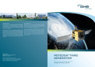
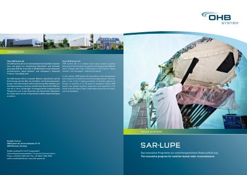
<strong>SAR</strong>-<strong>LUPE</strong><br />
Das innovative Programm zur satellitengestützten Radaraufklärung<br />
The innovative program for satellite-based radar reconnaissance
Der Blick durch die Wolken<br />
A view through the clouds<br />
»There can be<br />
no freedom<br />
without security.«<br />
(Wilhelm von Humboldt)<br />
<strong>SAR</strong>-Lupe ist Deutschlands erstes satellitengestütztes Aufklärungssystem.<br />
Für die Bundes regierung ist es unerlässlich, krisenhafte<br />
Entwick lungen weltweit frühzeitig zu erkennen und<br />
dabei einseitige Ab hängig keiten von Aufklä rungs bildern Dritter<br />
zu vermeiden. Deshalb hat sich das Bundesministerium der Verteidigung<br />
(BMVg) für <strong>SAR</strong>-Lupe entschieden. Im Rahmen des Programms<br />
hat <strong>OHB</strong> System <strong>AG</strong> als Hauptauftrag nehmer fünf baugleiche<br />
Satelliten entwickelt, ausgestattet mit höchst auflösendem<br />
Radar, die bei allen Wetterver hält nissen weltweite Informa tionen<br />
zu jeder Tages- und Nachtzeit liefern. Das System ist vollständig<br />
ausgebaut und befindet sich seit Dezember 2007 im operationellen<br />
Betrieb.<br />
Als Kernelement für eine europaweite strategische Aufklärung<br />
sollen die Bodensegmente von <strong>SAR</strong>-Lupe und dem französischen<br />
optischen Aufklärungs system Helios II in einem System verbund<br />
genutzt werden.<br />
<strong>SAR</strong>-Lupe is Germany’s first satellite-based reconnaissance system.<br />
It is essential for the Federal Government to identify and<br />
monitor regions of latent crisis at an early stage and to avoid unilateral<br />
dependencies in reconnais sance. Therefore the Federal<br />
Ministry of Defence (BMVg) opted for <strong>SAR</strong>-Lupe. Within the scope<br />
of the program <strong>OHB</strong> System <strong>AG</strong> as the prime contractor developed<br />
five identical satellites equipped with highest-resolution<br />
radar systems for providing world wide information under all<br />
weather conditions and at day and night time. The system has<br />
completely been built up and is in operational service since<br />
December 2007.<br />
The ground segments of <strong>SAR</strong>-Lupe and the French optical reconnaissance<br />
system Helios II are to be used jointly as the core element<br />
of European-wide strategic reconnaissance operations.<br />
Intersatellite-Link<br />
Intersatellite link<br />
Überblick Gesamtsystem<br />
Das <strong>SAR</strong>-Lupe-Gesamtsystem umfasst<br />
ein radargestütztes Aufklä rungs system<br />
mit fünf Satelliten von ca. 720 kg und<br />
ein entsprechendes Bodensegment zur<br />
Satelliten kont rolle und zum Empfang<br />
und zur Ver arbei tung der Bilddaten. Das<br />
System arbeitet wetterunabhängig bei<br />
Tag und Nacht und liefert von praktisch<br />
allen Gebieten der Erde aktuelle und<br />
sehr detaillierte Bilder.<br />
Bildaufnahme<br />
Image recording<br />
Datenübertragung<br />
Data download<br />
System overview<br />
The <strong>SAR</strong>-Lupe system comprises a spaceborne<br />
radar reconnaissance system with<br />
five satellites of approximately 720 kg<br />
weight, and a ground segment for controlling<br />
the satellites and for receiving<br />
and processing image data. The system<br />
is independent of weather conditions<br />
and operates day and night. It delivers<br />
up-to-date and highly detailed images<br />
from virtually all regions of the world.<br />
Auftragsübermittlung<br />
Command transmission<br />
><br />
><br />
Satellite<br />
ground<br />
segment<br />
><br />
><br />
User ground<br />
segment
Architektur des Raumsegments<br />
Architecture of the space segment<br />
Systemleistungen<br />
System performance<br />
Anzahl der Satelliten: 5, identisch<br />
Bahnebenen: 3<br />
Mittlere Höhe: ca. 500 km, optimiert<br />
für höhere Auflösung<br />
Bahninklination: ca. Polar, alle<br />
Anzahl der Satelliten in den Bahnebenen:<br />
Orbit 1: 2 Satelliten<br />
Orbit 2: 1 Satellit<br />
Orbit 3: 2 Satelliten<br />
Winkel zwischen den Bahnebenen<br />
und Phasenwinkel der Satelliten<br />
optimiert für eine kürzest mögliche<br />
Systemantwortzeit<br />
Number of satellites: 5 identical<br />
Orbit planes: 3<br />
Altitude: approx. 500 km, optimized<br />
on high resolution<br />
Inclination of orbits: approx. polar, all<br />
Number of satellites in orbit plane:<br />
Orbit 1: 2 satellites<br />
Orbit 2: 1 satellite<br />
Orbit 3: 2 satellites<br />
Angle between orbit planes and<br />
phase angles of the satellites<br />
optimized a shortest possible system<br />
response time<br />
Spot-light Modus<br />
Flugmanöver des Satelliten mit der fest<br />
installierten Antenne zur Erhöhung der<br />
Integrationszeit bei der <strong>SAR</strong>-Datenaufnahme.<br />
Die nominelle Geschwindig keit<br />
des Radarstrahls über dem Boden wird<br />
reduziert. Dadurch wird die Auflösung in<br />
Flugrichtung deutlich erhöht.<br />
Spot-light mode<br />
Flight maneuver of the whole satellite<br />
with the fixed antenna to increase the<br />
integration time at the scene.<br />
The nominal ground velocity is reduced.<br />
This increases the resolution in the flight<br />
direction significantly.<br />
Strip-map Modus<br />
Feste Antennenausrichtung.<br />
Die Ge schwindigkeit über dem Boden<br />
beträgt ca. 7 km/s.<br />
Strip-map mode<br />
Fixed direction of the antenna.<br />
The ground velocity is approx. 7 km/s.<br />
Haupteigenschaften eines <strong>SAR</strong>-Lupe-Satelliten<br />
Main characteristics of a <strong>SAR</strong>-Lupe Satellite<br />
<strong>SAR</strong>-Bildprodukte<br />
<strong>SAR</strong> image products<br />
Der Satellit besteht aus einem BUS und der <strong>SAR</strong>-Nutzlast.<br />
BUS: Der spezielle BUS erlaubt den Satelliten durch ihre Dreiachsenstabilisation<br />
eine hoch-präzise Ausrichtung zur Bildaufnahme.<br />
<strong>SAR</strong>: Die Gewinnung der Bilddaten erfolgt über eine fest installierte<br />
Parabol reflektorantenne auf jedem der baugleichen Satelliten.<br />
Ein spezielles Aufnahme ver fahren, das so genannte Synthetic<br />
Aperture Radar-, oder kurz <strong>SAR</strong>-Verfahren, ermöglicht die Gewinnung<br />
hochaufgelöster Bilder aus einer Höhe von rund 500 km.<br />
The satellite consist of a bus and the <strong>SAR</strong> payload.<br />
BUS: The three-axis stabilizers comprising the special BUS ensure highprecision<br />
alignment of the satellite for image-capturing purposes.<br />
<strong>SAR</strong>: The image data is generated by a fixed-installed parabolic<br />
reflector antenna on each of the identical satellites. A special<br />
imaging procedure, the Synthetic Aperture Radar-, <strong>SAR</strong> process<br />
for short, yields high-resolution images from a height of approximately<br />
500 km.<br />
Inverstest<br />
Um die Leistungsfähigkeit der Satelliten bereits am Boden zu<br />
demonstrieren, hat das aus namhaften europäischen Unternehmen<br />
bestehende <strong>SAR</strong>-Lupe-Team ein bisher einmaliges Testverfahren<br />
ent wi ckelt, den Inverstest. Hierbei werden die Satelliten am<br />
Boden auf die Internatio nale Raumstation ISS ausgerichtet und<br />
machen hochaufgelöste Radar bilder von der Station im Weltraum.<br />
Inverstest<br />
The <strong>SAR</strong>-Lupe team, which comprises renowned European companies,<br />
has developed a unique testing process known as Inverstest<br />
to demonstrate the capabilities of satellites on the ground.<br />
For this purpose, the satellite is aligned to the International<br />
Space Station ISS on the ground and produces high-resolution<br />
images of the space station in orbit.<br />
Größe: ca. 4 x 3 x 2 m<br />
Gewicht: ca. 720 kg<br />
Durchschn. Energieverbrauch: ca. 250 W<br />
Lebensdauer: 10 Jahre<br />
Zuverlässigkeit: besser als 97 % pro Jahr<br />
Telemetrie: verschlüsselte X-Band<br />
Datenübertragung, S-Band-Über tra gung<br />
von verschlüsselten Kommando- und<br />
Telemetriedaten über die Boden station<br />
und zwischen Satelliten<br />
Lageregelung: Reaktionsräder und<br />
Magnettorquer<br />
Bahnkontrolle: Flüssiggas-Triebwerke<br />
Intersatellite-Link: S-Band für Aufträge,<br />
verschlüsselt<br />
Size: approx. 4 x 3 x 2 m<br />
Weight: ca. 720 kg<br />
Average power comsumption: ca. 250 W<br />
Life time: 10 years<br />
Reliability: better than 97 % per year<br />
Telemetry: encrypted X-Band for data<br />
transmission, encrypted S-Band for<br />
commandand telemetry via ground<br />
station and intersatellite-link, encrypted<br />
Attitude control: by reaction wheels and<br />
magnetic torquers<br />
Orbit control: Liquid gas thrusters<br />
Intersatellite link: S-Band for orders,<br />
encrypted<br />
Geometrische Auflösung
Das Bodensegment<br />
The Ground Segment<br />
AUSBLICK<br />
VieW<br />
><br />
><br />
Satelliten-Bodensegment<br />
• Satellitenkontrolle<br />
• Kontrolle des Raumsegments<br />
• Empfang und Verarbeitung<br />
der Rohdaten<br />
• Automatischer Betrieb<br />
• Betriebsüberwachung<br />
und Wartung durch die<br />
<strong>OHB</strong> System <strong>AG</strong><br />
Satellite ground segment<br />
• Satellite Control<br />
• Control of space segment<br />
• Reception and processing<br />
of raw data<br />
• Automatic operation<br />
• Opteration, control<br />
and maintenance by<br />
<strong>OHB</strong> System <strong>AG</strong><br />
><br />
Satellite<br />
control<br />
Satellite<br />
mission<br />
planning<br />
Satelliten-Bodensegment<br />
(Betreiber: <strong>OHB</strong> System <strong>AG</strong>)<br />
Satellite ground segment<br />
(Operator: <strong>OHB</strong> System <strong>AG</strong>)<br />
Data<br />
reception<br />
Image<br />
generation<br />
><br />
<strong>SAR</strong>-Sat<br />
Basierend auf der im Rahmen von <strong>SAR</strong>-Lupe ent wickel ten Technologie<br />
ist neben der militärischen Aufklärung ein breites Spektrum<br />
an Erdbeobachtungs aufgaben realisierbar.<br />
Das System ist den Kundenwünschen entsprechend modular aufgebaut<br />
und ist u. a. einsetzbar für<br />
• Umweltschutz<br />
• Erforschung natürlicher Ressourcen<br />
• Katastrophenschutz<br />
• Überwachung von Anlagen<br />
• Geodätische Datenerfassung<br />
• Sicherheitsanwendungen<br />
• Aufklärungsmissionen<br />
<strong>SAR</strong>-Sat<br />
Based on the technology developed for <strong>SAR</strong>-Lupe, a wide range of<br />
terrestrial observation applications in addition to military reconnaissance<br />
activities can be realised.<br />
The system features a modular structure which can be tailored to<br />
meet customers‘ specific requirements and can be used for<br />
• Environmental protection<br />
• Exploration of natural resources<br />
• Disaster management<br />
• Monitoring of assets<br />
• Geodetic data<br />
• Security applications<br />
• Reconnaissance missions<br />
><br />
SGS<br />
control<br />
><br />
Industrie-Team<br />
Industrial team<br />
><br />
Nutzer-Bodensegment<br />
(Betreiber: Bundeswehr)<br />
User ground segment<br />
(Operator: German Federal<br />
Armed Forces)<br />
><br />
Die <strong>OHB</strong> System <strong>AG</strong> führte als Hauptauftragnehmer für das <strong>SAR</strong>-<br />
Lupe-System ein Industrie-Team aus namhaften nationalen und<br />
internationalen Partnern.<br />
As the prime contractor for the <strong>SAR</strong>-Lupe system <strong>OHB</strong> System <strong>AG</strong><br />
led an industrial team of renowned national and international<br />
partners.<br />
Nutzer-Bodensegment<br />
• Bildauswertung<br />
• Schnittstelle zum Kunden<br />
• Datenverarbeitung und<br />
Auswertung<br />
• Archivierung<br />
• Bedienung durch Nutzer<br />
User ground segment<br />
• Image exploitation<br />
• Interface to customer<br />
• Data processing and<br />
exploitation<br />
• Archiving<br />
• Operated by the user<br />
><br />
Ordercontrol<br />
Task<br />
preparation<br />
Archive<br />
Data pro -<br />
cessing and<br />
exploitation<br />
><br />
Satellitenbus/Satellite bus:<br />
<strong>OHB</strong> System, CGS, <strong>OHB</strong> Teledata,<br />
STS Systemtechnik Schwerin, RTG<br />
Radar Nutzlast/Radar payload:<br />
Tesat Spacecom, Thales Alenia Space, SAAB Space, RST<br />
Bodensegment/Ground segment:<br />
<strong>OHB</strong> System, CGS, EADS<br />
Satellitenstarts/Launches:<br />
Cosmos International, Rosoboronexport<br />
Start- und frühe Betriebsphase/Launch and early operation phase:<br />
DLR GSOC<br />
Training<br />
Operation<br />
Customer<br />
(military, other national, international)