Yuba County Airport Land Use Compatibility Plan
Yuba County Airport Land Use Compatibility Plan
Yuba County Airport Land Use Compatibility Plan

Create successful ePaper yourself
Turn your PDF publications into a flip-book with our unique Google optimized e-Paper software.
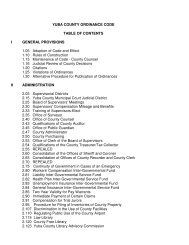
TABLE OF CONTENTS<br />
Chapter 2, continued<br />
Maps<br />
1 <strong>Compatibility</strong> Policy Map: <strong>Airport</strong> Influence Area ........................................ ff 2-46<br />
2 <strong>Compatibility</strong> Policy Map: Noise ................................................................... ff 2-46<br />
3 <strong>Compatibility</strong> Policy Map: Safety ..................................................................... ff 2-46<br />
4 <strong>Compatibility</strong> Policy Map: Airspace Protection ............................................. ff 2-46<br />
5 <strong>Compatibility</strong> Policy Map: Overflight .............................................................. ff 2-46<br />
6A Parcels Qualifying as Residential Infill – North ............................................. ff 2-46<br />
6B Parcels Qualifying as Residential Infill – South.............................................. ff 2-46<br />
Chapter 3 Background Data: <strong>Yuba</strong> <strong>County</strong> <strong>Airport</strong> and Environs<br />
OVERVIEW ........................................................................................................................... 3-1<br />
Location and History ................................................................................................ 3-1<br />
Facilities and Activity ............................................................................................... 3-1<br />
Surrounding <strong>Land</strong> <strong>Use</strong>s ........................................................................................... 3-2<br />
COMPATIBILITY PLANNING ASSUMPTIONS ..................................................................... 3-3<br />
Exhibits<br />
1 Airfield Features Summary .................................................................................. ff 3-3<br />
2 <strong>Airport</strong> Layout Diagram ...................................................................................... ff 3-3<br />
3 Airfield Activity Data Summary ......................................................................... ff 3-3<br />
4A Aircraft Flight Tracks: South Flow ................................................................... ff 3-3<br />
4B Aircraft Flight Tracks: North Flow .................................................................... ff 3-3<br />
5 Noise Impacts ....................................................................................................... ff 3-3<br />
6 <strong>Airport</strong> Environs Information ............................................................................ ff 3-3<br />
7 Existing <strong>Land</strong> <strong>Use</strong>s ............................................................................................... ff 3-3<br />
8A <strong>Plan</strong>ned <strong>Land</strong> <strong>Use</strong>s ............................................................................................... ff 3-3<br />
8B <strong>Plan</strong>ned <strong>Land</strong> <strong>Use</strong> Legends ................................................................................. ff 3-3<br />
Appendices<br />
A Foundations of <strong>Airport</strong> <strong>Land</strong> <strong>Use</strong> <strong>Compatibility</strong> <strong>Plan</strong>ning<br />
B State Laws Related to <strong>Airport</strong> <strong>Land</strong> <strong>Use</strong> <strong>Plan</strong>ning<br />
C Federal Aviation Regulations Part 77<br />
Figure C1 – FAR Part 77 Imaginary Surfaces<br />
Figure C2 – FAR Part 77 Filing Process<br />
Figure C3 – FAR Part 77 Notification<br />
D <strong>Compatibility</strong> Concepts<br />
Table D1 – Safety Zone Aircraft Accident Risk Characteristics<br />
Figure D1 – Noise Footprints of Selected Aircraft<br />
Figure D2 – General Aviation Accident Distribution Contours: All Arrivals<br />
Figure D3 – General Aviation Accident Distribution Contours: All Departures<br />
E Methods for Determining Concentrations of People<br />
Table E1 – Occupant Load Factors<br />
F General <strong>Plan</strong> Consistency Checklist<br />
G Sample Implementation Documents<br />
Table G1 – Sample <strong>Airport</strong> Combining Zone Components<br />
Table G2 – Typical Avigation Easement<br />
Table G3 – Sample Overflight Notification<br />
H Glossary<br />
ii <strong>Yuba</strong> <strong>County</strong> <strong>Airport</strong> <strong>Land</strong> <strong>Use</strong> <strong>Compatibility</strong> <strong>Plan</strong> (September 2010 Draft)