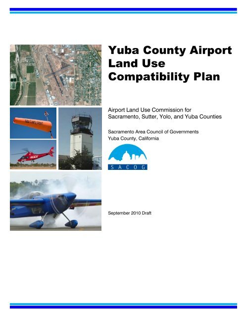
Yuba County Airport Land Use Compatibility Plan
Yuba County Airport Land Use Compatibility Plan
Yuba County Airport Land Use Compatibility Plan

You also want an ePaper? Increase the reach of your titles
YUMPU automatically turns print PDFs into web optimized ePapers that Google loves.
<strong>Yuba</strong> <strong>County</strong> <strong>Airport</strong><br />
<strong>Land</strong> <strong>Use</strong><br />
<strong>Compatibility</strong> <strong>Plan</strong><br />
<strong>Airport</strong> <strong>Land</strong> <strong>Use</strong> Commission for<br />
Sacramento, Sutter, Yolo, and <strong>Yuba</strong> Counties<br />
Sacramento Area Council of Governments<br />
<strong>Yuba</strong> <strong>County</strong>, California<br />
September 2010 Draft
<strong>Yuba</strong> <strong>County</strong> <strong>Airport</strong><br />
<strong>Land</strong> <strong>Use</strong> <strong>Compatibility</strong> <strong>Plan</strong><br />
Marysville, California<br />
September 2010 Draft<br />
Prepared for<br />
Sacramento Area Council of Governments<br />
Serving as<br />
<strong>Airport</strong> <strong>Land</strong> <strong>Use</strong> Commission<br />
for Sacramento, Sutter, Yolo and <strong>Yuba</strong> Counties<br />
Prepared by<br />
Mead & Hunt, Inc.<br />
Santa Rosa, California<br />
www.meadhunt.com<br />
In association with<br />
Environmental Science Associates<br />
Sacramento, California
Table of Contents<br />
Chapter 1 Introduction<br />
OVERVIEW OF THE PLAN ................................................................................................... 1-1<br />
AIRPORT LAND USE COMPATIBILITY PLANNING .......................................................... 1-1<br />
Purpose and Objective ............................................................................................. 1-1<br />
Relationship between ALUCs and <strong>County</strong> and City Governments .................. 1-2<br />
COMPATIBILITY PLAN POLICY FRAMEWORK .................................................................. 1-2<br />
State Laws and Guidelines ....................................................................................... 1-2<br />
<strong>Compatibility</strong> <strong>Plan</strong> Relationship to <strong>Airport</strong> <strong>Plan</strong>s................................................ 1-3<br />
COMPATIBILITY PLANNING FOR YUBA COUNTY AIRPORT........................................... 1-3<br />
Responsibilities .......................................................................................................... 1-3<br />
Sources of Information and Guidance .................................................................. 1-4<br />
GENERAL PLAN CONSISTENCY ......................................................................................... 1-4<br />
PLAN CONTENTS ................................................................................................................. 1-6<br />
Chapter 2 Policies<br />
1. GENERAL APPLICABILITY .................................................................................................. 2-1<br />
1.1 Purpose and <strong>Use</strong> ....................................................................................................... 2-1<br />
1.2 Definitions ................................................................................................................. 2-2<br />
1.3 Geographic Scope ..................................................................................................... 2-5<br />
1.4 Types of Actions Subject to ALUC Review ......................................................... 2-6<br />
2. REVIEW PROCESS ................................................................................................................ 2-9<br />
2.1 General ....................................................................................................................... 2-9<br />
2.2 Review Process for General <strong>Plan</strong>s, Specific <strong>Plan</strong>s, Zoning Ordinances,<br />
and Building Regulations ....................................................................................... 2-10<br />
2.3 Review Process for Major <strong>Land</strong> <strong>Use</strong> Actions ..................................................... 2-12<br />
2.4 Review Process for <strong>Airport</strong> Master <strong>Plan</strong>s and Development <strong>Plan</strong>s ................ 2-14<br />
3. BASIC COMPATIBILITY CRITERIA .................................................................................... 2-16<br />
3.1 Noise ......................................................................................................................... 2-16<br />
3.2 Safety ........................................................................................................................ 2-18<br />
3.3 Airspace Protection ................................................................................................ 2-24<br />
3.4 Overflight ................................................................................................................. 2-27<br />
4. ADDITIONAL COMPATIBILITY POLICIES ....................................................................... 2-29<br />
4.1 Special Conditions for <strong>Land</strong> <strong>Use</strong> Actions ........................................................... 2-29<br />
4.2 Site-Specific Exceptions ........................................................................................ 2-34<br />
4.3 General <strong>Plan</strong> Consistency with <strong>Compatibility</strong> <strong>Plan</strong> ........................................... 2-34<br />
4.4 <strong>Airport</strong> <strong>Plan</strong>s ........................................................................................................... 2-35<br />
Tables<br />
1 Noise <strong>Compatibility</strong> Criteria ................................................................................ 2-37<br />
2 Safety <strong>Compatibility</strong> Criteria ................................................................................ 2-41<br />
<strong>Yuba</strong> <strong>County</strong> <strong>Airport</strong> <strong>Land</strong> <strong>Use</strong> <strong>Compatibility</strong> <strong>Plan</strong> (September 2010 Draft) i
TABLE OF CONTENTS<br />
Chapter 2, continued<br />
Maps<br />
1 <strong>Compatibility</strong> Policy Map: <strong>Airport</strong> Influence Area ........................................ ff 2-46<br />
2 <strong>Compatibility</strong> Policy Map: Noise ................................................................... ff 2-46<br />
3 <strong>Compatibility</strong> Policy Map: Safety ..................................................................... ff 2-46<br />
4 <strong>Compatibility</strong> Policy Map: Airspace Protection ............................................. ff 2-46<br />
5 <strong>Compatibility</strong> Policy Map: Overflight .............................................................. ff 2-46<br />
6A Parcels Qualifying as Residential Infill – North ............................................. ff 2-46<br />
6B Parcels Qualifying as Residential Infill – South.............................................. ff 2-46<br />
Chapter 3 Background Data: <strong>Yuba</strong> <strong>County</strong> <strong>Airport</strong> and Environs<br />
OVERVIEW ........................................................................................................................... 3-1<br />
Location and History ................................................................................................ 3-1<br />
Facilities and Activity ............................................................................................... 3-1<br />
Surrounding <strong>Land</strong> <strong>Use</strong>s ........................................................................................... 3-2<br />
COMPATIBILITY PLANNING ASSUMPTIONS ..................................................................... 3-3<br />
Exhibits<br />
1 Airfield Features Summary .................................................................................. ff 3-3<br />
2 <strong>Airport</strong> Layout Diagram ...................................................................................... ff 3-3<br />
3 Airfield Activity Data Summary ......................................................................... ff 3-3<br />
4A Aircraft Flight Tracks: South Flow ................................................................... ff 3-3<br />
4B Aircraft Flight Tracks: North Flow .................................................................... ff 3-3<br />
5 Noise Impacts ....................................................................................................... ff 3-3<br />
6 <strong>Airport</strong> Environs Information ............................................................................ ff 3-3<br />
7 Existing <strong>Land</strong> <strong>Use</strong>s ............................................................................................... ff 3-3<br />
8A <strong>Plan</strong>ned <strong>Land</strong> <strong>Use</strong>s ............................................................................................... ff 3-3<br />
8B <strong>Plan</strong>ned <strong>Land</strong> <strong>Use</strong> Legends ................................................................................. ff 3-3<br />
Appendices<br />
A Foundations of <strong>Airport</strong> <strong>Land</strong> <strong>Use</strong> <strong>Compatibility</strong> <strong>Plan</strong>ning<br />
B State Laws Related to <strong>Airport</strong> <strong>Land</strong> <strong>Use</strong> <strong>Plan</strong>ning<br />
C Federal Aviation Regulations Part 77<br />
Figure C1 – FAR Part 77 Imaginary Surfaces<br />
Figure C2 – FAR Part 77 Filing Process<br />
Figure C3 – FAR Part 77 Notification<br />
D <strong>Compatibility</strong> Concepts<br />
Table D1 – Safety Zone Aircraft Accident Risk Characteristics<br />
Figure D1 – Noise Footprints of Selected Aircraft<br />
Figure D2 – General Aviation Accident Distribution Contours: All Arrivals<br />
Figure D3 – General Aviation Accident Distribution Contours: All Departures<br />
E Methods for Determining Concentrations of People<br />
Table E1 – Occupant Load Factors<br />
F General <strong>Plan</strong> Consistency Checklist<br />
G Sample Implementation Documents<br />
Table G1 – Sample <strong>Airport</strong> Combining Zone Components<br />
Table G2 – Typical Avigation Easement<br />
Table G3 – Sample Overflight Notification<br />
H Glossary<br />
ii <strong>Yuba</strong> <strong>County</strong> <strong>Airport</strong> <strong>Land</strong> <strong>Use</strong> <strong>Compatibility</strong> <strong>Plan</strong> (September 2010 Draft)
Chapter 1<br />
Introduction<br />
<strong>Yuba</strong> <strong>County</strong> <strong>Airport</strong> <strong>Land</strong> <strong>Use</strong> <strong>Compatibility</strong> <strong>Plan</strong>
OVERVIEW OF THE PLAN<br />
<strong>Yuba</strong> <strong>County</strong> <strong>Airport</strong> <strong>Land</strong> <strong>Use</strong> <strong>Compatibility</strong> <strong>Plan</strong> (September 2010 Draft) 1–1<br />
1<br />
Introduction<br />
This <strong>Yuba</strong> <strong>County</strong> <strong>Airport</strong> <strong>Land</strong> <strong>Use</strong> <strong>Compatibility</strong> <strong>Plan</strong> is one of a series of compatibility plans adopted by<br />
the Sacramento Area Council of Governments (SACOG) acting in its capacity as the <strong>Airport</strong> <strong>Land</strong> <strong>Use</strong><br />
Commission (ALUC) for Sacramento, Sutter, Yolo, and <strong>Yuba</strong> counties. The basic function of the plan<br />
is to promote compatibility between <strong>Yuba</strong> <strong>County</strong> <strong>Airport</strong> and the land uses surrounding it to the extent<br />
that these areas have not already been devoted to incompatible uses. The plan accomplishes this<br />
function through establishment of a set of compatibility criteria applicable to new development around<br />
the airport. Neither this <strong>Compatibility</strong> <strong>Plan</strong> nor the ALUC have authority over existing land uses or over<br />
operation of the airport.<br />
Geographically, the <strong>Compatibility</strong> <strong>Plan</strong> pertains to lands within the jurisdictions of the Counties of <strong>Yuba</strong><br />
and Sutter, together with the Cities of Marysville and <strong>Yuba</strong> City. Special districts, community college<br />
districts, and school districts within those jurisdictions are also subject to the provisions of the plan.<br />
The authority of the ALUC does not extend to state, federal, or tribal lands.<br />
AIRPORT LAND USE COMPATIBILITY PLANNING<br />
The creation of airport land use commissions and the preparation of airport land use compatibility<br />
plans are requirements of the California State Aeronautics Act (Public Utilities Code Section 21670 et<br />
seq.). Provisions for creation of ALUCs were first established under state law in 1967 (see Appendix B<br />
for a copy of the statutes). With limited exceptions, an ALUC is required in every county in the state.<br />
Furthermore, a compatibility plan is required for each public-use and military airport even in instances<br />
where an ALUC is not established.<br />
Purpose and Objective<br />
Although the law has been amended numerous times since its original enactment, the fundamental purpose<br />
of ALUCs to promote land use compatibility around airports has remained unchanged. As expressed<br />
in the present statutes, this purpose is:<br />
“...to protect public health, safety, and welfare by ensuring the orderly expansion of airports and<br />
the adoption of land use measures that minimize the public’s exposure to excessive noise and
CHAPTER 1 INTRODUCTION<br />
safety hazards within areas around public airports to the extent that these areas are not already<br />
devoted to incompatible uses.”<br />
The compatibility plans they adopt are the basic tools that ALUCs use to achieve this purpose. The ultimate<br />
objective of ALUCs, though, is to ensure that land use actions taken by local agencies also adhere<br />
to this purpose. ALUCs pursue this objective by reviewing the general plans, specific plans, zoning<br />
ordinances, building regulations, and certain individual development actions of local agencies for<br />
consistency with the policies and criteria in the applicable compatibility plan. ALUCs also review master<br />
plans and other development plans for civilian airports proposed by airport operators to determine<br />
if those plans are consistent with the compatibility plan or if modifications should be made to the compatibility<br />
plan to reflect current airport planning.<br />
Relationship between ALUCs and <strong>County</strong> and City Governments<br />
The relationship between ALUCs and the governments of the counties and the cities within their jurisdiction<br />
is set forth in the State Aeronautics Act. For the most part, ALUCs act independently from the<br />
local land use jurisdictions. ALUCs must consult with the involved agencies regarding establishment of<br />
airport influence area boundaries (Public Utilities Code Section 21675(c)), but otherwise have the authority<br />
to adopt compatibility plans without approval from county or city governing bodies. ALUCs,<br />
though, do not have the authority to implement their own compatibility policies.<br />
The responsibility for implementation of ALUC-adopted compatibility plans rests with the affected local<br />
agencies. Government Code Section 65302.3 establishes that each county and city affected by an<br />
airport land use compatibility plan must make its general plan and any applicable specific plans consistent<br />
with the ALUC compatibility plan. Alternatively, local agencies can take the series of steps listed in<br />
the Public Utilities Code and described later in this chapter to overrule the ALUC policies.<br />
Local agencies’ other responsibility is to submit their plans and certain other proposed land use actions<br />
to the ALUC for review and determination of those actions’ consistency with the ALUC’s compatibility<br />
plan. Proposed adoption or amendment of general plans, specific plans, zoning ordinances, and building<br />
regulations always must be submitted to the ALUC. However, other actions such as ones associated<br />
with individual development proposals are subject to ALUC review only until such time as the<br />
agency’s general plan and specific plans have been made consistent with the ALUC plan or the agency<br />
has overruled the ALUC.<br />
COMPATIBILITY PLAN POLICY FRAMEWORK<br />
State Laws and Guidelines<br />
Many of the procedures that govern how ALUCs operate are defined by state law. As noted earlier,<br />
statutory provisions in the Public Utilities Code establish the requirements for ALUC adoption of<br />
compatibility plans, which airports must have these plans, and some of the steps involved in plan adoption.<br />
The law also dictates the requirements for airport land use compatibility reviews by the ALUC.<br />
The types of actions that local jurisdictions must submit for review are specified, for example.<br />
With respect to airport land use compatibility criteria, the statutes say little however. Instead, a section<br />
of the law enacted in 1994 refers to another document, the <strong>Airport</strong> <strong>Land</strong> <strong>Use</strong> <strong>Plan</strong>ning Handbook published<br />
by the California Division of Aeronautics. Specifically, the statutes say that, when preparing<br />
1–2 <strong>Yuba</strong> <strong>County</strong> <strong>Airport</strong> <strong>Land</strong> <strong>Use</strong> <strong>Compatibility</strong> <strong>Plan</strong> (September 2010 Draft)
INTRODUCTION CHAPTER 1<br />
compatibility plans for individual airports, ALUCs shall “be guided by” the information contained in<br />
the Handbook. The Handbook is not regulatory in nature, however, and it does not constitute formal<br />
state policy except to the extent that it explicitly refers to state laws. Rather, its guidance is intended to<br />
serve as the starting point for compatibility planning around individual airports.<br />
The policies and maps in this <strong>Yuba</strong> <strong>County</strong> <strong>Airport</strong> <strong>Land</strong> <strong>Use</strong> <strong>Compatibility</strong> <strong>Plan</strong> take into account the guidance<br />
provided by the current edition of the Handbook, dated January 2002.<br />
An additional function of the <strong>Airport</strong> <strong>Land</strong> <strong>Use</strong> <strong>Plan</strong>ning Handbook is established elsewhere in California<br />
state law. The Public Resources Code creates a tie between the Handbook and California Environmental<br />
Quality Act (CEQA) documents. Specifically, Section 21096 requires that lead agencies must use the<br />
Handbook as “a technical resource” when assessing airport-related noise and safety impacts of projects<br />
located in the vicinity of airports.<br />
The January 2002 edition of the Handbook is available for downloading from the Division of Aeronautics<br />
web site (www.dot.ca.gov/hq/planning/aeronaut).<br />
<strong>Compatibility</strong> <strong>Plan</strong> Relationship to <strong>Airport</strong> <strong>Plan</strong>s<br />
<strong>Airport</strong> land use compatibility plans are distinct from airport master plans and other types of airport<br />
development plans, but are closely connected to them. In simple terms, airport master plans are<br />
adopted by the agency that owns and/or operates the airport. Master plans primarily address onairport<br />
issues. In contrast, compatibility plans are normally adopted by an ALUC and are concerned<br />
with issues affecting surrounding lands.<br />
The principal connection between the two types of plans stems from the California Public Utilities<br />
Code. Specifically, Section 21675(a) requires that ALUC plans be based upon a long-range airport master<br />
plan adopted by the airport owner/proprietor or, if such a plan does not exist for a particular airport,<br />
an airport layout plan may be used with the approval of the California Division of Aeronautics.<br />
Furthermore, the compatibility plan must reflect “the anticipated growth of the airport during at least<br />
the next 20 years.”<br />
The connection works in both directions, however. While a compatibility plan must be based upon an<br />
airport master plan, Public Utilities Code Section 21676(c) requires that any proposed modification to<br />
an airport master plan be submitted to the ALUC to determine if the proposal is consistent with the<br />
compatibility plan. Provided that the off-airport compatibility implications of the proposed modifications<br />
are adequately addressed in the master plan, the outcome of this process usually is that the compatibility<br />
plan will need to be updated to mirror the new master plan.<br />
COMPATIBILITY PLANNING FOR YUBA COUNTY AIRPORT<br />
Responsibilities<br />
The responsibility for preparation of a compatibility plan for the <strong>Yuba</strong> <strong>County</strong> <strong>Airport</strong> environs rests<br />
with SACOG which serves as the ALUC for Sacramento, Sutter, Yolo, and <strong>Yuba</strong> counties in<br />
accordance with the designated body provisions of Public Utilities Code Section 21670.1. The counties<br />
of El Dorado and Placer, though although members of SACOG, have their own ALUCs.<br />
<strong>Yuba</strong> <strong>County</strong> <strong>Airport</strong> <strong>Land</strong> <strong>Use</strong> <strong>Compatibility</strong> <strong>Plan</strong> (September 2010 Draft) 1–3
CHAPTER 1 INTRODUCTION<br />
<strong>Yuba</strong> <strong>County</strong> <strong>Airport</strong> is situated on the western edge of <strong>Yuba</strong> <strong>County</strong>. Although most of the airport’s<br />
impacts are confined to lands within the county, including the City of Marysville, adjacent Sutter<br />
<strong>County</strong> and the City of <strong>Yuba</strong> City are also affected to some extent. Because SACOG’s ALUC<br />
jurisdiction includes both <strong>Yuba</strong> and Sutter counties, this <strong>Compatibility</strong> <strong>Plan</strong> applies within each of these<br />
counties and also their incorporated cities.<br />
This <strong>Compatibility</strong> <strong>Plan</strong> replaces an earlier plan—<strong>Yuba</strong> <strong>County</strong> <strong>Airport</strong> Comprehensive <strong>Land</strong> <strong>Use</strong> <strong>Plan</strong>—which<br />
the ALUC adopted for the airport in 1994.<br />
Sources of Information and Guidance<br />
As required by California state law, the California <strong>Airport</strong> <strong>Land</strong> <strong>Use</strong> <strong>Plan</strong>ning Handbook provides guidance<br />
for the compatibility policies set forth in this <strong>Yuba</strong> <strong>County</strong> <strong>Airport</strong> <strong>Land</strong> <strong>Use</strong> <strong>Compatibility</strong> <strong>Plan</strong>. The Handbook<br />
was used both to structure and define compatibility criteria and to establish the procedures to be<br />
followed by the ALUC and local agencies in implementation of the criteria.<br />
The <strong>Yuba</strong> <strong>County</strong> <strong>Airport</strong> Master <strong>Plan</strong> adopted by the <strong>Yuba</strong> <strong>County</strong> Board of Supervisors in October 2008<br />
is the primary source of information used in this <strong>Compatibility</strong> <strong>Plan</strong> regarding the <strong>County</strong>’s long-range<br />
development proposals for the airport. These development proposals include future extension of the<br />
primary runway southward by an additional 1,000 feet to a total length of 7,000 feet.<br />
With respect to aircraft activity projections, the <strong>Compatibility</strong> <strong>Plan</strong> again primarily relies upon data contained<br />
in the <strong>Airport</strong> Master <strong>Plan</strong>. The 2028 activity forecast contained in that plan remains reasonable as<br />
the 20-year forecast for the purposes of this <strong>Compatibility</strong> <strong>Plan</strong>. This forecast anticipates aircraft operations<br />
increasing from an estimated 35,000 takeoffs and landings in 2007/2008 to approximately 57,000<br />
in 20+ years.<br />
Finally, a Technical Advisory Committee (TAC) was established specifically for the <strong>Compatibility</strong> <strong>Plan</strong><br />
project. The committee’s primary membership consists of staff from the <strong>Yuba</strong> <strong>County</strong> <strong>Plan</strong>ning Department,<br />
Sutter <strong>County</strong> <strong>Plan</strong>ning Division, <strong>Yuba</strong> <strong>County</strong> <strong>Airport</strong>, and SACOG. <strong>Plan</strong>ning staffs from<br />
the affected cities also participate. The TAC is assisting with providing airport and land use data, reviewing<br />
discussion papers and draft materials, and providing comments for consideration in the draft<br />
plan. [Paragraph to be updated once plan is adopted]<br />
GENERAL PLAN CONSISTENCY<br />
As noted above, each local agency having jurisdiction over land uses within an ALUC’s planning area is<br />
required by state law to modify its general plan and any affected specific plans to be consistent with the<br />
compatibility plan. The law says that the local agency must take this action within 180 days of when the<br />
ALUC adopts or amends its plan.<br />
The only other course of action available to local agencies is to overrule the ALUC by a two-thirds vote<br />
of its governing body after making findings that the agency’s plans are consistent with the intent of<br />
state airport land use planning statutes. Additionally, the local agency must provide both the ALUC<br />
and the California Department of Transportation, Division of Aeronautics, with a copy of the local<br />
agency’s proposed decision and findings at least 45 days in advance of its decision to overrule and must<br />
hold a public hearing on the proposed overruling (Public Utilities Code Section 21676(a) and (b)). The<br />
ALUC and the Division of Aeronautics may provide comments to the local agency within 30 days of<br />
receiving the proposed decision and findings. If comments are submitted, the local agency must in-<br />
1–4 <strong>Yuba</strong> <strong>County</strong> <strong>Airport</strong> <strong>Land</strong> <strong>Use</strong> <strong>Compatibility</strong> <strong>Plan</strong> (September 2010 Draft)
INTRODUCTION CHAPTER 1<br />
clude them in the public record of the final decision to overrule the ALUC (Sections 21676, 21676.5<br />
and 21677.) Note that similar requirements apply to local agency overruling of ALUC actions concerning<br />
individual development proposals for which ALUC review is mandatory (Section 21676.5(a)) and<br />
airport master plans (Section 21676(c)).<br />
A general plan does not need to be identical with the ALUC compatibility plan in order to be consistent<br />
with the compatibility plan. To meet the consistency test, a general plan must do two things:<br />
� It must specifically address compatibility planning issues, either directly or through reference to a<br />
zoning ordinance or other policy document; and<br />
� It must avoid direct conflicts with compatibility planning criteria.<br />
The land use jurisdictions affected by this <strong>Yuba</strong> <strong>County</strong> <strong>Airport</strong> <strong>Land</strong> <strong>Use</strong> <strong>Compatibility</strong> <strong>Plan</strong> may need to<br />
modify their general plans, specific plans, and other policy documents for consistency with the <strong>Compatibility</strong><br />
<strong>Plan</strong>. It must be emphasized, however, that local agencies need not change land use designations<br />
to bring them into consistency with the ALUC criteria if the current designations merely reflect existing<br />
development. They merely would need to establish policies to ensure that the nonconforming uses<br />
would not be expanded in a manner inconsistent with this <strong>Compatibility</strong> <strong>Plan</strong> and that any redevelopment<br />
of the affected areas would be made consistent with the compatibility criteria.<br />
<strong>Compatibility</strong> planning issues can be reflected in a general plan in several ways:<br />
� Incorporate Policies into Existing General <strong>Plan</strong> Elements—One method of achieving the necessary<br />
planning consistency is to modify existing general plan elements. For example, airport land<br />
use noise policies could be inserted into the noise element, safety policies could be placed into a<br />
safety element and the primary compatibility criteria and associated maps plus the procedural policies<br />
might fit into the land use element. With this approach, direct conflicts would be eliminated and<br />
the majority of the mechanisms and procedures necessary to ensure compliance with compatibility<br />
criteria could be fully incorporated into the local jurisdiction’s general plan.<br />
� Adopt a General <strong>Plan</strong> <strong>Airport</strong> Element—Another approach is to prepare a separate airport element<br />
of the general plan. Such a format may be advantageous when the community’s general plan<br />
also needs to address on-airport development and operational issues. Modification of other plan<br />
elements to provide cross-referencing and eliminate conflicts would still be necessary.<br />
� Adopt <strong>Compatibility</strong> <strong>Plan</strong> as Stand-Alone Document—Jurisdictions selecting this option would<br />
simply adopt as a local policy document the relevant portions of the <strong>Yuba</strong> <strong>County</strong> <strong>Airport</strong> <strong>Land</strong> <strong>Use</strong><br />
<strong>Compatibility</strong> <strong>Plan</strong>—specifically, the policies and maps in Chapters 2. Applicable background information<br />
from Chapter 3 could be included as well if desired. Changes to the community’s existing<br />
general plan would be minimal. Policy reference to the <strong>Compatibility</strong> <strong>Plan</strong> would need to be added<br />
and any direct land use or other conflicts with compatibility planning criteria would have to be removed.<br />
Limited discussion of compatibility planning issues could be included in the general plan,<br />
but the substance of most compatibility policies would appear only in the stand-alone document.<br />
� Adopt <strong>Airport</strong> Combining District or Overlay Zoning Ordinance—This approach is similar to<br />
the stand-alone document except that the local jurisdiction would not explicitly adopt the <strong>Compatibility</strong><br />
<strong>Plan</strong> as policy. Instead, the compatibility policies would be restructured as an airport combining or<br />
overlay zoning ordinance. A combining zone serves as an overlay of standard community-wide land<br />
use zones and modifies or limits the uses permitted by the underlying zone. Flood hazard combining<br />
zoning is a common example. An airport combining zone ordinance can serve as a convenient<br />
<strong>Yuba</strong> <strong>County</strong> <strong>Airport</strong> <strong>Land</strong> <strong>Use</strong> <strong>Compatibility</strong> <strong>Plan</strong> (September 2010 Draft) 1–5
CHAPTER 1 INTRODUCTION<br />
means of bringing various airport compatibility criteria into one place. The airport-related heightlimit<br />
zoning that many jurisdictions have adopted as a means of protecting airport airspace is a form<br />
of combining district zoning. Noise and safety compatibility criteria, together with procedural policies,<br />
would need to be added to create a complete airport compatibility zoning ordinance. Other<br />
than where direct conflicts need to be eliminated from the local plans, implementation of the compatibility<br />
policies would be accomplished solely through the zoning ordinance. Policy reference to<br />
airport compatibility in the general plan could be as simple as mentioning support for the airport<br />
land use commission and stating that policy implementation is by means of the combining zone.<br />
(An outline of topics which could be addressed in an airport combining zone is included in Appendix<br />
G.)<br />
PLAN CONTENTS<br />
This <strong>Yuba</strong> <strong>County</strong> <strong>Airport</strong> <strong>Land</strong> <strong>Use</strong> <strong>Compatibility</strong> <strong>Plan</strong> is complete unto itself and is separate and independent<br />
from other compatibility plans adopted by the Sacramento Area Council of Governments, acting<br />
as the <strong>Airport</strong> <strong>Land</strong> <strong>Use</strong> Commission for Sacramento, Sutter, Yolo, and <strong>Yuba</strong> Counties. The <strong>Compatibility</strong><br />
<strong>Plan</strong> is organized into three chapters and a set of appendices. The intent of this introductory chapter<br />
is to set the overall context of airport land use compatibility planning in general and for <strong>Yuba</strong> <strong>County</strong><br />
<strong>Airport</strong> in particular.<br />
The most important components of the plan are found in Chapter 2. That chapter contains the policies<br />
by which the ALUC operates and conducts compatibility reviews of proposed land use and airport development<br />
actions. It also specifies the compatibility criteria and other policies applicable specifically to<br />
<strong>Yuba</strong> <strong>County</strong> <strong>Airport</strong>. Chapter 3 presents various background data regarding features, impacts, and<br />
environs of <strong>Yuba</strong> <strong>County</strong> <strong>Airport</strong>. Chapter 3 also serves to document the data and assumptions upon<br />
which the compatibility policy maps for the airport are based.<br />
Also included in this document are a set of appendices containing a copy of state statutes concerning<br />
airport land use commissions and other general information pertaining to airport land use compatibility<br />
planning. This material is mostly taken from other sources and does not represent ALUC policy except<br />
where cited as such in Chapter 2—specifically the state ALUC statutes and certain other laws (Appendix<br />
B) and Federal Aviation Regulations Part 77 (Appendix C).<br />
Separately from this draft plan document, an Initial Study of environmental impacts is being prepared<br />
pursuant to the requirements of the CEQA. Issues to be addressed will include those identified in the<br />
2007 California Supreme Court decision in Muzzy Ranch Company v. Solano <strong>Airport</strong> <strong>Land</strong> <strong>Use</strong> Commission.<br />
These issues include assessment of the potential future displacement of residential and nonresidential<br />
land use development as a result of implementation of the <strong>Yuba</strong> <strong>County</strong> <strong>Airport</strong> <strong>Land</strong> <strong>Use</strong> <strong>Compatibility</strong><br />
<strong>Plan</strong>. [Paragraph to be updated once plan is adopted]<br />
1–6 <strong>Yuba</strong> <strong>County</strong> <strong>Airport</strong> <strong>Land</strong> <strong>Use</strong> <strong>Compatibility</strong> <strong>Plan</strong> (September 2010 Draft)
Chapter 2<br />
Policies<br />
<strong>Yuba</strong> <strong>County</strong> <strong>Airport</strong> <strong>Land</strong> <strong>Use</strong> <strong>Compatibility</strong> <strong>Plan</strong>
1. GENERAL APPLICABILITY<br />
1.1. Purpose and <strong>Use</strong><br />
<strong>Yuba</strong> <strong>County</strong> <strong>Airport</strong> <strong>Land</strong> <strong>Use</strong> <strong>Compatibility</strong> <strong>Plan</strong> (September 2010 Draft) 2–1<br />
2<br />
Policies<br />
1.1.1. Basic Purpose: The basic purpose of this <strong>Yuba</strong> <strong>County</strong> <strong>Airport</strong> <strong>Land</strong> <strong>Use</strong> <strong>Compatibility</strong> <strong>Plan</strong> is to<br />
articulate procedures and criteria, established in accordance with the California State Aeronautics<br />
Act (Public Utilities Code Section 21670 et seq.), applicable to airport land use<br />
compatibility planning in the vicinity of <strong>Yuba</strong> <strong>County</strong> <strong>Airport</strong>.<br />
1.1.2. <strong>Use</strong> by Particular Governmental Agencies: The Sacramento Area Council of Governments and<br />
local agencies (see Policy 1.2.15) shall use the policies in this <strong>Compatibility</strong> <strong>Plan</strong> in the manner<br />
indicated below.<br />
(a) Sacramento Area Council of Governments (SACOG): Acting in its capacity as the<br />
<strong>Airport</strong> <strong>Land</strong> <strong>Use</strong> Commission (ALUC) for Sacramento, Sutter, Yolo, and <strong>Yuba</strong><br />
Counties, SACOG has formally adopted this <strong>Compatibility</strong> <strong>Plan</strong>. When a land use or<br />
airport-related action is submitted to the ALUC for review in accordance with state<br />
law and as provided for by Section 1.4 of this <strong>Compatibility</strong> <strong>Plan</strong>, the ALUC shall determine<br />
whether such action is consistent with the criteria set forth herein.<br />
(b) Any county or city having jurisdiction over land uses within the portion of the <strong>Yuba</strong><br />
<strong>County</strong> <strong>Airport</strong> influence area lying within the Counties of <strong>Yuba</strong> and Sutter (see Policy<br />
1.3.2(a)) shall:<br />
(1) As required by state law (Public Utilities Code Section 21676(a)), modify its respective<br />
general plan and zoning ordinance to be consistent with the policies in<br />
the <strong>Compatibility</strong> <strong>Plan</strong>.<br />
(2) Utilize the <strong>Compatibility</strong> <strong>Plan</strong>, either directly or as reflected in the appropriately<br />
modified general plan and zoning ordinance, when making other planning decisions<br />
regarding proposed development of lands with the <strong>Yuba</strong> <strong>County</strong> <strong>Airport</strong> influence<br />
area.<br />
(3) Submit proposed land use actions for review by the ALUC as specified by Policies<br />
1.4.1 and 1.4.2 herein.<br />
(c) Special districts, school districts, and community college districts shall:<br />
(1) Apply the policies of this <strong>Compatibility</strong> <strong>Plan</strong> when creating plans and making other<br />
planning decisions regarding the proposed development of lands under their control<br />
with the <strong>Yuba</strong> <strong>County</strong> <strong>Airport</strong> influence area.
CHAPTER 2 POLICIES<br />
(2) Submit proposed land use actions for review by the ALUC as specified by Policy<br />
1.4.2 herein.<br />
1.1.3. Effective Date: The policies in this <strong>Yuba</strong> <strong>County</strong> <strong>Airport</strong> <strong>Land</strong> <strong>Use</strong> <strong>Compatibility</strong> <strong>Plan</strong> shall become<br />
effective as of the date that SACOG acting in its capacity as the <strong>Airport</strong> <strong>Land</strong> <strong>Use</strong><br />
Commission for Sacramento, Sutter, Yolo, and <strong>Yuba</strong> Counties adopts the plan.<br />
1.2. Definitions<br />
(a) The previous compatibility plan for the airport, <strong>Yuba</strong> <strong>County</strong> <strong>Airport</strong> Comprehensive <strong>Land</strong><br />
<strong>Use</strong> <strong>Plan</strong>, was adopted by the ALUC in 1994. The earlier plan shall remain in effect<br />
until ALUC adoption of this <strong>Yuba</strong> <strong>County</strong> <strong>Airport</strong> <strong>Land</strong> <strong>Use</strong> <strong>Compatibility</strong> <strong>Plan</strong> and shall<br />
again become effective if the entirety of this <strong>Compatibility</strong> <strong>Plan</strong> were to be invalidated by<br />
court action.<br />
(b) Any project or phase of a project that has received local agency approvals sufficient to<br />
qualify it as an existing land use (see definition in Policy 1.2.12) prior to the date of the<br />
ALUC’s adoption of this <strong>Compatibility</strong> <strong>Plan</strong> shall not be required to comply with the<br />
policies herein. Rather, the policies of the 1994 compatibility plan shall apply.<br />
The following definitions apply for the purposes of the policies set forth in this <strong>Compatibility</strong> <strong>Plan</strong>.<br />
Additional terms are defined in the Glossary (Appendix H).<br />
1.2.1. Aeronautics Act: Except as indicated otherwise, the article of the California Public Utilities<br />
Code (Sections 21670 et seq.) pertaining to airport land use commissions and airport land<br />
use compatibility planning.<br />
1.2.2. <strong>Airport</strong>: <strong>Yuba</strong> <strong>County</strong> <strong>Airport</strong>, a public-use airport owned by the <strong>County</strong> of <strong>Yuba</strong>.<br />
1.2.3. <strong>Airport</strong> Influence Area: An area, as delineated herein, in which current or future airportrelated<br />
noise, overflight, safety, or airspace protection factors may significantly affect land<br />
uses or necessitate restrictions on those uses. The airport influence area constitutes the area<br />
within which certain land use actions are subject to ALUC review to determine consistency<br />
with the policies herein.<br />
1.2.4. <strong>Airport</strong> <strong>Land</strong> <strong>Use</strong> Commission (ALUC): The Sacramento Area Council of Governments<br />
(SACOG) acting in its capacity as the <strong>Airport</strong> <strong>Land</strong> <strong>Use</strong> Commission for Sacramento, Sutter,<br />
Yolo, and <strong>Yuba</strong> Counties.<br />
1.2.5. <strong>Airport</strong> <strong>Land</strong> <strong>Use</strong> Commission Secretary: The Executive Director of SACOG or a person designated<br />
by the Executive Director with the concurrence of the SACOG Chairperson.<br />
1.2.6. Airspace Protection Area: The area beneath the airspace protection surfaces for <strong>Yuba</strong> <strong>County</strong><br />
<strong>Airport</strong> as depicted on the <strong>Compatibility</strong> Policy Map: Airspace Protection.<br />
1.2.7. Airspace Protection Surfaces: Imaginary surfaces in the airspace surrounding the <strong>Yuba</strong> <strong>County</strong><br />
<strong>Airport</strong> defined in accordance with criteria set forth in Federal Aviation Regulations Part<br />
77 and the U.S. Standard for Terminal Instrument Procedures (TERPS). These surfaces<br />
establish the maximum height that objects on the ground can reach without potentially<br />
creating constraints or hazards to the use of the airspace by aircraft approaching, departing,<br />
or maneuvering in the vicinity of the airport.<br />
1.2.8. Aviation-Related <strong>Use</strong>: Any facility or activity directly associated with the air transportation<br />
of persons or cargo or the operation, storage, or maintenance of aircraft at an airport or<br />
2–2 <strong>Yuba</strong> <strong>County</strong> <strong>Airport</strong> <strong>Land</strong> <strong>Use</strong> <strong>Compatibility</strong> <strong>Plan</strong> (September 2010 Draft)
POLICIES CHAPTER 2<br />
heliport. Such uses specifically include, but are not limited to, runways, taxiways, and their<br />
associated protection areas defined by the Federal Aviation Administration, together with<br />
aircraft aprons, hangars, fixed base operations facilities, terminal buildings, etc.<br />
1.2.9. Avigation Easement: An easement that conveys rights associated with aircraft overflight of a<br />
property, including but not limited to creation of noise and limits on the height of structures<br />
and trees, etc. (see Appendix G).<br />
1.2.10. Community Noise Equivalent Level (CNEL): The noise metric adopted by the State of California<br />
for land use planning purposes, including describing airport noise impacts. The<br />
noise impacts are typically depicted by a set of contours, each of which represents points<br />
having the same CNEL value.<br />
1.2.11. <strong>Compatibility</strong> <strong>Plan</strong>: This document, the <strong>Yuba</strong> <strong>County</strong> <strong>Airport</strong> <strong>Land</strong> <strong>Use</strong> <strong>Compatibility</strong> <strong>Plan</strong>.<br />
1.2.12. Existing <strong>Land</strong> <strong>Use</strong>: A land use that either physically exists or for which local agency (see<br />
Policy 1.2.15) commitments to the proposal have been obtained.<br />
(a) Local agency commitment to a proposal can usually be considered firm once one or<br />
more of the following have occurred:<br />
(1) A tentative parcel or subdivision map has been approved and not expired;<br />
(2) A vesting tentative parcel or subdivision map has been approved;<br />
(3) A development agreement has been approved and remains in effect;<br />
(4) A final subdivision map has been recorded;<br />
(5) A use permit or other discretionary entitlement has been approved and not yet<br />
expired; or<br />
(6) A valid building permit has been issued.<br />
(b) The determination as to whether a specific project meets the above criteria is to be<br />
made by the local agency involved.<br />
1.2.13. Federal Aviation Regulations (FAR) Part 77: The part of Federal Aviation Regulations that<br />
deals with objects affecting navigable airspace in the vicinity of airports. Objects that exceed<br />
the Part 77 height limits constitute airspace obstructions. FAR Part 77 establishes<br />
standards for identifying obstructions to navigable airspace, sets forth requirements for<br />
notice to the FAA of certain proposed construction or alteration, and provides for aeronautical<br />
studies of obstructions to determine their effect on the safe and efficient use of<br />
airspace. (See Appendix C of this <strong>Compatibility</strong> <strong>Plan</strong> for the text of FAR Part 77; also see<br />
Glossary).<br />
1.2.14. Infill: Development of vacant or underutilized land within established communities or<br />
neighborhoods that are: (a) already served with streets, water, sewer, and other infrastructure;<br />
and (b) comprised of existing uses inconsistent with the compatibility criteria set<br />
forth in this <strong>Compatibility</strong> <strong>Plan</strong>. See Policy 4.1.1(a)(1) for criteria used to identify infill areas<br />
for the purposes of this <strong>Compatibility</strong> <strong>Plan</strong>.<br />
1.2.15. Local Agency: For the purposes of this <strong>Compatibility</strong> <strong>Plan</strong>, any county, city, or other local<br />
governmental entity such as a special district, school district, or community college district—including<br />
any future city or district—having jurisdictional territory lying within the<br />
<strong>Yuba</strong> <strong>County</strong> <strong>Airport</strong> influence area as defined herein. These entities are subject to the<br />
provisions of this <strong>Compatibility</strong> <strong>Plan</strong>.<br />
<strong>Yuba</strong> <strong>County</strong> <strong>Airport</strong> <strong>Land</strong> <strong>Use</strong> <strong>Compatibility</strong> <strong>Plan</strong> (September 2010 Draft) 2–3
CHAPTER 2 POLICIES<br />
1.2.16. Major <strong>Land</strong> <strong>Use</strong> Action: Actions related to proposed land uses for which compatibility with<br />
airport activity is a particular concern, but for which ALUC review is not always mandatory<br />
under state law. These types of actions are listed in Policy 1.4.3.<br />
1.2.17. Noise Impact Area: The area within which the noise impacts, measured in terms of CNEL,<br />
generated by the airport may represent a land use compatibility concern. The noise impact<br />
area for <strong>Yuba</strong> <strong>County</strong> <strong>Airport</strong> is depicted on Map 2.<br />
1.2.18. Noise-Sensitive <strong>Land</strong> <strong>Use</strong>s: <strong>Land</strong> uses for which the associated primary activities, whether indoor<br />
or outdoor, are susceptible to disruption by loud noise events. The most common<br />
types of noise sensitive land uses include, but are not limited to, the following: residential,<br />
hospitals, nursing facilities, intermediate care facilities, educational facilities, libraries, museums,<br />
places of worship, child-care facilities, and certain types of passive recreational<br />
parks and open space.<br />
1.2.19. Nonconforming <strong>Use</strong>: An existing land use that does not comply with the compatibility criteria<br />
set forth in this <strong>Compatibility</strong> <strong>Plan</strong>. See Policy 4.1.2 for criteria applicable to land use actions<br />
involving nonconforming uses.<br />
1.2.20. Overrule: An action that a local agency can take in accordance with provisions of state law<br />
if it wishes to proceed with adoption or amendment of a general plan or specific plan,<br />
adoption or approval of a zoning ordinance or building regulation, or modification of an<br />
airport master plan (Public Utilities Code Sections 21676(a), (b), and (c)) or, under conditions<br />
specified in Section 1.4.2(a), a major land use action (Public Utilities Code Section<br />
21676.5(a)) affecting the airport influence area in spite of an ALUC finding that the action<br />
is inconsistent with this <strong>Compatibility</strong> <strong>Plan</strong>. Overruling requires a 45-day notice to the<br />
ALUC and the California Division of Aeronautics, specific findings that the proposed action<br />
is consistent with the purposes of the ALUC statutes as defined in Public Utilities<br />
Code Section 21670(a), a public hearing, and action by a two-thirds vote of the local agency’s<br />
governing body.<br />
1.2.21. Project; <strong>Land</strong> <strong>Use</strong> Action; Development Proposal: Terms similar in meaning and all referring to<br />
the types of land use matters, either publicly or privately sponsored, that are subject to the<br />
provisions of this <strong>Compatibility</strong> <strong>Plan</strong>.<br />
1.2.22. Real Estate Transaction Disclosure: A form of buyer awareness documentation required by<br />
California state law and applicable to many transactions involving residential real estate including<br />
previously occupied dwellings. The disclosure notifies a prospective purchaser<br />
that the property is located in proximity to an airport and may be subject to annoyances<br />
and inconveniences associated with the flight of aircraft to, from, and around the airport.<br />
See Policy 3.4.6 for applicability. Also see Policy 1.2.24 for a related buyer awareness tool,<br />
recorded overflight notification.<br />
1.2.23. Reconstruction: The rebuilding of an existing nonconforming structure that has been fully or<br />
partially destroyed as a result of a calamity (not planned reconstruction or redevelopment).<br />
See Policy 4.1.3.<br />
1.2.24. Recorded Overflight Notification: A form of buyer awareness documentation recorded in the<br />
chain of title of a property stating that the property may be subject to annoyances and inconveniences<br />
associated with the flight of aircraft to, from, and around a nearby airport.<br />
Unlike an avigation easement (see Policy 1.2.8), a recorded overflight notification does not convey<br />
property rights from the property owner to the airport and does not restrict the height of<br />
2–4 <strong>Yuba</strong> <strong>County</strong> <strong>Airport</strong> <strong>Land</strong> <strong>Use</strong> <strong>Compatibility</strong> <strong>Plan</strong> (September 2010 Draft)
POLICIES CHAPTER 2<br />
objects. See Policy 3.4.5 for applicability. Also see Policy 1.2.22 for a related buyer<br />
awareness tool, real estate transaction disclosure.<br />
1.2.25. Redevelopment: Development of a new use (not necessarily a new type of use) to replace an<br />
existing use at a density or intensity that may vary from the existing use. Redevelopment<br />
projects are subject to the provisions of this <strong>Compatibility</strong> <strong>Plan</strong> to the same extent as other<br />
forms of proposed development.<br />
1.2.26. U.S. Standard for Terminal Instrument Procedures (TERPS): Standardized criteria adopted by<br />
the Federal Aviation Administration, U.S. military branches, and the U.S. Coast Guard for<br />
use in designing airport area and en route instrument flight procedures. The criteria are<br />
predicated on normal aircraft operations for considering obstacle clearance requirements.<br />
1.3. Geographic Scope<br />
1.3.1. <strong>Yuba</strong> <strong>County</strong> <strong>Airport</strong> Influence Area: As defined in accordance with state law, the influence<br />
area of <strong>Yuba</strong> <strong>County</strong> <strong>Airport</strong> encompasses all lands on which the uses could be negatively<br />
affected by present or future aircraft operations at the airport as well as lands on which the<br />
uses could negatively affect airport usage.<br />
(a) In delineating the airport influence area, the geographic extent of four types of compatibility<br />
concerns are taken into account:<br />
(1) Noise: Locations exposed to potentially disruptive levels of aircraft noise.<br />
(2) Safety: Areas where the risk of an aircraft accident poses heightened safety concerns<br />
for people and property on the ground.<br />
(3) Airspace Protection: Places where height and certain other land use characteristics<br />
need to be restricted in order to prevent creation of physical, visual, or electronic<br />
hazards to flight within the airspace required for operation of aircraft to<br />
and from the airport.<br />
(4) Overflight: Locations where aircraft overflying can be intrusive and annoying to<br />
many people.<br />
(b) Each of these four concerns is separately addressed in this <strong>Compatibility</strong> <strong>Plan</strong> within its<br />
own ―layer‖ representing that particular compatibility factor. See Section 3 for the<br />
policies and maps associated with each layer.<br />
(c) Other impacts sometimes created by airports (e.g., air pollution, automobile traffic,<br />
etc.) are not addressed herein and are not factors that the ALUC shall consider in reviewing<br />
land use projects.<br />
1.3.2. Government Entities Affected: The policies of this <strong>Compatibility</strong> <strong>Plan</strong> apply to lands within the<br />
Counties of <strong>Yuba</strong> and Sutter depicted in Map 1.<br />
(a) To the extent that they control or have long-range planning authority over lands within<br />
the <strong>Yuba</strong> <strong>County</strong> <strong>Airport</strong> influence area, the local agencies affected by this plan are:<br />
(1) <strong>County</strong> of <strong>Yuba</strong>.<br />
(2) <strong>County</strong> of Sutter.<br />
(3) City of Marysville.<br />
(4) City of <strong>Yuba</strong> City.<br />
<strong>Yuba</strong> <strong>County</strong> <strong>Airport</strong> <strong>Land</strong> <strong>Use</strong> <strong>Compatibility</strong> <strong>Plan</strong> (September 2010 Draft) 2–5
CHAPTER 2 POLICIES<br />
(5) Any future city that may be incorporated within the unincorporated areas of <strong>Yuba</strong><br />
<strong>County</strong> or Sutter <strong>County</strong>.<br />
(6) Special districts, school districts, and community college districts.<br />
(b) <strong>Land</strong>s controlled by state agencies, federal agencies, or by Native American tribes are<br />
not subject to the provisions of this plan.<br />
1.3.3. Review Areas: The <strong>Yuba</strong> <strong>County</strong> <strong>Airport</strong> influence area is divided into two sub-areas, Review<br />
Area 1 and Review Area 2.<br />
(a) Review Area 1 encompasses locations where all four layers represent compatibility<br />
concerns. Review Area 2 includes locations where airspace protection and/or overflight<br />
are compatibility concerns, but not noise or safety. Map 1 depicts the limits of<br />
each of the two review areas.<br />
(b) Requirements for referral of land use actions to the ALUC for review differ between<br />
these two areas (see Section 1.4).<br />
1.4. Types of Actions Subject to ALUC Review<br />
1.4.1. <strong>Land</strong> <strong>Use</strong> Actions that Always Require ALUC Review: As required by state law, prior to approving<br />
any of the following types of land use actions, the local agency (see Policy 1.2.15)<br />
must refer the action to the ALUC for determination of consistency with the <strong>Yuba</strong> <strong>County</strong><br />
<strong>Airport</strong> <strong>Land</strong> <strong>Use</strong> <strong>Compatibility</strong> <strong>Plan</strong>:<br />
(a) The adoption or approval of any new general or specific plan or any amendment<br />
thereto that affects lands within the airport influence area (Public Utilities Code Section<br />
21676(b)).<br />
(b) The adoption or approval of a zoning ordinance or building regulation, including any<br />
proposed change or variance to any such ordinance or regulation, that affects land<br />
within the airport influence area (Public Utilities Code Section 21676(b)).<br />
1.4.2. Other <strong>Land</strong> <strong>Use</strong> Actions Potentially Subject to ALUC Review: Other types of land use actions<br />
are subject to ALUC review under the following circumstances:<br />
(a) Until such time as (1) the ALUC finds that a local agency’s general plan or specific<br />
plan is consistent with the <strong>Airport</strong> <strong>Land</strong> <strong>Use</strong> <strong>Compatibility</strong> <strong>Plan</strong>, or (2) the local agency<br />
has overruled the ALUC determination of inconsistency, state law allows the ALUC to<br />
require the local agency to refer all actions, regulations, and permits involving land<br />
within an airport influence area to the ALUC for review (Public Utilities Code Section<br />
21676.5(a)). Only those actions that the ALUC elects not to review are exempt from<br />
this requirement. With regard to land uses within the <strong>Yuba</strong> <strong>County</strong> <strong>Airport</strong> influence<br />
area, ALUC policy is that only the major land use actions listed in Policy 1.4.3 shall be<br />
submitted for review.<br />
(b) After a local agency has revised its general plan or specific plan to be consistent with<br />
this <strong>Compatibility</strong> <strong>Plan</strong> (see Section 4.2) or has overruled the ALUC, the ALUC no<br />
longer has authority under state law to require that all actions, regulations, and permits<br />
be referred for review. However, the ALUC and the local agency can agree that the<br />
ALUC should continue to receive, review, and comment upon individual projects.<br />
2–6 <strong>Yuba</strong> <strong>County</strong> <strong>Airport</strong> <strong>Land</strong> <strong>Use</strong> <strong>Compatibility</strong> <strong>Plan</strong> (September 2010 Draft)
POLICIES CHAPTER 2<br />
(1) The ALUC requests local agencies to continue to submit major land use actions as<br />
listed in Policy 1.4.3. ALUC review of these types of projects can serve to enhance<br />
their compatibility with airport activity.<br />
(2) Because the ALUC reviews of land use actions under these circumstances do not<br />
represent formal consistency determinations as is the case with actions submitted<br />
under Policies 1.4.1 or 1.4.2(a), local agencies are not required to adhere to the<br />
overruling process if they elect to approve a project without incorporating design<br />
changes or conditions recommended by the ALUC.<br />
(c) Proposed redevelopment of a property for which the existing use is consistent with<br />
the general plan and/or specific plan, but nonconforming with the compatibility criteria<br />
set forth in this plan, shall be subject to ALUC review.<br />
(1) This review requirement applies even if the general plan or specific plan has previously<br />
been reviewed by the ALUC and found to be consistent with this or a<br />
prior compatibility plan for <strong>Yuba</strong> <strong>County</strong> <strong>Airport</strong>.<br />
(2) This policy is intended to address circumstances that arise when a general or specific<br />
plan land use designation does not conform to ALUC compatibility criteria,<br />
but is deemed consistent with the compatibility plan because the designation reflects<br />
an existing land use. Proposed redevelopment of such lands voids the consistency<br />
status and is to be treated as new development subject to ALUC review<br />
even if the proposed use is consistent with the local general plan or specific plan.<br />
(Also see Policies 4.1.1 and 4.1.3.)<br />
(d) The California Environmental Quality Act (CEQA) requires environmental documents<br />
for projects situated within an airport influence area to evaluate whether the<br />
project would expose people residing or working in the project area to excessive levels<br />
of airport-related noise or to airport-related safety hazards (Public Resources Code<br />
Section 21096).<br />
(1) In the preparation of such environmental documents, the law specifically requires<br />
that the <strong>Airport</strong> <strong>Land</strong> <strong>Use</strong> <strong>Plan</strong>ning Handbook published by the California Division<br />
of Aeronautic be utilized as a technical resource. For any project within the <strong>Yuba</strong><br />
<strong>County</strong> <strong>Airport</strong> influence area, the compatibility criteria contained in this <strong>Compatibility</strong><br />
<strong>Plan</strong> should also be addressed in the environmental document.<br />
(2) Submittal of environmental documents for ALUC review is not mandatory.<br />
However, if an environmental document has been prepared for a land use action<br />
submitted to the ALUC for review, a copy should be provided as part of the<br />
submittal.<br />
1.4.3. Major <strong>Land</strong> <strong>Use</strong> Actions: The scope or character of certain major land use actions, as listed below,<br />
is such that their compatibility with airport activity is a potential concern. Even<br />
though these actions may be basically consistent with the local general plan or specific<br />
plan, sufficient detail may not be known to enable a full airport compatibility evaluation at<br />
the time that the general plan or specific plan is reviewed. To enable better assessment of<br />
compliance with the compatibility criteria set forth herein, ALUC review of these actions<br />
may be warranted. The circumstances under which ALUC review of these actions is to be<br />
conducted are indicated in Policy 1.4.2 above.<br />
(a) Actions affecting land uses within Review Area 1.<br />
(1) Any proposed expansion of the sphere of influence of a city or special district.<br />
<strong>Yuba</strong> <strong>County</strong> <strong>Airport</strong> <strong>Land</strong> <strong>Use</strong> <strong>Compatibility</strong> <strong>Plan</strong> (September 2010 Draft) 2–7
CHAPTER 2 POLICIES<br />
(2) Proposed pre-zoning associated with future annexation of land to a city.<br />
(3) Proposed development agreements or amendments to such agreements.<br />
(4) Proposed residential development, including land divisions, consisting of 5 or<br />
more dwelling units or parcels.<br />
(5) Any discretionary development proposal for projects having a building floor area<br />
of 20,000 square feet or greater unless only ministerial approval (e.g., a building<br />
permit) is required.<br />
(6) Major capital improvements (e.g., water, sewer, or roads) that would promote urban<br />
uses in undeveloped or agricultural areas to the extent that such uses are not<br />
reflected in a previously reviewed general plan or specific plan.<br />
(7) Proposed land acquisition by a government entity for any facility accommodating<br />
a congregation of people (for example, a school or hospital).<br />
(8) Any non-aviation use of land within Safety Zone 1.<br />
(9) Any proposed object (including buildings, antennas, and other structures) having<br />
a height that requires review by the Federal Aviation Administration in accordance<br />
with Part 77 of the Federal Aviation Regulations.<br />
(10) Any project having the potential to create electrical or visual hazards to aircraft in<br />
flight, including:<br />
� Electrical interference with radio communications or navigational signals;<br />
� Lighting which could be mistaken for airport lighting;<br />
� Glare in the eyes of pilots of aircraft using the airport; and<br />
� Impaired visibility near the airport.<br />
(11) Any project (e.g., water treatment facilities, waste transfer or disposal facilities,<br />
parks with open water areas) or plan (e.g., Habitat Conservation <strong>Plan</strong>) having the<br />
potential to cause an increase in the attraction of birds or other wildlife that can<br />
be hazardous to aircraft operations in the vicinity of an airport.<br />
(b) Actions affecting land uses within Review Area 2.<br />
(1) Any proposed object (including buildings, antennas, and other structures) having<br />
a height that requires review by the Federal Aviation Administration in accordance<br />
with Part 77 of the Federal Aviation.<br />
(2) Any project having the potential to create electrical or visual hazards to aircraft in<br />
flight (see Policies 3.3.3(c) and 3.3.3(d)), including:<br />
� Electrical interference with radio communications or navigational signals;<br />
� Lighting which could be mistaken for airport lighting;<br />
� Glare in the eyes of pilots of aircraft using the airport; and<br />
� Impaired visibility near the airport.<br />
(3) Any project having the potential to cause an increase in the attraction of birds or<br />
other wildlife that can be hazardous to aircraft operations in the vicinity of an airport.<br />
(c) Proposed non-aviation development of airport property if such development has not<br />
previously been included in an airport master plan or community general plan reviewed<br />
by the ALUC. (See Policy 1.2.8 for definition of aviation-related use.)<br />
2–8 <strong>Yuba</strong> <strong>County</strong> <strong>Airport</strong> <strong>Land</strong> <strong>Use</strong> <strong>Compatibility</strong> <strong>Plan</strong> (September 2010 Draft)
POLICIES CHAPTER 2<br />
(d) Any other proposed land use action, as determined by the local planning agency, involving<br />
a question of compatibility with airport activities.<br />
1.4.4. <strong>Airport</strong> <strong>Plan</strong>ning and Development Actions Subject to ALUC Review: Under state law, planning<br />
and development actions involving airport property are subject to ALUC review as follows:<br />
(a) Prior to approving either of the following types of airport planning and development<br />
actions, the <strong>County</strong> of <strong>Yuba</strong> as proprietor of <strong>Yuba</strong> <strong>County</strong> <strong>Airport</strong> must refer the action<br />
to the ALUC for determination of consistency with the <strong>Yuba</strong> <strong>County</strong> <strong>Airport</strong> <strong>Land</strong><br />
<strong>Use</strong> <strong>Compatibility</strong> <strong>Plan</strong>.<br />
(1) Adoption or modification of a master plan for <strong>Yuba</strong> <strong>County</strong> <strong>Airport</strong>, a public-use<br />
airport (Public Utilities Code Section 21676(c)).<br />
(2) Any proposal for ―expansion‖ of <strong>Yuba</strong> <strong>County</strong> <strong>Airport</strong> if such expansion will require<br />
an amended <strong>Airport</strong> Permit from the state of California (Public Utilities<br />
Code Section 21664.5). As used in the statutes, ―expansion‖ primarily includes<br />
construction of a new runway, extension or realignment of an existing runway, or<br />
related acquisition of land.<br />
(b) In accordance with state law, neither the ALUC nor this <strong>Compatibility</strong> <strong>Plan</strong> have authority<br />
over airport operations including where and when aircraft fly, the types of aircraft<br />
flown, and other such matters (Public Utilities Code Section 21674(e)). Furthermore,<br />
the ALUC and this <strong>Compatibility</strong> <strong>Plan</strong> have no authority over the planning or design of<br />
aviation-related uses (see definition in Policy 1.2.8) except to the extent that the associated<br />
facilities or activities could have off-airport land use compatibility implications<br />
and review of the proposed plans or design is required under state law and Paragraph<br />
(a) of this policy.<br />
(c) Non-aviation development of airport property is not deemed to be a form of airport<br />
operations. Consequently, such development is subject to ALUC review just as is required<br />
for ALUC review of non-aviation development actions off airport property.<br />
The review may take place as part of an airport master plan or on an individual development<br />
project basis.<br />
1.4.5. Overruling of ALUC by Local Agency: In accordance with state law (Public Utilities Code<br />
Sections 21676(a), (b), and (c) and 21676.5(a)), any local agency contemplating overruling<br />
an ALUC determination that an action submitted for mandatory ALUC review is inconsistent<br />
with this <strong>Compatibility</strong> <strong>Plan</strong> must give notice to the ALUC at least 45 days prior to<br />
the decision to overrule. The ALUC may provide comments on the proposed overruling<br />
decision. Comments may be provided by the ALUC staff and need not be acted upon by<br />
the ALUC.<br />
2. REVIEW PROCESS<br />
2.1. General<br />
2.1.1. Timing of Project Submittal: The precise timing of the ALUC’s or ALUC Secretary’s review<br />
of a proposed land use action may vary depending upon the nature of the specific project.<br />
<strong>Yuba</strong> <strong>County</strong> <strong>Airport</strong> <strong>Land</strong> <strong>Use</strong> <strong>Compatibility</strong> <strong>Plan</strong> (September 2010 Draft) 2–9
CHAPTER 2 POLICIES<br />
(a) In general, plans and projects should be referred to the ALUC at the earliest reasonable<br />
point in time so that the ALUC’s review can be duly considered by the local agency<br />
prior to when the agency formalizes its actions. Depending upon the type of plan or<br />
project and the normal scheduling of meetings, ALUC review can be completed before,<br />
after, or concurrently with review by the local planning commission and other<br />
advisory bodies, but must be accomplished before final action by the local agency.<br />
(b) Although the most appropriate timing for a proposed land use action to be referred to<br />
the ALUC for review is soon after a formal application has been submitted to the local<br />
agency, the completion of a formal application with the local agency is not required<br />
prior to a local agency’s referral of a proposed land use action to the ALUC. Rather, a<br />
project applicant may request, and the local agency may refer, a proposed land use action<br />
to the ALUC for review, so long as the local agency is able to provide the ALUC<br />
with the project submittal information for the proposal, as specified and required in<br />
Section 2.3.1 of this <strong>Compatibility</strong> <strong>Plan</strong>.<br />
2.1.2. Public Input: Where applicable, the ALUC shall provide public notice and obtain public input<br />
in accordance with Public Utilities Code Section 21675.2(d) before acting on any plan,<br />
regulation, or other land use proposal under consideration.<br />
2.1.3. Fees: Any applicable review fees as established by the ALUC shall accompany the submittal<br />
of actions for ALUC or ALUC Secretary review.<br />
2.2. Review Process for General <strong>Plan</strong>s, Specific <strong>Plan</strong>s, Zoning Ordinances, and<br />
Building Regulations<br />
2.2.1. Initial ALUC Review of General <strong>Plan</strong> Consistency: In conjunction with adoption or amendment<br />
of this <strong>Yuba</strong> <strong>County</strong> <strong>Airport</strong> <strong>Land</strong> <strong>Use</strong> <strong>Compatibility</strong> <strong>Plan</strong>, the ALUC shall review the<br />
general plans and specific plans of affected local agencies to determine their consistency<br />
with the ALUC’s policies.<br />
(a) State law (Government Code Section 65302.3) requires that, within 180 days of the<br />
ALUC’s adoption or amendment of this <strong>Compatibility</strong> <strong>Plan</strong>, each local agency affected<br />
by the plan must amend its general plan and any applicable specific plan to be consistent<br />
with the ALUC’s <strong>Compatibility</strong> <strong>Plan</strong> or, alternatively, provide required notice,<br />
adopt findings, and overrule the ALUC in accordance with Public Utilities Code Section<br />
21676(b).<br />
(b) Prior to taking action on a proposed amendment of a general plan or specific plan as<br />
necessitated by Paragraph (a) of this policy, the local agency must submit a draft of the<br />
proposal to the ALUC for review and approval.<br />
(c) In conjunction with its submittal of a general plan or specific plan amendment to the<br />
ALUC in response to the requirements of Paragraphs (a) and (b) above, a local agency<br />
must identify areas that it requests the ALUC to consider as infill in accordance with<br />
Policy 4.1.1 if it wishes to take advantage of the infill policy provisions. The ALUC<br />
will include a determination on the infill as part of its action on the consistency of the<br />
general plan and specific plans.<br />
2.2.2. Subsequent Reviews of Related <strong>Land</strong> <strong>Use</strong> Development Proposals: Once a local agency’s general<br />
plan and applicable specific plans have been made consistent with this <strong>Compatibility</strong> <strong>Plan</strong>, or<br />
the local agency has overruled an ALUC finding of inconsistency regarding those plans,<br />
2–10 <strong>Yuba</strong> <strong>County</strong> <strong>Airport</strong> <strong>Land</strong> <strong>Use</strong> <strong>Compatibility</strong> <strong>Plan</strong> (September 2010 Draft)
POLICIES CHAPTER 2<br />
subsequent land use development actions that are consistent both with those local plans<br />
and with any related ordinances and regulations also previously reviewed by the ALUC are<br />
subject to ALUC review only under the conditions indicated in Policies 1.4.2 and 2.3.5.<br />
2.2.3. Required Submittal Information: Copies of the complete text and maps of the plan, ordinance,<br />
or regulation proposed for adoption or amendment must be submitted. Any supporting<br />
material documenting that the proposal is consistent with the <strong>Compatibility</strong> <strong>Plan</strong><br />
should be included. If the amendment is required as part of a proposed development project,<br />
then the information listed in Policy 2.3.1 shall also be included to the extent applicable.<br />
2.2.4. ALUC Action Choices: When reviewing a general plan, specific plan, zoning ordinance, or<br />
building regulation for consistency with the <strong>Compatibility</strong> <strong>Plan</strong>, the ALUC has three choices<br />
of action:<br />
(a) Find the plan, ordinance, or regulation consistent with the <strong>Compatibility</strong> <strong>Plan</strong>. To make<br />
such a finding with regard to a general plan, the conditions identified in Section 4.2<br />
must be met. If a local agency wishes to proceed with adoption or amendment of a<br />
general plan or specific plan or adoption or approval of a zoning ordinance or building<br />
regulation that has been found inconsistent by the ALUC, the agency must follow the<br />
overrule provisions of Public Utilities Code Section 21676(a) as described in Policy<br />
1.2.20 of this <strong>Compatibility</strong> <strong>Plan</strong>. (Also see Policy 1.4.4.)<br />
(b) Find the plan, ordinance, or regulation consistent with the <strong>Compatibility</strong> <strong>Plan</strong>, subject to<br />
conditions and/or modifications that the ALUC may require. Any such conditions<br />
should be limited in scope and described in a manner that allows compliance to be<br />
clearly assessed.<br />
(c) Find the plan, ordinance, or regulation inconsistent with the <strong>Compatibility</strong> <strong>Plan</strong>. In<br />
making a finding of inconsistency, the ALUC shall note the specific conflicts or shortcomings<br />
upon which its determination is based.<br />
2.2.5. Response Time: The ALUC must respond to a local agency’s request for a consistency determination<br />
on a general plan, specific plan, zoning ordinance, or building regulation within<br />
60 days from the date of submittal (Public Utilities Code Section 21676(d)).<br />
(a) The date of submittal is deemed to be the date on which all applicable project information<br />
as specified in Policy 2.2.2 is received by ALUC Secretary and the ALUC Secretary<br />
determines that the application for a consistency determination is complete.<br />
(b) If the ALUC fails to make a determination within the 60-day period, the proposed action<br />
shall be deemed consistent with the <strong>Compatibility</strong> <strong>Plan</strong>.<br />
(c) The 60-day review period may be extended if the submitting agency or project applicant<br />
agrees in writing or so states at an ALUC public hearing on the action.<br />
(d) Regardless of ALUC action or failure to act, the proposed action must comply with<br />
other applicable local, state, and federal regulations and laws.<br />
(e) The referring agency shall be notified of the ALUC’s action in writing.<br />
<strong>Yuba</strong> <strong>County</strong> <strong>Airport</strong> <strong>Land</strong> <strong>Use</strong> <strong>Compatibility</strong> <strong>Plan</strong> (September 2010 Draft) 2–11
CHAPTER 2 POLICIES<br />
2.3. Review Process for Major <strong>Land</strong> <strong>Use</strong> Actions<br />
2.3.1. Required Submittal Information: A proposed major land use action submitted for ALUC (or<br />
ALUC Secretary) review should include the following information:<br />
(a) Property location data (assessor’s parcel number, street address, subdivision lot number).<br />
(b) An accurately scaled map depicting the project site location in relationship to the <strong>Yuba</strong><br />
<strong>County</strong> <strong>Airport</strong> boundary and runways.<br />
(c) A description of the proposed use(s), current general plan and zoning designations,<br />
and the type of land use action being sought from the local agency (e.g., zoning variance,<br />
special use permit, building permit).<br />
(d) If applicable, a detailed site plan and supporting data showing: site boundaries and<br />
size; existing uses that will remain; location of existing and proposed structures, open<br />
spaces, and water bodies; ground elevations (above mean sea level) and elevations of<br />
tops of structures and trees. Additionally:<br />
(1) For residential uses, an indication of the potential or proposed number of dwelling<br />
units per acre (excluding any secondary units).<br />
(2) For nonresidential uses, the total floor area for each type of proposed use, the<br />
number of auto parking spaces, and, if known, the number of people potentially<br />
occupying the total site or portions thereof at any one time.<br />
(e) Identification of any features, during or following construction, that would increase<br />
the attraction of birds or cause other wildlife hazards to aircraft operations on the airport<br />
or in its environs (see Policy 3.3.6(a)(6)). Such features include, but are not limited<br />
to the following:<br />
(1) Open water areas.<br />
(2) Sediment ponds, retention basins.<br />
(3) Detention basins that hold water for more than 48 hours.<br />
(4) Artificial wetlands.<br />
(f) Identification of any characteristics that could create electrical interference, confusing<br />
or bright lights, glare, smoke, or other electrical or visual hazards to aircraft flight.<br />
(g) Any environmental document (initial study, draft environmental impact report, etc.)<br />
that may have been prepared for the project.<br />
(h) Any staff reports regarding the project that may have been presented to local agency<br />
decision makers.<br />
(i) Other relevant information that the ALUC or ALUC Secretary determine to be necessary<br />
to enable a comprehensive review of the proposed action.<br />
2.3.2. ALUC Secretary’s Choices: The ALUC Secretary is authorized on behalf of the ALUC to<br />
make consistency determinations on major land use actions reviewed in accordance with<br />
Policy 1.4.2(a). Such determinations shall be made in writing and shall describe the consistency<br />
analysis and the basis for the determination. The ALUC Secretary has three<br />
choices of action:<br />
(a) Find the project consistent with the <strong>Compatibility</strong> <strong>Plan</strong>.<br />
2–12 <strong>Yuba</strong> <strong>County</strong> <strong>Airport</strong> <strong>Land</strong> <strong>Use</strong> <strong>Compatibility</strong> <strong>Plan</strong> (September 2010 Draft)
POLICIES CHAPTER 2<br />
(b) Find the project consistent with the <strong>Compatibility</strong> <strong>Plan</strong>, subject to compliance with such<br />
conditions as the ALUC Secretary may specify. Any such conditions should be limited<br />
in scope and described in a manner that allows compliance to be clearly assessed (e.g.,<br />
the height of a structure).<br />
(c) Find the project inconsistent with the <strong>Compatibility</strong> <strong>Plan</strong>. In making a finding of inconsistency,<br />
the ALUC Secretary shall note the specific conflicts upon which the determination<br />
is based.<br />
2.3.3. Appeal of ALUC Secretary’s Action: The affected local agency, project applicant, the <strong>County</strong><br />
of <strong>Yuba</strong> as airport proprietor, or other directly interested party may appeal to the ALUC a<br />
consistency determination made by the ALUC Secretary on a major land use action reviewed<br />
in accordance with Policy 1.4.2(a). The ALUC shall then review the proposed action,<br />
the Secretary’s determination, and information supporting the appeal and make a final<br />
determination regarding the proposed action’s consistency with the <strong>Compatibility</strong> <strong>Plan</strong>.<br />
Any appeal of the ALUC Secretary’s determination must be submitted within 30 days of<br />
the date when the determination was issued.<br />
2.3.4. Response Time: In responding to major land use actions submitted for review, the policy of<br />
the <strong>Airport</strong> <strong>Land</strong> <strong>Use</strong> Commission for Sacramento, Sutter, Yolo, and <strong>Yuba</strong> Counties is<br />
that:<br />
(a) When a major land use action is submitted for review on a mandatory basis as required<br />
by Policy 1.4.2(a):<br />
(1) Reviews by the ALUC Secretary shall be completed within 30 days of the date of<br />
submittal.<br />
(2) The date of submittal is deemed to be the date on which all applicable project information<br />
as specified in Policy 2.3.1 is received by ALUC Secretary and the<br />
ALUC Secretary determines that the application for a consistency determination<br />
is complete.<br />
(3) Reviews of projects appealed to the ALUC for a consistency determination shall<br />
be completed within 60 days of the date of the appeal.<br />
(4) If the ALUC Secretary or the ALUC fail to make a determination within the<br />
above time periods, the proposed action shall be deemed consistent with the<br />
<strong>Compatibility</strong> <strong>Plan</strong>.<br />
(b) When a major land use action is submitted on an optional basis in accordance with<br />
Policy 1.4.2(b), review by the ALUC Secretary and/or the ALUC should be completed<br />
in a timely manner enabling the comments to be considered by decision-making bodies<br />
of the submitting agency.<br />
(c) Regardless of action or failure to act on the part of the ALUC Secretary or the ALUC,<br />
the proposed action must comply with other applicable local, state, and federal laws<br />
and regulations.<br />
(d) The referring agency shall be notified of the ALUC Secretary’s and/or the ALUC’s action<br />
in writing.<br />
2.3.5. Subsequent Reviews of Related <strong>Land</strong> <strong>Use</strong> Development Proposals: Once a project has been found<br />
consistent with the <strong>Compatibility</strong> <strong>Plan</strong>, it generally need not be referred for review at subsequent<br />
stages of the planning process (e.g., for a use permit after a zoning change has been<br />
reviewed). However, additional ALUC review is required if any of the following are true:<br />
<strong>Yuba</strong> <strong>County</strong> <strong>Airport</strong> <strong>Land</strong> <strong>Use</strong> <strong>Compatibility</strong> <strong>Plan</strong> (September 2010 Draft) 2–13
CHAPTER 2 POLICIES<br />
(a) At the time of the original ALUC review, the project information available was only<br />
sufficient to determine consistency with compatibility criteria at a planning level of detail,<br />
not at the project design level. For example, the proposed land use designation<br />
indicated in a general plan, specific plan, or zoning amendment may have been found<br />
consistent, but information on site layout, maximum intensity limits, building heights,<br />
and other such factors that may also affect the consistency determination for a project<br />
may not have yet been known.<br />
(b) The design of the project subsequently changes in a manner that affects previously<br />
considered compatibility issues and could raise questions as to the validity of the earlier<br />
finding of consistency. Proposed changes warranting a new review include, but are<br />
not limited to, the following:<br />
(1) For residential uses, any increase in the number of dwelling units;<br />
(2) For nonresidential uses, a change in the types of proposed uses, any increase in<br />
the total floor area, and/or a change in the allocation of floor area among different<br />
types of uses in a manner that could result in an increase in the intensity of<br />
use (more people on the site) to a level exceeding the criteria set forth in this<br />
<strong>Compatibility</strong> <strong>Plan</strong>;<br />
(3) Any increase in the height of structures or other design features such that the<br />
height limits established herein would be exceeded or exceeded by a greater<br />
amount;<br />
(4) Major site design changes (such as incorporation of clustering or modifications to<br />
the configuration of open land areas proposed for the site) to the extent that site<br />
design was an issue in the initial project review; and/or<br />
(5) Any significant change to a proposed project for which a special exception was<br />
granted in accordance with Policy 4.1.6.<br />
(c) At the time of original ALUC review, conditions were placed on the project that require<br />
subsequent ALUC review.<br />
(d) The local jurisdiction concludes that further review is warranted.<br />
2.4. Review Process for <strong>Airport</strong> Master <strong>Plan</strong>s and Development <strong>Plan</strong>s<br />
2.4.1. Required Submittal Information: A <strong>Yuba</strong> <strong>County</strong> <strong>Airport</strong> master plan or development plan<br />
submitted to the ALUC for review shall contain sufficient information to enable the<br />
ALUC to adequately assess the noise, safety, airspace protection, and overflight impacts of<br />
airport activity upon surrounding land uses.<br />
(a) When a new or amended master plan is the subject of the ALUC review, the noise,<br />
safety, airspace protection, and overflight impacts should be addressed in the plan report<br />
and/or in an accompanying environmental document. Proposed changes in airport<br />
facilities and usage that could have land use compatibility implications should be<br />
noted. Although the ALUC does not have a formal responsibility to review the environmental<br />
document, a copy should be included with the submittal.<br />
(b) For airport development plans, the relationship to previously a adopted master plan or<br />
other approved plan for the airport should be indicated—specifically, whether the<br />
proposed development implements an adopted/approved plan or represents an addi-<br />
2–14 <strong>Yuba</strong> <strong>County</strong> <strong>Airport</strong> <strong>Land</strong> <strong>Use</strong> <strong>Compatibility</strong> <strong>Plan</strong> (September 2010 Draft)
POLICIES CHAPTER 2<br />
tion or change to any such previous plan. Any environmental document prepared for<br />
the project should be included in the submittal.<br />
(c) For either airport master plans or development plans, the following specific information<br />
should be included to the extent applicable:<br />
(1) A layout plan drawing of the proposed facility or improvements showing the location<br />
of:<br />
� Property boundaries;<br />
� Runways or helicopter takeoff and landing areas;<br />
� Runway or helipad protection zones; and<br />
� Aircraft or helicopter approach/departure flight routes.<br />
(2) A revised map of the airspace surfaces as defined by Federal Aviation Regulations<br />
Part 77 if the proposal would result in changes to these surfaces. A map reflecting<br />
the current configuration of the <strong>Yuba</strong> <strong>County</strong> <strong>Airport</strong> airspace surfaces is included<br />
in Section 3.3 of this chapter.<br />
(3) Updated activity forecasts, including the number of operations by each type of<br />
aircraft proposed to use the facility, the percentage of day versus night operations,<br />
and the distribution of takeoffs and landings for each runway direction. The effects<br />
of the proposed development on the forecast airport usage indicated in<br />
Chapter 3 of this <strong>Compatibility</strong> <strong>Plan</strong> should be described.<br />
(4) Proposed flight track locations and projected noise contours. Differences from<br />
the flight track data and noise contours presented in Chapter 3 of this <strong>Compatibility</strong><br />
<strong>Plan</strong> should be described.<br />
(5) A map showing existing and planned land uses in the areas affected by aircraft activity<br />
associated with implementation of the proposed master plan or development<br />
plan.<br />
(6) Identification and proposed mitigation of impacts on surrounding land uses to<br />
the extent that those impacts would be greater than indicated by the Policy Maps<br />
included in this chapter.<br />
2.4.2. ALUC Action Choices for <strong>Plan</strong>s of Existing <strong>Airport</strong>: When reviewing a proposed new or revised<br />
airport master plan or new development plans for <strong>Yuba</strong> <strong>County</strong> <strong>Airport</strong>, the ALUC<br />
has three action choices (see Section 4.2 for policies pertaining to the substance of the<br />
ALUC review of airport plans):<br />
(a) Find the airport plan consistent with the <strong>Airport</strong> <strong>Land</strong> <strong>Use</strong> <strong>Compatibility</strong> <strong>Plan</strong>.<br />
(b) Find the airport plan inconsistent with the <strong>Airport</strong> <strong>Land</strong> <strong>Use</strong> <strong>Compatibility</strong> <strong>Plan</strong>.<br />
(c) Modify the <strong>Airport</strong> <strong>Land</strong> <strong>Use</strong> <strong>Compatibility</strong> <strong>Plan</strong> (after duly noticed public hearing) to reflect<br />
the assumptions and proposals in the airport plan—thereby making the airport<br />
plan consistent—or establish its intent to modify the <strong>Compatibility</strong> <strong>Plan</strong> at a later date.<br />
2.4.3. Response Time: The ALUC must respond to the submittal of an airport master plan or development<br />
plan within 60 days from the date of submittal (Public Utilities Code Section<br />
21676(d)).<br />
<strong>Yuba</strong> <strong>County</strong> <strong>Airport</strong> <strong>Land</strong> <strong>Use</strong> <strong>Compatibility</strong> <strong>Plan</strong> (September 2010 Draft) 2–15
CHAPTER 2 POLICIES<br />
(a) If the ALUC fails to make a determination within the specified period, the proposed<br />
action shall be deemed consistent with the <strong>Compatibility</strong> <strong>Plan</strong>.<br />
(b) Regardless of ALUC action or failure to act, the proposed action must comply with<br />
other applicable local, state, and federal regulations and laws.<br />
(c) The <strong>County</strong> of <strong>Yuba</strong>, as airport proprietor, shall be notified of the ALUC’s action in<br />
writing.<br />
3. BASIC COMPATIBILITY CRITERIA<br />
The compatibility of proposed land uses within the influence area of <strong>Yuba</strong> <strong>County</strong> <strong>Airport</strong> shall<br />
be evaluated in accordance with the policies set forth in this section. Additional policies in Section<br />
4 may also apply.<br />
3.1. Noise<br />
3.1.1. Policy Objective: The purpose of noise compatibility policies is to avoid establishment of<br />
noise-sensitive land uses in the portions of airport environs that are exposed to significant<br />
levels of aircraft noise.<br />
3.1.2. Evaluating Noise <strong>Compatibility</strong> for New Development: The noise compatibility of proposed land<br />
uses within the influence area of <strong>Yuba</strong> <strong>County</strong> <strong>Airport</strong> shall be evaluated in accordance<br />
with the policies set forth in this section, including the noise exposure contours depicted<br />
on Map 2 and the criteria listed in Table 1.<br />
(a) The criteria in Table 1 indicate the maximum acceptable noise exposure for new residential<br />
land uses and a range of nonresidential land uses. Within the various noise exposure<br />
ranges, each land use type is shown as being either ―normally compatible,‖<br />
―conditional,‖ or ―incompatible.‖ The meaning of these terms is stated in the table<br />
and differs for indoor versus outdoor uses.<br />
(b) <strong>Land</strong> uses not specifically listed shall be evaluated using the criteria for similar listed<br />
uses.<br />
3.1.3. Measures of Noise Exposure: The magnitude of the exposure of lands around <strong>Yuba</strong> <strong>County</strong><br />
<strong>Airport</strong> to airport-related noise shall primarily be described in terms of Community Noise<br />
Equivalent Level (CNEL).<br />
(a) The noise contours shall depict the greatest annualized noise impact, measured in<br />
terms of CNEL, anticipated to be generated by the airport over the planning time<br />
frame. In accordance with state law, the planning time frame utilized in this <strong>Compatibility</strong><br />
<strong>Plan</strong> extends at least 20 years into the future.<br />
(b) The noise contours depicted in Map 2 are ones prepared for the <strong>County</strong> of <strong>Yuba</strong> in<br />
conjunction with adoption of the <strong>Yuba</strong> <strong>County</strong> <strong>Airport</strong> Master <strong>Plan</strong> in 2008. The contours<br />
represent a minimum 20-year projection of the airport’s noise impacts. Aircraft<br />
activity data upon which the contours are based are summarized in Chapter 3 of this<br />
<strong>Compatibility</strong> <strong>Plan</strong>. The ALUC should periodically review the projected CNEL contours<br />
and update them if appropriate.<br />
2–16 <strong>Yuba</strong> <strong>County</strong> <strong>Airport</strong> <strong>Land</strong> <strong>Use</strong> <strong>Compatibility</strong> <strong>Plan</strong> (September 2010 Draft)
POLICIES CHAPTER 2<br />
(c) In accordance with Policy 3.1.6, single-event noise levels may also be considered in assessing<br />
the compatibility of highly noise-sensitive land uses.<br />
3.1.4. Factors Considered in Setting Noise <strong>Compatibility</strong> Criteria: Factors considered in setting the criteria<br />
in Table 1 include the following:<br />
(a) Established state regulations and guidelines, including noise compatibility recommendations<br />
in the California <strong>Airport</strong> <strong>Land</strong> <strong>Use</strong> <strong>Plan</strong>ning Handbook.<br />
(b) The ambient noise levels in the community. Ambient noise levels influence the potential<br />
intrusiveness of aircraft noise upon a particular land use and vary greatly between<br />
rural, suburban, and urban communities.<br />
(c) The extent to which noise would intrude upon and interrupt the activity associated<br />
with a particular use.<br />
(d) The extent to which the land use activity itself generates noise.<br />
(e) The extent of outdoor activity associated with a particular land use.<br />
(f) The extent to which indoor uses associated with a particular land use may be made<br />
compatible with application of sound attenuation in accordance with Policy 3.1.7.<br />
3.1.5. Noise <strong>Compatibility</strong> Measures: To minimize noise-sensitive development in noisy areas<br />
around the airport, new land use development shall be restricted in accordance with the<br />
following.<br />
(a) New residential development shall be deemed incompatible within the CNEL 60 dB<br />
contour of <strong>Yuba</strong> <strong>County</strong> <strong>Airport</strong>.<br />
(1) Where special circumstances exist and special measures are taken to address the<br />
adverse consequences, exceptions to the CNEL 60 dB criterion are provided for<br />
in this <strong>Compatibility</strong> <strong>Plan</strong> as described in Section 4.2.<br />
(2) Exceptions are also provided for existing residential lots. See Policy 4.1.4.<br />
(b) New nonresidential development shall be deemed incompatible in locations where the<br />
airport-related noise exposure would be highly disruptive to the specific land use. Applicable<br />
criteria are indicated in Table 1. Factors considered in establishing the maximum<br />
acceptable noise exposure are described in Policy 3.1.4.<br />
3.1.6. Single-Event Noise Levels: Single-event noise levels should be considered when evaluating<br />
the compatibility of highly noise-sensitive land uses such as residences, schools, libraries,<br />
and outdoor theaters. Susceptibility to speech interference and sleep disturbance are<br />
among the factors that make certain land uses noise sensitive. Single-event noise levels are<br />
especially important in areas that are regularly overflown by aircraft, but that do not produce<br />
significant CNEL contours (helicopter overflight areas are a particular example).<br />
Flight patterns for the <strong>Yuba</strong> <strong>County</strong> <strong>Airport</strong> should be considered in the review process.<br />
Acoustical studies or on-site noise measurements may be required to assist in determining<br />
the compatibility of sensitive uses. Single-event noise levels are taken into account in Table<br />
1 with respect to the acceptability of highly noise-sensitive land uses and also are factors<br />
in determination of the overflight zones defined in Section 3.4.<br />
3.1.7. Maximum Acceptable Interior Noise Levels: To the extent that the criteria in Table 1 and other<br />
policies herein permit the development, land uses for which interior activities may be easi-<br />
<strong>Yuba</strong> <strong>County</strong> <strong>Airport</strong> <strong>Land</strong> <strong>Use</strong> <strong>Compatibility</strong> <strong>Plan</strong> (September 2010 Draft) 2–17
CHAPTER 2 POLICIES<br />
ly disrupted by noise shall be required to comply with the following interior noise level criteria.<br />
(a) The maximum, aircraft-related, interior noise level that shall be considered acceptable<br />
for land uses near airports is:<br />
(1) CNEL 40 dB in any habitable room of single- or multi-family residences.<br />
(2) CNEL 45 dB in:<br />
� Hotels, motels, and other lodging;<br />
� Hospitals and nursing homes;<br />
� Places of worship, meeting halls, theaters, and mortuaries; and<br />
� Schools, libraries, and museums.<br />
(3) CNEL 50 dB in:<br />
� Offices and office areas of industrial facilities;<br />
� Eating and drinking establishments;<br />
� Retail centers and stores; and<br />
� Miscellaneous other uses as listed in Table 1.<br />
(b) The noise contours depicted in Map 2 shall be used in calculating compliance with<br />
these criteria. The calculations should assume that windows are closed.<br />
(c) When a proposed building lies within multiple CNEL range zones (e.g., partly in 60-65<br />
dB and partly in 65-70 dB), the higher range zone shall apply for the purposes of determining<br />
sound attenuation requirements unless less than 25% of the building floor<br />
area is within that zone. In such case, the lower range zone may be used.<br />
(d) Where Table 1 indicates that buildings associated with a particular land use must be<br />
capable of attenuating exterior noise to the specified maximum interior noise level,<br />
acoustical data documenting that the structure will be designed to comply with the criterion<br />
shall be provided.<br />
(e) Exceptions to the interior noise level criteria in Paragraph (a) of this policy may be allowed<br />
where evidence is provided that the indoor noise generated by the use itself exceeds<br />
the listed criteria.<br />
3.1.8. Avigation Easement Dedication Requirements: Dedication of an avigation easement is required<br />
as a condition for approval of certain proposed development situated within the CNEL 60<br />
dB contour in accordance with Policy 4.1.5 (see Maps 2 and 5).<br />
3.2. Safety<br />
3.2.1. Policy Objective: The intent of land use safety compatibility criteria is to minimize the risks<br />
associated with an off-airport aircraft accident or emergency landing. The policies focus<br />
on reducing the potential consequences of such events when they occur. Risks both to<br />
people and property in the vicinity of an airport and to people on board the aircraft shall<br />
be considered. (Note that land use features that can be the cause of an aircraft accident are<br />
addressed under Airspace Protection, Section 3.3.)<br />
3.2.2. Evaluating Safety <strong>Compatibility</strong> for New Development: The safety compatibility of proposed<br />
land uses within the airport influence area of <strong>Yuba</strong> <strong>County</strong> <strong>Airport</strong> shall be evaluated in<br />
accordance with the policies set forth in this section, including the safety zones depicted<br />
on Map 3 and the criteria listed in Table 2.<br />
2–18 <strong>Yuba</strong> <strong>County</strong> <strong>Airport</strong> <strong>Land</strong> <strong>Use</strong> <strong>Compatibility</strong> <strong>Plan</strong> (September 2010 Draft)
POLICIES CHAPTER 2<br />
(a) The criteria in Table 2 indicate whether a particular type of land use is ―normally compatible,‖<br />
―conditional,‖ or ―incompatible‖ with the exposure to <strong>Yuba</strong> <strong>County</strong> <strong>Airport</strong><br />
aircraft accident risks. The meaning of these terms is stated in the table.<br />
(b) <strong>Land</strong> uses not specifically listed shall be evaluated using the criteria for similar listed<br />
uses.<br />
3.2.3. Measures of Risk Exposure: For the purposes of this <strong>Compatibility</strong> <strong>Plan</strong>, the risk that potential<br />
aircraft accidents pose to lands around <strong>Yuba</strong> <strong>County</strong> <strong>Airport</strong> shall be defined in terms of<br />
the geographic distribution of where accidents are most likely to occur. Because aircraft<br />
accidents are infrequent occurrences, the pattern of accidents at any one airport cannot be<br />
used to predict where future accidents are most likely to happen around that airport. Reliance<br />
must be placed on data about aircraft accident locations at similar airports nationally,<br />
refined with respect to information about the types and patterns of aircraft usage at the<br />
individual airport. This methodology, as further described in Appendix D, is used to delineate<br />
the safety zones for <strong>Yuba</strong> <strong>County</strong> <strong>Airport</strong> shown in Map 2.<br />
3.2.4. Factors Considered in Setting Safety <strong>Compatibility</strong> Criteria: The principal factors considered in<br />
setting criteria applicable within each safety zone are:<br />
(a) The locations, delineated with respect to the airport runway, where aircraft accidents<br />
near transport and general aviation airports typically occur and the relative concentration<br />
of accidents within these locations. The most stringent land use controls shall be<br />
applied to the areas with the greatest potential risks. The risk information utilized is<br />
the transport (air carrier) and general aviation accident data and analyses contained in<br />
the California <strong>Airport</strong> <strong>Land</strong> <strong>Use</strong> <strong>Plan</strong>ning Handbook.<br />
(b) The runway length, approach categories, normal flight patterns, and aircraft fleet mix<br />
for <strong>Yuba</strong> <strong>County</strong> <strong>Airport</strong>. These factors are reflected in the safety zone shapes and<br />
sizes. The safety zones for <strong>Yuba</strong> <strong>County</strong> <strong>Airport</strong> depicted in Map 3 are based upon<br />
zones suggested in the California <strong>Airport</strong> <strong>Land</strong> <strong>Use</strong> <strong>Plan</strong>ning Handbook.<br />
3.2.5. Safety <strong>Compatibility</strong> Measures: To minimize risks to people and property on the ground and<br />
to people on board aircraft, the safety compatibility criteria in Table 2 set limits on:<br />
(a) The intensity of nonresidential development measured in terms of the number of<br />
people per acre concentrated in areas most susceptible to aircraft accidents.<br />
(b) The density of residential development, fundamentally measured in terms of dwelling<br />
units per acre. The residential density limitations cannot be equated to the usage intensity<br />
limitations for nonresidential uses. Consistent with pervasive societal views<br />
and as suggested by the California <strong>Airport</strong> <strong>Land</strong> <strong>Use</strong> <strong>Plan</strong>ning Handbook guidelines, a<br />
greater degree of protection is warranted for residential uses.<br />
(c) Development or expansion of certain uses that represent special safety concerns regardless<br />
of the number of people present. See Policies 3.2.8(b) and 3.2.8(c).<br />
(d) The extent to which development covers the ground and thus limits the options of<br />
where an aircraft in distress can attempt an emergency landing.<br />
3.2.6. Residential Development Criteria: In determining compliance with the residential density limits<br />
in Table 2, the following factors shall be considered.<br />
<strong>Yuba</strong> <strong>County</strong> <strong>Airport</strong> <strong>Land</strong> <strong>Use</strong> <strong>Compatibility</strong> <strong>Plan</strong> (September 2010 Draft) 2–19
CHAPTER 2 POLICIES<br />
(a) For projects that are solely residential, the acreage evaluated equals the project site size<br />
which may include multiple parcels. See Policy 3.2.9 with regard to mixed-use development.<br />
(b) The maximum allowable residential densities indicated in Table 2 are intended to include<br />
density bonuses and any other bonuses or allowances that local agencies may<br />
provide for affordable housing developed in accordance with the provisions of state<br />
and/or local law or regulation. The overall density of a development project, including<br />
any bonuses or allowances, must comply with the allowable density criteria in Table<br />
2.<br />
(c) Secondary units, as defined by state law, shall be excluded from density calculations.<br />
(d) See Policy 4.1.4 regarding residential development by right on existing legal lots of<br />
record.<br />
(e) In accordance with state law, a family day care home serving 14 or fewer children may<br />
be established in any existing dwelling or in any new dwelling permitted by the policies<br />
of this <strong>Compatibility</strong> <strong>Plan</strong>.<br />
(f) See Policy 3.2.10(a) for limitations on clustering of development within a single acre<br />
and Policy 4.1.1 for infill criteria.<br />
3.2.7. Nonresidential Development Criteria: The usage intensity (people per acre) limit indicated in<br />
Table 2 for each safety zone is the fundamental criterion against which the safety compatibility<br />
of most nonresidential land uses shall be measured. Other criteria may be applicable<br />
to uses of special concern (see Policy 3.2.8).<br />
(a) For the purposes of assessing compliance with the usage intensity criteria:<br />
(1) ―Normally compatible‖ means that the land use is presumed to comply with the<br />
indicated limits for the zone. However, atypical examples of a use may require<br />
review to ensure compliance with the criteria.<br />
(2) ―Conditional‖ means that proposed development involving the land use must<br />
comply with the conditions listed in the table.<br />
(3) ―Incompatible‖ means that proposed development involving the land use should<br />
not be permitted under any circumstances within the indicated safety zone.<br />
(b) Local agencies may make exceptions for ―conditional‖ or ―incompatible‖ land uses associated<br />
with rare special events (e.g., an air show at the airport) for which a facility is<br />
not designed and normally not used and for which extra safety precautions can be taken<br />
as appropriate.<br />
(c) Where a floor area ratio (FAR) limit is cited in Table 2 as the condition to be met, the<br />
indicated numbers should be treated as a tool by which compliance with the usage intensity<br />
criteria can be evaluated. The limit listed for each use is based upon a typical<br />
occupancy load factor (floor area square footage per person) for that use. The allowable<br />
FAR in a particular safety zone thus varies from one land use to another. The assumed<br />
occupancy levels are shown in the table. If a higher or lower occupancy load<br />
factor can be documented for a particular project (see Paragraph (4) below), then the<br />
allowable FAR would be correspondingly higher or lower, but in all cases the basic usage<br />
intensity criterion must be met. The following factors shall be taken into account<br />
when calculating the FAR of a proposed development:<br />
2–20 <strong>Yuba</strong> <strong>County</strong> <strong>Airport</strong> <strong>Land</strong> <strong>Use</strong> <strong>Compatibility</strong> <strong>Plan</strong> (September 2010 Draft)
POLICIES CHAPTER 2<br />
(1) Usage intensity calculations shall include all people (e.g., employees, customers/visitors)<br />
who may be on the property at any single point in time, whether indoors<br />
or outdoors.<br />
(2) Up to 10% of the total floor area may be devoted to a higher-intensity ancillary<br />
use of another type, and ignored as a distinct use for intensity calculation purposes,<br />
provided that the ancillary use is neither:<br />
� An assembly room having more than 750 square feet of floor area (this criterion<br />
is intended to parallel building code standards) and a capacity of 50 people;<br />
nor<br />
� A K-12 school, day care center, or other risk-sensitive use that is ―incompatible‖<br />
within the safety zone where the primary use is to be located.<br />
(3) Where a proposed development will contain a mixture of the nonresidential uses<br />
listed separately in Table 2, the FAR values cannot be directly used as an evaluation<br />
tool unless each component use is to be situated on its own distinct site. Instead,<br />
it is necessary to apply the occupancy load factors or use other information<br />
to calculate the total number of occupants expected within the overall developmentt.<br />
This number is then used to determine compliance with the usage intensity<br />
criteria.<br />
� See Policy 3.2.9 for mixed residential/nonresidential uses.<br />
� See Policy 3.2.11 with regard to criteria for project sites that occupy two or<br />
more safety zones.<br />
(4) If the local agency or project applicant provides definitive information that a particular<br />
development proposal is atypical—that is, there would be more floor area<br />
per person and thus a lower usage intensity—the ALUC may consider that information<br />
in determining the safety compatibility of the proposal. In considering<br />
any such exceptions, the ALUC shall also take into account the potential for the<br />
use of a building to change over time. A building could have planned lowintensity<br />
use initially, but later be converted to a higher-intensity use. Local agency<br />
permit language or other mechanisms to ensure continued compliance with the<br />
usage intensity criteria must be put in place.<br />
(5) In conjunction with modifying its general plan for consistency with this <strong>Compatibility</strong><br />
<strong>Plan</strong> or as part of a separate ordinance or other adopted policy, a local agency<br />
may propose an alternative method for measuring compliance with the usage intensity<br />
limits. For example, a method based upon the agency’s parking space requirements<br />
may be used together with an assumed number of people per vehicle<br />
as a means of determining the number of occupants for uses that are vehicle oriented<br />
(this method would not be suitable for land uses where many users arrive<br />
by transit, bicycle, or other means of transportation). The ALUC shall evaluate<br />
the proposed method to determine whether it would provide an equivalent intensity<br />
outcome to that of the floor area ratio method. If no alternative method has<br />
been agreed upon, the ALUC shall use the floor area ratio method in evaluating<br />
individual development proposals.<br />
3.2.8. <strong>Land</strong> <strong>Use</strong>s of Special Concern: Certain types of land uses represent special safety concerns irrespective<br />
of the number of people associated with those uses. <strong>Land</strong> uses of particular<br />
concern and the nature of the concern are listed below. Table 2 indicates the criteria applicable<br />
to these uses. In some cases, these uses are not allowed in portions of the airport<br />
<strong>Yuba</strong> <strong>County</strong> <strong>Airport</strong> <strong>Land</strong> <strong>Use</strong> <strong>Compatibility</strong> <strong>Plan</strong> (September 2010 Draft) 2–21
CHAPTER 2 POLICIES<br />
environs regardless of the number of occupants associated with the use. In other instances<br />
these uses should be avoided—i.e., allowed only if a site outside the zone would not<br />
serve the intended function. When allowed, special measures should be taken to minimize<br />
hazards to the facility and occupants if the facility were to be struck by an aircraft.<br />
(a) <strong>Use</strong>s Having Vulnerable Occupants: These uses are ones in which the majority of occupants<br />
are children, elderly, and/or disabled—people who have reduced effective<br />
mobility or may be unable to respond to emergency situations. The primary uses in<br />
this category are:<br />
(1) Children’s schools (grades K–12).<br />
(2) Day care centers (facilities with 15 or more children, as defined in the California<br />
Health and Safety Code).<br />
(3) Hospitals, health care centers, and similar facilities, especially where patients remain<br />
overnight.<br />
(4) Nursing homes.<br />
(5) Inmate facilities.<br />
(b) Hazardous Materials Storage: Materials that are flammable, explosive, corrosive, or<br />
toxic constitute special safety compatibility concerns to the extent that an aircraft accident<br />
could cause release of the materials and thereby pose dangers to people and<br />
property in the vicinity. Facilities in this category include:<br />
(1) Facilities such as oil refineries and chemical plants that manufacture, process,<br />
and/or store bulk quantities of hazardous materials generally for shipment elsewhere.<br />
(2) Facilities associated with otherwise compatible land uses where hazardous materials<br />
are stored in smaller quantities primarily for on-site use.<br />
(c) Critical Community Infrastructure: This category pertains to facilities the damage or<br />
destruction of which would cause significant adverse effects to public health and welfare<br />
well beyond the immediate vicinity of the facility. Among these facilities are:<br />
(1) Emergency services facilities such as police and fire stations.<br />
(2) Emergency communications facilities.<br />
(3) Power plants, and other utilities.<br />
3.2.9. Mixed-<strong>Use</strong> Development: For projects involving a mixture of residential and nonresidential<br />
uses, the following policies apply.<br />
(a) Where the residential and nonresidential uses are proposed to be situated on separate<br />
parts of the project site, the project shall be evaluated as separate developments. The<br />
residential density shall be calculated with respect to the area(s) to be devoted to residential<br />
development and the nonresidential intensity calculated with respect to the area(s)<br />
proposed for nonresidential uses. This provision means that the residential density<br />
cannot be averaged over the entire project site when nonresidential uses will occupy<br />
some of the area. The same limitation applies in reverse—that is, the nonresidential<br />
intensity cannot be averaged over an area that includes residential uses.<br />
(b) Development in which residential uses are proposed to be located in conjunction with<br />
nonresidential uses in the same or nearby buildings on the same site must meet both<br />
residential density and nonresidential intensity criteria. The number of dwelling units<br />
2–22 <strong>Yuba</strong> <strong>County</strong> <strong>Airport</strong> <strong>Land</strong> <strong>Use</strong> <strong>Compatibility</strong> <strong>Plan</strong> (September 2010 Draft)
POLICIES CHAPTER 2<br />
shall not exceed the density limits indicated in Table 2. Additionally, the normal occupancy<br />
of the residential portion shall be added to that of the nonresidential portion<br />
and the total occupancy shall be evaluated with respect to the nonresidential usage intensity<br />
criteria cited in Table 2.<br />
(c) Mixed-use development shall not be allowed where the residential component would<br />
be exposed to noise levels above the limits set in Table 1.<br />
3.2.10. Limits on Clustering: As used in this <strong>Compatibility</strong> <strong>Plan</strong>, ―clustering‖ refers to the concentration<br />
of development (measured in terms of dwellings or people per acre) into a portion of<br />
the site, leaving other portions of the site relatively less developed or as open land. To a<br />
degree, clustering of development can be desirable from an airport land use safety compatibility<br />
perspective if more places where an aircraft can attempt an emergency landing potentially<br />
remain. However, clustering can pose greater risks that an aircraft could strike the<br />
location where the development is clustered. To guard against this risk, limitations on the<br />
maximum concentrations of dwellings or people in a small area of a large project site are<br />
appropriate.<br />
(a) Clustering of new residential development in the <strong>Yuba</strong> <strong>County</strong> <strong>Airport</strong> environs is limited<br />
as follows:<br />
(1) Clustering is not applicable in <strong>Compatibility</strong> Zones 1 and 5 as new residential development<br />
is not permitted in these zones.<br />
(2) In <strong>Compatibility</strong> Zones 2 and 3, up to 2 dwellings may be built in a single acre area,<br />
provided that the average density of the development does not exceed 1 dwelling<br />
unit per 5.0 acres. Where new residential development is allowed as infill in<br />
these zones, the single-acre density shall not exceed that typical of the surrounding<br />
development and in no case shall exceed 8 dwelling units per acre.<br />
(3) In <strong>Compatibility</strong> Zone 4, up to 6 dwellings may be built in a single acre area, provided<br />
that the average density of the development does not exceed 3 dwelling<br />
units per acre. Where new residential development is allowed as infill in this<br />
zone, the single-acre density shall not exceed that typical of the surrounding development<br />
and in no case shall exceed 12 dwelling units per acre.<br />
(4) There is no limit on site-wide or single-acre residential densities in <strong>Compatibility</strong><br />
Zone 6.<br />
(b) For nonresidential land uses, the usage intensity on a single 1.0-acre portion of a project<br />
site shall not exceed the limits specified in Table 2.<br />
(c) For the purposes of the above policies, the 1.0-acre areas to be evaluated shall be rectangular<br />
(reasonably close to square, not elongated or irregular) in shape.<br />
(d) In addition to the single-acre density and intensity limits set by this policy, new residential<br />
and nonresidential development shall also be limited with respect to lot coverage—the<br />
percentage of the project site covered by buildings. The specific limits for<br />
each safety zone are as shown in Table 2.<br />
3.2.11. Parcels Lying within Two or More Safety Zones: For the purposes of evaluating consistency<br />
with the compatibility criteria set forth in Table 2, any parcel that is split by safety zone<br />
boundaries shall be considered as if it were multiple parcels divided at the safety zone<br />
boundary line.<br />
<strong>Yuba</strong> <strong>County</strong> <strong>Airport</strong> <strong>Land</strong> <strong>Use</strong> <strong>Compatibility</strong> <strong>Plan</strong> (September 2010 Draft) 2–23
CHAPTER 2 POLICIES<br />
(a) Where no part of the building(s) proposed on the parcel/site fall within the more restrictive<br />
safety zone, the criteria for the safety zone where the proposed building(s) are<br />
located shall apply for the purposes of evaluating the compatibility of the proposed<br />
uses and determining other conditions to be placed upon the proposed project.<br />
(b) Where the building(s) proposed on the parcel/site fall within multiple safety zones, the<br />
criteria for the most restrictive safety zone where the building(s) proposed are located<br />
shall apply for purposes of evaluating the compatibility of the proposed use and for<br />
determining other conditions to be placed upon the proposed project.<br />
3.2.12. Avigation Easement Dedication Requirements: Dedication of an avigation easement is required<br />
as a condition for approval of certain proposed development situated within the Safety<br />
Zones 1 through 5 in accordance with Policy 4.1.5 (see Maps 3 and 5).<br />
3.3. Airspace Protection<br />
3.3.1. Policy Objective: Airspace protection compatibility policies seek to prevent creation of land<br />
use features that can be hazards to the airspace required by aircraft in flight and have the<br />
potential for causing an aircraft accident to occur. Such hazards may be physical, visual,<br />
or electronic.<br />
3.3.2. Evaluating Airspace Protection <strong>Compatibility</strong> for New Development: The airspace protection compatibility<br />
of proposed land uses within the influence area of <strong>Yuba</strong> <strong>County</strong> <strong>Airport</strong> shall be<br />
evaluated in accordance with the policies in this section, including the airspace protection<br />
surfaces depicted on Map 4, <strong>Compatibility</strong> Policy Map: Airspace Protection.<br />
3.3.3. Measures of Hazards to Airspace: In evaluating the airspace protection compatibility of proposed<br />
development near <strong>Yuba</strong> <strong>County</strong> <strong>Airport</strong>, three categories of hazards to airspace<br />
shall be taken into account: physical, visual, and electronic.<br />
(a) The height of structures and other objects situated near the airport are a primary determinant<br />
of physical hazards to the airport airspace.<br />
(b) <strong>Land</strong> use features that have the potential to attract birds and certain other wildlife to<br />
the airport area are also to be evaluated as a form of physical hazards.<br />
(c) Visual hazards of concern include certain types of lights, sources of glare, and sources<br />
of dust, steam, or smoke.<br />
(d) Electronic hazards are ones that may cause interference with aircraft communications<br />
or navigation.<br />
3.3.4. Factors Considered in Setting Airspace Protection <strong>Compatibility</strong> Criteria: In establishing airspace<br />
protection policies, the ALUC relies upon regulations enacted by the Federal Aviation<br />
Administration (FAA) and the State of California as outlined in this section. The ALUC<br />
policies are intended to help implement the federal and state regulations. Specific regulations<br />
are referenced in subsequent policies of this section.<br />
(a) The FAA has well-defined standards by which potential hazards to flight, especially<br />
airspace obstructions, can be assessed. However, the agency has no authority to prevent<br />
creation of such hazards. That authority rests with state and local government.<br />
2–24 <strong>Yuba</strong> <strong>County</strong> <strong>Airport</strong> <strong>Land</strong> <strong>Use</strong> <strong>Compatibility</strong> <strong>Plan</strong> (September 2010 Draft)
POLICIES CHAPTER 2<br />
(b) State airspace protection standards mostly mirror those of the FAA. A key difference<br />
is that state law gives the California Department of Transportation, Division of Aeronautics<br />
and local agencies the authority to enforce the standards.<br />
3.3.5. Airspace Obstruction Criteria: The criteria for determining the acceptability of a project with<br />
respect to height shall be based upon the standards set forth in: Federal Aviation Regulations<br />
(FAR) Part 77, Subpart C, Objects Affecting Navigable Airspace; the United States Standard<br />
for Terminal Instrument Procedures (TERPS); and applicable airport design standards published<br />
by the FAA. Additionally, where an FAA aeronautical study of a proposed object has<br />
been required as described in Policy 3.3.7, the results of that study shall be taken into account<br />
by the county or city.<br />
(a) Except as provided in Paragraphs (b) and (c) of this policy, no object, including a mobile<br />
object such as a vehicle or temporary object such as construction crane, shall have<br />
a height that would result in penetration of the airspace protection surface depicted for<br />
<strong>Yuba</strong> <strong>County</strong> <strong>Airport</strong> in Map 4, <strong>Compatibility</strong> Policy Map: Airspace Protection. Any<br />
object that penetrates one of these surfaces is, by FAA definition, deemed an obstruction.<br />
(b) Within the primary surface and beneath the approach or transitional surfaces, objects<br />
shall be limited in height consistent with the airspace protection surfaces defined by<br />
FAR Part 77 criteria. Elsewhere within the airspace protection area, any object is allowed<br />
to have a height of up to 35 feet above the ground (subject to local agency zoning<br />
limits) even if the object would penetrate an FAR Part 77 surface and thus constitute<br />
an obstruction.<br />
(c) Except as indicated in Paragraph (b), a proposed object having a height that exceeds<br />
the airport’s airspace protection surface shall be allowed only if all of the following apply:<br />
(1) As the result of an aeronautical study, the FAA determines that the object would<br />
not be a hazard to air navigation.<br />
(2) FAA or other expert analysis conducted under the auspices of the ALUC or the<br />
<strong>County</strong> of <strong>Yuba</strong> as airport owner concludes that, despite being an airspace obstruction<br />
(not necessarily a hazard), the object that would not cause any of the following:<br />
� An increase in the ceiling or visibility minimums of the airport for an existing<br />
or planned instrument procedure (a planned procedure is one that is formally<br />
on file with the FAA);<br />
� A diminution of the established operational efficiency and capacity of the airport,<br />
such as by causing the usable length of the runway to be reduced; or<br />
� Conflict with the visual flight rules (VFR) airspace used for the airport traffic<br />
pattern or en route navigation to and from the airport.<br />
(3) Marking and lighting of the object will be installed as directed by the FAA aeronautical<br />
study or the California Division of Aeronautics and in a manner consistent<br />
with FAA standards in effect at the time the construction is proposed<br />
(Advisory Circular 70/7460-1J, Obstruction Marking and Lighting, or any later guidance).<br />
(4) An avigation easement is dedicated, in accordance with Policy 4.1.5, to the <strong>County</strong><br />
of <strong>Yuba</strong> as owner of the airport.<br />
<strong>Yuba</strong> <strong>County</strong> <strong>Airport</strong> <strong>Land</strong> <strong>Use</strong> <strong>Compatibility</strong> <strong>Plan</strong> (September 2010 Draft) 2–25
CHAPTER 2 POLICIES<br />
(5) The proposed project/plan complies with all policies of this <strong>Compatibility</strong> <strong>Plan</strong> related<br />
to noise and safety compatibility.<br />
(d) TERPS surfaces associated with existing instrument approach and departure procedures<br />
at <strong>Yuba</strong> <strong>County</strong> <strong>Airport</strong> are not a significant airspace protection factor. There<br />
are no locations where TERPS surfaces establish height limitations lower than the<br />
FAR Part 77 surfaces and lower than 200 feet above ground level.<br />
3.3.6. Other Flight Hazards: <strong>Land</strong> uses that may cause visual, electronic, or wildlife hazards, particularly<br />
bird strike hazards, to aircraft in flight or taking off or landing at the airport shall<br />
be allowed within the airport influence area only if the uses are consistent with FAA rules<br />
and regulations.<br />
(a) Specific characteristics to be avoided include:<br />
(1) Sources of glare (such as from mirrored or other highly reflective buildings or<br />
building features) or bright lights (including search lights and laser light displays);<br />
(2) Distracting lights that could be mistaken for airport lights;<br />
(3) Sources of dust, steam, or smoke that may impair pilots’ vision;<br />
(4) Sources of steam or other emissions that cause thermal plumes or other forms of<br />
unstable air;<br />
(5) Sources of electrical interference with aircraft communications or navigation; and<br />
(6) Any proposed use that creates an increased attraction for wildlife and that is inconsistent<br />
with FAA rules and regulations including, but not limited to, FAA<br />
Order 5200.5A, Waste Disposal Sites on or Near <strong>Airport</strong>s, and Advisory Circular<br />
150/5200-33, Hazardous Wildlife Attractants On or Near <strong>Airport</strong>s. Of particular concern<br />
are landfills and certain recreational or agricultural uses that attract large<br />
flocks of birds which pose bird strike hazards to aircraft in flight.<br />
(b) To resolve any uncertainties with regard to the significance of the above types of flight<br />
hazards, local agencies should consult with FAA and <strong>Yuba</strong> <strong>County</strong> <strong>Airport</strong> officials.<br />
3.3.7. Requirements for FAA Notification of Proposed Construction: If a project contains proposed<br />
structures or other objects that may exceed the height standards defined in FAR Part 77,<br />
Subpart C, as applied to the <strong>Yuba</strong> <strong>County</strong> <strong>Airport</strong>, the project proponent must submit notification<br />
of the proposal to the FAA where required by the provisions of FAR Part 77,<br />
Subpart B, and by the California Public Utilities Code, Sections 21658 and 21659. The<br />
FAA will conduct an ―aeronautical study‖ of the object(s) and determine whether the object(s)<br />
would be of a height that would constitute a hazard to air navigation. The FAA notification<br />
requirements apply to all objects including structures, antennas, trees, mobile objects,<br />
and temporary objects such as construction cranes.<br />
(Note: Notification to the FAA under FAR Part 77, Subpart B, is required even for certain<br />
proposed construction that does not exceed the height limits allowed by Subpart C of<br />
the regulations. Furthermore, in addition to the notification requirements pertaining to<br />
<strong>Yuba</strong> <strong>County</strong> <strong>Airport</strong>, FAR Part 77, Subpart B, requires notification be submitted regarding<br />
any proposal for construction or alteration of a structure, including antennas, taller<br />
than 200 feet above the ground level at the site regardless of proximity to any airport.)<br />
(a) The boundary of the FAA notification area for <strong>Yuba</strong> <strong>County</strong> <strong>Airport</strong> is depicted on<br />
Map 4.<br />
2–26 <strong>Yuba</strong> <strong>County</strong> <strong>Airport</strong> <strong>Land</strong> <strong>Use</strong> <strong>Compatibility</strong> <strong>Plan</strong> (September 2010 Draft)
3.4. Overflight<br />
POLICIES CHAPTER 2<br />
(b) Local agencies shall inform project proponents of the requirements for notification to<br />
the FAA.<br />
(c) Any proposed development project that includes construction of a structure or other<br />
object and that is required to be submitted to the ALUC for a consistency review in<br />
accordance with Policies 1.4.1 or 1.4.2 shall include a copy of the completed FAR Part<br />
77 notification form submitted to the FAA, if applicable, and of the resulting FAA<br />
findings from its aeronautical study (i.e., notice of determination letter).<br />
(d) The requirement for notification to the FAA shall not by itself trigger an airport compatibility<br />
review of an individual project by the ALUC. If the general plan of the local<br />
agency in which the project is to be located has been determined by the ALUC to be<br />
consistent with this <strong>Compatibility</strong> <strong>Plan</strong>, then no ALUC review is required. If the general<br />
plan has not been made consistent, then the proposed project must be submitted to<br />
the ALUC for review (see Policies 1.4.2(a) and 1.4.3).<br />
3.4.1. Policy Objective: Noise from individual aircraft operations, especially by comparatively loud<br />
aircraft, can be intrusive and annoying in locations beyond the limits of the noise impacts<br />
addressed by the policies in Section 3.1. Sensitivity to aircraft overflights varies from one<br />
person to another. The purpose of overflight compatibility policies is to help notify people<br />
about the presence of overflights near airports so that they can make more informed<br />
decisions regarding acquisition or lease of property in the affected areas. Overflight compatibility<br />
is particularly important with regard to residential land uses.<br />
3.4.2. Evaluating Overflight <strong>Compatibility</strong>: Unlike the function of the noise, safety, and airspace protection<br />
compatibility policies in this <strong>Compatibility</strong> <strong>Plan</strong>, the overflight compatibility policies<br />
set forth in this section do not restrict the manner in which land can be developed or<br />
used. The policies in this section serve only to establish the form and requirements for<br />
notification about airport proximity and aircraft overflights to be given in conjunction<br />
with local agency approval of new development and with certain real estate transactions<br />
involving existing development. The boundaries of the overflight zones around <strong>Yuba</strong><br />
<strong>County</strong> <strong>Airport</strong> are shown on Map 5.<br />
3.4.3. Measures of Overflight Exposure: The loudness of individual aircraft noise events is a key determinant<br />
of where airport proximity and aircraft overflight notification is warranted. For<br />
general aviation airports such as <strong>Yuba</strong> <strong>County</strong> <strong>Airport</strong>, the principal areas of overflight<br />
exposure are the locations beneath the airport traffic pattern and the common entry routes<br />
to the traffic pattern. The established traffic pattern altitude at <strong>Yuba</strong> <strong>County</strong> <strong>Airport</strong> is<br />
1,000 feet above the airport elevation for light aircraft and 1,500 feet turbine-powered and<br />
large airplanes. The boundary of the overflight area for <strong>Yuba</strong> <strong>County</strong> <strong>Airport</strong> as depicted<br />
on Map 5 is drawn to encompass locations where aircraft approaching and departing the<br />
airport typically fly at an altitude of less than 1,500 feet.<br />
3.4.4. Factors Considered in Setting Overflight <strong>Compatibility</strong> Criteria: These factors include:<br />
(a) Limitations of ALUC authority over existing land uses. To be most effective, overflight<br />
policies should apply to transactions involving existing land uses, not just future<br />
development. However, the ALUC only has authority to set requirements for new<br />
development and to define the boundaries within which real estate transfer disclosure<br />
under state law is appropriate.<br />
<strong>Yuba</strong> <strong>County</strong> <strong>Airport</strong> <strong>Land</strong> <strong>Use</strong> <strong>Compatibility</strong> <strong>Plan</strong> (September 2010 Draft) 2–27
CHAPTER 2 POLICIES<br />
(b) Limitations of state real estate transfer disclosure law. State law applies to existing development,<br />
but not to all transactions (see Policy 3.4.6).<br />
(c) Need for continuity of notification to future property owners and tenants. To the extent<br />
that the ALUC sets notification requirements for new development, the policy<br />
should ensure that the notification runs with the land and is provided to prospective<br />
future owners and tenants.<br />
(d) Inappropriateness of avigation easement dedication solely for buyer awareness purposes.<br />
Avigation easements involve conveyance of property rights from the property<br />
owner to the party owning the easement and are thus best suited to locations where<br />
land use restrictions for noise, safety, or airspace protection purposes are necessary.<br />
Property rights conveyance is not needed for buyer awareness purposes.<br />
3.4.5. Recorded Overflight Notification: As a condition for local agency approval of residential land<br />
use development within the primary overflight area indicated on Map 5, an overflight notification<br />
shall be recorded.<br />
(a) The notification shall contain the language dictated by state law with regard to real estate<br />
transfer disclosure (see Policy 3.4.6(c)) and shall be of a format similar to that indicated<br />
in Appendix G.<br />
(b) The notification shall be evident to prospective purchasers of the property and shall<br />
appear on the property deed.<br />
(c) A separate recorded overflight notification is not required where an avigation easement<br />
is provided.<br />
(d) Recording of an overflight notification is not required for nonresidential development.<br />
3.4.6. State Law Requirements Regarding Real Estate Transfer Disclosure: Effective January 1, 2004,<br />
California state statutes (Business and Professions Code Section 11010 and Civil Code<br />
Sections 1102.6, 1103.4, and 1353) require that, as part of many residential real estate<br />
transactions, information be disclosed regarding whether the property is situated within an<br />
airport influence area.<br />
(a) These state requirements apply to the sale or lease of newly subdivided lands and condominium<br />
conversions and to the sale of certain existing residential property. In general,<br />
airport proximity disclosure is required with existing residential property transfer<br />
only when certain natural conditions (earthquake, fire, or flood hazards) warrant disclosure.<br />
(b) The statutes define an airport influence area as ―the area in which current or future airport-related<br />
noise, overflight, safety, or airspace protection factors may significantly affect<br />
land uses or necessitate restrictions on those uses as determined by an airport land<br />
use commission.‖ The <strong>Yuba</strong> and Sutter county areas within which the ALUC deems<br />
airport proximity disclosure to be appropriate for the <strong>Yuba</strong> <strong>County</strong> <strong>Airport</strong> is identified<br />
on Map 5, <strong>Compatibility</strong> Policy Map: Overflight.<br />
(c) Where disclosure is required, the state statutes dictate that the following statement<br />
shall be provided:<br />
NOTICE OF AIRPORT IN VICINITY: This property is presently located in<br />
the vicinity of an airport, within what is known as an airport influence area. For<br />
that reason, the property may be subject to some of the annoyances or inconven-<br />
2–28 <strong>Yuba</strong> <strong>County</strong> <strong>Airport</strong> <strong>Land</strong> <strong>Use</strong> <strong>Compatibility</strong> <strong>Plan</strong> (September 2010 Draft)
POLICIES CHAPTER 2<br />
iences associated with proximity to airport operations (for example: noise, vibration,<br />
or odors). Individual sensitivities to those annoyances can vary from person<br />
to person. You may wish to consider what airport annoyances, if any, are associated<br />
with the property before you complete your purchase and determine whether<br />
they are acceptable to you.<br />
3.4.7. ALUC Policy Regarding Real Estate Transfer Disclosure: For the purposes of this <strong>Compatibility</strong><br />
<strong>Plan</strong>:<br />
(a) The disclosure provisions of state law are deemed mandatory for new development and<br />
shall continue in effect as ALUC policy even if the state law is revised or rescinded.<br />
(b) Although not required by state law, the policy of this <strong>Compatibility</strong> <strong>Plan</strong> is that airport<br />
proximity disclosure should be provided as part of all real estate transactions (sale,<br />
lease, or rental) involving residential or nonresidential property within the <strong>Yuba</strong> <strong>County</strong><br />
<strong>Airport</strong> influence area.<br />
(c) ALUC policy is that signs providing the above notice be prominently posted in the real<br />
estate sales office and/or other key locations at any new development within the<br />
airport influence area.<br />
4. ADDITIONAL COMPATIBILITY POLICIES<br />
4.1. Special Conditions for <strong>Land</strong> <strong>Use</strong> Actions<br />
4.1.1. Infill: Where land uses not in conformance with the criteria set forth in this <strong>Compatibility</strong><br />
<strong>Plan</strong> exist at the time of the plan’s adoption, infill development of similar land uses may be<br />
allowed to occur in that area even if the proposed new land use is otherwise incompatible<br />
with respect to the compatibility criteria for that location.<br />
(a) Infill development is not permitted in the following locations.<br />
(1) No type of infill development shall be permitted in Safety Zone 1 (the runway<br />
protection zones and within the runway primary surface).<br />
(2) Residential infill development shall not be permitted within Safety Zone 5 (sideline<br />
zone) except as allowed by Policy 4.1.4(a)(1).<br />
(3) Residential infill development shall not be allowed where the dwellings would be<br />
exposed to exterior, <strong>Yuba</strong> <strong>County</strong> <strong>Airport</strong>-related, noise levels higher than CNEL<br />
65 dB (that is, noise levels 5 dB or more above the acceptable limit for other new<br />
residential development as set by Policy 3.1.5(a)).<br />
(b) In other locations within Review Area 1, a project site can be considered for infill development<br />
if it falls within an area identified by the local agency (see Paragraph (f)) as<br />
suitable for infill development. (Infill is not applicable within Review Area 2 as land<br />
uses are not restricted in this area other than with respect to height limits.) The infill<br />
area must meet all of the following conditions:<br />
(1) An infill project site must either be at least 65% bounded (disregarding streets) by<br />
uses similar to the proposed nonconforming use or be within a definable area, as<br />
indicated on Maps 6A and 6B of this <strong>Compatibility</strong> <strong>Plan</strong>, within which at least 65%<br />
<strong>Yuba</strong> <strong>County</strong> <strong>Airport</strong> <strong>Land</strong> <strong>Use</strong> <strong>Compatibility</strong> <strong>Plan</strong> (September 2010 Draft) 2–29
CHAPTER 2 POLICIES<br />
of the uses were developed prior to the <strong>Compatibility</strong> <strong>Plan</strong> adoption with uses not<br />
in conformance with the plan;<br />
(2) An individual project site within an identified infill area must be no larger than 20<br />
acres;<br />
(3) Development of the infill area must not extend the perimeter of the area defined<br />
by the surrounding, already developed, incompatible uses; and<br />
(4) <strong>Land</strong> uses proposed for the infill area must be consistent with the local agency’s<br />
zoning regulations governing the existing, already developed, surrounding area.<br />
(c) For infill residential development in Safety Zones 3 and 4, the average development<br />
density (dwelling units per acre) of the site shall not exceed the lesser of:<br />
(1) The median density represented by all existing residential lots that lie fully or partially<br />
within a distance of 1,000 feet from the boundary of the defined infill area;<br />
or<br />
(2) Double the density permitted in accordance with the criteria indicated in Table 2<br />
(that is, no more than one dwelling unit per 2.5 acres in Safety Zone 3 and no<br />
more than 6 dwelling units per acre in Safety Zone 4). Furthermore, the clustering<br />
of development in a single acre shall not exceed the limits set by Policy<br />
3.2.10(a).<br />
(d) For infill nonresidential development, the average usage intensity (the number of people<br />
per acre) of the site’s proposed use shall not exceed the lesser of:<br />
(1) The median intensity of all existing nonresidential uses that lie fully or partially<br />
within a distance of 1,000 feet from the boundary of the defined infill area; or<br />
(2) Double the intensity permitted in accordance with the criteria for that location as<br />
indicated in Table 2.<br />
(For example, if the zone allows 100 people per acre and the median of nearby existing<br />
uses is 150 people per acre, the infill development would be limited to 150 people per<br />
acre rather than 200.)<br />
(e) The single-acre density and intensity limits described in Policies 3.2.10 and listed in<br />
Table 2 are applicable to infill development. Also, the sound attenuation and avigation<br />
easement dedication requirements set by Policies 3.1.7 and 4.1.5 shall apply to infill<br />
development.<br />
(f) The ALUC’s intent is that all parcels eligible for infill be identified at one time by the<br />
local agency.<br />
(1) The local agency is responsible for identifying, in its general plan or other adopted<br />
planning document approved by the ALUC, the qualifying locations that lie within<br />
that agency’s boundaries. This action may take place in conjunction with the<br />
process of amending a general plan for consistency with the ALUC plan or may<br />
be submitted by the local agency for consideration by the ALUC at the time of initial<br />
adoption of this <strong>Compatibility</strong> <strong>Plan</strong>. Infill areas approved in conjunction with<br />
adoption of this plan are shown on Map 6.<br />
(2) If a map identifying locations suitable for infill has not been submitted by the local<br />
agency and approved by the ALUC or the site of an individual project proposal<br />
does not fall within the identified infill area, the ALUC may evaluate the<br />
2–30 <strong>Yuba</strong> <strong>County</strong> <strong>Airport</strong> <strong>Land</strong> <strong>Use</strong> <strong>Compatibility</strong> <strong>Plan</strong> (September 2010 Draft)
POLICIES CHAPTER 2<br />
project to determine whether it would meet the qualifying conditions listed in<br />
Paragraphs (a) through (e) of this policy.<br />
(3) In either case, the burden for demonstrating that an area or an individual site<br />
qualifies as infill rests with the affected land use agency and/or project proponent<br />
and is not the responsibility of the ALUC.<br />
4.1.2. Nonconforming <strong>Use</strong>s: The ALUC has no authority over existing land uses even if those uses<br />
are not in conformance with the compatibility criteria set forth in this <strong>Compatibility</strong> <strong>Plan</strong>.<br />
That is, the ALUC has no ability to cause reduction or removal of land use incompatibilities<br />
from the airport environs. However, proposed changes to existing uses are subject to<br />
ALUC purview if the changes would result in increased nonconformity with the compatibility<br />
criteria. Specifically, proposed changes to existing nonconforming uses (including a<br />
parcel or building) are limited as follows:<br />
(a) Residential uses.<br />
(1) A nonconforming residential land use may be continued, sold, leased, or rented<br />
without ALUC restriction or review.<br />
(2) A nonconforming single-family dwelling may be maintained, remodeled, reconstructed<br />
(see Policy 4.1.3(a)), or expanded in size. The lot line of an existing single-family<br />
residential parcel may be adjusted. Also, a new single-family residence<br />
may be constructed on an existing lot in accordance with Policy 4.1.4(a)(1).<br />
However:<br />
� Any remodeling, reconstruction, or expansion must not increase the number<br />
of dwelling units. For example, a bedroom could be added to an existing residence,<br />
but an additional dwelling unit could not be built on the parcel unless<br />
that unit is a secondary dwelling unit as defined by state and local laws.<br />
� A single-family residential parcel may not be divided for the purpose of allowing<br />
additional dwellings to be constructed.<br />
(3) Nonconforming multi-family residential dwellings may be maintained, remodeled,<br />
or reconstructed (see Policy 4.1.3(a)). The size of individual dwelling units may<br />
be increased, but additional dwelling units may not be added.<br />
(4) The sound attenuation and avigation easement dedication requirements set by<br />
Policies 3.1.7 and 4.1.5 shall apply.<br />
(b) Nonresidential uses.<br />
(1) A nonconforming nonresidential use may be continued, sold, leased, or rented<br />
without ALUC restriction or review.<br />
(2) Nonconforming nonresidential facilities may be maintained, altered, or, if required<br />
by state law, reconstructed (see Policy 4.1.3). However, any such work:<br />
� Must not result in expansion of either the portion of the site devoted to the<br />
nonconforming use or the floor area of the buildings; and<br />
� Must not result in an increase in the usage intensity (the number of people per<br />
acre) above the levels existing at the time of adoption of this <strong>Compatibility</strong> <strong>Plan</strong>.<br />
(3) The sound attenuation and avigation easement dedication requirements set by<br />
Policies 3.1.7 and 4.1.5 shall apply.<br />
(c) Children’s schools (including grades K-12, day care centers with more than 14 children,<br />
and school libraries).<br />
<strong>Yuba</strong> <strong>County</strong> <strong>Airport</strong> <strong>Land</strong> <strong>Use</strong> <strong>Compatibility</strong> <strong>Plan</strong> (September 2010 Draft) 2–31
CHAPTER 2 POLICIES<br />
(1) <strong>Land</strong> acquisition for new schools or expansion of existing schools is not permitted<br />
in any safety zone except Safety Zone 6.<br />
(2) Replacement or expansion of buildings at existing schools is also not allowed in<br />
these zones, except that the expansion accommodating no more than 50 students<br />
is permitted in Safety Zones 3 and 4. This limitation does not preclude work required<br />
for normal maintenance or repair.<br />
4.1.3. Reconstruction: An existing nonconforming development that has been fully or partially destroyed<br />
as the result of a calamity—not planned reconstruction or redevelopment—may<br />
be rebuilt only under the following conditions:<br />
(a) Nonconforming single-family or multi-family residential uses may be rebuilt provided<br />
that the reconstruction does not result in more dwelling units than existed on the parcel<br />
at the time of the damage. Addition of a secondary dwelling unit to a single-family<br />
residence is permitted if in accordance with state law and local regulations.<br />
(b) A nonconforming nonresidential development may be rebuilt provided that the reconstruction<br />
does not increase the floor area of the previous structure or result in an increased<br />
intensity of use (i.e., more people per acre).<br />
(c) Reconstruction under Paragraphs (a) or (b) above:<br />
(1) Must have a permit deemed complete by the local agency within twenty-four (24)<br />
months of the date the damage occurred.<br />
(2) Shall incorporate sound attenuation features to the extent required by Policy 3.1.7<br />
and consistent with the California Noise Standards.<br />
(3) Shall be conditioned upon dedication of an avigation easement to the <strong>County</strong> of<br />
<strong>Yuba</strong> if required under Policy 4.1.5.<br />
(4) Shall comply with Federal Aviation Regulations Part 77 requirements.<br />
(d) Reconstruction in accordance with Paragraphs (a), (b), and (c) above shall not be permitted<br />
where it would be in conflict (not in conformance) with the general plan or<br />
zoning ordinance of the local agency.<br />
(e) Nothing in the above policies is intended to preclude work required for normal<br />
maintenance and repair.<br />
4.1.4. Development by Right:<br />
(a) Nothing in these policies prohibits:<br />
(1) Construction of a single-family home, including a second unit as defined by state<br />
law, on a legal lot of record as of the date of adoption of this <strong>Compatibility</strong> <strong>Plan</strong> if<br />
such use is permitted by local land use regulations. Within Safety Zone 1, any<br />
new residential construction must be limited to single-story buildings.<br />
(2) Construction of other types of uses if local agency approvals qualify the development<br />
as an existing land use (see Policy 1.2.12 for definition).<br />
(3) Lot line adjustments provided that new developable parcels would not be created<br />
and the resulting density or intensity of the affected property would not exceed<br />
the applicable criteria indicated in the Table 2.<br />
(b) The sound attenuation and avigation easement dedication requirements set by Policies<br />
3.1.7 and 4.1.5 shall apply to development permitted under this policy.<br />
2–32 <strong>Yuba</strong> <strong>County</strong> <strong>Airport</strong> <strong>Land</strong> <strong>Use</strong> <strong>Compatibility</strong> <strong>Plan</strong> (September 2010 Draft)
POLICIES CHAPTER 2<br />
4.1.5. Avigation Easement Dedication: As a condition for approval of projects meeting the conditions<br />
in Paragraphs (a) and (b) below, the property owner shall be required to dedicate an<br />
avigation easement to the <strong>County</strong> of <strong>Yuba</strong> as owner of <strong>Yuba</strong> <strong>County</strong> <strong>Airport</strong>.<br />
(a) Avigation easement dedication is required for all projects situated within the following<br />
portions of the <strong>Yuba</strong> <strong>County</strong> <strong>Airport</strong> influence area:<br />
(1) All locations within the CNEL 60 dB contour depicted on Map 2.<br />
(2) All locations within Safety Zones 1 through 5 as depicted on Map 3.<br />
(3) All locations beneath the approach or transitional surfaces as depicted on Map 4.<br />
(b) Avigation easement dedication shall be required for any proposed development except<br />
ministerial actions associated with modification of existing single-family residences.<br />
(c) The avigation easement shall:<br />
(1) Provide the right of flight in the airspace above the property;<br />
(2) Allow the generation of noise and other impacts associated with aircraft overflight;<br />
(3) Restrict the height of structures, trees and other objects in accordance with the<br />
policies in Section 3.3 and the <strong>Compatibility</strong> Policy Map: Airspace Protection<br />
(Map 4) herein;<br />
(4) Permit access to the property for the removal or aeronautical marking of objects<br />
exceeding the established height limit; and<br />
(5) Prohibit electrical interference, glare, and other potential hazards to flight from<br />
being created on the property.<br />
(d) An example of an avigation easement is provided in Appendix G.<br />
4.1.6. Other Special Conditions: The compatibility criteria set forth in this plan are intended to be<br />
applicable to all locations within the <strong>Yuba</strong> <strong>County</strong> <strong>Airport</strong> influence area that are under<br />
the jurisdiction of the <strong>Airport</strong> <strong>Land</strong> <strong>Use</strong> Commission for Sacramento, Sutter, Yolo, and<br />
<strong>Yuba</strong> Counties. However, there may be specific situations where a normally incompatible<br />
use can be considered compatible because of terrain, specific location, or other extraordinary<br />
factors or circumstances related to the site.<br />
(a) After due consideration of all the factors involved in such situations, the ALUC may<br />
find a normally incompatible use to be acceptable.<br />
(b) In reaching such a decision, the ALUC shall make specific findings as to why the exception<br />
is being made and that the land use will neither create a safety hazard to people<br />
on the ground or aircraft in flight nor result in excessive noise exposure for the<br />
proposed use. Findings also shall be made as to the nature of the extraordinary circumstances<br />
that warrant the policy exception.<br />
(c) Approval of a special conditions exception for a proposed project shall require a twothirds<br />
approval of the ALUC members voting on the matter.<br />
(d) The burden for demonstrating that special conditions apply to a particular development<br />
proposal rests with the project proponent and/or the referring agency, not with<br />
the ALUC.<br />
(e) The granting of a special conditions exception shall be considered site specific and<br />
shall not be generalized to include other sites.<br />
<strong>Yuba</strong> <strong>County</strong> <strong>Airport</strong> <strong>Land</strong> <strong>Use</strong> <strong>Compatibility</strong> <strong>Plan</strong> (September 2010 Draft) 2–33
CHAPTER 2 POLICIES<br />
4.2. Site-Specific Exceptions<br />
4.2.1. General: In adoption of this <strong>Compatibility</strong> <strong>Plan</strong>, the ALUC has determined that certain<br />
known projects warrant special conditions treatment as envisioned by Policy 4.1.6. These<br />
site-specific exceptions and the criteria to be applied to them are as described in the following<br />
policies of this section.<br />
(a) No site-specific exceptions have been defined.<br />
4.2.2. Linda Multi-Family Project: The following special criteria apply to the approximately 13.6acre<br />
parcel in the unincorporated community of Linda designated by a (1) symbol on Map<br />
6a. This parcel is situated on the northeast side of Alicia Avenue between Feather River<br />
Boulevard and Cedar Lane and lies along the extended centerline of Runway 14-32 approximately<br />
1.2 miles north of the approach end of Runway 14. The site is proposed for<br />
multi-family residential development.<br />
(a) To the extent practical, the site should be designed so as to place most dwelling units<br />
on the easterly, approximately 4.6-acre portion of the parcel lying within Safety Zone<br />
6. There is no limit to the residential density within this zone.<br />
(b) The westerly approximately 8.9 acres of this parcel that fall within Safety Zone 4 shall<br />
be limited to no more than 72 total dwellings (an average density of no more than 8.1<br />
dwelling units per acres). No single structure within Zone 4 shall contain more than 12<br />
dwelling units or have more than two occupied floors.<br />
(c) A minimum of one-third (2.9 acres) of the area lying within Safety Zone 4 shall be<br />
maintained as generally level, open land, free of structures, poles, large trees, and other<br />
similar obstacles. This area should be linear in shape, at least 100 feet in width and<br />
aligned as close as practical to the extended runway centerline.<br />
(d) Any clubhouse(s) proposed for the site shall be designed for a maximum occupancy of<br />
400 people, thus enabling compliance with the Table 2 single-acre intensity criterion of<br />
no more than 400 people per acre.<br />
(e) The project proponent shall dedicate an avigation easement to the <strong>County</strong> of <strong>Yuba</strong> in<br />
accordance with Policy 4.1.5. The easement shall include language indemnifying the<br />
<strong>County</strong>, as owner and operator of <strong>Yuba</strong> <strong>County</strong> <strong>Airport</strong>, in the event that an aircraft<br />
accident should cause damage to property or injury to persons on the ground within<br />
the boundary of this development.<br />
(f) The special provisions established by this policy shall expire three years from ALUC<br />
adoption date of this <strong>Compatibility</strong> <strong>Plan</strong> if local approvals of the project sufficient for it<br />
to meet the definition of an existing land use indicated in Policy 1.2.12 have not been<br />
obtained by that date.<br />
4.3. General <strong>Plan</strong> Consistency with <strong>Compatibility</strong> <strong>Plan</strong><br />
In order for a general plan to be considered consistent with this <strong>Compatibility</strong> <strong>Plan</strong>, the following<br />
must be accomplished (see Chapter 1 and Appendix F for additional guidance):<br />
4.3.1. Elimination of Conflicts: No direct conflicts can exist between the two plans.<br />
(a) Direct conflicts primarily involve general plan land use designations that do not meet<br />
the density or intensity criteria specified in Section 3.2 of this <strong>Compatibility</strong> <strong>Plan</strong>. In<br />
2–34 <strong>Yuba</strong> <strong>County</strong> <strong>Airport</strong> <strong>Land</strong> <strong>Use</strong> <strong>Compatibility</strong> <strong>Plan</strong> (September 2010 Draft)
POLICIES CHAPTER 2<br />
addition, conflicts with regard to other policies—height limitations in particular—may<br />
exist.<br />
(b) A general plan cannot be found inconsistent with the <strong>Compatibility</strong> <strong>Plan</strong> because of land<br />
use designations that reflect existing land uses even if those designations conflict with<br />
the compatibility criteria of this <strong>Compatibility</strong> <strong>Plan</strong>. General plan land use designations<br />
that merely reflect the existing uses are exempt from requirements for general plan<br />
consistency with the <strong>Compatibility</strong> <strong>Plan</strong>. This exemption derives from state law which<br />
proscribes ALUC authority over existing land uses. However, proposed redevelopment<br />
or other changes to existing land uses are not exempt from compliance with<br />
compatibility policies and are subject to ALUC review in accordance with Policy<br />
1.4.2(c). To ensure that nonconforming uses do not become more nonconforming,<br />
general plans therefore must includes policies setting limitations on expansion and reconstruction<br />
of nonconforming uses located within the <strong>Yuba</strong> <strong>County</strong> <strong>Airport</strong> influence<br />
area consistent with Policies 4.1.2 and 4.1.3.<br />
(c) To be consistent with the <strong>Compatibility</strong> <strong>Plan</strong>, a general plan and/or implementing ordinance<br />
also must include provisions ensuring long-term compliance with the compatibility<br />
criteria. For example, future reuse of a building must not result in a usage intensity<br />
that exceeds the applicable standard or other limit approved by the ALUC.<br />
4.3.2. Establishment of Review Process: Local agencies must define the process they will follow when<br />
reviewing proposed land use development within an airport influence area to ensure that<br />
the development will be consistent with the policies set forth in this <strong>Compatibility</strong> <strong>Plan</strong>.<br />
(a) Specifically, the process established must ensure that the proposed development is<br />
consistent with the land use or zoning designation indicated in the local agency’s general<br />
plan, specific plan, zoning ordinance, and/or other development regulations that<br />
the ALUC has previously found consistent with this <strong>Compatibility</strong> <strong>Plan</strong> and that the development’s<br />
subsequent use or reuse will remain consistent with the policies herein<br />
over time. Additionally, consistency with other applicable compatibility criteria—e.g.,<br />
usage intensity, height limitations, avigation easement dedication—must be assessed.<br />
(b) This review process may be described either within land use plans themselves or in<br />
implementing ordinances. Local jurisdictions have the following choices for satisfying<br />
this review process requirement:<br />
(1) Sufficient detail can be included in the general plan and/or referenced implementing<br />
ordinances and regulations to enable the local jurisdiction to assess whether a<br />
proposed development fully meets the compatibility criteria specified in the applicable<br />
compatibility plan (this means both that the compatibility criteria be identified<br />
and that project review procedures be described);<br />
(2) The ALUC’s compatibility plan can be adopted by reference (in this case, the project<br />
review procedure must be described in a separate policy document or memorandum<br />
of understanding presented to and approved by the ALUC); and/or<br />
(3) The general plan can indicate that all land use actions, or a list of action types<br />
agreed to by the ALUC, shall be submitted to the ALUC for review in accordance<br />
with the policies of Section 2.3.<br />
<strong>Yuba</strong> <strong>County</strong> <strong>Airport</strong> <strong>Land</strong> <strong>Use</strong> <strong>Compatibility</strong> <strong>Plan</strong> (September 2010 Draft) 2–35
CHAPTER 2 POLICIES<br />
4.4. <strong>Airport</strong> <strong>Plan</strong>s<br />
4.4.1. Substance of Review: In accordance with state law, any new or amended <strong>Yuba</strong> <strong>County</strong> <strong>Airport</strong><br />
master plan or development plan is subject to ALUC review for consistency with this<br />
<strong>Compatibility</strong> <strong>Plan</strong> (see Policy 1.4.4(a)). In conducting any such review, the ALUC shall<br />
evaluate whether the airport plan would result in greater noise, safety, airspace protection,<br />
or overflight impacts than indicated in this <strong>Compatibility</strong> <strong>Plan</strong>. Attention should specifically<br />
focus on:<br />
(a) Proposals for facilities or procedures not assumed herein, specifically:<br />
(1) Construction of a new runway or helicopter takeoff and landing area.<br />
(2) Change in the length, width, or landing threshold location of an existing runway.<br />
(3) Establishment of an instrument approach procedure that changes the approach<br />
capabilities at a particular runway end.<br />
(4) Modification of the flight tracks associated with existing visual or instrument operations<br />
procedures.<br />
(b) New activity forecasts that are: (1) significantly higher than those used in developing<br />
the <strong>Yuba</strong> <strong>County</strong> <strong>Airport</strong> <strong>Compatibility</strong> Policy Map: Noise (Map 2); or (2) assume a<br />
higher proportion of larger or noisier aircraft. However, normal growth in airport activity—that<br />
is, growth that is not induced by proposed new facilities or procedures—<br />
projected to occur over a more extended time period than is the basis for this <strong>Compatibility</strong><br />
<strong>Plan</strong> shall not be considered an inconsistency even if larger noise contours result.<br />
4.4.2. Noise Impacts of <strong>Airport</strong> Expansion: Any proposed expansion of airport facilities that would<br />
result in a significant increase in cumulative noise exposure (measured in terms of CNEL)<br />
shall include measures to reduce the exposure to a less-than-significant level. For the purposes<br />
of this plan, a noise increase shall be considered significant if:<br />
(a) In locations having an existing ambient noise level of CNEL 60 dB or less, the project<br />
would increase the noise level by 3.0 dB or more.<br />
(b) In locations having an existing ambient noise level of more than CNEL 60 dB, the<br />
project would increase the noise level by 1.5 dB or more.<br />
4.4.3. Consistency Determination: The ALUC shall determine whether the proposed airport plan or<br />
development plan is consistent with this <strong>Compatibility</strong> <strong>Plan</strong>. The ALUC shall base its determination<br />
of consistency on:<br />
(a) Findings that the development and forecasts identified in the airport plan would not<br />
result in greater noise, safety, airspace protection, or overflight impacts on surrounding<br />
land uses than are assumed in this <strong>Compatibility</strong> <strong>Plan</strong>.<br />
(b) Consideration of:<br />
(1) Mitigation measures incorporated into the plan or project to reduce any increases<br />
in the noise, safety, airspace protection, and overflight impacts to a less-thansignificant<br />
level in accordance with provisions of CEQA; or<br />
(2) In instances where the impacts cannot be reduced to a less-than-significant level,<br />
a statement of overriding considerations approved by the project proponent in<br />
accordance with provisions of CEQA.<br />
(c) A determination that any nonaviation development proposed for locations within the<br />
airport boundary (excluding federal- or state-owned property) will be consistent with<br />
the compatibility criteria and policies indicated in this <strong>Compatibility</strong> <strong>Plan</strong> with respect to<br />
that airport (see Policy 1.2.5 for definition of aviation-related use).<br />
2–36 <strong>Yuba</strong> <strong>County</strong> <strong>Airport</strong> <strong>Land</strong> <strong>Use</strong> <strong>Compatibility</strong> <strong>Plan</strong> (September 2010 Draft)
<strong>Land</strong> <strong>Use</strong> Category 1<br />
Note: Multiple land use categories and compatibility criteria<br />
may apply to a project<br />
Outdoor <strong>Use</strong>s (limited or no activities in buildings)<br />
Natural <strong>Land</strong> Areas: woods, brush lands, desert<br />
Water: flood plains, wetlands, lakes, reservoirs<br />
Agriculture (except residences and livestock):<br />
crops, orchards, vineyards, pasture, range land<br />
Livestock <strong>Use</strong>s: feed lots, stockyards, breeding,<br />
fish hatcheries, horse stables<br />
Outdoor Major Assembly Facilities (capacity<br />
≥1,000 people): spectator-oriented outdoor stadiums,<br />
amphitheaters, fairgrounds, zoos<br />
Group Recreation (limited spectator stands): athletic<br />
fields, water recreation facilities, picnic areas<br />
Small/Non-Group Recreation: golf courses, tennis<br />
courts, shooting ranges<br />
Local Parks: children-oriented neighborhood parks,<br />
playgrounds<br />
Camping: campgrounds, recreational vehicle/motor<br />
home parks<br />
Cemeteries (excluding chapels)<br />
Residential and Lodging <strong>Use</strong>s<br />
Single-Family Residential: detached dwellings, duplexes,<br />
townhouses, mobile homes, bed & breakfast<br />
inns<br />
Multi-Family Residential: medium-to-high-density<br />
apartments, condominiums<br />
Long-Term Lodging (>30 nights): extended-stay<br />
hotels, dormitories<br />
Short-Term Lodging (≤30 nights): hotels, motels,<br />
other transient lodging (except conference/assembly<br />
facilities)<br />
Congregate Care: retirement homes, assisted living,<br />
nursing homes, intermediate care facilities<br />
Educational and Institutional <strong>Use</strong>s<br />
Family day care homes (≤14 children)<br />
Children’s Schools: K-12, day care centers (>14<br />
children); school libraries<br />
Adult Education classroom space: adult schools,<br />
colleges, universities<br />
55-<br />
60 3<br />
Exterior Noise Exposure 2<br />
60-<br />
65<br />
45<br />
(CNEL dB)<br />
POLICIES CHAPTER 2<br />
Criteria for Conditional <strong>Use</strong>s<br />
Table 1<br />
Noise <strong>Compatibility</strong> Criteria<br />
<strong>Yuba</strong> <strong>County</strong> <strong>Airport</strong><br />
<strong>Yuba</strong> <strong>County</strong> <strong>Airport</strong> <strong>Land</strong> <strong>Use</strong> <strong>Compatibility</strong> <strong>Plan</strong> (September 2010 Draft) 2–37<br />
65-<br />
70<br />
45 45<br />
45<br />
45<br />
45<br />
45 45<br />
70-<br />
75<br />
75-<br />
80<br />
Interior noise level limits shown in yellow cells also<br />
apply<br />
See Policy 3.1.7<br />
Compatible at levels indicated, but noise disruption<br />
of natural quiet will occur<br />
Exercise caution with uses involving noisesensitive<br />
animals 4<br />
Exercise caution if clear audibility by users is<br />
essential 4<br />
Exercise caution if clear audibility by users is<br />
essential 4<br />
Exercise caution if clear audibility by users is<br />
essential 4<br />
Exercise caution if clear audibility by users is<br />
essential 4<br />
Compatible at levels indicated, but noise disruption<br />
of outdoor activities will occur<br />
Allowed in existing residences or as required by<br />
state law<br />
No new sites or land acquisition; bldg replacement/expansion<br />
allowed for existing schools;<br />
expansion limited to one time and maximum of<br />
≤50 students<br />
Applies only to classrooms; offices, laboratory<br />
facilities, gymnasiums, outdoor athletic facilities,<br />
and other uses to be evaluated as indicated<br />
for those land use categories
CHAPTER 2 POLICIES<br />
Table 1, continued<br />
<strong>Land</strong> <strong>Use</strong> Category 1<br />
Note: Multiple land use categories and compatibility criteria<br />
may apply to a project<br />
55-<br />
60 3<br />
Exterior Noise Exposure 2<br />
60-<br />
65<br />
Community Libraries 45<br />
Indoor Major Assembly Facilities (capacity ≥1,000<br />
people): auditoriums, conference centers, concert<br />
halls, indoor arenas<br />
Indoor Large Assembly Facilities (capacity 300 to<br />
999 people): movie theaters, places of worship,<br />
cemetery chapels, mortuaries<br />
Indoor Recreation: gymnasiums, club houses, athletic<br />
clubs, dance studios<br />
In-Patient Medical: hospitals, mental hospitals 45<br />
(CNEL dB)<br />
Criteria for Conditional <strong>Use</strong>s<br />
2–38 <strong>Yuba</strong> <strong>County</strong> <strong>Airport</strong> <strong>Land</strong> <strong>Use</strong> <strong>Compatibility</strong> <strong>Plan</strong> (September 2010 Draft)<br />
65-<br />
70<br />
45 45<br />
45 45<br />
Out-Patient Medical: health care centers, clinics 45 45 45<br />
Penal Institutions: prisons, reformatories 45 45<br />
Public Safety Facilities: police, fire stations 50 50<br />
Commercial, Office, and Service <strong>Use</strong>s<br />
Major Retail: regional shopping centers, ‘big box’<br />
retail<br />
Local Retail: community/neighborhood shopping<br />
centers, grocery stores<br />
Eating/Drinking Establishments: restaurants, fastfood<br />
dining, bars<br />
Limited Retail/Wholesale: furniture, automobiles,<br />
heavy equipment, lumber yards, nurseries<br />
Offices: professional services, doctors, finance, civic;<br />
radio, television & recording studios, office<br />
space associated with other listed uses<br />
Personal & Miscellaneous Services: barbers, car<br />
washes, print shops<br />
Vehicle Fueling: gas stations, trucking & transportation<br />
terminals<br />
Industrial, Manufacturing, and Storage <strong>Use</strong>s<br />
Hazardous Materials Production: oil refineries,<br />
chemical plants<br />
Heavy Industrial<br />
Light Industrial, High Intensity: food products preparation,<br />
electronic equipment<br />
Light Industrial, Low Intensity: machine shops,<br />
wood products, auto repair<br />
50<br />
70-<br />
75<br />
50 50<br />
50 50<br />
50 50<br />
50 50<br />
50 50<br />
50 50<br />
Research & Development 50 50<br />
Indoor Storage: wholesale sales, warehouses,<br />
mini/other indoor storage, barns, greenhouses<br />
Outdoor Storage: public works yards, automobile<br />
dismantling<br />
Mining & Extraction<br />
75-<br />
80<br />
50 50<br />
50 50<br />
50 50<br />
Interior noise level limits shown in yellow cells also<br />
apply<br />
See Policy 3.1.7<br />
Outdoor dining or gathering places incompatible<br />
above CNEL 70 dB<br />
Outdoor dining or gathering places incompatible<br />
above CNEL 70 dB<br />
Outdoor dining or gathering places incompatible<br />
above CNEL 70 dB
<strong>Land</strong> <strong>Use</strong> Category 1<br />
Note: Multiple land use categories and compatibility criteria<br />
may apply to a project<br />
Transportation, Communication, and Utilities<br />
55-<br />
60 3<br />
Exterior Noise Exposure 2<br />
(CNEL dB)<br />
Rail & Bus Stations 50 50<br />
Transportation Routes: road & rail rights-of-way,<br />
bus stops<br />
Auto Parking: surface lots, structures<br />
Communications Facilities: emergency communications,<br />
broadcast & cell towers<br />
Power <strong>Plan</strong>ts<br />
Electrical Substations<br />
Wastewater Facilities: treatment, disposal<br />
Solid Waste Disposal Facilities: landfill, incineration<br />
Solid Waste Transfer Facilities, Recycle Centers<br />
<strong>Land</strong> <strong>Use</strong> Acceptability Interpretation/Comments<br />
Normally<br />
Compatible<br />
Conditional<br />
Incompatible<br />
60-<br />
65<br />
POLICIES CHAPTER 2<br />
Criteria for Conditional <strong>Use</strong>s<br />
Table 1, continued<br />
<strong>Yuba</strong> <strong>County</strong> <strong>Airport</strong> <strong>Land</strong> <strong>Use</strong> <strong>Compatibility</strong> <strong>Plan</strong> (September 2010 Draft) 2–39<br />
65-<br />
70<br />
70-<br />
75<br />
75-<br />
80<br />
Interior noise level limits shown in yellow cells also<br />
apply<br />
See Policy 3.1.7<br />
Indoor <strong>Use</strong>s: Either the activities associated with the land use are inherently noisy or standard construction<br />
methods will sufficiently attenuate exterior noise to an acceptable indoor community noise equivalent level<br />
(CNEL); for land use types that are compatible because of inherent noise levels, sound attenuation must be<br />
provided for associated office, retail, and other noise-sensitive indoor spaces sufficient to reduce exterior<br />
noise to an interior maximum of CNEL 50 dB<br />
Outdoor <strong>Use</strong>s: Except as noted in the table, activities associated with the land use may be carried out with<br />
minimal interference from aircraft noise<br />
Indoor <strong>Use</strong>s: Building structure must be capable of attenuating exterior noise to the indoor CNEL indicated<br />
by the number in the cell (either 40, 45, or 50)<br />
Outdoor <strong>Use</strong>s: Caution should be exercised with regard to noise-sensitive outdoor uses; these uses are<br />
likely to be disrupted by aircraft noise events; acceptability is dependent upon characteristics of the specific<br />
use 5<br />
Indoor <strong>Use</strong>s: Unacceptable noise interference if windows are open; at exposures above CNEL 65 dB, extensive<br />
mitigation techniques required to make the indoor environment acceptable for performance of activities<br />
associated with the land use<br />
Outdoor <strong>Use</strong>s: Severe noise interference makes the outdoor environment unacceptable for performance of<br />
activities associated with the land use<br />
Notes<br />
1 <strong>Land</strong> uses not specifically listed shall be evaluated using the criteria for similar uses.<br />
2 For the purposes of these criteria, the exterior noise exposure generated by aircraft activity at <strong>Yuba</strong> <strong>County</strong> <strong>Airport</strong> is defined by the projected<br />
noise contours illustrated on Map 2 of this <strong>Compatibility</strong> <strong>Plan</strong>.<br />
3 All uses are considered “Normally Compatible” at exposures of less than CNEL 55 dB.<br />
4 This caution is directed at the project proponent and is not intended to preclude approval of the project.<br />
5 Noise-sensitive land uses are ones for which the associated primary activities, whether indoor or outdoor, are susceptible to disruption<br />
by loud noise events. The most common types of noise-sensitive land uses include, but are not limited to, the following: residential,<br />
hospitals, nursing facilities, intermediate care facilities, educational facilities, libraries, museums, places of worship, child-care facilities,<br />
and certain types of passive recreational parks and open space.
This page intentionally left blank<br />
POLICIES CHAPTER 2<br />
<strong>Yuba</strong> <strong>County</strong> <strong>Airport</strong> <strong>Land</strong> <strong>Use</strong> <strong>Compatibility</strong> <strong>Plan</strong> (September 2010 Draft) 2–40
POLICIES CHAPTER 2<br />
<strong>Land</strong> <strong>Use</strong> Category 1 Safety Zone Criteria for Conditional <strong>Use</strong>s<br />
Note: Multiple land use categories and compatibility<br />
criteria may apply to a project 1 2 3 4 5 6<br />
Max. Sitewide Average Intensity (people/acre)<br />
Max. Single-Acre Intensity (people/acre)<br />
applicable to all nonresidential development<br />
Maximum Lot Coverage (bldg. footprint)<br />
applicable to all development<br />
Outdoor <strong>Use</strong>s (limited or no activities in buildings)<br />
Natural <strong>Land</strong> Areas: woods, brush lands, desert<br />
Water: flood plains, wetlands, lakes, reservoirs 3<br />
Agriculture (except residences and livestock):<br />
crops, orchards, vineyards, pasture, range land<br />
Livestock <strong>Use</strong>s: feed lots, stockyards, breeding,<br />
fish hatcheries, horse stables 3<br />
Outdoor Major Assembly Facilities (capacity<br />
≥1,000 people): spectator-oriented outdoor<br />
stadiums, amphitheaters, fairgrounds, zoos<br />
Group Recreation (limited spectator stands): athletic<br />
fields, water recreation facilities, picnic<br />
areas<br />
Small/Non-Group Recreation: golf courses, tennis<br />
courts, shooting ranges 3<br />
Local Parks: children-oriented neighborhood<br />
parks, playgrounds<br />
Camping: campgrounds, recreational vehicle/<br />
motor home parks<br />
Cemeteries (except chapels)<br />
Residential and Lodging <strong>Use</strong>s<br />
Single-Family Residential: detached dwellings,<br />
duplexes, townhouses, mobile homes, bed &<br />
breakfast inns<br />
Multi-Family Residential: medium-to-highdensity<br />
apartments, condominiums<br />
Long-Term Lodging (>30 nights): extendedstay<br />
hotels, dormitories<br />
10<br />
20<br />
60<br />
120<br />
100<br />
250<br />
Numbers below indicate zone in which condition<br />
applies; Floor Area Ratio (FAR) limits also apply<br />
where shown in yellow cells 2<br />
Table 2<br />
Safety <strong>Compatibility</strong> Criteria<br />
<strong>Yuba</strong> <strong>County</strong> <strong>Airport</strong><br />
<strong>Yuba</strong> <strong>County</strong> <strong>Airport</strong> <strong>Land</strong> <strong>Use</strong> <strong>Compatibility</strong> <strong>Plan</strong> (September 2010 Draft) 2–41<br />
160<br />
400<br />
160<br />
400<br />
no<br />
limit<br />
0% 40% 60% 70% 70% 100%<br />
Maximum Intensity and Lot Coverage Criteria apply<br />
to Normally Compatible as well as Conditional land<br />
uses<br />
See Policy 3.2.7<br />
1: Objects above runway elevation not allowed<br />
in OFA<br />
1: Objects above runway elevation not allowed<br />
in OFA<br />
1: Not allowed in OFA<br />
6: Allowed only if alternative site outside zone<br />
would not serve intended function<br />
3: Allowed only if alternative site outside zone<br />
would not serve intended function<br />
3, 5: Allowed only if alternative site outside<br />
zone would not serve intended function and<br />
intensity criteria met<br />
3,4: Allowed only if intensity criteria met<br />
2, 3: Incompatible at density >1 d.u./5.0<br />
acres sitewide average or >2 d.u. per any<br />
single acre<br />
4: Incompatible at density >3 d.u./acre sitewide<br />
average or >6 d.u. per any single acre<br />
See Policies 3.2.6 and 3.2.10(a); for infill<br />
exceptions, see Policy 4.1.1(c); for development<br />
by right, see Policy 4.1.4<br />
4: Incompatible at density >3 d.u./acre sitewide<br />
average or >6 d.u. per any single acre<br />
See Policies 3.2.6 and 3.2.10(a); for infill<br />
exceptions, see Policy 4.1.1(c); for development<br />
by right, see Policy 4.1.4
CHAPTER 2 POLICIES<br />
Table 2, continued<br />
<strong>Land</strong> <strong>Use</strong> Category 1 Safety Zone Criteria for Conditional <strong>Use</strong>s<br />
Note: Multiple land use categories and compatibility<br />
criteria may apply to a project 1 2 3 4 5 6<br />
Max. Sitewide Average Intensity (people/acre)<br />
Max. Single-Acre Intensity (people/acre)<br />
applicable to all nonresidential development<br />
Maximum Lot Coverage (bldg. footprint)<br />
applicable to all development<br />
Short-Term Lodging (≤ 30 nights): hotels, motels,<br />
other transient lodging (except conference/assembly<br />
facilities)<br />
[approx. 200 s.f./person]<br />
Congregate Care: retirement homes, assisted living,<br />
nursing homes, intermediate care facilities<br />
Educational and Institutional <strong>Use</strong>s<br />
Family day care homes (≤14 children)<br />
Children’s Schools: K-12, day care centers<br />
(>14 children); school libraries<br />
10<br />
20<br />
60<br />
120<br />
100<br />
250<br />
Numbers below indicate zone in which condition<br />
applies; Floor Area Ratio (FAR) limits also apply<br />
where shown in yellow cells 2<br />
2–42 <strong>Yuba</strong> <strong>County</strong> <strong>Airport</strong> <strong>Land</strong> <strong>Use</strong> <strong>Compatibility</strong> <strong>Plan</strong> (September 2010 Draft)<br />
160<br />
400<br />
160<br />
400<br />
no<br />
limit<br />
0% 40% 60% 70% 70% 100%<br />
0.46 0.74<br />
Adult Education classroom space: adult schools,<br />
colleges, universities [approx. 40 s.f./person] 0.09 0.15<br />
Maximum Intensity and Lot Coverage Criteria apply<br />
to Normally Compatible as well as Conditional land<br />
uses<br />
See Policy 3.2.7<br />
3, 4: FAR limits as indicated<br />
2-4: Allowed only in existing dwellings or<br />
where new single-family residential is allowed<br />
as infill<br />
See Policies 3.2.6(e) and 4.1.1<br />
3, 4: No new sites or land acquisition<br />
6: No new sites or land acquisition within ½<br />
mile of runway<br />
3, 4, 6: Bldg replacement/expansion allowed<br />
for existing schools; expansion limited to one<br />
time and maximum of ≤50 students<br />
3, 4: FAR limits as indicated; also see individual<br />
components of campus facilities (e.g.,<br />
assembly facilities, offices, gymnasiums)<br />
Community Libraries [approx. 100 s.f./person] 0.23 0.37 3, 4: FAR limits as indicated<br />
Indoor Major Assembly Facilities (capacity<br />
≥1,000 people): auditoriums, conference centers,<br />
concert halls, indoor arenas<br />
Indoor Large Assembly Facilities (capacity 300<br />
to 999 people): movie theaters, places of worship,<br />
cemetery chapels, mortuaries<br />
[approx. 15 s.f./person]<br />
Indoor Recreation: gymnasiums, club houses,<br />
athletic clubs, dance studios<br />
[approx. 60 s.f./person]<br />
In-Patient Medical: hospitals, mental hospitals<br />
Out-Patient Medical: health care centers, clinics<br />
[approx. 240 s.f./person]<br />
Penal Institutions: prisons, reformatories<br />
Public Safety Facilities: police, fire stations<br />
0.03 0.05<br />
0.14 0.22<br />
0.55 0.88<br />
6: Allowed only if beyond ½ mile from runway<br />
and alternative site outside zone would not<br />
serve intended function; not allowed within ½<br />
mile of runway<br />
3, 4: FAR limits as indicated<br />
3, 4: FAR limits as indicated<br />
3, 4: No new sites or land acquisition; replacement/expansion<br />
of existing facilities<br />
limited to existing size<br />
3, 4: FAR limits as indicated<br />
3, 4: Allowed only if alternative site outside<br />
zone would not serve intended public function<br />
5: Allowed only if airport serving
POLICIES CHAPTER 2<br />
<strong>Land</strong> <strong>Use</strong> Category 1 Safety Zone Criteria for Conditional <strong>Use</strong>s<br />
Note: Multiple land use categories and compatibility<br />
criteria may apply to a project 1 2 3 4 5 6<br />
Max. Sitewide Average Intensity (people/acre)<br />
Max. Single-Acre Intensity (people/acre)<br />
applicable to all nonresidential development<br />
Maximum Lot Coverage (bldg. footprint)<br />
applicable to all development<br />
Commercial, Office, and Service <strong>Use</strong>s<br />
Major Retail: regional shopping centers, ‘big box’<br />
retail 4<br />
[approx. 110 s.f./person]<br />
Local Retail: community/neighborhood shopping<br />
centers, grocery stores 4<br />
[approx. 170 s.f./person]<br />
Eating/Drinking Establishments: restaurants,<br />
fast-food dining, bars [approx. 60 s.f./person]<br />
Limited Retail/Wholesale: furniture, automobiles,<br />
heavy equipment, lumber yards, nurseries<br />
[approx. 250 s.f./person]<br />
Offices: professional services, doctors, finance,<br />
civic; radio, television & recording studios, office<br />
space associated with other listed uses<br />
[approx. 215 s.f./person]<br />
Personal & Miscellaneous Services: barbers, car<br />
washes, print shops [approx. 200 s.f./person]<br />
Vehicle Fueling: gas stations, trucking & transportation<br />
terminals<br />
Industrial, Manufacturing, and Storage <strong>Use</strong>s<br />
Hazardous Materials Production: oil refineries,<br />
chemical plants<br />
Heavy Industrial<br />
Light Industrial, High Intensity: food products<br />
preparation, electronic equipment<br />
[approx. 200 s.f./person]<br />
Light Industrial, Low Intensity: machine shops,<br />
wood products, auto repair<br />
[approx. 350 s.f./person]<br />
10<br />
20<br />
60<br />
120<br />
100<br />
250<br />
Numbers below indicate zone in which condition<br />
applies; Floor Area Ratio (FAR) limits also apply<br />
where shown in yellow cells 2<br />
Table 2, continued<br />
<strong>Yuba</strong> <strong>County</strong> <strong>Airport</strong> <strong>Land</strong> <strong>Use</strong> <strong>Compatibility</strong> <strong>Plan</strong> (September 2010 Draft) 2–43<br />
160<br />
400<br />
160<br />
400<br />
no<br />
limit<br />
0% 40% 60% 70% 70% 100%<br />
0.25 0.40<br />
0.39 0.62<br />
0.14 0.22 0.22<br />
0.34 0.92<br />
0.30 0.49 0.79 0.79<br />
0.28 0.46 0.74 0.74<br />
0.28 0.46<br />
0.74<br />
0.48 0.80 1.29<br />
Maximum Intensity and Lot Coverage Criteria apply<br />
to Normally Compatible as well as Conditional land<br />
uses<br />
See Policy 3.2.7<br />
3, 4: FAR limits as indicated; capacity 10% of total floor area<br />
3, 4: FAR limits as indicated; evaluate eating/<br />
drinking areas separately if >10% of total<br />
floor area<br />
3-5: FAR limits as indicated<br />
2, 5: FAR limits as indicated; design site to<br />
place parking inside and bldgs outside of zone<br />
if possible<br />
2-5: FAR limits as indicated<br />
2-5: FAR limits as indicated<br />
5: Allowed only if airport serving<br />
6: Allowed only if alternative site outside zone<br />
would not serve intended function<br />
3, 4: Avoid bulk storage of hazardous (flammable,<br />
explosive, corrosive, or toxic) materials;<br />
permitting agencies to evaluate possible need<br />
for special measures to minimize hazards if<br />
struck by aircraft<br />
2-4: FAR limits as indicated; avoid bulk storage<br />
of hazardous (flammable, explosive,<br />
corrosive, or toxic) materials; permitting<br />
agencies to evaluate possible need for special<br />
measures to minimize hazards if struck by<br />
aircraft<br />
2 - 4: FAR limits as indicated<br />
5: Single story only; max. 10% in mezzanine<br />
2-5: Avoid bulk storage of hazardous (flammable,<br />
explosive, corrosive, or toxic) materials;<br />
permitting agencies to evaluate possible need<br />
for special measures to minimize hazards if<br />
struck by aircraft
CHAPTER 2 POLICIES<br />
Table 2, continued<br />
<strong>Land</strong> <strong>Use</strong> Category 1 Safety Zone Criteria for Conditional <strong>Use</strong>s<br />
Note: Multiple land use categories and compatibility<br />
criteria may apply to a project 1 2 3 4 5 6<br />
Max. Sitewide Average Intensity (people/acre)<br />
Max. Single-Acre Intensity (people/acre)<br />
applicable to all nonresidential development<br />
Maximum Lot Coverage (bldg. footprint)<br />
applicable to all development<br />
Research & Development<br />
[approx. 300 s.f./person]<br />
Indoor Storage: wholesale sales, warehouses,<br />
mini/other indoor storage, barns, greenhouses<br />
[approx. 1,000 s.f./person]<br />
Outdoor Storage: public works yards, automobile<br />
dismantling<br />
10<br />
20<br />
60<br />
120<br />
100<br />
250<br />
Numbers below indicate zone in which condition<br />
applies; Floor Area Ratio (FAR) limits also apply<br />
where shown in yellow cells 2<br />
2–44 <strong>Yuba</strong> <strong>County</strong> <strong>Airport</strong> <strong>Land</strong> <strong>Use</strong> <strong>Compatibility</strong> <strong>Plan</strong> (September 2010 Draft)<br />
160<br />
400<br />
160<br />
400<br />
no<br />
limit<br />
0% 40% 60% 70% 70% 100%<br />
0.69<br />
1.10<br />
Maximum Intensity and Lot Coverage Criteria apply<br />
to Normally Compatible as well as Conditional land<br />
uses<br />
See Policy 3.2.7<br />
3, 4: FAR limits as indicated; avoid bulk storage<br />
of hazardous (flammable, explosive,<br />
corrosive, or toxic) materials; permitting<br />
agencies to evaluate possible need for special<br />
measures to minimize hazards if struck by<br />
aircraft<br />
2: Single story only; max. 10% in mezzanine<br />
Mining & Extraction 5 2: Allowed only if intensity criteria met<br />
Transportation, Communication, and Utilities<br />
<strong>Airport</strong> Terminals: airline, general aviation<br />
Rail & Bus Stations<br />
Transportation Routes: road & rail rights-of-way,<br />
bus stops<br />
2: Allowed only if alternative site outside zone<br />
would not serve intended public function<br />
5: Allowed only if airport serving<br />
1: Not allowed in Object Free Area 2<br />
Auto Parking: surface lots, structures 1: Not allowed in Object Free Area 2<br />
Communications Facilities: emergency communications,<br />
broadcast & cell towers 6<br />
Power <strong>Plan</strong>ts 6<br />
Electrical Substations 6<br />
Wastewater Facilities: treatment, disposal<br />
Solid Waste Disposal Facilities: landfill, incineration<br />
3<br />
Solid Waste Transfer Facilities, Recycle<br />
Centers 3<br />
<strong>Land</strong> <strong>Use</strong> Acceptability Interpretation/Comments<br />
Normally<br />
Compatible<br />
3-5: Allowed only if alternative site outside<br />
zone would not serve intended public function;<br />
not allowed within ½ of runway<br />
6: Not allowed within ½ mile of runway<br />
3, 4: Primary plants not allowed; peaker plants<br />
only<br />
2, 5: Allowed only if alternative site outside<br />
zone would not serve intended public function<br />
2, 5: Allowed only if alternative site outside<br />
zone would not serve intended public function<br />
2: Allowed only if alternative site outside zone<br />
would not serve intended public function<br />
Normal examples of the use are compatible under the presumption that usage intensity and maximum lot coverage<br />
criteria will be met. Atypical examples may require review to ensure compliance with usage intensity and lot<br />
coverage criteria. Noise, airspace protection, and/or overflight limitations may apply.<br />
Conditional <strong>Use</strong> is compatible if indicated Floor Area Ratio (FAR), Lot Coverage, and/or other listed conditions are met.<br />
Incompatible <strong>Use</strong> should not be permitted under any circumstances.
POLICIES CHAPTER 2<br />
Notes<br />
1 <strong>Land</strong> uses not specifically listed shall be evaluated using the criteria for similar uses.<br />
2 See Policy 3.2.7(c) for applicability of Floor Area Ratios.<br />
3 These uses may attract birds or other wildlife that could pose hazards to flight. See Section 3.3 for applicable policies.<br />
4 For the purposes of this <strong>Compatibility</strong> <strong>Plan</strong>, the significant distinction between the Major Retail and Local Retail land use categories is<br />
usage intensity. <strong>Use</strong>s classified as Major Retail centers include shopping malls, particularly if they are multi-level, as well as centers<br />
anchored by department stores, “big box” stores, discount stores, etc. These facilities typically have a higher number of occupants<br />
during busy periods than is common for busy-period use of Local Retail centers typically anchored by a grocery or drug store.<br />
5 These uses may generate dust or other hazards to flight. See Section 3.3 for applicable policies.<br />
6 Power lines or other tall objects associated with these uses may be hazards to flight. See Section 3.3 for applicable policies.<br />
Table 2, continued<br />
<strong>Yuba</strong> <strong>County</strong> <strong>Airport</strong> <strong>Land</strong> <strong>Use</strong> <strong>Compatibility</strong> <strong>Plan</strong> (September 2010 Draft) 2–45
CHAPTER CHAPTER 2 2 POLICIES<br />
This page intentionally left blank<br />
2–46 <strong>Yuba</strong> <strong>County</strong> <strong>Airport</strong> <strong>Land</strong> <strong>Use</strong> <strong>Compatibility</strong> <strong>Plan</strong> (September 2010 Draft)
<strong>Yuba</strong> City<br />
Butte House Rd.<br />
Franklin Rd.<br />
Bogue Rd.<br />
SUTTER COUNTY<br />
0 F 5,000 10,000<br />
Feet<br />
Base Map Source: <strong>Yuba</strong> <strong>County</strong> <strong>Plan</strong>ning Department<br />
�� 99<br />
Lincoln Rd.<br />
Railroad Ave.<br />
Sutter<br />
<strong>County</strong><br />
<strong>Airport</strong><br />
Burns Rd.<br />
Stewart Rd.<br />
Barry Rd.<br />
Garden Hwy.<br />
Feather River<br />
�� 20<br />
Marysville<br />
Feather River Blvd.<br />
Grand Ave.<br />
U.P.R.R.<br />
Murphy Rd.<br />
Simpson Ln.<br />
Pasado Rd.<br />
Furneaux Rd.<br />
Ella Ave.<br />
Lindhurst Ave.<br />
Skyway Dr.<br />
Plumas Arboga Rd.<br />
Broadway St.<br />
<strong>Yuba</strong> River<br />
<strong>Yuba</strong> <strong>County</strong> <strong>Airport</strong><br />
14<br />
5<br />
23<br />
32<br />
Arboga Rd.<br />
Erie Rd.<br />
7th Ave.<br />
McGowan Pkwy.<br />
YUBA COUNTY<br />
Beale Rd.<br />
EdgewaterCircle<br />
�� 70<br />
11th Ave.<br />
Beale AFB Influence Area<br />
Powerline Rd.<br />
�� 70<br />
YUBA COUNTY<br />
Olive Ave.<br />
Griffith Ave.<br />
Rancho Rd.<br />
Forty Mile Rd.<br />
Erie Rd.<br />
�� 65<br />
Legend<br />
Boundary Lines<br />
Runway (6,006' length)<br />
Parcels<br />
River<br />
ALUC Policy Boundaries<br />
Notes<br />
<strong>Yuba</strong> <strong>County</strong> <strong>Airport</strong><br />
Cities<br />
City Sphere of Influence<br />
<strong>County</strong> Line<br />
Highway<br />
<strong>Airport</strong> Influence Area<br />
Review Area 1<br />
Review Area 2<br />
<strong>Yuba</strong> <strong>County</strong> <strong>Airport</strong><br />
<strong>Land</strong> <strong>Use</strong> <strong>Compatibility</strong> <strong>Plan</strong><br />
(September 2010 Draft)<br />
POLICIES<br />
Future Runway Extension (994' length)<br />
1. Review Area 1 is comprised of locations within the<br />
CNEL 60 dB contour, Safety Zones 1-5 and<br />
Approach/Transitional Surfaces.<br />
2. Review Area 2 encompasses the airspace<br />
protection surfaces and Recorded Overflight<br />
Notification Area.<br />
3. See Section 1.4 for types of actions subject to<br />
ALUC review in each area.<br />
CHAPTER 2<br />
Map 1<br />
<strong>Compatibility</strong> Policy Map:<br />
<strong>Airport</strong> Influence Area
Railroad Ave.<br />
Burns Rd.<br />
<strong>Yuba</strong> City<br />
Stewart Rd.<br />
Barry Rd.<br />
Sutter<br />
<strong>County</strong><br />
<strong>Airport</strong><br />
Garden Hwy.<br />
Feather River<br />
SUTTER COUNTY<br />
0 F 3,000 6,000<br />
Feet<br />
Base Map Source: <strong>Yuba</strong> <strong>County</strong> <strong>Plan</strong>ning Department<br />
Marysville<br />
<strong>Yuba</strong> River<br />
Feather River Blvd.<br />
Grand Ave.<br />
U.P.R.R.<br />
Murphy Rd.<br />
YUBA COUNTY<br />
14<br />
5<br />
YUBA COUNTY<br />
Furneaux Rd.<br />
Ella Ave.<br />
Lindhurst Ave.<br />
Pasado Rd.<br />
32<br />
23<br />
Skyway Dr.<br />
Arboga Rd.<br />
McGowan Pkwy.<br />
Erie Rd.<br />
Beale Rd.<br />
7th Ave.<br />
11th Ave.<br />
Edgewater<br />
�� 70<br />
<strong>Yuba</strong> <strong>County</strong> <strong>Airport</strong><br />
Circle<br />
Powerline Rd.<br />
McGowan Pkwy. Olive Ave.<br />
�� 65<br />
Griffith Ave.<br />
Rancho Rd.<br />
Erie Rd.<br />
Legend<br />
Boundary Lines<br />
<strong>Yuba</strong> <strong>County</strong> <strong>Airport</strong><br />
Cities<br />
City Sphere of Influence<br />
<strong>County</strong> Line<br />
Highway<br />
Runway (6,006' length)<br />
Parcels<br />
River<br />
ALUC Policy Boundaries<br />
Review Area 1<br />
Review Area 2<br />
Noise Impact Zones<br />
55 - 60 dB CNEL<br />
60 - 65 dB CNEL<br />
65 - 70 dB CNEL<br />
POLICIES<br />
Future Runway Extension (994' length)<br />
<strong>Airport</strong> Influence Area<br />
CHAPTER 2<br />
Forecast 20+ years<br />
85,000 Annual Operations<br />
Notes:<br />
1. See Section 3.1 and Table 1 for criteria applicable<br />
in each zone.<br />
2. Avigation easement dedication is required for<br />
projects situated within the approach area defined by<br />
the following:<br />
a) All locations within the CNEL 60 dB contour<br />
depicted on Map 2.<br />
b) All locations within Safety Zones 1 through 5 as<br />
depicted on Map 3.<br />
c) All locations beneath the approach (inner segment<br />
only) or transitional surfaces as depicted on Map 4.<br />
<strong>Yuba</strong> <strong>County</strong> <strong>Airport</strong><br />
<strong>Land</strong> <strong>Use</strong> <strong>Compatibility</strong> <strong>Plan</strong><br />
(September 2010 Draft)<br />
Map 2<br />
<strong>Compatibility</strong> Policy Map:<br />
Noise
Butte House Rd.<br />
Franklin Rd.<br />
Bogue Rd.<br />
Lincoln Rd.<br />
Railroad Ave.<br />
Burns Rd.<br />
<strong>Yuba</strong> City<br />
Sutter<br />
<strong>County</strong><br />
<strong>Airport</strong><br />
Stewart Rd.<br />
Barry Rd.<br />
Garden Hwy.<br />
Feather River<br />
SUTTER COUNTY<br />
0 F 3,000 6,000<br />
Feet<br />
Base Map Source: <strong>Yuba</strong> <strong>County</strong> <strong>Plan</strong>ning Department<br />
<strong>Yuba</strong> River<br />
Marysville<br />
6000' R<br />
6<br />
1000'<br />
4<br />
20°<br />
6000' R<br />
1500'<br />
1500'<br />
3<br />
4<br />
800'<br />
2<br />
YUBA COUNTY<br />
4000'<br />
1000'<br />
3<br />
2<br />
3<br />
3000' R<br />
Feather River Blvd.<br />
3300'<br />
1<br />
14<br />
Murphy Rd.<br />
6<br />
3<br />
Grand Ave.<br />
5<br />
5<br />
U.P.R.R.<br />
2500'<br />
3800'<br />
3800'<br />
Furneaux Rd.<br />
5<br />
5<br />
125'<br />
Ella Ave.<br />
6<br />
500'<br />
Lindhurst Ave.<br />
Pasado Rd.<br />
5<br />
20°<br />
500'<br />
1<br />
1000'<br />
Skyway Dr.<br />
3<br />
32<br />
23<br />
3<br />
Arboga Rd.<br />
30°<br />
2<br />
3<br />
3000' R<br />
1700'<br />
1300'<br />
McGowan Pkwy.<br />
2<br />
3<br />
Erie Rd.<br />
4<br />
6000' R<br />
4<br />
6000' R<br />
Beale Rd.<br />
7th Ave.<br />
�� 70<br />
11th Ave.<br />
Edgewater<br />
<strong>Yuba</strong> <strong>County</strong> <strong>Airport</strong><br />
6<br />
4100' 4000'<br />
Circle<br />
Powerline Rd.<br />
McGowan Pkwy. Olive Ave.<br />
YUBA COUNTY<br />
�� 65<br />
Griffith Ave.<br />
Rancho Rd.<br />
Erie Rd.<br />
Legend<br />
Boundary Lines<br />
Cities<br />
City Sphere of Influence<br />
<strong>County</strong> Line<br />
Highway<br />
Parcels<br />
River<br />
ALUC Policy Boundaries<br />
Safety Zones<br />
Notes<br />
<strong>Yuba</strong> <strong>County</strong> <strong>Airport</strong><br />
Proposed Fee Title Acquisition<br />
Runway (6,006' length)<br />
Review Area 1<br />
Review Area 2<br />
Zone 1 (Runway Protection Zone)<br />
Zone 2 (Inner Approach/Departure Zone)<br />
Zone 3 (Inner Turning Zone)<br />
Zone 4 (Outer Approach/Departure Zone)<br />
Zone 5 (Sideline Zone)<br />
Zone 6 (Traffic Pattern Zone)<br />
POLICIES<br />
Future Runway Extension (994' length)<br />
<strong>Airport</strong> Influence Area<br />
CHAPTER 2<br />
See Section 3.2 and Table 2 for criteria applicable in<br />
each zone.<br />
<strong>Yuba</strong> <strong>County</strong> <strong>Airport</strong><br />
<strong>Land</strong> <strong>Use</strong> <strong>Compatibility</strong> <strong>Plan</strong><br />
(September 2010 Draft)<br />
Map 3<br />
<strong>Compatibility</strong> Policy Map:<br />
Safety
40<br />
<strong>Yuba</strong> City<br />
40<br />
Butte House Rd.<br />
Franklin Rd.<br />
Lincoln Rd.<br />
Bogue Rd. Railroad Ave.<br />
SUTTER COUNTY<br />
Burns Rd.<br />
0 F 5,000 10,000<br />
Feet<br />
Base Map Source: <strong>Yuba</strong> <strong>County</strong> <strong>Plan</strong>ning Department<br />
400' 412'<br />
350'<br />
600'<br />
Sutter<br />
<strong>County</strong><br />
<strong>Airport</strong><br />
Stewart Rd.<br />
Barry Rd.<br />
300'<br />
Garden Hwy.<br />
Feather River<br />
40<br />
500'<br />
Approach<br />
Surface<br />
40:1 Slope<br />
40<br />
250'<br />
212'<br />
400'<br />
350'<br />
300'<br />
<strong>Airport</strong> Elev.<br />
62' MSL<br />
Marysville<br />
�� 20<br />
261'<br />
250'<br />
Approach<br />
Surface<br />
20:1 Slope<br />
212'<br />
200'<br />
150'<br />
Horizontal<br />
Surface Elev.<br />
212' MSL<br />
Feather River Blvd.<br />
100'<br />
YUBA COUNTY<br />
14<br />
Grand Ave.<br />
14<br />
5<br />
Furneaux Rd.<br />
100'<br />
150'<br />
212' 200'<br />
U.P.R.R.<br />
Murphy Rd.<br />
Simpson Ln.<br />
Approach<br />
Surface<br />
50:1 Slope<br />
Ella Ave.<br />
Approach<br />
Surface<br />
34:1 Slope<br />
80<br />
Lindhurst Ave.<br />
Pasado Rd.<br />
212'<br />
100'<br />
212'<br />
Skyway Dr.<br />
Plumas Arboga Rd.<br />
Broadway St.<br />
80<br />
23<br />
32<br />
<strong>Yuba</strong> River<br />
Arboga Rd.<br />
150'<br />
80<br />
Erie Rd.<br />
McGowan Pkwy.<br />
200'<br />
212'<br />
Beale Rd.<br />
EdgewaterCircle<br />
7th Ave.<br />
11th Ave.<br />
Approach<br />
Surface<br />
20:1 Slope<br />
<strong>Yuba</strong> <strong>County</strong> <strong>Airport</strong><br />
Transitional<br />
Surfaces<br />
7:1 Slope<br />
Powerline Rd.<br />
80<br />
80<br />
80<br />
80<br />
Conical<br />
Surface<br />
20:1 Slope<br />
Olive Ave.<br />
80<br />
YUBA COUNTY<br />
80<br />
Griffith Ave.<br />
80<br />
80<br />
80<br />
80<br />
80<br />
80<br />
Rancho Rd.<br />
�� 65<br />
Forty Mile Rd.<br />
80<br />
80<br />
80<br />
80<br />
80<br />
80<br />
80<br />
Erie Rd.<br />
80<br />
80<br />
80<br />
80<br />
80<br />
80<br />
80<br />
120<br />
120<br />
80<br />
80<br />
80<br />
80<br />
Legend<br />
Boundary Lines<br />
Parcels<br />
River<br />
ALUC Policy Boundaries<br />
Review Area 1<br />
Review Area 2<br />
Airspace Protection Surfaces<br />
Notes<br />
<strong>Yuba</strong> <strong>County</strong> <strong>Airport</strong><br />
Cities<br />
City Sphere of Influence<br />
<strong>County</strong> Line<br />
Highway<br />
Runway (6,006' length)<br />
FAA Height Notification Area<br />
POLICIES<br />
Future Runway Extension (944' length)<br />
FAR Part 77 Obstruction Surfaces<br />
Airspace <strong>Compatibility</strong> Area<br />
<strong>Airport</strong> Influence Area<br />
CHAPTER 2<br />
Topographic Contours (40 foot contour interval)<br />
Terrain Penetration FAR Part 77 Surface (none)<br />
1. <strong>Airport</strong> elevation is 62 feet MSL. All elevations in feet<br />
above mean sea level (MSL). Vertical datum is NAVD88.<br />
2. TERPS surfaces not shown - all are less restrictive<br />
than FAR Part 77 surfaces or more than 200 feet above<br />
ground level.<br />
3. See Section 3.3 for applicable policies.<br />
<strong>Yuba</strong> <strong>County</strong> <strong>Airport</strong><br />
<strong>Land</strong> <strong>Use</strong> <strong>Compatibility</strong> <strong>Plan</strong><br />
(September 2010 Draft)<br />
Map 4<br />
<strong>Compatibility</strong> Policy Map:<br />
Airspace Protection
<strong>Yuba</strong> City<br />
Butte House Rd.<br />
Franklin Rd.<br />
Lincoln Rd.<br />
Bogue Rd.<br />
SUTTER COUNTY<br />
�� 99 F<br />
0 5,400 10,800<br />
Feet<br />
Base Map Source: <strong>Yuba</strong> <strong>County</strong> <strong>Plan</strong>ning Department<br />
Railroad Ave.<br />
Sutter<br />
<strong>County</strong><br />
<strong>Airport</strong><br />
Burns Rd.<br />
Stewart Rd.<br />
Barry Rd.<br />
Garden Hwy.<br />
Feather River<br />
�� 20<br />
Marysville<br />
Feather River Blvd.<br />
Grand Ave.<br />
14<br />
5<br />
U.P.R.R.<br />
Murphy Rd.<br />
Simpson Ln.<br />
Pasado Rd.<br />
Furneaux Rd.<br />
Ella Ave.<br />
Lindhurst Ave.<br />
Skyway Dr.<br />
Plumas Arboga Rd.<br />
Broadway St.<br />
YUBA COUNTY<br />
23<br />
32<br />
<strong>Yuba</strong> River<br />
Arboga Rd.<br />
Erie Rd.<br />
7th Ave.<br />
McGowan Pkwy.<br />
Beale Rd.<br />
EdgewaterCircle<br />
�� 70<br />
<strong>Yuba</strong> <strong>County</strong> <strong>Airport</strong><br />
11th Ave.<br />
YUBA COUNTY<br />
Powerline Rd.<br />
Olive Ave.<br />
Griffith Ave.<br />
Rancho Rd.<br />
Forty Mile Rd.<br />
Erie Rd.<br />
�� 65<br />
Legend<br />
Boundary Lines<br />
Parcels<br />
River<br />
ALUC Policy Boundaries<br />
Review Area 1<br />
Review Area 2<br />
Overflight Zones<br />
Notes<br />
<strong>Yuba</strong> <strong>County</strong> <strong>Airport</strong><br />
Cities<br />
City Sphere of Influence<br />
<strong>County</strong> Line<br />
Highway<br />
Runway (6,006' length)<br />
POLICIES<br />
Future Runway Extension (994' length)<br />
CHAPTER 2<br />
Approach Area - Avigation Easement Dedication<br />
Primary Overflight Area - Recorded Overflight<br />
Notification and Real Estate Disclosure Statement<br />
<strong>Airport</strong> Influence Area - Real Estate Disclosure<br />
Statement<br />
1. See Section 3.4 and Policy 4.1.5 for applicable policies.<br />
2. Avigation easement dedication is required for projects situated<br />
within the approach area defined by the following:<br />
a) All locations within the CNEL 60 dB contour depicted on Map 2.<br />
b) All locations within Safety Zones 1 through 5 as depicted on<br />
Map 3.<br />
c) All locations beneath the approach (inner segment only) or<br />
transitional surfaces as depicted on Map 4.<br />
3. Recorded overflight notification is required for residential<br />
development within the primary overflight area.<br />
4. Real estate disclosure statements are recommended for new<br />
residential development within the remainder of the airport<br />
influence area.<br />
<strong>Yuba</strong> <strong>County</strong> <strong>Airport</strong><br />
<strong>Land</strong> <strong>Use</strong> <strong>Compatibility</strong> <strong>Plan</strong><br />
(September 2010 Draft)<br />
Map 5<br />
<strong>Compatibility</strong> Policy Map:<br />
Overflight
<strong>Yuba</strong> City<br />
Sutter<br />
<strong>County</strong><br />
<strong>Airport</strong><br />
SUTTER COUNTY<br />
Marysville<br />
Feather River<br />
<strong>Yuba</strong> River<br />
Selected <strong>Yuba</strong> CitySutter<br />
<strong>County</strong><br />
Existing <strong>Land</strong> <strong>Use</strong>s<br />
Single Family Residential<br />
Industrial Vacant<br />
Manufacturing<br />
Commercial<br />
<strong>Airport</strong><br />
Open Space<br />
Agriculture 20<br />
Public<br />
6<br />
YUBA COUNTY<br />
0 2,000 4,000<br />
Feet<br />
Base Map Source: <strong>Yuba</strong> <strong>County</strong> <strong>Plan</strong>ning Department<br />
#<br />
4<br />
F<br />
*<br />
3<br />
4<br />
#<br />
2<br />
*<br />
*<br />
3<br />
Feather River Blvd.<br />
2<br />
*<br />
3<br />
1<br />
Grand Ave.<br />
3<br />
5<br />
U.P.R.R.<br />
6<br />
Furneaux Rd.<br />
<strong>Yuba</strong> <strong>County</strong> <strong>Airport</strong><br />
5<br />
5<br />
Lindhurst Ave.<br />
Pasado Rd.<br />
5<br />
1<br />
Skyway Dr.<br />
3<br />
3<br />
Arboga Rd.<br />
¬« 70<br />
2<br />
3<br />
3<br />
#<br />
Erie Rd.<br />
4<br />
Beale Rd.<br />
7th Ave.<br />
11th Ave.<br />
Edgewater<br />
6<br />
<strong>Yuba</strong> <strong>County</strong> Existing <strong>Land</strong> <strong>Use</strong>s<br />
Circle<br />
<strong>Airport</strong><br />
Notes<br />
Rural Residential<br />
Single Family Residential<br />
Mobile Home<br />
Condo/Townhouse<br />
Duplex/Triplex<br />
Multi-Family Residential<br />
School<br />
College<br />
Commercial Service<br />
Neighborhood Commercial<br />
Community and Regional Retail<br />
Institutional<br />
Office<br />
1. Base map reflects existing or approved land uses as of<br />
2010.<br />
2. Qualifying residential infill sites are:<br />
Designated in 1996 General <strong>Plan</strong> or Applicable<br />
Specific <strong>Plan</strong> for residential use.<br />
Currently vacant and without development approval.<br />
Within Safety Zones 2, 3, or 4.*<br />
No larger than 20 acres.<br />
At least 65% surrounded by existing residential<br />
development (adjacent or within 1,000 feet).<br />
Permitted by <strong>Compatibility</strong> <strong>Plan</strong> to be subdivided.<br />
3. Development by right sites are:<br />
Designated in 1996 General <strong>Plan</strong> or Applicable<br />
Specific <strong>Plan</strong> for residential use.<br />
Currently vacant.<br />
Within Safety Zones 2, 3, or 4.*<br />
Legal lots of record.<br />
Not permitted by <strong>Compatibility</strong> <strong>Plan</strong> to be subdivided<br />
(one single-family home and second unit allowed).<br />
*Residential infill is not permitted in Safety Zones 1<br />
or 5. Residential development is not restricted in<br />
Safety Zone 6.<br />
¬« 65<br />
Lodging<br />
Infrastructure<br />
Industrial<br />
Private Recreation<br />
Resource Production<br />
Natural Resources<br />
Crops<br />
Grazing<br />
Rural<br />
Dairy<br />
Miscellaneous<br />
Vacant Residential<br />
Vacant Nonresidential<br />
Public <strong>Land</strong>s<br />
Griffith Ave.<br />
Legend<br />
Boundary Lines<br />
Existing <strong>Yuba</strong> <strong>County</strong> <strong>Airport</strong><br />
Proposed Fee Title Acquisition<br />
Cities<br />
City Sphere of Influence<br />
<strong>County</strong> Line<br />
Highway<br />
Runway<br />
Future Runway Extension<br />
Parcels<br />
River<br />
ALUC Policy Boundaries<br />
5<br />
1<br />
3<br />
<strong>Airport</strong> Influence Area<br />
Safety <strong>Compatibility</strong> Zones<br />
POLICIES<br />
Noise Contours (55, 60, 65 dB CNEL)<br />
Vacant <strong>Land</strong><br />
Approved unbuilt or partially unbuilt<br />
residential subdivisions<br />
*<br />
<strong>Yuba</strong> <strong>County</strong> <strong>Airport</strong><br />
<strong>Land</strong> <strong>Use</strong> <strong>Compatibility</strong> <strong>Plan</strong><br />
(September 2010 Draft)<br />
CHAPTER 2<br />
<strong>Plan</strong>ned single-family or multi-family residential<br />
parcels qualifying for infill development. (see note 2)<br />
<strong>Plan</strong>ned single-family residential parcels qualifying for<br />
single-family development by right. (see note 3)<br />
<strong>Plan</strong>ned multi-family residential parcels qualifying<br />
for single-family development by right, but not for<br />
multi-family infill (see note 3)<br />
<strong>Plan</strong>ned non-residential<br />
Residential development not restricted in the<br />
#<br />
Safety Zone 6 portion of this parcel<br />
*<br />
Underdeveloped <strong>Land</strong><br />
Special exception defined for Zone 4 portion of this<br />
parcel (see policy 4.2.2).<br />
Existing residential area in which vacant or existing<br />
residential parcels qualify for infill development as<br />
multi-family residential in accordance with county<br />
General <strong>Plan</strong>.<br />
Map 6A<br />
Parcels Qualifying as<br />
Residential Infill - North<br />
<strong>Plan</strong>ned <strong>Land</strong> <strong>Use</strong>s
Feather River<br />
SUTTER<br />
COUNTY<br />
(Open Space)<br />
F<br />
4<br />
YUBA COUNTY<br />
3<br />
2<br />
Feather Feather River River Blvd. Blvd.<br />
3<br />
0 2,000 4,000<br />
Feet<br />
Base Map Source: <strong>Yuba</strong> <strong>County</strong> <strong>Plan</strong>ning Department<br />
1<br />
<strong>Yuba</strong> <strong>County</strong> <strong>Airport</strong><br />
5<br />
U.P.R.R. U.P.R.R.<br />
Murphy Murphy Rd. Rd.<br />
6<br />
5<br />
5<br />
Ella Ella Ave. Ave.<br />
Plumas Plumas Arboga Arboga Rd. Rd.<br />
5<br />
1<br />
Skyway Skyway Dr. Dr.<br />
3<br />
3<br />
Arboga Arboga Rd. Rd.<br />
2<br />
3<br />
3<br />
McGowan McGowan Pkwy. Pkwy.<br />
2<br />
#<br />
4<br />
4<br />
7th 7th Ave. Ave.<br />
11th 11th Ave. Ave.<br />
6<br />
YUBA COUNTY<br />
Powerline Powerline Rd. Rd.<br />
�� 70<br />
�� 70<br />
<strong>Yuba</strong> <strong>County</strong> Existing <strong>Land</strong> <strong>Use</strong>s<br />
<strong>Airport</strong><br />
Notes<br />
Rural Residential<br />
Single Family Residential<br />
Mobile Home<br />
Condo/Townhouse<br />
Duplex/Triplex<br />
Multi-Family Residential<br />
School<br />
College<br />
Commercial Service<br />
Neighborhood Commercial<br />
Community and Regional Retail<br />
Institutional<br />
Office<br />
1. Base map reflects existing or approved land uses as of<br />
2010.<br />
2. Qualifying residential infill sites are:<br />
Designated in 1996 General <strong>Plan</strong> or Applicable<br />
Specific <strong>Plan</strong> for residential use.<br />
Currently vacant and without development approval.<br />
Within Safety Zones 2, 3, or 4.*<br />
No larger than 20 acres.<br />
At least 65% surrounded by existing residential<br />
development (adjacent or within 1,000 feet).<br />
Permitted by <strong>Compatibility</strong> <strong>Plan</strong> to be subdivided.<br />
Olive Olive Ave. Ave.<br />
�� 65<br />
3. Development by right sites are:<br />
Lodging<br />
Infrastructure<br />
Industrial<br />
Private Recreation<br />
Resource Production<br />
Natural Resources<br />
Crops<br />
Grazing<br />
Rural<br />
Dairy<br />
Miscellaneous<br />
Vacant Residential<br />
Vacant Nonresidential<br />
Public <strong>Land</strong>s<br />
Designated in 1996 General <strong>Plan</strong> or Applicable<br />
Specific <strong>Plan</strong> for residential use.<br />
Currently vacant.<br />
Within Safety Zones 2, 3, or 4.*<br />
Legal lots of record.<br />
Not permitted by <strong>Compatibility</strong> <strong>Plan</strong> to be subdivided<br />
(one single-family home and second unit allowed).<br />
Rancho Rancho Rd. Rd.<br />
*Residential infill is not permitted in Safety Zones 1<br />
or 5. Residential development is not restricted in<br />
Safety Zone 6.<br />
Forty Forty Mile Mile Rd. Rd.<br />
Legend<br />
Boundary Lines<br />
Existing <strong>Yuba</strong> <strong>County</strong> <strong>Airport</strong><br />
Proposed Fee Title Acquisition<br />
Cities<br />
City Sphere of Influence<br />
<strong>County</strong> Line<br />
Highway<br />
Runway<br />
Future Runway Extension<br />
Parcels<br />
River<br />
ALUC Policy Boundaries<br />
5<br />
1<br />
3<br />
<strong>Airport</strong> Influence Area<br />
Safety <strong>Compatibility</strong> Zones<br />
POLICIES<br />
Noise Contours (55, 60, 65 dB CNEL)<br />
Vacant <strong>Land</strong><br />
Approved unbuilt or partially unbuilt<br />
residential subdivisions<br />
*<br />
#<br />
<strong>Yuba</strong> <strong>County</strong> <strong>Airport</strong><br />
<strong>Land</strong> <strong>Use</strong> <strong>Compatibility</strong> <strong>Plan</strong><br />
(September 2010 Draft)<br />
CHAPTER 2<br />
<strong>Plan</strong>ned single-family or multi-family residential<br />
parcels qualifying for infill development. (see note 2)<br />
<strong>Plan</strong>ned single-family residential parcels qualifying for<br />
single-family development by right. (see note 3)<br />
<strong>Plan</strong>ned multi-family residential parcels qualifying<br />
for single-family development by right, but not for<br />
multi-family infill (see note 3)<br />
<strong>Plan</strong>ned non-residential<br />
Residential development not restricted in the<br />
Safety Zone 6 portion of this parcel<br />
Underdeveloped <strong>Land</strong><br />
Existing residential area in which vacant or existing<br />
residential parcels qualify for infill development as<br />
multi-family residential in accordance with county<br />
General <strong>Plan</strong>.<br />
Map 6b<br />
Parcels Qualifying as<br />
Residential Infill - South<br />
<strong>Plan</strong>ned <strong>Land</strong> <strong>Use</strong>s
Chapter 3<br />
Background Data:<br />
<strong>Yuba</strong> <strong>County</strong> <strong>Airport</strong> and Environs<br />
<strong>Yuba</strong> <strong>County</strong> <strong>Airport</strong> <strong>Land</strong> <strong>Use</strong> <strong>Compatibility</strong> <strong>Plan</strong>
OVERVIEW<br />
<strong>Yuba</strong> <strong>County</strong> <strong>Airport</strong> <strong>Land</strong> <strong>Use</strong> <strong>Compatibility</strong> <strong>Plan</strong> (September 2010 Draft) 3–1<br />
3<br />
Background Data:<br />
<strong>Yuba</strong> <strong>County</strong> <strong>Airport</strong> and Environs<br />
The purpose of this chapter is to document information regarding <strong>Yuba</strong> <strong>County</strong> <strong>Airport</strong> and its environs<br />
that provides the setting upon which this <strong>Yuba</strong> <strong>County</strong> <strong>Airport</strong> <strong>Land</strong> <strong>Use</strong> <strong>Compatibility</strong> <strong>Plan</strong> is based.<br />
The physical configuration and operational characteristics of the airport are critical determinants of the<br />
impacts that aircraft activity has on surrounding land uses. Furthermore, the character of current and<br />
planned land uses in the surrounding area must be weighed in the development of the compatibility criteria<br />
set forth in Chapter 2. Lastly, this information is directly relevant to assessment of the environmental<br />
impacts of adoption of the plan as required under the California Environmental Quality Act<br />
(CEQA) and examined in a companion document.<br />
Location and History<br />
<strong>Yuba</strong> <strong>County</strong> <strong>Airport</strong> is located in north-central California in an unincorporated area of western <strong>Yuba</strong><br />
<strong>County</strong>. Central Marysville lies three miles to the north. The boundary between <strong>Yuba</strong> and Sutter counties<br />
is situated just west of the airport and <strong>Yuba</strong> City, the area’s largest city, lies immediately across the<br />
county line.<br />
Beginning as an Army Air Field built by the Corps of Engineers on 833 acres of land belonging to <strong>Yuba</strong><br />
<strong>County</strong> and the City of Marysville, <strong>Yuba</strong> <strong>County</strong> <strong>Airport</strong> has been in existence since 1942. The airport<br />
reverted to local control following World War II and the city deeded its interest to the county at<br />
that time. The facility opened for public use as a general aviation airport in 1949. Commercial airline<br />
service was offered during the 1960s.<br />
Facilities and Activity<br />
As described in Chapter 1, <strong>Yuba</strong> <strong>County</strong> adopted a new <strong>Yuba</strong> <strong>County</strong> <strong>Airport</strong> Master <strong>Plan</strong> in October<br />
2008. The Master <strong>Plan</strong> describes the future role of the airport as continuing to be exclusively general aviation.<br />
Reestablishment of airline commercial service is not anticipated. Moderate growth of general<br />
aviation activity is projected with operations potentially reaching 57,000 takeoffs and landings by 2028,<br />
compared to an estimated 35,000 in 2007/2008. For the purposes of this <strong>Compatibility</strong> <strong>Plan</strong>, the Master<br />
<strong>Plan</strong> activity forecast has been increased by 50% to 85,500 annual operations to ensure that noise im-
CHAPTER 3 BACKGROUND DATA: YUBA COUNTY AIRPORT AND ENVIRONS<br />
pacts beyond the 20-year minimum timeframe are addressed. Nearly all of this activity will continue to<br />
be by light, propeller driven aircraft, although an increase in the percentage of turboprop and business<br />
jet operations is anticipated. A small amount of helicopter operations also will continue.<br />
The runway/taxiway system at the airport has remained largely unchanged since its construction. The<br />
two runways intersect at a 90° angle, dividing the airport property into four quadrants. The primary<br />
runway (14-32), oriented roughly north/south, is 6,006 feet long, 150 feet wide, lighted, and has precision<br />
approach capabilities from the north. The Master <strong>Plan</strong> proposes that Runway 14-32 be extended<br />
southward to a length of 7,000 feet, but this project is not expected to proceed until the 2020<br />
timeframe or later. The runway can accommodate most general aviation aircraft at present and, with the<br />
proposed extension, will be able to handle the largest business jets. The crosswind runway (5-23) is<br />
marked at a reduced length and width from its physical size. It presently is 3,281 feet long by 60 feet<br />
wide and is unlighted.<br />
The present airport property consists of 605 acres. In the late 1970s, lands in each of the four quadrants<br />
were deemed excess to aviation needs and released for industrial development. Although the<br />
county has retained ownership of some parcels, this land is no longer considered to be airport property.<br />
The Master <strong>Plan</strong> proposes acquisition of approximately 138 acres of presently vacant land south of the<br />
airport to protect the approach to that end of Runway 14-32.<br />
Additional data regarding the existing and planned configuration of the airport is contained in Exhibit<br />
1. Exhibit 2 shows the airport layout. Data on current and future airport activity is summarized in<br />
Exhibit 3. Exhibit 4 illustrates the generalized flight tracks followed by aircraft as they approach, depart,<br />
or conduct closed-pattern training at the airport. Noise impacts forecasted to be generated by the future<br />
level of aircraft operations are depicted in Exhibit 5.<br />
Surrounding <strong>Land</strong> <strong>Use</strong>s<br />
<strong>Land</strong> uses around <strong>Yuba</strong> <strong>County</strong> <strong>Airport</strong> are generally urban or suburban, although some locations remain<br />
undeveloped and the area along the Feather River to the west is agricultural. The city limits of<br />
Marysville and <strong>Yuba</strong> City lie within two miles to the north and west, respectively. Also within two<br />
miles is the Sutter <strong>County</strong> <strong>Airport</strong>, located on the eastern edge of <strong>Yuba</strong> City to the northwest. Nearer<br />
are the unincorporated communities of Alicia on the north, Linda on the northeast, and Olivehurst on<br />
the east. Industrial lands, mostly part of the original airport, are adjacent on the northeast and southwest.<br />
Alicia Intermediate School immediately to the northeast was closed in 2008, but several other<br />
schools, primarily in the Olivehurst area, are situated within two miles of one of the runways.<br />
These are all long-established communities. However, in recent years and especially since the late<br />
1990s, extensive new subdivisions have been added to them. The area within two miles south of the<br />
airport that had been predominantly agricultural is now heavily residential. Large new subdivisions<br />
have been built in the Linda area and within <strong>Yuba</strong> City as well.<br />
Exhibit 6 provides additional information about current and planned land uses in the environs of the<br />
<strong>Yuba</strong> <strong>County</strong> <strong>Airport</strong>. Exhibit 7 maps the current land uses. Finally, Exhibit 8 shows future land use<br />
development as reflected in the adopted general plans of the surrounding jurisdictions. <strong>Yuba</strong> <strong>County</strong>, it<br />
should be noted, is in the midst of updating its general plan as of mid 2009 with adoption expected later<br />
in the year.<br />
3–2 <strong>Yuba</strong> <strong>County</strong> <strong>Airport</strong> <strong>Land</strong> <strong>Use</strong> <strong>Compatibility</strong> <strong>Plan</strong> (September 2010 Draft)
COMPATIBILITY PLANNING ASSUMPTIONS<br />
BACKGROUND DATA: YUBA COUNTY AIRPORT AND ENVIRONS CHAPTER 3<br />
For the purposes of this <strong>Compatibility</strong> <strong>Plan</strong> , data regarding the current and planned development and<br />
use of <strong>Yuba</strong> <strong>County</strong> <strong>Airport</strong> was mostly obtained from the recently adopted <strong>Airport</strong> Master <strong>Plan</strong>, with<br />
updated information obtained as necessary. The planned southward extension of the runway is reflected<br />
in the <strong>Compatibility</strong> <strong>Plan</strong> policy maps, but land use compatibility protection is also provided for operations<br />
at the existing runway end. The Master <strong>Plan</strong> projection of 57,000 annual aircraft operations, although<br />
originally having a 2028 time frame, is assumed here to remain realistic as a 20-year (2029) forecast<br />
as required by state law.<br />
Data on existing land uses and planned development in the airport environs was provided by <strong>Yuba</strong><br />
<strong>County</strong> and the other affected jurisdictions.<br />
<strong>Yuba</strong> <strong>County</strong> <strong>Airport</strong> <strong>Land</strong> <strong>Use</strong> <strong>Compatibility</strong> <strong>Plan</strong> (September 2010 Draft) 3–3
CHAPTER 3 BACKGROUND DATA: YUBA COUNTY AIRPORT AND ENVIRONS<br />
GENERAL INFORMATION<br />
� <strong>Airport</strong> Ownership: <strong>Yuba</strong> <strong>County</strong><br />
� Year Opened as Public-<strong>Use</strong> <strong>Airport</strong>: 1949<br />
� Property Size<br />
� Fee Simple: 605 acres<br />
� Avigation Easement: 319 acres<br />
� <strong>Airport</strong> Classification: General Aviation<br />
� <strong>Airport</strong> Elevation: 62 ft. MSL<br />
RUNWAY/TAXIWAY DESIGN<br />
Runway 14-32<br />
� <strong>Airport</strong> Reference Code: C-III<br />
� Critical Aircraft: Cessna Citation (existing); Gulfstream<br />
IV (future)<br />
� Dimensions: 6,006 ft. long, 150 ft. wide<br />
� Pavement Strength (main landing gear configuration)<br />
� 75,000 lbs. (single wheel)<br />
� 100,000 lbs. (dual wheel)<br />
� 150,000 lbs. (dual-tandem wheel)<br />
� Average Gradient: 0.05% (rising to the north)<br />
� Runway Lighting<br />
� High-Intensity Runway Lights (HIRL)<br />
� Primary Taxiways:<br />
� Parallel Taxiway A on east side<br />
Runway 5-23<br />
� <strong>Airport</strong> Reference Code: B-I (small)<br />
� Critical Aircraft: Beech Baron<br />
� Dimensions: 3,281 ft. long, 60 ft. wide<br />
� Pavement Strength (main landing gear configuration)<br />
� 42,000 lbs. (single wheel)<br />
� 60,000 lbs. (dual wheel)<br />
� 95,000 lbs. (dual-tandem wheel)<br />
� Average Gradient: 0.06% (rising to the east)<br />
� Runway Lighting<br />
� None<br />
� Primary Taxiways:<br />
� Parallel Taxiway B on south side<br />
BUILDING AREA<br />
� Location<br />
� All general aviation facilities in southeast quadrant<br />
� Services<br />
� Fuel: 100LL, Jet A,<br />
� Other: Major airframe service, minor powerplant service,<br />
helicopter services, charter, flight instruction,<br />
aircraft rental and sales, air medical<br />
Exhibit 1<br />
<strong>Airport</strong> Features Summary<br />
<strong>Yuba</strong> <strong>County</strong> <strong>Airport</strong><br />
AIRPORT PLANNING DOCUMENTS<br />
� <strong>Airport</strong> Master <strong>Plan</strong>: Adopted by <strong>County</strong>, October 2008<br />
� <strong>Airport</strong> Layout <strong>Plan</strong> Drawing<br />
� Conditionally approved by FAA, May 2008<br />
TRAFFIC PATTERNS AND APPROACH PROCEDURES<br />
� Airplane Traffic Patterns<br />
� All Runways : Left traffic<br />
� Typical Pattern Altitude<br />
� Light Aircraft: 1,000 ft. above airport elev.<br />
� Heavy Aircraft: 1,500 ft. above airport elev.<br />
� Instrument Approach Procedures (lowest available mins.)<br />
� Runway 14 (ILS):<br />
� Straight-in: ½ mi. visibility, 200 ft. ceiling<br />
� Runway 32 (GPS):<br />
� Straight-in: 1mi. visibility, 419 ft. ceiling<br />
� Visual Approach Aids<br />
� Runway 14: VASI (3.0°)<br />
� Runway 32: VASI (3.0°)<br />
� Runway 14: MASLR/REILs<br />
� Operational Restrictions / Noise Abatement Procedures<br />
� None<br />
APPROACH PROTECTION<br />
� Runway Protection Zones (RPZ)<br />
� Runway 14: All on airport or easement protected<br />
� Runway 32 (Existing): All on airport;<br />
� Runway 32 (Future): Half off-airport existing airport<br />
property; acquisition proposed for remainder<br />
� Runway 5: Most on-airport or county and railroad<br />
r.o.w.; outer third uncontrolled; easement acquisition<br />
proposed<br />
� Runway 23: Most on-airport or county and railroad<br />
r.o.w.; outer third uncontrolled; easement acquisition<br />
proposed<br />
� Approach Obstacles:<br />
� Runway 14: None<br />
� Runway 32: Pole along Skyway Drive below 34:1<br />
nonprecision approach surface<br />
� Runway 5: Railroad 800 ft. from rwy end, below 20:1<br />
visual approach surface<br />
� Runway 23: Trees east of Arboga Road obstruct 20:1<br />
visual approach<br />
PLANNED FACILITY IMPROVEMENTS<br />
� Airfield<br />
� Extend Runway 14-32 south to 7,000 feet<br />
� Enhance Runway 32 approach to ¾ visibility<br />
� Building Area<br />
� All development in southeast quadrant<br />
� Expand hangar capacity<br />
� Property<br />
� Fee or easement acquisition of remaining RPZ land<br />
<strong>Yuba</strong> <strong>County</strong> <strong>Airport</strong> <strong>Land</strong> <strong>Use</strong> <strong>Compatibility</strong> <strong>Plan</strong> (September 2010 Draft)
BASED AIRCRAFT a<br />
Current<br />
AMP<br />
Forecast<br />
Aircraft Type<br />
2008 2030<br />
Single-Engine 89 121<br />
Twin-Engine 2 10<br />
Business Jet 1 4<br />
Helicopter 2 4<br />
Ultralight & Gyroplane 8 11<br />
Total Aircraft 102 150<br />
AIRCRAFT OPERATIONS a<br />
Current<br />
AMP<br />
Forecast<br />
Total<br />
2008 2030<br />
Annual 35,000 85,500<br />
Average Day 96 234<br />
Distribution by Aircraft Type<br />
Single-Engine 86% 81%<br />
Twin-Engine 6% 9%<br />
Business Jet 6% 8%<br />
Helicopter 1% 1%<br />
Ultralight & Gyroplane 1% 1%<br />
Distribution by Type of Operation<br />
Local (touch-and goes) 26% 25%<br />
Itinerant 74% 75%<br />
TIME OF DAY DISTRIBUTION b<br />
Current Forecast<br />
2008 2030<br />
All Aircraft<br />
Day 85%<br />
(7:00 a.m. – 7:00 p.m.) no<br />
Evening<br />
(7:00 p.m. – 10:00 p.m.)<br />
10% change<br />
Night<br />
(10:00 p.m. – 7:00 a.m.)<br />
5%<br />
<strong>Yuba</strong> <strong>County</strong> <strong>Airport</strong> <strong>Land</strong> <strong>Use</strong> <strong>Compatibility</strong> <strong>Plan</strong> (September 2010 Draft)<br />
BACKGROUND DATA: YUBA COUNTY AIRPORT AND ENVIRONS CHAPTER 3<br />
RUNWAY USE DISTRIBUTION b<br />
Current Forecast<br />
2008 2030<br />
Single- & Twin-Engine<br />
Takeoffs & <strong>Land</strong>ings<br />
Runway 14 70.0%<br />
Runway 32 25.0% no<br />
Runway 5 2.5% change<br />
Runway 23<br />
Business Jet<br />
Takeoffs & <strong>Land</strong>ings<br />
2.5%<br />
Runway 14 75.0%<br />
Runway 32 25.0% no<br />
Runway 5 0.0% change<br />
Runway 23 0.0%<br />
FLIGHT TRACK USAGE b<br />
Current & Future<br />
Runways 14 & 32<br />
� Arrivals: Most traffic follows left-hand pattern; some<br />
light aircraft make straight-in approach, traffic<br />
permitting; jets generally use straight-in approaches;<br />
instrument approaches straight-in to both runway<br />
ends<br />
� Departures: Aircraft generally depart in direction of<br />
operation<br />
� Touch-and-Goes: Left-hand pattern to both runways<br />
Runways 5 & 23<br />
� Arrivals: Left-hand pattern or, especially for ag<br />
aircraft, from direction of operation<br />
� Departures: Aircraft generally depart in direction of<br />
operation<br />
� Touch-and-Goes: Minimal training use of runway<br />
Notes<br />
a Source: <strong>Yuba</strong> <strong>County</strong> <strong>Airport</strong> Master <strong>Plan</strong> Report, October 2008; 2028 aircraft activity forecast increased by 50% (from<br />
57,000 annual operations) for purposes of this <strong>Compatibility</strong> <strong>Plan</strong> to ensure 20+ year time frame horizon; all other<br />
forecast components same as indicated in Master <strong>Plan</strong><br />
b Source: Noise model data file for <strong>Yuba</strong> <strong>County</strong> <strong>Airport</strong> Master <strong>Plan</strong> Environmental Initial Study, August 2008<br />
Exhibit 3<br />
<strong>Airport</strong> Activity Data Summary<br />
<strong>Yuba</strong> <strong>County</strong> <strong>Airport</strong>
<strong>Yuba</strong> City<br />
Butte House Rd.<br />
Franklin Rd.<br />
Lincoln Rd.<br />
Bogue Rd.<br />
Railroad Ave.<br />
SUTTER<br />
Burns Rd.<br />
0 5,000 10,000<br />
Feet<br />
Base Map Source: <strong>Yuba</strong> <strong>County</strong> <strong>Plan</strong>ning Department<br />
Sutter<br />
<strong>County</strong><br />
<strong>Airport</strong><br />
Stewart Rd.<br />
Barry Rd.<br />
Garden Hwy.<br />
Feather River<br />
Approach<br />
Surface<br />
40:1 Slope<br />
Marysville<br />
20<br />
Feather River Blvd.<br />
Grand Ave.<br />
U.P.R.R.<br />
Murphy Rd.<br />
Simpson Ln.<br />
Pasado Rd.<br />
Furneaux Rd.<br />
Ella Ave.<br />
Lindhurst Ave.<br />
Skyway Dr.<br />
Plumas Arboga Rd.<br />
Broadway St.<br />
<strong>Yuba</strong> River<br />
Arboga Rd.<br />
Erie Rd.<br />
70<br />
7th Ave.<br />
McGowan Pkwy.<br />
Beale Rd.<br />
Edgew ater Circle<br />
<strong>Yuba</strong> <strong>County</strong> <strong>Airport</strong><br />
11th Ave.<br />
Powerline Rd.<br />
Olive Ave.<br />
Griffith Ave.<br />
Rancho Rd.<br />
65<br />
Forty Mile Rd.<br />
Erie Rd.<br />
YUBA<br />
BACKGROUND DATA: YUBA COUNTY AIRPORT AND ENVIRONS<br />
15<br />
Legend<br />
Boundary Lines<br />
Parcels<br />
River<br />
ALUC Policy Boundaries<br />
Notes<br />
<strong>Yuba</strong> <strong>County</strong> <strong>Airport</strong><br />
Cities<br />
City Sphere of Influence<br />
<strong>County</strong> Line<br />
Highway<br />
Runway (6,006' length)<br />
Future Runway Extension (944' length)<br />
Topographic Contours (40 foot contour interval)<br />
Terrain Penetration FAR Part 77 Surface (none)<br />
Review Area 1<br />
Review Area 2<br />
Flight Tracks and Altitude<br />
0-1,000' MSL<br />
1,000'-1,500' MSL<br />
1,500'-2,000' MSL<br />
<strong>Airport</strong> Influence Area<br />
1. <strong>Airport</strong> elevation is 62 feet MSL. All elevations in feet<br />
above mean sea level (MSL). Vertical datum is NAVD88.<br />
2. Data represents typical south flow flight tracks<br />
(source: Sacramento <strong>County</strong> <strong>Airport</strong> System Noise<br />
Resource Center radar data for; Feb. 4, 2009; Feb. 20,<br />
2009; June 17, 2009; Aug. 5, 2009)<br />
<strong>Yuba</strong> <strong>County</strong> <strong>Airport</strong><br />
<strong>Land</strong> <strong>Use</strong> <strong>Compatibility</strong> <strong>Plan</strong><br />
(September 2010 Draft)<br />
CHAPTER 3<br />
Exhibit 4A<br />
Aircraft Flight Tracks<br />
South Flow
<strong>Yuba</strong> City<br />
Butte House Rd.<br />
Franklin Rd.<br />
Lincoln Rd.<br />
Bogue Rd.<br />
Railroad Ave.<br />
SUTTER<br />
Burns Rd.<br />
0 5,000 10,000<br />
Feet<br />
Base Map Source: <strong>Yuba</strong> <strong>County</strong> <strong>Plan</strong>ning Department<br />
Sutter<br />
<strong>County</strong><br />
<strong>Airport</strong><br />
Stewart Rd.<br />
Barry Rd.<br />
Garden Hwy.<br />
Feather River<br />
Approach<br />
Surface<br />
40:1 Slope<br />
Marysville<br />
20<br />
Feather River Blvd.<br />
Grand Ave.<br />
U.P.R.R.<br />
Murphy Rd.<br />
Simpson Ln.<br />
Pasado Rd.<br />
Furneaux Rd.<br />
Ella Ave.<br />
Lindhurst Ave.<br />
Skyway Dr.<br />
Plumas Arboga Rd.<br />
Broadway St.<br />
<strong>Yuba</strong> River<br />
Arboga Rd.<br />
Erie Rd.<br />
70<br />
7th Ave.<br />
McGowan Pkwy.<br />
Beale Rd.<br />
Edgew ater Circle<br />
<strong>Yuba</strong> <strong>County</strong> <strong>Airport</strong><br />
11th Ave.<br />
Powerline Rd.<br />
Olive Ave.<br />
Griffith Ave.<br />
Rancho Rd.<br />
65<br />
Forty Mile Rd.<br />
Erie Rd.<br />
YUBA<br />
BACKGROUND DATA: YUBA COUNTY AIRPORT AND ENVIRONS<br />
15<br />
Legend<br />
Boundary Lines<br />
Parcels<br />
River<br />
ALUC Policy Boundaries<br />
Notes<br />
<strong>Yuba</strong> <strong>County</strong> <strong>Airport</strong><br />
Cities<br />
City Sphere of Influence<br />
<strong>County</strong> Line<br />
Highway<br />
Runway (6,006' length)<br />
Future Runway Extension (944' length)<br />
Topographic Contours (40 foot contour interval)<br />
Terrain Penetration FAR Part 77 Surface (none)<br />
Review Area 1<br />
Review Area 2<br />
Flight Tracks and Altitude<br />
0-1,000' MSL<br />
1,000'-1,500' MSL<br />
1,500,-2,000' MSL<br />
<strong>Airport</strong> Influence Area<br />
1. <strong>Airport</strong> elevation is 62 feet MSL. All elevations in feet<br />
above mean sea level (MSL). Vertical datum is NAVD88.<br />
2. Data represents typical north flow flight tracks (source:<br />
Sacramento <strong>County</strong> <strong>Airport</strong> System Noise Resource<br />
Center radar data for; Nov. 5, 2008; Nov. 12, 2008; June<br />
2, 2009; Aug. 12, 2009)<br />
<strong>Yuba</strong> <strong>County</strong> <strong>Airport</strong><br />
<strong>Land</strong> <strong>Use</strong> <strong>Compatibility</strong> <strong>Plan</strong><br />
(September 2010 Draft)<br />
CHAPTER 3<br />
Exhibit 4B<br />
Aircraft Flight Tracks<br />
North Flow
Feather River Blvd.<br />
Grand Ave.<br />
Furneaux Rd.<br />
0 F 2,000 4,000<br />
Feet<br />
Murphy Rd.<br />
Base Map Source: <strong>Yuba</strong> <strong>County</strong> <strong>Plan</strong>ning Department<br />
14<br />
U.P.R.R.<br />
Ella Ave.<br />
Lindhurst Ave.<br />
Pasado Rd.<br />
<strong>Yuba</strong> <strong>County</strong> <strong>Airport</strong><br />
55 CNEL<br />
60 CNEL<br />
65 CNEL<br />
32<br />
Skyway Dr.<br />
Arboga Rd.<br />
¬« 70<br />
McGowan Pkwy.<br />
Erie Rd.<br />
7th Ave.<br />
11th Ave.<br />
Edgewater<br />
Circle<br />
Feather River Blvd.<br />
Grand Ave.<br />
0 F 2,000 4,000<br />
Feet<br />
14<br />
U.P.R.R.<br />
Murphy Rd.<br />
Furneaux Rd.<br />
Ella Ave.<br />
Lindhurst Ave.<br />
Pasado Rd.<br />
<strong>Yuba</strong> <strong>County</strong> <strong>Airport</strong><br />
55 CNEL<br />
60 CNEL<br />
65 CNEL<br />
Skyway Dr.<br />
Arboga Rd.<br />
McGowan Pkwy.<br />
Erie Rd.<br />
7th Ave.<br />
11th Ave.<br />
BACKGROUND DATA: YUBA COUNTY AIRPORT AND ENVIRONS<br />
Edgewater<br />
2008 2030 or Later<br />
32<br />
¬« 70<br />
Circle<br />
Legend<br />
Boundary Lines<br />
<strong>Yuba</strong> <strong>County</strong> <strong>Airport</strong><br />
Cities<br />
City Sphere of Influence<br />
<strong>County</strong> Line<br />
Highway<br />
Runway (6,006' length)<br />
Future Runway Extension (994' length)<br />
Parcels<br />
River<br />
Noise Impact Zones<br />
Notes<br />
2008<br />
2030<br />
35,000 Annual Operations<br />
85,500 Annual Operations<br />
1. 2008 existing data and noise contours from <strong>Yuba</strong><br />
<strong>County</strong> <strong>Airport</strong> Master <strong>Plan</strong> Environmental Initial<br />
Study, August 2008.<br />
2. 2030 forecast increased by 50% above <strong>Airport</strong><br />
Master <strong>Plan</strong> forecasts for compatibility planning<br />
purposes and represents time frame beyond 20<br />
years; noise contours reflect modified forecast.<br />
<strong>Yuba</strong> <strong>County</strong> <strong>Airport</strong><br />
<strong>Land</strong> <strong>Use</strong> <strong>Compatibility</strong> <strong>Plan</strong><br />
(September 2010 Draft)<br />
CHAPTER 3<br />
Exhibit 5<br />
Noise Impacts<br />
Current and Projected<br />
1<br />
2
AIRPORT SITE<br />
� Location: On western edge of <strong>Yuba</strong> <strong>County</strong>, 3 miles south<br />
of central Marysville, 35 miles north of Sacramento<br />
� Nearby Terrain: Flat land on floor of Sacramento Valley;<br />
Feather River forms county line within 1 mile to west<br />
AIRPORT ENVIRONS LAND USE JURISDICTIONS<br />
� <strong>County</strong> of <strong>Yuba</strong>: <strong>Airport</strong> and major portion of airport influence<br />
area, including all of noise and most of safety impact<br />
areas, within unincorporated county jurisdiction<br />
� <strong>County</strong> of Sutter: Affected by outer portion of airspace protection<br />
and overflight areas and small section of safety impact<br />
area<br />
� City of Marysville, City of <strong>Yuba</strong> City: Affected by outer portion<br />
of airspace protection and overflight areas<br />
EXISTING AIRPORT AREA LAND USES<br />
� General Character: Mostly urban and suburban with some<br />
undeveloped areas and agriculture along Feather River<br />
� Runway Approaches<br />
� Runway 14 (north): Unincorporated community of Alicia<br />
(½ mile beyond runway end)<br />
� Runway 32 (south): Mostly vacant land with 1 mile of<br />
current runway end; unincorporated community of<br />
Olivehurst to southeast<br />
� Runway 5 (west): Railroad spur; Feather River Blvd.; ag<br />
lands; Feather River flood plain; <strong>Yuba</strong> City (1½ miles)<br />
� Runway 23 (east): Arboga Road and railroad line within<br />
¼ mile; Olivehurst residential area beyond<br />
PLANNED AIRPORT AREA LAND USES<br />
� <strong>County</strong> of <strong>Yuba</strong><br />
� Continued development of adjacent industrial lands<br />
� Infill single- and multi-family residential in Alicia, Linda,<br />
and Olivehurst communities<br />
� New residential subdivisions planned south of airport<br />
� Agricultural uses along Feather River<br />
� <strong>County</strong> of Sutter<br />
� Area south of <strong>Yuba</strong> City to remain agricultural and open<br />
space with limited “ranchette” residential<br />
� City of Marysville<br />
� Continuation of existing development pattern in south<br />
part of city<br />
� City of <strong>Yuba</strong> City<br />
� Continued open space along Feather River<br />
� Infill residential development elsewhere in southeast<br />
part of city<br />
<strong>Yuba</strong> <strong>County</strong> <strong>Airport</strong> <strong>Land</strong> <strong>Use</strong> <strong>Compatibility</strong> <strong>Plan</strong> (September 2010 Draft)<br />
BACKGROUND DATA: YUBA COUNTY AIRPORT AND ENVIRONS CHAPTER 3<br />
STATUS OF COMMUNITY PLANS<br />
� <strong>County</strong> of <strong>Yuba</strong><br />
� General <strong>Plan</strong> adopted 1996; Noise and Safety elements<br />
adopted earlier<br />
� Gen’l <strong>Plan</strong> update in process; 2010 adoption expected<br />
� East Linda Community <strong>Plan</strong> (1990) covers area northeast<br />
of airport<br />
� Olivehurst Avenue Specific <strong>Plan</strong> (1995) covers area east<br />
of airport<br />
� <strong>County</strong> of Sutter: General <strong>Plan</strong> adopted 1998; numerous<br />
later amendments; update in process<br />
� City of Marysville: General <strong>Plan</strong> adopted 1985<br />
� City of <strong>Yuba</strong> City: General <strong>Plan</strong> adopted 2004<br />
� <strong>Airport</strong> <strong>Land</strong> <strong>Use</strong> Commission: <strong>Yuba</strong> <strong>County</strong> <strong>Airport</strong> Comprehensive<br />
<strong>Land</strong> <strong>Use</strong> <strong>Plan</strong> (CLUP) adopted 1994<br />
ESTABLISHED AIRPORT COMPATIBILITY MEASURES<br />
� <strong>Yuba</strong> <strong>County</strong> General <strong>Plan</strong> (1996)<br />
� <strong>Land</strong> <strong>Use</strong> Policy 105: <strong>County</strong> shall continue to promote<br />
airport sites for industries seeking an airport location<br />
� <strong>Land</strong> <strong>Use</strong> Policy 116: Residential land uses shall be separated<br />
and buffered from facilities such as … airports<br />
� Circulation Policy 84: <strong>County</strong> to coordinate development<br />
projects with ALUC and facilitate adoption and<br />
maintenance of CLUPs for all airports in county<br />
� Noise Element: <strong>County</strong> shall assure that population<br />
densities and development are kept to a minimum in<br />
high noise areas [no specific criteria stated]<br />
� <strong>Yuba</strong> <strong>County</strong> Zoning Ordinance Chapter 12.75<br />
� Sets height limits on structures and trees using FAR Part<br />
77 standards<br />
� Restricts hazards to flight (glare, smoke, etc.) and hazardous<br />
installations (aboveground oil, gas, chemical<br />
storage) in approach zones<br />
� Aviation noise easement required for residential development<br />
and land divisions inside CNEL 60 dB<br />
� Proposed development in safety zones to be submitted<br />
to ALUC for review<br />
� Sutter <strong>County</strong> General <strong>Plan</strong> (1998)<br />
� No policies specifically addressing compatibility with<br />
<strong>Yuba</strong> <strong>County</strong> <strong>Airport</strong>, but plan includes basic policy to<br />
“protect public and private airports from conflicting land<br />
use patterns to the extent practicable” and to review development<br />
proposals for consistency with applicable<br />
compatibility plans<br />
� Marysville General <strong>Plan</strong> (1985)<br />
� No policies addressing compatibility with <strong>Yuba</strong> <strong>County</strong><br />
<strong>Airport</strong><br />
� <strong>Yuba</strong> City General <strong>Plan</strong> (2004)<br />
� No policies addressing compatibility with <strong>Yuba</strong> <strong>County</strong><br />
<strong>Airport</strong><br />
Exhibit 6<br />
Airfield Environs Information<br />
<strong>Yuba</strong> <strong>County</strong> <strong>Airport</strong>
SUTTER COUNTY<br />
<strong>Yuba</strong> City<br />
Butte House Rd.<br />
99<br />
Franklin Rd.<br />
Lincoln Rd.<br />
Bogue Rd. Railroad Ave.<br />
0 5,000 10,000<br />
Feet<br />
Base Map Source: <strong>Yuba</strong> <strong>County</strong> <strong>Plan</strong>ning Department<br />
BUTTE<br />
Burns Rd.<br />
Stewart Rd.<br />
Barry Rd.<br />
Garden Hwy.<br />
20<br />
Marysville<br />
Feather River Blvd.<br />
Grand Ave.<br />
14<br />
5<br />
U.P.R.R.<br />
Murphy Rd.<br />
Simpson Ln.<br />
Pasado Rd.<br />
Furneaux Rd.<br />
Ella Ave.<br />
Lindhurst Ave.<br />
Skyway Dr.<br />
Plumas Arboga Rd.<br />
Broadway St.<br />
32<br />
23<br />
Arboga Rd.<br />
Erie Rd.<br />
7th Ave.<br />
McGowan Pkwy.<br />
Beale Rd.<br />
EdgewaterCircle<br />
70<br />
<strong>Yuba</strong> <strong>County</strong> <strong>Airport</strong><br />
11th Ave.<br />
Powerline Rd.<br />
Olive Ave.<br />
Griffith Ave.<br />
Rancho Rd.<br />
Forty Mile Rd.<br />
Erie Rd.<br />
YUBA COUNTY<br />
65<br />
BACKGROUND DATA: YUBA COUNTY AIRPORT AND ENVIRONS<br />
Legend<br />
Boundary Lines<br />
Notes<br />
<strong>Yuba</strong> <strong>County</strong> <strong>Airport</strong><br />
Cities<br />
City Sphere of Influence<br />
<strong>County</strong> Line<br />
Highway<br />
Runway (6,006' length)<br />
Parcels<br />
River<br />
<strong>Yuba</strong> <strong>County</strong> Existing <strong>Land</strong> <strong>Use</strong>s<br />
<strong>Airport</strong><br />
Rural Residential<br />
Single Family Residential<br />
Mobile Home<br />
Condo/Townhouse<br />
Duplex/Triplex<br />
Multi-Family Residential<br />
School<br />
College<br />
Commercial Service<br />
Neighborhood Commercial<br />
Community and Regional retail<br />
Institutional<br />
Office<br />
Lodging<br />
CHAPTER 3<br />
1. <strong>Land</strong> <strong>Use</strong> Source: <strong>County</strong> of <strong>Yuba</strong> <strong>Plan</strong>ning Department<br />
(2010).<br />
<strong>Yuba</strong> <strong>County</strong> <strong>Airport</strong><br />
<strong>Land</strong> <strong>Use</strong> <strong>Compatibility</strong> <strong>Plan</strong><br />
(September 2010 Draft)<br />
Infrastructure<br />
Industrial<br />
Private Recreation<br />
Resource Production<br />
Natural Resources<br />
Crops<br />
Grazing<br />
Rural<br />
Dairy<br />
Miscellaneous<br />
Vacant<br />
Vacant Commercial<br />
Vacant Industrial<br />
Public <strong>Land</strong>s<br />
Exhibit 7<br />
Existing Development<br />
Existing <strong>Land</strong> <strong>Use</strong>s
<strong>Yuba</strong> City<br />
Butte House Rd.<br />
Franklin Rd.<br />
Lincoln Rd.<br />
Bogue Rd.<br />
SUTTER COUNTY<br />
99<br />
Railroad Ave.<br />
0 5,000 10,000<br />
Feet<br />
Base Map Source: <strong>Yuba</strong> <strong>County</strong> <strong>Plan</strong>ning Department<br />
Burns Rd.<br />
Stewart Rd.<br />
Barry Rd.<br />
Garden Hwy.<br />
Feather River<br />
Marysville<br />
20<br />
Sutter<br />
<strong>County</strong><br />
<strong>Airport</strong><br />
Feather River Blvd.<br />
Grand Ave.<br />
U.P.R.R.<br />
Murphy Rd.<br />
Simpson Ln.<br />
Pasado Rd.<br />
Furneaux Rd.<br />
Ella Ave.<br />
Lindhurst Ave.<br />
Skyway Dr.<br />
Plumas Arboga Rd.<br />
Broadway St.<br />
<strong>Yuba</strong> River<br />
Arboga Rd.<br />
Erie Rd.<br />
<strong>Yuba</strong> <strong>County</strong> <strong>Airport</strong><br />
14<br />
5<br />
23<br />
32<br />
7th Ave.<br />
McGowan Pkwy.<br />
Plumas-Lake SP<br />
Beale Rd.<br />
EdgewaterCircle<br />
70<br />
11th Ave.<br />
Linda-Olivehurst SP<br />
East Linda SP<br />
Powerline Rd.<br />
70<br />
Olivehurst Ave. SP<br />
Olive Ave.<br />
Griffith Ave.<br />
Rancho Rd.<br />
Forty Mile Rd.<br />
Erie Rd.<br />
65<br />
YUBA COUNTY<br />
Linda-Olivehurst SP<br />
BACKGROUND DATA: YUBA COUNTY AIRPORT AND ENVIRONS<br />
Legend<br />
15<br />
Boundary Lines<br />
Notes<br />
<strong>Yuba</strong> <strong>County</strong> <strong>Airport</strong><br />
Cities<br />
City Sphere of Influence<br />
<strong>County</strong> Line<br />
Highway<br />
Runway (6,006' length)<br />
Future Runway Extension (994' length)<br />
Parcels<br />
River<br />
ALUC Policy Boundaries<br />
<strong>Airport</strong> Influence Area<br />
33<br />
CHAPTER 3<br />
1. See Exhibit 8B for land use legends pertaining to each<br />
jurisdiction. Some designations are outside of map view.<br />
<strong>Yuba</strong> <strong>County</strong> <strong>Airport</strong><br />
<strong>Land</strong> <strong>Use</strong> <strong>Compatibility</strong> <strong>Plan</strong><br />
(September 2010 Draft)<br />
Exhibit 8A<br />
Current General <strong>Plan</strong><br />
<strong>Land</strong> <strong>Use</strong> Designations<br />
<strong>Plan</strong>ned <strong>Land</strong> <strong>Use</strong>s
Sutter <strong>County</strong> General <strong>Plan</strong><br />
Agriculture - 20 Acre Minimum Parcel Size<br />
Agriculture - 80 Acre Minimum Parcel Size<br />
Agriculture - Rural Community<br />
Agricultural Preserve/Agricultural Preserve Residential<br />
Commercial<br />
Estates Residential<br />
FPARC<br />
High Density Residential<br />
Industrial<br />
Low Density Residential<br />
Medium Density Residential<br />
Open Space<br />
Park and Recreation<br />
Ranchette<br />
<strong>Yuba</strong> City General <strong>Plan</strong><br />
Agricultural/Rural<br />
Business, Technology & Light Industry<br />
Community Commercial<br />
Low Density Residential<br />
Manufacturing, Processing & Warehousing<br />
Medium/High Density Residential<br />
Medium/Low Density Residential<br />
Neighborhood Commercial<br />
Office & Office Park<br />
Parks, Recreation & Open Space<br />
Public & Semi-Public<br />
Regional Commercial<br />
<strong>Yuba</strong> <strong>County</strong> General <strong>Plan</strong><br />
Foothill Agriculture<br />
Valley Agriculture<br />
Research and Development Park<br />
Timber Production<br />
Extractive Industrial<br />
Industrial/Commercial<br />
Sports Entertainment<br />
Public<br />
<strong>Land</strong>fill<br />
Linda/Olivehurst Specific <strong>Plan</strong><br />
Valley Agriculture<br />
Community Commercial<br />
Regional Commercial<br />
Single Family Residential<br />
Multi-Family Residential<br />
Industrial<br />
Public<br />
<strong>Plan</strong>ning Reserve<br />
Plumas-Lake Specific <strong>Plan</strong><br />
Business Park<br />
Community Shopping Center<br />
Highway Commercial<br />
Medical Center<br />
Low Density Residential (2 DU's/ac)<br />
Medium Density Residential (4 DU's/ac)<br />
High Density Residential (21 DU's/ac)<br />
Parks/Recreation<br />
<strong>Plan</strong>ning Reserve<br />
Public <strong>Use</strong><br />
School<br />
Water Features<br />
East-Linda Specific <strong>Plan</strong><br />
Business Professional<br />
General Commercial<br />
Commercial Center<br />
Commercial Center/Business Professional<br />
Single Family Residential<br />
Single/Multi-Family Residential<br />
Multi-Family Residential<br />
Medium Density Residential<br />
Public Facilities<br />
BACKGROUND DATA: YUBA COUNTY AIRPORT AND ENVIRONS<br />
Notes<br />
CHAPTER 3<br />
1. <strong>Land</strong> <strong>Use</strong> Source: <strong>County</strong> of <strong>Yuba</strong> <strong>Plan</strong>ning Department<br />
(2007). <strong>County</strong> of Sutter <strong>Plan</strong>ning Department. (2007)<br />
<strong>Yuba</strong> <strong>County</strong> <strong>Airport</strong><br />
<strong>Land</strong> <strong>Use</strong> <strong>Compatibility</strong> <strong>Plan</strong><br />
(September 2010 Draft)<br />
Exhibit 8B<br />
<strong>Plan</strong>ned <strong>Land</strong> <strong>Use</strong> Legends<br />
<strong>Plan</strong>ned <strong>Land</strong> <strong>Use</strong>s
Appendices<br />
<strong>Yuba</strong> <strong>County</strong> <strong>Airport</strong> <strong>Land</strong> <strong>Use</strong> <strong>Compatibility</strong> <strong>Plan</strong>
INTRODUCTION<br />
A P P E N D I X A<br />
Foundations of <strong>Airport</strong> <strong>Land</strong> <strong>Use</strong><br />
<strong>Compatibility</strong> <strong>Plan</strong>ning<br />
This chapter outlines the policy foundations upon which airport land use compatibility planning in California<br />
is based. Much of the material presented here is drawn from the January 2002 edition of the California<br />
<strong>Airport</strong> <strong>Land</strong> <strong>Use</strong> <strong>Plan</strong>ning Handbook published by the California Division of Aeronautics. (For<br />
those seeking more detail, the Handbook is available on-line at the Division’s web site:<br />
www.dot.ca.gov/hq/planning/aeronaut/htmlfile/landuse.html.)<br />
In beginning of this discussion, it is important to recognize that relatively little of the policy foundations<br />
for airport land use compatibility planning come directly from statutes or are otherwise regulatory<br />
in nature. The applicable California statutes deal primarily with the process of compatibility planning,<br />
not with criteria defining what land uses are or are not compatible with airports. The statutes require<br />
airport land use commissions to “be guided by” information in the state Handbook, but the Handbook<br />
does not constitute formal state policy or regulation. On the federal level, the guidance is even less<br />
regulatory in nature. The U.S. Constitution precludes federal government regulation of local land uses.<br />
Federal government direct involvement in airport land use compatibility planning occurs mostly because<br />
of the federal grant funding upon which airports rely. Beyond this type of involvement, various<br />
federal agencies have established nonregulatory guidelines that pertain to airport land use compatibility.<br />
FEDERAL GOVERNMENT POLICIES<br />
Federal airport land use compatibility policies are concerned mostly with noise issues. Several statutes<br />
deal specifically with aircraft noise. These statutes are implemented through regulations and policies of<br />
individual federal agencies, in particular the Federal Aviation Administration (FAA). Guidance with regard<br />
to safety is primarily limited to FAA regulations concerning airport design and protection of airport<br />
airspace.<br />
Statutes<br />
Three statutes are of particular relevance to airport land use compatibility planning in that they both<br />
support and limit the actions that airports can take to mitigate noise impacts.<br />
� Aviation Safety and Noise Abatement Act of 1979 (ASNA)—Among the stated purposes of this<br />
act is “to provide assistance to airport operators to prepare and carry out noise compatibility programs.”<br />
The law establishes funding for noise compatibility planning and sets the requirements by<br />
which airport operators can apply for funding. The law does not require any airport to develop a<br />
noise compatibility program—the decision to do so is the choice of each individual airport proprietor.<br />
Regulations implementing the act are set forth in Federal Aviation Regulations Part 150.<br />
<strong>Yuba</strong> <strong>County</strong> <strong>Airport</strong> <strong>Land</strong> <strong>Use</strong> <strong>Compatibility</strong> <strong>Plan</strong> (September 2010 Draft) A−1
APPENDIX A FOUNDATIONS OF AIRPORT LAND USE COMPATIBILITY PLANNING<br />
� <strong>Airport</strong> and Airway Improvement Act of 1982 (AAIA)—This act established the <strong>Airport</strong> Improvement<br />
Program (AIP) through which federal funds are made available for airport improvements<br />
and noise compatibility planning. The act has been amended several times, but remains in effect as<br />
of early 2009. <strong>Land</strong> use compatibility provisions of the act are implemented primarily by means of<br />
the assurances that airports must provide in order to receive federal airport improvement grants.<br />
� <strong>Airport</strong> Noise and Capacity Act of 1990 (ANCA)—In adopting this legislation, Congress’ stated<br />
intention was to try to balance local needs for airport noise abatement with national needs for an effective<br />
air transportation system. To accomplish this objective, the act did two things: (1) it directed<br />
the FAA to establish a national program to review noise and access restrictions on aircraft operations<br />
imposed by airport proprietors; and (2) it established requirements for the phase-out of older<br />
model, comparatively louder, “Stage 2” airline aircraft from the nation’s airline fleet by January 2000.<br />
These two requirements are implemented by Federal Aviation Regulations Part 161 and 91, respectively.<br />
Federal Aviation Administration<br />
The most significant FAA policies having a bearing on airport land use compatibility are found in Federal<br />
Aviation Regulations and, secondarily, in certain Advisory Circulars.<br />
� Federal Aviation Regulations Part 36, Noise Standards: Aircraft Type and Airworthiness<br />
Certification—This part of the Federal Aviation Regulations sets the noise limits that all newly<br />
produced aircraft must meet as part of their airworthiness certification.<br />
� Federal Aviation Regulations Part 91, General Operating and Flight Rules—This part of the<br />
Federal Aviation Regulations sets many of the rules by which aircraft flights within the United States<br />
are to be conducted. Rules governing noise limits are set forth in Subpart I. Within this subpart is a<br />
provision which mandated that all Stage 2 civil subsonic aircraft having a maximum gross weight of<br />
more than 75,000 pounds be phased out of operation within the United States by January 1, 2000.<br />
These FAR implements the requirements set forth in the <strong>Airport</strong> Noise and Capacity Act of 1990.<br />
� Federal Aviation Regulations Part 150, <strong>Airport</strong> Noise <strong>Compatibility</strong> <strong>Plan</strong>ning—As a means of<br />
implementing the Aviation Safety and Noise Abatement Act of 1979, the FAA adopted these regulations<br />
establishing a voluntary program that airports can utilize to conduct airport noise compatibility<br />
planning. “This part prescribes the procedures, standards, and methodology governing the development,<br />
submission, and review of airport noise exposure maps and airport noise compatibility programs,<br />
including the process for evaluating and approving or disapproving these programs.” Part<br />
150 also prescribes a system for measuring airport noise impacts and presents guidelines for identifying<br />
incompatible land uses. <strong>Airport</strong>s that choose to undertake a Part 150 study are eligible for federal<br />
funding both for the study itself and for implementation of approved components of the local<br />
program.<br />
The noise exposure maps are to be depicted in terms of average annual Day-Night Average Sound<br />
Level (DNL) contours around the airport. For the purposes of federal regulations, all land uses are<br />
considered compatible with noise levels of less than DNL 65 dB. At higher noise exposures, selected<br />
land uses are also deemed acceptable, depending upon the nature of the use and the degree of<br />
structural noise attenuation provided. In setting the various compatibility guidelines, however, the<br />
regulations state that the designations:<br />
A−2 <strong>Yuba</strong> <strong>County</strong> <strong>Airport</strong> <strong>Land</strong> <strong>Use</strong> <strong>Compatibility</strong> <strong>Plan</strong> (September 2010 Draft)
FOUNDATIONS OF AIRPORT LAND USE COMPATIBILITY PLANNING APPENDIX A<br />
“…do not constitute a Federal determination that any use of land covered by the [noise compatibility]<br />
program is acceptable or unacceptable under federal, state, or local law. The responsibility for<br />
determining the acceptable and permissible land uses and the relationship between specific properties and specific<br />
noise contours rests with the local authorities. FAA determinations under Part 150 are not intended to<br />
substitute federally determined land uses for those determined to be appropriate by local authorities<br />
in response to locally determined needs and values in achieving noise compatible land uses.”<br />
[emphasis added]<br />
Note that the DNL noise metric is the same as the CNEL (Community Noise Equivalent Level)<br />
metric used in California except that DNL does not include a penalty weighting for evening (7:00 to<br />
10:00 p.m.) operations—each operation is counted as if it were three operations—as does CNEL.<br />
Both metrics apply a 10-fold weighting—each operation is counted 10 times—for nighttime activity<br />
(10:00 p.m. to 7:00 a.m.).<br />
� Federal Aviation Regulations Part 161, Notice and Approval of <strong>Airport</strong> Noise and Access<br />
Restrictions—This part of the federal regulations implements the <strong>Airport</strong> Noise and Capacity Act<br />
of 1990. It codifies the analysis and notification requirements for airport proprietors proposing aircraft<br />
noise and access restrictions on Stage 2 or Stage 3 aircraft weighing 75,000 pounds or more.<br />
Among other things, an extensive cost-benefit analysis of proposed restrictions is required. The<br />
analysis requirements are closely tied to the process set forth in FAR Part 150 and are more stringent<br />
with respect to the quieter, Stage 3 aircraft than for Stage 2.<br />
� Federal Aviation Regulations Part 77, Objects Affecting Navigable Airspace—FAR Part 77<br />
establishes standards for determining obstructions to navigable airspace and the effects of such obstructions<br />
on the safe and efficient use of that airspace. The regulations require that the FAA be notified<br />
of proposed construction or alteration of objects—whether permanent, temporary, or of natural<br />
growth—if those objects would be of a height that would exceed the FAR Part 77 criteria. The<br />
height limits are defined in terms of imaginary surfaces in the airspace extending about two to three<br />
miles around airport runways and approximately 9.5 miles from the ends of runways having a precision<br />
instrument approach. FAR Part 77 is applicable to both civilian and military airports although<br />
the specific standards differ.<br />
When notified of a proposed construction, the FAA conducts an aeronautical study to determine<br />
whether the object would constitute an airspace hazard. Simply because an object (or the ground)<br />
would exceed an airport’s airspace surfaces established in accordance with FAR Part 77 criteria does<br />
not mean that the object would be considered a hazard. Various factors, including the extent to<br />
which an object is shielded by nearby taller objects, are taken into account. The FAA may recommend<br />
marking and lighting of obstructions.<br />
The FAA has no authority to remove or to prevent construction or growth of objects deemed to be<br />
obstructions. Local governments having jurisdiction over land use are typically responsible for establishing<br />
height limitation ordinances that prevent new, and enable removal of existing, obstructions<br />
to the FAR Part 77 surfaces. Federal action in response to new airspace obstructions is primarily<br />
limited to three possibilities:<br />
� For airports with instrument approaches, an obstruction could necessitate modification to one or<br />
more of the approach procedures (particularly greater visibility and/or cloud ceiling minimums) or<br />
even require elimination of an approach procedure.<br />
� Airfield changes such as displacement of a landing threshold could be required (especially at airports<br />
certificated for commercial air carrier service).<br />
<strong>Yuba</strong> <strong>County</strong> <strong>Airport</strong> <strong>Land</strong> <strong>Use</strong> <strong>Compatibility</strong> <strong>Plan</strong> (September 2010 Draft) A−3
APPENDIX A FOUNDATIONS OF AIRPORT LAND USE COMPATIBILITY PLANNING<br />
� The owner of an airport could be found in noncompliance with the conditions agreed to upon receipt<br />
of airport development or property acquisition grant funds and could become ineligible for<br />
future grants (or, in extreme cases, be required to repay part of a previous grant).<br />
� FAA Advisory Circular 150/5300-13, <strong>Airport</strong> Design—The primary function of this Advisory<br />
Circular is to establish standards for dimensions and other features of civilian airport runways, taxiways,<br />
and other aircraft operating areas. For the most part, these airport components are all on airport<br />
property. One that is sometimes not entirely on airport is the runway protection zone (RPZ).<br />
RPZs are trapezoidal-shaped areas located at ground level beyond each end of a runway. The Advisory<br />
Circular describes their function as being “to enhance protection of people and property on the<br />
ground.” The dimensions of RPZs vary depending upon:<br />
� The type of landing approach available at the airport (visual, nonprecision, or precision); and<br />
� Characteristics of the critical aircraft operating at the airport (weight and approach speed).<br />
Ideally, each runway protection zone should be entirely clear of all objects. The <strong>Airport</strong> Design Advisory<br />
Circular strongly recommends that airports own this property outright or, when this is impractical,<br />
to obtain easements sufficient to control the land use. Acquisition of this property is eligible<br />
for FAA grants (except at some small airports which are not part of the national airport system).<br />
Even on portions of the RPZs not under airport control, the FAA recommends that churches,<br />
schools, hospitals, office buildings, shopping centers, and other places of public assembly, as well as<br />
fuel storage facilities, be prohibited. Automobile parking is considered acceptable only on the outer<br />
edges of RPZs (outside the extended object free area).<br />
Other Federal Agencies<br />
� U.S. Environmental Protection Agency (EPA)—A report published in 1974 by the EPA Office<br />
of Noise Abatement and Control continues to be a source of useful background information. Entitled<br />
Information on Levels of Environmental Noise Requisite to Protect Public Health and Welfare with an Adequate<br />
Margin of Safety, this report is better known as the “Levels Document.” The document does not<br />
constitute EPA regulations or standards. Rather, it is intended to “provide state and local governments<br />
as well as the federal government and the private sector with an informational point of departure<br />
for the purposes of decision-making.” Using Yearly Day-Night Average Sound Level (DNL) as<br />
a measure of noise acceptability, the document states that “undue interference with activity and annoyance”<br />
will not occur if outdoor noise levels in residential areas are below DNL 55 dB and indoor<br />
levels are below DNL 45 dB. These thresholds include an “adequate margin of safety” as the document<br />
title indicates.<br />
� Department of Housing and Urban Development (HUD)—HUD guidelines for the acceptability<br />
of residential land use are set forth in the Code of Federal Regulations Title 24, Part 51, “Environmental<br />
Criteria and Standards.” The guidelines identify a noise exposure of DNL 65 dB or less<br />
as acceptable, between 65 and 75 dB as normally acceptable if appropriate sound attenuation is provided,<br />
and above DNL 75 dB as unacceptable. The goal for interior noise levels is DNL 45 dB.<br />
These guidelines apply only to new construction supported by HUD grants and are not binding<br />
upon local communities.<br />
� Department of Defense Air Installations <strong>Compatibility</strong> <strong>Use</strong> Zones (AICUZ) Program—The<br />
AICUZ Program was established by the DOD in response to growing incompatible urban development<br />
around military airfields. DOD Instruction Number 4165.57 (November 8, 1977) provides<br />
A−4 <strong>Yuba</strong> <strong>County</strong> <strong>Airport</strong> <strong>Land</strong> <strong>Use</strong> <strong>Compatibility</strong> <strong>Plan</strong> (September 2010 Draft)
FOUNDATIONS OF AIRPORT LAND USE COMPATIBILITY PLANNING APPENDIX A<br />
the overall guidance for the program and mandates preparation of an AICUZ plan for each installation.<br />
Each of the military services has its own individual guidelines for implementing the basic instructions.<br />
The Air Force guidelines, for example, are defined in Air Force Instruction 32-7063, Air<br />
Installation Compatible <strong>Use</strong> Zone Program (April 17, 2002) and Air Force Handbook 32-7084, AICUZ<br />
Program Manager’s Guide (March 1, 1999). The Air Force publications describe the two objectives of<br />
the AICUZ program as being: to assist local, regional, state, and federal agencies in protecting public<br />
health, safety, and welfare by promoting compatible development within the area of influence of<br />
military installations; and to protect Air Force operational capability from the effects of land uses<br />
which are incompatible with aircraft operations. AICUZ plans prepared for individual military airfields<br />
serve as recommendations to local land use jurisdictions, but have no regulatory function.<br />
Each AICUZ plan delineates the installation’s area of influence with respect to height limitations for<br />
airspace protection, accident potential, and noise. FAR Part 77 is used for airspace protection criteria.<br />
For safety compatibility, three accident potential zones (APZs) are defined: a clear zone (equivalent<br />
to the RPZ at civilian airports), and APZs I and II. These zones extend a total of 15,000 feet<br />
beyond the ends of runways. Noise contours using the DNL metric, or CNEL in California, indicate<br />
the extent of noise impacts. <strong>Land</strong> use compatibility guidelines are provided with respect to<br />
each of these factors. Residential development is considered incompatible within all three APZs except<br />
for low-density development in APZ II, as well as within all noise contours above 65 dB.<br />
� Department of Defense Joint <strong>Land</strong> <strong>Use</strong> Study (JLUS) Program—In 1985, congress authorized<br />
the DOD to make available community planning assistance grants (Title 10 U.S.C. Section 2391) to<br />
state and local government to help better understand and incorporate the AICUZ technical data into<br />
local planning programs. The Office of Economic Adjustment (OEA) manages the JLUS program.<br />
A JLUS is a cooperative land use planning effort between the affected local government and the military<br />
installation. The JLUS presents a rationale, justification, and a policy framework to support the<br />
adoption and implementation of recommended compatible development criteria. These measures<br />
are designed to prevent urban encroachment; safeguard the military mission; and protect the public<br />
health, safety, and welfare.<br />
STATE OF CALIFORNIA POLICIES<br />
Unlike with federal government policies that are merely advisory as airport land use compatibility planning<br />
guidelines, some elements of state policy are regulatory in nature.<br />
State Aeronautics Act<br />
The California State Aeronautics Act—Division 9, Part 1 of the California Public Utilities Code—<br />
provides the policy guidance most directly relevant to compatibility planning. Three portions of the act<br />
are of particular interest. One, beginning with Section 21670, establishes requirements for airport land<br />
use compatibility planning around each public-use and military airport in the state and the creation of<br />
an airport land use commission in most counties. Another—Section 21669—requires the State Department<br />
of Transportation to adopt, to an extent not prohibited by federal law, noise standards applicable<br />
to all airports operating under a state permit. A third effectively makes FAR Part 77 a state law.<br />
� <strong>Airport</strong> <strong>Land</strong> <strong>Use</strong> Commission Statutes—Although numerous changes have been made to the<br />
ALUC statutes over the years, the basic requirements for the establishment of ALUCs and the preparation<br />
of airport land use compatibility plans have been in place since the law’s enactment in 1967.<br />
<strong>Yuba</strong> <strong>County</strong> <strong>Airport</strong> <strong>Land</strong> <strong>Use</strong> <strong>Compatibility</strong> <strong>Plan</strong> (September 2010 Draft) A−5
APPENDIX A FOUNDATIONS OF AIRPORT LAND USE COMPATIBILITY PLANNING<br />
The fundamental purpose of ALUCs to promote land use compatibility around airports has remained<br />
unchanged. As expressed in the present statutes, this purpose is:<br />
“...to protect public health, safety, and welfare by ensuring the orderly expansion of airports and<br />
the adoption of land use measures that minimize the public’s exposure to excessive noise and<br />
safety hazards within areas around public airports to the extent that these areas are not already<br />
devoted to incompatible uses.”<br />
As noted in the introduction to this chapter, the focus of the ALUC statutes is on the process of<br />
compatibility planning. <strong>Compatibility</strong> criteria are not defined. Rather, reference is made to other<br />
sources of compatibility criteria, specifically:<br />
� The preamble to the law indicates that one of the purposes is “to promote the overall goals and<br />
objectives of the California airport noise standards adopted pursuant to Section 21669” i.e., the<br />
California <strong>Airport</strong> Noise Regulations.<br />
� Section 21674.7 requires that, when adopting or amending a compatibility plan, ALUCs “be<br />
guided by” information contained in the <strong>Airport</strong> <strong>Land</strong> <strong>Use</strong> <strong>Plan</strong>ning Handbook. This section further<br />
states that “prior to granting permits for the renovation or remodeling of an existing building,<br />
structure, or facility, and before the construction of a new building, it is the intent of the Legislature<br />
that local agencies shall be guided by the height, use, noise, safety, and density criteria that are<br />
compatible with airport operations” as outlined in the Handbook. Highlights of the compatibility<br />
criteria set forth in the Handbook are included later in this chapter.<br />
� With regard to military airports, Section 21675(b) states that ALUCs must prepare a compatibility<br />
plan for them and that such plans “shall be consistent with the safety and noise standards in the<br />
Air Installation Compatible <strong>Use</strong> Zone [plan] prepared for that military airport.”<br />
With respect to the compatibility planning process, two sections of the law are particularly significant<br />
to local land use agencies:<br />
� ALUC authority is limited to “areas not already devoted to incompatible uses.” This phrase is<br />
generally taken to mean that ALUCs have no authority over existing land uses. However, changing<br />
an incompatible land use in a manner that would make it more incompatible is considered to<br />
be within the jurisdiction of ALUCs.<br />
� Section 21676 describes the types of land use actions that must be submitted to an ALUC for review.<br />
These actions include adoption or amendment of a general plan or zoning ordinance. Section<br />
21676.5 indicates that until such time as a local agency’s general plan has been made consistent<br />
with the ALUC’s plan, the ALUC may require the local agency to submit all “actions, regulations,<br />
and permits” for review. After the agency’s general plan has been deemed consistent, then<br />
these additional actions are not subject to ALUC review unless agreed upon between the agency<br />
and the ALUC.<br />
� California <strong>Airport</strong> Noise Regulations—The airport noise standards promulgated in accordance<br />
with the State Aeronautics Act are set forth in Section 5000 et seq. of the California Code of Regulations<br />
(Title 21, Division 2.5, and Chapter 6). The regulations establish criteria under which a county<br />
board of supervisors can declare an airport as having a “noise problem.” The specifics of the regulations<br />
are applicable only to a few, primarily major airline, airports that have been declared as having<br />
a noise problem. Nevertheless, some of the provisions are of interest in a nonregulatory manner to<br />
other airports.<br />
A−6 <strong>Yuba</strong> <strong>County</strong> <strong>Airport</strong> <strong>Land</strong> <strong>Use</strong> <strong>Compatibility</strong> <strong>Plan</strong> (September 2010 Draft)
FOUNDATIONS OF AIRPORT LAND USE COMPATIBILITY PLANNING APPENDIX A<br />
Most relevant are the criteria that define what are considered incompatible land uses with respect to<br />
noise. Section 5006 states that:<br />
“The level of noise acceptable to a reasonable person residing in the vicinity of an airport is established<br />
as a community noise equivalent level (CNEL) value of 65 dB for purposes of these<br />
regulations. This criterion level has been chosen for reasonable persons residing in urban residential<br />
areas where houses are of typical California construction and may have windows partially<br />
open. It has been selected with reference to speech, sleep and community reaction.”<br />
Of particular note in the above is that the CNEL 65 dB criterion has been set specifically with respect<br />
to urban residential areas. The regulations provide no guidance with respect to other community<br />
settings.<br />
Four types of land uses are defined as incompatible within the CNEL 65 dB contour:<br />
� Residences of all types;<br />
� Public and private schools;<br />
� Hospitals and convalescent homes; and<br />
� Churches, synagogues, temples, and other places of worship.<br />
However, these uses are not deemed incompatible if any of several mitigative actions has been taken<br />
as spelled out in Section 5014. Among these measures are airport acquisition of an avigation easement<br />
for aircraft noise and, except for some residential uses, acoustical insulation adequate to ensure<br />
that the interior CNEL due to aircraft noise is 45 dB or less in all habitable rooms.<br />
� Regulation of Obstructions—Section 21659 gives the state authority to enforce the standards set<br />
by FAR Part 77. No structure or tree is permitted to reach a height that exceeds FAR Part 77 obstruction<br />
standards unless the FAA has determined that the object would not constitute a hazard to<br />
air navigation or create an unsafe condition for flight.<br />
Other State Regulations<br />
Additional state regulations having a bearing on airport land use compatibility planning include the following:<br />
� Government Code—Section 65302.3 requires that local agencies must either modify their general<br />
plans and any applicable specific plans to be consistent with the compatibility plan adopted by an<br />
ALUC or take the steps indicated in Public Utilities Code Section 21676 to overrule the ALUC. The<br />
local plans are to be amended within 180 days of when the ALUC plan is adopted or amended.<br />
� California Building Code—California Code of Regulations Title 24, known as the California<br />
Building Code, contains standards for allowable interior noise levels associated with exterior noise<br />
sources. The standards apply to new hotels, motels, dormitories, apartment houses, and dwellings<br />
other than detached single-family residences.<br />
The standards state that:<br />
“Interior noise levels attributable to exterior sources shall not exceed 45 dB in any habitable<br />
room. The noise metric shall be either the Day- Night Average Sound Level (Ldn) or the Community<br />
Noise Equivalent Level (CNEL), consistent with the noise element of the local general<br />
plan. Worst-case noise levels, either existing or future, shall be used as the basis for determining<br />
<strong>Yuba</strong> <strong>County</strong> <strong>Airport</strong> <strong>Land</strong> <strong>Use</strong> <strong>Compatibility</strong> <strong>Plan</strong> (September 2010 Draft) A−7
APPENDIX A FOUNDATIONS OF AIRPORT LAND USE COMPATIBILITY PLANNING<br />
compliance with [these standards]. Future noise levels shall be predicted for a period of at least<br />
10 years from the time of building permit application.”<br />
With regard to airport noise sources, the code goes on to indicate that:<br />
“Residential structures to be located where the annual Ldn or CNEL exceeds 60 dB shall require<br />
an acoustical analysis showing that the proposed design will achieve the prescribed allowable interior<br />
level. For public use airports or heliports, the Ldn or CNEL shall be determined from the<br />
airport land use plan prepared by the county wherein the airport is located. For military bases,<br />
the Ldn shall be determined from the facility Air Installation Compatible <strong>Use</strong> Zone (AICUZ)<br />
plan. For all other airports or heliports, or public use airports or heliports for which a land use<br />
plan has not been developed, the Ldn or CNEL shall be determined from the noise element of the<br />
general plan of the local jurisdiction. When aircraft noise is not the only significant source, noise<br />
levels from all sources shall be added to determine the composite site noise level.”<br />
� Real Estate Disclosure Laws—State legislation that took effect in January 2004 (Building and<br />
Professions Code Section 11010 and Government Code Sections 1103 and 1353) requires that the<br />
presence of an airport nearby be disclosed as part of residential real estate transactions. For all new<br />
subdivisions plus those existing residences located where other hazards (flood, fire, and earthquake)<br />
are present. This requirement applies within the airport influence area as defined by the airport land<br />
use commission in the county. The law provides the following specific language to be used in the<br />
disclosure:<br />
“This property is presently located in the vicinity of an airport, within what is known as an airport<br />
influence area. For that reason, the property may be subject to some of the annoyances or<br />
inconveniences associated with proximity to airport operations (for example: noise, vibration, or<br />
odors). Individual sensitivities to those annoyances can vary from person to person. You may<br />
wish to consider what airport annoyances, if any, are associated with the property before you<br />
complete your purchase and determine whether they are acceptable to you.”<br />
� State Education Code—Provisions of the Education Code applying to elementary and secondary<br />
schools (Section 17215) and community colleges (Section 81033) require the California Division of<br />
Aeronautics to review proposals for acquisition of a school site situated within two miles of an existing<br />
or planned airport runway. The Division must then investigate the proposed site and report<br />
back to the Department of Education its recommendations as to whether the site should be acquired<br />
for school purposes. The Division is also required to establish criteria to be used in this review<br />
process.<br />
� General <strong>Plan</strong> Guidelines—Section 65302(f) of the California Government Code, requires that a<br />
noise element be included as part of local general plans. <strong>Airport</strong>s and heliports are among the noise<br />
sources specifically to be analyzed. To the extent practical, both current and future noise contours<br />
(expressed in terms of either CNEL or DNL) are to be included. The noise contours are to be<br />
“used as a guide for establishing a pattern of land uses … that minimizes the exposure of community<br />
residents to excessive noise.”<br />
Guidance on the preparation and content of general plan noise elements is provided by the Office<br />
of <strong>Plan</strong>ning and Research in its General <strong>Plan</strong> Guidelines publication (last revised in 2003). This guidance<br />
represents an updated version of guidelines originally published by the State Department of<br />
Health Services in 1976. Included in the document is a table indicating noise compatibility criteria<br />
for a variety of land use categories. Another table outlines a set of adjustment or “normalization”<br />
factors that “may be used in order to arrive at noise acceptability standards which reflect the noise<br />
A−8 <strong>Yuba</strong> <strong>County</strong> <strong>Airport</strong> <strong>Land</strong> <strong>Use</strong> <strong>Compatibility</strong> <strong>Plan</strong> (September 2010 Draft)
FOUNDATIONS OF AIRPORT LAND USE COMPATIBILITY PLANNING APPENDIX A<br />
control goals of the community, the particular community’s sensitivity to noise…, and their assessment<br />
of the relative importance of noise pollution.”<br />
<strong>Airport</strong> <strong>Land</strong> <strong>Use</strong> <strong>Plan</strong>ning Handbook<br />
Drawing from original research and a variety of other sources such as those described in this appendix,<br />
the 2002 edition of the California <strong>Airport</strong> <strong>Land</strong> <strong>Use</strong> <strong>Plan</strong>ning Handbook provides an extensive amount of<br />
information upon which local airport land use compatibility criteria can be based. Indeed, as noted earlier<br />
herein, local compatibility planning must “be guided by” the information in the Handbook. On<br />
most topics, the Handbook provides a significant degree of latitude in setting compatibility criteria to<br />
best suit the characteristics of a particular airport and its environs. Moreover, agencies can deviate<br />
from this guidance where there is strong rationale for doing so and compliance with the basic objectives<br />
of the statutes can still be demonstrated.<br />
The Handbook discussion of compatibility issues is divided into chapters on noise and safety. The noise<br />
discussion includes overflight issues and safety includes airspace protection. A few highlights are worth<br />
noting.<br />
� Noise—The Handbook notes that CNEL 65 dB is the maximum noise level normally compatible<br />
with urban residential land uses, but that this level is too high for many airports. The “normalization”<br />
process is cited as a means for adjusting this criterion to reflect community characteristics.<br />
Additional factors to be considered are listed in Table 7C.<br />
� Overflight—Overflight concerns are addressed in terms of the need for buyer awareness measures<br />
and avoidance of particularly noise-sensitive land uses.<br />
� Safety—Safety compatibility guidelines in the Handbook utilize accident location data to identify the<br />
areas of greatest risk near runways. Several sample sets of safety zones are depicted along with suggested<br />
maximum residential density and nonresidential intensity criteria. Distinctions between rural,<br />
suburban, and urban settings are taken into account in these criteria.<br />
� Airspace Protection—The criteria for this topic stem directly from FAR Part 77 standards for<br />
avoidance of airspace obstructions and other FAA regulations with respect to bird strike concerns<br />
and other hazards to flight.<br />
An update to the 2002 edition of the Handbook is scheduled to begin in mid 2009 and is scheduled to be<br />
completed in 2010.<br />
<strong>Yuba</strong> <strong>County</strong> <strong>Airport</strong> <strong>Land</strong> <strong>Use</strong> <strong>Compatibility</strong> <strong>Plan</strong> (September 2010 Draft) A−9
(as of January 2009)<br />
A P P E N D I X B<br />
State Laws Related to <strong>Airport</strong> <strong>Land</strong> <strong>Use</strong> <strong>Plan</strong>ning<br />
Table of Contents<br />
Public Utilities Code<br />
Sections<br />
21670 – 21679.5 <strong>Airport</strong> <strong>Land</strong> <strong>Use</strong> Commission ........................................................... B–3<br />
(complete article)<br />
21402 – 21403 Regulation of Aeronautics .................................................................. B–16<br />
(excerpts pertaining to rights of aircraft flight)<br />
21655, 21658, 21659 Regulation of Obstructions ................................................................ B–17<br />
(excerpts)<br />
21661.5, 21664.5 Regulation of <strong>Airport</strong>s ........................................................................ B–19<br />
(excerpts pertaining to approval of new airports and<br />
airport expansion)<br />
Government Code<br />
Sections<br />
65302.3 Authority for and Scope of General <strong>Plan</strong>s....................................... B–20<br />
(excerpts pertaining to general plans<br />
consistency with airport land use plans)<br />
65943 – 65945.7 Application for Development Projects ............................................ B–24<br />
(excerpts referenced in State Aeronautics Act)<br />
66030 – 66031 Mediation and Resolution of <strong>Land</strong> <strong>Use</strong> Disputes ........................... B–25<br />
(excerpts applicable to ALUC decisions)<br />
66455.9 School Site Review .............................................................................. B–27<br />
(excerpts applicable to ALUCs)<br />
Education Code<br />
Sections<br />
17215 School Facilities, General Provisions ................................................ B–28<br />
(excerpts pertaining to Department of Transportation<br />
review of elementary and secondary school sites)<br />
81033 Community Colleges, School Sites .................................................... B–30<br />
(excerpts pertaining to Department of Transportation<br />
review of community college sites)<br />
<strong>Yuba</strong> <strong>County</strong> <strong>Airport</strong> <strong>Land</strong> <strong>Use</strong> <strong>Compatibility</strong> <strong>Plan</strong> (September 2010 Draft) B–1
APPENDIX B STATE LAWS RELATED TO AIRPORT LAND USE PLANNING<br />
Public Resources Code<br />
Sections<br />
21096 California Environmental Quality Act, <strong>Airport</strong> <strong>Plan</strong>ning .............. B–32<br />
(excerpts pertaining to projects near airports)<br />
Business and Professions Code<br />
Sections<br />
11010 Regulation of Real Estate Transactions, Subdivided <strong>Land</strong>s .......... B–33<br />
(excerpts regarding airport influence area disclosure<br />
requirements)<br />
Civil Code<br />
Sections<br />
1103 – 1103.4 Disclosure of Natural Hazards upon Transfer of Residential<br />
Property ........................................................................................ B–34<br />
1353 Common Interest Developments...................................................... B–38<br />
(excerpts regarding airport influence area disclosure<br />
requirements)<br />
Legislative History Summary<br />
<strong>Airport</strong> <strong>Land</strong> <strong>Use</strong> Commission Statutes ...................................................................................... B–39<br />
B–2 <strong>Yuba</strong> <strong>County</strong> <strong>Airport</strong> <strong>Land</strong> <strong>Use</strong> <strong>Compatibility</strong> <strong>Plan</strong> (September 2010 Draft)
STATE LAWS RELATED TO AIRPORT LAND USE PLANNING APPENDIX B<br />
AERONAUTICS LAW<br />
PUBLIC UTILITIES CODE<br />
Division 9—Aviation<br />
Part 1—State Aeronautics Act<br />
Chapter 4—<strong>Airport</strong>s and Air Navigation Facilities<br />
Article 3.5—<strong>Airport</strong> <strong>Land</strong> <strong>Use</strong> Commission<br />
21670. Creation; Membership; Selection<br />
(a) The Legislature hereby finds and declares that:<br />
(1) It is in the public interest to provide for the orderly development of each public use airport in<br />
this state and the area surrounding these airports so as to promote the overall goals and<br />
objectives of the California airport noise standards adopted pursuant to Section 21669 and to<br />
prevent the creation of new noise and safety problems.<br />
(2) It is the purpose of this article to protect public health, safety, and welfare by ensuring the<br />
orderly expansion of airports and the adoption of land use measures that minimize the<br />
public’s exposure to excessive noise and safety hazards within areas around public airports to<br />
the extent that these areas are not already devoted to incompatible uses.<br />
(b) In order to achieve the purposes of this article, every county in which there is located an airport<br />
which is served by a scheduled airline shall establish an airport land use commission. Every<br />
county, in which there is located an airport which is not served by a scheduled airline, but is<br />
operated for the benefit of the general public, shall establish an airport land use commission,<br />
except that the board of supervisors of the county may, after consultation with the appropriate<br />
airport operators and affected local entities and after a public hearing, adopt a resolution finding<br />
that there are no noise, public safety, or land use issues affecting any airport in the county which<br />
require the creation of a commission and declaring the county exempt from that requirement. The<br />
board shall, in this event, transmit a copy of the resolution to the Director of Transportation. For<br />
purposes of this section, “commission” means an airport land use commission. Each commission<br />
shall consist of seven members to be selected as follows:<br />
(1) Two representing the cities in the county, appointed by a city selection committee comprised<br />
of the mayors of all the cities within that county, except that if there are any cities contiguous<br />
or adjacent to the qualifying airport, at least one representative shall be appointed therefrom.<br />
If there are no cities within a county, the number of representatives provided for by<br />
paragraphs (2) and (3) shall each be increased by one.<br />
(2) Two representing the county, appointed by the board of supervisors.<br />
(3) Two having expertise in aviation, appointed by a selection committee comprised of the<br />
managers of all of the public airports within that county.<br />
(4) One representing the general public, appointed by the other six members of the commission.<br />
(c) Public officers, whether elected or appointed, may be appointed and serve as members of the<br />
commission during their terms of public office.<br />
<strong>Yuba</strong> <strong>County</strong> <strong>Airport</strong> <strong>Land</strong> <strong>Use</strong> <strong>Compatibility</strong> <strong>Plan</strong> (September 2010 Draft) B–3
APPENDIX B STATE LAWS RELATED TO AIRPORT LAND USE PLANNING<br />
(d) Each member shall promptly appoint a single proxy to represent him or her in commission affairs<br />
and to vote on all matters when the member is not in attendance. The proxy shall be designated in<br />
a signed written instrument which shall be kept on file at the commission offices, and the proxy<br />
shall serve at the pleasure of the appointing member. A vacancy in the office of proxy shall be<br />
filled promptly by appointment of a new proxy.<br />
(e) A person having an “expertise in aviation” means a person who, by way of education, training,<br />
business, experience, vocation, or avocation has acquired and possesses particular knowledge of,<br />
and familiarity with, the function, operation, and role of airports, or is an elected official of a local<br />
agency which owns or operates an airport.<br />
(f) It is the intent of the Legislature to clarify that, for the purposes of this article that special districts,<br />
school districts and community college districts are included among the local agencies that are<br />
subject to airport land use laws and other requirements of this article.<br />
21670.1. Action by Designated Body Instead of Commission<br />
(a) Notwithstanding any other provision of this article, if the board of supervisors and the city<br />
selection committee of mayors in the county each makes a determination by a majority vote that<br />
proper land use planning can be accomplished through the actions of an appropriately designated<br />
body, then the body so designated shall assume the planning responsibilities of an airport land use<br />
commission as provided for in this article, and a commission need not be formed in that county.<br />
(b) A body designated pursuant to subdivision (a) that does not include among its membership at least<br />
two members having expertise in aviation, as defined in subdivision (e) of Section 21670, shall,<br />
when acting in the capacity of an airport land use commission, be augmented so that body, as<br />
augmented, will have at least two members having that expertise. The commission shall be<br />
constituted pursuant to this section on and after March 1, 1988.<br />
(c) (1) Notwithstanding subdivisions (a) and (b), and subdivision (b) of Section 21670, if the board of<br />
supervisors of a county and each affected city in that county each makes a determination that<br />
proper land use planning pursuant to this article can be accomplished pursuant to this subdivision,<br />
then a commission need not be formed in that county.<br />
(2) If the board of supervisors of a county and each affected city makes a determination that<br />
proper land use planning may be accomplished and a commission is not formed pursuant to<br />
paragraph (1), that county and the appropriate affected cities having jurisdiction over an<br />
airport, subject to the review and approval by the Division of Aeronautics of the department,<br />
shall do all of the following:<br />
(A) Adopt processes for the preparation, adoption, and amendment of the airport land use<br />
compatibility plan for each airport that is served by a scheduled airline or operated for the<br />
benefit of the general public.<br />
(B) Adopt processes for the notification of the general public, landowners, interested groups,<br />
and other public agencies regarding the preparation, adoption, and amendment of the<br />
airport land use compatibility plans.<br />
(C) Adopt processes for the mediation of disputes arising from the preparation, adoption,<br />
and amendment of the airport land use compatibility plans.<br />
(D) Adopt processes for the amendment of general and specific plans to be consistent with<br />
the airport land use compatibility plans.<br />
B–4 <strong>Yuba</strong> <strong>County</strong> <strong>Airport</strong> <strong>Land</strong> <strong>Use</strong> <strong>Compatibility</strong> <strong>Plan</strong> (September 2010 Draft)
STATE LAWS RELATED TO AIRPORT LAND USE PLANNING APPENDIX B<br />
(E) Designate the agency that shall be responsible for the preparation, adoption, and<br />
amendment of each airport land use compatibility plan.<br />
(3) The Division of Aeronautics of the department shall review the processes adopted pursuant to<br />
paragraph (2), and shall approve the processes if the division determines that the processes are<br />
consistent with the procedure required by this article and will do all of the following:<br />
(A) Result in the preparation, adoption, and implementation of plans within a reasonable<br />
amount of time.<br />
(B) Rely on the height, use, noise, safety, and density criteria that are compatible with airport<br />
operations, as established by this article, and referred to as the <strong>Airport</strong> <strong>Land</strong> <strong>Use</strong> <strong>Plan</strong>ning<br />
Handbook, published by the division, and any applicable federal aviation regulations,<br />
including, but not limited to, Part 77 (commencing with Section 77.1) of Title 14 of the<br />
Code of Federal Regulations.<br />
(C) Provide adequate opportunities for notice to, review of, and comment by the general<br />
public, landowners, interested groups, and other public agencies.<br />
(4) If the county does not comply with the requirements of paragraph (2) within 120 days, then<br />
the airport land use compatibility plan and amendments shall not be considered adopted<br />
pursuant to this article and a commission shall be established within 90 days of the<br />
determination of noncompliance by the division and an airport land use compatibility plan<br />
shall be adopted pursuant to this article within 90 days of the establishment of the<br />
commission.<br />
(d) A commission need not be formed in a county that has contracted for the preparation of airport<br />
land use compatibility plans with the Division of Aeronautics under the California Aid to <strong>Airport</strong>s<br />
Program (Chapter 4 (commencing with Section 4050) of Title 21 of the California Code of<br />
Regulations), Project Ker-VAR 90-1, and that submits all of the following information to the<br />
Division of Aeronautics for review and comment that the county and the cities affected by the<br />
airports within the county, as defined by the airport land use compatibility plans:<br />
(1) Agree to adopt and implement the airport land use compatibility plans that have been<br />
developed under contract.<br />
(2) Incorporated the height, use, noise, safety, and density criteria that are compatible with airport<br />
operations as established by this article, and referred to as the <strong>Airport</strong> <strong>Land</strong> <strong>Use</strong> <strong>Plan</strong>ning<br />
Handbook, published by the division, and any applicable federal aviation regulations,<br />
including, but not limited to, Part 77 (commencing with Section 77.1) of Title 14 of the Code<br />
of Federal Regulations as part of the general and specific plans for the county and for each<br />
affected city.<br />
(3) If the county does not comply with this subdivision on or before May 1, 1995, then a<br />
commission shall be established in accordance with this article.<br />
(e) (1) A commission need not be formed in a county if all of the following conditions are met:<br />
(A) The county has only one public use airport that is owned by a city.<br />
(B) (i) The county and the affected city adopt the elements in paragraph (2) of subdivision<br />
(d), as part of their general and specific plans for the county and the affected city.<br />
(ii) The general and specific plans shall be submitted, upon adoption, to the Division of<br />
Aeronautics. If the county and the affected city do not submit the elements specified<br />
in paragraph (2) of subdivision (d), on or before May 1, 1996, then a commission<br />
shall be established in accordance with this article.<br />
<strong>Yuba</strong> <strong>County</strong> <strong>Airport</strong> <strong>Land</strong> <strong>Use</strong> <strong>Compatibility</strong> <strong>Plan</strong> (September 2010 Draft) B–5
APPENDIX B STATE LAWS RELATED TO AIRPORT LAND USE PLANNING<br />
21670.2. Application to Counties Having over 4 Million in Population<br />
(a) Sections 21670 and 21670.1 do not apply to the <strong>County</strong> of Los Angeles. In that county, the<br />
county regional planning commission has the responsibility for coordinating the airport planning<br />
of public agencies within the county. In instances where impasses result relative to this planning,<br />
an appeal may be made to the county regional planning commission by any public agency involved.<br />
The action taken by the county regional planning commission on an appeal may be overruled by a<br />
four-fifths vote of the governing body of a public agency whose planning led to the appeal.<br />
(b) By January 1, 1992, the county regional planning commission shall adopt the airport land use<br />
compatibility plans required pursuant to Section 21675.<br />
(c) Sections 21675.1, 21675.2, and 21679.5 do not apply to the <strong>County</strong> of Los Angeles until January 1,<br />
1992. If the airport land use compatibility plans required pursuant to Section 21675 are not<br />
adopted by the county regional planning commission by January 1, 1992, Sections 21675.1 and<br />
21675.2 shall apply to the <strong>County</strong> of Los Angeles until the airport land use compatibility plans are<br />
adopted.<br />
21670.3 San Diego <strong>County</strong><br />
(a) Sections 21670 and 21670.1 do not apply to the <strong>County</strong> of San Diego. In that county, the San<br />
Diego <strong>County</strong> Regional <strong>Airport</strong> Authority, as established pursuant to Section 170002, shall be<br />
responsible for the preparation, adoption, and amendment of an airport land use compatibility plan<br />
for each airport in San Diego <strong>County</strong>.<br />
(b) The San Diego <strong>County</strong> Regional <strong>Airport</strong> Authority shall engage in a public collaborative planning<br />
process when preparing and updating an airport land use compatibility plan.<br />
21670.4. Intercounty <strong>Airport</strong>s<br />
(a) As used in this section, “intercounty airport” means any airport bisected by a county line through<br />
its runways, runway protection zones, inner safety zones, inner turning zones, outer safety zones,<br />
or sideline safety zones, as defined by the department’s <strong>Airport</strong> <strong>Land</strong> <strong>Use</strong> <strong>Plan</strong>ning Handbook and<br />
referenced in the airport land use compatibility plan formulated under Section 21675.<br />
(b) It is the purpose of this section to provide the opportunity to establish a separate airport land use<br />
commission so that an intercounty airport may be served by a single airport land use planning<br />
agency, rather than having to look separately to the airport land use commissions of the affected<br />
counties.<br />
(c) In addition to the airport land use commissions created under Section 21670 or the alternatives<br />
established under Section 21670.1, for their respective counties, the boards of supervisors and city<br />
selection committees for the affected counties, by independent majority vote of each county’s two<br />
delegations, for any intercounty airport, may do either of the following:<br />
(1) Establish a single separate airport land use commission for that airport. That commission<br />
shall consist of seven members to be selected as follows:<br />
(A) One representing the cities in each of the counties, appointed by that county’s city<br />
selection committee.<br />
(B) One representing each of the counties, appointed by the board of supervisors of each<br />
county.<br />
B–6 <strong>Yuba</strong> <strong>County</strong> <strong>Airport</strong> <strong>Land</strong> <strong>Use</strong> <strong>Compatibility</strong> <strong>Plan</strong> (September 2010 Draft)
STATE LAWS RELATED TO AIRPORT LAND USE PLANNING APPENDIX B<br />
(C) One from each county having expertise in aviation, appointed by a selection committee<br />
comprised of the managers of all the public airports within that county.<br />
(D) One representing the general public, appointed by the other six members of the<br />
commission.<br />
(2) In accordance with subdivision (a) or (b) of Section 21670.1, designate an existing appropriate<br />
entity as that airport’s land use commission.<br />
21671. <strong>Airport</strong>s Owned by a City, District, or <strong>County</strong><br />
In any county where there is an airport operated for the general public which is owned by a city or<br />
district in another county or by another county, one of the representatives provided by paragraph (1) of<br />
subdivision (b) of Section 21670 shall be appointed by the city selection committee of mayors of the<br />
cities of the county in which the owner of that airport is located, and one of the representatives<br />
provided by paragraph (2) subdivision (b) of Section 21670 shall be appointed by the board of<br />
supervisors of the county in which the owner of that airport is located.<br />
21671.5. Term of Office<br />
(a) Except for the terms of office of the members of the first commission, the term of office of each<br />
member shall be four years and until the appointment and qualification of his or her successor.<br />
The members of the first commission shall classify themselves by lot so that the term of office of<br />
one member is one year, of two members is two years, of two members is three years, and of two<br />
members is four years. The body that originally appointed a member whose term has expired shall<br />
appoint his or her successor for a full term of four years. Any member may be removed at any<br />
time and without cause by the body appointing that member. The expiration date of the term of<br />
office of each member shall be the first Monday in May in the year in which that member’s term is<br />
to expire. Any vacancy in the membership of the commission shall be filled for the unexpired<br />
term by appointment by the body which originally appointed the member whose office has<br />
become vacant. The chairperson of the commission shall be selected by the members thereof.<br />
(b) Compensation, if any, shall be determined by the board of supervisors.<br />
(c) Staff assistance, including the mailing of notices and the keeping of minutes and necessary<br />
quarters, equipment, and supplies, shall be provided by the county. The usual and necessary<br />
operating expenses of the commission shall be a county charge.<br />
(d) Notwithstanding any other provisions of this article, the commission shall not employ any<br />
personnel either as employees or independent contractors without the prior approval of the board<br />
of supervisors.<br />
(e) The commission shall meet at the call of the commission chairperson or at the request of the<br />
majority of the commission members. A majority of the commission members shall constitute a<br />
quorum for the transaction of business. No action shall be taken by the commission except by the<br />
recorded vote of a majority of the full membership.<br />
(f) The commission may establish a schedule of fees necessary to comply with this article. Those fees<br />
shall be charged to the proponents of actions, regulations, or permits, shall not exceed the<br />
estimated reasonable cost of providing the service, and shall be imposed pursuant to Section 66016<br />
of the Government Code. Except as provided in subdivision (g), after June 30, 1991, a<br />
commission that has not adopted the airport land use compatibility plan required by Section 21675<br />
shall not charge fees pursuant to this subdivision until the commission adopts the plan.<br />
<strong>Yuba</strong> <strong>County</strong> <strong>Airport</strong> <strong>Land</strong> <strong>Use</strong> <strong>Compatibility</strong> <strong>Plan</strong> (September 2010 Draft) B–7
APPENDIX B STATE LAWS RELATED TO AIRPORT LAND USE PLANNING<br />
(g) In any county that has undertaken by contract or otherwise completed airport land use<br />
compatibility plans for at least one-half of all public use airports in the county, the commission<br />
may continue to charge fees necessary to comply with this article until June 30, 1992, and, if the<br />
airport land use compatibility plans are complete by that date, may continue charging fees after<br />
June 30, 1992. If the airport land use compatibility plans are not complete by June 30, 1992, the<br />
commission shall not charge fees pursuant to subdivision (f) until the commission adopts the land<br />
use plans.<br />
21672. Rules and Regulations<br />
Each commission shall adopt rules and regulations with respect to the temporary disqualification of its<br />
members from participating in the review or adoption of a proposal because of conflict of interest and<br />
with respect to appointment of substitute members in such cases.<br />
21673. Initiation of Proceedings for Creation by Owner of <strong>Airport</strong><br />
In any county not having a commission or a body designated to carry out the responsibilities of a<br />
commission, any owner of a public airport may initiate proceedings for the creation of a commission by<br />
presenting a request to the board of supervisors that a commission be created and showing the need<br />
therefor to the satisfaction of the board of supervisors.<br />
21674. Powers and Duties<br />
The commission has the following powers and duties, subject to the limitations upon its jurisdiction set<br />
forth in Section 21676:<br />
(a) To assist local agencies in ensuring compatible land uses in the vicinity of all new airports and in<br />
the vicinity of existing airports to the extent that the land in the vicinity of those airports is not<br />
already devoted to incompatible uses.<br />
(b) To coordinate planning at the state, regional, and local levels so as to provide for the orderly development<br />
of air transportation, while at the same time protecting the public health, safety, and<br />
welfare.<br />
(c) To prepare and adopt an airport land use compatibility plan pursuant to Section 21675.<br />
(d) To review the plans, regulations, and other actions of local agencies and airport operators pursuant<br />
to Section 21676.<br />
(e) The powers of the commission shall in no way be construed to give the commission jurisdiction<br />
over the operation of any airport.<br />
(f) In order to carry out its responsibilities, the commission may adopt rules and regulations consistent<br />
with this article.<br />
21674.5. Training of <strong>Airport</strong> <strong>Land</strong> <strong>Use</strong> Commission’s Staff<br />
(a) The Department of Transportation shall develop and implement a program or programs to assist<br />
in the training and development of the staff of airport land use commissions, after consulting with<br />
airport land use commissions, cities, counties, and other appropriate public entities.<br />
B–8 <strong>Yuba</strong> <strong>County</strong> <strong>Airport</strong> <strong>Land</strong> <strong>Use</strong> <strong>Compatibility</strong> <strong>Plan</strong> (September 2010 Draft)
STATE LAWS RELATED TO AIRPORT LAND USE PLANNING APPENDIX B<br />
(b) The training and development program or programs are intended to assist the staff of airport land<br />
use commissions in addressing high priority needs, and may include, but need not be limited to,<br />
the following:<br />
(1) The establishment of a process for the development and adoption of airport land use<br />
compatibility plans.<br />
(2) The development of criteria for determining the airport influence area.<br />
(3) The identification of essential elements that should be included in the airport land use<br />
compatibility plans.<br />
(4) Appropriate criteria and procedures for reviewing proposed developments and determining<br />
whether proposed developments are compatible with the airport use.<br />
(5) Any other organizational, operational, procedural, or technical responsibilities and functions<br />
that the department determines to be appropriate to provide to commission staff and for<br />
which it determines there is a need for staff training or development.<br />
(c) The department may provide training and development programs for airport land use commission<br />
staff pursuant to this section by any means it deems appropriate. Those programs may be<br />
presented in any of the following ways:<br />
(1) By offering formal courses or training programs.<br />
(2) By sponsoring or assisting in the organization and sponsorship of conferences, seminars, or<br />
other similar events.<br />
(3) By producing and making available written information.<br />
(4) Any other feasible method of providing information and assisting in the training and<br />
development of airport land use commission staff.<br />
21674.7. <strong>Airport</strong> <strong>Land</strong> <strong>Use</strong> <strong>Plan</strong>ning Handbook<br />
(a) An airport land use commission that formulates, adopts or amends an airport land use<br />
compatibility plan shall be guided by information prepared and updated pursuant to Section<br />
21674.5 and referred to as the <strong>Airport</strong> <strong>Land</strong> <strong>Use</strong> <strong>Plan</strong>ning Handbook published by the Division of<br />
Aeronautics of the Department of Transportation.<br />
(b) It is the intent of the Legislature to discourage incompatible land uses near existing airports.<br />
Therefore, prior to granting permits for the renovation or remodeling of an existing building,<br />
structure, or facility, and before the construction of a new building, it is the intent of the<br />
Legislature that local agencies shall be guided by the height, use, noise, safety, and density criteria<br />
that are compatible with airport operations, as established by this article, and referred to as the<br />
<strong>Airport</strong> <strong>Land</strong> <strong>Use</strong> <strong>Plan</strong>ning Handbook, published by the division, and any applicable federal<br />
aviation regulations, including, but not limited to, Part 77 (commencing with Section 77.1) of Title<br />
14 of the Code of Federal Regulations, to the extent that the criteria has been incorporated into<br />
the plan prepared by a commission pursuant to Section 21675. This subdivision does not limit the<br />
jurisdiction of a commission as established by this article. This subdivision does not limit the<br />
authority of local agencies to overrule commission actions or recommendations pursuant to<br />
Sections 21676, 21676.5, or 21677.<br />
<strong>Yuba</strong> <strong>County</strong> <strong>Airport</strong> <strong>Land</strong> <strong>Use</strong> <strong>Compatibility</strong> <strong>Plan</strong> (September 2010 Draft) B–9
APPENDIX B STATE LAWS RELATED TO AIRPORT LAND USE PLANNING<br />
21675. <strong>Land</strong> <strong>Use</strong> <strong>Plan</strong><br />
(a) Each commission shall formulate an airport land use compatibility plan that will provide for the<br />
orderly growth of each public airport and the area surrounding the airport within the jurisdiction of<br />
the commission, and will safeguard the general welfare of the inhabitants within the vicinity of the<br />
airport and the public in general. The commission airport land use compatibility plan shall include<br />
and shall be based on a long-range master plan or an airport layout plan, as determined by the<br />
Division of Aeronautics of the Department of Transportation that reflects the anticipated growth<br />
of the airport during at least the next 20 years. In formulating an airport land use compatibility<br />
plan, the commission may develop height restrictions on buildings, specify use of land, and<br />
determine building standards, including soundproofing adjacent to airports, within the airport<br />
influence area. The airport land use compatibility plan shall be reviewed as often as necessary in<br />
order to accomplish its purposes, but shall not be amended more than once in any calendar year.<br />
(b) The commission shall include, within its airport land use compatibility plan formulated pursuant to<br />
subdivision (a), the area within the jurisdiction of the commission surrounding any military airport<br />
for all of the purposes specified in subdivision (a). The airport land use compatibility plan shall be<br />
consistent with the safety and noise standards in the Air Installation Compatible <strong>Use</strong> Zone<br />
prepared for that military airport. This subdivision does not give the commission any jurisdiction<br />
or authority over the territory or operations of any military airport.<br />
(c) The airport influence area shall be established by the commission after hearing and consultation<br />
with the involved agencies.<br />
(d) The commission shall submit to the Division of Aeronautics of the department one copy of the<br />
airport land use compatibility plan and each amendment to the plan.<br />
(e) If an airport land use compatibility plan does not include the matters required to be included<br />
pursuant to this article, the Division of Aeronautics of the department shall notify the commission<br />
responsible for the plan.<br />
21675.1. Adoption of <strong>Land</strong> <strong>Use</strong> <strong>Plan</strong><br />
(a) By June 30, 1991, each commission shall adopt the airport land use compatibility plan required<br />
pursuant to Section 21675, except that any county that has undertaken by contract or otherwise<br />
completed airport land use compatibility plans for at least one-half of all public use airports in the<br />
county, shall adopt that airport land use compatibility plan on or before June 30, 1992.<br />
(b) Until a commission adopts an airport land use compatibility plan, a city or county shall first submit<br />
all actions, regulations, and permits within the vicinity of a public airport to the commission for<br />
review and approval. Before the commission approves or disapproves any actions, regulations, or<br />
permits, the commission shall give public notice in the same manner as the city or county is<br />
required to give for those actions, regulations, or permits. As used in this section, “vicinity” means<br />
land that will be included or reasonably could be included within the airport land use compatibility<br />
plan. If the commission has not designated an airport influence area for the airport land use<br />
compatibility plan, then “vicinity” means land within two miles of the boundary of a public airport.<br />
(c) The commission may approve an action, regulation, or permit if it finds, based on substantial<br />
evidence in the record, all of the following:<br />
(1) The commission is making substantial progress toward the completion of the airport land use<br />
compatibility plan.<br />
B–10 <strong>Yuba</strong> <strong>County</strong> <strong>Airport</strong> <strong>Land</strong> <strong>Use</strong> <strong>Compatibility</strong> <strong>Plan</strong> (September 2010 Draft)
STATE LAWS RELATED TO AIRPORT LAND USE PLANNING APPENDIX B<br />
(2) There is a reasonable probability that the action, regulation, or permit will be consistent with<br />
the airport land use compatibility plan being prepared by the commission.<br />
(3) There is little or no probability of substantial detriment to or interference with the future<br />
adopted airport land use compatibility plan if the action, regulation, or permit is ultimately<br />
inconsistent with the airport land use compatibility plan.<br />
(d) If the commission disapproves an action, regulation, or permit, the commission shall notify the city<br />
or county. The city or county may overrule the commission, by a two-thirds vote of its governing<br />
body, if it makes specific findings that the proposed action, regulation, or permit is consistent with<br />
the purposes of this article, as stated in Section 21670.<br />
(e) If a city or county overrules the commission pursuant to subdivision (d), that action shall not<br />
relieve the city or county from further compliance with this article after the commission adopts the<br />
airport land use compatibility plan.<br />
(f) If a city or county overrules the commission pursuant to subdivision (d) with respect to a publicly<br />
owned airport that the city or county does not operate, the operator of the airport is not liable for<br />
damages to property or personal injury resulting from the city’s or county’s decision to proceed<br />
with the action, regulation, or permit.<br />
(g) A commission may adopt rules and regulations that exempt any ministerial permit for single-family<br />
dwellings from the requirements of subdivision (b) if it makes the findings required pursuant to<br />
subdivision (c) for the proposed rules and regulations, except that the rules and regulations may<br />
not exempt either of the following:<br />
(1) More than two single-family dwellings by the same applicant within a subdivision prior to June<br />
30, 1991.<br />
(2) Single-family dwellings in a subdivision where 25 percent or more of the parcels are<br />
undeveloped.<br />
21675.2. Approval or Disapproval of Actions, Regulations, or Permits<br />
(a) If a commission fails to act to approve or disapprove any actions, regulations, or permits within 60<br />
days of receiving the request pursuant to Section 21675.1, the applicant or his or her representative<br />
may file an action pursuant to Section 1094.5 of the Code of Civil Procedure to compel the<br />
commission to act, and the court shall give the proceedings preference over all other actions or<br />
proceedings, except previously filed pending matters of the same character.<br />
(b) The action, regulation, or permit shall be deemed approved only if the public notice required by<br />
this subdivision has occurred. If the applicant has provided seven days advance notice to the commission<br />
of the intent to provide public notice pursuant to this subdivision, then, not earlier than the date of<br />
the expiration of the time limit established by Section 21675.1, an applicant may provide the required<br />
public notice. If the applicant chooses to provide public notice, that notice shall include a description<br />
of the proposed action, regulation, or permit substantially similar to the descriptions which are commonly<br />
used in public notices by the commission, the location of any proposed development, the application<br />
number, the name and address of the commission, and a statement that the action, regulation, or<br />
permit shall be deemed approved if the commission has not acted within 60 days. If the applicant has<br />
provided the public notice specified in this subdivision, the time limit for action by the commission<br />
shall be extended to 60 days after the public notice is provided. If the applicant provides notice pursuant<br />
to this section, the commission shall refund to the applicant any fees which were collected for<br />
providing notice and which were not used for that purpose.<br />
<strong>Yuba</strong> <strong>County</strong> <strong>Airport</strong> <strong>Land</strong> <strong>Use</strong> <strong>Compatibility</strong> <strong>Plan</strong> (September 2010 Draft) B–11
APPENDIX B STATE LAWS RELATED TO AIRPORT LAND USE PLANNING<br />
(c) Failure of an applicant to submit complete or adequate information pursuant to Sections 65943 to<br />
65946, inclusive, of the Government Code, may constitute grounds for disapproval of actions,<br />
regulations, or permits.<br />
(d) Nothing in this section diminishes the commission’s legal responsibility to provide, where<br />
applicable, public notice and hearing before acting on an action, regulation, or permit.<br />
21676. Review of Local General <strong>Plan</strong>s<br />
(a) Each local agency whose general plan includes areas covered by an airport land use compatibility<br />
plan shall, by July 1, 1983, submit a copy of its plan or specific plans to the airport land use commission.<br />
The commission shall determine by August 31, 1983, whether the plan or plans are<br />
consistent or inconsistent with the airport land use compatibility plan. If the plan or plans are<br />
inconsistent with the airport land use compatibility plan, the local agency shall be notified and that<br />
local agency shall have another hearing to reconsider its airport land use compatibility plans. The<br />
local agency may propose to overrule the commission after the hearing by a two-thirds vote of its<br />
governing body if it makes specific findings that the proposed action is consistent with the<br />
purposes of this article stated in Section 21670. At least 45 days prior to the decision to overrule<br />
the commission, the local agency governing body shall provide the commission and the division a<br />
copy of the proposed decision and findings. The commission and the division may provide<br />
comments to the local agency governing body within 30 days of receiving the proposed decision<br />
and findings. If the commission or the division’s comments are not available within this time limit,<br />
the local agency governing body may act without them. The comments by the division or the<br />
commission are advisory to the local agency governing body. The local agency governing body<br />
shall include comments from the commission and the division in the final record of any final<br />
decision to overrule the commission, which may only be adopted by a two-thirds vote of the<br />
governing body.<br />
(b) Prior to the amendment of a general plan or specific plan, or the adoption or approval of a zoning<br />
ordinance or building regulation within the planning boundary established by the airport land use<br />
commission pursuant to Section 21675, the local agency shall first refer the proposed action to the<br />
commission. If the commission determines that the proposed action is inconsistent with the<br />
commission’s plan, the referring agency shall be notified. The local agency may, after a public<br />
hearing, propose to overrule the commission by a two-thirds vote of its governing body if it makes<br />
specific findings that the proposed action is consistent with the purposes of this article stated in<br />
Section 21670. At least 45 days prior to the decision to overrule the commission, the local agency<br />
governing body shall provide the commission and the division a copy of the proposed decision and<br />
findings. The commission and the division may provide comments to the local agency governing<br />
body within 30 days of receiving the proposed decision and findings. If the commission or the<br />
division’s comments are not available within this time limit, the local agency governing body may<br />
act without them. The comments by the division or the commission are advisory to the local<br />
agency governing body. The local agency governing body shall include comments from the<br />
commission and the division in the public record of any final decision to overrule the commission,<br />
which may only be adopted by a two-thirds vote of the governing body.<br />
(c) Each public agency owning any airport within the boundaries of an airport land use compatibility<br />
plan shall, prior to modification of its airport master plan, refer any proposed change to the airport<br />
land use commission. If the commission determines that the proposed action is inconsistent with<br />
the commission’s plan, the referring agency shall be notified. The public agency may, after a public<br />
hearing, propose to overrule the commission by a two-thirds vote of its governing body if it makes<br />
B–12 <strong>Yuba</strong> <strong>County</strong> <strong>Airport</strong> <strong>Land</strong> <strong>Use</strong> <strong>Compatibility</strong> <strong>Plan</strong> (September 2010 Draft)
STATE LAWS RELATED TO AIRPORT LAND USE PLANNING APPENDIX B<br />
specific findings that the proposed action is consistent with the purposes of this article stated in<br />
Section 21670. At least 45 days prior to the decision to overrule the commission, the public<br />
agency governing body shall provide the commission and the division a copy of the proposed<br />
decision and findings. The commission and the division may provide comments to the public<br />
agency governing body within 30 days of receiving the proposed decision and findings. If the<br />
commission or the division’s comments are not available within this time limit, the public agency<br />
governing body may act without them. The comments by the division or the commission are<br />
advisory to the public agency governing body. The public agency governing body shall include<br />
comments from the commission and the division in the final decision to overrule the commission,<br />
which may only be adopted by a two-thirds vote of the governing body.<br />
(d) Each commission determination pursuant to subdivision (b) or (c) shall be made within 60 days<br />
from the date of referral of the proposed action. If a commission fails to make the determination<br />
within that period, the proposed action shall be deemed consistent with the airport land use<br />
compatibility plan.<br />
21676.5. Review of Local <strong>Plan</strong>s<br />
(a) If the commission finds that a local agency has not revised its general plan or specific plan or<br />
overruled the commission by a two-thirds vote of its governing body after making specific findings<br />
that the proposed action is consistent with the purposes of this article as stated in Section 21670,<br />
the commission may require that the local agency submit all subsequent actions, regulations, and<br />
permits to the commission for review until its general plan or specific plan is revised or the specific<br />
findings are made. If, in the determination of the commission, an action, regulation, or permit of<br />
the local agency is inconsistent with the airport land use compatibility plan, the local agency shall<br />
be notified and that local agency shall hold a hearing to reconsider its plan. The local agency may<br />
propose to overrule the commission after the hearing by a two-thirds vote of its governing body if<br />
it makes specific findings that the proposed action is consistent with the purposes of this article as<br />
stated in Section 21670. At least 45 days prior to the decision to overrule the commission, the<br />
local agency governing body shall provide the commission and the division a copy of the proposed<br />
decision and findings. The commission and the division may provide comments to the local<br />
agency governing body within 30 days of receiving the proposed decision and findings. If the<br />
commission or the division’s comments are not available within this time limit, the local agency<br />
governing body may act without them. The comments by the division or the commission are<br />
advisory to the local agency governing body. The local agency governing body shall include<br />
comments from the commission and the division in the final decision to overrule the commission,<br />
which may only be adopted by a two-thirds vote of the governing body.<br />
(b) Whenever the local agency has revised its general plan or specific plan or has overruled the<br />
commission pursuant to subdivision (a), the proposed action of the local agency shall not be<br />
subject to further commission review, unless the commission and the local agency agree that<br />
individual projects shall be reviewed by the commission.<br />
21677. Marin <strong>County</strong> Override Provisions<br />
Notwithstanding the two-thirds vote required by Section 21676, any public agency in the <strong>County</strong> of<br />
Marin may overrule the Marin <strong>County</strong> <strong>Airport</strong> <strong>Land</strong> <strong>Use</strong> Commission by a majority vote of its<br />
governing body. At least 45 days prior to the decision to overrule the commission, the public agency<br />
governing body shall provide the commission and the division a copy of the proposed decision and<br />
findings. The commission and the division may provide comments to the public agency governing<br />
<strong>Yuba</strong> <strong>County</strong> <strong>Airport</strong> <strong>Land</strong> <strong>Use</strong> <strong>Compatibility</strong> <strong>Plan</strong> (September 2010 Draft) B–13
APPENDIX B STATE LAWS RELATED TO AIRPORT LAND USE PLANNING<br />
body within 30 days of receiving the proposed decision and findings. If the commission or the<br />
division’s comments are not available within this time limit, the public agency governing body may act<br />
without them. The comments by the division or the commission are advisory to the public agency<br />
governing body. The public agency governing body shall include comments from the commission and<br />
the division in the public record of the final decision to overrule the commission, which may be<br />
adopted by a majority vote of the governing body.<br />
21678. <strong>Airport</strong> Owner’s Immunity<br />
With respect to a publicly owned airport that a public agency does not operate, if the public agency<br />
pursuant to Section 21676, 21676.5, or 21677 overrules a commission’s action or recommendation, the<br />
operator of the airport shall be immune from liability for damages to property or personal injury caused<br />
by or resulting directly or indirectly from the public agency’s decision to overrule the commission’s<br />
action or recommendation.<br />
21679. Court Review<br />
(a) In any county in which there is no airport land use commission or other body designated to<br />
assume the responsibilities of an airport land use commission, or in which the commission or<br />
other designated body has not adopted an airport land use compatibility plan, an interested party<br />
may initiate proceedings in a court of competent jurisdiction to postpone the effective date of a<br />
zoning change, a zoning variance, the issuance of a permit, or the adoption of a regulation by a<br />
local agency, that directly affects the use of land within one mile of the boundary of a public<br />
airport within the county.<br />
(b) The court may issue an injunction that postpones the effective date of the zoning change, zoning<br />
variance, permit, or regulation until the governing body of the local agency that took the action<br />
does one of the following:<br />
(1) In the case of an action that is a legislative act, adopts a resolution declaring that the proposed<br />
action is consistent with the purposes of this article stated in Section 21670.<br />
(2) In the case of an action that is not a legislative act, adopts a resolution making findings based<br />
on substantial evidence in the record that the proposed action is consistent with the purposes<br />
of this article stated in Section 21670.<br />
(3) Rescinds the action.<br />
(4) Amends its action to make it consistent with the purposes of this article stated in Section<br />
21670, and complies with either paragraph (1) or (2), whichever is applicable.<br />
(c) The court shall not issue an injunction pursuant to subdivision (b) if the local agency that took the<br />
action demonstrates that the general plan and any applicable specific plan of the agency<br />
accomplishes the purposes of an airport land use compatibility plan as provided in Section 21675.<br />
(d) An action brought pursuant to subdivision (a) shall be commenced within 30 days of the decision<br />
or within the appropriate time periods set by Section 21167 of the Public Resources Code,<br />
whichever is longer.<br />
(e) If the governing body of the local agency adopts a resolution pursuant to subdivision (b) with<br />
respect to a publicly owned airport that the local agency does not operate, the operator of the<br />
airport shall be immune from liability for damages to property or personal injury from the local<br />
agency’s decision to proceed with the zoning change, zoning variance, permit, or regulation.<br />
B–14 <strong>Yuba</strong> <strong>County</strong> <strong>Airport</strong> <strong>Land</strong> <strong>Use</strong> <strong>Compatibility</strong> <strong>Plan</strong> (September 2010 Draft)
STATE LAWS RELATED TO AIRPORT LAND USE PLANNING APPENDIX B<br />
(f) As used in this section, “interested party” means any owner of land within two miles of the<br />
boundary of the airport or any organization with a demonstrated interest in airport safety and<br />
efficiency.<br />
21679.5. Deferral of Court Review<br />
(a) Until June 30, 1991, no action pursuant to Section 21679 to postpone the effective date of a<br />
zoning change, a zoning variance, the issuance of a permit, or the adoption of a regulation by a<br />
local agency, directly affecting the use of land within one mile of the boundary of a public airport,<br />
shall be commenced in any county in which the commission or other designated body has not<br />
adopted an airport land use compatibility plan, but is making substantial progress toward the<br />
completion of the airport land use compatibility plan.<br />
(b) If a commission has been prevented from adopting the airport land use compatibility plan by June<br />
30, 1991, or if the adopted airport land use compatibility plan could not become effective, because<br />
of a lawsuit involving the adoption of the airport land use compatibility plan, the June 30, 1991<br />
date in subdivision (a) shall be extended by the period of time during which the lawsuit was<br />
pending in a court of competent jurisdiction.<br />
(c) Any action pursuant to Section 21679 commenced prior to January 1, 1990, in a county in which<br />
the commission or other designated body has not adopted an airport land use compatibility plan,<br />
but is making substantial progress toward the completion of the airport land use compatibility<br />
plan, which has not proceeded to final judgment, shall be held in abeyance until June 30, 1991. If<br />
the commission or other designated body adopts an airport land use compatibility plan on or<br />
before June 30, 1991, the action shall be dismissed. If the commission or other designated body<br />
does not adopt an airport land use compatibility plan on or before June 30, 1991, the plaintiff or<br />
plaintiffs may proceed with the action.<br />
(d) An action to postpone the effective date of a zoning change, a zoning variance, the issuance of a<br />
permit, or the adoption of a regulation by a local agency, directly affecting the use of land within<br />
one mile of the boundary of a public airport for which an airport land use compatibility plan has<br />
not been adopted by June 30, 1991, shall be commenced within 30 days of June 30, 1991, or within<br />
30 days of the decision by the local agency, or within the appropriate time periods set by Section<br />
21167 of the Public Resources Code, whichever date is later.<br />
<strong>Yuba</strong> <strong>County</strong> <strong>Airport</strong> <strong>Land</strong> <strong>Use</strong> <strong>Compatibility</strong> <strong>Plan</strong> (September 2010 Draft) B–15
APPENDIX B STATE LAWS RELATED TO AIRPORT LAND USE PLANNING<br />
AERONAUTICS LAW<br />
PUBLIC UTILITIES CODE<br />
Division 9, Part 1<br />
Chapter 3—Regulation of Aeronautics<br />
(excerpts)<br />
21402. Ownership; Prohibited <strong>Use</strong> of Airspace<br />
The ownership of the space above the land and waters of this State is vested in the several owners of<br />
the surface beneath, subject to the right of flight described in Section 21403. No use shall be made of<br />
such airspace which would interfere with such right of flight; provided that any use of property in<br />
conformity with an original zone of approach of an airport shall not be rendered unlawful by reason of<br />
a change in such zone of approach.<br />
21403. Lawful Flight; Flight Within <strong>Airport</strong> Approach Zone<br />
(a) Flight in aircraft over the land and waters of this state is lawful, unless at altitudes below those<br />
prescribed by federal authority, or unless conducted so as to be imminently dangerous to persons<br />
or property lawfully on the land or water beneath. The landing of an aircraft on the land or waters<br />
of another, without his or her consent, is unlawful except in the case of a forced landing or<br />
pursuant to Section 21662.1. The owner, lessee, or operator of the aircraft is liable, as provided by<br />
law, for damages caused by a forced landing.<br />
(b) The landing, takeoff, or taxiing of an aircraft on a public freeway, highway, road, or street is<br />
unlawful except in the following cases:<br />
(1) A forced landing.<br />
(2) A landing during a natural disaster or other public emergency if the landing has received prior<br />
approval from the public agency having primary jurisdiction over traffic upon the freeway,<br />
highway, road, or street.<br />
(3) When the landing, takeoff, or taxiing has received prior approval from the public agency<br />
having primary jurisdiction over traffic upon the freeway, highway, road or street.<br />
The prosecution bears the burden of proving that none of the exceptions apply to the act which is<br />
alleged to be unlawful.<br />
(c) The right of flight in aircraft includes the right of safe access to public airports, which includes the<br />
right of flight within the zone of approach of any public airport without restriction or hazard. The<br />
zone of approach of an airport shall conform to the specifications of Part 77 of the Federal<br />
Aviation Regulations of the Federal Aviation Administration, Department of Transportation.<br />
B–16 <strong>Yuba</strong> <strong>County</strong> <strong>Airport</strong> <strong>Land</strong> <strong>Use</strong> <strong>Compatibility</strong> <strong>Plan</strong> (September 2010 Draft)
STATE LAWS RELATED TO AIRPORT LAND USE PLANNING APPENDIX B<br />
AERONAUTICS LAW<br />
PUBLIC UTILITIES CODE<br />
Division 9, Part 1<br />
Chapter 4—<strong>Airport</strong>s and Air Navigation Facilities<br />
Article 2.7—Regulation of Obstructions<br />
(excerpts)<br />
21655. Proposed Site for Construction of State Building Within Two Miles of <strong>Airport</strong><br />
Boundary<br />
Notwithstanding any other provision of law, if the proposed site of any state building or other<br />
enclosure is within two miles, measured by air line, of that point on an airport runway, or runway<br />
proposed by an airport master plan, which is nearest the site, the state agency or office which proposes<br />
to construct the building or other enclosure shall, before acquiring title to property for the new state<br />
building or other enclosure site or for an addition to a present site, notify the Department of<br />
Transportation, in writing, of the proposed acquisition. The department shall investigate the proposed<br />
site and, within 30 working days after receipt of the notice, shall submit to the state agency or office<br />
which proposes to construct the building or other enclosure a written report of the investigation and its<br />
recommendations concerning acquisition of the site.<br />
If the report of the department does not favor acquisition of the site, no state funds shall be expended<br />
for the acquisition of the new state building or other enclosure site, or the expansion of the present site,<br />
or for the construction of the state building or other enclosure, provided that the provisions of this<br />
section shall not affect title to real property once it is acquired.<br />
21658. Construction of Utility Pole or Line in Vicinity of Aircraft <strong>Land</strong>ing Area<br />
No public utility shall construct any pole, pole line, distribution or transmission tower, or tower line, or<br />
substation structure in the vicinity of the exterior boundary of an aircraft landing area of any airport<br />
open to public use, in a location with respect to the airport and at a height so as to constitute an<br />
obstruction to air navigation, as an obstruction is defined in accordance with Part 77 of the Federal<br />
Aviation Regulations, Federal Aviation Administration, or any corresponding rules or regulations of the<br />
Federal Aviation Administration, unless the Federal Aviation Administration has determined that the<br />
pole, line, tower, or structure does not constitute a hazard to air navigation. This section shall not apply<br />
to existing poles, lines, towers, or structures or to the repair, replacement, or reconstruction thereof if<br />
the original height is not materially exceeded and this section shall not apply unless just compensation<br />
shall have first been paid to the public utility by the owner of any airport for any property or property<br />
rights which would be taken or damaged hereby.<br />
21659. Hazards Near <strong>Airport</strong>s Prohibited<br />
(a) No person shall construct or alter any structure or permit any natural growth to grow at a height<br />
which exceeds the obstruction standards set forth in the regulations of the Federal Aviation<br />
Administration relating to objects affecting navigable airspace contained in Title 14 of the Code of<br />
<strong>Yuba</strong> <strong>County</strong> <strong>Airport</strong> <strong>Land</strong> <strong>Use</strong> <strong>Compatibility</strong> <strong>Plan</strong> (September 2010 Draft) B–17
APPENDIX B STATE LAWS RELATED TO AIRPORT LAND USE PLANNING<br />
Federal Regulations, Part 77, Subpart C, unless a permit allowing the construction, alteration, or<br />
growth is issued by the department.<br />
(b) The permit is not required if the Federal Aviation Administration has determined that the<br />
construction, alteration, or growth does not constitute a hazard to air navigation or would not<br />
create an unsafe condition for air navigation. Subdivision (a) does not apply to a pole, pole line,<br />
distribution or transmission tower, or tower line or substation of a public utility.<br />
(c) Section 21658 is applicable to subdivision (b).<br />
B–18 <strong>Yuba</strong> <strong>County</strong> <strong>Airport</strong> <strong>Land</strong> <strong>Use</strong> <strong>Compatibility</strong> <strong>Plan</strong> (September 2010 Draft)
STATE LAWS RELATED TO AIRPORT LAND USE PLANNING APPENDIX B<br />
AERONAUTICS LAW<br />
PUBLIC UTILITIES CODE<br />
Division 9, Part 1, Chapter 4<br />
Article 3—Regulation of <strong>Airport</strong>s<br />
(excerpts)<br />
21661.5. City Council or Board of Supervisors and ALUC Approvals<br />
(a) No political subdivision, any of its officers or employees, or any person may submit any<br />
application for the construction of a new airport to any local, regional, state, or federal agency<br />
unless the plan for such construction is first approved by the board of supervisors of the county,<br />
or the city council of the city, in which the airport is to be located and unless the plan is submitted<br />
to the appropriate commission exercising powers pursuant to Article 3.5 (commencing with<br />
Section 21670) of Chapter 4 of Part 1 of Division 9, and acted upon by such commission in<br />
accordance with the provisions of such article.<br />
(b) A county board of supervisors or a city council may, pursuant to Section 65100 of the<br />
Government Code, delegate its responsibility under this section for the approval of a plan for<br />
construction of new helicopter landing and takeoff areas, to the county or city planning agency.<br />
21664.5. Amended <strong>Airport</strong> Permits; <strong>Airport</strong> Expansion Defined<br />
(a) An amended airport permit shall be required for every expansion of an existing airport. An<br />
applicant for an amended airport permit shall comply with each requirement of this article<br />
pertaining to permits for new airports. The department may by regulation provide for exemptions<br />
from the operation of this section pursuant to Section 21661, except that no exemption shall be<br />
made limiting the applicability of subdivision (e) of Section 21666, pertaining to environmental<br />
considerations, including the requirement for public hearings in connection therewith.<br />
(b) As used in this section, “airport expansion” includes any of the following:<br />
(1) The acquisition of runway protection zones, as defined in Federal Aviation Administration<br />
Advisory Circular 150/1500-13 [sic. – should be 150/5300-13], or of any interest in land for<br />
the purpose of any other expansion as set forth in this section.<br />
(2) The construction of a new runway.<br />
(3) The extension or realignment of an existing runway.<br />
(4) Any other expansion of the airport’s physical facilities for the purpose of accomplishing or<br />
which are related to the purpose of paragraph (1), (2), or (3).<br />
(c) This section does not apply to any expansion of an existing airport if the expansion commenced<br />
on or prior to the effective date of this section and the expansion met the approval, on or prior to<br />
that effective date, of each governmental agency that required the approval by law.<br />
<strong>Yuba</strong> <strong>County</strong> <strong>Airport</strong> <strong>Land</strong> <strong>Use</strong> <strong>Compatibility</strong> <strong>Plan</strong> (September 2010 Draft) B–19
APPENDIX B STATE LAWS RELATED TO AIRPORT LAND USE PLANNING<br />
PLANNING AND ZONING LAW<br />
GOVERNMENT CODE<br />
Title 7—<strong>Plan</strong>ning and <strong>Land</strong> <strong>Use</strong><br />
Division 1—<strong>Plan</strong>ning and Zoning<br />
Chapter 3—Local <strong>Plan</strong>ning<br />
Article 5—Authority for and Scope of General <strong>Plan</strong>s<br />
(excerpts)<br />
65302.3. General and Applicable Specific <strong>Plan</strong>s; Consistency with <strong>Airport</strong> <strong>Land</strong> <strong>Use</strong> <strong>Plan</strong>s;<br />
Amendment; Nonconcurrence Findings<br />
(a) The general plan, and any applicable specific plan prepared pursuant to Article 8 (commencing<br />
with Section 65450), shall be consistent with the plan adopted or amended pursuant to Section<br />
21675 of the Public Utilities Code.<br />
(b) The general plan, and any applicable specific plan, shall be amended, as necessary, within 180 days<br />
of any amendment to the plan required under Section 21675 of the Public Utilities Code.<br />
(c) If the legislative body does not concur with any of the provisions of the plan required under<br />
Section 21675 of the Public Utilities Code, it may satisfy the provisions of this section by adopting<br />
findings pursuant to Section 21676 of the Public Utilities Code.<br />
(d) In each county where an airport land use commission does not exist, but where there is a military<br />
airport, the general plan, and any applicable specific plan prepared pursuant to Article 8<br />
(commencing with Section 65450), shall be consistent with the safety and noise standards in the<br />
Air Installation Compatible <strong>Use</strong> Zone prepared for that military airport.<br />
B–20 <strong>Yuba</strong> <strong>County</strong> <strong>Airport</strong> <strong>Land</strong> <strong>Use</strong> <strong>Compatibility</strong> <strong>Plan</strong> (September 2010 Draft)
STATE LAWS RELATED TO AIRPORT LAND USE PLANNING APPENDIX B<br />
PLANNING AND ZONING LAW<br />
GOVERNMENT CODE<br />
Title 7, Division 1<br />
Chapter 4.5—Review and Approval of Development Projects<br />
Article 3—Application for Development Projects<br />
(excerpts)<br />
Note: The following government code sections are referenced in Section 21675.2(c) of the ALUC statutes.<br />
65943. Completeness of Application; Determination; Time; Specification of Parts not<br />
Complete and Manner of Completion<br />
(a) Not later than 30 calendar days after any public agency has received an application for a<br />
development project, the agency shall determine in writing whether the application is complete and<br />
shall immediately transmit the determination to the applicant for the development project. If the<br />
written determination is not made within 30 days after receipt of the application, and the<br />
application includes a statement that it is an application for a development permit, the application<br />
shall be deemed complete for purposes of this chapter. Upon receipt of any resubmittal of the<br />
application, a new 30-day period shall begin, during which the public agency shall determine the<br />
completeness of the application. If the application is determined not to be complete, the agency’s<br />
determination shall specify those parts of the application which are incomplete and shall indicate<br />
the manner in which they can be made complete, including a list and thorough description of the<br />
specific information needed to complete the application. The applicant shall submit materials to<br />
the public agency in response to the list and description.<br />
(b) Not later than 30 calendar days after receipt of the submitted materials, the public agency shall<br />
determine in writing whether they are complete and shall immediately transmit that determination<br />
to the applicant. If the written determination is not made within that 30-day period, the<br />
application together with the submitted materials shall be deemed complete for the purposes of<br />
this chapter.<br />
(c) If the application together with the submitted materials are determined not to be complete<br />
pursuant to subdivision (b), the public agency shall provide a process for the applicant to appeal<br />
that decision in writing to the governing body of the agency or, if there is no governing body, to<br />
the director of the agency, as provided by that agency. A city or county shall provide that the right<br />
of appeal is to the governing body or, at their option, the planning commission, or both.<br />
There shall be a final written determination by the agency of the appeal not later than 60 calendar<br />
days after receipt of the applicant’s written appeal. The fact that an appeal is permitted to both the<br />
planning commission and to the governing body does not extend the 60-day period.<br />
Notwithstanding a decision pursuant to subdivision (b) that the application and submitted<br />
materials are not complete, if the final written determination on the appeal is not made within that<br />
60-day period, the application with the submitted materials shall be deemed complete for the<br />
purposes of this chapter.<br />
(d) Nothing in this section precludes an applicant and a public agency from mutually agreeing to an<br />
extension of any time limit provided by this section.<br />
<strong>Yuba</strong> <strong>County</strong> <strong>Airport</strong> <strong>Land</strong> <strong>Use</strong> <strong>Compatibility</strong> <strong>Plan</strong> (September 2010 Draft) B–21
APPENDIX B STATE LAWS RELATED TO AIRPORT LAND USE PLANNING<br />
(e) A public agency may charge applicants a fee not to exceed the amount reasonably necessary to<br />
provide the service required by this section. If a fee is charged pursuant to this section, the fee<br />
shall be collected as part of the application fee charged for the development permit.<br />
65943.5.<br />
(a) Notwithstanding any other provision of this chapter, any appeal pursuant to subdivision (c) of<br />
Section 65943 involving a permit application to a board, office, or department within the California<br />
Environmental Protection Agency shall be made to the Secretary for Environmental Protection.<br />
(b) Notwithstanding any other provision of this chapter, any appeal pursuant to subdivision (c) of<br />
Section 65943 involving an application for the issuance of an environmental permit from an environmental<br />
agency shall be made to the Secretary for Environmental Protection under either of<br />
the following circumstances:<br />
(1) The environmental agency has not adopted an appeals process pursuant to subdivision (c) of<br />
Section 65943.<br />
(2) The environmental agency declines to accept an appeal for a decision pursuant to subdivision<br />
(c) of Section 65943.<br />
(c) For purposes of subdivision (b), “environmental permit” has the same meaning as defined in<br />
Section 72012 of the Public Resources Code, and “environmental agency” has the same meaning<br />
as defined in Section 71011 of the Public Resources Code, except that “environmental agency”<br />
does not include the agencies described in subdivisions (c) and (h) of Section 71011 of the Public<br />
Resources Code.<br />
65944. Acceptance of Application as Complete; Requests for Additional Information;<br />
Restrictions; Clarification, Amplification, Correction, etc; Prior to Notice of<br />
Necessary Information<br />
(a) After a public agency accepts an application as complete, the agency shall not subsequently request<br />
of an applicant any new or additional information which was not specified in the list prepared<br />
pursuant to Section 65940. The agency may, in the course of processing the application, request<br />
the applicant to clarify, amplify, correct, or otherwise supplement the information required for the<br />
application.<br />
(b) The provisions of subdivision (a) shall not be construed as requiring an applicant to submit with<br />
his or her initial application the entirety of the information which a public agency may require in<br />
order to take final action on the application. Prior to accepting an application, each public agency<br />
shall inform the applicant of any information included in the list prepared pursuant to Section<br />
65940 which will subsequently be required from the applicant in order to complete final action on<br />
the application.<br />
(c) This section shall not be construed as limiting the ability of a public agency to request and obtain<br />
information which may be needed in order to comply with the provisions of Division 13<br />
(commencing with Section 21000) of the Public Resources Code.<br />
(d) (1) After a public agency accepts an application as complete, and if the project applicant has<br />
identified that the proposed project is located within 1,000 feet of a military installation or<br />
within special use airspace or beneath a low-level flight path in accordance with Section<br />
65940, the public agency shall provide a copy of the complete application to any branch of the<br />
B–22 <strong>Yuba</strong> <strong>County</strong> <strong>Airport</strong> <strong>Land</strong> <strong>Use</strong> <strong>Compatibility</strong> <strong>Plan</strong> (September 2010 Draft)
STATE LAWS RELATED TO AIRPORT LAND USE PLANNING APPENDIX B<br />
United States Armed Forces that has provided the Office of <strong>Plan</strong>ning and Research with a<br />
single California mailing address within the state for the delivery of a copy of these<br />
applications. This subdivision shall apply only to development applications submitted to a<br />
public agency 30 days after the Office of <strong>Plan</strong>ning and Research has notified cities, counties,<br />
and cities and counties of the availability of Department of Defense information on the<br />
Internet pursuant to subdivision (d) of Section 65940.<br />
(2) Except for a project within 1,000 feet of a military installation, the public agency is not<br />
required to provide a copy of the application if the project is located entirely in an “urbanized<br />
area.” An urbanized area is any urban location that meets the definition used by the United<br />
State Department of Commerce’s Bureau of Census for “urban” and includes locations with<br />
core census block groups containing at least 1,000 people per square mile and surrounding<br />
census block groups containing at least 500 people per square mile.<br />
(e) Upon receipt of a copy of the application as required in subdivision (d), any branch of the United<br />
States Armed Forces may request consultation with the public agency and the project applicant to<br />
discuss the effects of the proposed project on military installations, low-level flight paths, or special<br />
use airspace, and potential alternatives and mitigation measures.<br />
(f) (1) Subdivisions (d), (e), and (f) as these relate to low-level flight paths, special use airspace, and<br />
urbanized areas shall not be operative until the United States Department of Defense<br />
provides electronic maps of low-level flight paths, special use airspace, and military<br />
installations, at a scale and in an electronic format that is acceptable to the Office of <strong>Plan</strong>ning<br />
and Research.<br />
(2) Within 30 days of a determination by the Office of <strong>Plan</strong>ning and Research that the<br />
information provided by the Department of Defense is sufficient and in an acceptable scale<br />
and format, the office shall notify cities, counties, and cities and counties of the availability of<br />
the information on the Internet. Cities, counties, and cities and counties shall comply with<br />
subdivision (d) within 30 days of receiving this notice from the office.<br />
65945. Notice of Proposal to Adopt or Amend Certain <strong>Plan</strong>s or Ordinances by City or<br />
<strong>County</strong>, Fee; Subscription to Periodically Updated Notice as Alternative, Fee<br />
(a) At the time of filing an application for a development permit with a city or county, the city or<br />
county shall inform the applicant that he or she may make a written request to retrieve notice from<br />
the city or county of a proposal to adopt or amend any of the following plans or ordinances:<br />
(1) A general plan.<br />
(2) A specific plan.<br />
(3) A zoning ordinance.<br />
(4) An ordinance affecting building permits or grading permits.<br />
The applicant shall specify, in the written request, the types of proposed action for which notice is<br />
requested. Prior to taking any of those actions, the city or county shall give notice to any applicant<br />
who has requested notice of the type of action proposed and whose development project is<br />
pending before the city or county if the city or county determines that the proposal is reasonably<br />
related to the applicant’s request for the development permit. Notice shall be given only for those<br />
types of actions which the applicant specifies in the request for notification.<br />
<strong>Yuba</strong> <strong>County</strong> <strong>Airport</strong> <strong>Land</strong> <strong>Use</strong> <strong>Compatibility</strong> <strong>Plan</strong> (September 2010 Draft) B–23
APPENDIX B STATE LAWS RELATED TO AIRPORT LAND USE PLANNING<br />
The city or county may charge the applicant for a development permit, to whom notice is provided<br />
pursuant to this subdivision, a reasonable fee not to exceed the actual cost of providing that notice.<br />
If a fee is charged pursuant to this subdivision, the fee shall be collected as part of the application<br />
fee charged for the development permit.<br />
(b) As an alternative to the notification procedure prescribed by subdivision (a), a city or county may<br />
inform the applicant at the time of filing an application for a development permit that he or she<br />
may subscribe to a periodically updated notice or set of notices from the city or county which lists<br />
pending proposals to adopt or amend any of the plans or ordinances specified in subdivision (a),<br />
together with the status of the proposal and the date of any hearings thereon which have been set.<br />
Only those proposals which are general, as opposed to parcel-specific in nature, and which the city<br />
or county determines are reasonably related to requests for development permits, need be listed in<br />
the notice. No proposals shall be required to be listed until such time as the first public hearing<br />
thereon has been set. The notice shall be updated and mailed at least once every six weeks; except<br />
that a notice need not be updated and mailed until a change in its contents is required.<br />
The city or county may charge the applicant for a development permit, to whom notice is provided<br />
pursuant to this subdivision, a reasonable fee not to exceed the actual cost of providing that notice,<br />
including the costs of updating the notice, for the length of time the applicant requests to be sent<br />
the notice or notices.<br />
65945.3. Notice of Proposal to Adopt or Amend Rules or Regulations Affecting Issuance of<br />
Permits by Local Agency other than City or <strong>County</strong>; Fee<br />
At the time of filing an application for a development permit with a local agency, other than a city or<br />
county, the local agency shall inform the applicant that he or she may make a written request to receive<br />
notice of any proposal to adopt or amend a rule or regulation affecting the issuance of development<br />
permits.<br />
Prior to adopting or amending any such rule or regulation, the local agency shall give notice to any<br />
applicant who has requested such notice and whose development project is pending before the agency<br />
if the local agency determines that the proposal is reasonably related to the applicant’s request for the<br />
development permit.<br />
The local agency may charge the applicant for a development permit, to whom notice is provided<br />
pursuant to this section, a reasonable fee not to exceed the actual cost of providing that notice. If a fee<br />
is charged pursuant to this section, the fee shall be collected as part of the application fee charged for<br />
the development permit.<br />
65945.5. Notice of Proposal to Adopt or Amend Regulation Affecting Issuance of Permits<br />
and Which Implements Statutory Provision by State Agency<br />
At the time of filing an application for a development permit with a state agency, the state agency shall<br />
inform the applicant that he or she may make a written request to receive notice of any proposal to<br />
adopt or amend a regulation affecting the issuance of development permits and which implements a<br />
statutory provision.<br />
Prior to adopting or amending any such regulation, the state agency shall give notice to any applicant<br />
who has requested such notice and whose development project is pending before the state agency if the<br />
B–24 <strong>Yuba</strong> <strong>County</strong> <strong>Airport</strong> <strong>Land</strong> <strong>Use</strong> <strong>Compatibility</strong> <strong>Plan</strong> (September 2010 Draft)
STATE LAWS RELATED TO AIRPORT LAND USE PLANNING APPENDIX B<br />
state agency determines that the proposal is reasonably related to the applicant’s request for the<br />
development permit.<br />
65945.7. Actions, Inactions, or Recommendations Regarding Ordinances, Rules or<br />
Regulations; Invalidity or Setting Aside Ground of Error Only if Prejudicial<br />
No action, inaction, or recommendation regarding any ordinance, rule, or regulation subject to this<br />
Section 65945, 65945.3, or 65945.5 by any legislative body, administrative body, or the officials of any<br />
state or local agency shall be held void or invalid or be set aside by any court on the ground of any<br />
error, irregularity, informality, neglect or omission (hereinafter called “error”) as to any matter<br />
pertaining to notices, records, determinations, publications, or any matters of procedure whatever,<br />
unless after an examination of the entire case, including evidence, the court shall be of the opinion that<br />
the error complained of was prejudicial, and that by reason of such error the party complaining or<br />
appealing sustained and suffered substantial injury, and that a different result would have been probable<br />
if such error had not occurred or existed. There shall be no presumption that error is prejudicial or that<br />
injury was done if error is shown.<br />
65946. [Replaced by AB2351 Statutes of 1993]<br />
<strong>Yuba</strong> <strong>County</strong> <strong>Airport</strong> <strong>Land</strong> <strong>Use</strong> <strong>Compatibility</strong> <strong>Plan</strong> (September 2010 Draft) B–25
APPENDIX B STATE LAWS RELATED TO AIRPORT LAND USE PLANNING<br />
66030.<br />
PLANNING AND ZONING LAW<br />
GOVERNMENT CODE<br />
Title 7, Division 1<br />
Chapter 9.3—Mediation and Resolution of <strong>Land</strong> <strong>Use</strong> Disputes<br />
(excerpts)<br />
(a) The Legislature finds and declares all of the following:<br />
(1) Current law provides that aggrieved agencies, project proponents, and affected residents may<br />
bring suit against the land use decisions of state and local governmental agencies. In practical<br />
terms, nearly anyone can sue once a project has been approved.<br />
(2) Contention often arises over projects involving local general plans and zoning, redevelopment<br />
plans, the California Environmental Quality Act (Division 13 (commencing with Section<br />
21000) of the Public Resources Code), development impact fees, annexations and incorporations,<br />
and the Permit Streamlining Act (Chapter 4.5 (commencing with Section<br />
65920)).<br />
(3) When a public agency approves a development project that is not in accordance with the law,<br />
or when the prerogative to bring suit is abused, lawsuits can delay development, add<br />
uncertainty and cost to the development process, make housing more expensive, and damage<br />
California’s competitiveness. This litigation begins in the superior court, and often progresses<br />
on appeal to the Court of Appeal and the Supreme Court, adding to the workload of the<br />
state’s already overburdened judicial system.<br />
(b) It is, therefore, the intent of the Legislature to help litigants resolve their differences by establishing<br />
formal mediation processes for land use disputes. In establishing these mediation processes, it is<br />
not the intent of the Legislature to interfere with the ability of litigants to pursue remedies through<br />
the courts.<br />
66031.<br />
(a) Notwithstanding any other provision of law, any action brought in the superior court relating to<br />
any of the following subjects may be subject to a mediation proceeding conducted pursuant to this<br />
chapter:<br />
(1) The approval or denial by a public agency of any development project.<br />
(2) Any act or decision of a public agency made pursuant to the California Environmental Quality<br />
Act (Division 13 (commencing with Section 21000) of the Public Resources Code).<br />
(3) The failure of a public agency to meet the time limits specified in Chapter 4.5 (commencing<br />
with Section 65920), commonly known as the Permit Streamlining Act, or in the Subdivision<br />
Map Act (Division 2 (commencing with Section 66410)).<br />
(4) Fees determined pursuant to Sections 53080 to 53082, inclusive, or Chapter 4.9 (commencing<br />
with Section 65995).<br />
B–26 <strong>Yuba</strong> <strong>County</strong> <strong>Airport</strong> <strong>Land</strong> <strong>Use</strong> <strong>Compatibility</strong> <strong>Plan</strong> (September 2010 Draft)
STATE LAWS RELATED TO AIRPORT LAND USE PLANNING APPENDIX B<br />
(5) Fees determined pursuant to Chapter 5 (commencing with Section 66000).<br />
(6) The adequacy of a general plan or specific plan adopted pursuant to Chapter 3 (commencing<br />
with Section 65100).<br />
(7) The validity of any sphere of influence, urban service area, change of organization or<br />
reorganization, or any other decision made pursuant to the Cortese-Knox-Hertzberg Local<br />
Government Reorganization Act of 2000 (Division 3 (commencing with Section 56000) of<br />
Title 5).<br />
(8) The adoption or amendment of a redevelopment plan pursuant to the Community<br />
Redevelopment Law (Part 1 (commencing with Section 33000) of Division 24 of the Health<br />
and Safety Code).<br />
(9) The validity of any zoning decision made pursuant to Chapter 4 (commencing with Section<br />
65800).<br />
(10) The validity of any decision made pursuant to Article 3.5 (commencing with Section 21670) of<br />
Chapter 4 of Part 1 of Division 9 of the Public Utilities Code.<br />
(b) Within five days after the deadline for the respondent or defendant to file its reply to an action, the<br />
court may invite the parties to consider resolving their dispute by selecting a mutually acceptable<br />
person to serve as a mediator, or an organization or agency to provide a mediator.<br />
(c) In selecting a person to serve as a mediator, or an organization or agency to provide a mediator,<br />
the parties shall consider the following:<br />
(1) The council of governments having jurisdiction in the county where the dispute arose.<br />
(2) Any subregional or countywide council of governments in the county where the dispute arose.<br />
(3) Any other person with experience or training in mediation including those with experience in<br />
land use issues, or any other organization or agency which can provide a person with experience<br />
or training in mediation, including those with experience in land use issues.<br />
(d) If the court invites the parties to consider mediation, the parties shall notify the court within 30<br />
days if they have selected a mutually acceptable person to serve as a mediator. If the parties have<br />
not selected a mediator within 30 days, the action shall proceed. The court shall not draw any<br />
implication, favorable or otherwise, from the refusal by a party to accept the invitation by the court<br />
to consider mediation. Nothing in this section shall preclude the parties from using mediation at<br />
any other time while the action is pending.<br />
<strong>Yuba</strong> <strong>County</strong> <strong>Airport</strong> <strong>Land</strong> <strong>Use</strong> <strong>Compatibility</strong> <strong>Plan</strong> (September 2010 Draft) B–27
APPENDIX B STATE LAWS RELATED TO AIRPORT LAND USE PLANNING<br />
66455.9.<br />
PLANNING AND ZONING LAW<br />
GOVERNMENT CODE<br />
Title 7—<strong>Plan</strong>ning and <strong>Land</strong> <strong>Use</strong><br />
Division 2—Subdivisions<br />
Chapter 3—Procedure<br />
Article 3—Review of Tentative Map by Other Agencies<br />
(excerpts)<br />
Whenever there is consideration of an area within a development for a public school site, the advisory<br />
agency shall give the affected districts and the State Department of Education written notice of the<br />
proposed site. The written notice shall include the identification of any existing or proposed runways<br />
within the distance specified in Section 17215 of the Education Code. If the site is within the distance<br />
of an existing or proposed airport runway as described in Section 17215 of the Education Code, the<br />
department shall notify the State Department of Transportation as required by the section and the site<br />
shall be investigated by the State Department of Transportation required by Section 17215.<br />
B–28 <strong>Yuba</strong> <strong>County</strong> <strong>Airport</strong> <strong>Land</strong> <strong>Use</strong> <strong>Compatibility</strong> <strong>Plan</strong> (September 2010 Draft)
17215.<br />
STATE LAWS RELATED TO AIRPORT LAND USE PLANNING APPENDIX B<br />
EDUCATION CODE<br />
Title 1—General Education Code Provisions<br />
Division 1—General Education Code Provisions<br />
Part 10.5—School Facilities<br />
Chapter 1—School Sites<br />
Article 1—General Provisions<br />
(excerpts)<br />
(a) In order to promote the safety of pupils, comprehensive community planning, and greater<br />
educational usefulness of school sites, before acquiring title to or leasing property for a new school<br />
site, the governing board of each school district, including any district governed by a city board of<br />
education or a charter school, shall give the State Department of Education written notice of the<br />
proposed acquisition or lease and shall submit any information required by the State Department<br />
of Education if the site is within two miles, measured by air line, of that point on an airport runway<br />
or a potential runway included in an airport master plan that is nearest to the site.<br />
(b) Upon receipt of the notice required pursuant to subdivision (a), the State Department of<br />
Education shall notify the Department of Transportation in writing of the proposed acquisition or<br />
lease. If the Department of Transportation is no longer in operation, the State Department of<br />
Education shall, in lieu of notifying the Department of Transportation, notify the United States<br />
Department of Transportation or any other appropriate agency, in writing, of the proposed<br />
acquisition for the purpose of obtaining from the department or other agency any information or<br />
assistance that it may desire to give.<br />
(c) The Department of Transportation shall investigate the proposed site and, within 30 working days<br />
after receipt of the notice, shall submit to the State Department of Education a written report of its<br />
findings including recommendations concerning acquisition or lease of the site. As part of the<br />
investigation, the Department of Transportation shall give notice thereof to the owner and<br />
operator of the airport who shall be granted the opportunity to comment upon the site. The<br />
Department of Transportation shall adopt regulations setting forth the criteria by which a site will<br />
be evaluated pursuant to this section.<br />
(d) The State Department of Education shall, within 10 days of receiving the Department of<br />
Transportation’s report, forward the report to the governing board of the school district or charter<br />
school. The governing board or charter school may not acquire title to or lease the property until<br />
the report of the Department of Transportation has been received. If the report does not favor<br />
the acquisition or lease of the property for a school site or an addition to a present school site, the<br />
governing board or charter school may not acquire title to or lease the property. If the report does<br />
favor the acquisition or lease of the property for a school site or an addition to a present school<br />
site, the governing board or charter school shall hold a public hearing on the matter prior to<br />
acquiring or leasing the site.<br />
(e) If the Department of Transportation’s recommendation does not favor acquisition or lease of the<br />
proposed site, state funds or local funds may not be apportioned or expended for the acquisition<br />
of that site, construction of any school building on that site, or for the expansion of any existing<br />
site to include that site.<br />
<strong>Yuba</strong> <strong>County</strong> <strong>Airport</strong> <strong>Land</strong> <strong>Use</strong> <strong>Compatibility</strong> <strong>Plan</strong> (September 2010 Draft) B–29
APPENDIX B STATE LAWS RELATED TO AIRPORT LAND USE PLANNING<br />
(f) This section does not apply to sites acquired prior to January 1, 1966, nor to any additions or<br />
extensions to those sites.<br />
B–30 <strong>Yuba</strong> <strong>County</strong> <strong>Airport</strong> <strong>Land</strong> <strong>Use</strong> <strong>Compatibility</strong> <strong>Plan</strong> (September 2010 Draft)
STATE LAWS RELATED TO AIRPORT LAND USE PLANNING APPENDIX B<br />
EDUCATION CODE<br />
Title 3—Postsecondary Education<br />
Division 7—Community Colleges<br />
Part 49—Community Colleges, Education Facilities<br />
Chapter 1—School Sites<br />
Article 2—School Sites<br />
(excerpts)<br />
81033. Investigation: Geologic and Soil Engineering Studies; <strong>Airport</strong> in Proximity<br />
(c) To promote the safety of students, comprehensive community planning, and greater educational<br />
usefulness of community college sites, the governing board of each community college district, if<br />
the proposed site is within two miles, measured by air line, of that point on an airport runway, or a<br />
runway proposed by an airport master plan, which is nearest the site and excluding them if the<br />
property is not so located, before acquiring title to property for a new community college site or<br />
for an addition to a present site, shall give the board of governors notice in writing of the proposed<br />
acquisition and shall submit any information required by the board of governors.<br />
Immediately after receiving notice of the proposed acquisition of property which is within two<br />
miles, measured by air line, of that point on an airport runway, or a runway proposed by an airport<br />
master plan, which is nearest the site, the board of governors shall notify the Division of<br />
Aeronautics of the Department of Transportation, in writing, of the proposed acquisition. The<br />
Division of Aeronautics shall make an investigation and report to the board of governors within 30<br />
working days after receipt of the notice. If the Division of Aeronautics is no longer in operation,<br />
the board of governors shall, in lieu of notifying the Division of Aeronautics, notify the Federal<br />
Aviation Administration or any other appropriate agency, in writing, of the proposed acquisition<br />
for the purpose of obtaining from the authority or other agency such information or assistance as<br />
it may desire to give.<br />
The board of governors shall investigate the proposed site and within 35 working days after receipt<br />
of the notice shall submit to the governing board a written report and its recommendations<br />
concerning acquisition of the site. The governing board shall not acquire title to the property until<br />
the report of the board of governors has been received. If the report does not favor the<br />
acquisition of the property for a community college site or an addition to a present community<br />
college site, the governing board shall not acquire title to the property until 30 days after the<br />
department’s report is received and until the board of governors’ report has been read at a public<br />
hearing duly called after 10 days’ notice published once in a newspaper of general circulation<br />
within the community college district, or if there is no such newspaper, then in a newspaper of<br />
general circulation within the county in which the property is located.<br />
(d) If, with respect to a proposed site located within two miles of an operative airport runway, the<br />
report of the board of governors submitted to a community college district governing board under<br />
subdivision (c) does not favor the acquisition of the site on the sole or partial basis of the<br />
unfavorable recommendation of the Division of Aeronautics of the Department of<br />
Transportation, no state agency or officer shall grant, apportion, or allow to such community<br />
college district for expenditure in connection with that site, any state funds otherwise made<br />
available under any state law whatever for a community college site acquisition or college building<br />
<strong>Yuba</strong> <strong>County</strong> <strong>Airport</strong> <strong>Land</strong> <strong>Use</strong> <strong>Compatibility</strong> <strong>Plan</strong> (September 2010 Draft) B–31
APPENDIX B STATE LAWS RELATED TO AIRPORT LAND USE PLANNING<br />
construction, or for expansion of existing sites and buildings, and no funds of the community<br />
college district or of the county in which the district lies shall be expended for such purposes;<br />
provided that provisions of this section shall not be applicable to sites acquired prior to January 1,<br />
1966, nor any additions or extensions to such sites.<br />
If the recommendations of the Division of Aeronautics are unfavorable, such recommendations<br />
shall not be overruled without the express approval of the board of governors and the State<br />
Allocation Board.<br />
B–32 <strong>Yuba</strong> <strong>County</strong> <strong>Airport</strong> <strong>Land</strong> <strong>Use</strong> <strong>Compatibility</strong> <strong>Plan</strong> (September 2010 Draft)
STATE LAWS RELATED TO AIRPORT LAND USE PLANNING APPENDIX B<br />
CALIFORNIA ENVIRONMENTAL QUALITY ACT STATUTES<br />
21096. <strong>Airport</strong> <strong>Plan</strong>ning<br />
PUBLIC RESOURCES CODE<br />
Division 13—Environmental Quality<br />
Chapter 2.6—General<br />
(excerpts)<br />
(a) If a lead agency prepares an environmental impact report for a project situated within airport land<br />
use compatibility plan boundaries, or, if an airport land use compatibility plan has not been<br />
adopted, for a project within two nautical miles of a public airport or public use airport, the<br />
<strong>Airport</strong> <strong>Land</strong> <strong>Use</strong> <strong>Plan</strong>ning Handbook published by the Division of Aeronautics of the<br />
Department of Transportation, in compliance with Section 21674.5 of the Public Utilities Code<br />
and other documents, shall be utilized as technical resources to assist in the preparation of the<br />
environmental impact report as the report relates to airport-related safety hazards and noise<br />
problems.<br />
(b) A lead agency shall not adopt a negative declaration for a project described in subdivision (a)<br />
unless the lead agency considers whether the project will result in a safety hazard or noise problem<br />
for persons using the airport or for persons residing or working in the project area.<br />
<strong>Yuba</strong> <strong>County</strong> <strong>Airport</strong> <strong>Land</strong> <strong>Use</strong> <strong>Compatibility</strong> <strong>Plan</strong> (September 2010 Draft) B–33
APPENDIX B STATE LAWS RELATED TO AIRPORT LAND USE PLANNING<br />
11010.<br />
BUSINESS AND PROFESSIONS CODE<br />
Division 4—Real Estate<br />
Part 2—Regulation of Transactions<br />
Chapter 1—Subdivided <strong>Land</strong>s<br />
Article 2—Investigation, Regulation and Report<br />
(excerpts)<br />
(a) Except as otherwise provided pursuant to subdivision (c) or elsewhere in this chapter, any person<br />
who intends to offer subdivided lands within this state for sale or lease shall file with the<br />
Department of Real Estate an application for a public report consisting of a notice of intention<br />
and a completed questionnaire on a form prepared by the department.<br />
(b) The notice of intention shall contain the following information about the subdivided lands and the<br />
proposed offering:<br />
[Sub-Sections (1) through (12) omitted]<br />
(13) (A) The location of all existing airports, and of all proposed airports shown on the general<br />
plan of any city or county, located within two statute miles of the subdivision. If the<br />
property is located within an airport influence area, the following statement shall be<br />
included in the notice of intention:<br />
NOTICE OF AIRPORT IN VICINITY<br />
This property is presently located in the vicinity of an airport, within what is known<br />
as an airport influence area. For that reason, the property may be subject to some of<br />
the annoyances or inconveniences associated with proximity to airport operations<br />
(for example: noise, vibration, or odors). Individual sensitivities to those<br />
annoyances can vary from person to person. You may wish to consider what airport<br />
annoyances, if any, are associated with the property before you complete your<br />
purchase and determine whether they are acceptable to you.<br />
(B) For purposes of this section, an “airport influence area,” also known as an “airport<br />
referral area,” is the area in which current or future airport-related noise, overflight,<br />
safety, or airspace protection factors may significantly affect land uses or necessitate<br />
restrictions on those uses as determined by an airport land use commission.<br />
B–34 <strong>Yuba</strong> <strong>County</strong> <strong>Airport</strong> <strong>Land</strong> <strong>Use</strong> <strong>Compatibility</strong> <strong>Plan</strong> (September 2010 Draft)
STATE LAWS RELATED TO AIRPORT LAND USE PLANNING APPENDIX B<br />
CIVIL CODE<br />
Division 2—Property<br />
Part 4—Acquisition of Property<br />
Title 4—Transfer<br />
Chapter 2—Transfer of Real Property<br />
Article 1.7—Disclosure of Natural Hazards Upon Transfer of Residential Property<br />
(excerpts)<br />
1103.<br />
(a) Except as provided in Section 1103.1, this article applies to any transfer by sale, exchange,<br />
installment land sale contract, as defined in Section 2985, lease with an option to purchase, any<br />
other option to purchase, or ground lease coupled with improvements, of any real property<br />
described in subdivision (c), or residential stock cooperative, improved with or consisting of not<br />
less than one nor more than four dwelling units.<br />
(b) Except as provided in Section 1103.1, this article shall apply to a resale transaction entered into on<br />
or after January 1, 2000, for a manufactured home, as defined in Section 18007 of the Health and<br />
Safety Code, that is classified as personal property intended for use as a residence, or a<br />
mobilehome, as defined in Section 18008 of the Health and Safety Code, that is classified as<br />
personal property intended for use as a residence, if the real property on which the manufactured<br />
home or mobilehome is located is real property described in subdivision (c).<br />
(c) This article shall apply to the transactions described in subdivisions (a) and (b) only if the<br />
transferor or his or her agent are required by one or more of the following to disclose the<br />
property’s location within a hazard zone:<br />
(1) A person who is acting as an agent for a transferor of real property that is located within a<br />
special flood hazard area (any type Zone “A” or “V”) designated by the Federal Emergency<br />
Management Agency, or the transferor if he or she is acting without an agent, shall disclose to<br />
any prospective transferee the fact that the property is located within a special flood hazard<br />
area if either:<br />
(A) The transferor, or the transferor’s agent, has actual knowledge that the property is within<br />
a special flood hazard area.<br />
(B) The local jurisdiction has compiled a list, by parcel, of properties that are within the<br />
special flood hazard area and a notice has been posted at the offices of the county<br />
recorder, county assessor, and county planning agency that identifies the location of the<br />
parcel list.<br />
(2) … is located within an area of potential flooding … shall disclose to any prospective<br />
transferee the fact that the property is located within an area of potential flooding …<br />
(3) … is located within a very high fire hazard severity zone, designated pursuant to Section<br />
51178 of the Public Resources Code … shall disclose to any prospective transferee the fact<br />
that the property is located within a very high fire hazard severity zone and is subject to the<br />
requirements of Section 51182 …<br />
<strong>Yuba</strong> <strong>County</strong> <strong>Airport</strong> <strong>Land</strong> <strong>Use</strong> <strong>Compatibility</strong> <strong>Plan</strong> (September 2010 Draft) B–35
APPENDIX B STATE LAWS RELATED TO AIRPORT LAND USE PLANNING<br />
(4) … is located within an earthquake fault zone, designated pursuant to Section 2622 of the<br />
Public Resources Code … shall disclose to any prospective transferee the fact that the<br />
property is located within a delineated earthquake fault zone …<br />
(5) … is located within a seismic hazard zone, designated pursuant to Section 2696 of the Public<br />
Resources Code … shall disclose to any prospective transferee the fact that the property is<br />
located within a seismic hazard zone …<br />
(6) … is located within a state responsibility area determined by the board, pursuant to Section<br />
4125 of the Public Resources Code, shall disclose to any prospective transferee the fact that<br />
the property is located within a wildland area that may contain substantial forest fire risks and<br />
hazards and is subject to the requirements of Section 4291 …<br />
(d) Any waiver of the requirements of this article is void as against public policy.<br />
1103.1.<br />
(a) This article does not apply to the following transfers:<br />
(1) Transfers pursuant to court order, including, but not limited to, transfers ordered by a probate<br />
court in administration of an estate, transfers pursuant to a writ of execution, transfers by any<br />
foreclosure sale, transfers by a trustee in bankruptcy, transfers by eminent domain, and<br />
transfers resulting from a decree for specific performance.<br />
(2) Transfers to a mortgagee by a mortgagor or successor in interest who is in default, transfers to<br />
a beneficiary of a deed of trust by a trustor or successor in interest who is in default, transfers<br />
by any foreclosure sale after default, transfers by any foreclosure sale after default in an<br />
obligation secured by a mortgage, transfers by a sale under a power of sale or any foreclosure<br />
sale under a decree of foreclosure after default in an obligation secured by a deed of trust or<br />
secured by any other instrument containing a power of sale, or transfers by a mortgagee or a<br />
beneficiary under a deed of trust who has acquired the real property at a sale conducted<br />
pursuant to a power of sale under a mortgage or deed of trust or a sale pursuant to a decree of<br />
foreclosure or has acquired the real property by a deed in lieu of foreclosure.<br />
(3) Transfers by a fiduciary in the course of the administration of a decedent’s estate,<br />
guardianship, conservatorship, or trust.<br />
(4) Transfers from one coowner to one or more other coowners.<br />
(5) Transfers made to a spouse, or to a person or persons in the lineal line of consanguinity of<br />
one or more of the transferors.<br />
(6) Transfers between spouses resulting from a judgment of dissolution of marriage or of legal<br />
separation of the parties or from a property settlement agreement incidental to that judgment.<br />
(7) Transfers by the Controller in the course of administering Chapter 7 (commencing with<br />
Section 1500) of Title 10 of Part 3 of the Code of Civil Procedure.<br />
(8) Transfers under Chapter 7 (commencing with Section 3691) or Chapter 8 (commencing with<br />
Section 3771) of Part 6 of Division 1 of the Revenue and Taxation Code.<br />
(9) Transfers or exchanges to or from any governmental entity.<br />
(b) Transfers not subject to this article may be subject to other disclosure requirements, including<br />
those under Sections 8589.3, 8589.4, and 51183.5 of the Government Code and Sections 2621.9,<br />
B–36 <strong>Yuba</strong> <strong>County</strong> <strong>Airport</strong> <strong>Land</strong> <strong>Use</strong> <strong>Compatibility</strong> <strong>Plan</strong> (September 2010 Draft)
1103.2.<br />
STATE LAWS RELATED TO AIRPORT LAND USE PLANNING APPENDIX B<br />
2694, and 4136 of the Public Resources Code. In transfers not subject to this article, agents may<br />
make required disclosures in a separate writing.<br />
(a) The disclosures required by this article are set forth in, and shall be made on a copy of, the<br />
following Natural Hazard Disclosure Statement: [content omitted].<br />
(b) If an earthquake fault zone, seismic hazard zone, very high fire hazard severity zone, or wildland<br />
fire area map or accompanying information is not of sufficient accuracy or scale that a reasonable<br />
person can determine if the subject real property is included in a natural hazard area, the transferor<br />
or transferor’s agent shall mark “Yes” on the Natural Hazard Disclosure Statement. The<br />
transferor or transferor’s agent may mark “No” on the Natural Hazard Disclosure Statement if he<br />
or she attaches a report prepared pursuant to subdivision (c) of Section 1103.4 that verifies the<br />
property is not in the hazard zone. Nothing in this subdivision is intended to limit or abridge any<br />
existing duty of the transferor or the transferor’s agents to exercise reasonable care in making a<br />
determination under this subdivision.<br />
[Sub-Sections (c) through (h) omitted]<br />
[Section 1103.3 omitted]<br />
1103.4.<br />
(a) Neither the transferor nor any listing or selling agent shall be liable for any error, inaccuracy, or<br />
omission of any information delivered pursuant to this article if the error, inaccuracy, or omission<br />
was not within the personal knowledge of the transferor or the listing or selling agent, and was<br />
based on information timely provided by public agencies or by other persons providing<br />
information as specified in subdivision (c) that is required to be disclosed pursuant to this article,<br />
and ordinary care was exercised in obtaining and transmitting the information.<br />
(b) The delivery of any information required to be disclosed by this article to a prospective transferee<br />
by a public agency or other person providing information required to be disclosed pursuant to this<br />
article shall be deemed to comply with the requirements of this article and shall relieve the<br />
transferor or any listing or selling agent of any further duty under this article with respect to that<br />
item of information.<br />
(c) The delivery of a report or opinion prepared by a licensed engineer, land surveyor, geologist, or<br />
expert in natural hazard discovery dealing with matters within the scope of the professional’s<br />
license or expertise, shall be sufficient compliance for application of the exemption provided by<br />
subdivision (a) if the information is provided to the prospective transferee pursuant to a request<br />
therefor, whether written or oral. In responding to that request, an expert may indicate, in writing,<br />
an understanding that the information provided will be used in fulfilling the requirements of<br />
Section 1103.2 and, if so, shall indicate the required disclosures, or parts thereof, to which the<br />
information being furnished is applicable. Where that statement is furnished, the expert shall not<br />
be responsible for any items of information, or parts thereof, other than those expressly set forth<br />
in the statement.<br />
(1) In responding to the request, the expert shall determine whether the property is within an<br />
airport influence area as defined in subdivision (b) of Section 11010 of the Business and<br />
Professions Code. If the property is within an airport influence area, the report shall contain<br />
the following statement:<br />
<strong>Yuba</strong> <strong>County</strong> <strong>Airport</strong> <strong>Land</strong> <strong>Use</strong> <strong>Compatibility</strong> <strong>Plan</strong> (September 2010 Draft) B–37
APPENDIX B STATE LAWS RELATED TO AIRPORT LAND USE PLANNING<br />
[Remainder of Article 1.7 omitted]<br />
NOTICE OF AIRPORT IN VICINITY<br />
This property is presently located in the vicinity of an airport, within what is known<br />
as an airport influence area. For that reason, the property may be subject to some of<br />
the annoyances or inconveniences associated with proximity to airport operations<br />
(for example: noise, vibration, or odors). Individual sensitivities to those annoyances<br />
can vary from person to person. You may wish to consider what airport annoyances,<br />
if any, are associated with the property before you complete your purchase and<br />
determine whether they are acceptable to you.<br />
B–38 <strong>Yuba</strong> <strong>County</strong> <strong>Airport</strong> <strong>Land</strong> <strong>Use</strong> <strong>Compatibility</strong> <strong>Plan</strong> (September 2010 Draft)
1353.<br />
STATE LAWS RELATED TO AIRPORT LAND USE PLANNING APPENDIX B<br />
CIVIL CODE<br />
Division 2, Part 4<br />
Title 6—Common Interest Developments<br />
(excerpts)<br />
(a) (1) A declaration, recorded on or after January 1, 1986, shall contain a legal description of the<br />
common interest development, and a statement that the common interest development is a<br />
community apartment project, condominium project, planned development, stock<br />
cooperative, or combination thereof. The declaration shall additionally set forth the name of<br />
the association and the restrictions on the use or enjoyment of any portion of the common<br />
interest development that are intended to be enforceable equitable servitudes. If the property<br />
is located within an airport influence area, a declaration, recorded after January 1, 2004, shall<br />
contain the following statement:<br />
NOTICE OF AIRPORT IN VICINITY<br />
This property is presently located in the vicinity of an airport, within what is known<br />
as an airport influence area. For that reason, the property may be subject to some of<br />
the annoyances or inconveniences associated with proximity to airport operations<br />
(for example: noise, vibration, or odors). Individual sensitivities to those annoyances<br />
can vary from person to person. You may wish to consider what airport annoyances,<br />
if any, are associated with the property before you complete your purchase and<br />
determine whether they are acceptable to you.<br />
(2) For purposes of this section, an “airport influence area,” also known as an “airport referral<br />
area,” is the area in which current or future airport-related noise, overflight, safety, or airspace<br />
protection factors may significantly affect land uses or necessitate restrictions on those uses as<br />
determined by an airport land use commission.<br />
(3) [Omitted]<br />
(4) The statement in a declaration acknowledging that a property is located in an airport influence<br />
area does not constitute a title defect, lien, or encumbrance.<br />
(b) The declaration may contain any other matters the original signator of the declaration or the<br />
owners consider appropriate.<br />
<strong>Yuba</strong> <strong>County</strong> <strong>Airport</strong> <strong>Land</strong> <strong>Use</strong> <strong>Compatibility</strong> <strong>Plan</strong> (September 2010 Draft) B–39
APPENDIX B STATE LAWS RELATED TO AIRPORT LAND USE PLANNING<br />
1967 Original ALUC statute enacted.<br />
LEGISLATIVE HISTORY SUMMARY<br />
PUBLIC UTILITIES CODE<br />
Sections 21670 et seq.<br />
<strong>Airport</strong> <strong>Land</strong> <strong>Use</strong> Commission Statutes<br />
And Related Statutes<br />
� Establishment of ALUCs required in each county containing a public airport served by a<br />
certificated air carrier.<br />
� The purpose of ALUCs is indicated as being to make recommendations regarding height<br />
restrictions on buildings and the use of land surrounding airports.<br />
1970 Assembly Bill 1856 (Badham) Chapter 1182, Statutes of 1970—Adds provisions which:<br />
� Require ALUCs to prepare comprehensive land use plans.<br />
� Require such plans to include a long-range plan and to reflect the airport’s forecast growth<br />
during the next 20 years.<br />
� Require ALUC review of airport construction plans (Section 21661.5).<br />
� Exempt Los Angeles <strong>County</strong> from the requirement of establishing an ALUC.<br />
1971 The function of ALUCs is restated as being to require new construction to conform to<br />
Department of Aeronautics standards.<br />
1973 ALUCs are permitted to establish compatibility plans for military airports.<br />
1982 Assembly Bill 2920 (Rogers) Chapter 1041, Statutes of 1982—Adds major changes which:<br />
� More clearly articulate the purpose of ALUCs.<br />
� Eliminate reference to “achieve by zoning.”<br />
� Require consistency between local general and specific plans and airport land use<br />
commission plans; the requirements define the process for attaining consistency, they do<br />
not establish standards for consistency.<br />
� Eliminate the requirement for proposed individual development projects to be referred to<br />
an ALUC for review once local general/specific plans are consistent with the ALUC’s<br />
plan.<br />
� Require that local agencies make findings of fact before overriding an ALUC decision.<br />
� Change the vote required for an override from 4/5 to 2/3.<br />
1984 Assembly Bill 3551 (Mountjoy) Chapter 1117, Statutes of 1984—Amends the law to:<br />
� Require ALUCs in all counties having an airport which serves the general public unless a<br />
county and its cities determine an ALUC is not needed.<br />
� Limit amendments to compatibility plans to once per year.<br />
� Allow individual projects to continue to be referred to the ALUC by agreement.<br />
� Extend immunity to airports if an ALUC action is overridden by a local agency not<br />
owning the airport.<br />
B–40 <strong>Yuba</strong> <strong>County</strong> <strong>Airport</strong> <strong>Land</strong> <strong>Use</strong> <strong>Compatibility</strong> <strong>Plan</strong> (September 2010 Draft)
STATE LAWS RELATED TO AIRPORT LAND USE PLANNING APPENDIX B<br />
� Provide state funding eligibility for preparation of compatibility plans through the<br />
Regional Transportation Improvement Program process.<br />
1987 Senate Bill 633 (Rogers) Chapter 1018, Statutes of 1987—Makes revisions which:<br />
� Require that a designated body serving as an ALUC include two members having<br />
“expertise in aviation.”<br />
� Allows an interested party to initiate court proceedings to postpone the effective date of a<br />
local land use action if a compatibility plan has not been adopted.<br />
� Delete sunset provisions contained in certain clauses of the law. Allows reimbursement for<br />
ALUC costs in accordance with the Commission on State Mandates.<br />
1989 Senate Bill 255 (Bergeson) Chapter 54, Statutes of 1989—<br />
� Sets a requirement that comprehensive land use plans be completed by June 1991.<br />
� Establishes a method for compelling ALUCs to act on matters submitted for review.<br />
� Allows ALUCs to charge fees for review of projects.<br />
� Suspends any lawsuits that would stop development until the ALUC adopts its plan or<br />
until June 1, 1991.<br />
1989 Senate Bill 235 (Alquist) Chapter 788, Statutes of 1989—Appropriates $3,672,000 for the<br />
payment of claims to counties seeking reimbursement of costs incurred during fiscal years<br />
1985-86 through 1989-90 pursuant to state-mandated requirement (Chapter 1117, Statutes of<br />
1984) for creation of ALUCs in most counties. This statute was repealed in 1993.<br />
1990 Assembly Bill 4164 (Mountjoy) Chapter 1008, Statutes of 1990—Adds section 21674.5<br />
requiring the Division of Aeronautics to develop and implement a training program for ALUC<br />
staffs.<br />
1990 Assembly Bill 4265 (Clute) Chapter 563, Statutes of 1990—With the concurrence of the<br />
Division of Aeronautics, allows ALUCs to use an airport layout plan, rather than a long-range<br />
airport master plan, as the basis for preparation of a compatibility plan.<br />
1990 Senate Bill 1288 (Beverly) Chapter 54, Statutes of 1990—Amends Section 21670.2 to give Los<br />
Angeles <strong>County</strong> additional time to prepare compatibility plans and meet other provisions of<br />
the ALUC statutes.<br />
1991 Senate Bill 532 (Bergeson) Chapter 140, Statutes of 1991—<br />
� Allows counties having half of their compatibility plans completed or under preparation<br />
by June 30, 1991, an additional year to complete the remainder.<br />
� Allows ALUCs to continue to charge fees under these circumstances.<br />
� Fees may be charged only until June 30, 1992, if plans are not completed by then.<br />
1993 Senate Bill 443 (Committee on Budget and Fiscal Review) Chapter 59, Statutes of 1993—<br />
Amends Section 21670(b) to make the formation of ALUCs permissive rather than mandatory<br />
as of June 30, 1993. (Note: Section 21670.2 which assigns responsibility for coordinating the<br />
airport planning of public agencies in Los Angeles <strong>County</strong> is not affected by this amendment.)<br />
1994 Assembly Bill 2831 (Mountjoy) Chapter 644, Statutes of 1994 —Reinstates the language in<br />
Section 21670(b) mandating establishment of ALUCs, but also provides for an alternative<br />
airport land use planning process. Lists specific actions which a county and affected cities<br />
must take in order for such alternative process to receive Caltrans approval. Requires that<br />
<strong>Yuba</strong> <strong>County</strong> <strong>Airport</strong> <strong>Land</strong> <strong>Use</strong> <strong>Compatibility</strong> <strong>Plan</strong> (September 2010 Draft) B–41
APPENDIX B STATE LAWS RELATED TO AIRPORT LAND USE PLANNING<br />
ALUCs be guided by information in the Caltrans <strong>Airport</strong> <strong>Land</strong> <strong>Use</strong> <strong>Plan</strong>ning Handbook when<br />
formulating airport land use plans.<br />
1994 Senate Bill 1453 (Rogers) Chapter 438, Statutes of 1994—Amends California Environmental<br />
Quality Act (CEQA) statutes as applied to preparation of environmental documents affecting<br />
projects in the vicinity of airports. Requires lead agencies to use the <strong>Airport</strong> <strong>Land</strong> <strong>Use</strong> <strong>Plan</strong>ning<br />
Handbook as a technical resource when assessing the airport-related noise and safety impacts of<br />
such projects.<br />
1997 Assembly Bill 1130 (Oller) Chapter 81, Statutes of 1997—Added Section 21670.4 concerning<br />
airports whose planning boundary straddles a county line.<br />
2000 Senate Bill 1350 (Rainey) Chapter 506, Statutes of 2000—Added Section 21670(f) clarifying<br />
that special districts are among the local agencies to which airport land use planning laws are<br />
intended to apply.<br />
2001 Assembly Bill 93 (Wayne) Chapter 946, Statutes of 2001—Added Section 21670.3 regarding<br />
San Diego <strong>County</strong> Regional <strong>Airport</strong> Authority’s responsibility for airport planning within San<br />
Diego <strong>County</strong>.<br />
2002 Assembly Bill 3026 (Committee on Transportation) Chapter 438, Statutes of 2002—Changes<br />
the term “comprehensive land use plan” to “airport land use compatibility plan.”<br />
2002 Assembly Bill 2776 (Simitian) Chapter 496, Statutes of 2002—Requires information regarding<br />
the location of a property within an airport influence area be disclosed as part of certain real<br />
estate transactions effective January 1, 2004.<br />
2002 Senate Bill 1468 (Knight) Chapter 971, Statutes of 2002—Changes ALUC preparation of<br />
airport land use compatibility plans for military airports from optional to required. Requires<br />
that the plans be consistent with the safety and noise standards in the Air Installation<br />
Compatible <strong>Use</strong> Zone for that airport. Requires that the general plan and any specific plans<br />
be consistent with these standards where there is military airport, but an airport land use<br />
commission does not exist.<br />
2003 Assembly Bill 332 (Mullin) Chapter 351, Statutes of 2003—Clarifies that school districts and<br />
community college districts are subject to compatibility plans. Requires local public agencies<br />
to notify ALUC and Division of Aeronautics at least 45 days prior to deciding to overrule the<br />
ALUC.<br />
2004 Senate Bill 1223 (Committee on Transportation) Chapter 615, Statutes of 2004—Technical<br />
revisions eliminating most remaining references to the term “comprehensive land use plan”<br />
and replacing it with “airport land use compatibility plan.” Also replaces the terms “planning<br />
area” and “study area” with “airport influence area.”<br />
2005 Assembly Bill 1358 (Mullin) Chapter 29, Statutes of 2005—Requires a school district to notify<br />
the Department of Transportation before leasing property for a new school site. Also makes<br />
these provisions applicable to charter schools.<br />
B–42 <strong>Yuba</strong> <strong>County</strong> <strong>Airport</strong> <strong>Land</strong> <strong>Use</strong> <strong>Compatibility</strong> <strong>Plan</strong> (September 2010 Draft)
Amdt. 77-11, Sept. 25, 1989.<br />
77.1 Scope.<br />
This part:<br />
A P P E N D I X C<br />
Federal Aviation Regulations Part 77<br />
Objects Affecting Navigable Airspace<br />
Subpart A<br />
GENERAL<br />
(a) Establishes standards for determining obstructions in navigable airspace;<br />
(b) Sets forth the requirements for notice to the Administrator of certain proposed construction or<br />
alteration;<br />
(c) Provides for aeronautical studies of obstructions to air navigation, to determine their effect on the<br />
safe and efficient use of airspace;<br />
(d) Provides for public hearings on the hazardous effect of proposed construction or alteration on air<br />
navigation; and<br />
(e) Provides for establishing antenna farm areas.<br />
77.2 Definition of Terms.<br />
For the purpose of this part:<br />
“<strong>Airport</strong> available for public use” means an airport that is open to the general public with or without a<br />
prior request to use the airport.<br />
“A seaplane base” is considered to be an airport only if its sea lanes are outlined by visual markers.<br />
“Non-precision instrument runway” means a runway having an existing instrument approach procedure<br />
utilizing air navigation facilities with only horizontal guidance, or area type navigation equipment,<br />
for which a straight-in non-precision instrument approach procedure has been approved, or planned,<br />
and for which no precision approach facilities are planned, or indicated on an FAA planning document<br />
or military service military airport planning document.<br />
“Precision instrument runway” means a runway having an existing instrument approach procedure utilizing<br />
an Instrument <strong>Land</strong>ing System (ILS), or a Precision Approach Radar (PAR). It also means a<br />
runway for which a precision approach system is planned and is so indicated by an FAA approved airport<br />
layout plan; a military service approved military airport layout plan; any other FAA planning document,<br />
or military service military airport planning document.<br />
<strong>Yuba</strong> <strong>County</strong> <strong>Airport</strong> <strong>Land</strong> <strong>Use</strong> <strong>Compatibility</strong> <strong>Plan</strong> (September 2010 Draft) C–1
APPENDIX C FEDERAL AVIATION REGULATIONS PART 77<br />
“Utility runway” means a runway that is constructed for and intended to be used by propeller driven<br />
aircraft of 12,500 pounds maximum gross weight and less.<br />
“Visual runway” means a runway intended solely for the operation of aircraft using visual approach<br />
procedures, with no straight-in instrument approach procedure and no instrument designation indicated<br />
on an FAA approved airport layout plan, a military service approved military airport layout plan,<br />
or by any planning document submitted to the FAA by competent authority.<br />
77.3 Standards.<br />
(a) The standards established in this part for determining obstructions to air navigation are used by the<br />
Administrator in:<br />
(1) Administering the Federal-aid <strong>Airport</strong> Program and the Surplus <strong>Airport</strong> Program;<br />
(2) Transferring property of the United States under section 16 of the Federal <strong>Airport</strong> Act;<br />
(3) Developing technical standards and guidance in the design and construction of airports; and<br />
(4) Imposing requirements for public notice of the construction or alteration of any structure<br />
where notice will promote air safety.<br />
(b) The standards used by the Administrator in the establishment of flight procedures and aircraft operational<br />
limitations are not set forth in this part but are contained in other publications of the<br />
Administrator.<br />
77.5 Kinds of Objects Affected.<br />
This part applies to:<br />
(a) Any object of natural growth, terrain, or permanent or temporary construction or alteration, including<br />
equipment or materials used therein, and apparatus of a permanent or temporary character;<br />
and<br />
(b) Alteration of any permanent or temporary existing structure by a change in its height (including<br />
appurtenances), or lateral dimensions, including equipment or materials used therein.<br />
77.11 Scope.<br />
Subpart B<br />
NOTICE OF CONSTRUCTION OR ALTERATION<br />
(a) This subpart requires each person proposing any kind of construction or alteration described in<br />
§77.13(a) to give adequate notice to the Administrator. It specifies the locations and dimensions of<br />
the construction or alteration for which notice is required and prescribes the form and manner of<br />
the notice. It also requires supplemental notices 48 hours before the start and upon the completion<br />
of certain construction or alteration that was the subject of a notice under §77.13(a).<br />
(b) Notices received under this subpart provide a basis for:<br />
C–2 <strong>Yuba</strong> <strong>County</strong> <strong>Airport</strong> <strong>Land</strong> <strong>Use</strong> <strong>Compatibility</strong> <strong>Plan</strong> (September 2010 Draft)
FEDERAL AVIATION REGULATIONS PART 77 APPENDIX C<br />
(1) Evaluating the effect of the construction or alteration on operational procedures and proposed<br />
operational procedures;<br />
(2) Determinations of the possible hazardous effect of the proposed construction or alteration on<br />
air navigation;<br />
(3) Recommendations for identifying the construction or alteration in accordance with the current<br />
Federal Aviation Administration Advisory Circular AC 70/7460-1 entitled “Obstruction<br />
Marking and Lighting,” which is available without charge from the Department of Transportation,<br />
Distribution Unit, TAD 484.3, Washington, D.C. 20590.<br />
(4) Determining other appropriate measures to be applied for continued safety of air navigation;<br />
and<br />
(5) Charting and other notification to airmen of the construction or alteration.<br />
77.13 Construction or Alteration Requiring Notice.<br />
(a) Except as provided in §77.15, each sponsor who proposes any of the following construction or<br />
alteration shall notify the Administrator in the form and manner prescribed in §77.17:<br />
(1) Any construction or alteration of more than 200 feet in height above the ground level at its<br />
site.<br />
(2) Any construction or alteration of greater height than an imaginary surface extending outward<br />
and upward at one of the following slopes:<br />
(i) 100 to 1 for a horizontal distance of 20,000 feet from the nearest point of the nearest<br />
runway of each airport specified in paragraph (a)(5) of this section with at least one runway<br />
more than 3,200 feet in actual length, excluding heliports.<br />
(ii) 50 to 1 for a horizontal distance of 10,000 feet from the nearest point of the nearest runway<br />
of each airport specified in paragraph (a)(5) of this section with its longest runway no<br />
more than 3,200 feet in actual length, excluding heliports.<br />
(iii) 5 to 1 for a horizontal distance of 5,000 feet from the nearest point of the nearest landing<br />
and takeoff area of each heliport specified in paragraph (a)(5) of this section.<br />
(3) Any highway, railroad, or other traverse way for mobile objects, of a height which, if adjusted<br />
upward 17 feet for an Interstate Highway that is part of the National System of Military and<br />
Interstate Highways where overcrossings are designed for a minimum of 17 feet vertical distance,<br />
15 feet for any other public roadway, 10 feet or the height of the highest mobile object<br />
that would normally traverse the road, whichever is greater, for a private road, 23 feet for a<br />
railroad, and for a waterway or any other traverse way not previously mentioned, an amount<br />
equal to the height of the highest mobile object that would normally traverse it, would exceed<br />
a standard of paragraph (a) (1) or (2) of this section.<br />
(4) When requested by the FAA, any construction or alteration that would be in an instrument<br />
approach area (defined in the FAA standards governing instrument approach procedures) and<br />
available information indicates it might exceed a standard of Subpart C of this part.<br />
(5) Any construction or alteration on any of the following airports (including heliports):<br />
<strong>Yuba</strong> <strong>County</strong> <strong>Airport</strong> <strong>Land</strong> <strong>Use</strong> <strong>Compatibility</strong> <strong>Plan</strong> (September 2010 Draft) C–3
APPENDIX C FEDERAL AVIATION REGULATIONS PART 77<br />
(i) An airport that is available for public use and is listed in the <strong>Airport</strong> Directory of the current<br />
Airman’s Information Manual or in either the Alaska or Pacific Airman’s Guide and<br />
Chart Supplement.<br />
(ii) An airport under construction, that is the subject of a notice or proposal on file with the<br />
Federal Aviation Administration, and, except for military airports, it is clearly indicated<br />
that airport will be available for public use.<br />
(iii) An airport that is operated by an armed force of the United States.<br />
(b) Each sponsor who proposes construction or alteration that is the subject of a notice under paragraph<br />
(a) of this section and is advised by an FAA regional office that a supplemental notice is required<br />
shall submit that notice on a prescribed form to be received by the FAA regional office at<br />
least 48 hours before the start of the construction or alteration.<br />
(c) Each sponsor who undertakes construction or alteration that is the subject of a notice under paragraph<br />
(a) of this section shall, within 5 days after that construction or alteration reaches its greatest<br />
height, submit a supplemental notice on a prescribed form to the FAA regional office having jurisdiction<br />
over the region involved, if -<br />
(1) The construction or alteration is more than 200 feet above the surface level of its site; or<br />
(2) An FAA regional office advises him that submission of the form is required.<br />
77.15 Construction or Alteration Not Requiring Notice.<br />
No person is required to notify the Administrator for any of the following construction or alteration:<br />
(a) Any object that would be shielded by existing structures of a permanent and substantial character<br />
or by natural terrain or topographic features of equal or greater height, and would be located in the<br />
congested area of a city, town, or settlement where it is evident beyond all reasonable doubt that<br />
the structure so shielded will not adversely affect safety in air navigation.<br />
(b) Any antenna structure of 20 feet or less in height except one that would increase the height of<br />
another antenna structure.<br />
(c) Any air navigation facility, airport visual approach or landing aid, aircraft arresting device, or meteorological<br />
device, of a type approved by the Administrator, or an appropriate military service on<br />
military airports, the location and height of which is fixed by its functional purpose.<br />
(d) Any construction or alteration for which notice is required by any other FAA regulation.<br />
77.17 Form and Time of Notice.<br />
(a) Each person who is required to notify the Administrator under §77.13 (a) shall send one executed<br />
form set (four copies) of FAA Form 7460-1, Notice of Proposed Construction or Alteration, to<br />
the Manager, Air Traffic Division, FAA Regional Office having jurisdiction over the area within<br />
which the construction or alteration will be located. Copies of FAA Form 7460-1 may be obtained<br />
from the headquarters of the Federal Aviation Administration and the regional offices.<br />
(b) The notice required under §77.13(a) (1) through (4) must be submitted at least 30 days before the<br />
earlier of the following dates:<br />
C–4 <strong>Yuba</strong> <strong>County</strong> <strong>Airport</strong> <strong>Land</strong> <strong>Use</strong> <strong>Compatibility</strong> <strong>Plan</strong> (September 2010 Draft)
(1) The date the proposed construction or alteration is to begin.<br />
(2) The date an application for a construction permit is to be filed.<br />
FEDERAL AVIATION REGULATIONS PART 77 APPENDIX C<br />
However, a notice relating to proposed construction or alteration that is subject to the licensing<br />
requirements of the Federal Communications Act may be sent to FAA at the same time the application<br />
for construction is filed with the Federal Communications Commission, or at any time before<br />
that filing.<br />
(c) A proposed structure or an alteration to an existing structure that exceeds 2,000 feet in height<br />
above the ground will be presumed to be a hazard to air navigation and to result in an inefficient<br />
utilization of airspace and the applicant has the burden of overcoming that presumption. Each notice<br />
submitted under the pertinent provisions of this Part 77 proposing a structure in excess of<br />
2,000 feet above ground, or an alteration that will make an existing structure exceed that height,<br />
must contain a detailed showing, directed to meeting this burden. Only in exceptional cases, where<br />
the FAA concludes that a clear and compelling showing has been made that it would not result in<br />
an inefficient utilization of the airspace and would not result in a hazard to air navigation, will a determination<br />
of no hazard be issued.<br />
(d) In the case of an emergency involving essential public services, public health, or public safety that<br />
requires immediate construction or alteration, the 30 day requirement in paragraph (b) of this section<br />
does not apply and the notice may be sent by telephone, telegraph, or other expeditious<br />
means, with an executed FAA Form 7460-1 submitted within 5 days thereafter. Outside normal<br />
business hours, emergency notices by telephone or telegraph may be submitted to the nearest FAA<br />
Flight Service Station.<br />
(e) Each person who is required to notify the Administrator by paragraph (b) or (c) of §77.13, or both,<br />
shall send an executed copy of FAA Form 117-1, Notice of Progress of Construction or Alteration,<br />
to the Manager, Air Traffic Division, FAA Regional Office having jurisdiction over the area<br />
involved.<br />
77.19 Acknowledgment of Notice.<br />
(a) The FAA acknowledges in writing the receipt of each notice submitted under §77.13(a).<br />
(b) If the construction or alteration proposed in a notice is one for which lighting or marking standards<br />
are prescribed in the FAA Advisory Circular AC 70/7460-1, entitled “Obstruction Marking<br />
and Lighting,” the acknowledgment contains a statement to that effect and information on how<br />
the structure should be marked and lighted in accordance with the manual.<br />
(c) The acknowledgment states that an aeronautical study of the proposed construction or alteration<br />
has resulted in a determination that the construction or alteration:<br />
(1) Would not exceed any standard of Subpart C and would not be a hazard to air navigation;<br />
(2) Would exceed a standard of Subpart C but would not be a hazard to air navigation; or<br />
(3) Would exceed a standard of Subpart C and further aeronautical study is necessary to determine<br />
whether it would be a hazard to air navigation, that the sponsor may request within 30<br />
days that further study, and that, pending completion of any further study, it is presumed the<br />
construction or alteration would be a hazard to air navigation.<br />
<strong>Yuba</strong> <strong>County</strong> <strong>Airport</strong> <strong>Land</strong> <strong>Use</strong> <strong>Compatibility</strong> <strong>Plan</strong> (September 2010 Draft) C–5
APPENDIX C FEDERAL AVIATION REGULATIONS PART 77<br />
77.21 Scope.<br />
Subpart C<br />
OBSTRUCTION STANDARDS<br />
(a) This subpart establishes standards for determining obstructions to air navigation. It applies to existing<br />
and proposed manmade objects, objects of natural growth, and terrain. The standards apply<br />
to the use of navigable airspace by aircraft and to existing air navigation facilities, such as an air navigation<br />
aid, airport, Federal airway, instrument approach or departure procedure, or approved off<br />
airway route. Additionally, they apply to a planned facility or use, or a change in an existing facility<br />
or use, if a proposal therefore is on file with the Federal Aviation Administration or an appropriate<br />
military service on the date the notice required by §77.13(a) is filed.<br />
(b) At those airports having defined runways with specially prepared hard surfaces, the primary surface<br />
for each such runway extends 200 feet beyond each end of the runway. At those airports having<br />
defined strips or pathways that are used regularly for the taking off and landing of aircraft and have<br />
been designated by appropriate authority as runways, but do not have specially prepared hard surfaces,<br />
each end of the primary surface for each such runway shall coincide with the corresponding<br />
end of the runway. At those airports, excluding seaplane bases, having a defined landing and takeoff<br />
area with no defined pathways for the landing and taking off of aircraft, a determination shall<br />
be made as to which portions of the landing and takeoff area are regularly used as landing and takeoff<br />
pathways. Those pathways so determined shall be considered runways and an appropriate<br />
primary surface as defined in §77.25(c) will be considered as being longitudinally centered on each<br />
runway so determined, and each end of that primary surface shall coincide with the corresponding<br />
end of that runway.<br />
(c) The standards in this subpart apply to the effect of construction or alteration proposals upon an<br />
airport if, at the time of filing of the notice required by §77.13(a), that airport is -<br />
(1) Available for public use and is listed in the <strong>Airport</strong> Directory of the current Airman’s Information<br />
Manual or in either the Alaska or Pacific Airman’s Guide and Chart Supplement; or<br />
(2) A planned or proposed airport or an airport under construction, that is the subject of a notice<br />
or proposal on file with the Federal Aviation Administration, and, except for military airports,<br />
it is clearly indicated that that airport will be available for public use; or,<br />
(3) An airport that is operated by an armed force of the United States.<br />
77.23 Standards for Determining Obstructions.<br />
(a) An existing object, including a mobile object, is, and a future object would be, an obstruction to air<br />
navigation if it is of greater height than any of the following heights or surfaces:<br />
(1) A height of 500 feet above ground level at the site of the object.<br />
(2) A height that is 200 feet above ground level or above the established airport elevation, whichever<br />
is higher, within 3 nautical miles of the established reference point of an airport, excluding<br />
heliports, with its longest runway more than 3,200 feet in actual length, and that height increases<br />
in the proportion of 100 feet for each additional nautical mile of distance from the airport<br />
up to a maximum of 500 feet.<br />
C–6 <strong>Yuba</strong> <strong>County</strong> <strong>Airport</strong> <strong>Land</strong> <strong>Use</strong> <strong>Compatibility</strong> <strong>Plan</strong> (September 2010 Draft)
FEDERAL AVIATION REGULATIONS PART 77 APPENDIX C<br />
(3) A height within a terminal obstacle clearance area, including an initial approach segment, a departure<br />
area, and a circling approach area, which would result in the vertical distance between<br />
any point on the object and an established minimum instrument flight altitude within that area<br />
or segment to be less than the required obstacle clearance.<br />
(4) A height within an en route obstacle clearance area, including turn and termination areas, of a<br />
Federal airway or approved off airway route, that would increase the minimum obstacle clearance<br />
altitude.<br />
(5) The surface of a takeoff and landing area of an airport or any imaginary surface established<br />
under §77.25, §77.28, or §77.29. However, no part of the takeoff or landing area itself will be<br />
considered an obstruction.<br />
(b) Except for traverse ways on or near an airport with an operative ground traffic control service,<br />
furnished by an air traffic control tower or by the airport management and coordinated with the air<br />
traffic control service, the standards of paragraph (a) of this section apply to traverse ways used or<br />
to be used for the passage of mobile objects only after the heights of these traverse ways are increased<br />
by:<br />
(1) Seventeen feet for an Interstate Highway that is part of the National System of Military and<br />
Interstate Highways where overcrossings are designed for a minimum of 17 feet vertical distance.<br />
(2) Fifteen feet for any other public roadway.<br />
(3) Ten feet or the height of the highest mobile object that would normally traverse the road,<br />
whichever is greater, for a private road.<br />
(4) Twenty-three feet for a railroad, and,<br />
(5) For a waterway or any other traverse way not previously mentioned, an amount equal to the<br />
height of the highest mobile object that would normally traverse it.<br />
77.25 Civil <strong>Airport</strong> Imaginary Surfaces.<br />
The following civil airport imaginary surfaces are established with relation to the airport and to each<br />
runway. The size of each such imaginary surface is based on the category of each runway according to<br />
the type of approach available or planned for that runway. The slope and dimensions of the approach<br />
surface applied to each end of a runway are determined by the most precise approach existing or<br />
planned for that runway end.<br />
(a) Horizontal surface. A horizontal plane 150 feet above the established airport elevation, the perimeter<br />
of which is constructed by swinging arcs of specified radii from the center of each end of<br />
the primary surface of each runway of each airport and connecting the adjacent arcs by lines tangent<br />
to those arcs. The radius of each arc is:<br />
(1) 5,000 feet for all runways designated as utility or visual;<br />
(2) 10,000 feet for all other runways. The radius of the arc specified for each end of a runway will<br />
have the same arithmetical value. That value will be the highest determined for either end of<br />
the runway. When a 5,000-foot arc is encompassed by tangents connecting two adjacent<br />
<strong>Yuba</strong> <strong>County</strong> <strong>Airport</strong> <strong>Land</strong> <strong>Use</strong> <strong>Compatibility</strong> <strong>Plan</strong> (September 2010 Draft) C–7
APPENDIX C FEDERAL AVIATION REGULATIONS PART 77<br />
10,000-foot arcs, the 5,000-foot arc shall be disregarded on the construction of the perimeter<br />
of the horizontal surface.<br />
(b) Conical surface. A surface extending outward and upward from the periphery of the horizontal<br />
surface at a slope of 20 to 1 for a horizontal distance of 4,000 feet.<br />
(c) Primary surface. A surface longitudinally centered on a runway. When the runway has a specially<br />
prepared hard surface, the primary surface extends 200 feet beyond each end of that runway; but<br />
when the runway has no specially prepared hard surface, or planned hard surface, the primary surface<br />
ends at each end of that runway. The elevation of any point on the primary surface is the<br />
same as the elevation of the nearest point on the runway centerline. The width of a primary surface<br />
is:<br />
(1) 250 feet for utility runways having only visual approaches.<br />
(2) 500 feet for utility runways having non-precision instrument approaches.<br />
(3) For other than utility runways the width is:<br />
(i) 500 feet for visual runways having only visual approaches.<br />
(ii) 500 feet for non-precision instrument runways having visibility minimums greater than<br />
three-fourths statute mile.<br />
(iii) 1,000 feet for a non-precision instrument runway having a non-precision instrument approach<br />
with visibility minimums as low as three-fourths of a statute mile, and for precision<br />
instrument runways.<br />
The width of the primary surface of a runway will be that width prescribed in this section for<br />
the most precise approach existing or planned for either end of that runway.<br />
(d) Approach surface. A surface longitudinally centered on the extended runway centerline and extending<br />
outward and upward from each end of the primary surface. An approach surface is applied<br />
to each end of each runway based upon the type of approach available or planned for that<br />
runway end.<br />
(1) The inner edge of the approach surface is the same width as the primary surface and it expands<br />
uniformly to a width of:<br />
(i) 1,250 feet for that end of a utility runway with only visual approaches;<br />
(ii) 1,500 feet for that end of a runway other than a utility runway with only visual approaches;<br />
(iii) 2,000 feet for that end of a utility runway with a non-precision instrument approach;<br />
(iv) 3,500 feet for that end of a non-precision instrument runway other than utility, having visibility<br />
minimums greater than three-fourths of a statute mile;<br />
(v) 4,000 feet for that end of a non-precision instrument runway, other than utility, having a<br />
non-precision instrument approach with visibility minimums as low as three-fourths statute<br />
mile; and<br />
(vi) 16,000 feet for precision instrument runways.<br />
C–8 <strong>Yuba</strong> <strong>County</strong> <strong>Airport</strong> <strong>Land</strong> <strong>Use</strong> <strong>Compatibility</strong> <strong>Plan</strong> (September 2010 Draft)
(2) The approach surface extends for a horizontal distance of:<br />
(i) 5,000 feet at a slope of 20 to 1 for all utility and visual runways;<br />
FEDERAL AVIATION REGULATIONS PART 77 APPENDIX C<br />
(ii) 10,000 feet at a slope of 34 to 1 for all non-precision instrument runways other than utility;<br />
and,<br />
(iii) 10,000 feet at a slope of 50 to 1 with an additional 40,000 feet at a slope of 40 to 1 for all<br />
precision instrument runways.<br />
(3) The outer width of an approach surface to an end of a runway will be that width prescribed in<br />
this subsection for the most precise approach existing or planned for that runway end.<br />
(e) Transitional surface. These surfaces extend outward and upward at right angles to the runway centerline<br />
and the runway centerline extended at a slope of 7 to 1 from the sides of the primary surface<br />
and from the sides of the approach surfaces. Transitional surfaces for those portions of the<br />
precision approach surface which project through and beyond the limits of the conical surface, extend<br />
a distance of 5,000 feet measured horizontally from the edge of the approach surface and at<br />
right angles to the runway centerline.<br />
77.27 [Reserved]<br />
77.28 Military <strong>Airport</strong> Imaginary Surfaces.<br />
(a) Related to airport reference points. These surfaces apply to all military airports. For the purposes<br />
of this section a military airport is any airport operated by an armed force of the United States.<br />
(1) Inner horizontal surface. A plane is oval in shape at a height of 150 feet above the established<br />
airfield elevation. The plane is constructed by scribing an arc with a radius of 7,500 feet about<br />
the centerline at the end of each runway and interconnecting these arcs with tangents.<br />
(2) Conical surface. A surface extending from the periphery of the inner horizontal surface outward<br />
and upward at a slope of 20 to 1 for a horizontal distance of 7,000 feet to a height of 500<br />
feet above the established airfield elevation.<br />
(3) Outer horizontal surface. A plane, located 500 feet above the established airfield elevation,<br />
extending outward from the outer periphery of the conical surface for a horizontal distance of<br />
30,000 feet.<br />
(b) Related to runways. These surfaces apply to all military airports.<br />
(1) Primary surface. A surface located on the ground or water longitudinally centered on each<br />
runway with the same length as the runway. The width of the primary surface for runways is<br />
2,000 feet. However, at established bases where substantial construction has taken place in<br />
accordance with a previous lateral clearance criteria, the 2,000 foot width may be reduced to<br />
the former criteria.<br />
(2) Clear zone surface. A surface located on the ground or water at each end of the primary surface,<br />
with a length of 1,000 feet and the same width as the primary surface.<br />
(3) Approach clearance surface. An inclined plane, symmetrical about the runway centerline extended,<br />
beginning 200 feet beyond each end of the primary surface at the centerline elevation<br />
<strong>Yuba</strong> <strong>County</strong> <strong>Airport</strong> <strong>Land</strong> <strong>Use</strong> <strong>Compatibility</strong> <strong>Plan</strong> (September 2010 Draft) C–9
APPENDIX C FEDERAL AVIATION REGULATIONS PART 77<br />
of the runway end and extending for 50,000 feet. The slope of the approach clearance surface<br />
is 50 to 1 along the runway centerline extended until it reaches an elevation of 500 feet above<br />
the established airport elevation. It then continues horizontally at this elevation to a point<br />
50,000 feet from the point of beginning. The width of this surface at the runway end is the<br />
same as the primary surface, it flares uniformly, and the width at 50,000 is 16,000 feet.<br />
(4) Transitional surfaces. These surfaces connect the primary surfaces, the first 200 feet of the<br />
clear zone surfaces, and the approach clearance surfaces to the inner horizontal surface, conical<br />
surface, outer horizontal surface or other transitional surfaces. The slope of the transitional<br />
surface is 7 to 1 outward and upward at right angles to the runway centerline.<br />
77.29 <strong>Airport</strong> Imaginary Surfaces for Heliports.<br />
(a) Heliport primary surface. The area of the primary surface coincides in size and shape with the designated<br />
takeoff and landing area of a heliport. This surface is a horizontal plane at the elevation of<br />
the established heliport elevation.(b)Heliport approach surface. The approach surface begins at<br />
each end of the heliport primary surface with the same width as the primary surface, and extends<br />
outward and upward for a horizontal distance of 4,000 feet where its width is 500 feet. The slope<br />
of the approach surface is 8 to 1 for civil heliports and 10 to 1 for military heliports.<br />
(c) Heliport transitional surfaces. These surfaces extend outward and upward from the lateral boundaries<br />
of the heliport primary surface and from the approach surfaces at a slope of 2 to 1 for a distance<br />
of 250 feet measured horizontally from the centerline of the primary and approach surfaces.<br />
77.31 Scope.<br />
Subpart D<br />
AERONAUTICAL STUDIES OF EFFECT OF<br />
PROPOSED CONSTRUCTION ON NAVIGABLE AIRSPACE<br />
(a) This subpart applies to the conduct of aeronautical studies of the effect of proposed construction<br />
or alteration on the use of air navigation facilities or navigable airspace by aircraft. In the aeronautical<br />
studies, present and future IFR and VFR aeronautical operations and procedures are reviewed<br />
and any possible changes in those operations and procedures and in the construction proposal that<br />
would eliminate or alleviate the conflicting demands are ascertained.<br />
(b) The conclusion of a study made under this subpart is normally a determination as to whether the<br />
specific proposal studied would be a hazard to air navigation.<br />
77.33 Initiation of Studies.<br />
(a) An aeronautical study is conducted by the FAA:<br />
(1) Upon the request of the sponsor of any construction or alteration for which a notice is submitted<br />
under Subpart B of this part, unless that construction or alteration would be located<br />
within an antenna farm area established under Subpart F of this part; or<br />
C–10 <strong>Yuba</strong> <strong>County</strong> <strong>Airport</strong> <strong>Land</strong> <strong>Use</strong> <strong>Compatibility</strong> <strong>Plan</strong> (September 2010 Draft)
(2) Whenever the FAA determines it appropriate.<br />
77.35 Aeronautical Studies.<br />
FEDERAL AVIATION REGULATIONS PART 77 APPENDIX C<br />
(a) The Regional Manager, Air Traffic Division of the region in which the proposed construction or<br />
alteration would be located, or his designee, conducts the aeronautical study of the effect of the<br />
proposal upon the operation of air navigation facilities and the safe and efficient utilization of the<br />
navigable airspace. This study may include the physical and electromagnetic radiation effect the<br />
proposal may have on the operation of an air navigation facility.<br />
(b) To the extent considered necessary, the Regional Manager, Air Traffic Division or his designee:<br />
(1) Solicits comments from all interested persons;<br />
(2) Explores objections to the proposal and attempts to develop recommendations for adjustment<br />
of aviation requirements that would accommodate the proposed construction or alteration;<br />
(3) Examines possible revisions of the proposal that would eliminate the exceeding of the standards<br />
in Subpart C of this part; and<br />
(4) Convenes a meeting with all interested persons for the purpose of gathering all facts relevant<br />
to the effect of the proposed construction or alteration on the safe and efficient utilization of<br />
the navigable airspace.<br />
(c) The Regional Manager, Air Traffic Division or his designee issues a determination as to whether<br />
the proposed construction or alteration would be a hazard to air navigation and sends copies to all<br />
known interested persons. This determination is final unless a petition for review is granted under<br />
§77.37.<br />
(d) If the sponsor revises his proposal to eliminate exceeding of the standards of Subpart C of this<br />
part, or withdraws it, the Regional Manager, Air Traffic Division, or his designee, terminates the<br />
study and notifies all known interested persons.<br />
77.37 Discretionary Review.<br />
(a) The sponsor of any proposed construction or alteration or any person who stated a substantial<br />
aeronautical objection to it in an aeronautical study, or any person who has a substantial aeronautical<br />
objection to it but was not given an opportunity to state it, may petition the Administrator,<br />
within 30 days after issuance of the determination under §77.19 or §77.35 or revision or extension<br />
of the determination under §77.39 (c), for a review of the determination, revision, or extension.<br />
This paragraph does not apply to any acknowledgment issued under §77.19 (c) (1).<br />
(b) The petition must be in triplicate and contain a full statement of the basis upon which it is made.<br />
(c) The Administrator examines each petition and decides whether a review will be made and, if so,<br />
whether it will be:<br />
(1) A review on the basis of written materials, including study of a report by the Regional Manager,<br />
Air Traffic Division of the aeronautical study, briefs, and related submissions by any in-<br />
<strong>Yuba</strong> <strong>County</strong> <strong>Airport</strong> <strong>Land</strong> <strong>Use</strong> <strong>Compatibility</strong> <strong>Plan</strong> (September 2010 Draft) C–11
APPENDIX C FEDERAL AVIATION REGULATIONS PART 77<br />
terested party, and other relevant facts, with the Administrator affirming, revising, or reversing<br />
the determination issued under §77.19, §77.35 or §77.39 (c); or<br />
(2) A review on the basis of a public hearing, conducted in accordance with the procedures prescribed<br />
in Subpart E of this part.<br />
77.39 Effective Period of Determination of No Hazard.<br />
(a) Unless it is otherwise extended, revised, or terminated, each final determination of no hazard made<br />
under this subpart or Subpart B or E of this part expires 18 months after its effective date, regardless<br />
of whether the proposed construction or alteration has been started, or on the date the proposed<br />
construction or alteration is abandoned, whichever is earlier.<br />
(b) In any case, including a determination to which paragraph (d) of this section applies, where the<br />
proposed construction or alteration has not been started during the applicable period by actual<br />
structural work, such as the laying of a foundation, but not including excavation, any interested<br />
person may, at least 15 days before the date the final determination expires, petition the FAA official<br />
who issued the determination to:<br />
(1) Revise the determination based on new facts that change the basis on which it was made; or<br />
(2) Extend its effective period.<br />
(c) The FAA official who issued the determination reviews each petition presented under paragraph<br />
(b) of this section, and revises, extends, or affirms the determination as indicated by his findings.<br />
(d) In any case in which a final determination made under this subpart or Subpart B or E of this part<br />
relates to proposed construction or alteration that may not be started unless the Federal Communications<br />
Commission issues an appropriate construction permit, the effective period of each final<br />
determination includes -<br />
(1) The time required to apply to the Commission for a construction permit, but not more than 6<br />
months after the effective date of the determination; and<br />
(2) The time necessary for the Commission to process the application except in a case where the<br />
Administrator determines a shorter effective period is required by the circumstances.<br />
(e) If the Commission issues a construction permit, the final determination is effective until the date<br />
prescribed for completion of the construction. If the Commission refuses to issue a construction<br />
permit, the final determination expires on the date of its refusal.<br />
C–12 <strong>Yuba</strong> <strong>County</strong> <strong>Airport</strong> <strong>Land</strong> <strong>Use</strong> <strong>Compatibility</strong> <strong>Plan</strong> (September 2010 Draft)
Source: Federal Aviation Regulations Part 77<br />
FEDERAL AVIATION REGULATIONS PART 77 APPENDIX C<br />
Figure C1<br />
FAR Part 77 Imaginary Surfaces<br />
<strong>Yuba</strong> <strong>County</strong> <strong>Airport</strong> <strong>Land</strong> <strong>Use</strong> <strong>Compatibility</strong> <strong>Plan</strong> (September 2010 Draft) C–13
APPENDIX C FEDERAL AVIATION REGULATIONS PART 77<br />
Figure C2<br />
A Notice of Proposed Construction or Alteration (Form 7460-1) must be filed with the<br />
Federal Aviation Administration (FAA) in accordance with subpart B.<br />
Electronic (i.e., e-filing) is now available for both on airport and off airport proposed construction<br />
or alteration.<br />
https://oeaaa.faa.gov/oeaaa/external/portal.jsp<br />
A user name and password must be created to access the system.<br />
FAR Part 77 Filing Process<br />
FAA Form 7460-1<br />
C–14 <strong>Yuba</strong> <strong>County</strong> <strong>Airport</strong> <strong>Land</strong> <strong>Use</strong> <strong>Compatibility</strong> <strong>Plan</strong> (September 2010 Draft)
FEDERAL AVIATION REGULATIONS PART 77 APPENDIX C<br />
Figure C3<br />
FAR Part 77 Notification<br />
FAA Form 7460-1<br />
<strong>Yuba</strong> <strong>County</strong> <strong>Airport</strong> <strong>Land</strong> <strong>Use</strong> <strong>Compatibility</strong> <strong>Plan</strong> (September 2010 Draft) C–15
INTRODUCTION<br />
A P P E N D I X D<br />
<strong>Airport</strong> <strong>Land</strong> <strong>Use</strong> <strong>Compatibility</strong> Concepts<br />
This appendix provides basic information regarding the concepts and rationale used to develop the<br />
compatibility policies and maps set forth in Chapter 2 of this <strong>Yuba</strong> <strong>County</strong> <strong>Airport</strong> <strong>Land</strong> <strong>Use</strong> <strong>Compatibility</strong><br />
<strong>Plan</strong>. Some of the material is excerpted directly from the California <strong>Airport</strong> <strong>Land</strong> <strong>Use</strong> <strong>Plan</strong>ning Handbook<br />
published by the California Division of Aeronautics in January 2002. Other portions are based upon<br />
concepts that evolved from technical input obtained during review and discussion of preliminary drafts<br />
of key policies.<br />
State law requires that airport land use commissions “be guided by” the information presented in the<br />
Handbook. Despite the statutory reference to it, though, the Handbook does not constitute formal state<br />
policy or regulation. Indeed, adjustment of the guidelines to fit the circumstances of individual airports<br />
is suggested by the Handbook. The Handbook guidance does not supersede or otherwise take precedence<br />
over the policies adopted by the Sacramento Area Council of Governments (SACOG), acting in its capacity<br />
as the <strong>Airport</strong> <strong>Land</strong> <strong>Use</strong> Commission (ALUC) for Sacramento, Sutter, Yolo and <strong>Yuba</strong> Counties,<br />
in this <strong>Compatibility</strong> <strong>Plan</strong>. Furthermore, this appendix itself does not constitute ALUC policy. If the material<br />
herein conflicts in any manner with the actual policy language or maps, the policies and maps prevail.<br />
As outlined in the Handbook, the noise and safety compatibility concerns of ALUCs fall into four categories.<br />
This <strong>Compatibility</strong> <strong>Plan</strong> refers to these categories as “layers:”<br />
� Noise: As defined by cumulative noise exposure contours describing noise from aircraft operations<br />
near an airport.<br />
� Overflight: The impacts of routine aircraft flight over a community.<br />
� Safety: From the perspective of minimizing the risks of aircraft accidents beyond the runway environment.<br />
� Airspace Protection: Accomplished by limits on the height of structures and other objects in the airport<br />
vicinity and restrictions on other uses that potentially pose hazards to flight.<br />
The documentation in the remainder of this appendix is organized under these four categories. Under<br />
each of the four compatibility category headings, the discussion is organized around four topics:<br />
� <strong>Compatibility</strong> Objective: The objective to be sought by establishment and implementation of the<br />
compatibility policies;<br />
� Measurement: The scale on which attainment of the objectives can be measured;<br />
� <strong>Compatibility</strong> Strategies: The types of strategies which, when formulated as compatibility policies,<br />
can be used to accomplish the objectives; and<br />
� Basis for Setting Criteria: The factors which should be considered in setting the respective compatibility<br />
criteria.<br />
<strong>Yuba</strong> <strong>County</strong> <strong>Airport</strong> <strong>Land</strong> <strong>Use</strong> <strong>Compatibility</strong> <strong>Plan</strong> (September 2010 Draft) D–1
APPENDIX D AIRPORT LAND USE COMPATIBILITY CONCEPTS<br />
NOISE<br />
Noise is perhaps the most basic airport land use compatibility concern. Certainly, it is the most noticeable<br />
form of airport impact.<br />
<strong>Compatibility</strong> Objective<br />
The purpose of noise compatibility policies is to avoid establishment of new noise-sensitive land uses in<br />
the portions of an airport environs that are exposed to significant levels of aircraft noise, taking into account<br />
the characteristics of the airport and the community surrounding the airport.<br />
Measurement<br />
For the purposes of airport land use compatibility planning, noise generated by the operation of aircraft<br />
to, from, and around an airport is primarily measured in terms of the cumulative noise levels of all aircraft<br />
operations. In California, the cumulative noise level metric established by state regulations, including<br />
for measurement of airport noise, is the Community Noise Equivalent Level (CNEL). Cumulative<br />
noise level metrics measure the noise levels of all aircraft operating at an airport on an average day<br />
(1/365) of the year. The calculations take into account not only the number of operations of each aircraft<br />
type and the noise levels they produce, but also their distribution geographically (the runways and<br />
flight tracks used) and by time of day. To reflect an assumed greater community sensitivity to nighttime<br />
and evening noise, the CNEL metric counts events during these periods as being louder than actually<br />
measured.<br />
Cumulative noise level metrics provide a single measure of the average sound level in decibels (dB) to<br />
which any point near an airport is exposed over the course of a day. Although the maximum noise levels<br />
produced by individual aircraft are a major component of the calculations, cumulative noise level<br />
metrics do not explicitly measure these peak values. Cumulative noise levels are usually illustrated on<br />
airport area maps as contour lines connecting points of equal noise exposure. Mapped noise contours<br />
primarily show areas of significant noise exposures—ones affected by high concentrations of aircraft<br />
takeoffs and landings.<br />
For civilian airports, noise contours are typically calculated using the Federal Aviation Administration’s<br />
Integrated Noise Model (INM) computer program. For military airports, the similar Department of<br />
Defense NOISEMAP model is used. Inputs to these models are of two basic types: standardized data<br />
regarding aircraft performance and noise levels generated (this data can be adjusted for a particular airport<br />
if necessary); and airport-specific data including aircraft types and number of operations, time of<br />
day of aircraft operations, runway usage distribution, and the location and usage of flight tracks. <strong>Airport</strong><br />
elevation and surrounding topographic data can also be entered. For airports with airport traffic<br />
control towers, some of these inputs can be obtained from recorded data. Noise monitoring and radar<br />
flight tracking data available for airports in metropolitan areas are other sources of valuable information.<br />
At most airports, though, the individual input variables must be estimated.<br />
<strong>Compatibility</strong> Strategies<br />
The basic strategy for achieving noise compatibility in an airport’s vicinity is to limit development of<br />
land uses that are particularly sensitive to noise. The most acceptable land uses are ones that either<br />
D–2 <strong>Yuba</strong> <strong>County</strong> <strong>Airport</strong> <strong>Land</strong> <strong>Use</strong> <strong>Compatibility</strong> <strong>Plan</strong> (September 2010 Draft)
AIRPORT LAND USE COMPATIBILITY CONCEPTS APPENDIX D<br />
involve few people (especially people engaged in noise-sensitive activities) or generate significant noise<br />
levels themselves (such as other transportation facilities or some industrial uses).<br />
California state law regards any residential land uses as normally incompatible where the noise exposure<br />
exceeds 65 dB CNEL (although the state airport noise regulations explicitly apply only to identified<br />
“noise problem airports” in the context of providing the ability of these airports to operate under a<br />
noise variance from the State, the Handbook and other state guidelines extend this criterion to all airports<br />
as discussed below). This standard, however, is set with respect to high-activity airports, particularly<br />
major air carrier airports, in urban locations, where ambient noise levels are generally higher than<br />
in suburban and rural areas. As also discussed below and as provided in the Handbook, a lower threshold<br />
of incompatibility is often appropriate at certain airports, particularly around airports in suburban<br />
or rural locations where the ambient noise levels are lower than those found in more urban areas.<br />
In places where the noise exposure is not so severe as to warrant exclusion of new residential development,<br />
the ideal strategy is to have very low densities—that is, parcels large enough that the dwelling can<br />
be placed in a less impacted part of the property. In urban areas, however, this strategy is seldom viable.<br />
The alternative for such locations is to encourage high-density, multi-family residential development<br />
with little, if any, outdoor areas, provided that the 65 dB CNEL standard and limitations based<br />
upon safety are not exceeded. Compared to single-family subdivisions, ambient noise levels are typically<br />
higher in multi-family developments, outdoor living space is less, and sound insulation features can<br />
be more easily added to the buildings. All of these factors tend to make aircraft noise less intrusive.<br />
Sound insulation is an important requirement for residential and other noise-sensitive indoor uses in<br />
high noise areas. The California Building Code requires that sufficient acoustic insulation be provided<br />
in any habitable rooms of new hotels, motels, dormitories, dwellings other than detached single-family<br />
residences to assure that aircraft noise is reduced to an interior noise level of 45 dB CNEL or less. To<br />
demonstrate compliance with this standard, an acoustical analysis must be done for any residential<br />
structure proposed to be located where the annual CNEL exceeds 60 dB. This <strong>Compatibility</strong> <strong>Plan</strong> extends<br />
the 45 dB CNEL interior noise limit standard to single-family dwellings. The <strong>Compatibility</strong> <strong>Plan</strong><br />
further requires dedication of an avigation easement (see later discussion in this appendix) as a condition<br />
for development approval in locations where these standards come into play.<br />
Basis for Setting Criteria<br />
<strong>Compatibility</strong> criteria related to cumulative noise levels are well-established in federal and state laws and<br />
regulations. The California <strong>Airport</strong> Noise Regulations (California Code of Regulations Section 5000 et<br />
seq.) states that:<br />
“The level of noise acceptable to a reasonable person residing in the vicinity of an airport is established<br />
as a community noise equivalent level (CNEL) value of 65 dB for purposes of these<br />
regulations. This criterion level has been chosen for reasonable persons residing in urban residential<br />
areas where houses are of typical California construction and may have windows partially<br />
open. It has been selected with reference to speech, sleep and community reaction.”<br />
No airport declared by a county’s board of supervisors as having a “noise problem” is to operate in a<br />
manner that result in incompatible uses being located within the 65 dB CNEL contour. Incompatible<br />
uses are defined as being: residences of all types; public and private schools; hospitals and convalescent<br />
homes; and places of worship. However, these uses are not regarded as incompatible where acoustical<br />
insulation necessary to reduce the interior noise level to 45 dB CNEL has been installed or the airport<br />
proprietor has acquired an avigation easement for aircraft noise.<br />
<strong>Yuba</strong> <strong>County</strong> <strong>Airport</strong> <strong>Land</strong> <strong>Use</strong> <strong>Compatibility</strong> <strong>Plan</strong> (September 2010 Draft) D–3
APPENDIX D AIRPORT LAND USE COMPATIBILITY CONCEPTS<br />
As noted in the regulations, the 65 dB CNEL standard is set with respect to urban areas. For many airports<br />
and many communities, 65 dB CNEL is too high to be considered acceptable to “reasonable persons.”<br />
Through a process called “normalization,” adjustments can be made to take into account such<br />
factors as the background noise levels of the community and previous exposure to particular noise<br />
sources. This process suggests, for example, that 60 dB CNEL may be a more suitable criterion for<br />
suburban communities not exposed to significant industrial noise and 55 dB CNEL may be appropriate<br />
for quiet suburban or rural communities remote from industrial noise and truck traffic. On the other<br />
hand, even though exceeding state standards, 70 dB CNEL may be regarded as an acceptable noise exposure<br />
in noisy urban residential communities near industrial areas and busy roads.<br />
Industrial activity and transportation noise are undoubtedly two of the most prominent contributors to<br />
background noise levels in a community. According to a U.S. Environmental Protection Agency (EPA)<br />
study however, the variable that correlates best with ambient noise levels across a broad range of communities<br />
is population density (Population Distribution of the United States as a Function of Outdoor Noise Level,<br />
EPA Report No. 550/9-74-009, June 1974). This study established the following formula as a means<br />
of estimating the typical background noise level of a community:<br />
DNL EPA = 22 + 10 * log(p)<br />
where “p” is the population density measured in people per square statute mile.<br />
These factors are reflected in the policies of this <strong>Compatibility</strong> <strong>Plan</strong>. The ALUC considers 60 dB CNEL<br />
to be the maximum normally acceptable noise exposure for new residential development near <strong>Yuba</strong><br />
<strong>County</strong> <strong>Airport</strong>. Based upon the above EPA equation, these criteria are a minimum of 5 dB above the<br />
predicted ambient noise levels in the respective communities.<br />
Similar considerations come into play with respect to establishing maximum acceptable noise exposure<br />
for nonresidential land uses, particularly those that are noise sensitive. For schools, lodging, and other<br />
such uses, a higher noise exposure may be tolerated in noisy urban communities than in quieter suburban<br />
and rural areas. For uses that are not noise sensitive or which generate their own noise, the maximum<br />
acceptable noise exposure levels tend to be the same regardless of ambient noise conditions. The<br />
criteria listed in Chapter 2 of this <strong>Compatibility</strong> <strong>Plan</strong> are set with these various factors in mind.<br />
OVERFLIGHT<br />
Experience at many airports has shown that noise-related concerns do not stop at the boundary of the<br />
outermost mapped CNEL contours. Many people are sensitive to the frequent presence of aircraft<br />
overhead even at low levels of noise. These reactions can mostly be expressed in the form of annoyance.<br />
The Handbook notes that at many airports, particularly air carrier airports, complaints often come from<br />
locations beyond any of the defined noise contours. Indeed, heavily used flight corridors to and from<br />
metropolitan areas are known to generate noise complaints 50 miles or more from the associated airport.<br />
The basis for such complaints may be a desire and expectation that outside noise sources not be<br />
intrusive—or, in some circumstances, even distinctly audible—above the quiet, natural background<br />
noise level. Elsewhere, especially in locations beneath the traffic patterns of general aviation airports, a<br />
fear factor also contributes to some individuals’ sensitivity to aircraft overflights.<br />
While these impacts may be important community concerns, the question of importance here is whether<br />
any land use planning actions can be taken to avoid or mitigate the impacts or otherwise address the<br />
D–4 <strong>Yuba</strong> <strong>County</strong> <strong>Airport</strong> <strong>Land</strong> <strong>Use</strong> <strong>Compatibility</strong> <strong>Plan</strong> (September 2010 Draft)
AIRPORT LAND USE COMPATIBILITY CONCEPTS APPENDIX D<br />
concerns. Commonly, when overflight impacts are under discussion in a community, the focus is on<br />
modification of the flight routes. Indeed, some might argue that overflight impacts should be addressed<br />
solely through the aviation side of the equation—not only flight route changes, but other modifications<br />
to where, when, and how aircraft are operated. Such changes are not always possible because<br />
of terrain, aircraft performance capabilities, FAA regulations, and other factors. In any case, though,<br />
ALUCs are particularly limited in their ability to deal with overflight concerns. Most significantly, they<br />
have no authority over aircraft operations. The most they can do to bring about changes is to make requests<br />
or recommendations. Even with regard to land use, the authority of ALUCs extends only to<br />
proposed new development and the delineation of an airport’s overall influence area The authority and<br />
responsibility for implementing the <strong>Compatibility</strong> <strong>Plan</strong>’s policies and criteria rests with the local governments.<br />
These limitations notwithstanding, there are steps which ALUCs can and should take to help minimize<br />
overflight impacts.<br />
<strong>Compatibility</strong> Objective<br />
In an idealistic sense, the compatibility objective with respect to overflight is the same as for noise:<br />
avoid new land use development that can disrupt activities and lead to annoyance and complaints.<br />
However, given the extensive geographic area over which the impacts occur, this objective is unrealistic<br />
except relatively close to the airport. A more realistic objective of overflight compatibility policies<br />
therefore is to help notify people about the presence of overflights near airports so that they can make<br />
more informed decisions regarding acquisition or lease of property in the affected areas.<br />
Measurement<br />
Cumulative noise metrics such as CNEL are well-suited for use in establishing land use compatibility<br />
policy criteria and are the only noise metrics for which widely accepted standards have been adopted.<br />
However, these metrics are not very helpful in determining the extent of overflight impact areas. Locations<br />
where overflight concerns may be significant are typically well beyond where noise contours can<br />
be drawn with precision. Flight tracks tend to be quite divergent and noise monitoring data is seldom<br />
available. Moreover, even if the contours could be drawn precisely, the noise levels they would indicate<br />
may not be much above the ambient noise levels.<br />
For the purposes of airport land use compatibility planning, two other forms of noise exposure information<br />
are more useful. One measure is the momentary, maximum sound level (L max) experienced on<br />
the ground as the aircraft flies over while landing at and taking off from a runway. These noise levels<br />
can be depicted in the form of a noise “footprint” as shown in Figure D1 for a variety of airline and<br />
general aviation aircraft. Each of these footprints is broadly representative of those produced by other<br />
aircraft similar to the ones shown. The actual sound level produced by any single aircraft takeoff or<br />
landing will vary not only among specific makes and models of aircraft, but also from one operation to<br />
another of identical aircraft.<br />
In examining the footprints, two additional points are important to note. One is the importance of the<br />
outermost contour. This noise level (65 dBA L max) is the level at which interference with speech begins<br />
to be significant. <strong>Land</strong> uses anywhere within the noise footprint of a given aircraft would experience a<br />
noise level, even if only briefly, that could be disruptive to outdoor conversation. Indoors, with windows<br />
closed, the aircraft noise level would have to be at least 20 dBA louder to present similar impacts.<br />
A second point to note concerns the differences among various aircraft, particularly business jets. As<br />
<strong>Yuba</strong> <strong>County</strong> <strong>Airport</strong> <strong>Land</strong> <strong>Use</strong> <strong>Compatibility</strong> <strong>Plan</strong> (September 2010 Draft) D–5
APPENDIX D AIRPORT LAND USE COMPATIBILITY CONCEPTS<br />
the data shows, business jets manufactured in the 1990s are much quieter than those of 10 and 20 years<br />
earlier. The impacts of the 1990s era jets are similar to those of twin-engine piston aircraft and jets being<br />
made in the 2000s are quieter yet. At many general aviation airports, the size of the CNEL contours<br />
is driven by a relatively small number of operations by the older, noisier business jets. These aircraft<br />
are gradually disappearing from the nationwide aircraft fleet and will likely be mostly gone within<br />
20 years, but at this point in time it is uncertain when they will be completely eliminated.<br />
Another useful form of overflight information is a mapping of the common flight tracks used by aircraft<br />
when approaching and departing an airport. Where available, recorded radar data is an ideal<br />
source for flight track mapping. Even more revealing is to refine the simple flight track mapping with<br />
data such as the frequency of use and/or aircraft altitudes. Chapter 3 includes a map showing a sampling<br />
of actual flight tracks and flight altitudes of aircraft using <strong>Yuba</strong> <strong>County</strong> <strong>Airport</strong>.<br />
<strong>Compatibility</strong> Strategies<br />
As noted above, the ideal land use compatibility strategy with respect to overflight annoyance is to<br />
avoid development of new residential and other noise-sensitive uses in the affected locations. To the<br />
extent that this approach is not practical, other strategies need to be explored.<br />
The strategy emphasized in this <strong>Compatibility</strong> <strong>Plan</strong> is to help people with above-average sensitivity to aircraft<br />
overflights—people who are highly annoyed by overflights—to avoid living in locations where frequent<br />
overflights occur. This strategy involves making people more aware of an airport’s proximity and<br />
its current and potential aircraft noise impacts on the community before they move to the area. This<br />
can be accomplished through buyer awareness measures such as dedication of avigation or overflight<br />
easements, recorded deed notices, and/or real estate disclosure statements. In new residential developments,<br />
posting of signs in the real estate sales office and/or at key locations in the subdivision itself<br />
can be further means of alerting the initial purchasers about the impacts (signs, however, generally do<br />
not remain in place beyond the initial sales period and therefore are of little long-term value).<br />
A second strategy is to minimize annoyance in by promoting types of land uses that tend to mask or<br />
reduce the intrusiveness of aircraft noise. Although this strategy does not directly appear in the overflight<br />
policies of this <strong>Compatibility</strong> <strong>Plan</strong>, the objectives of the plan would be well-served if local jurisdictions<br />
take this concept into consideration in their own planning efforts. To the extent that residential<br />
land uses must be located in aircraft overflight areas, multi-family residences—because they tend to<br />
have comparatively little outdoor living areas, fewer external walls through which aircraft noise can intrude,<br />
and relatively high noise levels of their own—are preferable to single-family dwellings. Particularly<br />
undesirable are “ranchette” style residential areas consisting of large (about an acre on average)<br />
lots. Such developments are dense enough to expose many people to overflight noise, yet sufficiently<br />
rural in character that background noise levels are likely to be low.<br />
Basis for Setting Criteria<br />
In California, the most definitive guidance on where overflight impacts are significant or what actions<br />
should be taken in response comes from a state law that took effect in January 2004. California statutes<br />
(Business and Profession Code Section 11010 and Civil Code Sections 1103 and 1353) now require<br />
most residential real estate transactions, including all involving new subdivisions, to include disclosure<br />
that an airport is nearby. The area encompassed by the disclosure requirements is two miles from the<br />
airport or the airport influence area established by the county’s airport land use commission. The law<br />
defines the airport influence area as “the area in which current or future airport-related noise, over-<br />
D–6 <strong>Yuba</strong> <strong>County</strong> <strong>Airport</strong> <strong>Land</strong> <strong>Use</strong> <strong>Compatibility</strong> <strong>Plan</strong> (September 2010 Draft)
AIRPORT LAND USE COMPATIBILITY CONCEPTS APPENDIX D<br />
flight, safety, or airspace protection factors may significantly affect land uses or necessitate restrictions<br />
on those uses as determined by an airport land use commission.” This <strong>Compatibility</strong> <strong>Plan</strong> requires that<br />
the disclosure of airport proximity be applied to all new development within both the primary and secondary<br />
airport influence areas and recommends that disclosure be provided as part of all real estate<br />
transactions involving private property, especially any sale, lease, or rental of residential property.<br />
SAFETY<br />
Compared to noise, safety is in many respects a more difficult concern to address in airport land use<br />
compatibility policies. A major reason for this difference is that safety policies address uncertain events<br />
that may occur with occasional aircraft operations, whereas noise policies deal with known, more or less<br />
predictable events which do occur with every aircraft operation. Because aircraft accidents happen infrequently<br />
and the time, place, and consequences of an individual accident’s occurrence cannot be predicted,<br />
the concept of risk is central to the assessment of safety compatibility.<br />
<strong>Compatibility</strong> Objective<br />
The overall objective of safety compatibility criteria is to minimize the risks associated with potential<br />
off-airport aircraft accidents and emergency landings beyond the runway environment. There are two<br />
components to this objective:<br />
� Safety on the Ground: The most fundamental safety compatibility component is to provide for the<br />
safety of people and property on the ground in the event of an aircraft accident near an airport.<br />
� Safety for Aircraft Occupants: The other important component is to enhance the chances of survival<br />
of the occupants of an aircraft involved in an accident that takes place beyond the immediate<br />
runway environment.<br />
Measurement<br />
Because aircraft accidents happen infrequently, measuring the risks associated with their occurrence is<br />
difficult. It is necessary to look beyond an individual airport in order to assemble enough data to be<br />
statistically valid. It is beyond the intent of this discussion to provide statistical data about aircraft accidents.<br />
Much can be found on that topic in the Handbook. However, certain aspects of aircraft accidents<br />
are necessary to discuss in that they have a direct bearing on land use compatibility strategies.<br />
From the standpoint of land use planning, two variables determine the degree of risk posed by potential<br />
aircraft accidents: frequency and consequences.<br />
The frequency variable measures where and when aircraft accidents occur in the vicinity of an airport.<br />
More specifically, these two elements can be described as follows:<br />
� Spatial Element: The spatial element describes where aircraft accidents can be expected to occur.<br />
Of all the accidents that take place in the vicinity of airports, what percentage occurs in any given<br />
location?<br />
� Time Element: The time element adds a when variable to the assessment of accident frequency. In<br />
any given location around a particular airport, what is the chance that an accident will occur in a<br />
specified period of time?<br />
<strong>Yuba</strong> <strong>County</strong> <strong>Airport</strong> <strong>Land</strong> <strong>Use</strong> <strong>Compatibility</strong> <strong>Plan</strong> (September 2010 Draft) D–7
APPENDIX D AIRPORT LAND USE COMPATIBILITY CONCEPTS<br />
Spatial Distribution of Aircraft Accidents<br />
Of these two elements, the spatial element is the one most meaningfully applied to land use compatibility<br />
planning around an individual airport. Looking at airports nationwide, enough accidents have occurred<br />
to provide useful data regarding where they mostly occur in the environs of airports. As described<br />
below, the Handbook uses this data to define a set of safety zones. Additionally, the relative<br />
concentration of accidents in certain parts of the airport environs is a key consideration in the establishment<br />
of compatibility criteria applicable within those zones.<br />
In contrast, the time element is not very useful for land use compatibility planning purposes for several<br />
reasons. First, at any given airport, the number of accidents is, with rare exceptions, too few to be statistically<br />
meaningful in determining where future accidents might occur. Secondly, a calculation of accident<br />
frequency over time depends upon the size of the area under consideration—the smaller the area<br />
examined, the less likely it is that an accident will occur in that spot. Lastly, even if the accident frequency<br />
over a period of time is calculated, there are no clear baselines with which to compare the results—is<br />
once per 100 or 1,000 years significant or not?<br />
The Handbook presents a set of diagrams indicating where accidents are most likely to occur around airline<br />
and general aviation airports. Figures D2 and D3 show the spatial distribution of general aviation<br />
aircraft accidents in the vicinity of airports. (Note that these charts show data for all general aviation<br />
accidents in the Handbook database. Data on accidents associated with different lengths of runway is also<br />
provided, though, and is considered in delineation of the safety zones depicted in Chapter 2 of this<br />
<strong>Compatibility</strong> <strong>Plan</strong>.)<br />
The charts reveal several facts:<br />
� About half of arrival accidents and a third of departure accidents take place within the FAAdefined<br />
runway protection zone for a runway with a low-visibility instrument approach procedure<br />
(a 2,500-foot long trapezoid, varying from 1,000 feet wide at the inner edge to 1,750 feet in width<br />
at the outer end). This fact lends validity to the importance of the runway protection zones as an<br />
area within which land use activities should be minimal.<br />
� Although the runway protection zones represent the locations within which risk levels are highest,<br />
a significant degree of risk exists well beyond the runway protection zone boundaries. Among all<br />
near-airport (within 5 miles) accidents, over 80% are concentrated within 1.5 to 2.0 miles of a<br />
runway end.<br />
� Arrival accidents tend to be concentrated relatively close to the extended runway centerline. Some<br />
80% occur within a strip extending 10,000 feet from the runway landing threshold and 2,000 feet<br />
to each side of the runway centerline.<br />
� Departure accidents are comparatively more dispersed laterally from the runway centerline, but<br />
are concentrated closer to the runway end. Many departure accidents also occur lateral to the<br />
runway itself, particularly when the runway is long. Approximately 80% of the departure accident<br />
sites lie within an area 2,500 from the runway centerline and 6,000 feet beyond the runway end or<br />
adjacent to the runway.<br />
To provide some sense of order to the scatter of individual accident points, an analysis presented in the<br />
Handbook involves aggregating the accident location points (the scatter diagrams of where accidents<br />
have occurred relative to the runway) in a manner that better identifies where the accident sites are<br />
most concentrated. The results are presented as risk intensity contours—Figure D2 shows arrival acci-<br />
D–8 <strong>Yuba</strong> <strong>County</strong> <strong>Airport</strong> <strong>Land</strong> <strong>Use</strong> <strong>Compatibility</strong> <strong>Plan</strong> (September 2010 Draft)
AIRPORT LAND USE COMPATIBILITY CONCEPTS APPENDIX D<br />
dent risks and Figure D3 portrays departure accident risks. The two drawings divide the near-airport<br />
accident location points into five groups of 20% each (note that only accident sites that were not on a<br />
runway, but were within 5 miles of an airport are included in the database). The 20% contour<br />
represents the highest or most concentrated risk intensity, the 40% contour represents the next highest<br />
risk intensity, and so on up to 80%. The final 20% of the accident sites are beyond the 80% contour.<br />
Each contour is drawn so as to encompass 20% of the points within the most compact area. The contours<br />
are irregular in shape. No attempt has been made to create geometric shapes. However, the risk<br />
contours can serve as the basis for creating geometric shapes that can then be used as safety zones.<br />
The Handbook contains several examples. The Department of Defense, through its Air Installation Compatible<br />
<strong>Use</strong> Zones (AICUZ) program, has followed a similar process to establish safety zone guidelines for<br />
military airports.<br />
The Handbook takes the additional step of translating the risk contours into several sets of generic safety<br />
zones having regular geometric shapes. Generic safety zones are illustrated for different types and<br />
lengths of runways. The shapes of these zones reflect not just the accident distribution data, but also<br />
the ways in which different phases of aircraft operations create different accident risk characteristics<br />
near an airport. For most runways, the Handbook suggests creation of six zones. The locations, typical<br />
dimensions, and characteristics of the accident risks within each zone are outlined in Table D1. In<br />
more general terms, the relative degree of the risk exposure in each zone can be described as listed below.<br />
� Zone 1 clearly is exposed to the greatest risk of aircraft accidents. For civilian airports, the dimensions<br />
of this zone are established by FAA standards. The FAA encourages airport ownership of<br />
this zone and provides specific land use standards to the extent that land is airport owned. Where<br />
the land is not airport owned, the FAA says these standards serve as recommendations. Zone 1 at<br />
military airports matches the clear zones defined by the Department of Defense.<br />
� Zone 2 lies beyond Zone 1 and also has a significant degree of risk as reflected in both national and<br />
local accident location data. At military airports, this zone is equivalent to Accident Potential<br />
Zone I.<br />
� Zone 3 has less risk than Zone 2, but more than Zones 4, 5, or 6. Zone 3 encompasses locations<br />
where aircraft often turn at low altitude while approaching or departing the runway.<br />
� Zone 4 lies along the extended runway centerline beyond Zone 2 and is especially significant at airports<br />
that have straight-in instrument approach procedures or a high volume of operations that<br />
results in an extended traffic pattern. This zone is equivalent to Accident Potential Zone II at military<br />
airports.<br />
� Zone 5 is a unique area lying adjacent to the runway and, for most airports, lies on airport property.<br />
The risk is comparable to Zone 4.<br />
� Zone 6 contains the aircraft traffic pattern. Although a high percentage of accidents occur within<br />
Zone 6, for any given runway Zone 6 is larger than all the other zones combined. Relative to the<br />
other zones, the risks in Zone 6 are much less, but are still greater than in locations more distant<br />
from the airport.<br />
Although accident location data, together with information on how aircraft flight parameters affect<br />
where accidents occur, are the bases for delineation of the generic safety zones, the Handbook indicates<br />
that adjustments to the zone sizes and shapes must be made in recognition of airport-specific characteristics.<br />
Among these characteristics are:<br />
<strong>Yuba</strong> <strong>County</strong> <strong>Airport</strong> <strong>Land</strong> <strong>Use</strong> <strong>Compatibility</strong> <strong>Plan</strong> (September 2010 Draft) D–9
APPENDIX D AIRPORT LAND USE COMPATIBILITY CONCEPTS<br />
� The particular mix of aircraft types operating at the airport. Larger aircraft generally are faster<br />
than smaller planes and thus fly longer and wider traffic patterns or make straight-in approaches.<br />
� The overall volume of aircraft operations. At busy airports, a larger traffic pattern is common because<br />
aircraft have to get in sequence for landing.<br />
� Nearby terrain or other airports. These physical features may, for example, limit a traffic pattern<br />
to a single side of the airport or dictate “nonstandard” approach and departure routes.<br />
� Instrument approach procedures. Aircraft following these procedures typically fly long, straightin,<br />
gradual descents to the runway. In some cases, though, an approach route may be aligned at<br />
an angle to the runway rather than straight in.<br />
� Existence of an air traffic control tower. When a tower is present, controllers may direct or allow<br />
pilots to fly unusual routes in order to expedite traffic flow. By comparison, at relatively busy but<br />
non-towered airports, aircraft mostly follow the “standard” pattern dictated by federal aviation<br />
regulations.<br />
� A dominant direction of traffic flow. As reflected in the Handbook analysis of accident locations,<br />
landing aircraft tend to follow routes directly in line with the runway during final descent and thus<br />
accident sites also are concentrated along this alignment. Departing aircraft are more likely to turn<br />
to head to their intended destination and the accident pattern is thus more dispersed. On runways<br />
where the flow of aircraft operations is almost always in one direction, this distinction in accident<br />
patterns is considered.<br />
Radar data is particularly helpful in showing exactly where aircraft fly when approaching or departing an<br />
airport. This data can be used to further support adjustments to the safety zones based upon the above<br />
characteristics. Radar data, though, is not available for many of outlying airports. In these instances,<br />
information on normal traffic pattern locations can be obtained through contact with local flight instructors<br />
and others highly familiar with a particular airport.<br />
Accident Consequences<br />
The consequences variable describes what happens when an aircraft accident occurs. Specific measures<br />
can be defined in terms of deaths, injuries, property damage, or other such characteristics. In many respects,<br />
the consequences component of aircraft accident risk assessment is a more important variable<br />
than accident frequency. Not only can a single accident cost many lives, it can indirectly force operational<br />
changes or even airport closure.<br />
Relatively little data is available specifically documenting the consequences of aircraft accidents. Except<br />
with regard to numbers of deaths or injuries to people on the ground, data on various aspects of aircraft<br />
accidents must be used to infer what the consequences have been. Swath size is one useful piece<br />
of information. It indicates the area over which accident debris is spread. Swath size in turn depends<br />
upon the type of aircraft and the nature of the accident: was the aircraft in controlled flight (an engine<br />
failure for example), but then collided with something on the ground or did a catastrophic event (such<br />
as a mid-air collision or stall-spin) result in the aircraft making an uncontrolled descent? For small general<br />
aviation aircraft, the swath size data suggests that a controlled emergency landing in which the aircraft<br />
occupants have a strong chance of surviving is possible in an area about the size of a football field:<br />
75 feet by 300 feet or about 0.5 acre. For larger aircraft, the minimum flight speed is so much higher<br />
that the consequences for people on board and anyone on the ground are likely to be high regardless of<br />
the land use or terrain characteristics.<br />
D–10 <strong>Yuba</strong> <strong>County</strong> <strong>Airport</strong> <strong>Land</strong> <strong>Use</strong> <strong>Compatibility</strong> <strong>Plan</strong> (September 2010 Draft)
<strong>Compatibility</strong> Strategies<br />
AIRPORT LAND USE COMPATIBILITY CONCEPTS APPENDIX D<br />
The relatively low numbers of deaths and injuries from aircraft accidents is sometimes cited as indicating<br />
that the risks are low. Clearly, though, the more people occupying the critical areas around airports,<br />
the greater the risks are. Aircraft accidents may be rare occurrences, but when they occur, the consequences<br />
can be severe.<br />
From a land use compatibility perspective, it is therefore essential to avoid conditions that can lead to<br />
catastrophic results. Basically, the question is: what land use planning measures can be taken to reduce<br />
the severity of an aircraft accident if one occurs in a particular location near an airport? Although there<br />
is a significant overlap, specific strategies must consider both components of the safety compatibility<br />
objective: protecting people and property on the ground; and, primarily for general aviation airports,<br />
enhancing safety for aircraft occupants. In each case, the primary strategy is to limit the intensity of use<br />
(the number of people concentrated on the site) in locations most susceptible to an off-airport aircraft<br />
accident. This is accomplished by three types of criteria.<br />
Density and Intensity Limitations<br />
Establishment of criteria limiting the maximum number of dwellings or people in areas close to the airport<br />
is the most direct method of reducing the potential severity of an aircraft accident. In setting these<br />
criteria, consideration must be given to the two different forms of aircraft accidents: those in which the<br />
aircraft is descending, but is flying and under directional control of the pilot; and those in which the aircraft<br />
is out of control as it falls. Additionally, these data do not include the incidents in which the pilot<br />
made a successful emergency landing—the latter generally are categorized as “incidents” rather than as<br />
accidents and do not appear in the National Transportation Safety Board data from which the database<br />
in the Handbook is drawn.<br />
Limits on usage intensity—the number of people per acre—must take into account both types of potential<br />
aircraft accidents. To the extent that accidents and incidents are of the controlled variety, then<br />
allowing high concentrations of people in a small area would be sensible, as long as intervening areas<br />
are little populated. However, concentrated populations present a greater risk for severe consequences<br />
in the event of an uncontrolled accident at that location. The policies in Chapter 2 address both of<br />
these circumstances. Limiting the average usage intensity over a site reduces the risks associated with<br />
either type of accident. In most types of land use development, though, people are not spread equally<br />
throughout the site. To minimize the risks from an uncontrolled accident, the policies also limit the extent<br />
to which people can be concentrated and development can be clustered in any small area.<br />
Open <strong>Land</strong> Requirements<br />
Creation of requirements for open land near an airport addresses the objective of enhancing safety for<br />
the occupants of an aircraft forced to make an emergency landing away from a runway. If sufficiently<br />
large and clear of obstacles, open land areas can be valuable for light aircraft anywhere near an airport.<br />
For large and high-performance aircraft, however, open land has little value for emergency landing purposes<br />
and is useful primarily where it is an extension of the clear areas immediately adjoining a runway.<br />
Highly Risk-Sensitive <strong>Use</strong>s<br />
Certain critical types of land uses—particularly schools, hospitals, and other uses in which the mobility<br />
of occupants is effectively limited—should be avoided near the ends of runways regardless of the number<br />
of people involved. Critical community infrastructure also should be avoided near airports. These<br />
<strong>Yuba</strong> <strong>County</strong> <strong>Airport</strong> <strong>Land</strong> <strong>Use</strong> <strong>Compatibility</strong> <strong>Plan</strong> (September 2010 Draft) D–11
APPENDIX D AIRPORT LAND USE COMPATIBILITY CONCEPTS<br />
types of facilities include power plants, electrical substations, public communications facilities and other<br />
facilities, the damage or destruction of which could cause significant adverse effects to public health<br />
and welfare well beyond the immediate vicinity of the facility. Lastly, aboveground storage of large<br />
quantities of highly flammable or hazardous materials may pose high risks if involved in an aircraft accident<br />
and therefore are generally incompatible close to runway ends.<br />
Basis for Setting Criteria<br />
As with noise contours, risk data by itself does not answer the question of what degree of land use restrictions<br />
should be established in response to the risks. Although most ALUCs have policies that restrict<br />
certain land use activities in locations beyond the runway protection zones, the size of the area in<br />
which restrictions are established and the specific restrictions applied vary from one county to another.<br />
Data useful in defining the geographic extent of airport safety areas was discussed above. To set safety<br />
compatibility criteria applicable within these zones presents the fundamental question of what is safe.<br />
Expressed in another way: what is an acceptable risk? In one respect, it may seem ideal to reduce risks to<br />
a minimum by prohibiting most types of land use development from areas near airports. However, as<br />
addressed in the Handbook, there are usually costs associated with such high degrees of restrictiveness.<br />
In practice, safety criteria are set on a progressive scale with the greatest restrictions established in locations<br />
with the greatest potential for aircraft accidents.<br />
Little established guidance is available to ALUCs regarding how restrictive to make safety criteria for<br />
various parts of an airport’s environs. Unlike the case with noise, there are no formal federal or state<br />
laws or regulations which set safety criteria for airport area land uses for civilian airports except within<br />
runway protection zones (and with regard to airspace obstructions as described separately in the next section).<br />
Federal Aviation Administration safety criteria primarily are focused on the runway and its immediate<br />
environment. Runway protection zones—then called clear zones—were originally established<br />
mostly for the purpose of protecting the occupants of aircraft which overrun or land short of a runway.<br />
Now, they are defined by the FAA as intended to enhance the protection of people and property on the<br />
ground.<br />
The most useful place from which ALUCs can begin to determine appropriate safety compatibility criteria<br />
for airport environs is the Handbook itself. Although not regulatory in nature, state law obligates<br />
ALUCs to “be guided by” the information presented in the Handbook. Suggested usage intensity limitations,<br />
measured in terms of people per acre, are set forth along with other safety criteria. Reference<br />
should be made to that document for detailed description of the suggested criteria. Three risk-related<br />
variables discussed in the Handbook are worth noting here, however.<br />
� Runway Proximity: In general, the areas of highest risk are closest to the runway ends and secondarily<br />
along the extended runway centerline. However, many common aircraft flight tracks do not<br />
follow along the runway alignment, particularly on departures. Also, where an aircraft crashes<br />
may not be along the flight path that was intended to be followed. As indicated in Figures D2 and<br />
D3, these factors affect the risk distribution.<br />
� Urban versus Rural Areas: Irrespective of airports, people living in urban areas face different types<br />
of risks than those living in rural areas. The cost of avoiding risks differs between these two settings<br />
as well. The Handbook acknowledges these differences by indicating that usage intensities<br />
can be higher in heavily developed urban areas compared to partially undeveloped suburban areas<br />
or minimally developed rural locations, yet be equivalent in terms of the level of acceptable risk.<br />
D–12 <strong>Yuba</strong> <strong>County</strong> <strong>Airport</strong> <strong>Land</strong> <strong>Use</strong> <strong>Compatibility</strong> <strong>Plan</strong> (September 2010 Draft)
AIRPORT LAND USE COMPATIBILITY CONCEPTS APPENDIX D<br />
� Existing versus Proposed <strong>Use</strong>s: Another distinction in compatibility policies can be drawn between<br />
existing and proposed development. It is reasonable for safety-related policies to be established<br />
which prohibit certain types of new development while considering identical existing development<br />
to be acceptable. The Handbook notes that cost is an important factor in this regard. The range of<br />
risks can be divided into three levels (see page 9-15 of the Handbook). At the bottom of this scale<br />
are negligible and acceptable risks for which no action is necessary. At the top are intolerable<br />
risks for which action is necessary regardless of the cost. In between are risks that are significant,<br />
but tolerable. Whether action should be taken to reduce these risks depends upon the costs involved.<br />
Typically, the cost of removing an incompatible development is greater than the cost of<br />
avoiding its construction in the first place.<br />
Preparation of this <strong>Compatibility</strong> <strong>Plan</strong> has been greatly guided by the Handbook information. The Handbook,<br />
though, also recognizes the importance of tailoring compatibility plans to local circumstances.<br />
Such has been the case with the safety compatibility criteria included in this <strong>Compatibility</strong> <strong>Plan</strong>.<br />
AIRSPACE PROTECTION<br />
Relatively few aircraft accidents are caused by land use conditions that are hazards to flight. The potential<br />
exists, however, and protecting against it is essential to airport land use safety compatibility. In addition,<br />
and importantly, land use conditions that are hazards to flight may impact the continued viability<br />
of airport operations and limit the ability of an airport to operate in the manner identified by the airport<br />
proprietor in an adopted airport master plan and airport layout plan.<br />
<strong>Compatibility</strong> Objective<br />
Because airspace protection is in effect a safety factor, its objective can likewise be thought of in terms<br />
of risk. Specifically, the objective is to avoid development of land use conditions that, by posing hazards<br />
to flight, can increase the risk of an accident occurring. The particular hazards of concern are:<br />
� Airspace obstructions;<br />
� Wildlife hazards, particularly bird strikes; and<br />
� <strong>Land</strong> use characteristics that pose other potential hazards to flight by creating visual or electronic<br />
interference with air navigation.<br />
The purpose of the airspace protection policies is to ensure that structures and other uses do not cause<br />
hazards to aircraft in flight in the airport vicinity. Hazards to flight include physical obstructions to the<br />
navigable airspace, wildlife hazards, particularly bird strikes and land use characteristics that create visual<br />
or electronic interference with aircraft navigation or communication. This purpose is accomplished<br />
by policies that place limits on the height of structures and other objects in the airport vicinity and restrictions<br />
on other uses that potentially pose hazards to flight.<br />
Measurement<br />
The measurement of requirements for airspace protection around an airport is a function of several variables<br />
including: the dimensions and layout of the runway system; the type of operating procedures established<br />
for the airport; and, indirectly, the performance capabilities of aircraft operated at the airport.<br />
<strong>Yuba</strong> <strong>County</strong> <strong>Airport</strong> <strong>Land</strong> <strong>Use</strong> <strong>Compatibility</strong> <strong>Plan</strong> (September 2010 Draft) D–13
APPENDIX D AIRPORT LAND USE COMPATIBILITY CONCEPTS<br />
� Airspace Obstructions: Whether a particular object constitutes an airspace obstruction depends upon<br />
two factors: the height of the object relative to the runway elevation; and its proximity to the airport.<br />
The acceptable height of objects near an airport is most commonly determined by application<br />
of standards set forth in Federal Aviation Regulations (FAR) Part 77, Objects Affecting Navigable<br />
Airspace. These regulations establish a three-dimensional space in the air above an airport. Any<br />
object which penetrates this volume of airspace is considered to be an “obstruction” and may affect<br />
the aeronautical use of the airspace. Additionally, as described below, another set of airspace<br />
protection surfaces is defined by the U.S. Standard for Terminal Instrument Procedures, known as<br />
TERPS. Although the intended function of these standards is in design of instrument approach<br />
and departure procedures, they can be important in land use compatibility planning in situations<br />
where ground elevations near an airport exceed the FAR Part 77 criteria.<br />
� Wildlife and Other Hazards to Flight: The significance of other potential hazards to flight is principally<br />
measured in terms of the hazards’ specific characteristics and their distance from the airport<br />
and/or its normal traffic patterns.<br />
<strong>Compatibility</strong> Strategies<br />
<strong>Compatibility</strong> strategies for the protection of airport airspace are relatively simple and are directly associated<br />
with the individual types of hazards:<br />
� Airspace Obstructions: Buildings, antennas, other types of structures, and trees should be limited in<br />
height so as not to pose a potential hazard to flight.<br />
� Wildlife and Other Hazards to Flight: <strong>Land</strong> uses that may create other types of hazards to flight near<br />
an airport should be avoided or modified so as not to include the offending characteristic.<br />
Basis for Setting Criteria<br />
The criteria for determining airspace obstructions have been long-established in FAR Part 77. Also,<br />
state of California regulation of obstructions under the State Aeronautics Act (Public Utilities Code,<br />
Section 21659) is based on FAR Part 77 criteria. A shortcoming of FAR Part 77 criteria, however, is<br />
that they often are too generic to fit the conditions specific to individual airports. The airspace protection<br />
surfaces defined in these regulations can be either more or less restrictive than appropriate for a<br />
particular airport. The surfaces can be less restrictive than essential in instances where an instrument<br />
approach procedure or its missed approach segment are not aligned with the runway. FAR Part 77 also<br />
does not take into account instrument departure procedures which, at some airports, can have critical<br />
airspace requirements. Oppositely, FAR Part 77 provides no useful guidance as to acceptable heights<br />
of objects located where the ground level already penetrates the airspace surfaces.<br />
To define airspace protection surfaces better suited to these situations, reference must be made the<br />
TERPS standards mentioned above. These standards are used for creation of instrument approach and<br />
departure procedures. Thus they exactly match the procedures in effect at an individual airport. Unlike<br />
the FAR Part 77 surfaces, the elevations of which are set relative to the runway end elevations irrespective<br />
of surrounding terrain and obstacles, the TERPS surface elevations are directly determined by the<br />
location and elevation of critical obstacles. By design, neither the ground nor any obstacles can penetrate<br />
a TERPS surface. However, construction of a tall object that penetrates a TERPS surface can dictate<br />
immediate modifications to the location and elevation of the surfaces and directly cause minimum<br />
flight visibility and altitudes to be raised or the instrument course to be realigned. In severe instances,<br />
D–14 <strong>Yuba</strong> <strong>County</strong> <strong>Airport</strong> <strong>Land</strong> <strong>Use</strong> <strong>Compatibility</strong> <strong>Plan</strong> (September 2010 Draft)
AIRPORT LAND USE COMPATIBILITY CONCEPTS APPENDIX D<br />
obstructions can force a procedure to be cancelled altogether. A significant downside to use of TERPS<br />
surfaces for compatibility planning purposes is that they are highly complex compared to the relative<br />
simplicity of FAR Part 77 surfaces. Also, the configuration and/or elevations of TERPS surfaces can<br />
change not only in response to new obstacles, but as implementation of new navigational technologies<br />
permits additional or modified instrument procedures to be established at an airport.<br />
In the <strong>Compatibility</strong> Policy Map: Airspace Protection presented in Chapter 2 of this <strong>Compatibility</strong> <strong>Plan</strong>,<br />
primary reliance is placed upon FAR Part 77 criteria. Where an instrument approach procedure is established,<br />
the associated TERPS surfaces are depicted as well. In most locations, the TERPS surfaces<br />
are well above the underlying terrain and present no significant constraint on land use development. As<br />
a precaution to help ensure that tall towers or antennas located on high terrain do not penetrate a<br />
TERPS surface, places where the ground elevation comes within 100 feet of a TERPS surface are<br />
shown on the map.<br />
Among other hazards to flight, bird strikes no doubt represent the most widespread concern. The<br />
FAA recommends that uses known to attract birds—sanitary landfills being a primary example—be<br />
kept at least 10,000 feet away from any runway used by turbine-powered aircraft. More information regarding<br />
criteria for avoidance of uses that can attract wildlife to airports can be found in FAA Advisory<br />
Circulars 150/5200-34 and 150/5300-33.<br />
Other flight hazards include land uses that may cause visual or electronic hazards to aircraft in flight or<br />
taking off or landing at the airport. Specific characteristics to be avoided include sources of glare or<br />
bright lights, distracting lights that could be mistaken for airport lights, sources of dust, steam, or<br />
smoke that may impair pilot visibility, and sources of electrical interference with aircraft communications<br />
or navigation.<br />
<strong>Yuba</strong> <strong>County</strong> <strong>Airport</strong> <strong>Land</strong> <strong>Use</strong> <strong>Compatibility</strong> <strong>Plan</strong> (September 2010 Draft) D–15
APPENDIX D AIRPORT LAND USE COMPATIBILITY CONCEPTS<br />
Zone Description<br />
1<br />
2<br />
3<br />
4<br />
5<br />
6<br />
Table D1<br />
Runway Protection<br />
Zone<br />
and<br />
within Runway<br />
Primary Surface<br />
primarily on airport<br />
property; airport<br />
ownership encouraged<br />
Nominal Dimensions<br />
(California <strong>Airport</strong> <strong>Land</strong> <strong>Use</strong><br />
<strong>Plan</strong>ning Handbook)<br />
Depending upon approach<br />
visibility minimums: 1,200<br />
feet minimum, 2,700 feet<br />
maximum beyond runway<br />
ends; 125 to 500 feet from<br />
centerline adjacent to runway<br />
(zone dimensions established<br />
by FAA standards)<br />
Acreage (one runway end): 8<br />
to 79 (RPZ only)<br />
Inner Safety Zone Along extended runway centerline,<br />
to a distance of 2,000<br />
feet minimum, 6,000 feet<br />
maximum beyond runway<br />
ends<br />
Acreage (one runway end):<br />
44 to 114<br />
Inner Turning Zone Fan-shaped area adjacent to<br />
Zone 2 extending 2,000 feet<br />
minimum, 4,000 feet maximum<br />
from runway ends<br />
Acreage (one runway end):<br />
50 to 151<br />
Outer Safety Zone Along extended runway centerline<br />
extending 3,500 feet<br />
minimum, 10,000 feet maximum<br />
beyond runway ends<br />
Sideline Zone<br />
primarily on airport<br />
property<br />
Traffic Pattern<br />
Zone<br />
Acreage (one runway end):<br />
35 to 92<br />
Adjacent to runway, 500 feet<br />
minimum, 1,000 feet maximum<br />
from centerline<br />
Acreage: varies with runway<br />
length<br />
Oval area around other<br />
zones: 5,000 feet minimum,<br />
10,000 feet maximum beyond<br />
runway ends; 4,500 feet minimum,<br />
6,000 feet maximum<br />
from runway centerline<br />
Acreage: varies with runway<br />
length<br />
Relative<br />
Risk<br />
Level<br />
Nature of Accident Risk<br />
% of Accidents<br />
in Zone<br />
(Handbook Database)<br />
D–16 <strong>Yuba</strong> <strong>County</strong> <strong>Airport</strong> <strong>Land</strong> <strong>Use</strong> <strong>Compatibility</strong> <strong>Plan</strong> (September 2010 Draft)<br />
Very<br />
High<br />
<strong>Land</strong>ing undershoots<br />
and overshoots; overruns<br />
on aborted takeoffs;<br />
loss of control on<br />
takeoff<br />
High Aircraft at low altitude<br />
with limited directional<br />
options in emergencies:<br />
typically under 400 feet<br />
on landing; on takeoff,<br />
engine at maximum<br />
stress<br />
Moderate Turns at low altitude on<br />
arrival for aircraft flying<br />
tight base leg present<br />
stall-spin potential; likely<br />
touchdown area if<br />
emergency at low altitude<br />
on takeoff, especially<br />
to left of centerline<br />
Low to<br />
Moderate<br />
Low to<br />
Moderate<br />
Low altitude overflight<br />
for aircraft on straight-in<br />
approaches, especially<br />
instrument approaches;<br />
on departure, aircraft<br />
normally complete transition<br />
from takeoff power<br />
and flap settings to climb<br />
mode and begin turns to<br />
en route heading<br />
Low risk on landing;<br />
moderate risk from loss<br />
of directional control on<br />
takeoff, especially with<br />
twin-engine aircraft<br />
Low Significant percentage<br />
of accidents, but spread<br />
over wide area; widely<br />
varied causes<br />
Safety Zone Aircraft Accident Risk Characteristic<br />
Arrivals: 28%–56%<br />
Departures: 23%–29%<br />
Total: 33%–39%<br />
Arrivals: 9%–15%<br />
Departures: 3%–28%<br />
Total: 8%–22%<br />
Arrivals: 2%–6%<br />
Departures: 5%–9%<br />
Total: 4%–7%<br />
Arrivals: 3%–8%<br />
Departures: 2%–4%<br />
Total: 2%–6%<br />
Arrivals: 1%–3%<br />
Departures: 5%–8%<br />
Total: 3%–5%<br />
Arrivals: 10%–21%<br />
Departures: 24%–39%<br />
Total: 18%–29%
AIRPORT LAND USE COMPATIBILITY CONCEPTS APPENDIX D<br />
Figure D1<br />
Noise Footprints of Selected Aircraft<br />
<strong>Yuba</strong> <strong>County</strong> <strong>Airport</strong> <strong>Land</strong> <strong>Use</strong> <strong>Compatibility</strong> <strong>Plan</strong> (September 2010 Draft) D–17
APPENDIX D AIRPORT LAND USE COMPATIBILITY CONCEPTS<br />
Figure D1, continued<br />
D–18 <strong>Yuba</strong> <strong>County</strong> <strong>Airport</strong> <strong>Land</strong> <strong>Use</strong> <strong>Compatibility</strong> <strong>Plan</strong> (September 2010 Draft)
AIRPORT LAND USE COMPATIBILITY CONCEPTS APPENDIX D<br />
Figure D2<br />
General Aviation Accident Distribution Contours<br />
All Arrivals<br />
<strong>Yuba</strong> <strong>County</strong> <strong>Airport</strong> <strong>Land</strong> <strong>Use</strong> <strong>Compatibility</strong> <strong>Plan</strong> (September 2010 Draft) D–19
APPENDIX D AIRPORT LAND USE COMPATIBILITY CONCEPTS<br />
Figure D3<br />
General Aviation Accident Distribution Contours<br />
All Departures<br />
D–20 <strong>Yuba</strong> <strong>County</strong> <strong>Airport</strong> <strong>Land</strong> <strong>Use</strong> <strong>Compatibility</strong> <strong>Plan</strong> (September 2010 Draft)
INTRODUCTION<br />
A P P E N D I X E<br />
Methods for Determining Concentrations of People<br />
The underlying safety compatibility criterion employed in this <strong>Compatibility</strong> <strong>Plan</strong> is “usage intensity”—<br />
the maximum number of people per acre that can be present in a given area at any one time. If a proposed<br />
use exceeds the maximum intensity, it is considered incompatible and thus inconsistent with<br />
compatibility planning policies. The usage intensity concept is identified in the California <strong>Airport</strong> <strong>Land</strong><br />
<strong>Use</strong> <strong>Plan</strong>ning Handbook as the measure best suited for assessment of land use safety compatibility with<br />
airports. The Handbook is published by the California Division of Aeronautics is required under state<br />
law to be used as a guide in preparation of airport land use compatibility plans.<br />
It is recognized, though, that “people per acre” is not a common measure in other facets of land use<br />
planning. This <strong>Compatibility</strong> <strong>Plan</strong> therefore also utilizes the more common measure of floor area ratio<br />
(FAR) as a means of implementing the usage intensity criteria on the local level. This appendix both<br />
provides guidance on how the usage intensity determination can be made and defines the relationships<br />
between this measure, FAR, and other measures found in land use planning. For a discussion of the rationale<br />
for use of people per acre as a measure of risk exposure, see Appendix D.<br />
COUNTING PEOPLE<br />
The most difficult part about calculating a use’s intensity is estimating the number of people expected<br />
to use a particular facility under normal circumstances. All people—not just employees, but also customers<br />
and visitors—who may be on the property at a single point in time, whether indoors or outside,<br />
must be counted. The only exceptions are for rare special events, such as an air show at an airport, for<br />
which a facility is not designed and normally not used and for which extra safety precautions can be<br />
taken as appropriate.<br />
Ideally, the actual number of people for which the facility is designed would be known. For example,<br />
the number of seats in a proposed movie theater can be determined with high accuracy once the theater<br />
size is decided. Other buildings, though, may be built as a shell and the eventual number of occupants<br />
not known until a specific tenant is found. Furthermore, even then, the number of occupants can<br />
change in the future as tenants change. Even greater uncertainty is involved with relatively open uses<br />
not having fixed seating—retail stores or sports parks, for example.<br />
Absent clearly measurable occupancy numbers, other sources must be relied upon to estimate the<br />
number of people in a proposed development.<br />
Survey of Similar <strong>Use</strong>s<br />
A survey of similar uses already in existence is one option. Gathering data in this manner can be timeconsuming<br />
and costly, however. Also, unless the survey sample is sufficiently large and conducted at<br />
<strong>Yuba</strong> <strong>County</strong> <strong>Airport</strong> <strong>Land</strong> <strong>Use</strong> <strong>Compatibility</strong> <strong>Plan</strong> (September 2010 Draft) E–1
APPENDIX E METHODS FOR DETERMINING CONCENTRATIONS OF PEOPLE<br />
various times, inconsistent numbers may result. Except for uncommon uses for which occupancy levels<br />
cannot be estimated through other means, surveys are most appropriate as supplemental information.<br />
Maximum Occupancy<br />
A second option for estimating the number of people who will be on a site is to rely upon data indicating<br />
the maximum occupancy of a building measured in terms of occupancy load factor—the number of<br />
square feet per occupant. The number of people on the site, assuming limited outdoor or peripheral<br />
uses, can be calculated by dividing the total floor area of a proposed use by the occupancy load factor.<br />
The challenge of this methodology lies in establishing realistic figures for square feet per occupant. The<br />
number varies greatly from one use to another and, for some uses, has changed over time as well.<br />
A commonly used source of maximum occupancy data is the standards set in the California Building<br />
Code (CBC). The chart reproduced as Table E1 indicates the occupancy load factors for various types<br />
of uses. The CBC, though, is intended primarily for purposes of structural design and fire safety and<br />
represents a legal maximum occupancy in most jurisdictions. A CBC-based methodology consequently<br />
results in occupancy numbers that are higher than normal maximum usage in most instances. The<br />
numbers also are based upon usable floor area and do not take into account corridors, stairs, building<br />
equipment rooms, and other functions that are part of a building’s gross square footage. Surveys of<br />
actual occupancy load factors conducted by various agencies have indicated that many retail and office<br />
uses are generally occupied at no more than 50% of their maximum occupancy levels, even at the busiest<br />
times of day. Therefore, the Handbook indicates that the number of people calculated for office<br />
and retail uses can usually be divided in half to reflect the actual occupancy levels before making the final<br />
people-per-acre determination. Even with this adjustment, the CBC-based methodology typically<br />
produces intensities at the high end of the likely range.<br />
Another source of data on square footage per occupant comes from the facility management industry.<br />
The data is used to help businesses determine how much building space they need to build or lease and<br />
thus tends to be more generous than the CBC standards. The numbers vary not only by the type of facility,<br />
as with the CBC, but also by type of industry. The following are selected examples of square footage<br />
per employee gathered from a variety of sources.<br />
� Call centers 150 – 175<br />
� Typical offices 180 – 250<br />
� Law, finance, real estate offices 300 – 325<br />
� Research & development, light industry 300 – 500<br />
� Health services 500<br />
The numbers above do not take into account the customers who may also be present for certain uses.<br />
For retail business, dining establishments, theaters, and other uses where customers outnumber employees,<br />
either direct measures of occupancy—the number of seats, for example—or other methodologies<br />
must be used to estimate the potential number of people on the site.<br />
Parking Space Requirements<br />
For many jurisdictions and a wide variety of uses, the number of people present on a site can be calculated<br />
based upon the number of automobile parking spaces that are required. Certain limitations and<br />
E–2 <strong>Yuba</strong> <strong>County</strong> <strong>Airport</strong> <strong>Land</strong> <strong>Use</strong> <strong>Compatibility</strong> <strong>Plan</strong> (September 2010 Draft)
METHODS FOR DETERMINING CONCENTRATIONS OF PEOPLE APPENDIX E<br />
assumptions must be considered when applying this methodology, however. An obvious limitation is<br />
that parking space requirements can be correlated with occupancy numbers only where nearly all users<br />
arrive by private vehicle rather than by public transportation, walking, or other method. Secondly, the<br />
jurisdiction needs to have a well-defined parking ordinance that lists parking space requirements for a<br />
wide range of land uses. For most uses, these requirements are typically stated in terms of the number<br />
of parking spaces that must be provided per 1,000 square feet of gross building size or a similar ratio.<br />
Lastly, assumptions must be made with regard to the average number of people who will arrive in each<br />
car.<br />
Both of the critical ratios associated with this methodology—parking spaces to building size and occupants<br />
to vehicles—vary from one jurisdiction to another even for the same types of uses. Research of<br />
local ordinances and other sources, though, indicates that the following ratios are typical.<br />
� Parking Space Ratios—These examples of required parking space requirements are typical of<br />
those found in ordinances adopted by urban and suburban jurisdictions. The numbers are ratios of<br />
spaces required per 1,000 square feet of gross floor area. Gross floor area is normally measured to<br />
the outside surfaces of a building and includes all floor levels as well as stairways, elevators, storage,<br />
and mechanical rooms.<br />
� Small Restaurants 10.0<br />
� Medical Offices 4.0 – 5.7<br />
� Shopping Centers 4.0 – 5.0<br />
� Health Clubs 3.3 – 5.0<br />
� Business Professional Offices 3.3 – 4.0<br />
� Retail Stores 3.0 – 3.5<br />
� Research & Development 2.5 – 4.0<br />
� Manufacturing 2.0 – 2.5<br />
� Furniture, Building Supply Stores 0.7 – 1.0<br />
� Vehicle Occupancy—Data indicating the average number of people occupying each vehicle parking<br />
at a particular business or other land use can be found in various transportation surveys. The<br />
numbers vary both from one community or region to another and over time, thus current local data<br />
is best if available. The following data represent typical vehicle occupancy for different trip purposes.<br />
� Work 1.05 – 1.2<br />
� Education 1.2 – 2.0<br />
� Medical 1.5 – 1.7<br />
� Shopping 1.5 – 1.8<br />
� Dining, Social, Recreational 1.7 – 2.3<br />
<strong>Yuba</strong> <strong>County</strong> <strong>Airport</strong> <strong>Land</strong> <strong>Use</strong> <strong>Compatibility</strong> <strong>Plan</strong> (September 2010 Draft) E–3
APPENDIX E METHODS FOR DETERMINING CONCENTRATIONS OF PEOPLE<br />
USAGE INTENSITY RELATIONSHIP TO OTHER DEVELOPMENT MEASURES<br />
Calculating Usage Intensities<br />
Once the number of people expected in a particular development—both over the entire site and within<br />
individual buildings—has been estimated, the usage intensity can be calculated. The criteria in Chapter<br />
3 of this <strong>Compatibility</strong> <strong>Plan</strong> are measured in terms of the average intensity over the entire project site.<br />
The average intensity is calculated by dividing the total number of people on the site by the site size. A<br />
10-acre site expected to be occupied by as many as 1,000 people at a time, thus would have an average<br />
intensity of 100 people per acre. The site size equals the total size of the parcel or parcels to be developed.<br />
Having calculated the usage intensities of a proposed development, a comparison can be made with the<br />
criteria set forth in the <strong>Compatibility</strong> <strong>Plan</strong> to determine whether the proposal is consistent or inconsistent<br />
with the policies.<br />
Comparison with Floor Area Ratio<br />
As noted earlier, usage intensity or people per acre is not a common metric in land use planning. Floor<br />
area ratio or FAR—the gross square footage of the buildings on a site divided by the site size—is a<br />
more common measure in land use planning. Some counties and cities adopt explicit FAR limits in<br />
their zoning ordinance or other policies. Those that do not set FAR limits often have other requirements<br />
such as, a maximum number of floors a building can have, minimum setback distances from the<br />
property line, and minimum number of parking spaces. These requirements effectively limit the floor<br />
area ratio as well.<br />
To facilitate local jurisdiction implementation, the Safety <strong>Compatibility</strong> Criteria table in Chapter 3 has<br />
been structured around FAR measures to determine usage intensity limits for many types of nonresidential<br />
land use development. To utilize FAR in this manner, a critical additional piece of information<br />
is necessary to overcome the major shortcoming of FAR as a safety compatibility measure. The problem<br />
with FAR is that it does not directly correlate with risks to people because different types of buildings<br />
with the same FAR can have vastly different numbers of people inside—a low-intensity warehouse<br />
versus a high-intensity restaurant, for example. For FAR to be applied as a factor in setting development<br />
limitations, assumptions must be made as to how much space each person (employees and others)<br />
in the building will occupy. The Safety <strong>Compatibility</strong> Criteria table therefore indicates the assumed<br />
occupancy load factor for various land uses. Mathematically, the relationship between usage intensity<br />
and FAR is:<br />
FAR = (allowable usage intensity) x (occupancy load factor)<br />
43,560<br />
where usage intensity is measured in terms of people per acre and occupancy load factor as square feet per<br />
person.<br />
Selection of the usage intensity, occupancy level, and FAR numbers that appear in the Safety <strong>Compatibility</strong><br />
Criteria table was done in an iterative manner that considered each of the components both separately<br />
and together. Usage intensities were initially set with respect to guidelines provided in the California<br />
<strong>Airport</strong> <strong>Land</strong> <strong>Use</strong> <strong>Plan</strong>ning Handbook (see Appendix D of this <strong>Compatibility</strong> <strong>Plan</strong>). Occupancy levels<br />
E–4 <strong>Yuba</strong> <strong>County</strong> <strong>Airport</strong> <strong>Land</strong> <strong>Use</strong> <strong>Compatibility</strong> <strong>Plan</strong> (September 2010 Draft)
METHODS FOR DETERMINING CONCENTRATIONS OF PEOPLE APPENDIX E<br />
were derived from the CBC, but were adjusted based upon additional research from both local and national<br />
sources in the manner discussed earlier in this appendix. The FAR limits were initially calculated<br />
from these other two numbers using the formula above.<br />
Comparison with Parking Space Requirements<br />
As discussed above, many jurisdictions have adopted parking space requirements that vary from one<br />
land use type to another. Factoring in an estimated vehicle occupancy rate for various land uses as described<br />
earlier, the occupancy load factor can be calculated. For example, a typical parking space requirement<br />
for office uses is 4.0 spaces per 1,000 square feet or 1 space per 250 square feet. If each vehicle<br />
is assumed to be occupied by 1.1 persons, the equivalent occupancy load factor would be 1 person<br />
per 227 square feet. This number falls squarely within the range noted above that was found through<br />
separate research of norms used by the facility management industry.<br />
As an added note, the occupancy load factor of 215 square feet per person indicated in the Safety<br />
<strong>Compatibility</strong> Criteria table for office uses is slightly more conservative than the above calculation produces.<br />
This means that, for a given usage intensity standard, the FAR limit in the table is slightly more<br />
restrictive than would result from a higher occupancy load factor.<br />
<strong>Yuba</strong> <strong>County</strong> <strong>Airport</strong> <strong>Land</strong> <strong>Use</strong> <strong>Compatibility</strong> <strong>Plan</strong> (September 2010 Draft) E–5
APPENDIX E METHODS FOR DETERMINING CONCENTRATIONS OF PEOPLE<br />
Table E1<br />
Occupant Load Factors<br />
California Building Code<br />
Minimum<br />
<strong>Use</strong> Square Feet per Occupant<br />
1. Aircraft Hangars (no repair) 500<br />
2. Auction Rooms 7<br />
3. Assembly Areas, Concentrated <strong>Use</strong> (without fixed seats) 7<br />
Auditoriums<br />
Churches and Chapels<br />
Dance Floors<br />
Lobby Accessory to Assembly Occupancy<br />
Lodge Rooms<br />
Reviewing Stands<br />
Stadiums<br />
Waiting Areas 3<br />
4. Assembly Areas, Less Concentrated <strong>Use</strong> 15<br />
Conference Rooms<br />
Dining Rooms<br />
Drinking Establishments<br />
Exhibit Rooms<br />
Gymnasiums<br />
Lounges<br />
Stages<br />
Gaming 11<br />
5. Bowling Alley (assume no occupant load for bowling lanes) 4<br />
6. Children’s Homes and Homes for the Aged 80<br />
7. Classrooms 20<br />
8. Congregate Residences 200<br />
9. Courtrooms 40<br />
10. Dormitories 50<br />
11. Dwellings 300<br />
12. Exercising Rooms 50<br />
13. Garage, Parking 200<br />
14. Health-Care Facilities 80<br />
Sleeping Rooms 120<br />
Treatment Rooms 240<br />
15. Hotels and Apartments 200<br />
16. Kitchen – Commercial 200<br />
17. Library Reading Room 50<br />
Stack Areas 100<br />
18. Locker Rooms 50<br />
19. Malls Varies<br />
20. Manufacturing Areas 200<br />
21. Mechanical Equipment Room 300<br />
22. Nurseries for Children (Daycare) 35<br />
23. Offices 100<br />
24. School Shops and Vocational Rooms 50<br />
25. Skating Rinks 50 on the skating area; 15 on the deck<br />
26. Storage and Stock Rooms 300<br />
27. Stores – Retail Sales Rooms<br />
Basements and Ground Floors 30<br />
Upper Floors 60<br />
28. Swimming Pools 50 for the pool area; 15 on the deck<br />
29. Warehouses 500<br />
30. All Others 100<br />
Source: California Building Code (2001), Table 10-A<br />
E–6 <strong>Yuba</strong> <strong>County</strong> <strong>Airport</strong> <strong>Land</strong> <strong>Use</strong> <strong>Compatibility</strong> <strong>Plan</strong> (September 2010 Draft)
A P P E N D I X F<br />
General <strong>Plan</strong> Consistency Checklist<br />
This checklist is intended to assist counties and cities with modifications necessary to make their general plans and other local<br />
policies consistent with the ALUC’s compatibility plan. It is also designed to facilitate ALUC reviews of these local plans and<br />
policies. The list will need to be modified to reflect the policies of each individual ALUC and is not intended as a state requirement.<br />
COMPATIBILITY CRITERIA<br />
General <strong>Plan</strong> Document<br />
The following items typically appear directly in a general<br />
plan document. Amendment of the general plan will be<br />
required if there are any conflicts with the compatibility plan.<br />
� <strong>Land</strong> <strong>Use</strong> Map—No direct conflicts should exist between<br />
proposed new land uses indicated on a general<br />
plan land use map and the ALUC land use compatibility<br />
criteria.<br />
� Residential densities (dwelling units per acre) should<br />
not exceed the set limits. Differences between gross<br />
and net densities and the potential for secondary<br />
dwellings on single parcels (see below) may need to<br />
be taken into account.<br />
� Proposed nonresidential development needs to be<br />
assessed with respect to applicable intensity limits<br />
(see below).<br />
� No new land uses of a type listed as specifically prohibited<br />
should be shown within affected areas.<br />
� Noise Element—General plan noise elements typically<br />
include criteria indicating the maximum noise exposure<br />
for which residential development is normally acceptable.<br />
This limit must be made consistent with the equivalent<br />
compatibility plan criteria. Note, however, that a<br />
general plan may establish a different limit with respect<br />
to aviation-related noise than for noise from other<br />
sources (this may be appropriate in that aviation-related<br />
noise is often judged to be more objectionable than other<br />
types of equally loud noises).<br />
Zoning or Other Policy Documents<br />
The following items need to be reflected either in the general<br />
plan or in a separate policy document such as a combining<br />
zone ordinance. If a separate policy document is adopted,<br />
modification of the general plan to achieve consistency with<br />
the compatibility plan may not be required. Modifications<br />
would normally be needed only to eliminate any conflicting<br />
language which may be present and to make reference to<br />
the separate policy document.<br />
� Secondary Dwellings—Detached secondary dwellings<br />
on the same parcel should be counted as additional<br />
swellings for the purposes of density calculations. This<br />
factor needs to be reflected in local policies either by adjusting<br />
the maximum allowable densities or by prohibiting<br />
secondary dwellings where their presence would<br />
conflict with the compatibility criteria.<br />
� Intensity Limitations on Nonresidential <strong>Use</strong>s—Local<br />
policies must be established to limit the usage intensities<br />
of commercial, industrial, and other nonresidential land<br />
uses. This can be done by duplication of the performance-oriented<br />
criteria—specifically, the number of<br />
people per acre-indicated in the compatibility plan. Alternatively,<br />
local jurisdictions may create a detailed list of<br />
land uses which are allowable and/or not allowable within<br />
each compatibility zone. For certain land uses, such a<br />
list may need to include limits on building sizes, floor<br />
area ratios, habitable floors, and/or other design parameters<br />
with are equivalent to the usage intensity criteria.<br />
� Identification of Prohibited <strong>Use</strong>s—<strong>Compatibility</strong> plans<br />
may prohibit day care centers, hospitals, and certain<br />
other uses within much of each airport’s influence area.<br />
The facilities often are permitted or conditionally permitted<br />
uses within many commercial or industrial land use<br />
designations. Policies need to be established which<br />
preclude these uses in accordance with the compatibility<br />
criteria.<br />
<strong>Yuba</strong> <strong>County</strong> <strong>Airport</strong> <strong>Land</strong> <strong>Use</strong> <strong>Compatibility</strong> <strong>Plan</strong> (September 2010 Draft) F–1
APPENDIX F GENERAL PLAN CONSISTENCY CHECKLIST<br />
Zoning or Other Policy Documents, Continued<br />
� Open <strong>Land</strong> Requirements—<strong>Compatibility</strong> plan requirements,<br />
if any, for assuring that a minimum amount of<br />
open land is preserved for the airport vicinity must be reflected<br />
in local policies. Normally, the locations which<br />
are intended to be maintained as open land would be<br />
identified on a map with the total acreage within each<br />
compatibility zone indicated. If some of the area included<br />
as open land is private property, then policies<br />
must be established which assure that the open land will<br />
continue to exist as the property develops. Policies specifying<br />
the required characteristics of eligible open land<br />
also must be established.<br />
� Infill Development—If a compatibility plan contains infill<br />
policies and a jurisdiction wishes to take advantage of<br />
them, the lands which meet the qualifications must be<br />
shown on a map.<br />
� Height Limitations and Other Hazards to Flight—To<br />
protect the airport airspace, limitations must be set on<br />
the height of structures and other objects near airports.<br />
These limitations are to be based upon Part 77 of the<br />
Federal Aviation Regulations, but may include exceptions<br />
for objects on high terrain if provided for in the<br />
compatibility plan. Restrictions also must be established<br />
on other land use characteristics which can cause hazards<br />
to flight (specifically, visual or electronic interference<br />
with navigation and uses which attract birds). Note<br />
that many jurisdictions have already adopted an airportrelated<br />
hazard and height limit zoning ordinance which,<br />
if up to date, will satisfy this consistency requirement.<br />
� Noise Insulation Requirements—Some compatibility<br />
plans call for certain buildings proposed for construction<br />
within high noise-impact areas to demonstrate that they<br />
will contain sufficient sound insulation to reduce aircraftrelated<br />
noise to an acceptable level. These criteria apply<br />
to new residences, schools, and certain other buildings<br />
containing noise-sensitive uses. Local policies must include<br />
parallel criteria.<br />
� Buyer Awareness Measures—As a condition for approval<br />
of development within certain compatibility zones,<br />
some compatibility plans require either dedication of an<br />
avigation easement to the airport proprietor or placement<br />
on deeds of a notice regarding airport impacts. If<br />
so, local jurisdiction policies must contain similar requirements.<br />
<strong>Compatibility</strong> plans also may encourage,<br />
but should not require, local jurisdictions to adopt a policy<br />
stating that airport proximity and the potential for aircraft<br />
overflights be disclosed as part of real estate transactions<br />
regarding property in the airport influence area.<br />
� Nonconforming <strong>Use</strong>s and Reconstruction—Local jurisdiction<br />
policies regarding nonconforming uses and<br />
reconstruction must be equivalent to or more restrictive<br />
than those in the compatibility plan, if any.<br />
Source: California <strong>Airport</strong> <strong>Land</strong> <strong>Use</strong> <strong>Plan</strong>ning Handbook (January 2002)<br />
REVIEW PROCEDURES<br />
In addition to incorporation of ALUC compatibility criteria,<br />
local jurisdiction implementing documents must specify the<br />
manner in whish development proposals will be reviewed for<br />
consistency with the compatibility criteria.<br />
� Actions Always Required to be Submitted for ALUC<br />
Review—State law specifies which types of development<br />
actions must be submitted for airport land use<br />
commission review. Local policies should either list<br />
these actions or, at a minimum, note the jurisdiction’s intent<br />
to comply with the state statute.<br />
� Other <strong>Land</strong> <strong>Use</strong> Actions Potentially Subject to ALUC<br />
Review—In addition to the above actions, compatibility<br />
plan may identify certain major land use actions for<br />
which referral to the ALUC is dependent upon agreement<br />
between the jurisdiction and the ALUC. If the jurisdiction<br />
fully complies with all of the items in this general<br />
plan consistency check list or has taken the necessary<br />
steps to overrule the ALUC, then referral of the additional<br />
actions is voluntary. On the other hand, a jurisdiction<br />
may elect not to incorporate all of the necessary compatibility<br />
criteria and review procedures into its own policies.<br />
In this case, referral of major land use actions to<br />
the ALUC is mandatory. Local policies should indicate<br />
the jurisdiction’s intentions in this regard.<br />
� Process for <strong>Compatibility</strong> Reviews by Local Jurisdictions—If<br />
a jurisdiction chooses to submit only the mandatory<br />
actions for ALUC review, then it must establish a<br />
policy indicating the procedures which will be used to<br />
assure that airport compatibility criteria are addressed<br />
during review of other projects. Possibilities include: a<br />
standard review procedure checklist which includes reference<br />
to compatibility criteria; use of a geographic information<br />
system to identify all parcels within the airport<br />
influence area; etc.<br />
� Variance Procedures—Local procedures for granting of<br />
variances to the zoning ordinance must make certain<br />
that any such variances do not result in a conflict with<br />
the compatibility criteria. Any variance which involves<br />
issues of noise, safety, airspace protection, or overflight<br />
compatibility as addressed in the compatibility plan must<br />
be referred to the ALUC for review.<br />
� Enforcement—Policies must be established to assure<br />
compliance with compatibility criteria during the lifetime<br />
of the development. Enforcement procedures are especially<br />
necessary with regard to limitations on usage intensities<br />
and the heights of trees. An airport combining<br />
district zoning ordinance is one means of implementing<br />
enforcement requirements.<br />
F–2 <strong>Yuba</strong> <strong>County</strong> <strong>Airport</strong> <strong>Land</strong> <strong>Use</strong> <strong>Compatibility</strong> <strong>Plan</strong> (September 2010 Draft)
A P P E N D I X G<br />
Sample Implementation Documents<br />
The responsibility for implementation of the compatibility criteria set forth in the <strong>Yuba</strong> <strong>County</strong> <strong>Airport</strong><br />
<strong>Land</strong> <strong>Use</strong> <strong>Compatibility</strong> <strong>Plan</strong> rests largely with the Sacramento Area Council of Governments (SACOG),<br />
acting in its capacity as the <strong>Airport</strong> <strong>Land</strong> <strong>Use</strong> Commission (ALUC) for Sacramento, Sutter, Yolo and<br />
<strong>Yuba</strong> Counties, and affected cities. As described in Appendix F, modification of general plans and specific<br />
plans for consistency with applicable compatibility plans is the major step in this process. However,<br />
not all of the measures necessary for achievement of airport land use compatibility are necessarily<br />
included in general plans and specific plans. Other types of documents also serve to implement the<br />
<strong>Compatibility</strong> <strong>Plan</strong> policies. Samples of such implementation documents are included in this appendix.<br />
<strong>Airport</strong> Combining Zone Ordinance<br />
As noted in Chapter 1 of this document, one option that the affected local jurisdictions can utilize to<br />
implement airport land use compatibility criteria and associated policies is adoption of an airport combining<br />
zone ordinance. An airport combining zone ordinance is a way of collecting various airportrelated<br />
development conditions into one local policy document. Adoption of a combining zone is not<br />
required, but is suggested as an option. Table G1 describes some of the potential components of an<br />
airport combining zone ordinance.<br />
Buyer Awareness Measures<br />
Buyer awareness is an umbrella category for several types of implementation documents all of which<br />
have the objective of ensuring that prospective buyers of airport area property, particularly residential<br />
property, are informed about the airport’s impact on the property. The <strong>Yuba</strong> <strong>County</strong> <strong>Airport</strong> <strong>Land</strong> <strong>Use</strong><br />
<strong>Compatibility</strong> <strong>Plan</strong> policies include each of these measures.<br />
� Avigation Easement—Avigation easements transfer certain property rights from the owner of the<br />
underlying property to the owner of an airport or, in the case of military airports, to a local government<br />
agency on behalf of the federal government (the U.S. Department of Defense is not authorized<br />
to accept avigation easements). This <strong>Compatibility</strong> <strong>Plan</strong> requires avigation easement dedication<br />
as a condition for approval of development on property subject to high noise levels or a need to restrict<br />
heights of structures and trees to less than might ordinarily occur on the property. Specific<br />
easement dedication requirements are set forth in Chapter 2. Also, airports may require avigation<br />
easements in conjunction with programs for noise insulation of existing structures in the airport vicinity.<br />
A sample of a standard avigation easement is included in Table G2.<br />
� Recorded Overflight Notification—An overflight notification informs property owners that the<br />
property is subject to aircraft overflight and generation of noise and other impacts. No restrictions<br />
on the heights of objects, requirements for marking or lighting of objects, or access to the property<br />
for these purposes are included. An overflight notification serves only as buyer acceptance of overflight<br />
conditions. Suggested wording of an overflight notification is included in Table G3. Unlike<br />
an avigation easement, overflight easement, or other type of easement, an overflight notification is<br />
<strong>Yuba</strong> <strong>County</strong> <strong>Airport</strong> <strong>Land</strong> <strong>Use</strong> <strong>Compatibility</strong> <strong>Plan</strong> (September 2010 Draft) G–1
APPENDIX G SAMPLE IMPLEMENTATION DOCUMENTS<br />
not a conveyance of property rights. However, like an easement, an overflight notification is recorded<br />
on the property deed and therefore remains in effect with sale of the property to subsequent<br />
owners. Overflight notifications are generally appropriate in areas outside the 60 dB CNEL noise<br />
contour, outside Safety Zones, and within areas where the height of structures and other objects<br />
would not pose a significant potential of being airspace obstruction hazards.<br />
� Real Estate Disclosure—A less definitive, but more all-encompassing, form of buyer awareness<br />
measure is for the ALUC and local jurisdictions to establish a policy indicating that information<br />
about and airport’s influence area should be disclosed to prospective buyers of all airport-vicinity<br />
properties prior to transfer of title. The advantage of this type of program is that it applies to previously<br />
existing land uses as well as to new development. The requirement for disclosure of information<br />
about the proximity of an airport has been present in state law for some time, but legislation<br />
adopted in 2002 and effective in January 2004 explicitly ties the requirement to the airport influence<br />
areas established by airport land use commissions (see Appendix B for excerpts from sections of the<br />
Business and Professions Code and Civil Code that define these requirements). With certain exceptions,<br />
these statutes require disclosure of a property’s location within an airport influence area under<br />
any of the following three circumstances: (1) sale or lease of subdivided lands; (2) sale of common<br />
interest developments; and (3) sale of residential real property. In each case, the disclosure statement<br />
to be used is defined by state law as follows:<br />
NOTICE OF AIRPORT IN VICINITY<br />
This property is presently located in the vicinity of an airport, within what is<br />
known as an airport influence area. For that reason, the property may be<br />
subject to some of the annoyances or inconveniences associated with<br />
proximity to airport operations (for example: noise, vibration, or odors).<br />
Individual sensitivities to those annoyances can vary from person to person.<br />
You may wish to consider what airport annoyances, if any, are associated<br />
with the property before you complete your purchase and determine wheth-<br />
er they are acceptable to you.<br />
G–2 <strong>Yuba</strong> <strong>County</strong> <strong>Airport</strong> <strong>Land</strong> <strong>Use</strong> <strong>Compatibility</strong> <strong>Plan</strong> (September 2010 Draft)
SAMPLE IMPLEMENTATION DOCUMENTS APPENDIX G<br />
An airport compatibility combining zoning ordinance might include some or all of the following components:<br />
� Airspace Protection—A combining district can establish<br />
restrictions on the height of buildings, antennas, trees,<br />
and other objects as necessary to protect the airspace<br />
needed for operation of the airport. These restrictions<br />
should be based upon the current version of the Federal<br />
Aviation Regulations (FAR) Part 77, Objects Affecting<br />
Navigable Airspace, Subpart C. Additions or adjustment<br />
to take into account instrument approach (TERPS) surfaces<br />
should be made as necessary. Provisions prohibiting<br />
smoke, glare, bird attractions, and other hazards<br />
to flight should also be included.<br />
� FAA Notification Requirements—Combining districts<br />
also can be used to ensure that project developers are<br />
informed about the need for compliance with the notification<br />
requirements of FAR Part 77. Subpart B of the<br />
regulations requires that the proponent of any project<br />
which exceeds a specified set of height criteria submit a<br />
Notice of Proposed Construction or Alteration (Form<br />
7460-1) to the Federal Aviation Administration prior to<br />
commencement of construction. The height criteria associated<br />
with this notification requirement are lower than<br />
those spelled out in Part 77, Subpart C, which define airspace<br />
obstructions. The purpose of the notification is to<br />
determine if the proposed construction would constitute<br />
a potential hazard or obstruction to flight. Notification is<br />
not required for proposed structures that would be<br />
shielded by existing structures or by natural terrain of<br />
equal or greater height, where it is obvious that the proposal<br />
would not adversely affect air safety.<br />
� State Regulation of Obstructions—State law prohibits<br />
anyone from constructing or altering a structure or altering<br />
a structure or permitting an object of natural growth<br />
to exceed the heights established by FAR Part 77, Subpart<br />
C, unless the FAA has determined the object would<br />
or does not constitute a hazard to air navigation (Public<br />
Utilities Code, Section 21659). Additionally, a permit<br />
from the Department of Transportation is required for<br />
any structure taller than 500 feet above the ground unless<br />
the height is reviewed and approved by the Federal<br />
Communications Commission or the FAA (Section<br />
21656).<br />
� Designation of High Noise-Impact Areas—California<br />
state statutes require that multi-family residential structures<br />
in high-noise exposure areas be constructed so as<br />
to limit the interior noise to a Community Noise Equivalent<br />
Level of no more than 45 dB. A combining district<br />
could be used to indicate the locations where special<br />
construction techniques may be necessary in order to<br />
ensure compliance with this requirement. The combining<br />
district also could extend this criterion to singlefamily<br />
dwellings.<br />
Source: California <strong>Airport</strong> <strong>Land</strong> <strong>Use</strong> <strong>Plan</strong>ning Handbook (January 2002)<br />
� Maximum Densities/Intensities—<strong>Airport</strong> noise and<br />
safety compatibility criteria are frequently expressed in<br />
terms of dwelling units per acre for residential uses and<br />
people per acre for other land uses. These standards<br />
can either be directly included in a combining zone or<br />
used to modify the underlying land use designations.<br />
For residential land uses, the correlation between the<br />
compatibility criteria and land use designations is direct.<br />
For other land uses, the method of calculating the intensity<br />
limitations needs to be defined. Alternatively, a matrix<br />
can be established indicating whether each specific<br />
type of land use is compatible with each compatibility<br />
zone. To be useful, the land use categories need to be<br />
more detailed than typically provided by general plan or<br />
zoning ordinance land use designations.<br />
� Open Areas for Emergency <strong>Land</strong>ing of Aircraft—In<br />
most circumstances in which an accident involving a<br />
small aircraft occurs near an airport, the aircraft is under<br />
control as it descends. When forced to make an offairport<br />
emergency landing, pilots will usually attempt to<br />
do so in the most open areas readily available. To enhance<br />
safety both for people on the ground and the occupants<br />
of the aircraft, airport compatibility plans often<br />
contain criteria requiring a certain amount of open land<br />
near airports. These criteria are most effectively carried<br />
out by planning at the general or specific plan level, but<br />
may also need to be included in a combining district so<br />
that they will be applied to development of large parcels.<br />
Adequate open areas can often be provided by clustering<br />
of development on adjacent land.<br />
� Areas of Special <strong>Compatibility</strong> Concern—A significant<br />
drawback of standard general plan and zoning ordinance<br />
land use designations is that they can be changed.<br />
<strong>Use</strong>s that are currently compatible are not assured of<br />
staying that way in the future. Designation of areas of<br />
special compatibility concern would serve as a reminder<br />
that airport impacts should be carefully considered in<br />
any decision to change the existing land use designation.<br />
[A legal consideration which supports the value of<br />
this concept is that down-zoning of a property to a less<br />
intensive use is becoming more difficult. It is much better<br />
not to have inappropriately up-zoned the property in<br />
the first place.]<br />
� Real Estate Disclosure Policies—The geographic extent<br />
and specific language of recommended real estate<br />
disclosure statements can be described in an airport<br />
combining zone ordinance.<br />
Table G1<br />
Sample <strong>Airport</strong> Combining Zone Components<br />
<strong>Yuba</strong> <strong>County</strong> <strong>Airport</strong> <strong>Land</strong> <strong>Use</strong> <strong>Compatibility</strong> <strong>Plan</strong> (September 2010 Draft) G–3
APPENDIX G SAMPLE IMPLEMENTATION DOCUMENTS<br />
Table G2<br />
Typical Avigation Easement<br />
TYPICAL AVIGATION EASEMENT<br />
For <strong>Yuba</strong> <strong>County</strong> <strong>Airport</strong><br />
This indenture made this _____ day of ____________, 20__, between _________________________ hereinafter<br />
referred to as Grantor, and the <strong>County</strong> of Sacramento, a political subdivision in the State of California,<br />
hereinafter referred to as Grantee.<br />
The Grantor, for good and valuable consideration, the receipt and sufficiency of which are hereby acknowledged,<br />
does hereby grant to the Grantee, its successors and assigns, a perpetual and assignable easement over<br />
the following described parcel of land in which the Grantor holds a fee simple estate. The property which is<br />
subject to this easement is depicted as _____________________ on “Exhibit A” attached and is more particularly<br />
described as follows:<br />
[Insert legal description of real property]<br />
The easement applies to the Airspace above an imaginary plane over the real property. The plane is described<br />
as follows:<br />
The imaginary plane above the hereinbefore described real property, as such plane is defined by Part 77 of the<br />
Federal Aviation Regulations, and consists of a plane [describe approach, transition, or horizontal surface]; the<br />
elevation of said plane being based upon the <strong>Yuba</strong> <strong>County</strong> <strong>Airport</strong> official runway end elevation of 62 feet<br />
Above Mean Sea Level (AMSL), as determined by <strong>Yuba</strong> <strong>County</strong> <strong>Airport</strong> Layout <strong>Plan</strong>, the approximate dimensions<br />
of which said plane are described and shown on Exhibit A attached hereto and incorporated herein by<br />
reference.<br />
The aforesaid easement and right-of-way includes, but is not limited to:<br />
(1) For the use and benefit of the public, the easement and continuing right to fly, or cause or permit the<br />
flight by any and all persons, or any aircraft, of any and all kinds now or hereafter known, in, through,<br />
across, or about any portion of the Airspace hereinabove described; and<br />
(2) The easement and right to cause or create, or permit or allow to be caused and created within all space<br />
above the existing surface of the hereinabove described real property and any and all Airspace laterally<br />
adjacent to said real property, such noise, vibration, currents and other effects of air illumination and<br />
fuel consumption as may be inherent in, or may arise or occur from or during the operation of aircraft<br />
of any and all kinds, now or hereafter known or used, for navigation of or flight in air; and<br />
(3) A continuing right to clear and keep clear from the Airspace any portions of buildings, structures or improvements<br />
of any kinds, and of trees or other objects, including the right to remove or demolish those<br />
portions of such buildings, structures, improvements, trees, or other things which extend into or above<br />
said Airspace, and the right to cut to the ground level and remove, any trees which extend into or above<br />
the Airspace; and<br />
(4) The right to mark and light, or cause or require to be marked and lighted, as obstructions to air navigation,<br />
any and all buildings, structures or other improvements, and trees or other objects, which extend<br />
into or above the Airspace; and<br />
(5) The right of ingress to, passage within, and egress from the hereinabove described real property, for the<br />
purposes described in subparagraphs (3) and (4) above at reasonable times and after reasonable notice.<br />
G–4 <strong>Yuba</strong> <strong>County</strong> <strong>Airport</strong> <strong>Land</strong> <strong>Use</strong> <strong>Compatibility</strong> <strong>Plan</strong> (September 2010 Draft)
SAMPLE IMPLEMENTATION DOCUMENTS APPENDIX G<br />
For and on behalf of itself, its successors and assigns, the Grantor hereby covenants with the <strong>County</strong> of <strong>Yuba</strong>,<br />
for the direct benefit of the real property constituting the <strong>Yuba</strong> <strong>County</strong> <strong>Airport</strong> hereinafter described, that neither<br />
the Grantor, nor its successors in interest or assigns will construct, install, erect, place or grow, in or upon<br />
the hereinabove described real property, nor will they permit or allow any building structure, improvement,<br />
tree, or other object to extend into or above the Airspace so as to constitute an obstruction to air navigation or<br />
to obstruct or interfere with the use of the easement and rights-of-way herein granted.<br />
The easements and rights-of-way herein granted shall be deemed both appurtenant to and for the direct benefit<br />
of that real property which constitutes the <strong>Yuba</strong> <strong>County</strong> <strong>Airport</strong>, in the <strong>County</strong> of <strong>Yuba</strong>, State of California;<br />
and shall further be deemed in gross, being conveyed to the Grantee for the benefit of the Grantee and any and<br />
all members of the general public who may use said easement or right-of-way, in landing at, taking off from or<br />
operating such aircraft in or about the <strong>Yuba</strong> <strong>County</strong> <strong>Airport</strong>, or in otherwise flying through said Airspace.<br />
Grantor, together with its successors in interest and assigns, hereby waives its right to legal action against Grantee,<br />
its successors or assigns for monetary damages or other redress due to impacts, as described in paragraph<br />
(2) of the granted rights of easement, associated with aircraft operations in the air or on the ground at the airport,<br />
including future increases in the volume or changes in location of said operations. Furthermore, Grantee,<br />
its successors, and assigns shall have no duty to avoid or mitigate such damages through physical modification<br />
of airport facilities or establishment or modification of aircraft operational procedures or restrictions. However,<br />
this waiver shall not apply if the airport role or character of its usage (as identified in an adopted airport<br />
master plan, for example) changes in a fundamental manner which could not reasonably have been anticipated<br />
at the time of the granting of this easement and which results in a substantial increase in the in the impacts associated<br />
with aircraft operations. Also, this grant of easement shall not operate to deprive the Grantor, its successors<br />
or assigns of any rights which may from time to time have against any air carrier or private operator for<br />
negligent or unlawful operation of aircraft.<br />
These covenants and agreements run with the land and are binding upon the heirs, administrators, executors,<br />
successors and assigns of the Grantor, and, for the purpose of this instrument, the real property firstly hereinabove<br />
described is the servient tenement and said <strong>Yuba</strong> <strong>County</strong> <strong>Airport</strong> is the dominant tenement.<br />
DATED:<br />
STATE OF }<br />
COUNTY OF }<br />
ss<br />
On _____________________, before me, the undersigned, a Notary Public in and for said <strong>County</strong> and State<br />
personally appeared __________________, and ________________ known to me to be the persons whose<br />
names are subscribed to the within instrument and acknowledged that they executed the same.<br />
WITNESS my hand and official seal.<br />
__________________________________________________<br />
Notary Public<br />
Source: Modified from California <strong>Airport</strong> <strong>Land</strong> <strong>Use</strong> <strong>Plan</strong>ning Handbook (January 2002)<br />
Table G2, continued<br />
<strong>Yuba</strong> <strong>County</strong> <strong>Airport</strong> <strong>Land</strong> <strong>Use</strong> <strong>Compatibility</strong> <strong>Plan</strong> (September 2010 Draft) G–5
APPENDIX G SAMPLE IMPLEMENTATION DOCUMENTS<br />
Table G3<br />
RECORDED OVERFLIGHT NOTIFICATION<br />
This Overflight Notification concerns the real property situated in the <strong>County</strong> of <strong>Yuba</strong> and [insert if applicable]<br />
the City of _______________________, State of California, described as<br />
____________________________________[APN No.: ].<br />
This Overflight Notification provides notification of the condition of the above described property in recognition<br />
of, and in compliance with, CALIFORNIA BUSINESS & PROFESSIONS CODE Section 11010 and<br />
CALIFORNIA CIVIL CODE Sections 1102.6, 1103.4 and 1353, effective January 1, 2004, and related state<br />
and local regulations and consistent with policies of the <strong>Airport</strong> <strong>Land</strong> <strong>Use</strong> Commission for Sacramento,<br />
Sutter, Yolo and <strong>Yuba</strong> Counties for overflight notification provided in the <strong>Yuba</strong> <strong>County</strong> <strong>Airport</strong> <strong>Land</strong><br />
<strong>Use</strong> <strong>Compatibility</strong> <strong>Plan</strong>.<br />
NOTICE OF AIRPORT IN VICINITY: This property is located in the vicinity of an airport and within the airport<br />
influence area. The property may be subject to some of the annoyances or inconveniences associated with proximity to an airport<br />
and aircraft operations (for example: noise, vibration, overflights or odors). Individual sensitivities to those annoyances<br />
can vary from person to person. You should consider what airport annoyances, if any, affect the Property before you complete<br />
your purchase and whether they are acceptable to you.<br />
The Federal Aviation Administration (FAA) has regulatory authority over the operation of aircraft in<br />
flight and on the runway and taxiway surfaces at <strong>Yuba</strong> <strong>County</strong> <strong>Airport</strong>. The FAA is, therefore, exclusively<br />
responsible for airspace and air traffic management, including ensuring the safe and efficient use of navigable<br />
airspace, developing air traffic rules, assigning the use of airspace and controlling air traffic.<br />
Please contact the FAA for more detailed information regarding overflight and airspace protection issues<br />
associated with the operation of military aircraft.<br />
The airport operator, the <strong>County</strong> of <strong>Yuba</strong>, maintains information regarding hours of operation and other<br />
relevant information regarding airport operations. Please contact your local airport operator for more detailed<br />
information regarding airport specific operational issues including hours of operation.<br />
This Overflight Notification shall be duly recorded with the <strong>Yuba</strong> <strong>County</strong> Assessor’s Office, shall run with<br />
the Property, and shall be binding upon all parties having or acquiring any right, title or interest in the<br />
Property.<br />
Effective Date:_________, 20__<br />
Sample Recorded Overflight Notification<br />
G–6 <strong>Yuba</strong> <strong>County</strong> <strong>Airport</strong> <strong>Land</strong> <strong>Use</strong> <strong>Compatibility</strong> <strong>Plan</strong> (September 2010 Draft)
Above Ground Level (AGL): An elevation datum given in feet above ground level.<br />
A P P E N D I X H<br />
Glossary of Terms<br />
Accident Potential Zones (APZs): A set of safety-related zones defined by AICUZ studies for areas<br />
beyond the ends of military airport runways. Typically, three types of zones are established: a clear<br />
zone closest to the runway end, then APZ I and APZ II. The potential for aircraft accidents and the<br />
corresponding need for land use restrictions is greatest with the clear zone and diminishes with increased<br />
distance from the runway.<br />
Air Carriers: The commercial system of air transportation, consisting of the certificated air carriers, air<br />
taxis (including commuters), supplemental air carriers, commercial operators of large aircraft, and air<br />
travel clubs.<br />
Air Installation Compatible <strong>Use</strong> Zones (AICUZ): A land use compatible plan prepared by the U.S.<br />
Department of Defense for military airfields. AICUZ plans serve as recommendations to local governments<br />
bodies having jurisdiction over land uses surrounding these facilities.<br />
Aircraft Accident: An occurrence incident to flight in which, as a result of the operation of an aircraft,<br />
a person (occupant or nonoccupant) receives fatal or serious injury or an aircraft receives substantial<br />
damage.<br />
� Except as provided below, substantial damage means damage or structural failure that adversely affects<br />
the structural strength, performance, or flight characteristics of the aircraft, and that would normally<br />
require major repair or replacement of the affected component.<br />
� Engine failure, damage limited to an engine, bent fairings or cowling, dented skin, small puncture<br />
holes in the skin or fabric, ground damage to rotor or propeller blades, damage to landing gear,<br />
wheels, tires, flaps, engine accessories, brakes, or wingtips are not considered substantial damage.<br />
Aircraft Incident: A mishap associated with the operation of an aircraft in which neither fatal nor serious<br />
injuries nor substantial damage to the aircraft occur.<br />
Aircraft Mishap: The collective term for an aircraft accident or an incident.<br />
Aircraft Operation: The airborne movement of aircraft at an airport or about an en route fix or at<br />
other point where counts can be made. There are two types of operations: local and itinerant. An operation<br />
is counted for each landing and each departure, such that a touch-and-go flight is counted as two<br />
operations. (FAA Stats)<br />
<strong>Airport</strong>: An area of land or water that is used or intended to be used for the landing and taking off of<br />
aircraft, and includes its buildings and facilities if any. (FAR 1)<br />
<strong>Airport</strong> Elevation: The highest point of an airport’s useable runways, measured in feet above mean<br />
sea level. (AIM)<br />
<strong>Yuba</strong> <strong>County</strong> <strong>Airport</strong> <strong>Land</strong> <strong>Use</strong> <strong>Compatibility</strong> <strong>Plan</strong> (September 2010 Draft) H–1
APPENDIX H GLOSSARY OF TERMS<br />
<strong>Airport</strong> <strong>Land</strong> <strong>Use</strong> Commission (ALUC): A commission authorized under the provisions of California<br />
Public Utilities Code, Section 21670 et seq. and established (in any county within which a public-use<br />
airport is located) for the purpose of promoting compatibility between airports and the land uses surrounding<br />
them.<br />
<strong>Airport</strong> Layout <strong>Plan</strong> (ALP): A scale drawing of existing and proposed airport facilities, their location<br />
on an airport, and the pertinent clearance and dimensional information required to demonstrate conformance<br />
with applicable standards.<br />
<strong>Airport</strong> Master <strong>Plan</strong> (AMP): A long-range plan for development of an airport, including descriptions<br />
of the data and analyses on which the plan is based.<br />
<strong>Airport</strong> Reference Code (ARC): A coding system used to relate airport design criteria to the operation<br />
and physical characteristics of the airplanes intended to operate at an airport. (<strong>Airport</strong> Design AC)<br />
<strong>Airport</strong>s, Classes of: For the purposes of issuing a Site Approval Permit, The California Department<br />
of Transportation, Division of Aeronautics classifies airports into the following categories: (CCR)<br />
� Agricultural <strong>Airport</strong> or Heliport: An airport restricted to use only be agricultural aerial applicator aircraft<br />
(FAR Part 137 operators).<br />
� Emergency Medical Services (EMS) <strong>Land</strong>ing Site: A site used for the landing and taking off of EMS helicopters<br />
that is located at or as near as practical to a medical emergency or at or near a medical facility<br />
and<br />
(1) has been designated an EMS landing site by an officer authorized by a public safety agency, as<br />
defined in PUC Section 21662.1, using criteria that the public safety agency has determined is<br />
reasonable and prudent for the safe operation of EMS helicopters and<br />
(2) is used, over any twelve month period, for no more than an average of six landings per month<br />
with a patient or patients on the helicopter, except to allow for adequate medical response to a<br />
mass casualty event even if that response causes the site to be used beyond these limits, and<br />
(3) is not marked as a permitted heliport as described in Section 3554 of these regulations and<br />
(4) is used only for emergency medical purposes.<br />
� Heliport on Offshore Oil Platform: A heliport located on a structure in the ocean, not connected to the<br />
shore by pier, bridge, wharf, dock or breakwater, used in the support of petroleum exploration or<br />
production.<br />
� Personal-<strong>Use</strong> <strong>Airport</strong>: An airport limited to the non-commercial use of an individual owner or family<br />
and occasional invited guests.<br />
� Public-<strong>Use</strong> <strong>Airport</strong>: An airport that is open for aircraft operations to the general public and is listed in<br />
the current edition of the <strong>Airport</strong>/Facility Directory that is published by the National Ocean Service of<br />
the U.S. Department of Commerce.<br />
� Seaplane <strong>Land</strong>ing Site: An area of water used, or intended for use, for landing and takeoff of seaplanes.<br />
� Special-<strong>Use</strong> <strong>Airport</strong> or Heliport: An airport not open to the general public, access to which is controlled<br />
by the owner in support of commercial activities, public service operations, and/or personal use.<br />
H–2 <strong>Yuba</strong> <strong>County</strong> <strong>Airport</strong> <strong>Land</strong> <strong>Use</strong> <strong>Compatibility</strong> <strong>Plan</strong> (September 2010 Draft)
GLOSSARY OF TERMS APPENDIX H<br />
� Temporary Helicopter <strong>Land</strong>ing Site: A site, other than an emergency medical service landing site at or<br />
near a medical facility, which is used for landing and taking off of helicopters and<br />
(1) is used or intended to be used for less than one year, except for recurrent annual events and<br />
(2) is not marked or lighted to be distinguishable as a heliport and<br />
(3) is not used exclusively for helicopter operations.<br />
Ambient Noise Level: The level of noise that is all encompassing within a given environment for<br />
which a single source cannot be determined. It is usually a composite of sounds from many and varied<br />
sources near to and far from the receiver.<br />
Approach Protection Easement: A form of easement that both conveys all of the rights of an avigation<br />
easement and sets specified limitations on the type of land uses allowed to be developed on the<br />
property.<br />
Approach Speed: The recommended speed contained in aircraft manuals used by pilots when making<br />
an approach to landing. This speed will vary for different segments of an approach as well as for aircraft<br />
weight and configuration. (AIM)<br />
Aviation-Related <strong>Use</strong>: Any facility or activity directly associated with the air transportation of persons<br />
or cargo or the operation, storage, or maintenance of aircraft at an airport or heliport. Such uses<br />
specifically include runways, taxiways, and their associated protected areas defined by the Federal Aviation<br />
Administration, together with aircraft aprons, hangars, fixed base operations, terminal buildings,<br />
etc.<br />
Avigation Easement: A type of easement that typically conveys the following rights:<br />
� A right-of-way for free and unobstructed passage of aircraft through the airspace over the property<br />
at any altitude above a surface specified in the easement (usually set in accordance with FAR Part 77<br />
criteria).<br />
� A right to subject the property to noise, vibrations, fumes, dust, and fuel particle emissions associated<br />
with normal airport activity.<br />
� A right to prohibit the erection or growth of any structure, tree, or other object that would enter the<br />
acquired airspace.<br />
� A right-of-entry onto the property, with proper advance notice, for the purpose of removing, marking,<br />
or lighting any structure or other object that enters the acquired airspace.<br />
� A right to prohibit electrical interference, glare, misleading lights, visual impairments, and other hazards<br />
to aircraft flight from being created on the property.<br />
Based Aircraft: Aircraft stationed at an airport on a long-term basis.<br />
California Environmental Quality Act (CEQA): Statutes adopted by the state legislature for the<br />
purpose of maintaining a quality environment for the people of the state now and in the future. The<br />
Act establishes a process for state and local agency review of projects, as defined in the implementing<br />
guidelines that may adversely affect the environment.<br />
Ceiling: Height above the earth’s surface to the lowest layer of clouds or obscuring phenomena.<br />
(AIM)<br />
<strong>Yuba</strong> <strong>County</strong> <strong>Airport</strong> <strong>Land</strong> <strong>Use</strong> <strong>Compatibility</strong> <strong>Plan</strong> (September 2010 Draft) H–3
APPENDIX H GLOSSARY OF TERMS<br />
Circling Approach/Circle-to-<strong>Land</strong> Maneuver: A maneuver initiated by the pilot to align the aircraft<br />
with a runway for landing when a straight-in landing from an instrument approach is not possible or<br />
not desirable. (AIM)<br />
Clear Zone: The military airport equivalent of runway protection zones at civilian airports.<br />
Combining District: A zoning district that establishes development standards in areas of special concern<br />
over and above the standards applicable to basic underlying zoning districts.<br />
Commercial Activities: <strong>Airport</strong>-related activities that may offer a facility, service or commodity for<br />
sale, hire or profit. Examples of commodities for sale are: food, lodging, entertainment, real estate,<br />
petroleum products, parts and equipment. Examples of services are: flight training, charter flights,<br />
maintenance, aircraft storage, and tiedown. (CCR)<br />
Commercial Operator: A person who, for compensation or hire, engages in the carriage by aircraft in<br />
air commerce of persons or property, other than as an air carrier. (FAR 1)<br />
Community Noise Equivalent Level (CNEL): The noise metric adopted by the State of California<br />
for evaluating airport noise. It represents the average daytime noise level during a 24-hour day, adjusted<br />
to an equivalent level to account for the lower tolerance of people to noise during evening and<br />
nighttime periods relative to the daytime period. (State <strong>Airport</strong> Noise Standards)<br />
<strong>Compatibility</strong> <strong>Plan</strong>: As used herein, a plan, usually adopted by an <strong>Airport</strong> <strong>Land</strong> <strong>Use</strong> Commission that<br />
sets forth policies for promoting compatibility between airports and the land uses that surround them.<br />
Often referred to as a Comprehensive <strong>Land</strong> <strong>Use</strong> <strong>Plan</strong> (CLUP).<br />
Controlled Airspace: Any of several types of airspace within which some or all aircraft may be subject<br />
to air traffic control. (FAR 1)<br />
Day-Night Average Sound Level (DNL): The noise metric adopted by the U.S. Environmental<br />
Protection Agency for measurement of environmental noise. It represents the average daytime noise<br />
level during a 24-hour day, measured in decibels and adjusted to account for the lower tolerance of<br />
people to noise during nighttime periods. The mathematical symbol is L dn.<br />
Decibel (dB): A unit measuring the magnitude of a sound, equal to the logarithm of the ratio of the<br />
intensity of the sound to the intensity of an arbitrarily chosen standard sound, specifically a sound just<br />
barely audible to an unimpaired human ear. For environmental noise from aircraft and other transportation<br />
sources, an A-weighted sound level (abbreviated dBA) is normally used. The A-weighting scale adjusts<br />
the values of different sound frequencies to approximate the auditory sensitivity of the human ear.<br />
Deed Notice: A formal statement added to the legal description of a deed to a property and on any<br />
subdivision map. As used in airport land use planning, a deed notice would state that the property is<br />
subject to aircraft overflights. Deed notices are used as a form of buyer notification as a means of ensuring<br />
that those who are particularly sensitive to aircraft overflights can avoid moving to the affected<br />
areas.<br />
Designated Body: A local government entity, such as a regional planning agency or a county planning<br />
commission, chosen by the county board of supervisors and the selection committee of city mayors to<br />
act in the capacity of an airport land use commission.<br />
Displaced Threshold: A landing threshold that is located at a point on the runway other than the<br />
designated beginning of the runway (see Threshold). (AIM)<br />
H–4 <strong>Yuba</strong> <strong>County</strong> <strong>Airport</strong> <strong>Land</strong> <strong>Use</strong> <strong>Compatibility</strong> <strong>Plan</strong> (September 2010 Draft)
GLOSSARY OF TERMS APPENDIX H<br />
Easement: A less-than-fee-title transfer of real property rights from the property owner to the holder<br />
of the easement.<br />
Equivalent Sound Level (L eq): The level of constant sound that, in the given situation and time period,<br />
has the same average sound energy as does a time-varying sound.<br />
FAR Part 77: The part of the Federal Aviation Regulations that deals with objects affecting navigable<br />
airspace.<br />
FAR Part 77 Surfaces: Imaginary airspace surfaces established with relation to each runway of an airport.<br />
There are five types of surfaces: (1) primary; (2) approach; (3) transitional; (4) horizontal; and (5)<br />
conical.<br />
Federal Aviation Administration (FAA): The U.S. government agency that is responsible for ensuring<br />
the safe and efficient use of the nation’s airports and airspace.<br />
Federal Aviation Regulations (FAR): Regulations formally issued by the FAA to regulate air commerce.<br />
Findings: Legally relevant subconclusions that expose a government agency’s mode of analysis of<br />
facts, regulations, and policies, and that bridge the analytical gap between raw data and ultimate decision.<br />
Fixed Base Operator (FBO): A business that operates at an airport and provides aircraft services to<br />
the general public including, but not limited to, sale of fuel and oil; aircraft sales, rental, maintenance,<br />
and repair; parking and tiedown or storage of aircraft; flight training; air taxi/charter operations; and<br />
specialty services, such as instrument and avionics maintenance, painting, overhaul, aerial application,<br />
aerial photography, aerial hoists, or pipeline patrol.<br />
General Aviation: That portion of civil aviation that encompasses all facets of aviation except air carriers.<br />
(FAA Stats)<br />
Glide Slope: An electronic signal radiated by a component of an ILS to provide vertical guidance for<br />
aircraft during approach and landing.<br />
Global Positioning System (GPS): A navigational system that utilizes a network of satellites to determine<br />
a positional fix almost anywhere on or above the earth. Developed and operated by the U.S.<br />
Department of Defense, GPS has been made available to the civilian sector for surface, marine, and<br />
aerial navigational use. For aviation purposes, the current form of GPS guidance provides en route<br />
aerial navigation and selected types of nonprecision instrument approaches. Eventual application of<br />
GPS as the principal system of navigational guidance throughout the world is anticipated.<br />
Helipad: A small, designated area, usually with a prepared surface, on a heliport, airport, landing/takeoff<br />
area, apron/ramp, or movement area used for takeoff, landing, or parking of helicopters.<br />
(AIM)<br />
Heliport: A facility used for operating, basing, housing, and maintaining helicopters. (HAI)<br />
Infill: Development that takes place on vacant property largely surrounded by existing development,<br />
especially development that is similar in character.<br />
Instrument Approach Procedure: A series of predetermined maneuvers for the orderly transfer of<br />
an aircraft under instrument flight conditions from the beginning of the initial approach to a landing or<br />
<strong>Yuba</strong> <strong>County</strong> <strong>Airport</strong> <strong>Land</strong> <strong>Use</strong> <strong>Compatibility</strong> <strong>Plan</strong> (September 2010 Draft) H–5
APPENDIX H GLOSSARY OF TERMS<br />
to a point from which a landing may be made visually. It is prescribed and approved for a specific airport<br />
by competent authority (refer to Nonprecision Approach Procedure and Precision Approach Procedure).<br />
(AIM)<br />
Instrument Flight Rules (IFR): Rules governing the procedures for conducting instrument flight.<br />
Generally, IFR applies when meteorological conditions with a ceiling below 1,000 feet and visibility less<br />
than 3 miles prevail. (AIM)<br />
Instrument <strong>Land</strong>ing System (ILS): A precision instrument approach system that normally consists<br />
of the following electronic components and visual aids: (1) Localizer; (2) Glide Slope; (3) Outer Marker;<br />
(4) Middle Marker; (5) Approach Lights. (AIM)<br />
Instrument Operation: An aircraft operation in accordance with an IFR flight plan or an operation<br />
where IFR separation between aircraft is provided by a terminal control facility. (FAA ATA)<br />
Instrument Runway: A runway equipped with electronic and visual navigation aids for which a precision<br />
or nonprecision approach procedure having straight-in landing minimums has been approved.<br />
(AIM)<br />
Inverse Condemnation: An action brought by a property owner seeking just compensation for land<br />
taken for a public use against a government or private entity having the power of eminent domain. It is<br />
a remedy peculiar to the property owner and is exercisable by that party where it appears that the taker<br />
of the property does not intend to bring eminent domain proceedings.<br />
<strong>Land</strong> <strong>Use</strong> Density: A measure of the concentration of land use development in an area. Mostly the<br />
term is used with respect to residential development and refers to the number of dwelling units per<br />
acre. Unless otherwise noted, policies in this compatibility plan refer to gross rather than net acreage.<br />
<strong>Land</strong> <strong>Use</strong> Intensity: A measure of the concentration of nonresidential land use development in an<br />
area. For the purposes of airport land use planning, the term indicates the number of people per acre<br />
attracted by the land use. Unless otherwise noted, policies in this compatibility plan refer to gross rather<br />
than net acreage.<br />
Large Airplane: An airplane of more than 12,500 pounds maximum certificated takeoff weight. (<strong>Airport</strong><br />
Design AC)<br />
Localizer (LOC): The component of an ILS that provides course guidance to the runway. (AIM)<br />
Mean Sea Level (MSL): An elevation datum given in feet from mean sea level.<br />
Minimum Descent Altitude (MDA): The lowest altitude, expressed in feet above mean sea level, to<br />
which descent is authorized on final approach or during circle-to-land maneuvering in execution of a<br />
standard instrument approach procedure where no electronic glide slope is provided. (FAR 1)<br />
Missed Approach: A maneuver conducted by a pilot when an instrument approach cannot be completed<br />
to a landing. (AIM)<br />
National Transportation Safety Board (NTSB): The U.S. government agency responsible for investigating<br />
transportation accidents and incidents.<br />
Navigational Aid (Navaid): Any visual or electronic device airborne or on the surface that provides<br />
point-to-point guidance information or position data to aircraft in flight. (AIM)<br />
H–6 <strong>Yuba</strong> <strong>County</strong> <strong>Airport</strong> <strong>Land</strong> <strong>Use</strong> <strong>Compatibility</strong> <strong>Plan</strong> (September 2010 Draft)
GLOSSARY OF TERMS APPENDIX H<br />
Noise Contours: Continuous lines of equal noise level usually drawn around a noise source, such as<br />
an airport or highway. The lines are generally drawn in 5-decibel increments so that they resemble elevation<br />
contours in topographic maps.<br />
Noise Level Reduction (NLR): A measure used to describe the reduction in sound level from environmental<br />
noise sources occurring between the outside and the inside of a structure.<br />
Nonconforming <strong>Use</strong>: An existing land use that does not conform to subsequently adopted or<br />
amended zoning or other land use development standards.<br />
Nonprecision Approach Procedure: A standard instrument approach procedure in which no electronic<br />
glide slope is provided. (FAR 1)<br />
Nonprecision Instrument Runway: A runway with an approved or planned straight-in instrument<br />
approach procedure that has no existing or planned precision instrument approach procedure. (<strong>Airport</strong><br />
Design AC)<br />
Obstruction: Any object of natural growth, terrain, or permanent or temporary construction or alteration,<br />
including equipment or materials used therein, the height of which exceeds the standards established<br />
in Subpart C of Federal Aviation Regulations Part 77, Objects Affecting Navigable Airspace.<br />
Overflight: Any distinctly visible and/or audible passage of an aircraft in flight, not necessarily directly<br />
overhead.<br />
Overflight Easement: An easement that describes the right to overfly the property above a specified<br />
surface and includes the right to subject the property to noise, vibrations, fumes, and emissions. An<br />
overflight easement is used primarily as a form of buyer notification.<br />
Overflight Zone: The area(s) where aircraft maneuver to enter or leave the traffic pattern, typically<br />
defined by the FAR Part 77 horizontal surface.<br />
Overlay Zone: See Combining District.<br />
<strong>Plan</strong>ning Area Boundary: An area surrounding an airport designated by an ALUC for the purpose of<br />
airport land use compatibility planning conducted in accordance with provisions of the State Aeronautics<br />
Act.<br />
Precision Approach Procedure: A standard instrument approach procedure where an electronic<br />
glide slope is provided. (FAR 1)<br />
Precision Instrument Runway: A runway with an existing or planned precision instrument approach<br />
procedure. (<strong>Airport</strong> Design AC)<br />
Referral Area: The area around an airport defined by the planning area boundary adopted by an airport<br />
land use commission within which certain land use proposals are to be referred to the commission<br />
for review.<br />
Runway Protection Zone (RPZ): An area (formerly called a clear zone) off the end of a runway used<br />
to enhance the protection of people and property on the ground. (<strong>Airport</strong> Design AC)<br />
Safety Zone: For the purpose of airport land use planning, an area near an airport in which land use<br />
restrictions are established to protect the safety of the public from potential aircraft accidents.<br />
Single-Event Noise: As used in herein, the noise from an individual aircraft operation or overflight.<br />
<strong>Yuba</strong> <strong>County</strong> <strong>Airport</strong> <strong>Land</strong> <strong>Use</strong> <strong>Compatibility</strong> <strong>Plan</strong> (September 2010 Draft) H–7
APPENDIX H GLOSSARY OF TERMS<br />
Single Event Noise Exposure Level (SENEL): A measure, in decibels, of the noise exposure level<br />
of a single event, such as an aircraft flyby, measured over the time interval between the initial and final<br />
times for which the noise level of the event exceeds a threshold noise level and normalized to a reference<br />
duration of one second. SENEL is a noise metric established for use in California by the state<br />
<strong>Airport</strong> Noise Standards and is essentially identical to Sound Exposure Level (SEL).<br />
Site Approval Permit: A written approval issued by the California Department of Transportation authorizing<br />
construction of an airport in accordance with approved plans, specifications, and conditions.<br />
Both public-use and special-use airports require a site approval permit. (CCR)<br />
Small Airplane: An airplane of 12,500 pounds or less maximum certificated takeoff weight. (<strong>Airport</strong><br />
Design AC)<br />
Sound Exposure Level (SEL): A time-integrated metric (i.e., continuously summed over a time period)<br />
that quantifies the total energy in the A-weighted sound level measured during a transient noise<br />
event. The time period for this measurement is generally taken to be that between the moments when<br />
the A-weighted sound level is 10 dB below the maximum.<br />
Straight-In Instrument Approach: An instrument approach wherein a final approach is begun without<br />
first having executed a procedure turn; it is not necessarily completed with a straight-in landing or<br />
made to straight-in landing weather minimums. (AIM)<br />
Taking: Government appropriation of private land for which compensation must be paid as required<br />
by the Fifth Amendment of the U.S. Constitution. It is not essential that there be physical seizure or<br />
appropriation for a taking to occur, only that the government action directly interferes with or substantially<br />
disturbs the owner’s right to use and enjoyment of the property.<br />
Terminal Instrument Procedures (TERPS): Procedures for instrument approach and departure of<br />
aircraft to and from civil and military airports. There are four types of terminal instrument procedures:<br />
precision approach, nonprecision approach, circling, and departure.<br />
Threshold: The beginning of that portion of the runway usable for landing (also see Displaced Threshold).<br />
(AIM)<br />
Touch-and-Go: An operation by an aircraft that lands and departs on a runway without stopping or<br />
exiting the runway. (AIM)<br />
Traffic Pattern: The traffic flow that is prescribed for aircraft landing at, taxiing on, or taking off from<br />
an airport. The components of a typical traffic pattern are upwind leg, crosswind leg, downwind leg,<br />
base leg, and final approach. (AIM)<br />
Visual Approach: An approach where the pilot must use visual reference to the runway for landing<br />
under VFR conditions.<br />
Visual Flight Rules (VFR): Rules that govern the procedures for conducting flight under visual conditions.<br />
VFR applies when meteorological conditions are equal to or greater than the specified minimum-generally,<br />
a 1,000-foot ceiling and 3-mile visibility.<br />
Visual Runway: A runway intended solely for the operation of aircraft using visual approach procedures,<br />
with no straight-in instrument approach procedure and no instrument designation indicated on<br />
an FAA-approved airport layout plan. (<strong>Airport</strong> Design AC)<br />
H–8 <strong>Yuba</strong> <strong>County</strong> <strong>Airport</strong> <strong>Land</strong> <strong>Use</strong> <strong>Compatibility</strong> <strong>Plan</strong> (September 2010 Draft)
GLOSSARY OF TERMS APPENDIX H<br />
Zoning: A police power measure, enacted primarily by units of local government, in which the community<br />
is divided into districts or zones within which permitted and special uses are established, as are<br />
regulations governing lot size, building bulk, placement, and other development standards. Requirements<br />
vary from district to district, but they must be uniform within districts. A zoning ordinance consists<br />
of two parts: the text and a map.<br />
Glossary Sources<br />
FAR 1: Federal Aviation Regulations Part 1, Definitions and Abbreviations<br />
AIM: Aeronautical Information Manual<br />
<strong>Airport</strong> Design AC: Federal Aviation Administration, <strong>Airport</strong> Design Advisory Circular 150/5300-13<br />
CCR: California Code of Regulations, Title 21, Section 3525 et seq., Division of Aeronautics<br />
FAA ATA: Federal Aviation Administration, Air Traffic Activity<br />
FAA Stats: Federal Aviation Administration, Statistical Handbook of Aviation<br />
HAI: Helicopter Association International<br />
NTSB: National Transportation and Safety Board<br />
<strong>Yuba</strong> <strong>County</strong> <strong>Airport</strong> <strong>Land</strong> <strong>Use</strong> <strong>Compatibility</strong> <strong>Plan</strong> (September 2010 Draft) H–9