Wetlands of Lassen Volcanic National Park - NPS Inventory and ...
Wetlands of Lassen Volcanic National Park - NPS Inventory and ...
Wetlands of Lassen Volcanic National Park - NPS Inventory and ...

You also want an ePaper? Increase the reach of your titles
YUMPU automatically turns print PDFs into web optimized ePapers that Google loves.
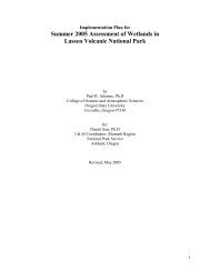
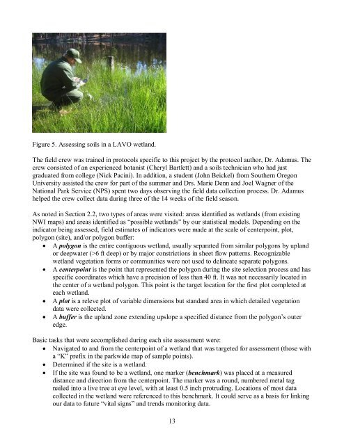
Figure 5. Assessing soils in a LAVO wetl<strong>and</strong>.<br />
The field crew was trained in protocols specific to this project by the protocol author, Dr. Adamus. The<br />
crew consisted <strong>of</strong> an experienced botanist (Cheryl Bartlett) <strong>and</strong> a soils technician who had just<br />
graduated from college (Nick Pacini). In addition, a student (John Beickel) from Southern Oregon<br />
University assisted the crew for part <strong>of</strong> the summer <strong>and</strong> Drs. Marie Denn <strong>and</strong> Joel Wagner <strong>of</strong> the<br />
<strong>National</strong> <strong>Park</strong> Service (<strong>NPS</strong>) spent two days observing the field data collection process. Dr. Adamus<br />
helped the crew collect data during three <strong>of</strong> the 14 weeks <strong>of</strong> the field season.<br />
As noted in Section 2.2, two types <strong>of</strong> areas were visited: areas identified as wetl<strong>and</strong>s (from existing<br />
NWI maps) <strong>and</strong> areas identified as “possible wetl<strong>and</strong>s” by our statistical models. Depending on the<br />
indicator being assessed, field estimates <strong>of</strong> indicators were made at the scale <strong>of</strong> centerpoint, plot,<br />
polygon (site), <strong>and</strong>/or polygon buffer:<br />
• A polygon is the entire contiguous wetl<strong>and</strong>, usually separated from similar polygons by upl<strong>and</strong><br />
or deepwater (>6 ft deep) or by major constrictions in sheet flow patterns. Recognizable<br />
wetl<strong>and</strong> vegetation forms or communities were not used to delineate separate polygons.<br />
• A centerpoint is the point that represented the polygon during the site selection process <strong>and</strong> has<br />
specific coordinates which have a precision <strong>of</strong> less than 40 ft. It was not necessarily located in<br />
the center <strong>of</strong> a wetl<strong>and</strong> polygon. This point is the target location for the first plot completed at<br />
each wetl<strong>and</strong>.<br />
• A plot is a releve plot <strong>of</strong> variable dimensions but st<strong>and</strong>ard area in which detailed vegetation<br />
data were collected.<br />
• A buffer is the upl<strong>and</strong> zone extending upslope a specified distance from the polygon’s outer<br />
edge.<br />
Basic tasks that were accomplished during each site assessment were:<br />
• Navigated to <strong>and</strong> from the centerpoint <strong>of</strong> a wetl<strong>and</strong> that was targeted for assessment (those with<br />
a “K” prefix in the parkwide map <strong>of</strong> sample points).<br />
• Determined if the site is a wetl<strong>and</strong>.<br />
• If the site was found to be a wetl<strong>and</strong>, one marker (benchmark) was placed at a measured<br />
distance <strong>and</strong> direction from the centerpoint. The marker was a round, numbered metal tag<br />
nailed into a live tree at eye level, with at least 0.5 inch protruding. Locations <strong>of</strong> most data<br />
collected in the wetl<strong>and</strong> were referenced to this benchmark. It could serve as a basis for linking<br />
our data to future “vital signs” <strong>and</strong> trends monitoring data.<br />
13