aic a 21/12 france - SIA - DGAC
aic a 21/12 france - SIA - DGAC
aic a 21/12 france - SIA - DGAC
You also want an ePaper? Increase the reach of your titles
YUMPU automatically turns print PDFs into web optimized ePapers that Google loves.
8, AVENUE ROLAND GARROS - BP 40 245<br />
F-33698 MERIGNAC CEDEX<br />
http://www.sia.aviation-civile.gouv.fr<br />
1 INTRODUCTION<br />
SALES DEPARTMENT<br />
☎ : 33 (0)5 57 92 56 68<br />
Fax : 33 (0)5 57 92 56 69<br />
✉ : sia-commercial<br />
@aviation-civile.gouv.fr<br />
TECHNICAL SERVICE<br />
☎ : 33 (0)5 57 92 57 57<br />
Fax : 33 (0)5 57 92 57 77<br />
SFA : LFFAYNYX<br />
This AIC cancels and replaces AIC 06/<strong>12</strong><br />
AIC<br />
A <strong>21</strong>/<strong>12</strong><br />
FRANCE<br />
PUB : SEP 20<br />
SUBJECT: Implementation of RNP APCH type instrument approach procedures commonly called RNAV(GNSS)<br />
approaches - Correct version.<br />
For the application of provisions of resolution A37/11 from the ICAO, aiming at covering all IFR-certified runway ends with approach procedures<br />
using GNSS, including with vertical guidance where possible, the <strong>DGAC</strong> (French Civil Aviation General Directorate) publishes many approach procedures<br />
giving rise to charts under the RNAV(GNSS) title. These publications comply with RNP APCH type navigation specification, as defined in<br />
Performance-Based Navigation Manual (PBN), Doc 9613 of ICAO.<br />
The GNSS systems concerned by this AIC are based on the possible use of the GPS constellation, as well as on the following two ICAO reinforcement<br />
systems:<br />
- ABAS: Airborne Based Augmentation System,<br />
- SBAS: Satellite Based Augmentation System.<br />
The purpose of this aeronautical information circular is to inform of provisions concerning the use of these RNAV(GNSS) approaches in France by<br />
aircraft pilots (aeroplane or helicopter) and French and Foreign operators.<br />
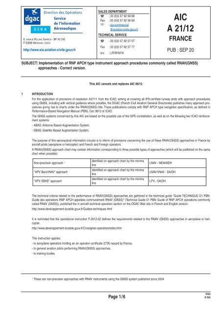
A RNAV(GNSS) approach chart may contain information corresponding to three possible types of approaches (which will be published on the same<br />
chart when possible):<br />
Non-precision approach 1<br />
"APV BaroVNAV" approach<br />
"APV SBAS" approach<br />
identified on approach chart by the minima<br />
line<br />
identified on approach chart by the minima<br />
line<br />
identified on approach chart by the minima<br />
line<br />
The technical criteria related to the performance of RNAV(GNSS) approaches are gathered in the technical guide "Guide TECHNIQUE O1 PBN:<br />
Guide des opérations RNP APCH appelées communément RNAV (GNSS)" (Technical Guide 01 PBN: Guide of RNP APCH operations commonly<br />
called RNAV (GNSS)), published the in aircraft technical operation section on the <strong>DGAC</strong> Web site in French and English version:<br />
http://www.developpement-durable.gouv.fr/Guides-techniques.html<br />
It is reminded that the operational instruction F-20<strong>12</strong>-02 defines the requirements related to the RNAV (GNSS) approaches in aeroplane or helicopter.<br />
http://www.developpement-durable.gouv.fr/Consignes-operationnelles.html<br />
This instruction applies:<br />
- to aeroplane operators holding an air operator certificate (CTA) issued by France,<br />
- to general aviation pilots performing RNAV(GNSS) approaches,<br />
- to training bodies.<br />
LNAV - MDA/MDH<br />
LNAV/VNAV - DA/DH<br />
LPV - DA/DH<br />
1 These are non-precision approaches with RNAV instruments using the GNSS system published since 2004<br />
ENG<br />
Page 1/6 © <strong>SIA</strong>
2 AIRCRAFT ELIGIBILITY<br />
To perform RNAV(GNSS) approaches, the aircraft "RNP APCH" capability shall be certified.<br />
2.1 For French operators and pilots holding a license issued by the <strong>DGAC</strong><br />
- The certification criteria applicable to RNAV(GNSS) approaches leading to LNAV and LNAV/VNAV minima are described in document<br />
"AMC 20_27" (AIRWORTHINESS APPROVAL AND OPERATIONAL CRITERIA FOR RNP APPROACH OPERATIONS (RNP APCH) including APV<br />
Baro-VNAV operations)<br />
- The certification criteria applicable to RNAV(GNSS) approaches leading to LPV minima are described in document "AMC 20_28" NPA 2009-04<br />
(AIRWORTHINESS APPROVAL AND OPERATIONAL CRITERIA FOR RNAV GNSS APPROACH OPERATIONS to LPV minima using SBAS)<br />
2.2 For Foreign operators<br />
The aircraft "RNP APCH" capability shall have been certified by the aircraft registration authority.<br />
3 APPROVAL<br />
3.1 Public Transport<br />
To perform a RNAV(GNSS) approach, the airline shall have been approved by their regulatory authority. A mention in the air operator certificate<br />
(CTA – Operational Specification) shall refer to operational capability approved by type of aeroplane.<br />
3.2 General Aviation<br />
Pilots holding a license issued by the <strong>DGAC</strong>:<br />
Before performing a RNAV(GNSS) approach, the pilot shall have attended a training course approved by the <strong>DGAC</strong> as per chapter 3.6 of TECHNI-<br />
CAL guide O1 PBN (see paragraph 6 Reference Texts ).<br />
Other pilots<br />
To perform a RNAV(GNSS) approach, the aircraft and its crew shall have the agreement of the authority which issued the pilot's license.<br />
4 OPERATIONAL PROCEDURES<br />
4.1 Selection of aerodromes upon flight preparation<br />
1. When the operational regulation applicable to the operator does not require a destination diversion aerodrome: the destination aerodrome shall<br />
also be accessible through a conventional approach (non-RNAV(GNSS)).<br />
2. When the operational regulation applicable to the operator requires at least one diversion aerodrome: the diversion aerodromes shall be accessible<br />
through a conventional approach (non-RNAV(GNSS)).<br />
3. A RNAV(GNSS) approach cannot be chosen for the selection of a departure diversion aerodrome.<br />
4. For "APV SBAS" approaches (LPV minima), the previous requirements are applicable within the French airspace.<br />
4.2 GNSS Coverage and Aeronautical Information<br />
AIC N° <strong>21</strong>/<strong>12</strong><br />
Operators are in charge of ensuring expected coverage and availability of GNSS for flights they schedule.<br />
For the GNSS SBAS, implemented via the signals transmitted by EGNOS European system, two service areas are defined:<br />
- for operations ranging from en-route flight phases to non-precision approaches, the geographical area where SBAS avionics may use EGNOS<br />
signals is defined with the following coordinates: [40° East, 20° North], [40° East, 70° North], [40° West, 70° North], [40° West, 20° North];<br />
- for APV SBAS operations using EGNOS vertical guidance, the service area, covering Metropolitan France, is restricted to some parts of Europe<br />
and detailed in document SoL Service Definition Document (see paragraph 6 Reference Texts).<br />
Note: Metropolitan France and Corsica are fully covered by EGNOS APV service area, when the system is in nominal status.<br />
ENG<br />
Page 2/6 © <strong>SIA</strong>
AIC N° <strong>21</strong>/<strong>12</strong><br />
GPS coverage is global, but GNSS ABAS is based on an algorithmic-type GPS reinforcement aiming at ensuring the integrity of GPS signals. One<br />
of the most used algorithms is designated by the acronym "RAIM" (Receiver Autonomous Integrity Monitoring). The availability of this reinforcement<br />
varies according to the geometry of GPS satellites and to the type of algorithm implemented in avionics. Software or tools, available on the Internet,<br />
may be used to assess this availability (e.g. Augur tool by Eurocontrol http://augur.ecacnav.com).<br />
To be informed of deviations from nominal coverage, the operator has three types of GNSS information, the use of which is described in paragraphs<br />
4.2.1 and 4.2.2:<br />
- NANUs (meaning Notice Advisory to NAVSPACE Users - in France where no GPS NOTAM is published): related to the condition of GPS constellation<br />
satellites;<br />
- RAIM NOTAMs: related to the unavailability of the standalone surveillance function of RAIM integrity. These NOTAMs are provided for each aerodrome<br />
where a RNAV (GNSS) approach is published leading to LNAV or LNAV/VNAV minima;<br />
- EGNOS NOTAMs: related to the unavailability of an "APV SBAS" procedure (LPV minima) as regards EGNOS system performance. These<br />
NOTAMs are provided for each aerodrome where such an approach is published. In France, the use of a guidance relying on EGNOS signals is<br />
also authorized for a RNAV (GNSS) approach leading to LNAV/VNAV minima. Therefore, these NOTAMs are also provided for aerodromes with a<br />
RNAV(GNSS) approach with LNAV/VNAV minima.<br />
NANU GPS<br />
They are issued by U.S. Coast Guard Station, Washington DC (ICAO location indicator KNMH).<br />
They may be obtained:<br />
- through direct query to the USA data bank, via AFTN, using the following service message format: SVC RQ INT LOC=KNMH sent to KDZZNAXX<br />
(available at http://www.navcen.uscg.gov/ado/GpsActiveNanu.asp);<br />
- through consultation of French aeronautical data bank (BDA):<br />
• from a Regional Aeronautical Information Service,<br />
• via Olivia interface (http://olivia.aviation-civile.gouv.fr/ or terminals in aerodromes), select "NOTAM" section, then "aerodrome bulletin". Tick<br />
"NOTAM GPS" and "IFR" boxes, then click on "Ok".<br />
RAIM NOTAM<br />
RAIM NOTAMs are issued for each French aerodrome with a RNAV (GNSS) procedure with LNAV and LNAV/VNAV minima, when an unavailability<br />
of the standalone surveillance function of integrity (RAIM) is expected within next 24 hours.<br />
GPS satellites masking angle considered in RAIM NOTAMs for forecast is 5°.<br />
In Metropolitan France, these NOTAMs are issued by the <strong>SIA</strong> every 24 hours for each aerodrome concerned.<br />
For the requirements of Overseas departments, the distribution of NOTAMs for aerodromes concerned will be entrusted to:<br />
- the BNI (International NOTAM Office) of PAPEETE for French Polynesia: NTAAYNYX;<br />
- the BNI of Cayenne Rochambeau for French Guyana: SOCAYNYX;<br />
- the BNI of TRINIDAD et TOBAGO for French West Indies: TPPPYNYX;<br />
- the BNI of FIDJI for New Caledonia: NFOFYNYX;<br />
- the BNI of ANTANANARIVO (MADAGASCAR) for Réunion Island and Mayotte: FMMMYNYX;<br />
- the BNI of OTTAWA for Saint Pierre et Miquelon: CYHQYNYX.<br />
EGNOS NOTAM<br />
EGNOS NOTAMs are issued for each French aerodrome with a RNAV (GNSS) procedure with LPV and LNAV/VNAV minima. The condition of GPS<br />
satellites and EGNOS infrastructure is periodically assessed (at least once or twice a day) in order to issue NOTAMs if necessary.<br />
The <strong>DGAC</strong> issues no NOTAM for expected unavailabilities of less than 5 minutes.<br />
In case of extended deviation from nominal coverage, the information may also be transmitted and/or detailed through AICs. In addition to EGNOS<br />
NOTAMs, it is also recommended to consult EGNOS service notifications available on Web site: http://www.essp-sas.eu/service_notices<br />
ENG<br />
Page 3/6 © <strong>SIA</strong>
4.2.1 For a RNAV(GNSS) approach leading to LNAV or LNAV/VNAV minima<br />
The operator must ensure, upon flight preparation, availability of the RAIM function (or any equivalent function) at estimated time for arrival (ETA)<br />
+/-15 minutes using, either RAIM NOTAMs , or the forecast tool of onboard equipment (or a software with the same function as onboard equipment).<br />
In the latter case, information on possible unavailability of satellites shall be entered in forecast program. Furthermore, if the forecast tool uses a specific<br />
masking angle, the operator shall ensure that the masking angle chosen is consistent with that of onboard equipment.<br />
For some avionics architectures, RAIM forecast may be required only in some circumstances (according to constellation availability) and must be<br />
detailed in the corresponding sections of the flight manual supplement (AFM).<br />
In the case of GNSS systems with a RAIM function using a pressure altitude information, and when this altitude information is not automatically<br />
transmitted to GNSS system, the pilot will have to enter manually appropriate altimeter setting (usually at IAF or at 30 NM from destination aerodrome).<br />
Note 1: RAIM availability requires the reception of a minimum number of satellites. Baro-aid allows to reduce this number to one unit.<br />
Note 2: In order to determine which type of forecast one should use, baro-aided or non baro-aided forecast, one should know whether a pressure<br />
altitude input supplies or not the applicable onboard system.<br />
When a RAIM forecast is required, the crew will have to perform a new RAIM check before beginning the approach, if the estimated time of arrival<br />
(ETA) differs by more than 15 minutes from the estimated time upon flight preparation. This check is performed automatically by ETSO/TSO C<strong>12</strong>9a<br />
Class A1 equipment, 2 NM before FAF.<br />
The operator of an aircraft using guidance based on EGNOS signals to perform a RNAV (GNSS) approach leading to LNAV/VNAV minima shall<br />
ensure, upon flight preparation, availability of the EGNOS service at estimated time of arrival (ETA) +/-15 minutes using EGNOS NOTAMs.<br />
In case of expected unavailability of RAIM or, more generally of the GNSS ABAS, LNAV and LNAV/VNAV minima are no longer accessible and the<br />
crew must use others means of navigation, choose another destination or hold the flight.<br />
4.2.2 For a RNAV(GNSS) approach leading to LPV minima<br />
Upon preparation of a flight bound for an aerodrome with a RNAV(GNSS) approach leading to LPV minima, the approach availability shall be checked<br />
by the operator (approach available 15 min before ETA (Estimated Time of Arrival) and up to 15 min after ETA). For this purpose, they must use<br />
information contained in EGNOS NOTAMs (drafted by the French aeronautical information service) specifying EGNOS service unavailability.<br />
To perform a RNAV(GNSS) approach leading to LPV minima, it is not required to perform a RAIM forecast because the integrity is directly managed<br />
by geostationary EGNOS satellites.<br />
In case of expected unavailability of EGNOS NOTAMs, LPV minima are no longer accessible and the crew must use others means of navigation,<br />
choose another destination or hold the flight.<br />
Note: LNAV minima may be used when LPV minima are not accessible, for this, refer to paragraph 4.2.1<br />
4.3 Phraseology<br />
In terms of phraseology, no distinction is made between the different types of RNAV(GNSS) approaches (no distinction according to LPV,<br />
LNAV/VNAV or LNAV minima).<br />
From the first radio contact with the approach control unit, the RNAV approach clearance is requested by the pilot after he/she has made sure that<br />
it may be undertaken.<br />
o Basic Pilot/Controller phraseology, to perform an RNAV (GNSS) approach on runway 26:<br />
Pilot: Regional QB, requesting RNAV approach runway 26.<br />
ATC: Regional QB, cleared RNAV approach runway 26.<br />
o Phraseology in case of loss of RNAV capability:<br />
Pilot: AFR 070, unable RNAV due equipment.<br />
AIC N° <strong>21</strong>/<strong>12</strong><br />
o Pilot/controller phraseology in case of vectoring followed by an RNAV (GNSS) final approach<br />
Pilot: AFR070, requesting RNAV [final] approach runway 08 right.<br />
ATC: AFR070, leave BALOD heading 030, radar vectoring RNAV [final] approach runway 08 right.<br />
ENG<br />
Page 4/6 © <strong>SIA</strong>
Then<br />
o Pilot/controller phraseology in case of initial and intermediate RNAV1 approach (ODRAN 1A in this example) with an identifier followed by an<br />
RNAV (GNSS) final approach<br />
Then<br />
4.4 Missed approach<br />
Most of missed approach paths in France are RNAV procedures based on a level of performance at least compatible with the use of a GNSS ABAS<br />
receiver (of RAIM-reinforced GPS type).<br />
Note: The availability of RAIM-reinforced GPS for missed approach is higher than the availability required for final approach. As a matter of fact, the<br />
accuracy of navigation required for missed approach is 1 NM for 95% of time vs. 0.3 NM for 95% of time for final approach. Therefore, RAIM availability<br />
forecasts obtained through NOTAM or tools specific to operators are not representative of missed approach availability. For similar reasons, a<br />
GNSS SBAS receiver may become unavailable for LPV minima, whereas its capability to follow the missed approach has not been affected. The<br />
main event leading to a simultaneous loss of GNSS guidance during final approach and missed approach is interference due to jamming.<br />
If the missed approach path is a RNAV procedure (not relying on conventional radionavigation means):<br />
The operator may have defined previously in their procedures, an emergency procedure for the case where the loss of RNAV guidance during the<br />
approach does not allow to follow the missed approach procedure provided for the considered runway. This emergency procedure will consist in following<br />
a dead reckoning path, allowing to reach a sufficient altitude and taking into account:<br />
• obstacles<br />
• aircraft performance<br />
• airspace restrictions<br />
5 SPECIFIC POINTS FOR BARO VNAV VERTICAL PLAN MANAGEMENT<br />
5.1 QNH and altimeter setting<br />
Pilots must know that vertical path based on Baro VNAV information is influenced by altimeter setting errors.These errors cannot be detected through<br />
cross-check between altimeter indication and values shown on approach chart (altitude – distance check).<br />
APV BaroVNAV (LNAV/VNAV minima) approaches are not authorised in the absence of local altimeter setting (local QNH).<br />
It is also important that the pilot has a recent altimeter setting information. Thus, the crew may request the confirmation of altimeter setting before<br />
passing the FAF.<br />
When a local QNH acquisition requirement is given on a RNAV(GNSS) approach chart, in the absence of the ATS, LNAV/VNAV minima are not<br />
authorised, only LNAV or LPV minima may be considered.<br />
5.2 Temperature Compensation<br />
AIC N° <strong>21</strong>/<strong>12</strong><br />
ATC: AFR070, turn right heading 060, descend 4000 ft QNH 1026, cleared RNAV [final] approach runway 08 right.<br />
Pilot: AFR070, requesting RNAV [final] approach runway 06<br />
ATC: AFR070, cleared ODRAN 1A then RNAV [final] approach runway 06<br />
ATC : AFR070, cleared RNAV [final] approach runway 06<br />
if temperature is not close to the ISA value, the Baro VNAV vertical plane will be different from nominal plane of the procedure, without affecting information<br />
shown to pilot. Thus, a vertical slope based on altimeter information will be lower in cold weather and higher in hot weather without vertical<br />
deviation displayed on pilot vertical deviation indicator.<br />
Case of temperatures lower than minimum temperature published on approach chart<br />
On RNAV(GNSS) approach charts on which there is an APV BaroVNAV approach (presence of LNAV/VNAV minima), a minimum temperature of<br />
use is specified.<br />
As a general rule, pilots should not use (Baro)VNAV function of FMS when temperature is lower than this limit temperature published on the<br />
approach chart.<br />
ENG<br />
Page 5/6 © <strong>SIA</strong>
The associated non-precision approach (LNAV minima) may be performed but vertical plane management should be performed using another flight<br />
technique (vertical speed (V/S) or flight angle (FPA).<br />
Pilots should then apply cold temperature corrections required to comply with the different minimum altitudes published, i.e.:<br />
- altitudes/heights for final segment (FAF, SDF, altitude/distance table);<br />
- MDA/H;<br />
- V/S and/or FPA values.<br />
1. If temperature variations cannot be compensated for by avionics system, APV BaroVNAV approach is not allowed when temperature transmitted<br />
to the crew is lower than limit temperature published on the approach chart.<br />
2. If temperature variations can be compensated for by avionics system, APV Baro VNAV approach is allowed but pilots must then apply cold temperature<br />
corrections required to comply with DA/DH.<br />
6 REFERENCE TEXTS<br />
Reference documents are:<br />
- Operational instruction DSAC F-20<strong>12</strong>-02 dated 19 December 2011, relating to the performance of RNP APCH approaches and related training<br />
courses, available on:<br />
http://www.developpement-durable.gouv.fr/Consignes-operationnelles.html<br />
It replaces operational instruction DCS F-2007-01.<br />
- TECHNICAL GUIDE O1 PBN Guide of RNP APCH operations commonly called RNAV(GNSS) available on:<br />
http://www.developpement-durable.gouv.fr/Guides-techniques.html<br />
- Manual PBN (doc 9613) of the ICAO defining RNP APCH navigation specifications<br />
- Appendix 6 of the ICAO<br />
o Part I - 9th issue, July 2010 - International Commercial Air Transport – chapter 7.2.2<br />
o Part II - 7th issue, July 2008 - International General Aviation - chapter 2.5.2.2<br />
- AMC 20-27 AIRWORTHINESS APPROVAL AND OPERATIONAL CRITERIA FOR RNP APPROACH OPERATIONS (RNP APCH) including APV<br />
Baro-VNAV operations)<br />
-AMC 20-28 NPA 2009-04 AIRWORTHINESS APPROVAL AND OPERATIONAL CRITERIA FOR RNAV GNSS APPROACH OPERATIONS to LPV<br />
minima using SBAS<br />
- Safety of Life Service / Service Definition Document<br />
- http://www.essp-sas.eu/docs/printed_documents/EGNOS_SoL_SDD_in_force.pdf<br />
- EGNOS Service Notice to EGNOS users<br />
- http://www.essp-sas.eu/service_notices<br />
AIC N° <strong>21</strong>/<strong>12</strong><br />
ENG<br />
Page 6/6 © <strong>SIA</strong>


