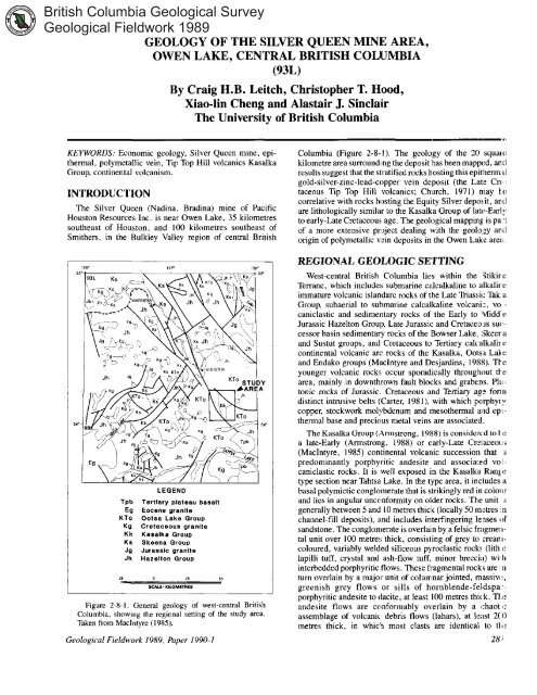
Geology of the Silver Queen Mine Area, Owen - Ministry of Energy ...
Geology of the Silver Queen Mine Area, Owen - Ministry of Energy ...
Geology of the Silver Queen Mine Area, Owen - Ministry of Energy ...

You also want an ePaper? Increase the reach of your titles
YUMPU automatically turns print PDFs into web optimized ePapers that Google loves.
GEOLOGY OF THE SILVER QUEEN MINE AREA,<br />
OWEN LAKE, CENTRAL BRITISH COLUMBIA<br />
(93L)<br />
By Craig H.B. Leitch, Christopher T. Hood,<br />
Xiao-lin Cheng and Alastair J. Sinclair<br />
The University <strong>of</strong> British Columbia<br />
KEYWORDS: Economic geology, <strong>Silver</strong> <strong>Queen</strong> mine, epi-<br />
<strong>the</strong>rmal, polymetallic vein, Tip Top Hill volcanics Kasalka<br />
Group, continental volcanism.<br />
INTRODUCTION<br />
The <strong>Silver</strong> <strong>Queen</strong> (Nadina, Bradina) mine <strong>of</strong> Pacific<br />
Houston Resources Inc. is near <strong>Owen</strong> Lake, 35 kilometres<br />
sou<strong>the</strong>ast <strong>of</strong> Houston, and 100 kilometres sou<strong>the</strong>ast <strong>of</strong><br />
Smi<strong>the</strong>rs, in <strong>the</strong> Bulkley Valley region <strong>of</strong> central British<br />
LEGEND<br />
Tpb Tertiary plateau basalt<br />
Ea Eocene granite<br />
KT0 Ootsa Lake Group<br />
Kg Cretaceous granite<br />
Kk Kasalka Group<br />
K8 Skeens Group<br />
Jg Jurassic granite<br />
Jh Hazeiton Group<br />
21 - 50<br />
SCALP KILOHrnIB<br />
Figure 2-8-1. General geology <strong>of</strong> west-central British<br />
Columbia, showing <strong>the</strong> regional setting <strong>of</strong> <strong>the</strong> study area.<br />
Taken from Maclntyre (1985).<br />
Geological Fieldwork 1989, Paper 1990-1<br />
Columbia (Figure 2-8-1). The geology <strong>of</strong> <strong>the</strong> 20 squa~f:<br />
kilometre area surrounding <strong>the</strong> deposit'has been mapped, antl<br />
results suggest that <strong>the</strong> slratifiedrocks hosting this epi<strong>the</strong>mxll<br />
gold-silver-zinc-lead-copper vein deposit (<strong>the</strong> Late Crt<br />
taceous Tip Top Hill volcanics; Church, 1971) may tf:<br />
correlative with rocks h(xting <strong>the</strong> Equity <strong>Silver</strong> depos,it, antl<br />
are lithologically similar to <strong>the</strong> Kasalka Group <strong>of</strong> IateEarly<br />
to early-Late Cretaceous, age. The geological mapping is pa?<br />
<strong>of</strong> a more extensive project dealing with <strong>the</strong> geol,ozy and<br />
origin <strong>of</strong> polymetallic vzin deposits in <strong>the</strong> <strong>Owen</strong> Lake areil<br />
REGIONAL GEOLOGIC SETTING<br />
West-central British Columbia lies within <strong>the</strong> Stikirr:<br />
Terrane, which include!$ submarine ca.lcalkaline to alkalir t:<br />
immature volcanic islandarc rocks <strong>of</strong> <strong>the</strong> Late Triass;it: Tak $1<br />
Group, subaerial to submarine calcalkaline volcani:, YO .<br />
caniclastic and sedimentary rocks <strong>of</strong> <strong>the</strong> Early to Midd I:<br />
Jurassic Hazelton Group, Late Jurassic and Cretaceo~s sut:<br />
cessor basin sedimentary rocks <strong>of</strong> <strong>the</strong> IBowser Lake. Skeer :I<br />
and Sustut groups, and Cretaceous to Tertiary calcalkalirc<br />
continental volcanic art: rocks <strong>of</strong> <strong>the</strong> Kasalka, Oolsa Lakt:<br />
and Endako groups (Maclntyre and Desjardins, 1988). Tkt:<br />
younger volcanic rocks, occur sporadically througlm~t tkc<br />
area, mainly in downthrown fault blocks and grabens. PIII<br />
tonic rocks <strong>of</strong> Jurassic. Cretaceous and Tertiary a&: fonu<br />
distinct intrusive belts (Carter, 1981). with which parphy~y<br />
copper, stockwork molybdenum and meso<strong>the</strong>rmal and ep~ <strong>the</strong>rmal base and precious metal veins are associated.<br />
The Kasalka Group (Armstrong, 19118) is considered tot I:<br />
a late-Early (Armstrong, 1988) or early-Late Crczlaceoui<br />
(MacIntyre, 1985) continental volcanic succession that :i<br />
predominantly porphyritic andesite and associal:ed VOIcaniclastic<br />
rocks. It is well exposed in <strong>the</strong> Kasalka Range<br />
type section near Tahtsa Lake. In <strong>the</strong> cype area, it includes :I<br />
basal polymictic conglomerate that is strikingly red in colo~lr<br />
and lies in angular unccmnfonnity on older rocks. 'The unit ,I<br />
generally between 5 and IO metres thick (locally 50 mtres '11<br />
channel-fill deposits), a.nd includes interiingering lenses (IF<br />
sandstone. The conglonlerate is overlain by a felsic fr:lgme~l.<br />
tal unit over 100 metre!; thick, consisting <strong>of</strong> grey to creanlcoloured,<br />
variably welded siliceous pyroclastic rocks (lith I:<br />
lapilli tuff, crystal and ash-flow tuff, minor breccia) will1<br />
interbedded porphyritic flows. Thesefiagmentalrocks are '11<br />
turn overlain by a major unit <strong>of</strong> colulrlnar jointed, massim:,<br />
greenish grey flows or sills <strong>of</strong> hornblende-fl:ldspa-porphyritic<br />
andesite to tlacite, at least 100 metres thick. Th<br />
andesite flows are conformably overlain by a (chaot I:<br />
assemblage <strong>of</strong> volcanic debris flows (lahars), at k:mt 2(0<br />
metres thick, in which most clasts are identical to tli:<br />
28 i
288<br />
Figure 2-8-2. Detailed property geology <strong>of</strong> <strong>the</strong> <strong>Silver</strong> <strong>Queen</strong> property. <strong>Owen</strong> Lake area, west-central British Columbia. Units are<br />
defined in Table 2-8- I.<br />
Brirish Columbia Geological Survey Branch
underlying flows and sills. Rhyolite flows and tuffs and<br />
columnarjointed basalt flows, toge<strong>the</strong>r more than 100metres<br />
thick. cap <strong>the</strong> succession (<strong>the</strong> hasalts may he significantly<br />
younger: MacIntyre, 1985).<br />
A mid to Late Cretaceous age is assigned to <strong>the</strong> Kasalka<br />
Group volcanic rocks because <strong>the</strong>y unconformably overlie<br />
sedimentary rocks containing latest Early Cretaceous<br />
(Albian) fauna (Duffel, 1959). Dacitic lapilli tuffs near <strong>the</strong><br />
base <strong>of</strong> <strong>the</strong> group give an isotopic age <strong>of</strong> 108 to 107 * 5 Ma by<br />
K-Ar on whole rock, and intrusions dated at 87*4 to<br />
83.8t2.8 Ma cut <strong>the</strong> stratified units (MacIntyre, 1985).<br />
Volcanic rocks <strong>of</strong> similar age and lithology are not widely<br />
known in west-central British Columbia, but possible correlatives<br />
are rocks found in <strong>the</strong> h4ount Cronin area nor<strong>the</strong>ast<br />
<strong>of</strong> Smi<strong>the</strong>rs (MacIntyre and Desjardins, 1988). The correlative<br />
rocks near Mount Cronin were formerly mapped as Brian<br />
Boru formation by Tipper and Richards (1976), and correlated<br />
to Brian Boru rocks as defined by Su<strong>the</strong>rland-Brown<br />
(1960) in <strong>the</strong> Rocher Deboult Range northwest <strong>of</strong> Smi<strong>the</strong>rs.<br />
In <strong>the</strong> Mount Cronin area, MacIntyre and Desjardins separate<br />
<strong>the</strong> Kasalka Group into lower and upper divisions. As in <strong>the</strong><br />
Kasalka Range, <strong>the</strong> succession begins with a heterolithic,<br />
maronn basal conglomerate with interbedded sandstone,<br />
siltstone and mudstone. This is followed by thin-bedded tuffs<br />
and epiclastics, mafic flows, and pyroclastic rocks that<br />
include lapilli tuff and breccia, bedded lahar, and siliceous<br />
ash-flow tuff and breccia. The upper division comprises a<br />
thick section <strong>of</strong>poorly bedded volcanic breccia with angular<br />
clasts, grading upward to hornblende-feldspar crystal tuff<br />
and interbedded to overlying hornblende-feldsparporphyritic<br />
andesite, most <strong>of</strong> which are flows but some<br />
intrusive stocks and sills may also be present.<br />
In spite <strong>of</strong> very similar lithology, <strong>the</strong> Tip Top Hill volcanics<br />
<strong>of</strong> <strong>the</strong> Buck Creek basin in <strong>the</strong> Parrot Lake and <strong>Owen</strong> Lake<br />
area, and volcanic rocks hosting The Equity <strong>Silver</strong> deposit,<br />
cannot be correlated with <strong>the</strong> Kasalka Group on <strong>the</strong> basis <strong>of</strong><br />
currently available isotopic dates.<br />
GEOLOGY OF THE BUCK CREEK BASIN<br />
The Buck Creek basin has been characterized as a<br />
resurgent caldera, with <strong>the</strong> important Equity <strong>Silver</strong> mine<br />
located within a window eroded into <strong>the</strong> central uplifted area<br />
(Church, 1985). The <strong>Silver</strong> <strong>Queen</strong> mine lies on <strong>the</strong> caldera<br />
rim or perimeter <strong>of</strong> this basin, which is roughly delineated by<br />
a series <strong>of</strong> rhyolite outliers and semicircular alignment <strong>of</strong><br />
Upper Cretaceous and Eocene volcanic centres scattered<br />
between Francois Lake, Houston and Bums Lake (see Figure<br />
59 <strong>of</strong> Church, 1985). A prominent lineament 30 kilometres<br />
long and trending east-nor<strong>the</strong>asterly from <strong>the</strong> <strong>Silver</strong> <strong>Queen</strong><br />
mine towards <strong>the</strong> central uplift hosting <strong>the</strong> Equity mine,<br />
appears to be a radial fracture coinciding with <strong>the</strong> eruptive<br />
axis <strong>of</strong> <strong>the</strong> Tip Top Hill (Kasalka Group) volcanics and a line<br />
<strong>of</strong> syenomonzonite stocks and feeder dikes to an assemblage<br />
<strong>of</strong> “moat volcanics” that include <strong>the</strong> Goosly Lake formation<br />
(Church, 1985). Block faulting is common in <strong>the</strong> basin,<br />
locally juxtaposing <strong>the</strong> various ages <strong>of</strong> volcanic rocks found<br />
within it.<br />
In broad outline, a Mesozoic volcanic assemblage is<br />
overlain by a Tertiary volcanic succession. The oldest rocks<br />
Geological Fieldwork 1989, Paper 1990-1<br />
exposed within <strong>the</strong> basin are at <strong>the</strong> Equity <strong>Silver</strong> and Silve.<br />
<strong>Queen</strong> mines. The sequence at <strong>the</strong> Equity mine ha:, bee11<br />
characterized by Church (1984) as Jura.ssic Hazeltort IGrnul!<br />
rocks <strong>of</strong> <strong>the</strong> Telkwa formation overlain with angular 1.ncon<br />
formity by Lower Cretaceous Skeena Group sedirn’mtar:’<br />
rocks.However,We<strong>the</strong>relletal.(1979)andCyretal.l19841<br />
correlate <strong>the</strong> sequence hosting <strong>the</strong> Equity nrebodies luith thl:<br />
Upper Cretaceous Kasalka Group, and Wojdak and S nclai-<br />
(1984) list as possible correlatives <strong>the</strong> Lower Cretaceou;<br />
Skeena Group, <strong>the</strong> Kasalka Group and <strong>the</strong> Brian Boru forma.<br />
tion. The geology <strong>of</strong> <strong>the</strong> Equity mine ar8:a is obviously as yet<br />
imperfectly known.<br />
Large areas <strong>of</strong> Upper Cretaceous roc.ks are exposed west.<br />
wards from <strong>the</strong> Equity mine to <strong>the</strong> Ow!x Lake area. .where<br />
<strong>the</strong>y host <strong>the</strong> <strong>Silver</strong> <strong>Queen</strong> deposit (Church, 1984). ‘Thew<br />
rocks, which have been dated at 71.1 2 2.7 to 75.3 2 2.0 M<br />
by K-Ar on whole rock (Church, 1973) are describtd b)<br />
Church (1984) to consist <strong>of</strong> a lower, acid volcanic uni<br />
overlain by <strong>the</strong> Tip Top Hill formation andesites to dilcites<br />
This subdivision is based on “rhyolitic volcanic rocks Jelov<br />
<strong>the</strong> Tip Top Hill formation in <strong>the</strong> <strong>Owen</strong> L.ake area in extrmivf<br />
drill holes in <strong>the</strong> vicinity (<strong>of</strong> <strong>the</strong> <strong>Silver</strong> <strong>Queen</strong> mine” (Church<br />
1973, which he considers to be “lateral equivalents <strong>of</strong>quart;<br />
porphyry intrusions exposed nearby on Okusyelda Hill’<br />
(Figure 2-8-2). Current mapping indkates that <strong>the</strong> lowe<br />
volcanic unit exposed in <strong>the</strong> drill holm may in pan. be i.<br />
strongly altered equivalent <strong>of</strong> <strong>the</strong> Tip Top Hill volcanic:$. Thr<br />
quartz porphyry <strong>of</strong> Okusyelda Hill c:ould correlate wid<br />
dacitic quartz porphyry sills, dikes and laccoliths commol<br />
within <strong>the</strong> type Kasalka Group section in <strong>the</strong> Tahtsa Lakr<br />
area. Late quartz feldspar porphyry dikes are also fimnd a:<br />
<strong>the</strong> Equity mine (Cyr et a/., 1984; Church, 1985), altlougll<br />
<strong>the</strong>se are dated at 50 Ma and thus belong to <strong>the</strong> younger Oots; I<br />
Lake Group.<br />
The Upper Cretaceous rocks are overlain by <strong>the</strong> Eocenr<br />
OotsaLake Group, which includes <strong>the</strong>Goosly Lake and Bucl<br />
Creek formations <strong>of</strong> Church (1984). The Goosly Lakr<br />
andesitic to trachyandesitic volcanic rocks are da:ed a.<br />
48.8 2 I .8 Ma by K-Ar on whole rock, and this is supportec.<br />
by dates <strong>of</strong> 49.6k3.0 to 50.2? 1.5 Ma for related sye<br />
nomonzonite to gabbro stocks with di,rtinctive bladed pla<br />
gioclase crystals (Church, 1973) at Goosly and Parrot lakes<br />
The Buck Creek andesitic to dacitic volcanic rocks. whicl.<br />
directly overlie <strong>the</strong> Goosly Lake formation, are dated a<br />
48.1 * 1.6 Ma by K-Ar on whole rock. These ages comelatc<br />
with whole rock K-Ar ages <strong>of</strong> 55.6yk2.5 Ma for dacitr<br />
immediately north <strong>of</strong> Ootsa Lake (Woodsworth, 198:!) an(<br />
49.1 2 1.7 Ma on biotite for Ootsa Lake Group rocks in tht,<br />
Whitesail Lake area immediately south <strong>of</strong> Tahtsa Lakt,<br />
(Diakow and Koyanagi, 1988).<br />
Basalts <strong>of</strong> <strong>the</strong> upper part <strong>of</strong> <strong>the</strong> Buck Creek fonnatiol<br />
(Swans Lake member: Church, 1984) may correlate ,with th!<br />
Endako Group <strong>of</strong> Eocene-Oligocene a:se. These rocks giv:<br />
whole rock K-Ar ages r<strong>of</strong>41.7&1.5 to 31.3k1.2 Ma 01<br />
samples from <strong>the</strong> Whitzsail Lake map area (Diakow anal<br />
Koyanagi, 1988).<br />
The youngest rocks in <strong>the</strong> Buck Creek basin are capping;<br />
<strong>of</strong> Miocene columnar olivine basalt, callled <strong>the</strong> Poplar Butte;<br />
formation by Church (1‘384) and dated at 21.4? 1 . I Ma bi<br />
K-Ar on whole rock (Church, 1973).<br />
28! 1
GEOLOGY OF THE STUDY AREA<br />
The preliminary geology <strong>of</strong> <strong>the</strong> study area immediately<br />
surrounding <strong>the</strong> <strong>Silver</strong> <strong>Queen</strong> mine, as determined by fieldwork<br />
and petrological studies completed in 1989, is shown in<br />
Figure 2-8-2 (units are defined in Table 2-8-1). Relationships<br />
between <strong>the</strong> map units are shown diagrammatically in Figure<br />
2-8-3. The succession is similar to that observed in <strong>the</strong><br />
Kasalka Range and on Mount Cronin.<br />
The rocks <strong>of</strong> <strong>the</strong> study area have been subdivided into five<br />
major units plus three dike types: Table 2-8-1 lists <strong>the</strong> map<br />
units defined to date. A basal reddish purple polymictic<br />
conglomerate (Unit 1) is overlain by fragmental rocks ranging<br />
from thick crystal tuff (Unit 2) to coarse lapilli tuff and<br />
breccia (Unit 3), and this is succeeded upwards by a thick<br />
feldspar-porphyritic andesite flow unit (Unit 4), intruded by<br />
microdiorite sills and o<strong>the</strong>r small intrusions (Unit 5). The<br />
suatifiedrncks form a gently northwest-dipping succcession,<br />
'with <strong>the</strong> oldest rocks exposed near Riddeck Creek to <strong>the</strong><br />
south and <strong>the</strong> youngest exposed in Emil Creek to <strong>the</strong> north<br />
(Figure 2-8-2). All <strong>the</strong> units are cut by dikes that can be<br />
divided into three groups: amygdaloidal dikes (Unit 61,<br />
bladed feldspar porphyry dikes (Unit 7). and diabase dikes<br />
(Unit 8). The succession is unconformably overlain by basaltic<br />
to possibly trachyandesitic volcanics that crop out in<br />
Riddeck Creek and far<strong>the</strong>r south. These volcanics may be<br />
correlative with <strong>the</strong> Goosly Lake formation (Church, 1973).<br />
<strong>Mine</strong>ralization on <strong>the</strong> property is mainly restricted to<br />
quartz-carbonate-barite-specularite veins, 1 to 2 metres<br />
thick, that contain disseminated to locally massive pyrite,<br />
sphalerite, galena, chalcopyrite, tennantite and argentian<br />
tetrahedrite. Locally, in chalcopyrite-rich samples, <strong>the</strong>re is a<br />
diverse suite <strong>of</strong> Cu-Pb-Bi-Ag sulphosalts such as aikinite,<br />
matildite (in myrmekitic intergrowth with galena), pearcitearsenpolybasite,<br />
and possibly schirmerite (berryite, guettardite<br />
and meneghinite have also been reported but not yet<br />
confirmed). Native gold with unusually low fineness <strong>of</strong> SI0<br />
TERTlARY Miocene 21<br />
Eocene- 40-<br />
Oligocene 30<br />
Eocene 56-<br />
41<br />
CRETACEOUS (Late)<br />
75<br />
77<br />
""-"""""""""""""""""""""<br />
TABLE 2-8-1<br />
TABLE OF FORMATIONS, OWEN LAKE AREA<br />
MPBV<br />
E-oEv<br />
t"""""""""-,~""""""""""""x!,<br />
I<br />
Figure 2-8-3. Schematic diagram <strong>of</strong> stratigraphic and<br />
intrusive relationships, <strong>Owen</strong> Lake area, west-central British<br />
Columbia. Units are defined in Table 2-8-1.<br />
to 620 (actually electrum) is present in minor amounts. The<br />
veins cut <strong>the</strong> amygdaloidal, fine-grained plagioclase-rich<br />
dikes (Unit 6), and are cut by <strong>the</strong> series <strong>of</strong> dikes with bladed<br />
plagioclase crystals (Unit 7). Both <strong>the</strong>se dike types are<br />
possibly correlative with <strong>the</strong> Ootsa Lake Group Goosly Lake<br />
volcanics <strong>of</strong> Eocene (approximately SO Ma) age. The bladed<br />
feldspar porphyry dikes cut <strong>the</strong> amygdaloidal dikes, and both<br />
Formation Symbol Unit Lithology<br />
Poplar Buttes MPB"<br />
End& Group<br />
EO,, 8<br />
ootsa Lake Eo, 7a<br />
Group<br />
7<br />
- MINERALIZED VEINS -<br />
"Okusyelda"<br />
UKw<br />
6<br />
5b<br />
Tip Top Hill volcanics uKKp 5%<br />
uKKud 5<br />
4a<br />
uKKfp<br />
4<br />
uKKb<br />
3<br />
uKKt 2<br />
2a<br />
UKKC 1<br />
Olivine basalt<br />
Basalt. diabase dikes<br />
Trachyandesite. basalt<br />
Bladed feldspar porphyry dikes<br />
Arnygdular dikes<br />
Quanz~eye rhyolite dikes, stock<br />
Intrusive porphyry sills, stocks<br />
"<strong>Mine</strong> Hill" microdionte<br />
Feldspar biotite porphyry dikes<br />
"Tip Top Hill" feldspar porphyry (voluminous<br />
porphyntic andesite)<br />
Medium to mane tuff-breccia<br />
Crystal tuff. local lapilli tuff<br />
Fine ash tuff<br />
Polymictic basal conglomerate, sandstone and<br />
shale interbeds<br />
290 British Columbia Geological Survey Branch
are cut by <strong>the</strong> diabase dikes that may correlate with Endako<br />
Group volcanism <strong>of</strong> Eocene-Oligocene (approximately 40 to<br />
30 Ma) age.<br />
TIP TOP HILL VOLCANICS<br />
Units 1 to 5, as defined in <strong>the</strong> map area, fall within <strong>the</strong> Tip<br />
Top Hill formation (Church, 1984). but correspond closely<br />
with <strong>the</strong> units defined in Kasalka Group rocks elsewhere.<br />
The units are described in detail below, to facilitate comparison<br />
with o<strong>the</strong>r, possibly correlative rocks.<br />
BASAL POLYMICTIC CONGLOMERATE (UNIT 1 )<br />
The basal member <strong>of</strong> <strong>the</strong> succession is a reddish to purple,<br />
heterolithic, poorly sorted pebble conglomerate that contains<br />
rounded to subangular small white quartz and grey-brown to<br />
less commonly maroon tuff and porphyry clasts. Local<br />
interbeds <strong>of</strong> purplish sandstone with graded bedding are<br />
found within <strong>the</strong> unit, as are rare black shaly partings. The<br />
matrix is composed <strong>of</strong> fine sand, cemented by quartz, sericite<br />
and iron oxides. The best exposure is found in a roadcut at <strong>the</strong><br />
sou<strong>the</strong>rn tip <strong>of</strong> <strong>Owen</strong> Lake, where <strong>the</strong> unit is about 10 metres<br />
thick and dips 25" to <strong>the</strong> northwest. The base is not exposed<br />
and <strong>the</strong> unit is in presumed fault contact with <strong>the</strong> younger<br />
volcanic rocks <strong>of</strong> <strong>the</strong> Ootsa Lake Group (Goosly Lake<br />
formation; Unit 7) exposed at higher elevations far<strong>the</strong>r south<br />
along <strong>the</strong> road. In drill holes far<strong>the</strong>r north, near <strong>the</strong> centre <strong>of</strong><br />
<strong>the</strong> property, <strong>the</strong> upper contact <strong>of</strong> <strong>the</strong> conglomerate with<br />
overlying porphyry is sharp and appears conformable, but<br />
<strong>the</strong> porphyry may be an intrusion ra<strong>the</strong>r than a flow.<br />
CRYSTAL-LITHIC TUFF (UNIT 2)<br />
In outcrop, <strong>the</strong> next major unit is a sequence <strong>of</strong> mainly<br />
fragmental rocks that are mostly fine crystal tuffs with thin<br />
interbeds <strong>of</strong> laminated tuff, ash tuff, lapilli tuff, and less<br />
abundant breccia. The unit may be as much as 100 metres<br />
thick. The most widespread rock type is a massive, grey to<br />
white, stronglyquartz-sericite-pyrite altered, finecrystal tuff<br />
that grades imperceptibly into a porphyry <strong>of</strong> similar<br />
appearance and composition; <strong>the</strong> latter may be partly flow,<br />
intrusive sill, or even a welded tuff. Only <strong>the</strong> presence <strong>of</strong><br />
broken phenocrysts and rare interbeds <strong>of</strong> laminated or<br />
coarsely fragmental material suggest that <strong>the</strong> bulk <strong>of</strong> this unit<br />
is tuffaceous. In thin section, <strong>the</strong> rock is seen to he made up <strong>of</strong><br />
I to 2-millimetre broken, altered plagioclase relics and 0.5millimetre<br />
anhedral quartz grains (that may be partly to<br />
entirely secondary) in a fine matrix <strong>of</strong> secondary sericite,<br />
carbonate, pyrite and quartz. Drill-core exposures show that<br />
<strong>the</strong> basal contact <strong>of</strong> Unit 2 with <strong>the</strong> underlying conglomerate<br />
is commonly occupied by <strong>the</strong> porphyry ra<strong>the</strong>r than <strong>the</strong> tuff,<br />
The best exposures <strong>of</strong> Unit 2 are in <strong>the</strong> area <strong>of</strong> Cole Creek and<br />
<strong>the</strong> Chisholm vein (Figure 2-8-2), where thin (IO centimetre)<br />
interbedded laminated tuff bands occur, many with variable<br />
dips tonear-vertical, althoughcoarserlapilli tufflenses, upto<br />
I metre thick, display gentle nor<strong>the</strong>rly dips. In drill core,<br />
sections <strong>of</strong> laminated tuffs with faint hut discernible layering<br />
on a centimetre scale, may be up to IO metres thick; angles<br />
with <strong>the</strong> core axis suggest a gentle dip for <strong>the</strong> banding.<br />
Outcrops on <strong>the</strong> nor<strong>the</strong>ast side <strong>of</strong> <strong>the</strong> George Lake fault<br />
(Figure 2-8-2) have rare interbeds <strong>of</strong> a very fine, uniform<br />
Geological Fieldwork 1989, Paper 1990-1<br />
"ash tuff" that are up I:O several metres thick (Unit 2a),<br />
Typically <strong>the</strong>y are dark grtey to medium grey-green and have i<br />
siliceous appearance. Lacally <strong>the</strong>y contain angular fragments<br />
<strong>of</strong> ei<strong>the</strong>r mixed oriQins (heterolithic clasts) or <strong>of</strong> large]<br />
blocks that are only barely distinguishable from <strong>the</strong> rnatrir<br />
(monolithic clasts).<br />
The composition <strong>of</strong> Cnit 2 is not known from chemica<br />
analyses. Although it hoks felsic (cf. Church, 197.5) <strong>the</strong><br />
highly altered nature may give a misleac.ing impressior <strong>of</strong> it!<br />
original character; it ma:? have been originally andes tic a!<br />
are <strong>the</strong> overlying units.<br />
COARSE FRAGMENTAL UNIT (UNIT 3)<br />
A distinctive coarse fragmental unit overlies or in somf<br />
places is interlayered with <strong>the</strong> upper :part <strong>of</strong> Unit 2. It i!<br />
composed <strong>of</strong> blocks and bombs(?) (cf. MacIntyre, 1935) o<br />
feldspar-porphyritic rock similar in appearance to both thf<br />
underlying porphyry and <strong>the</strong> overlying porphyritic andesite<br />
The clasts are mostly angular to subangular and about 2 to t<br />
centimetres in diameter, but some are much larger (up to 0.:<br />
metre); <strong>the</strong> matrix makes up a widely v;lriable percentage o'<br />
<strong>the</strong> rock, from almost zero to 90 per cent, so that in plac es thf<br />
rock has <strong>the</strong> appearance nf an intrusive breccia with little o<br />
no rotation <strong>of</strong> fragments. In o<strong>the</strong>r places <strong>the</strong> fragmerlts art.<br />
clearly unrelated and "accidental" or unrelated clasts 0'<br />
chert or fine tuff are common, although still volumetricall].<br />
minor; this has <strong>the</strong> appearance <strong>of</strong> a lah,lr.<br />
In outcrop near <strong>the</strong> Cole veins (Figure 2-8-2). this hwccii<br />
or lahar(?) unit forms discontinuous lenses generalli les!<br />
than IO metres thick, with a suggestion <strong>of</strong> gentle nor<strong>the</strong>r15<br />
dips. The lenses appear to be conformable with <strong>the</strong> untlerly<br />
ing or enclosing tuffs. In drill core, two distinctly dlfFerenl<br />
modes <strong>of</strong> occurrence are noted for this unit: in one, it iqlpearr<br />
to be conformably overlnin by Unit 4 porphyritic andesite!<br />
(<strong>the</strong> total thickness <strong>of</strong> <strong>the</strong> breccia unit is up to 30 metrcs); ir<br />
<strong>the</strong> o<strong>the</strong>r, it appears to have subvertical ,contacts, implying i<br />
is an intrusive breccia. Good examples nf <strong>the</strong> latter diatribution<br />
are found in <strong>the</strong> Cole Lake area, <strong>the</strong> Camp vein system<br />
and around <strong>the</strong> sou<strong>the</strong>rn end <strong>of</strong> Number 3 vein. There is thur<br />
a rough correlation betueen <strong>the</strong> subvel:tical breccia tlodier<br />
and mineralized areas, just as <strong>the</strong>re is between <strong>the</strong> nicrodiorite<br />
and mineralized areas (see below).<br />
In thin section, <strong>the</strong> clasts <strong>of</strong> <strong>the</strong> breccia are seen to he<br />
composed <strong>of</strong> strongly alte:red feldspar porphyry, fine tuff an1<br />
quartz or quartz<strong>of</strong>eldspathic rocks, enclosed in i. fine<br />
tuffaceous matrix. Alteration in <strong>the</strong> mine area is usuall)<br />
carbonate-sericite-quartz-pyrite, and is intense ena'ugh tc<br />
largely obscure <strong>the</strong> original texture.<br />
FELDSPAR PORPHYRY (UNIT 4)<br />
The fragmental rocks appear to be c'mformably a,verlair<br />
by a thick, massive unit clf porphyritic andesite that ojulcrop!<br />
over much <strong>of</strong> <strong>Mine</strong> Hill and is best developed north <strong>of</strong> Wrinct<br />
Creek (Figure 2-8-2). This unit is equivalent to <strong>the</strong> Tip Tog<br />
Hill volcanics <strong>of</strong> Church (1970), although in most places or<br />
<strong>the</strong> property <strong>the</strong> porphyry is coarser and contains s!,arsel<br />
phenocrysts than <strong>the</strong> exposures on Tip 'hp Hill. In exposure!<br />
in Wrinch Creek canyon, a distinct flow lamination i!<br />
developed by trachytic alignment <strong>of</strong> phenocrysts, best seer<br />
on wea<strong>the</strong>red surfaces. This suggests that <strong>the</strong>se porplyrie:<br />
291
are mostly flows, with gentle nor<strong>the</strong>rly to northwesterly dips.<br />
However, some <strong>of</strong> <strong>the</strong> coarsest material probably forms<br />
intrusive sills and stocks [cf. <strong>the</strong> type sections <strong>of</strong> MacIntyre<br />
and Desjardins (1988) and MacIntyre (1985)] and in many<br />
places <strong>the</strong> porphyry grades into intrusive microdiorite (Unit<br />
5).<br />
Parts <strong>of</strong> this unit, particularly in Emil Creek, west <strong>of</strong> Emil<br />
Lake, and on Tip Top Hill itself (Figure 2-8-2). may actually<br />
be crystal tuffs. In <strong>the</strong>se exposures, <strong>the</strong> feldspar phenocrysts<br />
are smaller, much more crowded and in places broken, and<br />
rare lithic fragments are visible.<br />
This unit has been dated at 77.1 12.7 Ma by K-Ar on<br />
whole rock (Church, 1973). Rhyolite from Tsalit Mountain<br />
on <strong>the</strong> west side <strong>of</strong> <strong>Owen</strong> Creek valley, 10 kilometres northwest<br />
<strong>of</strong> <strong>the</strong> <strong>Silver</strong> <strong>Queen</strong> mine, gives a very similar isotopic<br />
date <strong>of</strong> 77.8 2 3.0 Ma, also by K-Ar on whole rock (Church,<br />
1973). Church correlated this rhyolite with <strong>the</strong> “Okusyelda”<br />
quartz porphyry (Unit 5h <strong>of</strong> this study, thought to be slightly<br />
younger than Unit 5 microdiorite) found in Emil Creek and<br />
on Okusyelda Hill (Figure 2-8-2).<br />
In thin section, <strong>the</strong> feldspar porphyry is seen to contain<br />
abundant 2 to 3-millimetre euhedral crystals <strong>of</strong> andesine.<br />
Oscillatory zoning is present, but with little overall change in<br />
composition within a given specimen, from An,, to An,,.<br />
Mafic minerals include roughly equal amounts (about 5%<br />
each) <strong>of</strong> 1 to 2-millimetre clinopyroxene and hornblende,<br />
though both are strongly altered to carbonate, hydrobiotite<br />
and apatite. Euhedral 1 to 2-millitnetre biotite phenocrysts<br />
are generally less altered. The groundmass is an aphanitic<br />
mesh <strong>of</strong> intergrown feldspar with minor opaque grains;<br />
primary magnetite is abundant in <strong>the</strong> fresh specimens.<br />
The average composition <strong>of</strong> <strong>the</strong> feldspar porphyry is<br />
between andesite and dacite, as indicated by arc-fusion<br />
determinations and chemical analyses (Church, 1973). Apart<br />
from a lower potash content, <strong>the</strong> chemistry <strong>of</strong> <strong>the</strong> feldspar<br />
porphyry is remarkably similar to that <strong>of</strong> <strong>the</strong> microdiorite<br />
(Unit 5).<br />
BIOTITE FELDSPAR PORPHYRY DIKES (UNIT 4A)<br />
Rare, thin (I metre or less) dikes with similar composition<br />
and appearance to <strong>the</strong> flows <strong>of</strong> Unit 4 probably represent<br />
feeders to overlying flows. They are distinguished by prominent<br />
scattered books <strong>of</strong> black biotite up to 3 millimetres<br />
across, as well as abundant I to 2-millimetre plagioclase<br />
phenocrysts. These dikes have only been recognized near <strong>the</strong><br />
north end <strong>of</strong> Cole Lake and on <strong>the</strong> highway at <strong>the</strong> north end <strong>of</strong><br />
<strong>Owen</strong> Lake (Figure 2-8-2). but <strong>the</strong>y may be more extensive<br />
(<strong>the</strong>y are difficult to recognize because <strong>of</strong> <strong>the</strong>ir similarity to<br />
Unit 4).<br />
MICRODIORITE (UNIT 5)<br />
Microdiorite forms subvolcanic sills, dikes, and possibly<br />
small irregular stocks on <strong>the</strong> <strong>Silver</strong> <strong>Queen</strong> mine property.<br />
These intrusions are centrally located in <strong>the</strong> two main mineralized<br />
areas, <strong>the</strong> No. 3 Vein and Cole vein areas (Figure<br />
2-8-2). Contacts with <strong>the</strong> feldspar porphyry are indistinct or<br />
gradational over about I metre, hut dikes are seen cutting<br />
older units. The gradational contacts probably caused earlier<br />
workers such as Marsden (1985) to propose two divisions <strong>of</strong><br />
microdiorite, one with quartz and biotite and one without.<br />
292<br />
With fur<strong>the</strong>r work, it can now he seen that <strong>the</strong> biotite-bearing<br />
phase belongs to <strong>the</strong> feldspar porphyry (Unit 4).<br />
Typically <strong>the</strong> microdiorite is a medium to fine-grained,<br />
dark greenish grey equigranular to porphyritic rock chardcterized<br />
by small (I millimetre. but locally glomeratic to 4<br />
millimetres) plagioclase phenocrysts and 0.5-millimetre<br />
mafic relics in a phaneritic pink feldspathic groundmass.<br />
Primary magnetite is found in <strong>the</strong> less-altered specimens. It is<br />
distinguished in outcrop by its relatively fine-grained, even-<br />
wea<strong>the</strong>ring texture, lacking flow structure compared to <strong>the</strong><br />
feldspar porphyry. Because <strong>of</strong> <strong>the</strong> gradational relationship to<br />
<strong>the</strong> feldspar porphyry, mineralogical distinction is not reli-<br />
able. In thin section, <strong>the</strong> plagioclase is <strong>the</strong> same as in <strong>the</strong><br />
feldspar porphyry (oscillatory zoned andesine, An,, -30),<br />
and euhedral clinopyroxene phenocrysts, partly altered to<br />
carbonate, are <strong>the</strong> most abundant mafic. Apparent<br />
hornblende relics are completely altered to chlorite. No<br />
biotite is seen, but rare scattered quartz phenocrysts, display-<br />
ing late-stage overgrowths <strong>of</strong> quartz, are observable ranging<br />
up to 1 millimetre in size (<strong>the</strong>se are not visible in hand<br />
specimen). The groundmass is composed <strong>of</strong> fine (0.1 milli-<br />
metre) quartz, plagioclase and potassium feldspar.<br />
Chemically, <strong>the</strong> microdiorite is <strong>the</strong> same as <strong>the</strong> feldspar<br />
porphyry(Church, 1970, 1971).Thisrelationshipis<strong>the</strong>same<br />
as that observed by MacIntyre (I 985) in <strong>the</strong> Kasalka Range<br />
near Tahtsa Lake. The chemistry compares closely to that <strong>of</strong><br />
an average augite andesite (Daly, 1933, cited in Church,<br />
1970) or quartz-hearing latite andesites from Chile (Seigers<br />
et al., 1969, cited in MacIntyre, 1985). Because <strong>of</strong> <strong>the</strong><br />
relatively high K20 content, both <strong>the</strong> microdiorite and <strong>the</strong><br />
feldspar porphyryclassify as latite-andesites ordacites by <strong>the</strong><br />
scheme <strong>of</strong> Streckeisen (1967; cf. MacIntyre, 1985).<br />
The rnicrodiorite has been dated isotopically at 75.3 ? 2.0<br />
Ma by K-Ar on whole rock (Church, 1973). The two main<br />
outcrop areas <strong>of</strong> <strong>the</strong> microdiorite correlate with <strong>the</strong> two main<br />
areas <strong>of</strong> mineralization, but this relationship may be only<br />
coincidental.<br />
PORPHYRY (UNIT 5A)<br />
Large bodies <strong>of</strong> a coarsely feldspar-porphyritic rock, up to<br />
1000 metres across, crop out in <strong>the</strong> vicinity <strong>of</strong> Cole Creek and<br />
are also found in drill core from <strong>the</strong> south end <strong>of</strong> <strong>the</strong> Number<br />
3 vein system, where <strong>the</strong> porphyry body usually occurs<br />
between Units I and 3. The rock is composed <strong>of</strong> roughly 50<br />
per cent variably saussuritized or sericitired plagioclase<br />
phenocrysts <strong>of</strong> up to 5 millimetres in diameter and 10 to 20<br />
per cent smaller altered mafic relics in a fine feldspathic<br />
groundmass. The porphyry is distinguished from <strong>the</strong> feldspar<br />
porphyry, Unit 4, by its coarser texture and by <strong>the</strong> absence <strong>of</strong><br />
flow textures. It probably represents subvolcanic or highlevel<br />
intrusive bodies that were emplaced helow or postdate<br />
<strong>the</strong> extrusive feldspar porphyry. but are related to <strong>the</strong> same<br />
magmatic event that produced it. Such subvolcanic intrusive<br />
bodies, with identical mineralogy to <strong>the</strong> extrusive porphyritic<br />
andesites, have also been noted in <strong>the</strong> Kasalka Group near<br />
Tahtsa Lake (MacIntyre, 1985).<br />
QUARTZ FELDSPAR PORPHYRY<br />
(UNIT 5B)<br />
Quartz feldspar porphyry that appears to be part <strong>of</strong> a<br />
subvolcanic intrusive stock crops out along Emil Creek and<br />
British Columbia Geological Survey Branch
on Okusyelda Hill to <strong>the</strong> north <strong>of</strong> <strong>the</strong> creek. This unit was BLADED FELDSPAR PORPHYRY DIKlES (UNIT 7)<br />
formerly called “Okusyelda” dacite (rhyolite) by Church<br />
(1970). Although its contact relationships are uncertain, it<br />
appears to intrude Unit 4 (Tip Top Hill volcanics). Church<br />
(1984) correlates <strong>the</strong> quartz porphyry intrusions on<br />
Okusyelda Hill with acid volcanic rocks in <strong>the</strong> Tchesinkut<br />
Lake and Bulkley Lake areas, and possibly with <strong>the</strong> Tsalit<br />
Mountain rhyolite <strong>of</strong> 77.8 Ma (see under Unit 4). However, in<br />
<strong>the</strong> Kasalka Range, MacIntyre (1985) found sills and dikes <strong>of</strong><br />
quartz-porphyritic dacite and rhyolitic quartz-eye porphyry,<br />
commonly associated with mineralization, that cut stocks<br />
dated at approximately 76 Ma (Carter, 1981). Hence, <strong>the</strong><br />
quartz porphyry is considered to be younger than <strong>the</strong><br />
microdioritelfeldspar porphyry in <strong>the</strong> <strong>Owen</strong> Lake area. It is<br />
cut by thick calcite veins and quartz-sericite-pyrite alteration<br />
on <strong>the</strong> extension <strong>of</strong> <strong>the</strong> George Lake vein (Figure 2-8-2) and<br />
so is probably pre-mineral.<br />
Thin sections show <strong>the</strong> quartz porphyry consists <strong>of</strong> 10 to<br />
15 per cent 2-millimetre quartz phenocrysts and slightly<br />
smaller euhedral andesine plagioclase crystals, plus smaller<br />
relic mafic grains, in a microgranular groundmass <strong>of</strong> roughly<br />
equal amounts <strong>of</strong> quartz, plagioclase and potash feldspar.<br />
Quartz, and to a lesser extent plagioclase, also occur as<br />
angular fragments or shards.<br />
Trachytic-textured porphyry dikes, I to 5 metres wide and<br />
characterized by coarse (up to I centimetre long) bladed<br />
plagioclase phenocrysts, cut and slightly <strong>of</strong>fset <strong>the</strong> amygdaloidal<br />
dikes. The complete lack <strong>of</strong> alttxation in <strong>the</strong> bladed<br />
feldspar porphyry dikes, and <strong>the</strong> fact that <strong>the</strong>y dktinctly<br />
crosscut mineralized veins (e.g., <strong>the</strong> Bear Vein, Cole Lake<br />
area: Figure 2-8-2), indicates that <strong>the</strong>y postdate minerdization.<br />
Their spatial distrib~ltion is similar to that <strong>of</strong> <strong>the</strong> amygdaloidal<br />
dikes, with conc:entrations in <strong>the</strong> two main mineralized<br />
areas; orientations are also similar, with subvertical<br />
dips.<br />
The similarity <strong>of</strong> <strong>the</strong>se: post-mineral bladed feldspar porphyries<br />
to <strong>the</strong> Goosly and Parrot Lake syenomotuonite<br />
stocks, and bladed feldspar andesite dikes at Equity tltted a)<br />
50.7? 1.8 Ma by K-Ar on whole rock, suggest that <strong>the</strong>y are<br />
probably <strong>of</strong> <strong>the</strong> same age. The pre-mineral amygdaloida<br />
dikes, although consideriibly finer grained, also have stmila<br />
characteristics (trachytic..textured feldspar), but <strong>the</strong>ir lge ir<br />
not yet established.<br />
In thin section, <strong>the</strong> bladed feldspar po~phyry dikes an: seen<br />
to be composed <strong>of</strong> large (4 to IO millimetres) plagioclase<br />
phenocrysts and rare to locally abundant clinopyroxene<br />
crystals up to 5 millimetre across, sel. in a dark purplish<br />
groundmass <strong>of</strong> fea<strong>the</strong>ry, interlocking plagioclase miaolite><br />
AMYGDALOIDAL DIKES (UNIT 6)<br />
Units 1 to 5 are cut by a series <strong>of</strong> variably amygdaloidal<br />
dikes that are concentrated in <strong>the</strong> two main areas <strong>of</strong> mineralization<br />
(No. 3 vein and Cole vein areas). They generally trend<br />
northwesterly, parallel to <strong>the</strong> mineralized veins, hut north,<br />
east and nor<strong>the</strong>ast-trending examples are known. Dips are<br />
ei<strong>the</strong>r subvertical to steep, or else gentle (as low as 20”).<br />
These dikes are irregular and anastamosing in some parts <strong>of</strong><br />
<strong>the</strong> property, for example between <strong>the</strong> Camp and Switchback<br />
vein systems. Strongly altered examples are commonly<br />
with interstitial quartz, alkali feldspar, opaques and c.keletal<br />
rutile(?). The plagioclase forms strongly zoned, oscillator)<br />
crystals that range from cores <strong>of</strong> andesine (An,,) to rims oi<br />
oligoclase (Anis). The pyroxene has a strong green I,O~OUI<br />
and is probably iron-rich.<br />
If <strong>the</strong> dikes <strong>of</strong> Unit i are feeders for <strong>the</strong> Goosly Lake<br />
volcanics or related to <strong>the</strong> Goosly and Parrot Lake sye.<br />
nomonzonite as postulated, <strong>the</strong>n <strong>the</strong>y probably have s.milal<br />
trachyandesite composittons (see analyses 3, 4 and 6 01<br />
Church, 1971).<br />
found adjacent to and parallel to veins; elsewhere veins cut<br />
through <strong>the</strong>se dikes. These dikes have been referred to<br />
DIABASE DIKES (UNIT 8)<br />
previously as “pulaskite” at both <strong>the</strong> <strong>Silver</strong> <strong>Queen</strong> and<br />
Equity deposits, but this is a highly inappropriate<br />
implying an alkali-rich milleralogy including soda<br />
Black fine-grained dikes <strong>of</strong> probable basaltic compositior<br />
cut all o<strong>the</strong>r units on <strong>the</strong> property. They are much more<br />
limited in distribution than <strong>the</strong> older dikes, with subw:rtica<br />
orthoclase, alkali pyroxene or amphibole and feldspathoids, dips and northwest or east-west strikes. However, <strong>the</strong>y stil<br />
and it is avoided in this study.<br />
seem to he concentrated in areas <strong>of</strong> veining, and are: sub.<br />
oarallel to <strong>the</strong> veins: for
presumably has been tilted 20" to 30" from <strong>the</strong> horizontal by zone I to 2 metres thick (Plate 2-8-1). O<strong>the</strong>r examples <strong>of</strong><br />
block faulting.<br />
minor nor<strong>the</strong>ast-trending faults are seen underground.<br />
Tivo prominent sets <strong>of</strong> faults displace this homoclinal<br />
sequence, cutting it into a series <strong>of</strong> fault panels: a northwesttrending<br />
- set and a nor<strong>the</strong>ast-trending - set. The fotmer me- DISCUSSION<br />
dates or is contemporaneous with mineralization, whereas<br />
<strong>the</strong> latter is mainly post-mineral. Most <strong>of</strong> <strong>the</strong> mineralized<br />
The sequence <strong>of</strong> rocks exposed in <strong>the</strong> <strong>Silver</strong> <strong>Queen</strong> mine<br />
area, mapped as Tip Top Hill formation (Church, 1984) is<br />
veins and <strong>the</strong> dikes follow <strong>the</strong> northwest-trending faults,<br />
whereas veins are cut <strong>of</strong>f and displaced by <strong>the</strong> nor<strong>the</strong>astpetrographically<br />
and stratigraphically similar to <strong>the</strong> Kasalka<br />
trending set. The northwest-trending faults dip 60" to 80" to<br />
Group as defined in <strong>the</strong> Tahtsa Lake area by MacIntyre<br />
(I<br />
<strong>the</strong> nor<strong>the</strong>ast, and <strong>the</strong> nor<strong>the</strong>ast-trending set appears to be<br />
985) and <strong>the</strong> Mount Cronin area by MacIntyre and Desjarsubvertical.<br />
dins (1988). The section in all three areas, comprises a<br />
sequence from a basal, reddish purple heterolithic conglome-<br />
The sense <strong>of</strong> motion on <strong>the</strong> northwest-trending faults is rate, upwards through a sequence <strong>of</strong> fragmental volcanic<br />
such that each successive panel to <strong>the</strong> east is upthrown, rocks, to a widespread, partly intrusive porphyritic andesite,<br />
leading to successively deeper levels <strong>of</strong> exposure to <strong>the</strong> east. all intruded by a distinctive microdiorite. It is similar to type<br />
Thus, in <strong>the</strong> panel between <strong>the</strong> George Lake and <strong>the</strong> Emil<br />
sections <strong>of</strong> <strong>the</strong> Kasalka Group.<br />
Lake faults (Figure 2-8-2). <strong>the</strong>re is considerably more <strong>of</strong> <strong>the</strong><br />
Potassium-argon isotopic dating suggests that <strong>the</strong> rocks in<br />
lower fragmental rocks (Units 2 and 3) exposed than in <strong>the</strong><br />
<strong>the</strong> <strong>Silver</strong> <strong>Queen</strong> mine area are <strong>of</strong> Late Cretaceous age; <strong>the</strong><br />
next panel to <strong>the</strong> west, between <strong>the</strong> <strong>Owen</strong> Lake and <strong>the</strong><br />
porphyritic andesite volcanics are about 77 Ma, and are<br />
George Lake faults. There does not seem to be much disintruded<br />
by microdiorite <strong>of</strong> 75 Ma age (Church, 1973). This<br />
placement across <strong>the</strong> No. 3 vein fault; slickensides seen<br />
underground on this structure suggest a reverse sense <strong>of</strong> is younger than <strong>the</strong> Kasalka Group rocks in <strong>the</strong> type section<br />
near Tahtsa Lake, which give dates <strong>of</strong> 108 to 107 Ma near <strong>the</strong><br />
movement<br />
base, and are cut by intrusions dated at 87 to 84 Ma<br />
The sense <strong>of</strong> motion on <strong>the</strong> <strong>the</strong> nor<strong>the</strong>ast-trending faults (MacIntyre, 1985). These dates actually straddle <strong>the</strong> Early to<br />
appears to be south side down, with a small component <strong>of</strong> Late Cretaceous boundary (Harland et ai., 1989). Thus, in<br />
sinistral shear. Offsets <strong>of</strong> No. I and 2 veins across fault along spite <strong>of</strong> <strong>the</strong> similarities in lithology between <strong>the</strong> <strong>Silver</strong> <strong>Queen</strong><br />
Wrinch Creek (Figure 2-8-2) suggest a few metres <strong>of</strong> left- mine area and <strong>the</strong> Kasalka Group rocks elsewhere, a correlalateral<br />
displacement, but <strong>the</strong> displacement <strong>of</strong> an amygdaloi- tion is not supported by <strong>the</strong> available isotopic dating. Possidal<br />
dike near <strong>the</strong> portals <strong>of</strong> <strong>the</strong> 2880 level suggests <strong>the</strong> south bly <strong>the</strong> magmatic front associated with this Late Cretaceous<br />
side must have dropped as well. The boundaries <strong>of</strong> this fault volcanic activity took longer to arrive fur<strong>the</strong>r inland [65<br />
zone, and its dip, are not well constrained; in outcrops in kilometres in 30 Ma gives a rate <strong>of</strong> advance <strong>of</strong> 0.22 cen-<br />
Wrinch Creek, it appears as a vaguely defined zone up to 10 timetres per year, comparable to <strong>the</strong> rate <strong>of</strong> 0.25 centimetres<br />
metres wide, with segments that have possible shallow to annually suggested by Godwin (1975); cf. Armstrong (1988)<br />
moderate dips to <strong>the</strong> north. The Cole Creek fault is not well and Leitch (1989)l.<br />
exposed at surface; a splay from it may cause <strong>the</strong> change in<br />
<strong>Mine</strong>ralization in epi<strong>the</strong>rmal veins at <strong>the</strong> <strong>Silver</strong> <strong>Queen</strong><br />
orientation <strong>of</strong> <strong>the</strong> No. 3 vein to <strong>the</strong> Ruby vein (Figure 2-8-2).<br />
mine occurred between <strong>the</strong> time <strong>of</strong> deposition <strong>of</strong> <strong>the</strong> Late<br />
A considerable left-lateral <strong>of</strong>fset <strong>of</strong> perhaps as much as 200<br />
Cretaceous Tip Top Hill volcanics and intrusion <strong>of</strong> Early<br />
metres is suggested by drill-hole intersections <strong>of</strong> <strong>the</strong> NG3<br />
vein, which may be a faulted extension <strong>of</strong> <strong>the</strong> No. 3 vein<br />
Tertiary dikes. The latter may correlate to <strong>the</strong> Goosly Lake<br />
south <strong>of</strong><br />
trachyandesite volcanics (49 Ma) <strong>of</strong> <strong>the</strong> Ootsa Lake Group<br />
<strong>the</strong> Cole Creek fault. Underground, this fault is<br />
and syenomonzonite stocks (50 Ma) found at Equity <strong>Silver</strong><br />
exposed at <strong>the</strong> sou<strong>the</strong>rnmost extent <strong>of</strong> drifting as a gouge mine and Parrot Lakes (Church. 1973). The veins are also cut<br />
by diabase dikes that 'may correlate with <strong>the</strong> Buck Creek<br />
volcanics, dated at 48 Ma (Church, 19731, or to Endako<br />
Group volcanics dated at 40 to 30 Ma (Diakow and Koyanagi,<br />
1988). Additional radiometric dating is in progress, including<br />
U-Pb on zircon from <strong>the</strong> quartz-eye rhyolite and K-Ar (whole<br />
rock and biotite separates) from o<strong>the</strong>r major units.<br />
ACKNOWLEDGMENTS<br />
Work on <strong>the</strong> <strong>Owen</strong> Lake project was supported by Pacific<br />
Houston Resources Inc. and by a cooperative research grant<br />
from <strong>the</strong> Natural Science and Engineering Research Council.<br />
Dr. D.G. MacIntyre <strong>of</strong> <strong>the</strong> British Columbia <strong>Ministry</strong> <strong>of</strong><br />
Plate 2-8-1. Late nor<strong>the</strong>ast-trending fault cutting <strong>the</strong> vein<br />
(here trending along <strong>the</strong> adit). Two-metre gouge zone (top <strong>of</strong><br />
<strong>Energy</strong>, <strong>Mine</strong>s, and Petroleum Resources provided insight<br />
into regional correlation problems. Pacific Houston<br />
Resources expedited our field study; we particularly thank<br />
Mr. W. Cummings and Mr. J. Hutter for <strong>the</strong>ir assistance<br />
during fieldwork, and Mr. A. Petancic for his continuing<br />
photo). slickensided face (bottom). interest support. and<br />
294 British Columbia Survey Branch<br />
Geological
REFERENCES<br />
Armstrong, R.L. (1988): Mesozoic and Early Cenozoic<br />
Magmatic Evolution <strong>of</strong> <strong>the</strong> Canadian Cordillera;<br />
Geological Society <strong>of</strong> America, Special Paper 218,<br />
pages 55-91.<br />
Carter, N.C. (1981): Porphyry Copper and Molybdenum<br />
Deposits West-central British Columbia; B.C. <strong>Ministry</strong><br />
<strong>of</strong> <strong>Energy</strong>, <strong>Mine</strong>s and Petrolrum Resources, Bulletin 64,<br />
150 pages.<br />
Church, B.N. (1970): Nadina (<strong>Silver</strong> <strong>Queen</strong>); B.C. <strong>Ministry</strong><br />
<strong>of</strong> <strong>Energy</strong>, <strong>Mine</strong>s and Petroleum Resources, <strong>Geology</strong>,<br />
Exploration and Mining, 1969, pages 126.139.<br />
~ (1971): <strong>Geology</strong> <strong>of</strong> <strong>the</strong> <strong>Owen</strong> Lake, Parrot Lakes,<br />
and Goosly Lake <strong>Area</strong>; B.C. <strong>Ministry</strong> <strong>of</strong> <strong>Energy</strong>, <strong>Mine</strong>s<br />
and Petroleum Resources, <strong>Geology</strong>, Exploration and<br />
Mining, 1970, pages 119.127.<br />
~ (1973): <strong>Geology</strong> <strong>of</strong> <strong>the</strong> Buck Creek <strong>Area</strong>; B.C.<br />
<strong>Ministry</strong> <strong>of</strong> <strong>Energy</strong>, <strong>Mine</strong>s and Petroleum Resources,<br />
<strong>Geology</strong>, Exploration and Mining, 1972, pages<br />
353-363.<br />
~ (1984): <strong>Geology</strong> <strong>of</strong> <strong>the</strong> Buck Creek Tertiary Outlier;<br />
B.C. <strong>Ministry</strong> <strong>of</strong> Energ)', <strong>Mine</strong>s and Petroleum<br />
Resources, unpublished 1:lOO 000 scale map.<br />
~ (1985): Update on <strong>the</strong> <strong>Geology</strong> and <strong>Mine</strong>ralization<br />
in <strong>the</strong> Buck Creek <strong>Area</strong> - <strong>the</strong> Equity <strong>Silver</strong> <strong>Mine</strong><br />
Revisited (93LilW); B.C. <strong>Ministry</strong> <strong>of</strong> <strong>Energy</strong>, <strong>Mine</strong>s<br />
and Petroleum Resources, Geological Fieldwork 1984,<br />
Paper, 1985-1, pages 175.187.<br />
Cyr, J.B., Pease, R.B. and Schroeter, T.G. (1984): <strong>Geology</strong><br />
and <strong>Mine</strong>ralization at <strong>the</strong> Equity <strong>Silver</strong> <strong>Mine</strong>; Economic<br />
Geolog),, Volume 79, pages 947-968.<br />
Diakow, L.J. and Koyanagi, V. (1988): Stratigraphy and<br />
<strong>Mine</strong>ral Occurrences <strong>of</strong> Chikamin Mountain and<br />
Whitesail Reach Map <strong>Area</strong>s (93Ei06, 10); B.C. <strong>Ministry</strong><br />
<strong>of</strong> <strong>Energy</strong>, <strong>Mine</strong>s und Petroleum Resources,<br />
Geological Fieldwork 1987, Paper, 1988-1, pages<br />
155-168.<br />
Duffell, S. (1959): Whitesail Lake Map-area, British<br />
Columbia; Geological Survey <strong>of</strong> Canada, Memoir 299.<br />
Godwin, C.I. (1975): Imbricate Subduction Zones and <strong>the</strong>ir<br />
Relationship with Upper Cretaceous to Tertiary Porphyry<br />
Deposits in <strong>the</strong> Canadian Cordillera; Canadian<br />
Journal <strong>of</strong> Eurth Sciences, Volume 12, pages<br />
1362-1378.<br />
Geological Fieldwork 1989, Paper 1990-1<br />
Harland, W.B., Armstrong, R.L., Cox, A.V., Craig, L.E.<br />
Smith,A.G.andSmith,D.G.(1989):AGeolog1cTimc<br />
Scale, 1989; Cambridge Universiiy Press, 1st Editior<br />
July, 1989.<br />
Leitch, C.H.B. (1989): Wallrock Ahation, and (3narac<br />
teristics <strong>of</strong> <strong>the</strong> Ore Fluids at <strong>the</strong> Bralome Mesolherma<br />
Gold Quartz Vein Deposit, Southwestern Britisl<br />
Columbia; unpublished Ph.D. <strong>the</strong>r.is, The University 9'<br />
British Columbia, 4,83 pages.<br />
MacIntyre, D.G. (1985): <strong>Geology</strong> and <strong>Mine</strong>ral Depmits 01'<br />
<strong>the</strong> Tahtsa Lake District, West-central British (:'dum.<br />
bia; B.C. <strong>Ministry</strong> <strong>of</strong> <strong>Energy</strong>, <strong>Mine</strong>s and Pelroleun<br />
Resources, Bulletin 75, 82 pages.<br />
MacIntyre, D.G. and Desjardins, P. (11388): Babine Projec<br />
(93Li15); B.C. <strong>Ministry</strong> <strong>of</strong> <strong>Energy</strong>, <strong>Mine</strong>s anc'<br />
Petroleum Resources, Geologicnl Fieldwork 1987<br />
Paper, 1988.1, pages 181-193.<br />
Marsden, H.W. (1985): Some Aspects <strong>of</strong> <strong>the</strong> <strong>Geology</strong>.<br />
<strong>Mine</strong>ralization and Wallrock Alteration <strong>of</strong> <strong>the</strong> Nadins<br />
Zn-Cu-Pb-Ag-Au Vein Deposit, North-central B.C.<br />
unpublished B.Sc. <strong>the</strong>sis, The Lhiversity<br />
Columbia. 90 pages.<br />
cf Mtisl<br />
Streckeisen, A.L. (1967): Classification and Nomenclaturt<br />
<strong>of</strong> Igneous Rocks; Neues Juhrbuch <strong>Mine</strong>rdogie<br />
Abhandlung, Volunie 107, pages 144-214.<br />
Su<strong>the</strong>rland Brown, A. (1960): <strong>Geology</strong> <strong>of</strong> <strong>the</strong> Roche]<br />
Dkboulk Range; B.C. <strong>Ministry</strong> <strong>of</strong> <strong>Energy</strong>, <strong>Mine</strong>s ant'<br />
Petroleum Resources, Bulletin 43, 78 pages.<br />
Tipper, H.,W. and Richards, T.A. (1976): Jurassic Stratigra<br />
phy and History <strong>of</strong> North-central British Coiumbia<br />
Geological Survey <strong>of</strong> Canada, Builletin 270, 73 pages<br />
We<strong>the</strong>rell, D.G., Sinclair, A.J. and Schroeter, T.G. (: 979)<br />
Preliminary Report on <strong>the</strong> Sam Goosly Coppersilve<br />
Deposit; B.C. <strong>Ministry</strong> <strong>of</strong> <strong>Energy</strong>, <strong>Mine</strong>s, ani'<br />
Petroleum Resources, Geological Fieldwork 1978<br />
Paper, 1979-1, pages 132-137.<br />
Wojdak, P.J. and Sinclair, A.J. (198411: Equity A~CU-AI<br />
Deposit: Alteration and Fluid Inclusion Study; Eco<br />
nomic <strong>Geology</strong>, Volume 79, pages, 969.990.<br />
Woodsworth, G.J. (19821: Age Determinations and Geologi<br />
cal Studies, K-Ar Isotopic Ages, Report 15; Geol,,gica'<br />
Survey <strong>of</strong>Canada, Paper, 81-2, pages 8-9.
NOTES