Mt Owen, Kahurangi National Park - Department of Conservation
Mt Owen, Kahurangi National Park - Department of Conservation
Mt Owen, Kahurangi National Park - Department of Conservation
Create successful ePaper yourself
Turn your PDF publications into a flip-book with our unique Google optimized e-Paper software.
<strong>Mt</strong> <strong>Owen</strong><br />
<strong>Kahurangi</strong> <strong>National</strong> <strong>Park</strong><br />
Introduction<br />
Glacier-scoured and eroded by water, the unique alpine<br />
karst landforms <strong>of</strong> the <strong>Mt</strong> <strong>Owen</strong> massif are unusual and<br />
spectacular. At 1875 m <strong>Mt</strong> <strong>Owen</strong> is the highest peak in<br />
<strong>Kahurangi</strong> <strong>National</strong> <strong>Park</strong> and on a fine day the views<br />
from this peak are spectacular.<br />
There are several ways to reach the summit <strong>of</strong><br />
<strong>Mt</strong> <strong>Owen</strong>. You will need the Topo50 maps (1:50,000)<br />
BQ23 Wangapeka Saddle, BR23 Murchison and<br />
BR24 Kawatiri and a compass. The northern access to<br />
<strong>Mt</strong> <strong>Owen</strong> is easier than the southern access, which is<br />
more demanding.<br />
How to get there<br />
Northern access<br />
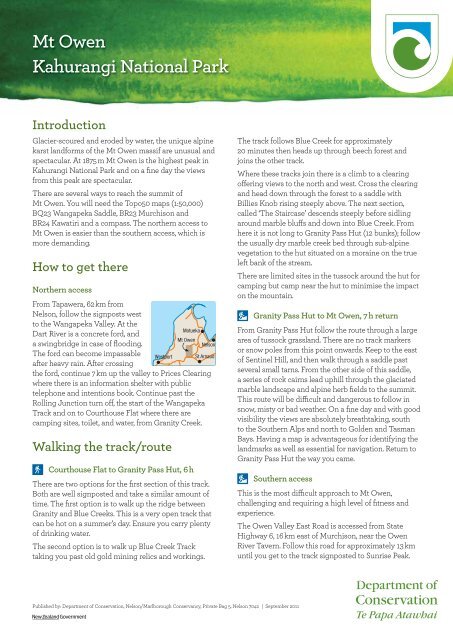
From Tapawera, 62 km from<br />
Nelson, follow the signposts west<br />
to the Wangapeka Valley. At the<br />
<br />
Dart River is a concrete ford, and<br />
<br />
a swingbridge in case <strong>of</strong> flooding.<br />
The ford can become impassable <br />
after heavy rain. After crossing<br />
the ford, continue 7 km up the valley to Prices Clearing<br />
where there is an information shelter with public<br />
telephone and intentions book. Continue past the<br />
Rolling Junction turn <strong>of</strong>f, the start <strong>of</strong> the Wangapeka<br />
Track and on to Courthouse Flat where there are<br />
camping sites, toilet, and water, from Granity Creek.<br />
Walking the track/route<br />
Courthouse Flat to Granity Pass Hut, 6 h<br />
<br />
<br />
There are two options for the first section <strong>of</strong> this track.<br />
Both are well signposted and take a similar amount <strong>of</strong><br />
time. The first option is to walk up the ridge between<br />
Granity and Blue Creeks. This is a very open track that<br />
can be hot on a summer’s day. Ensure you carry plenty<br />
<strong>of</strong> drinking water.<br />
The second option is to walk up Blue Creek Track<br />
taking you past old gold mining relics and workings.<br />
The track follows Blue Creek for approximately<br />
20 minutes then heads up through beech forest and<br />
joins the other track.<br />
Where these tracks join there is a climb to a clearing<br />
<strong>of</strong>fering views to the north and west. Cross the clearing<br />
and head down through the forest to a saddle with<br />
Billies Knob rising steeply above. The next section,<br />
called ‘The Staircase’ descends steeply before sidling<br />
around marble bluffs and down into Blue Creek. From<br />
here it is not long to Granity Pass Hut (12 bunks); follow<br />
the usually dry marble creek bed through sub-alpine<br />
vegetation to the hut situated on a moraine on the true<br />
left bank <strong>of</strong> the stream.<br />
There are limited sites in the tussock around the hut for<br />
camping but camp near the hut to minimise the impact<br />
on the mountain.<br />
Granity Pass Hut to <strong>Mt</strong> <strong>Owen</strong>, 7 h return<br />
From Granity Pass Hut follow the route through a large<br />
area <strong>of</strong> tussock grassland. There are no track markers<br />
or snow poles from this point onwards. Keep to the east<br />
<strong>of</strong> Sentinel Hill, and then walk through a saddle past<br />
several small tarns. From the other side <strong>of</strong> this saddle,<br />
a series <strong>of</strong> rock cairns lead uphill through the glaciated<br />
marble landscape and alpine herb fields to the summit.<br />
This route will be difficult and dangerous to follow in<br />
snow, misty or bad weather. On a fine day and with good<br />
visibility the views are absolutely breathtaking, south<br />
to the Southern Alps and north to Golden and Tasman<br />
Bays. Having a map is advantageous for identifying the<br />
landmarks as well as essential for navigation. Return to<br />
Granity Pass Hut the way you came.<br />
Southern access<br />
Published by: <strong>Department</strong> <strong>of</strong> <strong>Conservation</strong>, Nelson/Marlborough Conservancy, Private Bag 5, Nelson 7042 | September 2011<br />
This is the most difficult approach to <strong>Mt</strong> <strong>Owen</strong>,<br />
challenging and requiring a high level <strong>of</strong> fitness and<br />
experience.<br />
The <strong>Owen</strong> Valley East Road is accessed from State<br />
Highway 6, 16 km east <strong>of</strong> Murchison, near the <strong>Owen</strong><br />
River Tavern. Follow this road for approximately 13 km<br />
until you get to the track signposted to Sunrise Peak.
Alternatively turn left down the side road to access the<br />
route to Branch Creek Hut (6 bunks) via Frying Pan<br />
Creek and Fyfe River.<br />
The road crosses private land, please respect the<br />
property and leave gates as you find them. If you are<br />
planning to camp or driving up the road at night<br />
contact the landowners for permission. Contact DOC<br />
Nelson Lakes Visitor Centre for details.<br />
<br />
<strong>Owen</strong> Valley East Road to <strong>Mt</strong> <strong>Owen</strong><br />
summit — Sunrise Peak Route, 7 h<br />
The track crosses farmland for approximately 2 km<br />
before entering the forest. The river is crossed several<br />
times before the track climbs steeply up Sunrise Ridge<br />
to the bushline. Please note, once you leave the <strong>Owen</strong><br />
River there is no readily available water.<br />
<br />
<br />
<br />
<br />
<br />
<br />
<br />
<br />
<br />
<br />
<br />
<br />
<br />
<br />
<br />
<br />
<br />
<br />
<br />
<br />
<br />
<br />
<br />
<br />
<br />
<br />
<br />
<br />
<br />
<br />
<br />
<br />
<br />
<strong>Mt</strong> <strong>Owen</strong>, <strong>Kahurangi</strong> <strong>National</strong> <strong>Park</strong> | 2<br />
<br />
<br />
<br />
<br />
<br />
<br />
<br />
<br />
<br />
<br />
<br />
<br />
<br />
<br />
<br />
<br />
<br />
<br />
<br />
<br />
<br />
<br />
<br />
<br />
<br />
<br />
<br />
<br />
<br />
<br />
<br />
<br />
<br />
<br />
<br />
<br />
<br />
<br />
<br />
<br />
<br />
<br />
<br />
<br />
<br />
<br />
<br />
<br />
<br />
<br />
<br />
<br />
<br />
<br />
<br />
<br />
<br />
<br />
<br />
<br />
<br />
<br />
<br />
<br />
<br />
<br />
<br />
<br />
<br />
<br />
<br />
<br />
<br />
<br />
<br />
<br />
<br />
<br />
<br />
<br />
<br />
<br />
<br />
<br />
<br />
<br />
<br />
<br />
<br />
<br />
<br />
<br />
<br />
<br />
<br />
<br />
<br />
<br />
<br />
<br />
<br />
<br />
<br />
<br />
<br />
<br />
<br />
<br />
<br />
<br />
<br />
<br />
<br />
<br />
<br />
<br />
<br />
<br />
<br />
<br />
<br />
<br />
<br />
<br />
<br />
<br />
<br />
<br />
Above the bushline, scramble up through the thick<br />
tussock and steep scree fields to the ridge below<br />
Sunrise Peak. Continue northwards towards <strong>Mt</strong> <strong>Owen</strong>,<br />
picking your way carefully through the marble<br />
formations. Good visibility is essential for route finding.<br />
There are no markers or rock cairns above the bushline.<br />
Bushline to <strong>Mt</strong> <strong>Owen</strong> summit is 3 hours.<br />
Alternative routes in the area<br />
Billies Knob<br />
From the saddle before ‘The Staircase’ (see Northern<br />
Access) there is an optional side trip up Billies Knob.<br />
Ascending Billies Knob from Courthouse Flat, return, is<br />
a long day trip.<br />
<br />
<br />
<br />
<br />
<br />
<br />
<br />
<br />
<br />
<br />
<br />
<br />
<br />
<br />
<br />
<br />
Tramping track<br />
• Challenging day or multi-day tramping/<br />
hiking.<br />
• Track is mostly unformed with steep, rough<br />
or muddy sections.<br />
• Suitable for people with good fitness.<br />
Moderate to high-level backcountry skills<br />
and experience (including navigation and<br />
survival skills) required.<br />
• Track has markers, poles or rock cairns.<br />
Expect unbridged stream and river crossings.<br />
• Tramping/hiking boots required.<br />
Route<br />
• Challenging day or multi-day tramping/<br />
hiking.<br />
• Track unformed and natural, rough, muddy<br />
or very steep.<br />
• Suitable for people with above average<br />
fitness. High-level backcountry skills and<br />
experience (including navigation and<br />
survival skills) required.<br />
• Complete self-sufficiency required.<br />
• Track has markers, poles or rock cairns.<br />
Expect unbridged stream and river crossings.<br />
• Sturdy tramping/hiking boots required.<br />
Standard huts have mattresses, water supply<br />
and toilet. Wood heaters are provided at huts<br />
below the bush line. The Back country Hut<br />
Pass or Back country Hut Tickets are required.<br />
Basic huts provide very basic shelter with<br />
limited facilities. No charge.<br />
Standard campsites have a limited range <strong>of</strong><br />
facilities and services. Toilets (usually<br />
composting or pit variety) water supply (tap,<br />
stream, or lake) and vehicle or boat access.<br />
Wood barbeques and fireplaces, showers<br />
(cold), picnic tables, a cooking shelter and<br />
rubbish bins may be provided.<br />
www.doc.govt.nz
Alternatively from Billies Knob you can descend south<br />
to Granity Pass via a steep tussock gully to the bed <strong>of</strong><br />
Blue Creek and Granity Pass Hut. None <strong>of</strong> these routes<br />
are marked.<br />
Lookout Range to Granity Pass Hut, 8 h<br />
From Kaka drive approximately 1.5 km southwest along<br />
Tadmor Glenhope Road until you reach the signpost<br />
for the Lookout Range. Walk past farming sheds up a<br />
forestry skid site just short <strong>of</strong> Hodgkinson Road end.<br />
From the roadend the track is well marked until Conical<br />
Hill, approximately 4 hours.<br />
Continue southwest along the ridge about 1.5 km<br />
before turning northwest down the major spur. Cross<br />
the Dart River and follow an old animal trail north<br />
up to the main Lookout Range ridge. Sidle around<br />
the headwaters <strong>of</strong> the <strong>Owen</strong> River catchment to the<br />
saddle between <strong>Owen</strong> River and Granity Creek. Tramp<br />
through the scrub and head west to Granity Pass Hut<br />
(12 bunks). From the roadend to Granity Pass Hut will<br />
take a minimum <strong>of</strong> 8 hours.<br />
Fyfe River Route to Branch Creek Hut, road<br />
end to hut 6–8 h<br />
A marked route leads to Branch Creek Hut (6 bunks).<br />
Get permission and directions to cross the farmland,<br />
from the land owners, to the ford across the Fyfe River,<br />
below the junction with Frying Pan Creek. On the other<br />
side <strong>of</strong> the Fyfe River a DOC sign indicates the start <strong>of</strong><br />
the route. Follow the markers up the true right <strong>of</strong> Frying<br />
Pan Creek onto the saddle, then down the ridge in the<br />
Fyfe River Valley. Follow the river upstream through<br />
beech forest to Branch Creek Hut, situated on the<br />
valley floor. The bushline is a further hour climb from<br />
the hut. From here you make your own way onto the<br />
<strong>Mt</strong> <strong>Owen</strong> massif.<br />
<strong>Mt</strong> <strong>Owen</strong>, <strong>Kahurangi</strong> <strong>National</strong> <strong>Park</strong> | 3<br />
• Protect plants and animals<br />
• Remove rubbish<br />
• Bury toilet waste<br />
• Keep waterways clean<br />
• Take care with fires<br />
• Camp carefully<br />
• Keep to the track<br />
• Consider others<br />
• Respect our cultural heritage<br />
• Enjoy your visit<br />
• Toitū te whenua (leave the land undisturbed)<br />
Please remember<br />
• A Backcountry Hut Pass or Backcountry Country<br />
Ticket is required to stay in the huts.<br />
• Trampers need to be experienced, well equipped, fit<br />
and self-sufficient. Carry and confidently know how<br />
to use a map and compass, or GPS for navigation.<br />
• Poor visibility can make route finding and<br />
orientation difficult.<br />
• There are no track markers above the bushline.<br />
• Some rivers do not have bridges and may become<br />
impassable after heavy rain.<br />
• The karst landscape is full <strong>of</strong> shafts.<br />
• Snow may linger on the mountain well into summer.<br />
• Climbing skills and equipment may be necessary.<br />
• Wasps are a known hazard and are particularly<br />
common from December until April. Carry<br />
antihistamine if you are allergic to their stings.<br />
This is a remote area; leave your intentions with a<br />
responsible person. It’s not recommended trampers<br />
travel alone.<br />
Remember your safety is your<br />
responsibility. To report any<br />
safety hazards in the outdoors<br />
call DOC HOTline 0800 362 468.<br />
To find out more<br />
Contact:<br />
<strong>Department</strong> <strong>of</strong> <strong>Conservation</strong><br />
Nelson Regional Visitor Centre<br />
Millers Acre Centre/ Taha o te Awa<br />
79 Trafalgar Street, Nelson 7010<br />
PO Box 375, Nelson 7040<br />
Ph: (03) 546 9339<br />
Email: nelsonvc@doc.govt.nz<br />
<strong>Department</strong> <strong>of</strong> <strong>Conservation</strong><br />
Nelson Lakes Visitor Centre<br />
PO Box 55, St Arnaud 7053<br />
Ph: (03) 521 1806<br />
Email: nelsonlakesvc@doc.govt.nz<br />
Or visit www.doc.govt.nz<br />
www.doc.govt.nz


