You also want an ePaper? Increase the reach of your titles
YUMPU automatically turns print PDFs into web optimized ePapers that Google loves.
56 <strong>Map</strong> <strong>17</strong>: <strong>Dowley</strong> <strong>Gap</strong> <strong>and</strong> <strong>Hirst</strong> <strong>Wood</strong><br />
1<br />
2<br />
3<br />
The Fisherman’s Inn (key unlisted building).<br />
1-3 Dobb Kiln Lane<br />
Scourer Bridge (Grade 11 Listed).<br />
4<br />
5<br />
6<br />
Cottage at <strong>Dowley</strong> <strong>Gap</strong> Mill (key<br />
unlisted building).<br />
7<br />
<strong>Dowley</strong> <strong>Gap</strong> Locks (Grade 11 Listed).<br />
8<br />
Former <strong>Dowley</strong> <strong>Gap</strong> Mill (key unlisted building).<br />
The top of the Seven Arches Aqueduct (Grade 11<br />
Listed).<br />
9<br />
<strong>Hirst</strong> <strong>Wood</strong>
Character of the Area<br />
The mixture of stone built<br />
buildings around Scourer<br />
Bridge st<strong>and</strong> in a small<br />
clearing, with the northern<br />
bank of the canal heavily<br />
wooded. There were once<br />
three wharves at Scourer<br />
Bridge, with the largest ones<br />
on the southern side<br />
stretching as far as <strong>Dowley</strong> <strong>Gap</strong> Locks to the east<br />
<strong>and</strong> a similar distance west. It appears that there<br />
was limited warehousing associated with the<br />
wharves, with 1 <strong>and</strong> 3 Dobb Kiln Lane the only<br />
possible former warehouses. The goods loaded <strong>and</strong><br />
unloaded at these wharfs related to agriculture.<br />
Until the second half of the 19th century, the only<br />
structures near Scourer Bridge were limekilns on<br />
the site of 1 Dobb Kiln Lane. It is probable that<br />
urban manure <strong>and</strong> sewage was shipped to this area<br />
<strong>and</strong> (on different boats) produce taken to the<br />
markets of nearby towns such as Bingley, Shipley <strong>and</strong><br />
Bradford. All that remains of the wharves is a<br />
stretch of broad copingstones <strong>and</strong> mooring posts<br />
which are now the waterbus stop. At this point the<br />
s<strong>and</strong>y gravel towpath is broad <strong>and</strong> the grassed<br />
verges clean <strong>and</strong> well kept.<br />
To the east of the original packhorse bridge over the<br />
canal (number 206) the canal area is briefly flanked<br />
by dense woodl<strong>and</strong> before opening up at <strong>Dowley</strong><br />
<strong>Gap</strong> Locks. To the south is a sewage works which is<br />
fairly visible over its boundary wall, while to the<br />
north is a rugged pastoral field which provides an<br />
important immediate setting for the locks <strong>and</strong><br />
retains traditional boundary walls <strong>and</strong> old monolithic<br />
gateposts.<br />
Past another old packhorse bridge (207), is a group<br />
of vernacular style buildings associated with the<br />
former <strong>Dowley</strong> <strong>Gap</strong> Mill. The mill itself is an excellent<br />
example of how modern interventions can<br />
enhance a historic building.<br />
The gravel towpath turns to concrete as the canal is<br />
carried over the River Aire by the unsympathetically<br />
modernised Seven Arches aqueduct, one of the most<br />
substantial pieces of engineering along this early<br />
stretch of the canal. From here the canal is enclosed<br />
by the attractive l<strong>and</strong>scape of <strong>Hirst</strong> <strong>Wood</strong>.<br />
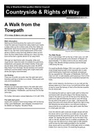
Top: Outbuilding at <strong>Dowley</strong> <strong>Gap</strong> Mills<br />
Features of the Area<br />
1. 1-3 Dobb Kiln Lane: 3 Dobb Kiln Lane st<strong>and</strong>s on the site<br />
of the <strong>Dowley</strong> <strong>Gap</strong> limekilns, which are the only structures at<br />
Dobb Kiln Lane recorded in the 1852 Ordnance Survey. By the<br />
time of the 1893 Ordnance Survey, 1 <strong>and</strong> 3 Dobb Kiln Lane had<br />
been built, with number 2 presumably appearing shortly after.<br />
The buildings have been sensitively extended since <strong>and</strong> are built<br />
into the hillside, concealing their full 2-storey height. The buildings<br />
are architecturally plain, with nothing by way of ornament. The<br />
slate roofs lack chimneys, which suggest that the buildings were<br />
associated with the adjacent wharf <strong>and</strong> were not built as<br />
dwellings.<br />
2. The Fisherman’s Inn: Dating probably from the 1880s, this<br />
3 bay purpose built public house has a mixture of vernacular<br />
revival <strong>and</strong> Arts <strong>and</strong> Crafts detailing. The building is faced with<br />
pitch-faced stone which contrasts with the ashlar dressings, which<br />
include quoins at the angles. The diminishing stone slate roof<br />
overhangs the walls <strong>and</strong> shaped timber brackets support its<br />
soffits. Each of the bays along the front elevation is gabled. The<br />
wider central bay breaks slightly forward. At first floor is a pair of<br />
mullioned 2 pane timber sash windows in plain ashlar reveals.<br />
Below this is the main doorway with projecting ashlar pilasters<br />
<strong>and</strong> shaped brackets carrying a plain cornice. At ground floor the<br />
flanking bays contain large window openings with modern glazing<br />
<strong>and</strong> hoodmoulds. The single first floor sash windows are<br />
surmounted by an unusual triangular area of glazing with<br />
diagonal glazing bars.<br />
3. Scourer Bridge or Fisherman’s Bridge (205): This Grade<br />
II Listed stone built bridge is very similar to its contemporary,<br />
<strong>Dowley</strong> <strong>Gap</strong> Changeline Bridge. It has an elliptical horse shoe<br />
arch which is lined with chamfered voussoirs, <strong>and</strong> parapets which<br />
are coped with gently sloping triangular stones. The northern end<br />
of this road bridge is higher owing to the topography.<br />
4. <strong>Dowley</strong> <strong>Gap</strong> Locks (20 & 21): These 2 rise locks were<br />
built c.<strong>17</strong>73 <strong>and</strong> are Grade II* Listed for their architectural <strong>and</strong><br />
historic interest <strong>and</strong> group value with the other locks at Bingley.<br />
The locks raise the level of the canal a total of about 20 feet.<br />
Each lock is of wrought s<strong>and</strong>stone construction with large block<br />
copings. The lower lock (20) has vertical masonry to which the<br />
sides of the canal are linked via coped sloped walls. The upper<br />
lock (21) has curved masonry. Set against the masonry to either<br />
side of each lock are stone stairways with painted timber<br />
diamond railings attached to square posts with iron ‘feet’. The<br />
same railings can be found along the top of the masonry to<br />
either side of the gates. The painted timber <strong>and</strong> iron gates <strong>and</strong><br />
balance beams have iron gears attached to them. Below each<br />
balance beam is a quadrant of stone setts with raised stones to<br />
allow a better purchase. The stone walls of the locks are curved<br />
to follow the plan shape of the quadrants. Over the tail of each<br />
lock is a timber plank bridge with painted timber railings,<br />
uprights <strong>and</strong> guardrails. To the north of the locks is an overgrown<br />
stone lined overflow channel. To the south is an ugly rolled metal<br />
container which is used as the lock keeper’s hut.<br />
5. <strong>Dowley</strong> <strong>Gap</strong> Changeline Bridge (206): This Grade II<br />
Listed stone built bridge is contemporary with the canal (c.<strong>17</strong>73).<br />
The towpath crosses to the opposite bank across this bridge. The<br />
arch over the waterway is elliptical <strong>and</strong> has chamfered voussoirs.<br />
The parapets have shallow triangular copings which are held<br />
together by iron staples.<br />
6. Cottages at <strong>Dowley</strong> <strong>Gap</strong> Mill: Built as 3 cottages, it<br />
appears that they are now a single dwelling called Mill House.<br />
These vernacular style cottages are probably contemporary with<br />
(if not earlier than) the attached mill of 1818. The cottages are<br />
each 2 bays with the timber board doors recessed in plain stone<br />
openings. Next to each door is a pair of mullioned windows with<br />
plain stone surrounds, with identical openings at first floor. The<br />
side hung casement windows add to the traditional appearance<br />
of the cottages. The roof is stone. To the rear is an out of scale<br />
<strong>and</strong> out of character rendered <strong>and</strong> painted 2 storey flat roofed<br />
modern extension which is unfortunately highly visible along the<br />
canal. The cottages have large gardens with traditional flat <strong>and</strong><br />
chamfer coped boundary walls.<br />
7. <strong>Dowley</strong> <strong>Gap</strong> Mill: Built as a worsted mill in 1818 by<br />
Matthew <strong>and</strong> Thomas Walker (Firth, 1999), by c.1890 <strong>Dowley</strong><br />
<strong>Gap</strong> Mill was disused. In the mid-1990s the building was<br />
converted to at least one dwelling <strong>and</strong> a lot of effort has gone<br />
into the design of this conversion to make sure that the modern<br />
interventions are of a high quality <strong>and</strong> sufficiently strong character<br />
such that they enhance the appearance of the mill. The 2<br />
storey, 6 bay traditional stone elevation of the mill remains in<br />
place alongside the canal, but at its gable is a recessed large<br />
modern window with timber work which carries a rolled metal<br />
roof which surrounds the remains of the old chimney <strong>and</strong> has the<br />
appearance of floating over the building. On the yard side of the<br />
mill, one of the bays has been replaced with a modern metalsided<br />
bay which juts out of the façade at a sharp angle. This<br />
projection contains the main timber board door to the building<br />
<strong>and</strong> the upper floors have large areas of glazing which mimic the<br />
appearance of the old loading bays further along the elevation.<br />
This side of the mill is 3 storeys in height owing to the fall of the<br />
l<strong>and</strong> away from the canal.<br />
To the south of the converted part of the mill, <strong>and</strong> forming two<br />
sides of the mill yard, is an L-plan 2 storey industrial building<br />
which is probably contemporary with the mill shed. The building<br />
appears to be disused, as many of its openings are blocked <strong>and</strong><br />
the building has a general air of neglect. The main body of the<br />
building is 6 bays long <strong>and</strong> has an undulating corrugated roof.<br />
There are plain window openings, a stone gutter shelf <strong>and</strong> at the<br />
<strong>Map</strong> <strong>17</strong>: <strong>Dowley</strong> <strong>Gap</strong> <strong>and</strong> <strong>Hirst</strong> <strong>Wood</strong><br />
southernmost bay is a first floor loading door with metal hoist in<br />
place. The blocked small square window openings are almost<br />
exclusively at first floor level.<br />
8. Seven Arches Aqueduct: Engineered by John Longbotham<br />
to the plan of James Brindley, the Seven Arches Aqueduct was<br />
built c.<strong>17</strong>73 with James Rhodes of Shipley a contractor. The<br />
Grade II Listed Building carries the Leeds-Liverpool Canal 30ft<br />
over the River Aire. The voussoired segmental arches have a<br />
stone string above them. Along its northern side, the aqueduct is<br />
topped by a parapet with a shallow triangular coping <strong>and</strong> at its<br />
foot <strong>and</strong> another stone string, but the northern side is topped<br />
with inappropriate railings. Along the viaduct, the towpath is<br />
surfaced with concrete, which is also used for the remaining<br />
copings.<br />
57<br />
9. <strong>Hirst</strong> <strong>Wood</strong>: Dating from ancient times, <strong>Hirst</strong> <strong>Wood</strong> is a<br />
picturesque oak <strong>and</strong> birch woodl<strong>and</strong>. Today the wood is crossed<br />
by a number of footpaths <strong>and</strong> its use as a leisure destination<br />
dates back at least to the early 20th century, when the stretch of<br />
the canal alongside the wood was a popular spot for swimming<br />
(Firth, 1999). The dense woodl<strong>and</strong> forms a peaceful setting for<br />
the canal <strong>and</strong> emphasises the gap between Bingley <strong>and</strong> Shipley/<br />
Saltaire. At the western end of <strong>Hirst</strong> <strong>Wood</strong> is a long disused<br />
s<strong>and</strong>stone quarry, the stone from which would have been loaded<br />
straight onto a canal boat.<br />
Issues<br />
Concrete towpaths <strong>and</strong> plain modern railings at Seven Arches<br />
Aqueduct.<br />
Potholed towpath east of Scourer Bridge.<br />
Inappropriate modern door <strong>and</strong> window details to some of<br />
the unlisted buildings.<br />
Vacant <strong>and</strong> underused buildings near <strong>Dowley</strong> <strong>Gap</strong> Mill.<br />
Inappropriate boundary features to some properties.<br />
Poor condition of track <strong>and</strong> footpaths by <strong>Dowley</strong> <strong>Gap</strong> Mill.