

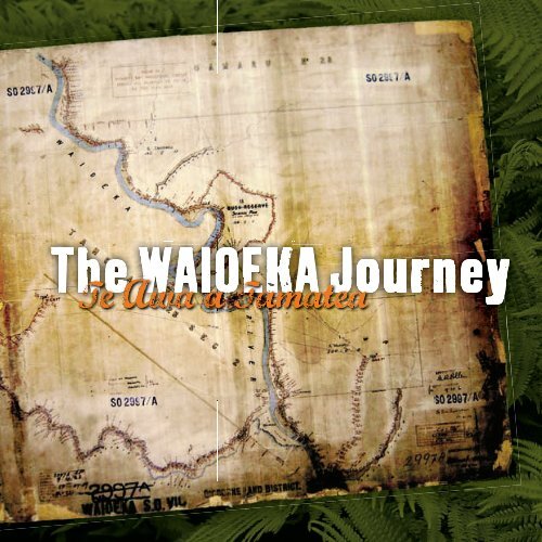
The Waioeka Journey brochure - Department of Conservation
The Waioeka Journey brochure - Department of Conservation
The Waioeka Journey brochure - Department of Conservation

Create successful ePaper yourself
Turn your PDF publications into a flip-book with our unique Google optimized e-Paper software.
WHITE ISLAND<br />
OPOTIKI<br />
MAHIA<br />
GISBORNE<br />
EAST CAPE<br />
• AUCKLAND<br />
• WELLINGTON<br />
• CHRISTCHURCH<br />
<strong>The</strong> <strong>Waioeka</strong> <strong>Journey</strong> – Te Awa a Tamatea is situated on<br />
State State State State State State Highway Highway Highway Highway Highway Highway 2 2 2 2 2 between between between between between between Opotiki Opotiki Opotiki Opotiki Opotiki Opotiki and and and and and and Gisborne. Gisborne. Gisborne. Gisborne. Gisborne. Gisborne. <strong>The</strong> <strong>The</strong> <strong>The</strong> <strong>The</strong> <strong>The</strong> <strong>The</strong> highway highway highway highway highway highway<br />
follows follows follows follows follows follows follows follows follows follows follows follows a a a a a a a a a a a route route route route route route route route route route route route carved carved carved carved carved carved carved carved carved carved carved carved by by by by by by by by by by by by rivers rivers rivers rivers rivers rivers rivers rivers rivers rivers rivers rivers through through through through through through through through through through through through the the the the the the the the the the the the steep steep steep steep steep steep steep steep steep steep steep steep forested forested forested forested forested forested forested forested forested forested forested forested hills hills hills hills hills hills hills hills hills hills hills hills<br />
<strong>of</strong> <strong>of</strong> <strong>of</strong> <strong>of</strong> the the the the the <strong>Waioeka</strong> <strong>Waioeka</strong> <strong>Waioeka</strong> <strong>Waioeka</strong> <strong>Waioeka</strong> Gorge Gorge Gorge Gorge Gorge Scenic Scenic Scenic Scenic Scenic Reserve. Reserve. Reserve. Reserve. Reserve.<br />
This beautiful area has challenged people since<br />
early Maori travelled and lived in the gorge.<br />
In recent years the challenge <strong>of</strong> travelling in<br />
the gorge has resulted in high numbers <strong>of</strong><br />
road accidents.<br />
‘<strong>The</strong> <strong>Waioeka</strong> <strong>Journey</strong> – Te Awa a Tamatea’,<br />
is a multi-agency project aimed at increasing<br />
road safety, providing rest stops where drivers<br />
can take a break and discover some <strong>of</strong> the<br />
stories <strong>of</strong> the gorge. <strong>The</strong> two main agencies<br />
involved have been the NZ Transport Agency<br />
and the <strong>Department</strong> <strong>of</strong> <strong>Conservation</strong>.<br />
<strong>The</strong>y have worked in conjunction with NZ<br />
Police, Environment Bay <strong>of</strong> Plenty, Accident<br />
Compensation Corporation, Opotiki and<br />
Gisborne District Councils, NZ Fire Service<br />
and local iwi, Ngati Ira o Waioweka and Te<br />
Aitanga a Mahaki.<br />
Since 2004, a combination <strong>of</strong> engineering<br />
improvements, signage upgrades, enhanced<br />
police enforcement and education initiatives,<br />
including ‘Drive Reviver’ campaigns, have<br />
been instigated to improve driver safety.<br />
www.doc.govt.nz<br />
Seven Seven rest rest areas areas have have been been established established<br />
at at sites sites sites through through through the the the gorge gorge gorge to to encourage encourage encourage<br />
travellers travellers travellers travellers to to to stop, stop, stop, stop, rest rest rest rest and and and and reduce reduce reduce reduce driver driver driver driver<br />
fatigue, fatigue, a signifi signifi cant cant contributor contributor to <strong>Waioeka</strong> <strong>Waioeka</strong><br />
vehicle vehicle vehicle accidents. accidents. accidents. Information Information Information panels panels panels at at each each each<br />
site site tell tell <strong>of</strong> the the history, history, culture, culture, geology, geology,<br />
and and ecology ecology <strong>of</strong> the the gorge. gorge.<br />
In this this booklet booklet you you will will fi nd nd edited edited versions versions<br />
<strong>of</strong> the the 18 18 information information panels panels in ‘<strong>The</strong> ‘<strong>The</strong> <strong>Waioeka</strong> <strong>Waioeka</strong><br />
<strong>Journey</strong> <strong>Journey</strong> – Te Awa a Tamatea’. Stories <strong>of</strong> this<br />
area area show show it is not not a place place to be taken taken for for<br />
granted, granted, but but has has hidden hidden depths depths that that<br />
will will delight delight and and challenge challenge people people for for<br />
generations generations to come. come.
Kia ora and welcome to the <strong>Waioeka</strong> Gorge…<br />
beautiful, evocative, evocative, with many stories to tell.<br />
<strong>The</strong>re is more than one name for the gorge.<br />
For some this area is known as Waioweka,<br />
but at present the <strong>of</strong>fi cial name is <strong>Waioeka</strong>.<br />
On this journey – at Tauranga, Goldsmiths,<br />
Oponae, <strong>The</strong> Monument, Manganuku, Opato<br />
and at Matahanea, you can discover stories<br />
about this unique place.<br />
Some <strong>of</strong> these originate with Tamatea, legendary<br />
navigator and explorer. Tamatea journeyed here<br />
leaving a legacy <strong>of</strong> tales and place-names. <strong>The</strong>y<br />
include Te Rotonui Awai, a small lake created<br />
by the footprint <strong>of</strong> Tamatea, “a place where<br />
eels with many tails are to be found”. He is<br />
said to have stamped his feet, creating a pool <strong>of</strong><br />
water which he used to quench the thirst <strong>of</strong> his<br />
daughter.<br />
<strong>The</strong> gorge cuts through ranges <strong>of</strong> steep-sided<br />
hills rising from 400 metres near the coast<br />
to 1000 metres inland. <strong>The</strong> hard yet brittle<br />
greywacke has been showered with volcanic ash<br />
and pumice over thousands <strong>of</strong> years. Vegetation<br />
includes canopies <strong>of</strong> tawa, rimu, miro, totara<br />
and nikau palms, together with cover <strong>of</strong> fern,<br />
manuka and kanuka.<br />
By the late 20th century, the government<br />
progressively added retired farmland to<br />
the <strong>Waioeka</strong> Gorge Scenic Reserve to<br />
protect protect water catchments. Regenerating<br />
bush helped reduce erosion, improve<br />
water quality and protect the Opotiki<br />
plains from fl ooding. Today, Today, anglers,<br />
kayakers, trampers, hunters and walkers<br />
appreciate the recreational opportunities<br />
<strong>of</strong> the area.<br />
<strong>The</strong> land land is steep, the soil poor – a hard<br />
going going place place for for the the early early settlers settlers and and<br />
travellers. travellers. A place with tales tales <strong>of</strong> hardship,<br />
ingenuity ingenuity and adaptation adaptation – – and the the<br />
response <strong>of</strong> the landscape landscape to the impact<br />
<strong>of</strong> man. man.
“MATAHANEA: MATA (FACE) – HA (BREATH) NEA<br />
(REFERRING TO TAWHIRIMATEA THE GOD OF<br />
WINDS AND STORMS)<br />
You are travelling through the traditional lands <strong>of</strong> Ngati<br />
Ira o Waioweka. <strong>The</strong> ancestors <strong>of</strong> Ngati Ira migrated<br />
to Aotearoa on the waka Tuwhenua. <strong>The</strong>ir fi rst major<br />
settlement was at Wairata where the Waioweka River enters<br />
the gorge. Five pa (fortifi ed settlement) sites are still visible<br />
there.<br />
Later the waka Mata-atua brought settlers, Ruiho, Ruake,<br />
Manu, Weka, Toroa. Following on from Toroa came<br />
Wairaka and Tamatea ki te Huatahi. It is from the tipuna<br />
(ancestor) Weka that Ngati Ira o Waioweka derives its<br />
name.<br />
Ngati Ira settled on the Waioweka fl ats and built pa on<br />
nearby hills. Behind the hill to your left is Matahanea Pa,<br />
an important site for Ngati Ira. Sea shells can still be seen<br />
there from after kai (meals). Matahanea can be seen from<br />
approximately half a kilometre past Te Aroaro bridge.<br />
<strong>The</strong> traditional boundaries <strong>of</strong> Ngati Ira o Waioweka<br />
extend from Waitangi (the Opotiki Cemetery) to the<br />
boundaries <strong>of</strong> Turanganui. Land from Waitangi to<br />
Matahanea was taken by the Crown in the 1860s. Further<br />
land was confi scated from Matahanea to Turanganui by the<br />
Crown under the 1873 Settlement Act.<br />
Ngati Ira remain today on remnants <strong>of</strong> those confi scations<br />
around Opeke Marae at the mouth <strong>of</strong> the Waioweka Gorge.”<br />
HONE KAMETA - Ngati Ira o Waioweka<br />
Pa Site<br />
Pa Site<br />
Pa Site<br />
Pa Site<br />
Matahanea<br />
Pa Site<br />
Matahanea Pa<br />
“TAURANGA: TAU(ARRIVE) RANGA (ALIGHT)<br />
A recognised landing and resting place <strong>of</strong> waka on the Waioweka River.<br />
Rivers were the main means <strong>of</strong> travelling in those times past.” HONE KAMETA – Ngati Ira o Waioweka<br />
Haere Mai – Welcome to the Tauranga Valley<br />
entrance on the <strong>Waioeka</strong> <strong>Journey</strong>.<br />
On this part <strong>of</strong> the journey you can explore the Tauranga Valley<br />
where settlers tried and failed to farm the land. To reach the valley<br />
you will cross the nationally signifi cant historic Tauranga Bridge.<br />
Families, farmers, engineers and builders took up the challenge to<br />
settle and provide access to this valley.<br />
“…the grass was bought in Gisborne, sent by steamer to Auckland,<br />
sent back to Opotiki by small coastal boat, then carted by dray as far<br />
as possible, then by pack horse the rest <strong>of</strong> the journey.”<br />
MARY ANN ENSOR – Started bush farming<br />
with her husband in the <strong>Waioeka</strong> Gorge – 1905
“…the sad part <strong>of</strong> our life was seeing a number <strong>of</strong> men carried out through bush felling accidents; some would be badly smashed about<br />
while others would be dead.” MARY ANN ENSOR – Started bush farming with her husband in the <strong>Waioeka</strong> Gorge – 1905<br />
CLEARING THE LAND<br />
European settlement <strong>of</strong> the <strong>Waioeka</strong> Gorge began in the<br />
1880s with some land allocated for stock and education<br />
reserves. Settlement intensifi ed in the early 1900s. In 1907<br />
there were 400 applications for a 700 acre (238 hectare) block<br />
at Oponae. <strong>The</strong> main challenge was access. Gangs <strong>of</strong> workers<br />
were contracted to clear the bush with concerns raised about<br />
the effect bush clearance would have on the steep hillsides.<br />
SETTLING IN<br />
<strong>The</strong> fi rst dwellings were rough whare <strong>of</strong> pitsawn timber and<br />
corrugated iron, some later replaced by more substantial<br />
homes. As settlements grew, shops<br />
opened at Matahanea and Oponae<br />
and a telephone connection<br />
was established. In the early<br />
1920s a half time school was<br />
established between Oponae<br />
and Wairata.<br />
THE CHALLENGE OF THE LAND<br />
Stock needed to be fed. This proved a big challenge as the soil<br />
was not fertile enough to maintain maintain vigorous grass growth. Much<br />
<strong>of</strong> the the land land reverted to fern, fern, bidibidi and wineberry. wineberry. Properties<br />
were lost in mortgagee sales, others simply abandoned. abandoned.<br />
Families who settled in this<br />
area included the the Beaufoys,<br />
Hamiltons Hamiltons and Lamberts. <strong>The</strong>y<br />
all took up leases in 1906 1906 with<br />
the Beaufoys and Lamberts Lamberts<br />
leaving in 1927. <strong>The</strong>se early<br />
settlers had a dream but in<br />
hindsight hindsight it it is is clear that that some<br />
land is not meant to be<br />
farmed. <strong>The</strong>ir leases leases were<br />
incorporated in to what what is is<br />
now the <strong>Waioeka</strong> Gorge<br />
Scenic Reserve.<br />
“…the old suspension bridge was carried away by fl ood in 1918.<br />
Since then the settlers have been battling with this river and a brute <strong>of</strong> a crossing.” ALICK TRAFFORD – <strong>Waioeka</strong> farmer – 1921<br />
<strong>The</strong> Tauranga Bridge stands as a<br />
monument to the commitment <strong>of</strong><br />
settlers determined to make a living<br />
<strong>of</strong>f the land <strong>of</strong> the <strong>Waioeka</strong>. <strong>The</strong>y<br />
shared a sense <strong>of</strong> optimism and hope,<br />
believing they could “make a go” <strong>of</strong><br />
farming this inhospitable place.<br />
THE CHALLENGE<br />
OF ACCESS<br />
River crossings were diffi cult and <strong>of</strong>ten<br />
treacherous, hence the need for a bridge to<br />
link the farms <strong>of</strong> the Tauranga Valley with the<br />
outside world. <strong>The</strong> Tauranga Bridge is the<br />
second to cross the <strong>Waioeka</strong> at this point, the<br />
fi rst being destroyed by fl ood in April 1918.<br />
After the destruction <strong>of</strong> the fi rst bridge a cable<br />
crossing was used while decisions were made<br />
about a replacement. <strong>The</strong> second bridge was<br />
designed by the Public Works <strong>Department</strong> and<br />
built by Percy Kerr, probably in 1922.<br />
THE BRIDGE<br />
<strong>The</strong> Tauranga Bridge is a single span<br />
multiple rope or harp suspension bridge<br />
spanning approximately 60 metres. It is<br />
one one <strong>of</strong> <strong>of</strong> only two remaining <strong>of</strong> its type in in<br />
New New Zealand. It It is <strong>of</strong> national signifi cance<br />
for for its its rarity rarity <strong>of</strong> design and and aesthetic<br />
quality, and is listed as a Category 1<br />
Historic Place with the New Zealand<br />
Historic Places Trust.<br />
<strong>The</strong> Tauranga Tauranga Bridge fell into disrepair<br />
and became became dangerous. A conservation<br />
project was was initiated by the <strong>Department</strong><br />
<strong>of</strong> <strong>Conservation</strong> and the bridge was<br />
<strong>of</strong>fi cially reopened in 1995.<br />
DOC manages ongoing conservation <strong>of</strong> the bridge with<br />
fi nancial support from the Environment Bay <strong>of</strong> Plenty<br />
Environmental Enhancement Fund.
A 21st century visitor to <strong>Waioeka</strong> once commented to a DOC worker,<br />
“This place is beautiful – so who planted all these trees?”<br />
<strong>The</strong> answer, for most <strong>of</strong> the native trees, is nobody.<br />
<strong>The</strong> primary forest was here long before people arrived<br />
in Aotearoa. <strong>The</strong> younger native trees in areas <strong>of</strong><br />
secondary forest have fi lled gaps created by slips or land<br />
clearance for farms that were later abandoned.<br />
Introduced plants (including pine plantations and<br />
old fruit and ornamental trees from abandoned<br />
settlements), were planted by landowners, such as<br />
the Goldsmiths who once farmed in this area. Some<br />
introduced plants have had their seeds spread by wind,<br />
water and birds and are now weeds.<br />
For most <strong>of</strong> the 20th century, droving was the only way to get stock through the<br />
gorge. In the 1980s, fenced paddocks (like the area across the road from this<br />
site) were set aside to provide grazing and protect the bush from roaming stock.<br />
Truck transport <strong>of</strong> stock stock made the paddocks redundant. redundant. <strong>The</strong>se days, natural revegetation<br />
is slowed by competition from weeds and browsing by pest animals so<br />
volunteers volunteers have have helped helped the the process process by by planting planting native native trees in in the the old old paddocks.<br />
A CHANGING LANDSCAPE<br />
Native forests constantly change in response to<br />
environmental pressures. Kamahi once dominated<br />
the primary forest <strong>of</strong> the gorge, gorge, but the species is<br />
disappearing because it is is a favourite food for possums.<br />
Tawa is now prevalent.<br />
If land isn’t constantly kept clear, “colonising species”<br />
such as fern, manuka and kanuka re-emerge. <strong>The</strong><br />
settlers who tried to farm this land hated fern. Its<br />
appearance in paddocks was was a reminder that in this this<br />
place, maintaining pasture was hard hard work. After farms farms<br />
were abandoned, the native forest gradually gradually returned.<br />
Drovers Drovers in in the the <strong>Waioeka</strong>, <strong>Waioeka</strong>, 1910. 1910.<br />
Here young rewarewa trees are emerging from the<br />
broadleaf vegetation dominated by putaputaweta<br />
and tree-ferns (mamaku and wheki). This creates a<br />
texture <strong>of</strong> different colours and shapes.<br />
Eventually the larger trees will overshadow the<br />
secondary (new growth) vegetation.<br />
Native vegetation has a harder time establishing on the fertile flats<br />
and lower slopes where pasture grasses persist. Higher up, secondary<br />
(new growth) natives have taken hold. Notice the primary<br />
(old growth) trees growing along the top ridge.<br />
In the past, this hillside was kept clear and used as farmland.<br />
Today, colonising native shrubs like manuka and tree-ferns such as<br />
mamaku, wheki and silver fern, have started the regeneration process.<br />
This slope, burnt in 2006, provides an example <strong>of</strong><br />
recently cleared land where the re-vegetation process<br />
has just begun. In 2008, when this photo was taken,<br />
the area was dominated by early colonisers like<br />
bracken fern and native shrubs like manuka.<br />
Goldsmiths
“TE MATAARA O NGA WAI RERE RUA: TE MATAARA (LOOKOUT) O NGA WAI RERE (WATERFALL) RUA (TWO)<br />
This place can be found downstream on the other side <strong>of</strong> the river between two waterfalls. It was used as a sentinel lookout to report<br />
on people moving up and down the river.” HONE KAMETA - Ngati Ira o Waioweka<br />
In the early 20th century, large<br />
parts <strong>of</strong> the the <strong>Waioeka</strong> Gorge were<br />
cleared and burnt and replaced by<br />
pastoral grassland. <strong>The</strong> farms were<br />
later abandoned and native bush<br />
gradually returned. Secondary<br />
(new growth) native vegetation can<br />
now be recognised by its lighter<br />
colour and finer texture. Primary<br />
(old growth) forests have a darker<br />
colour and coarser texture.<br />
Trees give us clues about whether land was cleared recently or long ago.<br />
<strong>The</strong> diagonal band <strong>of</strong> taller trees running through the centre <strong>of</strong> this photo<br />
is mostly rewarewa. It is much older than the new growth broadleaf scrub<br />
in the foreground.<br />
Most <strong>of</strong> this steep southfacing<br />
slope is primary (old<br />
growth) native forest that<br />
has never been cleared.<br />
<strong>The</strong> main tree species is<br />
tawa. Notice the darker<br />
forest forming narrow<br />
strips on two spurs<br />
(secondary ridges).<br />
<strong>The</strong> narrow strips <strong>of</strong> darker forest are<br />
podocarps (conifers) rimu and miro,<br />
believed to have established on steep<br />
spurs burnt about 400 years ago. <strong>The</strong><br />
spurs may have been burnt to provide<br />
access to and visibility from the high<br />
vantage points on the main ridge. <strong>The</strong><br />
ridge is Te Tii, and commands a clear<br />
view <strong>of</strong> the valley.<br />
“…we found very large quantities <strong>of</strong> food planted here, some 5 acres <strong>of</strong> taro, and many acres <strong>of</strong> maize.<br />
It is the largest native plantation I remember to have seen.” COLONEL THOMAS PORTER - Diary 1870<br />
<strong>The</strong>re are many places associated with<br />
Tamatea, ancestor <strong>of</strong> Ngati Ira. <strong>The</strong>y<br />
include Te Te Karoro a Tamatea (the seagull<br />
<strong>of</strong> Tamatea) – a massive white rock 200<br />
metres upstream from from here which which was<br />
blasted in an effort to improve water fl ow.<br />
It is is said the the rock was was the the most inland inland<br />
point that seagulls would would visit. Further<br />
downstream we come to Te Heru a<br />
Tamatea (the comb <strong>of</strong> Tamatea) Tamatea) – – a large<br />
rock in the shape <strong>of</strong> a ladder.<br />
NGATI IRA<br />
<strong>The</strong> <strong>Waioeka</strong> has been occupied<br />
by Ngati Ira for hundreds <strong>of</strong> years. Many<br />
pa sites have been identifi ed, including a<br />
number near the entrance to the gorge.<br />
In the 1860s, Ngati Ira settled near<br />
here at Maraetai Pa under the<br />
leadership <strong>of</strong> Hira Te Popo. <strong>The</strong>y<br />
had been attacked by government<br />
troops at a number <strong>of</strong> pa sites<br />
nearer Opotiki. Oponae’s<br />
strategic location provided both<br />
security and an abundant food<br />
supply. <strong>The</strong>y remained here for<br />
fi ve years, emerging in 1870<br />
to settle at Opeke Marae at the<br />
Opotiki entrance to the gorge.<br />
In the 20th century local iwi were<br />
heavily involved in the construction<br />
and maintenance <strong>of</strong> the road through<br />
the gorge. Many lived in this area in<br />
Ministry <strong>of</strong> Works huts, with children<br />
gathering fruit from trees that were<br />
planted in the 1860s.<br />
“Ponae means food basket, Oponae means your food basket. A natural habitat for the tuna, inanga and kereru, Oponae was used as a<br />
strategic area, with all its conveniences, security, strategic locality and abundant food source. In the mid 1860s the Crown troops plundered<br />
Opotiki and Ngati Ira bore the brunt <strong>of</strong> this. Troops devastated and levelled their pa, Te Tarata, on the Waioweka fl ats with the Crown<br />
practicing its scorched earth policy.” HONE KAMETA - Ngati Ira o Waioweka
TE KOOTI<br />
Te Kooti, founder <strong>of</strong> the Ringatu<br />
Church, was one <strong>of</strong> the great Maori<br />
leaders, prophets and military<br />
tacticians <strong>of</strong> the 19th century. He<br />
had many confrontations with<br />
Crown troops during the late 1860s,<br />
travelling long distances across much<br />
<strong>of</strong> the central and eastern parts <strong>of</strong> the<br />
North Island.<br />
Te Kooti moved to this area in 1869<br />
and left later the same year. At the<br />
time there was a substantial village<br />
near here at Maraetahi.<br />
In February 1870 the Crown <strong>of</strong>fered<br />
a £5000 reward for the capture <strong>of</strong><br />
Te Kooti. A major campaign was<br />
mounted and he eventually withdrew<br />
up the <strong>Waioeka</strong>, re-establishing<br />
himself here.<br />
SETTLEMENT<br />
AT MARAETAHI<br />
MARAETAHI<br />
<strong>The</strong> village was built upstream on the<br />
river fl at at the foot <strong>of</strong> the old old pa on the<br />
western bank. It consisted <strong>of</strong> 16 houses,<br />
with several several others others scattered a little<br />
higher up. When Te Kooti left left in 1869<br />
some <strong>of</strong> his his people remained to plant<br />
gardens. He vowed to return. A large<br />
house was built, a whare whare karakia,<br />
or praying praying house, during his his absence.<br />
“…a beautifully fi nished house 84 foot long, and 30 foot broad.<br />
It stood 9 feet high at the eaves, and its beaten earth fl oor was covered with<br />
2 long cross plaited mats running the length <strong>of</strong> the building. At the centre<br />
<strong>of</strong> each mat, scriptural names had been worked in red wool, in letters 6 inches in<br />
depth. In addition there was a pretty little carved house which had been built as<br />
Te Kooti’s private abode. Altogether there were 42 houses in and around<br />
this settlement.” COLONEL PORTER - Diary 1870<br />
Photo courtesy Auckland City Libraries.<br />
“<strong>The</strong> cave is said to be impregnable and <strong>of</strong> large size – so large that they have plantations at the bottom;<br />
the sides overhang, and they go down by a rope ladder.” F.E. HAMLIN - soldier who led an expedition against Te Kooti - 1870<br />
BATTLE IN THE<br />
WAIOEKA<br />
For some years, Te Kooti was in<br />
confl ict with the Crown over land<br />
disputes and injustices, <strong>of</strong>ten resulting<br />
in bloodshed. <strong>The</strong>se confl icts led<br />
to several expeditions being<br />
mounted against him.<br />
In March 1870 Major Ropata<br />
Wahawaha, who with Colonel<br />
Porter was leading one such<br />
expedition, encountered Te<br />
Kooti’s guard near Maraetahi<br />
Pa, upstream from here.<br />
Nineteen whakarau (Te Kooti supporters)<br />
were caught and and executed in the riverbed.<br />
Porter was told that there were 67 men men<br />
in the the pa at the the time, the the main main body <strong>of</strong><br />
people were were in fact higher up the the river at<br />
Raipawa Pa.<br />
ESCAPE UP RIVER<br />
After the attack, those that could, escaped<br />
in different directions – including Te<br />
Kooti, with with four <strong>of</strong> <strong>of</strong> his his wives and a group<br />
<strong>of</strong> approximately 20. A uniform<br />
said to be his, was found<br />
in the bush by his<br />
pursuers after<br />
they burnt Maraetahi Pa. Hira Te Popo<br />
also escaped.<br />
<strong>The</strong>re are many stories <strong>of</strong> Te Kooti’s<br />
escape. One suggests that Te Kooti was<br />
hidden in a great cave at the head <strong>of</strong><br />
the <strong>Waioeka</strong>.<br />
Te Kooti remained for some time in<br />
the upper reaches <strong>of</strong> the <strong>Waioeka</strong> until<br />
he mounted an attack on Uawa (Tolaga<br />
Bay) in July. He eventually returned to<br />
the <strong>Waioeka</strong>. However in January 1871<br />
when Ropata and Porter fi nally found his<br />
settlement at Te Wera (his place<br />
<strong>of</strong> sanctuary after Maraetahi), no one<br />
was there.
“This fi ne and beautiful land carved out <strong>of</strong> impossibility”<br />
QUOTE FROM A SPEECH GIVEN AT THE OFFICIAL OPENING IN 1962<br />
Maori have accessed this densely bush-covered landscape for hundreds <strong>of</strong> years.<br />
<strong>The</strong>y created tracks and and used used the <strong>of</strong>ten treacherous <strong>Waioeka</strong> River to access<br />
gardens gardens and establish temporary settlements on its banks.<br />
By the 1800s many people were travelling in<br />
this area including missionaries who covered<br />
great distances, enduring enduring considerable hardship<br />
to spread the word <strong>of</strong> God.<br />
As the area opened opened up to settlement, the very<br />
thing that created this gorge, the river, provided<br />
the greatest barrier to creating a road. In<br />
fact, for a long time, the Motu Road was the<br />
preferred preferred route when when travelling between Bay <strong>of</strong><br />
Plenty and the East Coast.<br />
Photos courtesy Whakatane Museum.<br />
CUTTING TRACKS<br />
Access was diffi cult but early settlers were<br />
determined to cut tracks to their sections.<br />
<strong>The</strong> work was dangerous and in places there<br />
was a vertical cutting above the track with a<br />
straight drop to the river below.<br />
By the early 1900s there was a dray (cart)<br />
road from Opotiki to the mouth <strong>of</strong> the<br />
<strong>Waioeka</strong> Gorge. Access from Gisborne<br />
became a priority and so a rough track<br />
was formed through to Opato in 1909.<br />
By the end <strong>of</strong> World War I (1918), a road<br />
had been formed reaching Oponae, with a<br />
track on to Matawai. It was hard going but<br />
eventually a link was completed through the<br />
<strong>Waioeka</strong> from the Bay <strong>of</strong> Plenty to Gisborne.<br />
“…one <strong>of</strong> the most treacherous, dangerous and steepest roads in New Zealand”<br />
GISBORNE PHOTO NEWS - 1962<br />
<strong>The</strong> memorial plaque at this site was<br />
unveiled on on 15 15 December December 1962 when when<br />
the the <strong>Waioeka</strong> Gorge highway was <strong>of</strong>fi cially cially<br />
opened. <strong>The</strong> event drew a crowd crowd <strong>of</strong> over<br />
400 people with one paper paper reporting, reporting,<br />
“<strong>The</strong> occasion marked the the end <strong>of</strong> one <strong>of</strong><br />
the most rugged road reconstruction jobs<br />
done in New Zealand…that <strong>of</strong> carving a<br />
full-width highway through the 25 miles<br />
<strong>of</strong> unstable, near vertical gorge which<br />
follows the tortuous path <strong>of</strong> the <strong>Waioeka</strong><br />
River.”<br />
Earlier, in 1959, the Ministry <strong>of</strong> Works<br />
began work to convert the gravel road<br />
to a a sealed two-lane highway. A camp camp<br />
was built at Oponae and at one<br />
point had over 20 single<br />
mens’ huts and four<br />
houses. Camps were<br />
also established at Opato Bridge,<br />
Sandy’s Bridge and “Chinatown”<br />
(near Matawai). At this time<br />
the <strong>Waioeka</strong> was a hive <strong>of</strong><br />
activity with these “temporary”<br />
settlements springing up at<br />
different points along the banks<br />
<strong>of</strong> the river.<br />
It was a dangerous undertaking<br />
requiring rock-blasting and<br />
working on steep and unstable<br />
terrain. Rock falls were<br />
common. <strong>The</strong><br />
three men who<br />
tragically lost<br />
their lives while<br />
building the road<br />
are commemorated<br />
at this site.
Manganuku is a popular camping place on the <strong>Waioeka</strong><br />
<strong>Journey</strong>. Here you can learn <strong>of</strong> the challenges facing<br />
native fi sh species as they negotiate their perilous<br />
journey from the sea to these beautiful waterways<br />
before you.<br />
Native fi sh were an important part <strong>of</strong> the traditional<br />
Maori diet. Nowadays, fi shing for introduced trout<br />
is a popular activity throughout the gorge. Deep<br />
shady pools near the stream banks will <strong>of</strong>ten prove<br />
rewarding – fi shing the Opato Stream upstream <strong>of</strong> the<br />
Manganuku can be very good as far as Sandy’s Bridge.<br />
At the back <strong>of</strong> the campsite is the historic Manganuku<br />
Bridge. It is one <strong>of</strong> the few “Howe Truss” hardwood<br />
bridges remaining in New Zealand and was originally<br />
part <strong>of</strong> the <strong>Waioeka</strong> Gorge road.<br />
<strong>The</strong> Manganuku provides an access point for walks<br />
ranging from 2-3 hours to overnight excursions.<br />
<strong>The</strong>re are a number <strong>of</strong> huts en route.<br />
For information about camping and other<br />
recreational activities in the <strong>Waioeka</strong>, please visit a<br />
DOC Visitor Centre or the website: www.doc.govt.nz<br />
“MANGA (STREAM) – NUKU (SHIFTED) – O-MAU-KORA (STAYED THERE)<br />
Long ago the Omaukora and Manganuku streams fl owed in the same valley. After a time <strong>of</strong> fl ooding in to<br />
each other, quarrels and arguments started, and then fi ghts. Manganuku had enough <strong>of</strong> this and decided<br />
‘I am out <strong>of</strong> here’, then shifted to its present site.” HONE KAMETA - Ngati Ira o Waioweka<br />
Have you ever wondered what becomes <strong>of</strong> a whitebait when its life isn’t frittered away?<br />
<strong>The</strong>y may be small but whitebait are the most well-known <strong>of</strong> our native fi sh species.<br />
<strong>The</strong> <strong>Waioeka</strong> and all the streams that fl ow in to it represent a large and relatively natural river<br />
system. <strong>The</strong> river fl ows north from its source in the Huiarau Ranges to its outlet on the East<br />
Coast at Opotiki, providing a home for both native and introduced fi sh species. Native species<br />
include inanga, kokopu and koaro. <strong>The</strong> young <strong>of</strong> these species are are commonly commonly known as whitebait.<br />
Other Other native species include eels, smelt, bullys bullys and torrent torrent fi sh.<br />
RUNNING THE<br />
GAUNTLET<br />
Migratory fi sh face many challenges<br />
on their journeys between river and<br />
sea. <strong>The</strong> fi fi rst, after living at sea sea for 4-6<br />
months, is running the gauntlet <strong>of</strong><br />
whitebaiters’ nets at the mouth <strong>of</strong> the<br />
<strong>Waioeka</strong> River. If they make it past the<br />
nets and don’t become a fritter, there there<br />
are are further challenges challenges ahead. <strong>The</strong>se<br />
include pollution from from developed developed land<br />
as well as man-made man-made structures structures such as<br />
weirs and dams.<br />
WATER<br />
QUALITY<br />
Fish photos by Angus McIntosh, Natural Sciences Image Library.<br />
Good quality water<br />
is essential for healthy<br />
fi sh populations. Forests<br />
bordering the waterways <strong>of</strong><br />
the <strong>Waioeka</strong> Gorge help provide a<br />
healthy environment by reducing erosion,<br />
thus minimising the amount <strong>of</strong> sediment<br />
entering the waterways. For fi sh, swimming<br />
in water full <strong>of</strong> fl oating sediment is like a<br />
person trying to breathe in a smoke-fi lled<br />
room. When sediment settles on the riverbed<br />
it smothers fi sh and insect burrows.<br />
<strong>Waioeka</strong> River mouth ><br />
Koaro ><br />
< Torrent Fish
<strong>The</strong> columns at Opato and Matahanea provide a gateway to your journey<br />
through the <strong>Waioeka</strong> Gorge. <strong>The</strong>y act as pou, signalling the long occupation<br />
by tangata whenua that sits beneath the gorge’s more recent stories <strong>of</strong><br />
farming, road and bridge-building exploits.<br />
Most <strong>of</strong> the structures on the <strong>Waioeka</strong> <strong>Journey</strong> use stone-fi lled<br />
gabion baskets as their major element. <strong>The</strong> gabions are fi lled<br />
with local river stone taken from the wild <strong>Waioeka</strong> landscape.<br />
You can see in the photo that these baskets were used by<br />
settler farmers attempting to control the movement <strong>of</strong><br />
waterways through this country. Later they became popular<br />
for road engineering works very evident throughout the<br />
gorge. Another historical reference is evident in the shelters<br />
that echo the form <strong>of</strong> early roadman’s huts with their<br />
steep-pitched ro<strong>of</strong>s.<br />
<strong>The</strong>se structures illustrate and celebrate the ingenuity<br />
<strong>of</strong> early farmers facing a challenging landscape, as well<br />
as feats <strong>of</strong> modern road construction.<br />
Trafford Trafford Trafford Homestead, Homestead, Homestead, <strong>Waioeka</strong> <strong>Waioeka</strong> <strong>Waioeka</strong> Gorge, Gorge, Gorge, about about about 1924. 1924. 1924.<br />
Maunga a Kahia (Mahia) ><br />
White Island ><br />
<strong>The</strong> origins <strong>of</strong> the tribe Te Aitanga a Mahaki, who are the original inhabitants<br />
<strong>of</strong> this part <strong>of</strong> the <strong>Waioeka</strong> Gorge, stem from the marriage <strong>of</strong> Tauheikuri and<br />
Tamataipunoa. <strong>The</strong>ir story illustrates the the ancient connections and boundaries boundaries<br />
between people <strong>of</strong> the northern and southern southern coasts coasts <strong>of</strong> East Cape.<br />
<strong>The</strong> great chief Kahungunu <strong>of</strong>fered his<br />
youngest daughter Tauheikuri to Tutamure.<br />
Tutamure was the son <strong>of</strong> Kahungunu’s<br />
nephew Haruataimoana, who lived in Opotiki.<br />
Tauheikuri went to meet with him and became<br />
confused as Tutamure was with his brother<br />
Tamataipunoa. One was handsome, the other<br />
not so. Tauheikuri approached the handsome<br />
Tamataipunoa at which Tutamure got up in<br />
disgust and went to look at himself in a still<br />
pool <strong>of</strong> water.<br />
He returned and told his brother to take<br />
Tauheikuri and never return.<br />
“Kei no koe takahi i runga o Motu, kei kite koe<br />
i to puia o Whakaari noho iho, he konei - You<br />
may look on the smoke <strong>of</strong> White Island (in the<br />
Bay <strong>of</strong> Plenty) but come no further.”<br />
This they did with Tauheikuri and Tamataipunoa<br />
remaining together at Maunga a kahia (Mahia).<br />
<strong>The</strong>y had two sons, Tawhiwhi and Mahaki.<br />
Hence a separation was established from<br />
Whakatohea, (eastern Bay <strong>of</strong> Plenty tribe)<br />
with the emergence <strong>of</strong> Te Aitanga a Mahaki.
ACKNOWLEDGEMENTS:<br />
NZ Transport Agency<br />
Environment Bay <strong>of</strong> Plenty<br />
Ngati Ira o Waioweka<br />
Te Aitanga a Mahaki<br />
Opus International Consultants Limited<br />
PR Engineering Consultants Ltd<br />
Moorland Services Ltd<br />
Tracks Concrete (2002) Ltd<br />
Michael Spedding<br />
Rees Morley – URBAN_i<br />
Brennan Thomas – Realphotographics<br />
Process Signs 1999 Ltd<br />
Tairawhiti Museum<br />
Dudley Meadows<br />
Buff Trafford<br />
Eastern Region Fish and Game NZ<br />
NZ Police, Accident Compensation Corporation, Opotiki District Council,<br />
Gisborne District Council, Whakatane District Council, NZ Fire Service,<br />
NZ Road Transport Associations, NZ Automobile Association
“IT’S ABOUT BEING AWARE<br />
OF THE ENVIRONMENTAL<br />
SUSTAINABILITY OF YOUR BRAND<br />
AND ITS EFFECT ON OUR<br />
PLANET. IT’S ABOUT IMAGINATION<br />
AND CREATING STUNNING<br />
VISUALS. THAT’S WHY DOC<br />
CHOOSE TO WORK WITH<br />
URBAN_i IN THE DESIGN PROCESS<br />
FOR THE WAIOEKA JOURNEY.”<br />
TO FIND OUT MORE ABOUT HOW YOU<br />
CAN INTRODUCE IMAGINATION AND<br />
SMART DESIGN INTO YOUR BRAND,<br />
GIVE REES MORLEY A CALL ON 06 868 5252<br />
OR EMAIL REESM@URBAN-i.CO.NZ<br />
WWW.URBAN-i.CO.NZ<br />
URBAN_i<br />
Imagination. Value. Trust. Integrity. Our foundations for over 25 years.


