Quicklook Report 2001 - People Server at UNCW
Quicklook Report 2001 - People Server at UNCW
Quicklook Report 2001 - People Server at UNCW

Create successful ePaper yourself
Turn your PDF publications into a flip-book with our unique Google optimized e-Paper software.
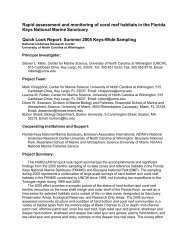
Rapid assessment and monitoring of coral reef habit<strong>at</strong>s in the Florida Keys<br />
N<strong>at</strong>ional Marine Sanctuary<br />
Quick Look <strong>Report</strong>: Summer <strong>2001</strong> Zone Monitoring<br />
Principal Investig<strong>at</strong>or:<br />
Steven L. Miller, Center for Marine Science Research and NOAA’s N<strong>at</strong>ional Undersea Research Center,<br />
University of North Carolina <strong>at</strong> Wilmington, 515 Caribbean Drive, Key Largo, FL 33037, Tel: 305<br />
451 0233, Fax: 305 453 9719, Email: millers@uncwil.edu<br />
Project Team:<br />
Mark Chiappone (Project Manager), Center for Marine Science Research, University of North Carolina <strong>at</strong><br />
Wilmington, 515 Caribbean Drive, Key Largo, FL 33037<br />
Dione W. Swanson, Center for Marine Science Research, University of North Carolina <strong>at</strong> Wilmington,<br />
515 Caribbean Drive, Key Largo, FL 33037 and Division of Marine Biology and Fisheries,<br />
Rosenstiel School of Marine and Atmospheric Science, University of Miami, 4600 Rickenbacker<br />
Causeway, Miami, FL 33149, Email: dswanson@rsmas.miami.edu<br />
Helga Dienes, Center for Marine Science Research, University of North Carolina <strong>at</strong> Wilmington, 515<br />
Caribbean Drive, Key Largo, FL 33037, Email: hdienes_nurc@hotmail.com<br />
Cooper<strong>at</strong>ing Institutions and Support:<br />
Florida Keys N<strong>at</strong>ional Marine Sanctuary, Emerson Associ<strong>at</strong>es Intern<strong>at</strong>ional, Rosenstiel School of Marine<br />
and Atmospheric Science-University of Miami, NOAA’s N<strong>at</strong>ional Marine Fisheries Service, N<strong>at</strong>ional<br />
Undersea Research Center-University of North Carolina <strong>at</strong> Wilmington, The N<strong>at</strong>ure Conservancy<br />
Project Summary:<br />
This NURC/<strong>UNCW</strong> quick look report summarizes the accomplishments and significant findings from<br />
our summer <strong>2001</strong> benthic sampling of no-take zones and reference habit<strong>at</strong>s in the Florida Keys N<strong>at</strong>ional<br />
Marine Sanctuary. This year’s sampling represents the fourth year of large-scale surveys of hard-bottom<br />
and coral reef habit<strong>at</strong>s in the Sanctuary conducted by NURC/<strong>UNCW</strong> since 1998, not including two<br />
explor<strong>at</strong>ory missions to the Tortugas region during 1999 and 2000.<br />
The <strong>2001</strong> sampling focused primarily on two environments in the Sanctuary: the shallow fore reef<br />
from 1-7 m depth and the p<strong>at</strong>ch reef environment, specifically the central region of Hawk Channel to the<br />
shoreward edge of the pl<strong>at</strong>form margin. This effort complemented benthic surveys of 80 sites during 1999<br />
Keys-wide and 45 sites across the continental shelf in the lower Keys region during 2000. The <strong>2001</strong><br />
surveys assessed community structure and condition p<strong>at</strong>terns of reef benthos on offshore, high relief spur<br />
and groove and hard-bottom habit<strong>at</strong>s, but also included mid-channel and offshore p<strong>at</strong>ch reefs to<br />
supplement the 2000 surveys of 12 p<strong>at</strong>ch reefs in the lower Keys. Thirty-eight days of SCUBA surveys<br />
by a three to four person team between June 12 and September 4 resulted in assessments of 86 sites from<br />
southwest of Key West to northern Key Largo. Twelve of the Sanctuary’s 23 zones were sampled. Most<br />
of the field sampling was accomplished aboard The N<strong>at</strong>ure Conservancy’s R/V Oak Leaf, but also<br />
included day-bo<strong>at</strong> support from NURC/<strong>UNCW</strong>-Key Largo. Benthic surveys by the project team were
NURC/<strong>UNCW</strong> Quick look <strong>Report</strong>: Summer <strong>2001</strong><br />
complemented by reef fish surveys conducted by personnel from RSMAS-University of Miami and<br />
NOAA-N<strong>at</strong>ional Marine Fisheries Service.<br />
Variables measured during <strong>2001</strong> included our “core” set of measurements, namely coverage, species<br />
richness, gorgonian density, coral density and size, coral condition, and video for archival purposes. We<br />
were also able to add several variables to the <strong>2001</strong> assessment: urchin density and size; density of<br />
anemones, corallimorpharians, opisthobranch mollusks, cleaner shrimps, spiny lobster, and arrow crabs;<br />
density and pred<strong>at</strong>ion by the flamingo tongue Cyphoma gibbosum; in situ measurements of topographic<br />
complexity; and estim<strong>at</strong>es of density, length, and biological impacts of remnant fishing gear and other<br />
marine debris. With the exception of the video transects, all of the variables were collected underw<strong>at</strong>er on<br />
pre-form<strong>at</strong>ted plastic sl<strong>at</strong>es, facilit<strong>at</strong>ing rel<strong>at</strong>ively rapid d<strong>at</strong>a processing for manuscript prepar<strong>at</strong>ion. We<br />
were also able to take over 1,500 digital photographs for developing an archive of site photographs and<br />
tools for taxonomic identific<strong>at</strong>ion of Florida Keys reef benthos.<br />
Below we provide a brief narr<strong>at</strong>ive on the overall goals of the NURC/<strong>UNCW</strong> zone monitoring effort<br />
and a variable-by-variable summary of significant findings from the <strong>2001</strong> field surveys. We also include a<br />
list of published and planned papers and other products developed from this effort. Several appending<br />
tables summarize site-level coverage, species richness, and density estim<strong>at</strong>es for many of the variables<br />
measured this year.<br />
Goals and Objectives:<br />
The <strong>2001</strong> sampling of coral reef and hard-bottom habit<strong>at</strong>s in Sanctuary no-take zones and reference<br />
areas complemented a three-year effort d<strong>at</strong>ing back to 1999 to sample all of the shallow-w<strong>at</strong>er (< 15)<br />
hard-bottom habit<strong>at</strong> types in the Sanctuary, as well as most of the no-take zones established in 1997. The<br />
goals of the NURC/<strong>UNCW</strong> zone monitoring effort are three-fold:<br />
To assess the community structure and condition of reef benthos <strong>at</strong> multiple sp<strong>at</strong>ial scales, with<br />
particular reference to the no-take zones, but also inter-reef, among habit<strong>at</strong> type, and among<br />
region vari<strong>at</strong>ions.<br />
To track the dynamics of coral reef benthos to assess changes due to protection from fishing<br />
within the zones, but also changes due to larger-scale factors, such as regional w<strong>at</strong>er quality<br />
phenomenon.<br />
To complement fishery-independent reef fish surveys with “fine-scale” or detailed habit<strong>at</strong><br />
inform<strong>at</strong>ion, to facilit<strong>at</strong>e experimental and modeling efforts for evalu<strong>at</strong>ing essential fishery<br />
habit<strong>at</strong>.<br />
To accomplish these goals, the <strong>2001</strong> sampling built upon existing d<strong>at</strong>a collected during 1999 and<br />
2000 to guide the underw<strong>at</strong>er surveys. Our focus during <strong>2001</strong> was two-fold:<br />
To survey mid-channel and offshore p<strong>at</strong>ch reefs in the middle and upper Keys regions of the<br />
Sanctuary, to complement surveys of 12 mid-channel and offshore p<strong>at</strong>ch reef sites in the lower<br />
Keys during 2000.<br />
To survey high-relief spur and groove and low-relief hard-bottom habit<strong>at</strong>s throughout the Florida<br />
Reef Tract from 1-7 m depth, with a particular emphasis on reefs constructed by elkhorn coral<br />
(Acropora palm<strong>at</strong>a).<br />
Together with the d<strong>at</strong>a collected during 1999-2000, this project has amassed an unprecedented d<strong>at</strong>a set on<br />
the abundance and habit<strong>at</strong> utiliz<strong>at</strong>ion p<strong>at</strong>terns of algae and several invertebr<strong>at</strong>e taxa, including stony<br />
corals, gorgonians, other benthic cnidarians, sponges, mollusks, echinoderms, and crustaceans. This<br />
inform<strong>at</strong>ion should be useful for preparing the five-year review of the Sanctuary zoning action plan, and<br />
2
NURC/<strong>UNCW</strong> Quick look <strong>Report</strong>: Summer <strong>2001</strong><br />
depending on the needs of the Sanctuary and funding, for developing a five to seven-year plan for<br />
continued monitoring of the zones.<br />
Logistics and Methods:<br />
A two-stage str<strong>at</strong>ified random sampling design was used to randomly select sites during <strong>2001</strong>. A<br />
grid system constructed in a geographic inform<strong>at</strong>ion system (GIS) was used to overlay the existing habit<strong>at</strong><br />
map of the Florida Keys. Cells or blocks 200 m x 200 m in dimension were used to randomly select sites<br />
from the following habit<strong>at</strong> str<strong>at</strong>a (Table 1):<br />
Lower Keys high-relief spur and groove (fore reef)<br />
Lower Keys shallow hard-bottom (fore reef)<br />
Middle Keys high-relief spur and groove (fore reef)<br />
Middle Keys shallow hard-bottom (fore reef)<br />
Middle Keys mid channel p<strong>at</strong>ch reef<br />
Middle Keys offshore p<strong>at</strong>ch reef<br />
Upper Keys high-relief spur and groove (fore reef)<br />
Upper Keys shallow hard-bottom (fore reef)<br />
Upper Keys mid channel p<strong>at</strong>ch reef<br />
Upper Keys offshore p<strong>at</strong>ch reef<br />
Twelve of the Sanctuary’s 23 zones were sampled during <strong>2001</strong>, with all but one of the zones (Cheeca<br />
Rocks SPA) loc<strong>at</strong>ed on the outer pl<strong>at</strong>form margin or reef tract (Table 1). Two sites or blocks were<br />
assigned to each zone and a total of 86 sites were surveyed between June 12 and September 4 (Table 2).<br />
Figures 1 to 4 show the loc<strong>at</strong>ions of the sampling loc<strong>at</strong>ions Keys-wide and by regional sector. This year<br />
we were fortun<strong>at</strong>e to sample the majority of offshore acroporid reefs from Key Largo to Key West,<br />
including both high relief and low-relief habit<strong>at</strong> types.<br />
The <strong>2001</strong> sampling effort (86 sites) required 38 field days from mid-June to early September. An<br />
additional 12 days of scheduled field time were lost to inclement we<strong>at</strong>her or other logistical issues. Of the<br />
38 days, six days (16%) were supported by day-bo<strong>at</strong> oper<strong>at</strong>ions from NURC-Key Largo (Captain Mike<br />
Birns), in which 15 sites (17%) were sampled. The N<strong>at</strong>ure Conservancy’s R/V Oak Leaf, captained by<br />
Mr. Alex Creedon, supported the remaining field time (32 days, 84%), in which 71 sites (81%) were<br />
sampled. Our field effort depended upon 6-7 hours in the w<strong>at</strong>er daily by three to four divers. The <strong>2001</strong><br />
sampling involved not only NURC/<strong>UNCW</strong> staff surveying the benthos, but fisheries scientists from<br />
RSMAS-UM and NOAA/NMFS who conducted four reef fish censuses <strong>at</strong> each site. Table 3 summarizes<br />
the diving st<strong>at</strong>istics for this year. Over 700 hours of surveys by NURC/<strong>UNCW</strong> and reef fish surveyors<br />
were required to complete the sampling.<br />
The <strong>2001</strong> surveys addressed the same variables measured during 1999-2000, in addition to several<br />
variables added to the existing design (Table 4). Briefly, <strong>at</strong> each site pre-determined GPS points were<br />
used to loc<strong>at</strong>e the position of transect deployment. Except for p<strong>at</strong>ch reefs (10 m transects), four pairs of 25<br />
m transects were deployed in each block, labeled as 1A, 1B, 2A, 2B, etc. Along four of the primary<br />
transects (A), coverage was determined every 25 cm to yield 100 points per transect. Digital video along a<br />
0.4 m sw<strong>at</strong>h was also taken along the primary transects. The number of species of stony corals,<br />
gorgonians, and sponges was determined on all four primary and secondary transects. Gorgonian density<br />
and height distribution using four size classes (< 20 cm, 20-50 cm, 50-100 cm, > 100 cm) were<br />
determined along transects 1A and 2A, as were coral density, size, and condition. The condition<br />
measurements included an assessment of competition between corals and other taxa, and the extent to<br />
which interactions caused tissue damage or mortality. Juvenile corals (< 4 cm maximum diameter) were<br />
assessed along transects 1A and 2A by randomly sampling ten 0.68 m x 0.45 m quadr<strong>at</strong>s along each<br />
3
NURC/<strong>UNCW</strong> Quick look <strong>Report</strong>: Summer <strong>2001</strong><br />
transect. Urchin density and test diameter, as well as the density of incidental marine invertebr<strong>at</strong>es (see<br />
Table 4) were assessed on all four primary and secondary transects.<br />
We additionally assessed density and pred<strong>at</strong>ion by the flamingo tongue snail (Cyphoma gibbosum),<br />
by noting the number of individuals, gorgonian prey, and gorgonian height on all transects deployed. We<br />
continued surveys of fishing gear and other marine debris during <strong>2001</strong>, by surveying 1 m on each side of<br />
all primary and secondary transects. Noted were the type of gear, dimensions (typically length) to the<br />
nearest centimeter, whether the debris was biologically fouled or clean, and the number of sessile<br />
invertebr<strong>at</strong>es impacted by the debris th<strong>at</strong> caused tissue abrasion and/or mortality. Finally, in situ<br />
measurements of topographic complexity along the four primary transects were undertaken to provide an<br />
assessment of substr<strong>at</strong>um angle, maximum vertical relief, and the coverage of different relief c<strong>at</strong>egories<br />
along 0.4 m x 25 m sw<strong>at</strong>hs. These surveys were supplemented by chain transect assessments for<br />
compar<strong>at</strong>ive purposes, in which a 5 m chain was draped over the contours of the substr<strong>at</strong>um on the four<br />
primary transects and compared to the linear distance along the transects.<br />
Also included during the <strong>2001</strong> surveys were surveys of two experimental and two control offshore<br />
p<strong>at</strong>ch reefs west of Pickles Reef th<strong>at</strong> are being used for Diadema antillarum transloc<strong>at</strong>ion (PIs Ken<br />
Nedimyer and Martin Moe). This is initially a one-year effort to evalu<strong>at</strong>e the efficacy of transloc<strong>at</strong>ing<br />
juvenile urchins from rubble to p<strong>at</strong>ch reef habit<strong>at</strong>s in terms of time/effort, mortality, and community<br />
structure effects. We have included summary inform<strong>at</strong>ion in this report, although more detailed d<strong>at</strong>a for<br />
the four sites are presented in the PIs Sanctuary quarterly report. We were able to include our full<br />
complement of sampling, in addition to reef fish censuses conducted by divers from RSMAS-UM and<br />
NOAA/NMFS.<br />
Summary of Significant Results:<br />
Benthic cover<br />
Table 5 summarizes mean percent coverage d<strong>at</strong>a for stony corals, total algae, sponges, and the<br />
colonial zoanthid Palythoa mammilosa for the 86 survey sites. P<strong>at</strong>terns in the coverage of these benthos<br />
exhibited significant differences among the four habit<strong>at</strong> types surveyed. Mid-channel p<strong>at</strong>ch reefs<br />
exhibited some of the highest coral cover we have surveyed in the Sanctuary, often exceeding 30%, but<br />
was also variable, ranging from about 5% to almost 43%. Quite unexpectedly, we sampled a mid-channel<br />
p<strong>at</strong>ch reef south of Sunshine Key, directly in the p<strong>at</strong>h of Moser Channel, th<strong>at</strong> had up to 60% coral cover<br />
on individual transects. Not surprisingly, coral cover on mid-channel p<strong>at</strong>ch reefs was domin<strong>at</strong>ed by<br />
massive reef-building corals, namely Montastraea cavernosa, M. faveol<strong>at</strong>a, Colpophyllia n<strong>at</strong>ans, and<br />
Siderastrea siderea, as well Diploria spp. on some sites. Sponges also exhibited the gre<strong>at</strong>est coverage on<br />
mid-channel p<strong>at</strong>ch reefs, especially <strong>at</strong> several sites south of Vaca Key.<br />
Offshore p<strong>at</strong>ch reefs exhibited considerable variability in physical structure and geomorphology, from<br />
dome-type structures domin<strong>at</strong>ed by head corals, to very eroded and small acroporid reefs (e.g. western<br />
extent of Carysfort SPA) or rubble/hard-bottom m<strong>at</strong>rix communities, to high-relief transitional reefs (e.g.<br />
White Banks/Dry Rocks). Coverage by corals was mostly < 10%, and algae were more predominant th<strong>at</strong><br />
on mid-channel p<strong>at</strong>ch reefs. Sponge coverage was also generally lower than in central Hawk Channel.<br />
Offshore sampling loc<strong>at</strong>ions included both high-relief spur and groove and low-relief hard-bottom<br />
habit<strong>at</strong> types. Nearly all of the 63 loc<strong>at</strong>ions surveyed were constructed by Acropora palm<strong>at</strong>a, and ranged<br />
from very high-profile reefs (e.g. most of the SPAs surveyed) to highly eroded or remnant acroporid reef<br />
fl<strong>at</strong>s (e.g. Conch Reef, Davis Reef, Maryland Shoal). Not unexpectedly, coral cover offshore was gre<strong>at</strong>est<br />
on high-relief spur and groove reefs, ranging from about 1% to 12.5%. Coral cover tended to be gre<strong>at</strong>est<br />
within the zones and was domin<strong>at</strong>ed by Porites astreoides and Millepora complan<strong>at</strong>a. Algae, consisting<br />
4
NURC/<strong>UNCW</strong> Quick look <strong>Report</strong>: Summer <strong>2001</strong><br />
mostly of algal turf, Dictyota spp., and Halimeda spp., and crustose coralline species, domin<strong>at</strong>ed highrelief<br />
spur and groove reefs throughout the Sanctuary. Sponge cover was mostly < 5% and domin<strong>at</strong>ed by<br />
encrusting species adapted to higher wave energy. An interesting coverage p<strong>at</strong>tern was evident for<br />
Palythoa mammilosa. This species exhibited locally high coverage, especially in the lower and middle<br />
Keys, and was more abundant than reef-building corals <strong>at</strong> 12 of the 34 (35%) spur and groove reefs<br />
surveyed.<br />
Offshore low-relief hard-bottom sites were sampled in-between most well-developed spur and groove<br />
reefs in the Sanctuary. Of the 29 sites, none had gre<strong>at</strong>er than 5% coral cover, and algae domin<strong>at</strong>ed all of<br />
the sites. Sponges and Palythoa were locally abundant, but coverage was generally < 6%. Dominant algal<br />
functional groups were primarily algal turfs and brown foliose algae, especially Dictyota spp., Sargassum<br />
spp., Stypopodium zonale, and Lobophora varieg<strong>at</strong>a.<br />
Species richness<br />
Surveys of the number of species of stony corals, gorgonians, and sponges continued during the <strong>2001</strong><br />
surveys. Similar to results from 2000 and probably contrary to popular perception, p<strong>at</strong>ch reefs typically<br />
yielded the gre<strong>at</strong>est species density and number of species of reef-building corals (Table 6). Usually twice<br />
the number of sponges was found on p<strong>at</strong>ch reefs compared to offshore fore reef areas, despite a 60%<br />
smaller sampling area. One notable exception were the two sampling loc<strong>at</strong>ions within Cheeca Rocks SPA,<br />
which exhibited the lowest species richness values for stony corals, gorgonians, and sponges of the p<strong>at</strong>ch<br />
reefs sampled.<br />
Species richness on offshore spur and groove reefs exhibited several p<strong>at</strong>terns. In general, coral<br />
species richness tended to be similar in the no-take zones and reference areas. This contrasts with the<br />
deeper fore reef (8-12 m) surveyed during 1999, in which the no-take zones had significantly gre<strong>at</strong>er coral<br />
species richness than the reference areas. Sponges were more speciose than corals in the majority of sites,<br />
but exhibited considerably lower numbers of species than mid-channel and offshore p<strong>at</strong>ch reefs.<br />
Gorgonians exhibited a wide range in species richness, with some spur and grooves reefs with very few<br />
species, to those with abundant and speciose gorgonian faunas. Although coral cover was very low on<br />
offshore hard-bottom sites, these areas tended to have much gre<strong>at</strong>er coral, sponge, and gorgonian species<br />
richness than spur and groove reefs.<br />
Coral density, size and condition<br />
Coral density, size, and condition measurements were made using a modified AGRRA approach as in<br />
previous years (Table 7). We also added assessments of competition with measured corals to ascertain the<br />
degree of damage caused by inter-specific competition. The total area surveyed during <strong>2001</strong> was 971.3<br />
m 2 . Over 4,000 corals were counted and measured from the 86 sites, 1,356 or 34% of which were<br />
Millepora alcicornis and M. complan<strong>at</strong>a, 2,665 or 66% of which were scleractinian corals. Scleractinian<br />
corals exhibited marked differences in density and species composition among the four habit<strong>at</strong> types<br />
sampled. P<strong>at</strong>ch reefs, particularly mid-channel sites, exhibited many of the highest densities we recorded<br />
this year, reflecting the predominance of massive, reef-building species. Coral densities offshore were<br />
highly variable and tended to be domin<strong>at</strong>ed by Millepora and Porites astreoides, especially in high-relief<br />
spur and groove areas.<br />
The condition measurements during <strong>2001</strong> included assessments of competition, pred<strong>at</strong>ion, bleaching,<br />
and disease. We were encouraged to find very few incidences of bleaching from the areas surveyed. As in<br />
previous years, disease incidence in the habit<strong>at</strong>s we surveyed was very low (Table 7). Of the 2,665<br />
scleractinian coral assessed, only 49 (1.8%) exhibited signs of disease. Disease conditions noted were:<br />
5
NURC/<strong>UNCW</strong> Quick look <strong>Report</strong>: Summer <strong>2001</strong><br />
Dead white skeleton noted on several species, including Porites astreoides, Siderastrea<br />
siderea, Stephanocoenia michelini, P. porites furc<strong>at</strong>a;<br />
Dark spot condition, noted primarily on S. siderea, but also Agaricia agaricites and A.<br />
humilis;<br />
Yellow band disease;<br />
White plague type II, noted on Dichocoenia stokesi, A. humilis, and A. agaricites;<br />
White band disease, noted on Acropora palm<strong>at</strong>a; and<br />
Decaying tissue/skeleton, noted on S. michelini, and possibly indic<strong>at</strong>ive of shutdown reaction.<br />
The percentage of scleractinian corals with symptoms of disease ranged among the habit<strong>at</strong> types as<br />
follows: mid-channel p<strong>at</strong>ch reefs (2.5%), offshore p<strong>at</strong>ch reefs (2.1%), high-relief spur and groove (1.7%),<br />
and low-relief hard-bottom (1.5%). No incidence of black-band disease was recorded from any of the<br />
colonies assessed.<br />
We also included more and broader transect surveys of elkhorn coral and staghorn coral during <strong>2001</strong><br />
(Table 8). Surveys assessed the number of colonies, defined as p<strong>at</strong>ches of continuous live tissue, with<br />
notes on colony size. We were encouraged to find large stands of Acropora palm<strong>at</strong>a offshore, especially<br />
<strong>at</strong> Sand Key SPA, Sand Island, Elbow Reef SPA, and South Carysfort Reef. We were also surprised to<br />
find some live stands of elkhorn coral in offshore hard-bottom areas. Live p<strong>at</strong>ches of staghorn coral, most<br />
probably 2-3 years of age, were found on several p<strong>at</strong>ch reefs surveyed as well.<br />
Juvenile coral density<br />
Surveys of juvenile coral species composition, density, and maximum diameter continued during<br />
<strong>2001</strong>. Table 9 lists the number of species found as juveniles, the density of juvenile corals, and the<br />
dominant species. Among the four habit<strong>at</strong> types sampled, juvenile densities were generally gre<strong>at</strong>er on<br />
mid-channel and offshore p<strong>at</strong>ch reefs, with different dominance p<strong>at</strong>terns than offshore. We noted <strong>at</strong><br />
several loc<strong>at</strong>ions th<strong>at</strong> one of the dominant recruiting corals was Siderastrea siderea. We were discouraged<br />
to find very low densities of juveniles in offshore fore reef habit<strong>at</strong>s, especially in high-relief spur and<br />
groove (Table 9). Juvenile corals offshore were mostly domin<strong>at</strong>ed by smaller brooding species such as<br />
Agaricia agaricites, Favia fragum, and Porites astreoides..<br />
Gorgonian density and height distribution<br />
Over 13,000 gorgonians were identified, counted, and measured for colony height in the four habit<strong>at</strong><br />
types surveyed this year (Table 10). Colonies were scored into height classes as a further indic<strong>at</strong>ion of the<br />
disturbance history of particular sites. For example, we saw many fore reef areas, such as Crocker Reef,<br />
with high densities of sea plumes, but domin<strong>at</strong>ed by small (< 10 cm) colony sizes. In nearly all sites<br />
surveyed, gorgonians continue to comprise the dominant sessile macro-invertebr<strong>at</strong>es, often two times or<br />
gre<strong>at</strong>er in density than stony corals. Many of the mid-channel and offshore p<strong>at</strong>ch reefs surveyed yielded<br />
some of the highest gorgonian densities (> 30 colonies per m 2 ) we have found in the Sanctuary. One<br />
notable p<strong>at</strong>tern in gorgonian density was evident on spur and groove reefs. Except for American Shoal,<br />
which is a moder<strong>at</strong>ely eroded acroporid reef, gorgonian densities were lower in the lower Keys compared<br />
to the upper Keys. We noted dominance by sea fans (Gorgonia ventalina) and sea plumes, especially<br />
Pseudopterogorgia americana and P. bipinn<strong>at</strong>a, <strong>at</strong> many upper Keys reefs.<br />
Urchin density and size<br />
We continued surveys of urchin density and test size <strong>at</strong> all 86 sites sampled during <strong>2001</strong>. Six species<br />
were encountered in transect surveys in mid-channel p<strong>at</strong>ch reef, offshore p<strong>at</strong>ch reef, and shallow fore reef<br />
habit<strong>at</strong>s (Table 11). Similar to results from 1999 and 2000, all of the sampling loc<strong>at</strong>ions yielded very low<br />
6
NURC/<strong>UNCW</strong> Quick look <strong>Report</strong>: Summer <strong>2001</strong><br />
densities of urchins, particularly Diadema antillarum. However, we found several loc<strong>at</strong>ions with large<br />
(3.5-5 cm TD) D. antillarum, with clear effects of grazing on the substr<strong>at</strong>um, as well as some loc<strong>at</strong>ions,<br />
such as Pickles Reef, with rel<strong>at</strong>ively high densities of other urchins. During June surveys in the lower<br />
Keys region, we noted several sites with juvenile (< 0.6 cm TD) D. antillarum, even though the peak<br />
recruitment apparently occurs in the Florida Keys during August and September. Also noted was a clear<br />
shift from a predominance of Echinometra viridis on p<strong>at</strong>ch reefs to Eucidaris tribuloides offshore.<br />
Incidental invertebr<strong>at</strong>es<br />
We assessed density p<strong>at</strong>terns for a variety of sessile and mobile invertebr<strong>at</strong>e species during the <strong>2001</strong><br />
surveys (Table 12). We continued surveys of anemones and corallimorpharians, in addition to shrimp<br />
symbionts. During the first few days of sampling in mid-June, we noted several sites with abundant<br />
opisthobranch mollusks, particularly the lettuce sea slug Tridachia crisp<strong>at</strong>a, so we extended our surveys<br />
to include all visible opisthobranch mollusks within the strip transects. We were encouraged to find two<br />
nudibranch species, as well as 226 individuals of T. crisp<strong>at</strong>a, mostly associ<strong>at</strong>ed with live or remnant<br />
Millepora complan<strong>at</strong>a. As an additional ecological story, we also surveyed the density and pred<strong>at</strong>ion by<br />
the flamingo tongue (Cyphoma gibbosum). Over 120 individuals were measured in fore reef habit<strong>at</strong>s. We<br />
also included assessments of gorgonian prey, including species and colony height, and plan to publish a<br />
paper on the density and prey utiliz<strong>at</strong>ion of this gorgonian pred<strong>at</strong>or.<br />
Fishing gear and other marine debris<br />
We continued last year’s surveys of fishing gear and other marine debris <strong>at</strong> all 86 sites during <strong>2001</strong>.<br />
Based upon results from 2000, we assumed th<strong>at</strong> rel<strong>at</strong>ively little fishing gear would be found throughout<br />
much of the shallow (1-6 m) fore reef. We were surprised <strong>at</strong> the amount of marine debris, represented<br />
mostly by recre<strong>at</strong>ional hook-and-line gear, th<strong>at</strong> was recovered, even within the no-take zones (Table 13).<br />
The majority of the debris was recre<strong>at</strong>ional hook-and-line gear, represented by monofilament, wire,<br />
leaders, hooks, lead weights, and even a fishing pole, followed by remnant lobster/crab trap debris,<br />
including rope, wood sl<strong>at</strong>s, buoys, and cement. From all 86 sites representing a total survey area of only<br />
25,200 m 2 , we recovered more than 0.5 km of hook-and-line gear and trap rope. Of the 349.03 m of hookand-line<br />
gear recovered from the fore reef, 111.81 m or 32% was recovered from the no-take zones. In<br />
fact, many of the no-take zones surveyed yielded some of the gre<strong>at</strong>est densities of hook-and-line gear in<br />
the Sanctuary. While most of the gear within the zones was biologically fouled, clean or freshly lost<br />
hook-and-line gear was recovered from Sand Key SPA (7.4 m), Sombrero Key SPA (29.06 m), and<br />
Carysfort/S. Carysfort SPA (1.86 m). Most of the gear found on mid-channel and offshore p<strong>at</strong>ch reefs was<br />
lobster trap debris, especially buoy lines. However, several p<strong>at</strong>ch reefs near Molasses Reef Channel (near<br />
Three Sisters) and White Banks/Dry Rocks had significant quantities of hook-and-line gear.<br />
Besides surveying the type, density, and extent of marine debris, we also assessed the number of<br />
organisms impacted by debris, specifically abrasion and tissue mortality to sessile marine invertebr<strong>at</strong>es.<br />
On the fore reef alone (63 sites), we noted 319 incidences of damage to fire coral, stony corals,<br />
gorgonians, sponges, and the colonial zoanthid Palythoa mammilosa. Not surprisingly, most damage was<br />
caused by hook-and-line gear on the fore reef, especially to gorgonians, and secondarily to fire coral and<br />
sponges. While we recognize th<strong>at</strong> remnant fishing gear is a rel<strong>at</strong>ively minor factor affecting Florida Keys<br />
reefs, quantit<strong>at</strong>ive surveys of this type will <strong>at</strong> least be one useful measure for assessing compliance to the<br />
no-fishing regul<strong>at</strong>ions within the zones in the future.<br />
Plans for Use of the D<strong>at</strong>a:<br />
Significant progress in manuscript development was made since January <strong>2001</strong>. Below is a list of<br />
manuscripts in press or published, those submitted for review, and those we intend to submit for<br />
7
NURC/<strong>UNCW</strong> Quick look <strong>Report</strong>: Summer <strong>2001</strong><br />
public<strong>at</strong>ion by January 2002. While many of these reports are descriptive in n<strong>at</strong>ure, many of the variables<br />
measured by this program have never been assessed <strong>at</strong> so many sites representing the complement of<br />
shallow-w<strong>at</strong>er hard-bottom and coral reef habit<strong>at</strong>s in the Florida Keys. Moreover, these products will be<br />
timely for the five-year review of the Sanctuary zoning action plan in 2002. Synthesis papers are also in<br />
progress rel<strong>at</strong>ed to the methods developed for this assessment and monitoring program, as well as largescale<br />
survey results in Dry Tortugas N<strong>at</strong>ional Park and the Tortugas Bank.<br />
In addition to specific analyses for manuscripts, a concerted effort will be made to re-evalu<strong>at</strong>e our<br />
existing habit<strong>at</strong> classific<strong>at</strong>ion for future surveys. This will be accomplished in a multivari<strong>at</strong>e context and<br />
will help to further define habit<strong>at</strong> str<strong>at</strong>a and thus will assist us in optimal alloc<strong>at</strong>ion of future surveys. We<br />
also intend to continue to work closely with NMFS, RSMAS-UM, and FIU to compare community<br />
structure and condition variables with existing w<strong>at</strong>er quality, geological, and reef fish survey d<strong>at</strong>a. Other<br />
products planned for the fourth quarter of <strong>2001</strong> and the first quarter of 2002 include the development and<br />
dissemin<strong>at</strong>ion of digital photographs on CD-ROM taken this year and during 2000 in the Dry Tortugas, as<br />
well as a web site with site descriptions and summarized d<strong>at</strong>a from 1999-<strong>2001</strong>, including links and pdf<br />
versions of manuscripts published.<br />
Manuscripts in press or published<br />
Chiappone M, Miller SL, Swanson DW (<strong>2001</strong>) St<strong>at</strong>us of an intensively fished aquarium-trade species in<br />
the Florida Keys: The giant Caribbean anemone (Condylactis gigantea). Reef Encounter<br />
Chiappone M, Miller SL, Swanson DW, Ault JS, Smith SG (<strong>2001</strong>) Compar<strong>at</strong>ively high densities of the<br />
long-spined sea urchin in the Dry Tortugas, Florida. Coral Reefs 20: 137-138<br />
Chiappone M, White A, Swanson DW, Miller SL (In press) Occurrence and biological impacts of fishing<br />
gear and other marine debris in the Florida Keys. Marine Pollution Bulletin<br />
Miller SL, Chiappone M, Swanson DW, Ault JS, Smith SG, Meester GA, Luo J, Franklin EC, Bohnsack<br />
JA, Harper DE, McClellan DB (<strong>2001</strong>) An extensive deep reef terrace on the Tortugas Bank, Florida<br />
Keys N<strong>at</strong>ional Marine Sanctuary. Coral Reefs<br />
Miller SL, Swanson DW, Chiappone M (<strong>2001</strong>) Multiple sp<strong>at</strong>ial scale assessment of coral reef and hardbottom<br />
community structure in the Florida Keys N<strong>at</strong>ional Marine Sanctuary. Proceedings of the 9th<br />
Intern<strong>at</strong>ional Coral Reef Symposium, Bali<br />
Manuscripts submitted for review<br />
Chiappone M, Swanson DW, Miller SL (submitted) Density and habit<strong>at</strong> utiliz<strong>at</strong>ion p<strong>at</strong>terns of anemones<br />
and corallimorpharians (Anthozoa, Zoantharia) in the Florida Keys N<strong>at</strong>ional Marine Sanctuary. Coral<br />
Reefs<br />
Chiappone M, Swanson DW, Miller SL (submitted) Density, sp<strong>at</strong>ial distribution, and size structure of sea<br />
urchins in coral reef and hard-bottom habit<strong>at</strong>s of the Florida Keys. Marine Ecology Progress Series<br />
Chiappone M, Swanson DW, Miller SL (submitted) Large-scale density p<strong>at</strong>terns of anemones and<br />
corallimorpharians on offshore coral reef habit<strong>at</strong>s in the Florida Keys. Bulletin of Marine Science<br />
Chiappone M, Swanson DW, Miller SL, Smith SG (submitted) Large-scale surveys on the Florida Reef<br />
Tract indic<strong>at</strong>e poor recovery of the long-spined sea urchin Diadema antillarum. Coral Reefs<br />
Manuscripts in progress<br />
Ault JS, Smith SG, Meester GA, Luo J, Franklin EC, Bohnsack JA, Harper DE, McClellan DB, Miller<br />
SL, Swanson DW, Chiappone M (in progress) Synoptic habit<strong>at</strong> and reef fish surveys support marine<br />
reserves in the Dry Tortugas, Florida. Reef Encounter<br />
Chiappone M, Swanson DW, Miller SL, Sullivan-Sealey KM (in progress) A hierarchical structural<br />
classific<strong>at</strong>ion of Florida Keys coral reef and hard-bottom habit<strong>at</strong>s. Environmental Conserv<strong>at</strong>ion<br />
8
NURC/<strong>UNCW</strong> Quick look <strong>Report</strong>: Summer <strong>2001</strong><br />
Chiappone M, Swanson DW, Miller SL, White A, Dienes H (in progress) A rapid method for assessing<br />
topographic complexity of coral reef and hard-bottom habit<strong>at</strong>s. Journal of Experimental Marine<br />
Biology and Ecology<br />
Dienes H, Chiappone M, Swanson DW, Franklin EC, Miller SL (in progress) Density and pred<strong>at</strong>ion by<br />
the flamingo tongue, Cyphoma gibbosum (Gastropoda, Ovulidae), in Florida Keys fore reef habit<strong>at</strong>s.<br />
Caribbean Journal of Science<br />
Dienes H, Chiappone M, Swanson DW, Franklin EC, Miller SL (in progress) Density of opisthobranch<br />
mollusks in Florida Keys shallow fore reef habit<strong>at</strong>s. Bulletin of Marine Science<br />
Dienes H, Chiappone M, Swanson DW, Franklin EC, Miller SL (in progress) Sp<strong>at</strong>ial distribution and<br />
impacts of fishing gear to coral reef benthos in the Florida Keys N<strong>at</strong>ional Marine Sanctuary.<br />
Environmental Conserv<strong>at</strong>ion<br />
Miller SL, Chiappone M, Swanson DW (in progress) Long-term dynamics of Florida Keys acroporid<br />
reefs: History and implic<strong>at</strong>ions of a phase shift. Coral Reefs<br />
Miller SL, Chiappone M, Swanson DW, Ault JS, Smith SG, Franklin EC (in progress) Design-based<br />
surveys of coral reef and hard-bottom habit<strong>at</strong>s in Dry Tortugas N<strong>at</strong>ional Park and the Tortugas Bank,<br />
Florida. Ecological Applic<strong>at</strong>ions<br />
Miller SL, Gittings S, Chiappone M, Causey B, Swanson DW, White A (in progress) Changes (1994-<br />
2000) to benthic cover on a deep coral reef in the Florida Keys. Coral Reefs<br />
Smith SG, Swanson DW, Miller SL, Ault JS, Chiappone M (in progress) Sampling survey approaches for<br />
coral reef assessment and monitoring in the Florida Keys. Marine Ecology Progress Series<br />
Swanson DW, Chiappone M, Miller SM (in progress) Habit<strong>at</strong> and regional vari<strong>at</strong>ions in coral species<br />
richness and coverage in the Florida Keys. Coral Reefs<br />
Swanson DW, Chiappone M, Miller SM (in progress) Disease incidence on reef-building corals in the<br />
Florida Keys N<strong>at</strong>ional Marine Sanctuary. Marine Ecology Progress Series<br />
9
NURC/<strong>UNCW</strong> Quick look <strong>Report</strong>: Summer <strong>2001</strong><br />
Figure 1. Survey loc<strong>at</strong>ions in the Florida Keys N<strong>at</strong>ional Marine Sanctuary during June-September <strong>2001</strong>.<br />
10
Figure 2. Survey loc<strong>at</strong>ions in the lower Florida Keys by habit<strong>at</strong> type.<br />
NURC/<strong>UNCW</strong> Quick look <strong>Report</strong>: Summer <strong>2001</strong><br />
11
Figure 3. Survey loc<strong>at</strong>ions in the middle Keys by habit<strong>at</strong> type.<br />
NURC/<strong>UNCW</strong> Quick look <strong>Report</strong>: Summer <strong>2001</strong><br />
12
Figure 4. Survey loc<strong>at</strong>ions in the upper Keys by habit<strong>at</strong> type.<br />
NURC/<strong>UNCW</strong> Quick look <strong>Report</strong>: Summer <strong>2001</strong><br />
13
Table 1. Sampling effort by habit<strong>at</strong> type and regional sector in the Florida Keys.<br />
NURC/<strong>UNCW</strong> Quick look <strong>Report</strong>: Summer <strong>2001</strong><br />
Habit<strong>at</strong> type Regional sector Management type No. of sites Effort (%)<br />
Mid-channel p<strong>at</strong>ch reef Middle Keys Reference areas 6 7.0<br />
Middle Keys No-take zones 2 2.3<br />
Upper Keys Reference areas 2 2.3<br />
Offshore p<strong>at</strong>ch reef Middle Keys Reference areas 1 1.2<br />
Upper Keys Reference areas 10 11.6<br />
Upper Keys No-take zones 2 2.3<br />
Shallow spur and groove Lower Keys Reference areas 9 10.5<br />
Lower Keys No-take zones 8 9.3<br />
Middle Keys Reference areas 1 1.2<br />
Middle Keys No-take zones 2 2.3<br />
Upper Keys Reference areas 6 7.0<br />
Upper Keys No-take zones 8 9.3<br />
Shallow hard-bottom Lower Keys Reference areas 7 8.1<br />
Middle Keys Reference areas 9 10.5<br />
Middle Keys No-take zones 4 4.7<br />
Upper Keys Reference areas 9 10.5<br />
Total 11 no-take zones 86 100.0<br />
14
NURC/<strong>UNCW</strong> Quick look <strong>Report</strong>: Summer <strong>2001</strong><br />
Table 2. Survey loc<strong>at</strong>ions in the Florida Keys N<strong>at</strong>ional Marine Sanctuary during June-September <strong>2001</strong>.<br />
Sites are arranged from southwest to northeast within each habit<strong>at</strong> type. Sites within Sanctuary no-take<br />
zones are asterisked.<br />
Habit<strong>at</strong> type/site loc<strong>at</strong>ion Region L<strong>at</strong>itude Longitude Depth (m)<br />
Mid-channel p<strong>at</strong>ch reefs<br />
South of Sunshine Key Middle Keys 24.37.455 81.14.655 5.7-8.1<br />
East Washerwoman Middle Keys 24.39.815 81.04.593 6.3-7.5<br />
South of Key Vaca Middle Keys 24.41.656 81.02.432 3.6-4.8<br />
East of Marker 49 Middle Keys 24.41.630 81.01.014 5.1-6.9<br />
Turtle Shoal Middle Keys 24.42.043 80.57.956 3.6-4.5<br />
East Turtle Shoal Middle Keys 24.42.130 80.57.813 3.9-4.2<br />
Cheeca Rocks SPA #2* Middle Keys 24.54.248 80.36.426 1.5-3.6<br />
Cheeca Rocks SPA #1* Middle Keys 24.54.248 80.36.398 1.8-3.9<br />
Molasses Channel #2 Upper Keys 25.01.384 80.23.846 3.0-3.6<br />
Molasses Channel #1 Upper Keys 25.01.419 80.23.721 3.6-4.2<br />
Offshore p<strong>at</strong>ch reefs<br />
NW of Davis Reef Middle Keys 24.57.039 80.30.099 3.6-4.2<br />
Diadema control #2 Upper Keys 24.59.101 80.26.124 7.8-8.1<br />
Diadema control #1 Upper Keys 24.59.101 80.26.130 7.2-7.5<br />
Diadema experimental #2 Upper Keys 24.59.101 80.26.128 7.2-7.5<br />
Diadema experimental #1 Upper Keys 24.59.101 80.26.124 7.5-7.8<br />
West of Molasses #1 Upper Keys 25.00.187 80.25.364 4.2-5.1<br />
West of Molasses #2 Upper Keys 25.02.697 80.24.985 3.6-4.2<br />
White Banks/Dry Rocks #2 Upper Keys 25.02.327 80.22.290 3.3-5.1<br />
White Banks/Dry Rocks #1 Upper Keys 25.02.586 80.22.175 2.1-5.4<br />
East of Mosquito Bank Upper Keys 25.04.110 80.21.075 3.3-4.2<br />
South of Carysfort SPA Upper Keys 25.12.072 80.13.904 3.6-4.2<br />
Carysfort SPA #1* Upper Keys 25.12.280 80.13.713 4.5-5.4<br />
Carysfort SPA #2* Upper Keys 25.12.258 80.13.749 3.6-4.5<br />
High-relief spur and groove<br />
Western Dry Rocks #1 Lower Keys 24.26.695 81.55.617 1.2-4.2<br />
Western Dry Rocks #2 Lower Keys 24.26.718 81.55.522 2.4-5.4<br />
Sand Key SPA #2* Lower Keys 24.27.151 81.52.586 1.5-4.2<br />
Sand Key SPA #1* Lower Keys 24.27.184 81.52.463 2.4-5.1<br />
Eastern Dry Rocks SPA #1* Lower Keys 24.27.619 81.50.556 1.8-5.7<br />
Eastern Dry Rocks SPA #2* Lower Keys 24.27.733 81.50.443 2.4-4.5<br />
Marker 32 Reef Lower Keys 24.28.429 81.44.641 4.5-6.3<br />
Western Sambo ER #1* Lower Keys 24.28.764 81.43.037 2.4-5.1<br />
Western Sambo ER #2* Lower Keys 24.28.838 81.42.720 2.1-4.8<br />
Middle Sambo Reef #1 Lower Keys 24.29.292 81.40.554 1.5-4.8<br />
Middle Sambo Reef #2 Lower Keys 24.29.378 81.40.304 2.1-4.5<br />
Eastern Sambo RO #1* Lower Keys 24.29.562 81.39.636 1.8-3.6<br />
Eastern Sambo RO #2* Lower Keys 24.29.582 81.39.567 1.8-5.1<br />
No Name Reef Lower Keys 24.29.734 81.38.933 2.4-5.4<br />
Pelican Shoal Lower Keys 24.30.022 81.37.765 1.5-4.2<br />
East of Pelican Shoal Lower Keys 24.30.194 81.37.393 1.8-4.2<br />
American Shoal Lower Keys 24.31.370 81.31.142 4.2-4.8<br />
Sombrero Key SPA #1* Middle Keys 24.37.529 81.06.729 3.3-6.0<br />
Sombrero Key SPA #2* Middle Keys 24.37.559 81.06.588 2.7-6.6<br />
East Delta Shoal Middle Keys 24.37.951 81.05.337 3.9-5.1<br />
15
Table 2 continued.<br />
NURC/<strong>UNCW</strong> Quick look <strong>Report</strong>: Summer <strong>2001</strong><br />
Habit<strong>at</strong> type/site loc<strong>at</strong>ion Region L<strong>at</strong>itude Longitude Depth (m)<br />
Pickles Reef P1 Upper Keys 24.59.088 80.24.967 3.6-5.4<br />
Pickles Reef P3 Upper Keys 24.59.229 80.24.682 2.4-3.9<br />
Northeast Pickles Reef Upper Keys 24.59.378 80.24.773 3.3-4.8<br />
Molasses Reef SPA #1* Upper Keys 25.00.619 80.22.629 3.0-5.4<br />
Molasses Reef SPA #2* Upper Keys 25.00.619 80.22.510 3.6-4.2<br />
Sand Island Upper Keys 25.01.101 80.22.043 3.3-5.7<br />
Elbow Reef SPA #2* Upper Keys 25.08.689 80.15.418 3.3-6.0<br />
Elbow Reef SPA #1* Upper Keys 25.08.770 80.15.368 5.4-7.5<br />
South of S. Carysfort #1 Upper Keys 25.11.813 80.13.607 3.6-5.7<br />
South of S. Carysfort #2 Upper Keys 25.11.978 80.13.522 3.0-5.7<br />
South Carysfort SPA #2* Upper Keys 25.12.408 80.13.277 2.4-6.0<br />
South Carysfort SPA #1* Upper Keys 25.12.499 80.13.178 1.5-5.1<br />
Carysfort SPA #2 Upper Keys 25.13.294 80.12.594 3.6-5.7<br />
Carysfort SPA #1 Upper Keys 25.13.963 80.12.502 3.0-6.6<br />
Low-relief hard-bottom<br />
Marker 26 Lower Keys 24.30.342 81.35.975 4.5-5.7<br />
West Maryland Shoal #1 Lower Keys 24.30.628 81.34.228 3.6-5.1<br />
West Maryland Shoal #2 Lower Keys 24.30.632 81.34.090 4.2-5.1<br />
East Maryland Shoal #1 Lower Keys 24.31.078 81.32.586 4.2-5.1<br />
East Maryland Shoal #2 Lower Keys 24.31.077 81.32.529 4.2-6.0<br />
East of Looe Key Lower Keys 24.33.214 81.22.622 5.4-6.6<br />
West of Big Pine Shoal Lower Keys 24.33.672 81.20.748 4.8-6.0<br />
Western Delta Shoal Middle Keys 24.37.838 81.05.623 5.4-6.3<br />
Central Delta Shoal Middle Keys 24.37.886 80.05.525 3.9-5.7<br />
Crocker Reef #2 Middle Keys 24.54.479 80.31.589 4.5-5.7<br />
Crocker Reef #1 Middle Keys 24.54.529 80.31.539 4.2-6.6<br />
Davis Reef DL1 SPA* Middle Keys 24.55.330 80.30.351 6.0-6.6<br />
Davis Reef DL3 SPA* Middle Keys 24.55.383 80.30.309 5.1-6.0<br />
Little Conch Reef #2 Middle Keys 24.56.386 80.28.038 4.2-5.1<br />
Little Conch Reef #1 Middle Keys 24.56.408 80.28.991 4.8-5.7<br />
SW of Conch Reef SPA Middle Keys 24.56.973 80.27.973 4.2-6.3<br />
Conch Reef SPA #1* Middle Keys 24.57.126 80.27.568 5.1-5.7<br />
Conch Reef SPA #2* Middle Keys 24.57.370 80.27.445 5.1-6.0<br />
NW of Conch Reef SPA #1 Middle Keys 24.57.510 80.27.432 3.6-5.4<br />
NW of Conch Reef SPA #2 Middle Keys 24.57.574 80.27.368 3.3-3.6<br />
Little Pickles Reef Upper Keys 24.58.677 80.25.492 3.9-6.0<br />
SW of Molasses Reef Upper Keys 25.03.302 80.23.585 3.0-3.9<br />
NE of French Reef #1 Upper Keys 25.02.713 80.20.616 3.0-4.8<br />
NE of French Reef #2 Upper Keys 25.02.989 80.20.307 4.2-5.7<br />
NE of French Reef #3 Upper Keys 25.04.082 80.19.341 4.5-6.3<br />
Dixie Shoal #1 Upper Keys 25.04.482 80.18.987 5.4-6.3<br />
Dixie Shoal #2 Upper Keys 25.04.510 80.18.920 6.0-6.9<br />
North of Carysfort Reef #1 Upper Keys 25.14.868 80.11.789 4.5-6.6<br />
North of Carysfort Reef #2 Upper Keys 25.14.951 80.11.755 4.8-5.7<br />
16
Table 3. SCUBA diving effort in the Florida Keys during June-September <strong>2001</strong>.<br />
NURC/<strong>UNCW</strong> Quick look <strong>Report</strong>: Summer <strong>2001</strong><br />
Diver Affili<strong>at</strong>ion No. of dives Depth range (ft.) Bottom time<br />
Benthic surveys<br />
Mark Chiappone CMSR/<strong>UNCW</strong> 139 11-29 187 hr 22 min<br />
Dione Swanson CMSR/<strong>UNCW</strong> 134 9-28 199 hr 51 min<br />
Helga Dienes CMSR/<strong>UNCW</strong> 91 11-27 130 hr 35 min<br />
Erik Franklin RSMAS/UM 51 13-25 54 hr 53 min<br />
Subtotal 415 9-29 572 hr 41 min<br />
Reef fish surveys<br />
Doug Harper NOAA/NMFS 14 15-25 12 hr 57 min<br />
Mike Judge NOAA/NMFS 43 12-32 45 hr 28 min<br />
Dave McClellan NOAA/NMFS 5 24-28 5 hr 39 min<br />
Helena Molina RSMAS/UM 58 12-27 75 hr 12 min<br />
Steve Smith RSMAS/UM 2 15-24 3 hr 24 min<br />
Subtotal 122 12-32 142 hr 40 min<br />
Total all divers 537 9-32 715 hr 21 min<br />
Table 4. Variables measured in Sanctuary no-take zones and reference areas during <strong>2001</strong>. Transects 25 m<br />
in length were used in all sites except p<strong>at</strong>ch reefs (10 m).<br />
Variable Method Factors assessed<br />
Percent cover Point-intercept along 4 transects Percent cover, rel<strong>at</strong>ive abundance<br />
Species richness 0.4 m x 25 m sw<strong>at</strong>hs along 8 transects Species density, total species<br />
Coral density and size 0.4 m x 25 m sw<strong>at</strong>hs along 2 transects Density, size, condition<br />
Acropora coral density 2 m x 25 m sw<strong>at</strong>hs along 8 transects Density<br />
Juvenile coral density Twenty 0.68 m x 0.45 m quadr<strong>at</strong>s Species composition and density<br />
Gorgonian density and height 0.4 m x 25 m sw<strong>at</strong>hs along 2 transects Density, height distribution<br />
Urchin density and size 0.4 m x 25 m sw<strong>at</strong>hs along 8 transects Density, test diameter<br />
Marine ornamentals 0.4 m x 25 m sw<strong>at</strong>hs along 8 transects Density<br />
Spiny lobster density 2 m x 25 m sw<strong>at</strong>hs along 8 transects Density<br />
Cyphoma density and prey 0.4 m x 25 m sw<strong>at</strong>hs along 8 transects Density, prey utiliz<strong>at</strong>ion<br />
Fishing gear density 2 m x 25 sw<strong>at</strong>hs along 8 transects Density, length, biological impacts<br />
Topography 0.4 m x 25 m sw<strong>at</strong>hs along 4 transects Maximum relief, substr<strong>at</strong>um slope<br />
17
NURC/<strong>UNCW</strong> Quick look <strong>Report</strong>: Summer <strong>2001</strong><br />
Table 5. Mean (1 SE) percent coverage of corals, total algae, sponges, and Palythoa mammilosa. Sites<br />
asterisked are within Sanctuary no-take zones. D<strong>at</strong>a are based upon 100 points surveyed along each of<br />
four transects per site.<br />
Habit<strong>at</strong> type/site loc<strong>at</strong>ion Stony corals Total algae Sponges Palythoa<br />
Mid-channel p<strong>at</strong>ch reefs<br />
South of Sunshine Key 42.75 (7.79) 35.75 (3.01) 8.25 (2.32) 1.75 (1.75)<br />
East Washerwoman 18.50 (3.93) 26.75 (8.86) 18.00 (5.82) 0 (0)<br />
South of Key Vaca 31.50 (4.57) 39.00 (7.36) 5.75 (1.65) 0 (0)<br />
East of Marker 49 36.75 (9.20) 27.00 (4.80) 13.25 (2.25) 1.00 (0.41)<br />
Turtle Shoal 12.25 (2.63) 41.00 (3.03) 17.75 (3.17) 1.25 (0.95)<br />
East Turtle Shoal 15.25 (1.49) 25.00 (0.82) 20.00 (1.87) 5.25 (0.75)<br />
Cheeca Rocks SPA #2* 23.50 (6.06) 66.50 (3.88) 5.25 (2.29) 0 (0)<br />
Cheeca Rocks SPA #1* 36.75 (8.98) 53.00 (6.72) 5.00 (1.35) 0 (0)<br />
Molasses Channel #2 5.25 (1.31) 54.00 (3.00) 12.50 (1.26) 0.75 (0.75)<br />
Molasses Channel #1 6.50 (1.55) 75.50 (1.71) 11.50 (2.02) 0.50 (0.50)<br />
Offshore p<strong>at</strong>ch reefs<br />
NW of Davis Reef 8.50 (1.71) 64.50 (3.43) 3.00 (1.22) 1.25 (0.75)<br />
Diadema control #2 12.00 (4.45) 45.25 (5.19) 2.00 (1.22) 0 (0)<br />
Diadema control #1 6.25 (2.21) 52.00 (5.99) 6.75 (1.31) 0 (0)<br />
Diadema experimental #2 5.50 (2.10) 51.75 (6.12) 8.25 (2.39) 0 (0)<br />
Diadema experimental #1 14.00 (4.56) 56.75 (1.31) 5.75 (1.18) 0 (0)<br />
West of Molasses #1 4.50 (0.50) 76.50 (1.94) 5.25 (0.85) 0 (0)<br />
West of Molasses #2 7.00 (1.15) 65.50 (3.40) 8.75 (1.18) 1.00 (0.41)<br />
White Banks/Dry Rocks #2 7.25 (2.14) 72.00 (1.73) 9.50 (2.06) 1.00 (0.41)<br />
White Banks/Dry Rocks #1 3.75 (1.93) 91.00 (4.64) 1.00 (0.58) 0 (0)<br />
East of Mosquito Bank 9.50 (2.22) 65.75 (4.13) 11.00 (1.00) 0.75 (0.75)<br />
South of Carysfort SPA 1.50 (0.65) 78.75 (2.78) 5.50 (0.87) 1.00 (0.41)<br />
Carysfort SPA #1* 2.50 (1.04) 81.00 (1.58) 6.00 (1.68) 1.25 (0.95)<br />
Carysfort SPA #2* 2.75 (1.25) 80.25 (1.93) 5.75 (0.75) 1.75 (1.03)<br />
High-relief spur and groove<br />
Western Dry Rocks #1 9.50 (2.22) 74.25 (3.15) 2.00 (1.08) 13.00 (2.52)<br />
Western Dry Rocks #2 4.00 (1.47) 86.00 (1.22) 1.00 (1.00) 6.50 (1.55)<br />
Sand Key SPA #2* 9.25 (2.87) 80.75 (2.17) 0.75 (0.75) 5.50 (2.10)<br />
Sand Key SPA #1* 4.00 (1.22) 78.00 (2.27) 5.00 (0.58) 7.25 (1.55)<br />
Eastern Dry Rocks SPA #1* 11.00 (2.35) 74.50 (2.87) 2.75 (0.85) 8.25 (1.31)<br />
Eastern Dry Rocks SPA #2* 6.25 (1.44) 86.00 (2.04) 2.00 (0.71) 4.00 (1.00)<br />
Marker 32 Reef 2.00 (0.41) 79.00 (1.58) 7.75 (0.75) 7.00 (1.58)<br />
Western Sambo ER #1* 7.00 (1.47) 86.00 (2.86) 0.50 (0.29) 1.75 (0.48)<br />
Western Sambo ER #2* 9.00 (1.08) 83.00 (2.86) 1.25 (0.48) 1.25 (1.25)<br />
Middle Sambo Reef #1 12.50 (2.96) 75.75 (2.06) 2.50 (0.65) 8.00 (2.27)<br />
Middle Sambo Reef #2 9.50 (2.60) 83.75 (2.78) 1.50 (0.87) 2.50 (1.85)<br />
Eastern Sambo RO #1* 10.25 (2.59) 81.00 (1.96) 2.00 (1.08) 3.25 (1.18)<br />
Eastern Sambo RO #2* 8.25 (2.53) 76.50 (5.92) 1.00 (0.41) 6.75 (1.44)<br />
No Name Reef 6.25 (2.25) 71.50 (4.03) 1.75 (0.63) 19.25 (1.65)<br />
Pelican Shoal 2.00 (0.71) 86.50 (1.85) 1.75 (0.75) 3.25 (1.18)<br />
East of Pelican Shoal 7.00 (0.91) 69.50 (3.01) 4.50 (0.65) 9.50 (1.50)<br />
American Shoal 1.25 (0.25) 67.25 (9.39) 4.25 (0.85) 6.50 (1.85)<br />
Sombrero Key SPA #1* 5.50 (2.25) 50.25 (7.03) 7.25 (2.32) 30.50 (3.86)<br />
Sombrero Key SPA #2* 11.50 (2.10) 66.00 (4.38) 4.00 (0.91) 11.00 (4.60)<br />
East Delta Shoal 3.25 (1.11) 73.25 (5.39) 6.25 (1.49) 7.00 (2.12)<br />
18
Table 5 continued.<br />
NURC/<strong>UNCW</strong> Quick look <strong>Report</strong>: Summer <strong>2001</strong><br />
Habit<strong>at</strong> type/site loc<strong>at</strong>ion Stony corals Total algae Sponges Palythoa<br />
Pickles Reef P1 3.25 (0.48) 87.75 (2.50) 0 (0) 1.75 (1.11)<br />
Pickles Reef P3 4.25 (2.02) 90.00 (3.76) 0.75 (0.48) 0.25 (0.25)<br />
Northeast Pickles Reef 2.50 (0.50) 82.25 (5.12) 1.00 (0.41) 3.00 (1.47)<br />
Molasses Reef SPA #1* 13.50 (2.72) 61.25 (5.28) 6.00 (1.22) 15.25 (6.75)<br />
Molasses Reef SPA #2* 12.00 (2.16) 77.50 (2.02) 0.50 (0.50) 6.25 (1.11)<br />
Sand Island 4.75 (1.93) 84.00 (4.34) 1.25 (0.95) 1.25 (0.75)<br />
Elbow Reef SPA #2* 3.50 (0.65) 84.25 (4.55) 1.50 (0.50) 1.25 (0.63)<br />
Elbow Reef SPA #1* 5.75 (4.77) 88.25 (4.59) 1.75 (0.48) 1.00 (0.71)<br />
South of S. Carysfort #1 5.75 (2.02) 76.25 (3.45) 6.50 (0.65) 0.25 (0.25)<br />
South of S. Carysfort #2 5.25 (0.95) 78.00 (1.47) 2.75 (0.85) 0.75 (0.48)<br />
South Carysfort SPA #2* 11.50 (4.01) 74.50 (4.44) 1.00 (0.71) 1.50 (0.50)<br />
South Carysfort SPA #1* 7.25 (1.44) 87.50 (1.76) 0.50 (0.29) 1.25 (0.48)<br />
Carysfort SPA #2* 6.75 (1.11) 85.00 (1.58) 2.00 (0.71) 0.50 (0.29)<br />
Carysfort SPA #1* 7.00 (1.47) 80.25 (3.47) 0 (0) 3.50 (1.89)<br />
Low-relief hard-bottom<br />
Marker 26 2.50 (0.50) 44.75 (3.57) 5.75 (1.31) 4.00 (1.29)<br />
West Maryland Shoal #1 0.50 (0.29) 64.25 (4.91) 3.75 (1.03) 7.25 (2.14)<br />
West Maryland Shoal #2 3.00 (1.08) 78.25 (1.75) 0.75 (0.48) 1.25 (0.48)<br />
East Maryland Shoal #1 2.75 (0.95) 45.50 (5.55) 6.25 (2.43) 3.00 (1.08)<br />
East Maryland Shoal #2 2.75 (0.63) 37.25 (3.57) 2.75 (0.48) 4.00 (0.71)<br />
East of Looe Key 2.00 (0.82) 50.25 (7.56) 5.75 (1.93) 6.75 (1.49)<br />
West of Big Pine Shoal 1.25 (0.75) 53.75 (5.17) 3.00 (0.71) 3.50 (0.29)<br />
Western Delta Shoal 2.50 (0.29) 60.00 (2.92) 14.25 (2.56) 6.25 (0.75)<br />
Central Delta Shoal 4.75 (1.49) 60.50 (5.91) 10.25 (1.38) 6.75 (1.55)<br />
Crocker Reef #2 1.25 (0.48) 74.25 (2.59) 3.00 (0.82) 4.75 (2.50)<br />
Crocker Reef #1 1.75 (0.75) 66.00 (8.52) 1.75 (0.85) 1.25 (0.63)<br />
Davis Reef DL1 SPA* 1.25 (0.63) 82.00 (4.30) 1.50 (0.65) 0.50 (0.29)<br />
Davis Reef DL3 SPA* 1.25 (0.48) 80.25 (1.49) 1.50 (0.96) 3.50 (1.26)<br />
Little Conch Reef #2 3.25 (1.03) 69.25 (3.12) 2.25 (0.25) 0.50 (0.29)<br />
Little Conch Reef #1 2.00 (0.41) 60.75 (0.75) 3.25 (1.31) 0.25 (0.25)<br />
SW of Conch Reef SPA 2.00 (0.41) 82.00 (3.63) 1.25 (0.48) 1.50 (0.29)<br />
Conch Reef SPA #1* 1.75 (0.25) 83.75 (1.93) 2.50 (0.29) 2.50 (0.96)<br />
Conch Reef SPA #2* 1.25 (0.48) 89.50 (1.26) 0.75 (0.25) 1.25 (0.25)<br />
NW of Conch Reef SPA #1 2.00 (0.71) 67.25 (6.94) 1.00 (0.41) 2.00 (1.08)<br />
NW of Conch Reef SPA #2 1.75 (0.85) 79.75 (2.10) 1.50 (0.65) 0.50 (0.29)<br />
Little Pickles Reef 1.25 (0.95) 79.75 (3.04) 2.25 (0.48) 2.75 (1.11)<br />
SW of Molasses Reef 1.75 (0.63) 81.75 (1.44) 0.25 (0.25) 0.75 (0.48)<br />
NE of French Reef #1 2.25 (0.48) 81.00 (2.65) 2.50 (0.96) 1.50 (0.65)<br />
NE of French Reef #2 2.75 (0.63) 71.75 (2.46) 1.75 (0.48) 4.00 (1.47)<br />
NE of French Reef #3 2.25 (0.95) 85.50 (2.40) 2.00 (0.82) 2.25 (1.25)<br />
Dixie Shoal #1 1.50 (0.65) 87.50 (1.04) 4.00 (0.41) 1.25 (0.48)<br />
Dixie Shoal #2 1.00 (0.00) 88.00 (2.68) 2.75 (0.63) 0.50 (0.50)<br />
North of Carysfort Reef #1 3.00 (0.91) 81.50 (4.35) 2.50 (1.26) 1.00 (0.41)<br />
North of Carysfort Reef #2 2.25 (0.25) 80.75 (2.66) 4.75 (0.85) 2.50 (0.87)<br />
19
NURC/<strong>UNCW</strong> Quick look <strong>Report</strong>: Summer <strong>2001</strong><br />
Table 6. Mean (1 SE) number of species per 20 m 2 (per 8 m 2 for p<strong>at</strong>ch reefs) and total species surveyed<br />
for sponges, stony corals, and gorgonians. D<strong>at</strong>a are based upon four 20 m 2 plots, except for p<strong>at</strong>ch reefs<br />
(four 8 m 2 plots). Sites asterisked are within Sanctuary no-take zones.<br />
Habit<strong>at</strong> type/site loc<strong>at</strong>ion Sponges Stony corals Gorgonians<br />
Mean Total Mean Total Mean Total<br />
Mid-channel p<strong>at</strong>ch reefs<br />
South of Sunshine Key 19.8 (1.5) 28 15.3 (1.0) 21 9.5 (0.3) 16<br />
East Washerwoman 21.8 (1.3) 28 15.0 (0.7) 20 14.3 (1.1) 20<br />
South of Key Vaca 11.3 (1.6) 16 11.8 (0.6) 16 10.3 (1.3) 17<br />
East of Marker 49 19.0 (0.4) 26 14.0 (1.1) 20 12.0 (0.4) 17<br />
Turtle Shoal 22.0 (1.4) 30 12.0 (0.7) 17 15.3 (1.3) 20<br />
East Turtle Shoal 22.5 (0.9) 30 12.3 (0.8) 17 18.5 (0.5) 21<br />
Cheeca Rocks SPA #2* 4.5 (0.7) 9 10.0 (1.1) 15 1.5 (0.3) 3<br />
Cheeca Rocks SPA #1* 4.8 (0.8) 10 8.5 (0.7) 14 2.5 (0.3) 4<br />
Molasses Channel #2 23.5 (0.5) 32 9.3 (1.0) 13 16.5 (1.5) 22<br />
Molasses Channel #1 23.0 (1.5) 29 12.5 (0.7) 18 14.5 (0.7) 19<br />
Offshore p<strong>at</strong>ch reefs<br />
NW of Davis Reef 21.3 (0.9) 30 11.8 (0.8) 15 16.5 (0.7) 20<br />
Diadema control #2 19.5 (0.5) 28 9.8 (0.8) 15 6.0 (0.4) 10<br />
Diadema control #1 24.3 (1.9) 35 11.3 (1.1) 17 8.5 (1.0) 15<br />
Diadema experimental #2 26.3 (1.8) 35 10.0 (1.1) 15 11.0 (0.7) 18<br />
Diadema experimental #1 21.8 (0.6) 35 11.8 (0.3) 20 4.8 (0.5) 8<br />
West of Molasses #1 25.3 (1.5) 35 12.0 (0.4) 16 16.0 (1.1) 19<br />
West of Molasses #2 24.3 (0.8) 36 12.3 (0.9) 18 17.3 (1.0) 22<br />
White Banks/Dry Rocks #2 16.0 (2.0) 26 10.5 (0.7) 17 12.5 (0.7) 17<br />
White Banks/Dry Rocks #1 9.8 (1.7) 20 8.3 (1.4) 16 7.3 (1.0) 11<br />
East of Mosquito Bank 20.8 (1.1) 27 10.0 (0.7) 16 9.8 (0.9) 16<br />
South of Carysfort SPA 21.8 (1.3) 35 7.0 (0.0) 8 16.0 (1.2) 22<br />
Carysfort SPA #1* 23.8 (1.4) 34 10.0 (0.8) 16 14.8 (1.7) 21<br />
Carysfort SPA #2* 23.0 (2.5) 34 8.8 (0.8) 14 14.0 (1.1) 17<br />
High-relief spur and groove<br />
Western Dry Rocks #1 8.3 (1.2) 16 7.8 (1.1) 12 3.3 (0.5) 5<br />
Western Dry Rocks #2 13.0 (1.1) 19 8.3 (1.7) 14 5.8 (0.5) 10<br />
Sand Key SPA #2* 8.0 (1.1) 13 9.5 (0.9) 15 2.8 (1.0) 7<br />
Sand Key SPA #1* 14.3 (0.9) 22 8.3 (0.6) 12 8.8 (0.8) 13<br />
Eastern Dry Rocks SPA #1* 12.8 (1.0) 19 10.0 (0.8) 19 4.3 (0.8) 8<br />
Eastern Dry Rocks SPA #2* 11.8 (0.3) 14 10.0 (1.1) 15 5.5 (0.7) 8<br />
Marker 32 Reef 19.3 (1.4) 27 11.5 (0.7) 15 6.5 (0.7) 10<br />
Western Sambo ER #1* 9.3 (1.0) 15 10.8 (0.6) 15 7.0 (1.1) 12<br />
Western Sambo ER #2* 12.0 (0.4) 16 10.0 (0.6) 16 5.8 (1.5) 12<br />
Middle Sambo Reef #1 13.0 (1.1) 19 7.8 (1.0) 11 4.0 (0.7) 8<br />
Middle Sambo Reef #2 13.8 (0.5) 18 8.3 (1.0) 11 5.0 (0.4) 8<br />
Eastern Sambo RO #1* 14.0 (0.9) 21 9.5 (0.7) 12 6.8 (1.4) 12<br />
Eastern Sambo RO #2* 18.0 (1.9) 26 10.0 (1.7) 15 6.3 (1.0) 9<br />
No Name Reef 15.0 (1.6) 25 12.0 (1.6) 19 5.5 (0.3) 9<br />
Pelican Shoal 16.8 (1.2) 24 8.0 (1.1) 13 5.8 (0.8) 12<br />
East of Pelican Shoal 20.0 (1.4) 26 11.0 (0.8) 18 11.0 (0.4) 13<br />
American Shoal 20.5 (1.0) 34 11.0 (1.5) 17 16.0 (1.1) 19<br />
Sombrero Key SPA #1* 21.5 (2.4) 32 15.8 (0.9) 23 10.3 (1.7) 15<br />
Sombrero Key SPA #2* 16.0 (1.1) 23 9.5 (0.3) 14 8.0 (0.4) 11<br />
20
Table 6 continued.<br />
NURC/<strong>UNCW</strong> Quick look <strong>Report</strong>: Summer <strong>2001</strong><br />
Habit<strong>at</strong> type/site loc<strong>at</strong>ion Sponges Stony corals Gorgonians<br />
Mean Total Mean Total Mean Total<br />
East Delta Shoal 24.0 (1.2) 39 11.0 (1.7) 19 14.3 (1.0) 20<br />
Pickles Reef P1 13.8 (0.6) 19 10.8 (0.5) 15 7.8 (0.9) 14<br />
Pickles Reef P3 10.3 (0.9) 16 8.3 (0.6) 11 4.5 (1.0) 8<br />
Northeast Pickles Reef 13.5 (1.2) 21 7.5 (1.0) 11 8.5 (0.9) 14<br />
Molasses Reef SPA #1* 14.3 (0.3) 22 7.3 (0.3) 9 8.5 (0.7) 14<br />
Molasses Reef SPA #2* 10.8 (1.3) 16 6.3 (0.9) 8 7.8 (0.5) 13<br />
Sand Island 12.5 (1.3) 21 9.5 (0.3) 14 8.0 (1.5) 13<br />
Elbow Reef SPA #2* 10.0 (0.7) 19 9.5 (0.7) 12 9.3 (1.0) 15<br />
Elbow Reef SPA #1* 10.0 (0.7) 15 8.3 (0.8) 13 7.8 (0.9) 14<br />
South of S. Carysfort #1 17.5 (1.6) 27 11.0 (1.1) 16 13.3 (0.3) 19<br />
South of S. Carysfort #2 16.5 (0.5) 28 11.0 (1.7) 16 13.3 (2.2) 21<br />
South Carysfort SPA #2* 13.3 (1.0) 21 10.0 (0.7) 17 10.3 (0.5) 14<br />
South Carysfort SPA #1* 10.5 (0.7) 20 11.0 (0.6) 15 8.0 (0.4) 12<br />
Carysfort SPA #2* 10.8 (1.4) 17 10.3 (1.0) 17 10.8 (0.8) 14<br />
Carysfort SPA #1* 10.8 (0.5) 17 10.5 (0.9) 17 9.0 (1.3) 16<br />
Low-relief hard-bottom<br />
Marker 26 17.0 (2.5) 30 9.8 (0.9) 15 17.5 (1.3) 22<br />
West Maryland Shoal #1 18.0 (0.9) 30 10.0 (0.9) 16 9.8 (0.5) 16<br />
West Maryland Shoal #2 18.3 (0.5) 29 8.5 (1.5) 14 13.5 (0.3) 17<br />
East Maryland Shoal #1 20.8 (2.2) 34 10.3 (1.0) 18 12.5 (0.3) 14<br />
East Maryland Shoal #2 20.0 (1.4) 33 11.5 (1.2) 15 16.3 (0.6) 19<br />
East of Looe Key 21.0 (1.1) 31 15.8 (0.9) 19 15.3 (0.8) 19<br />
West of Big Pine Shoal 22.3 (0.3) 36 12.3 (0.6) 18 16.8 (0.8) 20<br />
Western Delta Shoal 25.3 (1.3) 37 15.3 (0.6) 21 15.8 (1.4) 20<br />
Central Delta Shoal 24.5 (1.0) 38 11.3 (1.0) 16 16.5 (0.7) 18<br />
Crocker Reef #2 20.3 (1.0) 32 9.3 (0.5) 12 16.5 (1.2) 20<br />
Crocker Reef #1 14.8 (0.8) 23 9.0 (0.6) 14 10.0 (0.7) 16<br />
Davis Reef DL1 SPA* 20.5 (1.7) 33 13.5 (1.4) 21 7.8 (1.1) 13<br />
Davis Reef DL3 SPA* 19.8 (0.5) 30 12.0 (1.3) 19 10.5 (1.2) 16<br />
Little Conch Reef #2 19.3 (1.4) 27 11.0 (0.7) 16 12.5 (0.3) 17<br />
Little Conch Reef #1 17.3 (0.9) 27 10.8 (0.5) 17 15.3 (0.5) 18<br />
SW of Conch Reef SPA 16.8 (1.9) 26 7.8 (0.5) 11 12.0 (0.7) 15<br />
Conch Reef SPA #1* 17.8 (1.3) 28 9.0 (0.7) 15 12.5 (0.7) 18<br />
Conch Reef SPA #2* 17.8 (1.6) 28 10.3 (0.3) 15 12.8 (1.1) 16<br />
NW of Conch Reef SPA #1 9.8 (1.1) 18 6.0 (0.4) 10 6.8 (0.9) 13<br />
NW of Conch Reef SPA #2 12.5 (1.0) 24 9.5 (0.7) 16 11.5 (1.0) 15<br />
Little Pickles Reef 19.0 (1.8) 30 9.0 (0.4) 14 11.5 (0.5) 17<br />
SW of Molasses Reef 13.0 (1.5) 20 8.5 (1.2) 13 6.8 (0.6) 12<br />
NE of French Reef #1 20.8 (0.8) 33 9.3 (0.3) 12 8.5 (0.9) 13<br />
NE of French Reef #2 16.5 (1.7) 27 13.0 (1.1) 18 8.3 (1.6) 15<br />
NE of French Reef #3 17.8 (1.9) 33 9.8 (0.8) 15 9.8 (0.5) 17<br />
Dixie Shoal #1 19.0 (1.1) 28 11.0 (0.7) 16 15.3 (0.5) 19<br />
Dixie Shoal #2 18.8 (1.3) 29 8.5 (0.7) 13 13.3 (2.1) 21<br />
North of Carysfort Reef #1 15.5 (1.2) 26 10.5 (1.3) 19 12.0 (1.1) 19<br />
North of Carysfort Reef #2 15.5 (1.4) 27 9.5 (1.3) 16 11.8 (1.1) 16<br />
21
NURC/<strong>UNCW</strong> Quick look <strong>Report</strong>: Summer <strong>2001</strong><br />
Table 7. Mean (1 SE) stony coral density (no. colonies/m 2 ) and percentage of scleractinian colonies with<br />
signs of disease (total colonies assessed). Sites asterisked are within Sanctuary no-take zones.<br />
Habit<strong>at</strong> type/site loc<strong>at</strong>ion Area (m 2 ) Milleporina Scleractinia Disease (%)<br />
Mid-channel p<strong>at</strong>ch reefs<br />
South of Sunshine Key 2.8 0.6 (0.6) 27.0 (5.5) 5.8 (69)<br />
East Washerwoman 2.0 1.9 (0.6) 14.7 (2.8) 7.7 (26)<br />
South of Key Vaca 5.2 0.3 (0.3) 9.6 (3.9) 0.0 (45)<br />
East of Marker 49 2.0 1.3 (1.3) 24.2 (0.8) 4.2 (48)<br />
Turtle Shoal 3.4 0.5 (0.5) 19.6 (7.1) 0.0 (51)<br />
East Turtle Shoal 4.0 1.4 (0.7) 10.3 (1.6) 0.0 (40)<br />
Cheeca Rocks SPA #2* 7.2 0.0 (0.0) 5.9 (0.3) 0.0 (43)<br />
Cheeca Rocks SPA #1* 6.0 0.4 (0.4) 4.9 (0.6) 7.1 (28)<br />
Molasses Channel #2 8.0 1.1 (0.4) 3.5 (2.0) 0.0 (28)<br />
Molasses Channel #1 4.4 2.7 (0.7) 6.8 (0.8) 0.0 (30)<br />
Offshore p<strong>at</strong>ch reefs<br />
NW of Davis Reef 5.6 1.9 (1.9) 5.1 (0.4) 3.6 (28)<br />
Diadema control #2 8.0 1.0 (0.3) 4.0 (1.0) 3.1 (32)<br />
Diadema control #1 6.0 2.5 (0.5) 4.5 (1.0) 3.5 (29)<br />
Diadema experimental #2 3.6 3.0 (0.5) 11.6 (0.4) 4.8 (42)<br />
Diadema experimental #1 3.8 1.1 (0.2) 8.3 (0.6) 3.1 (32)<br />
West of Molasses #1 4.0 5.3 (1.8) 6.0 (0.5) 0.0 (24)<br />
West of Molasses #2 4.4 3.6 (2.4) 4.5 (1.5) 10.5 (19)<br />
White Banks/Dry Rocks #2 4.0 4.0 (1.0) 7.5 (1.0) 0.0 (30)<br />
White Banks/Dry Rocks #1 6.4 2.3 (0.5) 4.4 (1.6) 0.0 (28)<br />
East of Mosquito Bank 6.8 2.0 (0.0) 3.9 (0.6) 4.6 (22)<br />
South of Carysfort SPA 8.0 1.6 (0.1) 2.0 (0.5) 0.0 (16)<br />
Carysfort SPA #1* 6.0 4.6 (0.4) 2.3 (1.3) 0.0 (16)<br />
Carysfort SPA #2* 8.0 2.1 (0.4) 3.0 (0.3) 0.0 (24)<br />
High-relief spur and groove<br />
Western Dry Rocks #1 2.4 0.0 (0.0) 13.3 (2.3) 5.4 (37)<br />
Western Dry Rocks #2 8.0 0.5 (0.5) 4.9 (0.1) 0.0 (39)<br />
Sand Key SPA #2* 4.2 0.0 (0.0) 11.2 (1.9) 3.6 (46)<br />
Sand Key SPA #1* 10.8 1.0 (0.3) 3.7 (0.3) 0.0 (39)<br />
Eastern Dry Rocks SPA #1* 7.6 0.8 (0.1) 7.6 (3.0) 1.9 (52)<br />
Eastern Dry Rocks SPA #2* 10.0 0.7 (0.4) 6.1 (1.4) 1.8 (55)<br />
Marker 32 Reef 20.0 0.7 (0.2) 1.7 (0.6) 6.1 (33)<br />
Western Sambo ER #1* 8.8 0.7 (0.3) 6.2 (0.5) 3.6 (55)<br />
Western Sambo ER #2* 5.6 1.8 (1.3) 9.9 (2.6) 2.0 (49)<br />
Middle Sambo Reef #1 6.2 2.5 (0.9) 10.6 (4.4) 2.0 (49)<br />
Middle Sambo Reef #2 5.8 1.0 (0.5) 12.1 (2.4) 0.0 (66)<br />
Eastern Sambo RO #1* 5.6 0.3 (0.3) 14.4 (5.6) 0.0 (67)<br />
Eastern Sambo RO #2* 6.4 0.4 (0.4) 8.8 (0.3) 3.6 (56)<br />
No Name Reef 14.0 0.9 (0.7) 3.1 (0.6) 2.2 (46)<br />
Pelican Shoal 14.8 0.5 (0.2) 3.0 (0.7) 0.0 (47)<br />
East of Pelican Shoal 10.0 0.3 (0.3) 6.3 (2.3) 0.0 (53)<br />
American Shoal 16.0 2.4 (0.9) 2.1 (0.1) 0.0 (33)<br />
Sombrero Key SPA #1* 7.6 0.7 (0.1) 5.0 (0.3) 0.0 (38)<br />
Sombrero Key SPA #2* 10.0 0.2 (0.2) 4.2 (0.7) 0.0 (43)<br />
East Delta Shoal 20.0 0.5 (0.1) 1.4 (0.3) 0.0 (27)<br />
22
Table 7 continued.<br />
NURC/<strong>UNCW</strong> Quick look <strong>Report</strong>: Summer <strong>2001</strong><br />
Habit<strong>at</strong> type/site loc<strong>at</strong>ion Area (m 2 ) Milleporina Scleractinia Disease (%)<br />
Pickles Reef P1 14.0 1.7 (0.1) 2.4 (0.3) 0.0 (32)<br />
Pickles Reef P3 18.0 1.3 (0.7) 1.4 (0.9) 0.0 (23)<br />
Northeast Pickles Reef 8.4 4.1 (0.9) 1.1 (0.3) 0.0 (9)<br />
Molasses Reef SPA #1* 9.6 2.8 (1.1) 2.2 (0.6) 0.0 (20)<br />
Molasses Reef SPA #2* 6.4 2.6 (0.2) 3.7 (0.4) 4.4 (23)<br />
Sand Island 18.0 1.7 (0.1) 1.0 (0.5) 5.9 (17)<br />
Elbow Reef SPA #2* 20.0 1.9 (1.0) 1.4 (0.1) 0.0 (27)<br />
Elbow Reef SPA #1* 12.0 1.6 (0.1) 2.3 (0.3) 7.4 (27)<br />
South of S. Carysfort #1 16.1 1.4 (0.3) 1.6 (0.6) 7.1 (28)<br />
South of S. Carysfort #2 8.4 1.1 (1.1) 3.7 (2.2) 0.0 (23)<br />
South Carysfort SPA #2* 5.2 3.2 (2.3) 6.2 (0.8) 3.2 (31)<br />
South Carysfort SPA #1* 6.0 1.5 (1.0) 5.6 (0.9) 0.0 (32)<br />
Carysfort SPA #2* 6.6 2.0 (0.5) 3.7 (0.3) 0.0 (25)<br />
Carysfort SPA #1* 8.0 2.6 (0.9) 2.1 (0.4) 0.0 (15)<br />
Low-relief hard-bottom<br />
Marker 26 20.0 0.8 (0.0) 0.9 (0.4) 11.8 (17)<br />
West Maryland Shoal #1 20.0 0.4 (0.2) 0.9 (0.3) 5.9 (17)<br />
West Maryland Shoal #2 18.4 1.1 (0.2) 1.7 (0.1) 0.0 (31)<br />
East Maryland Shoal #1 11.6 2.4 (0.5) 2.9 (1.1) 0.0 (28)<br />
East Maryland Shoal #2 14.8 1.6 (0.1) 1.3 (0.3) 0.0 (21)<br />
East of Looe Key 12.0 1.9 (0.8) 2.4 (0.1) 3.5 (29)<br />
West of Big Pine Shoal 15.6 1.3 (0.1) 1.5 (0.3) 0.0 (22)<br />
Western Delta Shoal 14.0 1.7 (1.4) 3.2 (0.2) 0.0 (45)<br />
Central Delta Shoal 12.0 1.2 (0.8) 3.0 (1.7) 0.0 (36)<br />
Crocker Reef #2 20.0 3.3 (0.6) 0.8 (0.3) 0.0 (16)<br />
Crocker Reef #1 20.0 1.6 (0.2) 0.3 (0.2) 0.0 (6)<br />
Davis Reef DL1 SPA* 20.0 0.8 (0.1) 1.1 (0.1) 0.0 (21)<br />
Davis Reef DL3 SPA* 20.0 1.7 (0.3) 0.9 (0.1) 0.0 (17)<br />
Little Conch Reef #2 14.0 3.3 (0.1) 2.2 (0.9) 4.0 (25)<br />
Little Conch Reef #1 15.6 2.1 (0.2) 2.4 (0.3) 0.0 (38)<br />
SW of Conch Reef SPA 20.0 1.2 (0.1) 1.1 (0.4) 9.1 (22)<br />
Conch Reef SPA #1* 20.0 1.3 (0.1) 1.0 (0.2) 0.0 (19)<br />
Conch Reef SPA #2* 20.0 0.8 (0.1) 0.9 (0.3) 0.0 (17)<br />
NW of Conch Reef SPA #1 20.0 0.9 (0.1) 0.3 (0.0) 0.0 (6)<br />
NW of Conch Reef SPA #2 10.4 2.0 (0.5) 1.8 (0.3) 0.0 (19)<br />
Little Pickles Reef 14.4 1.1 (0.4) 3.0 (1.4) 5.7 (35)<br />
SW of Molasses Reef 20.0 0.8 (0.2) 1.1 (0.2) 0.0 (22)<br />
NE of French Reef #1 14.0 2.6 (1.2) 2.4 (1.4) 0.0 (25)<br />
NE of French Reef #2 20.0 1.0 (0.2) 1.2 (0.3) 0.0 (23)<br />
NE of French Reef #3 20.0 1.1 (0.2) 1.8 (0.2) 2.8 (36)<br />
Dixie Shoal #1 20.0 2.3 (0.3) 0.9 (0.1) 0.0 (17)<br />
Dixie Shoal #2 20.0 1.6 (0.2) 0.4 (0.2) 0.0 (8)<br />
North of Carysfort Reef #1 15.2 1.7 (0.3) 2.5 (0.3) 0.0 (36)<br />
North of Carysfort Reef #2 20.0 1.3 (0.3) 1.5 (0.1) 0.0 (29)<br />
23
NURC/<strong>UNCW</strong> Quick look <strong>Report</strong>: Summer <strong>2001</strong><br />
Table 8. Mean (1 SE) densities (no. colonies with continuous live tissue/100 m 2 ) of elkhorn coral<br />
(Acropora palm<strong>at</strong>a) and staghorn coral (A. cervicornis), based upon surveys of four 100 m 2 plots on fore<br />
reef sites and four 40 m 2 plots on p<strong>at</strong>ch reefs. Sites asterisked are within Sanctuary no-take zones.<br />
Site loc<strong>at</strong>ion Area (m 2 ) Acropora palm<strong>at</strong>a Acropora cervicornis<br />
No. colonies Density No. colonies Density<br />
Mid-channel p<strong>at</strong>ch reefs<br />
South of Sunshine Key 160 2 1.25 (1.23)<br />
East Washerwoman 160<br />
South of Key Vaca 160<br />
East of Marker 49 160 1 0.63 (0.56)<br />
Turtle Shoal 160<br />
East Turtle Shoal 160<br />
Cheeca Rocks SPA #2* 160<br />
Cheeca Rocks SPA #1* 160<br />
Molasses Channel #2 160 18 11.25 (9.39)<br />
Molasses Channel #1 160 11 6.88 (3.60)<br />
Offshore p<strong>at</strong>ch reefs<br />
NW of Davis Reef 160<br />
Diadema control #2 160<br />
Diadema control #1 160<br />
Diadema experimental #2 160<br />
Diadema experimental #1 160<br />
West of Molasses #1 160 1 0.63 (0.56)<br />
West of Molasses #2 160 16 10.00 (4.59)<br />
White Banks/Dry Rocks #2 160<br />
White Banks/Dry Rocks #1 160<br />
East of Mosquito Bank 160<br />
South of Carysfort SPA 160<br />
Carysfort SPA #1* 160<br />
Carysfort SPA #2* 160<br />
High-relief spur and groove<br />
Western Dry Rocks #1 400 4 1.00 (1.00)<br />
Western Dry Rocks #2 400 1 0.25 (0.25)<br />
Sand Key SPA #2* 400 89 22.3 (11.0)<br />
Sand Key SPA #1* 400<br />
Eastern Dry Rocks SPA #1* 400 2 0.50 (0.50)<br />
Eastern Dry Rocks SPA #2* 400 11 2.75 (2.75)<br />
Marker 32 Reef 400<br />
Western Sambo ER #1* 400 28 7.00 (7.00) 12 3.00 (1.29)<br />
Western Sambo ER #2* 400 6 1.50 (0.96)<br />
Middle Sambo Reef #1 400 2 0.50 (0.50)<br />
Middle Sambo Reef #2 400<br />
Eastern Sambo RO #1* 400 1 0.25 (0.25)<br />
Eastern Sambo RO #2* 400<br />
No Name Reef 400 1 0.25 (0.25)<br />
Pelican Shoal 400<br />
East of Pelican Shoal 400<br />
American Shoal 400 5 1.25 (0.48)<br />
Sombrero Key SPA #1* 400<br />
Sombrero Key SPA #2* 400 12 3.00 (1.78) 1 0.25 (0.25)<br />
24
Table 8 continued.<br />
NURC/<strong>UNCW</strong> Quick look <strong>Report</strong>: Summer <strong>2001</strong><br />
Site loc<strong>at</strong>ion Area (m 2 ) Acropora palm<strong>at</strong>a Acropora cervicornis<br />
No. colonies Density No. colonies Density<br />
East Delta Shoal 400 5 1.25 (1.25)<br />
Pickles Reef P1 400 1 0.25 (0.25)<br />
Pickles Reef P3 400<br />
Northeast Pickles Reef 400<br />
Molasses Reef SPA #1* 400 2 0.50 (0.29)<br />
Molasses Reef SPA #2* 400<br />
Sand Island 400 47 11.75 (8.25)<br />
Elbow Reef SPA #2* 400<br />
Elbow Reef SPA #1* 400 97 24.3 (16.9)<br />
South of S. Carysfort #1 400<br />
South of S. Carysfort #2 400<br />
South Carysfort SPA #2* 400<br />
South Carysfort SPA #1* 400 12 3.00 (1.08)<br />
Carysfort SPA #2* 400 4 1.00 (1.00)<br />
Carysfort SPA #1* 400 2 0.50 (0.50)<br />
Low-relief hard-bottom<br />
Marker 26 400 6 1.50 (1.50)<br />
West Maryland Shoal #1 400 3 0.75 (0.75)<br />
West Maryland Shoal #2 400 7 1.75 (0.48)<br />
East Maryland Shoal #1 400 17 4.25 (1.25)<br />
East Maryland Shoal #2 400 4 1.00 (0.71)<br />
East of Looe Key 400<br />
West of Big Pine Shoal 400<br />
Western Delta Shoal 400<br />
Central Delta Shoal 400 2 0.50 (0.50)<br />
Crocker Reef #2 400<br />
Crocker Reef #1 400<br />
Davis Reef DL1 SPA* 400 1 0.25 (0.25)<br />
Davis Reef DL3 SPA* 400<br />
Little Conch Reef #2 400 10 2.50 (0.87)<br />
Little Conch Reef #1 400 1 0.25 (0.25)<br />
SW of Conch Reef SPA 400<br />
Conch Reef SPA #1* 400<br />
Conch Reef SPA #2* 400<br />
NW of Conch Reef SPA #1 400<br />
NW of Conch Reef SPA #2 400 17 4.25 (4.25)<br />
Little Pickles Reef 400<br />
SW of Molasses Reef 400<br />
NE of French Reef #1 400<br />
NE of French Reef #2 400<br />
NE of French Reef #3 400<br />
Dixie Shoal #1 400<br />
Dixie Shoal #2 400<br />
North of Carysfort Reef #1 400<br />
North of Carysfort Reef #2 400<br />
25
NURC/<strong>UNCW</strong> Quick look <strong>Report</strong>: Summer <strong>2001</strong><br />
Table 9. Numbers of species and mean (1 SE) densities (no. per m 2 ) of juvenile stony corals (< 4 cm<br />
maximum diameter). Sites asterisked are within Sanctuary no-take zones.<br />
Site loc<strong>at</strong>ion No. species Mean density Dominant recruiters<br />
Species 1 Species 2<br />
Mid-channel p<strong>at</strong>ch reefs<br />
South of Sunshine Key 6 7.05 (2.88) Siderastrea siderea Steph. michelini<br />
East Washerwoman 10 10.42 (1.76) S. radians S. siderea<br />
South of Key Vaca 6 1.92 (0.32) S. radians S. siderea<br />
East of Marker 49 7 4.65 (1.44) S. radians S. michelini<br />
Turtle Shoal 7 2.88 (0.32) S. siderea Porites astreoides<br />
East Turtle Shoal 6 3.85 (0.00) S. radians P. astreoides<br />
Cheeca Rocks SPA #2* 3 0.64 (0.00) P. astreoides F. fragum<br />
Cheeca Rocks SPA #1* 3 1.12 (0.80) S. radians Favia fragum<br />
Molasses Channel #2 4 2.72 (0.48) P. astreoides S. radians<br />
Molasses Channel #1 5 2.88 (0.96) Agaricia agaricites P. astreoides<br />
Offshore p<strong>at</strong>ch reefs<br />
NW of Davis Reef 7 4.17 (0.64) S. radians P. astreoides<br />
Diadema control #2 7 7.21 (0.80) P. astreoides A. agaricites<br />
Diadema control #1 7 5.93 (0.16) S. radians P. astreoides<br />
Diadema experimental #2 5 5.77 (0.64) S. radians P. astreoides<br />
Diadema experimental #1 6 6.57 (0.80) S. radians P. astreoides<br />
West of Molasses #1 7 4.65 (0.48) S. sidereal P. astreoides<br />
West of Molasses #2 8 5.93 (2.72) S. radians A. agaricites<br />
White Banks/Dry Rocks #2 5 6.09 (1.92) S. radians A. agaricites<br />
White Banks/Dry Rocks #1 5 0.80 (0.16)<br />
East of Mosquito Bank 4 2.72 (0.48) P. astreoides A. agaricites<br />
South of Carysfort SPA 4 1.28 (0.32) P. furc<strong>at</strong>a F. fragum<br />
Carysfort SPA #1* 4 2.56 (0.64) S. radians P. astreoides<br />
Carysfort SPA #2* 5 4.49 (0.96) S. radians P. astreoides<br />
High-relief spur and groove<br />
Western Dry Rocks #1 4 10.58 (0.64) A. agaricites P. astreoides<br />
Western Dry Rocks #2 4 6.09 (0.00) A. agaricites P. astreoides<br />
Sand Key SPA #2* 3 8.17 (1.76) A. agaricites F. fragum<br />
Sand Key SPA #1* 5 5.93 (2.21) F. fragum P. astreoides<br />
Eastern Dry Rocks SPA #1* 3 5.45 (1.28) P. astreoides A. agaricites<br />
Eastern Dry Rocks SPA #2* 3 7.21 (0.80) A. agaricites P. astreoides<br />
Marker 32 Reef 4 2.24 (1.60) F. fragum A. agaricites<br />
Western Sambo ER #1* 4 7.05 (2.26) A. agaricites F. fragum<br />
Western Sambo ER #2* 6 7.37 (3.85) P. astreoides A. agaricites<br />
Middle Sambo Reef #1 4 3.21 (0.00) A. agaricites P. astreoides<br />
Middle Sambo Reef #2 4 8.01 (1.92) P. astreoides A. agaricites<br />
Eastern Sambo RO #1* 4 1.92 (0.32) A. agaricites P. astreoides<br />
Eastern Sambo RO #2* 2 2.88 (1.39) A. agaricites P. astreoides<br />
No Name Reef 5 3.37 (0.48) F. fragum A. agaricites<br />
Pelican Shoal 4 4.17 (0.64) A. agaricites P. astreoides<br />
East of Pelican Shoal 6 3.69 (1.79) P. astreoides A. agaricites<br />
American Shoal 4 2.24 (0.92) P. astreoides F. fragum<br />
Sombrero Key SPA #1* 5 3.85 (0.64) A. agaricites P. astreoides<br />
Sombrero Key SPA #2* 4 2.72 (1.44) P. astreoides A. agaricites<br />
East Delta Shoal 5 1.76 (0.48) F. fragum P. astreoides<br />
26
Table 9 continued.<br />
NURC/<strong>UNCW</strong> Quick look <strong>Report</strong>: Summer <strong>2001</strong><br />
Site loc<strong>at</strong>ion No. species Mean density Dominant recruiters<br />
Species 1 Species 2<br />
Pickles Reef P1 6 2.08 (0.16) A. agaricites S. radians<br />
Pickles Reef P3 1 0.80 (0.48) A. agaricites<br />
Northeast Pickles Reef 3 0.80 (0.48) A. agaricites<br />
Molasses Reef SPA #1* 4 1.76 (0.16) A. agaricites P. astreoides<br />
Molasses Reef SPA #2* 2 1.76 (1.44) P. astreoides A. agaricites<br />
Sand Island 6 1.76 (0.80) A. agaricites P. astreoides<br />
Elbow Reef SPA #2* 3 1.60 (0.32) A. agaricites F. fragum<br />
Elbow Reef SPA #1* 5 2.24 (0.96) F. fragum A. agaricites<br />
South of S. Carysfort #1 4 1.60 (0.96) A. agaricites P. astreoides<br />
South of S. Carysfort #2 3 1.92 (0.00) S. radians P. astreoides<br />
South Carysfort SPA #2* 5 4.01 (2.08) P. astreoides A. agaricites<br />
South Carysfort SPA #1* 3 2.56 (0.32) P. astreoides A. agaricites<br />
Carysfort SPA #2* 5 2.56 (1.28) A. agaricites P. astreoides<br />
Carysfort SPA #1* 3 1.60 (0.64) P. astreoides A. agaricites<br />
Low-relief hard-bottom<br />
Marker 26 2 0.32 (0.00) S. siderea Millepora alcicornis<br />
West Maryland Shoal #1 4 0.80 (0.48) A. agaricites P. astreoides<br />
West Maryland Shoal #2 3 3.21 (1.92) P. astreoides A. agaricites<br />
East Maryland Shoal #1 4 2.24 (0.00) P. astreoides S. siderea<br />
East Maryland Shoal #2 5 1.92 (0.32) P. astreoides F. fragum<br />
East of Looe Key 7 3.85 (0.00) P. astreoides A. agaricites<br />
West of Big Pine Shoal 6 2.24 (0.64) P. astreoides F. fragum<br />
Western Delta Shoal 7 2.88 (0.00) S. siderea S. radians<br />
Central Delta Shoal 6 5.61 (1.44) P. astreoides F. fragum<br />
Crocker Reef #2 8 1.92 (0.96) Mont. cavernosa P. astreoides<br />
Crocker Reef #1 9 4.17 (0.64) S. radians S. siderea<br />
Davis Reef DL1 SPA* 9 3.04 (0.80) S. siderea P. astreoides<br />
Davis Reef DL3 SPA* 6 1.44 (0.48) S. siderea A. agaricites<br />
Little Conch Reef #2 4 3.37 (0.80) P. astreoides S. radians<br />
Little Conch Reef #1 7 1.92 (0.00) P. astreoides P. furc<strong>at</strong>a<br />
SW of Conch Reef SPA 6 1.28 (0.32) A. agaricites<br />
Conch Reef SPA #1* 4 1.12 (0.48) S. radians S. siderea<br />
Conch Reef SPA #2* 8 1.92 (0.64) A. agaricites M. cavernosa<br />
NW of Conch Reef SPA #1 1 0.16 (0.16) A. agaricites<br />
NW of Conch Reef SPA #2 4 1.60 (0.96) P. astreoides P. furc<strong>at</strong>a<br />
Little Pickles Reef 6 2.24 (0.64) P. astreoides S. siderea<br />
SW of Molasses Reef 6 1.76 (0.16) P. astreoides<br />
NE of French Reef #1 2 1.12 (0.16) A. agaricites P. astreoides<br />
NE of French Reef #2 3 0.64 (0.00) A. agaricites<br />
NE of French Reef #3 6 2.08 (0.16) A. agaricites P. astreoides<br />
Dixie Shoal #1 5 0.80 (0.48)<br />
Dixie Shoal #2 6 1.76 (1.12) M. alcicornis<br />
North of Carysfort Reef #1 6 1.76 (1.12) A. agaricites P. astreoides<br />
North of Carysfort Reef #2 7 3.21 (1.60) A. agaricites P. furc<strong>at</strong>a<br />
27
NURC/<strong>UNCW</strong> Quick look <strong>Report</strong>: Summer <strong>2001</strong><br />
Table 10. Mean (1 SE) gorgonian density (no. colonies/m 2 ) based upon surveys of two 10 m 2 plots in each<br />
site, except for p<strong>at</strong>ch reefs (two 4 m 2 plots). Sites asterisked are within Sanctuary no-take zones.<br />
Site loc<strong>at</strong>ion Area (m 2 ) No. colonies Mean density Dominant species<br />
Mid-channel p<strong>at</strong>ch reefs<br />
South of Sunshine Key 8 32 4.13 (1.63) P. americana<br />
East Washerwoman 8 88 11.00 (0.75) G. ventalina<br />
South of Key Vaca 8 103 12.88 (5.38) E. caribaeorum<br />
East of Marker 49 8 92 11.50 (2.00) P. americana<br />
Turtle Shoal 8 103 12.88 (4.13) G. ventalina<br />
East Turtle Shoal 8 326 40.75 (0.50) B. asbestinum<br />
Cheeca Rocks SPA #2* 8 17 2.13 (0.63) E. caribaeorum<br />
Cheeca Rocks SPA #1* 8 43 5.38 (4.13) E. caribaeorum<br />
Molasses Channel #2 8 134 16.75 (0.25) P. americana<br />
Molasses Channel #1 8 109 13.63 (0.63) P. americana<br />
Offshore p<strong>at</strong>ch reefs<br />
NW of Davis Reef 8 114 14.25 (3.00) P. americana<br />
Diadema control #1 8 57 7.13 (1.38) P. americana<br />
Diadema experimental #2 8 68 8.50 (0.00) P. americana<br />
Diadema experimental #1 8 31 3.88 (1.13) P. americana<br />
Diadema control #2 8 34 4.25 (0.25) P. americana<br />
West of Molasses #1 8 170 21.25 (2.25) P. americana<br />
West of Molasses #2 8 145 18.13 (6.13) P. americana<br />
White Banks/Dry Rocks #2 8 208 26.00 (7.25) P. bipinn<strong>at</strong>a<br />
White Banks/Dry Rocks #1 8 204 25.50 (4.75) P. bipinn<strong>at</strong>a<br />
East of Mosquito Bank 8 252 31.50 (3.25) P. bipinn<strong>at</strong>a<br />
South of Carysfort SPA 8 122 15.25 (1.00) P. americana<br />
Carysfort SPA #1* 8 199 24.88 (1.38) P. americana<br />
Carysfort SPA #2* 8 265 33.13 (1.38) P. bipinn<strong>at</strong>a<br />
High-relief spur and groove<br />
Western Dry Rocks #1 20 19 0.95 (0.84) E. caribaeorum<br />
Western Dry Rocks #2 20 41 2.05 (1.15) E. caribaeorum<br />
Sand Key SPA #2* 20 8 0.40 (0.20) G. ventalina<br />
Sand Key SPA #1* 20 81 4.05 (0.45) E. caribaeorum<br />
Eastern Dry Rocks SPA #1* 20 12 0.60 (0.10) G. ventalina<br />
Eastern Dry Rocks SPA #2* 20 13 0.65 (0.25) G. ventalina<br />
Marker 32 Reef 20 46 2.30 (0.30) E. caribaeorum<br />
Western Sambo ER #1* 20 18 0.90 (0.30) G. ventalina<br />
Western Sambo ER #2* 20 29 1.45 (0.15) G. ventalina<br />
Middle Sambo Reef #1 20 16 0.80 (0.10) G. ventalina<br />
Middle Sambo Reef #2 20 16 0.80 (0.20) E. caribaeorum<br />
Eastern Sambo RO #1* 20 47 2.35 (0.55) E. fusca<br />
Eastern Sambo RO #2* 20 9 0.45 (0.05) E. caribaeorum<br />
No Name Reef 20 20 1.00 (0.20) E. caribaeorum<br />
Pelican Shoal 20 15 0.75 (0.25) G. ventalina<br />
East of Pelican Shoal 20 144 7.20 (0.10) G. ventalina<br />
American Shoal 20 294 14.70 (2.30) P. americana<br />
Sombrero Key SPA #1* 20 80 4.00 (0.60) G. ventalina<br />
Sombrero Key SPA #2* 20 30 1.50 (0.40) G. ventalina<br />
East Delta Shoal 20 166 8.30 (0.90) P. americana<br />
Pickles Reef P1 20 192 9.60 (0.80) P. americana<br />
28
Table 10 continued.<br />
NURC/<strong>UNCW</strong> Quick look <strong>Report</strong>: Summer <strong>2001</strong><br />
Site loc<strong>at</strong>ion Area (m 2 ) No. colonies Mean density Dominant species<br />
Pickles Reef P3 20 84 4.20 (1.40) G. ventalina<br />
Northeast Pickles Reef 20 243 12.15 (1.55) G. ventalina<br />
Molasses Reef SPA #1* 20 151 7.55 (1.05) P. bipinn<strong>at</strong>a<br />
Molasses Reef SPA #2* 20 131 6.55 (0.25) G. ventalina<br />
Sand Island 20 156 7.80 (0.40) P. americana<br />
Elbow Reef SPA #2* 20 292 14.60 (6.90) P. bipinn<strong>at</strong>a<br />
Elbow Reef SPA #1* 20 129 6.45 (4.15) P. americana<br />
South of S. Carysfort #1 20 246 12.30 (2.20) P. americana<br />
South of S. Carysfort #2 20 312 15.60 (0.40) P. americana<br />
South Carysfort SPA #2* 20 258 12.95 (2.25) P. bipinn<strong>at</strong>a<br />
South Carysfort SPA #1* 20 45 2.25 (0.35) P. bipinn<strong>at</strong>a<br />
Carysfort SPA #2* 20 208 10.40 (1.50) P. americana<br />
Carysfort SPA #1* 20 208 10.40 (1.20) P. americana<br />
Low-relief hard-bottom<br />
Marker 26 20 232 11.60 (2.10) P. americana<br />
West Maryland Shoal #1 20 70 3.50 (0.30) P. americana<br />
West Maryland Shoal #2 20 157 7.85 (0.45) P. americana<br />
East Maryland Shoal #1 20 216 10.80 (1.60) P. americana<br />
East Maryland Shoal #2 20 212 10.60 (2.10) P. americana<br />
East of Looe Key 20 211 10.55 (1.55) P. americana<br />
West of Big Pine Shoal 20 185 9.20 (1.20) P. americana<br />
Western Delta Shoal 20 165 8.25 (2.05) P. americana<br />
Central Delta Shoal 20 164 8.20 (3.40) P. americana<br />
Crocker Reef #2 20 294 14.70 (0.70) P. americana<br />
Crocker Reef #1 20 361 18.05 (0.75) P. americana<br />
Davis Reef DL1 SPA* 20 151 7.55 (1.75) P. americana<br />
Davis Reef DL3 SPA* 20 225 11.25 (0.65) P. americana<br />
Little Conch Reef #2 20 153 7.65 (0.65) P. americana<br />
Little Conch Reef #1 20 229 11.45 (1.35) P. americana<br />
SW of Conch Reef SPA 20 360 18.00 (3.00) P. americana<br />
Conch Reef SPA #1* 20 191 9.55 (0.85) P. americana<br />
Conch Reef SPA #2* 20 205 10.25 (2.75) P. americana<br />
NW of Conch Reef SPA #1 20 116 5.80 (0.20) G. ventalina<br />
NW of Conch Reef SPA #2 20 327 16.35 (0.85) E. mammosa<br />
Little Pickles Reef 20 353 17.65 (1.35) P. americana<br />
SW of Molasses Reef 20 119 5.95 (0.55) P. americana<br />
NE of French Reef #1 20 112 5.60 (2.00) P. americana<br />
NE of French Reef #2 20 89 4.45 (2.05) P. americana<br />
NE of French Reef #3 20 196 9.80 (0.70) P. americana<br />
Dixie Shoal #1 20 585 29.25 (0.45) P. americana<br />
Dixie Shoal #2 20 555 27.75 (4.65) P. americana<br />
North of Carysfort Reef #1 20 111 5.55 (4.85) P. americana<br />
North of Carysfort Reef #2 20 162 8.10 (3.08) P. americana<br />
29
NURC/<strong>UNCW</strong> Quick look <strong>Report</strong>: Summer <strong>2001</strong><br />
Table 11. Mean (1 SE) densities of urchins (no. per m 2 ) from surveys of four 20 m 2 plots in fore reef<br />
habit<strong>at</strong>s and four 8 m 2 plots in p<strong>at</strong>ch reefs. Sites asterisked are within Sanctuary no-take zones. Species<br />
abbrevi<strong>at</strong>ions are: Dant = Diadema antillarum, Eluc = Echinometra lucunter, Evir = E. viridis, Etri =<br />
Eucidaris tribuloides, Lvar = Lytechinus varieg<strong>at</strong>us, and Tven = Tripneustes ventricosus.<br />
Site loc<strong>at</strong>ion D. ant E. luc E. vir E. tri L. var T. ven<br />
Mid-channel p<strong>at</strong>ch reefs<br />
South of Sunshine Key 0.03 (0.03)<br />
East Washerwoman<br />
South of Key Vaca<br />
East of Marker 49 0.03 (0.03)<br />
Turtle Shoal 0.16 (0.06) 0.03 (0.03) 0.19 (0.08) 0.06 (0.04)<br />
East Turtle Shoal 0.53 (0.22)<br />
Cheeca Rocks SPA #2* 0.03 (0.03)<br />
Cheeca Rocks SPA #1*<br />
Molasses Channel #2 0.09 (0.06) 0.03 (0.03)<br />
Molasses Channel #1 0.09 (0.03)<br />
Offshore p<strong>at</strong>ch reefs<br />
NW of Davis Reef 0.03 (0.03)<br />
Diadema control #2 0.16 (0.08) 0.03 (0.03)<br />
Diadema control #1 0.03 (0.03)<br />
Diadema experimental #2 0.03 (0.03) 0.03 (0.03)<br />
Diadema experimental #1 0.03 (0.03) 0.03 (0.03)<br />
West of Molasses #1 0.03 (0.03) 0.03 (0.03)<br />
West of Molasses #2 0.09 (0.03) 0.03 (0.03) 0.09 (0.03) 0.03 (0.03)<br />
White Banks/Dry Rocks #2<br />
White Banks/Dry Rocks #1<br />
East of Mosquito Bank<br />
South of Carysfort SPA 0.03 (0.03) 0.03 (0.03)<br />
Carysfort SPA #1* 0.01 (0.01)<br />
Carysfort SPA #2* 0.01 (0.01)<br />
High-relief spur and groove<br />
Western Dry Rocks #1 0.03 (0.01) 0.01 (0.01) 0.05 (0.03)<br />
Western Dry Rocks #2 0.03 (0.01) 0.01 (0.01) 0.04 (0.01)<br />
Sand Key SPA #2* 0.01 (0.01) 0.05 (0.00)<br />
Sand Key SPA #1* 0.03 (0.02) 0.06 (0.04)<br />
Eastern Dry Rocks SPA #1*<br />
Eastern Dry Rocks SPA #2* 0.01 (0.01) 0.03 (0.01)<br />
Marker 32 Reef<br />
Western Sambo ER #1* 0.01 (0.01)<br />
Western Sambo ER #2* 0.01 (0.01) 0.01 (0.01)<br />
Middle Sambo Reef #1 0.01 (0.01) 0.06 (0.01)<br />
Middle Sambo Reef #2 0.03 (0.01) 0.01 (0.01) 0.06 (0.02)<br />
Eastern Sambo RO #1* 0.06 (0.05)<br />
Eastern Sambo RO #2* 0.03 (0.01)<br />
No Name Reef 0.03 (0.01)<br />
Pelican Shoal 0.01 (0.01) 0.03 (0.03) 0.01 (0.01)<br />
East of Pelican Shoal 0.01 (0.01) 0.01 (0.01) 0.09 (0.06)<br />
American Shoal<br />
Sombrero Key SPA #1*<br />
30
Table 11 continued.<br />
NURC/<strong>UNCW</strong> Quick look <strong>Report</strong>: Summer <strong>2001</strong><br />
Site loc<strong>at</strong>ion D. ant E. luc E. vir E. tri L. var T. ven<br />
Sombrero Key SPA #2* 0.05 (0.02)<br />
East Delta Shoal 0.03 (0.01) 0.01 (0.01)<br />
Pickles Reef P1 0.04 (0.02) 0.08 (0.04) 0.23 (0.03)<br />
Pickles Reef P3 0.05 (0.02) 0.05 (0.04) 0.11 (0.07) 0.35 (0.05)<br />
Northeast Pickles Reef 0.05 (0.02)<br />
Molasses Reef SPA #1* 0.03 (0.03)<br />
Molasses Reef SPA #2* 0.01 (0.01) 0.05 (0.00)<br />
Sand Island<br />
Elbow Reef SPA #2* 0.01 (0.01)<br />
Elbow Reef SPA #1* 0.03 (0.01)<br />
South of S. Carysfort #1 0.03 (0.01) 0.03 (0.01)<br />
South of S. Carysfort #2<br />
South Carysfort SPA #2* 0.01 (0.01)<br />
South Carysfort SPA #1*<br />
Carysfort SPA #2*<br />
Carysfort SPA #1*<br />
Low-relief hard-bottom<br />
Marker 26<br />
West Maryland Shoal #1 0.03 (0.01) 0.01 (0.01)<br />
West Maryland Shoal #2 0.04 (0.02) 0.01 (0.01)<br />
East Maryland Shoal #1 0.01 (0.01)<br />
East Maryland Shoal #2<br />
East of Looe Key 0.03 (0.01)<br />
West of Big Pine Shoal 0.04 (0.01)<br />
Western Delta Shoal<br />
Central Delta Shoal 0.01 (0.01)<br />
Crocker Reef #2 0.01 (0.01) 0.05 (0.03)<br />
Crocker Reef #1 0.01 (0.01) 0.01 (0.01)<br />
Davis Reef DL1 SPA* 0.01 (0.01) 0.01 (0.01) 0.04 (0.01)<br />
Davis Reef DL3 SPA* 0.01 (0.01) 0.01 (0.01) 0.01 (0.01)<br />
Little Conch Reef #2 0.01 (0.01)<br />
Little Conch Reef #1 0.01 (0.01)<br />
SW of Conch Reef SPA 0.01 (0.01) 0.01 (0.01)<br />
Conch Reef SPA #1* 0.03 (0.03)<br />
Conch Reef SPA #2* 0.01 (0.01) 0.01 (0.01)<br />
NW of Conch Reef SPA #1 0.01 (0.01) 0.03 (0.01)<br />
NW of Conch Reef SPA #2 0.04 (0.02) 0.03 (0.03)<br />
Little Pickles Reef 0.01 (0.01) 0.01 (0.01)<br />
SW of Molasses Reef 0.05 (0.02) 0.03 (0.01) 0.03 (0.01) 0.01 (0.01)<br />
NE of French Reef #1 0.01 (0.01) 0.01 (0.01)<br />
NE of French Reef #2 0.01 (0.01) 0.01 (0.01)<br />
NE of French Reef #3 0.01 (0.01) 0.01 (0.01)<br />
Dixie Shoal #1<br />
Dixie Shoal #2<br />
North of Carysfort Reef #1<br />
North of Carysfort Reef #2 0.08 (0.03)<br />
31
NURC/<strong>UNCW</strong> Quick look <strong>Report</strong>: Summer <strong>2001</strong><br />
Table 12. Incidental marine invertebr<strong>at</strong>es surveyed for density during <strong>2001</strong>. Listed are only those species<br />
recorded within four 20 m 2 plots per site, except for p<strong>at</strong>ch reefs (four 8 m 2 plots).<br />
Species Common name Phylum Class Order<br />
Anemones<br />
Bartholomea annul<strong>at</strong>a corkscrew anemone Cnidaria Anthozoa Actiniaria<br />
Condylactis gigantea pink-tipped anemone Cnidaria Anthozoa Actiniaria<br />
Epicystis crucifera spotted anemone Cnidaria Anthozoa Actiniaria<br />
Lebrunia danae Cnidaria Anthozoa Actiniaria<br />
Corallimorpharians<br />
Ricordea florida Florida corallimorph Cnidaria Anthozoa Corallimorpharia<br />
Annelids<br />
Hermodice caruncull<strong>at</strong>a fireworm Annelida Polychaeta Amphinomida<br />
Mollusks<br />
Cyphoma gibbosum flamingo tongue snail Mollusca Gastropoda Prosobranchia<br />
Hypselodoris bayeri black-spotted sea goddess Mollusca Gastropoda Nudibranchia<br />
H. edenticul<strong>at</strong>a Florida regal sea goddess Mollusca Gastropoda Nudibranchia<br />
Tridachia crisp<strong>at</strong>a lettuce slug Mollusca Gastropoda Sacoglossa<br />
Crustaceans<br />
Periclemenes pedersoni Pederson’s cleaner shrimp Arthropoda Crustacea Decapoda<br />
Stenopus hispidus banded cleaner shrimp Arthropoda Crustacea Decapoda<br />
Stenorhyncus seticornis arrow crab Arthropoda Crustacea Decapoda<br />
Echinoderms<br />
Astrophyton muric<strong>at</strong>um basket star Echinoderm<strong>at</strong>a Ophiuroidea Euryalae<br />
32
NURC/<strong>UNCW</strong> Quick look <strong>Report</strong>: Summer <strong>2001</strong><br />
Table 13. Mean (1 SE) density (frequency per 100 m 2 ) and total length (m) of fishing gear and other<br />
marine debris, based upon surveys of four 100 m 2 plots in all sites, except p<strong>at</strong>ch reefs (four 40 m 2 plots).<br />
Sites asterisked are within Sanctuary no-take zones.<br />
Site loc<strong>at</strong>ion Hook-and-line gear Lobster trap gear Other debris<br />
Density Length (m) Density Length (m) Density Length (m)<br />
Mid-channel p<strong>at</strong>ch reefs<br />
South of Sunshine Key 1.25 (1.25) 2.15 1.25 (0.72) 9.10<br />
East Washerwoman 0.63 (0.63) 27.0<br />
South of Key Vaca<br />
East of Marker 49 0.63 (0.63) 2.18 1.25 (0.72) 31.72<br />
Turtle Shoal 1.25 (1.25) 17.31 0.63 (0.63)<br />
East Turtle Shoal 0.63 (0.63) 1.71 0.63 (0.63) 7.20<br />
Cheeca Rocks SPA #2* 1.25 (1.25) 2.05<br />
Cheeca Rocks SPA #1* 2.50 (1.02) 3.95<br />
Molasses Channel #2 1.88 (1.88) 4.73 1.25 (0.72) 9.30<br />
Molasses Channel #1 6.88 (1.88) 16.83<br />
Offshore p<strong>at</strong>ch reefs<br />
NW of Davis Reef 2.50 (1.02) 5.35 0.63 (0.63) 0.60<br />
Diadema control #2 0.63 (0.63) 3.22<br />
Diadema control #1<br />
Diadema experimental #2<br />
Diadema experimental #1<br />
West of Molasses #1 1.25 (1.25) 0.94 0.63 (0.63) 0.75 1.88 (1.20) 0.53<br />
West of Molasses #2 1.88 (1.20) 10.76<br />
White Banks/Dry Rocks #2 4.38 (0.63) 7.28 0.63 (0.63) 0.79<br />
White Banks/Dry Rocks #1 0.63 (0.63) 2.10<br />
East of Mosquito Bank<br />
South of Carysfort SPA 0.63 (0.63) 1.96 0.63 (0.63) 0.80<br />
Carysfort SPA #1* 0.63 (0.63) 17.05<br />
Carysfort SPA #2* 0.63 (0.63) 16.85<br />
High-relief spur and groove<br />
Western Dry Rocks #1<br />
Western Dry Rocks #2 1.00 (0.41) 3.40<br />
Sand Key SPA #2* 1.00 (1.00) 12.34<br />
Sand Key SPA #1* 0.50 (0.50) 5.10 0.25 (0.25) 5.80<br />
E. Dry Rocks SPA #1* 2.75 (1.55) 6.68 0.50 (0.29) 5.20<br />
E. Dry Rocks SPA #2* 0.75 (0.25) 1.10 0.25 (0.25) 10.55<br />
Marker 32 Reef 2.75 (0.63) 21.95<br />
Western Sambo ER #1* 0.25 (0.25) 1.75<br />
Western Sambo ER #2* 0.25 (0.25) 0.65 0.25 (0.25) 0.35<br />
Middle Sambo Reef #1 0.25 (0.25) 0.30<br />
Middle Sambo Reef #2 0.25 (0.25) 0.60<br />
Eastern Sambo RO #1* 0.50 (0.29) 6.04 0.50 (0.29) 1.50 0.25 (0.25) 0.30<br />
Eastern Sambo RO #2* 0.25 (0.25) 0.85 0.25 (0.25) 0.40<br />
No Name Reef 1.75 (0.25) 9.35 0.50 (0.29) 34.40<br />
Pelican Shoal 0.25 (0.25) 0.60 0.25 (0.25) 4.83<br />
East of Pelican Shoal 0.75 (0.75) 2.47 0.25 (0.25) 11.30 0.25 (0.25) 0.20<br />
American Shoal 1.75 (1.03) 12.62 0.25 (0.25) 3.90<br />
Sombrero Key SPA #1* 2.75 (1.55) 32.63 0.25 (0.25) 0.02<br />
Sombrero Key SPA #2* 1.00 (0.41) 2.11<br />
33
Table 13 continued.<br />
NURC/<strong>UNCW</strong> Quick look <strong>Report</strong>: Summer <strong>2001</strong><br />
Site loc<strong>at</strong>ion Hook-and-line gear Lobster trap gear Other debris<br />
Density Length (m) Density Length (m) Density Length (m)<br />
East Delta Shoal 0.75 (0.48) 20.20<br />
Pickles Reef P1 1.75 (0.85) 7.95<br />
Pickles Reef P3 1.00 (0.71) 5.71<br />
Northeast Pickles Reef 0.75 (0.75) 4.06 0.25 (0.25) 16.21<br />
Molasses Reef SPA #1* 3.00 (0.71) 7.87<br />
Molasses Reef SPA #2* 1.75 (0.75) 3.33<br />
Sand Island 1.00 (0.58) 7.91<br />
Elbow Reef SPA #2* 0.75 (0.48) 3.28<br />
Elbow Reef SPA #1* 0.75 (0.25) 2.41<br />
South of S. Carysfort #1<br />
South of S. Carysfort #2 0.75 (0.75) 2.45<br />
South Carysfort SPA #2* 1.25 (0.75) 9.18<br />
South Carysfort SPA #1* 0.25 (0.25) 0.57<br />
Carysfort SPA #2* 1.25 (0.48) 5.59<br />
Carysfort SPA #1* 1.00 (0.41) 5.52<br />
Low-relief hard-bottom<br />
Marker 26 3.50 (1.94) 15.53 0.75 (0.48) 9.97<br />
West Maryland Shoal #1 0.25 (0.25) 3.60<br />
West Maryland Shoal #2<br />
East Maryland Shoal #1 0.25 (0.25) 0.25<br />
East Maryland Shoal #2<br />
East of Looe Key 0.25 (0.25) 1.42<br />
West of Big Pine Shoal 0.75 (0.25) 5.40 0.25 (0.25) 16.00<br />
Western Delta Shoal 0.75 (0.48) 8.60<br />
Central Delta Shoal 1.00 (0.41) 2.86<br />
Crocker Reef #2 1.25 (0.25) 5.01<br />
Crocker Reef #1 1.75 (0.85) 15.79<br />
Davis Reef DL1 SPA* 2.00 (0.58) 9.37<br />
Davis Reef DL3 SPA* 0.75 (0.48) 2.12<br />
Little Conch Reef #2 0.50 (0.29) 0.80<br />
Little Conch Reef #1 0.25 (0.25) 0.55<br />
SW of Conch Reef SPA 0.50 (0.50) 0.56<br />
Conch Reef SPA #1* 0.75 (0.75) 2.48<br />
Conch Reef SPA#2* 1.00 (0.41) 1.95 0.25 (0.25) 0.22<br />
NW of Conch Reef SPA #1 2.00 (1.41) 4.11 0.25 (0.25)<br />
NW of Conch Reef SPA #2 0.75 (0.48) 1.38 0.25 (0.25) 0.61<br />
Little Pickles Reef 0.50 (0.29) 0.83<br />
SW of Molasses Reef<br />
NE of French Reef #1 1.50 (0.87) 7.94<br />
NE of French Reef #2 2.25 (0.85) 15.28 0.25 (0.25) 2.40 0.25 (0.25) 0.32<br />
NE of French Reef #3 0.25 (0.25) 0.23 0.25 (0.25)<br />
Dixie Shoal #1 0.50 (0.50) 9.08<br />
Dixie Shoal #2 0.25 (0.25) 0.75<br />
North of Carysfort Reef #1 3.25 (1.60) 16.32<br />
North of Carysfort Reef #2 2.75 (1.11) 18.65 0.25 (0.25) 0.38<br />
34