Alternative Energy Draft EA - NASA Visitor Center at Wallops Flight ...
Alternative Energy Draft EA - NASA Visitor Center at Wallops Flight ...
Alternative Energy Draft EA - NASA Visitor Center at Wallops Flight ...

You also want an ePaper? Increase the reach of your titles
YUMPU automatically turns print PDFs into web optimized ePapers that Google loves.
DRAFT<br />
ENVIRONMENTAL ASSESSMENT<br />
WALLOPS FLIGHT FACILITY<br />
ALTERNATIVE ENERGY PROJECT<br />
Prepared for<br />
N<strong>at</strong>ional Aeronautics and Space Administr<strong>at</strong>ion<br />
Goddard Space <strong>Flight</strong> <strong>Center</strong><br />
<strong>Wallops</strong> <strong>Flight</strong> Facility<br />
<strong>Wallops</strong> Island, VA 23337<br />
In cooper<strong>at</strong>ion with<br />
U.S. Army Corps of Engineers<br />
March 2010<br />
Prepared by<br />
URS Group, Inc.<br />
200 Orchard Ridge Drive, Suite 101<br />
Gaithersburg, MD 20878<br />
15300762
This page intentionally left blank.
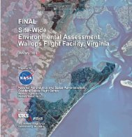
DRAFT ENVIRONMENTAL ASSESSMENT<br />
ALTERNATIVE ENERGY PROJECT<br />
WALLOPS FLIGHT FACILITY<br />
NATIONAL AERONAUTICS AND SPACE ADMINISTRATION<br />
GODDARD SPACE FLIGHT CENTER<br />
WALLOPS FLIGHT FACILITY<br />
WALLOPS ISLAND, VIRGINIA 23337<br />
Lead Agency: N<strong>at</strong>ional Aeronautics and Space Administr<strong>at</strong>ion<br />
Cooper<strong>at</strong>ing Agency: U.S. Army Corps of Engineers<br />
Proposed Action: <strong>Altern<strong>at</strong>ive</strong> <strong>Energy</strong> Project<br />
For Further Inform<strong>at</strong>ion: Joshua A. Bundick<br />
Code 250.W<br />
Goddard Space <strong>Flight</strong> <strong>Center</strong>’s <strong>Wallops</strong> <strong>Flight</strong> Facility<br />
N<strong>at</strong>ional Aeronautics and Space Administr<strong>at</strong>ion<br />
<strong>Wallops</strong> Island, VA 23337<br />
(757) 824-2319<br />
D<strong>at</strong>e: March 2010<br />
Cover Sheet<br />
Abstract: This <strong>Draft</strong> Environmental Assessment has been prepared to<br />
evalu<strong>at</strong>e the potential environmental impacts from altern<strong>at</strong>ive<br />
energy sources th<strong>at</strong> would be capable of gener<strong>at</strong>ing up to 10<br />
gigaw<strong>at</strong>t-hours per year of electricity <strong>at</strong> <strong>Wallops</strong> <strong>Flight</strong> Facility<br />
(WFF). The purpose of the proposed <strong>Altern<strong>at</strong>ive</strong> <strong>Energy</strong> Project is<br />
to gener<strong>at</strong>e clean, renewable energy <strong>at</strong> WFF from a technologically<br />
proven source in order to meet the requirements of the 2005<br />
Federal <strong>Energy</strong> Policy Act and Executive Orders 13423 and 13514.<br />
The WFF project would also support the N<strong>at</strong>ional Aeronautics and<br />
Space Administr<strong>at</strong>ion’s goal to set an example of leadership in<br />
environmental stewardship and accountability by a Federal agency.<br />
The Proposed Action would have both adverse and beneficial<br />
impacts to environmental resources. Adverse impacts would be<br />
mitig<strong>at</strong>ed to the gre<strong>at</strong>est extent practicable to minimize the effects<br />
on resources.
This page intentionally left blank.
INTRODUCTION<br />
Executive Summary<br />
This <strong>Draft</strong> Environmental Assessment (<strong>EA</strong>) has been prepared to evalu<strong>at</strong>e the potential<br />
environmental impacts from altern<strong>at</strong>ive energy sources th<strong>at</strong> would be capable of gener<strong>at</strong>ing up to<br />
10 gigaw<strong>at</strong>t-hours per year (GWh/year) of electricity <strong>at</strong> N<strong>at</strong>ional Aeronautics and Space<br />
Administr<strong>at</strong>ion’s (<strong>NASA</strong>’s) <strong>Wallops</strong> <strong>Flight</strong> Facility (WFF). This <strong>EA</strong> has been prepared in<br />
accordance with the N<strong>at</strong>ional Environmental Policy Act of 1969 (NEPA), as amended (42 United<br />
St<strong>at</strong>es Code [U.S.C.] 4321–4347), the Council on Environmental Quality (CEQ) regul<strong>at</strong>ions for<br />
implementing NEPA (40 Code of Federal Regul<strong>at</strong>ions [CFR] 1500–1508), the <strong>NASA</strong> regul<strong>at</strong>ions<br />
for implementing NEPA (14 CFR Subpart 1216.3), and the <strong>NASA</strong> Procedural Requirements<br />
(NPR): Implementing NEPA and Executive Order (EO) 12114 (NPR 8580.1).<br />
The U.S. Army Corps of Engineers (USACE) has served as a Cooper<strong>at</strong>ing Agency in the<br />
prepar<strong>at</strong>ion of this <strong>EA</strong> because they possess regul<strong>at</strong>ory authority over the Proposed Action. This<br />
<strong>EA</strong> is being developed to also fulfill the USACE’s oblig<strong>at</strong>ions under NEPA. <strong>NASA</strong>, as the WFF<br />
property owner and project proponent, is the Lead Agency and responsible for ensuring overall<br />
compliance with applicable environmental st<strong>at</strong>utes, including NEPA.<br />
PURPOSE AND NEED FOR THE ACTION<br />
The purpose of the proposed <strong>Altern<strong>at</strong>ive</strong> <strong>Energy</strong> Project is to gener<strong>at</strong>e clean, renewable energy <strong>at</strong><br />
WFF from a technologically proven source in order to meet the requirements of the 2005 Federal<br />
<strong>Energy</strong> Policy Act and EOs 13423 and 13514. The WFF project would also support <strong>NASA</strong>’s<br />
goal to set an example of leadership in environmental stewardship and accountability by a<br />
Federal agency. Additionally, EO 13423 and <strong>NASA</strong> Policy Directive 8500.1B require revisions<br />
to the <strong>NASA</strong> Environmental Management System (EMS) procedural requirements, NPR 8553.1,<br />
to address the implement<strong>at</strong>ion of “sustainable practices” through the EMS, including<br />
energy/w<strong>at</strong>er conserv<strong>at</strong>ion, reduction of greenhouse gases (GHGs), fleet management,<br />
sustainable acquisition, and development of sustainable facilities. The implement<strong>at</strong>ion of proven,<br />
renewable energy sources such as wind turbines or solar panels <strong>at</strong> WFF would meet the facility’s<br />
goal to reduce GHG emissions by reducing the use of fossil fuels to gener<strong>at</strong>e electricity, while<br />
also reducing WFF’s annual oper<strong>at</strong>ing costs.<br />
PROPOSED ACTION AND ALTERNATIVES<br />
The Proposed Action and <strong>Altern<strong>at</strong>ive</strong>s consist of developing renewable, self-sufficient energy<br />
sources <strong>at</strong> WFF to supplement the electricity currently supplied to WFF by the local electric<br />
cooper<strong>at</strong>ive. These altern<strong>at</strong>ive energy sources would consist of proven technologies th<strong>at</strong> would<br />
assist WFF in meeting its goals of reducing impacts on the n<strong>at</strong>ural environment. This <strong>EA</strong><br />
encompasses a 25-year planning horizon, which is based on the expected life span of the<br />
proposed wind turbines and solar panels.<br />
Proposed Action<br />
Under the Proposed Action, <strong>NASA</strong>’s preferred altern<strong>at</strong>ive, <strong>NASA</strong> would construct two 2.0-<br />
megaw<strong>at</strong>t (MW) “utility-scale” wind turbines on <strong>Wallops</strong> Island th<strong>at</strong> would be capable of<br />
gener<strong>at</strong>ing approxim<strong>at</strong>ely 10 GWh of electricity per year, and up to five 2.4-kilow<strong>at</strong>t (kW)<br />
“residential-scale” wind turbines <strong>at</strong> the Main Base and Mainland. The utility-scale wind turbines<br />
would be loc<strong>at</strong>ed on <strong>Wallops</strong> Island west of the U.S. Navy V-10/V-20 complex. One of the 2.4<br />
i
Executive Summary<br />
kW wind turbines would be installed near the WFF <strong>Visitor</strong> <strong>Center</strong>, and a second one would be<br />
installed near the security guard st<strong>at</strong>ion <strong>at</strong> the Mainland. The loc<strong>at</strong>ions of the remaining three<br />
residential-scale wind turbines are unknown <strong>at</strong> this time, but would be placed within the areas<br />
th<strong>at</strong> <strong>NASA</strong> has identified as potential suitable loc<strong>at</strong>ions <strong>at</strong> WFF. The residential-scale turbines<br />
would not contribute much to the percent of energy gener<strong>at</strong>ed from renewable sources <strong>at</strong> WFF<br />
because of their small power output; their primary purpose would be to provide outreach and<br />
educ<strong>at</strong>ion to WFF employees and the public about wind energy.<br />
New access roads would be constructed to each utility-scale wind turbine. Underground power<br />
collection lines would be built to interconnect each wind turbine to the existing <strong>Wallops</strong> Island<br />
electrical distribution system. These power lines would be installed by directional drilling, a<br />
trenchless method, to avoid affecting wetlands. Previously disturbed areas, including the cleared<br />
area east of the U.S. Navy V-10/V-20 complex, would be used for staging of equipment and<br />
m<strong>at</strong>erials for the utility-scale turbines, and for construction vehicle parking. The construction<br />
period for the two utility-scale wind turbines would be approxim<strong>at</strong>ely 6 months.<br />
The residential-scale wind turbines would be constructed with a setback distance of 30 meters<br />
(100 feet) from existing towers, buildings, and trees. No transformers or interconnection<br />
switchgear would be needed.<br />
<strong>Altern<strong>at</strong>ive</strong> One<br />
Under <strong>Altern<strong>at</strong>ive</strong> One, <strong>NASA</strong> would construct one utility-scale wind turbine on <strong>Wallops</strong> Island<br />
th<strong>at</strong> would be capable of gener<strong>at</strong>ing 5 GWh of electricity per year. The single 2.0 MW wind<br />
turbine would be loc<strong>at</strong>ed west of the U.S. Navy V-10/V-20 complex in the same loc<strong>at</strong>ion as the<br />
southern wind turbine under the Proposed Action. The footprint, work space, and staging areas<br />
would be the same as described under the Proposed Action, but the construction period would be<br />
approxim<strong>at</strong>ely 4 months. <strong>NASA</strong> would also install up to five 2.4 kW wind turbines <strong>at</strong> the Main<br />
Base and Mainland as described under the Proposed Action <strong>Altern<strong>at</strong>ive</strong>.<br />
In addition to the wind turbines, <strong>NASA</strong> would install a system of solar panels <strong>at</strong> <strong>Wallops</strong> Main<br />
Base th<strong>at</strong> would be capable of gener<strong>at</strong>ing up to 5 GWh/year (the equivalent of one utility-scale<br />
wind turbine). Approxim<strong>at</strong>ely 19,000-square-meter (15-square-foot) solar panels, equaling an<br />
area of approxim<strong>at</strong>ely 3 hectares (7.5 acres), would be needed to meet this power gener<strong>at</strong>ing<br />
capability. Panel spacing requirements (to avoid shading and allow maintenance) would increase<br />
the overall required land area dedic<strong>at</strong>ed to solar panels to approxim<strong>at</strong>ely 16 hectares (40 acres).<br />
The power gener<strong>at</strong>ed by the solar panels would be connected via underground transmission lines<br />
to a set of switchgear th<strong>at</strong> would be enclosed in a small 5-meter by 6-meter (16-foot by 20-foot)<br />
pre-fabric<strong>at</strong>ed building. Solar panels would be installed in open, grassy areas of <strong>Wallops</strong> Main<br />
Base. The install<strong>at</strong>ion period for the solar panels would be approxim<strong>at</strong>ely 2 months.<br />
<strong>Altern<strong>at</strong>ive</strong> Two<br />
<strong>NASA</strong> would install up to five 2.4 kW wind turbines <strong>at</strong> the Main Base and Mainland as<br />
described under the Proposed Action <strong>Altern<strong>at</strong>ive</strong>. <strong>Altern<strong>at</strong>ive</strong> Two would also consist of<br />
installing a system of solar panels <strong>at</strong> <strong>Wallops</strong> Main Base th<strong>at</strong> would be capable of gener<strong>at</strong>ing 10<br />
GWh/year of power. To produce this amount of energy, WFF would install approxim<strong>at</strong>ely<br />
38,000-square-meter (15-square-foot) solar panels th<strong>at</strong> would equal an area of approxim<strong>at</strong>ely 6<br />
hectares (15 acres). Panel spacing requirements (to avoid shading and allow maintenance) would<br />
ii
Executive Summary<br />
increase the overall required land area dedic<strong>at</strong>ed to solar panels to approxim<strong>at</strong>ely 32 hectares (80<br />
acres).<br />
The power gener<strong>at</strong>ed by the solar panels would be connected via underground transmission lines<br />
to a set of switchgear th<strong>at</strong> would be enclosed in a small 5-meter by 6-meter (16-foot by 20-foot)<br />
pre-fabric<strong>at</strong>ed building. Solar panels would be installed in open, grassy areas of <strong>Wallops</strong> Main<br />
Base. All solar panels would be loc<strong>at</strong>ed and situ<strong>at</strong>ed so as not to result in glare th<strong>at</strong> would be a<br />
safety hazard to pilots flying in the WFF Aircraft Oper<strong>at</strong>ing Area. The install<strong>at</strong>ion period for the<br />
solar panels would be approxim<strong>at</strong>ely 4 months.<br />
No Action <strong>Altern<strong>at</strong>ive</strong><br />
Under the No Action <strong>Altern<strong>at</strong>ive</strong>, <strong>NASA</strong> would not particip<strong>at</strong>e in the funding or construction of<br />
renewable energy sources <strong>at</strong> WFF to supplement the current supply of electricity th<strong>at</strong> is provided<br />
by the local electric cooper<strong>at</strong>ive. The requirements for the implement<strong>at</strong>ion of sustainable<br />
practices for energy efficiency and reductions in GHG emissions, and for the use of renewable<br />
energy set forth in the Federal regul<strong>at</strong>ions, would not be met by WFF.<br />
SUMMARY OF ENVIRONMENTAL IMPACTS<br />
Under the No Action <strong>Altern<strong>at</strong>ive</strong>, activities would remain <strong>at</strong> present levels and there would be no<br />
additional impacts on environmental resources. However, there would be no reduction in the use<br />
of fossil fuels, which contribute to GHG production and global clim<strong>at</strong>e change, during the<br />
production of electricity th<strong>at</strong> supplies WFF.<br />
Potential environmental impacts resulting from the Proposed Action and <strong>Altern<strong>at</strong>ive</strong>s are<br />
summarized in the Table ES-1 below.<br />
Table ES-1: Summary of Environmental Impacts for the Proposed Action and<br />
<strong>Altern<strong>at</strong>ive</strong>s<br />
Resource Proposed Action <strong>Altern<strong>at</strong>ive</strong> One <strong>Altern<strong>at</strong>ive</strong> Two<br />
Topography Long-term minor adverse Long-term minor adverse No impacts.<br />
impacts from construction impacts from construction<br />
of permanent access roads of permanent access road to<br />
to wind turbines within wind turbine within<br />
wetlands. Changes to wetlands. Changes to<br />
n<strong>at</strong>ural drainage p<strong>at</strong>terns n<strong>at</strong>ural drainage p<strong>at</strong>terns<br />
would be minor.<br />
would be minor.<br />
Geology and Spills or leaks of pollutants Spills or leaks of pollutants Spills or leaks of pollutants<br />
Soils<br />
would have the potential to would have the potential to would have the potential to<br />
adversely affect soils. adversely affect soils. adversely affect soils. <strong>NASA</strong><br />
<strong>NASA</strong> would implement <strong>NASA</strong> would implement would implement site-<br />
site-specific Best site-specific BMPs for specific BMPs for vehicle<br />
Management Practices vehicle and equipment and equipment fueling and<br />
(BMPs) for vehicle and fueling and maintenance, maintenance, and spill<br />
equipment fueling and and spill prevention and prevention and control<br />
maintenance, and spill control measures. Minor measures. No impacts on<br />
prevention and control long-term impacts on geology.<br />
measures. Minor long-term geology immedi<strong>at</strong>ely<br />
iii
Executive Summary<br />
Resource Proposed Action <strong>Altern<strong>at</strong>ive</strong> One <strong>Altern<strong>at</strong>ive</strong> Two<br />
impacts on geology<br />
immedi<strong>at</strong>ely around the<br />
driven piles.<br />
around the driven piles.<br />
Land Use No changes to or impacts<br />
on existing or planned land<br />
use.<br />
Surface W<strong>at</strong>ers Potential adverse impacts<br />
from spills or leaks of<br />
pollutants. <strong>NASA</strong> would<br />
minimize adverse impacts<br />
by acquiring Virginia<br />
Stormw<strong>at</strong>er Management<br />
Program (VSMP) permits<br />
as necessary and<br />
implementing BMPs and<br />
WFF’s Integr<strong>at</strong>ed<br />
Contingency Plan (ICP).<br />
Wetlands Up to 0.36 hectare (0.88<br />
acre) of wetlands would be<br />
filled. <strong>NASA</strong> would obtain<br />
necessary permits via the<br />
Virginia Marine Resources<br />
Commission (VMRC) Joint<br />
Permit Applic<strong>at</strong>ion (JPA)<br />
process and would<br />
implement 0.362 hectare<br />
(0.895 acre) of<br />
compens<strong>at</strong>ory mitig<strong>at</strong>ion <strong>at</strong><br />
WFF’s Mainland.<br />
Floodplains The wind turbines would<br />
be loc<strong>at</strong>ed within the 100year<br />
and 500-year<br />
floodplains. Because<br />
<strong>Wallops</strong> Island is entirely<br />
within the floodplain, no<br />
practicable altern<strong>at</strong>ives<br />
exist. The functionality of<br />
the floodplain on <strong>Wallops</strong><br />
Island would not be<br />
adversely impacted.<br />
No changes to or impacts on<br />
existing or planned land use<br />
<strong>at</strong> <strong>Wallops</strong> Island. Longterm<br />
adverse impacts on<br />
land use in areas of Main<br />
Base where solar panels<br />
would be installed.<br />
Potential adverse impacts<br />
from spills or leaks of<br />
pollutants. <strong>NASA</strong> would<br />
minimize adverse impacts<br />
by acquiring VSMP permits<br />
as necessary and<br />
implementing BMPs and<br />
WFF’s ICP.<br />
Up to 0.17 hectare (0.41<br />
acre) of wetlands would be<br />
filled. <strong>NASA</strong> would obtain<br />
necessary permits via the<br />
VMRC JPA process and<br />
would implement 0.17<br />
hectare (0.41 acres) of<br />
compens<strong>at</strong>ory mitig<strong>at</strong>ion <strong>at</strong><br />
WFF’s Mainland.<br />
The wind turbine would be<br />
loc<strong>at</strong>ed within the 100-year<br />
and 500-year floodplains.<br />
Because <strong>Wallops</strong> Island is<br />
entirely within the<br />
floodplain, no practicable<br />
altern<strong>at</strong>ives exist. The<br />
functionality of the<br />
floodplain on <strong>Wallops</strong><br />
Island would not be<br />
adversely impacted.<br />
Long-term adverse impacts<br />
on land use in areas of Main<br />
Base where solar panels<br />
would be installed.<br />
Potential adverse impacts<br />
from spills or leaks of<br />
pollutants. <strong>NASA</strong> would<br />
minimize adverse impacts by<br />
acquiring VSMP permits as<br />
necessary and implementing<br />
BMPs and WFF’s ICP.<br />
No impacts.<br />
No impacts—the areas of the<br />
Main Base where solar<br />
panels would be installed are<br />
not within the floodplain.<br />
iv
Executive Summary<br />
Resource Proposed Action <strong>Altern<strong>at</strong>ive</strong> One <strong>Altern<strong>at</strong>ive</strong> Two<br />
Coastal Zone<br />
Management<br />
Air Quality and<br />
Clim<strong>at</strong>e Change<br />
All activities occur within<br />
Virginia’s Coastal<br />
Management Area (CMA).<br />
<strong>NASA</strong> has determined th<strong>at</strong><br />
the Proposed Action is<br />
consistent with the<br />
enforceable policies of the<br />
Coastal Zone Management<br />
(CZM) Program.<br />
Long-term beneficial<br />
impacts on air quality and<br />
clim<strong>at</strong>e change with<br />
reduction in use of fossilfuel<br />
power sources and<br />
GHG emissions.<br />
Radar The wind turbines would<br />
be sited in an area th<strong>at</strong><br />
would not impact radar<br />
systems <strong>at</strong> WFF.<br />
Noise Oper<strong>at</strong>ion of the wind<br />
turbines would result in<br />
highly localized, long-term,<br />
minor impacts on the<br />
surrounding environment<br />
from noise. Neither the<br />
public nor employees and<br />
visitors to WFF outside of<br />
<strong>Wallops</strong> Island would be<br />
able to hear the wind<br />
turbines; therefore, no<br />
impacts on either of these<br />
two groups would occur.<br />
No impacts on the<br />
occup<strong>at</strong>ional health of<br />
construction workers as a<br />
result of construction noise<br />
with implement<strong>at</strong>ion of<br />
BMPs.<br />
Hazardous<br />
M<strong>at</strong>erials and<br />
Hazardous<br />
Waste<br />
Management<br />
Construction, maintenance,<br />
and decommissioning<br />
activities for the wind<br />
turbines would involve<br />
hazardous m<strong>at</strong>erials and<br />
produce hazardous waste.<br />
<strong>NASA</strong> would ensure<br />
implement<strong>at</strong>ion of WFF’s<br />
ICP safety procedures,<br />
All activities occur within<br />
Virginia’s CMA. Activities<br />
under <strong>Altern<strong>at</strong>ive</strong> One<br />
would be conducted in a<br />
way th<strong>at</strong> was consistent<br />
with the enforceable<br />
policies of the CZM<br />
Program.<br />
Long-term beneficial<br />
impacts on air quality and<br />
clim<strong>at</strong>e change with<br />
reduction in use of fossilfuel<br />
power sources and<br />
GHG emissions.<br />
The wind turbine would be<br />
sited in an area th<strong>at</strong> would<br />
not impact radar systems <strong>at</strong><br />
WFF. No impacts on radar<br />
from solar panels.<br />
Oper<strong>at</strong>ion of the wind<br />
turbine would result in<br />
highly localized, long-term,<br />
minor impacts on the<br />
surrounding environment<br />
from noise. Neither the<br />
public nor employees and<br />
visitors to WFF outside of<br />
<strong>Wallops</strong> Island would be<br />
able to hear the wind<br />
turbines; therefore, no<br />
impacts on either of these<br />
two groups would occur. No<br />
impacts on the occup<strong>at</strong>ional<br />
health of construction<br />
workers as a result of<br />
construction noise with<br />
implement<strong>at</strong>ion of BMPs.<br />
Construction, maintenance,<br />
and decommissioning<br />
activities for the wind<br />
turbines and solar panels<br />
would involve hazardous<br />
m<strong>at</strong>erials and produce<br />
hazardous waste. <strong>NASA</strong><br />
would ensure<br />
implement<strong>at</strong>ion of WFF’s<br />
All activities occur within<br />
Virginia’s CMA. Activities<br />
under <strong>Altern<strong>at</strong>ive</strong> Two would<br />
be conducted in a way th<strong>at</strong><br />
was consistent with the<br />
enforceable policies of the<br />
CZM Program.<br />
Long-term beneficial impacts<br />
on air quality and clim<strong>at</strong>e<br />
change with reduction in use<br />
of fossil-fuel power sources<br />
and GHG emissions.<br />
No impacts.<br />
No impacts on the<br />
occup<strong>at</strong>ional health of<br />
construction workers as a<br />
result of install<strong>at</strong>ion noise<br />
with implement<strong>at</strong>ion of<br />
BMPs. No noise associ<strong>at</strong>ed<br />
with oper<strong>at</strong>ion of the solar<br />
panels.<br />
Install<strong>at</strong>ion, maintenance,<br />
and decommissioning<br />
activities would involve<br />
hazardous m<strong>at</strong>erials and<br />
produce hazardous waste.<br />
<strong>NASA</strong> would ensure<br />
implement<strong>at</strong>ion of WFF’s<br />
ICP safety procedures,<br />
training, and mitig<strong>at</strong>ion<br />
v
Executive Summary<br />
Resource Proposed Action <strong>Altern<strong>at</strong>ive</strong> One <strong>Altern<strong>at</strong>ive</strong> Two<br />
Veget<strong>at</strong>ion and<br />
Terrestrial<br />
Wildlife<br />
training, and mitig<strong>at</strong>ion<br />
measures, including spill<br />
prevention and response.<br />
Therefore, no impacts on<br />
human and environmental<br />
health due to hazardous<br />
m<strong>at</strong>erials and wastes are<br />
anticip<strong>at</strong>ed.<br />
Short-term adverse impacts<br />
due to excav<strong>at</strong>ion and<br />
grading to construct the<br />
wind turbines, the access<br />
roads, and underground<br />
cables. Long-term, adverse<br />
impacts due to the<br />
permanent conversion of<br />
0.36 hectare (0.88 acre) of<br />
wetlands to developed land.<br />
Birds and B<strong>at</strong>s Long-term adverse impacts<br />
due to the conversion of<br />
wetland habit<strong>at</strong> to<br />
developed land and from<br />
oper<strong>at</strong>ion of the wind<br />
turbines. Potential<br />
avoidance and/or<br />
minimiz<strong>at</strong>ion BMPs would<br />
be implemented to reduce<br />
the potential long-term<br />
(direct and indirect)<br />
impacts.<br />
Thre<strong>at</strong>ened and<br />
Endangered<br />
Species<br />
<strong>NASA</strong> determined th<strong>at</strong> the<br />
project “may affect, and is<br />
likely to adversely affect”<br />
the Piping Plover and Red<br />
Knot. The project would<br />
have “no effect” to<br />
federally listed mammals,<br />
sea turtles, insects, and<br />
plants. <strong>NASA</strong> submitted a<br />
ICP safety procedures,<br />
training, and mitig<strong>at</strong>ion<br />
measures, including spill<br />
prevention and response.<br />
Therefore, no impacts on<br />
human and environmental<br />
health due to hazardous<br />
m<strong>at</strong>erials and wastes are<br />
anticip<strong>at</strong>ed.<br />
Short-term adverse impacts<br />
due to excav<strong>at</strong>ion and<br />
grading to construct the<br />
wind turbines, the access<br />
roads, and underground<br />
cables. Long-term, adverse<br />
impacts due to the<br />
permanent conversion of<br />
0.08 hectare (0.21 acre) of<br />
wetlands to developed land.<br />
Long-term adverse impacts<br />
due to the conversion of<br />
wetland habit<strong>at</strong> to<br />
developed land and from<br />
oper<strong>at</strong>ion of the wind<br />
turbines. Potential<br />
avoidance and/or<br />
minimiz<strong>at</strong>ion BMPs would<br />
be implemented to reduce<br />
the potential long-term<br />
(direct and indirect)<br />
impacts. Because the<br />
install<strong>at</strong>ion of solar panels<br />
<strong>at</strong> the Main Base would not<br />
alter or remove b<strong>at</strong> habit<strong>at</strong>,<br />
nor would their oper<strong>at</strong>ion<br />
interfere with bird or b<strong>at</strong><br />
activities, no impacts are<br />
anticip<strong>at</strong>ed from solar<br />
panels.<br />
<strong>NASA</strong> determined th<strong>at</strong> the<br />
project “may affect, and is<br />
likely to adversely affect”<br />
the Piping Plover and Red<br />
Knot. The project would<br />
have “no effect” to federally<br />
listed mammals, sea turtles,<br />
insects, and plants. <strong>NASA</strong><br />
submitted a Biological<br />
measures, including spill<br />
prevention and response.<br />
Therefore, no impacts on<br />
human and environmental<br />
health due to hazardous<br />
m<strong>at</strong>erials and wastes are<br />
anticip<strong>at</strong>ed.<br />
Long-term adverse, but<br />
highly localized, impacts<br />
from the loss of veget<strong>at</strong>ion<br />
within the footprint of the<br />
support posts for the solar<br />
panels.<br />
Because the install<strong>at</strong>ion of<br />
solar panels <strong>at</strong> the Main Base<br />
would not alter or remove b<strong>at</strong><br />
habit<strong>at</strong>, nor would their<br />
oper<strong>at</strong>ion interfere with bird<br />
or b<strong>at</strong> activities, no impacts<br />
are anticip<strong>at</strong>ed from solar<br />
panels.<br />
<strong>NASA</strong> determined th<strong>at</strong> the<br />
solar panels would have no<br />
affect on St<strong>at</strong>e or federally<br />
listed species in the project<br />
area <strong>at</strong> the Main Base.<br />
vi
Executive Summary<br />
Resource Proposed Action <strong>Altern<strong>at</strong>ive</strong> One <strong>Altern<strong>at</strong>ive</strong> Two<br />
Essential Fish<br />
Habit<strong>at</strong> (EFH)<br />
Popul<strong>at</strong>ion,<br />
Employment,<br />
and Income<br />
Environmental<br />
Justice<br />
Cultural<br />
Resources<br />
Biological Assessment to<br />
the U.S. Fish and Wildlife<br />
Service (USFWS); no<br />
response has been received<br />
to d<strong>at</strong>e.<br />
Short-term adverse impacts<br />
on EFH from filling<br />
wetlands for utility-scale<br />
turbine footprints, but<br />
impacts are not expected to<br />
be substantial. Effects on<br />
EFH would be offset by<br />
compens<strong>at</strong>ory mitig<strong>at</strong>ion <strong>at</strong><br />
WFF’s Mainland.<br />
Construction activities may<br />
temporarily increase local<br />
employment opportunities<br />
and would benefit local<br />
stores and businesses.<br />
No impacts.<br />
Disproportion<strong>at</strong>ely high or<br />
adverse impacts on lowincome<br />
or minority<br />
popul<strong>at</strong>ions are not<br />
anticip<strong>at</strong>ed because there<br />
would be no displacement<br />
of residences or businesses.<br />
All ground disturbances are<br />
loc<strong>at</strong>ed outside of areas<br />
design<strong>at</strong>ed as having<br />
moder<strong>at</strong>e or high potential<br />
for archeological resources.<br />
No adverse effects on<br />
archaeological resources<br />
are anticip<strong>at</strong>ed.<br />
Utility-scale turbines are<br />
not anticip<strong>at</strong>ed to adversely<br />
affect historic properties<br />
within or outside of WFF<br />
given the n<strong>at</strong>ure of the<br />
viewshed. No adverse<br />
effects on aboveground<br />
historic properties are<br />
anticip<strong>at</strong>ed.<br />
Residential-scale turbines<br />
Assessment to USFWS; no<br />
response has been received<br />
to d<strong>at</strong>e. <strong>NASA</strong> determined<br />
th<strong>at</strong> the solar panels would<br />
have no affect on St<strong>at</strong>e or<br />
federally listed species in<br />
the project area <strong>at</strong> the Main<br />
Base.<br />
Short-term adverse impacts<br />
on EFH from filling<br />
wetlands for utility-scale<br />
turbine footprints, but<br />
impacts are not expected to<br />
be substantial. Effects on<br />
EFH would be offset by<br />
compens<strong>at</strong>ory mitig<strong>at</strong>ion <strong>at</strong><br />
WFF’s Mainland.<br />
Construction activities may<br />
temporarily increase local<br />
employment opportunities<br />
and would benefit local<br />
stores and businesses.<br />
No impacts.<br />
Disproportion<strong>at</strong>ely high or<br />
adverse impacts on lowincome<br />
or minority<br />
popul<strong>at</strong>ions are not<br />
anticip<strong>at</strong>ed because there<br />
would be no displacement of<br />
residences or businesses.<br />
All ground disturbances are<br />
loc<strong>at</strong>ed outside of areas<br />
design<strong>at</strong>ed as having<br />
moder<strong>at</strong>e or high potential<br />
for archeological resources.<br />
No adverse effects on<br />
archaeological resources are<br />
anticip<strong>at</strong>ed.<br />
Utility-scale turbine is not<br />
anticip<strong>at</strong>ed to adversely<br />
affect historic properties<br />
within or outside of WFF<br />
given the n<strong>at</strong>ure of the<br />
viewshed. No adverse<br />
effects on aboveground<br />
historic properties are<br />
anticip<strong>at</strong>ed.<br />
Solar panels are not<br />
No impacts.<br />
Construction activities may<br />
temporarily increase local<br />
employment opportunities<br />
and would benefit local stores<br />
and businesses.<br />
No impacts.<br />
Disproportion<strong>at</strong>ely high or<br />
adverse impacts on lowincome<br />
or minority<br />
popul<strong>at</strong>ions are not<br />
anticip<strong>at</strong>ed because there<br />
would be no displacement of<br />
residences or businesses.<br />
All ground disturbances are<br />
loc<strong>at</strong>ed outside of areas<br />
design<strong>at</strong>ed as having<br />
moder<strong>at</strong>e or high potential<br />
for archeological resources.<br />
No adverse effects on<br />
archaeological resources are<br />
anticip<strong>at</strong>ed. Solar panels are<br />
not anticip<strong>at</strong>ed to adversely<br />
affect aboveground historic<br />
properties within WFF.<br />
However, solar panels may<br />
have indirect adverse effects<br />
to aboveground historic<br />
properties outside WFF.<br />
Residential-scale turbines are<br />
not anticip<strong>at</strong>ed to adversely<br />
affect aboveground historic<br />
vii
Executive Summary<br />
Resource Proposed Action <strong>Altern<strong>at</strong>ive</strong> One <strong>Altern<strong>at</strong>ive</strong> Two<br />
are not anticip<strong>at</strong>ed to<br />
adversely affect<br />
aboveground historic<br />
properties within WFF.<br />
However, residential-scale<br />
turbines may have direct<br />
adverse effects on<br />
aboveground historic<br />
properties in WFF and<br />
indirect adverse effects on<br />
aboveground historic<br />
properties outside WFF.<br />
Transport<strong>at</strong>ion Temporary impacts on<br />
traffic flow would occur<br />
during construction<br />
activities. With<br />
implement<strong>at</strong>ion of<br />
mitig<strong>at</strong>ion and safety<br />
measures rel<strong>at</strong>ed to<br />
transport<strong>at</strong>ion and traffic<br />
closures due to oversize<br />
loads, no substantial<br />
impacts on transport<strong>at</strong>ion<br />
are anticip<strong>at</strong>ed.<br />
Aesthetics No adverse impacts on the<br />
public viewshed given the<br />
distance of the turbines<br />
from surrounding<br />
communities. Wind<br />
turbines would be white to<br />
blend in with sky. Potential<br />
adverse impacts on WFF<br />
employees and visitors<br />
within turbine shadow due<br />
to flickering effect of<br />
spinning blades on sunny<br />
days.<br />
anticip<strong>at</strong>ed to adversely<br />
affect aboveground historic<br />
properties within WFF.<br />
However, solar panels may<br />
have indirect adverse effects<br />
to aboveground historic<br />
properties outside WFF.<br />
Residential-scale turbines<br />
are not anticip<strong>at</strong>ed to<br />
adversely affect<br />
aboveground historic<br />
properties within WFF.<br />
However, residential-scale<br />
turbines may have direct<br />
adverse effects on<br />
aboveground historic<br />
properties in WFF and<br />
indirect adverse effects on<br />
aboveground historic<br />
properties outside WFF.<br />
Temporary impacts on<br />
traffic flow would occur<br />
during construction<br />
activities. With<br />
implement<strong>at</strong>ion of<br />
mitig<strong>at</strong>ion and safety<br />
measures rel<strong>at</strong>ed to<br />
transport<strong>at</strong>ion and traffic<br />
closures due to oversize<br />
loads, no substantial<br />
impacts on transport<strong>at</strong>ion<br />
are anticip<strong>at</strong>ed.<br />
No adverse impacts on the<br />
public viewshed given the<br />
distance of the turbines<br />
from surrounding<br />
communities. Wind turbines<br />
would be white to blend in<br />
with sky. Potential adverse<br />
impacts on WFF employees<br />
and visitors within turbine<br />
shadow due to flickering<br />
effect of spinning blades on<br />
sunny days. Implement<strong>at</strong>ion<br />
of solar panels would result<br />
in long-term changes to the<br />
viewshed <strong>at</strong> the Main Base.<br />
Because WFF is a highly<br />
properties within WFF.<br />
However, residential-scale<br />
turbines may have direct<br />
adverse effects on<br />
aboveground historic<br />
properties in WFF and<br />
indirect adverse effects on<br />
aboveground historic<br />
properties outside WFF.<br />
Temporary impacts on traffic<br />
flow would occur during<br />
construction activities. With<br />
implement<strong>at</strong>ion of mitig<strong>at</strong>ion<br />
and safety measures rel<strong>at</strong>ed<br />
to transport<strong>at</strong>ion, no<br />
substantial impacts on<br />
transport<strong>at</strong>ion are<br />
anticip<strong>at</strong>ed.<br />
Implement<strong>at</strong>ion of solar<br />
panels would result in longterm<br />
changes to the viewshed<br />
<strong>at</strong> the Main Base. Because<br />
WFF is a highly<br />
industrialized setting with<br />
numerous antenna arrays and<br />
other infrastructure, solar<br />
panels should not present a<br />
neg<strong>at</strong>ive impact on the<br />
viewshed.<br />
viii
Executive Summary<br />
Resource Proposed Action <strong>Altern<strong>at</strong>ive</strong> One <strong>Altern<strong>at</strong>ive</strong> Two<br />
industrialized setting with<br />
numerous antenna arrays<br />
and other infrastructure,<br />
solar panels should not<br />
present a neg<strong>at</strong>ive impact on<br />
the viewshed.<br />
Cumul<strong>at</strong>ive<br />
Effects<br />
There would be adverse<br />
cumul<strong>at</strong>ive impacts on<br />
avifauna from construction<br />
and oper<strong>at</strong>ion of the wind<br />
turbines. Cumul<strong>at</strong>ive<br />
impacts on wetlands would<br />
be mitig<strong>at</strong>ed. There would<br />
be beneficial impacts on air<br />
quality due to reduced<br />
GHG emissions and<br />
lowered use of fossil fuels<br />
during the production of<br />
electricity.<br />
There would be adverse<br />
cumul<strong>at</strong>ive impacts on<br />
avifauna from construction<br />
and oper<strong>at</strong>ion of the wind<br />
turbines. Cumul<strong>at</strong>ive<br />
impacts on wetlands would<br />
be mitig<strong>at</strong>ed. There would<br />
be beneficial impacts on air<br />
quality from the use of wind<br />
turbines and solar panels<br />
due to reduced GHG<br />
emissions and lowered use<br />
of fossil fuels during the<br />
production of electricity.<br />
Beneficial impacts on<br />
regional air quality would<br />
result from the oper<strong>at</strong>ion of<br />
the solar panels, which are a<br />
fossil fuel-free power source.<br />
No other cumul<strong>at</strong>ive impacts<br />
from install<strong>at</strong>ion of solar<br />
panels are anticip<strong>at</strong>ed.<br />
ix
This page intentionally left blank.<br />
Executive Summary<br />
x
TABLE OF CONTENTS<br />
EXECUTIVE SUMMARY................................................................................................................................ i<br />
ACRONYMS AND ABBREVIATIONS ...................................................................................................... xvii<br />
SECTION ONE: MISSION, PURPOSE AND NEED, BACKGROUND INFORMATION ............................... 1<br />
1.1 Introduction..................................................................................................1<br />
1.2 <strong>Wallops</strong> <strong>Flight</strong> Facility ................................................................................1<br />
1.2.1 Mission............................................................................................ 1<br />
1.2.2 Environmental Management System .............................................. 2<br />
1.2.3 Loc<strong>at</strong>ion .......................................................................................... 2<br />
1.3 Background..................................................................................................2<br />
1.3.1 Current WFF <strong>Energy</strong> Sources......................................................... 5<br />
1.4 Purpose and Need for the proposed action ..................................................5<br />
1.4.1 Purpose............................................................................................ 5<br />
1.4.2 Need ................................................................................................ 6<br />
SECTION TWO: PROPOSED ACTION AND ALTERNATIVES ................................................................... 7<br />
2.1 Range of <strong>Altern<strong>at</strong>ive</strong>s Considered for Renewable <strong>Energy</strong> ..........................7<br />
2.1.1 Wind Power .................................................................................... 7<br />
2.2 <strong>Altern<strong>at</strong>ive</strong>s Considered and Dismissed ....................................................18<br />
2.3 Proposed Action and <strong>Altern<strong>at</strong>ive</strong>s .............................................................21<br />
2.3.1 Proposed Action: Utility-Scale Wind Turbines and Residential-<br />
Scale Wind Turbines..................................................................... 21<br />
2.3.2 <strong>Altern<strong>at</strong>ive</strong> One: Utility-Scale Wind Turbine, Residential-Scale<br />
Wind Turbines, and Solar Panels.................................................. 27<br />
2.3.3 <strong>Altern<strong>at</strong>ive</strong> Two: Residential-Scale Wind Turbines and Solar<br />
Panels ............................................................................................ 28<br />
2.3.4 Comparison of Costs Among <strong>Altern<strong>at</strong>ive</strong>s ................................... 28<br />
2.4 No Action <strong>Altern<strong>at</strong>ive</strong>................................................................................29<br />
SECTION THREE: AFFECTED ENVIRONMENT....................................................................................... 31<br />
3.1 Physical Environment ................................................................................31<br />
3.1.1 Land Resources............................................................................. 31<br />
3.1.2 W<strong>at</strong>er Resources ........................................................................... 35<br />
3.1.3 Air Quality .................................................................................... 40<br />
3.1.4 Clim<strong>at</strong>e Change............................................................................. 44<br />
3.1.5 Clim<strong>at</strong>e.......................................................................................... 45<br />
3.1.6 Radar............................................................................................. 46<br />
3.1.7 Noise ............................................................................................. 46<br />
3.1.8 Hazardous M<strong>at</strong>erials and Hazardous Waste ................................. 48<br />
3.2 Biological Environment.............................................................................49<br />
3.2.1 Veget<strong>at</strong>ion..................................................................................... 49<br />
3.2.2 Terrestrial Wildlife........................................................................ 50<br />
3.2.3 Avifauna........................................................................................ 51<br />
3.2.4 Thre<strong>at</strong>ened and Endangered Species ............................................ 66<br />
xi
TABLE OF CONTENTS<br />
3.2.5 Fish................................................................................................ 75<br />
3.3 Social and Economic Environment............................................................75<br />
3.3.1 Popul<strong>at</strong>ion ..................................................................................... 75<br />
3.3.2 Employment and Income .............................................................. 76<br />
3.3.3 Environmental Justice................................................................... 78<br />
3.3.4 Avi<strong>at</strong>ion Safety Requirements ...................................................... 79<br />
3.3.5 Cultural Resources........................................................................ 79<br />
3.3.6 Transport<strong>at</strong>ion............................................................................... 85<br />
3.3.7 Aesthetics...................................................................................... 85<br />
SECTION FOUR: ENVIRONMENTAL CONSEQUENCES......................................................................... 91<br />
4.1 Introduction................................................................................................91<br />
4.2 Physical Environment ................................................................................91<br />
4.2.1 Land Resources............................................................................. 91<br />
4.2.2 W<strong>at</strong>er Resources ........................................................................... 95<br />
4.2.3 Air Quality and Clim<strong>at</strong>e Change................................................. 101<br />
4.2.4 Radar........................................................................................... 105<br />
4.2.5 Noise ........................................................................................... 106<br />
4.2.6 Hazardous M<strong>at</strong>erials and Hazardous Waste ............................... 107<br />
4.3 Biological Environment...........................................................................109<br />
4.3.1 Veget<strong>at</strong>ion................................................................................... 109<br />
4.3.2 Terrestrial Wildlife...................................................................... 110<br />
4.3.3 Avifauna – Birds......................................................................... 111<br />
4.3.4 Avifauna – B<strong>at</strong>s........................................................................... 118<br />
4.3.5 Thre<strong>at</strong>ened and Endangered Species .......................................... 122<br />
4.3.6 Essential Fish Habit<strong>at</strong> ................................................................. 127<br />
4.4 Social and Economic Environment..........................................................127<br />
4.4.1 Popul<strong>at</strong>ion, Employment, and Income........................................ 127<br />
4.4.2 Environmental Justice................................................................. 129<br />
4.4.3 Cultural Resources...................................................................... 130<br />
4.4.4 Transport<strong>at</strong>ion............................................................................. 135<br />
4.4.5 Aesthetics.................................................................................... 136<br />
4.5 Cumul<strong>at</strong>ive Effects...................................................................................141<br />
4.5.1 <strong>Wallops</strong> Research Park ............................................................... 141<br />
4.5.2 North Unmanned Aerial System Airstrip ................................... 141<br />
4.5.3 Shoreline Restor<strong>at</strong>ion and Infrastructure Protection Program.... 141<br />
4.5.4 Expansion of the <strong>Wallops</strong> <strong>Flight</strong> Facility Launch Range ........... 142<br />
4.5.5 WFF Launch Range Activities.................................................... 142<br />
4.5.6 Potential Cumul<strong>at</strong>ive Effects by Resource ................................. 142<br />
4.6 Permits, Licenses, and Approvals............................................................148<br />
SECTION FIVE: MITIGATION AND MONITORING.................................................................................. 149<br />
5.1 Mitig<strong>at</strong>ion.................................................................................................149<br />
5.1.1 Wetlands ..................................................................................... 149<br />
5.1.2 Birds and B<strong>at</strong>s............................................................................. 149<br />
5.2 Monitoring ...............................................................................................149<br />
xii
TABLE OF CONTENTS<br />
5.2.1 Post-Construction Utility-Scale Wind Turbine Avian F<strong>at</strong>ality<br />
Monitoring .................................................................................. 150<br />
5.2.2 Facility Thre<strong>at</strong>ened and Endangered Species Monitoring.......... 152<br />
5.3 Adaptive Management.............................................................................152<br />
SECTION SIX: LIST OF PREPARERS..................................................................................................... 155<br />
SECTION SEVEN: AGENCIES, ORGANIZATIONS, AND PERSONS CONSULTED.............................. 157<br />
7.1 Introduction..............................................................................................157<br />
7.2 Scoping Process .......................................................................................157<br />
7.3 <strong>Draft</strong> <strong>EA</strong>...................................................................................................157<br />
SECTION EIGHT: REFERENCES ............................................................................................................ 161<br />
APPENDIX A WALLOPS FLIGHT FACILITY ALTERNATIVE ENERGY DEMONSTRATION PROJECT<br />
WIND ENERGY AVIAN STUDY REPORT<br />
APPENDIX B SUMMER – FALL 2008 PASSIVE ACOUSTIC MONITORING BAT SURVEY REPORT<br />
APPENDIX C FEDERAL CONSISTENCY DETERMINATION<br />
APPENDIX D BIOLOGICAL ASSESSMENT<br />
APPENDIX E ESSENTIAL FISH HABITAT CHECKLIST<br />
APPENDIX F AESTHETICS STUDY PHOTO LOG<br />
APPENDIX G SCOPING AND COORDINATION LETTERS<br />
Photographs<br />
Photograph 1: Viewshed from a vantage point west of WFF loc<strong>at</strong>ed approxim<strong>at</strong>ely 3.7<br />
kilometers (2.3 miles) southwest of the bridge th<strong>at</strong> links <strong>Wallops</strong> Mainland to<br />
<strong>Wallops</strong> Island looking northeast toward the bridge.................................................... 86<br />
Photograph 2: Viewshed from a vantage point <strong>at</strong> the Main Base looking north toward the<br />
cafeteria building.......................................................................................................... 87<br />
Photograph 3: Aerial overview of the Main Base looking east. .................................................. 87<br />
Photograph 4: Viewshed from launch pad 2 on South <strong>Wallops</strong> Island looking north................. 88<br />
Photograph 5: Jersey Atlantic Wind, LLC/Atlantic County Utilities Authority Wind<br />
Farm ........................................................................................................................... 114<br />
Photograph 6: Viewshed from a vantage point loc<strong>at</strong>ed approxim<strong>at</strong>ely 3.7 kilometers (2.3<br />
miles) southwest of the bridge th<strong>at</strong> links <strong>Wallops</strong> Mainland to <strong>Wallops</strong> Island<br />
looking northeast toward the bridge........................................................................... 139<br />
xiii
TABLE OF CONTENTS<br />
Tables<br />
Table ES-1: Summary of Environmental Impacts for the Proposed Action and<br />
<strong>Altern<strong>at</strong>ive</strong>s ...................................................................................................................iii<br />
Table 1: Use of Renewable <strong>Energy</strong> in FY08 and FY09, Predicted Contribution of<br />
<strong>Altern<strong>at</strong>ive</strong> <strong>Energy</strong> Project in FY10............................................................................... 6<br />
Table 2: <strong>NASA</strong> Annual Electricity Usage and Cost, FY02 to FY10............................................. 6<br />
Table 3: Basic D<strong>at</strong>a for 2.0 MW Wind Turbine ............................................................................ 9<br />
Table 4: Basic D<strong>at</strong>a for 2.4 kW Wind Turbine.............................................................................. 9<br />
Table 5: Basic D<strong>at</strong>a for Represent<strong>at</strong>ive Solar Panels................................................................... 14<br />
Table 6: Comparison of Costs Among the Action <strong>Altern<strong>at</strong>ive</strong>s .................................................. 29<br />
Table 7: N<strong>at</strong>ional Ambient Air Quality Standards ...................................................................... 43<br />
Table 8: Calendar Year 2008 Air Emissions <strong>at</strong> WFF .................................................................. 44<br />
Table 9: Calendar Year 2008 Greenhouse Gas Emissions <strong>at</strong> WFF by Pollutant......................... 45<br />
Table 10: Typical Noise Levels of Familiar Noise Sources and Public Responses .................... 47<br />
Table 11: Accomack County Noise Guidelines by Land Use ..................................................... 48<br />
Table 12: Species Abundance Summary October 2008–October 2009....................................... 58<br />
Table 13: Avian Observ<strong>at</strong>ions by Class of Species ..................................................................... 59<br />
Table 14: Number of Bird Observ<strong>at</strong>ions by Month and Survey Effort ....................................... 60<br />
Table 15: Thre<strong>at</strong>ened and Endangered Species in the Vicinity of WFF...................................... 67<br />
Table 16: Town Popul<strong>at</strong>ion and Housing Units in Accomack County in 2008........................... 76<br />
Table 17: Occup<strong>at</strong>ional Distribution (percent) ............................................................................ 77<br />
Table 18: Income and Poverty ..................................................................................................... 77<br />
Table 19: Environmental Justice Concerns – by Census Tract, Accomack County, VA............ 78<br />
Table 20: Wetland Impacts under the Proposed Action .............................................................. 96<br />
Table 21: Proposed Action Construction Emissions for WFF Mainland/<strong>Wallops</strong> Island......... 102<br />
Table 22: Proposed Action GHG Construction Emissions for WFF Mainland/<strong>Wallops</strong><br />
Island.......................................................................................................................... 103<br />
Table 23: <strong>Altern<strong>at</strong>ive</strong> One Construction Emissions for WFF Mainland/<strong>Wallops</strong> Island .......... 104<br />
Table 24: <strong>Altern<strong>at</strong>ive</strong> Two Construction Emissions for WFF Main Base................................. 105<br />
Table 25: Determin<strong>at</strong>ion of Effects on Federally Listed Thre<strong>at</strong>ened and Endangered<br />
Species ....................................................................................................................... 122<br />
Table 26: Aesthetics Analysis Vantage Points .......................................................................... 136<br />
Table 27: Area of Wetlands Affected for Current Proposed Projects on <strong>Wallops</strong> Island ......... 143<br />
Table 28: Area of Wetlands Affected from Past Projects on <strong>Wallops</strong> Island............................ 143<br />
Table 29: WFF Cumul<strong>at</strong>ive Project Criteria Pollutant Emissions in Tons................................ 144<br />
Table 30: Emissions Reduction Resulting from Central Boiler Plant Decentraliz<strong>at</strong>ion in<br />
Tons............................................................................................................................ 145<br />
Table 31: WFF Cumul<strong>at</strong>ive Project Greenhouse Gas Emissions in Metric Tonnes.................. 145<br />
Table 32: Determin<strong>at</strong>ion of Effects to Federally Protected Species for WFF Projects ............. 147<br />
Table 33: Agencies, Organiz<strong>at</strong>ions, and Individuals Consulted................................................ 159<br />
Figures<br />
Figure 1: Project Loc<strong>at</strong>ion Map ..................................................................................................... 3<br />
Figure 2: Diagram of Major Wind Turbine Components .............................................................. 8<br />
Figure 3: 2.0 MW Wind Turbine Siting Analysis........................................................................ 11<br />
xiv
TABLE OF CONTENTS<br />
Figure 4: Potentially Suitable Areas for Install<strong>at</strong>ion of Residential-Scale Wind Turbines ......... 15<br />
Figure 5: Solar Panel Areas ......................................................................................................... 19<br />
Figure 6: Proposed Loc<strong>at</strong>ion of 2.0 MW Wind Turbines and Staging Areas.............................. 23<br />
Figure 7: Oblique Conceptual Rendering of Wind Turbines – Viewed from the Northeast<br />
Toward the Southwest.................................................................................................. 25<br />
Figure 8: Land Use....................................................................................................................... 33<br />
Figure 9: Surface W<strong>at</strong>er and Wetlands ........................................................................................ 37<br />
Figure 10: Floodplains ................................................................................................................. 41<br />
Figure 11: Atlantic Flyway Migr<strong>at</strong>ion Routes............................................................................. 53<br />
Figure 12: B<strong>at</strong> Detectors and Avian Observ<strong>at</strong>ion Loc<strong>at</strong>ions ....................................................... 55<br />
Figure 13: Federally Protected B<strong>at</strong> Species Loc<strong>at</strong>ions in Virginia.............................................. 63<br />
Figure 14: Protected Species in the Vicinity of <strong>Wallops</strong> Island .................................................. 69<br />
Figure 15: <strong>Wallops</strong> Mainland and Southern <strong>Wallops</strong> Island Prehistoric Archaeological<br />
Site Sensitivity ............................................................................................................. 81<br />
Figure 16: <strong>Wallops</strong> Mainland and Southern <strong>Wallops</strong> Island Historic Archaeological Site<br />
Sensitivity..................................................................................................................... 83<br />
Figure 17: Oblique Aerial View of <strong>Wallops</strong> Island Viewed from the South End of the<br />
Island Looking North ................................................................................................... 89<br />
Figure 18: Wetland Mitig<strong>at</strong>ion..................................................................................................... 99<br />
Figure 19: Five Community Viewshed Vantage Points ............................................................ 137<br />
xv
TABLE OF CONTENTS<br />
This page intentionally left blank.<br />
xvi
ACHP Advisory Council on Historic Preserv<strong>at</strong>ion<br />
ACUA Atlantic County Utilities Authority<br />
amsl above mean sea level<br />
APE Area of Potential Effect<br />
APWRA Altamont Pass Wind Resource Area<br />
AST aboveground storage tank<br />
ASR Archive Search Report<br />
BA Biological Assessment<br />
BBSH Big brown/Silver-haired b<strong>at</strong> Guild<br />
BMP Best Management Practice<br />
CAA Clean Air Act<br />
CBC Christmas Bird Counts<br />
CBRA Coastal Barrier Resources Act<br />
CBRS Coastal Barrier Resources System<br />
CEQ Council on Environmental Quality<br />
CFR Code of Federal Regul<strong>at</strong>ions<br />
CH4<br />
methane<br />
CMA Coastal Management Area<br />
CNWR Chincoteague N<strong>at</strong>ional Wildlife Refuge<br />
CO carbon monoxide<br />
CO2<br />
carbon dioxide<br />
CO2e carbon dioxide equivalent<br />
CRA Cultural Resources Assessment<br />
CRMP Cultural Resources Management Plan<br />
CWA Clean W<strong>at</strong>er Act<br />
CZM Coastal Zone Management (Program)<br />
dB decibel<br />
dBA decibel weighted to the A-scale<br />
DCR Virginia Department of Conserv<strong>at</strong>ion and Recre<strong>at</strong>ion<br />
E&SC Erosion and Sediment Control<br />
<strong>EA</strong> Environmental Assessment<br />
EFH Essential Fish Habit<strong>at</strong><br />
EIS Environmental Impact St<strong>at</strong>ement<br />
EJIP Environmental Justice Implement<strong>at</strong>ion Plan<br />
EMS Environmental Management System<br />
EO Executive Order<br />
EPA Environmental Protection Agency<br />
EPAct Federal <strong>Energy</strong> Policy Act<br />
ESA Endangered Species Act<br />
FAA Federal Avi<strong>at</strong>ion Administr<strong>at</strong>ion<br />
FERC Federal <strong>Energy</strong> Regul<strong>at</strong>ory Commission<br />
Acronyms and Abbrevi<strong>at</strong>ions<br />
xvii
FIRM Flood Insurance R<strong>at</strong>e Map<br />
FONSI Finding of No Significant Impact<br />
GAO Government Accountability Office<br />
GHG greenhouse gas<br />
GPS Global Positioning System<br />
GSFC Goddard Space <strong>Flight</strong> <strong>Center</strong><br />
GWh gigaw<strong>at</strong>t-hours<br />
GWP global warming potential<br />
HAP Hazardous Air Pollutant<br />
HVAC he<strong>at</strong>ing, ventil<strong>at</strong>ion and air conditioning<br />
ICP Integr<strong>at</strong>ed Contingency Plan<br />
IEC Intern<strong>at</strong>ional Electrotechnical Commission<br />
JD jurisdictional determin<strong>at</strong>ion<br />
JPA Joint Permit Applic<strong>at</strong>ion<br />
kph kilometers per hour<br />
kW kilow<strong>at</strong>t<br />
L01<br />
sound level exceeded 1 percent of the time<br />
L10<br />
sound level exceeded 10 percent of the time<br />
L90<br />
sound level exceeded 90 percent of the time<br />
Leq<br />
time-averaged sound level<br />
lbs pounds<br />
MARS Mid-Atlantic Regional Spaceport<br />
MBTA Migr<strong>at</strong>ory Bird Tre<strong>at</strong>y Act<br />
MW megaw<strong>at</strong>t<br />
MWh megaw<strong>at</strong>t-hours<br />
MSDS M<strong>at</strong>erial Safety D<strong>at</strong>a Sheet<br />
N2O nitrous oxide<br />
NAAQS N<strong>at</strong>ional Ambient Air Quality Standards<br />
<strong>NASA</strong> N<strong>at</strong>ional Aeronautics and Space Administr<strong>at</strong>ion<br />
NEPA N<strong>at</strong>ional Environmental Policy Act of 1969<br />
NHPA N<strong>at</strong>ional Historic Preserv<strong>at</strong>ion Act<br />
NMFS N<strong>at</strong>ional Marine Fisheries Service<br />
NOAA N<strong>at</strong>ional Oceanic and Atmospheric Administr<strong>at</strong>ion<br />
NO2<br />
nitrogen dioxide<br />
NOX<br />
nitrogen oxide<br />
NPDES N<strong>at</strong>ional Pollutant Discharge Elimin<strong>at</strong>ion System<br />
NPR <strong>NASA</strong> Procedural Requirements<br />
Acronyms and Abbrevi<strong>at</strong>ions<br />
xviii
NPS N<strong>at</strong>ional Park Service<br />
NRHP N<strong>at</strong>ional Register of Historic Places<br />
NWR N<strong>at</strong>ional Wildlife Refuge<br />
O3<br />
ozone<br />
OSHA Occup<strong>at</strong>ional Safety and Health Administr<strong>at</strong>ion<br />
Pb lead<br />
PM particul<strong>at</strong>e m<strong>at</strong>ter<br />
PM2.5<br />
particul<strong>at</strong>e m<strong>at</strong>ter less than or equal to 2.5 microns<br />
PM10<br />
particul<strong>at</strong>e m<strong>at</strong>ter less than or equal to 10 microns<br />
ppm parts per million<br />
PTE potential to emit<br />
PV photovoltaic<br />
RBEP Eastern red b<strong>at</strong>s, Eastern pipistrelles, Evening b<strong>at</strong>s Guild<br />
RCRA Resource Conserv<strong>at</strong>ion and Recovery Act<br />
Acronyms and Abbrevi<strong>at</strong>ions<br />
SHPO St<strong>at</strong>e Historic Preserv<strong>at</strong>ion Office<br />
SO2<br />
sulfur dioxide<br />
SOX<br />
sulfur oxides<br />
SRIPP Shoreline Restor<strong>at</strong>ion and Infrastructure Protection Program<br />
SWPPP Stormw<strong>at</strong>er Pollution Prevention Plan<br />
TREC Tom Ridge Environmental <strong>Center</strong><br />
UAS Unmanned Aerial System<br />
USACE U.S. Army Corps of Engineers<br />
USDA U.S. Department of Agriculture<br />
USDOE U.S. Department of <strong>Energy</strong><br />
USFWS U.S. Fish and Wildlife Service<br />
UST underground storage tank<br />
VAC Virginia Administr<strong>at</strong>ive Code<br />
VDGIF Virginia Department of Game and Inland Fisheries<br />
VDEQ Virginia Department of Environmental Quality<br />
VDHR Virginia Department of Historic Resources<br />
VEC Virginia Employment Commission<br />
VMRC Virginia Marine Resources Commission<br />
VOC vol<strong>at</strong>ile organic compound<br />
VPDES Virginia Pollutant Discharge Elimin<strong>at</strong>ion System<br />
VSMP Virginia Stormw<strong>at</strong>er Management Program<br />
WFF <strong>Wallops</strong> <strong>Flight</strong> Facility<br />
WRP <strong>Wallops</strong> Research Park<br />
xix
This page intentionally left blank.<br />
Acronyms and Abbrevi<strong>at</strong>ions<br />
xx
Mission, Purpose and Need, Background Inform<strong>at</strong>ion<br />
SECTION ONE: MISSION, PURPOSE AND NEED, BACKGROUND INFORMATION<br />
1.1 INTRODUCTION<br />
This <strong>Draft</strong> Environmental Assessment (<strong>EA</strong>) has been prepared to evalu<strong>at</strong>e the potential<br />
environmental impacts from altern<strong>at</strong>ive energy sources th<strong>at</strong> would be capable of gener<strong>at</strong>ing up to<br />
10 gigaw<strong>at</strong>t-hours per year (GWh/year) of electricity <strong>at</strong> the N<strong>at</strong>ional Aeronautics and Space<br />
Administr<strong>at</strong>ion’s (<strong>NASA</strong>’s) <strong>Wallops</strong> <strong>Flight</strong> Facility (WFF). This <strong>EA</strong> has been prepared in<br />
accordance with the N<strong>at</strong>ional Environmental Policy Act of 1969 (NEPA), as amended (42 United<br />
St<strong>at</strong>es Code [U.S.C.] 4321–4347), the Council on Environmental Quality (CEQ) regul<strong>at</strong>ions for<br />
implementing NEPA (40 Code of Federal Regul<strong>at</strong>ions [CFR] 1500–1508), the <strong>NASA</strong> regul<strong>at</strong>ions<br />
for implementing NEPA (14 CFR Subpart 1216.3), and the <strong>NASA</strong> Procedural Requirements<br />
(NPR): Implementing NEPA and Executive Order (EO) 12114 (NPR 8580.1). NEPA requires the<br />
prepar<strong>at</strong>ion of an <strong>EA</strong> for Federal actions th<strong>at</strong> do not qualify for a C<strong>at</strong>egorical Exclusion and may<br />
not require an Environmental Impact St<strong>at</strong>ement (EIS). If this <strong>EA</strong> determines th<strong>at</strong> the<br />
environmental effects of the Proposed Action are not significant, a Finding of No Significant<br />
Impact (FONSI) will be issued. Otherwise, a Notice of Intent to prepare an EIS will be published<br />
in the Federal Register.<br />
The U.S. Army Corps of Engineers (USACE) has served as a Cooper<strong>at</strong>ing Agency in the<br />
prepar<strong>at</strong>ion of this <strong>EA</strong> because they possess regul<strong>at</strong>ory authority over the Proposed Action. This<br />
<strong>EA</strong> is being developed to also fulfill the USACE’s oblig<strong>at</strong>ions under NEPA. <strong>NASA</strong>, as the WFF<br />
property owner and project proponent, is the Lead Agency and responsible for ensuring overall<br />
compliance with applicable environmental st<strong>at</strong>utes, including NEPA.<br />
This <strong>EA</strong> encompasses a 25-year planning horizon, which is based on the expected life span of<br />
the proposed wind turbines and solar panels. This <strong>EA</strong> will be reviewed for adequacy <strong>at</strong> any time<br />
if major changes to the Proposed Action are under consider<strong>at</strong>ion, or substantial changes to the<br />
environmental conditions occur. As such, the document may be supplemented in the future to<br />
assess new proposals or to address changes in existing conditions, impacts, and mitig<strong>at</strong>ion<br />
measures.<br />
1.2 WALLOPS FLIGHT FACILITY<br />
1.2.1 Mission<br />
During its early history, the mission of the <strong>NASA</strong> Goddard Space <strong>Flight</strong> <strong>Center</strong>’s (GSFC’s)<br />
WFF was primarily to serve as a test site for aerospace technology experiments. Over the last<br />
several decades, the WFF mission has evolved toward a focus of supporting scientific research<br />
through carrier systems (i.e., airplanes, balloons, rockets, and uninhabited aerial vehicles) and<br />
mission services.<br />
<strong>NASA</strong> is the land owner <strong>at</strong> WFF, but WFF also consists of multiple <strong>NASA</strong> tenants and partners,<br />
including the U.S. Navy, U.S. Coast Guard, Marine Science Consortium, Mid-Atlantic Regional<br />
Spaceport (MARS), and the N<strong>at</strong>ional Oceanic and Atmospheric Administr<strong>at</strong>ion (NOAA). Each<br />
tenant partially relies on <strong>NASA</strong> for institutional and programm<strong>at</strong>ic services, but also has its own<br />
missions. WFF is a n<strong>at</strong>ional resource with the facilities, personnel, core competencies, and low<br />
cost of oper<strong>at</strong>ions to provide world-class, end-to-end services for small- to medium-sized<br />
missions. It is a fully capable launch range for rockets and balloons, and is also a research<br />
1
Mission, Purpose and Need, Background Inform<strong>at</strong>ion<br />
airport. In addition, <strong>Wallops</strong> personnel provide mobile range capabilities, range instrument<strong>at</strong>ion<br />
engineering, range safety, flight hardware engineering, and mission oper<strong>at</strong>ions support.<br />
The str<strong>at</strong>egic vision for WFF is th<strong>at</strong> “<strong>Wallops</strong> <strong>Flight</strong> Facility will be a n<strong>at</strong>ional resource for<br />
enabling low-cost aerospace-based science and technology research” (<strong>NASA</strong>, 2008a).<br />
1.2.2 Environmental Management System<br />
<strong>NASA</strong> is committed to carrying out its research and projects <strong>at</strong> WFF in an environmentally<br />
sustainable manner. The <strong>Wallops</strong> Environmental Office (Code 250) ensures th<strong>at</strong> the facility<br />
obtains the appropri<strong>at</strong>e environmental permits, prepares document<strong>at</strong>ion for compliance with<br />
NEPA and other environmental regul<strong>at</strong>ions and EOs, conducts employee and supervisor training,<br />
and implements the facility’s Environmental Management System (EMS). WFF’s EMS is a<br />
coherent, integr<strong>at</strong>ed approach to environmental management. WFF manages environmental risks<br />
through the applic<strong>at</strong>ion of the WFF EMS, which covers such topics as pollution prevention,<br />
energy and w<strong>at</strong>er management, maintenance of n<strong>at</strong>ural (green) infrastructure, and sustainable<br />
building practices.<br />
1.2.3 Loc<strong>at</strong>ion<br />
WFF is loc<strong>at</strong>ed in the northeastern portion of Accomack County, VA, on the Delmarva<br />
Peninsula, and is comprised of three separ<strong>at</strong>e land masses: the Main Base, <strong>Wallops</strong> Mainland,<br />
and <strong>Wallops</strong> Island (Figure 1). The Main Base comprises 720 hectares (1,800 acres), <strong>Wallops</strong><br />
Mainland comprises 40.5 hectares (100 acres), and <strong>Wallops</strong> Island comprises 1,680 hectares<br />
(4,600 acres).<br />
The Main Base is loc<strong>at</strong>ed off Virginia Route 175, approxim<strong>at</strong>ely 3.2 kilometers (2 miles) east of<br />
U.S. Route 13. The entrance g<strong>at</strong>e for <strong>Wallops</strong> Mainland and <strong>Wallops</strong> Island is approxim<strong>at</strong>ely 11<br />
kilometers (7 miles) south of the Main Base <strong>at</strong> the easternmost terminus of County Route 803.<br />
1.3 BACKGROUND<br />
EO 13423, Strengthening Federal Environmental, <strong>Energy</strong>, and Transport<strong>at</strong>ion Management<br />
(effective January 24, 2007), instructs Federal agencies to “conduct their environmental,<br />
transport<strong>at</strong>ion, and energy-rel<strong>at</strong>ed activities under the law in support of their respective missions<br />
in an environmentally, economically, and fiscally sound, integr<strong>at</strong>ed, continuously improving,<br />
efficient, and sustainable manner.” EO 13514, Federal Leadership in Environmental, <strong>Energy</strong>,<br />
and Economic Performance (effective October 8, 2009), sets sustainability goals for Federal<br />
agencies and focuses on making improvements in their environmental, energy, and economic<br />
performance.<br />
Both EO 13423 and EO 13514 direct Federal agencies to implement sustainable practices for<br />
energy efficiency and reductions in greenhouse gas (GHG) emissions, and for the use of<br />
renewable energy. Section 3 of EO 13423 st<strong>at</strong>es th<strong>at</strong> a Federal agency’s EMS objectives shall<br />
include the goals identified in Section 2 of EO 13423. EO 13514 requires Federal agencies to set<br />
a 2020 GHG emissions reduction target, increase energy efficiency, and reduce fleet petroleum<br />
consumption.<br />
2
Mission, Purpose and Need, Background Inform<strong>at</strong>ion<br />
This page intentionally left blank.<br />
4
Mission, Purpose and Need, Background Inform<strong>at</strong>ion<br />
The Federal <strong>Energy</strong> Policy Act (EPAct), effective August 8, 2005, requires Federal agencies to<br />
lower electricity consumption and cost, and to increase the use of renewable sources by 3 percent<br />
between 2007 and 2009, 5 percent between 2010 and 2012, and by 7.5 percent for 2013 and<br />
beyond.<br />
WFF has identified several goals th<strong>at</strong> meet its mission while promoting environmental<br />
stewardship and accountability:<br />
Reducing impacts on the n<strong>at</strong>ural environment by consuming energy from a source th<strong>at</strong><br />
provides zero GHG emissions;<br />
Reducing WFF’s annual oper<strong>at</strong>ing cost by consuming continual, low-cost power from a<br />
renewable and sustainable n<strong>at</strong>ural resource; and<br />
Supporting <strong>NASA</strong>’s goal to set an example for responsible stewardship of n<strong>at</strong>ural<br />
resources by a Federal agency.<br />
1.3.1 Current WFF <strong>Energy</strong> Sources<br />
WFF currently obtains all of its electricity from the local electric cooper<strong>at</strong>ive, which gener<strong>at</strong>es<br />
electricity primarily from coal and nuclear power. In 2008, the local electric cooper<strong>at</strong>ive<br />
gener<strong>at</strong>ed 21.5 percent of its energy from the combustion of coal, 12.4 percent from nuclear<br />
power, and 2.6 percent from gas and diesel combined. The remaining 63.5 percent was<br />
purchased by the local electric cooper<strong>at</strong>ive from a combin<strong>at</strong>ion of coal and nuclear power<br />
sources (ODEC, 2008). WFF also has a backup system of diesel-fired gener<strong>at</strong>ors for use in the<br />
event of a power outage and one large gener<strong>at</strong>or th<strong>at</strong> is permitted for load shedding.<br />
Adverse environmental effects result from the production and combustion of coal and the<br />
gener<strong>at</strong>ion of nuclear power. Although new technologies are currently reducing these effects,<br />
combustion of coal still results in release of GHGs to the <strong>at</strong>mosphere, the gener<strong>at</strong>ion of waste<br />
products such as heavy metals and contaminants (fly ash), and destruction of habit<strong>at</strong> if mountaintop<br />
removal methods are used to mine coal. Nuclear power results in the gener<strong>at</strong>ion of hazardous<br />
nuclear waste and uses large quantities of w<strong>at</strong>er for cooling compared to wind and solar power<br />
sources (AW<strong>EA</strong>, 2009).<br />
1.4 PURPOSE AND NEED FOR THE PROPOSED ACTION<br />
1.4.1 Purpose<br />
The purpose of the proposed <strong>Altern<strong>at</strong>ive</strong> <strong>Energy</strong> Project is to implement a technologically<br />
proven renewable energy source th<strong>at</strong> would enable <strong>NASA</strong> to meet the requirements of the 2005<br />
EPAct, EO 13423, and EO 13514 while supporting its own goal of setting an example in<br />
environmental stewardship by a Federal agency.<br />
The project would also stabilize or reduce WFF’s institutional costs. It is expected th<strong>at</strong> as fossil<br />
fuels become scarcer, the costs of gener<strong>at</strong>ing electricity from them would be passed on to the<br />
user in the form of higher electricity r<strong>at</strong>es. Having on-site power gener<strong>at</strong>ion would buffer a<br />
portion of WFF’s costs from future increases associ<strong>at</strong>ed with variables in the electricity market<br />
(e.g., tariff adjustments).<br />
5
1.4.2 Need<br />
Proposed Action and <strong>Altern<strong>at</strong>ive</strong>s<br />
As the Federal renewable energy requirements continue to increase, the <strong>Altern<strong>at</strong>ive</strong> <strong>Energy</strong><br />
Project is needed <strong>at</strong> both an Agency and <strong>Center</strong> level. Agency-wide, <strong>NASA</strong> met the 3 percent<br />
target specified by the EPAct in fiscal years 2007 and 2008, gener<strong>at</strong>ing 3.57 percent and 3.55<br />
percent, respectively, of the agency’s electricity from renewable sources (Smith, pers. comm.,<br />
2009). However, <strong>NASA</strong> did not meet the 3 percent target in fiscal year 2009 (FY09), when 2.2<br />
percent of its electricity was obtained from renewable sources, and the target is increasing to 5<br />
percent for FY10. Also, WFF did not use renewable electricity during either year. Table 1 shows<br />
the contribution of the Proposed Action to the percentage of energy gener<strong>at</strong>ed from renewable<br />
sources for <strong>NASA</strong>, GSFC, and WFF.<br />
Table 1: Use of Renewable <strong>Energy</strong> in FY08 and FY09, Predicted Contribution of<br />
<strong>Altern<strong>at</strong>ive</strong> <strong>Energy</strong> Project in FY10<br />
% Obtained from<br />
Renewable Sources<br />
FY08<br />
% Obtained from<br />
Renewable Sources<br />
FY09<br />
Predicted Contribution of<br />
Renewable <strong>Energy</strong> from <strong>Altern<strong>at</strong>ive</strong><br />
<strong>Energy</strong> Project (%)<br />
<strong>NASA</strong> 3 2.2 1<br />
GSFC 3 3 13<br />
WFF 0 0 66 1<br />
1 Two turbines represent 66 percent of <strong>NASA</strong>'s electricity as it applies to the Federal requirements (two times actual<br />
production for on-site gener<strong>at</strong>ion) - two utility-scale wind turbines actually represent 33 percent of <strong>NASA</strong>'s electricity<br />
consumption from renewable energy sources <strong>at</strong> WFF.<br />
Additionally, <strong>NASA</strong>’s electricity costs have increased substantially in recent years. Table 2<br />
shows th<strong>at</strong> since Fiscal Year 2002, <strong>NASA</strong>’s annual electrical expenditures have nearly doubled<br />
(an increase of 98 percent), although electrical usage has only increased approxim<strong>at</strong>ely 20<br />
percent. With WFF’s current cost of electricity <strong>at</strong> 7.5 cents per kilow<strong>at</strong>t-hour, the proposed<br />
project could result in avoided electrical costs of <strong>at</strong> least $750,000 per year.<br />
Table 2: <strong>NASA</strong> Annual Electricity Usage and Cost, FY02 to FY10<br />
6
SECTION TWO: PROPOSED ACTION AND ALTERNATIVES<br />
Proposed Action and <strong>Altern<strong>at</strong>ive</strong>s<br />
A study conducted for WFF (James Madison University, 2005) found th<strong>at</strong> a single 1.5 MW wind<br />
turbine would produce approxim<strong>at</strong>ely 15 percent of the electricity required to oper<strong>at</strong>e WFF and<br />
would easily interconnect to WFF’s distribution system. Following this study, <strong>NASA</strong> performed<br />
its own electrical system evalu<strong>at</strong>ion and determined th<strong>at</strong> based on its average electrical load,<br />
WFF could likely support two of the 1.5 MW wind turbines. Further investig<strong>at</strong>ion also led to the<br />
conclusion th<strong>at</strong> <strong>NASA</strong> could obtain 2.0 MW wind turbines for approxim<strong>at</strong>ely the same cost.<br />
WFF estim<strong>at</strong>es th<strong>at</strong> each 2.0 MW wind turbine would gener<strong>at</strong>e approxim<strong>at</strong>ely 5 GWh/year of<br />
electricity, for a total of 10 GWh produced annually. Therefore, to establish a means for<br />
reasonable comparison among renewable energy altern<strong>at</strong>ives in this <strong>EA</strong>, <strong>NASA</strong> standardized<br />
each altern<strong>at</strong>ive as having to produce an equivalent amount of electricity th<strong>at</strong> would be gener<strong>at</strong>ed<br />
by two 2.0 MW wind turbines (10 GWh/year).<br />
In addition, CEQ regul<strong>at</strong>ions require th<strong>at</strong> an agency “include the altern<strong>at</strong>ive of no action” as one<br />
of the altern<strong>at</strong>ives it considers (40 CFR 1502.14[d]). The No Action <strong>Altern<strong>at</strong>ive</strong> serves as a<br />
baseline against which the impacts of the Proposed Action and <strong>Altern<strong>at</strong>ive</strong>s are compared.<br />
2.1 RANGE OF ALTERNATIVES CONSIDERED FOR RENEWABLE ENERGY<br />
Several sources of renewable energy were considered for the <strong>Altern<strong>at</strong>ive</strong> <strong>Energy</strong> Project<br />
including wind, solar, tidal, wave, and geothermal power.<br />
2.1.1 Wind Power<br />
Currently the world’s fastest growing renewable power source, wind energy is the transform<strong>at</strong>ion<br />
of wind into mechanical power through a turbine, which is then converted into electricity<br />
through a gener<strong>at</strong>or. Gener<strong>at</strong>ion of electricity by wind energy has the potential to reduce<br />
environmental impacts caused by use of fossil fuels to gener<strong>at</strong>e electricity because, unlike fossil<br />
fuels, wind energy does not gener<strong>at</strong>e <strong>at</strong>mospheric contaminants or thermal pollution.<br />
Figure 2 shows the major components of a typical wind turbine. The nacelle is the housing for<br />
the gear box and gener<strong>at</strong>or th<strong>at</strong> is mounted on top of the tower. Electronic controls rot<strong>at</strong>e the<br />
nacelle to face into the wind, and adjust the angle of the blades to regul<strong>at</strong>e rotor speed.<br />
According to studies performed by JMU (2005) and Iberdrola Engineering (2009), the average<br />
annual wind speed <strong>at</strong> <strong>Wallops</strong> Island in the loc<strong>at</strong>ion of the proposed turbines <strong>at</strong> a height of 48<br />
meters (157 feet) is 6.25 meters per second, and the prevailing wind direction is from the south<br />
and southwest.<br />
The Intern<strong>at</strong>ional Electrotechnical Commission (IEC), an intern<strong>at</strong>ional standards development<br />
organiz<strong>at</strong>ion, has developed a classific<strong>at</strong>ion system for the design conditions of wind turbine<br />
systems. There are 3 classes: Class I, II, and III, which specify the design wind speeds for a<br />
specific turbine product. The wind resource classific<strong>at</strong>ion <strong>at</strong> <strong>Wallops</strong> Island is Class IIa.<br />
Based on the measured wind speeds and predicted long-term wind speeds, direction of the wind<br />
resource, the IEC wind classific<strong>at</strong>ion (IIa), and other factors such as air density, Iberdrola (2009)<br />
determined th<strong>at</strong> <strong>Wallops</strong> Island has adequ<strong>at</strong>e wind resources for oper<strong>at</strong>ion of utility-scale wind<br />
turbines.<br />
7
Proposed Action and <strong>Altern<strong>at</strong>ive</strong>s<br />
Figure 2: Diagram of Major Wind Turbine Components<br />
Although modern utility-scale wind turbines typically oper<strong>at</strong>e 65 to 90 percent of the time, they<br />
often run <strong>at</strong> less than full capacity. Capacity factor, which compares the turbine’s actual<br />
production over a given period of time with the amount of power the turbine would have<br />
produced if it had run <strong>at</strong> full capacity for the same amount of time, is one element in measuring<br />
the productivity of a wind turbine (or any other power production facility). Iberdrola (2009)<br />
determined th<strong>at</strong> the capacity factor of potential wind turbines initially evalu<strong>at</strong>ed for install<strong>at</strong>ion <strong>at</strong><br />
<strong>Wallops</strong> Island (based on one 1.5 MW and two 2.0 MW models) was between 25 and 30 percent.<br />
Higher capacity factors may be achieved during windy weeks or months.<br />
2.1.1.1 Wind Turbine Specific<strong>at</strong>ions<br />
Utility-Scale Turbines<br />
Based on the classific<strong>at</strong>ion the wind resource <strong>at</strong> WFF (Class IIa) and the appropri<strong>at</strong>e level of<br />
electrical gener<strong>at</strong>ion, either a 1.5 MW or 2.0 MW wind turbine would be suited to WFF’s needs<br />
(Iberdrola, 2009). <strong>NASA</strong> initially evalu<strong>at</strong>ed both 1.5 MW and 2.0 MW wind turbine models and<br />
determined th<strong>at</strong> they were very similar in their design, configur<strong>at</strong>ion, and cost—the primary<br />
difference being the amount of power gener<strong>at</strong>ed. Therefore, <strong>NASA</strong> would install a wind turbine<br />
th<strong>at</strong> would produce up to the electrical output of a 2.0 MW wind turbine.<br />
General specific<strong>at</strong>ions of a 2.0 MW turbine commonly available in the United St<strong>at</strong>es are shown<br />
in Table 3 to provide represent<strong>at</strong>ive inform<strong>at</strong>ion for evalu<strong>at</strong>ion of environmental impacts in this<br />
<strong>EA</strong>. Any 2.0 MW wind turbine model <strong>NASA</strong> would use would have very similar specific<strong>at</strong>ions<br />
to those shown in Table 3.<br />
8
Residential-Scale Turbines<br />
Table 3: Basic D<strong>at</strong>a for 2.0 MW Wind Turbine<br />
Represent<strong>at</strong>ive 2.0 MW Wind Turbine Model 1<br />
R<strong>at</strong>ed power, single turbine 2.0 MW<br />
R<strong>at</strong>ed power, 2 turbines 4.0 MW<br />
Cut-in wind speed 3.5 meters/second<br />
Proposed Action and <strong>Altern<strong>at</strong>ive</strong>s<br />
Cut-out wind speed 25 meters/second – 10 minutes<br />
R<strong>at</strong>ed wind speed 14 meters/second<br />
Wind class IIa<br />
Blade length 42.5 meters (139.5 feet)<br />
Total height (to tip of blade) 120.5 meters (395.3 feet)<br />
Capacity factor 2 25 to 30%<br />
Equipment life expectancy 25 years<br />
Annual production <strong>at</strong> WFF 5 GWh/year<br />
1 Gamesa, 2009; 2 Iberdrola, 2009<br />
General specific<strong>at</strong>ions for the smallest wind turbine commercially available in the United St<strong>at</strong>es,<br />
a 2.4 kW model, are shown in Table 4. As opposed to the utility-scale wind turbines, these<br />
residential-scale turbines would not contribute substantially to the percent of energy gener<strong>at</strong>ed<br />
from renewable sources <strong>at</strong> WFF because of their small power output. They would help offset<br />
power use <strong>at</strong> individual buildings, but their primary purpose would be to provide outreach and<br />
educ<strong>at</strong>ion to WFF employees and the public about wind energy.<br />
Table 4: Basic D<strong>at</strong>a for 2.4 kW Wind Turbine<br />
Represent<strong>at</strong>ive 2.4 kW Wind Turbine Model 1<br />
R<strong>at</strong>ed power 2.4 kW<br />
Cut-in wind speed 3.5 meters/second<br />
R<strong>at</strong>ed wind speed 13 meters/second<br />
Blade diameter 3.72 meters (12 feet)<br />
Total height (to tip of blade) 22 meters (72 feet)<br />
Capacity factor 25 to 30%<br />
Equipment life expectancy 25 years<br />
Annual production <strong>at</strong> WFF, single turbine 6 MWh/year 2<br />
1 Southwest Windpower, 2010<br />
2 MWh = megaw<strong>at</strong>t-hours<br />
9
Proposed Action and <strong>Altern<strong>at</strong>ive</strong>s<br />
2.1.1.2 Potential Loc<strong>at</strong>ions for Wind Turbines <strong>at</strong> <strong>Wallops</strong> <strong>Flight</strong> Facility<br />
Utility-Scale Turbines<br />
Based on wind studies and comp<strong>at</strong>ibility with mission-rel<strong>at</strong>ed activities (JMU, 2005; Iberdrola,<br />
2009), <strong>Wallops</strong> Island was identified as the preferred loc<strong>at</strong>ion for siting a wind turbine to<br />
maximize the wind resource available <strong>at</strong> WFF.<br />
Other loc<strong>at</strong>ions <strong>at</strong> WFF were considered for construction of one or two wind turbines. Wind<br />
turbines have the potential to interfere with WFF’s active airfields and tracking/telemetry<br />
systems; therefore, the area available for their construction is extremely limited.<br />
The entire <strong>Wallops</strong> Main Base was dismissed due to height restrictions to maintain Federal<br />
Avi<strong>at</strong>ion Administr<strong>at</strong>ion (FAA) Part 77 airfield obstruction requirements. The available loc<strong>at</strong>ions<br />
for turbine(s) install<strong>at</strong>ion <strong>at</strong> the Main Base would result in a viol<strong>at</strong>ion of the FAA height<br />
restrictions of objects within a specified distance of a public or military runway; therefore siting<br />
of the turbines <strong>at</strong> the Main Base was dismissed.<br />
The entire <strong>Wallops</strong> Mainland was dismissed due to impacts on the performance of radar<br />
frequency systems (QinetiQ Inc., 2004). In addition, <strong>NASA</strong> undertook a rigorous internal siting<br />
exercise to identify a loc<strong>at</strong>ion for the proposed wind turbines th<strong>at</strong> would not interfere with<br />
existing or planned mission activities on <strong>Wallops</strong> Island. This exercise was led by the WFF<br />
Facility Director with assistance from the Radio Frequency Spectrum Manager, Facilities<br />
Management Branch, and Environmental Office. The team evalu<strong>at</strong>ed all lines of sight for the<br />
<strong>NASA</strong> telemetry systems and U.S. Navy radar viewsheds. On <strong>Wallops</strong> Island, all areas north and<br />
east of the proposed wind turbine site were dismissed due to impacts on U.S. Navy radar systems<br />
(Figure 3). Areas south and west of the proposed wind turbine site were dismissed due to impacts<br />
on <strong>NASA</strong> launch range radars and radar frequency systems (QinetiQ Inc., 2004). The final<br />
proposed loc<strong>at</strong>ion of the utility-scale wind turbines <strong>at</strong> <strong>Wallops</strong> Island was approved by both the<br />
<strong>NASA</strong> <strong>Center</strong> Director and the U.S. Navy Surface Comb<strong>at</strong> Systems <strong>Center</strong> Commanding<br />
Officer.<br />
<strong>NASA</strong> also considered loc<strong>at</strong>ing wind turbines in the ocean immedi<strong>at</strong>ely east of <strong>Wallops</strong> Island.<br />
This altern<strong>at</strong>ive was dismissed based on the much higher cost of install<strong>at</strong>ion and maintenance<br />
compared to siting the wind turbines on land, potential interference of the turbines with radar, as<br />
well as interference with <strong>NASA</strong>’s launch range activities such as Unmanned Aerial Systems<br />
(UAS), rockets, and drones th<strong>at</strong> are launched over the Atlantic Ocean.<br />
The only available mission-comp<strong>at</strong>ible area <strong>at</strong> WFF for placement of wind turbines is restricted<br />
to the “Buildable Area” shown on Figure 3.<br />
10
This page intentionally left blank.<br />
Proposed Action and <strong>Altern<strong>at</strong>ive</strong>s<br />
12
Residential-Scale Turbines<br />
Proposed Action and <strong>Altern<strong>at</strong>ive</strong>s<br />
The residential-scale turbines would not be expected to interfere with WFF’s tracking/telemetry<br />
systems. Other consider<strong>at</strong>ions, listed below, were taken into account in identifying potentially<br />
suitable areas for these wind turbines. The following areas were excluded from the Main Base<br />
for install<strong>at</strong>ion of residential-scale turbines:<br />
Areas having moder<strong>at</strong>e and high sensitivity for cultural resources<br />
Wetlands<br />
Roads<br />
Radio frequency hazard areas<br />
Buildable heights gre<strong>at</strong>er than 25 meters (80 feet)<br />
Areas within 30 meters (100 feet) of forest<br />
Areas within 30 meters (100 feet) of existing structures<br />
Areas gre<strong>at</strong>er than 152 meters (500 feet) from electrical transformers<br />
Figure 4 shows the potentially suitable areas for install<strong>at</strong>ion of residential-scale wind turbines.<br />
The total area identified is 48 hectares (119 acres).<br />
2.1.1.3 Solar Power<br />
Solar panels are made of up photovoltaic (PV) cells composed of silicon th<strong>at</strong> convert sunlight<br />
into electricity; when sunlight is reduced or absent, such as an overcast day or <strong>at</strong> night, the<br />
conversion process slows down or stops completely. Solar panels by themselves do not constitute<br />
a PV system—a system includes structures to hold the arrays and point them toward the sun and<br />
components th<strong>at</strong> take the direct-current electricity produced by the modules or arrays and<br />
condition the electricity so th<strong>at</strong> it may be utilized. PV cells were first developed in the United<br />
St<strong>at</strong>es in the 1950s, and solar technology has been constantly improving since (USDOE, 2005).<br />
PV cells are an environmentally low-impact source of energy, as their use gener<strong>at</strong>es no air<br />
pollution or hazardous wastes, and they do not require fuel. The use of solar power has been<br />
expanding <strong>at</strong> an average r<strong>at</strong>e of 40 percent per year since the year 2000, and solar panels are<br />
expected to provide up to 10 percent of the electricity in the United St<strong>at</strong>es by the year 2025<br />
(USDOE, 2008).<br />
The amount of energy produced by a PV device depends not only on available solar energy (i.e.,<br />
how many sunny days occur) but on how well the solar cell converts sunlight to useful electrical<br />
energy. Today’s commercial PV systems can convert from 5 percent to 15 percent of sunlight<br />
into electricity, with recent PV cells achieving percentages of efficiency nearing 20 percent<br />
(IMEC, 2009; Mitsubishi, 2009).They are highly reliable and typically last 20 years or longer.<br />
Due to loss of sunlight during the nighttime and cloud cover, solar energy typically has a<br />
capacity factor (the r<strong>at</strong>io of average production to the r<strong>at</strong>ed capability of production) between 15<br />
and 25 percent.<br />
Many sizes and types of modules are commercially available from a number of different<br />
companies—<strong>NASA</strong> is currently considering use of a 200-w<strong>at</strong>t solar panel for WFF. Using a<br />
commonly available U.S.–made panel as a represent<strong>at</strong>ive model, each panel would have a width<br />
13
Proposed Action and <strong>Altern<strong>at</strong>ive</strong>s<br />
of 0.84 meter (2.75 feet) and a length of 1.7 meters (5.5 feet), which results in a total surface are<br />
of 1.4 square meters (15.13 square feet) per panel (BP Solar, 2009; Table 5). Factory recycling<br />
(i.e., the partial reuse of discarded solar panel raw m<strong>at</strong>erials), which has been introduced by most<br />
manufacturers, can save up to 80 percent of production energy (Earthscan, 2008). As with the<br />
silicon cells, the glass and aluminum components can be reused.<br />
Table 5: Basic D<strong>at</strong>a for Represent<strong>at</strong>ive Solar Panels<br />
Specific<strong>at</strong>ions for Represent<strong>at</strong>ive Solar Panel 1<br />
Electricity gener<strong>at</strong>ion per panel 200 W<strong>at</strong>ts<br />
Spacing requirements due to shading and<br />
maintenance<br />
4 hectares (10 acres) of space<br />
per 1.0 MW of power<br />
Length, single panel 1.7 meters (5.5 feet)<br />
Width, single panel 0.84 meter (2.75 feet)<br />
Capacity factor 15%<br />
Equipment life expectancy 25 years<br />
Annual production <strong>at</strong> WFF with a 4.0 MW system 5 GWh/year<br />
Number of panels required for 4.0 MW system 19,000<br />
1 BP Solar, 2009<br />
Loc<strong>at</strong>ions for Solar Panels<br />
Install<strong>at</strong>ion of solar panels <strong>at</strong> <strong>Wallops</strong> Mainland and <strong>Wallops</strong> Island was considered but<br />
dismissed due to the area required for install<strong>at</strong>ion of the amount of solar panels needed to<br />
gener<strong>at</strong>e 5 or 10 GWh/year of power (equivalent power gener<strong>at</strong>ed by one and two 2.0 MW wind<br />
turbines, respectively). In addition to the space occupied by the solar panels themselves, there are<br />
spacing requirements around each solar panel to prevent shading and to perform maintenance.<br />
Four hectares (10 acres) are estim<strong>at</strong>ed to be needed for each planned MW of power (Caudle,<br />
pers. comm.); therefore, a 4.0 MW solar panel system, which would gener<strong>at</strong>e 5 GWh/year of<br />
power, would require a total area of approxim<strong>at</strong>ely 16 hectares (40 acres).<br />
Reasons th<strong>at</strong> this amount of area, or partial amounts of this area (i.e., install<strong>at</strong>ion of half of the<br />
solar panels) would not be suitable <strong>at</strong> <strong>Wallops</strong> Mainland or <strong>Wallops</strong> Island are listed below:<br />
1. Most areas of <strong>Wallops</strong> Mainland and <strong>Wallops</strong> Island are oblig<strong>at</strong>ed for existing and<br />
planned mission oper<strong>at</strong>ions; therefore, enough space to install an amount of solar panels<br />
equivalent to the energy output of one 2.0 MW wind turbine (which would require 16<br />
hectares [40 acres]) is not feasible.<br />
2. Based on the siting constraints for mission oper<strong>at</strong>ions, and th<strong>at</strong> the remaining open areas<br />
of <strong>Wallops</strong> Mainland and <strong>Wallops</strong> Island are comprised of large areas of wetlands (79<br />
percent of <strong>Wallops</strong> Island is classified as wetlands), ground disturbance and construction<br />
over 16 hectares (40 acres) would cre<strong>at</strong>e unacceptable adverse impacts on wetlands.<br />
14
This page intentionally left blank.<br />
Proposed Action and <strong>Altern<strong>at</strong>ive</strong>s<br />
16
Proposed Action and <strong>Altern<strong>at</strong>ive</strong>s<br />
3. Additionally, the potentially available areas of <strong>Wallops</strong> Mainland and <strong>Wallops</strong> Island,<br />
primarily within wetlands, are within the 100-year floodplain and are subject to flooding<br />
and the corrosive effects of nearby marine w<strong>at</strong>ers, which would result in additional<br />
maintenance on the solar panels.<br />
4. There is an insufficient amount of buildings, and therefore rooftop area, <strong>at</strong> <strong>Wallops</strong><br />
Mainland and <strong>Wallops</strong> Island to allow for a majority of the panels to be installed on<br />
rooftops.<br />
Therefore, <strong>NASA</strong> has determined th<strong>at</strong> the solar panels should be installed <strong>at</strong> the WFF Main<br />
Base. The solar panels would not be expected to interfere with WFF’s tracking/telemetry<br />
systems. Other consider<strong>at</strong>ions, listed below, were taken into account in identifying potentially<br />
suitable areas for these wind turbines. The following areas were excluded from the Main Base<br />
for install<strong>at</strong>ion of solar panels:<br />
Areas having moder<strong>at</strong>e and high sensitivity for cultural resources<br />
Wetlands<br />
Impervious surfaces (i.e., buildings, roads, parking lots)<br />
Airfield, runways, taxiways<br />
Areas within a 174-meter (570-foot) buffer adjacent to runways and taxiways (due to glare and<br />
pilot safety)<br />
Areas planned for future structures<br />
Figure 5 shows the potentially suitable areas for install<strong>at</strong>ion of solar panels. The total area<br />
identified is 70 hectares (172 acres).<br />
2.1.1.4 Hydrokinetic Power<br />
Tidal and wave power gener<strong>at</strong>ion are in their technological infancy compared to wind and solar<br />
power, and numerous oper<strong>at</strong>ional limit<strong>at</strong>ions exist as a result. Some of these limit<strong>at</strong>ions include<br />
the need to develop equipment and technology th<strong>at</strong> can withstand destructive factors such as<br />
heavy storms and corrosion, the cost-benefit of m<strong>at</strong>erials and install<strong>at</strong>ion versus energy output,<br />
and the rel<strong>at</strong>ively undocumented effects on ocean life.<br />
Description of Tidal Power<br />
Tidal power utilizes the movement of w<strong>at</strong>er caused by tidal currents, and uses equipment similar<br />
to wind turbines, turning like windmills in the current. W<strong>at</strong>er’s gre<strong>at</strong>er density means fewer and<br />
smaller turbines are needed to produce the same amount of electricity as wind turbines. Although<br />
tidal power is more predictable than wind and solar power, it is a rel<strong>at</strong>ively unproven technology<br />
with questionable economic viability on a small scale, which would be the case <strong>at</strong> WFF.<br />
Description of Wave Power<br />
Wave power differs from tidal power in th<strong>at</strong> electricity gener<strong>at</strong>ors are placed on the surface of<br />
the ocean. <strong>Energy</strong> output is determined by wave height, wave speed, wavelength, and w<strong>at</strong>er<br />
density. Two of the three basic methods to harness wave power include the buoy method and the<br />
hinged contour device, which use a special flo<strong>at</strong>ing device th<strong>at</strong> rises and falls along with the<br />
17
Proposed Action and <strong>Altern<strong>at</strong>ive</strong>s<br />
movement of the waves, and the mechanical energy th<strong>at</strong> is cre<strong>at</strong>ed is then converted to electricity<br />
using specially designed gener<strong>at</strong>ors. A third basic method is the oscill<strong>at</strong>ing w<strong>at</strong>er column<br />
method, which is used on shore and must be fixed to the seabed. This method works by using a<br />
column of w<strong>at</strong>er as a piston to pump air and drive a turbine to gener<strong>at</strong>e power. Wave power is a<br />
rel<strong>at</strong>ively unproven technology with questionable economic viability on a small scale, which<br />
would be the case <strong>at</strong> WFF.<br />
U.S. Licensed or Permitted Tidal and Wave Power Projects<br />
To d<strong>at</strong>e there are only a handful of experimental wave gener<strong>at</strong>or plants in oper<strong>at</strong>ion around the<br />
world. In December 2007, plans were announced to build the first commercial wave power plant<br />
in the United St<strong>at</strong>es, loc<strong>at</strong>ed off the coast of northern California (FERC, 2009). A wave energy<br />
pilot project off the shore of Washington St<strong>at</strong>e obtained the first Federal <strong>Energy</strong> Regul<strong>at</strong>ory<br />
Commission (FERC) license for a hydrokinetic power (includes both wave and tidal power)<br />
project in December 2007; however, this license was surrendered in April 2009. No FERC<br />
licenses for wave energy projects are pending as of September 2009 (FERC, 2009). As of<br />
November 2009, there are several pending FERC permits—five for tidal energy projects (four in<br />
Alaska and one in California) and one for a wave energy project in Hawaii. FERC has issued<br />
permits to 42 projects in various coastal St<strong>at</strong>es: 29 permits for tidal projects in Maine, New York,<br />
Washington, Massachusetts, Alaska, Delaware, New Hampshire, and New Jersey, and 12<br />
permits for wave projects in California, Oregon, and Washington (FERC, 2009).<br />
2.1.1.5 Geothermal Power<br />
Geothermal power, which is energy gener<strong>at</strong>ed by he<strong>at</strong> stored bene<strong>at</strong>h the Earth’s surface or the<br />
collection of absorbed he<strong>at</strong> in the <strong>at</strong>mosphere and oceans, is available 24 hours a day, 365 days a<br />
year, making it a dependable energy resource. Geothermal reservoirs are most numerous in the<br />
Western United St<strong>at</strong>es, Alaska, Hawaii, and in the Gulf Coast areas of Texas and Louisiana<br />
(USDOE, 2006). Areas in central Texas, Arkansas, the Dakotas, and parts of the East Coast<br />
demonstr<strong>at</strong>e moder<strong>at</strong>e geothermal reservoirs as well (USDOE, 2006). Current research is<br />
concentr<strong>at</strong>ing on discovery methods for other hidden and deeper deposits, as well as better<br />
techniques for more efficient and economical extraction (Maryland <strong>Energy</strong> Administr<strong>at</strong>ion,<br />
2007). An unknown, but likely low potential for a geothermal reservoir exists within WFF<br />
property due to its geographic loc<strong>at</strong>ion.<br />
2.2 ALTERNATIVES CONSIDERED AND DISMISSED<br />
The tidal, wave, and geothermal power altern<strong>at</strong>ives as renewable energy sources for WFF were<br />
dismissed because currently they are not practicable or feasible from a technical and/or economic<br />
standpoint. However, as these and other renewable energy sources become more technically<br />
m<strong>at</strong>ure, such sources may be proposed, and as such, their environmental impacts would be<br />
addressed in future NEPA document<strong>at</strong>ion.<br />
Siting constraints, as described above, for both the wind turbines and solar panels limited their<br />
placement to the loc<strong>at</strong>ions described in Section 2.3 below.<br />
18
This page intentionally left blank.<br />
Proposed Action and <strong>Altern<strong>at</strong>ive</strong>s<br />
20
2.3 PROPOSED ACTION AND ALTERNATIVES<br />
Proposed Action and <strong>Altern<strong>at</strong>ive</strong>s<br />
The Proposed Action and <strong>Altern<strong>at</strong>ive</strong>s consist of developing renewable, self-sufficient energy<br />
sources <strong>at</strong> WFF to supplement the electricity currently supplied to WFF by the local electric<br />
cooper<strong>at</strong>ive. These altern<strong>at</strong>ive energy sources would consist of proven wind and/or solar<br />
technologies to assist WFF in meeting its goals of reducing impacts on the n<strong>at</strong>ural environment.<br />
The wind and solar sources would consume energy from a source th<strong>at</strong> provides zero GHG<br />
emissions, reduce WFF’s annual oper<strong>at</strong>ing costs, and set an example for responsible stewardship<br />
of n<strong>at</strong>ural resources by a Federal agency.<br />
2.3.1 Proposed Action: Utility-Scale Wind Turbines and Residential-Scale Wind Turbines<br />
Under the Proposed Action, <strong>NASA</strong>’s preferred altern<strong>at</strong>ive, <strong>NASA</strong> would construct two 2.0 MW<br />
“utility-scale” wind turbines on <strong>Wallops</strong> Island th<strong>at</strong> would be capable of gener<strong>at</strong>ing<br />
approxim<strong>at</strong>ely 10 GWh/year, and up to five 2.4 kW “residential-scale” wind turbines <strong>at</strong> the Main<br />
Base and Mainland.<br />
2.3.1.1 Utility-Scale Turbines<br />
The 2.0 MW wind turbines would be loc<strong>at</strong>ed on <strong>Wallops</strong> Island west of the U.S. Navy V-10/V-<br />
20 complex (Figure 6). A depiction of the wind turbines is shown on Figure 7. The general<br />
specific<strong>at</strong>ions of a represent<strong>at</strong>ive 2.0 MW wind turbine (Gamesa, 2009) include:<br />
Three composite (non-metal) rotor blades<br />
The diameter of the rotor blades is 87 meters (285 feet)<br />
A height of 120.5 meters (395 feet) <strong>at</strong> the top of the blade<br />
A rot<strong>at</strong>ion speed of 9 to 19 revolutions per minute<br />
Independent pitch control th<strong>at</strong> allows rotor blades to autom<strong>at</strong>ically turn to face oncoming<br />
wind<br />
The gener<strong>at</strong>or and gearbox are supported by elastomeric elements to minimize noise<br />
emissions<br />
Braking system<br />
The wind turbines would be constructed with a setback distance of 153 meters (500 feet) from<br />
existing towers and buildings. The finished subsurface footprint of each wind turbine would be<br />
approxim<strong>at</strong>ely 13 meters (42 feet) in diameter, with a 4.6-meter-diameter (15-foot-diameter)<br />
surface found<strong>at</strong>ion. The found<strong>at</strong>ion of the turbines would be pre-cast concrete piles installed to a<br />
depth of approxim<strong>at</strong>ely 30 meters (100 feet) below the ground surface.<br />
A corridor 9.7 meters (32 feet) wide would be constructed for access roads to each wind turbine,<br />
including approxim<strong>at</strong>ely 4.9 meters (16 feet) for a permanent gravel road surface and an<br />
additional 2.4 meters (8 feet) on each side for road shoulders.<br />
Previously disturbed areas, including the cleared area east of the U.S. Navy V-10/V-20 complex,<br />
would be used for staging of equipment and m<strong>at</strong>erials, and for construction vehicle parking. The<br />
construction period for two wind turbines would be approxim<strong>at</strong>ely 6 months.<br />
21
Proposed Action and <strong>Altern<strong>at</strong>ive</strong>s<br />
The workspace radius required around each turbine tower during construction activities would be<br />
approxim<strong>at</strong>ely 45.7 meters (150 feet). Clearing of existing veget<strong>at</strong>ion beyond the found<strong>at</strong>ion and<br />
crane pad footprints would not be required. A crane pad would be installed within the 45.7-meter<br />
(150-foot) radius of the wind turbine and would be approxim<strong>at</strong>ely 15.2 meters (50 feet) by 15.2<br />
meters (50 feet). The orient<strong>at</strong>ion and size of the crane pad could vary depending on the<br />
requirements of the wind turbine construction contractor.<br />
Underground power collection lines would be built to interconnect each wind turbine to the<br />
existing <strong>Wallops</strong> Island 12.47-kilovolt electrical distribution system (see Figure 6). These power<br />
lines would be installed in conduit via horizontal directional drilling, which is a trenchless<br />
method of installing underground pipes, conduits, and cables in a shallow arc along a prescribed<br />
bore p<strong>at</strong>h, to minimize wetland disturbance. Step-up transformers for each wind turbine would<br />
be air-insul<strong>at</strong>ed and installed inside the base of the each tower. Additionally, interconnection<br />
switchgear would be installed inside the tower assemblies. All electrical equipment would be<br />
installed inside and out of the we<strong>at</strong>her to minimize potential corrosion on the equipment and<br />
potential wetland disturbance.<br />
2.3.1.2 Residential-Scale Turbines<br />
Up to five residential-scale (2.4 kW) wind turbines would be installed under the Proposed<br />
Action. The represent<strong>at</strong>ive residential-scale wind turbine described in Section 2.1.1.1 and Table<br />
4 would be used. One of the 2.4 kW wind turbines would be installed near the WFF <strong>Visitor</strong><br />
<strong>Center</strong>, and a second would be installed near the security guard st<strong>at</strong>ion <strong>at</strong> the Mainland (Figure<br />
4). The loc<strong>at</strong>ions of the remaining three wind turbines are unknown <strong>at</strong> this time, but would be<br />
placed within the areas th<strong>at</strong> <strong>NASA</strong> has identified as potential suitable loc<strong>at</strong>ions <strong>at</strong> WFF (see<br />
Section 2.1.1.2 for a description of the methodology used to determine potentially suitable<br />
loc<strong>at</strong>ions). Figure 4 shows the potentially suitable areas where three of the 2.4 kW wind turbines<br />
could be installed.<br />
The wind turbines would be constructed with a setback distance of 30 meters (100 feet) from<br />
existing towers, buildings, and trees. The finished subsurface footprint of each 2.4 kW wind<br />
turbine would be approxim<strong>at</strong>ely 1 meter (3 feet) in diameter, with a found<strong>at</strong>ion depth of 6 meters<br />
(20 feet). No transformers or interconnection switchgear would be needed. Standard home<br />
electric wiring (10 gauge) would be buried in a trench from the wind turbine to the desired<br />
facility.<br />
2.3.1.3 Oper<strong>at</strong>ion, Maintenance, and Decommissioning<br />
Oper<strong>at</strong>ion and Maintenance<br />
<strong>NASA</strong> would utilize d<strong>at</strong>a currently collected <strong>at</strong> various loc<strong>at</strong>ions/towers on <strong>Wallops</strong> Island to<br />
monitor wind speed and direction, r<strong>at</strong>her than building a new meteorological tower specifically<br />
for the Proposed Action. Existing WFF maintenance staff along with on-call manufacturer<br />
maintenance support staff would be used to maintain the turbines and transmission system; no<br />
new staff would be hired for the oper<strong>at</strong>ion and maintenance of the turbines. Oper<strong>at</strong>ions and<br />
maintenance staff and equipment would be housed in existing <strong>NASA</strong> facilities, neg<strong>at</strong>ing the need<br />
to construct any new buildings for oper<strong>at</strong>ions and maintenance.<br />
22
This page intentionally left blank.<br />
Proposed Action and <strong>Altern<strong>at</strong>ive</strong>s<br />
24
This page intentionally left blank.<br />
Proposed Action and <strong>Altern<strong>at</strong>ive</strong>s<br />
26
Decommissioning<br />
Proposed Action and <strong>Altern<strong>at</strong>ive</strong>s<br />
After the approxim<strong>at</strong>e 25-year useful life of a wind turbine, it would be decommissioned.<br />
Because the wind energy industry is still r<strong>at</strong>her young, there are currently no industry-wide<br />
standards for disposing of wind turbine parts. At present, there are three possible options for<br />
dismantled wind turbine blades: landfill, inciner<strong>at</strong>ion, or recycling. <strong>NASA</strong> would not dispose of<br />
the blades in a landfill. For inciner<strong>at</strong>ion, currently the most popular method of disposal, turbine<br />
blades must be dismantled and crushed before being transported to inciner<strong>at</strong>ion plants. After<br />
inciner<strong>at</strong>ion, approxim<strong>at</strong>ely 60 percent of the blades are left behind as ash, some of which can be<br />
recycled as construction m<strong>at</strong>erials. Recycling of either the synthetic composite m<strong>at</strong>erial th<strong>at</strong><br />
makes up the turbine blades or entire parts of the turbine (if the parts are still in good working<br />
order) is another option for decommissioned turbine parts. There are several companies<br />
(primarily on the west coast, where wind technology has been around the longest) th<strong>at</strong> specialize<br />
in rebuilding turbines with refurbished parts (Runyon, 2008; Nexion DG, 2009). Additionally,<br />
some of the metal parts may be recycled as scrap metal.<br />
2.3.1.4 Cooper<strong>at</strong>ing Agency Action<br />
The USACE is a cooper<strong>at</strong>ing Federal agency for this <strong>EA</strong>. The only suitable loc<strong>at</strong>ion for the two<br />
utility-scale wind turbines would result in the filling of wetlands. A USACE permit under<br />
Section 404 of the Clean W<strong>at</strong>er Act and Section 10 of the Rivers and Harbor Act for dredging<br />
and the placement of fill in w<strong>at</strong>ers of the U.S. would be required. Therefore, in issuing the<br />
permit, the USACE would undertake a “connected action” (40 CFR 1508.25) th<strong>at</strong> is rel<strong>at</strong>ed to,<br />
but unique from <strong>NASA</strong>’s proposed action, the construction of the project.<br />
2.3.2 <strong>Altern<strong>at</strong>ive</strong> One: Utility-Scale Wind Turbine, Residential-Scale Wind Turbines, and<br />
Solar Panels<br />
Under <strong>Altern<strong>at</strong>ive</strong> One, <strong>NASA</strong> would construct one 2.0 MW wind turbine on <strong>Wallops</strong> Island th<strong>at</strong><br />
would be capable of gener<strong>at</strong>ing 5 GWh/year. The specific<strong>at</strong>ions for the 2.0 MW wind turbine<br />
would be the same as described in Section 2.1.1.1 and the Proposed Action <strong>Altern<strong>at</strong>ive</strong>. The<br />
single 2.0 MW wind turbine would be constructed west of the U.S. Navy V-10/V-20 complex in<br />
the same loc<strong>at</strong>ion as the southern wind turbine shown on Figures 6 and 7. The footprint, work<br />
space, and staging areas would be the same as under the Proposed Action, but the construction<br />
period would be approxim<strong>at</strong>ely 4 months.<br />
<strong>NASA</strong> would also install up to five 2.4 kW wind turbines <strong>at</strong> the Main Base and Mainland as<br />
described under the Proposed Action <strong>Altern<strong>at</strong>ive</strong>.<br />
In addition to the wind turbines, <strong>NASA</strong> would install a 4.0 MW system of solar panels <strong>at</strong><br />
<strong>Wallops</strong> Main Base th<strong>at</strong> would be capable of gener<strong>at</strong>ing up to 5 GWh/year (the equivalent of one<br />
2.0 MW wind turbine). Because the capacity factor of solar power is lower than th<strong>at</strong> of wind<br />
turbines, <strong>at</strong> WFF, a 4.0 MW solar panel system would be required to produce an equal amount of<br />
energy as a 2.0 MW wind turbine. Based on the size of the solar panel described in Section<br />
2.1.1.1 of this <strong>EA</strong>, approxim<strong>at</strong>ely 19,000 1.4-square-meter (15-square-foot) solar panels equaling<br />
an area of approxim<strong>at</strong>ely 3 hectares (7.5 acres) would be needed to meet the 2.0 MW powergener<strong>at</strong>ing<br />
capability. Panel spacing requirements would increase the overall required land area<br />
dedic<strong>at</strong>ed to solar panels to approxim<strong>at</strong>ely 16 hectares (40 acres).<br />
27
Proposed Action and <strong>Altern<strong>at</strong>ive</strong>s<br />
The power gener<strong>at</strong>ed by the solar panels would be connected via underground distribution lines<br />
to a set of switchgear th<strong>at</strong> would be enclosed in a small 5-meter by 6-meter (16-foot by 20-foot)<br />
pre-fabric<strong>at</strong>ed building. Solar panels would be installed in open, grassy areas of the Main Base<br />
(Figure 5). All solar panels would be installed facing south to maximize their power gener<strong>at</strong>ing<br />
capability. All solar panels would be loc<strong>at</strong>ed and situ<strong>at</strong>ed to have no effect on cultural resources,<br />
wetlands, or on pilots flying in the Aircraft Oper<strong>at</strong>ing Area. The install<strong>at</strong>ion period for the solar<br />
panels would be approxim<strong>at</strong>ely 2 months.<br />
Oper<strong>at</strong>ion, Maintenance, and Decommissioning<br />
Oper<strong>at</strong>ion, maintenance, and decommissioning for wind turbines would be the same as described<br />
under the Proposed Action <strong>Altern<strong>at</strong>ive</strong>. Maintenance and oper<strong>at</strong>ion of solar panels would<br />
primarily consist of mirror washing every few weeks or mirror replacement as necessary.<br />
Existing WFF maintenance staff would be used to monitor and maintain the solar panels and<br />
transmission system; no new staff would be hired for the oper<strong>at</strong>ion and maintenance of the solar<br />
panels.<br />
After the expected 25-year life span of the solar panels, the PV cell systems would be<br />
decommissioned. <strong>NASA</strong> would recycle the solar panels by sending the spent cells to a smelting<br />
or refining facility th<strong>at</strong> specializes in reclaiming m<strong>at</strong>erials such as glass, aluminum frames, and<br />
semiconductor m<strong>at</strong>erials.<br />
2.3.3 <strong>Altern<strong>at</strong>ive</strong> Two: Residential-Scale Wind Turbines and Solar Panels<br />
Under <strong>Altern<strong>at</strong>ive</strong> Two, <strong>NASA</strong> would install up to five 2.4 kW wind turbines <strong>at</strong> the Main Base<br />
and Mainland as described under the Proposed Action <strong>Altern<strong>at</strong>ive</strong>. In addition, <strong>NASA</strong> would<br />
install a system of solar panels <strong>at</strong> <strong>Wallops</strong> Main Base th<strong>at</strong> would be capable of gener<strong>at</strong>ing 10<br />
GWh/year of power. To produce this amount of energy, WFF would install approxim<strong>at</strong>ely<br />
38,000 1.4-square-meter (15-square-foot) panels th<strong>at</strong> would equal an area of approxim<strong>at</strong>ely 6<br />
hectares (15 acres). Panel spacing requirements (to avoid shading and allow maintenance) would<br />
increase the overall required land area dedic<strong>at</strong>ed to solar panels to approxim<strong>at</strong>ely 32 hectares (80<br />
acres).<br />
The power gener<strong>at</strong>ed by the solar panels would be connected via underground distribution lines<br />
to a set of switchgears th<strong>at</strong> would be enclosed in a small 5-meter by 6-meter (16-foot by 20-foot)<br />
pre-fabric<strong>at</strong>ed building. All solar panels would be installed facing south in open, grassy areas of<br />
the Main Base (Figure 5). All solar panels would be loc<strong>at</strong>ed and situ<strong>at</strong>ed to have no effect on<br />
cultural resources, wetlands, or on pilots flying in the WFF Aircraft Oper<strong>at</strong>ing Area. The<br />
install<strong>at</strong>ion period for the solar panels would be approxim<strong>at</strong>ely 4 months. Oper<strong>at</strong>ion,<br />
maintenance, and decommissioning of solar panels would be the same as described under the<br />
<strong>Altern<strong>at</strong>ive</strong> One.<br />
2.3.4 Comparison of Costs Among <strong>Altern<strong>at</strong>ive</strong>s<br />
A primary reason for <strong>NASA</strong>’s preference for employing wind energy <strong>at</strong> WFF is its cost and<br />
rel<strong>at</strong>ively fast payback; it would be the most economically feasible of the altern<strong>at</strong>ives. Table 6<br />
below presents a summary of estim<strong>at</strong>ed savings or costs th<strong>at</strong> would be realized for each<br />
altern<strong>at</strong>ive. It does not include costs for the install<strong>at</strong>ion of up to five residential-scale wind<br />
28
turbines because these costs would be the same for each altern<strong>at</strong>ive since all three altern<strong>at</strong>ives<br />
include an identical proposal for the install<strong>at</strong>ion of the residential-scale turbines.<br />
Table 6: Comparison of Costs Among the Action <strong>Altern<strong>at</strong>ive</strong>s<br />
Proposed Action <strong>Altern<strong>at</strong>ive</strong> One <strong>Altern<strong>at</strong>ive</strong> Two<br />
Annual energy production <strong>at</strong> WFF 10 GWh/year 10 GWh/year 10 GWh/year<br />
Total Installed Cost 1 $10.1 million $31.0 million $52.0 million<br />
Estim<strong>at</strong>ed 25-year Savings (Cost) 1, 2 $14.4 million ($5.1 million) ($24.8 million)<br />
1 All costs are in 2010 dollars<br />
2 Assumes $0.075/kWh <strong>at</strong> Year 1 with 3 percent annual escal<strong>at</strong>ion<br />
2.4 NO ACTION ALTERNATIVE<br />
Under the No Action <strong>Altern<strong>at</strong>ive</strong>, <strong>NASA</strong> would not fund or construct renewable energy sources<br />
<strong>at</strong> WFF to supplement the current supply of electricity th<strong>at</strong> is provided by the local electric<br />
cooper<strong>at</strong>ive. The requirements for the implement<strong>at</strong>ion of sustainable practices for energy<br />
efficiency and reductions in GHG emissions, and for the use of renewable energy set forth in the<br />
2005 EPAct, EO 13423, and EO 13514 would not be met by WFF.<br />
WFF would not meet its own goals of reducing GHG emissions and supporting <strong>NASA</strong>’s goal to<br />
set an example for environmental stewardship and accountability by a Federal agency.<br />
Additionally, WFF would not work towards its goal of reducing annual oper<strong>at</strong>ing costs by<br />
investing in self-sufficient, renewable energy gener<strong>at</strong>ion. The cost of electricity would continue<br />
to depend on the cost of the traditional, non-renewable energy sources used to produce it; as the<br />
supply and availability of fossil-fuel burning energy sources decreases, fuel costs are expected to<br />
continue to rise and ultim<strong>at</strong>ely the cost of electricity to the end user, WFF, would increase.<br />
29
This page intentionally left blank.<br />
30
SECTION THREE: AFFECTED ENVIRONMENT<br />
Affected Environment<br />
Section 3 describes existing resources <strong>at</strong> WFF th<strong>at</strong> may be affected by the proposed altern<strong>at</strong>ives.<br />
Resources are discussed under three main c<strong>at</strong>egories: Physical Environment, Biological<br />
Environment, and Social and Economic Environment. Because the Proposed Action activities<br />
th<strong>at</strong> could affect the environment would take place on <strong>Wallops</strong> Island and the Main Base, and<br />
not on <strong>Wallops</strong> Mainland, this section does not provide a comprehensive description of<br />
conditions (soil types, air emissions, etc.) for <strong>Wallops</strong> Mainland. For more inform<strong>at</strong>ion about the<br />
existing conditions <strong>at</strong> <strong>Wallops</strong> Mainland, please refer to the 2008 WFF Environmental Resources<br />
Document (<strong>NASA</strong>, 2008a).<br />
3.1 PHYSICAL ENVIRONMENT<br />
3.1.1 Land Resources<br />
Inform<strong>at</strong>ion on land resources is taken from the 1994 soil survey for Accomack County, VA<br />
(USDA, 1994); the 2005 WFF Site-Wide <strong>EA</strong> (<strong>NASA</strong>, 2005); and the 2008 WFF Environmental<br />
Resources Document (<strong>NASA</strong>, 2008a). Land resources include topography and drainage,<br />
geology, soil, and land use within the WFF oper<strong>at</strong>ing area.<br />
3.1.1.1 Topography<br />
The topography <strong>at</strong> WFF is typical of the Mid-Atlantic coastal region, generally low-lying and<br />
near sea level with elev<strong>at</strong>ions ranging from sea level to 15 meters (50 feet) above mean sea level<br />
(amsl). The majority of the WFF Main Base is loc<strong>at</strong>ed on a high terrace landform (7.6 to 12.2<br />
meters [25 to 40 feet] amsl), with the northern and eastern portions loc<strong>at</strong>ed on low terraces (0 to<br />
7.6 meters [0 to 25 feet] amsl) and tidal marsh.<br />
<strong>Wallops</strong> Island is a barrier island separ<strong>at</strong>ed from the Main Base and <strong>Wallops</strong> Mainland by<br />
numerous inlets, marshes, bays, creeks, and tidal estuaries. During storms, flood w<strong>at</strong>er from the<br />
Atlantic Ocean moves through these inlets and across the marshes to low-lying areas along the<br />
coast (<strong>NASA</strong>, 2005). <strong>Wallops</strong> Island is approxim<strong>at</strong>ely 11 kilometers (7 miles) long and 807<br />
meters (2,650 feet) wide. Presently, the highest elev<strong>at</strong>ion on <strong>Wallops</strong> Island is approxim<strong>at</strong>ely 4.6<br />
meters (15 feet) amsl. Most of the island is below 3.0 meters (10 feet) amsl (<strong>NASA</strong>, 2005).<br />
3.1.1.2 Geology and Soil<br />
Loc<strong>at</strong>ed within the Atlantic Coastal Plain Physiographic Province, WFF is underlain by<br />
approxim<strong>at</strong>ely 2,133 meters (7,000 feet) of sediment. The sediment lies <strong>at</strong>op crystalline<br />
basement rock. The sedimentary section, ranging in age from Cretaceous to Qu<strong>at</strong>ernary<br />
(approxim<strong>at</strong>ely 145.5 to 2.5 million years ago), consists of a thick sequence of terrestrial,<br />
continental deposits overlain by a much thinner sequence of marine sediments. These sediments<br />
are generally unconsolid<strong>at</strong>ed and consist of clay, silt, sand, and gravel.<br />
The regional dip of the soil units is eastward, toward the Atlantic Ocean. The two uppermost<br />
str<strong>at</strong>igraphic units on <strong>Wallops</strong> Island are the Yorktown Form<strong>at</strong>ion and the Columbia Group,<br />
which is not subdivided into form<strong>at</strong>ions. The Yorktown Form<strong>at</strong>ion is the uppermost unit in the<br />
Chesapeake Group and was deposited during the Pliocene epoch of the Tertiary Period<br />
(approxim<strong>at</strong>ely 5.3 to 1.8 million years ago). The Yorktown Form<strong>at</strong>ion generally consists of fine<br />
31
Affected Environment<br />
to coarse glauconite quartz sand, which is greenish gray, clayey, silty, and in part, shelly. The<br />
Yorktown Form<strong>at</strong>ion occurs <strong>at</strong> depths of 18 to 43 meters (60 to 140 feet) in Accomack County<br />
(Commonwealth of Virginia, 1975).<br />
The Coastal Plain soils of the Eastern Shore are generally very level, and many soil types are<br />
considered to be prime farmland by the U.S. Department of Agriculture (USDA). The dominant<br />
agricultural soils in the region are high in sand content, which results in a highly leached<br />
condition, an acidic pH, and a low n<strong>at</strong>ural fertility (USDA, 1994). No prime or unique soils are<br />
found on <strong>Wallops</strong> Island, but some of the area surrounding WFF, as well as a small part of the<br />
Main Base, is design<strong>at</strong>ed as prime or unique farmland as classified by N<strong>at</strong>ural Resources<br />
Conserv<strong>at</strong>ion Service (USDA, 1994). Because the entire Main Base is zoned for industrial use by<br />
Accomack County, the Farmland Protection Policy Act (7 U.S.C. 4201 et seq.) does not apply to<br />
the soils <strong>at</strong> WFF. The shoreline beaches consist mostly of fine-grained sand deposited by wave<br />
action and subjected to daily tidal fluctu<strong>at</strong>ions.<br />
3.1.1.3 Land Use<br />
The Main Base and most of <strong>Wallops</strong> Island are zoned for industrial use by Accomack County,<br />
VA (Figure 8). The marsh area between <strong>Wallops</strong> Mainland and <strong>Wallops</strong> Island is classified as<br />
marshland in the County’s Comprehensive Plan. Rural farmland and small villages are sc<strong>at</strong>tered<br />
throughout the surrounding areas.<br />
<strong>Wallops</strong> Island consists of 1,680 hectares (4,150 acres), most of which is marshland, and<br />
includes launch and testing facilities, blockhouses, rocket storage buildings, assembly shops,<br />
dynamic balancing facilities, tracking facilities, U.S. Navy facilities, and other rel<strong>at</strong>ed support<br />
structures.<br />
Area businesses include fuel st<strong>at</strong>ions, retail stores, markets, and restaurants. Horntown is<br />
loc<strong>at</strong>ed 4 kilometers (2.5 miles) north of the Main Base; W<strong>at</strong>tsville is loc<strong>at</strong>ed 1.6 kilometers (1<br />
mile) to the west of the Main Base; and Atlantic is loc<strong>at</strong>ed 4.4 kilometers (2.75 miles) to the<br />
southwest of the Main Base. Each of these towns has a popul<strong>at</strong>ion of less than 500 people.<br />
The Town of Chincoteague, loc<strong>at</strong>ed approxim<strong>at</strong>ely 24 kilometers (15 miles) northeast of<br />
<strong>Wallops</strong> Island, on Chincoteague Island, VA, is the largest of the surrounding communities, with<br />
approxim<strong>at</strong>ely 4,300 year-round residents. The island <strong>at</strong>tracts a large tourist popul<strong>at</strong>ion during<br />
the summer months to visit the public beaches and <strong>at</strong>tend the annual Ass<strong>at</strong>eague Island pony<br />
swim and roundup. Therefore, hotels and motels, as well as other summer-season tourist<br />
businesses, can be found on Chincoteague Island.<br />
The <strong>Wallops</strong> Island N<strong>at</strong>ional Wildlife Refuge is loc<strong>at</strong>ed south of the <strong>Visitor</strong> Inform<strong>at</strong>ion <strong>Center</strong><br />
and is under the jurisdiction of the U.S. Fish and Wildlife Service (USFWS). This refuge is not<br />
open to the general public. South of <strong>Wallops</strong> Island is Assawoman Island, a 576-hectare (1,424acre)<br />
island managed as part of the Chincoteague N<strong>at</strong>ional Wildlife Refuge (CNWR) by the<br />
USFWS. A string of undeveloped barrier islands, managed by the N<strong>at</strong>ure Conservancy as part of<br />
the Virginia Coast Reserve, extends down the coast to the mouth of Chesapeake Bay.<br />
32
This page intentionally left blank.<br />
Affected Environment<br />
34
3.1.2 W<strong>at</strong>er Resources<br />
Affected Environment<br />
W<strong>at</strong>er resources include surface w<strong>at</strong>ers, wetlands, floodplains, coastal zone management, and<br />
groundw<strong>at</strong>er.<br />
The southern and eastern portions of <strong>Wallops</strong> Island are part of the Eastern Lower Delmarva<br />
w<strong>at</strong>ershed. The western portion of <strong>Wallops</strong> Island and the entire Main Base are part of the<br />
Chincoteague Bay w<strong>at</strong>ershed, while the remaining <strong>Wallops</strong> Island surface w<strong>at</strong>ers flow into many<br />
small unnamed w<strong>at</strong>ersheds. The Chincoteague Bay w<strong>at</strong>ershed has a rel<strong>at</strong>ively small popul<strong>at</strong>ion,<br />
with an average density of less than 105 people per square kilometer (40 per square mile), little<br />
topographic relief, and a high w<strong>at</strong>er table. Large areas of the w<strong>at</strong>ersheds on <strong>Wallops</strong> Island are<br />
comprised of tidal wetlands.<br />
3.1.2.1 Surface W<strong>at</strong>ers<br />
Chincoteague Inlet forms the northern boundary of <strong>Wallops</strong> Island and its western side is bounded<br />
by w<strong>at</strong>er bodies th<strong>at</strong> include (from north to south) Ballast Narrows, Bogues Bay, C<strong>at</strong> Creek, and<br />
Hog Creek. Little Mosquito Creek forms the northwest and northern boundary of the Main Base<br />
(Figure 9). A section of the Virginia Inside Passage, a federally maintained navig<strong>at</strong>ional channel<br />
frequently used by commercial and recre<strong>at</strong>ional bo<strong>at</strong>ers, is loc<strong>at</strong>ed west of <strong>Wallops</strong> Island and<br />
east of the Main Base. The Atlantic Ocean lies to the east of <strong>Wallops</strong> Island.<br />
Surface w<strong>at</strong>ers in the vicinity of WFF are saline to brackish and are influenced by the tides.<br />
Outgoing tidal flow is generally north and east to Chincoteague Inlet and out to the Atlantic<br />
Ocean; incoming tides flow in the reverse direction. No wild or scenic rivers are loc<strong>at</strong>ed on or<br />
adjacent to <strong>Wallops</strong> Island; therefore, the Wild and Scenic Rivers Act (16 U.S.C. 1271–1287)<br />
does not apply to this project.<br />
Stormw<strong>at</strong>er<br />
The Main Base has both n<strong>at</strong>ural drainage p<strong>at</strong>terns and stormw<strong>at</strong>er swales and drains to intercept<br />
and divert flow; all stormw<strong>at</strong>er <strong>at</strong> WFF eventually flows to the Atlantic Ocean. On the northern<br />
portion of the Main Base, stormw<strong>at</strong>er drains to Little Mosquito Creek, the eastern and<br />
southeastern portions of the Main Base have a n<strong>at</strong>ural drainage p<strong>at</strong>tern th<strong>at</strong> flows to Simoneaston<br />
Bay, and the n<strong>at</strong>ural drainage p<strong>at</strong>tern on the western and southwestern portions of the Main Base<br />
is toward W<strong>at</strong>tsville Branch and Little Mosquito Creek. The marshes <strong>at</strong> WFF flood regularly<br />
with the tides and are drained by an extensive system of meandering creeks. Surface w<strong>at</strong>er on<br />
<strong>Wallops</strong> Island flows through numerous tidal tributaries th<strong>at</strong> subsequently flow to the Atlantic<br />
Ocean. Additionally, <strong>Wallops</strong> Island has storm drains th<strong>at</strong> divert stormw<strong>at</strong>er flow to several<br />
individual discharge loc<strong>at</strong>ions.<br />
The Clean W<strong>at</strong>er Act (CWA) (33 U.S.C. §1251 et seq.), as amended in 1977, established the<br />
basic framework for regul<strong>at</strong>ing discharges of pollutants into the w<strong>at</strong>ers of the United St<strong>at</strong>es.<br />
The CWA N<strong>at</strong>ional Pollutant Discharge Elimin<strong>at</strong>ion System (NPDES) (33 U.S.C. 1342) requires<br />
permits for stormw<strong>at</strong>er discharges associ<strong>at</strong>ed with industrial activities. VDEQ is authorized to<br />
carry out NPDES permitting under the Virginia Pollutant Discharge Elimin<strong>at</strong>ion System<br />
(VPDES) (9 Virginia Administr<strong>at</strong>ive Code [VAC] 25-151). <strong>NASA</strong> maintains a Stormw<strong>at</strong>er<br />
Pollution Prevention Plan (SWPPP) to ensure th<strong>at</strong> its oper<strong>at</strong>ions have minimal impact on<br />
stormw<strong>at</strong>er quality.<br />
35
Affected Environment<br />
The Virginia Stormw<strong>at</strong>er Management Program (VSMP) regul<strong>at</strong>ions (4 VAC 3-20),<br />
administered by the Virginia Department of Conserv<strong>at</strong>ion and Recre<strong>at</strong>ion (DCR), require th<strong>at</strong><br />
construction and land development activities incorpor<strong>at</strong>e measures to protect aqu<strong>at</strong>ic resources<br />
from the effects of increased volume, frequency, and peak r<strong>at</strong>e of stormw<strong>at</strong>er runoff and from<br />
increased non-point source pollution carried by stormw<strong>at</strong>er runoff. The VSMP also requires th<strong>at</strong><br />
land-disturbing activities of 0.4 hectare (1 acre) or gre<strong>at</strong>er develop a SWPPP and acquire a<br />
permit from the Virginia DCR prior to construction. Construction and demolition activities <strong>at</strong><br />
WFF are subject to VSMP permitting. <strong>NASA</strong> and its tenants develop SWPPPs and acquire the<br />
necessary permits as part of early project planning.<br />
3.1.2.2 Wetlands<br />
EO 11990, Protection of Wetlands, directs Federal agencies to minimize the destruction, loss, and<br />
degrad<strong>at</strong>ion of wetlands, and to preserve and enhance the n<strong>at</strong>ural and beneficial values of<br />
wetland communities. In accordance with the CWA, Section 404 permits from the USACE are<br />
required for projects <strong>at</strong> WFF th<strong>at</strong> involve dredging or filling wetlands. Title 14 of CFR Part 1216.2<br />
(<strong>NASA</strong> regul<strong>at</strong>ions on Floodplain and Wetland Management) directs WFF and its tenants to<br />
minimize wetland impacts.<br />
In addition, permits may be required from the Virginia Marine Resources Commission (VMRC),<br />
the Accomack County Wetlands Board, and the VDEQ for work th<strong>at</strong> may impact wetlands. A<br />
Joint Permit Applic<strong>at</strong>ion (JPA), filed with VMRC, is used to apply for permits for work in the<br />
w<strong>at</strong>ers of the United St<strong>at</strong>es, including wetlands, within Virginia. The VMRC plays a central role<br />
as an inform<strong>at</strong>ion clearinghouse for local, St<strong>at</strong>e, and Federal levels of review; JPAs submitted to<br />
VMRC receive independent yet concurrent review by local wetland boards, VMRC, VDEQ, and<br />
USACE.<br />
The Main Base has tidal and nontidal wetlands along its perimeter in associ<strong>at</strong>ion with Little<br />
Mosquito Creek, Jenneys Gut, Simoneaston Bay, and Simoneaston Creek. Extensive tidal<br />
wetland systems border <strong>Wallops</strong> Island. The island has non-tidal freshw<strong>at</strong>er emergent wetlands<br />
and several small freshw<strong>at</strong>er ponds in its interior and freshw<strong>at</strong>er forested/shrub wetlands,<br />
estuarine intertidal emergent wetlands, and maritime forests on its northern and western edges.<br />
Figure 9 provides further details on the types and loc<strong>at</strong>ions of wetland communities present on<br />
<strong>Wallops</strong> Main Base and <strong>Wallops</strong> Island.<br />
3.1.2.3 Floodplains<br />
EO 11988, Floodplain Management, requires Federal agencies to take action to minimize<br />
occupancy and modific<strong>at</strong>ion of the floodplain. Specifically, EO 11988 prohibits Federal agencies<br />
from funding construction in the 100-year floodplain unless there are no practicable altern<strong>at</strong>ives.<br />
As shown on the Flood Insurance R<strong>at</strong>e Maps (FIRMs) produced by the Federal Emergency<br />
Management Agency, the 100-year floodplain design<strong>at</strong>es the area inund<strong>at</strong>ed during a storm<br />
having a 1 percent chance of occurring in any given year. The 500-year floodplain design<strong>at</strong>es the<br />
area inund<strong>at</strong>ed during a storm having a 0.2-percent chance of occurring in any given year.<br />
36
This page intentionally left blank.<br />
Affected Environment<br />
38
Affected Environment<br />
FIRM Community Panels 510001 0070 B and 510001 0100 C indic<strong>at</strong>e th<strong>at</strong> <strong>Wallops</strong> Island is<br />
loc<strong>at</strong>ed entirely within the 100-year and 500-year floodplains (see Figure 10). In addition, the<br />
same FIRM Community Panels show th<strong>at</strong> the 100-year and 500-year floodplains surround the<br />
perimeter of the Main Base, and occur along Mosquito Creek, Jenneys Gut, and Simoneaston<br />
Creek.<br />
3.1.2.4 Coastal Zone Management<br />
<strong>Wallops</strong> Island is one of a limited number of barrier islands along the Atlantic Coast of the<br />
United St<strong>at</strong>es. Barrier islands are elong<strong>at</strong>ed, narrow landforms th<strong>at</strong> consist largely of<br />
unconsolid<strong>at</strong>ed and shifting sand, and lie parallel to the shoreline between the open ocean and the<br />
mainland. Barrier islands provide protection to the mainland, prime recre<strong>at</strong>ional resources,<br />
important n<strong>at</strong>ural habit<strong>at</strong>s for unique species, and valuable economic opportunities to the<br />
country. <strong>Wallops</strong> Island also contains coastal primary sand dunes th<strong>at</strong> serve as protective barriers<br />
from the effects of flooding and erosion caused by coastal storms (<strong>NASA</strong>, 2008a).<br />
The Coastal Barrier Resources Act (CBRA [P.L. 97-348], 16 U.S.C. 3501-3510), enacted in<br />
1982, design<strong>at</strong>ed various undeveloped coastal barrier islands as units in the Coastal Barrier<br />
Resources System (CBRS). Design<strong>at</strong>ed units are ineligible for direct or indirect Federal financial<br />
assistance programs th<strong>at</strong> could support development on coastal barrier islands; exceptions are<br />
made for certain emergency and research activities. <strong>Wallops</strong> Island is not included in the CBRS;<br />
therefore, the CBRA does not apply.<br />
VDEQ is the lead agency for the Virginia Coastal Zone Management (CZM) Program, which is<br />
authorized by NOAA to administer the Coastal Zone Management Act of 1972. Any Federal<br />
agency development in Virginia’s Coastal Management Area (CMA) must be consistent with the<br />
enforceable policies of the CZM Program. Although Federal lands are excluded from Virginia’s<br />
CMA, any activity on Federal land th<strong>at</strong> has reasonably foreseeable coastal effects must be<br />
consistent with the CZM Program (VDEQ, 2008b). Enforceable policies of the CZM Program<br />
th<strong>at</strong> must be considered when making a Federal Consistency Determin<strong>at</strong>ion include:<br />
Fisheries Management. Administered by VMRC, this program stresses the conserv<strong>at</strong>ion<br />
and enhancement of shellfish and finfish resources and the promotion of commercial and<br />
recre<strong>at</strong>ional fisheries.<br />
Subaqueous Lands Management. Administered by VMRC, this program establishes<br />
conditions for granting permits to use St<strong>at</strong>e-owned bottomlands.<br />
Wetlands Management. Administered by VMRC and VDEQ, the wetlands management<br />
program preserves and protects tidal wetlands.<br />
Dunes Management. Administered by VMRC, the purpose of this program is to prevent<br />
the destruction or alter<strong>at</strong>ion of primary dunes.<br />
Non-Point Source Pollution Control. Administered by the Virginia DCR, the Virginia<br />
Erosion and Sediment Control Law is intended to minimize non-point source pollution<br />
entering Virginia’s w<strong>at</strong>erways.<br />
Point Source Pollution Control. Administered by VDEQ, the VPDES permit program<br />
regul<strong>at</strong>es point source discharges to Virginia’s w<strong>at</strong>erways.<br />
39
Affected Environment<br />
Shoreline Sanit<strong>at</strong>ion. Administered by the Virginia Department of Health, this program<br />
regul<strong>at</strong>es the install<strong>at</strong>ion of septic tanks to protect public health and the environment.<br />
Air Pollution Control. Administered by VDEQ, this program implements the Federal<br />
Clean Air Act (CAA) through a legally enforceable St<strong>at</strong>e Implement<strong>at</strong>ion Plan.<br />
Coastal Lands Management. Administered by the Chesapeake Bay Local Assistance<br />
Department, the Chesapeake Bay Preserv<strong>at</strong>ion Act guides land development in coastal<br />
areas to protect the Chesapeake Bay and its tributaries.<br />
Because WFF is within Virginia’s CMA, its activities are subject to the Federal Consistency<br />
requirement.<br />
3.1.3 Air Quality<br />
The CAA (P.L. 108-201, 42 U.S.C. 85 et seq.), as amended, requires EPA to set N<strong>at</strong>ional<br />
Ambient Air Quality Standards (NAAQS) for pollutants considered harmful to public health and<br />
the environment. The CAA established two types of NAAQS: primary and secondary standards.<br />
Primary standards set limits to protect public health, including the health of sensitive popul<strong>at</strong>ions<br />
such as asthm<strong>at</strong>ics, children, and the elderly. Secondary standards protect public welfare,<br />
including protection against decreased visibility and damage to animals, crops, veget<strong>at</strong>ion, and<br />
buildings.<br />
The EPA has set NAAQS for six principal pollutants th<strong>at</strong> are called criteria pollutants. They are:<br />
carbon monoxide (CO), nitrogen oxides (NOX), ozone (O3) for which vol<strong>at</strong>ile organic<br />
compounds (VOCs) and NOX are the main precursors, lead (Pb), sulfur dioxide (SO2) and<br />
particul<strong>at</strong>e m<strong>at</strong>ter (PM). EPA divides PM into two c<strong>at</strong>egories: inhalable coarse particles (i.e., PM<br />
less than 10 micrometers [PM10] but larger than 2.5 micrometers) and fine particles (i.e., PM less<br />
than or equal to 2.5 micrometer [PM2.5]). Although St<strong>at</strong>es have the authority to adopt stricter<br />
standards, the Commonwealth of Virginia has accepted the Federal standards and has incorpor<strong>at</strong>ed<br />
them by reference in 9 VAC 5-30 (VDEQ, 2008c; see Table 7).<br />
40
This page intentionally left blank.<br />
Affected Environment<br />
42
Pollutant<br />
Averaging<br />
Time<br />
Table 7: N<strong>at</strong>ional Ambient Air Quality Standards<br />
Affected Environment<br />
Primary/Secondary<br />
NAAQS NAAQS Viol<strong>at</strong>ion Determin<strong>at</strong>ion<br />
O3 8 hour 0.075 ppm b 3-year average of the annual 4 th highest daily maximum<br />
8-hour average concentr<strong>at</strong>ion<br />
CO 8 hour 9.0 ppm Not to be exceeded more than once per calendar year<br />
1 hour 35.0 ppm Not to be exceeded more than once per calendar year<br />
NO2 Annual arithmetic<br />
mean<br />
0.053 ppm Annual average<br />
SO2 Annual arithmetic<br />
mean<br />
0.03 ppm Not to be exceeded more than once per calendar year<br />
24 hour 0.14 ppm Not to be exceeded more than once per calendar year<br />
3 hour 0.5 ppm Not to be exceeded more than once per calendar year<br />
PM10<br />
Annual arithmetic<br />
mean<br />
24 hours 150 µg/m 3<br />
Revoked c<br />
Expected number of days per calendar year with a 24hour<br />
average concentr<strong>at</strong>ion above 150 g/m 3 cannot be<br />
exceeded more than once per year on average over a 3year<br />
period<br />
Annual arithmetic<br />
mean<br />
15 µg/m 3 PM2.5<br />
3-year average of annual arithmetic mean<br />
24 hour 65 µg/m 3 3-year average of 98 th percentile of the 24-hour values<br />
determined for each year<br />
Pb Quarterly average 1.5 µg/m 3 Quarterly arithmetic mean<br />
a<br />
A NAAQS viol<strong>at</strong>ion results in the re-design<strong>at</strong>ion of an area; however, an exceedance of the NAAQS does not always<br />
mean a viol<strong>at</strong>ion has occurred.<br />
b<br />
New O3 8-hour standard effective May 30, 2008.<br />
c<br />
Revoked annual PM10 standard December 2006.<br />
µg/m 3 = micrograms per cubic meter<br />
ppm = parts per million<br />
Source: Derived from EPA, 2008a<br />
NA = not applicable<br />
NO2 = nitrogen dioxide<br />
Federal regul<strong>at</strong>ions design<strong>at</strong>e Air Quality Control Regions, or airsheds, th<strong>at</strong> cannot <strong>at</strong>tain<br />
compliance with the NAAQS as non-<strong>at</strong>tainment areas. Areas meeting the NAAQS are design<strong>at</strong>ed<br />
as <strong>at</strong>tainment areas. <strong>Wallops</strong> Island and Mainland are loc<strong>at</strong>ed in Accomack County, an<br />
<strong>at</strong>tainment area for all criteria pollutants; therefore, a General Conformity Review (under Section<br />
176(c) of the CAA) does not apply to the facilities prior to implementing a Federal action.<br />
<strong>Wallops</strong> Island and <strong>Wallops</strong> Mainland are considered a synthetic minor source, and the two land<br />
masses are combined into a single facility-wide St<strong>at</strong>e oper<strong>at</strong>ing air permit for st<strong>at</strong>ionary emission<br />
sources (Permit Number 40909, amended September 8, 2009). <strong>Wallops</strong> Main Base is also<br />
considered a synthetic minor source and has its own facility-wide St<strong>at</strong>e oper<strong>at</strong>ing air permit for<br />
st<strong>at</strong>ionary sources (Permit Number 40217, amended February 5, 2009). A facility is considered a<br />
major source in an <strong>at</strong>tainment area if all of its sources together have a potential to emit (PTE)<br />
gre<strong>at</strong>er than or equal to 90.7 metric tonnes (100 tons) per year of the criteria pollutants, or gre<strong>at</strong>er<br />
than or equal to 9.1 metric tonnes (10 tons) per year of a single Hazardous Air Pollutant (HAP)<br />
or 23 metric tonnes (25 tons) per year of combined HAPs. Table 8 provides the actual emissions<br />
of criteria pollutants for calendar year 2008 <strong>at</strong> WFF based on the 2008 Annual Upd<strong>at</strong>e Forms<br />
(<strong>NASA</strong>, 2009c).<br />
43
3.1.4 Clim<strong>at</strong>e Change<br />
Table 8: Calendar Year 2008 Air Emissions <strong>at</strong> WFF<br />
Affected Environment<br />
Pollutant Emissions (metric tonnes per year/tons per year)<br />
CO 0.46 / 0.51<br />
NOX<br />
1.93 / 2.13<br />
SO2<br />
2.98 / 3.28<br />
VOC 0.05 / 0.06<br />
PM10<br />
0.20 / 0.22<br />
PM 0.18 / 0.20<br />
There is scientific evidence th<strong>at</strong> the chemical composition of the Earth’s <strong>at</strong>mosphere is being<br />
changed by human activities, such as fossil fuel combustion, deforest<strong>at</strong>ion, and other land use<br />
changes, resulting in the accumul<strong>at</strong>ion of trace GHGs in the <strong>at</strong>mosphere (<strong>NASA</strong>, 2010a). By<br />
absorbing the radi<strong>at</strong>ive energy from the sun and earth, GHGs trap he<strong>at</strong> in the <strong>at</strong>mosphere and<br />
such accumul<strong>at</strong>ion in the <strong>at</strong>mosphere may be contributing to an increase in the Earth’s average<br />
surface temper<strong>at</strong>ure, which in turn is expected to affect we<strong>at</strong>her p<strong>at</strong>terns and severity of<br />
storms/droughts, average sea levels, and increased intrusion of seaw<strong>at</strong>er into estuaries. Other<br />
effects are changes in precipit<strong>at</strong>ion r<strong>at</strong>es, an increase in O3 levels due in part to changes in<br />
<strong>at</strong>mospheric photochemistry, and decreased w<strong>at</strong>er availability and quality (Jones & Stokes,<br />
2007).<br />
GHGs include w<strong>at</strong>er vapor, CO2, methane (CH4), nitrous oxide (N2O), O3, and several hydroand<br />
chlorofluorocarbons. These emissions occur from both n<strong>at</strong>ural processes and human<br />
activities. W<strong>at</strong>er vapor occurs n<strong>at</strong>urally and accounts for the largest percentage of GHGs, and<br />
CO2 is the second-most abundant GHG. Some GHGs are directly emitted from human processes<br />
(CO2, chlorofluorocarbons, and w<strong>at</strong>er vapor), while other gases (e.g., NOX and VOCs) emitted<br />
from these processes contribute indirectly by forming tropospheric (ground-level) O3 and other<br />
reactive species. Those compounds then react with GHGs and control the amount of radi<strong>at</strong>ion<br />
penetr<strong>at</strong>ing through the troposphere.<br />
As GHGs are rel<strong>at</strong>ively stable in the <strong>at</strong>mosphere and are essentially uniformly mixed throughout<br />
the troposphere and str<strong>at</strong>osphere, the impact of GHG emissions on the clim<strong>at</strong>e does not depend<br />
upon the source loc<strong>at</strong>ion. Therefore, regional clim<strong>at</strong>e impacts are likely a function of global<br />
emissions.<br />
Each GHG is assigned a global warming potential (GWP), which is the ability to trap he<strong>at</strong>, and is<br />
standardized to CO2, which has a GWP value of one. For example, N2O has a GWP of 310,<br />
meaning it has a global warming effect 310 times gre<strong>at</strong>er than CO2 on an equal-mass basis. For<br />
simplific<strong>at</strong>ion, total GHG emissions are often expressed as a CO2 equivalent (CO2e). The CO2e is<br />
calcul<strong>at</strong>ed by multiplying each GHG emission by its GWP and adding the results to produce a<br />
combined r<strong>at</strong>e to represent all GHGs.<br />
There are a multitude of St<strong>at</strong>e and regional regul<strong>at</strong>ory programs requiring GHG emissions<br />
reductions. Although Virginia has no current GHG legisl<strong>at</strong>ion, the Governor issued Executive<br />
Order 59 in 2007, which established the “Governor’s Commission on Clim<strong>at</strong>e Change” (Bryant,<br />
2008). Since then, VDEQ cre<strong>at</strong>ed a Clim<strong>at</strong>e Change Steering Committee and GHG Emissions<br />
Workgroup who have focused on possible regional reduction targets, among other items. In<br />
44
Affected Environment<br />
addition to St<strong>at</strong>e programs, there is emerging Federal clim<strong>at</strong>e change-rel<strong>at</strong>ed legisl<strong>at</strong>ion such as<br />
EO 13514. In 2007, the U.S. Supreme Court determined th<strong>at</strong> the EPA had the regul<strong>at</strong>ory<br />
authority to include GHGs as pollutants under the CAA. On October 30, 2009, EPA issued a new<br />
rule (Mand<strong>at</strong>ory Reporting of GHGs) th<strong>at</strong> adds substantial additional requirements, such as<br />
measurement, monitoring, and reporting for many industries. Most recently, the EPA released a<br />
st<strong>at</strong>ement on December 7, 2009 announcing th<strong>at</strong> the current levels of GHG thre<strong>at</strong>en public health<br />
and the environment, prompting further requests for regul<strong>at</strong>ions to reduce GHGs (EPA, 2009).<br />
GHG emissions were calcul<strong>at</strong>ed for both WFF Mainland/<strong>Wallops</strong> Island and the Main Base to<br />
estim<strong>at</strong>e <strong>NASA</strong>’s contribution in calendar year 2008. These emissions resulting from mobile<br />
(government-owned vehicles and rocket launches) and st<strong>at</strong>ionary source oper<strong>at</strong>ions <strong>at</strong> WFF in<br />
2008 will be referred to as the “baseline” condition for the analysis in this <strong>EA</strong>.<br />
Table 9 lists the GHG emissions for WFF based on the 2008 Annual Upd<strong>at</strong>e Forms (<strong>NASA</strong>,<br />
2009c). Emission factors from the EPA’s AP-42 (EPA, 2009) and Environment Canada’s<br />
N<strong>at</strong>ional Inventory Report Annex 13 (Environment Canada, 2006) were used in conjunction with<br />
the WFF fuel consumption r<strong>at</strong>es to calcul<strong>at</strong>e annual GHG emissions for boilers/he<strong>at</strong>ing<br />
equipment and emergency gener<strong>at</strong>ors. Total baseline CO2e emissions for WFF are 10,206 metric<br />
tonnes per year.<br />
Table 9: Calendar Year 2008 Greenhouse Gas Emissions <strong>at</strong> WFF by Pollutant<br />
Emissions (metric tonnes per year)<br />
Pollutant WFF Main Base WFF Mainland/<strong>Wallops</strong> Island<br />
CO2 8,794 1,392<br />
CH4
Wind<br />
Affected Environment<br />
For <strong>Wallops</strong> Island, prevailing winds in the fall and winter tend to be from the northwest, but<br />
stormy nor’easters can occur. These 2- to 3-day storms produce severe conditions offshore, with<br />
high winds, cold rain, and steep seas due to the open distance of w<strong>at</strong>er over which wind can blow<br />
from the northeast. Prevailing winds in the summer are southerly, increasing in mid-morning to<br />
typically lower than 37 kilometers per hour (kph) (20 knots) and usually dying down <strong>at</strong> dusk.<br />
Offshore fog is uncommon, but can be produced during the spring when a warm, moist,<br />
southerly flow of air passes over the cold ocean w<strong>at</strong>er.<br />
Wind speeds are the strongest during the fall and winter months, with winds exceeding 55 kph<br />
(30 knots) more than 5 percent of the time from November through February. Wind speeds peak<br />
in December, when winds exceed 55 kph (30 knots) more than 6 percent of the time. During<br />
these months, the predominant wind direction is from the northwest. During March and April,<br />
winds are more southerly but still strong. March winds exceed 55 kph (30 knots) nearly 5 percent<br />
of the time.<br />
3.1.6 Radar<br />
Radar systems provide space position and/or target characteristic inform<strong>at</strong>ion for a variety of<br />
applic<strong>at</strong>ions, including surveillance, tracking, we<strong>at</strong>her observ<strong>at</strong>ion, and scientific remote sensing.<br />
The radar functions are performed by a variety of ground-based and airborne systems in support<br />
of the <strong>Wallops</strong> Research Range and Earth Science programs. Three surveillance radars and up to<br />
seven (three fixed and four mobile) tracking radars provide d<strong>at</strong>a for range safety and mission<br />
requirements. These systems are loc<strong>at</strong>ed on the Main Base, <strong>Wallops</strong> Mainland, and <strong>Wallops</strong><br />
Island. The targets th<strong>at</strong> are tracked include aircraft, balloons, drones, expendable launch vehicles,<br />
reusable launch vehicles, s<strong>at</strong>ellites, and sounding rockets.<br />
Radar is used to monitor the altitudes th<strong>at</strong> are used for air traffic to prevent airplane collisions.<br />
All the objects th<strong>at</strong> are illumin<strong>at</strong>ed in the radar field reflect some energy back to the radar. The<br />
energy is modified by the reflection process, but radar can use these modific<strong>at</strong>ions to<br />
differenti<strong>at</strong>e between different types of objects. The motion of wind turbine blades has a similar<br />
velocity band as aircraft, so if the blades are visible to the radar then they cannot be distinguished<br />
from a moving aircraft. This could cause aircraft near wind turbines to be identified in the wrong<br />
position or be lost in the vicinity of the wind turbine(s). As wind turbine technology changes,<br />
modific<strong>at</strong>ions to radar or turbines and blades are being explored (BW<strong>EA</strong>, 2008).<br />
3.1.7 Noise<br />
The EPA’s Noise Control Act of 1972 (42 U.S.C. 4901 to 4918) as amended by the Quiet<br />
Communities Act of 1978, st<strong>at</strong>es th<strong>at</strong> the policy of the United St<strong>at</strong>es is to promote an<br />
environment for all Americans free from noise th<strong>at</strong> jeopardizes their health or welfare.<br />
3.1.7.1 Noise Standards and Criteria<br />
Noise is defined as any loud or undesirable sound. The standard measurement unit of noise is the<br />
decibel (dB), generally weighted to the A-scale (dBA), corresponding to the range of human<br />
hearing (Table 10). Since sounds in the outdoor environment are usually not continuous, a<br />
common unit of measurement is the Leq, which is the time-averaged sound energy level. The L 10<br />
is the sound level exceeded 10 percent of the time and is typically used to represent peak noise<br />
46
Affected Environment<br />
levels. Similarly, the L 01 and L 90 are the noise levels exceeded 1 percent and 90 percent of the<br />
time, respectively. The 1-hour Leq is the measurement unit used to describe monitored baseline<br />
noise levels in the vicinity of WFF. It conforms to the requirements in 23 CFR 772 and is a<br />
descriptor recommended by the Federal Highway Administr<strong>at</strong>ion for describing noise levels<br />
during peak traffic periods. EPA guidelines, and those of many other Federal agencies, st<strong>at</strong>e th<strong>at</strong><br />
outdoor sound levels in excess of 55 dB night level are “normally unacceptable” for noisesensitive<br />
land uses such as residences, schools, or hospitals.<br />
The U.S. Occup<strong>at</strong>ional Safety and Health Administr<strong>at</strong>ion (OSHA) regul<strong>at</strong>es noise impacts on<br />
workers. OSHA regul<strong>at</strong>ions on noise standards ensure th<strong>at</strong> workers are not exposed to noise<br />
levels higher than 115 dBA. Exposure to 115 dBA is limited to 15 minutes or less during an 8hour<br />
work shift. Exposure to impulsive or impact noise (loud, short dur<strong>at</strong>ion sounds) is not to<br />
exceed 140 dB peak sound pressure level.<br />
Table 10: Typical Noise Levels of Familiar Noise Sources and Public Responses<br />
Thresholds/Noise Sources<br />
Human threshold of pain<br />
Siren <strong>at</strong> 100 feet<br />
Loud rock band<br />
Jet takeoff <strong>at</strong> 200 feet<br />
Auto horn <strong>at</strong> 3 feet<br />
Chain saw<br />
Noisy snowmobile<br />
Lawn mower <strong>at</strong> 3 feet<br />
Noisy motorcycle <strong>at</strong> 50 feet<br />
Heavy truck <strong>at</strong> 50 feet<br />
Pneum<strong>at</strong>ic drill <strong>at</strong> 50 feet<br />
Busy urban street, daytime<br />
Normal automobile <strong>at</strong> 50 mph<br />
Vacuum cleaner <strong>at</strong> 3 feet<br />
Air conditioning unit <strong>at</strong> 20 feet<br />
Convers<strong>at</strong>ion <strong>at</strong> 3 feet<br />
Quiet residential area<br />
Light auto traffic <strong>at</strong> 100 feet<br />
Library<br />
Quiet home<br />
Soft whisper <strong>at</strong> 15 feet<br />
Slight rustling of leaves<br />
Broadcasting studio<br />
Threshold of Human Hearing<br />
Sound Level<br />
(dBA)<br />
140<br />
130<br />
120<br />
110<br />
100<br />
90<br />
80<br />
70<br />
60<br />
50<br />
40<br />
30<br />
20<br />
10<br />
0<br />
Subjective Evalu<strong>at</strong>ion a<br />
Deafening<br />
Very Loud<br />
Loud<br />
Moder<strong>at</strong>e<br />
Faint<br />
Very Faint<br />
Possible Effects on<br />
Humans a<br />
Continuous exposure<br />
to levels above 70<br />
dBA can cause hearing<br />
loss in the majority of<br />
the popul<strong>at</strong>ion<br />
Speech interference<br />
Sleep interference<br />
a Both the subjective evalu<strong>at</strong>ions and the physiological responses are continuums without true threshold boundaries.<br />
Consequently, there are overlaps among c<strong>at</strong>egories of response th<strong>at</strong> depend on the sensitivity of the noise receivers.<br />
Source: EPA, 1974<br />
47
Affected Environment<br />
The Accomack County code st<strong>at</strong>es th<strong>at</strong> “...any loud, disturbing, or unreasonable noise in the<br />
county, which noise is of such character, intensity, or dur<strong>at</strong>ion as to be detrimental to the life,<br />
health, or safety of any person, or to disturb the quiet, comfort, or response of any reasonable<br />
person” is prohibited (Accomack County, 2001). Table 11 shows the specific noise limit<strong>at</strong>ions<br />
by land use as regul<strong>at</strong>ed by Accomack County.<br />
Table 11: Accomack County Noise Guidelines by Land Use<br />
District/Land Use Daytime Level (dBA) Nighttime Level (dBA)<br />
Residential 65 55<br />
Agricultural 65 55<br />
Business 70 60<br />
Industrial 70 60<br />
Barrier Island 65 55<br />
Source: Accomack County, 2001<br />
As a general rule, the above levels should not be exceeded; however, exceptions to the rule exist.<br />
According to Article II, Section 38-35 of the Accomack County code, “This article shall not<br />
apply to noises gener<strong>at</strong>ed by commercial or industrial oper<strong>at</strong>ions except for those noises th<strong>at</strong><br />
eman<strong>at</strong>e from the boundaries of such commercial or industrial site and affect persons who are<br />
not working onsite <strong>at</strong> such commercial or industrial oper<strong>at</strong>ion.”<br />
Noise sources associ<strong>at</strong>ed with activities <strong>at</strong> WFF include vehicular and air traffic, and noise <strong>at</strong><br />
<strong>Wallops</strong> Island also includes target and rocket launches. In general, vehicular traffic <strong>at</strong> WFF, and<br />
especially <strong>Wallops</strong> Island, is minimal, and rocket launches are rel<strong>at</strong>ively infrequent and of short<br />
dur<strong>at</strong>ion. WFF and U.S. Navy air traffic from the Main Base flies over <strong>Wallops</strong> Mainland and<br />
<strong>Wallops</strong> Island. Wind, wildlife, and wave action are the predominant sources of n<strong>at</strong>urally<br />
occurring noise on <strong>Wallops</strong> Island.<br />
During a 1992 noise monitoring program <strong>at</strong> <strong>Wallops</strong> Island, a wide range of background noise<br />
levels was found. At the northern portion of <strong>Wallops</strong> Island, n<strong>at</strong>ural sounds of wind, trees, and<br />
birds are the predominant source of the 53-dBA noise level. At the southern end of the island, as<br />
well as along the eastern seawall, the sounds of w<strong>at</strong>er and waves gener<strong>at</strong>e a noise level of about<br />
64 dBA. In the interior of the island, near roads and buildings, noise levels are about 61 dBA<br />
during off-peak traffic periods and 64 to 65 dBA during peak a.m. and p.m. traffic (<strong>NASA</strong>,<br />
2005).<br />
3.1.8 Hazardous M<strong>at</strong>erials and Hazardous Waste<br />
3.1.8.1 Hazardous M<strong>at</strong>erials Management<br />
The WFF Integr<strong>at</strong>ed Contingency Plan (ICP), developed to meet the requirements of 40 CFR<br />
112 (Oil Pollution Prevention and Response), 40 CFR 265 Subparts C and D (Hazardous Waste<br />
Contingency Plan), and 9 VAC 25-91-10 (Oil Discharge Contingency Plan), serves as the<br />
facility’s primary guidance document for the prevention and management of oil, hazardous<br />
m<strong>at</strong>erial, and hazardous waste releases. The ICP includes the following procedures:<br />
48
Affected Environment<br />
Each container of hazardous m<strong>at</strong>erial is labeled in English with the following minimal<br />
description: name of chemical and all appropri<strong>at</strong>e hazard warnings.<br />
Each work area has M<strong>at</strong>erial Safety D<strong>at</strong>a Sheets (MSDSs) on file for each hazardous<br />
m<strong>at</strong>erial used onsite. Each MSDS is in English and contains all required inform<strong>at</strong>ion.<br />
WFF utilizes an online electronic chemical inventory th<strong>at</strong> contains links to appropri<strong>at</strong>e<br />
MSDSs and is accessible to all WFF personnel through the GSFC intranet. Individual<br />
WFF support contractor offices train their personnel in the applicable hazardous<br />
communic<strong>at</strong>ion pertinent to the requirements for each employee.<br />
Spill contingency and response procedures are prepared and implemented.<br />
The WFF Environmental Office offers annual ICP training to all <strong>Wallops</strong> and tenant<br />
personnel as well as to all visiting project teams.<br />
3.1.8.2 Hazardous Waste Management<br />
The regul<strong>at</strong>ions th<strong>at</strong> govern hazardous waste management are the Resource Conserv<strong>at</strong>ion and<br />
Recovery Act (RCRA, 42 U.S.C. 6901 et seq.) and Virginia’s Hazardous Waste Management<br />
Regul<strong>at</strong>ions (9 VAC 20-60). A solid waste is any m<strong>at</strong>erial th<strong>at</strong> is disposed, inciner<strong>at</strong>ed, tre<strong>at</strong>ed,<br />
or recycled except those exempted under 40 CFR 261.4. All hazardous wastes are classified as<br />
solid wastes. <strong>Wallops</strong> Main Base is separ<strong>at</strong>ed from <strong>Wallops</strong> Island and <strong>Wallops</strong> Mainland by<br />
approxim<strong>at</strong>ely 11.2 kilometers (7 miles) of public roadway. As they are not contiguous, each has<br />
been assigned its own EPA hazardous waste gener<strong>at</strong>or number. Shipment of hazardous waste<br />
between the two sites is illegal except by a licensed hazardous waste transporter. To facilit<strong>at</strong>e the<br />
transport<strong>at</strong>ion of rocket motors declared hazardous waste from the Main Base to the <strong>Wallops</strong><br />
Island, <strong>NASA</strong> has its own hazardous waste transporter license. <strong>NASA</strong> uses licensed hazardous<br />
waste transporters to transport hazardous waste off site to licensed tre<strong>at</strong>ment, storage, and<br />
disposal facilities.<br />
3.2 BIOLOGICAL ENVIRONMENT<br />
3.2.1 Veget<strong>at</strong>ion<br />
<strong>Wallops</strong> Island<br />
<strong>Wallops</strong> Island is a barrier island th<strong>at</strong> contains various ecological succession stages, including<br />
beaches, dunes, swales, maritime forests, and marsh. These n<strong>at</strong>ural veget<strong>at</strong>ive zones form a<br />
series of finger-like stands th<strong>at</strong> merge or grow into each other. The northern and southern dune<br />
veget<strong>at</strong>ion on <strong>Wallops</strong> Island directly borders salt marshes.<br />
Dominant species within the dune system include seabeach orach (Atriplex arenaria), common<br />
saltwort (Salsola kali), sea rocket (Cakile edentula), American beachgrass (Ammonphila<br />
breviligul<strong>at</strong>a), seaside goldenrod (Solidago sempervirens), and common reed (Phragmites<br />
australis) (Koltz, 1986). Because of the dynamics of wave action, few plants exist in the subtidal<br />
zone, which extends from the lower limit of low tide seaward, and the intertidal zone, a transition<br />
zone exposed during low tide and submerged <strong>at</strong> high tide. On <strong>Wallops</strong> Island, beaches and dune<br />
systems are found on the northern and extreme southern sections of the island only. Plants such<br />
as sea rocket and beachgrass are sc<strong>at</strong>tered on the northern part of the island.<br />
49
Affected Environment<br />
On the southern part of <strong>Wallops</strong> Island, the dune and swale zone extends to the tidal marsh on<br />
the western side of <strong>Wallops</strong> Island with no maritime forest present. In the central and northern<br />
areas, the dune and swale zone extends to the maritime zone th<strong>at</strong> starts where the secondary dune<br />
line once existed. The central portion of <strong>Wallops</strong> Island is domin<strong>at</strong>ed by common reed, an<br />
invasive undesirable species, and maintained lawn areas. Due to its successful competition with<br />
many other plant species, the common reed has virtually taken over much of the area in the<br />
center of <strong>Wallops</strong> Island. A small area of maritime forest domin<strong>at</strong>ed by loblolly pine (Pinus<br />
taeda) and cherry trees (Prunus spp.), with an understory of northern bayberry, wax myrtle, and<br />
groundsel-tree, exists on the central portion of the island. The northern part of <strong>Wallops</strong> Island<br />
within the dune and swale zone is in an almost n<strong>at</strong>ural st<strong>at</strong>e, and is domin<strong>at</strong>ed by northern<br />
bayberry (Morella pensylvanica), wax myrtle (Morella cerifera), groundsel-tree (Baccharis<br />
halimifolia), and American beachgrass.<br />
An area of tidal marsh encompasses 1,130 hectares (2,800 acres) between <strong>Wallops</strong> Island and<br />
<strong>Wallops</strong> Mainland. As the marshes provide suitable habit<strong>at</strong> for both foraging and reproduction,<br />
these areas are of tremendous importance to marine life and many terrestrial and avian species.<br />
<strong>Wallops</strong> Main Base<br />
The veget<strong>at</strong>ive zones from east to west on <strong>Wallops</strong> Main Base are marsh, thicket, and upland<br />
forest. Inland communities such as fresh and brackish marsh, xeric and mesic shrub, p<strong>at</strong>ches of<br />
open ground, areas completely covered by pine, and pine-deciduous mixed woodlands are often<br />
separ<strong>at</strong>ed from one another by a sharp topographic change. Small rich remnants of upland<br />
forests and swamps occur on the Main Base. Dominant species in the upland forest include<br />
loblolly pine, various oaks (Quercus sp.), hickory (Carya sp.), tulip-poplar (Liriodendron<br />
tulipifera), dogwood (Cornus florida), sweetgum (Liquidambar styraciflua), red maple (Acer<br />
rubrum), and sassafras (Sassafras albidum). Black willow (Salix nigra) and red maple are<br />
dominant species in the swamps. The tidal marsh found on <strong>Wallops</strong> Main Base is similar to the<br />
tidal marsh on <strong>Wallops</strong> Island. Fields, pine forests, lawns, buildings, and pavement are present<br />
throughout the Main Base.<br />
3.2.2 Terrestrial Wildlife<br />
<strong>Wallops</strong> Island and <strong>Wallops</strong> Main Base host both terrestrial and aqu<strong>at</strong>ic forms of fauna th<strong>at</strong><br />
comprise their biotic communities. Terrestrial and aqu<strong>at</strong>ic species are particularly concentr<strong>at</strong>ed<br />
in the tidal marsh areas, which provide abundant habit<strong>at</strong>.<br />
3.2.2.1 Invertebr<strong>at</strong>es<br />
<strong>Wallops</strong> Island, particularly the tidal marsh area, has an extensive variety of invertebr<strong>at</strong>es.<br />
Saltmarsh cordgrass marshes have herbivorous (plant-e<strong>at</strong>ing) insects such as the saltmarsh<br />
grasshopper (Orchelium fidicinium) and the tiny plant hopper (Megamelus spp.). Plant hopper<br />
eggs are in turn preyed upon by a variety of arthropods, the group of animals th<strong>at</strong> includes<br />
insects, spiders, and crustaceans. The tidal marshes are inhabited by a number of parasitic flies,<br />
wasps, spiders, and mites. The spiders prey mostly on herbivorous insects, and mites prey<br />
primarily on microarthropods (small invertebr<strong>at</strong>es) found in dead smooth cordgrass. Saltmarsh<br />
mosquitoes (Ochlerot<strong>at</strong>us sollicitans) and greenhead flies (Tabanus nigrovitt<strong>at</strong>us) are prevalent<br />
insects on <strong>Wallops</strong> Island. Periwinkle snails (Littorina irror<strong>at</strong>a) and mud snails (Ilyanassa<br />
obsoleta) are found on the marsh surface.<br />
50
3.2.2.2 Amphibians and Reptiles<br />
Affected Environment<br />
Amphibians and reptiles use the dune and swale zones of <strong>Wallops</strong> Island for foraging. Fowler’s<br />
toad (Bufo woodhoussei) can be found under stands of bayberry. The green tree frog (Hyla<br />
cinerea) can be found in the wetter areas in the northern portion of <strong>Wallops</strong> Island. Some species<br />
of reptiles such as the black r<strong>at</strong> snake (Elapha obsoleta), hognose snake (Heterodon pl<strong>at</strong>irhinos),<br />
snapping turtle (Chelydra serpentina), box turtle (Terrapene carolina), and northern fence lizard<br />
(Sceloporus undul<strong>at</strong>us) can be found in low-lying shrubby areas. Diamondback terrapin<br />
(Malaclemys terrapin) can be found in saltmarsh estuaries, tidal fl<strong>at</strong>s, and lagoons.<br />
3.2.2.3 Mammals<br />
Mammals such as white-tailed deer (Odocoileus virginianus), opossum (Didelphis marsupialis),<br />
raccoon (Procyon lotor), and gray squirrel (Sciurus carolinensis) are plentiful <strong>at</strong> WFF. Raccoon<br />
and red fox (Vulpes vulpes) are occasionally found in the upper beach zone and the intertidal<br />
zone. River otters (Lontra Canadensis) have been observed on the marsh/upland interface of<br />
<strong>Wallops</strong> Island. These mammals use the maritime forest and other sections of the island for<br />
forage and shelter.<br />
Mammals such as raccoon, red fox, white-footed mouse (Peromyscus leucopus), meadow vole<br />
(Microtus pennsylvanicus), rice r<strong>at</strong> (Oryzomys palustris), white-tailed deer, and Eastern<br />
cottontail rabbit (Sylvilagus floridanus) are found in the dune and swale zone.<br />
3.2.3 Avifauna<br />
3.2.3.1 Birds<br />
Vaughn (1993) reported in the Birds of <strong>Wallops</strong> Island, Virginia 1970–1992 th<strong>at</strong> a total of 244<br />
species have been recorded for <strong>Wallops</strong> Island and <strong>Wallops</strong> Mainland. This includes those birds<br />
th<strong>at</strong> have been seen over the ocean, saltmarshes, thickets and forests, dunes, and urbanized land<br />
habit<strong>at</strong>s associ<strong>at</strong>ed with WFF. Of these, approxim<strong>at</strong>ely 61 species have been documented<br />
breeding since 1970. Vaughn (1993) provides detailed species accounts for the occurrence of all<br />
244 species, including inform<strong>at</strong>ion on the listed species discussed in this report: Bald Eagle,<br />
Peregrine Falcon, Piping Plover, Upland Sandpiper, and Wilson’s Plover. This list is a subset of<br />
the 324 species th<strong>at</strong> have been identified <strong>at</strong> the CNWR and includes shorebirds, gulls/terns,<br />
songbirds, raptors and other groups of birds as discussed below.<br />
During spring and fall migr<strong>at</strong>ions, approxim<strong>at</strong>ely 15 species of shorebirds feed on microscopic<br />
plants and animals in the intertidal zone. Abundant among these are the Sanderling (Calidris<br />
alba), Semi-palm<strong>at</strong>ed Plover (Charadrius semipalm<strong>at</strong>us), Red Knot (Calidris canutus rufa),<br />
Short-billed Dowitcher (Limnodromus griseus), and Dunlin (Calidris alpina). The Willet<br />
(C<strong>at</strong>optrophorus semipalmutus) is very common during the breeding season. Royal Tern (Sterna<br />
maxima), Common Tern (S. antillarum), and Least Tern (S. hirundo) can be observed during the<br />
summer months. In addition, the Piping Plover (Charadrius melodus) and Wilson’s Plover<br />
(Charadrius wilsonia) sometimes nest on the northern and southern ends of <strong>Wallops</strong> Island.<br />
Laughing Gulls (Larus <strong>at</strong>ricilla), Herring Gulls (L. argent<strong>at</strong>us), and Gre<strong>at</strong> Black-backed Gulls<br />
(L. marinus) commonly forage in the upper beach zone and the intertidal zone. Forster’s Terns<br />
(S. foresteri) are common in the marshes and on occasion may winter on <strong>Wallops</strong> Island. Birds<br />
th<strong>at</strong> use the shrub zones include various species of Sparrows, Red-winged Blackbirds (Agelaius<br />
51
Affected Environment<br />
phoeniceus), Bo<strong>at</strong>-tailed Grackles (Quiscalus major), and Fish Crows (Corvus ossifragus). Birds<br />
common in the shrub zone include the Song Sparrow (Melopiza melodia), Gray C<strong>at</strong>bird<br />
(Dumetella carolinensis), Yellowthro<strong>at</strong> (Geothlypis trichas), and Mourning Dove (Zenaida<br />
macroura). Resident Canada Geese (Branta canadensis) are found year-round in open upland<br />
portions of the property.<br />
Numerous songbirds and other avian species can be found on the Main Base. Some of these,<br />
such as Barn Swallows (Hirundo rustica), are migr<strong>at</strong>ory and occur only during the spring,<br />
summer, and early fall. Northern Mockingbirds (Mimus polyglottos), Robins (Turdus<br />
migr<strong>at</strong>orius), and Starlings (Sturnus vulgaris) are prevalent throughout the year.<br />
Raptors, including Peregrine Falcons (Falco peregrinus), Northern Harriers (Circus cyaneus),<br />
and Osprey (Pandion haliaetus), inhabit the marsh areas west of <strong>Wallops</strong> Island. Gre<strong>at</strong> Horned<br />
Owls (Bubo virginianus) can be found in the maritime forest, and Bald Eagles (Haliaeetus<br />
leucocephalus) can often be seen flying over the facility although they do not nest on <strong>Wallops</strong><br />
Island. There is an active Bald Eagle nest just north of the WFF Main Base, and recently another<br />
nest was discovered on the northern end of <strong>Wallops</strong> Island.<br />
Migr<strong>at</strong>ory Birds<br />
The Migr<strong>at</strong>ory Bird Tre<strong>at</strong>y Act (MBTA, 16 U.S.C. 703-712) was enacted to ensure the<br />
protection of shared migr<strong>at</strong>ory bird resources. The MBTA prohibits the take and possession of<br />
any migr<strong>at</strong>ory bird, their eggs, or nests, except as authorized by a valid permit or license. The<br />
st<strong>at</strong>utory definition of “take” is “to harass, hunt, capture, or kill, or <strong>at</strong>tempt to harass, hunt,<br />
capture or kill.” A migr<strong>at</strong>ory bird is any species th<strong>at</strong> lives, reproduces, or migr<strong>at</strong>es within or<br />
across intern<strong>at</strong>ional borders <strong>at</strong> some point during its annual life cycle.<br />
The coastal route of the Atlantic Flyway, which in general follows the eastern seaboard, is a<br />
regular avenue of travel for migr<strong>at</strong>ing land and w<strong>at</strong>er birds th<strong>at</strong> winter on the w<strong>at</strong>ers and<br />
marshes—several routes converge just north of WFF, resulting in the Eastern Shore of Virginia<br />
and parts of Accomack County hosting large migr<strong>at</strong>ions of a diversity of bird species (see Figure<br />
11). W<strong>at</strong>erfowl, other w<strong>at</strong>erbirds, shorebirds, songbirds, and raptors stopover in or migr<strong>at</strong>e<br />
through portions of Virginia and Maryland’s eastern shore along the Atlantic Flyway in numbers<br />
th<strong>at</strong> are globally significant. Some species use <strong>Wallops</strong> Island as a stopover point, while others<br />
use the island and surrounding habit<strong>at</strong>s as an overwintering area.<br />
52
Wintering Birds<br />
Source: USFWS, 2009a<br />
Figure 11: Atlantic Flyway Migr<strong>at</strong>ion Routes<br />
Affected Environment<br />
Moder<strong>at</strong>e to large numbers of birds winter successfully in coastal Virginia. The N<strong>at</strong>ional<br />
Audubon Society Christmas Bird Counts (CBCs) are the primary sources of inform<strong>at</strong>ion on birds<br />
wintering in and adjacent to Accomack County and the project site. The CBCs are conducted by<br />
dozens of birders in Accomack County over a 10-day period in December of each year. Two<br />
loc<strong>at</strong>ions of CBCs contain similar habit<strong>at</strong> to <strong>Wallops</strong> Island: the CNWR <strong>at</strong> Ass<strong>at</strong>eague Island and<br />
Hog Island, VA, which is a barrier island approxim<strong>at</strong>ely 29 kilometers (18 miles) southsouthwest<br />
of <strong>Wallops</strong> Island (N<strong>at</strong>ional Audubon Society, 2010). The diversity and number of<br />
birds varies between years and sites, but both CBC sites regularly record more than 100 species<br />
and in some years report more than 150 species of birds. The reason for the large number of<br />
species and individuals found in these CBC sites is rel<strong>at</strong>ed to the diversity of habit<strong>at</strong>s and the<br />
presence of excellent winter forage and cover for these species. During the 10-year count period<br />
between 1999 and 2009 <strong>at</strong> CNWR, one Piping Plover was observed in 1999, and one Piping<br />
Plover was observed in 2001. One Red Knot, a Federal candid<strong>at</strong>e species, was observed in 2003.<br />
No other federally endangered species were observed.<br />
Design<strong>at</strong>ed Wildlife Areas in the Vicinity of WFF<br />
<strong>Wallops</strong> <strong>Flight</strong><br />
Facility<br />
Several areas in the vicinity of WFF have been set aside as conserv<strong>at</strong>ion and/or wildlife<br />
management areas, including for use as bird habit<strong>at</strong>, and when combined, make the Eastern<br />
Shore of Virginia a desirable stopover or permanent home for birds. These areas include:<br />
53
Affected Environment<br />
The Saxis Wildlife Management Area and the Saxis W<strong>at</strong>erfowl Management Area and<br />
Refuge, owned by the Commonwealth of Virginia, is loc<strong>at</strong>ed on the western side of the<br />
eastern shore of Virginia, approxim<strong>at</strong>ely 12.9 kilometers (8 miles) west of <strong>Wallops</strong> Island<br />
on Pocomoke Sound.<br />
The N<strong>at</strong>ure Conservancy’s Virginia Coast Reserve, which includes 14 of 18 islands along<br />
the entire Virginia coast to the south of <strong>Wallops</strong> Island.<br />
The CNWR units loc<strong>at</strong>ed approxim<strong>at</strong>ely 3.2 kilometers (2 miles) northeast of <strong>Wallops</strong><br />
Island, on Assawoman Island, and within the <strong>Wallops</strong> Island N<strong>at</strong>ional Wildlife Refuge.<br />
The Ass<strong>at</strong>eague N<strong>at</strong>ional Seashore, which is loc<strong>at</strong>ed approxim<strong>at</strong>ely 16.6 kilometers (10<br />
miles) northeast of <strong>Wallops</strong> Island.<br />
The Pocomoke St<strong>at</strong>e Forest in Maryland is loc<strong>at</strong>ed approxim<strong>at</strong>ely 17.6 kilometers (11 miles)<br />
northwest of <strong>Wallops</strong> Island.<br />
Avian Study <strong>at</strong> <strong>Wallops</strong> Island, 2008–2009<br />
<strong>NASA</strong> conducted an avian field pre-construction study between October 1, 2008, and October 1,<br />
2009 (Appendix A). The overall objective of this study was to assess the potential risk to birds<br />
from oper<strong>at</strong>ion of the two proposed 2.0 MW wind turbines. 1 The specific objectives of the field<br />
study were:<br />
Perform a pre-construction inventory of resident avian species and habit<strong>at</strong> in the vicinity<br />
of the proposed turbine sites.<br />
Identify pre-construction migr<strong>at</strong>ory, nesting, and winter avian use (abundance and<br />
behavior) of the project site, including use of migr<strong>at</strong>ion stopover, resting, or feeding areas<br />
in the vicinity of the development site.<br />
Assess potential risk from wind turbine oper<strong>at</strong>ion to avian species, primarily through<br />
monitoring of avian f<strong>at</strong>ality <strong>at</strong> existing tall structures on <strong>Wallops</strong> Island.<br />
To specifically address these objectives, the field study included diurnal avian surveys and<br />
f<strong>at</strong>ality searches near existing towers in the general vicinity of the proposed wind turbines.<br />
Searcher efficiency and carcass removal tests were also incorpor<strong>at</strong>ed into the f<strong>at</strong>ality surveys.<br />
Radar surveillance was not a component of the avian study.<br />
Methods<br />
Avian Field Observ<strong>at</strong>ions<br />
The avian field observ<strong>at</strong>ions included two components: 1) avian observ<strong>at</strong>ions conducted once<br />
per week <strong>at</strong> two point count loc<strong>at</strong>ions (“Avian Survey Observ<strong>at</strong>ion Points” on Figure 12)<br />
throughout the 52-week study dur<strong>at</strong>ion; and 2) avian observ<strong>at</strong>ions for a period of 15 minutes <strong>at</strong><br />
least twice per week during migr<strong>at</strong>ion seasons (September 1–October 31 and April 15–June 15)<br />
<strong>at</strong> the same observ<strong>at</strong>ion sites.<br />
1 The potential risk to birds from the five proposed 2.4 kW wind turbines was not assessed as part of this study. See<br />
Section 4.3.3 for a qualit<strong>at</strong>ive assessment.<br />
54
This page intentionally left blank.<br />
Affected Environment<br />
56
Affected Environment<br />
For the once-per-week observ<strong>at</strong>ions throughout the 52-week period, biologists visited both<br />
observ<strong>at</strong>ion sites <strong>at</strong> least once per week for a minimum of 15 minutes per day between 7:00 a.m.<br />
and 9:00 a.m. <strong>at</strong> each loc<strong>at</strong>ion to record avian activity. D<strong>at</strong>a were recorded for birds observed<br />
within a 1-kilometer (0.62-mile) radius of the point count loc<strong>at</strong>ions. D<strong>at</strong>a for each avian<br />
observ<strong>at</strong>ion included: species, number of individuals, and behavior of individuals (to include<br />
altitude, flight direction, feeding vs. flying/migr<strong>at</strong>ing, resting, etc.).<br />
During migr<strong>at</strong>ion seasons, the biologists conducted 15-minute avian observ<strong>at</strong>ions <strong>at</strong> least twice<br />
weekly between 7:00 a.m. and 9:00 a.m. <strong>at</strong> each loc<strong>at</strong>ion <strong>at</strong> the same two observ<strong>at</strong>ion points<br />
referenced above. During peak migr<strong>at</strong>ion days, biologists supplemented these d<strong>at</strong>a by conducting<br />
observ<strong>at</strong>ions <strong>at</strong> the U.S. Navy building mast tower, which offers unobstructed, panoramic views<br />
of the <strong>Wallops</strong> Island air space (including the rotor sweep areas of the proposed turbines). The<br />
survey team targeted fall and spring days when we<strong>at</strong>her front movement was conducive to<br />
migr<strong>at</strong>ory activity and conducted their spot observ<strong>at</strong>ions during daytime hours (between 9:00<br />
a.m. and 4:00 p.m.). D<strong>at</strong>a collected during migr<strong>at</strong>ion season surveys included the d<strong>at</strong>e and times<br />
of observ<strong>at</strong>ions, species observed, numbers of individuals, and behavior. Behavioral inform<strong>at</strong>ion<br />
includes the p<strong>at</strong>h where birds were flying in rel<strong>at</strong>ion to the proposed turbine area(s), height of<br />
flight (below, within, or above the rotor height zone), perching behavior, hunting behavior, etc.<br />
Local we<strong>at</strong>her d<strong>at</strong>a, including temper<strong>at</strong>ure, sky conditions, wind direction, and wind speed, were<br />
also recorded.<br />
Avian F<strong>at</strong>ality Searches <strong>at</strong> Existing Towers<br />
<strong>NASA</strong> used three existing towers on <strong>Wallops</strong> Island as surrog<strong>at</strong>es for wind turbines to study<br />
avian f<strong>at</strong>alities. By studying f<strong>at</strong>alities <strong>at</strong> these tall structures, an understanding of the nocturnal<br />
and diurnal birds th<strong>at</strong> use the airspace above <strong>Wallops</strong> Island was acquired. One guyed (North<br />
Boresight, 47 meters [155 feet] tall) and two unguyed towers (South Boresight, 47 meters [155<br />
feet] tall and South Meteorological Tower, 102 meters [335 feet] tall) were used for observ<strong>at</strong>ions<br />
(see Figure 12).<br />
F<strong>at</strong>ality searches were conducted as soon as possible after sunrise between October 1, 2008, and<br />
September 30, 2009. The intensity of searches was gre<strong>at</strong>er during the peak spring (April to early<br />
June) and fall (August to October) bird migr<strong>at</strong>ion seasons. Searches took place three times per<br />
week during the migr<strong>at</strong>ion seasons and one time per week during the remainder of the year; the<br />
length of time for each search was not reported. At the North Boresight Tower, the search area<br />
extended outward to the full extent of guy wires (approxim<strong>at</strong>ely 18 meters [60 feet]). At the<br />
South Boresight Tower and South Meteorological Tower, which have no guy wires, the search<br />
areas extended from the tower base outward to 80 percent of the tower height (approxim<strong>at</strong>ely 38meter<br />
[125-foot] and 82-meter [268-foot] radii, respectively). The maximum area searched was a<br />
rectangle with transects separ<strong>at</strong>ed by 7 meters (23 feet). All 335 square meters (3,600 square<br />
feet) was searched <strong>at</strong> the North Boresight Tower; a portion of the areas for the South Boresight<br />
Tower and the South Meteorological Tower was searched as shown on Figure 4 in Appendix A.<br />
All carcasses (i.e., fe<strong>at</strong>hers or clumps of fe<strong>at</strong>hers with flesh <strong>at</strong>tached or loose tail or primary<br />
fe<strong>at</strong>hers not expected to come from molt) were recorded as f<strong>at</strong>alities.<br />
In addition to f<strong>at</strong>ality searches for bird carcasses bene<strong>at</strong>h the existing towers, searcher efficiency<br />
and carcass removal trials were also conducted. The Avian Study Final Report (Appendix A)<br />
contains more detailed explan<strong>at</strong>ion of the searcher efficiency and carcass removal trials.<br />
57
Affected Environment<br />
To estim<strong>at</strong>e how many birds were likely killed <strong>at</strong> the existing towers, the numbers of carcasses<br />
found were multiplied by a factor of four. This factor includes a general searcher efficiency r<strong>at</strong>e<br />
of 50 percent and a carcass removal r<strong>at</strong>e of 50 percent. The factor is calcul<strong>at</strong>ed by multiplying<br />
0.5 by 0.5 for a combined r<strong>at</strong>e of 0.25, the factor of four used to calcul<strong>at</strong>e f<strong>at</strong>ality r<strong>at</strong>e. Studies of<br />
bird carcasses <strong>at</strong> communic<strong>at</strong>ion towers indic<strong>at</strong>e th<strong>at</strong> the factor of four is likely to reflect<br />
searcher efficiency and carcass removal <strong>at</strong> a wide variety of habit<strong>at</strong>s bene<strong>at</strong>h communic<strong>at</strong>ion<br />
towers (Gehring et al., 2009).<br />
Findings<br />
The following is a summary of the d<strong>at</strong>a collected during the avian surveys described above;<br />
detailed results are presented in the Avian Study Final Report (Appendix A). Although the<br />
surveys officially started on October 1, 2008, some d<strong>at</strong>a collected prior to this d<strong>at</strong>e are included<br />
in the report, particularly diurnal point count observ<strong>at</strong>ions th<strong>at</strong> began on September 12, 2008,<br />
and one migr<strong>at</strong>ion survey on September 22, 2008. F<strong>at</strong>ality searches began on October 3, 2008,<br />
and ended on October 2, 2009.<br />
Avian Field Observ<strong>at</strong>ions<br />
Species observed during the 79 surveys include almost 100 species of birds typical of the<br />
avifauna community expected to occur <strong>at</strong> <strong>Wallops</strong> Island (Table 12). With the exception of snow<br />
goose, which was 72.4 percent of the total number of observ<strong>at</strong>ions, almost 30 percent of the bird<br />
community observed was comprised of n<strong>at</strong>ive species typically found in Virginia’s coastal<br />
habit<strong>at</strong>s (e.g., Tree Swallow, Canada Goose, Red-winged Blackbird and Gre<strong>at</strong> Egret, in order of<br />
frequency of occurrence) as well as a common non-n<strong>at</strong>ive species (European Starling) th<strong>at</strong><br />
frequently occur in disturbed/urbanized habit<strong>at</strong>s.<br />
Table 12: Species Abundance Summary October 2008–October 2009<br />
Percent of Total With Percent of Total Without<br />
Number 20,000 Snow Geese 20,000 Snow Geese<br />
Species<br />
Observed Recorded on Single Day Recorded on Single Day<br />
Snow Goose 23,321 72.4 27.2<br />
Tree Swallow 1,569 4.8 12.8<br />
European Starling 708 2.2 5.8<br />
Canada Goose 501 1.6 4.1<br />
Red-winged Blackbird 500 1.6 4.1<br />
Gre<strong>at</strong> Egret 495 1.5 4.0<br />
All other species 5,132 15.9 42<br />
Total 32,226 100 100<br />
A flock of 20,000 Snow Geese was observed on the far western side of the marsh adjacent to the<br />
observ<strong>at</strong>ion point on one day in November 2008. Table 13 shows the percentage of the total<br />
number of birds observed excluding the 20,000-member flock of Snow Geese.<br />
W<strong>at</strong>erfowl were the dominant class of birds observed (76.8 percent of all observ<strong>at</strong>ions) (Table<br />
13). Passerines, blackbirds, waders, gulls and terns, raptors, shorebirds and others were much<br />
58
Affected Environment<br />
less common, with each less than 9 percent of the total number of birds observed. Excluding the<br />
single observ<strong>at</strong>ion of 20,000 Snow Geese from the total, w<strong>at</strong>erfowl were still the most frequently<br />
observed group of birds <strong>at</strong> 38.9 percent of total individuals. Table 13 shows the percentage of the<br />
total number of birds observed excluding the 20,000-member flock of Snow Geese.<br />
Class of<br />
Species<br />
W<strong>at</strong>erfowl 1<br />
Passerines 2<br />
Blackbirds 3<br />
Waders 4<br />
Table 13: Avian Observ<strong>at</strong>ions by Class of Species<br />
Number<br />
Observed<br />
Percent of Total With 20,000<br />
Snow Geese Recorded on<br />
Single Day<br />
Percent of Total Without 20,000<br />
Snow Geese Recorded on Single<br />
Day<br />
24,759 76.8 38.9<br />
2,864 8.9 23.4<br />
1,554 4.8 12.7<br />
986 3.1 8.1<br />
Gulls and Terns 951 3.0 7.8<br />
Shorebirds 588 1.8 4.8<br />
Raptors 60
Affected Environment<br />
Table 14: Number of Bird Observ<strong>at</strong>ions by Month and Survey Effort<br />
Month<br />
Number of<br />
Surveys<br />
Number of Birds<br />
Observed<br />
Average Birds<br />
Observed Per Day<br />
September 2008 5 741 148<br />
October 2008 6 2,745 458<br />
November 2008 4 20,665 5,166 2<br />
December 2008 3 1,833 611<br />
January 2009 5 419 84<br />
February 2009 4 191 48<br />
March 2009 5 543 108<br />
April 2009 12 752 63<br />
May 2009 11 1,070 97<br />
June 2009 7 627 90<br />
July 2009 4 531 133<br />
August 2009 4 682 171<br />
September 2009 8 1,283 160<br />
October 2009 1 154 154<br />
No federally listed endangered or thre<strong>at</strong>ened species were observed during the field surveys.<br />
Three species listed as thre<strong>at</strong>ened by the Commonwealth of Virginia were observed, including 10<br />
Bald Eagles, one Gull-billed Tern, and two Peregrine Falcons. All of the eagles were loc<strong>at</strong>ed<br />
west or northwest of the wind turbine sites and the Gull-billed Tern was observed south of the<br />
project site. Also documented were 15 Red Knot, a USFWS candid<strong>at</strong>e species and Virginia Tier<br />
IV (moder<strong>at</strong>e conserv<strong>at</strong>ion need) species, observed on one occasion in September 2009. Other<br />
listed species th<strong>at</strong> may occur in the area but were not observed during the surveys include Piping<br />
Plover, Wilson’s Plover, and Upland Sandpiper.<br />
The number of birds recorded within the wind turbine rotor-sweep zone, which would occur<br />
between approxim<strong>at</strong>ely 43 meters (140 feet) and 120 meters (395 feet) above ground level, was<br />
598 or 1.9 percent of all observed birds. Of these birds, 188 were Tree Swallows (31.4 percent),<br />
130 were Gre<strong>at</strong> Egrets (21.7 percent), 57 were European Starlings (9.5 percent) and 50 were<br />
Snowy Egrets (8.4 percent). <strong>Flight</strong> direction was predominantly to the west (65 percent),<br />
followed by south (25 percent), east (5 percent) and north (5 percent). The majority of these birds<br />
were hunting or feeding (46 percent) or resting (43 percent). These birds were all observed in the<br />
August and September fall migr<strong>at</strong>ion months.<br />
Avian F<strong>at</strong>ality Study<br />
Carcass searches were conducted on 83 days between October 3, 2008, and October 2, 2009, and<br />
resulted in 18 recorded f<strong>at</strong>alities. Eleven observ<strong>at</strong>ions were loc<strong>at</strong>ed near the 102-meter (335-foot)<br />
tall unguyed South Meteorological Tower. Single/small clumps of fe<strong>at</strong>hers of seven individuals<br />
2 Includes a single daily observ<strong>at</strong>ion of 20,000 snow geese on November 20, 2008.<br />
60
Affected Environment<br />
were also observed, but not recorded as collision f<strong>at</strong>alities. Seven dead birds were loc<strong>at</strong>ed near<br />
the 47-meter (155-foot) tall guyed North Boresight Tower. Carcasses th<strong>at</strong> could be identified to<br />
species include:<br />
American Robin (MT 1 ) Red-winged Blackbird (NB, MT)<br />
Clapper Rail (MT) Salt Marsh Sharp-tailed Sparrow (NB)<br />
Common Grackle (NB 2 ) Tree Swallow (MT)<br />
Double Crested Cormorant (NB) Unidentified gull (MT)<br />
European Starling (NB, MT) Unidentified sparrow (NB)<br />
Marsh Wren (MT) Yellow-rumped Warbler (NB)<br />
Northern Flicker (MT)<br />
1 MT=Meteorological Tower<br />
2 NB=North Boresight Tower<br />
Carcasses were recovered during most months of the year.<br />
Few generaliz<strong>at</strong>ions can be made about wh<strong>at</strong> types of birds were most susceptible to colliding<br />
with the towers. Both night-flying and diurnal migrant birds were observed, including w<strong>at</strong>erfowl,<br />
w<strong>at</strong>erbirds, passerines, and raptors. No St<strong>at</strong>e or federally listed endangered or thre<strong>at</strong>ened species<br />
were among the f<strong>at</strong>alities. No bird carcasses or remnants were loc<strong>at</strong>ed in the vicinity of the South<br />
Boresight Tower; the presence of guy wires may have been responsible for all or nearly all<br />
f<strong>at</strong>alities th<strong>at</strong> were found <strong>at</strong> the North Boresight Tower.<br />
Searcher efficiency r<strong>at</strong>es for the first half of the study period were approxim<strong>at</strong>ely 50 percent, but<br />
improved to 68 percent during the full searcher efficiency study from March 1, 2009, through<br />
October 2, 2009. 3 Searcher efficiency for medium to large birds was 78 percent (21 of 27 birds<br />
found) and 76 percent (16 of 21 birds found) for small birds. As for total efficiency r<strong>at</strong>es by<br />
tower, 62 percent (16 of 26 carcasses) were found by searchers <strong>at</strong> the North Boresight Tower and<br />
71 percent (17 of 24 carcasses) were each found <strong>at</strong> the South Boresight Tower and the South<br />
Meteorological Tower.<br />
A total of 28 birds (based on seven carcasses) were estim<strong>at</strong>ed as killed <strong>at</strong> the North Boresight<br />
Tower during the 1-year study period when a factor of four was used for the combined carcass<br />
removal and searcher efficiency r<strong>at</strong>e. When 11 (the number of f<strong>at</strong>alities <strong>at</strong>tributed to the tower)<br />
and 18 (total number of f<strong>at</strong>alities plus the number of individuals identified from single<br />
fe<strong>at</strong>hers/fe<strong>at</strong>her clumps) are used to calcul<strong>at</strong>e f<strong>at</strong>alities for the South Meteorological Tower, an<br />
estim<strong>at</strong>e of a minimum of 44 and a maximum of 72 birds were killed <strong>at</strong> the tower during the 1year<br />
period.<br />
Summary of Findings<br />
The following points summarize the findings of the avian study conducted for <strong>NASA</strong>’s proposed<br />
wind turbine project <strong>at</strong> <strong>Wallops</strong> Island:<br />
3 These results include searches for the placed tailless mice (surrog<strong>at</strong>es for b<strong>at</strong>s).<br />
61
Affected Environment<br />
Avian observ<strong>at</strong>ions included species th<strong>at</strong> would be expected to occur in this area and<br />
included raptors, shorebirds, w<strong>at</strong>erbirds, w<strong>at</strong>erfowl, passerine and non-passerine species.<br />
The number of raptors was very low.<br />
Bird species th<strong>at</strong> were observed in flocks of over 100 individuals within a survey period<br />
included Tree Swallow, Flicker, and Yellow-rumped Warbler. By far, the largest<br />
numbers of birds observed were flocks of migr<strong>at</strong>ing Snow Geese numbering in the<br />
hundreds and even thousands.<br />
Over 81 percent of the recorded flight heights were between 0 and 50 feet above ground,<br />
although larger flocks of birds were generally seen <strong>at</strong> heights over 100 feet above ground<br />
or resting in marshes. Less than 2 percent of the observed birds were within the proposed<br />
wind turbines’ rotor sweep zone; they were generally hunting or feeding and observed in<br />
the August/September time period.<br />
Three St<strong>at</strong>e-listed species (Bald Eagle, Gull-billed Tern, and Peregrine Falcon) were<br />
observed during the surveys. Red Knot, a USFWS-candid<strong>at</strong>e species, was observed<br />
during one survey. No federally listed species were documented during the survey. Piping<br />
Plover (federally and St<strong>at</strong>e thre<strong>at</strong>ened) and Upland Sandpiper (St<strong>at</strong>e thre<strong>at</strong>ened) are listed<br />
species found in the local area but were not observed during the surveys, likely due to<br />
lack of habit<strong>at</strong> in the areas surveyed.<br />
Documented bird and b<strong>at</strong> f<strong>at</strong>alities were gre<strong>at</strong>est <strong>at</strong> the taller South Meteorological Tower<br />
(16) than the shorter, guyed, North Boresight Tower (7). There were no documented<br />
f<strong>at</strong>alities <strong>at</strong> the unguyed South Boresight Tower.<br />
F<strong>at</strong>ality r<strong>at</strong>es of 28 and a range of 44 to 72 per tower per year were calcul<strong>at</strong>ed for the<br />
North Boresight and South Meteorological towers, respectively.<br />
3.2.3.2 B<strong>at</strong>s<br />
Fifteen species of b<strong>at</strong> occur in Virginia, based on their normal geographical range. There are six<br />
Myotis species in Virginia, including the gray b<strong>at</strong> (Myotis grisescens), little brown b<strong>at</strong> (M.<br />
lucifugus), northern long-eared b<strong>at</strong> (M. septentrionalis), Indiana b<strong>at</strong> (M. sodalis), eastern<br />
smallfooted b<strong>at</strong> (M. leibii), and southeastern myotis (M. austroriparius). Other species include<br />
silverhaired b<strong>at</strong> (Lasionycteris noctivagans), eastern pipistrelle (Perimyotis [=Pipistrellus]<br />
subflavus), big brown b<strong>at</strong> (Eptesicus fuscus), evening b<strong>at</strong> (Nycticeius humeralis), eastern red b<strong>at</strong><br />
(Lasiurus borealis), hoary b<strong>at</strong> (L. cinereus), seminole b<strong>at</strong> (L. seminolus), Rafinesque’s big-eared<br />
b<strong>at</strong> (Corynorhinus rafinesquii), and the Virginia big-eared b<strong>at</strong> (C. townsendii virginianus)<br />
(VDGIF, 2009).<br />
Of these, the Indiana b<strong>at</strong>, gray b<strong>at</strong>, and Virginia big-eared b<strong>at</strong> are listed as federally endangered<br />
under the Endangered Species Act (ESA). Rafinesque’s big-eared b<strong>at</strong> is listed as St<strong>at</strong>e<br />
endangered. The three federally protected species live in the western parts of Virginia (see<br />
Figure 13) and do not likely inhabit or migr<strong>at</strong>e in the vicinity of WFF. <strong>Wallops</strong> Island lies within<br />
the distribution range of Rafinesque’s big-eared b<strong>at</strong> (VDGIF, 2009).<br />
62
This page intentionally left blank.<br />
Affected Environment<br />
64
Summer–Fall 2008 B<strong>at</strong> Study <strong>at</strong> <strong>Wallops</strong> Island<br />
Affected Environment<br />
Between July 15 and October 21, 2008, passive acoustic b<strong>at</strong> surveys were conducted on <strong>Wallops</strong><br />
Island in the area of the proposed wind turbines to document b<strong>at</strong> activity and identify species th<strong>at</strong><br />
occur in the area (Appendix B). Four Anab<strong>at</strong>® acoustic detectors deployed <strong>at</strong> the proposed wind<br />
turbine site (see Figure 12) collected d<strong>at</strong>a over 229 nights of recordings. Two detectors were<br />
placed in an existing 50-meter (164-foot) unguyed tower (the same tower as the “South<br />
Boresight Tower” in the previous sections), which is loc<strong>at</strong>ed approxim<strong>at</strong>ely 427 meters (1,400<br />
feet) south of the proposed wind turbine site, and two were situ<strong>at</strong>ed on 10-meter (33-foot) poles<br />
in adjacent marshlands.<br />
A total of 2,140 b<strong>at</strong> call sequences were recorded during the sampling period. The mean<br />
detection r<strong>at</strong>e of all detectors was 9.3 detections per night. The highest detection r<strong>at</strong>e was 15.9<br />
detections per night, and the lowest r<strong>at</strong>e was 2.4 detections per night. B<strong>at</strong> calls were identified to<br />
the lowest possible taxonomic level, and were then grouped into six guilds based on similarity in<br />
call characteristics between some species and the uncertainty in the ability of frequency division<br />
detectors to adequ<strong>at</strong>ely provide inform<strong>at</strong>ion for this differenti<strong>at</strong>ion. The six guilds are described<br />
below.<br />
Unknown – All call sequences with too few pulses (less than five) or of poor quality<br />
(such as indistinct pulse characteristics or background st<strong>at</strong>ic).<br />
Myotid – All b<strong>at</strong>s of the genus Myotis. While there are some general characteristics<br />
believed to be distinctive for several of the species in this genus, these characteristics do<br />
not occur consistently enough for any one species to be relied upon <strong>at</strong> all times when<br />
using Anab<strong>at</strong>® recordings.<br />
Eastern red b<strong>at</strong>s, eastern pipistrelles, evening b<strong>at</strong>s (RBEP) – These three species can<br />
produce calls distinctive only to each species. However, significant overlap in the call<br />
pulse shape, frequency range, and slope can also occur.<br />
Big brown/silver-haired b<strong>at</strong> (BBSH) – These species’ call sign<strong>at</strong>ures commonly overlap<br />
and were therefore included as one guild.<br />
Hoary b<strong>at</strong> – Calls of hoary b<strong>at</strong>s can usually be distinguished from those of big brown and<br />
silver-haired b<strong>at</strong>s. Hoary b<strong>at</strong>s are easily identified by calls varying in minimum frequency<br />
across a sequence.<br />
Big-eared b<strong>at</strong>– Known as “whispering b<strong>at</strong>s,” this species emits low-intensity calls and<br />
listens for insect-gener<strong>at</strong>ed sounds while foraging close to the ground; detecting calls of<br />
these b<strong>at</strong>s is therefore difficult. Calls of big-eared b<strong>at</strong>s are not easily confused with calls<br />
of any other species th<strong>at</strong> may coexist on <strong>Wallops</strong> Island.<br />
Nightly call volumes varied over the survey period. Call volumes peaked between August 13 and<br />
August 16, with the gre<strong>at</strong>est number of sequences (223) recorded on August 15. Sequences<br />
within the RBEP, BBSH, unknown, and to a lesser extent hoary b<strong>at</strong> guilds accounted for these<br />
peaks. On August 15, the majority of sequences (46.6 percent) identified to species belonged to<br />
eastern red b<strong>at</strong>s. High frequency unknowns likely to be eastern red b<strong>at</strong>s or eastern pipistrelles<br />
accounted for 44.4 percent of sequences recorded on August 15.<br />
65
Affected Environment<br />
Over the entire study period, the majority of calls (55.2 percent) were identified as “unknown.”<br />
Of these unknown sequences, sequences likely to be eastern red b<strong>at</strong>s or eastern pipistrelles were<br />
most common (44.9 percent). The majority of call sequences could not be identified to guild or<br />
species, however, due to short call sequences (less than five pulses) or poor call sign<strong>at</strong>ure<br />
form<strong>at</strong>ion, which were often a result of b<strong>at</strong>s flying <strong>at</strong> the edge of the detection zone of the<br />
detector or flying away from the microphone.<br />
Of the calls th<strong>at</strong> were identified to species or guild, those of the RBEP guild were the most<br />
common (27.9 percent), followed by the species within the BBSH guild (15.7 percent), hoary b<strong>at</strong><br />
guild (0.8 percent), and Myotid guild (0.3 percent).<br />
Within the RBEP guild, eastern red b<strong>at</strong>s accounted for 25.2 percent of the 2,140 total sequences<br />
recorded <strong>at</strong> <strong>Wallops</strong> Island, followed by sequences just as likely belonging to red b<strong>at</strong>s or eastern<br />
pipistrelles (2.5 percent) and eastern pipistrelles (0.1 percent). Within the BBSH guild, sequences<br />
just as likely belonging to big brown or silver-haired b<strong>at</strong>s accounted for 10.8 percent of the total<br />
sequences recorded, followed by those of big brown (4.4 percent) and silver-haired b<strong>at</strong>s (0.5<br />
percent).<br />
Considering the level of b<strong>at</strong> activity documented <strong>at</strong> <strong>Wallops</strong> Island, numbers of recorded b<strong>at</strong> call<br />
sequences are not necessarily correl<strong>at</strong>ed with number of b<strong>at</strong>s in an area. Acoustic detectors do<br />
not allow for differenti<strong>at</strong>ion between a single b<strong>at</strong> making multiple passes and multiple b<strong>at</strong>s each<br />
recorded a single time. Similarly, acoustic interference can make detection of b<strong>at</strong>s in certain<br />
areas difficult, lowering the estim<strong>at</strong>e of acoustic activity.<br />
Furthermore, calls of some b<strong>at</strong>s, such as Rafinesque’s big-eared b<strong>at</strong>, are not as detectable as calls<br />
of other b<strong>at</strong>s, limiting the inferences th<strong>at</strong> can be made about the presence or absence of listed<br />
species. Rafinesque’s big-eared b<strong>at</strong> is the only special st<strong>at</strong>us species (St<strong>at</strong>e-endangered) likely to<br />
occur in the region of <strong>Wallops</strong> Island and surrounding counties (BCI, 2001). Although no call<br />
sequences likely belonging to Rafinesque’s big-eared b<strong>at</strong>s were detected, the b<strong>at</strong>’s distribution<br />
range overlaps <strong>Wallops</strong> Island, which may provide suitable habit<strong>at</strong> (VDGIF, 2009). However,<br />
roosting and foraging d<strong>at</strong>a for this species are lacking (BCI, 2001). The 2008 summer-fall b<strong>at</strong><br />
survey can neither confirm nor exclude the presence of Rafinesque’s big-eared b<strong>at</strong> in the study<br />
area.<br />
3.2.4 Thre<strong>at</strong>ened and Endangered Species<br />
Under Section 7 of the ESA, as amended, (U.S.C. 1531–1544) Federal agencies, in consult<strong>at</strong>ion<br />
with the USFWS and the N<strong>at</strong>ional Marine Fisheries Service (NMFS), are required to evalu<strong>at</strong>e the<br />
effects of their actions on special st<strong>at</strong>us species of fish, wildlife, and plants, and their habit<strong>at</strong>s,<br />
and to take steps to conserve and protect these species. Special st<strong>at</strong>us species are defined as<br />
plants or animals th<strong>at</strong> are candid<strong>at</strong>es for, proposed as, or listed as sensitive, thre<strong>at</strong>ened, or<br />
endangered by USFWS.<br />
The Virginia Endangered Species Act (29 VAC 29.1-563–570) is administered by the Virginia<br />
Department of Game and Inland Fisheries (VDGIF) and prohibits the taking, transport<strong>at</strong>ion,<br />
processing, sale, or offer for sale of any St<strong>at</strong>e or federally listed thre<strong>at</strong>ened or endangered<br />
species. As a Federal agency, <strong>NASA</strong> voluntarily complies with Virginia’s Endangered Species<br />
Act.<br />
66
Affected Environment<br />
Table 15 shows the St<strong>at</strong>e and federally listed thre<strong>at</strong>ened or endangered species th<strong>at</strong> may occur in<br />
the vicinity of WFF.<br />
Table 15: Thre<strong>at</strong>ened and Endangered Species in the Vicinity of WFF<br />
Scientific Name Common Name Federal St<strong>at</strong>us St<strong>at</strong>e St<strong>at</strong>us<br />
Birds<br />
Ammodramus henslowii Henslow’s Sparrow — 1 Thre<strong>at</strong>ened<br />
Bartramia longicauda Upland Sandpiper — Thre<strong>at</strong>ened<br />
Charadrius melodus Piping Plover Thre<strong>at</strong>ened Thre<strong>at</strong>ened<br />
Charadrius wilsonia Wilson’s Plover — Endangered<br />
Calidris canutus Red Knot Candid<strong>at</strong>e Species —<br />
Falco peregrinus Peregrine Falcon — Thre<strong>at</strong>ened<br />
Sterna nilotica Gull-billed Tern — Thre<strong>at</strong>ened<br />
Haliaeetus leucocephalus Bald Eagle — Thre<strong>at</strong>ened<br />
Lanius ludovicianus Loggerhead Shrike — Thre<strong>at</strong>ened<br />
Lanius ludovicianus<br />
migrans<br />
Mammals<br />
Migrant Loggerhead<br />
Shrike<br />
— Thre<strong>at</strong>ened<br />
Sciurus niger cinereus Delmarva fox squirrel Endangered Endangered<br />
Corynorhinus rafinesquii<br />
macrotis<br />
Reptiles<br />
Rafinesque's eastern<br />
bigeared b<strong>at</strong><br />
— Endangered<br />
Dermochelys coriacea le<strong>at</strong>herback sea turtle Endangered Endangered<br />
Eretmochelys imbric<strong>at</strong>a hawksbill sea turtle Endangered Endangered<br />
Lepidechelys kempi Kemp’s ridley sea turtle Endangered Endangered<br />
Caretta caretta loggerhead sea turtle Thre<strong>at</strong>ened Thre<strong>at</strong>ened<br />
Chelonia mydas<br />
Invertebr<strong>at</strong>es<br />
green sea turtle Thre<strong>at</strong>ened Thre<strong>at</strong>ened<br />
Cicindela dorsalis dorsalis northeast beach tiger<br />
beetle<br />
Plants<br />
Thre<strong>at</strong>ened Thre<strong>at</strong>ened<br />
Amaranthus pumilus seabeach amaranth Thre<strong>at</strong>ened Thre<strong>at</strong>ened<br />
1 Not listed design<strong>at</strong>ion<br />
Figure 14 shows the known loc<strong>at</strong>ions of protected species in the vicinity of WFF. The ESA also<br />
regul<strong>at</strong>es the critical habit<strong>at</strong> of thre<strong>at</strong>ened and endangered species. Critical habit<strong>at</strong> is defined as<br />
the geographical area essential to the survival and recovery of a species. There is no design<strong>at</strong>ed<br />
critical habit<strong>at</strong> on <strong>Wallops</strong> Island.<br />
67
3.2.4.1 Birds<br />
Henslow’s Sparrow<br />
Affected Environment<br />
Henslow’s sparrow is a small bird characterized by a large fl<strong>at</strong>, striped olive-colored head, large<br />
gray bill, and short tail. In Virginia, they are rare transient, summer residents and winter visitors<br />
in the coastal plain with the only known summer occurrences in Accomack County. This species<br />
is believed to breed between May 15 and August 31 in neglected weedy fields commonly<br />
domin<strong>at</strong>ed by broom sedge, wet meadows, and the edges salt marshes. It occasionally inhabits<br />
dry and cultiv<strong>at</strong>ed uplands, may favor moist lowland habit<strong>at</strong> and may use areas with widely<br />
sc<strong>at</strong>tered shrubs. It prefers undisturbed non-maintained areas and breeds in a variety of grassland<br />
habit<strong>at</strong>s with tall, dense grass and herbaceous veget<strong>at</strong>ion. The nonbreeding habit<strong>at</strong> during<br />
migr<strong>at</strong>ion and winter includes moist grassy areas adjacent to open pine or second-growth forests.<br />
Upland Sandpiper<br />
Upland Sandpiper is medium-sized and the most terrestrial of North American shorebirds. Adults<br />
are overall scaly-brown in appearance above with a long slender neck, small rounded head, and<br />
large eye. Upland Sandpipers arrive in northern breeding areas in April/May and depart by<br />
September. Peak spring migr<strong>at</strong>ion through the U.S. Mid-Atlantic St<strong>at</strong>es occurs in April. In<br />
Virginia, they are rarely seen in spring and l<strong>at</strong>e fall along the coast, and mostly seen in early fall.<br />
The preferred habit<strong>at</strong> of the Upland Sandpiper consists of large open grasslands, gre<strong>at</strong>er than<br />
40.5 hectares (>100 acres), which are not extensively grazed or mowed and include large areas<br />
of short grass for feeding and courtship with interspersed or adjacent taller grasses for nesting<br />
and brood cover.<br />
Piping Plover<br />
Piping Plover is a small shorebird known to breed along the beaches of <strong>Wallops</strong> Island. Piping<br />
Plovers are small, beige and white shorebirds with a black band across their breast and forehead.<br />
The Plover breeds on coastal beaches from Newfoundland and southeastern Quebec to North<br />
Carolina, and winters primarily on the Atlantic Coast from North Carolina to Florida. Piping<br />
Plover habit<strong>at</strong> includes ocean beaches or sand or algal fl<strong>at</strong>s in protected bays, expansive sand<br />
fl<strong>at</strong>s, sandy mudfl<strong>at</strong>s, and sandy beaches. Nesting territories are establishing and courtship rituals<br />
are conducted beginning in l<strong>at</strong>e March or early April. Nests are situ<strong>at</strong>ed above the high tide line<br />
on coastal beaches, sandfl<strong>at</strong>s <strong>at</strong> the ends of sand spits and barrier islands, gently sloping<br />
foredunes, blowout areas behind primary dunes, and washover areas cut into or between dunes.<br />
The Piping Plover is known to nest on <strong>Wallops</strong> Island, and portions of the island are managed as<br />
protected areas by <strong>NASA</strong> (Figure 14). The northern and southern beaches have been closed to<br />
vehicle and human traffic during the Plover’s nesting season (March 15–September 1) since<br />
1986. Biologists from the CNWR monitor Piping Plover nesting activities and advise <strong>NASA</strong> on<br />
protection and management of the species. Biologists from the WFF USDA Wildlife Service<br />
Office aid with pred<strong>at</strong>or control.<br />
68
This page intentionally left blank.<br />
Affected Environment<br />
70
Affected Environment<br />
Monitoring was initi<strong>at</strong>ed <strong>at</strong> all CNWR units (including Ass<strong>at</strong>eague, Assawoman, and<br />
Metompkin) in 1996. Since then, there has been an increasing trend in the number of nesting<br />
pairs. However, since 2004, nesting has remained st<strong>at</strong>ic and decreased <strong>at</strong> both the hook and<br />
overwash areas on Ass<strong>at</strong>eague Island, and has increased slightly <strong>at</strong> Assawoman and north<br />
Metompkin. The number of chicks fledged per nesting pair has decreased for all four areas.<br />
Piping Plover nesting habit<strong>at</strong> has been deline<strong>at</strong>ed on <strong>Wallops</strong> Island dune and overwash areas <strong>at</strong><br />
the northern and southern reaches of the property. South <strong>Wallops</strong> Island has experienced<br />
substantial erosion of 3.3 meters (11 feet) per year, resulting in a decrease in abundance of<br />
suitable habit<strong>at</strong>. Nesting Plovers have not been observed on South <strong>Wallops</strong> Island since <strong>at</strong> least<br />
2000. North <strong>Wallops</strong> Island has simultaneously been accreting, resulting in additional potential<br />
habit<strong>at</strong> for Plover nesting.<br />
Piping Plovers were observed feeding annually between 1996 and 2008, although exact numbers<br />
were not recorded. In 2009, four piping plover pairs <strong>at</strong>tempted nests on north <strong>Wallops</strong> Island. Of<br />
these, three were successful and <strong>at</strong> least seven chicks were fledged. Five nesting <strong>at</strong>tempts were<br />
made on North <strong>Wallops</strong> Island during 2007 and 2008, but none were successful in producing<br />
fledglings. During 2006, one pair of Plovers nested but the nest was abandoned due to <strong>at</strong>tempted<br />
pred<strong>at</strong>ion by a fox. Two nesting pairs were also observed in 2005, but one nest was lost to fox<br />
pred<strong>at</strong>ion and the chicks of the second pair did not survive. In 2004, one nesting pair fledged 3<br />
chicks; one pair is documented as nesting unsuccessfully in 2001 and 1998; in 1996, three pairs<br />
nested and two chicks were fledged in total. There were no nests observed in 2003, 2002, 2000,<br />
1999, or 1997.<br />
Wilson’s Plover<br />
Wilson’s Plover is a migr<strong>at</strong>ory shorebird. An estim<strong>at</strong>ed 25 percent of U.S. popul<strong>at</strong>ions winter in<br />
southern Florida. In Virginia, Wilson’s Plover is an uncommon summer resident from April 24<br />
through September 5 on the Eastern Shore. Its habit<strong>at</strong> includes coastal sandy and shell beaches,<br />
barrier and spoil islands, borders of salt ponds, tidal mudfl<strong>at</strong>s, inlets, bays, estuaries, and<br />
sometimes sandbars and muddy banks of rivers near the coast. In Virginia, nest habits have been<br />
documented on the upper portions of sandy beaches on barrier islands, usually within 30 meters<br />
(98.43 feet) of dune veget<strong>at</strong>ion (but not in dense veget<strong>at</strong>ion) and occasionally on overwash fl<strong>at</strong>s<br />
behind the dunes. Wilson’s Plover has been documented in Accomack County and Ass<strong>at</strong>eague<br />
Island, VA.<br />
Red Knot<br />
The Red Knot is a medium-sized shorebird th<strong>at</strong> undertakes an annual 30,000 kilometers (19,000<br />
miles) hemispheric migr<strong>at</strong>ion, from breeding grounds in the high Arctic to wintering grounds in<br />
South America.<br />
Smith et al. (2008) indic<strong>at</strong>es th<strong>at</strong> Virginia’s barrier islands play an important role in the life cycle<br />
of the Red Knot (rufa subspecies) because it provides important stop-over habit<strong>at</strong> during<br />
migr<strong>at</strong>ion. Spring migr<strong>at</strong>ion occurs between l<strong>at</strong>e April and mid-June (Cohen, et al. 2009; Smith,<br />
et al., 2008); peak counts in mid-May can be several hundred to about 1,000 <strong>at</strong> WFF (Vaughn,<br />
1993). Cohen et al. (2009) indic<strong>at</strong>es th<strong>at</strong> Red Knot annual census numbers along the Virginia<br />
coastline are variable in spring and were 8,332 in 2007. Smith et al. (2008) reports th<strong>at</strong> the total<br />
numbers of birds for the six Virginia barrier islands (south of <strong>Wallops</strong> Island between<br />
71
Affected Environment<br />
Wachapreague and Fisherman’s Island) surveyed during spring migr<strong>at</strong>ion can be more than<br />
12,000. Fall migr<strong>at</strong>ing Red Knots arrive again during the second week of July with the peak<br />
occurring sometime from l<strong>at</strong>e July through the end of August; peaks counts <strong>at</strong> WFF <strong>at</strong> this time<br />
of the year are 100 to 200 birds (Vaughn 1993).<br />
During the 2009 migr<strong>at</strong>ion season, flock sizes of 100 to 145 birds were observed on Ass<strong>at</strong>eague<br />
Island. In l<strong>at</strong>e May 2009, flocks of 5 to 30 individuals were observed on south Assawoman<br />
Island. On May 8, 2009 USFWS observed a flock size of almost 1,300 individuals on north<br />
<strong>Wallops</strong> Island. In l<strong>at</strong>e May 2009, flocks of approxim<strong>at</strong>ely 20 to 200 Red Knots were observed<br />
on the beach <strong>at</strong> North <strong>Wallops</strong> Island.<br />
The Red Knot principally uses marine habit<strong>at</strong>s during migr<strong>at</strong>ion. Coastal habit<strong>at</strong>s providing<br />
sandy beaches to forage along the mouths of bays and estuaries are preferred. Red Knots are also<br />
known to use tidal fl<strong>at</strong>s in more sheltered bays or lagoons in search of benthic invertebr<strong>at</strong>es or<br />
horseshoe crab eggs.<br />
Peregrine Falcon<br />
The average adult Peregrine Falcon has dark black plumage above, with much graying on the<br />
sides, with extensive spotting and barring. Popul<strong>at</strong>ions nesting in northern l<strong>at</strong>itudes are highly<br />
migr<strong>at</strong>ory. The Atlantic Coast from New Jersey to South Carolina and the barrier islands of the<br />
Texas Gulf Coast are important feeding areas for long-distance migrants. Peregrine Falcons are a<br />
diurnal raptor and are active year round. They feed primarily on medium-size birds up to small<br />
w<strong>at</strong>erfowl and rarely prey on small mammals, lizards, and fish. Peregrine Falcons are known to<br />
occur in Accomack County, VA. A nesting pair with fledglings was documented <strong>at</strong> WFF in 2005<br />
and 2009.<br />
Gull-Billed Tern<br />
The Gull-billed Tern is a stout, medium sized, white, blunt-billed bird th<strong>at</strong> feeds in the marshes<br />
and adjacent coastal uplands of the southern and Gulf coasts of the United St<strong>at</strong>es. Gull-billed<br />
Terns migr<strong>at</strong>e to the eastern U.S. breeding areas usually in mid-April and the adults typically<br />
depart in l<strong>at</strong>e July or early August. There are documented occurrences <strong>at</strong> CNWR and Fisherman<br />
Island N<strong>at</strong>ional Wildlife Refuge and all known breeding colonies in Virginia are loc<strong>at</strong>ed on the<br />
barrier islands of the Eastern Shore.<br />
Bald Eagle<br />
The Bald Eagle is a raptor known for the characteristic white head, white tail, and a large bright<br />
yellow bill in adult birds. Bald Eagles migr<strong>at</strong>e widely over most of North America, and most<br />
eagles th<strong>at</strong> breed in the northern United St<strong>at</strong>es move south for the winter. Special habit<strong>at</strong> fe<strong>at</strong>ures<br />
for Bald Eagles include standing snags and hollow trees. Breeding habit<strong>at</strong> most commonly<br />
includes areas close (within 4 kilometers) to coastal areas, bays, rivers, lakes, or other bodies of<br />
w<strong>at</strong>er th<strong>at</strong> reflect the general availability of primary food sources. Bald Eagles avoid areas with<br />
nearby human activity and development. Bald Eagles are documented <strong>at</strong> the CNWR and<br />
environmental scientists discovered a nesting pair of Bald Eagles within the northern section of<br />
<strong>Wallops</strong> Island in July 2009.<br />
72
Loggerhead Shrike<br />
Affected Environment<br />
There are two subspecies of Lanius ludovicianus, the Loggerhead Shrike and the Migrant<br />
Loggerhead Shrike, which are difficult to differenti<strong>at</strong>e in the field. The major sources of d<strong>at</strong>a for<br />
Shrike distribution in Virginia do not distinguish the two subspecies, and occurrences listed in<br />
Virginia Fish and Wildlife reports may be either subspecies. The Loggerhead Shrike has a<br />
hooked, dark bill; bluish-gray head and back; white or grayish-white underparts, very faintly<br />
barred in adults; broad black mask extending above the eye and thinly across the top of the bill;<br />
gray to whitish rump; black tail with white tip; and large white p<strong>at</strong>ches on the black wings.<br />
The Loggerhead Shrike’s range includes California, eastern Oregon, eastern Washington,<br />
Canada, and south to southern Baja California, throughout Mexico, the Gulf Coast, and southern<br />
Florida. Shrikes move southward from the northern half of the breeding range for winter. During<br />
Virginia winters, Loggerhead Shrikes may move from pasture to shrub and open forest habit<strong>at</strong>s<br />
during periods of cold, wet we<strong>at</strong>her. Loggerhead Shrikes have been historically documented in<br />
Accomack County, but there are no recent records for the species on the Eastern Shore of<br />
Virginia.<br />
Migrant Loggerhead Shrike<br />
The Migrant Loggerhead Shrike differs from Loggerhead Shrike in th<strong>at</strong> the gray of the<br />
upperparts are slightly paler and the underside is less purely white; the bill is also much smaller<br />
and the tail is decidedly shorter than the wing. Habit<strong>at</strong> conditions are the same for the migrant<br />
Loggerhead Shrike as for the Loggerhead Shrike. Although the Migrant Loggerhead Shrike has<br />
been documented in Accomack County, field identific<strong>at</strong>ion to subspecies is rarely reported.<br />
Therefore, records for Migrant Loggerhead Shrike in Accomack County are likely to be<br />
Loggerhead Shrike, and the Migrant Loggerhead Shrike is not likely to occur within the vicinity<br />
of WFF.<br />
3.2.4.2 Mammals<br />
Delmarva Fox Squirrel<br />
Delmarva fox squirrel is a large tree squirrel th<strong>at</strong> is a well-marked and distinct subspecies<br />
restricted in range to the Delmarva Peninsula. The Delmarva fox squirrel was reintroduced <strong>at</strong><br />
CNWR and the popul<strong>at</strong>ion there is currently about 180 squirrels. In Virginia, the Delmarva fox<br />
squirrel is known to occur in Accomack and Northampton Counties. Habit<strong>at</strong> for the Delmarva<br />
fox squirrel includes m<strong>at</strong>ure, open park-like stands of deciduous or mixed deciduous-pine forest,<br />
especially near farmland. It is not known to occur on <strong>Wallops</strong> Island due to the isol<strong>at</strong>ion of the<br />
island and the lack of suitable habit<strong>at</strong> for the species.<br />
Rafinesque’s Eastern Big-Eared B<strong>at</strong><br />
Two subspecies of Rafinesque’s eastern big-eared b<strong>at</strong> may occur in Virginia; Corynorhinus<br />
rafinesquii macrotis is found in the Atlantic and Gulf of Mexico lowlands and to a limited extent<br />
in the adjacent Piedmont, while Corynorhinus rafinesquii rafinesquii occurs mainly in the Ohio<br />
and Tennessee River valleys and in the southern Appalachians. Both subspecies are rare and <strong>at</strong><br />
the edge of their ranges in Virginia, so their occurrence <strong>at</strong> <strong>Wallops</strong> Island is unlikely. They are<br />
uncommon to rare throughout their range. Many of the new roost sites found in Virginia were<br />
73
Affected Environment<br />
solitary roosts and colonies were very small; a 1993 survey found 24 new loc<strong>at</strong>ions in four<br />
counties. The species occurs in Charles City, Greensville, Hanover, Isle of Wight, New Kent,<br />
Southampton, Surry, and Sussex Counties, as well as the cities of Chesapeake, Emporia,<br />
Franklin, Suffolk, and Virginia Beach. Rafinesque’s eastern big-eared b<strong>at</strong>s hibern<strong>at</strong>e in the<br />
northern part of their range; they are not long-distance migrants for the winter.<br />
M<strong>at</strong>ing is in the fall and winter, and the gest<strong>at</strong>ion period is unknown. Single naked young are<br />
born in the nursery colony in May or June. This species roosts singly, in small clusters, or groups<br />
to 100 or more in hollow trees, under loose bark, houses, unoccupied buildings, and culverts.<br />
These b<strong>at</strong>s occur in abandoned areas of man-made structures th<strong>at</strong> are not normally visited by<br />
humans. They are commonly faithful to roost sites though they avoid temper<strong>at</strong>ure extremes and<br />
may need a variety of roosts to adjust for seasonal temper<strong>at</strong>ure and food fluctu<strong>at</strong>ions.<br />
This b<strong>at</strong> is a slower flier but more maneuverable and can hover. Rafinesque’s eastern big-eared<br />
b<strong>at</strong> is incidental in Virginia because it has adapted to temper<strong>at</strong>e, arboreal zones found only in the<br />
extreme southeast United St<strong>at</strong>es.<br />
Section 3.2.3.2 of this <strong>EA</strong> describes the findings of field surveys conducted during the summer<br />
and fall of 2008 to document activity p<strong>at</strong>terns and species composition of b<strong>at</strong>s in the project area.<br />
The 2008 b<strong>at</strong> survey could neither confirm nor exclude the presence of Rafinesque’s big-eared<br />
b<strong>at</strong> within the <strong>Altern<strong>at</strong>ive</strong> <strong>Energy</strong> Project area. Although no call sequences likely belonging to<br />
Rafinesque’s big-eared b<strong>at</strong>s were detected during the survey, the b<strong>at</strong>’s distribution range<br />
overlaps the project area, which may provide suitable habit<strong>at</strong> according to VDGIF.<br />
3.2.4.3 Sea Turtles<br />
Five federally endangered sea turtle species are transient in the w<strong>at</strong>ers off <strong>Wallops</strong> Island; the<br />
Le<strong>at</strong>herback, Hawksbill, Kemp’s Ridley, Loggerhead, and Atlantic green sea turtles, which are<br />
known to migr<strong>at</strong>e along east coast beaches. One loggerhead sea turtle nest was discovered on<br />
north <strong>Wallops</strong> Island in summer 2008 (Figure 14). Following flood inund<strong>at</strong>ion from several fall<br />
storms, CNWR personnel recovered approxim<strong>at</strong>ely 170 eggs from the nest in October 2008.<br />
None were viable. No nests were observed in 2009. Sea turtle crawl tracks, a sign of potential<br />
nesting activity, have seldom been found on <strong>Wallops</strong> Island beaches. <strong>NASA</strong> coordin<strong>at</strong>es with<br />
CNWR and USDA personnel in monitoring the <strong>Wallops</strong> Island beaches for sea turtle activity.<br />
3.2.4.4 Invertebr<strong>at</strong>es<br />
Northeastern beach tiger beetles inhabit wide, sandy, ocean beaches from the intertidal zone to<br />
the upper beach. Eggs are deposited in the mid- to above-high tide drift zone. Larval beetles<br />
occur in a rel<strong>at</strong>ively narrow band of the upper intertidal to high drift zone, where they can be<br />
regularly inund<strong>at</strong>ed by high tides. Eight protected popul<strong>at</strong>ions exist within the Eastern Shore of<br />
Chesapeake Bay, VA, geographic recovery area; however, there are no recorded popul<strong>at</strong>ions on<br />
<strong>Wallops</strong> Island. The closest documented popul<strong>at</strong>ion is approxim<strong>at</strong>ely 30 kilometers (20 miles)<br />
southwest of <strong>Wallops</strong> Island (USFWS, 2009c).<br />
3.2.4.5 Plants<br />
Seabeach amaranth habit<strong>at</strong> is restricted to sandy ocean beaches and consists of the sparsely<br />
veget<strong>at</strong>ed zone between the high tide line and the toe of the primary dune. There have been no<br />
74
Affected Environment<br />
known or recorded occurrences of seabeach amaranth on <strong>Wallops</strong> Island to d<strong>at</strong>e. A single plant<br />
was identified by USFWS on the southern end of Ass<strong>at</strong>eague Island in 2004.<br />
3.2.5 Fish<br />
Common fish in the w<strong>at</strong>ers near <strong>Wallops</strong> Island include the Atlantic croaker (Micropogonias<br />
undul<strong>at</strong>us), sand shark (Carcharias taurus), smooth dogfish (Mustelus canis), smooth butterfly<br />
ray (Gymnura micrura), bluefish (Pom<strong>at</strong>omus salt<strong>at</strong>rix), spot (Leiostomus xanthurus), and<br />
summer flounder (Paralichthys dent<strong>at</strong>us). Salinity and w<strong>at</strong>er depths play a major role in<br />
determining if a coastal fish species is present in the bays and inlets near the island.<br />
3.2.5.1 Essential Fish Habit<strong>at</strong><br />
The tidal marsh areas of <strong>Wallops</strong> Island act as nursery grounds for a variety of fish species due to<br />
the protection the marsh grasses provide and the abundance of food (<strong>NASA</strong>, 2008a). Eelgrass,<br />
for example, provides protection to the spot, the northern pipefish (Syngn<strong>at</strong>hus fuscus), the dusky<br />
pipefish (Syngn<strong>at</strong>hus floridae), and the bay anchovy (Anchoa mitchilli) (<strong>NASA</strong>, 2010b).<br />
The Magnuson-Stevens Fishery Conserv<strong>at</strong>ion and Management Act of 1976 (Magnuson-Stevens<br />
Act, 16 U.S.C. 1801 et seq.), as amended, gives the United St<strong>at</strong>es exclusive management<br />
authority over fisheries, except for highly migr<strong>at</strong>ory species of tuna, within a fishery<br />
conserv<strong>at</strong>ion zone of 5 to 322 kilometers (3 to 200 miles) offshore. The Mid-Atlantic Fisheries<br />
Management Council is responsible for managing fisheries in Federal w<strong>at</strong>ers off the Atlantic<br />
Coast, including the project area fisheries, in accordance with the Magnuson-Stevens Act. To<br />
promote the long-term health and stability of managed fisheries, the Mid-Atlantic Fisheries<br />
Management Council utilizes Fishery Management Plans for the following species or species<br />
complexes: mackerel, squid and butterfish, bluefish, dogfish, surf clam and ocean quahog,<br />
summer flounder, scup, sea bass, and tilefish. The Magnuson-Stevens Act also mand<strong>at</strong>es the<br />
identific<strong>at</strong>ion of Essential Fish Habit<strong>at</strong> (EFH) for managed species. EFH is defined as the w<strong>at</strong>ers<br />
or substr<strong>at</strong>e necessary for fish to spawn, breed, feed, or grow to m<strong>at</strong>urity.<br />
3.3 SOCIAL AND ECONOMIC ENVIRONMENT<br />
3.3.1 Popul<strong>at</strong>ion<br />
In 2006, the U.S. Census Bureau reported th<strong>at</strong> the popul<strong>at</strong>ion of the Commonwealth of Virginia<br />
was about 7.6 million, and Accomack County’s popul<strong>at</strong>ion was 39,345, with a popul<strong>at</strong>ion<br />
density of 218 people per square kilometer (84.2 people per square mile) (U.S. Census Bureau,<br />
2000). The popul<strong>at</strong>ion growth r<strong>at</strong>e in Accomack County between 2000 and 2006 was<br />
approxim<strong>at</strong>ely 2.7 percent (U.S. Census Bureau, 2008a).<br />
The village of Assawoman, approxim<strong>at</strong>ely 8 kilometers (5 miles) to the southwest, is the closest<br />
residential community to <strong>Wallops</strong> Island. The towns of W<strong>at</strong>tsville and Atlantic are the closest<br />
incorpor<strong>at</strong>ed communities to <strong>Wallops</strong> Island and are loc<strong>at</strong>ed approxim<strong>at</strong>ely 13 kilometers (8<br />
miles) and 8 kilometers (5 miles) northwest of <strong>Wallops</strong> Island, respectively. There is no specific<br />
census d<strong>at</strong>a available for W<strong>at</strong>tsville because it is an unincorpor<strong>at</strong>ed residential area.<br />
Chincoteague Island, VA, is approxim<strong>at</strong>ely 13 kilometers (8 miles) northeast of <strong>Wallops</strong> Island.<br />
The Town of Chincoteague is the most densely popul<strong>at</strong>ed area in Accomack County, with a<br />
resident popul<strong>at</strong>ion of 4,317 people. Area popul<strong>at</strong>ions fluctu<strong>at</strong>e seasonally. During the summer<br />
75
Affected Environment<br />
months the popul<strong>at</strong>ion increases due to tourism and vac<strong>at</strong>ioners who visit the n<strong>at</strong>ure reserve and<br />
beaches of Ass<strong>at</strong>eague Island. Daily popul<strong>at</strong>ions often reach up to 15,000 in the summer months.<br />
Special events, such as the annual pony swim and roundup/auction, sponsored by the<br />
Chincoteague Volunteer Fire Department in July, draw crowds of up to 40,000. Table 16 lists the<br />
2000 U.S. Census popul<strong>at</strong>ion of nearby towns in Accomack County (U.S. Census Bureau,<br />
2008a).<br />
Table 16: Town Popul<strong>at</strong>ion and Housing Units in Accomack County in 2008<br />
Town Popul<strong>at</strong>ion No. of Housing Units<br />
Accomack 547 234<br />
Atlantic 539 272<br />
Belle Haven 480 257<br />
Bloxom 395 180<br />
Chincoteague 4,317 3,970<br />
Hallwood 290 120<br />
Keller 173 87<br />
Melfa 450 210<br />
Onancock 1,525 725<br />
Onley 496 273<br />
Painter 246 114<br />
Parksley 837 404<br />
Saxis 337 194<br />
Tangier 604 272<br />
Wachapreague 236 229<br />
Source: U.S. Census Bureau, 2008a<br />
3.3.2 Employment and Income<br />
This section provides general background inform<strong>at</strong>ion on employment and income d<strong>at</strong>a for the<br />
WFF region. This includes 2000 U.S. Census d<strong>at</strong>a on the employment, unemployment, income,<br />
and poverty characteristics of the region complied by the Virginia Employment Commission<br />
(VEC) and by Virginia Polytechnic Institute (Eastern Shore Chamber of Commerce, 2007). The<br />
section also includes employment st<strong>at</strong>istics for WFF itself.<br />
The unemployment r<strong>at</strong>e in Virginia was 3.0 percent in 2007 (VEC, 2009). In 2007, Accomack<br />
County was approxim<strong>at</strong>ely average in the Delmarva region in terms of unemployment r<strong>at</strong>es. The<br />
total labor force of Accomack County is 19,091 people, 18,309 of whom are employed, resulting<br />
in an unemployment r<strong>at</strong>e of 4.1 percent (VEC, 2009). Employment fluctu<strong>at</strong>es seasonally in<br />
Accomack County and the Town of Chincoteague, with decreased unemployment occurring<br />
from June through October (VEC, 2009). Overall, the unemployment r<strong>at</strong>es in Virginia and<br />
Accomack County have been declining since 2000.<br />
Table 17 lists the distribution by broad occup<strong>at</strong>ional c<strong>at</strong>egories for Virginia, Accomack County,<br />
and Chincoteague, as reported by the U.S. Census Bureau.<br />
76
Table 17: Occup<strong>at</strong>ional Distribution (percent)<br />
C<strong>at</strong>egory Virginia<br />
Accomack<br />
County<br />
Affected Environment<br />
Chincoteague<br />
Management, professional, and rel<strong>at</strong>ed<br />
occup<strong>at</strong>ions<br />
38 24 26<br />
Sales and office occup<strong>at</strong>ions 26 22 26<br />
Production, transport<strong>at</strong>ion, and m<strong>at</strong>erial<br />
moving occup<strong>at</strong>ions<br />
13 20 9<br />
Service occup<strong>at</strong>ions 14 17 17<br />
Construction, extraction, and maintenance<br />
occup<strong>at</strong>ions<br />
10 11 15<br />
Farming, fishing, and forestry occup<strong>at</strong>ions<br />
Source: U.S. Census Bureau, 2000<br />
1 6 7<br />
Table 18 shows the income and poverty r<strong>at</strong>es of the Commonwealth of Virginia, Accomack<br />
County, and Chincoteague. Accomack County and Chincoteague both have a higher percentage of<br />
families below the poverty level and a lower per capita income than Virginia as a whole;<br />
however, Accomack County and Chincoteague do not include major urban centers.<br />
Region<br />
Table 18: Income and Poverty<br />
Median Household<br />
Income (2007)<br />
Per Capita Income<br />
(2007)<br />
Percent of Families Below<br />
Poverty Level (2007)<br />
Virginia $53,066 $28,255 9.9<br />
Accomack County $35,048 $18,468 18.0<br />
Chincoteague $36,566 $24,549 13.4<br />
Source: U.S. Census Bureau, 2008b<br />
In 2008, WFF employed a total of 1,485 people; 1,027 of those supported <strong>NASA</strong> (including 238<br />
civil servants and 789 contractors), MARS employed 3 full-time people, and the remainder<br />
worked for either NOAA or the U.S. Navy (<strong>NASA</strong>, 2008a). The VEC reported th<strong>at</strong> in 2007<br />
<strong>NASA</strong> was the fourth largest employer in Accomack County; other large employers on the<br />
Eastern Shore are Perdue Farms (1,900 employees) and Tyson Foods (950 employees) (VEC,<br />
2008).<br />
Employment c<strong>at</strong>egories <strong>at</strong> WFF consist largely of managerial, professional, and technical<br />
disciplines with higher than regional average salaries. The mean salary of <strong>NASA</strong> employees for<br />
fiscal year 2008 was $88,047, while the median salary is in the $80,000–$90,000 range (<strong>NASA</strong>,<br />
2008a). The median family income for Accomack County in 2008 was $41,845. Due to the wide<br />
gap between salaries of WFF employees and most area residents, the facility contributes<br />
considerably to the local economy (<strong>NASA</strong>, 2008a).<br />
77
3.3.3 Environmental Justice<br />
Affected Environment<br />
The goal of environmental justice from a Federal perspective is to ensure fair tre<strong>at</strong>ment of people<br />
of all races, cultures, and economic situ<strong>at</strong>ions with regard to the implement<strong>at</strong>ion and<br />
enforcement of environmental laws and regul<strong>at</strong>ions, and Federal policies and programs. EO<br />
12898, Federal Action to Address Environmental Justice in Minority Popul<strong>at</strong>ions and Low<br />
Income Popul<strong>at</strong>ions, (and the February 11, 1994, Presidential Memorandum providing additional<br />
guidance for this EO) requires Federal agencies to develop str<strong>at</strong>egies for protecting minority and<br />
low-income popul<strong>at</strong>ions from disproportion<strong>at</strong>e and adverse effects of Federal programs and<br />
activities. The EO is “intended to promote non-discrimin<strong>at</strong>ion in Federal programs substantially<br />
affecting human health and the environment.”<br />
Accomack County is on the lower end of income measures in the region, with a 2005 median<br />
family income of $32,837. As a result, the county is also on the higher end of poverty levels in<br />
the region based on U.S. Census Bureau d<strong>at</strong>a reports. The per capita income in Accomack<br />
County in 2007 was reported to be $18,468, with an estim<strong>at</strong>ed 18.0 percent of people below the<br />
poverty level (U.S. Census Bureau, 2008b). The per capita income in the Commonwealth of<br />
Virginia in 2007 was reported to be $28,255, with an estim<strong>at</strong>ed 9.9 percent of people below the<br />
poverty level st<strong>at</strong>ewide (U.S. Census Bureau, 2008b).<br />
In order to ensure compliance with Executive Order 12898, <strong>NASA</strong> prepared an Environmental<br />
Justice Implement<strong>at</strong>ion Plan (EJIP) in 1996. <strong>NASA</strong> evalu<strong>at</strong>ed the demographic inform<strong>at</strong>ion in<br />
the vicinity of WFF and identified areas th<strong>at</strong> have a higher concentr<strong>at</strong>ion of minority persons and<br />
low-income persons based on federal guidelines. The EJIP also includes an evalu<strong>at</strong>ion of all<br />
programs <strong>at</strong> WFF, including tenant activities th<strong>at</strong> could potentially affect human health and the<br />
environment. The EJIP demonstr<strong>at</strong>es th<strong>at</strong> <strong>NASA</strong> will continue to incorpor<strong>at</strong>e environmental<br />
justice in all its activities and monitor all programs to determine any potential environmental<br />
justice impacts on persons in the area. The EPA’s Environmental Justice Coordin<strong>at</strong>ors Council<br />
has defined minority communities as those exceeding a 50 percent minority popul<strong>at</strong>ion. Table 19<br />
provides a review of Accomack County Census d<strong>at</strong>a used to determine the baseline for the<br />
facility’s EJIP.<br />
Table 19: Environmental Justice Concerns – by Census Tract, Accomack County, VA<br />
Tract Loc<strong>at</strong>ion<br />
9901 MD/VA line south including<br />
Fisher’s Point<br />
9902 MD/VA line south including<br />
<strong>Wallops</strong> Island to<br />
Assawoman Inlet<br />
9903 West of 9902 and 9904,<br />
MD/VA line south to Ann’s<br />
Cove Road<br />
9904 East of Mears St<strong>at</strong>ion Road,<br />
South of 9902 south to<br />
Horseshoe Lead<br />
Source: <strong>NASA</strong>, 2008a<br />
Percent Minority Percent Low Percent<br />
2000<br />
Income 2000 Poverty 2000<br />
1.97 51.53 12.80<br />
41.75 49.96 16.38<br />
24.66 55.94 19.28<br />
59.14 51.61 27.14<br />
78
Affected Environment<br />
Chincoteague Island, <strong>at</strong> approxim<strong>at</strong>ely 13 kilometers (8 miles) northeast of <strong>Wallops</strong> Island, is the<br />
closest incorpor<strong>at</strong>ed town to WFF. No minority or low-income communities exist on the portion<br />
of Chincoteague Island th<strong>at</strong> lies within a 4-kilometer (2.5-mile) radius of <strong>Wallops</strong> Island.<br />
EO 13045, Protection of Children from Environmental Health Risks and Safety Risks,<br />
encourages Federal agencies to consider the potential effects of Federal policies, programs, and<br />
activities on children. The closest day care centers, schools, camps, nursing homes, and hospitals<br />
are addressed within the EJIP.<br />
3.3.4 Avi<strong>at</strong>ion Safety Requirements<br />
FAA regul<strong>at</strong>es structures th<strong>at</strong> may pose a thre<strong>at</strong> to avi<strong>at</strong>ion safety. A sponsor proposing any type<br />
of construction or alter<strong>at</strong>ion of a structure th<strong>at</strong> may affect the N<strong>at</strong>ional Airspace System is<br />
required under the provisions of 14 CFR 77 to notify the FAA by completing the Notice of<br />
Proposed Construction or Alter<strong>at</strong>ion form (FAA Form 7460-1). The form should be sent to the<br />
Obstruction Evalu<strong>at</strong>ion service.<br />
Any temporary or permanent structure, including all appurtenances, th<strong>at</strong> exceeds an overall<br />
height of 61 meters (200 feet) above ground level or exceeds any obstruction standard contained<br />
in 14 CFR 77, should normally be marked and/or lighted. However, an FAA aeronautical study<br />
may reveal th<strong>at</strong> the absence of marking and/or lighting will not impair avi<strong>at</strong>ion safety.<br />
Conversely, the object may present such an extraordinary hazard potential th<strong>at</strong> higher standards<br />
may be recommended for increased conspicuity to ensure safety to air navig<strong>at</strong>ion. FAA Advisory<br />
Circular AC 70/7460-1K provides requirements for obstruction (wind turbines are included in<br />
the “obstruction” c<strong>at</strong>egory) marking and lighting th<strong>at</strong> (FAA, 2007).<br />
3.3.5 Cultural Resources<br />
The N<strong>at</strong>ional Historic Preserv<strong>at</strong>ion Act (NHPA) of 1966, (P.L. 89-665; 16 U.S.C. 470 et seq.) as<br />
amended, outlines Federal policy to protect historic properties and promote historic preserv<strong>at</strong>ion<br />
in cooper<strong>at</strong>ion with other n<strong>at</strong>ions, Tribal governments, St<strong>at</strong>es, and local governments. The<br />
NHPA established the N<strong>at</strong>ional Register of Historic Places (NRHP) and design<strong>at</strong>ed the St<strong>at</strong>e<br />
Historic Preserv<strong>at</strong>ion Office (SHPO) as the individual responsible for administering St<strong>at</strong>e-level<br />
programs. The NHPA also cre<strong>at</strong>ed the Advisory Council on Historic Preserv<strong>at</strong>ion (ACHP), the<br />
Federal agency responsible for overseeing the Section 106 process and providing commentary on<br />
Federal activities, programs, and policies th<strong>at</strong> affect historic properties.<br />
Section 106 of the NHPA and its implementing regul<strong>at</strong>ions (36 CFR 800) outlines the procedures<br />
for Federal agencies to follow to take into account their actions on historic properties. The<br />
Section 106 process applies to any Federal undertaking th<strong>at</strong> has the potential to affect historic<br />
properties, defined in the NHPA as those properties th<strong>at</strong> are listing in or eligible for listing in the<br />
NRHP. Under Section 106, Federal agencies are responsible for identifying historic properties<br />
within the Area of Potential Effects (APE) for an undertaking, assessing the effects of the<br />
undertaking on those historic properties, if present, and considering ways to avoid, minimize,<br />
and mitig<strong>at</strong>e any adverse effects. Because Section 106 of the NHPA is a process by which the<br />
Federal government assesses the effects of its undertakings on historic properties, it is the<br />
primary regul<strong>at</strong>ory framework th<strong>at</strong> is utilized in the NEPA process to determine impacts on<br />
cultural resources.<br />
79
Affected Environment<br />
Section 110 of the NHPA calls for Federal agencies to establish historic preserv<strong>at</strong>ion programs to<br />
ensure the identific<strong>at</strong>ion, protection, and use of historic properties. To th<strong>at</strong> end, <strong>NASA</strong> WFF<br />
prepared in November 2003 a Cultural Resources Assessment of <strong>Wallops</strong> <strong>Flight</strong> Facility,<br />
Accomack County, Virginia (CRA) th<strong>at</strong> examined each of the three land areas of the facility<br />
within WFF’s property boundaries: <strong>Wallops</strong> Main Base, <strong>Wallops</strong> Mainland, and <strong>Wallops</strong> Island<br />
(<strong>NASA</strong>, 2003a). The study focused on aboveground resources <strong>at</strong> WFF th<strong>at</strong> were constructed<br />
prior to 1955. Additionally, the CRA established a predictive model for understanding the<br />
archaeological potential over the entire WFF property.<br />
Among the cultural resources identified <strong>at</strong> WFF in the CRA are six archaeological sites, two of<br />
which are historic sites on <strong>Wallops</strong> Island (Figure 15 and Figure 16) and a total of 166 buildings<br />
and structures th<strong>at</strong> were <strong>at</strong> the time of the study <strong>at</strong> least 55 years old, 25 of which are loc<strong>at</strong>ed on<br />
<strong>Wallops</strong> Island. Comments from the SHPO (Virginia Department of Historic Resources<br />
[VDHR]) were received in a letter d<strong>at</strong>ed December 4, 2003 (<strong>NASA</strong>, 2003b). The letter concurred<br />
with the findings of the CRA. VDHR accepted the predictive model for archaeology <strong>at</strong> WFF,<br />
noting th<strong>at</strong> many of the areas with moder<strong>at</strong>e to high archaeological potential are unlikely to be<br />
disturbed by future construction or site use (<strong>NASA</strong>, 2003b).<br />
Following the 2003 cultural resources assessment, an intensive-level survey and NRHP<br />
evalu<strong>at</strong>ion of 124 buildings and structures <strong>at</strong> WFF constructed prior to 1956 was conducted, and<br />
an historic context for these resources prepared. The findings were presented in the Historic<br />
Resources Survey and Eligibility Report for <strong>Wallops</strong> <strong>Flight</strong> Facility (<strong>NASA</strong>, 2004). Two<br />
resources—the <strong>Wallops</strong> Coast Guard Lifesaving St<strong>at</strong>ion (VDHR #001-0027-0100; WFF# V-<br />
065) and its associ<strong>at</strong>ed Coast Guard Observ<strong>at</strong>ion Tower (001-0027-0101; WFF# V-070)—were<br />
determined to be eligible for listing in the NRHP and Virginia Landmarks Register (<strong>NASA</strong>,<br />
2004). The other surveyed resources were determined not to be eligible for listing in the NRHP<br />
because they lacked the historical significance or integrity necessary to convey their significance.<br />
In a letter d<strong>at</strong>ed November 4, 2004, VDHR concurred with the findings and determin<strong>at</strong>ions in the<br />
Historic Resources Survey and Eligibility Report, agreeing th<strong>at</strong> the <strong>Wallops</strong> Coast Guard<br />
Lifesaving St<strong>at</strong>ion was eligible for listing in the NRHP, with the Observ<strong>at</strong>ion Tower as a<br />
contributing structure to the historic property (<strong>NASA</strong>, 2004). <strong>NASA</strong> has determined th<strong>at</strong> the<br />
<strong>Wallops</strong> Coast Guard Lifesaving St<strong>at</strong>ion is loc<strong>at</strong>ed inside the explosive hazard arc of a nearby<br />
rocket motor storage facility and as a result, is planning the demolition or removal of the<br />
Lifesaving St<strong>at</strong>ion and Observ<strong>at</strong>ion Tower. In compliance with Section 106 of the NHPA,<br />
<strong>NASA</strong> and VDHR are currently negoti<strong>at</strong>ing a Memorandum of Agreement to resolve the adverse<br />
effects of the proposed demolition.<br />
Since the 2004 report, no additional large-scale identific<strong>at</strong>ion and evalu<strong>at</strong>ion of historic<br />
properties has been conducted <strong>at</strong> WFF. Survey upd<strong>at</strong>es <strong>at</strong> WFF may reveal aboveground historic<br />
properties not identified in the 2004 report, including properties th<strong>at</strong> have achieved 50 years of<br />
age since 2006 and properties th<strong>at</strong> are less than 50 years of age th<strong>at</strong> meet NRHP Criteria<br />
Consider<strong>at</strong>ion G, which st<strong>at</strong>es th<strong>at</strong> properties may be eligible for listing in the NRHP if they<br />
possess exceptional importance.<br />
80
This page intentionally left blank.<br />
Affected Environment<br />
82
This page intentionally left blank.<br />
Affected Environment<br />
84
3.3.6 Transport<strong>at</strong>ion<br />
Affected Environment<br />
The Eastern Shore of Virginia is connected to the rest of the St<strong>at</strong>e by the Chesapeake Bay<br />
Bridge-Tunnel. The primary north-south route th<strong>at</strong> spans the Delmarva Peninsula is U.S. Route<br />
13, a four-lane divided highway. Local traffic travels by arteries branching off U.S. Route 13.<br />
Activities <strong>at</strong> <strong>Wallops</strong> Island and <strong>Wallops</strong> Mainland gener<strong>at</strong>e traffic along Route 803. Primary<br />
access to WFF is provided by Route 175, a two-lane secondary road. Traffic in the region varies<br />
with the seasons—during the winter and early spring, traffic is minimal; during the summer and<br />
early fall, traffic increases due to the number of tourists in the area.<br />
<strong>Wallops</strong> Main Base and <strong>Wallops</strong> Mainland are connected by approxim<strong>at</strong>ely 10 kilometers (6<br />
miles) of the paved, two-lane Route 679. A <strong>NASA</strong>-owned road, bridge, and causeway link<br />
<strong>Wallops</strong> Mainland to <strong>Wallops</strong> Island. Hard surface roads provide access to most buildings <strong>at</strong><br />
WFF and are maintained by <strong>NASA</strong> and its tenants. Most organiz<strong>at</strong>ions <strong>at</strong> WFF own and maintain<br />
a variety of vehicles ranging from sedans and vans to trucks. There is no public transport<strong>at</strong>ion on<br />
the facility. Many WFF employees carpool to and from the facility.<br />
3.3.7 Aesthetics<br />
Aesthetics is referred to as the study of sensory or sensory emotional values, and as a result is<br />
subjective by n<strong>at</strong>ure. There are no St<strong>at</strong>e or Federal regul<strong>at</strong>ions for aesthetics.<br />
In order to assess aesthetics, a viewshed, which is the area th<strong>at</strong> is visible from a fixed vantage<br />
point, must be defined. The viewshed from areas surrounding WFF is generally consistent due to<br />
the fl<strong>at</strong> topography of the region. The general aesthetic character of the area is th<strong>at</strong> of a rural and<br />
small-town landscape with little to moder<strong>at</strong>e urban development. The horizon is typically<br />
defined by trees or w<strong>at</strong>er when a view of the ocean or estuaries is available. The foreground of a<br />
viewshed is typically the main focal point and after a few hundred feet, objects in the<br />
background tend to fade into the viewshed background, which around WFF is the open sky due<br />
to the absence of tall buildings or other elements th<strong>at</strong> rise above the tree line. Photograph 1<br />
below provides an example of the viewshed from Arbuckle Neck Road, loc<strong>at</strong>ed approxim<strong>at</strong>ely<br />
3.7 kilometers (2.3 miles) southwest of the proposed wind turbine site on <strong>Wallops</strong> Island.<br />
85
Affected Environment<br />
Photograph 1: Viewshed from a vantage point west of WFF loc<strong>at</strong>ed approxim<strong>at</strong>ely 3.7 kilometers<br />
(2.3 miles) southwest of the bridge th<strong>at</strong> links <strong>Wallops</strong> Mainland to <strong>Wallops</strong> Island looking northeast<br />
toward the bridge.<br />
Typical viewsheds from within WFF include a mix of buildings, roads, and other infrastructure<br />
such as towers, open grassy areas th<strong>at</strong> are maintained in the summer by mowing, and forest.<br />
WFF’s <strong>Wallops</strong> Island property contains a larger amount of n<strong>at</strong>ural areas compared to the Main<br />
Base, and the viewsheds from <strong>Wallops</strong> Island generally include one or more of the following in<br />
addition to buildings and infrastructure: wetland veget<strong>at</strong>ion, maritime scrub-shrub forest<br />
veget<strong>at</strong>ion, or the rock seawall and the ocean beyond. Photographs 2 and 3 show typical views <strong>at</strong><br />
the Main Base, and Photograph 4 shows a typical view <strong>at</strong> <strong>Wallops</strong> Island. Figure 17 provides an<br />
aerial view of <strong>Wallops</strong> Island for context.<br />
86
Affected Environment<br />
Photograph 2: Viewshed from a vantage point <strong>at</strong> the Main Base looking north toward the cafeteria<br />
building.<br />
Photograph 3: Aerial overview of the Main Base looking east.<br />
87
Affected Environment<br />
Photograph 4: Viewshed from launch pad 2 on South <strong>Wallops</strong> Island looking north.<br />
88
This page intentionally left blank.<br />
Affected Environment<br />
90
SECTION FOUR: ENVIRONMENTAL CONSEQUENCES<br />
4.1 INTRODUCTION<br />
Environmental Consequences<br />
Section 4 presents the potential impacts on existing resources described in Section 3 th<strong>at</strong> may<br />
result from the altern<strong>at</strong>ives described in Section 2. This chapter contains discussions on potential<br />
impacts on resources under the three main c<strong>at</strong>egories of Physical Environment, Biological<br />
Environment, and Social and Economic Environment. Following an initial evalu<strong>at</strong>ion of<br />
potential impacts on all resources, <strong>NASA</strong> determined th<strong>at</strong> there would be no impacts on<br />
groundw<strong>at</strong>er, munitions and explosives of concern, or health and safety; therefore, these<br />
resources are not discussed in this <strong>EA</strong>.<br />
Section 4 focuses on addressing the type, context, intensity, and dur<strong>at</strong>ion of the project-rel<strong>at</strong>ed<br />
environmental impacts for each resource area included in this <strong>EA</strong>. The impacts can be described<br />
in different ways including:<br />
Type (beneficial or adverse)<br />
Context (site-specific, local, or regional)<br />
Intensity (negligible, minor, moder<strong>at</strong>e, or substantial)<br />
Dur<strong>at</strong>ion (short- or long-term)<br />
The levels of impacts and their specific definitions vary based on the resource th<strong>at</strong> is being<br />
evalu<strong>at</strong>ed. For example, the scale <strong>at</strong> which an impact may occur (local, regional, etc.) would be<br />
different for wetland impacts as compared to economic resources.<br />
Under NEPA (42 U.S.C. 4321 et seq.), significant impacts are those th<strong>at</strong> have the potential to<br />
significantly affect the quality of the human environment. Human environment is a<br />
comprehensive phrase th<strong>at</strong> includes the n<strong>at</strong>ural and physical environments and the rel<strong>at</strong>ionship of<br />
people to those environments (40 CFR Section 1508.14). Whether an altern<strong>at</strong>ive significantly<br />
affects the quality of the human environment is determined by considering the context in which<br />
it would occur, along with the intensity of the action (40 CFR Section 1508.27).<br />
Additionally, mitig<strong>at</strong>ion measures th<strong>at</strong> would reduce the potential for an impact are identified in<br />
Section 5.<br />
4.2 PHYSICAL ENVIRONMENT<br />
4.2.1 Land Resources<br />
4.2.1.1 Topography<br />
No Action <strong>Altern<strong>at</strong>ive</strong><br />
Under the No Action <strong>Altern<strong>at</strong>ive</strong>, implement<strong>at</strong>ion of the <strong>Altern<strong>at</strong>ive</strong> <strong>Energy</strong> Project would not<br />
occur; therefore, no impacts on topography would occur.<br />
91
Proposed Action<br />
Environmental Consequences<br />
Construction activities (e.g., land grading and excav<strong>at</strong>ion) and infrastructure install<strong>at</strong>ion (e.g.,<br />
access roads, wind turbine footprints, crane pads, and underground cables) for the utility-scale<br />
wind turbines would have long-term, localized impacts on topography. Under the Proposed<br />
Action, total permanent ground disturbance for construction of the utility-scale wind turbines<br />
would be approxim<strong>at</strong>ely 2,580 square meters (28,000 square feet) which equals 0.26 hectare<br />
(0.64 acre). This includes 2,100 square meters (22,650 square feet) for new roads, 33 square<br />
meters (350 square feet) for found<strong>at</strong>ions, and 450 square meters (5,000 square feet) for the crane<br />
pads. In addition to permanent disturbance, approxim<strong>at</strong>ely 260 square meters (2,800 square feet)<br />
would be temporarily disturbed during install<strong>at</strong>ion subsurface found<strong>at</strong>ions for the turbines.<br />
To minimize the impacts, previously disturbed areas such as the cleared area east of the U.S.<br />
Navy V-10/V-20 complex would be used for staging of equipment of m<strong>at</strong>erials and for<br />
construction vehicle parking (Figure 6). The found<strong>at</strong>ion for the wind turbines and access roads<br />
would require filling of wetlands, resulting in permanently elev<strong>at</strong>ed areas of soil within the<br />
wetland, which would result in long-term adverse impacts on the topography in the areas<br />
immedi<strong>at</strong>ely around the turbine footprints.<br />
No changes in topography would occur with install<strong>at</strong>ion of the residential-scale wind turbines.<br />
The area of permanent ground disturbance would be limited to the 1-meter (3-foot) surface<br />
found<strong>at</strong>ion and trenching for electrical lines; therefore, permanent ground disturbances would be<br />
localized and minor.<br />
<strong>Altern<strong>at</strong>ive</strong> One<br />
The types of impacts described under the Proposed Action are applicable for <strong>Altern<strong>at</strong>ive</strong> One;<br />
however, there would be less ground disturbance because only one utility-scale wind turbine<br />
would be constructed. Under <strong>Altern<strong>at</strong>ive</strong> One, total permanent ground disturbance <strong>at</strong> the<br />
proposed utility-scale wind turbine site would be approxim<strong>at</strong>ely 870 square meters (9,400 square<br />
feet), which equals 0.09 hectare (0.22 acre). This includes 620 square meters (6,700 square feet)<br />
for new roads, 17.5 square meters (180 square feet) for found<strong>at</strong>ions, and 225 square meters<br />
(2,500 square feet) for the crane pad. In addition to permanent disturbance, approxim<strong>at</strong>ely 130<br />
square meters (1,385 square feet) would be temporarily disturbed during install<strong>at</strong>ion subsurface<br />
found<strong>at</strong>ions for the turbines. No changes in topography would occur with install<strong>at</strong>ion of the<br />
residential-scale wind turbines.<br />
Install<strong>at</strong>ion of solar panels in the open, grassy areas of the Main Base would not alter<br />
topography. Since the exact loc<strong>at</strong>ion of three of the residential-scale wind turbines and the solar<br />
panels has not yet been determined, the total temporary ground disturbance resulting from<br />
construction and install<strong>at</strong>ion activities cannot be determined. The area of permanent ground<br />
disturbance would be limited to the 1-meter (3-foot) surface found<strong>at</strong>ion for the residential-scale<br />
turbines, the support posts holding the solar panels, and trenching for electrical lines; therefore,<br />
permanent ground disturbances would be localized and minor.<br />
<strong>Altern<strong>at</strong>ive</strong> Two<br />
No changes in topography would occur with install<strong>at</strong>ion of the residential-scale wind turbines.<br />
Solar panels installed in the open, grassy areas of <strong>Wallops</strong> Main Base would not alter<br />
topography. Since the exact loc<strong>at</strong>ion of three of the residential-scale wind turbines and the solar<br />
92
Environmental Consequences<br />
panels has not yet been determined, the total ground disturbance resulting from construction and<br />
install<strong>at</strong>ion activities cannot be determined. The area of permanent ground disturbance would be<br />
limited to the 1-meter (3-foot) surface found<strong>at</strong>ion for the residential-scale turbines, the support<br />
posts holding the panels, and trenching for electrical lines; therefore, permanent ground<br />
disturbances would be localized and minor.<br />
4.2.1.2 Geology and Soils<br />
No Action <strong>Altern<strong>at</strong>ive</strong><br />
Under the No Action <strong>Altern<strong>at</strong>ive</strong>, implement<strong>at</strong>ion of the <strong>Altern<strong>at</strong>ive</strong> <strong>Energy</strong> Project would not<br />
occur; therefore, no impacts on geology and soils would occur.<br />
Proposed Action<br />
Construction activities, including grading, clearing, filling, and excav<strong>at</strong>ion, would result in<br />
disturbance of the ground surface and would have the potential to cause soil erosion. <strong>NASA</strong><br />
would minimize adverse impacts on soils by acquiring VSMP permits as necessary, and<br />
developing and implementing site-specific SWPPPs and Erosion and Sediment Control (E&SC)<br />
plans prior to ground disturbing activities. <strong>NASA</strong> would reveget<strong>at</strong>e bare soils and incorpor<strong>at</strong>e<br />
landscaping measures in areas to be left unpaved when construction is complete.<br />
Utility-scale wind turbines need deep found<strong>at</strong>ions and firmly packed soils to maintain their<br />
horizontal stability. Construction of the pile found<strong>at</strong>ion to support the wind turbine infrastructure<br />
would require driving precast concrete piles to depths of 30 meters (100 feet) below ground<br />
surface. The piles are expected to penetr<strong>at</strong>e the surficial coastal deposits and termin<strong>at</strong>e in the<br />
uppermost geologic layer, the Yorktown Form<strong>at</strong>ion, which occurs <strong>at</strong> a depth of 18 to 43 meters<br />
(60 to 140 feet) below the ground surface. Although the driven piles would cre<strong>at</strong>e long-term<br />
changes to the subsurface geology immedi<strong>at</strong>ely around the piles, the changes would be limited in<br />
extent and are considered negligible. Therefore, minor, long-term, and highly localized impacts<br />
would occur on geology.<br />
The subsurface found<strong>at</strong>ions of the residential-scale turbines would be installed to a maximum<br />
depth of 6 meters (20 feet), which would be entirely within the geologic layer of surficial coastal<br />
deposits <strong>at</strong> any of the potential Main Base or Mainland loc<strong>at</strong>ions; therefore, no impacts on<br />
geology are anticip<strong>at</strong>ed from install<strong>at</strong>ion of the residential-scale wind turbines.<br />
Accidental release of contaminants, such as hydraulic and lubric<strong>at</strong>ing oils or cooling fluids into<br />
the soil could also occur from routine maintenance of the turbines or an accidental release of<br />
pollutants from vehicles or equipment to a permeable surface. Any accidental release of<br />
contaminants or liquid fuels would be addressed in accordance with the WFF ICP. The impacts<br />
of an accidental release could be adverse, although the likelihood of an accidental release would<br />
be low due to spill prevention and containment measures. With implement<strong>at</strong>ion of mitig<strong>at</strong>ion<br />
measures, only short-term minor impacts on soils would occur under the Proposed Action.<br />
<strong>Altern<strong>at</strong>ive</strong> One<br />
Impacts on geology and soils for construction of the utility-scale and residential-scale wind<br />
turbines would be the same as described under the Proposed Action, but to a lesser extent since<br />
only one utility-scale wind turbine would be constructed.<br />
93
Environmental Consequences<br />
The install<strong>at</strong>ion of solar panels on existing buildings <strong>at</strong> <strong>Wallops</strong> Main Base would have no<br />
impact on geology and minor, short-term impacts on soils. Because install<strong>at</strong>ion of solar panels<br />
would require only shallow excav<strong>at</strong>ion activities, no impacts on geology are anticip<strong>at</strong>ed. The<br />
construction of solar panels would result in disturbance of soils. <strong>NASA</strong> would minimize impacts<br />
on soils by acquiring VSMP permits as necessary, and developing and implementing sitespecific<br />
SWPPPs and E&SC Plans prior to ground disturbing activities. <strong>NASA</strong> would reveget<strong>at</strong>e<br />
bare soils and incorpor<strong>at</strong>e landscaping measures in areas to be left as pervious surfaces (not<br />
paved) when construction is complete.<br />
<strong>Altern<strong>at</strong>ive</strong> Two<br />
Impacts on geology and soils for construction of the residential-scale wind turbines would be the<br />
same as described under the Proposed Action, but to a lesser extent since no utility-scale wind<br />
turbine would be constructed. The types of impacts from solar panel install<strong>at</strong>ion described under<br />
<strong>Altern<strong>at</strong>ive</strong> One would be the same for <strong>Altern<strong>at</strong>ive</strong> Two, but the area of soil disturbance would<br />
likely be larger due to install<strong>at</strong>ion of more solar panels.<br />
4.2.1.3 Land Use<br />
No Action <strong>Altern<strong>at</strong>ive</strong><br />
Under the No Action <strong>Altern<strong>at</strong>ive</strong>, implement<strong>at</strong>ion of the <strong>Altern<strong>at</strong>ive</strong> <strong>Energy</strong> Project would not<br />
occur; therefore, no impacts on land use would occur.<br />
Proposed Action<br />
The area where the proposed utility-scale and residential-scale wind turbines would be loc<strong>at</strong>ed is<br />
zoned industrial by Accomack County and would be loc<strong>at</strong>ed in areas on WFF property th<strong>at</strong> are<br />
currently unused and are not planned for future use. The construction and oper<strong>at</strong>ion of the<br />
proposed wind turbines would not result in changes to land use, or impacts on <strong>NASA</strong> or the U.S.<br />
Navy’s use of the area; therefore, no impacts would occur.<br />
<strong>Altern<strong>at</strong>ive</strong> One<br />
Impacts on land use under <strong>Altern<strong>at</strong>ive</strong> One would be the same as described under the Proposed<br />
Action for wind turbine construction and oper<strong>at</strong>ion. Install<strong>at</strong>ion of the solar panels in grassy<br />
areas <strong>at</strong> the Main Base would result in up to 16 hectares (40 acres) of land unavailable for future<br />
use. Approxim<strong>at</strong>ely 120 hectares (300 acres) <strong>at</strong> the Main Base are currently occupied by<br />
buildings, roads, runways, and other infrastructure and 150 hectares (380 acres) are occupied by<br />
forest, leaving approxim<strong>at</strong>ely 520 hectares (1,280 acres), or 66 percent of the Main Base<br />
unoccupied. The 16 hectares (40 acres) of land the solar panels would occupy is about 3 percent<br />
of the currently unoccupied land. This would result in long-term adverse impacts on land use in<br />
those specific areas.<br />
<strong>Altern<strong>at</strong>ive</strong> Two<br />
Impacts on land use under <strong>Altern<strong>at</strong>ive</strong> Two would be the same as described under the Proposed<br />
Action for wind turbine construction and oper<strong>at</strong>ion. Install<strong>at</strong>ion of the solar panels in grassy<br />
areas <strong>at</strong> the Main Base would result in up to 32 hectares (80 acres) of land unavailable for future<br />
uses. Approxim<strong>at</strong>ely 120 hectares (300 acres) <strong>at</strong> the Main Base are currently occupied by<br />
94
Environmental Consequences<br />
buildings, roads, runways, and other infrastructure and 150 hectares (380 acres) are occupied by<br />
forest, leaving approxim<strong>at</strong>ely 520 hectares (1,280 acres), or 66 percent of the Main Base<br />
unoccupied. The 32 hectares (80 acres) of land the solar panels would occupy is about 6 percent<br />
of the currently unoccupied land. This would result in long-term adverse impacts on land use in<br />
those specific areas.<br />
4.2.2 W<strong>at</strong>er Resources<br />
4.2.2.1 Surface W<strong>at</strong>ers<br />
No Action <strong>Altern<strong>at</strong>ive</strong><br />
Under the No Action <strong>Altern<strong>at</strong>ive</strong>, implement<strong>at</strong>ion of the <strong>Altern<strong>at</strong>ive</strong> <strong>Energy</strong> Project would not<br />
occur; therefore, no impacts on surface w<strong>at</strong>er within the project area would occur.<br />
Proposed Action<br />
Construction activities including grading, clearing, filling, and excav<strong>at</strong>ion would result in<br />
disturbance of the ground surface and would have the potential to cause soil erosion and the<br />
subsequent transport of sediment into w<strong>at</strong>erways via stormw<strong>at</strong>er. <strong>NASA</strong> would minimize<br />
impacts on surface w<strong>at</strong>ers by acquiring VSMP permits and by developing and implementing a<br />
site-specific SWPPP and E&SC plans prior to land disturbing activities.<br />
Other possible impacts on surface w<strong>at</strong>ers during construction include spills or leaks of fuel or oil<br />
from vehicles or equipment. The site-specific SWPPP would include Best Management Practices<br />
(BMPs) for vehicle and equipment fueling and maintenance, and spill prevention and control<br />
measures would be implemented to reduce potential impacts on soils during construction and<br />
continued oper<strong>at</strong>ion and maintenance of the two wind turbines. Any accidental release of<br />
contaminants or liquid fuels would be addressed in accordance with the existing WFF ICP.<br />
The utility-scale wind turbines would be loc<strong>at</strong>ed in an area where stormw<strong>at</strong>er primarily drains to<br />
the west toward Bogues Bay. Short-term minor impacts on surface w<strong>at</strong>er quality could occur<br />
during construction, but with implement<strong>at</strong>ion of mitig<strong>at</strong>ion measures for construction activities<br />
and stormw<strong>at</strong>er flow, no long-term or adverse impacts on surface w<strong>at</strong>ers would occur.<br />
<strong>Altern<strong>at</strong>ive</strong> One<br />
The types of impacts on surface w<strong>at</strong>er would the same as those described under the Proposed<br />
Action for the construction wind turbines; however, because only one utility-scale wind turbine<br />
would be installed, there would be less land disturbance and less potential for a leak or spill due<br />
to less construction activity.<br />
Install<strong>at</strong>ion of solar panels would not restrict stormw<strong>at</strong>er flow <strong>at</strong> the Main Base. <strong>NASA</strong> would<br />
minimize impacts on surface w<strong>at</strong>ers during construction by acquiring VSMP permits and by<br />
developing and implementing a site-specific SWPPP and E&SC plans prior to land disturbing<br />
activities. Short-term minor impacts on surface w<strong>at</strong>er quality may occur during construction, but<br />
with implement<strong>at</strong>ion of mitig<strong>at</strong>ion measures for construction activities and stormw<strong>at</strong>er flow, no<br />
long-term or adverse impacts on surface w<strong>at</strong>ers would occur.<br />
95
<strong>Altern<strong>at</strong>ive</strong> Two<br />
Environmental Consequences<br />
The types of impacts on surface w<strong>at</strong>er would the same as those described under the Proposed<br />
Action for the construction wind turbines; however, because no utility-scale wind turbine would<br />
be installed, there would be less land disturbance and less potential for a leak or spill due to less<br />
construction activity.<br />
The types of impacts from solar panel install<strong>at</strong>ion described under <strong>Altern<strong>at</strong>ive</strong> One would be the<br />
same for <strong>Altern<strong>at</strong>ive</strong> Two, but the area of soil disturbance would be larger due to install<strong>at</strong>ion of<br />
more solar panels. Short-term minor impacts on surface w<strong>at</strong>er quality may occur during<br />
construction, but with implement<strong>at</strong>ion of mitig<strong>at</strong>ion measures for construction activities and<br />
stormw<strong>at</strong>er flow, no long-term or adverse impacts on surface w<strong>at</strong>ers would occur.<br />
4.2.2.2 Wetlands<br />
No Action <strong>Altern<strong>at</strong>ive</strong><br />
Under the No Action <strong>Altern<strong>at</strong>ive</strong>, implement<strong>at</strong>ion of the <strong>Altern<strong>at</strong>ive</strong> <strong>Energy</strong> Project would not<br />
occur; therefore, no impacts on wetlands <strong>at</strong> WFF would occur.<br />
Proposed Action<br />
Due to siting constraints, including finding available land and areas th<strong>at</strong> would not interfere with<br />
WFF’s active airfields and tracking/telemetry systems, <strong>NASA</strong> determined th<strong>at</strong> there are no<br />
practicable altern<strong>at</strong>ives for the loc<strong>at</strong>ion of the two utility-scale wind turbines. The potential areas<br />
identified for the residential-scale wind turbines were selected to exclude wetlands.<br />
<strong>NASA</strong> completed a wetland deline<strong>at</strong>ion in accordance with the USACE 1987 Wetland<br />
Deline<strong>at</strong>ion Manual (USACE, 1987) and regional guidelines to determine the precise loc<strong>at</strong>ion<br />
and size of the wetland area th<strong>at</strong> would be affected by the construction of the utility-scale wind<br />
turbines and access roads. The deline<strong>at</strong>ion determined th<strong>at</strong> both tidal and non-tidal wetlands are<br />
present within the project site (<strong>NASA</strong>, 2009a). Up to 0.36 hectare (0.88 acre) of tidal wetlands<br />
would be filled for construction of the utility-scale wind turbine pads, underground cables, and<br />
access roads; 0.29 hectare (0.71 acre) of estuarine intertidal emergent wetlands, 0.06 hectare<br />
(0.14 acre) of palustrine emergent wetlands, and 0.01 hectare (0.03 acre) of palustrine scrubshrub<br />
wetlands. Table 20 below shows the estim<strong>at</strong>ed wetland impacts of the Proposed Action.<br />
Table 20: Wetland Impacts under the Proposed Action<br />
Wind Turbine Site<br />
Permanent Impacts<br />
hectare (acre)<br />
Southern turbine 0.17 (0.41)<br />
Northern turbine 0.19 (0.47)<br />
Total<br />
Source: <strong>NASA</strong>, 2009a<br />
0.36 (0.88)<br />
The potentially affected wetlands are considered jurisdictional under Section 404 of the CWA<br />
and are regul<strong>at</strong>ed by the USACE. <strong>NASA</strong> completed a Final Wetland Deline<strong>at</strong>ion for <strong>Altern<strong>at</strong>ive</strong><br />
<strong>Energy</strong> Project report which was sent to the USACE along with a request for preliminary<br />
96
Environmental Consequences<br />
jurisdictional determin<strong>at</strong>ion (JD); the USACE responded in a letter d<strong>at</strong>ed April 30, 2009 with a<br />
preliminary JD. Prior to construction, <strong>NASA</strong> would notify the public and coordin<strong>at</strong>e with<br />
applicable agencies including USACE, the VDEQ, VMRC, and the Accomack County Wetlands<br />
Board; these agencies would be notified of potential impacts on wetlands by VMRC through the<br />
JPA process. <strong>NASA</strong> would obtain necessary permits including CWA Section 404, Section 10,<br />
and Section 401 W<strong>at</strong>er Quality Certific<strong>at</strong>ion/Virginia W<strong>at</strong>er Protection permits. <strong>NASA</strong> would<br />
implement wetland mitig<strong>at</strong>ion measures agreed upon through the JPA consult<strong>at</strong>ion process to<br />
offset the impacts from this project. Specifically, <strong>NASA</strong> would implement 0.362 hectare (0.895<br />
acre) of wetland compens<strong>at</strong>ion <strong>at</strong> the Mainland (Figure 18). The mitig<strong>at</strong>ion area could be<br />
anywhere within the detail area shown on Figure 18.<br />
Because the Proposed Action would involve federally funded and authorized impacts on<br />
jurisdictional wetlands, this <strong>EA</strong> serves as <strong>NASA</strong>’s means for facilit<strong>at</strong>ing public review as<br />
required by EO 11990.<br />
<strong>Altern<strong>at</strong>ive</strong> One<br />
Under <strong>Altern<strong>at</strong>ive</strong> One, only the southern utility-scale wind turbine would be constructed. As<br />
shown in Table 20, up to 0.17 hectare (0.41 acre) of tidal wetlands would be permanently<br />
impacted for construction of the southern wind turbine. The agency consult<strong>at</strong>ion process and<br />
public notific<strong>at</strong>ion required under EO 11990 and described under the Proposed Action would be<br />
the same for <strong>Altern<strong>at</strong>ive</strong> One.<br />
The potential areas identified for the residential-scale wind turbines were selected to exclude<br />
wetlands. Install<strong>at</strong>ion of the solar panels would not affect wetlands.<br />
<strong>Altern<strong>at</strong>ive</strong> Two<br />
The potential areas identified for the residential-scale wind turbines and solar panels were<br />
selected to exclude wetlands; therefore no impacts on wetlands would occur under <strong>Altern<strong>at</strong>ive</strong><br />
Two.<br />
4.2.2.3 Floodplains<br />
No Action <strong>Altern<strong>at</strong>ive</strong><br />
Under the No Action <strong>Altern<strong>at</strong>ive</strong>, implement<strong>at</strong>ion of the <strong>Altern<strong>at</strong>ive</strong> <strong>Energy</strong> Project would not<br />
occur; therefore, no impacts on floodplains would occur.<br />
Proposed Action<br />
The utility-scale wind turbines and the residential-scale wind turbine proposed <strong>at</strong> the Mainland<br />
guard st<strong>at</strong>ion would be loc<strong>at</strong>ed within the 100-year and 500-year floodplains. The areas of the<br />
Main Base where residential-scale wind turbines would be installed are not within the floodplain.<br />
Because of the siting constraints for placement of the wind turbines, no practicable altern<strong>at</strong>ives<br />
to placement on <strong>Wallops</strong> Island, which is entirely within the floodplain, exist. <strong>NASA</strong> would<br />
ensure th<strong>at</strong> construction activities comply with EO 11988 (Floodplain Management) and 14 CFR<br />
1216.2 (<strong>NASA</strong> regul<strong>at</strong>ions on Floodplain and Wetland Management) to the maximum extent<br />
possible.<br />
97
Environmental Consequences<br />
The functionality of the floodplain on <strong>Wallops</strong> Island and Mainland, provided both by the<br />
wetlands and the area of the island/Mainland itself, would not be substantially reduced due to the<br />
presence of the proposed facilities because the footprint of the facilities does not cover a<br />
substantial area of the island. Electrical cables would be buried underground, and any<br />
aboveground w<strong>at</strong>er-sensitive equipment (i.e., switchgear, electrical components) would be<br />
elev<strong>at</strong>ed above the base flood elev<strong>at</strong>ion, which is 3.4 meters (11 feet) amsl <strong>at</strong> both the Mainland<br />
and on <strong>Wallops</strong> Island.<br />
Because the Proposed Action would involve federally funded and authorized construction in the<br />
100-year floodplain, this <strong>EA</strong> also serves as <strong>NASA</strong>’s means for facilit<strong>at</strong>ing public review as<br />
required by EO 11988.<br />
<strong>Altern<strong>at</strong>ive</strong> One<br />
The single utility-scale wind turbine and the residential-scale wind turbine proposed <strong>at</strong> the<br />
Mainland guard st<strong>at</strong>ion would be loc<strong>at</strong>ed within the 100-year and 500-year floodplains. Because<br />
of the siting constraints for placement of the wind turbine, no practicable altern<strong>at</strong>ives to<br />
placement of the utility-scale wind turbines on <strong>Wallops</strong> Island exist. <strong>NASA</strong> would ensure th<strong>at</strong><br />
construction activities comply with EO 11988 and 14 CFR 1216.2 to the maximum extent<br />
possible. Because the Proposed Action would involve federally funded and authorized<br />
construction in the 100-year floodplain, this <strong>EA</strong> also serves as <strong>NASA</strong>’s means for facilit<strong>at</strong>ing<br />
public review as required by EO 11988.<br />
The types of impacts on the floodplain would the same as those described under the Proposed<br />
Action for the construction wind turbines; however, because only one utility-scale wind turbine<br />
would be installed, there would be less construction in the floodplain. The areas of the Main<br />
Base where residential-scale wind turbines or solar panels would be installed are not within the<br />
floodplain.<br />
<strong>Altern<strong>at</strong>ive</strong> Two<br />
The residential-scale wind turbine proposed <strong>at</strong> the Mainland guard st<strong>at</strong>ion would be loc<strong>at</strong>ed<br />
within the 100-year and 500-year floodplains. The types of impacts on the floodplain would the<br />
same as those described under the Proposed Action for the construction wind turbines; however,<br />
there would be less construction in the floodplain under <strong>Altern<strong>at</strong>ive</strong> Two. The areas of the Main<br />
Base where residential-scale wind turbines or solar panels would be installed are not within the<br />
floodplain; therefore no impacts on the floodplain would occur under <strong>Altern<strong>at</strong>ive</strong> Two.<br />
4.2.2.4 Coastal Zone Management<br />
No Action <strong>Altern<strong>at</strong>ive</strong><br />
Under the No Action <strong>Altern<strong>at</strong>ive</strong>, implement<strong>at</strong>ion of the <strong>Altern<strong>at</strong>ive</strong> <strong>Energy</strong> Project would not<br />
occur; therefore, no impacts on the coastal zone would occur.<br />
Proposed Action<br />
All activities under the Proposed Action occur within Virginia’s CMA as design<strong>at</strong>ed by<br />
Virginia’s CZM Program. <strong>NASA</strong> has determined th<strong>at</strong> the construction and oper<strong>at</strong>ion of two wind<br />
turbines under the Proposed Action is consistent with enforceable policies of the CZM Program.<br />
98
This page intentionally left blank.<br />
Environmental Consequences<br />
100
Environmental Consequences<br />
Based on the inform<strong>at</strong>ion and analysis in this <strong>EA</strong> and the Federal Consistency Determin<strong>at</strong>ion<br />
(Appendix C), <strong>NASA</strong> determined th<strong>at</strong> the Proposed Action is consistent to the maximum extent<br />
practicable with the enforceable policies of the CZM Program.<br />
<strong>Altern<strong>at</strong>ive</strong>s One and Two<br />
Activities under <strong>Altern<strong>at</strong>ive</strong>s One and Two would be conducted in a way th<strong>at</strong> was consistent<br />
with the enforceable policies of the CZM Program.<br />
4.2.3 Air Quality and Clim<strong>at</strong>e Change<br />
No Action <strong>Altern<strong>at</strong>ive</strong><br />
Under the No Action <strong>Altern<strong>at</strong>ive</strong>, development of the <strong>Altern<strong>at</strong>ive</strong> <strong>Energy</strong> Project would not<br />
occur; therefore, emissions would remain <strong>at</strong> present levels as described in Section 3.1.3 (calendar<br />
year 2008 summary table for WFF GHG emissions). There would be no reduction in emissions<br />
resulting from the use of fossil fuels during the production of electricity <strong>at</strong> the source of the<br />
electric power gener<strong>at</strong>ion th<strong>at</strong> supplies WFF.<br />
Proposed Action<br />
The proposed wind turbines would be loc<strong>at</strong>ed in an <strong>at</strong>tainment area for all criteria pollutants;<br />
therefore, <strong>NASA</strong> is not required to perform a general conformity review for the Proposed Action.<br />
Construction equipment and construction worker’s vehicles used during the construction<br />
activities (i.e., land clearing, access road, and turbine construction) would produce emissions<br />
resulting from the use of diesel engines. The use of diesel-or gasoline-powered emergency<br />
gener<strong>at</strong>ors is not anticip<strong>at</strong>ed during the construction phase. Due to the oper<strong>at</strong>ion of fossil-fuel<br />
burning equipment, there would be the potential to cause temporary, short-term air quality<br />
impacts. To help minimize such impacts and emissions, vehicles and equipment used for<br />
construction would be maintained in good working order. The non-road diesel engines are<br />
required by law to utilize low-sulfur diesel, which must meet a 500 parts per million (ppm) sulfur<br />
maximum. Idling of construction equipment would be prohibited when feasible.<br />
The amount of disturbed area would be minimized by utilizing previously disturbed areas<br />
including use of a cleared area east of the U.S. Navy V-10/V-20 Complex facility and other<br />
design<strong>at</strong>ed staging areas (shown on Figure 6) for the staging of equipment and m<strong>at</strong>erials, and for<br />
construction vehicle parking. However, depending on we<strong>at</strong>her conditions, there would be<br />
fugitive particul<strong>at</strong>e (i.e., dust) emissions emitted during the construction activities, such as<br />
clearing and grading, access road construction, and pile driving. Although the following BMPs<br />
were not taken into consider<strong>at</strong>ion to estim<strong>at</strong>e worst case emissions, <strong>NASA</strong> does require the<br />
inclusion of specific contract language to require contractors to implement dust suppression<br />
procedures (e.g., applic<strong>at</strong>ion of w<strong>at</strong>er) when necessary. Additionally, aggreg<strong>at</strong>e m<strong>at</strong>erials<br />
(permanent gravel road surface) would be used on surface access roads and on-site roads.<br />
Based on the quantific<strong>at</strong>ion of emissions, using EPA-approved emission factors and conserv<strong>at</strong>ive<br />
assumptions where possible (i.e., not accounting for BMPs), the construction activity emissions<br />
for the Proposed Action would be minimal (see Table 21). For example, it was assumed th<strong>at</strong> the<br />
construction crew would drive to the work site every day in personally owned vehicles (e.g.,<br />
101
Environmental Consequences<br />
light-duty trucks), conserv<strong>at</strong>ively assuming th<strong>at</strong> each person would drive their own vehicle.<br />
Construction timeframes were doubled.<br />
Typical oper<strong>at</strong>ional phase activities include wind turbine oper<strong>at</strong>ion, power gener<strong>at</strong>ion, and any<br />
associ<strong>at</strong>ed maintenance activities th<strong>at</strong> would require vehicular access and heavy equipment<br />
oper<strong>at</strong>ion when large components would be replaced. Although there are no direct air emissions<br />
from oper<strong>at</strong>ing a wind turbine, there may be VOC emissions cre<strong>at</strong>ed during the routine<br />
maintenance activities of applying lubricants, cooling fluids, and greases; however, VOC<br />
emissions would be negligible. Also during the oper<strong>at</strong>ions phase, vehicular traffic would produce<br />
fugitive dust and tailpipe emissions, such as from the maintenance of access roads, but these<br />
types of emissions would be infrequent and negligible.<br />
Table 21: Proposed Action Construction Emissions for WFF Mainland/<strong>Wallops</strong> Island<br />
Emissions 1 in tons per year Emissions in metric tonnes per year<br />
Emission Sources<br />
CO NOX VOC PM SOX 2 CO2 N2O CH4 CO2e<br />
Site Prepar<strong>at</strong>ion - - -
Environmental Consequences<br />
Table 22: Proposed Action GHG Construction Emissions for WFF Mainland/<strong>Wallops</strong><br />
Island<br />
Scenario/Activity Emissions<br />
Proposed Action (metric tonnes per year) 223.2<br />
U.S. 2007 Baseline Emissions (10 6 metric tonnes per year) 7,150<br />
Proposed Action Emissions as a Percent of U.S. Emissions 3.12 x10 -6<br />
Source: EPA, 2009<br />
Compared to the amount of GHGs emitted during the construction activity, the amount of GHGs<br />
offset by the oper<strong>at</strong>ion of the two utility-scale wind turbines <strong>at</strong> WFF would be considerable.<br />
One 2.0 MW wind turbine is estim<strong>at</strong>ed to annually reduce the following quantities of GHG<br />
emissions (USDOE, 2001):<br />
2,720 tons of carbon dioxide (CO2)<br />
82.5 pounds (lbs) nitrous oxide (N2O)<br />
Each residential-scale turbine would reduce CO2 by 3.3 tons and a negligible amount of N2O.<br />
Potentially, an additional beneficial impact would be a regional reduction in criteria pollutant<br />
emissions resulting from the lowered use of fossil fuels during the production of electricity <strong>at</strong> the<br />
source of the electric power gener<strong>at</strong>ion th<strong>at</strong> supplies WFF.<br />
<strong>Altern<strong>at</strong>ive</strong> One<br />
Similar to the Proposed Action, reviews for general conformity would not be necessary. The<br />
same BMPs described under the Proposed Action to reduce construction emissions would reduce<br />
air quality impacts from the construction and install<strong>at</strong>ion activities of one wind turbine <strong>at</strong><br />
<strong>Wallops</strong> Island and solar panels <strong>at</strong> the Main Base. Diesel- or gasoline-powered st<strong>at</strong>ionary<br />
emergency gener<strong>at</strong>ors would not be used in associ<strong>at</strong>ion with the solar panels.<br />
Construction activities associ<strong>at</strong>ed with a single utility-scale wind turbine and five residentialscale<br />
wind turbines would be the same as described for Proposed Action, except the construction<br />
period would be shorter; therefore, construction-rel<strong>at</strong>ed emissions would be less. Similarly, the<br />
graded area required for all wind turbines would be less than under the Proposed Action.<br />
However, install<strong>at</strong>ion of the solar panels may require minimal grading <strong>at</strong> the Main Base.<br />
Although solar panels could potentially be placed on top of buildings as well as on the ground,<br />
emissions from grading for placement of solar panels on the ground were assumed to include the<br />
entire 3 hectares (7.5 acres) to account for worst-case emissions.<br />
There would be no direct air emissions from oper<strong>at</strong>ion of the solar panels. However, routine<br />
activities during the oper<strong>at</strong>ional phase to produce power, and regular monitoring and<br />
maintenance activities to ensure safe and consistent oper<strong>at</strong>ion could cause some emissions.<br />
Potentially, minor VOC emissions may occur during routine maintenance activities (e.g., mirror<br />
washing every few weeks or mirror replacement). Because maintenance vehicular traffic would<br />
be minimal, it would produce negligible amounts of fugitive dust and tailpipe emissions.<br />
Additionally, maintaining the veget<strong>at</strong>ion around the solar panels would be negligible and no<br />
different from the current mowing oper<strong>at</strong>ions <strong>at</strong> the Main Base.<br />
103
Environmental Consequences<br />
Calcul<strong>at</strong>ions were performed using EPA-approved emission factors and conserv<strong>at</strong>ive<br />
assumptions. Similar to the Proposed Action, there would be beneficial impacts on regional air<br />
quality as a result of the oper<strong>at</strong>ion of the wind turbine and solar panels, which are fossil fuel-free<br />
power sources. Based on the quantific<strong>at</strong>ion of criteria pollutant emissions (see Table 23), these<br />
emissions would not likely have an impact on the area’s compliance with the NAAQS. GHG<br />
emissions would be minimal compared to the reduction th<strong>at</strong> would be achieved by using the<br />
altern<strong>at</strong>ive energy sources.<br />
Table 23: <strong>Altern<strong>at</strong>ive</strong> One Construction Emissions for WFF Mainland/<strong>Wallops</strong> Island<br />
Emissions 1 in tons per year Emissions in metric tonnes per year<br />
Emission Sources<br />
CO NOX VOC PM SOX CO2 N2O CH4 CO2e<br />
Site Prepar<strong>at</strong>ion<br />
Personal Vehicles (Light-<br />
- - -
Environmental Consequences<br />
Based on the quantific<strong>at</strong>ion of criteria pollutant emissions (see Table 24), these emissions would<br />
not likely have an impact on the area’s compliance with the NAAQS. GHG emissions would be<br />
minimal (and reduced slightly by using the five residential-scale turbines) compared to the<br />
reduction th<strong>at</strong> would be achieved by using the altern<strong>at</strong>ive energy source.<br />
Table 24: <strong>Altern<strong>at</strong>ive</strong> Two Construction Emissions for WFF Main Base<br />
Emissions in tons per year Emissions in metric tonnes per year<br />
Emission Sources<br />
CO NOX VOC PM SOX CO2 N2O CH4 CO2e<br />
Site Prepar<strong>at</strong>ion<br />
Personal Vehicles (Light-<br />
- - -
4.2.5 Noise<br />
No Action <strong>Altern<strong>at</strong>ive</strong><br />
Environmental Consequences<br />
Under the No Action <strong>Altern<strong>at</strong>ive</strong>, implement<strong>at</strong>ion of the <strong>Altern<strong>at</strong>ive</strong> <strong>Energy</strong> Project would not<br />
occur; therefore, there would be no additional increase in noise levels <strong>at</strong> WFF so no new impacts<br />
on humans or wildlife from noise would occur.<br />
Proposed Action<br />
Construction activities have the potential to gener<strong>at</strong>e temporary increases in noise levels from<br />
heavy equipment oper<strong>at</strong>ions such as grading, filling, pile driving, and wind turbine construction.<br />
<strong>NASA</strong> would comply with local noise ordinances and St<strong>at</strong>e and Federal standards and guidelines<br />
for potential impacts on humans caused by construction activities.<br />
OSHA limits noise exposure for workers to 115 dBA for a period of no longer than 15 minutes in<br />
an 8-hour work shift and to 90 dBA for an entire 8-hour shift. Workers near activities producing<br />
unsafe noise levels, both during construction and during maintenance or repair oper<strong>at</strong>ions after<br />
the turbines are oper<strong>at</strong>ional, would be required to wear hearing protection equipment. Therefore,<br />
impacts on the occup<strong>at</strong>ional health of construction workers as a result of construction noise are<br />
not expected.<br />
Modern wind turbines are generally quiet in oper<strong>at</strong>ion, and compared to the noise of road traffic,<br />
trains, aircraft and construction activities, to name but a few, the noise from wind turbines is very<br />
low (The Working Group on Wind Turbine Noise, 1996). Outside of homes th<strong>at</strong> are <strong>at</strong> least 300<br />
meters (980 feet) away from large wind turbines, the sound of a wind turbine gener<strong>at</strong>ing<br />
electricity is likely to be about the same level as noise from a flowing stream about 50 to 100<br />
meters (160 to 330 feet) away or the noise of leaves rustling in a gentle breeze. The noise level<br />
from a single wind turbine cre<strong>at</strong>es a sound pressure level of 50 to 60 dBA <strong>at</strong> a distance of 40<br />
meters (131 feet) from the turbine, which is about the same level as convers<strong>at</strong>ional speech. At a<br />
house 500 meters (1,640 feet) away, the equivalent sound pressure level would be 25 to 35 dBA<br />
when the wind is blowing from the turbine towards the house (The Working Group on Wind<br />
Turbine Noise, 1996). Additionally, the proposed 2.0 MW wind turbine would use a gener<strong>at</strong>or<br />
and gearbox with elements th<strong>at</strong> minimize noise.<br />
The closest facility occupied by personnel to the utility-scale wind turbines would be the U.S.<br />
Navy V-10/V-20 Complex, which is approxim<strong>at</strong>ely 120 meters (400 feet) east of the proposed<br />
northern wind turbine loc<strong>at</strong>ion. The two known loc<strong>at</strong>ions of the residential-scale wind turbines<br />
are proposed <strong>at</strong> the WFF <strong>Visitor</strong> <strong>Center</strong> and the Mainland guard st<strong>at</strong>ion. Employees and visitors<br />
to these facilities would hear the turbines while they were outside of the buildings, but they<br />
would not hear the turbines from inside the buildings. The noise from the residential-scale<br />
turbines, on windy days, may sound like a faint “whoosh.” However, most of the time the<br />
residential-scale turbines would not be heard by people standing outside of the <strong>Visitor</strong> <strong>Center</strong> or<br />
Mainland guard st<strong>at</strong>ion, so the impacts on those employees and visitors would be minor. Neither<br />
the public nor employees and visitors to WFF outside of <strong>Wallops</strong> Island would be able to hear<br />
the utility-scale wind turbines; therefore, there would be no impacts on either of these two groups<br />
from oper<strong>at</strong>ion of the wind turbines. Oper<strong>at</strong>ion of two utility-scale and the residential-scale wind<br />
turbines would result in highly localized, long-term, minor impacts on the surrounding<br />
environment from noise.<br />
106
<strong>Altern<strong>at</strong>ive</strong> One<br />
Environmental Consequences<br />
The construction-rel<strong>at</strong>ed noise impacts and mitig<strong>at</strong>ion would be the same as described under the<br />
Proposed Action for construction of utility-scale and residential-scale wind turbines. The<br />
discussion of noise gener<strong>at</strong>ed by wind turbines would be the same as described under the<br />
Proposed Action; however, there would be less noise gener<strong>at</strong>ed compared to Proposed Action<br />
because only one utility-scale wind turbine would be oper<strong>at</strong>ed.<br />
Install<strong>at</strong>ion activities for the solar panels have the potential to gener<strong>at</strong>e temporary increases in<br />
noise levels around the Main Base from heavy equipment oper<strong>at</strong>ions. <strong>NASA</strong> would comply with<br />
local noise ordinances and St<strong>at</strong>e and Federal standards and guidelines for potential impacts on<br />
humans caused by construction activities. OSHA limits noise exposure for workers to 115 dBA<br />
for a period of no longer than 15 minutes in an 8-hour work shift and to 90 dBA for an entire 8hour<br />
shift. Workers near activities producing unsafe noise levels, both during install<strong>at</strong>ion and<br />
during maintenance or repair oper<strong>at</strong>ions after the solar panels are oper<strong>at</strong>ional, would be required<br />
to wear hearing protection equipment. Therefore, impacts on the occup<strong>at</strong>ional health of<br />
construction workers as a result of construction noise are not expected.<br />
The oper<strong>at</strong>ion of solar panels would not cre<strong>at</strong>e any noise.<br />
<strong>Altern<strong>at</strong>ive</strong> Two<br />
Noise would be the same as described under the Proposed Action for construction and oper<strong>at</strong>ion<br />
of wind turbines; however, there would be less noise gener<strong>at</strong>ed compared to Proposed Action<br />
because only the residential-scale wind turbines would be installed.<br />
The types of noise impacts and mitig<strong>at</strong>ion for install<strong>at</strong>ion of solar panels would be the same as<br />
described under <strong>Altern<strong>at</strong>ive</strong> One. However the dur<strong>at</strong>ion of the noise rel<strong>at</strong>ed to install<strong>at</strong>ion of the<br />
solar panels would last approxim<strong>at</strong>ely twice as long because double the amount solar panels<br />
would be installed compared to <strong>Altern<strong>at</strong>ive</strong> One. The oper<strong>at</strong>ion of solar panels would not cre<strong>at</strong>e<br />
any noise.<br />
4.2.6 Hazardous M<strong>at</strong>erials and Hazardous Waste<br />
No Action <strong>Altern<strong>at</strong>ive</strong><br />
Under the No Action <strong>Altern<strong>at</strong>ive</strong>, implement<strong>at</strong>ion of the <strong>Altern<strong>at</strong>ive</strong> <strong>Energy</strong> Project would not<br />
occur; therefore, there would be no impact from hazardous m<strong>at</strong>erials and gener<strong>at</strong>ion of hazardous<br />
waste.<br />
Proposed Action<br />
Construction activities would include the use of hazardous m<strong>at</strong>erials and hazardous waste<br />
gener<strong>at</strong>ion (i.e., solvents, hydraulic fluid, oil, and antifreeze) from the construction equipment.<br />
With implement<strong>at</strong>ion of safety measures and proper procedures for the handling, storage, and<br />
disposal of hazardous m<strong>at</strong>erials and wastes during construction activities, no adverse impacts are<br />
anticip<strong>at</strong>ed during construction. In addition, <strong>NASA</strong> would require site-specific SWPPP to be<br />
developed prior to the start of construction activities th<strong>at</strong> would contain BMPs rel<strong>at</strong>ed to spill<br />
prevention and clean-up procedures for hazardous m<strong>at</strong>erials and wastes.<br />
107
Environmental Consequences<br />
The oper<strong>at</strong>ion and maintenance of the utility-scale and residential-scale wind turbines would<br />
result in the use of hazardous m<strong>at</strong>erials (i.e., solvents, hydraulic fluid, oil, and paint) and<br />
gener<strong>at</strong>ion of hazardous wastes for maintenance of the turbine engine and parts. Each turbine<br />
model has different specific<strong>at</strong>ions for lubric<strong>at</strong>ing oil and hydraulic fluid quantities. There are<br />
three main types of fluid in a wind turbine: cooling fluid for the gener<strong>at</strong>or (a mix of glycol and<br />
w<strong>at</strong>er, similar to th<strong>at</strong> used in automobile radi<strong>at</strong>ors), lubric<strong>at</strong>ing oil for the gearbox (typically a<br />
synthetic lubric<strong>at</strong>ing oil), and hydraulic oil for oper<strong>at</strong>ing the blade pitch system, yaw mechanism,<br />
and brakes.<br />
The wind turbine gener<strong>at</strong>ors would be equipped with sensors to autom<strong>at</strong>ically detect loss in fluid<br />
pressure and increases in temper<strong>at</strong>ure and would shut them down in case of a fluid leak. The<br />
turbines would also be equipped with fluid c<strong>at</strong>ch basin and containment systems to prevent any<br />
accidental releases from leaving the nacelle.<br />
Based on the limited quantities of fluids contained in the wind turbine gener<strong>at</strong>ors and the leak<br />
detection and containment systems engineered into their design, the potential for an accidental<br />
spill from a wind turbine gener<strong>at</strong>or malfunction is extremely limited. Furthermore, any<br />
accidental gear oil or other fluid leaks from the wind turbines would be contained inside the<br />
turbine towers, which are sealed around the base.<br />
The wind turbine gener<strong>at</strong>or fluids would be checked periodically and must be replenished or<br />
replaced infrequently (generally less than once per year and sometimes only once every 5 years).<br />
When replacing these fluids, oper<strong>at</strong>ions staff would climb up to the nacelle and remove the fluids<br />
in small (typically 19-liter [5-gallon]) containers and lower them to the ground using a small<br />
maintenance crane built into the nacelle itself. The containers would be transferred to a vehicle<br />
for transport to a facility for temporary storage (typically less than one month) before being<br />
picked up by a licensed transporter for recycling. Replacement fluids are added in the same<br />
method, only in reverse. Small quantities of replacement fluids, typically no more than a few<br />
189-liter (50-gallon) drums of lubric<strong>at</strong>ing oil and hydraulic oil may be stored in existing facilities<br />
for replenishing and replacing spent fluids. These fluids would be stored indoors in appropri<strong>at</strong>e<br />
containment. All oper<strong>at</strong>ions staff would be trained in appropri<strong>at</strong>e handling and spill prevention<br />
techniques to avoid any accidental spills. Because only small quantities of fluids would be<br />
transported, added, or removed <strong>at</strong> any one time and would be stored for short periods of time, the<br />
potential for an accidental spill during routine maintenance would be extremely limited.<br />
Additionally, <strong>NASA</strong> would ensure implement<strong>at</strong>ion of WFF’s ICP safety procedures, training,<br />
and mitig<strong>at</strong>ion measures, including spill prevention and response. Therefore, no impacts on<br />
human and environmental health due to hazardous m<strong>at</strong>erials and wastes are anticip<strong>at</strong>ed.<br />
<strong>Altern<strong>at</strong>ive</strong> One<br />
The types of construction and maintenance impacts for the wind turbines described under the<br />
Proposed Action would be the same for <strong>Altern<strong>at</strong>ive</strong> One. Maintenance of the solar panels, which<br />
primarily involves periodic cleaning, would involve the use of soap concentr<strong>at</strong>es and w<strong>at</strong>er,<br />
which are not hazardous. Although small amounts of harmful toxins like arsenic and cadmium<br />
compounds are present inside the solar cells, they cannot cause adverse effects unless they enter<br />
the human body in high doses, which would not occur during normal install<strong>at</strong>ion, oper<strong>at</strong>ion, and<br />
maintenance. At ambient temper<strong>at</strong>ure and pressure conditions, there would be no vapors or dust<br />
gener<strong>at</strong>ed by the normal oper<strong>at</strong>ion of PV systems (Markvart and Castaner, 2003). The only<br />
108
Environmental Consequences<br />
conceivable situ<strong>at</strong>ion in which the substances contained within PV cells could become a thre<strong>at</strong> to<br />
human health and safety would be if a fire were to engulf the panels and firefighters or others<br />
nearby were to inhale any contaminants released into the air (UCS, 1992).<br />
After the expected 25-year life span of the solar panels, the PV cell systems would be<br />
decommissioned. <strong>NASA</strong> would recycle the solar panels by sending the spent cells to a smelting<br />
or refining facility th<strong>at</strong> specializes in reclaiming m<strong>at</strong>erials such as glass, aluminum frames, and<br />
semiconductor m<strong>at</strong>erials. Currently, many manufacturers accept decommissioned solar panels.<br />
The following procedures for reprocessing waste m<strong>at</strong>erials and recycled silicon are<br />
represent<strong>at</strong>ive of existing practices:<br />
Modules th<strong>at</strong> can be recovered and repaired into working modules would be recovered.<br />
Modules th<strong>at</strong> cannot be repaired into working modules would undergo a demanufacturing<br />
process to recover aluminum frame m<strong>at</strong>erial, and where possible<br />
recoverable m<strong>at</strong>erials. Specialized recyclers would then recycle m<strong>at</strong>erials appropri<strong>at</strong>ely.<br />
The remaining non-recoverable parts of the modules would be crushed and disposed of,<br />
according to all Federal, St<strong>at</strong>e, and local requirements, in controlled landfill sites.<br />
With the implement<strong>at</strong>ion of WFF’s ICP and proper procedures for the handling, storage, and<br />
disposal of hazardous m<strong>at</strong>erials and wastes, no impacts on human and environmental health due<br />
to hazardous m<strong>at</strong>erials and wastes are anticip<strong>at</strong>ed for this altern<strong>at</strong>ive.<br />
<strong>Altern<strong>at</strong>ive</strong> Two<br />
The types of impacts and mitig<strong>at</strong>ion measures would be the same as those described for wind<br />
turbines and solar panels under <strong>Altern<strong>at</strong>ive</strong> One. Less hazardous m<strong>at</strong>erials and wastes rel<strong>at</strong>ed to<br />
the wind turbines would be handled and gener<strong>at</strong>ed compared to <strong>Altern<strong>at</strong>ive</strong> One. However, more<br />
hazardous m<strong>at</strong>erials and wastes would be handled and gener<strong>at</strong>ed for the solar panels due to the<br />
use of more PV cells compared to <strong>Altern<strong>at</strong>ive</strong> One. With the implement<strong>at</strong>ion of WFF’s ICP and<br />
proper procedures for the handling, storage, and disposal of hazardous m<strong>at</strong>erials and wastes, no<br />
adverse impacts on human and environmental health due to hazardous m<strong>at</strong>erials and wastes are<br />
anticip<strong>at</strong>ed for this altern<strong>at</strong>ive.<br />
4.3 BIOLOGICAL ENVIRONMENT<br />
4.3.1 Veget<strong>at</strong>ion<br />
No Action <strong>Altern<strong>at</strong>ive</strong><br />
Under the No Action <strong>Altern<strong>at</strong>ive</strong>, implement<strong>at</strong>ion of the <strong>Altern<strong>at</strong>ive</strong> <strong>Energy</strong> Project would not<br />
occur; therefore, no impacts on veget<strong>at</strong>ion would occur.<br />
Proposed Action<br />
Short-term adverse impacts on veget<strong>at</strong>ion are anticip<strong>at</strong>ed due to excav<strong>at</strong>ion and grading to<br />
construct the wind turbines, access roads, entrance and exit boreholes of directional drilling<br />
oper<strong>at</strong>ions on <strong>Wallops</strong> Island, and the trenches for the residential-scale underground wire. <strong>NASA</strong><br />
would minimize adverse impacts on veget<strong>at</strong>ion during construction by minimizing the areas of<br />
disturbance to the extent practicable, using existing un-veget<strong>at</strong>ed areas for staging (see Figure 6),<br />
109
Environmental Consequences<br />
acquiring VSMP permits as necessary, and developing and implementing site-specific SWPPPs<br />
and E&SC Plans prior to ground-disturbing activities. <strong>NASA</strong> would re-veget<strong>at</strong>e bare areas after<br />
soil disturbing activities, and incorpor<strong>at</strong>e landscaping measures in areas th<strong>at</strong> would be left as<br />
pervious surfaces (not paved) when the project is complete.<br />
There would be long-term, adverse impacts on veget<strong>at</strong>ion <strong>at</strong> <strong>Wallops</strong> Island due to the permanent<br />
conversion of 0.36 hectare (0.88 acre) of wetlands to developed land, 0.29 hectare (0.71 acre) of<br />
estuarine intertidal emergent wetlands, 0.06 hectare (0.14 acre) of palustrine emergent wetlands,<br />
and 0.01 hectare (0.03 acre) of palustrine scrub-shrub wetlands. <strong>NASA</strong> would implement<br />
wetland mitig<strong>at</strong>ion measures agreed upon through the JPA consult<strong>at</strong>ion process to offset the<br />
impacts. Impacts would be localized to the area within the utility-scale wind turbine construction<br />
footprint shown on Figure 6.<br />
<strong>Altern<strong>at</strong>ive</strong> One<br />
Impacts on veget<strong>at</strong>ion for <strong>Altern<strong>at</strong>ive</strong> One would be similar to those described under the<br />
Proposed Action. There would be long-term adverse impacts on veget<strong>at</strong>ion <strong>at</strong> <strong>Wallops</strong> Island<br />
from construction of one utility-scale wind turbine due to the permanent conversion of 0.17<br />
hectare (0.41 acre) of tidal wetlands to developed land. The wetland mitig<strong>at</strong>ion measures<br />
described under the Proposed Action would be the same for this altern<strong>at</strong>ive.<br />
Install<strong>at</strong>ion of solar panels would result in the permanent loss of veget<strong>at</strong>ion within the footprint<br />
of the support posts; however, the support posts would be placed in areas where high levels of<br />
human activity occur, including foot traffic and regular mowing. Impacts on veget<strong>at</strong>ion from the<br />
solar panel install<strong>at</strong>ion would be long-term and adverse but localized.<br />
<strong>Altern<strong>at</strong>ive</strong> Two<br />
Install<strong>at</strong>ion of the residential-scale wind turbines would result in the permanent loss of<br />
veget<strong>at</strong>ion within the surface found<strong>at</strong>ion footprint; however, they would be placed in areas where<br />
rel<strong>at</strong>ively high levels of human activity occur, including foot traffic and regular mowing. The<br />
types of impacts would be the same as those described for solar panels under <strong>Altern<strong>at</strong>ive</strong> One;<br />
however, a larger area would be affected due to double the area of the solar panels compared to<br />
<strong>Altern<strong>at</strong>ive</strong> One.<br />
4.3.2 Terrestrial Wildlife<br />
No Action <strong>Altern<strong>at</strong>ive</strong><br />
Under the No Action <strong>Altern<strong>at</strong>ive</strong>, implement<strong>at</strong>ion of the <strong>Altern<strong>at</strong>ive</strong> <strong>Energy</strong> Project would not<br />
occur; therefore, no impacts on terrestrial wildlife would occur.<br />
Proposed Action<br />
There would be short-term adverse impacts on wildlife during all construction activities due to<br />
temporary noise disturbances. However, this would be similar to disruptions from existing daily<br />
oper<strong>at</strong>ions <strong>at</strong> WFF. There would be long-term adverse impacts on terrestrial wildlife due to the<br />
permanent conversion of 0.36 hectare (0.88 acre) of the wetland habit<strong>at</strong> <strong>at</strong> <strong>Wallops</strong> Island to<br />
developed land for the utility-scale wind turbine found<strong>at</strong>ions and access roads, which would<br />
permanently displace the terrestrial wildlife from the affected area. <strong>NASA</strong> would implement<br />
110
Environmental Consequences<br />
wetland mitig<strong>at</strong>ion measures agreed upon through the JPA consult<strong>at</strong>ion process to offset the<br />
impacts.<br />
<strong>Altern<strong>at</strong>ive</strong> One<br />
Construction-rel<strong>at</strong>ed noise impacts on terrestrial wildlife would be the same as those described<br />
under the Proposed Action. There would be long-term adverse impacts on terrestrial wildlife due<br />
to the permanent conversion of 0.17 hectare (0.41 acre) of wetland habit<strong>at</strong> <strong>at</strong> <strong>Wallops</strong> Island for<br />
the single utility-scale wind turbine found<strong>at</strong>ion and access road, which would permanently<br />
displace the terrestrial wildlife from using the affected area. <strong>NASA</strong> would implement wetland<br />
mitig<strong>at</strong>ion measures agreed upon through the JPA consult<strong>at</strong>ion process to offset the impacts.<br />
The solar panels would be installed in developed areas th<strong>at</strong> are marginally suitable as wildlife<br />
habit<strong>at</strong>. Solar panels installed within grassy or open areas (not on buildings) would result in loss<br />
of foraging areas for some terrestrial wildlife (i.e., squirrels, raccoons, frogs, etc.). This would<br />
result in long-term adverse impacts on terrestrial wildlife from install<strong>at</strong>ion of the solar panels,<br />
although the impacts would be localized to the footprint of the support posts.<br />
<strong>Altern<strong>at</strong>ive</strong> Two<br />
There would be short-term adverse impacts on wildlife during wind turbine construction<br />
activities due to temporary noise disturbances. However, this would be similar to disruptions<br />
from existing daily oper<strong>at</strong>ions <strong>at</strong> WFF. The types of impacts would be the same as those<br />
described for solar panels under <strong>Altern<strong>at</strong>ive</strong> One; however, the solar panels would affect an area<br />
twice as large as compared to <strong>Altern<strong>at</strong>ive</strong> One.<br />
4.3.3 Avifauna – Birds<br />
No Action <strong>Altern<strong>at</strong>ive</strong><br />
Under the No Action <strong>Altern<strong>at</strong>ive</strong>, implement<strong>at</strong>ion of the <strong>Altern<strong>at</strong>ive</strong> <strong>Energy</strong> Project would not<br />
occur; therefore, there would be no impacts on avifauna.<br />
Proposed Action<br />
Construction Impacts<br />
Limited temporary short-term impacts on bird nesting from the construction of two 2.0 MW and<br />
five 2.4 kW turbines are anticip<strong>at</strong>ed as a result of wind turbine construction activities. These<br />
temporary impacts would be minimal because: 1) the total amount of habit<strong>at</strong> disturbance is<br />
minimal (approxim<strong>at</strong>ely 1,651 square meters [17,771 square feet]), 2) large areas of similar<br />
habit<strong>at</strong> exist nearby, 3) the species nesting in the area are generally common and would be<br />
limited to individuals, 4) construction period is short-term (6 months), 5) birds are mobile and<br />
can avoid construction activities, and 6) birds are acclim<strong>at</strong>ed to other nearby towers, buildings,<br />
and site oper<strong>at</strong>ions.<br />
Long-term construction impacts for the two 2.0 MW turbines on birds are not anticip<strong>at</strong>ed from<br />
the conversion of approxim<strong>at</strong>ely 0.36 hectare (0.88 acre) of estuarine and marine wetland habit<strong>at</strong><br />
to developed land for the same reasons discussed above under temporary impacts.<br />
Implement<strong>at</strong>ion of mitig<strong>at</strong>ion measures as agreed upon through the JPA consult<strong>at</strong>ion process,<br />
such as restor<strong>at</strong>ion of wetlands on <strong>Wallops</strong> Island, would minimize the impacts from loss of<br />
111
Environmental Consequences<br />
habit<strong>at</strong>. Since the five 2.4 kW turbines are being sited in either developed or maintained (i.e.,<br />
mowed) areas and there would be no disturbance to wetlands and forested lands, there would be<br />
no loss of habit<strong>at</strong>.<br />
Oper<strong>at</strong>ional Impacts<br />
The impacts evalu<strong>at</strong>ed for the Proposed Action include direct impacts (i.e., f<strong>at</strong>alities resulting<br />
from collisions with the wind turbine rotors and monopoles) and indirect impacts (i.e.,<br />
disruptions of foraging behavior, breeding activities, and migr<strong>at</strong>ory p<strong>at</strong>terns resulting from<br />
alter<strong>at</strong>ions on landscapes used by nocturnally active birds [Kunz et al., 2007]). Given th<strong>at</strong> the<br />
primary focus of the pre-construction avian study was to assess risk to birds from the two 2.0<br />
MW turbines, oper<strong>at</strong>ional impacts were assessed differently in this section for the two 2.0 MW<br />
turbines versus the five 2.4 kW turbines. A qualit<strong>at</strong>ive evalu<strong>at</strong>ion is provided for the residentialscale<br />
turbines based on d<strong>at</strong>a for similarly sized turbines. In either case, the evalu<strong>at</strong>ions provided<br />
in this section indic<strong>at</strong>e th<strong>at</strong> although avian f<strong>at</strong>alities would be expected from the oper<strong>at</strong>ion of the<br />
wind turbines, substantial direct and indirect impacts are unlikely to occur.<br />
Utility-Scale (2.0 MW) Wind Turbines<br />
The total number of f<strong>at</strong>alities documented <strong>at</strong> WFF’s existing towers (up to 68 per year <strong>at</strong> the<br />
South Meteorological Tower) is proportionally very small in comparison to the number of birds<br />
th<strong>at</strong> resided in and/or migr<strong>at</strong>ed through this region over the same span of time. The WFF site is<br />
loc<strong>at</strong>ed in an area of Virginia where w<strong>at</strong>erfowl, other w<strong>at</strong>erbirds, shorebirds, songbirds, and<br />
raptors stopover or migr<strong>at</strong>e through in numbers th<strong>at</strong> are globally important. While the magnitude<br />
of this coastal region of Virginia as a bird migr<strong>at</strong>ion corridor cannot be underst<strong>at</strong>ed, d<strong>at</strong>a from<br />
the 2008–2009 WFF avian study (<strong>NASA</strong>, 2009d) indic<strong>at</strong>es th<strong>at</strong> the vast majority of birds flew<br />
around the existing towers. Nevertheless, given th<strong>at</strong> coastal Virginia hosts a robust fall<br />
migr<strong>at</strong>ion, the potential for risk for collision with the two proposed turbines <strong>at</strong> WFF may be<br />
higher <strong>at</strong> th<strong>at</strong> time of year due to the large number of birds flying through.<br />
Post-construction f<strong>at</strong>ality r<strong>at</strong>es are expected to be low due to the lack of habit<strong>at</strong> <strong>at</strong> the proposed<br />
turbine sites. The two proposed turbine sites are contiguous with (within 150 meters [500 feet])<br />
WFF’s existing developed lands and, therefore, from a regional perspective, oper<strong>at</strong>ion of the<br />
turbines would only minimally reduce the area of preferred habit<strong>at</strong> and minimally increase the<br />
amount of developed area th<strong>at</strong> would largely be avoided. There is abundant habit<strong>at</strong> for most birds<br />
in the adjacent uplands and salt marshes where there is minimal disturbance from site oper<strong>at</strong>ions.<br />
While there would be some loss of habit<strong>at</strong> for nesting and or foraging for turbine construction,<br />
local, regional, and flyway migr<strong>at</strong>ory p<strong>at</strong>terns would not shift in response to oper<strong>at</strong>ion of the<br />
turbines.<br />
Low post-construction f<strong>at</strong>ality r<strong>at</strong>es are also expected because most birds were observed flying<br />
below, or are known to migr<strong>at</strong>e flying above, the rotor sweep zone. <strong>Flight</strong> heights of the vast<br />
majority of birds observed during the day time were between ground level and 15 meters (50<br />
feet), well below the rotor sweep zone <strong>at</strong> 43 meters (140 feet). The less than 2 percent of birds<br />
observed within the height range of the wind turbine rotor sweep zone were not directly over the<br />
proposed wind turbine sites but r<strong>at</strong>her spread out throughout the survey area. The potential for<br />
risk to nocturnal migr<strong>at</strong>ing birds is expected to be similarly low given th<strong>at</strong> they generally fly<br />
above the height of most wind turbines. Fog or other inclement we<strong>at</strong>her conditions, however,<br />
increases the level of risk to migr<strong>at</strong>ing birds since visibility can be gre<strong>at</strong>ly reduced.<br />
Communic<strong>at</strong>ion towers, in comparison, exhibit much higher levels of f<strong>at</strong>ality (one to two orders<br />
112
Environmental Consequences<br />
of magnitude) simply because their height (typically 150 meters [500 feet] and taller) is within<br />
the preferred zone of migr<strong>at</strong>ion, their guy wires cre<strong>at</strong>e additional collision hazards and steadyburning<br />
lights serve as an <strong>at</strong>tractant (Kerlinger et al., 2009, in review).<br />
The level of mortality documented for the WFF site is somewh<strong>at</strong> higher than the mortality r<strong>at</strong>e<br />
reported <strong>at</strong> other wind projects. The number of f<strong>at</strong>alities for the WFF 2008–2009 avian study was<br />
conserv<strong>at</strong>ively estim<strong>at</strong>ed to be 28 f<strong>at</strong>alities per year <strong>at</strong> the guyed North Boresight Tower and 44<br />
to 68 f<strong>at</strong>alities <strong>at</strong> the unguyed South Meteorological Tower. In a review of d<strong>at</strong>a from 30 wind<br />
farms in North America, Kerlinger et al. (2009) reported a r<strong>at</strong>e of approxim<strong>at</strong>ely seven carcasses<br />
per turbine per year for the eastern United St<strong>at</strong>es. These d<strong>at</strong>a aren’t entirely comparable to WFF<br />
given differences in calcul<strong>at</strong>ion of mortality r<strong>at</strong>e (Kerlinger et al.’s r<strong>at</strong>es are corrected for<br />
scavenging and searcher efficiency; a conserv<strong>at</strong>ive factor of four was used to determine f<strong>at</strong>ality<br />
r<strong>at</strong>e in the WFF avian study). The lack of multi-bird f<strong>at</strong>ality events (gre<strong>at</strong>er than three carcasses<br />
per tower on a single evening) in the WFF avian study is, however, comparable to the d<strong>at</strong>a<br />
reported by Kerlinger et al. (2009). Unlike communic<strong>at</strong>ion towers for which a number of largescale<br />
multi-bird mortality events have been documented, multi-bird mortality events <strong>at</strong> a single<br />
wind turbine are rarely observed (four times in approxim<strong>at</strong>ely 25,000 turbine searches <strong>at</strong> 30 wind<br />
farms) (Kerlinger et al., 2009). These findings from Kerlinger et al.’s (2009) d<strong>at</strong>a review, in<br />
combin<strong>at</strong>ion with the WFF avian study findings, suggest th<strong>at</strong> the probability of large scale<br />
mortality events occurring <strong>at</strong> the WFF project would be low. So while there may be mortality <strong>at</strong><br />
the individual level for a variety of birds, there is sufficient evidence to conclude th<strong>at</strong> popul<strong>at</strong>ion<br />
level effects are very unlikely.<br />
The mortality study component indic<strong>at</strong>es th<strong>at</strong> risk for collision with the proposed turbines is<br />
based on each species’ popul<strong>at</strong>ion st<strong>at</strong>us. Th<strong>at</strong> is, risk may be highest for abundant and common<br />
species and lowest for St<strong>at</strong>e or federally listed avian species. Most of the species of carcasses<br />
recovered in the avian study are c<strong>at</strong>egorized by CNWR (USGS, 2006) as abundant or common<br />
during most seasons of the year (migr<strong>at</strong>ory species may be “uncommon,” “occasional,” or “rare”<br />
during some seasons. Abundant species are defined as “very numerous” and common species are<br />
“likely to be seen or heard in suitable habit<strong>at</strong>.” Only one species (Marsh Wren – uncommon) was<br />
c<strong>at</strong>egorized as uncommon, occasional, rare, or accidental.<br />
<strong>NASA</strong> has been monitoring the post-construction wildlife studies th<strong>at</strong> have been conducted by<br />
the New Jersey Audubon Society <strong>at</strong> the Jersey Atlantic Wind, LLC/Atlantic County Utilities<br />
Authority (ACUA) five-turbine project in Atlantic City, NJ (Photograph 5). This facility was<br />
built in 2005 and post-construction monitoring of impacts on birds has been ongoing since<br />
August 2007. The Atlantic Ocean coastal setting is similar to the <strong>Wallops</strong> Island environment<br />
and supports similar avian species composition. These similarities provide an opportunity to<br />
determine the type of impacts th<strong>at</strong> might occur <strong>at</strong> the proposed WFF project site.<br />
113
Source: ACUA, 2005<br />
Environmental Consequences<br />
Photograph 5: Jersey Atlantic Wind, LLC/Atlantic County Utilities Authority Wind Farm<br />
Results of site-specific bird mortality studies taking place between August 2007 and August<br />
2009 (ACUA, 2009) have been published, and during this period, carcasses of 40 birds (25<br />
species; 2 were not rel<strong>at</strong>ed to collisions) were discovered near the oper<strong>at</strong>ing wind turbines.<br />
Laughing Gull, which is an abundant breeder in southern coastal New Jersey, and passerines<br />
were the most frequently encountered during collision event searches. Carcasses of raptors,<br />
w<strong>at</strong>erfowl, and shorebirds were infrequently observed. One carcass of a Peregrine Falcon, a New<br />
Jersey endangered species, was recovered in August 2007. Four St<strong>at</strong>e thre<strong>at</strong>ened osprey but no<br />
federally listed species were documented. A corrected mortality r<strong>at</strong>e was estim<strong>at</strong>ed to be<br />
approxim<strong>at</strong>ely 30 birds/turbine/year; this r<strong>at</strong>e is within the range estim<strong>at</strong>ed from pre-construction<br />
monitoring <strong>at</strong> WFF (28 to 72 birds/turbine/year). The results regarding rel<strong>at</strong>ively low avian and<br />
b<strong>at</strong> mortality <strong>at</strong> the ACUA five-turbine project over the monitoring period lend strong support to<br />
the potential for the <strong>Wallops</strong> Island two 2.0 MW-turbine project to cause low risk to a similar<br />
coastal avian community given similarity in the actual mortality r<strong>at</strong>e <strong>at</strong> ACUA and the estim<strong>at</strong>ed<br />
r<strong>at</strong>e <strong>at</strong> WFF.<br />
The potential risk to birds from the oper<strong>at</strong>ion of two wind turbines <strong>at</strong> WFF is considerably lower<br />
in comparison to other human induced sources of f<strong>at</strong>ality. As already discussed, because of their<br />
height, lighting, and guy wires, communic<strong>at</strong>ion towers can cre<strong>at</strong>e a significant collision hazard to<br />
nocturnally migr<strong>at</strong>ing avifauna. Another human induced hazard th<strong>at</strong> poses a gre<strong>at</strong>er risk to birds<br />
114
Environmental Consequences<br />
is the approved harvest of large numbers of w<strong>at</strong>erfowl each year. The Commonwealth of<br />
Virginia allows harvest of w<strong>at</strong>erfowl in numbers th<strong>at</strong> would not be m<strong>at</strong>ched by the f<strong>at</strong>ality from<br />
the proposed wind turbines <strong>at</strong> WFF. According to the USFWS (Richkus et al., 2008), Virginia<br />
harvested more than 131,000 ducks in 2006 and 2007, a small proportion (approxim<strong>at</strong>ely 8<br />
percent) of the total number of ducks harvested along the Atlantic Flyway in those same years.<br />
The USFWS also allows for localized management of Double-crested Cormorant, one of the<br />
identified carcasses <strong>at</strong> WFF, because it can be a nuisance species in certain areas. These<br />
examples demonstr<strong>at</strong>e th<strong>at</strong> there are gre<strong>at</strong>er thre<strong>at</strong>s to avifauna <strong>at</strong> the individual and popul<strong>at</strong>ion<br />
level than the two proposed wind turbines <strong>at</strong> WFF.<br />
A post-construction monitoring study has been proposed (<strong>NASA</strong>, 2009d) as a means of ground<br />
truthing the wind turbine’s risk profile and to provide d<strong>at</strong>a for comparison of actual avian and b<strong>at</strong><br />
mortality <strong>at</strong> the wind turbines with mortality estim<strong>at</strong>ed for the existing tower structures. The<br />
need for BMPs would be determined once the post-construction study is implemented. If it is<br />
determined th<strong>at</strong> there is a need to mitig<strong>at</strong>e for any potential impacts on avifauna <strong>at</strong> the proposed<br />
WFF wind turbines, potential avoidance and/or minimiz<strong>at</strong>ion BMPs could be implemented to<br />
reduce the potential long-term (direct and indirect) impacts. Since research is on-going regarding<br />
wind energy projects and how to avoid and minimize potential impacts, many BMPs have yet to<br />
be developed and/or proven. Details of the mitig<strong>at</strong>ion measures and proposed post-construction<br />
study can be found in Chapter 5 of this <strong>EA</strong>.<br />
Residential-Scale (2.4 kW) Wind Turbines<br />
A qualit<strong>at</strong>ive evalu<strong>at</strong>ion of the potential for risk to birds from residential-scale turbines is<br />
provided in the absence of site-specific inform<strong>at</strong>ion. The general assumption is th<strong>at</strong> small,<br />
residential-scale wind projects have minimal impacts on birds and less impact than the larger<br />
utility-scale turbines. For example, the American Wind <strong>Energy</strong> Associ<strong>at</strong>ion (AW<strong>EA</strong>) says th<strong>at</strong><br />
“anecdotal evidence indic<strong>at</strong>es th<strong>at</strong> birds occasionally collide with small wind turbines as they do<br />
with any other type of structure. However, such events are rare and very unlikely to have any<br />
impact on bird popul<strong>at</strong>ions. Large, utility-scale wind turbines account for less than 0.003% of all<br />
human-caused bird de<strong>at</strong>hs, and small wind turbines have even less of an impact.”<br />
Further, Southwest Windpower, Inc., the manufacturer of 2.4 kW turbines, st<strong>at</strong>es in their<br />
Residential Wind and Birds fact sheet th<strong>at</strong> “although no formal studies have been conducted with<br />
residential wind gener<strong>at</strong>ors like those produced by Southwest Windpower, Inc., bird strikes are<br />
even rarer. This is due in part to their shorter towers [9-30 meters (30-110 feet)], and rel<strong>at</strong>ively<br />
small blades [1-3 meters (3-12 feet)] in diameter. Also, residential wind gener<strong>at</strong>ors are typically<br />
installed over a more dispersed area, further reducing the chance of bird collision.” Neither<br />
AW<strong>EA</strong> nor Southwest Windpower, Inc. track avian mortality <strong>at</strong> residential-scale windfarms and,<br />
therefore, project-specific inform<strong>at</strong>ion was sought during a liter<strong>at</strong>ure review.<br />
A review of relevant liter<strong>at</strong>ure and discussions with industry experts were conducted to<br />
determine if there were post-construction monitoring results for projects similar to WFF th<strong>at</strong><br />
would be instructive in assessing the potential for avian risk from the 2.4 kW turbines. Postconstruction<br />
monitoring to assess avian mortality r<strong>at</strong>es generally has been conducted <strong>at</strong> the larger<br />
utility-scale projects and not on the smaller turbines projects like the 2.4 kW turbines proposed <strong>at</strong><br />
WFF. In a review of avian mortality d<strong>at</strong>a for 33 wind turbine sites in the United St<strong>at</strong>es and<br />
Canada, Barclay, et al. (2007) determined th<strong>at</strong> th<strong>at</strong> the height of turbines had no effect on bird<br />
mortality r<strong>at</strong>e (corrected mortality r<strong>at</strong>es ranged between zero and nine per turbine per year). With<br />
115
Environmental Consequences<br />
the exception of two sites, d<strong>at</strong>a included in this analysis were from 31 sites with turbine heights<br />
between 30 and 94 meters (98 to 308 feet) tall. Two sites were included th<strong>at</strong> have turbines less<br />
than 24.4 meters (80 feet) tall (San Gorgonio wind farm and Altamont Pass Wind Resource Area<br />
[APWRA], both in California). However, these projects are not appropri<strong>at</strong>e for assessing risk to<br />
birds in Virginia, as discussed <strong>at</strong> the end of this section.<br />
While there is a general lack of d<strong>at</strong>a for these smaller turbines in the peer reviewed liter<strong>at</strong>ure,<br />
two relevant projects were identified for which there are avian monitoring d<strong>at</strong>a. Projects <strong>at</strong><br />
Eastern Neck N<strong>at</strong>ional Wildlife Refuge (NWR) and Presque Isle St<strong>at</strong>e Park were recently built<br />
and have a number of similarities to the WFF project. Both projects are described below. The<br />
USFWS is also considering install<strong>at</strong>ion of 7.52-meter (24.7-foot) vertical axis turbines <strong>at</strong><br />
Izembek NWR in Alaska. The USFWS indic<strong>at</strong>ed in their <strong>Draft</strong> Environmental Assessment<br />
(USFWS, d<strong>at</strong>e not available; final <strong>EA</strong> is due April 2010) th<strong>at</strong> there would be “little or no impact<br />
to existing bird use” based on a qualit<strong>at</strong>ive assessment; pre-construction avian monitoring has<br />
not been conducted. Post-construction surveys are planned.<br />
In 2002, Eastern Neck NWR near Rock Hall, MD installed a single 18-meter (60-foot) tall,<br />
unguyed 10 kW wind turbine (7 meter [23-foot] radius blades) about 40 meters (130 feet) from<br />
the former refuge office. The turbine site has a number of similarities to the proposed 2.4 kW<br />
turbine sites <strong>at</strong> WFF including the following: the turbine <strong>at</strong> Eastern Neck NWR is in a coastal<br />
loc<strong>at</strong>ion (Chesapeake Bay), sited on elev<strong>at</strong>ed land th<strong>at</strong> is regularly maintained, is an important<br />
stopover loc<strong>at</strong>ion in the Atlantic Flyway, and is adjacent to the building the gener<strong>at</strong>ed electricity<br />
is meant to primarily serve. The woodland fringing the turbine <strong>at</strong> Eastern Neck NWR is more<br />
than 100 meters (330 feet) away, which may be slightly farther than woodland areas from the 2.4<br />
kW turbines <strong>at</strong> WFF. The Eastern Neck NWR supports saltmarsh, forest, and agricultural fields,<br />
and the bird community is similar to th<strong>at</strong> occurring <strong>at</strong> WFF and includes passerines, w<strong>at</strong>erfowl,<br />
raptors, w<strong>at</strong>erbirds, and shorebirds. A Bald Eagle nest is approxim<strong>at</strong>ely 0.4 kilometer (0.25 mile)<br />
from the Eastern Neck NWR wind turbine.<br />
Pre- and post-construction monitoring activities for birds were conducted for 3.5 years <strong>at</strong> Eastern<br />
Neck NWR to determine local bird community and use, determine scavenger species and r<strong>at</strong>e,<br />
evalu<strong>at</strong>e carcass searcher efficiency, and document mortality (Willis, no d<strong>at</strong>e). The turbine site<br />
was visited 478 times over 3.5 years (average of approxim<strong>at</strong>ely one visit per 3 days); fewer visits<br />
occurred during the summer months when the turbine was less likely to be oper<strong>at</strong>ional due to<br />
light winds. There were no more than 7 days between visits. The results of the survey indic<strong>at</strong>ed<br />
th<strong>at</strong> 20 bird carcasses were recovered in the search area bene<strong>at</strong>h the turbine. Seventeen of these<br />
carcasses were European Starling (Sturnus vulgaris) which nested in the cowling of the turbine.<br />
The Starlings returned to nest in the cowling even after routine maintenance activities were<br />
conducted to remove the nesting m<strong>at</strong>erial and were observed flying into the nest even when the<br />
blades were turning. A Bank Swallow (Riparia riparia) and a Gray C<strong>at</strong>bird (Dumtella<br />
carolinensis) were two additional carcasses recovered. The third bird was scavenged prior to<br />
confirming species. Over the course of the study period, Willis (no d<strong>at</strong>e) reported the corrected<br />
mortality r<strong>at</strong>e as 18.4 birds per year. Given th<strong>at</strong> nesting European Starlings comprised a majority<br />
of the observed mortality, the mortality r<strong>at</strong>e drops to 2.8 birds per year. This is lower than the<br />
r<strong>at</strong>e of seven/turbine/year for the eastern United St<strong>at</strong>es (Kerlinger et al., 2009) and is lower than<br />
the r<strong>at</strong>e reported for the WFF’s utility-scale turbines’ pre-construction study.<br />
In 2007, Presque Isle St<strong>at</strong>e Park near Erie, PA installed a single 36-meter (118-foot) tall,<br />
unguyed 10 kW wind turbine 11 meters (35 feet) from the Tom Ridge Environmental <strong>Center</strong><br />
116
Environmental Consequences<br />
(TREC). The turbine site is loc<strong>at</strong>ed near the entrance to the St<strong>at</strong>e park on a bluff near Lake Erie.<br />
Like the Eastern Neck NWR turbine project, there are similarities between the TREC project and<br />
the 2.4 kW turbine proposed sites <strong>at</strong> WFF. The turbine <strong>at</strong> TREC was sited adjacent to the TREC<br />
building and is adjacent to developed and more n<strong>at</strong>uralized areas. N<strong>at</strong>ural and planted veget<strong>at</strong>ion<br />
and a 2.8 hectare (7 acre) parking lot surround the turbine site. The turbine site is a former<br />
outdoor movie the<strong>at</strong>er on maintained lawn. McWilliams and Brauning (1999) indic<strong>at</strong>e th<strong>at</strong> over<br />
250 species of birds have been observed <strong>at</strong> the St<strong>at</strong>e park. Eighty-three species were observed<br />
during the year-long pre-construction study including raptors, gulls, w<strong>at</strong>erfowl, w<strong>at</strong>erbirds, and<br />
numerous types of passerines. Shorebirds were not documented.<br />
Pre-construction monitoring activities for birds <strong>at</strong> the TREC site were conducted to determine<br />
local bird community and use through direct observ<strong>at</strong>ion and recordings of nighttime calls<br />
between October 2006 and the d<strong>at</strong>e the turbine was erected in May 2007 (Anderson, 2009). A<br />
post-construction study was conducted between May 2007 and July 2008 to observe bird use and<br />
conduct carcass searches, nocturnal surveys, and scavenger surveys using site-specific<br />
methodology. During the 14 month post-construction monitoring, no bird (or b<strong>at</strong>) carcasses were<br />
recovered <strong>at</strong> the turbine site despite the document<strong>at</strong>ion of use by a variety of birds. The study<br />
authors suggest th<strong>at</strong> mortality may have occurred but were not observed due to undocumented<br />
scavenger activity. Nevertheless, the authors conclude th<strong>at</strong> their results confirm low mortality<br />
r<strong>at</strong>es for smaller turbines such as the one <strong>at</strong> TREC.<br />
While the APWRA in California has more than 1,500 24-meter (79-foot) tall turbines (Barclay,<br />
et al., 2007), there is a lack of similarities between the large wind farm in inland California and<br />
the residential-scale turbines <strong>at</strong> WFF’s coastal Virginia loc<strong>at</strong>ion. Therefore, the avian mortality<br />
research conducted there is not particularly instructive in assessing impacts on birds from<br />
turbines sited in the northeastern United St<strong>at</strong>es (Kerlinger, 1996), and the APWRA d<strong>at</strong>a are not<br />
provided for comparison.<br />
The Eastern Neck NWR and Presque Isle St<strong>at</strong>e Park turbine studies discussed in this section<br />
suggest th<strong>at</strong> mortality <strong>at</strong> WFF would also be low given the similarities between sites and<br />
projects, and likely lower than the two utility-scale turbines. The proposed residential-scale<br />
turbine sites <strong>at</strong> WFF are adjacent to existing buildings and/or site oper<strong>at</strong>ions, including the WFF<br />
<strong>Visitor</strong> <strong>Center</strong> and Mainland guard st<strong>at</strong>ion, where birds have already acclim<strong>at</strong>ed to these fe<strong>at</strong>ures<br />
and rel<strong>at</strong>ed site activities. Further, given th<strong>at</strong> the turbines would be on paved or otherwise<br />
maintained areas, if impacts occur, they are expected to be limited to common “backyard”<br />
species th<strong>at</strong> use these disturbed areas. Most individuals would habitu<strong>at</strong>e to the presence of the<br />
turbines and would avoid the turbines. The two studies also suggest th<strong>at</strong> there would be no<br />
impacts on foraging or breeding activities or migr<strong>at</strong>ory p<strong>at</strong>terns.<br />
<strong>Altern<strong>at</strong>ive</strong> One<br />
The types of impacts on birds as a result of wind turbine construction would be the same as<br />
described for the Proposed Action; however, less impacts are anticip<strong>at</strong>ed because the surface<br />
area disturbance, and therefore amount of habit<strong>at</strong> disturbance, would be about half compared to<br />
the Proposed Action, and the construction period would be shorter. The impacts on birds from<br />
the five 2.4 kW turbines as discussed in the Proposed Action are expected to be the same as the<br />
Proposed Action.<br />
117
Environmental Consequences<br />
Because the install<strong>at</strong>ion of solar panels <strong>at</strong> the Main Base would not alter or remove bird habit<strong>at</strong>,<br />
nor would their oper<strong>at</strong>ion interfere with bird activities, no impacts on bird are anticip<strong>at</strong>ed from<br />
solar panels under <strong>Altern<strong>at</strong>ive</strong> One.<br />
<strong>Altern<strong>at</strong>ive</strong> Two<br />
Because the install<strong>at</strong>ion of solar panels <strong>at</strong> the Main Base would not alter or remove bird habit<strong>at</strong>,<br />
nor would their oper<strong>at</strong>ion interfere with bird activities, no impacts on birds are anticip<strong>at</strong>ed from<br />
solar panels. As described under the Proposed Action, minimal adverse impacts are expected for<br />
the install<strong>at</strong>ion of up to five 2.4 kW turbines.<br />
4.3.4 Avifauna – B<strong>at</strong>s<br />
As discussed in Section 3, 15 species of b<strong>at</strong> occur in Virginia; of these, the Indiana b<strong>at</strong>, gray b<strong>at</strong>,<br />
and Virginia big-eared b<strong>at</strong>s are listed as federally endangered under Section 7 of the ESA.<br />
Rafinesque’s big-eared b<strong>at</strong> is listed as St<strong>at</strong>e endangered. The three federally protected species<br />
live in the western parts of Virginia (see Figure 13) and do not likely inhabit or migr<strong>at</strong>e in the<br />
vicinity of WFF. However, <strong>Wallops</strong> Island lies within the distribution range of Rafinesque’s bigeared<br />
b<strong>at</strong> (VDGIF, 2009).<br />
The central portion of <strong>Wallops</strong> Island is primarily marsh (domin<strong>at</strong>ed by common reed) and<br />
maintained lawn with a limited amount of forest habit<strong>at</strong>. The small amount of forest habit<strong>at</strong> may<br />
limit the amount of local resident b<strong>at</strong>s th<strong>at</strong> use <strong>Wallops</strong> Island for seasonal roosting activities.<br />
Local resident b<strong>at</strong>s may roost farther inland and mainly utilize the estuarine and marine wetland<br />
habit<strong>at</strong> (marsh veget<strong>at</strong>ion) of <strong>Wallops</strong> Island for foraging purposes. Additionally, non-resident<br />
b<strong>at</strong>s may forage in the marsh while passing through on their annual seasonal migr<strong>at</strong>ion. This<br />
situ<strong>at</strong>ion is illustr<strong>at</strong>ed by the peak in activity observed in mid-August during the acoustical<br />
monitoring b<strong>at</strong> survey for this project—call volumes peaked between August 13 and August 16,<br />
with the gre<strong>at</strong>est number of call sequences recorded on August 15 (Tetra Tech, 2008).<br />
No Action <strong>Altern<strong>at</strong>ive</strong><br />
Under the No Action <strong>Altern<strong>at</strong>ive</strong>, development of the WFF would not occur and there would be<br />
no impacts on b<strong>at</strong>s.<br />
Proposed Action<br />
In 2005, the U.S. Government Accountability Office (GAO) completed a report titled Impacts on<br />
Wildlife and Government Responsibilities for Regul<strong>at</strong>ing Development and Protecting Wildlife<br />
(GAO, 2005). The GAO report st<strong>at</strong>es th<strong>at</strong> there is a “lack of complete and definitive inform<strong>at</strong>ion<br />
on the interaction of b<strong>at</strong>s with wind turbines. As previously noted, b<strong>at</strong>s have collided with wind<br />
turbines in significant numbers in some parts of the United St<strong>at</strong>es, but scientists do not have a<br />
complete understanding regarding why these collisions occur.”<br />
The GAO report st<strong>at</strong>es th<strong>at</strong> b<strong>at</strong>s are known to have the ability to echoloc<strong>at</strong>e to avoid collision<br />
with objects; however, their collision with wind turbines remains a mystery. The few studies th<strong>at</strong><br />
have been conducted show th<strong>at</strong> most of the b<strong>at</strong> mortality has occurred during the migr<strong>at</strong>ory<br />
season (July through September), which suggests th<strong>at</strong> migr<strong>at</strong>ing b<strong>at</strong>s are involved in most of the<br />
f<strong>at</strong>alities. In addition, one study showed th<strong>at</strong> lower wind speeds were associ<strong>at</strong>ed with higher<br />
f<strong>at</strong>ality r<strong>at</strong>es. The report also st<strong>at</strong>es: “However, experts admit th<strong>at</strong> much remains unknown about<br />
118
Environmental Consequences<br />
why b<strong>at</strong>s are <strong>at</strong>tracted to and killed by turbines and about wh<strong>at</strong> conditions increase the chances<br />
th<strong>at</strong> b<strong>at</strong>s will be killed.”<br />
Although the 2005 GAO report is rel<strong>at</strong>ively old in the context of the emerging wind energy field,<br />
there are still few studies on b<strong>at</strong>s to d<strong>at</strong>e th<strong>at</strong> provide useful inform<strong>at</strong>ion relevant to the proposed<br />
wind turbine project <strong>at</strong> WFF. Several investig<strong>at</strong>ions of avian activity <strong>at</strong> <strong>Wallops</strong> Island and the<br />
surrounding vicinity (e.g., Chincoteague Island, Ass<strong>at</strong>eague Island) have been conducted,<br />
including a 2004 Phase I Avian Risk Assessment <strong>at</strong> WFF for install<strong>at</strong>ion of a wind turbine on<br />
<strong>Wallops</strong> Island (Curry & Kerlinger, 2004), but very little inform<strong>at</strong>ion on b<strong>at</strong>s <strong>at</strong> WFF or in the<br />
surrounding areas has been collected.<br />
Background research on b<strong>at</strong>s conducted in 2008 for an acoustic b<strong>at</strong> survey <strong>at</strong> WFF (Appendix B)<br />
st<strong>at</strong>ed th<strong>at</strong> despite the recent increase in general b<strong>at</strong> studies resulting from the growing windenergy<br />
industry, most of the questions regarding risk to b<strong>at</strong>s from wind turbines remain<br />
unanswered (Tetra Tech, 2008).<br />
Mortality of eight b<strong>at</strong> species has been documented <strong>at</strong> wind energy facilities in the eastern<br />
United St<strong>at</strong>es (Kunz et al., 2007a), with most f<strong>at</strong>alities occurring during wh<strong>at</strong> is generally<br />
considered the fall migr<strong>at</strong>ion period. Species documented in the vicinity of wind turbines in the<br />
eastern United St<strong>at</strong>es include little brown myotis, northern myotis, eastern pipistrelle, seminole,<br />
hoary, silver-haired, red, and big brown b<strong>at</strong>s. With the exception of eastern pipistrelles, the<br />
species affected most frequently—hoary, red, and silver-haired b<strong>at</strong>—are long-distance migrants,<br />
traveling dram<strong>at</strong>ically gre<strong>at</strong>er migr<strong>at</strong>ion distances than other North American species (Cryan,<br />
2003; Cryan et al., 2004; Cryan and Brown, 2007).<br />
Very little is understood about the behavior of migr<strong>at</strong>ing b<strong>at</strong>s and the reasons behind their<br />
apparent susceptibility to collision with wind turbines. Among the scientific community, a<br />
variety of hypotheses have been proposed to explain this ecological concern. Several of these<br />
hypotheses suggest <strong>at</strong>traction of b<strong>at</strong>s to wind turbines due to: (1) cre<strong>at</strong>ion of linear habit<strong>at</strong> and/or<br />
potential roosts; (2) placement of wind turbines in habit<strong>at</strong>s or areas with conditions favorable for<br />
foraging and high insect abundance; and, (3) <strong>at</strong>traction through auditory cues. Other hypotheses<br />
suggest th<strong>at</strong> turbines cre<strong>at</strong>e an electromagnetic disorient<strong>at</strong>ion, or postul<strong>at</strong>e th<strong>at</strong> b<strong>at</strong>s are unable to<br />
accur<strong>at</strong>ely determine wind turbine blade speed through echoloc<strong>at</strong>ion. Further, it is unknown<br />
whether b<strong>at</strong>s echoloc<strong>at</strong>e while migr<strong>at</strong>ing, and whether failure to echoloc<strong>at</strong>e could cause collision<br />
mortality, as b<strong>at</strong>s are clearly able to avoid objects and maneuver rapidly while foraging (Kunz et<br />
al., 2007a).<br />
Although there have been some studies in the past several years conducted on b<strong>at</strong> mortalities and<br />
wind turbines, most of these studies have been conducted in landscapes th<strong>at</strong> are different from<br />
the WFF coastal environment—such as California, West Virginia, and Kentucky. The most<br />
relevant study to the WFF environment to d<strong>at</strong>e was conducted in New Jersey in 2007 and 2008 <strong>at</strong><br />
the Jersey Atlantic Wind, LLC/ACUA wind power facility (ACUA, 2009).<br />
The results are preliminary and the numbers of carcasses reported were uncorrected for observer<br />
efficiency or scavenger removal. Correcting for these and other biases will likely increase the<br />
estim<strong>at</strong>es of collision mortality. Preliminary results of post-construction wildlife monitoring<br />
reported th<strong>at</strong> 53 b<strong>at</strong> carcasses were found in the study area around the wind turbines between the<br />
start of the project (in August 2007) and December 2008. To d<strong>at</strong>e, only two species have been<br />
documented: Eastern red b<strong>at</strong> (Lasiurus borealis) and hoary b<strong>at</strong> (Lasiurus cinereus). During the<br />
119
Environmental Consequences<br />
searches, more than three times as many red b<strong>at</strong>s as hoary b<strong>at</strong>s were found and the d<strong>at</strong>a suggest<br />
th<strong>at</strong> 85 percent of all b<strong>at</strong> collision events occurred during August and September (ACUA, 2009).<br />
Construction Impacts<br />
Temporary impacts on b<strong>at</strong>s as a result of foraging disruptions caused by the wind turbine<br />
construction activities are anticip<strong>at</strong>ed. However, these temporary impacts would be minimal<br />
because: 1) no known or suspected roosting habit<strong>at</strong> is being impacted, 2) the total amount of<br />
foraging habit<strong>at</strong> disrupted is minimal (approxim<strong>at</strong>ely 1,651 square meters [17,771 square feet]),<br />
3) plenty of other foraging areas exist nearby, 4) the construction activities are not being<br />
performed <strong>at</strong> night during b<strong>at</strong> foraging activities, and 5) the construction period is short term (6<br />
months). Additionally, the scheduling of construction activities can be done so as to minimize<br />
these temporary impacts by disrupting only one migr<strong>at</strong>ion of the b<strong>at</strong>’s annual migr<strong>at</strong>ion cycle<br />
during the approxim<strong>at</strong>e 6-month construction period for the utility-scale wind turbines.<br />
Because the Proposed Action would result in the removal of 0.36 hectare (0.88 acre) of wetlands,<br />
there would be long-term adverse impacts on b<strong>at</strong>s due to the conversion of estuarine and marine<br />
wetland habit<strong>at</strong> to developed land. The long-term impacts on b<strong>at</strong>s would be minimal for the same<br />
reasons discussed above under temporary impacts. Implement<strong>at</strong>ion of mitig<strong>at</strong>ion measures as<br />
agreed upon through the JPA consult<strong>at</strong>ion process, such as restor<strong>at</strong>ion of wetlands on <strong>Wallops</strong><br />
Mainland, would minimize the impacts from loss of habit<strong>at</strong>.<br />
Oper<strong>at</strong>ional Impacts<br />
The rel<strong>at</strong>ively low b<strong>at</strong> mortality <strong>at</strong> the ACUA five-turbine project over the monitoring period<br />
lends strong support to the potential for the two 2.0 MW-turbine project <strong>at</strong> <strong>Wallops</strong> Island to<br />
cause low risk to a similar coastal avian community. However, under the Proposed Action, there<br />
would be long-term adverse impacts on b<strong>at</strong>s from the oper<strong>at</strong>ion of two utility-scale 2.0 MW wind<br />
turbines and up to 5 residential-scale wind turbines.<br />
These impacts fall into two c<strong>at</strong>egories: direct and indirect impacts. Direct impacts refer to<br />
f<strong>at</strong>alities resulting from collisions with the wind turbine rotors and monopoles. Indirect impacts<br />
refer to disruptions of foraging behavior, breeding activities, and migr<strong>at</strong>ory p<strong>at</strong>terns resulting<br />
from alter<strong>at</strong>ions of landscapes used by b<strong>at</strong>s (Kunz et al., 2007a). B<strong>at</strong> f<strong>at</strong>alities due to the<br />
oper<strong>at</strong>ion of the wind turbines are anticip<strong>at</strong>ed; however, because the factors th<strong>at</strong> cause b<strong>at</strong><br />
f<strong>at</strong>alities are unknown, the number of f<strong>at</strong>alities and whether they pose a substantial impact is<br />
difficult to determine. A few potential reasons b<strong>at</strong>s may be <strong>at</strong>tracted to wind turbines (resulting<br />
in f<strong>at</strong>alities) are listed below; however, the significance of each is unknown (Kunz et al., 2007a):<br />
Attraction to the wind turbines for roosting purposes during migr<strong>at</strong>ion<br />
Attraction to the sounds wind turbines make<br />
Attraction by the complex electromagnetic fields they produce<br />
Attraction of the insects, and thus the b<strong>at</strong>s to feed, due to thermal inversions associ<strong>at</strong>ed<br />
with the we<strong>at</strong>her<br />
A post-construction monitoring study has been proposed (<strong>NASA</strong>, 2009d) to ground truth the<br />
wind turbines’ risk profile and to provide d<strong>at</strong>a for comparison of actual b<strong>at</strong> mortality <strong>at</strong> the wind<br />
turbines with mortality estim<strong>at</strong>ed for the existing tower structures. The need for BMPs would be<br />
120
Environmental Consequences<br />
determined once the post-construction study is implemented. Details of the mitig<strong>at</strong>ion measures<br />
and proposed post-construction study can be found in Chapter 5 of this <strong>EA</strong>.<br />
If it is determined th<strong>at</strong> there is a need to mitig<strong>at</strong>e any potential impacts on avifauna <strong>at</strong> the<br />
proposed WFF wind turbines, potential avoidance and/or minimiz<strong>at</strong>ion BMPs would be<br />
implemented to reduce the potential long-term (direct and indirect) impacts. Since research is<br />
ongoing regarding wind energy projects and how to avoid and minimize potential impacts, many<br />
BMPs have yet to be developed or proven. The following BMPs may be implemented, if<br />
appropri<strong>at</strong>e:<br />
Post-construction f<strong>at</strong>ality monitoring studies utilizing the most proven up-to-d<strong>at</strong>e<br />
protocol, which may include visual, acoustic, radio tracking, mist-net, thermal imaging,<br />
and other monitoring techniques.<br />
Modified oper<strong>at</strong>ion of wind-energy facilities (either changing turbine cut-in speed or<br />
temporarily stopping wind turbines) to reduce b<strong>at</strong> f<strong>at</strong>alities. Seasonal low wind<br />
shutdowns during predictable nights or periods of high b<strong>at</strong> kills could reduce f<strong>at</strong>alities<br />
considerably. Current studies suggest th<strong>at</strong> b<strong>at</strong> f<strong>at</strong>alities occur primarily on low wind<br />
nights (BWEC, 2008).<br />
Ultrasonic deterrents th<strong>at</strong> use high amplitude sonar “jamming” sounds as a potential<br />
method of deterring b<strong>at</strong>s from wind turbine facilities (BWEC, 2008).<br />
<strong>Altern<strong>at</strong>ive</strong> One<br />
The types of impacts on b<strong>at</strong>s as a result of wind turbine construction would be the same as<br />
described for the Proposed Action; however, there would be fewer impacts because: 1) the<br />
surface area disturbance to construct a single utility-scale wind turbine would be about half of<br />
the area required for the Proposed Action, and 2) there would be only one utility-scale turbine<br />
th<strong>at</strong> could result in direct impacts on b<strong>at</strong>s. Therefore, the amount of habit<strong>at</strong> disturbance would be<br />
less. The construction period would be shorter compared to the Proposed Action, resulting in<br />
fewer short-term adverse impacts on b<strong>at</strong>s.<br />
Because the install<strong>at</strong>ion of solar panels <strong>at</strong> the Main Base would not alter or remove b<strong>at</strong> habit<strong>at</strong>,<br />
nor would their oper<strong>at</strong>ion interfere with b<strong>at</strong> activities, no impacts on b<strong>at</strong>s are anticip<strong>at</strong>ed from<br />
solar panels under <strong>Altern<strong>at</strong>ive</strong> One.<br />
<strong>Altern<strong>at</strong>ive</strong> Two<br />
The types of impacts on b<strong>at</strong>s as a result of residential-scale wind turbine construction would be<br />
the same as described for the Proposed Action; however, there would be fewer impacts because<br />
the surface area disturbance to construct the residential-scale wind turbines would be<br />
substantially less compared to the Proposed Action and would not occur within or adjacent to<br />
wetlands. Therefore, the amount of habit<strong>at</strong> disturbance would be less.<br />
Because the install<strong>at</strong>ion of solar panels <strong>at</strong> the Main Base would not alter or remove b<strong>at</strong> habit<strong>at</strong>,<br />
nor would their oper<strong>at</strong>ion interfere with b<strong>at</strong> activities, no impacts on b<strong>at</strong>s are anticip<strong>at</strong>ed from<br />
solar panels under <strong>Altern<strong>at</strong>ive</strong> Two.<br />
121
4.3.5 Thre<strong>at</strong>ened and Endangered Species<br />
No Action <strong>Altern<strong>at</strong>ive</strong><br />
Environmental Consequences<br />
Under the No Action <strong>Altern<strong>at</strong>ive</strong>, implement<strong>at</strong>ion of the <strong>Altern<strong>at</strong>ive</strong> <strong>Energy</strong> Project would not<br />
occur; therefore, no impacts on St<strong>at</strong>e or federally listed thre<strong>at</strong>ened or endangered species or<br />
federally design<strong>at</strong>ed critical habit<strong>at</strong> would occur.<br />
Proposed Action and <strong>Altern<strong>at</strong>ive</strong>s<br />
Based on the proposed loc<strong>at</strong>ion of the wind turbines and the likelihood th<strong>at</strong> <strong>Wallops</strong> Island may<br />
provide suitable habit<strong>at</strong> for listed avian species, the flight p<strong>at</strong>h of birds may be affected by the<br />
wind turbines. Because the proposed solar panel install<strong>at</strong>ion lies within a highly developed area<br />
of the Main Base, install<strong>at</strong>ion and oper<strong>at</strong>ion of the solar panels would not disturb or affect St<strong>at</strong>e<br />
or federally listed species or their habit<strong>at</strong>.<br />
Table 25 lists the federally endangered, thre<strong>at</strong>ened, and candid<strong>at</strong>e species of concern within the<br />
vicinity of WFF th<strong>at</strong> may be affected by the Proposed Action, and lists <strong>NASA</strong>’s determin<strong>at</strong>ion of<br />
effects under Section 7 of the ESA. The area of effect for the construction of the wind turbines<br />
includes the footprint, access road infrastructure, work space for construction and staging areas<br />
(Figure 6). The oper<strong>at</strong>ional area of effect of the wind turbines would include the overall height of<br />
the tower and top of the blades, the diameter of the blades, and the rot<strong>at</strong>ional area of the blades.<br />
Effects to St<strong>at</strong>e-listed species are discussed in the text below.<br />
Birds<br />
Table 25: Determin<strong>at</strong>ion of Effects on Federally Listed Thre<strong>at</strong>ened and Endangered<br />
Species<br />
Scientific Name Common Name Determin<strong>at</strong>ion of Effect<br />
Charadrius melodus Piping Plover May affect, likely to adversely affect<br />
Calidris canutus Red Knot May affect, likely to adversely affect<br />
Mammals<br />
Sciurus niger cinereus Delmarva fox squirrel No effect<br />
Reptiles<br />
Dermochelys coriaces le<strong>at</strong>herback sea turtle No effect<br />
Eretmochelys imbric<strong>at</strong>e hawksbill sea turtle No effect<br />
Lepidechelys kempi Kemp’s ridley sea turtle No effect<br />
Caretta caretta loggerhead sea turtle No effect<br />
Chelonia mydas green sea turtle No effect<br />
Invertebr<strong>at</strong>es<br />
Cicindela dorsalis dorsalis northeast beach tiger beetle No effect<br />
Plants<br />
Amaranthus pumilus seabeach amaranth No effect<br />
122
Environmental Consequences<br />
While a collision with a turbine by a St<strong>at</strong>e or federally listed species could occur since these<br />
birds exist in the area, the potential impact should be much lower and not substantial in<br />
comparison to more common and abundant species. Listed species were infrequently observed<br />
during the surveys but no carcasses were recovered during the f<strong>at</strong>ality study. The lack of<br />
observ<strong>at</strong>ions of Piping Plover, Wilson’s Plover, and Upland Sandpiper during the 12-month<br />
survey combined with the lack of viable habit<strong>at</strong> in the proposed wind turbine area for these<br />
species indic<strong>at</strong>es the risk should be very low. Only Peregrine Falcon might nest on the marshes<br />
near the proposed turbine sites; however, whether the individuals observed nest in the area or are<br />
part of a migr<strong>at</strong>ory popul<strong>at</strong>ion is unknown. Bald Eagle, Gull-billed Tern, and Red Knot would<br />
not likely nest in the vicinity of the turbines because there is little or no suitable habit<strong>at</strong>. These<br />
birds will forage in the general vicinity, but not likely in large numbers.<br />
Henslow’s Sparrow<br />
The utility-scale wind turbines and access roads would be constructed within potentially suitable<br />
habit<strong>at</strong> for this species. Avian mortality has been documented as an adverse effect of birds<br />
colliding with the rot<strong>at</strong>ing blades of wind turbines. To reduce the effects to Henslow’s Sparrow<br />
resulting from habit<strong>at</strong> disturbance, <strong>NASA</strong> has proposed the minimum necessary width for the<br />
access roads to the utility-scale wind turbines. The Proposed Action may result in minor adverse<br />
impacts on the Henslow’s Sparrow.<br />
Upland Sandpiper<br />
The utility-scale wind turbines and access roads would be constructed in wetlands th<strong>at</strong> are not<br />
the preferred habit<strong>at</strong> of the Upland Sandpiper (open grassy areas), presenting a reduced risk of<br />
avian mortality associ<strong>at</strong>ed with wind turbine collision. Noise from the construction activities<br />
would be of short dur<strong>at</strong>ion and would likely present minor, if any, startle reactions for birds th<strong>at</strong><br />
were close to the proposed wind turbine sites. The Proposed Action may result in minor adverse<br />
impacts on the Upland Sandpiper.<br />
Piping Plover<br />
The utility-scale wind turbines and access roads would be constructed on the opposite side of<br />
<strong>Wallops</strong> Island from preferred habit<strong>at</strong> and historical nesting sites of the Piping Plover, presenting<br />
a reduced risk of avian mortality associ<strong>at</strong>ed with wind turbine collision. Residential-scale wind<br />
turbines would not be constructed on <strong>Wallops</strong> Island. No construction is planned for areas within<br />
known Piping Plover nesting habit<strong>at</strong>. Noise from construction activities would be of short<br />
dur<strong>at</strong>ion and would likely present minor, if any, startle reactions.<br />
WFF has developed a protected species monitoring plan, which includes the Piping Plover, in<br />
cooper<strong>at</strong>ion with USFWS (<strong>NASA</strong>, 2010c). <strong>NASA</strong> would continue to coordin<strong>at</strong>e with CNWR<br />
and USDA personnel in monitoring the <strong>Wallops</strong> Island beach for Piping Plover activity. These<br />
personnel routinely monitor Ass<strong>at</strong>eague, <strong>Wallops</strong> Island, Assawoman, and Metompkin Island<br />
beaches for Piping Plovers during nesting season. Any nests discovered would be appropri<strong>at</strong>ely<br />
marked using a Global Positioning System (GPS) unit, identified with signage, and closed to<br />
personnel or visitor access. Additionally, educ<strong>at</strong>ional signs would be posted <strong>at</strong> all beach access<br />
points to raise awareness of the species and to provide contact inform<strong>at</strong>ion. Basic species<br />
identific<strong>at</strong>ion would be included in the n<strong>at</strong>ural resources training module of the WFF EMS, a<br />
requirement for all new employees <strong>at</strong> the facility. WFF would continue to distribute its annual<br />
123
Environmental Consequences<br />
Piping Plover nesting announcement; this annual message is sent to all WFF employees,<br />
informing them of the potential for encountering the protected species.<br />
Although suitable habit<strong>at</strong> would not be affected by the project, avian mortality has been<br />
documented as an adverse effect of birds colliding with the rot<strong>at</strong>ing blades of wind turbines and<br />
cannot be discounted. As such, the Proposed Action may affect, and is likely to adversely affect,<br />
the Piping Plover.<br />
Wilson’s Plover<br />
The utility-scale wind turbines and access roads would be constructed on the opposite side of the<br />
island from the preferred habit<strong>at</strong> of Wilson’s Plover, presenting a reduced risk of avian mortality<br />
associ<strong>at</strong>ed with wind turbine collision. No construction is planned for areas within potential<br />
nesting habit<strong>at</strong>s or areas of the beach and lagoon environments within which the species typically<br />
would stopover, nest, and/or feed. Noise from the construction activities would be of short<br />
dur<strong>at</strong>ion and would likely present minor, if any, startle reactions. The Proposed Action may<br />
result in minor adverse impacts on the Wilson’s Plover.<br />
Red Knot<br />
All construction activities would be loc<strong>at</strong>ed outside of the beach and lagoon environments within<br />
which the species typically would stopover and/or feed. Red Knots would be expected to be<br />
present in areas suitable for Piping Plover nesting during similar times of year. As such, <strong>NASA</strong><br />
would continue to coordin<strong>at</strong>e with CNWR and USDA staff during their monitoring efforts along<br />
the <strong>Wallops</strong> Island beach. Additionally, educ<strong>at</strong>ional signs would be posted <strong>at</strong> all beach access<br />
points to raise awareness of the species. Basic species identific<strong>at</strong>ion will be included in the<br />
n<strong>at</strong>ural resources training module of the WFF EMS, a requirement for all new employees <strong>at</strong> the<br />
facility. WFF would add the Red Knot to its annual Piping Plover nesting announcement; this<br />
annual message is sent to all WFF employees informing them of the potential for encountering<br />
the protected species.<br />
Although the Red Knot has been observed in Accomack County, the Proposed Action would<br />
occur on the opposite side of <strong>Wallops</strong> Island from the Red Knot’s preferred habit<strong>at</strong> of tidal fl<strong>at</strong>s<br />
and sandy or pebbly beaches (i.e., on the sound side). This is where Red Knots have been<br />
historically been observed to occur on <strong>Wallops</strong> Island. However, because Red Knots may also<br />
utilize marsh habit<strong>at</strong> and th<strong>at</strong> potential effects cannot be discounted, the Proposed Action may<br />
affect, and is likely to adversely affect, the Red Knot.<br />
Peregrine Falcon<br />
The utility-scale wind turbines and access roads would be constructed within potentially suitable<br />
habit<strong>at</strong> for the Peregrine Falcon. Avian mortality has been documented as an adverse effect of<br />
birds colliding with the rot<strong>at</strong>ing blades of wind turbines. Nesting habit<strong>at</strong> would not be affected<br />
by the project. To reduce the effects to the Peregrine Falcon resulting from habit<strong>at</strong> disturbance,<br />
<strong>NASA</strong> has proposed the minimum necessary width for the access roads to the utility-scale wind<br />
turbines. Because Peregrine Falcons may utilize marsh habit<strong>at</strong>, the Proposed Action may result<br />
in minor adverse impacts on the Peregrine Falcon.<br />
124
Gull-Billed Tern<br />
Environmental Consequences<br />
The utility-scale wind turbines and access roads would be constructed within potentially suitable<br />
habit<strong>at</strong> for the Gull-billed Tern. Avian mortality has been documented as an adverse effect of<br />
birds colliding with the rot<strong>at</strong>ing blades of wind turbines. Nesting habit<strong>at</strong> would not be affected<br />
by the project. To reduce the effects to the Gull-billed Tern resulting from habit<strong>at</strong> disturbance,<br />
<strong>NASA</strong> has proposed the minimum necessary width for the access roads to the utility-scale wind<br />
turbines. Because Gull-billed Terns may utilize marsh habit<strong>at</strong>, the Proposed Action may result in<br />
minor adverse impacts on the Gull-billed Tern.<br />
Bald Eagle<br />
The active Bald Eagle nest identified within the northern section of <strong>Wallops</strong> Island is loc<strong>at</strong>ed<br />
<strong>at</strong>op a large loblolly pine tree approxim<strong>at</strong>ely 3.97 kilometers (2.5 miles) away from the northern<br />
utility-scale wind turbine. The nest is approxim<strong>at</strong>ely 3.88 kilometers (2.4 miles) away from the<br />
nearest point of the access road for the northern utility-scale wind turbine. The utility-scale wind<br />
turbines and access roads would be constructed within potentially suitable habit<strong>at</strong> for this<br />
species. However, the proposed access roads would be constructed through habit<strong>at</strong> th<strong>at</strong> is<br />
domin<strong>at</strong>ed by common reed and is unlikely to produce substantial amounts of carrion th<strong>at</strong> may<br />
<strong>at</strong>tract Bald Eagles. Furthermore, vehicle strikes associ<strong>at</strong>ed with access roads are unlikely due to<br />
the low speed of traffic; the posted speed limit is 25 miles per hour on North Bypass Road, the<br />
main paved road adjacent to the utility-scale wind turbine access roads.<br />
The gre<strong>at</strong>est potential impacts from construction and oper<strong>at</strong>ion of the Proposed Action would be<br />
associ<strong>at</strong>ed with f<strong>at</strong>al avian collisions with utility-scale wind turbine towers or spinning blades, a<br />
documented adverse effect. No activity resulting from this project would occur within 201.17<br />
meters (660 feet) of the known nest site. To reduce the effects to the Bald Eagle resulting from<br />
habit<strong>at</strong> disturbance, <strong>NASA</strong> has proposed the minimum necessary width for the access roads to<br />
the wind turbines.<br />
Any use of the proposed wind turbine sites is most likely by transitory Eagles. There are no<br />
known roosts in the area affected by the Proposed Action. Because Bald Eagles may utilize<br />
marsh habit<strong>at</strong>, the Proposed Action may result in minor adverse impacts on the Bald Eagle.<br />
Loggerhead Shrike<br />
The utility-scale wind turbines and access roads would be constructed within potentially suitable<br />
habit<strong>at</strong> for this species; however, Shrikes are not particularly alarmed by proximity to human<br />
activity. Avian mortality has been documented as an adverse effect of birds colliding with the<br />
rot<strong>at</strong>ing blades of wind turbines. To reduce the effects to the Loggerhead Shrike resulting from<br />
habit<strong>at</strong> disturbance, <strong>NASA</strong> has proposed the minimum necessary width for the access roads to<br />
the utility-scale wind turbines. Since Shrikes may utilize marsh and marsh-edge habit<strong>at</strong>, the<br />
Proposed Action may result in minor adverse impacts on the species.<br />
Migrant Loggerhead Shrike<br />
The utility-scale wind turbines and access roads would be constructed within potentially suitable<br />
habit<strong>at</strong> for this species. Avian mortality has been documented as an adverse effect of birds<br />
colliding with the rot<strong>at</strong>ing blades of wind turbines. To reduce the effects to the Migrant<br />
Loggerhead Shrike resulting from habit<strong>at</strong> disturbance, <strong>NASA</strong> has proposed the minimum<br />
125
Environmental Consequences<br />
necessary width for the access roads to the utility-scale wind turbines. Although records exist for<br />
the Migrant Loggerhead Shrike in Accomack County, Virginia, field identific<strong>at</strong>ion to subspecies<br />
is rarely reported. Therefore, records for Migrant Loggerhead Shrike in Accomack County are<br />
likely to be Loggerhead Shrike, and Migrant Loggerhead Shrike is not likely to occur within the<br />
action area. The Proposed Action may result in minor adverse impacts on the species since<br />
Shrikes may utilize marsh and marsh-edge habit<strong>at</strong>.<br />
Delmarva Fox Squirrel<br />
No effects are anticip<strong>at</strong>ed to the Delmarva fox squirrel because the site of the Proposed Action<br />
lacks essential habit<strong>at</strong> elements for the species. Their preferred habit<strong>at</strong> is old growth loblolly pine<br />
forests; deep, deciduous swamps; or backwoods adjacent to pine woods. The Proposed Action is<br />
anticip<strong>at</strong>ed to have no effect on the Delmarva fox squirrel.<br />
Rafinesque’s Eastern Big-Eared B<strong>at</strong><br />
The utility-scale wind turbines and access roads would be constructed within potentially suitable<br />
habit<strong>at</strong> for this species. In addition, b<strong>at</strong> mortality has been documented as an adverse effect of<br />
b<strong>at</strong>s colliding with the rot<strong>at</strong>ing blades of wind turbines. However, Rafinesque’s eastern big-eared<br />
b<strong>at</strong> is not known to occur in Accomack County; the northern limit of its range is southeast<br />
Virginia. Therefore, nesting habit<strong>at</strong> would not be affected by the Proposed Action. To reduce the<br />
potential effects to Rafinesque’s eastern big-eared b<strong>at</strong> resulting from habit<strong>at</strong> disturbance, <strong>NASA</strong><br />
has proposed the minimum necessary width for the access roads to the utility-scale wind<br />
turbines. The Proposed Action may result in minor adverse impacts on affect the species.<br />
Sea Turtles<br />
The sites of the Proposed Action lacks essential habit<strong>at</strong> elements for the loggerhead sea turtle,<br />
green sea turtle, le<strong>at</strong>herback sea turtle, hawksbill sea turtle, and Kemp’s ridley sea turtle. The<br />
Proposed Action is anticip<strong>at</strong>ed to have no effects on federally listed sea turtles.<br />
Northeastern Beach Tiger Beetle<br />
The site of the Proposed Action lack essential habit<strong>at</strong> elements for the Northeast beach tiger<br />
beetle. There are no beaches within the project study limits or in close proximity to the proposed<br />
construction activity. No effect to this species is anticip<strong>at</strong>ed due to the lack of habit<strong>at</strong> in the area<br />
of the Proposed Action.<br />
Seabeach Amaranth<br />
The sites of the Proposed Action lack essential habit<strong>at</strong> elements for the seabeach amaranth.<br />
There are no beaches within the project study limits or in close proximity to the proposed<br />
construction activity. No effect to the seabeach amaranth is anticip<strong>at</strong>ed due to the lack of habit<strong>at</strong><br />
in the area of the Proposed Action.<br />
Agency Consult<strong>at</strong>ion<br />
<strong>NASA</strong> prepared a Biological Assessment (BA) (Appendix D) with determin<strong>at</strong>ions of effects to<br />
the species listed in Table 25. The BA was submitted to USFWS and NMFS along with<br />
submittal of this <strong>Draft</strong> <strong>EA</strong>. No response has been received to d<strong>at</strong>e.<br />
126
Environmental Consequences<br />
In addition, <strong>NASA</strong> has prepared monitoring plan to assess the presence of protected species<br />
within its property boundaries. This plan will help <strong>NASA</strong> and USFWS better determine a<br />
baseline and effects to species and will serve as a basis for adaptive management of protected<br />
species.<br />
4.3.6 Essential Fish Habit<strong>at</strong><br />
No Action <strong>Altern<strong>at</strong>ive</strong><br />
Under the No Action <strong>Altern<strong>at</strong>ive</strong>, implement<strong>at</strong>ion of the <strong>Altern<strong>at</strong>ive</strong> <strong>Energy</strong> Project would not<br />
occur; therefore, no impacts on EFH would occur.<br />
Proposed Action<br />
Because EFH is loc<strong>at</strong>ed within the wetlands th<strong>at</strong> would be affected by the by construction of two<br />
proposed utility-scale wind turbines, <strong>NASA</strong> completed an EFH Checklist (Appendix E) to<br />
determine wh<strong>at</strong>, if any impacts may occur on EFH. Based on the EFH Checklist, <strong>NASA</strong> has<br />
determined th<strong>at</strong> the Proposed Action would result in adverse effects on EFH, but they would not<br />
be substantial. Effects on EFH would be offset by 0.362 hectare (0.895 acre) of compens<strong>at</strong>ory<br />
mitig<strong>at</strong>ion <strong>at</strong> WFF’s Mainland.<br />
<strong>Altern<strong>at</strong>ive</strong> One<br />
Because EFH is loc<strong>at</strong>ed within the wetlands th<strong>at</strong> would be affected by construction of one utilityscale<br />
wind turbine, <strong>NASA</strong> completed an EFH Checklist (Appendix E) to determine wh<strong>at</strong>, if any<br />
impacts may occur on EFH. Based on the EFH Checklist, <strong>NASA</strong> has determined th<strong>at</strong> <strong>Altern<strong>at</strong>ive</strong><br />
One would result in adverse effects on EFH, but they would not be substantial. Effects on EFH<br />
would be offset by compens<strong>at</strong>ory mitig<strong>at</strong>ion <strong>at</strong> WFF’s Mainland.<br />
Because the potential solar panel install<strong>at</strong>ion areas are all loc<strong>at</strong>ed on upland <strong>at</strong> the Main Base, no<br />
EFH is loc<strong>at</strong>ed near the proposed solar panel sites. Therefore, <strong>NASA</strong> has determined th<strong>at</strong> the<br />
install<strong>at</strong>ion and oper<strong>at</strong>ion of solar panels <strong>at</strong> the Main Base would have no effect on EFH.<br />
<strong>Altern<strong>at</strong>ive</strong> Two<br />
Because the areas identified as potentially suitable for residential-scale wind turbines and solar<br />
panels are all loc<strong>at</strong>ed on upland (exclusively <strong>at</strong> the Main Base for solar panels), no EFH is<br />
loc<strong>at</strong>ed near the proposed sites. Therefore, <strong>NASA</strong> has determined th<strong>at</strong> the construction of up to 5<br />
residential-scale wind turbines and the install<strong>at</strong>ion and oper<strong>at</strong>ion of solar panels <strong>at</strong> the Main Base<br />
would have no effect on EFH.<br />
4.4 SOCIAL AND ECONOMIC ENVIRONMENT<br />
4.4.1 Popul<strong>at</strong>ion, Employment, and Income<br />
No Action <strong>Altern<strong>at</strong>ive</strong><br />
Under the No Action <strong>Altern<strong>at</strong>ive</strong>, implement<strong>at</strong>ion of the <strong>Altern<strong>at</strong>ive</strong> <strong>Energy</strong> Project would not<br />
occur, and there would be no impacts on popul<strong>at</strong>ion, employment, and income.<br />
127
Proposed Action<br />
Environmental Consequences<br />
Construction activities would result in a temporary increase in the number of workers <strong>at</strong> WFF;<br />
however, because local contractors would primarily be used, no long-term increase in popul<strong>at</strong>ion<br />
is anticip<strong>at</strong>ed due to construction activities. Some non-local construction workers are anticip<strong>at</strong>ed<br />
to require lodging in local motels and hotels. Assuming up to 16 workers would be on-site <strong>at</strong> any<br />
given time for install<strong>at</strong>ion of the utility-scale wind turbines, and estim<strong>at</strong>ing th<strong>at</strong> half of those<br />
workers (8) would be non-local and therefore require lodging and meals, approxim<strong>at</strong>ely $28,200<br />
would enter the local economy based on per diem r<strong>at</strong>es alone over the 6-month construction<br />
period (peak season per diem r<strong>at</strong>es were used for the 2-month period of July and August, offseason<br />
r<strong>at</strong>es used for remaining 4 months). Local construction workers, with the exception of one<br />
or two manufacturer’s represent<strong>at</strong>ives, and WFF staff would be used for install<strong>at</strong>ion of the<br />
residential-scale wind turbines.<br />
Construction activities would benefit the local economy due to employment opportunities for local<br />
construction workers and increased numbers of people in Accomack County during business hours,<br />
resulting in a potential increase in the use of local stores and businesses for purchases.<br />
Because the turbine manufacturer would provide oper<strong>at</strong>ions and maintenance support, existing<br />
WFF maintenance staff would oper<strong>at</strong>e and monitor the two utility-scale wind turbines with the<br />
assistance of the manufacturer as necessary. No new permanent WFF jobs would be cre<strong>at</strong>ed for<br />
oper<strong>at</strong>ion and maintenance; therefore, no impacts on popul<strong>at</strong>ion, employment, or income are<br />
anticip<strong>at</strong>ed under the Proposed Action.<br />
<strong>Altern<strong>at</strong>ive</strong> One<br />
Impacts for construction and oper<strong>at</strong>ion of one wind turbine would be similar to those described<br />
under the Proposed Action, but fewer construction workers would be needed and the<br />
construction period would be shorter. Assuming up to 16 workers would be on-site <strong>at</strong> any given<br />
time for install<strong>at</strong>ion of the utility-scale wind turbine, and estim<strong>at</strong>ing th<strong>at</strong> half of those workers (8)<br />
would be non-local and therefore require lodging and meals, approxim<strong>at</strong>ely $19,600 would enter<br />
the local economy based on per diem r<strong>at</strong>es alone over the 4-month construction period (peak<br />
season per diem r<strong>at</strong>es were used for the 2-month period of July and August, off-season r<strong>at</strong>es used<br />
for remaining 2 months). Local construction workers, with the exception of one or two<br />
manufacturer’s represent<strong>at</strong>ives, and WFF staff would be used for install<strong>at</strong>ion of the residentialscale<br />
wind turbines.<br />
Install<strong>at</strong>ion of solar panels would result in a temporary increase in the number of workers <strong>at</strong><br />
WFF; however, because local contractors would primarily be used, no long-term increase in<br />
popul<strong>at</strong>ion is anticip<strong>at</strong>ed due to install<strong>at</strong>ion activities. Some non-local construction workers are<br />
anticip<strong>at</strong>ed to require lodging in local motels and hotels. Assuming up to 10 workers would be<br />
on-site <strong>at</strong> any given time for install<strong>at</strong>ion of the solar panels, and estim<strong>at</strong>ing th<strong>at</strong> half of those<br />
workers (5) would be non-local and therefore require lodging and meals, approxim<strong>at</strong>ely $11,000<br />
would enter the local economy based on per diem r<strong>at</strong>es alone over the 2-month construction<br />
period (peak season per diem r<strong>at</strong>es were used).<br />
Construction activities would benefit the local economy due to employment opportunities for local<br />
construction workers and increased numbers of people in Accomack County during business hours,<br />
resulting in a potential increase in the use of local stores and businesses for purchases. The<br />
oper<strong>at</strong>ion and maintenance of the solar panels would be conducted by existing WFF maintenance<br />
128
Environmental Consequences<br />
staff. Therefore, no new permanent WFF jobs would be cre<strong>at</strong>ed and no impacts on popul<strong>at</strong>ion,<br />
employment, or income are anticip<strong>at</strong>ed under <strong>Altern<strong>at</strong>ive</strong> One.<br />
<strong>Altern<strong>at</strong>ive</strong> Two<br />
Impacts for install<strong>at</strong>ion of solar panels would be similar to those described under <strong>Altern<strong>at</strong>ive</strong><br />
One; however, more construction workers would be needed and the construction period would be<br />
longer. Assuming up to 10 workers would be on-site <strong>at</strong> any given time for install<strong>at</strong>ion of the<br />
solar panels, and estim<strong>at</strong>ing th<strong>at</strong> half of those workers (5) would be non-local and therefore<br />
require lodging and meals, approxim<strong>at</strong>ely $19,600 would enter the local economy based on per<br />
diem r<strong>at</strong>es alone over the 2-month construction period (peak season per diem r<strong>at</strong>es were used for<br />
the 2-month period of July and August). Local construction workers, with the exception of one<br />
or two manufacturer’s represent<strong>at</strong>ives, and WFF staff would be used for install<strong>at</strong>ion of the<br />
residential-scale wind turbines.<br />
Construction activities would benefit the local economy due to employment opportunities for local<br />
construction workers and increased numbers of people in Accomack County during business hours,<br />
resulting in a potential increase in the use of local stores and businesses for purchases. The<br />
oper<strong>at</strong>ion and maintenance of the solar panels would be conducted by existing WFF maintenance<br />
staff. Therefore, no new permanent WFF jobs would be cre<strong>at</strong>ed and no impacts on popul<strong>at</strong>ion,<br />
employment, or income are anticip<strong>at</strong>ed under <strong>Altern<strong>at</strong>ive</strong> Two.<br />
4.4.2 Environmental Justice<br />
No Action <strong>Altern<strong>at</strong>ive</strong><br />
Under the No Action <strong>Altern<strong>at</strong>ive</strong>, implement<strong>at</strong>ion of the <strong>Altern<strong>at</strong>ive</strong> <strong>Energy</strong> Project would not<br />
occur; therefore, there would be no disproportion<strong>at</strong>ely high or adverse impacts on low-income or<br />
minority popul<strong>at</strong>ions.<br />
Proposed Action<br />
<strong>NASA</strong> complies with EO 12898 by incorpor<strong>at</strong>ing Environmental Justice into their mission. As a<br />
result, <strong>NASA</strong> has prepared an EJIP th<strong>at</strong> examines whether its programs and actions may<br />
disproportion<strong>at</strong>ely and adversely affect minority and low-income popul<strong>at</strong>ions around WFF.<br />
Minority and low-income communities are loc<strong>at</strong>ed within Accomack County adjacent to WFF<br />
property. Because no displacement of residences or businesses would occur as a result of the<br />
Proposed Action, and the wind turbines would be similar to the types of infrastructure (i.e.,<br />
towers and antennas) already established <strong>at</strong> WFF, visual impacts would be minimal and no<br />
disproportion<strong>at</strong>ely high or adverse impacts on low-income or minority popul<strong>at</strong>ions would occur.<br />
Visual impacts on the communities surrounding WFF are discussed more in Section 4.4.5,<br />
Aesthetics. In addition, the Proposed Action would involve activities similar to those currently<br />
conducted <strong>at</strong> WFF, and the EJIP found th<strong>at</strong> current WFF activities do not disproportion<strong>at</strong>ely<br />
affect low-income or minority popul<strong>at</strong>ions (<strong>NASA</strong>, 1996). Therefore, no impacts are predicted<br />
for environmental justice.<br />
129
<strong>Altern<strong>at</strong>ive</strong>s One and Two<br />
Environmental Consequences<br />
The environmental justice impacts for <strong>Altern<strong>at</strong>ive</strong>s One and Two would be the same as described<br />
under the Proposed Action.<br />
4.4.3 Cultural Resources<br />
Section 106 of the NHPA requires Federal agencies take into consider<strong>at</strong>ion the effects of their<br />
undertakings on historic properties and to allow the ACHP the opportunity to comment on such<br />
undertakings. As defined in the Act, “historic properties” are one of five resource types—<br />
buildings, structures, objects, sites, or districts—th<strong>at</strong> are listed in or eligible for listing in the<br />
NRHP. Although buildings and archaeological sites are most readily recognizable as historic<br />
properties, a diverse range of resources are listed in the NRHP including roads, landscapes, and<br />
vehicles. As noted above, resources less than 50 years of age are not generally eligible for listing<br />
in the NRHP, but may be if they are of exceptional importance. Accordingly, to comply with<br />
Section 106 of the NHPA, <strong>NASA</strong> must consider the effects of the proposed undertaking on all<br />
properties th<strong>at</strong> are listed in or eligible for listing in the NRHP—both those owned by <strong>NASA</strong><br />
within the boundaries of WFF, as well as those loc<strong>at</strong>ed outside of WFF th<strong>at</strong> may be affected by<br />
an undertaking.<br />
The geographical area within which an undertaking may affect historic properties is the APE. As<br />
stipul<strong>at</strong>ed in Section 106, Federal agencies must identify historic properties within the APE and<br />
consider the effects of the undertaking on these properties. The Historic Resources Survey and<br />
Eligibility Report for <strong>Wallops</strong> <strong>Flight</strong> Facility (<strong>NASA</strong>, 2004) referenced earlier in this report<br />
serves as the baseline for the identific<strong>at</strong>ion of the aboveground historic properties <strong>at</strong> WFF, while<br />
the archaeological sensitivity model presented in the Cultural Resources Assessment, <strong>NASA</strong><br />
<strong>Wallops</strong> <strong>Flight</strong> Facility (<strong>NASA</strong>, 2003a) serves as the baseline for identifying potential<br />
archaeological resources. Together these studies, discussed in the Cultural Resources<br />
Management Plan (CRMP) for WFF, likely account for many of the historic properties present <strong>at</strong><br />
WFF, and as such, allow an assessment of the potential for an undertaking to affect historic<br />
properties.<br />
In December 2009, <strong>NASA</strong> WFF initi<strong>at</strong>ed Section 106 consult<strong>at</strong>ion with VDHR for the<br />
<strong>Altern<strong>at</strong>ive</strong> <strong>Energy</strong> Project. To facilit<strong>at</strong>e this, <strong>NASA</strong> WFF submitted to VDHR the N<strong>at</strong>ional<br />
Historic Preserv<strong>at</strong>ion Act Section 106 Assessment of <strong>Altern<strong>at</strong>ive</strong> <strong>Energy</strong> Project, a Section 106<br />
effects analysis of the utility-scale wind turbine component of the <strong>Altern<strong>at</strong>ive</strong> <strong>Energy</strong> Project,<br />
prepared by URS, on the grounds th<strong>at</strong> this is the component of the project most likely to have<br />
adverse effects on historic properties (<strong>NASA</strong>, 2009b). Since initi<strong>at</strong>ion of the Section 106 process,<br />
<strong>NASA</strong> has revised its altern<strong>at</strong>ives to include a residential-scale wind turbine component. The<br />
Section 106 process remains ongoing pending further development of the solar panel and<br />
residential-scale wind turbine components.<br />
No Action <strong>Altern<strong>at</strong>ive</strong><br />
Under the No Action <strong>Altern<strong>at</strong>ive</strong>, implement<strong>at</strong>ion of the <strong>Altern<strong>at</strong>ive</strong> <strong>Energy</strong> Project would not<br />
occur; therefore, there would be no impacts on cultural resources.<br />
130
Proposed Action<br />
Aboveground Resources<br />
Environmental Consequences<br />
Utility-scale turbines: Because specific guidelines for Section 106 review of wind turbine<br />
projects have not yet been developed in Virginia, the VDHR Section 106 guidance on cell towers<br />
was used to determine the APE. This guidance recommends an APE for cell towers of 61 meters<br />
(200 feet) or more in height th<strong>at</strong> extends 3.2 kilometers (2 miles) from the cell tower to account<br />
primarily for indirect visual effects. Because wind turbines are similar to cell towers in terms of<br />
their potential for visual impact, this 3.2-kilometer (2-mile) APE was used to determine effects<br />
on historic properties for the two utility-scale turbines.<br />
No identified historic properties within the APE would be directly affected by construction of the<br />
two utility-scale turbines under the Proposed Action. The utility-scale turbines would have<br />
indirect visual effects on the two NRHP-eligible resources identified within the APE—the<br />
<strong>Wallops</strong> Coast Guard Lifesaving St<strong>at</strong>ion and its associ<strong>at</strong>ed Coast Guard Observ<strong>at</strong>ion Tower.<br />
A digital rendering of the projected viewshed from the historic properties toward the utility-scale<br />
turbines indic<strong>at</strong>es th<strong>at</strong>, although the wind turbines would be approxim<strong>at</strong>ely 2.7 kilometers (1.7<br />
miles) away, they would still be partially visible from the <strong>Wallops</strong> Coast Guard Lifesaving<br />
St<strong>at</strong>ion. However, the visual impact would be minimal. Since the 1940s, the setting and feeling<br />
of the <strong>Wallops</strong> Coast Guard Lifesaving St<strong>at</strong>ion and Observ<strong>at</strong>ion Tower have been compromised<br />
by the construction of numerous utilitarian buildings and structures associ<strong>at</strong>ed with the Navy, the<br />
N<strong>at</strong>ional Advisory Committee for Aeronautics, and <strong>NASA</strong> development. Among these is the<br />
ASR 8 Radar, a 24-meter (79-foot) structure loc<strong>at</strong>ed immedi<strong>at</strong>ely adjacent to the <strong>Wallops</strong> Coast<br />
Guard Lifesaving St<strong>at</strong>ion. Given this context, the construction of the utility-scale turbines 2.7<br />
kilometers (1.7 miles) from the <strong>Wallops</strong> Coast Guard Lifesaving St<strong>at</strong>ion and Observ<strong>at</strong>ion Tower<br />
would not have an adverse effect on these historic properties.<br />
Eighty unevalu<strong>at</strong>ed resources exist within the APE, 13 of which are over 50 years of age. Some<br />
of these 13 may be found to be eligible for listing in the NRHP once they are evalu<strong>at</strong>ed; if so,<br />
construction of the proposed wind turbines would have an indirect visual effect on them.<br />
However, these unevalu<strong>at</strong>ed resources are also associ<strong>at</strong>ed with the Navy, the N<strong>at</strong>ional Advisory<br />
Committee for Aeronautics, or the <strong>NASA</strong> development of the area after 1942 and are utilitarian<br />
in n<strong>at</strong>ure. The portions of the APE in which the built resources are loc<strong>at</strong>ed are currently<br />
characterized by numerous towers, test stands, and antennae from various periods of<br />
construction. Given this context, the construction of the utility-scale turbines is not likely to have<br />
an adverse effect on the setting or feeling of any yet-to-be identified NRHP-eligible resources, if<br />
present, in the APE.<br />
The utility-scale turbine component of <strong>Altern<strong>at</strong>ive</strong> One is anticip<strong>at</strong>ed to have no adverse effect<br />
on historic properties outside of WFF, should they be present, given the n<strong>at</strong>ure of the existing<br />
viewshed to WFF. The majority of the facilities <strong>at</strong> WFF exhibit rooftop radar antennas, beacons,<br />
he<strong>at</strong>ing, ventil<strong>at</strong>ion and air conditioning (HVAC) systems, cooling towers, and other industrial<br />
equipment, and the presence <strong>at</strong> WFF of numerous towers, including elev<strong>at</strong>ed w<strong>at</strong>er storage tanks,<br />
boresight, meteorological, and radio equipment pl<strong>at</strong>forms.<br />
Residential-scale turbines: Because the exact loc<strong>at</strong>ions of the residential-scale wind turbines<br />
have not yet been determined, a precise APE for this component has also not been determined.<br />
Per the Federal Communic<strong>at</strong>ions Commission’s N<strong>at</strong>ionwide Programm<strong>at</strong>ic Agreement for<br />
131
Environmental Consequences<br />
Review of Effects on Historic Properties for Certain Undertakings Approved by the Federal<br />
Communic<strong>at</strong>ions Commission (2004), a cell tower 200 feet tall or less would require an 0.8kilometer<br />
(0.5-mile) APE to account for indirect visual effects on historic properties (Section<br />
C.4.a). Therefore, this could be applied to the residential-scale wind turbines.<br />
Because the loc<strong>at</strong>ions of the residential-scale wind turbines have not been determined, it is not<br />
possible to determine whether historic properties are in the APE or whether these properties<br />
would be directly or indirectly affected by the project component. Not all the properties within<br />
WFF have been evalu<strong>at</strong>ed for their eligibility for listing in the NRHP, specifically those th<strong>at</strong> have<br />
achieved 50 years of age since 1955, and therefore were not included in the 2004 survey.<br />
However, there would be no demolition or alter<strong>at</strong>ion of buildings or structures for construction<br />
of the residential-scale wind turbines; therefore, the residential-scale wind turbines are not<br />
expected to have direct adverse effect to historic properties.<br />
Given the n<strong>at</strong>ure of the WFF facility, it is not likely th<strong>at</strong> the residential-scale wind turbines<br />
would have an indirect adverse effect on unidentified historic properties loc<strong>at</strong>ed within the<br />
boundaries of WFF, should they be present. As discussed above, the resources within WFF—<br />
with the exception of the <strong>Wallops</strong> Lifesaving St<strong>at</strong>ion and Observ<strong>at</strong>ion Tower, which is more than<br />
a half a mile from all proposed loc<strong>at</strong>ions—are all associ<strong>at</strong>ed with the U.S. Navy, N<strong>at</strong>ional<br />
Advisory Committee for Aeronautics, or <strong>NASA</strong> development of the area after 1942 and are<br />
utilitarian in n<strong>at</strong>ure. WFF is characterized by numerous towers, test stands, and antennae from<br />
various periods of construction. Given this context, the construction of the residential-scale<br />
turbines is not likely to have an adverse effect on the setting or feeling of any yet-to-be identified<br />
NRHP-eligible resources, if present, within the boundaries of the WFF.<br />
Indirect visual effects on historic properties outside of the WFF property cannot be determined <strong>at</strong><br />
this time. Once the loc<strong>at</strong>ions of the residential-scale wind turbines are determined, <strong>NASA</strong> would<br />
consult with VDHR.<br />
Archaeological Resources<br />
The 2003 CRA included a sensitivity model developed to characterize the potential for<br />
archaeological resources <strong>at</strong> WFF (<strong>NASA</strong>, 2003a). According to the mapping produced for the<br />
assessment, the proposed loc<strong>at</strong>ions for the two utility-scale turbines on <strong>Wallops</strong> Island are in an<br />
area mapped as low archaeological sensitivity. The proposed install<strong>at</strong>ion of five residential-scale<br />
turbines will also occur in areas determined to have a low potential for archaeological resources.<br />
Eight archaeological sites exist within WWF; however, none of these sites are loc<strong>at</strong>ed in the<br />
areas proposed for ground disturbance for construction of the wind turbines. Previously disturbed<br />
areas, including the cleared area east of the U.S. Navy V-10/V-20 complex, would be used for<br />
staging equipment and m<strong>at</strong>erial and for construction vehicle parking. Therefore, the proposed<br />
construction of the wind turbines is not expected to have an adverse effect on archaeological<br />
resources. If unanticip<strong>at</strong>ed archaeological resources are identified during construction, the<br />
procedures outlined in the Integr<strong>at</strong>ed Cultural Resource Management Plan (<strong>NASA</strong>, 2006) would<br />
be followed to ensure compliance with Section 106 of the NHPA.<br />
132
<strong>Altern<strong>at</strong>ive</strong> One<br />
Aboveground Resources<br />
Environmental Consequences<br />
Utility-scale turbines: Based on the analysis of impacts from the construction of two utility-scale<br />
turbines (described under the Proposed Action), <strong>NASA</strong> determined th<strong>at</strong> the construction of one<br />
utility-scale turbine on <strong>Wallops</strong> Island is not likely to have an adverse effect on aboveground<br />
historic properties within the 3.2-kilometer (2-mile) APE.<br />
Residential-scale turbines: Based on the analysis of impacts from the construction of the five<br />
residential-scale turbines (described the Proposed Action), it is not possible to determine whether<br />
historic properties are in the APE, or whether these properties may be directly or indirectly<br />
affected by the project component. However, there would be no demolition or alter<strong>at</strong>ion of<br />
buildings or structures for construction of the residential-scale wind turbines; therefore, the<br />
residential-scale wind turbines are not expected to have direct adverse effect to historic<br />
properties. Given the n<strong>at</strong>ure of the WFF facility, it is not likely th<strong>at</strong> the residential-scale wind<br />
turbines would have an indirect adverse effect on as-yet unidentified historic properties within<br />
the boundaries of WFF, if present. Indirect visual effects on historic properties outside of the<br />
WFF property cannot be determined <strong>at</strong> this time. Once the loc<strong>at</strong>ions of the residential-scale wind<br />
turbines are determined, <strong>NASA</strong> would consult with VDHR.<br />
Solar panels: Although the precise loc<strong>at</strong>ions of the solar panels are not yet known, <strong>NASA</strong> has<br />
indic<strong>at</strong>ed th<strong>at</strong> they would refer to the determin<strong>at</strong>ions of eligibility in the Historic Resources<br />
Survey and Eligibility Report for <strong>Wallops</strong> <strong>Flight</strong> Facility, Accomack County, Virginia (<strong>NASA</strong>,<br />
2004) and other formal determin<strong>at</strong>ions of eligibility to ensure th<strong>at</strong> solar panels are loc<strong>at</strong>ed only<br />
on or adjacent to resources found to be ineligible for listing in the NRHP. Therefore, it is not<br />
likely th<strong>at</strong> the install<strong>at</strong>ion of solar panels would have an adverse effect on aboveground historic<br />
properties, either identified or yet-to-be identified, within the boundaries of the WFF property.<br />
However, indirect visual effects to historic properties outside of the WFF Main Base cannot be<br />
determined <strong>at</strong> this time. Once the loc<strong>at</strong>ions of the solar panels are determined, <strong>NASA</strong> would<br />
consult with VDHR.<br />
Archaeological Resources<br />
According to the CRA assessment in 2003, the proposed loc<strong>at</strong>ion for the utility-scale turbine on<br />
<strong>Wallops</strong> Island is in an area mapped as low archaeological sensitivity. Although the loc<strong>at</strong>ions of<br />
the residential-scale turbines and solar panels are only generally known, <strong>NASA</strong> used the<br />
archaeological sensitivity model of the 2003 CRA (<strong>NASA</strong>, 2003a) to identify potential<br />
install<strong>at</strong>ion areas also having low archaeological probability (Figure 4 and Figure 5), thus<br />
avoiding install<strong>at</strong>ion of wind turbines and solar panels in areas of moder<strong>at</strong>e and high<br />
archaeological sensitivity. If unanticip<strong>at</strong>ed archaeological resources are identified during<br />
construction, the procedures outlined in the Integr<strong>at</strong>ed Cultural Resource Management Plan<br />
(<strong>NASA</strong>, 2006) would be followed to ensure compliance with Section 106 of the NHPA.<br />
133
<strong>Altern<strong>at</strong>ive</strong> Two<br />
Aboveground Resources<br />
Environmental Consequences<br />
Residential-scale turbines: Based on the analysis of impacts from the construction of the five<br />
residential-scale turbines (described under the Proposed Action), it is not possible to determine<br />
whether historic properties are in the APE, or whether these properties may be directly or<br />
indirectly affected by the project component. However, there would be no demolition or<br />
alter<strong>at</strong>ion of buildings or structures for construction of the residential-scale wind turbines;<br />
therefore, the residential-scale wind turbines are not expected to have a direct adverse effect on<br />
historic properties. Given the n<strong>at</strong>ure of the WFF facility, it is not likely th<strong>at</strong> the residential-scale<br />
wind turbines would have an indirect adverse effect on as-yet unidentified historic properties<br />
within the boundaries of WFF, if present. Indirect visual effects on historic properties outside of<br />
the WFF property cannot be determined <strong>at</strong> this time. Once the loc<strong>at</strong>ions of the residential-scale<br />
wind turbines are determined, <strong>NASA</strong> would consult with VDHR.<br />
Solar panels: Based on the analysis of impacts from the install<strong>at</strong>ion of solar panels (described<br />
under <strong>Altern<strong>at</strong>ive</strong> One), <strong>NASA</strong> determined th<strong>at</strong> the install<strong>at</strong>ion of solar panels <strong>at</strong> the Main Base<br />
is not likely to have an adverse effect on aboveground historic properties, either identified or yetto-be<br />
identified, within the boundaries of the WFF property. However, indirect visual effects on<br />
historic properties outside of WFF Main Base cannot be determined <strong>at</strong> this time. Once the<br />
loc<strong>at</strong>ions of the solar panels are determined, <strong>NASA</strong> would consult with VDHR..<br />
Archaeological Resources<br />
Although the loc<strong>at</strong>ions of the residential-scale turbines and solar panels are only generally<br />
known, <strong>NASA</strong> used the archaeological sensitivity model of the 2003 CRA (<strong>NASA</strong>, 2003a) to<br />
identify potential install<strong>at</strong>ion areas having low archaeological probability (Figure 4 and Figure<br />
5), thus avoiding install<strong>at</strong>ion of wind turbines and solar panels in areas of moder<strong>at</strong>e and high<br />
archaeological sensitivity. If unanticip<strong>at</strong>ed archaeological resources are identified during<br />
construction, the procedures outlined in the Integr<strong>at</strong>ed Cultural Resource Management Plan<br />
(<strong>NASA</strong>, 2006) would be followed to ensure compliance with Section 106 of the NHPA.<br />
Section 106 Consult<strong>at</strong>ion<br />
<strong>NASA</strong> determined th<strong>at</strong> the proposed construction of two utility-scale turbines on <strong>Wallops</strong> Island<br />
or the install<strong>at</strong>ion of solar panels <strong>at</strong> the Main Base is not likely to have an adverse effect on<br />
aboveground historic properties within the 3.2-kilometer (2-mile) APE for the proposed utilityscale<br />
turbines or to archaeological resources within the area of ground disturbance associ<strong>at</strong>ed<br />
with the Proposed Action. In December 2009, <strong>NASA</strong> submitted the Section 106 Assessment of<br />
<strong>Altern<strong>at</strong>ive</strong> <strong>Energy</strong> Project, <strong>Wallops</strong> <strong>Flight</strong> Facility, <strong>Wallops</strong> Island, Virginia (<strong>NASA</strong>, 2009b)<br />
report along with a letter requesting project review and concurrence to VDHR. In a letter d<strong>at</strong>ed<br />
January 25, 2010, VDHR st<strong>at</strong>ed th<strong>at</strong> they were unable to make an informed decision concerning<br />
the effects of the proposed undertaking (Appendix G). VDHR st<strong>at</strong>ed th<strong>at</strong> they did not have<br />
enough inform<strong>at</strong>ion to adequ<strong>at</strong>ely evalu<strong>at</strong>e the effects of the undertaking, specifically the lack of<br />
exact loc<strong>at</strong>ion and configur<strong>at</strong>ion of the solar panel component. VDHR requested <strong>NASA</strong> to seek<br />
comments of the N<strong>at</strong>ional Park Service (NPS), specifically the Ass<strong>at</strong>eague Island N<strong>at</strong>ional<br />
Seashore. As such, <strong>NASA</strong> is currently consulting with NPS and is providing additional<br />
inform<strong>at</strong>ion to VDHR regarding the proposed project.<br />
134
4.4.4 Transport<strong>at</strong>ion<br />
No Action <strong>Altern<strong>at</strong>ive</strong><br />
Environmental Consequences<br />
Under the No Action <strong>Altern<strong>at</strong>ive</strong>, implement<strong>at</strong>ion of the <strong>Altern<strong>at</strong>ive</strong> <strong>Energy</strong> Project would not<br />
occur; therefore, no impacts on transport<strong>at</strong>ion would occur.<br />
Proposed Action<br />
Temporary impacts on traffic flow would occur during construction activities due to an increase<br />
in the volume of construction-rel<strong>at</strong>ed traffic <strong>at</strong> roads in the immedi<strong>at</strong>e vicinity of <strong>Wallops</strong> Island<br />
and the transport<strong>at</strong>ion of wind turbine parts and equipment. Traffic lanes may be temporarily<br />
closed or rerouted during construction, and construction equipment and staging could interfere<br />
with typical vehicle flow. <strong>NASA</strong> would coordin<strong>at</strong>e all transport<strong>at</strong>ion activities, including closures,<br />
traffic control, safety issues, etc. with Accomack County and the Virginia Department of<br />
Transport<strong>at</strong>ion Accomack Residency Office. To mitig<strong>at</strong>e potential delays, <strong>NASA</strong> would:<br />
• Provide adequ<strong>at</strong>e advance notific<strong>at</strong>ion of upcoming activities for all areas th<strong>at</strong> would be<br />
affected by construction-rel<strong>at</strong>ed traffic, temporary closures, or re-routing<br />
• Coordin<strong>at</strong>e any traffic lane or pedestrian corridor closures with all appropri<strong>at</strong>e officials<br />
• Place construction equipment and vehicle staging so as to not hinder traffic and<br />
pedestrian flow<br />
• Minimize the use of construction vehicles in residential areas<br />
The utility-scale wind turbine’s tower and blades would be delivered to WFF via truck over<br />
public roads and would be characterized as an oversize load by the Department of Transport<strong>at</strong>ion<br />
(DOT). The transport of an oversize load would require a permit from the Virginia Department<br />
of Motor Vehicles. Oversize items th<strong>at</strong> are trucked to <strong>Wallops</strong> Island (i.e., via Route 679 and<br />
803) may require temporary closure of roadways. The closure would likely last a maximum of 2<br />
hours and would occur in the middle of the night if possible for minimal impact on traffic.<br />
<strong>NASA</strong> would coordin<strong>at</strong>e the closure with Accomack County, the Virginia St<strong>at</strong>e Police, and the<br />
Virginia DOT Accomack Residency Office.<br />
<strong>Altern<strong>at</strong>ive</strong> One<br />
The transport<strong>at</strong>ion impacts for <strong>Altern<strong>at</strong>ive</strong> One are the same as those described under the<br />
Proposed Action. The same mitig<strong>at</strong>ion measures for construction-rel<strong>at</strong>ed traffic and<br />
transport<strong>at</strong>ion of the wind turbine parts and equipment would apply and would also be<br />
implemented for transport<strong>at</strong>ion of the solar panel parts and equipment, except the solar panels<br />
and equipment would not be transported as an oversize load.<br />
<strong>Altern<strong>at</strong>ive</strong> Two<br />
The same mitig<strong>at</strong>ion measures described under the Proposed Action would be implemented <strong>at</strong><br />
the Main Base for construction-rel<strong>at</strong>ed traffic and transport<strong>at</strong>ion of the solar panel parts and<br />
equipment, except the solar panels and equipment would not be transported as an oversize load.<br />
135
4.4.5 Aesthetics<br />
No Action <strong>Altern<strong>at</strong>ive</strong><br />
Environmental Consequences<br />
Under the No Action <strong>Altern<strong>at</strong>ive</strong>, activities would remain <strong>at</strong> present levels and there would be no<br />
impacts on aesthetics.<br />
Proposed Action<br />
In 2008, <strong>NASA</strong> conducted an aesthetics study to determine wh<strong>at</strong> impacts, if any, the construction<br />
of two wind turbines on <strong>Wallops</strong> Island would have on the local viewshed. Figure 19 shows the<br />
loc<strong>at</strong>ions of five vantage points th<strong>at</strong> were used in the study. The vantage points were chosen<br />
because they represented viewsheds of the turbines from rural residences west of <strong>Wallops</strong> Island,<br />
from the town of Chincoteague to the north, and from Ass<strong>at</strong>eague Island N<strong>at</strong>ional Seashore<br />
which is loc<strong>at</strong>ed northeast of <strong>Wallops</strong> Island.<br />
Because CNWR and Ass<strong>at</strong>eague Island N<strong>at</strong>ional Seashore are visited by thousands of people<br />
each year to enjoy their undeveloped n<strong>at</strong>ure and seaside views, these two areas would be<br />
considered key vantage points from a public perspective when looking back towards the<br />
viewshed th<strong>at</strong> includes WFF. The character of WFF and surrounding region is generally<br />
considered highly aesthetic by those th<strong>at</strong> come to particip<strong>at</strong>e in recre<strong>at</strong>ional, cultural, and other<br />
leisure activities. The five viewshed vantage points are summarized in Table 26 below.<br />
Vantage<br />
Point<br />
No.<br />
Table 26: Aesthetics Analysis Vantage Points<br />
Description of Vantage<br />
Point<br />
Vantage Point<br />
Loc<strong>at</strong>ion<br />
1 Harbor of Refuge Southern tip of<br />
Chincoteague Island<br />
2 Queen Sound Bo<strong>at</strong> Ramp Between Mainland and<br />
Chincoteague Island<br />
3 W<strong>at</strong>ts Bay Residential<br />
Subdivision<br />
4 Mount Wharton Residential<br />
Subdivision<br />
Distance and Direction<br />
from Proposed Wind<br />
Turbine Site<br />
7.7 kilometers (4.8 miles)<br />
northeast<br />
10 kilometers (6.2 miles)<br />
northeast<br />
Mainland 6.3 kilometers (3.9 miles)<br />
north<br />
Mainland 3.1 kilometers (1.9 miles)<br />
northwest<br />
5 Arbuckle Neck Road Mainland 3.7 kilometers (2.3 miles)<br />
southwest<br />
Digital photographs taken from each vantage point were modified to include a simul<strong>at</strong>ion of the<br />
two wind turbines in their proposed loc<strong>at</strong>ion on <strong>Wallops</strong> Island (Appendix F). Photograph 6<br />
below shows an example of the viewshed from Arbuckle Neck Road including the simul<strong>at</strong>ion of<br />
the wind turbines, which is the same view as shown without wind turbines in Photograph 1, for<br />
comparison.<br />
136
This page intentionally left blank.<br />
Environmental Consequences<br />
138
Environmental Consequences<br />
Photograph 6: Viewshed from a vantage point loc<strong>at</strong>ed approxim<strong>at</strong>ely 3.7 kilometers (2.3 miles)<br />
southwest of the bridge th<strong>at</strong> links <strong>Wallops</strong> Mainland to <strong>Wallops</strong> Island looking northeast toward<br />
the bridge.<br />
The simul<strong>at</strong>ed wind turbines in photographs 1, 2, and 3 of Appendix F are barely visible;<br />
therefore, the wind turbines would not result in a substantial change to the viewshed from<br />
recre<strong>at</strong>ional areas along Chincoteague Island, Ass<strong>at</strong>eague Island, and W<strong>at</strong>ts Bay Subdivision,<br />
respectively. As shown by the simul<strong>at</strong>ion of photographs 4 and 5 in Appendix F, the wind<br />
turbines would be visible from the closest residential community, Mount Wharton subdivision,<br />
and from Arbuckle Neck Road (see Photograph 6 above).<br />
As shown in all the simul<strong>at</strong>ed photographs, the landscape surrounding the proposed turbine site<br />
already contains radio towers, the U.S. Navy V-10/V-20 Complex, and the bridge th<strong>at</strong> links<br />
<strong>Wallops</strong> Mainland with <strong>Wallops</strong> Island. The turbines would be painted white so th<strong>at</strong> they would<br />
blend well with the sky to reduce visual impacts. Because of the height of the turbines<br />
(approxim<strong>at</strong>ely 120 meters [395 feet] <strong>at</strong> the top of the blade), it is not possible to site them in a<br />
loc<strong>at</strong>ion or manner completely invisible to the public and WFF workers and visitors.<br />
Aesthetics is highly subjective and dependent on people’s perceptions of whether the wind<br />
turbines are a neg<strong>at</strong>ive or positive impact on the landscape. <strong>NASA</strong> would provide educ<strong>at</strong>ional<br />
inform<strong>at</strong>ion via newsletters and public announcements (including the availability of this <strong>Draft</strong><br />
<strong>EA</strong>) to the surrounding communities regarding the benefits of the wind turbines. In addition, the<br />
wind turbines could potentially become a popular public <strong>at</strong>traction, which is wh<strong>at</strong> happened <strong>at</strong><br />
the ACUA wind farm. Although the ACUA wind farm is <strong>at</strong> an industrial facility and therefore<br />
not open to the public, ACUA established a public viewing area and a frequently visited Web<br />
139
Environmental Consequences<br />
site th<strong>at</strong> shows the wind turbines via webcam 24 hours a day. <strong>NASA</strong> would likely establish a<br />
public viewing area <strong>at</strong> the WFF <strong>Visitor</strong> <strong>Center</strong>, and would give pre-arranged educ<strong>at</strong>ional tours<br />
for outreach and educ<strong>at</strong>ion about wind energy.<br />
Oper<strong>at</strong>ion of the wind turbines would cre<strong>at</strong>e shadow flickering caused by the intermittent<br />
shadow cast by the moving blades. However, due to overcast days where no shadow flickering<br />
would occur and the sun angle changing the loc<strong>at</strong>ion of the shadow flicker throughout the day,<br />
the timing, position, and size of the shadow flickering will change constantly. For the utilityscale<br />
wind turbines, shadow flickering would occur within the immedi<strong>at</strong>e area surrounding the<br />
turbines to a distance of about 300 meters (1,000 feet) away from each wind turbine. For the<br />
residential-scale wind turbines, shadow flickering would occur within about 110 meters (350<br />
feet) of the wind turbines. The amount of shadow flicker depends on the angle in which the sun<br />
hits the turbine blades. Shadow flickering would be seen by people <strong>at</strong> nearby facilities including<br />
the U.S. Navy V-10/V-20 Complex for the utility-scale turbines, and the WFF <strong>Visitor</strong> <strong>Center</strong> and<br />
guard st<strong>at</strong>ion for the residential-scale wind turbines. Because some people could be bothered by<br />
the flickering effect, the wind turbines may result in long-term adverse impacts within the<br />
shadow of the wind turbines; however, these effects would be most likely to bother people th<strong>at</strong><br />
occupy these facilities long-term such as permanent employees.<br />
Another oper<strong>at</strong>ional impact would be the potential distraction from the lights loc<strong>at</strong>ed on the<br />
utility scale wind turbines—FAA regul<strong>at</strong>ions stipul<strong>at</strong>e th<strong>at</strong> all wind turbines over 61 meters (200<br />
feet) include lights to warn pilots of their presence. Red or white intermittent lights, such as the<br />
ones found on communic<strong>at</strong>ion towers, would be used. Due to the distance of the surrounding<br />
communities, the lights on the wind turbines would be nearly impossible to see from residences<br />
and businesses, and therefore would not result in visual impacts on the public.<br />
<strong>Altern<strong>at</strong>ive</strong> One<br />
The aesthetic impacts from the wind turbines for <strong>Altern<strong>at</strong>ive</strong> One would be the same as those<br />
described under the Proposed Action; however, with one utility-scale turbine instead of two,<br />
there would be fewer impacts. <strong>NASA</strong> would likely establish a public viewing area <strong>at</strong> the WFF<br />
<strong>Visitor</strong> <strong>Center</strong> for the single utility-scale turbine on <strong>Wallops</strong> Island, and would give pre-arranged<br />
educ<strong>at</strong>ional tours for outreach and educ<strong>at</strong>ion about wind energy.<br />
Implement<strong>at</strong>ion of solar panels would result in long-term changes to the viewshed <strong>at</strong> the Main<br />
Base. Visual impacts would affect WFF employees and visitors <strong>at</strong> the Main Base but the solar<br />
panels would not be visible to the public in the area. The solar panels would not substantially<br />
alter the characteristics of the viewshed <strong>at</strong> the Main Base because they would be installed in<br />
areas th<strong>at</strong> are already highly developed (roads, buildings, towers, etc.). Although aesthetics is<br />
highly subjective, because the Main Base is a highly industrialized setting with numerous<br />
antenna arrays and other infrastructure, solar panels should not present a neg<strong>at</strong>ive impact on the<br />
viewshed.<br />
<strong>Altern<strong>at</strong>ive</strong> Two<br />
The aesthetic impacts from the residential-scale wind turbines under <strong>Altern<strong>at</strong>ive</strong> Two would be<br />
similar to those described under the Proposed Action, but on a smaller scale. A residential-scale<br />
turbine would be visible to the public <strong>at</strong> the WFF <strong>Visitor</strong> <strong>Center</strong>, and <strong>NASA</strong> would give prearranged<br />
educ<strong>at</strong>ional tours for outreach and educ<strong>at</strong>ion about wind energy.<br />
140
Environmental Consequences<br />
Implement<strong>at</strong>ion of solar panels would result in long-term changes to the viewshed <strong>at</strong> the Main<br />
Base. Visual impacts would affect WFF employees and visitors <strong>at</strong> the Main Base, but the solar<br />
panels would not be visible to the public in the area. The solar panels would not substantially<br />
alter the characteristics of the viewshed <strong>at</strong> the Main Base because they would be installed in<br />
areas th<strong>at</strong> are already highly developed (roads, buildings, towers, etc.). Although aesthetics is<br />
highly subjective, because the Main Base is a highly industrialized setting with numerous<br />
antenna arrays and other infrastructure, solar panels should not present a neg<strong>at</strong>ive impact on the<br />
viewshed.<br />
4.5 CUMULATIVE EFFECTS<br />
The CEQ defines cumul<strong>at</strong>ive effects as the “impact on the environment which results from the<br />
incremental impact of the action(s) when added to other past, present, and reasonably foreseeable<br />
future actions regardless of wh<strong>at</strong> agency (Federal or non-Federal) or person undertakes such<br />
other actions” (40 CFR 1500). <strong>NASA</strong> has determined th<strong>at</strong> the Proposed Action altern<strong>at</strong>ives, in<br />
conjunction with the impacts of other WFF projects and oper<strong>at</strong>ions, could result in cumul<strong>at</strong>ive<br />
impacts on some resources.<br />
4.5.1 <strong>Wallops</strong> Research Park<br />
The <strong>Wallops</strong> Research Park (WRP) project intends to cre<strong>at</strong>e an integr<strong>at</strong>ed business park for<br />
aerospace research and development programs, scientific research, commercial space industries,<br />
and educ<strong>at</strong>ional centers. Development of the WRP will take place adjacent to the Main Base <strong>at</strong><br />
WFF over a 20-year period; some development has occurred, but the majority of the Proposed<br />
Action has not been constructed. WRP would consist of a multi-use development cre<strong>at</strong>ed for<br />
non-retail commercial, government space, science research, educ<strong>at</strong>ional facilities, and public<br />
recre<strong>at</strong>ion areas.<br />
4.5.2 North Unmanned Aerial System Airstrip<br />
<strong>NASA</strong> is currently considering the construction of an unmanned aerial system (UAS) airstrip on<br />
north <strong>Wallops</strong> Island. The purpose of the North UAS Airstrip is to provide a venue and<br />
infrastructure to support launch and recovery oper<strong>at</strong>ions for UASs. UASs are small aircraft th<strong>at</strong><br />
serve as pl<strong>at</strong>forms for small science instruments. They are controlled remotely by a pilot on the<br />
ground and are powered by b<strong>at</strong>teries or small model aircraft gasoline engines. The east-west<br />
orient<strong>at</strong>ion of this airstrip would provide an altern<strong>at</strong>ive to the north-south positioning of the<br />
current UAS airstrip on south <strong>Wallops</strong> Island. An <strong>EA</strong> is currently being prepared. The<br />
implement<strong>at</strong>ion d<strong>at</strong>e of the UAS airstrip would occur no earlier than mid-2011.<br />
4.5.3 Shoreline Restor<strong>at</strong>ion and Infrastructure Protection Program<br />
A Shoreline Restor<strong>at</strong>ion and Infrastructure Protection Program (SRIPP) is currently being<br />
planned <strong>at</strong> WFF to help reduce the risk of damage to existing <strong>NASA</strong>, U.S. Navy, and MARS<br />
assets on <strong>Wallops</strong> Island th<strong>at</strong> are <strong>at</strong> risk due to extensive shoreline retre<strong>at</strong>. The SRIPP would<br />
involve:<br />
1) Extending <strong>Wallops</strong> Island’s existing rock seawall a maximum of 1,400 meters (4,600<br />
feet) south of its southernmost point;<br />
141
Environmental Consequences<br />
2) Placing sand dredged from a shoal loc<strong>at</strong>ed offshore in Federal w<strong>at</strong>ers on the <strong>Wallops</strong><br />
Island shoreline; and<br />
3) Renourishing the <strong>Wallops</strong> Island’s beach with sediment taken from one of three sources:<br />
the beach on the north end of <strong>Wallops</strong> Island, or from one of two sand shoals loc<strong>at</strong>ed<br />
offshore in Federal w<strong>at</strong>ers. The renourishment cycle is anticip<strong>at</strong>ed to occur every 5 years,<br />
with a total of 9 renourishment cycles over the 50-year life of the SRIPP.<br />
Implement<strong>at</strong>ion of this program is planned for 2011. A Programm<strong>at</strong>ic EIS is currently being<br />
prepared for the SRIPP. Additionally, there have been other beach restor<strong>at</strong>ion projects along the<br />
Maryland and Virginia coastline due to beach and shoreline erosion.<br />
4.5.4 Expansion of the <strong>Wallops</strong> <strong>Flight</strong> Facility Launch Range<br />
<strong>NASA</strong> and MARS facilities will be upgraded to support up to and including medium large class<br />
suborbital and orbital expendable launch vehicle (ELV) launch activities from WFF.<br />
Components of the project include site improvements required to support launch oper<strong>at</strong>ions<br />
(such as facility construction and infrastructure improvements); testing, fueling, and processing<br />
oper<strong>at</strong>ions; up to two st<strong>at</strong>ic fire tests per year; and launching of up to six ELVs and associ<strong>at</strong>ed<br />
spacecraft per year from Pad 0-A. Implement<strong>at</strong>ion of the project would result in a maximum of<br />
18 orbital-class launches from MARS Launch Complex 0 per year (12 existing launches from<br />
Pad 0-B, and 6 additional launches from Pad 0-A). The first orbital launch from Pad 0-A is<br />
currently planned for 2011.<br />
4.5.5 WFF Launch Range Activities<br />
<strong>NASA</strong> can currently launch up to approxim<strong>at</strong>ely 102 rockets a year from the launch areas on<br />
<strong>Wallops</strong> Island. These include a maximum of 60 from the Sounding Rocket Program, 12 from<br />
orbital rocket missions <strong>at</strong> Pad 0-B, and 30 from Navy missiles and drones (<strong>NASA</strong>, 2005). Debris<br />
from various WFF launch oper<strong>at</strong>ions (i.e., spent rockets, payloads, drones, and rocket-boosted<br />
projectiles) lands in the Atlantic Ocean. This debris may consist of a variety of components<br />
including metals, b<strong>at</strong>teries, electrical components, and propellants.<br />
4.5.6 Potential Cumul<strong>at</strong>ive Effects by Resource<br />
Resources th<strong>at</strong> may experience cumul<strong>at</strong>ive impacts are discussed below.<br />
4.5.6.1 Surface W<strong>at</strong>ers<br />
The Proposed Action would have a minor and temporary impact on the w<strong>at</strong>er resources of the<br />
affected region; the incremental contribution to cumul<strong>at</strong>ive w<strong>at</strong>er resource impacts from the<br />
Proposed Action would not be significant.<br />
4.5.6.2 Wetlands<br />
The Proposed Action would have a minor and temporary as well as permanent impact on<br />
wetlands of the affected region. Table 27 shows the area of wetland impacts for recent projects <strong>at</strong><br />
WFF. The type of impact for all current projects would be permanent fill.<br />
142
Environmental Consequences<br />
Table 27: Area of Wetlands Affected for Current Proposed Projects on <strong>Wallops</strong> Island<br />
Project 1<br />
Area of Wetlands Affected<br />
hectares (acres)<br />
<strong>Wallops</strong> Research Park 0.4 (1)<br />
UAS Airstrip 1.4 (3.5)<br />
<strong>Altern<strong>at</strong>ive</strong> <strong>Energy</strong> Project 0.4 (0.9)<br />
SRIPP 0<br />
Expansion of WFF Launch Range – <strong>Altern<strong>at</strong>ive</strong> One 2 1.7 (4.1)<br />
Total 3.9 (9.6)<br />
1 Existing WFF launch activities do not directly affect wetlands.<br />
2 Because <strong>Altern<strong>at</strong>ive</strong> One would result in a larger area of wetlands impacts than <strong>Altern<strong>at</strong>ive</strong> Two, it was used<br />
for the cumul<strong>at</strong>ive effects analysis.<br />
In addition, past projects have resulted in wetlands impacts. Table 28 provides detailed<br />
inform<strong>at</strong>ion on <strong>Wallops</strong> Island wetland impacts including the area impacted, compens<strong>at</strong>ion th<strong>at</strong><br />
was completed as mitig<strong>at</strong>ion, and the net change in wetland area. <strong>NASA</strong> would obtain necessary<br />
permits including Section 404 and Section 10 permits for all proposed projects th<strong>at</strong> would affect<br />
wetlands. <strong>NASA</strong> is currently preparing a wetlands inventory and assessment for WFF. The goal<br />
of this effort is to provide str<strong>at</strong>egic regul<strong>at</strong>ory, environmental, and land use analysis of all<br />
wetlands on the Main Base, <strong>Wallops</strong> Mainland, and <strong>Wallops</strong> Island in order to develop a<br />
comprehensive long-term wetland management plan for the facility.<br />
Table 28: Area of Wetlands Affected from Past Projects on <strong>Wallops</strong> Island<br />
D<strong>at</strong>e Project<br />
Area Impacted<br />
hectares<br />
(acres) Impact Type<br />
Compens<strong>at</strong>ion<br />
hectares<br />
(acres)<br />
Net Change<br />
hectares<br />
(acres)<br />
Oct. 1997 Pad 0-A 0.13 (0.32) 1 Permanent Fill 0.71 (1.76) 0.55 (1.44)<br />
Feb. 2002 Navy MFR 0.0085 (0.021) Temporary Fill 0.0085 (0.02) 1 0 (0)<br />
Nov. 2004 Navy DDG 0.85 (2.1) Permanent Fill 0.76 (4.35) 0.91 (2.25)<br />
Apr. 2008<br />
Bo<strong>at</strong> Dock 0.014 (0.033)<br />
Permanent Fill,<br />
Shading 0.026 (0.064) 0.0125 (0.031)<br />
Total 1 (2.47) 2.5 (6.2) 1.5 (3.7)<br />
1 Because <strong>Altern<strong>at</strong>ive</strong> One would result in a larger are of wetlands impacts than <strong>Altern<strong>at</strong>ive</strong> Two, it was used for the<br />
cumul<strong>at</strong>ive effects analysis.<br />
<strong>NASA</strong> would implement compens<strong>at</strong>ory wetland mitig<strong>at</strong>ion measures (agreed upon through the<br />
JPA consult<strong>at</strong>ion process) to offset any impacts.<br />
4.5.6.3 Air Quality<br />
Construction-rel<strong>at</strong>ed and oper<strong>at</strong>ional activities th<strong>at</strong> would occur under the Proposed Action for<br />
the <strong>Altern<strong>at</strong>ive</strong> <strong>Energy</strong> Project and the other projects th<strong>at</strong> are reasonable and foreseeable <strong>at</strong> WFF<br />
would occur <strong>at</strong> different loc<strong>at</strong>ions and <strong>at</strong> different times over a period of several years. Tables 20<br />
and 21 show the estim<strong>at</strong>ed emissions from the preferred altern<strong>at</strong>ives of current and planned WFF<br />
143
Environmental Consequences<br />
projects (listed above in Section 4.5) using conserv<strong>at</strong>ive assumptions to cre<strong>at</strong>e worst case<br />
scenarios.<br />
Site prepar<strong>at</strong>ion (i.e., earth moving and soil disturbance) and wind erosion for the projects would<br />
result in various amounts of fugitive particul<strong>at</strong>e (i.e., dust) emissions (PM10 and PM2.5). The<br />
amount of fugitive dust emissions would depend on numerous factors, such as: the degree of<br />
vehicular traffic; amount of exposed soil; soil moisture content; and wind speed. Construction<br />
activities would cre<strong>at</strong>e combustion product (tailpipe) emissions (mostly PM, NOX, and CO) from<br />
vehicles (e.g., contractor personally owned vehicles, delivery trucks, heavy construction<br />
equipment), and temporary non-road equipment powered by internal combustion engines.<br />
BMPs (e.g., dust suppression, establishment of lower speed limits in construction areas) and<br />
legal requirements (i.e., use of low sulfur fuel, anti-idling regul<strong>at</strong>ions) would be implemented<br />
during each project to minimize and mitig<strong>at</strong>e those emissions to the maximum extent practicable.<br />
Criteria pollutant emissions from mobile sources associ<strong>at</strong>ed with the WFF projects listed in<br />
Table 29 would be short-term, negligible, and localized.<br />
The oper<strong>at</strong>ional phases of these projects would produce similar criteria pollutant emissions on an<br />
annual basis, although only the first year of oper<strong>at</strong>ional emissions was estim<strong>at</strong>ed. BMPs (e.g.,<br />
use of altern<strong>at</strong>ive fueled vehicles <strong>at</strong> WFF) and install<strong>at</strong>ion of the two wind turbines proposed for<br />
the <strong>Altern<strong>at</strong>ive</strong> <strong>Energy</strong> Project would help minimize criteria pollutant emissions locally. In<br />
addition, a positive impact in a regional reduction in criteria pollutant emissions could result<br />
from the decreased use of fossil fuels during the production of electricity <strong>at</strong> the electric power<br />
gener<strong>at</strong>ion plant th<strong>at</strong> currently supplies WFF.<br />
Table 29: WFF Cumul<strong>at</strong>ive Project Criteria Pollutant Emissions in Tons<br />
Project CO NOX VOC PM10 SOX<br />
<strong>Wallops</strong> Research Park D<strong>at</strong>a Unavailable 1<br />
UAS Airstrip 31 62 12 66.1 6<br />
<strong>Altern<strong>at</strong>ive</strong> <strong>Energy</strong> Project 2.5 3.8
Environmental Consequences<br />
Although cumul<strong>at</strong>ive impacts from all construction rel<strong>at</strong>ed and oper<strong>at</strong>ional activities are<br />
anticip<strong>at</strong>ed to be minimal, WFF is in the process of decentralizing the Central Boiler Plant/steam<br />
system with individual propane-fired boilers. Table 30 provides the estim<strong>at</strong>ed emissions<br />
reduction resulting from this action.<br />
Table 30: Emissions Reduction Resulting from Central Boiler Plant Decentraliz<strong>at</strong>ion in<br />
Tons<br />
Pollutant 2007 Emissions Proposed Emissions After<br />
Decentraliz<strong>at</strong>ion<br />
Percent Change<br />
CO 1.86 2.6 39% increase<br />
NOX 17.8 4.55 74% reduction<br />
PM 1.2 0.25 79% reduction<br />
SOX 27
Environmental Consequences<br />
Although the <strong>Altern<strong>at</strong>ive</strong> <strong>Energy</strong> Project Proposed Action and other proposed projects would not<br />
cause substantial cumul<strong>at</strong>ive impacts associ<strong>at</strong>ed with global clim<strong>at</strong>e change, there are several<br />
measures currently in place <strong>at</strong> WFF, as well as initi<strong>at</strong>ives to be implemented in the near future,<br />
which would reduce energy consumption and thereby reduce GHG emissions. For example, the<br />
install<strong>at</strong>ion of two 2.0 MW wind turbines and/or solar panels (with an equivalent amount of<br />
energy gener<strong>at</strong>ed by two 2.0 MW wind turbines) proposed on <strong>Wallops</strong> Island under the<br />
<strong>Altern<strong>at</strong>ive</strong> <strong>Energy</strong> Project would reduce the use of fossil fuels to gener<strong>at</strong>e electricity. This<br />
would result in a beneficial impact on the cumul<strong>at</strong>ive effects of planned and on-going projects in<br />
the area, since it has been documented th<strong>at</strong> the three largest GHG emission sources in Virginia<br />
are transport<strong>at</strong>ion, non-utility uses of fuel in commercial industrial and residential facilities, and<br />
electricity gener<strong>at</strong>ion (Bryant, 2008).<br />
In addition to the <strong>Altern<strong>at</strong>ive</strong> <strong>Energy</strong> Project, WFF has replaced almost 50 percent of its entire<br />
light-duty government-owned fleet (30 out of 70 vehicles) with newer, more fuel-efficient<br />
vehicles, as well as switched all of its diesel vehicles to using 20-percent biodiesel. In addition,<br />
the aforementioned decentraliz<strong>at</strong>ion of the Central Boiler Plant/steam system with individual<br />
propane-fired boilers would result in an estim<strong>at</strong>ed emissions reduction of approxim<strong>at</strong>ely 4,400<br />
metric tonnes per year of CO2.<br />
4.5.6.5 Terrestrial Wildlife and Migr<strong>at</strong>ory Birds<br />
Construction and launch noise could temporarily affect wildlife <strong>at</strong> <strong>Wallops</strong> Island (e.g., shortterm<br />
disruption of daily/seasonal behavior). Some veget<strong>at</strong>ive damage may occur from he<strong>at</strong> from<br />
the launch and acid deposition in the near-field areas. Potential adverse cumul<strong>at</strong>ive impacts on<br />
terrestrial wildlife and migr<strong>at</strong>ory birds could result from habit<strong>at</strong> alter<strong>at</strong>ion and disturbance from<br />
existing and planned projects <strong>at</strong> WFF including avian injury and f<strong>at</strong>ality from oper<strong>at</strong>ion of the<br />
wind turbines for the <strong>Altern<strong>at</strong>ive</strong> <strong>Energy</strong> Project Proposed Action. However, since large areas of<br />
habit<strong>at</strong> would remain on <strong>Wallops</strong> Island and the surrounding area, and the findings of the 2008–<br />
2009 WFF avian study (Appendix A) suggest th<strong>at</strong> no substantial direct or indirect impacts are<br />
would occur from oper<strong>at</strong>ion of two wind turbines on <strong>Wallops</strong> Island.<br />
4.5.6.6 Thre<strong>at</strong>ened and Endangered Species<br />
As part of both the SRIPP Programm<strong>at</strong>ic EIS and the Expansion of the WFF Launch Range <strong>EA</strong>,<br />
<strong>NASA</strong> prepared a BA for potential effects to the federally listed thre<strong>at</strong>ened and endangered<br />
species for each project. The conclusion of the Section 7 process on both projects is pending.<br />
<strong>NASA</strong>’s determin<strong>at</strong>ions of effects from the Proposed Actions for the Expansion of the WFF<br />
Launch Range, SRIPP EIS, and the <strong>Altern<strong>at</strong>ive</strong> <strong>Energy</strong> Project are shown in Table 32. Because<br />
no federally listed thre<strong>at</strong>ened or endangered species or federally design<strong>at</strong>ed critical habit<strong>at</strong> occur<br />
within the vicinity of the WRP, <strong>NASA</strong> determined th<strong>at</strong> no effects to federally thre<strong>at</strong>ened<br />
endangered species would occur from th<strong>at</strong> project. No evalu<strong>at</strong>ions of effects to federally listed<br />
species have been made for the North UAS Airstrip project yet.<br />
146
Environmental Consequences<br />
Table 32: Determin<strong>at</strong>ion of Effects to Federally Protected Species for WFF Projects<br />
Expansion of WFF<br />
Species<br />
Launch Range<br />
Plants<br />
Seabeach amaranth May affect, not likely<br />
to adversely affect<br />
Whales<br />
Humpback, Fin, Right Whales May affect, not likely<br />
to adversely affect<br />
Sperm, Sei, Blue Whales May affect, not likely<br />
to adversely affect<br />
Project 1<br />
<strong>Altern<strong>at</strong>ive</strong> <strong>Energy</strong><br />
Project<br />
SRIPP<br />
No effect May affect, not likely<br />
to adversely affect<br />
ND May affect, not likely<br />
to adversely affect<br />
ND 2<br />
No effect<br />
Mammals<br />
Delmarva Peninsula fox squirrel<br />
Insects<br />
No effect No effect No effect<br />
Northeastern Beach Tiger No effect No effect No effect<br />
Beetle<br />
Sea Turtles<br />
Le<strong>at</strong>herback Sea Turtle May affect, not likely<br />
to adversely affect<br />
Kemp’s Ridley Sea Turtle May affect, not likely<br />
to adversely affect<br />
Loggerhead Sea Turtle May affect, likely to<br />
adversely affect<br />
Hawksbill Sea Turtle May affect, not likely<br />
to adversely affect<br />
Atlantic Green Sea Turtle May affect, likely to<br />
adversely affect<br />
Birds<br />
Red Knot May affect, not likely<br />
to adversely affect<br />
Piping Plover May affect, likely to<br />
No effect May affect, not likely<br />
to adversely affect<br />
No effect May affect, not likely<br />
to adversely affect<br />
No effect May affect, not likely<br />
to adversely affect<br />
No effect No effect<br />
No effect May affect, not likely<br />
to adversely affect<br />
May affect, likely to May affect, not likely<br />
adversely affect to adversely affect<br />
May affect, likely to May affect, likely to<br />
adversely affect adversely affect adversely affect<br />
1<br />
Because the WRP project area did not contain potential for listed species or their habit<strong>at</strong>, no determin<strong>at</strong>ions or formal<br />
Section 7 consult<strong>at</strong>ion was done for th<strong>at</strong> project; the UAS project has not started therefore the potential effects on listed<br />
species have not been evalu<strong>at</strong>ed.<br />
2<br />
ND = no determin<strong>at</strong>ion made because no suitable habit<strong>at</strong> present within project area, documented absence of the species<br />
within the project area, or project would result in no effect to the species.<br />
<strong>NASA</strong> would adhere to all avoidance and mitig<strong>at</strong>ion measures issued by USFWS. Therefore, the<br />
current range of oper<strong>at</strong>ions on <strong>Wallops</strong> Island, when combined with the <strong>Altern<strong>at</strong>ive</strong> <strong>Energy</strong><br />
Project Proposed Action and other WFF projects including the SRIPP, is not anticip<strong>at</strong>ed to result<br />
in adverse cumul<strong>at</strong>ive effects to St<strong>at</strong>e or federally listed thre<strong>at</strong>ened or endangered species.<br />
During the execution of all future projects, <strong>NASA</strong> would continue working with the USFWS and<br />
NMFS to minimize the effects of its actions on protected species.<br />
147
4.6 PERMITS, LICENSES, AND APPROVALS<br />
Environmental Consequences<br />
The following list of potential permits, licenses, and approvals are likely to be required for the<br />
Proposed Action. The agency responsible for each is included after the identified permit, license,<br />
or required consult<strong>at</strong>ion. Any required permits, licenses, or approvals would be obtained prior to<br />
construction.<br />
CWA Section 404 Dredge and Fill Permit, USACE<br />
Rivers and Harbors Act Section 10 Permit, USACE<br />
CWA Section 401 W<strong>at</strong>er Quality Certific<strong>at</strong>ion/Virginia W<strong>at</strong>er Protection Permit, VDEQ<br />
Wetlands Permit, Accomack County Wetlands Board<br />
Biological Opinion, USFWS<br />
EFH Consult<strong>at</strong>ion, NMFS<br />
Section 106 Consult<strong>at</strong>ion, VDHR<br />
VSMP Permits, Virginia DCR<br />
Federal Consistency Determin<strong>at</strong>ion, VDEQ<br />
148
SECTION FIVE: MITIGATION AND MONITORING<br />
5.1 MITIGATION<br />
Mitig<strong>at</strong>ion and Monitoring<br />
CEQ regul<strong>at</strong>ions (40 CFR 1508.20) define mitig<strong>at</strong>ion to include: (1) avoiding the impact<br />
altogether by not taking a certain action or parts of an action; (2) minimizing impacts by limiting<br />
the degree or magnitude of the action and its implement<strong>at</strong>ion; (3) rectifying the impact by<br />
repairing, rehabilit<strong>at</strong>ing, or restoring the affected environment; (4) reducing or elimin<strong>at</strong>ing the<br />
impact over time by preserv<strong>at</strong>ion and maintenance oper<strong>at</strong>ions during the lifetime of the action;<br />
and (5) compens<strong>at</strong>ing for the impact by replacing or providing substitute resources or<br />
environments. Described below are <strong>NASA</strong>’s proposed mitig<strong>at</strong>ion measures for wind turbines<br />
under the WFF <strong>Altern<strong>at</strong>ive</strong> <strong>Energy</strong> Project. Mitig<strong>at</strong>ion measures are described by resource area.<br />
5.1.1 Wetlands<br />
Up to 0.36 hectare (0.88 acre) of wetlands would be filled under the Proposed Action; 0.29<br />
hectare (0.71 acre) of estuarine intertidal emergent wetlands, 0.06 hectare (0.14 acre) of<br />
palustrine emergent wetlands, and 0.01 hectare (0.03 acre) of palustrine scrub-shrub wetlands.<br />
The potentially affected wetlands are considered jurisdictional under Section 404 of the CWA<br />
and are regul<strong>at</strong>ed by the USACE, VDEQ, and Accomack County Wetlands Board. Prior to<br />
construction, <strong>NASA</strong> would notify the public and coordin<strong>at</strong>e with applicable agencies including<br />
USACE, the VDEQ, VMRC, and the Accomack County Wetlands Board; these agencies would<br />
be notified of potential impacts on wetlands by VMRC through the JPA process. <strong>NASA</strong> would<br />
obtain necessary permits including CWA Section 404, Section 10, and Section 401 W<strong>at</strong>er<br />
Quality Certific<strong>at</strong>ion/Virginia W<strong>at</strong>er Protection permits and accordingly would implement a<br />
minimum of 0.362 hectare (0.895 acre) of wetland compens<strong>at</strong>ion <strong>at</strong> the Mainland (Figure 18).<br />
5.1.2 Birds and B<strong>at</strong>s<br />
The Federal Avi<strong>at</strong>ion Administr<strong>at</strong>ion (FAA) requires th<strong>at</strong> any structure taller than 61 meters (200<br />
feet) above ground level must have aircraft warning lights. Gehring, et. al. (2009) found th<strong>at</strong> the<br />
use of red or white flashing obstruction lights strongly correl<strong>at</strong>ed with a decrease in avian<br />
f<strong>at</strong>alities compared to non-flashing, steady burning lights <strong>at</strong> tower systems. Gehring, et. al.<br />
further st<strong>at</strong>ed th<strong>at</strong> “Removing non-flashing lights from towers is one of the most effective and<br />
economically feasible means of achieving a significant reduction in avian f<strong>at</strong>alities <strong>at</strong> existing<br />
communic<strong>at</strong>ion towers.” Because the proposed wind turbines would be taller than 61 meters (200<br />
feet), <strong>NASA</strong> would utilize either red or white flashing light systems.<br />
Numerous technologies and methodologies (e.g., blade color p<strong>at</strong>terns, flight diverters, acoustic<br />
deterrents, etc.) are currently under development to lessen the potential risk th<strong>at</strong> wind turbines<br />
pose to avifauna. <strong>NASA</strong> may consider implementing such technologies to both test their efficacy<br />
and to reduce potential impacts.<br />
5.2 MONITORING<br />
Under NEPA, a Federal agency has a continuing duty to g<strong>at</strong>her and evalu<strong>at</strong>e new inform<strong>at</strong>ion<br />
relevant to the environmental impact of its actions. Below is a summary of <strong>NASA</strong>’s proposed<br />
monitoring plan for the implement<strong>at</strong>ion of the two utility-scale wind turbines on <strong>Wallops</strong> Island.<br />
The focus of the monitoring plans would be to track the effects of the project on birds and b<strong>at</strong>s.<br />
149
Mitig<strong>at</strong>ion and Monitoring<br />
5.2.1 Post-Construction Utility-Scale Wind Turbine Avian F<strong>at</strong>ality Monitoring<br />
A proposed monitoring study approach focused solely on documenting avian f<strong>at</strong>alities from the<br />
utility-scale wind turbines is described below. <strong>NASA</strong> may also consider conducting postconstruction<br />
field studies <strong>at</strong> some time to allow for a comparison of avian and b<strong>at</strong> f<strong>at</strong>ality <strong>at</strong> the<br />
utility-scale wind turbine sites with f<strong>at</strong>alities <strong>at</strong> the existing tower structures surveyed in 2008<br />
and 2009. This would allow <strong>NASA</strong> to determine differences in f<strong>at</strong>ality <strong>at</strong> these different structure<br />
types, while also observing avian and b<strong>at</strong> behavior with the addition of the two wind turbines<br />
<strong>Wallops</strong> Island.<br />
<strong>NASA</strong> proposes to conduct a minimum of two years of post-construction f<strong>at</strong>ality surveys <strong>at</strong> the<br />
utility-scale wind turbines. Surveys would include carcass searches, searcher efficiency trials,<br />
scavenger removal trials, and estim<strong>at</strong>ion of searchable area. These trials would be used to<br />
estim<strong>at</strong>e overall avian and b<strong>at</strong> collision f<strong>at</strong>alities. Surveys would be conducted from March 1<br />
through November 1. The first year of surveys would take place after the wind energy facility is<br />
fully oper<strong>at</strong>ional. More detail regarding the proposed monitoring plan is provided below.<br />
5.2.1.1 F<strong>at</strong>ality Searches<br />
Bird and b<strong>at</strong> carcass searches would be conducted <strong>at</strong> each wind turbine within a 120 meter by<br />
120 meter (395-foot by 395-foot) rectangular area. Search plots would be centered <strong>at</strong> the base of<br />
the turbine tower and the area would be searched along transects no more than 5 to 6 meters (16<br />
to 20 feet) apart. Searches would be made every three days throughout the study period.<br />
Field surveyors would likely be <strong>NASA</strong> biologists trained in the search protocol. Transects <strong>at</strong><br />
each of the turbines would be walked slowly to visually loc<strong>at</strong>e bird and b<strong>at</strong> carcasses, including<br />
portions of carcasses. Search intervals would vary (i.e., approxim<strong>at</strong>ely one to two hours per<br />
turbine loc<strong>at</strong>ion) depending upon specific ground conditions.<br />
A standardized d<strong>at</strong>a sheet would be used for each search. The d<strong>at</strong>a sheet would include detailed<br />
we<strong>at</strong>her observ<strong>at</strong>ions, time, d<strong>at</strong>e, and observer name and carcass species identific<strong>at</strong>ion. The d<strong>at</strong>a<br />
collected would also include:<br />
Digital photographs of each carcass, including:<br />
1. The posture and habit<strong>at</strong> in which it was found;<br />
2. The dorsal and ventral sides;<br />
3. Photographs th<strong>at</strong> indic<strong>at</strong>e the gender and reproductive condition of b<strong>at</strong>s (if possible);<br />
and<br />
4. Any identifying characteristics such as bill, foot, wing or tail shape, and plumage<br />
color<strong>at</strong>ion for birds.<br />
Additionally, d<strong>at</strong>a collection would include:<br />
1. Turbine number;<br />
2. Loc<strong>at</strong>ion of carcass;<br />
3. Estim<strong>at</strong>ed distance and direction from turbine;<br />
4. Distance and bearing from transect from which it was first spotted;<br />
150
Mitig<strong>at</strong>ion and Monitoring<br />
5. Condition of carcass (whole or partial, extent of injury and some measure of<br />
decomposition to estim<strong>at</strong>e time of de<strong>at</strong>h);<br />
6. Preliminary estim<strong>at</strong>e of days since de<strong>at</strong>h;<br />
7. Position of carcass (face-up/down, sprawled, balled up, etc);<br />
8. Species, age and sex, if determinable; and<br />
9. Substr<strong>at</strong>e conditions when found (marsh/w<strong>at</strong>er, short/long grass, dense fragmite<br />
cover).<br />
Searches would begin as close to sunrise as possible. To ensure personnel safety, searches not<br />
occur in high wind, extreme he<strong>at</strong>, rain, or foggy conditions. Carcasses found during the survey<br />
effort would be c<strong>at</strong>aloged and stored in a freezer. If observers cannot determine species type<br />
because partial bird or b<strong>at</strong> carcasses were found, USFWS, VDGIF, or other expert biologists<br />
would be contacted to assist in species identific<strong>at</strong>ion efforts. Where individual fe<strong>at</strong>hers, as<br />
opposed to carcasses or clumps of fe<strong>at</strong>hers (including fe<strong>at</strong>her tracts) are found, observers would<br />
note these but they would not be considered wind turbine f<strong>at</strong>alities. Any larger than expected<br />
f<strong>at</strong>ality events or evidence of rare, thre<strong>at</strong>ened, or endangered species would be reported to<br />
USFWS and VDGIF staff within 48 hours of the discovery.<br />
We<strong>at</strong>her conditions from the night (for night migrants) and day (for other birds) prior to the<br />
surveys will be collected from local and n<strong>at</strong>ional we<strong>at</strong>her d<strong>at</strong>abases, or from personal<br />
observ<strong>at</strong>ion <strong>at</strong> or near the site. If carcasses are found, descriptions of visibility conditions the<br />
night prior to the f<strong>at</strong>ality surveys would be investig<strong>at</strong>ed and reported, particularly inform<strong>at</strong>ion<br />
concerning percent cloud cover and the presence of fog or low cloud ceilings.<br />
5.2.1.2 Carcass Removal Trials<br />
Carcass removal by scavengers would be monitored using no less than 30 specimens per year<br />
and would be performed periodically throughout the survey season. Planted carcasses would<br />
include an equal assortment of small birds, large birds and b<strong>at</strong>s (or tailless mice, as b<strong>at</strong><br />
surrog<strong>at</strong>es). Carcasses would be fresh, inconspicuously marked, and would be placed in various<br />
ground cover types and <strong>at</strong> different turbine loc<strong>at</strong>ions. Carcasses would be monitored daily<br />
(during the first week) for removal and thereafter weekly until the carcass disappears. During<br />
carcass checks, the loc<strong>at</strong>ion and condition of the carcass would be recorded on standardized d<strong>at</strong>a<br />
sheets to document the degree of scavenging (e.g., wing missing, tail missing, head missing,<br />
breast e<strong>at</strong>en, etc.) over time. Incidental signs such as tracks or sc<strong>at</strong> adjacent to the carcasses<br />
would also be identified and documented.<br />
5.2.1.3 Searcher Efficiency Trials<br />
Individual searcher efficiency trials would be conducted periodically during the survey period.<br />
Marked carcasses of various sizes, taxa, and species will be placed without prior knowledge of<br />
the searcher <strong>at</strong> various loc<strong>at</strong>ions and in various ground cover types. A record of how many days<br />
it took for a carcass to be found would be noted.<br />
5.2.1.4 Searchable Area<br />
Bird and b<strong>at</strong> f<strong>at</strong>alities are expected to be found within a circle centered on the turbine, with a<br />
radius of 80 percent of the turbine height. To facilit<strong>at</strong>e searches along transects, the f<strong>at</strong>ality area<br />
151
Mitig<strong>at</strong>ion and Monitoring<br />
would be defined as a square th<strong>at</strong> circumscribes this circle. As a result of brushy veget<strong>at</strong>ion,<br />
w<strong>at</strong>er, or other conditions, the f<strong>at</strong>ality area around the turbines may not be entirely searchable.<br />
To adjust for carcasses th<strong>at</strong> may not be found because of this potential bias, those areas th<strong>at</strong><br />
cannot be searched would be measured via GPS. The estim<strong>at</strong>e of birds or b<strong>at</strong>s th<strong>at</strong> may have<br />
actually been present within the unsearchable areas would be extrapol<strong>at</strong>ed from the numbers of<br />
f<strong>at</strong>alities found in the searchable area.<br />
5.2.1.5 Calcul<strong>at</strong>ion of Adjusted F<strong>at</strong>ality Estim<strong>at</strong>es<br />
Using searcher efficiency, carcass removal, and searchable area estim<strong>at</strong>es determined<br />
empirically, an overall estim<strong>at</strong>e of bird and b<strong>at</strong> f<strong>at</strong>alities would be calcul<strong>at</strong>ed. The resulting<br />
estim<strong>at</strong>es would be larger than the numbers of carcasses found for both birds and b<strong>at</strong>s.<br />
5.2.1.6 Survey Report<br />
After the completion of each annual f<strong>at</strong>ality survey a report of findings would be prepared. A<br />
summary of the results of the f<strong>at</strong>ality searches would include recorded d<strong>at</strong>a for each carcass<br />
found, including the variables described above. Results of the carcass removal and searcher<br />
efficiency studies would also be presented. An estim<strong>at</strong>ed f<strong>at</strong>ality r<strong>at</strong>e would be calcul<strong>at</strong>ed as<br />
presented above. A discussion of the species of carcasses discovered during the f<strong>at</strong>ality search<br />
would also be presented. Recommend<strong>at</strong>ions for any modific<strong>at</strong>ions to subsequent postconstruction<br />
avian and b<strong>at</strong> f<strong>at</strong>ality studies <strong>at</strong> the project site would also be presented. This report<br />
would be distributed to interested stakeholders including USFWS and VDGIF.<br />
5.2.2 Facility Thre<strong>at</strong>ened and Endangered Species Monitoring<br />
To monitor the potential cumul<strong>at</strong>ive effects of its actions on thre<strong>at</strong>ened or endangered species,<br />
<strong>NASA</strong>, in cooper<strong>at</strong>ion with USFWS, has developed a protected species monitoring plan for<br />
<strong>Wallops</strong> Island (<strong>NASA</strong>, 2010c). <strong>NASA</strong> would implement this plan in spring 2010. <strong>NASA</strong> will<br />
continue to coordin<strong>at</strong>e with CNWR and USDA personnel in monitoring the <strong>Wallops</strong> Island<br />
beach for Piping Plover and Red Knot activity. These personnel routinely monitor Ass<strong>at</strong>eague,<br />
<strong>Wallops</strong> Island, Assawoman, and Metompkin Island beaches for Piping Plovers during nesting<br />
season. Red Knots would be expected to be present in areas suitable for Piping Plover nesting<br />
during similar times of year. Any Piping Plover nests discovered would be appropri<strong>at</strong>ely marked<br />
using a Global Positioning System (GPS) unit, identified with signage, and closed to personnel<br />
or visitor access. FAA lighting requirements on the turbines would be s<strong>at</strong>isfied with flashing<br />
lights r<strong>at</strong>her than steady-burning lights, as studies indic<strong>at</strong>e th<strong>at</strong> flashing lights result in<br />
significantly fewer avian f<strong>at</strong>alities. An annual summary report of the monitoring results and<br />
events will be distributed to interested stakeholders including USFWS and VDGIF.<br />
5.3 ADAPTIVE MANAGEMENT<br />
Adaptive management is a tool to help agencies and organiz<strong>at</strong>ions make better decisions in a<br />
context of uncertainty as more inform<strong>at</strong>ion becomes available. Adaptive management utilizes<br />
ongoing, d<strong>at</strong>a collection and analysis to assess and if necessary, to modify existing processes.<br />
For the <strong>Altern<strong>at</strong>ive</strong> <strong>Energy</strong> Project, <strong>NASA</strong> based its assessment of risks to birds and b<strong>at</strong>s on<br />
preconstruction d<strong>at</strong>a. This methodology carries inherent uncertainties, and as such adjustments to<br />
this monitoring protocol may be made as deemed necessary. For example, <strong>NASA</strong> may consider<br />
152
Mitig<strong>at</strong>ion and Monitoring<br />
adding additional study years, changing dur<strong>at</strong>ion of the study, or modifying the frequency of<br />
searches. Before modifying the study plan, <strong>NASA</strong> would consult with interested stakeholders<br />
including USFWS and VDGIF.<br />
Similarly, considerable uncertainty exists regarding the effectiveness of various wind turbine<br />
mitig<strong>at</strong>ion str<strong>at</strong>egies in reducing impacts on birds and b<strong>at</strong>s. Based upon results of monitoring and<br />
the technological m<strong>at</strong>urity of future mitig<strong>at</strong>ion str<strong>at</strong>egies, <strong>NASA</strong> may consider implementing,<br />
augmenting, or replacing these technologies as circumstances warrant. <strong>NASA</strong> would consult<br />
with interested stakeholders including USFWS and VDGIF prior to implementing or modifying<br />
mitig<strong>at</strong>ion measures.<br />
153
This page intentionally left blank.<br />
Mitig<strong>at</strong>ion and Monitoring<br />
154
SECTION SIX: LIST OF PREPARERS<br />
List of Preparers<br />
Name Title Areas of Responsibility in <strong>EA</strong><br />
URS<br />
Shari Silbert Environmental Scientist, <strong>Wallops</strong><br />
Environmental Office<br />
WFF Onsite Project Manager, Document<br />
Development and Review<br />
Jeffrey Reidenauer Principal Environmental Scientist Project Management, Document Review<br />
Suzanne Richert Principal Environmental Scientist Project Management, NEPA Compliance,<br />
Social and Economic Environment<br />
Sections, Viewshed, Noise<br />
Ashley Kurzweil Environmental Scientist Physical Environment, <strong>Altern<strong>at</strong>ive</strong> <strong>Energy</strong><br />
Inform<strong>at</strong>ion<br />
Charles Benton Senior Wetland Scientist Wetlands<br />
Tom Page Senior Biologist B<strong>at</strong>s<br />
K<strong>at</strong>ie Eberhart Senior Ecologist Birds<br />
Richard Podolsky Principal Ecologist Birds<br />
Douglas Kibbe Certified Wildlife Biologist Birds<br />
Angela Chaisson Principal Biologist Independent Technical Reviewer<br />
Larry Poole Senior Project Manager Community Viewshed<br />
Mike Kendall Principal Air Quality Scientist Air Quality<br />
Sally Atkins Senior Air Quality Scientist Air Quality<br />
Bethany Lambright Staff Air Quality Scientist Air Quality<br />
Varna Boyd Principal Archaeologist Cultural Resources - Archaeology<br />
Chris Polglase Principal Archaeologist Cultural Resources - Archaeology<br />
Jeremy Lazelle Senior Archaeologist Cultural Resources - Archaeology<br />
Carrie Albee Senior Principal Historian Cultural Resources - Aboveground<br />
Linda Mackey Architectural Historian Cultural Resources - Aboveground<br />
Sarah Cleary Architectural Historian Cultural Resources - Aboveground<br />
Lee-Ann Lyons Graphics Specialist Cultural Resources - Aboveground<br />
Christopher Ditton Geographical Inform<strong>at</strong>ion Systems<br />
Specialist<br />
Figures<br />
Amy Siegel Internal Technical Editor Editing<br />
Ivy Porpotage Internal Technical Editor Editing<br />
<strong>NASA</strong><br />
Philip Smith Electrical Engineer <strong>Altern<strong>at</strong>ive</strong>s, Document Review<br />
Joshua Bundick Environmental Protection Specialist NEPA Compliance, <strong>Altern<strong>at</strong>ive</strong>s, Project<br />
Management, Document Review<br />
Joel Mitchell Environmental Engineer Biology and Wetlands, Document Review<br />
USACE<br />
Robert Cole Environmental Scientist Document Review<br />
155
Agencies, Organiz<strong>at</strong>ions, and Persons Consulted<br />
This page intentionally left blank.<br />
156
Agencies, Organiz<strong>at</strong>ions, and Persons Consulted<br />
SECTION SEVEN: AGENCIES, ORGANIZATIONS, AND PERSONS CONSULTED<br />
7.1 INTRODUCTION<br />
NEPA st<strong>at</strong>es th<strong>at</strong> “There shall be an early and open process for determining the scope of issues<br />
to be addressed and for identifying the significant issues rel<strong>at</strong>ed to the proposed action.” <strong>NASA</strong><br />
has engaged stakeholders and the general public in planning the <strong>Altern<strong>at</strong>ive</strong> <strong>Energy</strong> Project and<br />
preparing this <strong>EA</strong>. Stakeholders include Federal and St<strong>at</strong>e agencies, local governments, business<br />
interests, landowners, residents, and environmental organiz<strong>at</strong>ions.<br />
7.2 SCOPING PROCESS<br />
During the <strong>Altern<strong>at</strong>ive</strong> <strong>Energy</strong> Project planning process, <strong>NASA</strong> provided several opportunities<br />
for public and stakeholder involvement. Scoping letters were sent to targeted stakeholders and<br />
agencies in April 2008. An example letter and stakeholder responses are included in Appendix<br />
G. <strong>NASA</strong> also held several meetings with various stakeholders during the planning of this<br />
project. The meetings are summarized below:<br />
In February 2008, <strong>NASA</strong> met with members of the Accomack County Board of<br />
Supervisors to introduce and discuss the proposed project.<br />
In March 2008, <strong>NASA</strong> met with A&N Electric Cooper<strong>at</strong>ive to introduce the project and<br />
to discuss interconnection requirements for installing altern<strong>at</strong>ive energy sources <strong>at</strong> WFF.<br />
In April 2008, <strong>NASA</strong> hosted six stakeholder groups including Federal and St<strong>at</strong>e<br />
regul<strong>at</strong>ory agencies and local environmental organiz<strong>at</strong>ions <strong>at</strong> the Chincoteague N<strong>at</strong>ional<br />
Wildlife Refuge’s Herb B<strong>at</strong>eman <strong>Center</strong>. This meeting was held to discuss <strong>NASA</strong>’s<br />
proposed Avian and B<strong>at</strong> Study Plan. In spring and summer 2008, <strong>Draft</strong> and Final copies<br />
of the Plan were sent to each participant for review and comment.<br />
In August 2009, <strong>NASA</strong> held a Trust Resources Meeting with six Federal and St<strong>at</strong>e<br />
regul<strong>at</strong>ory agencies. During this meeting, <strong>NASA</strong> consulted with the other agencies on<br />
potential impacts to wetlands and protected species.<br />
<strong>NASA</strong> formally invited the USACE to particip<strong>at</strong>e as a cooper<strong>at</strong>ing agency in the <strong>EA</strong> process.<br />
The USACE accepted this request and has assisted <strong>NASA</strong> in the prepar<strong>at</strong>ion of this <strong>Draft</strong> <strong>EA</strong><br />
(Appendix G).<br />
7.3 DRAFT <strong>EA</strong><br />
<strong>NASA</strong> considered inform<strong>at</strong>ion obtained during scoping in preparing the <strong>Draft</strong> <strong>EA</strong>. The public<br />
was notified of the opportunity to review and comment on this <strong>Draft</strong> <strong>EA</strong> by e-mail and<br />
announcements in local newspapers. The <strong>Draft</strong> <strong>EA</strong> is also available for public review <strong>at</strong> the<br />
following loc<strong>at</strong>ions:<br />
157
<strong>NASA</strong> WFF Technical Library<br />
Building E-105<br />
<strong>Wallops</strong> Island, VA 23337<br />
(757) 824-1065<br />
Hours: Mon–Fri: 8 a.m. to 4:30 p.m.<br />
Eastern Shore Public Library<br />
23610 Front Street<br />
P.O. Box 360<br />
Accomac, VA 23301<br />
Phone: (757) 787-3400<br />
Monday, Tuesday, Wednesday, Friday:<br />
9 a.m. to 6 p.m.<br />
Thursday: 9 a.m. to 9 p.m.<br />
S<strong>at</strong>urday: 9 a.m. to 1 p.m.<br />
Agencies, Organiz<strong>at</strong>ions, and Persons Consulted<br />
Island Library<br />
4077 Main Street<br />
Chincoteague, VA 23336<br />
(757) 336-3460<br />
Hours: Mon: 10 a.m. to 2 p.m.<br />
Tues: 10 a.m. to 5 p.m.<br />
Wed, Fri, S<strong>at</strong>: 1 p.m. to 5 p.m.<br />
The <strong>Draft</strong> <strong>EA</strong> can be viewed on the WFF Environmental Office Web site <strong>at</strong>:<br />
http://sites.wff.nasa.gov/code250/Alt<strong>Energy</strong>_D<strong>EA</strong>.html.<br />
A limited number of copies of the <strong>Draft</strong> <strong>EA</strong> are available by contacting:<br />
Joshua A. Bundick<br />
NEPA Program Manager<br />
<strong>Wallops</strong> <strong>Flight</strong> Facility, Code 250.W<br />
<strong>Wallops</strong> Island, VA 23337<br />
Phone: (757) 824-2319<br />
Fax: (757)824-1819<br />
Northampton Free Library<br />
7401 Railroad Avenue<br />
Nassawadox, Virginia, 23413<br />
(757) 442-2839<br />
Monday, Tuesday, Wednesday, Friday:<br />
9 am - 6 pm<br />
Thursday: 9 am - 9 pm<br />
Friday: 9 am - 6 pm<br />
S<strong>at</strong>urday: 9 am - 1 pm<br />
Written comments on the <strong>Draft</strong> <strong>EA</strong> are requested within 30 days of the public<strong>at</strong>ion of the Notice<br />
of Availability in local newspapers.<br />
Comments submitted by mail should be addressed to:<br />
250/NEPA Manager<br />
WFF <strong>Altern<strong>at</strong>ive</strong> <strong>Energy</strong> Project<br />
<strong>NASA</strong> Goddard Space <strong>Flight</strong> <strong>Center</strong>’s <strong>Wallops</strong> <strong>Flight</strong> Facility<br />
<strong>Wallops</strong> Island, Virginia 23337<br />
Comments may also be submitted via e-mail to: Joshua.A.Bundick@nasa.gov.<br />
Below in Table 33 is a list of agencies, organiz<strong>at</strong>ions, and persons consulted during the planning<br />
of the Project and the prepar<strong>at</strong>ion of the <strong>Draft</strong> <strong>EA</strong>. <strong>NASA</strong> will consider public comments on the<br />
<strong>Draft</strong> <strong>EA</strong> in preparing the Final <strong>EA</strong>. The Final <strong>EA</strong> is planned for completion in the summer of<br />
2010. A Notice of Availability will be published in local newspapers to ensure th<strong>at</strong> interested<br />
persons and organiz<strong>at</strong>ions are aware of the document’s progress.<br />
158
Federal Agencies<br />
Agencies, Organiz<strong>at</strong>ions, and Persons Consulted<br />
Table 33: Agencies, Organiz<strong>at</strong>ions, and Individuals Consulted<br />
Name Organiz<strong>at</strong>ion<br />
Particip<strong>at</strong>ed<br />
in Scoping<br />
Sent a Copy<br />
of <strong>Draft</strong> <strong>EA</strong><br />
Ms. Barbara Rudnick EPA X X<br />
Mr. Michael Blaich FAA X X<br />
Ms. Julie Crocker NMFS, Protected Resources Division X<br />
Mr. David O'Brien NMFS, Habit<strong>at</strong> Conserv<strong>at</strong>ion Division X X<br />
Ms Trish Kicklighter NPS, Ass<strong>at</strong>eague Island N<strong>at</strong>ional Seashore X<br />
Mr. Doug Crawford NOAA, Command and D<strong>at</strong>a Acquisition St<strong>at</strong>ion X<br />
Mr. Robert Cole USACE, Norfolk District X X<br />
Mr. Bryan Connor U.S. Department of <strong>Energy</strong> X<br />
Dr. Marilyn Ailes U.S. Navy, Surface Comb<strong>at</strong> Systems <strong>Center</strong> X X<br />
CAPT J.M. Hinson U.S. Navy, Fleet Forces Command X<br />
CDR John Keegan U.S. Navy, Surface Comb<strong>at</strong> Systems <strong>Center</strong> X<br />
Mr. Louis Hinds, III USFWS, Chincoteague N<strong>at</strong>ional Wildlife Refuge X X<br />
LT Mark Merriman U.S. Coast Guard X<br />
Ms. Cindy Schulz USFWS, Virginia Field Office X X<br />
St<strong>at</strong>e Agencies<br />
Mr. Richard Baldwin Mid-Atlantic Regional Spaceport X<br />
Mr. Frank Daniel VDEQ, Tidew<strong>at</strong>er Regional Office X<br />
Ms. Ellie Irons VDEQ, Office of Environmental Impact Review X<br />
Ms. Ruth Boettcher VDGIF, Wildlife Diversity Division X X<br />
Mr. Ron Grayson VDHR X X<br />
Mr. George Badger, III VMRC, Habit<strong>at</strong> Division X X<br />
Mr. Tommy Oliver Virginia St<strong>at</strong>e Corpor<strong>at</strong>ion Commission X X<br />
Local Government<br />
Mr. Steven Miner Accomack County Administr<strong>at</strong>ion X<br />
Mr. Grayson Chesser Accomack County Board of Supervisors X<br />
Ms. Laura Belle Gordy Accomack County Board of Supervisors X<br />
Ms. Wanda Thornton Accomack County Board of Supervisors X X<br />
Mr. Ronald Wolff Accomack County Board of Supervisors X X<br />
Mr. David Fluhart Accomack County Building and Zoning X X<br />
Mr. Robert Ritter Town of Chincoteague, Virginia X<br />
Mayor John Tarr Town of Chincoteague, Virginia X<br />
159
Name Organiz<strong>at</strong>ion<br />
Other Organiz<strong>at</strong>ions and Individuals<br />
Agencies, Organiz<strong>at</strong>ions, and Persons Consulted<br />
Particip<strong>at</strong>ed<br />
in Scoping<br />
Sent a Copy<br />
of <strong>Draft</strong> <strong>EA</strong><br />
Mr. Vernon Brinkley A & N Electric Cooper<strong>at</strong>ive X X<br />
Mr. George Stricker Accomack Wind <strong>Energy</strong> Project X X<br />
Ms. K<strong>at</strong>hy Phillips Ass<strong>at</strong>eague Coastal Trust X<br />
Mr. Charlie Smith Audubon Society X X<br />
Mr. Nick Olmstead BaySys Technologies, Inc. X<br />
Dr. Adam Duerr<br />
Dr. Bryan W<strong>at</strong>ts<br />
College of William and Mary <strong>Center</strong> for<br />
Conserv<strong>at</strong>ion Biology<br />
College of William and Mary <strong>Center</strong> for<br />
Conserv<strong>at</strong>ion Biology<br />
Ms. Suzanne Taylor Chincoteague, Virginia Chamber of Commerce X<br />
Mr. Denard Spady Citizens for a Better Eastern Shore X<br />
Mr. Jim Rapp Delmarva Low Impact Tourism Experiences X<br />
Mr. Jeff Davis Eastern Shore Chamber of Commerce X<br />
Mr. Steven Habeger Eastern Shore Defense Alliance X<br />
Ms. Donna Bozza Eastern Shore of Virginia Tourism Commission X<br />
Dr. Jon<strong>at</strong>han Miles James Madison University X X<br />
Ms. Amber Parker Marine Science Consortium X<br />
Ms. Judy Dunscomb The N<strong>at</strong>ure Conservancy, Charlottesville X X<br />
Mr. Stephen Parker The N<strong>at</strong>ure Conservancy, Virginia Coast Reserve X<br />
Mr. Barry Truitt The N<strong>at</strong>ure Conservancy, Virginia Coast Reserve X X<br />
Mr. Randy Fox Trails End Campground X<br />
Dr. Karen J. McGl<strong>at</strong>hery<br />
Virginia Coast Reserve Long-Term Ecological<br />
Research Project<br />
Mr. P<strong>at</strong>rick Wilson Virginia Wind <strong>Energy</strong> Collabor<strong>at</strong>ive X<br />
Mr. David Burden Virginia Eastern ShoreKeeper X<br />
Federal and St<strong>at</strong>e Elected Officials<br />
Honorable Mr. Lynwood<br />
Lewis, Jr.<br />
Honorable Mr. Ralph<br />
Northam<br />
Virginia House of Deleg<strong>at</strong>es<br />
Virginia Sen<strong>at</strong>e<br />
X<br />
X<br />
X<br />
X<br />
X<br />
X<br />
X<br />
160
SECTION EIGHT: REFERENCES<br />
References<br />
Accomack County. 2001. Code of Regul<strong>at</strong>ions, County of Accomack, VA, Article II: Noise, Sec.<br />
38-32 through 35. http://www.municode.com/resources/g<strong>at</strong>eway.asp?pid=13191&sid=46.<br />
Site accessed March 9, 2009.<br />
American Wind <strong>Energy</strong> Associ<strong>at</strong>ion (AW<strong>EA</strong>). 2009. How Much W<strong>at</strong>er Do Wind Turbines Use<br />
Compared to Conventional Power Plants? American Wind <strong>Energy</strong> Associ<strong>at</strong>ion Resources<br />
Web site: http://www.awea.org/faq/w<strong>at</strong>er.html. Site accessed February 14, 2010.<br />
Anderson, K.W. 2009. A study of the potential effects of a small wind turbine on bird and b<strong>at</strong><br />
mortality <strong>at</strong> Tom Ridge Environmental <strong>Center</strong>, Erie, Pennsylvania. Gannon University.<br />
Revised March 20, 2009. 16 pp.<br />
Atlantic County Utilities Authority (ACUA). 2005. Jersey-Atlantic Wind Farm Fact Sheet and<br />
Web site.<br />
http://www.acua.com/acua/content.aspx?id=492&ekmensel=c580fa7b_20_88_btnlink#.<br />
Site accessed May 6, 2009.<br />
ACUA. 2009. Post-Construction Wildlife Monitoring <strong>at</strong> the Atlantic City Utilities Authority-<br />
Jersey Atlantic Wind Power Facility. Submitted to: New Jersey Board of Public Utilities,<br />
New Jersey Clean <strong>Energy</strong> Program, Two G<strong>at</strong>eway <strong>Center</strong> (8th Floor), Newark, NJ 07102.<br />
Quarterly Report for September 1–December 30, 2008. Submitted by New Jersey<br />
Audubon Society.<br />
Barclay, R.M.R., E.F. Baerwald, and J.C. Gruver. 2007. Vari<strong>at</strong>ion in bird and b<strong>at</strong> f<strong>at</strong>alities <strong>at</strong><br />
wind energy facilities: assessing the effects of rotor size and tower height. Canadian<br />
Journal of Zoology 85: 381-387.<br />
B<strong>at</strong>s and Wind <strong>Energy</strong> Cooper<strong>at</strong>ive (BWEC). 2008. B<strong>at</strong>s and Wind <strong>Energy</strong> Cooper<strong>at</strong>ive<br />
Research Web Site – Oper<strong>at</strong>ional Mitig<strong>at</strong>ion & Deterrents.<br />
http://www.b<strong>at</strong>sandwind.org/main.asp?page=research&sub=oper<strong>at</strong>ional. Site accessed<br />
August 14, 2009.<br />
B<strong>at</strong> Conserv<strong>at</strong>ion Intern<strong>at</strong>ional (BCI). 2001. B<strong>at</strong>s in Eastern Woodlands. B<strong>at</strong> Conserv<strong>at</strong>ion<br />
Intern<strong>at</strong>ional, Austin, Texas.<br />
BP Solar. 2009. BP Solar: Product D<strong>at</strong>a Sheets Archive Web Site.<br />
http://www.bp.com/sectiongenericarticle.do?c<strong>at</strong>egoryId=9019649&contentId=7036978.<br />
Site accessed December 31, 2009.<br />
British Wind <strong>Energy</strong> Associ<strong>at</strong>ion (BW<strong>EA</strong>). 2009. British Wind <strong>Energy</strong> Associ<strong>at</strong>ion Web Site.<br />
http://www.bwea.com/ref. Site accessed December 23, 2009.<br />
Bryant, Preston L., Jr. The Honorable. 2008. Governor’s Commission on Clim<strong>at</strong>e Change, Final<br />
Report: A Clim<strong>at</strong>e Change Action Plan. December.<br />
161
References<br />
Cohen, J.B., S. Karpanty, J. Fraser, B. W<strong>at</strong>ts, and B. Truitt. 2009. Residence Probability and<br />
Popul<strong>at</strong>ion Size of Red Knots During Spring Stopover in the Mid-Atlantic Region of the<br />
United St<strong>at</strong>es. Journal of Wildlife Management. 73(6): 939-945.<br />
Commonwealth of Virginia, 1975. Groundw<strong>at</strong>er Conditions in the Eastern Shore of Virginia,<br />
Planning Bulletin 45, St<strong>at</strong>e W<strong>at</strong>er Control Board, December 1.<br />
Cryan, P.M. 2003. Seasonal distribution of migr<strong>at</strong>ory tree b<strong>at</strong>s (Lasiurus and Lasionycteris) in<br />
North America. Journal of Mammalogy 84:579-593.<br />
Cryan, P.M., M.A. Bogan, R.O. Rye, G.P. Landis, and C.L. Kester. 2004. Stable hydrogen<br />
isotope analysis of b<strong>at</strong> hair as evidence for seasonal molt and long-distance migr<strong>at</strong>ion.<br />
Journal of Mammalogy 85, 995–1001.<br />
Cryan P.M. and A.C. Brown. 2007. Migr<strong>at</strong>ion of b<strong>at</strong>s past a remote island offers clues toward the<br />
problem of b<strong>at</strong> f<strong>at</strong>alities <strong>at</strong> wind turbines. Biological Conserv<strong>at</strong>ion, Vol. 139, I-II.DOE.<br />
2001.<br />
Curry, R.C. and P. Kerlinger. 1998. Avian Mitig<strong>at</strong>ion Plan, Kenetech Model Wind Turbines,<br />
Altamont Pass WRA. N<strong>at</strong>ional Avian Wind Power Meeting III.<br />
http://www.altamontsrc.org/alt_rl.php. Site accessed February 12, 2010.<br />
Curry & Kerlinger, L.L.C. 2004. Phase I Avian Risk Assessment for the James Madison<br />
University-<strong>NASA</strong> Wind Power Project, <strong>Wallops</strong> Island, Accomack County Virginia.<br />
September. <strong>Draft</strong>. Paul Kerlinger, Ph.D., Curry & Kerlinger, L.L.C., P.O. Box 453, Cape<br />
May Point, NJ 08212. currykerlinger.com.<br />
Earthscan. 2008. Planning and Installing Photovoltaic Systems, A guide for installers, architects<br />
and engineers. Second edition. Earthscan, 8-12 Camden High Street, London, NW1 0JH,<br />
UK. www.earthscan.co.uk.<br />
Eastern Shore Chamber of Commerce. 2007. Community Economic Development for the<br />
Eastern Shore: Summit Report - June 2007. Prepared by: Virginia Tech Office of<br />
Economic Development. 702 University City Boulevard, Blacksburg, Virginia 24061-<br />
0162. Prepared by Mike Potter, John Provo, Ph.D., Sibel Atasoy, Eric Howard, and<br />
Charlotte Anders. August. http://www.esvachamber.org/ecoprofile.html. Site accessed<br />
February 3, 2009.<br />
Environment Canada. 2006. N<strong>at</strong>ional Inventory Report 1990-2004 Greenhouse Gas Sources and<br />
Sinks in Canada. November 11.<br />
http://www.ec.gc.ca/pdb/GHG/inventory_report/2004_report/ann13_e.cfm. Site accessed<br />
December 1, 2009.<br />
Federal Avi<strong>at</strong>ion Administr<strong>at</strong>ion (FAA). 2007. Advisory Circular AC 70/7460-1K. February 1.<br />
http://rgl.faa.gov/Regul<strong>at</strong>ory_and_Guidance_Library/rgAdvisoryCircular.nsf/0/b993dcdf<br />
c37fcdc486257251005c4e21. Site accessed December 3, 2009.<br />
162
References<br />
Federal Communic<strong>at</strong>ions Commission. 2004. N<strong>at</strong>ionwide Programm<strong>at</strong>ic Agreement for Review<br />
of Effects on Historic Properties for Certain Undertakings Approved by the Federal<br />
Communic<strong>at</strong>ions Commission. FCC 04-222. September.<br />
Federal Emergency Management Agency (FEMA). 1984. Flood Insurance R<strong>at</strong>e Map Community<br />
Panel Number 510001 0070 B, Accomack County, Virginia. June 1.<br />
FEMA. 1992. Flood Insurance R<strong>at</strong>e Map Community Panel Number 510001 0100 C, Accomack<br />
County, Virginia. April 2.<br />
Federal <strong>Energy</strong> Regul<strong>at</strong>ory Commission (FERC). 2009. Hydrokinetic Projects Web Site.<br />
http://www.ferc.gov/industries/hydropower/indus-act/hydrokinetics.asp. Site accessed<br />
December 23, 2009.<br />
Gamesa. 2009. Gamesa G87 – 2.0 MW Brochure. March.<br />
http://www.gamesacorp.com/files/Documentos%20PDF/Ingles/Fichas%20aerogenerador<br />
es/G87-INGLES_nuevo.pdf. Site accessed December 3, 2009.<br />
Gehring, J., P. Kerlinger, and A.M. Manville II. 2009. Communic<strong>at</strong>ion towers, lights, and bird:<br />
successful methods of reducing the frequency of avian collisions. Ecological<br />
Applic<strong>at</strong>ions 19:505-514.<br />
Iberdrola Engineering & Construction (Iberdrola). 2009. Detailed Engineering Study. <strong>Energy</strong><br />
Savings Project <strong>at</strong> the <strong>NASA</strong> <strong>Wallops</strong> Island Facility, <strong>Wallops</strong> Island, VA Wind Farm<br />
2xGE 1.5 MW T80. Madrid. June.<br />
Interuniversity Microelectronics Centre (IMEC). 2009. Large Area Solar Cells With 18.4%<br />
Conversion Efficiency, Fe<strong>at</strong>uring Cu-pl<strong>at</strong>ed Contacts. ScienceDaily. Site accessed<br />
February 8, 2010. http://www.sciencedaily.com- /releases/2009/09/090921092045.htm<br />
James Madison University (JMU). 2005. <strong>Energy</strong> Analysis of <strong>NASA</strong> <strong>Wallops</strong> Island Facility,<br />
Mainland and Island, <strong>Wallops</strong> Island, Virginia. Prepared by EMO <strong>Energy</strong> Solutions,<br />
LLC, 2832 Edgelea Road, Vienna, VA 22181. January 5.<br />
Jones & Stokes. 2007. Addressing Clim<strong>at</strong>e Change in NEPA and CEQA Documents. Upd<strong>at</strong>ed in<br />
August. www.clim<strong>at</strong>echangefocusgroup.com.<br />
Kerlinger, P. 1996. A liter<strong>at</strong>ure survey of tower and wind turbine impacts on birds in the<br />
northeastern United St<strong>at</strong>es and the influence of ceilometers on bird flight. July 11, 1996.<br />
25 pp.<br />
Kerlinger, P., J. Gehring, W. Erickson, R. Curry, A. Jain, and J. Guarnaccia. 2009 in review.<br />
Night Migrant F<strong>at</strong>alities and Obstruction Lighting <strong>at</strong> Wind Turbines in North America; A<br />
Review.<br />
Koltz, L., 1986. The Vascular Flora of <strong>Wallops</strong> Island and <strong>Wallops</strong> Mainland, Virginia,<br />
Castanea, Vol. 51, December.<br />
163
References<br />
Kunz, T.H., E.B. Arnett, W.P. Erickson, A.R. Hoar, G.D. Johnson, R.P. Larkin, M.D. Strickland,<br />
R.W. Thresher, and M.D. Tuttle. 2007. Ecological impacts of wind energy development<br />
on b<strong>at</strong>s: questions, research needs, and hypotheses. Frontiers in Ecology and the<br />
Environment 5:315-324.<br />
Markvart, T., Castaner, L. 2003. Practical Handbook of Photovoltaics: Fundamentals and<br />
Applic<strong>at</strong>ions. Chapter VII-2. ISBN 1-856-17390-9.<br />
http://www.bnl.gov/pv/files/pdf/art_170.pdf. Site accessed February 10, 2010.<br />
Maryland <strong>Energy</strong> Administr<strong>at</strong>ion. 2007. Geothermal <strong>Energy</strong> Website.<br />
http://www.energy.st<strong>at</strong>e.md.us/facts/renewable/geothermal.asp. Site accessed December<br />
3, 2009.<br />
McWilliams, G. M., and D. W. Brauning, 1999. The birds of Pennsylvania. Comstock Publ.<br />
Assoc. Ithaca, NY.<br />
Meng, A.A., III and J.F Harsh. 1988. Hydrologic Framework of the Virginia Coastal Plain. U.S.<br />
Geological Survey (USGS) Professional Paper 1404-C, 82 pp.<br />
Miles, Jon<strong>at</strong>han J., Ph.D. 2006. Wind Power Feasibility Study <strong>at</strong> <strong>NASA</strong>-<strong>Wallops</strong> Space <strong>Flight</strong><br />
<strong>Center</strong>. Final Report. Jon<strong>at</strong>han J. Miles, Ph.D., Professor, Department of Integr<strong>at</strong>ed<br />
Science and Technology, Director, JMU Office of the Virginia Wind <strong>Energy</strong><br />
Collabor<strong>at</strong>ive, James Madison University. Mark Lotts, Projects Administr<strong>at</strong>or. Jeff<br />
Briggs, Outreach Administr<strong>at</strong>or. June 29.<br />
Mitsubishi. 2009. Mitsubishi Electric Corpor<strong>at</strong>ion Press Release, Photovoltaic Cell Efficiency<br />
Record Broken. http://www.renewableenergyworld.com/assets/documents/story/2009/2-<br />
18-09%202458%20PV%20Conversion%20Record.pdf. February.<br />
N<strong>at</strong>ional Aeronautics and Space Administr<strong>at</strong>ion (<strong>NASA</strong>). 1996. Environmental Justice<br />
Implement<strong>at</strong>ion Plan.<br />
<strong>NASA</strong>. 1997. Environmental Assessment for Range Oper<strong>at</strong>ions Expansion <strong>at</strong> the N<strong>at</strong>ional<br />
Aeronautics and Space Administr<strong>at</strong>ion Goddard Space <strong>Flight</strong> <strong>Center</strong> <strong>Wallops</strong> <strong>Flight</strong><br />
Facility. Prepared by Computer Science Corpor<strong>at</strong>ion. October.<br />
<strong>NASA</strong>. 2003a. Cultural Resources Assessment of <strong>Wallops</strong> <strong>Flight</strong> Facility, Accomack County,<br />
Virginia. Report prepared for the N<strong>at</strong>ional Aeronautics and Space Administr<strong>at</strong>ion<br />
Goddard Space <strong>Flight</strong> <strong>Center</strong> <strong>Wallops</strong> <strong>Flight</strong> Facility, <strong>Wallops</strong> Island, Virginia by URS<br />
Group, Inc. and EG&G Technical Services, Inc., Gaithersburg, Maryland.<br />
<strong>NASA</strong>. 2003b. Comments from the Virginia Department of Historic Resources (VDHR) to<br />
<strong>NASA</strong> in a letter d<strong>at</strong>ed December 4, 2003.<br />
<strong>NASA</strong>. 2004. Historic Resources Survey and Eligibility Report for <strong>Wallops</strong> <strong>Flight</strong> Facility.<br />
<strong>NASA</strong>. 2005. Final Site-Wide Environmental Assessment, <strong>Wallops</strong> <strong>Flight</strong> Facility, Virginia.<br />
Prepared for <strong>NASA</strong> Goddard Space <strong>Flight</strong> <strong>Center</strong>. Prepared by URS-EG&G. January.<br />
164
<strong>NASA</strong>. 2006. Integr<strong>at</strong>ed Cultural Resource Management Plan.<br />
References<br />
<strong>NASA</strong>. 2007. <strong>Wallops</strong> Range User’s Guide 2007, We<strong>at</strong>her Underground: Historical D<strong>at</strong>a for<br />
<strong>Wallops</strong> Island. <strong>Wallops</strong> <strong>Flight</strong> Facility Range Safety Office.<br />
<strong>NASA</strong>. 2008a. <strong>NASA</strong>. Environmental Resources Document, <strong>Wallops</strong> <strong>Flight</strong> Facility. July.<br />
<strong>NASA</strong>. 2008b. Environmental Assessment for <strong>Wallops</strong> Research Park. Final Report. Prepared by<br />
URS Group, Inc. August.<br />
<strong>NASA</strong>. 2009a. Wetland Deline<strong>at</strong>ion for <strong>Altern<strong>at</strong>ive</strong> <strong>Energy</strong> Project. Final Report. Prepared by<br />
URS Group, Inc. April.<br />
<strong>NASA</strong>. 2009b. N<strong>at</strong>ional Historic Preserv<strong>at</strong>ion Act Section 106 Assessment of <strong>Altern<strong>at</strong>ive</strong><br />
<strong>Energy</strong> Project, <strong>Wallops</strong> <strong>Flight</strong> Facility, <strong>Wallops</strong> Island, Virginia. Prepared by URS<br />
Group, Inc.<br />
<strong>NASA</strong>. 2009c. Letter from Joel Mitchell, <strong>NASA</strong> <strong>Wallops</strong> <strong>Flight</strong> Facility Code 250.W to<br />
Tidew<strong>at</strong>er Regional Office, Attn: Mr. Will Williams, Air Compliance Section, Virginia<br />
Department of Environmental Quality. Subject: <strong>NASA</strong> Goddard Space <strong>Flight</strong> <strong>Center</strong><br />
<strong>Wallops</strong> <strong>Flight</strong> Facility, Air Emissions Annual Upd<strong>at</strong>e for Calendar Year 2008. Ref: S/C<br />
Plant ID: 51-001-00005, Registr<strong>at</strong>ion No. 40217, Main Base Facility. March 27.<br />
<strong>NASA</strong>. 2009d. <strong>Wallops</strong> <strong>Flight</strong> Facility <strong>Altern<strong>at</strong>ive</strong> <strong>Energy</strong> Demonstr<strong>at</strong>ion Project Wind <strong>Energy</strong><br />
Avian Study Report. Prepared by Tetra Tech NUS, Inc., 20251 Century Boulevard, Suite<br />
200, Germantown, Maryland 20878 and Curry & Kerlinger, LLC. December 23.<br />
<strong>NASA</strong>. 2010a. Global Clim<strong>at</strong>e Change: <strong>NASA</strong>’s Eyes on the Earth Web Site.<br />
http://clim<strong>at</strong>e.nasa.gov/causes/. Site accessed January 3, 2010.<br />
<strong>NASA</strong>. 2010b. Essential Fish Habit<strong>at</strong> Assessment for <strong>NASA</strong> <strong>Wallops</strong> <strong>Flight</strong> Facility Shoreline<br />
Restor<strong>at</strong>ion and Infrastructure Program. Prepared by URS Group, Inc. February.<br />
<strong>NASA</strong>. 2010c. WFF Protected Species Monitoring Plan. <strong>Draft</strong>. February.<br />
N<strong>at</strong>ional Audubon Society. 2010. Christmas Bird Counts Web site. Historical Results: D<strong>at</strong>a for a<br />
CBC Count Circle. Make a Table: VACI (Chincoteague N.W.R.).<br />
http://www.audubon.org/bird/cbc/hr/index.html. Site accessed January 6, 2010.<br />
Nexion DG. 2009. Nexion DG Website. Refurbished wind turbines. http://nexiondg.com/.<br />
Old Dominion Electric Cooper<strong>at</strong>ive (ODEC). 2008. Form 10-K for the Fiscal Year Ended<br />
December 2008. Filed with the U.S. Securities and Exchange Commission.<br />
QinetiQ Inc. 2004. Phase I Report: The requirements for determining the Radar Impact of the<br />
<strong>Wallops</strong> Island Wind Farm site. Under JMU Support Agreement V04-109-01. For<br />
consider<strong>at</strong>ion by: Dr. Jon<strong>at</strong>han Miles, Integr<strong>at</strong>ed Science and Technology, James<br />
Madison University. May 21. QinetiQ Ref: QINETIQ/S&E/SPS/CR041421.<br />
165
References<br />
Richardson, D.L. 1992. Hydrogeology and Analysis of the Ground-W<strong>at</strong>er Flow System of the<br />
Eastern Shore, Virginia. USGS Open-File Report 91-490, 118 pp.<br />
Richkus, K.D., K.A. Wilkins, R.V. Raftovich, S.S. Williams, and H.L. Springs. 2008. Migr<strong>at</strong>ory<br />
bird hunting activity and harvest during the 2006 and 2007 hunting seasons: Preliminary<br />
estim<strong>at</strong>es. U.S. Fish and Wildlife Service. Laurel, Maryland, USA.<br />
Runyon, J. 2008. Turbines. Renewable <strong>Energy</strong> World. Finding a Second Life for Retired Wind<br />
Turbines. http://www.renewableenergyworld.com/rea/news/article/2008/07/finding-asecond-life-for-retired-wind-turbines-52888.<br />
July. Site accessed February 12, 2010.<br />
Smith, F.M., A. E. Duerr, B.J. Paxton, and B.D. W<strong>at</strong>ts. 2008. An Investig<strong>at</strong>ion of Stopover<br />
Ecology of the Red Knot on the Virginia Barrier Islands. <strong>Center</strong> for Conserv<strong>at</strong>ion<br />
Biology Technical Report Series, CCBTR-07-14. College of William and Mary,<br />
Williamsburg, VA. 35 pp.<br />
Southwest Windpower. 2010. Skystream 3.7® Technical Specific<strong>at</strong>ions Fact Sheet and 60 ft<br />
(18.3 m) Monopole Tower Technical Specific<strong>at</strong>ions Fact Sheet.<br />
http://www.skystreamenergy.com/. Site accessed February 17, 2010.<br />
Tetra Tech. 2008. Summer-Fall 2008 Passive Acoustic Monitoring B<strong>at</strong> Survey Report for the<br />
Goddard Space <strong>Flight</strong> <strong>Center</strong> <strong>Wallops</strong> <strong>Flight</strong> Facility in <strong>Wallops</strong> Island, Virginia.<br />
Prepared for Tetra Tech NUS, Inc. 20251 Century Boulevard, Suite 200, Germantown,<br />
Maryland 20878. Prepared by Stantec Consulting, 30 Park Drive, Topsham, ME 04086.<br />
December. Final.<br />
Union of Concerned Scientists (UCS). 1992. Cool <strong>Energy</strong>: Renewable Solutions to<br />
Environmental Problems. Prepared by Michael Brower, MIT Press, 220 pp.<br />
URS. 2009. Calendar Year 2008 Greenhouse Gas Emissions for <strong>Wallops</strong> <strong>Flight</strong> Facility,<br />
spreadsheet of calcul<strong>at</strong>ions. Prepared for <strong>NASA</strong> <strong>Wallops</strong> <strong>Flight</strong> Facility in support of the<br />
<strong>Altern<strong>at</strong>ive</strong> <strong>Energy</strong> Project. Prepared by URS, Herndon, VA. December.<br />
U.S. Army Corps of Engineers (USACE). 1987. Environmental Labor<strong>at</strong>ory. Corps of Engineers<br />
Wetlands Deline<strong>at</strong>ion Manual, Technical Report Y-87-1, US Army Engineer W<strong>at</strong>erways<br />
Experiment St<strong>at</strong>ion, Vicksburg, Mississippi.<br />
USACE. 2007. Focused Archive Search Report, Ordnance and Explosives Impact Areas and<br />
Chemical Warfare M<strong>at</strong>erials Ocean Dump Sites off <strong>Wallops</strong> Island, Accomack County,<br />
Virginia. USACE St Louis District. January.<br />
U.S. Census Bureau. 2000. Chincoteague Zip Code. http://factfinder.census.gov/servlet/. Site<br />
accessed January 14, 2008.<br />
U.S. Census Bureau. 2008a. St<strong>at</strong>e & County QuickFacts. Accomack County.<br />
http://quickfacts.census.gov/qfd/st<strong>at</strong>es/51000.html. Site accessed August 3, 2009.<br />
U.S. Census Bureau. 2008b. Popul<strong>at</strong>ions Estim<strong>at</strong>e Program. Virginia Popul<strong>at</strong>ion Estim<strong>at</strong>e.<br />
http://factfinder.census.gov/servlet/. Site accessed August 3, 2009.<br />
166
U.S. Department of Agriculture (USDA). 1994. Accomack County Soils Description and<br />
Preliminary Soils Map, Accomack County, Virginia. Accomack County Soil<br />
Conserv<strong>at</strong>ion Service (SCS). November.<br />
References<br />
U.S. Department of <strong>Energy</strong> (USDOE). 2001. Upd<strong>at</strong>ed St<strong>at</strong>e-level GHG Emission Factors for<br />
Electricity Gener<strong>at</strong>ion. Office of Integr<strong>at</strong>ed Analysis and Forecasting, <strong>Energy</strong><br />
Inform<strong>at</strong>ion Administr<strong>at</strong>ion. March.<br />
USDOE. 2005. <strong>Energy</strong> Efficiency and Renewable <strong>Energy</strong>. Timeline-The History of Solar.<br />
http://www1.eere.energy.gov/solar/pdfs/solar_timeline.pdf. Site accessed February 8,<br />
2010.<br />
USDOE. 2006. Geothermal Technologies Program Frequently Asked Questions.<br />
http://www1.eere.energy.gov/geothermal/faqs.html. Site accessed December 23, 2009.<br />
USDOE. 2008. <strong>Energy</strong> Efficiency and Renewable <strong>Energy</strong>. EERE News, Study: Solar Power<br />
Could Provide 10% of U.S. Electricity by 2025.<br />
http://apps1.eere.energy.gov/news/news_detail.cfm/news_id=11835. Site accessed<br />
February 8, 2010.<br />
U.S. Environmental Protection Agency (EPA). 1974. Inform<strong>at</strong>ion on Levels of Environmental<br />
Noise Requisite to Protect Public Health and Welfare with an Adequ<strong>at</strong>e Margin of Safety.<br />
Prepared by the EPA Office of Noise Ab<strong>at</strong>ement and Control. March.<br />
EPA. 2007. Design<strong>at</strong>ed Sole Source Aquifers in EPA Region III: Columbia and Yorktown-<br />
Eastover Multi-Aquifer System, Accomack and Northampton Counties.<br />
http://www.epa.gov/reg3wapd/drinking/ssa/columbiayorktown.htm. Site accessed<br />
February 3, 2009.<br />
EPA. 2008a. Air and Radi<strong>at</strong>ion Web site. N<strong>at</strong>ional Ambient Air Quality Standards (NAAQS)<br />
http://www.epa.gov/air/criteria.html. Site accessed December 16, 2009.<br />
EPA. 2008b. W<strong>at</strong>erSense website. http://www.epa.gov/w<strong>at</strong>ersense/basic/why.htm. Site accessed<br />
February 5, 2008.<br />
EPA. 2009. Inventory of U.S. Greenhouse Gas Emissions and Sinks: 1990-2007.<br />
EPA. 2009. Technology Transfer Network Clearinghouse for Inventories & Emissions Factors<br />
Web Site. Emissions Factors & AP-42. http://www.epa.gov/ttnchie1/ap42/. Last upd<strong>at</strong>ed<br />
December 30, 2009. Site accessed December 31, 2009.<br />
U.S. Fish and Wildlife Service (USFWS). 2009a. Atlantic Flyway Map. Available <strong>at</strong>:<br />
library.fws.gov/Pubs/<strong>at</strong>lantic_flywaymap%20_bw.pdf. Site accessed May 5, 2009.<br />
USFWS. 2009b. <strong>Wallops</strong> Island N<strong>at</strong>ional Wildlife Refuge.<br />
http://www.fws.gov/refuges/profiles/index.cfm?id=51571. Site accessed December 23,<br />
2009.<br />
167
References<br />
USFWS. 2009c. Northeastern Beach Tiger Beetle (Cicendela dorsalis dorsalis) 5-Year Review:<br />
Summary and Evalu<strong>at</strong>ion. U.S. Fish and Wildlife Service, Virginia Field Office,<br />
Gloucester, Virginia. February.<br />
USFWS. No d<strong>at</strong>e. Environmental Assessment. U.S. Fish and Wildlife Service, Helical Construction<br />
of Vertical Axis Wind Turbines – Alaska Peninsula & Izembek N<strong>at</strong>ional Wildlife Refuges.<br />
32 pp.<br />
U.S. Government Accountability Office (GAO). 2005. Wind Power Impacts on Wildlife and<br />
Government Responsibilities for Regul<strong>at</strong>ing Development and Protecting Wildlife.<br />
Report to Congressional Requesters. GAO-05-906. September.<br />
http://www.gao.gov/new.items/d05906.pdf.<br />
U.S. Geological Survey (USGS). 2006. Bird Checklists of the United St<strong>at</strong>es, Chincoteague<br />
N<strong>at</strong>ional Wildlife Refuge.<br />
http://www.npwrc.usgs.gov/resource/birds/chekbird/r5/chinco.htm. Site accessed January<br />
6, 2010.<br />
Vaughn, C. R. 1993. Birds of <strong>Wallops</strong> Island, Virginia 1970-1992. <strong>NASA</strong> Technical<br />
Memorandum 104589.<br />
Virginia Department of Environmental Quality (VDEQ). 2008a. Final 2008 305(b)/303(d) W<strong>at</strong>er<br />
Quality Assessment Integr<strong>at</strong>ed Report for Virginia. Approved by EPA on December 18,<br />
2008. http://www.deq.st<strong>at</strong>e.va.us/wqa/ir2008.html. Site accessed December 2, 2009.<br />
VDEQ. 2008b. Federal Consistency Reviews. http://www.deq.virginia.gov/eir/federal.html. Site<br />
accessed January 16, 2008.<br />
VDEQ. 2008c. Air Regul<strong>at</strong>ions Web site. Ambient Air Quality Standards, Chapter 30.<br />
http://www.deq.st<strong>at</strong>e.va.us/air/regul<strong>at</strong>ions/air30.html. Site accessed March 12, 2009.<br />
VDEQ. 2009. St<strong>at</strong>e W<strong>at</strong>er Control Board. 9 VAC 25-260 Virginia W<strong>at</strong>er Quality Standards.<br />
St<strong>at</strong>utory Authority: § 62.1-44.15 3a of the Code of Virginia. With Amendments<br />
Effective August 20, 2009. http://www.deq.st<strong>at</strong>e.va.us/wqs/download.html. Site accessed<br />
December 13, 2009.<br />
Virginia Department of Game and Inland Fisheries (VDGIF). 2009. Wildlife Species<br />
Inform<strong>at</strong>ion: Mammals. http://www.dgif.virginia.gov/wildlife/inform<strong>at</strong>ion/?t=2. Site<br />
accessed December 23, 2009.<br />
Virginia Employment Commission (VEC). 2008. Accomack Community Profile. Economic<br />
Inform<strong>at</strong>ion Services Division. Upd<strong>at</strong>ed February 1, 2008.<br />
http://www.alex.vec.virginia.gov/lmi/pdfs/communityprofiles/5104000001.pdf. Site<br />
accessed December 31, 2009.<br />
VEC. 2009. Virginia Employment Commission Web site. Economic Inform<strong>at</strong>ion Services<br />
Division. Accomack Community Profile. Released March 2008.<br />
168
References<br />
http://www.alex.vec.virginia.gov/lmi/pdfs/communityprofiles/5104000001.pdf. Site<br />
accessed January 29, 2009.<br />
Willis, T. No d<strong>at</strong>e. Avian Interactions With A Small Scale, Grid-Connected Wind <strong>Energy</strong> Project<br />
At Eastern Neck N<strong>at</strong>ional Wildlife Refuge, Rock Hall, Maryland. Final Report. 19 pp.<br />
The Working Group on Wind Turbine Noise. 1996. The Assessment and R<strong>at</strong>ing of Noise from<br />
Wind Farms. September. ETSU-R-97. Available from: New & Renewable <strong>Energy</strong><br />
Enquiries Bureau (ETSU). Harwell, Didcot, Oxon, OX11 0RA. D<strong>at</strong>a published on the<br />
British Wind <strong>Energy</strong> Web Site <strong>at</strong> http://www.bwea.com/ref/noise.html, site accessed<br />
December 23, 2009.<br />
Personal Communic<strong>at</strong>ions<br />
Caudle, William. 2010. Personal communic<strong>at</strong>ion with Mr. Joshua Bundick regarding spacing<br />
requirements of solar panels. January.<br />
Smith, Philip. 2009. Personal communic<strong>at</strong>ion via email with Ms. Suzanne Richert <strong>at</strong> URS.<br />
September 19.<br />
169