operational missions & accomplishments - Wallops Flight Facility ...
operational missions & accomplishments - Wallops Flight Facility ...
operational missions & accomplishments - Wallops Flight Facility ...

Create successful ePaper yourself
Turn your PDF publications into a flip-book with our unique Google optimized e-Paper software.
The Research Range Services<br />
Program operates a full-service<br />
airport and has restricted airspace<br />
for aircraft such as the NASA P-3<br />
to perform <strong>operational</strong> flights.<br />
COVER<br />
Launch of RENU sounding<br />
rocket in Norway<br />
Jay Brown<br />
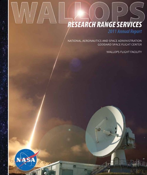
The 2011 Research Range Services Annual Report is<br />
dedicated to Jay Brown. A valuable friend and member<br />
and member of the Range, Jay retired from <strong>Wallops</strong><br />
<strong>Flight</strong> <strong>Facility</strong> in March 2011 as the Range and Mission<br />
Management Office Test Director.<br />
Jay was a multitalented person who not only directed<br />
all NASA operations on the Research Range before his<br />
retirement but also found his stress-relief by participating<br />
in the <strong>Wallops</strong> Music Club. Jay was a fixture among fellow<br />
<strong>Wallops</strong>’ musicians by playing the bass guitar and providing<br />
vocals.<br />
Jay served in the U.S. Air Force from 1966 to 1970 as an<br />
electronics technician. In 1974, Jay earned his Bachelor of<br />
Arts degree in psychology from Loyola College in Baltimore<br />
Maryland, and started his career shortly after that same year.<br />
During his 37-year <strong>Wallops</strong> career, Jay supported campaigns<br />
around the world including places such as Peru, Antarctica,<br />
Canada, Greenland, Kwajalein Atoll and Puerto Rico.<br />
Table of Contents<br />
Introduction .....................................................................2<br />
Program Management ....................................................4<br />
Operational Mission & Accomplishments .....................7<br />
Science Mission Directorate<br />
Norway RENU<br />
Poker 2011<br />
SubTEC-V SMART<br />
Daytime Dynamo<br />
Terrier Mark12 Test Launch<br />
Viking 300 UAV<br />
Human Exploration and Operations Mission Directorate<br />
SpaceX<br />
Space Shuttle<br />
Department of Defense Support ..................................18<br />
TrackEX<br />
ORS-1<br />
Patuxent River NAS<br />
TacSat-4<br />
Education and Public Outreach ....................................24<br />
WRATS<br />
USLI<br />
RockSAT-X<br />
RockOn-IV<br />
Student Tours<br />
Robotics<br />
Program Modernization ................................................28<br />
Spotlight: Taurus II ..........................................................36<br />
Looking Ahead: LADEE ..................................................38<br />
<strong>Wallops</strong>: The Way Forward ............................................40<br />
WALLOPS<br />
TABLE OF CONTENTS<br />
Page 1
WALLOPS WALLOPS<br />
INTRODUCTION<br />
INTRODUCTION<br />
Page 2<br />
This year, the Research Range Services (RRS) Program continued their long-standing tradition of<br />
delivering consistently superior support to a myriad of customers. These customers include NASA’s<br />
mission directorates, other U.S. government agencies, colleges and<br />
universities, civilian corporations and the worldwide scientific community.<br />
RRS provides tracking, telemetry, meteorological, optical, command and<br />
control and range operations services for <strong>Wallops</strong> <strong>Flight</strong> <strong>Facility</strong> (WFF),<br />
Poker Flat Research Range near Fairbanks, Alaska, and other remote<br />
locations such as the Andøya Rocket Range in Norway.<br />
RRS personnel support many flight vehicles including orbital and<br />
suborbital rockets, manned and unmanned aircraft, satellites, the Space<br />
Shuttle and research balloons. The summer was particularly busy as the<br />
Research Range provided services to launch an Air Force satellite into<br />
low-Earth orbit, assisted a university professor collecting atmospheric<br />
data, and supported multiple universities with a sounding rocket mission<br />
all within a two-week period. The RRS Program’s dedicated, experienced<br />
and highly skilled engineers and technicians assured error-free and safe<br />
Range operations for real-time capture and display of mission-specific flight,<br />
payload and science data.<br />
Systems and capabilities under the auspices of the<br />
RRS Program include:<br />
A newly developed Range Operations<br />
Management System tool which allows<br />
effective management and control of Research<br />
Range configurations and documentation,<br />
maintenance, operations scheduling, asset<br />
management and discrepancy reporting, and<br />
a new digital imaging database for all NASA<br />
employees to utilize<br />
An Optical Systems Group<br />
technician prepares high<br />
speed cameras in a mobile<br />
optical dome.<br />
A fully equipped, state-of-the-art Range<br />
Control Center with a full complement of<br />
command and control equipment as well as an<br />
extensive array of monitors to provide real-time<br />
display of all flight events<br />
An aeronautical research airport with special<br />
runway surfaces, arresting gear and restricted<br />
airspace.<br />
Fixed and mobile radar systems for tracking launch vehicles, satellites and aircraft<br />
Fixed and mobile telemetry systems to collect state-of-health and science experiment data<br />
Fixed and mobile optical and television systems<br />
Ground-based and aerial video and photography, professional archiving and printing, and postproduction<br />
services<br />
A comprehensive suite of meteorological instrumentation, radars and weather balloons used in<br />
collecting atmospheric measurements to provide real-time weather forecasts<br />
Radar frequency spectrum allocation management and coordination<br />
Master station time equipment to synchronize Range activities and data<br />
The RRS program also offers world class sustaining engineering<br />
and project management services to underwrite WFF’s widely<br />
recognized status as a flexible, full-service, customer-friendly<br />
Research Range. The RRS Program’s engineers and<br />
technicians routinely establish and verify instrumentation<br />
metrics, adapt Research Range instrumentation and<br />
optics to unique customer requirements, assist in<br />
performing root cause analyses, implement minor to<br />
moderate system upgrades, and perform link analysis<br />
calculations to ensure adequate radar, telemetry,<br />
and command support for an unparalleled diverse<br />
set of challenging <strong>missions</strong>. The RRS Program’s<br />
engineers are also leading Research Range<br />
technology development activities sponsored by both<br />
NASA and the Department of Defense to support<br />
advanced mission planning systems and new in-flight<br />
communications and safety systems.<br />
This fiscal year 2011 Annual Report highlights and<br />
spotlights the projects that continued our long track<br />
record of successfully, safely, efficiently, and professionally<br />
enabling research worldwide and of which, we, the RRS<br />
Program Team, are most proud.<br />
The FPQ-6 Radar, known<br />
locally as Radar 5, is the<br />
most powerful radar system<br />
in the RRS arsenal.<br />
Page 3
WALLOPS WALLOPS<br />
PROGRAM MANAGEMENT<br />
PROGRAM MANAGEMENT<br />
Page 4<br />
PROGRAM MANAGEMENT OVERVIEW<br />
Directorate: Science Mission Directorate<br />
Division: Heliophysics<br />
Program Executive: Ms. Cheryl Yuhas<br />
Program Manager: Mr. Steven Kremer<br />
Lead Center: Goddard Space <strong>Flight</strong> Center<br />
Performing <strong>Facility</strong>: <strong>Wallops</strong> <strong>Flight</strong> <strong>Facility</strong><br />
Program Type: Research Range Services<br />
The Range and Mission Management Office (RMMO) is a team of highly-skilled project management<br />
professionals who are charged with the responsibility of marrying the skills of scientists, engineers,<br />
technicians, and other personnel into one cohesive team whose objective is to collect data from a<br />
multitude of flight platforms and payloads.<br />
As part of the RMMO, the Research Range Services (RRS) Program supports these project managers<br />
and their <strong>missions</strong> by providing a myriad of services, such as radar and optical tracking, telemetry<br />
downlink, meteorological services, command and control, financial analysis, and engineering services<br />
to allow these <strong>missions</strong> to take place in a safe, ready environment.<br />
The RRS Program has a full roster of highly experienced Range Service Managers (RSM) who are<br />
ready to build, coordinate, and manage cohesive teams to tap the minds of engineers and involve the<br />
expertise of technicians. These teams work to configure mobile and fixed<br />
Range to provide services around the globe.<br />
All operations conducted at <strong>Wallops</strong> <strong>Flight</strong> <strong>Facility</strong> (WFF) and<br />
other remote launch ranges, such as Poker Flat Research<br />
Range near Fairbanks Alaska and Andoya Rocket Range<br />
in Norway, require state-of-the-art technologies and<br />
multimillion dollar systems to support unmanned<br />
aerial vehicles, sounding rockets, expendable launch<br />
vehicles or any other flight platform. Each operation<br />
requires a total commitment to excellence.<br />
At <strong>Wallops</strong>, effective management and integration of all aspects of mission support is where the rubber<br />
meets the road. In 2011, RRS Program personnel were responsible for Range instrumentation support<br />
for NASA orbital and sub-orbital programs and programs for other government and civilian agencies.<br />
They assured 100 percent success for a multitude of programs executed at WFF while simultaneously<br />
managing remote campaigns in Alaska and Norway and downrange tracking/command sites. Highly<br />
skilled RRS managers leave no stone unturned to:<br />
Ensure total success in meeting our customer’s requirements through risk assessment and mitigation,<br />
comprehensive operator certification, configuration management, pre-mission testing, proven<br />
operating procedures, and post-mission support.<br />
Ensure a “green range” for all <strong>missions</strong> through effective corrective and preventive maintenance for all<br />
WFF facilities and equipment.<br />
Creatively use state-of-the-art engineering expertise and technology advancements to meet new<br />
mission requirements, improve Range safety, reduce <strong>operational</strong> costs and replace obsolete<br />
equipment.<br />
Provide expertise and management skills to oversee the technical performance of contract services<br />
including setting mission priorities, ensuring sufficient staffing levels, identifying and prioritizing<br />
engineering upgrades and overseeing efforts between NASA engineering and contractor personnel.<br />
From the initial dreams of a principal investigator through the completion of data analysis, the RMMO<br />
project managers in coordination with the RRS range services managers are the glue that bonds the<br />
talents and efforts of the extended team of professionals needed to ensure successful completion<br />
of every mission. Project managers take a back seat to no one; their vision, technical expertise and<br />
management skills are truly world class.<br />
Page 5
WALLOPS<br />
PROGRAM MANAGEMENT<br />
Page 6<br />
RESEARCH RANGE SERVICES ASSETS: $231.7 MILLION<br />
Telemetry<br />
Systems<br />
Per Unit Qty Total ($M)<br />
7.3-Meter Fixed<br />
Antenna<br />
$1.5 2 $3.0<br />
7-Meter Mobile<br />
Antenna<br />
$1.5 2 $3.0<br />
Mobile Telemetry<br />
Van<br />
$1.5 1 $1.5<br />
20-Foot Mobile<br />
System<br />
$2.0 1 $2.0<br />
Mobile Super Van $2.5 1 $2.5<br />
10-Foot Mobile<br />
Antenna<br />
$1.0 2 $2.0<br />
8-Foot System $0.4 2 $0.8<br />
8-Foot Mobile<br />
Antenna<br />
$0.4 1 $0.4<br />
8-Meter Antenna $2.5 2 $5.0<br />
16-Foot System $0.5 1 $0.5<br />
9-Meter Redstone $12.0 2 $24.0<br />
9-Meter System $4.0 1 $4.0<br />
MITS $2.0 1 $2.0<br />
Atmospheric<br />
Radars<br />
Per Unit Qty Total ($M)<br />
Space Range Radar $20.0 1 $20.0<br />
Ultra High<br />
Frequency (UHF)<br />
$18.0 1 $18.0<br />
S-Band Weather<br />
(Tropical Ocean<br />
Global Atmosphere)<br />
$5.0 1 $5.0<br />
NASA Polarimetric<br />
(NPOL)<br />
$5.0 1 $5.0<br />
Tracking<br />
Radars<br />
Range Instrumentation<br />
Radar - 778C<br />
Range<br />
Instrumentation Radar<br />
- 716<br />
Range<br />
Instrumentation<br />
Radar - 706<br />
Per Unit Qty Total ($M)<br />
$6.0 4 $24.0<br />
$7.0 2 $14.0<br />
$70.0 1 $70.0<br />
Surveillance<br />
Radars<br />
Per Unit Qty Total ($M)<br />
Airport Surveillance<br />
Radar<br />
$10.0 1 $10.0<br />
Sea Surveillance $1.0 1 $1.0<br />
Pathfinder $0.7 2 $1.4<br />
Active Protective<br />
System<br />
$2.5 1 $2.5<br />
Command<br />
Support Systems<br />
Per Unit Qty Total ($M)<br />
Fixed UHF Command<br />
System<br />
$4.0 1 $4.0<br />
Mobile Command<br />
System<br />
$1.4 1 $1.4<br />
Mobile Range Control<br />
System<br />
$2.1 1 $2.1<br />
Radio Frequency<br />
Communication<br />
$3.0 1 $3.0<br />
Timing System $0.8 1 $0.8<br />
Video and Optical<br />
Systems<br />
$12.0 1 $12.0<br />
Mobile Power Systems $0.3 4 $1.2<br />
Range Control Per Unit Qty Total ($M)<br />
Range Control Center $10.0 1 $10.0<br />
Science Mission Directorate<br />
RENU Mission in Norway<br />
WALLOPS<br />
OPERATIONAL MISSIONS<br />
& ACCOMPLISHMENTS<br />
Research Range Services (RRS) personnel supported the launch of a Black Brant XII December 12, 2010,<br />
carrying the Rocket Experiment for the Neutral Upwelling (RENU) payload within the Arctic Circle at<br />
the rocket range in Andøya, Norway. The payload was designed to study electron precipitation and<br />
ion flow in the cusp of the aurora.<br />
The rocket’s fourth stage was a new Nihka Motor which had a limited flight history. RRS personnel<br />
determined due to this brief flight heritage, an off-axis tracking station was necessary in Tromsø,<br />
Norway. This additional tracking station is normally only utilized<br />
with medium-class expendable launch vehicles. RRS personnel<br />
transferred its largest and most capable telemetry antenna to track<br />
the rocket to receive, record, and display science data that was<br />
being “broadcast” from the science instruments in the payload.<br />
Working closely with Norwegian engineers and technicians, RRS<br />
personnel equipped Tromsø and Svalbard with full ground stations<br />
to provide telemetry data. This team configured telemetry systems,<br />
conducted data flows and properly trained all involved. Conducting<br />
operations in the Arctic Circle during December brings its own<br />
obstacles. During the setup, RRS crews were faced with tormenting<br />
weather conditions as the temperatures were below freezing and as<br />
hurricane force winds swept through the area.<br />
Before the launch, a crew of RRS personnel traveled between<br />
Svalbard, Andøya and Tromsø multiple times within a nine-day<br />
period to oversee telemetry systems setup, slaving system setup,<br />
conduct data flows and training, meet with international officials<br />
and support operations discussions with Norwegian officials.<br />
Prior to launch, RRS personnel conducted daily data flows, tests<br />
and satellite tracks. In addition, the mobile range took advantage<br />
of an opportunity to track another sounding rocket from Andøya.<br />
Personnel quickly set up the telemetry and supported the<br />
countdown of a German/Canadian sounding rocket, but did not<br />
track from either Andøya or Tromsø. This “test flight” proved<br />
invaluable by identifying configuration problems at the Tromsø<br />
site and helping refine the tracking concept of operations at the Andøya site. When it came time to<br />
track our primary mission, our Andøya crew tracked off the pad and the Tromsø crew acquired at T+11<br />
seconds, right on the horizon.<br />
“Telemetry support was outstanding,” said John Hickman, operations manager for the Sounding<br />
Rockets Program Office at <strong>Wallops</strong> <strong>Flight</strong> <strong>Facility</strong>. “The WFF 7 meter tracked through the Nihka plume<br />
and provided good data until loss of sight.”<br />
Page 7
WALLOPS<br />
OPERATIONAL MISSIONS<br />
& ACCOMPLISHMENTS<br />
Page 8<br />
FIRE and PolarNOx;<br />
Motor Test launch - Poker Flat Research Range Missions<br />
Science Mission Directorate<br />
For a third straight year, the Research Range Services (RRS) Program at <strong>Wallops</strong> <strong>Flight</strong> <strong>Facility</strong> supported<br />
sounding rocket launches and conducted major activities at Poker Flat Research Range near Fairbanks,<br />
Alaska. During fiscal year 2011, RRS successfully supported three sounding rocket campaigns and two<br />
maintenance trips, ensuring <strong>missions</strong> in the frozen north were never left out in the cold.<br />
During this campaign, the RRS Program demonstrated its ability to reach out and support operations<br />
around the world. In just more than a month, during the dead of winter, RRS personnel were required to<br />
relocate mobile telemetry assets used in Norway halfway around the globe to Poker Flat in time to support<br />
the 2011 winter campaign. To further complicate matters, another sounding rocket mission was planned to<br />
launch during this same time frame at the <strong>Wallops</strong> Research Range presenting a major stress on<br />
available instrumentation and operations personnel. Despite these difficulties, RRS rose to the<br />
challenge and successfully supported all three launches.<br />
While in Alaska, harsh weather conditions ruled the day with temperatures consistently<br />
dropping to -40 degrees. Every day the team was required to drive nearly an hour north<br />
of Fairbanks, braving the snow-covered, winding mountain roads to provide crucial launch<br />
support during a four-week campaign. Despite the elements, Range personnel successfully<br />
supported two launches – the Far Ultraviolet Imaging Rocket Experiment (FIRE) and the Polar<br />
Night Nitric Oxide (PolarNOx) <strong>missions</strong> – January 28, 2011, and February 5, 2011, respectively.<br />
As April arrived and the spring flowers began to pop up through the winter landscape,<br />
an unexpected mission also bloomed on the Poker schedule. A Black Brant motor test<br />
slipped onto the schedule for an April launch date. In less than two months, RRS organized,<br />
mobilized and shipped out to not only support this unexpected launch, but also to execute a<br />
maintenance mission in order to better ensure range operations for many years to come.<br />
During this maintenance trip, the RRS team corrected a problem with one of the telemetry antennas,<br />
ensuring it could better support the launch and also performed a variety of other routine maintenance<br />
procedures. When an unexpected power surge hit the range after the launch, the RRS team did what<br />
they could with their remaining time to bring all the systems back online. They very nearly succeeded,<br />
leaving only one telemetry antenna issue for a future RRS crew. During the nearly five-week<br />
campaign, this dedicated RRS team performed required maintenance activities and supported the test<br />
launch of the Black Brant motor on April 26, 2011.<br />
Always looking ahead, RRS again returned to Poker in August 2011 to install an upgrade in the<br />
communication system used throughout the range. This new system brings Poker Flat up to<br />
speed with current technology, improves maintenance capability, and has the added benefit of<br />
allowing users to tailor the communication system to their unique mission needs. Outside of the<br />
communication system upgrade, instrumentation site surveys were conducted to investigate potential<br />
upgrades and system relocations to ensure better support for all customers in the future.<br />
Science Mission Directorate<br />
FIRE<br />
LAUNCH VEHICLE: Black Brant IX<br />
MISSION: 36.257 UG (FIRE)<br />
WALLOPS ID: NRO-4938<br />
LOCATION: PFRR: Pad 3<br />
LAUNCH DATE: 28 January 2011<br />
LAUNCH TIME: 28:10:46:00Z<br />
PAYLOAD: Far-Ultraviolet Imaging<br />
Rocket Experiment<br />
(FIRE)<br />
Black Brant Motor Test<br />
LAUNCH VEHICLE: Black Brant IX<br />
MISSION: 36.278 (BBIX<br />
Motor Test)<br />
WALLOPS ID: NRO-5008/X-112-271<br />
LOCATION: PFRR: Pad 3<br />
LAUNCH DATE: 26 April 2011<br />
LAUNCH TIME: 117:08:00:00Z<br />
PAYLOAD: SRPO Diagnostic Payload<br />
WALLOPS<br />
OPERATIONAL MISSIONS<br />
& ACCOMPLISHMENTS<br />
Polar NOx<br />
LAUNCH VEHICLE: Black Brant IX<br />
MISSION: 36.256 UE<br />
(PolarNOx)<br />
WALLOPS ID: NRO-4937<br />
LOCATION: PFRR: Pad 3<br />
LAUNCH DATE: 5 February 2011<br />
LAUNCH TIME: 08:11:11Z<br />
PAYLOAD: Polar Night Nitric Oxide<br />
(PolarNOx)<br />
Page 9
WALLOPS<br />
OPERATIONAL MISSIONS<br />
& ACCOMPLISHMENTS<br />
Page 10<br />
SubTEC-V<br />
Suborbital Technology Experiment Carrier Mission<br />
Science Mission Directorate<br />
Research Range Services (RRS) personnel continued their support of the Suborbital Technology<br />
Experiment Carrier (SubTEC) mission with the launch of a Terrier-Improved Orion sounding rocket<br />
from the <strong>Wallops</strong> Research Range on June 10, 2011.<br />
This mission was the fourth flight of the SubTEC series and was configured to provide a reusable<br />
platform for development testing of sounding rocket and other technologies.<br />
The RRS Program supported the mission with a full suite of Range services which included three tracking<br />
radar assets, telemetry, optical, meteorological, command and control and other services. See Figure 1.<br />
Most sounding rockets leave <strong>Wallops</strong> launch pads without a hitch; however, range personnel faced<br />
what was classified as a misfire on June 9, 2011, as the rocket failed to ignite when commanded.<br />
Range personnel couldn’t remember the last time a misfire occurred at the Research Range, but the<br />
<strong>Wallops</strong> Test Director enacted safety protocols and directed the Launch Pad Supervisor to evaluate<br />
the misfire, determine the cause, and provide input for a possible solution.<br />
The Launch Pad Supervisor determined that the firing command never reached the vehicle – the result<br />
of a short circuit. Range personnel<br />
worked together with NASA’s Sounding<br />
Rockets Program Office to determine<br />
the vehicle was not compromised and<br />
allowed the Test Director to proceed<br />
with launch operations the next day.<br />
Figure 1: This graphic represents the RRS fixed range configuration<br />
for the SubTEC launch. This graphic enables RRS<br />
project managers to effectively communicate the range<br />
support approach to the entire <strong>Wallops</strong> community.<br />
Science Mission Directorate<br />
Range surveillance and payload<br />
recovery is another key service<br />
provided by the RRS Program.<br />
Primary investigators often<br />
need to evaluate data from<br />
the payload after the flight<br />
portion of the mission is<br />
over and in some cases, the<br />
recovered payload is often<br />
the only source of recorded<br />
data when real-time telemetry<br />
is not implemented. The<br />
RRS Program was tasked<br />
with locating the SubTEC-V<br />
payload and retrieve it from<br />
the Atlantic Ocean. Two<br />
surveillance aircraft and one<br />
recovery vessel successfully<br />
spotted and recovered<br />
the payload for a return<br />
trip to <strong>Wallops</strong> Fight<br />
<strong>Facility</strong>.<br />
WALLOPS<br />
OPERATIONAL MISSIONS<br />
& ACCOMPLISHMENTS<br />
LAUNCH VEHICLE: Terrier Improved Orion<br />
MISSION: SubTEC-V SMART<br />
WALLOPS ID: NRW-5007<br />
LOCATION: WFF: Pad 2 MRL<br />
LAUNCH DATE: 10 June 2011<br />
LAUNCH TIME: 07:16:00L<br />
PAYLOAD: NSROC TM Link 1 (2235.5)<br />
SMART TM Link 2 (2279.5)<br />
LCT2<br />
The Small Rocket/Spacecraft Technology<br />
(SMART) payload demonstrated Space<br />
Cube V1.5 avionics operations. RRS not<br />
only provided support for the sounding<br />
rocket but also supplied technology which<br />
transmitted telemetry data through<br />
NASA’s Tracking and Data Relay Satellite<br />
System (TDRSS). The Low Cost Telemetry<br />
Transceiver (LCT2) is a software-defined<br />
transceiver developed at <strong>Wallops</strong> <strong>Flight</strong><br />
<strong>Facility</strong> and enables two-way data<br />
transmission between a ground site and a<br />
launch<br />
vehicle<br />
using<br />
TDRSS.<br />
Page 11
WALLOPS<br />
OPERATIONAL MISSIONS<br />
& ACCOMPLISHMENTS<br />
Page 12<br />
Daytime Dynamo<br />
In its continued efforts to support the academic research<br />
community, the Research Range Services (RRS) Program<br />
provided services for the July 10, 2011, launch of a sub-orbital<br />
mission known as “Daytime Dynamo”, consisting of Black Brant<br />
V and Terrier-Orion sounding rockets.<br />
The sub-orbital vehicles carried payloads to study the Earth’s<br />
atmosphere and were launched only 15 seconds apart, requiring<br />
the range to configure its instrumentation to receive data from<br />
two vehicles.<br />
The Daytime Dynamo mission required very specific atmospheric<br />
conditions to gather the data required by the research team and<br />
after several counts over the preceding days, these conditions<br />
were finally met. As fate would have it, the projected launch<br />
time corresponded exactly with a pass-over of not only the<br />
International Space Station (ISS), but also the Space Shuttle and<br />
the research team said the launch could not be slipped past its<br />
currently scheduled launch time.<br />
LAUNCH VEHICLE: Black Brant V (21.141)<br />
MISSION: Daytime Dynamo<br />
WALLOPS ID: NRW-4979<br />
LOCATION: WFF: Pad 2 ARC Launcher<br />
LAUNCH DATE: 10 July 2011<br />
LAUNCH TIME: 10:00:00L<br />
PAYLOAD: TM Link 1 (2235.5)<br />
TM Link 2 (2279.5)<br />
Did You Know...<br />
The Black Brant V vehicle carried instrumentation to measure the Earth’s<br />
electric and magnetic fields, plasma and neutral density while the Terrier-<br />
Orion sounding rocket released vapor trails to provide a means to illuminate<br />
the neutral winds in the upper atmosphere.<br />
Science Mission Directorate<br />
Science Mission Directorate<br />
This challenge proved the abilities of<br />
not only the RRS crew, but also the<br />
instrumentation they operated. In the<br />
months before the mission, it was decided<br />
that five radars would be supported—<br />
three on one vehicle, two on the other. The<br />
requirement was to have at least two radars<br />
per vehicle as part of mission assurance.<br />
When the Space Station and Shuttle arrived<br />
at the party, the RRS team had to develop a<br />
plan that would allow them to support all three<br />
<strong>missions</strong>. Through the expert coordination<br />
and teamwork of the customer and RRS teams,<br />
the requirement for two tracking radars per<br />
vehicle was waived during the countdown and<br />
LAUNCH VEHICLE: Terrier-Orion (41.091)<br />
MISSION: Daytime Dynamo<br />
WALLOPS ID: NRW-4980<br />
LOCATION: WFF: Pad 2 MRL Launcher<br />
LAUNCH DATE: 10 July 2011<br />
LAUNCH TIME: 10:00:15L<br />
PAYLOAD: TM Link 1 (2215.5)<br />
TM Link 2 (2259.5)<br />
WALLOPS<br />
OPERATIONAL MISSIONS<br />
& ACCOMPLISHMENTS<br />
two radars were allowed to break away from<br />
launch support to fulfill their ISS/Shuttle<br />
<strong>missions</strong>, leaving the remaining three to track<br />
the vehicles. Of those three, two radars<br />
were assigned to track the first vehicle,<br />
leaving the last radar to stand alone and<br />
track the second vehicle.<br />
As the rockets blasted into the sky,<br />
crews and instrumentation performed<br />
outstandingly, including the stand-alone<br />
radar, allowing the research team to<br />
gather their atmospheric data and<br />
NASA to obtain the tracking data<br />
needed for the ISS and Shuttle.<br />
RRS believes in the power<br />
of teamwork and open<br />
communication and this launch<br />
provided a perfect example of<br />
what can happen when all parties<br />
work together.<br />
Page 13
WALLOPS<br />
OPERATIONAL MISSIONS<br />
& ACCOMPLISHMENTS<br />
Page 14<br />
Terrier Mark 12 Test <strong>Flight</strong><br />
In July 2011, just three months prior to Research<br />
Range Services (RRS) Program’s next sounding<br />
rocket campaign support requirement in Norway, a<br />
problem was discovered with the 1970’s era Terrier<br />
Mark 12 solid rocket – managed by the Sounding<br />
Rockets Program Office.<br />
During a refurbishment process for the 1970’s era<br />
technology, it was discovered that the motor’s<br />
propellant had undergone some shrinking. The<br />
problem resulted in out-of-length specifications and<br />
reduced the spring load on the cartridge. A solution<br />
consisting of a steel spacer plate at the fore-end of<br />
the cartridge was developed and implemented, but<br />
required a test flight to verify its functionality and<br />
characterize the modified motor’s performance.<br />
The Terrier Mark 12 Test <strong>Flight</strong> was quickly<br />
developed and carried out at the<br />
<strong>Wallops</strong> Research Range. The<br />
entire project progressed<br />
at supersonic pace<br />
from planning to<br />
LAUNCH VEHICLE: Terrier Mark 12<br />
MISSION: Modification Test <strong>Flight</strong><br />
WALLOPS ID: NRW-5046<br />
LOCATION: WFF: Pad 2 MRL Launcher<br />
LAUNCH DATE: 8 September 2011<br />
LAUNCH TIME: 09:45:00L<br />
PAYLOAD: N/A<br />
Science Mission Directorate Science Mission Directorate<br />
execution, completing launch activities less than<br />
a month from initiation. The accelerated tempo<br />
was necessary, as the tests were accomplished<br />
just in time to keep the 2011 Norway deployment<br />
on-schedule. The test flight was an unconditional<br />
success, verifying the effectiveness of the steel<br />
spacer and providing crucial data for predicting<br />
stage performance of future science <strong>missions</strong> for<br />
the customer.<br />
The Range employed both radar and telemetry<br />
assets to track the rocket, but unlike most<br />
<strong>missions</strong>, the critical portion of the trajectory<br />
was just the first 6 seconds of launch rather<br />
than near apogee. This meant that all systems<br />
needed to immediately acquire and track the<br />
Terrier Mark 12 at liftoff with no room for error.<br />
<strong>Wallops</strong> operators and instrumentation were<br />
up to the task and produced flawless vehicle<br />
telemetry and tracking data.<br />
The Terrier was the U.S. Navy’s first <strong>operational</strong> shipborne<br />
medium-range surface-to-air missile. The flight tests of<br />
the Terrier began in 1951, and the Terrier became <strong>operational</strong><br />
on Navy surface ships in 1956. It was designated the<br />
SAM-N-7 and underwent several enhancements before its<br />
eventual retirement from military service in the late 1980s.<br />
Viking 300 UAV - NASA UAV Tech Project Demonstration<br />
The smallest of the flight vehicles supported by<br />
the Research Range Services (RRS) Program is the<br />
unmanned aerial vehicle (UAV). Some of these<br />
aircraft have a wingspan of no more than 4 feet but<br />
play an important role in the collection of earth and<br />
atmospheric science information.<br />
The busiest UAV project during fiscal year 2011 was the<br />
NASA UAV Tech Project. Pilots completed flights to collect<br />
attitude and navigation data and other proficiency flights<br />
to prepare for operations for their APPLANIX, INMARSAT,<br />
mini-ATM and Photometric payloads.<br />
The Range team provided a 1,500-foot UAV runway<br />
located on the shores of the Research Range,<br />
communications, weather forecasting, frequency<br />
monitoring, air and video surveillance, and project<br />
management. The Range team remained flexible<br />
during the <strong>missions</strong> due to required flight weather<br />
conditions coupled with ongoing local Navy and Taurus<br />
II operations that impacted the availability of airspace<br />
and safe operating conditions.<br />
WALLOPS<br />
OPERATIONAL MISSIONS<br />
& ACCOMPLISHMENTS<br />
2011 <strong>Flight</strong> Dates:<br />
Oct. 7-8, 2010<br />
Feb. 16, 2011<br />
May 13, 2011<br />
Sept. 11, 2011<br />
Page 15
WALLOPS<br />
OPERATIONAL MISSIONS<br />
& ACCOMPLISHMENTS<br />
Page 16<br />
SpaceX<br />
Research Range Services (RRS) personnel continue to<br />
be at the cutting edge of addressing tomorrow’s space<br />
transportation needs. RRS joined forces with NASA’s<br />
Johnson Space Center to support SpaceX’s Commercial<br />
Orbital Transportation Services (COTS) Demonstration<br />
<strong>Flight</strong> 1, SpaceX’s first launch under NASA’s COTS<br />
Program. The two-stage Falcon 9 expendable launch<br />
vehicle took flight from Cape Canaveral, Fla., December<br />
8, 2010, to deploy the Dragon spacecraft. The<br />
Dragon’s role on future launches will be to resupply<br />
the International Space Station (ISS) with supplies and<br />
eventually carry crew members to the ISS. NASA is<br />
partnering with commercial companies like SpaceX in a<br />
symbiotic and highly productive relationship to develop<br />
and demonstrate space transportation capabilities.<br />
The Dragon spacecraft separated from the second<br />
stage and demonstrated <strong>operational</strong> communications,<br />
navigation, maneuvering and reentry capabilities. For<br />
this demonstration flight, Dragon orbited the Earth<br />
as SpaceX tested all of its systems and subsequently<br />
initiated thruster firing to begin reentry, returning the<br />
Dragon capsule to Earth for a Pacific Ocean splashdown<br />
off the coast of California.<br />
Research Range Services provided command uplink,<br />
telemetry, and radar support throughout the mission.<br />
Powerful RRS antennas provided tracking, receiving, and<br />
processing of telemetry data and video from Dragon<br />
during the launch and subsequent orbit as it passed over<br />
the Research Range. RRS played a pivotal role in mission<br />
success by providing<br />
SpaceX back-up S-band<br />
Command Uplink support<br />
for the Dragon capsule<br />
and radar tracking during<br />
the launch and ascent<br />
phase and the first orbit<br />
to the U.S. Air Force’s<br />
Eastern Range.<br />
SpaceX conducted<br />
comprehensive<br />
tests of the Dragon<br />
spacecraft as it<br />
orbited the earth.<br />
Human Exploration and<br />
Operations Mission Directorate<br />
Research Range<br />
Services personnel<br />
provided command<br />
uplink, telemetry,<br />
and radar support<br />
throughout the<br />
mission for this Falcon<br />
9 expendable launch<br />
vehicle.<br />
Human Exploration and<br />
Operations Mission Directorate<br />
Space Shuttle Missions<br />
During fiscal year 2011, Research Range Services (RRS) personnel<br />
supported the final three Space Shuttle <strong>missions</strong>. Overall, more than<br />
400 passes were tracked with valuable data transmitted to Eastern<br />
Range controllers and Johnson Space Center (JSC) navigators as part<br />
of pre-launch, launch and on-orbit mission activities.<br />
The Range’s two main radars shared the workload of simultaneously<br />
tracking the Orbiter and the ISS during the rendezvous and<br />
separation phases of the mission. Without this tracking, the mission<br />
control team would not have had an independent tracking source<br />
during those final critical minutes to make performance assessments<br />
and, if necessary, an abort determination. Prior to each launch,<br />
Range tracking radars, telemetry, and command systems personnel<br />
worked with the Eastern Range controllers, Goddard Space <strong>Flight</strong><br />
Center (GSFC) network managers and JSC navigators to ensure RRS<br />
system readiness.<br />
Voice circuits were thoroughly tested with<br />
GSFC and JSC prior to launch to ensure<br />
critical backup communications with the<br />
Orbiter in the event of an emergency.<br />
Did You Know...<br />
For most Shuttle Missions, the Research Range<br />
Services Program setup emergency landing<br />
procedures in the event the Shuttle had to land<br />
at <strong>Wallops</strong> <strong>Flight</strong> <strong>Facility</strong>. If a shuttle had to abort<br />
take off within the first 12 seconds of launch, the<br />
Orbiter could have been directed to <strong>Wallops</strong>.<br />
WALLOPS<br />
OPERATIONAL MISSIONS<br />
& ACCOMPLISHMENTS<br />
Operation Date Mission<br />
STS-133 24 Feb. 2011 -<br />
9 Mar. 2011<br />
STS-134 16 May 2011 -<br />
1 June 2011<br />
STS-135 8 July 2011 -<br />
21 July 2011<br />
Discovery’s 39th<br />
and final mission.<br />
Crew delivered<br />
the Permanent<br />
Multpurpose<br />
Module Leonardo<br />
to the ISS<br />
Endeavour’s 25th<br />
and final flight.<br />
Crew delivered the<br />
Alpha Magnetic<br />
Spectrometer<br />
and the ExPRESS<br />
Logistics Carrier to<br />
the ISS<br />
Atlantis flew the<br />
Space Shuttle<br />
Program’s final<br />
mission. Primary<br />
cargo was the<br />
Multipurpose<br />
Logistics Module<br />
Raffaello to the ISS<br />
Page 17
WALLOPS<br />
DEPARTMENT OF DEFENSE<br />
Page 18<br />
Track-Ex Navy Sounding Rocket<br />
The Research Range Services (RRS) Program supported a<br />
U.S. Navy tactical sounding rocket operation, which took<br />
flight from <strong>Wallops</strong> <strong>Flight</strong> <strong>Facility</strong>’s Research Range in the<br />
early morning hours of January 22, 2011.<br />
The Navy Aegis Readiness Assessment Vehicle Type B<br />
mission, more commonly known as ARAV-B Track-Ex, was a<br />
two-stage Terrier-Oriole sounding rocket which simulated<br />
tactical contact for Navy Fleet ship-board systems and<br />
instrumentation. Three Navy ships – USS Monterey, USS<br />
Ramage and the USS Gonzalez – participated in the exercise<br />
and all successfully tracked the missile target.<br />
Preparation and ultimate support for this mission had its<br />
challenges as RRS personnel and equipment were split<br />
between the Research Range at <strong>Wallops</strong> and the Poker Flat<br />
Research Range near Fairbanks, Alaska. Successful and<br />
simultaneous <strong>missions</strong> from one end of the country to the<br />
other displayed the range’s flexibility and mobile capabilities<br />
as radar, telemetry, optical and command and control<br />
performed flawlessly.<br />
Range instrumentation is the avenue that provides data to<br />
the RRS program and its customers to proceed with launch.<br />
With the count active and proceeding at the 90-second<br />
mark, wind speed data collected from a weather balloon<br />
radiosonde indicated winds were too strong for launch. The<br />
count was stopped until winds were at an<br />
acceptable limit.<br />
Other services provided consisted of radio<br />
frequency monitoring, range control and<br />
surveillance.<br />
LAUNCH VEHICLE: Terrier-Oriole<br />
MISSION: Navy ARAV-B Track-Ex<br />
WALLOPS ID: NRW-4967<br />
LOCATION: WFF: Pad 2 MRL Launcher<br />
LAUNCH DATE: 22 January 2011<br />
LAUNCH TIME: 01:10:00L<br />
PAYLOAD: Nose Tip (Primary)<br />
Oriole (Secondary)<br />
Did You Know...<br />
Conducting operations safely<br />
is not compromised on the<br />
Research Range. In order to<br />
keep those high standards,<br />
a new sea surveillance radar<br />
system was engineered which<br />
paid immediate dividends<br />
as it located two small<br />
vessels traveling toward the<br />
hazard area. However, the<br />
surveillance coordinator was<br />
able to make contact with<br />
the vessels to keep the Range<br />
green for launch.<br />
WALLOPS<br />
DEPARTMENT OF DEFENSE<br />
SUPPORT SUPPORT<br />
Page 19
WALLOPS<br />
DEPARTMENT OF DEFENSE<br />
Page 20<br />
Operationally Responsive Space-1 (ORS-1)<br />
The Research Range Services (RRS) Program supported the<br />
Operationally Responsive Space-1 (ORS-1) launch from Pad 0B June<br />
29, 2011, aboard a Minotaur-I vehicle. This successful mission was the<br />
fourth Minotaur to leave the shores of the Research Range in the<br />
past four years. With this mission, RRS continued its collaboration<br />
with the U.S. Air Force and Orbital Sciences Corporation.<br />
ORS-1 is the first satellite in the Department of Defense’s<br />
Operationally Responsive Space program designed to support<br />
Combatant Command operations as a directly tasked surveillance<br />
satellite. The mission focused on the quick deployment of a small<br />
satellite with innovative sensor technologies to provide real-time<br />
support to commanders in the battlefield. It incorporates a modified<br />
version of the SYERS-2 optical sensor used in the U-2 aircraft.<br />
The RRS Program employed all available range support assets<br />
to support this mission including radar, telemetry, optical,<br />
meteorological, command and control, communications, surveillance<br />
and other services. This included a deployment to Coquina, N.C.,<br />
with mobile radar, telemetry and command assets. The remote<br />
configuration was necessary at this location to acquire and relay realtime<br />
data from the launch vehicle during the second- and third-stage<br />
rocket burn while the primary assets at <strong>Wallops</strong> were attenuated<br />
by plume exhaust. Additionally, RRS coordinated with the Eastern<br />
Range to utilize the Air Force telemetry assets in Antigua to deliver<br />
real-time data.<br />
Mission success for this operation focused on weather and<br />
meteorological operations and the Range’s ability to handle weatherdriven<br />
events. Weather and meteorology services dealt admirably<br />
with very difficult weather conditions. They were able to clearly<br />
predict conditions at the pad during the first launch attempt with<br />
a powerful electrical storm approaching, thus allowing a scrub to<br />
be declared early enough for critical stand-down actions to occur<br />
before inclement weather entered the area. The storm caused<br />
equipment failures throughout the Range, including electrical damage<br />
to communication systems, the timing system, optical sensors and<br />
multiple radar systems. Despite this, RRS brought all systems back<br />
on line during pre-mission setup and the following day’s countdown<br />
proceeded nominally for all Range instrumentation.<br />
To support the comprehensive<br />
weather analysis for this<br />
mission, RRS acquired highresolution<br />
weather balloons and<br />
developed procedures for their<br />
implementation specifically to<br />
support this launch – the first<br />
use of this technology at WFF!<br />
LAUNCH VEHICLE: Minotaur-I<br />
MISSION: ORS-1<br />
WALLOPS ID: W-23-820<br />
LOCATION: WFF: Pad 0B<br />
LAUNCH DATE: 29 June 2011<br />
LAUNCH TIME: 23:09:00L<br />
PAYLOAD: ORS-1 Spacecraft<br />
WALLOPS<br />
DEPARTMENT OF DEFENSE<br />
SUPPORT SUPPORT<br />
Page 21
WALLOPS<br />
DEPARTMENT OF DEFENSE<br />
Page 22<br />
Patuxent River Aircraft Support<br />
Research Range Services (RRS) personnel continued to provide<br />
support to the research, test, development, and evaluation of<br />
various aircraft and instruments that are owned and operated by the<br />
Naval Air Warfare Center Aircraft Division (NAWCAD) at Patuxent<br />
Naval Air Station, Md. The <strong>Wallops</strong> Research Range boasts of a fullservice<br />
airport with two 8,000-foot runways and routinely supports<br />
aircraft such as the F-18, F-35, P-8, MH-60 and Search and Rescue<br />
(SAR) helicopters.<br />
<strong>Wallops</strong> <strong>Flight</strong> <strong>Facility</strong> has supported the Navy with ongoing projects<br />
since 1996. During the course of the past year, 903 flight events<br />
spanning 271 days were supported by RRS.<br />
RRS provides project management, engineering, range<br />
instrumentation, airfield support, operations day coordination, and<br />
products necessary to meet the Navy’s requirements. The aircraft<br />
are provided with daily telemetry data capture/relay, fuel and air<br />
traffic management six days a week. On occasion, certain <strong>missions</strong><br />
also require radar, command, communications and frequency<br />
monitoring services.<br />
TacSat-4 Support<br />
The Range and Mission Management Office (RMMO)<br />
supported the launch of TacSat-4 from the Kodiak Launch<br />
Complex, Kodiak, Alaska, on September 27, 2011. RMMO<br />
provided project management and coordinated flight and<br />
ground safety services for the U.S. Air Force customer. The<br />
payload was a U.S. Navy communications satellite which was<br />
placed into low-Earth orbit aboard a Minotaur IV+ expendable<br />
launch vehicle.<br />
TacSat 4 is the fourth in a series of U.S. military experimental<br />
reconnaissance and communication satellites. The TacSat<br />
spacecrafts are designed to allow military commanders on a<br />
battlefield to request and obtain imagery and other data from<br />
a satellite as it passes overhead. Collected data will be delivered<br />
to field commanders in minutes rather than hours or days.<br />
This is the second Minotaur mission<br />
supported by <strong>Wallops</strong> from the Kodiak<br />
Launch Complex. Both <strong>missions</strong> were<br />
sponsored by the Operationally Responsive<br />
Space (ORS) office.<br />
WFF <strong>Flight</strong> Safety was lead on both<br />
<strong>missions</strong> using the Kodiak Range Safety<br />
Telemetry System (RSTS). All prelaunch<br />
documentation and testing was performed<br />
using WFF procedures and processes.<br />
WALLOPS<br />
DEPARTMENT OF DEFENSE<br />
SUPPORT SUPPORT<br />
Page 23
WALLOPS WALLOPS<br />
Page 24<br />
EDUCATION<br />
& PUBLIC OUTREACH<br />
EDUCATION & PUBLIC OUTREACH<br />
The Range Research Services (RRS) Program has historically participated in developing future astronauts,<br />
engineers and technicians. Each year, many universities launch rockets carrying various payloads to<br />
introduce students to rocketry and science data collection . These two programs are supported to further<br />
the education of curious minds and introduce students to the world of technology. Other initiatives are<br />
created to introduce America’s youth to the high-tech world of NASA. The following operations and<br />
programs were conducted in the past year to excite and motivate the nation’s next generation.<br />
<strong>Wallops</strong> Rocketry Academy for Teachers and Students:<br />
July 14-15, 2011<br />
With the increasing importance of Science, Technology, Engineering and Math (STEM) education, the<br />
Sounding Rockets Program Office (SRPO) is interested in supporting the local education community<br />
by establishing a rocketry workshop program, the <strong>Wallops</strong> Rocket Academy for Teachers and Students<br />
(WRATS). After conducting a pilot program in the summer of 2010, with the NASA Sounding Rocket<br />
Operations Contract (NSROC) interns, the workshops now offer annual school participation. During<br />
the three- to five-day workshops, participants build, test and fly model rockets. The intent of the<br />
workshops is to familiarize students and faculty with using model rockets as educational tools.<br />
The launch window for the WRATS program was scheduled with the <strong>Wallops</strong> <strong>Flight</strong> <strong>Facility</strong> Test Director<br />
and all appropriate supporting personnel including the Research Range Services (RRS) Air Traffic<br />
Control Tower. The model rockets launched from a suitable location on the airfield.<br />
The vehicles used in the WRATS program are standard model rockets, constructed to the<br />
manufacturer’s specifications by the participating students and teachers. Other vehicles to be used<br />
for the program will be either various ESTES model rockets or the HV ARCAS scale model of the ARCAS<br />
sounding rocket, manufactured by Aerotech.<br />
University Student<br />
Launch Initiative (USLI)<br />
The Research Range Services (RRS)<br />
Program provided Range services to the<br />
University Student Launch Initiative (USLI)<br />
for Level 2 rockets launched May 21, 2011.<br />
RRS support included optical tracking<br />
and high speed video, timing, frequency<br />
monitoring, two prime tracking radars<br />
and one backup, airspace surveillance, sea<br />
surface surveillance and weather office<br />
information.<br />
LAUNCH VEHICLE: MCC High-Powered Model<br />
Rocket<br />
MISSION: USLI - Level 2 (Mitchell<br />
Community College<br />
WALLOPS ID: NRW-4984<br />
LOCATION: WFF: Pad 2 MRL<br />
LAUNCH DATE: 21 May 2011<br />
LAUNCH TIME: 141: 1620+05z<br />
LAUNCH VEHICLE: MSU High-Powered<br />
Model Rocket<br />
MISSION: USLI - Level 2 (Mississippi<br />
State University)<br />
WALLOPS ID: NRW-4983<br />
LOCATION: WFF: Pad 2 MRL<br />
LAUNCH DATE: 21 May 2011<br />
LAUNCH TIME: 141: 1858+05z<br />
RockSat-X: July 21, 2011<br />
LAUNCH VEHICLE: “Aethon” High-Powered<br />
Model Rocket<br />
MISSION: USLI - Level 2 (Univ. of<br />
Alabama - Huntsville<br />
WALLOPS ID: NRW-4985<br />
LOCATION: WFF: Pad 2 MRL<br />
LAUNCH DATE: 21 May 2011<br />
LAUNCH TIME: 141: 1431+03z<br />
Each school participated in a lottery to<br />
determine launch sequence: University<br />
of Alabama Huntsville won and launched<br />
first without incident with their vehicle<br />
reaching apogee at 12,346 feet. Mitchell<br />
Community College, Statesville, N.C.,<br />
successfully launched its rocket second<br />
reaching apogee at 4,648 feet, and<br />
finally the Mississippi State University<br />
team successfully launched, and their<br />
vehicle reach an altitude of 7,776 feet.<br />
All three payloads were successfully<br />
recovered offshore by the Range’s<br />
surveillance and recovery team and<br />
returned to the student teams for<br />
analysis.<br />
EDUCATION<br />
& PUBLIC OUTREACH<br />
RRS provided support and Range services to a Terrier-Improved Orion July 21, 2011. RRS support included<br />
optical, timing, frequency monitoring, two prime tracking radars and one backup, telemetry downlink, air<br />
and sea surveillance consisting of two ships and two aircraft and meteorological data.<br />
LAUNCH VEHICLE: Terrier Improved Orion<br />
MISSION: RockSat X<br />
WALLOPS ID: NRW-5013<br />
LOCATION: WFF: Pad 1<br />
LAUNCH DATE: 21 July 2011<br />
LAUNCH TIME: 07:58:00L<br />
PAYLOAD: TM Link 1 (2235.5)<br />
TM Link 2 (2279.5)<br />
Recovery was provided using the contract vessel Thomas Reed,<br />
with both aircraft attempting to locate the payload and dye<br />
markers. Onboard the vessel was a reporter from a Salisbury,<br />
Maryland news station. Clouds in the area severely hampered the<br />
ability of the aircraft to locate the payload; however, personnel on<br />
the Thomas Reed were able to spot and retrieve the payload.<br />
Page 25
WALLOPS<br />
& PUBLIC OUTREACH<br />
Page 26<br />
EDUCATION<br />
RockOn-IV: June 23, 2011<br />
RRS provided <strong>operational</strong> support for the RockOn-IV mission,<br />
which is a myriad of college students coming together for one<br />
mission. RockOn-IV is an annual, recurring mission associated<br />
with the RockOn workshop held at NASA Goddard Space<br />
<strong>Flight</strong> Center’s <strong>Wallops</strong> <strong>Flight</strong> <strong>Facility</strong> (WFF) each summer.<br />
This workshop provides college students and instructors with<br />
a hands-on, university-level rocket flight training experience.<br />
The workshop is a collaborative effort by the Colorado Space<br />
Grant Consortium (CSGC), the Virginia Space Grant Consortium<br />
(VSGC) and WFF. A two-stage Terrier-Improved (Mk12) Orion<br />
sounding rocket was used to transport student payloads and<br />
was successfully launched June 23, 2011.<br />
The RRS support included precision tracking radar,<br />
range timing and communications, radio frequency<br />
monitoring, sea and air surveillance, range<br />
data processing and display, payload recovery,<br />
meteorological data, and optical tracking.<br />
The RockOn-IV Terrier-Improved Orion reached an<br />
altitude of 392,583 feet.<br />
LAUNCH VEHICLE: Terrier M12 - Improved<br />
Orion<br />
MISSION: RockOn-IV<br />
WALLOPS ID: W-113-838<br />
LOCATION: WFF: Pad 1 50K<br />
LAUNCH DATE: 23 June 2011<br />
LAUNCH TIME: 174: 10:1759Z<br />
PAYLOAD: Student RockSAT-C & W<br />
Experiment Canisters<br />
Shaping Tomorrow’s Engineers<br />
WALLOPS<br />
EDUCATION<br />
& PUBLIC OUTREACH<br />
The Research Range Services (RRS) Program routinely invites local students, from elementary school<br />
through university, to help shape tomorrow’s engineers, medical professionals, and yes, maybe even<br />
the country’s next astronaut! This past fiscal year, RRS has educated 595 students during 25 tours<br />
of <strong>Wallops</strong> <strong>Flight</strong> <strong>Facility</strong>. The students are introduced to the scientific facilities on base, put their<br />
hands on hardware being fabricated for upcoming <strong>missions</strong>, and even get to participate in a launch<br />
countdown so they understand the intricacies of putting a launch vehicle in the air.<br />
Students come from all walks of life including local elementary schools, the Boy Scouts, Civil Air Patrol<br />
and numerous colleges. RRS project managers and other NASA employees routinely volunteer their<br />
time during the duty day to share their career experiences at <strong>Wallops</strong> for the tour members.<br />
Schools:<br />
Stephen Decatur Middle School<br />
Moravian Academy<br />
White Marsh Elementary<br />
Baylake Pines School<br />
Salisbury Middle School<br />
University of Maryland Eastern Shore<br />
Worcester Preparatory School<br />
Salisbury Baptist Academy<br />
Children’s Groups:<br />
Marine Science Consortium<br />
Eastern Shore Rocketry Challenge<br />
Reach for the Stars<br />
Salisbury University Science Camp<br />
Virginia Spaceflight Academy<br />
Boy Scouts of America<br />
Civil Air Patrol Cadets<br />
NASA Develop Team<br />
Page 27
WALLOPS<br />
EDUCATION<br />
& PUBLIC OUTREACH<br />
NASA Robotics<br />
Robot 3389, a product of students at Parkside High<br />
School in Salisbury, Maryland, competes at the<br />
Chesapeake Regional March 19, 2011.<br />
Another NASA program for young people<br />
is the NASA Robotics Alliance Project,<br />
which was designed to inspire students<br />
to pursue careers in Science, Technology,<br />
Engineering, and Math (STEM) through<br />
robotic competitions and activities. Since<br />
the program has a small budget, RRS<br />
stepped in to provide logistical support to<br />
transport technical equipment for a for a For<br />
the Inspiration and Recognition of Science<br />
and Technology (FIRST) Robotics team to<br />
Baltimore for a competition.<br />
Travel for the robotics program can drain<br />
finances quickly. RRS again stepped in to<br />
provide technical assistance and equipment<br />
for a sponsored video-game tournament held<br />
at <strong>Wallops</strong> in April 2011. The tournament was sponsored by the NASA House Team 1829 to raise funds.<br />
RRS also provided extra support by driving a 15-passenger van to St. Louis from April 27 to May 2, 2011,<br />
to assist the robotics program participating in the FIRST Robotics World Championship.<br />
RRS prides itself in outreach to students to help spark interest in the minds of young people who<br />
might be looking for a career in space or science. Since the robotics program has a difficult time<br />
finding organizations to assist their cause with resources, time and personnel, RRS will continue to<br />
assist this initiative.<br />
Students from around the Delmarva Peninsula attend the For the Inspiration and Recognition of<br />
Science and Technology (FIRST) robotics competition at the Chesapeake Regional March 19, 2011.<br />
ROMS<br />
WALLOPS<br />
PROGRAM MODERNIZATION<br />
The Range Operations Management System (ROMS) provides a “one stop shop” for information<br />
management and access to applications used within the Research Range Services (RRS) Program. The<br />
ROMS application cloud serves RRS personnel as a launch pad for applications used to maintain and<br />
operate Range assets, as well as record and control mission and project planning. RRS management<br />
access the ROMS to establish task orders and assign projects to the Range Operations Contract (ROC).<br />
ROMS is also a growing repository of information for the work performed within the RRS. The Range<br />
schedule and launch activity is reported within the scheduling services. Range asset status is reported<br />
from the Maintenance and Asset management system combined with the discrepancy reporting<br />
system – both contained in the ROMS.<br />
The ROMS structure permits growth and development as information needs expand in the RRS.<br />
There are several new developments underway to improve cost, schedule, risk, and task planning and<br />
management. ROMS is also used to research past projects in its document repository and Lessons<br />
Learned Library soon to be released.<br />
Page 28 Page 29
WALLOPS<br />
PROGRAM MODERNIZATION<br />
Video Distribution<br />
Taurus II launch operations required a more sophisticated video distribution<br />
system capable of transmitting HD-SDI video formats from Launch Pad 0A to the<br />
Launch Control Center (LCC) and ultimately to the Range Control Center (RCC).<br />
The Video Working Group, led by RRS personnel, engineered a new fiber-based<br />
system capable of distributing up to 48 video signals with extremely low latency.<br />
The LCC receives the video signals from Pad 0A and distributes that to four critical<br />
view stations for safety officials and engineers to make real-time decisions during<br />
the launch countdown. The video is then regenerated for the fiber system and<br />
sent to the RCC and ultimately the base cable television system.<br />
Video Recording<br />
Distributing the video during the countdown is critical; however, all signals must<br />
be recorded in case forensic analyses are required post launch. Once again the<br />
RRS Video Working Group engineered a system capable of ingesting 40 HD-SDI<br />
native video formats and recording. Once the video is collected, the new system<br />
is capable of coding the video in numerous formats to meet the needs of the<br />
Range. For instance, the recording system feeds the analog video switch for<br />
video distribution in the Range Control Center while<br />
simultaneously sending a digital format to the to the<br />
cable television head end unit for dissemination basewide<br />
and to other video feeds within the NASA office<br />
of Communications System.<br />
The recording system also acts as a storage location<br />
until post processing of all recorded sources is<br />
conducted. Once all deliverables are met, RRS<br />
technicians will ready the recording system for the<br />
next operation.<br />
Telemetry<br />
Telemetry capability has been upgraded throughout the Range in order to<br />
support the requirements of processing five simultaneous links of data from<br />
the launch vehicle. This includes upgrades to receiving, processing, routing and<br />
recording capability at WFF Fixed Telemetry, Telemetry Readout, and mobile<br />
systems at both Coquina, N.C. and Bermuda locations.<br />
The Mobile Integrated Telemetry System (MITS) will provide the Research<br />
Range the capability to track, receive, process and record up to five telemetry<br />
links. MITS will be integrated with one of the mobile 7-meter telemetry antenna<br />
systems and be located in Bermuda to support TII operations, but is also a<br />
self-contained telemetry system that can be deployed on mobile campaigns<br />
supporting other Research Range <strong>missions</strong> around the globe. The system<br />
incorporates the latest in technology including a new antenna control unit,<br />
telemetry receivers, bit synchronizers, IRIG-B chapter 10 telemetry recorders<br />
and telemetry over IP gateway processors. Research Range Services personnel<br />
completed this challenging project from conception to design to <strong>operational</strong><br />
readiness in less than 10 months.<br />
Fixed telemetry processors are also being replaced in order to convert the primary<br />
vehicle data link parameters into the proper format for tracking data and safety<br />
display. The engineering work has been completed to confirm this new capability<br />
and testing is underway.<br />
WALLOPS<br />
PROGRAM MODERNIZATION<br />
Page 30 Page 31
WALLOPS<br />
PROGRAM MODERNIZATION<br />
Range Timing<br />
The range timing system has been upgraded to provide expanded capability. A<br />
completely new system is in development, including improved clock displays and<br />
timing generators, which will allow the range to process and display multiple<br />
formats for both Universal Time Code and Program Time to support mission<br />
operations.<br />
Weather Systems<br />
RRS completed efforts to expand the weather forecasting capabilities by<br />
obtaining remote weather systems and integrating those with the existing WFF<br />
system. These remote systems are to be deployed to Coquina, N.C. and other<br />
remote support sites to provide downrange conditions to the launch team.<br />
Furthermore, improvements to the Leading Environmental Analysis and Display<br />
System (LEADS) allow these additional sensors to be displayed and greatly<br />
improves the graphical interface for all weather data.<br />
Marine Band Radio Upgrade<br />
RRS completed the installation, testing, and documentation<br />
of the new Marine Band Radio System. This system was<br />
used on all <strong>missions</strong> during the last six months and improves<br />
performance during surveillance operations to ensure<br />
reliable communications up to a range of more than 70 miles.<br />
Radar Boresight Trigger and Control<br />
RRS completed the Radar 18 bore sight trigger and control upgrade by enhancing the<br />
system control over a more reliable fiber network instead of the previous unreliable buried<br />
copper network. This system was used for shuttle support, so a reliable solution was needed.<br />
In collaboration with other NASA codes, the RRS team led the group to complete the project and<br />
minimized the loss of range availability.<br />
<strong>Wallops</strong> MOVE<br />
The Research Range Services (RRS) Program upgraded voice communications<br />
with a Mission Operations Voice Enhancement (MOVE) system at Poker Flat<br />
Research Range (PFRR) near Fairbanks, Alaska. RRS engineers selected a<br />
state of the art, commercial-off-the-shelf product capable of meeting all voice<br />
conferencing and voice recording requirements.<br />
WALLOPS<br />
PROGRAM MODERNIZATION<br />
The purpose of the Mission Operations Voice Enhancement (MOVE) Project is to replace existing<br />
mission voice system with Commercial Off-the-Shelf (COTS) products suitable to meet the mission<br />
voice conferencing and voice recording requirements at all NASA Centers and locations.<br />
The newly updated communications system now has a robust architecture for managing voice<br />
conferencing to provide improved mission support. Mission voice systems now meet the high<br />
availability and expectations required for mission critical infrastructure. The systems have a built-in<br />
expansion capability sufficient to support the expected increase in required voice services for no less<br />
than 10 years of continued mission operations.<br />
The system is controlled and configured locally. Interfaces are standards-based, leveraging the<br />
advantages of future technology while providing for transition from today’s legacy systems in a<br />
manner that minimizes impact to system users.<br />
The <strong>Wallops</strong> Research Range Services personnel successfully completed the installation of the MOVE<br />
digital voice system at the <strong>Wallops</strong> Research Range. This enhancement to the range’s communication<br />
system will supply <strong>missions</strong> reliable communications required during countdowns and daily<br />
operations at the <strong>Wallops</strong> Research Range.<br />
Poker MOVE<br />
The PFRR installation challenged RRS engineers due to the range’s remote location and extreme<br />
weather conditions. RRS project managers worked the planning phase to ensure a smooth<br />
installation process during a relatively small window that began in April 2011. This gave engineers and<br />
technicians a 4- to 5-month schedule to install the entire new infrastructure before the start of the<br />
Alaskan winter when temperatures routinely dip below 40 degrees Fahrenheit.<br />
The MOVE system was installed in July 2011, and the remaining infrastructure installation was<br />
completed during the PFRR summer maintenance trip in late Summer 2011.<br />
This upgrade at PFRR will supply the range with reliable communications required during mission<br />
countdowns and reliable communications during daily operations.<br />
Page 32 Page 33
WALLOPS<br />
PROGRAM MODERNIZATION<br />
Low Cost OFDM Transceiver<br />
The RRS Technology Development Group continued the development of the Low Cost Orthogonal<br />
Frequency-Division Multiplexing Transceiver (LCOT). The goal of this project is to develop a low-cost<br />
transmit and receive communication system providing Orthogonal Frequency-Division Multiplexing<br />
(OFMD) modulation on a flight proven platform to be used for aeronautical telemetry.<br />
The previous transmit-only communication systems utilized a Xilinx Virtex II FPGA used for<br />
baseband data filtering and unit monitor and control. An upgraded board based on a Xilinx Virtex<br />
4 FPGA has been designed and built that incorporates<br />
both transmit and receive capability. This LCOT<br />
module transmits Orthogonal Frequency-Division<br />
Multiplexing signals at 10 watts out through a<br />
custom high power amplifier and conforms to the<br />
IEEE 802.11.g spectral mask.<br />
Autonomous <strong>Flight</strong> Safety System<br />
The main building blocks of the LCOT module<br />
are the DC/DC converter, mezzanine board,<br />
transceiver board and the high power amplifier.<br />
The RRS personnel have focused their<br />
efforts this year on bringing together all the<br />
subsections of the LCOT module so that the<br />
interface between them is seamless. After<br />
completion of all the subsection testing, the<br />
final module configuration will be tested and<br />
then delivered tothe customer, the U.S. Air<br />
Force, for flight testing at Edwards AFB.<br />
The RRS Technology Development Group continued to provide engineering services for the<br />
development of the Autonomous <strong>Flight</strong> Safety System (AFSS) throughout fiscal year 2011. The AFSS<br />
is a NASA project to develop algorithms and software for an autonomous onboard system that can<br />
augment or replace the function of the traditional human-in-the-loop ground commanded flight<br />
termination Range Safety System.<br />
The goal of this project is to develop an autonomous flight termination system meeting the<br />
requirements of the Range Commanders Council for autonomous systems, RCC-319.<br />
The software is currently undergoing independent verification and validation at the NASA IV&V<br />
facility. The team is also working with other agencies and companies to develop commercially<br />
available flight hardware systems to host the software.<br />
WALLOPS<br />
PROGRAM MODERNIZATION<br />
Next Generation SmallSAT Low Cost Telemetry Transceiver<br />
The RRS technology development group continues to support the SmallSAT project with<br />
the objective of providing a new more efficient amplifier design to be used for powerlimited<br />
<strong>missions</strong>, such as UAVs. During fiscal year 2011, RRS successfully prototyped the<br />
newly-designed power amplifier and recently started final testing and layout. This design<br />
reduces the typical DC power consumption by almost 50 percent. With the ability to apply<br />
lessons learned from challenges<br />
faced in the past, the project team<br />
prototyped each individual stage of<br />
the power amplifier obtaining more<br />
accurate S-parameter measurements<br />
to compare to the vendor provided<br />
S-parameters. This approach ensured<br />
accuracy through the use of scientific<br />
techniques.<br />
Graphic detailing the circuit<br />
board layout from the<br />
power amplifier design.<br />
Page 34 Page 35
WALLOPS<br />
SPOTLIGHT<br />
Page 36<br />
Taurus II<br />
Range development and support for the Taurus<br />
II mission continues to be a prime focus for<br />
Research Range Services (RRS). In 2008, <strong>Wallops</strong><br />
<strong>Flight</strong> <strong>Facility</strong> (WFF) was selected to host the<br />
new Orbital Sciences Corporation vehicle as part<br />
of NASA’s Commercial Orbital Transportation<br />
Services (COTS) contract to resupply the<br />
International Space Station (ISS) following the<br />
last mission by the Space Transportation System<br />
(Space Shuttle) in July 2011.<br />
The first test flight of the new launch vehicle is<br />
currently scheduled to occur in February 2012.<br />
Weighing 240,000 kilograms and able to insert<br />
a 7,000 kilogram payload into low-Earth orbit,<br />
Taurus II will be the largest launch vehicle to ever<br />
ascend from the Research Range. Further demonstration and <strong>operational</strong> <strong>missions</strong> will follow this<br />
test in 2012, incorporating the Cygnus spacecraft, designed to dock with and resupply the ISS with<br />
up to 2,000 kilograms of cargo each mission.<br />
During the past year, RRS promptly responded to the continuously expanding scope of the Taurus II<br />
program. While making tremendous progress and meeting key milestones towards the completion<br />
of all newly developed Range upgrades, RRS has also been heavily engaged in <strong>Wallops</strong> support of the<br />
Taurus II ground operations, which are now ramping up as the facility buildup has neared completion.<br />
During this time, WFF completed construction and activation of the Horizontal Integration <strong>Facility</strong><br />
(HIF), the upgrade and activation of the Payload Processing <strong>Facility</strong> (PPF), and the retro-fitting<br />
of the Hypergolic Fueling <strong>Facility</strong> (HFF). RRS also enhanced range capabilities by improving the<br />
Launch Control Center and Range Control Center to support the more demanding testing and<br />
launch countdown operations forTaurus II.<br />
The Taurus II Stage One Core is delivered to the Horizontal<br />
Integration <strong>Facility</strong> on the Research Range.<br />
WALLOPS<br />
SPOTLIGHT<br />
With the activation of the HIF, RRS was able to accept delivery of Taurus II launch vehicle cores for<br />
the first and second <strong>missions</strong>. These vehicles are currently undergoing integration processing at the<br />
HIF to prepare them for their eventual delivery to Launch Pad 0A via a Transporter Erector/Launcher<br />
(TEL) and subsequent launch.<br />
As part of the countdown of the first Taurus II launch, the TEL Pathfinder operation was conducted in<br />
October 2011. The TEL rolled out of<br />
the HIF carrying a simulated Stage<br />
1 and made the 1 mile journey to<br />
Launch Pad 0A. The mass simulator<br />
was raised to the vertical position<br />
on the pad, validating both the<br />
TEL hydraulic systems and the pad<br />
interfaces including electrical, fuel,<br />
air conditioning, and the rapid retract<br />
system for launch.<br />
Another exciting milestone was met with the arrival of an enormous Antonov An-26 aircraft<br />
delivering the first Cygnus Pressurized Cargo Module (PCM) in August. The PCM is the component of<br />
the Cygnus spacecraft that holds the materials slated for delivery to ISS. It is currently undergoing<br />
testing in the Payload Processing <strong>Facility</strong> where it is to be mated to the Cygnus service module,<br />
scheduled for arrival in January 2012.<br />
The Taurus II TEL Pathfinder test core is<br />
transported to Pad 0A for vertical testing.<br />
Page 37
WALLOPS<br />
LOOKING AHEAD<br />
Page 38<br />
LADEE<br />
NASA’s Lunar Atmosphere and Dust Environment Explorer<br />
<strong>Wallops</strong> Research Range is destined to be the launch range for NASA’s Lunar Atmosphere and Dust<br />
Environment Explorer (LADEE) mission scheduled to be conducted in 2013. The payload will orbit<br />
the moon to characterize the atmosphere and lunar dust environment. LADEE will gather detailed<br />
information about conditions near the surface and environmental influences on lunar dust. A thorough<br />
understanding of these influences will help researchers predict how future lunar exploration may shape<br />
the moon’s environment and how the environment may affect future explorers. It will also help scientists<br />
understand other planetary bodies with exospheres, or very thin atmospheres, like the moon.<br />
The LADEE mission represents several unique opportunities and challenges. NASA is taking on several<br />
roles with this mission including launch customer, mission integrator, and the launch range. This<br />
mission marks the maiden flight of the U.S. Air Force’s Minotaur V Launch Vehicle. The Minotaur V<br />
concept leverages the Orbital Sciences Corporation’s flight proven heritage for avionics, structures,<br />
and fairing with relatively minor changes to create the five-stage configuration. The LADEE<br />
Observatory spacecraft is equipped with a hypergolic propulsion system for lunar orbital insertion.<br />
These types of propulsion systems are driving facility modifications to multiple buildings located on the<br />
<strong>Wallops</strong> Research Range. The LADEE mission’s launch trajectory may also require that NASA extends<br />
its instrumentation coverage across the entire Atlantic Ocean.<br />
Research Range Services (RRS) personnel are working to meet these challenges through development<br />
of mission requirements, coordination of support plans with multiple organizations, and providing<br />
system engineering expertise. While still in the planning phase, the RRS program is playing a pivotal<br />
role in shaping the LADEE program.<br />
LAUNCH VEHICLE: Minotaur V<br />
MISSION: NASA LADEE<br />
WALLOPS ID: NRW-4791<br />
LOCATION: MARS Launch Pad 0B<br />
LAUNCH DATE: May 2013<br />
PAYLOAD: LADEE Observatory<br />
WALLOPS<br />
LOOKING AHEAD<br />
The LADEE mission seeks to achieve three major scientific goals: Determine the global density,<br />
composition, and time variability of the fragile lunar atmosphere before it is perturbed by further<br />
human activity; Determine if the Apollo astronaut sightings of diffuse emission at many kilometers<br />
above the surface were sodium glow or dust and; Document the dust impactor environment (sizefrequency)<br />
to help guide design engineering for the outpost and also future robotic <strong>missions</strong>.<br />
Page 39
WALLOPS<br />
THE WAY FORWARD<br />
Page 40<br />
Our Direction of Progress<br />
Over the past six decades, <strong>Wallops</strong> <strong>Flight</strong> <strong>Facility</strong> has continually demonstrated flexibility and<br />
adaptability in meeting the aerospace research needs of the United States. <strong>Wallops</strong> Research<br />
Range embodies key characteristics that enable the pursuit of emerging opportunities in an<br />
evolving aerospace environment. The emergence of commercial space sector capabilities to serve<br />
U.S. civil and national security needs for low earth orbit transportation, a recommitment and focus<br />
on low cost and efficient operations, and expanding science and technology markets positions<br />
<strong>Wallops</strong> Research Range for growth like no other launch, test, and evaluation facility.<br />
<strong>Wallops</strong> Research Range’s strategy for future growth can be described at a high level by three<br />
distinct eras. The Expansion and Optimization Era will be characterized by <strong>Wallops</strong> Research<br />
Range’s focus on expanding its customer and mission base. The research range will work to<br />
optimize planning processes and enhance its capabilities to support aeronautic, suborbital, and<br />
orbital test, evaluation, and <strong>operational</strong> <strong>missions</strong>. During the Modernization and Mobility Era,<br />
<strong>Wallops</strong> Research Range’s fixed and mobile infrastructure and instrumentation will be modernized.<br />
<strong>Wallops</strong> Research Range’s efforts in this era will enable it to offer better range services to a broader<br />
set of customers and <strong>missions</strong>, especially in aeronautics and medium lift orbital transportation. In<br />
the Virtual Era, <strong>Wallops</strong> Research Range will pursue integration of technology to enhance range<br />
flexibility and operability. This will enable more diverse and demanding operations that fall in line<br />
with evolving customer needs for global and temporal range capabilities with minimal ground<br />
infrastructure.<br />
Expansion & Optimization Era<br />
• Expand Presence in the Atmospheric, Sub Orbital, and Orbital<br />
Space <strong>Flight</strong> Markets Through Targeted Customer Growth<br />
• Enhance Capabilities for <strong>Flight</strong> and Ground System Test,<br />
Evaluation, and Operations<br />
• Standardize Processes for Launch Services and Range Support<br />
• Harness and Transfer Technology and Skills<br />
Modernization & Mobility Era<br />
• Improve <strong>Facility</strong> Infrastructures<br />
• Advancements in Mobile Tracking & Telemetry Capabilities<br />
• Expansion of Launch Support Assets<br />
• Upgrades to Meet Space Transportation Needs<br />
• Technology Insertion<br />
Virtual Era<br />
• Long-Duration, Instrumented, Mobile Assets,<br />
Seamlessly Integrated and Deployed<br />
• Centralized, Remote Network-enabled Planning,<br />
Scheduling, Coordination and Decision Support<br />
• Satellite-enabled Tracking, Telemetry, Command,<br />
Control, and Communications<br />
3-5 Years 5-10 Years 10 Years & Beyond<br />
WALLOPS<br />
THE WAY FORWARD<br />
To fully realize its future potential, <strong>Wallops</strong> Research Range will pursue five strategic goals that<br />
align with these eras and position <strong>Wallops</strong> Research Range to capture current and emerging<br />
opportunities. The time is now to take action and align <strong>Wallops</strong> Research Range to meet these new<br />
demands and opportunities.<br />
<strong>Wallops</strong> Research Range will pursue the following strategic goals to meet the current and evolving<br />
future aeronautic, suborbital, and orbital flight project needs of government, academic, and<br />
commercial customers:<br />
STRATEGIC GOAL #1<br />
STRATEGIC GOAL #2<br />
STRATEGIC GOAL #3<br />
STRATEGIC GOAL #4<br />
STRATEGIC GOAL #5<br />
Expand <strong>Wallops</strong> Research Range’s test and evaluation<br />
customer base through growth in targeted areas aligning<br />
with the research range’s mission and capabilities.<br />
Enhance positioning as an <strong>operational</strong> orbital<br />
transportation launch range for select government and<br />
commercial organizations.<br />
Ensure customer satisfaction through <strong>operational</strong><br />
excellence and adaptability.<br />
Modernize research range infrastructure and<br />
instrumentation to support evolving customer and<br />
mission requirements.<br />
Maintain and enhance work force excellence through<br />
increased recruitment and training, and hands-on<br />
experience opportunities.<br />
Page 41
WALLOPS<br />
THE WAY FORWARD<br />
Page 42<br />
Alignment of <strong>Wallops</strong> Research Range Strategic Goals with Future Growth Eras<br />
The five strategic goals focus on positioning <strong>Wallops</strong> Research Range for successful growth in the<br />
three eras that define its future and enable the pursuit emerging opportunities.<br />
Expansion & Optimization Era<br />
Modernization & Mobility Era<br />
Virtual Era<br />
Strategic Goal<br />
1 2 3 4 5<br />
<strong>Wallops</strong> Research Range’s strategic goals not only enable the range to compete in a rapidly<br />
evolving aerospace environment, but also directly support the strategic goals being implemented<br />
by <strong>Wallops</strong> <strong>Flight</strong> <strong>Facility</strong> and NASA headquarters.<br />
NASA Goals,<br />
Oct. 2010<br />
<strong>Wallops</strong> <strong>Flight</strong><br />
<strong>Facility</strong> Goals<br />
<strong>Wallops</strong> Research<br />
Range Goals<br />
Alignment of <strong>Wallops</strong> Research Range, <strong>Wallops</strong> <strong>Flight</strong> <strong>Facility</strong>, and NASA Strategic Goals<br />
1. Extend and sustain<br />
human activities across<br />
the solar system<br />
1. Be the Nation’s<br />
preferred provider of<br />
suborbital and small<br />
orbital research carriers<br />
and mission services<br />
1. Expand <strong>Wallops</strong><br />
Research Range’s test<br />
and evaluation<br />
customer base through<br />
growth in targeted<br />
areas aligning with the<br />
research range’s<br />
mission and<br />
capabilities<br />
understanding of the<br />
Earth and the universe<br />
in which we live<br />
2. Develop and infuse<br />
technologies to<br />
increase capability to<br />
reduce risk or reduce<br />
cost of WFF carriers and<br />
range systems<br />
2. Enhance positioning<br />
as an <strong>operational</strong><br />
orbital transportation<br />
launch range for select<br />
government and<br />
commercial<br />
organizations<br />
3. Create the<br />
innovative new space<br />
technologies for our<br />
exploration, science,<br />
and economic future<br />
3. Conduct and<br />
support meaningful<br />
science that is<br />
appropriate to the<br />
carriers, location,<br />
special capabilities and<br />
partnerships that are<br />
available at or through<br />
WFF<br />
3. Ensure customer<br />
satisfaction through<br />
<strong>operational</strong> excellence<br />
and adaptability<br />
4. Advance aeronautics<br />
research for societal<br />
4. Education – Provide<br />
hands-on authentic<br />
experiences in<br />
aerospace through<br />
partnerships for<br />
students and educators<br />
to increase interest in<br />
STEM disciplines and<br />
careers<br />
5. Enable program and<br />
institutional<br />
capabilities to conduct<br />
NASA’s aeronautic<br />
and space activities<br />
5. Training – Provide<br />
quality training and<br />
leadership<br />
development for<br />
NASA’s workforce, WFF<br />
employees and<br />
education stakeholders<br />
4. Modernize research<br />
range infrastructure<br />
and instrumentation to<br />
support evolving<br />
customer and mission<br />
requirements<br />
6. Share NASA with the<br />
public, educators, and<br />
students to provide<br />
opportunities<br />
to participate in our<br />
Mission, foster<br />
innovation, and<br />
contribute to a strong<br />
national economy<br />
6. Provide a workforce<br />
and capabilities that<br />
are able to enable us to<br />
5. Maintain and<br />
enhance work force<br />
excellence through<br />
increased recruitment<br />
and training, and<br />
hands-on experience<br />
opportunities<br />
<strong>Wallops</strong> Research Range Initiatives<br />
<strong>Wallops</strong> Research Range’s five strategic goals outline and establish its path for future growth.<br />
To achieve these goals, <strong>Wallops</strong> Research Range will pursue specific supporting objectives with<br />
associated performance measures and targets that will enable progress to be assessed. To achieve<br />
these objectives over the next five to ten years, <strong>Wallops</strong> Research Range will pursue a set of<br />
initiatives that will drive the performance measures for the objectives it supports.<br />
<strong>Wallops</strong> Research Range initiatives are grouped into three main categories:<br />
WALLOPS<br />
THE WAY FORWARD<br />
1. Prepare for Change: To make progress toward its strategic<br />
goals, <strong>Wallops</strong> Research Range must ensure its workforce,<br />
partners, and customers understand and agree with the<br />
direction it is headed. This group of initiatives focuses on<br />
communicating <strong>Wallops</strong> Research Range’s strategic goals to<br />
achieve buy-in among all affected parties.<br />
2. Baseline and Assess: Initiatives in this group will help<br />
<strong>Wallops</strong> Research Range make well-considered and transparent<br />
decisions regarding future changes. These initiatives are<br />
focused on collecting and documenting <strong>Wallops</strong> Research Range’s<br />
current markets and capabilities and potential future market needs. This<br />
information will be assessed to define and pursue the most effective options for future growth.<br />
3. Implement Changes: This group of initiatives consists primarily of efforts and activities<br />
that will enable <strong>Wallops</strong> Research Range to make tangible progress toward achieving its strategic<br />
goals. It includes efforts to ensure internal organizations are clearly focused on the right priorities,<br />
and coordination with external partner and customer organizations to implement changes and<br />
improvement to accommodate future business and growth. In addition, these activities will help<br />
<strong>Wallops</strong> Research Range in achieving the correct balance across supporting operations, maintaining<br />
and improving facilities, developing its workforce, and building new capabilities.<br />
The first and third initiatives include significant external involvement by ensuring stakeholders are<br />
on board with <strong>Wallops</strong> Research Range’s strategic goals and direction, and by highlighting specific<br />
opportunities for direct involvement in helping achieving them. To that end, it will be crucial for<br />
both internal and external stakeholders to have insight into <strong>Wallops</strong> Research Range’s decisionmaking<br />
process in selecting actions for future changes. It is vital that any <strong>Wallops</strong> Research Range<br />
Page 43
WALLOPS<br />
THE WAY FORWARD<br />
Page 44<br />
decision process be transparent<br />
and collaborative, to include<br />
each of its partner and customer<br />
organizations. For example, the<br />
managers of NASA’s sounding<br />
rocket and balloon programs, along<br />
with managers of commercial<br />
Taurus II program and Department<br />
of Defense orbital transportation<br />
and Ballistic Missile Defense<br />
activities, need to understand<br />
<strong>Wallops</strong> Research Range’s<br />
perspective on how specific<br />
launch and range capabilities<br />
will evolve so they can anticipate<br />
which capabilities will be available<br />
to them in the future. Partner<br />
organizations, such as Virginia<br />
Commercial Space <strong>Flight</strong> Authority,<br />
need to be engaged collaboratively<br />
and assured that <strong>Wallops</strong> Research<br />
Range’s decisions are in step with<br />
cooperative arrangements and<br />
resources to ensure alignment with<br />
their goals as well.<br />
<strong>Wallops</strong> Research Range’s next steps regarding the strategic plan will focus on “Preparing for<br />
Change,” presenting the vision, mission, strategic goals and challenges to internal stakeholders<br />
such as leadership and staff to ensure alignment with all plan elements. Following this activity, all<br />
actionable goals consisting primarily of the plan’s “will” statements will be organized, prioritized,<br />
and mapped into the above implementation phases and produce a schedule-based implementation<br />
roadmap. This phased, schedule-based implementation roadmap will enable <strong>Wallops</strong> Research Range<br />
to effectively direct efforts and allocate resources to achieve the goals outlined the strategic plan.<br />
WALLOPS<br />
THE WAY FORWARD
National Aeronatics and Space Administration<br />
Goddard Space <strong>Flight</strong> <strong>Facility</strong><br />
<strong>Wallops</strong> <strong>Flight</strong> <strong>Facility</strong><br />
34200 Fulton Street<br />
<strong>Wallops</strong> Island, VA 23337<br />
www.nasa.gov/centers/wallops<br />
www.nasa.gov<br />
Steven.e.kremer@nasa.gov<br />
757-824-1114