

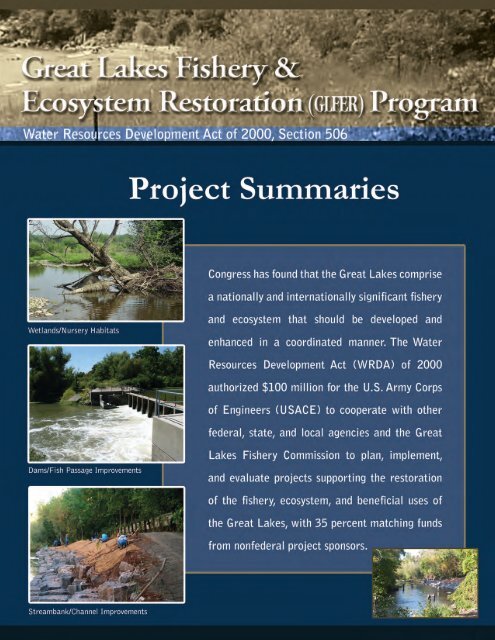
Great Lakes Fishery and Ecosystem Restoration Program Project ...
Great Lakes Fishery and Ecosystem Restoration Program Project ...
Great Lakes Fishery and Ecosystem Restoration Program Project ...

You also want an ePaper? Increase the reach of your titles
YUMPU automatically turns print PDFs into web optimized ePapers that Google loves.
Waukegan River<br />
63rd Street Dune & Beach<br />
Orl<strong>and</strong> Tract<br />
Fort Sheridan<br />
Burnham Prairie<br />
Washington Park<br />
Beemsterboer &<br />
Seidner Parcels<br />
Gr<strong>and</strong> Rapids Dam<br />
White Rapids & Chalk Hill Dam<br />
Menominee River<br />
Rosewood Park<br />
Lake Mary & Amoco Wetl<strong>and</strong>s<br />
DuPont Ridge<br />
Lake Superior<br />
Buffalo District<br />
y Ballville Dam (Fremont, OH)<br />
y Chautauqua Creek (Westfield, NY)<br />
y Conneaut Creek (Erie County, PA)<br />
y Elk Creek (Erie County, PA)<br />
y Harpersfield Dam (Geneva, OH)<br />
y Irondequoit Creek (Monroe County, NY)<br />
y Salmon River (Oswego County, NY)<br />
y Springville Dam (Springville, NY)<br />
PROJECT SITES<br />
Gay Stamp S<strong>and</strong>s<br />
Lake Michigan<br />
Boardman River<br />
Frankenmuth Dam<br />
St. Marys River<br />
Henry Ford<br />
Estate Dam<br />
Lake Huron<br />
Lake Erie<br />
Dowagiac River<br />
Red Mill Pond<br />
Ballville Dam<br />
Conneaut Creek<br />
Elkhart River &<br />
Christiana Creek Dams<br />
Little Calumet River<br />
Harpersfield Dam<br />
Calumet Prairie<br />
& Ivanhoe South<br />
Elk Creek<br />
U.S. Army Corps of Engineers Districts<br />
chicago District<br />
y 63rd Street Dune & Beach (Chicago, IL)<br />
y Beemsterboer & Seidner Parcels (Lake County, IN)<br />
y Burnham Prairie (Burnham, IL)<br />
y Calumet Prairie & Ivanhoe South (Lake County, IN)<br />
y DuPont Ridge (Lake County, IN)<br />
y Fort Sheridan (Lake County, IL)<br />
y Lake Mary & Amoco Wetl<strong>and</strong>s (Lake County, IN)<br />
y Little Calumet River (Porter County, IN)<br />
y Orl<strong>and</strong> Tract (Cook County, IL)<br />
Lake Ontario<br />
Salmon River<br />
Irondequoit Creek<br />
Springville Dam<br />
Chautauqua Creek<br />
chicago District (CONT.)<br />
y Red Mill Pond (LaPorte County, IN)<br />
y Rosewood Park (Lake County, IL)<br />
y Washington Park (Cook County, IL)<br />
y Waukegan River (Lake County, IL)<br />
Detroit District<br />
y Boardman River (Traverse City, MI)<br />
y Dowagiac River (Cass County, MI)<br />
y Frankenmuth Dam (Frankenmuth, MI)<br />
y Elkhart River & Christiana Creek Dams (Elkhart, IN)<br />
y Gay Stamp S<strong>and</strong>s (Keweenaw County, MI)<br />
y Gr<strong>and</strong> Rapids Dam (Menominee County, MI, & Marinette<br />
County, WI)<br />
y Henry Ford Estate Dam (Dearborn, MI)<br />
y Menominee River (Menominee County, MI, & Marinette<br />
County, WI)<br />
y St. Marys River (Chippewa County, MI)<br />
y White Rapids & Chalk Hill Dam (Menominee County, MI, &<br />
Marinette County, WI)<br />
<strong>Great</strong> <strong>Lakes</strong> <strong>Fishery</strong> & <strong>Ecosystem</strong> <strong>Restoration</strong> (GLFER) <strong>Program</strong><br />
updated February 2011 www.glfer.org
Support Plan<br />
<strong>Great</strong> <strong>Lakes</strong> <strong>Fishery</strong> & <strong>Ecosystem</strong><br />
<strong>Restoration</strong> (GLFER) <strong>Program</strong><br />
In 2003 a GLFER support plan was developed in<br />
cooperation with state, provincial, tribal, international,<br />
<strong>and</strong> regional organizations <strong>and</strong> federal agencies in the<br />
United States <strong>and</strong> Canada that have responsibilities or<br />
programs related to the management <strong>and</strong>/or protection<br />
of the <strong>Great</strong> <strong>Lakes</strong> fishery <strong>and</strong> ecosystem or research on<br />
these topics. The support plan outlines the opportunities<br />
<strong>and</strong> priorities for <strong>Great</strong> <strong>Lakes</strong> fishery <strong>and</strong> ecosystem<br />
restoration projects.<br />
<strong>Ecosystem</strong> in Distress<br />
Water resources Development act of 2000, section 506<br />
The physical, biological, <strong>and</strong> chemical changes over the<br />
last 150 years related to settlement of the basin have<br />
all contributed to the deterioration of water quality,<br />
reduction of available physical habitat, <strong>and</strong> irreversible<br />
alterations of the biological components of the <strong>Great</strong><br />
<strong>Lakes</strong> ecosystem. Development activities responsible for<br />
these adverse changes include the following:<br />
n Fragmentation of available habitat associated with<br />
the construction of dams on nearly all major tributaries<br />
n Alteration of natural river flow regimes <strong>and</strong> increase<br />
in sedimentation due to runoff from urban<br />
development <strong>and</strong> farming<br />
n Modification <strong>and</strong> destruction of <strong>Great</strong> <strong>Lakes</strong> <strong>and</strong><br />
inl<strong>and</strong> waters shoreline habitat, including valuable<br />
wetl<strong>and</strong>s<br />
n Changes in natural flows <strong>and</strong> depositional zones<br />
in shoreline areas near <strong>Great</strong> <strong>Lakes</strong> navigational<br />
structures (e.g., piers, jetties, bulkheads, <strong>and</strong> breakwaters)<br />
n Reduction in indigenous fish populations <strong>and</strong> in<br />
some cases extirpation of <strong>Great</strong> <strong>Lakes</strong> fish species<br />
due to excessive harvest<br />
n Irreversible changes in the types <strong>and</strong> interaction<br />
of species caused by the intentional <strong>and</strong> accidental<br />
introductions of nonindigenous aquatic organisms<br />
Opportunities for <strong>Restoration</strong><br />
<strong>Restoration</strong> of the fisheries <strong>and</strong> other critical elements of<br />
the <strong>Great</strong> <strong>Lakes</strong> ecosystem will require both structural<br />
<strong>and</strong> nonstructural solutions (e.g., research, application of<br />
best management l<strong>and</strong> use practices, pollution control,<br />
public education, monitoring). The primary focus of<br />
Section 506 is restoration of fisheries habitat <strong>and</strong> related<br />
ecosystem elements through structural projects. <strong>Project</strong><br />
examples include the following:<br />
n Removal of unnecessary barriers in <strong>Great</strong> <strong>Lakes</strong><br />
tributaries<br />
n Creation of fish passage facilities<br />
n Creation of soft structures (shoreline enhancement)<br />
n <strong>Restoration</strong> of historical reefs <strong>and</strong> construction of<br />
artificial reefs in support of fish community objectives<br />
n <strong>Restoration</strong> of estuaries <strong>and</strong> rapids (particularly in<br />
connecting channels such as the St. Clair River <strong>and</strong><br />
the Detroit River)<br />
n <strong>Restoration</strong> <strong>and</strong> creation of riffle areas in <strong>Great</strong><br />
<strong>Lakes</strong> tributaries<br />
n <strong>Restoration</strong> <strong>and</strong> creation of wetl<strong>and</strong>s<br />
Criteria<br />
To be considered for funding, a project must comply<br />
with three main screening criteria. To be eligible, a<br />
project must be<br />
n consistent with GLFER program priorities;<br />
n consistent with management objectives established<br />
by the various committees operating under<br />
the <strong>Great</strong> <strong>Lakes</strong> <strong>Fishery</strong> Commission; <strong>and</strong><br />
n unopposed by the appropriate state management<br />
agency <strong>and</strong>/or any public agency owner of property<br />
on which the project will be located.<br />
A project review committee comprising the U.S. Army<br />
Corps of Engineers (USACE), in cooperation with<br />
the <strong>Great</strong> <strong>Lakes</strong> <strong>Fishery</strong> Commission <strong>and</strong> appropriate<br />
federal, state, <strong>and</strong> local agencies, will participate in<br />
project review.<br />
<strong>Great</strong> <strong>Lakes</strong> <strong>Fishery</strong> & <strong>Ecosystem</strong> <strong>Restoration</strong> (GLFER) <strong>Program</strong><br />
updated February 2011 www.glfer.org
ProjECt DESCriPtion<br />
The Ballville Dam project is located on the S<strong>and</strong>usky River<br />
approximately 10 miles upstream of the mouth at S<strong>and</strong>usky<br />
Bay in Lake Erie.<br />
The dam impedes the passage of native migratory fish to the<br />
upstream areas of the S<strong>and</strong>usky River, which contains ideal<br />
spawning habitat, thus impairing the reproduction of native<br />
fish species. During the feasibility study, the benefits <strong>and</strong><br />
alternatives for fish passage, including dam removal, were<br />
evaluated. Target species are walleye, white bass, channel<br />
catfish, six species of suckers, lake sturgeon, <strong>and</strong> several other<br />
native <strong>and</strong> naturalized fish species.<br />
The S<strong>and</strong>usky River <strong>and</strong> S<strong>and</strong>usky Bay spawning stocks are<br />
significant contributors to the Lake Erie walleye population<br />
<strong>and</strong> provide a significant spring <strong>and</strong> fall fishery in Ohio<br />
waters. The expected results of the proposed project are:<br />
The availability of an additional 22 miles of free-flowing<br />
river containing 300 acres of suitable spawning habitat to<br />
fish <strong>and</strong> benthic species<br />
<strong>Restoration</strong> of sediment transport processes<br />
Increased species diversity both upstream <strong>and</strong> downstream<br />
of the dam<br />
Enhanced foraging opportunities for bald eagles <strong>and</strong> other<br />
animals<br />
Prevention of future dependence on walleye stocking programs<br />
to sustain the fishery<br />
Funding (feasibility only)<br />
BALLVILLE DAM<br />
Fish Passage<br />
Fremont, OH<br />
Contribution toward the goals outlined in the <strong>Great</strong> <strong>Lakes</strong><br />
basin-wide management plan developed by the <strong>Great</strong><br />
<strong>Lakes</strong> <strong>Fishery</strong> Commission <strong>and</strong> its partners<br />
Modification or removal of the dam for the purpose of<br />
fisheries <strong>and</strong> ecosystem restoration is complicated by a flood<br />
damage reduction project located downstream of the dam. It<br />
is unknown at this point if modifications to the dam will have<br />
any adverse impacts on the flood <strong>and</strong> coastal storm damage<br />
reduction project.<br />
nonfEDErAl PArtnErS<br />
City of Fremont<br />
Ohio Department of Natural Resources, Division of<br />
Wildlife<br />
CongrESSionAl intErESt<br />
Senator Sherrod Brown (D-OH)<br />
Senator Robert Portman (R-OH)<br />
Representative Robert E. Latta (R-OH-5)<br />
CUrrEnt StAtUS<br />
A wetl<strong>and</strong>s delineation of the project area was completed in<br />
2010. The ice model <strong>and</strong> hydraulic model of the S<strong>and</strong>usky<br />
River within the project area are scheduled for completion in<br />
March 2011.<br />
Total Federal Nonfederal<br />
current working estimate $9,000,000 $5,850,000 $3,150,000<br />
funding to date $754,000 $754,000 $0<br />
funds required to complete project $8,246,000 $5,096,000 $3,150,000<br />
Ballville Dam<br />
<strong>Project</strong> Manager:<br />
Steven A. Vriesen<br />
(716) 879-4359<br />
Steven.a.vriesen@usace.army.mil<br />
<strong>Great</strong> <strong>Lakes</strong> <strong>Fishery</strong> & <strong>Ecosystem</strong> <strong>Restoration</strong> (GLFER) <strong>Program</strong><br />
updated February 2011 www.glfer.org
CHAUTAUQUA CREEK<br />
Fish Passage<br />
Westfield, NY<br />
ProjECt DESCriPtion<br />
Located in the town of Westfield, Chautauqua Creek is a<br />
tributary of Lake Erie. Two small dams currently block a variety<br />
of native <strong>and</strong> naturalized Lake Erie fish species, including<br />
steelhead trout, from reaching high-quality spawning areas in<br />
upper Chautauqua Creek. The project will evaluate a variety<br />
of fish passage <strong>and</strong> dam removal measures at the dams in<br />
order to allow spawning fish access to upstream areas <strong>and</strong><br />
restore fishery populations. Any project constructed will be<br />
required to include measures that would block sea lampreys.<br />
A federal project at the Water Works dams on Chautauqua<br />
Creek will significantly increase the amount <strong>and</strong> quality<br />
of habitat available for steelhead spawning by providing<br />
access to approximately 10 miles of high-quality spawning<br />
habitat located upstream of the Water Works dams. The<br />
implementation of this project would also contribute to<br />
goals outlined in a <strong>Great</strong> <strong>Lakes</strong> basin-wide management plan<br />
developed by the <strong>Great</strong> <strong>Lakes</strong> <strong>Fishery</strong> Commission.<br />
Funding (feasibility only)<br />
chautauqua creek<br />
<strong>Project</strong> Manager:<br />
Patti M. McKenna<br />
(716) 879-4367<br />
patrice.m.mckenna@usace.army.mil<br />
If the project is not constructed, the issues of riverine habitat,<br />
fish passage, <strong>and</strong> recolonization will persist well into the<br />
future.<br />
nonfEDErAl PArtnErS<br />
Village of Westfield<br />
New York State Department of Environmental<br />
Conservation<br />
CongrESSionAl intErESt<br />
Senator Charles Schumer (D-NY)<br />
Senator Kirsten Gillibr<strong>and</strong> (D-NY)<br />
Representative Brian Higgins (D-NY-27)<br />
CUrrEnt StAtUS<br />
Planning <strong>and</strong> design documentation has been completed.<br />
Construction is scheduled to begin in the spring of 2011.<br />
Total Federal Nonfederal<br />
current working estimate $575,735 $374,228 $201,507<br />
funding to date $575,735 $374,228 $201,507<br />
funds required to complete project $0 $0 $0<br />
NOTE: The project is fully funded.<br />
<strong>Great</strong> <strong>Lakes</strong> <strong>Fishery</strong> & <strong>Ecosystem</strong> <strong>Restoration</strong> (GLFER) <strong>Program</strong><br />
updated February 2011 www.glfer.org
COnnEAUT CREEK<br />
Fish Passage<br />
Erie County, PA<br />
ProjECt DESCriPtion<br />
Each of the three dam sites in Conneaut Creek will be<br />
considered for modification or removal. Modification may<br />
include installation of a fish ladder or rock ramp, or notching.<br />
The selected activity must accomplish the following goals:<br />
reconnect the creek, provide fish passage, <strong>and</strong> prevent the<br />
further spread of invasive sea lamprey.<br />
Increased biodiversity, access to high-quality habitat <strong>and</strong><br />
spawning areas, enhanced water quality, <strong>and</strong> restoration of<br />
normal sediment movement will result from modification<br />
<strong>and</strong>/or removal of the dams. Removing the impediments to<br />
fish passage will decrease the likelihood that fish populations<br />
will decline or become dependent on annual stocking<br />
programs.<br />
Funding<br />
nonfEDErAl PArtnErS<br />
Pennsylvania Fish & Boat Commission<br />
The Albion Fish <strong>and</strong> Game Club Inc.<br />
CongrESSionAl intErESt<br />
Senator Robert P. Casey Jr. (D-PA)<br />
Senator Patrick Toomey (R-PA)<br />
Representative Michael Kelly (R-PA-3)<br />
CUrrEnt StAtUS<br />
The feasibility study was initiated in FY2010 using <strong>Great</strong><br />
<strong>Lakes</strong> <strong>Restoration</strong> Initiative (GLRI) funds. The feasibility<br />
study is scheduled for completion in FY2012. A construction<br />
contract is tentatively scheduled for award in the last quarter<br />
of FY2012.<br />
Total Federal Nonfederal<br />
current working estimate $1,297,690 $843,500 $454,190<br />
funding to date $435,000 $435,000 $0<br />
funds required to complete project $862,690 $408,500 $454,190<br />
conneaut creek<br />
<strong>Project</strong> Manager:<br />
Michael J. Greer<br />
(716) 879-4229<br />
michael.j.greer@usace.army.mil<br />
<strong>Great</strong> <strong>Lakes</strong> <strong>Fishery</strong> & <strong>Ecosystem</strong> <strong>Restoration</strong> (GLFER) <strong>Program</strong><br />
updated February 2011 www.glfer.org
ProjECt DESCriPtion<br />
The project proposes restoration of a section of the Elk Creek<br />
riparian corridor that is in close proximity to Highway 79 in<br />
the Town of McKean. Elk Creek is a coolwater system that<br />
supports a wide range of native, naturalized, <strong>and</strong> stocked fish<br />
species. Since resident <strong>and</strong> migratory fish species can be found<br />
within the creek, benefits of the project extend well beyond<br />
the immediate project area. Primary reasons for habitat<br />
degradation at the site are streambank failure; insufficient<br />
riffle, run, pool sequences, or similar fluvial geomorphic<br />
impairments; <strong>and</strong> lack of native riparian cover. In recent years<br />
the project area has experienced rapid <strong>and</strong> significant erosion<br />
<strong>and</strong> loss of in-stream habitat. Preliminary field observations<br />
revealed that a headcut has developed within the project<br />
area <strong>and</strong> is likely to continue upstream <strong>and</strong> cause additional<br />
Funding<br />
elk creek<br />
<strong>Project</strong> Manager:<br />
Michael J. Greer<br />
(716) 879-4229<br />
michael.j.greer@usace.army.mil<br />
ELK CREEK<br />
Corridor <strong>Restoration</strong><br />
Erie County, PA<br />
valuable habitat to be lost. This particular reach is open to the<br />
public <strong>and</strong> is a popular recreation spot for sport fishing.<br />
nonfEDErAl PArtnEr<br />
Pennsylvania Fish & Boat Commission<br />
CongrESSionAl intErESt<br />
Senator Robert P. Casey Jr. (D-PA)<br />
Senator Patrick Toomey (R-PA)<br />
Representative Michael Kelly (R-PA-3)<br />
CUrrEnt StAtUS<br />
The preliminary restoration plan is scheduled for completion<br />
in April 2011. The feasibility study will be initiated pending<br />
the availability of funds.<br />
Total Federal Nonfederal<br />
current working estimate $1,200,000 $780,000 $420,000<br />
funding to date $25,000 $25,000 $0<br />
funds required to complete project $1,175,000 $755,000 $420,000<br />
<strong>Great</strong> <strong>Lakes</strong> <strong>Fishery</strong> & <strong>Ecosystem</strong> <strong>Restoration</strong> (GLFER) <strong>Program</strong><br />
updated February 2011 www.glfer.org
HARPERSFIELD DAM<br />
Fish Passage<br />
Geneva, OH<br />
ProjECt DESCriPtion<br />
The presence of Harpersfield Dam, immediately upstream<br />
of the historic Harpersfield covered bridge, has promoted<br />
habitat degradation, altered sediment transport dynamics,<br />
<strong>and</strong> degraded water supply. It has also played a central role<br />
in the decline of migratory aquatic species by severing their<br />
migration routes <strong>and</strong> preventing healthy recruitment. At this<br />
particular dam it has been determined that the benefits of<br />
sea lamprey prevention outweigh the negative impact the dam<br />
has on fish passage.<br />
Likely project alternatives that will be evaluated include<br />
repairing or modifying the existing dam to maintain its<br />
current structure, which effectively prevents sea lamprey<br />
passage; construction of a sea lamprey trap at the existing<br />
dam; or construction of a new barrier <strong>and</strong> trap at a location<br />
farther downstream of Harpersfield Dam.<br />
Improvements to prevent sea lamprey passage <strong>and</strong><br />
reproduction upstream will prevent the need for lampricide<br />
treatments above the dam, which currently cost $335,000 per<br />
treatment. These improvements will contribute to an overall<br />
lower sea lamprey population in Lake Erie, which in turn<br />
improves the sustainability of valuable fisheries resources.<br />
Funding<br />
If no actions are taken to prevent sea lamprey migration<br />
above Harpersfield Dam, or the dam deteriorates further, it is<br />
likely that sea lamprey populations will significantly increase.<br />
An increase in sea lamprey populations would require the<br />
continued application of lampricide every three to four years<br />
<strong>and</strong> could extend the need for treatment to an additional 60<br />
river miles upstream of Harpersfield Dam.<br />
nonfEDErAl PArtnEr<br />
Ohio Department of Natural Resources<br />
CongrESSionAl intErESt<br />
Senator Sherrod Brown (D-OH)<br />
Senator Robert Portman (R-OH)<br />
Representative Steven LaTourette (R-OH-14)<br />
CUrrEnt StAtUS<br />
The feasibility study was initiated in FY2010 using <strong>Great</strong><br />
<strong>Lakes</strong> <strong>Restoration</strong> Initiative (GLRI) funds. The feasibility<br />
study is scheduled for completion in December 2011. A<br />
construction contract is tentatively scheduled for award in<br />
2012.<br />
Total Federal Nonfederal<br />
current working estimate $989,000 $643,000 $346,000<br />
funding to date $335,000 $335,000 $0<br />
funds required to complete project $654,000 $308,000 $346,000<br />
harpersfield Dam<br />
<strong>Project</strong> Manager:<br />
Michael J. Greer<br />
(716) 879-4229<br />
michael.j.greer@usace.army.mil<br />
<strong>Great</strong> <strong>Lakes</strong> <strong>Fishery</strong> & <strong>Ecosystem</strong> <strong>Restoration</strong> (GLFER) <strong>Program</strong><br />
updated February 2011 www.glfer.org
irondequoit creek<br />
<strong>Project</strong> Manager:<br />
Michael J. Greer<br />
(716) 879-4229<br />
michael.j.greer@usace.army.mil<br />
IROnDEQUOIT CREEK<br />
<strong>Ecosystem</strong> <strong>Restoration</strong><br />
Monroe County, NY<br />
ProjECt DESCriPtion<br />
Four reaches of Irondequoit Creek, a coolwater stream that<br />
drains into Irondequoit Bay, Lake Ontario, are currently being<br />
evaluated for restoration. These reaches are experiencing<br />
habitat degradation due to unstable stream banks, altered<br />
geomorphology <strong>and</strong> hydrology, <strong>and</strong> lack of native riparian<br />
plant species.<br />
All of these sites exhibit stream bank erosion as well as<br />
impairments to in-stream habitat. Potential alternatives<br />
to improve the existing degradation include stream bank<br />
stabilization using a combination of traditional <strong>and</strong><br />
bioengineering methods, in-stream habitat restoration,<br />
<strong>and</strong> riparian corridor revegetation with native species.<br />
Any restoration effort will take into account the associated<br />
recreational uses <strong>and</strong> public safety since the project area is<br />
partially located in public parks.<br />
Irondequoit Creek supports a wide variety of native,<br />
naturalized, <strong>and</strong> stocked fish species. Resident <strong>and</strong> migratory<br />
fish species can be found within the creek; therefore<br />
benefits of the proposed project will extend well beyond the<br />
Funding<br />
immediate project area to Irondequoit Bay <strong>and</strong> Lake Ontario.<br />
If restoration is not accomplished, it is likely that the habitat<br />
<strong>and</strong> water quality will continue to degrade, as sediment eroded<br />
from the banks impairs the Lake Ontario watershed resulting<br />
in a decrease in richness <strong>and</strong> abundance of species.<br />
nonfEDErAl PArtnEr<br />
County of Monroe<br />
CongrESSionAl intErESt<br />
Senator Charles E. Schumer (D-NY)<br />
Senator Kirsten E. Gillibr<strong>and</strong> (D-NY)<br />
Representative Thomas Reed (R-NY-29)<br />
Representative Ann Marie Buerkle (R-NY-25)<br />
CUrrEnt StAtUS<br />
The feasibility study was initiated in FY2010 using <strong>Great</strong> <strong>Lakes</strong><br />
<strong>Restoration</strong> Initiative (GLRI) funds. The feasibility study is<br />
scheduled for completion in October 2011. A construction<br />
contract is tentatively scheduled for award in 2012.<br />
Total Federal Nonfederal<br />
current working estimate $1,454,000 $945,100 $508,900<br />
funding to date $335,000 $335,000 $0<br />
funds required to complete project $1,119,000 $610,100 $508,900<br />
<strong>Great</strong> <strong>Lakes</strong> <strong>Fishery</strong> & <strong>Ecosystem</strong> <strong>Restoration</strong> (GLFER) <strong>Program</strong><br />
updated February 2011 www.glfer.org
SALMOn RIVER<br />
Riparian Corridor <strong>Restoration</strong><br />
Oswego County, NY<br />
ProjECt DESCriPtion<br />
The portion of the Salmon River that will be evaluated for<br />
restoration runs between the Lighthouse Reservoir <strong>and</strong><br />
County Route 2A. The Salmon River is a coolwater system<br />
<strong>and</strong> supports a wide range of native, naturalized, <strong>and</strong> stocked<br />
fish species. Since resident <strong>and</strong> migratory fish species can<br />
be found within the creek, benefits of the project extend<br />
well beyond the immediate project area. Primary reasons<br />
for habitat degradation at the sites under consideration are<br />
streambank failure; insufficient riffle, run, pool sequences or<br />
similar fluvial geomorphic impairments; <strong>and</strong> lack of native<br />
riparian cover. The hydropower operations at the dam <strong>and</strong><br />
resulting regulated flows are a factor in the loss of habitat.<br />
Over time, deep holes in the riverbed have filled in <strong>and</strong> the<br />
river has, in general, become wider <strong>and</strong> shallower, also raising<br />
water temperatures. The Salmon River is a vital component<br />
in the life cycle of migratory fish within Lake Ontario, <strong>and</strong> is<br />
particularly important to the restoration of Atlantic salmon<br />
in the <strong>Great</strong> <strong>Lakes</strong>.<br />
Funding<br />
Many different alternatives will be considered to address the<br />
impairments at each site. In general, alternatives will include<br />
stream bank stabilization using a combination of traditional<br />
<strong>and</strong> bioengineering methods; in-stream habitat restoration;<br />
<strong>and</strong> riparian corridor revegetation with native species.<br />
nonfEDErAl PArtnEr<br />
New York State Department of Environmental<br />
Conservation<br />
CongrESSionAl intErESt<br />
Senator Charles Schumer (D-NY)<br />
Senator Kirsten Gillibr<strong>and</strong> (D-NY)<br />
Representative William Owens (D-NY-23)<br />
CUrrEnt StAtUS<br />
The preliminary restoration plan is scheduled for completion<br />
in April 2011. The feasibility study will be initiated pending<br />
the availability of funds.<br />
Total Federal Nonfederal<br />
current working estimate $3,000,000 $1,950,000 $1,050,000<br />
funding to date $25,000 $25,000 *<br />
funds required to complete project $2,975,000 $1,925,000 $1,050,000<br />
* No data was provided.<br />
salmon river<br />
<strong>Project</strong> Manager:<br />
Michael J. Greer<br />
(716) 879-4229<br />
michael.j.greer@usace.army.mil<br />
<strong>Great</strong> <strong>Lakes</strong> <strong>Fishery</strong> & <strong>Ecosystem</strong> <strong>Restoration</strong> (GLFER) <strong>Program</strong><br />
updated February 2011 www.glfer.org
ProjECt DESCriPtion<br />
The Springville Dam is located in the Village of Springville,<br />
approximately 30 miles south of the city of Buffalo, on the<br />
Cattaraugus Creek. Cattaraugus Creek is the natural boundary<br />
for Erie <strong>and</strong> Cattaraugus Counties.<br />
The feasibility study will evaluate an array of measures which<br />
will allow steelhead <strong>and</strong> other fisheries access to the upstream<br />
reaches of Cattaraugus Creek <strong>and</strong> associated tributaries. In<br />
addition, the dam blocks access to the upper 34 miles of<br />
Cattaraugus Creek.<br />
The implementation of a fish passage project will provide<br />
increased fishery resources of prime spawning habitat for<br />
the fisheries which exist in Cattaraugus Creek. The expected<br />
outputs of the proposed project include the availability of an<br />
additional 34 miles of free-flowing creek containing suitable<br />
spawning habitat to fish <strong>and</strong> benthic species <strong>and</strong> restoration<br />
of sediment transport processes.<br />
Funding<br />
SPRInGVILLE DAM<br />
Fish Passage<br />
Springville, NY<br />
nonfEDErAl PArtnEr<br />
New York State Department of Environmental<br />
Conservation<br />
CongrESSionAl intErESt<br />
Senator Charles Schumer (D-NY)<br />
Senator Kirsten Gillibr<strong>and</strong> (D-NY)<br />
Representative Brian Higgins (D-NY-27)<br />
Representative Thomas Reed (R-NY-29)<br />
CUrrEnt StAtUS<br />
The hydraulic model of the Cattaraugus Creek <strong>and</strong> a safety<br />
inspection of the Springville Dam were completed in 2010.<br />
Development of fish passage alternatives, sediment sampling<br />
upstream <strong>and</strong> downstream of the dam, <strong>and</strong> completion of a<br />
sediment transport model are expected to be completed in<br />
2011.<br />
Total Federal Nonfederal<br />
current working estimate $4,650,000 $3,022,500 $1,627,500<br />
funding to date $445,000 $445,000 $0<br />
funds required to complete project $4,205,000 $2,577,500 $1,627,500<br />
springville Dam<br />
<strong>Project</strong> Manager:<br />
Geoffrey K. Hintz<br />
(716) 879-4155<br />
geoffrey.k.hintz@usace.army.mil<br />
<strong>Great</strong> <strong>Lakes</strong> <strong>Fishery</strong> & <strong>Ecosystem</strong> <strong>Restoration</strong> (GLFER) <strong>Program</strong><br />
updated February 2011 www.glfer.org
63rd STREET DUnE & BEACH<br />
<strong>Ecosystem</strong> <strong>Restoration</strong><br />
Chicago, IL<br />
ProjECt DESCriPtion<br />
The 63rd Street Dune & Beach project is a 21-acre restoration<br />
located on the Lake Michigan coast in Chicago. Currently, the<br />
site is a beach with a forming dune that has been invaded by<br />
non-native plants, including buckthorn <strong>and</strong> grasses, resulting<br />
in s<strong>and</strong> erosion. This project will restore dune habitat with<br />
native grasses that encourage the formation of stable dunes.<br />
The restoration will support a diverse array of native plant<br />
<strong>and</strong> fish species as well as migratory <strong>and</strong> resident birds, <strong>and</strong><br />
will improve water quality for aquatic resources. The restored<br />
habitats will include five acres of dune, six acres of dune <strong>and</strong><br />
swale, three acres of savanna, <strong>and</strong> seven acres of cobblestone<br />
pockets <strong>and</strong> woody debris.<br />
The area is used during migration <strong>and</strong> breeding by waterfowl<br />
<strong>and</strong> several species of shorebirds, including the tri-colored<br />
heron <strong>and</strong> the endangered piping plover. The nearshore<br />
Funding<br />
63rd street Dune & Beach<br />
<strong>Project</strong> Manager:<br />
Kirston A. Buczak, LRC<br />
(312) 846-5552<br />
kirston.a.buczak@usace.army.mil<br />
area adjacent to the site contains cobble rock that provides<br />
spawning <strong>and</strong> rearing habitat for smallmouth bass. The project<br />
will also incorporate compatible educational opportunities.<br />
nonfEDErAl PArtnEr<br />
Chicago Park District<br />
CongrESSionAl intErESt<br />
Senator Richard Durbin (D-IL)<br />
Senator Mark Kirk (R-IL)<br />
Representative Danny Davis (D-IL-7)<br />
CUrrEnt StAtUS<br />
<strong>Great</strong> <strong>Lakes</strong> <strong>Restoration</strong> Initiative (GLRI) funding was<br />
used to award a construction contract in September, 2010.<br />
Construction is scheduled to begin in spring of 2011.<br />
Total Federal Nonfederal<br />
current working estimate $1,076,000 $700,000 $376,000<br />
funding to date $1,076,000 $700,000 $376,000<br />
funds required to complete project $0 $0 $0<br />
NOTE: The project is fully funded.<br />
<strong>Great</strong> <strong>Lakes</strong> <strong>Fishery</strong> & <strong>Ecosystem</strong> <strong>Restoration</strong> (GLFER) <strong>Program</strong><br />
updated February 2011 www.glfer.org
BEEMSTERBOER & SEIDnER PARCELS<br />
<strong>Ecosystem</strong> <strong>Restoration</strong><br />
Lake County, IN<br />
ProjECt DESCriPtion<br />
The Beemsterboer & Seidner (B&S) parcels form the riparian<br />
zone of the Gr<strong>and</strong> Calumet River. This project proposes<br />
removal of invasive species <strong>and</strong> hydrologic <strong>and</strong> topographic<br />
restoration. The first step would be removal of 8,700 feet<br />
of railroad ties <strong>and</strong> underlying crushed stone, along with<br />
minor site grading to restore hydrology <strong>and</strong> topography.<br />
This would reestablish the connectivity between the upl<strong>and</strong><br />
wetl<strong>and</strong>s, wetl<strong>and</strong> swales, <strong>and</strong> the Gr<strong>and</strong> Calumet River <strong>and</strong><br />
its associated wetl<strong>and</strong> shelf areas. Next, all invasive species<br />
would be removed physically <strong>and</strong> with herbicide. The primary<br />
invasive species are common reeds, cattails, <strong>and</strong> cool season<br />
Eurasian grasses. Finally, the site would be reseeded with<br />
an appropriate native prairie/savanna mix. The Indiana<br />
Department of Natural Resources has a contract in place with<br />
The Nature Conservancy for restoration work at this parcel as<br />
well. Although work is presently under way at a few locations<br />
within this site, a considerable amount of work remains to be<br />
funded.<br />
Immediate short-term ecological effects include elimination<br />
of invasive species <strong>and</strong> their seed sources <strong>and</strong> restoration of<br />
Funding<br />
native species. Long-term ecological effects include healthy<br />
ecosystem habitats for some of Indiana’s rarest species,<br />
including Bl<strong>and</strong>ing’s turtle <strong>and</strong> the spotted turtle. Longterm<br />
socioeconomic benefits would stem from the much<br />
larger, healthy, <strong>and</strong> stable ecosystems that will be enjoyed in<br />
perpetuity by the recreational users who visit these nature<br />
preserves.<br />
nonfEDErAl PArtnEr<br />
Indiana Department of Natural Resources<br />
CongrESSionAl intErESt<br />
Senator Richard Lugar (R-IN)<br />
Senator Dan Coats (R-IN)<br />
Representative Peter Visclosky (D-IN-1)<br />
CUrrEnt StAtUS<br />
Construction contracts are scheduled for award in April 2011.<br />
Total Federal Nonfederal<br />
current working estimate $1,500,000 $984,000 $516,000<br />
funding to date * * *<br />
funds required to complete project * * *<br />
* No data was provided.<br />
Beemsterboer <strong>and</strong> seidner Parcels<br />
<strong>Project</strong> Manager:<br />
Kirston A. Buczak<br />
(312) 846-5552<br />
kirston.a.buczak@usace.army.mil<br />
<strong>Great</strong> <strong>Lakes</strong> <strong>Fishery</strong> & <strong>Ecosystem</strong> <strong>Restoration</strong> (GLFER) <strong>Program</strong><br />
updated February 2011 www.glfer.org
BURnHAM PRAIRIE<br />
<strong>Ecosystem</strong> <strong>Restoration</strong><br />
Burnham, IL<br />
ProjECt DESCriPtion<br />
Burnham Prairie is an approximately 80-acre natural preserve<br />
owned by the Forest Preserve District of Cook County. The<br />
site contains ridges or dunes of low elevation separated by<br />
shallow ponds, poorly drained lakebed, or swales intermittently<br />
or permanently inundated with groundwater. The site is home<br />
to 270 plant species, including two threatened plant species<br />
<strong>and</strong> one that is endangered; six endangered bird species; <strong>and</strong><br />
a rare mammal, the Franklin’s ground squirrel. The diversity<br />
is threatened by the absence of fire, <strong>and</strong> by contamination<br />
<strong>and</strong> modifications to the natural hydrology that have allowed<br />
non-native plant species to dominate, thus compromising the<br />
survival of native plants <strong>and</strong> animals.<br />
The proposed project would re-route nutrient-polluted water<br />
away from the site <strong>and</strong> restore wetl<strong>and</strong>s <strong>and</strong> associated habitats<br />
by planting high-quality native plants, removing invasive<br />
species <strong>and</strong> excess sediment, reintroducing fire management,<br />
<strong>and</strong> incorporating water storage outside of the natural area.<br />
These activities will restore marsh, prairie, <strong>and</strong> savanna<br />
habitat that was historically present. Woodl<strong>and</strong>s consisting of<br />
invasive woody species will be cleared with subsequent fire<br />
Funding<br />
management to allow native seed banks of rare plant species to<br />
germinate. Restoring the remnant habitat will greatly benefit<br />
migratory <strong>and</strong> wetl<strong>and</strong> species of birds, especially the shore<br />
birds <strong>and</strong> waterfowl that frequent the Calumet greenways, by<br />
providing forage, shelter, <strong>and</strong> breeding habitat.<br />
nonfEDErAl PArtnEr<br />
Forest Preserve District of Cook County<br />
CongrESSionAl intErESt<br />
Senator Richard Durbin (D-IL)<br />
Senator Mark Kirk (R-IL)<br />
Representative Jesse Jackson Jr. (D-IL-2)<br />
CUrrEnt StAtUS<br />
The construction contract is scheduled to be awarded in April<br />
2011 with FY 2010 <strong>Great</strong> <strong>Lakes</strong> <strong>Restoration</strong> Initiative (GLRI)<br />
funds. FY 2011 funds will be used to fund construction<br />
management, supervision <strong>and</strong> administration, <strong>and</strong> a<br />
construction option for the project.<br />
Total Federal Nonfederal<br />
current working estimate $2,142,480 $1,392,612 $749,868<br />
funding to date * $694,226 *<br />
funds required to complete project * $698,386 *<br />
* No data was provided.<br />
Burnham Prairie<br />
<strong>Project</strong> Manager:<br />
Kirston A. Buczak, LRC<br />
(312) 846-5552<br />
kirston.a.buczak@usace.army.mil<br />
<strong>Great</strong> <strong>Lakes</strong> <strong>Fishery</strong> & <strong>Ecosystem</strong> <strong>Restoration</strong> (GLFER) <strong>Program</strong><br />
updated February 2011 www.glfer.org
CALUMET PRAIRIE & IVAnHOE SOUTH<br />
<strong>Ecosystem</strong> <strong>Restoration</strong><br />
Lake County, IN<br />
ProjECt DESCriPtion<br />
The Calumet Prairie is part of a nationally <strong>and</strong> regionally<br />
significant coastal ecosystem. The 141-acre, state-owned<br />
Calumet Prairie Nature Preserve is home to numerous<br />
endangered <strong>and</strong> threatened species of plants, animals, <strong>and</strong><br />
insects. Non-native species have invaded 85 acres of the park.<br />
Ivanhoe South is a 30-acre site in Gary, Indiana, where some<br />
invasive species are beginning to smother the endangered<br />
Karner blue butterfly habitat.<br />
The proposed work would involve physical <strong>and</strong> chemical<br />
removal of invasive <strong>and</strong> opportunistic plant species, <strong>and</strong><br />
recovery of native wet prairie seed bank, along with the<br />
reintroduction of fire. Native species would also be sown<br />
or plugged to prevent the return of the invasive species, <strong>and</strong><br />
restoration monitoring would minimize the adverse effects to<br />
non-targeted species <strong>and</strong> ensure permanent mortality to 90<br />
percent of targeted species.<br />
Short-term benefits include the elimination of invasive<br />
species seed sources, significant increase in the acres of<br />
wet s<strong>and</strong> prairie, <strong>and</strong> the restoration of space, water, <strong>and</strong><br />
Funding<br />
sunlight to native species, including numerous threatened<br />
<strong>and</strong> endangered species. In the long term, ecological effects<br />
of the healthy ecosystem will allow for habitation of many<br />
more populations of Indiana’s rarest species, in addition to<br />
compatible educational <strong>and</strong> recreational uses.<br />
nonfEDErAl PArtnEr<br />
Indiana Department of Natural Resources<br />
CongrESSionAl intErESt<br />
Senator Richard Lugar (R-IN)<br />
Senator Dan Coats (R-IN)<br />
Representative Peter Visclosky (D-IN-1)<br />
CUrrEnt StAtUS<br />
FY2010 <strong>Great</strong> <strong>Lakes</strong> <strong>Restoration</strong> Initiative (GLRI) funds<br />
will be used to complete the planning <strong>and</strong> design analysis<br />
<strong>and</strong> initiate construction in the spring of 2011. FY2011<br />
GLRI funds would be used for construction management,<br />
supervision <strong>and</strong> administration, <strong>and</strong> a construction option for<br />
the project.<br />
Total Federal Nonfederal<br />
current working estimate $2,406,530 $1,564,245 $842,285<br />
funding to date * $808,118 *<br />
funds required to complete project * $756,127 *<br />
* No data was provided.<br />
calumet Prairie & ivanhoe south<br />
<strong>Project</strong> Manager:<br />
Kirston A. Buczak<br />
(312) 846-5552<br />
kirston.a.buczak@usace.army.mil<br />
<strong>Great</strong> <strong>Lakes</strong> <strong>Fishery</strong> & <strong>Ecosystem</strong> <strong>Restoration</strong> (GLFER) <strong>Program</strong><br />
updated February 2011 www.glfer.org
ProjECt DESCriPtion<br />
The DuPont Natural Area is a 184-acre site near the Gr<strong>and</strong><br />
Calumet River, east of an old manufacturing area that is<br />
owned by DuPont. The Indiana Department of Natural<br />
Resources owns a conservation easement on the site. Despite<br />
the industrial <strong>and</strong> residential development, remnant tracts<br />
have surprisingly high levels of biological diversity; the dune<br />
<strong>and</strong> swale habitat has 53 plant species that are endangered,<br />
threatened, or rare.<br />
To minimize the threats of contamination, fragmentation,<br />
fire suppression, <strong>and</strong> invasive species, the project will clear an<br />
invasive shrub, buckthorn, from the 32-acre floodplain forest.<br />
In addition, herbicide will be applied to several large areas to<br />
eradicate invasive reeds <strong>and</strong> cattails. Plots will be established<br />
to monitor specific populations of rare plants <strong>and</strong> endangered<br />
turtles.<br />
Short-term benefits include the elimination of invasive species’<br />
seed sources <strong>and</strong> the restoration of native species—including<br />
Funding<br />
DuPOnT RIDGE<br />
<strong>Ecosystem</strong> <strong>Restoration</strong><br />
Lake County, IN<br />
the state-listed Bl<strong>and</strong>ing’s turtle <strong>and</strong> the spotted turtle. In the<br />
long term, ecological effects of the healthy ecosystem will<br />
provide habitat for Indiana’s rarest species.<br />
nonfEDErAl PArtnEr<br />
Indiana Department of Natural Resources<br />
CongrESSionAl intErESt<br />
Senator Richard Lugar (R-IN)<br />
Senator Dan Coats (R-IN)<br />
Representative Peter Visclosky (D-IN-1)<br />
CUrrEnt StAtUS<br />
The construction contract is expected to be awarded in<br />
spring of 2011 using FY2010 <strong>Great</strong> <strong>Lakes</strong> <strong>Restoration</strong><br />
Initiative (GLRI) funds. Continued GLRI funding would<br />
be used for construction management, <strong>and</strong> supervision <strong>and</strong><br />
administration of the project.<br />
Total Federal Nonfederal<br />
current working estimate $2,292,000 $1,490,000 $802,000<br />
funding to date * $745,000 *<br />
funds required to complete project * $745,000 *<br />
* No data was provided.<br />
DuPont ridge<br />
<strong>Project</strong> Manager:<br />
Kirston A. Buczak<br />
(312) 846-5552<br />
kirston.a.buczak@usace.army.mil<br />
<strong>Great</strong> <strong>Lakes</strong> <strong>Fishery</strong> & <strong>Ecosystem</strong> <strong>Restoration</strong> (GLFER) <strong>Program</strong><br />
updated February 2011 www.glfer.org
ProjECt DESCriPtion<br />
The project would restore approximately two miles of<br />
protected shoreline that hosts thous<strong>and</strong>s of migrating birds<br />
each year <strong>and</strong> five endangered <strong>and</strong> threatened plant species:<br />
buffalo berry, seaside spurge, sea rocket, beach grass, <strong>and</strong><br />
common juniper. Most of the habitat destruction at Fort<br />
Sheridan resulted from use of the site for military housing <strong>and</strong><br />
base operations, which caused erosion along the lakeshore,<br />
allowed infestation of invasive plant species, <strong>and</strong> created an<br />
absence of stabilizing native plant species.<br />
The project will conduct studies to determine the physical<br />
<strong>and</strong> ecological processes influencing coastal conditions<br />
along the Fort Sheridan preserves; it will remove excessive<br />
infrastructure from the beach to reduce erosion, improve the<br />
habitat for endangered coastal species <strong>and</strong> migrating birds,<br />
stabilize the bluff <strong>and</strong> ravine communities to reduce erosion,<br />
remove non-native <strong>and</strong> invasive species, <strong>and</strong> restore the<br />
lakeshore habitats.<br />
<strong>Restoration</strong> would lessen impacts to native fish populations<br />
in Lake Michigan; increase the quality, size, <strong>and</strong> viability of<br />
Funding<br />
fort sheridan<br />
<strong>Project</strong> Manager:<br />
Kirston A. Buczak, LRC<br />
(312) 846-5552<br />
kirston.a.buczak@usace.army.mil<br />
FORT SHERIDAn<br />
<strong>Ecosystem</strong> <strong>Restoration</strong><br />
Lake County, IL<br />
coastal habitat; restore two miles of Lake Michigan shoreline;<br />
restore the lake’s beach, bluff, <strong>and</strong> ravine communities;<br />
protect the coastal endangered <strong>and</strong> threatened species; reduce<br />
erosional conditions <strong>and</strong> sedimentations into Lake Michigan;<br />
allow more compatible public access to the shoreline; <strong>and</strong><br />
provide educational opportunities for freshwater coastal<br />
systems.<br />
nonfEDErAl PArtnErS<br />
Lake County Forest Preserve<br />
Openl<strong>and</strong>s<br />
Town of Fort Sheridan<br />
City of Lake Forest<br />
CongrESSionAl intErESt<br />
Senator Richard Durbin (D-IL)<br />
Senator Mark Kirk (R-IL)<br />
Representative Robert Dold (R-IL-10)<br />
CUrrEnt StAtUS<br />
The project is currently in the feasibility phase; with continued<br />
funding construction could begin in 2013.<br />
Total Federal Nonfederal<br />
current working estimate $6,605,000 $4,293,250 $2,311,750<br />
funding to date $6,405,000 $4,093,250 $2,311,750<br />
funds required to complete project $200,000 $200,000 $0<br />
<strong>Great</strong> <strong>Lakes</strong> <strong>Fishery</strong> & <strong>Ecosystem</strong> <strong>Restoration</strong> (GLFER) <strong>Program</strong><br />
updated February 2011 www.glfer.org
LAKE MARy & AMOCO WETLAnDS<br />
<strong>Ecosystem</strong> <strong>Restoration</strong><br />
Lake County, IN<br />
ProjECt DESCriPtion<br />
Lake Mary <strong>and</strong> the Amoco wetl<strong>and</strong>s form the southern<br />
riparian zone of the Indiana Harbor Canal. The two<br />
properties are owned by BP Products North America Inc.<br />
(BP); however, settlement of natural resource damage claims<br />
through a Consent Decree entered in 2004 provided for BP<br />
to convey approximately 25 acres known as Amoco Wetl<strong>and</strong>s<br />
<strong>and</strong> 25 acres known as Lake Mary to the Indiana Department<br />
of Natural Resources. The majority of the sites are overrun<br />
by the invasive common reeds or cattails. The majority of<br />
the work would consist of physical removal of <strong>and</strong> herbicide<br />
application on invasive plant species, <strong>and</strong> select replanting of<br />
native species.<br />
Immediate short-term ecological effects would include the<br />
elimination of invasive species <strong>and</strong> their seed sources, <strong>and</strong><br />
the restoration of native species. Long-term effects include<br />
healthy ecosystems capable of greater biodiversity <strong>and</strong> the<br />
Funding<br />
creation of stable ecosystems for educational <strong>and</strong> recreational<br />
purposes.<br />
nonfEDErAl PArtnEr<br />
Indiana Department of Natural Resources<br />
CongrESSionAl intErESt<br />
Senator Richard Lugar (R-IN)<br />
Senator Dan Coats (R-IN)<br />
Representative Peter Visclosky (D-IN-1)<br />
CUrrEnt StAtUS<br />
Construction contracts are scheduled for award in April 2011.<br />
Total Federal Nonfederal<br />
current working estimate $1,700,000 $1,114,000 $586,000<br />
funding to date $0 $0 $0<br />
funds required to complete project $1,700,000 $1,114,000 $586,000<br />
lake Mary &<br />
amoco Wetl<strong>and</strong>s<br />
<strong>Project</strong> Manager:<br />
Kirston Buczak<br />
(312) 846-5552<br />
kirston.a.buczak@usace.army.mil<br />
<strong>Great</strong> <strong>Lakes</strong> <strong>Fishery</strong> & <strong>Ecosystem</strong> <strong>Restoration</strong> (GLFER) <strong>Program</strong><br />
updated February 2011 www.glfer.org
LITTLE CALUMET RIVER<br />
Riparian <strong>Restoration</strong><br />
Porter County, IN<br />
ProjECt DESCriPtion<br />
This 42-acre parcel is located on the Little Calumet River in<br />
Chesterton, Indiana. Historically, the Little Calumet River<br />
stream corridor <strong>and</strong> riparian zone was dominated by several<br />
naturally occurring cover types such as wetl<strong>and</strong>s, forests,<br />
savannas, <strong>and</strong> prairies. By the late 1800s, much of these<br />
cover types, particularly prairies, savannas, <strong>and</strong> wetl<strong>and</strong>s,<br />
were converted to agricultural, urban, or industrial use.<br />
Subsequently, there was a significant loss of biodiversity, which<br />
resulted in an increase in flood events <strong>and</strong> a decrease in water<br />
quality. Furthermore, the remnant parcels of natural cover<br />
types are under pressure from continued human activities.<br />
Human-induced disturbances to the remaining natural<br />
areas include fire suppression, altered hydrology, increased<br />
colonization of invasive species, <strong>and</strong> fragmentation.<br />
The Little Calumet River riparian restoration project would<br />
conduct studies <strong>and</strong> alternative analyses to determine the<br />
most effective ways to restore necessary fluvial hydraulics<br />
for macroinvertebrates, fishes, <strong>and</strong> other riverine animals;<br />
stabilize stream banks <strong>and</strong> naturalize sediment transport;<br />
prevent unnatural woody debris loads from impacting fluvial<br />
Funding<br />
Total Federal Nonfederal<br />
current working estimate $1,000,000 $650,000 $350,000<br />
funding to date * * *<br />
funds required to complete project $1,000,000 $650,000 $350,000<br />
* No data was provided.<br />
little calumet river<br />
<strong>Project</strong> Manager:<br />
Kirston Buczak<br />
(312) 846-5552<br />
kirston.a.buczak@usace.army.mil<br />
functions <strong>and</strong> smothering or drowning floodplain habitats;<br />
improve floodplain function <strong>and</strong> species richness through<br />
bank restoration, minor canopy clearing, <strong>and</strong> understory<br />
clearing; remove invasive wetl<strong>and</strong> plant species <strong>and</strong> reestablish<br />
native floodplain forest community composition; <strong>and</strong> provide<br />
educational opportunities <strong>and</strong> passive access for the local<br />
community <strong>and</strong> visitors.<br />
nonfEDErAl PArtnEr<br />
Information not provided.<br />
CongrESSionAl intErESt<br />
Senator Richard Lugar (R-IN)<br />
Senator Dan Coats (R-IN)<br />
Representative Peter Visclosky (D-IN-1)<br />
CUrrEnt StAtUS<br />
The project was approved by the <strong>Great</strong> <strong>Lakes</strong> <strong>Fishery</strong> <strong>and</strong><br />
<strong>Ecosystem</strong> <strong>Restoration</strong> <strong>Program</strong> <strong>Project</strong> Review Committee.<br />
<strong>Great</strong> <strong>Lakes</strong> <strong>Fishery</strong> & <strong>Ecosystem</strong> <strong>Restoration</strong> (GLFER) <strong>Program</strong><br />
updated February 2011 www.glfer.org
ProjECt DESCriPtion<br />
The Orl<strong>and</strong> Tract property is a 946-acre natural area that<br />
is owned by the Forest Preserve District of Cook County.<br />
A group of dedicated restoration volunteers has performed<br />
brush clearing within some of the degraded areas; however,<br />
the majority of restoration work remains to be completed.<br />
This project will restore 300 acres of savanna <strong>and</strong> prairie<br />
shrub l<strong>and</strong> using selective removal of invasive woody species<br />
<strong>and</strong> native plant installation.<br />
Immediate short-term ecological effects include elimination<br />
of invasive species <strong>and</strong> their seed sources <strong>and</strong> the restoration<br />
of native species, particularly a globally rare plant community.<br />
Long-term ecological effects include improved habitats<br />
hosting more bird species dependent on savanna <strong>and</strong> prairie<br />
shrub l<strong>and</strong>. Recent studies have shown a steep decline in these<br />
species due to habitat limitations. Long-term socioeconomic<br />
benefits would result from the much larger, healthy, <strong>and</strong> stable<br />
ecosystems by providing enjoyment to the recreational users<br />
who visit these nature preserves.<br />
Funding<br />
ORLAnD TRACT<br />
<strong>Ecosystem</strong> <strong>Restoration</strong><br />
Cook County, IL<br />
Total Federal Nonfederal<br />
current working estimate $4,153,846 $2,700,000 $1,453,846<br />
funding to date * $2,412,000 *<br />
funds required to complete project * $288,000 *<br />
* No data was provided.<br />
nonfEDErAl PArtnEr<br />
Forest Preserve District of Cook County<br />
CongrESSionAl intErESt<br />
Senator Richard Durbin (D-IL)<br />
Senator Mark Kirk (R-IL)<br />
Representative Judy Biggert (R-IL-13)<br />
CUrrEnt StAtUS<br />
FY2010 <strong>Great</strong> <strong>Lakes</strong> <strong>Restoration</strong> Initiative (GLRI) funds<br />
will be used to complete the feasibility plan <strong>and</strong> design,<br />
execute the project partnership agreement, <strong>and</strong> award the<br />
construction contract. Continued GLRI funding would be<br />
used to fund construction management, <strong>and</strong> supervision <strong>and</strong><br />
administration of the project.<br />
orl<strong>and</strong> tract<br />
<strong>Project</strong> Manager:<br />
Mike Nguyen, LRC<br />
(312) 846-5555<br />
mike.nguyen@usace.army.mil<br />
<strong>Great</strong> <strong>Lakes</strong> <strong>Fishery</strong> & <strong>Ecosystem</strong> <strong>Restoration</strong> (GLFER) <strong>Program</strong><br />
updated February 2011 www.glfer.org
RED MILL POnD<br />
Aquatic <strong>Ecosystem</strong> <strong>Restoration</strong><br />
LaPorte County, IN<br />
ProjECt DESCriPtion<br />
Red Mill County Park consists of 160 acres, with 108 acres<br />
designated as an Indiana Nature Preserve. Over the past 176<br />
years, Red Mill Pond has become a stable, native pond <strong>and</strong><br />
wetl<strong>and</strong> community that is fully dependent on the earthen<br />
dam that was constructed in 1833. Failure of the dam is likely<br />
imminent; a sudden rupture would allow all of the water<br />
in the pond to drain out. This sudden change in hydrology<br />
would disrupt the site’s ecology, making it an ideal place for<br />
invasive species to thrive. Dam failure would also threaten<br />
the seven endangered plant species known to grow in Red<br />
Mill County Park.<br />
The preferred plan includes removing a section of the dam<br />
at the emergency spillway, introducing four metal culverts<br />
to restore the natural hydrology <strong>and</strong> stream conductivity,<br />
<strong>and</strong> excavating a new channel that is sculpted to pass flow<br />
from the pond to Little Calumet River. Also, a notched weir<br />
structure across the pond would take the place of the beaver<br />
dam, which currently sits 300 feet downstream from the<br />
Funding<br />
red Mill Pond<br />
<strong>Project</strong> Manager:<br />
Kirston A. Buczak<br />
(312) 846-5552<br />
kirston.a.buczak@usace.army.mil<br />
earthen dam. Limited restoration of native vegetation would<br />
be implemented as necessary.<br />
The project will prevent failure of the earthen dam, <strong>and</strong><br />
preserve the diversity of native <strong>and</strong> endangered species while<br />
preventing fragmentation of the ecosystem.<br />
nonfEDErAl PArtnEr<br />
LaPorte County Parks<br />
CongrESSionAl intErESt<br />
Senator Richard Lugar (R-IN)<br />
Senator Dan Coats (R-IN)<br />
Representative Joe Donnelly (D-IN-2)<br />
CUrrEnt StAtUS<br />
Construction is 95 percent complete. A five-year monitoring<br />
plan will start in the fall of 2011.<br />
Total Federal Nonfederal<br />
current working estimate $1,877,000 $1,220,050 $656,950<br />
funding to date $1,877,000 $1,220,050 $656,950<br />
funds required to complete project $0 $0 $0<br />
NOTE: The project is fully funded.<br />
<strong>Great</strong> <strong>Lakes</strong> <strong>Fishery</strong> & <strong>Ecosystem</strong> <strong>Restoration</strong> (GLFER) <strong>Program</strong><br />
updated February 2011 www.glfer.org
ProjECt DESCriPtion<br />
Rosewood Park is located along the southwestern coast of<br />
Lake Michigan in northeastern Illinois. The project would<br />
restore approximately 11 acres of coastl<strong>and</strong>. In 2006, the<br />
community created a Lakefront Plan that established a series<br />
of long- <strong>and</strong> short-term restoration recommendations specific<br />
to four parks in the area: Central Park, Millard Park, Moraine<br />
Park, <strong>and</strong> Rosewood Park. In addition to infrastructure<br />
renovations listed in the plan, enhancement of the extensive<br />
ravine system was put forth as a primary objective.<br />
The shoreline area is currently devoid of appropriate habitat <strong>and</strong><br />
structure that would be conducive to fish spawning. Invasive<br />
species present further inl<strong>and</strong> threaten native species, while<br />
woody vegetation threatens the savanna community type. In<br />
addition, invasive plant species provide little habitat to either<br />
local wildlife or migratory birds. The proposed project would:<br />
create naturalistic wave breaks to aid in beach stabilization <strong>and</strong><br />
protect shoreline vegetation; improve shoreline fish habitat;<br />
create coastal marshes through planting of submergent <strong>and</strong><br />
emergent vegetation; restore beach <strong>and</strong> dune habitats through<br />
planting appropriate native seed, plugs, <strong>and</strong> shrubs specific to<br />
Funding<br />
rosewood Park<br />
<strong>Project</strong> Manager:<br />
Gene Fleming<br />
(312) 846-5552<br />
eugene.j.fleming@usace.army.mil<br />
ROSEWOOD PARK<br />
Habitat <strong>Restoration</strong><br />
Lake County, IL<br />
this area <strong>and</strong> habitat type; restore ravine outfall connectivity<br />
to Lake Michigan; daylight the stream <strong>and</strong> add riffle/pool<br />
complexes; stabilize bluff habitat with appropriate native<br />
vegetation; <strong>and</strong> remove non-native/invasive species from all<br />
habitat types.<br />
nonfEDErAl PArtnEr<br />
Park District of Highl<strong>and</strong> Park<br />
CongrESSionAl intErESt<br />
Senator Richard Durbin (D-IL)<br />
Senator Mark Kirk (R-IL)<br />
Representative Robert Dold (R-IL-10)<br />
CUrrEnt StAtUS<br />
The potentially responsible party procedure was submitted in<br />
December, 2010. Optimal funding would allow construction<br />
to begin in 2012.<br />
Total Federal Nonfederal<br />
current working estimate $6,213,000 $4,038,450 $2,174,550<br />
funding to date * $40,000 *<br />
funds required to complete project * $3,998,450 *<br />
* No data was provided.<br />
<strong>Great</strong> <strong>Lakes</strong> <strong>Fishery</strong> & <strong>Ecosystem</strong> <strong>Restoration</strong> (GLFER) <strong>Program</strong><br />
updated February 2011 www.glfer.org
Funding<br />
WASHInGTOn PARK<br />
<strong>Ecosystem</strong> <strong>Restoration</strong><br />
Cook County, IL<br />
ProjECt DESCriPtion<br />
The Washington Park Ecological <strong>Restoration</strong> would eliminate<br />
turfgrass <strong>and</strong> invasive species detrimental to wildlife habitat<br />
<strong>and</strong> water quality. Specifically, the proposed project would:<br />
(1) conduct necessary studies <strong>and</strong> evaluate alternatives to<br />
determine the most effective restoration plan to improve<br />
wildlife habitat, hydrologic conditions, <strong>and</strong> public education;<br />
(2) provide essential habitat for migratory bird species;<br />
(3) restore 60 acres of native wetl<strong>and</strong>, prairie, <strong>and</strong> savanna<br />
communities; (4) stabilize hydrologic conditions in the lagoon<br />
<strong>and</strong> explore alternatives to discharging directly into a storm<br />
sewer; <strong>and</strong> (5) provide educational opportunities for the local<br />
community <strong>and</strong> visitors.<br />
This restoration would increase habitat at an important<br />
stopover for migratory birds including the black-crowned<br />
night heron, belted kingfisher, <strong>and</strong> red-headed wood pecker.<br />
Other benefits include increased habitat for native prairie<br />
<strong>and</strong> savanna species, elimination of non-native species,<br />
improvement of groundwater infiltration <strong>and</strong> water quality,<br />
Total Federal Nonfederal<br />
current working estimate $4,200,000 $2,730,000 $1,470,000<br />
funding to date * $2,645,500 *<br />
funds required to complete project * $84,500 *<br />
* No data was provided.<br />
provision of a highly visible natural area in a dense urban<br />
area, <strong>and</strong> increased educational <strong>and</strong> compatible recreational<br />
opportunities in this 60-acre restoration site.<br />
nonfEDErAl PArtnEr<br />
Chicago Park District<br />
CongrESSionAl intErESt<br />
Senator Richard Durbin (D-IL)<br />
Senator Mark Kirk (R-IL)<br />
Representative Bobby Rush (D-IL-1)<br />
CUrrEnt StAtUS<br />
The potentially responsible party fillings were approved in<br />
October 2010. FY2010 <strong>Great</strong> <strong>Lakes</strong> <strong>Restoration</strong> Initiative<br />
(GLRI) funds will be used to complete the detailed project<br />
report, execute the project partnership agreement, <strong>and</strong> award<br />
a construction contract.<br />
Washington Park<br />
<strong>Project</strong> Manager:<br />
Kirston A. Buczak<br />
(312) 846-5552<br />
kirston.a.buczak@usace.army.mil<br />
<strong>Great</strong> <strong>Lakes</strong> <strong>Fishery</strong> & <strong>Ecosystem</strong> <strong>Restoration</strong> (GLFER) <strong>Program</strong><br />
updated February 2011 www.glfer.org
ProjECt DESCriPtion<br />
The proposed coastal wetl<strong>and</strong> <strong>and</strong> dune project is located at<br />
the mouth of the Waukegan River in Lake County, Illinois.<br />
The primary loss of natural habitat within the Waukegan River<br />
subwatershed is attributed to converting natural coastlines<br />
<strong>and</strong> tributaries from beach, dune, marsh, savanna, <strong>and</strong> prairie<br />
into industrial, urban, <strong>and</strong> recreational l<strong>and</strong>s. Natural coastal<br />
topography has been altered <strong>and</strong>, as in most modifications to<br />
systems this large, the effects are difficult to repair in terms<br />
of ecological function, <strong>and</strong> other factors become important,<br />
such as funding <strong>and</strong> the attitude of local constituents. In<br />
terms of habitat restoration, however, certain goals are quite<br />
achievable.<br />
The goal of the project is to restore coastal wetl<strong>and</strong>, beach,<br />
dune, <strong>and</strong> riverine habitat. Currently, the nearshore lake,<br />
beach, dune, <strong>and</strong> riverine ecotypes provide very little habitat<br />
for coastal species in the project area. Dune <strong>and</strong> beach<br />
habitats are overrun by non-native <strong>and</strong> invasive plant species<br />
<strong>and</strong> completely littered with foreign debris. The surf zone<br />
currently provides habitat for a nominal number of minnow<br />
species such as s<strong>and</strong> shiner <strong>and</strong> spottail shiner. The potential<br />
for restoring dune, coastal marsh, <strong>and</strong> littoral vegetation at<br />
the mouth of the Waukegan River is good due to the shallow<br />
water depths <strong>and</strong> the protection against wave action from<br />
the north. Specific project design would be guided by the<br />
Funding<br />
WAUKEGAn RIVER<br />
Coastal Habitat <strong>Restoration</strong><br />
Lake County, IL<br />
Waukegan river<br />
<strong>Project</strong> Manager:<br />
Kirston A. Buczak<br />
(312) 846-5552<br />
kirston.a.buczak@usace.army.mil<br />
Fish Community Objectives for Lake Michigan that were<br />
established by the <strong>Great</strong> <strong>Lakes</strong> <strong>Fishery</strong> Commission special<br />
publication 95–3.<br />
Benefits would be accrued by increasing habitat quality <strong>and</strong><br />
native species’ richness <strong>and</strong> abundance. <strong>Project</strong> restoration<br />
features would be beneficial to locally threatened, endangered,<br />
<strong>and</strong> rare species such as marram grass, sea rocket, b<strong>and</strong>ed<br />
killifish, lake chub, black tern, black crowned night heron,<br />
osprey, Foster’s tern, <strong>and</strong> common tern. <strong>Project</strong> features<br />
would be designed to support the effort of important fisheries<br />
restoration.<br />
nonfEDErAl PArtnEr<br />
City of Waukegan<br />
CongrESSionAl intErESt<br />
Senator Richard Durbin (D-IL)<br />
Senator Mark Kirk (R-IL)<br />
Representative Robert Dold (R-IL-10)<br />
CUrrEnt StAtUS<br />
With continued funding the project design <strong>and</strong> construction<br />
efforts could be completed.<br />
Total Federal Nonfederal<br />
current working estimate $2,150,000 $1,400,000 $ 750,000<br />
funding to date $30,000 $30,000 $0<br />
funds required to complete project $2,120,000 $1,370,000 $ 750,000<br />
<strong>Great</strong> <strong>Lakes</strong> <strong>Fishery</strong> & <strong>Ecosystem</strong> <strong>Restoration</strong> (GLFER) <strong>Program</strong><br />
updated February 2011 www.glfer.org
BOARDMAn RIVER<br />
<strong>Ecosystem</strong> <strong>Restoration</strong><br />
Traverse City, MI<br />
ProjECt DESCriPtion<br />
The Boardman River main stem is located in Gr<strong>and</strong> Traverse<br />
<strong>and</strong> Kalkaska Counties <strong>and</strong> flows approximately 49 miles<br />
before entering West Gr<strong>and</strong> Traverse Bay at Traverse City,<br />
Michigan. The project consists of potential modification or<br />
removal of up to four dams along the Boardman River: (1) the<br />
Union Street Dam at river mile 1.5; (2) the Sabin Dam at river<br />
mile 5.3; (3) the Boardman Dam at river mile 6.1; <strong>and</strong> (4) the<br />
Brown Bridge Dam at river mile 18.5. The Boardman River<br />
is a designated Natural River under the State of Michigan<br />
Natural Rivers <strong>Program</strong> <strong>and</strong> is a top-quality trout stream<br />
with 36 lineal miles designated with “Blue Ribbon” status.<br />
Modification or removal of the dams could restore several<br />
miles of river <strong>and</strong> reconnect 160 miles of aquatic habitat.<br />
Although all four dams are being considered for modification<br />
Funding<br />
Sabin Dam<br />
Brown Bridge Dam<br />
Boardman Dam<br />
or removal, several alternatives will be evaluated. Significant<br />
coordination with the nonfederal sponsors <strong>and</strong> the public will<br />
help to ensure selection of the optimal overall plan.<br />
nonfEDErAl PArtnErS<br />
Gr<strong>and</strong> Traverse County<br />
City of Traverse City<br />
Michigan Department of Natural Resources &<br />
Environment<br />
CongrESSionAl intErESt<br />
Senator Carl Levin (D-MI)<br />
Senator Debbie Stabenow (D-MI)<br />
Representative Dan Benishek (R-MI-1)<br />
Total Federal Nonfederal<br />
current working estimate $7,200,000 $4,680,000 $2,520,000<br />
funding to date $1,575,000 $1,575,000 *<br />
funds required to complete project $5,625,000 $3,105,000 $2,520,000<br />
* No data was provided.<br />
CUrrEnt StAtUS<br />
A preliminary restoration plan was developed <strong>and</strong> approved<br />
in July 2006. Subsequently, Energy <strong>and</strong> Water Development<br />
Appropriations Act funds were used to initiate data collection<br />
<strong>and</strong> preliminary hydraulic modeling activities. A project<br />
management plan was prepared in FY2010 to summarize<br />
all federal <strong>and</strong> nonfederal project activity completed to date,<br />
<strong>and</strong> to scope out remaining activities required to complete<br />
the feasibility phase. FY2010 <strong>Great</strong> <strong>Lakes</strong> <strong>Restoration</strong><br />
Initiative (GLRI) funds were used to award an architect/<br />
engineer contract to complete feasibility phase efforts. A<br />
detailed project report (DPR) will result <strong>and</strong> is expected to<br />
include a fully coordinated environmental impact statement.<br />
Concurrent with these DPR efforts, nonfederal stakeholders<br />
are pursuing various grant opportunities to potentially remove<br />
the Brown Bridge Dam independent from the USACE.<br />
Boardman, sabin, <strong>and</strong> Brown Bridge Dams<br />
<strong>Project</strong> Manager:<br />
Carl A. Platz<br />
(616) 842-5510 x25521<br />
carl.a.platz@usace.army.mil<br />
<strong>Great</strong> <strong>Lakes</strong> <strong>Fishery</strong> & <strong>Ecosystem</strong> <strong>Restoration</strong> (GLFER) <strong>Program</strong><br />
updated February 2011 www.glfer.org
ProjECt DESCriPtion<br />
The Dowagiac River is a coldwater trout stream that was<br />
channelized 100 years ago. The channelization project<br />
straightened <strong>and</strong> deepened the entire river in Van Buren<br />
<strong>and</strong> Cass Counties for the purpose of draining the Decatur<br />
Marsh. Now, a group called “Partnership for MEANDERS”<br />
is working on restoring river flow to some of the old me<strong>and</strong>ers<br />
that were ab<strong>and</strong>oned by channelization. The purpose of the<br />
project is to restore the original river channel south of M-62<br />
in order to achieve the original flow, enhance aquatic <strong>and</strong><br />
floodplain habitats, <strong>and</strong> improve the functioning of the river<br />
(specifically, its ability to h<strong>and</strong>le sediment).<br />
nonfEDErAl PArtnEr<br />
Michigan Department of Natural Resources &<br />
Environment, Fisheries Division<br />
Funding<br />
Dowagiac river<br />
<strong>Project</strong> Manager:<br />
Paul A. Powell<br />
(313) 226-2094<br />
paul.a.powell@usace.army.mil<br />
DOWAGIAC RIVER<br />
<strong>Ecosystem</strong> <strong>Restoration</strong><br />
Cass County, MI<br />
CongrESSionAl intErESt<br />
Senator Carl Levin (D-MI)<br />
Senator Debbie Stabenow (D-MI)<br />
Representative Fred Upton (R-MI-6)<br />
CUrrEnt StAtUS<br />
A preliminary restoration plan report was completed in January<br />
2004. Since that time, restoration work was completed by state<br />
<strong>and</strong> local interests on the Dowagiac River. Due to nonfederal<br />
budget constraints <strong>and</strong> uncertainties associated with future<br />
potential restoration areas, the nonfederal sponsor requested<br />
the USACE initiative be terminated in January 2011. As a<br />
result, no additional studies will be pursued on this project.<br />
Total Federal Nonfederal<br />
current working estimate $1,500,000 $975,000 $525,000<br />
funding to date $65,000 $65,000 $0<br />
funds required to complete project $1,435,000 $910,000 $525,000<br />
<strong>Great</strong> <strong>Lakes</strong> <strong>Fishery</strong> & <strong>Ecosystem</strong> <strong>Restoration</strong> (GLFER) <strong>Program</strong><br />
updated February 2011 www.glfer.org
ELKHART RIVER &<br />
CHRISTIAnA CREEK DAMS<br />
Fish Passage<br />
Elkhart, IN<br />
ProjECt DESCriPtion<br />
The Elkhart River <strong>and</strong> Christiana Creek are two essential<br />
tributaries to the St. Joseph River, which extends a total of<br />
210 miles through portions of northern Indiana <strong>and</strong> southern<br />
Michigan before flowing into Lake Michigan. Both the Elkhart<br />
River <strong>and</strong> Christiana Creek have dams located in Elkhart,<br />
Indiana, that substantially alter the character of streams <strong>and</strong><br />
have played a central role in the decline of migratory aquatic<br />
species by preventing access to spawning grounds. The dams<br />
on the Elkhart River <strong>and</strong> Christiana Creek effectively obstruct<br />
some 20–30 native fish species, including the endangered<br />
greater redhorse <strong>and</strong> the highly prized walleye.<br />
The restoration project would restore the historic migration<br />
routes of the greater redhorse <strong>and</strong> other native fish species<br />
by providing access to approximately 30 miles of streams. In<br />
addition, the project will improve the river habitat, stabilize<br />
stream banks, restore natural sediment movement, <strong>and</strong><br />
provide educational <strong>and</strong> recreational opportunities.<br />
Funding<br />
nonfEDErAl PArtnEr<br />
City of Elkhart<br />
CongrESSionAl intErESt<br />
Senator Richard Lugar (R-IN)<br />
Senator Dan Coats (R-IN)<br />
Representative Joe Donnelly (D-IN-2)<br />
CUrrEnt StAtUS<br />
The feasibility phase of the project has been initiated. <strong>Great</strong><br />
<strong>Lakes</strong> <strong>Restoration</strong> Initiative (GLRI) funds are being used to<br />
complete the feasibility-level planning <strong>and</strong> design efforts,<br />
prepare an environmental assessment, <strong>and</strong> obtain project<br />
review/approval. Upon feasibility phase approval, detailed<br />
design efforts will commence.<br />
Total Federal Nonfederal<br />
current working estimate $3,000,000 $1,950,000 $1,050,000<br />
funding to date $320,000 $320,000 $0<br />
funds required to complete project $2,680,000 $1,630,000 $1,050,000<br />
elkhart river & christiana creek Dams<br />
<strong>Project</strong> Manager:<br />
Carl A. Platz<br />
(616) 842-5510 x25521<br />
carl.a.platz@usace.army.mil<br />
<strong>Great</strong> <strong>Lakes</strong> <strong>Fishery</strong> & <strong>Ecosystem</strong> <strong>Restoration</strong> (GLFER) <strong>Program</strong><br />
updated February 2011 www.glfer.org
ProjECt DESCriPtion<br />
The Frankenmuth Dam is located on the Cass River within<br />
the city of Frankenmuth, approximately 20 miles south<br />
of Lake Huron’s Saginaw Bay. The Cass River originates<br />
in Tuscola County in east central Michigan near Cass City.<br />
The Cass River’s watershed encompasses 848 sq. miles <strong>and</strong><br />
lies within the Saginaw Bay watershed. The Frankenmuth<br />
Dam is a concrete dam approximately 240 feet long with a<br />
structural height of 14 feet. It was built in the 1850s to supply<br />
water to a local mill. Although walleye <strong>and</strong> lake sturgeon<br />
are the species targeted by the Michigan Department of<br />
Natural Resources & Environment <strong>and</strong> the Partnership<br />
for the Saginaw Bay Watershed, a fish passage at the<br />
Frankenmuth Dam would also increase habitat connectivity<br />
for a variety of other species including white sucker, white<br />
bass, smallmouth bass, channel catfish, northern pike, <strong>and</strong><br />
steelhead. Connecting river habitat for these species would<br />
benefit the overall diversity of Cass River <strong>and</strong> Saginaw Bay<br />
watershed species.<br />
Funding<br />
FRAnKEnMUTH DAM<br />
Fish Passage<br />
Frankenmuth, MI<br />
nonfEDErAl PArtnEr<br />
City of Frankenmuth<br />
CongrESSionAl intErESt<br />
Senator Carl Levin (D-MI)<br />
Senator Debbie Stabenow (D-MI)<br />
Representative Dale Kildee (D-MI-5)<br />
CUrrEnt StAtUS<br />
A preliminary restoration plan has been approved <strong>and</strong> a<br />
concept design completed. Existing funds are being used<br />
to complete the feasibility-level planning <strong>and</strong> design efforts,<br />
prepare an environmental assessment, <strong>and</strong> obtain project<br />
review/approval. Upon feasibility phase approval, detailed<br />
design efforts will commence. Provided that a suitable<br />
design can be completed, a contract for construction could<br />
be awarded using FY2011 <strong>Great</strong> <strong>Lakes</strong> <strong>Restoration</strong> Initiative<br />
(GLRI) funds.<br />
Total Federal Nonfederal<br />
current working estimate $3,100,000 $2,000,000 $1,100,000<br />
funding to date $324,000 $324,000 *<br />
funds required to complete project $2,776,000 $1,676,000 $1,100,000<br />
*No data was provided.<br />
frankenmuth Dam<br />
<strong>Project</strong> Manager:<br />
Carl A. Platz<br />
(616) 842-5510 x25521<br />
carl.a.platz@usace.army.mil<br />
<strong>Great</strong> <strong>Lakes</strong> <strong>Fishery</strong> & <strong>Ecosystem</strong> <strong>Restoration</strong> (GLFER) <strong>Program</strong><br />
updated February 2011 www.glfer.org
GAy STAMP SAnDS<br />
Habitat <strong>Restoration</strong><br />
Keweenaw County, MI<br />
ProjECt DESCriPtion<br />
As a result of extensive copper mining, contaminated<br />
stamp s<strong>and</strong>s (coarse s<strong>and</strong> left over from the processing of<br />
ore) cover a large portion of the Keweenaw Peninsula. The<br />
stamp s<strong>and</strong>s deposit of particular concern is estimated by the<br />
U.S. Environmental Protection Agency <strong>and</strong> Detroit District<br />
to cover 1,426 acres of shoreline <strong>and</strong> lake bottom l<strong>and</strong>s.<br />
The deposit’s movement along the southeast shoreline of<br />
the Keweenaw Peninsula to Gr<strong>and</strong> Traverse Bay Harbor is<br />
threatening the nearby Buffalo Reef, a productive lake trout<br />
<strong>and</strong> whitefish spawning area, <strong>and</strong> the shoreline south of the<br />
Traverse River. In addition, toxicity testing indicates that the<br />
stamp s<strong>and</strong>s have an injurious effect on aquatic organisms.<br />
The Lakewide Management Plan 2000 identified stamp s<strong>and</strong>s<br />
as a principal stress to the aquatic habitat of Lake Superior.<br />
nonfEDErAl PArtnEr<br />
TBD<br />
Funding<br />
CongrESSionAl intErESt<br />
Senator Carl Levin (D-MI)<br />
Senator Debbie Stabenow (D-MI)<br />
Representative Dan Benishek (R-MI-1)<br />
CUrrEnt StAtUS<br />
A preliminary restoration plan has been initiated <strong>and</strong> will<br />
be completed by March 2011. Upon approval, the District<br />
will initiate a feasibility study using <strong>Great</strong> <strong>Lakes</strong> <strong>Restoration</strong><br />
Initiative (GLRI) funds. The Corps Waterways Experiment<br />
Station has partnered with Michigan Technological University<br />
to map the extent <strong>and</strong> movement of the stamp s<strong>and</strong>s. The<br />
USACE will be collecting samples of the stamp s<strong>and</strong>s in the<br />
spring to conduct tests of methods to stabilize <strong>and</strong> reduce<br />
toxicity of the stamp s<strong>and</strong>s.<br />
Total Federal Nonfederal<br />
current working estimate $7,200,000 $4,680,000 $2,520,000<br />
funding to date $150,000 $150,000 $0<br />
funds required to complete project $7,050,000 $4,530,000 $2,520,000<br />
gay stamp s<strong>and</strong>s<br />
<strong>Project</strong> Manager:<br />
Carl A. Platz<br />
(616) 842-5510 x25521<br />
carl.a.platz@usace.army.mil<br />
<strong>Great</strong> <strong>Lakes</strong> <strong>Fishery</strong> & <strong>Ecosystem</strong> <strong>Restoration</strong> (GLFER) <strong>Program</strong><br />
updated February 2011 www.glfer.org
GRAnD RAPIDS DAM<br />
Fish Passage<br />
Menominee County, MI & Marinette County, WI<br />
ProjECt DESCriPtion<br />
The project is located on the Menominee River, which<br />
forms the border between Michigan’s Upper Peninsula <strong>and</strong><br />
northeastern Wisconsin. The proposed project involves<br />
construction of fish passage facilities around Gr<strong>and</strong> Rapids<br />
Dam, which is the third dam upstream from Lake Michigan<br />
on the Menominee River in Menominee County, Michigan,<br />
<strong>and</strong> Marinette County, Wisconsin. Upon construction of fish<br />
passage facilities at this dam, in conjunction with another<br />
project, sturgeon in Lake Michigan would have access to<br />
nearly 80 additional miles of high-quality spawning <strong>and</strong><br />
rearing habitat within the Menominee River.<br />
The lake sturgeon (Acipenser fulvescens) is identified as a<br />
threatened species in Michigan, a species of special concern<br />
in Wisconsin, <strong>and</strong> a species of concern by the U.S. Fish <strong>and</strong><br />
Wildlife Service. The most critical threat to lake sturgeon is<br />
habitat loss <strong>and</strong> fragmentation caused by dams, which block<br />
migration <strong>and</strong> spawning. All current management plans <strong>and</strong><br />
recommendations call for safe upstream <strong>and</strong> downstream<br />
passage of lake sturgeon around existing dams. This project<br />
will construct three sets of bypass structures. Each proposed<br />
dam bypass will provide access to a river segment that<br />
encompasses nearly one-third of the historical migration<br />
route.<br />
This project would contribute considerably to the overall<br />
objective of rehabilitating self-sustaining populations of lake<br />
Funding<br />
gr<strong>and</strong> rapids Dam<br />
<strong>Project</strong> Manager:<br />
Carl A. Platz<br />
(616) 842-5510 x25521<br />
carl.a.platz@usace.army.mil<br />
sturgeon throughout their historical range in the <strong>Great</strong> <strong>Lakes</strong><br />
<strong>and</strong> their tributaries <strong>and</strong> would substantially improve the lake<br />
sturgeon population in Lake Michigan <strong>and</strong> the Menominee<br />
River, an Area of Concern (AOC) designated by the U.S.<br />
Environmental Protection Agency. The project would assist<br />
in delisting the Menominee River AOC by improving two<br />
of the listed Beneficial Use Impairments: (1) degradation of<br />
fish <strong>and</strong> wildlife populations, <strong>and</strong> (2) loss of fish <strong>and</strong> wildlife<br />
habitat. <strong>Restoration</strong> of lake sturgeon populations is also the<br />
top management objective of the Menominee River Fisheries<br />
Plan.<br />
nonfEDErAl PArtnEr<br />
Owner of the Gr<strong>and</strong> Rapids Dam (Wisconsin Public<br />
Service)<br />
CongrESSionAl intErESt<br />
Michigan<br />
Senator Debbie Stabenow (D-MI)<br />
Senator Carl Levin (D-MI)<br />
Representative Dan Benishek (R-MI-1)<br />
Wisconsin<br />
Senator Herb Kohl (D-WI)<br />
Senator Ron Johnson (R-WI)<br />
Representative Reid Ribble (R-WI-8)<br />
Total Federal Nonfederal<br />
current working estimate $9,850,000 $6,400,000 $3,450,000<br />
funding to date $380,000 $380,000 *<br />
funds required to complete project $9,470,000 $6,020,000 $3,450,000<br />
* No data was provided.<br />
CUrrEnt StAtUS<br />
FY2010 <strong>Great</strong> <strong>Lakes</strong> <strong>Restoration</strong> Initiative (GLRI) funds were used to prepare a preliminary<br />
restoration plan (PRP). The PRP was approved in February 2011. Detailed feasibility studies<br />
are being initiated using FY2010 GLRI funds.<br />
<strong>Great</strong> <strong>Lakes</strong> <strong>Fishery</strong> & <strong>Ecosystem</strong> <strong>Restoration</strong> (GLFER) <strong>Program</strong><br />
updated February 2011 www.glfer.org
ProjECt DESCriPtion<br />
The dam at the Henry Ford Estate is located on the middle<br />
branch of the Rouge River just upstream from its confluence<br />
with the lower branch of the Rouge River in the city of<br />
Dearborn. The dam, a National Historic L<strong>and</strong>mark, is the first<br />
dam upstream of the mouth of the Rouge River <strong>and</strong> blocks<br />
fish movement from the watershed into the lower reaches<br />
of the Rouge River as well as movement of <strong>Great</strong> <strong>Lakes</strong> fish<br />
from the Detroit River upstream into potential spawning <strong>and</strong><br />
foraging habitat in the Rouge. Fish passage around the dam<br />
would be a major step in reconnecting segments (18–36 miles)<br />
of the Rouge for the benefit of fish <strong>and</strong> other wildlife.<br />
nonfEDErAl PArtnEr<br />
Wayne County, Michigan<br />
CongrESSionAl intErESt<br />
Senator Carl Levin (D-MI)<br />
Senator Debbie Stabenow (D-MI)<br />
Representative John Dingell (D-MI-15)<br />
Representative John Conyers (D-MI-14)<br />
Representative Hansen Clarke (D-MI-13)<br />
Funding<br />
HEnRy FORD ESTATE DAM<br />
Fish Passage<br />
Dearborn, MI<br />
henry ford estate Dam<br />
<strong>Project</strong> Manager:<br />
Carl A. Platz<br />
(616) 842-5510 x25521<br />
carl.a.platz@usace.army.mil<br />
CUrrEnt StAtUS<br />
The Fairlane Fish Passage project was one of six focus areas<br />
of interest evaluated in the Rouge River Watershed (Gateway<br />
Area) Section 905(b) Analysis Reconnaissance Report that<br />
was approved on June 4, 2004. The project was subsequently<br />
moved to the GLFER program. A preliminary restoration<br />
plan has been approved <strong>and</strong> a concept design completed.<br />
Future funds will be used to continue feasibility-level planning<br />
<strong>and</strong> design efforts focusing on environmental regulatory<br />
agency coordination <strong>and</strong> site data acquisition. Additional<br />
funding would be used to complete the feasibility efforts,<br />
including hydraulic modeling, detailed design, feasibility<br />
report preparation, <strong>and</strong> administrative review <strong>and</strong> approval.<br />
Total Federal Nonfederal<br />
current working estimate $2,180,000 $1,417,000 $763,000<br />
funding to date $115,000 $115,000 $0<br />
funds required to complete project $2,065,000 $1,302,000 $763,000<br />
<strong>Great</strong> <strong>Lakes</strong> <strong>Fishery</strong> & <strong>Ecosystem</strong> <strong>Restoration</strong> (GLFER) <strong>Program</strong><br />
updated February 2011 www.glfer.org
Funding<br />
MEnOMInEE RIVER<br />
Habitat <strong>Restoration</strong><br />
Menominee County, MI & Marinette County, WI<br />
ProjECt DESCriPtion<br />
The population of lake sturgeon in Lake Michigan has<br />
declined from an historic abundance of two million adults to<br />
a current abundance of 3,000 adults. Approximately half of<br />
the remaining populations spawn in the Menominee River.<br />
The river is currently blocked by two hydropower dams, the<br />
Menominee <strong>and</strong> Park Mill Hydroelectric <strong>Project</strong>, that prevent<br />
the upstream population from moving into the lake <strong>and</strong><br />
prevent the downstream population from moving upstream<br />
to spawn.<br />
The goal of the project is to improve lake sturgeon<br />
reproductive success <strong>and</strong> population growth in Lake Michigan<br />
by reconnecting the existing population with historical<br />
spawning <strong>and</strong> rearing habitat in the Menominee River while<br />
maintaining a barrier to prevent the spread of sea lamprey<br />
<strong>and</strong> viral hemorrhagic septicemia virus upstream. The project<br />
will provide for both downstream <strong>and</strong> upstream passage for<br />
sturgeon using a combination of bypass structures <strong>and</strong> fish<br />
lifts.<br />
nonfEDErAl PArtnEr<br />
N.E.W. Hydro Inc.<br />
CongrESSionAl intErESt<br />
Michigan<br />
Senator Carl Levin (D-MI)<br />
Senator Debbie Stabenow (D-MI)<br />
Representative Dan Benishek (R-MI-1)<br />
Wisconsin<br />
Senator Herb Kohl (D-WI)<br />
Senator Ron Johnson (R-WI)<br />
Representative Reid Ribble (R-WI-8)<br />
CUrrEnt StAtUS<br />
FY2010 Energy <strong>and</strong> Water Development Appropriations Act<br />
funds were used to prepare a preliminary restoration plan<br />
(PRP). The PRP was approved in November 2010. FY2010<br />
<strong>Great</strong> <strong>Lakes</strong> <strong>Restoration</strong> Initiative (GLRI) funds are being<br />
used to initiate detailed feasibility studies.<br />
Total Federal Nonfederal<br />
current working estimate $10,000,000 $6,500,000 $3,500,000<br />
funding to date $400,000 $400,000 $0<br />
funds required to complete project $9,600,000 $6,100,000 $3,500,000<br />
Menominee river<br />
<strong>Project</strong> Manager:<br />
Carl A. Platz<br />
(616) 842-5510 x25521<br />
carl.a.platz@usace.army.mil<br />
<strong>Great</strong> <strong>Lakes</strong> <strong>Fishery</strong> & <strong>Ecosystem</strong> <strong>Restoration</strong> (GLFER) <strong>Program</strong><br />
updated February 2011 www.glfer.org
ProjECt DESCriPtion<br />
Past modifications to incorporate commercial shipping in the<br />
St. Marys River have greatly altered its aquatic habitat. This<br />
area was once a valuable rapid habitat used as a spawning area<br />
for fish <strong>and</strong> invertebrate species in the river system. Without<br />
this project the area would continue to be unproductive as a<br />
spawning area.<br />
The west project site would consist of removal of old building<br />
foundations, excavation of a channel, <strong>and</strong> the installation<br />
of a culvert to allow water to flow behind the existing rock<br />
piles over the natural rock-rubble/cobble substrate. The east<br />
project site would require the modification of the eastern<br />
remnants of the upper dam. A portion of the upper dam<br />
would be removed <strong>and</strong> culverts placed under the existing<br />
roadway. A channel would then be excavated to allow water<br />
to flow behind the existing rock piles over the natural rockrubble/cobble<br />
substrate.<br />
The goal of this project is to restore water flow over the<br />
rock-rubble/cobble substrate to provide critical habitat for a<br />
number of fish <strong>and</strong> invertebrate species.<br />
Funding<br />
ST. MARyS RIVER<br />
Habitat <strong>Restoration</strong><br />
Chippewa County, MI<br />
nonfEDErAl PArtnEr<br />
Michigan Department of Natural Resources & Environment,<br />
Fisheries Division, Northern Lake Huron Management<br />
Unit<br />
CongrESSionAl intErESt<br />
Senator Carl Levin (D-MI)<br />
Senator Debbie Stabenow (D-MI)<br />
Representative Dan Benishek (R-MI-1)<br />
CUUrEnt StAtUS<br />
A Section 1135 preliminary restoration plan was approved<br />
in November 2003 by the division office. The project is<br />
currently being pursued under the GLFER authority. FY10<br />
Energy <strong>and</strong> Water Development Appropriations Act funds<br />
were used to reevaluate the project. Initial hydraulic modeling<br />
indicated that only limited hydraulic capacity may result from<br />
the creation of additional habitat areas. As a result, further<br />
coordination with the State of Michigan is being pursued.<br />
FY11 <strong>Great</strong> <strong>Lakes</strong> <strong>Restoration</strong> Initiative (GLRI) funds will<br />
be used to initiate detailed feasibility studies if it is determined<br />
that further detailed studies are warranted.<br />
Total Federal Nonfederal<br />
current working estimate $2,500,000 $1,625,000 $875,000<br />
funding to date $200,000 $200,000 $0<br />
funds required to complete project $2,300,000 $1,425,000 $875,000<br />
st. Marys river<br />
<strong>Project</strong> Manager:<br />
Carl A. Platz<br />
(616) 842-5510 x25521<br />
carl.a.platz@usace.army.mil<br />
<strong>Great</strong> <strong>Lakes</strong> <strong>Fishery</strong> & <strong>Ecosystem</strong> <strong>Restoration</strong> (GLFER) <strong>Program</strong><br />
updated February 2011 www.glfer.org
WHITE RAPIDS & CHALK HILL DAM<br />
Fish Passage<br />
Menominee County, MI & Marinette County, WI<br />
ProjECt DESCriPtion<br />
The project is located on the Menominee River, which<br />
forms the border between Michigan’s Upper Peninsula <strong>and</strong><br />
northeastern Wisconsin. The proposed project involves<br />
construction of fish passage facilities around both the White<br />
Rapids <strong>and</strong> Chalk Hill Dams, which are the fourth <strong>and</strong> fifth<br />
dams, respectively, upstream from Lake Michigan on the<br />
Menominee River in Menominee County, Michigan, <strong>and</strong><br />
Marinette County, Wisconsin. Upon construction of fish<br />
passage facilities at these dams, sturgeon in Lake Michigan<br />
would have access to nearly 80 additional miles of highquality<br />
spawning <strong>and</strong> rearing habitat within the Menominee<br />
River.<br />
The lake sturgeon (Acipenser fulvescens) is identified as a<br />
threatened species in Michigan, a species of special concern<br />
in Wisconsin, <strong>and</strong> a species of concern by the U.S. Fish <strong>and</strong><br />
Wildlife Service. The most critical threat to lake sturgeon is<br />
habitat loss <strong>and</strong> fragmentation caused by dams, which block<br />
migration <strong>and</strong> spawning. All current management plans <strong>and</strong><br />
recommendations call for safe upstream <strong>and</strong> downstream<br />
passage of lake sturgeon around existing dams. This project<br />
will construct three sets of bypass structures. Each proposed<br />
dam bypass will provide access to a river segment that<br />
encompasses nearly one-third of the historical migration<br />
route.<br />
This project would contribute considerably to the overall<br />
objective of rehabilitating self-sustaining populations of lake<br />
Funding<br />
Total Federal Nonfederal<br />
current working estimate $8,450,000 $5,500,000 $2,950,000<br />
funding to date $380,000 $380,000 *<br />
funds required to complete project $8,070,000 $5,120,000 $2,950,000<br />
*No data was provided.<br />
White rapids &<br />
chalk hill Dam<br />
<strong>Project</strong> Manager:<br />
Carl A. Platz<br />
(616) 842-5510 x25521<br />
carl.a.platz@usace.army.mil<br />
sturgeon throughout their historical range in the <strong>Great</strong> <strong>Lakes</strong><br />
<strong>and</strong> their tributaries <strong>and</strong> would substantially improve the lake<br />
sturgeon population in Lake Michigan <strong>and</strong> the Menominee<br />
River, an Area of Concern (AOC) designated by the U.S.<br />
Environmental Protection Agency. The project would assist<br />
in delisting the Menominee River AOC by improving two<br />
of the listed Beneficial Use Impairments: (1) degradation of<br />
fish <strong>and</strong> wildlife populations, <strong>and</strong> (2) loss of fish <strong>and</strong> wildlife<br />
habitat. <strong>Restoration</strong> of lake sturgeon populations is also the<br />
top management objective of the Menominee River Fisheries<br />
Plan.<br />
nonfEDErAl PArtnEr<br />
Owner of the White Rapids <strong>and</strong> Chalk Hill dams (WE)<br />
CongrESSionAl intErESt<br />
Michigan<br />
Senator Carl Levin (D-MI)<br />
Senator Debbie Stabenow (D-MI)<br />
Representative Dan Benishek (R-MI-1)<br />
Wisconsin<br />
Senator Herb Kohl (D-WI)<br />
Senator Ron Johnson (R-WI)<br />
Representative Reid Ribble (R-WI-8)<br />
CUrrEnt StAtUS<br />
FY2010 <strong>Great</strong> <strong>Lakes</strong> <strong>Restoration</strong> Initiative (GLRI) funds<br />
were used to prepare a preliminary restoration plan (PRP).<br />
The PRP was approved in<br />
February 2011. Detailed<br />
feasibility studies are being<br />
initiated using FY2010<br />
GLRI funds.<br />
<strong>Great</strong> <strong>Lakes</strong> <strong>Fishery</strong> & <strong>Ecosystem</strong> <strong>Restoration</strong> (GLFER) <strong>Program</strong><br />
updated February 2011 www.glfer.org
For additional information, visit the program website at www.glfer.org or contact:<br />
GLFER <strong>Program</strong> Manager<br />
David W. Bowman<br />
Detroit District USACE<br />
(313) 226-2223<br />
david.w.bowman@usace.army.mil<br />
Michigan, Minnesota, <strong>and</strong> Wisconsin<br />
Jim Galloway<br />
Detroit District USACE<br />
(313) 226-6760<br />
jim.e.galloway@usace.army.mil<br />
New York, Pennsylvania, <strong>and</strong> Ohio<br />
Michael Greer<br />
Buffalo District USACE<br />
(716) 879-4229<br />
michael.j.greer@usace.army.mil<br />
Illinois <strong>and</strong> Indiana<br />
Gene Fleming<br />
Chicago District USACE<br />
(312) 846-5585<br />
eugene.j.fleming@usace.army.mil<br />
<strong>Great</strong> <strong>Lakes</strong> <strong>Fishery</strong> & <strong>Ecosystem</strong><br />
<strong>Restoration</strong> (GLFER) <strong>Program</strong><br />
www.glfer.org