Scituate - Rhode Island Historical Preservation & Heritage ...
Scituate - Rhode Island Historical Preservation & Heritage ...
Scituate - Rhode Island Historical Preservation & Heritage ...

You also want an ePaper? Increase the reach of your titles
YUMPU automatically turns print PDFs into web optimized ePapers that Google loves.
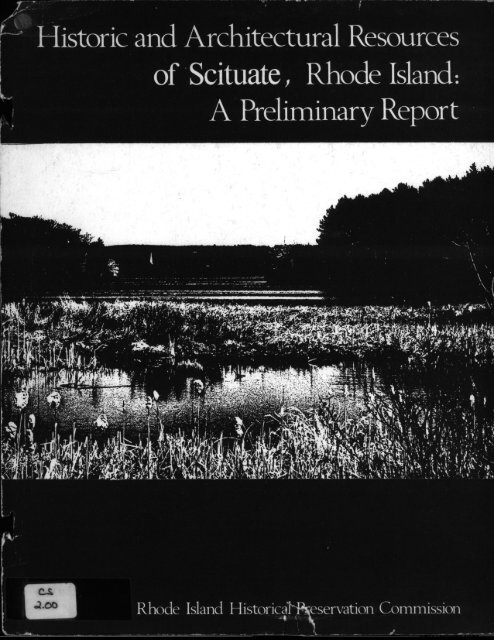
Historic and Architectural Resources<br />
of <strong>Scituate</strong>, <strong>Rhode</strong> <strong>Island</strong>:<br />
A Preliminary Report
STATE OP RHODE ISLAND AND PROVIDENCE PLANTATIONS<br />
PRELIMINARY SURVEY:REP0RT<br />
TOWN OF SCITUATE<br />
MAY, 1980<br />
RHODE ISLAND HISTORICAL PRESERVATION COMMISSION<br />
150 BENEFIT STREET, PROVIDENCE, RHODE ISLAND 02903
1REFACE<br />
The <strong>Rhode</strong> <strong>Island</strong> <strong>Historical</strong> <strong>Preservation</strong> Commission, established<br />
by the General Assembly in 1968, is charged with the responsibility of<br />
safeguarding <strong>Rhode</strong> <strong>Island</strong>’s cultural heritage. In order to provide an<br />
overview of the physical record of this heritage, the Commission has<br />
initiated a "broadbrush" or preliminary planning survey of the rural<br />
and suburban towns of the state. The purpose of this initial inven<br />
tory is to identify and record properties of historic and architec<br />
tural significance in each town. Presently, archeological resources<br />
are treated through a separate survey effort being conducted by the<br />
Commission. The preliminary surveys are designed to provide a cata<br />
logue of nonrenewable cultural resources. This information is needed<br />
for a variety of planning purposes at the local, state, and national<br />
levels. It identifies sites, districts, and structures eligible for<br />
nomination to the National Register of Historic Places and it becomes<br />
the basis for establishing preservation planning priorities based on<br />
problems and potentials discovered as part of the survey process.<br />
The preliminary surveys are accomplished by driving all public<br />
rights-of-way in a given town and noting on United States Geological<br />
Survey maps enlarged to twice normal scale or other maps that may be<br />
more appropriate each building or site of particular architectural,<br />
visual, cultural, or historic significance. Each property is photo<br />
graphed and recorded on a standard data sheet which includes a physi<br />
cal description and notations concerning history, use, condition, and<br />
architectural style or period. The significance of each property is<br />
evaluated in a preliminary fashion and properties are designated as<br />
being in one of three categories: properties already on, or approved<br />
at the State Review Board level for nomination to, the National Regis<br />
ter of Historic Places; properties recommended at the staff level for<br />
nomination to the Register; and other significant properties, some of<br />
which, with further study and review, may be determined to be eligible<br />
for the Register; Archeological sites are covered in separate pre<br />
liminary surveys and are mentioned only incidentally in these studies<br />
in order to provide historical context. No documented Native American<br />
sites are known in <strong>Scituate</strong>, and, as this survey did not include<br />
archeology, nothing was added to our knowledge of pre-colonial habita<br />
tion here.<br />
Previous studies are reviewed, and town histories, reports, and<br />
other readily available information are researched to ensure that all<br />
published historic sites and structures are included in the study.<br />
Local planners and historical societies are consulted wherever<br />
possible.<br />
Upon completion of the survey, finished maps are developed and a<br />
brief report written. The result is a preliminary document--useful<br />
until a full-scale intensive cultural-resource survey of the community<br />
can be completed. The <strong>Rhode</strong> <strong>Island</strong> <strong>Historical</strong> <strong>Preservation</strong> Commission<br />
intends to conduct such intensive surveys as soon as funds and<br />
staffing are available.<br />
-1-
INTRODUCTION<br />
The following preliminary study covers the historical and<br />
architectural resources of <strong>Scituate</strong>. It provides basic information<br />
needed so that cultural resources can begin to be properly considered<br />
in making future planning decisions at all levels.<br />
The report includes an illustrated account of <strong>Scituate</strong>’s archi<br />
tectural and developmental history in Section I. Section II is a<br />
comprehensive list of properties in the town already listed in the<br />
National Register of Historic Places, followed by those approved by<br />
the <strong>Rhode</strong> <strong>Island</strong> Review Board for the Register and those recommended<br />
for nomination to the National Register as a result of this prelimi<br />
nary survey. Section III is an annotated inventory of properties of<br />
historical and architectural importance in the town. The inventory<br />
numbers are keyed to the small-scale locational map at the rear of<br />
this publication. For more precise information on the location of<br />
properties, reference should be made to the large-scale, preliminary,<br />
cultural-resource survey map prepared by the <strong>Historical</strong> <strong>Preservation</strong><br />
Commission and drawn at a scale of one inch to one thousand feet.<br />
This large-scale map is on file at the <strong>Rhode</strong> <strong>Island</strong> <strong>Historical</strong> Preser<br />
vation Commission and in the <strong>Scituate</strong> Town Hall; copies have also<br />
been deposited with the State Department of Transportation, the Divi<br />
sion of Statewide Planning, and the Department of Community Affairs.<br />
The Commission would like to thank the many officials, residents,<br />
and scholars who assisted in the conduct of the preliminary survey<br />
and in the publication of this report. In particular, the Commission<br />
would like to thank the <strong>Scituate</strong> <strong>Historical</strong> and <strong>Preservation</strong> Society<br />
and the North <strong>Scituate</strong> Public Library, especially Jane Folcarelli,<br />
former president of the Society, Barbara Stetson, and Ernest Edwards.<br />
-ii-
TABLE OF CONTENTS<br />
Preface<br />
Introduction<br />
I. Analysis<br />
Overview<br />
Location<br />
Roads<br />
and population<br />
Geology and Landforms<br />
The Seventeenth Century.;.<br />
Native Inhabitants<br />
Laying Out the Land<br />
The Eighteenth Century<br />
Early Land Settlement....<br />
Esek and<br />
Roads<br />
Stephen Hopkins.<br />
Early Settlements: Richmond and North Sci tuate 6<br />
Early Industry: Sawmills, Gristmills and Iron.<br />
6<br />
Population Growth and Political Independence.<br />
7<br />
Postwar Houses<br />
7<br />
The Plainfield Turnpike.<br />
7<br />
The Nineteenth Century<br />
8<br />
Turnpikes<br />
8<br />
Waterways and Industrial Tran sformation 8<br />
Hope<br />
9<br />
Glen Rock<br />
9<br />
Fiskeville<br />
10<br />
Richmond<br />
10<br />
Rockland<br />
11<br />
Ashland<br />
11<br />
Clayville<br />
11<br />
Jackson<br />
12<br />
Ponaganset<br />
12<br />
North <strong>Scituate</strong><br />
12<br />
Saundersville<br />
13<br />
Kent<br />
13<br />
Elmdale and Harrisdale..<br />
13<br />
Pottersville<br />
13<br />
Quarrying<br />
14<br />
Churches<br />
14<br />
Schools<br />
15<br />
The Smithville Seminary.<br />
16<br />
Summary<br />
16<br />
Twentieth Century<br />
17<br />
The <strong>Scituate</strong> Reservoir..<br />
17<br />
Automobiles and Roads...<br />
18<br />
North <strong>Scituate</strong> Village..<br />
18<br />
Changes: Buildings and Population 19<br />
Summary<br />
19<br />
-t 11-<br />
I_i<br />
:i.<br />
1<br />
1<br />
1<br />
2<br />
4<br />
4<br />
4<br />
5<br />
5<br />
5<br />
6
II. The National Register of Historic Places....<br />
III. Preliminary Inventory of Cultural Resources.<br />
Districts<br />
Structures and Sites<br />
Appendix A: Natural Features and Areas<br />
Bibliography<br />
Credits<br />
Map of Physical Features<br />
Map of Cultural Resources<br />
- iv-<br />
21<br />
23<br />
24<br />
35<br />
65<br />
66<br />
70<br />
following page 1<br />
following page 64
i<br />
a<br />
0<br />
I,<br />
NOPKINtO$<br />
MASS<br />
MITHFIfl<br />
--1- -.<br />
I SMITHFILD<br />
*1.11<br />
JOHWS1QN<br />
AS?<br />
OREw*iCH<br />
a Saufl<br />
* *‘iIs r 3*w<br />
TOWN OF SCITUATE<br />
LINLUL S CI NYWAI<br />
IT<br />
RHODE ISLAND<br />
a N
I. ANALYSIS<br />
OVERVIEW<br />
Colonists moving out from <strong>Rhode</strong> <strong>Island</strong>’s earliest European<br />
settlement site at Providence came to what is now <strong>Scituate</strong> around<br />
1700. In the eighteenth century the town experienced intense agri<br />
cultural development and in the nineteenth century remarkably wide<br />
spread industrial development along its numerous rivers and streams.<br />
Yet curiously, <strong>Scituate</strong>’ s present-day, woodsy, cural character<br />
results from two early twentieth-century phenomena which dramati<br />
cally shifted the town’s development pattern, rapidly returning<br />
<strong>Scituate</strong> to a seemingly primeval state not present since the precolonial<br />
era.<br />
In the first half of the twentieth century <strong>Rhode</strong> <strong>Island</strong>’s agri<br />
culture declined precipitously, a decline which had its origins in<br />
major economic and demographic shifts dating at least to the midnineteenth<br />
century. In <strong>Scituate</strong>, as in neighboring towns, thousands<br />
of acres of fields and meadows--land open for two centuries and de<br />
fined by miles of stone walls--gradually were abandoned and,in the<br />
course of a generation, reforested. A factor particular to <strong>Scituate</strong>,<br />
however, had an even greater effect on the "re-ruralization" of the<br />
community--construction of the <strong>Scituate</strong> Reservoir. Developed between<br />
.1920 and 1926, and built to serve the City of Providencethe <strong>Scituate</strong><br />
Reservoir now supplies freshwater to the Providence Metropolitan area.<br />
Today about 42 per cent of <strong>Scituate</strong>’s area is taken up by the reser<br />
voir and its protected, forest watershed. More than anything else,<br />
these developments shaped present-day <strong>Scituate</strong>, recasting its geog<br />
raphy, economy, and population. In considering the history and<br />
historic resources of the town, they should constantly be kept in mind.<br />
LOCAtION AND POPULATION<br />
<strong>Scituate</strong>, a Providence County town, occupies an interior posi<br />
tion in the north-central part of the state, about seven miles west<br />
of Providence. A nearly rectangular parallelogram, <strong>Scituate</strong> is<br />
bordered by Johnston and Cranston on the east, Coventry on the south,<br />
Foster on the west, and Glocester on the north. Some 7,500 residents<br />
occupy the town’s fifty-five-square-mile area; its low population<br />
density resulting, in part, because of the large amount of land in<br />
reservoir property and unavailable for development.<br />
ROAD S<br />
A network of numbered highways crisscrosses <strong>Scituate</strong>, in general<br />
avoiding the reservoir which forms a enormous "Y" across the center of<br />
town. In origin, most of these highways though often moved and modi<br />
fied date to the eighteenth or early nineteenth century and form the<br />
-1-
LOC ESTER<br />
COVENTRY<br />
SCITUATE, R.I.<br />
PHYSICAL FEATURES<br />
MAY 1980<br />
Scale of Miles
western spokes of a wheel of roads which link Providence to its<br />
environs and more distant centers. The most important is U.S. Route 6.<br />
Traversing the northern part of <strong>Scituate</strong>, it is one of the state’s<br />
prime east-west highways, a major trunk route to Danielson, Willimantic,.<br />
and the Connecticut Turnpike. U.S. 6 formerly passed through North<br />
<strong>Scituate</strong> village; the <strong>Scituate</strong> By-Pass, built about 1970, skirts the<br />
northern part of the village. Route 101, the Hartford Pike, begins<br />
just east of the village and rubs together with U.S. 6 for several<br />
miles to just west of the <strong>Scituate</strong> Reservoir, where they divide.<br />
Plainfield Pike, State Route 14, also running generally east-west,<br />
crosses the central part of town. Route 12, <strong>Scituate</strong> Avenue and Tunic<br />
Hill Road, a lightly traveled road, meanders through the southern part<br />
of town, skirting the lower reaches of the reservoir. Victory Highway,<br />
Route 102, the most important north-south link in western <strong>Rhode</strong> <strong>Island</strong>,<br />
carries traffic in the western part of town, from Clocester in the north<br />
into Foster in the south, passing through the village of Clayville.<br />
Route 116, known by different names, runs in a north-south direction<br />
along the eastern, side of the reservoir. In addition, one local high<br />
way, the Rockland-<strong>Scituate</strong> Road, has major transportation importance.<br />
It carries traffic diagonally across the north-central part of town,<br />
connecting Danielson Pike with routes 14 and 102 at Crazy Corner. High<br />
ways are <strong>Scituate</strong>’s sole means of transportation. There are neither<br />
railroads nor airfields in town.<br />
The town’.s streams are not navigable, hut once served as a source<br />
of power for dozens of mills. <strong>Scituate</strong>’s largest waterway is the North<br />
Branch of the Pawtuxet. Beginning at the Kent, or Gainer Dam, it flows<br />
southeastward through the village of Hope, then passes through Jadkson<br />
and Fiskeville in <strong>Scituate</strong> before entering Cranston and Coventry at the<br />
southeast corner of <strong>Scituate</strong>.<br />
GEOLOGY AND LANDFORMS *<br />
Located in the Upland section of New England, <strong>Scituate</strong> is under<br />
lain by old crystalline rocks, mostly granite. Formerly part of the<br />
more extensive Appalachian Mountain system, the land was worn down<br />
over millions of years of weathering and erosion. In the recent geo<br />
logic past, continental glaciers--vast ice sheets overriding the land-covered<br />
this area. The southward-moving ice mass carried large<br />
quantities of soil and boulders, which were deposited indiscriminantly<br />
over the land when the ice sheet melted about 11,000 years ago. The<br />
unsorted material deposited, a mixture of soil and rocks, is known to<br />
geologists as till. In places where large ice blocks were left stand<br />
ing on the land, then covered up with material deposited by glacial<br />
meltwaters, a knobby terrain, known as kame-and-kettle topography,<br />
resulted. Rivers flowing under the ice sheets also deposited material<br />
in a linear pattern. They now exist as relatively sharp-topped ridges<br />
known as eskers. Other glacial deposits were sorted out by the action<br />
*Refer to the map of physical features following page iv for locations.<br />
-2-
of running water--the material deposited ranging from coarsely sorted<br />
pebbly mixtures to fine sand and clay. Large sandy areas along glacial<br />
lalces are known as kame terraces. Large boulders that were carried<br />
from elsewhere and left perched on the land, sitting,on bedrock of<br />
another maferial, .are known as glacial .erratics. Glacial material also<br />
blocked pre-existing watercourses, resulting in the many swampy areas-along<br />
the Swamp Brook headwaters; at two areas, both known as Pine<br />
Swamp, in the eastern part of town; .and along .Quonopaug Brook, Wilbur<br />
Hollow Brook, and Boyd Brook. Several other former swamps were covered<br />
by the <strong>Scituate</strong> Reservoir waters.<br />
The long period of erosion, and the sceuring effect of the glacier<br />
as it moved south, resulted in a very irregular topography with smooth<br />
hilltops. <strong>Scituate</strong> is a hilly town, with elevations over 400 feet<br />
above sea.level. Rocky Hill, in the northeast, is 482 feet high, and<br />
Burnt Hill, in the southeast rises to a 430-foot elevation. The highest<br />
altitudes are in the western part of town. ln the southwest corner is<br />
a relatively rugged, sparsely inhabited area containing Mount Niery<br />
528 feet, Field Hill 537 feet, Tunk hill 580 feet, and Big<br />
Hill 590 feet. The northwest corner of the town is the highest.<br />
Round Hill, on the Foster town line, is 610 feet, and Chopmist Hill,<br />
at 730 feet above sea level, is the highest point in <strong>Scituate</strong> and one<br />
of the highest in <strong>Rhode</strong> <strong>Island</strong>. The topography of <strong>Scituate</strong>, and prox<br />
imity to <strong>Rhode</strong> <strong>Island</strong>’s major urban centers, has substantially influ<br />
enced settlement. <strong>Scituate</strong>’s population today is concentrated in the<br />
eastern part of town. At the extreme southeastern corner of town, where<br />
the North Branch of the Pawtuxet River flows into Cranston and Coventry,<br />
ocurrs the lowest elevation, about 150 feet above sea level.<br />
Most of <strong>Scituate</strong> lies within the watershed of the North Branch of<br />
the Pawtuxet River, which originally was formed by the confluence of the<br />
Moswansicut and Ponaganset rivers. The Ponaganset rises in Glocester.<br />
A dam at the Foster-<strong>Scituate</strong> town line holds back the river waters to<br />
form the Barden Reservoir; thence, the Ponaganset flows a short distance<br />
eastward into the <strong>Scituate</strong> Reservoir. The Moswansicut was flooded by<br />
the <strong>Scituate</strong> Reservoir in the northeast part of town. The rivers, and<br />
their tributaries, were an essential part of <strong>Scituate</strong>’s early industrial<br />
development, first supplying power for small sawmills and gristmills,<br />
then powering largercotton textile mills and bobbin factories which<br />
were the nucleus of several mill villages. A number of mill sites<br />
today decaying ruins.scattered about the town serve as reminders of<br />
the contribution of the waterways to the town’s economy and way of life.<br />
Most of <strong>Scituate</strong>’s brooks flow into the <strong>Scituate</strong> Reservoir, the<br />
largest freshwater body in <strong>Rhode</strong> <strong>Island</strong>. Its surface area of 5.3<br />
square miles is about 100 per cent of the total area of the town of<br />
<strong>Scituate</strong>. Moswansicut Pond, in the northeast cerner of town, is a<br />
relatively large water body, and there are about a dozen smaller ponds<br />
in the town.<br />
-3-
Corn Crib, Hartley Luther Farm:<br />
Rocky Hill Road. Map #42<br />
Stone work: Elmdale Road. Dexter Lane Roadscape. Map #38
Originally forested, then largely cleared for farms, <strong>Scituate</strong><br />
today is mostly wooded again. Much of the land, particularly in the<br />
southwest quadrant of town, is still in a wild state.<br />
A survey of "unique natural areas" conducted by the <strong>Rhode</strong> <strong>Island</strong><br />
Audubon Society in the early 1970s, recorded natural features in<br />
cluding rare individual plants and communities, swamps, scenic wood<br />
lands, brooks and waterfalls, eskers, kames, erratics and other glacial<br />
features, and several rock outcrops at least one associated with Early<br />
Americans. A list of important natural areas and features is included<br />
as Appendix A of this report.<br />
THE SEVENTEENTH CENTURY<br />
Native Inhabitants<br />
Before discussing the document history of <strong>Scituate</strong>, it is important<br />
to note that Indians were present in the area for thousands of years<br />
before the arrival of European settlers. Native Americans hunted,<br />
fished gathered nuts and other forest products, and probably planted<br />
some crops in clearings in the woods. Settlements most likely were<br />
temporary, based on the seasonal patterns dictated by nature. The<br />
Native American use of. the land was a major aspect of the cultural his<br />
tory of the community. However, little professional archeological in<br />
vestigation has been done in the town; consequently, accurate knowledge<br />
of the life of <strong>Scituate</strong>’s earliest inhabitants is sketchy at best.<br />
Laying Out the Land<br />
The seventeenth-century history of <strong>Scituate</strong> focuses on land owner<br />
ship and other matters relating to land claims. In 1638, Roger Williams<br />
received from Canonicus and Miantonomi, sachems of the Narragansett<br />
Indians, a deed to land reaching to the Pawtuxet River. Uncertainty<br />
about the headwaters of the river resulted in an indefinite western<br />
boundary and conflicting claims to 1and Much of present-day <strong>Scituate</strong><br />
was involved in this dispute, for here the North Branch of the Pawtuxet<br />
begins. In 1660, after the work of laying out boundaries was completed,<br />
the Providence Plantations consisted of the combined areas of two<br />
purchases. Land lying within a north-south dividing line drawn seven<br />
miles west of Fox Point in Providence was known as "the inlands."<br />
Between seven and twenty miles west of Fox Point, the territory now<br />
comprising the towns of <strong>Scituate</strong>, Foster, Glocester, and Burrillvi1le<br />
was referred to as "the outlands," or "the Providence Woods." Part<br />
of the present eastern boundary of the town of <strong>Scituate</strong> lies along the<br />
Seven Mile line. The lands south of the Ponaganset River were acquired<br />
in 1662 by William Vaughn and his associates from the sachems Newcom and<br />
Awashouse. A second deed in this land transcation, known as the<br />
Westconnaug Purchase, was secured by Zachariah <strong>Rhode</strong>s and Robert<br />
Westcott, also in 1662. In the early eighteenth century, an agreement<br />
-4-
was made between the Westconnatig and the Providence proprietors settling<br />
the issue of ownership of the Westconnaug Purchase territory.<br />
Land divisions were carried out over a long period of time. Be<br />
tween 1684 and 1755, there were thirteen divisions of the Outlands be<br />
fore the entire tract was laid out. Although some land was allocated<br />
in the late seventeenth century, there was only one European settler<br />
in the present town of Sctiuate before the century’s end--John<br />
Mathewson--who took up residence in a primitive structure near the north<br />
end of Moswansicut Pond in 1694.<br />
THE EIGHTEENTH CENTURY<br />
Early Land Settlement<br />
Emigration into <strong>Scituate</strong> began in earnest soon after 1700. In 1703,<br />
Joseph Wilkinson settled in the northwestern part of town; he is said to<br />
have brought the first cow into <strong>Scituate</strong> and to have built the first<br />
barn. Other settlers followed, establishing homesteads throughout the<br />
town. Many acquired large tracts of land. Early families included the<br />
Mathewsons, Wilkinsons, Aldriches, Harrises, Hopkins , Arnolds, Smiths,<br />
Angells, and Browns. The century was dominated by an agricultural<br />
economy with most of the families tied to the land. Sons and daughters<br />
established their own farmsteads, population grew rapidly, and by century’s<br />
end most of <strong>Scituate</strong> landscape had been transformed from woods to the<br />
open spaces of fields and pastures.<br />
Most of the farmers grew only enough food for their own use and a<br />
little for purchase of necessities. The settlers’ simple way of life<br />
was reflected in their homes and outbuildings, which were solid and una<br />
dorned structures, Several typical mid-eighteenth-century <strong>Scituate</strong><br />
houses, usually two-and-a-half stories--with a large, brick, center<br />
chimney--survive. The finest are entered in, approved for, or recommended<br />
for entry in the National Register of Historic Places--the c. 1740 Martin<br />
Smith Farm, or Hidden Wells #54*, on Cleaner Chapel Road; the c. 1745<br />
Brown House #127, on Rocky Hill Road; the c. 1750-1760 Battey-Barden<br />
House #107, bn Plainfield Pike; the Aldrich House #131, on Rocky Hill<br />
Road; and the John Mathewson House # 157, on Winsor Road. As a group<br />
they are representative of a pervasive New England hometype.<br />
Esek and Stephen Hopkins<br />
Although most of the settlers and their families stayed on the land,<br />
others chose different ways of life. Among those who moved from <strong>Scituate</strong><br />
were Esek and Stephen Hopkins. Esek left the family farm in his twentieth<br />
*Numbers in parentheses refer to the Inventory Section III and to the<br />
map of Cultural Resources following page 44.<br />
-5-
Brown Homestead Cc. 1745: Rocky Hill Road. #127<br />
Aldrich House: Rocky Hill Road. #131<br />
Captain Richard <strong>Rhode</strong>s House R.I. State Police<br />
Headquarters: Danielson Pike #31
year and went to sea, eventually serving in the Revolutionary War<br />
and rising to the rank of Commander-in-Chief. Esek’s brother, Stephen,<br />
after some thirty years on the farm, moved to Providence, where he went<br />
into business and became an associate of the Brown family, the leading<br />
merchants of Providence. Stephen Hopkins lead one of the state’s two<br />
political factions, with Brown’s backing. lie was chief justice and<br />
governor of the state and played an important role in bringing what is<br />
now Brown University to Providence. His greatest acclaim is for his<br />
outspoken promotion of American independence, which climaxed with his<br />
signing of the Declaration of Independence.<br />
Roads<br />
In eighteenth-century <strong>Scituate</strong>, as new settlers cleared the land<br />
and established farmsteads, the need for services grew. The <strong>Rhode</strong><br />
<strong>Island</strong> General Assembly, seeking to promote commercial intercourse be<br />
tween the city and its hinterland and the adjacent colonies, established<br />
a number of highways. In 1711, a road was ordered laid out from Weybosset<br />
Bridge in Providence to the colony line to meet a road coming<br />
from Plainfield, Connecticut. The road, following present Plainfield<br />
Street in Providence and Plainfield Pike in the several towns it passes<br />
through, was completed in <strong>Scituate</strong> in 1714, where it was called the<br />
Great North Road.<br />
Early Settlements: Richmond and North <strong>Scituate</strong><br />
Early highways were instrumental in the creation of two villages--<br />
Richmond and North <strong>Scituate</strong>. At Richmond, along the Ponaganset River<br />
in the south-central part of town, the Angell Tavern was established in<br />
the early eighteenth century to serve travelers along Plainfield Pike.<br />
It was probably the first commercial establishment in <strong>Scituate</strong>. During<br />
the century, also, <strong>Scituate</strong>’s first church--a Six Principle Baptist<br />
society--was formed in Richmond. The Friends Quakers were organized<br />
and had a meeting there before the Revolutionary War. In what became<br />
the village of North <strong>Scituate</strong>, in the northeast part of town, a hotel<br />
was built at Four Corners as it was known then. It served as the<br />
nucleus of a small, late eighteenth-century settlement which included<br />
a store and several residences. --<br />
Early Industry; Sawmills, Gristmills, and Iron<br />
In addition to highways, waterpower sites helped create several<br />
colonial settlements. Small mills, serving a local neighborhood, were<br />
established at a few locations in the early part of the eighteenth<br />
century. According to historical accounts, a gristmill and a sawmill<br />
were built in North <strong>Scituate</strong> and a corn mill began operating in<br />
Ponaganset during the century. James Mathewson, son of John Mathewson,<br />
took 110 acres of land at a site known as "The Falls" and built a grist<br />
mill and sawmill along the Moswansicut River at what -later became<br />
Ashland.<br />
-6-
The latter half of the eighteenth century saw the establishment<br />
of two iron manufacturies in town. John Barden’s forge at Ponaganset<br />
started about 1760 using ore from Cranston probably served the local<br />
area. Hope Furnace, established ahout 1766, however, was ci more<br />
ambitious enterprise. Founded by Nicholas Brown and Company and in<br />
cluding as partners Stephen Hopkins and Israel Wilkinson--the latter<br />
the former owner of Unity Furnace present-day Manville-- a furnace<br />
was built into the side of a small hill. Nearby was a forge where pig<br />
iron was refined and hammered into bars of wrought iron. Other build<br />
ings were erected, some experienced men were imported, and the small<br />
community of Hope was started. At first manufacturing domestic pro<br />
ducts such as nails and cask hinges, during the Revolutionary War Hope<br />
Furnace turned its attention to the manufacture of cannon. Between<br />
1778 and 1781, some 170 cannon were cast, of which about two-thirds were<br />
put aboard American privateers. Cannon making continued until 1799.<br />
Several years later, the furnace stopped operating and the works and<br />
the mill property were sold. Today, there is little material evidence<br />
of the existence of the furnace, although slag is liberally sprinkled<br />
throughout the yards of several homes in the vicinity of the old iron<br />
works.<br />
Population Growth and Political Independence<br />
The town’s growing population, combined with distance from the<br />
seat of government in Providence, resulted in the incorporation of<br />
<strong>Scituate</strong> and several other towns in 1731. <strong>Scituate</strong> then included, the<br />
town of Foster, which became an independent political unit a half<br />
century later. While the town’s population increased at a steady rate<br />
in the early. part of the century, the greatest population growth, an<br />
increase of 55 per cent, occurred during the last quarter of the century-between<br />
the end of the Revolutionary War and the beginning of the<br />
nineteenth century. The 1800 census recorded a <strong>Scituate</strong> population of<br />
2,523 people.<br />
Postwar Houses<br />
Substantial farmhouses continued to be built in the late nineteenth<br />
century, essentially following the same plan as earlier houses. The<br />
postwar houses, however, showed modest changes in architectural "style"-the<br />
most conspicuous new element being a fine pedimented main doorway<br />
with a semicircular or semi-elliptical fan, and fluted pilasters,<br />
instead of the simply framed entry of earlier times. A good example of<br />
such new, Federal entryways is seen in the c. 1793 Brown House #127,<br />
on Rocky Hill Road, which is recommended for the National Register.<br />
The Plainfield Turnpike<br />
The increasing population and relative prosperity of the rural<br />
areas stimulated more highway improvements in the late eighteenth and<br />
early nineteenth centuries. Although the Plainfield Pike was in<br />
-7-
existence through the eighteenth century, and a line oF stage.. was<br />
operating along it between Hartford, Providence, and Boston, the road<br />
was never in good condition, making movement of people and goods<br />
difficult. Upon the urging of many road-improvement supporters, an<br />
act incorporating the Providence-Norwich Turnpike Society for establishing<br />
a turnpike road was passed by the <strong>Rhode</strong> Tsland General<br />
Assembly in 1795. Creation of the road, later known as the Plainfield<br />
Pike, opened the turnpike era in <strong>Rhode</strong> <strong>Island</strong>.<br />
THE NINETEENTH CENTURY<br />
The nineteenth century was a time of dramatic change in <strong>Scituate</strong>.<br />
<strong>Rhode</strong> <strong>Island</strong>’s industrial transformation stormed the entire state,<br />
converting sleepy hamlets into bustling and prosperous mill villages.<br />
Turnpikes helped promote the flow of goods between the rural hinterland<br />
and the port city of Providence. But, the growth of industry, providing<br />
an alternative to the demands of farm life, and competition from western<br />
farmers, beginning with the opening of the Erie Canal in 1825, spelled<br />
the decline of agriculture as the major component of <strong>Scituate</strong>’s economy.<br />
By mid-century, at least, manufacturing was the most important economic<br />
force, and continued to be the backbone of the economy throughout the<br />
rest of the century.<br />
Turnpikes<br />
The Plainfield Pike present Route 14, also known as the Providence<br />
and Norwich Turnpike during part of the nineteenth century, was a fore<br />
runner of other turnpikes which connected Providence with its rural<br />
hinterland and with urban centers in adjacent Connecticut and Massachu<br />
setts. In 1803, the Hartford Pike later Route 101, originally the<br />
<strong>Rhode</strong> <strong>Island</strong> and Connecticut Turnpike, was chartered, running westward<br />
from its eastern terminus at Manton. The Foster and <strong>Scituate</strong> Turnpike<br />
Company, chartered in 1813, had a highway from the Connecticut line to<br />
Hopkins Mills in Foster. Later, the road, which eventually became<br />
known as the Danielson Pike Route 6, was extended to run through<br />
<strong>Scituate</strong> to its junction with the <strong>Rhode</strong> <strong>Island</strong> and Connecticut Turnpike<br />
at North <strong>Scituate</strong>. Central Pike, created in 1814 by an act of incorpor<br />
ation, was not completed until 1822, when a new act of incorporation was<br />
filed. The last turnpike completed in <strong>Scituate</strong>, Central Pike, ceased<br />
to be a toll road in 1842. In 1866, the section of Plainfield Pike in<br />
<strong>Scituate</strong> became a free road, and the entire pike was toll free by about<br />
1870. About that time 1870, Hartford Pike, Danielson Pike, and all<br />
the other <strong>Rhode</strong> <strong>Island</strong> turnpikes also became free roads, bringing the<br />
turnpike era to an end.<br />
Waterways and Industrial Transformation<br />
While the turnpikes opened up the rural areas by enlarging markets<br />
for agricultural products and goods derived from nature, it was the<br />
rivers and brooks of <strong>Scituate</strong> that helped transform the town’s economy<br />
-8-
ee Revivai liouse: FLela Hill<br />
goad Map #48A<br />
Dexter Arnold House 1813: Chopmigt Hill Road.<br />
Map #21<br />
House: Howard Avenue. Map #73
from agricultural to industrial. The town was richly endowed with<br />
waterways. The Moswansicut and Ponaganset rivers and several of their<br />
tributaries offered fine potential for waterpower sites. Near the<br />
center of Scicuate the rivers joined to form the North Branch of the<br />
Pawtuxet. The Pawtuxet Valley became one of the major industrial areas<br />
of the state and nation in the nineteenth century. Following the<br />
successful operation of America’s first cotton textile mill, in<br />
Pawtucket in 1790, textile manufacturing spread throughout the state.<br />
In 1811, there were about three dozen textile mills operating in the<br />
state, with the center of production along the Pawtuxet River. By<br />
1832, there were more than 100 cotton mills recorded in <strong>Rhode</strong> <strong>Island</strong>,<br />
including about a dozen in <strong>Scituate</strong>. Between 1820 and 1830, the<br />
population of <strong>Scituate</strong> increased by 41 per cent, a reflection of the<br />
growth of mills and mill villages during this period of very active<br />
- textile-manufacturing development. -<br />
Hope<br />
Cotton-goods manufacturing began in <strong>Scituate</strong> in about 1806 when a<br />
group of Providence men organized as the Hope Cotton Factory Company<br />
and built a mill along the Pawtuxet River, near the site of the Hope<br />
Furnace, thereby establishing the first mill village in the town.<br />
About 1825, another mill was built and a boarding house for mill workers<br />
was opened. The mill burned in 1844 and was replaced by the present<br />
large, four-story, stone building 1/2E by the firm of Brown and Ives,<br />
which had purchased the mill site. Hope experienced its most rapid<br />
growth soon after 1871 when a large stone addition was made to the<br />
1844 mill. Thirteen double-tenement houses #2K were built for<br />
employees on a *street near the mill and many fine residences were<br />
erected in the "outskirts" of the compact village. In 1874, a church<br />
#2H was completed and a library and reading room established. At<br />
the end of the decade of the 1870s, Hope, at the terminus of the<br />
Pawtuxet Railroad, was described as a "thriving little village," with<br />
two or three stores and some mechanical trade. The Hope Manufacturing<br />
Company gave the village "a large supply trade and consequent appearance<br />
of enterprise and thrift," according to bag and Wade’s History of<br />
<strong>Rhode</strong> <strong>Island</strong> written in 1878.<br />
Glen Roëk<br />
About 1810, a stone mill #155 was built in the northeastern part<br />
of town, near the outlet of MoswansicutPond., by Captain Benjamin Aborn.<br />
The mill, which manufactured yarns, became part of the <strong>Scituate</strong> Manu<br />
facturing Company; it was later identified as the Smith and Nichols<br />
Cptton Mill and the Moswansicut Manufacturing Company. A small com<br />
munity of about a dozen houses, known as Glen Rock in the late nineteenth<br />
century, lined West Greenville Road south of the mill.<br />
-9-
Mill House early 19th century: 52 Hope Furnace<br />
Road, Hope Historic District. Map #2D<br />
Mill Hou8e 1872:. Mill Street, Hope Historic<br />
Dlstricl. Map #2K<br />
M. Potter House c. 1711 and later:<br />
Pike. Map #99<br />
Old Plinfield
Fiskeville<br />
Three more cotton factories, at Fiskeville, Richmondand Rockland,<br />
were erected in 1812. Fiskeville was started by Caleb Fiske who<br />
settled in the southeast corner of <strong>Scituate</strong>, near Cranèton, in the late<br />
eighteenth century. A doctor, he served as a surgeon during the Revo<br />
lutionary War and later became renown in <strong>Rhode</strong> <strong>Island</strong> for his medical<br />
service and for the training of medical students. He was one of the<br />
original members of the <strong>Rhode</strong> <strong>Island</strong> Medical Society, and served as<br />
its president during the year 1823-1824. After his death, the society<br />
received his library and a fund--the Fiske Fund--was set up in his<br />
memory. Dr. Fiske and his son, Philip, dammed the Pawtuxet River and<br />
built a cotton mill near the river, in <strong>Scituate</strong>, in 1812. The mill,<br />
typical of the early types, was a long and narrow frame structure with a<br />
tower. It was used throughout the nineteenth century, becoming idle<br />
shortly before 1900. Sometime after Dr. Fiske’s death in 1835 the mill<br />
became part of the Jackson Mills, and in the latter part of the century<br />
operated as part of the large B. B. & R. Knight textile empire. Fiskeville<br />
is usually associated with Cranston rather than with <strong>Scituate</strong><br />
because most of the buildings, including Dr. Fiske’s residence, were in<br />
Cranston, but the mill, and about a dozen nearby mill houses, were<br />
located in <strong>Scituate</strong>. Surviving mill houses from the early industrial<br />
era include some small, wood-frame, one-and-a-half-story cottages #77<br />
and some rare examples of early stone mill-house architecture #83.<br />
Richmond<br />
Richmond’s first textile mill, a stone mill, was erected in 1812<br />
by a company of about a dozen men and operated under the name of the<br />
Richmond Company. The history of the village is confusing, but it is<br />
recorded that a factory--erected in 1826 by Daniel Fiske to manufacture<br />
axes, scythes,and spindles--burned in 1877 and later became Steere’s<br />
shoe and corset-lacing factory. The Wilbur Factory, started by Samuel<br />
Wilbur in 1829 for the manufacture of spools and bobbins, burned in<br />
1884 but was immediately rebuilt. At mid-century, Richmond contained<br />
at least one textile mill, a sawmill, a gristmill, a hotel, a school,<br />
the A. Angell Hotel, and a post office. An Episcopal Church was added<br />
to the village just before 1860. William E. Joslin, a manufacturer of<br />
all the leading lace lines in tubular and Elat shoelaces, established<br />
his business in Richmond and nearby South <strong>Scituate</strong> in 1865. Joslin<br />
also acquired other mills--in Saundersville, Ponaganset, and Clayville-as<br />
well as the Dyerville Mill, the Merino Mill, and Tobey Street Mills<br />
in Providence. By 1870, Richmond contained R. Joslin’s cotton mill,<br />
three bobbin mills, a schoolhouse, a church, a store and the town hail.<br />
At the end of the nineteenth century, the Joslin property, in addition<br />
to the mills, included several hundred acres of farmland and a suffi<br />
cient number of tenements for 650 employees. All the Joslin mills were<br />
connected by trolley--the Providence and Danielson Railway--the lines<br />
running very close to each factory.<br />
-10-
Rockiand<br />
Another village, which eventually became Rockland, was started<br />
when the first of three mills was erected in 1812 along the Westconnaug<br />
River, a branch of the Ponaganset. Built by Joshua Smith,<br />
Frank Hill and several other men , for the manufacture of cotton yarn,<br />
it was known as the Rockland Mill, or Rockland Factory #114. It<br />
burned in 1854, was rebuilt in 1856, and was leased to Alanson Steere,<br />
who purchased the property in 1865. Extensive additions were made in<br />
1875. The second mill at Rockland, known for a long time as Reming<br />
ton’s Mill, later the Red Mill, was constructed about 1814-1815 by<br />
Peter B. and Peleg C. Remington to manufacture cotton yarn. Located<br />
on the Westconnaug River below the Rockland Mill, it burned in 1840<br />
and was rebuilt. This property was also purchased by Alanson Steere<br />
in 1865. He made extensive additions in 1871 and 1891. A third mill,<br />
also known as the Remington Miii, was erected by Edward Remington in<br />
1831. It manufactured cotton cloth until the Civil War, when manu<br />
facturing stopped. In addition to the three mills in Rockland, other<br />
industrial, commercial, social,and civic buildings were located in the<br />
village, including stores, a post office, a wood shop, a blacksmith<br />
shop, a school, a Christian Church, and an Advent Church, in addition<br />
to several dozen houses, all strung out along Plainfield Pike, Ponaganset<br />
Road and Tunk Hill Road.<br />
Ashland<br />
The waterpower of the falls of the Moswansicut River at what<br />
became Ashland was first harnessed by James Mathewson who built a<br />
sawmill and a gristmill here in the eighteenth century. About 1827,<br />
Ashland, named after Henry Clay’s home in Kentucky, underwent a revit<br />
alization when the old gristmill and sawmill were torn down to provide<br />
a site for cotton mills. New mills and six tenement houses were built<br />
by Hughes and Brown in 1838. In 1847, the Ashland Company was incorpor<br />
ated for the manufacture of cotton goods and twenty-one more tenements<br />
were built. A large addition was made to the mill in 1856, and more<br />
houses were added to the village. The Union Church, built by the<br />
company between 1856 and 1858, was open to all denominations but used<br />
mostly by Methodists. Thereafter, for the rest of the century, the<br />
village remained essentially unchanged. -<br />
C layv i 1 le<br />
Clayville #1, named in honor of Henry Clay, had its industrial<br />
beginnings about 1826 when General Josiah Whitaker, a Providence<br />
merchant and director of the Old Stone Bank, moved here. He operated<br />
a store and a comb factory which made imitation, tortoise-shell, ladies<br />
hair combs. The comb factory operated for a while then, about 1847,<br />
was converted to a rubber mill, manufacturing rubber shoes and other<br />
products. In 1853, it was altered to a cotton mill. Destroyed by fire<br />
-11-
in 1857, it was immediately rebuilt and cotton manufacturing continued.<br />
Subsequently, a lower mill was built and ran in connection with the<br />
1857 mill. A considerable village grew up around the mills along the<br />
Wéstconnaug River near the western border of town. By the end of the<br />
century, the village, partly in the adjoining town of Foster, was<br />
thriving and boasted about forty dwellings, two country stores, a<br />
church, and about two hundred inhabitants.<br />
Jackson<br />
Charles Jackson, who later became governor of <strong>Rhode</strong> <strong>Island</strong>, built<br />
the Jackson Mills #81 in 1825 along the Pawtuxet River in the south<br />
east corner of <strong>Scituate</strong>, between Fiskeville and Hope. Part of a<br />
string of mill villages along the Pawtuxet, Jackson was one of the<br />
smallest, containing the mill, a store, and about a dozen mill houses.<br />
In the late nineteenth century the mills were purchased by Christopher<br />
Lippitt and Company and were subsequently acquired by the firm of<br />
B. B. & R. Knight.<br />
Poriaganset<br />
At Ponagansett #119, the site of an eighteenth-century iron works,<br />
a gristmill and a sawmill were operating in the early nineteenth century,<br />
but the village’s growth is associated with cotton manufacturing. A<br />
cotton mill was built there in 1826, and cotton manufacturing was<br />
carried on almost continuously for the rest of the century. The small<br />
village, which contained about a dozen buildings at its greatest extent,<br />
originally known as Barden’s Mill, then Bettyville, became Ponaganset<br />
when the Ponaganset Manufacturing Company was incorporated in -1854. By<br />
the end of the century, Ponaganset was a relatively compact and selfcontained<br />
community.<br />
North <strong>Scituate</strong><br />
Cotton manufacturing was introduced to the North <strong>Scituate</strong> area<br />
in 1826 when Benjamin Aborn, Thomas Brown, Richard Jackson, and John L.<br />
Hughes built a mill and began the manufacture of print cloths. The<br />
business was carried on by the <strong>Scituate</strong> Manufacturing Company, which was<br />
incorporated in 1834 and which operated until 1889. The <strong>Scituate</strong> com<br />
pany was succeeded by the Moswansicut Manufacturing Company. Develop- -<br />
ment of the cotton textile industry at North <strong>Scituate</strong> and at several<br />
other nearby localities, combined with trade generated by turnpike<br />
travel, resulted in the rapid growth of North <strong>Scituate</strong> village #3 in<br />
the early nineteenth century. By mid-century, the village was thriving,<br />
with a bank, a hotel, other commercial and mercantile establishments,<br />
several churches, an academy, and several dozen houses. Known in midcentury<br />
both as Smithville and North <strong>Scituate</strong>, most of the development<br />
was concentrated along Danielson Pike west of today’s Route 116 east<br />
and west of the Moswansicut River and along a road leading south to the<br />
cotton mill. Although the village continued to grow in the second half<br />
-12-
of the century, the settlement pattern reniained essentially the same,<br />
with heavy development along both sides of the Moswansicut. The area<br />
east of present Route 116 was sparsely settled, containing only the<br />
relatively isolated Lapham Institute, a church, and less than a half<br />
dozen residences. North <strong>Scituate</strong> village, as described in Bayles<br />
History of 1891, with a "healthy and delightful site" and well shaded<br />
streets in summer, was a "beautiful and picturesque" place, with<br />
nearby Lake Moswansicut adding to the beauty of the village.<br />
Saundersville<br />
In the decade between 1830 and 1840, four more mill settlements--<br />
Saundersville, Kent, Elmdale and Harrisdale--were added to the <strong>Scituate</strong><br />
landscape. About 1834, Isaac Saunders and his uncle, Thomas Harkness,<br />
built a mill along Brandy Brook in the eastern part of town and began<br />
the manufacture of cotton cloth at what became Saundersville #13.<br />
During the course of the nineteenth century, several mills worked at<br />
Saundersville under different owners, and a collection of buildings<br />
was erected near the crossroads known as Four Corners. The community<br />
was active in the 1870s and included a bank and a school in addition to<br />
two cotton mills, a braid mill, and several residences, but the place<br />
was in decline before century’s end. One of the mills burned in 1895 and<br />
was never rebuilt.<br />
Kent<br />
At Kent, along the Ponagansett River in the southeastern part of<br />
town, Alanson Steere began manufacturing textiles about 1838 when he -<br />
purchased a sawmill and converted it to a cotton mill. The mill, later<br />
destroyed by fire, was rebuilt in 1873 as a bobbin and spool factory.<br />
Kent remained a small settlement throughout the century. In 1895, it<br />
had a church and a post office, and a school house was located nearby.<br />
There were scarcely more than a half dozen houses in the small cross<br />
roads that defined Kent.<br />
Elmdale and Harrisdale<br />
About 1840, a mill was erected along Huntinghouse Brook by Ansel<br />
Harris. Manufacturing cotton and woolen goods at different times, a<br />
small collection of houses in what became known as Elmdale grew up<br />
around the mill. Manufacturing ceased, before 1878, and thereafter<br />
Elmdale was solely a residential community. Ansel W. Harris, with<br />
A. W. Harris, also erected a mill #103 about 1845 for the manufacture<br />
of cotton goods near Peeptoad Brook in the northern part of town. As<br />
in Elmdale, this mill, in a small area identified as Harrisdale, ceased<br />
operations before the end of the century.<br />
Pottersville<br />
A bobbin industry developed in the southwestern part of <strong>Scituate</strong><br />
in the mid-nineteenth century. In 1828, Moses Potter came to what was<br />
-13-
Ruins of Harrisdale Mill: Ponaganset River, Ponaganset Dam<br />
Peeptoad Road. Map #103 1883 and Site of Ponaganset.<br />
Map #68 and 119<br />
Stone Arch under Peeptoad Road at Site of<br />
Harrisdale Mill. Map #103
later known as Pottersville. He ran a hotel #99 along the Plainfield<br />
Pike then turned his attention to manufacturing, starting a spool-andbobbin<br />
works in 1847. A small linear settlement developed along the<br />
Plainfield Pike near the Foster town line and included, at times, a<br />
sawmill, a turning shop, a school house, a church, and several houses.<br />
Several other bobbin mills were also constructed along Wilbur Hollow<br />
Brook a short distance northeast of Pottersville,by the Knight and<br />
Wilbur families.<br />
The construction of these spooi and bobbin works marked the end of<br />
the era which saw the establishment of mills and factories and creation<br />
of new settlements throughout the town. By mid-century, <strong>Scituate</strong>’s<br />
settlement pattern was fixed--no more new communities would appear on<br />
the land. But, as was noted in the discussion of individual villages,<br />
many mills received substantial additions or were rebuilt, often re<br />
sulting in an attendant growth of the village or community.<br />
Quarrying<br />
Aside from sawmills, gristmiils and textile mills, the only other<br />
notable industry was quarrying. The Nipmuc Quarry #84, an approxi<br />
mately twelve-acre site on the side of Nipmuc Hill in the southwestern<br />
corner of <strong>Scituate</strong>, at the Coventry town line, provided large quantities<br />
of gneiss, a more easily worked.material than granite. Quarrying began<br />
in the mid-nineteenth century. Thousands of loads of stone were eventu<br />
ally removed and used in Providence and other places for curbs,- flagging,<br />
under pinning, door stones, fence posts, sills, and caps.<br />
Churches<br />
Accompanying the nineteenth-century growth of mills, villages, and<br />
population was the establishment of churches and schools. The Six<br />
Principle Church, established in South <strong>Scituate</strong> in the early eighteenth<br />
century, continued to serve as a Baptist church throughout the nine<br />
teenth century, but the Quaker Meeting House; built in 1775, burned in<br />
1785. A second Quaker meetinghouse was built in 1812 on Hartford Pike,<br />
near the present intersection of route 101 and 116, but in the latter<br />
part of the century, services ceased. In the <strong>Scituate</strong> Reservoir water<br />
shed area, it was torn down about 1916.<br />
In 1831, the Old Congregational Church of North <strong>Scituate</strong> #3J<br />
was completed by designer-builder Clark Sayles. A fine, late Federal<br />
structure, entered in the National Register of Historic Places, its<br />
membership was originally Congregational and Baptist. Soon after<br />
services were started in the church, there was disagreement about use<br />
of the building. Some members withdrew and formed a Society of Free<br />
Will Baptists in Smithfield. In 1835, the group organized as the First<br />
Free Will Society in North <strong>Scituate</strong> and occupied a church building on<br />
Danielson Pike. Later, the Baptists built a church on West Greenville<br />
Road. The Congregational Church flourished for a while, but declining<br />
-14-
Beifrey of former Hope Church 1874: 27 Main<br />
Street, Hope Historic District. Map #211
church attendance caused a suspension of regular services about 1898.<br />
Catholic services were held in the walk-in basement of a house on Main<br />
Street in North <strong>Scituate</strong>. -<br />
Another Baptist group, the Second Free Will Baptist Society,<br />
organized in Foster in 1835, and held their meetings at the Beacon Hill<br />
Academy #16 on Chopmist Hill in the northwest part of <strong>Scituate</strong>. The<br />
building was used as a combined district schoolhouse downstairs, with<br />
the chapel, used for religious purposes, on the second floor. Church<br />
services ended in the building in 1913.<br />
In 1843, the Millerites organized-a great camp meeting then later<br />
went on to form the Second Advent Church in North <strong>Scituate</strong>; their build<br />
ing was dedicated in 1867.<br />
Churches were eventually established at Pottersville,Rockland,<br />
Ashland, Richmond, Kent, and Jackson during the nineteenth century.<br />
none of these survive today, but the Tabernacle Baptist Church #135<br />
on Seven Mile Road in Fiskeville, a church #2H erected by the Hope<br />
Manufacturing Company on the main street of their village, and the<br />
former Wayside Gleaner Chapel #59 are extant. By the end of the cen<br />
tury, <strong>Scituate</strong>’s many small churches provided services for residents<br />
of most of the villages and for the town’s dispersed population.<br />
Schools<br />
In the early years of the nineteenth century, needs for eduation<br />
were fulfilled by groups of individuals who were incorporated and built<br />
schoolhouses. The first school of record was built by the Union School<br />
House Company at the north end of Trimtown Road in 1808. In 1818, the<br />
<strong>Scituate</strong> and Foster Academy #16 was incorporated. Later known as the<br />
Beacon Hill Academy Company, the building was used for both educational<br />
and religious purposes. The Central Society for Establishing a School,<br />
chartered in 1825, built a two-room schoolhouse which became known as<br />
the North <strong>Scituate</strong> Academy #311, and in 1827, the Rocky Hill Society<br />
was organized to build a schoolhouse.<br />
-A major stimulus to new school construction and education was<br />
provided by the passage of the state’s Free School Law of 1828. Among<br />
other things, the law provided for payments to the towns and for the<br />
appointment of school committees. This act was the foundation for the<br />
present school system. <strong>Scituate</strong> was initially divided into twelve<br />
school districts; later, the number of districts was increased to<br />
nineteen, and schoolhouses were located throughout the town. Nineteenthcentury<br />
public schoolhouses which survive are the former Pottersville<br />
School #94 and the former Clayville School #lA, both used today as<br />
community buildings.<br />
- -15-
Former Potterville School c. 1852: Old Plainfield<br />
Pike. #94<br />
Former Clayville School; Community House c. 1845:<br />
Field Hill Road, Clayville Historic District Map #1A<br />
Former Smithville Seminary 1839: Institute Lane,<br />
North <strong>Scituate</strong> Village Historic District. #3F
The Smithville Seminary<br />
While the proliferation of schoolhouses served the need of young<br />
students, advanced educational opportunities were limited. To fill<br />
this void, private schools .dere established at various places. In<br />
1840, the Smithfille Seminary #3F was opened in North <strong>Scituate</strong>, also<br />
known as Smithville at that tfme, by the <strong>Rhode</strong> <strong>Island</strong> Association of<br />
Freewill Baptists, to provide secondary education. In 1850, the school<br />
was closed for financial reasons. Thereafter, it had a succession of<br />
owners. For a time it was known asthe Lapham Institute after its<br />
owner, Benedict Lapham; and for a few years at the end of the nineteenth<br />
century it was leased and operated as the Noswansicut Hotel. Archi<br />
tecturally, and despite modern changes, this monumental Greek Revival<br />
building, graced by a colonial Ionic portico, is the most important<br />
building in <strong>Scituate</strong>, a major achievement by its architect, Russell<br />
Warren.<br />
Although industry became the dominant economic activity in <strong>Scituate</strong><br />
in the nineteenth century, agriculture continued as the mainstay of the<br />
rural areas, with the most prosperous farming period occurring in the<br />
first decades of the century. Several fine farmhouses, good examples<br />
of Federal architecture and nearly identical with their late eighteenthcentury<br />
predecessors, survive. On Chopmist Hill Road, the c. 1813<br />
Dexter Arnold House #21, with a fine collection of outbuildings, is<br />
entered in the National Register, and the c. 1812 Amos Cooke House<br />
#22 has been determined eligible for the Register. Recommended for<br />
the Register are the Federal-period Ridge Hill farmhouse #8, on Burnt<br />
Hill Road and the Aldrich House, or Florence Price Grant House #36,<br />
on Danielson Pike--both square, hip-roofed houses, with semi-elliptical<br />
entries, paired interior chimneys at the ends, fine and well preserved<br />
structures are a rare occurrence in the <strong>Rhode</strong> <strong>Island</strong> countryside.<br />
Summary -<br />
The first half of the nineteenth century was <strong>Scituate</strong>’s formative<br />
period of growth of industry and social, commercial, educational, and<br />
religious institutions. Although the first decades of the century were<br />
essentially a carry-over of eighteenth-century economy and culture, the<br />
proliferation of textile mills, villages, and population provided the<br />
greatest growth spurt in the town’s history. Between 1810 and 1850,<br />
the population grew from 2,568 to 4,582 inhabitants, an increase of<br />
almost 80 per cent. By mid-century, the population and economy had<br />
peaked. In the last half of the century, agriculture was in decline,<br />
as were some of the textile mills. By century’s end, the population<br />
dropped to 3,361 people, and <strong>Scituate</strong>, like the other western-<strong>Rhode</strong><br />
<strong>Island</strong> towns, was quiescent--a sleepy backwater.<br />
-16- -
TWENTIETH CENTURY<br />
The - <strong>Scituate</strong> Reservoi<br />
<strong>Scituate</strong> was abruptly awakened from its slumber in the early<br />
years of the twentieth century. In 1913, the City of Providence,<br />
in need of a new supply of drinking water, appointed a Water Supply<br />
Board to find a new source of water for the city. Their investiga<br />
tion of potential sources led to the headwaters of the North Branch<br />
of the Pawtuxet River and its two major tributaries, the Moswansicut<br />
and Ponaganset rivers. In 1915, the <strong>Rhode</strong> <strong>Island</strong> General Assembly<br />
created a new Water Supply Board with broad powers which cle?red the<br />
way for construction of the reservoir. The first contract, for<br />
borings at the dam site and aqueduct, was awarded in 1915; title to<br />
the property needed for the reservoir and for allied and adjacent<br />
structures to be taken by condemnation was awarded in December, 1916;<br />
and the first construction contract was let in January, 1917. By<br />
1921, work was underway in earnest; a temporary village was created<br />
near Kent to house workers on the project. In 1924, a contract was<br />
awarded for construction of the purification works. By 1926, the<br />
<strong>Scituate</strong> Reservoir project, the largest project then undertaken in<br />
<strong>Rhode</strong> <strong>Island</strong>, was completed. A large earth-filled dam at Kent held<br />
back the largest freshwater body in <strong>Rhode</strong> <strong>Island</strong>, with a surface area<br />
of 5.3 square miles and a capacity of thirty-nine billion gallons of<br />
water. But, the creation of the reservoir and the purchase of a large<br />
watershed was destructive to <strong>Scituate</strong>. Some villages--Ashland, Kent,<br />
South <strong>Scituate</strong> and Richmond--were covered by the reservoir’s waters.<br />
Rockland was entirely wiped off the map by condemnation; the mill and<br />
entire western part of what was North <strong>Scituate</strong> village was covered by<br />
water or destroyed by landtaking; and mills at Clayville, Elmdale,<br />
Harrisdale, and Glenrock were lost, although some of them were long<br />
idle and had deteriorated through neglect. Within the 23.1 square<br />
miles acquired by Providence were 1,195 buildings, including 375<br />
dwellings, 6 cotton mills, 6 churches, 7 schools, and 179 cemeteries.<br />
A few houses were moved to new locations off the reservoir property.<br />
1,485 graves were removed from the immediate reservoir site; 1,080 of<br />
them were relocated to the new Rockland Cemetery in Clayville and the<br />
rest went to other cemeteries in the area. Some burying grounds in<br />
the watershed property above the high-water line were left intact.<br />
In addition, the reservoir disrupted the road pattern, requiring the<br />
construction of 26.4 miles of new roads and the abandonment of about<br />
36 miles of former roads. Many people were displaced and moved out<br />
of <strong>Scituate</strong>. During the decade of the l920s, the population decreased<br />
by 24 per cent. The Census of 1930 recorded a population of 2,292<br />
inhabitants for <strong>Scituate</strong>, the lowest number since the l780s.<br />
Although most people accepted their fate and compensation for<br />
loss of their property and land, the Joslin family, which owned large<br />
mills and other property at Clayville, Rockland and South <strong>Scituate</strong>,<br />
fought a long, hard, losing legal battle. Forced to move from the<br />
-17-
<strong>Scituate</strong> Reservoir 1920-1926. Map #134<br />
Kent, or Gainer Memorial Dam and Gatehouse, <strong>Scituate</strong><br />
Reservoir 1920-1926: <strong>Scituate</strong> Ave. Map #134 A,B<br />
Bridge, <strong>Scituate</strong> Reservoir Cc. 1926: <strong>Scituate</strong><br />
Avenue Map #l34c.
valleys which were flooded, the Joslins built a large rural estate<br />
#49, one of the most elaborate local residential developments of<br />
the early twentieth century in this part of the state, near the<br />
summit of Field Hill.<br />
Automobiles and Roads -<br />
The <strong>Scituate</strong> Reservoir project, however, although resulting in<br />
considerable loss of villages, buildings and land, did not impede<br />
certain phases of local development. During the early years of the<br />
twentieth century, other changes were taking place within and outside<br />
of the town which would affect, it, particularly the increased use of<br />
the automobile and resulting highway projects. Providence and other<br />
nearby centers of population, commerce,and industry were within<br />
easy driving distance of <strong>Scituate</strong>; and city dwellers, in turn, dis<br />
covered the charm of <strong>Scituate</strong>’s rural atmosphere. In the l920s, the<br />
Victory Highway was created as an important link in a belt highway<br />
system around Providence. Running through the western part of town,<br />
it incorporated existing Chopmist Hill Road and Plainfield Pike.<br />
Several east-west highways were improved; a new road was constructed<br />
between Danielson Pike and Crazy Corner; and East Road, the Hope-North<br />
<strong>Scituate</strong> Road, was also reconstructed in the twenties. A concretearch<br />
Bridge #2D, built in 1929-1930 over the North Branch of the<br />
Pawtuxet River-at Hope, and a small, former gasoline station and store<br />
#111 on Plainfield Pike are associated with the early twentieth<br />
ceittury highway era.<br />
North <strong>Scituate</strong> Village<br />
Although the western part of North Sc-ituate was lost to the<br />
- reservoir, and there was no longer any industry in the village, North<br />
<strong>Scituate</strong> experienced a revitalization in the 1920s. A building at<br />
the west end of the village was converted for use as town offices when<br />
the town clerk’s office in Richmond was lost to the reservoir project.<br />
A four-room brick school, built on Church Street, was said to have<br />
been the first public building erected in North <strong>Scituate</strong> in one<br />
hundred years. Also added were a public library and store, and in<br />
the eastern part of the village houses sprang up. In the first years<br />
of the twenteith century, the former Smithville Seminary became the<br />
home of the Pentacostal Collegiate Institute. Acquired by the Reverend -<br />
William S. Holland in 1920, the former seminary became a day camp and<br />
trade school for Black children and eventually housed the Watchman<br />
Industrial School. Later, a series of fires and other difficulties<br />
caused the discontinuance of the school; today it is vacant. The Old<br />
Academy School which ceased its school function, was converted for<br />
community use. Long unused for regular services, the Congregational<br />
Church was deeded to the town in 1940. for religious and historical<br />
meetings and other uses. St. Joseph’s Roman Catholic Church was built<br />
in 1938-1940 at the intersection of West Greenville Road and Danielson<br />
Pike on the site of the Old Phillip’s Tavern. The new church building<br />
-18-
Dairy Barn early 20th-century: 554 Seven Mile<br />
Road. Map #139<br />
Barn at Aldrich House: Rocky Hill Road.<br />
Map #131<br />
C. P. King House and outbuildings 1830: Field<br />
1-1111 Road. Map #50
filled a void left by the destruction of the first Roman Catholic<br />
church in <strong>Scituate</strong>, established at Rockland in 1905 and lost to the<br />
reservoir project.<br />
Changes: Buildings and Population<br />
Other changes were gradually taking place throughout the town.<br />
during the early twentieth century. The town replaced its one-room<br />
schools with three new consolidated schools in the three principal<br />
villages--Clayville, Hope, and North <strong>Scituate</strong>. Along with improved<br />
highways came several picnic areas to provide rest for travelers. A<br />
small summer camp was established along the North Branch of the<br />
Pawtuxet and several old farmhouses were converted to summer homes.<br />
Many newcomers, however, came to stay, building houses along the<br />
town’s roads. <strong>Scituate</strong>’s clean air also attracted Frank Seagrave,<br />
who built an observatory 1/101 on Peeptoad Road to study the night<br />
sky. In 1936, the old Captain <strong>Rhode</strong>s House on Danielson Pike became<br />
the headquarters of the State Police.<br />
Growth continued unabated after World War II. Several housing<br />
developments were built, including the Rice Plat in the northeastern<br />
part of town and Ring Rock Acres in the southeast. The eastern part<br />
of town, closest to Providence, received the heaviest influx of people.<br />
Most new houses were built by individuals on large, newly created lots<br />
along existing roads. Some of the best examples occur along Rocky<br />
Hill Road and the eastern part of Quaker Lane. In thirty years, the popu<br />
lation of <strong>Scituate</strong> more than doubled; 7,400 people lived within its<br />
borders in 1970. A high school, the first ever built in <strong>Scituate</strong>, was<br />
built in 1956 on Trimtown Road. In 1974, a shopping center--seven<br />
stores and a bank--was established in North <strong>Scituate</strong>, moving the com<br />
mercial center of the village eastward.<br />
SUMMARY<br />
<strong>Scituate</strong> today is essentially a suburban community in a rural<br />
setting. It has few industries and little commercial space. Most<br />
residents travel to work outside of town and use <strong>Scituate</strong> primarily as<br />
a place of residence. The town has changed considerably. Agriculture,<br />
once the mainstay of the economy, is now a minor occupation at best.<br />
In 1975, only 500 acres were cultivated. The most important crop today<br />
is apples, an activity now oriented to tourists and out-of-towners.<br />
The land, much of it owned by the city of Providence, is a pleasant<br />
area of wooded hills and winding roads, except for busy Route 6. Al<br />
though the town is no longer agricultural, the legacy of the past is<br />
preserved in the town’s surviving farm complexes, some of which con<br />
tain handsome and well preserved buildings, enhancing and contributing<br />
to the beauty of the natural landscape.<br />
-19-
Many of the town’s villages were destroyed for the reservoir<br />
project, but three villages, each different from the other, are<br />
interesting and important reminders of nineteenth-century <strong>Scituate</strong>.<br />
North <strong>Scituate</strong>, the town’s center, still retains its quiet charm and<br />
dignity despite modern-day intrusions. The popularity of the annual<br />
arts festival in the village is testimony to its attraction for a<br />
wide and varied population. North <strong>Scituate</strong>, which was entered in the<br />
National Register in 1979, also includes two individually noteworthy<br />
buildings which are entered in the Register--the old Congregational<br />
Church and the former Smithvilie Seminary. Clayville, along the<br />
Foster town line, is a "relic" community which time has passed by.<br />
.Once a busy village centered on several mills, it is now almost<br />
entirely residential, isolated and insulated from the modern world.<br />
Hope, in the southeastern corner of town, is a large village whose<br />
attention is directed eastward to the other Pawtuxet Valley villages.<br />
The oldest village, with the longest tradition of manufacturing in<br />
the town, Hope still has its old cotton mill, now making and selling<br />
lace, and its workers houses, a church, and other nineteenth-century<br />
buildings. An interesting and important former mill village, Hope<br />
Village Historic District is recommended for the National Register.<br />
The <strong>Scituate</strong> Reservoir, since its creation in the 192Os, has been<br />
the central feature of the town--a protected natural reservation of<br />
woods and ponds. Within its fenced boundaries are the ruins of former<br />
mills, houses, churches, stores and other buildings, some old cemeteries,<br />
and forest paths that were formerly roads. Although not accessible to<br />
the public, some of these features can still be seen from public<br />
rights-of-way and add to the historical ambience of <strong>Scituate</strong>.<br />
Overall, <strong>Scituate</strong> has a rich variety of cultural resources which<br />
are important to an understanding of the town’s history and deserve<br />
special consideration in planning the town’s future development.<br />
-20-
Seagrave Memorial Observatory 1914: Peeptoad<br />
Road. Map #101<br />
Black Estate early 20th century:<br />
Map #63<br />
Hartford Pike.
TI. THE NATIONAL REGTSTI3R OF HISTORIC PLACES<br />
The National Register of Historic Places is a record maintained<br />
by the <strong>Heritage</strong> Conservation and Recreation Service within the United<br />
States Department of the Interior. It includes structures, sites,<br />
areas, and objects significant in American history, architecture,<br />
archeology, and culture. It is the official inventory of the nation’s<br />
cultural and historical resources which are worthy of preservation.<br />
National Historic Landmarks, the nation’s most historically important<br />
buildings and sites, are included in the National Register of Historic<br />
Places as well as other properties of national, state, and local sig<br />
nificance. Most properties entered are nominated for inclusion by<br />
state historical agencies like <strong>Rhode</strong> <strong>Island</strong>’s <strong>Historical</strong> <strong>Preservation</strong><br />
Commission. All properties must be reviewed and approved by the<br />
<strong>Heritage</strong> Conservation and Recreation Service of the Department of the<br />
Interior prior to their entry on the Register.<br />
Placement in the Register affords a limited form of protection<br />
from potentially damaging federal programs through a review process and<br />
establishes eligibility fOr certain tax benefits and for federally<br />
funded matching grants-in-aid for restoration. As a result of this<br />
survey, a number of structures, sites, and districts have been recom<br />
mended for nomination to the National Register of Historic Places.<br />
Descriptions of these properties can be found in the Inventory;<br />
The following is a list of districts, structures, and sites<br />
entered in or approved for the National Register a more complete<br />
description of each property appears in the Inventory which follows<br />
North <strong>Scituate</strong> Historic District #3<br />
Smithville Seminary, Institute Lane 1,IF<br />
Congregational Church, West Greenville #3J<br />
Dexter Arnold Homestead, Chopmist Hill Road #21<br />
Amos Cooke House, Chopmist Hill Road #22<br />
Martin Smith House/Hidden Wells, Gleaner Chapel Road #54<br />
Battey-Barden House, Plainfield Pike #107<br />
John Mathewson House, Winsor Road #157<br />
The following is a list *of districts, structures, and sites<br />
which deserve consideration for entry in the National Register:<br />
Clayville Historic District #1<br />
Hope Historic District #2<br />
* G. P. Taylor House, Ridge Hill Farm, Burnt Hill Road #8<br />
-21-
James Aldrich House, Florence Price Grant House, Danielson<br />
Pike #36<br />
* Former Field Farm, Field Hill Road #48<br />
* Joslin Farm, Field Hill Road #49<br />
* S. P. King House, Field Hill Road #50<br />
"Breezy Hill," Hope Furnace Road #71<br />
Ralph House, Howard Avenue #73<br />
* Aldrich-Ide House; Ide Road #74<br />
* N. Potter House, Old Plainfield Pike #99<br />
* The <strong>Scituate</strong> Oak, Plainfield Pike #113<br />
Brown Homestead, Rocky Hill Road #127<br />
* Aldrich House, Rocky Hill Road #131<br />
* <strong>Scituate</strong> Reservoir Dam, <strong>Scituate</strong> Avenue #134<br />
C. Aldrich House, Trimtown Road #146<br />
This list of possible National Register properties should not be<br />
considered final and absolute. As new research is conducted, as the<br />
town changes physically, and as perceptions of the community’s history<br />
and what cultural properties are worth saving evolve, other potential<br />
candidates for the Register may be identified.<br />
-22-
III. PRELIMINARY INVENTORY OF CULTURAL RESOURCES<br />
This inventory is an annotated key to the preliminary survey map<br />
of <strong>Scituate</strong>. The numbers refer to the map at the back of the re<br />
port for example: 1--Clayville Historic District.<br />
A more detailed map at a scale of l":lOOO’ which locates<br />
properties more fully and precisely is on file at the <strong>Rhode</strong> <strong>Island</strong><br />
<strong>Historical</strong> <strong>Preservation</strong> Commission and in the <strong>Scituate</strong> Town Hall;<br />
copies have also. gone to the State Department of Transportation, the<br />
Division of Statewide Planning, and the Department of Community<br />
Affairs. The large-scale maps use the same property-identification<br />
numbering system which appears here.<br />
Material in this inventory is presented alphabetically, first by<br />
districts and then by roads. Dates and names which appear in paren<br />
thesis at the end of notations refer to their identification on<br />
nineteenth-century maps. In each case, the earliest map on which the<br />
structure or site appears has been used. Dating of structures, or<br />
their historical-architectural period, is occasionally determined on<br />
the basis of plaques, written material, maps, and knowledgeable resicents--but<br />
more often is based on style and construction. Unless<br />
otherwise noted, all structures are of wood-frame construction.<br />
Following is a list of the architectural-period designations<br />
used in this report:<br />
Colonial: From the time of settlement to 1775<br />
Federal: 1775-1835<br />
Greek Revival: 1825-1860<br />
Early Victorian: 1840-1870<br />
Late Victorian: 1870-1900<br />
Early 20th century: 1900-1945<br />
Mid-2Oth century: 1945-1975<br />
Late 20th century: 1975 to the present.<br />
Key: * Recommended for the National Register of Historic Places.<br />
** Approved for or listed in the National Register of Historic<br />
Places.<br />
-23-
DISTRICTS<br />
* 1. Ciyville_Historic District: A village along the western border<br />
of <strong>Scituate</strong>, partly in the town of Foster, containing several<br />
dozen structures, mostly residences, and several mill sites,<br />
along the Plainfield Pike Route 14--Victory Highway Route 102<br />
and several side streets--Fields Hill Road, Cole Avenue, and<br />
Pleasant Lane.<br />
FIELD HILL ROAD<br />
Clayville was settled in the early 19th century. It re<br />
ceived its major impetus when General Josiah Whitaker, a<br />
Providence merchant and director of the Old State Bank, moved<br />
here in 1826 and operated a store and a comb factory making<br />
imitation tortoise-shell ladies’ hair èombs. About 1847, a<br />
rubber mill was built, which manufactured principally rubber<br />
shoes until it was converted to a cotton mill in 1853. Burned<br />
in 1857, it was immediately rebuilt!, and another mill--the "Loer<br />
Mill"--was subsequently built to run in connection with it. Both<br />
mills were later owned by Lindsay Jourdan and Charles W. Jourdan.<br />
Clayville was a thriving village in the late nineteenth century,<br />
containing several stores, a post office, a school, a blacksmith<br />
shop, a church, and several dozen houses. In 1916, the mill<br />
property was condemned for the <strong>Scituate</strong> Reservoir project. Soon<br />
after, the mills were torn down and Clayville became a quiet,<br />
residential village, a character it has largely retained to this<br />
day. 1831- Clayville; Comb Factory.*<br />
A. Community House, Former Clayville District #17 Schoolhouse<br />
c. 1845: A 1-story structure, end-to-road, with a weather<br />
entry in the gable end and small wings at both sides at the rear.<br />
Formerly a schoolhouse serving the Clayville school district, it<br />
is now a community house. 1851- School.<br />
B. A. Stone House c. 1840: A 1½-story Greek Revival structure,<br />
with a small, brick, center chimney and central recessed entry<br />
in a 5-bay facade. There are three small outbuildings on the<br />
spacious lot along the former mill pond. 1862- A. Stone.<br />
PLAINFIELD PIKE VICTORY HIGHWAY<br />
C. Clayville Arch Bridge 1932: A stone and mortar bridge with a<br />
* single tall arch, spanning Bear Tree Brook along the Plainfield<br />
Pike. Designed by Clarence L. Hussey, it.replaced an earlier<br />
bridge c. 1917 whose remains are just north of the present<br />
bridge.<br />
kThe dates and names in parentheses refer to their identification on<br />
nineteenth-century maps. The earliest map for which the structure or<br />
site is identifiable is given.<br />
-24-
D. Site of Cotton Mills: Stone foundations, a stone-lined<br />
sluiceway, and other ruins mark the site of the Clayville<br />
Mill complex. Two stone mills once stood along Westconnaug<br />
Brook. They were built about 1857, one on the site of a rubber<br />
mill built about 1847, the other a hit further downstream; both<br />
were destroyed in the 1920s after they were condemned for the<br />
<strong>Scituate</strong> Reservoir project. 1870- Cotton Mill, L. Jordan Est.,<br />
and Cotton Mill.<br />
E. The Old Clayville Store 1822: A 2½-story Federal structure,<br />
with two, paired, buck, interior chimneys; a paneled, re<br />
cessed, central entry, with sidelights, in an asymmetrical<br />
5-bay facade; shed ‘monitors in front and rear; a wing at the<br />
left side; and several small additions at the rear. This<br />
building, the most important extant structure in Clayville, was<br />
reportedly built as a store and factory, and was also once used<br />
as an apartment house. Purchased in 1826 by General Josiah<br />
Whitaker, it continued its function as a store and possibly<br />
housed the first comb factory here. It operated as a store,<br />
with some interruptions, until 1935. In the early 20th century<br />
it also housed a post office and served as an important social<br />
as well as economic center of community life. In 1938 it was<br />
remodeled into a 1-family residence. 1862- C. B. Tyler, Store.<br />
F. S. Hoyt House c. 1862: A 1½-story structure, with one, small,<br />
brick, center chimney and a central entry, with bracketed hood,<br />
in a 5-bay facade. There is a small shed, with a chimney, at<br />
the rear, attached to a small barn. 1862- 5. Hoyt.<br />
G. House c. 1770: A 1½-story structure, with a small, rebuilt,<br />
brick, center chimney and a simple entry in a 5-bay facade.<br />
There is a small shed and a barn on the small lot. 1862-<br />
C. E. Nichols.<br />
H. House c. 1770: A 1½-story structure, with a large, brick,<br />
center chimney, central entry, with sidelights and a 1-story<br />
ell at the rear. There are several outbuildings. 1862-<br />
Kelley Est.<br />
* 2. Hope Village Historic District: A large, compact well preserved<br />
village in the southeast corner of town, on the Pawtuxet River,<br />
consisting of a textile mill, mill houses and other residences,<br />
and associated commercial, social, religious, civic, industrial,<br />
and educational buildings.<br />
The first industrial activity in what is now Hope occurred<br />
about 1765, when Nicholas Brown & Company of Providence built<br />
an iron furnace here. During the Revolutionary War, the furnace<br />
cast cannon for Continental frigates and fortifications. About<br />
-25-
1806, a group of Providence men began the manufacture of cotton<br />
as the Hope Cotton Factory Company in the first textile mill<br />
built in <strong>Scituate</strong>. About 1821, two Providence men purchased<br />
the property and built another mill soon after. In 1844, the<br />
mill was destroyed by fire. The place was purchased by Brown<br />
and Ives, who built the present stone miii, which began oper<br />
ating in 1847. The village had a "growth spurt" when a large<br />
addition was made to the mill in 1871. Fifteenlaredoub1e<br />
tenement houses were built for employees in 1872, a church was<br />
erected in 1874, and many houses were built on the outskirts<br />
of Hope, which was considered one of several "model mill<br />
villages" in <strong>Rhode</strong> <strong>Island</strong>. - In 1874, the Pawtuxet Valley Branch<br />
of the <strong>Rhode</strong> <strong>Island</strong> and Massachusetts Railroad Company came to<br />
Hope, replacing the stagecoach and affording better communica<br />
tions with urban centers to the east; and in 1894 an electric<br />
streetcar line began running between Hope and Crompton.<br />
Although the village continued to grow in the 20th century,<br />
most of the growth occurred beyond the village proper; much of<br />
the 19th-century village has remained intact and is relatively<br />
well preserved today. The mill, mill houses and other residences,<br />
church, stores, and other structures all make an important con<br />
tribution to understanding the architectural-historical evolu<br />
tion of the best surviving mill village in <strong>Scituate</strong>.<br />
A. Site of Hope Furnace: Although the site of the Hope Furnace<br />
has not been precisely located, a hill west of the Samuel Allen<br />
House see 1/2G was probably the location ofthe works; it<br />
contains evidence of several foundations and a double stone wall<br />
on the steep south bank overlooking the North Branch of the<br />
Pawtuxet River, and slag and fired glass have been found in the<br />
area.<br />
Shortly after the discovery of a bed of bog iron ore in<br />
1765 in the neighboring town of Cranston, near the <strong>Scituate</strong> line,<br />
a furnace was built in what is now Hope. Inaddition to proximity<br />
to the source of raw material iron ore, the Pawtuxet River<br />
could supply water for power, and the landowners in the area<br />
agreed to supply wood free. In 1766 the site was purchased by<br />
Nicholas, Joseph, John, and Moses Brown, and several other<br />
partners, including former <strong>Rhode</strong> <strong>Island</strong> governor Stephen Hopkins<br />
and Israel Wilkinson, former owner of Unity Furnace, and the<br />
business of making and selling jSig iron began. The furnace,<br />
typical of 18th-century iron works, was built into the side of<br />
a small hill so that iron ore, charcoal and limestone could be<br />
fed from the top. Near the furnace was a forge where pig iron<br />
was refined and hammered into wrought iron. Named Furnace Hope<br />
for the mother of the Brown brothers, the first machinery was<br />
put in blast in July,1766. Initially making potash, teaketties,<br />
-26-
and bake pans, the furnace soon began producing pig iron;<br />
local forgemen manufactured nails, cask hinges, and special<br />
iron items. In 1775, at the onset of the American Revolution,<br />
Hope Furnace was given consideration by the General Assembly<br />
to manufacture cannon. Additional works and an air furnace -<br />
were constructed, cannon molds were obtained, and cannon<br />
founders hired, a process which took some time. In the summer<br />
of 1778, the first cannon was made. Between 1778 and 1781,<br />
some 270 cannon were cast and bored at Hope Furnace, over twothirds<br />
of which were put aboard American privateers. Cannon<br />
making continued profitable for some time after the war, but<br />
following the last order inl799, and a drop in the iron trade,<br />
the furnace stopped about 1800 or 1802, and in 1806 the "Furnace<br />
I-lope estate and mill privileges" were sold to Silvanus Hopkins<br />
and Associates.<br />
* . Despie the fact that nothing of the early iron furnace<br />
survives above ground today, the site has potential archaeological<br />
importance. Hope Furnace is of historical importance as<br />
an early industrial site associated wIth the iron industry, for<br />
its contribution to American efforts in the War of the Revolu<br />
tion, and is also significant for its association with the<br />
famous Brown family.<br />
BROWN AND GODDARD STREETS<br />
B. Mill Housing: Along Brown and Goddard streets, off East Road or<br />
Main Street, on a hill, is a small cluster of four early 20thcentury,<br />
2-story, brick duplexes, each with two, small, interior,<br />
brick chimneys and two separate porticoed entries at the end of<br />
a 6-bay facade. The well preserved and well maintained struc<br />
tures are set on landscaped lots in a courtyard-like arrange<br />
ment. They were probably built in 1916 when additions were<br />
made to the Hope Mills.<br />
HOPE FURNACE ROAD<br />
C. Mill House 52 Hope Furnace Road: A small, 1½-story early<br />
19th-century cottage, with a simple entry at the left side of<br />
the front, a small shed dormer or monitor, and a small, in<br />
terior, brick chimney near the right end. This mill house,<br />
which dates from the first period of the village between<br />
c. 1807-1821 is typical of the small, frame mill workers’<br />
* houses of the upper Pawtuxet Valley--Piskeville, Jackson,and<br />
Hope. 1870- Hope. Mfg. Co.<br />
MAIN STREET<br />
D. Hope Bridge, Number 256 1929-1930: A single-arch, concrete<br />
span of modified open-spandrel design carries Main Street<br />
Route 116 over the North Branch of the Pawtuxet River. The<br />
-27-
idge, set into granite block abutments, crosses the river at<br />
a 45-degree angle. The arch is composed of three separate ribs,<br />
and the superstructure includes a sideka1k and a concrete bal<br />
ustrade which is carried on concrete brackets which are<br />
anchored to external arch rings and to the ends of the abutments.<br />
The width is 40 feet between curbs and 58 feet overall; the<br />
length is 220 feet. Hope Bridge, a well preserved example of<br />
the highway-bridge engineering work of the pre-Worid War II era,<br />
was built by A. I. Savin of Hartford, Connecticut.<br />
E. Hope Mills 1806-1807 and later; 1 Main Street: The Hope Mill<br />
complex along Main Street Route 116 near the North Branch of<br />
the Pawtuxet River consists of several individual buildings<br />
constructed over the course of more than a century. The central<br />
block, and most important, is the 4-story, 1840s stone textile<br />
mill. At the left side is the 2-story, 1871 mill, also built<br />
of stone. At the right side is a 1916 brick weave shed and in<br />
front is the 1916 brick office building. There are several<br />
additions at the rear of the stone mills. The mill complex is<br />
significant and interesting because it exhibits severl stages<br />
in the evolution of textile manufacturing as manifested in the<br />
various buildings.<br />
* A group of Providence men began manufacturing cotton here<br />
as the Hope Cotton Pactory Company about 1806. A l-story, woodshingled<br />
structure, 44-by-22 feet, with a gable roof with<br />
clerestory monitor, built into a hill near the road, is probably<br />
the original mill, or a mill-associated building. Typical of<br />
the earliest cottonmills, it is probably the oldest extant mill<br />
building in <strong>Scituate</strong>. About 1821, the Hope Cotton Nanufacturing<br />
Company was purchased by Ephraim Talbut, a Providence merchant<br />
and former sea captain for Brownand Ives and by John Whipple,<br />
an eminent Providence lawyer. Soon after, they built another<br />
mill. Following Its destruction by fire in 1844, John Carter<br />
Brown, Noses Brown Ives, Robert H. Ives and Charlotte R. Goddard,<br />
already owners of the Blackstone Manufacturing Company and the<br />
Lonsdale Company, purchased the place. They founded the Hope<br />
Company and built a large stone mill, four stories high with<br />
full basement, 183-by-55 feet, which began operating in 1847.<br />
Today, this structure is the largest building and center of the<br />
existing mill complex. Later it was altered--its gable roof was<br />
flattened and its belfry removed. In 1871, the Number 2 Mill,<br />
151-by-95 feet, was added to the north side of the 1844 mill.<br />
In 1916, a brick, saw-toothed-roofed weave shed was added at the<br />
east side and a brick office was built. In 1960 and 1972,<br />
further additions were made at the rear of the stone buildings.<br />
For much of the 20th century the mills manufactured lace and the<br />
complex was known as the Valley Lace Company. The buildings,<br />
-28-
now used by several different businesses and industries, in<br />
cluding lace manufacturing and sales, are relatively well<br />
preserved and an important architectural and historical part<br />
of <strong>Rhode</strong> <strong>Island</strong>’s textile manufacturing history. 1870- Hope<br />
Mfg. Co.<br />
F. Dam, Gatehouse, Gates and Racewaj: Along the Pawtuxet River,<br />
several hundred feet above west of the mill complex and Main<br />
Street, is a stone dam, a gatehouse and a raceway, probably<br />
built in 1847 when the large mill of the Hope Company was con<br />
structed, to provide a storage pond and head for water for the<br />
mill. Water was diverted from the river through the gatehouse<br />
into the canal, or mill race, which led under the mill, where<br />
water power to run the mill machinery was generated. About<br />
* 1902, a set of horizontal turbines was installed in the base<br />
ment of the Number Two Mill. The dam, raceway and turbines are<br />
still relatively well preserved today, but the gatehouse is in<br />
poor condition.<br />
C. Samuel Allen House 1878: 15 Main Street: A large, 2½-story,<br />
Late Victorian, Queen Anne tyle structure, with steep roof lines<br />
and complex gable; three, patterned, interior, brick chimneys;<br />
and decorated gable ends, set on a landscaped lot now overgrown<br />
*behind a* low stone wall across the road from the mill. Built in<br />
1878 for the owner of the Hope Mill, the house has passed through<br />
several owners since. The rear of the 1½-acre lot on which the<br />
house stands may he the site of the Hope Furnace. 1895- Hope<br />
Mfg. Co.<br />
H. Former Church/Hope Nursery School 1874; 27 Main Street: A<br />
1-story structure, end-to-road, with a double-door entry in the<br />
gable end and a square belfry at the front. This outstanding,<br />
small church was built in the Stick Style which was popular in<br />
the l870s. The stick work is best expressed in the projecting<br />
eaves supported on brackets, at the gable end front and in the<br />
diagonal pattern in the belfry. Dedicated on Nay 13, 1875, by<br />
a Methodist minister and used primarily by Nethodists in the<br />
late 19th century, it was originally built as a house of worship<br />
for all religious faiths and to be used for literary and social<br />
recreation as well. Today it is the home of the Hope Nursery<br />
School. It is one of the best preserved examples of ecclesiasti<br />
cal Stick Style architecture in the state. 1895- Hope Mfg.<br />
Co.--it is not identified as a church.<br />
I. Hope House c. 1755, c. 1812, 1909, 1939; 30 Main Street: A<br />
2½-story, structure, built in several sections over the course<br />
of almost two centuries, with a large, brick, center chimney;<br />
a simple entry, with transom lights; several small monitor<br />
dormers; and several larger shed dormers. There are several<br />
-29-
MILL STREET<br />
NORTH ROAD<br />
early 20th-century outbuildings. The lot, well landscaped,<br />
with flower beds, shrubs and large trees, is set behind a<br />
stone wall. Alice Howland, a former owner, who was a town<br />
benefactor, had the landscaping work done. 1870- A. W.<br />
Fisk.<br />
J. Former Hotel, Store and Post Office 1845; Main Street and<br />
North Road: A large, 2½-story, Greek Revival structure, with<br />
several entries, store windows, and three medium-sized, brick chim<br />
neys, at the corner of Main Street and North Road. In 1835, a<br />
boarding house was started on this site, and ran until 1845,<br />
when it was replaced by a hotel built by Welcome Matteson and<br />
known as Hope House. In 1873 it was purchased by the Hope<br />
Manufacturing Company who ran it as a store. Later, it re<br />
verted back to private ownership and was used for a store and<br />
post office. 1851- Hotel.<br />
K. Mill.Houses 1872: A row of thirteen mill houses, built in a<br />
simple Second Empire style, with mansard roofs; two, interior,<br />
brick chimneys; simple doorways at each side of the front; and<br />
varied siding and windows reflecting later changes. These<br />
double houses were built for mill workers in connection with the<br />
construction of an addition to the Hope Mill, which is just<br />
south of Mill Street, in 1869-1870. 1895- Hope Nfg. Co.<br />
L. Hope School 1929; 1972: A 2-story, Neoclassical school,<br />
with a slightly projecting, central, pedimented pavilion, with<br />
a double-door entry in a Neoclassical frame, and a clock at the<br />
gable. There are separate entries for pupils at either side,<br />
recessed behind the front facade; a large, octagonal, louvered<br />
belfry surmounted by a weathervane; a small, brick chimney near<br />
the left end, and a 6-room addition at the rear, built in 1972.<br />
The school, set behind a cemented stone wall atop a hill, is a<br />
local landmark. Hope School, and the brick schools at Clayville<br />
and North <strong>Scituate</strong>, were built as consolidated schools between about<br />
1925 and 1933; they took students from a large area and marked<br />
the end of the former one-room schoolhouse era in <strong>Scituate</strong>.<br />
** 3. North <strong>Scituate</strong> Historic DistrIct’:* * The Village of North <strong>Scituate</strong>,<br />
in the northeast corner of the town of <strong>Scituate</strong>, at the inter<br />
section of Danielson Pike and the West Greenville Road R.I.<br />
*For a more detailed account of North <strong>Scituate</strong> village, please consult<br />
the National Register nomination at the R.I.H.P.C. office.<br />
30
DANIELSON PIKE<br />
Route 116, includes about 110 well-maintained vernacular<br />
buildings, mostly 1- and 1½-story residences dating fromthe<br />
19th and early 20th centuries, with some 18th- and mid-<br />
20th century buildings dispersed among them, as well as<br />
several coinmerical, educational, ecclesiastical and municipal<br />
buildings and two large 19th-century cemeteries.<br />
Originally known as Smithville, the village had its be<br />
ginnings in the early 1760s when Stephen Smith built a tavern<br />
at the junction of Danielson Pike and West Greenville Road, a<br />
popular stopping place along the busy road, but the village did<br />
not blossom until the early 19th century when the first mills<br />
that manufactured cloth were built in the area. By the mid-<br />
19th century, the thriving multi-functioned village, contained<br />
stores, taverns, a bank, two schools, an academy, and a solid<br />
core of houses. Aside from the academy and about a half dozen<br />
other buildings, the entire village was located west of the<br />
West Greenville Road, extending west of the Moswansicut River.<br />
In 1915, after the valleys of the Moswansicut and Ponaganset<br />
rivers were chosen for the site of a new reservoir for the city<br />
of Providence, the entire western part of the village, including<br />
a large cotton mill, mill houses, a school, a store, a black<br />
smith shop, and about two dozen residences, were condemned;<br />
most of the buildings were destroyed, but *some were moved, in<br />
cluding several that are now in the present western part of<br />
the village. In 1922, the town clerk’s office was moved here<br />
from the condemned village of Richmond and North <strong>Scituate</strong> became<br />
the official town seat. In the 20th century, the Danielson Pike<br />
became U.S. Route 6, an important east-west artery linking Provi<br />
dence and Hartford, and the village retained its popularity for<br />
tourists and travelers, and commuters. The eastern part of the<br />
village developed during the century, including some nondescript<br />
commercial establishments. In the l960s, the Route 6 By-Pass<br />
diverted througheast-west traffic north of the village. The<br />
diminished flow of vehicles is compatible with the village, which<br />
still remains a tightly knit community retaining many of the<br />
characteristics of an early village while also exhibiting the<br />
evolutionary changes that have "overtaken" most other <strong>Rhode</strong><br />
<strong>Island</strong> villages in the mid-twentieth century. The success of<br />
the annual <strong>Scituate</strong> Art Festival is testimony to the public’s<br />
recognition of North <strong>Scituate</strong> as one of <strong>Rhode</strong> <strong>Island</strong>’s most<br />
charming villages. 1831- Smithville Seminary P.O.<br />
Some of North <strong>Scituate</strong> Historic District’s noteworthy<br />
buildings are listed below:<br />
A. Potter House c. 1820: A 1½-story structure, with a mediumsized,<br />
brick, center chimney; a central.recessed entry, with<br />
- -31-
side lights; and a 1-story wing at the left side, rear, with a<br />
brick chimney and a simple entrance. 1870- C. L. Hopkins?<br />
B. Town Offices c. 1840: The town offices of <strong>Scituate</strong> are<br />
housed in this large building which was originally two large<br />
Greek Revival structures which were connected in the mid-2Oth’<br />
century. The building at the right side, the larger one, has<br />
two large, interior, brick chimneys and a central porticoed<br />
entry in a 5-bay facade. The building at the left has a large,<br />
brick, interior, end chimney, an entry at the right side of the<br />
* front, and a small ell at the left side. In 1923, after the<br />
town clerk’s office in Richmond village was condemned for the<br />
<strong>Scituate</strong> Reservoir, the structure at the left was remodeled to<br />
contain the town clerk’s office. 1870- N. Wade.<br />
C. Masonic Temple, or the Former Albert Harris Store c. 1855:<br />
-* A large, rectangular structure, end-to-road, with an enclosed,<br />
central weather entry. The projecting roof cornice supported on<br />
brackets, and the pair of arched windows in front, are character<br />
istic of the Italianate style which was a very popular style in<br />
American houses of the 1850s. Hamilton Lodge #15, F. &A. N.,<br />
relocated here from Clayville. The building was used as a store<br />
until the 1920s, when the facade was remodeled for the masonic<br />
* temple. 1870- Store, A. W. Harris. -<br />
INSTITUTE LANE<br />
D. William C. Smith House c. 1825: A 2½-story, Creek Revival<br />
structure, with two, small, brick, interior chimneys; a central<br />
entry in a 5-bay facade; a large, 2-story porch at the northwest<br />
corner; and a 2½-story wing at the rear. The house occupies a<br />
small lot at the intersection with West Greenville Road.<br />
1862- W. C. Smith.,<br />
E. Perry House c. 1920: A 1½-story, wood-shingled’structure, with<br />
a stone exterior chimney; a simple entry in, a porch across the<br />
front, created by’a roof overhang; and two gabled dormers in front.<br />
This house, built by the Alfred Perry family, is the best ex<br />
ample of the Bungalow style of architecture in North <strong>Scituate</strong>.<br />
** F. Smithville Seminary, or the Watchman Industrial School 1839:<br />
A 3-story, frame, clapboarded structure, with a colossal Ionic<br />
order temple front, on a 2.3-acre lot. Designed by Russell<br />
Warren and erected in 1839-1840, the Greek Revival structure was<br />
originally the centerpiece of a 5-unit building. The central<br />
block, known as Franklin Hall, contained the principal’s office<br />
and apartments and rooms for apparatus. It was joined to the<br />
somewhat lower, 3-story, pedimented wings by 2-story, recessed<br />
and columned flat-roofed-hyphens. Belvideres rose from the<br />
pediments of the central block and wings. The wings were used<br />
-32-
SILK LANE<br />
to house students, with recitation rooms located in the<br />
connecting blocks. In the 1920s, a series of fires destroyed<br />
the wings, the central belfry and the roofs of the hyphens and<br />
main block. -<br />
The School, which was opened by September, 1840, was built’<br />
for the <strong>Rhode</strong> <strong>Island</strong> Association of Freewill Baptists to occupy<br />
a middle ground between the common school and the college. The<br />
seminary, a co-educational institution, with a curriculum based<br />
upon literature and science, accepted both day and boarding<br />
students who were attracted from all over New England, and from<br />
*New York and southern stateC as well. The first <strong>Rhode</strong> <strong>Island</strong><br />
"teachers institute" was founded here by Henry Barnard in 1845.<br />
In 1850, the school was sold because of financial difficulties;<br />
its history thereafter is marked by a series of owners and names<br />
while continuing its educational function. In 1863, it was<br />
purchased by Benedict Lapham and deeded to the <strong>Rhode</strong> <strong>Island</strong><br />
Association of Freewill Baptist Churches. For this benefactor,<br />
the school was renamed Lapham Institute. For a few years in<br />
the 19th century it was leased and operated as the Moswánsicut<br />
Hotel. From 1901 to 1919 it was the property of the Pentacostal<br />
Church of the Nazarene and used as the home for the Pentacostal<br />
Collegiate Institute. The Reverend William S. Holland acquired<br />
*the property in 1920 and used the building and grounds as a day<br />
camp and trade school for Black children and youth. Reverend<br />
Holland, who founded the Watchman Industrial School iii Providence,<br />
by 1923 had moved the Watchman headquarters to <strong>Scituate</strong> and ran<br />
an educational program inspired by Booker T. Washington--the<br />
acquisition of primary vocational skills by Black youth in<br />
addition to their academic training. A series of fires in the<br />
l920s and 193Os, and the hurricane of 1938, reduced the operations<br />
of the Watchman school arid the year-round school was given up in<br />
1938, although the summer camp under Holland’s direction operated<br />
until his death in 1958. The camp was run until 1974, when it<br />
was discontinued.<br />
The former Smithville Seminary, an outstanding Creek Revival<br />
structure, designed by Russell Warren, the leading architect of<br />
the Greek Revival era in <strong>Rhode</strong> <strong>Island</strong> and nearby Massachusetts,<br />
is one of but two major early academic buildings surviving in<br />
the state. Though now compromised by the depredations of fire<br />
and neglect, the Smithville Seminary building is still a vital<br />
cultural resource for the village of North <strong>Scituate</strong> and the state<br />
of <strong>Rhode</strong> <strong>Island</strong>. It is entered in the National Register.<br />
1851- Smithville Seminary.<br />
C. John P. Smith House c. 1834: A 2½-story, Greek-Revival struc<br />
ture, with a medium-sized, brick center chimney and central entry<br />
in a 5-bay facade. There is a detached shed at the rear of the<br />
-33-
‘<br />
* house. It is said that the framework and exterior wall covering<br />
came from an old mill that once stood along the Moswansicut<br />
River. 1870- 3. P. S.<br />
WEST GREENVItLE ROAD<br />
H. Former North <strong>Scituate</strong> Academy, or North <strong>Scituate</strong> Community House<br />
1825: A 1-story, hip-roofed structure, with paneled corner<br />
pilasters; two recessed enfrance porches, with paneled, square<br />
posts; a louvered, 2-part, square’belfry with pilasters; and an<br />
addition at the rear. Built for the "Central Society for the<br />
Establishment of A School’ - the Academy Schoolhouse was used as<br />
a school building until the twentieth century. It now serves<br />
as a community house. An addition was made at the rear during<br />
World War II to be used primarily by veterans groups, and for<br />
others. 1851- School.<br />
I. War Memorials 1926, 1931, c. 1946: Between the Community<br />
House and the Congregational Church, on a small, landscaped area,<br />
are two large granite markers with metal plaques, commemorating<br />
<strong>Scituate</strong> servicemen who died in both world wars. The World War I<br />
marker was erected in 1926, the World War II marker about 1946.<br />
Also, in the center, is a mill stone from <strong>Scituate</strong>’s first<br />
tannery, in memory of "<strong>Scituate</strong>’s Revolutionary Patriots;’<br />
erected in 1931 by the Daughters of the American Revolution.<br />
*** 3. Congregational Church 1831: A white, gable-roofed clapboarded,<br />
Federal-style structure, with two front entrances adorned with a<br />
fine moulded arçhitrave and especially handsome lintel and caps.<br />
Wooden fans occur above the entrances and the windows on the<br />
front and sides of the building. A 3-stage steeple finishes the<br />
church and makes it a landmark from distant vantage points all<br />
around the village. The Congregational Church, designed by<br />
Clark Sayles, was originally built by the Smithville Society,<br />
Baptists and Congregationalists who shared the pulpit on alter<br />
nating Sundays. After one year, the Baptists left and started<br />
their own church. The Congregational Church was used for regular<br />
services until 1897 or 1898; there has been no congregation since<br />
1912. In 1940, the church was deeded to the town for religious<br />
and historical meetings and is presently maintained partly by<br />
proceeds from the annual <strong>Scituate</strong> Art Festival and partly by<br />
town funds. The handsome building, which occupies a spacious<br />
corner lot, with large trees, and a cemetery behind, is entered<br />
in the National Register of Historic Places. 1862- Cong. Ch.<br />
K. Smithville Cemetery <strong>Historical</strong> Cemetery #24: A large burying<br />
ground, it was laid out west of behind the Congregational Church<br />
and surveyed on April 20, 1847. The north part, a donation of<br />
Daniel 0. Bates, was added in 1862.<br />
-34-
L. Civil War Monument 1913: Alifesized statue of a Union<br />
soldier, a light artilleryman, set on a polished granite base,<br />
sculptured of Westerly granite by Edwin C. King, is dedicated<br />
to men from <strong>Scituate</strong> who lost their lives during the Civil War.<br />
Contributed by Benjamin T. Owen, a stone cutter who was born in<br />
<strong>Scituate</strong>, the monument was placed on a lot of land contributed<br />
for the purpose by the Congregational Church Society on Old<br />
Home Day, August 20 , 1913.<br />
N. North <strong>Scituate</strong> Public Librgy 1924: A 1-story, brick,<br />
Colonial Revival structure, with a central porticoed entry in<br />
a 3-bay facade. The library building, on a neat lot with trees,<br />
was built in 1924 to replace a temporary library building.<br />
BATTEY MEETING HOUSE ROAD<br />
BUNGY ROAD<br />
STRUCTURES AND SITES<br />
4. N. Kimball House, Misty Meadows: A 1-story, wood shingled, 18thcentury<br />
structure, -with one, stuccoed, brick, center chimney; a<br />
central entry, with sidelights, in a 5-bay facade; two gable<br />
dormers in front; and a 1-story wing with a small brick chimney<br />
at the right side. The house is set back from the road on a<br />
private drive on a large lot which also includes a barn and<br />
other outbuildings. 1851- N. Kimball.<br />
5. W. Fiske House c. 1830: A 1½-story Creek Revival structure,<br />
with a large, brick, center chimney; entry with sidelights; and<br />
wings--on each side. There are several small sheds. The residence,<br />
which houses an antique shop, is close to the road. 1851<br />
W. Fiske.<br />
6. Neocolonial Houses c. 1974: Four houses along a short section<br />
of Bungy Road, built by the noted wood carver, Armand LaMontagne,<br />
are facsimilies of 17th- and 18th-century homes, including a<br />
"stone-ender" with a chimney of native granite twenty-six feet<br />
wide at the base. All the houses are sited on relatively large,<br />
wooded lots. The "stone-ender," LaNontagne’s residence, is<br />
furnished with colonial reproductions made in his studio and<br />
workroom which occupies the ell of the house.<br />
BURNT HILL ROAD<br />
7. House: A 1½-story, early 19th-century structure, with a simple,<br />
central entry, in a 5-bay facade and a small, brick, off-center<br />
chimney. There is a barn on the property. 1851- N. Colvin?<br />
- -35-
* 8. S. P. Taylor House, Ridge Hill Farm c. 1830: A 2½-story,<br />
square, monitor-on-hip-roof Federal structure, with two, large,<br />
brick, interior chimneys and two arched entryways. The front<br />
entry, near the center of an assymetrical four-hay facade, has<br />
sidelights and a wooden fan; the recessed side entry has a fan<br />
light and sidelights. The house, at the end of a long private<br />
drive, occupies a large lot. There is an old burying ground<br />
near the road associated with the house. 1851- Taylor.<br />
CARPENTER ROAD<br />
9. Potter House: A 1½-story Creek Revival structure, with a central<br />
entry in a 5-bay facade; a small, brick, center chimney; and a<br />
1-story ell at the right side also with a brick chimney. The<br />
house is set on a large lot, with a barn behind the house.<br />
1851- J. N. Potter.<br />
10. Thomas Young, House,: A 1½-story early 19th-century structure, with<br />
a simple central entry in a 5-bay facade; a brick, center chimney;<br />
and an addition at the left side flush with the front of the<br />
* house. 1851- Thos. Young.<br />
11. Deacon Stone Farm: A 1½-story gambrel-roofed 18th-century structure,<br />
with a central entry, with sidelights, in a 5-bay facade;<br />
a large, brick, center chimney; and a small wing at the left side.<br />
The roof extends over the front to form a porch. There are two<br />
* outbuildings and an old cemetery on the large lot. 1895-<br />
C. W. Jordan.<br />
CENTRAL PIKE<br />
12. Joe Yeaw House 1808: A large 1½-story structure, with two,<br />
large, brick chimneys and entry, with sidelights. The elongated<br />
house with an addition at the left side formerly had two small<br />
shed dormers which were removed when the house was restored about<br />
- 1976. 1851- 3. Yeaw. -<br />
13. Site of Saundersville: Stone ruins along the north side of the<br />
Central Pike mark the site of Saundersville. A village developed<br />
here in the early nineteenth century along and near Brandy Brook<br />
and a local crossroads. In 1834 or 1835, Isaac Saunders and -<br />
Thomas Harkness built the "Upper. Mill" to manufacture cotton<br />
cloth. It burned in 1895 and was never rebuilt. Another mill,<br />
known as Asaheh Hopkin’s Factory and Grist Mill, or the "Jug<br />
Mill," once manufactured cotton cloth; later it was used for a<br />
gristmill and a planing mill, wheelwright and blacksmith shop<br />
and paint shop combined. When it burned in 1906, it was the last<br />
of the Saundersville mills to be destroyed by fire, surviving<br />
another mill known as the Taft Mill by about two years. Saundersville,<br />
in the <strong>Scituate</strong> Reservoir area, was acquired by the Provi<br />
dence Water Supply Board about 1920 and all its buildings<br />
-36-
destroyed. It was west of what is identified as Saundersville<br />
on today’s map. 1851- C. Waterman’s Mill; J. Saunders’ Mill;<br />
about two dozen houses; Saundersville.<br />
14. Former Harris Farm: A 1½-story, wood-shingled residence, with<br />
a farm outbuilding complex, and a relatively large area of open<br />
land comprise one of the last, and perhaps the largest of<br />
<strong>Scituate</strong>’s dairy farms. The farmland lies along both sides of<br />
Central Pike; most of it is to the north, extending to Darby<br />
Road. The house and outbuildings are of comparatively recent<br />
date, perhaps the early twentieth century. Included are several<br />
wood-frame sheds and barns, two vertical-hoard silos and a long<br />
aluminum barn. Although the farm buildings are not old, farming<br />
was probably carried on here from the early 19th century.<br />
1851- Russell Harris on site.<br />
15. House: c. 1840; A 1½-story structure at the intersection of<br />
Victory Highway, with two medium-sized, brick, interior chimneys;<br />
a simple entry in an open porch across the front; and a shed<br />
dormer across the length of the front. There is a Victorian<br />
barn and shed and other early twentieth-century outbuildings.<br />
Several trees, and a picket fence at the front and sides set the<br />
house off well. 1851- Young.<br />
CHOPMIST HILL ROAD VICTORY HICHWAY ‘ -<br />
16. Former <strong>Scituate</strong> and Foster Academy 1818: A 2½-story woodshingle<br />
structure, end-to-road, with a central entry with tran<br />
som lights in the gable end front and a recent stone chimney<br />
at the rear. There are exterior stairs at the rear of the<br />
building and several outbuildings behind. For most of the 19th<br />
century,- this building served as a church and school. Originally<br />
incorporated as the <strong>Scituate</strong> and Foster Aêademy in 1818, the<br />
charter lapsed, but was renewed in 1840 under the Beacon Hill<br />
Academy Company. Later, the place was known as the Academy<br />
School, the West Scituàte Academy and became a school Number 4<br />
in the Academy School District. It was intended to serve religious<br />
and educational purposes, and was financed partly through<br />
lottery revenues. The Second Free Will Baptist Church of Foster,<br />
organized in 1835, held their meeting here: later, it became<br />
the West <strong>Scituate</strong> Church. The school was housed downstairs<br />
while the chapel and church functions were on the second floor.<br />
Now a private residence, the building has been extensively<br />
renovated inside. 1851- Academy.<br />
17. Smith-Fenner House: A 2½-story Federal structure, with a large,<br />
brick, center chimney; a simple entry in a 5-bay facade at the<br />
front; and a simple, central entry’ in the gable end. The house, on<br />
a corner lot at the intersection with Hartford Pike, was probably<br />
originally in the Smith family. In 1807, it was sold to Christopher<br />
-37-
Fenner. While in Fenner-family ownership, it was used for a<br />
while as a hotel in the mid-l9th century. The house was<br />
restored to its present condition in 1974. 1851- 0. Fenner.<br />
18. W. Tourtellot House: A 1½-story, l8th-centurystructure, end:<br />
to-road, with a large, brick, center chimney; simple central<br />
entry in a 5-bay facade; weather entry at the left side of the<br />
gable end; and an addition at the rear. l851-W. Tourtellot.<br />
19. P. Williams House: A 1½-story, early 19th-century structure,<br />
with two, asymmetrical, brick, interior chimneys and a simple<br />
entry in a 5-bay facade. There is a light and airy hip roof<br />
porch across the front and part of the left side. The house is<br />
set back from the road behind a spacious lawn. 1851- P.<br />
Williams.<br />
20. Chopmist Hill Inn: A 2½-story, cross-gable, -Early Victorian<br />
structure, with several additions, including a long, 1-story,<br />
flat-roofed wing at the right side. In the early 20th century,<br />
probably when the Victory Highway was completed in the late<br />
1920s, the former residence was converted into an inn.<br />
1851- J. H. Arnold.<br />
** 21. Dexter Arnold Farm 1813. The Dexter Arnold Farm complex centers<br />
on a restrained Federal-style,2½-story farmhouse, with a large,<br />
brick, center chimney and a central entry with transom lights<br />
and paneled pilasters in a 5-bay facade. The 3.6-acre property<br />
has five outbuildings, including an early 19th-century, 1½-story<br />
carriage house, with cupola; a combined woodshed, carpenter shop<br />
and chicken coop; a privy; and a corncrib. The landscaped lot<br />
also includes a stone wall, a 200-year old sugar maple and a<br />
family burying ground.<br />
The Dexter Arnold House was built for Dexter Arnold on prop<br />
erty which belonged to his father Simeon; the place was used as<br />
a working farm for generations of Arnold descendants, until<br />
Susie Ada Arnold MacDonald sold the homestead core of the family<br />
land in 1975. The farm originally produced a variety of crops,<br />
including corn, barley, beans and potatoes, and dairy products<br />
such as butter for sale locally or in Providence. In recent<br />
decades, farm production was limited to apples.<br />
The house and outbuildings have come down the years in a<br />
remarkably sturdy, largely unaltered condition. Today, it is<br />
still an almost complete farm complex, its house of- high verna<br />
cular architectural quality and integrity, its well constructed<br />
and well preserved picturesque outbuildings a still useful<br />
grouping near the house. Despite proximity to Chopmist Hill<br />
Road, the house and its surroundings retain the ambience of a<br />
self-sufficient 19th-century farm and are of historical and<br />
visual importance to the town- of <strong>Scituate</strong>. The Dexter Arnold<br />
Farm in entered in the National Register. 1851- J. R. Arnold.<br />
-38-
** 22. Hopkins Farm, Amos Cooke House 1812: A classic, 2½-story,<br />
gable-roofed, Federal farmhouse is the focus of the former<br />
Hopkins farm complex. The house has a large, brick, center<br />
chimney; a central entry remodeled in the Greek Revival style;<br />
a 20th-century flat-roof porch across the left-side; and a small<br />
ell at the rear. The house, set behind a stone wall and a row<br />
of arbor vitae, occupies a large lot which includes a rustic<br />
gazebo, a cabin, a renovated barn, a small horse barn and several<br />
other outbuildings.<br />
- The house was constructed in 1812 by Augustus and Carver<br />
Hopkins, members of a prominent <strong>Scituate</strong> family who owned large<br />
tracts of land south of the Central Turnpike and who maintained<br />
a working farm here. Anthony and Carver Hopkins retained owner<br />
ship of the propert-y until 1859. In 1865, the farm, a 143-acre<br />
tract, was purchased by Amos W. Cooke, who ran a lumber business<br />
in Providence for nine years before purchasing the farm and<br />
moving to <strong>Scituate</strong>. About 1920, the property was bought by Mr.<br />
and Mrs. Arthur M. NcCrillis of Providence and converted into<br />
a summer residence which they called "Wilbourne." They made<br />
changes to the house and grounds. A cabin, designed after a<br />
guest house in Alaska and named the Gnome House, was built on<br />
* a reduced scale from the oriflnal, and a rustic gazebo was built<br />
from the remains of a large pine tree which was destroyed in the<br />
1938 hurricane on the same site as, the pine tree. Today, the<br />
Amos Cooke House stands as a fine and well preserved example of<br />
rural <strong>Rhode</strong> <strong>Island</strong> architecture in the vernacular turn-of-thecentury<br />
style and also holds interesting associations through<br />
its former inhabitants. 1851- R. Hopkins.<br />
23. A. Randall House: A 1½-story, wood-shingled, Federal structure,<br />
end-to-road, with a brick, center chimney; simple, central<br />
entry in a 5-bay, south-facing facade; and a small shed windbreak<br />
at the gable end. There-is a Victorian barn behind the house.<br />
1851- A. F. Randall. -<br />
24. Ridge View Farm 1790; 1850: This T-shaped structure consists<br />
of two parts. The original, 1½-story, south-facing section of<br />
the house, built in 1790, is now the rear ell. Its entrance is<br />
through a Colonial Revival portico. The 2-story section near<br />
the road was built in 1850. There are several outbuildings, most<br />
* across the road, which is lined for some distance by fine dry<br />
stone walls, and a family burying ground south of the house.<br />
Ridge View Farm,. sometimes referred to as the Barden Farm, is<br />
associated with the Barden, West, Paine, <strong>Rhode</strong>s, and Folcarelli<br />
families. In the early 20th century, Robert <strong>Rhode</strong>s developed it<br />
as an apple farm; he planted over 1000 trees and built an apple<br />
store. * The property today, owned by former <strong>Rhode</strong> <strong>Island</strong><br />
Lieutenant Governor Giovanni Folcarelli and his wife, includes<br />
sixty-five acres on both sides of the road 1851- J. W. Bardin.<br />
- -39- -
25. Section of Old Chopmist Road: South of Ridge View Farm a dirt<br />
road leading into the woods west of the present Victory Highway<br />
marks the route of an old section of Choprnist ‘Hill Road, which<br />
dates from at least the early nineteenth century and which<br />
was abandoned in the 1920s. The former road, part of the<br />
<strong>Scituate</strong> Reservoir property, is well preserved and in some places<br />
lined with low stone walls. At the intersection with what was<br />
once the Old Ashland-Ponaganset Road is the Harden Farm Cross<br />
roads Site, an important archeological site investigated in<br />
1976 as part of the Route 102 reconstruction project. 1831-<br />
Shon on map.<br />
26. Ponagansett Grove l93Os: A pleasant picnic grove, with mature<br />
trees and a rocky topography, at the intersection of the<br />
Victory Highway Route 102, the North <strong>Scituate</strong>-Rockland Road and<br />
Plainfield Pike Route 14. The picnic area was created during<br />
the depression years, probably by members of the Civilian Conser<br />
vation Corps C.C.C. and is one of many picnic groves of this<br />
type found throughout the state and presently managed by the<br />
<strong>Rhode</strong> <strong>Island</strong> Department of Environmental Management. There are<br />
two memorials at this intersect ion, one in memory of Caetano<br />
Delcuidice, "The Man with the Horn," and Grover C. Walker--both<br />
World War I veterans. The intersection is known as Grover C.<br />
Walker Square, but has also been dubbed "Crazy Corners" because<br />
‘of the meeting of the roads at odd angles. 1964- Picnic Grove.<br />
CLINTON AVENUE<br />
Jackson: Jackson, a former mill village along the North Branch<br />
of the Pawtuxet River in southeastern <strong>Scituate</strong>, once included a<br />
cotton textile mill, built in 1825, a store, and a small number<br />
of mill houses. Originally a relatively isolated community,<br />
separate and distinct from its neighbors, Hope and Fiskeville.<br />
Growth of 20th-century housing and the loss of some mill houses<br />
has compromised the identity of the former village. Today, the<br />
few remaining interesting historical buildings include two<br />
former mill houses #27 and ?/28on Clinton Avenue, and a former<br />
mill house #79, a former store #80, and the former Jackson<br />
Mill #81, on Jackson Flat Road.<br />
27. Mill House c. 1825; 8 Clinton Avenue: A 1½-story structure,<br />
with two, small, shed dormers; a simple entry in a 6-bay facade<br />
originally a central entry in a 5-bay facade; and two, small,<br />
brick chimneys behind the ridge. This former mill house, prob<br />
ably dating from the construction of the 1825 mill by Charles<br />
Jackson, was part of a group of six mill houses along the west<br />
of Clinton- Street. There is a garage and a barn on the lot.<br />
1870- C. Jackson.<br />
28. Mill House c. 1825; 38 Clinton Avenue: A small, 1½-story<br />
structure, with a small shed dormer; a small, exterior, brick<br />
chimney; a porch at the right front; and a small addition at<br />
-40- -
the rear. This former mill house, originally part of a group<br />
of six along Clinton Street, is typical of the small mill<br />
worker’s cottage common to the upper Pawtuxet Valley.<br />
1870-C. Jackson.<br />
DANIELSON PIKE - - -<br />
For North <strong>Scituate</strong> properties, see entry #3--North <strong>Scituate</strong><br />
Historic District.<br />
29. Danielson Pike Commercial Strip: Along Danielson Pike are a<br />
variety of commercial establishments strung out along the high<br />
way, almost all 20th century in origin, including a lumber yard,<br />
- a pottery manufactory, apartments, and a motel. The Hill View<br />
Motel is typical. It consists of a 1-story, aluminum-sided<br />
house for the owners or operators in front, a swimming pool at<br />
the right side, and a long, 1-story, flat-roofed housing unit<br />
at the rear. - Along the road is a neon sign. These businesses,<br />
catering both to local and long-distance traffic, are typical<br />
of the sprawling, unplanned highway commercial establishments of<br />
the modern highway era.<br />
30. Trinity Church 1950: A 1-story with full basement Episcopal<br />
- church, end-to-road, with walls of fieldstone set into concrete,<br />
and a small, square, tower at the center of the gable end, de<br />
signed by Harry H. Mung. The church society was founded -in 1861<br />
and moved to this location when the church was completed in 1950.<br />
-31. Captain Richard <strong>Rhode</strong>s House/<strong>Rhode</strong> <strong>Island</strong> State Police Head<br />
quarters 1794, 1960: A 2½-story structure, with two, large,<br />
brick, interior chimneys; an enclosed, pedimented portico, cen<br />
tral in a 5-bay facade; two gabled dormers; and additions at the<br />
sides., is the "centerpiece" of the headquarters of the <strong>Rhode</strong><br />
<strong>Island</strong> State Pplice and the focus of a complex of structures<br />
housing various units of the state police facilities here. In<br />
1794, Captain Richard <strong>Rhode</strong>s, a sea captain, built the house.<br />
In 1912, after more than a century’s use as a farm house, John<br />
W. Coggeshall converted it into a luxurious house; floors were<br />
covered with imported teakwood, doors of solid paneled mahogany<br />
installed, and the walls covered with tapestries. In 1936, the<br />
property, including the house, four other buildings in excellent<br />
condition and 145 acres of land, was acquired by the <strong>Rhode</strong> <strong>Island</strong><br />
state police. The house was adapted to use as a barracks, the<br />
large barn was made into a classroom and a gymnasium and another<br />
building fitted to house cruisers and provide a workshop and<br />
storage space. A new barracks was built in 1960. 1851- 0.<br />
<strong>Rhode</strong>s.<br />
32. R. Angell House: A 2½-story, mid-l9th-century structure, with<br />
two, small, brick, interior chimneys; entry with bracketed hood<br />
originally central in a 5-bay facade which was extended two<br />
-41- -
ays at the right side; a hip-roof porch at the east side;<br />
and additions at the rear. There is a garage and a shed on<br />
the lot. 1851- Toll Gate on or near the site ; 1855- R.<br />
Angell.<br />
33. Mary Steere House: A 1½-story mansard roofed-structure, with<br />
two, brick, interior chimneys and entry, with bracketed hood,<br />
at the right side front. There is a small, 1½-story gambrel<br />
roof structure to the right on a spacious, well planted lot.<br />
1870- Mrs. N. Steere.<br />
34. Job Randall House: A 2½-story Federal structure, with a large<br />
brick center chimney; central porticoed entry, with sidelights<br />
a rare surviver but once typical in the area, in a 5-bay<br />
facade; and a 1½-story wing, with a tall brick chimney and a<br />
small shed-roof addition at the left side. There is a mid-<br />
20th-century garage at the left attached to the house.<br />
1851- Job Randall.<br />
35. N. Angeli House: A 1½-story, Greek Revival structure, with<br />
three brick chimneys; three entries in an 8-bay facade; a<br />
pedimented section and a gabled dormer in front; and a 1-story<br />
wing at the left end. 1851- N. Angell.<br />
* 36. James Aldrich House, Florence Price Grant House c. 1835:<br />
A 2½-story, square, Federal structure, with a monitor-on-hip<br />
roof; two, brick, interior chimneys; a central, recessed,<br />
arched entry; and a 1½-story gable addition at the rear. The<br />
house, set on a neat lot behind a fine stone wall, is owned<br />
by the Episcopal Diocese of <strong>Rhode</strong> <strong>Island</strong>. It was probably<br />
built by James Aldrich b. 1800, d. 1877, who once served as<br />
a state senator for the town of <strong>Scituate</strong>. 1851- Jas. Aldrich.<br />
DARBY ROAD<br />
37. A. Darby,House: A Late Victorian Shingle style structure, with<br />
a medium-sized, brick, off-center chimney; entry in a porch<br />
across the front formed by the roof overhang; and a large triple<br />
dormer in front. The well-landscaped lot is behind a fine<br />
cemented cobblestone wall with an iron-gate entry. 1895- A.<br />
Darby. --<br />
DEXTER LANE -<br />
38. Dexter Lane Roadscape: Dexter Lane, a dead-end, dirt roadway<br />
leading north off Eimdale Road, is lined, to varying degrees,<br />
with fieldstone walls. The best preserved sections of old walls<br />
are just north of Elmdale Road and the last several hundred<br />
feet which lead to an old farmstead near the Glocester town<br />
line. Dexter Lane, with its dirt roadbed, irregular course,<br />
and stone walls, although damaged in its middle section, is a<br />
good surviving example of <strong>Scituate</strong>’s early roads.<br />
-42- -
DEXTER ROAD<br />
ELMDALE ROAD<br />
39. J. Dexter House 1768: A l-story structure, end-to-road, with<br />
a large, brick, center chimney; a simple central entry in a<br />
5-bay facade; a shed dormer at the rear; and a 1-story addition<br />
at the left south side with a tall, brick chimney. The house,<br />
recently renovated, is on a well landscaped lot. 1855- J.<br />
Dexter.<br />
40. E. B. Dexter House c. 1885: An L-plan, Late Victorian cottage<br />
with patterned-shingle and clapboard sides; a small, brick,<br />
center chimney; entry with bracketed hood, at the left side; and<br />
a 1-story hip-roof, hay window at the right front. A gable roof<br />
structure attached to the left side, rear, was originally a<br />
school School Number 15? and moved here from a nearby site.<br />
The house is set behind a fine wood-picket fence. 1895- E. B.<br />
Dexter. -<br />
41. Cross Wind Farm 1754: A 2½-story structure with a large, brick<br />
center chimney; entry with sidelights near the center of an<br />
asymmetrica]* 4-bay facade; and a 295Os gable-roof addition, with<br />
dormers, at the left east side. The house is set back from<br />
the road on a heavily planted lot. Originally built by Dr. Slack,<br />
who owned much land in the area, the lot formerly had a summer<br />
kitchen, corn crib,’- carriage house and other outbuildings. To<br />
day there is only a barn. 1851- P. Olney.<br />
42. Hartley Luther Farm c. 1798: A farm complex, including a 2½story<br />
structure, with a small, brick, center chimney; a weather<br />
entry at the rear, central in a 5-bay facade; a 1½-story wing<br />
with a tall brick chimney at the left side; and a smaller wing<br />
at the left side. There are three outbuildings, including a<br />
well preserved corn crib. 1851- H. Luther.<br />
43. Nathan Mowry House: A 1½-story Greek Revival structure, with<br />
two, small, brick, interior chimneys; a central porticoed entry<br />
in a 5-bay facade; two shed dormers in front; and an addition at<br />
the rear. There is one outbuilding , a shed with a brick chimney.<br />
According to a local- resident, the house was built for Nathan<br />
Mowry, superintendent of the nearby mill at Harrisdale see #103.<br />
1851- W. N. Mowry.<br />
44. Peeptoad Pond Dam: A stone and earth dam along Peeptoad Brook,<br />
in the northern part of town, holds back the waters of Peeptoad<br />
Pond. The dam is crossed by the asphalt roadbed of Elmdale Road.<br />
The brook flows out of the west side of the dam through an early<br />
20th-century semicircular concrete culvert. The surrounding area,<br />
now part of the <strong>Scituate</strong> Reservoir water-supply area, is wooded.<br />
The dam, pond and a former mill canal or trench, leading from<br />
-43- -
the east side of the dam, are-associated with the former mill<br />
at Harrisdale in the mid-l9th century and with the Old Pond<br />
Factory along West Greenville Road. See #103 and #155.<br />
45. House: A 2½-story Federal structure, with a large, brick, -<br />
center chimney; simple, central entry in a 5-bay facade; and<br />
a small wing with entry at the right side, front. There is a<br />
garage and a barn on the lot. 1855- Salisbury.<br />
46. House: A 1½-story, mid-l9th-century structure, with a small,<br />
brick, center chimney; a central entry, with sidelights, in a<br />
5-bay facade; and a wing at- the left side, rear. 1870- Mrs.<br />
F. Coman.<br />
47. House: A 1½-story, 18th-century structure, with a small, stuc<br />
coed, center chimney; a simple entry in what was originally a<br />
5-bay facade; and a 1-story wing at the left side. 1870- C.<br />
Ballou.<br />
FIELD HILL ROAD<br />
* 48. Former Field Farm: Several hundred feet west of Tunk Hill Road<br />
are two houses;, one on each side of the road, all that remain of<br />
a formerly large and active farm. The road and nearby hill are<br />
named for the Fields, long-time residents of the area.<br />
A. House: A 1½-story; Greek Revival structure, with a brick, center<br />
chimney, recessed entry in a 5-bay facade and several outbuildings.<br />
1851- D. Field. -<br />
-<br />
-<br />
B. House: A handsome 2½-story Federal structure, with a large,<br />
brick, center chimney; a central pedimented entry, with leaded<br />
fanlight, in a 5-bay facade; and a small shed at the rear of the<br />
* 49.<br />
house.<br />
Joslin<br />
1851- I. Field.<br />
Farm: A large early 20th-century estate, centered on a<br />
2-story, wood-shingled, gambrel-roofed residence. The large,<br />
outstanding outbuildings, and house, are sited atop Field Hill,<br />
which affords a commanding view to the north and east, over<br />
looking the <strong>Scituate</strong> Reservoir. The Joslins built this farm<br />
after their mills in the Clayville-Rockland area were condemned<br />
for the <strong>Scituate</strong> Reservoir project. The farm complex is perhaps<br />
the most elaborate in western <strong>Rhode</strong> <strong>Island</strong>.<br />
* 50. G.P. King House 1830: A 1½-story structure, with a brick,<br />
center chimney, and a central entry in a 5-bay facade. A section<br />
was added to the right side, providing a continuous facade and<br />
doubling the size of the original structure. There is a 1½-story<br />
wing at the rear. Several outbuildings, including a small, stone<br />
house with a large brick chimney, occupy a relatively large, fine<br />
-44-
lot, with stone walls around. ‘ C. P. King was a local manu<br />
facturer. He had a bobbin mill on a nearby pond, and also<br />
owned several houses in the neighborhood. 1851- C. P. King.<br />
51. House: A 1½-story Greek Revival structure, with a brick,<br />
center chimney; a central entry in a 5-bay facade; and a wing<br />
at the left side, with a tall brick chimney and a simple entry<br />
in a porch. 1870- H. Hill.<br />
52. Clayville School 1933; 1956; 1973: A 1-story, brick, neo-<br />
Colonial, early 20th-century, schoolhouse, with a flank gable,<br />
central section and two flanking, end-gable wings, with two<br />
separate entrys, and fanlight doors between. The school, set<br />
on a grassy corner lot east of the village of Clayville, has a<br />
recent 1973 l-stciry addition at the rear. The Clayville<br />
School was one of three schools in <strong>Scituate</strong> built as consoli<br />
dated schools; they replaced the Former 1-room schools.<br />
1940- Clayville School.<br />
GLEANER CHAPEL ROAD<br />
53. Randall House: A 1½-story, gambrel-roofed, 18th-century struc<br />
ture, with a large, stuccoed, center chimney. The house, in<br />
poor condition, occupies a mostly overgrown lot. 1851- Widow<br />
Randall.<br />
** 54. Martin Smith Farm, --or "Hidden Wells" 1740: A 2½-story struc<br />
ture, end-to-road, with two, brick, interior chimneys; a central<br />
entry, with transom lights, in a 5-bay facade; and a 1½-story<br />
wing at the rear. There are three fine outbuildings on the lot.<br />
Along the road is a 15-20 font long tunnel leading to the right<br />
side of the house. The house-was recently restored. The place<br />
was purchased by Israel Smith,-who came to <strong>Scituate</strong> from Smith<br />
field in 1785. Martin S. Smith, son of Martin and grandson of<br />
Israel, born here in 1844, was educated at Smithville Academy<br />
and Brown University. He served in the Civil War, traveled<br />
and lived elsewhere for a short time, then settled on the farm<br />
in 1876. Martin Smith was active in politics, serving in the<br />
assembly and on the town council and was a trial judge and<br />
superintendent of schools as well. The house and farm were in<br />
the Smith family for many years. In 1958, the place was purchased<br />
by Mr. and Mrs. William R. Noble, who restored the house<br />
to its present fine condition. Several outbuildings were sold<br />
to Old Sturbridge Village and to the Cuilford Connecticut<br />
Keeping Society by the Nobles. 1851- N. Smith.<br />
55. Sunset Orchards: A large structure, centered on a 1½-story,<br />
gambrel-roofed building, and nearby apple orchards, comprise<br />
Sunset Orchards. A large, 1-story, flat-roofed, aluminum storage<br />
section is attached at the right side of the gambrel-roofed<br />
-45-
uilding. Sunset Orchards, on a hilltop site with a view to<br />
the east, formerly owned by Forrest Brown, is one of several<br />
orchards with accompanying sales-storage facilities in the<br />
town of <strong>Scituate</strong>. 1940- Forrest Brown.<br />
56. House: A 1½-story, Early Victorian residence, with two- small,<br />
brick, interior chimneys and a central entry with a bracketed<br />
hood in a 5-bay facade. 1870- Mrs. H. Farnum.<br />
HARMONY ROAD -<br />
57. Cedar Knoll Farm: A 1½-story Federal structure, end-to-road,<br />
with a brick, center chimney; an entry, with transom lights,<br />
originally central in a 5-bay facade; an addition flush with<br />
the front facade at the right east side; and a recent large<br />
addition at the rear west end. There are several outbuildings,<br />
and a stone wall and wood-picket fence in front. The house<br />
occupies a fine, slightly elevated site along a quiet side road.<br />
1851- Luther.<br />
HARTFORD PIKE<br />
58. Highland Orchards: A large, 1-story, mid-2Oth-century structure,<br />
with fieldstone sides, the main component of Highland Orchards,<br />
includes a salesroom, a restaurant and a large storage area for<br />
apples. At the rear is a greenhouse and salesroom and to the<br />
right is a small amusement area featuring the Highland and Cider<br />
River Steam Railroad. Highland Orchards, one of several orchards<br />
in <strong>Scituate</strong>, in an area renowned for its apples and apple<br />
products, is representative of other orchards in <strong>Scituate</strong> and<br />
this part of <strong>Rhode</strong> <strong>Island</strong>, most of which are characterized by<br />
a sales and storage building and orchards nearby. These commer<br />
cial establishments, although occupying 20th-century structures,<br />
carry on a centuries-old <strong>Rhode</strong> <strong>Island</strong> agricultural tradition.<br />
1964- Highland Orchards.<br />
59. Former Wayside Gleaner’s Chapel, now the North <strong>Scituate</strong> Grange<br />
P. of H. Number 39: A 1-story frame structure, end-to-road,<br />
with a small, brick chimney and a double-door weather entry in<br />
front. The building, on a small corner lot at Gleaner Chapel<br />
Road, was originally the Wayside Cleaner’s Chapel; it later<br />
became a grange hall and still serves, as the North <strong>Scituate</strong><br />
Grange. 1895- Wayside Gleaner’s Chapel.<br />
60. House: A 2½-story, Federal structure, with a brick, center<br />
chimney; a central porticoed entry, with sidelights a rare<br />
type now, in a 5-bay facade; and a long, low addition at the<br />
right side, with a piazza, now used as an antique shop.<br />
1851- J. Wilder.<br />
- 61. S. Peckham House: A 1½-story Federal house, with a small, brick<br />
chimney near the center and a large, stone chimney at the left<br />
-46-
HEMLOCK ROAD<br />
end; a central entry, with side lights, in a 5-bay facade;<br />
three gable dormers in front; and an addition at the right<br />
side with a simple doorway. 1851- 5. Peckham.<br />
62. R. Willard Estate: A 1½-story, stone-and-shingle-sided, 20thcentury<br />
house, set on a large, landscaped lot. There is a<br />
gatehouse built in the same style as the main house along the<br />
road to the east. 1947- R. Willard.<br />
63. Black Estate: A large manor style house, with stuccoed walls;<br />
a wood-shingled roof broken by several low-pitched shed dormers;<br />
several tall stuccoed shimneys; a circular tower; and a re<br />
cessed entry with a round-headed door. The large house, set on<br />
a well landscaped lot, with a pond in front, is more typical<br />
of the English countryside than of rural <strong>Rhode</strong> <strong>Island</strong>.<br />
1964- Black.<br />
64. Chopmist Hill Fire Tower: A steel fire tower, 85 feet high,<br />
with a glassed-in, lO-foot-hy-lO-foot cab at the top used for<br />
spotting forest fires. The original tower here was of wood.<br />
A second tower, of steel, was built near the highway. The<br />
present tower is set back from the road.<br />
65. House: A 1½-story Federal structure, with a small, brick chim<br />
ney near the center; a simple entry in a piazza at the left<br />
front; and several additions. There is a wood-shingled barn<br />
at the rear. 1851- S. Williams.<br />
66. Capwell-Durfee House: A 1½-story, Federal structure, with a<br />
medium-sized, brick chimney; a central entry, with sidelights;<br />
and a wing at the right side, rear. There are a barn and a<br />
shed at the rear. The house-is set on a slight terrace behind<br />
a stone wall, with a commanding view to the west. Around the<br />
house is a neat, landscaped lot; at the rear is a horse farm.<br />
1851- J. Capwell.<br />
67. Hardin-Harris House c. 1760: a 1½-story, wood-shingled<br />
structure, end-to-road, with two interior, stuccoed chimneys;<br />
entry with transom lights; and a wing, with chimney, at the<br />
north end. The house overlooks a former mill pond to the west,<br />
in the town of Foster, which was associated with the Harris<br />
Mill. Hardin Harris a mid-l9th-century owner, was a leader in<br />
the Advent church. This house, located astride the <strong>Scituate</strong>-<br />
Foster town line, is taxed in the town of Foster and is also<br />
included as part of the Foster survey. 1851- A. Harris’ Mill.<br />
68. Ponagansett Dam c. 1883: A high granite dam in an impressive<br />
setting along the Ponaganset River in a wooded setting in ex<br />
treme western <strong>Scituate</strong>. Now part of the <strong>Scituate</strong> Reservoir<br />
system, the dam was built about 1883 to hold water to power<br />
-47-
HOPE AVENUE<br />
the nearby Ponaganset Mill in the village of Ponaganset see<br />
#119. Except for this dam, all other components of the mill<br />
complex and village were destroyed when the <strong>Scituate</strong> Reservoir<br />
was created. Most of the waters of the Barden Reservoir, be<br />
hind the dam, are in the town of Foster. 1895- shown on map;<br />
Barden Res.<br />
69. House: A 1½-story Early Victorian structure, with a small,<br />
brIck, center chimney and a central entry, with a bracketed<br />
hood, in a 5-bay facade. 1895- J. Bates.<br />
70. T. Needham House: A 1½-story Late Victorian, cross-gabled<br />
structure, with two small, interior, brick chimneys; a central<br />
entry, with a bracketed hood, in a 5-bay facade and matching<br />
1-story wings, with piazzas and brick chimneys, on each side.<br />
The house is set on a spacious lot, slightly above the road,<br />
behind a stone wall. 1895- T. Needham.<br />
HOPE FURNACE ROAD -<br />
* 71. "Breezy Hill" 1793: A 2½-story structure, with a large,<br />
brick, center chimney and a central, pedimented entry, in a<br />
5-bay facade, set on a hill behind a stone wall. There are two<br />
fine barns on the lot. The house has been restored to its<br />
present fine condition. 1870- Shown on map; 1895- 5. Ralph.<br />
72. Groves Farm: A 2-story, hip-roofed, Federal house, with three,<br />
brick interior chimneys; a simple central entry in a 5-bay<br />
facade; and a small weather entry at the right side, front.<br />
There is a wood-shingle barn on a large lot with grass and<br />
trees. 1851- Mrs. Ramsdale.<br />
HOWARD AVENUE<br />
* 73. House: A 2½-story Federal structure, with a medium-sized, brick,<br />
center chimney; a brick, exterior chimney at the left side; a<br />
pedimented central entry in a 5-bay facade; and a 1½-story wing<br />
at the rear. There is a large barn on the spacious lot.<br />
1851- T. Ralph.<br />
IDE ROAD -<br />
* 74. Aldrich-Ide House: A 2½-story, 18th-century dwelling, with a<br />
large, brick, center chimney; a portico central entry in a<br />
5-bay facade; and a 1½-story wing at the rear with a tall,<br />
brick chimney. The house is at the end of a dead-end road,<br />
which was formerly a through road. There are two outbuildings.<br />
James Aldrich came to <strong>Scituate</strong> from Smithfield in 1775<br />
and purchased the estate of Ishmael Wilkinson from his heirs.<br />
James Aldrich planted a fine orchard and is said to have<br />
-48-
introduced the first cherry trees into the town. He was an<br />
active politician, representing the town of <strong>Scituate</strong> in the<br />
general assembly for nineteen consecutive years. 1870- A.<br />
F. Aldrich.<br />
75. House: A 1½-story; 18th-century structure, end-to-road.<br />
Originally a 5-bay house with a simple central entry, an<br />
addition was made on the west side flush with the front<br />
facade at a later date. 1851- N. Wade.<br />
76. Westcott Houe: A 2½-story, 18th-century structure, with a<br />
large, brick, center chimney; a central entry, with sidelights,<br />
in a 5-bay facade; and a small wing at the rear. 1851- T.<br />
Westcott.<br />
JACKSON FLAT ROAD<br />
Fiskeville: A former mill village along the <strong>Scituate</strong>-Cranston<br />
town line, Fiskeville was originally a compact community centered<br />
around a textile mill on the North Branch of the Pawtuxet River<br />
and including stores, shops, and several dozen residences.<br />
Residential growth in the 20th century has expanded the area of<br />
the original village and filled in spaces between the early<br />
19th-century buildings so that today Fiskeville has little of<br />
- its original mill village integrity. Its extant, significant<br />
19th-century buildings include a former mill house #77, at<br />
115 Jackson Flat Road, two former mill houses #83, at 166 and<br />
172 Main Street, and a church #135 and several early houses<br />
#136 to 138 along both sides of Seven Mile Road north of<br />
Hope Avenue.<br />
77. Mill House 115 Jackson Flat.Road: A small, 1½-story mill<br />
house, with a small, brick, exterior chimney; a simple central<br />
entry in a 3-bay facade; and a. small, monitor window in front.<br />
This house was one of many small mill houses built in the<br />
Fiskeville-Jackson area in the early 19th century to house<br />
workers for the nearby mills. 1862- shown on map; 1870-<br />
Jackson Mills. -<br />
78. Doctor C. K. Clarke House: A 1½-story structure, with a small,<br />
brick, interior chimney; a portico central entry in a 5-bay<br />
facade; a shed-roof porch at the front and left side; and a<br />
large extension at the rear. The lot is heavily planted, with<br />
large ash trees in front. 1895- Dr. C. K. Clarke.<br />
79. Mill House 172 Jackson Flat Road: A small, 1½-story mill<br />
house, with a small, brick, interior, end chimney; a<br />
simple entry in a 3-bay facade; a small monitor window in front;<br />
and a it-story flat roof wing at the right side. It is another<br />
typical mill house of the area. 1870- Jackson Mills.<br />
- -49-
80. Former Store: A 1½-story, Creek Revival structure, end-to-road,<br />
with full-length shed dormers on the sides and several additions<br />
on the front and right side. The building, now an antique shop,<br />
served as a store in Jackson village in the late nineteenth cen<br />
tury. 1870- Store.<br />
81. Jackson Mill: A 1-story stone structure and several concrete<br />
block structures, now used as a laundry, along the North Branch<br />
of the Pawtuxet River, still stand to mark the side of the<br />
Jackson Mills, which were originally built in 1825 by Charles<br />
Jackson who later became governor of <strong>Rhode</strong> <strong>Island</strong>. In the late<br />
19th century, the mill was- purchased by Christopher Lippitt and<br />
Company, and later owned by the firm of B. B. & R. Knight. The<br />
Knights went out of business about 1928 or 1929. In 1932, the<br />
- site was purchased by the father of the present owners, who<br />
operate a linen-supply business. Today, only a 1-story stone<br />
outbuilding and some smaller structures of the original mill<br />
remain, but the 15-foot dam, gates and raceway are still in<br />
place and two vertical turbines survjve. 1862-Jackson Mills.<br />
KNIGHT HILL ROAD<br />
82. House: A 1½-story, mid 19th-century structure, with a large,<br />
brick, center chimney; simple entry in a 5-bay facade; shed<br />
dormers on both sides; and a wing at the right side. 1870-<br />
Mrs. T. Hill.<br />
MAIN STREET -<br />
NIPMUC ROAD<br />
83. Mill Houses c. 1812; 166 and 172 Main Street: Two stone, 1½story,<br />
former mill houses in Fiskeville, each with a small,<br />
brick, interior chimney at the left side and entry at the right<br />
side front. Number 166 has a new shed dormer across the front,<br />
and tarpaper sides. Number 172 has a cinder-block addition at<br />
the left south side. These two houses are set back from the<br />
road behind other houses which front on Main Street. These<br />
heavily altered former mill houses probably date from the time<br />
of the construction of the Fiskeville Mill in 1812 and may have<br />
been built for British workers. They are similar to some early<br />
19th-century stone mill-workers’ cottages in Ceorgiaville.<br />
Number 164 and 170 Main Street, also small, workers’ houses,<br />
have been unsympathetically altered. 1862- Jackson Mills.<br />
84. Site of Nipmuc Quarry: Along the south slope of Nipmuc Hill,<br />
in <strong>Scituate</strong> and Coventry, is a quarry at Nipmuc Ledge, once<br />
actively exploited for its stone. The 12-acre site contains<br />
gneiss, a more easily worked form of granite. The quarry was<br />
probably used on a small scale locally as early as the 18th<br />
century. By the mid-l9th-century, when the Nipmuc Ledge Company<br />
was formed, it was worked on a relatively large scale.<br />
-50- -
NORTH ROAD<br />
Thousands of loads of stone were removed and used for curbs,<br />
flagging, under-pinning, door stones, posts, sills and caps,<br />
mostly in Providence, and for the walls of the Convent of<br />
the Sisters of Mercy. 1851- Nipmuc Ledge.<br />
85. Filtration Plant c. 1925: A large, 2-and-3-story concrete<br />
building, three quarters of a mile east of the <strong>Scituate</strong><br />
Reservoir Dam, filters reservoir water, which is carried here<br />
by gravity in twin 60-inch conduits, which converge into a<br />
single 94-inch conduit.<br />
NOTTINGHAM DRIVE<br />
86. "The Castle" c. 1979: An unusual and unique, 2-and-3-story<br />
residence, with a relatively flat-pitched asymmetrical gable<br />
roof, set on a large, open lot near <strong>Scituate</strong> Avenue. A small<br />
corner tower at the 3rd-floor level and a small, crenel].ated,<br />
tower-like structure at the southwest corner, present a<br />
"castle like" or medieval flavor. This house, in the extreme<br />
eastern part of <strong>Scituate</strong>, is in an area which includes other<br />
modern and out of the ordinary residences.<br />
OLD PLAINFIELD PIKE<br />
87. Wilbour House 123 Old Plainfield Pike: A 1½-story,- Federal<br />
structure, with a small, gabled dormer in front; an addition<br />
at the rear; and a Creek Revival entry, which was originally<br />
in the center of a 5-bay facade. The house was extended two<br />
bays wide at the north left side and another entry added.<br />
The house occupies a landscaped lot, behind a low stone wall.<br />
A pond and site of a bobbin factory #89, perhaps associated<br />
with the house, are a short distance to the west. 1870- S.<br />
Wilbour. -<br />
88. Wilbur’s Bridge 1912: A 17-foot concrete span carries Old<br />
Plainfield Pike over Wilbur Hollow Brook near the site of a<br />
bobbin mill see #89. The bridge, "erected and guaranteed<br />
by Thomas F. Cullinan Co. of Providence" according to a<br />
plaque in the side of the bridge is one of the earliest con<br />
crete highway bridges in the state.<br />
89. Site of Bobbin Mill: A stone dam along Wilbur Hollow Brook,<br />
with an old raceway below the dam, in a wooded setting, marks<br />
the site of a bobbin mill which operated here in the late<br />
nineteenth century. 1870- Bobbin Mill.<br />
90. Rocklands 1754: A 2½-story structure, with a large, brick,<br />
center chimney; a central, pedimented entry in an asymmetrical<br />
4-bay facade; a wing at the right side with a tall, brick chim<br />
ney; and a-flat roof addition at the rear of the wing. The<br />
well restored house occupies a neat lot, which includes stone walls.<br />
1870- R. Wilbour.<br />
-51- -
91. pple House: A 2½-story, mid-l9th-century structure, endto-road,<br />
with a small, brick, interior chimney, near the<br />
rear; a Creek Revival entry, originally central in a 5-bay<br />
facade; and a 2-story addition at the rear, flush with the<br />
facade, with an entry in the east side. The house is set<br />
behind a fine, 5-foot high section of stone wall. There are<br />
several outbuildings, including a long, chicken house on a<br />
large tract of open land along the south side of the road.<br />
1851- Whipple.<br />
92. House: A 2½-story, hip-on-hip roof, Federal structure, with<br />
a brick chimney near the center; a central entry in a 5-bay<br />
facade; and a gable-roof addition at the right side.<br />
1851- R. Matthewson.<br />
93. House: A 2½-story Federal structure, with Creek Revival de<br />
tails, with a large, brick, center chimney; a central entry<br />
in a 5-bay facade; and a l½-story,mid-l9th century wing at<br />
the right- side. There is a garage and a barn on a neat and<br />
relatively large lot. 1870- S. Allen.<br />
94. Potterville Community House, or Former Potterville School,<br />
District 7 c. 1852: A small, 1-story, frame structure, endto-road,<br />
with a small-; brick, interior end chimney, set on a<br />
small lot. Originally a schoolhouse for the Potterville area,<br />
the well preserved building was later used as the local com<br />
munity house. 1855- School.<br />
95. House: A 1½-story, Late Greek Revival, double house, with a<br />
small, tall, brick,center chimney; a double-door, central<br />
entry in a 5-bay facade; a wing at each side; and a large shedroof<br />
addition at the left side front. 1870- M. P. Est.<br />
96. House: A 1½-story, mid-l9th-century house, with a small, brick,<br />
center chimney; entry with bracketed hood at the left side of<br />
a 3-bay facade; a wing, with piazza, at the right side; and<br />
an attached, flat-roof garage wing at the left side. 1870- M.<br />
P. Est. - -<br />
97. House: A 1½-story, Creek Revival structure, with two separate<br />
entries in an elongated 10-bay facade. The double house, in<br />
poor condition, is next to a cemetery. 1870- M. P. Est.<br />
98. House: A 1½-story, Creek Revival structure, with a small,<br />
brick, off-center chimney; entry with sidelights between two<br />
additions at each side of the front; two square dormers in<br />
front; and a wing at the right side. 1895- E. A. Potter.<br />
* 99. M. Potter Housec. 1711; c. 1783; c. 1800: A large, 2½-story<br />
structure, with a full basement; two, Greek Revival<br />
doorways in a long, 8-bay facade; and two large, interior, brick<br />
chimneys. The house is set close to the road on a simply<br />
landscaped lot. - -<br />
-52- -
The oldest part of the house, the center section, was<br />
possibly built about 1711 by E. Fish or Fiske. In 1730-1731,<br />
a tavern license was granted; the place was used as a tavern<br />
until the construction of the Provdience and Ianielson Rail<br />
road in the late njneteenth century. In about 1783, the<br />
western side of the house-was added and the eastern end put on<br />
about 1800. The eastern end contained a summer kitchen in the<br />
cellar, a dining room on the main floor and a ballroom on the<br />
second floor. After the tavern function ceased, Abner Potter<br />
built two dams and a bobbin mill along the brook behind the<br />
house and manufactured textile bobbins. The place was in the<br />
Potter family from about 1800 until 1949, when it was purchased<br />
by the present owner, Isaac Hull, who has restored the old<br />
place to its present condition. The house, interesting archi<br />
tecturally and historically, is recommended for the National<br />
Register. 1851- N. Potter.<br />
100. Philips House: A 1½-story, 18th-century "half house," with a<br />
chimney at the left end, a simple entryway, and an ell at the<br />
right side. 1851- Philips.<br />
PEEPTOAD ROAD - -<br />
101. - Seagrave Memorial Observatory 1914: A cylindrical observation<br />
tower, twenty feet in diameter, thirty feet high, three stories<br />
tall, including a 2-story brick base, with a small, 1-story<br />
hip-roofed building attached, set on a large lot, comprise the<br />
Seagrave Memorial Observatory. Frank E. Seagrave built an<br />
observatory on Benefit Street, Providencein 1878, and there<br />
after devoted his life to astronomy. Between 1878 and 1891,<br />
he went on three solar-eclipse-expeditions. A search for better<br />
atmospheric conditions than those found in the city led him<br />
to <strong>Scituate</strong>, where he erected a new observatory in 1914. The<br />
observatory’s telescope was purchased from the- Seagrave estate<br />
in 1936 by Professor Charles Smiley of Brown University. The<br />
observatory is now operated by Skyscrepers, Inc., a private<br />
group founded by Professor Smiley in 1932.<br />
102. Peckham House: A 2½-story, Greek Revival structure, with two,<br />
large, brick, interior chimneys; a central entry in a 5-bay<br />
facade; and a wing at the east side. The house, in poor<br />
condition, occupies an overgrown lot. 1851- J. Peckham.<br />
103. Site of Harrisdale Mill: Well preserved foundations near the<br />
west side of Peeptoad Road mark the site of the former Harrisdale<br />
Mill. Along the east side of the road is a stone-lined<br />
former trench, or canal, leading from Peeptoad Pond. The<br />
1-larrisdale Mill, erected about 1845 by Ansel W. and Albert W.<br />
Harris, was a 2-story stone structure. Once known as the<br />
Ansel W. Harris Company, it was later owned by several other<br />
-53-
men until its destruction by fire in 1875. It was not rebuilt.<br />
A dam was built at nearby Peeptoad Pond. Running parallel to<br />
Peeptoad Road, the canal powered the Harrisdale Mill. The<br />
trench continued on to the Old Pond Factory along West<br />
Greenville Road and also powered that factory during times<br />
of low water on nearby Moswansicut Pond. The mill ruins and<br />
trench are still visible today. Several tenement houses were<br />
built by the company and the area around the Harris Mill was<br />
known as Harrisdale in the late nineteenth century. 1851-<br />
Asel Harris’ Mill: Canal.<br />
104. Eliza Harris House 425 Peeptoad Road: A 1½-story, mid-l9thcentury<br />
residence, with a medium-sized, brick, center chimney;<br />
a central entry, with a molded transom, in a 5-bay facade; a<br />
shed-roof dormer across the back; and a shed-roof wing at the<br />
rear. This small house, near the site of the Harrisdale Mill,<br />
- was built for Eliza Harris by her father, Asahel, who also<br />
built the mill. 1870- Miss E. Harris.<br />
PINE HILL ROAD -<br />
105. House: A 1½-story, Creek Revival structure, end-to-road, with<br />
two, small, brick, interior chimneys; entry at the right side<br />
of the front; and an addition at the rear. There is a fine,<br />
large, wood-shingle barn with a cupola at the rear. 1870-<br />
- J. Randall. -<br />
PLAINFIELD PIKE -<br />
106. House 18th century: A 1½-story structure, with a large, brick,<br />
center chimney and a large, shed-roof dormer at the rear. It<br />
originally had a central doorway in a 5-bay facade; later a<br />
wing was added at the left side, flush with the front of the<br />
house, altering the original- symmetrical arrangement. It is<br />
said that the wing was used as a tavern at one time-. There is<br />
a barn-garage at the rear and a field to the west. Nap his<br />
tories indicate several different owners in the last century or<br />
so. Today, part of the house, which is relatively well preserved,<br />
is used for a real-estate office. 1851- T. Barnes; 1870- 5.<br />
Bennett; 1895- E. Waterman: 1964- C. B. Coleman.<br />
** 107. Battey-Barden House 277 Plainfield Pike: A 2½-story Federal<br />
structure, with a large, brick, center chimney; a central entry<br />
with sidelights, narrow, reededpilasters, and a semi-elliptical<br />
fan, in a 5-bay facade; an entry, with transom lights, at the<br />
left side, rear; and a mid-l9th-century kitchen eli at the rear.<br />
There is stenciling in the front hallway done in 1821 and the<br />
present owner has elaborated on the original work by stenciling<br />
most of the interior walls using designs based on early stenciling<br />
patterns. There is one outbuilding, a recent structure, and a<br />
small pond with a crude dam and bridge made of a large stone slab.<br />
Several former outbuildings are gone, but their sites have poten<br />
tial archeological significance.<br />
-54-<br />
-
The house is an excellent example of a Federal farmhouse<br />
built between 1816 and 1831 by prosperous residents in a rural<br />
area. It was built for Horace Battey 1793-1881, who was<br />
a deacon in the Baptist church at Battey Corners, a <strong>Scituate</strong><br />
Justice of the Peace, and who also ran a nearby general store.<br />
The Batteys settled in <strong>Scituate</strong> in the mid-i8th century; they<br />
were involved in civic and religious affairs and were among<br />
the town’s early industrialists. In 1860, the farm was<br />
mortgaged, and in 1867 sold at auction to Job W. Barden. The<br />
house and some land were owned by the Barden family until 1962.<br />
l5l- IL Battey.<br />
108. Four Winds Farm: An expanse of neat, open land, with a<br />
"manicured" appearance, in an otherwise wooded area, bounded by<br />
a white, 3-rail,wooden fence. There is a mid-2Oth-century barn,<br />
with cupola, and a pond, back from the road. Near the road is<br />
a stone and wood entryway, and beyond is a landscaped driveway.<br />
109. Angeil-Barden House: A 1½-story Federal structure, with a small,<br />
brick, interior chimney; a central entry with a plain surround<br />
in a 5-bay facade; and a 1½-story wing at the right side,rear,<br />
with a brick chimney and central entry. There is a fine clap<br />
board shed at the right side. The grounds of the house are neat,<br />
with a stone wall east of the house along the road and stone walls<br />
- behind. There are open fields across the road. The interior has<br />
been recently remodeled. 1851- Ceo. W. Angell.<br />
110. Former Saint Timothy’s Chapel early 20th century:- At the<br />
corner of Westcott Road is the former chapel, a 1-story frame<br />
structure, end-to-road, with a brick, exterior chimney; a<br />
cinder-block exterior chimney; a central enclosed entry, with<br />
double doors, in the gable end; and an addition at the rear.<br />
The structure, set into a small hiil, has a rustic setting.<br />
1964- St. Timothy Chapel. -<br />
111. Former Gasoline Station and Store: A small, frame, tar-papershingled<br />
structure, with two gasoline pumps and a light standard<br />
on a small concrete island in front, served as a gasoline<br />
station and grocery store along Plainfield Pike. Dating from<br />
the post-World War I highway era, it is typical of many other<br />
modest size commercial establishments along the state’s early<br />
highways.<br />
112. Field Farm-Crystal Spring: The Field Farm-Crystal Spring complex<br />
includes several houses and outbuildings on a relatively large<br />
lot along the north side of Plainfieid Pike. The largest, and<br />
most important building, is a 2½-story, 1764 residence, with a<br />
small, brick chimney; an off-center entry, with transom lights<br />
and a small bracketed hood, in a 5-bay facade; and a 1-story<br />
wing, with a tall, brick chimney, at the right side. Some<br />
-55-
interior changes have been made fireplaces have been bricked<br />
up, but there is still a hand-painted ceiling in the parlor,<br />
done earlier in this century. East of the house is a 1½-story,<br />
wood-shingled structure, gable end to the road, and beyond<br />
is a 1½-story, Creek Revival building, now disguised by porches.<br />
All three of these houses- are set back from the road on a hill<br />
side. There are several wood-shingled outbuildings at the<br />
rear of the property, and woods all around. 1851- T. Field.<br />
* 113. The <strong>Scituate</strong> Oak: A large white oak tree, about five feet in<br />
diameter, set behind a simple wood fence in a clearing in the<br />
woods near the road. Behind and to the right is a fine stone<br />
foundation, with steps, and to the west is a section of the<br />
former road, lined with stone walls. This place was once part<br />
of the Big Oak Farm, centered on a 1½-story, 18th-century house<br />
which was torn down when the land became reservoir property.<br />
The new course of Plainfield Pike was curved to preserve the<br />
tree. 1851- N. 1-jill.<br />
114. Dam, Site of Rockiand: A rock-faced dam is all that survives<br />
of what was once the thriving manufacturing village of Rockland.<br />
The village was one of several destroyed in the 192Os when the<br />
<strong>Scituate</strong> Reservoir was constructed. 1831- Rockland Factory.<br />
115. Paine House 1850-1860: A 1½-story structure, with a small,<br />
brick, center chimney and a central entry, with a bracketed<br />
hood, in a 5-bay facade. There is a small house on the property,<br />
nearby. 1895- Ceo. Paine.<br />
116. House c. 1840: A 1½-story, Creek Revival structure, with a<br />
small, brick, center chimney; central entry in a 5-bay facade;<br />
and a -1-story wing, with a brick chimney, at the northeast end.<br />
1895- Mrs. A. Luther.<br />
117. N. D. Knight House c. 1890: A 1½-story, cross-gable, Late<br />
Victorian residence, with a small brick,chimney, and entry at<br />
the right of center, in a piazza. There are modest decorative<br />
details, including a sunburst motif in the gable end. There<br />
is a fine Victorian carriage house, with ornamental shingles,<br />
at the rear of the neat lot. 1895- N. D. Knight.<br />
118. New Rockland Cemetery <strong>Historical</strong> Cemetery Number 50: A large<br />
burying ground, surrounded by a large grove of evergreens, on<br />
a round hilltop, containing mostly nineteenth-century graves.<br />
It contains remains taken from cemeteries which were within<br />
the limits of the <strong>Scituate</strong> Reservoir watershed, including 1,594<br />
of the total of 1,618 bodies removed from old cemeteries in the<br />
reservoir area.<br />
-56-
stone<br />
PONACANSET ROAD<br />
119. Site of Pona±nset Bettyville : At the bridge spanning the<br />
Ponaganset River in extreme western <strong>Scituate</strong>, are visible<br />
foundations, remains of the former village of Ponaganset.<br />
Other ruins--cellar holes, miii foundations and former raceways--are<br />
located in the nearby woods, part of the <strong>Scituate</strong><br />
Reservoir watershed. John Barden, who came here in 1760, began<br />
the manufacturing of iron, and later erected a gristmill<br />
on *the site of the iron works. His son, John, ran a sawmill<br />
and gristmill here. In 1.826, William Richmond, Richmond Bullock,<br />
and John Andrews, ai.1 Providence residents, erected a cotl:on mill.<br />
An addition was made to the mill which burned in 1852 aud was<br />
rebuilt the following year. In 1854, the mill was incorporated<br />
as the Ponagànset Manufacturing Company. At that time, the name<br />
of the small community, originally known as Barden’s Mills,<br />
then Bettyville for John Barden’s wife, was changed to Ponaganset.<br />
The village grew gradually during the nineteenth century.<br />
A store was built in 1832, a substantial reservoir was constructed<br />
along the Ponaganset River in 1883, additions were made to the<br />
mill in 1860 and 1885, houses were added and a public hall and a<br />
library were established. Eventually, the village contained<br />
about a dozen buildings, but all were destroyed when the <strong>Scituate</strong><br />
Reservoir was constructed in the l920s. 1831- Bettyville.<br />
QUAKER LANE<br />
120. House c. 1979: A cross-gable-roofed, A-frame structure, with<br />
a wide, open deck around, in a wooded setting about 200 feet<br />
back from the road. This house is one of several dozen struc<br />
tures built along the eastern end of Quaker Lane in the decade<br />
of the l970s which reflect a-variety of architectural styles,<br />
ranging from 17th- and 18th-century colonial "copies" to the<br />
latest contemporary examples. -<br />
ROCKY HILL ROAD<br />
121. House: A 1½-story, mid-l9th-century house, with a central entry<br />
in a 3-bay facade; a large shed dormer across the front; a<br />
1-story wing, with a brick chimney and separate entry, at the<br />
east side; and an addition at the west end. There are two<br />
sagging outbuildings on the relatively large lot, which also<br />
includes several apple trees. -<br />
122. House: A 2-story, truncated A-frame structure, end-to-road,<br />
built in the 1970s. The glassed front section includes a porch,<br />
and a full basement. The house, and 2-car garage, still un<br />
completed, are set back and above the road in a wooded<br />
environment.<br />
-57-
123. "Hansel and Cretel Cottae" 520 Rocky Hill Road: A pictur<br />
esque, early 20th-century cottage in a wooded setting, with<br />
stuccoed walls. The main part of the house has a truncated endgable<br />
roof and dormers at each side. There is a 1-story wing<br />
at the right, and a tail, brick chimney between the two sections<br />
of the house. A 1-tar garage, with a truncated gable roof also,<br />
is close to the road.<br />
124. "The Class_House": A 2-story, flat-roofed, l970s house, with a<br />
medium-sized, rectangular chimney, near the rear; a small, deck<br />
or porch, at the second-floor level at the east side; and a large<br />
proportion of window space -in the walls which allows persons in<br />
side to take advantage of the pleasant sylvan setting outside,<br />
including a small brook which runs west and south of the house.<br />
125. J. Aldrich House: A 2k-story, 19th-century structure, with a<br />
large, brick, center chimney, and a central portico entry, with<br />
transom lights, in a 5-baj’ facade, set on a spacious corner lot.<br />
1851- J. Aldrich. -<br />
126. H. Brown House: A 1½-story, 18th-century house,- with a large,<br />
brick, center chimney; a simple entry at the right side, front,<br />
in a 4-bay facade; two gable dormers in front; and a small wing<br />
at the left side, rear. 1851- H. Brown.<br />
* 127. Brown Homestead c. 1745: A 2½-story structure, with a large,<br />
brick, center chimney; a central, porticoed entry, with transom<br />
lights, in a 5-bay facade; and a wing, with piazza, -at the right<br />
side. The portico entry, probably added in the early 19th century,<br />
was once a more common occurrence in <strong>Rhode</strong> <strong>Island</strong>; today, it is<br />
a rare detail found only in a few localities, including several<br />
other <strong>Scituate</strong> houses #142 & #152, some Union Village, North<br />
Smithfield houses and some in Foster. There is a wood shed, and<br />
a fine, wood-shingle barn in a field behind the house. 1870-<br />
W. S. Arnold.<br />
128. Stone Bridge: A relatively large stone bridge carries Rocky Hill<br />
Road over Huntinghouse Brook. Probably originally a 19th-century<br />
structure, it was modified in the 20th century with the addition<br />
of a semicircular steel casing in the opening under the bridge.<br />
129. C.W. Brown House: A 1½-story, mid-l9th-century structure, with<br />
a full fieldstone basement at the east side; a small, brick,<br />
off-center chimney; an off-center entry in an asymmetrical 4-bay<br />
facade; a small shed dormer in front; and a 1½ story wing at the<br />
left side. There is a collection of small outbuildings and<br />
stone walls and foundations on a very rocky lot which well exeinpiifies<br />
the rocky and inhospitable terrain of the Rocky Hill<br />
Road area. 1851- C. W. Brown.<br />
-58-
130. Dr. W. H. Bowen House: A 1½-story, Late Victorian, shingle<br />
and clapboard-sided house, end-to-road; with wood carved gable<br />
ends; a small, brick chimney; an open porch at the left front;<br />
and a closed porch across the front. The neat lot contains two<br />
outbuildings. 1895- Dr. W. U. Bowen.<br />
* 131. Aldrich House: A 2½-story, 18th-century dwelling, with a large,<br />
brick, center chimney; central, portico entry, with transom<br />
lights, in a 5-bay facade; a large 2½-story wing at the right<br />
side, with a 1-story wing attached to that; and a porch at the<br />
left side, rear. The house occupies a neat lot. Across the<br />
road, behind an exceptionally fine stone wall, is a large late<br />
19th-or early 20th-century barn. 1851- J. Aldrich.<br />
132. W. Dexter House: A 2½-story, Federal structure, with a large,<br />
stuccoed, brick, center chimney; a simple entry near the center<br />
of a 3-bay facade; and a wing at the right side. There are stone<br />
walls in front of the house, set on a relatively large and neat<br />
lot. 1851- W. Dexter.<br />
SCITUATE AVENUE<br />
133. Kn4ght Farms Housing Development mid-l970s: A recent housing<br />
tract, with large, well designed homes, on spacIous, well devel<br />
oped lots on a hill above the <strong>Scituate</strong> Reservoir.<br />
* 134. <strong>Scituate</strong> Reservoir. 1920-1926: The <strong>Scituate</strong> Reservoir project<br />
was one of the largest engineering works ever undertaken in the<br />
state of <strong>Rhode</strong> <strong>Island</strong>. The project was started in 1915 and the<br />
first construction contract was awarded in 1917. By .1921, work<br />
was underway in full force; five years later the prolect was com<br />
pleted. In addition to the <strong>Scituate</strong> Reservoir, the largest fresh<br />
water body in <strong>Rhode</strong> <strong>Island</strong>, with a surface area of 5.3 square<br />
miles, there are several other noteworthy components to the<br />
reservoir, including: -<br />
A. Kent, or Cainer Memorial Dam: An earth structure, with an im<br />
pervious earth core and riprap of stone to prevent erosion by<br />
water upstream. The downstream slope is loamed and grassed. The<br />
4200foot-long-dam, its top 180 feet above bed rock, is 640 feet<br />
wide at the bottom. <strong>Scituate</strong> Avenue runs across the top. The<br />
dam occupies the site of the former village of Kent, in south<br />
eastern <strong>Scituate</strong>, and holds water for <strong>Rhode</strong> <strong>Island</strong>’s largest<br />
reservoir--<strong>Scituate</strong> Reservoir. The reservoir, with a capacity<br />
of 39 billion gallons of water and a surface area of 3600 acres,<br />
has a 92.8-square-mile watershed. It was built between l92O.and<br />
1926 to provide drinking water for Providence and the metropolitan<br />
area. One of the largest engineering projects undertaken in the<br />
state, it resulted in the destruction of several mill villages, in<br />
cluding mills, houses, churches, taverns, and other buildings, and<br />
-59-
some farms. Water distribution began September 30, 1925. The<br />
dam was dedicated to Joseph H. Cainer, mayor of Providence from<br />
1918 to 1927. A bronze plaque set into an irregularly shaped<br />
granite marker in a small parklike area at the east end of the<br />
dam is dedicated to former mayor Cainer. - -<br />
B. Bridge and Spillway: At the western end of the earth dam is a<br />
reinforced-concrete triple-arch bridge carrying <strong>Scituate</strong> Avenue<br />
over a masonry spillway which carries overflow water from the<br />
reservoir in times of high water.<br />
C. Cate House Superstructure and Hydroelectric Station 1926,<br />
1965: A square, hip-roofed structure, of cut-granite block,<br />
located approximately in the center of the dam, along the reser<br />
voir. The building contains a vertical, S. P. Morgan turbine,<br />
installed in 1926, which provides emergency power for the purifi<br />
cation plant; some electricity is sold- to Narragansett Electric.<br />
The turbine, with a 100-foot shaft and 11-ton flywheel, operates<br />
with 80 feet of head and generates 2,400 horse power at 300 r.p.m.<br />
It is connected to a Westinghouse generator 1,875 KVA, 2,300<br />
volts. Reservoir water runs under the dam here, which marks the<br />
beginning of the North Branch of the Pawtuxet River. From here,<br />
water is also piped to the purification plant.<br />
SEVEN MILE ROAD<br />
135. The Tabernacle Baptist Church 1873Y: A 1-story frame structure,<br />
end-to-road, with a full basement; a square, bracketed belfry,<br />
with louvered, roundheaded openings, near the front; a small brick<br />
chimney near the front; entry in an enclosed central .portico; and<br />
a 1-story flat-roofed brick wing at the rear. The society,<br />
established in 1872 through the efforts of Rev. Benjamin B.<br />
Cottreli, was patronized largely by Cranston people.. The Rev.<br />
Cottrell owned the church and was its pastor. - 1895- Tabernacle<br />
Baptist Church.<br />
136. House: A 1½-story, mid-l9th-century house, end-to-road, with a<br />
small, brick, interior chimney and a simple entry in the gable<br />
end. - -<br />
137. - House 480 Seven Mile Road: A 1½-story, Federal house, with a<br />
small, brick, center chimney; a simple entry, with transom lights,<br />
in a 5-bay facade; and a 1-story wing, with an open porch, at the<br />
left side.<br />
138. House 530 Seven Mile Road: A 1½-story 18th-century house, with<br />
a small, brick, center chimney and two simple entries, one in the<br />
center of a 5-bay facade, the other in the center of the gable<br />
end. -<br />
-60-
139. Dairy Barn 554 Seven Mile Road: A fine, early-2Oth-century<br />
gambrel-roofed dairy barn, with cylindrical metal ventilators<br />
and a pair of connected wooden silos. The barn is well sited<br />
on a hill, with a sweeping view to the west across open fields.<br />
There is an accompanying early 20th-century house near the road.<br />
140. House 568 Seven Mile Road: A 1½-story, Early Victorian struc<br />
ture, end-to-road, with a small, brick, interior chimney; entry,<br />
with bracketed hood, at the left side of the front; and wing,<br />
with piazza and tall brick chimney at the left side, rear.<br />
141. House: A.2½-story, 18th-century house, with a large, brick,<br />
center chimney, a pedimented entry, central in-a 5-bay facade,and<br />
a recent 2-story addition at the west end. The house is set back<br />
from the road on a large, well planted lot. In front is a stone<br />
wall with unusually large pieces of granite. 1851- E. Williams?<br />
TRIMTOWN ROAD<br />
142. A-. Tanner House: A 2½-story 18th-century structure, with two,<br />
interior, brick chimneys; a pedimented portico similar to<br />
several others on Federal-era houses in <strong>Scituate</strong>,with side lights,<br />
central in a 5-bay facade; and a large, 2½-story wing at the rear.<br />
The house is set back from the road, on a large lot. 1851-<br />
A. Tanner. -<br />
143. <strong>Scituate</strong> HighSchool: A typical post-World War II secondary<br />
- public school, a 1-story, brick, low, flat-topped, sprawling<br />
structure, set on a relatively large grassy. tract in the rural<br />
section of town. -<br />
144. House? A 1½-story, Creek Revival structure, with a medium-sized,<br />
brick, center chimney; a central entry in a 5-bay facade; two shed<br />
dormers in front; and a wing at east side. There is a barn, on a<br />
large, neat lot. 1851- J. Boss.<br />
145. S. Boss House: A 1½-story, 18th-century residence, with a large,<br />
brick, center chimney, and a central entry, with a 3-light tran<br />
som, in a 5-bay facade. The house is set back from the road at<br />
the end of a private drive, with fields, trees, stone walls and<br />
- several outbuildings. 1851- S. Boss.<br />
* 146. House: A 1½-story, 18th-century structure, with a large, brick,<br />
center chimney; an enclosed central entry in a 5-bay facade; shed<br />
dormers across the rear; and a large wing at the right. There are<br />
- two wood-shingled barns on a neat lot. 1851- C. Aldrich.<br />
147. Fenner-Hopkins House: A 2½-story, mid-l9th-century structure, endto-road,<br />
with two, small, interior, brick chimneys; a portico entry<br />
at the right side of the front; and a 1½-story wing at the rear.<br />
- -61- -<br />
-
There are several outbuildings on the large lot, which includes<br />
mature maple trees and stone walls along the road, and fields<br />
surrounding the former farm complex. 1851- Widow Fenner.<br />
148. Former <strong>Scituate</strong> Townhouse 1829: A small,- rectangular, 1-story<br />
structure, with a small, brick chimney at the left side and a<br />
central double door entry in a 5-bay facade. There is a town<br />
highway garage at the left side and at the rear. <strong>Scituate</strong>’s<br />
first townhouse, this building was located here because it was<br />
near the center of the town. It was open to any civic society<br />
for public meetings or worship. <strong>Scituate</strong>’s expanding population<br />
has long since outgrown this simple building, but it has been<br />
preserved as a reminder of the town’s past. 1851- Town House.<br />
WESTCOTT ROAD - -<br />
149. Yeaw Farm: A 1½-story, mid-l9th-century dwelling, with a large,<br />
brIck, center chimney; an off-center entry in an asymmetrical<br />
4-bay facade; and flanking wings, and several outbuildings, com<br />
prise the Yeaw Farm, one of the last surviving dairy farms in<br />
the town. 1870- R. Yeaw. -<br />
150. Salisbury House 1751: A 1½-story structure, with a large, brick,<br />
center chimney; a central entry, with sidelights, in a 5-bay<br />
- facade; shed dormers in front and back; and a small windbreak<br />
entry at the left side., 1855- C. I. Salisbury. - -<br />
151. Richard Smith House 1827: A 2½-story house, with.a large,<br />
brick, center chimney; central entry, with sidelights, in a 5-bay<br />
facade; a 1-story, flat-roofed wing at the right; and a 2-story<br />
wing at the left. The latter ell may be the original part of the<br />
present house and date from 1750. The main house was built by<br />
Richard Smith in 1827. There are two fine early 20th-century -<br />
barns on the property which includes stone walls and a picket<br />
fence. 185l--R. Smith.<br />
152. Former’Westcott Farm: A 2½-story Federal structure, with a large,<br />
brick, center chimney; a central, portico entry similar to<br />
several others on Federal-era houses in <strong>Scituate</strong>, with sidelights,<br />
in a 5-bay facade; and a wing at the left side. There are several<br />
outbuildings. Josiah Westcott, born in 1781 in Foster, settled in<br />
<strong>Scituate</strong> in early life. He was active in politics, serving terms<br />
on the town council, state assembly and state senate, and was also<br />
judge of the court of common pleas he died June 19, 1867. His<br />
- son, Josiah E., was born in 1828 on the farm. 1851- Hon. J.<br />
Westcott.<br />
WEST GREENVILLE ROAD<br />
153. Blanchard Farm: A cinder-block structure, end-to-road, near West<br />
Creenville Road, serves as the sales and storage facility for<br />
Blanchard Farm or Orchards. There is a small apple orchard<br />
-<br />
-62-
- south of the building and open land beyond, to the east. The<br />
Blanchard Farm is one of several apple-sales and storage<br />
establishments in <strong>Scituate</strong>.<br />
154. Old Harris Farm: A large, 2½-story structure, end-to-road, with<br />
three large, brick chimneys. The original section was built<br />
before 1775; later, additions were made--a 2½-story wing at<br />
the north side, a 2-story porch,and a 1-story porch. Extensive<br />
remodeling was done in 1910. There are several outbuildings,<br />
including a Victorian gazebo and two sheds, on a large lot, with<br />
trees, a wood picket fence set in granite posts, stone walls and<br />
fields. There is a cemetery on the property. The farm, pur<br />
chased by Asahel Harris in 1777, is still in the Harris family.<br />
1851- C. Harris.<br />
155. Site of Old Pond Pactory: Near the west side of West Creenville.<br />
Road, along a tributary of the Moswansicut -River just below<br />
Moswansicut Pond, are the ruins of a former cotton mill in a<br />
wooded area, now part of the <strong>Scituate</strong> Reservoir watershed.<br />
WILLIAM HENRY- ROAD<br />
About 1810,. a 3-story stone factory was built by Captain<br />
Benjamin Aborn for the manufacture of cotton yarn. The mill,<br />
powered by two water wheels, got its water from nearby Moswansicut<br />
Pond, and from Peeptoad Pond by means of a trench or<br />
canal. Six houses were built along each side of the road,<br />
several other buildings were erected, and the small community<br />
became known as Elmdale. In the l8SOs, sonie of the operations<br />
at the Pond Factory were transferred to the "New Pond Factory."<br />
Both mills were part of the <strong>Scituate</strong> Manufacturing Company.<br />
The Old Pond Factory, variously identified on 19th-century maps<br />
as Pond Factory, Smith and Nichols Cotton Mill, and the Noswansicut<br />
Manufacturing Company, operated until after the Civil<br />
War. 1851- <strong>Scituate</strong> Co’s Mill.<br />
156. Henry House, or Cray-Mer Acres: A 2½-story, 18th-century struc<br />
ture, with a large, brick, center chimney; a central pedimented,<br />
entry, in a 5-bay facade; and a small wing at each side. There<br />
is a large barn on a spacious, neat lot, and a stone wall in<br />
front. 1851- Ceo. Henry. - -<br />
WINSOR ROAD -<br />
157. John Mathewson House’174Os: A 2½-story structure, with a<br />
large, brick, center chimney; a central entry, with sidelights,<br />
in-a 5-bay facade;and a small wing at the rear. There<br />
are two outbuildings, a corn crib, and a barn, on the property,<br />
as well as fine stone walls. This house, near the site of the<br />
earliest dwelling in <strong>Scituate</strong>, is the former- residence of U.S.<br />
Senator Elisha Mathewson. 1851- Hon. Elisha Mathewson.<br />
-63- -
158. Site of Saw Mill: About 200 feet north of Winsor Road,<br />
along a small brook, is a stone and earth dam, now breached,<br />
and stonework remains along the west side. There is a<br />
small pond above the dam. Below the dam is a stone-lined<br />
raceway. The dam, which is about 12-feet wide, is built<br />
into the side of a hill at the west side. The raceway ex- -<br />
tends south of Winsor Road. The only record of activity<br />
at this site is a sawmill shown on the 1870 map.<br />
1870- S. Mill.<br />
-64-
SCITUATE, R.I.<br />
DISTRICTS, STRUCTURES & SITES<br />
LEGEND:<br />
:Li Districts -<br />
0 t,2 I 11/2 2<br />
I . -J<br />
Scale of Miles<br />
I<br />
*<br />
©<br />
Strucrures,and small sites<br />
Mare than structure and large sit*t<br />
Main Roads<br />
Other Roads<br />
C LOCESTER<br />
‘4
APPENDIX A<br />
NATURAL FEATURES AND AREAS<br />
The following list of natural features and areas is -a summary of the<br />
<strong>Rhode</strong> <strong>Island</strong> Audubon Society’s 1971 inventory of unique natural areas hi<br />
the state. Since some of these places include rare and possibly endangered<br />
plant species which require protection, they have not been located on the<br />
maps. Numbets correspond to the Audubon Society list.<br />
R 21: Huntinghousé Brook Area: A heavily wooded area, with many glacial<br />
boulders. The site is significant for its glacial features such<br />
as kames, eskers, and drumlins, and for its unusual vegetation and<br />
wildlife.<br />
R 82: Indian Rock: An immense glacial boulder, or erratic, resting on a<br />
a ledge of bedrock. - -<br />
R 104: Black Spruce Swamp: A swampy area significant for its glacial<br />
features--kames, eskers, drumlins--and its plant communities.<br />
R 146: North Branch, Pawtuxet River: Scenic woodland.<br />
R 147: Wild Ginger Site: Scenic brook and waterfall, including the only<br />
stand of wild ginger in the state.<br />
R 148: Quonopaug Swamp: Large sqamp with unusual plaflt communities.<br />
‘R 149: Elmdale Road Rock Shelter: A large rock outcrop used by Indians.<br />
R 150: Ostrich Fern Site: Recorded as the best stand of ostrich ferns<br />
in the state.<br />
R 263: Cold Spring Brook: A very diverse botanical area, a very fine<br />
forest-, and picturesque stream.<br />
-65-
BIBLIOGRAPHY<br />
Allen, Richard 5., 1978. "A Place Called the Salmon Hole in <strong>Scituate</strong>.<br />
Unpublished manuscript<br />
Arnold, Noah J., 1888. "The Valley of the Pawtuxet." The_Narragansett<br />
<strong>Historical</strong> Register, 6: 122-159, July, 1888.<br />
Bayles, Richard M., 1891. History of Providence County, <strong>Rhode</strong> <strong>Island</strong>.<br />
Daughters of the American Revolution, Moswansicut Chapter, 1937.<br />
<strong>Historical</strong> Sketches of Sciuate, <strong>Rhode</strong> <strong>Island</strong>.- Unpublished manuscript.<br />
Harpin, Mathias P., 1976. - The High Road to Zion.<br />
Hedges, James B., 1968. The Browns of Providence Plantations.<br />
Hitchcock, Henry-Russell, 1939. <strong>Rhode</strong> <strong>Island</strong> Architecture.<br />
bag and Wade Co., 1878. History of the State of <strong>Rhode</strong> <strong>Island</strong>.<br />
Kulik, Gary and Bonham, Julia C., 1978. <strong>Rhode</strong> <strong>Island</strong>, An Inventory of<br />
- Historic Engineering and Industrial Sites. Historic American<br />
Engineering Survey.<br />
Lincoln, Charles E., 1928. "New Water Supply Service of Providence Completed."<br />
- Providence Magazine, December,1928.<br />
Matteson, George, 1975. "It Happened in <strong>Scituate</strong>." Greenville Observer,<br />
vol. XX, #3, May 1, 1975. -<br />
Pawtuxet Cleaner, April 15, 1905. "Pawtuxet Valley.t’ -<br />
Powers, William F., 1975.- In the Service of the State, the <strong>Rhode</strong> <strong>Island</strong><br />
State Police.<br />
Providence Journal, May 14, 1875. "Dedication of New-Chapel at Hope Village."<br />
Providence Journal, November-13, 1898. "Idle Cotton Mills."<br />
Providence Journal, July 21, 1901. "The Old Lapham Institute...<br />
Providence Journal, June 14, 1903. t’South <strong>Scituate</strong> Wiped Off the Map."<br />
.Providence Journal, Feb. 14, 1904. "Cranston May Become a City: Fiskerville."<br />
Providence Journal, Jan. 30, 1906. "Old Mill Burned at Saundersville."<br />
Providence Journal, Nov. 13, 1914. "Studying Saturn’s Rings From New<br />
Observatory.<br />
-66-
Providence Journal, April 30, 1916. "Our Municipal Village." Ashland<br />
Providence Journal, April 29, 1917. "Birthplace of Navy’s First Commanderin-Chief."<br />
-<br />
Providence Journal, April 19, 1921. ‘-‘Adams Company Closing Old Mills at<br />
Ashland." -<br />
Providence Journal, Sept 4, 1932. "Landmark of 1812 Restored as Summer<br />
Residence." John W. Hawkins.<br />
Providence Journal, Nov. 6, 1960. "old Farmhouse no Longer Falling Apart."<br />
Providence Journal, Jan. 5, 1974. "A Look at the Comet Kohoutik on Peeptoad<br />
Road." William K. Cale.<br />
Providence Journal, Nov. 11, 1974. "Woodcarver built his 17th-century house<br />
today." Harry Barker. - -<br />
<strong>Rhode</strong> <strong>Island</strong> Audubon Society, 1971. Unique Natural Areas Survey.<br />
Sande, Theodore A. , 1972. The Architecture of the <strong>Rhode</strong> <strong>Island</strong> Textile<br />
Industry, 1790-1860. Ph.D. thesis, University of Pennsylvania.<br />
<strong>Scituate</strong> High School, American Studies Class, 1977. A History of <strong>Scituate</strong>.<br />
Smith, Hedley, 1976. The HistOry of <strong>Scituate</strong>, <strong>Rhode</strong> <strong>Island</strong>. -<br />
Spencer, Josephine V., 1937. "The Old Pond Factory at North <strong>Scituate</strong>."<br />
<strong>Historical</strong> Sketches of <strong>Scituate</strong>, R.I. D.A.R.<br />
Spencer, Josephine V., 1937. "Peeptoad." <strong>Historical</strong> Sketchesof <strong>Scituate</strong>. -<br />
D.A.R.<br />
Winson, Frank E., 1925. "The Water Supply of Providence." Providence<br />
Magazine, v. XXXVI, #8, August,1925, pp. 359-364.<br />
W.P.A., 1937. <strong>Rhode</strong> <strong>Island</strong>, A Cuide to the Smallest State. American Guide<br />
Series.<br />
MAPS - -<br />
1831,<br />
1846. "A New Topographical Map of the State of <strong>Rhode</strong> <strong>Island</strong> and Providence<br />
- Plantations," surveyed by James Stevens with additions and<br />
corrections by S. B. Cushing and H. F. Walling in the 1846 edition.<br />
1851. "Map of Providence County, <strong>Rhode</strong> <strong>Island</strong>." H. F. Walling.<br />
1855. "Map of the State of <strong>Rhode</strong> <strong>Island</strong> and Providence Plantations."<br />
H. F. Walling. -<br />
-68-
1862. "Map of the State of <strong>Rhode</strong> <strong>Island</strong> and Providence Plantations."<br />
H. F. Walling.<br />
1870. Atlas of the State of <strong>Rhode</strong> <strong>Island</strong> and Providence Plantations.<br />
D. C. Beers & Company.<br />
1895. New Topographical Atlas of Surveys, Providence County, <strong>Rhode</strong><br />
<strong>Island</strong>. Everts and Richards.<br />
1940, - -<br />
1947,<br />
1964. "<strong>Scituate</strong>, R.I." George-E. Mattéson.<br />
-69-
The <strong>Rhode</strong> <strong>Island</strong> <strong>Historical</strong> <strong>Preservation</strong> Commission<br />
150 Benefit Street -<br />
Providence, <strong>Rhode</strong> <strong>Island</strong> 02903<br />
401 277-2678<br />
Frederick C. Williamson, State Historic <strong>Preservation</strong> Officer<br />
Antoinette F. Downing, Chairman<br />
Eric Hertf elder, Executive Director<br />
Author:<br />
Walter Nebiker<br />
Photographer:<br />
Walter Nebiker<br />
Cartographer:<br />
Northern Consulting Associates Ltd.<br />
Cover Design:<br />
Susan Dynes<br />
Editors: -<br />
David Chase<br />
Bernard Mendilip<br />
Typist:<br />
Mildred A. Mann<br />
-70-