Lost River - Karst Information Portal
Lost River - Karst Information Portal
Lost River - Karst Information Portal

Create successful ePaper yourself
Turn your PDF publications into a flip-book with our unique Google optimized e-Paper software.
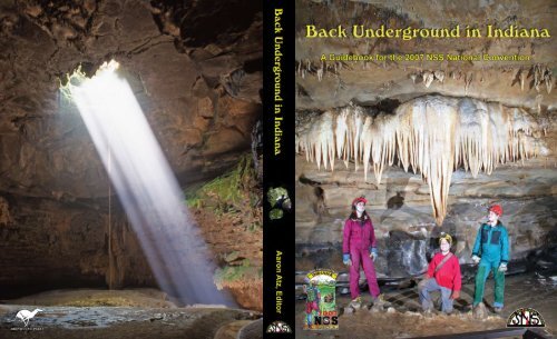
Back Underground in Indiana<br />
A Guidebook for the 2007 National Convention<br />
of the<br />
National Speleological Society<br />
Marengo, Indiana<br />
Aaron Atz, Editor<br />
Produced by the 2007 NSS Convention Committee<br />
Dave Haun, Chairman<br />
Layout and design by<br />
G. Thomas Rea<br />
National Speleological Society<br />
2813 Cave Avenue<br />
Huntsville, Alabama 35810-4431<br />
USA
Back Underground in Indiana<br />
Published by<br />
National Speleological Society<br />
2813 Cave Avenue<br />
Huntsville, Alabama 35810-4431<br />
256-852-1300<br />
http://www.caves.org/<br />
Front cover photograph: Meredith, Sean, and Karen Strunk at the Elephant Head in<br />
Marengo Cave, photo by Elliot Stahl (2007).<br />
Front cover inside: Postcard of Wyandotte Cave entrance, photo by Perry Griffith (1931).<br />
Back cover inside: “100 Foot Pit” photo by George Jackson, 1938.<br />
Back cover photograph: Sunbeams stream down into an unnamed cave, photo by<br />
Aaron Atz.<br />
On the spine: Looking out of the entrance to Maucks Cave, by Brian Killingbeck.<br />
© Copyright 2007 National Speleological Society<br />
All rights reserved. No part of this work may be reproduced or transmitted in<br />
any form by any means, electronic or mechanical, including photocopying,<br />
recording, or any data storage or retrieval system without the express written<br />
permission of the National Speleological Society, Inc.
Contents<br />
Welcome from the NSS President 3<br />
Welcome from the Convention Chairman 4<br />
Welcome from the Governor of Indiana 5<br />
Editor’s Notes 6<br />
Acknowledgements 7<br />
I The Harrison Crawford area and Southern Indiana 9<br />
Scenic Diversions (McDowell, Wilson, and Atz) 11<br />
About Indiana Caving (Tozer) 16<br />
A Short History of Early Crawford County (Eastridge) 17<br />
II Exploration 19<br />
The Saga of Easter Pit (Lemasters) 21<br />
The Discovery and Exploration of the <strong>Lost</strong> <strong>River</strong> Cave System (Deebel) 27<br />
Other Exploration in the <strong>Lost</strong> <strong>River</strong> Drainage Basin (Deebel) 39<br />
Two Bit Pit, Harrison County, Indiana (McNamara) 45<br />
An Exploratory Trip to Gory Hole (Greenwald) 57<br />
The Exploration of Harrison Spring (Strickland) 61<br />
III Geology and Cave Sciences 71<br />
The Geology of the Indiana <strong>Karst</strong> and the Geology Field Trip (Strunk) 73<br />
The Cave Fauna of Indiana (Lewis) 180<br />
The Geology of Wyandotte Cave (Frushour) 186<br />
Projected Passage Profiles for the Wyandotte Caves System (Powell) 195<br />
The History and Status of <strong>Karst</strong> Vertebrate Paleobiology in Indiana (Richards) 197<br />
<strong>Karst</strong> Hydrogeology of the Harrison Spring Area (Bassett) 212<br />
IV Indiana Cave Organizations 219<br />
The Indiana <strong>Karst</strong> Conservancy, Inc. (Vernier) 221<br />
The Indiana Cave Survey: Past, Present, and Future (Everton) 228<br />
Indiana Grottos: Past and Present (Torode) 234<br />
V History 235<br />
Lewis D. Lamon: Indiana’s Grand Ol’ Man of Caving (Benton) 237<br />
George F. Jackson, NSS 151 (Benton) 240<br />
The Barn (Paquette) 242<br />
Caves, Cave Rescue, and the National Cave Rescue Commission in Indiana (Mirza) 247<br />
A Not Uncommon Occurrence at Harrison Spring (Atz) 252<br />
A History of Indiana Caving (Benton) 253<br />
A Historical Narrative of Wyandotte Cave (George) 258<br />
VI Conservation 263<br />
The Richard Blenz Nature Conservancy: Home of Buckner Cave (Everton) 265<br />
Bats in Indiana Caves (Kennedy) 270<br />
A Conservation Message (Vernier) 276<br />
1
2007 NSS Convention Guidebook<br />
2<br />
VII Miscellaneous 279<br />
Indiana Showcaves 281<br />
VIII Cave Descriptions 291<br />
Cave Selection 293<br />
Crawford County 294<br />
Harrison County 331<br />
Lawrence County 384<br />
Monroe County 398<br />
Orange County 405<br />
Owen County 410<br />
Washington County 415<br />
IX Color Photography 429<br />
Index 447<br />
X Map Packet<br />
Wyandotte-Easter Cave<br />
Breathing Hole<br />
B-B Hole<br />
Sullivan Cave<br />
<strong>Lost</strong> <strong>River</strong> Cave<br />
Marengo Cave<br />
Blue Spring Caverns
Welcome from the NSS President<br />
Welcome to Marengo, Indiana, and the 2007 NSS National Convention. It is a pleasure to<br />
have everyone visit Indiana.<br />
A convention is a great opportunity to bring us together. The scientist, explorer, conservationist,<br />
and the recreational caver all are interested in caves. Take some time to visit the sessions, see the<br />
latest art, hear of the exciting exploration, or just enjoy a cave. Use the many social events to<br />
meet and talk with fellow cavers from across the country. And most important, spend some time<br />
underground breathing cave air.<br />
Bill Tozer, President<br />
National Speleological Society<br />
Charlie Rothrock in Wyandotte Cave in the Discovery of 1941 with candle<br />
in hand. Photo by George Jackson, NSS 151.<br />
From the John Benton photo collection.<br />
3
2007 NSS Convention Guidebook<br />
4<br />
Welcome from the Convention Chairman<br />
Welcome to the 2007 NSS National Convention!<br />
The 2007 NSS Convention Staff welcomes you to this convention. We hope you enjoy your<br />
stay in beautiful southern Indiana.<br />
Hopefully, by the time you read this, I will be the 27th person to welcome you to the convention<br />
and Indiana. We call that Hoosier Hospitality. If not, come see me 26 more times and I will<br />
welcome you personally.<br />
Crawford County and Harrison County are rich in history and caves, from the early explorers<br />
and scientists like William Henry Harrison (9th U.S. President), Squire Boone (Daniel’s brother),<br />
Cox, Blatchley, Collett, Owen, Addington, Mercer, Malott, Eigenmann, Cope, Hovey, and<br />
Mumford, to the more recent, like Ash, Quinlan, Art and Peg Palmer, Hobbs, Lewis, Pearson,<br />
George, and Richards. These are just a few fellow adventurers that you might have heard or read<br />
about with a connection to this area in Indiana.<br />
The Harrison Crawford area offers a vast contrast of caving sites to choose from. The caves<br />
vary from the famous commercial caves, Wyandotte, Marengo, and Squire Boone; to one of<br />
Indiana’s longest, Binkleys; to our most intense vertical caves, Two Bit Pit, Hanging Rock Drop,<br />
and Heisers Well. And, of course, don’t forget the “gold” that is buried in a cave and has never<br />
been found.<br />
Volunteers staff all NSS conventions. This year is no exception. We have been working hard<br />
for the past three years to put together what will surely be a convention to remember! We are<br />
trying to get back to some of the convention staples that might be fond memories for you. If you<br />
see a staff member, please thank them for volunteering and helping out the convention and the<br />
NSS.<br />
Landowner relations are very important in this part of the country. Please be courteous and<br />
keep low profiles while on private property. Practice minimum impact on the caves and the cave<br />
owners. Some of the caves you might have visited at a past convention or Cave Capers in this area<br />
may be closed or have special requirements. Please do not assume that you just park and go. Check<br />
out our Cave Kiosk at the campground for information about caving at this convention.<br />
Finally, please remember to cave safe and come back alive. NSS member John Benton recalls<br />
a tip Lewie Lamon gave him 30 years ago about caving, “… caves, yeah, I like to go in ’em … and I<br />
like to come out!”<br />
Welcome “Back Underground in Indiana!”<br />
Dave Haun, NSS 24672 RL FE<br />
2007 Convention Chairman
Welcome from the Governor of Indiana<br />
5
2007 NSS Convention Guidebook<br />
6<br />
Editor’s Notes<br />
About one year ago I took the job of editor for the 2007 National Convention Guidebook,<br />
with Tom Rea overseeing layout, graphic design, and publishing. It has been a very interesting<br />
year. After sending and receiving hundreds of e-mails, sorting and choosing from more than 2,000<br />
submitted cave photos, sorting or creating over 900 guidebook files, making scores and scores of<br />
phone calls, scanning several dozen historical items, and editing (and sometimes begging for)<br />
more than 20 original articles, the task is now complete.<br />
This guidebook has been a very ambitious undertaking, as it has done things no other NSS<br />
convention guidebook has done before. This guidebook is the first ever to offer a color photography<br />
section, something that was always too expensive to do. But with the generosity of Richard Blenz,<br />
the dream became a reality. This may also be the largest guidebook ever, but we went to great<br />
pains to strive for quality as much as quantity. With that said, we have strived for accuracy and I<br />
hope there are few errors.<br />
I am a photographer so naturally this guidebook is very photo-oriented. It is exciting to note<br />
that many of the photos shown in this guidebook record the original human exploration of the<br />
cave shown in the photo. This is the first time most of these photos have ever been published, and<br />
I am honored to be involved. I want to thank all of the photographers who submitted photos<br />
for publication, particularly David Black, who helped me extensively by allowing me access to his<br />
personal photography collection<br />
And lastly I’d like to thank my wife Janie and my son Christian. Without their support I<br />
wouldn’t have been able to attempt this endeavor.<br />
I hope you enjoy Crawford County and the 2007 NSS National Convention.<br />
Sincerely,<br />
Aaron Atz, Editor<br />
2007 NSS Convention Guidebook<br />
April 25, 2007
Color Photography Section<br />
We are much in debt to Richard Blenz for<br />
his generous donation, without which the color<br />
photography section wouldn’t have been possible.<br />
Layout and Graphic Design<br />
Tom Rea, and for giving so much of his<br />
time to the NSS.<br />
Lending of Historical Items<br />
John Benton lent George Jackson’s photo<br />
collection for scanning and also provided<br />
access to his numerous historical items. Gordon<br />
Smith lent his historical caving postcards to be<br />
scanned from his private collection. And thanks<br />
to Keith Dunlap for giving access to historic<br />
Bugs Armstrong and Don Martin slides.<br />
Scanning<br />
Special thanks to David Black and Bob<br />
Vandeventer for scanning slides for others.<br />
Photography<br />
The following submitted photographs for<br />
the guidebook: Keith Dunlap, Dave Strickland,<br />
Willie Hunt, Chris Schotter, Elliot Stahl,<br />
Todd Webb, Dave Black, Brian Killingbeck,<br />
Mark Deebel, Glenn Lemasters, Bill Baus, Bill<br />
Greenwald, Dave Everton, Andrew Peacock,<br />
Don Martin, Aaron Atz, Anmar Mirza, Tom<br />
Rea, Danny Dible, Ty Spatta, Kevin Strunk,<br />
Robert “Bugs” Armstrong, Bob Vandeventer,<br />
Hugh Couch, Richard Vernier, Julian Lewis,<br />
Jim Richards, Ron Richards, Sam Frushour,<br />
and Merlin Tuttle.<br />
Articles<br />
Thanks to the following who authored<br />
articles for the guidebook: Gordon Smith,<br />
Claudia Yundt, Jim Richards, Sam Frushour,<br />
Richard L. Powell, Ron Richards, Glenn<br />
Lemasters, Dave Everton, Julian Lewis, Kevin<br />
Strunk, Anmar Mirza, Greg McNamara,<br />
Bill Greenwald, Bill Tozer, Bill Torode, Bob<br />
Vandeventer, Dave Strickland, Mark Deebel,<br />
Richard Vernier, John Benton, Jim Kennedy,<br />
Acknowledgements<br />
Don Paquette, Dave Haun, John Bassett,<br />
Richard Eastridge, Angelo George, Aaron Atz,<br />
Dan McDowell, and Kent Wilson.<br />
Guidebook Production or Other<br />
Assistance<br />
Ron Adams: Landowner relations,<br />
production of the caves list.<br />
Dave Black: Providing numerous cave<br />
maps and descriptions, and sharing his vast<br />
knowledge.<br />
Dave Everton: Contacting landowners,<br />
helping assemble the caves list, providing maps,<br />
and writing several articles.<br />
Meredith Hall Johnson: Proofreading.<br />
Kate Siebert: Proofreading.<br />
Brian Killingbeck: Photography<br />
assistance.<br />
Other Assistance and Encouragement:<br />
Patti Cummings, Dave Everton, Bill<br />
Greenwald, Dave Haun, Tom Rea, and Bob<br />
Vandeventer<br />
Section Divider Page Photos<br />
Section I: David Stahl at Wyandotte Woods<br />
overlook, photo by Elliot Stahl.<br />
Section II: Mapping trip in Bluespring<br />
Caverns, 1965, photo by Art Davis.<br />
Section III: Sam Frushour and Kevin<br />
Komisarcik conducting the level tube survey of<br />
Wyandotte Cave, photo by Aaron Atz.<br />
Section IV: Members of the Harrison<br />
Crawford Grotto during a clean-up trip to<br />
Langdons Cave, photo by Aaron Atz.<br />
Section V: Large group at entrance of<br />
Wyandotte Cave, 1906, from the Gordon<br />
Smith photo collection (photographer<br />
unknown).<br />
Section VI: Cave Pearls in Bear Plunge,<br />
photo by Elliot Stahl<br />
7
2007 NSS Convention Guidebook<br />
Section VII: The Marengo Cave Band,<br />
from the Gordon Smith photo collection<br />
(photographer unknown)<br />
Section VIII: Three cavers on the Old Cave<br />
Route of Wyandotte Cave, photo by George<br />
8<br />
Jackson, 1935. From the John Benton photo<br />
collection.<br />
Section IX: Bob Braybender in Wyandotte,<br />
photo by George Jackson, 1935. From the John<br />
Benton photo collection.<br />
The entrance to Wyandotte Cave in 1923. Photo by George Jackson, NSS 151<br />
From the John Benton photo collection..<br />
Bob Braybender packing his caving and photography gear behind his Studebaker<br />
outside Wyandotte Lodge in 1939. Photo by George Jackson.<br />
From the John Benton photo collection.
Section I: The Harrison Crawford Area<br />
and Southern Indiana
2007 NSS Convention Guidebook<br />
10
The Convention Planning staff is pleased<br />
to have the opportunity to offer a wide<br />
variety of scenic and recreational attractions<br />
to the attendees of the 2007 NSS National<br />
Convention. Quite a few of these attractions<br />
can be visited or seen in conjunction with trips<br />
to visit caves featured in this guidebook. Or<br />
Crawford County offers a lot of fine scenery<br />
and many of the roads have overlooks.<br />
There are quite a few attractions to be seen in<br />
Crawford County.<br />
The Harrison Crawford State Forest is a<br />
25,000+ acre property located on the edge of<br />
Crawford and Harrison counties that contains<br />
hundreds of Indiana’s finer caves. Access is from<br />
State Road 62 and State Road 462. The latter<br />
road leads to the entrance of O’Bannon Woods<br />
State Park, a 2,400-acre park in the middle<br />
of the Harrison Crawford State Forest. There<br />
are three campgrounds in the complex ranging<br />
from primitive and horse camping to a 281-site<br />
campground that accommodates RV camping.<br />
This complex is bounded by the Ohio and<br />
Blue rivers as well as Indian Creek and offers<br />
the 24-mile Adventure Hiking Trail as well as<br />
numerous day trails. There are also over 100<br />
miles of horse trails. A brand-new, Olympicsize<br />
swimming pool should be finished in time<br />
for the convention. The “main” areas of the<br />
Harrison Crawford State Forest are located<br />
only 15 to 20 minutes from the convention<br />
site.<br />
Wyandotte Caves are located 20 minutes<br />
from the convention site. They are owned by<br />
the state of Indiana and managed by Marengo<br />
Cave. Wyandotte is famous for being a show<br />
cave since the 1850s and has very large rooms<br />
and passages on its 1½-hour tour. It is well worth<br />
a visit. Little Wyandotte Cave has a beautifully<br />
decorated 30-minute tour. Cave tours will be<br />
Scenic Diversions<br />
By Dan McDowell, updated by Aaron Atz and Kent Wilson<br />
Crawford County<br />
perhaps you may want to set aside a day or two<br />
for some specific trips or activities. We invite<br />
you to take a few minutes to check out the large<br />
variety of leisure activities available to you in<br />
southern Indiana. The information included in<br />
the registration packets will list many of these<br />
public attractions.<br />
half-price with your convention ID badge.<br />
Marengo Cave Park is just off State Road<br />
64 in Marengo in Crawford County, just<br />
4 miles north of the convention site. Two<br />
different tours are offered: the Crystal Palace<br />
and the Dripstone Trail. You must be at the<br />
cave by 2:00 p.m. to make both tours. Marengo<br />
Cave also offers a snack bar, a gift shop, and a<br />
nature trail. Cave tours will be half-price with<br />
your convention ID badge.<br />
Cave Country Canoes is a canoe livery<br />
service in Milltown, on the beautiful Blue <strong>River</strong>,<br />
4 miles east of Marengo. Canoeing on the Blue<br />
<strong>River</strong> is a very popular pastime. A number of<br />
caves can be seen in conjunction with certain<br />
canoe trips.<br />
The Blue <strong>River</strong> Café is located in Milltown<br />
just a stone’s throw from Cave Country Canoes.<br />
Gourmet food and impressive drink lists go<br />
nicely with their live music on weekends.<br />
Stephenson’s General Store is located<br />
in Leavenworth, about 9 miles south of the<br />
convention site. In addition to groceries and<br />
traditional country-style food items, the store<br />
sells and displays many unique antiques. Don’t<br />
forget to visit the basement.<br />
Hemlock Cliffs, 3 miles south of Mifflin,<br />
is a part of the Hoosier National Forest. High<br />
sandstone cliffs and numerous shelter caves<br />
are prominent features of this scenic area.<br />
Hemlock Caverns is a large sandstone shelter<br />
that was an early American Indian occupation<br />
site. The floor of the valley has a noteworthy<br />
11
2007 NSS Convention Guidebook<br />
floral growth of ferns and wildflowers. There<br />
are hiking trails among the cliffs. The cliffs are<br />
about a 30-minute drive from the convention<br />
site. There is a specific and dedicated State<br />
Nature Preserve with a 1-mile loop trail. To<br />
protect the endangered plants and sensitive<br />
resources, rappelling is not allowed. However,<br />
at the nearby Messemore Cliff area, it is<br />
permitted.<br />
Patoka Reservoir is located at the junction<br />
of Orange, Crawford, and DuBois counties.<br />
This lake is 25,000 acres. Seven different<br />
state recreational areas offer a wide variety of<br />
activities including numerous boat launch<br />
ramps, a swimming beach, fishing, boating,<br />
water skiing, campgrounds, hiking, fitness<br />
trails, and bicycle trails. The lake is about 30<br />
minutes west of the convention site.<br />
Salt Shake Rock is found on State Road 37<br />
at the bridge over Little Blue <strong>River</strong>, 10 miles<br />
south of English. As you cross the bridge, you<br />
will see a pull off at a small shelter cave on the<br />
right. Salt Shake Rock, an isolated sandstone<br />
tower, is about 300 feet up the hill. Salt Shake<br />
Holiday World Theme Park and Splashin’<br />
Safari is located about 80 minutes west<br />
of the convention site and is well worth a visit<br />
if you have a spare day. Holiday World has<br />
been family operated since the 1950s and in<br />
the past 20 years has reinvested and reinvented<br />
itself to become truly one of the world’s best<br />
theme park values. They showcase some of the<br />
biggest and most impressive roller coasters in<br />
the Midwest and have recently added a large<br />
wave pool and full-sized water park. Don’t<br />
think because of its location that it is lacking.<br />
Add to this the $33.95 entry fee (check the<br />
Harrison County is the cradle of Indiana’s<br />
post-Revolutionary War history. Historic<br />
Corydon, the county seat, was also the site of<br />
Indiana’s second territorial capital and the first<br />
state capital as well. These early state buildings<br />
12<br />
Spencer County<br />
Harrison County<br />
Rock Cave is less than 100 feet to the right on<br />
the bank of Little Blue <strong>River</strong>.<br />
The Shoe Tree is at the four-way stop in<br />
Devils Hollow south of Milltown. It can be<br />
reached by following Wyandotte Cave Road 3<br />
miles north from Wyandotte Cave, making a<br />
left at the “T,” and going west to the four-way<br />
intersection. If you trash your caving boots<br />
during convention, do what all Hoosier cavers<br />
(and the local populace) do: lace them hush<br />
puppies together and fling them into Indiana’s<br />
famous Shoe Tree.<br />
Rothrocks Mill (technically in Harrison<br />
County) was the site of a 19th-century grist<br />
mill on Blue <strong>River</strong> that was owned by the same<br />
family that owned Wyandotte Cave. Now only<br />
the remnants of the dam and foundation of the<br />
mill remain, and the site is used for recreational<br />
purposes only. Regardless, it is a beautiful spot<br />
on Blue <strong>River</strong> and is close to the convention<br />
site. From the Shoe Tree go east for about 1.5<br />
miles, drop into the Blue <strong>River</strong> valley, and the<br />
site is on the right a quarter of a mile past the<br />
bridge over Blue <strong>River</strong>.<br />
Web site for discounts) and unlimited free<br />
soft drinks and water and you have a great<br />
value. From the convention site take I-64<br />
west to exit 63 and then go 7.3 miles south<br />
on Indiana 162 to the park. This is only 45<br />
miles from the convention site, most of it<br />
interstate.<br />
Holiday World & Splashin’ Safari has been<br />
voted the World’s Friendliest Park and the<br />
World’s Cleanest Park for five years in a row by<br />
the readers of Amusement Today magazine.http://www.holidayworld.com.<br />
have been restored and are designated The<br />
Corydon Capital State Historic Site.<br />
<strong>Information</strong> on this and other notable historical<br />
homes and sites can be obtained at the Visitors<br />
Center at 202 East Walnut Street in Corydon.
The Harrison County Visitors’ Center is about<br />
25 minutes from the convention site.<br />
The Harrison Crawford State Forest,<br />
see the complete listing under “Crawford<br />
County”<br />
Squire Boone Caverns and Village is just<br />
off State Road 135, 12 miles south of Corydon<br />
and 30 miles from the convention site. Formerly<br />
known as Boones Mill Cave, this cave is noted<br />
for its cascading waterfalls and impressively<br />
large rimstone formations. There is a restored<br />
pioneer village with a number of early craft<br />
shops, souvenir and snack shops, nature trails,<br />
picnic grounds, and a campground. Half price<br />
admissions for cave tours, pioneer village, and<br />
hayrides are available with convention ID<br />
badges.<br />
The Battle of Corydon Memorial Park<br />
on the south side of town honors the only<br />
Civil War battle fought in Indiana. On<br />
July 9, 1863, 450 local militia and citizens<br />
were overwhelmed by 2,000 Confederates<br />
of Brigadier General John Hunt Morgan’s<br />
Calvary. A monument, a small museum, and<br />
a short trail are on this 5-acre site.<br />
Caesars Indiana Casino boasts the<br />
country’s largest gambling vessel and features<br />
Italian gourmet-style dining at Portico. There<br />
is also an impressive buffet, multi-story hotel,<br />
and professional-grade golf course. It is located<br />
<strong>Lost</strong> <strong>River</strong>, in north-central Orange County,<br />
is the classic example of sinkhole plains and<br />
related karst features. If you do not have the<br />
opportunity to participate in the geology field<br />
trip, consider seeing some of the highlights on<br />
your own. By following the lost river portion<br />
of the geology field trip road log you can visit<br />
some of the interesting highlights of this area.<br />
Two places along the <strong>Lost</strong> <strong>River</strong> dry bed,<br />
Wesley Chapel Gulf and the Orangeville Rise,<br />
are National Natural Landmarks and are easily<br />
accessed. <strong>Lost</strong> <strong>River</strong> is about 45 minutes north<br />
of Marengo.<br />
West Baden Springs and French Lick,<br />
located about an hour northwest of Marengo,<br />
Orange County<br />
Scenic Diversions<br />
about 45 miles southeast of the convention<br />
site, just 10 minutes south of New Albany.<br />
Hayswood Nature Preserve is located 1<br />
mile south of Corydon on the east side of State<br />
Road 135. This 160-acre park is highlighted<br />
by Pilot Knob, a prominent local landmark<br />
that overlooks Indian Creek. Besides picnic<br />
grounds and hiking trails, an 8-acre lake<br />
features fishing, rowboats, and canoe rentals.<br />
This park has a special blacktop trail for the<br />
handicapped.<br />
The Zimmerman Glass Factory is located<br />
on the east side of Corydon. Drop in and watch<br />
them make hand-blown glass paperweights and<br />
souvenirs right before your eyes.<br />
The Constitution Elm historic site<br />
commemorates the writing of Indiana’s<br />
constitution in 1816 under a stately elm tree.<br />
The monument displays the remaining trunk<br />
of the tree and a plaque detailing the event. The<br />
site is located on High Street one block north<br />
of the square in Corydon.<br />
Stage Stop Campground is located 3 miles<br />
east of Wyandotte Cave on State Road 62 and<br />
offers excellent fishing, primitive camping, and<br />
swimming on the Blue <strong>River</strong>. This large site is<br />
operated by the Indiana Department of Natural<br />
Resources as part of the Harrison Crawford<br />
State Forest.<br />
are historical resort communities with a<br />
number of attractions. The West Baden<br />
Springs Hotel is considered to be a remarkable<br />
architectural achievement. Built in 1901, the<br />
200-foot-diameter dome was the world’s largest<br />
unsupported dome until the advent of the New<br />
Orleans Superdome, built in the 1970s.<br />
French Lick Casino Resort is Indiana’s<br />
newest casino.<br />
The Indiana Railway Museum is on State<br />
Road 56 just west of the railroad crossing as<br />
you enter French Lick. The old Monon Railway<br />
station houses, preserves, and operates historic<br />
railway equipment. The French Lick, West<br />
Baden, and Southern Railway offers 18-mile<br />
13
2007 NSS Convention Guidebook<br />
trips on weekends behind an old steam engine.<br />
The trip goes through the state’s second longest<br />
tunnel, the 2,217-foot French Lick Tunnel,<br />
built in 1906. The Railway Museum also<br />
operates an electric trolley running between<br />
the resort hotels.<br />
The French Lick Springs Hotel, Golf,<br />
and Tennis Resort. Golf or tennis, anyone?<br />
Aside from its historical fame as a resort for<br />
Spring Mill State Park is in Lawrence<br />
County on State Road 60, 20 miles west<br />
of Salem and 3 miles east of Mitchell. Spring<br />
Mill is one of Indiana’s most popular parks.<br />
Highlights are a reconstructed pioneer village<br />
and water-powered grist mill showing rural<br />
southern Indiana life in the 1800s. The Virgil<br />
I. Grissom Memorial honors “Gus” Grissom,<br />
one of the original seven astronauts. America’s<br />
second man in space was from nearby Mitchell.<br />
Spring Mill is also noted for its caves and<br />
impressive karst features. Donaldson Woods<br />
Nature Preserve is a 67-acre virgin forest.<br />
Activities include camping, hiking, picnicking,<br />
Falls of the Ohio State Park is in Clarksville<br />
on the Ohio <strong>River</strong>, 40 miles east of the<br />
convention site. The largest exposed Devonian<br />
fossil beds in the world are here. Activities are<br />
fishing, hiking, picnicking, sightseeing, and<br />
fossil viewing. No fossil collecting is allowed!<br />
The site’s modern interpretive center displays<br />
many millennia of geological and human<br />
history and is well worth a visit.<br />
Deam Lake State Recreational Area<br />
borders the south edge of Clark State Forest,<br />
25 miles southeast of Salem on State Road 60.<br />
The 1,300-acre property has an excellent 194-<br />
Cave <strong>River</strong> Valley is 3 miles north of<br />
Campbellsburg and 8 miles west of Salem<br />
on State Road 60 in Washington County (see<br />
14<br />
Lawrence County<br />
Clark and Floyd Counties<br />
Washington County<br />
the socially elite, there are two 18-hole golf<br />
courses, 12 indoor tennis courts, and a really<br />
large, glass-domed, all-weather pool on this<br />
2,600-acre resort.<br />
Tucker Lake is in Springs Valley, a USDA<br />
Forest Service recreational area 12 miles south<br />
and east of French Lick, 4 miles off State Road<br />
145. This is a small, pleasant lake park that offers<br />
camping, hiking, picnicking, and fishing.<br />
swimming, boating, fishing, saddle horse<br />
riding, cave tours (both walking and by boat),<br />
and a nature center.<br />
Bluespring Caverns Park is off State Road<br />
50 on County Road 450S. Bluespring is about<br />
50 miles north of the convention site and is 4<br />
miles southwest of Bedford. With more than<br />
20 miles of passages, Bluespring is Indiana’s<br />
second longest cave. The commercial section<br />
offers an impressive hour-long custom boat<br />
tour on Myst’ry <strong>River</strong> featuring on-board<br />
electric lighting. A special half-price tour rate<br />
is available to NSS members during the 2007<br />
NSS National Convention.<br />
acre fishing lake plus a number of other services.<br />
There is a nature center, camping, hiking, and<br />
picnicking, as well as a boat launch ramp,<br />
rowboat rentals, and a swimming beach.<br />
The historic Ohio <strong>River</strong> towns of New<br />
Albany and Jeffersonville are located near I-64<br />
and display a history unique to the riverboat<br />
culture of the 1800s and early 1900s. The<br />
Howard Steamboat Museum in Jeffersonville<br />
as well as The Culbertson Mansion in New<br />
Albany are two very well restored mansion<br />
museums from this era.<br />
page 415). Cave <strong>River</strong> Valley is a privately<br />
owned picnic park with several wild caves, two<br />
of them extensive. They charge $5.00 per person
per day, which includes the right to go into<br />
any of these undeveloped caves. Please check<br />
with registration to get additional information<br />
during the convention. Cave <strong>River</strong> Valley is<br />
about an hour’s drive from the convention site.<br />
The Knobstone Trail, Indiana’s longest trail,<br />
extends across Clark and Jackson-Washington<br />
State Forests. The trail is 58 miles long and is a<br />
The Birdseye Multi-use Trail is located<br />
immediately off State Road 64, about 20<br />
miles west of Marengo. It is 11.8 miles long and<br />
fees apply for mountain biking and horseback<br />
riding. Low impact hiking is free.<br />
Ferdinand State Forest has 7,657 acres. Of<br />
the five hiking trails, the 2.6-mile-long Kyana<br />
Trail is the longest. There are 8.8 miles of<br />
Twin, Tipsaw, and Saddle Lake recreation<br />
areas: From the convention site take I-<br />
64 west to the St. Croix exit and go south on<br />
State Road 37 to excellent National Forest<br />
properties, the Twin Lakes, Tipsaw Lake, and<br />
Saddle Lake areas. Excellent mountain biking,<br />
camping, hiking, hunting, fishing, and canoeing<br />
are the highlights at these two areas. There are<br />
Within the city limits of Evansville, Indiana,<br />
find prehistoric Angel Mounds, the<br />
largest in the state; Wesselman Woods Nature<br />
Preserve; Mesker Park Zoo and Gardens; and<br />
Louisville is located 40 minutes east of the<br />
convention site at the junction of Interstates<br />
64, 65, and 71. Take the 9th Street exit off I-<br />
64 to get to the downtown area, which offers<br />
the following points of interest: The Louisville<br />
Slugger Bat Factory and Museum is well worth<br />
a visit for baseball fans. The Muhammad Ali<br />
Dubois County<br />
Perry County<br />
Evansville, Indiana<br />
Louisville, Kentucky<br />
Scenic Diversions<br />
back country trail that follows the Knobstone<br />
Escarpment, a prominent geologic feature.<br />
The trail is ideal for backpack trips but can be<br />
accessed at several points for shorter day trips.<br />
Many sections of the trail are rugged. The closest<br />
trail head is at the eastern end of Delaney Park,<br />
10 miles north of Salem.<br />
mountain-biking trails. Primitive camping only,<br />
fees apply. In existence since 1934 and built<br />
by the Civilian Conservation Corps, hunting,<br />
fishing, boating, canoeing, and picnicking can<br />
also be enjoyed here. It is located less than 5<br />
miles north of I-64 at the Dale exit, about 45<br />
minutes from the convention site.<br />
15.7 miles in the Twin Lakes loops and 5.9<br />
miles around Tipsaw Lake. If you would visit<br />
the Twin Lakes site, you might be amazed to<br />
discover a monstrous stone building known as<br />
the Rickenbaugh House. Constructed in 1875<br />
from locally quarried sandstone and virgin<br />
walnut, chestnut, and oak, the building is listed<br />
on the National Register of Historic Places.<br />
“LST 325,” a fully restored World War II Navy<br />
ship and on-water museum. Evansville is about<br />
a 100-minute drive from the convention site.<br />
Center is a recent addition to the Louisville<br />
skyline for boxing fans. Fourth Street Live is<br />
a collection of new bars and restaurants and<br />
offers frequent outside live music. Six Flags<br />
Kentucky Kingdom is located south near the<br />
airport.<br />
15
Welcome to Indiana caving. Our caves<br />
are located on private, federal, and state<br />
lands. Each of these caves probably has specific<br />
rules, requests, or procedures to follow when<br />
you visit them. Please keep this in mind. But<br />
above all, treat the landowners or property<br />
managers you encounter with respect. The trip<br />
leaders for the led cave trips have permission<br />
from the owners and will know the special<br />
procedures.<br />
Unless otherwise advised by the convention<br />
staff, cavers should ask permission to visit any<br />
cave. The convention staff at the campground<br />
will have the latest information on access to the<br />
caves.<br />
Cave owners usually give permission to<br />
people who respect them and their property.<br />
Of course they must make up their mind<br />
quickly based upon first impressions. They<br />
want to know that you will respect their<br />
property including the cave and will do all of<br />
this safely. Their judgment is based upon what<br />
they see. Dressing in nice clean clothing, being<br />
polite, and showing respect are a must. And the<br />
people in the car are held to the same standards.<br />
Needless to say, alcohol has no place at the cave<br />
or on the cave property.<br />
The state lands require a permit, which<br />
16<br />
About Indiana Caving<br />
By Bill Tozer<br />
must be filed with the state. This is an easy<br />
thing to do and keeps the caves open to cavers.<br />
The permits require the usual information<br />
regarding the cavers and the cave they intend<br />
to visit. Permits may be obtained at the caving<br />
kiosk at the campground or at the main office<br />
at the entrance to O’Bannon Woods State Park.<br />
Completed permits should be deposited at the<br />
same location.<br />
The Hoosier National Forest is federally<br />
administrated and no written permission is<br />
required.<br />
The Indiana <strong>Karst</strong> Conservancy owns and<br />
manages several caves. Most of these caves<br />
will be available for trips. The Indiana <strong>Karst</strong><br />
Conservancy requires a liability release and a<br />
statement acknowledging the dangers of caving<br />
and the importance of conserving the cave.<br />
Complete and turn these in at the campground<br />
before leaving the convention site. And when<br />
in doubt, always check at the campground at<br />
the convention site for clarification.<br />
There are plenty of caves to visit, from<br />
easy walking caves to pits to wet, miserable<br />
crawlways. So feel free to enjoy our caves,<br />
but remember to treat the private and public<br />
stewards of our caves with respect so we may all<br />
continue to visit them for years to come.<br />
Wyandotte Cave, inner end of the Air Torrent: George Jackson, Dick Hughes,<br />
Bob Braybender. Photo by George Jackson about 1935.<br />
From the John Benton photo collection.
A Short History of Early Crawford County<br />
Leavenworth, on the Ohio <strong>River</strong>, was<br />
established in 1814 and became a major<br />
shipping port. Most of the county depended<br />
on the merchants at Leavenworth for essential<br />
goods from the outside world. Shortly thereafter,<br />
Indiana achieved statehood in 1816.<br />
In January of 1818, Martin Tucker presented<br />
a bill to the General Assembly at Corydon to<br />
admit Crawford County. The name Crawford<br />
was selected based on the reputation of William<br />
H. Crawford, a friend of George Washington.<br />
The bill passed and was signed by the governor<br />
on the 29th of January. The act was to take<br />
effect on March 1, 1818. Crawford County<br />
was formed from parts of Harrison, Orange,<br />
and Perry counties.<br />
Some of Crawford County’s early settlers<br />
were John Peckinpaugh, Elias Tadlock, Martin<br />
From the Aaron Atz collection.<br />
By Richard Eastridge<br />
Crawford County Historian<br />
Tucker, Thomas Stroud, John Ruth, Henry<br />
Hollowell, Nenion Haskins, Issac Kellems, Gory<br />
Jones, the Wiseman family, Issac Eastridge, and<br />
many more.<br />
Seth and Zebulon Leavenworth built a<br />
dam and mill across the Blue <strong>River</strong> at Milltown<br />
in 1821, which contributed greatly to the<br />
development of that part of the county. The<br />
mill was heavily damaged by flooding and was<br />
razed in 1959.<br />
It was decided that Mt. Sterling would<br />
be the county seat. A courthouse was built<br />
along with a jail and lots were sold with the<br />
proceeds to go to the county library. Because<br />
of a shortage of water in the county, the county<br />
seat was moved to Fredonia in 1822. Allan<br />
Thom constructed a two-story brick building<br />
that he gave to the county along with 50 acres<br />
17
2007 NSS Convention Guidebook<br />
of land. The courthouse remained in Fredonia<br />
until 1843 when it was moved to Leavenworth.<br />
The courthouse remained at Leavenworth until<br />
1896 when it was moved to English.<br />
Marengo was established in 1835 after<br />
being called Big Springs, Tuckerville, and<br />
Proctorville. Marengo did not grow to any<br />
degree until after the completion of the Air<br />
Line Railroad.<br />
Hartford was started in 1838 and did not<br />
prosper until the Air Line Railroad was built<br />
18<br />
From the Richard Estridge collection.<br />
in 1882. The name Hartford was changed to<br />
English after W.H. English of Indianapolis.<br />
The railroad had a great impact on Crawford<br />
County’s industry. Soon Eckerty and Taswell<br />
had over 20 timbering firms. Merchants could<br />
order their supplies and have them delivered<br />
to the depot, whereas previous shipping went<br />
long distances by horse or wagon. The railroad<br />
changed life greatly for those in Crawford<br />
County and pushed them even closer to the<br />
Twentieth Century.
Section II: Exploration<br />
1
2007 NSS Convention Guidebook<br />
20
Deep below the hills of Crawford County,<br />
Indiana, lies Wyandotte Cave. For<br />
centuries it has intrigued explorers with its<br />
depth and beauty. It once was used as a valuable<br />
mineral source by American Indians and early<br />
pioneers. Parts of Wyandotte Cave have long<br />
been a commercial attraction, sporting guided<br />
tours for visitors from around the world.<br />
Those tours continue to this day, provided by<br />
Wyandotte Caves LLC, under contract from<br />
the Indiana Department of Natural Resources,<br />
which manages Wyandotte Caves. The cave<br />
also serves as a hibernaculum to the endangered<br />
Indiana bat, keeping it closed during the<br />
winter months. Numerous stories and books<br />
The Saga of Easter Pit<br />
(The Connection to Wyandotte Cave)<br />
Easter Pit Cave entrance.<br />
Story and Photos by Glenn E. Lemasters<br />
exist about the cave. Since the recording of<br />
history began, names like Bentley, Jones,<br />
Curry, Rothrock, Sears, Jackson, Louden, and<br />
Siebert ring with stories of exploration within.<br />
But this story is about the 1987 connection of<br />
Wyandotte Cave to Easter Pit, a cave that lay<br />
nearly a mile from Wyandotte’s entrance.<br />
Easter Pit Cave was discovered by a longtime<br />
local caver named Leo Schotter. In 1967,<br />
Leo showed the entrance to Ted Wilson.<br />
The entrance, a 38-foot pit, led to a passage<br />
extending for a few hundred feet. Below this<br />
passage, in an obscure lower level, they found<br />
another passage containing many tight canyons,<br />
pits, and crawlways. Over the next few years,<br />
Ted and others explored and mapped what<br />
they thought was the extent of the cave.<br />
About 17 years later, on October 26, 1986,<br />
Ted revisited Easter Pit with me and Danny<br />
Dible. Our goal was to re-check the lower-level<br />
passage. It required negotiating tight canyons,<br />
pits, and crawls that led to a lower level where<br />
we came to a small slot in the floor. It appeared<br />
to drop into a larger passage below and seemed<br />
impassable without enlarging it a bit. A strong<br />
air current billowing from the crack beckoned<br />
us to return. The three of us, with the addition<br />
of fellow caver Joe Oliphant, did return. After<br />
a small amount of enlarging the slot, and with<br />
the aid of a rope, Wilson made the initial drop<br />
through to the floor that lay 5 feet below.<br />
It was the beginning of many return<br />
exploration and survey trips to the cave. Below<br />
the slot was a short passage that led to the top<br />
of a big room. A steep slope of breakdown<br />
boulders led down to a large borehole below,<br />
where a void of blackness beckoned us on. It<br />
was a large trunk passage, reminiscent of those<br />
in Wyandotte Cave. With no survey gear in<br />
hand, we elected to explore.<br />
It continued as a flat-floored, sandy walkway<br />
21
2007 NSS Convention Guidebook<br />
intermittently broken<br />
by rooms strewn<br />
with breakdown.<br />
Selenite crystals hid<br />
indiscriminately in<br />
places where their<br />
alabaster beauty had<br />
never been seen by<br />
the eyes of mankind.<br />
A few bats hid in<br />
crevices and clung<br />
to the ceiling. There<br />
was no evidence of<br />
any previous visitors<br />
in this passage. It was<br />
virgin cave!<br />
At one point in<br />
this corridor an upper<br />
level side passage led from a high ledge we called<br />
the Overlook. The passage leading from it was<br />
later explored, surveyed, and christened the<br />
Bowling Alley. This name came from the many<br />
exposed areas of Wyandotte chert embedded<br />
within the limestone walls. The Bowling Alley<br />
became too low to negotiate after nearly 1,500<br />
feet.<br />
Continuing inward in the main corridor<br />
and just past the Overlook, an intersection<br />
with a trunk of similar size occurred. This<br />
large passage, named after the late Tom Fritsch,<br />
22<br />
The Overlook.<br />
Indiana Avenue.<br />
ended within a few hundred feet in sediment<br />
fill. Farther in, the main corridor met with<br />
another intersection. The obvious route turned<br />
low and required crawling on a sandy floor. The<br />
obscure route required negotiating through<br />
breakdown to open into a walking passage.<br />
This nice passage was christened Indiana<br />
Avenue. The long, sandy-floored crawl led us<br />
to a connection with yet another big walking<br />
passage. Indiana Avenue would re-connect here<br />
as well. We continued inward through walking<br />
passage.<br />
The floor and walls<br />
were covered with<br />
gypsum encrustations,<br />
giving the appearance<br />
of a fresh, glistening<br />
snow. We called it<br />
Snowflake Trail. We<br />
had to skirt along<br />
the passage walls to<br />
avoid stepping in<br />
areas abundant with<br />
selenite crystals. An<br />
occasional alabaster<br />
gypsum flower was<br />
found growing under<br />
a rock. It was certainly<br />
an area of nature’s<br />
delicacy at its best.
Gypsum flowers and crusts.<br />
Beyond Snowflake Trail the passage<br />
narrowed and proceeded up a slope. At the<br />
top lay the biggest room in the cave. Its size<br />
overwhelmed the power of our headlamps.<br />
Large rows of helictites and stalagmites draped<br />
from the ceiling above where we stood. They<br />
were dwarfed by the size of the room. In front of<br />
us were large piles of a truck-sized breakdown.<br />
There was no end in sight as the room was<br />
much longer than it was wide. We stood at the<br />
entrance to this gigantic room, a place never<br />
before seen or touched by mankind, a place<br />
created long ago by<br />
the forces of nature<br />
and decorated with<br />
the beauty of earthly<br />
mineral deposits. We<br />
called it the Inner<br />
Sanctum. “This is<br />
what it’s all about,” I<br />
thought.<br />
To pass through<br />
the Inner Sanctum<br />
required skirting the<br />
wall and jumping from<br />
one breakdown block<br />
to another. With<br />
careful footwork we<br />
reached the other<br />
side and found the<br />
The Saga of Easter Pit<br />
main corridor. We<br />
continued our search<br />
inward. The passage<br />
turned the corner<br />
and became blocked<br />
by a breakdown<br />
choke. Continuing<br />
solo, Dible made a<br />
determined search<br />
through some tight<br />
crawls that led into<br />
the breakdown<br />
and he soon found<br />
the continuing<br />
route. He reported<br />
climbing high into<br />
the breakdown and<br />
finding a small hole<br />
leading up into another huge room. We called<br />
it the Room Above. It was another room of<br />
immense proportions floored by the mountain<br />
of breakdown, not as big as the Inner Sanctum,<br />
but still of great proportion. We would retreat<br />
from the cave on that first day of discovery, but<br />
not without determination to return.<br />
On November 8, 1986, the project of<br />
surveying and mapping in Easter Pit began.<br />
Exploration would continue when the survey<br />
team reached the Room Above. As cavers who<br />
become protective of their find often do, we<br />
The Inner Sanctum.<br />
23
2007 NSS Convention Guidebook<br />
installed a chain gate in Easter Pit at the slot<br />
that drops through to the trunk passage below.<br />
It actually turned out to be a helpful foothold<br />
assisting in climbing up or down in the slot<br />
and was never used as a gate. For many months<br />
to follow we would intermittently survey and<br />
explore the cave. Some trips were long and<br />
arduous, but with help of the survey data we<br />
could see the passage trends. We logged many<br />
hours during the next few years as cavers Dave<br />
Black, Holly Cook, Greg McNamara, Ron<br />
Adams, Tony Akers, George Cesnik, Tina<br />
Shirk, Roger Gleitz, Sam Frushour, and Kevin<br />
Komisarcik joined our team. We began to call<br />
ourselves the Wyandotte Ridge Exploration<br />
Group (WREG).<br />
After surveying to the Room Above, we<br />
soon found the continuing route to the main<br />
corridor lying at the bottom of a large summit<br />
of breakdown and through an obscure hole.<br />
The borehole continued. It led us to the Room<br />
Beyond. Here, another breakdown choke<br />
occurred and we thought we had reached the<br />
end. We made many searches for more passages<br />
along the paths that lead to this area. The cave<br />
was not giving up its secrets easily, but we did<br />
not abandon hope. Between the Room Above<br />
and the Room Beyond was a slippery, mudcovered<br />
hill of shale we called the Shaley Slide.<br />
Near the bottom, through a narrow crack, a<br />
24<br />
The chain slot.<br />
low side passage was<br />
found. It revealed<br />
itself to be only a<br />
series of constricted<br />
crawlways, pits,<br />
and canyons, which<br />
required an expansive<br />
digging effort to<br />
penetrate. This<br />
crawlway became<br />
known as the Radio<br />
Flyer No. 9, after the<br />
little red wagon that<br />
hauled loads and loads<br />
of dirt out of the dig.<br />
Many dig trips would<br />
follow.<br />
The digging<br />
effort revealed an energy-sucking crawlway<br />
affectionately called the Buzz Stripper that led<br />
to a tight canyon called Chisel Canyon. It was<br />
tight and contorted and always stood as my own<br />
personal dread, as it required lying on your side,<br />
positioning yourself in the center, and wriggling<br />
through without sliding down into the crack<br />
of the canyon. It goes for only a body length<br />
but nevertheless is daunting. Just on the other<br />
side of Chisel Canyon is a dome called Fools<br />
Dome. With a bright light, one could peer to<br />
the top of this 45-foot-high dome and only<br />
wonder if more passage would continue above.<br />
Below this dome, through a small obscure hole,<br />
a 33-foot-deep pit was found. Requiring a rope<br />
for descent, it is the lowest point in the cave at<br />
215.5 feet lower than the Easter Entrance. The<br />
short passage leading from it would soon end.<br />
If the cave was to continue it would have<br />
to be at the top of Fools Dome. Upon initial<br />
examination by Dible and Wilson, it was<br />
deemed climbable. On the next trip the wellseasoned<br />
climber, Wilson, made it to the top<br />
with the patient Dible providing a belay line.<br />
It was a key event in the exploration. There<br />
was passage at the top! A rope was rigged for<br />
later trips and the surveying and exploration<br />
continued in the upper level.<br />
After learning the routes and knowing<br />
how to negotiate the passages, trips to the
top of Fools Dome<br />
began to take only an<br />
average of 2 hours.<br />
At the top of Fools<br />
Dome the survey<br />
indicated a possible<br />
connection with<br />
Wyandotte Cave to<br />
the southwest. Many<br />
trips passed through<br />
a place affectionately<br />
called Sleepy Hollow,<br />
a place that became<br />
reminiscent of the<br />
many long, sleepless<br />
trips into the cave.<br />
Camping inside the<br />
cave soon became<br />
common.<br />
Not far from Sleepy Hollow the passage<br />
seemed to end, but we found a small,<br />
inconspicuous hole in the floor leading to a<br />
small crawlway. Within this crawlway an item<br />
of curiosity was found. There in front of us was<br />
an antique flashbulb lying tucked upon a small<br />
alcove. It had to have been transported to this<br />
point by pack rats. Or had it been thrown there<br />
by humans from the other side? But what and<br />
where was the “other side”? The small crawlway<br />
narrowed abruptly except for a small hole the<br />
size of a half-squashed pie pan. Air flowed from<br />
it. This hole was one of the lowest and tightest<br />
crawlways found in the cave and if not for the<br />
airflow and the flashbulb, we probably would<br />
have left it abandoned. A line plot generated<br />
from our data showed the end of Flash Bulb<br />
Crawl to be amazingly close to Avenue No. 3 in<br />
Wyandotte Cave. A connection was inevitable.<br />
After a few trips to enlarge the hole which,<br />
by the way, was made through what had to be<br />
some of the hardest mineral deposition in the<br />
cave, it became penetrable.<br />
On October 3, 1987, Wilson, Dible, and<br />
Oliphant entered the hole and connected to<br />
Echo Avenue in Wyandotte Cave. The two<br />
caves were now one. The event would remain<br />
secret for a long time as we continued mapping<br />
passages stemming from Fools Dome and<br />
A typical crawlway.<br />
The Saga of Easter Pit<br />
making a few new discovery trips into the far<br />
reaches of Wyandotte Cave.<br />
Over the past 150 years various maps and<br />
stories of Wyandotte Cave have appeared,<br />
touting its length as much as 23 miles. In the<br />
late 1960s, Dr Richard L. Powell, an Indiana<br />
state geologist (now retired), with the help<br />
of the Bloomington Indiana Grotto, mapped<br />
Wyandotte Cave for the state. Indiana was<br />
going to buy the cave from its current private<br />
ownership and a reliable map was needed. That<br />
survey provided a total length of 5.36 miles<br />
of passage in Wyandotte Cave. As a fellow<br />
caver, Dr Powell assisted us in disclosing our<br />
discoveries to the Department of Natural<br />
Resources sometime in 1989. We were allowed<br />
some time to map the newly discovered passages<br />
within Wyandotte and continue mapping in<br />
Easter Pit.<br />
Our group surveyed the following areas<br />
within Wyandotte Cave:<br />
The Adventure Trail, an extension of what<br />
is known as the Old Cave. This led from Plutos<br />
Ravine through a series of breakdown climbs; a<br />
lengthy crawl led to a short walking passage that<br />
ended in a nonforgiving breakdown choke.<br />
Kings Gauntlet, a passage found long ago<br />
but subsequent to the 1966 Powell map.<br />
Teasing Wind Trail, a crawlway extending<br />
off to the southeast from Butler Point at the far<br />
25
2007 NSS Convention Guidebook<br />
northern reaches of the cave. The air current<br />
within provided just enough tease for another<br />
expansive push effort. It ended in a large room.<br />
Rothrocks <strong>Lost</strong> Passage, another passage off<br />
Butler Point mentioned in historical data but<br />
not found by the surveyors of the 1960s.<br />
Hall of Aeacus, a large room with short<br />
passage extension that was found off of<br />
Operation Exit, a passage extending from the<br />
Senate Chamber.<br />
A bypass route to the Double Pit route.<br />
A dome with no name off the end of the<br />
Owen Report Passage.<br />
Powell’s map is still used today, with<br />
additions made by Lemasters. Easter Pit and<br />
those aforementioned Wyandotte discoveries<br />
have been added. Combined, they added 3.74<br />
miles of passages to Wyandotte Cave. Easter Pit<br />
added 2.75 miles alone. In 2001, we presented<br />
26<br />
the Department of Natural Resources with a<br />
map of the two caves merged as one. Today, the<br />
cave stands at 9.10 miles in length and 215.5<br />
feet in depth.<br />
Over the years, many stories have been told<br />
about Wyandotte Cave—reports of obscure<br />
passageways leading to grand hallways and<br />
legends of chambers that often seemed elusive<br />
to the pursuing explorer. The exploration of<br />
Easter Pit Cave and those other elusive passages<br />
within Wyandotte can now be joined with<br />
those stories. My memories of those days are<br />
unforgettable. It was an extraordinary discovery<br />
resulting from the determined efforts of many<br />
cave explorers. I was honored and humbled to<br />
be a part of the discovery. A map of Easter Pit<br />
and Wyandotte Cave is included in the map<br />
package.<br />
The lodge at Wyandotte in 1948. Photo by George Jackson.<br />
From the John Benton photo collection.
The Discovery and Exploration of the <strong>Lost</strong><br />
<strong>River</strong> Cave System,<br />
Orange County, Indiana,<br />
1996–2007 By Mark Deebel, NSS 37025RL<br />
No discussion of the geology and caves of the<br />
<strong>Lost</strong> <strong>River</strong> drainage basin in southern Indiana<br />
can be complete without at least mentioning the<br />
work of Dr Clyde Malott. A professor of geology<br />
at Indiana University for more than 25 years, he<br />
was one of the first scientists to study the caves of<br />
the <strong>Lost</strong> <strong>River</strong> area and helped pioneer the field<br />
of karst hydrology. His contributions are too<br />
numerous to mention here, but have no doubt<br />
that those of us involved with the survey of the<br />
<strong>Lost</strong> <strong>River</strong> Cave System are deeply indebted to<br />
his lifetime of work.<br />
Wesley Chapel Gulf<br />
As it applies to karst terrain, the term<br />
“gulf ” was defined by Dr Malott (1931)<br />
to describe a steep-walled depression with a<br />
flat, alluvial floor in which an underground<br />
stream rises and sinks. There are several gulfs<br />
located within the <strong>Lost</strong> <strong>River</strong> drainage basin<br />
of southern Indiana. The most prominent,<br />
Wesley Chapel Gulf, is a large oblong sinkhole<br />
oriented generally northwest to southeast<br />
(Figure 53 on page 162 [Malott’s 1931 map of<br />
Wesley Chapel Gulf ]). It has a surface area of<br />
8 acres and a perimeter of about 2,700 feet. A<br />
rise pool is located at its southern end. During<br />
severe flood conditions the entire floor of the<br />
gulf can be covered in several feet of water.<br />
This is the reason for the flat, alluvial floor.<br />
Three caves were known to be located around<br />
Wesley Chapel Gulf. Elrod Cave is located in a<br />
small sinkhole just beyond the northern edge<br />
of the gulf and several passages in it terminate<br />
at the gulf ’s northern wall. Elrod Cave has<br />
been a popular cave to visit for over a century.<br />
It contains large, easy walking passage and a<br />
nicely decorated formation room in its 2,248<br />
feet of passage. Boiling Spring Cave, located<br />
at the southern end of the gulf above the rise<br />
pool, has a large entrance room but quickly<br />
descends to water level through breakdown.<br />
The cave receives the first stages of floodwater<br />
from a rise pool at the entrance, and for this<br />
reason the majority of its 1,055-foot length<br />
is inaccessible for a good part of each year.<br />
Finally, Wesley Chapel Gulf Cave is located in<br />
the western wall of the gulf and was known to<br />
be by far the largest of the three. Surveyed in<br />
1931 by Dr Malott and several of his graduate<br />
students, they measured the cave to be nearly<br />
a mile long.<br />
During flood conditions, as water from<br />
the rise pool ascends and Boiling Spring Cave<br />
is filled to capacity, two flood channels in the<br />
floor of the gulf divert water away from the rise<br />
pool. One channel meanders northward along<br />
the entire length of the gulf. Water is diverted<br />
underground through several swallowholes<br />
along the way, the furthest north of which<br />
feeds a stream passage in Elrod Cave. The<br />
other flood channel connects the rise pool<br />
to the entrance of Wesley Chapel Gulf Cave,<br />
and at times the entrance to the cave can be<br />
completely inundated with water.<br />
When accessible, however, the majority<br />
of Wesley Chapel Gulf Cave consists of large,<br />
easy, walking borehole containing various<br />
depths of water, from ankle to waist deep. Just<br />
inside the entrance the cave splits two ways.<br />
One branch of the cave contains a stream<br />
that travels northward, roughly parallel to<br />
27
2007 NSS Convention Guidebook<br />
the western wall of the gulf. It ends abruptly<br />
after 800 feet, however, with the water<br />
disappearing through breakdown. Following<br />
the other branch of the cave, the western half,<br />
it is possible to traverse a relatively large loop,<br />
while on the way there is a mazy section which<br />
has confused more than one unwary traveler.<br />
The far western extent of the cave contains a<br />
long, deep pool of stagnant water, the end of<br />
which was represented as a series of dashed<br />
lines on Malott’s 1931 map, and was the cause<br />
of much speculation as to where, if anywhere,<br />
that might lead.<br />
The Beginning<br />
The resurvey of the caves around Wesley<br />
Chapel Gulf began with Elrod Cave on<br />
January 13, 1996. Those of us on the initial<br />
survey team included Ted Bice, Craig Cantello,<br />
Reneé VanVeld, and me. Intending to make a<br />
project out of it and eventually survey all of<br />
the caves around the gulf, we chose to begin<br />
with Elrod because it was the driest of the<br />
three. The majority of the cave’s half mile of<br />
28<br />
The entrance to Wesley Chapel Gulf Cave.<br />
passage was also walking, which made it easy<br />
for us to practice our surveying techniques. A<br />
year later, by January 1997, we had surveyed<br />
2,066 feet in Elrod Cave during five trips. Also<br />
during this time we surveyed Boiling Springs<br />
Cave and conducted a surface survey of the<br />
entire perimeter of the gulf, the rise pool, and<br />
the flood channels. We surveyed to each of the<br />
three cave entrances so they could eventually be<br />
plotted in correct relationship to each other.<br />
The survey of Wesley Chapel Gulf Cave<br />
began uneventfully on January 19, 1997, with a<br />
survey party consisting of Ted Bice and me. We<br />
expected to increase the cave’s surveyed length<br />
to over a mile, since Malott had nearly that in<br />
1931; and surely there were passages that he did<br />
not bother to survey. We thought there might<br />
be 2 miles of cave there, which, at the time,<br />
seemed like a very long cave to survey.<br />
On that first trip we started at the entrance<br />
and surveyed only 213 feet, which was all that<br />
we could do and remain dry. From that point<br />
on we would be required to get wet, no matter<br />
which direction we chose. We had completed a
previous surface survey of the gulf earlier in the<br />
day, and tied the new cave survey in to it, linking<br />
the three caves together for the first time along<br />
with an outline of the gulf itself. We returned<br />
twice that winter and then, although we caved<br />
nearly every weekend, would not return to the<br />
gulf to work on the survey until later that fall.<br />
On October 19, 1997, Ted Bice and I<br />
returned to the gulf and were joined by Tony<br />
Cunningham on the final survey trip into<br />
Elrod Cave. The trip itself was uneventful, but<br />
as we were in the process of changing out of our<br />
caving clothes and about to head home we were<br />
visited by the neighbor from across the road,<br />
Paul Blanton. He had thought that we were<br />
deer hunters but seemed disappointed to find<br />
out that we were just cavers.<br />
We knew there were supposed to be<br />
one or two small caves over on his property<br />
but had not tried to find them. We took the<br />
opportunity to ask, and Mr Blanton was more<br />
than gracious. After putting on dry clothes,<br />
Ted, Tony, and I walked across the road and<br />
into the sinkhole located behind the barn. The<br />
cave was immediately apparent. It was a nice,<br />
dry, crescent-shaped room. We were told that it<br />
had been used as a root cellar at one time since<br />
an orchard used to be on the surrounding land.<br />
There was really not much unusual about the<br />
cave however, except for a rock wall that had<br />
been built at some point, and a small hole in the<br />
floor out of which a noticeable breeze flowed.<br />
The passage looked like it kept going, but it<br />
was only 3 inches high, being blocked mostly<br />
by loose rocks and mud.<br />
We each took turns examining the<br />
hole and decided that it would definitely be<br />
worthwhile to come back and try to dig our<br />
way in, on the odd chance that there might<br />
be virgin cave through there. However, with<br />
an already long list of digs to work on and<br />
easy passages to survey in Wesley Chapel Gulf<br />
Cave, we returned three more times to survey<br />
before the end of the year. Craig Cantello, who<br />
had been involved with the survey of Elrod<br />
Cave, returned to help, and Trae Spires made<br />
his first appearance on the project during this<br />
time.<br />
The <strong>Lost</strong> <strong>River</strong> Cave System<br />
The Discovery<br />
On January 2, 1998, Ted Bice, Trae<br />
Spires, and I had planned to work in Wesley<br />
Chapel Gulf Cave for the day while teaching<br />
new surveyor Sam Russell. When we arrived at<br />
the property there was a light rain coming down<br />
and we didn’t feel comfortable going into the<br />
cave under such circumstances. Having crossed<br />
off the main goal for the day, we decided that<br />
we could still teach Sam how to survey in the<br />
small cave across the road that we had visited<br />
the previous fall.<br />
The cave was named <strong>Lost</strong> <strong>River</strong> II, and<br />
had been sketched in 1972 for a length of 75 feet.<br />
Another small cave, <strong>Lost</strong> <strong>River</strong> I, was supposed<br />
to be located elsewhere on the property. While<br />
Trae, Sam, and I quickly surveyed the small<br />
cave, Ted began digging at the small crack in<br />
the floor, which was again blowing air. By the<br />
time we completed the survey, Ted had enough<br />
room for two people to fit down through a hole<br />
and into a small alcove where the crawlway<br />
continued to slope down under the opposite<br />
wall. Large rocks were being passed out at a<br />
regular pace. Soon my pack was taken over as a<br />
digging bag as dirt and small rocks were getting<br />
hauled out. We each took turns digging, but<br />
after awhile it became very difficult to reach in<br />
the sloping crawlway, since we had been digging<br />
with only our hands all of this time. We decided<br />
to call it a day and come back later with better<br />
tools to get the job done.<br />
Ted, Trae, Sam, and I returned to the dig the<br />
next day on Saturday, January 3, accompanied<br />
by Lori and Dakota Spires. Ted and Trae, whose<br />
arms were the longest, began digging again<br />
in the sloping crawlway, this time with some<br />
small shovels and a crowbar, while the rest of us<br />
waited above in the cold cave. The only relief<br />
from the boredom was occasionally being able<br />
to empty my pack of the rocks and dirt that<br />
had been placed in it, each time seeming to take<br />
longer and longer.<br />
An hour or so passed when Ted and Trae<br />
decided to come out for a break, since Ted’s<br />
light was going dim and needed new batteries.<br />
I was curious as to how much progress they had<br />
made, and so I slid through the hole and down<br />
2
2007 NSS Convention Guidebook<br />
to the dig, accompanied by Dakota Spires, who<br />
was six years old. It was obvious that they had<br />
made quite a bit of progress since the day before.<br />
I told Dakota to look down the crawlway to<br />
see if it opened up. She slid partway down the<br />
crawlway and then came back out since it was<br />
still partially blocked by dirt and rocks. Dakota<br />
then went back up out of the dig to allow Lori<br />
to come down and take a look. I slid down into<br />
the crawlway to take a look at how much more<br />
there was to do. With my helmet off I could<br />
see that the passage turned to the right slightly<br />
where, past a small pile of dirt and rocks, there<br />
was a black void. I backed out of the crawl and<br />
asked Lori to hand me the crowbar. I slid back<br />
down the crawl and used the crowbar to push<br />
the remaining rocks and dirt down the slope<br />
into the cave.<br />
After a few minutes I couldn’t wait any<br />
longer and had made a hole big enough that<br />
I thought I could fit through. I pushed my<br />
helmet in front of me and began to slide<br />
downhill through the last few feet of the<br />
dig. I had to exhale to pass through at one<br />
point, but once that was over the rest of<br />
me passed through without any problem.<br />
That is, except for my sweatpants, which<br />
had been pulled down to my ankles while<br />
passing through the tight spot. I was going<br />
to turn around and dig a little more from<br />
the inside to enlarge the last few feet of<br />
the crawl for everyone, but before I could<br />
even pull up my sweatpants Lori was<br />
coming through. I backed up to get out of<br />
the way, as everyone was lining up to get<br />
into the newly-discovered virgin cave.<br />
We had slid into one end of a long room<br />
about 4 feet high. The floor was mud and<br />
breakdown. At the where we were sitting was a<br />
talus slope, which is what we had dug through<br />
at the ceiling. The room turned out to be<br />
about 60 feet long and 15 feet wide. A tight<br />
crawlway led off from the far left corner into<br />
the darkness. We rushed down it, and only 20<br />
feet later it opened back up into a hands-andknees<br />
crawl in a wide, “V”-shaped passage<br />
with a mud floor. The distant sound of water<br />
could be heard. After continuing to follow<br />
30<br />
the crawlway we suddenly found ourselves<br />
sitting on the edge of a large mud bank about<br />
40 feet wide. Below us a very large amount of<br />
water was moving swiftly from left to right.<br />
The opposite wall was 60 feet away and the<br />
ceiling was 30 feet high. We were frozen in<br />
awe. This spot would come to be known as the<br />
Mudbank. We were 200 feet from the dig in<br />
<strong>Lost</strong> <strong>River</strong> II.<br />
We decided to go upstream and<br />
began to follow the right-hand wall of the<br />
passage after wading into the cold water.<br />
The ceiling came down a little bit as we<br />
passed a bedrock column in the middle of<br />
the passage. We trudged along a mud bank<br />
slope at the water level, not knowing how<br />
deep the water was on the opposite side of<br />
the passage. After wading through the water<br />
for about 400 feet, we passed a very large<br />
side passage on the left, later to be named<br />
Dark Side of the Moon. Shortly afterward, a<br />
30-foot-long section of exposed well casing<br />
pierced through the cave passage. Following<br />
that, the water got shallower and became<br />
a pleasant river passage, with only kneedeep<br />
water, and a flat, regular floor. A nice<br />
drapery formation, hanging out of a hole in<br />
the ceiling, was followed by another 50 feet<br />
later. The passage continued its elliptical<br />
shape. All too soon the borehole ended, the<br />
passage belled out to the left, and the ceiling<br />
came down in front of us. The river came<br />
out of an 8-foot-wide by 5-foot-high hole in<br />
the wall, filling a lake in the center of the<br />
room. On the far side was a large breakdown<br />
slope leading up into the unknown.<br />
We were 1,000 feet from the Mudbank<br />
where we had originally entered the river<br />
passage, and everyone was standing around<br />
in a state of bliss. Hey, guess what? None<br />
of us had packs. I was wearing sweatpants<br />
while standing in waist-deep, icy water and<br />
was already sick with a cold. Everyone else<br />
was dressed in a similar fashion. With that<br />
realization, we decided to head out and began<br />
retracing our path back downstream toward<br />
the entrance to our newly discovered virgin<br />
cave.
The Survey Begins<br />
On Saturday, January 10, 1998, we had<br />
enough people for two survey teams. Ted Bice,<br />
Trae Spires, Bill Stuller, and I began to survey<br />
downstream, and from the previous weekend’s<br />
exploration thought that it went only 200 feet<br />
before ending in breakdown. When we were<br />
about finished, however, Ted discovered a lead<br />
around the breakdown which would eventually<br />
lead to Whitewater Way, a major water passage<br />
in the cave. The other survey team was composed<br />
of Dave and Karen Schang, Tony Cunningham,<br />
Kriste Lindberg, and Steve Lockwood. They<br />
began to survey the upstream river passage,<br />
later to be named the Found <strong>River</strong> Passage, and<br />
started the first side lead, the Hanging Madonna<br />
Passage. Billy Pea arrived later and entered the<br />
cave on his own, bringing a video camera to<br />
record some virgin cave.<br />
The following day Ted Bice, Don Bice,<br />
Mark Krause in typical passage. Photo by Elliot Stahl.<br />
The <strong>Lost</strong> <strong>River</strong> Cave System<br />
Kriste Lindberg, Steve Lockwood, Trae Spires,<br />
Bill Stuller, and I surveyed Dark Side of the<br />
Moon, the large side passage that we had spotted<br />
from the river the weekend before. The passage,<br />
named after the numerous potholes formed in<br />
the dolomite floor along its length, turned out<br />
to be 1,200 feet long. After reaching the end,<br />
everyone except for Bill and Steve continued<br />
surveying down a side passage to the left. Bill<br />
and Steve checked out a small passage to the<br />
right, later to be named Bills Hole, and they<br />
were surprised when it led to a nice formation<br />
room. After exploring past the formation room,<br />
however, they found themselves perched on a<br />
balcony overlooking a river flowing through a<br />
very large room. They backtracked and were<br />
able to find a way to climb down to the river<br />
and explore the room, which would come to<br />
be known as Western Avenue. It would turn<br />
out to be the largest room in the cave, with a<br />
31
2007 NSS Convention Guidebook<br />
width of 100 feet and a length of over 200 feet.<br />
The first weekend yielded 3,200 feet of mapped<br />
passage.<br />
The work continued the following<br />
weekend when Ted Bice, Tony Cunningham,<br />
Bill Stuller, and I surveyed through Bills Hole<br />
to Western Avenue. Dave and Karen Schang,<br />
Lori Spires, and Ray Rough continued working<br />
in the Hanging Madonna Passage and farther<br />
upstream in Found <strong>River</strong>. The next day some<br />
leads off Dark Side of the Moon were surveyed.<br />
After the second weekend the cave had more<br />
than doubled in length, to 7,138 feet. The next<br />
weekend work continued along Dark Side of<br />
the Moon, while Dave Schang’s team surveyed<br />
nearly 2,000 feet in a single day in a series of<br />
passages that would come to be known as the<br />
Boy Scout Loop.<br />
After the initial discovery, we tried<br />
not to explore passages until we were ready<br />
to survey them, thinking it only fair that the<br />
32<br />
Mark Kraus in a formation area of <strong>Lost</strong> <strong>River</strong> Cave. Photo by Elliot Stahl.<br />
people doing the work should be the ones to get<br />
to explore the virgin passages. However, after<br />
three weeks of surveying, and with passages<br />
going off in every direction, the temptation<br />
was just too great. Wanting to know what we<br />
had gotten ourselves into, one day Ted Bice<br />
and I explored west past Western Avenue<br />
into the great unknown, our route later to be<br />
named the Western Trail. From known cave,<br />
we traveled west for what would turn out to<br />
be about 2,700 feet, finally stopping at what<br />
we would call the Funnel Room. Along our<br />
exploration we doubled back to the south and<br />
found another river passage, which Ted would<br />
refer to as the Third <strong>River</strong>, and the name stuck.<br />
There were many junctions and side passages<br />
along the entire route and we had a very real<br />
fear of getting lost.<br />
The exploration past Western Avenue<br />
led us to realize that the cave was much bigger<br />
than we had anticipated. Surveys continued
through January as well as every weekend in<br />
February, after which the cave was 2.53 miles<br />
long and had become the longest cave in Orange<br />
County. By this time the cave had become so<br />
large and so many people were involved that,<br />
almost by default, it had become a project of<br />
the St. Joseph Valley Grotto, to which we all<br />
belonged.<br />
The Wesley Chapel Gulf Cave<br />
Connection<br />
With Wesley Chapel Gulf Cave known to<br />
be at least a mile long and a new multi-mile cave<br />
across the road, it wasn’t long before we began<br />
to have thoughts about a connection between<br />
the two. So on January 31, Ted Bice, Steve<br />
Lockwood, Trae Spires, and I took a break from<br />
the virgin passages in <strong>Lost</strong> <strong>River</strong> II and surveyed<br />
to the Waterfall Room in Wesley Chapel Gulf<br />
Cave, located along part of the loop in the<br />
cave. Ted explored a crawlway leading off from<br />
the room but stopped when he encountered a<br />
low crawlway in water. On February 14, Ted<br />
Bice, Trae Spires, and I surveyed through the<br />
upstream breakdown in <strong>Lost</strong> <strong>River</strong> II, looking<br />
for a connection to Wesley Chapel but none<br />
was found. Similar attempts were made on the<br />
Wesley Chapel side of the breakdown, but no<br />
good leads were found there either.<br />
On March 1, however, Ted Bice, Sam<br />
Russell, Bill Stuller, and I had been surveying<br />
downstream in Whitewater Way for the day.<br />
After ending the survey at a bathtub, Ted and<br />
Sam were cold and began to exit the cave.<br />
Bill and I decided to survey a short crawlway<br />
above the source of the water for Whitewater<br />
Way. I had explored it earlier and thought<br />
that it ended quickly in a belly crawl. After<br />
reaching what I thought was the end, Bill<br />
crawled ahead to pull the tape for the final<br />
shot. Upon reaching the far wall where the<br />
passage seemed to end, however, he noticed<br />
that it continued through a hole in the<br />
ceiling that could not be seen unless you were<br />
immediately below it.<br />
Already cold and tired, and actually<br />
upset that the passage didn’t end, we stopped<br />
our survey and went through. An easy hands-<br />
The <strong>Lost</strong> <strong>River</strong> Cave System<br />
and-knees crawl went for 160 feet, and then<br />
suddenly we were standing in a room with a<br />
waterfall. Bill had not been in Wesley Chapel<br />
Gulf Cave before and thought that we had just<br />
discovered more virgin cave. I knew where we<br />
were however, and explained to Bill that we<br />
were in the Waterfall Room of Wesley Chapel<br />
and had found a connection. The spot in the<br />
crawlway where Ted had stopped from the<br />
Wesley Chapel side was the hole in the ceiling<br />
that Bill had found from the <strong>Lost</strong> <strong>River</strong> II side.<br />
On April 5, 1998, Ted Bice, Ray<br />
Rough, Trae Spires, and I returned to survey<br />
the connection. At the time <strong>Lost</strong> <strong>River</strong> II<br />
was 2.88 miles long while Wesley Chapel was<br />
only 0.91 miles, and since it had now become<br />
one large cave rather than two, we dropped<br />
the <strong>Lost</strong> <strong>River</strong> II name and for the first time<br />
began to call everything the <strong>Lost</strong> <strong>River</strong> Cave<br />
System. The connection came to be known as<br />
the Impassable Passage, derived from Malott’s<br />
description of the crawlway from 1931. After<br />
the connection the cave had jumped ahead to<br />
3.79 miles long, with about 65 going leads, and<br />
was already one of the ten longest caves in the<br />
state.<br />
The System Grows<br />
The survey continued through the summer<br />
and fall. Several notable sections of the cave<br />
not already mentioned were surveyed during<br />
this time. The Rimstone Volcano area above<br />
Western Avenue and the Mud Dune Room<br />
farther west were surveyed by Trae and Lori<br />
Spires and led to their future involvement in<br />
the northwest section of the cave. In July, Traes<br />
Terrible Tunnel, a horribly awkward passage<br />
half filled with water, was discovered off the lead<br />
to Whitewater Way. We pushed it only because<br />
we thought it might be a second connection<br />
to Wesley Chapel Gulf Cave. Although the<br />
passage comes within 50 feet, the connection<br />
has yet to be made. Work in the Sewers, an aptly<br />
named section of low, wet passages, was started<br />
by Dave and Karen Schang during this time.<br />
The survey of the Western Trail began, heading<br />
west following the original exploration route.<br />
Four survey trips were also taken in Wesley<br />
33
2007 NSS Convention Guidebook<br />
Chapel Gulf Cave during this time, completing<br />
the large loop in the cave and the survey to the<br />
western sump.<br />
Of those of us who would become the<br />
top seven surveyors in the project, four have<br />
already been mentioned and were involved<br />
from the very beginning. They include Ted<br />
Bice, Dave Schang, Trae Spires, and me. The<br />
remaining three appeared during the first year.<br />
In June, a new grotto member by the name of<br />
Dave Tibbets made his first appearance and<br />
would eventually go on nearly 100 survey trips<br />
into the cave. In July, Dave and Karen Schang<br />
brought a friend named Burnis Piper into the<br />
project, and he would soon prove to be the<br />
best sketcher of all. Finally, in October, Bill<br />
Kulwicki arrived and always seemed to get stuck<br />
surveying the nastiest parts of the cave, albeit<br />
without complaint. Because of this, although<br />
he would go on over 50 survey trips, he should<br />
have twice as much footage as he does.<br />
Pea Hole<br />
What would turn out to be the third and<br />
most widely used entrance to the system did<br />
not exist for the first nine months after the<br />
discovery. So, after the initial passages close to<br />
the <strong>Lost</strong> <strong>River</strong> II entrance had been surveyed,<br />
any trip headed to the western part of the cave<br />
had to enter through there and travel for one to<br />
two hours before reaching the start of a survey.<br />
It wasn’t a big problem, however, since most of<br />
the trip was walking, but other events on the<br />
surface would nevertheless change this for the<br />
better.<br />
On the second weekend after the discovery,<br />
January 17, while two survey teams were in the<br />
cave enjoying the endless virgin booty, Billy<br />
Pea and Tony Cunningham ridge-walked the<br />
property above the cave. Several small and<br />
deep sinkholes exist on the property. Billy<br />
found a deep crack between several large<br />
blocks of limestone and managed to squeeze<br />
down between them. A constriction blocked<br />
his way, but somehow he was able to make<br />
an opening and dig his way through into a<br />
small room. The following day, again while<br />
two survey teams were in the cave, Billy was<br />
34<br />
joined by Doug Fitzgerald and they returned<br />
to the dig that he started the day before. On<br />
the opposite side of the small room that Billy<br />
had dug into there was a small depression in the<br />
floor. For some reason Billy and Doug began to<br />
clear rocks and dirt from the area, and by the<br />
end of the day they had broken into a second<br />
and larger room below the first. The dig that<br />
Billy had started was now an official cave of<br />
its own. The first room was really just a void<br />
in between large blocks of limestone, but the<br />
second room actually resembled a cave. At the<br />
end of the second room a breeze flowed out of<br />
a crack along the bottom right-hand wall. Billy<br />
and Doug began to dig there.<br />
With all of the excitement and initial<br />
discoveries during the first two months, I did<br />
not bother to visit the cave until March 15. As<br />
a joke between all of us involved in the survey<br />
of <strong>Lost</strong> <strong>River</strong>, the cave had come to be known<br />
as Pea Hole. The entrance was a tight corkscrew<br />
squeeze down through blocks of rock to reach<br />
the first room, a series we would all come to<br />
despise. Not sure what to expect after entering<br />
the second room, I was impressed with what<br />
Billy and Doug had found. I continued the<br />
previously started dig at the end of the second<br />
room trying to follow the air.<br />
Three more attempts to dig in the cave<br />
were made during the spring while we were<br />
hampered from surveying in <strong>Lost</strong> <strong>River</strong> due<br />
to spring floods. The crack was blocked by<br />
pieces of breakdown, some too large to move,<br />
but those that we could remove were hauled<br />
out and tossed over along the left-hand wall of<br />
the passage. The cave was surveyed for a length<br />
of 113 feet and a surface survey was finally<br />
conducted to locate the cave in relation to <strong>Lost</strong><br />
<strong>River</strong> to help locate any possible connection.<br />
The surface survey showed that the two<br />
caves were nearly on top of each other, but<br />
after repeated attempts at a connection<br />
without success, we had become somewhat<br />
discouraged. Water levels in the cave returned<br />
to normal and we did not bother with Pea<br />
Hole again until September 13. On that day<br />
one team made the trip into <strong>Lost</strong> <strong>River</strong> to<br />
where we thought the connection should be
and another team went into the second room<br />
in Pea Hole. The plan was to try to make a<br />
voice connection, and it turned out to be easier<br />
than expected.<br />
Unfortunately, the actual connection in Pea<br />
Hole was along the left-hand wall of the second<br />
room, where we had been piling all of the rocks<br />
from our dig in the crack along the right-hand<br />
wall. This was quickly remedied by digging<br />
from both sides, and soon the connection was<br />
made. A survey of 188 feet connected the caves<br />
and we had a third entrance to the system.<br />
The connection to Pea Hole turned the Boy<br />
Scout Loop into a through trip, and became<br />
our favorite tourist trip to show off the cave.<br />
This also put Western Avenue only ten minutes<br />
from the surface.<br />
The Second Year<br />
As of January 3, 1999, one year after the<br />
discovery, the <strong>Lost</strong> <strong>River</strong> Cave System was<br />
7.54 miles long and had three entrances, two<br />
of which had been dug open. Nearly as much<br />
The <strong>Lost</strong> <strong>River</strong> Cave System<br />
cave passage would be surveyed in the second<br />
year, and the principle discoveries are briefly<br />
mentioned here.<br />
In January, Dave and Karen Schang, along<br />
with Burnis Piper, were cleaning up leads in the<br />
area of Western Avenue. Burnis noticed a small<br />
hole in the wall at the ceiling and began to dig to<br />
enlarge the hole. After getting through, a short<br />
crawlway led to a nicely decorated, upper-level<br />
walking passage, and, as it turns out, the only<br />
passage in the cave that does not flood. It was<br />
the MY survey, so the passage became known as<br />
My Goodness and turned out to be around 500<br />
feet long. As in just about every other passage<br />
in the cave, it would be found to connect in<br />
several places.<br />
Raccoon Run was a long, upper-level<br />
crawlway, the first part surveyed by Trae and<br />
Lori Spires. It was reached through a climb-up<br />
in the ceiling at the start of the Western Trail.<br />
From there it extended south for 1,100 feet,<br />
where the original survey ended at a bathtub.<br />
It got its name from the raccoon tracks found<br />
Large passage in <strong>Lost</strong> <strong>River</strong> Cave. Photo by Dave Everton.<br />
35
2007 NSS Convention Guidebook<br />
all along the passage. One day in July the<br />
bathtub was pushed and found to be only 100<br />
feet long, after which the passage returned to<br />
a crawlway for another 800 feet. At the end of<br />
the crawlway it intersected a borehole passage.<br />
To the east, the passage went for over 1,000<br />
feet before ending at a sump, while to the west<br />
it extended for an undetermined length. It<br />
became known as Sumpways and many survey<br />
trips into the area immediately followed. In fact,<br />
it would be while working in the western part<br />
of Sumpways that the length of the cave would<br />
pass 10 miles and it would become the thirdlongest<br />
cave in the state. Whitewater Way and<br />
several other north-south trending passages<br />
would eventually be found to connect into<br />
Sumpways, and a drought in 1999 would assist<br />
us in making several of those connections.<br />
In the previous year, as mentioned earlier,<br />
the far western sump in Wesley Chapel Gulf<br />
Cave had been surveyed. Shortly after the<br />
discovery of Sumpways the eastern passage<br />
to the Lake Room was surveyed, where the<br />
sump and the end of the passage were located.<br />
After plotting the data it became clear that the<br />
two passages were probably the same, making<br />
another possible connection between the<br />
two caves. Even in low water conditions the<br />
connection was still a sump however, and we<br />
were not exactly sure how long it was. One day<br />
in November, Bill Baus, Charlie Biema, Barry<br />
Welling, and I were on one of the many survey<br />
trips to the downstream section of Whitewater<br />
Way, working on connecting it to Sumpways. We<br />
finished our survey for the day and continued<br />
on down to Sumpways and the Lake Room, just<br />
for a little tourist trip. We were standing at the<br />
bank of the lake while Barry was inspecting the<br />
sump on the other side of the room. I turned<br />
my back for a moment, and before I knew what<br />
happened Barry was gone. After a few minutes<br />
we began to wonder what to do if he did not<br />
return. Fortunately he did, and confirmed that<br />
the passage did indeed connect to the sump in<br />
Wesley Chapel Gulf Cave. The sump was only<br />
6 feet long in low water conditions, and was<br />
surveyed later that month by me and Burnis<br />
Piper, creating a second surveyed connection<br />
36<br />
between the two caves. The mystery of where<br />
the western sump from Malott’s map went to<br />
had finally been solved. This connection is now<br />
known as the Bear Dive.<br />
We began to survey the Third <strong>River</strong> passage,<br />
sandwiched between the Western Trail to the<br />
north and Sumpways to the south, during this<br />
time as well. The upstream section of the passage<br />
was named Crayfish Canyon, and beyond that<br />
we were required to swim to reach the end of<br />
the passage at a sump. We would find that the<br />
water from Whitewater Way passes beneath<br />
Sumpways in a lower river passage, which<br />
then feeds into Third <strong>River</strong> through a sump.<br />
Third <strong>River</strong> is over 1,500 feet long, and at the<br />
downstream end the entire volume of water<br />
passes into a slot in the floor, beyond which<br />
exactly where the water goes is still a mystery.<br />
Further Discoveries<br />
By the end of the second year, the surveyed<br />
length of the cave was 12.61 miles. In the<br />
years that followed the cave continued to<br />
grow beyond our wildest imaginations. The<br />
following paragraphs briefly mention most<br />
of the major work that took place in the cave<br />
after 2000.<br />
Countless survey trips were led by Trae and<br />
Lori Spires to the northwest section of the cave.<br />
Passages in this area included Lake Lori, the<br />
Mountain Room, the Enchanted Forest, the<br />
Meatgrinder, the Northwest <strong>River</strong> Passage, and<br />
the Cannonball Room. The length from the<br />
Mountain Room to the end of the Northwest<br />
<strong>River</strong> is about 2,400 feet. Much is still not<br />
understood about this area of the cave, and<br />
many leads remain.<br />
The Western Trail continued to be<br />
extended west. Our initial exploration<br />
ended at the Funnel Room, but beyond<br />
that we found the Ledge Room, the West<br />
of Texas Passage, Dougs Borehole, Bloody<br />
Shivers <strong>River</strong>, and finally Gollums Lair,<br />
which is currently the furthest western<br />
part of the cave. From the Funnel Room to<br />
Gollums Lair, the cave had been extended by<br />
another 2,500 feet to the west, bringing the<br />
cave within 4,000 feet of the True Rise. We
were surprised to learn that a tight crawlway<br />
linking West of Texas to Dougs Borehole<br />
actually passes beneath the dry bed of the<br />
<strong>Lost</strong> <strong>River</strong>.<br />
Work also continued along Sumpways,<br />
and several connections were made from the<br />
Western Trail south to it, the furthest west of<br />
which is called the Love Canal. Oddly enough,<br />
there are no leads heading off to the south from<br />
Sumpways except one, which became known<br />
as the Southern Lead. The end of this lead is<br />
the southernmost part of the cave and is fed<br />
with water locally by a valley on the surface, in<br />
which a periodic stream sinks in several places.<br />
Another connection to Sumpways became<br />
known as the Cheese Grater. It was a low, nasty<br />
lead off the Boy Scout Loop which, against our<br />
wishes, just would not end. Cleaning up leads<br />
around the Sewers led to the Ant Farm and<br />
then the Dregs, which is another passage that<br />
connects south to Sumpways.<br />
Cleanup in Wesley Chapel Gulf Cave led to<br />
renewed interest in Traes Terrible Tunnel and<br />
more thoughts about a possible connection<br />
between the two. On the <strong>Lost</strong> <strong>River</strong> side, the<br />
T-Cubed passage was found to parallel the<br />
Terrible Tunnel, and efforts continue to find<br />
a connection between all three. Additional<br />
work was also done cleaning up leads along<br />
Whitewater Way, and a side lead was found that<br />
led to Rachaels Pool, a sump that was found<br />
to be only 30 feet from the sump passage in<br />
Wesley Chapel; they are assumed to connect.<br />
Therefore, the possibility exists of having<br />
at least four connections between Wesley<br />
Chapel and <strong>Lost</strong> <strong>River</strong>, only two of which have<br />
currently been surveyed. Finally, as it turns<br />
out, the only major passage not discovered in<br />
Wesley Chapel by Malott in 1931 is the Open<br />
Sesame passage, which connects the northern<br />
branch of the cave to the western branch.<br />
By January 2003, five years had gone by<br />
and the cave system had become 17.11 miles<br />
long. Later. in November of that year, the lead<br />
list would peak at 344. The cave was so mazy,<br />
with each newly-discovered passage seeming to<br />
connect to another, that it was nearly impossible<br />
to conduct a survey and not add new leads to<br />
The <strong>Lost</strong> <strong>River</strong> Cave System<br />
the list, no matter what you did.<br />
20 Miles<br />
At least a year before the actual occurrence,<br />
it became clear to us that the cave system would<br />
pass 20 miles in length. Ted Bice, who had<br />
moved to New Mexico, wanted to return and be<br />
included on the 20-mile survey trip. Although<br />
he had been gone for over five years, Ted still<br />
had the second highest footage total of anyone<br />
involved in the project, which just shows how<br />
easily we had accumulated footage in the earlier<br />
years of the survey. So, in the fall of 2005, with<br />
the length of the cave at just under 20 miles, all<br />
survey efforts were halted until the weekend of<br />
October 28, when Ted planned to return.<br />
We chose to survey some little side leads<br />
just inside the entrance to Wesley Chapel Gulf<br />
Cave, which Ted and I had flown by on the very<br />
first survey trip into the cave way back in 1997.<br />
There was plenty of room in the passage, and<br />
14 of us took part in the ceremonial survey that<br />
day, 260 feet was mapped, and the cave became<br />
20.05 miles long.<br />
Future Exploration and Survey<br />
As of January 2007, it has been 11 years since<br />
we first started working on the caves around<br />
Wesley Chapel Gulf. Extensive cleanup efforts<br />
in Wesley Chapel Gulf Cave have pushed it to<br />
2.94 miles long, leaving 17.61 miles of virgin<br />
cave surveyed to date. The <strong>Lost</strong> <strong>River</strong> Cave<br />
System is therefore 20.55 miles long, and 92<br />
people have been involved with the survey.<br />
As mentioned previously, <strong>Lost</strong> <strong>River</strong> is a<br />
very mazy and complex cave, with every passage<br />
seeming to loop to another. It got to the point<br />
that we began to actually expect this and thought<br />
it unusual when a passage came to a dead end.<br />
Illustrating this is the fact that the cave has 457<br />
loops. Additionally, there are 4,429 stations in the<br />
cave. Much effort has been put into cleaning up<br />
leads, but 266 of them still remain.<br />
High water and survey exhaustion has led<br />
to periods of inactivity. With many of the leads<br />
now remaining in the low, wet sections of the<br />
cave, the weather and water levels both above<br />
and below ground have become much more of<br />
37
2007 NSS Convention Guidebook<br />
a concern when planning any survey trip into<br />
the cave. However, the project continues. There<br />
are promising leads that beckon and several<br />
surveyors involved in the ongoing efforts.<br />
A map of the <strong>Lost</strong> <strong>River</strong> Cave System is<br />
included in the map package.<br />
Principle Surveyors<br />
The following people have personally<br />
surveyed at least 5,280 feet (1 mile) of passage<br />
in the <strong>Lost</strong> <strong>River</strong> Cave System: Ted Bice, Tony<br />
Cunningham, Mark Deebel, Mark Kraus, Bill<br />
Kulwicki, Kevin Kulwicki, Kriste Lindberg, Steve<br />
Lockwood, Billy Pea, Burnis Piper, Ray Rough,<br />
Sam Russell, Dave Schang, Karen Schang, Lori<br />
Spires, Trae Spires, Bill Stuller, and Dave Tibbets.<br />
References<br />
Malott, C.A., 1931, “<strong>Lost</strong> <strong>River</strong> at Wesley<br />
Chapel Gulf, Orange County, Indiana”:<br />
Indiana Academy of Science Proceedings,<br />
38<br />
St. Joseph Valley Grotto founders Mark Deebel, Ted Bice, and Tony Cunningham celebrate reaching 20<br />
miles in the <strong>Lost</strong> <strong>River</strong> Cave System, which has been a long-term grotto project. October 28, 2005.<br />
vol 31, pp 285–316.<br />
Malott, C.A., 1951, “The Swallow-Holes of<br />
<strong>Lost</strong> <strong>River</strong>, Orange County, Indiana”: Indiana<br />
Academy of Science Proceedings, vol<br />
61, pp 187–231.<br />
Murdock, S.H., and R.L. Powell, 1968, “Subterranean<br />
Drainage of <strong>Lost</strong> <strong>River</strong>, Orange<br />
County, Indiana”: Indiana Academy of Science<br />
Proceedings, vol 77, pp 250–255.<br />
Palmer, A.N., 1990, Groundwater Processes<br />
in <strong>Karst</strong> Terranes: Geological Society of<br />
America Special Paper 252, pp 177–209.<br />
Palmer, A.N., M.V. Palmer, and R. L. Powell,<br />
1981, Guidebook to the Indiana Excursion,<br />
1981 International Congress of Speleology,<br />
56 pp.<br />
Powell, R.L., 1987, “The Orangeville Rise and<br />
<strong>Lost</strong> <strong>River</strong>, Indiana”: Geological Society<br />
of America, Centennial Field Guide, pp<br />
375–380.
Other Exploration in the <strong>Lost</strong> <strong>River</strong><br />
Drainage Basin<br />
Orange County, Indiana<br />
Because of the series of discoveries in the <strong>Lost</strong><br />
<strong>River</strong> Cave System we became interested<br />
to learn as much as possible about every known<br />
cave in the immediate area. We also thought<br />
that there could be other caves in the area<br />
that were not yet discovered. For example,<br />
<strong>Lost</strong> <strong>River</strong> II was a known cave up to the dig,<br />
but the Pea Hole connection was totally new.<br />
Much time was spent ridge walking the land<br />
above the entire cave system, especially around<br />
the western half of the cave. There we always<br />
hoped to find a fourth entrance to the system<br />
that would provide a quick exit to the surface<br />
in the case of an emergency, and also provide<br />
easier access to the leads in the western half of<br />
the cave.<br />
Our area of interest would eventually grow<br />
to include the entire <strong>Lost</strong> <strong>River</strong> drainage basin,<br />
and this has led to locating and surveying over<br />
20 other caves in the area. Most of them are<br />
small. There were, however, three significant<br />
discoveries that took place while in the process<br />
of exploring <strong>Lost</strong> <strong>River</strong> Cave.<br />
Show Farm Cave<br />
Show Farm Cave had been known about<br />
for many years. Malott mapped part of the<br />
cave in 1924. A 1959 map by Richard Powell<br />
includes a sketch by Bob Armstrong of a passage<br />
continuing to a breakdown room, which was<br />
an estimated 6,000 feet into the cave. From<br />
the entrance the cave goes only downhill, and<br />
a severe flood can put the entrance 15 to 20<br />
feet below water. NSS cavers Tom Arnold and<br />
Ralph Moreland were unfortunate enough to<br />
be in the cave one day in July 1961 during a<br />
severe thunderstorm. They lost their lives when<br />
By Mark Deebel, NSS 37025RL, February 10, 2007<br />
the cave flooded and they could not escape.<br />
Following their deaths, the landowner closed<br />
the cave. Show Farm gained the bad reputation<br />
of claiming the first two lives in an Indiana cave<br />
(as well as the lives of the first two NSS cavers<br />
to die while caving) and remained closed for<br />
37 years.<br />
The property changed hands sometime in<br />
1998, and we acquired permission from the<br />
new landowner to go into the cave. Our first<br />
survey trip took place on November 21, 1998,<br />
and four more trips would take place before the<br />
end of the year.<br />
From the entrance, a short hands-andknees<br />
crawl leads to walking passage. This leads<br />
through pools of water in a small canyon for<br />
2,100 feet until a “T” room is reached. Here the<br />
canyon passage ends abruptly and a crawlway<br />
leads away from the room. It gets progressively<br />
bad through mud and water until after 1,600<br />
feet a bathtub full of organic debris is reached.<br />
This is much worse than the bathtub in the<br />
Raccoon Run passage of <strong>Lost</strong> <strong>River</strong> Cave, even<br />
though they are both 100 feet long.<br />
After passing through the bathtub, the<br />
passage continues as a crawlway. It eventually<br />
opens up to a walking passage just before ending<br />
at the bottom of a breakdown pile 2,200 feet<br />
past the bathtub. This was where the sketch<br />
map by Bob Armstrong stopped, 6,000 feet<br />
from the entrance, and was believed by us to be<br />
the furthest extent of any previous exploration.<br />
We named this breakdown pile Bugs Mountain<br />
(Armstrong’s nickname). Here we climbed up<br />
to a dry passage that was about 100 feet long.<br />
Keep in mind that we were being cautious<br />
about entering the cave to begin with, and<br />
being at the bottom end of a 6,000-foot-long<br />
3
2007 NSS Convention Guidebook<br />
40<br />
A—Show Farm Cave, B—Ragsdale Gulf, C—Orangeville Rise.
flood tube really played on our minds. We did<br />
not enter the cave again until the drought of<br />
1999.<br />
We surveyed to the breakdown pile<br />
on September 11, 1999. The survey team<br />
comprised Ted Bice, Doug Fitzgerald, Trae<br />
Spires, and me. We had surveyed 1,400 feet<br />
for the day, past the breakdown pile and down<br />
the other side. After setting the last station, we<br />
noticed a crawlway continuing low against the<br />
far wall. We put away our survey gear and began<br />
to follow the lead.<br />
After 1,300 feet the crawlway intersected<br />
a larger passage with a stream flowing in from<br />
the left. Up until this point in the cave there<br />
had been no moving water. We slid down to<br />
the stream and began walking to the right,<br />
following the water downstream. After 400<br />
feet of walking passage we rounded a corner<br />
and were amazed as we entered the bottom of<br />
a large “T”–shaped canyon. The width of the<br />
canyon at the top was about 30 feet, as was the<br />
overall height. The narrow part of the canyon,<br />
which we were walking in, was an average of<br />
10 feet wide. This large and impressive passage<br />
continued downstream, relatively unchanging<br />
for 3,200 feet.<br />
At this point we reached a breakdown pile<br />
where the water disappeared. It was possible to<br />
climb up through a hole in the ceiling, however,<br />
and this led to the discovery of the Monster<br />
Room, the largest room in the cave. The floor is<br />
composed of two large funnels formed in mud,<br />
the drains of which lead into the unknown.<br />
Two more survey trips in September continued<br />
the survey all the way to the end of the large<br />
“T” canyon.<br />
By the time we found another opportunity<br />
to return, however, we had lost access to the cave<br />
and have not been able to continue the survey.<br />
The Monster Room at the end of the cave, 2<br />
miles from the entrance, remains unsurveyed.<br />
It is possibly larger than Western Avenue in<br />
<strong>Lost</strong> <strong>River</strong>. Several side passages exist along the<br />
entire length of the cave. Some were explored<br />
for well over 1,000 feet, and all are unsurveyed.<br />
Of course, to get there you have to crawl a total<br />
Exploration in the <strong>Lost</strong> <strong>River</strong> Basin<br />
of 4,600 feet one way, including the 100-foot<br />
bathtub in the middle of the trip, which may<br />
not be passable. The entire cave, crawlway and<br />
all, floods to the ceiling.<br />
Our efforts basically doubled the length of<br />
the cave to 1.98 miles and as of now the cave has<br />
63 feet of depth, and there are certainly several<br />
miles of cave yet to be explored and mapped.<br />
From the entrance, the highest point in the<br />
cave, it heads almost directly south for its entire<br />
length. Our survey stops 7,500 feet northwest of<br />
Ragsdale Gulf, where we believe the water goes<br />
before surfacing at the Orangeville Rise, which<br />
is another 2,400 feet to the south. Caution<br />
should be taken upon entering this cave, as we<br />
believe that even the Monster Room floods to<br />
the ceiling and there are no known safe places<br />
in any high water event.<br />
Critchfield Spring Cave<br />
P robably the most picturesque entrance of all<br />
the caves in the area, Critchfield Spring was<br />
a known cave since at least 1960. It is situated<br />
at the bottom of a 30-foot-high cliff and was<br />
listed as only 50 feet long. The spring that<br />
emerges from the entrance flows into the <strong>Lost</strong><br />
<strong>River</strong> about one mile downstream of the True<br />
Rise. We were interested in finding the source<br />
of the water. We contacted the landowner and<br />
gained access to the cave.<br />
From the entrance the stream can be<br />
followed along a walking passage for only 60<br />
feet before a bathtub is encountered and a<br />
short, dry crawlway to the left leads to a small<br />
dome. This was the known extent of the cave as<br />
far as we could tell.<br />
On our first trip to the cave we followed<br />
the bathtub crawl, not knowing what to<br />
expect. After 300 feet, however, it suddenly<br />
opened into a passage about 30 feet tall and<br />
15 feet wide. We named this the Locker Room<br />
since this is where we would put on our dry<br />
polypro after negotiating the water. From<br />
here a narrow walking canyon passage led for<br />
1,200 feet before coming to a junction. Here<br />
an upper level passage led for about 1,000 feet<br />
41
2007 NSS Convention Guidebook<br />
42<br />
Critchfield Spring Cave entrance.<br />
Toliver Hollow Cave entrance.
efore splitting and ending in breakdown in<br />
both directions. The lower level was surveyed<br />
upstream following the water for another 800<br />
feet before stopping in a gravel crawlway.<br />
There were six survey trips in 2001 from<br />
May through October. An additional three<br />
trips took place in July of 2002. Presently, the<br />
cave has a surveyed length of 4,682 feet, with<br />
a depth of 44 feet. The source of the water is<br />
still unknown, as the upstream gravel crawlway<br />
still needs to be explored further. Nevertheless,<br />
Critchfield Spring is an easy, enjoyable cave,<br />
and the bathtub is especially refreshing on a<br />
hot summer day.<br />
Toliver Hollow Cave<br />
sinkhole filled with trash would lead<br />
A to the discovery of another cave over<br />
4,000 feet long. South of <strong>Lost</strong> <strong>River</strong> Cave we<br />
discovered a sinkhole that we were told had<br />
an entrance to a cave in it. The landowner told<br />
of a few cavers going into it sometime in the<br />
1950s. Unfortunately, the sinkhole had since<br />
Toliver Hollow Borehole.<br />
Exploration in the <strong>Lost</strong> <strong>River</strong> Basin<br />
been filled with trash. There was no record of<br />
any cave at this location, so once again we did<br />
not know what to expect.<br />
With permission from the landowner,<br />
we dug through the trash in the sinkhole and<br />
eventually found an entrance to a cave. We<br />
named it Toliver Hollow Cave after the valley<br />
that it was in, and on February 2, 2002, the<br />
survey began.<br />
The cave starts as a crawlway, but shortly<br />
opens into a nice walking passage. Water is<br />
diverted underground at the entrance, so for<br />
the entire length of the cave you are following<br />
the water downstream. The walking passage<br />
leads for about 1,000 feet to the top of a<br />
narrow canyon about 30 feet deep. The bottom<br />
of the canyon can be followed to a passage that<br />
alternates between crawling and walking for<br />
another 3,000 feet to where the survey ends.<br />
Five survey trips were taken during February<br />
and March of 2002, after which a spring rain<br />
sealed the entrance shut once again and the<br />
landowner decided not to let us return. The cave<br />
does not stop at the end of the survey, however,<br />
43
2007 NSS Convention Guidebook<br />
and the downstream section of the cave is a<br />
good going lead. Where the water flowing<br />
through the cave goes remains a mystery. The<br />
surveyed length of the cave is 4,780 feet with a<br />
depth of 75 feet.<br />
Summary<br />
After over 10 years of work there remains<br />
much to do. Of the more than 20 smaller caves<br />
in the survey area, several maps have been<br />
completed, some caves have been finished<br />
44<br />
Rimstone in Toliver Hollow Cave.<br />
and await mapping, and a few more will<br />
require at least one more survey trip. The three<br />
significant caves mentioned above have yet to<br />
be completed. Don’t forget the over 250 leads<br />
remaining in <strong>Lost</strong> <strong>River</strong> Cave itself. In addition<br />
to the survey work, more caves definitely exist<br />
and additional ridge walks are planned. We can<br />
always use help and welcome any interested<br />
caver who wants to contribute to the <strong>Lost</strong> <strong>River</strong><br />
Cave Project.
Two Bit Pit<br />
Harrison County, Indiana<br />
wo Bit Pit” is synonymous with<br />
“Tadjectives like tough, tight, cold, sleazy,<br />
long, and arduous, to name a few. Not many<br />
caves in the Midwest carry such a reputation,<br />
and Two Bit Pit is a testimony to what sport<br />
caving is all about. Besides being one of Indiana’s<br />
deepest caves at 253 feet total vertical depth,<br />
it is also one of its most demanding in terms<br />
of mental and physical stamina. It is without a<br />
doubt a caver’s cave, featuring every imaginable<br />
challenge one would care to embrace. But at<br />
the same time it is a cave that offers rewards for<br />
those who venture into its depths, a spiritual<br />
place where solitude and inner strength are in<br />
equilibrium.<br />
History<br />
The story begins late in 1989, when this<br />
group of experienced explorers converged on<br />
a cave dig that would lead to over 3½ years of<br />
exploration and survey. After 30 or more trips<br />
into the cave, many<br />
great memories still<br />
remain, the hardships,<br />
the triumphs, the<br />
strong bond between<br />
fellow explorers, and<br />
the many laughs.<br />
The entrance pit<br />
is situated within a<br />
couple of hundred<br />
feet of the road and<br />
issues a column of<br />
steam during the<br />
cold months. It was<br />
documented to be<br />
virgin until June of<br />
1968, when members<br />
of the Purdue Outing<br />
Club first descended.<br />
By Greg McNamara, NSS 20250<br />
The cave at that time was an awkward 22-footdeep<br />
surface drop into a small room. Across<br />
the opposite side of this room was a narrow<br />
blowing crack, which was enlarged in 1980 by<br />
several members of the Bloomington Indiana<br />
Grotto. This modified area is now a 6-footlong<br />
crawlway, which should be backed into,<br />
and opens into the top of a larger room and<br />
down the second drop of 32 feet. Excess rope<br />
from the entrance pit can be used to rig this<br />
second pit. An air route could not be found<br />
below this drop and exploration ceased until<br />
the spring of 1984, when several members of<br />
the Bloomington Indiana Grotto and Central<br />
Indiana Grotto began trying to trace airflow<br />
again. Smoke bombs were used, but it was still<br />
not conclusive as to what source the airflow<br />
was originating from.<br />
During the second weekend in June of<br />
1989, Danny Dible inspired a group of cavers<br />
to recheck leads within Two Bit Pit. Danny<br />
Ted Wilson at the top of the second drop. Photo by Dave Black.<br />
45
2007 NSS Convention Guidebook<br />
had remembered a lead that had no airflow,<br />
but the sound of distant water could be heard<br />
five years prior. Before the weekend was over,<br />
the group had broken through, discovering the<br />
climb up that led to a third drop. This was left<br />
until the following weekend, when the survey<br />
was restarted from the top of the entrance pit.<br />
Everyone was very excited because the airflow<br />
route had been re-established and the potential<br />
for a large system existed. Two weekends later<br />
Chris Yeager, closely followed by Danny Dible,<br />
free-climbed the third drop and pushed the<br />
canyon passage to the top of the fourth drop,<br />
breaking the cave open.<br />
Exploration<br />
From the bottom of the second drop and<br />
across the room, the passage slopes to a hole<br />
in the floor. Directly above this hole is a 10-<br />
46<br />
Glenn Lemasters in the tight canyon passage.<br />
Photo by Danny Dible, August 18, 1990.<br />
foot-high narrow crevice one must friction<br />
climb up through to access the canyon leading<br />
down to the third drop. A piece of webbing<br />
can be secured above the climb-up to aid<br />
in moving equipment through this section.<br />
After negotiating the canyon climb-down,<br />
a crevice containing the 35-foot-deep third<br />
drop is reached. It can be free climbed but is<br />
best rigged off an eroded limestone feature on<br />
the wall. At the bottom of the third drop is a<br />
climb-up to a ledge that contains a short, tight<br />
squeeze into a small room. A passage originates<br />
from this room as walking size and gradually<br />
becomes lower to a hands-and-knees crawl that<br />
is positioned over a narrow canyon passage<br />
about 15 feet deep.<br />
Eventually the wide upper section becomes<br />
too low and one is forced to squeeze down<br />
into the dreaded narrow canyon. You’ll know<br />
when this place is reached, as the canyon starts<br />
out with a tight bend almost immediately.<br />
Once through the first bend, one continues<br />
winding and snaking through the tall canyon<br />
while leaning forward as you push ahead. It<br />
is best to “become one with the canyon,” and<br />
not “get fast.” We call panicking getting fast,<br />
where it can become injurious to jerk around<br />
and flail in a constricted passage. Just relax and<br />
take your time; you’ll make it through. A small<br />
circular stand-up spot within the canyon is<br />
reached just before the passage turns right and<br />
into the “Terminator.” This allows one to rest<br />
and adjust equipment before the entering final<br />
sections of the canyon. This Terminator section<br />
is awkward, containing snarly projections that<br />
can snag cave packs and pads. One must crawl<br />
through the widest sections of the canyon<br />
while suspended off the floor with your cave<br />
pack in front of you. It is imperative you do not<br />
let your pack fall down into the canyon, where<br />
vast amounts of energy will be expended during<br />
retrieval. The more equipment that is being<br />
carried (wetsuits and ropes), the more grief you<br />
may experience—it’s different for each person.<br />
Immediately following the Terminator is the<br />
“Exterminator,” (See Page 438 in the Color<br />
Photo Section) a tight squeeze on the left side<br />
going in, and a flat, smooth ledge on the right
Two Bit Pit<br />
c l i m b - d o w n i s<br />
approximately 20 feet<br />
deep and leads a short<br />
distance to the top of<br />
the undercut fourth<br />
drop. This 15-foot pit<br />
descends into a small<br />
room containing a<br />
stream passage and<br />
a breakdown pile.<br />
The G survey leads<br />
from the top of the<br />
breakdown slope,<br />
while the K survey<br />
leads off the bottom<br />
of the pit, along with<br />
The squeeze before the dome room at the bottom of the third pit. the continuing A<br />
Photo by Danny Dible,<br />
survey, which is the<br />
main route to the<br />
bitter end. Following the A survey will put one<br />
in a low belly crawl about 25 feet long, which<br />
leads to the top of the fifth drop. The rope is<br />
rigged near the bottom of the fourth drop and<br />
is routed through the crawl and down the pit.<br />
The explorer must either back into the crawl<br />
and attach to the rope while lying sideways, or<br />
turn around in very tight quarters at the edge of<br />
the pit and attach to the rope. A small stream<br />
flows down the 26-foot drop and manages to<br />
moisten your clothes while you are positioning<br />
side to place your pack and scoot it forward.<br />
You may have to put one arm outstretched and<br />
one to your side to get through more easily.<br />
Some people like to squeeze up on the right<br />
side ledge calling it a bypass, but I’m not sure<br />
that is the best way to go.<br />
About 10 feet beyond the last squeeze, the<br />
passage abruptly drops down into a wet, muddy<br />
belly crawl that is best entered by slithering<br />
head first while arching your back. It is unlikely<br />
you will stay dry in this 150-foot-long sleazy<br />
shale crawl, which<br />
gradually becomes<br />
hands and knees size<br />
before opening into<br />
a tall canyon passage.<br />
This less soluble shale<br />
layer prevents many<br />
caves in Indiana and<br />
TAG from reaching<br />
their depth potential.<br />
As the bottom of the<br />
shale passage drops<br />
out, it allows the water<br />
to drain down the<br />
canyon and permits<br />
one to straddle out<br />
into the canyon and<br />
stay dry. The canyon<br />
Joe Oliphant in the passage between the fifth and sixth pits.<br />
Photo by Danny Dible.<br />
47
2007 NSS Convention Guidebook<br />
for rappel. At the pit<br />
bottom a slippery,<br />
mud-covered slope<br />
must be traversed<br />
up and over before<br />
eventually climbing<br />
up into a canyon<br />
passage. Everything<br />
near the bottom<br />
of the fifth drop is<br />
coated in a thick, wet<br />
layer of mud, adding<br />
to the abrasive, gritty<br />
feeling experienced<br />
at this point of the<br />
trip. Several stations<br />
later the ABC Room<br />
is reached, which is<br />
a major upper level<br />
junction and bypass route. It is possible to<br />
bypass the fourth and fifth drops via challenging<br />
free climbs when route finding to or from the<br />
ABC Room. Another notable loop connection<br />
that bypasses these two drops is located above<br />
the climb-down after the wet shale crawl going<br />
in. Finally, there are leads from the ABC Room<br />
that head directly towards Dible Knible Cave,<br />
a 500-foot-long cave with 77 feet of vertical<br />
depth. These passages come within 450 feet<br />
48<br />
Joe Oliphant downstream beyond the water crawl in the lower cave.<br />
Photo by Danny Dible, September 21, 1991.<br />
The downstream passage beyond the water crawl in the lower cave.<br />
Tony Akers up front and Joe Oliphant in the foreground.<br />
Photo by Danny Dible, September 21, 1991.<br />
of connecting into Dible Knible Cave, which<br />
is situated at the same level as the E and EO<br />
surveys in Two Bit Pit.<br />
Continuing in the A survey five stations<br />
further will land you in the Dressing Room.<br />
This is the best place to eat and change clothes<br />
before surveying, heading out, or putting on<br />
your wetsuit if going deeper. This infamous<br />
spot is known for its surplus of gear and food,<br />
which at one time had accumulated quite a<br />
supply. By the end<br />
of the survey, the<br />
Dressing Room was<br />
free of gear and food,<br />
except for a broken<br />
wetsuit top that is still<br />
awaiting claim by its<br />
owner. The Dressing<br />
Room also contains<br />
Rustys Raceway, an<br />
area where Rusty<br />
Riley ran in place<br />
for hours, trying to<br />
keep warm while<br />
others napped before<br />
heading out during a<br />
28-hour trip. The H<br />
survey also leads from<br />
this room, which
Two Bit Pit<br />
4
2007 NSS Convention Guidebook<br />
connects to the M survey, a complex upper<br />
level area that contains some nice formations<br />
and passage loops. From the Dressing Room<br />
a waterfall can be heard rumbling in the<br />
distance. Excitement builds as one approaches<br />
the balcony overlooking the sixth drop, the<br />
last dry spot on the main route to the end. The<br />
rope is secured off several expansion bolts and<br />
is rigged out of the water. The free 42-foot drop<br />
is very scenic, featuring walls of banded chert<br />
and waterfalls cascading down from above. The<br />
stream continues around the dry island at the<br />
bottom, channeling into the beginning of the<br />
2,200-foot-long water crawl named Neptunes<br />
Retreat. This crawl has no side leads and is<br />
mainly hands and knees height and half full of<br />
water. There are a couple of sections in which<br />
the ceiling dips down leaving about a foot of<br />
airspace.<br />
After crawling nearly 50 stations, Neptunes<br />
50<br />
Joe Oliphant climbing the sixth and last pit.<br />
Photo by Danny Dible.<br />
Retreat begins to enlarge before intersecting a<br />
major trunk passage. This passage, named Potato<br />
Run, lies underneath a surface feature dry run<br />
with the same name, and is the “undiscovered<br />
passage” that has been theorized for years to<br />
drain Potato Run. Turning left into the Potato<br />
Run trunk will send one in the downstream<br />
direction, which continues at walking sized<br />
proportions for 3,200 feet (66 stations).<br />
Several side leads branch for the downstream<br />
section, and all go in the upward direction. The<br />
most promising side lead was thought to be a<br />
possible in-feeder from the Horseman’s Camp<br />
on the surface. After traversing 175 feet it gets<br />
too small to continue but has some airflow.<br />
There are also two short side passages that also<br />
head upward before leading back to the stream<br />
level to form a loop. The deepest point in the<br />
cave is near the end of the downstream section<br />
and is located at the low point of a room. The<br />
Joe Oliphant emerging from the entrance after a<br />
trip. Photo by Danny Dible, July 28, 1991.
downstream passage is generally 6 to 20 feet<br />
high and 10 to 20 feet wide, with water depth<br />
ranging from knee deep to waist deep.<br />
Back at the intersection into the Potato<br />
Run trunk, turning right will position one in<br />
the upstream direction, which is the longest<br />
section of the trunk. It travels over 5,600 feet<br />
before ending at the upstream terminus (114<br />
stations). This walking-size passage is very<br />
tedious because it features knee-deep mud<br />
underneath the waist-deep water for many<br />
stations. At times one must struggle to free<br />
boots from the suction the deep mud creates<br />
below the water. The whole effect really drains<br />
your body of energy. At the end of the upstream<br />
section, a number of very large blind cave fish<br />
have been observed and photographed. Several<br />
side passages are also present in the upstream<br />
section; the largest one has been named the<br />
Cavers Hideaway. There is also a long loop<br />
passage about midway through the section. In<br />
general the Potato Run segment of the cave is<br />
about 1.75 miles in length and almost entirely<br />
in water.<br />
Presently the cave has been surveyed to a<br />
total length of 3.5 miles, with 253 feet of total<br />
vertical extent. There are still some passageways<br />
in need of surveying, and maybe even a few<br />
leads left to extend. I’m confident that Two Bit<br />
Pit has yet to reveal all of its surprises, which are<br />
awaiting those explorers eager for excitement<br />
and a good ride. Please note that if a serious<br />
injury occurs beyond the canyon passage,<br />
chances of rescue would be nearly impossible.<br />
Exploration and Survey<br />
Trip Log<br />
Trip #1 June 17, 1968<br />
David DesMarais and possibly<br />
other members of the Purdue Outing<br />
Club:<br />
Documented to be “recently<br />
opened but virgin” before this date,<br />
referencing a CIG Newsletter piece<br />
written by David DesMarais of the<br />
Purdue Outing Club. One or more<br />
trips by ISS members.<br />
Two Bit Pit<br />
Trip #2 February 3, 1980<br />
Tom Fritsch, John Danovich, Dave<br />
Doolin, and various other BIG and<br />
IUSC members:<br />
The group descended the 22-foot<br />
entrance drop to a blowing crack 2<br />
inches wide at the opposite end of<br />
the small room. The first “chemical<br />
persuasion” was used at this point.<br />
Trip #3 March 8, 1980<br />
Tom Fritsch, Randy Jackson, John<br />
Danovich, Becky McDaniel, Ben<br />
Tohe, Dave Doolin, and others:<br />
Entrance pit descended by the<br />
group carrying hammers, chisels,<br />
and more chemical persuasion. The<br />
2-inch-wide blowing crack was enlarged<br />
to a 6-foot-long hands-andknees<br />
crawl to the top of the second<br />
drop of 32 feet.<br />
Trip #4 May 11, 1980 – Survey Trip #1<br />
Tom Fritsch, John Danovich, and<br />
Dave Black:<br />
The group surveyed down the first<br />
two drops to the known end.<br />
Trip #5 April 8, 1984<br />
Dave Black, Ted Wilson, John<br />
Danovich, Danny Dible:<br />
They descended the two known<br />
pits, exploring the cave and trying<br />
to trace the airflow with no luck.<br />
Danny climbed up into a crevice to<br />
a small alcove and at one end discovered<br />
a small hole in which the<br />
roar of water could be heard in a<br />
distant unreachable dome. The lead<br />
had no airflow.<br />
Trip #6 July 29, 1984<br />
Dave Black, Ted Wilson, Danny<br />
Dible, Mike Miesen, Robin Miesen:<br />
The group set off a smoke bomb<br />
at the top of the second pit and<br />
watched from the pit bottom as<br />
51
2007 NSS Convention Guidebook<br />
52<br />
the smoke stayed high in the dome<br />
and twisted it’s way down a narrow<br />
impassable crevice at the very top of<br />
the passage. The smoke was being<br />
sucked in the same direction as the<br />
“roaring water lead” heard months<br />
earlier.<br />
Trip #7 June 10, 1989<br />
Drew Packman, Danny Dible, Tom<br />
Bertolacini:<br />
The group used more chemical persuasion<br />
at the “roaring water lead,”<br />
which at the time moved no air and<br />
had no running water sound. Two<br />
mounted efforts were used, one at<br />
noon, the other later in the afternoon.<br />
Trip #8 June 11, 1989<br />
Drew Packman, Danny Dible, Tom<br />
Bertolacini, Ron Adams, Greg<br />
McNamara:<br />
The group again used chemical persuasion<br />
then left the cave, leaving<br />
clean up for a future trip.<br />
Trip #9 June 17, 1989 – Survey Trip #2<br />
Norm Pace, Greg McNamara,<br />
Danny Dible, Ron Adams, Sandy<br />
Nudo, Drew Packman, Tom Bertolacini:<br />
Began survey at entrance datum<br />
and set 22 stations in the main passage<br />
(A0 to A20, B1).<br />
Trip #10 June 30 – July 1, 1990<br />
Danny Dible, Chris Yeager, Ted<br />
Wilson, Joe Oliphant:<br />
Chris Yeager and Danny Dible (in<br />
that order) free climbed the third<br />
drop and pushed the canyon to the<br />
top of the fourth drop, breaking<br />
open the cave. Ted and Joe explored<br />
areas above the canyon.<br />
Trip #11 July 4/5, 1990<br />
Drew Packman, Chris Yeager,<br />
Danny Dible, Joe Oliphant, Ted<br />
Wilson, Greg McNamara:<br />
Major discovery. Joe, who was the<br />
largest, was able to penetrate the<br />
canyon, and the group pushed the<br />
cave down six drops and going - together.<br />
Cave was believed to be over<br />
200 feet deep after this 15-hourlong<br />
trip.<br />
Trip #12 July 8, 1990 – Survey Trip #3<br />
Chris Yeager, Danny Dible:<br />
Surveyed all of tight canyon passage<br />
totaling 38 stations (A21 to A44,<br />
B2, C1 to C4, CA1, CB1, D1 to<br />
D2, DA1 to DA5).<br />
Trip #13 July 21/22, 1990 – Survey Trip #4<br />
Drew Packman, Chris Yeager,<br />
Danny Dible, Joe Oliphant, Ted<br />
Wilson, Greg McNamara:<br />
Major discovery. Group pushed<br />
cave down the sixth drop and 500<br />
feet down a major stream passage,<br />
while exploring side leads. Also<br />
surveyed 23 stations (A45 to A65,<br />
E1 to E2). 17½-hour-long trip.<br />
Trip #14 July 29, 1990 – Survey Trip #5<br />
Danny Dible, Chris Yeager, Ron<br />
Adams:<br />
Surveyed side lead off A survey,<br />
totaling 18 stations (G1 to G18).<br />
Trip #15 August 4/5, 1990 – Survey Trip #6<br />
Danny Dible, Chris Yeager, Ron<br />
Adams, Ted Wilson, Joe Oliphant,<br />
Greg McNamara:<br />
Wetsuit trip where Ted and Joe<br />
pushed the stream crawl approximately<br />
2,000 feet. The group surveyed<br />
down the sixth drop and into<br />
the stream crawl beyond. A couple<br />
other side leads were also surveyed<br />
during the trip. The group surveyed<br />
a total of 39 stations (A65 to A88,<br />
H1 to H14, I1, AC1). 14-hourlong<br />
trip.
Trip #16 August 12, 1990<br />
Greg McNamara, Steve Nelson:<br />
The two negotiated the first 3<br />
drops, where Steve tried unsuccessfully<br />
to penetrate the canyon. Greg<br />
stashed a packed wetsuit beyond<br />
the canyon for a future trip. 2-hourlong<br />
trip.<br />
Trip #17 August 18–19, 1990<br />
Danny Dible, Chris Yeager, Ron<br />
Adams, Ted Wilson, Joe Oliphant,<br />
Greg McNamara, Glenn<br />
LeMasters:<br />
Wetsuit trip. Abandoned the<br />
survey for one trip and scooped<br />
approximately 1 mile of virgin cave,<br />
all stream passage below the sixth<br />
drop. Several large breakdown filled<br />
rooms were also discovered. 20hour-long<br />
trip.<br />
Trip #18 August 26, 1990 – Survey Trip #7<br />
Danny Dible, Chris Yeager, Tina<br />
Shirk:<br />
Group continued survey through<br />
main passage, netting 25 stations,<br />
all stream crawl (A89 to A113).<br />
Trip #1 September 2, 1990<br />
Greg McNamara:<br />
Solo trip down three drops and<br />
through the canyon passage to pick<br />
up wetsuit and drop off new pack<br />
for next trip. 2-hour-long trip.<br />
Trip #20 September 3, 1990 – Survey Trip<br />
#8<br />
Danny Dible, Greg McNamara,<br />
Chris Yeager, Ron Adams, Tina<br />
Shirk, George Cesnik:<br />
Wetsuit trip. Two teams (Danny,<br />
Greg and Chris / Ron, Tina and<br />
George) leap-frogged to finish surveying<br />
the downstream crawl below<br />
the sixth drop. The beginning of<br />
the upstream lead was also mapped.<br />
Two Bit Pit<br />
Both teams surveyed a total of 25<br />
stations for approximately 1400<br />
feet (A114 to A131, P1 to P7).<br />
11½-hour-long trip.<br />
Trip #21 November 24, 1990 – Survey Trip<br />
#9<br />
Ron Adams, Chris Yeager, Tina<br />
Shirk, George Cesnik:<br />
etsuit trip. Another two-team survey<br />
(Ron and George , Chris and<br />
Tina) continued in the downstream<br />
walking passage, including a short<br />
loop. Half the survey shots ranged<br />
between 50 and 100 feet long. Both<br />
teams netted a total of 50 stations<br />
(A132 to A179, TA1 to TA2).<br />
Trip #22 March 23–24, 1991 – Survey Trip<br />
#10<br />
Danny Dible, Greg McNamara,<br />
George Cesnik:<br />
This marked the first trip into Two<br />
Bit Pit after Chris Yeager died in a<br />
cave accident in Mexico. Without<br />
Chris Yeager’s dedication, we would<br />
not be exploring these sections of<br />
this fine cave. The group surveyed<br />
17 stations above the fifth drop after<br />
discovering an alternative route<br />
(K1 to K17). 9-hour-long trip.<br />
Trip #23 May 18, 1991 – Survey Trip #11<br />
Danny Dible, Greg McNamara,<br />
George Cesnik:<br />
Surveyed a side lead and loop from<br />
the bottom of the fourth drop up<br />
into a several-hundred-foot-long<br />
formation passage, that intersected<br />
several drops. The group surveyed<br />
35 stations (KA1 to KA8, KAB1,<br />
KC1 to KC5, KD1 to KD20,<br />
KE1). 12-hour-long trip.<br />
Trip #24 June 16, 1991 – Survey Trip #12<br />
Danny Dible, Kirk Miller:<br />
Survey consisted of the bypass<br />
53
2007 NSS Convention Guidebook<br />
54<br />
route above the fourth drop, along<br />
with two side passages and a loop<br />
passage. A total of 20 stations were<br />
surveyed (AZ1 to AZ4, KM1 to<br />
KM7, KY1, KV1 to KV6).<br />
Trip #25 July 4, 1991<br />
Greg McNamara, Tony Akers:<br />
Rigged cave to the sixth drop,<br />
dropped off wetsuit, clothes change<br />
and stove at the Dressing Room.<br />
5¼-hour-long trip.<br />
Trip #26 July 13–14, 1991 – Survey Trip<br />
#13<br />
Tony Akers, Greg McNamara,<br />
Kevin Bruno, Danny Dible, Henry<br />
Gilsdorf, George Cesnik, Ron Adams,<br />
Rusty Riley, Joe Oliphant:<br />
Wetsuit trip. Group entered the<br />
cave with three survey teams (Tony,<br />
Kevin, and Greg ; Danny, Henry,<br />
and George ; and Ron, Rusty, and<br />
Joe). This trip focused on surveying<br />
the upstream lead after the long water<br />
crawl, along with a loop passage<br />
off of it. The multi-team combined<br />
effort netted 75 surveyed stations<br />
totaling approximately 3,800 feet<br />
(P6 to P75, L1 to L5). Trips ranged<br />
from 21 to 28 hours long.<br />
Trip #27 July 27–28, 1991 – Survey Trip<br />
#14<br />
Tony Akers, Greg McNamara,<br />
Danny Dible, Ted Wilson, Ron<br />
Adams, Joe Oliphant:<br />
Wetsuit trip. Two survey teams<br />
(Danny, Joe, and Ron; Greg, Ted,<br />
and Tony) continued mapping<br />
the upstream lead to terminus in<br />
breakdown. Three additional leads<br />
were discovered in this upstream<br />
passage. At this point the cave<br />
length exceeded 14,000 feet, with<br />
a total depth of 248 feet, making it<br />
deepest in Indiana at the time. The<br />
two-team combined effort netted<br />
39 surveyed stations totaling<br />
approximately 1,800 feet (P76 to<br />
P114). Trips ranged from 18½ to<br />
26 hours long.<br />
Trip #28 August 24/25, 1991 – Survey Trip<br />
#15<br />
Danny Dible, George Cesnik, Tim<br />
McClain, Greg McNamara, Rusty<br />
Riley, Ron Adams, Joe Oliphant,<br />
Tony Akers, Scott Kenney:<br />
Wetsuit trip. Two survey teams<br />
(Ron, Joe, Rusty, and Greg; Danny,<br />
George, and Tim) mopped-up<br />
upstream and downstream side<br />
leads and loops. Scott and Tony<br />
later joined the group in progress.<br />
Checked the breakdown terminus<br />
at the end of the upstream passage<br />
again to no avail. Combined team<br />
effort netted 38 surveyed stations<br />
(PR1 to PR5, PF1 to PF8, PG1 to<br />
PG7, T1 to T7, T4A, F1 to F10).<br />
Trips ranged from 20 to 26 hours<br />
long.<br />
Trip #2 September 21–22, 1991 – Survey<br />
Trip #16<br />
Danny Dible, Joe Oliphant, Tony<br />
Akers, Scott Kenney, Terry Raines:<br />
Wetsuit trip. Completed the downstream<br />
F survey side lead, loop and<br />
room. The group totaled 24 surveyed<br />
stations (F11 to F33, BB1).<br />
Trip #30 March 28–29, 1992 – Survey Trip<br />
#17<br />
Danny Dible, Greg McNamara,<br />
George Cesnik:<br />
Group hammered open and began<br />
survey in canyon off a 200-footlong<br />
walking section beyond the<br />
ABC Room. Lead comes within<br />
450 feet of passage in Dible Knible<br />
Cave. Explored approximately<br />
1,000 feet of virgin cave, connect-
ing into established survey at the<br />
bottom of the KD pits. Group set<br />
11 survey stations (E2 to E3, EA1<br />
to EA10). All-nighter Trip was 10<br />
hours long.<br />
Trip #31 April 11–12, 1992 – Survey Trip<br />
#18<br />
Danny Dible, Greg McNamara,<br />
Mary Kausch:<br />
Group completed first circle trip<br />
going down the first five drops then<br />
out via difficult climb-ups (bypassing<br />
fourth and fifth pits), coming<br />
out at the top of the fourth drop in<br />
a large room. Hammered through<br />
and explored approximately 200<br />
feet of virgin cave heading towards<br />
Dible Knible Cave. Group set 15<br />
survey stations (E4 to E18). Allnighter<br />
Trip was 13½ hours long.<br />
Trip #32 May 23–24, 1992 – Survey Trip<br />
#19<br />
Tony Akers, Greg McNamara,<br />
George Cesnik, Noel Sloan, Danny<br />
Dible, Ron Adams, Joe Oliphant:<br />
Group entered cave with three survey<br />
teams (Tony and Greg; George<br />
and Noel; Danny, Ron, and Joe).<br />
The group focused on finishing the<br />
route that bypassed the fourth and<br />
fifth drops via climbs. All teams<br />
tied into each other’s survey during<br />
the trip, finishing off by connecting<br />
into the KD passage. The multiteam<br />
combined effort netted 91<br />
surveyed stations (HI1 to HI12,<br />
E19 to E27, EX1 to EX2, EO1 to<br />
EO7, EI1 to EI3, J1 to J11, JA1 to<br />
JA3, JB1 to JB2, JK1 to JK2, -L1 to<br />
-L11, O1 to O17, -O1 to -O3, X1<br />
to X2, XX1 to XX7). Trips ranged<br />
from 12 to 16 hours long.<br />
Trip #33 July 3–4, 1992 – Survey Trip #20<br />
Danny Dible, Henry Gilsdorf,<br />
Steve Scoutaris, Greg McNamara,<br />
Two Bit Pit<br />
Kevin Bruno, Steve Collins, Keith<br />
Dunlap, Kirk Miller:<br />
Group entered cave with three<br />
survey teams again (Danny, Henry,<br />
and Steve S. ; Greg and Kevin;<br />
Steve C., Keith, and Kirk). Danny’s<br />
group worked on a technical climb<br />
to a blind alcove then surveyed<br />
an upper level passage with side<br />
leads. Greg’s group surveyed off<br />
the Dressing Room, climbing up<br />
through breakdown near M10 to<br />
discover an upper level shale room<br />
with a nice formation area. This<br />
area was complex and confusing<br />
with multiple leads. Steve’s group<br />
surveyed a couple of loop passages<br />
off the H survey. The multi-team<br />
combined effort netted 52 surveyed<br />
stations (Z1 to Z10, ZA1 to ZA2,<br />
ZB1 to ZB7, M1 to M10, MN1 to<br />
MN4, MC1, N1 to N11, NA1 to<br />
NA7). Trips ranged from 12 to 14<br />
hours long.<br />
Trip #34 August 1–2, 1992 – Survey Trip<br />
#21<br />
Danny Dible, Greg McNamara,<br />
Tony Akers, Ron Adams, Joe<br />
Oliphant, Marion Smith, Shawna<br />
McClendon, Marc Trembley, Vico<br />
Jones, Teresa Williams:<br />
1992 NSS Pre-Convention Camp<br />
cave trip. Wetsuit, photo, survey<br />
and tourist trip. The group completed<br />
a tourist trip down six drops<br />
and to the upstream terminus,<br />
where Marc photographed some<br />
large blind cavefish. Joe then led<br />
Marion, Shawna, Teresa, Vico and<br />
Marc to the downstream bitter end<br />
then out of the cave after a 16-hourlong<br />
trip. Ron and Danny surveyed<br />
several shots in the downstream<br />
section (Y survey), and a side lead<br />
above the sixth pit (HZ Survey).<br />
Tony and Greg surveyed 15 stations<br />
(H survey) in a possible in-feeder<br />
55
2007 NSS Convention Guidebook<br />
56<br />
lead from the surface (Horseman’s<br />
Camp). The last two groups exited<br />
the cave after a 21-hour trip.<br />
Trip #35 February 28, 1993 – Survey Trip<br />
#22<br />
Danny Dible, Greg McNamara,<br />
Ron Adams, Kevin Bruno, Jonathan<br />
Schwer:<br />
Danny took several photographs<br />
during trip, and the group continued<br />
the survey beyond the Dressing<br />
Room into the upper shale formation<br />
area, surveying 17 stations<br />
(M11 to M27). Trip was 16 hours<br />
long.<br />
Note: Tourist trips since the last survey<br />
include the following personnel: Andrew<br />
Dubois, Marc Pedersen, Bruce White, Aaron<br />
Atz, Ryan Moran, Jason Ballensky, Nate<br />
Newkirk, Brandon Stephens, Sean Lewis, Tom<br />
Duselis and Brian Killingbeck.<br />
References<br />
IUSC Speleotimes – Volume 9 - #1 and 2 - Page<br />
21 - Dave Doolin<br />
CIG Newsletter August 1968 – Page 151 - Purdue<br />
Outing Club - David DesMarais<br />
Personal Communication: Danny Dible, Greg<br />
McNamara, and John Danovich<br />
Line Plot: Keith Dunlap<br />
Photos: Danny Dible<br />
Dick Hughes, George Jackson, and Bob Braybender having<br />
a great time in Wyandotte Cave.<br />
From the John Benton photo collection.
An Exploratory Trip to Gory Hole:<br />
January 21, 1966<br />
Preface<br />
The original report was hand written shortly<br />
after the trip by Bill Greenwald in 1966 at the<br />
age of 22, but it was never published. Although<br />
we suspect there was a trip report written by one<br />
of the other cavers, we could not find it or any<br />
of the pictures that were taken. Bill Greenwald,<br />
who now lives in Indiana; Don Formanek, who<br />
now lives in Texas; and a few other cavers on the<br />
trip 40 years ago have made plans to visit Gory<br />
Hole during the NSS National Convention<br />
this year. Any of the cavers who were involved<br />
in exploring Gory Hole in the 1960s and are<br />
physically able are invited to join them. Since<br />
the 2007 National NSS Convention theme is<br />
“Back Underground in Indiana,” we felt you<br />
might enjoy reading what it was like pit caving<br />
in Indiana 40 years ago.<br />
Since I am publishing this report some 40<br />
years after the fact, some information should<br />
be included to help the reader understand a<br />
few things about what vertical caving was like<br />
in 1966. Gory Hole was on private property<br />
in those days and for the most part, although<br />
we did ask for permission, the owner didn’t<br />
want to be bothered with cavers. In fact after a<br />
rescue a few years later where a truck got stuck<br />
in a sink pond, the pit was closed for a number<br />
of years. Today, the property is owned by the<br />
Hoosier National Forest. Also shortly after the<br />
National Forest took over the property a split<br />
rail fence was installed around the pit with a<br />
sign warning anyone who enters the area that<br />
there is a deep pit (see page 451).<br />
The use of laid Goldline rope was normal<br />
for both the main line and Prusik knot material<br />
in those days. Anyone who did pit caving in the<br />
1960s can tell you all about the stretch and spin<br />
on a long drop using Goldline rope. Today this<br />
type of rope would be used only for hauling or<br />
By Bill Greenwald, NSS 9146 RL FE<br />
belaying. Also, the mechanical climbing cams<br />
that are used extensively today were considered<br />
experimental in 1966. Don Formanek did<br />
recall having a set of Jumars, but the teeth on<br />
the cams were not hardened like the current<br />
versions and they were worn and they jammed<br />
with mud and ice and would not even grip the<br />
rope.<br />
There were also a couple of happenings<br />
left out of the 1966 report. Gary Frazer had a<br />
problem when he was climbing out using Vern’s<br />
home-made climbing cams. He did not rig in<br />
his seat sling properly so he could not easily rest<br />
during his climb. At one point we felt that he<br />
would not be able to make it without help from<br />
above. Also, once there was enough manpower<br />
on top to haul out the pipes and the cave gear,<br />
we decided that it would be quicker to haul the<br />
remaining cavers out as well. So the remaining<br />
cavers got a free ride.<br />
Trip Report<br />
At 6:45 p.m. on Friday January 21, 1966,<br />
nine Southern Illinois University students,<br />
members of SIU’s Little Egypt Grotto Caving<br />
Club and the National Speleological Society,<br />
embarked upon a caving expedition that they<br />
will remember for a very long time.<br />
Their destination: Bedford, Indiana, their<br />
aim: to photograph and explore one of the<br />
largest pit caves in the Midwest, Gory Hole.<br />
The months of planning and practicing were<br />
about to pay their greatest reward.<br />
The tension and excitement mounted as<br />
the last of the preparations were made and the<br />
cars were loaded. Two hundred pounds of 2inch<br />
pipe in 5-foot sections were attached to<br />
the back of Gary Frazer’s Corvair. A new 300foot<br />
Goldline rope, purchased especially for the<br />
trip, was shining brightly in the trunk. Sleeping<br />
57
2007 NSS Convention Guidebook<br />
bags, a tent, helmets, carbide lamps, waterproof<br />
flashlights, candles, and carabiners all had been<br />
counted and put in their proper place.<br />
Dan Beavers’ 1957 Chevy had just spent<br />
two days in the garage getting a complete<br />
checkup and it was purring like a kitten. Gary<br />
Frazer, Bill McQunnie, Gordon Donnally, and<br />
Bill Greenwald were riding in the Corvair while<br />
Dan Beavers, Don Formanek, Bill Trousdale,<br />
Walt Peters, and Vern Cornell were riding in<br />
the Chevy.<br />
The first objective was Lawrenceville,<br />
Illinois, where the group planned to get<br />
something to eat at a restaurant. Walkie-talkies<br />
were used to keep up communication between<br />
the two cars and it seemed to work fairly<br />
well until Gordon Donnally, in an attempt<br />
to signal the second car with a flashlight,<br />
dropped his glasses out of the car window.<br />
After Lawrenceville it was easy going until Bill<br />
Greenwald discovered the pipes on the rack<br />
were slipping and starting to get loose. It was<br />
Gordon’s and Bill’s job to keep a close watch on<br />
the pipes, which were banded to the rack on<br />
the back of the Corvair. The rest of the way was<br />
uneventful except for an occasional directional<br />
check flashed between the two cars on the<br />
walkie-talkies.<br />
The first car arrived in Bloomington,<br />
Indiana, around 12:45 a.m. and the second a few<br />
minutes later. Directions were again discussed<br />
and both cars made their way to Blenz’s Barn,<br />
where the group spent the remainder of the<br />
morning sleeping. While the group slept,<br />
Mother Nature poured forth her snow and by<br />
9:00 o’clock Saturday morning there was a good<br />
2 inches on the ground. The snow however<br />
did not discourage the expedition but rather<br />
encouraged the appetite of each individual.<br />
This was very apparent at breakfast as the food<br />
bill was a lot more than we expected. After<br />
breakfast the cars continued south out of<br />
Bedford on Highway 37 to Highway 50. A few<br />
minutes later a right turn was made near a sign<br />
that read “Black Oak Motel,” a short distance<br />
later a left, heading south to a right, heading<br />
west. When the cars made the turn to go down<br />
a hill they both slid off the road. After a ten-<br />
58<br />
minute struggle to get the cars back up on the<br />
road and another five minutes to get them up<br />
the next hill, the efforts were rewarded with<br />
the knowledge that 300 yards to the west lay<br />
Gory Hole.<br />
There really wasn’t much to look at from<br />
the surface, just a clump of bushes, two trees,<br />
a barbed-wire fence, and a rocky, steaming<br />
opening. Yet once you go beyond the rocky<br />
ledge that shields the pit from the elements your<br />
eyes widen with amazement and your heart<br />
starts to pound as you begin to realize the size<br />
of the 137-foot pit cave you have just entered.<br />
There is a sudden increase in temperature as<br />
the warm, damp air rising to the surface passes<br />
by you. In a few minutes you are on the rocky,<br />
muddy floor looking up into a never-ending<br />
dome, black, huge, and motionless. If you stop<br />
and listen closely you can hear the wind howl<br />
amidst the steady drip of the water and the<br />
rapid pounding of your heart.<br />
After the pulley was secured to the branch<br />
of the tree overlooking the pit the pipes were<br />
lowered into the cave. At approximately 11:15<br />
a.m. the first caver, Don Formanek, began his<br />
rappel down the shaft and almost three hours<br />
later, having completed his final duties, the last<br />
caver Bill Greenwald began his decent.<br />
Gory Hole can best be described by<br />
dividing it into four rooms. The main room<br />
where the entrance is. The second room, half of<br />
which is covered with fallen rocks, has a small<br />
hole that can be seen in the ceiling only 40 feet<br />
above the top of the rock pile. This is where<br />
the pipes come in. They were coupled together<br />
and projected from a steel base plate on the top<br />
of the rock pile into the hole in the ceiling. A<br />
rope with butterfly knots was attached to the<br />
top of the pipes. It is through this hole that you<br />
must crawl approximately 200 feet to reach the<br />
third room. The third room was described by<br />
Vern Cornell, Gary Frazer, and Walt Peters as<br />
being cluttered with fallen and loose rock and<br />
it would be dangerous to do any digging to<br />
search for additional leads.<br />
The fourth, or lower room, is also entered<br />
by crawling through a hole in the second<br />
room about half way down the rock pile on
the right side. It was necessary to chimney in<br />
two different places, then drop into a larger<br />
room. Dan Beavers, Gordon Donnally, and Bill<br />
Trousdale described this room as having a little<br />
waterfall, popcorn, and soda straw formations,<br />
with a rimstone pool. A blind crawfish was also<br />
spotted. After each group had explored the<br />
room that they had been assigned and pictures<br />
had been taken, the pipes were disassembled<br />
into two 25-foot sections and removed to the<br />
main room.<br />
Although everyone had considered the<br />
lengthy ascending operation would take up<br />
the great majority of the cave trip, no one<br />
anticipated that it would take almost nine hours<br />
to get the entire expedition, both equipment<br />
and personnel, to the surface. Due to the water<br />
absorbed by the new Goldline rope, the quarterinch<br />
Prusik material, which had been used on<br />
all the practice trips, became almost useless<br />
because the knots just would not grab. Bill<br />
Trousdale using ⅜-inch Prusik knot material<br />
with a carabiner wrap, managed to reach the<br />
ledge in about 45 minutes. Walt Peters, having<br />
tremendous confidence in a set of ascending<br />
cams he had made from directions in an article<br />
in the NSS News, managed to make the ledge<br />
in about 30 minutes. Gary Frazer, observing the<br />
speed at which Walt Peters made it, asked Walt<br />
to send his cams back down for him to try. After<br />
almost 30 minutes of constant staining and<br />
pulling Gary began to get very tired. Perhaps it<br />
was due to Gary Frazer’s size or the lack of sleep<br />
that we were all suffering from or the long 300mile<br />
drive from Carbondale to Bloomington.<br />
But, whatever it was, his fighting and efforts<br />
finally paid off as he made it to the ledge.<br />
The remaining six cavers grew very serious<br />
and any joking had disappeared. It was Bill<br />
McQunnie’s turn next to use the cams and<br />
his determination seemed to brighten things<br />
up. Every now and then a flash from a carbide<br />
lamp could be seen up on the ledge and faint<br />
voices could be heard calling down concerning<br />
the progress that Bill was making. After Bill<br />
McQunnie made it to the ledge and was off<br />
rope, Vern Cornell checked the rope and<br />
discovered that the weight of the climbers and<br />
Gory Hole<br />
the pressure of the cams had forced most of<br />
the water and ice out of the rope. So with both<br />
fingers crossed the remaining four watched<br />
Vern Cornell make his way slowly and steadily<br />
to the top using Prusik knots.<br />
The remaining four cavers kept themselves<br />
busy organizing the pipes and remaining gear<br />
that needed to be hauled out. As the first<br />
25-foot section of pipe was being tied onto<br />
the rope the five cavers on the surface were<br />
preparing to haul it up. We decided that the<br />
rope tied to the pipes would be pulled through<br />
a pulley that Bill Greenwald had placed high<br />
in the tree and locked around another tree by<br />
Bill Trousdale. In this manner both of the 25foot<br />
sections of pipe were removed from the<br />
pit. Things seemed to go faster after the pipes<br />
and gear were hauled out and as the cold, fresh<br />
air hit Don Formanek’s face he burst into a big<br />
smile. A volley of cheers could be heard clear<br />
across the field, which on such a clear night<br />
probably woke up all of the neighbors.<br />
So after 14 hours the trip was declared<br />
a success and nine muddy, tired cavers were<br />
beaming with a hard-earned feeling of<br />
accomplishment. The pipes were once again<br />
strapped to the rack on the rear of the Corvair<br />
and all of the equipment was packed back<br />
into the vehicles including all the trash, spent<br />
carbide, paper, and spent flashbulbs. The<br />
remainder of the morning was spent sleeping<br />
at the barn. Sunday, the two cars split up and<br />
made their way back to Carbondale to get ready<br />
for classes on Monday morning.<br />
We are not permitted to choose the frame<br />
of our destiny but what we put into it is ours,<br />
“He who wills adventure will experience<br />
it according to the measure of his courage,”<br />
Dag Hammarskjold.<br />
Conclusion<br />
In typing this on my computer 40 years after<br />
the fact, I can still remember some of the things<br />
that impressed me most about doing my first pit.<br />
In an effort to contribute I quickly volunteered<br />
to climb the tree over the pit to install the pulley<br />
directly over the hole as high as I could get it.<br />
Later, I realized how foolish I was to do this<br />
5
2007 NSS Convention Guidebook<br />
without a safety sling<br />
or a belay. As the last<br />
man entering the pit,<br />
it was my job to drop<br />
a heavy metal plate<br />
that was to be used as<br />
a base for the pipes.<br />
Once the rope was<br />
secured out of the way<br />
and everyone was in<br />
the second dome I let<br />
it go. It made a loud<br />
“wop, wop” sound<br />
that increased in<br />
volume and pitch till<br />
it rang the dome like<br />
a bell. It was then that<br />
I realized how deep<br />
the pit was. Also, once<br />
I was on rappel and<br />
hanging free, a sudden<br />
gust of air blew out my<br />
carbide lamp. For a few<br />
minutes I was alone in<br />
the dark hanging on<br />
rope spinning around<br />
and bouncing up and<br />
down. I finally found<br />
my backup flashlight,<br />
turned it on, and stuck<br />
it in my mouth. There<br />
were no walls to stop<br />
the spin, no ceiling, no<br />
floor, just me hanging<br />
on this nylon rubber<br />
band. I remember<br />
trying to say “holy<br />
something” a number<br />
of times all the way to<br />
the bottom.<br />
60<br />
Bill Greenwald rappelling off a small cliff in 1966 (note the use of a non-locking<br />
carabiner with brake bars and a 1-inch webbing sling seat).
The Exploration of Harrison Spring<br />
Harrison Spring is located in Harrison<br />
County in southern Indiana, near the<br />
old state capital of Corydon. The spring was<br />
once owned by William Harrison, governor of<br />
the Indiana Territory from 1802 to 1812. In<br />
1807 he built one of the first water-powered<br />
saw and grist mills in the territory. Just down<br />
stream from the spring rise, you can still see<br />
some of the large timbers from the old mill in<br />
the streambed.<br />
In the mid-1970s Bud Dillon and Steve<br />
Maegerlein started to work on diving the<br />
spring, a project that would turn out to be<br />
not so easy. The spring basin is about 70 feet<br />
in diameter and 40 feet deep. Years’ worth of<br />
old tree trunks, breakdown, and low visibility<br />
made the job a real challenge.<br />
Noel Sloan joined the team in 1982 to<br />
help with the job during the short Indiana dive<br />
season. With some effort they were able to<br />
locate a possible entrance in 40 feet of water.<br />
There was just one problem—an 18-inch-thick<br />
tree trunk rested over the top of it. Using a<br />
large tree saw and lots of air, they were able to<br />
cut out a section of the log. After removing it,<br />
they still had to clear the area of breakdown<br />
and loose rock. The entrance is between two<br />
boulders and a wall and is triangular in shape,<br />
with 3-foot sides. Bud made the first and only<br />
dive into the cave and was able to lay about 50<br />
feet of line.<br />
Dive 1. August 12, 1 0: Peering into<br />
the Breakdown<br />
There was no diving done in Harrison<br />
Spring until Noel Sloan and David Strickland<br />
decided it was time to take another look during<br />
a Cave Capers in August of 1990. The weather<br />
had been dry for a few weeks, so the water in<br />
the basin had a visibility of 6 to 8 feet with a<br />
temperature of 55 degrees Fahrenheit. Noel<br />
was able to locate the entrance in an area of<br />
breakdown; the only way to tell was by the clear<br />
By Dave Strickland<br />
water coming up through the rocks. By working<br />
slowly they avoided stirring up too much silt;<br />
after 45 minutes of moving rock in 40 feet of<br />
water, they could see down into a 2-foot by 3foot<br />
opening, going down and getting bigger.<br />
Dive 2. September 6, 1992<br />
They did not return to the spring again<br />
until September of 1992, when Dave went to<br />
do a check-out dive. The entrance was easy to<br />
find. It had not changed too much from before,<br />
although there were a few large slabs of rock 6<br />
to 8 inches thick and 4 to 5 feet across. Dave<br />
spent 30 minutes moving the smaller rocks to<br />
save time during the dive the next day.<br />
Dive 3. September 7, 1992: Sledge<br />
Hammering at -40 feet<br />
After telling Noel what the hole looked<br />
like, Dave went first, taking a 10-pound steel<br />
sledge hammer to work on the slabs. While<br />
Dave moved 40-pound rocks and smashed<br />
some fingers, Noel brought down the lift bag<br />
to help with the bigger rocks. Dave continued<br />
trying to move rocks while Noel looked for a<br />
better opening. Not having much luck with the<br />
air bag, Dave had to resort back to the hammer.<br />
After beating on the slabs and pulling out some<br />
of the smaller rocks something gave way, causing<br />
a small rock slide and zero visibility. Back at<br />
the surface, Dave told Noel what happened<br />
with the rocks. Noel said that he didn’t find<br />
anything that looked any better. After lunch<br />
they decided to move as much rock as they<br />
could, hoping that the slide was not too bad.<br />
The rocks that fell were 4 to 6 inches thick and<br />
a few feet across. The sledge made easy work<br />
of them. After 15 minutes they were able to<br />
drop the last two rocks down into the opening.<br />
When the silt finally cleared they could see a<br />
bigger passage below that looked about 10 feet<br />
deep with a good out-flowing current. What a<br />
bad time to run out of air.<br />
61
2007 NSS Convention Guidebook<br />
Dive 4. September 19, 1992: Levitating<br />
Limestone and Virgin Cave<br />
Today looks like it’s going to be a good<br />
day for a dive. The water level is up 8 to 10<br />
inches but still looks clear—for Indiana. While<br />
cleaning up the loose gravel and rocks, Dave<br />
noticed that when golf-ball-size rocks were<br />
dropped in the entrance they would hang and<br />
spin in the out-flowing current. Noel went in<br />
first, taking a five minute lead into the cave to<br />
try to see which way to go. The entrance room<br />
is at a depth of 50 feet with breakdown passages<br />
going left and right. Noel found his way through<br />
the breakdown, going to the left as he entered a<br />
passage 3 to 4 feet high and 10 to 20 feet wide,<br />
at a depth of 60 feet. Noel tied off the line at<br />
this point and left the cave. Dave decided to<br />
stay since he still had lots of air and wanted to<br />
see what the cave looked like without the silted<br />
visibility. When the water cleared, Dave went<br />
to the end of the line, where he noticed Bud<br />
Dillon’s old line off to the right; he followed<br />
it for another 10 feet until it stopped in a nice<br />
going passage. After surfacing, Dave told Noel<br />
what he found, so after lunch Noel made one<br />
more dive for the day and laid an easy 100 feet<br />
or more of line down virgin cave. What a great<br />
day it was to go diving.<br />
Dive 5. October 4, 1992: More Virgin<br />
Cave Awaits<br />
It was a cool and cloudy day of around 70<br />
degrees Fahrenheit. With the water level down<br />
about 1 foot, the visibility looked better and<br />
with virgin cave ahead Noel and Dave were<br />
eager to get started. Noel and Dave were diving<br />
with side-mounted tanks now, to give them a<br />
lower profile in the tight entrance and the 2- to<br />
3-foot-high main passage. Noel went in first;<br />
Dave followed to keep the line out of traps and<br />
make surveying easier. They quickly reached<br />
the end of the line from the previous dive. After<br />
checking with each other that everything was<br />
okay, they proceeded to lay new line. At this<br />
point the passage is 4 feet high and 15 to 20<br />
feet wide with visibility running no more than<br />
15 feet. They laid almost 200 feet of new line<br />
before they ran into some breakdown. Noel was<br />
62<br />
trying to tie off the line and was also stirring up<br />
the silt. Meanwhile, Dave was trying to find a<br />
way past the breakdown. He was able to look<br />
down between the ceiling and the breakdown<br />
into a large, black void. Too bad it was time to<br />
call the dive.<br />
Dive 6. October 25, 1992: 6 Feet High<br />
and 15 Feet Wide at a Depth of 70 Feet<br />
Noel had to back out of the dive; he said<br />
he had too much going on to go diving. Dave<br />
and his friendly dive-sherpa, Suzie Sweeney,<br />
decided to go on down to the spring. When<br />
they arrived the water was down a little more<br />
and the visibility looked even better. Dave<br />
decided to do a solo dive and took off for the<br />
end of the line, now 300 feet in at a depth of<br />
60 feet. With great visibility and a low-flowing<br />
current, it took Dave only eight minutes to get<br />
to the end. The way through the breakdown<br />
was easy to see without two divers stirring up<br />
silt. Dropping down and to the left offered the<br />
most room, still no more than 2 feet high by<br />
4 feet wide at this point. This makes the third<br />
constriction in the cave, but on the other side<br />
it is 6 feet high and 15 feet wide at a depth<br />
of 70 feet. Dave continued laying more new<br />
line since he had used only one third of his<br />
air. The passage on the left wall was smooth<br />
and the right side had some breakdown. After<br />
laying another 100 feet of line it was time to<br />
call off the dive, but with no place to tie off<br />
Dave had to rewind it on the way out. At the<br />
constriction, the out-flowing current gave<br />
Dave a bigger push than he was ready for and<br />
it sent him right through the tight spot. As it<br />
turned out, this was the best dive of the year,<br />
as well as the last.<br />
Dive 7. May 30, 1993: Evidence of<br />
Change<br />
Noel is out of town and cannot make the<br />
trip. Sherpa Susie is along to help, as always.<br />
It’s hard to find good Sherpas so when you do,<br />
you have to hang onto them. The entrance to<br />
the cave had some loose rocks around it and<br />
some new tree limbs. After half an hour Dave<br />
was able to get most of it cleared out. The old
guide line was no longer in the entrance. Tying<br />
off a small reel, Dave slowly went in head first<br />
to see what had changed. There were rocks<br />
now where there had not been before, and the<br />
visibility was no more than 8 feet. At that point<br />
it looked like a good time to call the dive. The<br />
rest of the season was spent on another dive<br />
project that turned out to be a waste of time.<br />
Dive 8. October 2, 1993: Large Rocks<br />
Shuffled Around<br />
It was nice to be back at a good dive site.<br />
The fall weather had been dry and the water<br />
looked good for Indiana, with visibility of<br />
at least 6 or 8 feet in the spring basin. There<br />
was now a new dive partner on the team;<br />
Mark Hermerding was accustomed to diving<br />
in southern Missouri and Florida. Dave went<br />
over the dive with Mark and explained what<br />
to expect, which surely would involve some<br />
rock removal. Upon reaching the entrance<br />
they found it had not changed much after a<br />
year. It took about 15 minutes to clear away<br />
most of the loose rock and gravel. The opening<br />
used to be about 8 feet deep from the top of<br />
the boulders; now, it was only 5 or 6 feet. Dave<br />
went in first and was impressed by the size of<br />
the rocks that had been moved around during<br />
floods. With visibility at 5 feet from silting it<br />
was hard to see the easiest way through. It took<br />
Dave three tries to get past the new rock slab<br />
and jagged ceiling. Mark was able to see Dave’s<br />
trouble and chose an easier route. After getting<br />
through the second constriction, they okayed<br />
each other. Here, they found some sections of<br />
the old line, which made it easy to follow the<br />
passage. After laying 200 feet of new line, the<br />
passage increased to a height of 4 to 5 feet and<br />
a width of 25 feet, still going in a northerly<br />
direction. After laying another 100 feet of line<br />
they were just short of the third constriction.<br />
Mark was impressed with the cave, which was<br />
good because a third diver was needed on the<br />
team to make more dives possible.<br />
Dive 9. October 23, 1994: Good Luck<br />
and a Torn BC Inflator Hose<br />
What a wonderful day to go swimming<br />
The Exploration of Harrison Spring<br />
underground. It was sunny and 72 degrees<br />
Fahrenheit. Dave, Mark, and Suzie were ready<br />
to enjoy a nice day. While Dave and Mark got<br />
their gear ready and planned the dive, Suzie<br />
took off to look for arrowheads. In less than<br />
10 minutes she yelled back, “Today must be<br />
a lucky day!” She had found a nice 4-inchlong<br />
point. Mark and Dave spent the first few<br />
minutes of the dive clearing debris before going<br />
in; the second constriction also needed more<br />
work. Making their way to the 300-foot mark<br />
in less than 10 minutes, Dave tied on the new<br />
line only to find the third constriction 15 feet<br />
away. The visibility was very good, at 15 to 20<br />
feet, for having had half an inch of rain two days<br />
before. Getting through the third constriction<br />
was easy. At this point the passage depth was 70<br />
feet and was 6 feet high by 15 to 20 feet wide,<br />
still heading north. After running out 130 feet<br />
of line the passage came to what looked like a<br />
Y. Dave asked Mark which way they should go;<br />
they stayed on the left wall and went another<br />
75 feet before running into some breakdown.<br />
Going over the top was the only way onward.<br />
After an 8-foot rise Dave tried to tie off the<br />
line. While doing so he was able to stir up<br />
enough silt to make the visibility near zero; he<br />
waited to see if the silt would clear, but there<br />
seemed to be very little water movement in this<br />
passage. Mark followed the line up to Dave to<br />
make sure everything was okay. The only was to<br />
communicate was by touch hand signals. Dave<br />
called off the dive at this point. On the way out<br />
they noticed that where they thought the other<br />
passage came in, the water was much clearer.<br />
The trip out was uneventful until the entrance.<br />
Mark headed out first with Dave a few minutes<br />
behind. When Dave tried to get through, he<br />
must have had too much air in his buoyancy<br />
compensator (BC) vest to fit between the<br />
ceiling and rock slab. While getting stuck and<br />
backing out, he did not notice that he had torn<br />
his BC inflator hose loose from its mount.<br />
After moving some of the rocks it was easier<br />
for Dave to fit. While squeezing back through,<br />
Dave noticed his inflator hose. By now Mark<br />
began to wonder what was taking Dave so<br />
long and headed back into the entrance. Dave<br />
63
2007 NSS Convention Guidebook<br />
showed Mark the hose and okayed him, and<br />
they exited the cave. Dave told Mark that since<br />
his BC didn’t work he would just climb up the<br />
basin wall so he could stop to decompress for a<br />
few minutes.<br />
Dive time: 45 minutes. Depth: 71 feet.<br />
Line: 450 feet.<br />
Dive 10. October 30, 1994: Underwater<br />
Sherpa<br />
Still no rain, and there had been only about<br />
2 inches all month. After Dave told Noel what<br />
they had going, Noel decided it was time to get<br />
back into it. He had a case of diver burn-out<br />
from four months in Mexico on the Huautla<br />
Project during the first of the year. The water<br />
level was the lowest they had seen and they<br />
thought it as going to be a great dive. Noel<br />
brought a video camera, since the water had<br />
been so clear last week. They decided Dave<br />
would go first and take a third tank so he could<br />
spend ten minutes clearing rock at the second<br />
constriction before going on to the third.<br />
Somehow, on the way in, Dave’s main<br />
line reel with 150 feet of 5⁄32-inch line got<br />
snagged and unwound all the line to the end.<br />
This stopped him and Noel and Mark caught<br />
up. Dave let them know what had happened<br />
and told them to finish the dive, but Mark<br />
just handed Dave his reel. So, off Dave went,<br />
in search of the right-hand tunnel. For some<br />
reason the visibility was only about 10 feet, and<br />
all Dave could find was the other wall and the<br />
breakdown pile from last week. Noel did not<br />
watch exactly where Dave went through the<br />
third constriction and had a hard time getting<br />
through it.<br />
When Mark and Noel caught up with<br />
Dave, they all agreed to call off the dive so they<br />
would have time to survey out. No new line<br />
was laid and no video was taken, but sometimes<br />
even the best plans don’t work. On the way out<br />
Mark and Noel led the way surveying; Dave<br />
returned Mark’s reel, which jammed—the last<br />
30 feet had to be wrapped around it. Thinking<br />
that the others would pick up his reel, Dave<br />
was surprised to find it in the passage. Okay, no<br />
big deal. While reeling in that line, Dave saw a<br />
64<br />
red blinking light and discovered Noel’s video<br />
camera. Now carrying two primary line reels<br />
and a camera, he thought, “Surely, somebody<br />
will be waiting and at least take the drop tank.”<br />
Wrong. Mark and Noel were too busy surveying<br />
and forgot.<br />
Dive time: 60 minutes. Depth: 71 feet. No<br />
new line laid.<br />
Dive 11. November 6, 1994<br />
Noel and Dave were going to make the first<br />
dive using three tanks, mainly for safety. Noel<br />
had a 72-cubic-foot steel tank that he said was<br />
too heavy, so he left it 150 feet in. Dave was<br />
using an 80- cubic-foot aluminum tank, which<br />
he left at the 300-foot mark. After 450 feet<br />
Dave made Noel take the lead and he headed<br />
down the main tunnel, laying 150 feet of line<br />
in five minutes. The passage at this point was<br />
6 feet high and wide at a depth of 70 feet.<br />
The only place to tie off was on a small chert<br />
nodule in the ceiling. After they finished their<br />
45-minute dive, Dave and Noel told Mark<br />
about the easy dive they had getting back to<br />
the 600-foot mark, with an easy going tunnel<br />
still heading north. Mark was ready for an easy<br />
solo dive with good visibility but he came back<br />
in just a few minutes, saying his primary light<br />
would not work. Noel went looking for spare<br />
parts while Dave helped Mark with his gear.<br />
Plugging in a new head piece didn’t help. Then,<br />
Mark remembered; someone had worked on<br />
his light and wired it so that the switch worked<br />
differently. After getting his light back on,<br />
Mark had an easy dive that took him only eight<br />
minutes. He left his third tank at the 300-foot<br />
mark. Ten minutes later he was at the 600-foot<br />
mark. He tied off a new line and quickly laid<br />
another 150 feet, with the passage still the same<br />
size and going north.<br />
Dive time: 45 minutes. Depth: 72 feet.<br />
New line: 300 feet. Total line: 750 feet.<br />
Around November 13, 1994<br />
Finally, it rained—too much. Dave knew it<br />
didn’t look good when the dry run next to the<br />
road had been running lots of water from the<br />
rain earlier in the week. Mark made it down
first that day and had already gone to look at<br />
the spring. He said it did not look too inviting;<br />
the water was up nearly a foot with visibility of<br />
3 or 4 feet in the basin. They decided not to<br />
dive.<br />
Around January 18, 1995<br />
Dave went to the spring to do some ridge<br />
walking on a very cold but sunny day with a<br />
high of 15 degrees Fahrenheit. With little rain<br />
or snow this winter the water was very clear,<br />
with visibility of at least 15 feet in the basin.<br />
Too bad nobody else was around to go diving;<br />
the water was still 50 degrees.<br />
Dive 12. March 18, 1995: Strong Current<br />
and a Missing Partner<br />
It was the first dive trip of the spring this<br />
year. The last rain was about two weeks ago,<br />
with a total rainfall of about 2 inches. The water<br />
level had reached 3 feet above its level last fall.<br />
Today the water was up only about 1 foot, with<br />
a small boil rise on the surface and visibility<br />
The Exploration of Harrison Spring<br />
only 3 or 4 feet. Mark and Dave decided to<br />
make a dive to see what the entrance and the<br />
water coming out of the cave looked like. The<br />
dive plan was loose, meaning that if they could<br />
get in, fine; if not, no problem. They were not<br />
really expecting to get much done, other than<br />
getting wet. When they were just about ready<br />
to start the dive, Noel arrived. Dave went down<br />
first and noticed a strong up-welling current<br />
coming out of the small opening. After Mark<br />
followed Dave’s bubbles down to him, Dave<br />
gave Mark a hand sign for asking a question.<br />
Mark looked around the entrance for a few<br />
minutes and, without telling Dave anything,<br />
went in head first. Without a guide line to<br />
open water, Dave thought Mark would just<br />
look in the entrance room and come back out,<br />
so he waited for Mark to return; after about<br />
five minutes he became concerned when Mark<br />
had not. Tying off a new line to open water,<br />
Dave made an attempt to enter the cave. With<br />
the stronger than normal current, he was not<br />
able to make it in. Now he had two problems: a<br />
Mark Hermerding, Dave Strickland, and Noel Sloan preparing to dive in Harrison Spring.<br />
65
2007 NSS Convention Guidebook<br />
missing partner and a difficult entrance.<br />
After thinking it over he made another<br />
attempt. Pulling himself down through the<br />
strong current, he was able to make it into the<br />
entrance room. The visibility was 5 feet at best<br />
and there was still no guide line, or any sign<br />
of Mark. When Dave exited the cave Mark<br />
had been gone for more than 10 minutes. He<br />
ran a line to the surface to make sure they had<br />
a direct line to the entrance. Surfacing, he<br />
yelled at Noel and Ralph Walter, a dive buddy<br />
of Mark’s, to ask if they could see his bubbles.<br />
“No,” was their answer. Dave told them that<br />
Mark had gone in without a line to the open<br />
water and lacking one in the entrance room.<br />
He told Noel to get his gear since Noel was a<br />
smaller and stronger diver. Dave went back<br />
down to give Mark some light at the entrance<br />
since the sunlight did not make it past 25 feet.<br />
Upon reaching the entrance, he thought it<br />
looked like one of the rocks on the side had<br />
slid into the opening. After a small panic attack<br />
Dave realized that he was just seeing it from a<br />
different angle.<br />
Wondering whether Mark was still alive,<br />
Dave did not feel safe enough to make another<br />
attempt. Mark had been gone for 25 minutes,<br />
with only about 30 minutes of air left at the<br />
most. The stress was getting to Dave, along with<br />
fighting the strong current and cold water. He<br />
decided, reluctantly, to return to the surface.<br />
It did not look good for Mark; he had already<br />
broken several safety rules. No more than two<br />
minutes after Dave surfaced, Noel and Ralph<br />
said they saw Mark’s bubbles. Mark said he<br />
was able to find the guide line and waited for<br />
Dave for about five minutes before going on.<br />
He noticed on the way in that after 200 feet he<br />
could see very muddy water coming in from<br />
the east wall. After that, the water had about<br />
10 feet of visibility.<br />
Mark was very lucky on this dive, considering<br />
that he had broken several cave diving rules. He<br />
did not tell his partner what he was going to<br />
do. There was no guide line to open water and<br />
no sunshine to call the entrance room a cavern<br />
dive. He should have come back to see why<br />
Dave had not followed him into the cave.<br />
66<br />
Dive time: 35 minutes.<br />
Dive 13. August 27, 1995<br />
Dave went to the spring to check the<br />
condition of the entrance. Diving solo, he found<br />
the entrance in fairly good shape. Without<br />
much trouble Dave was able to clear away what<br />
little rock there was in about 10 minutes. He<br />
still had plenty of air left and decided to install<br />
a new entrance line. Going in head first, Dave<br />
was able to see the main line only 10 feet away.<br />
Tying off to the main line, Dave made a short<br />
trip of about 100 feet.<br />
Dive time: 25 minutes. Depth: 61 feet.<br />
Dive 14. September 10, 1995: Warm<br />
Water from Indian Creek Sinks<br />
Dave and Mark want to do a real dive<br />
today. Their plan was to try to find the righthand<br />
passage past the third constriction. Mark<br />
stayed on the left wall with the main line while<br />
Dave used a small jump reel and followed the<br />
right wall. After 150 feet they came to the<br />
breakdown pile that led to the rest of the passage.<br />
Discouraged by the lack of success, they called<br />
the dive. The so-called right-hand passage<br />
turned out to be no more than a breakdown<br />
block. On the way out Dave stopped about<br />
200 feet from the entrance to point out to<br />
Mark how warm the water was; Mark agreed<br />
that it felt about ten degrees warmer. Normally<br />
you could feel the warmer water only along the<br />
ceiling, but now it was almost to the floor.<br />
After the dive Mark said that the warmwater<br />
zone was the same area where he had<br />
seen muddy water coming in previously. The<br />
only reason they could come up with was that<br />
the summer had been hotter than normal. If<br />
so, Indian Creek, the main source of the water<br />
for the spring, had not had time to cool off to<br />
match the rest of the cave water.<br />
Dive time: 40 minutes. Depth: 40 feet.<br />
Dive 15. September 17, 1995: Like<br />
Bathwater<br />
It rained about three-quarters of an inch the<br />
day before. The water was up 6 inches and the<br />
visibility was still about 10 feet. Mark brought
along his dive buddy, Ralph, for his first trip<br />
into the spring. Mark and Dave were going to<br />
try to push the passage now referred to as the<br />
Cold Water Passage; Ralph would go along<br />
to see the first 300 feet. Dave and Mark used<br />
three tanks each to make the push past the end<br />
of the line at 750 feet. At 300 feet they left their<br />
drop tanks. Mark took the lead and they made<br />
it to the end in good time. By now the visibility<br />
was about 5 feet. After okaying each other they<br />
took off for virgin cave. A quick 150 feet later<br />
they reached the end of their line, now 900<br />
feet from the entrance. The way out was not as<br />
much fun because the visibility was down to 2<br />
feet; all they could do was maintain line contact<br />
and bump along the wall and ceiling for 500<br />
feet. The passage was still going north, with<br />
an average height of 5 feet, a width of 7 feet<br />
and a depth of 72 feet. On the way out Dave<br />
and Mark, who are both getting cold, hit the<br />
warm zone—it felt like bathwater. Mark and<br />
Dave told Ralph what they found and planned<br />
a second dive to try to find the source of the<br />
warm water.<br />
Dive time: 45 minutes. Depth: 72 feet.<br />
New line: 150 feet. Total line: 900 feet.<br />
Dive 16. September 17, 1995: The Discovery<br />
of the Warm Water Passage<br />
They decided that Mark would look for the<br />
source of the warm water while Dave stayed on<br />
the main line. They arrived at the point where<br />
the cold water started and then backed up a<br />
bit. Mark took the small reel and tied off to<br />
the main line, then headed for the east wall.<br />
In a few minutes he returned to get Dave;<br />
he located the Warm Water Passage, which<br />
is about 5 feet high and 15 feet wide, with<br />
moving water. What a great find! They took<br />
off down the new passage and quickly laid 100<br />
feet of new line.<br />
It was a very productive day, with 150 feet<br />
of new line laid in the Cold Water Passage and<br />
130 feet laid in the new Warm Water Passage.<br />
The interesting part was that Dave and Noel<br />
had been diving past this lead for four years.<br />
Dive time: 34 minutes. Depth: 64 feet.<br />
New line: 130 feet. Total line: 1,030 feet.<br />
The Exploration of Harrison Spring<br />
Dive 17. September 24, 1995<br />
Noel and Dave planned to push the Warm<br />
Water Passage today. While they were getting<br />
their gear together, Susie, who came along on<br />
this trip to help, went off arrowhead hunting.<br />
Within 10 minutes she yelled back and held<br />
up a nice 2½-inch-long point. It must have<br />
been a sign of good things to come. Dave led<br />
the way to the point where he and Mark had<br />
placed a line arrow, to mark where the jump<br />
should be for the Warm Water Passage. Dave<br />
tied off on the main line and headed in to make<br />
the connection to the new line. He missed the<br />
connection and came back to the main line<br />
to let Noel try; of course, Noel swam right to<br />
it. At the end of last week’s line they tied on a<br />
new one, with high hopes. Noel was in the lead,<br />
with Dave tying off the line as they went. After<br />
another 150 feet, Dave looked up to the left<br />
and saw a big black hole in the ceiling. Farther<br />
on the passage got lower, but it was still at least<br />
15 feet wide. After 200 feet it was less than 3<br />
feet high; 20 feet beyond, it dropped to 2 feet.<br />
The floor and ceiling were very scalloped, with<br />
lots of sharp edges—real gear eaters.<br />
Dive time: 50 minutes; decompression<br />
time: four minutes. Depth: 64 feet. New line:<br />
220 feet. Total line: 1,250 feet.<br />
Dive 18. October 1, 1995: A Shivering<br />
Dive<br />
Dave got there at least an hour early to<br />
get a set of steps installed before the others<br />
arrived. Noel made it down before Mark and<br />
Ralph. Dave and Noel started getting their gear<br />
together while discussing the dive plan. Mark<br />
and Ralph finally came and agreed to do the<br />
Cold Water Passage. They each brought a pair<br />
of 100-cubic-foot aluminum tanks. Noel and<br />
Dave were using 72s and 80s due to the low<br />
profile in the Warm Water Passage. Dave and<br />
Noel entered the cave first; the visibility was<br />
great at 20 feet. The first stop was the black hole<br />
in the ceiling, which turned out to be a room<br />
10 feet high and 20 feet wide. At the end of the<br />
line the passage was about 3 feet high and 20<br />
feet wide. With lots of air, warmer water, and a<br />
new reel with 250 feet of line, they were ready<br />
67
2007 NSS Convention Guidebook<br />
to get to work. After 30 feet the passage started<br />
to open up, but it didn’t last long. Now it got<br />
lower, about 2 feet. They cut the line at the 100foot<br />
mark, tied off, and worked their way back<br />
to the bigger passage. Upon reaching their drop<br />
tanks in the main tunnel, they checked their air<br />
supply and the time limit until a decompression<br />
stop. The main tunnel looked very clear—but<br />
surely Mark and Ralph had already entered<br />
the cave. Dave and Noel went on to the third<br />
constriction, enjoying the easy dive. On the<br />
way out Noel passed Dave, who was taking in<br />
the old line they had installed in 1990. By now<br />
the visibility was down to 3 or 4 feet, so Dave<br />
had to keep a close eye on the good line while<br />
removing the old one. After about 100 feet,<br />
Dave ran into Mark on the line, and then into<br />
Ralph. Dave and Noel felt bad about trashing<br />
the visibility for them.<br />
After getting back into clearer water and<br />
dropping their third tanks off at the 450-foot<br />
tie-off point, Mark and Ralph went up and over<br />
the breakdown that led to the rest of the Cold<br />
Water Passage. From this point the passage<br />
averages 5 feet high by 7 feet wide. Mark was<br />
in the lead, so at least he could see what was<br />
ahead; all Ralph could see was about 6 feet<br />
and Mark’s fins. At the end of the line, 900 feet<br />
from the entrance, Mark tied off the first line<br />
reel. Now the passage lowered to 4 feet high at<br />
a depth of 75 feet. The first reel with 150 feet<br />
of line went smoothly and the passage stayed<br />
the same, with only a little more silt. Checking<br />
their air supply and decompression time limit,<br />
they found they had plenty of the first and a few<br />
extra minutes of the second, so they continued<br />
on, with only a bit of breakdown to get around.<br />
Another easy 150 feet of line was laid but by<br />
now the cold water was starting to take its toll<br />
on them. While exiting the cave the visibility<br />
was only around 5 feet. After almost one hour<br />
both divers were getting cold, and they still<br />
had to do a 20 minute decompression stop at<br />
10 feet. When Mark stopped shaking, he said<br />
that the passage stayed about the same shape<br />
and was still heading north. Once they warmed<br />
up, they said they had enjoyed their dive.<br />
Team 1. Dive time: 70 minutes;<br />
68<br />
Decompression time: 11 minutes. Warm<br />
Water Passage: New line: 100 feet. Total line:<br />
450 feet.<br />
Team 2. Dive time: 75 minutes;<br />
Decompression time: 15 minutes. Cold Water<br />
Passage: New line: 300 feet. Total line: 1,200<br />
feet.<br />
Dive 19, October 15, 1995: Leaking<br />
Pressure Gauge<br />
Dave decided to do a solo dive up the<br />
Warm Water Passage to see if he could get past<br />
the breakdown that stopped him and Noel on<br />
the last dive. Mark and Noel are headed for<br />
the end of the line up the Cold Water Passage.<br />
Dave took a ten-minute head start. Using a<br />
pair of 80s and a 72-cubic-foot tank as a drop<br />
tank, he was able to get 400 feet back before<br />
switching to the 80s. The last 100 feet of line<br />
was the worst, 2 feet high with sharp rock on<br />
the floor and ceiling. At the end of the line it<br />
was obvious what had stopped Noel on the last<br />
trip—breakdown. A long piece went to the left<br />
wall 15 feet away; you could see over it but you<br />
could not get over it. Going to the right 10 feet<br />
from the line, the slab had broken into several<br />
pieces and Dave was able to move enough rock<br />
to squeeze through. The passage went on but<br />
Dave had spent 10 minutes at a depth of 65<br />
feet trying to get past the breakdown and it was<br />
time for him to exit the cave.<br />
Mark was diving with a pair of 100-cubicfoot<br />
tanks and with an 80 that had nitrox (a gas<br />
mixture to shorten decompression time). Noel<br />
was diving with a pair of 95s and an 80 with<br />
nitrox; both 80s were their drop tanks. Leaving<br />
the 80s at the third constriction made the dive<br />
go a little faster. Mark was in the lead until they<br />
got to the end of the line at 1,200 feet; Noel<br />
got to lead after that. By now they have been<br />
underwater for 35 minutes at a depth of 75 feet.<br />
Air supplies were checked and both divers were<br />
in good shape for the push into new cave. As<br />
they made their way up the passage the ceiling<br />
started to lower to about 3 feet, with silt about<br />
2 inches thick on the floor. Finally, they reached<br />
the end of their line reel and, after finding a<br />
place to tie off, were ready to leave the cave. The
visibility out was normal, about 3 feet. On the<br />
way out Mark was alone and when his primary<br />
light went out without his secondary light on;<br />
it got very dark. Working the switch on and off,<br />
he was able to get it functioning again. When<br />
Noel and Mark reached their drop tanks Noel<br />
switched his on, only to find that the O-ring in<br />
the pressure gauge had developed a leak. Not a<br />
bad leak, but a leak just the same. Both divers<br />
were glad to see the entrance. Although they<br />
were both cold they still had 20 minutes to<br />
decompress. Mark brought along a 10- by10foot<br />
shelter tent from work and an LP gas<br />
heater to have a place to get warmed up. Both<br />
were cold to the point of shaking and were very<br />
glad to have a heated tent to warm up in.<br />
TEAM 1. Dive time: 55 minutes.<br />
Decompression time: 4 minutes. Warm Water<br />
Passage: New line: 0 feet; total line: 450 feet.<br />
TEAM 2. Dive time: 70 minutes.<br />
Decompression time: 18 minutes. Cold Water<br />
Passage: New line: 250 feet. Total line: 1,450<br />
feet.<br />
Dive 19, October 15, 1995: Noel’s<br />
Scooter<br />
Noel brought along his underwater<br />
scooter to see if it would fit through the<br />
second tight spot at the entrance. Nobody<br />
else wanted to do a second dive so he had<br />
to go alone, which was fine with him. The<br />
entrance area was no problem so he headed<br />
in, making a right turn to go down the Warm<br />
Water Passage. He was able to travel to the<br />
point at which it lowered to 2 feet in less than<br />
10 minutes. Returning to the main line he<br />
continued on, deeper into the cave. Noel was<br />
able to get 800 feet back from the entrance on<br />
a pair of 72-cubic-foot tanks. Afterwards, he<br />
said that the scooter was the way to make the<br />
most out of the dive, using less air and keeping<br />
the silt down to a minimum.<br />
Dive 20. October 29, 1995: 1,900 Feet<br />
of Line, 75 Feet Deep<br />
Dave planned to do a solo dive to start, with<br />
Mark and Ralph coming in about 10 minutes<br />
behind him. The plan for the dive was to go<br />
The Exploration of Harrison Spring<br />
up the Warm Water Passage to the end of the<br />
line, where the breakdown blocks most of the<br />
passage. After 125 feet of 2-foot-high passage,<br />
Dave tied on a new line reel and moved to the<br />
spot where there was an opening in the rocks;<br />
after moving some of the smaller ones he was<br />
able to squeeze through. This was the tightest<br />
passage in the cave so far. After taking a few<br />
minutes to get through The Crack, Dave tried<br />
to go up the passage, which was now only 18<br />
to 20 inches high. Struggling to move around,<br />
with no place to tie off the line after 30 feet and<br />
no easy way forward due to visibility of less<br />
than 10 feet, Dave decided to head back.<br />
Mark and Ralph were on the way in,<br />
working their way up the low passage with<br />
Mark in the lead. Dave and Mark met 20 feet<br />
from The Crack. Dave told Mark that he was<br />
not able to lay any new line; Mark headed for<br />
The Crack to see if it was really that bad. On<br />
the way out Dave ran into Ralph, who is bigger<br />
than the other two; he was not having much<br />
luck getting up the low passage. Dave asked<br />
him if he was okay and he answered that he was<br />
all right but not having much fun. He would<br />
wait there for Mark. By now, Mark had worked<br />
his way through The Crack and was trying to<br />
find an easier way on but after 30 feet, decided<br />
to turn around and squeeze back through. The<br />
passage continued but it was going to take<br />
better visibility to find an easier way.<br />
The trip out was quick and easy, so Dave<br />
checked his air at the junction of the main line.<br />
Finding he had enough for 10 more minutes,<br />
he started to go up the main line just to look<br />
around. Not more than 20 feet from the<br />
junction the water was as clear as it had ever<br />
been. With visibility of more than 20 feet,<br />
Dave decided to wait for Mark and Ralph to<br />
make sure they would see the nice clear water.<br />
Dave could hear their tanks banging on the<br />
floor but had waited as long as he could and<br />
had to leave.<br />
Team 1. Dive time: 67 minutes.<br />
Decompression time: 8 minutes.<br />
Team 2. Dive time: 50 minutes.<br />
Decompression time: 3 minutes. Warm Water<br />
Passage: New line: 0 feet. Total line: 450 feet.<br />
69
2007 NSS Convention Guidebook<br />
Total line in cave: 1,900 feet. Maximum<br />
Depth: 75 feet.<br />
Dive 21. December 3, 1995: Attempted<br />
Photo Trip<br />
After more than two weeks without rain<br />
and a warm day of 55 degrees Fahrenheit with<br />
partly sunny skies, Dave was able to talk Mark<br />
and Ralph into a photo dive trip. The water<br />
looked nice by Indiana standards, with the<br />
water level up 4 inches and visibility of 10 feet<br />
in the spring pool. After going over the dive to<br />
plan where and how Mark wanted to set up for<br />
taking pictures, Mark took the lead, going in<br />
the entrance first. He wanted to get some shots<br />
looking up as Dave and Ralph came through<br />
the small opening in which a diver fills up most<br />
of the space. After giving Mark a few minutes<br />
to get set up, Dave went in head first and<br />
stopped halfway to wait for Mark to take the<br />
picture, but something was not working right.<br />
Mark could not get the flash to go off. He tried<br />
several times but still had no luck. He decided<br />
to call off his part of the dive and let Ralph and<br />
Dave go on and do some sightseeing.<br />
The water was colder than it had been<br />
in the fall, with a temperature of 52 degrees<br />
70<br />
Fahrenheit—and that was the water coming<br />
in from the so-called Warm Water Passage.<br />
After going about 450 feet in, they had seen<br />
enough of the cave and the cold water. On the<br />
way out Ralph was in the lead and Dave was<br />
following when he decided to do a “lights out”<br />
for practice. It was a quick trip out, stopping<br />
only to take a look at the Warm Water Passage,<br />
which was not very warm because it was early<br />
December and the surface water entering the<br />
system was much colder. Back on the surface<br />
and glad to be out of the cold water, Mark told<br />
Dave and Ralph that his flash unit had flooded.<br />
Oh well—that’s the way it goes at times. They<br />
did not get any pictures but still had a good<br />
dive.<br />
It was a good dive season. A new passage was<br />
discovered that turned out to be Indian Creek,<br />
which explains the warm water in the fall. The<br />
Cold Water Passage drains the sinkhole plain<br />
to the north. With 1,150 feet of new line laid<br />
this year and passage still going, hopefully there<br />
will be more dive trips.<br />
This cave is closed due to the apparent<br />
hazards of tight constrictions, cold water,<br />
and low visibility.<br />
George Jones, Dick Hughes, (Unknown), and Bob Braybender in South Branch<br />
of Wyandotte with their tripods. Photo by George Jackson.<br />
From the John Benton photo collection.
Section III: Geology and Cave Sciences<br />
71
2007 NSS Convention Guidebook<br />
72
Regional and <strong>Karst</strong> Geology<br />
of the Ohio <strong>River</strong> Fringe and South-Central Indiana<br />
Featuring the <strong>Lost</strong> <strong>River</strong>, and Carbonate and<br />
Clastic Rocks of the Mississippian and Devonian (with some<br />
historical and cultural notes)<br />
Many portions of the text and road log were<br />
taken from previously published papers<br />
and field trips written and/or organized by:<br />
Blatchely, Malott, Powell, Bassett, Armstrong,<br />
Art and Peggy Palmer, Hobbs, Moore, Krothe,<br />
Deebel, Johnson, and many others. We wish<br />
to thank them for their previous work and<br />
their interest in, and dedication to, Indiana<br />
speleology. In recent years, Special Report<br />
61 (Gray, 2000) of the Indiana Geological<br />
Survey has promoted changing the name of<br />
the Mitchell Plain to the “Mitchell Plateau,”<br />
and that of the Chester Escarpment to the<br />
“Springville Escarpment.” This paper continues<br />
the long-standing, widely recognized, and<br />
typically current useage of the Mitchell Plain<br />
and Chester Escarpment to be consistent with<br />
over 150 years of geologic and karst literature<br />
in Indiana and globally.<br />
Summary of the Major Stops on<br />
the Field Trip<br />
Stop 1: The Crawford County<br />
Fairgrounds is on top of the Crawford Upland,<br />
a loess and sandstone-capped, dissected<br />
plateau and regional erosional feature with<br />
up to 500 feet of local relief. Wyandotte and<br />
other large caves are within this area. Within<br />
the Crawford Upland, the limestones exposed<br />
in the Mitchell Plain to the east, are protected<br />
by a veneer of Mississippian-aged interbedded<br />
sandstone and shales of the Chester Group,<br />
resulting in the picturesque upland topography.<br />
The eastern edge of the Upland is the Chester<br />
Escarpment, the prominent erosion, structural,<br />
and topographical transition with the<br />
carbonate floored and heavily karsted Mitchell<br />
Edited, updated, and partially written by<br />
Kevin Strunk, MS, LPG, NSS 16267<br />
Plain. Classic karst features are associated<br />
with subsurface drainage of the sinkhole plain<br />
and the uplands under the control of massive<br />
regional down cutting of the base level Blue<br />
<strong>River</strong> and Ohio <strong>River</strong>. The Upland also has<br />
sandstone-capped and dominated erosional<br />
“buttes” and many sandstone shelter caves.<br />
Travel to Stop 2: We will go south on<br />
State Road 66 and travel past Pilot Knob, an<br />
erosional remnant and topographical feature<br />
sitting on top of the Upland that is capped by<br />
likely the eastern-most outcrop of the lowermost<br />
Pennsylvanian-aged strata, the Mansfield<br />
Sandstone.<br />
Stop 2: Tower Quarry has excellent<br />
exposures of the lower Chester Series sandstones<br />
and limestones and the main cave bearing<br />
units, the Ste. Genevieve Limestone and<br />
other Blue <strong>River</strong> Group rocks. We will see an<br />
approximately 150-foot-tall highwall in a brief<br />
stop which will begin our exploration of the<br />
Indiana stratigraphic column from the Chester<br />
Series in the west to Devonian limestones in<br />
the east. This will also show the rocks which are<br />
at the Upland’s surface locally.<br />
Travel to Stop 3: We will travel east on<br />
scenic State Road 62 to Leavenworth and<br />
then along the Ohio <strong>River</strong> scenic overlook<br />
at Horseshoe Bend, and then cross and<br />
pass through the heavily karsted and deeply<br />
dissected Blue <strong>River</strong> Valley on the way to<br />
Wyandotte Cave.<br />
Stop 3: Wyandotte Cave is perhaps<br />
Indiana’s most famous cave with a combination<br />
of history, geology, exploration challenges, and<br />
management issues making for a unique spot<br />
in Indiana speleology. We will visit the historic<br />
73
2007 NSS Convention Guidebook<br />
entrance and also venture into the Washington<br />
Avenue entry area.<br />
Travel to Stop 4: We will continue east<br />
on scenic State Road 62 though the Harrison<br />
Crawford State Forest, portions of which<br />
were recently named O’Bannon Woods State<br />
Park (after the late beloved Governor Frank<br />
O’Bannon, a Harrison County native, friend to<br />
cavers, cave owner, and active conservationist.<br />
We will drive through historic Corydon and<br />
past the first capital of Indiana, and north on<br />
State Road 135, crossing over Interstate 64 up<br />
to Quarry Road.<br />
Stop 4: At the Corydon Crushed Stone<br />
Company Quarry just north of Corydon,<br />
we will again see the upper Mississippian<br />
limestones of the Blue <strong>River</strong> Group that<br />
overlie older strata to be seen to the east. At<br />
the quarry, the Paoli, Ste. Genevieve, and St.<br />
Louis limestones have been quarried for use as<br />
crushed stone aggregate. The quarry also has<br />
an excellent exposure of rocks above the Ste.<br />
Genevieve, including the Aux Vases, the Bethel<br />
Shale, and some Sample Formation sandstone.<br />
The Corydon Crushed Stone Company<br />
Quarry is on the extreme eastern edge of the<br />
Crawford Upland, and is contained within an<br />
outlier of the westward retreating Crawford<br />
Upland/Chester Escarpment. These outliers<br />
are sandstone-capped hills of limestone that<br />
have been isolated from the main upland area.<br />
Other outliers can be seen sitting out on the<br />
Mitchell Plain like islands in a sea of sinkholes.<br />
The quarry has an excellent vista overlooking<br />
the Crawford Upland to the south and west,<br />
the Mitchell Plain as well as the Indian Creek<br />
Valley to the near east, with the Norman Upland<br />
far off to the far east. While at the quarry, we<br />
will discuss the local New Albany Shale gas<br />
wells. The New Albany is an organic rich shale<br />
that is being developed throughout Indiana as<br />
a natural gas reservoir. Some wells are located<br />
on the quarry property and vicinity.<br />
Travel to stop 5: While traveling east<br />
on Interstate 64 from Corydon to our next<br />
stop in the greater Louisville metro area, we<br />
will pass through the Mitchell Plain into the<br />
Norman Upland, then down the Knobstone<br />
74<br />
Escarpment into the Ohio <strong>River</strong> valley and the<br />
Scottsburg Lowland, passing through huge<br />
road cuts exposing the lower Mississippian<br />
strata including the Borden Group as well<br />
the mostly Devonian-aged New Albany Shale<br />
upon which the Knobstone is developed and<br />
Devonian limestones upon which the Lowland<br />
is developed at the Falls of the Ohio. We will<br />
cross into Kentucky along the Louisville water<br />
front to reach the Falls.<br />
Stop 5: The Falls of the Ohio is a premier,<br />
globally significant fossil and historical location.<br />
It is near here in Clarksville that Lewis and<br />
Clark really began their journey, negating the<br />
spurious claim of St. Louis. Although now<br />
tamed, greatly altered, and partially obscured<br />
by the presence of the McAlpine Lock and<br />
Dam operated by the U.S. Army Corps of<br />
Engineers, the Falls of the Ohio is in fact a huge<br />
outcrop of heavily-fossiliferous Devonianage<br />
reef rocks over which the Ohio <strong>River</strong><br />
originally cascaded, making for long delays<br />
in river traffic prior to the building of the lock<br />
and dam to allow unrestricted traffic. American<br />
Indians utilized the area extensively as did the<br />
migrating pre-settlement herds of American<br />
Bison as the famous and regional scale “Buffalo<br />
Trace” crossed the Ohio <strong>River</strong> at this point.<br />
We will visit the Indiana side at the Falls of the<br />
Ohio State Park which has excellent access to<br />
the outcrop, a wonderful museum, and views<br />
of the lock and dam and downtown Louisville.<br />
Sorry, no collecting allowed.<br />
Travel to Stops 6- : The drive northwest<br />
on U.S. 150 up the Knobstone Escarpment and<br />
across Norman Upland and the southeastern<br />
Mitchell Plain and across the Blue <strong>River</strong> Basin<br />
leads us to the east side of <strong>Lost</strong> <strong>River</strong> <strong>Karst</strong><br />
Basin, which we will traverse from east to west<br />
back to the Chester Escarpment, then up into<br />
the Crawford Upland, then down into the<br />
bowels of the karst at Wesley Chapel Gulf,<br />
finally arriving at the Orangeville Rise. This<br />
route allows for observation of unique <strong>Lost</strong><br />
<strong>River</strong> topography. The <strong>Lost</strong> <strong>River</strong> of Indiana<br />
has fascinated early explorers, geologists, and<br />
cavers for over 200 years. The combination of<br />
caves, surface streams, sinking streams, sinkhole
plains, swallowholes, storm water rises, and<br />
perennial rises are the meager surface evidence<br />
of what appears to be one of the world’s most<br />
complex subterranean drainage networks. We<br />
will see the wet bed upstream of the normal<br />
dry weather sink(s) and the dry bed at several<br />
places. Recent mapping efforts in <strong>Lost</strong> <strong>River</strong><br />
Cave have reached over 20 miles, with much<br />
more to be mapped in the huge system.<br />
Stop 6: This stop is actually a driving<br />
tour as we traverse the eastern portion of the<br />
<strong>Lost</strong> <strong>River</strong> Basin in the area with only surface<br />
drainage apparent. This will allow us to see<br />
how the forks of the surficial <strong>Lost</strong> <strong>River</strong> have<br />
cut down into the older Mitchell Plain surface.<br />
We will see the progressive sinking of the <strong>Lost</strong><br />
<strong>River</strong> until it is gone just east of State Road 37<br />
as we drive across the karsted plain, with thick<br />
residual soils in the east and a sinkhole plain in<br />
the western areas.<br />
Stop 7: This stop is also a driving tour as<br />
we drive through the central portion of the<br />
<strong>Lost</strong> <strong>River</strong> basin west from State Road 37 up<br />
the Crawford Escarpment on the south side of<br />
the <strong>Lost</strong> <strong>River</strong> basis to a north-facing overlook,<br />
then down the escarpment towards the Tolliver<br />
Swallowhole in the sinkhole plain. Tolliver<br />
Swallowhole is the major wet weather sink of<br />
the <strong>Lost</strong> <strong>River</strong> System. During dry weather the<br />
water typically sinks east of State Road 37, but<br />
during flood events the river overflows west of<br />
State Road 37, then, based upon flow volume,<br />
progressively sinks first at Stein Swallowhole,<br />
then Turner Swallowhole, and then finally at<br />
Tolliver Swallowhole if Turner Swallowhole<br />
overflows. Tolliver Swallowhole handles all but<br />
the largest flood volumes and is a direct entry to<br />
the underground <strong>Lost</strong> <strong>River</strong>. The above-ground<br />
<strong>Lost</strong> <strong>River</strong> is eroded about 20 feet below the<br />
soil-covered surface of the Mitchell Plain, and<br />
the incised limestone river floor drops quickly<br />
into the swallowhole. Tolliver Swallowhole<br />
is a National Natural Landmark. Access is an<br />
ongoing issue and we will likely not visit the<br />
feature on this tour.<br />
Stop 8: Wesley Chapel (Elrod) Gulf is<br />
perhaps the most interesting of the <strong>Lost</strong> <strong>River</strong><br />
features. The gulf is actually an 8-acre sinkhole<br />
Regional and <strong>Karst</strong> Geology<br />
with steep 30- to 100-foot bedrock walls that<br />
has collapsed into the underground <strong>Lost</strong> <strong>River</strong>.<br />
The relatively flat, alluviated floor of the gulf<br />
contains a perennial rise pool that disgorges<br />
large volumes of water and sediment during<br />
floods. The water typically sinks near the pool<br />
in dry weather, but during a flood the water<br />
flows into an overflow channel that carries the<br />
water to numerous swallowholes along the<br />
west wall of the gulf. The entire floor of the<br />
gulf can be flooded to a depth of several feet<br />
if the swallowhole inflow capacity is exceeded.<br />
Elrod Cave and Wesley Chapel Gulf Cave are<br />
associated with the gulf and are entries to the<br />
underground <strong>Lost</strong> <strong>River</strong>. While there has been<br />
a few miles of explored cave that is part of the<br />
huge <strong>Lost</strong> <strong>River</strong> plumbing system known for<br />
over 100-years, in recent years over 20 miles<br />
of <strong>Lost</strong> <strong>River</strong> Cave passage have been mapped.<br />
The gulf is a National Natural Landmark owned<br />
and managed by the Hoosier National Forest.<br />
Stop : We will drive west out of the<br />
western-most Mitchell Plain towards the<br />
Orangeville Rise which is an excellent example<br />
of a southern Indiana perennial vertical rise<br />
pool and spring that is actually within the<br />
Crawford Upland. The Orangeville Rise is<br />
not the True Rise of the main <strong>Lost</strong> <strong>River</strong>, but<br />
rather is the outlet for drainage captured in a<br />
sub-basin to the north of the main <strong>Lost</strong> <strong>River</strong><br />
Basin. The True Rise of <strong>Lost</strong> <strong>River</strong> is a similar,<br />
but less accessible, feature located about 0.75<br />
mile south. The Orangeville Rise is a National<br />
Natural Landmark long owned by The Nature<br />
Conservancy, prior to being transferred to the<br />
Indiana <strong>Karst</strong> Conservancy in 2003.<br />
Stop 10: Travel to Campground from<br />
French Lick via Patoka Reservoir, Eckerty, and<br />
Marengo.<br />
This stop is also a driving tour as we<br />
drive back to the Campground. We will take<br />
the Orangeville Road and State Road 145 to<br />
the historic gambling towns of West Baden<br />
and French Lick then travel south via State<br />
Road 145 past Patoka Reservoir to Eckerty<br />
Junction, and then east on State Road 64 to<br />
Marengo, and then south on State Road 135 to<br />
the campground just south of Marengo.<br />
75
2007 NSS Convention Guidebook<br />
We will be passing numerous sandstone<br />
and other outcrops of the Stephensport Group<br />
strata south along State Road 145 past Patoka<br />
Reservoir, then the lowermost Pennsylvanianage<br />
sandstones and shales of the Mansfield<br />
Formation beginning just north of Eckerty<br />
and then east on State Road 64 from Eckerty<br />
Junction for 5 or 6 miles, before passing back<br />
through the Chester Series into the Blue <strong>River</strong><br />
Group limestone exposed near Marengo.<br />
The creek and river bottoms contain alluvial<br />
deposits derived from the Crawford Upland.<br />
Acknowledgements<br />
Thanks to the caver-geologist bus leaders:<br />
John Bassett, George Cesnik, Art and Peggy<br />
Palmer, and Kevin Strunk.<br />
76<br />
Thanks also to Brad Mulzer and Steve<br />
Speedy of Tower Quarry; George Williams of<br />
Corydon Crushed Stone; and Gordon Smith of<br />
Wyandotte Caves, LLC, for allowing tours and<br />
access to their properties.<br />
Thanks to the staff of Falls of the Ohio<br />
State Park, Bob Armstrong of the <strong>Lost</strong> <strong>River</strong><br />
Conservation Task Force, and Cindy Sandeno<br />
and other staff of the Hoosier National Forest.<br />
Thanks to Tom Rea for the many hours he<br />
spent on constructing and updating the many<br />
maps and figures and his editing suggestions and<br />
his long friendship.<br />
Thanks to my spouse, Jeanette Holland, and<br />
the wonderful Strunklets—Meredith, Karen,<br />
and Sean—for their love and support.<br />
Location of geology tour stops and areas on the state highway map.
Regional Physiography and Stratigraphy<br />
The Ohio <strong>River</strong> Fringe and South-Central <strong>Karst</strong> Areas of<br />
Indiana: An Introduction<br />
By Dr Arthur N. Palmer<br />
(edited and updated from the 1973 and 1992 NSS Convention Guidebooks by Kevin Strunk).<br />
Of the nation’s many cave areas, few can<br />
rival south-central Indiana in the perfection<br />
of its karst features. Located in a northwardextending<br />
arm of the Interior Low Plateaus,<br />
a sequence of Paleozoic age limestones,<br />
sandstones, and shales has been spared the<br />
cover of glacial drift which masks the bedrock<br />
in five-sixths of Indiana (Figures 1 and 2).<br />
Differential erosion of these exposed<br />
rocks has produced a distinctive physiography<br />
consisting of a broad limestone plateau,<br />
called the Mitchell Plain, bordered on the<br />
east and west by highlands of more resistant<br />
rocks. These Mississippian-age rocks include<br />
the limestone units of the Ramp Creek,<br />
Harrodsburg, and Salem (Sanders Group),<br />
and the St. Louis, Ste. Genevieve, and Paoli<br />
Limestones (Blue <strong>River</strong> Group), with a total<br />
thickness of about 500 feet. This sequence is<br />
underlain by interbedded siltstones and shales<br />
of the Borden Group, which are exposed to the<br />
east of the Mitchell Plain to form the Norman<br />
Upland. The limestone sequence is overlain<br />
by interbedded sandstones, limestones, and<br />
shales of the Chester Series which form the<br />
Crawford Upland to the west of the Mitchell<br />
Plain (Figure 3). These geologic relationships<br />
extend southward into Kentucky, where karst<br />
development is even more striking (Figure 4).<br />
Most of Indiana’s caverns and associated<br />
karst phenomena are located in the Mitchell<br />
Plain and in limestone ridges capped by<br />
sandstone in the Crawford Upland (Figures 5A<br />
and 5B). Four factors combine to make this a<br />
classic karst region: (1) Erosion has exposed the<br />
limestones over a large, continuous area because<br />
of the low regional dip (30 feet per mile to the<br />
south-southwest) and lack of glacial cover; (2)<br />
The humid climate of southern Indiana favors<br />
solutional processes; (3) Most of the limestones<br />
are dense and compact so that solution is<br />
concentrated along joints and bedding plains<br />
rather than dispersed throughout intergranular<br />
spaces; and (4) Master (base-level) streams are<br />
incised deeply into the limestones, creating<br />
local hydraulic gradients sufficient for karst<br />
development over an extensive area.<br />
Physiography and Development of the Ohio <strong>River</strong> Fringe and<br />
South-Central Indiana <strong>Karst</strong><br />
By Dr Richard L. Powell<br />
(edited and updated from the 1973 and 1992 NSS Convention Guidebooks,<br />
and numerous Powell, Palmer, and related references by Kevin Strunk).<br />
The karst area of south-central Indiana is<br />
developed on or within the carbonate rocks of<br />
Mississippian age that lie within the Norman<br />
Upland, the Mitchell Plain, and the Crawford<br />
Upland physiographic subunits of the Highland<br />
Rim Section of the Interior Low Plateaus<br />
Province (Figures 5 and 6; Fenneman, 1938,<br />
pp 425–427; and Malott, 1922). Therefore,<br />
by definition, the area was not glaciated, but<br />
is bounded on the north, east, and west by<br />
the maximum extent of mappable Pleistocene<br />
glacial drift deposits. The southern boundary,<br />
77
2007 NSS Convention Guidebook<br />
at the Ohio <strong>River</strong>, merges with the cave area<br />
of central Kentucky, the Pennyroyal and<br />
Mammoth Cave Plateaus (Figure 4; McFarlan,<br />
1943, pp 184–187). As shown on Figure 1,<br />
southern Indiana has seven physiographic<br />
units. These units are grossly controlled by the<br />
local lithology and structure (Figures 5B and<br />
6). The Scottsburg Lowland, Norman Upland,<br />
Mitchell Plain, and Crawford Upland are in the<br />
Crawford, Harrison, Floyd, Clark, Washington,<br />
Orange, and Lawrence county vicinity.<br />
The area lies on the flank of the north-south<br />
trending Cincinnati Arch where the rocks dip<br />
into the Illinois Basin (Figures 6 and 7). The<br />
westward dip of the strata is about 25 feet<br />
per mile, but small local structures vary from<br />
this in both rate and orientation. The major<br />
structural deformation of the area is the north-<br />
78<br />
south oriented Mt. Carmel Fault zone and<br />
the syncline and anticline parallel to it on the<br />
west along the western margin of the Norman<br />
Upland. [As an example, cavern development<br />
in the Cave <strong>River</strong> Valley area has been greatly<br />
influenced by these folds. It is interesting to<br />
note that the outcrop pattern of the rocks,<br />
and thus the physiography, has a fairly sharp<br />
bend in the southwestern Washington County<br />
area. The basin structure and outcrop pattern<br />
runs fairly north-south into northwestern<br />
Washington County where a distinct bend to<br />
the northwest occurs, causing a major widening<br />
of the limestone outcrop and the Mitchell<br />
Plain. The <strong>Lost</strong> <strong>River</strong> is developed within the<br />
widened outcrop area, and this is the classic<br />
area of the Mitchell Plain karst topography.<br />
Perhaps future workers could examine more<br />
Figure 1. Physiographic provinces of southern Indiana ( from Powell, 1973).
closely this apparent relationship between<br />
structure, rock type, and physiography when<br />
investigating the south-central Indiana karst.<br />
In more recent years, oil company geophysical<br />
data has also detailed the geology of the Ohio<br />
<strong>River</strong> Fringe area where a series of deep-seated<br />
faults and broad folds has been delineated. The<br />
relationship of these structures to local karst<br />
development is unclear (KS)].<br />
The east-facing Knobstone Escarpment and<br />
its dip slope component, the Norman Upland,<br />
were formed by stream erosion on thick<br />
siltstones, thin shales, and thin limestones of<br />
early Mississippian age (Borden Group, Figure<br />
3). These rocks underlie carbonate rocks of<br />
middle Mississippian age (Sanders and Blue<br />
<strong>River</strong> Groups, Figure 5B and 6) that floor the<br />
western margins of the eastern-most valleys.<br />
This westward thickening wedge of<br />
sedimentary rocks, upon which is developed<br />
Regional Physiography and Stratigraphy<br />
the karst topography of the Mitchell Plain, is<br />
due to planation by surface streams that had<br />
gradients less steep than the dip of the bedrock.<br />
Those streams which maintain their flow across<br />
the Mitchell Plain have eroded through an eastfacing<br />
escarpment into the Crawford Upland,<br />
which is developed upon and into a series of<br />
interbedded shales, limestones, and sandstones<br />
of late Mississippian age (Stephensport and<br />
West Baden Groups, Figure 3). The escarpment<br />
is known as the Chester Escarpment and is<br />
in part equivalent to the Dripping Springs<br />
Escarpment southwest of Mammoth Cave<br />
(Weller, 1927, p 179), but is significantly<br />
different lithologically and structurally.<br />
The modern streams which drain the karst<br />
areas are commonly deeply incised meandering<br />
streams that head just west of the Knobstone<br />
Escarpment, although the East Fork and West<br />
Fork of the White <strong>River</strong> head considerably<br />
Figure 2. Map of Indiana showing two major karst areas ( from Powell, 1961).<br />
7
2007 NSS Convention Guidebook<br />
80<br />
Figure 3. Regional Mississippian stratigraphy and the local Harrison County area stratigraphy<br />
( from Indiana Geological Survey).
Regional Physiography and Stratigraphy<br />
Figure 4. Total extent of the Miocene-age Mitchell Plain erosion surface, including eastern remnants<br />
with today’s Norman Upland ( from Palmer and Palmer, 1975).<br />
to the east (Figure 8A). [These rivers are the<br />
dominant base level streams of the northern<br />
two-thirds of the Mitchell Plain. The southern<br />
third is controlled by the <strong>Lost</strong> <strong>River</strong>, and also by<br />
the Ohio <strong>River</strong> and its larger tributaries, notably<br />
the Blue <strong>River</strong>. (KS)] There are many evidences<br />
of structural control of drainage locally, where<br />
resistant strata or small structures deflect the<br />
stream courses. Many segments, or reaches,<br />
of the streams appear to have adjusted to<br />
northwest–southeast or northeast–southwest<br />
trending lineations, perhaps jointing, in rocks<br />
now partially removed by erosion. Powell<br />
(1976a) addresses the great amount of control<br />
that these joint patterns have on both the surface<br />
streams and cave passages. These streams, like<br />
their pre-entrenchment antecedents, flow<br />
across or through the Mitchell Plain and into<br />
the Crawford Upland at grades less than that of<br />
the dip of the underlying bedrock (for example,<br />
the <strong>Lost</strong> <strong>River</strong>). Thus, the Mitchell Plain and<br />
Norman Upland surface is an erosional and<br />
81
2007 NSS Convention Guidebook<br />
Figure 5B. Generalized geologic cross-section showing relationship of physiographic units to bedrock geology.<br />
Line of cross-section is indicated on Figure 5A ( from Powell, 1965).<br />
82<br />
Figure 5A. Map of south-central Indiana showing the location of caves with respect to major regional<br />
drainage routes (modified from Powell, 1961)
Figure 6. Geologic map of south-central Indiana. The Mitchell plain is developed<br />
upon rocks of Blue <strong>River</strong> and Sanders groups ( from Palmer and Palmer, 1975).<br />
depositional surface and not a stripped plain.<br />
The alternation of weak and resistant strata<br />
in the Crawford Upland makes identification<br />
of particular erosional and depositional<br />
levels more difficult owing to the presence of<br />
structural benches, but these in fact are also<br />
erosion surfaces, albeit not at grade with the<br />
master streams.<br />
The surface drainage characteristics of<br />
the Mitchell Plain are the basis for further<br />
physiographic subdivision (Figure 8). The<br />
Mitchell Plain is a low limestone plateau,<br />
Regional Physiography and Stratigraphy<br />
dissected by a few<br />
deeply entrenched<br />
streams for example,<br />
the Ohio <strong>River</strong>, Buck<br />
Creek, Indian Creek,<br />
Blue <strong>River</strong>, <strong>Lost</strong> <strong>River</strong>,<br />
East Fork White<br />
<strong>River</strong>, Salt Creek and<br />
its major tributary<br />
Clear Creek, and<br />
East Fork and West<br />
Fork of the White<br />
<strong>River</strong> from south to<br />
north respectively.<br />
North of the East<br />
Fork White <strong>River</strong> the<br />
plateau-like character<br />
of the Mitchell Plain<br />
is lost except for the<br />
accordancy of minor<br />
divides which allow<br />
reconstruction of the<br />
pre-entrenchment<br />
drainage basin. A<br />
w e l l - d e v e l o p e d<br />
c h a r a c t e r i s t i c<br />
sinkhole plain [as<br />
seen in far southern<br />
Indiana and the Ohio<br />
<strong>River</strong> fringe; (KS)] is<br />
generally lacking in<br />
Monroe County, but<br />
a few square miles<br />
of sinkhole plain lie<br />
west of Bedford in<br />
Lawrence County.<br />
Minor sinkhole plains exist in Owen,<br />
Morgan, and Putnam counties (Strunk, 1980).<br />
Figure 9 (Palmer and Palmer, 1975) also<br />
shows the physiographic and stratigraphic<br />
cross-sections from Figure 8 which highlight<br />
details of the Mitchell Plain surfaces and the<br />
relationship of lithology to physiology.<br />
The Mitchell Plain to the south of East Fork<br />
White <strong>River</strong> is less dissected than that to the<br />
north, and vast areas, such as that south of Spring<br />
Mill State Park, the type locality of the Mitchell<br />
Plain (Beede, 1911, p 195), are characterized<br />
83
2007 NSS Convention Guidebook<br />
84<br />
Figure 7. Map showing the location of Harrison and Crawford counties relative to the Illinois Basin<br />
and Cincinnati Arch (modified from Sunderman, 1986).<br />
by hundreds of sinkholes per square mile, with<br />
over 1,022 sinkholes counted per section in<br />
some areas (Malott, 1945, pp 12–l3). The<br />
Mitchell Plain south of the river can be further<br />
subdivided: the sinkhole plain proper lies on<br />
the west margin, adjacent to deeply entrenched<br />
surface drainage and cavernous drainage, while<br />
the east side is characterized by surface streams<br />
flowing across it. Caves have developed to a<br />
lesser degree in the eastern portion of the plain.<br />
The eastern boundary of the Mitchell Plain with<br />
the Norman Upland is transitional, but the<br />
boundary of the soil-mantled surface drainage<br />
plain with the sinkhole plain is generally abrupt<br />
and commonly the site of sinking streams (for<br />
example the <strong>Lost</strong> <strong>River</strong>).<br />
The soils of the Mitchell Plain, including<br />
the so-called “terra rosa” consist of a sequence<br />
of residues from limestone and clastics; alluvial<br />
clays, sands, silts, and gravels; lag gravels; and<br />
loess and paludal deposits ranging in age from<br />
Tertiary to Recent. (Powell, 1971; Powell and<br />
Thornbury, 1967, pp 16–17; Ruhe, 1974;<br />
Olson, 1980; Hall, 1976; Ruhe and Olson,<br />
1980). The Mitchell Plain was mantled with<br />
these materials, excluding the loess, to an<br />
estimated average thickness of 30 feet prior<br />
to the time of development of the Blue <strong>River</strong><br />
Strath, probably during the late Tertiary. The<br />
soils were dissected by surface streams and<br />
sapped through karst drainage systems to<br />
evolve into essentially the present landscape<br />
prior to emplacement of thin loess of Illinoian<br />
and Wisconsinan ages. The sinkhole character<br />
of the Mitchell Plain is evident as a widespread<br />
zone along the western margin of the sinkhole<br />
plain where the soils have been removed by<br />
sapping, slumping, and piping. The eastern
margin of the Mitchell Plain, characterized<br />
by surface drainage, is mantled with thick,<br />
somewhat impermeable unconsolidated<br />
deposits, ranging generally from 30 to 50 feet<br />
in thickness. This thickness of surficial material<br />
far exceeds the amounts of insoluble residues<br />
derived from the dissolved limestones, and<br />
insoluble residues seen in place seldom resemble<br />
the material commonly called terra rosa. [Much<br />
of these materials must have been derived from<br />
the Chester Series rocks which have been<br />
completely eroded as the Chester Escarpment<br />
retreated westward, exposing the limestones to<br />
weathering, solution, and karstification. (KS)]<br />
The karst features found in profusion on<br />
the Mitchell Plain are generally lacking in the<br />
Crawford Upland, with the exception of the<br />
karst valleys (Malott, 1939). These former<br />
surface stream courses, commonly equivalent<br />
to the Blue <strong>River</strong> Strath and the Mitchell Plain,<br />
are small karst plains within the Crawford<br />
Upland (Powell, 1964). The Garrison Chapel<br />
<strong>Karst</strong> Valley in western Monroe County is<br />
an example of an abandoned former surface<br />
drainage basin that was diverted or pirated<br />
westward, down dip into a more deeply<br />
entrenched surface stream (Beede, 1911;<br />
Malott, 1922, pp 197–203; Wayne, 1950; and<br />
Powell, 1965). Subterranean stream piracy<br />
is common through meander necks in the<br />
Crawford Upland (Malott, 1921 and 1945, p<br />
21 and Thornbury, 1931). Wyandotte Cave<br />
appears to have partially pirated the Blue<br />
<strong>River</strong>.<br />
Some of the caverns that divert surface<br />
waters from the sinkholes of the Mitchell Plain<br />
drain generally westward, down dip, beneath<br />
the Chester Escarpment to emerge as springs<br />
in the surface stream valleys of the Crawford<br />
Upland. The most notable of these are Harrison<br />
Spring on Blue <strong>River</strong> in Crawford County and<br />
the Orangeville Rise and the Rise of <strong>Lost</strong> <strong>River</strong><br />
in Orange County (Malott, 1952, pp 225–227<br />
and Powell, 1963). The deep valleys containing<br />
these springs are commonly back-filled with 20<br />
to 80 feet of non-glacial lacustrine and alluvial<br />
deposits of late Pleistocene (Illinoian and<br />
Regional Physiography and Stratigraphy<br />
Wisconsinan) age, to levels higher than cavern<br />
passages which were at grade with the bedrock<br />
valley floor. Those caverns, which continued to<br />
discharge their waters through rise pits in the<br />
sediments are alluviated cave springs. [Cave<br />
dives of the rises since Powell’s 1963 paper<br />
indicate that the rises have always been vertical<br />
pipes as they are up to 160+ feet deep. That<br />
does not preclude other smaller features in the<br />
karst area from being classified as alluviated<br />
cave springs. (KS)]<br />
The eastern-most Norman Upland and the<br />
Crawford Upland have seemingly accordant<br />
summits which have been regarded as remnants<br />
of the so-called Highland Rim Peneplain of<br />
possible Eocene age (Galloway, 1919, pp 17–<br />
20 and Malott, 1919, pp 22–23, and 1922, pp<br />
129–133). The dip slope of the western Norman<br />
Upland and the Mitchell Plain is a multi-cycle,<br />
stream planated erosion and deposition surface<br />
which is commonly assigned a Pliocene age,<br />
mostly by consensus of opinion rather than<br />
by proven stratigraphic relationships. The<br />
recognizable high-level pre-karst drainage<br />
basins on the Mitchell Plain and similar<br />
accordant strath terraces and karst valleys in<br />
the Crawford Upland, collectively called the<br />
Blue <strong>River</strong> Strath in the Blue <strong>River</strong> drainage<br />
basin, are considered to be late Tertiary in age<br />
(Powell, 1964). A well-preserved remnant of<br />
the Mitchell Plain exists along the south side<br />
of the <strong>Lost</strong> <strong>River</strong> south of Wesley Chapel Gulf<br />
(Powell and Bassett, 1973). Some caverns in<br />
outliers of the Crawford Upland on the Mitchell<br />
Plain predate the development of the Blue<br />
<strong>River</strong> Strath. Other caverns are at grade with<br />
and the same age as the strath. [Unlike the past<br />
workers who suggested that the Mitchell Plain<br />
was a peneplain formed by regional erosion<br />
cutting across structure and thus lowering the<br />
surface, modern geomorphologists (see papers<br />
by Ruhe, Olson, Hall, and others) recognize<br />
that the plain was formed by a combination<br />
of westward retreat of the Crawford<br />
Upland and Chester Escarpment not unlike<br />
pedimentation and locally differential stream<br />
incision, karstification, soil development, loess<br />
85
2007 NSS Convention Guidebook<br />
deposition, and quite possibly periglacial and<br />
other less common phenomena. (KS)]<br />
The through-flowing master streams across<br />
the Mitchell Plain and the Crawford Upland<br />
were apparently entrenched during or by<br />
early Pleistocene time owing to rejuvenation<br />
associated with glacio-eustatic changes<br />
(lowering) in sea level and regional uplift.<br />
Development of karst features was initiated and<br />
intensified on the Mitchell Plain and within<br />
limestone-floored valleys of the Crawford<br />
Upland at this time, with consequent cavern<br />
development.<br />
Continued down cutting during the Illinoian<br />
and Kansan [and earlier? (KS)] stages of glaciation<br />
86<br />
by glacial meltwater deepened the valleys, and<br />
caverns developed at succeedingly lower levels.<br />
Multi-level cavern development can be easily seen<br />
in caves such as Blue Spring and Donaldson, and<br />
Donnehue Cave has literally scores of limestone<br />
bridges in several layers reaching up to the ceiling<br />
of tall canyon passages (see page 441). During late<br />
Illinoian and Wisconsin stages, the valleys acted<br />
as glacial sluiceways and were filled with glacial<br />
outwash to depths of as much as 120 feet, or 50<br />
feet above present river levels. The lowermost<br />
caverns were drowned or even buried, giving rise<br />
to alluviated cave springs where subterranean<br />
drainage routes remained viable.<br />
The Southeastern <strong>Karst</strong> Area, and Other <strong>Karst</strong> Areas<br />
By Michael C. Moore and Kevin Strunk<br />
(edited and updated from the 1973 and 1992 NSS Convention Guidebooks)<br />
Hoosier speleologists are fortunate in<br />
having within the boundaries of their state not<br />
one, not two, but three well developed karst<br />
areas, each having many unique and fascinating<br />
examples of solution controlled topography and<br />
hydrology. The number, size, and complexity<br />
of caves formed in the Mississippian-age<br />
limestones of the Mitchell Plain and Crawford<br />
Upland is far greater than that of Indiana’s<br />
second karst area developed upon Devonian<br />
and Silurian-aged limestones (Figure 2) located<br />
in parts of Jefferson, Jennings, Decatur, Ripley,<br />
and Clark Counties. [The third area is actually a<br />
buried extension of the second area northward<br />
along the Cincinnati Arch into northeastern<br />
and north-central Indiana in the glaciated<br />
portion of Indiana. Random quarrying of<br />
the Devonian and Silurian rocks for crushed<br />
stone has exhumed many examples of a well<br />
developed karst area with bore hole caves as<br />
long as 505 (mapped) feet in Delaware County<br />
north of Muncie. Numerous other quarries<br />
throughout the northern third of Indiana have<br />
exposed decidedly karst features. The northern<br />
Indiana karst formation was controlled by the<br />
now buried, but deeply incised Teays <strong>River</strong><br />
and its major tributaries. The Teays <strong>River</strong> is the<br />
equivalent of the New <strong>River</strong> in West Virginia,<br />
and was the pre-glacial Mississippi, draining the<br />
central Appalachians, Ohio, Indiana, and then<br />
Illinois before joining the Mississippi via the<br />
Illinois <strong>River</strong>. Were it not for the Pleistocene<br />
glaciations, Indiana would be the cave state,<br />
not Missouri. This buried karst has become an<br />
important groundwater source in northern and<br />
eastern Indiana. (KS)]<br />
Since the northern cave area is buried, we<br />
must return to the southeastern area. Four<br />
factors that have been cited by Art Palmer as<br />
causes for the south-central area’s pre-eminence<br />
are not totally lacking in the southeast: (1)<br />
A broad swath of gently westward dipping<br />
carbonate rock ranging in age from Upper<br />
Ordovician to Middle Devonian is exposed<br />
at the bedrock surface. In this area, however, a<br />
mantle of glacial drift covers the uplands; (2)<br />
The orographic effect of the Norman Upland<br />
notwithstanding, the amount of rainfall on the<br />
southeastern part of the state is substantially<br />
the same as that in the south-central; (3) The<br />
great thickness of nearly 500 feet of continuous<br />
section of carbonate rock found in the Mitchell<br />
Plain and Crawford Upland is missing, but<br />
this entire thickness is rarely, if ever, a factor in
cavern development. Somewhat more than 100<br />
feet of continuous limestones and dolomites<br />
may commonly be found in the southeast,<br />
more than enough to contain many of southern<br />
Indiana’s largest caves. More than 200 feet of<br />
stone can be found further north; and (4) The<br />
lack of deeply incised master streams in the<br />
southeast is, perhaps, the only great difference<br />
(the northern portion has the Teays valley).<br />
Most of the caves in the southeast are found<br />
in the Muscatatuck Regional Slope (Figures<br />
1, 2, and 5), a physiographic region that is a<br />
stripped surface on the carbonate rocks which<br />
dominate the Indiana stratigraphic column<br />
from the base of the Silurian to the upper<br />
Devonian. Its surface, like that of the Mitchell<br />
Plain, dips about one half as much as the rock<br />
layers, and thus bands of younger and younger<br />
Regional Physiography and Stratigraphy<br />
rock are exposed as one goes westward. The<br />
Muscatatuck Regional Slope is bounded on the<br />
east by the Dearborn Upland, developed on<br />
shales and limestones of Ordovician age, and<br />
merges almost imperceptibly as it dips beneath<br />
the outcrop of the New Albany shale with the<br />
Scottsburg Lowland to the west.<br />
The caves of the southeastern Indiana karst<br />
area are, on the average, much shorter than their<br />
western counterparts and have smaller crosssections<br />
and simpler plans. These southeastern<br />
caves lack the thick sediment fills found in caves<br />
developed in the south-central area. Most of the<br />
eastern caves are found near stream valleys incised<br />
in the bedrock, and their flow directions seem<br />
to bear little relation to the present Ohio <strong>River</strong><br />
valley. Because the overlying rock is thin, there<br />
are more entrances per cave in the Muscatatuck<br />
87
Three major base-level-related surfaces exist<br />
in the Mitchell Plain area adjacent to the<br />
East Fork White <strong>River</strong> (Figures 8 & 9). Base<br />
level may be defined as the lowest elevation of<br />
the water table which can still sustain base flow<br />
in surface streams. Evidence of former base<br />
levels may be derived from erosion surfaces or<br />
terraces along a surface stream (Palmer, 1987).<br />
In order to relate cave development to surface<br />
fluvial processes, the past base levels of the East<br />
Fork White <strong>River</strong>, <strong>Lost</strong> <strong>River</strong>, and Blue <strong>River</strong><br />
must be characterized. The oldest erosion<br />
surface recognized in south-central Indiana<br />
is the so-called Lexington-Highland Rim<br />
Peneplain. This surface was highly dissected<br />
during the Cretaceous, and is presently<br />
represented by sub-accordant ridge summits at<br />
altitudes of 900 to 1,000 feet in the Crawford<br />
Upland (Palmer and Palmer, 1975). Following<br />
the development of the Lexington-Highland<br />
Rim, the area was regionally uplifted, and<br />
dissected by surface streams during the late<br />
Cretaceous. This dissection continued until<br />
the early Tertiary, and then was followed by a<br />
period of aggradation which covered the area<br />
with approximately 40 to 80 feet of alluvial and<br />
colluvial fill during the retreat of the Chester<br />
Escarpment (Ruhe and Olson, 1980).<br />
This period of aggradation was succeeded<br />
by a second static base level episode. The second<br />
base level is delimited by the Mitchell Plain.<br />
This surface is preserved as two primary features<br />
on the uplands of the sinkhole plain. The upper<br />
Mitchell Plain surface can be related to the<br />
upper boundary of early Tertiary aggradation.<br />
This surface forms broad, flat surfaces of<br />
unconsolidated material at the highest<br />
elevations of the sinkhole plain at altitudes of<br />
760 to 810 feet (Palmer and Palmer, 1975).<br />
The Lower Mitchell Plain surface is related to<br />
the upper boundary of the erosion during early<br />
88<br />
Geomorphic History of the (mostly Northern and Central)<br />
Mitchell Plain.<br />
Summary of Art and Peg Palmer’s work<br />
(edited from Johnson, 1992, does not include NSS 1976)<br />
Tertiary. This surface is preserved as saddles and<br />
minor flat areas between sinkholes at altitudes<br />
of 700 to 760 feet (Palmer and Palmer, 1975).<br />
The lower Mitchell Plain can only be observed<br />
in the sinkhole plain, and is associated with<br />
flat areas of exposed limestone. This base level<br />
episode has been placed in the late Oligocene<br />
or, possibly, early Miocene period (Palmer,<br />
1987). Although the period of formation of the<br />
Mitchell Plain surface had strong potential for<br />
cavern development, very little limestone was<br />
exposed above base level at that time (Palmer<br />
and Palmer, 1975).<br />
Erosional down cutting resumed along<br />
the East Fork White <strong>River</strong> following the<br />
formation of the Mitchell Plain surface. This<br />
entrenchment continued until late Pliocene<br />
to early Pleistocene time (Palmer and Palmer,<br />
1975). A third period of static base level<br />
ensued, recognized by terraces at altitudes of<br />
600 to 650 feet above sea level. Powell (1963)<br />
recognized remnants of a strath (a bedrock<br />
terrace) along the Blue <strong>River</strong>, in southern<br />
Indiana. This surface, the Blue <strong>River</strong> Strath, was<br />
related to development of upper level passages<br />
in Wyandotte Cave, Crawford County. Palmer<br />
(1987) provided evidence that a similar surface<br />
developed along the East Fork White <strong>River</strong>,<br />
at about the same time the Blue <strong>River</strong> Strath<br />
was created. Although Palmer (1987) did not<br />
give a name to this surface, for the purpose<br />
of Johnson’s study it is referred to as the East<br />
Fork Surface I. According to Palmer and<br />
Palmer (1975), this period of stable base level<br />
produced several solution caves. The upper<br />
levels of Blue Spring Cave, Lawrence County,<br />
show a definite relationship to this surface<br />
(Palmer, 1987). During the remaining portion<br />
of the Pleistocene period, much of northern<br />
Indiana was glaciated. The southern section of<br />
the East Fork White <strong>River</strong>, and the Mitchell
Geomorphic History of the Mitchell Plain<br />
Figure 8. Distribution of landform types on the Mitchell Plain with relation to major drainage<br />
patterns and regional structure (modified from Palmer and Palmer, 1975).<br />
89
2007 NSS Convention Guidebook<br />
Plain, were not glaciated due to their sheltered<br />
positions between the Crawford Upland and<br />
the Knobstone Escarpment. In the Upper East<br />
Fork drainage basin, flow has been diverted<br />
from three or possibly four separate pre-glacial<br />
basins into the current river. This diversion led<br />
to increased flow and rapid entrenchment of<br />
the East Fork White <strong>River</strong>.<br />
The remaining history of the East Fork<br />
White <strong>River</strong> is one of alternating alluviation<br />
and entrenchment due to the several advances<br />
and retreats of the Wisconsinan (ending 15,000<br />
years ago) ice sheets. Outwash from the Illinoian<br />
(ending 100,000 years ago) ice sheet entrenched<br />
the East Fork White <strong>River</strong> approximately 200<br />
feet below the elevation of the Mitchell Plain<br />
surface. Subsequent aggradation has deposited<br />
approximately 60 to 100 feet of alluvial and<br />
colluvial fill in the river valley (Palmer and<br />
90<br />
Palmer, 1975). The lowest elevation of the<br />
river valley is at approximately 400 to 430 feet<br />
above sea level. Palmer and Palmer (1975)<br />
argued that during the intermittent periods of<br />
glaciation, when the river began rapid down<br />
cutting, karst processes predominated and<br />
cavern development was initiated. The periods<br />
between advancing and retreating ice sheets<br />
yielded several periods of relatively short-lived<br />
stable base levels (Palmer and Palmer, 1975).<br />
Aggradation during glacial advance flooded<br />
the majority of the pre-Pleistocene caves in the<br />
area with silt and clay (Powell, 1961).<br />
Three definite periods of static base level<br />
have been recognized by the Palmers in the<br />
Mitchell Plain and/or southern Indiana area:<br />
1. The Lexington-Highland Rim Peneplain<br />
(900 to 1,000 feet above sea level) formed during<br />
Cretaceous time. Represented by accordant<br />
Figure 9. Physiographic and stratigraphic cross-sections from Figure 8 which highlight details of the Mitchell<br />
Plain surfaces and the relationship of lithology to physiology (Palmer and Palmer, 1975)
idge summits in the Crawford Upland. No<br />
remnants are found in the Mitchell Plain area.<br />
2. The Mitchell Plain surface (710 to<br />
760 feet above sea level) formed during late<br />
Oligocene to early Miocene time. Lower<br />
surface represented by flat areas of exposed<br />
limestone between sinkholes in the Mitchell<br />
Plain. Not recognized as a cave development<br />
period due to the minimal exposed limestone<br />
when the surface was developed (Palmer and<br />
Palmer, 1975). See Figure 4.<br />
Geomorphic History of the Mitchell Plain<br />
3. The Blue <strong>River</strong> Strath–East Fork I surface<br />
(600 to 650 feet above sea level) formed during<br />
early Pleistocene time. Recognized by remnants<br />
of a strath terrace in the lower portions of the<br />
Mitchell Plain and a bedrock terrace along<br />
the East Fork White <strong>River</strong>. This surface was<br />
interpreted to be the early cave forming base<br />
level for the upper levels of Wyandotte and<br />
Blue Spring caves.<br />
Joe Sibert, Manager of Wyandotte, standing second from left, holding flares or<br />
roman candles. From the Gordon Smith photo collection.<br />
91
This short paper, presented here in its<br />
entirety, while somewhat a summary of pre-<br />
1976 publications, also has a few very interesting<br />
figures, notably Figures 10 and 11) which depict<br />
interpretations from much hard map and field<br />
work, as well as a hint to explorationists of where<br />
to Tlook for Mitchell Plain caves.<br />
he Mitchell Plain of southern Indiana is<br />
a sparsely dissected, low plateau in which<br />
much of the surface has been subjected to karst<br />
development. It is bounded on the west by the<br />
Crawford Upland, an area of ridges capped by<br />
the predominantly clastic Chesterian series,<br />
and on the east by the Scottsburg Lowland, a<br />
broad plain formed on shale. Sub-accordant<br />
summit elevations of the Crawford Upland<br />
at altitudes of 900 to 1,000 feet are believed<br />
to represent the hypothetical Lexington-<br />
Highland Rim peneplain (Thornbury, 1965, p<br />
191). The Mitchell Plain, which lies at altitudes<br />
of 700 to 1,000 feet, is a composite, low relief<br />
plateau formed by a combination of erosional<br />
and depositional events. Analysis of the<br />
geomorphic history of the area is complicated<br />
by the low gradient of the plateau surface,<br />
which nearly coincides with the regional dip<br />
of the rocks (about 30 ft/mi) into the Illinois<br />
structural basin. Despite local evidence for<br />
structural control, however, the entire surface<br />
is subtly discordant to the regional dip, in that<br />
the land surface possesses a gentler slope.<br />
The Mitchell Plain is made up of three<br />
landform types and contains evidence for at least<br />
three different erosional-depositional surfaces<br />
transecting the various landforms, The three<br />
landform types include: (1) areas of sinkhole<br />
plain developed along the down-dip edge of the<br />
Mitchell Plain in the vicinity of the entrenched<br />
rivers, at relatively low elevations; (2) areas<br />
mantled with residuum and unconsolidated<br />
sediment to the east of the sinkhole plain,<br />
farther removed from the entrenched rivers;<br />
2<br />
The Mitchell Plain of Southern Indiana<br />
By Margaret Palmer<br />
(1976 NSS Bulletin, Vol 4, “Indiana <strong>Karst</strong> Symposium” slightly edited by Strunk, 2007)<br />
and (3) finely dissected areas of non-karsted<br />
limestone and shale ridges, at relatively high<br />
elevations in the furthest up-dip parts of the<br />
Mitchell Plain (commonly considered to be<br />
the western portions of the Norman Upland,<br />
but included here as part of the Mitchell Plain).<br />
Evidence for the three erosional-depositional<br />
surfaces that have been developed across the<br />
landforms can be established from (regional)<br />
cross sections (see Figures 9 and 10). Tracing<br />
the surfaces is difficult, as later dissection has<br />
unevenly lowered much of the landscape.<br />
The different erosion-depositional surfaces<br />
include: (1) the upper Mitchell Plain surface, best<br />
preserved on the gently-sloping upper surfaces of<br />
the residuum and unconsolidated sediment, but<br />
also represented by the highest divides between<br />
sinkholes in the sinkhole plain and by relatively<br />
flat ridge tops in the dissected region; (2) the<br />
lower Mitchell Plain surface, which represents the<br />
lower limit of unconsolidated cover, preserved<br />
as low-elevation saddles between sinkholes on<br />
the sinkhole plain, and (3) the Blue <strong>River</strong> Strath<br />
(Powell, 1964) which is represented by karsted<br />
valleys heading in the sinkhole plain. A slight<br />
break in slope between the Blue <strong>River</strong> Strath<br />
and the sinkhole plain proper suggests that<br />
the Blue <strong>River</strong> Strath is actually a later surface<br />
entrenched below the Mitchell Plain. Although<br />
drainage is predominantly in the direction of<br />
the (westerly) dip, the different surfaces transect<br />
the geologic structure. The upper Mitchell Plain<br />
surface is formed on the varied lithologies of the<br />
Ste. Genevieve, St. Louis, Salem, Harrodsburg,<br />
and Borden units.<br />
Because erosion, solution, and deposition<br />
were all active during their formation, the<br />
surfaces can best be described as “base-leveled<br />
surfaces.” A more detailed discussion of the<br />
geomorphic history of the Mitchell Plain can<br />
be found in Palmer and Palmer (1975). The<br />
long periods of rather static base level necessary
to produce such continuous surfaces are quite<br />
different from Pleistocene conditions of rapid<br />
base level changes. Based on this interpretation<br />
The Mitchell Plain<br />
and on the generally accepted history of the<br />
area, the major erosion-deposition surfaces are<br />
probably all Tertiary with karst features dating<br />
Figure 10. Regional landforms of the Crawford Upland, Mitchel Plain, and Norman Upland<br />
(modified from M. Palmer, 1976).<br />
3
2007 NSS Convention Guidebook<br />
from glacial events in the Pleistocene. Erosional<br />
history includes: (1) uplift and slow dissection<br />
of the region in the late Tertiary, with the<br />
formation of residuum down to the level of the<br />
lower Mitchell Plain surface; (2) a slight rise in<br />
base level with a halt at the level of the upper<br />
Mitchell Plain surface where weathering and<br />
erosion reduced most the Mitchell Plain to<br />
base level; and. (3) finally renewed dissection<br />
prior to Pleistocene glacial events.<br />
A study of the karst features showed them<br />
to be influenced by drainage from nonsoluble<br />
landforms (Palmer, 1969, p 30). A line of<br />
sinkholes can be seen that have been generated<br />
by a stream heading on the impermeable area<br />
of unconsolidated sediment to the east. Water<br />
draining from outliers of the Crawford Upland<br />
4<br />
Figure 11. Mitchel Plain cross sections from Figure 10<br />
(modified from M. Palmer, 1976).<br />
has also initiated sinkhole development.<br />
The largest remaining area of residuum and<br />
unconsolidated sediment on the Mitchell Plain<br />
is found in the <strong>Lost</strong> <strong>River</strong> area. <strong>Lost</strong> <strong>River</strong>, one of<br />
the few east to west flowing rivers, drains this area<br />
of unconsolidated material and sinks on contact<br />
with bedrock to the west in a series of classic<br />
swallow holes. <strong>Karst</strong> streams are continually<br />
transporting unconsolidated material so that the<br />
nonkarst area is gradually retreating.<br />
Limestone areas lacking sinkholes in the<br />
dissected area of the Mitchell Plain appear to<br />
be identical in terms of geology to the large<br />
sinkhole areas to the west: however, they<br />
are not bounded by insoluble areas. Caves<br />
underlying the sinkhole plain are fed by<br />
recharge from the sinkholes. A few sinkholes<br />
are abnormally deep<br />
and represent collapse<br />
sinkholes over active<br />
stream passages.<br />
If the sinkhole<br />
bottom elevations<br />
are contoured,<br />
linear areas of very<br />
low sinkholes stand<br />
out. These generally<br />
are over the active<br />
cave systems, and<br />
the “’lows” give an<br />
approximation of the<br />
cave potential in this<br />
type of setting in the<br />
southern Mitchell<br />
Plain. Only a few<br />
large caves have been<br />
discovered here.<br />
However, the large<br />
number of linear<br />
sinkhole trends<br />
which appear to be<br />
diagnostic of cave<br />
development indicate<br />
that the potential for<br />
cave exploration in<br />
the sinkhole plain has<br />
hardly been touched.
Stratigraphy and Lithology of the Ohio <strong>River</strong> Fringe and South-<br />
Central Indiana <strong>Karst</strong>-Bearing and Associated Chesterian Units<br />
By Michael C. Moore and various other Indiana Geological Survey workers and Kevin Strunk<br />
(edited and updated from the 1973 and 1992 NSS Convention Guidebooks).<br />
South-central Indiana is mostly within the<br />
Illinois Basin, a cratonic sag basin (Figure 7)<br />
which is centered in southern Illinois about 200<br />
miles west of Marengo. Figures 1, 2, 3, and 5 shows<br />
regional geology, bedrock outcrop patterns, and<br />
regional topography and physiography. The karst<br />
and associated areas are largely developed upon<br />
Mississippian-age limestone and clastic rocks<br />
(shales, siltstones, and sandstones) which contain<br />
numerous different environments of sedimentary<br />
rock deposition.<br />
Under the limestone interval are the<br />
Borden and earlier clastic rocks that are part of<br />
the Borden Delta which prograded westward<br />
during the Devonian and early Mississippian<br />
from the ancestral Appalachian Mountains as<br />
those early mountains were eroded following the<br />
Taconic and Acadian Orogenies. The orogenies<br />
(mountain building episodes) were major<br />
tectonics events related to the collision of the<br />
North American and African tectonic plates<br />
which began in the Devonian and culminated in<br />
the late Pennsylvanian to early Permian. Some of<br />
the sediments were also apparently derived from<br />
the Canadian Shield in the vicinity of modernday<br />
Ontario and Quebec, as well as from the<br />
New England states. The shedding and transport<br />
of vast quantities of sediments in westerly and<br />
southerly directions into the Illinois Basin was<br />
coupled with continental magnitude fluctuations<br />
in sea level.<br />
Following the end of the continental-scale<br />
erosional-depositional event which built the<br />
Borden Delta, the southern Indiana area went<br />
from being a deeper ocean area to a shallower subtropical<br />
continental sea. Water depth increased<br />
generally to the west into the heart of the Illinois<br />
Basin, with local and regional shelves and subbasins<br />
impacting local depositional patterns. The<br />
continuing Appalachian Orogeny transferred<br />
deep-seated tectonic forces into the Illinois Basin,<br />
and numerous smaller local and regional folds and<br />
faults influenced depositional patterns. In general,<br />
the limestones of the south-central Indiana<br />
karst area represent an east to west transition of<br />
basin-filling depositional environments. While<br />
sea level did fluctuate during Sanders and Blue<br />
<strong>River</strong> Group deposition (Valmeyeran), the basic<br />
Illinois Basin model is that of deeper and quieter<br />
water deposition giving way to shallower water<br />
and higher energy deposition as seen in the West<br />
Baden and Stephensport Group of the Chester<br />
Series. Eventually, the Illinois Basin was buried<br />
by marine, and ultimately, terrestrial (deltaic coal<br />
swamps) sediments during the Pennsylvanian. See<br />
Shaver, et al (1986) for more detailed discussions<br />
of all of the Indiana stratigraphic units.<br />
Caves in south-central Indiana are developed<br />
in a series of limestone formations of Middle<br />
and Late Mississippian age (Figure 3). They are,<br />
from the oldest to youngest: the Ramp Creek<br />
Limestone; the Harrodsburg Limestone; the<br />
Salem Limestone; the St. Louis Limestone;<br />
the Ste. Genevieve Limestone, with its three<br />
members the Fredonia, the Spar Mountain<br />
(Rosiclare), and the Levias; the Paoli Limestone;<br />
and the stratigraphically isolated limestones of<br />
Chesterian age the Beaver Bend, the Reelsville,<br />
the Beech Creek, the Haney, and the Glen Dean.<br />
The Chesterian limestones are separated by<br />
interbedded shales, siltstones, and sandstones.<br />
Sanders Group<br />
The Sanders Group was named by Smith<br />
(1965) to include the Harrodsburg and Salem<br />
limestones. The group was expanded by Nicoll<br />
and Rexroad (1975, pl 2, p 4), who raised the<br />
Ramp Creek Limestone Member (Muldraugh<br />
Formation) to formational rank and included<br />
it and the laterally equivalent Muldraugh<br />
Formation in the Sanders Group. The type<br />
locality is near Sanders in Monroe County, but a<br />
5
2007 NSS Convention Guidebook<br />
specific type section was not designated.<br />
The Sanders Group consists of a variety of<br />
carbonate rocks in complex facies relationships.<br />
The Ramp Creek and Muldraugh Formations at<br />
the base of the group are dominantly a mixture<br />
of fine-grained dolomite and of limestone that<br />
in places contains abundant echinodermal<br />
and bryozoan fragments. Cherty and siliceous<br />
intervals are common, and minor amounts<br />
of siltstone and shale are present. Above that<br />
interval in the Harrodsburg Limestone wellcemented<br />
bioclastic calcarenites and calcirudites<br />
are dominant over argillaceous limestone,<br />
dolosiltites, and shale. The abundance of geodes<br />
and chert decreases upward in the group. The<br />
Salem Limestone except for the Somerset Shale<br />
Member at its base is dominated by porous<br />
calcarenite, although it contains a wide variety of<br />
other kinds of limestone.<br />
The group crops out along the margin of the<br />
Illinois Basin in an irregular arc from Fountain<br />
County to southern Harrison County. It is<br />
present throughout the subsurface west and<br />
south of the outcrop belt. Along the central and<br />
southern parts of the belt the Sanders generally<br />
ranges between 120 and 150 feet in thickness, but<br />
it is thinner toward the north. It thickens abruptly<br />
off the margin of the Borden delta deposits<br />
(see “Borden Group”), principally because of<br />
thickening of the Muldraugh Formation within<br />
the resulting topographic basin, and it reaches<br />
a maximum thickness of about 510 feet (150<br />
meters) in the subsurface in Posey County in the<br />
extreme southwest toe of Indiana.<br />
The Sanders Group overlies rocks of the<br />
Borden Group with a depositional hiatus<br />
marked by a sharp lithologic break and in<br />
most places by a zone of glauconite at the top<br />
of the Borden. Throughout most of its extent<br />
it is overlain conformably by the St. Louis<br />
Limestone, although local hiatuses are possible.<br />
Along its northern margin, however, the group<br />
is truncated by pre-Pennsylvanian erosion and<br />
is unconformably overlain by the Mansfield<br />
Formation (Morrowan). The Sanders Group<br />
is middle Valmeyeran in age. The names Ramp<br />
Creek, Harrodsburg, and Salem are used in<br />
Illinois, although the first two are considered<br />
6<br />
to be members of the Ullin Formation and<br />
“Muldraugh” is considered to be a junior<br />
synonym of “Ramp Creek.” The units are not<br />
precisely isochronous throughout, however.<br />
In the Kentucky part of the Illinois Basin<br />
the name Salem is also used, but the Warsaw<br />
Limestone of Kentucky use approximates the<br />
Harrodsburg and all but the lower part of the<br />
Ramp Creek-Muldraugh section in Indiana.<br />
The latter two formations are equivalent to the<br />
Fort Payne Formation in adjacent Illinois and<br />
Kentucky. The oldest part of the Sanders Group<br />
is in the Gnathodus texanus-Taphrognathus<br />
Assemblage Zone (conodonts), and the rest<br />
is in the Taphrognathus varians-Apatognathus<br />
Assemblage Zone .<br />
The Ramp Creek, Harrodsburg, Salem, and<br />
St. Louis formations are part of a thick sequence<br />
of platform carbonate deposits that exemplify<br />
the style of deposition that occurred within the<br />
Illinois Basin during the Middle Mississippian<br />
(Valmeyeran). On the eastern margin of<br />
the basin, the Salem and other Valmeyeran<br />
rocks are exposed in a northwestward to<br />
south-southeastward-trending outcrop belt<br />
that extends from west-central Indiana into<br />
Kentucky. At the surface, the Salem ranges from<br />
60 to 90 feet thick and thickens considerably<br />
westward into the basin. Outcrop studies of the<br />
Salem in Indiana indicate that individual facies<br />
(distinguishable lithologic variations within<br />
a larger unit) within the formation define a<br />
shallowing-upward progradational sequence<br />
conformable (gradational) with the uppermost<br />
Harrodsburg and the basal St. Louis limestones.<br />
Upper shore-face facies of the Harrodsburg are<br />
overlain conformably by extensive cross-bedded<br />
fossiliferous grainstones deposited in a highenergy<br />
environment. Individual shoal deposits<br />
are separated by foraminifera-rich grainstones<br />
deposited in intershoal environment. Shoal and<br />
intershoal deposits constitute the majority of<br />
the Salem, and are the source of the commercial<br />
building stone. These deposits are overlain<br />
successively by sand flat, open lagoonal, and<br />
restricted lagoonal deposits. The basal St. Louis<br />
was deposited in an intertidal-flat environment<br />
that marks the termination of the shallowing-
upward sequence. [This model shows a dynamic<br />
near-shore environment similar to that which<br />
could be observed today in the Caribbean.<br />
(KS)]<br />
One myth which should be dispelled is<br />
that the Salem is oolitic which suggests that it<br />
is composed of small, well-rounded carbonate<br />
sand grains called oolites. While there is a small<br />
fraction of oolites in the many types of grains<br />
found in the Salem, the uniformly sized grains<br />
which impart the building stone qualities<br />
are actually mostly well cross bedded skeletal<br />
fragments and pelloids. (KS)<br />
On a regional scale, the deposition<br />
implications are important for understanding<br />
the Valmeyeran depositional paleogeography.<br />
Apparently, the uppermost Harrodsburg, the<br />
Salem, and the basal St. Louis are vertically and<br />
laterally gradational as indicated by conformable<br />
contacts between individual facies and by the<br />
overall continuity of depositional environments.<br />
The vertical succession of facies records the<br />
lateral migration of individual systems. The<br />
vertical superposition of deeper subtidal facies<br />
through upper intertidal to supratidal facies<br />
resulted from southwestward progradation<br />
of each environment toward the center of the<br />
Illinois Basin. With continued progradation,<br />
each facies migrated laterally and vertically<br />
with time. Deposits within the individual facies<br />
are oldest near the basin margin and become<br />
progressively younger westward into the center<br />
of the basin. Therefore, time lines cut across, and<br />
do not parallel, facies boundaries. It also appears<br />
that the Ramp Creek and the Harrodsburg may<br />
have been deposited contemporaneously. If<br />
the uppermost Harrodsburg, Salem, and basal<br />
St. Louis are indeed time transgressive, the<br />
Ramp Creek through basal St. Louis may have<br />
then been syndepositional throughout most<br />
of the middle Valmeyeran in the Illinois Basin.<br />
That is, the four formations are components<br />
within a single, large-scale shallowing-upward<br />
sequence. Each formation, therefore, reflects a<br />
different depositional environment rather than a<br />
significantly different geologic age. Recognition of<br />
the cross-cutting time lines using paleontologic<br />
data is needed to delineate the time transgressive<br />
Stratigraphy and Lithology<br />
depositional boundaries. (KS)<br />
Ramp Creek Limestone – The Ramp Creek<br />
limestone is the basal unit of the Sanders Group.<br />
It is a semi-transitional unit from the underlying<br />
clastic Borden Group to the overlying and more<br />
purely carbonate Harrodsburg Limestone. The<br />
Ramp Creek is typically 20 to 25 feet thick but<br />
varies from 16 to 34 feet. The unit generally<br />
consists of a coarse bioclastic calcarenite and<br />
calcirudite. Chert is common to abundant, and<br />
geodes are numerous, especially in dolomitic<br />
facies. The Borden contact is fairly abrupt and in<br />
many places is marked by a zone of glauconite at<br />
the top of the Borden that probably represents a<br />
brief hiatus in sedimentation. The Harrodsburg<br />
contact is conformable (Shaver, et al, 1986, pp<br />
121-122). [Cave formation in the Ramp Creek<br />
is not common as it is on the extreme featheredge<br />
of the limestone sequence, but examples include<br />
numerous caves in Owen and Morgan Counties<br />
in the northern Mitchell Plain (Strunk, 1980).<br />
Geode hunting is a fine activity best done in deep<br />
stream valleys of the Mitchell Plain, or in areas<br />
of the Norman Upland were the Ramp Creek<br />
(and Harrodsburg) has been eroded away leaving<br />
the resistant geodes as a lag deposit. Collectors<br />
are advised to shake and heft the geode to<br />
determine if it seems to be hollow prior to giving<br />
it a wallop with a hammer. Caution is advised<br />
when walloping as many nice geodes with fine<br />
quartz crystal and other mineralogy have been<br />
destroyed by a heavy hand. Geodes can be one<br />
inch to several feet in diameter. (KS)]<br />
Harrodsburg Limestone – The Harrodsburg<br />
Limestone is typically about 70 feet thick, and<br />
may be divided into three parts. The lower 1 to<br />
11 feet consists of light-colored to bluish-gray,<br />
coarse-grained, biofragmental, thick-bedded,<br />
ledge-forming limestone overlain by 1 to 10 feet<br />
of calcareous shale and siliceous shaley calcareous<br />
siltstone. The lower unit contains geodes similar<br />
to the Ramp Creek. These units are overlain by<br />
30 to 100 feet of light-colored, coarse-grained,<br />
crinoidal, biofragmental limestone that grades<br />
lithologically upward into the Salem Limestone<br />
(Shaver, et al, 1986, pp 57–58). The Harrodsburg<br />
is typified by geodes and hard, crystalline texture.<br />
Relatively few caves in the central Mitchell Plain<br />
7
2007 NSS Convention Guidebook<br />
are developed in the Harrodsburg due to its<br />
lithology and its position at the feather edge of<br />
the thick limestone section, but those caves that<br />
do form are among the more interesting, for<br />
example, Patton Cave and Wallier Cave. Other<br />
examples include numerous caves in Owen and<br />
Morgan counties in the northern Mitchell Plain<br />
(Strunk, 1980).<br />
Salem Limestone – The Salem Limestone,<br />
too, has three characteristic lithologies: (1)<br />
massive calcarenite, from which the nationally<br />
known dimension stone is quarried, that is gray<br />
to light gray, well sorted, medium or coarse<br />
grained, and porous; (2) calcarenites, not used<br />
for dimension stone purposes, that range widely<br />
in grain size, sorting, porosity, and bedding; and<br />
(3) impure carbonate rock containing varying<br />
quantities of quartz and other noncarbonate<br />
grains, carbonaceous material, and fossil debris<br />
(Shaver, et al, 1986, pp 132–133).<br />
The Salem has often been termed oolitic,<br />
but true oolites are rare and most of the small,<br />
rounded particles are fossil foraminifers,<br />
Endothyra baileyi pellets, or mechanically<br />
rounded fossil debris. Nevertheless, the massive,<br />
even-grained texture of the building stone facies<br />
is typical of the Salem. It contains few horizontal<br />
bedding planes, and solutionally widened vertical<br />
joints play a major role in karst development in<br />
terrains underlain by this formation. Near the<br />
top of the Salem in the Washington County area<br />
are several thin, fissile black shales which exert a<br />
hydrologic control far in excess of their relative<br />
proportion of the rock column. The longest<br />
caves in Indiana are formed in the Salem, notably<br />
Blue Spring, Binkley, Pless, Fredericksburg,<br />
Whistling, Donaldson (Shawnee), and Dog<br />
Hill–Donnehue.<br />
St. Louis Limestone – Two lithologic<br />
divisions may be made in the St. Louis Limestone.<br />
The lower part of the formation is a gray, tan, and<br />
brown microcrystalline, thin-bedded, dolomitic<br />
limestone that contains silt- to sand-size quartz<br />
grains and clay. Black, gray, and greenish shales<br />
are commonly intercalated. In the subsurface<br />
there are extensive deposits of gypsum and<br />
anhydrite which are mined near Shoals, Indiana,<br />
in two world-class size underground mines. The<br />
8<br />
upper St. Louis is coarser grained and contains<br />
fewer and thinner shales but has the same<br />
coloring and thin bedding as the lower part.<br />
Much light-gray or bluish-gray brittle chert in<br />
thin beds, small lenses, and especially in rounded<br />
nodules is characteristic. Pelletoidal limestone is<br />
common and resembles oolitic limestone in the<br />
overlying Ste. Genevieve Limestone. The corals<br />
Lithostrotion proliferum and Lithostrotionella<br />
castelnaui are guide fossils (Shaver, et al, 1986,<br />
pp.125-126). The St. Louis is probably more<br />
important as a host rock for caves than it would<br />
appear at first. Many caves in the <strong>Lost</strong> <strong>River</strong><br />
region occur in the lower St. Louis.<br />
Blue <strong>River</strong> Group<br />
The Blue <strong>River</strong> Group was named in the<br />
Mississippian System by Gray, Jenkins, and<br />
Weidman (1960, p 48) for the Blue <strong>River</strong> in<br />
Washington, Harrison, and Crawford counties.<br />
Many excellent exposures (of nearly half the<br />
group in places) are in the valley walls of the<br />
Blue <strong>River</strong> from about 2.5 miles northeast of<br />
Fredericksburg, Washington County, to the<br />
Ohio <strong>River</strong>. The Blue <strong>River</strong> Group is formed<br />
largely of carbonate rocks but has significant<br />
amounts of gypsum, anhydrite, shale, chert,<br />
and calcareous sandstone. The three component<br />
formations of the group in ascending order<br />
are the St. Louis, Ste. Genevieve, and Paoli<br />
limestones. In the subsurface of southwestern<br />
Indiana the group includes the St. Louis and Ste.<br />
Genevieve limestones and the Aux Vases and<br />
Renault formations.<br />
The Blue <strong>River</strong> Group crops out in an area<br />
extending from the Ohio <strong>River</strong> in Harrison<br />
County to Sugar Creek in northeaster Parke<br />
County and adjacent Montgomery County.<br />
The outcrop belt has approximately county<br />
width in Harrison County, narrows sharply<br />
northward in Orange and Lawrence counties,<br />
and gradually diminishes northward to<br />
its termination, where it is overlapped by<br />
Pennsylvanian rocks. The combined thickness<br />
of the constituent formations is 540 feet (165<br />
meters) in southern Crawford and Harrison<br />
Counties (Carr and others, 1978, p 12) about<br />
400 feet (122 meters) in northwestern Orange
County (Gray, Jenkins, and Weidman, 1960,<br />
p 48) and 240 feet (73 meters) in southern<br />
Monroe County (Malott, 1952, p 57). From<br />
well records the group is known to be 150 to<br />
170 feet (46 to 52 meters) thick in parts of<br />
Owen and Putnam Counties, and in other areas<br />
in the subsurface its thickness ranges from 625<br />
to 450 feet (99 to 137 meters) near the outcrop<br />
to a maximum of 650 feet (198 meters) in<br />
Posey County (Pinsak, 1957, pl 1). Oolitic<br />
limestones constitute 22% the Ste. Genevieve<br />
and Paoli limestones as seen in seven cores<br />
equally spaced along the length of outcrop in<br />
southern Indiana lying on the eastern edge of<br />
the Illinois Basin. Similar oolitic limestones are<br />
found in equivalent stratigraphic formations in<br />
Kentucky and Illinois. Isopach mapping and<br />
analysis of 889 crossbedding measurements<br />
in the Illinois Basin indicate that paleoslope<br />
during deposition of these oolitic limestones<br />
was to the southwest, as it was earlier during<br />
deposition of carbonate sands of the Salem<br />
Limestone and later during deposition of most<br />
of the late Paleozoic sands.<br />
The Blue <strong>River</strong> Group rests conformably<br />
on the Sanders Group and is overlain, generally<br />
conformably but with local disconformity,<br />
by rocks of the West Baden Group. North of<br />
Owen County the Mansfield Formation of<br />
Pennsylvanian age disconformably overlaps<br />
successively older Blue <strong>River</strong> rocks northward.<br />
The Blue <strong>River</strong> Group has no exact named<br />
equivalent in neighboring states, but it is<br />
equivalent to the section extending from the<br />
St. Louis Limestone through the Cedar Bluff<br />
Group of Illinois usage (Swann, 1963). It spans<br />
the Valmeyeran–Chesterian boundary as that<br />
boundary is generally recognized. The Blue <strong>River</strong><br />
Group includes rocks that at different times<br />
were assigned to units with the now-obsolete<br />
names Mitchell Formation (Limestone, Group,<br />
of Hopkins and Siebenthal, 1897, pp 298–299;<br />
Elrod, 1899, p 259; Ashley and Kindle, 1903, p 73;<br />
Malott, 1919, pp 8–10, and 1921, p 365; Logan,<br />
1926, p 343) and Lower Kaskaskia Limestone<br />
(Kindle, 1896, pp 331–332). The upper<br />
boundary of the Mitchell in these older uses<br />
was as low as the top of the St. Louis Limestone<br />
Stratigraphy and Lithology<br />
(Fired, 1899, p 259) and as high as the top of the<br />
Beaver Bend Limestone (Malott, 1919, 1921;<br />
Logan, 1926). Because of these irregularities in<br />
earlier usage, Cumings (1922, p 507) and Perry<br />
and Smith (1958, p 19) recommended that the<br />
term Mitchell be abandoned, but it remained for<br />
Gray, Jenkins, and Weidman (1960) to describe<br />
and name the Blue <strong>River</strong> Group as an appropriate<br />
replacement term.<br />
Ste. Genevieve Limestone – The Ste.<br />
Genevieve Limestone, like the other Middle<br />
Mississippian formations, thickens from 45 to<br />
220 feet to the south and west and its outcrop<br />
belt becomes narrower to the north. Like the<br />
Harrodsburg and Salem, the Ste. Genevieve<br />
can be divided into three members. The lower<br />
member is the Fredonia, often called the<br />
Fredonia oolite for the characteristic lithology. It<br />
is light gray to gray, dense, medium grained, and<br />
generally thick bedded or massive. Large lensoid<br />
masses of nearly white oolite may be interbedded<br />
with dense, gray, thin-bedded limestone with<br />
sand-sized fossil debris (Shaver, et al, 1986, pp<br />
128–130.<br />
About 10 to 37 feet above the St. Louis–Ste.<br />
Genevieve contact is the prominent marker bed<br />
known as the <strong>Lost</strong> <strong>River</strong> Chert. The <strong>Lost</strong> <strong>River</strong> is<br />
a siliceous limestone to bedded chert up to 5 feet<br />
in thickness and is characterized by a high content<br />
of fossils, especially bryozoans and brachiopods.<br />
It is very prominent in the <strong>Lost</strong> <strong>River</strong> region but<br />
thins north of Lawrence County. It is a resistant<br />
unit and frequently supports waterfalls in caves<br />
as well as in surface streams.<br />
The Spar Mountain (Rosiclare) Member, the<br />
middle member of the Ste. Genevieve Limestone,<br />
is probably not exactly equivalent to the type<br />
Rosiclare of southern Illinois which is a true<br />
quartz calcareous sandstone averaging 30 feet<br />
thick. In Indiana the unit commonly consists of a<br />
few inches to a few feet (up to 40 feet) of coarsegrained,<br />
thin-bedded, silty or sandy limestone<br />
containing some shale. The Spar Mountain<br />
also consists of sandy, oolitic limestone; shale;<br />
or thin argillaceous sandstone and, in places,<br />
contains limestone conglomerate and breccia. In<br />
the Owen County vicinity (Cataract Falls), the<br />
Spar Mountain is commonly a medium-grained
2007 NSS Convention Guidebook<br />
calcareous quartz and chert sandstone that is<br />
markedly cross bedded, is in lenses of small areal<br />
extent, and is as much as 40 feet thick (Shaver, et<br />
al, 1986, p 129).<br />
The Levias Member is a gray to light-gray,<br />
thin- to medium-bedded limestone that is up<br />
to 60 feet thick in outcrop. Much of it is dense<br />
and calcarenitic but thin beds of lithographic<br />
limestone are commonly found separated by<br />
thin shales. Argillaceous dolomite beds are not<br />
uncommon. The uppermost part of the member<br />
commonly consists of a limestone breccia called<br />
the Bryantsville Breccia Bed, but there are other<br />
thinner, less persistent breccias.<br />
The Ste. Genevieve Limestone probably<br />
contains the greatest number of large caves of<br />
any rock body in Indiana. Its vertical variations in<br />
lithology show up again and again as variations<br />
in passage size, shape, and orientation. It is<br />
overlain and underlain by formations particularly<br />
conducive to the localization of caverns and,<br />
as a part of the greatest continuous section of<br />
carbonate rocks exposed in the state, it is involved<br />
in almost all of the deeper pit caves. Many of the<br />
largest caves in the Crawford Upland are partially<br />
or totally developed in the Ste. Genevieve. In<br />
particular Wyandotte, Sullivan, Blair, Buckner,<br />
and Wayne caves, as well as many of the caves<br />
and features in the <strong>Lost</strong> <strong>River</strong> area. The unit is<br />
extensively quarried for crushed stone aggregates,<br />
and is a prolific Illinois Basin oil producer. The<br />
Ste. Genevieve grades conformably into the Paoli<br />
Limestone.<br />
Paoli Limestone – Much of the Paoli<br />
Limestone is characterized by four principal<br />
lithologies, in ascending order: (1) gray to<br />
light-gray, dense, thin- to thick-bedded, skeletal<br />
or oolitic limestone; (2) gray or greenish-gray<br />
calcareous shale in the middle of the formation<br />
called the middle shale break; (3) gray to<br />
greenish-gray, dense to lithographic limestones,<br />
that tend to be thinner bedded and less pure than<br />
the limestone above the shale break and that in<br />
places are replaced by calcareous shale that grades<br />
upward through argillaceous limestone into<br />
the middle shale break; and (4) gray calcareous<br />
sandstones, dark shales, and impure limestone<br />
which at times have been called the Popcorn<br />
100<br />
Member at the outcrop and the Aux Vases in<br />
the subsurface (Shaver, et al, 1986, p 6 and p<br />
108). The Paoli averages about 20 to 35 feet in<br />
thickness, but reaches as much as 40 feet on the<br />
outcrop (for example at the Orleans Quarry)<br />
At the top of a thick limestone sequence and<br />
beneath the impermeable shales and insoluble<br />
sandstones of the Bethel and other Chesterian<br />
formations, the Paoli is often involved in cave<br />
formation. Upper levels of the ridge caves<br />
mentioned under the discussion of the Ste.<br />
Genevieve, above, are frequently formed in the<br />
Paoli, as are prominent hillside sinks and the<br />
tops of many pits. Of exceptional importance are<br />
the calcareous shales and argillaceous limestones<br />
of the middle shale break and the Aux Vases.<br />
Extensive passage development has occurred in<br />
these easily eroded, soluble rocks to form major<br />
portions of Wildcat, Joy, Connerly, Sullivan,<br />
Batey, and Popcorn Spring caves.<br />
The Chesterian Series: West Baden, Stephensport,<br />
and Buffalo Wallow Groups<br />
The Chesterian Series consist in ascending<br />
order of the West Baden, Stephensport, and<br />
Buffalo Wallow groups. They all consist of<br />
thinner, interbedded sandstone, shales, and<br />
limestones, with some thin coals. Rocks that<br />
are now considered to belong to the Chesterian<br />
Series in Indiana previously went by a variety<br />
of names, most of which originated elsewhere.<br />
Among these names are Ferruginous Sandstone,<br />
Kaskaskia Limestone, Archimedes Limestone,<br />
Pentremital Limestone, and Chester Limestone,<br />
most of which were originally used in early<br />
reports on the geology of the region surrounding<br />
Ste. Genevieve, Missouri, and Chester, Illinois.<br />
Hopkins (1902, 1904) first applied an<br />
indigenous name to these rocks in Indiana. He<br />
included in his Huron Group, named for a village<br />
in southwestern Lawrence County, all rocks<br />
from the top of the Mitchell Limestone (see the<br />
discussion under “Blue <strong>River</strong> Group”) to the base<br />
of the Mansfield Formation. The name Huron was<br />
used for a time, but it was preoccupied, and when<br />
equivalence to the Chester Group of southern<br />
Illinois became clear, Greene (1911, p 269)<br />
suggested that the name Chester be substituted.
He then casually and without explanation used<br />
the name Solsberry Formation for these rocks<br />
(Greene, 1911, p 275, 281).<br />
As the term Chester came into common<br />
use and formational names became accepted,<br />
subdivision of the series into groups became<br />
possible. These subdivisions were called “lower,”<br />
“middle,” and “upper Chester” (Cumings, 1922,<br />
pp 408, 515) and were used as groups, sometimes<br />
with capital letters, but were commonly not<br />
expressly called groups. “Chester” became<br />
“Chesterian,” a time and time-rock name that is<br />
appropriately designated a series or epoch but<br />
that is inappropriate as a group name; principally<br />
for this reason Gray, Jenkins, and Weidman<br />
(1960, p 44) adapted two group names earlier<br />
suggested by Cumings (1922, p 514), West<br />
Baden and Stephensport, to replace with some<br />
modification the former usage, lower and middle<br />
Chester. The Kentucky name Buffalo Wallow<br />
was adopted by Gray (1978) in a group sense and<br />
in somewhat modified scope for outcropping<br />
upper Chesterian rocks.<br />
West Baden Group<br />
The name West Baden was originally<br />
proposed as a group name in 1920 by E.R.<br />
Cumings in a letter to Stuart Weller (Cumings,<br />
1922, p 514). The term received no subsequent<br />
use, however, until it was revived in a slightly<br />
modified sense by Gray, Jenkins, and Weidman<br />
(1960, pp 44–48). The group is named for<br />
West Baden, Orange County, and consists in<br />
descending order of the Elwren Formation<br />
(the Cypress Formation in the subsurface), the<br />
Reelsville Limestone, the Sample Formation,<br />
the Beaver Bend Limestone, and the Bethel<br />
Formation. It consists dominantly of gray to<br />
varicolored shale and mudstone and thinbedded<br />
to cross-bedded sandstone. Limestone<br />
in beds of variable thickness is an important but<br />
lesser constituent (Gray, 1962, table 2 and fig. 4).<br />
Total thickness along the outcrop ranges from<br />
100 to 140 feet (30 to 43 meters). Known on<br />
the surface from Putnam County southward to<br />
the Ohio <strong>River</strong>, the West Baden Group is also<br />
recognized in the subsurface from Parke County<br />
southwestward. Maximum reported subsurface<br />
Stratigraphy and Lithology<br />
thickness is 260 feet (80 meters) in western<br />
Gibson County (Sullivan, 1972, p 11 and pl 3).<br />
A major feature of the West Baden Group is<br />
a southwestward-trending belt about 6 miles (10<br />
kilometers) wide across which the limestones<br />
were not deposited and in which sandstone<br />
dominates the entire thickness of the group.<br />
The West Baden overlies the Blue <strong>River</strong> Group<br />
(Valmeyeran and Chesterian) conformably<br />
except at a few localities along the clastic belt<br />
where basal sandstone of the West Baden<br />
Group lies disconformably as deep as 50 feet (15<br />
meters) below the normal position of the top<br />
of the Blue <strong>River</strong> Group (Malott, 1952, p 49).<br />
The West Baden Group is overlain conformably<br />
by the Stephensport Group (Chesterian) or<br />
disconformably by the Mansfield Formation<br />
(Morrowan).<br />
The West Baden Group correlates with rocks<br />
within the lower part of the North American<br />
foraminiferal Zone 16s of Mamet and Skipp<br />
(1971) and within the Visean Series (V3cs) of<br />
European usage. On the basis of its conodont<br />
faunas, the West Baden was assigned to the upper<br />
part of the Gnathodus bilineatus-Cavusgnathus<br />
charactus Assemblage Zone of standard North<br />
American usage by Collinson, Rexroad, and<br />
Thompson (1971).<br />
Bethel Formation and Beaver Bend<br />
Limestone – The Crawford Upland is developed<br />
upon resistant and interbedded limestones,<br />
sandstone, and shales of the West Baden Group<br />
of the Chester Series (Shaver, et al, 1986 pp<br />
43–44 and p 167). The West Baden Group<br />
is generally 100 to 140 feet thick, but is up to<br />
200 feet thick in the clastic belt area. The Paoli<br />
Limestone is directly overlain by 10 to 42 feet of<br />
Bethel Formation (Shaver, et al, 1986, pp 12–13)<br />
that includes gray, clayey shales; wavy bedded,<br />
fine-grained sandstones; and a few thin beds of<br />
coal. The Bethel is the first major non-carbonate<br />
rock unit in the Chester Series of south-central<br />
Indiana. It underlies the Beaver Bend Limestone<br />
which ranges in thickness from less than 1 foot<br />
to as much as 14 feet. It is a coarsely crystalline<br />
to oolitic, reddish to gray limestone. Cave<br />
development in the thin Beaver Bend Limestone<br />
has traditionally been thought to be of minor<br />
101
2007 NSS Convention Guidebook<br />
importance, but where the Bethel Formation is<br />
thin, large cave passages may have their ceilings in<br />
the Beaver Bend (for example, Wildcat, Sexton<br />
Spring, Quimby, and Stephen Quarry Caves).<br />
Sample Formation, Reelsville Limestone,<br />
Elwren Formation – The Sample Formation<br />
in Indiana contains 24 to 42 feet of varicolored<br />
shale and thin-bedded, cross-bedded sandstone.<br />
Shales dominate north of Orange County but<br />
sandstones become more conspicuous southward<br />
to the Ohio <strong>River</strong> (Shaver, et al, 1986 p 136). The<br />
Sample is overlain by gray, somewhat ferruginous,<br />
biomicritic limestone of the Reelsville. The<br />
Reelsville Limestone may be as much as 10 feet<br />
thick, but is missing in many places due to nondeposition<br />
(Shaver, et al, 1986, p 122). In some<br />
instances the limestone may have been removed<br />
by solution. It is not important as a cave-bearing<br />
unit. The Reelsville is overlain by the Elwren<br />
(Cypress) Formation which includes thinbedded<br />
fine-grained sandstone, cross bedded<br />
sandstone, and green-gray and red-brown shale<br />
and mudstone and ranges from 20 to 60 feet in<br />
thickness (Shaver, et al, 1986, pp 43–44). The<br />
Elwren is called the Cypress in the subsurface by<br />
the oil and gas industry and along with the Ste.<br />
Genevieve is one of the most prolific oil and gas<br />
producers in the Illinois Basin.<br />
Stephensport Group<br />
The name Stephensport, though having<br />
some earlier mention (see Swann, 1963, p 83),<br />
was formally proposed in a group sense by<br />
Gray, Jenkins, and Weidman (1960, p 37), who<br />
redefined it to consist in descending order of<br />
the Glen Dean Limestone, the Hardinsburg<br />
Formation, the Golconda (now Haney)<br />
Limestone, the Big Clifty Formation, and the<br />
Beech Creek Limestone. The group, named for<br />
Stephensport, Breckinridge County, Kentucky,<br />
consists of about equal parts of limestone, shale,<br />
and cliff-forming sandstone (Gray, 1962, table 2<br />
and fig. 4).<br />
The total thickness of the Stephensport<br />
Group is 130 to 230 feet (40 to 70 meters).<br />
The Stephensport conformably overlies the<br />
West Baden Group (Chesterian) and is overlain<br />
conformably by the Buffalo Wallow Group<br />
102<br />
(Chesterian) or disconformably by the Mansfield<br />
Formation (Morrowan). It is recognized on the<br />
outcrop from central Owen County southward<br />
to the Ohio <strong>River</strong>. In the subsurface it extends<br />
from Clay County southwestward .<br />
The Stephensport Group is exactly correlative<br />
with the Okaw Group of southwestern Illinois<br />
(Swann, 1963, p 53) but is distinct in usage by<br />
including prominent clastic formations the<br />
Okaw is dominantly limestone (Swann, 1963, pp<br />
45–46). On the basis of their conodont faunas,<br />
formations of the group represent the Gnathodus<br />
bilineatus-Cavusgnathus altus and Gnathodus<br />
bilineatus-Kladognathus mehli Assemblage<br />
Zones of the North American standard<br />
(Collinson, Rexroad, and Thompson, 1971). The<br />
group spans the Visean-Namurian boundary of<br />
European usage and correlates with rocks within<br />
North American foraminiferal Zones 16s and 17<br />
of Mamet and Skipp (1971).<br />
Beech Creek Limestone – The Beech<br />
Creek Limestone of the Stephensport Group<br />
is the most speleologically important unit of<br />
the Chester Series. It ranges in thickness from<br />
8 to 33 feet and can be divided lithologically<br />
into three members (Shaver, et al, 1986, p 11).<br />
The lowermost member is a dark gray to gray,<br />
sparry, biomicritic limestone which sometimes<br />
is oolitic. It is 0 to 12 feet thick on the outcrop.<br />
The middle member is a massive, cross-bedded<br />
biocalcarenite. The upper member is thinnerbedded<br />
and in places is laminated although it is<br />
cross-bedded near the top. The Beech Creek is<br />
characterized by the presence of countless crinoid<br />
columnals as much as 25 millimeters in diameter.<br />
It also has abundant brachiopods and bryozoans.<br />
Many areas of subterranean drainage have<br />
formed in the Beech Creek in the western part of<br />
the Crawford Upland, and caves including twomile<br />
long Jim Rays Cave (the type section) are<br />
typical. [Because the Beech Creek outcrop is in<br />
the rugged Crawford Upland several miles west<br />
of the Mitchell Plain with its larger and more<br />
obvious karst, the Beech Creek outcrop has not<br />
been systematically hill hopped for caves. The<br />
known caves such as Jim Rays Cave in Greene<br />
County are typically large (walking) spring caves<br />
1,000 feet to 2 miles long. The Beech Creek
outcrop is an overlooked and deserving Indiana<br />
cave area. The Beech Creek is called the Barlow in<br />
the subsurface by the oil and gas industry where<br />
it is used as a major structural marker bed. The<br />
Indiana Geological Survey distributes a series of<br />
oil field maps with the elevation of the base of the<br />
Barlow indicated. Numerous Cypress oil fields<br />
have been found by mapping the Barlow base.<br />
(KS)]<br />
Glen Dean Limestone – The only other<br />
important cave-bearing limestone in the<br />
Stephensport Group of the Chester Series of<br />
Indiana is the Glen Dean, a 20- to 40-foot-thick,<br />
thick-bedded, micritic to biomicritic limestone<br />
(Shaver, et al, 1986, pp 52–53). Vowell Cave is<br />
developed in this unit. The Haney Limestone,<br />
though often more than 20 feet thick, contains<br />
shaley partings which may prevent extensive<br />
development of subterranean drainage.<br />
Buffalo Wallow Group<br />
The Buffalo Wallow Formation was named<br />
by Butts (1917, pp 112–117), who included<br />
in it all Chesterian rocks above the Tar Springs<br />
Sandstone. In a modified sense, the term has<br />
had extensive use in mapping in Kentucky<br />
(for example, Amos, 1970; Bergendahl, 1965;<br />
Clark and Crittenden, 1965; Crittenden and<br />
Hose, 1965). The formation is primarily shale,<br />
mudstone, and siltstone, but it also includes thin<br />
beds of limestone and sandstone. At the type<br />
locality near Cloverport, Kentucky, on the Ohio<br />
<strong>River</strong>, the formation is 265 feet thick (Malott,<br />
1925, p 116).<br />
About 85 years ago the name Buffalo Wallow<br />
Formation was also applied in Indiana (Malott<br />
and Thompson, 1920: Cumings, 1922, p 518).<br />
The term was not, however, adopted by Malott<br />
(1925) in his seminal study of upper Chesterian<br />
rocks. He was concerned with subdividing<br />
the upper Chesterian and apparently did not<br />
perceive a need for a group term. At group rank<br />
and in a somewhat expanded sense, the name<br />
was adopted by Gray (1978) to include all<br />
outcropping Mississippian rocks above the Glen<br />
Dean Limestone. This usage differs from that in<br />
Kentucky in rank assignment and by including<br />
the Tar Springs Formation in the group, but it<br />
Stratigraphy and Lithology<br />
“expresses well the lithologic unity of the upper<br />
Chesterian and it retains an old and established<br />
name” (Gray, 1978, p 5).<br />
As originally defined for Indiana usage,<br />
the term Buffalo Wallow Group was not<br />
extended into the subsurface (Gray, 1978),<br />
but it is now finding application there in a<br />
substantially identical sense—that is, to include<br />
all Mississippian rocks above the Glen Dean<br />
Limestone. In surface usage the three formations<br />
of the group in ascending order are the Tar<br />
Springs, Branchville, and Tobinsport formations.<br />
In the subsurface the component formations<br />
are the Tar Springs Formation, the Vienna<br />
Limestone, the Waltersburg Sandstone, the<br />
Menard Limestone, the Palestine Sandstone,<br />
the Clore Limestone, the Degonia Sandstone,<br />
the Kinkaid Limestone, and the Grove Church<br />
Shale.<br />
The Buffalo Wallow Group is dominantly<br />
shale, mudstone, and siltstone, but it also contains<br />
prominent beds of sandstone and limestone,<br />
some of which are laterally extensive. The group<br />
exhibits its maximum surface thickness of about<br />
270 feet (82 meters) near Tobinsport on the Ohio<br />
<strong>River</strong>. In the subsurface its maximum thickness is<br />
about 750 feet (200 meters) in Posey County. It<br />
thins progressively and is truncated northward<br />
as a result of pre-Pennsylvanian erosion, so that<br />
in the subsurface its northern margin crosses<br />
southwestern Sullivan County, Daviess County,<br />
and northeastern Dubois County. Along<br />
the outcrop it reaches no farther north than<br />
southwestern Orange County.<br />
Rocks now assigned to the Buffalo Wallow<br />
Group were found by Collinson, Rexroad, and<br />
Thompson (1971) to span three conodont zones<br />
of North American standard usage: in descending<br />
order they are the Kladognathus-Cavusgnathus<br />
naviculus Assemblage Zone, the KIadognathus<br />
primus Assemblage Zone, and the upper part of<br />
the Gnathodus bilineatus-Kladognathus mehli<br />
Assemblage Zone. The group equates with rocks<br />
within North American foraminiferal Zones 17<br />
and 18 of Mamet and Skipp (1971) and with<br />
part of the Namurian Series (Zones E1 and E2)<br />
of European usage.<br />
103
Stop 1<br />
The Crawford County Fairgrounds is<br />
on top of the Crawford Upland, a loess<br />
and sandstone-capped, dissected plateau and<br />
regional erosional feature with up to 400 feet<br />
of relief. Collett (1878) gave the first geologic<br />
account of Harrison and Crawford counties,<br />
noting many caves and springs. It is a report<br />
still useful today because of the quality of the<br />
field work. The campground is on top of the<br />
regional drainage divide at about 830 feet<br />
in elevation, which seems to be the top of a<br />
prominent erosional surface sometimes called<br />
the Highland Rim or Lexington Peneplain.<br />
Loess is a fine-grained wind blown (aeolian)<br />
dust that is typically derived from glacial<br />
meltwater outwash. The Ohio <strong>River</strong>, just a<br />
few miles to the south, was a major glacial<br />
104<br />
2007 NSS Geology Field Trip<br />
Written by Kevin Strunk unless otherwise noted.<br />
meltwater sluiceway. See Figure 12 for regional<br />
geology and tour stop locations. See Figure 13<br />
for a topographic map of the Stop 1 area.<br />
Within the Crawford Upland, the limestones<br />
exposed in the Mitchell Plain to the east and<br />
up dip, are protected by a veneer of westwarddipping<br />
interbedded sandstones, limestones, and<br />
shales of the lower Chester Group. At and near<br />
the campground, these are the Stephensport<br />
Group strata. Regional lithologically-controlled<br />
erosion with local structural overprints has<br />
resulted in the development of a picturesque<br />
upland topography. Wyandotte and other<br />
large caves are within this area. The eastern<br />
edge of the Upland is the Chester Escarpment,<br />
a prominent erosional, structural, and<br />
topographical transition from the sandstonecapped<br />
upland to the carbonate-floored and<br />
Figure 12. Location of Geology trip stops 1 through 5 on the regional geologic base map<br />
(modified from Camp and Richardson, 1999).
Geology Field Trip<br />
Figure 13. Stop 1 at the NSS Campground and Pilot Knob are located on top of the Crawford Upland.<br />
heavily-karsted Mitchell Plain. Classic karst<br />
features are associated with subsurface drainage<br />
of the sinkhole plain and the uplands under the<br />
control of massive regional down cutting of the<br />
base level Blue <strong>River</strong> and Ohio <strong>River</strong>.<br />
Travel to Stop 2<br />
We will go south on State Road 66 about<br />
12 miles to Tower Quarry and travel past<br />
Pilot Knob. Driving past Pilot Knob, we will<br />
come to the intersection of State Road 66 and<br />
Interstate 64 at the cross roads called Carefree<br />
after about 10 miles. We will turn east onto<br />
Tower Road and proceed about 2 miles<br />
to Tower Quarry owned by Mulzer Stone<br />
Company.<br />
105
2007 NSS Convention Guidebook<br />
Pilot Knob is the highest elevation in<br />
Crawford County at about 930 feet and rises about<br />
100 feet above the surrounding plateau, which<br />
then gives way to deeply incised valleys draining<br />
to the Ohio <strong>River</strong> (Figure 13). The Knob is a<br />
towering erosional remnant and topographical<br />
feature capped by likely the eastern-most outcrop<br />
of by the lower-most Pennsylvanian sandstone,<br />
the Mansfield Sandstone. Pilot Knob is almost<br />
really a “butte” and is visible for miles around.<br />
The top of the Mississippian-age Chester Series<br />
is a major unconformity, and the Pennsylvanianaged<br />
Mansfield rests unconformably on many<br />
different Mississippian-aged units regionally.<br />
According to Malott (pp 242–243, 1950)<br />
the Mansfield at the top of the Knob covers a<br />
width of about 100 yards and has a thickness of<br />
about 25 feet. The Mansfield overlies a shaley<br />
The Crawford Upland, located in southcentral<br />
Indiana, is underlain primarily by<br />
clastic sedimentary rocks with a general west to<br />
east increase in the areal percentage of exposed<br />
carbonates. Associated with spatial trends in<br />
bedrock lithology are changes in landform<br />
morphology and landform assemblages. These<br />
changes have been quantified using principal<br />
components analysis on data measured from<br />
United States Geological Survey 7.5-minute<br />
topographic maps for 105 small (
This five-stage model may have implications<br />
about the geomorphic development of the<br />
adjacent Mitchell Plain, in that its present<br />
low relief might be due to the lack of basin<br />
Geology Field Trip<br />
rejuvenation and extensive erosion of interfluve<br />
areas by fluvial and karst processes during static<br />
base level (valley floor) conditions which have<br />
existed throughout the Pleistocene.<br />
Figure 14. Tower Quarry is located within the Crawford Upland with the quarried limestones<br />
exposed along Dry Run and its tributaries. Wyandotte Cave is located just to the east.<br />
107
2007 NSS Convention Guidebook<br />
Figure 15. Stratigraphy of the Crawford Upland at Tower Quarry and vicinity<br />
from quarry and regional data ( from Mulzer, Stone, and IGS).<br />
Stop 2: Tower Quarry<br />
Tower Quarry (Figure 14) has excellent<br />
exposures of the lower Chester Series<br />
sandstones and limestones and also two of<br />
the main cave bearing units, the Paoli and<br />
Ste. Genevieve limestones of the Blue <strong>River</strong><br />
Group. We will see an approximately 120foot-tall<br />
highwall (Figure 15) in a quick stop<br />
which will begin our exploration of the Indiana<br />
stratigraphic column from the Chester Series<br />
in the west to Devonian limestones to the far<br />
east. We will visually examine only those rocks<br />
exposed in the northwest and north walls of<br />
108<br />
the quarry. The Ste.<br />
Genevieve and Paoli<br />
are used as crushed<br />
stone. The quarry<br />
was developed in the<br />
early 1970s during<br />
the construction of<br />
Interstate 64. It has<br />
been owned and<br />
operated by Mulzer<br />
Crushed Stone since<br />
about 1984.<br />
The stratigraphy<br />
of the quarry highwall<br />
and surrounding<br />
hillside is shown<br />
in Figure 15 & 16.<br />
The Tower quarry<br />
has about 120 feet<br />
of section exposed,<br />
including the bottom<br />
of the Sample, the<br />
entire Beaver Bend,<br />
Bethel and Paoli, and<br />
the upper and middle<br />
Ste. Genevieve. Other<br />
rocks and residual<br />
soils are above the<br />
highwall for at least<br />
30 feet. The Tower<br />
Quarry is on the<br />
edge of Dry Run, an<br />
incised Blue <strong>River</strong>/<br />
Ohio <strong>River</strong> tributary.<br />
The quarry allows us<br />
to see the inside of the Crawford Upland in the<br />
heart of the karst. Wyandotte Cave is about<br />
3 miles cross-country to the east in the exact<br />
same interval seen at Tower Quarry.<br />
Travel to Stop 3: Horseshoe Bend Vista<br />
We will return along Tower Road to<br />
Carefree to travel south on State Road 66<br />
about 6 miles to scenic Leavenworth and then<br />
about 6 miles east along the Ohio <strong>River</strong> scenic<br />
overlook route to Wyandotte Cave, quickly<br />
stopping at the regionally famous Overlook<br />
Restaurant scenic vista. Positioned uniquely
Figure 16. The Tower Quarry highwall. Photo by Strunk, March 1, 2007.<br />
Geology Field Trip<br />
Figure 17. Idealized block diagram showing some karst features of the Crawford Upland (on left) and the<br />
Mitchell Plain (block is about two miles long) ( from Powell, 1961).<br />
109
2007 NSS Convention Guidebook<br />
on a bluff, the Overlook Restaurant offers a<br />
20-mile panoramic vista of the Ohio <strong>River</strong> and<br />
Horseshoe Bend. During the Great 1937 Flood,<br />
“Old Leavenworth,” which was then on the<br />
Ohio <strong>River</strong> floodplain, was washed away. This<br />
caused the townsfolk to move up on the bluff.<br />
110<br />
The Overlook opened its doors in 1948. See<br />
Figure 18.<br />
Traveling east on State Road 62 from<br />
Leavenworth, we will travel along and then<br />
descend into the Blue <strong>River</strong> valley just<br />
upstream of it’s confluence with the Ohio<br />
Figure 18. The Overlook Restaurant pull-off has a spectacular view of the Ohio <strong>River</strong> and Horseshoe Bend<br />
on the way to Wyandotte Cave. The confluence of Blue <strong>River</strong> is deeply entrenched into the Crawford Upland.
<strong>River</strong>. Note that the valley is filled with glacial<br />
outwash and other river-related sediments,<br />
and the Blue <strong>River</strong> gorge was once much<br />
deeper. We will then go along the north valley<br />
wall to the Wyandotte Cave parking lot just<br />
after passing Greenbriar Knob. This is one of<br />
Geology Field Trip<br />
the most heavily dissected and karsted areas<br />
in Indiana. See Figure 19.<br />
Stop 3: Wyandotte Caves<br />
U.S. National Landmark<br />
Wyandotte Cave is perhaps Indiana’s most<br />
Figure 19. Wyandotte Cave and many other local caves are developed along the deeply entrenched<br />
Blue <strong>River</strong> in one of the most heavily karsted and dissected areas of Indiana.<br />
111
2007 NSS Convention Guidebook<br />
Avenue. Please do not<br />
wander away. This may<br />
be a place for a quick<br />
rest break.<br />
The following text<br />
for the Wyandotte<br />
area comes from<br />
the National Park<br />
Service Web site and<br />
many local geological<br />
reports, especially<br />
those written by<br />
Richard L. Powell<br />
and Don Ash (see<br />
also the Frushour<br />
article “The Geology<br />
of Wyandotte Cave”<br />
on page 186). See<br />
Figure 20 for an older<br />
map of the cave on<br />
a topographic base<br />
along with a geologic<br />
cross-section of the<br />
cave relating passages<br />
to stratigraphy.<br />
The Wyandotte<br />
Caves have been<br />
known for over 4,000<br />
years as evidenced by<br />
a rich archeological<br />
history. Commercial<br />
tour operations began<br />
in 1851, following the<br />
significant discovery<br />
Figure 20. Older topographic overlay of Wyandotte Cave passages and various<br />
cross sections through the cave (modified from Powell, 1967).<br />
of a new section of<br />
cavern. Guided tours<br />
were offered by the<br />
Rothrock family for<br />
115 years. Following<br />
the sale of the caves<br />
famous cave with a combination of history, geology, to the Indiana Department of Natural<br />
exploration challenges, and management issues Resources in 1966, the Division of Forestry<br />
making for a unique spot in Indiana speleology. continued to offer tours through May 23, 2002.<br />
We will spend One hour walking down to the State budget cuts forced the Department of<br />
Historic Entrance where we will review local Natural Resources to seek a private operator for<br />
geology and meet a tour guide who will give us tours in 2002. Wyandotte Caves, LLC, formed by<br />
a quick overview and a brief tour of Washington NSS member and Marengo Cave owner Gordon<br />
112
Smith and Tim Grisson of Ohio Caverns, began<br />
operation of tours on May 24th, 2002.<br />
Cave formation in the Ste. Genevieve<br />
Limestone may have begun at least two million<br />
years ago, but more recent regional Pleistocene<br />
glacially-related downcutting was the key. While<br />
the area including the cave remained unglaciated,<br />
the advance and retreat of multiple ice sheets<br />
to the north and thus the effects of glaciation<br />
indirectly affected the cavern. As the Ohio <strong>River</strong><br />
deepened its channel in response to high volumes<br />
of melt water discharge, its tributary, Blue <strong>River</strong>,<br />
also deepened its channel. At least one glacial<br />
advance fed meltwater down the Blue <strong>River</strong> from<br />
the far northeast in the Norman Upland across<br />
the Mitchell Plain. Overall regional downcutting<br />
caused the Blue <strong>River</strong> to drop in response, resulting<br />
in the development of lower levels in the cave<br />
system, at least partially via stream piracy of the<br />
Blue <strong>River</strong>. Later damming and back flooding of<br />
Blue <strong>River</strong> by glacial outwash sediments resulted<br />
in the sedimentation of lower portions of the cave.<br />
There appear to be at least three levels to the cave.<br />
The upper “Old Cave” level appears to be at grade<br />
with the Blue <strong>River</strong> Strath. The “New Discovery”<br />
level is at grade with the glacial lake deposits along<br />
the river terraces and has thick lake clay sediments.<br />
A third level is that associated with the Easter Pit<br />
discovery of the 1980s, a major extension of the<br />
cave recounted elsewhere in the guidebook. See<br />
Richard Powell’s 1963 article included in this<br />
chapter, along with the abstract of the later work<br />
by Pease and Gomez.<br />
The historic cave is distinguished from other<br />
Indiana caves by its large passageways and rooms.<br />
These have resulted from the process of limestone<br />
Geology Field Trip<br />
dissolution and ceiling collapse. Speleothems<br />
decorate portions of the cavern, including the<br />
1,300-foot section known as the Garden of<br />
Helictites, one of the largest displays of such<br />
formations in the world. American Indians used<br />
the historic cave as a source for flint for tools and<br />
other minerals over a period of two thousand<br />
years. Wyandotte’s flint was traded throughout<br />
the region. Early explorers of the cave found the<br />
remains of bark torches throughout the cave as<br />
well as evidence of mining activities.<br />
The first Euro-American visit to Wyandotte<br />
Cave remains unknown. The vast quantities<br />
of Epsom salts in the cave were described in<br />
1818 along with saltpeter and other features.<br />
Like Mammoth Cave, Wyandotte was initially<br />
well known for its mineral resources, especially<br />
saltpeter. In 1819, a Pennsylvania pioneer<br />
named Peter Rothrock purchased a large tract<br />
of land including the caves from the federal<br />
government for $1.25 per acre. Rothrock<br />
purchased the land for its timber and operated<br />
a sawmill on nearby Blue <strong>River</strong>. The cave<br />
was initially a nuisance; in 1843 the Indiana<br />
Legislature required him to gate the cave<br />
entrance to prevent cattle from licking Epsom<br />
salt crystals in the entrance area. The discovery<br />
of a large new section of cavern in 1850 led<br />
Rothrock to begin charging for tours in 1851, a<br />
business the family continued until 1966 when<br />
they sold the caves, along with 1,174 acres, to<br />
the Indiana Department of Natural Resources.<br />
An offshoot of local research has been an<br />
examination of the sediments found within<br />
Wyandotte Cave and their relation to dating of<br />
the cave as studied by Pease and Gomez (1997).<br />
Landscape Development as Indicated by Basin Morphology and the Magnetic<br />
Polarity of Cave Sediments, Crawford Upland, South-Central Indiana<br />
Paleomagnetic dates of sediment deposits in<br />
the Marengo Cave system and four caves<br />
in Wyandotte Ridge have been combined with<br />
the morphometric analysis of surface drainage<br />
basins in their vicinity to elucidate the timing<br />
and significance of geomorphic events affecting<br />
By Patrick Pease and Basil Gomez (Abstract)<br />
karst landscape development in the southern<br />
portion of the Crawford Upland in Crawford<br />
County, Indiana. Wyandotte Cave exhibits<br />
two distinct levels separated by a 24-meter<br />
vertical gap. It is located near the Ohio <strong>River</strong>,<br />
which acts as the local and regional control on<br />
113
2007 NSS Convention Guidebook<br />
base level. The magnetostratigraphy suggests<br />
that the upper level of Wyandotte Cave was<br />
abandoned in the early to middle Pleistocene,<br />
following a drop in the regional base level<br />
that occurred no later than 0.78 Ma ago and<br />
accompanied the expansion of the Ohio <strong>River</strong><br />
drainage system. Commensurate with the time<br />
taken for the effects of a drop in base level to<br />
propagate up-basin, it is likely the upper level<br />
in Marengo Cave was abandoned after the<br />
upper level in Wyandotte Cave was vacated<br />
(that is, < 0.78 Ma ago). The smaller (7-meter)<br />
separation between the upper and lower levels<br />
in Marengo Cave reflects the diminished<br />
influence that a drop in base level commonly<br />
has in locales relatively far removed from a<br />
The erosional history of Blue <strong>River</strong> is the<br />
key to understanding the history of cavern<br />
development in the Harrison Crawford State<br />
Forest area. The topography and caverns have<br />
developed contemporaneously as Blue <strong>River</strong><br />
has established new and deeper channels in<br />
progressive stages. Perhaps as many as five<br />
stages will eventually be recognized and proved<br />
to exist along Blue <strong>River</strong>, and each stage may<br />
be reflected in cavern development in adjacent<br />
tributary areas.<br />
The earliest stage to be recognized is the late<br />
Tertiary peneplain. This erosion surface can be<br />
visualized by looking out from one of several<br />
high vantage points in the area, principally<br />
the Overlook at Leavenworth, the cemetery<br />
south of Frenchtown, along the ridge road<br />
south-west of Corydon, and in the vicinity<br />
of Pilot Knob near Corydon. Peneplains<br />
have long been a misunderstood feature. The<br />
concept of a peneplain intended here is that of<br />
a gently sloping land surface with slight relief<br />
in respect to a large area. Streams upon this<br />
surface meandered slowly in a southwesterly<br />
direction, separated from each other by low,<br />
rolling ridges. Small hills may have risen sharply<br />
from the plain in some places. By no means is it<br />
114<br />
Erosional History of Blue <strong>River</strong><br />
basin outlet. Greater stability of the landscape<br />
in the vicinity of Marengo Cave implies that<br />
there the subsurface and surface landforms are<br />
more mature than caves and drainage basins<br />
in close proximity to the Ohio <strong>River</strong>. Stability<br />
also facilitates the development of an extensive,<br />
integrated drainage system in basins buffered<br />
by distance from the full impact of base level<br />
lowering. In these basins, a further drop in base<br />
level will likely be absorbed by the subsurface<br />
portion of the drainage network. Therefore, in<br />
the Crawford Upland, evolution toward a karst<br />
plain will progress more rapidly in tributary<br />
drainage basins that are relatively far removed<br />
from the Ohio <strong>River</strong>. (See Figures 17 & 20.)<br />
By Richard L. Powell, BIG Newsletter, Vol 5 No. 2, August 1963<br />
inferred that this surface was flat. [Note KLS:<br />
many geomorphic workers discount the notion<br />
of the peneplain, but it does seem to have some<br />
context on a regional scale to explain similar<br />
surfaces which appear to correlate. Many<br />
workers promote pedimentation, but can a<br />
regional scale feature be called a pediment?<br />
(See the <strong>Lost</strong> <strong>River</strong> discussion of localized<br />
pedimentation.)<br />
Eventually this peneplain or erosion surface<br />
was uplifted with respect to sea level or base<br />
level (the level to which streams will erode their<br />
channels). The meandering streams began to<br />
deepen their channels, first in the downstream<br />
portions, and eventually eroded headward into<br />
the area of the present Crawford Upland and<br />
Mitchell Plain. Blue <strong>River</strong>, Indian Creek, Buck<br />
Creek, and an ancestral Ohio <strong>River</strong>, which may<br />
have headed within the Norman Upland at this<br />
time, eroded their channels to a depth of about<br />
350 feet below the peneplain surface of the late<br />
Tertiary, or slightly below the present elevation<br />
of the Mitchell Plain. A temporary base level<br />
occurred, and the streams attempted to erode<br />
the adjacent land to the level of the streams (the<br />
process of peneplanation). During this period<br />
of constant base level the soluble limestones
of the Mitchell Plain were dissolved more<br />
rapidly than the shales and sandstones of the<br />
Crawford Upland were eroded. Caverns were<br />
formed during this stage within the Crawford<br />
Upland where the limestones of the Blue <strong>River</strong><br />
Group were exposed along the valley walls and<br />
received subsurface drainage from the Mitchell<br />
Plain area.<br />
One example of such cavern development<br />
is that of Wyandotte Cave, but any caves that<br />
lie above the level of the Mitchell Plain could<br />
owe their origin to the extensive karstification<br />
(process of dissolving limestone by ground<br />
water) and subsurface solution which took<br />
place during the creation of the Mitchell<br />
Plain. The sediments which were deposited<br />
along the lower portions of the drainage of<br />
this stage are difficult to find, but there are<br />
patches of iron-coated pebbles and geodes in<br />
a few places.<br />
Toward the end of this stage the Mitchell<br />
Plain and the major streams became<br />
established much in their present positions.<br />
The Ohio <strong>River</strong> may have become a major<br />
stream of the area. Other surface streams were<br />
formed on the surface of the Mitchell Plain<br />
as its surface was dissolved to that of the base<br />
level. The presence of these streams is indicated<br />
by the dry valleys which extend from former<br />
drainage areas in the Mitchell Plain, through<br />
the Chester Escarpment, to Blue <strong>River</strong>. Some<br />
dry valleys within the Crawford Upland were<br />
once tributaries of Blue <strong>River</strong> that did not<br />
extend into the Mitchell Plain: Ripperdan<br />
Valley southeast of New Amsterdam, the<br />
valley heading at Frenchtown and extending<br />
southwestward, and Brushy Valley.<br />
A change in base level accompanied<br />
by rejuvenation of the meandering streams<br />
terminated the rapid lateral planation of the<br />
Mitchell Plain and Blue <strong>River</strong>. This change in<br />
base level was sufficient to allow Blue <strong>River</strong> to<br />
down cut its channel or entrench itself about<br />
50 to 60 feet below the level of the Mitchell<br />
Plain erosion surface. Throughout most of its<br />
course, the present route of lower Blue <strong>River</strong><br />
was determined at this time. During this stage,<br />
as yet unnamed, the tributary surface streams<br />
Geology Field Trip<br />
to Blue <strong>River</strong> generally failed to downcut their<br />
channels in pace with that of Blue <strong>River</strong>.<br />
Consequently, the precipitation falling<br />
upon the Mitchell Plain and the dry valleys<br />
seeped into the joints and bedding planes of<br />
the limestones of the Blue <strong>River</strong> Group and<br />
rapidly dissolved subterranean channels that<br />
were at grade with the channels of the major<br />
streams. Boones Mill Cave [now Squire Boone<br />
Caverns] on Buck Creek is a cavern formed at<br />
grade with the lowest downcutting of this stage.<br />
In general, this stage can be summarized as one<br />
of rapid downcutting by the major streams that<br />
left the Mitchell Plain as a perched surface,<br />
and diverted surface tributaries of the Mitchell<br />
Plain to underground routes that were formed<br />
at grade with the surface streams to which they<br />
were tributaries.<br />
For reference, this erosion level might be<br />
called the Rothrock strath. Few examples of<br />
erosion surfaces of this stage have been found,<br />
inasmuch as the present channel of Blue <strong>River</strong><br />
is a deepened route of the Rothrock strath.<br />
Generally all that may be attributed to this<br />
stage are a few meander channels that lie at a<br />
level about 20 feet above the present Blue <strong>River</strong><br />
in the vicinity of the abandoned Rothrock Mill<br />
just east of Rothrock Pit). Three abandoned<br />
meanders of this stage are known; these are<br />
north of Harrison Spring, immediately east of<br />
Gary Pit, and southwest of Buzzards Roost. The<br />
Buzzards Roost locality is of special interest in<br />
that three levels of Blue <strong>River</strong> can be seen in<br />
a small area as one drives along the east-west<br />
road at Mt. Lebanon Church: Mitchell Plain<br />
level, the Rothrock strath, and the present bed<br />
of the Blue <strong>River</strong>.<br />
The Tertiary Period was succeeded by the<br />
Pleistocene (Glacial Period), which includes<br />
the present time. Four major glacial advances<br />
[actually, perhaps more than four (KS)]<br />
have been recorded on the North American<br />
continent. The first glaciation, the Nebraskan,<br />
is not known to have extended into Indiana,<br />
and so at that time erosion was probably taking<br />
place within the cave region. Each of the three<br />
succeeding glaciations, called the Kansan, the<br />
Illinoian, and Wisconsinan, failed to override<br />
115
2007 NSS Convention Guidebook<br />
the entire cave region.<br />
The second continental ice sheet, the<br />
Kansan, extended into Indiana and covered<br />
about five-sixths of the state, but it flowed<br />
around the southern two-thirds of the cave<br />
region. The exact extent of the Kansan ice<br />
sheet is uncertain because it was covered by the<br />
following (Illinoian) glacier. The Kansan ice<br />
sheet blocked the passage of many streams and<br />
rivers in its path, especially those streams that<br />
are now in the head waters of the present day<br />
Ohio but that once flowed to the north.<br />
These blocked streams flowed along the<br />
front of the ice sheet, in a westerly direction,<br />
to the headwaters of the ancient Ohio, and<br />
thence out to the Gulf of Mexico. The streams,<br />
surging with sediment-laden melt waters from<br />
the ice sheet, rapidly downcut the Ohio <strong>River</strong><br />
bedrock channel. By the time the Wisconsinan<br />
ice sheet ablated, the Ohio <strong>River</strong> had extended<br />
its headwaters to their present position.<br />
During the Illinoian glaciation, the process<br />
was repeated. The Ohio channel was widened<br />
in some places and perhaps deepened in a few<br />
areas, but in general the sediment-laden melt<br />
waters from the ice sheet tended to fill the<br />
Ohio Valley. This fill generally lies below the<br />
present valley fill.<br />
The Illinoian ice sheet overrode the<br />
Knobstone Escarpment and the Norman<br />
Upland in northeastern Washington County.<br />
Travel to Stop 4<br />
We will continue east on scenic State Road<br />
62 along the north side of the Blue <strong>River</strong><br />
passing though the Harrison Crawford State<br />
Forest, portions of which were recently named<br />
O’Bannon Woods State Park (named after<br />
the late beloved Governor Frank O’Bannon,<br />
a Harrison County native, cave owner, and an<br />
active conservationist). We will travel about<br />
13 miles from Wyandotte through historic<br />
Corydon and past the first capital of Indiana,<br />
and then another 5 miles north on State Road<br />
135, crossing Interstate 64 to the Corydon<br />
Crushed Stone Company Quarry located<br />
on Quarry Road. See Figures 20 & 21 for<br />
116<br />
Melt waters from the glacier temporarily<br />
flowed into Blue <strong>River</strong>, possibly scouring and<br />
deepening the bedrock channel. Glacially<br />
derived sediments have been reported preserved<br />
as terraces within the headwater streams of Blue<br />
<strong>River</strong>; these sediments have not been detected,<br />
however, south of Washington County.<br />
The Wisconsin, the 4th and last major<br />
glaciation, did not extend into the southern<br />
third of Indiana as did the Kansan and Illinoian<br />
ice sheets. But melt waters from the ice sheet<br />
did reach many of the major streams, such as the<br />
Ohio <strong>River</strong>. The sediments deposited within the<br />
Ohio Valley overlie those of earlier glaciations.<br />
Blue <strong>River</strong> was a ponded stream during the<br />
period of time while the Ohio <strong>River</strong> received<br />
the Wisconsinan meltwater. As a result, some<br />
sediments, those of earlier glaciations, from the<br />
upper Ohio <strong>River</strong> were deposited at the mouth<br />
of Blue <strong>River</strong>. Blue <strong>River</strong> was a ponded stream<br />
during the period of time while the Ohio <strong>River</strong><br />
received the Wisconsinan meltwater (generally<br />
at an elevation of 435 feet). Stream sediments<br />
borne by the upper part of Blue <strong>River</strong> settled<br />
out in the lake-like lower Blue <strong>River</strong> valley.<br />
These lacustrine (lake deposited) sediments<br />
are present today as terraces or remnants of the<br />
former lake bottom from the mouth of Blue<br />
<strong>River</strong> to the vicinity of Harrison Spring (these<br />
deposits at Harrison Spring are at an elevation<br />
of about 450 feet).<br />
topographic maps of the area.<br />
After leaving Wyandotte, we will continue<br />
to pass through the heart of the Blue <strong>River</strong> karst<br />
in more of the most heavily dissected portions<br />
of Indiana, then pass into the Harrison Spring<br />
area which is Indiana’s largest spring located<br />
just north of Interstate 64 on Harrison Springs<br />
Road in a corn field. We will also see Scout<br />
Mountain and Greenbriar Knob, and pass by<br />
State Road 462, off of which is the old caver<br />
barn reconstructed by the O’Bannon family<br />
into a rustic retreat.<br />
The highway in this area is built on<br />
Wisconsinan-age lake sediments derived from<br />
late glacial back flooding of the Blue <strong>River</strong>
Geology Field Trip<br />
Figure 21. Travel route eastward from Wyandotte Cave through the deeply dissected Blue <strong>River</strong> valley.<br />
Note Harrison Spring north of the Interstate, and other features such as Scout Mountain and White Cloud..<br />
117
2007 NSS Convention Guidebook<br />
valley and remnants of the Blue <strong>River</strong> Strath,<br />
perhaps best seen to the south across the river.<br />
Just after coming very close to the south<br />
side of Interstate 64, we will begin to make a<br />
geological and topographic transition from<br />
the dissected Crawford Upland and into<br />
the western-most Mitchell Plain, and also<br />
descend into the incised Indian Creek valley<br />
into Corydon. Off to the south is both Indian<br />
Creek and the Pilot Knob of Harrison County,<br />
118<br />
an upland outlier whose summit is 180 feet<br />
above the Mitchell Plain. See Figure 24.<br />
Corydon was the first capital of Indiana<br />
and the original limestone capital building is<br />
in downtown Corydon on the Court House<br />
Square. The Civil War Battle of Corydon was<br />
fought nearby. There is a wide range of shopping<br />
available in Corydon’s downtown and the State<br />
Road 135 strip.<br />
Notes on Harrison Spring and the Sinks of Indian Creek<br />
Harrison Spring is Indiana’s largest spring<br />
with average discharge of 100 cubic feet<br />
per second (cfs), with a flood discharge estimated<br />
at over 900 cfs. It is located in an abandoned<br />
meander on Blue <strong>River</strong> in a non-descript<br />
cornfield just north of Interstate 64. There are<br />
remnants of the Blue <strong>River</strong> Strath to the west and<br />
south of the spring along the valley. Dye tracing<br />
and other investigation have demonstrated that<br />
the spring has a surprisingly large surface capture<br />
area with a somewhat unique shape as shown in<br />
Figure 22. The drainage basin covers at least 68<br />
square miles, as well as 200 square miles above the<br />
sinks of Indian Creek which drains a large area<br />
of the eastern Mitchell Plain and the Norman<br />
Upland. The location of the spring is conjectured<br />
to be structurally controlled, perhaps being the<br />
intersection of two joints or fractures.<br />
The Sinks of Indian Creek are located<br />
4 miles to the southeast of the Spring and<br />
depending upon flow, the entire summer/fall<br />
discharge of over 200 square miles of drainage<br />
basin can disappear into the sink, and can<br />
reappear at Harrison Spring in as little as one<br />
hour (Unterreiner, 2006), Water from numerous<br />
other cave systems and sinking streams finds<br />
its way to the Spring, often times in complex<br />
high water events. The spring appears to have<br />
formed after the establishment of the Blue <strong>River</strong><br />
Strath, perhaps during the late Tertiary or early<br />
Pleistocene. Powell (1963) considered it to be a<br />
so-called alluviated spring with the flow welling<br />
up and through alluvial sediments related to late<br />
By Kevin Strunk<br />
Pleistocene back flooding of the Ohio <strong>River</strong>.<br />
Later cave diving has shown that it is in fact an<br />
artesian rise pit entirely in limestone. The spring<br />
basin is approximately 80 x 100 feet and about<br />
45 feet deep. The water comes out of a 15-foot<br />
slot, making the spring at least 60 feet deep.<br />
The sewage treatment plant for Corydon<br />
discharges into Indian Creek, so much of the<br />
flow of Harrison Spring is in fact treated effluent<br />
with a high E. Coli load (Silcox, et al, USGS,<br />
2001). A 2007–08 plant expansion is currently<br />
under review.<br />
Harrison Spring has long been a historical site.<br />
American Indians utilized the spring area heavily as<br />
evidenced by the many artifacts found there, many<br />
made from native Wyandotte Chert. The Spring<br />
(and the county) is named after President William<br />
Henry Harrison who owned the Spring in the<br />
early 1800s when he was Governor of the Indiana<br />
Territory. Harrison operated a whiskey distillery<br />
on the property and this became a presidential<br />
campaign issue. Thirsty voters elected him anyway.<br />
Harrison is perhaps most famous for defeating a<br />
multi-tribe Indian army led by The Prophet at the<br />
seminal 1815 Battle of Tippecanoe in northern<br />
Indiana which led to the defeat the of British in<br />
the War of 1812, as well as the 1840 Harrison<br />
presidential campaign slogan of “Tippecanoe<br />
and Tyler too!” Harrison died weeks after being<br />
inaugurated from the effects of foolishly giving a<br />
multi-hour speech during bitter winter weather.<br />
See “<strong>Karst</strong> Hydrology of the Harrison Springs<br />
Area,” page 212, for more information.
Geology Field Trip<br />
Figure 22. Harrison Spring geology from Gray and Powell ,1965, and drainage basin modified from Ehrenzeller, 1978.<br />
119
2007 NSS Convention Guidebook<br />
Southern Harrison County<br />
This guidebook does not address the large<br />
and separate sinkhole plain and upland karst<br />
areas of southern Harrison County south of<br />
Corydon and Indian Creek other than to note<br />
that such significant caves as the 20-mile-long<br />
Binkleys Cave and the heavily decorated and<br />
historic commercial Squire Boone Caverns<br />
(formerly Boones Mill Cave) are examples of<br />
a well developed cave area. The author laments<br />
not visiting this area on the trip and for not<br />
treating it more fully in the guidebook.<br />
See articles of these and other southern<br />
Harrison County caves and geological<br />
120<br />
references in the cave description articles. The<br />
area is crossed by Buck Creek and Mosquito<br />
Creek, both incised deeply into the Mitchell<br />
Plain. At least one Ohio <strong>River</strong>-related feature<br />
surrounded by the sinkhole plain is worthy<br />
of the drive, and that is to see the Mauckport<br />
Meander, Figure 23, a huge abandoned bend<br />
in the ancestral Ohio that contains very old<br />
glacial sand and gravel outwash sediments<br />
about 60 feet thick. Buck Creek discharges into<br />
this feature. The overall area can be reached by<br />
taking State Road 135 south from Corydon,<br />
and also by touring via State Road 11.<br />
Figure 23. The Mauckport Meander is a remnant of the confluence of Buck Creek and the<br />
preglacial ancestral Ohio <strong>River</strong> valley, incised into the Mitchell Plain.
The Battle of Corydon, Indiana’s Only Civil War Battle Site<br />
The Battle of Corydon was the only Civil<br />
War Battle fought on Indiana soil and<br />
occurred on July 9, 1863, when 450 members of<br />
the Harrison County Home Guard attempted<br />
to delay General John Hunt Morgan’s 2,400<br />
Confederate soldiers that day, in hopes that<br />
Union reinforcements would arrive and stop<br />
Morgan’s march through southern Indiana.<br />
Morgan’s raid began near Sparta in eastern<br />
Tennessee on June 11, 1863. It was intended<br />
to divert the attention of the Union Army of<br />
Ohio from Confederate forces in Tennessee.<br />
Morgan was ordered to confine his raid to<br />
Kentucky only and not to cross the Ohio<br />
<strong>River</strong>. For some unexplained reason, Morgan<br />
defied General Braxton Bragg’s command<br />
and led his cavalrymen on a 46-day, 1,000mile<br />
raid. It ended with his capture near New<br />
Lisbon, Ohio on July 26, 1863.<br />
Morgan and most of the division were from<br />
Kentucky and they were welcomed with open<br />
arms through much of Kentucky. However,<br />
they were forced into skirmishes with federal<br />
troops and home guards at several points. On<br />
the morning of July 8, they arrived at the small<br />
Kentucky <strong>River</strong> town of Brandenburg. Two<br />
steamers were seized, the Alice Dean and the<br />
T.J. McCombs, to transport the troops across<br />
the Ohio <strong>River</strong> to the Indiana shore east of<br />
Mauckport.<br />
The crossing was interrupted by some<br />
artillery fire from a small company of the<br />
Harrison County Legion and the riverboat,<br />
the Lady Pike. When Morgan’s artillery<br />
returned fire, the Lady Pike retreated and<br />
the six-pounder on the Indiana shore was<br />
silenced. The crossing was completed without<br />
further incident and the Alice Dean could be<br />
seen at low water resting on a sand bar near<br />
the Indiana shore. The gun which had fired<br />
on Morgan was captured, along with several<br />
prisoners.<br />
Indiana Governor at the time, Oliver P.<br />
Morton, on receiving the information of the<br />
invasion of Indiana soil, issued a proclamation<br />
Geology Field Trip<br />
ordering all able-bodied male citizens in the<br />
counties south of the National Road to form<br />
into companies and to arm themselves with<br />
such arms as they could procure.<br />
On the morning of July 9, the advance<br />
guard led by Morgan’s brother, Colonel<br />
Richard Morgan, moved north on the<br />
Mauckport Road. One mile south of Corydon,<br />
the county seat of Harrison County, the scouts<br />
encountered the Harrison County Home<br />
Guard (officially the Sixth Regiment of the<br />
Indiana Legion).<br />
The home guard, under Colonel Lewis<br />
Jordan, had drawn a battle line behind a<br />
hastily thrown up barricade of logs. In a short<br />
but spirited battle, lasting less than an hour,<br />
Morgan met his first and only organized<br />
resistance in the Hoosier state. By outflanking<br />
both wings at the same time, Morgan’s men<br />
completely routed the militia. Four of the<br />
guards were killed, several were wounded, 355<br />
were captured, and the remainder escaped.<br />
The victory was not without cost to the<br />
Raiders. Eleven Raiders were killed and 40<br />
were wounded.<br />
Morgan paroled the prisoners upon<br />
entering the town of Corydon. The Raiders<br />
began collecting the spoils of victory. Most of<br />
the afternoon was spent plundering the stores<br />
and collecting ransom money. The Harrison<br />
County treasurer was relieved of $690, two<br />
leading stores were relieved of $600 each,<br />
and contributions of $700 to $1,000 were<br />
demanded from the three mills to save them<br />
from being burned.<br />
Later that day, the rebels left Corydon<br />
and marched northward. The main column<br />
took New Salisbury. Several companies made<br />
sorties over the countryside to other villages,<br />
collecting fresh horses and plundering. They<br />
camped along the road south of Palmyra for<br />
a few hours that evening. On the morning of<br />
July 10, the troops reunited in Salem and the<br />
raid continued.<br />
121
2007 NSS Convention Guidebook<br />
Stop 4<br />
At the Corydon Crushed Stone Company<br />
Quarry just north of Corydon (Figure 24),<br />
we will again see the upper Mississippian<br />
limestones of the Blue <strong>River</strong> Group that<br />
122<br />
overlie older strata to be seen to the east. At the<br />
quarry, the Paoli, Ste. Genevieve, and St. Louis<br />
limestones have been quarried for use as crushed<br />
stone aggregate and building stone since about<br />
1885. The quarry also has an excellent exposure<br />
Figure 24. Corydon is located at the confluence of Indian Creek and Little Indian Creek, both of which<br />
are deeply incised into the Mitchell Plain. Stop 4, at the Corydon Crushed Stone Quarry, is located in<br />
the easternmost Crawford Upland outlier, Pennington Chapel Ridge.
of rocks above the Ste. Genevieve including<br />
the Aux Vases Shale, the Bethel Shale, and the<br />
Beaver Bend Sandstone. While at the quarry, we<br />
will discuss and see some New Albany shale gas<br />
wells. The New Albany is an organic-rich shale<br />
that is being developed throughout Indiana as<br />
a natural gas reservoir.<br />
Figure 24 shows the active mining areas as<br />
well as the large unmined areas, mostly within<br />
the large hill known as Pennington Chapel<br />
Ridge. The quarry is on the extreme eastern edge<br />
of the Crawford Upland, within an extreme<br />
eastern outlier of the westward retreating<br />
Crawford Upland/Chester Escarpment.<br />
These outliers are sandstone-capped hills of<br />
limestone that have been isolated from the<br />
main upland area. Other outliers can be seen<br />
sitting out on the Mitchell Plain like islands in<br />
Geology Field Trip<br />
a sea of sinkholes. The quarry has an excellent<br />
vista overlooking the Crawford Upland to the<br />
south and west, the Mitchell Plain as well as<br />
the Indian Creek Valley to the near east, with<br />
the Norman Upland far off to the east.<br />
The stratigraphy at the quarry is summarized<br />
in Figure 25 which is a cross-section of the existing<br />
quarry from the top of the northern highwall<br />
down to the lowest sump level near the southern<br />
highwall. The Paoli appears to be about 38 feet<br />
thick, and the Ste. Genevieve has an assigned<br />
thickness of 175 feet, for a total of about 213<br />
feet. The Ste. Genevieve/St. Louis contact has<br />
not been pinpointed, and it is possible that the<br />
Ste. Genevieve is only about 150 feet thick, with<br />
the rest being in the St. Louis.<br />
Figure 25 has vertical elevation control on<br />
the top of the various benches with the Indiana<br />
Figure 25. Corydon Stone and Asphalt stratigraphic section (provided by Corydon Stone).<br />
123
2007 NSS Convention Guidebook<br />
Department of Transportation “ledges” or<br />
rock subdivisions (for example, “1011”).<br />
These ledges have good physical testing<br />
values reported by the Indiana Department<br />
of Transportation (A is good, G is bad). The<br />
thickness of the bench-ledge combinations are<br />
noted. Many minerals, including world-class<br />
pink, curved dolomite crystals can be found in<br />
the quarry. There are also both an upper level<br />
air-filled cave in the upper Ste. Genevieve and<br />
a mud-filled lower level cave likely in the upper<br />
124<br />
St. Louis which have been uncovered during<br />
mining operations (Figure 26). Both features<br />
will be mined eventually. The Indiana State<br />
Museum assisted by the Indiana Geological<br />
Survey has been conducting a salvage effort<br />
of the speleothems for display in the museum<br />
in Indianapolis. Figure 26 is a photo of the<br />
north highwall of the quarry. Figure 27 is a<br />
panoramic vista looking south from the top<br />
of Pennington Chapel Ridge toward Corydon<br />
and the Crawford Upland.<br />
Figure 26. Northern highwall of Corydon Crushed Stone Company Quarry. Photo by Strunk, March 2007.<br />
Figure 27. Panoramic vista looking south from the top of Pennington Chapel Ridge<br />
toward Corydon and the Crawford Upland. Photo by Strunk, March 2007.
New Albany Shale Gas Wells: A natural gas resource<br />
that can impact karst features<br />
Another aspect of the Harrison County<br />
area is the presence at depths below about<br />
900 feet of the natural gas-bearing New Albany<br />
Shale. Since about 1995, much of southern<br />
Indiana underlain by the blanket-like New<br />
Albany Shale has been the focus of extensive<br />
leasing of gas rights, exploration drilling, and<br />
increasing production of natural gas from the<br />
Ohio <strong>River</strong> northward past Indianapolis. The<br />
New Albany is considered an “unconventional<br />
reservoir” as it is not a more typical oil and gas<br />
producing limestone or sandstone (Figure 28).<br />
The presence of the historic Laconia Gas<br />
Field in southern Harrison County has driven<br />
greatly renewed modern interest. Natural gas<br />
seeps were known to the American Indians and<br />
early pioneers and commercial shale gas wells<br />
have existed in Harrison County for nearly 150<br />
years (Collett, 1878). As part of the modern<br />
drilling wave Jet/Lavaway of Michigan drilled<br />
three gas wells and one saltwater disposal well<br />
on the property, along with many other wells<br />
in the vicinity. These particular gas wells are<br />
productive of modest amounts of gas, but gas<br />
is likely to be produced for many years into the<br />
future. The gas wells are about 1,425 feet deep<br />
with the New Albany about 916–1012 feet<br />
deep. As part of the long-term gas production<br />
process, the shale must be dewatered of the<br />
naturally occurring connate salt water to allow<br />
the gas to escape from the shale. This water<br />
must be disposed of per USEPA rules of the<br />
Underground Injection Control Program,<br />
which is administered in Indiana by the<br />
Division of Oil and Gas of the Indiana Dept.<br />
of Natural Resources.<br />
An unavoidable but difficult to predict<br />
aspect of drilling oil and gas wells within karst<br />
areas is the penetration of the near surface<br />
karsted limestone by the drilling process.<br />
Eventually, a cave passage of some size could<br />
logically be hit (known in the drilling business<br />
Geology Field Trip<br />
By Kevin Strunk<br />
as a “lost circulation zone”), and the cave<br />
environment could be impacted based upon<br />
the nature of the drilling process. Besides the<br />
physical borehole penetration, gas wells must<br />
have steel casing cemented in place to act both<br />
as a long-term groundwater protection barrier<br />
and as a gas production conduit. Cement is<br />
installed via pumping the slurry down the<br />
inside of the casing which then travels back to<br />
the surface on the outside of the casing within<br />
the borehole. Of course, if a cave passage of any<br />
size had been encountered, cement will flow<br />
into that passage until or unless some barrier<br />
becomes established which keeps the cement<br />
within the borehole, including simply filling up<br />
the void. The drillers may or may not know if a<br />
smaller cave passage or conduit has been hit, or<br />
may choose to ignore it. especially if there are<br />
no subsequent problems.<br />
Anecdotal rumors from geologists<br />
familiar with caves or feeder passages being<br />
supposedly encountered by gas wells drilled<br />
in the mid-1990s in the Harrison County<br />
area led the Indiana <strong>Karst</strong> Conservancy in<br />
1998 to work with the Division of Oil and<br />
Gas of the Indiana Department of Natural<br />
Resources to develop a “Non-Rule Policy<br />
Document” entitled “Drilling Procedures for<br />
<strong>Karst</strong> Prone Areas.” This document called for<br />
several precautionary measures to be taken by<br />
drillers and cavers. There are several technical<br />
considerations asked of the drillers, and the<br />
Indiana Department of Natural Resources<br />
asked the caving community to provide cave<br />
location and system data so that obvious<br />
large or otherwise significant caves could<br />
be protected by being a within the area of<br />
a designated “excluded cave.” To date, the<br />
Indiana caving community has not been<br />
able to determine protocols for releasing<br />
cave location and map data in such a fashion<br />
as to allow Indiana Department of Natural<br />
125
2007 NSS Convention Guidebook<br />
Resources to designate “excluded caves.” At<br />
least one well-known Harrison County cave<br />
has reportedly had cement pumped into a<br />
larger passage from a small feeder conduit<br />
which happened to be penetrated by a gas<br />
well. Although this was known in certain<br />
caver circles, after consultation with the cave<br />
owner, no formal complaint was filed with<br />
Indiana Department of Natural Resources, in<br />
part due to the fact that the damage had been<br />
done, and was judged not to be a chemical<br />
threat to the cave system, although obviously<br />
being a physical alteration, and also because<br />
the gas-well owning cave owner was skittish.<br />
Cavers and Indiana Department of Natural<br />
Resources need to move towards a uniform<br />
implementation policy.<br />
Travel to Stop 5<br />
While traveling east on Interstate 64 from<br />
Corydon to our next stop in the greater Louisville<br />
metro area, we will pass through the Mitchell<br />
plain into the Norman Upland, then down the<br />
Knobstone Escarpment into the Ohio <strong>River</strong><br />
valley and the Scottsburg Lowland (Figure 29).<br />
We will pass through huge road cuts exposing<br />
the lower Mississippian strata including the<br />
Borden Group as well the mostly Devonian age<br />
New Albany Shale upon which the Knobstone<br />
is developed, and Devonian limestones upon<br />
which the Lowland is developed at the Falls of<br />
the Ohio. We will cross into Kentucky along the<br />
Louisville waterfront to reach the Falls.<br />
After leaving the quarry and getting onto<br />
Interstate 64 near some St. Louis Limestone<br />
road cuts, Indian Creek will be quickly crossed<br />
(Figure 24). Indian Creek is one of the major<br />
incised streams (as are Blue <strong>River</strong> and Buck<br />
Creek) which head in the Norman Upland,<br />
and then flows southwesterly across Harrison<br />
County towards the Ohio <strong>River</strong>, and acts as<br />
a local base level control stream. It is incised<br />
about 150 feet into the Mitchell Plain and is<br />
a local base level separate from the Blue <strong>River</strong>.<br />
Traveling east, the interstate crosses a section<br />
of the sinkhole plain along with some small<br />
tributary streams to Indian Creek. We will<br />
126<br />
Figure 28. Location of New Albany Shale gas wells<br />
in the Harrison County vicinity (March 2007,<br />
Indiana Geological Survey).<br />
drive across the Mitchell Plain from Corydon<br />
towards Edwardsville, crossing from Harrison<br />
County into Floyd County. The western dip<br />
slope border of the Knobstone Escarpment is<br />
the Mitchell Plain and Norman Upland where<br />
Borden Group clastics are decreasingly overlain<br />
eastward by the thinning mid-Mississippianaged<br />
limestones of the Ramp Creek and<br />
Harrodsburg limestones (Figure 5). Between<br />
the interchange at mile marker 114 and mile<br />
marker 117 at Edwardsville there has been a<br />
gradual loss of all limestone and the clasticcapped<br />
Norman Upland has truly been entered.<br />
East from Edwardsville for about 2 to 3 miles is<br />
the Upland proper.<br />
Beginning at about mile marker 119, which<br />
is about at the U.S. 150 Interchange (Figure<br />
29), the interstate enters large road cuts which<br />
expose all of the remaining lower Sanders<br />
Group, all of the Borden clastics, and all of the<br />
New Albany Shale as the interstate descends<br />
the Knobstone Escarpment down to the Ohio<br />
<strong>River</strong> outwash and glacial lake clay flood plain<br />
and the Scottsburg Lowland, losing about<br />
500 feet in elevation by the mile marker 121<br />
interchange of Interstates 64 and 265.<br />
See Figure 30 for a regional stratigraphic<br />
section and a depositional model of the Borden<br />
Group rocks, and see Figure 31 for a 344-foot
Geology Field Trip<br />
Figure 29. Interstate 64 travels through the Norman Upland, down the Knobstone Escarpment, skirts the<br />
Scottsburg Lowland, and crosses over the Ohio <strong>River</strong> on its way to downtown Louisbville. Large road cuts<br />
expose the Borden Group and the New Albany Shale.<br />
section of Borden rocks located on old U.S.<br />
150 just to the north of the interstate.<br />
We will actually cross over the Ohio <strong>River</strong><br />
twice as we take I-64 along the south side of<br />
the Ohio <strong>River</strong> in downtown Louisville to<br />
best access the “Sunny Side of Louisville” at<br />
Clark County lying across the river. There are<br />
excellent views of the Ohio <strong>River</strong> valley, the<br />
Knobstone Escarpment, the McAlpine Lock<br />
and Dam, and the Falls of the Ohio.<br />
127
2007 NSS Convention Guidebook<br />
128<br />
Figure 31. Stratigraphic section near Interstate 64 road cuts along the<br />
Knobstone Escarpment ( from Stockdale, 1922).<br />
Figure 30. Knobstone and Borden group stratigraphy ( from Kammer,<br />
Ausich, and Lane; 1984).
Preglacial Regional Drainage and<br />
Glacial Origin of Ohio <strong>River</strong> and<br />
Regional Geology<br />
The several glacial meltwater episodes<br />
greatly impacted the formation of the Ohio<br />
<strong>River</strong> and reestablished over drainage patterns.<br />
As seen in Figure 32 from Powell’s (1965)<br />
publication “Geology of the Falls of the Ohio<br />
<strong>River</strong>,” in mid Tertiary times the Knobstone<br />
Escarpment was not breached by the river.<br />
The river headed within the Norman Upland/<br />
Mitchell Plain area in what is now Kentucky,<br />
with the Indiana side being drained by what<br />
was called the Blue <strong>River</strong>, and Indian, Buck, and<br />
Mosquito creeks. So downstream of the Knobs<br />
the current valley is very much related to the<br />
pre-glacial valley as seen in the big entrenched<br />
meanders such as Horseshoe Bend. By the late<br />
Tertiary, the Knobstone had been breached by<br />
headward erosion by the ancestral Ohio. These<br />
glaciations and subsequent huge meltwater<br />
Geology Field Trip<br />
discharges lead to the formation of the modern<br />
Ohio <strong>River</strong> during the Pleistocene.<br />
The Falls of the Ohio vicinity is the only<br />
area on this field trip which has any known<br />
glacial deposits (Figures 32 & 33). The Falls<br />
vicinity is developed upon multiple terraces<br />
underlain by sand and gravels of Wisconsinan<br />
and possibly Illinoian age, with glacial lake<br />
clays in an overall area of Quaternary alluvium.<br />
The Illinoian glacial advance (about 100,000<br />
years ago) was unable to entirely overcome<br />
the abrupt Knobstone Escarpment on the<br />
east, or the Crawford Upland on the west,<br />
thus leaving the vast bulk of the karsted<br />
Mitchell Plain unglaciated. The Wisconsinan<br />
Glaciation, which ended about 15,000 years<br />
ago, terminated in central Indiana.<br />
The physiography of the valley area and<br />
topographic cross-sections of the valley are<br />
shown in Figure 33 and Section B-B’ is through<br />
the Falls.<br />
Figure 32. Maps showing the drainage routes in the vicinity of the Falls of the Ohio <strong>River</strong> during mid-Tertiary<br />
time (A) late Tertiary or early Pleistocene time (B), and Pleistocene time (C) ( from Powell 1965).<br />
129
2007 NSS Convention Guidebook<br />
130<br />
Figure 33. The physiography of the Ohio <strong>River</strong> valley area and topographic cross-sections. Section B-B’ is through the Falls ( from Powell, 1965).
Stop 5: The Falls of the Ohio vicinity<br />
The Falls of the Ohio is a premier,<br />
globally significant fossil, transportation, and<br />
historical location (Figure 34). It is near here in<br />
Clarksville that Lewis and Clark really began<br />
their journey, negating the spurious claim of<br />
St Louis. Although the name seems to imply<br />
Geology Field Trip<br />
waterfalls, in actuality, the Falls are cascading<br />
rapids, or cataract falls. They cause[d] the Ohio<br />
<strong>River</strong> to drop 26 feet in elevation over a 2½mile<br />
stretch. Early explorers found this area the<br />
only navigational barrier on the entire Ohio<br />
<strong>River</strong>. Historic records refer to the “Rapids” or<br />
“Falls” of the Ohio <strong>River</strong>.<br />
Figure 34. Louisville, Jeffersonville, New Albany, and Falls of the Ohio vicinity.<br />
131
2007 NSS Convention Guidebook<br />
The Falls are now owned by the states of<br />
Indiana and Kentucky, and the federal government.<br />
Although now tamed, greatly altered, and partially<br />
obscured by the presence of the McAlpine Lock<br />
and Dam operated by the U.S. Army Corps of<br />
Engineers, the Falls of the Ohio is in fact a huge<br />
outcrop of heavily-fossiliferous Devonian- and<br />
Silurian-age reef rocks over which the Ohio<br />
<strong>River</strong> cascaded, making for long delays in river<br />
traffic prior to the building of the Lock and Dam<br />
to allow unrestricted traffic. American Indians<br />
utilized the area extensively as did the migrating<br />
pre-settlement herds of American Bison as the<br />
famous and regional scale “Buffalo Trace” crossed<br />
the Ohio <strong>River</strong> at this point.<br />
We will visit the Indiana side at the Falls of<br />
the Ohio State Park which has excellent access<br />
to the remaining Falls outcrop, a wonderful<br />
museum, and views of the Lock and Dam and<br />
downtown Louisville. Sorry, no collecting<br />
allowed. We will spend One Hour at the<br />
Falls visiting both the 16,000-square-foot<br />
Interpretive Center with a 2,000-square-foot<br />
exhibits gallery and viewing an award-winning<br />
14-minute movie about the 400-million-year<br />
history of the Falls area. Then we will visit the<br />
actual Falls and the associated fossil beds. The<br />
following is from the Falls Web site:<br />
Natural History<br />
The history of the Falls of the Ohio reaches<br />
back millions of years, leaving us with a wealth<br />
of natural wonders and resources to explore.<br />
They include 400-million-year-old Devonian<br />
fossil beds, a variety of flora and fauna habitats,<br />
and interesting geological formations such as<br />
sculpted limestone, natural arches, and small<br />
waterfalls.<br />
The formation of the Falls fossil beds dates<br />
back to the middle of the Devonian Period<br />
(in the Paleozoic Era) between 408–360<br />
million years ago. At that time a shallow sea<br />
cut diagonally across the eastern half of the<br />
North American continent from New York<br />
through Kentucky south and west over Texas.<br />
The continental sea was teeming with a variety<br />
of marine life including fish, echinoderms,<br />
trilobites, brachiopods, bryozoans, sponges,<br />
132<br />
and corals. The skeletal remains (mostly calcium<br />
carbonate) settled on the sea floor, steadily<br />
burying older layers of limestone sediments.<br />
The Devonian limestone extends to the<br />
north beyond Indianapolis, Indiana, and<br />
southeast to the Cumberland Plateau. It may be<br />
found in northern and central Ohio and swings<br />
into Canada and over to western New York.<br />
During the Devonian, the North American<br />
and African continental plates were not far<br />
apart. Fossils similar to those at the Falls can<br />
also be found in Morocco in northwest Africa.<br />
These fossil beds are considered to be among<br />
the largest naturally occurring laterally exposed<br />
Devonian coral beds in the world. Over 300<br />
species of fossils have been identified at the<br />
Falls, many of which are type specimens, being<br />
discovered and described from the Falls for the<br />
first time.<br />
The fossil beds are only one natural resource<br />
at the Park. There are over 270 species of birds<br />
recorded, including shore birds, wading birds,<br />
and song birds. The Falls have been used as a<br />
fishing area for thousands of years. Some 125<br />
species of fish have been reported. Various<br />
flora and fauna flourish at the Falls in a variety<br />
of habitats including river, stream, wetland,<br />
mudflat, sandbar, marsh, prairie, rock, and<br />
woodland. These diverse habitats co-exist in a<br />
concentrated area that has been altered both<br />
by man and nature. The diversity of the natural<br />
resources at the Falls provides an unlimited<br />
opportunity for study and simple enjoyment of<br />
a “natural” area rich in bio-diversity. The Falls<br />
was the location of a major Ohio <strong>River</strong> crossing<br />
of the Buffalo Trace.<br />
Cultural History<br />
The cultural history of the Falls is both rich<br />
and varied. Evidence of permanent settlements<br />
at the Falls of the Ohio by prehistoric peoples is<br />
considerable. Development of the cities around<br />
the Falls has destroyed many of these prehistoric<br />
sites. Construction of the levee following the<br />
1937 flood heavily altered or destroyed sites<br />
near the Falls. Numerous prehistoric sites in the<br />
Louisville area have been destroyed by filling<br />
swamps and lakes. More recent development
Figure 35. Historic map of the Falls of the Ohio.<br />
Note the many chutes and islands making up the<br />
then hazardous rapids area.<br />
has destroyed more. Still, there is an abundance<br />
of evidence that people lived in the Falls area.<br />
The first human habitation of the Falls<br />
reaches back about 12,000 years ago when<br />
the Paleo-Indian lived in the area. These early<br />
peoples were nomadic, following animal<br />
migrations and seeking raw materials such<br />
as high quality flint. They probably hunted<br />
mammoths, mastodons, and other ice age<br />
mammals that are now extinct. The Archaic<br />
people lived between 10,000 and 3,000 years<br />
ago. They were semi-nomadic tribes who<br />
moved seasonally to gather wild plants, to fish,<br />
and to hunt and trap animals. They produced<br />
tools such as adzes, axes, the compound spear<br />
(atl-atl), and baskets. The Woodland Culture<br />
developed in the region 2,000 to 1,000 years<br />
ago. They cultivated crops, established small<br />
villages with regional variations, buried their<br />
dead ceremoniously, used bows and arrows,<br />
and developed pottery techniques. Extensive<br />
trade networks were established. Large<br />
mound and earthwork complexes were built<br />
during this period. Late Prehistoric Cultures<br />
flourished between 1,000 and 300 years ago.<br />
They developed maize agriculture, as part of<br />
adapting to a floodplain environment. These<br />
cultures developed into “chiefdoms” with<br />
Geology Field Trip<br />
complex political and social systems. Large<br />
“towns” were developed by building large<br />
platform mounds around a central plaza. These<br />
“towns” were often surrounded by a stockade.<br />
The first documented European occupation<br />
of the Falls occurred in 1778 when George<br />
Rogers Clark, with a group of militia and their<br />
families, established a settlement on Corn<br />
Island near present day Louisville. From here<br />
he launched his successful military campaign<br />
in the Northwest Territories. It has been<br />
suggested, though not confirmed, that Robert<br />
LaSalle visited the Falls in the late 1600s. Daniel<br />
Boone may have passed through in 1771 (See<br />
Figure 35).<br />
After George Rogers Clark completed his<br />
military career and settled near the Falls, the<br />
area began to develop rapidly. Clark and his<br />
men were granted land in the area and Clark<br />
surveyed the town of Clarksville, Indiana. A<br />
representation of a cabin was assembled at his<br />
home site in 2001. In 1803, George Rogers<br />
Clark’s younger brother, William Clark, with<br />
his partner, Meriwether Lewis and the Corps<br />
of Discovery, began their famous exploration<br />
of the Louisiana Purchase near Mill Creek<br />
below the Falls.<br />
Several famous people visited and lived<br />
near the Falls. In the early 1800s, Henry Clay<br />
and Humphrey Marshall fought a duel at Silver<br />
Creek. John James Audubon lived in the Falls<br />
area from 1807 to 1810, where he completed<br />
more than 200 sketches of birds in the Falls<br />
area. Other famous dignitaries who visited<br />
the Falls include Presidents James Monroe,<br />
William Henry Harrison, Abraham Lincoln,<br />
and Herbert Hoover (also a geologist). Visiting<br />
literary figures include Charles Dickens,<br />
Mark Twain, and Walt Whitman. Mike Fink,<br />
the legendary “riverman,” visited. Big Jim<br />
Porter, the “Kentucky Giant,” ran a tavern on<br />
Shippingport Island (at that time a thriving<br />
community). Commentary on navigating the<br />
Falls includes that of Mark Twain who endured<br />
the original Falls and recorded, “We reached<br />
Louisville - at least the neighborhood of it. We<br />
stuck hard and fast on the rocks in the middle<br />
of the river, and lay there four days.”<br />
133
2007 NSS Convention Guidebook<br />
The Falls of the Ohio originally were long<br />
rapids caused by a 26-foot drop of the Ohio<br />
<strong>River</strong> over a 2.5-mile stretch of limestone ledges.<br />
This area became a natural stopping point for<br />
people traveling the Ohio <strong>River</strong>. The south side<br />
of the Falls became Louisville, Kentucky. On<br />
the north, the Town of Clarksville, Indiana, was<br />
founded. William and George Rogers Clark<br />
both owned parcels of land at the Clarksville<br />
original town site which is now part of the<br />
Falls of the Ohio State Park. Clarksville was<br />
the first American settlement in the Northwest<br />
Territory, established in 1783. George’s cabin<br />
and the surrounding area of the original town<br />
site on the riverbank were used as a base camp<br />
during Lewis and Clark’s preparations. George<br />
Rogers Clark operated a mill along nearby Mill<br />
Creek, 150 yards from where the creek entered<br />
the Ohio <strong>River</strong>.<br />
The George Rogers Clark Home Site,<br />
historically known as Clarks Point, is where<br />
William Clark was living with his older brother,<br />
George Rogers Clark, when Meriwether Lewis<br />
arrived in October of 1803. George Rogers<br />
Clark was a friend of Thomas Jefferson and<br />
corresponded with him about their mutual<br />
interest in paleontology and archaeology. At the<br />
Falls of the Ohio in the summer of 1803, William<br />
Clark received a letter from Meriwether Lewis<br />
inviting him to help command an expedition to<br />
explore the Louisiana territory and find a water<br />
passage to the Pacific Ocean. Lewis wrote to<br />
Clark: “Thus my friend ... you have a summary<br />
view of the plan, the means and the objects of this<br />
expedition. If therefore there is anything under<br />
whose circumstances, in this enterprise, which<br />
would induce you to participate with me in it’s<br />
fatiegues, it’s dangers and it’s honors, believe me<br />
there is no man on earth with whom I should feel<br />
equal pleasure in sharing them with yourself.”<br />
134<br />
Lewis and Clark, Indiana,<br />
and the Falls of the Ohio<br />
From the Indiana Lewis and Clark Bicentennial Web site<br />
(edited by Strunk, 2007)<br />
On October 14, 1803, Meriwether Lewis<br />
and William Clark met at the Falls of the Ohio,<br />
forming one of the most famous and successful<br />
partnerships in history. Lewis and Clark, no<br />
doubt, spent many hours in the cabin planning<br />
the journey and getting advice from George<br />
Rogers Clark, who was very knowledgeable<br />
about the West. Soon, thereafter, the Corps of<br />
Discovery was born. Nine men were inducted<br />
into the Army at the Falls of the Ohio.<br />
They formed one-third of the expedition’s<br />
permanent party. They were the foundation for<br />
what historians describe as the most famous<br />
exploring venture in the history of American<br />
exploration. On October 26, 1803, Lewis and<br />
Clark, together with the nucleus of the Corps<br />
of Discovery, set off down the Ohio <strong>River</strong> from<br />
Clarksville, Indiana, on a journey that would<br />
take them to the Pacific Ocean and back. With<br />
them went local recruits, handpicked by Clark,<br />
and Clark’s enslaved African American, York.<br />
York became the first African American to<br />
cross the United States from coast to coast.<br />
These first permanent members of the Corps<br />
of Discovery made significant contributions<br />
toward the success of the endeavor.<br />
Nearly 200 years have passed since their<br />
departure to the West and return in November<br />
1806. Their journey changed the course of<br />
American history. Their world has changed<br />
much in the two centuries since they traversed<br />
the Falls area. But the legacy of Lewis and<br />
Clark and their men is still with us today. It<br />
is with us in printed word, in institutional<br />
collections, and in landmarks. It is possible,<br />
today, to stand where the captains and the<br />
nucleus of the Corps of Discovery stood 200<br />
years ago; to visit where they visited; and to<br />
view expedition letters and artifacts.
After experiencing a boat trip down the<br />
Falls, Walt Whitman wrote that, “The bottom<br />
of the boat grated harshly more than once<br />
on the stones beneath, and the pilots showed<br />
plainly that they did not feel altogether as calm<br />
as a summer morning.”<br />
As navigation and commerce expanded<br />
on the Ohio <strong>River</strong>, the need for controlling<br />
the depth and flow of the river increased. To<br />
circumvent the dangerous rapids at the Falls<br />
of the Ohio, the Portland canal with locks<br />
was dug over several years and completed in<br />
1830. Over the years, it was enlarged to handle<br />
bigger steamboats. The first dam on the Ohio<br />
<strong>River</strong> was constructed beginning in 1868. Due<br />
to frequent interruptions by high water and<br />
runaway barges, the dam was not completed<br />
until 1881. The Ohio <strong>River</strong> Canalization Project<br />
was created to improve river navigation. A series<br />
of dams were constructed to control the river<br />
flow. The wickets consisted of 58 dams made<br />
of wood and metal which had to be raised and<br />
lowered individually by manual labor. The dam<br />
at the falls was number 41. Wicket construction<br />
Geology Field Trip<br />
began in 1885 and was completed in 1929. A<br />
decision was made to replace the wickets with a<br />
series of mechanized locks and dams. Currently,<br />
20 locks and dams help maintain water levels<br />
throughout the entire Ohio <strong>River</strong> system. Two<br />
wicket dams, dams #52 and #53, are slated to<br />
be replaced by a new dam near the mouth of<br />
the Ohio. The McAlpine Dam at the Falls of<br />
the Ohio was completed in 1964, replacing the<br />
aging wooden wickets. The locks and dams on<br />
the Ohio are operated and maintained by the<br />
Army Corps of Engineers, who are responsible<br />
for controlling the water level in the river.<br />
In 1982, after immense effort by groups<br />
and individuals, 1,404 acres of the Falls were<br />
designated a National Wildlife Conservation<br />
Area administered by the Army Corps of<br />
Engineers. In 1990, a section of the area became<br />
the Falls of the Ohio State Park, administered by<br />
the Indiana Department of Natural Resources.<br />
Between 2000 and 2003 another 76 acres of<br />
floodplain wetlands were added to the Falls of<br />
the Ohio State Park near the George Rogers<br />
Clark home site.<br />
Fossils and Rocks of Falls of the Ohio State Park<br />
The fossil beds at the Falls of the Ohio are<br />
a Devonian-aged fossil coral “patch” reef.<br />
Nowhere else in the world does such a large,<br />
exposed fossil reef of this period exist. More<br />
than 220 acres of exposed fossil beds make up<br />
the Falls of the Ohio. The Devonian Period<br />
occurred between 395 and 345 million years<br />
ago. During that time, Indiana and Kentucky<br />
was covered by a warm, tropical sea and were<br />
located about 20 degrees south of the equator.<br />
Continental drift eventually moved this part<br />
of the earth’s surface to its current location.<br />
Scientists have identified more than 600<br />
Devonian fossil species at the Falls, two-thirds<br />
of them “type” specimens, or species discovered<br />
and recorded there for the first time anywhere<br />
By Alan Goldstein and Troy McCormick, Falls of the Ohio State Park<br />
(edited by Strunk, 2007)<br />
in the world. See Figures 33, 34, 35, and 36 for<br />
a detailed map of the Falls, and Lock and Dam<br />
area, and the stratigraphy of the Fall fossils bed<br />
strata (Powell, 1970).<br />
A “typical” coral reef consists of hundreds<br />
or thousands of intergrown coral colonies. Each<br />
coral colony consists of thousands or millions<br />
of soft polyp animals. There are a variety of<br />
different types of reefs. Reefs are formed in<br />
shallow marine (salt water) environments. They<br />
are built upon the skeletal remains of earlier<br />
organisms. Reefs need not be made up of corals<br />
at all. In the past some reefs were made from<br />
echinoderms (like crinoids), clams, sponges,<br />
brachiopods, and other skeleton-producing<br />
animals.<br />
135
2007 NSS Convention Guidebook<br />
The most well-known type of reef is a barrier<br />
reef. Barrier reefs can be enormous. They form<br />
parallel to coast lines. Australia’s Great Barrier<br />
Reef is more than 2,000 miles long. Other types<br />
include atolls, apron reefs, and patch reefs.<br />
Atolls fringe submerged volcanoes. Apron<br />
reefs form on shallow undersea slopes, away<br />
from land masses. A patch reef (or bioherm)<br />
forms mounds of isolated coral colonies. The<br />
coral bed at the Falls is a patch reef. It stretched<br />
some 1,000 miles (1,600 kilometers) in length,<br />
was probably hundreds of miles wide and can<br />
be found in similar rocks in Columbus, Ohio;<br />
near Buffalo, New York; and in southern<br />
Ontario. Coral reefs are found only between<br />
27 degrees north and south of the equator<br />
(roughly between the Tropic of Cancer and the<br />
Tropic of Capricorn). Coral does not grow well<br />
in cool water and therefore does not form reefs<br />
outside of the tropics<br />
Within the Interpretive Center exhibit<br />
gallery, a marine diorama reconstructs, in<br />
detail, undersea life that existed here 425, 387,<br />
and 380 million years ago, respectively. From<br />
left to right, the diorama covers the Middle<br />
Silurian (Louisville Limestone), lower Middle<br />
Devonian (coral zone of the Jeffersonville<br />
Limestone) and upper Middle Devonian<br />
(North Vernon Limestone).<br />
Corals dominate the Louisville and<br />
Jeffersonville Limestone scenes, but are less<br />
important in the North Vernon Limestone<br />
where brachiopods and crinoids are more<br />
numerous. The Silurian rocks are characterized<br />
by over 150 fossil species. The Devonian (both<br />
Jeffersonville and North Vernon Limestone)<br />
contain over 300 species. The diorama recreates<br />
nearly 200 species of fossils. This is a small<br />
representation of the living ecosystem, where<br />
only a minute number of organisms were<br />
actually preserved. It is estimated only one<br />
percent of the species of plants and animals are<br />
preserved as fossils.<br />
The Silurian-aged rocks of the Louisville<br />
Formation at the Falls are dominated by the<br />
chain coral called Halysites within an interval<br />
called the “Corallaine Zone” so named because<br />
of its abundance of fossil corals—so many, in<br />
136<br />
fact, that visitors find it difficult to walk on this<br />
layer without stepping on fossils exposed in the<br />
bedrock. Scientists, geologists, paleontologists,<br />
and curious scientists have flocked to the Falls<br />
Coral Zone since the 1790s. Upright solitary<br />
corals, branching corals, stromotoporoids,<br />
brachiopods, a colonial coral called pipe organ<br />
coral, another called honeycomb coral, and<br />
hexagonaria (known as “Petosky Stone” in<br />
Michigan) are common. The largest of the horn<br />
corals (Siphonophrentis elongata) approaches 4<br />
feet in length. Some of the “coral heads” of the<br />
colonial corals measure 6 to 8 feet in diameter.<br />
Individuals forming the colony are linked<br />
together like a chain, hence its nickname.<br />
Other colonial corals, horn corals and sponges<br />
(the biggest are called stromatoporoids) make<br />
up this coral/stromatoporoid bioherm (patch<br />
reef ). A variety of other animals are found in<br />
the Silurian rocks. Tall stalked “flower-like”<br />
echinoderms are called cystoids. They are<br />
similar to crinoids in the Devonian, but have<br />
fewer arms. Unlike corals, the arms are not<br />
soft, consisting of skeletal plates. Fish are not<br />
preserved in local rocks, but no doubt swam in<br />
the ancient tropical seas. (Animals that swim<br />
are more rarely preserved as fossils compared to<br />
animals that were fixed or crawled on the sea<br />
floor.) Fish developed nearly 120 million years<br />
earlier, but did not reach abundance until the<br />
Devonian period.<br />
The overlying Devonian-aged Jeffersonville<br />
Limestone is dominated by corals in a true<br />
patch reef with large individual corals being<br />
scattered across the sea floor along with smaller<br />
colonial or solitary corals and other organisms.<br />
Preserved fish are almost unheard of in the<br />
Jeffersonville Limestone, but do exist. Reef<br />
environments are dynamic, soft body parts<br />
are almost always devoured by scavengers and<br />
bacteria. Quick burial and a quiet environment<br />
are essential to preserve delicate organisms<br />
like fish. The Jeffersonville sea was most likely<br />
shallow, from less than 3 feet (1 meter) to<br />
perhaps 30 feet (10 meters) deep. Scattered<br />
islands dotted the region. The evidence of<br />
these islands is very small (literally) being the<br />
freshwater charophyte algae eggs found in rock
Geology Field Trip<br />
Figure 36. Geologic map and cross section of the various fossil beds of the Falls of the Ohio<br />
( from Powell, 1965).<br />
137
2007 NSS Convention Guidebook<br />
layers which are about 0.5 mm across. Today,<br />
charophyte algae can be found in bodies of<br />
water where calcium is dissolved. During the<br />
Devonian, islands with freshwater ponds must<br />
have been common, allowing billions of algae<br />
eggs to get washed into the sea.<br />
The uppermost layer, or the youngest rock,<br />
is the Paraspirifer Acuminatus Zone, which<br />
contains fossils of brachiopods (including<br />
paraspirifers, a two-shelled animal similar to a<br />
clam); bryozoans (commonly called lace coral);<br />
trilobites; and some solitary, branching, and<br />
colonial corals.<br />
The second layer is called the Fenestrate<br />
Bryozoan-Brachiopod Zone. Named for<br />
the predominant fossils found there, this<br />
layer contains many of the same corals and<br />
brachiopods as the Paraspirifer Acuminatus<br />
Zone. Here one also can find crinoid stems in<br />
abundance. Crinoids are animals that looked<br />
like plants, sporting “roots” and “flowers.” When<br />
the crinoid died, the body segments separated<br />
and fossilized, leaving small, doughnut-shaped<br />
segments. Prehistoric man used these very<br />
popular fossils, which are often called “Indian<br />
beads,” to make necklaces.<br />
A six-inch-thick layer called the Brevispirifer<br />
Gregarius Zone is next lowest, and contains<br />
fossils of brachiopods and gastropods (sea<br />
snails). The smallest horn corals, or cup<br />
corals, begin to appear here. One of the Falls’<br />
most unusual corals, called a stromatoporoid,<br />
first appears in this layer. It is unclear if the<br />
stromotoporoid is a reef-building colonial<br />
coral or a sponge, but the creature played an<br />
important role in the makeup of the fossil bed.<br />
The Amphipora Ramosa Zone, commonly<br />
called the Cave Zone, attracts attention for<br />
reasons other than the matlike stromotoporoids<br />
or the branching corals. Pocket caves have<br />
developed here due to the powerful erosive<br />
powers of the Ohio <strong>River</strong> rushing across the<br />
rock. This zone occurs along the vertical cliffs<br />
of the river channel, where the cutting force<br />
of the river reaches its peak. When water and<br />
oxygen come into contact with the limestone,<br />
a weak carbonic acid forms and dissolves the<br />
limestone. This phenomenon, combined with<br />
138<br />
freeze and thaw erosion and the sweeping<br />
power of the river, causes the bedrock to erode<br />
quickly and erratically, leaving shallow caves<br />
where the rock once lay.<br />
T h e l a r g e s t h o r n c o r a l i s c a l l e d<br />
Siphonophretis elongata. It was the first fossil<br />
from the Falls of the Ohio described in scientific<br />
literature (in 1820). This was the largest horn<br />
coral that ever lived. It is generally thought to<br />
lie prostrate on the sea floor, curving upward<br />
to catch plankton with its stinging tentacles.<br />
To reach lengths of up to 5 feet (1.6 meters),<br />
meant it had a long life span.<br />
Other contributors of mass to the reef<br />
include stromatoporoid sponges, some forming<br />
bumpy mounds, others short and grass-like.<br />
Lacy bryozoans - moss animals which had<br />
sieve-like fans, which allowed water currents<br />
to flow through. These microscopic animals<br />
fed on plankton. Perhaps because they shared<br />
an ecological niche similar to corals, bryozoans<br />
were not abundant while the coral patch reef<br />
was living. Trilobites were mobile scavengers,<br />
crawling around the sea bottom, much like<br />
lobsters today. Trilobites shed their skin by<br />
molting as they grew. Most fossil finds are of<br />
these molts.<br />
Shelly animals include snails big and small,<br />
brachiopods and clams.. Brachiopods are<br />
not clams, their internal anatomy and shell<br />
symmetry is different. These were stationary<br />
creatures, like barnacles are today. The shelly<br />
animals were much more abundant after the<br />
coral patch reef had been buried by sediment.<br />
Clams lived buried in the sediment and were<br />
usually found on the sea floor as empty shells.<br />
Coiled and straight-coned cephalopods swam<br />
in the Devonian sea, preying upon soft-bodied<br />
animals.<br />
Stalked echinoderms were more common<br />
after the corals had perished. Large flower like<br />
crinoids and nut-like blastoids fed on plankton,<br />
elevated above the sea floor into nutrient-rich<br />
currents. Mobile echinoderms like starfish and<br />
echinoids (urchins) existed, but are almost<br />
never found intact as fossils.<br />
The Devonian is sometimes called the “Age<br />
of Fishes” because they became abundant at
that time. Locally, they are rarely preserved,<br />
except as teeth and scales. The armored fish<br />
related to the giant arthrodire and cartilaginous<br />
fish-like sharks, and bony fish like coelacanths<br />
(lobe finned fish) developed in the Middle<br />
Devonian, therefore well-preserved remains are<br />
scarce. The needle-like teeth of one coelacanth<br />
can be found in the youngest layers of the<br />
Jeffersonville Limestone.<br />
The overlying Devonian-age North Vernon<br />
Limestone is found on the far end of Goose<br />
Island, near the upper gates of the dam. The<br />
best exposures of this strata are northeast of<br />
the Falls near Charlestown and Sellersburg.<br />
This formation has a different variety of fossils<br />
compared to the underlying Jeffersonville<br />
Limestone. Crinoids are more abundant and<br />
diverse. Corals are still common, but less<br />
diverse. Mollusks, especially snails and clams,<br />
are more common. Echinoderms include<br />
crinoids and blastoids. Crinoid stalks have<br />
spine-like flanges for hooking to the substrate,<br />
which kept the animal from being swept away<br />
by currents. Most other crinoids and blastoids<br />
had “rootlets” (called cirri) radiating away from<br />
the base.<br />
Mollusks include snails, clams, and<br />
Travel to <strong>Lost</strong> <strong>River</strong> along U.S. 150,<br />
Up the Knobstone, and across the<br />
Mitchell Plain along the Buffalo Trace<br />
Fr o m t h e Fa l l s o f t h e O h i o , w e w i l l<br />
retrace our Louisville <strong>River</strong>front path back to<br />
Interstate 64 and up the Knobstone Escarpment<br />
near Floyds Knob, traveling a short distance<br />
across the Norman Upland to the U.S. 150<br />
interchange. We will then travel northwest on<br />
U.S. 150 across Norman Upland and the Mitchell<br />
Plain to Hardinsburg. The total distance is about<br />
34 miles. See Figures 36, 37, and 38.<br />
The Knobstone Escarpment is a classic<br />
regional erosional feature with up to 500 feet<br />
of relief developed upon resistant interbedded<br />
shales, siltstones, and sandstones of the Borden<br />
Group and the Kinderhookian Series rocks.<br />
The western dip slope border of the Knobstone<br />
Geology Field Trip<br />
scallops. Most clams are not visible in the<br />
living position because they lived buried<br />
in the sediment, with only their siphons<br />
sticking out. Their empty shells littered the<br />
sea floor, just as they do today. Brachiopods<br />
are among the most abundant animals in<br />
the North Vernon Limestone. A type called<br />
“spiriferids” are exquisitely preserved in<br />
some layers, and some show rare internal<br />
structure. One trilobite, called Phacops, is<br />
common in this formation. It can found flat<br />
or enrolled. Trilobites enrolled when they<br />
sensed danger. A storm or a shift in sea floor<br />
sediment might bury them. Most Devonian<br />
trilobites have multi-faceted eyes similar<br />
to an insect’s. These creatures may have<br />
been the first organisms to see the world<br />
around them clearly and in color. A large<br />
fish was Cladoselache, a primitive shark. The<br />
overlying Beechwood Limestone contains<br />
arthrodire (armored) fish plates, exceeding<br />
6” across. The fossil fish bone fragments<br />
are black, but turn blue upon exposure to<br />
sunlight. They are most common where<br />
limestone rock changes to black shale. The<br />
thin layer is called a “bone bed.”<br />
Escarpment is the Norman Upland, grading<br />
into the Mitchell Plain where Borden Group<br />
clastics are increasingly overlain by the mid-<br />
Mississippian-aged limestones of the Ramp<br />
Creek, Harrodsburg, and Salem limestones<br />
from east to west. State Road 150 crosses many<br />
surface streams in the Normal Upland. State<br />
Road 150 follows the historic Buffalo Trace<br />
and is often built along some ridge tops of the<br />
Mitchell Plain, offering the tourist many scenic<br />
vistas, especially across the headwaters valley of<br />
the Blue <strong>River</strong>. The highest Norman Upland<br />
elevations far to the east are underlain by the<br />
argillaceous, poorly consolidated quartz sand,<br />
Tertiary aged, Ohio <strong>River</strong> Formation. The<br />
Mitchell Plain begins near Galena in western<br />
Floyd County and is well developed about<br />
where U.S. 150 crosses from Floyd County into<br />
Harrison County near Greenville.<br />
139
2007 NSS Convention Guidebook<br />
Along U.S. 150 there are numerous<br />
exposures of the Borden, the Ramp Creek<br />
Formation, the Harrodsburg Limestone, the<br />
Salem Limestone, the St. Louis Limestone<br />
grading into the Ste. Genevieve from east to<br />
west. The massive and lighter colored Salem<br />
Limestone has distinctive and easily recognized<br />
cross-bedding, while the darker colored and<br />
fossiliferous Ramp Creek and Harrodsburg<br />
limestones contain the vast majority of the<br />
famous southern Indiana quartz geodes and<br />
many large crinoid stems. The argillaceous<br />
140<br />
Figure 37. Location of Geology trip stops 6 through 10 on the regional geologic base map<br />
(modified from Camp and Richardson, 1999).<br />
and thinner bedded nature of the St. Louis is<br />
distinct from the Salem and the overlying Ste.<br />
Genevieve.<br />
The Mitchell Plain and associated<br />
physiographic units are generally thought to<br />
have been largely developed in the Miocene<br />
Epoch of the Tertiary Period, or about the<br />
last 25 million years. During the Quaternary<br />
Epoch (the last two million years) the features<br />
have continued to evolve, with the numerous<br />
glacial periods adding new influences such as<br />
periglacial conditions (ice margin freezing)
Geology Field Trip<br />
Figure 38. U.S. 150 crosses the Blue <strong>River</strong> at Fredricksburg, which is incised about 100 feet below the<br />
Mitchell Plain surface. In this area South Fork Blue <strong>River</strong> joins the main stem of the Blue <strong>River</strong> in a<br />
greatly enlarged complex valley that is surrounded by sinkhole plain.<br />
and large scale down cutting of major base level<br />
streams such as the White <strong>River</strong> and the Ohio<br />
<strong>River</strong> which were major glacial sluiceways,<br />
and streams such as the Blue <strong>River</strong> which have<br />
drained the Norman Upland and Mitchell<br />
Plain for at least a few million years<br />
The entrenchment of the Ohio and White<br />
rivers and their tributaries readjusted the base<br />
level of the Mitchell Plain area, leading to the<br />
formation of the modern karst. While many<br />
141
2007 NSS Convention Guidebook<br />
of the Mitchell Plain and Crawford Upland<br />
caves no doubt have Tertiary-age passages and<br />
origins, many caves have a direct connection to<br />
incision of the White <strong>River</strong> (for example, Blue<br />
Spring, Donaldson, Hamer, Buddha, Dog Hill-<br />
Donnehue) ( Johnson, 1992), and the Ohio<br />
<strong>River</strong> and Blue <strong>River</strong>, notably Wyandotte,<br />
Binkleys, and Marengo (many workers,<br />
including Ash, Palmer, Powell, and others).<br />
U.S. 150 passes through Palmyra which<br />
is located on the “Central Barrens,” a former<br />
large prairie. The Mitchell Plain was either<br />
a prairie/savannah or was locally forested<br />
prior to European settlement, but the rolling<br />
topography is now largely farmed. Deforestation<br />
and farming practices have led to massive<br />
sinkhole and cave system siltation since the mid<br />
1800s. Terra rosa soil exposure and numerous<br />
sinkholes are along the roadside. Note the<br />
prevalence of small cedar trees which thrive on<br />
the highly mineralized and well drained terra<br />
rosa soils. Note Crawford Upland outliers and<br />
the Chester Escarpment to southwest and west.<br />
The summits are 150 feet above the Mitchell<br />
Plain and caves in the outliers are older than<br />
the Mitchell Plain.<br />
Continuing west, U.S. 150 comes to the<br />
Blue <strong>River</strong> at Fredricksburg which is incised<br />
about 100 feet below the Mitchell Plain surface<br />
(Figure 31). In this area South Fork Blue <strong>River</strong><br />
joins the main stem Blue <strong>River</strong> in an greatly<br />
enlarged complex valley which is surrounded<br />
by sinkhole plain with thousands of sinkholes.<br />
The area has many sinking streams, caves and<br />
142<br />
The Buffalo Trace: The Original National Road<br />
As the Northwest Territory was opened<br />
to settlement in the early 1800s, settlers<br />
moved into southern Indiana via two major<br />
routes. Those from North Carolina moved<br />
westward into Tennessee, northward into<br />
Kentucky, then crossed the Ohio <strong>River</strong> into<br />
Indiana. One of the common places for crossing<br />
was at the Falls of the Ohio near Louisville,<br />
Kentucky. The territory that was to become the<br />
state of Indiana was covered with hardwood<br />
springs in this region.<br />
Continuing westward, U.S. 150 crosses<br />
into Washington County, and then enters<br />
a transitional area between the Plain and<br />
the Crawford Upland before coming to<br />
Hardinsburg which is just shy of the Orange<br />
County line. U.S. 150 travels on top of the Blue<br />
<strong>River</strong> Strath in this general vicinity (Powell,<br />
1964). Here we are still in the Blue <strong>River</strong> basin,<br />
but by traveling north from Hardinsburg,<br />
we enter the <strong>Lost</strong> <strong>River</strong> Basin portion of the<br />
Mitchell Plain within a few miles and exit the<br />
Crawford Upland. We are still in Washington<br />
County. Sunderman (1968) has prepared a 90page<br />
Washington County report published by<br />
the Indiana Geological Survey which discusses<br />
in detail the varied local geology of the eastern<br />
<strong>Lost</strong> <strong>River</strong> basin. To the north and east of<br />
Hardinsburg are the Sinks of Sinking Creek<br />
which receive stormwater from the karst valleys<br />
to the east and northwest, and then sink before<br />
it reemerges along the Blue <strong>River</strong> at Radcliff<br />
Springs about 2.5 miles to the south<br />
From the Hardinsburg area, the trip now<br />
begins a 30 to 45 minute tour of the eastern<br />
and western Mitchell Plain and <strong>Lost</strong> <strong>River</strong><br />
karst, and up the Chester Escarpment to the<br />
Crawford Upland, finally arriving at Wesley<br />
Chapel Gulf, allowing for observation of<br />
unique <strong>Lost</strong> <strong>River</strong> topography. We begin by<br />
cutting northward cross-country through a<br />
series of alluviated valleys full of Tertiary-age<br />
material derived from the retreat of the lowered<br />
Crawford Upland outliers.<br />
forests and contained several areas of swamp<br />
land. Settlers found that they were not the first<br />
to use that crossing. For many years, perhaps<br />
millions of buffalo had migrated seasonally<br />
from central Illinois to Kentucky and had worn<br />
a wide path through the forests. Figure 39 is a<br />
regional map of the Trace.<br />
Two wagons could travel abreast over much<br />
of the trail. Being typically 12 to 20 feet wide in<br />
some places, it had worn through solid rock to a
depth of 12 feet. This became known as the Old<br />
Buffalo Trace. It is estimated that two-thirds of<br />
the early settlers of southern Indiana used this<br />
path. U.S. 150 from Louisville to Vincennes,<br />
Indiana, generally follows the same route as<br />
that early buffalo trail. As settlers progressed<br />
westward, many stayed at the small settlements<br />
that were established along the trail. The area<br />
of Washington, Orange, Martin, and Lawrence<br />
counties are full of the footprints of our early<br />
Indiana ancestors. Those coming from the<br />
east used the Ohio <strong>River</strong> as their highway and<br />
entered Indiana from several landing points<br />
Figure 39. Buffalo Trace map.<br />
Geology Field Trip<br />
along the river. Again, Louisville was a major<br />
entry point, but many also landed at Fredonia<br />
and moved northward along the Blue <strong>River</strong><br />
Trace to where it intercepted the Old Buffalo<br />
Trace.<br />
[The above information was extracted<br />
from the book “Who’s Your Hoosier Ancestor? -<br />
Genealogy for Beginners” by Mona Robinson,<br />
1992, Indiana University, Bloomington,<br />
Indiana, and from the Historic Southern<br />
Indiana and Hoosier National Forest Web<br />
sites.]<br />
143
Sinking streams, sinkholes, springs, and<br />
caverns are common features of karst<br />
terrains and known to laymen as well as<br />
experienced cavers. The <strong>Lost</strong> <strong>River</strong> area has<br />
many classic examples of other subterranean<br />
drainage features, including swallowholes, dry<br />
bed or overflow channels, blind valleys, semiblind<br />
valleys, karst valleys, sinkhole ponds,<br />
karst fens (shallow sinkhole wetlands), karst<br />
windows, dolines, collapse sinkholes, gulfs,<br />
subterranean cut-offs, cave springs, and artesian<br />
or alluviated cave springs (Figure 17).<br />
<strong>Lost</strong> <strong>River</strong> heads in Washington County<br />
and flows westward as a normal surface stream<br />
until it reaches the eastern margin of the<br />
sinkhole plain (Figure 40). Here it sinks into<br />
the carbonate bedrock and flows through<br />
solution conduits to a resurgence some 7<br />
miles to the west. Between the river’s sink and<br />
resurgence are some 22 miles of meandering<br />
dry bed. This section of the river’s channel<br />
contains no water except during extremely<br />
wet periods. <strong>Lost</strong> <strong>River</strong> is the largest sinking<br />
stream in the state with over 48 square miles<br />
of drainage disappearing underground at the<br />
sinks [although Indian Creek is reported to<br />
have 200 square miles (KS)]. The entire <strong>Lost</strong><br />
<strong>River</strong> drainage basin contains about 355 square<br />
miles, but the topographic basin upstream from<br />
the True Rise of <strong>Lost</strong> <strong>River</strong> that contains about<br />
144<br />
The <strong>Lost</strong> <strong>River</strong> Field Trip<br />
Written and compiled by Kevin Strunk, LPG, using numerous guidebooks, especially the<br />
1973 and 1992 NSS Convention Guidebooks (Powell and Bassett), and also including portions<br />
of field trips of the 1980 (Ruhe and Olson) and 1983 (Powell and Krothe) Geological Society<br />
of America conventions, various Indiana Geological Survey publications, and the independent<br />
work of Malott, Powell, Bassett, Armstrong, Hobbs, Fee, Deebel, and many others. The <strong>Lost</strong><br />
<strong>River</strong> is covered on the Georgia, Mitchell, French Lick, and Paoli topographic maps, and is in<br />
Washington and Orange counties.<br />
<strong>Lost</strong> <strong>River</strong> Summary<br />
By Dr Richard L. Powell<br />
and John Bassett, LPG<br />
(edited and updated from the 1973 and 1992 NSS Convention Guidebooks, and the 1999 and<br />
2003 <strong>Lost</strong> <strong>River</strong> and Spring Mill guidebooks of the Indiana Geological Survey)<br />
163 square miles within the Mitchell Plain<br />
and Crawford Upland physiographic units<br />
is the part characterized by karst topography<br />
and subterranean drainage (Figure 30, Malott,<br />
1922).<br />
The Mitchell Plain is a low karst plateau<br />
underlain with limestone bedrock of<br />
Mississippian age which is dipping slightly<br />
westward to underlie the Crawford Upland—<br />
a rugged dissected cuesta capped with shales,<br />
sandstones, and thin limestones of the Chester<br />
Series. The Mitchell Plain itself contains two<br />
very distinct physiographic divisions that are<br />
readily distinguishable in the field. The easternmost<br />
of the units is a gently undulating surface<br />
of slight relief. This area is regionally inclined<br />
to the west, and a rather sharp boundary exists<br />
between it and an extensive sinkhole plain to<br />
the west. The sinkhole plain occupies a belt<br />
extending north to south through the basin.<br />
The sinkhole plain has been cited as a classic<br />
karst area. It contains several well-known karst<br />
features such as dolines, swallets, springs, grikes,<br />
karst windows, and the like, which will be seen<br />
on the trip.<br />
The western boundary of the Mitchell<br />
Plain in the <strong>Lost</strong> <strong>River</strong> area is the prominent<br />
Chester Escarpment oriented along a reentrant<br />
valley into the Crawford Upland. Outliers of<br />
the Crawford Upland in the Mitchell Plain
<strong>Lost</strong> <strong>River</strong> Field Trip<br />
Figure 40. Map of the <strong>Lost</strong> <strong>River</strong> area showinfg subterranean drainage routes. (See Figure 42, 43, and 44<br />
also) (modified from Powell, 1961, and Murdock and Powell, 1968).<br />
145
2007 NSS Convention Guidebook<br />
were formed as residual hills by surface stream<br />
erosion coupled with escarpment retreat<br />
(Ruhe, 1974) during Tertiary time, as was the<br />
dendritic drainage pattern of the deep valleys<br />
within the Crawford Upland. Some valleys of<br />
the Crawford Upland that are characterized<br />
by subterranean drainage are karst valleys. The<br />
floors of these valleys are at grade with the<br />
upland surface of the Mitchell Plain within the<br />
<strong>Lost</strong> <strong>River</strong> drainage basin, and were karsted<br />
during Pleistocene time as <strong>Lost</strong> <strong>River</strong> deeply<br />
entrenched through the Tertiary clay deposits<br />
into the limestone bedrock and developed<br />
subterranean tributaries at grade with the<br />
bedrock channel (Powell, 1964).<br />
The bedrock valley of <strong>Lost</strong> <strong>River</strong><br />
downstream from the Orangeville area is<br />
backfilled with colluvial, alluvial, and lacustrine<br />
sediments of Pleistocene age which have<br />
effectively dammed the lower parts of caverns<br />
in the <strong>Lost</strong> <strong>River</strong> area, raising the water table<br />
and causing artesian conditions. The high water<br />
table conditions cause rapid and extensive<br />
flooding of the subterranean conduits and the<br />
temporary overland routes.<br />
146<br />
Dr Clyde A. Malott, a late geology<br />
professor at Indiana University, observed<br />
stream flow conditions within the <strong>Lost</strong> <strong>River</strong><br />
area for over 25 years prior to his death in<br />
1952. He presented several papers dealing with<br />
detailed descriptions of the karst features and<br />
caverns and tracing the subterranean drainage<br />
routes (see references). Dr Malott constructed<br />
a topographic map of the entire area using an<br />
aneroid barometer and plane table, as well as<br />
detailed sketch maps and surveys of some of<br />
the individual major karst features. Malott’s<br />
methods would be considered somewhat<br />
primitive by today’s standards but modern<br />
methods have revealed only minor changes in<br />
his work and interpretations.<br />
Dye Traces and Drainage Basins<br />
Ten separate fluorescein tests were<br />
conducted to determine subterranean drainage<br />
routes within the <strong>Lost</strong> <strong>River</strong> watershed<br />
(Murdock and Powell, 1968). The results are<br />
summarized in Figure 41, which accompanies<br />
Figure 40. Additional dye traces have been<br />
reported by Noel Krothe and his students at<br />
Figure 41. Explanation of symbols and data for dye tracing results in Figure 43<br />
( from Murdock and Powell, 1968).
<strong>Lost</strong> <strong>River</strong> Field Trip<br />
Figure 42 Physiography of the upper <strong>Lost</strong> <strong>River</strong> watershed. The Crawford Upland is shown in black. Symbols<br />
locate features: TR, Tom Rice Hills; F, Frederick soil site; M, Mann Farm sinkholes; O, Orleans outlier; W,<br />
Wesley Chapel watershed; G, Mt. Gilead watershed; T, Tucker watershed; and C, Tucker core site ( from<br />
Ruhe and Olson, 1980).<br />
147
2007 NSS Convention Guidebook<br />
Figure 43. Upper <strong>Lost</strong> <strong>River</strong> watershed showing the angular integrated drainage net and the sinkhole plain.<br />
Arrows show the subsurface flow paths to the Orangeville Rise (O), <strong>Lost</strong> <strong>River</strong> Rise (L), Lick Creek (L), and<br />
Spring Mill State Park (S); W, G, and T are subwatersheds; numbers 17, 34, and 80 are average thicknesses<br />
of terra rosa in feet. Note the orientation of the joint-controlled drainage net ( from Ruhe and Olson, 1980).<br />
This map has been updated by the John Basset map in figure 37.<br />
148
<strong>Lost</strong> <strong>River</strong> Field Trip<br />
Figure 44. Compilation of multiple dye traces better defining the <strong>Lost</strong> <strong>River</strong>, Orangeville Rise, Blue Spring Cave, Spring Mill State Park, and other<br />
subsurface watersheds (Bassett, 2000).<br />
14
2007 NSS Convention Guidebook<br />
Indiana University. A new series of dye traces<br />
associated with the Indiana Department of<br />
Transportation and some regional groundwater<br />
quality studies have resulted in many more<br />
since 1992 as discussed below. (KS).<br />
The <strong>Lost</strong> <strong>River</strong> topographic watershed<br />
above the True Rise of <strong>Lost</strong> <strong>River</strong> can be<br />
divided into three parts on the basis of tracing<br />
the normal and low-flow subterranean drainage<br />
(Figure 30). The northeastern part includes<br />
about 40.7 square miles in the Crawford<br />
Upland and Mitchell Plain that is tributary to<br />
the rise at Orangeville. The central portion is<br />
mostly within the Mitchell Plain and covers<br />
about 107.8 square miles of drainage, including<br />
the upper part of the <strong>Lost</strong> <strong>River</strong>, which is<br />
tributary to the True Rise of <strong>Lost</strong> <strong>River</strong>. This<br />
portion includes the major part of the dry bed<br />
and sinkhole plain area commonly associated<br />
with <strong>Lost</strong> <strong>River</strong>. The remaining part is the karst<br />
valley of the South Fork of Stamper Creek<br />
that is tributary to Lick Creek, an area of 14.5<br />
square miles. Flood flows within the entire<br />
drainage basin fill the subterranean conduits<br />
and overflow into surface flood channels or dry<br />
beds, ultimately to discharge into <strong>Lost</strong> <strong>River</strong>.<br />
Modern flood flows essentially reoccupy the late<br />
Tertiary or early Pleistocene surface routes that<br />
were regularly used prior to the development<br />
of karst features and caverns during early and<br />
middle Pleistocene time. Surficial stream<br />
meanders are incised into both alluvium and<br />
bedrock, but demonstrate that the <strong>Lost</strong> <strong>River</strong><br />
has in the past acted like a regular river during<br />
flood events, and continues to do so today.<br />
The northern boundary of the <strong>Lost</strong> <strong>River</strong><br />
drainage basin with the Mitchell Plain is drawn<br />
(Figure 40) along a low topographic divide.<br />
Drainage to the north is to the East Fork White<br />
<strong>River</strong> through such caverns as Blue Spring Cave<br />
(Palmer, 1968), the three river caves in Cave<br />
<strong>River</strong> Valley, and the Donaldson-Twin Caves<br />
which drain the sinks of Mosquito Creek<br />
(Brune (1949) and Powell (1961) pp 60–61,<br />
63, and 73).<br />
Malott (1952) suggested that the drainage<br />
of the dismembered portions of Beaver<br />
Creek, including areas to the northwest of<br />
150<br />
Wadsworth Hollow, were tributary to the<br />
rise at Orangeville through caverns such as<br />
Beaver Creek Swallowhole Cave and Salts<br />
Cave. However, the fluorescein test has proven<br />
that the area drains instead to Sulphur Creek,<br />
more or less down the dip of the local bedrock<br />
rather than along the strike (1, Figure 40). The<br />
subterranean gradient from the swallowhole to<br />
the spring on Sulphur Creek is 27 feet per mile,<br />
which is about the same as the local dip of the<br />
bedrock.<br />
Show Farm Cave (2, Figure 40) trends<br />
along strike-oriented joints southward towards<br />
the rise at Orangeville (Powell, 1961, p 102).<br />
The dye test showed that the drainage resurges<br />
at Orangeville. Flood water follows surface<br />
channels of Dry Branch to Orangeville.<br />
Topographic maps show that the area’s<br />
surface drainage is toward Orangeville, but<br />
the divide between subterranean drainage that<br />
is tributary to the rise at Orangeville and that<br />
water which is tributary to the rise of <strong>Lost</strong><br />
<strong>River</strong>, is not discernable on the surface. Two<br />
tests were made to trace subterranean drainage<br />
at Orleans that Malott (1952) suggested was<br />
tributary to the rise at Orangeville. Fluorescein<br />
was dumped into a sinking stream, Flood<br />
Creek, on the west side of the town of Orleans,<br />
and into the sewage plant (3 and 4, Figure 40)<br />
that discharges its wastes into a sinkhole on the<br />
south side of town. Both were detected at the<br />
rise at Orangeville.<br />
Drainage of the upper part of <strong>Lost</strong> <strong>River</strong> (5,<br />
Figure 40) was traced to the True Rise of <strong>Lost</strong><br />
<strong>River</strong> about one mile south of Orangeville (C,<br />
Figure 40). The dye test was detected visually in<br />
the rise at Wesley Chapel Gulf, confirming the<br />
studies of Malott (1932). The stream includes<br />
drainage from Carter Creek, and the North<br />
and South Forks of <strong>Lost</strong> <strong>River</strong>. Near the sink<br />
where the dye was injected, <strong>Lost</strong> <strong>River</strong> is joined<br />
by an upland dry bed that carries overflow flood<br />
waters from the South Fork of Stamper Creek<br />
and joins Stamper Creek and several other<br />
small streams that drain westward off the thick<br />
clay-covered portion of the Mitchell Plain.<br />
The Sinks of Stamper Creek (6, Figure 40)<br />
were traced to the True Rise of <strong>Lost</strong> <strong>River</strong>, not
to Lick Creek to the southeast as proposed<br />
by Malott (1952). Hudelson Cavern (Malott,<br />
1948) lies along the direct route between the<br />
Sinks of Stamper Creek and the Rise of <strong>Lost</strong><br />
<strong>River</strong>.<br />
The South Fork of Stamper Creek diverts<br />
drainage into subterranean routes through one<br />
or many swallowholes along the streambed,<br />
according to the amount of water in the stream.<br />
All of the subterranean drainage of the South<br />
Fork of Stamper Creek discharges into Lick<br />
Creek which lies down dip and topographically<br />
lower. The upstream part of the South Fork<br />
in the vicinity of Trotters Crossing (9, Figure<br />
40) was found to be diverted westward into<br />
the headwaters area of Lick Creek. All of the<br />
downstream part of the valley of South Fork (7<br />
and 8, Figure 40) is tributary to Spring Mill on<br />
Lick Creek. The downstream end of the South<br />
Fork was dyed during flood conditions, the only<br />
time that water flows this far downstream.<br />
Malott, on an unpublished map, indicated<br />
Stop 6, Intersection of State Road 337<br />
and State Road 56 at Livonia<br />
Turn/bear right (northwest) onto State Road<br />
337. Proceed about 6 miles and just past the<br />
small crossroads Village of Bromer, turn right<br />
(north) on County Road 650E at about 275<br />
N. Continue north about 1.5 miles to County<br />
Road 425N at the south edge of the <strong>Lost</strong> <strong>River</strong><br />
valley. Turn left (west) and meander through the<br />
valley for about1.5 miles back to State Road 337,<br />
emerging at about 490N. The Stamper Creek<br />
basin is to the southwest (Figure 45).<br />
Note the rolling Mitchell Plain topography<br />
which will make an abrupt transition down to<br />
the entrenched surface stream of the wet <strong>Lost</strong><br />
<strong>River</strong> several miles upstream of the dry weather<br />
sinks. While there are many sinks, there is also<br />
relatively thick soil over the limestone. There<br />
are two major soil/sediment types: the redcolored<br />
residual, limestone-derived soil called<br />
terra rosa (Latin: red earth ) that is Tertiary in<br />
age, and a buff to reddish wind-blown glacial<br />
<strong>Lost</strong> <strong>River</strong> Road Log from Hardinsburg<br />
<strong>Lost</strong> <strong>River</strong> Field Trip<br />
that Half Moon Spring on Lick Creek (F,<br />
Figure 30) was in part fed by the South Fork of<br />
Stampers Creek, but the only drainage traced<br />
to that spring by the fluorescein studies was<br />
that from the Sinks of Lick Creek.<br />
Update on <strong>Lost</strong> <strong>River</strong>-Orangeville-<br />
Sulphur Spring-Blue Springs Dye<br />
Traces (1992–1999)<br />
Since 1992, many more dye traces have peen<br />
performed within the <strong>Lost</strong> <strong>River</strong>, Orangeville,<br />
Sulphur Spring, Blue Spring, and Spring Mill<br />
drainage areas by a USGS study (Bayless, et<br />
al; 1994), by the Indiana Geological Survey<br />
(Spring Mill State Park studies) and by John<br />
Bassett, Jim Keith, Andy Duwelius, and others<br />
associated with the consulting firms of Earth<br />
Tech and WW Engineering and Science<br />
(1994–2000). These have resulted in a refined<br />
basin delineation for the areas as seen in Figure<br />
44. A picture says a thousand words.<br />
silt (loess) Quaternary in age that frequently<br />
overlies the terra rosa. The distribution of both<br />
of these materials varies greatly. The soil cover in<br />
this portion of the Mitchell Plain can be 80 or<br />
more feet thick. Headward development of the<br />
<strong>Lost</strong> <strong>River</strong> and Blue <strong>River</strong> drainages in future<br />
millennia may greatly reduce the thickness of<br />
these sediments as has occurred in the western<br />
Mitchell Plain.<br />
In this vicinity is the confluence of the<br />
South Fork and the North Fork of <strong>Lost</strong> <strong>River</strong>,<br />
and the <strong>Lost</strong> <strong>River</strong> nearly has its greatest<br />
surficial flow at this point (the greatest surficial<br />
flow is downstream of the Carters Creek<br />
confluence, (Figure 45). Note that here the<br />
<strong>Lost</strong> <strong>River</strong> occupies a fair-sized, normal incised<br />
stream valley cut 30 to 50 feet into the soil and<br />
bedrock surface of the eastern Mitchell Plain.<br />
The incision suggests that the Mitchell Plain<br />
was formed prior to the current <strong>Lost</strong> <strong>River</strong><br />
drainage being established. The valley is filled<br />
with Quaternary-age alluvial deposits derived<br />
from the upper Mitchell Plain. Here the valley<br />
151
2007 NSS Convention Guidebook<br />
152<br />
Figure 45: Tour map and topographic map of the area where <strong>Lost</strong> <strong>River</strong> makes the transition from an alluviated surface stream incised into<br />
the terra rosa-mantled Mitchell Plain to a dry bed incised into the sinkhole plain. Ten-foot contour interval.
<strong>Lost</strong> <strong>River</strong> Field Trip<br />
Figure 46. Topographic map of the area where <strong>Lost</strong> <strong>River</strong> makes the transition from an alluviated surface stream to a dry streambed incised<br />
into the sinkhole plain. Ten-foot contour interval.<br />
153
2007 NSS Convention Guidebook<br />
is about 0.5 mile wide and has typical surface<br />
stream features. As the valley is traversed, the<br />
road ascends the western wall back up to the<br />
Mitchell Plain near State Road 337, offering<br />
views of many of the geomorphic features in<br />
the area (wet stream, alluviated valley, sinkhole<br />
plain, and upland to the west).<br />
154<br />
Figure 47. Tour map and topographic map showing Tolliver Swallowhole, Wesley Chapel Gulf, and other karst and geomorphic<br />
features of the <strong>Lost</strong> <strong>River</strong>, sinkhole plain, Chester Escarpment, and Crawford Upland.<br />
At State Road 337, turn right (northwest)<br />
and go about 0.75 miles to the intersection of<br />
State Road 337 and County Road 500N. Turn<br />
right (west). Do not turn on County Road 500E,<br />
which is near at hand also.<br />
Continue on 500N across the extreme<br />
western fringe of the eastern Mitchell Plain
Figure 48A though D. Clyde Malott’s sketches<br />
of the principal sinks and other features of <strong>Lost</strong><br />
<strong>River</strong> (modified from Malott, 1952).<br />
<strong>Lost</strong> <strong>River</strong> Field Trip<br />
155
2007 NSS Convention Guidebook<br />
which has a relatively thicker veneer of terra<br />
rosa than many other nearby areas. Note<br />
that the sinks are fewer in number, and both<br />
shallower and broader than the sinkhole plain<br />
will we cross closer to State Road 37. The <strong>Lost</strong><br />
<strong>River</strong> surficial valley is to the north, and is<br />
beginning to narrow considerably. To the south<br />
about 0.75 miles are many karst fens, which are<br />
wetlands formed in the shallow, broad solution<br />
sinks in this area. Most of the sinks were small<br />
fens before European settlement disturbed the<br />
native landscape.<br />
Continue west into the transitional<br />
boundary between the eastern soil-blanketed<br />
Mitchell Plain and the western sinkhole plain.<br />
County Road 500N will come to the large<br />
<strong>River</strong>view Farms on the north. Note that the<br />
<strong>Lost</strong> <strong>River</strong> is immediately to the north and<br />
behind the farm buildings. The first dry weather<br />
sink is 0.25 miles north of the farm, as is a small<br />
in-channel resurgence termed the Orange<br />
County Bluehole (Robert Armstrong, personal<br />
communication, 1991). The first sink is about<br />
1 mile upstream of the principal dry-weather<br />
sinks. The true western sinkhole plain portion<br />
of the Mitchell Plain has now been entered.<br />
Continue to the Intersection of County<br />
Roads 500N and 200E. Turn right (north)<br />
onto 200E. Proceed 0.1 mile to the bridge<br />
over the <strong>Lost</strong> <strong>River</strong> with views up and down<br />
the valley (Figures 45 and 46). Note that the<br />
upstream valley has narrowed to about 0.3<br />
miles in width at this point and becomes more<br />
narrow still just downstream of the bridge. The<br />
southern riverbank is also the valley wall, and it<br />
is much steeper than the northern valley wall.<br />
To the north of the bridge the <strong>Lost</strong> <strong>River</strong> is still<br />
acting like a normal meandering surface stream<br />
in an alluviated valley, but to the south and<br />
west the river begins to downcut even more<br />
into a distinct channel below the grade of the<br />
Mitchell Plain, and looses the morphology of<br />
an alluviated valley. The sediments are being<br />
carried underground. Miles Cave (2,800 feet)<br />
is one of the eastern-most components of<br />
the underground <strong>Lost</strong> <strong>River</strong>, and is located<br />
downstream about 0.75 miles. Miles Cave<br />
exhibits some evidence of being controlled<br />
156<br />
more by bedding planes than vertical joints as<br />
it is up to 20 feet wide, but only 10 feet high<br />
(Bates, 1932, unpublished survey with notes).<br />
In this area of valley narrowing, the probability<br />
of a buried swallowhole with impeded inflow<br />
of storm water is high (Powell and Krothe,<br />
1983).<br />
Turn left (west) onto County Road 500N<br />
and proceed west towards State Road 37 past<br />
Roosevelt Road. Drive across the lower (most<br />
downstream) portion of the alluviated <strong>Lost</strong><br />
<strong>River</strong> valley, up an erosional-alluvial terrace, up<br />
the true valley wall, and then along and up the<br />
southern flank of a large sandstone capped hill<br />
which is an outlier of the Crawford Upland.<br />
The <strong>Lost</strong> <strong>River</strong> valley, and the principal dry<br />
weather sinks (unnamed) are about 0.3 miles<br />
away on the south side of the road. Figure 48<br />
has Malott’s original (1949) maps of these and<br />
other features.<br />
Roosevelt Road (Highway 46) is the<br />
original settlement-era road to Paoli from<br />
Orleans. There are good views of the <strong>Lost</strong><br />
<strong>River</strong> valley to the south. Note the fairly<br />
apparent erosion levels in the area. These<br />
represent the pre-Tertiary surface drainage<br />
(Crawford Upland outliers), the Tertiary<br />
surface drainage (Mitchell Plain), and<br />
the Pleistocene subterranean drainageinfluenced<br />
(<strong>Lost</strong> <strong>River</strong>) erosion-deposition<br />
surfaces. One mile south (and slightly west)<br />
at the Roosevelt Road bridge over the dry<br />
channel are several smaller storm-water<br />
swallowholes which are about 1 mile east<br />
and upstream of Stein Swallowhole. Stein<br />
Swallowhole, developed in the St. Louis<br />
Limestone, is the first wet weather sink<br />
(Figures 46, 47, and 48B). Following heavy<br />
rains, large quantities of water descend to<br />
the underground <strong>Lost</strong> <strong>River</strong> about 25 feet<br />
below the dry bed. Malott (1952) estimated<br />
its capacity at 750 cubic feet per second<br />
from a stream of water 7 to 8 feet deep. A<br />
huge timber raft 100 feet by 60 feet typically<br />
fills the sinkhole and no entry is available to<br />
the cave passages. When Stein overflows,<br />
the storm water travels down the dry bed 2<br />
miles to Turner Swallowhole.
State Road 37 Corridor to Wesley<br />
Chapel Gulf<br />
Stop 7<br />
Continue to the Intersection of County<br />
Road 500N and State Road 37 (Figure 46).<br />
Turn left (south). To the left (east) 0.3 miles is<br />
Stein Swallowhole, the first wet weather sink.<br />
Watch for the State Road 37 bridge over the dry<br />
bed of <strong>Lost</strong> <strong>River</strong> about 1.5 miles to the south.<br />
Here the dry bed is incised 45 feet below<br />
the Mitchell Plain. Turner Swallowhole is<br />
located 0.3 miles west, down the dry bed.<br />
Turner Swallowhole, also developed in the<br />
St. Louis, is the second wet weather sink, or<br />
actually a system of at least 40 individual holes<br />
which take storm water (Figures 47 and 48C).<br />
Turner has a more complex morphology than<br />
Stein, but takes at least as much water (750 cfs)<br />
according to Malott (1952). No cave entrances<br />
currently exist, although Malott notes that in<br />
early settlement days a large cavern entrance was<br />
present in the woods at the Turner Swallowhole<br />
area, but this has been washed full of timber<br />
and silt, and the locality now shows few signs<br />
of the existence of any such cavernous opening.<br />
<strong>Lost</strong> <strong>River</strong> Field Trip<br />
[The editor suggests that deforestation and<br />
subsequent erosion of the Mitchell Plain in<br />
the mid to late 1800s has resulted in massive<br />
siltation and obscuring of this and many other<br />
<strong>Lost</strong> <strong>River</strong> features. Wouldn’t it be wonderful<br />
to have a time machine. (KS)]<br />
Note the dry bed on right (west) of State<br />
Road 37 at about 350N. Note the Crawford<br />
Upland and Chester Escarpment to south<br />
and west. The trip will ascend and follow the<br />
escarpment. On State Road 37, the route is<br />
now on the Mitchell Plain. On the left (east)<br />
is a small, abandoned, mostly collapsed spring<br />
alcove/sinkhole.<br />
Prepare to turn right (west) at the<br />
intersection of State Road 37 and County<br />
Road 250N (Figure 47). Turn right (west).<br />
Proceed west up the toeslope of the Chester<br />
Escarpment.<br />
The entire <strong>Lost</strong> <strong>River</strong> basin has been<br />
crossed and now lies to the north. The <strong>Lost</strong><br />
<strong>River</strong> valley is now a major westward reentrant<br />
or embayment of the Mitchell Plain into the<br />
Crawford Upland, with the vertex of the<br />
embayment in the vicinity of Orangeville.<br />
West of Orangeville, the resurged <strong>Lost</strong> <strong>River</strong><br />
Figure 49. A vista across the <strong>Lost</strong> <strong>River</strong> looking north across the western <strong>Lost</strong> <strong>River</strong> embayment from the<br />
Crawford Upland with the Tom Rice Hills in the background. Photo by Strunk, March 2007.<br />
157
2007 NSS Convention Guidebook<br />
is incised deeply into the Crawford Upland,<br />
attesting to its long history as an active stream<br />
draining the Mitchell Plain area prior to the<br />
<strong>Lost</strong> <strong>River</strong> becoming part of a subterranean<br />
network. Without the westward retreat of<br />
the upland and escarpment, the limestones<br />
under the Mitchell Plain would not have<br />
been exposed to the surficial karst processes,<br />
and the <strong>Lost</strong> <strong>River</strong> basin would not exist as<br />
it does today. Apparently, the <strong>Lost</strong> <strong>River</strong> had<br />
a Tertiary or earlier predecessor which was<br />
purely a normal antecedent stream eroding and<br />
downcutting the upland. This is comparable to<br />
the many antecedent streams in mountainous<br />
areas which have carved deep canyons, yet<br />
clearly cut across structure. The <strong>Lost</strong> <strong>River</strong> cuts<br />
perpendicular to the north-striking (and westdipping)<br />
rocks of the Crawford Upland.<br />
Proceed west along the flank of the<br />
escarpment. Along the road are good northerlylooking<br />
(right) views of the <strong>Lost</strong> <strong>River</strong> basin<br />
(Figure 49). Due north 5.5 miles is the upland<br />
outliers on the north side of the basin.<br />
Retreat of the Chester Escarpment and<br />
Crawford Upland<br />
Frequently in the above discussion,<br />
mention has been made of the retreat of the<br />
Chester Escarpment and Crawford Upland<br />
being linked to terra rosa origination. During<br />
the many studies emanating from the ill-fated<br />
Soil Conservation Service <strong>Lost</strong> <strong>River</strong> basin<br />
projects of the early to mid 1970s, the Crawford<br />
Upland and Mitchell Plain soils were studied<br />
extensively by retired IU soil geomorphologist<br />
Dr Robert Ruhe and his students, notably John<br />
Bassett, MS, Dr Robert Hall (retired from IU-<br />
Indianapolis) and Dr Carolyn Olson. These<br />
phenomena are occurring on the slope upon<br />
which the road is built. Note how the toeslopes<br />
resemble the scarp-front pediment erosionaldepositional<br />
surfaces of the arid western United<br />
States. Active escarpment retreat is occurring<br />
here, and the arid pediment model is modified<br />
(and obscured visually) due to the much wetter<br />
climatic conditions of Indiana and the resulting<br />
vegetative slopes. Various sized clasts of Chester<br />
rocks ranging from cobbles to boulders can be<br />
158<br />
found on top of, and mixed in with, limestone<br />
erosion surfaces and soils, indicating down<br />
slope transport.<br />
These researchers conducted investigations<br />
in this vicinity, which led to the conclusion<br />
that the sloped surface of the escarpment is<br />
shedding sediments onto the karsted Mitchell<br />
Plain which is increased areally as the shedding<br />
slope retreats to the west. Part of solving the<br />
origin problem was first recognizing that the<br />
volume of terra rosa soils far exceeds the volume<br />
of residual material that could have been<br />
deposited from the limestones eroded from the<br />
Mitchell Plain. Another facet was addressing<br />
the source of the iron which makes the terra<br />
rosa, well, rosa, since the limestones have a low<br />
natural iron content. Since the Mitchell Plain<br />
was never glaciated, the soils had to have a local<br />
origin (except for wind blown glacial silt known<br />
as loess). At the bottom of the escarpment<br />
slopes are piles of the (loess-covered) shedded<br />
clastic and iron-rich material (residuum) which<br />
is the parent material for terra rosa soils. Local<br />
fluvial and paludal depositional patterns greatly<br />
influence the depth and types and specific<br />
nature of the soils. The thicker terra rosa soils of<br />
the eastern and central Mitchell Plain are older<br />
than those of the western <strong>Lost</strong> <strong>River</strong> basin and<br />
have soil profiles which are dramatically more<br />
developed. The sinkhole-plain soils have also<br />
been greatly eroded by the <strong>Lost</strong> <strong>River</strong> and other<br />
sinking stream/cave systems, which post-date<br />
the retreat and Mitchell Plain development.<br />
See the numerous articles by Ruhe, Bassett,<br />
Olson, and Hall for more information.<br />
Go west about 1.2 miles and stop at the<br />
three-way triangular intersection with County<br />
Road 100W. Bear left (south) up the hill a short<br />
distance and prepare to turn right (west) at top<br />
of hill onto Sandy Hook Road. This road is on<br />
top of the Crawford Upland and the escarpment<br />
in this area. A good vista overlooking the <strong>Lost</strong><br />
<strong>River</strong> basin is near a log cabin. The Mitchell<br />
Plain is about 200 feet below the road at this<br />
point. Note the cedar trees growing on the<br />
toeslope (pediment) sandy soils. Continue<br />
on this road in a winding westerly direction<br />
for about 2 miles until the road bends right,
then proceed down hill to the north towards<br />
Tolliver Swallowhole on County Road 200W<br />
(Figure 47).<br />
Begin to descend the escarpment. Note the<br />
long pediment-like toeslope to the east as the<br />
road goes down the slope. Do not turn left at<br />
next intersection. Proceed north on County<br />
Road 200W down to the Mitchell Plain level.<br />
This is a remnant area that is being actively<br />
altered by the <strong>Lost</strong> <strong>River</strong> processes.<br />
The Tolliver Swallowhole parking area about<br />
0.7 miles north of intersection. Pull off onto the<br />
east side of road, avoiding any crops. Prepare to<br />
walk carefully through crops about 1,500 feet due<br />
east through the fields to the dry bed. Enter the<br />
dry bed channel and walk northwesterly about<br />
1,000 feet to the wooded sink. If there are no<br />
crops in the fields, is possible to walk diagonally<br />
directly to the swallowhole, but one then misses<br />
the dry bed. The dry bed also exhibits normal<br />
wet-channel fluvial (river) features. NOTE:<br />
NSS trip will not stop at Tolliver.<br />
Tolliver Swallowhole (National<br />
Natural Landmark)<br />
Tolliver Swallowhole is the third major wetweather<br />
sink of the <strong>Lost</strong> <strong>River</strong> System (Figures<br />
50 and 51). Tolliver is developed in the upper<br />
St. Louis and lower Ste. Genevieve, and the<br />
<strong>Lost</strong> <strong>River</strong> chert outcrops. During dry weather<br />
the water typically sinks east of State Road 37,<br />
but during flood events the river sinks first at<br />
Stein Swallowhole, and then travels 2 miles<br />
to Turner Swallowhole, and then travels 3.75<br />
dry-river miles west to Tolliver Swallowhole.<br />
Tolliver Swallowhole handles all but the largest<br />
flood volumes and is a direct entry to the<br />
underground <strong>Lost</strong> <strong>River</strong>. The above ground<br />
<strong>Lost</strong> <strong>River</strong> is eroded about 25 feet below the<br />
soil-covered surface of the Mitchell Plain, and<br />
the incised limestone river floor drops quickly<br />
40 feet into the swallowhole. Figure 50 is a<br />
detailed topographic map of a portion of the<br />
dry bed, the swallowhole, and the cave passage.<br />
Note that there is a distinct limestone channel<br />
developed in the basal Ste. Genevieve and upper<br />
St. Louis leading into the swallowhole, and that<br />
channel is cut below the grade of the dry bed,<br />
<strong>Lost</strong> <strong>River</strong> Field Trip<br />
which continues northward (downstream) past<br />
Tolliver Swallowhole (Figure 50). Malott placed<br />
the Ste. Genevive-St. Louis contact at about 590<br />
feet above sea level. Floodwaters do occasionally<br />
overflow the swallowhole, causing water to flow<br />
downstream to the Cul-de-Sac about 2.5 miles<br />
to the north (which easily overflows). In big<br />
floods, the entire <strong>Lost</strong> <strong>River</strong> is wet all the way<br />
to the confluence of the dry bed with the Rise<br />
channel south of Orangeville. Malott (1952)<br />
reported the dry bed to flood on an average of<br />
about three times a year, though periods as long<br />
as a year or more occur in which the entire length<br />
of the dry bed is not used. Tolliver is by far the<br />
most spectacular and largest of the swallowholes<br />
along the dry bed, and Malott (1952) considered<br />
it to really be a gulf, albeit much smaller than<br />
Wesley Chapel Gulf. A full-fledged gulf has a<br />
flat alluviated floor, which is only partially true<br />
at Tolliver Swallowhole.<br />
Figure 50 shows the cave passage<br />
connecting the swallowhole to the main<br />
passage of underground <strong>Lost</strong> <strong>River</strong>. It is muddy<br />
and dangerous, and is developed in cherty St.<br />
Louis about 30 feet below the Ste. Genevieve.<br />
The 1991 Fee survey shows that the cave<br />
passage drops 35 feet from the bottom of the<br />
sink, which is about 60 feet below the Mitchell<br />
Plain surface elevation (610 to 620 feet above<br />
sea level), placing the upstream underground<br />
<strong>Lost</strong> <strong>River</strong> 95 to 100 feet below the surface at<br />
an elevation of about 520 feet above sea level.<br />
The water also resurges via a vertical rise pool<br />
at Wesley Chapel Gulf, about 1.5 miles to the<br />
northwest. While there is always a flow from<br />
this rise pool, it is only during floods that the<br />
gulf receives much water.<br />
The fact that the dry bed of <strong>Lost</strong> <strong>River</strong> is<br />
some 35 feet above the bottom of Tolliver<br />
Swallowhole indicates that the dry bed<br />
predates the swallowhole. The <strong>Lost</strong> <strong>River</strong> is<br />
deeply incised into the Mitchell Plain, and<br />
has a meandering pattern across the entire<br />
surface basin reminiscent of a typical surface<br />
stream. Moreover, in the vicinity of Tolliver<br />
Swallowhole, there are at least two other large<br />
but apparently (entirely or largely) abandoned<br />
swallowholes. One of these is mentioned above<br />
15
2007 NSS Convention Guidebook<br />
160<br />
Figure 50. Map showing details of Tolliver Swallowhole ( from Powell and Krothe, 1983).<br />
Figure 51. A view of Tolliver Swallowhole. Photo by Byrd and Strunk, 1992.
and is located 0.5 miles north. The other is about<br />
1,300 feet southeast of Tolliver Swallowhole in<br />
the wooded area due east of the parking area.<br />
This feature appears to be a collapsed and<br />
alluviated former main swallowhole. Other<br />
apparent former (or current) swallowholes<br />
(and other features) can be located in the field<br />
or on topographic maps. Those with greater<br />
interest should read Malott’s articles.<br />
North of Tolliver Swallowhole, the dry<br />
bed meanders for 10 miles in a broad loop<br />
prior to turning westward. Only a few small<br />
swallowholes exist, but storm water rises begin<br />
to develop such as the Mather Storm Water<br />
Rises (Figure 48D). The Cul-de-Sac sinks are<br />
currently almost abandoned, but formerly<br />
directed water to the Mather Rises.<br />
Travel from Tolliver Swallowhole to<br />
Wesley Chapel Gulf<br />
Proceed north on County Road 200W<br />
about 0.25 miles to intersection with County<br />
Road 600N (Orangeville Road, Figure 47).<br />
Turn left (west). Note that there is a slight rise in<br />
<strong>Lost</strong> <strong>River</strong> Field Trip<br />
the elevation which is part of a long toeslope of<br />
the upland outlier to the south beneath which<br />
is the apparent path of the underground <strong>Lost</strong><br />
<strong>River</strong>. Watch for the historic Wesley Chapel on the<br />
south side of the road after 1.5 miles. Turn left<br />
(south) onto County Road 350W. Proceed 0.3<br />
miles. Turn left (east) into the lane marked with<br />
a USDA Forest Service Sign. Go to the loop.<br />
Stop 8: Wesley Chapel (Elrod) Gulf<br />
(National Natural Landmark) and The<br />
<strong>Lost</strong> <strong>River</strong> Cave System<br />
Wesley Chapel (Elrod) Gulf is perhaps<br />
the most interesting of the <strong>Lost</strong> <strong>River</strong> features<br />
(Figures 47, 52, 53, 54, and 55). The feature was<br />
originally named after the Elrod Family, a long<br />
ago owner, but the proximity of Wesley Chapel<br />
has led to a de facto name change. One of the<br />
gulf-related caves is named Elrod Cave. The<br />
term “gulf ” was defined by Malott (1932, pp<br />
287–288), as a collapse sinkhole that has steep<br />
walls and characteristically has an alluviated<br />
floor. There are many such features in Indiana<br />
(and elsewhere), not all actually called gulfs.<br />
Figure 52. The alluvial floor of Wesley Chapel Gulf. Photo by Rea and Strunk, 1992.<br />
161
2007 NSS Convention Guidebook<br />
The Wesley Chapel Gulf (Figure 53) is an 8.3acre<br />
sinkhole with a rim perimeter of 2,700 feet<br />
that has collapsed into the underground <strong>Lost</strong><br />
<strong>River</strong>. The gulf is about 1,000 feet long north<br />
to south and averages about 350 feet wide east<br />
to west. It is oriented generally parallel to the<br />
regional strike of the bedrock. The gulf floor<br />
has an area of 6.1 acres with steep 25- to 95-foot<br />
bedrock walls on the southeast side. Wesley<br />
Chapel Gulf has exclusively formed in the Ste<br />
Genevieve Limestone, but the cave passages lie<br />
in the underlying St. Louis Limestone (Malott,<br />
1932, p 291).<br />
162<br />
Figure 53. A topographic map of Wesley Chapel Gulf and portions of the historically known<br />
<strong>Lost</strong> <strong>River</strong> Cave passages (Malott, 1931).<br />
There is a hanging valley in the northeast<br />
corner of the gulf which carries surficial<br />
drainage from the outlier to the east. The gulf<br />
must have been a local swallowhole in the past,<br />
but today only minor local surficial drainage<br />
is captured. Examination of the topographic<br />
map (Figures 47, 53, 55, and 56) indicates<br />
that the hanging valley continues west of the<br />
gulf, suggesting that surface drainage was once<br />
predominant, and (more obviously) that the<br />
gulf is younger than the hanging valley. The<br />
hanging valley is an example of subterranean<br />
stream piracy caused by the sinkhole collapse,
Figure 54. A view of the rise pool at the southern wall of Wesley Chapel Gulf.<br />
Photo by Rea and Strunk, 1992.<br />
with the water reappearing at the True Rise.<br />
This phenomenon should not be confused<br />
with subterranean cutoffs where water diverted<br />
underground from a surface stream (such as the<br />
dry bed in flood) reappears in the same surface<br />
channel further downstream (for example:<br />
perhaps on the other side of a large hill where<br />
the surface streams meanders around the hill<br />
while the cave passage travels under the hill).<br />
In the <strong>Lost</strong> <strong>River</strong>, the cutoffs are illustrated<br />
by the Mather Storm Water Rises where<br />
water sinking at the Cul-de-Sac swallowhole<br />
complex travels through Peacher Cave(s) and<br />
then resurges at the Mather Rises. The Tolliver<br />
Swallowhole diversion to the Orangeville Rise<br />
is also a cutoff.<br />
The relatively-flat and formerly-farmed<br />
alluviated floor of the gulf contains a perennial<br />
rise pool in the southeast corner that disgorges<br />
large volumes of water and sediment during<br />
floods. The rise is 14 feet deep during normal<br />
flow stage and discharges from a passage about<br />
3 feet in diameter that slopes downward until<br />
it intersects a larger passage about 160 feet<br />
<strong>Lost</strong> <strong>River</strong> Field Trip<br />
from the entrance (apparently coming from<br />
Tolliver Swallowhole). The larger passage is<br />
10 feet high and 30 feet wide, and extends<br />
northeastward at least 300 feet according to<br />
local cave diver Steve Maegerlein. The water<br />
typically sinks near the pool in dry weather,<br />
but during a flood the water flows into an<br />
overflow channel which carries the water to<br />
numerous [100?] swallowholes along the west<br />
wall of the gulf where it then flows directly into<br />
the underground <strong>Lost</strong> <strong>River</strong>. Some of these<br />
cave passages contain a flowing stream during<br />
normal flow. Other passages are subterranean<br />
overflow passages. The entire floor of the gulf<br />
can be flooded if the swallowhole in-flow<br />
capacity is exceeded, allowing several feet of<br />
water to inundate the floor of the gulf. This<br />
has allowed for development of the alluviated<br />
floor.<br />
Note: In recent years, 20 plus miles of<br />
caves have been explored and mapped in the<br />
<strong>Lost</strong> <strong>River</strong> Cave which begins in the Gulf.<br />
See attached articles by Mark Deebel and<br />
map of <strong>Lost</strong> <strong>River</strong> Cave (Figure 55).<br />
163
2007 NSS Convention Guidebook<br />
164<br />
Figure 55. An overlay of the map of <strong>Lost</strong> <strong>River</strong> Cave on a topographic map. A—<strong>Lost</strong> <strong>River</strong> Cave System, B—True Rise of <strong>Lost</strong> <strong>River</strong>,<br />
C—Orangeville Rise, D—Critchfield Spring Cave, E—Toliver Hollow Cave (Deebel, April 2007).
<strong>Lost</strong> <strong>River</strong> Field Trip<br />
Figure 56. Geomorphic surfaces within the Wesley Chapel Gulf basin ( from Ruhe and Olson, 1980).<br />
165
2007 NSS Convention Guidebook<br />
166<br />
Figure 57. Tour map and topographic map showing the western edge of the <strong>Lost</strong> <strong>River</strong> basin<br />
and embayment transition from the sinkhole plain to the Crawford Upland, as well as the<br />
Orangeville Rise and the True Rise.
Travel from Wesley Chapel Gulf to<br />
Orangeville Rise<br />
Leave the Gulf driveway. Turn right (north)<br />
onto County Road 200W. Go north to Wesley<br />
Chapel. Turn left (west) onto Orangeville<br />
Road. Proceed west passing over a bridge over<br />
the dry bed of <strong>Lost</strong> <strong>River</strong> (Figure 57).<br />
At the bridge, downstream is to the<br />
southwest. The dry bed has eroded a long,<br />
meandering channel pathway far to the north of<br />
this point. Note the bedrock valley wall incised<br />
into the Ste. Genevieve on the south side of the<br />
road. Proceeding west, the road ascends a small<br />
toeslope spur of the Chester Escarpment which<br />
is on the north side of the <strong>Lost</strong> <strong>River</strong> basin.<br />
At this point, the <strong>Lost</strong> <strong>River</strong> embayment and<br />
basin is rapidly narrowing, and is in a 1-milewide<br />
transition zone between the Mitchell<br />
Plain and the Crawford Upland. The dry bed<br />
swings widely to the south around this upland<br />
spur and begins to adopt the morphology of<br />
an antecedent bedrock stream incised into an<br />
upland (here the Crawford Upland).<br />
Come to Intersection of County Roads<br />
500W and 500N. Bear left (south). Drive to<br />
Orangeville (Figure 57).<br />
Note the Dry Branch channel, which is<br />
an upland stream, on the left side of the road.<br />
During times of excessive rainfall, surface<br />
waters overflowing from swallowholes in<br />
the karst valleys to the north rush down this<br />
surface channel and enter <strong>Lost</strong> <strong>River</strong> just<br />
below the Orangeville Rise. The karst valley<br />
of Dry Branch drains southward to the rise at<br />
Orangeville. Malott (1939, p 1984) described<br />
karst valleys as dismembered distal ends of<br />
the former surface systems (in which) the<br />
minor valleys have been cut through into the<br />
underlying limestones and karst features have<br />
developed in the valley floors. The change from<br />
surface to underground drainage is marked<br />
by dry beds and swallow-hole features, which<br />
receive and carry storm waters only. Some<br />
dismembered side valleys terminate in deep<br />
individual courses, producing blind valleys<br />
which end bluntly against higher land. More<br />
commonly the underground drainage is<br />
directed out from under the karst valley, but<br />
<strong>Lost</strong> <strong>River</strong> Field Trip<br />
occasionally the drainage is recovered in the<br />
lower section of the same valley, appearing as<br />
a rise or karst spring. Later stages of the karst<br />
valleys lead to the development of small karst<br />
plains hemmed in by clastic ridges or hills.<br />
The floors of these karst valleys are at grade<br />
with the upland surface of the Mitchell Plain<br />
within the <strong>Lost</strong> <strong>River</strong> basin to the east. During<br />
Pleistocene time, the <strong>Lost</strong> <strong>River</strong> became<br />
entrenched through the Tertiary-aged terra<br />
rosa and other soils into the limestone bedrock<br />
beneath the Mitchell Plain surface, and<br />
subsequently developed subterranean routes at<br />
grade [or slightly below (KS)] with the dry bed<br />
of <strong>Lost</strong> <strong>River</strong>, while the (karst) valleys in the<br />
Crawford Upland lost their surface drainage<br />
through subterranean stream piracy (Powell,<br />
1964)<br />
The Dry Branch karst valley contains<br />
several sections of dry beds that empty into<br />
swallowholes. The subterranean drainage<br />
rises at the Orangeville Rise. This karst<br />
valley is unusual in that it carries water in<br />
its downstream part more often than most<br />
others in the Crawford Upland. Some karst<br />
valleys lack any significant dry bed and are<br />
more like a sinkhole plain. The diversion of<br />
surface drainage to the underground routes is<br />
favored by a lower base level of down cutting<br />
by the recipient stream. [Prior to Ruhe’s work<br />
(KS)], it was thought that most of the valleys<br />
may have been formed by antecedent surface<br />
streams during Tertiary time as a base-level<br />
counterpart of the Mitchell peneplain of Beede<br />
(1911, pp 95–97) prior to deep-stage channel<br />
development of subterranean drainage and<br />
karst features during Pleistocene time.<br />
Stop : Orangeville Rise (National<br />
Natural Landmark)<br />
The Orangeville Rise is an excellent example<br />
of a southern Indiana perennial vertical rise<br />
pool and spring. Figure 58 is a photo of the<br />
Orangeville Rise and Figure 59 is a sketch<br />
map and cross section. The Orangeville Rise is<br />
not the True Rise of the main <strong>Lost</strong> <strong>River</strong> but<br />
rather is the outlet for drainage captured in a<br />
Crawford Upland sub-basin of about 49 square<br />
167
2007 NSS Convention Guidebook<br />
168<br />
Figure 58. The Orangeville Rise. Photo by Strunk, March 2007.<br />
Figure 59. Sketch map and cross-section of the Orangeville Rise. From Steve Maegerlein, about 1979.
miles (Bassett, 1976 and 2000) to the north<br />
of the <strong>Lost</strong> <strong>River</strong> Basin. See Figure PP for the<br />
limits of this sub-basin in a new map by Bassett<br />
(2000). It is the most upstream of the two rises.<br />
The True Rise of <strong>Lost</strong> <strong>River</strong> is a less picturesque<br />
and less accessible feature located about 0.75<br />
miles to the south (Figure 60 and 61).<br />
The Orangeville Rise and the Rise of <strong>Lost</strong><br />
<strong>River</strong> would have been flooded to a depth of<br />
about 15 feet by a proposed Soil Conservation<br />
Service dam on <strong>Lost</strong> <strong>River</strong> near Prospect. The<br />
project was defeated in the early 1970s by a<br />
coalition of environmental groups, cavers,<br />
and landowners whose property would have<br />
been flooded. Horton Hobbs and Robert<br />
Armstrong, along with many other cavers,<br />
were instrumental in preparing documentation<br />
and arguments for the National Speleological<br />
Society as part of the still-active <strong>Lost</strong> <strong>River</strong><br />
Conservation Task Force of the NSS. The<br />
Soil Conservation Service once had long-term<br />
plans to make drainage improvements to the<br />
<strong>Lost</strong> <strong>River</strong> basin, and a private landowner once<br />
purchased much of the <strong>Lost</strong> <strong>River</strong> downstream<br />
of the rises with the idea of creating a resort<br />
lake via a dammed impoundment. The rises<br />
supposedly would not be inundated, even<br />
at high lake levels. The Orangeville Rise was<br />
given to the Indiana <strong>Karst</strong> Conservancy by<br />
The Nature Conservancy in 1998 (verbal<br />
communication, 2007, Keith Dunlap) and,<br />
like Tolliver Swallowhole and Wesley Chapel<br />
Gulf, has been declared a National Natural<br />
Landmark by the National Park Service.<br />
[Downstream from the Orangeville Rise,<br />
the <strong>Lost</strong> <strong>River</strong> valley widens considerably and<br />
is filled to a depth of several feet with alluvium.<br />
Powell (1963) speculated that the rises,<br />
interpreted to be alluviated, might once have<br />
been open gravity-flow springs during early or<br />
middle Pleistocene time. In recent years Powell<br />
and others have re-thought this hypothesis<br />
because diving of the True Rise showed that it<br />
is over 180 feet deep, far below the bottom of<br />
the alluviated channel of <strong>Lost</strong> <strong>River</strong>. See Figure<br />
61. (KS)]<br />
The drainage basin supplying the<br />
Orangeville Rise has been delineated, generally<br />
<strong>Lost</strong> <strong>River</strong> Field Trip<br />
at least, by the dye tracings discussed previously.<br />
The Orangeville Rise is known to drain much<br />
of the Crawford Upland north of Orangeville,<br />
as well as a large section of the Mitchell Plain<br />
north of the Dry Bed. Based on the dye tracing<br />
work, the Rise is believed to drain over 49<br />
square miles of the basin. The hydrology of<br />
the area is a little more complex than was once<br />
thought. During periods of excessive rainfall,<br />
much of the water supplying the Rise leaks<br />
to the surface via several storm water rises<br />
(Mathers Rises) located principally along the<br />
Dry Bed in SW ¼ , Sec 34, T3N, R1W, about 3<br />
miles to the north. (See Figure 44.)<br />
The water issuing from the Orangeville Rise<br />
surges upward about 20 feet from openings<br />
under a ledge of Ste. Genevieve Limestone<br />
which forms an overhang about 110 feet across.<br />
Turbid storm waters boil up with great force,<br />
and flood backwaters frequently overflow the<br />
deeply incised surface channel downstream<br />
from the spring and cover the bedrock face<br />
above the spring. A minimum flow of 9 cubic<br />
feet per second (cfs) and a maximum flow of 185<br />
cfs were reported by Bassett (1976, pp 80 and<br />
83). Maximum discharge at the Rise probably<br />
does not exceed 250 cfs. Great variation of flow<br />
is characteristic of most karst springs, especially<br />
those fed by large or extensive cavern systems.<br />
The valley of <strong>Lost</strong> <strong>River</strong> downstream of the<br />
Orangeville Rise (and True Rise) is alluviated<br />
to a depth of 20 to 30 feet. Most of the valleyfill<br />
material is alluvium and colluvium of<br />
Pleistocene age.<br />
In 1973 the chemical character of the<br />
water emerging at Orangeville was calcium<br />
bicarbonate. Calcium is the dominant cation,<br />
making up 71.7 to 80.7 percent of the total<br />
cation molality, with a mean of 75.9 percent.<br />
Bicarbonate is the main anion, totaling from<br />
80.7 to 88.3 percent of the anion molality, with<br />
a mean of 85 percent. Sulfur isotopic studies<br />
show a mean isotope 34S (SO 4 ) of 11.51 %,<br />
indicating shallow flow input and low residence<br />
time of the water.<br />
The True Rise of <strong>Lost</strong> <strong>River</strong> is located 0.75<br />
miles south and downstream of the Orangeville<br />
Rise. It consists of a channel about 100 feet<br />
16
2007 NSS Convention Guidebook<br />
170<br />
Figure 60. The True Rise of <strong>Lost</strong> <strong>River</strong>. Photo by Byrd and Strunk, 1992.<br />
Figure 61. Cross-section of the True Rise of <strong>Lost</strong><br />
<strong>River</strong>. From Steve Maegerlein, about 1978.<br />
long east to west, 30 feet wide north to south,<br />
and 11 feet deep confined by mud banks on<br />
the east side of the <strong>Lost</strong> <strong>River</strong>. An underwater<br />
opening near the east end of the channel is a<br />
nearly vertical slot that allows divers to descend<br />
to a depth of 160 feet. Most of the water rises<br />
in this slot-like passage, as yet unexplored, at<br />
about the same stratigraphic position of the<br />
gypsum beds in the lower part of the St Louis<br />
Limestone. Chemical analyses indicate higher<br />
sulfate percentages. The True Rise is available<br />
for visitation by smaller field trip parties. An<br />
old iron bridge over the dry bed of <strong>Lost</strong> <strong>River</strong><br />
limits bus traffic. See Figures 60 and 61.<br />
Travel to State Road 56 and<br />
French Lick<br />
From the Orangeville Rise, travel westerly<br />
and southerly almost 5 miles through the <strong>Lost</strong><br />
<strong>River</strong> Valley and Crawford Upland to the<br />
intersection of County Road 725W with State<br />
Road 56 just east of Prospect. This drive allows<br />
reexamination of the topographic transition<br />
from the Crawford Upland to the Mitchell<br />
Plain, the general Chester Escarpment and
Crawford Upland morphology, and the nowwet<br />
bed of <strong>Lost</strong> <strong>River</strong>. At State Road 56 turn<br />
right (west) and travel about 1.0 mile to the<br />
State Road 56 intersection with State Road 145.<br />
Turn left (south) at the triangle intersection at<br />
Prospect and travel south to West Baden and<br />
French Lick.<br />
Stop 10: Travel to Campground from<br />
French Lick via Patoka Reservoir,<br />
Eckerty, and Marengo<br />
This stop is also a driving tour as we drive<br />
back to the Campground. We will take the<br />
Orangeville Road and State Road 145 to the<br />
historic gambling towns of West Baden and<br />
French Lick then travel south via State Road 145<br />
past Patoka Reservoir to Eckerty Junction, and<br />
then east on State Road 64 to Marengo, and then<br />
south on State Road 135 to the campground just<br />
south of Marengo. The scenic route to the NSS<br />
Campground is about 47 miles long, and takes<br />
about one hour. (See Figure 37.)<br />
We will be passing numerous sandstone<br />
and other outcrops of the Stephensport Group<br />
strata south along State Road 145 past Patoka<br />
Reservoir, then the lowermost Pennsylvanianage<br />
sandstones and shales of the Mansfield<br />
Formation beginning just north of Eckerty<br />
and then east on State Road 64 from Eckerty<br />
Junction for 5 or 6 miles before passing back<br />
through the Chester Series into the Blue <strong>River</strong><br />
Group limestone exposed near Marengo. The<br />
creek and river bottoms contain alluvium<br />
derived from the Crawford Upland.<br />
French Lick and West Baden Springs<br />
French Lick does not describe a favorite<br />
caver delight, but rather harkens back to the<br />
early French colonization of southern Indiana<br />
and the nearby salt licks and mineral springs.<br />
The springs are the mineral-laden discharge<br />
from the porous sandstones of the Upland.<br />
These mineral springs, located in a valley of the<br />
Crawford Upland, became a village which grew<br />
into an early resort area as the springs became<br />
famous for their restorative powers. Folks<br />
would come from across the nation to “take<br />
the cure” with the local favorite, “Pluto Water.”<br />
<strong>Lost</strong> <strong>River</strong> Field Trip<br />
Eventually two major hotels with large casinos<br />
would be built in the early1900s: the French<br />
Lick Springs Hotel with it’s classic southern<br />
style veranda and the West Baden Springs Hotel<br />
which is known as the “Eighth Wonder of the<br />
World” as it is the largest free-standing arched<br />
roof enclosing a huge interior mutli-story<br />
dining area surrounded by sleeping rooms, all<br />
of which opened onto the vast void. The early<br />
casinos, while then illegal, drew the rich and<br />
famous, including many Chicago gangsters like<br />
Al Capone and Dave Haun in a more leisurely<br />
time when travel by train to a resort area was a<br />
desirable vacation. Golf and use of the springs<br />
was also hugely popular. Over time the glamour<br />
faded, and Prohibition and enforcement of<br />
gaming laws led to the sad slide and decay of<br />
the facilities. A local billionaire named Bill<br />
Cook began to restore the West Baden Hotel<br />
several years ago after a 1980s law change led<br />
to gaming throughout Indiana on riverboats.<br />
The recent relocation of the boat reserved for<br />
Patoka Reservoir to a newly excavated “lake”<br />
between the hotels has brought legal gaming<br />
back to the area. Both historic hotels have<br />
been refurbished and are now an opportunity<br />
for a return of the glory years for “The Valley.”<br />
Basketball legend Larry Bird grew up here<br />
and collected garbage before going on to star<br />
at Indiana State University and some eastern<br />
team. If some locals have their way, there will<br />
be huge numbers of Indianapolis-area folks<br />
coming down to gamble. They could demand a<br />
four-lane highway be built across the sinkhole<br />
plain of the <strong>Lost</strong> <strong>River</strong> basin to avoid Paoli and<br />
local two-lane roads, potentially reigniting old<br />
conservation efforts.<br />
Patoka Reservoir<br />
The 8,800-acre Patoka Reservoir was<br />
completed in 1979 and is owned by the U.S.<br />
Army Corps of Engineers. The reservoir has<br />
impounded the Patoka <strong>River</strong> which heads in<br />
southwest Orange County, and then flows<br />
west by having down cut as an antecedent<br />
stream through the Crawford Upland. It is<br />
another regional base control of the karst<br />
and is separate from Blue <strong>River</strong> and <strong>Lost</strong><br />
171
2007 NSS Convention Guidebook<br />
<strong>River</strong>. Flowing westward, it passes from the<br />
Blue <strong>River</strong> rocks into Chester Series and<br />
younger clastic and limestone rocks, and<br />
eventually the thick Pennsylvanian rocks to<br />
the west of State Road 145. Then it heads<br />
down section first in the Stephensport<br />
Group and then the West Baden Group. The<br />
dam site has been a sometime engineering<br />
quagmire as the dam is on top of the<br />
karsted limestone and leaked like a sieve<br />
until vast amounts of concrete finally sealed<br />
the conduits. There was supposed to be a<br />
gambling boat on the reservoir, but the feds,<br />
to their credit, refused to allow this use, as<br />
well as other obnoxious developments such<br />
as the proposed and finally defeated exotic<br />
animal zoo and theme park to have been<br />
built on Tillery Hill. Today the reservoir is<br />
a local favorite for water-based recreation,<br />
camping, fishing, and hunting.<br />
At Eckerty Junction turn left on State<br />
Road 64. We are now going from west to east<br />
in the Crawford Upland and down section to<br />
Marengo as we pass through Taswell and by<br />
“new” English. The town was severely flooded<br />
in the 1990s and a new town center was built<br />
on higher ground.<br />
At Marengo, we have entered a karsted valley<br />
reentrant (Brandywine Creek and Whiskey<br />
Run) within the Crawford Upland in the Blue<br />
<strong>River</strong> Group limestone with numerous caves<br />
including Old Town Spring located just to the<br />
north of town, and of course Marengo Cave on<br />
the east side of town. While we will not stop<br />
at either of these locations, they are worthy<br />
of some mention of the geology. After leaving<br />
Marengo, we will travel from the Mitchell<br />
Plain reentrant up the Chester Escarpment to<br />
the top of the Crawford Upland to White Oak<br />
Ridge and the campground.<br />
172<br />
Old Town Spring<br />
Prominently and conspicuously located<br />
next to the road in the “Old Town” section of<br />
Marengo (Fidlar 1935), Old Town Spring is<br />
the emergence of several swallowholes located<br />
several thousand feet to the northwest. This<br />
cave is believed to be younger than Marengo.<br />
It is a classic example of hillside drainage<br />
becoming a subterranean cave stream. See the<br />
cave description and map elsewhere in this<br />
guidebook. It has been connected to Marengo<br />
Cave via a side passage.<br />
Marengo Cave<br />
A National Natural Landmark and one of<br />
the most decorated show caves in the United<br />
States, Marengo Cave is an older and complex<br />
cave which was apparently developed during<br />
the deep erosion interval that followed the<br />
formation of the Blue <strong>River</strong> Strath (Gray and<br />
Powell, 1965). See the cave description and<br />
map elsewhere in this guidebook.<br />
Marengo Underground<br />
Limestone Quarry<br />
The other obvious geologic feature in<br />
the town of Marengo is the former Marengo<br />
Underground Limestone Quarry, now<br />
converted to a unique industrial storage facility<br />
called the Marengo Warehouse & Distribution<br />
Center, and the site of the NSS Photo Salon<br />
and the Awards Banquet. A map of the quarry<br />
is shown in Figure 63.<br />
The rocks mined at the quarry are in the<br />
Ste. Genevieve Limestone. In the highwall<br />
there is at least 12 feet of Bethel Sandstone<br />
over a reported thickness of 48 feet of Paoli<br />
Limestone over at least 63 feet of Ste. Genevieve<br />
Limestone. Below is the edited history of the<br />
quarry from their Web site and a “cave map.”<br />
History of the Development of Marengo Warehouse<br />
Commonly referred to by the locals for the<br />
past 113 years as “The Rock Quarry,” the<br />
From the Warehouse Web site,<br />
(edited by Strunk 2007)<br />
dates and events discussed in this narrative<br />
history are derived from court records, local
historians and eyewitness accounts. This<br />
history of the development of Marengo<br />
Warehouse covers a time period of 113 years<br />
from 1886 to 1999.<br />
In a book titled “History of Crawford<br />
County,” H.H. Pleasant, devoted the following<br />
three paragraphs to the beginning of the Stone<br />
Quarry at Marengo, Indiana. They are quoted<br />
as follows:<br />
“On June 10, 1886, men became interested<br />
in the rock at Marengo. The railroad was a means<br />
of getting the stone away. Joseph Garrow was the<br />
first man to undertake to open the quarry. He<br />
has a good chance to sell to Wash DePauw of the<br />
New Albany Glass Works. The first load or two<br />
he let his men mix clinker with the rock. When<br />
DePauw saw this he would not buy any more<br />
crushed rock from Garrow.<br />
“Garrow sawed out the rock, which he<br />
sold wherever he could get market. One day in<br />
November 1886 he was injured and died. Then<br />
his two sons, Joseph and Milton Garrow, took<br />
up the work. They did so much work that their<br />
business was soon running fairly well.<br />
“Other men took shares in the rock quarry<br />
and business went rapidly on with various degrees<br />
of success. Today one can get some idea of the great<br />
amount of rock shipped away by the hole in the<br />
hill.”<br />
The identity of the group of investors<br />
taking over the mining operation from the<br />
Garrow brothers, and the company name under<br />
which they first operated in 1887, cannot be<br />
immediately determined, as Crawford County<br />
records of land title transfers does not date<br />
back past 1891, a few years after the untimely<br />
mine blast killed Milton Garrow, in late 1886<br />
or early 1887. The fate of the surviving son,<br />
Joeseph Jr, could not be verified. However,<br />
court records reveal that on April 15, 1915,<br />
by court decree. Title to the land of the Joseph<br />
Garrow heirs, passed to the only surviving<br />
Garrow, in Crawford County, a woman by<br />
the name of Isabel Garrow, believed to be the<br />
mother of Joseph Garrow, Sr. In 1916, the<br />
court ordered Isabel, to surrender the title to all<br />
Garrow property to two men, named Arthur<br />
B. Harris and David M. Seyton. These men<br />
<strong>Lost</strong> <strong>River</strong> Field Trip<br />
appear to be two of the original investors that<br />
financed continued mining operations at the<br />
Garrow Rock Quarry after the death of Milton<br />
Garrow.<br />
Beginning in 1909, a series of land<br />
acquisitions led to unifying adjacent land<br />
parcels into a 205-arce tract which today<br />
makes up the present day Marengo Warehouse<br />
property. The quarry operated as the “Marengo<br />
Lime Stone Company” or variations of that<br />
name under many owners. From 1886 until<br />
1936, the quarry was operated as an open pit<br />
mine, resulting in a 350-foot-long limestone<br />
quarry highwall. In 1936, Rudy Messinger<br />
bought the quarry, and changed its name to<br />
High-Rock Mining Company, and began to<br />
mine underground using the room and pillar<br />
mining method. High-Rock Mining operated<br />
the Quarry until it sold to the Bowen Family in<br />
1947. Prior to 1947, only minor underground<br />
quarrying apparently occurred. But beginning<br />
in 1947 though the mid-1980s the Quarry<br />
opened up 36 miles of tunnels and roads under<br />
nearly 100 acres of cavernous open spaces called<br />
“rooms” left inside the quarry by the Bowen,<br />
and the later Marengo, LLC operations.<br />
From 1947 until they sold the High-Rock<br />
Quarry to Marengo LLC in the fall of 1984,<br />
the Bowen Family aggressively pursued the<br />
room and pillar mining method to remove and<br />
sell rock at the Quarry. After buying the Quarry<br />
from the Bowens in 1984, Marengo LLC<br />
completely renovated the mining operation<br />
inside and out by updating and modernizing<br />
mining methods and equipment to meet<br />
higher production demand by his customers for<br />
crushed rock. Marengo LLC also aggressively<br />
mined, squaring up the roof support pillars<br />
and the huge rooms that had been left standing<br />
vacant in the underground area. Always looking<br />
with an entrepreneurial eye toward a second<br />
benefit, Marengo LLC envisioned what could<br />
be reaped from their investment in Marengo<br />
Quarry. Others saw it as just “a hole under the<br />
hill,” Marengo LLC saw what could be valuable<br />
storage space in the “raw” waiting for someone<br />
to “modernize” and market it.<br />
In 1986, Marengo LLC took advantage of an<br />
173
2007 NSS Convention Guidebook<br />
Figure 62. Matt Lattis inside the Marengo<br />
Warehouse &Distribution Center.<br />
Photo by Aaron Atz.<br />
over abundance of grain and the unavailability<br />
of enough grain storage facilities to meet the<br />
demand. To prevent loss from damage to grain<br />
from outside storage in huge piles by the Federal<br />
Commodities Corporation, Marengo LLC<br />
convinced the federal government to license the<br />
underground storage space in Marengo Quarry<br />
as a Federal Grain Storage Facility. However, by<br />
1990 the government had changed their policy<br />
of renting grain storage facilities from third<br />
parties, switching to the farmer who produced<br />
the crop to store the grain on the farm. In<br />
1990 an end user bought the grain stored in<br />
the underground confines of the quarry. At<br />
that time, Marengo LLC ceased to operate as a<br />
storage facility and loaded out the grain stored<br />
in the quarry.<br />
The storage space in the quarry was vacant<br />
until 1992. Late in 1993, Marengo LLC began<br />
to prepare a portion of the interior for further<br />
development. A modern 100,000-squarefoot<br />
warehouse was constructed to be rented<br />
for custom storage space. Other customers<br />
wanted to rent the storage space as it was in<br />
the raw, except for some preliminary cleaning<br />
and lighting. In 1995, problems with fugitive<br />
dust and floors too rough for forklift traffic<br />
compelled the warehouse tenant to negotiate<br />
with Marengo LLC to provide them with<br />
174<br />
modern storage space inside the Quarry. In late<br />
1995, Marengo LLC finished the first 100,000<br />
square feet of modern storage space in the<br />
Quarry’s interior. A customer was waiting to<br />
occupy it all before it was completed.<br />
During the years of 1996 and 1997, five<br />
more 100,000-square-foot storage areas<br />
inside the Quarry were completed and called<br />
“Warehouses.” In late 1998, Marengo LLC<br />
began construction of five additional individual<br />
warehouses inside the Quarry, all of which are<br />
now complete.<br />
Marengo Warehouse &Distribution Center<br />
now houses 12 individual warehouses, totaling<br />
in an excess of 1,300,000 square feet. When<br />
fully developed the Quarry’s interior will<br />
house 28 warehouses, totaling over 3,000,000<br />
square feet of modern storage space. With the<br />
constant 56 to 60 degree temperature, and with<br />
the high cost of natural gas and other forms of<br />
energy, Marengo LLC is able to offer the most<br />
economical solution for warehousing in the<br />
Midwest.<br />
Figure 63. A map of the Marengo Underground<br />
Limestone Quarry. The shaded portion is<br />
developed as a warehouse.
Ash, Donald W., 1985: Geomorphology and<br />
<strong>Karst</strong> Development in the Mitchell Plain<br />
and Adjacent Crawford Upland in Harrison<br />
and Crawford Counties, Indiana,<br />
in George, Angelo I; Guidebook to the<br />
1985 Kentucky Speleofest, The Louisville<br />
Grotto, Louisville, Ky, pp 42–58.<br />
Ashley, G.H. and E. M. Kindle, 1903, The<br />
geology of the Lower Carboniferous area<br />
of southern Indiana: Indiana Dept. Geology<br />
and Nat. Resources Ann, Rept. 27, pp<br />
49–122.<br />
Beede, J.W. 1911: The Cycle of Subterranean<br />
Drainage as Illustrated in the Bloomington<br />
Indiana Quadrangle, Indiana Acad.<br />
Sci. Proc., Vol 20, pp 81–111, 32 figs.<br />
Blatchely, W.S., 1897: Indiana Caves and their<br />
fauna, 21st Annual Report the (Indiana)<br />
State Geologist, Ind. Dept. of Geology<br />
and Natural Resources, pp 119–212.<br />
__________ 1899: Ten Indiana Caves and<br />
the Animals Which Inhabit Them, in<br />
Gleanings from Nature, pp 99–178, The<br />
Nature Publishing Co, Indianapolis, (private<br />
printing?).<br />
Bassett, J.L, 1974: Hydrology and geochemistry<br />
of karst terrain, Upper <strong>Lost</strong> <strong>River</strong><br />
drainage basin, Indiana, (unpub. MA<br />
thesis) Indiana University, Bloomington,<br />
Ind 102 pp.<br />
__________ 1976: Hydrology and geochemistry<br />
of the Upper <strong>Lost</strong> <strong>River</strong> drainage<br />
basin, Indiana, Nat’l Spel. Soc. Bulletin<br />
Vol 38, pp 79–87.<br />
__________, 2003, (dye trace map) in Hasenmueller,<br />
Nancy, Rexroad, Carl, Powell,<br />
Richard, Buehler, Mark, and Bassett, John;<br />
<strong>Karst</strong> Geology and Hydrology of Spring<br />
mill Lake and <strong>Lost</strong> <strong>River</strong> Drainage Basins<br />
in Southern Indiana, Guidebook 15, Indiana<br />
Geological Survey, Bloomington, Ind.<br />
30 pp., 2 plates<br />
__________ and Ruhe, R.V., 1973: Fluvial<br />
geomorphology in karst terrain in Morrisawa,<br />
M. (Ed) Fluvial geomorphology,<br />
Publ in Geomorphology, SUNY Bing-<br />
References Cited<br />
hamton, pp 74–89, 8 figs, 3 tbls.<br />
__________ and Powell: 1973: <strong>Lost</strong> <strong>River</strong><br />
Field Trip, 1973 NSS Convention Guidebook,<br />
pp 69–77, Nat’l Spel. Soc. Huntsville,<br />
Ala.<br />
Bergendahl, M.H., 1965, Geology of the Cloverport<br />
Quadrangle, Kentucky-Indiana,<br />
and the Kentucky part of the Cannelton<br />
Quadrangle: U.S.. Geol. Survey Geol.<br />
Quad, Map GQ-273,<br />
Brown, M.A., 1990: Regional lithofacies<br />
and depositional environments of the<br />
Salem Limestone (Valmeyeran, Mississippian),<br />
south-central Indiana, pp 1–12,<br />
in, Thompson , T.A. (KS) Architectural<br />
elements and paleoecology of carbonate<br />
shoal and intershoal deposits in the Salem<br />
Limestone (Mississippian) in south-central<br />
Indiana, Guidebook 14, Ind. Geol<br />
Surv., Bloomington, Ind.<br />
Brune, G.M. 1949: Reservoir Sedimentation<br />
in limestone Sinkhole Terrain, Agricultural<br />
Engineering, Vol 30, pp 73–77.<br />
Butts, Charles, 1917, Descriptions and correlations<br />
of the Mississippian formations<br />
of western Kentucky: Kentucky Geol.<br />
Survey, 119<br />
Camp, Mark J. and Richardson, Graham,<br />
T: 1999, Roadside Geology of Indiana,<br />
Mountain Press Publishing Company,<br />
Missoula , Montana, 314 pp.<br />
Carr, D.D 1973: Geometry and Origin of<br />
Oolite Bodies in the Ste. Genevieve<br />
Limestone (Mississippian) in the Illinois<br />
Basin, Ind. Geological Survey Bulletin 48,<br />
Bloomington Ind., 81 pp.<br />
__________ 1990: Economic Geology of<br />
Salem Limestone in the Indiana Building<br />
Stone District, pp 53-56, in Thompson ,<br />
T.A., Architectural elements and paleoecology<br />
of carbonate shoal and intershoal<br />
deposits in the Salem Limestone (Mississippian)<br />
in south-central Indiana, Guidebook<br />
14, Indiana Acad. Sci. Proc., Vol 20,<br />
pp 81–111, 32 figs.<br />
Clark, L.D. and M.D. Crittenden, Jr, 1965,<br />
175
2007 NSS Convention Guidebook<br />
Geology of the Mattingly Quadrangle,<br />
Kentucky-Indiana: U.S. Geol. Survey<br />
Geol. Quad. Map GQ-301.<br />
Collett. John, 1878, Geological report of Harrison<br />
and Crawford counties, Indiana” in<br />
Tenth Annual Report of the State Geologist,<br />
Ind. Geol Surv., Bloomington, Ind.<br />
Collins, S., 1991: Private comm. regarding<br />
Spring Mill caves<br />
Collinson, Charles; C.B. Rexroad, and T.L.<br />
Thompson, 1971, Conodont zonation of<br />
the North American Mississippian: Geol.<br />
Soc. America Mem. 127, pp 353–394.<br />
Crittenden, M.D., Jr and R.K. Hose, 1965,<br />
Geology of the Rome Quadrangle in Kentucky:<br />
U.S. Geol. Survey Geol. Quad. Map<br />
GQ-362.<br />
Cumings, E. R., 1922, Nomenclature and<br />
description of the geological formations<br />
of Indiana, in Logan, W. N., and others,<br />
Handbook of Indiana geology: Indiana<br />
Dept. Conserv. Pub. 21, pt. 4, pp 403–<br />
570.<br />
Ehrenzeller, Jeffrey, 1978: unpublished MA<br />
thesis, Indiana State University (not seen)<br />
Eigenmann, C.H., 1909: Cave Vertebrates of<br />
America: A Study in Degenerative Evolution.<br />
Carnegie Inst. Wash., Pub 104, 241<br />
pp.<br />
Elrod, M.N., 1899, The geologic relations of<br />
some St. Louis Group caves and sinkholes:<br />
Indiana Acad. Sci. Proc. for 1898, pp<br />
258–267.<br />
Fee, S, 1991: Tolliver Swallowhole Cave: Map<br />
and Text, CIG Newsletter, Vol 35, no. 12,<br />
(Dec) pp 158–159.<br />
Fenneman, N.M., 1938: Physiography of the<br />
Eastern United State: McGraw-Hill, New<br />
York, 714 pp.<br />
Fidlar, Marion M, 1935: Some Features of<br />
a Small Cavern at Marengo, Crawford<br />
County, Indiana, Indiana Acad. Sci. Proc.,<br />
Vol 41, pp 150–160, 4 figs<br />
Galloway, J.J., 1919: Geology and Natural Resources<br />
of Rutherford County, Tennessee:<br />
Tenn. Geol. Survey Bull. 22, 81 pp.<br />
Gray, H.H., 1962, Outcrop features of the<br />
Mansfield Formation in southwestern<br />
176<br />
Indiana: Indiana Geol. Survey Rept. Prog.<br />
26, 40 pp.<br />
________ et al, 1970: Geologic map of the 1<br />
x 2 Vincennes Quadrangle, and parts of<br />
adjoining quadrangles, showing bedrock<br />
and unconsolidated deposits, Ind. Geol.<br />
Survey, Bloomington, Ind.<br />
________ 1978, Buffalo Wallow Group, upper<br />
Chesterian (Mississippian) of southern<br />
Indiana: Indiana Geol. Survey Occasional<br />
Paper 25, 28 pp.<br />
________ and Powell, Richard L., 1965, Geomorphology<br />
and Groundwater Hydrology<br />
of the Mitchell Plan and Crawford Upland<br />
in Southern Indiana, Field Conference<br />
Guidebook 11, Ind. Geol. Survey, Bloomington,<br />
Ind.<br />
________ R.D. Jenkins, and R.M. Weidman,<br />
1960, Geology of the Huron area, southcentral<br />
Indiana: Indiana Geol. Survey Bull.<br />
20, 78 pp.<br />
Greene, F.C., 1911, The Huron Group in<br />
western Monroe and eastern Greene<br />
Counties, Indiana: Indiana Acad. Sci.<br />
Proc. for 1910, pp 269–288.<br />
Hall, R.D., 1976a: Investigations of Sinkhole<br />
Stratigraphy and Hydrology South-Central<br />
Indiana, Nat’l Spel. Soc, Bulletin, Vol<br />
38, pp 88–92.<br />
__________, 1976b: Stratigraphy and Origin<br />
of Surficial Deposits in Sinkholes in<br />
South-Central Indiana, Geology, Vol 4, pp<br />
50–53<br />
Hobbs, H.H., 1973: The <strong>Lost</strong> <strong>River</strong> <strong>Karst</strong> of<br />
Indiana, NSS <strong>Lost</strong> <strong>River</strong> Conservation<br />
Task Force, NSS, Huntsville, Ala, 38 pp.<br />
plus many figures, cave maps and tables<br />
with biologic inventory data. Republished<br />
in 1992 and 2007 NSS Convention<br />
Guidebook, Nat’l Spel Soc, Huntsville<br />
Ala.<br />
Hopkins, T.C., 1902, Lower Carboniferous<br />
area in Indiana [abs.]: Geol. Soc. America<br />
Bull., v. 13, p. 519-521 Science, new ser.,<br />
Vol 15, p 83.<br />
________ 1904, A short description of the<br />
topography of Indiana, and of the rocks of<br />
the different geological periods to accom-
pany the geological map of the state: Indiana<br />
Dept. Geology and Nat. Resources<br />
Ann. Rept. 28, pp 15-77.<br />
________ and C.E.Siebenthal, 1897, The<br />
Bedford Oolitic Limestone: Indiana Dept.<br />
Geology and Nat. Resources Ann. Rept.<br />
21, pp 289–427.<br />
Johnson, P.A., 1992: Cavern Development<br />
Along the East Fork of the White <strong>River</strong>,<br />
Lawrence County, Indiana, Unpublished<br />
MA Thesis, Indiana State University, Terre<br />
Haute, Indiana.<br />
Krammer, Thomas; Ausich, William; and<br />
Lane, Gary; 1983, Paleontology and Stratigraphy<br />
of the Borden delta of southern<br />
Indiana and Northern Kentucky; part of<br />
Field Trips in Midwestern Geology, Vol 2,<br />
Geol. Soc. Am, Indianapolis Annual Meeting,<br />
pp 41–42.<br />
Lindsey, A.A. et al, 1969, Natural Areas in<br />
Indiana and Their Preservation, Amer.<br />
Midland Naturalist, Univ Notre Dame,<br />
N.D., Ind.<br />
Logan, W.N., 1926, The geology of the deep<br />
wells in Indiana: Indiana Dept. Conserv.<br />
Pub. 55, 540<br />
McFarlan, A., 1943: Geology of Kentucky:<br />
Univ. of Kentucky, Lexington, Ky., 531 pp.<br />
McGrain, Preston, 1942, The St. Louis and<br />
Ste. Genevive Limestones of Harrison<br />
County, Indiana, Indiana Acad. Sci. Proc.,<br />
Vol 52, pp. 149–163, figs<br />
Maegerlein, S.D. 1978-79: personal communications,<br />
cross-sections of Orangeville<br />
and <strong>Lost</strong> <strong>River</strong> rises, in Powell and Krothe,<br />
1980, GSA <strong>Lost</strong> <strong>River</strong> Field Trip.<br />
Malott, C.A., 1919: The American Bottoms<br />
region of Eastern Greene County, Indiana:<br />
Indiana Univ. Studies No. 40, 61 pp.<br />
__________, 1921: A Subterranean Cutoff<br />
and Other Subterranean Phenomena<br />
Along Indian Creek, Lawrence County,<br />
Indiana : Ind. Acad. Sci. Proc., Vol 31, pp<br />
203–210.<br />
__________, 1922: The Physiography of Indiana,<br />
in Handbook of Indiana Geology,<br />
Indiana Dept. Conser. Pub. 21, pt. 2, pp<br />
59–256, 3 plts, 51 figs.<br />
References<br />
__________, 1925, The upper Chester of<br />
Indiana: Indiana Acad. Sci. Proc., Vol,<br />
pp103–32.<br />
__________, 1932: <strong>Lost</strong> <strong>River</strong> at Wesley<br />
Chapel Gulf, Orange County, Indiana:<br />
Indiana Acad. Sci. Proc., Vol 31, pp 285–<br />
316.<br />
__________, 1939: <strong>Karst</strong> Valleys (abs.), Geol.<br />
Soc. America Bull., Vol 50, 1984.<br />
__________, 1945: Significant Features of<br />
the Indiana <strong>Karst</strong> : Ind. Acad. Sci. Proc.,<br />
Vol 54, pp 8–24.<br />
__________, 1948: Hudelson Cavern, a<br />
Storm Water Route of Underground <strong>Lost</strong><br />
<strong>River</strong>, Orange County, Indiana, Indiana<br />
Acad, Sci. Proc., Vol 58, pp 236–243.<br />
__________, 1950: Variation in the Stratigraphic<br />
Position and Character of the Base<br />
of the Mansfield Sandstone in southern<br />
Indiana, Indiana Acad, Sci. Proc., Vol 60,<br />
pp 239–246.<br />
__________, 1952: The Swallow-Holes of<br />
<strong>Lost</strong> <strong>River</strong>, Orange County, Indiana, Indiana<br />
Acad. Sci. Proc., Vol 61, pp 187–231.<br />
__________,1952, Stratigraphy of the Ste.<br />
Genevieve and Chester formations of<br />
southern Indiana: Ann Arbor, Mich., Edwards<br />
Letter Shop, 105 pp<br />
__________, and J.D. Thompson, Jr., 1920,<br />
The stratigraphy of the Chester Series of<br />
southern Indiana [abs.]: Science, new ser.,<br />
Vol 51, pp 521–522.<br />
Mamet, B.L. and B.A.Skipp, 1971, Lower<br />
Carboniferous calcareous Foraminifera<br />
Preliminary zonation and stratigraphic<br />
implications for the Mississippian of<br />
North America: Sixieme Cong. Internat.<br />
Stratigraphie et Geologie Carbonifere<br />
Sheffield, 1967, Compte rendu, Vol 3, pp<br />
1129–1146.<br />
Miller, Jerry R.; Ritter, Dale F.; and Kochel, R.<br />
Craig: 1990: Morphometric Assessment<br />
of Lithologic Controls on Drainage Basin<br />
Evolution in the Crawford Upland, South.<br />
Central Indiana, American Journal of Science.<br />
Vol. 290, May, 1990, pp 569–599<br />
Moore, M.C.: Stratigraphy and Lithology of<br />
the <strong>Karst</strong> Bearing Units, 1973 and 1992<br />
177
2007 NSS Convention Guidebook<br />
NSS Convention Guidebook, Natl. Spel<br />
Soc, Huntsville Ala.<br />
Murdock, S.H. and R.L. Powell 1968: Subterranean<br />
Drainage of <strong>Lost</strong> <strong>River</strong>, Orange<br />
County, Indiana, Indiana Acad. Sci. Proc.,<br />
Vol 77, pp 250–255, 1 Fig.<br />
Nicoll, R.S., and C.B. Rexroad, 1975, Stratigraphy<br />
and conodont paleontology of the<br />
Sanders Group (Mississippian) in Indiana<br />
and adjacent Kentucky: Indiana Geol. Survey<br />
Bull. 51, 33 pp.<br />
Olson, Carolyn G. 1979: A Mechanism for<br />
Origin of Terra Rosa in Southern Indiana,<br />
unpub PhD thesis, Indiana Univ, Bloomington,<br />
Ind 198 pp.<br />
Palmer, A.N., 1968: The Survey of Blue Spring<br />
Cave, Indiana Acad. Sci. Proc., Vol 77, pp<br />
245–249.<br />
__________, 1987: “Cave Levels and Their<br />
Interpretation,” Nat’l Spel. Soc. Bulletin,<br />
Vol 49 pp 50–66.<br />
__________, 1991: Origin and Morphology<br />
of Limestone Caves, Geol. Soc. of America<br />
Bulletin, Vol 103 pp 1–21.<br />
__________ and Palmer, M.V.,1975: Landform<br />
Development of the Mitchell Plain<br />
of Southern Indiana: Origin of a Partially<br />
<strong>Karst</strong>ed Plain, Zeit. f. Geomorph. new<br />
serv. Vol 19, pp 1–39, 15 fig, 7 photos, 2<br />
tbls.<br />
Palmer, Margaret, 1976, The Mitchell Plain<br />
of Southern Indiana, The NSS Bulletin,<br />
October, 1976, Vol. 38, No 4, p. 74-79<br />
Pease, Patrick, and Gomez, Basil, 1997: Landscape<br />
Development as Indicated by Basin<br />
Morphology and the Magnetic Polarity<br />
of Cave Sediments, Crawford Upland,<br />
South-Central Indiana, American Journal<br />
of Science. Vol 297, October, 1997, pp<br />
842–858<br />
Pinsak, A.P., 1957, Subsurface stratigraphy of<br />
the Salem Limestone and associated formations<br />
in Indiana: Indiana Geol. Survey<br />
Bull. 11, 62 pp.<br />
Perry, T.G., and N.M. Smith, 1958, The Meramec-Chester<br />
and intra-Chester boundaries<br />
and associated strata in Indiana: Indiana<br />
Geol. Survey Bull. 12, 110 pp.<br />
178<br />
Powell, R.L. 1961: Caves of Indiana, Indiana<br />
Geological Survey Circ. 8, 127 pp, 4 plts.,<br />
58 figs., 1 table.<br />
__________, 1963: Alluviated Cave Springs<br />
in South-Central Indiana, Indiana Acad.<br />
Sci. Proc., Vol 72, pp 182–189, 5 figs.<br />
__________, 1963, Erosional History of the<br />
Blue <strong>River</strong>. BIG Newsletter, Vol 5, No. 2<br />
__________, 1964: Origin of the Mitchell<br />
Plain in South-central Indiana, Indiana<br />
Acad. Sci. Proc., Vol 73, pp 177–182, 2<br />
figs.<br />
__________, 1965: Development of a <strong>Karst</strong><br />
Valley in Western Monroe County Indiana<br />
(abs): Ind. Acad. Sci. Proc., Vol 74, p 222.<br />
__________, 1965 & 1999: Geology of Falls<br />
of the Ohio <strong>River</strong>, Circ. 10, Ind. Geol<br />
Surv, 45 pp.<br />
__________, 1971: Some Physical Factors<br />
Concerning Land Use on the Mitchell<br />
Plain of South-Central Indiana (abs.): Ind.<br />
Acad. Sci. Proc., Vol 80, p 311.<br />
__________, 1973; Physiography and Development,<br />
in 1973 and 1992 NSS Convention<br />
Guidebook, Nat’l Spel. Soc, Huntsville,<br />
Ala.<br />
__________, 1975: Joints in Carbonate<br />
Rocks in South-Central Indiana, Ind.<br />
Acad. Sci. Proc., Vol 84, pp 343–354.<br />
__________, 1976: Some Geomorphic and<br />
Hydrologic Implications of Jointing in<br />
Carbonate Strata of Mississippian Age<br />
in South-Central Indiana, (PhD thesis,<br />
Purdue Univ, W. Lafayette, Ind, 196 pp,<br />
48 figs, 20 plts, 4 tbls.<br />
__________, and Thornbury, W.D., 1967:<br />
<strong>Karst</strong> Geomorphology of South-Central<br />
Indiana: in Geologic Tales Along Hoosier<br />
Trails, Guidebook for North-Central Section,<br />
Geol. Soc. America, Ind. Dept. Geol.<br />
and Geol. Survey, pp 11–38.<br />
__________ and Bassett. J. L, 1973: <strong>Lost</strong><br />
<strong>River</strong> Field Trip, 1973 and 1992 NSS<br />
Convention Guidebook, pp 69–77, Nat’l<br />
Spel. Soc. Huntsville, Ala.<br />
__________ and Krothe, N.C.O.., 1983,<br />
Mitchell Plain portion of: Groundwater<br />
Hydrology and Geomorphology of the
Mammoth Cave Region, Kentucky, and of<br />
the Mitchell Plain, Indiana, in Quinlan,<br />
J.F, et al, part of Field Trips in Midwestern<br />
Geology, Vol 2, Geol. Soc. Am, Indianapolis<br />
meeting.<br />
Ruhe, R.V., 1975: Geohydrology of <strong>Karst</strong><br />
Terrain, <strong>Lost</strong> <strong>River</strong> Watershed, Southern<br />
Indiana, Water Resources Res. Center Rpt.<br />
Inv. 7, Indiana Univ, Bloomington, Ind, 91<br />
pp.<br />
__________, 1977: Summary of Geohydrologic<br />
Relationships in the <strong>Lost</strong> <strong>River</strong><br />
Watershed, Indiana, Applied to Water Use<br />
and Environment in, Dilamarter, R.R. and<br />
Csallany, S.C., Hydrologic Problems in<br />
<strong>Karst</strong> Regions, Western Kentucky Univ,<br />
pp 64–78.<br />
__________ and Olson, C.G., 1980: The origin<br />
of Terra Rosa in the <strong>Karst</strong> of Southern<br />
Indiana, in Shaver, R.J. (Ed): 1980 Field<br />
trips from the IU Campus: Geol. Soc. Am.<br />
North-Central Sec, pp 84–122, 27 figs.<br />
Shaver, R.H. and others, 1986: Compendium<br />
of Paleozoic Rock-Unit: Stratigraphy in<br />
Indiana A Revision: Ind. Geol. Surv. Bull.<br />
59, 203 pp.<br />
Silcox, C. A., Robinson, B.A., and Willoughby,<br />
T.C., 2003: Concentrations of Escherichia<br />
coli in streams in the Ohio <strong>River</strong><br />
Watershed in Indiana, May-August 2000,<br />
U.S. Geological Survey Water Resource<br />
Investigations Report 02-4064, with Ind.<br />
Dept of Environmental Management<br />
Smith, N.M., 1965, The Sanders Group and<br />
subjacent Muldraugh Formations (Mississippian)<br />
rocks in Indiana: Indiana Geological<br />
Survey, Rpt Prog.. 29, 20 pp.<br />
Strunk, K.L., 1980: Relationships Between<br />
the Roger and Porter Cave Systems and<br />
Glacial Lake Quincy, Indiana, (abs.), Ind.<br />
Acad. Sci. Proc., Vol 89, p 273.<br />
References<br />
___________, 1992: Editor/Author: Classic<br />
and <strong>Karst</strong> Geology of South-Central<br />
Indiana, featuring the <strong>Lost</strong> <strong>River</strong>, and<br />
Mississippian-aged Carbonate and Clastic<br />
Rocks, 1992 NSS Convention Guidebook,<br />
Nat’l Spel. Soc, Huntsville, Ala. pp<br />
1–64.<br />
____________ 2007: Regional and <strong>Karst</strong><br />
Geology of the Ohio <strong>River</strong> Fringe and<br />
South-Central Indiana, featuring the <strong>Lost</strong><br />
<strong>River</strong>, and Carbonate and Clastic Rocks of<br />
the Mississippian; 2007 NSS Convention<br />
Guidebook, Nat’l Spel. Soc, Huntsville,<br />
Ala.<br />
Sullivan, D.M., 1972, Subsurface stratigraphy<br />
of the West Baden Group in Indiana: Indiana<br />
Geol. Survey Bull. 47, 31 pp.<br />
Sunderman, J. A., 1968: Geology and Mineral<br />
Resources of Washington County, Indiana,<br />
Indiana Geol. Surv., Bull. 39, 90 pp.<br />
Swann, D.H., 1963 Classification of Genevievian<br />
and Chesterian (Late Mississippian)<br />
rocks of Illinois: Illinois Geol. Survey<br />
Rept. inv. 216, 91 pp.<br />
Thornbury, W.D., 1931: Two Subterranean<br />
Cutoffs in Central Crawford County,<br />
Indiana: Ind. Acad. Sci. Proc., Vol 40, pp.<br />
237–242.<br />
__________ 1965: Regional Geomorphology<br />
of the United States, John Wiley and Sons,<br />
Inc., New York, 609 pp.<br />
Unterreiner, G.A., 2006, Hydrogeology of<br />
Harrison County, Indiana, Bull 40, Ind.<br />
Dept. of Natural Resources, Div. of Water,<br />
Indianapolis, Ind.<br />
Wayne, W.J., 1950: A <strong>Karst</strong> Valley in Western<br />
Monroe County, Indiana : Ind. Acad. Sci.<br />
Proc., Vol 59, pp 258–263.<br />
Weller, J.M., 1927: The Geology of Edmondson<br />
County: Kentucky, Geol. Survey,<br />
Series VI, Vol 28, 246 pp.<br />
17
Although the earliest works on cave life in<br />
Indiana date to the early 1870s, the single largest<br />
early contribution to our knowledge of the<br />
state’s cave fauna was the result an expedition by<br />
State Geologist W.S. Blatchley. For five weeks<br />
in 1896 Blatchley drove a two-horse spring<br />
wagon through the south-central Indiana karst,<br />
mapping and collecting specimens from 20<br />
caves. His sampling established the foundation<br />
of our knowledge of Indiana’s cave fauna. This<br />
was built upon by Arthur M. Banta with his<br />
1907 treatise on the fauna of Mayfields Cave<br />
in Monroe County. More than just an analysis<br />
of a single cave, Banta encapsulated essentially<br />
everything that was known about the cave fauna<br />
of Indiana. In 1928 the Frenchmen C. Bolivar<br />
and R. Jeannel visited Marengo and Donaldson<br />
caves and discovered numerous new species of<br />
troglobites at these sites.<br />
Many other individuals have contributed<br />
to our knowledge of Indiana’s cave fauna<br />
through the preparation of numerous theses,<br />
reports, and published papers. Most of these<br />
have concentrated on narrow areas of interest,<br />
for example, taxonomic revisions of genera,<br />
descriptions of new species, ecological studies<br />
of individual sites, or checklists of species of an<br />
area. Over the past 35 years we have visited over<br />
500 Indiana caves for the purpose of sampling<br />
to amass a comprehensive understanding of<br />
the fauna.<br />
Although conservationists face many<br />
challenges in preserving Indiana’s unique<br />
subterranean biodiversity, great strides have<br />
been made. Much of what is now known about<br />
the cave fauna of Indiana is due to bioinventory<br />
projects sponsored by The Nature Conservancy,<br />
Indiana Department of Natural Resources,<br />
Hoosier National Forest, and U.S. Fish and<br />
Wildlife Service. These projects allow datadriven<br />
decisions to be made in conservation<br />
planning for the caves and karst. Tens of<br />
thousands of acres of karstlands, containing<br />
180<br />
The Cave Fauna of Indiana<br />
By Julian J. Lewis and Salisa L. Lewis<br />
hundreds of caves, have been acquired by these<br />
agencies.<br />
Ecological studies such as the long-term<br />
monitoring of the federal endangered Indiana<br />
bat take the conservation effort to a higher<br />
level in attempting to manage and protect<br />
species threatened with extinction. Currently<br />
a program is being instituted to re-introduce<br />
numbers of Allegheny woodrats to bolster the<br />
viability of this animal in the state.<br />
A significant obligate subterranean fauna<br />
(troglobites) exists in Indiana’s caves, but<br />
with the exception of the northern cavefish,<br />
all of them are invertebrates. The average<br />
observer is unlikely to see much of this fauna<br />
without careful observation, as the animals<br />
are frequently tiny (less than 5 millimeters),<br />
confined to specific microhabitats, limited in<br />
their overall distribution to just a few caves,<br />
and sometimes seasonal in occurrence.<br />
To a careful observer, however, almost any<br />
cave in Indiana will provide a diverse array of<br />
interesting animals. The following is an overview<br />
of the cave fauna of Indiana:<br />
Mammals – Four species of bats include<br />
the most commonly seen kinds. The smallest,<br />
the eastern pipistrelle (Perimyotis pipistrellus)<br />
is ubiquitous, usually roosting individually.<br />
Allegheny woodrat.
Little brown bat.<br />
The endangered Indiana bat (Myotis sodalis)<br />
hibernates in large clusters in sites like<br />
Wyandotte Cave, but with the exception of<br />
“bachelor colonies” of males, it is absent from<br />
caves during the summer. The little brown bat<br />
(Myotis lucifugus) and big brown bat (Eptesicus<br />
fuscus) usually hang singly or in small clusters.<br />
The white-footed mouse is perhaps the most<br />
common mammal in Indiana caves, but is rarely<br />
Big brown bats.<br />
Cave Fauna of Indiana<br />
seen. Likewise, raccoons are common in our<br />
caves, although the latrines are seen much more<br />
frequently than the animals. The Allegheny<br />
woodrat is present in a few caves along the Ohio<br />
<strong>River</strong> in Harrison and Crawford counties.<br />
Birds – The eastern phoebe (Sayornis<br />
phoebe) is commonly found in cave entrances,<br />
where it places its nest on the wall in the<br />
twilight zone.<br />
Salamanders – The most brightly<br />
colored animals occurring in Indiana caves<br />
are undoubtedly the cave salamander<br />
(Eurycea lucifuga) and long-tail salamander<br />
(E. longicauda), which are bright orange and<br />
yellow, respectively, dotted with black spots<br />
or bars. The slimy salamander (Plethodon<br />
glutinosis) is solid black with white spots,<br />
while the related zigzag salamander (Plethodon<br />
dorsalis) is shorter and mottled in appearance<br />
with a zigzag stripe down the back.<br />
Fish – The only troglobitic vertebrate in<br />
Indiana is the northern cavefish (Amblyopsis<br />
spelaea), which is known from numerous caves<br />
south of the East Fork of White <strong>River</strong>. It occurs<br />
only in the south-central karst, where it is usually<br />
found in places where there is relatively deep<br />
water. The banded sculpin (Cottus carolinae)<br />
is a bizarre-looking fish with a large head and<br />
mottled appearance that blends in remarkably<br />
well with the stream gravels it rests upon. It is<br />
a common fish in Indiana caves and sometimes<br />
occurs by the hundreds.<br />
Crayfish – Two subspecies of the cave<br />
crayfish occur in Indiana, Orconectes inermis<br />
Cave crayfish (Orconectes).<br />
181
2007 NSS Convention Guidebook<br />
inermis from the Ohio <strong>River</strong> to about Monroe<br />
County, then Orconectes inermis testii in Monroe<br />
and Owen counties. It occurs only in the southcentral<br />
karst. The troglophile Cambarus laevis<br />
occurs in both of Indiana’s karst areas, and its<br />
paleness and relatively small eyes can lead to it<br />
being mistaken for its eyeless relative.<br />
Isopods – The cave isopod Caecidotea stygia<br />
is ubiquitous in the caves of the south-central<br />
karst, and Clark and Jefferson counties in<br />
southeastern Indiana. There it is replaced by the<br />
related Caecidotea rotunda in Jennings, Ripley,<br />
and Decatur counties. The two species look<br />
essentially identical. The familiar pillbugs that<br />
roll into balls are also isopods, and almost all<br />
have been introduced from Europe. The native<br />
land isopods are tiny and not commonly seen.<br />
182<br />
Cave isopod (Caecidotea).<br />
Amphipods – The common amphipods<br />
in Indiana caves are in the genus Crangonyx.<br />
Packard’s groundwater amphipod (C. packardi)<br />
is found in both karst areas. Barr’s (C. barri) and<br />
the Indiana (C. indianensis) cave amphipods<br />
occur in the south-central karst, while Lewis’<br />
cave amphipod (C. lewisi) is limited to the<br />
southeastern karst. Several undescribed species<br />
of Stygobromus are tiny and extremely rare,<br />
mostly found in drip water where they fall from<br />
their native habitats in the epikarst.<br />
Millipedes – Several species of Pseudotremia<br />
are found in caves of the counties along the<br />
Ohio <strong>River</strong>, but most are very rare. They are<br />
typically about three quarters of an inch in<br />
length and vary from white to bluish, all with<br />
reduced eyes. The three more common species<br />
are the Indiana cave millipede (P. indianae) in<br />
the Blue <strong>River</strong> basin, Salisa’s cave millipede (P.<br />
salisae) from the Little Blue <strong>River</strong>, and the Clark<br />
cave millipede (P. nefanda) in Clark County.<br />
Sollman’s cave millipede (Scoterpes sollmani)<br />
is completely white and eyeless. It is known<br />
only from two caves in Harrison and Crawford<br />
counties. In the northern half of the southcentral<br />
karst the straw-colored Bollman’s cave<br />
millipede (Conotyla bollmani) is common.<br />
Cave millipede (Pseudotremia).<br />
Spiders – The most obvious spider in<br />
Indiana is the cave orb-weaver (Meta ovalis),<br />
first described from the Marengo Cave System.<br />
This large troglophile spins its prominent orb<br />
webs from cave walls, sometimes in association<br />
with its egg sacs. Several species of troglobitic<br />
spiders occur in Indiana, but most are tiny (in<br />
the neighborhood of 2 millimeters) sheet-web<br />
spiders. The subterranean sheet-web spider<br />
(Phanetta subterranea) probably occurs in<br />
nearly every cave in Indiana, where it is found
under flat stones or sticks. Its web consists of a<br />
few fine threads in a fissure or between stones.<br />
The egg sacs are seen more frequently than<br />
the spiders, where the spiders stick them to<br />
the undersides of stones. Two other rarer cave<br />
spiders are known from Indiana (Porrhomma<br />
cavernicola, Islandiana cavicola), along with<br />
new species of another sheet-web spider as well<br />
as a leptonetid cave spider.<br />
Pseudoscorpions – These animals resemble<br />
tiny scorpions without the stinger tails. Two<br />
general types are found in Indiana caves. The<br />
first (Hesperochernes mirabilis) is relatively<br />
common in mammal dens in caves, but has<br />
never been found in a surface habitat. It is brown<br />
in color with relatively short appendages. The<br />
other kind includes the unpigmented species<br />
that are either eyeless or have reduced eyes,<br />
and possess elongate appendages. Examples of<br />
these range from the troglobitic Packard’s cave<br />
pseudoscorpion (Kleptochthonius packardi), to<br />
the somewhat less troglomorphic Indiana cave<br />
pseudoscorpion (Apochthonius indianensis) to<br />
the troglophilic Lewis cave pseudoscorpion<br />
(Kleptochtonius lewisorum). Several new<br />
species are known from Indiana caves and await<br />
description.<br />
Cave pseudoscorpion (Kleptochthonius).<br />
Mites – Free-living mites are common in<br />
leaf litter and the cave mites (Rhagidia s. latu)<br />
are sometimes mistaken for small, confused<br />
spiders due to their habit of rapidly running<br />
Cave Fauna of Indiana<br />
about mudbanks in figure-8 patterns. Several<br />
kinds of mites, chiggers, and ticks are common<br />
on bats, woodrats, and raccoons.<br />
Springtails – These tiny (usually a<br />
millimeter or less) insect-like creatures have<br />
an elongate structure on their underside that is<br />
similar to a loaded catapult. When the springtail<br />
is threatened it uses this to leap into the air,<br />
sometimes several inches, which is many times<br />
the body length of the animal. Thus the name<br />
“spring tail.” The micro-arthropods frequently<br />
constitute about a quarter of the troglobitic<br />
community in Indiana caves. Two forms are<br />
typical, the elongate species like the cavernous<br />
springtail (Sinella cavernarum) or Indiana cave<br />
springtail (Sinella alata), or the globose forms<br />
like Lewis’ cave springtail (Arrhopalites lewisi).<br />
Dozens of other springtail species are recorded<br />
from Indiana caves.<br />
Diplurans – These insects resemble white<br />
silverfish. They are very rare in Indiana caves and<br />
all of the known kinds remain as undescribed<br />
species (Litocampa spp.) new to science.<br />
Crickets – Three species of cave crickets are<br />
common, but none are obligate cave animals<br />
and many related species live in Indiana’s forests<br />
and prairies. The most familiar is the stygian<br />
cave cricket (Ceuthophilus stygius), which<br />
occurs across the southern part of both of our<br />
karst areas as well as Kentucky and Tennessee.<br />
The southern cave cricket (C. meridionalis)<br />
occurs with the stygian, from which it can be<br />
easily separated by the prominent yellow stripe<br />
down its back. Hanging in clusters on the cave<br />
ceiling these two crickets literally rub elbows.<br />
The spotted cave cricket (C. brevipes) is usually<br />
found around entrances, although it is more<br />
common in the northern part of the central<br />
karst area.<br />
Beetles – Although many kinds of these<br />
insects occur in our caves, the ground beetles are<br />
the predominant group. The most commonly<br />
seen ground beetle in Indiana caves (Platynus<br />
tenuicollis) has large eyes, is dark brown with<br />
tan-colored legs, and is a widespread troglophile<br />
in the eastern U.S. The much smaller troglobitic<br />
cave beetles (Pseudanophthalmus) are much<br />
smaller, mostly a quarter of an inch or less<br />
183
2007 NSS Convention Guidebook<br />
in length. All are eyeless and unpigmented,<br />
which in cave beetles translates to red in color.<br />
Over a dozen kinds are known in Indiana,<br />
and many are incredibly rare, some remaining<br />
undescribed. The most commonly seen are the<br />
Wyandotte cave beetle (P. tenuis) in Crawford,<br />
Harrison, and southern Washington counties;<br />
Marengo cave beetle (P. stricticollis) in northern<br />
Crawford and Washington, Orange, and<br />
Lawrence counties; and the Shiloh cave beetle<br />
(P. shilohensis) in Lawrence, Monroe, and<br />
Owen counties.<br />
The rove beetles are probably the most<br />
common beetles in Indiana caves. The largest,<br />
the spelean rove beetle (Quedius spelaeus),<br />
is mostly red in color and about half an inch<br />
in length. It is widespread in the U.S. where<br />
it is usually found on various sorts of animal<br />
droppings (common in raccoon latrines).<br />
Over a dozen other rove beetle species are<br />
commonly found in our caves, although all are<br />
inconspicuous in color and small in size, less<br />
than a quarter of an inch in length.<br />
The rarest animals in this group in the<br />
state are the ant beetles. Krekeler’s cave beetle<br />
(Batrisodes krekeleri) is known from four caves<br />
in Clark, Crawford, and Lawrence counties. An<br />
undescribed cave ant beetle is known from one<br />
cave in the Hoosier National Forest in Monroe<br />
County (Batriasymmodes). Other beetles<br />
that are sometimes found in Indiana caves are<br />
feather-winged beetles, round fungus beetles,<br />
scarab beetles, and carrion beetles.<br />
Flies – The first animal a visitor is likely<br />
to see in an Indiana cave is a mosquito,<br />
hanging on the ceiling near the entrance. Two<br />
species are common (Culex pipiens, Anopheles<br />
punctipennis). One kind of fly is troglobitic,<br />
the cave dung fly (Spelobia tenebrarum). This<br />
small black fly is commonly found on animal<br />
droppings and comes to cheese bait in almost<br />
any cave habitat. A troglophile, the cave humpbacked<br />
fly (Megaselia cavernicola) is equally<br />
common. The pinkish-brown heleomyzid flies<br />
(Aecothea specus, Amoebaleria defessa) are easily<br />
seen on cave walls. Other common kinds in<br />
Indiana caves are the fungus gnats (so-called<br />
184<br />
glow-worms) and moth flies.<br />
Moths – One kind commonly over-winters<br />
and is frequently noticed due to its rather bright<br />
pink coloration. The herald moth (Scoliopteryx<br />
libatrix) is the harbinger of winter in Indiana<br />
caves.<br />
Snails – Both aquatic and land snails live<br />
Herald moth (Scoliopteryx).<br />
in Indiana caves. The troglobitic spiral cave<br />
snail (Antroselates spiralis) occurs only in cave<br />
streams in the Blue <strong>River</strong> basin. Many calciumloving<br />
land snails live around the entrances<br />
to caves, like attractively banded alternate<br />
anguispira (Anguispira alternata), or common<br />
three-toothed snail (Triodopsis tridentata) with<br />
the three “teeth” in the shell’s opening. The<br />
inflected land snail (Inflectarius inflectus) lives<br />
deeper in caves and may be a troglophile.<br />
Flatworms – One kind occurs in caves<br />
across both karst belts, Weingartner’s cave<br />
flatworm (Sphalloplana weingartneri). These<br />
small worms are free-living (not parasites) and<br />
are almost always found on the undersides of<br />
stones. In quiet pools they may glide upside<br />
down on the surface tension of the water.<br />
References<br />
Lewis, Julian J. 1983. The Obligatory Subterranean<br />
Invertebrates of Glaciated Southeastern<br />
Indiana. NSS Bulletin, 45: 34–40.<br />
Lewis, Julian J. 1998. The Subterranean Fauna<br />
of the Blue <strong>River</strong> Area. Final Report, U.S.<br />
Geological Survey, Species at Risk Program,<br />
Indiana Natural Heritage Program,<br />
Indiana Department of Natural Resources,<br />
and The Nature Conservancy, 266 pages.
Lewis, Julian J.; R. Burns; and S.L. Lewis.<br />
2004. The Subterranean Fauna of the Hoosier<br />
National Forest. Final Report, USDA<br />
Forest Service, Hoosier National Forest,<br />
181 pages.<br />
Minton, Sherman A. 2001. Amphibians and<br />
Reptiles of Indiana. Indiana Academy of<br />
Cave Fauna of Indiana<br />
Science, monograph 3, second edition,<br />
404 pages.<br />
Mumford, Russell. E. and John O. Whitaker.<br />
1982. Mammals of Indiana. Indiana University<br />
Press, Bloomington, 537 pages.<br />
Pillar of the Constitution in Wyandotte Cave. Photo by Don Martin.<br />
185
Wyandotte Cave was first explored by<br />
American pioneers in the year 1798,<br />
about the same time as Mammoth Cave<br />
(George, 1991), with discovery of the upper<br />
level and westernmost passage. In 1818 the<br />
cave was known as Epsom Salts Cave after the<br />
mineral that was mined from it. It was also<br />
called Indiana Saltpeter Cave, although some<br />
confusion exists whether that name was actually<br />
for the nearby cave that at present is called<br />
Saltpeter Cave. Additional discoveries were<br />
made in 1850 that opened into a lower level that<br />
became known as the “New Cave.” The upper<br />
level then became known as the “Old Cave.”<br />
Subsequent exploration led to the naming of<br />
the “South Branch” and the “Northern Arm” in<br />
1850–1851. Another major discovery in 1858<br />
opened the upper level subsequently named the<br />
“Unexplored Regions.” In the 1960s Richard<br />
L. Powell updated the name to the “Langsdale<br />
Passage” because this area was first mapped by<br />
George I. Langsdale. Many later discoveries<br />
have increased the known length of the cave,<br />
beginning with “The Discovery of 1941.” The<br />
1960s survey by the Indiana Geological Survey,<br />
assisted by the Bloomington Indiana Grotto,<br />
finally resulted in a viable and accurate survey<br />
of known passages and minor new discoveries.<br />
In 1981, cave employees discovered Kings<br />
Gauntlet, adding about 1,500 feet to the 5.36<br />
miles that had been mapped in the 1960s<br />
by Powell and others. In the mid-1980s,<br />
the Wyandotte Ridge Exploration Group<br />
discovered 3 more miles of passages in Easter<br />
Pit. Discovery of a flash bulb in a small hole led<br />
explorers to excavate and break into Avenue<br />
Three of Wyandotte Cave.<br />
The ridge that contains Wyandotte Cave<br />
is located in the eastern part of the Crawford<br />
Upland just north of Blue <strong>River</strong>. The upper<br />
part of the ridge is capped with about 200 feet<br />
of alternating units of sandstone, shale, and<br />
limestone of the West Baden Group. The base of<br />
186<br />
The Geology of Wyandotte Cave<br />
By Sam Frushour, NSS 6184<br />
this group is at an altitude of about 620 feet near<br />
the entrance of Wyandotte Cave. The lower part<br />
of the ridge and adjacent valleys are underlain<br />
by carbonate strata of the Blue <strong>River</strong> Group.<br />
These strata contain the more or less horizontal<br />
Mississippian age stratigraphy in the<br />
Wyandotte Cave region. Courtesy of<br />
Indiana Geological Survey.
cave passages ranging in altitude from 460 to<br />
580 feet (Frushour and Komisarcik, 2002)<br />
while the nearby Blue <strong>River</strong> flows at about 390<br />
feet above sea level. The entrance to the cave is<br />
at 575 feet in altitude and is stratigraphically<br />
in the lower part of the Paoli Limestone, as are<br />
the ceilings of Odd Fellows Hall and the ceiling<br />
above Monument Mountain, two of the larger<br />
rooms in the cave. The remainder of the known<br />
passages is entirely within the Ste. Genevieve<br />
Limestone, but there are indications that some<br />
of these passages have deep alluvial materials<br />
and may be developed as deep as the upper part<br />
of the St. Louis Limestone. Richard L. Powell<br />
(1968) indicated that a large passage, now likely<br />
alluvium-filled, of early to middle Pleistocene<br />
age may lie at grade with the deep channel of<br />
The Geology of Wyandotte Cave<br />
Blue <strong>River</strong>. The reasoning was that collapse<br />
at The House of Representatives, Monument<br />
Mountain, and Odd Fellows Hall resulted in<br />
large rooms with too little volume of rubble<br />
for the volume of void in the rooms. It is also<br />
plausible that streams in the passages were able<br />
to dissolve and erode enough rock to make way<br />
for additional collapse rock. There is no real<br />
evidence for a large alluvium-filled lower level.<br />
Four major factors have controlled<br />
orientation and the evolution of the passage<br />
levels of Wyandotte Cave: bedrock joint<br />
pattern, piezometric slope, lithology, and<br />
geomorphic history of the area. The cave<br />
consists of a series of sub-parallel passages that<br />
trend from the northeast to the southwest,<br />
generally following the local dip of the<br />
The physiographic regions of southern Indiana and the location of Wyandotte Cave. The Crawford Upland,<br />
Mitchell Plateau, and Muscatatuck Plateau are regions with karst features (modified from Gray, 2000).<br />
187
2007 NSS Convention Guidebook<br />
188<br />
Wyandotte Cave superimposed upon topography, with points of interest.<br />
Courtesy of the Indiana Geological Survey.
The Geology of Wyandotte Cave<br />
Monument Mountain in Rothrocks Cathedral, the highest room in Wyandotte Cave.<br />
Photo by Sam Frushour.<br />
bedrock. Passages in the New Cave south of the<br />
Monument Mountain exhibit solution features<br />
that have only minor collapse modification.<br />
These passages were totally inundated for a<br />
significant period and have fine-grained slackwater<br />
deposits to a depth of at least 12 feet in<br />
the vicinity of the House of Representatives.<br />
The elevation of the passage at the south end<br />
of the New Cave correlates, more or less, with<br />
the poorly defined terrace (Pease, 1997) along<br />
Blue <strong>River</strong> at an elevation of about 420 feet.<br />
Three large trunk passages developed with a<br />
complicated network of diversion or overflow<br />
passages that moved drainage from one trunk<br />
passage to another and around progressive<br />
rock collapse. The parallel development of<br />
these trunk passages from east to west as water<br />
infiltration areas moved west owed to the valley<br />
deepening above the cave passages.<br />
The Langsdale Passage and the higher parts<br />
of the Old Cave apparently began development<br />
first. The elevation of the Old Cave ranges from<br />
460 to 540 feet altitude when considering only<br />
solution-enlarged ceilings and the surface of<br />
the alluvium floor. Stream downcutting in the<br />
Old Cave allowed influx of drainage from the<br />
northwest; the result was additional passage<br />
downcutting that created a meandering canyon<br />
that is greater than 90 feet high. Subsequent<br />
collapse at passage junctions, passage sinuosity,<br />
and alluvium obscure one from viewing parts<br />
of the Old Cave canyon. Valley downcutting<br />
moved principle infiltration westward with<br />
subsequent and nearly concurrent development<br />
of two more large, parallel passages.<br />
The easternmost level of passage<br />
development was the Easter Borehole. This<br />
passage lies at about 473 to 519 feet altitude<br />
and apparently received major infiltration<br />
of drainage from approximately the same<br />
northern region as the New Cave. After initial<br />
development of the northern region of the<br />
Easter Borehole, some drainage was received<br />
from the northern part of the New Cave via<br />
Fritsch Hall. The ceiling and alluvium floor of<br />
the Easter Borehole are generally higher than<br />
18
2007 NSS Convention Guidebook<br />
the New Cave; however two alluvium-filled<br />
passages of this level of development formerly<br />
provided drainage into the developing New<br />
Cave via the Discovery of 1941. These passages<br />
enter the New Cave at Neptunes Retreat and<br />
at the Crater Room or south of it, and are<br />
now buried in deep alluvium. The Developing<br />
New Cave received drainage from the Easter<br />
Borehole and possibly from the Old Cave as<br />
well. The New Cave lies at an elevation of 460<br />
to 519 feet (Frushour and Komisarcik, 2002);<br />
slightly lower in elevation that the Easter<br />
Borehole.<br />
Four erosion surfaces are recognizable<br />
in the Wyandotte Cave area. The highest<br />
level, represented by summits on the ridges<br />
of the Crawford Upland, has been called the<br />
Lexington, or Highland Rim, Peneplain and<br />
is of Tertiary age. The present topography<br />
postdates this erosion surface. The valley<br />
of Blue <strong>River</strong>, which is deeply entrenched<br />
below the Lexington Peneplain, contains<br />
two bedrock terrace levels above the deeply<br />
1 0<br />
filled bedrock valley bottom. The Blue <strong>River</strong><br />
Strath (Powell, 1968) is the uppermost of<br />
these terraces and lies at an altitude of about<br />
525 feet in the vicinity of Wyandotte Cave. It<br />
may be traced upstream to lie at grade with the<br />
Mitchell Plateau. This erosion surface is of Late<br />
Tertiary or of early Pleistocene age. A lower<br />
bedrock terrace is not well preserved at about<br />
420 feet altitude, just southwest of the cave<br />
in an abandoned meander loop of Blue <strong>River</strong><br />
(Powell, 1968; Pease, 1997). Other remnants<br />
of this same terrace along Blue <strong>River</strong> upstream<br />
of Wyandotte Cave lie at grade slightly above<br />
the present stream level. These remnants<br />
represent the Rothrock Strath or stage of valley<br />
deepening of early or middle Pleistocene age<br />
(Pease, 1997). The extent that this stage of valley<br />
development influenced the morphology of<br />
Wyandotte Cave is unclear. The bedrock floor<br />
of Blue <strong>River</strong> valley was established by erosion<br />
during middle Pleistocene time and is probably<br />
of Illinoisan age. The valley of Blue <strong>River</strong> in the<br />
vicinity of Wyandotte Cave was the site of a<br />
Pillar of the Constitution at the Senate Chamber in Wyandotte Cave.<br />
Photo by Sam Frushour.
The Geology of Wyandotte Cave<br />
Hall of Ruins located north of Monument Mountain in Wyandotte Cave.<br />
Photo by Sam Frushour.<br />
Dry passageway south of the Junction Room in Wyandotte Cave.<br />
Photo by Sam Frushour.<br />
1 1
2007 NSS Convention Guidebook<br />
Wisconsin-age lake. The extent of the lake was<br />
large enough that sediments were deposited<br />
in Sharpe Creek Cave 0.7 miles northwest<br />
of the Wyandotte Cave entrance and caused<br />
inundation and deep alluvium buildup in the<br />
southern half of Wyandotte Cave. The present<br />
stream of Blue <strong>River</strong> has become incised into<br />
the lacustrine sediments.<br />
The highest part of the Old Cave and the<br />
Langsdale Passage lie approximately at grade<br />
with the Blue <strong>River</strong> Strath and is therefore<br />
of similar age. The deepest parts of the Old<br />
Cave, along with the New Cave and the Easter<br />
Borehole, are apparently of similar age as the<br />
420-foot elevation terrace only a few feet<br />
higher than the Blue <strong>River</strong>. The Old Cave<br />
initially formed in the upper part of the Ste.<br />
Genevieve Limestone below a prominent bed<br />
of thick dolomite that resembles siltstone. The<br />
dolomite bed formed the ceiling of the original<br />
1 2<br />
solution conduit that became the passage<br />
from Bandit Hall to The Cliffs. North of The<br />
Cliffs, limestone units above the dolomite<br />
have collapsed into the passage. The true<br />
bedrock floor of the Old Cave is found only<br />
in the passage found by Roger Glietz north<br />
of the Senate Chamber; everywhere else the<br />
bedrock floor is covered by thick sediments<br />
and breakdown.<br />
The highest level of development in the<br />
Old Cave and the Langsdale Passage formed at<br />
the top of a fluctuating water table just above<br />
a shale bed seen in the Talbot Pit area. These<br />
passages were developed by precipitation<br />
that was diverted underground more or less<br />
vertically from hillsides to the water table.<br />
Water then flowed down the piezometric slope<br />
and down dip along bedrock joints southward<br />
to Blue <strong>River</strong> where it discharged at the level of<br />
the Blue <strong>River</strong> Strath (Powell, 1968). The Old<br />
The Northern Arm in the New Cave north of Monument Mountain in Wyandotte Cave.<br />
Photo by Elliot Stahl.
Cave fine-grained sediments were probably<br />
deposited as a result of aggraded conditions at<br />
the level of the Blue <strong>River</strong> Strath.<br />
Horizontal passages of the New Cave, the<br />
Easter Borehole, and the lowest part of the<br />
Old Cave have formed in the Ste. Genevieve<br />
Limestone within the Wyandotte Chert zone<br />
and at grade with the top of the <strong>Lost</strong> <strong>River</strong><br />
Chert in the northern half of the cave. Some<br />
passage development can be found below the<br />
<strong>Lost</strong> <strong>River</strong> Chert beyond the Air Torrent at<br />
Kings Gauntlet and in three locations where<br />
there is vertical solution. At a collapsed dome<br />
beyond Teasing Wind Trail and at the north<br />
end of the Easter Borehole in Wyandotte Pit,<br />
vertical solution has reached down 12 to 15 feet<br />
below the <strong>Lost</strong> <strong>River</strong> Chert, indicating drainage<br />
may be in conduits at a similar elevation as the<br />
deep alluvial sediments in the buried part of<br />
passages at the southern half of the cave.<br />
Wyandotte Cave lacks any known<br />
significant stream although a small amount<br />
of water is encountered at Milroys Temple,<br />
Crayfish Spring, the collapsed dome beyond<br />
Teasing Wind Trail, Wyandotte Pit, and<br />
sometimes at Helens Dome. Locally occurring<br />
hillside infiltration is apparently the source<br />
of this water. It probably emerges along Blue<br />
<strong>River</strong> in one or more of the various small<br />
springs south of the cave. The question of what<br />
happened to the water that formed Wyandotte<br />
Cave or why there is no present lower stream<br />
level has been the subject of much discussion<br />
and may be attributed to the down cutting<br />
of Blue <strong>River</strong> in early to middle Pleistocene<br />
time. Malott (1949) suggested that Blue <strong>River</strong><br />
could have had water diverted underground to<br />
enlarge the passages we know as Wyandotte<br />
Cave. Infiltration into Wyandotte Cave was<br />
eliminated by further down cutting of Blue<br />
<strong>River</strong>. The probability that the northern extent<br />
of the cave was to Blue <strong>River</strong> is small because the<br />
cave passages diminish in size going from south<br />
to north, and it is more than 2 miles beyond<br />
presently known passages to the incised Blue<br />
<strong>River</strong> Valley. A suggested mechanism for loss<br />
of water is that Blue <strong>River</strong> has become incised<br />
into the Crawford Upland to the extent that<br />
The Geology of Wyandotte Cave<br />
the hydraulic gradient became reversed in the<br />
primary infiltration region of northern cave<br />
passages or conduits nearest to Blue <strong>River</strong>. A<br />
hydraulic gradient to the northeast would have<br />
resulted in a reversed piezometric slope which<br />
would have overcome the influence of local dip<br />
to capture infiltration and developed new and<br />
lower conduits to move ground water opposite<br />
its former direction. Whatever the reason for<br />
loss of water, each of the three major trunk<br />
passages has their basal development separated<br />
by only a few feet. The lowest part of the Old<br />
Cave was apparently the last part of the cave<br />
to lose water evidenced by its greater depth<br />
while the Easter Borehole was first to lose<br />
flow evidenced by the higher sediments in its<br />
northern part.<br />
Wyandotte Cave is unique among caves<br />
of the Crawford Upland because of the<br />
clarity with which the stratigraphic position<br />
may be interpreted and difficulty with which<br />
the geomorphic history may be interpreted.<br />
Sam Frushour. Photo by Aaron Atz.<br />
1 3
2007 NSS Convention Guidebook<br />
Wyandotte Cave has developed along joints<br />
in the bedrock more or less along the dip of<br />
the strata as a subterranean tributary of Blue<br />
<strong>River</strong>. The major passages probably developed<br />
concurrently with the erosion levels of late<br />
Tertiary through middle Pleistocene age. Each<br />
major passage has development influenced by<br />
lithology and changing infiltration.<br />
References and Literature Cited<br />
Frushour, S.S., and K. Komisarcik, 2002, Leveling<br />
Surveys in Wyandotte Cave and Related<br />
Caves, 1998–2002: (unpublished report).<br />
George, A.I., 1991, Wyandotte Cave Down<br />
Through the Centuries: George Publishing<br />
Company, pp 2–3.<br />
Gray, H.H., 2000, Physiographic Divisions of<br />
Indiana, Indiana Geological Survey Special<br />
Report 61, Indiana University, Plate 1.<br />
Malott, C.A., 1946, “Recent Wyandotte<br />
Research,” National Speleological Society<br />
1 4<br />
Above Slippery Hill in Wyandotte Cave.<br />
Photo by George Jackson.<br />
From the John Benton photo collection.<br />
Bulletin 8, pp 58–59.<br />
Pease, P.P., and Gomez, B., 1997, Landscape<br />
Development as Indicated by Basin Cave<br />
Sediments, Crawford Upland, Indiana:<br />
American Journal of Science, v. 297, pp<br />
842–858.<br />
Powell, R.L., 1964, Origin of the Mitchell<br />
Plain in South-Central Indiana: Proceedings<br />
of the Indiana Academy of Science, v.<br />
73, pp 177–182.<br />
Powell, R.L., 1968, The Geology and Geomorphology<br />
of Wyandotte Cave, Crawford<br />
County, Indiana: Proceedings of the<br />
Indiana Academy of Science, v. 77, pp<br />
236–244.<br />
Swinnerton, A.C., 1932, Origin of Limestone<br />
Caverns: Geological Society of America<br />
Bulletin 43, p. 663–694.<br />
Thornbury, W.D., 1950, Glacial Sluiceways<br />
and Lacustrine Plains of Southern Indiana:<br />
Indiana Division of Geology Bulletin
Projected Passage Profiles for the<br />
Wyandotte, Easter Pit, and Everton<br />
Caves System<br />
There are 57,702 feet (10.93 miles)<br />
of passages in caves in the vicinity of<br />
Wyandotte Cave, as follows: Wyandotte Cave<br />
26,928 feet (5.1 miles), Easter Pit Cave 21,648<br />
feet (4.1 miles), Everton Cave 8,597 feet (1.63<br />
miles), Little Wyandotte Cave 412 feet (0.08<br />
miles), Saltpeter Cave 550 feet (0.10 miles),<br />
and Big Red Shaft 95 feet (0.02 miles). These<br />
passages underlie an area half a mile wide<br />
(about 2,400 feet) and 1.8 miles long (about<br />
10,000 feet), oriented in a northeast-southwest<br />
direction. There are generally four to seven<br />
subparallel passages between the entrances of<br />
Wyandotte Cave and Everton Cave.<br />
The total relief of passages in the system,<br />
excluding Big Red Shaft, ranges from a high<br />
of 626.3 feet above mean sea level (msl) at the<br />
entrance to Easter Pit to the lowest known<br />
point in the system near Fools Dome in Easter<br />
Pit at an elevation of 434.9 feet msl. The total<br />
vertical extent is 191.4 feet. The elevations at<br />
Big Red Shaft range from 630.6 feet msl at the<br />
entrance to 592.1 msl at the lowest point which,<br />
if included, would extend the relief within the<br />
passage system to 195.7 feet.<br />
Blue <strong>River</strong> is at about 393 feet msl as<br />
interpreted from the Leavenworth 1:24,000<br />
scale topographic quadrangle (USGS, 1981<br />
edition). The highest ridge tops directly<br />
overlying passages in the area of the caves<br />
generally attain elevations up to about 835 feet<br />
msl (as estimated from the USGS topographic<br />
map).<br />
Elevation data for nearly all of the known<br />
cave passages was obtained by level tube survey.<br />
Overland surveys between cave entrances<br />
were determined with survey grade leveling<br />
instruments. This task has been accomplished<br />
By Richard L. Powell<br />
over the past 11 years, primarily by Indiana<br />
cavers Sam Frushour, Kevin Komisarcik, John<br />
Bassett, and Steve Clark, assisted by many<br />
other cavers.<br />
The provisional projected partial passage<br />
profiles presented here consist of representative<br />
segments of selected passage profiles and a few<br />
cross sections superimposed to a common<br />
plane. The profiles are plotted as if along a<br />
line from northeast (generally, but not always<br />
upgradient) to southwest. The passage profiles<br />
are shown as generalized or even idealized<br />
lines representing the ceiling and floor of the<br />
passage. The profiles were plotted at 1 inch<br />
per 100 feet horizontally and 1 inch to 50 feet<br />
vertically (2x vertical exaggeration). An inked<br />
line weight on the original drawing was about<br />
2 feet thick. Accurate details of the character<br />
of the ceiling (solution channel vs collapse)<br />
and floor of the passage (bedrock, breakdown,<br />
or sediments, for example) are commonly<br />
lacking on the drawings shown here, although<br />
some major breakdown areas are indicated by<br />
breakdown symbols. Any measurements taken<br />
from these profiles are not likely to be accurate,<br />
so one should refer to the original data.<br />
Partial segments of passage profiles and<br />
a few cross sections (Milroy Temple, Round<br />
Room, and so on) are shown as segments where<br />
the levels of different passages would have been<br />
superimposed and thus not discernable. More<br />
complete profiles are shown for the southern<br />
end of Wyandotte Cave, the northeast end<br />
of Everton Cave, Little Wyandotte Cave, and<br />
Saltpeter Cave. Some of the segments have<br />
been shifted laterally a short distance from<br />
the more accurate profile location in order to<br />
show the relative elevation without blocking<br />
1 5
2007 NSS Convention Guidebook<br />
the drawing for some other segment. Accurate<br />
horizontal distances can not be taken from<br />
the profiles owing to the artistic displacement<br />
(shiftiness) and projected profile shortening.<br />
Accurate determinations of passage gradients<br />
from the diagram are thus not possible.<br />
The profiles are regarded as preliminary<br />
because additional passages may be added in<br />
1 6<br />
future versions to further clarify cavern level<br />
relationships. Many other passage profiles are<br />
possible. This diagram should, however, give a<br />
general concept of the various cavern passage<br />
levels present in the system caves.<br />
The profiles described here can be found on<br />
the Wayndotte Cave map in the map folder.<br />
George Jackson and Bob Braybender climbing in Wyandotte Cave<br />
north of the Mountain Room. From the John Benton photo collection.
The History and Status of <strong>Karst</strong> Vertebrate<br />
Paleobiology in Indiana<br />
By Ronald L. Richards, Indiana State Museum, Department of Natural Resources, NSS 8326<br />
Abstract<br />
The number of extinct and extralimital<br />
taxa are disproportionately high when<br />
Indiana karst faunas are compared with those<br />
of open air sites, and the karst deposits can be<br />
much older. Cave faunas are largely composed<br />
of extinct, extralimital, and resident taxa, a<br />
reflection of equable late Pleistocene climates.<br />
Thirteen extinct and 18 extralimital taxa have<br />
been recorded from Indiana caves. The history<br />
of Indiana karst vertebrate paleontology is<br />
examined, with three notable faunas emerging:<br />
Pipe Creek Sinkhole, Harrodsburg Crevice, and<br />
Megenity Peccary Cave. Field methodology<br />
and the age of the Harrodsburg Crevice fauna<br />
are commented upon.<br />
Introduction<br />
The caves of Indiana’s south-central and<br />
southeastern karst preserve a unique<br />
and diverse concentration of primarily<br />
terrestrial vertebrate fossils that are not<br />
preserved in Indiana’s other major depositional<br />
environments. While the other major<br />
depositional regimes in Indiana, the bog<br />
and lake deposits, as well as glacial sluiceway<br />
deposits, often produce large, now-extinct<br />
megavertebrate remains such as those of<br />
mastodont, mammoth, giant beaver, and<br />
muskox, the associated remains usually<br />
reflect the accumulation of aquatic and semiaquatic<br />
vertebrates. Indiana cave faunas, in<br />
contrast, have a predominance of terrestrial<br />
vertebrates, many of which are extinct and<br />
many of which no longer occur in the area<br />
today (are extralimital). The numerous modes<br />
of cave faunal accumulation, including pit<br />
entrapment, habitation mortality, den refuse,<br />
scat and stomach contents, wash-in, owl pellet<br />
debris, and woodrat-caching, enhance the<br />
diversity and abundance of remains, especially<br />
of herptiles (reptiles and amphibians), and<br />
such mammals as insectivores, carnivores, and<br />
rodents that are incorporated within the cave<br />
sediments.<br />
Late Pleistocene faunas are composed<br />
of mixtures of modern “resident” species<br />
that still live in the area today, species that<br />
no longer occur in the area (extralimital<br />
species), and species that are now extinct,<br />
forming unique communities with no modern<br />
analogues (Graham and Mead, 1987). Both<br />
the resident and the extralimital species have<br />
environmental tolerances that are observable<br />
today, unlike extinct species for which habitat<br />
preferences and environmental tolerances are<br />
unknown. Some of the most important taxa<br />
(that is, species and subspecies) for tracking<br />
environmental changes are extralimital<br />
taxa that have exhibited dynamic changes<br />
of distribution, including the shrews and<br />
microtine mice in particular (Graham, 1976;<br />
Semken, 1988).<br />
Some 15 species of extinct and 9 species<br />
of extralimital taxa are known from aboveground<br />
localities throughout most of the 92<br />
Indiana counties (Hay, 1912, 1923; Lyon,<br />
1936; Richards, 1984). Yet 13 extinct and 18<br />
extralimital species have been recovered from<br />
just 32 counties where some form of a cave has<br />
been reported.<br />
Extinct taxa recovered from open sites that<br />
have not yet been recovered from Indiana karst<br />
deposits include the Jefferson’s ground sloth<br />
(Megalonyx jeffersonii), giant beaver (Castoroides<br />
ohioensis), giant short-faced bear (Arctodus<br />
simus), stag moose (Cervalces scotti), Jefferson’s<br />
mammoth (Mammuthus jeffersonii), woolly<br />
mammoth (M. primigenius), and the ancient<br />
bison (Bison bison antiquus). Blanding’s turtle<br />
1 7
2007 NSS Convention Guidebook<br />
(Emydoidea blandingi), and the star-nosed mole<br />
(Condylura cristata), tundra muskox (Ovibos<br />
moschatus), and caribou (Rangifer tarandus)<br />
are the only extralimital taxa recovered aboveground<br />
that have not yet been found in cave<br />
deposits.<br />
Of the approximately 500 late-Pleistocene<br />
open-air occurrences of extinct vertebrates<br />
in Indiana, perhaps only 17 have been<br />
systematically excavated with methods that<br />
include the washing of sediments for small<br />
vertebrates. Of these localities, only one from<br />
northern and two from southern Indiana have<br />
produced environmentally sensitive extralimital<br />
taxa: the copper redhorse (Moxostoma hubbsi)<br />
from the Kewanna mastodont locality, Fulton<br />
County (Richards, under study); the boreal<br />
voles Clethrionomys and Phenacomys from the<br />
Alton Mammoth locality, Crawford County<br />
(Richards, 1991); and numerous taxa from<br />
the Prairie Creek locality, Daviess County<br />
(Richards, 1992; Holman and Richards,<br />
1993).<br />
In contrast, Quaternary remains (that is,<br />
remains recovered from combined Pleistocene<br />
and Holocene epochs) recovered only from<br />
Indiana’s karst deposits, and not on open<br />
sites, include the extinct giant land tortoise,<br />
[Hesperotestudo (= Geochelone) sp.], large black<br />
bear (Ursus americanus amplidens), jaguar<br />
(Panthera onca augusta), sabertooth (Smilodon<br />
fatalis), and Leidy’s peccary (Platygonus vetus),<br />
and such extralimital taxa as the hairy-tailed<br />
mole (Parascalops breweri), arctic shrew (Sorex<br />
arcticus), longtail shrew (Sorex dispar), large<br />
form of smoky shrew (Sorex fumeus), northern<br />
bog lemming (Mictomys borealis), ophisaur<br />
(Ophisaurus cf. O. attenuatus), smooth green<br />
snake (Opheodrys vernalis), plains pocket<br />
gopher (Geomys bursarius), thirteen-lined<br />
ground squirrel (Spermophilus tridecemlineatus),<br />
and eastern woodrat (Neotoma magister). A<br />
notable limitation to cave deposits other than<br />
the most recent is the lack of preservation<br />
of plant macrofossils. Vegetational histories<br />
are flawlessly strong in Indiana’s lake and bog<br />
deposits.<br />
Indiana karst fossils can often be of much<br />
1 8<br />
greater geological age than the fossils from<br />
non-cave deposits. Most of the northern<br />
two-thirds of Indiana has been scoured by<br />
glacial ice, so most of those Late Pleistocene<br />
accumulations post-date glacial stagnation,<br />
with northern Indiana mastodont localities<br />
typically producing AMS bone dates of<br />
11,100–12,200 years before present (BP)<br />
(Richards, unpublished data). Exceptions are<br />
some of the major glacial sluiceways where<br />
deeper deposits may date to Illinoian glacial<br />
times (Melhorn, 1997). The karst in unglaciated<br />
southern Indiana has probably been serving as<br />
a depositional maze for sediments and bones<br />
for several million years (much of the latter<br />
Tertiary period), as evidenced by northern<br />
Indiana’s Pipe Creek Sinkhole biota described<br />
below. However, cave faunas from the<br />
relatively late Irvingtonian land mammal age,<br />
such as those recovered from Conard Fissure,<br />
Arkansas; Port Kennedy Cave, Pennsylvania;<br />
Cumberland Cave, Maryland; and Trout<br />
Cave, West Virginia (Kurten and Anderson,<br />
1980), as well as the fauna from Hamilton<br />
Cave, West Virginia, with an estimated age<br />
of 600,000–700,000 years before present<br />
(Holman and Grady, 1989), are hardly<br />
recognized in Indiana. The Harrodsburg<br />
Crevice deposit, Monroe County, dated by<br />
the composition of its fauna, was thought to<br />
be from the last (Sangamonian) interglacial<br />
period (Parmalee, et al., 1978), some 70,000–<br />
110,000 BP, (Melhorn, 1997), and the giant<br />
land tortoise in Megenity Peccary Cave<br />
suggests a similar Sangamonian interglacial<br />
age for the cave’s earliest deposits. The earliest<br />
AMS radiometric dates are from Megenity<br />
Peccary Cave (50,090 ± 3,390 BP and greater<br />
than 50,700 BP), where dates of 24,000–<br />
34,000 years BP are common.<br />
Table 1 presents a list of the extinct and<br />
extralimital taxa recovered to date from<br />
Indiana caves. The abundant remains of<br />
resident Indiana species, though represented as<br />
fossils, are not listed, nor are the remains from<br />
northern Indiana’s Pipe Creek Junior sinkhole<br />
fauna. Figure 1 shows the location of karst<br />
faunas referred to in this paper.
<strong>Karst</strong> Vertebrate Paleobiology in Indiana<br />
1
2007 NSS Convention Guidebook<br />
History of Cave Vertebrate<br />
Paleobiology in Indiana<br />
The first to record traces of ancient<br />
vertebrates in Indiana caves was State<br />
Geologist Willis S. Blatchley, who noted bear<br />
wallows and claw marks in Eller and Saltpeter<br />
caves, Monroe County, and in Conneleys<br />
Cave, Lawrence County (Blatchley, 1897).<br />
Banta (1907) later recorded bear wallows<br />
in Mayfields Cave, Monroe County, just<br />
about the time Hahn (1907) had turned<br />
his attention to Donaldson Cave, Lawrence<br />
County, identifying the skeletal remains of 11<br />
200<br />
extant mammals collected from the cave floor.<br />
Indiana’s first late Pleistocene cave fossils were<br />
some fragmented molar teeth of Leidy’s Peccary<br />
(Platygonus vetus) and a fragmentary jaw and<br />
teeth of what is perhaps the long-nosed peccary<br />
(Mylohyus nasutus), embedded in flowstone in<br />
Rock Cliff Quarry Cave, Lawrence County<br />
(Hay, 1912, 1923). Those specimens cannot<br />
now be located.<br />
Engels (1932) described a second Indiana<br />
specimen of Cope’s “extinct” deer (Odocoileus<br />
dolichopsis), recovered by Lyon from a woodrat<br />
den in the limestone bluffs at Tobacco
<strong>Karst</strong> Vertebrate Paleobiology in Indiana<br />
Figure 1. Location of cave and karst features discussed in this paper (extreme northern Indiana not included):<br />
1, Cave (name withheld), Tippecanoe County; 2, Pipe Creek Sinkhole biota, Grant County; 3, Flatrock<br />
Cave, Shelby County; 4, Dead Man’s Cave, Decatur County; 5, Cave (name uncertain), 6, “Cave near<br />
North Vernon” (5-6, Jennings County); 7, Kent Cave, Jefferson County; 8, Mill Cave, Greene County; 9,<br />
Freeman’s Pit, 10, Mayfield’s Cave, 11, Knob Rock Cave,12, Thundermug Bone Cave, 13, Saltpeter Cave,<br />
14, Eller Cave, 15, Cave (name withheld), 16, Anderson Pit Cave, 17, Harrodsburg Crevice, 18, Indun<br />
rockshelter (9-18, Monroe County); 19, Sullivan Cave, 20, Rock Cliff Quarry Cave, 21, Dog Hill Cave,<br />
22, Conneley’s Cave, 23, Carcass Crypt Pit Cave, 24, Donaldson Cave (19-24, Lawrence County); 25,<br />
Waterfall Cave, Washington County; 26, Megenity Peccary Cave, 27, Wyandotte Cave (26-27, Crawford<br />
County); 28, King Leo Pit Cave, 29, Parker’s Pit Cave, 30, Passenger Pigeon Cave, 31, Bear Plunge, 32,<br />
Jim Cave, 33, Fair-to-Middl’in Well Pit, 34, Tobacco Landing bluffs and caves (28-34, Harrison County).<br />
201
2007 NSS Convention Guidebook<br />
Landing, Harrison County. That species<br />
is likely synonymous with O. virginianus,<br />
the white-tailed deer. It was Bader and Hall<br />
(1960), however, who first revealed how an<br />
ancient woodrat den accumulation could<br />
contain a concentration of skeletal fragments<br />
of numerous vertebrate species. The deposit,<br />
in Sullivan Cave, Lawrence County, included<br />
the extralimital occurrence of both the eastern<br />
woodrat (Neotoma magister) and the spotted<br />
skunk (Spilogale putorius), and such Indiana<br />
extirpated (exterminated) species as porcupine<br />
(Erethizon dorsatum) and elk (Cervus elaphus).<br />
The periodic excavation of Thundermug Bone<br />
Cave, Monroe County, began in 1964 and<br />
lasted for several years. Here, the “entire” part<br />
of the small sandstone-capped cave with an<br />
entrance connection was excavated, though<br />
only Holocene remains of black bear, whitetailed<br />
deer, vultures, and ten other species were<br />
recovered (Richards, 1970). Thus, the actual<br />
cave excavation for vertebrate fossils began<br />
relatively late in Indiana, since Port Kennedy<br />
Cave, Pennsylvania, was being dug in 1870;<br />
Potter Creek Cave, California, in 1902; Conard<br />
Fissure, Arkansas, 1904; Frankstown Cave,<br />
Pennsylvania, 1907; and Cumberland Cave,<br />
Maryland, 1912 (Davies, 1966). Moreover, the<br />
Indiana results to this point were meager.<br />
Starting in 1972 and for a period from<br />
1980–1994, there was an approach by the<br />
author to document various species recovered<br />
by the washing of sedimentary deposits<br />
sampled from numerous caves throughout<br />
the Indiana karst. As a great abundance of<br />
microfauna emerged from nondescript or even<br />
“sterile” cave sediments, the great warehouse<br />
of bones preserved in the caves became<br />
apparent. The first attempt was to document<br />
the former distribution of the eastern woodrat<br />
in Indiana (1972), a project expanded in 1987.<br />
It was notable that the woodrat once ranged<br />
throughout the south-central and southeastern<br />
karst in Indiana, well beyond the two southern<br />
Indiana counties where it resides today.<br />
Subsequent studies examined rice rat,<br />
Oryzomys palustris (1980); hairy-tailed mole,<br />
Parascalops breweri (1982); and pygmy (Sorex<br />
202<br />
hoyi) and smoky (S. fumeus) shrew remains<br />
(1983a). The shrews, including rare taxa, were<br />
so abundant that a follow-up interpretation and<br />
broader study reviewed the current knowledge<br />
of Indiana shrews (Whitaker and Richards,<br />
2005). Other cave studies included the spotted<br />
skunk (Spilogale putorius), which has an affinity<br />
for leaving its bones in caves (1985), and the<br />
heather (Phenacomys intermedius) and boreal<br />
red-backed (Clethrionomys gapperi) voles<br />
(1986). Neither of these northern-occurring<br />
voles had ever been recovered from Indiana, but<br />
their remains occurred throughout cave deposits<br />
in both of Indiana’s karst areas, serving as strong<br />
indicators of late Pleistocene deposits. The<br />
timber rattlesnake (Crotalus horridus) left cave<br />
remains beyond its known historic distribution<br />
in Indiana (1990). The previous occurrence<br />
of the fisher (Martes pennanti), a northern<br />
carnivore, was detailed, including two cave<br />
localities (1994), as were the cave remains of the<br />
yellow-cheeked vole (Microtus xanthognathus),<br />
a mouse that today occurs 1,325 miles north of<br />
the Indiana fossil localities (1994).<br />
In 1977 Volz, and independently Parmalee,<br />
Munson, and Guilday (1978) reported upon a<br />
spectacular fossil assemblage recovered from a<br />
Monroe County cave exposed during highway<br />
construction. The fauna of the “Harrodsburg<br />
Crevice” included the extinct sabertooth<br />
(Smilodon fatalis), jaguar (Panthera onca<br />
augusta, Figure 2), dire wolf (Canis dirus),<br />
Figure 2. Bones of the Pleistocene jaguar, Panthera<br />
onca augusta, such as this right dentary from the<br />
Harrodsburg Crevice, Monroe County, Indiana,<br />
are 15%–20% larger than those of the living jaguar<br />
(Kurten and Anderson, 1980). Scale in centimeters.<br />
Fred Lewis photo.
Leidy’s peccary (Platygonus vetus), horse (Equus<br />
cf. E. complicatus), and remains of extralimital<br />
small mammals. The warm-climate taxa<br />
accumulated primarily as refuse in a carnivore<br />
lair, immersed in an open environment with<br />
nearby wooded tracts (Figure 3). The fauna<br />
was thought to date to the last, Sangamonian,<br />
interglacial period. A follow-up paper refined<br />
the Smilodon identification and affirmed the<br />
site’s probable Sangamonian age (Munson,<br />
Parmalee, and Guilday, 1980).<br />
Figure 3. Artist’s depiction of the Harrodsburg<br />
Crevice, Monroe County, Indiana believed to have<br />
been used as a carnivore lair during a warm<br />
interglacial period. Artist Karen Carr, Courtesy of<br />
the Indiana State Museum and Historic Sites.<br />
It was in working with a woodratinfluenced<br />
ledge deposit in Anderson Pit Cave,<br />
Monroe County, that contained remains of the<br />
extinct beautiful armadillo (Dasypus bellus),<br />
rice rat (Oryzomys palustris), smooth green<br />
snake (Opheodrys vernalis), and numerous<br />
other species, that the equable climate model<br />
was first evoked in Indiana, influenced by the<br />
mentorship of Drs Russell W. Graham and J.<br />
Alan Holman. This climatic model provided<br />
an explanation for the remains of currently<br />
ecologically incompatible vertebrates that were<br />
recovered in the same sedimentary deposit<br />
(Holman and Richards, 1981). It was the less<br />
extreme climatic conditions (cooler summer<br />
extremes and warmer winter extremes) and<br />
more evenly distributed moisture that allowed<br />
northern, western, and southern taxa to occur<br />
together (Graham, 1976, 1985).<br />
Intermeshed with the equable climate<br />
<strong>Karst</strong> Vertebrate Paleobiology in Indiana<br />
model is the concept that species respond to<br />
climatic changes “individualistically” and not<br />
as integrated migrating communities (King and<br />
Graham, 1981; FAUNMAP Working Group,<br />
1996). Together, these principles can account<br />
for the greater species diversity during the late<br />
Pleistocene than occurs today. This is reflected<br />
in the rich microfaunal deposits in the caves of<br />
Indiana and surrounding regions. Klippel and<br />
Parmalee (1984), in comparing the size of the<br />
Anderson Pit Cave and many other D. bellus<br />
osteoderms, suggested that the remains of<br />
larger armadillos from northern latitudes may<br />
be of interglacial (for example, Sangamonian)<br />
age.<br />
The 1983 discovery of long-snouted<br />
peccary (Mylohyus nasutus) remains in Knob<br />
Rock Cave, Monroe County, was among the<br />
very few recorded from Indiana (Munson,<br />
1984), even though the type specimen<br />
had been recovered from a well digging in<br />
southern Indiana’s Gibson County (Hay,<br />
1912, 1923). Munson and Keith (1984)<br />
quantified prehistoric predation of the raccoon<br />
(Procyon lotor) on bats of the genus Myotis in<br />
Wyandotte Cave, Crawford County. Teeth of<br />
the extinct flat-headed peccary (Platygonus cf.<br />
P. compressus) were described from a Monroe<br />
County rockshelter, accompanied by a mixture<br />
of 44 primarily resident vertebrate taxa<br />
(Richards and Munson, 1988).<br />
An intriguing deposit was encountered<br />
deep within King Leo Cave, Harrison County,<br />
containing the disintegrated remains of<br />
two adult Harlan’s muskoxen, Bootherium<br />
bombifrons (Figure 4; Richards and McDonald,<br />
1991). Entry must have come during the late<br />
Pleistocene, when the nearby truncated passage<br />
was open to the surface.<br />
The most extensive cave dig that will ever<br />
take place in Indiana may be the excavation<br />
by the Indiana State Museum of Megenity<br />
Peccary Cave, Crawford County (Richards,<br />
1988, 1996). This excavation, now in the<br />
21st season of a likely 24-year recovery, has a<br />
strategy to excavate the entire cave, leaving<br />
behind untouched sedimentary sequences for<br />
future studies. Notably, the cave had served as a<br />
203
2007 NSS Convention Guidebook<br />
Figure 4. Lower right third molar of an adult<br />
Harlan’s muskox, Bootherium bombifrons,<br />
recovered from King Leo Pit Cave, Harrison<br />
County, Indiana. Note the dark calcium carbonate<br />
encrustation on the white tooth enamel. Scale in<br />
centimeters. Ron Richards photo.<br />
shelter for the flat-headed peccary (Platygonus<br />
compressus) for thousands of years (Figure<br />
5), and at least 600 individuals, including<br />
juveniles, are represented by a count of just the<br />
canine teeth. Natural attrition of the herd and<br />
occasional entrapment likely were major causes<br />
of peccary accumulation.<br />
Figure 5. Artist’s depiction of Megenity Peccary<br />
Cave, Crawford County, Indiana, 25,000 years ago<br />
when it served as a shelter for the flat-headed peccary<br />
(Platygonus compressus). The dire wolf (Canis<br />
dirus) was the major predator of young peccaries.<br />
Artist Karen Carr, Courtesy of the Indiana State<br />
Museum and Historic Sites.<br />
Interestingly, there is only one complete<br />
peccary skull (Figure 6). While most skulls<br />
had disintegrated into fragments and isolated<br />
teeth where they lay on the cave floor, this<br />
skull had been preserved by rapid burial in<br />
204<br />
Figure 6. The only complete skull of the flat-headed<br />
peccary, Platygonus compressus, from Megenity<br />
Peccary Cave, Crawford County, Indiana. Scale in<br />
centimeters. Fred Lewis photo.<br />
a water-filled chamber (Figure 7). The large<br />
predator was the dire wolf, also represented by<br />
one good skull (Figure 8). The earliest date of<br />
accumulation is suggested by the presence of<br />
the extinct giant land tortoise (Hesperotestudo<br />
sp.), a species which today can only survive<br />
in frost-free environments (Hibbard, 1960;<br />
King and Saunders, 1986). This indicates a last<br />
interglacial (Sangamonian) age for the earliest<br />
deposits.<br />
The bulk of accumulation suggests an open<br />
environment with grassland species through<br />
the 24,000–34,000 BP time period. A later,<br />
cooler climate fauna with extralimital arctic<br />
Figure 7. Skull of a black bear, Ursus americanus<br />
(left) and of the flat-headed peccary, Platygonus<br />
compressus (top right), recovered “snout-to-snout”<br />
in the 25,000-year-old level of the Microfauna<br />
Room, Megenity Peccary Cave, Crawford County,<br />
Indiana. Black-and-white scale in centimeters.<br />
Ron Richards photo.
Figure 8. Skull of the dire wolf, Canis dirus,<br />
from the Microfauna Room, Megenity Peccary<br />
Cave, Crawford County, Indiana. This wolf<br />
suffered a dislocated rear leg, likely rendering<br />
him susceptible to entrapment. Fred Lewis photo.<br />
Scale in centimeters.<br />
shrew (Sorex arcticus), northern bog lemming<br />
(Mictomys borealis), and yellow-cheeked vole<br />
(Microtus xanthognathus), was dated at 14,125<br />
BP, long after peccary accumulation had ceased.<br />
Other extinct taxa are represented by several<br />
osteoderms of the beautiful armadillo (Dasypus<br />
bellus), a tooth portion of a tapir (Tapirus sp),<br />
five teeth of the long-nosed peccary (Mylohyus<br />
nasutus), and one disintegrated tooth of a<br />
horse. Additional extralimital taxa include<br />
heather vole (Phenacomys intermedius), boreal<br />
red-backed vole (Clethrionomys gapperi), and<br />
snowshoe hare (Lepus americanus). More<br />
recent accumulations are from the activities<br />
of woodrats, wandering carnivores (scat),<br />
and humans. After the grueling 24 years of<br />
excavation have been completed will come the<br />
great reward of cataloguing and analysis. The<br />
occurrence of any bone recovered in the cave<br />
can be plotted, revealing concentrations and<br />
suggesting patterns of selection, accumulation,<br />
and change through time.<br />
A chapter on the origins of and change in<br />
Indiana’s vertebrate fauna, with descriptions of<br />
cave fossil occurrences (Richards and Whitaker,<br />
1997), was included in The Natural Heritage of<br />
Indiana.<br />
The biggest surprise of Indiana’s karst<br />
faunas was the 1996 discovery of a bone-rich<br />
sinkhole deposit in Pipe Creek Junior Quarry,<br />
<strong>Karst</strong> Vertebrate Paleobiology in Indiana<br />
Grant County, containing the remains of<br />
extinct rhinoceros, camel, llama, giant land<br />
tortoise, and others among abundant bones<br />
of turtles, frogs, snakes, and plant macrofossils<br />
(Farlow, et al., 2001). Initially formed during<br />
early Pliocene and or late Miocene times as a<br />
collapsed cave roof, the passage became plugged<br />
with sediment, forming a sinkhole pond at the<br />
surface. An aquatic biota flourished, leaving<br />
their remains in the dark organic pond fill,<br />
supplemented by the bones and teeth of larger<br />
animals (Figure 9). The 5 million year old<br />
northern Indiana sinkhole remains were later<br />
overridden by the ice of numerous glaciations<br />
until discovery. The biota, under study by<br />
numerous specialists, is among the few faunas of<br />
its age in the interior of eastern North America<br />
(Farlow, et al., 2001).<br />
Figure 9. Artist’s rendering of the Pipe Creek<br />
Sinkhole Biota, Grant County, northern Indiana.<br />
Some 5 million years ago, this karst pond supported<br />
a rich biota, including rhinoceros (Teleoceras sp.),<br />
bone-crushing dog (Borophagus sp.), bear<br />
(Plionarctos edensis) and a large species of peccary.<br />
Artist Karen Carr, Courtesy Indiana State<br />
Museum and Historic Sites.<br />
205
2007 NSS Convention Guidebook<br />
Commentary and Discussion<br />
Comparison of the relatively greater number<br />
of terrestrial species recovered from<br />
Indiana’s karst over that of open-air sites shows<br />
the benefit of cave deposits in interpreting<br />
regional vertebrate paleoecology. With<br />
northern lake and bog deposits and southern<br />
caves, Indiana is an ideal laboratory for study<br />
of Quaternary biota. Unlike surface localities,<br />
where impending construction often forces a<br />
salvage-like recovery of mastodont and other<br />
large mammal skeletons, the cave environment<br />
is one in which most investigations can be<br />
methodically planned. Human cave traffic can<br />
be the most detrimental factor for underground<br />
paleontological sites, particularly where such<br />
trace fossils as bear beds, claw marks, and<br />
potential footprints are involved.<br />
Many Indiana caves have been shown to<br />
house rich paleontological resources. However,<br />
many more resources have yet to be discovered,<br />
and it is likely that there are a couple dozen<br />
prolific deposits like those of Harrodsburg<br />
Crevice or Megenity Peccary Cave distributed<br />
throughout both karst areas. Most of the old<br />
deposits are buried below Holocene fill. This<br />
should be true especially of pit caves, where wall<br />
and ceiling disintegration and sediment influx<br />
are accelerated. Open pits, where there may<br />
have been a different type of biotic selection,<br />
have only been superficially investigated in<br />
Indiana. Bears in particular were commonly<br />
entrapped in pits (Figure 10), likely while<br />
Figure 10. The articulated skeleton of a black bear<br />
(Ursus americanus) was recovered where it was<br />
eroding from a sand deposit below the 88-foot<br />
entrance drop of Bear Plunge Pit, Harrison<br />
County, Indiana. David Rieger photo.<br />
206<br />
negotiating a slippery entrance searching for a<br />
winter den (Richards, 1984b). One Lawrence<br />
County pit contained the remains of five bears<br />
that had met a similar doom (Richards, 1981).<br />
Most bone deposits were encountered on<br />
cave floors and indicated what lay buried. Some<br />
were exposed where water had eroded through<br />
sedimentary banks, and many occurred as<br />
woodrat den debris. Find the ancient woodrat<br />
dens—occurring both high and low in the<br />
cave—and you will gain audience to an ancient<br />
collection of bones. I have found armadillo<br />
osteoderms (that had obviously been gathered<br />
elsewhere) in woodrat den areas of two<br />
different caves. A woodrat deposit perched high<br />
upon a wall in Carcass Crypt Cave, Lawrence<br />
County, contained a bear vertebra snatched by<br />
the rat from the skeletons on the floor below.<br />
A woodrat midden in Megenity Peccary Cave<br />
contained a beautiful large molar of the extinct<br />
dire wolf.<br />
Even when good deposits are encountered,<br />
there often has been so much dynamic<br />
movement of materials through the cave that<br />
locating deposits with secure stratigraphy<br />
can be difficult. This occurs through cutting<br />
and redeposition of cave sediments by<br />
water, solution of buried limestone along<br />
water channels with deposit slumping, longterm<br />
drying and fissuring of sediments,<br />
and the bioturbation of sediments by such<br />
trapped animals as groundhogs. While most<br />
investigations usually include the removal of<br />
obviously bone-bearing soils surrounding the<br />
fossils of interest, when practical, I try to follow<br />
the caution given by Egyptologist George<br />
Andrew Reisner to physical anthropologist<br />
Carleton S. Coon, who later dug a dozen caves<br />
in the Middle East: “Never quit until you get<br />
down to bedrock” (Coon, 1957). And getting<br />
“plenty” of radiometrically dated bone from a<br />
cave fauna is advice from J. Alan Holman that<br />
the author has heeded well. Often, however,<br />
groundwater has leached the collagen from<br />
cave bones, making AMS dates untenable.<br />
The success at Megenity Peccary Cave is due<br />
in part to fine-screening everything (collecting<br />
“all” vertebrates, using a 1.2 millimeter
Figure 11. The Bat Room of Megenity Peccary Cave, Crawford County, yielded<br />
bones of peccary and dire wolf, among others, as the sedimentary deposits were<br />
systematically removed down to bedrock. Scale in centimeters.<br />
Ron Richards photo.<br />
mesh); digging to bedrock (getting the oldest<br />
deposits); using small dig units (minimizing<br />
contamination by using 0.5 meter square<br />
grid units, with 10 centimeter deep levels);<br />
and obtaining many AMS radiometric dates<br />
(Figure 11).<br />
The Harrodsburg Crevice deposit, dated<br />
by the development and composition of its<br />
fauna, including Leidy’s peccary (Platygonus<br />
vetus, Figure 12) was thought to be of last<br />
(Sangamonian) interglacial age (Parmalee,<br />
et al., 1978), some 70,000–110,000 years<br />
BP (Melhorn, 1997). The giant land tortoise<br />
(Hesperotestudo sp.) in Megenity Peccary Cave<br />
also suggests a Sangamonian interglacial age, but<br />
the flat-headed peccary (Platygonus compressus,<br />
Figure 12) is the associated peccary. Because P.<br />
vetus is the dominant Irvingtonian peccary of<br />
the east, and was thought to have died out by<br />
the end of the Illinoian glacial phase (Kurten<br />
and Anderson, 1980), Indiana’s Harrodsburg<br />
Crevice fauna should be from an earlier<br />
(perhaps Yarmouthian?) interglacial period.<br />
The P. vetus fossils from Rock Cliff Quarry<br />
Cave, Lawrence County, should likewise be of<br />
Irvingtonian land mammal age.<br />
Fossil remains such as the two Harlan’s<br />
<strong>Karst</strong> Vertebrate Paleobiology in Indiana<br />
muskoxen from King<br />
Leo Cave and an<br />
American mastodont<br />
long bone recovered<br />
from Dog Hill Cave,<br />
Lawrence County,<br />
in the 1970s, attest<br />
that remains of large<br />
extinct mammals do<br />
accumulate in caves.<br />
When these extinct<br />
m e g a v e r t e b r a t e<br />
species are recovered<br />
in karst context, they<br />
may be accompanied<br />
b y s m a l l ,<br />
e n v i r o n m e n t a l l y<br />
sensitive, terrestrial<br />
herptiles and<br />
mammals that may<br />
reveal the habitats and<br />
environmental tolerances which are otherwise<br />
known for those extinct species.<br />
While archaeological deposits are relatively<br />
scarce in Indiana caves, some debris (usually chert<br />
flakes) can occur near cave entrance areas. However,<br />
in Indiana, one cannot dig into archaeological<br />
deposits in caves, including those on private<br />
property, without a permit. Even the Indiana State<br />
Museum must get a permit from a sister agency to<br />
Figure 12. Teeth of Leidy’s peccary (Platygonus<br />
vetus, above) from Harrodsburg Crevice, Monroe<br />
County, are notably more massive than those of the<br />
flat-headed peccary (Platygonus compressus, below)<br />
from Megenity Peccary Cave. Scale in<br />
centimeters. Ron Richards photo.<br />
207
2007 NSS Convention Guidebook<br />
dig either on state or private property.<br />
Three core exhibitions at the Indiana State<br />
Museum, Indianapolis, detail the fossil record<br />
from Indiana’s karst. The first floor “Missing<br />
Record” area introduces the 5-million-year-old<br />
Pipe Creek Junior Sinkhole locality, a preglacial<br />
pond formed by the collapse of a cave<br />
ceiling. Actual fossils and casts from this warm<br />
climate site include rhinoceros, camel, bonecrushing<br />
dog, bear, numerous turtles, snakes,<br />
and others. The “Age of Ice” hall includes<br />
a treatment of the Harrodsburg fauna (the<br />
“Carnivore Lair”), and an extensive treatment<br />
of Megenity Peccary Cave, with an actual cast<br />
re-creation of the water-filled pit where a dire<br />
wolf, hampered with a dislocated rear leg, met<br />
its doom in a watery grave. Both real fossils and<br />
accurate casts from both cave sites are on display<br />
(Figure 13). As shown below, an adequately<br />
funded museum, when attuned to traditional<br />
values, can pursue the full spectrum of heritage<br />
revelation, from fieldwork, preservation,<br />
analysis, and interpretation in both a scientific/<br />
technical and a public format with exhibitions<br />
and educational programming.<br />
Figure 13. Mounted skeletal cast of the flat-headed<br />
peccary, Platygonus compressus, on exhibit at the<br />
Indiana State Museum, Indianapolis, showing the<br />
formidable canine teeth, the edges of which were<br />
kept sharp as the teeth sheared past one another.<br />
Steve Happe photo.<br />
Literature Cited<br />
Bader, R.S. and J.S. Hall. 1960. “Mammalian<br />
Remains From an Indiana Cave.” Journal<br />
208<br />
of Mammalogy, 41(1): 111–112.<br />
Banta, A.M. 1907. The Fauna of Mayfield’s<br />
Cave. Carnegie Institution of Washington<br />
Publication 67, 114 pp.<br />
Blatchley, W.S. 1897. “Indiana Caves and<br />
Their Fauna,” pp 121–212, in: Twentyfirst<br />
Annual Report, Indiana Department<br />
of Geology and Natural Resources.<br />
Coon, C.S. 1957. The Seven Caves. Alfred A.<br />
Knopf. New York. 338 pp.<br />
Davies, W.E. 1966. “The Earth Sciences and<br />
Speleology.” Bulletin of the National Speleological<br />
Society 28 (1): 1–14.<br />
Engels, W. L. 1932. “A Probable Second<br />
Record of the Extinct Deer, Odocoileus<br />
dolichopsis (Cope).” American Midland<br />
Naturalist, 13: 12–15.<br />
Farlow, J.O.; J.A. Sunderman; J.J. Havens; A.L.<br />
Swinehart; J.A. Holman; R.L. Richards;<br />
N.G. Miller; R.A. Martin; R.M. Hunt,<br />
Jr; G.W. Storrs; B.B. Curry; R.H. Fluegemam;<br />
M.R. Dawson; and M.E.T. Flint.<br />
2001. “The Pipe Creek Sinkhole Biota, a<br />
Diverse Late Tertiary Continental Fossil<br />
Assemblage from Grant County, Indiana.”<br />
American Midland Naturalist 145:<br />
367–378.<br />
FAUNMAP Working Group: R.W. Graham,<br />
E.L. Lundelius Jr, M.A. Graham, E.K.<br />
Schroeder, R.S. Toomey III; E. Anderson,<br />
A.D. Barnosky, J.A. Burns, C.S. Churcher,<br />
D.K. Grayson, R.D. Guthrie, C.R. Harington,<br />
G.T. Jefferson, L.D. Martin, H.G.<br />
McDonald, R.E. Morlan, H.A. Semken Jr,<br />
S.D. Webb, L. Werdelin, and M.C. Wilson.<br />
1996. “Spatial Response of Mammals<br />
to Late Quaternary Environmental Fluctuations.”<br />
Science 272: 1601–1606.<br />
Graham, R.W. 1976. “Late Wisconsin Mammalian<br />
Faunas and Environmental Gradients<br />
of the Eastern United States.” Paleobiology<br />
2: 343–350.<br />
Graham, R.W. 1985. “Diversity and Community<br />
Structure of the Late Pleistocene<br />
Mammal Fauna of North America.” Acta<br />
Zoologica Fennica 170: 181–192.<br />
Graham, R.W., and J.I. Mead. 1987. “Environmental<br />
Fluctuations and Evolution of
Mammalian Faunas during the Last Deglaciation<br />
in North America,” pp 371–402. In<br />
W.F. Ruddiman and H.E. Wright Jr (eds.),<br />
North America and Adjacent Oceans during<br />
the Last Deglaciation. Boulder, Colorado,<br />
Geological Society of America, The Geology<br />
of North America K-3.<br />
Hahn, W.L. 1907. “The Mammalian Remains<br />
of the Donaldson Cave” [3 miles southeast<br />
of Mitchell]. Proceedings of the Indiana<br />
Academy of Science for 1906: 142–144.<br />
Hay, O.P. 1912. “The Pleistocene Period and<br />
its Vertebrata,” pp 541–784, in: Thirtysixth<br />
Annual Report, Indiana Department<br />
of Geology and Natural Resources, 1911.<br />
Hay, O.P. 1923. The Pleistocene of North<br />
America and Its Vertebrated Animals from<br />
the States East of the Mississippi <strong>River</strong> and<br />
From the Canadian Provinces East of Longitude<br />
95°. Carnegie Institution of Washington<br />
Publication 32: 1-532.<br />
Hibbard, C.W. 1960. An Interpretation of<br />
Pliocene and Pleistocene Climates in North<br />
America. President’s Address, 62nd Annual<br />
Report of the Michigan Academy of<br />
Science, Arts and Letters, pp 5–30.<br />
Holman, J.A. 1991. “North American Pleistocene<br />
Herpetofaunal Stability and its<br />
Impact on the Interpretation of Modern<br />
Herpetofaunas: an Overview,” pp 227–<br />
235, in: Purdue, J.R., W.E. Klippel, and<br />
B.W. Styles (Editors), Beamers, Bobwhites,<br />
and Blue-Points: Tributes to the Career of<br />
Paul W. Parmalee. Illinois State Museum<br />
Scientific Papers, Vol. 23, Springfield.<br />
Holman, J.A. and F. Grady. 1989. “The Fossil<br />
Herpetofauna (Pleistocene: Irvingtonian)<br />
of Hamilton Cave, Pendleton County,<br />
West Virginia.” National Speleological Society<br />
Bulletin 51 (1): 34–41.<br />
Holman, J.A. and R.L. Richards. 1981. “Late<br />
Pleistocene Occurrence in Southern Indiana<br />
of the Smooth Green Snake, Opheodrys<br />
vernalis.” Journal of Herpetology,<br />
15(1): 123–125.<br />
Holman, J.A. and R.L. Richards. 1993.<br />
“Herpetofauna of the Prairie Creek Site,<br />
Daviess County, Indiana.” Proceedings<br />
<strong>Karst</strong> Vertebrate Paleobiology in Indiana<br />
of the Indiana Academy of Science, 102:<br />
115–131.<br />
King, J.E. and J. J. Saunders. 1986. “Geochelone<br />
in Illinois and the Illinoian-Sangamonian<br />
Vegetation of the Type Region.” Quaternary<br />
Research 25: 89–99.<br />
Klippel, W.E. and P.W. Parmalee. 1984.<br />
“Armadillos in North American late<br />
Pleistocene Contexts,” pp 149–160, in:<br />
H.H. Genoways and M.R. Dawson (eds.).<br />
Contributions in Quaternary Vertebrate Paleontology.<br />
A volume in memorial to John<br />
E.Guilday. Carnegie Museum of Natural<br />
History Special Publication No. 8. 538 pp.<br />
Kurten, B. and E. Anderson. 1980. Pleistocene<br />
Mammals of North America. Columbia<br />
University Press, New York. 442 pp.<br />
Lyon, M.W Jr. 1936. “Mammals of Indiana.”<br />
American Midland Naturalist, 17(1):<br />
1–384.<br />
Melhorn, W.N. 1997. “Indiana on Ice: The<br />
Late Tertiary and Ice Age History of Indiana<br />
Landscapes,” pp 15–27, in M.T. Jackson<br />
(ed.) The Natural Heritage of Indiana.<br />
Indiana University Press, Bloomington.<br />
Munson, P.J. 1984. “A Long-nosed Peccary<br />
(Mylohyus nasutus) from Knob Rock<br />
Cave, Indiana.” Bulletin of the National<br />
Speleological Society, 46: 1–4.<br />
Munson, P.J. and J.H. Keith. 1984. “Prehistoric<br />
Raccoon Predation on Hibernating<br />
Myotis, Wyandotte Cave, Indiana.” Journal<br />
of Mammalogy, 65(1): 152–155.<br />
Munson, P.J., P.W. Parmalee, and J.E. Guilday.<br />
1980. “Additional Comments on the Pleistocene<br />
Mammalian Fauna of Harrodsburg<br />
Crevice, Monroe County, Indiana.” Bulletin<br />
of the National Speleological Society,<br />
42: 78–79.<br />
Parmalee, P.W., P.J. Munson, and J.E. Guilday.<br />
1978. “The Pleistocene Mammalian Fauna<br />
of Harrodsburg Crevice, Monroe County,<br />
Indiana.” Bulletin of the National Speleological<br />
Society, 40: 64–75.<br />
Richards, R.L. 1970. “Vertebrate Remains<br />
from an Indiana Cave.” Proceedings of the<br />
Indiana Academy of Science, 79: 472–475.<br />
Richards, R.L. 1972. “The Woodrat in In-<br />
20
2007 NSS Convention Guidebook<br />
diana: Recent Fossils.” Proceedings of the<br />
Indiana Academy of Science, 81: 370–375.<br />
Richards, R.L. 1980. “Rice Rat (Oryzomys cf.<br />
palustris) Remains from Southern Indiana<br />
Caves.” Proceedings of the Indiana Academy<br />
of Science, 89: 425–431.<br />
Richards, R.L. 1981. “Vertebrate Remains<br />
from Carcass Crypt Cave, Lawrence<br />
County, Indiana.” Proceedings of the Indiana<br />
Academy of Science, 90: 442. [Abstract].<br />
Richards, R.L. 1982. “Hairy-tailed mole<br />
(Parascalops breweri) Remains from Southcentral<br />
Indiana Caves.” Proceedings of the<br />
Indiana Academy of Science, 91: 613–617.<br />
Richards, R.L. 1983a. “Quaternary Records of<br />
the Pygmy and Smoky Shrews from Southcentral<br />
Indiana Caves.” Proceedings of the<br />
Indiana Academy of Science, 92: 507–521.<br />
Richards, R.L. 1983b. “Getting Down to the<br />
Bear Bones.” Outdoor Indiana, 48 (6):<br />
32–34.<br />
Richards, R.L. 1984a. “The Pleistocene Vertebrate<br />
Collection of the Indiana State<br />
Museum, with a List of the Extinct and<br />
Extralocal Pleistocene Vertebrates of Indiana.”<br />
Proceedings of the Indiana Academy of<br />
Science, 93: 483–504.<br />
Richards, R.L. 1984b. “It’s the Pits: Eexplorer<br />
Discovers Black Bear Bones.” Outdoor<br />
Indiana, 49(7): 25–27. September.<br />
Richards, R.L. 1985. “Quaternary Remains<br />
of the Spotted Skunk (Spilogale putorius)<br />
from Southern Indiana Caves.” Proceedings<br />
of the Indiana Academy of Science, 94:<br />
657–666.<br />
Richards, R.L. 1986. “Late Pleistocene Remains<br />
of Boreal Voles (Genera Phenacomys<br />
and Clethrionomys) from Vouthern<br />
Indiana Caves.” Proceedings of the Indiana<br />
Academy of Science, 95: 537–546.<br />
Richards, R.L. 1987. “The Quaternary Distribution<br />
of the Eastern Woodrat, Neotoma<br />
floridana, in Indiana.” Proceedings of the<br />
Indiana Academy of Science, 96: 513–521.<br />
Richards, R.L. 1988. “Cave Graves.” Outdoor<br />
Indiana, 53(7): 4–7. July/August.<br />
Richards, R.L. 1990. “Quaternary Distribu-<br />
210<br />
tion of the Timber Rattlesnsnake (Crotalus<br />
horridus) in Routhern Indiana.” Proceedings<br />
of the Indiana Academy of Science,<br />
99: 113–122.<br />
Richards, R.L. 1991. “The Alton Mammoth<br />
(Mammuthus columbi jeffersonii) Locality,<br />
Crawford County, South-central Indiana.”<br />
Proceedings of the Indiana Academy of<br />
Science, 100: 77–89.<br />
Richards, R.L. 1992. “Small Mammals of the<br />
Prairie Creek Site, Daviess County, Indiana.”<br />
Proceedings of the Indiana Academy of<br />
Science, 101: 245–278.<br />
Richards, R.L. 1994a. “Microtus xanthognathus<br />
and Synaptomys borealis in the Late<br />
Pleistocene of Southern Indiana.” Proceedings<br />
of the Indiana Academy of Science (for<br />
1988), 98: 561–570.<br />
Richards, R.L. 1994b. “Quaternary Occurrence<br />
of the Fisher, Martes pennanti, in<br />
Indiana.” Proceedings of the Indiana Academy<br />
of Science (for 1988), 98: 571–580.<br />
Richards, R.L. 1996. “Inside Peccary Dig IX.”<br />
Outdoor Indiana 61(4): 42–47. July /<br />
August.<br />
Richards, R.L. and J.N. McDonald. 1991.<br />
“New Records of Harlan’s Muskox (Bootherium<br />
bombifrons) and an Associated<br />
Fauna from the Late Pleistocene of Indiana.”<br />
Proceedings of the Indiana Academy of<br />
Science, 99: 211–228.<br />
Richards, R.L. and P.J. Munson. 1988. “Flatheaded<br />
Peccary (Platygonus) and Recovered<br />
Quaternary Vertebrate Fauna of<br />
Indun Rockshelter, Monroe County, Indiana.”<br />
Bulletin of the National Speleological<br />
Society, 50: 64–71.<br />
Richards, R.L. and J.O. Whitaker, Jr. 1997.<br />
“Indiana’s Vertebrate Fauna: Origins and<br />
Ohange, pp 144–156, in: M.T. Jackson<br />
(Ed.) The Natural Heritage of Indiana.<br />
Indiana University Press, Bloomington.<br />
Semken, H.A. Jr 1988. “Environmental<br />
Interpretations of the “Disharmonious”<br />
Late Wisconsinan Biome of Southeastern<br />
North America,” pP 185–194. In R.S.<br />
Laub, N.G. Miller, and D.W. Steadman<br />
(eds.), “Late Pleistocene and Early Holo-
cene Paleoecology and Archaeology of the<br />
Eastern Great Lakes Region.” Bulletin of<br />
the Buffalo Society of Natural Sciences 33.<br />
Volz, S. A. 1977. “Preliminary Report on a<br />
Late Pleistocene Death-trap Fauna from<br />
Monroe County, Indiana.” Proceedings<br />
of the Indiana Academy of Science, 86:<br />
293–307.<br />
Whitaker, J.O. Jr and R.L. Richards. 2005.<br />
Bob Armstrong (right) and an unidentified caver in<br />
Sweet Potato Cave about 1960. Photo by Don Martin.<br />
<strong>Karst</strong> Vertebrate Paleobiology in Indiana<br />
“Shrews of Indiana: Late Pleistocene<br />
to Present, pp 9–29,” in: Merritt, J.F., S.<br />
Churchfield, R. Hutterer, and B.I. Sheftel<br />
(Editors). Advances in the Biology<br />
of Shrews II, Special Publication of the<br />
International Society of Shrew Biologists<br />
Number 01. New York, NY.<br />
211
Harrison Spring is, by any measure, the<br />
largest spring in Indiana. The spring is<br />
located in an abandoned meander loop of Blue<br />
<strong>River</strong> at about 440 feet elevation in the NE¼,<br />
Section 19, T3S, R3E. Water emerges from a<br />
submerged cavern at a depth of 45 feet beneath<br />
a rise pool about 95 feet wide and 120 feet long.<br />
The flow from the spring feeds a three-quartermile-long<br />
spring run that discharges to the<br />
main stem of Blue <strong>River</strong> just north of the I-64<br />
bridge near White Cloud (Figure 1). It has been<br />
estimated that the spring accounts for roughly<br />
one-fourth of the low-flow discharge of Blue<br />
<strong>River</strong> at this point. The spring is unique both<br />
from historical and geological perspectives.<br />
William Henry Harrison, governor of<br />
the Northwest Territory from 1800 to 1812,<br />
owned property near the spring and built<br />
and operated a mill 100 feet downstream of<br />
the spring. Squire Boone is reported to have<br />
established a community near the spring in<br />
1802 that became known as Wilsons Springs.<br />
Later, a second mill, the Lemay Mill, was<br />
built on the spring run near the Blue <strong>River</strong><br />
confluence. Young Abraham Lincoln passed<br />
through the area to visit his uncle Josiah who<br />
in 1815 owned land to the northwest in the<br />
vicinity of Lincoln Springs.<br />
Spring Flow Rate<br />
The United States Geological Survey<br />
performed monthly flow measurements at<br />
Harrison Spring from 1958 until 1964. The<br />
measurements included flow from the much<br />
smaller Harrison Cave Spring, located along<br />
the spring run to the southeast, but give a<br />
good indication of the flow magnitude. The<br />
measurements ranged from a low of 6.89 cubic<br />
feet per second (cfs) in November 1963 to a high<br />
566 cubic feet per second in March 1956. The<br />
212<br />
<strong>Karst</strong> Hydrogeology of the<br />
Harrison Spring Area<br />
By John Bassett, LPG, NSS 10525<br />
average of 134 discharge measurements was 100<br />
cubic feet per second. Based on a flow correlation<br />
to the nearby Geological Survey gage on Blue<br />
<strong>River</strong> at White Cloud the average spring flow was<br />
155 cubic feet per second. The Geological Survey<br />
data suggest that at extreme low flow conditions<br />
the discharge from Harrison Spring makes up<br />
about 49 percent of the flow in Blue <strong>River</strong>.<br />
Indiana State University graduate student<br />
Jeffery Ehrenzeller performed the seminal<br />
hydrogeologic investigation of Harrison<br />
Spring to date (Ehrenzeller, 1978; Ash and<br />
Ehrenzeller, 1981). Ehrenzeller performed 21<br />
discharge measurements at Harrison Spring<br />
during the period July 1977 to March 1978. The<br />
measurements ranged from 92.0 to 730 cubic<br />
feet per second. Ehrenzeller (1978) estimated,<br />
by flow correlation procedures similar to those<br />
used earlier by the United States Geological<br />
Survey, that Harrison Spring contributed up to<br />
65 percent of the flow of Blue <strong>River</strong> at White<br />
Cloud during low flow periods, but at high<br />
flow periods this value dropped to less than 13<br />
percent. Clearly, the karst drainage system stores<br />
a large volume of groundwater that is released<br />
via spring flow during low flow periods.<br />
The hydrogeologic significance of Harrison<br />
Spring is further indicated by the comparative<br />
spring flow estimates reported by Earth Tech<br />
(1998). During a two-day base flow field<br />
reconnaissance in August 1997, flow estimates<br />
were made for several other major springs in<br />
the area. Spring locations are shown in Figure<br />
1. A reconnaissance of the main stem of Blue<br />
<strong>River</strong> was conducted from near Leatherwood<br />
Island Spring downstream to the vicinity of the<br />
State Road 62 bridge. A similar reconnaissance<br />
was conducted along Indian Creek between<br />
State Road 64 and I-64 near Corydon. The<br />
estimated discharges are shown in the table.
Harrison was by far the largest spring visited<br />
in the 1997 reconnaissance. Hunter Spring<br />
near Fredricksburg had the second largest flow.<br />
Leatherwood Island and Harrison Cave Spring<br />
had significant flows, but were much smaller.<br />
Crane is another large spring in the area, but<br />
was not visited in 1997.<br />
Groundwater Basin Delineation<br />
Harrison Spring is the single resurgence<br />
point of what must be a very large groundwater<br />
basin. The area draining directly to the spring<br />
(the groundwater basin) is approximately<br />
known from dye tracer tests that have been<br />
conducted over a period of several years. A<br />
compilation of the test results is shown in<br />
Figure 1. Ehrenzeller (1978) reported the<br />
results of dye tracers from Baker Hollow Cave,<br />
Smokes Swallowhole, and Grandma Davis<br />
Cave, all located on the Mitchell Plateau and<br />
adjacent parts of the Crawford Upland north<br />
and northeast of Harrison Spring. All locations<br />
resurged at Harrison Spring. Earth Tech (1998a)<br />
showed using spectrofluorometric tracing that<br />
a sinkhole at North Harrison High School at<br />
Ramsey drained to Harrison Spring and did<br />
not drain to any other spring in the area. Later,<br />
Earth Tech (2005) performed tracer tests from<br />
two sinkholes adjacent to State Road 64 east<br />
of Ramsey (Figure 1, SH-1 and SH-14), and<br />
these also drained to Harrison Spring. Dye was<br />
not detected in any other monitored spring.<br />
<strong>Karst</strong> Hydrogeology of the Harrison Spring Area<br />
Table<br />
Estimated Spring Flows – August 1997<br />
Spring Name Location<br />
Estimated<br />
Flow (gpm)<br />
Babcock SE SW SW 36 T2S R2E 30<br />
Carter Byrnes SW NW NE 28 T2S R4E 20<br />
Harrison Cave Spring NE SE NE 19 T3S R3E 100<br />
Harrison Spring SE NW NE 19 T3S R3E 5000<br />
Hunter Spring SE NE SW 19 T3S R3E 2500<br />
Hunter Spring at Milltown NE SE SE 17 T1S R3E 20<br />
Lincoln I NW NE NW 12 T2S R2E 50<br />
Lincoln II SW NE SW12 T2S R2E 50<br />
Leatherwood Island SW NE SW 36 T1S R2E 100<br />
Mott Station SW SE NE 32 T2S R4E 5<br />
The SH-14 tracer traveled a straight line vector<br />
distance of 7.6 miles and is one of the longest<br />
dye traces conducted in Indiana.<br />
Based on these dye traces and surface<br />
watershed boundaries, an approximate<br />
groundwater basin size of 39 square miles that<br />
extends northeast of Harrison Spring between<br />
Blue <strong>River</strong> and Indian Creek may be inferred.<br />
Within this area virtually all runoff and<br />
infiltration reaches the spring. The spring flow<br />
data suggests the basin area may be larger. The<br />
western boundary of the groundwater basin<br />
is drawn along a topographic divide in the<br />
eastern portion of the Crawford Upland. This<br />
divide runs northeast from Harrison Spring,<br />
between Depauw and Ramsey, and is easily<br />
traceable to a point about 3 miles northeast<br />
of Ramsey (Figure 1). At this point the divide<br />
becomes indistinct across the Mitchell Plateau.<br />
Surface drainage west of this divide occurs in<br />
numerous karst valleys and sinking streams that<br />
are probably tributary to several smaller springs<br />
along the east bank of Blue <strong>River</strong>.<br />
The groundwater basin boundary, as drawn<br />
in Figure 1, extends about 12 miles from the<br />
spring in the vicinity of Central Barren. In this<br />
area, the northern boundary of the Harrison<br />
Spring groundwater basin is drawn though<br />
an apparent inter-basin area of low sinkhole<br />
density. North of Central Barren toward<br />
Palmyra, dye traces by Earth Tech (1998b) and<br />
the Town of Palmyra indicate subterranean<br />
213
2007 NSS Convention Guidebook<br />
214
drainage is north to Blue <strong>River</strong>. There are<br />
several moderate-size springs (Redman, Parker,<br />
Cedar, and Glen May) on the south bank of<br />
Blue <strong>River</strong> in this area that receive drainage<br />
from the sinkhole plain.<br />
There are a few large springs on the east<br />
bank of Blue <strong>River</strong> southwest of Fredricksburg.<br />
These include Hunter, Crane, and Leatherwood<br />
Island. No dye traces have ever been made to<br />
any of these springs. Crane Spring is located<br />
in an unusual position on the inside of a Blue<br />
<strong>River</strong> meander loop. Although the spring is on<br />
the southeast side of the river, divers report that<br />
the conduit system feeding the spring actually<br />
extends westward beneath Blue <strong>River</strong> (Dillon,<br />
2004). Most of the flow to Crane Spring thus<br />
appears to be from the sinkhole plain northeast<br />
of Blue <strong>River</strong>. Hunter Spring is the second<br />
largest spring in the area, and probably drains<br />
a large part of the sinkhole plain southwest of<br />
Palmyra. Dye traces in the “?” areas of Figure<br />
1 are needed to more definitely establish<br />
the groundwater basin boundaries between<br />
Harrison and Hunter Spring.<br />
Farther south along Blue <strong>River</strong>,<br />
Leatherwood Island and the Lincoln Springs<br />
appear to drain sinking streams in the eastern<br />
part of the Crawford Upland. There are a large<br />
number of swallets in the Depauw area and<br />
none of these have been traced. It is possible that<br />
drainage from some of the sinking streams in<br />
the Depauw area crosses beneath topographic<br />
divides and discharges to Harrison Spring as<br />
well.<br />
The only significant springs on the east<br />
bank of Blue <strong>River</strong> downstream from Milltown<br />
to Harrison Spring are Hunter at Milltown and<br />
Babcock. Hunter at Milltown is the resurgence<br />
of karst valley drainage entering the Brushy<br />
Creek Cave System. The drainage area for<br />
Babcock Spring is unknown. The absence of<br />
large springs along this reach of Blue <strong>River</strong><br />
suggests that the Harrison Spring groundwater<br />
basin boundary extends westward and is in<br />
close proximity to the Blue <strong>River</strong>.<br />
Few large springs are located on the west side<br />
of Indian Creek east of Harrison Spring basin.<br />
It is believed that the basin boundary is close to<br />
<strong>Karst</strong> Hydrogeology of the Harrison Spring Area<br />
Indian Creek in the New Salisbury area. Dyetraced<br />
sinkhole SH-14 must be very close to<br />
the eastern edge of the groundwater basin. But<br />
dye from SH-14 moved southwest 7.6 miles<br />
to Harrison Spring rather than east the short<br />
distance to Carter Byrnes Spring on Indian<br />
Creek. The hydraulic gradient southwest to the<br />
entrenched Blue <strong>River</strong> is much steeper and this<br />
may be the reason for the longer groundwater<br />
flow route.<br />
Sinks of Indian Creek<br />
The Sinks of Indian Creek are a series of<br />
swallets located in and adjacent to the channel<br />
of Indian Creek southwest of Corydon in<br />
NE¼, Section 3, T4S, R3E. The Indian Creek<br />
drainage area above the Sinks is approximately<br />
200 square miles. At low flow, the entire flow<br />
volume of Indian Creek enters the Sinks, and<br />
there is no flow in the channel downstream.<br />
There have been a few tracer tests conducted<br />
east of Indian Creek. Nicoll (1968), Roberson<br />
(1969), Ehrenzeller (1978), Ash and Powell<br />
(1980), and Palmer and others (1981)<br />
summarize these tests. Nicoll (1968) reported<br />
from tracer tests conducted in the early 1960s<br />
that both the Main Stream Passage and the<br />
Overflow Passage in Binkleys Cave resurged<br />
at Bickel School Spring (now more commonly<br />
known as Seven Springs) on the east side of<br />
Indian Creek (Figure 1). The Overflow Passage<br />
test further showed that the Binkleys Cave<br />
water flowed down Indian Creek from Bickel<br />
School Spring to the Sinks of Indian Creek<br />
and then resurged at Harrison Spring 4.1 miles<br />
to the northwest. This was the first definitive<br />
evidence that the Sinks of Indian Creek were<br />
hydrologically connected to Harrison Spring,<br />
as hypothesized earlier by Powell (1963).<br />
Quantitative fluorometric dye tracing<br />
investigations by the United States Geological<br />
Survey (Marie, 1968) further demonstrated the<br />
hydrologic connection between the Sinks of<br />
Indian Creek and Harrison Spring. Discharge<br />
measurements by the Geological Survey suggest<br />
that the Sinks of Indian Creek may contribute<br />
over one-half of the flow to Harrison Spring<br />
during low flow conditions. Cave diving at<br />
215
2007 NSS Convention Guidebook<br />
Harrison Spring has confirmed the presence<br />
of water-filled solution channels at a depth<br />
of at least 45 feet extending both north and<br />
southeast from the spring opening. [See “The<br />
Exploration of Harrison Spring” beginning<br />
on page 61.] The solution channel leading to<br />
the southeast contains notably warmer water<br />
in the late summer months, and is assumed to<br />
be the conduit supplying water to the spring<br />
from the Sinks of Indian Creek. Travel times<br />
through this flow system range from 24 hours<br />
to 5¼ days (Marie, 1968).<br />
Ash and Powell (1980) report that, at<br />
high flow, Binkleys Cave storm water follows<br />
an apparent overflow route west to Blowing<br />
Hole Cave. However, Blowing Hole Cave<br />
was not observed to resurge in Indian Creek.<br />
Dye injected into Miller Cave, east of Indian<br />
Creek, was detected at Harrison Spring, but<br />
not at the Sinks of Indian Creek (Ehrenzeller,<br />
1978). Dye injected at Manhole Cave was also<br />
detected at Harrison Spring. Palmer and others<br />
(1981) suggest that Blowing Hole Cave drains<br />
beneath the bed of Indian Creek directly to<br />
Harrison Spring. Based on the Miller Cave dye<br />
trace data, Ehrenzeller (1978) included areas of<br />
the sinkhole plain east of Indian Creek within<br />
an estimated 68 square mile Harrison Spring<br />
drainage area. The clear implication of these<br />
tests is that drainage from the sinkhole plain<br />
east of Indian Creek may pass entirely beneath<br />
the creek and flow directly to Harrison Spring.<br />
Indian Creek may thus be both a gaining<br />
and loosing stream within the same reach.<br />
Additional hydrogeologic investigation in this<br />
area is warranted.<br />
Harrison Cave Spring and<br />
Hickman Branch<br />
An area of sinkhole plain and a large dry<br />
valley (Hickman Branch) exists along and<br />
north of the dye flow vector between the Sinks<br />
of Indian Creek and Harrison Spring (Figure<br />
1). There has been no dye tracer testing done,<br />
but some drainage from the areas indicated by<br />
“?” in Figure 1 may also contribute to Harrison<br />
Spring flow. But, the conduit bringing water<br />
from the Sinks of Indian Creek to Harrison<br />
216<br />
Spring must lie in close proximity to Harrison<br />
Cave Spring, a moderate sized spring located<br />
1,000 feet southeast of Harrison Spring (Figure<br />
1). No dye trace conducted to date has shown<br />
the two springs to be connected. They appear<br />
to be the resurgence points of two independent<br />
drainage systems. It is possible that Harrison<br />
Cave Spring drains some of the sinkhole plain<br />
and dry valley areas between Blue <strong>River</strong> and<br />
Indian Creek in a shallow circulating system<br />
that overlies, and is independent of, the deeper<br />
conduit from the Sinks of Indian Creek to<br />
Harrison Spring.<br />
The enigmatic Bussabarger Cave, referred<br />
to as Rhodes Cave by Collett (1897), is also<br />
located close to the dye flow vector between<br />
the Sinks of Indian Creek and Harrison Spring.<br />
The cave consists of a single steeply descending<br />
chamber that ends in a permanent pool 93 feet<br />
below the entrance. The cave is not a swallet,<br />
and does not receive a significant amount of<br />
drainage. Collett (1897) reported blind fish<br />
in the pool, and the pool elevation appears to<br />
be very close to the level of Harrison Spring.<br />
Bussabarger Cave might thus provide a direct<br />
hydraulic connection to the deep Harrison<br />
Spring system, but this remains to be confirmed<br />
by a tracer test.<br />
Hydrologic and Geomorphic<br />
Influences<br />
It is interesting to speculate on what<br />
hydrologic or geomorphic conditions<br />
contributed to the development of the Harrison<br />
Spring groundwater basin. A striking feature<br />
of the groundwater basin is that it is oriented<br />
roughly parallel to the entrenched surface<br />
drainage systems of Blue <strong>River</strong> to the west and<br />
Indian Creek to the east. Subterranean drainage<br />
in the northern part of the area follows a longer<br />
flow path southwest to Harrison Spring than<br />
would have been available southeast to Indian<br />
Creek. A likely factor related to the preferred<br />
southwest drainage is that Blue <strong>River</strong> is more<br />
deeply entrenched than Indian Creek and flows<br />
at a lower elevation. Both streams discharge<br />
southwest to the Ohio <strong>River</strong>, but Blue <strong>River</strong><br />
follows a significantly shorter pathway.
It may also be noted that Harrison Spring<br />
is located at a point where Blue <strong>River</strong> makes<br />
an extreme eastward updip deviation. This<br />
would appear to be an advantageous position<br />
for capturing of drainage from a large portion<br />
of the Mitchell Plateau. The Sinks of Indian<br />
Creek contribute a significant fraction of the<br />
flow at Harrison Spring. The extreme eastward<br />
deviation of Blue <strong>River</strong> also shortens the<br />
distance and maximizes the gradient related to<br />
piracy of Indian Creek drainage. The capture of<br />
Indian Creek drainage via the Sinks of Indian<br />
Creek occurs where the two river systems are<br />
near their closest point.<br />
References<br />
Ash, Donald W. and Jeffery Ehrenzeller, 1983.<br />
“Geochemical and Hydrogeologic Analysis<br />
of Harrison Springs, Harrison County,<br />
Indiana,” in P.H. Dougherty (ed.) Environmental<br />
<strong>Karst</strong>, Geospeleo Publ., Cincinnati,<br />
Ohio, pp 137–164.<br />
Ash, Donald W. and Richard L. Powell, 1980.<br />
“Geomorphology and <strong>Karst</strong> Development<br />
in the Mitchell Plain and Adjacent Crawford<br />
Upland in South-Central Indiana,”<br />
in Field Trip Guide 1980, Ronald R.<br />
Dilamarter and Wayne L. Hoffman (eds.),<br />
National Meeting of the Association of<br />
American Geographers, Louisville, Ky. pp<br />
39–52.<br />
Collett, John, 1897. “Geological Report on<br />
Harrison and Crawford Counties, Indiana,”<br />
Indiana Geological Survey Ann.<br />
Reports 8, 9, and 10, p. 291-522.<br />
Dillon, Clarence, 2004., personal communication.<br />
<strong>Karst</strong> Hydrogeology of the Harrison Spring Area<br />
Earth Tech, 1998a. Fluorescent Dye Tracing<br />
Investigation, North Harrison Community<br />
School Corporation, Wastewater Treatment<br />
Plant NPDES Permit IN0038890,<br />
Ramsey, Indiana: 15 pp.<br />
-----, 1998b, Investigation of <strong>Karst</strong> Features in<br />
the Vicinity of State Road 135 Between<br />
Palmyra and Salem, Harrison and Washington<br />
Counties, Indiana, and Recommendations<br />
for Their Protection: Indiana<br />
Department of Transportation, 30 pp.<br />
-----, 2005, Description and Delineation of<br />
<strong>Karst</strong> Features along the Proposed Sight<br />
Alignment Improvement on SR 64 at<br />
Mayden Trail, Harrison County, Indiana:<br />
Indiana Department of Transportation, 12<br />
pp.<br />
Ehrenzeller, Jeffery L, 1978.: Geochemical and<br />
Hydrological Analysis of Harrison Spring,<br />
unpublished M.A. Thesis, Indiana State<br />
University, Terre Haute, 94 pp.<br />
Marie, James R., 1968. Harrison Spring Investigation,<br />
unpublished field notes.<br />
Nicoll, Robert S., 1968. “Binkley Cave,”<br />
Bloomington Indiana Grotto Newsletter,<br />
vol 7. no. 4, pp 50-58.<br />
Palmer, Arthur N., Margaret V. Palmer, and<br />
Richard L. Powell, 1981. Guidebook to<br />
the Indiana Excursion – 1981 International<br />
Congress of Speleology.<br />
Powell, Richard L., 1963. “Alluviated Cave<br />
Springs of South-Central Indiana,” Proc.<br />
Indiana Academy of Science, vol. 72, p.<br />
182-189.<br />
Roberson, Gary, 1969. Binkleys Cave: Indiana<br />
Speleological Survey, 78 pp.<br />
217
2007 NSS Convention Guidebook<br />
218<br />
Caver at the entrance to Shaft Cave in 1964.<br />
Photo by Don Martin.
Section IV: Indiana’s Cave Organizations<br />
21
2007 NSS Convention Guidebook<br />
220
The Indiana <strong>Karst</strong> Conservancy, Inc.<br />
If you were asked, could you name<br />
something good that came out of cave<br />
vandalism?<br />
The Indiana <strong>Karst</strong> Conservancy was<br />
formed in response to several decades of<br />
vandalism taking place in a number of caves<br />
in the Bloomington, Indiana, area. Several<br />
widely known caves had become local<br />
nuisances, attracting significant numbers<br />
of “spelunkers” on weekends. Some of these<br />
individuals later made contact with NSS<br />
grottos in the region and became responsible<br />
cavers; others did not. Whatever the outcome<br />
for the spelunkers, the outcome for the caves<br />
was the same—enormous amounts of trash<br />
were laboriously carried in and abandoned<br />
and most passage surfaces within reach were<br />
covered, sometimes layered, with graffiti.<br />
Bats, including the now federally endangered<br />
Indiana bat, were driven out or killed.<br />
Carbide lamps were in extensive use at the<br />
time and the residue was dumped wherever<br />
the charge ran low. Often, the caves were<br />
permeated with the sickening smell of beer<br />
mixed with urine.<br />
By the mid-1980s, cavers including Bill<br />
Wilson, Keith Dunlap, Dave Haun, Tom<br />
Rea, Kathy Welling, Glenn Lemasters, and<br />
Cindy Riley had had enough. They resolved<br />
to do something about the situation, but<br />
needed an organization structured and<br />
focused differently from a grotto. Through<br />
incorporation as a non-profit organization<br />
in 1986, the Indiana <strong>Karst</strong> Conservancy had<br />
the legal standing to negotiate management<br />
agreements and lease caves from private<br />
landowners, allowing access to be properly<br />
regulated and demonstrating that negative<br />
impacts to Indiana’s caving resources would<br />
no longer be tolerated. The first action<br />
taken was a series of cleanups in Wayne and<br />
Sullivan caves.<br />
Unfortunately, there were far more<br />
By Richard Vernier, President, Indiana <strong>Karst</strong> Conservancy, Inc.<br />
vandals than conservationists at work at the<br />
time and these spelunkers clearly were not<br />
lazy; they simply lacked the good sense or<br />
moral values to know that they were doing<br />
something wrong. As a result, they were<br />
gaining the upper hand in the situation. In<br />
response, in an action that was controversial<br />
at the time, the Indiana <strong>Karst</strong> Conservancy<br />
installed several gates on popular caves to<br />
curb the culture of vandalism. While some<br />
cavers were vocally against the gates, others<br />
applauded the action and were motivated to<br />
participate in restoration projects, knowing<br />
their hard work would not be undone the<br />
next weekend.<br />
In Wayne Cave, people had hauled<br />
bottles, cans, and all manner of other junk<br />
through the 1,250-foot entrance crawl. A<br />
good portion of that passage is a moderately<br />
tight belly crawl and the trash, packed in<br />
haul bags by the cleanup crew, had to be<br />
dragged, pushed, and stuffed through this<br />
obstacle from over a mile back in the cave to<br />
a dumpster waiting at the surface.<br />
Sullivan has a similar length stoopway<br />
(called the “Backbreaker”) but the relative<br />
ease of access had only served to encourage<br />
even more damage. To compound the<br />
problem, the cave was operated on a semicommercial<br />
basis for a time. People had to<br />
pay a “parking fee” for access but, beyond<br />
that, there were few rules. While there was<br />
no actual advertising involved, secrecy about<br />
the cave location and access was hardly a<br />
policy. More cleanups were scheduled and<br />
this evolved into an ongoing annual tradition<br />
known as “Under-Earth Day.”<br />
As the organization matured, the Indiana<br />
<strong>Karst</strong> Conservancy’s mission was expanded<br />
to include an educational component to<br />
make the public aware of the consequences<br />
of cave vandalism and sinkhole dumping. A<br />
groundwater system model nicknamed the<br />
221
2007 NSS Convention Guidebook<br />
“ant farm” was procured with the assistance<br />
of the NSS; and Kriste Lindberg began<br />
making the rounds of local schools and<br />
civic organizations showing graphically that<br />
whatever you dump in the sinkhole ends up<br />
in your drinking water.<br />
The organization entered another phase<br />
in 1998 with the decision to purchase its<br />
first preserve—Sullivan Cave. This decision<br />
did not come easily but two of our members<br />
were willing to bankroll the acquisition until<br />
the organization could raise the funds. The<br />
caving community responded with enthusiasm<br />
and the property was paid off in short order.<br />
After a “mission accomplished” moment, we<br />
learned that we now had to deal with things<br />
like insurance, property taxes, invasive species,<br />
abandoned trailers, collapsed culverts, and how<br />
to appropriately regulate access.<br />
Over the years, four additional<br />
preserves have been added, totaling 128<br />
acres. Management agreements are still<br />
administered for several other cave properties<br />
for private landowners. Three of the caves<br />
owned or managed by the Indiana <strong>Karst</strong><br />
Conservancy are significant hibernacula for<br />
the federally endangered Indiana bat.<br />
Another long-term project the Indiana<br />
<strong>Karst</strong> Conservancy has undertaken is a karst<br />
inventory program on the 200,000-acre<br />
Hoosier National Forest. The Federal Cave<br />
Resources Protection Act mandates that<br />
federal properties inventory cave resources<br />
within their boundaries and develop<br />
management plans for those deemed<br />
significant. Indiana <strong>Karst</strong> Conservancy<br />
members are locating caves, evaluating them<br />
for biological, geological, paleontological,<br />
and cultural values, nominating caves for<br />
designation as significant and writing<br />
management plans. Literally thousands of<br />
volunteer hours have been invested in this<br />
project by members of the Conservancy,<br />
area grottos, and the Indiana Cave Survey.<br />
The staff and management of the Hoosier<br />
National Forest have been extremely<br />
supportive of this effort and in 2005 the<br />
222<br />
Eastern Region of the USDA Forest Service<br />
selected our organization to receive their<br />
award for “Volunteer of the Year.” Several<br />
of the caves in this guidebook are found<br />
in the Hoosier National Forest. We wish<br />
to commend the Forest for its progressive<br />
attitude towards its karst resources and<br />
ask that cavers respect the fragile nature of<br />
these caves and understand that some have<br />
biological values that can be impacted by<br />
overuse or careless activities.<br />
Since its inception, the Indiana <strong>Karst</strong><br />
Conservancy has been involved with the<br />
recovery effort for the Indiana bat, taking part<br />
in the biennial population survey, managing<br />
access to known hibernacula, and acquiring<br />
and protecting a Priority III hibernaculum.<br />
The organization also worked with the<br />
Indiana Department of Natural Resources<br />
to install 22 gates on abandoned coal mines<br />
to protect alternative habitat for a number<br />
of bat species. The Conservancy has also<br />
been involved in several research projects<br />
including extensive temperature monitoring<br />
in bat caves, as well as developing a compact<br />
and inexpensive SpeLogger for monitoring<br />
visitation patterns and access management<br />
effectiveness.<br />
An exciting new project is the co-sponsorship<br />
with the Hoosier National Forest, The<br />
NSS, and Ravenswood Media of the educational<br />
video: Caves: Life Beneath the Forest. The goal<br />
is to make this video available to schools, nature<br />
centers, environmental organizations, civic<br />
organizations, and anyplace where we can get<br />
the message out about the importance of the<br />
life found in caves. The next step is to develop a<br />
teaching guide based on Indiana state standards<br />
so that this can be used in science classrooms<br />
throughout the state. The video will be shown<br />
in full during the convention and copies will be<br />
available.<br />
The Indiana <strong>Karst</strong> Conservancy is an<br />
affiliate organization of the NSS and, as<br />
such, works closely with Indiana’s grottos,<br />
as well as several grottos in neighboring<br />
states. The Conservancy is an acknowledged
esource in cave and karst conservation in<br />
Indiana and frequently assists and advises the<br />
Indiana Department of Natural Resources,<br />
the Hoosier National Forest, the US Fish<br />
and Wildlife Service, and The Nature<br />
Conservancy in a variety of cave- and karstrelated<br />
projects.<br />
The Indiana <strong>Karst</strong> Conservancy has a<br />
membership-based governing structure,<br />
which elects an Executive Board to run the<br />
organization. The Board consists of three<br />
Officers and twelve Directors, providing<br />
a diverse background of experiences, but<br />
a common appreciation for caves and a<br />
dedication to protecting them. We are an<br />
all-volunteer organization with no paid<br />
staff. Our primary means of communication<br />
with our members is through our quarterly<br />
newsletter, the IKC Update. We also<br />
maintain a Web site (http://www.caves.org/<br />
conservancy/ikc) that serves as an education<br />
resource and a repository of information<br />
and documents related to the Conservancy<br />
Indiana <strong>Karst</strong> Conservancy<br />
and its preserves.<br />
The Indiana <strong>Karst</strong> Conservancy, both<br />
directly and through its partners, has played<br />
a major role in the change in attitude of<br />
Indiana’s citizens towards caves and other<br />
karst features, as well as bats; and with<br />
the video, some may even come to respect<br />
springtails and pseudoscorpions. Malicious<br />
damage is down considerably; some major<br />
caves have been kept available for responsible<br />
recreation and study and now we need to<br />
expand our focus to include the impacts of<br />
urban sprawl, pollution, and other threats.<br />
Following is a guide to IKC Preserves:<br />
Sullivan Cave:<br />
Our First Nature Preserve<br />
In 1998, the IKC took possession of 28 acres,<br />
including the principal entrance to Sullivan<br />
Cave, one of Indiana’s longest and most wellknown<br />
caves.<br />
At over 9.6 miles long and containing river<br />
<strong>River</strong> Passage in Sullivan Cave. Photo by Richard Vernier.<br />
223
2007 NSS Convention Guidebook<br />
passage and some of the larger cave rooms in<br />
the state, Sullivan is a significant and sporting<br />
horizontal cave. Years of overuse and vandalism<br />
have taken their toll on the more accessible<br />
parts of the cave; but through the dedicated<br />
effort of hundreds of volunteers including<br />
cavers, scouts, and members of the public who<br />
often had no idea what they were getting into,<br />
the cave has been restored to some of its former<br />
glory.<br />
Surface management goals have included<br />
repairs to the driveway and parking area and<br />
reforestation of approximately 5 acres in two<br />
open fields.<br />
Permission and a key are required to access<br />
the gated cave. A liability release must be signed<br />
in advance for any underground activities.<br />
Orangeville Rise<br />
In 1999, the IKC acquired the Orangeville<br />
Rise. The second-largest spring in Indiana,<br />
the Rise provides a major input to the <strong>Lost</strong> <strong>River</strong><br />
system and is a National Natural Landmark and<br />
a state-dedicated nature preserve. The property<br />
consists of a little over 3 acres of land within the<br />
224<br />
Orangeville Rise from the air. Photo by Richard Fields and Hank Huffman.<br />
town of Orangeville, Indiana. Surface access is<br />
available anytime during the day. There is no<br />
underground access.<br />
The property was a gift from The Nature<br />
Conservancy of Indiana when The Nature<br />
Conservancy recognized that this property<br />
would benefit from the kind of increased<br />
focus and active stewardship that the Indiana<br />
<strong>Karst</strong> Conservancy could provide.<br />
Buddha <strong>Karst</strong> Preserve<br />
In 2001, the Indiana <strong>Karst</strong> Conservancy<br />
purchased the Buddha <strong>Karst</strong> Preserve. The<br />
property consists of 37 acres of rolling karst<br />
topography containing several wet-weather<br />
swallets, numerous sinkholes, two sinkhole<br />
ponds, and two caves. Buddha Cave was<br />
also featured on the cover of the 1992 NSS<br />
Convention guidebook. This cave has a little of<br />
everything to offer: a large entrance room, some<br />
crawling, exposed climbs, a 20-foot ladder or<br />
rope drop, and a nicely-decorated lower stream<br />
passage.<br />
Buddha <strong>Karst</strong> Preserve is a state-dedicated<br />
nature preserve and, as such, is subject to
Indiana <strong>Karst</strong> Conservancy<br />
daylight hours for<br />
nature appreciation<br />
and hiking. The<br />
C o n s e r v a n c y<br />
maintains a loop<br />
hiking trail and<br />
has an on-going<br />
reforestation project<br />
on the property.<br />
Wayne Cave<br />
Preserve<br />
The Indiana <strong>Karst</strong><br />
C o n s e r v a n c y<br />
purchased the Wayne<br />
Cave Preserve in 2003.<br />
The property consists<br />
of 20 mostly wooded<br />
acres overlying the<br />
entrance and much<br />
of the cave passage.<br />
With over 4.2 miles<br />
of passage, Wayne<br />
Cave has long been<br />
in the top ten cave<br />
systems in Indiana<br />
and is considered one<br />
of the classic Indiana<br />
caves.<br />
Most of the<br />
recent effort on the<br />
preserve has gone<br />
into establishing<br />
an off-street<br />
parking area, a trail<br />
to the entrance,<br />
and some primitive<br />
c a m p s i t e s .<br />
A d d i t i o n a l l y ,<br />
Jaime Fee in Buddha Cave. Photo by Scott Fee.<br />
slash piles from<br />
earlier logging<br />
special management requirements and limits were removed. Current property manager<br />
on access. It is available for responsible Robert Sollman undertook much of this<br />
recreational caving. As with other Indiana work as an Eagle Scout Project with<br />
<strong>Karst</strong> Conservancy properties, permission assistance from Conservancy volunteers.<br />
must be obtained and a liability release must Permission and a key are required to<br />
be signed in advance for any underground access the gated cave. A liability release must<br />
activities. The surface is open during be signed in advance for any underground<br />
225
2007 NSS Convention Guidebook<br />
activities.<br />
Robinson Ladder Cave Preserve<br />
Acquired in 2005, the 40-acre tract contains<br />
the entrance and virtually all of the land<br />
overlying Robinson Ladder Cave. Robinson<br />
Ladder is a Priority III hibernaculum for the<br />
federally endangered Indiana bat. Robinson<br />
Ladder extends the Indiana <strong>Karst</strong> Conservancy’s<br />
226<br />
Robert “Bugs” Armstrong in Wayne Cave (about 1958). Photo by Don Martin.<br />
landholdings into the Harrison Crawford area<br />
of southern Indiana and is only minutes from<br />
the 2007 NSS National Convention.<br />
The Indiana <strong>Karst</strong> Conservancy has<br />
regularly visited this cave for bat inventory<br />
since the late 1980s. The cave is registered<br />
with the U.S. Fish and Wildlife Service and<br />
is closed to visitation between September 1<br />
and April 30 to avoid disturbances during
Indiana <strong>Karst</strong> Conservancy<br />
Heading for the Ladder in Robinson Ladder Cave. Photo by Ernie Payne.<br />
the hibernation season. Access to responsible<br />
cavers is allowed during the summer months;<br />
permission must be obtained and a liability<br />
release must be signed in advance for any<br />
underground activities.<br />
In conjunction with the Indiana<br />
Department of Natural Resources and The<br />
Nature Conservancy, which owns adjoining<br />
properties, we are proceeding with a project<br />
to restore the surface to pre-settlement<br />
conditions. Alien and invasive species will<br />
be eradicated where possible and native<br />
plants will be encouraged.<br />
227
The gathering of information about Indiana<br />
caves started in the 19th century and has<br />
taken on many forms and involved many cavers<br />
through the years. The sources of the data<br />
used to create the initial catalog were varied.<br />
Richard L. Powell received and collected<br />
data from several groups and individuals,<br />
including Willis S. Blatchley’s reports from<br />
the late 19th century, reports from the state of<br />
Indiana geologists from about 1937, as well as<br />
Roy Davis, Lewis Lamon, Art Davis, and the<br />
Purdue Outing Club in the late 1950s. This<br />
information provided the basis for data that<br />
subsequently went into the Indiana Geological<br />
Survey publication Caves of Indiana, which<br />
Richard Powell started in 1956. The data kept<br />
flowing in and, after revising the book three<br />
times, he released it for publication in 1961.<br />
During subsequent years, personnel at<br />
the Indiana Geological Survey typed out cave<br />
locations and information on 3x5 index cards<br />
and sorted them manually into categories.<br />
Since there were no Xerox machines and<br />
similar reproduction capability was not readily<br />
available at the time, various lists were compiled<br />
on paper and updated periodically as new<br />
information flowed in. The system was later<br />
upgraded by transferring the data to 5x8 cards<br />
but continued to be maintained at the Indiana<br />
Geological Survey.<br />
The cave files got their computer-age start<br />
in early 1970, when punch cards containing<br />
the cave data were created and maintained at<br />
the Indiana Geological Survey. Richard Powell<br />
also was responsible for that effort, as new data<br />
continued to be compiled and processed. By<br />
about 1971 the data was divided up among<br />
three or four individuals so as not to have one<br />
complete set of data in any one person’s hands<br />
or in any single location. This was done for<br />
228<br />
The Indiana Cave Survey:<br />
Past, Present, and Future<br />
By Dave Everton, NSS #25891RE<br />
security and integrity of the data.<br />
An awakening came about not long<br />
afterward when a reporter from the New<br />
Albany area requested the cave data from the<br />
Indiana Geological Survey with the intention<br />
of publishing a book. This created quite a stir<br />
and local cavers decided against it. They told<br />
him the cave files didn’t belong to the Indiana<br />
Geological Survey, but to cavers. Although the<br />
reporter was rather persistent for some time,<br />
he finally gave up. It was then decided that<br />
the cave data should change hands out of the<br />
Survey. This was due to concerns that it might<br />
be considered public information and that<br />
eventually someone would be able to obtain it<br />
forcibly by legal means.<br />
Dick Blenz moved to Bloomington in 1966<br />
and lived in Highland Village until finishing<br />
his Eller Road house in 1975. He was one of<br />
the individuals in possession of portions of the<br />
cave data Dick Powell had parsed out. He was<br />
also responsible for the NSS Cave Files, having<br />
been asked to do so by Tom Rea. The NSS Cave<br />
Files contained very little data on Indiana caves<br />
since it wasn’t standard practice at that time to<br />
provide the NSS office with copies of published<br />
information or newsletters.<br />
Dick also had one of the first computers<br />
that could plot survey data. He and Sam<br />
Frushour used it to crunch data from the<br />
Sullivan Cave Project. This computer was used<br />
as a dumb terminal connection and was hooked<br />
up to an Indiana University mainframe. It<br />
used a program developed by Randy Jackson<br />
that utilized FORTRAN and enabled him to<br />
process the data. Among the data processed was<br />
information compiled by Dick Powell, as well<br />
as a big, thick log book that was a compilation<br />
of Indiana cave information recorded over<br />
many years by individual cavers at the Blenz
property. Meanwhile, Randy Jackson used a<br />
card reader to read the computer cards created<br />
by the Indiana Geological Survey and Dick<br />
Powell. Kevin Komisarcik took stacks of cards<br />
to Randy, who would feed them into the reader.<br />
Each card contained 80 text characters and<br />
there were a total of about 1,200 cards. Randy<br />
then took the card image files and developed<br />
the FORTRAN random access database. This<br />
took place in the early 1980s.<br />
In 1986, Randy spurred an effort with<br />
a small group of cavers to form a legal entity<br />
that would take over the Indiana cave data. In<br />
addition to finding new and suitable software<br />
for the cave database, a quality-control system<br />
was also set up to improve the quality of the<br />
cave data; much of this data had gotten into<br />
the database with little or no quality control.<br />
Furthermore, most cave locations up to that<br />
time were only reported to within a 600-squarefoot<br />
area using the traditional Congressional<br />
System (township, range, section, and quarter<br />
section location). The new system required<br />
establishing a dot location and required each<br />
location to be entered into the database in<br />
latitude/longitude or Universal Transverse<br />
Mercator (UTM) coordinates. Many other<br />
improvements and additional data collection<br />
were also set up and incorporated into the<br />
program.<br />
Since that time, the personal computer<br />
has become popular and most cavers now own<br />
and use one regularly. In recent years the paper<br />
cave report form was upgraded to an electronic<br />
version that was made available on the Indiana<br />
Cave Survey Web site. Members and nonmembers<br />
use the report to submit updates for<br />
Indiana Cave Statistics<br />
Indiana Cave Survey<br />
possible inclusion in the database. An important<br />
graphical capability was also incorporated using<br />
Topozone.com. When a person completes the<br />
coordinates for a particular location on the<br />
form during the submission process, the form<br />
displays the Topozone location along with the<br />
other information submitted.<br />
Although computers have changed the<br />
way data are collected and processed, the<br />
basic mission of Indiana cave data collection<br />
remains the same. The organization is now<br />
on the brink of a major upgrade of data entry<br />
and distribution to an online environment.<br />
Each person responsible for updating cave<br />
information can do so on a personal computer<br />
and upload the changes so the updated data<br />
can be immediately viewed by all persons with<br />
access. Additionally, scanned cave maps will<br />
be available in electronic format in the new<br />
environment as well as entrance photos, scanned<br />
newsletter articles, and other references. Thus,<br />
an entire electronic library of Indiana cave data<br />
will hopefully someday exist. The organization<br />
would also like to incorporate Geographical<br />
<strong>Information</strong> Systems (GIS) software, coupling<br />
database and graphical information together to<br />
tap into the strengths and capabilities of that<br />
environment.<br />
The Indiana Cave Survey partners<br />
with various organizations, including the<br />
Indiana Geological Survey, the Indiana <strong>Karst</strong><br />
Conservancy, and the Hoosier National Forest.<br />
With continued awareness of the importance of<br />
karst and caves, it is expected that partnerships<br />
with even more organizations will continue<br />
to grow as the value of sharing information<br />
continues to benefit caves and cavers.<br />
Source: ICS database as of February 1, 2007, unless otherwise noted.<br />
(Note: in order to be counted as a “cave,” the state minimum requirement is 25 feet traverse length or depth.)<br />
Caves: 3,112<br />
Entrances: 3,416<br />
Pits: 711<br />
Maps: 2,496<br />
References: 6,543<br />
Counties: 37<br />
7.5-minute quadrangles: 124<br />
22
2007 NSS Convention Guidebook<br />
230<br />
Indiana’s 20 Longest Caves by Length<br />
Name County Length (miles) Source<br />
1. Binkley Harrison 22.097 Gary Roberson<br />
2. Bluespring Cavern Lawrence 20.890 Sam Frushour<br />
3. <strong>Lost</strong> <strong>River</strong> System Orange 20.550 Mark Deebel 1-2007<br />
4. Sullivan Lawrence 9.632<br />
5. Wyandotte Crawford 9.200<br />
6. Whistling Lawrence 7.810<br />
7. Marengo Crawford 5.560 Gary Roberson<br />
8. Reeves Monroe 4.950 Garre Conner<br />
9. Wayne Monroe 4.250<br />
10. Saltpeter Monroe 3.460<br />
11. Charles Washington 3.407<br />
12. Two Bit Pit Harrison 3.390<br />
13. Fredericksburg Washington 3.343<br />
14. Dog Hill-Donnehue Lawrence 3.250<br />
15. Blair Spring System Monroe 3.120<br />
16. Upper Twin Lawrence 3.097<br />
17. Parkers Pit Harrison 2.803<br />
18. Boone-Cannonball Owen 2.790<br />
19. Pless Lawrence 2.700<br />
20. Buckner Monroe 2.699<br />
Caves longer than 1 mile (5,280 feet): 63<br />
Top 20 Indiana Caves by Depth<br />
Name County Depth (feet)<br />
1. Heisers Mystery Well Washington 253<br />
2. Two Bit Pit Harrison 251<br />
3. Hanging Rock Drop Harrison 243<br />
4. Parkers Pit Harrison 206<br />
5. Wyandotte Crawford 190<br />
6. Big Rock Swallowhole Harrison 182<br />
7. Sinking Foot Harrison 178<br />
8. Raymond Bliss Harrison 172<br />
9. Louden Pit Harrison 168<br />
10. Rolling Rock Harrison 166<br />
11. Devils Graveyard Harrison 162<br />
12. Powerline Crawford 162<br />
13. Rise of <strong>Lost</strong> <strong>River</strong> Orange 160<br />
14. Teds Dig Harrison 158<br />
15. Paradise <strong>Lost</strong> Cavern Harrison 158<br />
16. Birthday Plunge Harrison 154<br />
17. Batwing Harrison 153<br />
18. Bryant Harrison 152<br />
19. BBUB Harrison 150<br />
20. Vorhies Vat Monroe 150
Number of Caves 1,000 Feet or Longer, by County:<br />
1. Harrison 48<br />
2. Lawrence 44<br />
3. Orange 44<br />
4. Washington 39<br />
5. Monroe 27<br />
6. Crawford 20<br />
7. Greene 12<br />
8. Jennings 11<br />
9. Owen 10<br />
10. Jefferson 9<br />
11. Dubois 3<br />
12. Ripley 3<br />
12. Clark 2<br />
13. Floyd 1<br />
14. Putnam 1<br />
Total: 280<br />
Number of Caves Deeper than 100 feet, by County:<br />
1. Harrison 41<br />
2. Lawrence 13<br />
3. Crawford 9<br />
4. Monroe 9<br />
5. Orange 3<br />
6. Owen 1<br />
7. Washington 1<br />
Total: 77<br />
1. Harrison 632<br />
2. Lawrence 517<br />
3. Monroe 352<br />
4. Orange 292<br />
5. Crawford 218<br />
6. Washington 200<br />
7. Jennings 191<br />
8. Jefferson 158<br />
9. Martin 133<br />
10. Owen 107<br />
11. Greene 84<br />
12. Clark 63<br />
13. Ripley 32<br />
14. Decatur 19<br />
Number of Total Caves by County:<br />
Indiana Cave Survey<br />
231
2007 NSS Convention Guidebook<br />
232<br />
15. Putnam 19<br />
16. Dubois 13<br />
17. Morgan 11<br />
18. Wabash 11<br />
19. Perry 9<br />
21. Tippecanoe 8<br />
22. Floyd 5<br />
23. Shelby 5<br />
24. Jackson 4<br />
25. Vanderburgh 4<br />
26. Delaware 2<br />
27. Fountain 2<br />
28. Parke 2<br />
29. Brown 1<br />
30. Clay 1<br />
31. Scott 1<br />
Total: 3112<br />
Summary of Cave Length by County<br />
County Length (feet)<br />
1. Lawrence 431,085<br />
2. Harrison 340,336<br />
3. Washington 206,878<br />
4. Monroe 193,540<br />
5. Orange 173,114<br />
6. Crawford 146,952<br />
7. Jennings 42,332<br />
8. Greene 42,291<br />
9. Owen 41,293<br />
10. Jefferson 36,511<br />
11. Martin 17,742<br />
12. Dubois 7,789<br />
13. Ripley 7,163<br />
14. Clark 4,649<br />
15. Morgan 2,716<br />
16. Putnam 2,689<br />
17. Decatur 1,701<br />
18. Floyd 1,330<br />
19. Bartholomew 1,293<br />
20. Perry 703<br />
21. Delaware 561<br />
22. Shelby 319<br />
23. Wabash 316<br />
24. Tippecanoe 171<br />
25. Vanderburgh 150<br />
26. Parke 87
27. Warren 74<br />
28. Miami 63<br />
29. Fountain 49<br />
30. Jackson 14<br />
31. Brown 10<br />
Total: 1,703,918<br />
Edwin Hubble at Fairground Spring, the resurgence<br />
of the Binkleys Cave stream, about 1914.<br />
Indiana Cave Survey<br />
233
234<br />
Indiana Grottos: Past and Present<br />
Compiled by Bill Torode, NSS Library<br />
Inactive Grottos<br />
Number Name Location Years Active<br />
024 Tarevac Tell City 1950–54<br />
046 Scotto Grotto Scottsburg 1953–54<br />
084 Washington Grotto Washington 1958<br />
113 Depauw Grotto Greencastle 1963–1965<br />
133 Western Indiana Grotto Terre Haute 1966–1968<br />
204 SSG Grotto Indianapolis 1973–1987<br />
211 Horace C Hovey Grotto Crawfordsville 1974–1977<br />
245 Purdue Outing Club West Lafayette 1977–1982<br />
247 Columbus Indiana Grotto Columbus 1977–1981<br />
259 Western Indiana Grotto Terre Haute 1979–85; 1996–? 2004<br />
269 Southern Indiana Grotto Seymour 1980–1984<br />
296 Mid-Hoosier Grotto Franklin 1983–? 1997<br />
Active Grottos<br />
Number Name Location Years Active<br />
021 Evansville Metropolitan Grotto Evansville 1949–50; 1961–present<br />
060 Central Indiana Grotto Indianapolis 1955–present<br />
080 Bloomington Indiana Grotto Bloomington 1958–present<br />
200 Northern Indiana Grotto Fort Wayne 1972–present<br />
413 St Joseph Valley Grotto Mishawaka 1997–present<br />
334 Harrison Crawford Grotto Georgetown 1988–present<br />
Not Included on Library List (Missing Pages)<br />
Eastern Indiana Grotto—library has newsletters for dates of 1989–1999<br />
Other Groups: The Library has Newsletters but These are Not<br />
Listed as NSS Grottos<br />
Independent Association of Indiana Cavers 1963–1973<br />
Indiana University Spelunking Club 1955–56; 1970–1983<br />
Cave Man Expedition Newsletter 1962–1965<br />
The Southern Indiana Speleo-Group 1960–1973<br />
IMU Spelunking Club (Indiana University) 1959–1960<br />
Midwest Caver 1975<br />
Midwest Region Newsletter 1967–1968<br />
John Marshall High School Spelunking Club 1973–1975<br />
Indiana Speleological Survey 1977–1978<br />
Edinburg Cave Club 1958–1959<br />
IKC Update 1986–present<br />
Indiana Cave Survey 1997–present
Section V: History<br />
235
2007 NSS Convention Guidebook<br />
236
Lewis D. Lamon:<br />
Indiana’s Grand Ol’ Man of Caving,<br />
NSS 2187–CIG<br />
Photos FroLewis Denbo Lamon was born<br />
in 1905 and died on June 9, 1990, in<br />
Harrison County, Indiana. “Lewie,” as he<br />
was affectionally known, was a caver. Lewie<br />
did most of his caving in southern Indiana,<br />
especially Harrison and Crawford counties.<br />
But he also caved in Tennessee along with<br />
his son Lewis David Lamon, as well as Roy<br />
Davis, Tank Gorin, and many others. They<br />
made numerous trips and discoveries in<br />
Higgenbottom Cave (present day Cumberland<br />
Caverns). Lewie was a contemporary of caver<br />
Leo Schotter of Milltown. In those earlier days<br />
of southern Indiana caving, Leo explored caves<br />
north of present day I-64 and Lewie explored<br />
caves pretty much south of I-64, although the<br />
two did go caving together. Lewie resided in<br />
the southern part of Corydon, within sight<br />
of Fairgrounds Spring. This spring is one of<br />
the main drains for Binkleys Cave, currently<br />
Indiana’s longest cave. Lewie was involved in<br />
much of the early exploration in Binkleys, and<br />
was among the first to see the Mountain Room<br />
there.<br />
Lewie owned a hardware store in downtown<br />
Corydon, Indiana. Outside his store hung a<br />
placard that detailed services offered, such as:<br />
keys made, screens repaired, and the like, but<br />
prominently listed at the bottom was “NSS<br />
2187 CIG,” a reference to his NSS number and<br />
affiliation with the Central Indiana Grotto.<br />
He predated Bob and Bob, and always carried<br />
caver supplies such as helmets, rope, carbide<br />
and carbide lights, gloves, and other caver<br />
items at his store. Lewie loved caves and caving.<br />
Anyone who knew or worked with Lewie soon<br />
learned of his interest in caves, and if not was<br />
By John Benton, NSS 10689F<br />
Illustrations from the John Benton photo collection.<br />
Langdons Cave 1938: Oliver Rothrock, John<br />
Martin Hagwald, Hurst Miles, Frances Simler,<br />
Lewie Lamon, Jack Parks (Lewie at top looking to<br />
the left. Note the one-armed man).<br />
pulled along on a caving trip or had to hear of<br />
caving tales and cave passage, real or imagined.<br />
Lewie became known as the local caving expert<br />
and as farmers and landowners would come<br />
into his store to buy needed hardware, tales<br />
and information about local caves would be<br />
exchanged. You would hear, for example, the<br />
“pond on the Miles Farm that fell in,” or “that<br />
hole on the bluff of Indian Creek that blows<br />
cold air.” Many leads, both good and bad, were<br />
237
2007 NSS Convention Guidebook<br />
investigated by Lewie.<br />
It is often said that Lewie forgot more<br />
about caves than most people know. Most of<br />
his caving came before surveying was widely<br />
done, so little written record of his explorations<br />
exists. The author recalls many trips into his<br />
hardware store and being enchanted with his<br />
caving stories. As a young teenager, Lewie got<br />
me interested in caving and was my sponsor<br />
to join the NSS, as was needed in those days.<br />
Over the years I sent a lot of friends to Lewie’s<br />
store for supplies and cave leads. Not only local<br />
cavers sought Lewie for cave information. A<br />
young college student from Yellow Springs,<br />
Ohio, named Roger Brucker made several<br />
1950s visits to Lewie’s store. Brucker later<br />
recalled that some of the trips they went on<br />
were wild goose chases where the cave never<br />
materialized.<br />
Lewie was semi-famous for his “sketch<br />
maps” that he used to detail cave leads, maps, or<br />
directions. From small scraps of paper to larger<br />
238<br />
Lewie Lamon in Shiloh Cave.<br />
store glass-wrapping paper, Lewie would start<br />
a cave story or lead, and his eyes would sparkle<br />
as the information unfolded and notes were<br />
scribbled. I still prize several of those sketch<br />
maps that Lewie produced for me. Although<br />
Lewie never made up a story, his memory of just<br />
where the cave was located could sometimes be<br />
off. But we’ve all been there, right?<br />
While caving near age 70 in Coons Cave<br />
west of Corydon, Lewie wedged his body into<br />
a slot he could not easily exit from. He gave<br />
instructions on where to locate his daughter on<br />
a weekend to unlock the store and bring back<br />
a small sledge hammer (no Wal-Marts in those<br />
days) to a couple of cavers on the trip, while I<br />
waited with Lewie. A couple hours later, the<br />
passage was easily enlarged, and Dallas Taylor<br />
got a free hammer from Lewie as a thank you.<br />
In 1937 when Federal Highway 460 (State<br />
Highway 62), also called the Wonderland Way,<br />
was being built across southern Indiana, Lewie<br />
was one of a handful of people who got to enter<br />
Firetail Cave, near the Harrison-Crawford<br />
County line. Firetail Cave (or Loudens Cave)<br />
was not far from Wyandotte Cave to the west.<br />
Firetail Cave was so named because as Lewie’s<br />
party was on an exploring trip, water started to<br />
rise in the cave, and the group made a hasty exit,<br />
as if “a fire was on their tails.” The construction<br />
crews sealed the cave shut within days of its<br />
discovery near the new roadbed. Generations<br />
of cavers since have looked for a way into<br />
Firetail Cave, but without luck. The passages<br />
were reported large and “Wyandotte like.” No<br />
maps or survey was made. Someday some caver<br />
Lewie Lamon’s Cave Capers ticket. He was an<br />
“honored guest” at Cave Capers 1974.
will find a way in.<br />
Lewie’s softspoken<br />
and kindmannered<br />
ways<br />
sometimes got in<br />
the way of running<br />
his business or so<br />
thought his wife,<br />
Evelyn. More than<br />
once, while taking<br />
time to talk to cavers<br />
on a busy Saturday,<br />
Evelyn would<br />
interject, “Lewie, quit<br />
talking about those<br />
caves!” Lewie would<br />
usually acknowledge<br />
her, give a faint<br />
smile and resume his<br />
conversation with<br />
cavers. The Central<br />
Indiana Grotto annually gives the “Lewis D.<br />
Lamon Award” to a caver worthy of recognition,<br />
in Lamon’s honor. When Lewie passed away in<br />
1990 at age 85, his cave helmet and light rested<br />
on his casket, as an honor and reminder of his<br />
Lewie Lamon sketch map of Louden Cave.<br />
Bob Armstrong in the Wayne Cave crawlway in 1959.<br />
Photo by Don Martin.<br />
Lewis D. Lamon<br />
caving passion.<br />
The author wishes to thank Gary Roberson,<br />
long time caving associate, for discussion and<br />
some information for this story.<br />
23
This is an account of George F. Jackson, of<br />
whom many photographs are featured in<br />
this year’s Convention Guidebook.<br />
George F. Jackson first visited Wyandotte<br />
Cave in 1923 as a 13-year-old boy scout. Later,<br />
he became a guide there and ended up marrying<br />
into the Rothrock family. Through the years,<br />
he participated in numerous explorations in<br />
Indiana and Kentucky; among them was the<br />
well-known Russell T. Neville’s Salts Cave<br />
expedition in 1927 with Neville and some of<br />
the Collins brothers (Floyd Collins had died in<br />
Sand Cave in 1925). In 1929 he had an account<br />
published in NSS Bulletin 8 on the Unexplored<br />
240<br />
George F. Jackson: NSS 151 By John Benton<br />
Photos from the John Benton photo collection.<br />
George Jackson with two tripods.<br />
Regions of Wyandotte Cave.<br />
He joined the NSS in 1941, its first year of<br />
existence. Soon, George began to knock out cave<br />
articles left and right. By 1973 he had well over<br />
100 articles published many in the NSS News<br />
and Bulletin. He was an avid photographer and<br />
contributed many of his pioneer cave photos for<br />
his and others articles. Much of his adult life he<br />
worked in an Evansville, Indiana, camera shop,<br />
enabling his photographic endeavors. He helped<br />
to organize the first grotto in Indiana.<br />
In the 1940s and 1950s he served two long<br />
stretches on the NSS Board of Governors and<br />
from 1948 to 1966 he prepared the annual<br />
George Jackson rigging at the top of<br />
Double Pit 1939.
George Jackson getting a drink at<br />
Crawfish Springs.<br />
index for the NSS News. In 1955 George moved<br />
from Indiana to New Jersey. There he was active<br />
with the Philadelphia, Northern New Jersey,<br />
and Kittatiny grottos. He was a member of<br />
the NSS News staff and in 1956 was associate<br />
editor. Also in that year he served as editor of<br />
George Jones and George Jackson with rope,<br />
pointing upward 1938.<br />
George F. Jackson<br />
NSS Occasional Papers and from 1956 to 1968,<br />
Assistant Editor of the NSS Bulletin. In 1958 he<br />
became NSS Vice-president for Publications.<br />
In 1963 George moved to California<br />
and assisted the Sierra-Mojave and Southern<br />
California grottos with publications and as a<br />
board member. In the 1970s he became active<br />
in spelean history with numerous publications<br />
and talks with American Spelean History<br />
Association. He wrote two books, a pamphlet,<br />
and innumerable articles on Wyandotte Cave.<br />
In his later years, George moved back to<br />
southern Indiana relocating to New Albany,<br />
Indiana, not far from Wyandotte Cave. He<br />
died in August 1981 at age 74 and is buried in<br />
Fairview Cemetery in New Albany. (All photos<br />
are in Wyandotte Cave and are from the John<br />
Benton collection.)<br />
(The author would like to acknowledge<br />
William R. Halliday for assistance in gathering<br />
information for this article).<br />
George Jackson hand-over-hand climbing at<br />
Double Pit.<br />
241
It stood as the silent sentinel alongside the<br />
dirt road that passed from the dead end of<br />
Eller Road to the entrance of Buckner Cave. It<br />
was of poplar and oak, well built, with timber<br />
frame construction. Approximately 20 feet<br />
wide and 30 feet long, with two stories and a<br />
roof of corrugated galvanized steel. Of classic<br />
design, it was one of many hundreds, perhaps<br />
thousands, that dotted the Indiana countryside<br />
during the first half of the last century. The<br />
main floor contained the box stalls, individually<br />
fenced, with floors of compacted mule exhaust<br />
of the natural variety. The second floor was an<br />
empty hayloft. The hay hood sported a stop<br />
sign. The north, south, and east walls were<br />
painted red. The west wall displayed a veneer of<br />
brown inselbrick asphalt siding. It was referred<br />
by several names; Buckner’s Barn, Blenz’s Barn,<br />
242<br />
The Barn<br />
The Barn at Buckner Cave. Photo by Don Martin.<br />
By Don Paquette<br />
the Speleospot, but to many of us it was simply<br />
“The Barn.”<br />
About 50 feet straight off of the end of Eller<br />
Road was the shell of a small two-room house.<br />
Someone had taken the “Chapel” section from<br />
a broken off wooden “Garrison Chapel Road”<br />
sign and nailed it over the front door. We<br />
referred to it as “The Chapel.”<br />
This was the center of caving in the Garrison<br />
Chapel Valley in the early 1960s that I met<br />
shortly after I had met my teenage years. It was<br />
a magical place, not just because of the land<br />
and the buildings but because of the cavers.<br />
Almost every weekend a dozen or two cavers<br />
from near and far would gather for a couple of<br />
days of caving and fellowship among kindred<br />
spirits. For someone who had been hooked on<br />
the underground since his first trip into Ruby
Falls at the age of six, it was paradise. It was real<br />
caves and real cavers.<br />
The mules never made it up to the hayloft<br />
in the barn, so rolling out a sleeping bag there<br />
provided good sleeping in the summer. The<br />
Chapel had a wood stove. It made for good<br />
sleeping in the winter. One day The Chapel<br />
disappeared. The Chapel had a wood stove.<br />
We would spend the days caving, surveying,<br />
or digging in the various sinkholes. In the<br />
evenings we would sit around a fire and swap<br />
opinions, theories, and stories. The topics<br />
ran the gamut from the virtues of kneepads<br />
in Wayne’s crawl, to the virtues of aluminum<br />
flywheels in Volkswagens, to various methods<br />
of removing the virtue from members of the<br />
opposite gender.<br />
Dick Blenz owned the barn and the<br />
surrounding 50 acres, including the entrance<br />
to Buckner Cave. He lived in Griffith, Indiana,<br />
in the northern end of the state and commuted<br />
to his property almost every weekend. He<br />
would frequently bring a mob including Jim<br />
Rodemaker, Phil King, Craig Rohrsen, Ron<br />
Martel, and others from Windy City Grotto.<br />
Bill Mixon, Dick Flagel, and Marsh Kevit<br />
would drive down. To our high school gang<br />
they were the older guys in their early twenties.<br />
Bill soon became “Uncle Willie” to us. Marsh<br />
became my mentor. One of the pioneers of cave<br />
radio, he was an electrical engineer, a genius<br />
who could talk intelligently and in depth about<br />
any subject that I could bring up. In addition<br />
to the Windy City regulars, one weekend a<br />
month, the grotto would have a novice trip to<br />
Indiana.<br />
We installed a wall to convert the northern<br />
half of the main floor of the barn into an<br />
insulated room. We poured a concrete floor<br />
and insulated the ceiling, covering the<br />
insulation with old aluminum plates from an<br />
offset printing press. We gathered up a bunch<br />
of old mattresses and created a field house.<br />
Then one weekend it arrived—The Blenz Water<br />
Heater. The thing had a large steel bowl on top<br />
leading into a spaghetti of pipes, valves, electric<br />
elements, a radiator, and a fan. A scientific and<br />
technological marvel, it could heat a block of<br />
The Barn<br />
ice to boiling in 20 or so microseconds and<br />
probably dimmed the runway lights at the<br />
nearby Bloomington Airport when fired up.<br />
The wonder of technology that it was became<br />
secondary to many of us. We simply did not<br />
need the Chapel and its rogue woodstove any<br />
more on cold winter nights.<br />
Warren Lawton and his younger son, Leigh,<br />
came almost every weekend for several months<br />
and worked at digging through the top of the<br />
breakdown at the end of Buckner’s entrance<br />
room. The theory being that the breakdown<br />
was caused by a Civil War era blast that may<br />
have sealed some saltpeter mining stuff in the<br />
passage beyond. Good theories can sucker in<br />
lots of labor. He moved several tons of rock<br />
but never got through. A subsequent ground<br />
resistivity study several years later shows an<br />
anomaly where the passage should be, so that<br />
peach may still be there for the pickin’. At least<br />
that’s the theory.<br />
The road between the barn and the end<br />
of Eller Road would become a true slime hole<br />
almost every time it rained. We became very<br />
proficient at almost every technique of getting<br />
vehicles buried up to their axles in the mud<br />
unstuck. Dick would dig drainage troughs in<br />
vain attempts to empty the ruts and expedite<br />
drying. One Sunday, on his way out, Warren<br />
shoved some cash into Dick’s hand and said,<br />
“Get some gravel on this road.” Dick did. It took<br />
a couple of months for the mud to swallow the<br />
stones and return to its slimy rutty ways.<br />
One of Dick Blenz’s many attributes is<br />
his easygoing live-and-let-live philosophy. I<br />
remember well the one and only time I ever<br />
saw him thoroughly and completely pissed off.<br />
Windy City Grotto was having its monthly<br />
novice trip to Bloomington, so there was quite<br />
a lively group on site. We had had a fun trip<br />
to Cave <strong>River</strong> Valley, near Campbellsburg,<br />
Indiana, that Saturday and were back at the barn.<br />
We built a campfire in front of the barn under<br />
the hay hood and spent the evening discussing<br />
all sorts of virtues. Now admittedly, several of<br />
us were partaking of fermented beverages, so<br />
the discussions of virtues became louder and<br />
louder. Dick was trying to sleep in the hayloft<br />
243
2007 NSS Convention Guidebook<br />
and was having difficulty because of the noise.<br />
His suggestions and encouragements to end<br />
the ruckus were grossly disregarded and, in fact,<br />
the discussions of virtues increased in volume.<br />
After several more rounds of encouragements<br />
and disregarding, Dick presented himself<br />
at 2:00 a.m. at the campfire with a 5-gallon<br />
bucket of water and proceeded to instantly and<br />
completely douse the flames. “Now go to bed!”<br />
he ordered.<br />
“Expletive you, Blenz!” we responded in<br />
inebriated unison. We marched up the road<br />
to The Chapel, built a new campfire, and<br />
continued the discussions of the virtues of<br />
property lines, freedom, and not sleeping. I<br />
have never seen Dick that mad since.<br />
We built a platform in the hay hood with<br />
a stairway leading up to it. From the platform<br />
we could rig a rope on the hay loading trolley<br />
beam. Many people who are or were worldclass<br />
cavers took their very first step into thin<br />
air connected only to that thin piece of nylon<br />
from this hayloft. We learned on tandem<br />
carabineer brake bars, or carabineer wraps, or<br />
rappel spools. We learned on laid gold line.<br />
Rappel racks and kernmantle rope were in the<br />
distant future. During the 1965 NSS National<br />
Convention Sara Corrie produced a huge<br />
carabineer made of 1-inch aluminum bar stock,<br />
around 10 inches long and 6 inches wide with a<br />
non-locking gate. Her friend Delbert Province<br />
made it. We rappelled with it using a carabineer<br />
wrap technique. Someone then discovered that<br />
an 8-ounce coke bottle perfectly fit for a brake<br />
bar. In the interest of promoting vertical safety,<br />
I will abstain from discussing what happened<br />
next. Suffice it to say that we had a lot of fun,<br />
and no one got hurt.<br />
In the spring of 1965 the Gahimer brothers,<br />
Art and Dave, opened Queen Blair Cave. Dave<br />
was in the Navy and home on leave from his<br />
submarine, the U.S.S. Abraham Lincoln. The<br />
entrance was just above Blair Springs, at the<br />
bottom of Blair Hollow. The top of Thunder<br />
Hall, the breakdown pile at the end of the main<br />
passage, was located to the bottom of a sinkhole<br />
on Dick’s property. After the NSS convention<br />
came and went, we spent the majority of the<br />
244<br />
summer digging into Queen Blair from the<br />
bottom of the sink. One person would be in<br />
the bottom of the hole digging. Someone else<br />
would haul the bucket out of the hole, carry the<br />
debris out of the sinkhole and dump it. The rest<br />
of us would sit around the sinkhole and talk or<br />
play guitars. Every half hour or so we would<br />
shift, taking turns digging, hauling, or sitting.<br />
When we broke in, we lined the hole with five,<br />
55-gallon drums welded end to end. It lasted<br />
for over 20 years.<br />
Around this time Dick Blenz relocated to<br />
Bloomington. He moved into a trailer just up<br />
Eller Road from his property, behind Buddy<br />
Rogers’ house. Without the long drive back to<br />
Griffith, he had the time to stay until all of the<br />
cars parked around the barn were gone. This led<br />
to the great Buckner Cave non-rescue. Late one<br />
Sunday afternoon Dick gathered the remaining<br />
stragglers and announced, “We are mounting<br />
a rescue.” There was a blue Mustang in the<br />
parking lot with no owners around. We divided<br />
into small teams and swept Buckner with a<br />
plan to check specific areas then rendezvous<br />
in the Volcano Room. Larry Townsend and I<br />
dashed off to the Waterfall, found no one, and<br />
went to the Volcano. As the groups trickled in<br />
we began discussing the situation. One group<br />
asked, “Who are we looking for?” When told,<br />
“The people in the blue Mustang,” they replied,<br />
“Oh that’s us.” They had been in Blue Spring<br />
Cave all day, having ridden in another vehicle.<br />
When they returned to their car, they found<br />
a note on the window, “Search in progress in<br />
Buckner.” They came in the cave to help.<br />
In the spring of 1966, my academic<br />
performance at Indiana University was so<br />
stellar that I was offered, by the United States<br />
government, an-all-expense paid trip for two<br />
years to Southeast Asia. My thoughts went<br />
back to sitting around the barn and listening<br />
to Dave Gahimer’s tales about the virtues of<br />
nuclear submarines. I joined the Navy and<br />
volunteered for submarine duty. My first year<br />
of training found me at the Great Lakes Naval<br />
Base, just north of Chicago. Eight-section duty<br />
meant that I had six out of eight weekends<br />
free. I commuted to Bloomington on those
weekends. Sometimes I would bring a classmate<br />
or two with me, and my girlfriend would fix<br />
them up with her friends. We would go caving<br />
and hang out at The Barn.<br />
That summer of 1967 Dick decided to build<br />
his house in the Volcano Room of Buckner<br />
Cave. Having a 600-foot crawlway for a front<br />
porch is not too practical. Dick began digging<br />
a pit entrance just off of the “S” curve on Eller<br />
Road into the far end of the Volcano Room.<br />
We spent several weekends using the same<br />
basic technique used for the Thunder Hall<br />
entrance of Queen Blair. One would dig, one<br />
would haul, and the rest would sit and watch.<br />
When we broke in it meant we could now do<br />
a through trip in Buckner, or better yet, do the<br />
circle route without the crawlway. Dick never<br />
built his house in the cave. After a few years, the<br />
back entrance to Buckner collapsed into itself.<br />
That fall I shipped out to the west coast to<br />
begin a five-year odyssey of military adventures.<br />
Whenever I got home on leave, I would head<br />
straight for the barn. There I would meet new<br />
cavers, catch up with the old ones, hear all about<br />
the latest happenings in the caving world, and<br />
take a romp or two around the circle route. I did<br />
happen to notice that the weekend crowds were<br />
larger, with fewer cavers in the groups. One night<br />
I was in a bar in Rota, Spain, enjoying a beer<br />
and the company of a lovely young bartender<br />
from New Zealand. When she asked me where<br />
I was from, and I said Bloomington, Indiana,<br />
her face lit up. She told me about a quaint<br />
free hostel in an old barn out in the country.<br />
She and a friend had been hitchhiking across<br />
the United States and caught a ride with some<br />
students from Southern Illinois University. I<br />
asked her if there was a cave behind the barn.<br />
She excitedly asked me if I had been there.<br />
Wanting to extend the conversation, I lied and<br />
told her no, but that I had heard about it. She<br />
spent the next three beers telling me all about<br />
it and insisted that I check it out the next time<br />
I was home. I promised that I would. The Barn<br />
was officially world famous.<br />
Service completed, I returned home and<br />
bought a house just off of the opposite end of<br />
Eller Road. It was 1973 and Dick was building<br />
The Barn<br />
his house on the east side of the road to the<br />
barn just off of Eller Road. That summer,<br />
several cavers helped Dick finish his house.<br />
Around the Christmas holidays he took a<br />
vacation to Mystery Cave in Minnesota. One<br />
weekday afternoon I received a phone call from<br />
Bud Dillon. He had just been to Dick’s house,<br />
and someone had kicked in the front door. I<br />
called Mystery and told Dick. He asked me to<br />
see if any of his valuable tools were still in the<br />
basement and, if so, to take them to my house<br />
until he returned. I backed my truck up to his<br />
basement door, went through the busted front<br />
door and began loading anything I could find of<br />
value into my truck. Since it was the middle of<br />
the week I was surprised when, about half way<br />
through the job, I looked up to see two people<br />
standing by the corner of the house staring<br />
intently at me. They were camping in the barn<br />
and happened to walk up by the house. They<br />
noticed the busted in front door and heard<br />
some noise in the back. They walked around<br />
and saw someone they did not know loading<br />
all of Dick’s valuable tools into his truck. It<br />
is what I have always considered an awkward<br />
moment. I finally asked them if they were cavers<br />
and they said they were. I told them I was also,<br />
and that if they would help me load the rest of<br />
the stuff and follow me to my house, I would<br />
give them some good locations. They agreed. I<br />
have always assumed they figured that if I were<br />
a thief, I would not have let them actually see<br />
where I was stashing the loot. That is how I met<br />
Dar Groves and Chuck Guemple.<br />
Dick’s relocation to his property was too<br />
little, too late. His generous giving of the use<br />
of his property was falling into the hands of<br />
those with absolutely no appreciation of what<br />
they had. The pigs of society had invaded. They<br />
came in droves and left the place scarred and<br />
trashed. Thus also began the era of the rescue.<br />
The local cavers expended countless man-hours<br />
dragging dimwits who had run out of light or<br />
gotten lost out of the local caves. The era of<br />
the rescue would continue until late into the<br />
1990s.<br />
In 1986 The Barn died. The invading scum<br />
had begun tearing the sides and hayloft floor off<br />
245
2007 NSS Convention Guidebook<br />
of it to use as firewood. The material condition<br />
became so poor it was dangerous. It was simply<br />
pulled to the ground. I was not there to watch<br />
it. I did not want to see it. In actuality, the time<br />
of the barn had ended some years earlier. The<br />
hot caving was south in Harrison and Crawford<br />
counties. Many of us were caving in Kentucky<br />
and TAG. The crowds at the barn were just too<br />
disgusting to endure.<br />
The Barn, however, was more than wood,<br />
nails, and corrugated steel. For nearly 25 years<br />
it was an anchor, a constant in a variable and<br />
changing world. It was a place to meet, a place<br />
246<br />
to stay. It kept us warm in the winter and dry in<br />
the rain. It was a place to test a cave radio or learn<br />
and practice vertical techniques. Friendships<br />
began there that have endured for years. We got<br />
to know each other as cavers. We got to know<br />
each other as people. On any given weekend<br />
cavers would gather to go caving, practice rope<br />
work, help Dick maintain the property, or<br />
just hang out in the company of peers. In the<br />
world of today with e-mail, instant messaging,<br />
cell phones, and multitasking lifestyles, some<br />
slowdown can be a good thing. We could use a<br />
few more barns.<br />
Bob Braybender photographing in Bandits Hall in Wyandotte Cave.<br />
Photo by George Jackson. From the John Benton photo collection.
Caves, Cave Rescue, and the National Cave<br />
Rescue Commission in Indiana<br />
The earliest known rescue from a cave in<br />
Indiana was in the 1880s, a newspaper<br />
account tells of Indiana University students<br />
who had to be rescued from Truitts Cave<br />
near Bloomington. We can all agree that if<br />
done properly, caving is a pretty safe activity.<br />
The consequences of making a mistake can be<br />
more severe, but in all, most cavers don’t run<br />
much risk if they follow safe caving guidelines.<br />
When something does go wrong, a number of<br />
cavers are trained in performing cave rescues,<br />
and for the most part the caving community<br />
rescues itself, sometimes with the assistance of<br />
responsible agencies and sometimes in spite of<br />
that assistance. I’m going to talk a bit here about<br />
the history of how some of that experience<br />
came to be.<br />
Most of the caves in Indiana are located<br />
in a triangle with the peak located near<br />
Bloomington, fanning out south to the<br />
Ohio <strong>River</strong>. This narrow band of exposed<br />
Mississippian limestone is part of the section<br />
of the state that was not covered by the last few<br />
glacial periods. Indiana north of Martinsville<br />
exhibits classic post-glacial topography while<br />
Bloomington southwards has a combination<br />
of karst topography and ridge and valley<br />
systems where overlaying sandstones cap thick<br />
limestone beds.<br />
Starting in the 1950s cavers in Indiana were<br />
beginning to get organized. By the 1960s several<br />
grottos and other caving groups were working<br />
hard to explore and map some of Indiana’s caves.<br />
There are approximately 3,000 known caves<br />
currently in the Indiana Cave Survey database<br />
and most likely there are many times more that<br />
number yet to be discovered, all in a relatively<br />
small corner of the state. Indiana has numerous<br />
pits as well; none to rival TAG pits in depth,<br />
but some impressive nonetheless.<br />
By Anmar Mirza<br />
Along about the mid 1960s, cavers were<br />
gathering in an area near Bloomington located<br />
above Buckner Cave, the entrance of which had<br />
been recently purchased by Richard Blenz, a<br />
Chicago caver with the Windy City Grotto who<br />
fell in love with the area and was determined to<br />
own Buckner Cave. This area was known as the<br />
“SpeleoSpot” and cavers from all over the area<br />
converged because within a couple of miles<br />
there were dozens of significant caves, including<br />
Wayne, Trapdoor, Queen and King Blair, Triple<br />
J, Shaft Pit, Coons, Grotto, and so on. Within<br />
half an hour’s drive were literally hundreds of<br />
other caves such as Freeman Pit, and Sullivan,<br />
Dog Hill, and Donnehue in Lawrence County.<br />
Mr. Blenz had installed electricity in the barn<br />
located on the Buckner property and on any<br />
given weekend twenty or thirty cavers could be<br />
found there working on various projects or just<br />
hanging out enjoying the fellowship.<br />
Quickly these cavers opened up notable<br />
caves like Salamander and Small Dull Cave. A<br />
seminal work on the geology and description<br />
of caves of Indiana was published in 1961.<br />
The State of Indiana put in the four-lane State<br />
Highway 37 and opened up another entrance<br />
to the Dog Hill-Donnehue System. All was<br />
going well until the mid 1970s.<br />
Cavers began to lose interest in the<br />
SpeleoSpot as many of the larger cave systems<br />
had been discovered and surveyed. Cavers<br />
were starting to move south into Harrison<br />
and Crawford counties where exciting new<br />
discoveries awaited. During this time there<br />
had been a few problems in caves in Indiana, a<br />
couple of deaths and miscellaneous problems,<br />
but for the most part, Indiana caving had<br />
enjoyed a renaissance period. Cavers were<br />
starting to become more and more organized<br />
as better training and techniques became<br />
247
2007 NSS Convention Guidebook<br />
available and the young hotshots of the 1960s<br />
and 1970s matured and became interested<br />
in organized caving. Then along came the<br />
infamous publication by Doug Love of The<br />
Spelunker’s Guide to the Garrison Chapel Valley.<br />
This publication included not only maps of the<br />
caves, but exact locations to most of the caves<br />
west of Bloomington. The publication was<br />
circulated widely and quickly found its way<br />
into the hands of noncavers.<br />
In the late 1970s, cavers across the country<br />
started to recognize a need for training in cave<br />
rescue. Organized caving had matured to the<br />
point that experienced cavers were starting to<br />
be called to assist with rescuing people from<br />
caves on a regular basis, so cavers from regions<br />
where there were large numbers of rescues<br />
occurring were becoming experienced with it.<br />
One of those locations was the Bloomington-<br />
Bedford area of Indiana.<br />
Most areas that have caves might only see<br />
a need for a rescue from a cave every decade or<br />
so. Not so with some places. Regions like TAG,<br />
West Virginia, and southern Indiana could see<br />
several rescues from caves a year, and cavers in<br />
these areas were starting to develop techniques<br />
and theories, as well as relationships with the<br />
responsible agencies. In 1961 in Show Farm<br />
Cave in Indiana, Tom Arnold and Ralph<br />
Moreland, the first two NSS cavers to die in<br />
a cave, drowned when the cave flooded while<br />
they were scoping out trips for Cave Capers.<br />
Within the Society, it was recognized that<br />
there was a Need.<br />
This eventually led to the National Cave<br />
Rescue Commission (NCRC) being born<br />
after a few fits and starts. The NCRC was<br />
commissioned by the NSS to be the Society’s<br />
voice regarding cave rescue. The NCRC was<br />
chartered to develop and implement cave<br />
rescue training curricula and to act as liaison<br />
between the Society and organizations charged<br />
with public safety, among other duties. Don<br />
Paquette, a Bloomington caver who had<br />
performed numerous rescues, was to become<br />
involved in NCRC almost from the start. Don<br />
had been involved in a number of rescues and<br />
had even assisted during the triple drowning<br />
248<br />
in Salamander Cave in the early 1970s and<br />
a successful high water rescue from the<br />
Donaldson-Bronson System. He, and several<br />
other cavers near Bloomington, had a gained<br />
lot of experience with cave rescue.<br />
By the early 1980s, very few active and<br />
organized cavers were hanging out at the barn<br />
near Buckner, yet on any given weekend there<br />
could be as many as a couple of hundred people<br />
visiting all of the caves nearby. Most of these<br />
people had no prior caving experience and had<br />
very poor conservation or safety ethics. Many<br />
of them were armed with The Spelunker’s Guide<br />
to the Garrison Chapel Valley. As a result, a<br />
lot of the caves in the surrounding area were<br />
becoming completely trashed and cave rescue<br />
calls for lost or overdue people were happening<br />
monthly or more. Buckner, Trapdoor, Shaft,<br />
Coons, Doghill-Donnehue, Salamander, the<br />
Blair System, Sullivan, and Langdons, were<br />
all sites of repeated rescues, mostly due to<br />
inexperienced people getting lost or out of<br />
light. A large number of these problems were<br />
alcohol induced as partying was becoming<br />
endemic.<br />
Mr Blenz’s property sits at the end of a<br />
dead end road with little other traffic. During<br />
this period he was spending a lot of his time<br />
working his two jobs and almost all of the<br />
experienced cavers had abandoned the area, so<br />
it was the perfect place to party. In a span of<br />
about five years, vandals had almost completely<br />
destroyed the barn and the amount of garbage<br />
dumped had grown to epic proportions.<br />
Cavers made some effort to stem the problem,<br />
but it seemed insurmountable. More serious<br />
rescues were starting to occur as more and<br />
more inexperienced people were starting to go<br />
caving without guidance or training. This was<br />
not limited to the Garrison Chapel Valley area;<br />
people getting their first taste of caving here<br />
were starting to branch out, seeking other caves.<br />
When asked why they were at a particular cave,<br />
the response was often that they had already<br />
done Buckner several times and wanted more<br />
adventure.<br />
In the mid 1980s to late1990s, a series of<br />
serious rescues occurred along with the usual
lost or overdues or minor injuries: A person<br />
died after falling, having tried to descend an 80foot<br />
pit on a 15-foot rope in Copperhead Pit. A<br />
professor from Illinois fell off a ledge in Wayne<br />
Cave and sustained severe facial fractures. The<br />
ensuing rescue took most of the night and next<br />
morning as part of the evacuation involved a<br />
1,400-foot crawlway with several very tight<br />
squeezes. A couple of spelunkers entered the<br />
Donaldson-Bronson System during a period<br />
of heavy rains and one of them was washed<br />
through and sustained serious injuries while<br />
the other was trapped in the cave for a period<br />
of three days, making national headline news.<br />
A spelunker was crushed in a cave in Greene<br />
County when a rock he was crawling past<br />
shifted. A party of drunk spelunkers entered<br />
Buckner and one of them was left behind asleep<br />
in the cave. Upon waking he walked off a 12foot<br />
ledge and sustained severe spinal injuries<br />
halfway around the circle route. A caver fell in<br />
the Blair System and sustained serious injuries<br />
an hour’s fast travel time into the cave. A caver<br />
on a CIG trip fell in Dog Hill-Donnehue Cave<br />
and broke her lower leg. She had a choice of a<br />
very long, tight series of crevices to get out one<br />
entrance, or a long series of bathtubs to get out<br />
the other. An experienced caver fell 25 feet in<br />
Birthday Plunge and was severely injured. To get<br />
him out meant getting him up 25 feet, through<br />
a crawlway, up 60 feet, through a squeeze, and<br />
up another 65 feet. A spelunker fell in Buckner<br />
Cave, fracturing her tailbone, and had to be<br />
evacuated. There were two simultaneous rescues<br />
in two different caves due to entrapment from<br />
high water from the same storm system. Three<br />
cavers got lost in the Blair system and spent<br />
54 hours in the cave before they were found.<br />
Another caver fell in Doghill-Donnehue Cave<br />
fracturing her ankle. A caver rappelled off the<br />
end of a rope and fell 20 feet in Freeman Pit. A<br />
couple of spelunkers spent 60 hours in Reeves<br />
Cave before being found. A spelunker fell 25<br />
feet in Langdons Cave and was injured when<br />
his friend fell on top of him trying to get him<br />
out. An intoxicated man fell 30 feet in a pit<br />
suffering minor injuries but feeling no pain; his<br />
friends initially tried to haul him up the pit and<br />
The National Cave Rescue Commission<br />
through the entrance squeeze with the winch<br />
on their jeep. They stopped when he started<br />
screaming in pain. A 14-year-old boy fell 35<br />
feet, fracturing his ankle, in another unnamed<br />
cave, 1,800 feet into the cave through a series of<br />
very-tight, water-filled canyons.<br />
During this period, aside from all of<br />
these rescues, there were also over 50 lost and<br />
overdue calls for the caves in southern Indiana,<br />
including such memorable ones as the fellow<br />
who threatened suicide in Buckner and the<br />
three searches in a row in Doghill-Donnehue<br />
Cave, the last two due to people reading the<br />
newspaper article (which included the map<br />
of the cave and how to get to it) about the<br />
previous ones, or the fellow who was rescued<br />
three times, each time due to alcohol (once<br />
he and his girlfriend burned their clothes for<br />
warmth.) Not only have we rescued people, but<br />
a number of dogs have been rescued, a couple<br />
of cows, and even a goat. We were even called<br />
to get a horse out, but luckily it was extricated<br />
before we got there.<br />
This rather high number of cave rescues can<br />
be attributed to several factors. First, during<br />
this era extreme sports were becoming popular<br />
and caving was considered “extreme.” The types<br />
of people who participated in extreme sports<br />
then weren’t the type who got involved in the<br />
caving community so they had limited access<br />
to proper training. Second, Bloomington and<br />
Bedford were expanding towards the caving<br />
areas and people were made aware of the<br />
locations of caves by publications such as The<br />
Spelunkers Guide to the Garrison Chapel Valley,<br />
which was distributed by the Bloomington<br />
Welcome and Visitors Center. Third, there was<br />
little control on access to many of the caves in<br />
the area. Finally, a culture of folks using caves<br />
to party had developed.<br />
During the previously mentioned period,<br />
NCRC training had really started to become<br />
common. More and more cavers and agency<br />
personnel were being trained in cave rescue<br />
techniques, and a happy side result was that<br />
cavers were paying more attention to safety.<br />
Several cavers in Indiana were heavily involved<br />
in cave rescue and the NCRC. Don Paquette<br />
24
2007 NSS Convention Guidebook<br />
had been in the lead in pushing for rescue<br />
training and preparations. Dr Noel Sloan, Frank<br />
Reid, Frank Lamm, Jim Johnson, Randy Bugh,<br />
Amanda Clark (now Mortimer), David Short,<br />
David Randall, and I all went through NCRC<br />
trainings to become instructors. Don Paquette<br />
was both the Regional Coordinator and the<br />
National Coordinator<br />
during some of this<br />
time. Dr Sloan did a<br />
stint as the Regional<br />
Coordinator, as<br />
did Amanda. I have<br />
been the Regional<br />
Coordinator since<br />
2001. Along with the<br />
one of the highest<br />
number of NCRC<br />
instructors on a per<br />
state basis, quite a<br />
few Indiana residents<br />
went through NCRC<br />
training and helped<br />
out on numerous cave<br />
rescues, including<br />
T o n y E m m o n s ,<br />
W e n d y W e n t e ,<br />
G r e t c h e n S c h e n k<br />
250<br />
(now Baker, now also<br />
an NCRC instructor),<br />
and Allen Hutchison.<br />
Others had significant<br />
involvement in cave<br />
rescue training and<br />
planning including<br />
Dean Myer, Dwight<br />
Hazen, and Rick<br />
Nicholson. These<br />
people took lead<br />
roles in pushing other<br />
people to obtain<br />
training and spent<br />
considerable time and<br />
resources to make it<br />
happen.<br />
Frank Reid demonstrating cave radio during NCRC weeklong<br />
The Central<br />
in Bloomington. Photo by Don Paquette.<br />
Region since the late<br />
1980s has conducted<br />
four or five Orientations to Cave Rescue<br />
(OCR) per year. Usually at least one of those<br />
has been in Indiana. Every decade from 1980<br />
to present has seen the National Weeklong<br />
NCRC here in Indiana, once in Bloomington,<br />
once in Marengo, and once in Corydon.<br />
On top of that, both the level 1 and level 2<br />
NCRC Weeklong 2004, Langdons Cave.<br />
Photo by Anmar Mirza.
modular NCRC trainings have occurred. For<br />
those unfamiliar with cave rescue training, for<br />
such a small geographic area southern Indiana<br />
has had a lot of cave rescue training, and the<br />
people involved have had a very high degree<br />
of practical cave rescue experience, a degree<br />
matched only by a couple of other places in<br />
the U.S. Indiana has the highest number of<br />
cave rescue trained people in the U.S. on a<br />
per capita basis. It should be emphasized that<br />
no Indiana NCRC instructor has ever been<br />
paid to teach NCRC curriculum and all have<br />
heavily subsidized the training other cavers<br />
have received by volunteering their time and<br />
money to keep training affordable.<br />
All good things must come to an end though,<br />
and in this case, we are fortunate. By the turn of<br />
the century, many of the caves formerly heavily<br />
traveled had either been completely closed by<br />
landowners, or had had their access controlled<br />
by organizations such as the Indiana <strong>Karst</strong><br />
Conservancy. The infamous Buckner Cave had<br />
a patron, Art Gahimer, who took over turning<br />
away the riff-raff and partiers, and the number<br />
of cave rescues dropped dramatically. What<br />
was for a 15-year period a rescue every month<br />
The Pillared Palace in Wyandotte Cave.<br />
Photo by George Jackson.<br />
From the John Benton photo collection.<br />
The National Cave Rescue Commission<br />
somewhere in the state, has turned into one<br />
every year or so. Buckner Cave is now controlled<br />
by the Richard Blenz Nature Conservancy and<br />
major cleanup efforts have been implemented<br />
and much of the graffiti and garbage is being<br />
cleaned up.<br />
We seem to be breaking the cycle of people<br />
who think of caves as party places, cavers are<br />
more aware than ever of the need for safety<br />
and conservation, and a number of problems<br />
that might have been rescues in the past are<br />
being handled by people on their own trips.<br />
This is a good thing. One of the unfortunate<br />
consequences of cave rescues occurring is<br />
landowners closing off access to their caves.<br />
Publicity from cave rescues causes more<br />
people to think of exploring caves on their<br />
own. Bureaucrats seek to legislate activities<br />
and insurance companies put pressure to cut<br />
off access. Indiana is blessed with a very high<br />
density of caves in a fairly small geographic<br />
region, and it is up to responsible cavers to make<br />
sure that we can continue to do what cavers do<br />
best, getting one of our own out when they are<br />
in trouble.<br />
251
“I don’t remember exactly what month it<br />
was but it was during one of the warm months<br />
of 1974. There were some divers from Indiana<br />
University diving at Harrison Spring and they<br />
discovered a van at the bottom. They called<br />
the State Police and being a trained diver I was<br />
dispatched to the site. Harvey Sloan’s wrecker<br />
service was on the site and they gave me a cable<br />
to be taken down to the van so it could be<br />
hoisted out.<br />
I entered the spring not long before the IU<br />
divers ran low on air and I was soon by myself.<br />
The visibility was not very good but when I got<br />
to the bottom I found the van. It was a VW van<br />
on its top and it had slid down a slope into the<br />
252<br />
A Not Uncommon Event at<br />
Harrison Spring<br />
Interview of Hugh Couch on January 7, 2007<br />
By Aaron Atz<br />
cave slot at the bottom of the wall. I hooked<br />
the wrecker cable onto the van and started<br />
my ascent. Shortly after, I was startled since I<br />
banged into a large overhanging ledge above<br />
me. I further exited without incident.<br />
Once the van was brought to the surface we<br />
soon found out that it was stolen. It was later<br />
written up in the Corydon Democrat.”<br />
According to Steve Maegerlein’s notes, the<br />
van was resting at a depth of 46 feet when it<br />
was recovered.<br />
Note: More often than you would believe,<br />
vehicles have been recovered from Harrison<br />
Spring.<br />
From left to right (clockwise) Stephen Maegerlein, Hugh Couch, and Jim Fishback.
A History of Indiana Caving<br />
We do know when the first explorers of<br />
Indiana caves began exploring them, but<br />
we do not know much about those explorers.<br />
According to Indiana University archaeologists<br />
Patrick and Cheryl Munson, radio carbon<br />
dating of artifacts indicates that prehistoric<br />
cavers entered Wyandotte Cave in Crawford<br />
County, Indiana, about 2200 B.C. and such<br />
activity lasted until about A.D. 800. Travel to<br />
remote sections of the cave such as the Senate<br />
Chamber was accomplished not with carbide,<br />
electric, or LED lights but with hickory bark<br />
torches. This span of caving activity lasted<br />
3,000 years and represents a longer span of<br />
caving activity than occurred at Mammoth<br />
Cave, which lies to the south of Wyandotte<br />
by 150 miles or so. Maybe some prehistoric<br />
cavers saw both caves. Any virgin cave we find<br />
may not actually be virgin. Watch for signs<br />
of previous visitation, such as torch remains,<br />
footprints, glyphs, or other artifacts left<br />
behind. Maybe none of the prehistoric cavers<br />
had an NSS number, but they shared an urge<br />
like us to journey into caves. What reason did<br />
they go? Was it for shelter, mining of minerals,<br />
recreation, worship, curiosity, or some other<br />
reason? We really don’t know.<br />
This article is about the history of Indiana<br />
caving. I know I am going to leave someone and<br />
some things out that I should have included.<br />
There simply is TMI (too much information!).<br />
So if I don’t mention something that you<br />
thought I should have included, I apologize.<br />
And let me know so I can work it in on the next<br />
article.<br />
President William Henry Harrison (for<br />
whom Harrison County is named) explored<br />
in Wyandotte Cave, left his name there (now<br />
too faded to be legible) and supposedly made<br />
a written account of his trip although no<br />
account has ever been found. Harrison also has<br />
a spring (largest by volume in Indiana) and a<br />
cave named after him near the community of<br />
By John Benton, NSS10689F<br />
White Cloud, on land that he owned, which is<br />
not far from the convention site. Squire Boone,<br />
brother of famous Daniel Boone, also has a cave<br />
south of Corydon named after him. Squire<br />
Boone Caverns is today a show cave, and was<br />
the site of a gristmill, cave spring, and property<br />
once owned by Squire Boone.<br />
Early geologists, who researched, visited,<br />
and wrote about Indiana caves included Prof.<br />
E.T. Cox, Willis S. Blatchley, John Collett,<br />
Richard Owen, and A.R. Addington. Most of<br />
those geologists surveyed caves and left maps<br />
prior to 1900. Geologist Clyde Malott came<br />
along some 50 years later and spent most of<br />
his time researching the <strong>Lost</strong> <strong>River</strong> area in<br />
Orange County. In the 1950s and 1960s, native<br />
Hoosier and geologist Preston McGrain of<br />
the University of Kentucky studied and wrote<br />
several articles about helictites in Wyandotte<br />
Cave. Don Ash (who also did caving with<br />
the ISS (Indiana Speleological Survey) and<br />
Binkleys Cave) and Jim Quinlan, were two<br />
hydrogeologists who conducted water-tracing<br />
studies on Indiana caves in the 1960s and<br />
1970s. And no list of Indiana geologists would<br />
be complete without Richard L. Powell, author<br />
of Caves of Indiana, a 1961 publication of the<br />
Indiana Geological Survey.<br />
Biologists of note who have conducted<br />
studies on Indiana caves include C.H.<br />
Eigenmann, a German born (1863) scientist<br />
who observed and wrote about blind cave fish<br />
while at Indiana University. He researched<br />
the blind cave fish population in Spring Mill<br />
State Park caves. Prof. E.D. Cope and R.E.<br />
Mumford studied the mammal population in<br />
Indiana caves. Recent and ongoing biological<br />
studies are being done by Horton “Beep”<br />
Hobbs (Wittenberg University), Dr Wm.<br />
Bill Pearson (University of Louisville) on cave<br />
fishes, Dr Julian Jerry Lewis on all cave life<br />
especially crustaceans and non crustaceans, and<br />
Scott Johnson of the Indiana Department of<br />
253
2007 NSS Convention Guidebook<br />
Natural Resources on cave pack rats.<br />
Paleontological and archaeological<br />
scientists like Patty Jo Watson (Washington<br />
University), Patrick and Cheryl Munson<br />
(Indiana University), Ron Richards (Indiana<br />
State Museum) and Ken Tankersly have done<br />
extensive research on Indiana caves. Richards<br />
has conducted an ongoing excavation at a<br />
Crawford County cave for over 20 years that<br />
has yielded information and clues about the<br />
prehistoric fauna that inhabited Indiana caves.<br />
H.C. Mercer was an early archaeologist who<br />
wrote and studied on the aragonite mining<br />
done in caves by early Indians in Indiana.<br />
James P. Stelle had a book published in 1864<br />
on Wyandotte Cave. Horace C. Hovey was an<br />
author and studied Indian artifacts as well as<br />
the geology of caves in Indiana, Kentucky, and<br />
elsewhere in the United States. Ben Hains was<br />
a cave photographer from New Albany who<br />
produced many stereo views of cave scenes,<br />
especially in Marengo and Wyandotte caves.<br />
H.C. Grosvenor was an early producer of<br />
cave maps, and left his signature in at least one<br />
Indiana cave. In 1927 Russell Trail Neville, a<br />
lawyer from Kewanee, Illinois, filmed several<br />
scenes from Crawford County caves (and also at<br />
Mammoth, Luray, and Carlsbad) and lectured<br />
extensively on caves throughout the Midwest for<br />
several years. And in this era Angelo I. George<br />
from Louisville, Kentucky, has documented<br />
much historical research on Indiana caves and<br />
continues to do so. Cave entrepreneur Gordon<br />
L. Smith Jr is a well-known fixture on the<br />
Indiana caving scene as a cave owner, developer,<br />
surveyor, explorer, digger, and founder of the<br />
National Cave Museum.<br />
The Indiana Cave Survey lists over 3,000<br />
caves from 34 counties. Over the years,<br />
there have been numerous grottos and other<br />
organized caving groups in the state doing<br />
exploration, mapping, and survey. Some early<br />
Indiana grottos, now defunct, were the Tell<br />
City Grotto, and the Scotto Grotto based in<br />
Scottsburg, where Roy Davis (Cumberland<br />
Caverns, Tennessee, developer) and Jack Dorsey<br />
(Dorsey Cave in Cave <strong>River</strong> Valley) among<br />
others were founders. The Geo-Lucifigus<br />
254<br />
group was active in the 1950s and early 1960s.<br />
The SISG (Southern Indiana Speleo Group)<br />
was headed up by Leroy Vanscoy and Larry<br />
Fisher from the Bedford area and they were<br />
very active in the 1960s. CHUG (Crawford<br />
Harrison Underground Group) was headed by<br />
Greg Spaulding, Bill Steele, Cathy Roundtree,<br />
Skip Roy, and others, and they did extensive<br />
work in Harrison and Crawford counties in<br />
the 1970s and early 1980s. CHUG used the<br />
O’Bannon cabin, which is now used by the<br />
family of the late Governor Frank O’Bannon<br />
as a homestead, as base camp for a number of<br />
years. In the 1980s WREG (Wyandotte Ridge<br />
Exploration Group) worked Easter Pit and<br />
found a back entrance to Wyandotte Cave and<br />
several miles of virgin cave. In the 1990s they<br />
also re-opened the entrance to B-B Hole Cave,<br />
found an extension off of the Senate Chamber<br />
in Wyandotte, and others. Primary members of<br />
this group are Joe and Tina Oliphant, Danny<br />
Dible, Ted Wilson, Glenn Lemasters, Greg and<br />
Val McNamara, George Cesnik, Tony Akers,<br />
Ron Adams, and others. WREG has had a<br />
major impact in finding new cave in the area<br />
and their finds will long endure in caving. Dave<br />
Black, a Lew Bicking Award winner, is a wellknown<br />
fixture on the Indiana caving scene. He<br />
alone is responsible for hundreds of Indiana<br />
Cave Survey cave submissions in Harrison and<br />
Crawford counties. Dave is the founder of the<br />
Harrison Crawford Grotto and is a boundless<br />
explorer, mapper, and photographer.<br />
The ISS (Indiana Speleological Society)<br />
originated in 1965 to undertake the surveying<br />
and exploration of Binkleys Cave south of<br />
Corydon in Harrison County. The BIG<br />
(Bloomington Indiana Grotto) started the<br />
survey in the early 1960s but the owner had<br />
some problems with non-organized cavers and<br />
had closed the cave to all for a time. The mostlyhigh-school-aged<br />
cavers of the ISS approached<br />
the owner on Thanksgiving weekend 1965 and<br />
were granted permission to cave. Several of the<br />
original ISS members are still active cavers today<br />
including the author, Terry “Dog” Crayden,<br />
Gary Roberson, Richard “Fig” Newton, and<br />
George Jaegers. Binkleys Cave is currently over
22 miles long. The addition of the Millennium<br />
Passage in 2000 yielded over 4,400 feet of<br />
new cave on one survey after a series of 18 dig<br />
trips to gain access to this upstream section.<br />
As of this writing, the ISS is digging on a new<br />
cave that lies on a farm west of the Binkleys<br />
entrance, and near highway 135, that could<br />
potentially connect into the system and also<br />
into the Blowing Hole drainage to the west. A<br />
connection to Blowing Hole would instantly<br />
add nearly 2 miles of cave to the system and<br />
put one into an area of karst where no other<br />
caves have been found. The core ISS group<br />
has remained active during five decades on<br />
the Indiana caving scene, not only in Binkleys<br />
but also in other caves especially in Harrison<br />
and Crawford counties. A publication was<br />
done by the ISS in the late 1970s on Binkleys<br />
exploration but it needs to be updated.<br />
Some early NSS cavers who explored caves<br />
in Indiana are Sara Corrie; historians and<br />
authors Harold Meloy from Shelbyville and Dr<br />
William R. Halliday; and past NSS presidents<br />
like Russell and Jeanne Gurnee, Bill Stephenson<br />
(first NSS president), and Brother G. Nicholas,<br />
who like many of the above have served multiple<br />
NSS functions. Later Tom Rea served in every<br />
major office in the NSS, including President.<br />
And Bill Tozer, the current NSS President, is<br />
also a Hoosier. In the 1970s and 1980s Tom<br />
Fritsch, founder of <strong>Lost</strong> Creek Packs, did a<br />
tremendous amount of caving and ridge walking<br />
in the Harrison Crawford County area before<br />
his untimely death. And Roger Brucker, now<br />
with a long list of caving credentials and kudos,<br />
remembers using southern Indiana caves as a<br />
springboard to bigger and longer caves in the<br />
Mammoth Cave area. But at the time, Roger<br />
much preferred Indiana caves over the caves of<br />
Ohio and western Pennsylvania.<br />
How many cavers can remember the annual<br />
slide get-together that Milltown caver J. Leo<br />
Schotter would hold at his plumbing shop at<br />
the south edge of town? Leo did a lot of his<br />
caving with his sons, as well as Neil Proctor.<br />
His grandson, Chris Schotter, continues this<br />
tradition. Lewie Lamon of Corydon was a<br />
contemporary of Leo Schotter, and the two did<br />
A History of Indiana Caving<br />
go caving together although written records of<br />
their accounts are few.<br />
Willie Clifton, a Marengo Cave guide for<br />
over 50 years, was not only associated with<br />
Marengo Cave but explored countless other<br />
caves in the area where he left his signature. At<br />
Wyandotte Cave in Crawford County, there<br />
was a list of families that explored and found<br />
caves such as Bob Louden, Marion Sibert, and<br />
numerous Rothrock family members. The<br />
Peter Rothrock family started in the show<br />
cave business around 1850. Charlie Rothrock,<br />
along with Louden and Sibert, found,<br />
explored, and enlarged the New Discovery<br />
of 1941 in Wyandotte. However, it may have<br />
been Wally Wilkins of Leavenworth who<br />
found the extension a few years earlier. Gordon<br />
C. Curry, Gordon L. Curry, and A.K. Sears<br />
were 20th century cavers who left their marks<br />
on the history of Wyandotte Cave. One of<br />
the most well known cavers in Indiana in the<br />
1940s and 1950s was George F. Jackson (NSS<br />
151), and he was also the author of numerous<br />
books and articles on caves. Jackson married<br />
Lotys Rothrock, and was an integral part of<br />
Wyandotte Cave for years.<br />
In 1972, Indiana University caver Steve<br />
Wells was one of the cavers who made the Cave<br />
Research Foundation connection trip between<br />
Mammoth Cave and Flint Ridge in Kentucky.<br />
Like many others listed in this account, his areas<br />
of interest overlapped: geologist, caver, explorer,<br />
author, and so on. Other Indiana cavers have<br />
contributed much to the Indiana caving scene<br />
over the years such as Dave DesMarais, Ted<br />
Petronoff, Ted Wilson, Greg Spaulding, Dave<br />
Everton, Scott Fee, and others.<br />
In no order, but worth mentioning on the<br />
Indiana caving scene over the years—<br />
— Pete Crecelius, who headed up SWISS<br />
(Southwest Indiana Spleleological Society)<br />
and also caved heavily with the ISS.<br />
— Charlie Fort, Jack Reccius, Bill Walter,<br />
Bill Lawson, and other Louisville area cavers<br />
who explored Windigo Dome in Evertons Cave.<br />
Charlie also may have performed Indiana’s first<br />
cave dive in Harrison Spring in the late 1950s,<br />
with a galvanized bucket as his headgear. The<br />
255
2007 NSS Convention Guidebook<br />
good news is he did not drown.<br />
— Richard “Dick” Blenz, Bloomington<br />
Indiana caver, and owner of Buckner Cave,<br />
Monroe County; generous benefactor to NSS<br />
and friends.<br />
— Dave McGowan, film producer of Cave<br />
Biota, premiering in 2007.<br />
— Blue Spring Cave survey and exploration,<br />
Lawrence County, starting in the 1960s, Art<br />
and Peg Palmer, Sam Frushour, Dan Chase,<br />
Jim Richards, Bugs Armstrong, and countless<br />
others.<br />
— Doug Love and his very controversial<br />
publications in the 1970s on caves in Garrison<br />
Chapel Valley and Cave <strong>River</strong> Valley.<br />
— Carroll Ritter, Bedford area caver<br />
and educator, who documented many caves,<br />
especially in the Lawrence County area.<br />
— The 1960s era feats of the Sullivan<br />
cavers, Bugs Armstrong, Sam Frushour, and<br />
many others.<br />
— The 1992 Marengo Cave Discovery<br />
and Extension, found by Joe Oliphant, Chris<br />
Schotter, Danny Dible, Greg McNamara,<br />
Aaron Green, Ted Wilson, Tony Akers, and<br />
Witek Jokiel.<br />
— Harold and Loretta Meloy: lawyers and<br />
cave historians from Shelbyville who wrote<br />
many articles and books. Harold’s expertise<br />
was Mammoth Cave, especially the mummies<br />
found in the area.<br />
— Edwin Hubble, whom the Hubble<br />
telescope is named for, was a teacher in New<br />
Albany and made visits to Fairground Springs<br />
(in Corydon) and Wyandotte Cave before<br />
leaving the area for a career in astronomy.<br />
— The Indiana University Spelunking Club:<br />
Many cavers got their start here and went on to<br />
grottos such as Bloomington Indiana Grotto).<br />
For example, Frank Reid, the late electronics<br />
and cave radio specialist.<br />
— The Purdue Outing Club has had its<br />
share of cave contributions in Indiana; George<br />
Jaegers, and “Fig” Newton got their start<br />
there.<br />
— Cave diving in Indiana: Steve Maegerlein,<br />
Sam Frushour, Jeff Forbes, Bud Dillon, Dave<br />
Strickland, Dave Black, Noel Sloan, Mark<br />
256<br />
Hermerding, and others.<br />
— Grottos in Indiana; Central Indiana<br />
Grotto, Bloomington Indiana Grotto,<br />
Evansville Metropolitan Grotto, Harrison-<br />
Crawford Grotto, St. Joseph Valley Grotto,<br />
Western Indiana Grotto, Eastern Indiana<br />
Grotto, Northern Indiana Grotto, Mid<br />
Hoosier Grotto, and defunct grottos: Tell City<br />
and Scotto.<br />
— The survey and exploration of <strong>Lost</strong> <strong>River</strong><br />
Cave System: over 20 miles and what could be<br />
the longest cave system in the state. This project<br />
is headed by Mark Deebel and the St. Joseph<br />
Valley Grotto and Northern Indiana Grotto.<br />
— Jefferson Proving Grounds and Crane<br />
Studies, headed up by Jerry Litaker, Bruce<br />
Trotter, Ray Sheldon, Jerry Walker, Keith<br />
Dunlap, and others.<br />
— Evansville Metropolitan Grotto area<br />
cavers, Don Shoftstall, Ernie Payne, Richard<br />
and Sue Vernier, Bob Sergesketter, and Tom<br />
Sollman. Sollman conducted crayfish counts in<br />
Shiloh Cave, Lawrence County, in the 1980s.<br />
— The Indiana <strong>Karst</strong> Conservancy is a<br />
positive voice for karst in Indiana. People like<br />
Tom Rea, Keith Dunlap, Bill Tozer, Jim Adams,<br />
Kriste Lindberg, Larry Reece, Scott Fee (past<br />
NSS president).<br />
— The 1965, 1972, and 1992 NSS National<br />
Conventions held in Indiana.<br />
— The new generation of Indiana cavers,<br />
Brian Killingbeck, Mark Sparks, Jamie Winner,<br />
Todd Webb, Sean Lewis, Aaron Atz, Elliot<br />
Stahl, and others.<br />
— The development of Squire Boone<br />
Caverns as a show cave , mainly by ISS cavers<br />
and owner Fred Conway in the early 1970s.<br />
— The tragedy and drownings of NSS<br />
cavers at Show Farm Cave near Orleans in the<br />
1960s.<br />
— Ben Hains, New Albany native and cave<br />
photographer, maker of cave stereo view in the<br />
late 1800s.<br />
— The Indiana Cave Survey data base;<br />
Browsing the list of cave mappers and surveyors<br />
among those mentioned; (by last name),<br />
Sheldon, Nicoll, Black, Morthland, Spaulding,<br />
Henrisey, Metz, Komisarcik, Lemasters, Doolin,
Pace, Fort, Reeves, Sollman, Powell, Litaker,<br />
Moore, Blatchley, Addington, ISS, Fidlar,<br />
Rea, McNamara, Crecelius, Bailey, Simerman,<br />
Maegerlein, Forbes, Lindsey, Collett, Gahimer,<br />
Fee, Seng, Eckerty, McGrain, Selig, Ritter,<br />
Richards, Sloan, Conner, Sperka, Vogel,<br />
Crayden, Arnold, DesMarais, Keller, Benton,<br />
Chase, Nugent, Wilson, Van Note, Collins,<br />
Keithley, Dunlap, Carrigan, Davis, Wells,<br />
Hosley, Frushour, Steele, Bassett, Cox, Blenz,<br />
Riley, Lewis, Zehr, Sheldon, Trotter, Malott,<br />
Everton, Palmer, Miller, Webb, Geick, Deebel,<br />
Roy, Tozer, Weimer, Haun, George, Groves,<br />
Hobbs, Sweeney, Strunk, Countryman, Hauser,<br />
Olson, Hill, Adams, Love, Hood, Greenwald,<br />
Jackson, Banta, Northland, Scheltens, Ash,<br />
Miller, Higbie, Burns, Bates, Wolford, Levell,<br />
Abdulla, Fisher, Sloan, Schulze, Hissong,<br />
VanScoy, Killingbeck, Atz, Sparks, Webb,<br />
Winner, and others.<br />
The list could go on. It is by no means<br />
A History of Indiana Caving<br />
complete. The idea is that Indiana caving is<br />
rich in caves, cavers, and cave history. There<br />
remains more to be found, new rooms to be<br />
discovered, crawls to be pushed, air and water<br />
to be followed. Maybe you and your group will<br />
find it. If so, consider writing or recording your<br />
feats (not on the cave walls) for future cavers to<br />
study and enjoy.<br />
John Benton at the entrance of Jewel Box Cave.<br />
Photo by Aaron Atz.<br />
Dick Hughes, Bob Braybender, and Goerge Jackson resting in<br />
Wyandotte Cave. Photo by George Jackson.<br />
From the John Benton photo collection.<br />
257
Newspaper pronouncements and<br />
advertising for Wyandotte Cave heralded<br />
the southern Indiana cave with descriptions a<br />
little short of miraculous. They touted the cave<br />
as the monarch of underground vistas with only<br />
one precursor—Mammoth Cave. These two<br />
caves were often compared in the same context<br />
as equals in grandeur. Each had marvels of the<br />
“biggest this” or “biggest that” in length, pits<br />
and domes, and formations. Only Wyandotte<br />
boasted the largest room in America, up to<br />
when Carlsbad Caverns was discovered in<br />
1901.<br />
Wyandotte is distinguished as the third<br />
oldest continuously operated commercial<br />
cave in America. First opened to the paying<br />
public in 1851, it has prospered as a show cave<br />
through a Civil War, two World Wars, oil and<br />
gas rationing, energy embargos, hotel fires, and<br />
change of ownership and exhibitors. The main<br />
draw for the public was the entertainment value<br />
of large rooms, great length, exciting stories of<br />
discovery, exploration into Unknown Regions,<br />
the abode of robbers and counterfeiters, a<br />
produce warehouse, ghosts, and other things<br />
that go bump in the darkness of the cave.<br />
Whether true or not, visitors came away with<br />
feelings of conquest, exploration adventures,<br />
and pumped up thoughts from enthusiastic<br />
guides’ descriptions of the cave’s visual<br />
geography and history.<br />
Discovered by unknown individuals in<br />
1798, its fame became a local legend by 1806 or<br />
1807, with reports of fabulous crystal deposits<br />
of Epsom salts. Some occurred in crystal masses<br />
weighing 200 pounds. Indiana Territorial<br />
Governor William Henry Harrison explored<br />
258<br />
A Historical Narrative of Wyandotte Cave<br />
“We shall not cease from exploration<br />
And the end of all our exploring<br />
Will be to arrive where we started<br />
And know the place for the first time”<br />
T.S. Eliot<br />
By Angelo I. George<br />
the cave along with his friends Major Davis<br />
Floyd and Major Warren. The accounts were<br />
true, Wyandotte was a big cave with a treasure<br />
trove of mineral resources.<br />
From 1808 to 1812, war clouds gathered<br />
against old adversary Great Britain. Imports<br />
were cut off from Europe and saltpeter<br />
and gunpowder became scarce strategic<br />
commodities. America’s Industrial Revolution<br />
starts at this time and caves would play an<br />
important role. Saltpeter was mined in scores<br />
of Indiana caves as well as in over 198 Kentucky<br />
caves, and possibly three times that number of<br />
Kentucky sandstone rockshelters.<br />
In January 1810, Charles Wilkins of<br />
Lexington and Fleming Gatewood of Louisville,<br />
Kentucky, purchased Mammoth Cave. Shortly<br />
thereafter on September 30, 1810, Wilkins’<br />
distant cousin, Levi Brashear of Nelson<br />
County, Kentucky, purchased Wyandotte and<br />
nearby Saltpeter Cave. Brashear was a salt<br />
maker by trade. His crew mined saltpeter from<br />
both caves. The water source for the Wyandotte<br />
operation was supplied by a copious spring<br />
located above the cave entrance. By wars end,<br />
Brashear chose to default on his land purchase<br />
and the property reverted back to the state of<br />
Indiana.<br />
The cave was all but forgotten until a<br />
hunter brought samples of Epsom salts and<br />
cave exploration news to an enterprising<br />
medical practitioner and pharmacist named<br />
Benjamin Adams, MD, in Louisville. Hearing<br />
the firsthand report, Adams made an on-site<br />
inspection and purchased the cave on December<br />
27, 1815. To mine Epsom salts and saltpeter<br />
required a great amount of capital expenditure.
He formed a short-lived partnership with<br />
William Burrell, MD. They mined saltpeter<br />
in addition to Epsom salts, because there was<br />
still demand to make gunpowder. Saltpeter was<br />
also used as a preservative in Louisville’s meat<br />
packing industry.<br />
By 1818, all the mining had probably<br />
ceased at Wyandotte. Failing to sell the cave,<br />
Adams opted to suspend payments to the<br />
Jeffersonville Land Office, and once again the<br />
cave and property became public land. People<br />
knew about the cave and when they went there<br />
for recreational cave exploring, they sought<br />
lodging at nearby neighbors, especially with<br />
Henry P. Rothrock or the Siberts. Rothrock<br />
operated a grist and sawmill on Blue <strong>River</strong> and<br />
needed additional timber to fuel his operation.<br />
In 1847, he purchased a section of timberland<br />
north of his house, which came with what was<br />
then called Dr Adams Cave.<br />
Visiting cavers had often pressed for too<br />
much of Rothrock’s time and hospitality<br />
and he turned most away. One day between<br />
November 20 and 24, 1850, Norman Jay<br />
Colman, a young, brash attorney, from New<br />
Albany, with a penchant for mischief, and<br />
Harvey Link, MD, from Greenville, showed<br />
up at Rothrock’s house. They talked their way<br />
into the cave and asked young Henry Andrew<br />
Rothrock to guide them. Along the way they<br />
met three cavers, O’Bannon, John Milton<br />
Cummings, and Collinswood from Fredonia<br />
who wanted to tag along and see the cave. They<br />
explored what today is called the Old Cave.<br />
While taking a respite in Bandits Hall, and<br />
enduring Colman’s practical joke of a bandit<br />
robbery on the men from Fredonia, Colman<br />
observed bats flying out of a small hole in the<br />
floor and reasoned more cave might lie beyond<br />
the constriction. Securing digging tools from<br />
Rothrock’s house, they commenced moving<br />
rock and excavating a hole just big enough for a<br />
man to shinny down. Colman was the only one<br />
with enough caving experience and courage<br />
to make the descent. In no time, the low<br />
crawlway passage opened up into a large room.<br />
Making his way back and reporting his find<br />
was enough inducement for the party to see for<br />
A Historical Narrative of Wyandotte Cave<br />
themselves and they all entered the New Cave.<br />
Passing through one big room after another,<br />
exploration stopped at the largest room in the<br />
cave near a flowstone-choked passage too small<br />
for a man to fit through. Procuring more tools,<br />
the Auger Hole was breached large enough for<br />
11-year-old Henry Andrew Rothrock to push<br />
through and confirm the existence of yet bigger<br />
cave. The exploration party went to Crawfish<br />
Spring in the far north end of the cave.<br />
Colman’s newspaper report put Wyandotte<br />
on the map as a place of exceptional beauty<br />
and large extent. The one thing the discoverers<br />
found was that they were not the first to see<br />
these wonders. Myriads of footprints and torch<br />
material established that American Indians had<br />
been here before. Researchers later determined<br />
that the Indians had been using the cave for<br />
over 3,000 years (2200 B.C. to A.D. 800) and<br />
had mined onyx, chert, and Epsom salts.<br />
Colman’s article as well as another one even<br />
better by Alex S. Burnet caused a parade of cavers<br />
to make their way to Wyandotte. Needless to<br />
say, Henry P. Rothrock was swamped with new<br />
visitors seeking admission. With only three<br />
other commercial caves existing in mid 1851,<br />
he established a hotel ledger, a bill of fare for<br />
lodging, food, and admission rates to the cave.<br />
His small house and out buildings could not<br />
accommodate many people and some had to<br />
sleep on the ground under the stars. He built a<br />
larger home with cabins in 1860, and even those<br />
were not spacious enough to accommodate the<br />
visitor influx. At different times two fine hotels<br />
(1866 and 1934) were constructed up on the<br />
hill near the cave entrance. Both succumbed to<br />
fire in the 20th century (1933 and 1955). The<br />
high level spring that supplied processing water<br />
to the saltpeter and Epsom salts works now<br />
serviced the hotel and would remain a public<br />
water source into the 1960s.<br />
Tourist facilities at Wyandotte were<br />
comparable with Mammoth Cave’s, although<br />
on a smaller scale. Each offered similar<br />
amenities, equaling the health spas of the era<br />
without the benefits of foul tasting water. Oh,<br />
there was always the Sulphur Spring near the<br />
Auger Hole to make up for any difference in<br />
25
2007 NSS Convention Guidebook<br />
taste.<br />
The one thing show caves had in common<br />
during the 19th into the 20th century, was that<br />
a person really had to want to go to get there.<br />
Road conditions were awful and only started<br />
to improve after World War II.<br />
Luxurious excursions during the steamboat<br />
era after the Civil War offered an elegant and<br />
leisurely way to reach the cave, landing nearby<br />
at the Leavenworth dock. A faster method<br />
began with the railroad (1884) from having<br />
a stop at Milltown and an overland taxi ride<br />
to the cave. All this changed when the first<br />
motorcar reached Wyandotte in 1907. From<br />
mid 1851, the cave was a destination stop up<br />
to the building of the Interstate Road System<br />
in the 1960s.<br />
Last quarter 19th century academics and<br />
their students came to the cave to collect<br />
fauna and flora, conduct archaeological<br />
investigations, and hypothesize the origin of<br />
caves and cave formations. The prime reason<br />
most of these people came to the cave was<br />
the facilities at the hotel. Here one could cave<br />
all day, collect and measure to their hearts<br />
content, exit the cave, clean up, have a hot<br />
meal, organize their collections, and write up<br />
field notes before turning in for a nights sleep.<br />
Mammoth Cave offered similar facilities. These<br />
two caves became yardsticks (type examples) by<br />
which all other caves would be compared. Ease<br />
of reproducibility of observations and biologic<br />
collections was paramount for the fledgling<br />
science of biospeleology. The cave environment<br />
was teaming with uniquely adapted and newly<br />
discovered life forms, which were prime<br />
candidates to support Darwin’s theory of<br />
evolution (1859).<br />
Cavers went to Wyandotte Cave to<br />
experience an underground adventure. Its<br />
rudimentary trail and breakdown rock as steps<br />
fostered an almost wild caving experience. The<br />
Rothrock family was against improving the<br />
trail system by installing wooden or concrete<br />
steps, hand railings, or electric lights. These<br />
improvements grated their sensibilities as<br />
to how the cave should be exhibited. They<br />
were early proponents of an environmental<br />
260<br />
conservation ethic to keep the cave in as natural<br />
a condition as possible. Henry P. Rothrock<br />
handed down his steadfast beliefs that were<br />
centered on resurrecting a vanished frontier<br />
America draped by primitive forces in a wild<br />
and rugged underground terrain. His feelings<br />
echoed sentiments voiced by America’s cultural<br />
social consciousness during the 1820s to 1850s.<br />
Making improvements in the cave was not<br />
about spending money; rather it was the family<br />
mandate to keep the cave in a natural state.<br />
Through the first 70 or so years of commercial<br />
life, the cave was closer to a wild caving<br />
experience than any other cave in the nation. It<br />
was a step back in time and the rugged vistas and<br />
excitement of Arcadian wonders that delighted<br />
visitors. On the surface, the experience was like<br />
walking in a park, not unlike at Mammoth<br />
Cave. In the 1920s, some improvements were<br />
made but only of a limited nature. Electric<br />
lights were installed only in 1969 to 1970 after<br />
the state of Indiana purchased the cave.<br />
Wyandotte filled a void in mid 19th century<br />
cities by providing open public manicured<br />
spaces with recreation facilities. The concept of<br />
public parks had yet to take hold in America.<br />
Locally, Wyandotte and Mammoth Cave along<br />
with garden cemeteries consisting of sinkhole<br />
studded Walnut Hill ( Jeffersonville, Indiana)<br />
and Cave Hill (Louisville, Kentucky) filled<br />
this recreation gap until the public park ideas<br />
of Frederick Law Olmsted took hold in major<br />
cities. 1 Keeping the cave in a pristine condition<br />
was consistent with visual ideas expressed in<br />
landscape paintings of the Hudson <strong>River</strong> school<br />
of art and literature of the time, especially works<br />
by James Fenimore Cooper and Washington<br />
Irving.<br />
Strong Cooperesque characters filled the<br />
1 Mammoth Cave caver and civil engineer, Edmund<br />
F. Lee, of Louisville, Kentucky, designed the<br />
two mentioned cemeteries. And yes, people went<br />
to garden cemeteries to have fun, party, commune<br />
with nature, picnic, feed the wildlife, go caving,<br />
and swim in the creek. Recreation wise, garden<br />
cemeteries and commercial caves were the Disneyland<br />
of the day.
manufactured history of Wyandotte Cave. A<br />
spurious altered inscription in the cave, F.I.<br />
Bentley 1801, sparked a Wyandotte romance<br />
with all the trappings of fact. Who Bentley was,<br />
no one had a clue, but in 1942 cave manager<br />
Samuel L. Riely supplied a biography of Bentley<br />
exploits borrowed from a popular children’s<br />
novel, Uncle Tom Andy Bill by Charles Major.<br />
In the book, Wyandotte Cave was used as<br />
the action centerpiece. Riely just changed the<br />
protagonist’s name for his story to F.I. Bentley,<br />
pioneer hero. Bentley had left his name all over<br />
the Old Cave, and in the hidden <strong>Lost</strong> Bentley<br />
Room behind the Pillar of the Constitution.<br />
Roger Gleitz discovered the identity of<br />
Bentley’s name, Francis Ignatius Bentley, and<br />
the date he was in the cave. A party of 13 cavers<br />
left their names and places of origin on two<br />
trips into the cave on October 17–18, 1821.<br />
A significant number of the cavers were from<br />
England, and Bentley (also an Englishman)<br />
was living in Evansville, Indiana. The Bentley<br />
party was just one of hundreds of cavers to<br />
visit the cave prior to the commercial era. They<br />
immigrated from near the Peak District famous<br />
for its caves and mining as well as being the seat<br />
of some of the earliest European recreational<br />
sport caving activity.<br />
Soon after discovery of the New Cave, a<br />
number of maps appeared based on “surveys.”<br />
Wyandotte guide patter, guidebooks, and<br />
newspapers used a length of 23½ miles, while<br />
Mammoth Cave boasted an impressive 150<br />
miles. For Wyandotte, this figure stood for<br />
almost 120 years. Only with the modern era of<br />
cave mapping has the true length of these caves<br />
been realized. Mammoth Cave proved out to<br />
be over twice as long and Wyandotte shrunk to<br />
9.1 surveyed miles 2<br />
The first map was a compass, tape, and level<br />
survey made by engraver and future Arizona<br />
silver mine manager, Horace Chipman<br />
Grosvenor in 1852. Based upon passage<br />
discovery events, the map probably charted<br />
less than 3½ miles of passage. At the time,<br />
2 Samuel Frushour, personal oral communication,<br />
March 17, 2007<br />
A Historical Narrative of Wyandotte Cave<br />
the Wyandotte map was actually the second<br />
longest instrument cave survey in America.<br />
The Mammoth Cave map was the longest with<br />
8 miles surveyed by Edmund F. Lee in 1835.<br />
Nineteenth century Wyandotte maps used the<br />
Grosvenor survey as a base map, inflated its<br />
length, and omitted the bar scale and north<br />
arrow. French speleologist and geologist Max<br />
Le Couppey De La Forest, visited the cave<br />
in 1903. He used the 1878 John Collett map<br />
as a base and adjusted the cave length of key<br />
passages using pace measurements. He added<br />
a bar scale and north arrow and arrived at<br />
a length of 8.85 miles. By his estimate the<br />
Unknown Regions (which he had not visited)<br />
threw his measurements off by about 3.49<br />
miles. In hindsight, this was the first inkling<br />
the Collett map was based on a real instrument<br />
survey. Registered engineer Herbert E. Samms<br />
made a transit survey of about 4½ miles in<br />
1928 (excluding the Unknown Regions). The<br />
Rothrock family and management no doubt<br />
was devastated by the survey and continued to<br />
use the old length of 23½ miles.<br />
Prior to purchasing the cave in 1966, the<br />
state of Indiana wanted to know just what they<br />
were getting for their money. How long is the<br />
Cave? Geologist Richard L. Powell and the<br />
Bloomington Indiana Grotto started surveying<br />
the cave that year and logged 5.359 miles of<br />
actual passage. Additional surveys several<br />
decades later, encompassing Easter Pit, Teasing<br />
Wind Trail, Adventure Trail, and Operation<br />
Exit, elevated the length to 9.1 miles. Much of<br />
Wyandotte’s discoveries have materialized by<br />
cavers following the airflow. The potential for<br />
more passage is great.<br />
Source: Angelo I. George, Outer Door to<br />
the Auger Hole ... and Beyond, the Exploration<br />
of Wyandotte Cave, H. M. I. Press, 2001.<br />
261
2007 NSS Convention Guidebook<br />
262<br />
Boating in Twin Caves. Photo by George Jackson.<br />
From the John Benton photo collection.
Section VI: Conservation<br />
263
2007 NSS Convention Guidebook<br />
264
The Richard Blenz Nature Conservancy:<br />
Home of Buckner Cave<br />
Bloomington is located in the south-central<br />
part of Indiana, about 50 miles south of<br />
the state capital of Indianapolis. A few miles<br />
farther west of Bloomington is an area known<br />
as the Garrison Chapel Valley, where karst<br />
topography predominates and there are several<br />
known caves greater than 1 mile in length, as<br />
well as many smaller ones. One of the larger<br />
caves is Buckner Cave, which indisputably has<br />
the infamy of being the most heavily-visited<br />
cave in the state. Unfortunately, it has suffered<br />
not only the effects of careless visitors but the<br />
ravages of intentional abuse by the hordes of<br />
party cavers throughout the course of more<br />
than 40 years. Local cavers have spent much<br />
time inside as well. Many trips were taken by<br />
certain of them in order to search for those illprepared<br />
visitors who couldn’t make it out on<br />
their own or to rescue persons with injuries,<br />
both minor and<br />
major. While much<br />
could be said about<br />
that and the years of<br />
abuse, the focus of<br />
this story is about<br />
recent efforts to end<br />
that cycle of damage<br />
at the property and<br />
cave and turn it into<br />
to one of restoration.<br />
Many reactive<br />
steps have repeatedly<br />
been taken by cavers<br />
throughout the<br />
years to counteract<br />
the negative actions<br />
of others on the<br />
property and cave.<br />
One of the biggest<br />
factors in recent years<br />
By Dave Everton, NSS 25891RE<br />
for the reversal of abuse is due to a long-time<br />
caver and friend of Dick Blenz named Art<br />
Gahimer. Between 2001 and 2005, he lived<br />
on the property in the role of caretaker, and<br />
constantly took an aggressive approach in<br />
deterring any visitor he believed would leave<br />
a negative impact on the property or cave. He<br />
also enforced some standard safe caving rules,<br />
such as making sure each visitor wore a helmet<br />
and had adequate light sources. While those<br />
things may seem small, they absolutely were<br />
not. This was compounded by the fact that<br />
the property had been a free-for-all for many<br />
years, and weekends commonly saw hundreds<br />
of visitors per day including all through the<br />
night. Many came simply to party both above<br />
and below ground. Many visitors also seemed<br />
to believe the cave belonged to them and<br />
vehemently argued with Art who, although he<br />
Typical graffiti in Buckner Cave. Photo by Willie Hunt.<br />
265
2007 NSS Convention Guidebook<br />
took more crap than many cavers would have<br />
taken, was very capable of holding his own. That<br />
persistence eventually won out in each battle<br />
he fought. Gradually, over the period of Art’s<br />
four-year war, visitation to the property and<br />
cave, especially by those who had no legitimate<br />
reason to be there, decreased.<br />
Another caver who has been instrumental in<br />
the positive turnaround that the property and<br />
cave is experiencing is Anmar Mirza. For years<br />
he has made regular visits to the cave, logging<br />
more than 4,000 hours inside during 1,100<br />
trips. Most were of his own choosing, although<br />
many were search and rescue, which at one time<br />
averaged weekly. He has, over the years, also<br />
removed much trash and graffiti from inside<br />
and outside the cave. His obvious love for the<br />
cave caused him to play an instrumental role<br />
in seeking protection of the cave and property,<br />
and improvement of the situation there.<br />
It has long been the intention of the cave’s<br />
owner, Dick Blenz, that his property and<br />
cave become the property of the NSS after<br />
his passing. For a long time, local cavers have<br />
known that it was in their best interests to<br />
ensure that an established management plan<br />
was implemented in order for the transition<br />
to be successful. In the early part of the 21st<br />
century some definitive steps were taken by<br />
a small group of individuals, and in early<br />
2005 an official, not-for-profit group became<br />
incorporated. The Richard Blenz Nature<br />
Conservancy was born, with the founding<br />
members being:<br />
Anmar Mirza, President<br />
Patti Cummings, Vice President<br />
Richard Blenz, Treasurer<br />
Sam Frushour, Secretary<br />
One of the first steps the newly-formed<br />
group took in management of the property was<br />
to modify access policies and require visitors to<br />
arrange visitation in advance, which is being<br />
handled electronically. A requestor sends an<br />
e-mail to an account monitored by the officers<br />
and one of them responds. The communication<br />
goes to each officer, thereby keeping everyone<br />
in the loop on each request.<br />
Responsible visitors are being allowed entry,<br />
266<br />
provided they agree to follow the property<br />
and cave rules. Although the cave is not gated,<br />
the property is. This system of access, while<br />
not perfect, has been working, allowing the<br />
cave to stay open while, hopefully, limiting it<br />
to responsible persons. Unfortunately, there<br />
remains a possibility of irresponsible visitors and<br />
trespassers gaining access to the cave. However,<br />
one important benefit of the existence of the<br />
formal managing organization for the property<br />
and cave is the legal right of the executive board<br />
to prosecute violators if warranted or desired.<br />
At least one incident took place during 2006,<br />
when two board members were on site and<br />
detained two trespassers until the local law<br />
enforcement personnel arrived. Although the<br />
violators were not ultimately prosecuted, they<br />
got the clear message that trespassing would<br />
not be tolerated.<br />
Property Improvements<br />
Aside from owner Dick Blenz’ house, the<br />
property is unimproved (no water, sewer, or<br />
other utilities present). However, the drive<br />
back to the parking area, which was very rutted<br />
in the past due to heavy and careless use, was<br />
smoothed out. The ruts were filled, and new<br />
gravel is put down periodically, which is now<br />
lasting longer between applications, due to<br />
decreased visitation. Crushed stone was also<br />
put down along the extremely-eroded, worn<br />
path leading down to the entrance of the cave,<br />
and that measure has been reasonably effective<br />
at retarding erosion. Certain areas of the trail<br />
were fortified with sandstone blocks at the<br />
sides to help in that regard. Other measures to<br />
funnel surface runoff, prevent gravel loss, and<br />
check erosion have also been effective.<br />
The Graffiti Removal Project<br />
During the 2003 NSS National<br />
Convention, owner Dick Blenz saw a<br />
demonstration of Ray Keeler’s sandblasting<br />
equipment designed specifically for graffiti<br />
removal in caves. Dick expressed interest in the<br />
possibility of borrowing it for use in Buckner<br />
Cave, and tentatively reserved it at that time. In<br />
early 2006 he was informed that it was available
The Richard Blenz Nature Conservancy<br />
of one year. There were<br />
also limitations on<br />
how far work could<br />
proceed into the cave,<br />
due to the 1,500foot<br />
length of large<br />
air hose available.<br />
Graffiti-covered ceiling in Buckner Cave. Photo by Willie Hunt.<br />
Additionally, it was<br />
known there wouldn’t<br />
be enough time to<br />
eradicate all graffiti<br />
within reach of the<br />
equipment.<br />
Therefore, at the<br />
outset of the project<br />
an area was targeted,<br />
formerly called the<br />
Signature Room but<br />
now called the L.V.<br />
Cushing Room for<br />
the late 18th century<br />
for use, and Bloomington caver Dave Everton original signature left there, as a primary focus<br />
began the pursuit. The equipment was now of removal. It was known that there would be<br />
owned by the Peppersauce Cave Conservation plenty of graffiti to remove in every direction<br />
Project but still managed by Ray. The Richard in that immediate vicinity for as long as the<br />
Blenz Nature Conservancy Executive Board equipment was available.<br />
gave Dave the green light to coordinate the It should be noted that since the cave<br />
project. The trailer with equipment was located received visitors during the 19th century<br />
in Sewanee, Tennessee, so arrangements were and was known to contain several historic<br />
made to transfer it to Bloomington. The signatures, an effort was made to document the<br />
Peppersauce Cave Conservation Project kicked historic graffiti so it could be spared. Therefore,<br />
in some grant money for transportation and the several markings were found, documented, and<br />
trailer was moved to the Richard Blenz Nature photographed by Randy Jackson in areas of the<br />
Conservancy property in March 2006.<br />
cave which were targeted for cleaning.<br />
To kick off the project, Ray flew out to Rather than head to the Cushing Room<br />
Bloomington from his temporary location right away, graffiti removal began in the entrance<br />
in New Mexico and gave an orientation to room; later, the air, power, and phone lines<br />
a group of cavers in the entrance room of were extended into the cave through the 700-<br />
Buckner Cave on Saturday, April 15, 2006. That foot crawlway and into an intersecting passage<br />
started a series of work weekends held there at adjacent to the Cushing Room. This area is<br />
the property, with graffiti removal using the commonly referred to as the “T” and is where a<br />
sandblasting equipment as the highest priority. central base of operations was set up. Since three<br />
The following is an overview of the project to separate teams could sandblast simultaneously,<br />
date.<br />
one team ran lines backward and worked in<br />
Before actually starting the work, Dave certain areas in the crawlway while another<br />
had no real clue of what kind of effort would team worked at the T. The third team worked<br />
be needed. It was known up front that the in the passage adjacent to the Cushing Room.<br />
equipment would be available for a limited time Each subsequent workday, the crawlway team<br />
267
2007 NSS Convention Guidebook<br />
continued toward the<br />
T, while the T team<br />
kept working. The<br />
third team worked in<br />
the areas adjacent to<br />
and in the Cushing<br />
Room. Richard Blenz<br />
Nature Conservancy<br />
President Anmar<br />
Mirza and others<br />
created a section of<br />
scaffolding in the<br />
Cushing Room,<br />
which was very<br />
useful. At the earliest<br />
stage of the project,<br />
all equipment and<br />
gear was stowed away<br />
securely, but as the<br />
project proceeded, approval was given by the eboard<br />
to leave the air, power, and phone lines set<br />
up inside the cave, which expedited equipment<br />
set up and stowage time needed for each project<br />
workday, which were held monthly.<br />
From May to November 2006, workdays<br />
were held on both Saturday and Sunday in order<br />
to maximize the time spent while equipment<br />
was set up and volunteers were available, and<br />
also in hopes of encouraging weekend-long<br />
activity by cavers who had to travel a long<br />
distance to participate. During the winter<br />
months, which typically hold less appeal for<br />
camping in Indiana, efforts were scaled back to<br />
a single workday per month, held on a Saturday.<br />
The work weekends resumed in March 2007,<br />
and plans are to continue that pattern into the<br />
summer months.<br />
It has been somewhat difficult for the<br />
Project Coordinator to be objective about the<br />
project results. At first it seemed to be going very<br />
slowly, and at times manpower was minimal.<br />
However, after looking at some photographs<br />
taken prior to much graffiti removal, it was a<br />
pleasant surprise to realize that a lot of graffiti<br />
had been removed in certain parts of the cave,<br />
which was very encouraging. Another big<br />
boost was to see one of the main walls of the<br />
Cushing Room come clean. It was formerly<br />
268<br />
The graffiti-covered wall after the work crews have passed.<br />
Photo by Brian Killingbeck.<br />
a particularly offensive area, and it was an<br />
extremely good feeling to see that change take<br />
place. It was absolutely astounding to imagine<br />
how in the world some of the offenders armed<br />
with spray paint were able to reach the spots<br />
they did in order to leave their mark. Even<br />
creating human pyramids doesn’t seem to be a<br />
plausible explanation for it. It’s a wonder that<br />
necks and other bones weren’t broken in order<br />
to leave certain graffiti.<br />
In the fall of 2006, the Project Coordinator<br />
got a verbal commitment from equipment<br />
manager Ray Keeler to continue to use the<br />
equipment beyond the initially-established<br />
one-year time frame, although it wasn’t<br />
discussed exactly how much longer. Once that<br />
commitment was made, efforts were started<br />
to open a hole large enough to permit air and<br />
power lines to be run into the cave through the<br />
former Domicile Pit entrance, which would<br />
allow graffiti removal in the Volcano Passage.<br />
That area is well beyond the reach of air lines<br />
where the compressor is currently set up at the<br />
main entrance. On the September 30 workday,<br />
a 5-inch diameter hole was dug 20 feet deep<br />
by Sam Frushour and Bill Baus, using hand<br />
augering equipment donated for use on that<br />
day by the Indiana Geological Survey. The hole<br />
was afterward protected with a length of PVC
pipe. Several dig trips subsequently took place<br />
inside the cave where the passage intersected<br />
the former pit entrance, and much clay and<br />
rock has been relocated. A sound connection<br />
was later made, with a caver banging on the pipe<br />
from the surface at an established time, while<br />
other cavers listened for the sound inside; they<br />
felt the vibrations as well. When the physical<br />
connection is made, the air compressor can<br />
be relocated close to the former entrance<br />
and the lines can be run into the cave there,<br />
although all other equipment will continue to<br />
be transported into the cave from the historic<br />
entrance. In the meantime, plenty of work<br />
remains in the Cushing Room and adjacent<br />
areas, although we realize that there will come<br />
a time to move on, without actually removing<br />
all the graffiti present.<br />
Ultimately, the Project Coordinator’s<br />
idea of a successful job is for the future visitor<br />
to the cave to have no clue of what has been<br />
done. That’s not to say there will be no trace<br />
of graffiti removal having taken place; those<br />
persons who’ve removed it can easily pick out<br />
spots where the surface colors of areas worked<br />
will never blend in with the natural color of<br />
the walls and ceilings, and anyone stopping<br />
to observe closely will likely notice unusual<br />
patterns, including traces of graffiti too difficult<br />
to obliterate. However, if a visitor simply passing<br />
through doesn’t immediately notice, that will be<br />
a favorable result. In addition to trying to make<br />
The Richard Blenz Nature Conservancy<br />
the surfaces blend in to unmarked areas when<br />
removing the graffiti, the used blast material that<br />
wasn’t collected with tarps during sandblasting<br />
is gradually being removed from the floor<br />
and rocks. Some cavers have even had the rare<br />
distinction of operating a vacuum cleaner in a<br />
cave. At any rate, the closest approach possible<br />
to “leave no trace” is being attempted.<br />
The 2007 NSS National Convention<br />
provides a unique opportunity for cavers<br />
interested in the possibility of obtaining the<br />
sandblasting equipment to make arrangements<br />
to visit and to see first-hand what has been<br />
accomplished in the cave. To arrange visitation<br />
to the property and cave during the Convention,<br />
please consult the cave trips area. To arrange<br />
visitation at all other times, please visit http://<br />
www.caves.org/grotto/big/rbnc/rbnc.htm for<br />
specific access, property, and caving policies, as<br />
well as any other information about the Richard<br />
Blenz Nature Conservancy and Buckner Cave.<br />
Lastly, the effort of each and every person<br />
who has participated in the project in any way<br />
up until now is greatly appreciated, as well as<br />
continued participation and new involvement<br />
by each person willing to help. For more<br />
information on the Buckner Cave Graffiti<br />
Removal Project, visit http://www.caves.org/<br />
grotto/big/rbnc/Graffiti%20Removal.htm<br />
or contact Project Coordinator Dave Everton<br />
by e-mail at deverton@indiana.edu or phone<br />
812-824-4380 (evening land line).<br />
26
There are currently 47 recognized species of<br />
bats found in the United States. Indiana<br />
has at least 12 of them. Of these, four species<br />
are rarely, if ever, encountered in caves here.<br />
These are the silver-haired bat (Lasionycteris<br />
noctivagans), eastern red bat (Lasiurus<br />
borealis), hoary bat (Lasiurus cinereus), and<br />
evening bat (Nycticeius humeralis). These are<br />
all tree-roosting species, except the evening<br />
bat, which sometimes also roosts in buildings<br />
and other man-made structures. Tree bats are<br />
often very colorful (except the plain brown<br />
evening bat), but their solitary, tree-roosting<br />
behavior means that most cavers will never see<br />
one except in books. That still leaves eight bats<br />
that might be seen in Indiana caves, and some<br />
of them look very much alike. Four of these are<br />
reasonably distinct and they can be identified<br />
Lasionycteris noctivagans (silver haired bat),<br />
perched on a `cave wall. © Merlin D. Tuttle, Bat<br />
Conservation International.<br />
270<br />
Bats in Indiana Caves<br />
By Jim “Crash” Kennedy, NSS 26791 RL, FE<br />
Cave Resources Specialist, Bat Conservation International<br />
by passing cavers without too much difficulty.<br />
The most obvious of these is the eastern<br />
pipistrelle (Pipistrellus subflavus). One of the<br />
smallest bats in the East, it is easily recognized<br />
by its light-colored fur and ears, and pinkish<br />
forearms. All other bats of this size are darker,<br />
with dark ears and forearms. “Pips” are solitary<br />
roosters, and may be seen in caves during<br />
summer and winter. While never numerous in<br />
a single cave, they are found in more caves than<br />
any other bat species. During hibernation, they<br />
seek out cool, stable temperature zones in the<br />
caves. Cavers often encounter these diminutive<br />
bats so covered with condensing water droplets<br />
that they appear white. They are some of the<br />
first bats to enter hibernation in the fall, and<br />
the last to leave in the spring.<br />
Another fairly easy bat to identify is the<br />
Lasiurus borealis (red bat), sleeping male in green<br />
foliage. © Merlin D. Tuttle, Bat Conservation<br />
International.
Lasiurus cinereus (horary bat), female in flight, ¾<br />
view. © Merlin D. Tuttle, Bat Conservation<br />
International.<br />
Pipistrellus subflavus (eastern pipistrelle),<br />
hibernating, close-up. © Merlin D. Tuttle, Bat<br />
Conservation International.<br />
Bats in Indiana Caves<br />
Nycticeius humeralis (evening bat), roosting in a<br />
building. © Merlin D. Tuttle, Bat Conservation<br />
International.<br />
big brown bat (Eptesicus fuscus). These often<br />
hibernate in particularly cold areas of caves,<br />
such as near an entrance. They usually enter<br />
hibernation late, and leave early. In summer<br />
they mostly use attics, bridges, barns, bat<br />
houses, and other man-made structures. A semicolonial<br />
species, big browns are found in small<br />
clusters of several to hundreds of individuals.<br />
This bat is considerably larger than the Myotis<br />
bats, with long, glossy fur and a broad muzzle.<br />
The rounded, dark ears and darkish “mask”<br />
across the face are other good identifying<br />
characteristics.<br />
The last distinctive cave bat is the<br />
Rafinesque’s big-eared bat (Corynorhinus<br />
rafinesquii). It is easily distinguished from<br />
other bats by its extremely long ears, which<br />
may be curled like ram’s horns when roosting,<br />
especially in hibernation. Rafinesque’s bigeared<br />
bat has white belly fur, and the toe hairs<br />
extending beyond the end of its toes. It often<br />
roosts near cave entrances or in rock shelters,<br />
and sometimes in abandoned buildings and<br />
hollow trees. It is included in this list because<br />
271
2007 NSS Convention Guidebook<br />
Eptesicus fuscus (big brown bat), roosting under a cement bridge. © Merlin D.<br />
Tuttle, Bat Conservation International.<br />
it was once recorded from several caves in the<br />
state, although it has not been seen in recent<br />
years and is probably extirpated. Any sightings<br />
of these bats in Indiana should be reported to<br />
the Division of Fish and Wildlife in the Indiana<br />
Department of Natural Resources. This is<br />
important to track behavior and movements<br />
Corynorhinus rafinesquii (Rafinesque’s big-eared<br />
bat), perched. © Merlin D. Tuttle, Bat<br />
Conservation International.<br />
272<br />
of the species and<br />
does not mean that<br />
those caves will<br />
automatically be<br />
gated.<br />
Now we come to<br />
the five myotids in<br />
Indiana. There are<br />
17 Myotis species in<br />
the United States,<br />
and most are pretty<br />
nondescript, small,<br />
brownish bats.<br />
Actual identification<br />
for most can only<br />
be determined by<br />
experts using minute<br />
characteristics, and sometimes only by skull<br />
examination. However, cavers can still identify<br />
some of these to a pretty reasonable degree<br />
of accuracy, mostly by eliminating the species<br />
they are not. If it seems like the bats you see are<br />
one of the endangered species, or even a species<br />
of concern, then you should get a professional<br />
bat biologist to confirm your identification by<br />
revisiting the site. Let’s start with what I consider<br />
to be the easier species to differentiate.<br />
The northern myotis (Myotis<br />
septentrionalis), is a relatively easy myotid to<br />
identify. They may be found singly or in small<br />
clusters throughout the cave, but seem to have<br />
an affinity for tight holes and crevices, such as in<br />
flowstone drapery, where only the tips of their<br />
ears and nose are visible. The most distinctive<br />
characteristic of this bat is the length of the<br />
ears, which are obviously much longer than<br />
other eastern members of this genus (extending<br />
several millimeters past the end of the nose<br />
when laid forward). The ears have a long, sharp<br />
tragus, the little doohickey that sticks up inside<br />
the ear. They are fairly common in forests in the<br />
summer, and occasionally roost in buildings<br />
and bat houses.<br />
The next bat to consider is the federally<br />
Endangered gray myotis (Myotis grisescens).<br />
Gray bats are slightly larger than other myotids,<br />
and have dull fur. In the summer, this is<br />
probably the only species you will find roosting
Myotis septentrionalis (northern myotis), in flight. © Merlin D. Tuttle,<br />
Bat Conservation International.<br />
in large numbers in caves, and then usually only<br />
in exceptional caves with good warm-air traps.<br />
Watching summer emergences from some of<br />
the largest maternity sites has become a popular<br />
activity in the Southeast. In the winter, they<br />
congregate in a few suitable sites to hibernate,<br />
usually roosting with wings splayed outwards<br />
instead of tight to their sides like other<br />
species. Gray bats are a federally listed species,<br />
however recent population increases have been<br />
Myotis grisescens (gray myotis), clusters aroused. © Merlin D. Tuttle, Bat<br />
Conservation International.<br />
Bats in Indiana Caves<br />
encouraging and give<br />
us hope that they<br />
may be transferred<br />
from Endangered to<br />
Threatened status<br />
soon.<br />
The southeastern<br />
myotis (Myotis<br />
austroriparius) in<br />
another largish myotis<br />
with dull, wooly fur.<br />
It can occur in either<br />
gray or red color<br />
phases, sometimes<br />
mixed in the same<br />
colony. It is limited<br />
to more southeastern<br />
states as its name<br />
implies, barely reaching southern Indiana<br />
where it is known from only a few caves. It<br />
hibernates in cool caves in northern areas and<br />
rears young in warm caves, tree hollows, and<br />
sometimes man-made structures like bat houses<br />
and bridges. It can be distinguished from other<br />
eastern myotids by its white-tipped, blackbased<br />
belly fur. Indiana sightings of this species<br />
should also be reported to the Department of<br />
Natural Resources.<br />
Finally we come<br />
to the little brown<br />
myotis (Myotis<br />
lucifugus) and the<br />
federally Endangered<br />
Indiana myotis<br />
(Myotis sodalis). It is<br />
extremely difficult<br />
to tell the common<br />
species from the<br />
rare one without<br />
handling the bats and<br />
looking for obscure<br />
characteristics, like<br />
toe hairs and keeled<br />
calcars (a thin bone<br />
extending from the<br />
ankle and supporting<br />
the tail membrane).<br />
Little brown myotis<br />
273
2007 NSS Convention Guidebook<br />
have long toe hairs and unkeeled calcars.<br />
Handling bats (such as to look for these small<br />
differences) is something that cavers should<br />
never do unless they are also trained, licensed<br />
wildlife professionals<br />
with pre-exposure<br />
rabies vaccine. In<br />
the summer, these<br />
two species are<br />
rarely encountered<br />
in caves, and then<br />
mostly as individual<br />
males. In the winter<br />
they both can form<br />
large clusters, but<br />
Indiana bats prefer<br />
colder, more stable<br />
temperatures and<br />
form denser clusters,<br />
while little brown<br />
bats like more humid,<br />
even damp, roosts. If<br />
a large, tight cluster of<br />
bats is seen, it should<br />
274<br />
Myotis austroriparius (southeastern myotis),<br />
roosting. © Merlin D. Tuttle, Bat<br />
Conservation International.<br />
Myotis lucifugus (little brown myotis), perched on<br />
the cave wall. © Merlin D. Tuttle, Bat Conservation<br />
International.<br />
be reported. Several of the most important<br />
hibernacula in Indiana are closed to caving<br />
during the critical winter period, usually from<br />
Labor Day (to account for fall swarming)<br />
through the end of April.<br />
Myotis sodalis (Indiana myotis), cluster hibernating, close-up. © Merlin D.<br />
Tuttle, Bat Conservation International.
Cavers have already contributed large<br />
amounts of knowledge about bats, including<br />
the locations of some of the most important<br />
colonies. Cave cleanups, protection efforts,<br />
assisting bat counts, and collecting information<br />
are all activities that have a positive effect on<br />
bats and their habitat. But sometimes we<br />
unknowingly can have the opposite effect.<br />
Visiting bat caves at the critical times of year<br />
(winter hibernation and summer maternity)<br />
can have disastrous results. Recent research<br />
shows that bats awaken and are disturbed even<br />
if the human intrusion is kept brief and as quiet<br />
as possible. The moral here is that if you see<br />
significant numbers of bats in a cave, stop, leave,<br />
and plan to return at a different time of year.<br />
Your observations should also be reported to<br />
the appropriate researcher and wildlife agency.<br />
Another thing cavers can do for bats is to<br />
report sites that may have had bats at one time.<br />
These caves often still have suitable conditions,<br />
but have been abandoned by bats because of<br />
disturbance, predation, or some other factor.<br />
These caves tend to be good cold air traps, at<br />
least for hibernacula. We are interested in<br />
any unusually cold cave, whether or not bats<br />
are currently seen there. We might be able to<br />
look for old guano deposits or roost stains on<br />
the walls and ceiling to determine past bat use.<br />
Other caves with old bat signs may have been<br />
altered in some way, such as by the enlargement<br />
or closing of one entrance, which may change<br />
the airflow and temperature of the roost. Caves<br />
that have their temperatures altered by as little<br />
as a degree or two may become unsuitable<br />
for bats. There are many techniques available<br />
to restore cave microclimates and still allow<br />
Bats in Indiana Caves<br />
human access, and we would like to know more<br />
about these caves as well.<br />
For more information on bat natural history<br />
and identification, including photos and range<br />
maps, go to http://www.batcon.org/discover/<br />
species/naturalhistory.html. Some more<br />
technical information can be found at http://<br />
animaldiversity.ummz.umich.edu/chordata/<br />
mammalia/chiroptera.html and http://<br />
gwis2.circ.gwu.edu/~atkins/newwebpages/<br />
Mammalia/chiroptera/chiroptera.html. Since<br />
Texas has 33 of the 45 bat species in the United<br />
States, a good source for information is also<br />
the Online Edition of the Mammals of Texas<br />
at http://www.nsrl.ttu.edu/tmot1/ordchiro.<br />
htm.<br />
Excellent reference books on<br />
bats of Indiana:<br />
America’s Neighborhood Bats. Merlin D. Tuttle.<br />
University of Texas Press, 96 pp 1988.<br />
Bats. M. Brock Fenton. Facts on File, 207 pp.<br />
1992.<br />
Field Guide to Eastern Cave Bats. Merlin D.<br />
Tuttle and Jim Kennedy. Bat Conservation<br />
International, Austin, Texas, 40 pp 2005.<br />
National Audubon Society Field Guide to<br />
North American Mammals. Revised<br />
Edition. John O. Whitaker Jr, Alfred A.<br />
Knopf, Inc., New York, 942 pp 1996.<br />
Mammals of the Eastern United States. John O.<br />
Whitaker Jr, and W. J. Hamilton Jr, Cornell<br />
University Press. 583 pp 1998.<br />
Mammals of the Great Lakes Region. Allen<br />
Kurta. University of Michigan Press, 376<br />
pp 1995 revision.<br />
275
Welcome to the caves of Indiana! We hope<br />
you find something to your taste, be it<br />
dry and horizontal or wet and vertical.<br />
Indiana has had a long and sometimes<br />
checkered history of caving. On the one hand,<br />
our universities have produced many fine<br />
scientists who have had cave-related specialties<br />
and interests and on the other hand, we have<br />
produced many party-hearty types. The former<br />
have been responsible for much written about<br />
caves and the latter have been responsible for<br />
much written in caves.<br />
The bad old days of careless attitudes<br />
towards caves are mostly over but unfortunately<br />
you will still find some graffiti and the occasional<br />
pile of trash. Quite a great deal of effort has<br />
been expended by our grottos in the cleaning<br />
and restoration of some of the more abused<br />
caves. The effort continues to this day.<br />
The rural nature of the NSS National<br />
Convention setting belies the fact that<br />
Indiana is the 14th most populated state while<br />
ranking 38th for land area. This makes it one<br />
of the more densely populated states in the<br />
nation. Furthermore, Indiana ranks 46th in<br />
the amount of publicly owned land set aside<br />
for conservation and recreation, with over 96<br />
percent of its land area being privately owned.<br />
My point is that wherever you go, the land—no<br />
matter how wild it seems—belongs to someone,<br />
and that someone may still remember past<br />
problems with “spelunkers.”<br />
Indiana’s organized caving community<br />
has worked hard over the years to establish<br />
good relationships with as many landowners<br />
as possible and to educate them on the value<br />
of their caves, whether it be the relationship to<br />
their drinking water or the lives of the creatures<br />
within. Attitudes towards bats are changing as<br />
well, thanks to favorable press coverage and<br />
classroom science courses. There is even a push<br />
to have the Indiana bat designated the Indiana<br />
State Bat. Please help out by treating with<br />
276<br />
Caving and Conservation in Indiana<br />
By Richard Vernier, Convention Conservation Chairman<br />
respect any landowners you might encounter<br />
and let them know that you appreciate the<br />
opportunity to visit their caves.<br />
In the area of the convention, both the<br />
Indiana Department of Natural Resources<br />
and the Hoosier National Forest are large<br />
landowners. They are aware of the caves on their<br />
properties and take an active interest in them.<br />
They are progressive regarding recreation in<br />
their caves and are very conservation minded.<br />
Studies of cave life have been contracted and<br />
management plans written for many of the caves<br />
on these properties. A number of the employees<br />
of these entities are cavers and will be present<br />
at the convention to answer questions and lead<br />
a few trips. Please respect them and don’t do<br />
anything to the detriment of their relationship<br />
with the caving community.<br />
Similarly, our commercial cave owners are<br />
mostly NSS cavers and are very supportive<br />
of cave conservation efforts. Please be a good<br />
representative of the NSS National Convention<br />
when you visit their properties. Also, try to<br />
be unobtrusive if you are on a tour with noncavers.<br />
Have a great time at the convention, party<br />
all you want at the campground and the Howdy<br />
Party but please be responsible when you cave.<br />
Please respect the landowners (private and<br />
public); and above all, respect the caves and<br />
their inhabitants.<br />
Some things that you can do to help:<br />
• Follow the instructions regarding access.<br />
• Close any gates you open and don’t annoy<br />
the cattle, pigs, goats, skunks, and the<br />
like.<br />
• Be discrete when changing clothes.<br />
• Pack it in, pack it out.<br />
• Stay on established trails.<br />
• Try to avoid muddying cave streams (I<br />
know, that’s going to be hard to do in<br />
Indiana but do your best).<br />
• Don’t hassle the cave critters, even the
ugs.<br />
• Pick up litter (use good judgment regarding<br />
potentially historic items.)<br />
• Don’t attempt any restoration work<br />
without first consulting the landowner.<br />
• Don’t modify the passages.<br />
• Don’t break the formations or deface the<br />
cave surfaces (I hope I don’t really have<br />
to say that.)<br />
• Don’t smoke in the caves.<br />
• No cooking, campfires, fireworks, firearms<br />
or flaming torches in the caves (carbide<br />
lamps are OK but refer to “pack it in,<br />
pack it out.”)<br />
• Use “common sense.”<br />
NSS Conservation Policy<br />
The National Speleological Society<br />
believes:<br />
• Caves have unique scientific, recreational,<br />
and scenic values<br />
• These values are endangered by both<br />
carelessness and intentional vandalism<br />
• These values, once gone, cannot be<br />
recovered<br />
• The responsibility for protecting caves<br />
must be formed by those who study and enjoy<br />
them.<br />
Accordingly, the intention of the Society<br />
is to work for the preservation of caves with a<br />
realistic policy supported by effective programs<br />
for: the encouragement of self-discipline among<br />
cavers; education and research concerning<br />
the causes and prevention of cave damage;<br />
and special projects, including cooperation<br />
with other groups similarly dedicated to the<br />
conservation of natural areas. Specifically:<br />
All contents of a cave—formations, life,<br />
and loose deposits—are significant for their<br />
enjoyment and interpretation. Therefore,<br />
caving parties should leave a cave as they find<br />
it. They should provide means for the removal<br />
Caving and Conservation<br />
of waste; limit marking to a few, small, and<br />
removable signs as are needed for surveys;<br />
and, especially, exercise extreme care not to<br />
accidentally break or soil formations, disturb<br />
life forms or unnecessarily increase the number<br />
of disfiguring paths through an area.<br />
Scientific collection is professional,<br />
selective, and minimal. The collecting of<br />
mineral or biological material for display<br />
purposes, including previously broken or dead<br />
specimens, is never justified, as it encourages<br />
others to collect and destroy the interest of the<br />
cave.<br />
The Society encourages projects such as:<br />
• Establishing cave preserves<br />
• Placing entrance gates where appropriate<br />
• Opposing the sale of speleothems<br />
• Supporting effective protective measures<br />
• Cleaning and restoring over-used caves<br />
• Cooperating with private cave owners by<br />
providing them knowledge about their cave<br />
and assisting them in protecting their cave and<br />
property from damage during cave visits<br />
• Encouraging commercial cave owners to<br />
make use of their opportunity to aid the public<br />
in understanding caves and the importance of<br />
their conservation.<br />
Where there is reason to believe that<br />
publication of cave locations will lead to<br />
vandalism before adequate protection can<br />
be established, the Society will oppose such<br />
publication.<br />
It is the duty of every Society member to:<br />
Take personal responsibility for spreading a<br />
consciousness of the cave conservation problem<br />
to each potential user of caves. Without this,<br />
the beauty and value of our caves will not long<br />
remain with us.<br />
For more information on cave conservation,<br />
check out the NSS Cave Conservation and<br />
Management Section Web site: http://www.<br />
caves.org/section/ccms/.<br />
277
2007 NSS Convention Guidebook<br />
278<br />
F.M. Rothrock, Bob Louden, and two others in Little Wyandotte Cave.<br />
Photo by George Jackson. From the John Benton photo collection.
Section VII: Miscellaneous<br />
27
2007 NSS Convention Guidebook<br />
280
Bluespring Caverns “Myst’ry <strong>River</strong> Voyage”<br />
uses custom electric boats to pilot<br />
passengers along a part of the winding course of<br />
one of America’s longest navigable underground<br />
rivers. As visitors follow the river’s course<br />
through joint-controlled passages, the usually<br />
clear water reveals blind cavefish and crayfish.<br />
Onboard electric lighting briefly illuminates<br />
the sculpted passages as the boat passes. Hourlong<br />
tours cover over a mile by boat from 9:00<br />
a.m. to 5:00 p.m. eastern time. A special halfprice<br />
tour rate is available to NSS members<br />
during the 2007 NSS National Convention.<br />
Bluespring Caverns consists of more than<br />
20 miles of passages carved by the numerous<br />
smaller streams that flow to the Main Stream<br />
Passage and, ultimately, to Blue Spring on the<br />
East Fork of White <strong>River</strong>. Surface facilities are<br />
centered in a large, partially alluviated collapse<br />
sink with the visitor center overlooking the<br />
large entrance that opened overnight over 60<br />
years ago. Bluespring Caverns Park also offers<br />
a gemstone mining sluice, gift and souvenir<br />
shop, picnic facilities, and open recreation<br />
areas.<br />
History<br />
Bluespring Caverns or Blue Spring Cave (as<br />
it was known before being opened as a show<br />
cave) was likely first explored by American<br />
Indians from its spring entrance in a low bluff<br />
on the bank of White <strong>River</strong> East Fork. The<br />
first documented exploration of the cave was<br />
by Indiana geologist John Collett in 1874. He<br />
reported exploring 3 miles of passage by boat<br />
upstream from the spring. In 1912 an early<br />
hydroelectric dam built on the White <strong>River</strong><br />
East Fork at the town of Williams raised river<br />
levels to submerge the Spring Entrance to the<br />
cave and flood over half a mile of passage.<br />
This section of the cave has been flooded since<br />
Indiana Show Caves<br />
Bluespring Caverns<br />
By Jim Richards, NSS 7774<br />
that time, though the dam no longer is used<br />
to produce electricity. Following a heavy rain<br />
in 1941, a collapse within a shallow sink on<br />
the farm of George and Eva Colglazier opened<br />
into a high passage directly adjacent to the<br />
main underground stream and subsequent<br />
subsidence and erosion created a large<br />
entrance. Several years later, earth subsidence<br />
on the nearby farm of Emery and Ruth Bolton<br />
created a crawlway entrance at the bottom of a<br />
large, deep sinkhole; again leading directly to<br />
the main underground stream passage. For a<br />
period of several years cave files reported three<br />
caves: Blue Spring Cave, Colglazier Sink Cave,<br />
and Bolton Sink Cave.<br />
In 1964, an informal caving group known<br />
as Geo-Lucifugus began exploring the large<br />
underground stream from the Colglazier and<br />
Bolton entrances. Late in the summer, a group<br />
consisting of Dale Chase, Dan Chase, Tony<br />
Moore, and Jim Richards boated to the upstream<br />
end of the main river passage and noted a low,<br />
water-filled passage leading off. Following air<br />
flow through a network of intersecting crawls<br />
and wet passages later named the Maze, they<br />
eventually came into a large walking stream<br />
passage, the First Discovery. Spurred by this<br />
significant discovery and joined by other cavers<br />
including, most importantly, Art Palmer (who<br />
directed the survey efforts) and his wife Peg, the<br />
group discovered and surveyed over 18 miles<br />
of tributary passages off the main river passage<br />
over the next seven years. These tributaries<br />
include the First Discovery, Second Discovery,<br />
Third Discovery, and Fourth Discovery in the<br />
order of their initial explorations.<br />
All of the exploration and survey efforts<br />
were greatly assisted by the continuing support<br />
of George and Eva Colglazier, owners of the<br />
Colglazier Entrance. No history of the cave<br />
can ignore their unflagging enthusiasm and<br />
281
2007 NSS Convention Guidebook<br />
An Inner Oddysey,” a<br />
half-mile boat ride<br />
upstream from the<br />
Colglazier Entrance<br />
was opened that fall<br />
to large crowds and<br />
numerous problems.<br />
The boat tour was<br />
operated with<br />
progressively smaller<br />
crowds for the next<br />
1½ years before<br />
declaring bankruptcy.<br />
The leased property<br />
reverted to the<br />
Colglaziers who still<br />
held their dream but<br />
had no way to bring it<br />
to reality.<br />
After a year of<br />
planning, Indiana<br />
cavers Jim Richards,<br />
Sam Frushour, and<br />
Bob Hosley (later<br />
joined by Bob<br />
Armstrong, another<br />
Indiana caver), began<br />
work which led to<br />
re-opening the show<br />
cave operation as<br />
Bluespring Caverns in<br />
the fall of 1974. With<br />
improved boats and<br />
lighting, stabilization<br />
of the highly erosionprone<br />
Colglazier<br />
A tour boat in the Narrows in Bluessring Caverns.<br />
Entrance, and finally<br />
the construction of<br />
a new visitor center<br />
cooperation. Early on in the exploration the located in the large entrance sinkhole directly<br />
Colglaziers expressed their dream that someday overlooking the entrance, they were able to<br />
this wonder of the underworld would be made finally fulfill the long-held dreams of the<br />
available for the public to experience.<br />
Colglaziers. Today, hour-long boat tours allow<br />
As is usually the case with dreams, visitors to explore the twisting course of the<br />
fulfillment would be slow to come. Finally, in underground passages and view the numerous<br />
1971 a local group expressed a desire to open blind cavefish and crayfish in their natural<br />
and promote a boat ride on a section of the<br />
underground river. Billed as “Blue Spring Cave,<br />
habitat.<br />
282
Marengo Cave, located on the edge of the<br />
small town of Marengo, was named a<br />
National Natural Landmark in 1984. The cave<br />
drains a karst valley north of Marengo and south<br />
of the Patoka <strong>River</strong> watershed in neighboring<br />
Orange County. Three springs drain different<br />
sections of the cave into Whiskey Run, a<br />
tributary of the Blue <strong>River</strong>. The westernmost<br />
spring is Old Town Spring, the middle spring<br />
and the largest of the three is Stewart Spring,<br />
and the farthest east is the Ross Spring. While<br />
Old Town Spring and Stewart Spring have been<br />
physically connected into the Marengo System,<br />
the Ross Spring is only hydraulically connected<br />
into the system. The main tourist portion of<br />
the cave is essentially on one level along an<br />
abandoned riverbed and contains beautiful<br />
formations of all types.<br />
Convention families can choose from<br />
two easy walking tours, the shorter Crystal<br />
Palace tour of about 30 to 40 minutes with<br />
a presentation on the discovery of the cave,<br />
or the longer Dripstone Trail tour (about 60<br />
to 70 minutes) with its larger passages and<br />
Marengo Cave<br />
Indiana Show Caves<br />
formation-filled rooms. Few steps are involved<br />
since the tour mainly follows the river bed.<br />
Natural trips will be available (unguided)<br />
in the Old Town Spring Section of the cave<br />
during the convention. No fee will be charged<br />
for the Old Town Spring trips but they will<br />
have to be coordinated with other groups using<br />
this section of the cave and a key (or possibly a<br />
combination) will be required for entry since<br />
the entrance is gated.<br />
History<br />
Marengo Cave was discovered on<br />
September 6, 1883, by Marengo siblings<br />
Orris and Blanche Heistand, ages 11 and<br />
15 respectively. Landowner Samuel Stewart<br />
learned of the discovery and opened the cave<br />
on a fee basis almost immediately and the<br />
Stewart family operated the cave as a show cave<br />
continuously until it was sold in 1955.<br />
The original entrance was in the bottom<br />
of a large sinkhole and an entrance building<br />
was constructed over the sinkhole with steps<br />
leading downward into the cave. A trail leads<br />
The Crystal Palace in Marengo Cave. Photo by Gary Berdeaux.<br />
By Gordon Smith, NSS 8847RL<br />
283
2007 NSS Convention Guidebook<br />
from the present gift shop to the original<br />
entrance and a photo of the original entrance<br />
building is on the gift shop wall. In 1910 a new<br />
entrance was blasted into the cave with a short<br />
set of steps leading down directly into one of<br />
the main passages. A new entrance building<br />
was also constructed on the site of the present<br />
entrance building/giftshop.<br />
During the early years, most visitors arrived<br />
by train which benefited the entire town as well<br />
as the cave. The Murphy Hotel was constructed<br />
along the railroad tracks and local wagons<br />
delivered visitors from the hotel and train<br />
station to the cave, located on the northeast<br />
side of the small town. The town even got its<br />
water supply from Stewart Spring until the<br />
1980s when the U.S. Environmental Protection<br />
Agency decided that another source should be<br />
found.<br />
A young man named William “Willie”<br />
Clifton was hired as a guide in 1913 and<br />
provided tours of the cave for 50 years. Willie<br />
was available to take tours 24 hours a day, 7<br />
days a week. If no one was at the cave when a<br />
visitor arrived they would ring a large bell on<br />
the side of the building and Willie would leave<br />
his home near the cave and come up the hill<br />
to take the tour. Willie may have walked more<br />
miles underground than anyone else in history;<br />
he estimated the distance at 75,000 to 80,000<br />
miles. Willie loved the cave and often sang for<br />
guests and played music on speleothems in the<br />
Crystal Palace. In the days before the NSS,<br />
Willie explored many caves in the area often<br />
leaving his initials. On his 50th anniversary<br />
with the cave, a special celebration was held. He<br />
had to be forced to retire in 1963 at age 80, but<br />
surprised everyone by living another 16 years.<br />
The Stewart era ended with the sale of the<br />
cave to local businessman Floyd Denton in<br />
1955. Denton had big plans for the cave and<br />
initiated lighting of the cave. Unfortunately he<br />
had a heart attack in 1960 while working on the<br />
lights in the cave and died shortly afterward.<br />
His wife Lucille and daughter Pat Hollis, along<br />
with Pat’s husband Jack Hollis operated the cave<br />
for 13 years after Floyd’s untimely death. They<br />
added a swimming pool during this period and<br />
284<br />
improved access to the new State Road 64 that<br />
passed in front of the cave. Lucille really didn’t<br />
want the cave when Floyd purchased it and she<br />
certainly didn’t want it after Floyd died, so the<br />
cave was put up for sale. Attendance averaged<br />
about 5,000 to 10,000 visitors a year and the<br />
cave was closed during the winter months.<br />
In 1973 the NSS National Convention was<br />
to be held in Bloomington, Indiana. Gordon<br />
Smith knew that Marengo Cave had some early<br />
black and white photo postcards of the cave for<br />
sale and he stopped by the cave to purchase<br />
some of them before all the NSS cavers visited<br />
the cave during the Convention. He had heard<br />
that the cave was for sale and he casually asked<br />
Jack Hollis about the price for the cave. Hollis,<br />
quickly recognizing a sucker when he saw one,<br />
told Smith that not only was the cave for sale<br />
but they had recently cut the price in half.<br />
Smith, who was working as an engineer in<br />
Louisville, took the bait and quickly formed a<br />
corporation with three other cavers to purchase<br />
the cave. Gary Roberson, Pat Stephens, and<br />
Terry Crayden joined with Smith and signed<br />
the papers to acquire the cave on August 18,<br />
1973, changing the cave’s ownership for only<br />
the third time in 90 years. It should be noted<br />
that even though the price for the cave was<br />
reasonable for 1973, the four cavers did not<br />
have a penny to their names and had to even<br />
borrow the down payment.<br />
Terry Crayden was the Manager for the<br />
first year but left the corporation after one year<br />
and Gary Roberson was named as Manager,<br />
a position he would hold for 27 years. Pat<br />
Stephens opted out in 1979 and eventually<br />
Smith purchased Roberson’s interest in 2001.<br />
All four cavers are still close friends, which is<br />
amazing given the ups and downs of the past<br />
34 years. Today the cave is owned by Gordon<br />
and Judy Smith, long-time NSS members.<br />
From 1974 through 1978 an overnight<br />
scout program was included to help pay the<br />
bills during the long winter months. During<br />
the winter of 1978–79, the Dripstone Entrance<br />
was opened up into the Ross section of the<br />
cave by Roberson, Bob Wyman, and Darwin<br />
Groves. With the opening of the Ross section
of the cave, the<br />
scout program was<br />
eliminated. Roberson<br />
also initiated<br />
development of a<br />
campground and<br />
natural trips and made<br />
major improvements<br />
to the property.<br />
With the help of<br />
many cavers, the<br />
owners convinced the<br />
National Park Service<br />
to name the cave a<br />
National Natural<br />
Landmark in 1984.<br />
Exploration<br />
Marengo Cave<br />
has had a long history<br />
of exploration since<br />
its discovery in 1883.<br />
However, when four<br />
cavers purchased the<br />
property in 1973,<br />
the cave would never<br />
be the same again.<br />
The first dig in the<br />
cave was started in<br />
1974 to try to extend<br />
the “crawling” tour<br />
for the overnight<br />
scout program. The<br />
“Masher” section of<br />
the cave has been a<br />
big success ever since,<br />
with tens of thousands<br />
of young cavers squeezing through<br />
the tight crawlway over the past 33 years. More<br />
recently, a major dig was initiated by Gordon<br />
Smith in the Masher section in December of<br />
2005 resulting in a major discovery of a highlevel<br />
canyon and dome rooms unlike any other<br />
areas in Marengo. Access is through a very<br />
tight bedrock tube vertically upward through<br />
the ceiling of the crawlway. Work continues.<br />
By far the most significant discovery in<br />
Marengo Cave was initiated by Willie Clifton<br />
Another view of the Crystal Palace in Marengo Cave.<br />
Photo by Gary Berdeaux.<br />
Indiana Show Caves<br />
when he started the excavation of a small<br />
crawlway off the Pillared Palace section of the<br />
cave sometime prior to 1960. The crawlway<br />
started as a high lead directly off the tourist trail<br />
and was famous for the wind that came out of it<br />
and the bats that occasionally flew out past the<br />
visitors. Clifton had penetrated the crawlway<br />
about 50 feet where it ended without much<br />
chance of continuing. The air was coming out<br />
of a small crack at floor level and there wasn’t<br />
any room to work. This didn’t stop cavers and<br />
285
2007 NSS Convention Guidebook<br />
Smith soon was enlarging the small crack and<br />
pushing forward. Eventually Smith reached a<br />
spot where the ceiling and floor were bedrock<br />
and there was only about 8 inches of space.<br />
Smith was able to proceed through this spot<br />
wearing only a tee shirt and shorts but was soon<br />
stopped in a very small breakdown chamber<br />
with the air coming up through large blocks in<br />
the floor. No further digging was attempted for<br />
several years.<br />
In 1992 Smith and Roberson realized that<br />
it would take younger, smaller cavers to push<br />
the passage if it was to continue and Roberson<br />
contacted Dave Black to see if any of his group<br />
of cavers would be interested. On Friday, June<br />
12 at about 10:00 p.m., Chris Schotter, Ted<br />
Wilson, Joe Oliphant, Danny Dible, and Greg<br />
McNamara went into Marengo to check out<br />
the end of the crawl. Ironically, Dave Black<br />
was not available that weekend to join them.<br />
They were impressed with what they saw and<br />
decided to attack the end of the crawl on<br />
Sunday evening, June 14. They added Aaron<br />
Green, Ron Adams, Tina Shirk, and a Polish<br />
Squire Boone Caverns is located in<br />
southern Harrison County in the Buck<br />
Creek drainage basin. It’s a beautifully<br />
decorated cave that is developed in the St.<br />
Louis Limestone and was formed by two<br />
active streams that drain the sinkhole plain<br />
west of Laconia.<br />
The entrance to Squire Boone Caverns<br />
was first used by American Indians at least<br />
hundreds of years ago. Many artifacts have<br />
been found around the mouth of the cave.<br />
It’s believed that the Indians used the cave<br />
for its cool water and for storing perishables.<br />
In 1790 the cave was discovered by Daniel<br />
Boone and Squire Boone, Jr. They were on<br />
an expedition when they came across the<br />
stream flowing out of the hillside. Squire<br />
kept the cave in his mind and returned to the<br />
area to live the final years of his life. Squire<br />
286<br />
Squire Boone Caverns<br />
caver named Vetek to the team and after some<br />
chemical persuasion they were the first to enter<br />
what has become know as the “New Discovery”<br />
section of Marengo Cave. This section of the<br />
cave is the main stream passage feeding Stewart<br />
Spring and contains several miles of passage<br />
that some consider the largest passage in any<br />
cave in Indiana. Blind fish and blind crawfish<br />
are plentiful in the stream passage.<br />
In 1993 Chris Schotter and Aaron Green<br />
led an effort to connect Old Town Spring Cave<br />
with the newly discovered section of Marengo.<br />
In what many consider the “Mount Everest”<br />
of Indiana caving, they were eventually able to<br />
connect the two caves in 1994 after grueling<br />
trips involving two sumps, multiple digs,<br />
and tight, twisting canyons. Frank Lamb of<br />
Bloomington joined them and the three are the<br />
only ones who made the eventual connection.<br />
It probably will never be attempted again.<br />
Marengo Cave is currently about 6 miles<br />
long but exploration continues and more virgin<br />
passage is just around the next bend.<br />
By Claudia Yundt<br />
used the water from the cave to power the<br />
gristmill he built in 1804. He built his home<br />
on the ridge above the mouth of the cave.<br />
The Boones’ entry was the first documented<br />
exploration of the cave.<br />
Entering the cave prior to commercial<br />
development was not an easy task. You<br />
had to crawl and stoop through a 300-foot<br />
passage that contains a stream, two 8-foot<br />
waterfalls, and a 12-foot waterfall. By the<br />
1960s Boones Mill Cave (as it was known<br />
at the time) was well known by the caving<br />
community.<br />
Fred Conway purchased the cave and<br />
surrounding land in 1971. Three men were<br />
in charge of its development: Gary Roberson,<br />
Terry Crayden, and Kenny Hoover, all ISS<br />
members. At that time the three men were<br />
mapping nearby Binkleys Cave. They were
avid spelunkers and<br />
loved the cave. They<br />
took great pains to<br />
preserve the beauty<br />
and integrity of<br />
the caverns during<br />
commercialization.<br />
It took several<br />
hundred man-hours<br />
to construct steel<br />
bridges, concrete<br />
walkways, and<br />
indirect lighting.<br />
They also blasted<br />
a 60-foot shaft so<br />
the cave could be<br />
easily accessed.<br />
It took them 2½<br />
years to develop the<br />
cave. On May 31,<br />
1973, Squire Boone<br />
Caverns opened to<br />
the public.<br />
The cave has not<br />
changed much in<br />
its 34 years of being<br />
open to the public.<br />
In 2006 Bob Wyman<br />
was hired to restore<br />
the cave and help<br />
protect it for future<br />
generations. Great<br />
things are happening<br />
once again in this<br />
beautiful cave.<br />
Wyandotte Cave is located on a high ridge<br />
just north of scenic State Road 62 in<br />
eastern Crawford County. Formed within the<br />
Paoli and Ste. Genevieve limestones, Wyandotte<br />
is unique among Indiana caves for its enormous<br />
breakdown rooms; large, dry passageways; and<br />
long, colorful human history. Many books have<br />
Indiana Show Caves<br />
Sean Lewis beside the Rock of Ages in Squire Boon Caverns.<br />
Photo by Brian Killingbeck.<br />
Wyandotte Cave<br />
By Gordon Smith, NSS 8847RL<br />
been written on Wyandotte Cave over the past<br />
160 years.<br />
Tours of the undeveloped sections of<br />
Wyandotte Cave that will be available during<br />
the Convention will include dry, dusty crawls;<br />
large rooms; and passages that seem to go on<br />
forever. Regular tourist trips involve lots of<br />
287
2007 NSS Convention Guidebook<br />
climbing with nearly 500 steps along the 90minute<br />
Monument Mountain Tour. The 30minute<br />
tour of Siberts Cave (Little Wyandotte)<br />
is far easier.<br />
While Wyandotte Cave is the fourth oldest<br />
show cave in the country and the third oldest<br />
continuously operated cavern, its human activity<br />
reaches back nearly 4,000 years. Extensive<br />
archeological research conducted in the 1980s<br />
revealed that the earliest explorers penetrated<br />
nearly all parts of the cavern within 3,000 feet of<br />
the entrance during this time. They left behind<br />
considerable evidence of their time in the cave<br />
including charred hickory bark fragments that<br />
were used to light the cave. For approximately<br />
2,000 years the extremely high quality dark<br />
grey chert known as the “Wyandotte chert”<br />
was mined from several locations up to 2,000<br />
feet from the entrance. Extracted chert was<br />
widely traded throughout the region for tool<br />
making and other uses. Later, native explorers<br />
concentrated on mining aragonite. Most<br />
of the mining was done at the base of the<br />
Pillar of the Constitution at the back of the<br />
“Old Cave” section. At least 40 documented<br />
artifacts from sites over several states were<br />
made from aragonite mined in Wyandotte<br />
Cave. More recently (about A.D. 240–390)<br />
288<br />
Epsom salts were removed by scraping the cave<br />
walls. Wyandotte Cave is the only known site<br />
of these types of mining activities in Indiana<br />
caves. Evidence of this early exploration ends in<br />
the late Woodland Period (A.D. 800).<br />
Called the “Mammoth Cave of Indiana”<br />
in the first published reference to the cave, Dr<br />
Henry McMurtrie referenced a 1789 visit and<br />
added that General William Henry Harrison<br />
visited the cave in 1806. This earliest written<br />
account of the cave is from his 1816 letter.<br />
Saltpeter leaching at nearby Saltpeter Cave<br />
during the War of 1812 may have included<br />
digging in what was then known as Epsom<br />
Salt Cave and Dr Adams Cave. Adams later<br />
dropped his claim to the cave and in 1820<br />
the Peter Rothrock family purchased the cave<br />
along with a large tract of wooded hills along<br />
the Blue <strong>River</strong>. Over the next few decades their<br />
holdings increased to 4,000 acres that included<br />
several caves. At that time only the large passage<br />
leading to the Pillar of the Constitution (the<br />
Old Cave) was known.<br />
The discovery of the “New Cave” section in<br />
1850 forever changed the Rothrock’s lives and<br />
tours began officially in 1851. Rothrock offered<br />
lodging and board in his home at first but soon<br />
expanded into a spacious hotel at the bottom<br />
Panoramac view of the Hall of Representatives in Wyandotte Cave.<br />
Photo by Gary Berdeaux.
Indiana Show Caves<br />
hire Richard L. Powell<br />
(author of the Caves of<br />
Indiana) to map the<br />
23 miles of cave they<br />
had purchased. In<br />
1968, Powell, aided<br />
by the Bloomington<br />
Indiana Grotto, had<br />
completed the map<br />
but unfortunately<br />
the length was only<br />
5.359 miles. The<br />
Department of<br />
Natural Resources<br />
added lights in 1970<br />
but they really didn’t<br />
have any experience<br />
in operating a show<br />
cave and attendance<br />
continued dropping.<br />
By early 2002 the<br />
cave was losing so<br />
much money that the<br />
state contemplated<br />
Washington Avenue in Wyandotte Cave.<br />
Photo by Gary Berdeaux.<br />
closing the cave. In<br />
an effort to keep the<br />
cave open, Gordon<br />
Smith, a long-time<br />
of the hill; the hotel still stands today. Early NSS member and owner of nearby Marengo<br />
visitors included Horace C. Hovey who made Cave, formed a corporation with Tim Grissom<br />
his first visit in 1853. Geologists, biologists, and of Ohio Caverns to operate the cave for the<br />
tourists soon followed. A larger hotel was built Department of Natural Resources under a<br />
closer to the cave in 1866 and it was rebuilt in concession arrangement. This arrangement<br />
1933 and 1956 following fires.<br />
continues today. While Siberts Cave is open<br />
The Rothrock family continued exploring from March through October, Wyandotte<br />
and new sections were developed and opened Cave is open only from May 1st through<br />
throughout their 115 years of cave management Labor Day in an effort to protect the largest<br />
and promotion. The cave was even featured in population of Indiana bats known to exist. In<br />
“Ripley’s Believe It Or Not” in 1932 for having 2003 Wyandotte Cave was incorporated in<br />
the world’s “largest underground mountain.” the new O’Bannon Woods State Park that was<br />
Attendance grew to over 40,000 visitors in carved out of the center of Harrison Crawford<br />
1951. The Rothrock’s were proud of their cave, State Forest.<br />
touting its length at an exaggerated 23 miles and During the early days of the NSS,<br />
showing the cave by lantern light in its “natural Wyandotte was a center of exploration. George<br />
condition.” They sold the cave to the state of “Wyandotte” Jackson (NSS 151) made his<br />
Indiana Department of Natural Resources in first visit to the cave in 1923 as a Boy Scout.<br />
1966.<br />
He returned to work as a guide and led many<br />
One of the first things the state did was to of the early exploration trips into the cave.<br />
28
2007 NSS Convention Guidebook<br />
Exploring with Bob Louden, Rothrock, Sibert<br />
family members, and others, he dug into B-B<br />
Hole and many nearby caves in a futile search<br />
for the elusive stream level of Wyandotte Cave.<br />
He later married one of the Rothrock daughters<br />
and wrote several books on the cave. Evidence<br />
of these early efforts remain today with<br />
wooden tracks, winches, and cables outside the<br />
promising sites.<br />
Discoveries within the cave slowed following<br />
a flurry of exploration and development<br />
through the 1940s. In 1967, Leo Schotter—a<br />
renowned, old-time local caver—shared the<br />
location of a pit near Wyandotte Cave that he<br />
had discovered many years earlier. Members<br />
of the Indiana Speleological Society (ISS)<br />
including Gary Roberson, Richard Newton,<br />
Terry Crayden, George Jaegers, and Al and<br />
Neal Erickson decided to explore the pit on<br />
2 0<br />
Wallace Rothrock in Little Wyandotte Cave.<br />
Photo by George Jackson.<br />
From the John Benton photo collection.<br />
Easter Sunday, 1967. There was a small opening<br />
at the bottom of the pit that was blowing air<br />
but an altercation broke out between the<br />
Erickson brothers and the dig was abandoned.<br />
The pit they named Easter would not be visited<br />
again for almost 20 years. In October 1986 the<br />
squeeze at the bottom of the pit was enlarged<br />
and pushed by Glenn Lemasters, Danny Dible,<br />
and Ted Wilson into going cave (see page 21).<br />
Surveying began in November and the tight<br />
canyon crawl connected to a large dry walking<br />
passage similar to those in Wyandotte Cave.<br />
Over two miles of new cave was mapped by<br />
Dible, Lemasters, and Wilson who were joined<br />
by Joe Oliphant, Dave Black, Holly Cook, and<br />
others. A difficult climb in Fools Dome by Ted<br />
Wilson, aided by Dible and others led to a tight<br />
crawl and eventually to Wyandotte Cave. The<br />
connection was made on October 3, 1987, and
Section VIII: Cave Descriptions<br />
2 1
2007 NSS Convention Guidebook<br />
2 2
Cave Maps and Descriptions<br />
The following is only a sampling of all the<br />
caves offered. There are many caves with guided<br />
trips not listed in the guidebook. For more in-<br />
The caves published in the 2007 Convention<br />
Guidebook are generally caves with only<br />
full or open access. This list focuses mostly on<br />
caves on government-owned land. When caves<br />
on privately owned land were considered, the<br />
long-term effect of guidebook publishing on<br />
both the landowner and the cave itself were<br />
given highest priority.<br />
We decided that caves where the landowner<br />
relations have a strained history yet the cave is<br />
still open should probably be led trips only and<br />
the maps not published in the Guidebook, only<br />
available at the kiosk.<br />
The Cave Selection Process<br />
depth information and details please visit the<br />
caving kiosk.<br />
All these factors plus a familiarity of the<br />
landowner’s unique wishes and personality as<br />
well as the history of a cave’s access were taken<br />
into consideration in the final judgment of<br />
whether to publish the cave in the Guidebook.<br />
These maps are now in your hands. Please<br />
be mindful of their sensitive nature.<br />
Ron Adams<br />
Caves Chairman<br />
Aaron Atz<br />
Editor<br />
Three unknown explorers in Wyandotte Cave.<br />
Photo by George Jackson.<br />
From the John Benton photo collection.<br />
2 3
B-B Hole is a gated cave in the Harrison<br />
Crawford State Forest. Special permission<br />
has been arranged for access during convention<br />
week only. Check with the caving kiosk for<br />
access rules and details.<br />
B-B Hole was discovered in the mid 1950s<br />
by Wyandotte Cave personnel who were<br />
searching for another piece of the Wyandotte<br />
Ridge puzzle. The cave had a history of opening<br />
294<br />
Crawford County Caves<br />
B-B Hole<br />
A George Jackson photo of the passage in B-B Hole on the<br />
Cover of the NSS News.<br />
By Aaron Atz<br />
and closing over the years until 1998 when<br />
members of the Wyandotte Ridge Exploration<br />
Group got permission to install a large culvert<br />
and stabilize the entrance to this fine cave. The<br />
entrance is gated and from there is a 20-foot<br />
sloping rappel into the side of a medium-sized<br />
room. This drop could be rigged with a cable<br />
ladder but full vertical gear is advised. A hole in<br />
the floor on the other side of the room leads to<br />
a short climb down to<br />
the stream passage.<br />
The stream<br />
passage is almost all<br />
walking in mostly<br />
clean-washed passage<br />
for approximately<br />
1,500 feet to where<br />
a major collapse<br />
terminated access to<br />
the upstream passage.<br />
One may choose<br />
to climb upward<br />
through breakdown<br />
to the Fools Room,<br />
a nice-sized mudfloored<br />
room formed<br />
by the collapse below.<br />
There is a very muddy<br />
blowing crawlway<br />
lead at the northern<br />
end of the room.<br />
The water leaves<br />
B-B Hole in low<br />
breakdown just<br />
downstream of the<br />
entrance room climbdown<br />
and quickly<br />
reappears in Breathing<br />
Hole Cave. No<br />
physical connection<br />
between the caves has
een made but a voice<br />
connection should<br />
be possible. Pushing<br />
the Talus Passage<br />
upstream in Breathing<br />
Hole could lead to<br />
a new route around<br />
and upstream of the<br />
upstream breakdown<br />
collapse in B-B Hole.<br />
Furthermore, there is<br />
a massive swallowhole<br />
just south of I-64<br />
at around 680 feet<br />
in elevation that<br />
probably contributes<br />
much water to the<br />
B-B Hole-Breathing<br />
Hole system and it<br />
should be dye-traced to support or disprove<br />
this theory. The entrance to B-B Hole is at an<br />
elevation of approximately 525 feet. The cave<br />
Crawford County Caves<br />
Marc Pedersen at the entrance to B-B Hole. Photo by Aaron Atz.<br />
was mapped by Greg Spaulding in 1973 and is<br />
1,824 feet long according to his map. A map of<br />
B-B Hole is included in the map package.<br />
295
2007 NSS Convention Guidebook<br />
Beech Tree Cave is located on the north<br />
side of Wyandotte Ridge on a wooded<br />
hillside. It is located on Harrison Crawford<br />
State Forest property, but private property<br />
has to be crossed to reach the cave. Please<br />
ask permission. From a small cemetery, walk<br />
north down the dry streambed. It is a 2,000foot<br />
walk down the valley losing 220 feet in<br />
elevation. After crossing the power-line cut,<br />
walk another 200 feet before cutting up the<br />
west (left) hillside.<br />
From the dry<br />
streambed follow<br />
the rock cairns to<br />
the cave entrance.<br />
The entrance is in<br />
a 25-foot-diameter,<br />
collapsed sinkhole<br />
about 250 feet west<br />
and 50 feet above<br />
the dry streambed.<br />
The entrance<br />
is a 2-foot-high by<br />
7-foot-wide crawl<br />
at the base of a 10foot-high<br />
limestone<br />
bluff, which forms<br />
the uphill side of the<br />
entrance sinkhole.<br />
In 40 feet, a canyon<br />
opens in the floor of<br />
the crawlway. This<br />
canyon leads down<br />
a couple of climbs to<br />
Expectation Room,<br />
a dead-end room.<br />
The main way on<br />
is to continue into<br />
the crawlway for<br />
another 20 feet,<br />
where a second<br />
canyon forms in the<br />
floor. This canyon<br />
is a tight 40-foot-<br />
296<br />
Beech Tree Cave<br />
By Dave Black, 1992, updated 2000<br />
deep chimney that ends at the top of a 31foot-deep<br />
pit. This pit is named Flashlight<br />
Pit. It takes a 45-foot rope to rig the drop<br />
from a flowstone column in the floor of<br />
the tight canyon. A major ledge is reached<br />
after 14 feet and is the main way on into the<br />
cave. The ledge opens into Turners Dome,<br />
a 50-foot-long by 20-foot-wide 40-foot-tall<br />
dome. A crawlway-sized drain along the left<br />
wall of the dome leads immediately to a T-
intersection. The left-hand passage becomes<br />
too tight while the right hand (up-steam)<br />
passage is the way on into the cave. In 15<br />
feet, a 12-foot-deep, flowstone-covered wall<br />
is reached. A 50-foot-long rope is needed<br />
to traverse the next three obstacles. These<br />
obstacles are the traverse of the well, a<br />
climb-down, and a climb-up. The rope can<br />
be rigged off some flowstone along the left<br />
wall. The flowstone traverse is about 10 feet<br />
long along the right wall to a 3-foot-thick<br />
limestone partition. It is a 10-foot, hand-line<br />
climb to the floor of Fakers Dome. The dome<br />
is 20 feet long by 10 feet wide and 20 feet<br />
tall. Immediately opposite the climb-down<br />
is a 12-foot climb-up into Chisel Crawl.<br />
An old, mud-coated piece of Goldline leads<br />
up to the crawlway, but it is best if the first<br />
person free-climbs up and rigs the other end<br />
of the 50-long traverse rope. Chisel Crawl<br />
is a very tight, 7-foot-long crawl, which was<br />
chiseled open in 1967 by Terry Crayden. It<br />
opens at the base of the 20-foot-high Rappel<br />
Pit. The crawlway continues on the other<br />
side of the dome, and ends in 20 feet at a<br />
balcony overlooking Calcite Dome. An easy<br />
16-foot climb-down leads to the base of<br />
this very impressive dome. The dome is 25<br />
feet in diameter and is 85 feet tall. In wet<br />
weather there are three waterfalls entering<br />
the dome. The waterfalls have dissolved and<br />
recrystalized some calcite, to give the dome<br />
its name. This dome is also the “practical”<br />
end of the cave. Only a short, very-muddy<br />
crawlway at the top of the far waterfall leads<br />
away from the cave complex.<br />
The remainder of the cave is in the middle<br />
and upper levels. The upper most level is the<br />
entrance crawl. It continues past the floor<br />
canyon for about 150 feet. At one point there<br />
is a very tight squeeze through a formation<br />
area. The crawlway ends at Calcite Dome.<br />
It is an 85-foot free rappel to the floor of<br />
Calcite Dome. Just before reaching Calcite<br />
Dome one can climb up a small dome-pit<br />
to the Calcite Dome Attic. From the top of<br />
Crawford County Caves<br />
The first drop in Beech Tree Cave.<br />
Photo by Tom Rea.<br />
Calcite Dome a 95-foot rappel can be rigged.<br />
The middle level can be reached by doing a<br />
difficult traverse called the Pearly Gates over<br />
Turners Dome. There are two domes in the<br />
middle level before it reconnects with the<br />
rest of the cave at Rappel Pit.<br />
This cave is a short, complex series of<br />
domes, pits, and connecting crawlways that<br />
form a challenging cave. Only two short<br />
ropes (40 and 50 feet) and vertical gear are<br />
needed to see the main portion of the cave.<br />
References: IU SpeleoTymes V.3#2, 1971,<br />
D.DesMarais<br />
CHUG Preconvention Guidebook, 1973<br />
CIG Cave Capers Guidebook, 1984<br />
NSS 1992 Convention Guidebook<br />
297
2007 NSS Convention Guidebook<br />
(Editor’s note: there is a tight vertical squeeze<br />
between the entrance and the river passage that<br />
Bmay filter out larger cavers.)<br />
reathing Hole Cave is located between the<br />
B-B Hole sinkhole and Wildcat Cave. The<br />
entrance is a 7-foot climbable pit to a slope<br />
leading to a 9-foot climbdown into a breakdown<br />
room. In the southeast corner of the room is<br />
a down-climb between the breakdown and<br />
the ceiling that becomes tight. The location<br />
and airflow of this lead stirred the interest of<br />
many cave explorers investigating the caves on<br />
Wyandotte Ridge. In 1983 Dave Black, Ted<br />
Wilson, and Danny Dible mapped the cave<br />
from the entrance to the tight spot and Dave<br />
Black drafted and published the map.<br />
In the summer of 1989 Danny Dible and<br />
Ted Wilson returned to the lead to try to<br />
remove the rocks blocking the route following<br />
the airflow. Through five trips that summer and<br />
298<br />
Breathing Hole Cave<br />
Ted Wilson among the formations in Breathing Hole.<br />
Photo by Dave Black.<br />
By Ron Adams<br />
with the help of David and Richie Dible, Glenn<br />
Lemasters, Greg McNamera, Joe Oliphant,<br />
Tina Shirk, and Ron Adams, the lead was<br />
opened enough to continue exploration. The<br />
breakthrough was made on Saturday, August<br />
12, 1989, and Danny, Ted, Glen, Joe, Tina,<br />
and Ron were present when the tight spot<br />
was breached. The cave was partially explored<br />
that day and Greg joined them the next day to<br />
continue exploration.<br />
Most of the cave was mapped in 1989 and<br />
then finished in 2002. The cartographer, Glenn<br />
Lemasters, completed the map in 2003.<br />
The passage descends down through the<br />
squeeze and drops into a horizontal stream<br />
passage with flowing water. Water also flows in<br />
from a small side passage across the main stream.<br />
The upstream direction leads a few hundred<br />
feet to the Chamber of Horrors, which is a low<br />
area with breakdown and water. The stream
enters from a too-low passage but a canyon can<br />
be followed a few hundred feet past the stream.<br />
The downstream direction becomes a pleasant<br />
walking stream passage with some breakdown<br />
and, after walking a quarter of a mile, a large<br />
breakdown slope can be seen on the left side.<br />
300 feet past the breakdown slope is a large<br />
dry upper passage on the right called WREG<br />
Hall (Wyandotte Ridge Exploration Group),<br />
which can be followed for a quarter of a mile to<br />
a large room called the Rotunda, where a snake<br />
skeleton was discovered. The main passage ends<br />
300 feet past the Rotunda at an exposed layer<br />
of Wyandotte Chert. A small canyon leads east<br />
This short cave is formed in a meander<br />
loop of the Little Blue <strong>River</strong> and serves<br />
as a subterranean cut-off. A mill was built in<br />
Carnes Mill Cave<br />
Crawford County Caves<br />
from the Rotunda for about 500 feet to a 6foot-high<br />
room with three leads that are too<br />
tight.<br />
Walking across the WREG Junction and<br />
continuing along the stream, the downstream<br />
route can be followed another quarter of a mile<br />
to a sump pool at the base of a breakdown pile<br />
called Wildcat Mountain. Climbing over the<br />
breakdown one can descend into a 23-foothigh<br />
room called Valley of the Wildcats. Here<br />
the passage ends at two different breakdown<br />
slopes leading to impassably tight crawls.<br />
A map of Breathing Hole is included in the<br />
map package.<br />
By Dave Black<br />
the mid-1800s at the upstream end of the cave<br />
to utilize the hydro-power of this cut-off. A<br />
massive inlet structure was built for the mill<br />
George Brutchen in Carnes Mill Cave. Photo by Dave Black.<br />
299
2007 NSS Convention Guidebook<br />
wheel. This structure is a 15-foot-tall by 15foot-square,<br />
cut sandstone block structure. The<br />
massive sandstone blocks are 6 feet long by 4<br />
feet wide by 3 feet tall and must have been an<br />
engineering feat to have been moved into place<br />
using only man and animal power. At the far<br />
end of the meander loop a dam was built using<br />
large boulders. This dam is 100 feet long, 30<br />
feet wide, and 6 feet tall. These structures are<br />
worth studying when visiting the cave.<br />
The walk to the cave is 7,000 feet long, along<br />
an old logging road. This logging road passes<br />
some impressive sandstone bluffs along the<br />
Little Blue <strong>River</strong>. The property around the cave<br />
is owned by the Hoosier National Forest and the<br />
Indiana Department<br />
of Natural Resources,<br />
Division of Nature<br />
Preserves. The area<br />
is a nature preserve<br />
due to its diversity<br />
of vegetation and its<br />
history.<br />
The cave consists<br />
of one meandering<br />
passage with three<br />
solutional domes.<br />
The cave is best done<br />
from the upstream<br />
direction. Before<br />
entering the cave,<br />
inspect the inlet<br />
structure to make sure<br />
the upstream entrance<br />
is open. Also check the<br />
weather for possible<br />
thunder storms, since<br />
the Little Blue <strong>River</strong><br />
is subject to flash<br />
flooding. A wet-suit<br />
is not needed because<br />
the water temperature<br />
is very warm during<br />
the summer months.<br />
The spring entrance<br />
is 4 feet high by 30<br />
feet wide. The floor<br />
300<br />
slopes down to a pool. At the water, the passage<br />
narrows to 3 feet wide, by 4 feet high with 3<br />
feet of water. This foot of air space continues<br />
throughout the cave except for the three domes,<br />
where one can look up and see organic matter<br />
on the walls and ceiling. At the upstream<br />
entrance, the passage lowers to a 2-foot height.<br />
The through trip is fun to do on a sunny, hot,<br />
summer day.<br />
References: Nature Areas in Indiana,<br />
1969, A.A. Lindsey, D.V.Schmelz, and<br />
S.A.Nichols<br />
Proceedings of the Indiana Academy of Science<br />
#40, 1931, W.D.Thornberry.
This pit is located on a heavily wooded<br />
hillside in the state forest. The entrance<br />
is difficult to find, a 2-foot by 3-foot hole in<br />
a small sinkhole. A 105-foot rope is needed<br />
to rig the 103-foot pit. For the first 18 feet<br />
the pit is very narrow, then it bells out to<br />
form a free drop<br />
in the middle of a<br />
60-foot-high by 25foot-wide<br />
room. For<br />
the last 25 feet of the<br />
drop the pit becomes<br />
a 10-foot by 15-foot<br />
shaft.<br />
No passages<br />
have been found<br />
off the large midlevel<br />
entrance pit.<br />
At the bottom an<br />
obscure hole leads<br />
up to a 30-foot-long<br />
by 25-foot-wide<br />
breakdown room.<br />
Also off the floor<br />
of the entrance<br />
room is a hole<br />
through breakdown<br />
to a too-tight drain<br />
hole. This pit has<br />
become know for<br />
the December 27,<br />
1987, death of<br />
Chris Elder. He was<br />
inexperienced and<br />
had explored only<br />
a couple of caves,<br />
his group had never<br />
before seen a cave<br />
that went straight<br />
down. The group<br />
tied a 30-foot rope<br />
to a tree and Chris<br />
Copperhead Pit<br />
Crawford County Caves<br />
By Dave Black<br />
entered the pit with only a flashlight. He<br />
stopped 20 feet down, then pushed off<br />
and ran out of rope. After this accident<br />
the entrance was covered with some logs<br />
and is even more difficult to find.<br />
Bill Baus beginning the descnt into Copperhead Pit.<br />
Photo by Dave Everton.<br />
301
2007 NSS Convention Guidebook<br />
This cave is located on the west side of Dry<br />
Run, a major dry stream bed that enters<br />
the Ohio <strong>River</strong> just east of Leavenworth,<br />
Indiana. Eric Morris discovered the entrance<br />
to this cave in the spring of 1995. The entrance<br />
is situated immediately above a large spring.<br />
Before anyone could enter, numerous rocks<br />
had to be moved out of the way. Chris Schotter,<br />
Aaron Green, and Fritz Schultz assisted Eric in<br />
moving enough rocks to squeeze into the cave.<br />
302<br />
Erics <strong>River</strong> Cave<br />
By Dave Black, 1999<br />
A gate is now installed a short distance into the<br />
entrance crawlway. The passage immediately<br />
past the gate floods and can stay flooded for a<br />
long period of time. The first 150 feet of cave<br />
passage is a breakdown crawl with just one<br />
breakdown room for relief. About 50 feet<br />
past the breakdown room the main passage<br />
is reached. The main passage averages 25 feet<br />
wide by 12 feet high with a stream meandering<br />
between mud banks. The main passage
Main Passage in Erics <strong>River</strong> Cave. Photo by Dave Everton.<br />
Crawford County Caves<br />
303
2007 NSS Convention Guidebook<br />
continues this wide for over a mile.<br />
There are very few side leads. The main<br />
one is Flying Blindfish Passage. This passage<br />
is interesting since it enters the main passage<br />
at ceiling level and has waist deep pools with<br />
blindfish. The other interesting side passage is<br />
Rumble Alley. It starts out walking but quickly<br />
lowers to a belly crawl. At the end one can hear<br />
the sound of vehicles passing overhead on the<br />
interstate.<br />
Once pass Rumble Alley the main passage<br />
lowers to a low, chert-cobbled, wet, belly crawl.<br />
It has not yet been pushed. At one time a swallow<br />
hole entrance opened up in the side of Jordan<br />
Creek. This new cave was pushed for about<br />
100 feet as a low, chert-cobbled, wet crawlway.<br />
Hemlock Cliffs are located south of English,<br />
Indiana, in the Hoosier National Forest.<br />
This area is noted for its sandstone bluffs<br />
and shelter caves. In the southern part of this<br />
section of the national forest is a parking lot and<br />
picnic area, along with hiking trails leading to<br />
Hemlock Falls and Hemlock Caverns. Both of<br />
these features are overhanging sandstone bluffs.<br />
One of the hiking trails is along a bedrockfloored<br />
creek through an isolated valley. The<br />
northern part of this section of the national<br />
forest has a group of cliffs known locally as<br />
Mesmore Cliffs. These cliffs are over 100 feet<br />
tall and have been used in the past by cavers<br />
for vertical practice. A new policy, starting in<br />
1992, has made it illegal to climb or rappel<br />
on several of the cliffs in the Hemlock Cliffs<br />
area. This is to protect the vegetation along the<br />
cliffs. The Mesmore Cliff area has several large<br />
sandstone shelters and couple of limestone<br />
caves. To reach this area take the loop trail that<br />
goes by Hemlock Falls and Hemlock Caverns.<br />
Just north of Hemlock Caverns is a smaller trail<br />
that goes northeast up the ridge. At the top of<br />
the ridge and there is a rugged four-wheel-drive<br />
road. Go right (east) on this road. You can also<br />
reach this road by going north from the picnic<br />
304<br />
Hemlock Cliffs<br />
When this swallow hole entrance was opened,<br />
trash and wood debris were washed into Erics<br />
<strong>River</strong> Cave. The swallow hole entrance is now<br />
completed filled with cobbles, trash, and wood<br />
debris. The former swallow hole entrance is<br />
located about half a mile to the west of the<br />
surveyed end of Erics <strong>River</strong> Cave. It is assumed<br />
that the two passages will connect and that it<br />
will be over half a mile of low, chert cobbled,<br />
wet crawlway.<br />
To explore Erics <strong>River</strong> Cave one must<br />
watch the weather since the entrance passage<br />
does flood. The main passage requires wading<br />
in waist deep water so warm polypro bottoms<br />
are nice to wear. If the cave is not flooded there<br />
will be a guided trip to the cave.<br />
By Dave Black<br />
area for about one-mile and take the first road<br />
to the right. This road goes about half a mile<br />
before degenerating into a rugged four-wheel-<br />
A view at Hemlock Cliffs.<br />
Photo by Brian Killingbeck.
drive road. There is a pull off on the right for<br />
parking cars. The hike is a little over 1 mile along<br />
this four-wheel-drive road with an elevation<br />
loss of 60 feet. Some of the caves in this area are<br />
Arrowhead Arch, Indian Cave, Little Indian<br />
Cave, and Mesmore Spring Cave.<br />
This cave is located on the south side of the<br />
ridge at the base of a sandstone bluff. There<br />
is a trail leading to it. The cave is a 75-foot-long,<br />
natural tunnel in sandstone. This tunnel is 20 feet<br />
high and up to 50 feet wide. Halfway through<br />
the tunnel on the north wall is a crawlway that<br />
slopes down to a to-tight-to-follow drain. The side<br />
passage then slopes up to the small third entrance.<br />
The main feature of the cave is the potholes dug<br />
by Indian artifact hunters. Along the south side of<br />
the tunnel in a table-like rock that has two deep<br />
circular holes. These holes were apparently from<br />
Indian grain-grinding. Just outside of the eastern<br />
entrance on the east face of a vertical slab is the<br />
inscription “A.C. Xmas 1832.”<br />
Arrowhead Arch. Photo by Dave Black.<br />
Crawford County Caves<br />
Reference: CIG Cave Capers Guidebook, 1986<br />
Natural Areas in Indiana, 1969,<br />
A.A.Lindsey, D.V.Schmelz, S.A.Nichols<br />
OVR <strong>Karst</strong> Encounters Guidebook, 1990,<br />
D.Black<br />
Arrowhead Arch (Hemlock Cliffs)<br />
By Dave Black<br />
Reference: CIG Cave Capers Guidebook, 1986<br />
Natural Areas in Indiana, 1969,<br />
A.A.Lindsey, D.V.Schmelz, S.A.Nichols<br />
Hidden Arch Cave (Hemlock Cliffs)<br />
This small cave is located in the Mesmore<br />
Cliffs Area, across the valley from Little<br />
Indian Cave, and 30 feet above a small spring.<br />
The majority of the cave is the Entrance<br />
By Jerry Litaker<br />
Room, which measures 75 feet long by 50<br />
feet across. The entrance is about 9 feet high<br />
and 55 feet wide, with a 30-foot overhang<br />
above it. Above the entrance is a long, arching<br />
305
2007 NSS Convention Guidebook<br />
306<br />
Indian Cave (Hemlock Cliffs)<br />
opening, which is only visible from inside the<br />
cave. The right or main passage, which is an<br />
upper crawlway above a canyon, goes about 60<br />
feet. The canyon is too narrow to enter. Brian<br />
Leavell and I surveyed the cave with a length<br />
of 137 feet.<br />
References: CIG Newsletter, June, 1994,<br />
Jerry Litaker<br />
EIG Newsletter, July, 1994, Jerry Litaker<br />
Hidden Arch Cave. Photo by Dave Black.<br />
By Dave Black<br />
This cave is located 200 feet west of Little<br />
Indian Cave. It is a very large sandstone<br />
shelter. The entrance is 20 feet high by 60<br />
feet wide. The shelter extends over 125 feet<br />
before the passage becomes smaller. At this<br />
point, there is a too-tight-to-follow drain. To<br />
the right is a 20-foot-tall sand bank at the top<br />
a short segment of passage. This passage ends<br />
Chris Schotter in Indian Cave.<br />
Photo by Dave Black.
in 50 feet. This cave has pits and mounds from<br />
artifact hunters.<br />
Crawford County Caves<br />
Reference: Natural Areas in Indiana, 1969,<br />
A.A.Lindsey, D.V.Schmelz, S.A.Nichols<br />
Little Indian Cave (Hemlock Cliffs)<br />
This cave is located about 500 feet west<br />
of Arrowhead Arch and along the same<br />
sandstone bluff. The entrance is a 20-foot-high<br />
by 50-foot-wide sandstone shelter. Walking<br />
down a slope enters this shelter. At the rear of<br />
the 80-foot-long sandstone shelter there is a<br />
crawlway in sandstone. This crawlway is 270<br />
feet long with a series of tight squeezes. About<br />
halfway, this passage has down cut enough<br />
to have the floor developed in the underlying<br />
limestone. The passage eventually opens up to<br />
walking size. In 60 feet of walking it ends in<br />
breakdown. This passage ends about halfway<br />
through the narrow ridge and seems to be<br />
Chris Schotter at the entrance to Little Indian Cave.<br />
Photo by Dave Black.<br />
This cave is located in the next valley<br />
south of Treasure Cave. The 4-foot-tall<br />
by 8-foot-wide entrance is situated in a small<br />
sandstone bluff. Once inside the entrance it<br />
opens into a standing-height room formed<br />
in sandstone. The room is about 75 feet long.<br />
Pavey Cave (Hemlock Cliffs)<br />
By Dave Black<br />
related to a small spring at the base of one of<br />
the tall bluffs.<br />
Reference: Natural Areas in Indiana, 1969,<br />
A.A.Lindsey, D.V.Schmelz, S.A.Nichols<br />
By Dave Black<br />
In the rear of the room is a belly crawl, which<br />
in couple of body lengths ends at a very tight<br />
climbable pit formed in limestone. The floor of<br />
the main room has been worked over by Indian<br />
artifact hunters. The total length of the cave is<br />
115 feet.<br />
307
2007 NSS Convention Guidebook<br />
308<br />
Doug Hanka in Pavey Cave. Photo by Dave Black.<br />
Sentinel Rock Cave (Hemlock Cliffs)<br />
This small cave is located in the Mesmore<br />
Cliffs Area, down the ridge from Hidden<br />
Arch Cave above the stream and a trail.<br />
Sentinel Rock Cave’s entrance is well<br />
hidden despite its size of 6 feet high by 50 feet<br />
wide. Like other caves in the valley, the entrance<br />
is in sandstone with the passages dipping into<br />
the limestone.<br />
Chris Schotter at the entrance to Sentinel Rock Cave<br />
By Jerry Litaker<br />
The two passages that lead off the entrance<br />
room make about a 200-foot circle and connect.<br />
There is a side passage that goes 100 feet located<br />
just inside the left-hand passage. There is actual<br />
walking-size passage, some hands-and-knees
crawling, and very little belly crawling. The<br />
small stream in the cave can not be followed<br />
because the passage becomes too small. The<br />
water should come out from the spring below<br />
nearby Hidden Arch Cave.<br />
Brian Leavell and I surveyed the cave at a<br />
Room Cave is between Pavey Cave and the area<br />
that contains Indian Cave, Arrowhead Arch,<br />
Arch Cave, and Sentinel Cave. Caver Eric Morris<br />
showed me the entrance to Room Cave on March<br />
23, 1998; locals he knew from Crawford County<br />
High School had shown him the cave previously.<br />
There are names and dates in the cave from around<br />
the early 1900s. The family name “Rhodes” is<br />
predominant in the cave, and I would have called<br />
this Rhodes Cave, except there is another one<br />
already in Indiana. Gary Roberson’s relatives may<br />
have also left their name here, as ROBERSON, is<br />
noted at one point, towards the back of the cave.<br />
(Gary’s dad was from English, Indiana) Although<br />
this cave has been known about for quite some<br />
time, it appears that the cave has not had much<br />
visitation of recent times. The entrance can be<br />
hard to find. There are fallen and damaged trees<br />
in the area from a late snowstorm a few years ago.<br />
Room Cave (Hemlock Cliffs)<br />
Chris Schotter in Room Cave. Photo by Dave Black.<br />
Crawford County Caves<br />
length of 342 feet. I believe that brings the total<br />
number of caves at the end of this valley to six.<br />
References: CIG Newsletter, July, 1994,<br />
Jerry Litaker;<br />
EIG Newsletter, July, 1994, Jerry Litaker<br />
By John Benton, NSS 10689<br />
And the entrance is in an actual sink, instead of<br />
in a bluff or cliff, as are most of the caves in the<br />
Hemlock Cliff area.<br />
The cave appears to be all in sandstone. On<br />
March 11, 2001, Dave Black, biologist Jerry<br />
Lewis, and I surveyed the cave. After entering<br />
the narrow, 5-foot-high entrance one can stand<br />
in a room, about 30<br />
feet wide by 82 feet<br />
long. The ceiling is<br />
about 12 to 15 feet<br />
high. There is some<br />
breakdown in the<br />
center of the room<br />
and a soft sandy floor<br />
has some organic<br />
debris present,<br />
washed in from<br />
outside by storms.<br />
There is a small<br />
hole along one side<br />
of the room where<br />
water sinks when<br />
it is running. This<br />
may lead to a lower<br />
309
2007 NSS Convention Guidebook<br />
level of limestone present in area caves such<br />
as Pavey and Sentinel Rock caves. The cave<br />
was known to American Indians as there are<br />
signs of potholes dug by someone (they do not<br />
appear to be recent) and at least one complete<br />
arrowhead has been found in the cave. One<br />
does not need a lot of extra cave gear for this<br />
This cave is located roughly halfway<br />
between Hemlock Falls and Hemlock<br />
Caverns. It is situated south, across the valley<br />
from the parking lot on the west side of a series<br />
of sandstone bluffs. The entrance is hidden by a<br />
large sandstone boulder. The entrance is 20 feet<br />
310<br />
Chris Schotter in Treasure Cave.<br />
Photo by Dave Black.<br />
Treasure Cave (Hemlock Cliffs)<br />
one, but I think it is one of the more interesting<br />
caves in Indiana. Not merely a shelter, as are a<br />
lot of sandstone caves, but a true cave room.<br />
In our survey visit in March we noticed a few<br />
solitary bats and at least 75 cave crickets. There<br />
are no formations except for a little flowstone<br />
at the back of the cave where water seeps in.<br />
By Dave Black.<br />
wide by 7 feet high and slopes down to a small<br />
room. In this room “treasure 30 feet” is written<br />
on the ceiling. It points to a small, body-size<br />
crawlway. This crawlway loops around and<br />
joins back to this room. The cave is formed in<br />
sandstone.<br />
Above Slippery Hill in Wyandotte Cave. Photo by George Jackson.
Not to be confused with Harrison County’s<br />
Jug Hole, (Little) Jug Hole is located a<br />
few hundred feet away from the entrance of<br />
Wyandotte Cave. The entrance is a small hole<br />
on the hillside and may be difficult to find. A<br />
Dave Stahl descending Little Jug Hole.<br />
Photo by Elliot Stahl.<br />
This is an interesting little cave in the<br />
Harrison Crawford State Forest which<br />
was developed in the Beech Creek Limestone,<br />
an upper level limestone strata. The cave is<br />
located near the top of a spur off Wyandotte<br />
Ridge. The walk to the cave is 3,000 feet long<br />
with a 50-foot loss in elevation. The walk is<br />
(Little) Jug Hole<br />
Little Wildcat Cave<br />
Crawford County Caves<br />
By Aaron Atz<br />
100-foot rope should be enough for rigging.<br />
From the entrance the rappel is broken up by<br />
short climbs and slopes to the ledge of the<br />
pit. From the ledge it is about a 20-foot wall<br />
drop over a flowstone formation. The cave<br />
is essentially a 40-foot-tall room with a large<br />
flowstone drapery hanging from the ceiling.<br />
The drain in the floor reportably moves air and<br />
should be rechecked.<br />
By Dave Black<br />
cross country and one must walk the top of the<br />
ridge keeping a large ravine on your left. The five<br />
entrances are on a steep, wooded hillside. The<br />
main entrance is directly above a small spring.<br />
The stream flows through the entire length of<br />
the cave. The water from the spring sinks in a<br />
short distance and is assumed to come out at<br />
311
2007 NSS Convention Guidebook<br />
Sharpe Spring. Immediately inside the 3-foothigh<br />
by 6-foot-wide entrance is a maze of tight,<br />
joint-controlled passages. The passages in this<br />
maze intersect the hillside in several places to<br />
form many smaller entrances. At the rear of the<br />
maze section is a 600-foot-long stream passage.<br />
This passage alternates between a crawlway<br />
and a walkway. In about 100 feet there are<br />
some animal wallows, which are assumed to be<br />
bear. The passage ends in mud and breakdown<br />
Regular tours of the commercial sections of<br />
Marengo Cave will be available to convention<br />
goers bearing convention badges for one-half the<br />
posted (standard) rate during the convention.<br />
These trips are guided and regular tourists will<br />
also be on these trips. Remember that this is<br />
peak season for tourists at the caves. And please<br />
remember that you represent the NSS when you<br />
visit show caves in the area.<br />
While in the area for convention be sure to<br />
312<br />
Marengo Cave<br />
fill, with the stream entering by way of a tootight-to-follow<br />
joint. This point is very near<br />
the surface on the opposite (north) side of the<br />
narrow, ridge spur.<br />
References: BIG, 15#1, 8/80, D.Black<br />
CIG Cave Capers Guidebooks: 1984, 1986<br />
MVOR Guidebook, 1987<br />
BIG, 3#1, 7/60<br />
Joe Monks in Little Wildcat Cave.<br />
Photo by Brian Killingbeck.<br />
By Aaron Atz<br />
visit Marengo Cave. It’s only 3 miles from the<br />
convention site. If any cave in Indiana has a true<br />
large borehole passage; it’s Marengo. However,<br />
Marengo is best known for the beauty of its<br />
formation areas, for they were beautiful enough<br />
to inspire Congress to name Marengo Cave a<br />
National Natural Landmark in 1984.<br />
See the article “Indiana’s Showcaves” for a<br />
broader description of Marengo Cave.
The Old Town Spring Entrance to Marengo<br />
Cave is owned and controlled by Marengo<br />
Cave. It will be available at no charge for visits<br />
during normal business hours during the<br />
Convention. The cave is gated and locked so<br />
we will make provisions to have a combination<br />
lock on the gate with the combination available<br />
to NSS cavers. For more details check with the<br />
caving kiosk.<br />
Clean up facilities at Marengo Cave can be<br />
used after the trip. There is very limited parking<br />
at the cave and cavers can park in the LOWER<br />
parking lot at Marengo Cave to go to Old Town<br />
Spring. Cavers should check in at the Marengo<br />
Gift Shop when they arrive at the Cave.<br />
History<br />
Among the halfdozen<br />
early names for<br />
the town of Marengo<br />
were “Springtown”<br />
and “Big Spring.”<br />
Long before the<br />
railroad came to<br />
this sleepy Indiana<br />
town in the 1880s,<br />
the first settlers were<br />
attracted by the three<br />
large springs. We now<br />
know that the springs<br />
drain various sections<br />
of the Marengo Cave<br />
System.<br />
The spring farthest<br />
to the east is known<br />
as Ross Spring. It was<br />
named for J. Ed Ross,<br />
a school teacher who<br />
lived in the brick<br />
home in front of the<br />
spring. The home has<br />
been restored and still<br />
guards the old spring<br />
house. Ross Spring is<br />
Old Town Spring Cave<br />
Crawford County Caves<br />
By Gordon Smith<br />
the smallest of the three springs and it has not<br />
been physically connected into Marengo Cave<br />
although it drains the eastern section of the<br />
cave.<br />
The middle spring, known as Stewart<br />
Spring, is the largest of the three and was used<br />
up until recent years as the water supply for<br />
the entire town. The spring entrance is part of<br />
Marengo Cave Park and is easily found at the<br />
far end of the campground along Whiskey<br />
Run. Although no one has ever penetrated the<br />
small constricted openings that the make up<br />
the mouth of the spring, it almost immediately<br />
opens into the large passage draining the main<br />
portion of the cave.<br />
Figure 1. Marion Fidlar map, 1934<br />
313
2007 NSS Convention Guidebook<br />
The third spring is called Old Town Spring<br />
and this spring has a large opening which is<br />
easily entered. The name “Old Town” comes<br />
from the original location of the town (around<br />
the springs) as compared to the “New Town”<br />
area near the railroad. The cave is owned by<br />
Marengo Cave and is used for youth group<br />
educational cave tours.<br />
The owners of Marengo cave gated the cave<br />
immediately after they purchased it to eliminate<br />
spray painting, beer cans, and other vandalism.<br />
After a good cleaning the cave was restored to<br />
its “original” condition and presents a pristine<br />
look for a well-used cave.<br />
314<br />
Figure 2. Komisarcik Map, 1980<br />
Geologically speaking, Old Town Spring<br />
is the most recent of the three springs. Water<br />
draining from the north along the Valeene<br />
Road formerly entered Marengo Cave by what<br />
is now known as the Bears Tooth passage.<br />
As the valley deepened, this flow, along with<br />
surface drainage, was pirated by the cave. In<br />
1994, Old Town Spring Cave was physically<br />
connected to Marengo Cave by Chris Schotter,<br />
Aaron Green, and Frank Lamm.<br />
The cave was originally surveyed by Marion<br />
M. Fidlar of Indiana University assisted by<br />
William P. Von Osinski and the map along<br />
with a description of the cave was published<br />
under the title “Some<br />
Features of a Small<br />
Cavern at Marengo,<br />
Crawford County,<br />
Indiana,” in the<br />
Indiana Academy of<br />
Science Proceedings,<br />
Volume 44, 1935,<br />
pages 150–160<br />
(Figure 1). A more<br />
recent map was made<br />
of the cave in 1980 by<br />
G. Conner, J. Forbes,<br />
K. Komisarcik, and<br />
M. Wright.<br />
Cave Description<br />
The Cave has<br />
a large, obvious<br />
entrance just off<br />
the start of the<br />
Valeene Road in the<br />
“Old Town” area of<br />
Marengo. A small<br />
stream flows out of the<br />
entrance at all times<br />
and during floods the<br />
entrance fills with<br />
water and the water<br />
flows out reaching a<br />
depth of over 2 feet<br />
on the road in front<br />
of the cave.<br />
The gate was
placed about 150 feet inside the entrance so<br />
that the aesthetics of the entrance area remain<br />
as they originally looked. After the gate, a short<br />
stoopway in water leads to a breakdown room<br />
on the right-hand side of the passage. This is<br />
the only breakdown encountered in the front<br />
section of the cave. There are several crawlways<br />
off of this room including one that doubles<br />
back and connects with the entrance passage<br />
near the gate. The far left crawlway leads to a<br />
fixed ladder that goes back down into the main<br />
stream passage.<br />
Upstream from the ladder the stream<br />
passage continues 10 to 15 feet wide by 10 to<br />
20 feet high for approximately 1,600 feet. This<br />
is a classic Indiana stream passage with some<br />
Figure 3. Old Town Spring Cave entrance about 1900. From a postcard in the<br />
National Cave Museum, Diamond Caverns, Park City, Kentucky.<br />
The entrance to this cave is located on a<br />
heavily-wooded hillside just downhill<br />
from a hiking trail. To enter the cave one must<br />
climb down a body-sized 11-foot pit. This pit<br />
was originally dug open by Tom Fritsch, John<br />
Danovich, and Dave Black in 1979. At the base<br />
of this pit is a small room 7 feet wide and 15<br />
feet long with a 3-foot-high ceiling. On the far<br />
side is a 13-foot climbable pit that leads to a<br />
Paradise <strong>Lost</strong> Cavern<br />
Crawford County Caves<br />
small formations high on ledges and smooth,<br />
clean, white limestone walls. The clear stream<br />
averages 1 to 2 feet deep in this section. At<br />
the end of this section is the Frozen Niagara<br />
formation on the right side of the passage.<br />
Shortly beyond this point is a small, wet crawl<br />
at floor level on the right side of the passage.<br />
A strong wind indicates passage beyond and<br />
this crawlway eventually leads through several<br />
semi-sumps and very tight squeezes to the main<br />
stream passage in Marengo Cave.<br />
At this point the cave changes dramatically.<br />
The main passage lowers to 4 to 5 feet with a<br />
large, long gravel bar damming up the stream.<br />
Beyond the gravel bar the water gets deeper<br />
with several spots over 6 feet deep. The deep<br />
water area extends<br />
about 1,200 feet and<br />
a wet suit and/or<br />
flotation device is<br />
a good idea, if not<br />
required. The water<br />
level eventually drops<br />
and several small<br />
crawlways lead off to<br />
the left. Surface debris<br />
is evident in the crawls<br />
and broken glass and<br />
rusted cans make<br />
travel particularly<br />
hazardous. The main<br />
passage quickly ends<br />
in breakdown at this<br />
point.<br />
By Dave Black<br />
narrow crack. Squeezing down this crack leads<br />
to a narrow canyon that quickly turns into a<br />
belly crawl. This crawlway was originally dug<br />
open when the cave was discovered. After 10<br />
feet the crawl opens into the top of a 22-foot<br />
pit. Do not attempt to free-climb this pit. Rig<br />
it with at least a 60-foot rope for rappel.<br />
At the base of this pit is a small room with<br />
two passages. One is a 16-foot climbable pit;<br />
315
2007 NSS Convention Guidebook<br />
the other is a 5-foot-wide, 2-foot-high muddy<br />
crawlway. Both ways lead to the large room.<br />
Most people do the crawl, which is only 15 feet<br />
long and opens into the Junction Room. In this<br />
room there is a 20-foot climbable blind pit. To<br />
the left is a canyon passage that turns into a duck<br />
walk after 100 feet. In another 50 feet there is<br />
a hole along the left wall that drops 5 feet into<br />
the large room. The passage continues past this<br />
hole for another 250 feet, most of which is a<br />
crawlway. It finally ends in a mud fill with some<br />
small tree roots and earthworms.<br />
The large room is 300 feet long, 60 feet wide,<br />
and 15 feet high—big by Indiana standards.<br />
In the middle of the room there is a large<br />
breakdown mountain on top of which is a row<br />
of stalagmites. On the west side of the room<br />
is a 75-foot-high dome. A small stream exits<br />
from the top of this dome and sinks into the<br />
breakdown floor of the room. In the northeast<br />
corner of the room there is a small, well-<br />
316<br />
Al Clemons at the second pit, a 15-foot climb-down.<br />
Photo by Dave Everton.
decorated grotto. In<br />
the south end of<br />
the room there is a<br />
belly crawl. It was<br />
dug open in 1981.<br />
The crawl is about<br />
20 feet long, ending<br />
when it intersects a<br />
large trunk passage.<br />
This passage is 20<br />
feet wide by 8 feet<br />
high. It ends 225 feet<br />
away in breakdown.<br />
A breakdown<br />
crawl continues for<br />
another 200 feet<br />
before ending. In the<br />
southeast corner of the<br />
main chamber there<br />
Sean Ellis climbing the second pit.<br />
Photo by Elliot Stahl.<br />
Crawford County Caves<br />
Sean Ellis in the Large Room. Photo by Elliot Stahl.<br />
is a passage formed between the breakdown<br />
mountain and the bedrock wall. This leads<br />
to a 12-foot climb-up into another passage<br />
consisting of a 30-foot crawl into a small room.<br />
Off this room are two leads. The one to the left<br />
ends in a 10-foot by 20-foot dome. The other is<br />
a narrow crack that leads, by way of a 23-foot<br />
climb-up, back to the bottom of the 16-foot<br />
pit below the 22-foot pit near the entrance.<br />
In the Junction Room to the right is a<br />
walking passage that leads past a small dome<br />
to a flowstone-filled canyon. A person can<br />
chimney up this canyon for 15 feet to the top<br />
and crawl 40 feet to a 17-foot rope drop. This<br />
drop is very sporting. One must rig the rope<br />
from a mud bridge at the beginning of the crawl<br />
and drag the rope and vertical gear through the<br />
body-sized crawl. Then one must try to get on<br />
rope while going out of the crawlway head first.<br />
At the bottom of this drop is a small room with<br />
two leads behind a flowstone curtain. The lead<br />
to the left ends in a narrow canyon. The other<br />
passage to the right is a narrow crawl. Along<br />
the wall in one area are a few pretty heligmites.<br />
This passage becomes too low in 50 feet.<br />
Reference: CIG Cave Capers 1986<br />
1992 NSS Convention Guidebook<br />
317
2007 NSS Convention Guidebook<br />
The entrance to this cave is a small hole<br />
2 feet in diameter at the base of an oak tree<br />
in the dry, rock floored gully. This hole is a<br />
14-foot free climb to a small room. In the<br />
northeast end of this room a small steam<br />
enters and flows along the wall a short<br />
distance before dropping into another room<br />
31 feet lower.<br />
In the south end of the room are two<br />
small holes. In one hole the steam enters<br />
and the other a caver can enter. To reach<br />
the floor a rope or cable ladder must be<br />
used. It is a free drop and after 5 feet the<br />
two holes merge and the caver on rope must<br />
get slightly damp. At the bottom is a room<br />
nearly filled with large breakdown and mud.<br />
Two passages lead off this chamber. The one<br />
318<br />
Bill Baus ascends Red Oak Hole.<br />
Photo by Elliot Stahl.<br />
Red Oak Hole<br />
By Dave Black<br />
to the right, a narrow crack, leads to a small<br />
dome and the lowest point in the cave. The<br />
other passage only doubles back on the room.<br />
The reason for all the mud in the room is<br />
that a sinkhole 30 feet south of the entrance<br />
has recently opened up and debris is being<br />
washed in. The water in the cave could be<br />
the same water that is found in Siberts Well<br />
and should emerge as a spring along Blue<br />
<strong>River</strong> a mile away.
Robinson Ladder Cave is an Indiana <strong>Karst</strong><br />
Conservancy property and is also an<br />
Indiana bat hibernaculum. A liability release<br />
form must be signed before visiting Robinson<br />
Ladder Cave. one may be picked up at the<br />
convention caving kiosk.<br />
Robinson Ladder Cave is located in the<br />
bottom of a small sinkhole on a wooded hillside<br />
between the lower clearing and the upper<br />
clearing. The entrance is a 13-foot climbable<br />
pit. A handline is recommended to assist in<br />
the descent to the entrance room. There are a<br />
couple of nice stalagmites in this room. The<br />
passage off the entrance room is reached by<br />
climbing up a flowstone wall for 15 feet. This<br />
is the main passage in the cave. It starts out as<br />
an easy hands-and-knees crawl then enlarges<br />
Robinson Ladder Cave<br />
Crawford County Caves<br />
By Dave Black<br />
shortly to walking size. In 500 feet a pit-dome<br />
complex can be entered by way of two pits along<br />
the left wall. The pits can all be free-climbed<br />
or bypassed except for the 44-foot pit. The<br />
entrance to this pit is very tight. The bottom is<br />
reported to have a 20-foot climb-down into a<br />
canyon that is too tight to follow.<br />
The main level continues past the dome-pit<br />
complex by way of a hole in the breakdown.<br />
The passage continues as walking and crawling<br />
for 600 feet until a terminal breakdown room<br />
is reached. In this room is an inscription of the<br />
first explorers: “S.W. Miller, Feb. 5, 1882, We<br />
stoped”[sic]. Presently, this is still the end of<br />
the cave.<br />
The cave is noted for its history, which is<br />
evidenced by numerous old signatures and<br />
319
2007 NSS Convention Guidebook<br />
320<br />
Dave Stahl near the climb-up in Robinson Ladder Cave just beyond the entrance. Photo by Elliot Stahl.<br />
Aaron Atz’ grandfather’s signature in Robinson Ladder Cave.
dates. Also, except for the entrance area and the<br />
dome-pit complex, the whole cave is dusty dry.<br />
Dave Stahl in Robinson Ladder Cave. Notice the bats in flight.<br />
Photo by Elliot Stahl.<br />
The entrance to this cave is located just<br />
35 feet north of a gravel road. There is<br />
a path leading to the entrance. This path is<br />
from people dumping trash into the entrance<br />
pit. The entrance is a 3-foot by 11-foot slot. A<br />
100-foot rope is needed to rig the 50-foot pit.<br />
There is a ledge 8 feet down, from there it is<br />
a free rappel into a 10-foot-wide by 22-footlong<br />
room. A waterfall enters the far side of<br />
this room and sinks in the breakdown floor.<br />
This stream is seen again lower in the cave.<br />
The cave continues by way of a narrow, steep,<br />
downward sloping passage. In 10 feet it ends at<br />
a 21-foot climb-down. At the bottom, there is<br />
a small room and a small adjacent dome. Prior<br />
to the climb-down there is a hole on the right<br />
which opens into another small room. At the<br />
rear of this room there is a 25-foot climb-down<br />
to a crawlway. At the rear of this 20-foot-long<br />
crawlway the stream from the entrance pit<br />
reenters the cave. The stream falls down a 10foot<br />
pit and exits the cave by way of a too-tight-<br />
Rothrock Pit<br />
Crawford County Caves<br />
In places there is a gypsum crust on the walls and<br />
if conditions are correct there might be some<br />
seasonal Angel Hair<br />
growing. Care should<br />
be taken to ensure that<br />
one stays in the well<br />
worn paths, this will<br />
give the Angel Hair<br />
a chance to continue<br />
growing.<br />
Reference: OVR<br />
<strong>Karst</strong> Encounters<br />
Guidebook, 1990,<br />
D.Black<br />
BIG Newsletter 14#4,<br />
8/79, D.Black<br />
IUS Caving Club<br />
Newsletter #4, 7/75,<br />
P.Crecelius<br />
By Dave Black<br />
Dave Stahl ascending Rothrock Pit.<br />
Photo by Elliot Stahl.<br />
321
2007 NSS Convention Guidebook<br />
to-follow canyon. A 30-foot rope is needed to<br />
descend this 10-foot pit.<br />
322<br />
Reference: BIG, 14#1, 11/78, D.Black<br />
CIG Cave Capers Guidebooks: 1986, 1990<br />
MVOR Guidebook, 1987
Saltpeter Cave<br />
Crawford County Caves<br />
Saltpeter Cave is a short but interesting cave.<br />
It is suitable for beginners and properly<br />
equipped children of most ages. The cave is<br />
a short, 10-minute hike from the Wyandotte<br />
Cave parking lot. The nearly walk-in entrance<br />
is found along a usually-dry ravine.<br />
The cave is essentially one large room with<br />
maximum dimensions of 80 feet wide, by 200<br />
feet long, by 25 feet high. Large breakdown<br />
blocks on the floor add a little challenge to<br />
navigating the room. Toward the rear of the<br />
cave on the right is a dome complex which is<br />
worth exploring. There are a few formations<br />
in this area. Opposite this dome area, to the<br />
left or rear of the big room is a lower area<br />
that was likely mined for saltpeter in the<br />
late 1800s. There is also a more modern dug<br />
crawlway which extends for over 100 feet<br />
in an attempt to find more Wyandotte-like<br />
borehole passage.<br />
Beside the impressive room size, this cave<br />
is important as a hibernacula for the Indiana<br />
bat, with recent counts approaching 1,000<br />
bats. The downward sloping entrance profile,<br />
along with a small<br />
secondary entrance<br />
in the top of the dome<br />
complex, allows the<br />
cave to cool to 40 to<br />
45 degrees Fahrenheit<br />
during the winter,<br />
ideal for the bats. For<br />
this reason, the cave is<br />
posted as being closed<br />
from September 1<br />
until May 1st.<br />
The cave is a nice<br />
place to spend an<br />
hour or so during the<br />
heat of the day if you<br />
don’t feel like doing<br />
something more<br />
Bill Baus in Saltpeter Cave. Photo by Elliot Stahl.<br />
ambitious.<br />
323
2007 NSS Convention Guidebook<br />
Editor’s note: Be careful with the ferns that<br />
encircle<br />
T<br />
the entrance.<br />
he entrance is located on the ridge west of<br />
Dry Run just 150 feet south of Interstate<br />
64. The cave was discovered In the 1960s by<br />
Leo Schotter who fully explored it and did<br />
some digging to enlarge a few passages.<br />
The first 20 feet of the entrance pit is<br />
developed in sandstone. This 25-foot pit<br />
opens into a nice size room 30 feet by 15 feet<br />
with large blocks of breakdown on the far side.<br />
Along this breakdown is a 9-foot climbdown<br />
which leads to a series of small domed pits<br />
descending to a 10-foot-diameter dome. A<br />
crawlway in mud leads to a larger dome. A<br />
Kevin Eve in the entrance room of Schotter Pit Cave.<br />
Photo by Aaron Atz.<br />
324<br />
Schotter Pit Cave<br />
waterfall from this dome forms a small stream<br />
which leaves by way of a walking-size passage.<br />
This passage is developed In a shale bed. A few<br />
feet past the dome is a 5-foot waterfall where<br />
the stream cuts through the shale and into the<br />
underlying limestone. The passage enlarges<br />
until another dome is encountered. This is the<br />
largest dome in the cave. Three leads off this<br />
room can be found. On the far side is a very<br />
small passage from which the water leaves the<br />
cave. It is the best lead in the cave but would<br />
require a lot of work. Above is a high lead<br />
which quickly ends.
This cave is located along the base of the<br />
ridge below Wyandotte Cave within the<br />
Harrison Crawford State Forest. To reach the<br />
cave it is a 1,250-foot walk along an old logging<br />
road. The entrance is situated only a few feet<br />
east (uphill) from this logging road and can<br />
easily be seen from the logging road.<br />
Siberts Well Cave<br />
Crawford County Caves<br />
The entrance to this cave is a 3-footdiameter,<br />
6-foot-deep, hand dug well with<br />
hand placed limestone slabs for walls. The<br />
well intersects the west side of a stream<br />
passage. At the turn of the century, the<br />
water from the cave was used by the Sibert<br />
family. Blind fish were reported in this cave<br />
by Blatchley in 1897,<br />
but none have been<br />
reported in the cave<br />
during this century.<br />
The upstream<br />
passage is walking<br />
size for 100 feet.<br />
At this point the<br />
stream emerges from<br />
under the right wall.<br />
Downstream, one<br />
can avoid getting wet<br />
by taking crawlways<br />
above the stream<br />
for nearly 200 feet.<br />
The stream then<br />
disappears through<br />
a narrow crack. The<br />
passage continues<br />
off the map by way<br />
of a crawlway on<br />
the right. In a short<br />
distance the stream<br />
is again encountered,<br />
here the passage is<br />
8 feet wide with a<br />
bedrock floor, but is<br />
too low to continue.<br />
A rock hammer<br />
would be helpful for<br />
further exploration.<br />
The stream should<br />
emerge a thousand<br />
feet away as a spring<br />
along the Blue<br />
<strong>River</strong>.<br />
325
2007 NSS Convention Guidebook<br />
Reference: CIG Cave<br />
Capers Guidebook,<br />
1990<br />
BIG, 15#3, Aug.<br />
1980, D.Black<br />
BIG, 3#1, July,<br />
1960<br />
Caves of Indiana,<br />
1967, R.L.Powell<br />
CIG Cave Capers<br />
Guidebook, 1986<br />
326<br />
Aaron Atz in the entrance of Siberts Well Cave.<br />
Photo by Todd Webb.<br />
Texas Creek Cave<br />
During convention week cavers may access<br />
Texas Creek Cave and Warm December<br />
By Aaron Atz<br />
The entrance is about three quarters of a mile<br />
north of the house at the dead end driveway.<br />
Cave by parking on private property near the One can hike along the dry streambed or<br />
caves. After the convention please contact the opt to take the logging road that passes by the<br />
owners in advance before entering the area. cave. Texas Creek Cave is located on the east side<br />
Park beside the<br />
shed at the end of the<br />
lane. Do not cross the<br />
creek and drive into<br />
the field.<br />
Sisters Patsy<br />
Johnson and Stacey<br />
Johnson oversee the<br />
private property that<br />
must be crossed to<br />
access state land in this<br />
valley. They want this<br />
unique property to be<br />
enjoyed by others as<br />
Norman and Marcella<br />
Beals always did before<br />
Norman passed away.<br />
Texas Creek Cave<br />
consists of a small<br />
walking stream canyon<br />
about 400 feet long.<br />
John Benton in Texas Creek Cave. Photo by Dave Black.
of Texas Creek and is<br />
about half a mile north<br />
of Warm December<br />
Cave.<br />
From the entrance<br />
one has about 25 feet<br />
of crawling before<br />
the canyon achieves<br />
walking height. This<br />
nice stream passage<br />
stays about 6 feet tall<br />
for about 400 feet<br />
where it terminates<br />
at a 12-foot-tall<br />
waterfall near a<br />
historic signature area.<br />
There is a tight canyon<br />
passage at the top of<br />
the waterfall that may<br />
be pushable.<br />
In the 1980s the<br />
cave’s upper canyon<br />
was first entered and<br />
many bones were<br />
noted in the area.<br />
Entry to the upper<br />
canyon can be made<br />
midway down the<br />
walking stream canyon<br />
via a tight upward<br />
canyon squeeze.<br />
A visit to Texas<br />
Creek Cave and<br />
nearby Warm<br />
December Cave<br />
can make for a very<br />
enjoyable afternoon<br />
of easy caving and<br />
hiking in the woods.<br />
During convention week cavers may access<br />
Texas Creek Cave and Warm December<br />
Cave by parking on private property near the<br />
caves. After the convention please contact them<br />
Warm December Cave<br />
Crawford County Caves<br />
By Aaron Atz<br />
in advance before entering the area.<br />
Park beside the shed at the end of the lane.<br />
Do not cross the creek and drive into the field.<br />
Sisters Patsy Johnson and Stacey Johnson<br />
327
2007 NSS Convention Guidebook<br />
oversee the private<br />
property that must<br />
be crossed to access<br />
state land in this<br />
valley. They want this<br />
unique property to<br />
be enjoyed by others<br />
as Norman and<br />
Marcella Beals always<br />
did before Norman<br />
passed away.<br />
Warm December<br />
Cave is located about<br />
half a mile south of<br />
Texas Creek Cave.<br />
From the logging<br />
road take the faint<br />
trail uphill passing<br />
small mossy and<br />
rocky sinks. The entrance is located in a small<br />
sink about one third to one half of the way up<br />
the hill.<br />
The entrance is a 10-foot free-climbable pit<br />
but some may find it easier to rig a handline.<br />
A come-along was needed to remove a rock<br />
blocking an easy squeeze off the base of the pit.<br />
Once through this squeeze you are in the main<br />
part of the cave. To the right the cave quickly<br />
ends in a wall of cobbles and breakdown. To<br />
the left is a climb-down to a very short walking<br />
canyon. At your feet is a small stream passage.<br />
To proceed downstream you may opt to do the<br />
tight squeeze to a terminus where one may dig<br />
to continue. Upstream is too tight to follow.<br />
This cave is located in the Harrison Crawford<br />
State Forest on the ridge to the northwest<br />
of Wyandotte Cave. It is a 7,500-foot walk from<br />
Wyandotte Lake, past Sharpe Spring, to reach<br />
the entrance. Most of this walk is along the level<br />
valley floor. The last 250 feet involves going up<br />
a steep ridge, gaining 60 feet in elevation. The<br />
entrance is located in a large collapsed sinkhole.<br />
A limestone bluff forms the uphill side of this<br />
328<br />
Bill Baus crawling in Warm December Cave. Photo by Elliot Stahl.<br />
Wildcat Cave<br />
At the end of the short walking canyon<br />
one can climb higher up into a short but mazy<br />
canyon complex. There are two ways to go—<br />
right and left. Both quickly end but the tighter<br />
right canyon wasn’t pushed all the way.<br />
Warm December Cave was discovered by<br />
Aaron Atz and Eric Morris on a 70-degree<br />
December day in 1996. The first entry trip<br />
with done by Aaron Atz and Aaron Green.<br />
The temperature had dropped by about 50<br />
degrees and the cave was blowing an impressive<br />
10-foot-tall steam column. The source of the<br />
airflow was not determined but it is assumed<br />
the air may have been circulating from the sinks<br />
by the trail lower on the hillside..<br />
By Dave Black<br />
sinkhole. The crawlway entrance is located at<br />
the base of this bluff. The crawlway is 25 feet<br />
long and ends at a short climb-down through<br />
breakdown onto the top of a steep talus slope.<br />
This slope fills the large room. Partway down it<br />
is some vandalized flowstone. At the bottom of<br />
the slope is a second room. This room is 60 feet<br />
long and 20 feet wide with a sandy floor. Along<br />
the right wall of this room is a rise pool. It is
water is from B-B Hole, a nearby river cave that<br />
is presently closed by a gate (see page 294). The<br />
water from B-B Hole was dye-traced to Sharpe<br />
Spring, which is the spring forming the stream<br />
that enters Wyandotte Lake. The water leaves<br />
the cave by sinking into the massive breakdown<br />
in the first room. There is a dig through this<br />
breakdown that unsuccessfully attempted to<br />
follow the stream.<br />
A sizable number of Myotis sodalis (Indiana<br />
bats) use this cave as a hibernaculum. The cave<br />
should be avoided from September 1st to April<br />
1st because of this.<br />
Reference: BIG, 15#3, 8/80, D.Black<br />
CIG Cave Capers Guidebooks: 1984, 1986<br />
BIG Harrison Crawford State Forest Guide,<br />
1963<br />
BIG, 3#1, 7/60<br />
Caves of Indiana, 1967, R.L.Powell<br />
IKC UPDATE #23, 12/91, K.Dunlap<br />
Ted Wilson in Wildcat Cave.<br />
Photo by Dave Black.<br />
Crawford County Caves<br />
Joe Monks in Wildcat Cave.<br />
Photo by Brian Killingbeck.<br />
329
2007 NSS Convention Guidebook<br />
Regular tours of<br />
the commercial<br />
sections of<br />
Wyandotte Cave<br />
will be available to<br />
convention attendees<br />
bearing convention<br />
badges during the<br />
convention for<br />
one-half the posted<br />
(standard) rate. These<br />
trips are guided and<br />
regular tourists will<br />
also be on these trips.<br />
Remember that this<br />
is peak season for<br />
tourists at the caves.<br />
And please remember<br />
that you represent<br />
the NSS when you<br />
330<br />
The Old Route. Photo by George Jackson.<br />
From the John Benton photo collection.<br />
Wyandotte Cave<br />
Sam Frushour at Beautys Bower signature plaque area.<br />
Photo by Elliot Stahl.<br />
visit show caves in the area.<br />
See “Indiana’s Show Caves,” Angelo<br />
George’s “A Historical Narrative of Wyandotte<br />
Cave,” and Sam Frushour’s “The Geology of<br />
Wyandotte Cave” for more information. A<br />
map of Wyandotte Cave is included in the map<br />
package.<br />
George Jackson checks his gear at the Wyandotte<br />
Gate in the good old days.<br />
From the John Benton photo collection.
Harrison County Caves<br />
1915 Cave was discovered in 2000 by<br />
members of the ISS while ridgewalking in<br />
the Harrison County State Forest. The entrance<br />
is a small hole on top of a ridge overlooking Blue<br />
<strong>River</strong>. From the entrance there are two climbdowns<br />
of 5 and 9 feet, respectively. The climb-<br />
This cave is located in one of the wooded<br />
fingers of Baker Hollow, a dry, elevated<br />
valley. The entrance is in the bottom of a valley<br />
floor sinkhole a few feet west and a few feet<br />
lower than the nearby stream bed. During<br />
heavy rainfall, the stream overflows its banks<br />
and enters the entrance of the cave. During<br />
1915 Cave<br />
Baker Hollow Cave<br />
By Aaron Atz<br />
downs lead to a narrow 15-foot-tall canyon<br />
room that ends where the passage narrows and<br />
becomes choked with formations. There is a<br />
signature from 1915: “CK April 13th, 1915.”<br />
Dave Stahl in 1915 Cave.<br />
Photo by Elliot Stahl.<br />
By Dave Black<br />
normal rainfall, the stream will sink in the<br />
stream bed and enter the cave by way of a side<br />
passage. Either way, the cave floods with only a<br />
moderate amount of rainfall.<br />
The entrance is a narrow canyon that slopes<br />
down into a junction area. The main way is to<br />
the left. It is an easy walking passage that ends<br />
331
2007 NSS Convention Guidebook<br />
To the right of the<br />
entrance junction is a<br />
room. This room has<br />
large flowstone along<br />
the left wall. A muddy<br />
upper level continues<br />
off the room for 100<br />
feet before becoming<br />
totally<br />
mud.<br />
filled with<br />
The drain off this<br />
room leads to a lower<br />
room and a yearround<br />
stream. The<br />
Terry Clark in Baker Hollow Cave. Photo by Dave Black.<br />
stream leaves the cave<br />
by way of a narrow,<br />
chert-lined crack that<br />
is too tight to follow.<br />
The up stream leads,<br />
in 500 feet at a flowstone mass. There are two in a short distance, to a small dome. At the top<br />
small in-feeding passages in this section of the of this 15-foot-high dome the stream passage<br />
cave that bring in water from the stream bed. continues for over 200 feet upstream as a<br />
332
meandering, narrow canyon. This passage was<br />
not mapped.<br />
Reference: OVR <strong>Karst</strong> Encounters Guidebook:<br />
1990,1991 D.Black<br />
CIG Cave Capers Guidebook: 1984, 1990<br />
This cave is on public property. The old cave<br />
is a normal horizontal cave. The new cave<br />
is very tight and has three pits requiring vertical<br />
gear and 100-foot, 80-foot, and 60-foot ropes.<br />
The dig section has loose rocks and is subject<br />
to cave-ins.<br />
BBUB, short for “Bats Brought Us Back,”<br />
was discovered in 1982 as a result of digging in<br />
a breakdown-choked sinkhole that was blowing<br />
a plume of steam in the cold winter weather.<br />
After six digging trips the sink had been cleared<br />
to a depth of 6 feet with no cave in sight. At<br />
the point of calling off further digging, a bat<br />
emerged from the breakdown—the dig was on<br />
and the cave had found a name! The entrance is<br />
an enlarged crawlway for about 10 feet followed<br />
by a 7-foot drop into the cave passage.<br />
The cave is developed along bedding planes<br />
with minimal joint control. The passage is<br />
primarily crawlway, averaging 4 to 8 feet wide<br />
BBUB<br />
Harrison County Caves<br />
MVOR Guidebook, 1987<br />
ISS Newsletter 1#1, 8/77<br />
BIG Guide to the Caverns of Harrison-<br />
Crawford., 1963, R.Powell<br />
OVR <strong>Karst</strong> Encounters Guidebook, 1989<br />
By Noel Sloan<br />
and 2 to 3 feet high. It appears to be developed in<br />
the Paoli and upper Ste. Genevieve limestones.<br />
Numerous chert nodules are evident in the<br />
upper levels. The cave has developed along two<br />
levels, a dry upper level with a sandy breakdown<br />
floor and an active, intermittently-wet lower<br />
level with either a cobblestone or clay floor. An<br />
active stream can be seen at several points in<br />
the lower level.<br />
The lowest point in the cave is at the bottom<br />
of a dome-pit about 50 feet inside the cave. Past<br />
this dome, the cave continues as a friendly crawl<br />
at about 30 feet below the entrance for some<br />
450 feet until one encounters a small 4-foot<br />
climb-down. At this junction, one can continue<br />
in five directions either upper level upstream or<br />
downstream or lower level upstream or one of<br />
two downstream passages. A register has been<br />
placed at this junction.<br />
The upper level upstream cave continues as a<br />
333
2007 NSS Convention Guidebook<br />
dry hands-and-knees<br />
crawl for about 300<br />
feet at which point<br />
it abruptly widens<br />
to 30 feet. However,<br />
the ceiling drops to 1<br />
foot or less. One can<br />
continue by following<br />
a partially enlarged trail<br />
over a series of rimstone<br />
dams. The right side<br />
of the passage is silted<br />
to less than 6 inches<br />
of air space. After an<br />
additional 100 feet a<br />
series of rimstone pools<br />
is encountered. For the<br />
sake of conservation,<br />
this should be<br />
considered as the end of the cave. Past the pools<br />
is an additional 75 feet of clay-filled, body-sized<br />
passage narrowing to 4 inches of air space with no<br />
noticeable air movement. Due to the fragile and<br />
irreplaceable nature of these rimstone pools only<br />
one survey–exploration trip by a single individual<br />
was made over the pools. Fortunately the cave<br />
ends shortly after, hopefully this will encourage<br />
their preservation.<br />
Continuing downstream on the upper<br />
level, the cave continues for 300 feet until a<br />
junction is reached. A 4-foot climb-down<br />
again puts one in the lower level. The lower<br />
level extends in three directions from here,<br />
two of which connect back at the previously<br />
This pit is located in the state forest to the west<br />
of Indian Creek. The entrance is in a shallow<br />
sinkhole about 30 feet west of a logging trail. In<br />
1978 the 88-foot-deep entrance pit was enlarged<br />
enough to allow entry between the bedrock wall<br />
and a boulder. The first 8 feet is through a narrow<br />
canyon. It then enlarges to allow a free rappel<br />
into a nice-sized dome. When the pit was first<br />
dug open by Tom Fritsch, Garre Conner, and a<br />
group from the Windy City Grotto, a complete<br />
334<br />
Danny Dible at the top of Right Pit. Photo by Dave Black.<br />
Bear Plunge<br />
mentioned 5-way junction. Continuing in<br />
the third passage one reaches the furthest<br />
downstream portion of the cave. This ends in<br />
a stream passage with about 4 to 6 inches of<br />
air space. Surprisingly, this point lies some 60<br />
feet east of the dome-pit at the cave entrance,<br />
and at the same depth. The cave was extended<br />
downstream by Danny Dible in the fall of 1990.<br />
The length of the cave was doubled to 2,114<br />
feet and the vertical extent went over 100 feet.<br />
All in all, BBUB is a geologically interesting<br />
cave; and, if you like crawling, it is a fun cave,<br />
Reference: 1992 NSS Convention Guidebook.<br />
By Dave Black<br />
bear skeleton was discovered. The skeleton has<br />
been excavated and is now on exhibit at the<br />
Indiana State Museum in Indianapolis. There<br />
are two leads off the entrance pit. The first is a<br />
15-foot climb-up to an adjacent dome-pit. This<br />
lead can be free climbed, but a short rope is<br />
handy for getting back down. The other lead is<br />
a blind alcove over 50 feet off the floor of the<br />
pit. This alcove could possibly be is reached by<br />
using the permanently rigged rope. This rope
was rigged in 1979 by Tom Fritsch and a group<br />
from Windy City Grotto, who were searching<br />
for the way the bear had entered the cave. The<br />
rope is presently incrusted with flowstone, and<br />
should not be trusted.<br />
A 120-foot rope is required for the entrance<br />
Harrison County Caves<br />
pit. Care should be taken at the entrance,<br />
because it is very tight and rocks can easily be<br />
knocked down when squeezing through the<br />
tight spot. Also, a 60-foot rope is needed for<br />
the adjacent dome-pit.<br />
Reference: HCG Hog-Fest Guidebook:<br />
1990, 1991, D.Black<br />
OVR <strong>Karst</strong> Encounters Guidebook, 1991,<br />
D.Black<br />
CIG Cave Capers Guidebook: 1981, 1984,<br />
1990<br />
BIG Newsletter, 2/86, G.Conner<br />
Big Mouth and Little Mouth Caves<br />
These two caves are located about 1,400<br />
feet down river (northwest) from Tobacco<br />
Landing in limestone bluffs along the Ohio<br />
<strong>River</strong>. The cave is owned by the Chester Stem<br />
Company, a verneer manufacturer. Occassionaly,<br />
the forest above the cave is selectively logged.<br />
Brian Killingbeck climbing Bear Plunge.<br />
Photo by Elliot Stahl.<br />
By Dave Black<br />
Also, there are natural gas wells that are near<br />
the cave. These wells are part of the Doe Run<br />
Gas Storage Field, where natural gas is pumped<br />
into a deep limestone formation during the<br />
summer and pumped back out during the winter<br />
months.<br />
335
2007 NSS Convention Guidebook<br />
The passage leading<br />
off the entrance is<br />
the same size as the<br />
entrance and in 30 feet<br />
opens to form a 50foot-diameter<br />
room<br />
with a ceiling height<br />
of 25 feet. Along the<br />
right wall of the room<br />
is a breakdown pile<br />
and at the top of the<br />
pile is a ledge that<br />
contains a woodland<br />
rat (packrat) nest.<br />
The woodland rat<br />
is classified as a<br />
threatened species in<br />
Holly Cook in Big Mouth Cave. Photo by Dave Black.<br />
Indiana, the northern<br />
limits of its range.<br />
Before the turn of the century, when Another name for this cave is Rat Cave.<br />
Indiana was still a<br />
western frontier,<br />
Tobacco Landing was<br />
a major river port<br />
for Corydon. An old<br />
wagon path can still<br />
be followed from the<br />
landing along the<br />
upper river bank to the<br />
entrance of Big Mouth<br />
Cave. The sediment<br />
in the cave was also<br />
reportedly mined for<br />
saltpeter.<br />
The entrance to Big<br />
Mouth Cave is located<br />
about 50 feet above<br />
Big Mouth Spring<br />
Cave, a wet stream<br />
cave, and 90 feet above<br />
the Ohio <strong>River</strong>. The<br />
25-foot-high by 30foot-wide<br />
entrance is<br />
a picturesque entrance<br />
overlooking the Ohio<br />
<strong>River</strong> and the farm<br />
fields of Kentucky.<br />
336
Jamie Winner at Big Mouth Spring Cave.<br />
Photo by Brandon Stephens<br />
To reach Little Mouth Cave walk 50 feet<br />
west from the mouth of Big Mouth Cave and<br />
then walk up the steep dirt and rock slope. The<br />
entrance is near the top of the hill and will be on<br />
the right. The entrance<br />
is about 125 feet above<br />
Big Mouth Cave and<br />
15 feet below the top<br />
of the hill. A nice<br />
sitting rock is at the<br />
entrance along with<br />
some in-place, openair<br />
stalagmites. The<br />
trail continues to the<br />
right of the entrance to<br />
the top of the hill and<br />
can be followed back<br />
to Tobacco Landing.<br />
From the entrance<br />
the floor slopes down<br />
and there is some<br />
Harrison County Caves<br />
dried flowstone with packrat dung on the left.<br />
In about 30 feet one must crawl in a 3-foot-high<br />
by 2-foot-wide passage. Above this crawl is a<br />
packrat nest. The passage opens back to walking<br />
size in about 25 feet. The walkway continues for<br />
about 150 feet before ending. This section of<br />
the cave has numerous broken-off formations,<br />
and would have been a beautiful cave at one<br />
time. In two places one must crawl a very short<br />
distance because flowstone has nearly filled the<br />
passage. At the end of the walking passage there<br />
is a crawlway off the left-hand wall. It is a belly<br />
crawl and ends in 30 feet at the top of a 28-foot<br />
pit. A 60-foot rope is required for descending<br />
the pit. The rope can be rigged to a couple of<br />
flowstone columns in the crawlway. The top of<br />
the pit is tight and awkward. The walls of the pit<br />
are decorated with dripstone.<br />
Only normal caving gear or less is needed to<br />
see either one of these two caves. The entrance to<br />
Big Mouth Cave can be seen from the far end of<br />
the cave, hence only a flashlight is needed. Little<br />
Mouth Cave requires normal gear and knee pads<br />
would help in the flowstone crawls. If you must<br />
do the pretty pit a 60-foot rope and vertical gear<br />
would be needed. The entrance to Big Mouth<br />
Cave is a great place to cool off and have a picnic.<br />
Reference: BIG Newsletter 15#3, 5/80, K.<br />
Komisarcik<br />
A packrat in Little Mouth Cave. Photo by Dave Black.<br />
337
2007 NSS Convention Guidebook<br />
Chris Schotter and Dave Black discovered<br />
the entrance to Big Rock Swallow Hole<br />
in February 2000. The initial push trip was in<br />
May 2000 with Ted Wilson and Chris Schotter<br />
finding a way through the tight entrance<br />
canyon. They explored the first four drops in the<br />
cave and stopped exploration at the top of the<br />
fifth drop when they ran out of rope. The tight<br />
entrance canyon was enlarged the following<br />
month and the survey was started. The cave was<br />
surveyed in eight trips, with 105 stations set for<br />
a length of 1,496 feet<br />
and a depth of 182<br />
feet.<br />
The cave is located<br />
in the southeastern<br />
portion of the<br />
Harrison Crawford<br />
State Forest. The<br />
entrance is a wetweather<br />
swallow hole<br />
located beneath a big<br />
sandstone bolder. The<br />
entrance is a 3-foottall<br />
by 5-foot-wide<br />
crawlway. In a body<br />
length one reaches<br />
a narrow canyon. In<br />
another body length a<br />
16-foot pit is reached.<br />
A 20-foot rope is<br />
required for this drop.<br />
At the bottom is a<br />
formation room. Off<br />
the room is a cobble<br />
belly crawl that<br />
gradually enlarges<br />
until in about 100 feet<br />
one is walking again.<br />
In 25 feet of walking<br />
another small room<br />
is reached. In the<br />
floor of this room is a<br />
small, body-size hole.<br />
338<br />
Big Rock Swallow Hole<br />
By Dave Black<br />
During floods this hole can not handle all the<br />
floodwater and the cave can sump at this hole.<br />
Once through the hole and down a flowstone<br />
ramp, one reaches a stream crawlway. In about<br />
100 feet the stream crawl ends at an 11-footdeep<br />
pit. A 30-foot hand line is needed for<br />
this pit. At the bottom of the second drop is<br />
a crawlway that quickly enlarges to become a<br />
down-cutting stream canyon with numerous<br />
potholes. In about 100 feet a 10-foot pit is<br />
reached. A 30-foot rope is needed for this
drop. At the bottom of this drop is a knee-deep<br />
plunge pool. The cave continues as a canyon way<br />
for another 100 feet before ending at the fourth<br />
pit. This pit is 22 feet deep and a 100-foot rope<br />
is required for rigging. At the bottom of the<br />
fourth drop the way on is a 12-foot climb-up.<br />
At the top of the climb-up is a hole leading to<br />
a nice 40-foot-tall dome. The way on is straight<br />
on through a body-length belly crawl. On the<br />
other side of the belly crawl the main route is<br />
back down to the stream, while an upper-level<br />
canyon on the right leads to the far side of the<br />
fifth pit. In about 50 feet of stream canyon way<br />
the fifth pit is reached. This pit is 78 feet deep<br />
and a 130-foot rope is required for rigging. At<br />
times this pit can be wet. In fact the cave can<br />
flood to a level of about 20 feet above the top<br />
of the pit. At the bottom of the fifth drop is a<br />
plunge pool. The water cannot be followed and<br />
the cave basically ends there. The only way on<br />
is to go over the pit in the upper level canyon.<br />
This leads to couple of small canyons and also a<br />
dry rig point for the fifth drop. At this rig point<br />
one can descend partway down and swing over<br />
to a natural bridge and then rappel down a<br />
little more to a balcony. Off this balcony is a<br />
narrow canyon that leads to the Bowels of the<br />
The entrance to Birthday Plunge is a<br />
medium-sized hole in the bottom of a<br />
small sinkhole that opens into a 67-foot freefall<br />
pit. Thirteen feet off the floor is an adjacent<br />
dome with an 18-foot climb-down on the<br />
opposite side. Near the bottom of the climb<br />
a 1½-foot-diameter tube leads to a double pit<br />
consisting of a 35-foot drop to a ledge followed<br />
by a 30-foot drop. Both drops can be rigged<br />
off a muddy boulder that rests on a miniature<br />
balcony at the top of the first drop. A 100-foot<br />
rope is required.<br />
At the bottom of this 30-foot drop is a<br />
gallery 100 feet long and 15 feet wide. A short<br />
climb into a formation alcove halfway up the<br />
talus slope is worth checking out. At the top<br />
Birthday Plunge<br />
Harrison County Caves<br />
Yvonne Droms on rope in Big Rock Swallow Hole.<br />
Photo by Chris Schotter.<br />
Earth, which is the deepest and muddiest point<br />
in the cave.<br />
By Dave Black<br />
of the slope the cave continues past a squeeze<br />
into another room. This chamber has a 22foot<br />
rope drop which drops into a rimstonefloored<br />
passage with a canyon at the bottom.<br />
The canyon leads to small and muddy domed<br />
alcove.<br />
A joint-controlled crawlway off the higher<br />
room leads to a 36-foot drop which can be<br />
rigged with a 60-foot rope from one of the<br />
numerous boulders. Care should be taken at<br />
the top of the pit since several loose boulders<br />
and rocks line the top. At the bottom of the<br />
pit is some pretty flowstone and some white<br />
stalagmites with a short climb-down to a nice<br />
room with an active stream.<br />
Past the 36-foot pit is a circular-shaped<br />
33
2007 NSS Convention Guidebook<br />
340
Dave Stahl at the top of the first drop.<br />
Photo by Elliot Stahl.<br />
37-foot drop to a mud floor. A huge flowstone<br />
drapery hangs on the opposite wall. A ledge<br />
behind this dripstone leads to a low, muddy<br />
crawl which quickly ends.<br />
Editor’s note: BRR is a delicate cave. Remember<br />
to Tcave softly.<br />
he entrance to Blue <strong>River</strong> Run Cave was<br />
discovered by Ron Adams on a ridge walk<br />
with Danny Dible on December 28, 1986. It is<br />
in the Harrison Crawford State Forest in an area<br />
of Wyandotte Ridge isolated by Interstate 64.<br />
The entrance was a blowing hole that was not<br />
immediately penetrated. On April 25, 1987,<br />
the team of Ron Adams, Danny Dible, Greg<br />
McNamara, Joe Oliphant, and Ted Wilson<br />
pioneered a route through the entrance. The<br />
entrance is a funnel-shaped hole leading to a<br />
slightly exposed climb-down. Near the bottom,<br />
the floor slopes into a funnel-shaped room<br />
Blue <strong>River</strong> Run Cave<br />
Harrison County Caves<br />
The top of the second drop. Photo by Dave Black.<br />
By Ron Adams<br />
heading to the northeast. Across the room is<br />
a 20-foot belly crawl over a slab that ends on<br />
a ledge overlooking a walking passage. The<br />
passage continues northeast for over 600 feet<br />
as a spacious Wyandotte-like walking passage<br />
to a breakdown pile with some crawling leads.<br />
Probing the breakdown in three separate rooms<br />
they found two small, blind pits and a climbdown<br />
lead.<br />
On June 7, 1987, the explorers returned<br />
with the help of Dave Black and Glenn<br />
Lemasters to push the breakdown and the pits<br />
and to map the cave. The first floor lead is a<br />
downward climb through breakdown blocks<br />
about 250 feet from the entrance. This leads<br />
341
2007 NSS Convention Guidebook<br />
to a 31-foot pit and<br />
is the deepest point,<br />
measuring 121 feet<br />
below the entrance.<br />
A large boulder is<br />
chocked at the top of<br />
the pit and if padded<br />
is a good rig point.<br />
Past the roomy slot at<br />
the top, the pit is 25<br />
feet in diameter and<br />
very nice with a small<br />
breakdown pile on<br />
the floor. The second<br />
pit is 29 feet deep and<br />
is 50 feet past the first<br />
lead on the left wall,<br />
and lines up over the<br />
top of the 31-foot pit.<br />
The two pits are not<br />
connected. However,<br />
another 200 feet past<br />
meanders down to<br />
a depth of 102 feet<br />
below the entrance<br />
and ends in a jumble<br />
of boulders. Just<br />
past this lead are the<br />
two largest rooms<br />
in the cave with<br />
ceilings as much as<br />
35 feet high. On<br />
the far side of these<br />
the floor slopes up<br />
to some breakdown<br />
crawls that stopped<br />
exploration on<br />
the first trip. The<br />
push team was able<br />
to penetrate the<br />
breakdown crawl<br />
but the walking cave<br />
continued for only<br />
150 more feet before<br />
Dave Stahl in Blue <strong>River</strong> Run Cave. Photo by Elliot Stahl.<br />
being stopped again by<br />
breakdown. The cave<br />
the second pit is the third hole in the floor was surveyed at a traversable length of 1,283<br />
leading down through the breakdown. This feet.<br />
342
Nick Smith has arranged access to this cave<br />
only during convention. Please consider<br />
Parkers Pit and Bordens Pit closed after<br />
convention.<br />
Bordens Pit Cave is owned by Mr Howard<br />
Saylor. Access the caves only from his residence<br />
which is located off Feller Road. Always ask<br />
permission and do not access the caves from<br />
State Road 462.<br />
Park in the lower parking area of the<br />
driveway, not closer to<br />
the house. Walk from<br />
the parking spot to<br />
the right (west) side<br />
of the house to the<br />
trail that leads into<br />
the woods and uphill<br />
to the cave.<br />
The following<br />
is an excerpt from<br />
the Indiana State<br />
Geological Survey<br />
Annual Report:<br />
1876-1878:<br />
“The cave contains<br />
four rooms, each<br />
differing from the<br />
rest in the shape<br />
and number of its<br />
formations. The first<br />
room is about 50 feet<br />
high, and contains<br />
many stalactites,<br />
which are slender,<br />
tolerably clear, and<br />
from 2 to 5 feet<br />
long. The stalagmites<br />
are numerous and<br />
beautiful also; the<br />
stalactitic folds on<br />
the sides of the room<br />
depend in masses that,<br />
no doubt, weigh many<br />
tons. The most noted<br />
formations in the<br />
Bordens Pit Cave<br />
Harrison County Caves<br />
second story are: (1) Very white, clear stalagmites,<br />
covered with points of calc spar, that give them<br />
the appearance of being covered with frost; (2) A<br />
mass of broken stalagmites that have fallen from<br />
the walls of the room; this mass attracts much<br />
attention from those who do not understand the<br />
process of its formation; (3) A large branching<br />
stalagmite in the left side of the room.<br />
“A large pile of rocks, resembling Jug<br />
Rock in Martin County, partly separates the<br />
343
2007 NSS Convention Guidebook<br />
second and third rooms. Beyond it is a shelving<br />
rock, 25 feet long, and from one fourth of an<br />
inch to 2 inches thick, holding some 5,000<br />
stalactites. Many have broken off, perhaps by<br />
an earthquake, and as they fell they lodged<br />
among others, and have been cemented to<br />
them in many different positions.<br />
“The fourth room is entered by ascending a<br />
ladder. It is smaller than the others, and the most<br />
interesting object it contains is a huge stalagmite,<br />
8 feet high. One half of it has been removed by a<br />
small stream of water, so the present specimen is<br />
only a part of what was formerly there.<br />
“Mr. Borden has labored industriously<br />
to improve the cave. He has made and put in<br />
place a ladder 54 feet long, by which the cave<br />
344<br />
Dick Hughes preparing to descend Bordens Pit.<br />
Photo by George Jackson about 1938.<br />
From the John Benton photo collection.<br />
is entered, and also put up three smaller ones at<br />
places inside. He has graded some of the rough<br />
places, and is at present engaged in opening<br />
a narrow channel through there in a strong<br />
current of air. The cave is worth a visit from all<br />
who enjoy subterranean rambles.”<br />
The accompanying map, prepared during<br />
the fall of 1969, tends to shrink some of the<br />
aforementioned dimensions, but it also shows<br />
the sole fruit of Mr Borden’s work involving<br />
the narrow crevice with the air current. He<br />
began his assault at point A during the early<br />
1870s and blasted out ledges and floor for 15<br />
feet, finally reaching the top of the pit (point<br />
B). This work did not increase the air flow, but<br />
it did provide an entryway into the 14-foot pit<br />
and the adjacent 8- by 13-foot room. A few<br />
blows with a hammer in a squeeze (point C)<br />
yielded the walkway in which the encouraged<br />
explorer wrote “Borden Discovery—1878.”<br />
The right branch of this short walkway led to a<br />
clay fill and a low ledge (point D) from which<br />
issued the elusive air current. On a winter day,<br />
Ted Wilson descending Bordens Pit.<br />
Photo by Chris Schotter.
he returned to remove this ledge, setting a<br />
dynamite charge with a long fuse to allow him<br />
to retire from the cave and avoid the fumes.<br />
Having climbed out the entrance, which was<br />
calmly issuing a 7-foot plume of vapor into<br />
the cold, crisp air, Borden impatiently awaited<br />
the dull thud of his charge. It came, and to his<br />
amazement, the steam plume leapt from 7 feet<br />
to almost 20 feet in height!<br />
Allowing time for the fumes to clear,<br />
he quickly relit his lantern and returned to<br />
Editor’s note: Since the cave is only 30<br />
feet behind the owners’ house, please be off the<br />
property before dark. A trip in Bryants Cave to<br />
the waterfall passage requires traversing some<br />
long and low crawls before the side passage to<br />
the waterfall is encountered. Near the waterfall<br />
dome are pits with muddy and slick ledges that<br />
can be hazardous. Use caution if you plan to visit<br />
this part of the cave. And keep in mind that the<br />
Raglands have a very nice cabin on the property<br />
that they rent for $100.00 per night. It’s fully<br />
furnished with one bed and a full kitchen with<br />
Bryants Cave<br />
Harrison County Caves<br />
the ledge only to find a larger but impassibly<br />
narrow crevice beyond. After hours of<br />
additional blasting and waiting for fumes,<br />
Borden eventually found himself 20 feet into<br />
the crevice staring down a deep but too narrow<br />
canyon, his sweat beaded face bathed in the<br />
strong but successfully elusive air current,<br />
whose source is a mystery to this day.<br />
Reference: BIG Newsletter, Vol 9, No 1<br />
1992 NSS Convention Guidebook.<br />
By Dave Black<br />
full access to a nearly 2-mile-long cave. What else<br />
Tcould you ask for?<br />
he entrance to Bryants Cave is located<br />
about 30 feet south of Patsy Ragland’s<br />
house. Patsy has done some gardening around<br />
the entrance to make the entrance scenic.<br />
The entrance is 4 feet high by 13 feet wide.<br />
Immediately inside the entrance is stand up<br />
room. This room at one time served as a fruit<br />
and vegetable cellar in addition to a storm cellar.<br />
To the left side of this room is a meandering<br />
floor canyon.<br />
345
2007 NSS Convention Guidebook<br />
To the right side<br />
of the entrance room<br />
is Cindys Grotto.<br />
This passage starts<br />
out has a handsand-knees<br />
crawlway<br />
through a formation<br />
area. In this area there<br />
are also several tree<br />
roots. After about<br />
100 feet the passage<br />
opens into a low,<br />
wide room. From<br />
this room the passage<br />
continues as a handsand-knees<br />
crawlway<br />
for another 100 feet<br />
to a second room. At<br />
the end of this room is an<br />
old signature (1890, J. Cummings) and some<br />
broken mason jars. The passage continues as<br />
a 1-foot-high crawlway. After moving some<br />
breakdown this passage led to the second<br />
entrance (Patsys Pass-Through). The Cindys<br />
Grotto section is a pretty part of the cave with<br />
flowstone masses, rimstone pools, stalagmites,<br />
stalactites, and soda straws.<br />
On the left side of the entrance room is<br />
a 12-foot-deep canyon. By going into the<br />
beginning of this canyon and taking a short<br />
belly crawlway at the bottom, the main passage<br />
can be reached. The short crawlway opens<br />
onto a ledge of a small dome-pit. The ledge<br />
is just 6 feet above the floor and is an easy<br />
crawling traverse. During wet weather a small<br />
stream enters from the dome and flows down<br />
the step breakdown slope to exit the cave by a<br />
too-tight-to-follow canyon. From the domepit<br />
the passage continues, varying in size from<br />
a hands-and-knees crawlway to a stoopway,<br />
with an occasional belly crawl and walking<br />
passage. The floor is mostly bone dry with<br />
occasional tacky mud in the formation areas.<br />
The first part of the passage has gypsum flecks<br />
in the mud floor and on the walls. The middle<br />
portion of the passage has several formation<br />
areas, with flowstone, stalactites, stalagmites,<br />
346<br />
Holly Cook in virgin passage in Bryants Cave. Photo by Dave Black.<br />
and helictites. This portion also has several old<br />
signatures including “J.J.B. 1871 Chicago” and<br />
“J.F.D. Ramsey 1885.” Beyond the formation<br />
section the passage continues has a belly crawl<br />
in tacky mad. This belly crawl is 300 feet long<br />
ending at the Dible-Haun Dig.<br />
The Dible-Haun Dig is dig done by Danny<br />
Dible and Dave Haun in the spring of 1986.<br />
The dig is through sediment fill. It is a very<br />
tight crawl about 12 feet long ending in a tight<br />
left-hand bend into a small canyon passage.<br />
The passage continues as a small, but slowly<br />
enlarging, canyon passage. In several hundred<br />
feet the passage enlarges to walking size. At<br />
this point there is a crawlway on the left. This<br />
southward trending crawlway is about 300<br />
feet long. It finally ends in sediment fill. From<br />
this side passage the main passage continues<br />
predominately walking size with some<br />
crawlways. In another 100 feet there is a 12-foothigh<br />
dome. At the top of this dome is the upper<br />
level. In another 50 feet is a breakdown area.<br />
On the left wall, nearly hidden by breakdown,<br />
is the down-cutting stream passage. Past the<br />
breakdown the main passage continues for<br />
several hundred more feet as mostly a handsand-knee<br />
crawlway.<br />
The down cutting stream passage is located
on the left side of the main passage. You enter<br />
it at the top of the 25-foot-high canyon. At<br />
the top it goes about 50 feet to a 40-foot-high<br />
waterfall dome. It is a 22-foot rappel to reach<br />
the bottom of the canyon. This is a down cutting<br />
canyon with 12-foot, 23-foot, and 6-foot<br />
climb-downs. Just before the last climb-down<br />
the passage became very tight and extremely<br />
slippery. At the base of the last climb-down the<br />
passage opens up to form a nice walking-size<br />
passage. This passage ends in less than 100 feet<br />
at a sump.<br />
The upper level is best reached by climbing<br />
up the 12-foot-high dome in the main passage.<br />
This level is goes both ways. To the east the<br />
passage is canyon way that alternates between<br />
walking and crawlway. In about 500 feet it ends<br />
in a breakdown room. A stream could be heard<br />
in this room but no way was found to reach it.<br />
The upper level to the west is a dry passage<br />
C limbing Fool Cave is located on a<br />
hillside northeast of Loudens Pit.<br />
From the entrance there are four free<br />
climbs to the lower mid-level of the cave<br />
in the following order: 13 feet, 11 feet, 11<br />
feet, and 29 feet. One may rig a rope for<br />
safer climbing on these free climbs. Off the<br />
base of the last climb are two domes. In the<br />
farthest dome is a drain that was previously<br />
noted as a lead but was not pushed until the<br />
21st century.<br />
Airflow was followed through the tight<br />
drain that leads to a short crawl and a 30-<br />
to 40-foot pit. A 60-foot rope should easily<br />
rig this pit. Off the floor of the pit is a<br />
short climb up to a 100-foot-long section<br />
of breakdown-floored walking canyon. The<br />
airflow was lost in this canyon and no leads<br />
were found. The new extension has not<br />
yet been surveyed, but the new rope drop<br />
should put Climbing Fool Cave on the over<br />
100-foot-deep list.<br />
Climbing Fool Cave<br />
Harrison County Caves<br />
that alternates from easy crawling to walking.<br />
There are several breakdown areas. The passage<br />
has gypsum on the floor and walls. After nearly<br />
1,000 feet the passage ends in sediment fill.<br />
Near the end coon tracks were observed. Plus<br />
the end is very near the Patsys Pass-through<br />
entrance.<br />
In summary, the cave is a good cave for a<br />
short trip to a daylong trip. For shorter trips<br />
Cindys Grotto is a good trip. It will take about<br />
an hour to traverse this section of the cave.<br />
For a slightly longer trip the main passage up<br />
to the Dible-Haun Dig makes for a good fourhour<br />
trip. Trips beyond the Dible-Haun Dig<br />
are usually all day trips. Any trip to this cave<br />
requires crawling. The cave is mostly dry and<br />
does not flood. To maintain good landowner<br />
relations, please contact the landowner in<br />
advance of your trip.<br />
By Aaron Atz<br />
347
2007 NSS Convention Guidebook<br />
This cave is on public property. The 1- by 2foot<br />
entrance is located just a few feet from<br />
a side ravine and 100 feet from a major dry run<br />
near the sandstone-limestone contact. A 100foot<br />
rope is required for rigging the 57-foot<br />
348<br />
Danny Dible at the entrance of Daly Pit.<br />
Photo by Chris Schotter.<br />
This pit was discovered in 1961 by Leroy<br />
Vanscoy and J. McNutt. They reported it<br />
to be 80 feet deep.<br />
In 1969, Ted Wilson did a sketch map of<br />
the pit and reported it to be 59 feet deep with<br />
around 100 feet of passage at the bottom. In<br />
June of 2002, Jerry Litaker and Jamie Winner<br />
surveyed the pit. The entrance drop ended up<br />
being 50 feet deep with 126 feet of horizontal<br />
cave at the bottom. The total depth of the cave<br />
was measured to be 86 feet deep. Devil Staircase<br />
Daly Pit<br />
Devils Staircase Pit<br />
By Dave Black<br />
drop. The first 12 feet are in a narrow canyon<br />
before opening into a nice free fall drop. At one<br />
end of the room is a large flowstone mass.<br />
Pit is located in the Harrison County State<br />
Forest, north of Loudens Pit and 1,200 feet<br />
from the Crawford County Line. It situated<br />
almost on top of the ridge near a very large<br />
sinkhole. It also requires a 200-foot elevation<br />
climb, a very good hump in hot weather. The<br />
opening is around 6 feet across. Once in the<br />
pit, it bells out to about 12 feet. A ledge is<br />
encountered 28 feet down. At the base of the<br />
drop is a large decorated room,which slopes<br />
down breakdown for about 25 feet at a 40
degree angle. At the bottom of the talus pile<br />
there are two 10-foot pits. The left pit leads a<br />
short distance to some nice formations. The<br />
right goes to more short passages, the longest<br />
of which leads to an old dig.<br />
This cave is located in the Harrison<br />
Crawford State Forest. The entrance is a<br />
small sinkhole on a wooded hillside above a side<br />
ravine to Potato Run. The entrance is steeply<br />
sloping to a 3-foot-high by 2-foot-wide, downsloping<br />
canyon. In 20 feet there is a small dome.<br />
The passage continues as a body-size rock tube.<br />
In two body lengths three 90 degree bends are<br />
encountered. The last bend is a vertical hole<br />
with a 5-foot climb-down to a ledge. A steam<br />
passage is reached by climbing down another<br />
12 feet. Up steam the passage goes 50 feet to a<br />
second stream which quickly become too low<br />
to follow. Down steam, the cave has a couple<br />
Dible Knible Cave<br />
Harrison County Caves<br />
Danny Dible climbing in Devils Staircase Cave.<br />
Photo by Dave Black.<br />
By Dave Black<br />
of nice climb-downs going down to 162 feet<br />
below the entrance. A cobble floor occurs at<br />
this level along with a lot of mud.<br />
The cave is situated in a small ravine off a<br />
valley east of Indian Creek. It is developed in<br />
the upper limestone units of the Blue <strong>River</strong><br />
Group. Several chert beds, possibly the <strong>Lost</strong><br />
<strong>River</strong> Chert, outcrop in the wall of the cave a<br />
few feet below the floor of the big room. The<br />
cave is formed at the top of a collapse, which<br />
could have collapsed into a lower passage.<br />
Normal caving gear plus a 30-foot hand line<br />
is needed to explore the cave. Care should be<br />
taken to avoid muddying the formation areas<br />
34
2007 NSS Convention Guidebook<br />
in the cave. Also a plastic garbage bag to carry<br />
out any trash found in the cave would be useful,<br />
Note: do not cross private property to reach<br />
Gary Pit Cave. Park near the bridge but do not<br />
Gblock the access road to the state forest property.<br />
ary Pit is located high on a bluff side<br />
overlooking Blue <strong>River</strong> on Harrison<br />
Crawford State Forest property. Take the access<br />
road or logging trail from the parking spot to<br />
the cave. The entrance is located on a bluff face<br />
and can be a little difficult to find. There is a<br />
very beautiful view of Blue <strong>River</strong> from the cave<br />
entrance.<br />
The entrance is a small horizontal hole that<br />
quickly leads to a 68-foot, mostly wall-drop<br />
350<br />
Gary Pit Cave<br />
since it has seen increasing traffic in the recent<br />
past.<br />
Tom Fritsch in Dible Knible Cave.<br />
Photo by Bill Baus.<br />
By Aaron Atz<br />
pit. Turkey vultures have been known to enter<br />
the cave and become trapped and die due to<br />
its reverse funnel shaped entrance. The second<br />
pit is a nice 31-foot drop into a medium-size<br />
dome pit with a large flowstone mass at the far<br />
end. The drain is too small to follow but there<br />
should be more cave-bearing limestone below<br />
the known depth of Gary Pit.<br />
Gary Pit was found by Gary Schotter in the<br />
late 1960s. Gary is the father of local caver Chris<br />
Schotter, and also the son of the late caver Leo<br />
Schotter. Gary Pit was mapped by David Black<br />
in 1980.
Ryan Moran climbing Gary Pit.<br />
Photo by Brian Killingbeck.<br />
The entrance to Hanging Rock Drop<br />
is located on a wooded hillside in the<br />
Harrison Crawford State Forest. The entrance<br />
is a mud slope down to a 13-foot climb down.<br />
Although there are numerous foot holds, a<br />
handline is helpful. Above this climb-down is<br />
a large rock that appears to be just “hanging”<br />
there, hence the name of the cave. A steam<br />
enters the cave at the top of the climb-down to<br />
form a waterfall. At the bottom of the climb<br />
the stream is followed into a body-size rock<br />
tube. This tube was enlarged in the fall of 1981<br />
by Tom Fritsch and Noel Sloan. Once through<br />
the dig, the stream starts to down cut to form<br />
a 20-foot-deep canyon. The canyon widens in<br />
50 feet and a handline is needed to get to the<br />
bottom. The passage at the bottom is a stoop<br />
Hanging Rock Drop<br />
Harrison County Caves<br />
By Dave Black<br />
way on a chert breakdown slope to two parallel<br />
pits. Traverse over the first pit and free climb<br />
down the second pit, which is 22 feet deep. The<br />
drain is the next section of cave to traverse. It<br />
is a downward sloping body-size stream crawl<br />
with a couple of sharp bends. In four long,<br />
tortuous body lengths, relief comes by way of<br />
a 25-foot-high dome. A register is in the dome<br />
and it is a good place to turn around because<br />
the next 50 feet is not any easier to travel. To<br />
continue, go into the stream canyon at its<br />
widest spot and continue anywhere your body<br />
can fit. At last, another dome will be reached,<br />
but the way on is a chert stream crawl. In two<br />
body lengths it opens up at the top of a 16-foot<br />
waterfall with a plunge pool at the bottom. A<br />
free climb brings one to the trunk passage and<br />
351
2007 NSS Convention Guidebook<br />
Bill Baus in the Crack of Doom<br />
Photo by Dave Black.<br />
the end of the entrance section. The section<br />
just described is only 250 feet long and drops<br />
110 feet. This sporting section was named the<br />
Cat Run because only a cat can run down this<br />
passage.<br />
The trunk passage starts out as a nice 10-foothigh<br />
by 20-foot-wide passage with a cobble floor.<br />
In 200 feet a breakdown area is reached. The<br />
passage continues as a tight crawl over several<br />
large breakdown slabs, before opening back into<br />
a breakdown-floored walking passage. At the end<br />
of the breakdown section the passage forks. The<br />
passage straight ahead starts out as a 6-foot-high<br />
canyon passage before lowering to a 3-foot-high<br />
crawl. The other way is at floor level beneath the<br />
right wall. It starts out as a 2-foot-high muddy<br />
crawl before opening into walking passage. These<br />
two passages rejoin in about 200 feet.<br />
The lower way has a major side passage.<br />
This side passage is reached by going down<br />
the Crack of Doom, a very-muddy, body-sized<br />
8-foot climb to a lower level. This lower level<br />
goes down couple of short climbs to a canyon<br />
passage. The muddy walking canyon continues<br />
250 feet before the ceiling drops and one must<br />
352<br />
crawl in a mud and water soup. In 25 feet a<br />
room is reached. A stream enters this room.<br />
The down stream section is reached by climbing<br />
down a hole in this room to a small body-size<br />
stream crawl. This first section is extremely<br />
tight. It finally opens into a short section of<br />
walking passage before a sump is reached. This<br />
sump is 243 feet below the entrance. The upstream<br />
passage alternates between walking and<br />
crawling before it lowers to less than 1 foot<br />
high within 300 feet.<br />
Back at the junction above the Crack of<br />
Doom the upper level continues as mostly<br />
walking for 750 feet before the passage ends in<br />
flowstone at the valley floor. At the end, there<br />
is a blind 35-foot pit.<br />
This cave is presently the fourth deepest<br />
cave in Indiana with a vertical extent of 243<br />
feet. It is also noted for its tight tortuous Cat<br />
Run passage near the entrance, and the nasty,<br />
sloppy, sleazy NSS Crawl, which leads to the<br />
second stream and the deepest point in the<br />
cave. It is a serious cave, but can be fun for a<br />
properly equipped and motivated group.<br />
Reference: HCG Hog-Fest Guidebook:<br />
1990, 1991, D.Black<br />
CIG Cave Capers Guidebook: 1984 1986,<br />
1990
This cave is presently the main cave in the<br />
Orchard Ridge area. It is a complex cave<br />
with 2.64 miles surveyed, plus an additional 1<br />
mile explored. The cave is noted for its degree of<br />
difficulty. There are numerous long, wet chert<br />
crawls and only a couple of borehole passages.<br />
The entrance pit is the most toured section of<br />
the cave and the most liked by cavers who have<br />
explored the rest of the cave.<br />
The 8-foot-diameter entrance is located<br />
1,000 feet east of King Leo Cave, on a heavily<br />
wooded hillside, about three quarters of the<br />
way up the ridge. A 120-foot rope is needed<br />
to rig the 102-foot entrance pit. The drop is<br />
almost entirely against a wall, ending at the<br />
top of a 20-foot-high rubble slope. About 25<br />
feet above the floor of the pit is a crawlway that<br />
ends in a short distance at a small dome. At the<br />
bottom of the talus slope that forms the floor,<br />
Hells Hole<br />
Harrison County Caves<br />
By Dave Black<br />
is a small blowing hole that was enlarged during<br />
the summer of 1972 by Mike VanNote, Mark<br />
Koselke, Loren Campbell, and George Cesnik.<br />
This small hole leads to a stream crawl and the<br />
major portion of the cave.<br />
Upstream, is a 1,000-foot-long crawl, named<br />
Satans Sewer, that reconnects to the eastern half<br />
of the cave. A better way to get to this half of the<br />
cave is to go downstream, which is a slightly larger<br />
crawl, and take the next passage to the left. This<br />
passage, A.S.S. Hall, is a muddy, wet hands-andknees<br />
crawl that leads to Whooping Dome in<br />
about 100 feet. Whooping Dome is 60 feet tall.<br />
Beyond this dome, the passage is mostly walking<br />
for several hundred feet with one side passage,<br />
called Disgusting Crawl, on the right. This crawl<br />
is 3 feet tall and 4 feet wide with a foot of pooled<br />
water. Past this side passage is more walking passage<br />
until the Junction Room is reached. This is a small<br />
353
2007 NSS Convention Guidebook<br />
room where the Satans<br />
Sewer rejoins the cave.<br />
The passage continues<br />
upstream as the Lower<br />
East Borehole. It is a<br />
mostly walking stream<br />
passage, for over 2,000<br />
feet. Approximately<br />
half-way along this<br />
passage, is a side passage<br />
on the left named Once<br />
Is Enough Passage.<br />
A short distance<br />
further, the Lower<br />
East Borehole starts to<br />
lower to a chert crawl.<br />
This crawl is named<br />
C.B. Crawl and has<br />
never been pushed to<br />
the end. Just before this<br />
crawl is a ceiling hole in<br />
breakdown that leads to<br />
Upper East Borehole.<br />
This dry, mostlywalking<br />
passage goes<br />
over 2,000 feet before<br />
ending in breakdown<br />
at Hat Dome. Hat<br />
Dome is over 100 feet<br />
tall and has surface<br />
debris, including a<br />
leather farmer’s hat. At<br />
present, this is the most<br />
eastern point in the cave.<br />
The western section of the cave is reached by<br />
continuing downstream, in Satans Sewer, past<br />
the A.S.S. Hall. The crawl ends at the Breakdown<br />
Room. Beyond this room is Hells Hallway, a<br />
walking passage ending at Termination Room.<br />
This room is the furthest point that Mike<br />
VanNote and George Cesnik reached on the<br />
day of their dig. The passage continues as a<br />
crawl for several hundred feet. Off this crawl is<br />
the Corkscrew into an upper level. This point is<br />
nearly directly under the entrance to King Leo<br />
Cave. The upper level reconnects to the main<br />
cave at the Breakdown Room. There are a couple<br />
of domes off this upper level. The western section<br />
354<br />
Jeff Forbes in Hat Dome. Photo by Dave Black.<br />
of the cave contains unique pools with blindfish.<br />
These pools are unusual in that they are not in a<br />
flowing stream. This could indicate the presence<br />
of a yet-to-be-discovered large stream. (See also<br />
page 383).<br />
Reference: OVR <strong>Karst</strong> Encounters Guidebook:<br />
1990, 1991, D.Black<br />
GL Lucifugus Letter, 2 #2, 2/65<br />
GL Lucifugus Letter, 8 #1, 1/72<br />
BIG Newsletter, 13 #1, 8/77, D. Black<br />
CIG Cave Capers Guidebook, 1979<br />
MVOR Spring Guidebook, 1987<br />
CIG Cave Capers Guidebook, 1990, D.<br />
Black
You can get to the pit in two different ways.<br />
By crossing the Blue <strong>River</strong> from Stage Stop at<br />
the rope swing and hiking straight up the hill,<br />
or from the Langdons parking area. This is a<br />
35-foot-deep pit.<br />
A caver ascending Issac Pit.<br />
Photo by Todd Webb.<br />
This pit is located in the Harrison Crawford<br />
State Forest near the head of a small valley<br />
off the Ohio <strong>River</strong>. It can be reached by way of<br />
Cold Friday Hollow or by driving to the end<br />
of Lickford Valley Road and walking along the<br />
river and up the small valley. Either way it is a<br />
long, 2-mile walk.<br />
The difficult-to-find entrance is a small<br />
2-foot-diameter hole on a wooded hillside,<br />
between the “Y” in the two small ravines that<br />
form the valley. The entrance pit is 73 feet deep<br />
Isaac Pit<br />
Jays Pit Cave<br />
Harrison County Caves<br />
The adventure trail also passes within sight<br />
of the 3-foot by 4-foot entrance.<br />
A 100-foot rope is needed for rigging the<br />
entrance drop and a second drop of 16 feet.<br />
and a 110-foot-long rope is needed for rigging.<br />
The pit opens up immediately for a nice wall<br />
drop into a 30-foot-long by 15-foot-wide dome.<br />
A 6-foot-high, breakdown-floored shale passage<br />
leads in 50 feet to a second pit. This pit is 40<br />
feet deep and blind at the bottom. By traversing<br />
a ledge around this pit a shale crawlway can be<br />
reached. This crawl is 3 feet tall and in 40 feet a<br />
second parallel pit is encountered. This pit is 27<br />
feet deep and 15 feet across. The bottom of the<br />
pit contains a massive flowstone drapery and a<br />
355
2007 NSS Convention Guidebook<br />
short formation passage. A narrow ledge, less<br />
than 2 feet wide, leads past the top of the 27foot<br />
pit to a series of domes and interconnecting<br />
canyons and a third parallel pit that is 55 feet<br />
deep. This pit cave, if found, is a nice cave tour.<br />
356<br />
In addition to normal caving gear, vertical gear<br />
and two ropes (110-foot rope for the entrance<br />
pit, and a 90-foot rope for any of the three<br />
parallel pits) are needed.
Willie Hunt at the entrance to Jays Pit.<br />
Photo by Aaron Atz.<br />
Kecks Pit<br />
Ty Spatta in the entrance to Kecks Pit. Photo by Dave Everton.<br />
Harrison County Caves<br />
Sigrid Gardner and Tom Duselis in Jays Pit Cave.<br />
Photo by Brian Killingbeck.<br />
By Dave Black<br />
The owner, George<br />
Black, wants all<br />
who visit Kecks Pit to<br />
sign a liability release<br />
form and call him<br />
before they leave the<br />
convention site. 812-<br />
347-2843. The forms<br />
need not be turned in<br />
to him directly, they<br />
can be mailed to him<br />
after convention<br />
Kecks Pit (Virgils<br />
Haunted Hole) is<br />
located about 1,000<br />
feet northwest of<br />
the Mount Zion<br />
Cemetery and about<br />
357
2007 NSS Convention Guidebook<br />
358<br />
Virgil John ascending in Kecks Pit.<br />
Photo by Dave Everton.<br />
80 feet lower in elevation. The entrance is a<br />
small pit on the wooded hillside. The pit is<br />
a 77 feet deep and needs a 120-foot rope for<br />
rigging. The pit drops free into a nice room<br />
with an abundant coating of flowstone over<br />
the rocks and wood. A large flowstone mass<br />
forms a balcony over looking the floor of the<br />
entrance pit. The cave off the entrance pit is a<br />
complex series of dome-pits. The lowest point<br />
in the cave requires a second rope to rig a 14foot<br />
pit. The stream drain, at the bottom of the<br />
cave, is too tight to follow. This cave has a nice<br />
rope-drop, some fairly pretty flowstone, small<br />
draperies, and is very enjoyable to explore.<br />
Reference: OVR <strong>Karst</strong> Encounters Guidebook,<br />
1990, D.Black<br />
BIG Newsletter, 13#1, 8/77, M. VanNote<br />
CIG Cave Capers Guidebook, 1979
T he entrance to<br />
King Leo Cave<br />
is a 47-foot pit. The<br />
entrance area of the<br />
cave consists of a<br />
dome-pit complex. A<br />
narrow canyon off the<br />
last dome, leads, after<br />
240 feet of crawling,<br />
to a large borehole.<br />
The northern section<br />
of the borehole<br />
ends in breakdown<br />
after 800 feet. The<br />
southern section of<br />
the borehole ends<br />
after 700 feet at a<br />
large dome-pit, where<br />
the passage becomes<br />
filled with flowstone.<br />
The main passage<br />
was developed along<br />
north-south trending<br />
oblique joints in<br />
the Ste. Genevieve<br />
Limestone. These<br />
joints contributed to<br />
the huge breakdown<br />
blocks and the<br />
corresponding large<br />
passage. The main<br />
passage averages<br />
15 feet high and<br />
25 feet wide. There<br />
are numerous mud<br />
banks along the<br />
sides of the passage.<br />
Ron Richards, of<br />
the Indiana State<br />
Museum, has<br />
excavated two muskox<br />
skeletons from the<br />
northern section of<br />
the cave.<br />
King Leo Cave<br />
Harrison County Caves<br />
By Dave Black<br />
35
2007 NSS Convention Guidebook<br />
A 70-foot-long<br />
rope is needed to rig<br />
the entrance drop. The<br />
small crawlway that<br />
leads to the borehole<br />
is easily negotiated<br />
since it is floored with<br />
dry mud and is devoid<br />
of sharp projections.<br />
The impressively<br />
large borehole is<br />
enjoyable and has<br />
some noteworthy<br />
formations. The cave<br />
has been popular<br />
since its discovery,<br />
and should provide a<br />
pleasant afternoon of<br />
caving.<br />
Reference: OVR<br />
<strong>Karst</strong> Encounters: 1990, 1991, D.Black<br />
BIG Newsletter 10#1, 1971, D.DesMarais<br />
The entrance to Langdons Cave is located on<br />
Harrison Crawford State Forest property<br />
and a permit required. During the convention,<br />
permits will be available at the caving kiosk.<br />
The cave is a popular cave for beginners, as<br />
indicated by the path that leads to the cave’s<br />
entrance. Located in a small sink just north of a<br />
state forest road, the entrance is a medium size<br />
hole at the top of a debris slope. At the bottom<br />
of the entrance slope, the cave passage is nearly<br />
blocked by a large flowstone mass. The only way<br />
on is along the left wall. The cave continues as<br />
easy walking with numerous flowstone masses<br />
for 150 feet. At this point there is an 15-foot<br />
climb-down. Although recommended, a rope<br />
is not needed, but care should be taken because<br />
the climb is muddy. The passage continues as<br />
a large (50-foot-bigh by 15-foot-wide) canyon<br />
passage. This passage ends about 600 feet from<br />
360<br />
Jamie Winner and Brian Welp in King Leo Cave. Photo by Chris Schotter.<br />
Langdons Cave<br />
CIG Cave Capers Guidebook, 1974, 1979<br />
MVOR Guidebook 1987<br />
By Dave Black<br />
the entrance at a flowstone mass. On high ledges<br />
along this passage there are numerous pretty<br />
formations. Just before the end is a breakdown<br />
area. There are many holes that can be explored<br />
within the breakdown. One hole on the left,<br />
leads to a 100-foot-long passage and an 38foot-deep,<br />
sloping flowstone pit requiring a<br />
rope. Another lead in the breakdown is on the<br />
right and leads to the Key Hole. The Key Hole<br />
is a body-size rock tube developed in dolomite<br />
that opens into a dome-pit complex. A 100foot-long<br />
rope is needed to explore the shallow<br />
pits in this area. The pits consist of a blind 25foot<br />
drop and a 10-foot drop followed by a<br />
blind 25-footdrop.<br />
Langdons Cave has witnessed more traffic<br />
than any other cave in the area. Evidence of this<br />
is some vandalism and many signatures, some<br />
dating back to the early 1800s. The cave has also
The 40-foot-tall canyon. Photo by Elliot Stahl.<br />
seen numerous grotto-led clean-ups. The cave<br />
is easy to do, and well worth a trip, especially<br />
if a plastic bag is brought along to carry out<br />
any trash found in the<br />
cave.<br />
Harrison County Caves<br />
Reference: HCG<br />
Hog-Fest, 1990,<br />
D. Black<br />
CIG Cave Capers<br />
Guidebook: 1967,<br />
1974, 1977,<br />
1981, 1984,<br />
1986, 1990<br />
CHUG PreconventionGuidebook,<br />
1973<br />
Caves of Indiana,<br />
1961, R. L.Powell<br />
BIG Newsletter,<br />
V.3 #1, 6/60<br />
IUSC Spe-<br />
Dave Stahl in Langdons Cave. Photo by Elliot Stahl.<br />
leoTymes, V.6 #2,<br />
1/76, C.Metz<br />
Corydon Democrat, “Cave Clean-up”, 2/8/89, R.West<br />
361
2007 NSS Convention Guidebook<br />
Limekiln Hollow is a small hollow located<br />
in the Harrison Crawford State Forest<br />
between Cold Friday Hollow and Potato Run.<br />
Two cave entrances are located near the head of<br />
the hollow at the limestone-sandstone contact.<br />
The upper entrance is to Limekiln Hollow Pit.<br />
It is a 3-foot-diameter entrance on a wooded<br />
hillside. The 9-foot-deep entrance pit is free<br />
climbable. A stream at the bottom can be<br />
followed into a belly crawl. In only a few feet<br />
the stream disappears into a too-tight canyon.<br />
The entrance to Limekiln Hollow Cave is a<br />
walk-in entrance about 50 feet from Limekiln<br />
Hollow Pit and near a ravine. The first 25 feet<br />
of cave is a narrow down-cutting canyon ending<br />
at a 9-foot climb-down to a room. A hand-line<br />
is helpful for this climb. Off this room are two<br />
passages. The first is a short passage with the<br />
stream from Limekiln Hollow Pit. The other<br />
362<br />
Limekiln Hollow Caves<br />
By Dave Black<br />
is a belly crawl along the top of a 12-foot-deep<br />
canyon. In 15 feet, at the right-hand bend,<br />
the way on is a squeeze down the canyon to a<br />
lower level. This point was enlarged by Tom<br />
Fritsch and John Danovich during the 1979<br />
Christmas holidays. The lower level intersects<br />
a 2-foot-high by 10-foot-wide crawlway named<br />
Paradise Crawl, because it easy and soft on<br />
the knees. To the left, the crawl ends within<br />
100 feet at a flowstone mass. This is where the<br />
passage intersects the hillside. To the right,<br />
Paradise Crawl continues for nearly half a mile<br />
before it intersects another hillside and ends at<br />
a mud plug. Along this long crawl are several<br />
formation areas.<br />
Below the first part of Paradise Crawl<br />
is a lower level canyon complex. This series<br />
of canyons consists of dry walking canyons,<br />
crawls, rooms, and climb-downs. Along the
way, flowstone and some gypsum flakes can<br />
be observed. The easiest way into this canyon<br />
complex is to climb down into the canyon at<br />
the last place that you can, which is immediately<br />
after going through a flowstone crawl in<br />
Paradise Crawl. There is no need to go farther<br />
into Paradise Crawl unless you just like to crawl<br />
for the fun of it.<br />
Regular caving equipment, plus knee pads<br />
and a hand-line are needed to explore the cave.<br />
Care should be taken to follow the tracks that<br />
the original explorers made, since it is a dry cave<br />
and foot prints will never go away.<br />
Reference: CG Hog-Fest Guidebook: 1990,<br />
1991, D.Black<br />
OVR <strong>Karst</strong> Encounters Guidebook, 1991,<br />
D.Black<br />
CIG Cave Capers Guidebook: 1984, 1990<br />
CIG Newsletter, 8/67<br />
BIG Harrison Crawford State Forest Guide,<br />
1963<br />
Loudens Pit is located in the Harrison<br />
Crawford State Forest near the top of a<br />
forested limestone bluff that overlooks the<br />
Blue <strong>River</strong> and State Road 62. It is best to<br />
park west of the cave, at a pull off (former<br />
house site), along the highway. From this pull<br />
off walk north and uphill following a foot<br />
trail through a clearing with small pine trees.<br />
In 1,750 feet the trail intersects a larger trail.<br />
Turn right and walk up the hill. In about 500<br />
feet the entrance to Blue <strong>River</strong> Bluff III Hole<br />
will be seen 10 feet north of the trail. The 10foot-deep<br />
climbable pit entrance is a 4-foot<br />
by 6-foot hole that leads to a smaller adjacent<br />
dome. Continuing up the hill in another 500<br />
feet a small rock cairn will be seen on the right<br />
side of the trail. By following this set of cairns<br />
Loudens Pit<br />
Harrison County Caves<br />
Jeff Forbes in Limekiln Hollow Cave.<br />
Photo by Dave Black.<br />
By Ted Wilson<br />
Blue <strong>River</strong> Bluff III Cave can be reached. This<br />
58-foot-long cave is located about 10 feet<br />
below the top of the limestone bluffs. The<br />
entrance is 14 feet high by 7 feet wide and<br />
slopes down to a 7-foot climb-down. A hole at<br />
the base of the climb-down leads to a 15-foot<br />
climb-down into a lower room. Continuing<br />
up the trail, for another 300 feet, a large rock<br />
cairn can be seen on the right. At this point<br />
the trail has gained 180 feet in elevation since<br />
leaving the highway nearly 3,000 feet earlier<br />
and is only about 600 feet southwest and 100<br />
lower lower that the ridge top. The entrance<br />
to Louden Pit is located about 20 feet below<br />
the top of the limestone bluff and a faint trail<br />
leads to it.<br />
The entrance is a 2-foot by 3-foot slot that<br />
363
2007 NSS Convention Guidebook<br />
slopes down 12 feet to a small room. From<br />
this room a 25-foot-long crawlway leads to the<br />
ledge of the 114-foot-deep pit. The balcony<br />
is 15 feet wide and of sitting height. A 150foot<br />
rope is needed if a flowstone column in<br />
the crawlway is used for rigging. Otherwise a<br />
180-foot-long rope would be needed if a tree<br />
at the entrance is used. A couple of rope pads<br />
are also needed.<br />
The pit is 114 feet with most of the rappel<br />
against the muddy wall. It is noted for it<br />
ledges, mud, and falling rocks. At the top it is<br />
over 20 feet in diameter. It enlarges some until<br />
364<br />
Paul Barker descending Loudens Pit.<br />
Photo by Dave Black.<br />
a major ledge about 75 feet down is reached.<br />
From this point downward the pit is about<br />
15 feet in diameter. The floor of the pit has<br />
several small mounds of flowstone. Off the<br />
bottom, a breakdown slope leads into a alcove.<br />
This alcove is a good place to stand to be away<br />
from falling rocks.<br />
Reference: BIG Newsletter 8#2, 10/1969,<br />
T. Wilson<br />
CIG Cave Capers Guidebook: 1977, 1981,<br />
1984, 1986, 1990<br />
BIG Newsletter 5#2, 8/1963<br />
CHUG Preconvention Guidebook 1973<br />
Caves of Indiana, 1967, R.L.Powell
Manhole Cave, Corydon West 7.5-minute<br />
quadrangle, Harrison County, Indiana,<br />
was first discovered by bulldozing operations<br />
during the construction of new State Highway<br />
135 south of Corydon. The highway construc,<br />
tion made use of the cave by building drainage<br />
ditches and culverts which crain directly into<br />
the cave. The entrance to the cave is a steel<br />
manhole cover 2.5 inches thick weighing well<br />
over 200 pounds. Underneath the steel cover is<br />
a concrete pipe 37 feet deep. Steel rungs have<br />
been placed on the side of the concrete pipe<br />
to be able to descend to the bottom. At the<br />
bottom is a horizontal concrete pipe 2 feet in<br />
Flowstone on the laddder rungs.<br />
Photo by Aaron Atz.<br />
diameter which leads<br />
to the actual cave.<br />
The cave consists<br />
of a short section of<br />
passage forming a<br />
small loop. The cave<br />
contains a lot of mud<br />
and debris washed<br />
in through the<br />
entrance. Breakdown<br />
covers the floor in<br />
some places. A few<br />
speleothems exist<br />
near the entrance,<br />
and some larger<br />
flowstone deposits<br />
lie farther within.<br />
No leads exist due to<br />
extensive mud fill.<br />
Manhole Cave<br />
Harrison County Caves<br />
Nick Smith in the climb-down entrance to Manhole Cave.<br />
Photo by Aaron Atz.<br />
By Greg Spaulding<br />
365
2007 NSS Convention Guidebook<br />
Maucks Cave is located in the Harison<br />
Crawford State Forest, across the<br />
valley and to the west of Langdons Cave. The<br />
entrance is a 6-foot diameter hole situated on<br />
a wooded hillside and can be difficult to find.<br />
The 12-foot-deep entrance pit is easily free<br />
climable and intersects a walking-size passage.<br />
To the left the passage ends in 50 feet when it<br />
intersects the hillside. A hole in the floor near<br />
the entrance leads to a short segment of lower<br />
level passage.<br />
The main part of the cave is to the right of<br />
the entrance. This passage is easy walking size<br />
for about 200 feet. Two small floor holes lead<br />
to more short segments of lower level. The main<br />
passage contains massive flowstone, stalactites,<br />
and soda straws. There are also numerous old<br />
366<br />
Maucks Cave<br />
By Dave Black<br />
dates and signatures in this area. The passage<br />
nearly ends at a flowstone choke, but a 20-footlong<br />
belly crawl over the flowstone and through<br />
the stalactites leads to the continuation of the<br />
main passage. In about 50 feet the passage ends<br />
at a small room. A muddy belly crawl off the<br />
terminal room continues for a little over 100<br />
feet before it ends at a mud fill with tree roots.<br />
In addition to the normal caving equipment,<br />
a trash bag and a camera are nice to have. The<br />
cave has seen a lot of traffic, but does not have<br />
the damage and trash that nearby Langdons<br />
Cave has. Even with the traffic, it is still a very<br />
photogenic cave<br />
Reference: HCG Hog-Fest Guidebook,<br />
1991, D.Black
CIG Cave Capers<br />
Guidebook: 1984,<br />
1986, 1990<br />
CIG Newsletter,<br />
2/82, B.Tozer<br />
BIG Newsletter,<br />
V.1 #2, 3/58<br />
BIG Newsletter,<br />
V.3 #1, 7/60<br />
ISS Newsletter,<br />
V.1 #3, 8/78<br />
IUSC SpeleoTymes,<br />
V.6#2,<br />
1/76<br />
Caves of Indiana,<br />
1961, R.L.Powell<br />
Nick Smith has arranged access to this cave<br />
only during convention. Please consider Parkers<br />
Pit Pand Bordens Pit closed after convention.<br />
arkers Pit is owned by Mr Howard Saylor.<br />
Access the caves only from his residence<br />
which is located off Feller Road. Always ask<br />
permission and do not access the caves from<br />
State Road 462.<br />
Park in the lower parking area of the<br />
driveway, not closer to the house. Walk from<br />
the parking spot to the right (west) side of the<br />
house to the trail that leads into the woods and<br />
uphill to the cave.<br />
The walk to this cave is along a cavers’ foot<br />
trail through the forest and is 1,500 feet long<br />
with an elevation loss of over 150 feet. The trail<br />
heads east from the parking area.<br />
Parkers Pit is Indiana’s fifth deepest cave with<br />
a total vertical extent of 206 feet. The entrance<br />
measures about 4 by 8 feet. About 20 feet below<br />
the entrance the pit bells out to about 10 by 15<br />
feet and retains these dimensions the rest of the<br />
way down. The entrance pit is 105 feet deep. To<br />
continue on, access must be gained to a dome<br />
adjacent to the entrance pit. This requires a<br />
Harrison County Caves<br />
Early caving in Maucks Cave. From the Gordon Smith postcard collection.<br />
Parkers Pit<br />
Review of many by Tom Rea<br />
pendulum across the entrance pit about three<br />
quarters of the way down. The floor of this<br />
adjacent dome is 30 feet above the floor of the<br />
entrance pit. In the floor of the dome is a keyhole<br />
entrance to a second pit 22 feet deep called the<br />
Upper Bound. The S-Bend is the entrance to a<br />
twisting narrow canyon at the end of this room.<br />
This almost unbearably tight canyon passage<br />
leads 100 feet to a ledge 20 feet off the floor of<br />
the e i Room. This drop should be rigged with<br />
a cable ladder. A dusty crawlway from the e i<br />
Room, known as the Guano Trail, is very tight<br />
and goes 125 feet to a moderate-sized walking<br />
passage. A tight place near the beginning of<br />
this crawlway, known as the Z-Bend, filters<br />
out the larger cavers. Going to the right in the<br />
larger passage, the dimensions average 10 feet<br />
high and 8 feet wide with numerous shaft drain<br />
and crawlway leads. After approximately 600<br />
feet a deep fissure is present in the floor. This<br />
fissure joins Steves Pit, a drop of 55 feet. From<br />
this point on, the crevice periodically enlarges<br />
into small pits. It becomes known as the Rut<br />
Route because of its remarkable resemblance<br />
to the ruts in a road. The Rut Route ends at<br />
367
2007 NSS Convention Guidebook<br />
368
the 56-foot drop known as The Cathedral, a<br />
25- by 30-foot room containing a 25-foot-tall<br />
flowstone formation. Bolts have been installed<br />
about 20 feet back from the drop. A large room,<br />
50 by 60 feet, adjoining the Cathedral contains<br />
a passage at the bottom of a large breakdown<br />
pile that leads to the lowest point in the cave.<br />
Climbing the rope on the other side of<br />
the Cathedral Room leads to the rest of the<br />
cave. After 350 feet this passage becomes filled<br />
with sediment and then enters a short, narrow<br />
canyon that gives access to an upper level. Up<br />
a short breakdown slope is a low, wide, sandfloored<br />
passage named The Sandbox and several<br />
other promising leads. The Sandbox terminates<br />
after 225 feet in breakdown in a low room with<br />
a canyon crossing the floor. The canyon leads<br />
to a complex of small passages on several levels<br />
called The State Street Transfer.<br />
This cave is very difficult and many cavers<br />
cannot fit through the S-Bend and tight<br />
crawlways. The many pits and canyons in the<br />
back of the cave increase the danger of injury.<br />
An injured caver would find it quite difficult to<br />
negotiate the natural exit.<br />
This cave is located on a wooded hillside<br />
on the south side of Potato Run. It is on<br />
Harrison Crawford State Forest land and is<br />
just below the Adventure Trail. The entrance<br />
pit is located at the bottom of a small sinkhole.<br />
To reach the entrance drop, one must descend<br />
a slope through sandstone boulders. A 100foot-long<br />
rope is needed to rig the pit. From<br />
the lip, the pit is a nice 35-foot-deep wall drop.<br />
Twelve feet off the floor of the pit is a large<br />
ledge developed in a shale bed. This shale was<br />
mined for pottery clay. From the floor of the<br />
pit the cave continues down a breakdown slope<br />
as a long 20-foot-high dome. At the end of the<br />
dome there is an upper level walking passage<br />
and a stream crawl. The upper level only goes<br />
100 feet to a flowstone dome. The stream crawl<br />
P.B.R. Plunge<br />
Harrison County Caves<br />
Bill Baus and Dave Stahl at the entrance.<br />
Photo by Elliot Stahl.<br />
By Dave Black<br />
is a 2-foot-high by 8-foot-wide cobble crawl,<br />
which lowers within 100 feet to a dig. Past the<br />
Elliot Stahl at the entrance.<br />
Photo by Dave Black.<br />
36
2007 NSS Convention Guidebook<br />
dig the passage opens into a flowstone dome.<br />
Continuing in the stream crawl the passage<br />
slowly enlarges to a height of 4 feet. At this<br />
point the passage ends in breakdown due to<br />
the passage intersecting the valley wall. On<br />
the surface the end of the cave can be found<br />
because there is a sinkhole and a spring that<br />
blows cool air. A short dig could make this cave<br />
Elliot Stahl examines formations in P.B.R. Plunge.<br />
Photo by Dave Black.<br />
This obscure entrance is located on a small<br />
bench, high above Indian Creek. Along a<br />
limestone outcrop is a huge slab of limestone<br />
which nearly conceals the small entrance. The<br />
entrance is a squeeze through tree roots into<br />
a crawlway containing numerous flowstone<br />
formations. Care should be taken to stay on<br />
the narrow path through these formations. As<br />
the passage turns into the hill, the formations<br />
cease and the passage dimensions increase to<br />
370<br />
Rocky Hollow Horror Hole<br />
into a through trip. The water from the spring<br />
flows on the surface only a few feet before it<br />
sinks underground at the edge of Potato Run.<br />
Reference: HCG Hog-Fest Guidebook, 1990,<br />
D.Black<br />
CIG Cave Capers Guidebook, 1990,<br />
D.Black<br />
By Dave Black<br />
backbreaker size. This breakdown-floored,<br />
dry, backbreaker passage ends in a couple of<br />
hundred feet at two small pits. The right pit<br />
is a 19-foot rope drop into a circular well. At<br />
the top of the left pit is an unstable breakdown<br />
slope named the Horror Hole which leads to a<br />
12-foot-deep, free-climbable pit. The two pits<br />
connect at the bottom by way of a tight, jagged<br />
stream crawl with two sharp popcorn covered<br />
natural bridges.
Sharon McConnell in Rocky Hollow Horror Hole.<br />
Photo by Andrew Peacock.<br />
Normal caving gear is needed to explore<br />
the major portion of the cave. A 50-foot rope<br />
is needed to descend the 19-foot pit located at<br />
the rear of the cave. Care should be taken when<br />
traversing the cave to not destroy any formations<br />
nor to leave any unnecessary footprints.<br />
Reference: CIG Cave Capers Guidebook, 1990,<br />
D.Black<br />
CIG Newsletter, V.25 #5, 5/81,<br />
G.McNamara<br />
This cave is located in the Harrison Crawford<br />
State Forest, below the Adventure Trail,<br />
on the ridge east of Wyandotte Ridge. The<br />
Adventure Trail is a 30-mile-long trail that<br />
circles the major portion of the Harrison<br />
Crawford State Forest. With this perspective<br />
the walk to Rolling Rock Cave is just 1 mile.<br />
Park north of Wyandotte Cave where the<br />
Adventure Trail crosses the road. Follow the<br />
trail east along the ridge top, then north into a<br />
valley with a dry stream bed, then up and over<br />
a small ridge, and back to a dry stream crossing.<br />
It is straight up (50-foot elevation gain) the<br />
second ridge where the trail contours. After<br />
800 feet of level trail there will be a small rock<br />
cairn with the cave located about 100 feet to<br />
the right (downhill). It is a long walk, the trail<br />
Rolling Rock Cave<br />
Harrison County Caves<br />
BIG Newsletter, V.17 #2, 2/82, D.Black<br />
CIG Cave Capers Guidebook 1981<br />
By Dave Black<br />
is difficult to follow and the entrance is difficult<br />
to find.<br />
The entrance is a small, shelter-type cave<br />
at the bottom of a 20-foot-diameter sinkhole,<br />
with a 15-foot-high outcrop of limestone above<br />
the entrance. This sinkhole is located about 100<br />
feet east of a very large sinkhole which serves as<br />
a landmark. At the rear of the shelter is a bodysize<br />
hole. This hole was dug open on January<br />
19, 1980, by members of the ISS. They gave<br />
the cave its name while working on this dig,<br />
because rocks that fell down this hole seemed<br />
to roll forever. Their dig ended up being a 7foot<br />
climb into a lower room. This room slopes<br />
down to a 15-foot talus climb to an even a<br />
lower room. A stream enters this room from a<br />
breakdown pile. The cave continues as a down<br />
371
2007 NSS Convention Guidebook<br />
372<br />
stream belly crawl,<br />
Brandon Stephens at the entrance to Rolling Rock Cave.<br />
Photo by Brian Killingbeck.<br />
luckily a wet-suit is<br />
not needed. In 50 feet<br />
the crawl enlarges to<br />
hands-and-knee size.<br />
In another 15 feet<br />
the passage narrows<br />
to become a tight<br />
canyon. The tightness<br />
lasts for only a body<br />
length before it opens<br />
into a series of three,<br />
20-foot-high domes.<br />
The stream passage<br />
below these domes to<br />
continue as a 3-foothigh<br />
by 8-foot-wide<br />
shale passage. In 50<br />
feet the stream drops<br />
down a 47-foot pit. This drop needs a 100-foot<br />
rope and can be rigged to give a nice wall drop<br />
in the waterfall. At the base of the waterfall<br />
there is a short free climb down into a 20-footwide<br />
by 30-foot-long dome room. The stream<br />
sinks in the breakdown forming the floor of the<br />
dome and cannot be followed.<br />
This cave is 311 feet long, and is noted for<br />
its difficult, tight canyon crawl and its nice 47foot-deep<br />
waterfall pit. In addition to normal<br />
caving gear, a 100-foot rope and vertical gear<br />
is needed.<br />
Reference: HCG HogFest Guidebook 1990,<br />
D.Black<br />
CIG Cave Capers Guidebook 1990,<br />
D.Black<br />
<strong>Karst</strong> Encounters Guidebook 1991, D.Black
Seitz Pit, also known as Fuzzys Pit, is a<br />
challenging, short, complex, multi-leveled<br />
series of domes and pits. Vertical gear and three<br />
ropes (70 feet, 100 feet, and 40 feet) are needed<br />
to reach the explored end of the cave. More<br />
cave is waiting for anyone who is challenged by<br />
extremely tight passages.<br />
The entrance is located on the wooded,<br />
western hillside of Orchard Ridge. It is a<br />
complex cave that was explored in the early<br />
1970s in the hopes of reaching the down stream<br />
continuation of Hells Hole, which is located on<br />
the same ridge over 3,000 feet to the northeast.<br />
To reach the cave,<br />
walk south on a<br />
logging road from<br />
the King Leo Cave<br />
parking area for about<br />
1,400 feet. Then just<br />
before reaching an<br />
open field and a “NO<br />
T R E S PA S S I N G ,”<br />
sign walk down the<br />
wooded hillside,<br />
staying on the left<br />
(south) side of a very<br />
small ravine. The<br />
entrance is located<br />
30 feet south of the<br />
small ravine at an<br />
elevation of 705 feet<br />
above sea level, which<br />
is about 60 feet below<br />
the logging road. A<br />
fence surrounds the<br />
entrance to the pit.<br />
The entrance is<br />
an impressive, 9-foot<br />
diameter opening in<br />
an area of limestone<br />
outcrops. A 70-foot<br />
rope is needed to rig<br />
the uphill side of the<br />
pit, which will give a<br />
Seitz Pit<br />
Harrison County Caves<br />
By Dave Black<br />
nice 32-foot free rappel into a 15-foot-wide by<br />
30-foot-long room. The talus floor of the room<br />
slopes down from the entrance pit until the far<br />
wall is reached. At this point the limestone wall,<br />
due to an enlargement of the shale partings,<br />
resembles a natural ladder. By climbing 7<br />
feet up the wall a balcony to a small room is<br />
reached. Crossing this room, by climbing down<br />
and back up, a second small room can also be<br />
reached. Off the back side of the second small<br />
room is a 42-foot canyon drop. A 100-foot rope<br />
is needed and can be rigged off the wall that<br />
separates the two small rooms. Off the floor of<br />
373
2007 NSS Convention Guidebook<br />
the second pit are two passages. The obvious<br />
way on is the 13-foot, free-climbable pit in the<br />
floor. The drain off this free climb was named<br />
Toad Crawl, a passage which Mike VanNote<br />
pushed for an estimated 200 feet. He reported<br />
it as being very tight and wet. It has never been<br />
mapped.<br />
The second passage off the second pit is a<br />
tight canyon 8 feet up the left wall. This canyon<br />
is about 20 feet long and, because of the tightness<br />
and the bends, resembles an enlarged Parkers<br />
Pit’s “S-Bend.” It was first pushed in 1976 by<br />
Ian Ellis. It leads to a very impressive dome.<br />
This dome is 50 feet long by up to 30 feet wide<br />
with a height of over 80 feet. The dome room is<br />
divided by a 20-foot-high “mountain.” On the<br />
entrance side, this mountain is bedrock while<br />
on the far side it is a steep, flowstone and talus<br />
slope. At the bottom of the slope is a 23-foot<br />
waterfall pit. A 40-foot rope is needed to rig<br />
this pit. At the bottom is a very tight and wet<br />
stream crawl which Greg McNamara pushed in<br />
the early 1980s. It finally became too tight to<br />
follow. Above the 23-foot pit is a 20-foot free<br />
climb into a 70-foot-tall waterfall dome. It was<br />
named Morton Salt Dome because when it<br />
rains it pours. A 40-foot free climb up the wall<br />
of this dome leads to an impressive overlook of<br />
the large room.<br />
From the parking spot, hike parallel with<br />
the road in a southeasterly direction while<br />
following the woodline. Remain at the same<br />
elevation for a quarter of a mile until the woods<br />
becomes so thick one is forced to go uphill to<br />
stay in the open field. At this point enter the<br />
woods and traverse slightly downhill in a due<br />
east direction. The cave entrance is located<br />
approximately 75 yards from the road and 40<br />
feet lower in elevation.<br />
Smiths Blowhole was originally surveyed<br />
in 1980, having a total length of 98 feet.<br />
Exploration resumed in early 1991 after a<br />
374<br />
Smiths Blowhole<br />
Ryan Moran in the canyon to Morton Salt Dome.<br />
Photo by Brian Killingbeck.<br />
Reference: BIG Newsletter, 13#1, 8/77,<br />
D.Black<br />
GL Newsletter, 8#2, 1972, S.Frushour<br />
BIG Newsletter, 5#2, 8/63<br />
By Joe Oliphant<br />
crawlway was enlarged, revealing an additional<br />
1,900 feet of passage. The scenic entrance is<br />
20 feet wide and 4 feet high. Several large<br />
trees have fallen across the entrance sinkhole,<br />
partially hiding it and obscuring some of its<br />
esthetic beauty. The cave in general is very cold<br />
compared to most Indiana caves.<br />
Once inside the small entrance room,<br />
look for a low crawlway near the ceiling that<br />
requires a 4-foot climb-up. This passage<br />
moves a large amount of air and motivated the<br />
group in the selection of the cave’s name. The<br />
crawlway begins as a body-size tube and passes
Harrison County Caves<br />
375
2007 NSS Convention Guidebook<br />
through two tight<br />
constrictions. After<br />
75 feet the passage<br />
enlarges to 4 feet high<br />
while averaging 5<br />
feet wide. Traversing<br />
another 70 feet, one<br />
will arrive at the only<br />
formations in the cave.<br />
At this point, two<br />
bolts have been set<br />
and are used to rig the<br />
pit. The abandoned<br />
bypass route, which<br />
was originally used<br />
for accessing the<br />
remaining passages,<br />
can be entered<br />
through a tight canyon<br />
situated to the right<br />
of the formations.<br />
If one wishes to explore only horizontal<br />
passage, the upstream section can be reached via<br />
the abandoned bypass or by crawling directly<br />
over the top of the 72-foot pit, Farley Well.<br />
Traversing across the pit without some type of<br />
belay is not recommended.<br />
The horizontal passage that lies beyond<br />
the top of the pit immediately joins a small<br />
stream and is the source of significant air flow.<br />
This passage averages less than 3 feet high and<br />
requires crawling in water through most of its<br />
length. A trip to the Bitter End requires one<br />
to totally submerge in the stream on several<br />
occasions. At the present upstream terminus a<br />
tremendous amount of air flow issues from the<br />
small 1-foot-diameter hole. Talking with local<br />
residents together with several surface checks<br />
have led us to believe the water source is some<br />
distance away. The potential for this passage<br />
to continue uninterrupted is not great due to<br />
the fact that it is heading upstream and is near<br />
the top of the ridge. The current length of this<br />
passage is approximately 600 feet.<br />
Back at Farley Well, a 120-foot rope and<br />
rope pad are recommended to descend the<br />
pit and pendulum over to the Oregon Trail<br />
section of the cave. This pit is certainly one of<br />
376<br />
Brian Grubb in the entrance crawl of Smiths Blowhole.<br />
Photo by Brian Killingbeck.<br />
Indiana’s finest. It is completely free from the<br />
lip and is not directly in the waterfall. This drop<br />
was named after Christopher “Farley” Yeager,<br />
because it was the first pit discovered by his<br />
caving friends after his death in Mexico.<br />
Approximately 26 feet below the pit lip one<br />
can pendulum to a passage named the Oregon<br />
Trail. A rope pad is mandatory due to the<br />
extended distance of the pendulum into this<br />
passage. If it is raining outside, a significant<br />
waterfall will be present in the pit, making the<br />
pendulum even more hazardous. Once this<br />
maneuver is completed, one must take great<br />
care in traversing around the pit’s edge due to<br />
loose breakdown slabs leaning into the pit.<br />
This intermediate level of the cave is very<br />
friendly. Although it never reaches walking<br />
height, it surely represents classic Indiana ridge<br />
passage. Two significant areas in this section are<br />
the Gypsum Room and a 15-foot climb-down<br />
which contains a blowing canyon lead.<br />
The Gypsum Room is only 3 feet high but<br />
up to 50 feet wide, reminiscent of the Sandbox<br />
section in Parkers Pit Cave. Please don’t<br />
venture off the obvious trail in this area, for this<br />
section has seen only two trips and is in pristine<br />
condition. The 15-foot climb-down contrasts
with the sandy crawlways and contains the best<br />
lead in the cave, which will require a major<br />
effort to continue the exploration.<br />
At the bottom of Farley Well, follow the<br />
water downstream. This passage leads to the<br />
Cascades section and contains a very nice series<br />
of climb-downs. The Cascades end in a large<br />
room in which the ceiling height is nearly 50<br />
feet. The stream terminates below Teds <strong>Lost</strong><br />
Lunch Room, which is currently the deepest<br />
point in the cave at 121 feet below the entrance.<br />
A lead through breakdown, which would<br />
extend the total depth, has been worked over<br />
on several trips with no success. This lead also<br />
moves some air and during wet weather one<br />
can hear noise believed to be a small waterfall<br />
in the distance.<br />
From this room a 12-foot climb-up leads<br />
directly to a tight constriction named McClain’s<br />
Pant Ripper. This passage has not been fully<br />
explored or surveyed. It features several domes<br />
and climb-ups, and one passage which moves a<br />
good amount of air. This passage becomes very<br />
small and ends in a dig.<br />
It is not recommended to explore the wet<br />
section above the pit in rainy weather due of<br />
the possibility of flooding. The lower cave,<br />
below the pit, should be all right during any<br />
weather condition, although the pit itself can<br />
Before its show cave era Squire Boone<br />
Caverns was a popular cave known as<br />
Boones Mill Cave. It featured a sporting climb<br />
up into the cave from the natural entrance. All<br />
this wet pleasure has been circumvented by the<br />
construction of the tour route. If you take the<br />
tour, notice the place where the steam drops<br />
through a hole in the floor about 6 feet in<br />
diameter. This was the way in in the good old<br />
days.<br />
Regular tours of the commercial sections<br />
of Squire Boone Caverns will be available to<br />
convention goers bearing convention badges<br />
Squire Boone Caverns<br />
Harrison County Caves<br />
Sean Lewis on rope. Photo by Brian Killingbeck.<br />
be very wet. Even though Smiths Blowhole is<br />
under 2,000 feet long, it is very involved and<br />
will probably take from 4 to 6 hours to explore<br />
in its entirety.<br />
Reference 1992 Convention Guidebook<br />
By Aaron Atz<br />
during the convention as a “buy one get one<br />
free” discount. These trips are guided and<br />
regular tourists will also be on these trips.<br />
Remember that this is peak season for tourists<br />
at the caves. And please remember that you<br />
represent the NSS when you visit show caves<br />
in the area.<br />
Squire Boone Caverns is a small yet<br />
impressive show cave. Actively (and rapidly)<br />
flowing water distinguishes this show cave from<br />
all other Indiana show caves. Among many<br />
other large and impressive spelothems, Squire<br />
Boone Caverns has perhaps the most massive<br />
377
2007 NSS Convention Guidebook<br />
and impressive rimstone dams of any Indiana<br />
cave (see page 439). The traversable length of<br />
the tour is around 2,000 feet.<br />
Teds Dig is located in a major valley south<br />
of Cold Friday Hollow in the Harrison<br />
Crawford State Forest. The entrance to the cave<br />
is located across a dry stream bed from an old<br />
logging road (foot trail), in a shallow sinkhole<br />
with a small limestone outcrop. In the summer<br />
of 1969, Ted Wilson found a blowing hole in<br />
378<br />
Teds Dig<br />
See the article “Indiana’s Show Caves” for a<br />
broader description of Squire Boone Caverns.<br />
By Dave Black<br />
this sinkhole. He dug on the hole numerous<br />
times, until, with the help of Tom Fritsch and<br />
John Danovich in November 1981, the cave<br />
was opened up.<br />
The entrance dig is a body-size, downwardsloping<br />
crawl. This section can have loose rocks<br />
because of frost fracturing. In less than 100 feet
it opens into Tourist Avenue. The larger passage<br />
is formed in shale and averages 10 feet tall by 15<br />
feet wide. It continues at this size for about 300<br />
feet, with some pretty white formations. The<br />
passage then lowers to a crawling, up-stream<br />
canyon, that extends for about 100 feet before<br />
becoming too tight.<br />
A small stream formed a narrow canyon in<br />
the floor of Tourist Avenue. Not far from its<br />
start, the floor canyon is wide enough to climb<br />
down to the stream level and to the main part of<br />
the cave. This is a 25-foot-deep canyon and can<br />
be difficult to climb back up. If you continue<br />
Harrison County Caves<br />
down-stream, past<br />
a couple of small<br />
waterfalls, you will<br />
come to a small room.<br />
From this small room<br />
one can stay high in<br />
the stream canyon to a<br />
formation area. Then<br />
climb back down to<br />
a hands-and-knee<br />
stream crawl. This 50foot-long<br />
crawl can be<br />
by passed by a ceiling<br />
level crawl. Both<br />
passages intersect the<br />
main stream passage<br />
at the Triple Stream<br />
Junction.<br />
The middle<br />
stream passage is the<br />
largest up-stream<br />
passage. It consists<br />
of a multi-level series<br />
of canyons, named<br />
The Canyonlands.<br />
Most people will<br />
stay in or near the<br />
stream. The passage<br />
is generally walking<br />
size, with a couple<br />
of short crawls and a<br />
few small rooms. At<br />
the Waterfall Room<br />
the stream forms two<br />
waterfalls, the first is<br />
about 15 feet high, and the second, only 10 feet<br />
away, is about 10 feet high. The main way on is<br />
to climb the waterfalls. At the top of the second<br />
waterfall is a 3-foot-high crawl, which in 30 feet<br />
opens into a 75-foot-long room, which is 30<br />
feet wide and 15 feet tall. This room is named<br />
Heaven because of all the formations at the end<br />
of the room near the waterfalls. It is formed in<br />
the same shale bed that formed Tourist Avenue.<br />
The stream passage beyond Heaven becomes<br />
too tight to follow.<br />
Back at the Triple Stream Junction, the right<br />
stream can be followed to the Lake Room. This<br />
37
2007 NSS Convention Guidebook<br />
stream passage is wet, tight, and nasty. A better<br />
way of reaching the Lake Room is by going up<br />
the middle stream passage for about 100 feet<br />
then climbing up 10 feet to a dry upper level<br />
that intersects the main stream. The 20-foottall<br />
by 10-foot-wide passage to the right is the<br />
obvious and correct way to the Lake Room. At<br />
the top of a mud slope is a 7-foot climb-up. The<br />
next 100 feet is a breakdown-floored passage<br />
that averages 15 feet tall by 25 feet wide. At the<br />
end of the breakdown section is a short handsand-knee<br />
crawl that leads to a down-cutting<br />
canyon. The Lake Room is at the bottom of<br />
this canyon. It is a 30-foot-tall room formed<br />
by the intersection of two canyons. Straight<br />
ahead is the stream canyon. Down stream is the<br />
wet, tight, and nasty crawl to the Triple Stream<br />
Junction. Up stream goes for 50 feet before<br />
flowstone blocks the passage. The right canyon<br />
off the Lake Room is a large, muddy flowstone<br />
dam that formed the lake. This lake is 10 feet<br />
wide and looks very deep. By chimneying<br />
over the lake at ceiling level, a sandy floored<br />
crawlway can be reached. This crawl goes for a<br />
little over 100 feet before ending in breakdown.<br />
At ceiling level of the Lake Room is the M<br />
Survey Passage. It can be reached by going part<br />
way up the flowstone dam, then traversing the<br />
wall to a webbing ladder. At the top of the<br />
380<br />
webbing ladder is the<br />
M Survey. It starts<br />
out as a walking-sized<br />
passage. The M Survey<br />
Passage continues<br />
for over 2,100 feet.<br />
It varies in size from<br />
walking to crawling<br />
with the majority<br />
being a hands-andknees<br />
crawl. The M<br />
Survey finally ends at<br />
a flowstone mass. At<br />
the floor level of the<br />
Lake Room, below<br />
the webbing ladder, is<br />
a tight passage named<br />
Ted Wilson on the Stairway to Heaven. Photo by Dave Black.<br />
the Grim Crawl<br />
of Death. It was<br />
discovered by the Harrison Crawford Grotto.<br />
This passage goes almost underneath the lake<br />
Aaron Atz in CHUG Hall.<br />
Photo by Andrew DuBois.
and connects back to the main stream just<br />
down stream of the Triple Stream Junction.<br />
Down-stream from the Triple Stream<br />
Junction, the passage is generally a walkingsize<br />
canyon, with some flowstone covering the<br />
walls. In about 250 feet a large waterfall pit is<br />
reached. This pit is traversed by a ledge along<br />
the right wall. In 25 feet, a dry, 39-foot pit is<br />
reached. A 60-foot rope is needed to rig this<br />
drop. Below this pit the stream continues a<br />
short distance to a sump. A muddy crawl on<br />
the left by passes the sump and leads to the<br />
Sump Room. A small stream can be followed<br />
up stream to a tall dome.<br />
By climbing up at the top of the 39-foot pit<br />
an upper level can be reached. This level consists<br />
J. Springer rapelling in Valentine Pit<br />
Photo by Dave Black.<br />
Valentine Pit<br />
Harrison County Caves<br />
of two large rooms. The last room, named<br />
CHUG Hall, has a 40-foot-tall flowstone mass<br />
at one end.<br />
Teds Dig is a sporting cave, with numerous<br />
climbs, chimneys, and crawls, and even some<br />
walking. It takes several hours to explore this<br />
cave. Normal caving equipment is all that is<br />
needed, unless one wants to explore below the<br />
pit. Care should be taken to stay in the foot<br />
prints left by the original explorers.<br />
Reference: HCG Hog-Fest Guidebook<br />
1991, D.Black<br />
OVR <strong>Karst</strong> Encounters 1991, D.Black<br />
CIG Cave Capers Guidebook: 1984, 1990<br />
HCG Hog-Fest Guidebook, 1990<br />
By Dave Black<br />
381
2007 NSS Convention Guidebook<br />
This pit cave is located on a wooded hillside<br />
within the Harrison Crawford State<br />
Forest. It is a three quarter mile hike, mostly<br />
along old logging roads, to reach the entrance.<br />
The entrance is a 2-foot by 4-foot slot on a<br />
hillside in an area of numerous ravines. It was<br />
discovered by Roger Sperka, a member of the<br />
Purdue Outing Club, in 1969, when he was<br />
ridgewalking to the east of Parkers Pit Cave.<br />
It is best to use at least a 100-foot-long<br />
rope rigged off a nearby tree. The entrance is a<br />
10-foot climb-down. A small hole opens into<br />
a 71-foot-deep pit. Most of the drop is along<br />
The entrance to Wiseman Pit is located<br />
near the state forest across the valley from<br />
Parkers Pit Cave. The best access to the pit is by<br />
382<br />
Ted Wilson ascending Wiseman Pit.<br />
Photo by Dave Black.<br />
Wiseman Pit<br />
the wall of a dome that is 8 feet wide by 25 feet<br />
long. Off this dome room are two flowstone<br />
alcoves and a drain. The drain was dug on by<br />
Ted Wilson back in 1970 but he did not get<br />
through. He remembered the lead and 13 years<br />
later recruited Danny Dible, Jill Dible, Jeff<br />
Forbes, David Grieser, and David Black to help<br />
dig open the lead. The extremely tight drain<br />
opened into a series of canyons with a couple<br />
of small domes and rooms. The water finally<br />
left the cave in a drain that looked impossible<br />
to dig open.<br />
By Dave Black<br />
way of state forest land. The entrance is located<br />
in a pine forest next to a tall, dead hardwood<br />
tree. The sinkhole containing the pit it can be<br />
difficult to find. At one time there was a fence<br />
surrounding the entrance, though at present<br />
only a few remnants of this fence can be seen. The<br />
entrance is 3 feet in diameter and drops 17 feet
to a small room with moss-covered flowstone.<br />
A hole in the floor of this room drops 20 feet<br />
to a ledge with a formation alcove. From this<br />
ledge the pit continues as a free, 43-foot drop<br />
to the floor of a room. The total depth of the pit<br />
is 76 feet, a 120-foot rope is needed for rigging.<br />
The best rig point is a small tree immediately<br />
behind the large, dead tree trunk, which used<br />
to serve as the rig point.<br />
Immediately below the entrance are several<br />
massive flowstone formations. From the<br />
bottom of the pit the cave opens into a large<br />
breakdown-floored room. This room has several<br />
Harrison County Caves<br />
old signatures dating back to 1950. In April of<br />
1989, Kenny Carrigan and Tina Shirk extended<br />
the cave. This was done by digging just above<br />
the drain near the base of the entrance drop.<br />
They found about 250 feet of new passage with<br />
50 feet of additional depth. This new discovery<br />
consists of a short crawl to a breakdown room.<br />
Off the breakdown room is a flowstone climbdown<br />
to a drain.<br />
Reference: BIG Newsletter Vol 16 No 3, 5/81,<br />
D.L. Black<br />
CIG Cave Capers Guidebook 1984, 1990<br />
Jeff Forbes in Hells Hole in the upper-level passage to Felt Hat Dome when it was virgin.<br />
Photo by Dave Black.<br />
383
384<br />
Lawrence County Caves<br />
Regular tours of<br />
the commercial<br />
sections of<br />
Bluespring Caverns<br />
will be available<br />
to convention<br />
goers bearing their<br />
convention badges<br />
or NSS membership<br />
card during the<br />
convention at the<br />
following discounted<br />
rate: $10.00 for<br />
adults and $6.00<br />
for children. These<br />
trips are guided and<br />
regular tourists will<br />
also be on these trips.<br />
Remember that this is<br />
peak season for tourists at the caves. And please<br />
remember that you represent the NSS when<br />
you visit show caves in the area.<br />
Bluespring Caverns<br />
Colglazier Entrance to Blue Spring Cavern in 1964.<br />
If you’ve never boated through a cave, you<br />
should check out Bluespring Caverns. See the<br />
article “Indiana’s Showcaves” for a description<br />
of Bluespring Caverns.<br />
Bronson-Donaldson Cave (Shawnee Cave System)<br />
Caution: do not attempt this cave if there is<br />
any chance of rain. This cave system has a<br />
history of flooding in heavy rain and has been<br />
the site of at least one major flooding rescue<br />
after a significant thunderstorm.<br />
Check in at the Spring Mill State Park office<br />
just inside the park to obtain a cave permit. There<br />
is an entry fee for entering the park. There must be<br />
at least three people in each caving group and the<br />
management may cancel cave access if there is rain<br />
likely or if it has rained recently.<br />
The Bronson-Donaldson through-trip<br />
is an Indiana classic. The trip is usually done<br />
By Aaron Atz<br />
from the upstream entrance at Bronson Cave<br />
to the Donaldson Entrance. One can park up<br />
the hill from the Donaldson Entrance and<br />
take a hiking trail overland to the Bronson<br />
Entrance. This trip courses over a mile of<br />
walking, crawling, and even has short sections<br />
of swimming passage. The Big Room is about<br />
halfway through the cave and makes for a nice<br />
place to take a moment and look around in<br />
some drier passage. Several hundred feet from<br />
the Donaldson Entrance is a 6-foot waterfall<br />
climb-down. From here you can see daylight. A<br />
wetsuit is advisable but not required.
The Donaldson Cave entrance in 1938.<br />
Photo by George Jackson.<br />
From the John Benton photo collection.<br />
Buddha Cave is the property of the Indiana<br />
<strong>Karst</strong> Conservancy. A liability release<br />
form must be filled out at the convention kiosk<br />
before leaving for Buddha Cave. Also keep<br />
in mind that a handline must be used on the<br />
entrance room climb-up.<br />
The entrance to Buddha Cave is impressive<br />
by Indiana standards, the focus of surface<br />
drainage of a small closed valley. The cave lies<br />
south of the crossroads of Buddha: a cluster of<br />
houses, a church, and a service station.<br />
Park in the parking lot and follow the wide<br />
foot trail, turning right at every intersection. At<br />
the bottom of the hill, follow the dry streambed<br />
to the wide entrance. Just inside, a small stream<br />
makes a brief appearance before exiting in a<br />
sump at the far end of the entrance room. Make<br />
your way to the dry upper level by climbing the<br />
ledge along the left wall and follow it to the<br />
start of a fissure dropping vertically back to a<br />
stream; another stream falls loudly into the<br />
Buddha Cave<br />
Lawrence County Caves<br />
Mark Adler in Bronson-Donaldson Cave.<br />
Photo by Aaron Atz.<br />
By Tom Miller (edited)<br />
passage at the fissure’s far end.<br />
Rig a cable ladder or rope on a convenient<br />
stalagmite and descend about 25 feet to the<br />
stream. Alternatively you can chimney across<br />
the fissure and rig your ladder to a convenient<br />
hole in the opposite wall. Those with long legs<br />
can drop down about 6 feet about 10 feet on<br />
beyond the fissure and then crawl back through<br />
a crawlway to a ledge where it is possible to step<br />
down onto the top of a stalagmite on a ledge in<br />
the lower level. This is much easier going down<br />
than it is coming up—you better rig the ladder<br />
first.<br />
You will be progressively more amazed<br />
and impressed by the size and beauty of lower<br />
Buddha, a high canyon unmarred by vandalism<br />
both up- and down-stream. If the water is low<br />
you can force your way through two near-sumps<br />
(the Greater and Lesser of Two Evils) upstream<br />
to another sump.<br />
The upper levels, now abandoned and<br />
385
2007 NSS Convention Guidebook<br />
fossil, are essentially dry, but surprisingly large<br />
logs and branches, and the like, show that rare<br />
modern flooding still occurs. For the first 160<br />
meters, the passage is straightforward, then<br />
splits. The ceiling, developed under phreatic<br />
(water-filled) conditions maintains a very gentle<br />
gradient. At the split, the old passage is plugged<br />
with silt and clay, and two newer routes have<br />
pirated its flow: a large surface depression and<br />
pond lie almost directly over the old passage at<br />
this point.<br />
The younger of the two newer routes is<br />
a tube at the ceiling of the upstream part of<br />
the active stream canyon: it splits from the<br />
present stream way directly above the worst<br />
of the two ducks, wanders over to the old<br />
upper level, then continues on across the<br />
25-foot pit to the youngest of the two fossil<br />
levels.<br />
This section continues 60 meters to<br />
a squeeze into a T-junction. This crosspassage<br />
has a few 1970s signatures, and is<br />
the continuation of the original Buddha<br />
passage: left goes to the other side of the<br />
plug past the surface depression. Right<br />
386<br />
goes to a tight hole beyond which can be<br />
glimpsed larger passage: this lies directly<br />
over the stream passage, but is sufficiently<br />
far above it that a reasonable extension to<br />
the cave could be added by digging into the<br />
fossil passage beyond. It is unlikely to lead<br />
to another entrance.<br />
As could be expected, the stream levels<br />
are wet, but at low water levels a rapid<br />
through-trip should be possible from<br />
Buddha, without a wetsuit, out the cave’s<br />
lower entrance at Christian Cave. Christian<br />
Cave, however, is on private property and<br />
the owner considers it closed.<br />
This lower level lies almost directly<br />
beneath the fossil levels in most of the cave,<br />
but with its steeper gradient it cuts down<br />
through the geologic bedding to progressively<br />
greater depths until gentling-out at a depth<br />
of 60 feet. This lower limit seems set by<br />
an impermeable rock unit (likely shale),<br />
and creates the conditions for dangerous<br />
flooding in the lower levels. Vegetal debris<br />
in ceilings of these areas shows temporary<br />
ponding of 12 to 15 feet, sumping numerous
Dave Stahl in the lower level of Buddha Cave.<br />
Photo by Andrew Peacock.<br />
Carcass Crypt is an aptly named pit located<br />
in the Bedford West Quadrangle near<br />
Bedford, Indiana. The bottom of the 71-foot<br />
entrance drop was once covered with the rotted<br />
and rotting remains of various domestic and<br />
wild animals with a generous amount of trash<br />
sprinkled in. In 2003 the Ohio Valley Region<br />
completely cleaned up the cave as their annual<br />
conservation project.<br />
An almost complete bear skeleton was<br />
recovered in 1969 from a small room which<br />
can be entered via a small hole about 4 feet<br />
off of the floor of the pit.<br />
Since very few bear skulls or skeletons<br />
have been found in Indiana, this find is of<br />
interest to the student of bones and the<br />
collector thereof. Carcass Crypt may offer<br />
other significant treasures to those who are<br />
inclined to look.<br />
Carcass Crypt Cave<br />
Lawrence County Caves<br />
areas and isolating others.<br />
The map profile of the lower level (from a<br />
135-degree view) shows the bedrock ceiling<br />
has the same gentle gradient as the upper<br />
fossil levels. Down cutting in vadose (air<br />
filled) conditions has created the striking<br />
canyon of sections of the lower level: this<br />
canyon was likely continuous throughout<br />
the stream way, and the low areas at the nearsumps<br />
are nearly all associated with extreme<br />
deposition of stalactites and flowstone at<br />
roof level that nearly fill the passage below.<br />
The resurgence of the stream is just<br />
below the large entrance of Christian Cave,<br />
opening in the wooded escarpment south of<br />
the large open field that lies above Buddha<br />
Cave. A group of springs drop a further 30<br />
or so feet to the valley bottom, then continue<br />
on to the White <strong>River</strong>. Several other caves,<br />
some unknown, all unmapped, have been<br />
located in the vicinity.<br />
Brian Leavel and Bambi Dunlap rappelling into<br />
Carcass Crypt Pit during the Ohio Valley Region<br />
clean-up project. Photo by Chuck Perkins.<br />
387
2007 NSS Convention Guidebook<br />
Fuzzy Hole is a large collapse sink about 75<br />
to 100 feet across (and growing). A cave<br />
passage collapsed bringing down some 15 feet<br />
of earth fill to produce a large talus cone in<br />
the center. The edge of the pit slopes at a steep<br />
388<br />
Sigrid Gardner exiting Fuzzy Hole.<br />
Photo by Brian Killingbeck.<br />
Gory Hole is on the Hoosier National Forest<br />
and permission is nor required to visit. The<br />
small entrance opens quickly into a large pit<br />
about 137 feet deep, 45 feet long, and 30 feet<br />
wide. Depending on the amount of rain, there<br />
is a waterfall that either thunders or just barely<br />
trickles down the walls. The main pit can be<br />
rigged in several different ways. It is possible<br />
to tie the rope to the tree near the pit entrance<br />
and rappel in. With this rigging, the rope and<br />
the waterfall are in the same place. The best and<br />
Fuzzy Hole<br />
Gory Hole<br />
By Dave Black<br />
angle across clay to the thin limestone roof.<br />
The pit drops free for about 25 to 30 feet to<br />
the talus slope and requires at least 80 feet of<br />
rope. At the bottom is a large room with no<br />
apparent outlet. A passage used to exist but has<br />
been covered by mud and breakdown. The pit<br />
is quite actively changing in that the entrance<br />
continues to wash in mud. Its size is quite<br />
impressive for Indiana.<br />
By Mike Dowden<br />
the driest way is to rappel to the ledge about 15<br />
feet down, unrig, and cross the pit to the crawl<br />
leading to the right as you face the pit. This crawl<br />
opens into the pit after 20 feet. There is a bolt<br />
for rigging and a flowstone column for a backup.<br />
Past this bolt drop are two more bolt rigging<br />
points, both of which afford good anchors for<br />
long, freefall drops. To rig the pit using the bolts,<br />
a 25-foot rope is needed for the drop to the ledge,<br />
and another rope 135 feet long is needed for the<br />
main pit. It must be emphasized that rope pads
Dave Everton beginning the rappel into Gory Hole.<br />
Photo by Andrew Peacock.<br />
Lawrence County Caves<br />
Bill Baus nearing the top f the 28-foot pre-rigged<br />
climb in Gory Hole. Photo by Elliot Stahl.<br />
38
2007 NSS Convention Guidebook<br />
are needed for each drop.<br />
At the bottom of the pit a small crack leads<br />
to an adjacent room which is about 60 feet high<br />
and has a large breakdown mountain. The walls<br />
of this room and some of the breakdown are<br />
decorated by a covering of flowstone. Thirty<br />
feet up the breakdown slope on the right is a<br />
room about 8 feet long, 10 feet wide, and 6 feet<br />
high. In this room the wall and floor are covered<br />
with flowstone. In the center of the room the<br />
flowstone slopes downward to a 20-foot pit. This<br />
3 0<br />
pit can be free climbed, but a bolt is provided<br />
for rigging a rope. At the bottom of the drop is a<br />
room about 15 feet in diameter which is covered<br />
with flowstone and draperies.<br />
At the top of the breakdown in the 60-foothigh<br />
room is a passage about 28 feet up in the<br />
wall. A rope is permanently rigged there, and<br />
the passage leads to a breakdown room which is<br />
about 35 feet high.<br />
Reference: 1997 Cave capers Guidebook.<br />
Hoosier National Forest Swallow Hole<br />
By Dave Black<br />
The owner of this<br />
cave lives near<br />
the entrance on U.S.<br />
50. Do not park in<br />
the half-circle drive<br />
in front of the house.<br />
The parking area is<br />
behind the small barn<br />
that is alongside the<br />
house. The Swallow<br />
Hole is located in the<br />
owner’s back yard.<br />
The Hoosier<br />
Nationa Forest<br />
Swallow Hole has a<br />
42-foot, scenic pit<br />
entrance. Surface<br />
drainage water has<br />
cut a trench to the<br />
limestone entrance.<br />
The ditch funnels<br />
water over a stone<br />
terrace and into the<br />
pit. There is 1,800<br />
feet of passage at the<br />
bottom. The cave<br />
aparently fills with<br />
water and heavy rain<br />
floods the entrance<br />
pit.<br />
Ron Russell, Sigrid Gardner climbing out of Hoosier National Forest Swallow Hole.<br />
Photo by Brian Killingbeck
the owner, is<br />
quite friendly to<br />
responsible cavers.<br />
Howeer be sure<br />
to ask permission<br />
before entering<br />
Hoosier National<br />
Forest Swallow<br />
Hole.<br />
Reference: 1997<br />
Cave Capers<br />
Guidebook.<br />
You must stop at the owner’s house to ask<br />
permission and fill out a release form. Mr<br />
Kern is very nice and interesting to talk to.<br />
From the owner’s house drive north for<br />
three quarters of a mile. The road turns to<br />
the west and crosses the White <strong>River</strong> six<br />
tenths of a mile further on. Four tenths of<br />
a mile after the river, and a 90 degree turn<br />
to the north, the main road takes another<br />
90 degree turn to the west and a side road<br />
Lawrence County Caves<br />
Bill Baus ascending Hoosier National Forest Swallow Hole.<br />
Photo by Elliot Stahl.<br />
Kerns Pit<br />
continues to the north. Stay on the paved<br />
road for another three quarters of a mile.<br />
At this point a gravel road “T”s in from the<br />
south. Follow the gravel road. After a little<br />
more than a tenth of a mile the road will<br />
curve to the east and then back to the south.<br />
As the road straightens look for a gate on<br />
the east side. Park beside the gate and enter<br />
the property by going through the gate on<br />
the east side of the road. Be sure the gate is<br />
3 1
2007 NSS Convention Guidebook<br />
3 2<br />
Bill Baus in the entrance sink of Kerns Pit.<br />
Photo by Elliot Stahl.<br />
closed and locked behind you. The entrance<br />
is about 200 feet northeast of the gate<br />
directly between the gate and a small pond.<br />
The entrance is situated in a small ravine.<br />
The entrance to Kerns Pit is a steeply<br />
sloped sinkhole with a 3-foot by 8-foot<br />
opening which leads to a 93-foot pit. The<br />
first drop starts in a narrow shaft that<br />
quickly opens up. At the bottom there is a<br />
sloping ledge that overlooks a room with<br />
a ceiling height of 60 feet. From this point<br />
one can also look across the pit and see a<br />
passage continuing on. This passage consists<br />
mostly of crawlways intersecting small pits<br />
and domes. Another 40-foot rappel against<br />
the wall brings one to the bottom of the<br />
room. If tied off close to the pit, a 150-foot<br />
rope is enough for both drops. Rope pads<br />
are desirable for both the main pit and the<br />
second drop.<br />
Reference: 2003 Cave Capers Guidebook
Roberts Cave was opened in 2001 by the<br />
owner, Willie Roberts, who subsequently<br />
explored much of the cave. Several years later,<br />
organized cavers were alerted to the discovery<br />
when a neighbor named Frank Hodges<br />
negotiated access to the cave. Members of the<br />
St. Joseph Valley Grotto and Bloomington<br />
Indiana Grotto participated in the initial<br />
exploration. They found a nice, roughly milelong<br />
cave with long sections of walking canyon<br />
passage. Signs of previous visitation were not<br />
found, and it is believed the cave was virgin<br />
at the time Willie opened it. The survey was<br />
completed and a map drawn within a relatively<br />
short time. Other, shorter caves were discovered<br />
in the vicinity as well.<br />
The main entrance is in a shallow sinkhole<br />
and opens directly into a walking passage. This<br />
can be followed to the right about 1,000 feet<br />
through mostly walking passage to an area with<br />
dense soda straws and other speleothems. The<br />
floor in this branch of the cave is mostly flat<br />
and dry clay, with a few pools of water. The end<br />
of this passage is near a large sinkhole on the<br />
surface.<br />
Back at the entrance, if one heads left instead,<br />
Roberts Cave<br />
Lawrence County Caves<br />
By Dave Everton<br />
several joint-controlled junctions lead to the<br />
main stream route. All the water in the cave<br />
travels into a small slot which can be followed<br />
for a few hundred feet. This downstream<br />
section is a narrow, clean-washed crawlway for<br />
much of its length. Towards the end is a short<br />
waterfall that drops 6 feet. This downstream<br />
passage eventually terminates by becoming to<br />
narrow. Afterward, the water most likely travels<br />
into another nearby cave before emerging in a<br />
short spring cave to the west.<br />
Upstream from the main stream junction,<br />
the longest trunk of the cave goes east for about<br />
3,000 feet. Much of this passage is walking<br />
canyon. A shallow stream in the bottom of it<br />
contains pools of water, but is never very deep.<br />
This passage begins approximately 15 feet tall<br />
and gradually becomes wider and lower.<br />
About halfway through this passage a room<br />
is reached which contains some flowstone and<br />
soda straws. One can climb into an upper level<br />
in this area but it only goes a short distance. An<br />
infeeder from a sinkhole on the surface brings<br />
debris into the cave here.<br />
About halfway down this passage, a room<br />
is reached which contains some flowstone and<br />
3 3
2007 NSS Convention Guidebook<br />
soda straws. Shortly afterward, the passage<br />
profile becomes T-shaped. Eventually, the<br />
ceiling lowers to a crawlway. A junction is then<br />
reached. A second entrance was discovered on a<br />
neighbor’s land during the course of the survey<br />
in this area. Both routes upstream become too<br />
low a few hundred feet from the junction and<br />
entrance.<br />
Most of Roberts Cave is easy walking<br />
passage, and is typical of caves in the area. It,<br />
and other caves formed in the Fishing Creek<br />
3 4<br />
Shavon Peacock in the formation room in Roberts Cave.<br />
Photo by Andrew Peacock.<br />
Sullivan Cave is an Indiana <strong>Karst</strong> Conservancy<br />
property and a liability release form must<br />
be completed prior to receiving the key for<br />
Sullivan Cave. Access to the key will be limited,<br />
so given the distance from the convention site,<br />
likely only one group per day will be able to<br />
visit.<br />
The 40-foot section of Sullivan Cave from<br />
the entrance to the Waterfall Room, and some<br />
of the crevice passage in that area, has been<br />
known to explorers since the 1840s. The major<br />
discoveries of the Backbreaker Passage (1952),<br />
Sullivan Cave<br />
drainage area in which<br />
it is located, were<br />
g e o l o g i c a l l y<br />
controlled by the<br />
White <strong>River</strong>, and<br />
formed as that<br />
waterway dropped<br />
in level with the ice<br />
ages. It is most likely<br />
developed in the<br />
Salem and St. Louis<br />
Limestones, and<br />
follows the dip of<br />
the rock as it heads<br />
west towards Fishing<br />
Creek. Numerous<br />
fossil sections of cave<br />
exist in the area, many<br />
of which probably<br />
connected at an<br />
earlier time.<br />
Access to Roberts Cave for the 2007 NSS<br />
National Convention has been arranged for a<br />
led-only trip. Cavers interested in requesting<br />
permission for visitation at other times should<br />
contact owner Willie Roberts, either by emailing<br />
him at emailtowillie@yahoo.com or<br />
calling 765-318-4629. While Mr. Roberts<br />
is friendly to cavers, he does not want cavers<br />
showing up at his property without prior<br />
arrangement; please honor that request.<br />
By Sam Frushour<br />
the Mountain Room (1956), and Beyond the<br />
Beyond (1962), spurred interest in the cave.<br />
In 1962 and 1963, two week-long expeditions<br />
were conducted in the cave. At that time 44,900<br />
feet were surveyed but the drafting of the final<br />
map, which shows nearly 10 miles, had to wait<br />
until 1972 when Sam Frushour finished the job<br />
others had started. Sullivan Cave is one of the<br />
most complex systems of its size, and of interest<br />
to sport caver and scientist alike.<br />
The cave is developed in the Ste. Genevieve<br />
Limestone of middle Mississippian age, within
Mike Kennedy at the South Y in Sullivan Cave. Photo by Glenn Hicks.<br />
a broad ridge of the Crawford Upland, only a<br />
few miles west of the Chester Escarpment. The<br />
local direction of dip of the Ste. Genevieve varies<br />
from west to south at about 30 feet per mile<br />
with predominantly down-dip development of<br />
low-graded passages (approximately 15 feet per<br />
mile).<br />
Two streams control base level in the<br />
locality of Sullivan Cave. Indian Creek, west<br />
of the cave, is a meandering, low-graded stream<br />
fed by numerous springs. Spring Creek, along<br />
which are the past and present spring outlets of<br />
Sullivan Cave, is east of the cave.<br />
The total depth of horizontal passages is<br />
105 feet through three levels, two of which are<br />
abandoned because of valley down cutting in<br />
the region. The same valley that dissected the<br />
upper two levels now contains the outlet of the<br />
present stream, known as Speed Spring.<br />
In conjunction with the three levels there are<br />
connecting canyons that drop steeply from one<br />
level to another. Since the time water abandoned<br />
the canyons, small valleys began dissecting the<br />
ridge over the cave. Consequently, domes and<br />
Lawrence County Caves<br />
vertically enlarged canyons have developed,<br />
carrying runoff into some of the connecting<br />
canyons. Rejuvenated streams in the entrance<br />
area have modified existing canyons, and in<br />
one instance (the Waterfall-Crevice area) a<br />
new series of canyons has formed to carry local<br />
infiltration to the stream level.<br />
Among the noteworthy features of Sullivan<br />
Cave are its numerous diversion channels<br />
that have developed in response to extensive<br />
collapse in the stream level. These areas of<br />
collapse have restricted the stream, resulting in<br />
sedimentation and ultimately the development<br />
of overflow channels to carry floodwaters.<br />
The cave is noted for its 15 large rooms, all<br />
but three of which are tension domes resulting<br />
from semi-circular ceiling collapse. The Spiral<br />
Room, which is one of the exceptions, is a large<br />
circular collapse where progressive breakdown<br />
around the walls has formed an upward spiraling<br />
ledge. The Quarry Room and Room Seven are<br />
the result of ceiling slab collapse along bedding<br />
planes, leaving wide, unsupported, flat ceilings.<br />
The highest room is the Colossus, which rises<br />
3 5
2007 NSS Convention Guidebook<br />
Fred Schumann in one of Sullivan Cave’s crevice<br />
passages near the entrance. Photo by Dave Everton.<br />
120 feet above the stream passage that passes<br />
through one side.<br />
The main entrance to Sullivan Cave is a<br />
7-foot pit that drops to a steep, mud covered<br />
slope. The slope can be quite slippery at times<br />
so a hand line may facilitate entry and exit.<br />
Following the entry passage for 40 feet and<br />
down two 6-foot drop offs, the explorer enters<br />
the Waterfall Room. Two crevice passages<br />
lead from the room. The right hand passage<br />
is followed for 50 feet until an intersecting<br />
passage is seen above.<br />
The Backbreaker is a north-south trending,<br />
dry upper level that is generally low and wide, and<br />
contains a considerable amount of breakdown.<br />
The right hand section leads northward to the<br />
<strong>Lost</strong> Dome area, a complicated upper level<br />
with many domes and crawlways. The north<br />
end of the Backbreaker ends at an excavation,<br />
approximately 600 feet past the <strong>Lost</strong> Dome<br />
area.<br />
The left hand section of the Backbreaker<br />
leads to the major sections of the cave including<br />
the Merry-GoRound, Mountain Room,<br />
3 6<br />
Sullivan <strong>River</strong>, Spiral Room, and Beyond-the-<br />
Beyond. The Backbreaker ends at a junction<br />
called the T, where walking passages lead in<br />
two directions.<br />
From the T, the right-hand passage leads to<br />
the Merry-Go-Round. It is a circular canyon<br />
passage where mud fill has created a seemingly<br />
unending corridor. Some people have followed<br />
their own footsteps around the loop several<br />
times before realizing their predicament.<br />
About 400 feet from the T along the lefthand<br />
passage, the Mountain Room can be<br />
entered at a point where the wall on the right<br />
is undercut. At the back of this low alcove is a<br />
narrow, 1-foot-high hole that leads immediately<br />
to a slope that quickly deepens into a 20-footdeep<br />
canyon connecting to the Mountain<br />
Room.<br />
The Mountain Room is formed where the<br />
intermediate level has collapsed into a flood<br />
route of the lower stream level. It is a breakdown<br />
dome 60 feet high and over 100 feet across that<br />
provides access to over 20,000 feet of the lowest<br />
level, the stream passage.<br />
The passage downstream from the<br />
Mountain Room joins Sullivan <strong>River</strong>, the main<br />
stream of the cave, at the South Y. The main<br />
stream leads to Armstrongs Folly and the Spiral<br />
Room. There are several crawlways leading<br />
from the Spiral Room, one of which leads to<br />
the Speed Hollow Spring Entrance, about half<br />
of a mile from the Main Entrance.<br />
Upstream from the Mountain Room is the<br />
wettest part of the cave. Points of interest are<br />
the Crevice Connection, a tortuous route to<br />
the Main Entrance; the Mud Stalagmites; and<br />
the Quarry Room.<br />
North of the Quarry Room is a 3-milelong<br />
area known as Beyond-the-Beyond. The<br />
first several hundred yards of this area is a<br />
breakdown-filled passage that has ponded a<br />
long section of stream. The water is a chilly<br />
52 degrees Fahrenheit and in one place is<br />
approximately 5 feet deep. This in turn leads to<br />
a 70-foot bathtub that has 6 inches of airspace.<br />
After penetrating this obstacle, the explorer<br />
reaches a large room called the Coliseum.<br />
Leading from this room the passage opens up,
Lawrence County Caves<br />
Sullivan Cave borehole passage just north of the South Y in the overflow route.<br />
appearing much like the Flood Route leading<br />
to the Quarry Room. This passage leads to the<br />
Colossus, the largest room in Sullivan Cave. It<br />
is 120 feet high and at least 200 feet long.<br />
North of the Colossus is the largest passage<br />
found in Sullivan. Its cross-section measures<br />
approximately 30 feet high and 40 feet wide.<br />
The stream meanders between steep mudbanks<br />
that nearly reach the ceiling. Next the explorer<br />
reaches a long, narrow breakdown room on the<br />
right side of the passage, beyond which is a 200foot<br />
bathtub which one can negotiate while<br />
staying dry from the waist up. Nearly a mile<br />
and several breakdown rooms later, the rise of<br />
Sullivan <strong>River</strong> is encountered. It is a pool 60 feet<br />
long and 40 feet wide that has stopped further<br />
exploration. The volume of the rise is only<br />
slightly less than that of the river when it exits<br />
at Speed Spring, almost 4 miles downstream.<br />
Undoubtedly, much cave lies north of Beyondthe-Beyond,<br />
but attempts to find access to<br />
the theoretical B 3 (Beyond-the-Beyond-the-<br />
Beyond) area have been unsuccessful.<br />
This region of the cave offers hazard to even<br />
the most hardy individuals, and the difficulty of<br />
a trip here should not be overlooked. A round<br />
trip from the entrance to the rise of Sullivan<br />
<strong>River</strong> and back out requires at least 12 hours<br />
for those familiar with the route.<br />
Depending on the areas visited, trips into<br />
Sullivan vary from moderately rugged to<br />
extremely difficult. The cave has a wide variety<br />
of situations to offer the explorer. It offers<br />
everything from tight canyons and low wet<br />
crawls to large, walking-size borehole corridors<br />
and rooms.<br />
A map of Sullivan Cave is included in the<br />
map package.<br />
3 7
Buckner Cave will be open during convention<br />
week. See the caving kiosk for access rules<br />
and requests during convention. For access after<br />
the 2007 NSS National Convention, see Dave<br />
Everton’s article, “The Richard Blenz Nature<br />
Conservancy” on page 265.<br />
Buckner is one of the largest and most<br />
interesting of the Garrison Chapel caves. It<br />
offers a wide variety of dry, dusty passages as<br />
well as an intriguing history. Dates found<br />
within the cave indicate that people explored<br />
its passages as early as the late 1700s. More<br />
recent dates suggest that the cave was visited by<br />
settlers from neighboring areas in the 1840s.<br />
3 8<br />
Monroe County Caves<br />
Buckner Cave<br />
Only since the 1960s have cavers fully explored<br />
Buckner Cave.<br />
Buckner Cave has a history of being the<br />
most trashed cave east of the Mississippi <strong>River</strong>.<br />
Recent efforts by the Richard Blenz Nature<br />
Conservancy and the Bloomington Indiana<br />
Grotto the cave is emerging from it’s bleak<br />
past. Buckner is an interesting cave with varied<br />
passages and a long, easily-followed circle<br />
route.<br />
The entrance is a big collapse sink where a<br />
large, old cave passage intersects the hillside.<br />
The entrance passage is about 15 feet wide and<br />
15 feet high and opens into a room scattered
with breakdown.<br />
One passage to the<br />
northwest soon ends.<br />
To the southeast,<br />
through a small<br />
hole behind a block<br />
of breakdown, a<br />
crawlway leads to the<br />
major portion of the<br />
cave. The crawlway is<br />
about 600 feet long<br />
and ranges from a<br />
belly crawl to a 3- to<br />
4-foot-high handsand-knees<br />
passage.<br />
At the terminus of<br />
the crawlway a “T”<br />
junction is reached.<br />
To the northeast<br />
(left) the passage is 15<br />
feet wide and 20 feet<br />
high and leads to the Big Room. The Big Room<br />
itself is about 30 feet high and contains a large<br />
pile of breakdown in its center. From this room<br />
a crevice heads northeast to Keens Grotto<br />
and many former formation rooms, another<br />
crawlway from the Big Room leads to the Air<br />
Force Room. From the vicinity of the Air Force<br />
Room a belly crawl connects again with the<br />
Keens Grotto passage to the north. A small<br />
breakdown crawl heading south enters the west<br />
end of a large segment of passage known as the<br />
Monument Room.<br />
The Monument Room is about 300 feet<br />
long in an approximately east-west line. In some<br />
places it is 40 feet wide and 25 feet high. Both<br />
ends are blocked by collapse. A large crevice<br />
cuts through the floor along most of the length<br />
of the Monument Room. Near the east end are<br />
the remains of many massive stalagmites and<br />
several domes. These domes extend toward the<br />
surface and are the source of the stream flow<br />
within this section of the cave. At the east end<br />
of the Monument Room is a passage heading<br />
southwest.<br />
One hundred feet southwest from the<br />
Monument Room, a large block of breakdown<br />
almost blocks the passage and 100 feet beyond<br />
Monroe County Caves<br />
Willie Hunt in Buckner Cave. Photo by Willie Hunt.<br />
this block a deep trench appears in the floor.<br />
A small connecting passage there is known as<br />
the Window. From this point the main passage<br />
heads west. Two side passages here form a short<br />
cut to the west end of the Monument Room.<br />
From the trench, the main stream passage<br />
averages 15 feet wide and 6 feet high.<br />
At the Cairn Room several holes drop down<br />
into a crawlway passage leading to the base of<br />
the Volcano Room. The Volcano is a collapse<br />
of the sediment in a large, half-filled upper<br />
level passage into the stream passage below. At<br />
the top of the Volcano is the open portion of<br />
the large upper level. This old passage extends<br />
north east-southwest for approximately 800<br />
feet, and averages 30 feet wide and 20 feet<br />
high, but most of the original cross section is<br />
now filled. At its southwest end this passage is<br />
less than 100 feet from Trap Door Cave.<br />
Downstream in the passage below the<br />
Volcano is a breakdown section and a low, wet<br />
crawlway which eventually leads to another<br />
upper level. This upper level room was known as<br />
the Signature Room and now is called the L.V.<br />
Cushing Room since the “signatures” have been<br />
removed. A short passage at its top leads back<br />
to the previously mentioned “T” at the end of<br />
3
2007 NSS Convention Guidebook<br />
the entrance crawlway. Downstream from the<br />
Signature Room is a 250-foot-long 15-footsquare<br />
breakdown passage which ends where<br />
the stream flows into a tight crevice. This very<br />
tight and sinuous passage leads, after several<br />
hundred feet, to a 10-foot-high waterfall. At the<br />
bottom of the waterfall the passage soon ends<br />
Sean Lewis climbing in Freeman Pit.<br />
Photo by Brian Killingbeck.<br />
Freeman Pit has a 97-foot, relatively freedrop<br />
rappel from the lip. The cave is located<br />
northwest of Bloomington and is about two<br />
400<br />
Freeman Pit<br />
in a sump. At the beginning of the waterfall<br />
passage are two crawls. The North B.S. Crawl<br />
is several hundred feet long. The other passage,<br />
known as South B.S. Crawl, extends south and<br />
west for approximately 1,500 feet. The end of<br />
this passage is very close to passages in Brinegar<br />
Cave of the Blair System.<br />
By Aaron Atz<br />
hours from the convention site. Access to<br />
the pit is unrestricted during Convention<br />
2007. However, at all other times, all cavers<br />
are requested to make advance arrangements<br />
prior to visitation with owners Jerry and Marie<br />
Abram, by phoning them at 812-876-5705.
Wayne Cave is the property of the Indiana<br />
<strong>Karst</strong> Conservancy. A liability release<br />
form must be completed prior to receiving the<br />
key for Wayne Cave.<br />
The key will be limited, so given the distance<br />
from the convention site, likely only one group<br />
per day will be able to visit.<br />
The entrance to Wayne Cave is a small<br />
vertical hole at the bottom of a small sinkhole<br />
in a grove of trees. The entrance is covered by a<br />
steel gate locked with a padlock. The Indiana<br />
<strong>Karst</strong> Conservancy has made an intensive effort<br />
over the last six years to clean up the cave and<br />
stop the extensive vandalism that was occurring.<br />
This effort has been mostly successful and the<br />
cave is in better condition than it has been for<br />
years.<br />
Wayne Cave has become famous for its<br />
1,250-foot-long crawlway, which is probably<br />
overrated in difficulty. Known as a short<br />
cave on the edge of the Garrison Chapel<br />
<strong>Karst</strong> Valley by local cavers of the 1950s, it<br />
was extended by a major discovery in 1955<br />
by a group of Purdue University cavers. At<br />
that time the crawlway did present a barrier,<br />
with difficult<br />
sections such as<br />
Stalactite Squeeze, a<br />
10- to 12-inch-high<br />
belly squeeze lined<br />
with formations,<br />
and Why-the-Hell<br />
Squeeze, 75 feet of<br />
helmet-high passage.<br />
Included in the mile<br />
and a half of known<br />
cave at that time<br />
were Main Passage,<br />
American Bottoms,<br />
Helictite Holler, and<br />
the Lake Passage.<br />
At about the same<br />
time the cave was<br />
further extended<br />
by cavers from the<br />
Wayne Cave<br />
Monroe County Caves<br />
IU Spelunking Club who discovered about<br />
3,000 feet of walking passage known as the<br />
IU Discovery.<br />
In 1958, cavers from Rose Polytechnic<br />
Institute made a two-week underground<br />
effort to explore and map the cave. During<br />
this stay, Why-the-Hell Squeeze was<br />
trenched, a rimstone dam in the Crawlway<br />
was breached, the cave was partially mapped,<br />
and a telephone cable was strung from the<br />
entrance to Camp One at the end of the<br />
crawlway. The cave was extended again by<br />
RPI cavers who discovered the Wells and<br />
the RPI Discovery, a formation passage.<br />
Once quite attractive, this RPI Discovery<br />
has suffered quite a lot of vandalism.<br />
Even though a great deal of effort had been<br />
expended and several surveys conducted, no<br />
accurate and complete composite map existed<br />
as recently as 1970. The present length of 4.25<br />
miles of surveyed passage makes it Monroe<br />
County’s second longest cave. Essentially, the<br />
cave consists of the Old Wayne–Crawlway<br />
section, the Camp Two area, and the IU<br />
Discovery section.<br />
A group of exlorers in Wayne Cave in the 1960s.<br />
Photo by Don Martin.<br />
401
2007 NSS Convention Guidebook<br />
Old Wayne—Crawlway to Camp One<br />
The entrance to the cave is a pair of<br />
slightly offset pits with a total drop of 22<br />
feet. A handline makes these drops a little<br />
easier, though both are climbable. A short<br />
crawl from the bottom of the pit leads to Old<br />
Wayne Cave, a 400-foot-long, muddy-floored,<br />
walking passage with a few formations. About<br />
300 feet from the entrance, low on the left, is<br />
the beginning of the 1,250-foot-long crawlway.<br />
Although this passage is about 15 feet high for<br />
practically its entire length, only the bottom<br />
3 feet are traversable, for the upper part is a<br />
narrow canyon. Near the end of the crawlway a<br />
canyon which slopes down to the level of Camp<br />
One is entrenched into the floor.<br />
Camp One Area<br />
Camp One, so named by the RPI group in<br />
402<br />
1958, is a maze area formed by the convergence<br />
of passages into a tri-level canyon. The notable<br />
passages in this area are Clarks Passage, a short<br />
passage above the stream; T-Crawl, a sandyfloored,<br />
low-level crawl trending south beneath<br />
Clarks Passage; the unstable breakdown area<br />
and the Trundle Hole upstream from Camp<br />
One; and the RPI Discovery area. Although<br />
RPI Discovery is heavily traveled, it is sometimes<br />
difficult to find.<br />
To reach the Wells and the RPI Discovery,<br />
go west past the end of the Crawlway about 50<br />
feet to the beginning of another crawl to the<br />
right. Follow this crawl to a small waterfall on<br />
the left and continue beyond to a series of 30foot-high<br />
domes above and to the right. The RPI<br />
Formation passage is reached by walking up a<br />
pile of breakdown. At the top of the breakdown<br />
and to the left is the formation passage, above
The natural bridge at Camp Two.<br />
Photo by Willie Hunt.<br />
and to the right is the Moonmilk Passage. The<br />
other domes, or Wells, in the immediate area<br />
are the 60-foot-high Muddy Dome and the 45foot-high<br />
Moonmilk Dome.<br />
Main Passage to Camp Two<br />
The Main Passage downstream from Camp<br />
One is basically a three-level canyon passage<br />
about 40 feet high. It is greatly modified by<br />
breakdown and sedimentation. The main points<br />
of interest between Camps One and Two are the<br />
large breakdown rooms, the Deep Gorge, and the<br />
Lake Passage. The Lake Passage, entered about<br />
midway to Camp Two through breakdown on<br />
the left wall, is a long, mud-filled, floodwater<br />
overflow route. There is a series of shallow lakes<br />
and water crawls before the breakdown-filled<br />
end of this passage is reached. The Lake Passage<br />
is potentially dangerous during rains. The Deep<br />
Gorge is about 30 feet deep and is the bottom<br />
part of the tri-level canyon just upstream from<br />
Camp Two. The only tricky part in the trip to<br />
Camp Two is about 500 to 600 feet beyond the<br />
first large breakdown room. To get to Camp<br />
Two stay to the right hand wall and crawl about<br />
15 feet over breakdown to another breakdownfilled<br />
room. By staying to the left and following<br />
the stream one invariably ends up in the Lake<br />
Passage.<br />
Monroe County Caves<br />
Camp Two<br />
Camp Two is<br />
recognized by the<br />
presence of an 8-footwide<br />
natural bridge.<br />
Helictite Holler is a<br />
crawl to the upper<br />
right above the<br />
natural bridge which<br />
connects with another<br />
passage beyond Camp<br />
Two. To the lower<br />
left, behind a large<br />
breakdown slab, is the<br />
way to the American<br />
Bottoms, a passage<br />
noted for its three<br />
large breakdown<br />
rooms. The passage<br />
straight ahead and up from the natural bridge<br />
leads to a formation area, a couple of breakdown<br />
rooms, the 150 Yards Passage, and the other<br />
end of Helictite Holler. The crawlway to the<br />
lower right beneath the natural bridge and<br />
the walking passage in the American Bottoms<br />
section both lead to the IU Discovery.<br />
IU Discovery<br />
The IU Discovery is, by far, the cleanest<br />
area of the cave and is perhaps one of the<br />
nicer sections, though it is practically devoid<br />
of speleothems. The crawlway from the<br />
natural bridge is the easiest and quickest way<br />
into the IU Discovery, which continues as a<br />
stoopway or crawlway as far as a room called<br />
Buckingham Palace. The Gypsum Passage, a<br />
1,500-foot gypsum-encrusted canyon, begins<br />
here and reconnects to the IU Discovery at<br />
its far end. From Buckingham Palace to Camp<br />
Three is a dry, wide, stoop way passage. The<br />
two possible routes past this point, a crawl<br />
through the breakdown along the lower left,<br />
or an upstream walk in the canyon passage of<br />
Keyhole <strong>River</strong> below, converge in about 75<br />
feet in the main passage of the IU Discovery.<br />
This passage is characteristically about 8 feet<br />
high with an 8-foot-deep canyon meandering<br />
back and forth along its axis. Not far beyond<br />
403
2007 NSS Convention Guidebook<br />
Camp Three is the West Passage, a stream crawl<br />
contributing about half of the water in Keyhole<br />
<strong>River</strong>, the major IU Discovery stream. To the<br />
north the depth of the canyon in the main IU<br />
Discovery passage decreases until the far end<br />
of the Gypsum Passage is reached. Beyond this<br />
point the cave is known as the North Passage,<br />
a 1,000-foot-long continuation of the Gypsum<br />
Passage. Several other short side passages bring<br />
sinkhole debris into the cave. The IU Discovery,<br />
counting all the side passages, contains a little<br />
over 1.25 miles of the presently known length<br />
of Wayne Cave.<br />
404<br />
Don Martin entering Wayne Cave in the 1960s.<br />
Photo by Bob Armstrong.<br />
Although the cave has had its share of<br />
visitation, there are still many very attractive<br />
areas to be discovered. Once the Crawlway<br />
is traversed, it is very easy to get to the other<br />
parts of the cave, and there are still several areas<br />
that ought to be checked much more closely<br />
for leads. There are several reports of a passage<br />
continuing past the Camp Two area for several<br />
thousand feet, but repeated checking has not<br />
led to its relocation. Any trip in the cave may<br />
visit several promising areas, and most passages,<br />
especially beyond Camp Two, are labeled on<br />
the wall for easy reference.
Dillon Cave is located in the Hoosier<br />
National Forest, about a mile and a half<br />
southwest of the Little Africa Cemetery. The<br />
cave entrance is in a<br />
large spring alcove<br />
and is about 7 feet tall<br />
and 4 feet wide. The<br />
ceiling immediately<br />
drops to hands and<br />
knees height and<br />
water issues from the<br />
cave mouth with the<br />
promise of a fun time.<br />
Within 50 feet of the<br />
entrance, breakdown<br />
is encountered, and a<br />
wide, flat room is off<br />
to the left. The main<br />
stream passage is<br />
encountered 50 feet<br />
farther. To the right<br />
(downstream), the<br />
stream is diverted<br />
from its original<br />
route by a mud bank<br />
into the breakdown<br />
filled entrance<br />
passage. The mudfilled<br />
main passage<br />
soon terminates in a<br />
small room partially<br />
filled by hillside<br />
collapse. Several<br />
large bear wallows<br />
and numerous claw<br />
marks can be seen<br />
in this room. In<br />
fact, as one retraces<br />
his steps back into<br />
Orange County Caves<br />
Dillon Cave<br />
By Kevin Komisarcik<br />
the crawlway and into a short side passage,<br />
number of other bear wallows can be seen.<br />
At the junction of the main stream<br />
405
2007 NSS Convention Guidebook<br />
passage and the<br />
entrance passages is<br />
another side passage.<br />
This passage is rather<br />
small, but once again<br />
it contains several<br />
bear wallows. This<br />
small tube continues,<br />
as does a small side<br />
passage. Although<br />
the dimensions<br />
are rather tight, a<br />
small person could<br />
continue on. A good<br />
breeze and water<br />
issues from these<br />
passages.<br />
Upstream, the<br />
main stream passage<br />
has an average height<br />
of 4.5 feet and an<br />
average width of 20 feet for the first 350 feet.<br />
The stream has down cut a shallow canyon<br />
in the center of the floor that varies from 8<br />
inches to 1 foot deep. Along the walls more<br />
bear wallows have been scooped out of the<br />
mud banks. At this point, the ceiling lowers<br />
to about 3.5 feet and the passage makes a<br />
sharp bend. The stream rises from a joint in<br />
the floor and, except for a few small pools,<br />
the passage is dry. After 200 more feet, the<br />
stream enters a floor joint and disappears.<br />
Throughout this section, more bear wallows<br />
are seen.<br />
After another 300 feet of stoop walk,<br />
breakdown nearly fills the passage. At the end<br />
of this breakdown is a very small hole which<br />
allows one to squeeze through and drop back<br />
into the stream. If one’s feet are not wet by<br />
this point, they are now. Near this hole is a<br />
low, wide side passage, which loops back to<br />
the main stream passage. This side passage<br />
contains numerous bear wallows and, in fact,<br />
may have been excavated to a large extent by<br />
the bears. At the end of this crawl is an 8-foot<br />
climb-down to the stream. Past this point, no<br />
evidence of bears could be found. The hole<br />
in the breakdown is too small and the climb-<br />
406<br />
A bat in Dillon Cave. Photo by Dave Black.<br />
down too steep for bears to negotiate.<br />
The cave soon takes a turn for the worst,<br />
as the ceiling abruptly lowers and one is<br />
forced to belly crawl along and across the<br />
stream. Relief comes in 200 feet as the ceiling<br />
rises and the passage widens to acceptable<br />
dimensions. For the next 600 feet, the cave<br />
is once again about 20 feet wide and 5 feet<br />
high. At this point breakdown is once again<br />
encountered, this time of the terminal variety.<br />
No way was found over the top of the fallen<br />
rocks. At stream level no hole large enough to<br />
permit human entry could be found. One can<br />
see another 15 feet to where the breakdown<br />
seems to drop to stream level. There was a<br />
fair breeze blowing through the rocks. This<br />
breakdown seems a bit unstable, so forcing it<br />
with standard cave expansion techniques will<br />
be risky.<br />
While walking over the surface in the<br />
vicinity of the end of the cave, a number of<br />
sinkholes were found 200 feet away. A few of<br />
these had small holes in their bottoms. These<br />
sinks are probably the source of the water in<br />
the cave and it is unlikely that the cave would<br />
extend beyond this area.
<strong>Lost</strong> <strong>River</strong> Cave should<br />
be considered closed<br />
unless you’re on a led<br />
trip with the St. Joseph<br />
Valley Grotto. The cave<br />
is vast, challenging, and<br />
99% of the cave floods to<br />
the ceiling several times<br />
per year. Consult with<br />
Mark Deebel for access<br />
information after the<br />
NSS Convention.<br />
There will be at least<br />
one led trip to <strong>Lost</strong> <strong>River</strong><br />
Cave during convention.<br />
See Mark Deebel’s<br />
article, “The Discovery<br />
and Exploration of the<br />
<strong>Lost</strong> <strong>River</strong> Cave Syatem,”<br />
on page 27. A map of<br />
<strong>Lost</strong> <strong>River</strong> Cave is included<br />
in the map package.<br />
Dave Stahl in <strong>Lost</strong> <strong>River</strong> Cave.<br />
Photo by Elliot Stahl.<br />
<strong>Lost</strong> <strong>River</strong> Cave<br />
Orange County Caves<br />
Mark Kraus in <strong>Lost</strong> <strong>River</strong> Cave. Photo by Elliot Stahl.<br />
Dave Stahl in a formation area in <strong>Lost</strong> <strong>River</strong> Cave.<br />
Photo by Elliot Stahl.<br />
407
2007 NSS Convention Guidebook<br />
Call the owner Chad Cook before leaving<br />
the convention site. He requests that a<br />
liability release form be filled out and brought<br />
to him before entry.<br />
McIntosh Pit is located within the town of<br />
Paoli and has a very<br />
unusual entrance.<br />
A large cistern-like<br />
concrete structure<br />
was built over the<br />
entrance many years<br />
ago, probably for<br />
safety reasons. It<br />
takes some creativity<br />
to remove the 200to<br />
300-pound, lipped<br />
concrete-slab lid for<br />
entry, but if a “spud<br />
bar” is handy, leverage<br />
and a chockstone are<br />
enough.<br />
Rigging a 120foot<br />
rope to the<br />
closest tree provides<br />
for a free 76-foot<br />
rappel to the top of<br />
the trash mound.<br />
Rig high on the tree<br />
to make lip crossing<br />
easier when ascending<br />
from the cave, since<br />
this may be the most<br />
perfectly undercut lip<br />
you’ll ever experience.<br />
Once on bottom<br />
you can explore the<br />
mound of 1970s era<br />
trash, some of which<br />
is now accumulating<br />
dripstone. The pit<br />
is spacious at the<br />
bottom and there is a<br />
small side dome with<br />
formations. Rumor<br />
408<br />
McIntosh Pit<br />
By Aaron Atz<br />
has it that the pit was closer to 100 feet deep<br />
or more before the trashing began. This is<br />
plausible. Watch for broken glass, sharp metal,<br />
and other hazards.
Janie Atz preparing to cross the lip at the entrance to McIntosh Pit.<br />
Photo by Aaron Atz.<br />
Andrew and Alison DuBois in Odd Fellows Hall in Wyandotte Cave.<br />
Photo by Dave Black.<br />
Orange County Caves<br />
40
Boone Cave is located in Owen County near<br />
Whitehall and is marked on the Whitehall<br />
quadrangle map about half way between<br />
Bloomington and Spencer along State Road 43.<br />
Over the years of its known existence, the cave<br />
has gone through periods of heavy visitation to<br />
near obscurity. The cave is geologically mature<br />
and can be used as a model to look for other<br />
caves at different locations. The water goes in<br />
an upstream swallowhole, flows through the<br />
ridge, and exits at a giant spring passage in a<br />
retreating karst valley. It does this at the level of<br />
the <strong>Lost</strong> <strong>River</strong> chert bed. The upstream starts<br />
at Cannonball Cave at the chert bed that is<br />
well exposed through the middle sections and<br />
becomes undercut as the passage goes into the<br />
historic Boone Cave section. By the time the<br />
stream exits Boone Cave the chert bed is almost<br />
40 feet above the stream and not exposed in<br />
the passage anymore.<br />
The cave also has a<br />
landowner history,<br />
local history, and a<br />
published history that<br />
have developed much<br />
folklore over the years.<br />
In this article, we will<br />
look at these aspects<br />
as well as the new<br />
policies on accessing<br />
the cave set by its<br />
newest owner, The<br />
Nature Conservancy.<br />
Land Owner<br />
History<br />
Boone Cave has<br />
been known about<br />
since the frontier<br />
days. The cave was<br />
410<br />
Owen County Caves<br />
Boone-Cannonball Cave System<br />
By Jerry Bailey<br />
named after its first owner Daniel Boone (not<br />
the famous frontiersman). He obtained the<br />
property the cave is on in 1825 as a homestead.<br />
Mr Boone found a profitable use for the cave<br />
after acquiring it. He harbored illegal slaves<br />
in the cave until they were sold in the black<br />
market trade. It is uncertain how long this went<br />
on, but ended well before the Civil War. The<br />
Jefferson Ordinance of 1787 abolished slavery<br />
in all states north of the Ohio <strong>River</strong>.<br />
The homestead was later owned by the<br />
Franklin family who sold a 120-acre section to<br />
the Powell family just after World War II. The<br />
Powell’s at first welcomed cavers, but by the<br />
early 1960s grew tired of caver traffic and closed<br />
the cave to visitation. Also during that time Ed<br />
Powell sold 40 acres to a developer named Byers<br />
who divided it into lots for houses. One lot has<br />
a climb down entrance into the Cannonball<br />
The Boone Cave Entrance, 10 to 12 feet high, 25 feet wide. Photo by Rob Jarboe.
Tom Duselis looking at cannonballs in Cannonball Cave.<br />
Photo by Brian Killingbeck.<br />
Cave side of the system. The Powells sold<br />
the rest of the property to Eric and Annette<br />
Boeck (Beck) around 1995. The Boecks were<br />
not caver-friendly and often lashed out with<br />
hostility at cavers near their property.<br />
During the 1999 Cave Capers, Cannonball<br />
Cave was not featured in the guidebook but a<br />
large group of 10 or 15 went there anyway. They<br />
had permission to use both Cannonball Cave<br />
entrances; however, the Boone Cave Entrance<br />
was off limits. Never the less, Annette Boeck<br />
drove up on them walking down the street in<br />
muddy cloths and accused them of trespassing<br />
on their property. Later, when I was there with<br />
Melissa Thomas and Ron Harlow, I pulled<br />
up to an empty yellow house at the start of<br />
the driveway. When I went there to help map<br />
Cannonball Cave on Kevin Strunk’s effort<br />
back in the early 1980s we parked at the yellow<br />
house. So I thought it was on the same property<br />
as the entrance we were using and, when she<br />
told us to park up front at the end of the lane, I<br />
parked at the abandoned house.<br />
While Ron and I were looking at the Climb-<br />
Down Entrance Annette drove up to Melissa<br />
and rudely screamed at her for trespassing.<br />
Melissa told us about it when we came back to<br />
Owen County Caves<br />
the car and wanted<br />
to leave. So, I moved<br />
the car into the field<br />
across the driveway.<br />
Annette pulled out<br />
a few minutes later<br />
calling someone on<br />
her cell phone, but<br />
had nothing to say to<br />
me. A few weeks later<br />
on a Sunday morning,<br />
we were in the same<br />
place with permission<br />
to park and Eric<br />
Boeck went to his<br />
mailbox. I waved and<br />
said hi, and waited to<br />
answer any questions<br />
he had about what<br />
we were doing. He<br />
just waived back as he<br />
went down the lane to his house. It seems more<br />
than a coincidence, a few weeks later, the house<br />
and cave went up for sale and soon after, they<br />
were gone. New residents have moved into the<br />
house and do not allow access to the cave from<br />
their property, but will gladly point cavers to<br />
Green Bluffs.<br />
Local History<br />
The cave has been known to settlers since<br />
the early days as old dates on the walls indicate.<br />
According to the old dates, the cave was often<br />
visited and remained open to exploration to<br />
the early 1960s. Ed Powell restricted access to<br />
the cave because increased visitation became<br />
burdensome. After Ed closed the cave he actually<br />
cleared the Entrance Room of all the big rocks<br />
and used it as a barn through much of the last<br />
half of the twentieth century. The Powells had<br />
a relative, Russell Lester, who was an EMT<br />
with Will Ott, a Bloomington area caver, in<br />
the early 1980s. Ott obtained permission from<br />
Russell for Randy Jackson and Dave Doolin<br />
to survey Boone Cave. They mapped in the<br />
historic section before the Boone–Cannonball<br />
connection was made. They never finished<br />
their map. Russell also gained access for Kevin<br />
411
2007 NSS Convention Guidebook<br />
Strunk to map the cave, according to Kent<br />
Wilson of the Bloomington Indiana Grotto.<br />
Strunk’s map was never completed either.<br />
Published History<br />
The cave has an extensive published<br />
history. The cave was featured in The News,<br />
February 1955, Vol. 13 No. 2. The News was<br />
the name of the National Speleological Society<br />
newsletter at the time. The front cover of that<br />
issue featured a picture taken inside the cave<br />
with a young boy (Robert Bruce) sitting on a<br />
ledge over the stream. The author, Dick Bruce,<br />
(his dad) wrote that the cave was a 300-yard<br />
walking passage to a 4-foot-high passage that<br />
he said went for a mile to a terminal breakdown<br />
room. Who knows, maybe he meant 100 feet<br />
instead of a mile and it was typed in wrong or<br />
mis-corrected in editing. If that were true his<br />
estimate wouldn’t be so bad. He also described<br />
the entrance as being 15 feet wide and 6 feet<br />
high. The actual dimensions are 600 feet of<br />
walking passage followed by 100 feet of 4foot-high<br />
passage to the terminal breakdown.<br />
The entrance is 25 feet wide and 10 to 12 feet<br />
high. Bruce also pointed out that Powell was<br />
originally generous to cavers and built a cabin<br />
by the entrance and rented it to interested<br />
people for five dollars a weekend.<br />
The cave was also featured in Richard<br />
Powell’s 1961 book, Caves of Indiana, on page<br />
104. Powell’s book was the first real cave list<br />
published in Indiana and could be obtained<br />
at any bookstore. Legal descriptions were<br />
used for locations in place of road directions<br />
and the book was not projected at the general<br />
public, but at cavers and scientists, so it never<br />
really caught on as a caving manual for the<br />
inexperienced. Powell gave reference to the<br />
article being from a CIG Newsletter in 1957.<br />
If one were to look through the CIG index,<br />
they won’t find a listing of Boone Cave in<br />
Owen County. They will find one for Boones<br />
Mill Cave in Crawford County, though. Keller<br />
of the Bloomington Indiana Grotto drafted<br />
both maps and the Boone Cave map actually<br />
debuted in Powell’s book and is not in any CIG<br />
Newsletter.<br />
412<br />
Other small articles also fill the NSS file,<br />
some are dated and others are not. Most tend<br />
to give a brief description of the cave. One<br />
letter from July 19, 1954, from Ray Streib (NSS<br />
2128) to someone named Burton outlined a<br />
virgin discovery. I think the discovery was the<br />
side passage complex in the Entrance Room.<br />
The picture provided doesn’t really match<br />
that area, though. The map in Powell’s book<br />
is similar to mine and doesn’t have anything<br />
on it I missed. That map came ten years after<br />
the alleged discovery. Streib also described the<br />
terminal breakdown room with more detail<br />
than Bruce and said it was about 700 yards in<br />
from the entrance. More than twice as long as<br />
Bruce’s borehole estimation, but not the almost<br />
mile and a half total estimation by Bruce. Streib<br />
and his group went to the cave in hopes of<br />
penetrating the terminal breakdown. Rushing<br />
water that could be heard through the rocks and<br />
strong airflow from beyond motivated them.<br />
The dig was unsuccessful and the breakdown<br />
was not penetrated until closer to 1985 when<br />
Jerry Bailey begins the ascent of the Climb-down<br />
Entrance. Photo by Rob Jarboe.
Owen County Caves<br />
413
2007 NSS Convention Guidebook<br />
Kevin Strunk of the Central Indiana Grotto<br />
and his survey crew successfully dug through<br />
the connection from both sides in an effort<br />
to connect Boone Cave to Cannonball Cave.<br />
Kevin utilized many people in a nearly five-year<br />
effort to map the Boone–Cannonball System,<br />
connected the two caves, and dug open the<br />
Climb-down Entrance to facilitate the survey;<br />
however, it all became too burdensome and the<br />
survey slipped away.<br />
Current Conditions and Future Access<br />
Now that the hateful landowners are<br />
gone, access has improved. The Nature<br />
Conservancy bought the property the cave<br />
is on in order to preserve it from future local<br />
development and has sold the house and a 7-acre<br />
tract of land with the pond included. The new<br />
owners do not allow access from their driveway.<br />
The Swallow Hole Entrance is open but is<br />
mostly low and wet for over 2,000 feet through<br />
either passage. The owners of the Swallow Hole<br />
Entrance are very nice and interested in hearing<br />
about their cave. Although except for a fun<br />
through trip, that entrance is not used often.<br />
At the Climb-Down Entrance the owners are<br />
nice but do not want caver traffic.<br />
The Nature Conservancy answered questions<br />
on the phone about the cave’s history and current<br />
policies on visitation. They said the cave will be<br />
open to cavers and will not have a gate or fence<br />
installed in the entrance to keep people out.<br />
Also, an access trail would go from Greens Bluff<br />
Nature Preserve to the cave. It will require hiking<br />
for about a mile and a half and will be opened<br />
for daytime visitation. They were not concerned<br />
about cavers coming out after dark so much as<br />
late night local partiers ruining uncontrolled<br />
access for everyone else. The Conservancy feels<br />
that if people are willing to walk that far to see<br />
the cave they most likely won’t damage it or<br />
bother the neighbors. Consideration will be<br />
necessary to not bother the people living in the<br />
house right above the entrance.<br />
Conclusions<br />
At the Central Indiana Grotto field trip<br />
when the two groups missed each other<br />
414<br />
we went up the D survey to the rock at the<br />
north T and waited for a group that never came<br />
through. Later with Ty Spatta I finished the E<br />
survey and tied in at C37 on the original survey<br />
and on to C32 and then we stopped at C25 to<br />
connect the two passages. This way I could<br />
set it on the map with more than one point<br />
connecting it. Now, the loop was finished.<br />
If one looks at the topographic map, they<br />
will see that from the Boone Spring Entrance,<br />
already marked on the map, the Cannonball<br />
Cave Entrance is a few degrees west of north. I<br />
received Kevin Strunk’s map sometime in 2002.<br />
He had originally provided it to The Nature<br />
Conservancy. On Kevin’s map the upstream end<br />
of the D survey went through the bathtub and<br />
ended in the room just beyond which plotted<br />
almost half a mile east of Cannonball Cave<br />
Entrance on his map. If anything, a giant loop<br />
should have become obvious. Brian, Melissa,<br />
Kevin Wools, and I surveyed through this part<br />
of the cave from the Cannonball Entrance and<br />
came down onto Strunk’s map. Three years<br />
later, Ty Spatta and I tied the survey from the<br />
other passage starting at C12. If Strunk’s group<br />
would have found their way through a deadend-looking<br />
crawl along the west wall, they<br />
would have come out ten minutes from the<br />
Cannonball Entrance or gone back down the<br />
E survey to C12.<br />
The connection is tricky to see going south<br />
from the Cannonball Entrance, but was the<br />
direction we surveyed through to the rock at<br />
the north T. Either way through is the same—<br />
low, wet, and sleazy. Make sure it is nice and<br />
warm outside for the long hike back to your<br />
car. Otherwise, the best trip is to go down<br />
the Climb-Down Entrance, go up the right<br />
side and come back down the other side and<br />
then go on through the connection and out<br />
the Boone Cave Entrance. The cave taped in<br />
at 11,660 feet, which is the same as 2.2 miles<br />
long, 45 feet deep from the Climb-Down<br />
Entrance to Boone Spring and 25 feet down<br />
grade from the Cannonball Cave Entrance to<br />
the Boone Cave Spring Entrance.
Washington County Caves<br />
Cave <strong>River</strong> Valley<br />
Cave <strong>River</strong> Valley is a privately owned picnic<br />
park north of Campbellsburg and a few<br />
miles west of Salem. Several caves are accessible<br />
on or through the property. The Valley is a<br />
scenic rugged part of the countryside. In the<br />
early 1800s the fast-flowing stream was used to<br />
operate a saw mill and distillery. More recently<br />
in the 1940s, the caves on the property had<br />
lights added to them and restoration of a log<br />
cabin began. The trout ponds and cool valley<br />
air made for an easy Sunday afternoon in the<br />
Endless cave is located in Cave <strong>River</strong> Valley.<br />
The entrance to Endless, or Dry Clifty Cave<br />
is about 20 feet wide by 18 feet high. A stream<br />
flows out of the entrance of the cave. About 50<br />
feet inside the cave is a second opening to the<br />
surface. This opening is at the ceiling of the cave<br />
and slopes steeply to the cave stream.<br />
Endless Cave<br />
valley.<br />
Recently the property changed hands<br />
several times. The owner welcomes visitors to<br />
the valley for camping, caving, and picnicking.<br />
Plan to bring a picnic lunch and spend the day<br />
in the cool valley. Visit the dry walking Endless<br />
Cave and the extremely wet <strong>River</strong> Cave, both a<br />
short walk from the parking lot.<br />
Admission to the valley is $5.00 per person<br />
per day on the honor system.<br />
By Bill Steele (updated by Tom Rea)<br />
The cave used to be electrically lighted for<br />
about 1,200 feet, but almost all evidence of the<br />
lights has been removed from the cave. A side<br />
passage has been reported on the right hand<br />
side of the main passage about 650 feet inside<br />
the cave. This appears to now be completely<br />
filled.<br />
415
2007 NSS Convention Guidebook<br />
The main passage remains about 15 to<br />
20 feet wide and 10 to 15 feet high for about<br />
1,200 feet. At this point a large side passage is<br />
about 25 feet wide and 6 feet high for the first<br />
100 feet. It continues about 5 feet wide and 6<br />
feet high for about 300 feet. Here a small crawl<br />
heads north but pinches out very soon. Beyond<br />
this point the passage can be followed through<br />
a water crawl with some walking for about 700<br />
feet.<br />
The main passage continues for 500 feet<br />
about 30 feet wide and 10 feet high to where<br />
416<br />
water disappears beneath breakdown and a<br />
chert layer is seen in the ceiling. After 500<br />
feet more a small, 200-foot crawl leads off to<br />
the right. The main passage here is 3 feet high<br />
and has a foot of water for 300 feet, where it<br />
becomes larger. A breakdown room, 200 feet<br />
after, contains a 500-foot-long, southerly<br />
trending side passage with a stream. On the<br />
other side of the breakdown room the passage<br />
is big and leads 300 feet to a formation room<br />
on the left. Beyond this the passage continues<br />
500 feet to where it becomes too small.<br />
Shavon Peacock approaches the entrance to Endless Cave. Photo by Andrew Peacock.<br />
Flowstone Cave is located on the northwest<br />
side of Cave <strong>River</strong> Valley, off the property.<br />
The cave stream flows out of a 25-footwide<br />
by 8-foot-high entrance. Some 30 feet<br />
inside the entrance there is a flowstone deposit<br />
over which the stream cascades. From here to<br />
Flowstone Cave<br />
By Carroll Ritter<br />
the Dome Room the passage is decorated by<br />
flowstone and averages 7 feet high by 4 to 6<br />
feet wide. At the Dome Room, 150 feet into<br />
the cave, large draperies, cascading flowstone,<br />
and a tiered column can be seen. The passage<br />
beyond this room becomes narrow and high,
and continues as such<br />
to the Flowstone<br />
Room, where<br />
flowstone runs down<br />
the 30-foot-high wall<br />
from a crevice above.<br />
Beyond this room,<br />
the passage once again<br />
becomes narrow and<br />
about 8 feet high. At<br />
several places there<br />
is enough flowstone<br />
to almost choke the<br />
passage or reduce it to<br />
a crawlway. The water<br />
depth varies from a<br />
few inches to 3 feet,<br />
and there are a couple<br />
of small upper side<br />
passages containing formations. Near the back<br />
of the cave, 630 feet from the entrance, the<br />
stream passage bends to the west and runs for<br />
some 50 feet to where a flowstone constriction<br />
leaves a space too small to squeeze through.<br />
The entrance to this cave is a pit about 20<br />
feet deep in a small, shallow sinkhole<br />
on the northwest side of the a ridge in the<br />
northwest corner of Cave <strong>River</strong> Valley.<br />
A rope is recommended in entering the<br />
pit, but one can climb the walls without a rope<br />
because of a narrow ledge about halfway down<br />
the pit. At the bottom of the pit, the explorer<br />
must descend over broken rock and mud into a<br />
two-way passage. The passage to the left of the<br />
entrance is short, not over 150 feet long, and<br />
consists of two small rooms connected by a very<br />
tight crawlway. Both rooms contain beautiful<br />
speleothems, mostly stalactites and stalagmites,<br />
that have been vandalized.<br />
The passage extending to the right of the<br />
entrance pit, downstream, is the longer part<br />
Washington County Caves<br />
Shavon Peacock in Flowstone Cave. Photo by Andrew Peacock.<br />
Frozen Waterfall Cave<br />
Looking ahead, there is much flowstone and<br />
some formations in a passage 3 feet high and<br />
5 feet wide. It is likely that further upstream in<br />
the cave more impassable constrictions due to<br />
flowstone would be encountered.<br />
By Carroll Ritter<br />
Jim Crail in Frozen Waterfall. Photo by Dave Black.<br />
417
2007 NSS Convention Guidebook<br />
of the cave. This passage is basically a high<br />
(as much as 40 feet), narrow (mostly 3 feet)<br />
passage that contains a sluggish stream in<br />
its downstream portion during wet weather.<br />
About 150 feet from the entrance this passage<br />
is nearly blocked with massive flowstone<br />
418<br />
<strong>River</strong> Cave<br />
deposits and is decorated with some flowstone<br />
waterfalls, now inactive. The downstream end<br />
of the cave is a high narrow passage about 50<br />
feet long, 2 feet wide, and about 40 feet high.<br />
A natural bridge spans the passage near the<br />
ceiling at the entrance to this passage.<br />
By C. Roy<br />
<strong>River</strong> Cave is the<br />
source of the<br />
stream that flows<br />
through Cave <strong>River</strong><br />
Valley. From the<br />
parking area follow<br />
the stream upstream<br />
to the entrance<br />
behind a dam at the<br />
head of the valley. Do<br />
not attempt to swim<br />
the entrance without<br />
a flotation device. It<br />
is over your head for<br />
over 200 feet. A raft<br />
or canoe is strongly<br />
recommended.<br />
The cave has long Andrew Peacock at the entrance of <strong>River</strong> Cave. Photo by Shavon Peacock.
een known as the<br />
Wet Clifty Cave and<br />
was so named prior<br />
to the development<br />
of Cave <strong>River</strong> Valley<br />
Park. The entrance<br />
to the cave is at the<br />
head of Clifty Creek<br />
and a few hundred<br />
feet south of the Dry<br />
Clifty Cave, now<br />
called Endless Cave.<br />
The entrance to<br />
<strong>River</strong> Cave is quite<br />
pretty with a dam built<br />
across it. This dam is<br />
a reconstruction of<br />
a similar one used to<br />
power a mill which<br />
once stood at the<br />
present site of the cabin. The mill, which was<br />
owned by a Mr Robertson, operated until the<br />
late 1890s. The actual entrance passage is 4 to<br />
6 feet high above the water and about 10 feet<br />
wide. Inside it increases rapidly to 14 feet high<br />
and at this point a dry side passage may be<br />
entered by climbing a mud bank on the right.<br />
Washington County Caves<br />
Cory Grabczak at the <strong>River</strong> Cave entrance. Photo by Ty Spatta.<br />
Sean Lewis on huge breakdown in <strong>River</strong> Cave. Photo by Brian Killingbeck.<br />
This passage contains the only formations in<br />
the cave. Returning to the boat, one continues<br />
upstream for another 350 to 400 feet to where<br />
the boat must stop for lack of water. Here the<br />
passage is about 12 feet high. A series of chert<br />
lenses hang from the roof of the cave on stalks<br />
of limestone. Beyond this point the stream runs<br />
over a chert and gravel<br />
floor. There used to<br />
be electric lights to<br />
this point and a few<br />
wires and sockets still<br />
remain. Near this<br />
point a small waterfall<br />
sometimes cascades<br />
down into the middle<br />
of the passage from a<br />
hole in the ceiling.<br />
The only large<br />
room in the cave is the<br />
result of a secondary<br />
collapse, producing<br />
one especially large<br />
chunk of breakdown.<br />
A short, dry crawl<br />
leads off to the left<br />
at this point. After<br />
a short distance, a<br />
41
2007 NSS Convention Guidebook<br />
passage that shows perfect development along<br />
a joint is entered. This part of the cave is so<br />
uniformly formed that a single survey shot of<br />
well over 600 feet was recorded (see the color<br />
photo on page 433). At the end of this section<br />
is another short crawl to more walking passage,<br />
followed by another short crawl. The passage<br />
continues in this way until the last 100 feet<br />
are reached. At this point the stream is cutting<br />
down through a bed of limestone that yields<br />
The huge overgrown briar sinkhole entrance<br />
to Fredericksburg Cave is just west of the<br />
landowner’s home. The Bodenbenders own<br />
the cave and know what a caver should and<br />
shouldn’t do, as well as the delicacy of the cave<br />
itself. The trip to Fredericksburg Cave during<br />
the convention will be led only.<br />
From the entrance room the passage splits<br />
in two directions. The left hand passage is a<br />
dry walk-stoopway which comes to a four-way<br />
420<br />
Fredericksburg Cave<br />
large potholes and other solution features. The<br />
passage narrows here and one is forced to either<br />
squeeze through some breakdown that is very<br />
tight or else crawl up through a waterfall that<br />
insures a 100 percent soaking. The terminal<br />
room of the cave has an intermittently passable<br />
entrance at the top of a very gooey mud<br />
slope. The stream flows out from beneath the<br />
breakdown at this point but no further passage<br />
is enterable.<br />
junction. At this junction, the only passage<br />
that does not mud up in a few feet is the right<br />
hand one. This leads to a “Y.” Both ways are<br />
tight crawls, parts over cobble stones and<br />
water. It makes for a sporting circle route to<br />
come back through this way after seeing Echo<br />
Lake or Lobsterlane.<br />
The right hand main passage from the<br />
entrance room passes helictites, an interesting<br />
siphon, and waterfalls. Continuing in varying
water depth, this<br />
passage eventually<br />
splits in two directions.<br />
The left hand lead is<br />
a muddy overflow<br />
route that leads to<br />
Echo Lake. Give a<br />
couple of yells here.<br />
The right hand lead<br />
lowers to hands and<br />
knees, intersecting a<br />
few domes, and finally<br />
stand-up passage right<br />
before the stream<br />
sumps.<br />
Reference: 1973<br />
Convention<br />
Guidebook.<br />
Henderson Park is a natural area that<br />
belongs to the City of Salem; The Nature<br />
Conservancy has a conservation easement. It<br />
used to be the water source for the town and<br />
remnants of the water system can still be seen.<br />
There are several collection basins, and a pump<br />
house can be seen in the valley downstream<br />
from the caves. There are three fine caves<br />
in Henderson Park. There is a road of sorts<br />
through the park that passes by all three caves.<br />
You can drive it in a loop if there are no trees<br />
Traveling the road in the Henderson Park<br />
valley along the stream from east to west<br />
you will find a side road to the right after one<br />
ford and just before the second. Follow this<br />
road to a parking area at the end. There is a trail<br />
to the right up and over a small hill that leads to<br />
the cave entrance.<br />
The entrance to Middle Cave is located<br />
under an overhanging ledge. A stream emerges<br />
Washington County Caves<br />
Kevin Komisarcik in Freericksburg Cave. Photo by Dave Black.<br />
Henderson Park<br />
Middle Cave<br />
down and it is not too wet, but you might<br />
wish you had four-wheel drive. The property<br />
is usually locked up and it is necessary to get<br />
permission from the Mayor’s office and pick<br />
up a key at the Police Department. Be sure to<br />
close it behind you so it looks locked to casual<br />
observers. If you are leery of driving down into<br />
the valley, there is a parking spot near a large<br />
tree about 100 yards before the road starts to<br />
descend sharply which is a reasonable walk<br />
from all three caves.<br />
By Jack Hissong<br />
from the entrance. The narrow passage leads<br />
to a small, 6-foot waterfall into a small, round<br />
room. The passage beyond this waterfall is<br />
about 10 feet wide and 4 feet high with a water<br />
floor. This passage leads for 300 feet to a 20foot<br />
waterfall that pours into a pool in the<br />
center of a good size room. There is a 400-foot<br />
side passage in this section.<br />
Access to the remainder of the cave requires<br />
421
2007 NSS Convention Guidebook<br />
a climb up the 20-foot waterfall. In order to use<br />
a rigid ladder you must have one that folds to<br />
no more than 10 feet long in order to negotiate<br />
the turn in the small room before the 6-foot<br />
waterfall. It is possible to boost one member of<br />
the party up to a six-foot-high ledge from which<br />
he can climb the remainder of the waterfall and<br />
rig a cable ladder. A<br />
50-foot rope will be<br />
required to rig the<br />
ladder to an obvious<br />
natural anchor.<br />
The passage<br />
beyond the second<br />
waterfall is larger,<br />
some 20 by 20 feet,<br />
containing one<br />
section with many<br />
formations. There<br />
are deep potholes<br />
in the floor of this<br />
passage, deep enough<br />
to break a leg for the<br />
unwary. Entrance to<br />
the Mountain Room<br />
is possible through<br />
422<br />
two routes off the main passage. This room is<br />
100 feet across with a pile of breakdown in the<br />
middle sitting under a perfectly symmetrical<br />
dome. Across from the Mountain Room is a<br />
narrow, twisting passage leading to a fair-size<br />
dome. The main passage continues on for 400<br />
to 500 feet to end in breakdown.<br />
The Middle Cave waterfall. Photo by Brian Killingbeck.
After entering<br />
the gate at<br />
Henderson Park,<br />
turn right at every<br />
intersection. Soon<br />
you will find yourself<br />
descending steeply<br />
down into the valley.<br />
When you reach the<br />
stream at the valley<br />
floor you will see that<br />
it comes from the<br />
mouth of a cave off<br />
to your right. That is<br />
Mill Cave.<br />
The entrance to<br />
Mill Cave is about 5<br />
feet high and 8 feet<br />
wide and requires<br />
Mill Cave<br />
The Mill Cave entrance. Photo by Tom Rea.<br />
Washington County Caves<br />
By Jack Hissong<br />
423
2007 NSS Convention Guidebook<br />
wading in ankle-deep water. About 120 feet<br />
inside is a small network of side passages up<br />
and to the right. The main passage contains<br />
few formations and terminates at an 8-foot<br />
waterfall issuing from a choked passage.<br />
Access to the upper level is possible through<br />
several openings in the ceiling near the end<br />
of the lower level passage. The upper level<br />
backtracks in a nice walking passage some 300<br />
feet to a crawlway. The crawlway soon opens to<br />
Traveling the<br />
Henderson Park<br />
road along the stream<br />
from east to west,<br />
cross three fords. Just<br />
before the fourth<br />
ford you will find a<br />
usually dry tributary<br />
streambed entering<br />
from the right. Follow<br />
this streambed a short<br />
distance and you will<br />
find the entrance<br />
on your right on a<br />
short tributary to<br />
the tributary. The<br />
entrance to Waterfall<br />
Cave is located at the<br />
424<br />
Waterfall Cave<br />
a stoop-crawl passage that continues to a “Y.”<br />
The right branch opens into a room 30 by 20<br />
feet. The left is a small solution tube 2 feet by 1<br />
foot and 20 feet long. This opens into a walking<br />
passage containing a second stream. The<br />
600-foot passage ends in mud fill with water<br />
seeping under a ledge. The water emerges near<br />
the entrance to the cave. Although one is only<br />
75 feet from the entrance, a 3,400-foot trip is<br />
required to get back out from this point.<br />
By Jack Hissong<br />
Dave Stahl looks into a small decorated room in Waterfall Cave.<br />
Photo by Elliot Stahl.
head of a dry ravine. The first 300 feet of passage<br />
is walking, averaging 8 feet high by 5 feet wide.<br />
It opens into the waterfall room. Water pours<br />
out of an upper passage into a crevice in the<br />
floor to eventually resurge in the valley floor.<br />
Access to the upper level requires a rigid ladder<br />
at least 25 feet high.<br />
The upper passage is typically meandering<br />
Rumor had it that back in the days of<br />
Prohibition, a couple of good ole boys<br />
ran a moonshine still back there in the woods.<br />
One day as the local law enforcement agency<br />
approached their small distillery, they quickly<br />
discarded the workings down a deep shaft<br />
beneath the surface of the earth.<br />
Or so the story goes!<br />
Having heard almost every story imaginable<br />
to the human mind about caves and their<br />
local folklore, Keith Dunlap and I looked at<br />
each other with that same old look, but still<br />
knew that we had to check it out. Pits in this<br />
area have not been noted to be of great depth,<br />
relatively speaking that is. But the old man had<br />
been pretty accurate in the past in describing<br />
other good leads to us. Still this one had a story<br />
attached that made us both more skeptical than<br />
we had ever been before with him.<br />
It was a cold, snowy winter day as we began<br />
our trek with the old man in the lead. He stopped<br />
for a moment as he began to look around in<br />
dismay. He couldn’t remember exactly where<br />
the pit cave was located. His father had shown<br />
it to him when he was just a boy, probably some<br />
50 years ago, and he probably had not been<br />
back since.<br />
“It’s right in this area here somewhere.”<br />
A short reconnaissance of the hillside<br />
soon revealed a small opening about 3 feet in<br />
diameter. Well, we naturally dropped a rock to<br />
the depths below. The sound of the falling rock<br />
was quite impressive as it smashed to the floor<br />
below. Yes, the old man was right about the<br />
Old Still Pit<br />
Washington County Caves<br />
stream passage some 8 feet high by 5 feet wide<br />
on the average with several speleothems along<br />
the way. The cave eventually opens into a fair<br />
sized passage 10 feet by 15 feet which leads<br />
to a water crawl. Beyond the crawlway there<br />
are many unvandalized helictites and soda<br />
straws. The narrow passage ultimately ends in<br />
breakdown<br />
By Glenn Lemasters<br />
existence of the pit, and it seemed to be a deep<br />
one at that. We had carried our rope and gear<br />
in hopes it was there, so the descent quickly<br />
took place. Keith was the first to rappel to the<br />
bottom. I could hear him speak as he detached<br />
from the rope. “Pretty nice” he exclaimed, “and<br />
I’m looking at what appears to be the trashed<br />
workings of an old still.”<br />
I reported this to the old man as his eyes<br />
began to light up. Quickly, I began to descend<br />
into the cave. The entrance soon opened into<br />
an elongated crevice, as the rope became farther<br />
Keith Dunlap examines the remains of the old still.<br />
Photo by Glenn Lemasters.<br />
425
2007 NSS Convention Guidebook<br />
away from the wall. It was a very nice 56-foot<br />
rappel. And as sure as I was looking at it, there<br />
lay an old still in front of me at the bottom.<br />
The copper tubing lying on the floor spiralling<br />
up into the air, it lay next to the mash box, a<br />
copper structure approximately 2 feet long by<br />
1 foot wide by 1½ feet tall. Shaped in an oval<br />
pattern and flat on the top and bottom, it lay<br />
blackened with layers of oxide that had coated<br />
it through the years. This was truly a historical<br />
find.<br />
The Sinking Creek Cave System consists<br />
of Sinking Creek Cave, Trinkle Cave,<br />
and Mitchell Spring Cave. The Sinking Creek<br />
System is a large storm sewer type cavern<br />
which drains a large portion of the uplands<br />
to the north. Sinking Creek meanders out of<br />
these hills and disappears a few hundred feet<br />
from the northern extremity of the cave. The<br />
water reappears inside near the Sinking Creek<br />
Entrance. The system has been known for many<br />
years. Bates originally mapped most of the cave<br />
in 1932. Since then, only infrequent trips have<br />
been made to Sinking Creek. This has resulted<br />
in the cave remaining unscathed by visitors.<br />
A word of caution must be stated here: when<br />
entering this cavern be sure the weather is clear<br />
and has been clear for several days. Sinking<br />
Creek is a large subterranean sewer that totally<br />
inundates its passages during a storm. Even<br />
light rains cause a noticeable increase in the<br />
stream depth. On one mapping trip we entered<br />
this system several days after a light rain. The<br />
Mitchell Spring Entrance was nearly siphoned<br />
and the stream averaged 18 inches higher than<br />
normal. The pool depths given on the map<br />
were measured during normal flow in late<br />
autumn and winter. Large deviations can occur<br />
after rainstorms. Park to the left of the airplane<br />
hangar. Do not block access to hangar. There<br />
should be a mowed area for parking.<br />
The northern section of Sinking Creek is<br />
426<br />
Sinking Creek Cave System<br />
Of course we had carried our surveying<br />
gear and planned to survey our new find, but<br />
not without first checking for a continuation<br />
of the crevice, hoping for virgin cave passage. It<br />
ended abruptly at both ends narrowing to near<br />
to nothing.<br />
We christened the cave Old Still Pit and<br />
felt certain the best thing to do was to leave the<br />
remains of the still as they were. I hope they are<br />
still there to this day and the story attached will<br />
air with that same skepticism as before.<br />
By Kevin Komisarcik<br />
entered through the Trinkle Cavern Entrances.<br />
The Sinking Creek Entrance collapsed and filled<br />
several years ago and is no longer passable. This<br />
section of cave is large and relatively dry. About<br />
800 feet in one encounters the first pool. Just<br />
beyond is a small grotto filled with some very<br />
pretty dripstone formations. In approximately<br />
2,000 feet the ceiling dips down and the only<br />
enterable side passage in the system is off to the<br />
right. This crawlway terminates near several<br />
small domes. The breakdown beneath one’s<br />
stomach is full of glass and other surface debris.<br />
Four hundred feet beyond this side passage is<br />
a massive flowstone formation which cascades<br />
down from the ceiling. Beyond, the cave<br />
continues with its dark, muddy passage covered<br />
wall to wall with water. Finally, 3,700 feet in,<br />
a well casing has pierced the cave’s interior<br />
breaking up the monotony of this drab passage.<br />
A thousand feet farther on a small room comes<br />
into view. Just beyond, submerged breakdown<br />
covers the floor and is very capable of tripping<br />
a caver and giving him a bath. The passage now<br />
bends sharply several times and heads to the<br />
north. Finally, the pools become deeper and<br />
one enters the largest room of the cave. Here<br />
the water trickles out of a crawlway which soon<br />
becomes too small to push. The mud bank to<br />
the right of this crawl is the former Sinking<br />
Creek entrance.<br />
The southern section is also best entered
at the Trinkle Cavern Entrance. Although the<br />
northern and southern sections are connected<br />
hydrologically, breakdown has filled the<br />
passage, making it impossible to traverse from<br />
one section to the other underground. The cave<br />
starts out dry and the floor breakdown covered.<br />
Soon the first long pool is encountered. In<br />
general, the pools are deeper in this part of the<br />
cave. Approximately 1,500 feet in, a small dome<br />
is encountered. Just beyond, the cave makes a<br />
sharp bend to the left. Here the ponded water<br />
becomes 4 feet deep.<br />
The water soon lowers<br />
and the sandy floor<br />
can be seen.<br />
Four hundred<br />
feet from the bend is<br />
another well casing.<br />
About 2,500 feet<br />
from the entrance<br />
the ceiling rises a bit<br />
and various dripstone<br />
formations fill the<br />
passage. Six hundred<br />
feet farther on the<br />
ceiling dips low, then<br />
gently rises to join<br />
with a large room.<br />
Here there are some<br />
very pretty glittering<br />
formations. The very<br />
top of this room may<br />
not fill during a storm<br />
but we couldn’t be<br />
sure.<br />
At the other end<br />
of this room the<br />
passage takes off again<br />
as a crawlway. More<br />
formations come<br />
into view including<br />
a rimstone dam. Just<br />
beyond, 4,200 feet<br />
inside this cavern, the<br />
passage becomes wall<br />
to wall water for the<br />
next 1,600 feet. The<br />
only thing to break<br />
Washington County Caves<br />
the drabness is the underwater breakdown<br />
which one can trip over 1,400 feet away. At this<br />
point a large side passage comes into view. This<br />
leads to the Mitchell Spring Entrance. This<br />
passage averages 5 feet high and comes close to<br />
siphoning after a light rain. This is a good short<br />
cut in order to reach the rear-most parts of the<br />
cave quickly. Continuing down the main part<br />
of the cave, the passage is still wall to wall water<br />
but now stalactites hang from the ceiling. This<br />
makes the backbreaker even more gruesome.<br />
427
2007 NSS Convention Guidebook<br />
Four hundred feet<br />
farther on are some<br />
small but pretty<br />
rimstone dams.<br />
Approximately<br />
900 feet still farther<br />
the gradient of the<br />
passage increases<br />
noticeably. The water<br />
cascades into a very<br />
impressive slot 500<br />
feet further on. After<br />
traversing around this<br />
hole, one can continue<br />
for another 150 feet<br />
before coming to a<br />
large pit. The drop<br />
is only 12 feet but a<br />
cable ladder is still<br />
necessary. Once at the<br />
bottom one notices<br />
the large fluted rocks covering the floor. This<br />
indicates that the stream used to fall into this<br />
pit creating what must have been a spectacular<br />
waterfall. Also to the west the water comes<br />
pouring out of the wall 4 feet up. One who is<br />
not afraid of water can sometimes follow the<br />
stream down the slot and emerge into the lower<br />
level with this cascade.<br />
Most of the water then turns left and<br />
cascades into still another slot, this time gone<br />
for good. The water that is left leaves this<br />
impressive room via a passageway to the east.<br />
A hundred feet beyond this stream passage<br />
intersects an older trunk passage, which muds<br />
up at either end. The remaining water now falls<br />
428<br />
Glenn Lemasters in a formation area in Sinking Creek. Photo by Dave Black.<br />
into a smaller siphon near the wall of this trunk.<br />
By squeezing down a small hole in the middle<br />
of the breakdown and slithering through a<br />
wet, muddy belly crawl one pops into another<br />
breakdown area. A narrow canyon off to the<br />
north quickly ends but several small holes drop<br />
into a stream passage. The holes at present are<br />
too small but could be enlarged rather easily<br />
with a rock hammer. Another passage takes off<br />
from the breakdown area and also quickly ends.<br />
Here too is another small hole which drops<br />
into a stream. Any one of these holes has the<br />
possibility of adding new cave to the Sinking<br />
Creek System.
Section IX: Color Photography<br />
42
2007 NSS Convention Guidebook<br />
430
Bill Baus in the Formation Room in Shaft Cave. Photo by Dave Everton.<br />
Mark Sparks in Sinking Creek Cave. Photo by Dave Black.<br />
Color Photography<br />
431
2007 NSS Convention Guidebook<br />
432<br />
Billy Winters at the top of the entrance crevice in<br />
Beech Tree Cave. Photo by Dave Black.<br />
Brian Grubb descending the 76-foot pit in Smiths<br />
Blowhole. Photo by Chris Schotter.<br />
Formation room below Camp Two in Wayne Cave.<br />
Photo by Tom Rea, April 1977.<br />
The Natural Bridge at Camp Two in Wayne Cave.<br />
Photo by Don Martin, 1965.
A cannonball in the Boone-Cannonball Cave System. Photo by Brian Killingbeck.<br />
The long borehole in <strong>River</strong> Cave, Cave <strong>River</strong> Valley. Photo by Brian Killingbeck.<br />
Color Photography<br />
433
2007 NSS Convention Guidebook<br />
434<br />
Jon Sherron, Ron Burns, and Eric Morris in Erics <strong>River</strong> Cave. Photo by Dave Black.<br />
Todd Webb admiring a waterfall in Clicks Cave. Photo by Chris Schotter.
John Harris in Binkleys Cave’s Helictite Utopia.<br />
Photo by Ty Spatta.<br />
Color Photography<br />
Ty Spatta in Devils Graveyard.<br />
Photo by Mark Sparks.<br />
Greg McNamara, Joe Oliphant, and Ron Adams in Easter Pit Cave. Photo by Dave Black.<br />
435
2007 NSS Convention Guidebook<br />
436<br />
Glenn Lemasters discovers selenite swords in an unnamed cave. Photo by Dave Black.<br />
Sean, Meredith, and Karen Strunk in Marengo<br />
Cave. Photo by Elliot Stahl.<br />
Ron Adams in Dog Hill Cave.<br />
Photo by Dave Everton.
Aaron Atz in CHUG Hall in Teds Dig.<br />
Photo by Brian Killingbeck.<br />
Color Photography<br />
Binkleys Cave’s North Formation Room.<br />
Photo by Dave Everton.<br />
Aaron Atz at the Throne and Canopy in Wyandotte Cave. Photo by Aaron Atz.<br />
437
2007 NSS Convention Guidebook<br />
438<br />
Brian Killingbeck in the Exterminator in the canyon in Two Bit Pit.<br />
Photo by Brian Killingbeck.<br />
Greg McNamara in Rocky Hollow Horror Hole. Photo by Dave Black.
Cavers in the Wayne Cave crawlway.<br />
Photo by Don Martin, 1965.<br />
Color Photography<br />
Cavers in walking passage in Clicks Cave.<br />
Photo by Chris Schotter.<br />
Sean Lewis in Squire Boone Caverns. Photo by Brian Killingbeck.<br />
439
2007 NSS Convention Guidebook<br />
440<br />
John Danovich in the NSS (Nasty Sleazy Sloppy) Passage of Hanging Rock Drop.<br />
Photo by Dave Black.<br />
The waterfall at Shirley Springs. Drawing by Kriste Lindberg.
Willie Hunt in Jewel Box Cave.<br />
Photo by Aaron Atz.<br />
Glenn Lemasters in Donaldson Cave.<br />
Photo by Chris Schotter.<br />
Color Photography<br />
John Danovich in Hamer Cave.<br />
Photo by Bill Baus.<br />
Nick Taran in Donnehue Cave.<br />
Photo by Andrew Peacock.<br />
441
2007 NSS Convention Guidebook<br />
442<br />
Dave Everton at the waterfall in the Black Damp Passage in Shiloh Cave during high water.<br />
Photo by Andrew Peacock.<br />
George Brutchen standing on the Carnes Mill Cave inlet structure. Photo by Dave Black.
Nate Newkirk in Lower Wild Turkey Cave. Photo by Brian Killingbeck.<br />
Nate Newkirk on rope in Middle Cave in<br />
Henderson Park. Photo by Brian Killingbeck.<br />
Color Photography<br />
Selenite swords in a cave that must remain<br />
unnamed. Photo by Dave Black.<br />
443
2007 NSS Convention Guidebook<br />
444<br />
Odd Fellows Hall in Wyandotte Cave. Photo by Todd Webb.<br />
Nate Newkirk in Allens <strong>Lost</strong> Cave. Photo by Brian Killingbeck.
Nate Newkirk in Redmond Cave.<br />
Photo by Brian Killingbeck.<br />
Glenn Lemasters and Tina Shirk in Bryants Cave. Photo by Dave Black.<br />
Color Photography<br />
Jeff Forbes climbing the 15-foot pit in Raymond<br />
Bliss Cave. Photo by Dave Black.<br />
445
2007 NSS Convention Guidebook<br />
446<br />
Dave Stahl traversing a ledge in Jays Pit Cave. Photo by Elliot Stahl.<br />
Traversing the Crossover Pit in King Leo Cave.<br />
Photo by Ty Spatta.<br />
Large crayfish. Photo by Brian Killingbeck.
A<br />
Abram, Jerry 400<br />
Abram, Marie 400<br />
Adams, Benjamin, MD 258<br />
Adams, Jim 256<br />
Adams, Ron 7, 24, 254, 286, 298, 341, 435,<br />
436<br />
Addington, A.R. 253<br />
Adler, Mark 385, 455<br />
Akers, Tony 24, 48, 254, 256<br />
Allegheny woodrat 181<br />
Allens <strong>Lost</strong> Cave 444<br />
American Bison 132<br />
American Spelean History Association 241<br />
amphibians 197<br />
amphipods 182<br />
ancient bison 197<br />
Anderson Pit Cave 203<br />
Angel Mounds 15<br />
ant beetles 184<br />
arctic shrew 198<br />
Armstrong, Bob 7, 39, 76, 169, 211, 226, 239,<br />
256, 282, 404<br />
Arnold, Tom 39, 248<br />
Arrowhead Arch 305<br />
Ash, Don 253<br />
Atz, Aaron 6, 7, 11, 174, 252, 256, 295, 312,<br />
324, 326, 328, 331, 347, 350, 357, 365,<br />
377, 380, 384, 385, 400, 408, 409, 437,<br />
441, 455<br />
Atz, Janie 409<br />
Audubon, John James 133<br />
B<br />
B-B Hole 290, 294<br />
Babcock Spring 215<br />
Bailey, Jerry 410, 412<br />
Baker Hollow Cave 213, 331<br />
banded sculpin 181<br />
Banta, Arthur M. 180<br />
Barker, Paul 364<br />
The Barn 242<br />
Barr’s cave amphipod 182<br />
Bassett, John 7, 76, 144, 151, 158, 212<br />
bats 180<br />
Index<br />
Battle of Corydon 121<br />
The Battle of Corydon Memorial Park 13<br />
Battle of Tippecanoe 118<br />
Baus, Bill 7, 36, 301, 318, 323, 328, 350, 352,<br />
369, 389, 391, 392, 431, 441<br />
BBUB 333<br />
Beals, Marcella 326, 328<br />
Beals, Norman 326, 328<br />
Bear Plunge 7, 334<br />
beautiful armadillo 203<br />
Beavers, Dan 58<br />
Beech Tree Cave 296, 432<br />
beetles 183<br />
Bentley, Francis Ignatius 261<br />
Benton, John 7, 8, 237, 240, 253, 257, 309,<br />
326, 456<br />
Berdeaux, Gary 283, 288, 289<br />
Bice, Don 31<br />
Bice, Ted 28, 31, 33, 37, 38, 41<br />
Bickel School Spring 215<br />
Biema, Charlie 36<br />
Big Mouth Cave 335<br />
Big Mouth Spring Cave 336<br />
Big Rock Swallow Hole 338<br />
Binkleys Cave 120, 142, 215, 233, 237, 286,<br />
435, 437<br />
Bird, Larry 171<br />
birds 181<br />
The Birdseye Multi-use Trail 15<br />
Birthday Plunge 249, 339<br />
Black, Dave 7, 24, 45, 254, 256, 286, 290,<br />
296, 298, 299, 302, 304, 305, 306, 307,<br />
310, 311, 315, 319, 321, 326, 328, 329,<br />
332, 334, 335, 336, 337, 338, 339, 341,<br />
345, 346, 349, 350, 351, 352, 353, 354,<br />
357, 359, 362, 363, 364, 366, 369, 370,<br />
371, 373, 378, 380, 381, 382, 383, 406,<br />
417, 428, 431, 432, 434, 435, 436, 438,<br />
440, 442, 443, 445<br />
Black, George 357<br />
Blair Springs 244<br />
Blair System 249<br />
Blanding’s turtle 197<br />
Blanton, Paul 29<br />
Blatchley, W.S. 180, 200, 228, 253<br />
447
2007 NSS Convention Guidebook<br />
Blenz, Dick 7, 228, 243, 244, 247, 256, 265,<br />
266<br />
Bloomington Indiana Grotto 25, 45, 254,<br />
256, 289, 393<br />
Blowing Hole Cave 216<br />
Blue <strong>River</strong> 114<br />
The Blue <strong>River</strong> Café 11<br />
Blue <strong>River</strong> Run Cave 341<br />
Blue <strong>River</strong> Strath 88<br />
Blue Spring Cave 142, 150, 244, 281<br />
Bluespring Caverns 7, 14, 281, 384<br />
Bluespring Caverns Park 14<br />
Boeck, Annette 411<br />
Boeck, Eric 411<br />
Boiling Spring Cave 27<br />
Bolivar, C. 180<br />
Bollman’s cave millipede 182<br />
Bolton Sink Cave 281<br />
Boone, Daniel 133, 286, 410<br />
Boone, Squire 212, 253, 286<br />
Boone-Cannonball Cave System 410, 433<br />
Boone Cave 410<br />
Boones Mill Cave 13, 120, 286<br />
Bordens Pit Cave 343<br />
boreal voles 198<br />
Brashear, Levi 258<br />
Braybender, Bob 8, 16, 56, 70, 196, 246, 257<br />
Breathing Hole Cave 298<br />
Bronson-Donaldson Cave 384<br />
Bruce, Dick 412<br />
Bruce, Robert 412<br />
Brucker, Roger 255<br />
Brushy Creek Cave System 215<br />
Brutchen, George 299, 442<br />
Bryants Cave 345, 445<br />
Buckner Cave 242, 243, 247, 249, 251, 265,<br />
267, 398<br />
Buddha Cave 142, 224, 225, 385<br />
Buddha <strong>Karst</strong> Preserve 224<br />
Buffalo Trace 132, 139, 142<br />
Bugh, Randy 250<br />
Burns, Ron 434<br />
Burrell, William, MD 259<br />
Bussabarger Cave 216<br />
C<br />
Caesars Indiana Casino 13<br />
Cannonball Cave 410<br />
448<br />
Cantello, Craig 28<br />
Capone, Al 171<br />
Carcass Crypt Cave 206, 387<br />
caribou 198<br />
Carlsbad Caverns 258<br />
Carnes Mill Cave 299, 442<br />
Carter Byrnes Spring 215<br />
Cave Country Canoes 11<br />
Cave Fauna 180<br />
Cave Research Foundation 255<br />
Cave <strong>River</strong> Valley 14, 150, 243, 415, 433<br />
Caves: Life Beneath the Forest 222<br />
cave salamander 181<br />
Central Barrens 142<br />
Central Indiana Grotto 45, 237<br />
Cesnik, George 24, 76, 254<br />
Chase, Dale 281<br />
Chase, Dan 256, 281<br />
Chester Escarpment 73, 104, 144<br />
Chester Stem Company 335<br />
Clark, Amanda 250<br />
Clark, George Rogers 133, 134<br />
Clark, Terry 332<br />
Clark, William 133, 134<br />
Clark cave millipede 182<br />
Clarks Point 134<br />
Clark State Forest 14, 15<br />
Clay, Henry 133<br />
Clemons, Al 316<br />
Clicks Cave 434, 439<br />
Clifton, Willie 255, 284, 285<br />
Climbing Fool Cave 347<br />
Colglazier, Eva 281<br />
Colglazier, George 281<br />
Colglazier Sink Cave 281<br />
Collett, John 253<br />
Colman, Norman Jay 259<br />
Conard Fissure, Arkansas 202<br />
Conneleys Cave 200<br />
Conner, Garre 314, 334<br />
Conservation 276<br />
The Constitution Elm 13<br />
Conway, Fred 256, 286<br />
Cook, Bill 171<br />
Cook, Chad 408<br />
Cook, Holly 24, 290, 336, 346<br />
Coon, Carleton S. 206<br />
Coons Cave 238, 247
Cooper, James Fenimore 260<br />
Cope, E.D. 253<br />
Copperhead Pit 249, 301<br />
copper redhorse 198<br />
Cornell, Vern 58<br />
Corn Island 133<br />
Corps of Discovery 133, 134<br />
Corrie, Sara 244, 255<br />
Corydon, Indiana 17<br />
The Corydon Capital State Historic Site 12<br />
Corydon Crushed Stone Company Quarry<br />
74, 122, 124<br />
Couch, Hugh 7, 252<br />
Cox, E.T. 253<br />
Crail, Jim 417<br />
Crane Spring 215<br />
Crawford, William H. 17<br />
Crawford County 17<br />
Crawford Harrison Underground Group 254<br />
Crawford Upland 90, 92, 106, 144<br />
Crayden, Terry 254, 284, 286, 290<br />
crayfish 181, 446<br />
Crecelius, Pete 255<br />
Crickets 183<br />
Critchfield Spring Cave 41, 164<br />
Culbertson Mansion 14<br />
Cumberland Cave, Maryland 202<br />
Cumberland Caverns 237<br />
Cummings, John Milton 259<br />
Cummings, Patti 7, 266<br />
Cunningham, Tony 29, 31, 34, 38<br />
Curry, Gordon C. 255<br />
Curry, Gordon L. 255<br />
D<br />
Daly Pit 348<br />
Daniels, Mitch 5<br />
Danovich, John 315, 440, 441<br />
Davis, Art 7, 228<br />
Davis, Roy 228, 237, 254<br />
Dave Stahl at the rapids at the South Y in Sullivan Cave. Photo by Elliot Stahl.<br />
Index<br />
44
2007 NSS Convention Guidebook<br />
Deam Lake State Recreational Area 14<br />
Deebel, Mark 7, 27, 31, 33, 38, 39, 41, 163,<br />
256, 407<br />
20 Deepest Caves 230<br />
Delaney Park 15<br />
Denton, Floyd 284<br />
Denton, Lucille 284<br />
DePauw, Wash 173<br />
DesMarais, Dave 255<br />
Devils Graveyard 435<br />
Devils Staircase Pit 348<br />
Dible, Danny 7, 21, 45, 46, 47, 48, 50, 254,<br />
256, 286, 290, 334, 341, 346, 348, 349<br />
Dible Knible Cave 48, 349<br />
Dickens, Charles 133<br />
Dillon, Bud 61, 245, 256<br />
Dillon Cave 405<br />
diplurans 183<br />
dire wolf 202<br />
Doe Run Gas Storage Field 335<br />
Dog Hill-Donnehue Cave 142, 249<br />
Dog Hill-Donnehue System 247<br />
Dog Hill Cave 207, 247, 436<br />
Donaldson-Bronson System 248, 249<br />
Donaldson-Twin Caves 150<br />
Donaldson Cave 142, 180, 200, 385, 441<br />
Donaldson Woods Nature Preserve 14<br />
Donnally, Gordon 58<br />
Donnehue Cave 247, 441<br />
Doolin, Dave 411<br />
Dorsey, Jack 254<br />
Dowden, Mike 388<br />
Droms, Yvonne 339<br />
Dry Clifty Cave 415<br />
DuBois, Alison 409<br />
DuBois, Andrew 380, 409<br />
Dunlap, Keith 7, 169, 221, 256, 425<br />
Duselis, Tom 357, 411<br />
Duwelius, Andy 151<br />
E<br />
Earth Tech 151, 212<br />
eastern phoebe 181<br />
eastern pipistrelle 180<br />
eastern woodrat 198<br />
Easter Pit Cave 21, 290, 435<br />
Eastridge, Issac 17<br />
Eastridge, Richard 7, 17<br />
450<br />
Ehrenzeller, Jeffery 212<br />
Eigenmann, C.H. 253<br />
elk 202<br />
Eller Cave 200<br />
Ellis, Sean 317<br />
Elrod Cave 27, 75, 161<br />
Elrod Gulf 75, 161<br />
Emmons, Tony 250<br />
Endless Cave 415<br />
English, W.H. 17<br />
Epsom salts 258, 288<br />
Erickson, Al 290<br />
Erickson, Neal 290<br />
Erics <strong>River</strong> Cave 302, 434<br />
Eve, Kevin 324<br />
Everton, Dave 7, 228, 255, 265, 267, 303,<br />
316, 357, 358, 389, 393, 396, 398, 431,<br />
436, 437, 442<br />
F<br />
Fairground Spring 233<br />
Falls of the Ohio 74, 126, 131, 134<br />
Falls of the Ohio State Park 14, 132, 134, 135<br />
Fee, Scott 225, 255, 256<br />
Ferdinand State Forest 15<br />
Fidlar, Marion M. 314<br />
Fink, Mike 133<br />
Firetail Cave 238<br />
fish 181<br />
Fishback, Jim 252<br />
Fisher, Larry 254<br />
Fitzgerald, Doug 41<br />
Flagel, Dick 243<br />
flat-headed peccary 203<br />
flatworms 184<br />
flies 184<br />
Flowstone Cave 416<br />
Floyd, Major Davis 258<br />
Forbes, Jeff 256, 314, 354, 363, 383, 445<br />
Formanek, Don 57<br />
Fort, Charlie 255<br />
fossil beds 135<br />
fossils 197<br />
Fourth Street Live 15<br />
Frankstown Cave, Pennsylvania 202<br />
Frazer, Gary 57, 58<br />
Fredericksburg Cave 420<br />
Freeman Pit 247, 249, 400
Elliot Stahl with the warning sign at Gory Hole. Photo by Dave Stahl.<br />
French Lick 171<br />
Fritsch, Tom 22, 255, 315, 334, 335, 350<br />
Frozen Waterfall Cave 417<br />
Frushour, Sam 7, 24, 228, 256, 266, 282, 330,<br />
394<br />
Fuzzy Hole 388, 461<br />
Fuzzys Pit 373<br />
G<br />
Gahimer, Art 244, 251, 265<br />
Gahimer, Dave 244<br />
Gardner, Sigrid 357, 388, 390<br />
Garrison Chapel Valley 242, 265<br />
Garrow, Joseph 173<br />
Garrow, Milton 173<br />
Gary Pit Cave 350<br />
Gas Wells 125<br />
Gatewood, Fleming 258<br />
Geo-Lucifugus 281<br />
Geology Field Trip 104<br />
George, Angelo I. 7, 254, 258<br />
giant beaver 197<br />
giant land tortoise 198<br />
giant short-faced bear 197<br />
Gleitz, Roger 24, 261<br />
Goldstein, Alan 135<br />
Gomez, Basil 113<br />
Gorin, Tank 237<br />
Gory Hole 57, 388<br />
Grabczak, Cory 419<br />
Graham, Russell W. 203<br />
Grandma Davis Cave 213<br />
Green, Aaron 256, 286, 302, 314, 328<br />
Greenbriar Knob 116<br />
Greens Bluff Nature Preserve 414<br />
Greenwald, Bill 7, 57<br />
Grissom, Tim 289<br />
Grosvenor, Horace Chipman 254, 261<br />
Grotto Cave 247<br />
Groves, Darwin 245, 284<br />
Grubb, Brian 376, 432<br />
Guemple, Chuck 245<br />
Index<br />
451
2007 NSS Convention Guidebook<br />
Gurnee, Jeanne 255<br />
Gurnee, Russell 255<br />
H<br />
Hagwald, John Martin 237<br />
Hains, Ben 254, 256<br />
hairy-tailed mole 198<br />
Half Moon Spring 151<br />
Hall, Robert 158<br />
Halliday, William R. 241, 255<br />
Hamer Cave 142, 441<br />
Hanging Rock Drop 351, 440<br />
Harlan’s muskoxen 203<br />
Harlow, Ron 411<br />
Harris, Arthur B. 173<br />
Harris, John 435<br />
Harrison, William Henry 61, 118, 133, 212,<br />
253, 258, 288<br />
Harrison Cave Spring 212, 213<br />
Harrison Crawford Grotto 254<br />
Harrison Crawford State Forest 11, 13, 74,<br />
114, 296, 311, 325, 328, 338, 341<br />
452<br />
Harrison Spring 61, 118, 212, 252<br />
Harrodsburg Crevice 197, 202<br />
Haskins, Nenion 17<br />
Haun, Dave 7, 221, 346<br />
Hayswood Nature Preserve 13<br />
Hazen, Dwight 250<br />
Heistand, Blanche 283<br />
Heistand, Orris 283<br />
Hells Hole 353, 383<br />
Hemlock Caverns 11<br />
Hemlock Cliffs 11, 304<br />
Henderson Park 421, 443<br />
herald moth 184<br />
Hermerding, Mark 63, 256<br />
Hickman Branch 216<br />
Hicks, Glenn 395<br />
Hidden Arch Cave 305<br />
Higgenbottom Cave 237<br />
Highland Rim 104<br />
Hissong, Jack 421, 423, 424<br />
Historic Corydon 12<br />
Hobbs, Horton 169, 253<br />
Shavon Peacock in Rocky Hollow Horror Hole. Photo by Andrew Peacock.
Hodges, Frank 393<br />
Holiday World Theme Park 12<br />
Hollis, Jack 284<br />
Hollis, Pat 284<br />
Hollowell, Henry 17<br />
Holman, J. Alan 203, 206<br />
Hoosier National Forest 11, 16, 57, 222, 304,<br />
388<br />
Hoosier National Forest Swallow Hole 390<br />
Hoover, Herbert 133<br />
Hoover, Kenny 286<br />
Horseshoe Bend 73, 110<br />
Horseshoe Bend Vista 108<br />
Hosley, Bob 282<br />
Hovey, Horace C. 254, 289<br />
Howard Steamboat Museum 14<br />
Hubble, Edwin 233, 256<br />
Hudelson Cavern 151<br />
Hughes, Dick 16, 56, 70, 257, 344<br />
Hunt, Willie 7, 265, 267, 357, 399, 403, 441<br />
Hunter Spring 213, 215<br />
Hutchison, Allen 250<br />
I<br />
Indiana bat 181, 226, 276, 289, 319<br />
Indiana cave amphipod 182<br />
Indiana cave millipede 182<br />
Indiana cave pseudoscorpion 183<br />
Indiana Cave Survey 228, 247<br />
Indiana Geological Survey 228<br />
Indiana grottos 234<br />
Indiana <strong>Karst</strong> Conservancy 16, 169, 221, 251,<br />
319, 385, 394, 401<br />
Indiana Speleological Society 254<br />
Indiana State Museum 197, 334<br />
Indiana University Spelunking Club 256<br />
Indian Cave 306<br />
Indian Creek 13, 144, 215<br />
Irving, Washington 260<br />
Isaac Pit 355<br />
isopod 182<br />
J<br />
Jackson, George 3, 7, 8, 16, 26, 56, 70, 194,<br />
196, 240, 246, 251, 255, 257, 262, 278,<br />
289, 290, 310, 330, 344, 385<br />
Jackson, Randy 228, 267, 411<br />
Jackson-Washington State Forest 15<br />
Jaegers, George 254, 256, 290<br />
jaguar 198, 202<br />
Jarboe, Rob 410, 412<br />
Jays Pit Cave 355, 446<br />
Jeannel, R. 180<br />
Jefferson, Thomas 134<br />
Jefferson’s ground sloth 197<br />
Jefferson’s mammoth 197<br />
Jewel Box Cave 441, 456<br />
John, Virgil 358<br />
Johnson, Jim 250<br />
Johnson, Meredith Hall 7<br />
Johnson, Patsy 326, 327<br />
Johnson, Scott 253<br />
Johnson, Stacey 326, 327<br />
Jones, George 70<br />
Jones, Gory 17<br />
Jordan, Lewis 121<br />
Index<br />
K<br />
<strong>Karst</strong> Hydrogeology 212<br />
Kecks Pit 357<br />
Keeler, Ray 267, 268<br />
Keith, Jim 151<br />
Kellems, Issac 17<br />
Kennedy, Jim 7<br />
Kennedy, Mike 395<br />
Kerns Pit 391<br />
Kevit, Marsh 243<br />
Killingbeck, Brian 7, 256, 268, 287, 304, 312,<br />
329, 335, 351, 357, 372, 374, 376, 377,<br />
388, 390, 400, 411, 419, 422, 433, 437,<br />
438, 439, 443, 444, 445, 446<br />
King, Phil 243<br />
King Blair Cave 247<br />
King Leo Cave 203, 207, 359, 446<br />
Knob Rock Cave 203<br />
Knobstone Escarpment 15, 90, 126<br />
The Knobstone Trail 15<br />
Kochel, R. Craig 106<br />
Komisarcik, Kevin 7, 24, 229, 314, 405, 426<br />
Kraus, Mark 32, 38, 407<br />
Krekeler’s cave beetle 184<br />
Krothe, Noel 146<br />
453
2007 NSS Convention Guidebook<br />
Kulwicki, Bill 34, 38<br />
Kulwicki, Kevin 38<br />
L<br />
Laconia Gas Field 125<br />
Lamm, Frank 250, 314<br />
Lamon, Lewis 228, 237, 238, 255<br />
Langdons Cave 7, 248, 249, 250, 360<br />
large black bear 198<br />
LaSalle, Robert 133<br />
Lattis, Matt 174<br />
Lawson, Bill 255<br />
Lawton, Leigh 243<br />
Lawton, Warren 243<br />
Leatherwood Island Spring 212, 213<br />
Leavenworth, Indiana 17<br />
Leavenworth, Seth 17<br />
Leavenworth, Zebulon 17<br />
Lee, Edmund F. 260, 261<br />
Leidy’s peccary 198<br />
Lemasters, Glenn 7, 21, 46, 221, 254, 290,<br />
341, 425, 428, 436, 441, 445<br />
leptonetid cave spider 183<br />
Lester, Russell 411<br />
Lew Bicking Award 254<br />
Lewis, Julian 7, 180, 253<br />
Lewis, Meriwether 133, 134<br />
Lewis, Salisa L 180<br />
Lewis, Sean 256, 287, 377, 400, 419, 439<br />
Lewis and Clark 74, 131<br />
Lewis cave pseudoscorpion 183<br />
Lexington-Highland Rim Peneplain 88<br />
Lexington Peneplain 104<br />
Limekiln Hollow Cave 362<br />
Limekiln Hollow Pit 362<br />
Lincoln, Abraham 133, 212<br />
Lincoln Springs 212, 215<br />
Lindberg, Kriste 31, 38, 222, 256, 440<br />
Link, Harvey, MD 259<br />
Litaker, Jerry 256, 305, 308, 348<br />
little brown bat 181<br />
Little Egypt Grotto 57<br />
Little Indian Cave 307<br />
Little Jug Hole 311<br />
Little Mouth Cave 335<br />
Little Wildcat Cave 311<br />
Little Wyandotte Cave 11, 278, 288, 290<br />
Lockwood, Steve 31, 38<br />
454<br />
lodge at Wyandotte 26<br />
long-snouted peccary 203<br />
long-tail salamander 181<br />
20 Longest Caves 230<br />
<strong>Lost</strong> <strong>River</strong> 27, 74, 94, 144, 151<br />
<strong>Lost</strong> <strong>River</strong> Cave 163, 164, 407<br />
<strong>Lost</strong> <strong>River</strong> Cave System 33<br />
<strong>Lost</strong> <strong>River</strong> Conservation Task Force 169<br />
<strong>Lost</strong> <strong>River</strong> II Cave 29<br />
Louden, Bob 255, 278, 289<br />
Loudens Cave 238<br />
Loudens Pit 363<br />
Louisiana Purchase 133<br />
The Louisville Slugger Bat Factory and Museum<br />
15<br />
Love, Doug 248, 256<br />
Lower Wild Turkey Cave 443<br />
LST 325 15<br />
M<br />
Maegerlein, Steve 61, 163, 252, 256<br />
Major, Charles 261<br />
Malott, Clyde 27, 39, 146, 253<br />
mammals 197<br />
mammoth, Jefferson’s 197<br />
mammoth, woolly 197<br />
Mammoth Cave 255, 258, 260<br />
Manhole Cave 216, 365<br />
Marengo Cave 113, 142, 172, 180, 283, 289,<br />
312, 313, 436<br />
Marengo Cave Park 11<br />
Marengo UndergroundLimestone Quarry<br />
172<br />
Marengo Warehouse & Distribution Center<br />
172, 174<br />
Marshall, Humphrey 133<br />
Martel, Ron 243<br />
Martin, Don 7, 185, 211, 218, 226, 239, 242,<br />
401, 404, 432, 439<br />
mastodont 206<br />
Mather Storm Water Rises 163<br />
Mauckport Meander 120<br />
Maucks Cave 366<br />
Mayfields Cave 180, 200<br />
McAlpine Lock and Dam 74, 132<br />
McConnell, Sharon 371<br />
McCormick, Troy 135<br />
McDowell, Dan 7, 11
McGowan, Dave 256<br />
McGrain, Preston 253<br />
McIntosh Pit 408<br />
McMurtrie, Henry 288<br />
McNamara, Greg 7, 24, 45, 254, 256, 286,<br />
341, 435, 438<br />
McNamara, Val 254<br />
McNutt, J. 348<br />
McQunnie, Bill 58<br />
Megenity Peccary Cave 197, 198, 203<br />
Meloy, Harold 255, 256<br />
Meloy, Loretta 256<br />
Mercer, H.C. 254<br />
Mesker Park Zoo and Gardens 15<br />
Messemore Cliffs 12<br />
Middle Cave 421, 443<br />
Miles, Hurst 237<br />
Miles Cave 156<br />
Mill Cave 423<br />
Miller, Jerry R. 106<br />
Miller, Tom 385<br />
millipedes 182<br />
Milltown, Indiana 17<br />
Mirza, Anmar 7, 247, 250, 266, 268<br />
Mitchell Plain 73, 88, 92, 105, 144<br />
Mitchell Plateau 73<br />
Mitchell Spring Cave 426<br />
mites 183<br />
Mixon, Bill 243<br />
Monks, Joe 312, 329<br />
Monroe, James 133<br />
Moore, Tony 281<br />
Moran, Ryan 351, 374<br />
Moreland, Ralph 39, 248<br />
Morgan, John Hunt 13, 121<br />
Morgan, Richard 121<br />
Morris, Eric 302, 328, 434<br />
Morton, Oliver P. 121<br />
moths 184<br />
Muhammad Ali Center 15<br />
Mulzer, Brad 76<br />
Mumford, R.E. 253<br />
Munson, Cheryl 253, 254<br />
Munson, Patrick 253, 254<br />
Myer, Dean 250<br />
Mystery Cave, Minnesota 245<br />
Mark Adler in the Shawnee Cave System. Photo by Aaron Atz.<br />
Index<br />
455
2007 NSS Convention Guidebook<br />
N<br />
National Cave Museum 315<br />
National Cave Rescue Commission 247, 248<br />
Neville, Russell T. 240, 254<br />
New Albany Shale Gas Wells 125<br />
Newkirk, Nate 443, 444, 445<br />
Newton, Richard 254, 256, 290<br />
Nicholas, Brother G. 255<br />
Nicholson, Rick 250<br />
1915 Cave 331<br />
Norman Upland 92, 126<br />
northern bog lemming 198<br />
northern cavefish 181<br />
NSS Conservation Policy 277<br />
O<br />
O’Bannon, Frank 116, 254<br />
O’Bannon Woods State Park 11, 16, 74, 116,<br />
289<br />
456<br />
John Benton in Jewel Box Cave, 1967. Photo by Parker Sams. From the John Benton photo collection.<br />
Odd Fellows Hall 409<br />
Ohio <strong>River</strong> Fringe 73<br />
Ohio Valley Region 387<br />
Old Still Pit 425<br />
Old Town Spring 172, 283<br />
Old Town Spring Cave 313<br />
Oliphant, Joe 21, 47, 48, 50, 254, 256, 286,<br />
290, 341, 374, 435<br />
Oliphant, Tina 254<br />
Olmsted, Frederick Law 260<br />
Olson, Carolyn 158<br />
ophisaur 198<br />
Orange County Bluehole 156<br />
Orangeville Rise 40, 74, 75, 150, 163, 164,<br />
167, 168, 224<br />
Ott, Will 411<br />
Owen, Richard 253<br />
P
P.B.R. Plunge 369<br />
Packard’s groundwater amphipod 182<br />
Packard’s cave pseudoscorpion 183<br />
packrat 337<br />
Palmer, Art 76, 88, 256, 281<br />
Palmer, Peg 76, 88, 92, 256, 281<br />
Paquette, Don 7, 242, 248, 249, 250<br />
Paradise <strong>Lost</strong> Cavern 315<br />
Parkers Pit 343, 367<br />
Parks, Jack 237<br />
Patoka Reservoir 12, 171<br />
Pavey Cave 307<br />
Payne, Ernie 227, 256<br />
Pea, Billy 31, 34, 38<br />
Peacher Cave 163<br />
Peacock, Andrew 7, 371, 387, 389, 394, 416,<br />
417, 418, 441, 442, 452<br />
Peacock, Shavon 394, 416, 417, 418, 452<br />
Pea Hole 34<br />
Pearson, Wm. 253<br />
Pease, Patrick 113<br />
Peckinpaugh, John 17<br />
Pedersen, Marc 295<br />
Pennington Chapel Ridge 123, 124<br />
Peppersauce Cave 267<br />
permits 16<br />
Peters, Walt 58<br />
Petronoff, Ted 255<br />
Pillar of the Constitution 185<br />
Pilot Knob 13, 73, 106<br />
Pipe Creek Junior Sinkhole 208<br />
Pipe Creek Sinkhole 197<br />
Piper, Burnis 34, 36, 38<br />
plains pocket gopher 198<br />
Pleasant, H.H. 173<br />
Porter, Big Jim 133<br />
Port Kennedy Cave, Pennsylvania 202<br />
Potter Creek Cave, California 202<br />
Powell, Ed 410, 411<br />
Powell, Richard L. 7, 25, 39, 114, 144, 228,<br />
253, 261, 289, 412<br />
Proctor, Neil 255<br />
The Prophet 118<br />
Province, Delbert 244<br />
pseudoscorpions 183<br />
Purdue Outing Club 45, 228, 256<br />
Q<br />
Queen Blair Cave 244, 247<br />
Quinlan, Jim 253<br />
Index<br />
R<br />
raccoon 203<br />
Ragland, Patsy 345<br />
Ragsdale Gulf 40<br />
Randall, David 250<br />
Raymond Bliss Cave 445<br />
Rea, Tom 7, 221, 228, 255, 256, 297, 367,<br />
415, 423, 432<br />
Reccius, Jack 255<br />
Redmond Cave 445<br />
Red Oak Hole 318<br />
Reece, Larry 256<br />
Reeves Cave 249<br />
Reid, Frank 250, 256<br />
Reisner, George Andrew 206<br />
reptiles 197<br />
rescue 247<br />
Rhodes Cave 216<br />
Richard Blenz Nature Conservancy 251, 265<br />
Richards, Jim 7, 256, 281, 282<br />
Richards, Ron 7, 197, 254<br />
Rickenbaugh House 15<br />
Riely, Samuel L. 261<br />
Riley, Cindy 221<br />
Ritter, Carroll 256, 416, 417<br />
Ritter, Dale F. 106<br />
<strong>River</strong> Cave 418, 433<br />
Roberson, Gary 239, 254, 284, 286, 290<br />
Roberts, Willie 393<br />
Roberts Cave 393<br />
Robinson, Mona 143<br />
Robinson Ladder Cave 319<br />
Robinson Ladder Cave Preserve 226<br />
Rock Cliff Quarry Cave 200, 207<br />
Rocky Hollow Horror Hole 438, 452<br />
Rodemaker, Jim 243<br />
Rogers, Buddy 244<br />
Rohrsen, Craig 243<br />
Rolling Rock Cave 371<br />
Room Cave 309<br />
Ross, J. Ed 313<br />
Ross Spring 283, 313<br />
457
2007 NSS Convention Guidebook<br />
Rothrock, Charlie 3, 255<br />
Rothrock, F.M. 278<br />
Rothrock, Henry Andrew 259<br />
Rothrock, Henry P. 259<br />
Rothrock, Lotys 255<br />
Rothrock, Oliver 237<br />
Rothrock, Peter 113, 255, 288<br />
Rothrock, Wallace 290<br />
Rothrock Pit 321<br />
Rothrocks Mill 12<br />
Rough, Ray 32, 33, 38<br />
Roundtree, Cathy 254<br />
Roy, C. 418<br />
Roy, Skip 254<br />
Ruhe, Robert 158<br />
Russell, Ron 390<br />
Russell, Sam 29, 33, 38<br />
Ruth, John 17<br />
S<br />
sabertooth 198<br />
Saddle Lake Recreation Area 15<br />
Salamander Cave 247, 248<br />
salamanders 181<br />
Salisa’s cave millipede 182<br />
Saltpeter Cave 200, 258, 288, 323<br />
Salts Cave, Kentucky 240<br />
Salt Shake Rock 12<br />
Samms, Herbert E. 261<br />
Sams, Parker 456<br />
Sanders, Cindy 76<br />
Saylor, Howard 343, 367<br />
Schang, Dave 31, 38<br />
Schang, Karen 31, 38<br />
Schenk, Gretchen 250<br />
Schotter, Chris 7, 255, 256, 286, 302, 307,<br />
308, 309, 310, 314, 338, 339, 344, 348,<br />
350, 360, 432, 434, 439, 441<br />
Schotter, Gary 350<br />
Schotter, Leo 21, 237, 255, 290, 350<br />
Schotter Pit Cave 324<br />
Schultz, Fritz 302<br />
Schumann, Fred 396<br />
Scottsburg Lowland 92, 126<br />
Scout Mountain 116<br />
Sears, A.K. 255<br />
Seitz Pit 373<br />
Sentinel Rock Cave 308<br />
458<br />
Sergesketter, Bob 256<br />
Seven Springs 215<br />
Seyton, David M. 173<br />
Shaft Cave 218, 431<br />
Shaft Pit 247<br />
Shawnee Cave System 384, 455<br />
sheet-web spider 183<br />
Sheldon, Ray 256<br />
Sherron, Jon 434<br />
Shiloh Cave 238, 442<br />
Shirk, Tina 24, 286, 445<br />
Shirley Springs 440<br />
The Shoe Tree 12<br />
Shoftstall, Don 256<br />
Short, David 250<br />
show caves 281<br />
Show Farm Cave 39, 40, 150, 248<br />
shrew, arctic 198<br />
shrew, longtail 198<br />
shrew, smoky 198<br />
Sibert, Joe 91<br />
Sibert, Marion 255<br />
Siberts Cave 288<br />
Siberts Well Cave 325<br />
Siebert, Kate 7<br />
Simler, Frances 237<br />
Sinking Creek Cave 426, 431<br />
Sinking Creek Cave System 426<br />
Sinks of Indian Creek 118, 215<br />
Six Flags Kentucky Kingdom 15<br />
slimy salamander 181<br />
Sloan, Noel 61, 250, 256, 333<br />
Small Dull Cave 247<br />
Smith, Gordon 7, 8, 76, 113, 254, 283, 284,<br />
287, 289, 313<br />
Smith, Judy 284<br />
Smith, Nick 365, 367<br />
Smiths Blowhole 374, 432<br />
Smokes Swallowhole 213<br />
smoky shrew 198<br />
smooth green snake 198, 203<br />
snails 184<br />
Sollman, Tom 256<br />
Sollman’s cave millipede 182<br />
Southern Indiana Speleo Group 254<br />
Southwest Indiana Spleleological Society 255<br />
Sparks, Mark 256, 431, 435<br />
Spatta, Ty 7, 357, 414, 419, 435, 446
Spaulding, Greg 254, 255, 365<br />
spiders 182<br />
spiral cave snail 184<br />
Spires, Dakota 29<br />
Spires, Lori 29, 38<br />
Spires, Trae 29, 31, 38, 41<br />
Splashin’ Safari 12<br />
spotted skunk 202<br />
Springer, J. 381<br />
Spring Mill State Park 14<br />
springtails 183<br />
Springville Escarpment 73<br />
Squire Boone Caverns 120, 286, 377, 439<br />
Squire Boone Caverns and Village 13<br />
St. Joseph Valley Grotto 33, 393, 407<br />
Stage Stop Campground 13<br />
stag moose 197<br />
Stahl, Dave 7, 311, 320, 321, 331, 341, 342,<br />
361, 369, 387, 407, 449, 451, 461, 446<br />
Stahl, Elliot 7, 8, 256, 311, 317, 318, 320,<br />
321, 323, 328, 330, 331, 335, 341, 342,<br />
361, 369, 370, 389, 391, 392, 407, 436,<br />
449, 451, 461, 446<br />
star-nosed mole 198<br />
Steele, Bill 254, 415<br />
Stein Swallowhole 157<br />
Stelle, James P. 254<br />
Stephens, Brandon 337, 372<br />
Stephens, Pat 284<br />
Stephenson, Bill 255<br />
Stephenson’s General Store 11<br />
Stewart, Samuel 283<br />
Stewart Spring 283, 313<br />
Streib, Ray 412<br />
Strickland, Dave 7, 61, 256<br />
Stroud, Thomas 17<br />
Strunk, Karen 436<br />
Strunk, Kevin 7, 73, 76, 104, 118, 124, 125,<br />
411, 412<br />
Strunk, Meredith 436<br />
Strunk, Sean 436<br />
Stuller, Bill 31, 33, 38<br />
Sullivan Cave 202, 221, 223, 247, 394, 449<br />
Sweeney, Suzie 62<br />
Sweet Potato Cave 211<br />
Tadlock, Elias 17<br />
T<br />
Tankersly, Ken 254<br />
Taylor, Dallas 238<br />
Teds Dig 378, 437<br />
terra rosa 151, 158<br />
Texas Creek Cave 326<br />
The Nature Conservancy 410, 421<br />
thirteen-lined ground squirrel 198<br />
Thomas, Melissa 411<br />
Thundermug Bone Cave 202<br />
Tibbets, Dave 34, 38<br />
Tillery Hill 172<br />
Tipsaw Lake Recreation Area 15<br />
Tobacco Landing 200, 335<br />
Toliver Hollow Cave 43, 164<br />
Tolliver Swallowhole 159, 160<br />
Tom Rice Hills 157<br />
Torode, Bill 7, 234<br />
Tower Quarry 73, 108<br />
Tozer, Bill 3, 7, 16, 255, 256<br />
Trapdoor Cave 247<br />
Treasure Cave 310<br />
Trinkle Cave 426<br />
Triple J Cave 247<br />
Trotter, Bruce 256<br />
Trousdale, Bill 58<br />
True Rise of <strong>Lost</strong> <strong>River</strong> 150, 164, 169, 170<br />
Truitts Cave 247<br />
Tucker, Martin 17<br />
tundra muskox 198<br />
Turner Swallowhole 157<br />
Tuttle, Merlin 7<br />
Twain, Mark 133<br />
Twin Caves 262<br />
Twin Lakes Recreation Area 15<br />
Two Bit Pit 45, 438<br />
U<br />
U.S. Geological Survey 212<br />
V<br />
Valentine Pit 381<br />
Vandeventer, Bob 7<br />
Vanscoy, Leroy 254, 348<br />
VanVeld, Reneé 28<br />
Vernier, Richard 7, 221, 223, 256, 276<br />
Vernier, Sue 256<br />
The Virgil I. Grissom Memorial 14<br />
Virgils Haunted Hole 357<br />
Index<br />
45
2007 NSS Convention Guidebook<br />
Von Osinski, William P. 314<br />
W<br />
Walker, Jerry 256<br />
Walter, Bill 255<br />
Walter, Ralph 66<br />
Warm December Cave 327<br />
Warren, Major 258<br />
Washington, George 17<br />
Waterfall Cave 424<br />
Watson, Patty Jo 254<br />
Wayne Cave 221, 239, 247, 249, 401, 404,<br />
432, 439<br />
Wayne Cave Preserve 225<br />
Webb, Todd 7, 256, 326, 355, 434, 444<br />
Weingartner’s cave flatworm 184<br />
Welling, Barry 36<br />
Welling, Kathy 221<br />
Wells, Steve 255<br />
Welp, Brian 360<br />
Wente, Wendy 250<br />
Wesley Chapel Gulf 27, 74, 75, 161<br />
Wesley Chapel Gulf Cave 27, 33<br />
Wesselman Woods Nature Preserve 15<br />
white-footed mouse 181<br />
white-tailed deer 202<br />
Whitman, Walt 133, 135<br />
Wildcat Cave 328<br />
Wilkins, Charles 258<br />
Wilkins, Wally 255<br />
Wilson, Bill 221<br />
Wilson, Kent 7, 11, 412<br />
Wilson, Ted 21, 45, 254, 255, 256, 286, 290,<br />
460<br />
298, 329, 338, 341, 344, 348, 363, 380,<br />
382<br />
Windy City Grotto 243, 247, 334, 335<br />
Winner, Jamie 256, 337, 348, 360<br />
Winters, Billy 432<br />
Wiseman family 17<br />
Wiseman Pit 382<br />
Woodland Culture 133<br />
woolly mammoth 197<br />
Wools, Kevin 414<br />
Wright, M. 314<br />
WW Engineering and Science 151<br />
Wyandotte Cave 3, 7, 8, 11, 16, 21, 25, 56,<br />
70, 73, 88, 104, 111, 113, 142, 185, 196,<br />
238, 246, 251, 253, 258, 260, 287, 310,<br />
330, 409, 437, 444<br />
Wyandotte Lodge 8<br />
Wyandotte Ridge 113<br />
Wyandotte Ridge Exploration Group 24,<br />
254, 294<br />
Wyandotte Woods 7<br />
Wyman, Bob 284, 287<br />
Y<br />
Yeager, Chris 46<br />
York (slave) 134<br />
Yundt, Claudia 7, 286<br />
Z<br />
zigzag salamander 181<br />
The Zimmerman Glass Factory 13
Dave Stahl ascending Fuzzy Hole. Photo by Elliot Stahl.<br />
Index<br />
461
2007 NSS Convention Guidebook<br />
462