Geology and Soils - City of Moreno Valley
Geology and Soils - City of Moreno Valley
Geology and Soils - City of Moreno Valley
Create successful ePaper yourself
Turn your PDF publications into a flip-book with our unique Google optimized e-Paper software.
5.6 GEOLOGY AND SOILS<br />
ENVIRONMENTAL SETTING<br />
5.6 <strong>Geology</strong> <strong>and</strong> <strong>Soils</strong><br />
The <strong>City</strong> <strong>of</strong> <strong>Moreno</strong> <strong>Valley</strong> planning area is situated along a valley floor bounded by the<br />
hills <strong>and</strong> mountains <strong>of</strong> the Badl<strong>and</strong>s to the east, State Route 215 to the west, the Box<br />
Springs Mountains to the north, <strong>and</strong> the mountains <strong>of</strong> the Lake Perris State Recreation<br />
Area to the south. The planning area slopes to the south.<br />
<strong>Geology</strong><br />
The <strong>City</strong> lies primarily on bedrock known as the Perris Block. This structural unit is<br />
located within the Peninsular Range Geomorphic Province, one <strong>of</strong> the major geologic<br />
provinces <strong>of</strong> Southern California. The Perris Block is a large mass <strong>of</strong> granitic rock<br />
generally bounded by the San Jacinto Fault, the Elsinore Fault, the Santa Ana River <strong>and</strong> a<br />
non-defined southeast boundary. The Perris Block has had a history <strong>of</strong> vertical l<strong>and</strong><br />
movements <strong>of</strong> several thous<strong>and</strong> feet due to shifts in the Elsinore <strong>and</strong> San Jacinto Faults.<br />
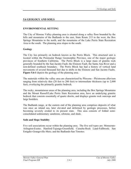
Figure 5.6-1 depicts the geology <strong>of</strong> the planning area.<br />
The materials within the valley area are characterized by Pliocene - Pleistocene alluvium<br />
ranging from relatively thin (20 feet to 200 feet) to intermediate thickness (up to 2,000<br />
feet), overlaying the primarily granitic bedrock.<br />
The rocky, mountainous areas <strong>of</strong> the planning area, including the Box Springs Mountains<br />
<strong>and</strong> the Mount Russell/Lake Perris State Recreation area, have an underlying granitic<br />
bedrock that consists essentially <strong>of</strong> quartz diorite, <strong>and</strong> displays granite rock outcrops <strong>and</strong><br />
large boulders.<br />
The Badl<strong>and</strong>s range, at the eastern end <strong>of</strong> the planning area comprises deposits <strong>of</strong> what<br />
was once an inl<strong>and</strong> sea, later elevated <strong>and</strong> deformed by geologic processes, before<br />
becoming severely eroded to its present state. This area consists <strong>of</strong> folded semiconsolidated<br />
sedimentary s<strong>and</strong>stone, siltstone, <strong>and</strong> shale.<br />
<strong>Soils</strong> <strong>and</strong> Slope Stability<br />
Five soil associations occur within the planning area. The five soil types are: Monserate-<br />
Arlington-Exeter; Hanford-Tujunga-Greenfield; Cieneba-Rock L<strong>and</strong>-Fallbrook; San<br />
Emigdio-Grangeville-Metz; <strong>and</strong> the Badl<strong>and</strong>s-San Timoteo.<br />
<strong>Moreno</strong> <strong>Valley</strong> General Plan <strong>City</strong> <strong>of</strong> <strong>Moreno</strong> <strong>Valley</strong><br />
Final Program EIR 5.6-1 July 2006
Riverside<br />
County<br />
Box<br />
Springs<br />
M ountain<br />
Park<br />
Box Springs Rd Ironw ood Ave<br />
Riverside<br />
Day St<br />
<strong>Moreno</strong> Valey<br />
Mall<br />
Towngate Blvd<br />
Elsw orth St<br />
March Air Reserve<br />
Base<br />
#<br />
Springs D r<br />
Pigeon Pass Rd<br />
Frederick St<br />
H idden<br />
Sunnym ead Ranch Pkw y<br />
Graham St<br />
Dracaea Ave<br />
H eacock St<br />
M anzanit a Ave<br />
Indian Ave<br />
Reche Vista Dr<br />
John F Kennedy Dr<br />
Gentian Ave<br />
Iris Ave<br />
N <strong>and</strong>ina Ave<br />
Hemlock Ave<br />
Ole<strong>and</strong>er Ave<br />
Kram eria Ave<br />
<strong>Moreno</strong> <strong>Valley</strong><br />
Bay Ave<br />
5 K H? A / A A H= E A @ / A C E? = F B 2 = HJ B JD A HJD A H 2 A E I K = H 4 = C A I ' & # <br />
University <strong>of</strong> California Riverside, Campus M useum Contributions No. 1, page 64.<br />
0 6,000 12,000 ft<br />
H A 8 = A O / A A H = 2 = <br />
. E = 2 H C H = - 14<br />
North<br />
Perris Blvd<br />
Kitching St<br />
Lasse le St<br />
Lasse le St<br />
Morrison St<br />
Fir Ave<br />
Cottonw ood Ave<br />
A les<strong>and</strong>ro Blvd<br />
Brodiaea Ave<br />
Cactus Ave<br />
Nason St<br />
Delphinium Ave<br />
$<br />
Riverside<br />
County<br />
<strong>Moreno</strong> Beach Dr Pettit St<br />
Eucalyptus Ave<br />
Lake Perris<br />
Locust Ave<br />
2 A HHEI * A @ H ? <br />
Quincy St<br />
R edl<strong>and</strong>s Blvd<br />
Riverside<br />
County<br />
Theodore St<br />
Davis Rd<br />
Virginia St<br />
G ilm an Springs Rd<br />
San Jacinto<br />
Wildlife<br />
Preserve<br />
3 K = HJA H = HO ) K L EK <br />
JA 6 D EI = F EI J = I K > I JEJK JA B H @ A J= EA @ ) G K EI J2 HE 5 F A ? E= 5 JK @ EA I = F I<br />
or Riverside County Hazard M anagem ent Zone M aps. For Accurate sitings refer<br />
to California State <strong>and</strong> Riverside C ounty G eologists. 5 A E + I E@ = JA @ 5 = @ I J A 5 EJI J A<br />
= @ > A @ I B C H= L A <br />
/ H= EJA 4 ? I B JD A 5 K JD A H + = EB H E= * = JD EJD<br />
San Jacinto River<br />
Calimesa<br />
Riverside<br />
County<br />
Jack R abbit Tr<br />
Riverside<br />
County<br />
. EC K HA # $ <br />
/ A C O<br />
+ EJO B H A 8 = A O<br />
K O $
5.6 <strong>Geology</strong> <strong>and</strong> <strong>Soils</strong><br />
Monserate-Arlington-Exeter. This soil association is found adjacent to <strong>and</strong> within the<br />
eastern half <strong>of</strong> the March Air Reserve Base. It consists <strong>of</strong> well-drained soils that<br />
developed in alluvium from predominantly granitic materials. Soil stability is considered<br />
fair to good with minimal erosion potential.<br />
Hanford-Tujunga-Greenfield. This soil association is found within the central portion<br />
<strong>of</strong> the study area, generally extending northeast to southeast <strong>of</strong> March Air Reserve Base.<br />
It consists <strong>of</strong> well drained to somewhat excessively drained soils, developed in granitic<br />
alluvium. Soil stability is considered poor to fair with significant erosion potential.<br />
Cieneba-Rock L<strong>and</strong>-Fallbrook. This soil association is found on upl<strong>and</strong>s located in the<br />
Box Springs Mountains area, <strong>and</strong> extends east to Reche Canyon, <strong>and</strong> into the Mount<br />
Russell area. It consists <strong>of</strong> somewhat excessively drained soils on undulating steep<br />
slopes. Soil stability is generally considered fair with marginal potential for erosion.<br />
San Emigdio-Grangeville-Metz. This soil association is found along the western side <strong>of</strong><br />
Gilman Springs Road. It consists <strong>of</strong> well-drained soils on nearly level to steep slopes.<br />
Soil stability is considered poor to fair with significant potential for erosion.<br />
Badl<strong>and</strong>s-San Timoteo. This soil association if found along the northern portion <strong>of</strong><br />
Gilman Springs Road into the Badl<strong>and</strong>s region. It consists <strong>of</strong> well-drained soils on steep<br />
to very steep slopes. The soils are variable consisting <strong>of</strong> s<strong>of</strong>t s<strong>and</strong>stone, siltstone, <strong>and</strong><br />
beds <strong>of</strong> gravel. Soil stability is considered poor to fair with significant potential for<br />
erosion.<br />
Some <strong>of</strong> these soils have poor to fair stability <strong>and</strong> are considered to be potentially<br />
expansive. <strong>Soils</strong> prone to collapse are commonly associated with wind-laid s<strong>and</strong>s <strong>and</strong><br />
silts, <strong>and</strong> alluvial fan <strong>and</strong> mudflow sediments deposited during flash floods. The collapse<br />
potential <strong>of</strong> the soils identified above ranges from minimal to significant. The<br />
Monserate-Arlington-Exeter soil association has minimal collapse potential <strong>and</strong> the<br />
Cienega-Rock L<strong>and</strong>-Fallbrook association has marginal potential for collapse.<br />
The primary factors that determine an area’s susceptibility to slope instability are the<br />
underlying geologic <strong>and</strong> soils characteristics. The abundant shales <strong>and</strong> siltstones<br />
underlying the Badl<strong>and</strong>s are highly porous <strong>and</strong> do not hold together well when wet,<br />
which can lead to slope instability <strong>and</strong> l<strong>and</strong>slides. Secondary factors contributing to<br />
slope instability <strong>and</strong> l<strong>and</strong>slides include rainfall <strong>and</strong> earthquakes. A “slow moving”<br />
l<strong>and</strong>slide reportedly exists along Gilman Springs Road in the eastern portion <strong>of</strong> the<br />
planning area. 1<br />
1 Michael A. McKibben, Ph.D., September 28, 2000 comment letter.<br />
<strong>Moreno</strong> <strong>Valley</strong> General Plan <strong>City</strong> <strong>of</strong> <strong>Moreno</strong> <strong>Valley</strong><br />
Final Program EIR 5.6-3 July 2006
Existing Regulations<br />
5.6 <strong>Geology</strong> <strong>and</strong> <strong>Soils</strong><br />
Existing grading regulations require permit applications to include soils engineering<br />
reports <strong>and</strong>, where necessary, engineering geology reports. The recommendations<br />
contain in the reports must be included in the grading plans <strong>and</strong> specifications. The<br />
reports typically include recommendations concerning cuts, fills, compaction <strong>and</strong><br />
foundation design to ensure stable development.<br />
Subsidence<br />
The low-lying areas in the southeast corner <strong>of</strong> the planning area have experienced<br />
tectonic subsidence, as well as subsidence as a result <strong>of</strong> groundwater withdrawal for<br />
agricultural use. The southeast corner <strong>of</strong> the planning area is within the San Jacinto<br />
Wildlife Area <strong>and</strong>/or within the designated floodplain.<br />
Fault Rupture<br />
The San Jacinto fault passes through the eastern portion <strong>of</strong> the planning area. The San<br />
Jacinto fault is considered to be the most active fault in Southern California. An Alquist-<br />
Priolo Special Fault Zone has been established for the San Jacinto fault. The Casa Loma<br />
fault (a fault str<strong>and</strong> <strong>of</strong> the San Jacinto fault) lies 1.5 miles southwest <strong>of</strong> the San Jacinto<br />
fault in the southeast corner <strong>of</strong> the planning area. It had been speculated that the Casa<br />
Loma str<strong>and</strong> might extend northwest <strong>of</strong> the Alquist-Priolo Special Fault Zone, but<br />
geologic studies to date have been unable to show that the fault extends beyond the<br />
Special Fault Zone. The fault str<strong>and</strong> that lies to the northeast <strong>of</strong> the Casa Loma fault is<br />
known as the Claremont Fault. Figure 5.6-2 depicts the location <strong>of</strong> these faults. Another<br />
fault, known as the Farm Road Fault, was identified in 1992 in the far southeast corner <strong>of</strong><br />
the planning area. Insufficient information is available to determine whether it is an<br />
active fault.<br />
Existing Regulations<br />
Existing state law <strong>and</strong> city regulations <strong>and</strong> practices require most development<br />
applications within the Alquist-Priolo Zone to include geologic reports addressing<br />
potential surface rupture due to faulting. No structure for human occupancy is permitted<br />
to placed across the trace <strong>of</strong> an active fault, nor generally within 50 feet <strong>of</strong> any active<br />
fault trace.<br />
<strong>Moreno</strong> <strong>Valley</strong> General Plan <strong>City</strong> <strong>of</strong> <strong>Moreno</strong> <strong>Valley</strong><br />
Final Program EIR 5.6-4 July 2006
Fault Name<br />
TABLE 5.6-1<br />
POTENTIAL EARTHQUAKE SCENARIOS<br />
FOR MORENO VALLEY<br />
Distance from<br />
<strong>Moreno</strong> <strong>Valley</strong><br />
Type Per<br />
UBC<br />
Slip Rate<br />
(mm/year)<br />
5.6 <strong>Geology</strong> <strong>and</strong> <strong>Soils</strong><br />
Maximum Credible<br />
Earthquake<br />
San Jacinto 0 A 12.0 7.2<br />
Elsinore 12 to 18 miles B 4.0 6.8<br />
San Andreas 15 to 20 miles A 24.0 7.4<br />
Source: <strong>City</strong> <strong>of</strong> <strong>Moreno</strong> <strong>Valley</strong>, General Plan, September 20, 1988.<br />
1 A = Faults that are capable <strong>of</strong> producing large magnitude events that have a highs rate <strong>of</strong> seismicity.<br />
Seismicity <strong>and</strong> Groundshaking<br />
Earthquake-generated groundshaking is the most critical <strong>and</strong> potentially damaging<br />
earthquake effect in the planning area. Three potential sources <strong>of</strong> strong seismic<br />
groundshaking in the planning area include the San Jacinto fault, the San Andreas Fault<br />
<strong>and</strong> the Elsinore Fault. The major source <strong>of</strong> potential earthquake damage to the planning<br />
area is from activity along the San Jacinto fault. The San Andreas fault is an active fault<br />
that is located approximately 15 to 20 miles northeast <strong>of</strong> the planning area. The Elsinore<br />
fault is located approximately 12 to 18 miles southwest <strong>of</strong> the planning area. A major<br />
earthquake associated with any <strong>of</strong> these faults could result in moderate to severe<br />
groundshaking in the planning area. Damage to buildings <strong>and</strong> infrastructure could be<br />
expected as a result <strong>of</strong> groundshaking during a seismic event.<br />
Table 5.6-1 depicts the seismic data for regional faults that could affect the planning<br />
area. As depicted, the maximum credible earthquake from these faults ranges from 6.8 to<br />
7.4.<br />
Most loss <strong>of</strong> life <strong>and</strong> injuries that occur during an earthquake are related to the collapse <strong>of</strong><br />
buildings <strong>and</strong> secondary damage. Seismic groundshaking can also result in substantial<br />
structural damage <strong>and</strong> loss <strong>of</strong> income.<br />
Existing Regulations<br />
All buildings in the region are required to resist seismic groundshaking in accordance<br />
with the Uniform Building Code (UBC). However, the UBC does not provide 100<br />
percent protection against seismic damage.<br />
Liquefaction<br />
Liquefaction is a process by which clay-free soil deposits, primarily s<strong>and</strong>s <strong>and</strong> silts,<br />
temporarily lose strength during severe groundshaking <strong>and</strong> behave as a sticky liquid<br />
<strong>Moreno</strong> <strong>Valley</strong> General Plan <strong>City</strong> <strong>of</strong> <strong>Moreno</strong> <strong>Valley</strong><br />
Final Program EIR 5.6-7 July 2006
5.6 <strong>Geology</strong> <strong>and</strong> <strong>Soils</strong><br />
rather than a solid. Liquefaction occurs primarily in areas <strong>of</strong> recently deposited s<strong>and</strong>s<br />
<strong>and</strong> silts <strong>and</strong> in areas <strong>of</strong> high groundwater levels. Poorly consolidated sediment <strong>and</strong> high<br />
groundwater levels occur most frequently in creekbeds <strong>and</strong> floodplains. Although the<br />
<strong>City</strong> has seen no evidence <strong>of</strong> liquefaction events occurring in the community nor has any<br />
geotechnical report recently submitted to the <strong>City</strong> identified liquefaction hazards, the<br />
Riverside County General Plan has identified a range <strong>of</strong> liquefaction susceptibility in<br />
<strong>Moreno</strong> <strong>Valley</strong> from very low with deep groundwater in the northern <strong>and</strong> eastern portions<br />
<strong>of</strong> the community to very high with shallow groundwater generally west <strong>of</strong> Perris<br />
Boulevard.<br />
<strong>Moreno</strong> <strong>Valley</strong> General Plan<br />
The proposed <strong>Moreno</strong> <strong>Valley</strong> General Plan Safety Element Objective 6.1 is to “minimize<br />
the potential for loss <strong>of</strong> life <strong>and</strong> protect residents, workers, <strong>and</strong> visitors to the <strong>City</strong> from<br />
physical injury <strong>and</strong> property damage due to seismic ground shaking <strong>and</strong> secondary<br />
effects.” Based on this objective, the Element provides the following Policy Statements<br />
applicable to this section:<br />
6.1.1 Reduce fault rupture hazards to a level <strong>of</strong> acceptable risk through the<br />
identification <strong>and</strong> recognition <strong>of</strong> potentially hazardous conditions <strong>and</strong> areas<br />
as they relate to the San Jacinto fault zone <strong>and</strong> the high <strong>and</strong> very high<br />
liquefaction hazard zones. Require geologic studies <strong>and</strong> mitigation for fault<br />
rupture hazards in accordance with the Alquist-Priolo Special Study Zones<br />
Act. Additionally, future geotechnical studies shall contain calculations for<br />
seismic settlement on all alluvial sites identified as having high or very high<br />
liquefaction potential. Should the calculations show a potential for<br />
liquefaction, appropriate mitigation shall be identified <strong>and</strong> implemented.<br />
6.1.2 Require all new developments, existing critical <strong>and</strong> essential facilities <strong>and</strong><br />
structures to comply with the most recent Uniform Building Code seismic<br />
design st<strong>and</strong>ards.<br />
THRESHOLD FOR DETERMINING SIGNIFICANCE<br />
For the purposes <strong>of</strong> this EIR, a significant impact would occur if implementation <strong>of</strong><br />
General Plan Alternatives 1, 2, or 3 would:<br />
• Expose people or structures to unacceptable risks <strong>of</strong> major geologic, seismic or<br />
soils hazards that could not be overcome by using reasonable construction <strong>and</strong>/or<br />
maintenance practices.<br />
<strong>Moreno</strong> <strong>Valley</strong> General Plan <strong>City</strong> <strong>of</strong> <strong>Moreno</strong> <strong>Valley</strong><br />
Final Program EIR 5.6-8 July 2006
ENVIRONMENTAL IMPACT<br />
General Plan L<strong>and</strong> Use Alternatives 1, 2, <strong>and</strong> 3<br />
5.6 <strong>Geology</strong> <strong>and</strong> <strong>Soils</strong><br />
The impact analysis provided in this section addresses the three General Plan<br />
Alternatives. The geology <strong>and</strong> soils impacts will be similar for each General Plan L<strong>and</strong><br />
Use Alternative.<br />
<strong>Geology</strong><br />
Development according to any <strong>of</strong> the General Plan L<strong>and</strong> Use Alternatives is not<br />
anticipated to result in a significant impact associated with the geologic formation<br />
underlying the planning area. The Perris Bedrock is considered to be relatively stable.<br />
No mitigation is required.<br />
Soil <strong>and</strong> Slope Stability<br />
Some <strong>of</strong> the soils that occur within the planning area are susceptible to collapse which<br />
may pose a hazard to new development. This is considered a significant impact.<br />
Implementation <strong>of</strong> Mitigation Measures GS1 <strong>and</strong> GS2 will reduce this impact to a level<br />
less than significant.<br />
Subsidence<br />
An area in the southeastern portion <strong>of</strong> the planning area has experienced subsidence in<br />
the past. However, the area is located within the San Jacinto Wildlife Area <strong>and</strong>/or within<br />
the designated floodplain, where the risk for injury or loss <strong>of</strong> life due to subsidence is<br />
considered low. Therefore, no significant impact associated with subsidence is<br />
anticipated to occur.<br />
Fault Rupture<br />
An Alquist-Priolo Special Fault Zone has been established for the San Jacinto fault. The<br />
major source <strong>of</strong> potential damage due to fault rupture is from activity along the San<br />
Jacinto fault.<br />
The San Jacinto Fault Zone underlies portions <strong>of</strong> General Plan L<strong>and</strong> Use Alternatives 1,<br />
2, <strong>and</strong> 3, planned for residential, business park, commercial, <strong>and</strong> public l<strong>and</strong> uses.<br />
Schools are strictly prohibited by the State Department <strong>of</strong> Education <strong>and</strong> Title 5 from<br />
locating on an active fault or within an Alquist-Priolo Zone.<br />
This issue is considered a significant impact. Implementation <strong>of</strong> Mitigation Measures<br />
GS1 <strong>and</strong> GS2 will reduce this impact to a level less than significant.<br />
<strong>Moreno</strong> <strong>Valley</strong> General Plan <strong>City</strong> <strong>of</strong> <strong>Moreno</strong> <strong>Valley</strong><br />
Final Program EIR 5.6-9 July 2006
Seismicity <strong>and</strong> Groundshaking<br />
5.6 <strong>Geology</strong> <strong>and</strong> <strong>Soils</strong><br />
The planning area is located in a region with several active fault lines. The entire area is<br />
at risk for damage caused by groundshaking <strong>and</strong> seismic activity. The seismic risk in the<br />
planning area is similar to other portions <strong>of</strong> Riverside County.<br />
With the increase <strong>of</strong> development <strong>and</strong> population allowed under the General Plan<br />
Alternatives, the number <strong>of</strong> people <strong>and</strong> buildings exposed to seismic groundshaking will<br />
increase. This is considered a significant impact. Implementation <strong>of</strong> Mitigation<br />
Measures GS1 <strong>and</strong> GS2 will reduce the impact to a level less than significant.<br />
Liquefaction<br />
As described above, the Riverside County General Plan identifies a range <strong>of</strong> liquefaction<br />
susceptibility in <strong>Moreno</strong> <strong>Valley</strong> ranging from very low with deep groundwater in the<br />
northern <strong>and</strong> eastern portions <strong>of</strong> the community to very high with shallow groundwater<br />
generally west <strong>of</strong> Perris Boulevard. The area subject to high <strong>and</strong> very high liquefaction<br />
potential according to the County’s mapping is largely developed, <strong>and</strong> the new General<br />
Plan policies <strong>and</strong> l<strong>and</strong> uses will not affect this existing development. Although no new<br />
residential development is expected in this area, new non-residential development may<br />
occur in the vacant l<strong>and</strong>s in this area. Because development will be allowed in the high<br />
susceptibility areas, this is considered a significant impact. Currently, the <strong>City</strong> Engineer<br />
routinely requires project proponents to evaluate the potential for l<strong>and</strong> settlement when<br />
conducting foundation investigations, which would address this potential impact.<br />
Additionally, implementation <strong>of</strong> Mitigation Measures GS1 <strong>and</strong> GS2 will reduce the<br />
impact to a level less than significant. Therefore, potential impacts to new homes <strong>and</strong><br />
residents will not occur.<br />
MITIGATION MEASURES<br />
GS1. The <strong>City</strong> shall reduce the fault rupture hazards through the identification <strong>and</strong><br />
recognition <strong>of</strong> potentially hazardous conditions <strong>and</strong> areas as they relate to the<br />
San Jacinto fault zone <strong>and</strong> the high <strong>and</strong> very high liquefaction hazard zones.<br />
During the review <strong>of</strong> future development projects, the <strong>City</strong> shall require geologic<br />
studies <strong>and</strong> mitigation for fault rupture hazards in accordance with the Alquist-<br />
Priolo Special Study Zones Act. Additionally, future geotechnical studies shall<br />
contain calculations for seismic settlement on all alluvial sites identified as<br />
having high or very high liquefaction potential. Should the calculations show a<br />
potential for liquefaction, appropriate mitigation shall be identified <strong>and</strong><br />
implemented (Policy 6.1.1).<br />
GS2. The <strong>City</strong> shall require all new developments, existing critical <strong>and</strong> essential<br />
facilities <strong>and</strong> structures to comply with the most recent Uniform Building Code<br />
seismic design st<strong>and</strong>ards (Policy 6.1.2).<br />
<strong>Moreno</strong> <strong>Valley</strong> General Plan <strong>City</strong> <strong>of</strong> <strong>Moreno</strong> <strong>Valley</strong><br />
Final Program EIR 5.6-10 July 2006
IMPACT AFTER MITIGATION<br />
Soil <strong>and</strong> Slope Stability<br />
Less than significant.<br />
Subsidence<br />
Less than significant.<br />
Fault Rupture<br />
Less than significant.<br />
Seismicity <strong>and</strong> Groundshaking<br />
Less than significant.<br />
Liquefaction<br />
Less than significant.<br />
NOTES AND REFERENCES<br />
5.6 <strong>Geology</strong> <strong>and</strong> <strong>Soils</strong><br />
1. Earth Consultants International. Slope <strong>and</strong> Soil Instability Hazards-County <strong>of</strong><br />
Riverside, August 1, 2000.<br />
2. Morton, Douglas “Subsidence <strong>and</strong> Ground Fissures I the San Jacinto Basin Area,<br />
Southern California” U.S. Geological Survey Open File Report 94532 (1992)<br />
3. Martin, Jay <strong>and</strong> Reeder, Wessly (Gary S. Rasmussen <strong>and</strong> Associates)<br />
“Engineering <strong>Geology</strong> Investigation; Tentative Tract No. 24721; South <strong>of</strong><br />
Eucalyptus Avenue, east <strong>of</strong> Redl<strong>and</strong>s Boulevard; <strong>Moreno</strong> <strong>Valley</strong>, CA (1989).<br />
4. Park, Stephen <strong>and</strong> Pendergraft, Darin “Interim Technical Report <strong>of</strong> the San<br />
Jacinto Shallow Seismic Reflection Survey (1992).<br />
<strong>Moreno</strong> <strong>Valley</strong> General Plan <strong>City</strong> <strong>of</strong> <strong>Moreno</strong> <strong>Valley</strong><br />
Final Program EIR 5.6-11 July 2006
This page intentionally left blank.<br />
5.6 <strong>Geology</strong> <strong>and</strong> <strong>Soils</strong><br />
<strong>Moreno</strong> <strong>Valley</strong> General Plan <strong>City</strong> <strong>of</strong> <strong>Moreno</strong> <strong>Valley</strong><br />
Final Program EIR 5.6-12 July 2006


