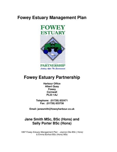
Fowey Estuary Management Plan Fowey Estuary ... - Fowey Harbour
Fowey Estuary Management Plan Fowey Estuary ... - Fowey Harbour
Fowey Estuary Management Plan Fowey Estuary ... - Fowey Harbour

You also want an ePaper? Increase the reach of your titles
YUMPU automatically turns print PDFs into web optimized ePapers that Google loves.
<strong>Fowey</strong> <strong>Estuary</strong> <strong>Management</strong> <strong>Plan</strong><br />
<strong>Fowey</strong> <strong>Estuary</strong> Partnership<br />
<strong>Harbour</strong> Office<br />
Albert Quay<br />
<strong>Fowey</strong><br />
Cornwall<br />
PL23 1AJ<br />
Telephone: (01726) 832471<br />
Fax: (01726) 833738<br />
Email: janesmith@foweyharbour.co.uk<br />
Jane Smith MSc, BSc (Hons) and<br />
Sally Porter BSc (Hons)<br />
1997 <strong>Fowey</strong> <strong>Estuary</strong> <strong>Management</strong> <strong>Plan</strong> - Joanne Oke BSc ( Hons)<br />
& Emma Burfoot BSc (Hons) MSc
<strong>Fowey</strong> <strong>Estuary</strong> <strong>Management</strong> <strong>Plan</strong> Contents<br />
March 2003<br />
Contents<br />
Contents ...................................................................................... 2<br />
Abbreviations .............................................................................. 4<br />
Definitions.................................................................................... 5<br />
Section 1 Introduction & Vision ................................................. 6<br />
Section 2 Background ................................................................ 7<br />
Section 3 The <strong>Management</strong> <strong>Plan</strong> Area....................................... 8<br />
Section 4 <strong>Management</strong> Framework.......................................... 10<br />
4.1 Linking the <strong>Fowey</strong> <strong>Estuary</strong> <strong>Management</strong> <strong>Plan</strong> (FEMP) to the work of other<br />
Organisations & Bodies....................................................................................................... 10<br />
4.2 FEMP objectives ........................................................................................................... 12<br />
4.3 Guiding Principles ......................................................................................................... 12<br />
4.4 <strong>Plan</strong> Review and Implementation ................................................................................. 14<br />
4.5 Commitment to the <strong>Estuary</strong> <strong>Management</strong> Process ...................................................... 14<br />
4.6 <strong>Fowey</strong> <strong>Estuary</strong> Partnership <strong>Management</strong> Framework.................................................. 15<br />
Section 5 <strong>Management</strong> Policies ............................................... 17<br />
5.1 Develop a <strong>Management</strong> Framework to facilitate the delivery of the <strong>Estuary</strong><br />
<strong>Management</strong> <strong>Plan</strong> ............................................................................................................... 17<br />
5.2 Encourage on-going public participation and involvement in estuary management..... 17<br />
5.3 Identify future funding to support the work of the <strong>Fowey</strong> <strong>Estuary</strong> Partnership ............. 18<br />
5.4 Improve access to high quality, up to date and relevant data for decision making ...... 18<br />
Section 6 Landscape Conservation ......................................... 19<br />
6.1 Promote wider understanding and recognition of landscape character and quality ..... 19<br />
Section 7 Nature Conservation ................................................ 21<br />
7.1 Identify and pursue opportunities for habitat creation and enhancement, in line with<br />
Biodiversity Action <strong>Plan</strong> targets........................................................................................... 21<br />
7.2 Education and public awareness to nature conservation ............................................. 21<br />
7.3 Increase understanding of the dynamics and distribution of species and habitats<br />
throughout the estuary and monitor their status ................................................................. 22<br />
7.4 Support the <strong>Fowey</strong> <strong>Estuary</strong> Voluntary Marine Conservation Area (VMCA) ................. 24<br />
Section 8 Historic Assets ......................................................... 25<br />
8.1 Designations ................................................................................................................. 25<br />
8.2 Promote knowledge & public awareness of local heritage ........................................... 25<br />
8.3 Protect and conserve the historic environment............................................................. 26<br />
Section 9 Commercial Activities .............................................. 28<br />
9.1 Promote sustainable commercial activities................................................................... 28<br />
9.2 Ensure sufficient contingency arrangements for the <strong>Estuary</strong> ....................................... 29<br />
Section 10 Fisheries.................................................................. 30<br />
10.1 Support existing fisheries management arrangements .............................................. 30<br />
Page 2
<strong>Fowey</strong> <strong>Estuary</strong> <strong>Management</strong> <strong>Plan</strong> Contents<br />
March 2003<br />
10.2 Identify sustainable levels for bait harvesting ............................................................. 31<br />
10.3 Increase understanding between fisheries interests and other estuary users............ 32<br />
Section 11 Water Quality and Pollution................................... 33<br />
11.1 Ensure legal minimum standards are met and seek to further improve water quality.33<br />
11.2 Identify and reduce sources of diffuse or other pollution ............................................ 34<br />
11.3 Reduce pollution from boats ....................................................................................... 34<br />
11.4 Support the development and implementation of pollution Contingency planning..... 35<br />
Section 12 Sediment, Dredging and Disposal......................... 36<br />
12.1 Work towards reducing sediment input into the estuary ............................................. 36<br />
12.2 Seek alternative disposal for maintenance dredging spoil.......................................... 37<br />
12.3 Monitor sediment quality ............................................................................................. 37<br />
12.4 Support the implementation of the shoreline management plan ................................ 39<br />
Section 13 Litter and Waste Disposal...................................... 40<br />
13.1 Support the implementation of waste strategies in the area covered by the <strong>Fowey</strong><br />
<strong>Estuary</strong> <strong>Management</strong> <strong>Plan</strong>.................................................................................................. 40<br />
13.2 Promote recycling of waste wherever possible........................................................... 41<br />
Section 14 Tourism, Recreation & Interpretation.................... 42<br />
14.1 Tourism ....................................................................................................................... 42<br />
14.2 Water based recreation............................................................................................... 42<br />
14.3 Land based recreation ................................................................................................ 43<br />
14.4 Interpretation ............................................................................................................... 44<br />
Section 15 Access..................................................................... 46<br />
15.1 Footpaths .................................................................................................................... 46<br />
15.2 Ferry services.............................................................................................................. 46<br />
15.3 Launching and landing................................................................................................ 47<br />
Section 16 The <strong>Management</strong> Programme................................ 49<br />
16.1 Implementation............................................................................................................ 49<br />
16.2 Funding ....................................................................................................................... 50<br />
16.3 Monitoring and Reviews.............................................................................................. 50<br />
Page 3
<strong>Fowey</strong> <strong>Estuary</strong> <strong>Management</strong> <strong>Plan</strong> Abbreviations<br />
March 2003<br />
Abbreviations<br />
AGLV Area of Great Landscape Value<br />
AONB Area of Outstanding Natural Beauty<br />
BAP Biodiversity Action <strong>Plan</strong><br />
CBWPS Cornwall Bird Watching and Preservation Society<br />
CCC Cornwall County Council<br />
CDC Caradon District Council<br />
CGS Cornwall Geology Site (formerly known as RIGS)<br />
CSFC Cornwall Sea Fisheries Committee<br />
CWS County Wildlife Site<br />
CWT Cornwall Wildlife Trust<br />
DEFRA Department of Environment, Fisheries and Rural Affairs<br />
DTR Department of Transport & the Regions<br />
EA Environment Agency<br />
EC European Commission<br />
EN English Nature<br />
ERCCIS Environmental Records Centre for Cornwall & the Isles of Scilly<br />
EU European Union<br />
FEMP <strong>Fowey</strong> <strong>Estuary</strong> <strong>Management</strong> <strong>Plan</strong><br />
FEP <strong>Fowey</strong> <strong>Estuary</strong> Partnership<br />
FHC <strong>Fowey</strong> <strong>Harbour</strong> Commissioners<br />
FPHA <strong>Fowey</strong> Port Health Authority<br />
FWAG Farming and Wildlife Advisory Group<br />
HC Heritage Coast<br />
JNCC Joint Nature Conservancy Committee<br />
LEAP Local Environment Agency <strong>Plan</strong><br />
MCA Maritime & Coastguard Agency<br />
MoU Memorandum of Understanding<br />
MAFF Ministry of Agriculture, Fisheries and Food<br />
NT The National Trust<br />
RIGS Regionally Important Geological / Geomorphological Site (now<br />
known as CGS)<br />
RBC Restormel Borough Council<br />
SAFFA Salmon and Freshwater Fisheries Act 1975<br />
SSSI Site of Special Scientific Interest<br />
SWW South West Water<br />
VMCA Voluntary Marine Conservation Area<br />
WeBS Wetland Bird Survey<br />
WCRT West Country Rivers Trust<br />
Page 4
<strong>Fowey</strong> <strong>Estuary</strong> <strong>Management</strong> <strong>Plan</strong> Definitions<br />
March 2003<br />
Definitions<br />
<strong>Estuary</strong> management is a generic term representing a spectrum of planning<br />
and management activity. Three further definitions are needed to describe<br />
specific elements of estuary management.<br />
The <strong>Estuary</strong> <strong>Management</strong> <strong>Plan</strong> – refers to the planning document. This is<br />
an estuary specific plan that includes guidance and action plans that have<br />
been prepared by the Partnership in consultation with all who live, work and<br />
relax on the estuary.<br />
The <strong>Fowey</strong> <strong>Estuary</strong> Partnership – refers to the organisations and bodies<br />
involved in preparing and implementing the <strong>Estuary</strong> <strong>Management</strong> <strong>Plan</strong>.<br />
<strong>Estuary</strong> <strong>Management</strong> Process – refers to the process of estuary<br />
management. This is a broader term that embraces the <strong>Plan</strong>, the Partnership,<br />
the framework and the decision making process for the estuary.<br />
Advisory Group - refers to the grouping of organisations that oversee the<br />
estuary management process and are largely responsible for setting the<br />
<strong>Fowey</strong> <strong>Estuary</strong> Partnerships work programme from the <strong>Estuary</strong> <strong>Management</strong><br />
<strong>Plan</strong>.<br />
Focus Group – comprises organisations with similar concerns, interests and<br />
areas of expertise. A representative from each focus group sits on the<br />
Advisory Group.<br />
<strong>Estuary</strong> Forum - open to any one group or individual who has an interest in<br />
the management of the estuary.<br />
Page 5
<strong>Fowey</strong> <strong>Estuary</strong> <strong>Management</strong> <strong>Plan</strong> Section 1<br />
March 2003 Background<br />
Section 1 Introduction & Vision<br />
Britain has the most extensive estuarine resource of any country in Europe.<br />
Its estuaries are of fundamental importance to the economy and are subject to<br />
a wide range of uses including commercial navigation, commercial fisheries,<br />
tourism and recreation. Many of England’s estuaries are also nationally or<br />
internationally important for wildlife.<br />
Estuarine habitats are sensitive to human use and pressure. Some of these<br />
pressures result in adverse impacts on the natural estuarine resources and<br />
other estuary users. The estuary management process seeks to achieve a<br />
balance between the competing demands placed on estuaries through the<br />
principle of sustainable use.<br />
The <strong>Fowey</strong> <strong>Estuary</strong> <strong>Management</strong> <strong>Plan</strong> is a practical document containing<br />
guidelines to inform, advise and guide current and future management. It is<br />
not a statutory plan and has not been designed to dictate detailed<br />
management actions or set up complex new working arrangements. Instead it<br />
builds upon the successes and strengths of existing organisations and<br />
activities by providing a framework within which decisions can be made and<br />
actions can be taken.<br />
Our Vision<br />
The <strong>Fowey</strong> <strong>Estuary</strong> is valued and appreciated as a<br />
place to live, work & relax, an environmental asset and a focus for<br />
activities in the local area.<br />
The Partnership seeks to:<br />
Stimulate an appropriate balance between competing demands<br />
placed on the <strong>Fowey</strong> <strong>Estuary</strong>, through shared information, cooperation<br />
and action<br />
Create a culture of openness and communication<br />
Work towards a sustainable future for the <strong>Fowey</strong> <strong>Estuary</strong><br />
To achieve this vision will take more than the<br />
production of this document. It requires the<br />
commitment, awareness and co-operation for the<br />
ideas and guidance it contains, through action now<br />
and in the future.<br />
Page 6
<strong>Fowey</strong> <strong>Estuary</strong> <strong>Management</strong> <strong>Plan</strong> Section 2<br />
March 2003 Background<br />
Section 2 Background<br />
Increasing concern over the sustainable future of estuaries and coastal areas<br />
has led the government to re-examine the way in which these important areas<br />
are managed and used. Internationally, the UK government has played an<br />
active part in negotiating and signing up to several international conventions<br />
and European Directives. An important stimulus for action was the United<br />
Nations Conference on Environment and Development introducing the<br />
concept of an environmentally sustainable agenda for action for the 21 st<br />
Century (Agenda 21), which the UK government and other world governments<br />
have since ratified. Local Agenda 21 programmes have since been drawn up<br />
by local authorities to promote action at a local level. These non-statutory<br />
programmes involve a process of consultation and consensus building<br />
between local authorities, public, local organisations and businesses.<br />
In May 2002, the EU passed a recommendation on Integrated Coastal Zone<br />
<strong>Management</strong> (ICZM) which the UK government has committed to. This<br />
involves a national stocktaking exercise in ICZM, to be followed by national<br />
strategies for England, Wales, N. Ireland and Scotland. This process will<br />
result in reporting back on progress to the EU in 2006.<br />
In 1990, the House of Commons Select Committee on the Environment<br />
established a special enquiry into coastal zone protection and planning within<br />
England and Wales. The committee reported that management of estuarine<br />
areas in the UK had in the past suffered from uncoordinated decisions and<br />
actions at all levels and called for an integrated management approach.<br />
In response to this, English Nature, under their Campaign for a Living Coast,<br />
suggested guidance for developing non-statutory management plans. Many<br />
other initiatives have followed such as the <strong>Plan</strong>ning Policy Guidance note on<br />
coastal areas (PPG 20: Coastal <strong>Plan</strong>ning) and the establishment of a national<br />
forum of relevant organisations. Other government undertakings have<br />
included the encouragement of Shoreline <strong>Management</strong> <strong>Plan</strong>s that provide the<br />
basis for sustainable coastal defence policies within sediment cells.<br />
Bodies with jurisdiction over the marine environment are required to perform<br />
their duties and use their statutory powers, including making byelaws, in ways<br />
that safeguard conservation interests. DEFRA considers that effective<br />
conservation of marine habitats is possible without unnecessary interference<br />
to activities such as navigation, fishing and recreation. To react positively to<br />
this and to ensure other aspects of the estuarine resource were fully taken<br />
into account, it was considered necessary to develop a <strong>Plan</strong> to provide the<br />
basis for an integrated and co-operative approach to future management. In<br />
May 1997, the first <strong>Fowey</strong> <strong>Estuary</strong> <strong>Management</strong> <strong>Plan</strong> was published.<br />
It was clear a need would arise to ensure that the success of the plan in<br />
meeting its stated objectives was reviewed. The plan is a rolling programme<br />
of liaison and action, rather than a one off, all embracing management plan<br />
and has therefore been reviewed after five years of implementation.<br />
Page 7
<strong>Fowey</strong> <strong>Estuary</strong> <strong>Management</strong> <strong>Plan</strong> Section 3<br />
March 2003 The <strong>Management</strong> <strong>Plan</strong> Area<br />
Section 3 The <strong>Management</strong> <strong>Plan</strong> Area<br />
The <strong>Fowey</strong> <strong>Estuary</strong> contains a diverse wildlife, landscape and built and<br />
cultural heritage that is valued by those who live, work and visit the area.<br />
The <strong>Estuary</strong> covers an area of nearly 1000 acres and caters for large<br />
numbers of commercial ships, resident and visiting craft, as well as various<br />
commercial activities. Most of the land fringing the estuary is owned by large<br />
landowners such as The National Trust, RailTrack and the Forestry Authority.<br />
<strong>Fowey</strong> <strong>Harbour</strong> Commissioners have been the principle managers of the<br />
fundus and foreshore of the <strong>Fowey</strong> <strong>Estuary</strong> since 1869. The <strong>Harbour</strong><br />
Commissioners are a self-financing Trust Port that has owned most of the<br />
fundus and foreshore since 1933, and its income from moorings and harbour<br />
dues cover its expenditure. Other landowners own small stretches of fundus<br />
and foreshore.<br />
The area covered by this plan lies within the following limits: from Gribbin<br />
Head to the eastern end of Lantivet Bay, and stretching north to the tidal limits<br />
of the rivers <strong>Fowey</strong> and Lerryn; and the pills and streams leading into the<br />
river, to 5 miles from the centre of the tidal river bed (Figure 1).<br />
The work of the Partnership is not restricted to issues that fall solely within the<br />
area marked by the boundary of Figure 1. Occasionally a more flexible<br />
consideration of this boundary should be recognised, as many issues and<br />
opportunities of importance to the estuary overlap or fall outside the boundary.<br />
Consequently the Partnership is committed to working on any issue that has<br />
an impact on the estuary and uses the boundary as a guide to its work.<br />
Evening sun over the entrance to <strong>Fowey</strong> <strong>Harbour</strong><br />
Page 8
<strong>Fowey</strong> <strong>Estuary</strong> <strong>Management</strong> <strong>Plan</strong> Section 3<br />
March 2003 The <strong>Management</strong> <strong>Plan</strong> Area<br />
Figure 1: Immediate Area Covered by the <strong>Fowey</strong> <strong>Estuary</strong><br />
<strong>Management</strong> <strong>Plan</strong><br />
Page 9
<strong>Fowey</strong> <strong>Estuary</strong> <strong>Management</strong> <strong>Plan</strong> Section 4<br />
March 2003 <strong>Management</strong> Framework<br />
Section 4 <strong>Management</strong> Framework<br />
4.1 Linking the <strong>Fowey</strong> <strong>Estuary</strong> <strong>Management</strong> <strong>Plan</strong> (FEMP) to<br />
the work of other Organisations & Bodies<br />
The <strong>Fowey</strong> <strong>Estuary</strong> <strong>Management</strong> <strong>Plan</strong> is a non-statutory document. There<br />
are no legal powers to ensure that all the guidance in the plan is implemented<br />
or adhered to. However, a number of the guidelines relate to the statutory<br />
duties of organisations involved in the plan’s development. The <strong>Plan</strong> acts as<br />
a mechanism for informing and co-ordinating these duties to ensure that a<br />
holistic approach is taken to the management of the estuary.<br />
There are several plans that are relevant to the FEMP area. All apply the<br />
principles of sustainable development and focus on their particular areas of<br />
interest. The <strong>Fowey</strong> <strong>Estuary</strong> <strong>Management</strong> <strong>Plan</strong> has regard to and informs the<br />
following plans and initiatives.<br />
Restormel Borough Council & Caradon District Council Local <strong>Plan</strong>s<br />
(Statutory) - Estuaries are often the boundary between districts and counties<br />
and the <strong>Fowey</strong> is no exception. The land to the east is subject to policies<br />
contained in the Caradon District Local <strong>Plan</strong> and the land to the west by the<br />
Restormel Borough Local <strong>Plan</strong>. These documents contain planning policies<br />
for the districts with regard to all aspects of the environment. There are<br />
specific policies concerning the maintenance of the natural environment.<br />
Other documents, such as the Restormel Borough Council Tourism and<br />
Leisure Strategy, are also relevant to the estuary area. The local councils<br />
should refer to the FEMP in the local plan processes.<br />
Bodmin Moor to the Coasts Local Environment Agency <strong>Plan</strong> (LEAP)<br />
(Non-statutory) – assist the Environment Agency in achieving its objectives for<br />
the whole of the River <strong>Fowey</strong> Catchment and neighbouring catchments. The<br />
final LEAP report has now been published (LEAP Bodmin Moor to the Coasts:<br />
Review 2001) and the ongoing priority actions from the LEAP will be taken<br />
forward into the Area’s “Local Contribution”. The LEAP was drafted through<br />
liaison with a local steering group representing a wide range of interests. It<br />
includes policies and actions that relate to the estuary, including a<br />
commitment to support the FEMP and its actions. Particularly relevant policy<br />
areas include water quality, biodiversity and the historic environment, impact<br />
of farming on the river, fisheries management, shellfisheries, water based<br />
recreation, waste management and pollution prevention. The FEMP includes<br />
policies and actions from the LEAP where proposed management actions for<br />
the river basin have some influence on the estuary, and vice versa.<br />
Rame Head to Lizard Point Shoreline <strong>Management</strong> <strong>Plan</strong> (Non-statutory) –<br />
sets out the strategy for sustainable coastal defence. This plan provides a<br />
strategic framework for the management of coastal defences along this<br />
coastline in the future and a basis upon which future informed decision<br />
making and policy setting can be made.<br />
Page 10
<strong>Fowey</strong> <strong>Estuary</strong> <strong>Management</strong> <strong>Plan</strong> Section 4<br />
March 2003 <strong>Management</strong> Framework<br />
The Cornwall Biodiversity Initiative (Non-statutory) – Individual Biodiversity<br />
Action <strong>Plan</strong>s (BAP’s) for wildlife habitats & species, including one for<br />
estuaries, have been prepared and continue to be developed and<br />
implemented. The Cornwall BAP is currently being updated and re-written to<br />
better resemble the format and language of the UK BAP. The <strong>Fowey</strong> <strong>Estuary</strong><br />
has eel grass beds and salt marsh, both of which are listed as key habitats.<br />
The FEMP is referred to in the appropriate BAP’s and will assist where<br />
possible in their implementation.<br />
Due regard is also given to the <strong>Fowey</strong> <strong>Harbour</strong> Waste <strong>Management</strong> <strong>Plan</strong><br />
(Statutory) and The <strong>Fowey</strong> <strong>Harbour</strong> Oil Spill Contingency <strong>Plan</strong> (Statutory)<br />
prepared by <strong>Fowey</strong> <strong>Harbour</strong> Commissioners, along with other planning<br />
documents as they arise. <strong>Fowey</strong> <strong>Harbour</strong> Commissioners control and<br />
manage the estuary through enforcement of the <strong>Harbour</strong> Byelaws and<br />
publication of guidance leaflets, codes of conduct and policy statements. The<br />
<strong>Fowey</strong> <strong>Estuary</strong> Partnership Advisory Group is an advisory group to the <strong>Fowey</strong><br />
<strong>Harbour</strong> Commissioners Board.<br />
Inaccessibility and remoteness from main roads have helped to keep the<br />
estuary relatively unspoilt by limiting public access to the water’s edge and<br />
restricting the spread of recreational activities. The policies and plans of the<br />
<strong>Harbour</strong> and local authorities have generally protected the estuary from<br />
harmful developments. In this task the local authorities have the support of<br />
central government and national agencies through national designations such<br />
as Areas of Outstanding Natural Beauty and Heritage Coasts.<br />
The <strong>Fowey</strong> <strong>Estuary</strong> Partnership aims to provide a fresh approach to the<br />
management of the estuary by providing a vehicle for co-operation, change<br />
where needed, and the motivation to realise appropriate solutions to existing<br />
and future problems and opportunities. The duties and powers of regulating<br />
activities on and around the estuary will remain the responsibility of statutory<br />
bodies. New duties are not imposed on the agency, organisation or<br />
individual; instead the FEMP relies on relevant agencies, organisations and<br />
individuals working together voluntarily to take steps to implement the<br />
guidance and actions held within this plan.<br />
<strong>Fowey</strong> <strong>Harbour</strong> entrance viewed from Gribbin Head<br />
Page 11
<strong>Fowey</strong> <strong>Estuary</strong> <strong>Management</strong> <strong>Plan</strong> Section 4<br />
March 2003 <strong>Management</strong> Framework<br />
4.2 FEMP objectives<br />
• To provide guidance and advice to those bodies influencing the<br />
planning system and regulation of activities below high water<br />
relating to the <strong>Fowey</strong> estuary.<br />
• To promote a common understanding of the objectives, beliefs and<br />
activities of the organisations reliant upon the estuarine resources.<br />
• To inform decision makers about the status of the estuary and what<br />
progress is being made / needs to be made towards sustainable<br />
use.<br />
• To act as a mechanism for agreeing short, medium and long term<br />
priorities for the management of the estuary.<br />
• To help prevent conflict by providing a balanced framework for<br />
resource allocation, objective setting and decision-making.<br />
• To be aware of the initiatives and plans of others and to<br />
communicate their implications to those organisations who are<br />
reliant on the estuary.<br />
4.3 Guiding Principles<br />
A set of guiding principles fundamental to the management of the estuary as a<br />
whole has been identified. They aim to consider the estuary as a valuable<br />
resource in terms of its biodiversity, natural and built heritage, environmental<br />
quality and a focus for economic growth.<br />
Through effective consultation with and input from local communities and<br />
others with an interest in the <strong>Fowey</strong> <strong>Estuary</strong>, it is anticipated that the following<br />
guiding principles can be achieved:<br />
• The rationale of sustainable development should underpin all<br />
management decisions along the estuary.<br />
• The estuary should be treated as a single unit across interests and<br />
organisational boundaries, through a co-ordinated management<br />
approach.<br />
Page 12
<strong>Fowey</strong> <strong>Estuary</strong> <strong>Management</strong> <strong>Plan</strong> Section 4<br />
March 2003 <strong>Management</strong> Framework<br />
• To provide a framework for co-operation amongst estuary users,<br />
statutory agencies and other organisations to sustain and manage<br />
the resources of the <strong>Fowey</strong> <strong>Estuary</strong>.<br />
• To protect and where possible enhance the unique natural beauty<br />
and distinctive landscape character of the <strong>Fowey</strong> River & <strong>Estuary</strong><br />
for future generations and to promote the conservation of natural<br />
assets of the area by raising awareness of all estuary users on the<br />
value of those assets.<br />
• To protect, conserve and enhance the biodiversity of estuarine<br />
habitats, including the estuarine fringe, and the wildlife they support<br />
through the promotion of environmental awareness amongst all<br />
relevant bodies and estuary users.<br />
• Ensure the protection, promotion and understanding of the<br />
historical & cultural resource, including safeguarding and<br />
augmenting the existing network of designated sites and promoting<br />
careful evaluation of any proposals for development that may effect<br />
them.<br />
• To sustain the commercial viability of the Port of <strong>Fowey</strong>.<br />
Encourage efforts to ensure that all development proposals<br />
balance the economic and environmental needs of the estuary.<br />
• To seek ways of managing recreational & commercial fisheries<br />
without undue detriment to stocks, the environment or other<br />
estuary users.<br />
• To work towards the maintenance and improvement of water<br />
quality standards within the estuary for the benefit of the natural<br />
environment. Support and promote measures to reduce pollution<br />
throughout the estuary.<br />
• To work towards a better understanding of the process of<br />
sedimentation and to maintain deep water access in the estuary<br />
while causing minimum environmental impact.<br />
• Work towards ensuring that the estuary remains, as far as<br />
practical, free from litter<br />
• Maintain and enhance opportunities for recreation and leisure on<br />
the estuary to provide suitable conflict-free access for all.<br />
Page 13
<strong>Fowey</strong> <strong>Estuary</strong> <strong>Management</strong> <strong>Plan</strong> Section 4<br />
March 2003 <strong>Management</strong> Framework<br />
4.4 <strong>Plan</strong> Review and Implementation<br />
The <strong>Fowey</strong> <strong>Estuary</strong> <strong>Management</strong> <strong>Plan</strong> was first published in May 1997. This<br />
document is a result of the first review process.<br />
Background - During 1995, public consultation took place, in the form of<br />
questionnaires and public meetings. The initial questionnaire was targetted at<br />
46 user groups and organisations with an interest in the estuary. There was<br />
an excellent response of 89% to this questionnaire. The two public meetings<br />
held in <strong>Fowey</strong> and Lostwithiel were well attended. Following publication of the<br />
Final Draft of the <strong>Plan</strong> in January 1997, there was a second period of public<br />
consultation and two more public meetings, in <strong>Fowey</strong> and Lostwithiel. The<br />
final plan became available from May 1997.<br />
The plan has undergone several changes since its original publication. The<br />
structure is currently as follows:<br />
The <strong>Plan</strong> will be fully reviewed every 5 years.<br />
The Partnership via the Advisory Group (Section 4.6) will review the <strong>Plan</strong>’s<br />
priorities annually, to develop a work program that specifies a range of<br />
practical projects to be implemented in the coming year.<br />
The Partnership must be accountable for providing best value through the<br />
plan’s implementation and monitor and evaluate the success it has in<br />
delivering its objectives and guiding principles.<br />
Focus Group (Section 4.6) meetings will be held when they are required.<br />
Each focus group has a representative on the Advisory Group. The other<br />
members of the focus group can raise issues with the Advisory Group through<br />
this representative.<br />
A wider <strong>Estuary</strong> forum will be held when there is a need for dissemination of<br />
information and wider consultation.<br />
The <strong>Harbour</strong> Commissioners are currently the Lead Body and it is intended<br />
that as the <strong>Plan</strong> continues through the implementation phase, they will act as<br />
a clearing house for enquiries relating to the <strong>Plan</strong>. This will provide a central<br />
point of contact from which enquiries can be fielded out to the relevant<br />
organisation(s).<br />
It should be noted that this system of representation will be constantly under<br />
review, to ensure that it continues to run as efficiently as possible and to<br />
accommodate any necessary changes. New subgroups may be formed if<br />
specific issues arise that require co-operation between different organisations.<br />
4.5 Commitment to the <strong>Estuary</strong> <strong>Management</strong> Process<br />
As the <strong>Plan</strong> is non-statutory, proposals arising from it will only succeed if they<br />
are practical and popular; proposals that lack support are more likely to fail.<br />
Page 14
<strong>Fowey</strong> <strong>Estuary</strong> <strong>Management</strong> <strong>Plan</strong> Section 4<br />
March 2003 <strong>Management</strong> Framework<br />
For the <strong>Plan</strong> to succeed and endure, the organisations and individuals<br />
concerned with management of the estuary must adopt it. For this reason the<br />
members of the Advisory Group have signed a Memorandum of<br />
Understanding (MoU) (Appendix 4).<br />
The MoU acknowledges the importance of working together through the<br />
<strong>Estuary</strong> <strong>Management</strong> Process. All parties acknowledge that this process<br />
provides an opportunity to co-ordinate their work programmes, their<br />
organisations policies, and actions that may be the consequences of this<br />
work. The MoU was drawn up to achieve the following aims:<br />
- To reiterate the aims of the partnership<br />
- To reduce unnecessary repetition of work<br />
- To share expertise and information<br />
- To confirm the commitment of the Advisory Group members to<br />
the <strong>Estuary</strong> <strong>Management</strong> Process<br />
The MoU does not alter or affect any members’ statutory responsibilities or<br />
rights.<br />
4.6 <strong>Fowey</strong> <strong>Estuary</strong> Partnership <strong>Management</strong> Framework<br />
The <strong>Management</strong> Framework for the <strong>Fowey</strong> <strong>Estuary</strong> Partnership consists of a<br />
core Advisory Group, with Focus Groups contributing (Figure 2). Overall, this<br />
forms the <strong>Estuary</strong> Forum.<br />
Page 15
<strong>Fowey</strong> <strong>Estuary</strong> <strong>Management</strong> <strong>Plan</strong> Section 4<br />
March 2003 <strong>Management</strong> Framework<br />
Figure 2: <strong>Fowey</strong> <strong>Estuary</strong> Partnership <strong>Management</strong> Framework<br />
Commercial <strong>Fowey</strong> <strong>Estuary</strong> Partnership Local Government<br />
IMERYS Minerals Limited Administration by the <strong>Estuary</strong> Officer Cornwall County Council<br />
Rail Track Restormel Borough Council<br />
Shipping Agents Caradon District Council<br />
Licensed Boatmen <strong>Fowey</strong> Town Council<br />
Licensed Fishermen Advisory Group Lostwithiel Town Council<br />
Licensed Shellfishermen Chairman St. Sampsons Parish Council<br />
Boat Yards Caradon District Council St. Veep Parish council<br />
<strong>Fowey</strong> Fish Farm Cornwall County Council St. Winnow Parish Council<br />
Chambers Of Commerce’s English Nature Lanteglos Parish Council<br />
Environment Agency<br />
Leisure <strong>Fowey</strong> <strong>Harbour</strong> Commissioners Land Owners<br />
Sailing Clubs Friends of the <strong>Fowey</strong> <strong>Estuary</strong> <strong>Fowey</strong> <strong>Harbour</strong> Commissioners<br />
Gig / Rowing Clubs IMERYS Minerals Limited The National Trust<br />
<strong>Fowey</strong> Diving Clubs Restormel Borough Council Treffry Estate<br />
<strong>Fowey</strong> River Canoe Club South West Water Boconnoc Estate<br />
Fishing Clubs National Farmers Union<br />
Rail Track<br />
Environment Conservation Commercial Service Providers Forestry Authority<br />
English Nature South West Water Youth Hostel Association<br />
Environment Agency Viridor Waste<br />
Cornwall Wildlife Trust Sealand Services<br />
DEFRA Historic Environment<br />
Ornathological groups Historic Environment Service<br />
Friends of the <strong>Fowey</strong> <strong>Estuary</strong> English Heritage<br />
Cornwall RIGS Group Old Cornwall Society<br />
<strong>Estuary</strong> Forum<br />
Example of a Focus Group<br />
Page 16
<strong>Fowey</strong> <strong>Estuary</strong> <strong>Management</strong> <strong>Plan</strong> Section 5<br />
March 2003 <strong>Management</strong> Policies<br />
Section 5 <strong>Management</strong> Policies<br />
Guiding Principle<br />
To provide a framework for co-operation amongst estuary<br />
users, statutory agencies and other organisations to sustain<br />
and manage the resources of the <strong>Fowey</strong> <strong>Estuary</strong>.<br />
5.1 Develop a <strong>Management</strong> Framework to facilitate the<br />
delivery of the <strong>Estuary</strong> <strong>Management</strong> <strong>Plan</strong><br />
The resources of the <strong>Fowey</strong> <strong>Estuary</strong> are shared by many, from the local<br />
residents and visitors to businesses and local clubs who have interests as<br />
diverse as commercial shipping, sailing, nature conservation and tourism. The<br />
<strong>Fowey</strong> <strong>Estuary</strong> <strong>Management</strong> <strong>Plan</strong> is a non-statutory process that offers a<br />
basis for voluntary co-operation between the authorities with management<br />
duties and local user groups.<br />
Regulating bodies such as the <strong>Fowey</strong> <strong>Harbour</strong> Commissioners, the local<br />
Councils and the Environment Agency have statutory controls over certain<br />
activities such as navigation, pollution and fishing. Many other organisations<br />
have an interest in the estuary and the resources it has to offer.<br />
A stronger framework for exchanging information about existing<br />
responsibilities and users’ activities is needed. This will provide a mechanism<br />
to resolve potential conflicts of interest and realise opportunities to improve<br />
environmental, social, and economic conditions allowing further progression<br />
towards sustainable management of the estuary’s resources. The<br />
Partnership’s <strong>Management</strong> Framework (Figure 2) has formed the basis for<br />
improving co-ordination and communication between interested parties.<br />
5.2 Encourage on-going public participation and involvement<br />
in estuary management<br />
Local ownership of the <strong>Management</strong> <strong>Plan</strong> needs to be retained if it is to<br />
influence the daily use and management of the estuary’s resources. There<br />
are over seventy organisations represented with different interests in the<br />
<strong>Fowey</strong> <strong>Estuary</strong> Partnership. However, it is important for the <strong>Management</strong><br />
<strong>Plan</strong> to directly reach as many estuary users as possible.<br />
Page 17
<strong>Fowey</strong> <strong>Estuary</strong> <strong>Management</strong> <strong>Plan</strong> Section 5<br />
March 2003 <strong>Management</strong> Policies<br />
5.3 Identify future funding to support the work of the <strong>Fowey</strong><br />
<strong>Estuary</strong> Partnership<br />
<strong>Fowey</strong> <strong>Harbour</strong> Commissioners initiated the <strong>Fowey</strong> <strong>Estuary</strong> <strong>Management</strong><br />
<strong>Plan</strong> in 1994. Since the initiatives launch in May 1997, a number of financial<br />
contributions have been made by <strong>Fowey</strong> <strong>Harbour</strong> Commissioners, English<br />
Nature and the Environment Agency, with smaller amounts from other<br />
Advisory Group members and local organisations. The continued full<br />
implementation of this <strong>Plan</strong> and its guidance and objectives requires longterm<br />
commitment of resources to the plan. Ongoing contributions will be<br />
sought, both in-kind and financial to ensure the continuation of data and<br />
information collection and to implement the objectives highlighted in the<br />
FEMP and the associated Historic Audit of the <strong>Fowey</strong> <strong>Estuary</strong>.<br />
5.4 Improve access to high quality, up to date and relevant<br />
data for decision making<br />
<strong>Estuary</strong> management involves both consultation and research work to identify<br />
needs for management. Decisions about the future sustainable use of the<br />
resources should be based on an understanding of users needs and sound<br />
facts in all aspects of the estuary environment. The supporting document to<br />
this <strong>Plan</strong> ‘The Manual of <strong>Estuary</strong> Data’ provides an ongoing context for<br />
collecting, analysing and distributing information about the estuary<br />
environment.<br />
Mud flats near Ethy Wood<br />
Page 18
<strong>Fowey</strong> <strong>Estuary</strong> <strong>Management</strong> <strong>Plan</strong> Section 6<br />
March 2003 Landscape Conservation<br />
Section 6 Landscape Conservation<br />
Guiding Principle<br />
To protect and where possible enhance the unique natural<br />
beauty and distinctive landscape quality of the <strong>Fowey</strong><br />
<strong>Estuary</strong> for future generations, and to promote the<br />
conservation of the area’s natural assets by raising<br />
awareness of all estuary users of the value of those assets<br />
6.1 Promote wider understanding and recognition of<br />
landscape character and quality<br />
The <strong>Fowey</strong> ria or valley system, cut into slate, siltone and sandstone, was<br />
drowned after the last glaciation c10,000 BC by melt water which rose to<br />
shape its coast and creeks. The River <strong>Fowey</strong> rises on Bodmin Moor and<br />
flows for 36km in a southerly direction before reaching the tidal limits just<br />
above Lostwithiel. It then enters the estuary, and finally the English Channel.<br />
The estuary is approximately 11km in length, being 0.5km wide at the mouth<br />
and about 0.25km wide along the rest of its length. The River Lerryn is the<br />
main tributary and the main creeks are Pont Pill, Penpol and Mixtow.<br />
Its early deciduous woodland was probably cleared from the upper valley<br />
slopes and rounded hills as permanent settlements were established, from<br />
around 4000 BC. The resulting combination of semi-natural and managed<br />
land has created a landscape of variety and quality, much of which is covered<br />
by landscape designations. The <strong>Fowey</strong> ria is identified in the 1996 Cornwall<br />
Landscape Assessment as one of 45 areas of visual character in Cornwall.<br />
The <strong>Fowey</strong> <strong>Estuary</strong> is within an Area of Outstanding Natural Beauty (AONB),<br />
a statutory designation. The primary purpose of an AONB is to conserve<br />
natural beauty, but the need to safeguard agriculture, forestry and rural<br />
industries and the economic and social needs of the local communities is<br />
recognised. (AONB’s were designated by the Countryside Commission (now<br />
the Countryside Agency) under the National Parks & Access to countryside<br />
Act 1949. Legislation relating to AONB’s was updated within CROW Act<br />
2000.). An AONB partnership between Cornwall County Council and the<br />
relevant District Councils is in place and has a statutory obligation to produce<br />
a management plan by April 2004.<br />
The local Gribbin Head to Polperro coast is designated as Heritage Coast<br />
(HC). HC is non-statutory and applies to coast of exceptionally fine scenic<br />
quality exceeding 1 mile in length. (Most HC’s were defined in the 1980’s to<br />
early 1990’s by the Countryside Commission (now the Countryside Agency)).<br />
There is currently no HC management plan but policy protection is given in<br />
Page 19
<strong>Fowey</strong> <strong>Estuary</strong> <strong>Management</strong> <strong>Plan</strong> Section 6<br />
March 2003 Landscape Conservation<br />
the County Council Structure <strong>Plan</strong>, District Local <strong>Plan</strong>s and Service<br />
<strong>Management</strong> <strong>Plan</strong>s.<br />
Cornwall County Council has designated the upper reaches of the <strong>Fowey</strong><br />
<strong>Estuary</strong> as an Area of Great Landscape Value (AGLV). This non-statutory<br />
designation denotes countywide significance. These areas are afforded some<br />
protection through policies in the local development plans restricting future<br />
development that affects the appearance or character of these areas.<br />
Procedures for the protection of the geological landscape are less widespread<br />
than those for the protection of wildlife. However, the whole of the <strong>Fowey</strong><br />
<strong>Estuary</strong>, along with Lantic Bay, has been classified as a County Geology Site<br />
(previously known as RIGS). CGS are sites of value for geological,<br />
mineralogical and geomorphological interest. Their conservation is of concern<br />
for scientific research, education, historic and aesthetic importance. CGS are<br />
a regional level, non-statutory designation and are generally afforded<br />
protection through policies in local plans.<br />
Lostwithiel salt marshes<br />
The overall quality and variety of the landscape of the <strong>Fowey</strong> <strong>Estuary</strong> is<br />
valued highly both by residents of the area and within Cornwall generally.<br />
Consequently, issues relating to landscape frequently generate debate. The<br />
visual landscape is an important factor in encouraging visitors and tourism<br />
activities, thereby contributing to the areas economy. The management of the<br />
estuary’s landscape is therefore fundamental to the social and economical<br />
success of the area.<br />
Page 20
<strong>Fowey</strong> <strong>Estuary</strong> <strong>Management</strong> <strong>Plan</strong> Section 7<br />
March 2003 Nature Conservation<br />
Section 7 Nature Conservation<br />
Guiding Principle<br />
To protect, conserve and enhance the biodiversity of<br />
estuarine habitats, including the estuarine fringe, and the<br />
wildlife they support through co-operation with relevant<br />
bodies and increased awareness of estuary users<br />
The <strong>Fowey</strong> <strong>Estuary</strong> is biologically rich, in terms of both biodiversity and<br />
habitat. The Manual of <strong>Estuary</strong> Data (1997) is a compilation of all known<br />
surveys and species information for the <strong>Fowey</strong> <strong>Estuary</strong>. The National Trust<br />
has completed biological surveys of the land and foreshore under its<br />
jurisdiction, and the Environmental Records Centre for Cornwall and the Isles<br />
of Scilly (ERCCIS) contains some additional data. A survey of the benthic<br />
macroinvertebrate infauna of the <strong>Fowey</strong> <strong>Estuary</strong> was carried out on behalf of<br />
The National Rivers Authority in 1993. Several areas within the <strong>Fowey</strong><br />
catchment are designated areas (section 6), with Lantic Bay being an SAC for<br />
shore dock. Within the <strong>Fowey</strong> River catchment, there are several Special<br />
Sites of Scientific Interest (SSSI) including the Upper <strong>Fowey</strong> Valley, North<br />
<strong>Fowey</strong> Valley and Boconnoc Park and Woods in the Lerryn Valley. Golitha<br />
Falls, part of Draynes Wood SSSI, is a designated National Nature Reserve.<br />
7.1 Identify and pursue opportunities for habitat creation and<br />
enhancement, in line with Biodiversity Action <strong>Plan</strong> targets<br />
Estuaries such as the <strong>Fowey</strong> are a vital part of our natural heritage and are of<br />
great national and international importance for their wildlife. The UK<br />
Government signed up to the Biodiversity Convention in 1992 with the aim of<br />
conserving key habitats and species. Opportunities need to be sought within<br />
the <strong>Fowey</strong> <strong>Estuary</strong> to maximise the potential of the estuary’s wildlife resource.<br />
Key features, habitats and species listed in the Cornwall Biodiversity Action<br />
<strong>Plan</strong>s (BAP) have been identified on the <strong>Fowey</strong> <strong>Estuary</strong> and a work program<br />
was developed with organisations to achieve the targets. Key habitats in the<br />
<strong>Fowey</strong> <strong>Estuary</strong> include salt marsh, Zostera beds and ancient woodland.<br />
7.2 Education and public awareness to nature conservation<br />
Public awareness of the value of wildlife is necessary to facilitate co-operation<br />
in its protection and conservation. This will help to ensure proper balance<br />
between wildlife and people using and working on the estuary. Education is a<br />
major component of awareness and information dissemination, and resources<br />
Page 21
<strong>Fowey</strong> <strong>Estuary</strong> <strong>Management</strong> <strong>Plan</strong> Section 7<br />
March 2003 Nature Conservation<br />
aimed at local schools and interest groups would help to achieve this. All age<br />
groups can be achieved by the production of leaflets, guided walks, websites<br />
and topical talks. Part of this is achieved by the Friends of the <strong>Fowey</strong> <strong>Estuary</strong>,<br />
a membership group aimed at people interested in the natural history and<br />
conservation of the <strong>Fowey</strong> <strong>Estuary</strong> Environment. The website of the <strong>Fowey</strong><br />
<strong>Estuary</strong> Partnership is in production and will be available in 2003 at<br />
www.foweyestuary.co.uk and www.foweyestuary.org.uk.<br />
7.3 Increase understanding of the dynamics and distribution<br />
of species and habitats throughout the estuary and monitor<br />
their status<br />
Intertidal and Subtidal Areas<br />
Information has been gathered on parts of the estuary through surveys carried<br />
out by the National Trust, Environment Agency and others. This provides<br />
information on which to build a more complete picture of the flora and fauna of<br />
the estuary as a whole. It would be of benefit to collate and interpret this data<br />
to identify any gaps in the existing knowledge and to identify areas for further<br />
research. Up to date information about habitats and species in and around the<br />
estuary is necessary to determine the relative importance of different areas<br />
that may require protection and conservation. The establishment of a<br />
comprehensive and up to date record of existing wildlife will also provide a<br />
baseline for assessing the existing and future health of the estuary<br />
environment. Areas specifically in need of survey include the salt marshes of<br />
Madderly and Shire Hall Moors. Salt marsh is relatively scarce in the south<br />
west and these marshes are therefore of biological importance to the area.<br />
The community ecology of previous subtidal macrofaunal surveys has<br />
demonstrated the <strong>Fowey</strong> <strong>Estuary</strong> to contain a relatively rich and diverse<br />
community. Some intertidal areas were reported to indicate disturbance,<br />
which were tentatively attributed to copper contamination or organic<br />
enrichment. Further monitoring of the communities involved is required to<br />
establish this. A small area of the scarce biotope Ascophyllum nodosum and<br />
Fucus vesiculosus on variable salinity mid eulittoral rock (SLR.Asc.VS) is<br />
present, however no rare or scarce species were found.<br />
Woodland bordering the <strong>Estuary</strong><br />
Insect, lichen and plant surveys have been carried out by the National Trust in<br />
areas under their jurisdiction. This provides data on areas along the <strong>Estuary</strong>’s<br />
length, and some benefit could be gained by collating and interpreting the<br />
data to give a broader overview of the <strong>Estuary</strong> wildlife. This would also help to<br />
identify areas requiring further research and would provide a baseline for<br />
assessing the existing and future health of the estuary environment.<br />
Ancient Woodland also occurs around the estuary, with rich ground flora and<br />
invertebrate species characteristic of ancient woodland present. Ancient oak<br />
Page 22
<strong>Fowey</strong> <strong>Estuary</strong> <strong>Management</strong> <strong>Plan</strong> Section 7<br />
March 2003 Nature Conservation<br />
trees, beech trees and wild service trees harbour a wealth of species,<br />
including the nationally rare click-beetle (Dirhagus pygmaeus) as well as other<br />
uncommon beetle species. Species associated with ancient woodland are<br />
found in these woods, and include the hay-scented buckler-fern (Dryopteris<br />
aemula) and the ancient woodland brown snail (Zenobiella subrufescens).<br />
Evidence of dormice presence in an area of hazel coppice led to the<br />
installation of dormice boxes, and the hazel coppice is being managed with<br />
this in mind. Kingfishers are present along most of the middle to upper estuary<br />
and use the shelter of the shoreline trees from which to fish.<br />
Other land bordering the estuary<br />
Habitats of importance identified in some National Trust surveys include damp<br />
herb-rich meadows, wet heath, hazel coppice and oak coppice, possibly of<br />
primary origin. Salt marsh in creeks such as Lerryn and Pont Pill has also<br />
been identified. The herb-rich meadows, wet heath and ancient woodland<br />
represent habitats scarce in Cornwall. These habitats contain nationally rare<br />
species such as heath lobelia (Lobelia urens) and woodlark (Lullula arborea).<br />
Several sites contain good populations of south western species such as<br />
yellow bartsia (Parentucellia viscosa) and bog pimpernel (Anagallis tenella).<br />
Habitats such as grassland and scrub around the estuary are of varied<br />
importance ecologically; some areas are used agriculturally while others are<br />
impenetrable and undisturbed. Some inaccessible and well-developed scrub<br />
habitats around the <strong>Fowey</strong> area are locally important for fauna, in particular<br />
for small birds. Small tall herb communities around tidal creeks form important<br />
habitat for certain bird species such as the dipper. Other bird life around the<br />
estuary include curlew, rock pipit, heron, little egret and herring gull.<br />
Fresh water streams feeding into the estuary add to the rich diversity of<br />
habitats around the estuary. Fauna present in some of these fresh water<br />
streams include the local leaf-beetle Galerucella lineola and the nationally<br />
scarce craneflies (Limonia inusta) and (Tipula yerburyi).<br />
Cliff communities and foreshore<br />
The lower estuary mainly contains deep silts with shingle beaches, covered<br />
by green algae and bladder wrack (Fucus vesiculosus). The strand line<br />
contains remains of seaweeds, cockle shells (Cerastoderma edule) and shore<br />
crabs (Carcinus maenus). The cliff edges support good populations of the<br />
maritime lichen, sea ivory (Ramalina silquosa) as well as a varied flora.<br />
Maritime Festuca-Armeria grassland on ledges and exposed areas contains<br />
species such as <strong>Plan</strong>tago maritima and Crithum maritimum.<br />
Shore dock (Rumex rupestris) is categorised as Annex 2 species on the<br />
Habitats Directive, is Endangered in Britain and is a Red List species. It has<br />
been recorded on cliffs in Lantivet Bay and Lantic Bay, both adjacent to<br />
<strong>Fowey</strong>, and is being monitored as part of the Back from the Brink recovery<br />
programme commissioned by <strong>Plan</strong>tlife.<br />
Page 23
<strong>Fowey</strong> <strong>Estuary</strong> <strong>Management</strong> <strong>Plan</strong> Section 7<br />
March 2003 Nature Conservation<br />
7.4 Support the <strong>Fowey</strong> <strong>Estuary</strong> Voluntary Marine Conservation<br />
Area (VMCA)<br />
In 1999, one of the aims of the <strong>Fowey</strong> <strong>Estuary</strong> Partnership was to set up a<br />
Voluntary Marine Conservation Area (VMCA) within the <strong>Fowey</strong> <strong>Estuary</strong>.<br />
<strong>Fowey</strong> <strong>Harbour</strong> Commissioners designated the areas to be included within<br />
their jurisdiction in 1999, with the designation of the surrounding land following<br />
in June 2003. The launch and formal designation will allow the areas of the<br />
estuary included to be highlighted and promoted in conservation terms,<br />
particularly those areas of the upper estuary which are undeveloped and<br />
unspoilt. The majority of the estuary is included, with the aspiration that the<br />
estuary as a whole be designated in the future. The commercial areas in the<br />
lower harbour are presently not included as a precautionary measure by the<br />
commercial sector, the main reservation being statutory ruling in the future.<br />
The purpose of the VMCA is to achieve success in the following aims and<br />
objectives by working together with those with a direct interest in the estuary<br />
and its surroundings, such as fishermen, leisure and commercial users,<br />
landowners, students and statutory and non-statutory organisations.<br />
Key aims and objectives<br />
• To encourage community involvement with the marine environment and to<br />
raise awareness of the value of marine and coastal life around the <strong>Fowey</strong><br />
<strong>Estuary</strong>.<br />
• To conserve, protect and investigate the biodiversity of the marine and<br />
coastal areas of the <strong>Fowey</strong> <strong>Estuary</strong> within its many varied habitats.<br />
• To ensure the estuary and surrounding environs are managed in such a<br />
manner as to conserve and protect the general environment.<br />
Targets<br />
• Engage the local community in VMCA work and events, through the<br />
Friends of the <strong>Fowey</strong> <strong>Estuary</strong>, the <strong>Estuary</strong> Project Officer and published or<br />
online documentation.<br />
• Initialise a literature search on the <strong>Fowey</strong> <strong>Estuary</strong> regarding its various<br />
habitats and associated flora and fauna.<br />
• Use the designation as a vehicle to secure funds to carry out high quality<br />
scientific studies relating to the physical and biological nature of the<br />
estuary.<br />
• Compile new and existing knowledge and data in an accessible format,<br />
readily available to those who wish to use it.<br />
• Use the knowledge and data to indicate the interrelationship between all<br />
aspects of the estuary, both physical and biological and to indicate the<br />
importance of a whole estuary, whole system approach.<br />
To date, an informative leaflet designed to encourage visitors to explore the<br />
estuary has been produced, outlining the habitats around the estuary and<br />
giving some background information to the environment.<br />
Page 24
<strong>Fowey</strong> <strong>Estuary</strong> <strong>Management</strong> <strong>Plan</strong> Section 8<br />
March 2003 Historic Assets<br />
Section 8 Historic Assets<br />
Guiding Principle<br />
To ensure the protection, promotion and understanding of<br />
the historic and cultural resource of the <strong>Fowey</strong> <strong>Estuary</strong> and<br />
to promote careful evaluation of any proposals for<br />
development that may affect them<br />
The <strong>Fowey</strong> <strong>Estuary</strong> is rich in archaeological remains representing its<br />
exploitation by people from prehistory to the present day. Information on these<br />
sites is contained within the <strong>Fowey</strong> <strong>Estuary</strong> Historic Audit, January 2000,<br />
published by Cornwall County Council, which includes a gazetteer of all<br />
recorded sites. The National Trust has completed a more detailed<br />
archaeological assessment for all their property between Gribben Head and<br />
Lansallos, including the <strong>Fowey</strong> <strong>Estuary</strong>. Additional information on many sites<br />
is available in the Historic Environment Record, a computerised database<br />
maintained by Cornwall County Council’s Historic Environment Service. The<br />
National Inventory of Maritime Sites compiled by English Heritage is a<br />
database of wreck sites, and the records for the <strong>Fowey</strong> area are in Appendix<br />
4 of the <strong>Fowey</strong> Historic Audit.<br />
8.1 Designations<br />
Statutory protection is afforded in some cases by Scheduled Monument,<br />
Listed Building or Conservation Area status. However, most archaeological<br />
sites and historic structures have no such protection and there are no<br />
designated wreck sites in the area. Both <strong>Fowey</strong> and Lostwithiel are<br />
designated Historic Settlements, which is a non-statutory planning designation<br />
to highlight the Medieval origin of these settlements.<br />
8.2 Promote knowledge & public awareness of local heritage<br />
The rich local heritage of the <strong>Fowey</strong> <strong>Estuary</strong> offers opportunities for locals and<br />
visitors to understand more about the past use of the estuary. The provision<br />
of information and sensitively planned access arrangements can aid greater<br />
awareness and understanding of the local heritage.<br />
Interpretative Literature – The extensive literature relating to the <strong>Fowey</strong><br />
<strong>Estuary</strong> includes books on different aspects or periods of its development,<br />
which do not set out to provide either histories of the estuary as a whole or<br />
Page 25
<strong>Fowey</strong> <strong>Estuary</strong> <strong>Management</strong> <strong>Plan</strong> Section 8<br />
March 2003 Historic Assets<br />
interpretation of specific archaeological sites. The Visitors’ Guide to the<br />
<strong>Fowey</strong> <strong>Estuary</strong> provides an interpretative guide to the estuary.<br />
Interpretation centres – Aspects of the history of the estuary are presented<br />
in the two small museums at <strong>Fowey</strong> & Lostwithiel, run by the respective town<br />
councils. They do not provide interpretative material for the history and<br />
archaeology of the estuary as a whole, but exhibit a variety of archaeological<br />
finds and traditional artefacts, collections of old photographs & documents.<br />
There are also private collections open to the public at the Farm Museum at<br />
St. Winnow, and the Daphne Du Maurier Visitor Centre in <strong>Fowey</strong> that focuses<br />
on the writers’ life and work. A new heritage centre using the old station<br />
buildings at Caffamill Pill has been proposed.<br />
On site Interpretation – There are panels providing historical information at<br />
Readymoney Cove; at the end of the Saints Way footpath; Coulson’s Park,<br />
Lostwithiel; Restormel Castle; Hall Walk, Polruan; and in the car parks in<br />
<strong>Fowey</strong>, Readymoney and Lerryn. The sequence of panels at Restormel<br />
Castle includes interpretative plans and reconstruction drawings. Further onsite<br />
interpretation is not felt to be necessary at the present time, but if it is<br />
developed, it must be in keeping with the area and follow the <strong>Fowey</strong> <strong>Estuary</strong><br />
interpretative strategy.<br />
Guided walks, talks and boat trips – The Caradon Countryside Service,<br />
The National Trust, English Heritage and in recent years Restormel Borough<br />
Council’s Daphne Du Maurier Festival organise events which explore the<br />
history and environment of the estuary. Some walks in the Countryside<br />
Services Programmes are led by Blue Badge Guides, who provide further<br />
walks and a limited number of specialist boat trips. Walks and talks are also<br />
organised occasionally by the County Council’s Historic Environment Service,<br />
Cornwall Archaeological Society, Old Cornwall and other societies.<br />
Assistance should be given where appropriate by local authorities to support<br />
and promote such events to wider audiences.<br />
8.3 Protect and conserve the historic environment<br />
Local archaeological heritage is managed according to ownership and status<br />
on statutory lists. English Heritage maintain and manage St. Catherine’s<br />
Castle, <strong>Fowey</strong> Castle, Restormel Castle and St. Saviour’s Chapel ruins as<br />
guardianship, archaeological and historic monuments. The National Trust<br />
manages its extensive properties on the estuary as historic landscapes, and<br />
has consolidated many historic structures within them. Caradon District<br />
Council has repaired and made safe a limekiln at Lerryn, and Polruan Town<br />
Trust restored the Old Coal Wharf and 15th century blockhouse at Polruan.<br />
Hall Chapel has been consolidated as a building of archaeological and<br />
historical interest with funding from English Heritage.<br />
Page 26
<strong>Fowey</strong> <strong>Estuary</strong> <strong>Management</strong> <strong>Plan</strong> Section 8<br />
March 2003 Historic Assets<br />
Information about surviving sites is contained in the <strong>Fowey</strong> <strong>Estuary</strong> Historic<br />
Audit. More detailed site-specific surveys are required to identify the history,<br />
degree of survival and condition of many key sites. Following the completion<br />
of the Historic Audit, broad management recommendations for the historic<br />
environment of the <strong>Fowey</strong> <strong>Estuary</strong> have been prepared and approved by the<br />
<strong>Fowey</strong> <strong>Estuary</strong> Partnership.<br />
Statutory protection is afforded to some archaeological sites and historic<br />
structures by scheduled monument, listed building, or conservation area<br />
status. These apply to only 5% of the sites recorded during the 1999 <strong>Fowey</strong><br />
<strong>Estuary</strong> Historic Audit. Over 90% of sites identified by the audit that are<br />
known or suspected to have surviving remains are not protected. The<br />
County Council’s Historic Environment Service will continue to incorporate<br />
these sites into the Historic Environment Record where appropriate, although<br />
statutory protection for many of these sites is unlikely. These sites will be<br />
best protected through the policies of local organisations and voluntary sitespecific<br />
management agreements.<br />
The <strong>Fowey</strong> <strong>Estuary</strong> Historic Audit identified many new sites that have not<br />
been recorded before. Previous archaeological recording has only taken<br />
place at the following sites:<br />
St. Catherine’s Castle; Quay Street, Lostwithiel; Restormel Hillfort; Restormel<br />
Castle; Madderley Moor, South East of Lostwithiel; Ethy Estate; Hall Chapel,<br />
Bodinnick.<br />
These projects were undertaken to enhance the record of scheduled or listed<br />
sites, mostly in advance of repair work, or to record newly discovered sites in<br />
response to development. It is hoped that where sites have now been<br />
identified, local authorities will encourage the landowners to commission<br />
archaeological recording and research work. The local planning authorities<br />
should also require archaeological recording as a condition of planning<br />
permission.<br />
St. Catherine’s Castle, <strong>Fowey</strong><br />
Page 27
<strong>Fowey</strong> <strong>Estuary</strong> <strong>Management</strong> <strong>Plan</strong> Section 9<br />
March 2003 Commercial Activities<br />
Section 9 Commercial Activities<br />
Guiding Principle<br />
To sustain the commercial viability of the Port of <strong>Fowey</strong><br />
and to encourage efforts to ensure that all development<br />
proposals balance the economic and environmental needs<br />
of the estuary<br />
9.1 Promote sustainable commercial activities<br />
The aim is to ensure that commercial activities continue to thrive and grow in<br />
harmony with the valuable nature conservation, heritage, recreation and<br />
landscape of the estuary.<br />
Commercial shipping of china clay through the Port of <strong>Fowey</strong> is well<br />
recognised as one of the most established activities in the area which<br />
continues to provide employment and trade to the local and wider economy.<br />
The income generated from the harbour dues and towage services for the<br />
commercial clay boats partly supports the provision of harbour services that<br />
benefit the wider recreational user. The <strong>Fowey</strong> sites are monitored for<br />
environmental parameters by the Environment Agency.<br />
The boat building industry has always been an important part of the<br />
commercial activity of the harbour. Today the industry is somewhat smaller,<br />
although several yards continue to carry out important building and repair<br />
work to small commercial craft, fishing vessels and leisure craft. J. C. Toms &<br />
Sons in Polruan builds mainly wooden fishing boats of up to 55 feet in length,<br />
using traditional skills. The boatyard there has modern undercover facilities,<br />
with craning facilities to lift vessels of up to 30 tonnes, and two slipways<br />
capable of taking craft up to 80 feet in length.<br />
The <strong>Harbour</strong> Commissioners yard, on the Polruan side of the river at Brazen<br />
Island, is on the site of the former sardine factory and includes extensive<br />
engineering and shipwrighting workshops. The slipway, protected by an arm,<br />
is capable of hauling out vessels of up to 160 ft (48.5 m) in length, 30 ft (9 m)<br />
beam and 450 tonnes weight. Outside work is undertaken to offset<br />
operational costs. The yard is serviced by two mobile cranes lifting up to 10<br />
tonnes, and has the capacity for boat maintenance and storage.<br />
Other boat building and repair yards include <strong>Fowey</strong> Boat Yard at Pottery<br />
Corner. Hunkins Yard is on the road from Caffa Mill to Four Turnings at<br />
Millpool, specialising in building small wooden craft. Hunkins also provides<br />
maintenance and repairs together with boat storage. G. Williams runs a small<br />
Page 28
<strong>Fowey</strong> <strong>Estuary</strong> <strong>Management</strong> <strong>Plan</strong> Section 9<br />
March 2003 Commercial Activities<br />
yard at Bodinnick. At Golant, three proprietors’ properties provide boat<br />
maintenance. In addition there are a number of firms specialising in engine<br />
repairs and specialised maintenance and services including hydraulic and sail<br />
repairs, all along the river from <strong>Fowey</strong> to Lostwithiel.<br />
Cruise liner visits to the harbour are increasing, bringing more tourists to the<br />
estuary. <strong>Fowey</strong> <strong>Harbour</strong> Commissioners, in conjunction with other partners,<br />
employ the services of a Cruise Co-ordinator to promote the port to<br />
prospective cruise line operators. The proximity of the Eden Project from the<br />
<strong>Fowey</strong> <strong>Estuary</strong> has further interested the cruise line operators. In addition,<br />
promoting local amenities, businesses and linking the business and leisure<br />
communities is important. The local business sector, through channels such<br />
as the Chamber of Commerce, shipping agents and local authorities are all<br />
involved in raising the commercial profile of the estuary.<br />
Tourism is a vital part of the local economy, with many visitors arriving by land<br />
as well as by sea. Local facilities such as accommodation, restaurants and<br />
visitor attractions prove popular and are becoming increasingly used through<br />
the winter months as well as the more traditional winter period.<br />
Commercial port and harbour activities and associated maritime industry<br />
makes an important economic contribution to the <strong>Fowey</strong> <strong>Estuary</strong> area.<br />
9.2 Ensure sufficient contingency arrangements for the<br />
<strong>Estuary</strong><br />
Contingency arrangements are a vital part of any operations, whether land or<br />
water based. Cornwall County Council and Restormel and Caradon District<br />
Councils have emergency planning departments with plans to cover<br />
eventualities in the FEMP areas. <strong>Fowey</strong> <strong>Harbour</strong> Commissioners hold the<br />
Port Emergency <strong>Plan</strong>, covering eventualities within the <strong>Harbour</strong> and <strong>Estuary</strong><br />
areas.<br />
<strong>Fowey</strong> <strong>Harbour</strong> Marine Emergency <strong>Plan</strong> Revised November 2000, sets out<br />
the action to be taken in an emergency or potential emergency in the <strong>Harbour</strong><br />
area and in the event of a major incident declared by the emergency services.<br />
Cornwall County Council hold a Coastal Counter Pollution <strong>Plan</strong>, August 2002,<br />
with the aim of assisting in the co-ordination of actions, or provision of coordinated<br />
action by all participants in dealing with pollution incidents affecting<br />
the coastline of Cornwall.<br />
Pollution contingency planning is outlined further in Section 11.4.<br />
Page 29
<strong>Fowey</strong> <strong>Estuary</strong> <strong>Management</strong> <strong>Plan</strong> Section 10<br />
March 2003 Fisheries<br />
Section 10 Fisheries<br />
Guiding Principle<br />
To seek ways of conserving and enhancing recreational<br />
and commercial fisheries without undue detriment to the<br />
environment or other estuary users<br />
Natural fisheries are important ecological assets and are also of commercial<br />
value for angling and netting. Fish and shellfish are good overall indicators of<br />
the health of estuaries and rivers.<br />
10.1 Support existing fisheries management arrangements<br />
<strong>Fowey</strong> <strong>Harbour</strong> has long been used as a base for the fishing industry and is<br />
the registration port for boats from Dodman Point to Seaton. Today the<br />
fishing industry in <strong>Fowey</strong> is of low commercial significance, while the<br />
neighbouring harbours of Looe, Polperro and Mevagissey continue to function<br />
more strongly as fishing ports.<br />
The estuary is not ideal for supporting a major coastal fishery; the quays are<br />
small, road access is poor, there are no storage or vehicle parking areas<br />
available and there are limited landing facilities. There are no berths available<br />
to boats for deep water access at all states of the tide, nowhere that they can<br />
lie to service or take on equipment and no facility exists to provide ice.<br />
Without these facilities the fishing industry in the port will not be sustainable.<br />
New EC Directive Regulations on landing requirements for all types of fish,<br />
crustaceans and bivalve molluscs restrict landing at sites other than those<br />
specifically designated for the purpose. Without these sites being made<br />
available, the fishing industry in the port is likely to remain a minor component<br />
of the commercial activities of the area.<br />
Cornwall Sea Fisheries (CSFC) and DEFRA regulate fishing activity around<br />
the whole Cornish coast, through a combination of byelaws, EU and National<br />
legislation governing landing sizes and the types of gear used.<br />
Significant runs of salmon and migratory trout (sea-trout) pass through the<br />
<strong>Fowey</strong> <strong>Estuary</strong> on their way into the freshwater <strong>Fowey</strong> system. Within the<br />
<strong>Fowey</strong> <strong>Estuary</strong> the Environment Agency are the Sea Fisheries Authority.<br />
Under the Salmon and Freshwater Fisheries Act 1975 (SAFFA), the Agency<br />
enforces the Salmon and Sea Trout Legislation within the estuary and out to a<br />
six nautical mile limit from the coast. The open season for fishing for salmon<br />
in freshwater is 1 st April – 15 th December, although salmon can only be<br />
retained after the 16 th June (National Spring Salmon byelaws 1999). The open<br />
Page 30
<strong>Fowey</strong> <strong>Estuary</strong> <strong>Management</strong> <strong>Plan</strong> Section 10<br />
March 2003 Fisheries<br />
season for migratory trout is 1 st April – 30 th September. Anglers need an<br />
Environment Agency National Rod Licence (Rod & Line Fisheries Byelaws for<br />
the South West Region) to fish for salmon, trout (including migratory trout),<br />
coarse fish and eels in the South West.<br />
The Environment Agency has published its Salmon Action <strong>Plan</strong> consultation<br />
document for the River <strong>Fowey</strong> (March 2003), which describes the current<br />
state of the salmon stock and identifies future actions to protect salmon.<br />
Legislation has allowed the creation of a closed netting season for salmon<br />
and trout. There are currently two net licences on the <strong>Fowey</strong>, which can be<br />
used from 16 th June – 31 st August, although the usual season is between 2 nd<br />
March – 31 st August. The longer period licences were bought by SWW as part<br />
of a mitigation process for the construction of Colliford reservoir, but this may<br />
change in the future. There are four designated netting stations on the <strong>Fowey</strong>.<br />
The net licensees report their catches as part of the licence requirements.<br />
Other fisheries legislation is in force and detailed advice should be sought<br />
from the Environment Agency on 01208 78301 prior to fishing.<br />
The <strong>Fowey</strong> <strong>Estuary</strong> also contains a DEFRA designated bass nursery area<br />
which allows fishing from a boat to be regulated. The closed season is 1 st May<br />
– 31 st December, up stream of a line drawn 270º true from Penleath Point to<br />
the opposite shore. The minimum size limit for bass in Cornish estuaries and<br />
on the coast to a six mile limit is 37.5cm. It is an offence to retain any bass<br />
under this size from either an estuary (EA byelaw, 6 November 2002) or from<br />
the coast out to six miles (Cornwall Sea Fisheries Bass Byelaw 7 April 1997).<br />
Part of the <strong>Fowey</strong> <strong>Estuary</strong> is also designated as Shellfish Water under the EC<br />
Shellfish Waters Directive. Pacific oysters, mussels, cockles and Manila clams<br />
are produced in Pont Pill, where they are also relayed. Pacific oysters are<br />
farmed in part of Wiseman’s Reach. There is also a purification, depuration<br />
and despatch centre near Caffa Mill approved by <strong>Fowey</strong> Port Health Authority.<br />
10.2 Identify sustainable levels for bait harvesting<br />
The collection of peeler/soft back crabs and the digging of Polychaete worms<br />
(such as lugworm and ragworm) have long been established for recreational<br />
use. Bait harvesting on a commercial scale has been raised as an issue of<br />
concern with regard to its visual impact, the potential hazards these<br />
operations cause and the environmental impacts to the intertidal communities.<br />
This is an emotive subject and needs to be dealt with in a sensitive manner.<br />
Site-specific management needs to be identified using national and regional<br />
guidance in co-operation with those who practice bait harvesting.<br />
A Voluntary Code of Conduct for digging bait is in place in the <strong>Fowey</strong> <strong>Estuary</strong>,<br />
adopted and developed jointly by <strong>Fowey</strong> <strong>Harbour</strong> Commissioners, the Cornish<br />
Federation of Sea Anglers and the National Federation of Sea Anglers<br />
(Cornish Division). <strong>Fowey</strong> <strong>Harbour</strong> Byelaw 102 (Appendix 2) prohibits bait<br />
Page 31
<strong>Fowey</strong> <strong>Estuary</strong> <strong>Management</strong> <strong>Plan</strong> Section 10<br />
March 2003 Fisheries<br />
digging within six metres of moorings, quays and buoys to preserve the<br />
integrity of such structures and to protect the safety of people using them.<br />
Evidence from the South Devon Estuaries indicates that commercial crab<br />
tiling is increasing, and measures to limit the numbers of tiles being laid are<br />
being investigated. Some studies have recently been carried out to establish<br />
the impacts of commercial crab tiling on the estuarine environment (CCW<br />
Contract Science Report 51 (2002), and various university student projects),<br />
and further research is being undertaken to identify acceptable numbers of<br />
tiles and frequency of collection. Surveys are being carried out on Devon<br />
estuaries and in <strong>Fowey</strong> to establish the scale of crab tiling; this work needs to<br />
be progressed to develop management plans for crab tiling, such as included<br />
in the Tamar Estuaries Bait Collection Voluntary <strong>Management</strong> <strong>Plan</strong> (1999).<br />
10.3 Increase understanding between fisheries interests and<br />
other estuary users<br />
The Partnership need to provide a mechanism for increasing communication<br />
within and between the various fisheries that operate on the estuary and are<br />
associated with the estuary and other user groups to reduce the potential for<br />
conflict and encourage greater understanding of the issues involved. This can<br />
be achieved through the distribution of literature amongst all sectors of the<br />
fishing industry and other relevant parties relating to voluntary or statutory<br />
measures for fisheries management, including Voluntary Codes of Conduct<br />
and byelaws. The various interested parties can also be brought together to<br />
encourage liaison through targeted focus group meetings.<br />
Crab tiles on the <strong>Fowey</strong> <strong>Estuary</strong><br />
Page 32
<strong>Fowey</strong> <strong>Estuary</strong> <strong>Management</strong> <strong>Plan</strong> Section 11<br />
March 2003 Water Quality & Pollution<br />
Section 11 Water Quality and Pollution<br />
Guiding Principle<br />
To maintain and improve water quality standards within the<br />
estuary for the benefit of the Natural environment, and to<br />
support and promote measures to reduce pollution<br />
throughout the estuary<br />
Due to the low concentration of urban populations and industry around the<br />
<strong>Fowey</strong> <strong>Estuary</strong>, the water quality has been generally good and pollution low.<br />
11.1 Ensure legal minimum standards are met and seek to<br />
further improve water quality.<br />
The Environment Agency has statutory duties in relation to water quality and<br />
pollution to ensure compliance with standards set by the European<br />
Commission (EC) Directives and in United Kingdom Law, of which a number<br />
apply to the <strong>Fowey</strong> <strong>Estuary</strong>, including the EC Bathing Water Directive and EC<br />
Urban Waste Water Treatment Directive.<br />
South West Waters ‘Clean Sweep’ which was completed in 1996, has greatly<br />
improved sewage treatment facilities with most sewage from the towns<br />
around the estuary now receiving secondary treatment. There are further<br />
improvements to be completed at Bodinnick and Golant to meet the<br />
appropriate treatment level under the EC Urban Waste Water Treatment<br />
Directive by 2005.<br />
Issues relating to the quality of water, soil and air and their current and future<br />
management have been addressed by the Environment Agency through the<br />
non-statutory Local Environmental Agency <strong>Plan</strong> (LEAP), covering Bodmin<br />
Moor to the Coasts. The boundary extends further than the FEMP area,<br />
encompassing the catchments of the rivers and streams running off Bodmin<br />
Moor. LEAPs replaced Catchment <strong>Management</strong> <strong>Plan</strong>s (CMPs) that were<br />
prepared by the National River Authority (NRA), before it became the Agency<br />
in April 1996. Issues raised within the consultation process of the FEMP were<br />
submitted to the Environment Agency for inclusion in the LEAP. Therefore<br />
the FEMP will not contain detailed considerations of issues relating to air, soil<br />
or water quality. Instead these issues are considered in the Bodmin Moor to<br />
the Coasts LEAP, published July 1999, with the Final Annual Review in 2001.<br />
The ongoing priority actions from the LEAP will be taken forward into the<br />
Area’s “Local Contribution” (section 4.1).<br />
Page 33
<strong>Fowey</strong> <strong>Estuary</strong> <strong>Management</strong> <strong>Plan</strong> Section 11<br />
March 2003 Water Quality & Pollution<br />
Public awareness of water quality is important. The provision by the<br />
Environment Agency of more information about the estuaries water quality<br />
and water quality indicators would be beneficial to many users, particularly<br />
those participating in recreational activities. This information is becoming ever<br />
more available, particularly on the Environment Agency’s website. The public<br />
should be encouraged to report incidences of non-compliance or concern to<br />
the Environment Agency via their 24-hour pollution hotline number.<br />
11.2 Identify and reduce sources of diffuse or other pollution<br />
There is a considerable amount of farmland and forestry around the estuary<br />
and it is not surprising therefore, that land run-off enters the estuary. This is<br />
probably one of the biggest sources of diffuse pollution that enters the<br />
estuary. The Environment Agency works with a number of organisations to<br />
regulate and minimise pollution from diffuse sources (e.g. run-off from<br />
agricultural land) within the catchment. However, many sources of pollution<br />
entering the streams and rivers have unknown bacteriological, biochemical<br />
and nutrient loads. It is difficult to trace and record the occurrence and origins<br />
of diffuse pollution, especially with regards to responsibility.<br />
The <strong>Fowey</strong> Voluntary Marine & Coastal Conservation Area Committee are<br />
actively encouraging and supporting the take-up of agri-environment grant<br />
schemes such as Countryside Stewardship by liaising with landowners and<br />
other organisations to encourage sympathetic land management techniques<br />
that could reduce the risk of polluting substances entering the estuary.<br />
Heavy metals are also a source of diffuse pollution. Nationally significant<br />
sediment loads of copper and zinc have been recorded at Restormel, a legacy<br />
of old mine workings and abandoned mines. This occurs in many rivers in<br />
Cornwall as a result of intensive historic mining. Heavy metal quantities in the<br />
river water cannot be reduced, but monitoring keeps a check on the levels.<br />
11.3 Reduce pollution from boats<br />
Pollution from boats in the form of litter, fuel, oil and sewage should be<br />
prohibited. <strong>Fowey</strong> <strong>Harbour</strong> Commissioners provide facilities and services for<br />
visiting and resident craft within the <strong>Harbour</strong>. Other boatyards should also<br />
have facilities for the safe disposal of waste that arises from their operations.<br />
All boat types need to use anti-fouling paints, but consideration should be<br />
taken of their polluting effects on the environment. Legislation has banned use<br />
of TBT based antifouling on boats under 25m in length and no boatyard in<br />
<strong>Fowey</strong> can take vessels over this threshold. However, copper based<br />
antifouling is used, which is by definition toxic to marine life. Promotion of<br />
good practice for the disposal of anti-fouling paints and other substances from<br />
painting and scrapping of boats and marine structures should be encouraged<br />
by all businesses working on the estuary.<br />
Other sources of pollution from commercial and recreational craft may be of<br />
concern to the Environment Agency, DEFRA and the MCA.<br />
Page 34
<strong>Fowey</strong> <strong>Estuary</strong> <strong>Management</strong> <strong>Plan</strong> Section 11<br />
March 2003 Water Quality & Pollution<br />
11.4 Support the development and implementation of<br />
pollution contingency planning<br />
Despite increasingly stringent legislation, coastal wildlife populations are still<br />
at risk from accidental oil and chemical spillages. Although potential spills in<br />
the estuary area are more associated with water-based activities, similar<br />
incidents can also occur on the land. All agencies and organisations with<br />
responsibilities in this area should encourage the continual development of<br />
their own and others contingency planning.<br />
<strong>Fowey</strong> <strong>Harbour</strong> Commissioners have in place an Oil Spill Contingency <strong>Plan</strong><br />
Published in February 2001, which gained MCA approval in April 2001. This is<br />
a statutory requirement under the Merchant Shipping (Oil Pollution<br />
Preparedness, Response and Co-operation Convention Regulations 1998).<br />
This plan was produced in consultation with the Environment Agency, English<br />
Nature, Cornwall County Council, the MCA and others – all of whom are<br />
statutory consultees.<br />
The plan is designed to guide <strong>Fowey</strong> <strong>Harbour</strong> Commissioners through the<br />
processes required to manage an oil spill originating either from operations<br />
within the <strong>Harbour</strong> or one entering the <strong>Harbour</strong> from the open sea or the land.<br />
The response would make use of <strong>Fowey</strong> <strong>Harbour</strong> Commissioners own oil spill<br />
response equipment and/or the equipment of their accredited Tier II contractor<br />
in the case of a more serious incident.<br />
The plan is exercised regularly in co-operation with IMERYS and the<br />
Environment Agency. A large number of staff members have completed<br />
accredited training to recognised levels in the use of oil spill equipment and<br />
managing their response to an oil spill.<br />
Those spills and emergencies not related to oil are dealt with in the<br />
Emergency <strong>Plan</strong>s outlined in Section 9.2.<br />
Page 35
<strong>Fowey</strong> <strong>Estuary</strong> <strong>Management</strong> <strong>Plan</strong> Section 12<br />
March 2003 Sediment, Dredging and Disposal<br />
Section 12 Sediment, Dredging and Disposal<br />
Guiding Principle<br />
To work towards a better understanding of the process of<br />
sedimentation and to maintain deep water access in the<br />
estuary while causing minimum environmental impact<br />
Each year a significant volume of sediment has to be dredged from the<br />
estuary to maintain the deep water channel. As in most estuaries there are<br />
two main potential sediment sources; sand from offshore areas being washed<br />
into the estuary or sediment being transported by the rivers draining into the<br />
estuary from the land.<br />
12.1 Work towards reducing sediment input into the estuary<br />
Siltation is a process occurring naturally in any river. The amount of siltation<br />
that occurs at any one time is related to the geology of the landscape and the<br />
oceanographic regime.<br />
A rapid rise in sea level following the last glaciation 10,000 years ago<br />
drowned the river valley to form the steep sided narrow <strong>Fowey</strong> <strong>Estuary</strong>.<br />
Natural sediment supply rates were low, but human activity in the medieval<br />
period had a dramatic effect. Working the river sediments on Bodmin Moor<br />
for the mineral cassiterite, the source of tin, was a huge industry and the<br />
workings released a large amount of sediment into the rivers. This sediment<br />
accumulated and led to rapid siltation – the narrow head of the estuary started<br />
to fill up with sediment, affecting maritime trade. The intertidal sediments near<br />
Lostwithiel provide clear chemical and mineralogical record of this impact<br />
(Source: Camborne School of Mines). Once the working for tin stopped, the<br />
rate of sediment supply to the estuary decreased.<br />
Currently, the river catchment is largely pasture and forestry whose<br />
associated land management techniques have their own influences on the<br />
amounts of sediments running off the land and into the streams, rivers and the<br />
estuary. Land management changes can have the biggest impact on the<br />
sediment content of a river system.<br />
The flow characteristics of the River <strong>Fowey</strong> are regulated to a degree by<br />
South West Water and the Environment Agency through the operation of<br />
Colliford Dam and Siblyback Reservoir, resulting in the altering of peaks of<br />
flow reducing the natural erosion.<br />
Page 36<br />
Deleted: SSSSSS <br />
Deleted: I<br />
Deleted: occurrence<br />
Deleted: In the big scale of<br />
things, there is not very much<br />
that can be done about this.
<strong>Fowey</strong> <strong>Estuary</strong> <strong>Management</strong> <strong>Plan</strong> Section 12<br />
March 2003 Sediment, Dredging and Disposal<br />
The deposition of sediment within a river system is dependent on a number of<br />
factors that need to be looked at in detail. Work will be continued by<br />
Camborne School of Mines as part of commissioned research by <strong>Fowey</strong><br />
<strong>Harbour</strong> Commissioners. Additionally, the West Country Rivers Trust, the<br />
Environment Agency and the <strong>Fowey</strong> Voluntary Marine & Coastal<br />
Conservation Area all wish to see sediment run off from land based sources<br />
reduced wherever practical, through appropriate land management practises<br />
and the distribution of guidance and literature referring to best practise.<br />
12.2 Seek alternative disposal for maintenance dredging spoil<br />
Maintenance dredging remains an essential activity, dredging to at least 7<br />
metres below chart datum in the main channel, from the harbour mouth to the<br />
commercial berths at Mixtow, to guarantee safety of navigation within these<br />
limits at all states of the tide. The <strong>Harbour</strong> Commissioners maintain a<br />
constant dredging programme from the entrance to Pont Pill up as far as jetty<br />
number 8 with dredging activities taking place all year round.<br />
Currently the only viable option open to the <strong>Fowey</strong> <strong>Harbour</strong> Commissioners is<br />
the disposal of the dredged sediment at sea to a DEFRA licensed spoil<br />
ground. This is located off Lantic Bay, I mile to the east of the <strong>Harbour</strong> mouth.<br />
The Commissioners annually apply for a Maintenance Dredging Disposal at<br />
Sea Licence (Under the Food & Environment Protection Act 1985: Part II (As<br />
amended) deposits at Sea) from DEFRA. The spoil ground site is monitored<br />
and there is no indication that sediment has caused detriment to the area.<br />
Alternative methods of disposal are constantly sought for the dredged spoil<br />
and is a requirement as part of the dumping at sea licence.<br />
12.3 Monitor sediment quality<br />
Heavy metals present in estuarine sediments have the ability to attach to fine<br />
grain sediments, with the potential to be dredged in the estuary then<br />
discharged offshore at the spoil ground into the marine environment.<br />
Sediments from areas of intense shipping and industrial activities tend to have<br />
higher metal concentrations than those from less active areas. Metal<br />
pollutants often occur in West Country estuaries, mainly as a result of the<br />
historic mining and tin streaming activities. The metals enter the estuary in<br />
both dissolved and particulate form, mainly through riverine input at tidal<br />
limits, freshwater run-off and outfalls discharging from banks. Heavy metals<br />
can have a detrimental effect on many organisms if they are released into the<br />
environment in high concentrations.<br />
The toxicity of target contaminants within dredged spoil are assessed every<br />
three years to ensure compliance with strict guidelines. The sample results<br />
for the <strong>Fowey</strong> <strong>Estuary</strong> as analysed by DEFRA are well within the prescribed<br />
criteria in order to permit dumping of sediment at sea under the present<br />
guidelines. Although the prescribed criteria for Organotins vary according to<br />
Page 37<br />
Deleted: <br />
Deleted: r<br />
Deleted: <br />
Deleted: naturally<br />
Deleted: and<br />
Deleted: sometimes
Parts Per Million Dry Weight (ppm)<br />
<strong>Fowey</strong> <strong>Estuary</strong> <strong>Management</strong> <strong>Plan</strong> Section 12<br />
March 2003 Sediment, Dredging and Disposal<br />
the specific dredging regime of a particular area, if levels are less than 0.1<br />
mg/kg (ppm) then they generally attract no further investigations.<br />
Parts Per Million Wet Weight (ppm)<br />
10 0<br />
1 0<br />
1<br />
0 .1<br />
0 .0 1<br />
19 85 1 98 9 19 90 1 99 2 19 94 1 99 7 20 00<br />
Figure 3: Average results for Heavy Metals in sediment samples from<br />
the <strong>Fowey</strong> <strong>Estuary</strong> taken by DEFRA. Arsenic was added to the DEFRA<br />
sampling regime in 1997.<br />
0 .0 8<br />
0 .0 7<br />
0 .0 6<br />
0 .0 5<br />
0 .0 4<br />
0 .0 3<br />
0 .0 2<br />
0 .0 1<br />
0<br />
A rse nic (A s) C ad m ium (C d ) C ro m iu m (C r) C o pp er (C u) M e rcury (H g) N ickel (N i) L ea d (Pb) Z in c (Z n )<br />
1 9 9 4 1 9 9 7 2 0 0 0<br />
T rib u ty ltin (T B T ) D ib u ty ltin (D B T )<br />
Figure 4: Average results for Organotin Analyses in sediment<br />
samples from the <strong>Fowey</strong> <strong>Estuary</strong> by DEFRA. Tributyltin & Diybutyltin<br />
were added to the DEFRA sampling regime in 1994.<br />
Page 38
<strong>Fowey</strong> <strong>Estuary</strong> <strong>Management</strong> <strong>Plan</strong> Section 12<br />
March 2003 Sediment, Dredging and Disposal<br />
Research work by Camborne School of Mines into the chemical composition<br />
of the estuarine sediments has indicated relatively low heavy metal<br />
contamination in comparison to other estuaries in the Southwest. The metals<br />
present in the <strong>Fowey</strong> sediments are not bioavailable i.e. they are associated<br />
with the sediment in such a way that the flora and fauna of the estuary cannot<br />
ingest them, even if the sediments are disturbed.<br />
The Lantic Bay, <strong>Fowey</strong> <strong>Harbour</strong> Commissioner’s Dredger<br />
12.4 Support the implementation of the shoreline management<br />
plan<br />
The Rame Head to Lizard Shoreline <strong>Management</strong> <strong>Plan</strong> identifies sustainable<br />
coastal defence strategies for the future management of the shoreline. The<br />
preferred strategic option for the <strong>Fowey</strong> <strong>Estuary</strong> (covering the estuary banks<br />
south of Town Quay, excluding Pont Pill) is in the short term to keep the<br />
undefended stretches that way, and to hold the line elsewhere.<br />
Page 39
<strong>Fowey</strong> <strong>Estuary</strong> <strong>Management</strong> <strong>Plan</strong> Section 13<br />
March 2003 Litter and Waste Disposal<br />
Section 13 Litter and Waste Disposal<br />
Guiding Principle<br />
Work towards ensuring that the <strong>Estuary</strong> remains, as far as<br />
practical, free from litter; that recycling is encouraged where<br />
possible, and that waste is disposed of safely and according<br />
to current legislation<br />
Virtually all activities taking place in and around the estuary involve the<br />
production of waste materials. If not disposed of responsibly, the litter<br />
produced can become an unsightly problem in the countryside and may cause<br />
damage or death to the wildlife. Personal awareness needs to be raised and<br />
adequate facilities must be available in order to limit irresponsible waste<br />
disposal.<br />
The management of waste is the responsibility of all parties involved in the<br />
handling of waste and is regulated by a series of European Directives and UK<br />
Legislation.<br />
13.1 Support the implementation of waste strategies in the<br />
area covered by the <strong>Fowey</strong> <strong>Estuary</strong> <strong>Management</strong> <strong>Plan</strong><br />
<strong>Fowey</strong> <strong>Harbour</strong> Commissioners have a statutory responsibility for providing<br />
management for waste disposal within their jurisdiction, and this is clearly set<br />
out in the Port Waste <strong>Management</strong> <strong>Plan</strong>. The Port Waste <strong>Management</strong> <strong>Plan</strong><br />
is in compliance with the Merchant Shipping Notice M1709.<br />
The Waste <strong>Management</strong> <strong>Plan</strong> is internally reviewed every year and updated<br />
through consultation every two years. It is split into three sections dealing with<br />
commercial waste, leisure waste and <strong>Fowey</strong> <strong>Harbour</strong> Commissioners own<br />
waste streams separately.<br />
Caradon and Restormel District Councils have local responsibility for waste<br />
generated in the local area and strategies work in tandem with <strong>Fowey</strong><br />
<strong>Harbour</strong> Commissioners where possible. The Port Waste <strong>Management</strong> <strong>Plan</strong><br />
sets out the areas in which this is achievable, for example using a floating skip<br />
on the water to collect bagged yacht waste, which is then collected and<br />
disposed of by the council.<br />
Page 40
<strong>Fowey</strong> <strong>Estuary</strong> <strong>Management</strong> <strong>Plan</strong> Section 13<br />
March 2003 Litter and Waste Disposal<br />
13.2 Promote recycling of waste wherever possible<br />
The emphasis on recycling is being increased, from waste generated in all<br />
areas of life. The public are being asked to separate household waste and<br />
businesses are similarly being expected to send an increasing proportion of<br />
their waste for recycling. The waste strategy 2000, as set out in the LEAP<br />
Review 2001 sets targets for recycling and recognises the need for<br />
development of recyclable markets and landfill tax funding towards green<br />
initiatives.<br />
<strong>Fowey</strong> <strong>Harbour</strong> Commissioners are working closely with Restormel and<br />
Caradon District Councils to increase the amount of waste recycled from the<br />
<strong>Harbour</strong> area and to encourage the use of facilities provided. This is in<br />
accordance with the targets set by Government in the Directive to Councils to<br />
reduce landfill, and in accordance with <strong>Fowey</strong> <strong>Harbour</strong> Commissioners Waste<br />
<strong>Management</strong> <strong>Plan</strong>.<br />
Page 41
<strong>Fowey</strong> <strong>Estuary</strong> <strong>Management</strong> <strong>Plan</strong> Section 14<br />
March 2003 Tourism, Recreation & Interpretation<br />
Section 14 Tourism, Recreation & Interpretation<br />
Guiding Principle<br />
To ensure that the needs of the visitor are integrated with the<br />
needs of the community, and the development and promotion<br />
of recreation and tourism is achieved whilst sustaining the<br />
natural environment<br />
The tourism and recreation industries are vital sectors of the local economy of<br />
the <strong>Harbour</strong> area and its associated communities. Employment is provided<br />
directly through boatyards and related industries as well as indirectly through<br />
a wide range of businesses reliant on tourist and leisure spending to maintain<br />
their livelihoods. Recreation and tourism are often closely related activities.<br />
However, an important difference between them is that irrespective of the<br />
presence or absence of tourists, there is a need to provide for the recreational<br />
needs of the local population.<br />
14.1 Tourism<br />
The coastal area is heavily used for a variety of water-based recreations and<br />
encouragement is given to recreational pursuits away from the coast.<br />
Promotion of the estuary and the surrounding area is the responsibility of the<br />
County and District Councils. Cornwall County Council have played an<br />
important role in the promotion of activities in the area throughout the year,<br />
ranging from walks in the countryside to illustrated talks on the area. The<br />
Friends of the <strong>Fowey</strong> <strong>Estuary</strong> organise and advertise year round talks and<br />
walks around the estuary, highlighting the flora and fauna and natural ecology<br />
of the area. Lostwithiel and <strong>Fowey</strong> both have tourist information centres,<br />
where information on accommodation, places to visit and information on<br />
surrounding towns and villages may be sought. There is also a Youth Hostel<br />
at Golant.<br />
The development of green sustainable tourism needs to be a priority. Many<br />
encourage promotion of the <strong>Fowey</strong> <strong>Estuary</strong> as a whole, as this may result in<br />
the boosting of the local economy. <strong>Fowey</strong>, Lostwithiel and the villages around<br />
the estuary are popular tourist destinations, particularly with yachts people,<br />
and many return year after year. The Eden Project has played an important<br />
role in bringing tourists to the area; the estuary area has taken some<br />
advantage of this and has seen an increase in year round tourism.<br />
14.2 Water based recreation<br />
The demand for water-based recreation is increasing and the extensive use of<br />
private transport by visitors and local people puts areas under stress at peak<br />
Page 42
<strong>Fowey</strong> <strong>Estuary</strong> <strong>Management</strong> <strong>Plan</strong> Section 14<br />
March 2003 Tourism, Recreation & Interpretation<br />
times of the year. The beauty and relative shelter of the <strong>Fowey</strong> <strong>Harbour</strong><br />
makes it an attractive area for boating of all kinds, the most popular being<br />
sailing. Much of the harbour cannot be used over large parts of the tide,<br />
resulting in congestion of the lower harbour, especially in the area around<br />
Caffa Mill, where the car ferry to Bodinnick is located. The pressure on Caffa<br />
Mill has eased since the purchase and improvements by <strong>Fowey</strong> <strong>Harbour</strong><br />
Commissioners of the Mixtow (Penmarlam) boat storage and launching site.<br />
Rowing and canoeing activities extend along the whole of the river, and subaqua<br />
diving takes place by permission of the <strong>Harbour</strong> Master. The <strong>Harbour</strong><br />
Authority upholds the six-knot speed limit, a byelaw made under statutory<br />
powers. This precludes activities such as water-skiing, jet-skiing,<br />
parascending and speed racing, allowing the environment to be protected and<br />
the peace and quiet maintained. Boat trips are available, both around the<br />
<strong>Harbour</strong> entrance and along the river at low and high tides. A ferry between<br />
<strong>Fowey</strong> and Mevagissey also operates in the summer season.<br />
The moorings in the estuary are controlled and maintained by the <strong>Harbour</strong><br />
Authority. The number of moorings and their positions are constantly under<br />
review but the areas remain constant. There are approximately 1500<br />
moorings in the estuary, with more available for visiting yachts. In 2002, there<br />
were 9624 overnight stays during the course of the season, with a total of<br />
18,770 persons on board. The number of visits has been steadily increasing<br />
and the facilities are constantly reviewed to ensure they are sufficient. The<br />
moorings in the <strong>Harbour</strong> are fixed, and anchoring is discouraged. This limits<br />
the detrimental effects on marine habitats, particularly in the Zostera beds,<br />
where the disturbance is limited to around the mooring blocks and chains.<br />
The <strong>Harbour</strong> is not ideal for swimming due to the numerous leisure and tourist<br />
craft. There are a few small beaches in the lower harbour, with Readymoney<br />
Cove being the only beach designated under the EC Bathing Waters<br />
Directive. In summer months, Readymoney is closed to boating and has a<br />
floating platform for swimmers to swim out to. Past problems with sewage and<br />
associated health problems have been alleviated since the completion of the<br />
new sewage system under South West Waters Clean Sweep programme.<br />
14.3 Land based recreation<br />
Land based recreation generally takes the form of walking or rambling. The<br />
recreational use of the Heritage Coast that stretches from Gribben Head to<br />
Portnadler Bay near Looe is fairly moderate considering the proximity to the<br />
tourist centres of <strong>Fowey</strong> and Looe. There are several well-known footpaths in<br />
the area, for example the Saints Way, the South West Coastal Path and those<br />
promoted by the National Trust such as Hall Walk. A new footpath was built<br />
and opened in 2001 in Ethy Woods, which are owned by Forest Enterprise,<br />
and it is now possible to walk from Lerryn to St. Winnow along the edge of the<br />
estuary. The path allows access for disabled visitors and is well used.<br />
Page 43
<strong>Fowey</strong> <strong>Estuary</strong> <strong>Management</strong> <strong>Plan</strong> Section 14<br />
March 2003 Tourism, Recreation & Interpretation<br />
Ethy Wood footpath, opened in 2000<br />
Multi-use leisure trails are being promoted as part of the Restormel Local<br />
<strong>Plan</strong>, for walking, horse riding and cycling. The Bodmin Moor to the coasts<br />
LEAP encouraged traffic-free routes wherever possible. Demand is high for<br />
identified cycle routes, one of which is promoted by Project Explore, a circular<br />
route using the ferries in <strong>Fowey</strong> and the quieter roads around the estuary.<br />
14.4 Interpretation<br />
Interpretative strategy is an ongoing process, reflecting the changing needs of<br />
visitors, the estuary environment and information available. Each<br />
interpretative method should be updated according to its longevity and should<br />
be maintained to a high standard.<br />
Proposals to improve the interpretative information available around the<br />
estuary were initiated in 1999, with several objectives. These objectives were<br />
to provide information panels, interpretative panels, a visitors guidebook to the<br />
estuary and a leaflet promoting tourism and leisure use of public transport in<br />
the area. The projects outputs and strategies reflect the main elements of<br />
existing tourism strategies for the area. The project was run by a partnership<br />
between the Falmouth-<strong>Fowey</strong> Countryside Service, Restormel Borough<br />
Council, Caradon Countryside Service and LEADER. The project has filled<br />
major gaps in the existing visitor information network for the <strong>Fowey</strong> <strong>Estuary</strong>,<br />
thereby assisting the development of tourism.<br />
Currently, there are sufficient information and interpretation boards in the<br />
estuary as a result of the above objectives being achieved (Figure 5). It would<br />
not be acceptable to have a plethora of boards, but maintaining the high<br />
quality and standard of the boards is desirable. Consultation with the<br />
Partnership and interpretative strategy is encouraged to maintain standards<br />
and avoid duplication.<br />
Page 44
<strong>Fowey</strong> <strong>Estuary</strong> <strong>Management</strong> <strong>Plan</strong> Section 14<br />
March 2003 Tourism, Recreation & Interpretation<br />
Figure 5: Summary of Interpretative facilities<br />
Information Panels<br />
<strong>Fowey</strong> Town Car Park<br />
Caffa Mill Car Park<br />
Readymoney Beach Car Park<br />
Town Quay (ferry landing)<br />
Whitehouse Quay (ferry landing)<br />
Lostwithiel Main Car Park<br />
Railway Station<br />
Interpretative Panels<br />
<strong>Fowey</strong> Seating area, Caffa Mill Car Park<br />
<strong>Harbour</strong> Wall, Town Quay<br />
Bodinnick Ferry slipway<br />
Polruan Nr St Saviours Chapel<br />
Polruan Wharf<br />
Visitors Guidebook to the <strong>Fowey</strong> <strong>Estuary</strong> - Published in 2000, the<br />
guidebook has proved popular, with over 2500 copies sold. It is very<br />
comprehensive and has proved a great success.<br />
Leaflet promoting tourism and leisure use of Public Transport - the Out<br />
and About leaflet has been produced yearly by Cornwall County Council since<br />
2000 and provides a comprehensive list of activities in the south east<br />
Cornwall area. This includes useful advice on public transport as well as<br />
events organised by both local interest groups and established tourist<br />
attractions.<br />
St. Winnow Church, St. Winnow<br />
Page 45
<strong>Fowey</strong> <strong>Estuary</strong> <strong>Management</strong> <strong>Plan</strong> Section 15<br />
March 2003 Access<br />
Section 15 Access<br />
Guiding Principle<br />
To maintain and extend the accessibility of the estuary for all,<br />
where possible, without compromising the nature and<br />
landscape conservation interests<br />
The towns and villages around the estuary are served by narrow winding<br />
access streets, which can become congested in the summer months. The<br />
west side of the river is accessed by the B3269, entering <strong>Fowey</strong> via the dock<br />
road at Caffa Mill, where Restormel Borough Council controls the car park.<br />
Access to <strong>Fowey</strong> from St. Austell is via the A3082. The main Pay & Display<br />
car park for <strong>Fowey</strong> is situated at the top of <strong>Fowey</strong> in close proximity to<br />
Readymoney Beach and St. Catherine’s Castle. There are two short stay car<br />
parks on Town Quay and Albert Quay. Lostwithiel is served by the A390 and<br />
has a large free car park. Access to Polruan is along narrow winding roads<br />
through Lerryn and Penpol or from Looe. There is limited parking in Golant,<br />
and at Pencarrow Head and Coombe Farm there are National Trust car parks<br />
for users of coastal footpaths. Parking in <strong>Fowey</strong> becomes more difficult in<br />
summer with the rise in visitor numbers.<br />
15.1 Footpaths<br />
The nature of the landscape around the <strong>Fowey</strong> estuary affords limited access<br />
to the foreshore in many places. Footpaths are widely used and some form<br />
circular walks (Section 14). The Countryside Access section at Cornwall<br />
County Council has the responsibility of maintaining public rights of way<br />
around the estuary.<br />
15.2 Ferry services<br />
There are two ferry services operating across the <strong>Harbour</strong>, and these have<br />
been in operation since the communities there were established. A car ferry<br />
operates between <strong>Fowey</strong> and Bodinnick, and a passenger ferry operates<br />
between Town Quay and Polruan.<br />
A privately owned water taxi service was established in 1988, ferrying<br />
passengers between their yachts and the shore. The operator worked closely<br />
with the <strong>Harbour</strong> Master in setting up this service and the <strong>Harbour</strong><br />
Commissioners gave their support and encouragement. Those on permanent<br />
moorings as well as those visiting the harbour use this service, which is safer<br />
than rubber dinghies or small tenders in poor weather. It also reduces the<br />
pressure for landing arrangements and landing areas.<br />
Page 46
<strong>Fowey</strong> <strong>Estuary</strong> <strong>Management</strong> <strong>Plan</strong> Section 15<br />
March 2003 Access<br />
15.3 Launching and landing<br />
There are numerous launching and landing points within the <strong>Plan</strong> area. These<br />
vary in size and accessibility and some may only be suitable for small craft<br />
(Tables 1 and 2). This table does not include private launching sites. The<br />
public landings are mainly quays, steps or ladders. There are several slipways<br />
around the estuary available for use by the public. Some access points in the<br />
upper estuary are limited due to the tidal range, these are indicated by ‘*’.<br />
The relatively poor access to the <strong>Harbour</strong> and estuary area has probably<br />
contributed to its unspoilt nature. Care should be taken when considering the<br />
improvement of roads and access points to ensure this unspoilt nature is<br />
maintained. The <strong>Harbour</strong> Commissioners will liaise closely with Highway and<br />
Local Authorities and Parish Councils to ensure that the best facilities and<br />
access are made available within the environmental objectives of the plan.<br />
Table 1: Launch & Recovery Points<br />
LOCATION SIZE OF CRAFT NOTES<br />
A LOSTWITHIEL * DINGHIES SMALL SLIP TO NORTH OF RAILWAY<br />
CANOES BRIDGE<br />
B LERRYN * 20-25 FT NO MADE UP SLIPS - LAUNCHING<br />
SHALLOW DRAFT<br />
CANOES<br />
FROM FORESHORE<br />
C ST. WINNOW * LARGE CRAFT BY ARRANGEMENT<br />
SOME LIFTING EQUIPMENT<br />
D GOLANT * UP TO 25 FT VERY LIMITED PARKING<br />
TIDAL AREA<br />
QUAY & SLIP<br />
E MIXTOW * UP TO 15 FT DIFFICULT ACCESS<br />
LAUNCHING FROM FORESHORE<br />
F MIXTOW / PENMARLAM UP TO 30 FT SELF LAUNCH, WITH ASSISTED<br />
LAUNCHES BY ARRANGEMENT.<br />
CONCRETE SLIP AND SPECIALISED<br />
BOAT HANDLING EQUIPMENT<br />
G BODINNICK DINGHIES<br />
CANOES<br />
FERRY SLIP<br />
H FOWEY-CAFFA MILL ALL CRAFT CAN BECOME CONGESTED<br />
LIMITED PARKING<br />
I FOWEY- NORTH<br />
DINGHIES ACCESS THROUGH ONE-WAY<br />
STREET YARD<br />
SMALL CRAFT SYSTEM<br />
SAILING SCHOOLS ALSO USE<br />
FACILITY<br />
* indicates the access point is limited according to the tide<br />
Page 47
<strong>Fowey</strong> <strong>Estuary</strong> <strong>Management</strong> <strong>Plan</strong> Section 15<br />
March 2003 Access<br />
Table 2: Landing Sites<br />
LOCATION FACILITIES NOTES<br />
J READYMONEY COVE BEACH LIMITED ACCESS<br />
K BERRILLS YARD PONTOON, FRESH SHORT STAY FACILITY<br />
WATER, SEWAGE OWNED AND CONTROLLED<br />
PUMP-OUT FACILITY,<br />
WASTE OIL & BATTERY<br />
COLLECTION POINT<br />
BY FHC<br />
L STEP ASIDE STEPS LITTLE USED DESIGNATED<br />
LANDING<br />
M ALBERT QUAY PONTOON, STEPS, SHORT STAY, INSIDE BERTHS<br />
LADDER, FRESH WATER FOR SMALL CRAFT/TENDERS.<br />
OWNED AND CONTROLLED<br />
BY FHC<br />
N TOWN QUAY 2 SETS OF STEPS & FERRY LANDING POINT FOR<br />
LADDERS<br />
LICENSED PASSENGER<br />
SLIP AT LOW WATER BOATS. SELF-DRIVE HIRE<br />
BOATS. OWNED AND<br />
CONTROLLED BY RBC<br />
O INCHES QUAY HISTORIC LANDING TIDAL RESTRICTIONS<br />
FOR FERRY<br />
ROCKY LANDING<br />
P WHITEHOUSE QUAY SLIPWAY, SMALL STEPS TYING UP RESTRICTED -<br />
IN CORNER<br />
FERRY LANDING POINT IN<br />
SUMMER<br />
CAN BE UNSAFE IN BAD<br />
WEATHER<br />
Q POLRUAN QUAY PONTOON, SLIPWAY, STEPS USED EXTENSIVELY<br />
STEPS, LADDERS BY PASSENGER FERRY-<br />
PLACED SEAWARD CLEAR ACCESS REQUIRED<br />
D GOLANT * SLIPWAY, QUAY, MANAGED BY GOLANT QUAY<br />
STEEL AND CONCRETE USERS ASSOCIATION<br />
WALKWAY<br />
ACCESS TO FRAPES<br />
F MIXTOW / PENMARLAM * STONE QUAY AND BOAT STORAGE AND<br />
SLIPWAY<br />
LAUNCHING FACILITY,<br />
AVAILABLE ALL YEAR<br />
G LOSTWITHIEL STEPS AND LADDERS<br />
* indicates the access point is limited according to the tide<br />
Page 48
<strong>Fowey</strong> <strong>Estuary</strong> <strong>Management</strong> <strong>Plan</strong> Section 16<br />
March 2003 The <strong>Management</strong> Programme<br />
Section 16 The <strong>Management</strong> Programme<br />
Guiding Principle<br />
Maintain a flexible effective management plan for the <strong>Fowey</strong><br />
<strong>Estuary</strong> and update it regularly to reflect the constantly<br />
evolving needs of the environment and its users<br />
Estuaries are dynamic systems and conditions are continually changing as a<br />
result of natural processes and human activities. Consequently, an effective<br />
management plan for an estuary must retain certain flexibility so that<br />
modifications can be made in relation to environmental change and changes<br />
in human activities. The plan is intended for onward management and will be<br />
dependent on the continual review and updating of the programme in light of<br />
new information. These reviews will take place to assess the effectiveness of<br />
actions being taken.<br />
The management of the estuary needs to be considered as a rolling<br />
programme of liaison and action, rather than a one-off, all embracing<br />
management plan. It is inevitable that differences in opinion and emphasis<br />
will exist, but it must be ensured that the <strong>Fowey</strong> <strong>Estuary</strong> provides optimal<br />
benefits for our present needs and those of future generations.<br />
16.1 Implementation<br />
<strong>Management</strong> plans can take two forms. A prescriptive format would set out a<br />
means for resolving a particular issue. Alternatively, the <strong>Plan</strong> can provide a<br />
framework, which is geared towards providing a stimulus. Resolution of issues<br />
is achieved through collaboration. It is intended that this <strong>Plan</strong> will be a<br />
combination of both forms.<br />
In the tables that follow, PROPOSALS/OBJECTIVES are put forward as a<br />
means of resolving issues identified in the consultation process. Each<br />
proposal/objective has a Guiding Principle that sets out the aims. Practical<br />
measures that could be undertaken in order to resolve issues are indicated<br />
under the heading SUGGESTED IMPLEMENTATION. PRIORITY/STATUS<br />
gives an indication of progress of various Proposals/Objectives whether they<br />
are high, medium or low priority. It is intended that high priority proposals will<br />
be carried out within 1-2 years, medium priority proposals within 2-5 years<br />
and low priority proposals within 5-10 years. It may be necessary at times to<br />
review the feasibility of these targets.<br />
These proposals are not exhaustive and should be added to as the plan<br />
progresses and goals are achieved. With the input from topic groups and<br />
Page 49<br />
Deleted: duration that this<br />
management plan is intended<br />
to cover has not been set<br />
because the effectiveness and<br />
relevance of the policies are<br />
Deleted: should
<strong>Fowey</strong> <strong>Estuary</strong> <strong>Management</strong> <strong>Plan</strong> Section 16<br />
March 2003 The <strong>Management</strong> Programme<br />
other individuals the proposals could be expanded upon and added to. Many<br />
of the targets set in the management programme are being achieved already.<br />
The SUGGESTED ORGANISATIONAL INVOLVEMENT highlights the<br />
organisations, both statutory and non-statutory, likely to be involved in<br />
carrying out the proposal. The group is not exclusive and indicates a lead<br />
body only to act as a focal point to aid information gathering and co-ordination<br />
of efforts.<br />
It is anticipated that the plan will be carried forward through the continued cooperation<br />
of bodies involved in the management group. Many of the<br />
organisations involved in managing the <strong>Estuary</strong> and the surrounding land<br />
have their own objectives, priorities and timetables. Differences between the<br />
priorities and the programme set out in the plan and those of other interests<br />
have been identified and discussed through the consultation process. As and<br />
when new issues are highlighted and as issues currently highlighted are<br />
resolved, the necessary information will be incorporated into the <strong>Management</strong><br />
<strong>Plan</strong>.<br />
16.2 Funding<br />
Some of the proposals within the plan will require some funding, for example,<br />
some survey work, publication of information, etc. Many of the proposals do<br />
not require vast amounts of money. To date, the <strong>Plan</strong> has been partly funded<br />
by English Nature and the Environment Agency with contributions from other<br />
Partnership Advisory Group members and mostly by the <strong>Fowey</strong> <strong>Harbour</strong><br />
Commissioners. It is envisaged that many of the proposals may be met<br />
through joint funding from the relevant organisations.<br />
16.3 Monitoring and Reviews<br />
It is intended that there will be biennial reviews of the <strong>Management</strong> <strong>Plan</strong> and it<br />
is hoped that the majority of the proposals will be implemented within the next<br />
ten years.<br />
Page 50