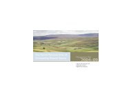
Western Mendip - Sustainable Aggregates
Western Mendip - Sustainable Aggregates
Western Mendip - Sustainable Aggregates

You also want an ePaper? Increase the reach of your titles
YUMPU automatically turns print PDFs into web optimized ePapers that Google loves.
Introduction<br />
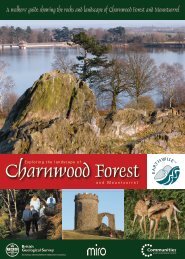
Welcome to western <strong>Mendip</strong><br />
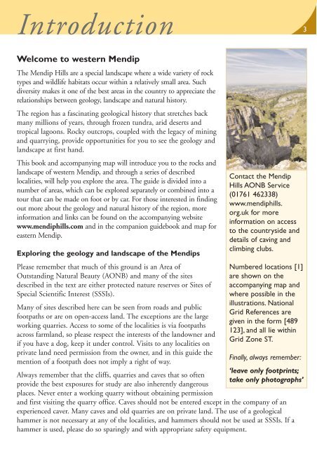
The <strong>Mendip</strong> Hills are a special landscape where a wide variety of rock<br />
types and wildlife habitats occur within a relatively small area. Such<br />
diversity makes it one of the best areas in the country to appreciate the<br />
relationships between geology, landscape and natural history.<br />
The region has a fascinating geological history that stretches back<br />
many millions of years, through frozen tundra, arid deserts and<br />
tropical lagoons. Rocky outcrops, coupled with the legacy of mining<br />
and quarrying, provide opportunities for you to see the geology and<br />
landscape at first hand.<br />
This book and accompanying map will introduce you to the rocks and<br />
landscape of western <strong>Mendip</strong>, and through a series of described<br />
localities, will help you explore the area. The guide is divided into a<br />
number of areas, which can be explored separately or combined into a<br />
tour that can be made on foot or by car. For those interested in finding<br />
out more about the geology and natural history of the region, more<br />
information and links can be found on the accompanying website<br />
www.mendiphills.com and in the companion guidebook and map for<br />
eastern <strong>Mendip</strong>.<br />
Exploring the geology and landscape of the <strong>Mendip</strong>s<br />
Please remember that much of this ground is an Area of<br />
Outstanding Natural Beauty (AONB) and many of the sites<br />
described in the text are either protected nature reserves or Sites of<br />
Special Scientific Interest (SSSIs).<br />
Many of sites described here can be seen from roads and public<br />
footpaths or are on open-access land. The exceptions are the large<br />
working quarries. Access to some of the localities is via footpaths<br />
across farmland, so please respect the interests of the landowner and<br />
if you have a dog, keep it under control. Visits to any localities on<br />
private land need permission from the owner, and in this guide the<br />
mention of a footpath does not imply a right of way.<br />
Contact the <strong>Mendip</strong><br />
Hills AONB Service<br />
(01761 462338)<br />
www.mendiphills.<br />
org.uk for more<br />
information on access<br />
to the countryside and<br />
details of caving and<br />
climbing clubs.<br />
Numbered locations [1]<br />
are shown on the<br />
accompanying map and<br />
where possible in the<br />
illustrations. National<br />
Grid References are<br />
given in the form [489<br />
123], and all lie within<br />
Grid Zone ST.<br />
Finally, always remember:<br />
‘leave only footprints;<br />
Always remember that the cliffs, quarries and caves that so often<br />
take only photographs’<br />
provide the best exposures for study are also inherently dangerous<br />
places. Never enter a working quarry without obtaining permission<br />
and first visiting the quarry office. Caves should not be entered except in the company of an<br />
experienced caver. Many caves and old quarries are on private land. The use of a geological<br />
hammer is not necessary at any of the localities, and hammers should not be used at SSSIs. If a<br />
hammer is used, please do so sparingly and with appropriate safety equipment.<br />
3