82 Land Use and Land Cover Changes Along the Shoreline
82 Land Use and Land Cover Changes Along the Shoreline
82 Land Use and Land Cover Changes Along the Shoreline

You also want an ePaper? Increase the reach of your titles
YUMPU automatically turns print PDFs into web optimized ePapers that Google loves.
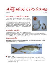
Gaspar <strong>the</strong> Pirate:<br />
Fact or Fiction?<br />
Legend <strong>and</strong> myth<br />
surround <strong>the</strong> name<br />
<strong>and</strong> a claim that a<br />
supposed pirate “Jose<br />
Gaspar” maintained a<br />
lair in <strong>the</strong>se waters<br />
during <strong>the</strong> 18th <strong>and</strong><br />
early 19th centuries.<br />
Some say <strong>the</strong> myths<br />
were invented about<br />
1900 by a fishing<br />
guide, Juan Gomez,<br />
to entertain customers.<br />
Historians suspect <strong>the</strong><br />
name refers to a<br />
‘Friar Gaspar.’ Boca<br />
Gasparilla (Inlet)<br />
appears on<br />
a late 18th century<br />
chart of <strong>the</strong> region.<br />
South Pine Isl<strong>and</strong>, looking nor<strong>the</strong>ast, St. James City<br />
in foreground.<br />
Safety Harbor on North Captiva Isl<strong>and</strong>, looking south,<br />
towards Redfish Pass in midground.<br />
7. Pine Isl<strong>and</strong> consists of three settlements. At <strong>the</strong><br />
north tip of <strong>the</strong> isl<strong>and</strong> is Bokeelia, on <strong>the</strong> south shore of<br />
Charlotte Harbor; Pinel<strong>and</strong> is to <strong>the</strong> south on <strong>the</strong> east<br />
shore of Pine Isl<strong>and</strong> Sound; <strong>and</strong> St. James City at <strong>the</strong><br />
sou<strong>the</strong>rn tip of <strong>the</strong> isl<strong>and</strong> abuts San Carlos Bay. Pinel<strong>and</strong><br />
is home to <strong>the</strong> R<strong>and</strong>ell Research Center — devoted to<br />
learning <strong>and</strong> teaching <strong>the</strong> archaeology, history, <strong>and</strong> ecology<br />
of Southwest Florida — owes this distinction in part<br />
to Calusa Indian shell mounds or middens (ancient Indian<br />
garbage dumps) located along <strong>the</strong> isl<strong>and</strong>’s shore overlooking<br />
Pine Isl<strong>and</strong> Sound. There are remnants of an aboriginal<br />
canoe canal, dug by <strong>the</strong> Calusa or <strong>the</strong>ir ancestors,<br />
probably 500 to 1,000 years ago. The “haul-over”<br />
canal had its western terminus at Pinel<strong>and</strong> <strong>and</strong> extended<br />
eastward to Matlacha Pass, ending at Indian Field. In<br />
1912, when Army Engineers visited <strong>the</strong> region, Pinel<strong>and</strong><br />
town consisted of a post office <strong>and</strong> three or four houses,<br />
but no streets or roads. The early 20th century settlement<br />
developed from turpentine stills <strong>and</strong> sawmills on north<br />
Pine Isl<strong>and</strong>. Today, all three communities provide recreational,<br />
sport fishing, eco-tourism, agricultural, <strong>and</strong> residential<br />
services.<br />
8. North Captiva <strong>and</strong> Captiva Isl<strong>and</strong>s were one isl<strong>and</strong><br />
prior to <strong>the</strong> 1921 hurricane <strong>and</strong> <strong>the</strong> creation of Redfish<br />
Pass. Major storms in <strong>the</strong> 1920s, ’30s, <strong>and</strong> ’40s overtopped<br />
<strong>the</strong> low, narrow sou<strong>the</strong>rn end of North Captiva.<br />
Safety Harbor, <strong>the</strong> small embayment inside Captiva Pass,<br />
was a fish camp during <strong>the</strong> pre–development period. A<br />
surge of vacation-home construction, beginning in <strong>the</strong><br />
1960s, along with finger-canal construction, has occurred<br />
on North Captiva Isl<strong>and</strong>. The State of Florida in 1975<br />
acquired about half of <strong>the</strong> isl<strong>and</strong>, which has been designated<br />
a Barrier Isl<strong>and</strong> Preserve. South Seas, a destination<br />
marina <strong>and</strong> golfing resort, is at <strong>the</strong> north end of Captiva<br />
Isl<strong>and</strong>. The town of Captiva is at <strong>the</strong> center, adjacent to<br />
Roosevelt Channel, a present-day popular anchorage <strong>and</strong><br />
relict inlet channel to Blind Pass. It is hard to imagine<br />
that <strong>the</strong> town claimed only 45 inhabitants just prior to<br />
World War II.<br />
87