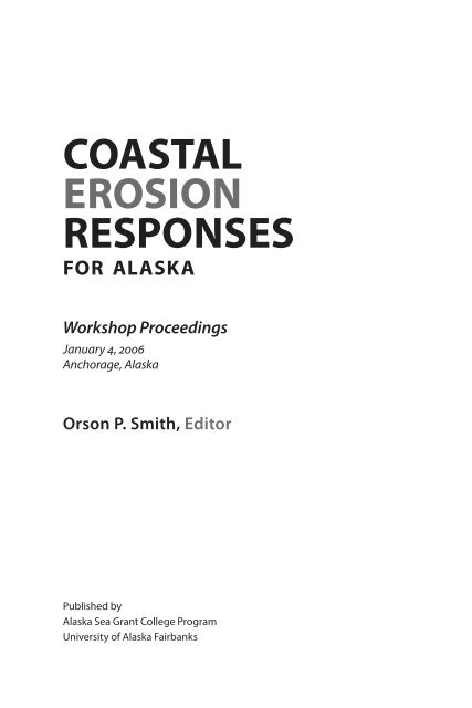
Coastal Erosion Responses for Alaska - the National Sea Grant ...
Coastal Erosion Responses for Alaska - the National Sea Grant ...
Coastal Erosion Responses for Alaska - the National Sea Grant ...

You also want an ePaper? Increase the reach of your titles
YUMPU automatically turns print PDFs into web optimized ePapers that Google loves.
<strong>Coastal</strong><br />
<strong>Erosion</strong><br />
<strong>Responses</strong><br />
<strong>for</strong> <strong>Alaska</strong><br />
Workshop Proceedings<br />
January 4, 2006<br />
Anchorage, <strong>Alaska</strong><br />
Orson P. Smith, Editor<br />
Published by<br />
<strong>Alaska</strong> <strong>Sea</strong> <strong>Grant</strong> College Program<br />
University of <strong>Alaska</strong> Fairbanks
Elmer E. Rasmuson Library Cataloging in Publication Data:<br />
<strong>Coastal</strong> erosion responses <strong>for</strong> <strong>Alaska</strong> / Orson P. Smith, editor. – Fairbanks,<br />
<strong>Alaska</strong> : <strong>Alaska</strong> <strong>Sea</strong> <strong>Grant</strong> College Program, 2006.<br />
p. ; cm. (<strong>Alaska</strong> <strong>Sea</strong> <strong>Grant</strong> College Program, University of <strong>Alaska</strong> Fairbanks;<br />
AK-SG-06-03)<br />
Notes: “Workshop proceedings. January 4, 2006, Anchorage, <strong>Alaska</strong>.”<br />
“<strong>Grant</strong> NA06OAR4170013, project A/161-01.”<br />
ISBN 1-56612-111-6<br />
1. Coast changes—<strong>Alaska</strong>—Congresses. I. Title. II. Smith, Orson P. III. Series:<br />
<strong>Alaska</strong> <strong>Sea</strong> <strong>Grant</strong> College Program report ; AK-SG-06-03.<br />
GB455.2.C63 2006<br />
Credits<br />
This book is published by <strong>the</strong> <strong>Alaska</strong> <strong>Sea</strong> <strong>Grant</strong> College Program, supported by<br />
<strong>the</strong> U.S. Department of Commerce, NOAA <strong>National</strong> <strong>Sea</strong> <strong>Grant</strong> Office, grant<br />
NA06OAR4170013, project A/161-01; and by <strong>the</strong> University of <strong>Alaska</strong> Fairbanks with<br />
state funds. University of <strong>Alaska</strong> is an affirmative action/equal opportunity employer<br />
and educational institution.<br />
<strong>Sea</strong> <strong>Grant</strong> is a unique partnership with public and private sectors combining<br />
research, education, and technology transfer <strong>for</strong> public service. This national network<br />
of universities meets changing environmental and economic needs of people in<br />
our coastal, ocean, and Great Lakes regions.<br />
Book design is by Jen Gunderson, cover design is by Brooks Pleninger, and<br />
copy-editing is by Sue Keller. Front cover photo of Lowell Point, <strong>Alaska</strong>, by Sue Lang.<br />
Back cover left photo of Bishop’s Beach, Homer, <strong>Alaska</strong>, by Orson Smith. Back cover<br />
middle and right photos of Rigtenders Dock vicinity, Nikiski, <strong>Alaska</strong>, by Orson Smith.<br />
<strong>Alaska</strong> <strong>Sea</strong> <strong>Grant</strong> College Program<br />
University of <strong>Alaska</strong> Fairbanks<br />
Fairbanks, <strong>Alaska</strong> 99775-5040<br />
Toll free (888) 789-0090<br />
(907) 474-6707 • fax (907) 474-6285<br />
alaskaseagrant.org
Contents<br />
Introduction<br />
Orson P. Smith...................................................................................................................................1<br />
Shoreline Trends in <strong>Alaska</strong><br />
Living with <strong>the</strong> Coast of <strong>Alaska</strong> Revisited:<br />
The Good, <strong>the</strong> Bad, and <strong>the</strong> Ugly<br />
Owen K. Mason................................................................................................................................ 3<br />
Global <strong>Sea</strong> Level Rise and Relative <strong>Sea</strong> Level Change in <strong>Alaska</strong><br />
Roman J. Motyka, Christopher Larsen, Jeff Freymueller, and Anthony Arendt.............. 19<br />
Ice, Wind, Waves, and Storminess Trends along <strong>the</strong> <strong>Alaska</strong> Coast<br />
David E. Atkinson.......................................................................................................................... 25<br />
<strong>Coastal</strong> Zone Management in <strong>Alaska</strong><br />
Management <strong>Responses</strong> to <strong>Erosion</strong><br />
Christy L. Miller...............................................................................................................................29<br />
State and <strong>Coastal</strong> District Plan and Policy Influence<br />
on <strong>Coastal</strong> Hazards: Background and History of <strong>the</strong><br />
<strong>Alaska</strong> <strong>Coastal</strong> Management Program (ACMP)<br />
Randy Bates.................................................................................................................................... 35<br />
<strong>Coastal</strong> <strong>Erosion</strong> Data Collection and Analysis<br />
Understanding Shoreline Change<br />
Bruce Richmond............................................................................................................................43<br />
<strong>Coastal</strong> Sediment Budgets<br />
Peter Ruggiero................................................................................................................................49<br />
<strong>Coastal</strong> Management <strong>Responses</strong> to <strong>Erosion</strong><br />
<strong>Alaska</strong> District <strong>Coastal</strong> Engineering Policy and Planning Issues<br />
Bruce Sexauer................................................................................................................................. 55<br />
Design of Shore Protection <strong>for</strong> <strong>Alaska</strong><br />
Proven Constructed Works<br />
Steven A. Hughes........................................................................................................................... 61<br />
Arctic and Low-Cost <strong>Erosion</strong> Control: Designs <strong>for</strong> <strong>Alaska</strong><br />
Jon E. Zufelt and Orson P. Smith................................................................................................67
<strong>Coastal</strong> <strong>Erosion</strong> <strong>Responses</strong> <strong>for</strong> <strong>Alaska</strong>: Workshop Proceedings<br />
<strong>Alaska</strong> <strong>Sea</strong> <strong>Grant</strong> College Program • AK-SG-06-03, 2006<br />
<br />
Introduction<br />
Orson P. Smith<br />
University of <strong>Alaska</strong> Anchorage, School of Engineering, Anchorage, <strong>Alaska</strong><br />
(Workshop Organizing Committee Chair)<br />
<strong>Coastal</strong> erosion and its physical causes are as old as <strong>the</strong> oceans. As a concern,<br />
coastal erosion is as old as civilization. This is not a workshop on climate<br />
change. Global warming is a contributing factor to current trends in coastal<br />
erosion, but should not become an alibi <strong>for</strong> short-sighted human use of <strong>the</strong><br />
shoreline.<br />
<strong>Alaska</strong> is a young state. Our oldest infrastructure is barely a century in age.<br />
Most existing shoreline construction is a few decades old or less. Compared to<br />
thousands of years of coastal development in o<strong>the</strong>r areas of <strong>the</strong> world, we in<br />
<strong>Alaska</strong> have little knowledge of our impact on <strong>the</strong> natural processes and little<br />
recorded in<strong>for</strong>mation about <strong>the</strong> processes <strong>the</strong>mselves. Our records of winds,<br />
waves, and water levels are short. Where coastal wea<strong>the</strong>r data exist, measurements<br />
have often been made at an airstrip substantially removed from <strong>the</strong><br />
shore and strongly affected by <strong>the</strong> land between.<br />
Our situation as North America’s developing country provides both challenges<br />
and opportunities with regard to coastal erosion responses. We may<br />
not know <strong>the</strong> trends as well as our sister coastal states, but we can learn from<br />
tribulations elsewhere. We need not educate ourselves solely by trial and error.<br />
We can study <strong>the</strong> design and history of older coastal developments and seek<br />
coastal erosion responses suited to our <strong>Alaska</strong> circumstances.<br />
This workshop is <strong>the</strong> ninth in an annual series with <strong>the</strong> bridging <strong>the</strong>me<br />
of science-to-engineering. You can argue that engineering is never more than<br />
applied science and I would agree. <strong>Coastal</strong> engineering is a specialty with<br />
particularly strong ties to scientific disciplines including meteorology, oceanography,<br />
geology, and physics. The first three are fairly obvious to relate and we<br />
mustn’t <strong>for</strong>get that <strong>the</strong> twenty-first century is an era of dependence on exotic<br />
instrumentation applying esoteric principles of physics. A passing knowledge<br />
of coastal processes and measurements is not sufficient <strong>for</strong> <strong>the</strong> best decisions in<br />
response to coastal erosion. <strong>Coastal</strong> engineering is a risky business with plenty<br />
of opportunity to make matters worse, in spite of good intentions.<br />
Engineers are required by ethics codes of <strong>the</strong>ir professional societies<br />
and by <strong>the</strong>ir licensing boards to do good work and protect <strong>the</strong> public safety.
Smith—Introduction<br />
Inherent in <strong>the</strong>se mandates is a choice among alternatives, including options<br />
involving no construction. Changes in coastal zone management policy may<br />
provide <strong>the</strong> wisest response to coastal erosion. This can mean adverse consequences<br />
to a few <strong>for</strong> <strong>the</strong> good of many o<strong>the</strong>rs.<br />
The presentations that follow will address coastal processes and trends<br />
that drive shoreline retreat and coastal erosion. Non-structural coastal zone<br />
management responses will be discussed, along with successfully proven constructed<br />
responses. Constructed works will be presented with a view toward<br />
<strong>the</strong>ir particular limitations. Each alternative response has its pros and cons.<br />
With <strong>the</strong> impressions you gain today from our highly qualified presenters, you<br />
will be able to use your time efficiently to read fur<strong>the</strong>r to learn more of what<br />
you need to know <strong>for</strong> wise decisions regarding coastal erosion responses <strong>for</strong><br />
<strong>Alaska</strong>.<br />
The Workshop Organizing Committee and <strong>the</strong> University of <strong>Alaska</strong><br />
Anchorage, School of Engineering, gratefully acknowledge <strong>the</strong> sponsors of<br />
this workshop:<br />
• U.S. Geological Survey, <strong>Alaska</strong> Science Center<br />
• NOAA <strong>Alaska</strong> <strong>Sea</strong> <strong>Grant</strong> College Program<br />
• International Arctic Research Center<br />
• U.S. Arctic Research Commission<br />
• University of <strong>Alaska</strong>, Corporate Programs<br />
• Individual contributors through <strong>the</strong> University of <strong>Alaska</strong> Foundation<br />
including<br />
• Loretta A. Keim<br />
• Spreng Associates, Inc.<br />
• John Oswald<br />
We also appreciate very much <strong>the</strong> contributions of <strong>the</strong> presenters and <strong>the</strong>ir<br />
employers who paid <strong>the</strong>ir way to Anchorage <strong>for</strong> <strong>the</strong> workshop and invested<br />
valuable time and energy in <strong>the</strong>ir preparations.<br />
Our gratitude also goes to <strong>the</strong> administration and staff of <strong>the</strong> University<br />
of <strong>Alaska</strong> Corporate Programs office, <strong>the</strong> UAA Advancement office, and <strong>the</strong><br />
UAA School of Engineering <strong>for</strong> <strong>the</strong>ir hard work to make this workshop happen.<br />
The ef<strong>for</strong>ts of JeNae Christiansen of <strong>the</strong> Department of Civil Engineering<br />
were invaluable and to her we owe special thanks.<br />
Lastly, I add my personal thanks to my colleagues on <strong>the</strong> workshop organizing<br />
committee: Robert Pawlowski, Christy Miller, and John Oswald.
<strong>Coastal</strong> <strong>Erosion</strong> <strong>Responses</strong> <strong>for</strong> <strong>Alaska</strong>: Workshop Proceedings 3<br />
<strong>Alaska</strong> <strong>Sea</strong> <strong>Grant</strong> College Program • AK-SG-06-03, 2006<br />
Living with <strong>the</strong> Coast of<br />
<strong>Alaska</strong> Revisited: The Good,<br />
<strong>the</strong> Bad, and <strong>the</strong> Ugly<br />
Owen K. Mason<br />
Geoarch <strong>Alaska</strong>, Anchorage, <strong>Alaska</strong><br />
<strong>Alaska</strong>, like most coastal states, lives by its coast. If one includes <strong>the</strong> Mat-Su<br />
Borough, nearly ¾ of <strong>Alaska</strong>ns reside in immediate proximity to coastal property.<br />
However, even most of <strong>the</strong> interior communities confront an erosion<br />
problem, albeit if it is alluvial in causation. Fairbanks routinely flooded at<br />
breakup and several towns have had to consider relocation—most recently<br />
Huslia and Alakaket on <strong>the</strong> Koyukuk River. In this talk, I have added <strong>the</strong> subtitle:<br />
The Good, <strong>the</strong> Bad, and <strong>the</strong> Ugly. Aes<strong>the</strong>tics must be part of <strong>the</strong> solution;<br />
creating an ugly coast should not be a goal.<br />
The <strong>Alaska</strong> shore is roughly divisible in half. In <strong>the</strong> south, <strong>the</strong> predominantly<br />
deeply embayed and <strong>for</strong>merly glaciated bedrock sou<strong>the</strong>rn rim along<br />
<strong>the</strong> Gulf of <strong>Alaska</strong> from Ketchikan to Cold Bay; and in <strong>the</strong> north, <strong>the</strong> mostly<br />
unconsolidated and unglaciated Bering, Chukchi, and Beau<strong>for</strong>t sea coasts,<br />
from Naknek and Dillingham to Kaktovik. The soft shores of eastern Cook<br />
Inlet serve as an important exception and suffer a number of erosion threats.<br />
None<strong>the</strong>less, most of <strong>the</strong> severe problems with erosion are inevitably in <strong>the</strong><br />
north, although most of <strong>the</strong> cities on <strong>the</strong> bedrock coastlines are located on<br />
“soft” sediments like deltas and alluvial fans and are subject to a plethora of<br />
coastal hazards, like avalanches, debris flows, tsunamis, earthquakes, and volcanic<br />
eruptions.<br />
My involvement in coastal issues commenced in 1991 when Orrin Pilkey<br />
recruited me after an erosion workshop in Barrow, enticing me with fame and<br />
glory, to craft a volume in his Living with <strong>the</strong> Shore series. The series, funded by<br />
FEMA, aimed to educate <strong>the</strong> real estate buying and renting public as families<br />
and businesses decided where to live. The volumes strived to be site-specific<br />
with detailed road maps. The optimistic goal was that by educating <strong>the</strong> public<br />
to coastal threats to life, limb, and property, fewer poor choices would be<br />
made and problems would be avoided. As a North Carolina resident, Orrin<br />
Pilkey focused on barrier island geomorphology and development. Barrier
Mason—Living with <strong>the</strong> Coast of <strong>Alaska</strong> Revisited<br />
islands are ubiquitous on much of <strong>the</strong> East Coast and suffer from repeated<br />
storms, hurricane <strong>for</strong>ce winds, and storm surge. Large-scale development of<br />
<strong>the</strong> coast (e.g., Atlantic City, Bogue Bay, or Pensacola) over <strong>the</strong> last century<br />
has fostered and conditioned <strong>the</strong> engineering solutions to nature’s challenges.<br />
Once <strong>the</strong> terrestrial frontier was closed, <strong>the</strong> Army and its Corps of Engineers<br />
turned to block <strong>the</strong> sea. Similar operations were conducted on <strong>the</strong> eastern<br />
rivers, especially during <strong>the</strong> progressive decades of <strong>the</strong> 1930s and 1940s. In<br />
a struggle worthy of America’s Manifest Destiny, engineers launched one of<br />
<strong>the</strong> greatest ef<strong>for</strong>ts to contain nature, straightening rivers, heightening levees,<br />
blocking inlets, exhuming and filling marshes. A number of geomorphologists<br />
argue that Hurricane Katrina is Nature’s payback and even suggest refilling<br />
<strong>the</strong> marshes and allowing <strong>the</strong> Mississippi its will.<br />
<strong>Alaska</strong> presented a considerable challenge as a subject <strong>for</strong> <strong>the</strong> coastal hazards<br />
treatment developed by Pilkey at Duke University. Virtually no coastal<br />
community in <strong>Alaska</strong> was hazard-free. In fact, Barrow, only subject to bluff<br />
erosion and storm surge, seemed <strong>the</strong> safest place to live! The threats to life<br />
and limb were most severe in Seward ranging from imminent tsunami up<br />
Resurrection Bay, flooding from several sources, including temporary snow<br />
dams above town, and earthquake. Equally ominous threats face Anchorage,<br />
Homer, Juneau, Kodiak, Valdez, and Sitka. Who could sleep at night in <strong>Alaska</strong><br />
if aware of <strong>the</strong> underlying hazards? I would love to live downtown but geologicinduced<br />
guilt keeps me away. In fact, Orrin once commented that if <strong>the</strong> series<br />
had started with <strong>Alaska</strong>, <strong>the</strong> problems of <strong>the</strong> East Coast would not have even<br />
warranted a look, by comparison.<br />
One topic is largely missing from <strong>the</strong> first edition of <strong>the</strong> book: Global<br />
Change. In <strong>the</strong> last decade, anthropogenic global change, greenhouse warming,<br />
etc., has outpaced any o<strong>the</strong>r public awareness of <strong>the</strong> natural world. Too<br />
often <strong>the</strong> debate over Global Change is fueled by anecdotal accounts which<br />
frequently wend <strong>the</strong>ir way into public policy. For example, in 2004 <strong>the</strong><br />
Government Accounting Office pronounced that nearly 40 m (>120 ft) erosion<br />
had afflicted Shishmaref in one single storm in 1997. Until <strong>the</strong> Army Corps<br />
study, no such documentation has existed. The source <strong>for</strong> such rates of change<br />
is likely <strong>the</strong> anecdotal accounts in <strong>the</strong> press; <strong>for</strong> example, my examination of<br />
<strong>the</strong> Anchorage Daily News from 1997 to 2004 indicates <strong>the</strong> routine erosion of<br />
10 m (30 ft) of bluff. However, a comparison of photos from 1992 to 2004 shows<br />
a different story. But in order to know Global Change, we need a baseline—<br />
climate records extend barely 100 years. Several ef<strong>for</strong>ts are on <strong>the</strong> horizon to<br />
tackle this mission: Bill Manley and a host of o<strong>the</strong>rs have signed on with <strong>the</strong><br />
Arctic <strong>Coastal</strong> Monitoring program headed by Diane Sanzone of <strong>the</strong> <strong>National</strong><br />
Park Service; <strong>the</strong> product will be a photogrammetric documentation of erosion<br />
in Kotzebue Sound and to ground truth <strong>the</strong>se interpretations in <strong>the</strong> field.
<strong>Coastal</strong> <strong>Erosion</strong> <strong>Responses</strong> <strong>for</strong> <strong>Alaska</strong>: Workshop Proceedings<br />
<br />
One huge complication is <strong>the</strong> possibility that we have entered a “no-analog”<br />
situation in relation to <strong>the</strong> effects of greenhouse warming—a time like<br />
no o<strong>the</strong>r in recent earth history. Why? Because <strong>the</strong> geologic record in <strong>the</strong><br />
north, and I include <strong>the</strong> Atlantic, indicates that storms were stronger and<br />
more powerful during <strong>the</strong> Little Ice Age (and o<strong>the</strong>r cold periods), owing to <strong>the</strong><br />
heightened contrasts between a colder Arctic and <strong>the</strong> tropics. Some of <strong>the</strong> LIA<br />
North <strong>Sea</strong> storms in <strong>the</strong> 1500s-1700s were awesome, flooding <strong>the</strong> Ne<strong>the</strong>rlands<br />
and Britain. Evidence of stronger storms can be found in nor<strong>the</strong>rn <strong>Alaska</strong>, as<br />
well. In 1884 Capt. Hooper commented on <strong>the</strong> ferocity of nor<strong>the</strong>rly storms<br />
that routinely pummeled <strong>the</strong> Yukon Delta during winter, scattering ice blocks<br />
well inland. Nothing like this has occurred in <strong>the</strong> last generation. The barrier<br />
islands around Shishmaref also show evidence of hurricane <strong>for</strong>ce storms that<br />
cut wash-around channels into <strong>the</strong> islands, land<strong>for</strong>ms reminiscent of hurricane<br />
effects on Padre Island, Texas. Again, <strong>the</strong> recent spate of storms has not<br />
reached such extremes. That is why we need to exercise caution in extrapolating<br />
about global change from <strong>the</strong> effects of storms on developed shorelines<br />
such as Shishmaref or Barrow or Nome<br />
So, moving counter-clockwise around <strong>the</strong> <strong>Alaska</strong> coast, I will discuss <strong>the</strong><br />
principal problem areas from Kaktovik to Unalakleet, followed by a leap to <strong>the</strong><br />
Kenai Peninsula, deferring discussion of Anchorage to o<strong>the</strong>rs.<br />
As we consider bluff erosion, let’s pause to examine <strong>the</strong> processes that<br />
operate on permafrost bluffs, most of which are seen in more temperate zones,<br />
as well. Four principal processes undermine a bluff. (a) Waves can cut a niche<br />
into <strong>the</strong> frozen bluff and remove material; depending on <strong>the</strong> length of wave<br />
action and <strong>the</strong> carving distance, a very sizable block can collapse. (b) Slope<br />
wash from <strong>the</strong> top. (c) Melt-out of ice bodies causes slump—high rainfall can<br />
do something similar. And (d) channelized flow in gullies. Quite possibly,<br />
global warming will mean that as permafrost-laden bluffs warm, <strong>the</strong>rmoniching<br />
will be less frequent and melt-out will be more frequent.<br />
<strong>Coastal</strong> protection measures have a lengthy history on <strong>the</strong> North Slope,<br />
<strong>the</strong> legacy of <strong>the</strong> humble 55 gallon fuel drum, discarded on <strong>the</strong> ice and tundra<br />
by <strong>the</strong> thousands after 1945. The 55 gallon drum lends itself to use as shoreline<br />
protection; it was used in <strong>the</strong> earliest ef<strong>for</strong>ts at Kaktovik, Barrow, Shishmaref,<br />
and Kotzebue.<br />
Ano<strong>the</strong>r legacy of <strong>the</strong> Cold War years is <strong>the</strong> frequent placement of dump<br />
facilities adjacent to eroding shorelines: convenience more than logic or<br />
awareness of geomorphic process explains this “decision” making. Several<br />
communities continue to defend dumps: Kaktovik, Barrow, Kotzebue, and<br />
Dillingham.<br />
Kaktovik (pop. 400) is situated on Barter Island, composed both of<br />
residual Pleistocene “mainland” and an eroded and re-deposited gravel spit.
Mason—Living with <strong>the</strong> Coast of <strong>Alaska</strong> Revisited<br />
Originally, Inupiaq people settled on <strong>the</strong> spit, which was later appropriated <strong>for</strong><br />
a DEW-line station airstrip. The principal erosion problem facing this community<br />
involves an Air Force and community dump. The irony is that several<br />
million dollars are projected to erect a bulkhead to protect a dump along <strong>the</strong><br />
coast. A better course would seem to be moving <strong>the</strong> dump away from <strong>the</strong> storm<br />
impacts of <strong>the</strong> coast.<br />
Located on low and chronically eroding bluffs, Barrow, <strong>the</strong> capital and<br />
metro-village of <strong>the</strong> North Slope, has a long history of beach modification and<br />
a series of low tech engineering and heavy equipment operations. The bluffs<br />
at Barrow have undergone erosion <strong>for</strong> several hundred years; even nineteenth<br />
century explorers mention massive storms and erosion, especially in <strong>the</strong> 1880s<br />
and 1890s. Barrow rests upon sands and gravels of a beach ridge and spit that<br />
<strong>for</strong>med at higher sea levels about 125,000 years ago. Beach mining commenced<br />
in <strong>the</strong> 1950s, in order to construct <strong>the</strong> airstrip south of town. This act also very<br />
quickly removed <strong>the</strong> inheritance of 1,000 years of storm-related construction<br />
downdrift from <strong>the</strong> bluffs.<br />
On <strong>the</strong> positive side, <strong>the</strong> proximity of NARL (Naval Arctic Research<br />
Laboratory) has fostered several generations of scientific studies of <strong>the</strong> erosion<br />
problem, <strong>the</strong> first employing measurements from fixed markers in 1950,<br />
following a series of intense storms. The even more intense October 1963 storm<br />
with its 3 m surge led to a number of pioneering studies of both erosion and<br />
deposition in <strong>the</strong> Barrow area by Hume and Schalk. The finding of <strong>the</strong> 1960s<br />
has been confirmed repeatedly since <strong>the</strong>n: most erosion in <strong>the</strong> Barrow region<br />
occurs during and in association with <strong>the</strong> most massive storms. In <strong>the</strong> late<br />
1970s, Harper first used aerial photographs to obtain baseline data outside of<br />
<strong>the</strong> developed shoreline of Barrow. A series of large storms in <strong>the</strong> 1980s induced<br />
<strong>the</strong> city to place a limited stretch of low tech revetment of gravel-filled plastic<br />
bags just south of downtown. This structure has had mixed success and was<br />
partially succeeded by a gabion tower placed in <strong>the</strong> last few years. Material<br />
from <strong>the</strong> shelf, possibly of finer consistency than <strong>the</strong> beach, has had some<br />
positive impact on increasing beach width south of downtown, but at considerable<br />
expense. <strong>Erosion</strong> rates are fairly minimal along <strong>the</strong> Chukchi coast, <strong>the</strong><br />
conclusion of <strong>the</strong> latest large and sophisticated ef<strong>for</strong>t at documenting bluff<br />
erosion. This ef<strong>for</strong>t, termed <strong>the</strong> BIG STORMS Initiative, represents <strong>the</strong> ef<strong>for</strong>ts<br />
of a sizable interdisciplinary team from INSTAAR (Institute of Arctic and<br />
Alpine Research) of atmospheric scientists such as Amanda Lynch and geographical<br />
and geological specialists such as Bill Manley. The BIG STORMS<br />
project not only employed serial sets of aerial photographs; rectified, it also<br />
analyzed climate data to model atmospheric and oceanographic conditions<br />
that foster erosion. The INSTAAR project has documented very huge rates,<br />
>100 m, of bluff retreat in <strong>the</strong> last 40 years on <strong>the</strong> lagoon coast east of Barrow<br />
on <strong>the</strong> Beau<strong>for</strong>t <strong>Sea</strong>. In this case, undercutting of permafrost-rich silts are
<strong>Coastal</strong> <strong>Erosion</strong> <strong>Responses</strong> <strong>for</strong> <strong>Alaska</strong>: Workshop Proceedings<br />
<br />
likely causal. Bluff erosion on <strong>the</strong> scale of tens of meters per year was occurring<br />
even 100 years ago in <strong>the</strong> eastern Beau<strong>for</strong>t <strong>Sea</strong>, as de Leffingwell observed.<br />
High rates of erosion occurred throughout <strong>the</strong> 1970s between <strong>the</strong> Colville<br />
River and Prudhoe Bay, as documented by Erk Reimnitz and Peter Barnes<br />
<strong>for</strong> USGS, based only on map comparisons. One concrete result of <strong>the</strong> BIG<br />
STORMS project is <strong>the</strong> very detailed hazard map of <strong>the</strong> 1963 storm, available<br />
to residents on <strong>the</strong> Web, which has engendered considerable interest at community<br />
meetings.<br />
Wainwright and Point Lay also have erosion problems. At Wainwright,<br />
people can retreat as bluff erosion proceeds with permafrost melting. Beach<br />
nourishment at Wainwright may have had some ameliorating effects in <strong>the</strong><br />
short term. Point Lay, at its re-founding in <strong>the</strong> 1970s, elected to move to <strong>the</strong><br />
mainland, away from <strong>the</strong> eroding barrier island: at least one problem was<br />
solved!<br />
Although not presently under siege by erosion, Point Hope suffers from<br />
<strong>the</strong> same free-floating global change angst that has captured most north <strong>Alaska</strong><br />
communities: fear of entrapment without an evacuation route and <strong>the</strong> possibility<br />
of storm surge flooding through <strong>the</strong> beach ridge swales near town. Point<br />
Hope, home to nearly 900 people, moved east in <strong>the</strong> mid 1970s, about 2 km<br />
from its ancestral locale of Tikigaq at <strong>the</strong> eroding north margin of <strong>the</strong> spit.<br />
Fierce storms have occurred repeatedly at Point Hope, although <strong>the</strong> storm<br />
of record occurred in 1893, when a surge of at least 3 m flooded <strong>the</strong> town site.<br />
Point Hope community members have had occasion and partial funding to<br />
employ a number of folk-based and half-baked engineering remedies to <strong>the</strong><br />
perennial erosion on <strong>the</strong> north margin, that now lacks any structures to protect<br />
(except <strong>for</strong> <strong>the</strong> unprotected margin of <strong>the</strong> concrete air strip. <strong>Erosion</strong> acts differentially<br />
on <strong>the</strong> north margin of <strong>the</strong> Point Hope spit, related to <strong>the</strong> percentage of<br />
silt and frozen ground that is higher within <strong>the</strong> middens of Tikigaq (dating to<br />
AD 1400-1950) than in <strong>the</strong> dunes that cap <strong>the</strong> older settlement of Ipiutak on <strong>the</strong><br />
oldest ridges of <strong>the</strong> spit. An incompletely realized revetment, consisting of sizable<br />
Nome boulders, was laid atop several stretches of <strong>the</strong> north shore of Point<br />
Hope in 1997. Funding (via a no-bid contract to Tikigaq Corporation, NSB resolution<br />
#41-97 dated June 3, 1997) and design <strong>for</strong> this project arose from within<br />
<strong>the</strong> North Slope Borough with minimal (if any) oversight from <strong>the</strong> Army Corps<br />
or o<strong>the</strong>r agencies; apparently no EIS was prepared <strong>for</strong> this project. The original<br />
design parameters were not met, so that a series of groins were not placed<br />
along with <strong>the</strong> rock revetment. None<strong>the</strong>less, <strong>the</strong> revetment, as it stood in 2004,<br />
did not offer protection to <strong>the</strong> airstrip—instead it exposed it to erosion—and<br />
only extended landward of a portion of <strong>the</strong> two threatened archaeological sites.<br />
One of <strong>the</strong> <strong>for</strong>emost concerns to Point Hope residents involves <strong>the</strong> erosion of<br />
archaeological sites employed as cache pits to properly season muktuk. While<br />
cultural pejoratives should be respected, it seems extravagant and ill-advised
Mason—Living with <strong>the</strong> Coast of <strong>Alaska</strong> Revisited<br />
to expend many millions of dollars to conserve ice cellars, and endanger <strong>the</strong><br />
spit, <strong>the</strong> community, and <strong>the</strong> o<strong>the</strong>r archaeological sites on <strong>the</strong>m. As a result of<br />
<strong>the</strong> ill-founded measures of 1997, Point Hope now faces more and faster erosion;<br />
perhaps it is time to stop feeding <strong>the</strong> seawall beast!<br />
In <strong>the</strong> book Living with <strong>the</strong> Coast of <strong>Alaska</strong> we spent several pages discussing<br />
<strong>the</strong> barrier island community of Kivalina, whose ef<strong>for</strong>t to move had<br />
already surfaced in conversation and planning. While <strong>the</strong> seaward beach<br />
was wide and erosion seemed a minimal threat, only a minor amount of erosion<br />
was observed along <strong>the</strong> inlet margin. The concerns voiced in 1993 were<br />
mostly about evacuation during storms and room <strong>for</strong> growth. The relocation<br />
of Kivalina seems to have become a cottage industry <strong>for</strong> consultants and <strong>the</strong><br />
price keeps rising; in<strong>for</strong>mally, I just heard that <strong>the</strong> cost may be several hundred<br />
million dollars. Not having seen <strong>the</strong> problem <strong>for</strong> several years, I remain<br />
optimistic that <strong>the</strong> island still offers a livable location. After all, river flooding<br />
from <strong>the</strong> Wulik is still occurring. Evacuation concerns should be met by maintaining<br />
a viable response presence from <strong>the</strong> federal government. We should<br />
not fall prey to <strong>the</strong> expectation that no aid will come, <strong>the</strong> legacy that <strong>the</strong> present<br />
administration wishes to foist on its constituents.<br />
Kotzebue, center of <strong>the</strong> Northwest Arctic Borough, spreads across <strong>the</strong><br />
several beach ridges that issue from <strong>the</strong> glacial deposits of Baldwin Peninsula.<br />
Spit growth depends on intense westerly storms coupled with long-shore transport<br />
to <strong>the</strong> north. In addition, a considerable amount of gravel lies offshore<br />
and serves to damp wave energy affecting <strong>the</strong> beach. As recently as <strong>the</strong> 1930s,<br />
<strong>the</strong> village was restricted to <strong>the</strong> active beach ridge, along Shoreline Drive;<br />
however, most residential development has occurred inland in <strong>the</strong> last several<br />
decades. But <strong>the</strong> shoreline still contains several facilities—<strong>the</strong> post office,<br />
<strong>the</strong> Nulagvik Hotel, and various restaurants and markets—although I understand<br />
that Hanson’s has recently closed. Although <strong>the</strong> Kotzebue ridges are<br />
barely 1 m above mean sea level, comparatively little erosion has occurred<br />
(Fig. 1). Historic photos on <strong>the</strong> city Web site indicate storms in <strong>the</strong> 1970s and<br />
1980s cut only 1 m davits into <strong>the</strong> roadway. On <strong>the</strong> plus side, shoreline stabilization<br />
ef<strong>for</strong>ts, including barrels placed upright in <strong>the</strong> 1960s, have had little or<br />
no impact. The concrete block revetment extends along only parts of <strong>the</strong> shore,<br />
restricted to residential property and allowing <strong>the</strong> seasonal expansion of <strong>the</strong><br />
beach to <strong>the</strong> seaward side of <strong>the</strong> commercial properties. The relative stasis in<br />
Kotzebue may not last. Apparently <strong>the</strong> <strong>Alaska</strong> Department of Transportation<br />
plans a major expansion of Shoreline Drive, doubling its width to <strong>the</strong> seaward<br />
by placing a bulkhead and gravel fill (Alan DePew, 2005, Office of History and<br />
Archaeology, State of <strong>Alaska</strong>, pers. comm.). The impact on <strong>the</strong> beach is uncertain,<br />
but it is hoped that <strong>the</strong> scale of this project will not turn Kotzebue into a<br />
problem. To this observer, <strong>the</strong> better course of action would be to restrict car<br />
traffic, move <strong>the</strong> post office, and preserve <strong>the</strong> beach at Kotzebue.
<strong>Coastal</strong> <strong>Erosion</strong> <strong>Responses</strong> <strong>for</strong> <strong>Alaska</strong>: Workshop Proceedings<br />
<br />
Figure 1. In Kotzebue, <strong>Alaska</strong>, structures built in <strong>the</strong> 1960s are still at <strong>the</strong> shorefront.<br />
Located within <strong>the</strong> protected inner reaches of Kotzebue Sound, Deering,<br />
home to only 150 people, rests atop a barrier spit, <strong>for</strong>merly capped by a high<br />
storm ridge that was removed in 1950 when an airstrip was built. Hopefully, <strong>the</strong><br />
sewage lagoon located close to <strong>the</strong> coast will not be breached by erosion.<br />
Barrier islands are temporary land <strong>for</strong>ms in geologic time, subject to <strong>the</strong><br />
pressures of storms and eustatic (i.e., post-glacial) sea level rise. This fact cannot<br />
be denied, even in <strong>the</strong> face of global change. The public relations initiative<br />
that has propelled Shishmaref into <strong>the</strong> limelight should not deny this transitoriness:<br />
no one goes to Atlantic City <strong>for</strong> evidence of global change. Shishmaref<br />
hostels over 600 people on <strong>the</strong> most active portion of a sandy barrier island<br />
at <strong>the</strong> sou<strong>the</strong>rn margin of <strong>the</strong> Chukchi <strong>Sea</strong>. The community has suffered bluff<br />
erosion over <strong>the</strong> last 50 years; however, although <strong>the</strong> extent has not been established,<br />
possibly until this year a considerable amount of engineering has been<br />
emplaced on <strong>the</strong> shorefront of Shishmaref (Fig. 2). The community was severely<br />
impacted by a 1974 storm, which led to <strong>the</strong> first serious discussion of relocating<br />
<strong>the</strong> community. The Shishmaref community lies atop a low barrier island<br />
that is eroding on its western margin and aggrading to <strong>the</strong> nor<strong>the</strong>astern. The<br />
evolution of <strong>the</strong> island can be documented from radiocarbon dated peat beds<br />
that cap <strong>the</strong> dune cover. The island was reshaped during <strong>the</strong> centuries AD 800
10 Mason—Living with <strong>the</strong> Coast of <strong>Alaska</strong> Revisited<br />
curtis nayokpuk curtis nayokpuk<br />
Figure 2. In Shishmaref, <strong>Alaska</strong>, engineering “solutions” have been ineffective.
<strong>Coastal</strong> <strong>Erosion</strong> <strong>Responses</strong> <strong>for</strong> <strong>Alaska</strong>: Workshop Proceedings<br />
<br />
to 1400, probably in response to storms from <strong>the</strong> west. Dune building occurred<br />
after AD 1600 at <strong>the</strong> mouth of <strong>the</strong> inlet north of town. The ancestors of <strong>the</strong><br />
Shishmaref people apparently recognized <strong>the</strong> dynamic nature of <strong>the</strong> island<br />
and situated <strong>the</strong>ir community on <strong>the</strong> most landward, safest part of <strong>the</strong> island.<br />
In <strong>the</strong> 1920s, to ease barge off-loading, Shishmaref shifted to its present location—on<br />
<strong>the</strong> very most active eroding face of <strong>the</strong> island. This is <strong>the</strong> crux of <strong>the</strong><br />
problem at Shishmaref. The second major problem is that a considerable part of<br />
<strong>the</strong> island, nearly one-third, is considered off <strong>the</strong> table <strong>for</strong> development because<br />
of a snow fence emplaced in <strong>the</strong> 1980s in order to collect (mostly) wash water<br />
<strong>for</strong> <strong>the</strong> town. Locating ano<strong>the</strong>r water source would serve a critical need and<br />
open <strong>the</strong> most commodious part of <strong>the</strong> island <strong>for</strong> development.<br />
The nature of bluff erosion at Shishmaref remains contentious. On <strong>the</strong><br />
one hand, repeated anecdotal accounts by residents suggest that erosion has<br />
proceeded rapidly, as documented in <strong>the</strong> Anchorage Daily News, APRN, and<br />
Arctic Sounder press releases and news accounts. A different perception arises<br />
from inspecting aerial photographs from 1948, 1986, and <strong>the</strong> present; <strong>the</strong>se<br />
seem to indicate that erosion was not quite so severe until <strong>the</strong> present. What<br />
is different and what explains <strong>the</strong> difference? Storm frequency? Ice extent?<br />
Certainly <strong>the</strong> amount of engineering has increased significantly since 1983;<br />
first, a concrete block revetment that failed quickly and only fostered erosion<br />
until <strong>the</strong> placement of rocks onto <strong>the</strong> Shishmaref shore in 2002 seems to have<br />
sent <strong>the</strong> system into increased erosion. Ano<strong>the</strong>r possibility is that as people<br />
restored <strong>the</strong> 1983 revetment each successive storm eroded <strong>the</strong> reconstructed<br />
land surface, and erosion likely occurred as a series of divots into different lateral<br />
portions of <strong>the</strong> island.<br />
About 10 years ago, <strong>the</strong> State of <strong>Alaska</strong> sent me to Shishmaref to examine<br />
various alternative relocation sites, all on <strong>the</strong> mainland. In addition to this<br />
task, I considered <strong>the</strong> means available to remain on <strong>the</strong> barrier island chain.<br />
With some flexible engineering such as moveable structures and dune trapping<br />
devices (plants, fences, matting, etc.), I suggested that Shishmaref residents<br />
could remain in sync with <strong>the</strong> barrier or groom a nearby island <strong>for</strong> future<br />
settlement. The approach favored in <strong>the</strong> last 10 years has been <strong>the</strong> opposite:<br />
increasing hard stabilization, with <strong>the</strong> rocks larger and <strong>the</strong> lateral distance<br />
subject to seawalls longer. Fur<strong>the</strong>r, <strong>the</strong> height of <strong>the</strong> wall is still far below <strong>the</strong><br />
maximum storm surge limit, <strong>for</strong> reasons that I do not understand. In any case,<br />
it seems that Shishmaref is heading toward a <strong>for</strong>tress mentality, and I predict<br />
that in 10 years <strong>the</strong> community will be a bastion surrounded by rock. After<br />
all, this “solution” will be cheaper than relocation. The consequences <strong>for</strong> <strong>the</strong><br />
remaining barriers and <strong>the</strong> inlet may be dire.<br />
At <strong>the</strong> next site, Wales, a community on low dunes, faces little or no threat<br />
due to <strong>the</strong> extensive low gradient beach that damps wave energy. No serious<br />
engineering ef<strong>for</strong>ts are recorded at Wales, despite occasional storm surge
12 Mason—Living with <strong>the</strong> Coast of <strong>Alaska</strong> Revisited<br />
flooding since 1960. Wales, of course, has a steep bedrock hillside just to its<br />
south. This firm ground lends a sense of security to <strong>the</strong> community on <strong>the</strong><br />
low dunes.<br />
Teller was <strong>the</strong> scene of a classic attempt at folk engineering. I haven not<br />
returned to witness <strong>the</strong> fate of <strong>the</strong> phone truck revetment; any observations<br />
would be welcome.<br />
Finally, this last summer, I encountered a community living nearly in harmony<br />
with a gravel barrier island. Of course, infrastructure is at a minimum<br />
at <strong>the</strong> summer camp of King Islanders at Woolley Lagoon, maintained since<br />
<strong>the</strong> 1970s. Remembering that <strong>the</strong> island is nearly 1 m below <strong>the</strong> highest storm<br />
surges, people have had to adjust by shoveling out <strong>the</strong> gravel that accumulates<br />
during storms, as that of 2004. Some structures are atop posts, now only<br />
slightly above storm levels. On <strong>the</strong> negative side, several cabins were carried<br />
landward with <strong>the</strong> big storm of 2004. Any electricity on <strong>the</strong> island derives<br />
from generators, and residents do maintain houses in Nome. None<strong>the</strong>less, no<br />
need should arise <strong>for</strong> hard stabilization as King Islanders refine <strong>the</strong>ir means of<br />
securing and caching supplies away from <strong>the</strong> waves and in constructing cabins<br />
that can be moved readily as <strong>the</strong> island moves.<br />
Founded as a tent camp on <strong>the</strong> most vulnerable location imaginable, a<br />
sand spit at <strong>the</strong> mouth of <strong>the</strong> Snake River, Nome has continued in its centurylong<br />
battle against <strong>the</strong> sea, repeatedly facing down <strong>the</strong> threat of storms and<br />
erosion. Nome miners soon realized, as early as 1900 (and repeatedly until<br />
1913), that <strong>the</strong> Bering <strong>Sea</strong> was immensely powerful. Mason et al. (1997) studied<br />
Nome newspapers that showed <strong>the</strong> 1920s and early 1930s were reasonably<br />
pacific, with fewer and smaller storms. This respite likely bred complacency.<br />
The extensive development adjacent to <strong>the</strong> coast could have been relocated<br />
inland following <strong>the</strong> great fire of 1936. Commercial interests prevented that<br />
cautionary course of action; instead when several furious storms hit Nome in<br />
<strong>the</strong> mid-1940s, <strong>the</strong> town sought out <strong>the</strong> Corps of Engineers. The U.S. Congress<br />
was supportive: Nome was still basking in its war-time importance as an air<br />
transport location. Although a bulkhead or two was placed in <strong>the</strong> 1920s and<br />
<strong>the</strong> inlet was maintained by two small jetties, Nome still had a beach in <strong>the</strong><br />
1940s. By 1951, however, <strong>the</strong> Nome seawall was constructed at <strong>the</strong> cost of $1.8<br />
million, <strong>the</strong> first use of Cape Nome granite. There is now no beach at Nome, of<br />
course, and <strong>the</strong> seawall has had to be extended by a revetment. The latest engineering<br />
ef<strong>for</strong>ts at Nome are truly gargantuan—a pair of causeways around a<br />
newly cut inlet across <strong>the</strong> sand spit. Although I am sure <strong>the</strong> engineers are confident<br />
in its design parameters, at least superficially and to some of <strong>the</strong> harbor<br />
users, <strong>the</strong> due south orientation of <strong>the</strong> causeway more resembles a bowling<br />
alley capable of feeding storm waters directly into <strong>the</strong> airport. Here’s hoping<br />
<strong>for</strong> <strong>the</strong> best. Although Nome did not retreat from <strong>the</strong> sea, development has<br />
finally taken hold inland up into “Icyview”; hopefully, fear of <strong>the</strong> sea has some<br />
role in real estate calculus.
<strong>Coastal</strong> <strong>Erosion</strong> <strong>Responses</strong> <strong>for</strong> <strong>Alaska</strong>: Workshop Proceedings<br />
3<br />
Figure 3. In Nome, <strong>Alaska</strong>, <strong>the</strong> beach present in 1948 (in this photo) is gone today.<br />
The ongoing engineering travesty in <strong>the</strong> Nome vicinity involves <strong>the</strong> overlaying<br />
of sizable boulders as a revetment to buttress an unpaved road on <strong>the</strong><br />
Safety spit; <strong>the</strong> rock is only too easily transported from <strong>the</strong> seemingly inexhaustible<br />
Cape Nome. Orrin and I observed <strong>the</strong> first ef<strong>for</strong>ts at road stabilization<br />
in 1993 and <strong>the</strong> story is recounted in <strong>the</strong> book. Since <strong>the</strong> mid 1990s, <strong>the</strong> rocks<br />
have grown in size and an area just east of <strong>the</strong> safety bridge has been reveted.<br />
These ef<strong>for</strong>ts border on idiocy, a truly golden-fleecing. First, <strong>the</strong> road is unpaved<br />
and eminently rebuilt after any storm surge. Fur<strong>the</strong>r, <strong>the</strong> revetments are fostering<br />
erosion; already beaches adjacent to <strong>the</strong> rocks are narrowing and steeper.<br />
In addition, <strong>the</strong> few subsistence cabins out on <strong>the</strong> spit are unprotected by <strong>the</strong><br />
revetment and are actually more threatened from <strong>the</strong> ef<strong>for</strong>ts.<br />
Unalakleet serves as a major air hub <strong>for</strong> PenAir and houses nearly 1,000<br />
people, including a lodge that caters to sportsmen. The relatively low-lying village<br />
extends along a sandy spit and has met several storm surges during <strong>the</strong><br />
last 30 years. None<strong>the</strong>less, <strong>the</strong> beaches remain healthy and flat, dissipating<br />
waves; <strong>the</strong> town should be able to cope with future storms, if hard structures<br />
are avoided. At present, only an 8 foot stepped wall of gabions has been placed<br />
along <strong>the</strong> inlet margin. The town has extensive high ground inland <strong>for</strong> an
14 Mason—Living with <strong>the</strong> Coast of <strong>Alaska</strong> Revisited<br />
orderly retreat if storms are too powerful. Re-engineering structures should<br />
be a priority <strong>for</strong> Unalakleet.<br />
<strong>Erosion</strong> of considerable proportion, certainly hundreds of yards, threatens<br />
Newtok within <strong>the</strong> Yukon Delta; <strong>the</strong> community has more urgency and<br />
shows <strong>the</strong> initiative of moving to a bedrock island around <strong>the</strong> bay. <strong>Erosion</strong> is<br />
no stranger to many Yukon-Kuskokwim Delta villages, including Be<strong>the</strong>l; <strong>for</strong>tunately,<br />
a junk-car seawall has been replaced with a serviceable bulkhead. Be<strong>the</strong>l<br />
certainly has much area <strong>for</strong> an orderly retreat from its erosion problem.<br />
Dillingham deserves special mention <strong>for</strong> <strong>the</strong> ill-advised location of a sewage<br />
pool within striking distance of an eroding bluff. The protection of sludge<br />
should not threaten o<strong>the</strong>r facilities and <strong>the</strong> town itself.<br />
The section on <strong>the</strong> Kenai Peninsula would require <strong>the</strong> most extensive<br />
revision in this revisit to <strong>Alaska</strong>’s coast. The peninsula is saddled with a burgeoning<br />
population and <strong>the</strong> usual anti-government, pro-development elements,<br />
many of whom control <strong>the</strong> planning process (or what passes <strong>for</strong> planning on<br />
<strong>the</strong> peninsula). The phrase “re-inventing <strong>the</strong> wheel” is not strong enough; Kenai<br />
residents are re-inventing folly and teasing <strong>the</strong> gods. Some folks place subdivisions<br />
within <strong>the</strong> oxbows of <strong>the</strong> Kenai River floodplain, just below <strong>the</strong> outlet<br />
of <strong>the</strong> lake. O<strong>the</strong>rs build homes at <strong>the</strong> seaward base of high, soft unvegetated<br />
bluffs, tempting <strong>the</strong> fates to strike ei<strong>the</strong>r from <strong>the</strong> sea or from above as a cascade<br />
of water-saturated silt. Insult to injury is added when property owners<br />
place bulkheads around <strong>the</strong>ir homestead and foster erosion at <strong>the</strong> margins of<br />
<strong>the</strong> bluff just beyond <strong>the</strong>ir property. More Kenai Peninsula residents need to<br />
follow <strong>the</strong> news reports about slope failures in Cali<strong>for</strong>nia, Honduras, Colombia,<br />
Italy, etc., and think about <strong>the</strong>ir own house lots. My particular favorite concerns<br />
<strong>the</strong> poor scoundrels who develop property at <strong>the</strong> toe of debris fans in <strong>the</strong><br />
Homer area. Hopefully, <strong>the</strong> banks aren’t insuring <strong>the</strong>se properties.<br />
Visiting Kenai last year with some local officials as part of an erosion meeting<br />
in Homer, we were told about <strong>the</strong> Wally Hickel (or Don Young) approach to<br />
erosion that doubles <strong>for</strong> public policy in Kenai: “Build it and They will come,”<br />
<strong>the</strong>y being <strong>the</strong> developers who will follow <strong>the</strong> seawall and bank stabilization<br />
at <strong>the</strong> old town site of Kenai, largely unoccupied and com<strong>for</strong>tably far from<br />
its eroding margin. The effects of a seawall on <strong>the</strong> Kenai River are largely<br />
unknown as yet and should caution any reasonable public executive from writing<br />
<strong>the</strong> 25 or 35 million dollar check.<br />
Homer, famed <strong>for</strong> its eclectic mix of progressive and survivalist politics,<br />
has its share of half-baked and harmful coastal erosion control ef<strong>for</strong>ts, as well<br />
as a number of profound hazards—tsunami from Mt. St. Augustine, tephra,<br />
earthquakes, etc. As I mentioned, a host of slope-related problems are present<br />
in <strong>the</strong> Homer region, including those foolhardy souls who live at <strong>the</strong> toes<br />
of debris fans (above <strong>the</strong> town). Orrin and I observed, in 1993, that one property<br />
owner on <strong>the</strong> east side of Homer had placed a breakwater seaward of <strong>the</strong>ir
<strong>Coastal</strong> <strong>Erosion</strong> <strong>Responses</strong> <strong>for</strong> <strong>Alaska</strong>: Workshop Proceedings<br />
<br />
bob shavelson<br />
bob shavelson<br />
Figure 4. Revetment at Bishop’s Beach, Homer, <strong>Alaska</strong>.
16 Mason—Living with <strong>the</strong> Coast of <strong>Alaska</strong> Revisited<br />
orson smith<br />
Figure 5. Bulkhead at Oceanic Bluff, Homer, <strong>Alaska</strong>.<br />
bluffs, and o<strong>the</strong>rs continue to tempt fate by living too close to <strong>the</strong> edge of <strong>the</strong><br />
eroding bluffs (I haven’t seen this area since). The hazards on <strong>the</strong> Homer spit<br />
are severe, especially in summer when thousands of day tourists are present.<br />
Rumor has it that a major condo project is altering this calculus, increasing <strong>the</strong><br />
full-time residents and probably heightening <strong>the</strong> desire <strong>for</strong> hard stabilization.<br />
The situation on <strong>the</strong> eroding bluffs west of town, at Bishop’s Beach, has<br />
shifted to critical as one resident “cowboyed” an ill-considered revetment. This<br />
property owner, simply to protect a small trailer-sized cabin, removed all vegetation<br />
from <strong>the</strong> bluff and placed small boulders at <strong>the</strong> base of <strong>the</strong> bluff, just<br />
below <strong>the</strong> limit of storm waves as marked by driftwood. The fill landward of<br />
this revetment is small gravel and seems likely to be eroded at <strong>the</strong> next large<br />
storm. Similarly, <strong>the</strong> small rocks above this stepped revetment are likely to be<br />
undercut. So far, I have heard that this landowner has met with no sanctions<br />
to cease from his misguided ef<strong>for</strong>ts.<br />
A more es<strong>the</strong>tically pleasing but just as useless bulkhead was placed along<br />
<strong>the</strong> Oceanview Bluff, to <strong>the</strong> south. Designed and emplaced <strong>for</strong> only $1 million,<br />
this bulkhead was overtopped by storm waves soon after its construction and
<strong>Coastal</strong> <strong>Erosion</strong> <strong>Responses</strong> <strong>for</strong> <strong>Alaska</strong>: Workshop Proceedings<br />
<br />
<strong>the</strong> bluffs above continue to erode. One imagines in <strong>the</strong> near future <strong>the</strong> bulkhead<br />
will stand bold and alone seaward of a lowering bluff.<br />
The good news <strong>for</strong> Homer is that a significant part of <strong>the</strong> community is<br />
energized by erosion issues and benefits from <strong>the</strong> presence of researchers at<br />
<strong>the</strong> Kachemak Bay Science Center. The meeting in 2004 proved a cathartic<br />
experience <strong>for</strong> some of us—such events, and this one, are clearly needed on a<br />
larger scale.<br />
As a parting observation, I would like to encourage all of you to contact<br />
<strong>the</strong> press and our public servants with concerns about coastal policy. However,<br />
I have learned that it is not an easy task, especially in speaking with <strong>the</strong> press,<br />
who also feel <strong>the</strong> emotive and financial pressures of <strong>the</strong> same groups. One<br />
must measure one’s words and coin <strong>the</strong> appropriate sound bite that will be<br />
used on <strong>the</strong> air.<br />
Reference<br />
Mason, O., W.J. Neal, and O.H. Pilkey. 1997. Living with <strong>the</strong> coast of <strong>Alaska</strong>. Duke<br />
University Press, Durham, North Carolina.
<strong>Coastal</strong> <strong>Erosion</strong> <strong>Responses</strong> <strong>for</strong> <strong>Alaska</strong>: Workshop Proceedings<br />
<strong>Alaska</strong> <strong>Sea</strong> <strong>Grant</strong> College Program • AK-SG-06-03, 2006<br />
<br />
Global <strong>Sea</strong> Level Rise and Relative<br />
<strong>Sea</strong> Level Change in <strong>Alaska</strong><br />
Roman J. Motyka, Christopher Larsen, Jeff Freymueller,<br />
and Anthony Arendt<br />
Geophysical Institute, University of <strong>Alaska</strong> Fairbanks, Fairbanks, <strong>Alaska</strong><br />
An understanding of both global sea level rise (GSLR) and relative sea level<br />
(RSL) change is required to understand <strong>the</strong> changes in shoreline position in<br />
coastal <strong>Alaska</strong>. GSLR, also known as eustatic sea level rise, pertains to worldwide<br />
changes of sea level that affect all oceans. RSL pertains to crustal and<br />
gravitational adjustments that can affect sea level position on a local and<br />
regional scale.<br />
Global sea level rise (GSLR) is affecting coastal regions throughout <strong>the</strong><br />
world. Tide gauge measurements of mean sea level show global sea level has<br />
been rising at a rate of 1.8 ± 0.1 mm yr-1 <strong>for</strong> most of <strong>the</strong> past century (Douglas<br />
1997). Topex/Poseidon and Jason satellite altimetry radar measurements indicate<br />
that <strong>the</strong> rate has accelerated to 3.2 ± 0.4 mm yr-1 during <strong>the</strong> past decade<br />
(Nerem 2005; www.sealevel.colorado.edu). Contributions to GSLR come primarily<br />
from melting of <strong>the</strong> polar ice sheets and mountain glaciers (Table 1) and<br />
from heating of <strong>the</strong> ocean. The current <strong>the</strong>rmosteric contribution is estimated<br />
at 1.2 to 1.6 mm yr-1 (Nerem 2005). Contributions from <strong>the</strong> Greenland Ice Sheet<br />
(GRIS) to GSLR have risen from 0.14 mm yr-1 during <strong>the</strong> 1990s (Krabill et al.<br />
2000) to its current rate of about 0.4 mm yr-1 (Rignot 2005, Velicogna and<br />
Wahr 2005). This acceleration has been attributed to <strong>the</strong> collapse of a number<br />
of outlet glaciers draining GRIS in sou<strong>the</strong>rn Greenland. The meltwater contribution<br />
from Antarctica has also accelerated during <strong>the</strong> same time period,<br />
from 0.3 mm yr-1 to 0.5 mm yr-1 (Rignot 2005, I. Velicogna and J. Wahr submitted)<br />
as a result of <strong>the</strong> collapse of major ice shelves <strong>the</strong>re. The melting of <strong>Alaska</strong><br />
glaciers is a primary contributor to sea level rise (0.3 mm yr-1) (Arendt et al.<br />
2002, Tamisiea 2005) and accounts <strong>for</strong> nearly half of <strong>the</strong> amount attributed to<br />
<strong>the</strong> melting of mountain glaciers worldwide (Dyurgerov and Meier 2005), with<br />
<strong>the</strong> reminder coming from Patagonian glaciers and o<strong>the</strong>r mountain glaciers.<br />
GSLR is projected to rise an additional 30-85 cm through <strong>the</strong> twenty-first century<br />
as a result of climate warming (IPCC 2001). However, <strong>the</strong>se <strong>for</strong>ecasts do
20 Motyka et al.—Global <strong>Sea</strong> Level Rise and Relative <strong>Sea</strong> Change in <strong>Alaska</strong><br />
Table 1. Contributions to sea level rise from <strong>the</strong> world’s glaciers.<br />
Region<br />
<strong>Sea</strong> level rise<br />
equivalent<br />
(mm yr-1) Years Reference<br />
<strong>Alaska</strong>/NW Canada 0.14 ± 0.04 1950s-1990s Arendt et al. (2002)<br />
<strong>Alaska</strong>/NW Canada 0.27 ± 0.10 1990s-2000/01 Arendt et al. (2002)<br />
<strong>Alaska</strong>/NW Canada 0.31 ± 0.09 2002-2004 Tamisiea (2005)<br />
Canadian Arctic Archipelago 0.064 1995-2000 Abdalati et al. (2004)<br />
Patagonia 0.042 ± 0.002 1968/75-2000 Rignot et al. (2003)<br />
Patagonia 0.105 ± 0.011 1995-2000 Rignot et al. (2003)<br />
West Antarctica 0.12 ± 0.03 Late 1990s Rignot and Thomas (2002)<br />
West Antarctica 0.2 2002-2003 Thomas et al. (2004)<br />
East Antarctica 0.05 ± 0.06 Late 1990s Rignot and Thomas (2002)<br />
Greenland 0.14 Late 1990s Krabill et al. (2000)<br />
Greenland 0.20 ± 0.07 2002-2004 Velicogna and Wahr (2005)<br />
Greenland 0.23 to 0.55 2002-2005 Rignot (2005)<br />
not take into account <strong>the</strong> accelerated glaciodynamic response that tidewater<br />
glaciers and polar outlet glaciers are now experiencing.<br />
Relative sea level (RSL) change along coastal <strong>Alaska</strong> is a function of GSLR<br />
and also <strong>the</strong> local and regional rates of crustal adjustments to isostatic rebound<br />
from melting glaciers, tectonic processes, and <strong>the</strong> effects of gravity due to<br />
changing ice masses. In <strong>the</strong> latter case, while ice melting adds water to <strong>the</strong><br />
oceans globally, reduced gravitational attraction exerted by <strong>the</strong> shrinking ice<br />
masses can cause a drop in RSL locally. Estimates of this effect in regions<br />
where glacier melting in <strong>Alaska</strong> is strong and ongoing, range from –2.3 mm<br />
yr-1 (Tamisiea et al. 2003), to –0.4 mm yr-1 (Larsen et al. 2004), where negative<br />
indicates a falling relative sea level. The loss of glacier ice is also driving<br />
strong glacial isostatic rebound along much of sou<strong>the</strong>rn coastal <strong>Alaska</strong>. The<br />
effects of this rebound are clearly seen in tide gauge records and in GPS measurements.<br />
The post–Little Ice Age collapse of <strong>the</strong> Glacier Bay ice field (Motyka<br />
and Larsen 2005) and ongoing rapid melting of mountain glaciers throughout<br />
<strong>the</strong> region (C.F. Larsen et al. submitted) has resulted in rebound rates of<br />
as much as 32 mm yr-1 in Glacier Bay, with RSL falling as much as 5.7 m near<br />
Glacier Bay since 1770 AD (Motyka 2003; Larsen et al. 2004, 2005). This broad<br />
dome of uplift extends as far south as Sitka and as far north as Cape Yakataga,<br />
where <strong>the</strong> ~20 mm yr-1 average uplift rate has also been attributed to glacier<br />
rebound (Sauber and Molnia 2004).<br />
Tectonically, <strong>the</strong> strike-slip margin along sou<strong>the</strong>ast <strong>Alaska</strong> contrasts<br />
sharply with <strong>the</strong> collision of <strong>the</strong> Pacific Plate with <strong>the</strong> North American Plate
<strong>Coastal</strong> <strong>Erosion</strong> <strong>Responses</strong> <strong>for</strong> <strong>Alaska</strong>: Workshop Proceedings 21<br />
(NAP) along <strong>the</strong> Aleutian megathrust. Great earthquakes <strong>the</strong>re can rapidly and<br />
dramatically affect broad regions of coastline, e.g., <strong>the</strong> Good Friday earthquake.<br />
Co-seismic uplift of several meters in Prince William Sound (PWS) accompanied<br />
<strong>the</strong> Good Friday earthquake of 1964, while subsidence of up to 1 to 2<br />
m occurred along Turnagain Arm near Anchorage (Eckel 1970). The overriding<br />
NAP has since been slowly de<strong>for</strong>ming as part of <strong>the</strong> ongoing subduction of<br />
<strong>the</strong> Pacific Plate. These effects are reflected in <strong>the</strong> tide gauge and GPS records<br />
<strong>for</strong> PWS and Kenai area with Cordova now very slowly subsiding (ΔRSL = 5<br />
mm yr-1), and Kodiak (ΔRSL = –15.1 mm yr-1) and Seldovia (ΔRSL = –8.6 mm<br />
yr-1) slowly rising (Larsen et al. 2003 and unpublished GPS data). Regions in<br />
PWS and <strong>the</strong> Kenai Peninsula are also likely being affected by glacier isostatic<br />
adjustment. Both <strong>the</strong> Harding Icefield on <strong>the</strong> Kenai Peninsula and <strong>the</strong> Western<br />
Chugach Mountains south of Anchorage have been experiencing dramatic loss<br />
of ice (Arendt et al. 2002, and submitted), which will likely lead to isostatic<br />
uplift in <strong>the</strong>se areas.<br />
RSL changes are much less likely to affect regions distant from glaciers<br />
and plate boundaries, such as western and nor<strong>the</strong>rn <strong>Alaska</strong>. Continued GSLR<br />
threatens <strong>the</strong> erosion of <strong>the</strong>se lowland coasts. Shorelines composed of unconsolidated<br />
sediments are particularly susceptible. A 50 cm rise in sea level will<br />
typically cause a shoreward retreat of coastline of 50 m if <strong>the</strong> land is relatively<br />
flat (like most coastal plains) (ACIA 2005).<br />
Acknowledgments<br />
Thanks to <strong>the</strong> following <strong>for</strong> serving as consulting authors <strong>for</strong> this contribution:<br />
Steve Nerem (Colorado Center <strong>for</strong> Astrodynamics Research, University<br />
of Colorado), Eric Rignot (Jet Propulsion Laboratory), Rod Combellick<br />
(<strong>Alaska</strong> Division of Geological and Geophysical Surveys), Keith Echelmeyer<br />
(Geophysical Institute, University of <strong>Alaska</strong> Fairbanks), and Craig Lingle<br />
(Geophysical Institute, University of <strong>Alaska</strong> Fairbanks).<br />
References<br />
Abdalati, W., W. Krabill, E. Frederick, S. Manizade, C. Martin, J. Sonntag, R. Swift,<br />
R. Thomas, J. Yungel, and R. Koerner. 2004. Elevation changes of ice caps in <strong>the</strong><br />
Canadian Arctic Archipelago. J. Geophys. Res. 109:F04007.<br />
ACIA. 2004. Arctic climate impact assessment. Cambridge University Press.<br />
Alley, R.B., P.U. Clark, P. Huybrechts, and I. Joughin. 2005. Ice-sheet and sea-level<br />
changes. Science 310:456-460.<br />
Arendt, A.A., K.A. Echelmeyer, W.D. Harrison, C.S. Lingle, and V.B. Valentine. 2002.<br />
Rapid wastage of <strong>Alaska</strong> glaciers and <strong>the</strong>ir contribution to rising sea level. Science<br />
297:382-386.
22 Motyka et al.—Global <strong>Sea</strong> Level Rise and Relative <strong>Sea</strong> Change in <strong>Alaska</strong><br />
Douglas, B.C. 1997. Global sea level rise: A redetermination. Surv. Geophys. 18:279-292.<br />
Eckel, E.B. 1970. The <strong>Alaska</strong>n earthquake, March 27, 1964: Lessons and conclusions.<br />
USGS Professional Paper 546. 57 pp.<br />
IPCC. 2001. Climate change 2001. IPCC (International Panel on Climate Change),<br />
Third Assessment Report. www.grida.no/climate/ipcc_tar.<br />
Johannessen, O.M., K. Khvorostovsky, M.W. Miles, and L.P. Bobylev. 2005. Recent icesheet<br />
growth in <strong>the</strong> interior of Greenland. Science 310:1013-1016.<br />
Krabill, W., W. Abdalati, E. Frederick, S. Manizade, C. Martin, J. Sonntag, R. Swift, R.<br />
Thomas, W. Wright, and J. Yungel. 2000. Greenland Ice Sheet: High-elevation balance<br />
and peripheral thinning. Science 289:428-430.<br />
Larsen, C.F., J.T. Freymueller, K.A. Echelmeyer, and R.J. Motyka. 2003. Tide gauge<br />
records of uplift along <strong>the</strong> Nor<strong>the</strong>rn Pacific–North American Plate boundary, 1937<br />
to 2001. J. Geophys. Res. 108(B4):2216-2231.<br />
Larsen, C.F., R.J. Motyka, J.T. Freymueller, K.A. Echelmeyer, and E.R. Ivins. 2004.<br />
Rapid uplift of sou<strong>the</strong>rn <strong>Alaska</strong> caused by recent ice loss. Geophys. J. Internat.<br />
158:1118-1133.<br />
Larsen, C.F., R. J. Motyka, J.T. Freymueller, K.A. Echelmeyer, and E.R. Ivins. 2005. Rapid<br />
viscoelastic uplift in sou<strong>the</strong>ast <strong>Alaska</strong> caused by post–Little Ice Age glacial retreat.<br />
Earth and Planetary Science Letters 237:548-560.<br />
Motyka, R.J. 2003. Post little ice age uplift at Juneau, <strong>Alaska</strong> reconstructed from dendrochronology<br />
and geomorphology. Quaternary Research 59:300-309.<br />
Motyka, R.J., and C.F. Larsen. 2005. Post Little Ice Age collapse of <strong>the</strong> Glacier Bay<br />
Icefield, <strong>Alaska</strong>. Eos Trans. AGU 86(52), Fall Meet. Suppl., Abstract C42A-02.<br />
Nerem, R.S. 2005. Bowie lecture: The record of sea level change from satellite measurements:<br />
What have we learned? Eos Trans. AGU 86(52), Fall Meet. Suppl., Abstract<br />
G14B-01.<br />
Rignot, E., and R.H. Thomas. 2002. Mass balance of polar ice sheets. Science 297:<br />
1502-1506.<br />
Rignot, E., A. Rivera, and G. Casassa. 2003. Contribution of <strong>the</strong> Patagonia Icefields of<br />
South America to sea level rise. Science 302:434-437.<br />
Rignot, E.A. 2005a. Leakage of <strong>the</strong> Greenland Ice Sheet through accelerated ice flow.<br />
Eos Trans. AGU 86(52), Fall Meet. Suppl., Abstract C41A-02.<br />
Rignot, E.A. 2005b. On <strong>the</strong> role of ice shelves on ice sheet mass balance. Eos Trans.<br />
AGU 86(52), Fall Meet. Suppl., Abstract C12B-01.<br />
Sauber, J.S., and B.F. Molnia. 2004. Glacial ice mass fluctuations and fault instability in<br />
tectonically active sou<strong>the</strong>rn <strong>Alaska</strong>. Glob. Planet. Change 42:270-293.<br />
Thomas, R., E. Rignot, G. Casassa, P. Kanagaratnam, C. Acuna, T. Akins, H. Brecher,<br />
E. Frederick, P. Gorineni, W. Krabill, S. Manizade, H. Ramamoorthy, A. Rivera, R.<br />
Russell, J. Sonntag, R. Swift, J. Yungel, and J. Zwally. 2004. Accelerated sea-level<br />
rise from West Antarctica. Science 306:255-258.
<strong>Coastal</strong> <strong>Erosion</strong> <strong>Responses</strong> <strong>for</strong> <strong>Alaska</strong>: Workshop Proceedings 23<br />
Tamisiea, M., J.X. Mitrovica, and J.L. Davis. 2003. A method <strong>for</strong> detecting rapid<br />
mass flux of small glaciers using local sea level variations. Earth Planet. Sci. Lett.<br />
213:477-485.<br />
Tamisiea, M.E., E.W. Leuliette, J.L. Davis, and J.X. Mitrovica. 2005. Constraining hydrological<br />
and cryospheric mass flux in sou<strong>the</strong>astern <strong>Alaska</strong> using space-based gravity<br />
measurements. Geophys. Res. Lett. 32:20501.<br />
Velicogna, I., and J. Wahr. 2005a. Greenland mass balance from GRACE. Geophys. Res.<br />
Lett. 32:L19505.
<strong>Coastal</strong> <strong>Erosion</strong> <strong>Responses</strong> <strong>for</strong> <strong>Alaska</strong>: Workshop Proceedings 25<br />
<strong>Alaska</strong> <strong>Sea</strong> <strong>Grant</strong> College Program • AK-SG-06-03, 2006<br />
Ice, Wind, Waves, and Storminess<br />
Trends along <strong>the</strong> <strong>Alaska</strong> Coast<br />
David E. Atkinson<br />
International Arctic Research Center/Department of Atmospheric Sciences,<br />
University of <strong>Alaska</strong> Fairbanks, Fairbanks, <strong>Alaska</strong><br />
Introduction<br />
<strong>Alaska</strong> has emerged as <strong>the</strong> canary in <strong>the</strong> mine <strong>for</strong> manifestation of climate<br />
change. We are not discussing hypo<strong>the</strong>tical situations but instead are dealing<br />
with emerging, serious problems on a variety of fronts. The coastal zone<br />
has been among <strong>the</strong> hardest hit. This paper briefly reviews trends in major<br />
environmental <strong>for</strong>cing parameters that affect <strong>the</strong> coast, and focuses on likely<br />
trajectories <strong>for</strong> <strong>the</strong>se trends, so that state planners and agencies have a better<br />
idea where to commit resources.<br />
<strong>Sea</strong> ice<br />
<strong>Sea</strong> ice is one of <strong>the</strong> most important moderating/driving agents in <strong>the</strong> arctic<br />
coastal zone. Its effects are manifested in a variety of ways: land-fast ice significantly<br />
dampens wave energy incident upon <strong>the</strong> coast. Open water distance to<br />
<strong>the</strong> ice edge controls wind fetch which in turn governs wave and surge height.<br />
Ice floes driven ashore by <strong>the</strong> wind can exert significant geomorphological<br />
impact at <strong>the</strong> local scale. <strong>Sea</strong> ice trends of interest to coastal managers center<br />
around <strong>the</strong> first two factors. In general, trends over <strong>the</strong> last two decades have<br />
been toward later land-fast ice <strong>for</strong>mation and greater open water distances.<br />
There are three important factors to bear in mind, however, when working<br />
with sea ice trends and projections. The first is that <strong>the</strong>re are long-term, multidecadal<br />
cycles in sea ice occurrence that are imperfectly understood at <strong>the</strong><br />
present time. Some researchers feel that, despite <strong>the</strong> recent trend, <strong>the</strong>re will<br />
be a return to heavier ice conditions, such as were observed along <strong>the</strong> north<br />
shore in <strong>the</strong> mid-late 1970s. Second is <strong>the</strong> inherent year-to-year variability in<br />
sea ice cover. This stems from a broader issue, that trends in natural phenomena<br />
are rarely <strong>the</strong> smoo<strong>the</strong>d, gradual slope that statistical assessments reduce<br />
<strong>the</strong>m to, but instead represent averages that in some cases encompass significant<br />
swings about <strong>the</strong> average point. Computer model simulations of arctic
26 Atkinson—Ice, Wind, Waves, and Storminess Trends along <strong>the</strong> <strong>Alaska</strong> Coast<br />
0.80<br />
0.80<br />
0.40<br />
0.40<br />
0.00<br />
0.00<br />
0.40<br />
0.40<br />
0.80<br />
CSIRO<br />
1840 1900 1940 1980<br />
0.80<br />
GISS-AOM<br />
1840 1900 1940 1980<br />
Figure 1. An example of two model-simulated runs showing circum-arctic sea-ice concentration.<br />
Note <strong>the</strong> large discrepancies and <strong>the</strong> large swings in sea ice concentration<br />
exhibited between <strong>the</strong> model outputs. This is typical of <strong>the</strong> o<strong>the</strong>r model results<br />
<strong>for</strong> hemispheric sea ice (Figure provided by Xiandong Zhang, IARC/UAF).<br />
sea-ice variability reflect both points, that sea-ice understanding is far from<br />
complete and that large year-to-year swings are possible (Fig. 1). Third, current<br />
models are unable to capture land-fast ice at <strong>the</strong> shore, which is one of <strong>the</strong><br />
most important elements <strong>for</strong> coastal managers.<br />
Winds<br />
Wind is an important environmental parameter from a management perspective,<br />
via its capacity to transfer momentum (ocean waves), remove energy<br />
(cooling) and moisture (drying), reduce <strong>the</strong> severity of inversions (mixing), and<br />
cause problems during <strong>for</strong>est fire situations. In <strong>the</strong> coastal zone, interest centers<br />
around strong winds. Wind speed patterns and trends <strong>for</strong> <strong>the</strong> three broad<br />
coastal regions in <strong>the</strong> state (i.e., North Slope, Bering/Chukchi, Gulf of <strong>Alaska</strong>)<br />
reveal distinct windy regions with trends in relative occurrences of different<br />
speed ranges. On <strong>the</strong> north coast strong winds (>22 mph) are observed 10-20%<br />
of <strong>the</strong> time, with <strong>the</strong> eastern region (Barter) seeing higher winds on average<br />
than far<strong>the</strong>r west (Barrow). This is due to <strong>the</strong> proximity of <strong>the</strong> Brooks Range<br />
and <strong>the</strong> channeling effect it has on <strong>the</strong> wind. Trends on this coast range from<br />
more frequently observed high speed winds in <strong>the</strong> Barter/Deadhorse area, to<br />
less frequent in <strong>the</strong> vicinity of Barrow. Such trends can be <strong>the</strong> result of a slight<br />
change in average storm tracks. The west coast is <strong>the</strong> windiest region in <strong>Alaska</strong>,<br />
with average high speed wind occurrences ranging from ~9% at Nome to ~40%<br />
at Tin City. A recent, small increase in high wind frequency was exhibited at<br />
Nome. The south coast has a lower frequency of high speed winds, ranging<br />
from 1% to 5%, although it should be emphasized that <strong>the</strong>se results were taken<br />
from stations with more sheltered locations than those on <strong>the</strong> west coast.
<strong>Coastal</strong> <strong>Erosion</strong> <strong>Responses</strong> <strong>for</strong> <strong>Alaska</strong>: Workshop Proceedings 27<br />
Ocean waves<br />
The essential reason <strong>for</strong> interest in <strong>the</strong> wind regime stems from its capacity to<br />
drive o<strong>the</strong>r systems that directly impact <strong>the</strong> coast. Waves, sea level changes<br />
(surges), and ice movement are of primary concern here. A preliminary examination<br />
of seasonal wave energy totals <strong>for</strong> <strong>the</strong> circumpolar region underscored<br />
<strong>the</strong> importance of sea ice in moderating ocean waves. Specifically, it showed<br />
that (a) heavy ice will reduce seasonal wave energy totals, and (b) trends in<br />
sea ice conditions are as important as trends in strong wind (and storm) frequency.<br />
This was shown by wave energy trend results <strong>for</strong> <strong>the</strong> sou<strong>the</strong>rn Beau<strong>for</strong>t<br />
<strong>Sea</strong> coast, where trends from wind alone suggested a slight decrease in wave<br />
energy; but <strong>the</strong> addition of sea ice trends, which are decreasing at a faster rate,<br />
indicated a net increase of wave energy.<br />
Storms<br />
Trends in storm activity, with “storm” being objectively defined by an algorithm<br />
working with wind-speed, were instructive by <strong>the</strong> lack of strong trends spanning<br />
many decades. Instead, <strong>the</strong> more important point here is that <strong>the</strong> time<br />
series are characterized by periods of higher and lower activity. The length<br />
of cycles differed: Barrow has moved through one cycle, while Be<strong>the</strong>l seems<br />
to exhibit higher-frequency of cycling (Fig. 2). Ano<strong>the</strong>r interesting observation<br />
from <strong>the</strong> Barrow time series is that, in <strong>the</strong> last 20 years, <strong>the</strong> number of<br />
events occurring in <strong>the</strong> “open water” season (July-December) has increased<br />
with respect to <strong>the</strong> number of events in <strong>the</strong> “freeze-up” season (January-June).<br />
This represents a departure from <strong>the</strong> first 30 years of record, during which <strong>the</strong><br />
two had been roughly equal.<br />
Conclusions<br />
The three main points to take away regarding sea ice are (a) its reduction opens<br />
up <strong>the</strong> coast to greater erosion threat from storms, (b) its inherent variability<br />
means that a return to heavier ice conditions, at least temporarily, is likely,<br />
and (c) model predictions of future patterns at <strong>the</strong> local scale are not immediately<br />
<strong>for</strong>thcoming, especially <strong>for</strong> land-fast ice. Regarding wind patterns, some<br />
trends are noted, but large differences are noted as a result of station location.<br />
Exposed coastal sites can be far windier than relatively sheltered sites only a<br />
few miles away. <strong>Sea</strong>sonal totals of coastal wave energies are very dependent on<br />
sea ice conditions, both concentrations during a given season as well as trends.<br />
Storm event counts showed no long-period trends, but instead exhibit cycles<br />
of activity with periods lasting several years to several decades.
28 Atkinson—Ice, Wind, Waves, and Storminess Trends along <strong>the</strong> <strong>Alaska</strong> Coast<br />
35<br />
30<br />
25<br />
Storm event counts<br />
20<br />
15<br />
10<br />
5<br />
0<br />
1950 1955 1960 1965 1970 1975 1980 1985 1990 1995 2000 2005<br />
year<br />
Open water (smoo<strong>the</strong>d) Freeze up (smoo<strong>the</strong>d) Open water (raw) Freeze up (raw)<br />
Figure 2. High speed wind events (storms) at Be<strong>the</strong>l, 1950-2004. Lines are 5-year running<br />
means of events during a roughly defined “open water”season (July-December),<br />
and during a roughly defined “freeze-up” season (January-June).<br />
Sources <strong>for</strong> environmental <strong>for</strong>cing data<br />
<strong>Alaska</strong> climate center, climate.gi.alaska.edu.<br />
<strong>Alaska</strong> <strong>Sea</strong> Ice Atlas, University of <strong>Alaska</strong> Anchorage, holmes-iv.engr.uaa.alaska.edu/<br />
cookinlet/default.htm.<br />
<strong>National</strong> Climatic Data Center (NCDC), www.ncdc.noaa.gov.<br />
<strong>National</strong> Ice Center current and archived data, www.natice.noaa.gov/ (archived data<br />
in GIS ready <strong>for</strong>mat).<br />
<strong>National</strong> Snow and Ice Data Center (NSIDC) archived data, www.nsidc.org.<br />
NOAA <strong>Alaska</strong> PRIDE project, apdrc.soest.hawaii.edu/PRIDE/<strong>Alaska</strong>05/PRIDE_<br />
Anchorage_Index.htm.
<strong>Coastal</strong> <strong>Erosion</strong> <strong>Responses</strong> <strong>for</strong> <strong>Alaska</strong>: Workshop Proceedings 29<br />
<strong>Alaska</strong> <strong>Sea</strong> <strong>Grant</strong> College Program • AK-SG-06-03, 2006<br />
Management <strong>Responses</strong><br />
to <strong>Erosion</strong><br />
Christy L. Miller<br />
<strong>Alaska</strong> Department of Commerce, Community and Economic Development,<br />
Division of Community Advocacy, Anchorage, <strong>Alaska</strong><br />
The <strong>National</strong> Flood Insurance Program (NFIP) is a Federal program enabling<br />
property owners in participating cities and boroughs to purchase flood insurance<br />
as a protection against flood and flood-related erosion losses in exchange<br />
<strong>for</strong> state and community floodplain management regulations that reduce<br />
future flood damages.<br />
Communities incorporate NFIP requirements into <strong>the</strong>ir zoning and subdivision<br />
ordinances and building codes or adopt special-purpose floodplain<br />
management ordinances. The NFIP requirements apply to areas mapped as<br />
Special Flood Hazard Areas (SFHA) on Flood Insurance Rate Maps issued by<br />
<strong>the</strong> Federal Emergency Management Agency (FEMA).<br />
The NFIP does not map erosion hazard areas and <strong>the</strong>re<strong>for</strong>e is unable to<br />
in<strong>for</strong>m homeowners of <strong>the</strong> risk to <strong>the</strong>ir property from erosion. Moreover,<br />
FEMA’s flood insurance rate maps do not in<strong>for</strong>m current and prospective<br />
property owners of erosion risks. Although FEMA has not identified <strong>Erosion</strong><br />
Hazard Areas in implementing <strong>the</strong> NFIP, <strong>the</strong> code of federal regulations governing<br />
<strong>the</strong> NFIP include a flood related erosion setback standard (CFR 60.5).<br />
A flood, as defined by <strong>the</strong> <strong>National</strong> Flood Insurance Program is<br />
“A general and temporary condition of partial or complete inundation of<br />
two or more acres of normally dry land area or of two or more properties<br />
(at least one of which is your property) from:<br />
Overflow of inland or tidal waters,<br />
Unusual and rapid accumulation or runoff of surface waters from any<br />
source, or a mudflow.<br />
[The] collapse or subsidence of land along <strong>the</strong> shore of a lake or similar<br />
body of water as a result of erosion or undermining caused by waves<br />
or currents of water exceeding anticipated cyclical levels that result<br />
in a flood.”
30 Miller—Management <strong>Responses</strong> to <strong>Erosion</strong><br />
A few flood insurance facts:<br />
• Flood insurance costs vary according to flood zone, but consider that <strong>the</strong><br />
owner of a residence in a community and an area at medium or low risk<br />
of flooding can buy a Preferred Risk Policy (PRP) with basic building and<br />
contents coverage <strong>for</strong> an annual premium as little as $111.<br />
• A typical residential building in an area at high risk of flooding is six<br />
times more likely to be damaged by flood than by fire. An erosion loss is<br />
much more likely to be a total loss than a percent of structure damage<br />
due to typical flooding.<br />
• Federal disaster assistance might pay <strong>for</strong> some flood damage—but <strong>the</strong>re's<br />
a costly catch. Disaster assistance, when authorized, usually takes <strong>the</strong><br />
<strong>for</strong>m of loans, which must be repaid with interest. The annual interest<br />
on an average federal disaster loan is greater than <strong>the</strong> annual premium<br />
<strong>for</strong> an average NFIP policy.<br />
• The NFIP appears to pay <strong>for</strong> most erosion-related damage claims. From<br />
<strong>the</strong> banks of <strong>the</strong> Matanuska River, to <strong>the</strong> Cook Inlet bluffs, to Shishmaref,<br />
flood insurance has paid <strong>for</strong> erosion losses. Un<strong>for</strong>tunately few at risk<br />
properties are properly insured.<br />
Congress directed <strong>the</strong> General Accounting Office to study <strong>Alaska</strong> Native<br />
villages affected by flooding and erosion and to identify federal and state flooding<br />
and erosion programs. In <strong>the</strong>ir December 2003 report to Congress, GAO<br />
announced that “to some extend flooding and erosion affects 184 out of 213, or<br />
86 percent of <strong>Alaska</strong> Native villages.”<br />
Thirty-two (32) or 17 percent of <strong>the</strong>se “villages” are cities that participate<br />
in <strong>the</strong> NFIP and thus have flood insurance available and are regulating flood<br />
and to some extent erosion risks. The limits of flood insurance in rural <strong>Alaska</strong><br />
is an example of <strong>the</strong> unique circumstances of <strong>Alaska</strong> Native villages and <strong>the</strong>ir<br />
inability to qualify <strong>for</strong> assistance under a variety of federal flooding and erosion<br />
programs. The GAO suggested several alternatives <strong>for</strong> Congress to consider<br />
“that could help mitigate <strong>the</strong> barriers that villages face in obtaining federal<br />
services: (1) expanding <strong>the</strong> role of <strong>the</strong> Denali Commission to include responsibilities<br />
<strong>for</strong> managing a flooding and erosion assistance program, (2) directing<br />
<strong>the</strong> Corps and Natural Resources Conservation Services to include social and<br />
environmental factors in <strong>the</strong>ir cost/benefit analyses <strong>for</strong> projects requested by<br />
<strong>Alaska</strong> Native villages, and (3) waiving <strong>the</strong> federal cost-sharing requirement<br />
<strong>for</strong> flooding and erosion projects <strong>for</strong> <strong>Alaska</strong> Native villages.”<br />
Senator Stevens held a full Senate Appropriations Hearing in Anchorage<br />
in June 2004 to take testimony on <strong>the</strong> erosion problem. Senator Murkowski<br />
participated, calling <strong>for</strong> a statewide erosion assessment. This was funded with<br />
a $2 million appropriation in <strong>the</strong> Omnibus bill and <strong>the</strong> project is currently<br />
under way.
<strong>Coastal</strong> <strong>Erosion</strong> <strong>Responses</strong> <strong>for</strong> <strong>Alaska</strong>: Workshop Proceedings 31<br />
In January 2005, Senator Stevens introduced S. 49 Floodplain and <strong>Erosion</strong><br />
Mitigation Task Force, which would establish a multi-agency Federal-State<br />
commission to evaluate and direct actions on <strong>the</strong> erosion problem.<br />
This <strong>for</strong>um and o<strong>the</strong>rs like it need to continue to define when effects of<br />
coastal erosion are a State issue:<br />
• When <strong>the</strong> erosion occurs during an event that elevates to a level of a State<br />
disaster.<br />
• When state-funded and maintained structures and infrastructure are<br />
impacted.<br />
• When <strong>the</strong> <strong>Alaska</strong> Legislature directs named Legislative <strong>Grant</strong>.<br />
<strong>Alaska</strong> needs to continue to limit additional or redevelopment in high<br />
hazard areas; and continue to develop community plans and funding mechanisms<br />
that<br />
• Provide <strong>for</strong> relocation of structures out of high hazard areas,<br />
• Restrict erosion control devices, such as seawalls, revetments, and<br />
groins.<br />
Instituting mechanisms to control development in coastal communities,<br />
to help prevent significant increases in buildings and infrastructure relocation,<br />
abandonment, and loss is a most difficult challenge. The engineering<br />
community has a significant role to assist with <strong>the</strong> challenges faced by our<br />
natural setting.<br />
References<br />
Evaluation of <strong>Erosion</strong> Hazards. The Heinz Center <strong>for</strong> Science, Economics and <strong>the</strong><br />
Environment (April 2000), prepared <strong>for</strong> <strong>the</strong> Federal Emergency Management<br />
Agency Contract EMW-97-CO-0375.<br />
<strong>Alaska</strong> Native Villages: Most Are Affected by Flooding and <strong>Erosion</strong> but Few Qualify<br />
<strong>for</strong> Federal Assistance. Report to Congressional Committees by <strong>the</strong> U.S. General<br />
Accounting Office (December 2003) GAO-04-142.<br />
Managing <strong>Coastal</strong> <strong>Erosion</strong>. <strong>National</strong> Research Center, Committee on <strong>Coastal</strong> <strong>Erosion</strong><br />
Zone Management (1990), (FEMA Contract EMW-88-G-2786).<br />
Living with <strong>the</strong> Coast of <strong>Alaska</strong>. Owen Mason, William J. Neal, Orrin H. Pilkey, Jane<br />
Bullock, Ted Fathauer, Deborah Pilkey and Douglas Swanson (1997). FEMA<br />
funded publication.<br />
Understanding and Evaluating <strong>Erosion</strong> Problems. <strong>Alaska</strong> Floodplain Management<br />
Series. Woodward-Clyde Consultants (September 1982). Christy Miller, project<br />
manager <strong>for</strong> (<strong>the</strong>n) Department of Community and Regional Affairs, Division of<br />
Community Planning.
32 Miller—Management <strong>Responses</strong> to <strong>Erosion</strong><br />
<strong>Alaska</strong> <strong>Erosion</strong> Management Policy appended to Governor’s Administrative Order<br />
75 <strong>for</strong> Floodplain and <strong>Erosion</strong> Management. (Drafted by Christy Miller, DCCED,<br />
Division of Community Advocacy.)<br />
Managing Floodplain Development through <strong>the</strong> <strong>National</strong> Flood Insurance Program<br />
FEMA Home Study Course IS-9, www.floods.org/Certification/is9.asp. (Accessed<br />
September 2006.)<br />
Appendix<br />
State of <strong>Alaska</strong><br />
Office of <strong>the</strong> Governor<br />
Juneau<br />
Administrative Order No. 175<br />
<strong>Alaska</strong> <strong>Erosion</strong> Management Policy<br />
Introduction<br />
<strong>Erosion</strong> threatens individual structures, roads, airports, utility infrastructure<br />
and in some locales, entire communities (city, village, subdivision) can be at<br />
risk. This policy concerns state‐funded and state pass‐through funded construction.<br />
O<strong>the</strong>r entities in <strong>Alaska</strong> who construct erosion control structures,<br />
or propose development near coastal waters or rivers, are encouraged to consider<br />
<strong>the</strong> following siting, design, and construction policies.<br />
Special Appropriations by <strong>the</strong> Legislature have been <strong>the</strong> primary<br />
method of funding most (nonfederally funded) erosion control structures<br />
(bulkheads, sea walls, rock revetments, etc.). No State of <strong>Alaska</strong> departments<br />
have authority to build erosion control structures, or to maintain already constructed<br />
erosion control structures, intended to protect privately owned facilities,<br />
roads or land.<br />
This is intended as general policy. State agencies are encouraged to develop<br />
<strong>the</strong>ir own more detailed guidance related to state actions adjacent to water<br />
bodies.<br />
<strong>Alaska</strong> erosion policies<br />
1. Be<strong>for</strong>e constructing erosion control measures, state agencies should<br />
analyze nonstructural alternatives, such as relocating threatened structures,<br />
and if consistent with law, proceed with <strong>the</strong> option that has <strong>the</strong><br />
greatest benefit <strong>for</strong> <strong>the</strong> least cost.<br />
2. State funded projects should not cause adverse erosion effects to adjacent<br />
(unprotected) properties or habitat.<br />
3. <strong>Erosion</strong> control structures should not be built to protect minimally used<br />
or vacant land.<br />
4. New structures should be located so that erosion control is not likely<br />
to be needed within <strong>the</strong> structure’s design life. If such structures are
<strong>Coastal</strong> <strong>Erosion</strong> <strong>Responses</strong> <strong>for</strong> <strong>Alaska</strong>: Workshop Proceedings 33<br />
at risk of erosion loss/damage, <strong>the</strong> cost of erosion safeguards should be<br />
considered.<br />
5. The cause of <strong>the</strong> erosion problem (water, ice, wind, current, waves, <strong>the</strong>rmal<br />
degradation, precipitation, seepage), and factors that increase or<br />
accelerate erosion (such as gravel removal, boat wakes, shoreline vegetation<br />
removal) should be identified be<strong>for</strong>e alternative solutions are<br />
proposed.<br />
6. <strong>Erosion</strong> control projects should be sited and designed using appropriate<br />
engineering principles. Consideration should include, but are not<br />
limited to:<br />
• Design life of a specified project, or survivability to a specified level<br />
or event (e.g. 1 percent flood, base flood elevation, 30‐year, 60‐year<br />
project design life, piling depth necessary to withstand scour).<br />
• Per<strong>for</strong>ming an analysis to determine rate of erosion, <strong>the</strong>n avoid<br />
building in area that would erode in life of building.<br />
• Provide erosion control protection as part of <strong>the</strong> project development.<br />
7. A state‐funded erosion control project shall include stamped drawings<br />
designed by a registered engineer in <strong>Alaska</strong>. The completed structure<br />
must con<strong>for</strong>m to <strong>the</strong>se design drawings.<br />
8. Communities with structural erosion control measures, or erosion‐prone<br />
areas, should be encouraged to incorporate appropriate flood<br />
risk and erosion mitigation planning considerations into local comprehensive<br />
plans, ordinances, and subdivision approvals.<br />
9. Communities which receive state funds <strong>for</strong> erosion protection should<br />
be encouraged to prepare an erosion (and if appropriate, flood) mitigation<br />
plan, and land use regulation(s) to prevent losses and to guide<br />
development in high‐risk erosion and flood‐prone areas.<br />
10. To <strong>the</strong> extent practical, and consistent with state law, priority <strong>for</strong> state<br />
funds <strong>for</strong> erosion hazards should be given to communities which have<br />
an erosion (and if appropriate, flood) mitigation plan, or land use<br />
regulation(s) indicating measures are being taken locally to prevent<br />
future losses and development in high risk erosion areas.<br />
11. If <strong>the</strong> state finds building, platting, and land use regulations within <strong>the</strong><br />
affected jurisdiction(s) are inadequate and <strong>the</strong>re<strong>for</strong>e have added substantially<br />
to <strong>the</strong> magnitude of a state declared disaster, public recovery<br />
assistance should be limited to a disaster loan until essential changes<br />
in such regulations are adopted.
34 Miller—Management <strong>Responses</strong> to <strong>Erosion</strong><br />
<strong>Erosion</strong> assessment<br />
An erosion assessment should be per<strong>for</strong>med if major state‐funded development<br />
is proposed on property adjacent to a body of water. Examples of acceptable<br />
erosion assessments include:<br />
• Existing reports that include an erosion rate estimate.<br />
• Site evaluation by a registered engineer, or water resources specialist.<br />
• Long period, low altitude aerial photography can be compared to ascertain<br />
shoreline movement. However, long‐period adequate scale aerial<br />
photography is often not available. Many river shore and coastal shoreline<br />
areas are subject to dramatic short‐term changes, often measuring<br />
several hundred feet in major storms or during a high water season.<br />
Modeling to depict impact on recession rates has not been developed.<br />
In determining how large a setback to adopt, or how stringent building<br />
design and construction standards should be, or whe<strong>the</strong>r structural erosion<br />
control measures are needed, accurate hazard delineation is needed. <strong>Erosion</strong><br />
hazards data should meet three tests: 1) Data should be realistic (tested against<br />
academic models and/or past experience); 2) Data should be available <strong>for</strong> use<br />
(not too costly to secure or too time‐consuming to generate or use); 3) Data<br />
should be legally defensible. This standard does not require perfection, but it<br />
does require reasonable accuracy.
<strong>Coastal</strong> <strong>Erosion</strong> <strong>Responses</strong> <strong>for</strong> <strong>Alaska</strong>: Workshop Proceedings 35<br />
<strong>Alaska</strong> <strong>Sea</strong> <strong>Grant</strong> College Program • AK-SG-06-03, 2006<br />
State and <strong>Coastal</strong> District Plan<br />
and Policy Influence on <strong>Coastal</strong><br />
Hazards: Background and<br />
History of <strong>the</strong> <strong>Alaska</strong> <strong>Coastal</strong><br />
Management Program (ACMP)<br />
Randy Bates<br />
<strong>Alaska</strong> Department of Natural Resources, Office of Project<br />
Management and Permitting, Juneau, <strong>Alaska</strong><br />
The state of <strong>Alaska</strong>’s coastline consists of approximately 44,500 miles which,<br />
measured ei<strong>the</strong>r on <strong>the</strong> tide line or measured around an average perimeter<br />
that parallels <strong>the</strong> mainland limits of <strong>the</strong> Territorial <strong>Sea</strong>, exceeds that of <strong>the</strong><br />
entire continental United States (The <strong>Alaska</strong> <strong>Coastal</strong> Management Program,<br />
as amended June 2, 2005). The <strong>Alaska</strong> coastal area has national and international<br />
significance <strong>for</strong> its vast, healthy ecosystems and is a generous source<br />
of renewable and non-renewable resources, including proven and potential<br />
energy resources. Three-quarters of <strong>Alaska</strong>’s people live on or near <strong>the</strong> coast.<br />
Many earn <strong>the</strong>ir living from direct use of coastal resources and many more<br />
from indirect uses, such as <strong>Alaska</strong>’s growing tourist industry. The Native people<br />
of <strong>Alaska</strong> maintain a cultural and economic intimacy with <strong>the</strong> coast that<br />
dates back thousands of years.<br />
<strong>Alaska</strong> began considering comprehensive coastal management in <strong>the</strong> mid-<br />
1970s, after passage of <strong>the</strong> federal <strong>Coastal</strong> Zone Management Act of 1972. At<br />
<strong>the</strong> time, state and local interest in participating in coastal zone management<br />
resulted in part from ambitious plans <strong>for</strong> federal oil and gas leasing off <strong>Alaska</strong>’s<br />
coasts. Several federal agencies managed large portions of <strong>Alaska</strong> (over 60%)<br />
and <strong>Alaska</strong>’s offshore areas, affecting <strong>the</strong> economies and lifestyles of local<br />
communities. <strong>Coastal</strong> communities also argued strongly <strong>for</strong> a voice in decisions<br />
that might affect <strong>the</strong>ir livelihood and way of life. Increasing demands <strong>for</strong><br />
<strong>the</strong> use and enjoyment of <strong>Alaska</strong>’s rich and diverse coastal resources (such as<br />
timber production, tourism, mining, fisheries, recreation, and oil and gas development)<br />
created a need <strong>for</strong> an effective <strong>for</strong>um <strong>for</strong> responsible development and
36 Bates—State and <strong>Coastal</strong> District Plan and Policy Influence on <strong>Coastal</strong> Hazards<br />
resolving local issues. From its inception in 1972, <strong>the</strong> CZMA provided <strong>the</strong> various<br />
stakeholders and <strong>Alaska</strong>’s coastal communities with that <strong>for</strong>um.<br />
The <strong>Alaska</strong> Legislature enacted <strong>the</strong> <strong>Alaska</strong> <strong>Coastal</strong> Management Act<br />
(ACMA) on June 4, 1977 (ch. 84 SLA 1977), which established <strong>the</strong> ACMP. In<br />
passing <strong>the</strong> ACMP, <strong>the</strong> <strong>Alaska</strong> Legislature noted several issues: waterfront<br />
space scarcity, energy resource development impacts, maintaining <strong>the</strong> fisheries,<br />
managing <strong>the</strong> <strong>for</strong>est resources, transportation needs and impacts, impacts<br />
of mining, impacts of Western culture on Native cultures, providing <strong>for</strong> <strong>the</strong><br />
<strong>Alaska</strong> subsistence lifestyle, geological hazards, changing land ownership patterns,<br />
bottomfish, and governmental regulation. To address <strong>the</strong>se issues, <strong>the</strong><br />
legislature made <strong>the</strong> following findings about <strong>the</strong> state’s coastal area, which<br />
apply as much today as <strong>the</strong>y did in 1977:<br />
1. The coastal area of <strong>the</strong> state is a distinct and valuable natural resource<br />
of concern to all <strong>the</strong> people of <strong>the</strong> state;<br />
2. <strong>the</strong> demands upon <strong>the</strong> resources of <strong>the</strong> coastal area are significant and<br />
will increase in <strong>the</strong> future;<br />
3. <strong>the</strong> protection of <strong>the</strong> natural and scenic resources and <strong>the</strong> fostering<br />
of wise development of <strong>the</strong> coastal area are of concern to present and<br />
future citizens of <strong>the</strong> state;<br />
4. <strong>the</strong> capacity of <strong>the</strong> coastal area to withstand <strong>the</strong> demands upon it is<br />
limited;<br />
5. <strong>the</strong> degree of planning and resource allocation which has occurred in<br />
<strong>the</strong> coastal area has often been motivated by short-term considerations,<br />
unrelated to sound planning principles; and<br />
6. in order to promote <strong>the</strong> public health and welfare, <strong>the</strong>re is a critical<br />
need to engage in comprehensive land and water use planning in coastal<br />
areas and to establish <strong>the</strong> means by which a planning process and management<br />
program involving <strong>the</strong> several governments and areas of <strong>the</strong><br />
unorganized borough having an interest in <strong>the</strong> coastal area may be<br />
effectively implemented.<br />
In 1979, <strong>the</strong> <strong>Coastal</strong> Policy Council guided <strong>the</strong> ACMP to final federal<br />
approval. The ACMP has evolved significantly since 1979. Each district coastal<br />
management plan, statutory or regulatory revision, or o<strong>the</strong>r program amendment<br />
that gains state and federal approval is incorporated into <strong>the</strong> ACMP.<br />
Today, two chapters of statutes, three chapters of regulations, 33 coastal district<br />
plans, and 33 areas meriting special attention and special area management<br />
plans are part of <strong>the</strong> ACMP.
<strong>Coastal</strong> <strong>Erosion</strong> <strong>Responses</strong> <strong>for</strong> <strong>Alaska</strong>: Workshop Proceedings 37<br />
Objectives, intent, and approach of <strong>the</strong> ACMP<br />
The legislature set <strong>for</strong>th in AS 46.40.020 <strong>the</strong> following objectives <strong>for</strong> <strong>the</strong> ACMP,<br />
which remain unchanged over its nearly thirty-year life:<br />
1. <strong>the</strong> use, management, restoration, and enhancement of <strong>the</strong> overall quality<br />
of <strong>the</strong> coastal environment;<br />
2. <strong>the</strong> development of industrial or commercial enterprises that are consistent<br />
with <strong>the</strong> social, cultural, historic, economic, and environmental<br />
interests of <strong>the</strong> people of <strong>the</strong> state;<br />
3. <strong>the</strong> orderly, balanced utilization and protection of <strong>the</strong> resources of <strong>the</strong><br />
coastal area consistent with sound conservation and sustained yield<br />
principles;<br />
4. <strong>the</strong> management of coastal land and water uses in such a manner that,<br />
generally, those uses which are economically or physically dependent<br />
on a coastal location are given higher priority when compared to uses<br />
which do not economically or physically require a coastal location;<br />
5. <strong>the</strong> protection and management of significant historic, cultural, natural,<br />
and aes<strong>the</strong>tic values and natural systems or processes within <strong>the</strong><br />
coastal area;<br />
6. <strong>the</strong> prevention of damage to or degradation of land and water reserved<br />
<strong>for</strong> <strong>the</strong>ir natural values as a result of inconsistent land or water usages<br />
adjacent to that land;<br />
7. <strong>the</strong> recognition of <strong>the</strong> need <strong>for</strong> a continuing supply of energy to meet <strong>the</strong><br />
requirements of <strong>the</strong> state and <strong>the</strong> contribution of a share of <strong>the</strong> state’s<br />
resources to meet national energy needs; and<br />
8. <strong>the</strong> full and fair evaluation of all demands on <strong>the</strong> land and water in <strong>the</strong><br />
coastal area.<br />
When <strong>the</strong> legislature addressed <strong>the</strong> coastal issues it identified in 1978,<br />
it developed a comprehensive management program to satisfy <strong>the</strong> requirements<br />
of <strong>the</strong> CZMA and as <strong>the</strong> general solution to managing important coastal<br />
resources, and set <strong>for</strong>th basic program policy in Section 2 of <strong>the</strong> <strong>Alaska</strong> <strong>Coastal</strong><br />
Management Act:<br />
1. preserve, protect, develop, use, and where necessary, restore or enhance<br />
<strong>the</strong> coastal resources of <strong>the</strong> state <strong>for</strong> this and succeeding generations;<br />
2. encourage coordinated planning and decision making in <strong>the</strong> coastal<br />
area among levels of government and citizens engaging in or affected<br />
by activities involving <strong>the</strong> coastal resources of <strong>the</strong> state;<br />
3. develop a management program which sets out policies, objectives,<br />
standards and procedures to guide and resolve conflicts among public
38 Bates—State and <strong>Coastal</strong> District Plan and Policy Influence on <strong>Coastal</strong> Hazards<br />
and private activities involving <strong>the</strong> use of resources which have a direct<br />
and significant impact upon <strong>the</strong> coastal land and water of <strong>the</strong> state;<br />
4. assure <strong>the</strong> participation of <strong>the</strong> public, local governments, and agencies<br />
of <strong>the</strong> state and federal governments in <strong>the</strong> development and implementation<br />
of a coastal management program;<br />
5. utilize existing governmental structures and authorities, to <strong>the</strong> maximum<br />
extent feasible, to achieve <strong>the</strong> policies set out in this section;<br />
and<br />
6. authorize and require state agencies to carry out <strong>the</strong>ir planning duties,<br />
powers and responsibilities and take actions authorized by law with<br />
respect to <strong>the</strong> programs affecting <strong>the</strong> use of <strong>the</strong> resources of <strong>the</strong> coastal<br />
area in accordance with <strong>the</strong> policies set out in this section and <strong>the</strong> guidelines<br />
and standards adopted by <strong>the</strong> <strong>Alaska</strong> <strong>Coastal</strong> Policy Council under<br />
AS 46.40.<br />
The articulation of <strong>the</strong> Program’s objectives from 1978 carries through<br />
to today. So does <strong>the</strong> explanation that, while <strong>the</strong> ACMP is a program of government,<br />
<strong>the</strong> private sector is viewed as a partner in coastal management.<br />
This partnership applies to <strong>the</strong> business community, public interest groups,<br />
environmental organizations, and rural interests as well as <strong>the</strong> public at large.<br />
Certainly, <strong>the</strong> ACMP has environmental goals, but <strong>the</strong>se goals are part of a<br />
spectrum of management goals set <strong>for</strong>th as policies <strong>for</strong> <strong>the</strong> program by <strong>the</strong><br />
legislature. Continued development of <strong>Alaska</strong>’s coastal resources is vital to<br />
both <strong>the</strong> state and local economies and to national interests. Local governments,<br />
aside from being closest to coastal issues, are also most familiar with<br />
local conditions and have <strong>the</strong> traditional political right and responsibility to<br />
govern local land use on city owned land within <strong>the</strong>ir municipal boundaries.<br />
<strong>Alaska</strong> is little different from o<strong>the</strong>r states in this respect. Thus, <strong>the</strong> reader will<br />
note an emphasis on state management and use of coastal resources, with local<br />
input on matters of local knowledge and concern. Through this management<br />
philosophy, state, local, national, and private sector goals and aspirations that<br />
depend on <strong>the</strong> use of coastal resources can be met through an open planning<br />
and management process where interested parties can be brought toge<strong>the</strong>r to<br />
resolve <strong>the</strong>ir differences and eliminate potential conflicts be<strong>for</strong>e more serious<br />
problems occur.<br />
With this in mind, <strong>the</strong> legislature called on local governments to prepare<br />
plans to govern <strong>the</strong> use of coastal resources in <strong>the</strong>ir areas. At <strong>the</strong> same time,<br />
a state level element was established by <strong>the</strong> <strong>for</strong>mation of <strong>the</strong> <strong>Alaska</strong> CPC. The<br />
CPC, made up of appointed state agency and elected local government officials,<br />
provided overall leadership <strong>for</strong> <strong>the</strong> program and established <strong>the</strong> basic<br />
guidelines and standards to be used by <strong>the</strong> local governments in <strong>the</strong> development<br />
of <strong>the</strong>ir coastal plans and by state agencies in making coastal permitting
<strong>Coastal</strong> <strong>Erosion</strong> <strong>Responses</strong> <strong>for</strong> <strong>Alaska</strong>: Workshop Proceedings 39<br />
and management decisions. While <strong>the</strong> CPC no longer exists, <strong>the</strong> ACMP was<br />
designed, and continues to operate, as a “networked” program. Ra<strong>the</strong>r than<br />
establishing its own comprehensive coastal permitting structure, <strong>Alaska</strong><br />
instead coordinates existing agencies’ authorization and permitting authorities<br />
and processes to determine whe<strong>the</strong>r a given use is consistent with <strong>the</strong><br />
standards and objectives of <strong>the</strong> ACMP.<br />
<strong>Alaska</strong>’s program is voluntary at <strong>the</strong> local level, but <strong>the</strong> networking process<br />
encourages local land use planning which, coupled with statewide policies, provide<br />
coordinated, intergovernmental evaluation of a proposed coastal project.<br />
The process involves a partnership between <strong>the</strong> project review team, <strong>the</strong> applicant,<br />
<strong>the</strong> coastal districts, state/federal agencies, and <strong>the</strong> public. The ACMP<br />
thus places emphasis upon coordination between state, local, national, and<br />
private sector interests in <strong>the</strong> management and use of coastal resources. The<br />
networking approach demonstrates <strong>Alaska</strong>’s commitment to properly manage<br />
<strong>the</strong> competing demands upon, preservation of, and sustainable use of, its<br />
precious coastal resources.<br />
ACMP Application to <strong>Coastal</strong> Natural Hazards<br />
The ACMP consistency review process at 11 AAC 110 is <strong>the</strong> primary means<br />
by which proposed coastal uses and resources are evaluated <strong>for</strong> compliance<br />
and consistency with <strong>the</strong> ACMP en<strong>for</strong>ceable policies. As such, <strong>the</strong> consistency<br />
review process is <strong>the</strong> keystone component of <strong>the</strong> ACMP that coordinates<br />
<strong>the</strong> application of <strong>the</strong> state’s en<strong>for</strong>ceable policies, brings all relevant ACMP<br />
participants to <strong>the</strong> table, and establishes <strong>the</strong> authorities, responsibilities, and<br />
opportunities <strong>for</strong> participation in <strong>the</strong> review of proposed coastal projects. An<br />
ACMP consistency review is required <strong>for</strong>:<br />
• Any federal agency that proposes an activity within or affecting <strong>the</strong><br />
state’s coastal zone uses or resources.<br />
• Any proposed coastal project that requires a federal consistency certification<br />
and that is located within <strong>the</strong> area identified under AS<br />
46.40.096(l).<br />
• Any proposed coastal project that requires an authorization listed on <strong>the</strong><br />
“C List” (as authorized under 11 AAC 110.750) and that is located within<br />
<strong>the</strong> state’s coastal zone or defined geographic location description.<br />
All activities that are subject to <strong>the</strong> ACMP consistency review process,<br />
as described above, must comply with <strong>the</strong> relevant and applicable Statewide<br />
Standards of <strong>the</strong> ACMP at 11 AAC 112, as well as any coastal district en<strong>for</strong>ceable<br />
policies approved under 11 AAC 114. Specific to coastal natural hazards, activities<br />
must comply with <strong>the</strong> following statewide standard at 11 AAC 112.210:
40 Bates—State and <strong>Coastal</strong> District Plan and Policy Influence on <strong>Coastal</strong> Hazards<br />
(a) In addition to those identified in 11 AAC 112.990, <strong>the</strong> department, or<br />
a district in a district plan, may designate o<strong>the</strong>r natural processes or<br />
adverse conditions that present a threat to life or property in <strong>the</strong> coastal<br />
area as natural hazards. Such designations must provide <strong>the</strong> scientific<br />
basis <strong>for</strong> designating <strong>the</strong> natural process or adverse condition as a natural<br />
hazard in <strong>the</strong> coastal area, along with supporting scientific evidence<br />
<strong>for</strong> <strong>the</strong> designation.<br />
(b) Areas likely to be affected by <strong>the</strong> occurrence of a natural hazard may be<br />
designated as natural hazard areas by a state agency or, under 11 AAC<br />
114.250(b), by a district.<br />
(c) Development in a natural hazard area may not be found consistent unless<br />
<strong>the</strong> applicant has taken appropriate measures in <strong>the</strong> siting, design, construction,<br />
and operation of <strong>the</strong> proposed activity to protect public safety,<br />
services, and <strong>the</strong> environment from potential damage caused by known<br />
natural hazards.<br />
(d) For purposes of (c) of this section, “appropriate measures in <strong>the</strong> siting,<br />
design, construction, and operation of <strong>the</strong> proposed activity” means<br />
those measures that, in <strong>the</strong> judgment of <strong>the</strong> coordinating agency, in<br />
consultation with <strong>the</strong> department’s division of geological and geophysical<br />
surveys, <strong>the</strong> Department of Commerce, Community and Economic<br />
Development as state coordinating agency <strong>for</strong> <strong>the</strong> <strong>National</strong> Flood<br />
Insurance Program under 44 C.F.R. 60.25, and o<strong>the</strong>r local and state<br />
agencies with expertise,<br />
(1) satisfy relevant codes and safety standards; or<br />
(2) in <strong>the</strong> absence of such codes and standards,<br />
(A) <strong>the</strong> project plans are approved by an engineer who is registered<br />
in <strong>the</strong> state and has engineering experience concerning <strong>the</strong> specific<br />
natural hazard; or<br />
(B) <strong>the</strong> level of risk presented by <strong>the</strong> design of <strong>the</strong> project is low and<br />
appropriately addressed by <strong>the</strong> project plans.<br />
As described, <strong>the</strong> department (defined in 11 AAC 112.990 as <strong>the</strong> Department<br />
of Natural Resources) “. . . may designate o<strong>the</strong>r natural processes or adverse<br />
conditions that present a threat to life or property in <strong>the</strong> coastal area as natural<br />
hazards.” The department may designate such natural hazards in a departmental<br />
planning ef<strong>for</strong>t or within <strong>the</strong> context of a consistency review under 11<br />
AAC 110. In ei<strong>the</strong>r case, <strong>the</strong> designations must provide <strong>the</strong> scientific basis <strong>for</strong><br />
designating <strong>the</strong> natural process or adverse condition as a natural hazard in<br />
<strong>the</strong> coastal area, along with <strong>the</strong> supporting scientific evidence <strong>for</strong> <strong>the</strong> designation.<br />
In addition, as authorized under 11 AAC 114.250(b), <strong>the</strong> coastal district<br />
“. . . shall consider <strong>the</strong> likelihood of occurrence of natural hazards in <strong>the</strong> coastal<br />
area and may designate natural hazard areas.”
<strong>Coastal</strong> <strong>Erosion</strong> <strong>Responses</strong> <strong>for</strong> <strong>Alaska</strong>: Workshop Proceedings<br />
<br />
Conclusion<br />
The ACMP provides an important tool and <strong>for</strong>um to consider <strong>the</strong> location<br />
and impacts of projects that may be located in natural hazard areas. Potential<br />
project impacts, and <strong>the</strong> loss of life and property, can be avoided, minimized,<br />
or mitigated through efficient and effective application of <strong>the</strong> statewide standards<br />
and coastal district en<strong>for</strong>ceable policies. However, in order to apply <strong>the</strong><br />
natural hazard statewide standards and coastal district en<strong>for</strong>ceable policies,<br />
<strong>the</strong> natural hazards must be scientifically documented and <strong>for</strong>mally designated<br />
in <strong>the</strong> ACMP as a “natural hazard area.” Un<strong>for</strong>tunately, development<br />
and compilation of natural hazard in<strong>for</strong>mation, while important, has proven<br />
difficult. Developing and compiling natural hazard in<strong>for</strong>mation, syn<strong>the</strong>sizing<br />
it in a <strong>for</strong>m prescribed in <strong>the</strong> ACMP planning process or consistency review<br />
process, and using that in<strong>for</strong>mation through <strong>the</strong> application of land/water use<br />
rules such as <strong>the</strong> ACMP, is critical to reducing impacts and eliminating conflicts<br />
with proposed uses that may occur within those natural hazard areas.
<strong>Coastal</strong> <strong>Erosion</strong> <strong>Responses</strong> <strong>for</strong> <strong>Alaska</strong>: Workshop Proceedings<br />
<strong>Alaska</strong> <strong>Sea</strong> <strong>Grant</strong> College Program • AK-SG-06-03, 2006<br />
3<br />
Understanding Shoreline Change<br />
Bruce Richmond<br />
U.S. Geological Survey, Pacific Science Center, Santa Cruz, Cali<strong>for</strong>nia<br />
Shoreline change occurs both episodically and gradually over long time scales.<br />
Movement of <strong>the</strong> shoreline can result in coastal land loss, habitat destruction,<br />
and damage to infrastructure and property. Where <strong>the</strong> change in shoreline<br />
position causes beach loss <strong>the</strong> impacts can include (a) lost valuable recreational<br />
and economic resources, (b) reduced coastal land protection by limiting <strong>the</strong><br />
natural buffer zone that beaches provide, (c) reduction of sandy intertidal habitat,<br />
and (d) damage to culturally significant lands. Where shoreline change<br />
includes coastal cliff erosion <strong>the</strong>re is an irreversible retreat of <strong>the</strong> coast. Fragile<br />
coastal habitats that are impacted by shoreline retreat include mangrove <strong>for</strong>ests,<br />
salt marshes, coastal dunes, estuaries, lagoons, permafrost, and tundra<br />
shorelines. The documentation of <strong>the</strong> rates and magnitudes of shoreline<br />
change is an important tool in coastal management and planning programs.<br />
Two main components of shoreline change analysis include documenting historical<br />
change and monitoring shoreline response to <strong>for</strong>cing parameters.<br />
Historical shoreline analysis<br />
There is no single standard methodology <strong>for</strong> historical shoreline change analysis,<br />
but <strong>the</strong> technique commonly involves <strong>the</strong> comparison of shoreline positions<br />
derived from maps, charts, aerial photography, aerial lidar surveys, and satellite<br />
imagery. The procedure includes identifying past shoreline positions and<br />
projecting all shoreline in<strong>for</strong>mation into a common reference frame. For each<br />
data source it is important to identify all sources of error so a reasonable accuracy<br />
assessment can be made (Thieler and Dan<strong>for</strong>th 1994).<br />
Aerial photography<br />
Vertical aerial photography is a common data source <strong>for</strong> determining past<br />
shoreline positions. A “typical” analysis will incorporate numerous photographs<br />
ideally taken from <strong>the</strong> same time of year to reduce errors associated<br />
with seasonal fluctuations. Smaller-scale photography, such as 1:20,000 or less,<br />
provides better detail <strong>for</strong> <strong>the</strong> shoreline reference feature that is used as a proxy<br />
<strong>for</strong> shoreline position. Depending on coastal location, data source, and scien-
44 Richmond—Understanding Shoreline Change<br />
tific preference, different proxies <strong>for</strong> shoreline position are used to document<br />
coastal change, including <strong>the</strong> high water line, wet-dry line, vegetation line,<br />
dune toe or crest, toe of <strong>the</strong> beach, cliff base or top, and <strong>the</strong> line of mean high<br />
water (MHW).<br />
Aerial photography has several types of inherent distortions and displacements<br />
associated with <strong>the</strong> geometry of <strong>the</strong> camera system, <strong>the</strong> change in <strong>the</strong><br />
position of <strong>the</strong> aircraft from one photo to ano<strong>the</strong>r, and <strong>the</strong> relief of <strong>the</strong> terrain<br />
being mapped. Digital photogrammetry is <strong>the</strong> current preferred method used<br />
to remove <strong>the</strong>se displacements using digital imagery (usually scanned diapositives<br />
of vertial stereopair photographs). GPS ground control points are used<br />
to relate <strong>the</strong> imagery to true ground space so that <strong>the</strong> images can be georeferenced.<br />
The processing provides a fully orthorectified, or corrected, image<br />
that can be used as a base map. The orthorectification process requires <strong>the</strong><br />
generation of a digital terrain model (DTM), which involves taking user-input<br />
measurements (ground control points and tie-points) and deriving <strong>the</strong> DTM<br />
from a stereo model through interpolation (Ackermann 1996). The DTM itself<br />
is a network of grid points containing XYZ in<strong>for</strong>mation. Additionally, breaklines<br />
can be added to areas between grid points where <strong>the</strong> topography changes<br />
abruptly, such as <strong>the</strong> top edge or base of a sea cliff. Breaklines, which allow<br />
<strong>for</strong> more accurate definition of topographic changes, can only be added to <strong>the</strong><br />
DTM while viewing in stereo, in order to see <strong>the</strong> elevation changes in 3 dimensions.<br />
Once <strong>the</strong> imagery is orthorectified, orthophotographs and mosaics can<br />
be created that provide distortion-free, georeferenced base maps. The rectified<br />
stereo model can also be displayed on a stereo-viewing monitor, and accurate,<br />
georeferenced measurements can be acquired directly from <strong>the</strong> model.<br />
Airborne lidar<br />
Airborne lidar surveys ground elevation using an elliptically rotating bluegreen<br />
laser. GPS (global positioning system) positions and inertial navigation<br />
systems are used to correct <strong>for</strong> aircraft pitch, roll, and heading, providing<br />
ground elevations with accuracies of about ±15 cm (Sallenger et al. 2003). To<br />
compare lidar-derived datum-based shorelines with historical shorelines, a<br />
comparable shoreline reference feature must be used. In a study by Morton<br />
et al. (2004) comparing historical NOAA T-sheet shorelines with a modern<br />
lidar-derived shoreline <strong>the</strong> MHW shoreline was <strong>the</strong> reference feature. The lidar<br />
shoreline was determined from densely spaced airborne lidar data, using a<br />
method developed in 2002 by Stockdon et al., where shorelines were extracted<br />
from cross-shore profiles which consist of bands of lidar data 10 m wide in <strong>the</strong><br />
alongshore direction and spaced every 20 m along <strong>the</strong> coast. Repeating this<br />
procedure at successive profiles 20 m apart generates points that can be connected<br />
to create a continuous shoreline. An example of a historical analysis<br />
utilizing historical T-sheet derived shorelines compared with a modern lidarderived<br />
shoreline is shown in Fig. 1.
<strong>Coastal</strong> <strong>Erosion</strong> <strong>Responses</strong> <strong>for</strong> <strong>Alaska</strong>: Workshop Proceedings<br />
<br />
Shoreline Change: Monterey Bay<br />
Accretion<br />
<strong>Erosion</strong><br />
Wilder Ranch State Park<br />
10<br />
* *<br />
Long-term rate<br />
Short-term rate<br />
Max. erosion and accretion<br />
20<br />
Twin Lakes Beach<br />
Main Beach<br />
*<br />
San Lorenzo River mouth<br />
Santa Cruz Yacht Habor<br />
30<br />
Capitola State Beach<br />
Distance along shore (km)<br />
40<br />
50<br />
60<br />
Sou<strong>the</strong>rn Monterey Bay Cell Santa Cruz Cell<br />
Salinas River<br />
State Beach<br />
Pajaro River mouth<br />
Salinas River mouth<br />
70<br />
Indian Head Beach<br />
*<br />
<strong>Sea</strong>side<br />
80<br />
Laguna Del Ray<br />
8 6 4 2 0 -2 -4 -6 -8<br />
Shoreline change rate (m/yr)<br />
Figure 1. Results of long-term (1850-1890s to present) and short-term (1970s to present)<br />
shoreline change <strong>for</strong> Monterey Bay area, Cali<strong>for</strong>nia. The older data are from<br />
scanned, digitized, and georeferenced historical T-sheets. The modern shoreline<br />
represents an MHW elevation derived from lidar data. Draft figure from USGS<br />
Report in preparation.
46 Richmond—Understanding Shoreline Change<br />
5<br />
Cowell Beach<br />
4<br />
3<br />
2<br />
Elevation (m)<br />
1<br />
0<br />
-1<br />
50 100 150 200 250 300<br />
-2<br />
-3<br />
-4<br />
-5<br />
Distance (m)<br />
10/15/97<br />
11/21/97<br />
12/17/97<br />
1/28/98<br />
2/4/98<br />
2/9/98<br />
2/26/98<br />
4/4/98<br />
4/26/98<br />
6/4/98<br />
7/9/98<br />
8/5/98<br />
10/26/98<br />
Figure 2. Cross-shore profiles from Cowell Beach, Santa Cruz, Cali<strong>for</strong>nia, showing <strong>the</strong> seasonal<br />
erosion and accretion trends during 1997-98 El Niño event. Minimum beach<br />
width occurred in February and is coincident with <strong>the</strong> maximum storm waves.<br />
The net result was little change over <strong>the</strong> course of a year.<br />
Monitoring shoreline changes<br />
The most common and widespread method of monitoring shoreline change<br />
is repeated profiling of <strong>the</strong> <strong>for</strong>eshore in an ef<strong>for</strong>t to capture seasonal and longterm<br />
changes in shoreline position. Methodology varies from traditional<br />
shore-normal survey lines to 3-dimensional survey arrays that incorporate<br />
land-based and offshore survey techniques. Generally, a yearlong record of<br />
repeated surveys is needed to identify gross seasonal changes. Multiyear monitoring<br />
is needed to track longer-term changes. The time between successive<br />
surveys can range from days to months and is determined by desired outcomes<br />
of <strong>the</strong> study. High rates of coastal change typically require more frequent surveys,<br />
whereas slow-changing coasts need fewer surveys to capture <strong>the</strong> rate<br />
of change. Figure 2 is an example of shore-normal beach profiles taken to<br />
document beach erosion and recovery during <strong>the</strong> 1997-98 El Niño in central<br />
Cali<strong>for</strong>nia.
<strong>Coastal</strong> <strong>Erosion</strong> <strong>Responses</strong> <strong>for</strong> <strong>Alaska</strong>: Workshop Proceedings<br />
<br />
References<br />
Ackerman, F. 1996. Techniques and strategies <strong>for</strong> DEM generation. In: C. Greve (ed.),<br />
Digital photogrammetry: An addendum to <strong>the</strong> manual of photogrammetry.<br />
American Society <strong>for</strong> Photogrammetry and Remote Sensing, Be<strong>the</strong>sda.<br />
Morton, R.A., T.L. Miller, and L.J. Moore. 2004. <strong>National</strong> Assessment of Shoreline<br />
Change: Part 1. Historical shoreline changes and associated coastal land loss along<br />
<strong>the</strong> U.S. Gulf of Mexico. U.S. Geological Survey Open-File Report 2004-1043.<br />
Sallenger, A.H., W. Krabill, R. Swift, J. Brock, J. List, M. Hansen, R.A. Holman, S.<br />
Manizade, J. Sontag, A. Meredith, K. Morgan, J.K. Yunkel, E. Frederick, and H.<br />
Stockdon. 2003. Evaluation of airborne scanning lidar <strong>for</strong> coastal change applications.<br />
J. <strong>Coastal</strong> Res. 19:125-133.<br />
Stockdon, H.F., A.H. Sallenger, J.H. List, and R.A. Holman. 2002. Estimation of shoreline<br />
position and change from airborne topographic lidar data. J. <strong>Coastal</strong> Res.<br />
18:502-513.<br />
Thieler, E.R., and W.W. Dan<strong>for</strong>th. 1994. Historical shoreline mapping (1). Improving<br />
techniques and reducing positioning errors. J. <strong>Coastal</strong> Res. 10:549-563.
<strong>Coastal</strong> <strong>Erosion</strong> <strong>Responses</strong> <strong>for</strong> <strong>Alaska</strong>: Workshop Proceedings<br />
<strong>Alaska</strong> <strong>Sea</strong> <strong>Grant</strong> College Program • AK-SG-06-03, 2006<br />
<br />
<strong>Coastal</strong> Sediment Budgets<br />
Peter Ruggiero<br />
U.S. Geological Survey, Pacific Science Center, Santa Cruz, Cali<strong>for</strong>nia<br />
Introduction<br />
The concept of <strong>the</strong> sediment budget has proven to be a very useful approach<br />
<strong>for</strong> evaluating <strong>the</strong> relative importance of various sediment sources and losses<br />
in <strong>the</strong> nearshore zone. Sediment budgets can aid in accounting <strong>for</strong> regions of<br />
deposition or erosion and in evaluating <strong>the</strong> impacts of humans on coastal systems.<br />
This abstract will examine <strong>the</strong> basic principles of a sediment budget and<br />
discuss <strong>the</strong> relative importance of various sediment sources and sinks.<br />
Basic principles<br />
A sand budget employs <strong>the</strong> conservation of volume concept, and can be as<br />
simple as a bookkeeping of sand entering, leaving, or contained within a study<br />
area, often a littoral cell. Dean and Dalrymple (2001) compute sand accumulation<br />
in an area, ∆Vs, by<br />
∆ Vs = Vx1 – Vx2 + Vy1 – Vy2<br />
+ S<br />
Vx1 = volume of sand carried into <strong>the</strong> study area alongshore<br />
Vx2 = volume of sand leaving <strong>the</strong> study area alongshore<br />
Vy1 = volume of sand transported into <strong>the</strong> area from <strong>the</strong> landward side<br />
Vy2 = volume of sand going offshore out of <strong>the</strong> area<br />
S = volume added artificially within this study area<br />
Change in total sand volume is related to <strong>the</strong> difference in sand transported<br />
into and out of <strong>the</strong> storage area alongshore, <strong>the</strong> difference in sand<br />
transported to <strong>the</strong> area from landward sources, such as river discharge and<br />
seacliff erosion, and sand transported offshore, as well as sand added artificially<br />
to <strong>the</strong> area, such as beach fill or nourishment (Figs. 1 and 2).<br />
Sediment sources and sinks<br />
The main challenge in developing a sand budget <strong>for</strong> a littoral cell is quantitatively<br />
assessing all <strong>the</strong> sources and sinks to a reasonable degree of accuracy<br />
(Komar 1996). Table 1 summarizes <strong>the</strong> possible sources and sinks of sand <strong>for</strong><br />
a sediment budget.
50 Ruggiero—<strong>Coastal</strong> Sediment Budgets<br />
y (cross-shore)<br />
x1<br />
Vx1<br />
S<br />
Vy1<br />
Vy2<br />
x2<br />
Vx2<br />
x (alongshore)<br />
Figure 1. Conceptual model of sediment budget (after Dean and Dalrymple 2001).<br />
Sand Source<br />
Sand Sink<br />
eroding<br />
seacliff<br />
river<br />
transport<br />
dunes<br />
on/off-shore<br />
transport<br />
long-shore<br />
transport<br />
submarine<br />
canyon<br />
Typical Littoral Cell<br />
Figure 2. Conceptual model of sediment budget (modified after Komar 1996).
<strong>Coastal</strong> <strong>Erosion</strong> <strong>Responses</strong> <strong>for</strong> <strong>Alaska</strong>: Workshop Proceedings<br />
<br />
Table 1. The budget of littoral sediments (after Bowen and Inman 1966, and Komar 1996).<br />
Credit Debit Balance<br />
Longshore transport into area<br />
Longshore transport out<br />
of area<br />
River transport Wind transport out<br />
<strong>Sea</strong> cliff erosion Offshore transport<br />
Onshore transport<br />
Deposition in submarine<br />
canyons<br />
Biogenous deposition Solution and abrasion<br />
Hydrogenous deposition Mining<br />
Wind transport onto beach<br />
Beach nourishment<br />
Beach deposition or<br />
erosion<br />
Figure 3. Primary sources (rivers and sea cliff erosion) and sinks (submarine canyons and<br />
human activity) to a sediment budget.
52 Ruggiero—<strong>Coastal</strong> Sediment Budgets<br />
Typically rivers and longshore transport from updrift beaches provide <strong>the</strong><br />
majority of inputs to sedimentary systems. Longshore transport out of an area,<br />
submarine canyons, and human interference are <strong>the</strong> primary sediment sinks.<br />
Net cross-shore sediment transport is often one of <strong>the</strong> most difficult values to<br />
quantify in a sediment budget and can be ei<strong>the</strong>r a source or a sink. However,<br />
due to a typical paucity of data, cross-shore transport is usually assumed to<br />
be balanced in a net sense.<br />
Summary<br />
While <strong>the</strong> concepts of sediment budgets should aid in understanding and ultimately<br />
predicting coastal change along <strong>Alaska</strong>’s shorelines, <strong>the</strong>re are several<br />
challenges associated with applying <strong>the</strong>se concepts in <strong>Alaska</strong>. These include<br />
• Megatidal environments<br />
• Mixed sediment beaches<br />
• Permafrost shorelines and bluffs<br />
• <strong>Sea</strong> ice<br />
• Large rivers and high but unquantified sediment discharge<br />
• Active vertical tectonics (co-seismic and glacial rebound)<br />
• Data paucity<br />
Selected sediment budget references<br />
Bowen, A.J., and D.L. Inman. 1966. Budget of littoral sands in <strong>the</strong> vicinity of Point<br />
Arguello, Cali<strong>for</strong>nia. U.S. Army <strong>Coastal</strong> Engineering Research Center. 41 pp.<br />
Buijsman, M.C., C.R. Sherwood, A.E. Gibbs, G. Gelfenbaum, G. Kaminsky, P. Ruggiero,<br />
and J. Franklin. 2002. Regional sediment budget analysis of <strong>the</strong> Columbia River<br />
littoral cell, USA. Overview and analysis of bathymetric and topographic volume<br />
calculations. USGS Open File Report 02-001. 169 pp.<br />
Dean, R.G., and R.A. Dalrymple. 2001. <strong>Coastal</strong> processes with engineering applications.<br />
Cambridge University Press. 488 pp.<br />
Everts, C.H. 1987. Silver Strand littoral cell, preliminary sediment. U.S. Army Corps<br />
of Engineers, Los Angeles District. CCSTWS 87-3. 157 pp.<br />
Griggs, G.B., K.B. Patsch, and L. Savoy. 2005. Living with <strong>the</strong> changing coast of<br />
Cali<strong>for</strong>nia. University of Cali<strong>for</strong>nia Press, Berkeley. 525 pp.<br />
Griggs, G.B., and K.B. Patsch. 2006. Development of sand budgets <strong>for</strong> Cali<strong>for</strong>nia’s major<br />
littoral cells. Report to <strong>the</strong> Cali<strong>for</strong>nia Sediment Management Working Group.<br />
Handin, J.W. 1951. The source, transportation and deposition of beach sediments in<br />
Sou<strong>the</strong>rn Cali<strong>for</strong>nia. USACE-BEB. 125 pp.<br />
Inman, D.L., and T.K. Chamberlain. 1960. Littoral sand budget along <strong>the</strong> sou<strong>the</strong>rn<br />
Cali<strong>for</strong>nia coast. (Abstract). Report of <strong>the</strong> 21st International Geological Congress,<br />
Copenhagen, Denmark, pp. 245-246.
<strong>Coastal</strong> <strong>Erosion</strong> <strong>Responses</strong> <strong>for</strong> <strong>Alaska</strong>: Workshop Proceedings<br />
3<br />
Inman, D.L., and J.D. Frautschy. 1966. Littoral processes and <strong>the</strong> development of shorelines.<br />
ASCE, pp. 511-536.<br />
Komar, P.D. 1996. The budget of littoral sediments: Concepts and applications. Shore<br />
and Beach 64(3):18-26.<br />
Shepard, F.P. 1951. Mass movement in submarine canyon heads. Trans. Amer.<br />
Geophysical Union 32(3):405-418.
<strong>Coastal</strong> <strong>Erosion</strong> <strong>Responses</strong> <strong>for</strong> <strong>Alaska</strong>: Workshop Proceedings<br />
<strong>Alaska</strong> <strong>Sea</strong> <strong>Grant</strong> College Program • AK-SG-06-03, 2006<br />
<br />
<strong>Alaska</strong> District <strong>Coastal</strong><br />
Engineering Policy and<br />
Planning Issues<br />
Bruce Sexauer<br />
U.S. Army Corps of Engineers, <strong>Alaska</strong> District, Anchorage, <strong>Alaska</strong><br />
Significant new authorities and funding mechanisms have been created by<br />
Congress to address <strong>the</strong> ongoing erosion issues in <strong>Alaska</strong>. The focus of this<br />
presentation will be <strong>the</strong> various issues, changes, and new programs <strong>the</strong> Corps<br />
are working on as this complex problem is addressed. Whereas <strong>the</strong> presentation<br />
contains significant in<strong>for</strong>mation in itself, it does not provide <strong>the</strong> multiple<br />
legislative citations often referred to. By examining <strong>the</strong> following legislative<br />
excerpts, one can gain better understanding of <strong>the</strong> foundational elements of<br />
<strong>the</strong> Corps’ work. The presentation by Mr. Sexauer will address <strong>the</strong> various<br />
issues surrounding coastal erosion planning and polices within <strong>the</strong> Corps of<br />
Engineers.<br />
The Tribal Partnership Program (TPP) was authorized as Section 203,<br />
WRDA 2000, Public Law 106-51, which reads as follows:<br />
Sec. 203. Tribal Partnership Program<br />
a. Definition of Indian Tribe. In this section, <strong>the</strong> term ‘‘Indian tribe’’<br />
has <strong>the</strong> meaning given <strong>the</strong> term in section 4 of <strong>the</strong> Indian Self-<br />
Determination and Education Assistance Act (25 U.S.C. 450b).<br />
b. Program<br />
1. In general. In cooperation with Indian tribes and <strong>the</strong> heads of<br />
o<strong>the</strong>r Federal agencies, <strong>the</strong> Secretary may study and determine<br />
<strong>the</strong> feasibility of carrying out water resources development projects<br />
that<br />
A. will substantially benefit Indian tribes; and<br />
B. are located primarily within Indian country (as defined in section<br />
1151 of title 18, United States Code) or in proximity to<br />
<strong>Alaska</strong> Native villages.
56 Sexauer—<strong>Alaska</strong> District <strong>Coastal</strong> Engineering Policy and Planning Issues<br />
2. Matters to be studied.—A study conducted under paragraph (1)<br />
may address<br />
A. projects <strong>for</strong> flood damage reduction, environmental restoration<br />
and protection, and preservation of cultural and natural<br />
resources; and<br />
B. such o<strong>the</strong>r projects as <strong>the</strong> Secretary, in cooperation with Indian<br />
tribes and <strong>the</strong> heads of o<strong>the</strong>r Federal agencies, determines to<br />
be appropriate.<br />
c. Consultation and coordination with Secretary of <strong>the</strong> Interior.<br />
1. In general. In recognition of <strong>the</strong> unique role of <strong>the</strong> Secretary of<br />
<strong>the</strong> Interior concerning trust responsibilities with Indian tribes<br />
and in recognition of mutual trust responsibilities, <strong>the</strong> Secretary<br />
shall consult with <strong>the</strong> Secretary of <strong>the</strong> Interior concerning studies<br />
conducted under subsection (b).<br />
2. Integration of activities. The Secretary shall<br />
A. integrate civil works activities of <strong>the</strong> Department of <strong>the</strong> Army<br />
with activities of <strong>the</strong> Department of <strong>the</strong> Interior to avoid conflicts,<br />
duplications of ef<strong>for</strong>t, or unanticipated adverse effects<br />
on Indian tribes; and<br />
B. consider <strong>the</strong> authorities and programs of <strong>the</strong> Department of <strong>the</strong><br />
Interior and o<strong>the</strong>r Federal agencies in any recommendations<br />
concerning carrying out projects studied under subsection<br />
(b).<br />
The funding authority <strong>for</strong> <strong>the</strong> tribal partnership ef<strong>for</strong>t was <strong>the</strong> Consolidated<br />
Appropriations Resolution, 2003 PL 108-7, Division D, Energy and Water<br />
Development Appropriations, 2003, Conference Report (H.R. 108-10, page 807)<br />
and Senate Report (S.R. 107-220, page 23), which reads as follows:<br />
“The Committee acknowledges <strong>the</strong> serious impacts of coastal erosion<br />
due to continued climate change and o<strong>the</strong>r factors in <strong>the</strong> following<br />
communities in <strong>Alaska</strong>: Be<strong>the</strong>l, Dillingham, Shishmaref, Kakatovik,<br />
Kivalina, Unalakleet, and Newtok. The Committee directs <strong>the</strong> Corps<br />
to per<strong>for</strong>m an analysis of <strong>the</strong> costs associated with continued erosion<br />
of <strong>the</strong>se communities, potential costs associated with moving<br />
<strong>the</strong> affected communities to new locations (including collocation with<br />
existing communities), and to identify <strong>the</strong> expected time line <strong>for</strong> a<br />
complete failure of <strong>the</strong> useable land associated with each community.<br />
An additional $2,000,000 above <strong>the</strong> President’s request has been provided<br />
<strong>for</strong> this work, of which $1,000,000 is <strong>for</strong> Shishmaref, AK. Due
<strong>Coastal</strong> <strong>Erosion</strong> <strong>Responses</strong> <strong>for</strong> <strong>Alaska</strong>: Workshop Proceedings<br />
<br />
to rapid erosion occurring at Shishmaref, AK, <strong>the</strong> Committee directs<br />
<strong>the</strong> Corps to expedite all necessary environmental studies to document<br />
<strong>the</strong> impacts of this severe and continuing erosion.”<br />
The additional funding <strong>for</strong> <strong>the</strong> Tribal Partnership and <strong>the</strong> funding <strong>for</strong> <strong>the</strong><br />
Baseline <strong>Erosion</strong> Study were identified in <strong>the</strong> Consolidated Appropriations Act<br />
of 2005, PL 108-447, Division C, Energy and Water Development Appropriations<br />
Act, 2005.<br />
“Tribal Partnership Program.—The conferees acknowledge <strong>the</strong> serious<br />
impacts of coastal erosion and flooding due to continued climate<br />
change in <strong>Alaska</strong>. The conference expects <strong>the</strong> Corps to continue its<br />
work in this area and has included a total of $4,000,000, of which<br />
$2,000,000 is to combat erosion in <strong>Alaska</strong>. A field hearing was held in<br />
Anchorage, <strong>Alaska</strong> on June 29 and 30, 2004, on <strong>the</strong> impacts of severe<br />
erosion and flooding on <strong>Alaska</strong> Native villages. There is no Federal or<br />
State agency to coordinate and assist <strong>the</strong>se communities in <strong>the</strong> relocation<br />
or in <strong>the</strong> interim provide preventative measures to slow <strong>the</strong><br />
effects of <strong>the</strong> erosion and flooding. The conference finds <strong>the</strong>re is a<br />
need <strong>for</strong> an <strong>Alaska</strong> erosion baseline study to coordinate and plan <strong>the</strong><br />
appropriate responses and assistance <strong>for</strong> <strong>Alaska</strong> villages in <strong>the</strong> most<br />
need and to provide an overall assessment on <strong>the</strong> priority of which<br />
villages should receive assistance. There<strong>for</strong>e, <strong>the</strong> conference has provided<br />
<strong>the</strong> $2,000,000 <strong>for</strong> this study.”<br />
In addition to more study authority and funding, <strong>the</strong> new authority was<br />
added <strong>for</strong> construction of projects at full Federal expense: Consolidated<br />
Appropriations Act of 2005, PL 108-447, Division C, Energy and Water<br />
Development Appropriations Act, 2005, which states as follows:<br />
“SEC. 117. Notwithstanding any o<strong>the</strong>r provision of law, <strong>the</strong> Secretary of<br />
<strong>the</strong> Army is authorized to carry out, at full Federal expense, structural<br />
and non-structural projects <strong>for</strong> storm damage prevention and reduction,<br />
coastal erosion, and ice and glacial damage in <strong>Alaska</strong>, including<br />
relocation of affected communities and construction of replacement<br />
facilities.”<br />
Funding <strong>for</strong> <strong>the</strong> new construction authority was made available in <strong>the</strong><br />
Energy and Water Appropriations Bill, 2006, Senate Report 109-84, page 41<br />
which states “The Committee has provided $2,400,000 <strong>for</strong> <strong>Alaska</strong> <strong>Coastal</strong><br />
<strong>Erosion</strong>. The following communities are eligible recipients of <strong>the</strong>se funds:<br />
Kivalina, Newtok, Shishmaref, Koyukuk, Barrow, Kaktovik, Point Hope,<br />
Unalakleet, and Be<strong>the</strong>l. Section 117 of Public Law 108-447 will apply to this<br />
project.”
58 Sexauer—<strong>Alaska</strong> District <strong>Coastal</strong> Engineering Policy and Planning Issues<br />
Navigation<br />
• Homer Small Boat Harbor<br />
• Flood Damage Reduction<br />
• Chena River Lakes and Tanana River Levee<br />
• Hurricane and Storm Damage Reduction<br />
• Shishmaref Emergency Bank Protection (Fig. 1)<br />
Non-Traditional Benefits<br />
• Cultural Significance<br />
• Subsistence<br />
• Environmental<br />
High Construction Costs<br />
• Limited Construction <strong>Sea</strong>son<br />
• Equipment and Labor Availability<br />
• Difficult Logistics<br />
Inability to Provide Funds<br />
• Agrarian and/or Subsistence Economies<br />
• Transitory Work<strong>for</strong>ce<br />
• No Tax Base<br />
• Competing Resources<br />
Comparative per capita income<br />
<strong>National</strong> $37,800<br />
Anchorage $25,287<br />
Nome $23,402<br />
Shishmaref $10,487<br />
Newtok $9,514<br />
Tribal Partnership<br />
• Seven communities (study only)<br />
• Be<strong>the</strong>l, Dillingham, Kaktovik, Kivilina, Newtok, Shishmaref,<br />
Unalakleet<br />
• Three questions<br />
• What is <strong>the</strong> cost of <strong>the</strong> ongoing erosion?<br />
• What does it cost to relocate <strong>the</strong> community?<br />
• How long does <strong>the</strong> community have left?<br />
• Provide technical assistance
<strong>Coastal</strong> <strong>Erosion</strong> <strong>Responses</strong> <strong>for</strong> <strong>Alaska</strong>: Workshop Proceedings<br />
<br />
• Funding<br />
• $2 million FY03, $2 million FY05<br />
Baseline erosion assessment<br />
• Coordination<br />
• Technical committee<br />
• Boroughs and regional corporations<br />
• Villages<br />
• Plan<br />
• Approximately 165 communities<br />
• What is <strong>the</strong> problem, what is being damaged, what can be done?<br />
• Prioritize<br />
• How long until significant damages occurs<br />
• Funding<br />
• $2 Million FY05<br />
Section 117—<strong>Alaska</strong> <strong>Coastal</strong> <strong>Erosion</strong><br />
• Full federal expense<br />
• Can be used <strong>for</strong> structural and relocation activities<br />
• Nine communities<br />
• Barrow, Be<strong>the</strong>l, Kaktovik, Kivilina, Koyukuk, Newtok, Point Hope,<br />
Shishmaref, Unalakleet<br />
• Actions to be taken<br />
• Plan, design, and construct<br />
• Funding<br />
• $2.4 million FY06<br />
• Future funding likely through congressional add only<br />
Conclusion<br />
• Policy and planning issues<br />
• Issues related to cost sharing and benefit categories<br />
• High construction cost always a factor<br />
• New programs show promise<br />
• Increased awareness key <strong>for</strong> momentum<br />
• Who should lead
60 Sexauer—<strong>Alaska</strong> District <strong>Coastal</strong> Engineering Policy and Planning Issues<br />
u.s. army corps of engineers<br />
u.s. army corps of engineers<br />
Figure 1. Shishmaref emergency bank protection. Top photo October 2004, bottom photo<br />
October 2005.
<strong>Coastal</strong> <strong>Erosion</strong> <strong>Responses</strong> <strong>for</strong> <strong>Alaska</strong>: Workshop Proceedings 61<br />
<strong>Alaska</strong> <strong>Sea</strong> <strong>Grant</strong> College Program • AK-SG-06-03, 2006<br />
Proven Constructed Works<br />
Steven A. Hughes<br />
<strong>Coastal</strong> and Hydraulics Laboratory, U.S. Army Engineer Research<br />
and Development Center, Vicksburg, Mississippi<br />
Shoreline erosion caused by natural physical processes was generally not an<br />
engineering issue in <strong>the</strong> United States until <strong>the</strong> early 1900s when development<br />
of <strong>the</strong> coastal shorelines began in earnest. As more and more investment in<br />
buildings and supporting infrastructure occurred at <strong>the</strong> water’s edge, engineers<br />
were asked to develop techniques to counter <strong>the</strong> natural short-term and<br />
long-term shoreline changes.<br />
Shores erode in response to storms, sea level rise, and man-induced<br />
changes to <strong>the</strong> littoral system brought about by construction of ports and<br />
harbors, stabilization of inlets, and even placement of adjacent shoreline protection<br />
measures. The rate of erosion depends on a number of factors including<br />
wave exposure, coastal geology, composition and size of beach material, shoreline<br />
orientation, and sheltering by headlands, bays, or offshore bathymetry. The<br />
wide variety of shoreline types, combined with <strong>the</strong> vast range of hydrodynamic<br />
<strong>for</strong>cing conditions, negates <strong>the</strong> possibility of a single engineering solution <strong>for</strong><br />
all coastal erosion problems. Consequently, several viable engineering solutions<br />
have evolved, each with its particular application and set of caveats.<br />
Shore protection methods are used (1) to reduce storm damage to <strong>the</strong><br />
shore caused by coastal flooding or large waves; (2) to mitigate erosion caused<br />
by adjacent projects or by chronic long-term shoreline recession; and (3) to<br />
restore coastal ecosystems that are damaged by storms or by man’s activities.<br />
The five general categories of engineering response to shoreline erosion problems<br />
are listed below:<br />
• Armoring (“draw <strong>the</strong> line”)<br />
• Moderation (“slow <strong>the</strong> loss”)<br />
• Restoration (“fill it up”)<br />
• Adaptation (“live with it”)<br />
• Abstention (“do nothing” or “abandon”)<br />
Implementation of <strong>the</strong> above response strategies is usually in <strong>the</strong> <strong>for</strong>m of<br />
<strong>the</strong> following shore protection alternatives.
62 Hughes—Proven Constructed Works<br />
• Non-structural alternatives<br />
• Beach nourishment<br />
• Adaptation<br />
• Retreat<br />
• Structural alternatives<br />
• Armoring<br />
• Shore stabilization<br />
• Combined alternatives<br />
• Do nothing<br />
Non-structural alternatives<br />
Beach nourishment is <strong>the</strong> most common and popular shore protection solution<br />
on coasts with sandy beaches. The technique simply consists of placing<br />
beach quality sand or gravel on <strong>the</strong> shore to replace material lost due to erosion<br />
processes. Material placement can be on <strong>the</strong> dune as protection against<br />
storms with high surge levels, on <strong>the</strong> subaerial beach to provide a recreational<br />
asset, or along <strong>the</strong> entire beach profile through <strong>the</strong> surf zone.<br />
Some beach nourishment projects rely on natural littoral processes to<br />
assist <strong>the</strong> nourishment. Sand can be placed as offshore mounds or on updrift<br />
“feeder beaches” with <strong>the</strong> expectation that nearshore currents will move <strong>the</strong><br />
sand to <strong>the</strong> project site. Beach nourishment is referred to as a “soft structure”<br />
because of its dynamic nature. Many shore protection projects feature hard<br />
structures to help retain <strong>the</strong> placed beach sand so project life is extended. This<br />
is a combined alternative.<br />
Adaptation is a shoreline erosion response that recognizes long-term<br />
erosion consequences, and <strong>the</strong>n accommodates <strong>the</strong> projection ei<strong>the</strong>r by restrictions,<br />
physical modifications, or warning/evacuation procedures. Restrictions<br />
include coastal zone management options such as construction setback lines<br />
and development limitations. Physical modifications typically are elevating<br />
and/or flood-proofing existing structures.<br />
The decision to retreat from an eroding shoreline is based largely on<br />
comparing <strong>the</strong> cost of providing adequate protection to <strong>the</strong> expense of relocating<br />
existing structures and infrastructure landward to an area outside <strong>the</strong><br />
long-term expected shoreline recession. Some cases may even justify abandonment<br />
of structures that will be eventually destroyed by <strong>the</strong> encroaching sea.<br />
Abandonment is <strong>the</strong> “do nothing” alternative, and <strong>the</strong> costs associated with<br />
doing nothing can serve as <strong>the</strong> basis <strong>for</strong> comparing and judging <strong>the</strong> value of<br />
o<strong>the</strong>r proactive shore protection alternatives.
<strong>Coastal</strong> <strong>Erosion</strong> <strong>Responses</strong> <strong>for</strong> <strong>Alaska</strong>: Workshop Proceedings 63<br />
Structural alternatives<br />
“Hard structure” shore protection alternatives consist of “armoring” solutions<br />
and “shore stabilization” solutions. Both have been employed successfully <strong>for</strong><br />
a wide range of project sites and environmental conditions.<br />
Armoring alternatives<br />
Armoring alternatives are used at locations where <strong>the</strong> shoreline must be held at<br />
its present position. Hard structures, often substantial and expensive, are constructed<br />
with expectation of withstanding projected severe waves and water<br />
level conditions. Costs <strong>for</strong> shoreline armoring alternatives are justified when<br />
substantial human investment is threatened by shoreline erosion. <strong>Sea</strong>walls,<br />
bulkhead, and revetments are <strong>the</strong> primary armoring structure types.<br />
<strong>Sea</strong>walls are vertical structures constructed parallel to <strong>the</strong> shoreline, separating<br />
<strong>the</strong> land and water areas. Their primary purpose is preventing erosion<br />
and o<strong>the</strong>r damage due to wave action. Some seawalls may be constructed well<br />
above normal water level fluctuations, only serving <strong>the</strong>ir function during high<br />
storm surges.<br />
Bulkheads are also vertical front structures similar to seawalls with <strong>the</strong><br />
main difference being that bulkheads are designed primarily to retain <strong>the</strong> soil<br />
landward of <strong>the</strong> wall. A secondary purpose is to protect upland areas from<br />
wave damage. Bulkheads are common in more protected areas such as inside<br />
bays or harbors.<br />
<strong>Sea</strong>walls and bulkheads can be constructed of timber, sheet metal, vinyl,<br />
or concrete. Some of <strong>the</strong> pertinent design considerations include wave reflection<br />
and overtopping, toe scour, drainage of <strong>the</strong> retained soil, tie-backs and pile<br />
depths, and impacts to <strong>the</strong> fronting beach and adjacent shorelines.<br />
Revetments are shoreline structures constructed parallel to <strong>the</strong> shore and<br />
generally sloped to mimic <strong>the</strong> natural slope of <strong>the</strong> shore profile. Waves are<br />
dissipated more effectively on <strong>the</strong>se sloping front structures. Revetments are<br />
usually constructed of stone or riprap overlaying bedding stone or geotextile<br />
filter fabric. O<strong>the</strong>r construction materials include concrete, gravel, geotextile<br />
tubes, and marine mattresses. The primary design considerations <strong>for</strong> revetments<br />
are wave reflection, runup, and overtopping; stone stability; toe scour;<br />
drainage; foundation; and habitat and adjacent shorelines impacts.<br />
Dikes and levees are mounded structures made of natural or man-made<br />
materials. Their primary function is to prevent flooding of low-lying areas.<br />
Shore stabilization alternatives<br />
Shore stabilization alternatives attempt to slow shoreline erosion by moderating<br />
<strong>the</strong> local sediment transport processes. These alternatives are deployed<br />
where local erosion rates are high and/or diminished sediment supply con-
64 Hughes—Proven Constructed Works<br />
tributes to chronic erosion. The purpose of shoreline stabilization is to slow<br />
material loss without trapping too much littoral sediment. The protection<br />
methods usually involve hard structures, often combined with beach nourishment<br />
to reduce downdrift effects caused by <strong>the</strong> project.<br />
Groins are man-made structures constructed perpendicular to <strong>the</strong> shoreline.<br />
They help create or widen beaches by capturing alongshore moving sand<br />
and holding it in place. Groins should always be combined with beach nourishment<br />
to avoid adverse erosion effects downdrift. Groins can be constructed<br />
of stone, concrete, timber, sheetpile, or geotextile tubes. Primary design considerations<br />
include crest elevation, groin length and spacing, groin orientation,<br />
stone stability, toe scour, flanking, foundation, and impacts to nearshore habitat<br />
and downdrift shoreline.<br />
Breakwaters are large-scale structures constructed seaward of, and usually<br />
parallel to, <strong>the</strong> shoreline. Their function is to reduce incoming wave energy<br />
be<strong>for</strong>e it reaches <strong>the</strong> shoreline. Breakwaters can be deployed ei<strong>the</strong>r as singular<br />
structures or as a series of segmented breakwaters with gaps between adjacent<br />
structures. Littoral sediment is trapped in <strong>the</strong> lee of <strong>the</strong> breakwaters, building<br />
up <strong>the</strong> shoreline. However, once equilibrium is reached, littoral sediment<br />
will move through <strong>the</strong> project to <strong>the</strong> downdrift shores. Breakwaters are primarily<br />
constructed of stone, but sometimes concrete or geotextile tubes are<br />
used. Design considerations include crest elevation, gap width between breakwaters,<br />
distance offshore, orientation, stone stability, foundation, habitat, and<br />
adjacent shorelines.<br />
Reef breakwaters are smaller submerged breakwaters constructed seaward<br />
of, and usually parallel to, <strong>the</strong> shoreline. They provide less protection<br />
than emergent structures, but <strong>the</strong>y do not obstruct <strong>the</strong> view. Sills are placed<br />
at <strong>the</strong> seaward toe of a “perched beach” to retain placed sand and prevent it<br />
from moving far<strong>the</strong>r offshore.<br />
Shore protection project planning<br />
The design considerations listed <strong>for</strong> <strong>the</strong> various shore protection alternatives<br />
discussed above are chiefly engineering aspects of <strong>the</strong> project. Additional<br />
design constraints arise due to shortcomings in understanding natural processes,<br />
economics associated with a particular project, local and national<br />
environmental policies, and aes<strong>the</strong>tics. Perhaps even more difficult are dealing<br />
with <strong>the</strong> institutional, political, social, and legal constraints that may face<br />
a proposed shore protection project.<br />
The total life-cycle cost of a shore protection project consists of initial<br />
design and construction cost, periodic maintenance cost, and any alteration<br />
or removal costs over <strong>the</strong> expected lifetime of <strong>the</strong> project. Federally allowed<br />
benefits <strong>for</strong> estimating benefit/cost ratios are storm damage reduction, coastal
<strong>Coastal</strong> <strong>Erosion</strong> <strong>Responses</strong> <strong>for</strong> <strong>Alaska</strong>: Workshop Proceedings 65<br />
erosion mitigation, and ecosystem restoration. O<strong>the</strong>r benefits include recreation,<br />
tourism, and increase in property valuation (i.e., higher tax revenue).<br />
Project maintenance<br />
Ongoing project maintenance at some level is necessary <strong>for</strong> most shore protection<br />
projects to assure continued acceptable project per<strong>for</strong>mance. Periodical<br />
inspection and maintenance is particularly crucial <strong>for</strong> beach nourishment projects<br />
and shore stabilization projects incorporating nourishment. Methods exist<br />
<strong>for</strong> estimating renourishment intervals with reasonable competence. Of course<br />
natural storm variability may negate <strong>the</strong> most careful planning, so don’t be<br />
surprised if some projects fail to survive <strong>the</strong> expected time.<br />
Conclusions<br />
Shore protection projects are justified at some locations, and many options<br />
are available ranging from hard to soft structures. Whereas much has been<br />
learned about successful shore protection techniques, each project is unique.<br />
Some solutions are only temporary, and all projects should be monitored <strong>for</strong><br />
per<strong>for</strong>mance and deterioration. Maintenance is an essential component of all<br />
shore protection projects.
<strong>Coastal</strong> <strong>Erosion</strong> <strong>Responses</strong> <strong>for</strong> <strong>Alaska</strong>: Workshop Proceedings 67<br />
<strong>Alaska</strong> <strong>Sea</strong> <strong>Grant</strong> College Program • AK-SG-06-03, 2006<br />
Arctic and Low-Cost <strong>Erosion</strong><br />
Control: Designs <strong>for</strong> <strong>Alaska</strong><br />
Jon E. Zufelt<br />
Cold Regions Research and Engineering Laboratory, U.S. Army Corps of Engineers,<br />
Anchorage, <strong>Alaska</strong><br />
Orson P. Smith<br />
University of <strong>Alaska</strong> Anchorage, School of Engineering, Anchorage, <strong>Alaska</strong><br />
Arctic designs<br />
Shore protection in <strong>Alaska</strong> often requires <strong>the</strong> consideration of design modifications<br />
<strong>for</strong> arctic conditions. According to <strong>the</strong> United States Arctic Research<br />
Commission (USARC) Permafrost Task Force Report “Climate Change,<br />
Permafrost, and Impacts on Civil Infrastructure,” more than three-quarters<br />
of <strong>Alaska</strong>’s highways are underlain by continuous (90-100%) or discontinuous<br />
(50-90%) permafrost, making <strong>the</strong>m susceptible to damage. Sixty percent<br />
of <strong>Alaska</strong>’s communities rest on permafrost soils, and of <strong>the</strong> remainder most<br />
are coastal. While some coastal communities are large (Anchorage, Kenai,<br />
Juneau), most are small villages that cannot af<strong>for</strong>d or justify costly shore protection<br />
measures. Low-cost shore protection techniques are often considered<br />
out of desperation to do anything ra<strong>the</strong>r than nothing.<br />
Arctic design modifications are necessary due to <strong>the</strong> interaction of coastal<br />
structures with ice; freeze-up <strong>for</strong>mations and ice accretions, impacts from<br />
moving ice, problems arising from freeze-thaw mechanisms, and permafrost.<br />
Additional problems related to logistics and remote coastal village locations<br />
(short construction season, limited materials and equipment, unskilled local<br />
labor) combine to increase <strong>the</strong> cost of typical coastal designs.<br />
Freeze-up accumulations and ice accretions on structures (pilings, seawalls,<br />
riprap) can increase <strong>the</strong> weight acting on <strong>the</strong> structure as well as increase<br />
<strong>the</strong> drag of <strong>the</strong> structure to flowing water, ei<strong>the</strong>r by current or wave action.<br />
Ice accumulations can increase buoyancy on individual rocks or shore protection<br />
elements, reducing <strong>the</strong>ir resistance to movement by wave action. Ice<br />
accretion on surfaces can also be a safety concern <strong>for</strong> port facilities. Impacts<br />
from moving ice sheets or accumulations can result in damage or failure of<br />
docks, seawalls, or shorelines. Areas with high tidal ranges (Cook Inlet) can
68 Zufelt and Smith—Arctic and Low-Cost <strong>Erosion</strong> Control Designs <strong>for</strong> <strong>Alaska</strong><br />
experience <strong>the</strong> development of large grounded bergs that float free and move<br />
during high tides.<br />
Damage due to ice movement and impact is dependent on many variables,<br />
including <strong>the</strong> velocity of <strong>the</strong> moving ice as well as <strong>the</strong> characteristics of <strong>the</strong> ice<br />
sheet or accumulation. Velocity can be slow in <strong>the</strong> case of <strong>the</strong>rmal expansion,<br />
or rapid if induced by wind or current <strong>for</strong>ces. The <strong>for</strong>ces exerted on <strong>the</strong> structure<br />
will depend on <strong>the</strong> ice strength, mode of ice failure (crushing, bending,<br />
and buckling), ice thickness, contact area, and ice/structure interface (coefficient<br />
of friction, slope angle). For shore protection structures and natural<br />
coastlines, <strong>the</strong> slope of <strong>the</strong> bank is important in determining <strong>the</strong> interaction<br />
of <strong>the</strong> moving ice with <strong>the</strong> shore and whe<strong>the</strong>r <strong>the</strong> ice will ride-up or pile-up.<br />
Generally, thin ice sheets on shallow slopes result in ride-up with <strong>the</strong> sheet<br />
experiencing bending failure near <strong>the</strong> water line and being pushed up <strong>the</strong><br />
slope. At greater ice thicknesses and steeper slopes, <strong>the</strong> pieces being pushed<br />
up <strong>the</strong> slope incur greater frictional resistance and often begin to pile-up. The<br />
ice piles are much more resistant to movement and additional ice will build<br />
<strong>the</strong> pile at <strong>the</strong> sheet/pile interface.<br />
Sodhi et al. (1996) conducted a series of scaled physical model experiments<br />
to investigate ice action on a riprap slope. He used three slope angles (18, 27,<br />
and 34 degrees), three stone sizes, and a range of ice thickness, and pushed <strong>the</strong><br />
ice sheet into <strong>the</strong> riprap slope. He found pure ice ride-up in only two cases of<br />
<strong>the</strong> shallowest slope with limited stone movement or bank damage. The maximum<br />
damage occurred when <strong>the</strong> ice sheet bulldozed into <strong>the</strong> riprap slope<br />
under a developing ice pile-up, moving individual stones as well as <strong>the</strong> filter<br />
material and sub-grade.<br />
The process of freeze-thaw can affect structures by damaging concrete or<br />
rock, sometimes splitting larger rocks into smaller pieces that are less resistant<br />
to wave or current <strong>for</strong>ces. Freezing of water within a structure can also cause<br />
expansion, lifting, or moving individual shore protection elements or buckling<br />
seawalls or sheet pile structures. Permafrost thawing often results in considerable<br />
settlement and loss of internal strength. <strong>Coastal</strong> soils at Shishmaref<br />
are very fine-grained sand permafrost, which washes or blows away when<br />
thawed.<br />
Low-cost options<br />
Low-cost options typically involve materials more af<strong>for</strong>dable than large quarried<br />
rock, concrete, or steel sheetpile. Most low cost options have high risk of<br />
structural failure. They may per<strong>for</strong>m well <strong>for</strong> a time, but become damaged or<br />
destroyed by a severe storm. Low-cost options also have higher risk of per<strong>for</strong>mance<br />
failure and may not live up to erosion control expectations. No money<br />
is saved if <strong>the</strong> shore protection works require rebuilding or expensive repairs<br />
to remain functional. Organic materials or “bioengineering” products that
<strong>Coastal</strong> <strong>Erosion</strong> <strong>Responses</strong> <strong>for</strong> <strong>Alaska</strong>: Workshop Proceedings 69<br />
have appeal in low energy environments are not durable enough <strong>for</strong> coastal<br />
conditions of waves, tides, and salt water. Plantings, woven mats, and similar<br />
devices may have value as secondary measures at <strong>the</strong> inner margin of more<br />
durable primary works, however.<br />
Low cost options should always be compared to proven conventional alternatives<br />
in terms of life-cycle cost-effectiveness. Estimates of construction and<br />
maintenance costs and <strong>the</strong> cost of property damages prevented (i.e., benefits)<br />
should be objectively compared be<strong>for</strong>e a decision is made. Competent coastal<br />
engineers can design conventional as well as non-conventional alternatives. A<br />
promoter of a single low cost alternative as <strong>the</strong> only answer to a problem should<br />
be questioned in this context.<br />
The outline below notes positive and negative aspects (“pros” and “cons”)<br />
of functional per<strong>for</strong>mance and structural integrity of some common low-cost<br />
options <strong>for</strong> coastal erosion control.<br />
Wire-mesh gabions (wire baskets filled<br />
with cobbles or sandbags)<br />
Pros<br />
• Transportable.<br />
• An alternative to larger rock or concrete elements.<br />
• Requires modest construction skill.<br />
• No specialized equipment required.<br />
• Can be wired toge<strong>the</strong>r as an interlocked retaining wall.<br />
Cons<br />
• Salt water corrodes wire, even if anodized or coated.<br />
• Ice distorts shape and causes wires to fail.<br />
• Sunlight degrades sandbag fabric, eventually spilling contents.<br />
• Wave <strong>for</strong>ces distort baskets, eventually spilling contents.<br />
• Wire from failed gabions is hazardous.<br />
Wooden bulkheads and groins<br />
Pros<br />
• Can use <strong>Alaska</strong> timber.<br />
• Requires modest construction skill.<br />
• No specialized equipment required.<br />
• Repairable with readily available materials, supplies, and equipment.<br />
• Wood of failed structures is not particularly hazardous and can provide<br />
habitat.
70 Zufelt and Smith—Arctic and Low-Cost <strong>Erosion</strong> Control Designs <strong>for</strong> <strong>Alaska</strong><br />
Cons<br />
• Planks must be buried ra<strong>the</strong>r than driven (supporting piles can be<br />
driven).<br />
• Salt water corrodes metal connecting hardware.<br />
• Fine material can escape between planks.<br />
• Limited resistance to ice abrasion and pressure.<br />
• Metal hardware of failed wooden structures can be hazardous.<br />
• Failed steel or concrete structures are more unsightly.<br />
Sandbags and similar filled fabric construction<br />
Pros<br />
• Transportable.<br />
• An alternative to larger rock or concrete elements.<br />
• Requires minimal construction skill.<br />
• No specialized equipment required.<br />
• Common emergency measure.<br />
Cons<br />
• Sunlight degrades fabric, eventually spilling contents.<br />
• Limited resistance to wave and ice <strong>for</strong>ces.<br />
• Syn<strong>the</strong>tic (plastic) material of failed bags is hazardous to birds.<br />
Small prefabricated concrete units<br />
Pros<br />
• Transportable by barge.<br />
• An alternative to larger rock or concrete elements.<br />
• Requires modest construction skill.<br />
• Conventional construction equipment is sufficient.<br />
• Can be interlocked to <strong>for</strong>m a smooth retaining wall or revetment.<br />
• Moderately resistant to ice abrasion and pressure.<br />
Cons<br />
• Salt water corrodes interlocking wire and hardware.<br />
• Fine material can escape through gaps between modules (without a<br />
gravel or geotechnical fabric filter below).<br />
• Once interlocking fails, <strong>the</strong> entire matrix comes apart.<br />
• Impermeability causes wave reflection.<br />
• Smooth surface allows maximum run-up.
<strong>Coastal</strong> <strong>Erosion</strong> <strong>Responses</strong> <strong>for</strong> <strong>Alaska</strong>: Workshop Proceedings<br />
<br />
References<br />
Chen, A., and C. Liedersdorf. 1988. Arctic coastal processes and slope protection<br />
design: Technical Council on Cold Regions Engineering monograph. American<br />
Society of Civil Engineers.<br />
Sodhi, D.S., S.L. Borland, and J.M. Stanley. 1996. Ice action on riprap: Small-scale tests.<br />
U.S. Army Corps of Engineers, Cold Regions Research and Engineering Laboratory.<br />
CRREL Report 96-12.<br />
U.S. Arctic Research Commission. 2003. Climate change, permafrost, and impacts on<br />
civil infrastructure. U.S. Arctic Research Commission, Permafrost Task Force.<br />
U.S. Army Corps of Engineers. 1981. Low-cost shore protection: Final report on<br />
<strong>the</strong> Shoreline <strong>Erosion</strong> Control Demonstration Program. (Includes associated<br />
booklets.)<br />
U.S. Army Corps of Engineers. 2003. <strong>Coastal</strong> engineering manual. U.S. Army Engineer<br />
Waterways Experiment Station, <strong>Coastal</strong> and Hydraulics Laboratory.
<strong>Coastal</strong> <strong>Erosion</strong> Books/DVD Published<br />
by <strong>Sea</strong> <strong>Grant</strong> Programs Nationwide<br />
Drowning <strong>the</strong> North Carolina Coast, by Stanley R. Riggs and Doro<strong>the</strong>a V. Ames, provides indepth<br />
in<strong>for</strong>mation about erosion rates along North Carolina’s estuarine shoreline. The authors<br />
look at sea level rise and its effect on shoreline change, as well as <strong>the</strong> dynamics of <strong>the</strong> estuarine<br />
system. It has full-color photos and maps along with comprehensive text, figures, and tables.<br />
Published by North Carolina <strong>Sea</strong> <strong>Grant</strong>, 152 pp., $25.00, www.ncseagrant.org/index.cfm?fusea<br />
ction=page&filename=Drowning_Coast.html.<br />
Shoreline Management in Chesapeake Bay, by C. Scott Hardaway and R.J. Byrne, discusses<br />
management strategies to reduce shoreline erosion with cost-effective and environmentally<br />
acceptable methods. Published by Virginia <strong>Sea</strong> <strong>Grant</strong>, 54 pp., $10.00, www.web.virginia.edu/<br />
seagrant/pubs.asp.<br />
Cali<strong>for</strong>nia’s <strong>Coastal</strong> Natural Hazards, edited by Lesley Ewing and Douglas Sherman,<br />
includes chapters on coastal processes, human-altered coastal systems, coastal erosion, and<br />
beach nourishment and coastal protection. It is <strong>the</strong> proceedings from a conference hosted by<br />
<strong>the</strong> Cali<strong>for</strong>nia Shore and Beach Preservation Association and USC <strong>Sea</strong> <strong>Grant</strong>. Published by<br />
University of Sou<strong>the</strong>rn Cali<strong>for</strong>nia <strong>Sea</strong> <strong>Grant</strong>,162 pp., $10.00, www.usc.edu/org/seagrant. Order<br />
from seagrant@usc.edu.<br />
Living on <strong>the</strong> Coast: Protecting Investments in Shore Property on <strong>the</strong> Great Lakes, edited by<br />
Philip Keillor and Elizabeth White, describes how natural processes affect <strong>the</strong> coast as well as<br />
how to protect coastal investments by adapting to natural processes, restoring a natural shoreline,<br />
moderating coastal erosion, armoring <strong>the</strong> shore, stabilizing bluffs and banks, controlling<br />
surface water and groundwater, and working with engineers and contractors. Published by<br />
University of Wisconsin <strong>Sea</strong> <strong>Grant</strong> Institute and <strong>the</strong> U.S. Army Corps of Engineers-Detroit<br />
District, 49 pp., $4.00 or a free download, aqua.wisc.edu/publications/ProductDetails.<br />
aspx?productID=439.<br />
Improving Natural Hazards Management on <strong>the</strong> Oregon Coast: Recommendations of <strong>the</strong><br />
<strong>Coastal</strong> Natural Hazards Policy Working Group describes natural <strong>for</strong>ces, some cataclysmic<br />
and some gradual and relentless, that have shaped <strong>the</strong> Oregon coast over millions of years, and<br />
continue to reshape it. Published by Oregon <strong>Sea</strong> <strong>Grant</strong>, 128 pp. $6.00 plus $4.00 shipping, or<br />
free download, seagrant.oregonstate.edu/sgpubs/onlinepubs.html (free download). Order from<br />
https://admtn.ucsadm.oregonstate.edu/ustores/web/index.jsp.<br />
<strong>Coastal</strong> Natural Hazards: Science, Engineering, and Public Policy, edited by James W.<br />
Good and Sandra S. Ridlington, lays out <strong>the</strong> risks of building on <strong>the</strong> shifting sands and eroding<br />
sea cliffs that typify <strong>the</strong> U.S. Pacific coast. It also looks at ways people have tried to stop<br />
<strong>the</strong> changing coastline from doing what comes naturally. Written mainly <strong>for</strong> lay readers, <strong>the</strong><br />
book grew out of a 1990 Oregon conference of coastal geologists, oceanographers, engineers,<br />
planners, and resource managers. Published by Oregon <strong>Sea</strong> <strong>Grant</strong>,162 pp., $6.00 plus $5.50<br />
shipping, https://admtn.ucsadm.oregonstate.edu/ustores/web/index.jsp.<br />
Living on <strong>the</strong> Edge: Buying and Building Property on <strong>the</strong> Oregon Coast (DVD) provides an<br />
overview of coastal property issues. It is intended <strong>for</strong> developers, realtors, lenders, and coastal<br />
officials as well as builders, buyers, and homeowners. Vivid footage portrays <strong>the</strong> natural processes<br />
that create challenges in shoreline development. Knowledgeable Oregon scientists,<br />
engineers, planners, and realtors offer insights and recommendations to address <strong>the</strong> challenges.<br />
Produced by Oregon <strong>Sea</strong> <strong>Grant</strong>, 35 min, $9.95 plus $2.00 shipping, https://admtn.<br />
ucsadm.oregonstate.edu/ustores/web/index.jsp.
Hawaii <strong>Coastal</strong> Hazard Mitigation Guidebook, by Dennis J. Hwang, can help planners,<br />
architects, homeowners, etc., reduce coastal development risk <strong>for</strong> natural hazards such as<br />
erosion, flooding, tsunamis, and hurricanes. Published by Hawaii <strong>Sea</strong> <strong>Grant</strong>, 240 pp., $25.00,<br />
www.soest.hawaii.edu/SEAGRANT/communication/HCHMG/hchmg.htm.<br />
Coping with Beach <strong>Erosion</strong>, by Gillian Cambers, is a guide <strong>for</strong> beach users, builders, and<br />
homeowners about factors to consider when buying property and constructing houses, hotels,<br />
and o<strong>the</strong>r infrastructure near erosion-prone beaches in Caribbean islands. Published by<br />
UNESCO Publishing, (sponsored by University of Puerto Rico <strong>Sea</strong> <strong>Grant</strong>), available at<br />
www.unesco.org/csi/pub/source/ero1.htm.