

Beyond Indus Water Treaty - IUCN
Beyond Indus Water Treaty - IUCN
Beyond Indus Water Treaty - IUCN

Create successful ePaper yourself
Turn your PDF publications into a flip-book with our unique Google optimized e-Paper software.
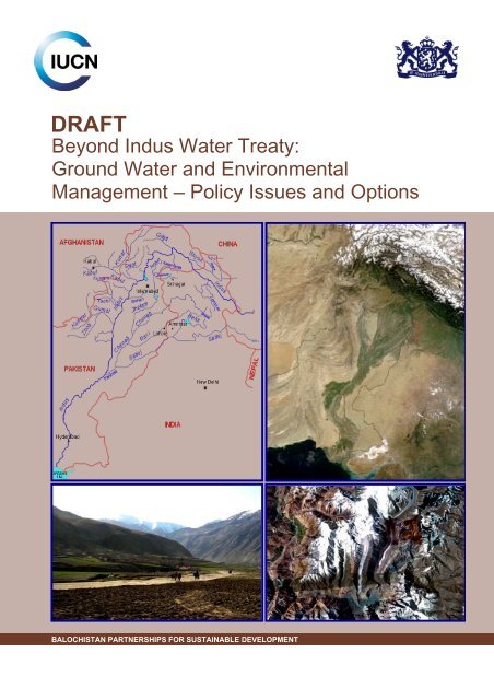
DRAFT<br />
<strong>Beyond</strong> <strong>Indus</strong> <strong>Water</strong> <strong>Treaty</strong>:<br />
Ground <strong>Water</strong> and Environmental<br />
Management – Policy Issues and Options<br />
BALOCHISTAN PARTNERSHIPS FOR SUSTAINABLE DEVELOPMENT
The designation of geographical entities in this paper, and the<br />
presentation of the material, do not imply the expression of any opinion<br />
whatsoever on the part of <strong>IUCN</strong> and Embassy of the Kingdom of the<br />
Netherlands concerning the legal status of any country, territory, or area,<br />
or of its authorities, or concerning the delimitation of its frontiers or<br />
boundaries.<br />
The views expressed in this publication do not necessarily reflect those<br />
of <strong>IUCN</strong> and Embassy of the Kingdom of the Netherlands.<br />
Published by: <strong>IUCN</strong> Pakistan.<br />
Copyright:<br />
©2010, International Union for Conservation of Nature and Natural<br />
Resources. Reproduction of this paper for educational and other noncommercial<br />
purposes is authorized without prior permission from the<br />
copyright holders, providing the source is fully acknowledged.<br />
Reproduction of the publication for resale or for other commercial<br />
purposes is prohibited without prior written permission from the copyright<br />
holders.<br />
Citation:<br />
<strong>IUCN</strong>, 2010. <strong>Beyond</strong> <strong>Indus</strong> <strong>Water</strong> <strong>Treaty</strong>: Ground <strong>Water</strong> and<br />
Environmental Management – Policy Issues and Options.<br />
<strong>IUCN</strong> Pakistan, Karachi. 10 pp.<br />
Prepared by:<br />
Dr. Shahid Ahmad<br />
Resource person:<br />
Hamid Sarfraz
<strong>Beyond</strong> <strong>Indus</strong> <strong>Water</strong> <strong>Treaty</strong>: Ground <strong>Water</strong> and Environmental Management – Policy Issues and Options 1<br />
BEYOND INDUS WATER TREATY: GROUND WATER AND<br />
ENVIRONMENTAL MANAGEMENT – POLICY ISSUES AND<br />
OPTIONS<br />
1. THE CONTEXT<br />
1.1. Indo-Gangetic River Basin (IGRB)<br />
Length of the <strong>Indus</strong> River is 3,199<br />
kms. In the Upper <strong>Indus</strong> Basin, the<br />
principal tributaries are Kabul, Swat<br />
and Kurram on the right bank and<br />
Jhelum, Chenab, Ravi, Beas, and<br />
Satluj on the left bank (Figure 1). The<br />
basin extends over an area of 1.166<br />
million km 2 and its distribution covers:<br />
Pakistan 0.693 km 2 ; Afghanistan and<br />
China 0.015 km 2 ; and India 0.321<br />
km 2 . The mean annual flow of the<br />
<strong>Indus</strong> Basin is 187 km 3 contributed by<br />
runoff, snow- and glacier-melt.<br />
Catchment area of the Ganga River<br />
falls in India, Nepal, China, and<br />
Bangladesh and its length is 2,525<br />
kms. Yamuna is the most important<br />
tributary that joins it on the right bank Figure 1. Map of IGBR<br />
at Allahabad. After confluence with<br />
Yamuna, the Ganga River flows eastward and is joined by a number of tributaries.<br />
1.2. Surface <strong>Water</strong> Resources in the IGRB<br />
IGRB drains from southern Himalayan and Hindu Kush “<strong>Water</strong> Tower of Asia” and provides base for<br />
economic development for over a billion people. The projected per capita water availability in the<br />
<strong>Indus</strong>-Pakistan and Ganga-India sub-basins by 2025 will be reduced to < 1000 m 3 – water scarce subbasins.<br />
The <strong>Indus</strong>-India sub-basin will be a water stress sub-basin by 2030 having per capita water<br />
availability of < 1700 m 3 . <strong>Indus</strong>-Pakistan is the most water scarce sub-basin in the IGRB (Table 1).<br />
Table 1. Renewable water resources & per capita water availability in IGBR (Sharma et al 2008) 1<br />
IGRB Basin Total Renewable <strong>Water</strong><br />
Resources (km 3 )<br />
Per Capita <strong>Water</strong> Availability (m 3 /person)<br />
1990 2000 2025 2050<br />
<strong>Indus</strong>-India 97 2487 2109 1590 1132<br />
<strong>Indus</strong>-<br />
Pakistan<br />
190 1713 1332 761 545<br />
Ganga-India 663 1831 1490 969 773<br />
1.3. Groundwater Resources in the IGRB<br />
1 Sharma, B. R., U. A. Amarasinghe and A. Sikka. 2008. Indo-Gangetic River Basins: Summary Situation Analysis.<br />
International <strong>Water</strong> Management Institute, New Delhi Office, New Delhi, India. 25 July 2008.
2 <strong>Beyond</strong> <strong>Indus</strong> <strong>Water</strong> <strong>Treaty</strong>: Ground <strong>Water</strong> and Environmental Management – Policy Issues and Options<br />
Groundwater in the IGRB occurs in porous media below the soil surface and termed as ‘aquifer’. It is<br />
well developed in deep alluvium having capacity to retain and transmit water and provides reliable<br />
source of water on demand. The canal water diversions in the basin states are still managed in a<br />
supply side system. Thus, groundwater is premium water for productive and sustainable agriculture.<br />
Groundwater resources can be classified as “static” and “dynamic”. The ‘static resource’ is the<br />
amount of groundwater available below the zone of water level fluctuations. The “dynamic resource’<br />
is the amount of groundwater available in the zone of water level fluctuations. Sustainable<br />
groundwater development requires that only dynamic resources are tapped. Abstraction of<br />
static groundwater resources could be considered during extreme scarcity, for essential<br />
purposes only (Table 2). Groundwater resources in the Ganga basin are nearly six times that of the<br />
<strong>Indus</strong> basin.<br />
The studies revealed that number of<br />
shallow tubewells in India roughly<br />
doubled every 4 th year during 1951-91.<br />
Groundwater users in poorer provinces<br />
tend to rely more on diesel.<br />
Groundwater irrigated crops generally<br />
result in higher yields due to availability<br />
of water on demand (Shah et al. 2000 2<br />
Singh and Singh 2002 3 ). Overdraft has<br />
taken on alarming proportions in<br />
several Indian states, and has led to<br />
increased competition among water<br />
users. Subsidized energy for groundwater<br />
pumping is a major contributor to overdraft<br />
in Northern India.<br />
Figure 2. Conceptual framework for groundwater<br />
Table 2. Fresh groundwater resources (km 3 ) in the aquifers of the IGRB 1<br />
River<br />
Basin<br />
Alluvium/Unconsolidated Rocks Hard Rocks Total<br />
<strong>Indus</strong> 1,334.9 3.3 1,338.2<br />
Ganga 7,769.1 65 7,834.1<br />
Research conducted by IWMI-TATA revealed that groundwater use has surpassed<br />
surface water use in Indian agriculture as the primary source of food production<br />
and income generation. The key question for policy makers and planners is how to<br />
tap this resource without exhausting the supply. The mind-set and water<br />
management skills need to shift from resource development to resource planning<br />
and management.<br />
In Pakistan, there are now 1.0 million tubewells energized either with electricity (13%) or by diesel<br />
(87%). Growth rate is now stagnant due to the rise in price of energy or due to quality concerns. There<br />
is no subsidy on diesel. The subsidy on electricity is only for Balochistan for 15262 tubewells (1.5% of<br />
total tubewells 4<br />
), which had serious impacts on the lowering of water table and mining of groundwater,<br />
rather it resulted in wasteful use of water.<br />
2 Shah, T., D., Molden, R. Sakthivadivel and D. Seckler. 2000. The global groundwater situation: overview of opportunities<br />
and challenges. International <strong>Water</strong> Management Institute, Colombo, Sri Lanka.<br />
3 Singh, D. K. and A. K. Singh. 2002. Groundwater Situation in India: Problems and Perspectives. International Journal of<br />
<strong>Water</strong> Resources Development 18(4): 563–80.<br />
4 GOP. 2009. Agriculture Statics of Pakistan. Economic Wing, Ministry of Food and Agriculture, Government of Pakistan.
<strong>Beyond</strong> <strong>Indus</strong> <strong>Water</strong> <strong>Treaty</strong>: Ground <strong>Water</strong> and Environmental Management – Policy Issues and Options 3<br />
1.4. Groundwater and Environmental Management by the Basin States<br />
Over-abstraction of groundwater in <strong>Indus</strong>-India basin closer to Pakistan’s border has serious impacts<br />
on the aquifers of <strong>Indus</strong>-Pakistan – seems an extension of mining of groundwater in Northern India,<br />
as rest of the country is not facing groundwater mining. The basic issue is how to address transboundary<br />
groundwater issues. A Case Study of Excessive Groundwater Abstraction in India<br />
conducted by NASA 5<br />
was analyzed to assess possible impacts on the aquifers of <strong>Indus</strong>-Pakistan. The<br />
<strong>Indus</strong> <strong>Water</strong> <strong>Treaty</strong> does not clearly articulate the environmental concerns. In the catchment areas of<br />
the <strong>Indus</strong>-India, the effluents are being discharged into the rivers due to rapid urbanization and growth<br />
in agriculture. The drains entering into Pakistan are also bringing heavy load of wastes – creating<br />
environmental implications for human and livestock health. The surface water scarcity in the basin<br />
states would ultimately put more pressure on the depleting aquifers. There is a need to look into<br />
options of managing aquifers in the basin states – thinking beyond the <strong>Treaty</strong>.<br />
2. TRANS-BOUNDARY GROUNDWATER ISSUES BETWEEN THE<br />
BASIN STATES<br />
In India, 60% of water used in agriculture is contributed by groundwater. Groundwater and<br />
environmental issues will further worsen in future. It is imperative for the basin states, to envisage<br />
comprehensive development and planning for the optimal use of water. A holistic approach of<br />
conjunctive use and management of water has to be adopted. Groundwater needs to be managed as<br />
a resource as well as a trust. The resource has to be sustained for the future generations so that they<br />
also enjoy the opportunity of affordable pumping. It is essential to jointly set up an organisation with<br />
representatives from the basin states, whose functions would entail identifying short- and long-term<br />
supply capacity of the basin and its integrated development, setting up of infrastructure and<br />
coordinating activities within the respective states.<br />
Integrated development approach is beyond consideration in the current context<br />
of relations between the basin states, but all other options will lead to destruction<br />
sooner or later. It is only possible with a paradigm shift in the mindset. It will<br />
require a complete end to hostilities, both physical and psychological, from<br />
both sides.<br />
2.1. Groundwater Abstraction in India – Case Study by NASA<br />
NASA 6<br />
(National Aeronautics and Space<br />
Administration) study highlighted that Indian<br />
border states with Pakistan are over abstracting<br />
groundwater, which might affect aquifers of<br />
Pakistan because of depression created by<br />
farmers due to subsidized power policy in India<br />
(Figure 3). Further, India being located at the<br />
upstream may be motivated to exercise<br />
environmental management for the movement<br />
Figure 3. Groundwater vanishing in Northern India 6<br />
5 Rodell, M,. I. Velicogna and J. S. Famiglietti. 2009. Satellite-based estimates of groundwater depletion in India. Nature.<br />
08238.<br />
6 NASA Satellites Unlock Secret to Northern India's Vanishing <strong>Water</strong> 08.12.09 Gretchen Cook-Anderson NASA Earth<br />
Science News Team;<br />
NASA Study on “Science Serving Society: <strong>Water</strong> Management.
4 <strong>Beyond</strong> <strong>Indus</strong> <strong>Water</strong> <strong>Treaty</strong>: Ground <strong>Water</strong> and Environmental Management – Policy Issues and Options<br />
of effluents into the rivers flowing to Pakistan. There is a need to have clear additions in the <strong>Treaty</strong><br />
to address the environmental issues more effectively.<br />
NASA study revealed that groundwater is vanishing in the Northern India 7<br />
as the groundwater levels<br />
in Punjab, Rajasthan, Haryana and Delhi are falling by 0.3 m per year — a trend that could lead to<br />
“extensive socio-economic stresses” for the region. A staggering 109 km 3 of groundwater has been<br />
lost during 2002-08 — a figure twice the capacity of India’s largest surface reservoir of Upper<br />
Wainganga and “much more” than government’s estimation, says the paper published in international<br />
journal Nature by NASA. The study further revealed that the depletion is caused entirely by human<br />
activity (irrigation) and not by climatic variability. Groundwater abstraction is more than the recharge.<br />
The finding is based on images from NASA’s Gravity Recovery and Climate Experiment (GRACE), a<br />
pair of satellites that sense changes in Earth’s gravity field and associated mass distribution, including<br />
water masses stored above or below the Earth’s surface. Study also indicated that in India, depletion<br />
is likely to continue until effective measures are taken to curb groundwater demand which could<br />
propel severe shortages of potable water, reduced agricultural productivity, conflict and suffering. The<br />
climate of Rajasthan, Punjab, Haryana and Delhi is classified as semi-arid to arid. The map, showing<br />
groundwater withdrawals as a percentage of groundwater recharge, is based on state-level estimates<br />
of annual withdrawals and recharge reported by India's Ministry of <strong>Water</strong> Resources (Figure 4).<br />
The averaging function (spatial weighting) used to<br />
estimate terrestrial water storage changes from<br />
GRACE data was mapped in the study conducted by<br />
8<br />
Rodell et al. 2009 . Warmer colours indicate greater<br />
sensitivity to terrestrial water storage changes (Figure<br />
5). Larger image beneath northern India’s irrigated<br />
fields of wheat, rice, and barley – beneath its densely<br />
populated cities of Jaipur and New Delhi, the<br />
groundwater has been disappearing.<br />
The study provided an opportunity to observe<br />
groundwater use without any field data. This is critical<br />
because in the basin states hydrological data are<br />
sparse and hard to access; space-based methods<br />
provide perhaps the only opportunity to assess<br />
changes in fresh water availability across large<br />
regions.<br />
The map shows groundwater<br />
changes in India during 2002-08,<br />
with losses in red and gains in blue,<br />
based on GRACE satellite<br />
observations (Figure 6). The<br />
estimated rate of depletion of<br />
groundwater in north-western India<br />
is equivalent to a water table<br />
decline of 0.33 m per year.<br />
Figure 5. Sensitivity to terrestrial<br />
water storage losses in IGRB<br />
Figure 4. Groundwater abstraction as %<br />
of recharge<br />
Figure 6. Groundwater loss<br />
(red) and gains (blue) in IGRB<br />
7 Groundwater Vanishing in India says NASA. 2009. Online edition of India's National Newspaper, The Daily News Hindu.<br />
Banglore, Friday, Aug 14, 2009. ePaper, Mobile/PDA Version<br />
8 Rodell, J., T. Schindler, J. Famiglietti and G. C. Anderson. 2009. NASA Satellites Unlock Secret to Northern India's<br />
Vanishing <strong>Water</strong>. NASA Earth Science News Feature, NASA, USA
<strong>Beyond</strong> <strong>Indus</strong> <strong>Water</strong> <strong>Treaty</strong>: Ground <strong>Water</strong> and Environmental Management – Policy Issues and Options 5<br />
There is no excessive abstraction of groundwater in Pakistan, except in a smaller<br />
strip along the border, which seems an extended impact of the mining of<br />
groundwater in India. Otherwise, there is no region of groundwater depletion in<br />
<strong>Indus</strong>-Pakistan. Even excessive groundwater abstraction in India has affected<br />
Nepal from both sides of the Indian border.<br />
<strong>Water</strong> table does not respond to changes in weather as rapidly as surface water bodies. Therefore,<br />
when groundwater is abstracted, recharge to the original water tables can take years. Changes in<br />
groundwater masses affect gravity enough to provide a signal, such that changes in gravity can be<br />
translated into a measurement of an equivalent change in water. Through the use of GRACE satellite<br />
observations, one can observe and monitor water changes in critical areas on temporal and spatial<br />
basis without spending time and resources on collection of costly field data.<br />
The study does not provide information regarding absolute volume of water in the<br />
Northern Indian aquifers, but it provides strong evidence that current rates of<br />
groundwater abstraction are not sustainable. The region has become dependent<br />
on irrigation to maximize agricultural productivity, so the authors predicted water<br />
crisis in the near future.<br />
The study further revealed that at its core, this dilemma is an age-old cycle of human need and<br />
activity – particularly the need for irrigation to produce food," said Bridget Scanlon, a hydrologist at the<br />
Jackson School of Geo-sciences at the University of Texas in Austin. "That cycle is now<br />
overwhelming fresh water reserves all over the world. Even one region’s water problem has<br />
implications beyond its borders."<br />
The study findings raise an issue that how the aquifers of <strong>Indus</strong>-Pakistan are<br />
going to be affected with the excessive abstraction of groundwater on the Indian<br />
side. What are the implications on Pakistan side aquifer both in quantity and<br />
quality terms is a major question to be addressed? The issue of trans-boundary<br />
groundwater with India has to be addressed and an addendum has to be<br />
negotiated between basin states for inclusion in the <strong>Indus</strong> <strong>Water</strong> <strong>Treaty</strong>.<br />
2.2. Pollution of Indian Rivers and Environmental Impacts<br />
Shukla (2009) 9<br />
indicated that most of the Indian rivers are grossly polluted due to the disposal of<br />
untreated sewage and industrial effluents into the rivers. It led to environmental disturbance and is a<br />
potential source of stress to biotic community. Studies show terrific facts like; death of ghariyals in<br />
Chambal sanctuary, pesticide pollution in Yamuna River, etc. He further indicated that though, the<br />
CPCB (Central Pollution Control Board) has laid down stringent environmental norms in the form of<br />
CREP (Corporate Responsibility for Environmental Protection), but only 45% of the grossly polluting<br />
industrial units have installed ETPs (Effluent Treatment Plants). Out of these, over 18% did not<br />
function and also did not meet the standards. The NRCD (National River Conservation Directorate)<br />
also has no mechanism to ensure that installed ETPs function properly. The contribution to pollution<br />
load by various sources was estimated at 75 and 25% for domestic and industrial wastes,<br />
respectively.<br />
9 Shukla, K. S. 2009. . Indian river systems and pollution. The Encyclopedia of Earth. //www.eoearth.org/article/ Indian_river<br />
_systems_and_pollution. Last Updated November 12 th 2009.
6 <strong>Beyond</strong> <strong>Indus</strong> <strong>Water</strong> <strong>Treaty</strong>: Ground <strong>Water</strong> and Environmental Management – Policy Issues and Options<br />
Pratyush (2007) 10<br />
indicated that apart from ensuring proper operationalisation of assets created under<br />
different schemes, it is needed to strengthen mechanism and the capacity of institutions for effective<br />
control of water pollution and waste from point source by emphasizing socio-economic measures at<br />
the same time as using law enforcement measures.<br />
Lifelines of India are in dying condition and the threat<br />
is coming from the dumping of sewage in to freshwater<br />
tributaries. Lack of proper sewage system in most of<br />
the cities is main culprit behind the killing of rivers.<br />
New Delhi is alone responsible to produces 3.6 billion<br />
litres of sewage per day. The city’s poor management<br />
is unable to treat half of the daily produced sewage.<br />
The remaining untreated waste is dumped into the<br />
Yamuna River. One can imagine the condition of River<br />
Yamuna that is lifeline for Delhiites. This is not the story<br />
of Yamuna only the same thing is being happened with<br />
almost every river in India (Figure 7).<br />
Figure 7. Bathing in streams<br />
In India, there are 300 sewage treatment plants and most of them are underutilized and badly located.<br />
Most of the sewage treatment plants partially treat the sewage and throw into rivers. India has a badly<br />
structured and poorly managed drainage system. It is in need of repair as more than half of India’s<br />
drainage system is virtually outmoded. Situation in Pakistan is relatively better due to less population<br />
but rest of the things are almost same like of India.<br />
2.2.2. Pollution of Wular Lake and Seepage Losses<br />
Ready and Char (2004) 11<br />
identified the environmental<br />
issues of Wular Lake located in<br />
Jammu and Kashmir and<br />
comprising of 17,300 ha (Figures<br />
8 to 11). Rashid (2009) 12<br />
indicated that shrinkage in Lake’s<br />
area and rise in the silt and the<br />
chloride contents in waters are the<br />
major threats for the Wular Lake.<br />
The lake has lost its vast area to<br />
agriculture, willow plantation and<br />
urbanization. The Wular<br />
Integrated Conservation and<br />
Development Action Plan (2001-<br />
2011) indicated that the lake area<br />
was reduced to 79 km 2 in 1993<br />
whereas it had 200 km 2 during<br />
1911.<br />
Figures 8 to 11 (Left to right). 8. Overview of Wular Lake. 9.<br />
Paddy fields. 10. Pollution from sewage. 11. Pollution by<br />
infrastructure.<br />
10 Pratyush. 2007. Poor sewage treatment, drainage system & climate change making Indian rivers 'Dead'. Insta Blogs.<br />
Website: http://pratyush.instablogs.com/entry/poor-sewage-treatment-drainage-system-climate-change-making-indianrivers-dead/.<br />
June 15 2007.<br />
11 Ready, M. S. and N. V. V. Char. 2004. Management of Lakes in India. Paper prepared by the Formerly Secretaryand<br />
Commissioner (Eastern Rivers), Ministry of <strong>Water</strong> Resources, Government of India.<br />
12 Rashid, A. 2009. Wular lake faces threat. Report of the J&K Plus On-line Edition. Saturday, July 18 th , 2009, Chandigarh,<br />
India.
<strong>Beyond</strong> <strong>Indus</strong> <strong>Water</strong> <strong>Treaty</strong>: Ground <strong>Water</strong> and Environmental Management – Policy Issues and Options 7<br />
The lake stores excess water during floods in the valley. “Massive willow plantation within and around<br />
the lake has been acting as a barrier for heavily silted waters to drain out. The lake is thus fast<br />
becoming a huge deposit of silts”. The bio-matter from dead plants and decay adds to the organic<br />
content of the lake that further deteriorates water quality. The process of agriculture around the lake<br />
has eaten away most of the marshy areas that could otherwise act as an absorption area for harmful<br />
components entering the lake. About 3,00,000 people are living in floating residences in Baramulla<br />
district. Their sewerage and garbage goes directly into lake and pollutes it. The waste drained directly<br />
into the lake has been constantly increasing its chloride content. Any alteration in size, structure and<br />
components of the lake body will not only hamper special supplies provided by the lake (fodder, fish,<br />
etc.), but also jeopardise livelihood of many fishermen. “Drudging, de-silting and selective de-weeding<br />
of channels and nullahs that are connected with Wular can be of great help in restoring its lost glory”.<br />
Seepage losses contribute to groundwater and plantations around the Lake are<br />
also consuming water. The Wular Lake and Kishenganga Project would further<br />
results in feeding the storage and groundwater recharge will be enhanced, which<br />
would also cause serious environmental concerns for surrounding areas of the<br />
Lake and it will further reduce the flows of Kishenganga River to Pakistan. The<br />
pollutants of the Lake will also pollute the flowing water and there will be more<br />
pollutants in the water of the Jhelum River flowing to Pakistan.<br />
2.3. International <strong>Water</strong> Law on Trans-boundary Aquifers<br />
Article #42 of International <strong>Water</strong> Law<br />
deals with trans-boundary aquifers and<br />
is composed of six points regarding<br />
rules and laws applicable to shared<br />
waters apply to aquifers and are<br />
relevant to the basin states and may be<br />
considered in future while making<br />
additions to the <strong>Indus</strong> <strong>Water</strong> <strong>Treaty</strong>13.<br />
The Law clearly states that the basin<br />
states sharing an aquifer shall manage<br />
it in its entirety and exchange data at<br />
the request of any one of them and<br />
cooperate in the collection and analysis<br />
of additional information, if needed.<br />
While using the groundwater, the basin states<br />
must have due regard for the obligation not to<br />
cause significant harm to other basin states<br />
and to the obligation to protect aquifer and<br />
also cooperate in managing recharge to the<br />
aquifer. The basin states shall also refrain<br />
from and prevent acts or omissions within<br />
their territory that cause significant harm to<br />
another basin state having due regard to the<br />
right of each basin state to make equitable<br />
and reasonable use of the groundwater and<br />
management of trans-boundary aquifers.<br />
The pressure on groundwater will increase in future and there are chances that condition of aquifers<br />
will be further aggravated. Pakistan may take up the issue of trans-boundary aquifers with India<br />
13 a. The Rules applicable to internationally shared waters apply to an aquifer if: a) It is connected to surface waters that are<br />
part of an international drainage basin; or b) It is intersected by the boundaries between two or more States even without a<br />
connection to surface waters that form an international drainage basin.<br />
b. Whenever possible and appropriate, basin States sharing an aquifer referred to in paragraph 1 shall manage an aquifer<br />
in its entirety.<br />
c. In managing the waters of an aquifer referred to in paragraph 1, basin States shall consult and exchange information<br />
and data at the request of any one of them and shall cooperate in the collection and analyzing additional needed<br />
information pertinent to the obligations under these Rules.<br />
d. Basin States shall cooperate according to the procedures in Chapter XI to set drawdown rates in order to assure the<br />
equitable utilization of the waters of an aquifer referred in paragraph 1, having due regard for the obligation not to cause<br />
significant harm to other basin States and to the obligation to protect the aquifer.<br />
e. Basin States sharing an aquifer referred to in paragraph 1 shall cooperate in managing the recharge of the aquifer.<br />
f. Basin States sharing an aquifer referred to in paragraph 1 shall refrain from and prevent acts or omissions within their<br />
territory that cause significant harm to another basin State, having due regard to the right of each basin State to make<br />
equitable and reasonable use of the waters.
8 <strong>Beyond</strong> <strong>Indus</strong> <strong>Water</strong> <strong>Treaty</strong>: Ground <strong>Water</strong> and Environmental Management – Policy Issues and Options<br />
before it is too late, as in India aquifers are under heavy depletion. There are also chances that due to<br />
pressure on groundwater, India may be tempted to divert waters of Western Rivers to recharge<br />
depleted aquifers. The extensive development of hydro-power projects in India would also result into<br />
heavy seepage of surface water into the groundwater and ultimately reducing the flows to Pakistan.<br />
3. KEY POLICY ISSUES<br />
<strong>Water</strong> entitlements of India on the western rivers have created a situation where the basin states are<br />
facing conflicts in implementing the <strong>Treaty</strong>. The issues of depleting aquifers could not be given due<br />
consideration, but it is expected that in future such issues will be much more serious to address along<br />
with environmental issues. The key issues of rapid abstraction of groundwater in Northern India were<br />
identified having impacts on sustainability and inter-generational issues of aquifers in basins states.<br />
3.1. Depletion of Aquifers in Northern India and Impact on Pakistan’s<br />
Aquifers<br />
Lowering of water table due to over-abstraction of groundwater in the Northern India has serious<br />
impacts on the depletion of aquifers on the Pakistan’s side. Pakistan is not facing acute depletion of<br />
groundwater except on the fringe of the border with India, which seems an extended effect of<br />
excessive groundwater depletion in India. Rest of the country is either under hydrological equilibrium<br />
or receiving higher recharge in the lower <strong>Indus</strong> basin. With further scarcity of surface water and<br />
prolonged droughts, the pressure on groundwater will increase and there are chances that aquifers<br />
will be further depleted and this would have negative impacts on aquifers on the Pakistan side, as<br />
there is overwhelming evidence generated under the NASA study.<br />
3.2. Entry of Effluents to Western Rivers<br />
Entry of effluents into freshwater rivers and tributaries feeding the Western Rivers on the Indian side<br />
is causing serious environmental implications for <strong>Indus</strong>-Pakistan. The extensive development of<br />
agriculture around the Western Rivers in India, with higher use of fertilizers and pesticides, is a<br />
concern for Pakistan. The domestic effluent is also a serious issue due to rapid urbanization around<br />
water bodies. Furthermore, the drainage channels from India entering into Pakistan are now flowing<br />
with effluents having higher concentration of chemicals and causing environmental impacts on the<br />
livelihood of rural population, livestock and groundwater quality. Mortality of livestock has been<br />
reported due to the use of drainage water as stockwater. The further growth of chemical agriculture in<br />
India would further deteriorate the quality of drainage effluents entering in to Pakistan.<br />
3.3. Growing Demand of Surface <strong>Water</strong> to Recharge Aquifers of <strong>Indus</strong>-India<br />
With the depletion of groundwater in northern India, there will also be additional pressure to construct<br />
projects where surface waters can be used either for recharging groundwater or supplementing the<br />
groundwater use. Pakistan has to oversee all the river flow projects in <strong>Indus</strong>-India in terms of seepage<br />
losses induced due to heading up of stored water and additional diversions to support the shortages<br />
of water in India. There are chances of further aggravating water conflicts in the near future.<br />
3.4. Seepage Losses in Lakes and Reservoirs<br />
India has planned construction of number of hydro-power and storage projects with creating large<br />
heads of water in the reservoirs, which will induce recharge to groundwater and will ultimately reduce<br />
the flow of water to <strong>Indus</strong>-Pakistan. The heading up of water in the hydro-power dams must also be<br />
viewed in terms of seepage losses, which might increase by many-fold due to heading up of water in<br />
the reservoir. This is also true for the Wular Lake, Kishenganga, Salal and Baglihar dam projects.
<strong>Beyond</strong> <strong>Indus</strong> <strong>Water</strong> <strong>Treaty</strong>: Ground <strong>Water</strong> and Environmental Management – Policy Issues and Options 9<br />
4. POTENTIAL OPTIONS<br />
4.1. Dialogues for Addressing Transboundary Aquifer’s Management<br />
Emphasis must be placed on the basin aquifer bordering the basin states in future discussions<br />
of the <strong>Indus</strong> <strong>Water</strong> Commission. With the scarcity of surface water and persistent drought the<br />
pressure on groundwater will increase and there are chances that condition of aquifers will be further<br />
aggravated. Pakistan may take up the issue of trans-boundary aquifer with India before it is too late,<br />
as in <strong>Indus</strong>-India aquifer is under heavy depletion.<br />
Initiate dialogues between the basin states for tranboundary aquifer management through: a)<br />
sharing information on aquifer abstraction; b) ensuring that electric and diesel fuel policies are not<br />
encouraging farmers for over-abstraction of groundwater; c) developing capacity of the basin states<br />
for the use of remotely sensed data for the assessment of water table and groundwater abstractions;<br />
and d) exchange of knowledge and technologies for efficient use of water to reduce dependence on<br />
groundwater through the management of water demand for all sub-sectors of water use.<br />
4.2. Managing Groundwater as a Resource as well as Trust<br />
Manage groundwater as a resource, as it is essential to jointly set up an organisation with<br />
representatives from the basin states, whose functions would entail identifying short- and long-term<br />
supply capacity of the basin and its integrated development, setting up of infrastructure and<br />
coordinating activities of different agencies. Furthermore, groundwater must also be considered as<br />
a trust because in a concept of trusteeship, resource is not only depleted but it is also recharged to<br />
manage it on sustainable basis. As in the basin states, surface water schemes are largely being<br />
managed on Warabandi (fixed-rotation) and water allocations are actually based on rationing of water,<br />
therefore groundwater provides water on demand basis and hence it has larger impacts on<br />
productivity of irrigated agriculture.<br />
4.3. Support Paradigm Shift in the Mindset of People<br />
Support paradigm shift in the mindset of people of the basin states and it would require a<br />
complete end to hostilities, both physical and psychological, from both sides. It will have to be a part<br />
of the final settlement in letter and spirit. The integrated development approach is beyond<br />
consideration in the current context of relations between the basin states, but all other options will<br />
lead to destruction sooner or later. Furthermore, trans-boundary water and aquifers have to be seen<br />
in terms of opportunities available to manage water (surface, groundwater and wastewater), while<br />
developing future plans for the benefits of the basin states.<br />
4.4. Monitoring of Hydro-power Projects on the Wetsern Rivers<br />
Monitor river flow projects in terms of seepage losses due to heading up of water in the reservoir,<br />
where seepage is induced by many-fold. This will be a loss to Pakistan but a gain to India. Therefore,<br />
water apportionment to India on the western rivers in terms of storage has to be seen in the context of<br />
induced seepage losses. Depletion of groundwater in northern India will pose serious implications for<br />
India to try to use surface waters from the western rivers over and above the provisions of the <strong>Treaty</strong>,<br />
being an upper riparian. In addition, the seepage of water from the storage projects can be easily<br />
estimated by measuring the inflows and outflows from the reservoir. Ultimately, the Pakistan has to<br />
initiate discussions to include the seepage losses as part of water entitlements for India. In addition,<br />
there is an urgent need to exchange the data and information so that experts can formulate options<br />
for the benefit of the basin states.
10 <strong>Beyond</strong> <strong>Indus</strong> <strong>Water</strong> <strong>Treaty</strong>: Ground <strong>Water</strong> and Environmental Management – Policy Issues and Options<br />
5. Way Forward<br />
Who will be the Champions of creating a shift in the mind set of the experts and people to<br />
consider environmental concerns and groundwater issues and to formulate detailed<br />
provisions on trans-boundary aquifers and environmental pollution so that dialogues can be<br />
initiated to address the emerging issues and formulate plans for the benefits of the basin<br />
states – on the <strong>Indus</strong>?
INTERNATIONAL UNION FOR<br />
CONSERVATION OF NATURE<br />
Balochistan Programme Office<br />
Marker Cottage<br />
Zarghoon Road, Quetta<br />
Pakistan<br />
Tel +92 (81) 2840450/51/52<br />
Fax +92 (81) 2820706<br />
cro.pk@iucn.org<br />
www.iucn.org/pakistan


