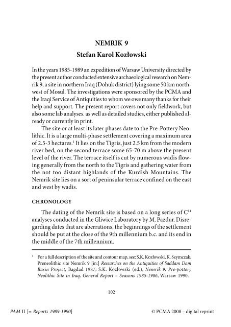
NEMRIK 9 Stefan Karol Kozłowski
NEMRIK 9 Stefan Karol Kozłowski
NEMRIK 9 Stefan Karol Kozłowski

You also want an ePaper? Increase the reach of your titles
YUMPU automatically turns print PDFs into web optimized ePapers that Google loves.
PAM II [= Reports 1989-1990]<br />
<strong>NEMRIK</strong> 9<br />
<strong>Stefan</strong> <strong>Karol</strong> <strong>Kozłowski</strong><br />
In the years 1985-1989 an expedition of Warsaw University directed by<br />
the present author conducted extensive archaeological research on Nemrik<br />
9, a site in northern Iraq (Dohuk district) lying some 50 km northwest<br />
of Mosul. The investigations were sponsored by the PCMA and<br />
the Iraqi Service of Antiquities to whom we owe many thanks for their<br />
help and support. The present report covers not only fieldwork, but<br />
also some lab analyses. as well as detailed studies, either published already<br />
or currently in print.<br />
The site or at least its later phases date to the Pre-Pottery Neolithic.<br />
It is a large multi-phase settlement covering a maximum area<br />
of 2.5-3 hectares. 1 It lies on the Tigris, just 2.5 km from the modern<br />
river bed, on the second terrace some 65-70 m above the present<br />
level of the river. The terrace itself is cut by numerous wadis flowing<br />
generally from the north to the Tigris and gathering water from<br />
the not too distant highlands of the Kurdish Mountains. The<br />
Nemrik site lies on a sort of peninsular terrace confined on the east<br />
and west by wadis.<br />
CHRONOLOGY<br />
The dating of the Nemrik site is based on a long series of C 14<br />
analyses conducted in the Gliwice Laboratory by M. Pazdur. Disregarding<br />
dates that are aberrations, the beginnings of the settlement<br />
should be put at the close of the 9th millennium b.c. and its end in<br />
the middle of the 7th millennium.<br />
1 For a full description of the site and contour map, see: S.K. <strong>Kozłowski</strong>, K. Szymczak,<br />
Preneolithic site Nemrik 9 [in:] Researches on the Antiquities of Saddam Dam<br />
Basin Project, Bagdad 1987; S.K. <strong>Kozłowski</strong> (ed.), Nemrik 9. Pre-pottery<br />
Neolithic Site in Iraq. General Report – Seasons 1985-1986, Warsaw 1990.<br />
102<br />
© PCMA 2008 – digital reprint
STRATIGRAPHY 2<br />
Generally, the stratigraphy of the Nemrik site should be divided<br />
into two main layers differing from each other in terms of lithology<br />
and in genetics to an extent. The lower part of the profile,<br />
directly on top of clayey virgin soil with mole holes is made up of<br />
loess-like deposits, mainly of aeolian origin.<br />
In these formations three occupational levels can be distinguished,<br />
marked by the occurrence of objects (flint, stone, less frequently<br />
bone and clay), charcoal and ashes, animal bones and shells,<br />
architecture and burials, as well as clay floors covering more or less<br />
continuously the space between the houses.<br />
The upper part of the profile is made up of a thick layer of<br />
stone evidently of anthropogenic nature. It constitutes the remains<br />
of a stone pavements between the houses, repeatedly repaved. This<br />
layer contained the same kinds of finds as described above for the<br />
lower part of the profile, with the exception of clay floors. It is possible<br />
to distinguish two settlement phases in this upper layer.<br />
SETTLEMENT PHASES<br />
It is clear from the above that five settlement phases have been<br />
distinguished. Separating the phases are periods when obviously<br />
there was no permanent settlement on Nemrik.<br />
The first three phases which are less well known can be dated<br />
from the close of the 9th to the end of the 8th millennium, the last<br />
two (IV and V) to the end of the 8th and the first half of the 7th<br />
millennium. The latter two also provided most of the small finds as<br />
well as architecture and burials to mention the layout of an early<br />
Neolithic village.<br />
2 S.K. <strong>Kozłowski</strong>, Nemrik 9, a Pre-pottery Neolithic Site in Northern Iraq,<br />
Paléorient 15/1, 1989 and S.K. <strong>Kozłowski</strong>, op. cit.<br />
103<br />
© PCMA 2008 – digital reprint PAM II [= Reports 1989-1990]
ARCHITECTURE 3<br />
All in all over 20 architectural objects were discovered and investigated<br />
completely or in part. They were sunk as a rule into the<br />
surface currently in use, sometimes to a depth of as much as 2 m, at<br />
other times much less.<br />
In the first four settlement phases the structures were as a rule<br />
round or oval, mostly of a dwelling nature (particularly structures<br />
Fig. 1. Nemrik 9, phase IV.<br />
3 S.K. <strong>Kozłowski</strong>, A. Kempisty, Architecture of the Pre-pottery Neolithic Site in<br />
Nemrik 9, Northern Iraq, World Archaeology 21, No. 8, 1990; S.K. <strong>Kozłowski</strong><br />
(ed.), Nemrik 9, Pre-pottery Neolithic Site in Northern Iraq. House 1, 1 A and 1 B,<br />
Warsaw, in press.<br />
PAM II [= Reports 1989-1990]<br />
104<br />
© PCMA 2008 – digital reprint
with a diameter of 5 m or more), sometimes tombs or domestic<br />
areas. The fifth phase features subrectangular houses. In the earlier<br />
phases the prevailing structures are small and built in the pisé technique.<br />
In phase III we find walls constructed of large cigar-like mud<br />
bricks dried in the sun. The structures are larger now, reaching<br />
7-8 m in diameter.<br />
In many houses some interior "architecture" has survived in<br />
the form of benches, pits and post holes with massive pillars in the<br />
pisé technique appearing in phase IV, a feature that is unique in the<br />
entire region. Clay plaster is common and in phase V floors are<br />
painted red. No hearths or door openings have been found.<br />
OTHER OBJECTS<br />
A large refuse pit is connected with phase V.<br />
BURIALS<br />
In the earlier phases the dead were buried in graves located<br />
among the houses. In phase III mass burials were made under<br />
house floors, but also in between the houses. In phase IV or V,<br />
a small burial ground was used in the southern part of the village.<br />
The inhumations are almost all contracted and lying on one side.<br />
Partial burials were encountered as well.<br />
SETTLEMENT LAYOUT (Figs 1 and 2)<br />
The thoroughness of the investigations of phases IV and V permitted<br />
an almost complete, if not fully complete reconstruction of<br />
the layout of the settlement, a fact that is unprecedented in the research<br />
on this region to date.<br />
In both phases a large percentage of the space was paved with<br />
broken stone pebbles. Large stone objects such as grinders, mortars,<br />
polishing slabs etc. were located on these pavements. A few<br />
105<br />
© PCMA 2008 – digital reprint PAM II [= Reports 1989-1990]
houses, circular in phase IV and rectangular in phase V, were sunk<br />
into these pavements. At the southern end of the site there was a<br />
small burial ground and in phase V a large refuse pit was located in<br />
the centre of the settlement.<br />
It would appear that in the last two phases of the settlement it<br />
consisted of no more than a few buildings. In each of the houses<br />
the space on the clay benches, regarded as beds, was barely enough<br />
for ten people. Therefore, there is reason to believe that the Early<br />
Neolithic population of the village did not exceed several dozen in<br />
the last two phases.<br />
Fig. 2. Nemrik 9, phase V.<br />
PAM II [= Reports 1989-1990]<br />
106<br />
© PCMA 2008 – digital reprint
FLINT INDUSTRY 4<br />
The flint industry is extremely numerous and features singleplatform<br />
cores for obtaining bladelets by the pressure technique.<br />
These bladelets were frequently sectioned. The main raw material<br />
was a local tertiary flint; imported obsidian is encountered rarely<br />
as is a chocolate-coloured flint which was imported in the form of<br />
ready blades used subsequently in the production of sickle-blades.<br />
Among the retouched tools retouched blades predominate together<br />
with perforators, retouched flakes and end-scrapers, all forms<br />
making up the Near Eastern standard of the time. Rare picks are<br />
distinctive as well as rather more frequent tanged points, both rhomboid<br />
and leaf-shaped. These two groups and backed bladelets as well<br />
set the industry apart, entitling it to be called Nemrikian. El Khiam<br />
points are infrequent. What is more important still is the fact that<br />
this industry practically does not undergo any evolution over 1500<br />
radiocarbon years. Therefore, in northern Iraq, we do not observe a<br />
clear bipartite cultural sequence such as the classic Levantine sequence<br />
(Sultanian – Tahunian).<br />
GROUND STONE INDUSTRY 5<br />
The Nemrik collection of ground and pecked stone implements<br />
is extremely rich (more than 3000 objects) and varied. It consists of<br />
grinders, mortars, polishing slabs, polished axes, various pounders,<br />
stone "pegs", bolas, "maceheads", flint choppers etc. some rare<br />
stone vessels and finally jewellery. Being as it is so rich and varied,<br />
the assemblage permits a reconstruction of a full model of this<br />
industry for the whole region.<br />
4 S.K. <strong>Kozłowski</strong>, K. Szymczak, Flint industry from House 1-1A-1B at the Prepottery<br />
Neolithic site in Nemrik 9, Northern Iraq, Paléorient 15/1, 1989.<br />
5 R.F. Mazurowski, Ground and Pecked Stone Industry in the Pre-pottery<br />
Neolithic of Northern Iraq, Warsaw, in press.<br />
107<br />
© PCMA 2008 – digital reprint PAM II [= Reports 1989-1990]
It also develops in time, the process being clearly visible upon<br />
analysis of particular settlement phases. As a result the regional<br />
model mentioned earlier is enriched by the factor of variability in<br />
time. This in turn allows for the verification of the debatable dating<br />
of Iraqi sites, for instance, a significant rejuvenation of the<br />
Jarmo sequence or suggestions of a mixed, multi-phase character<br />
of the assemblages from Zawi Chemi-Shanidar.<br />
BONE OBJECTS<br />
Bone objects are rare and fairly standard (awls, perforators,<br />
chisels). The needles are distinctive – flat and equipped with a large<br />
hole and an oblique engraved ornament.<br />
CLAY OBJECTS<br />
The so-called tokens are small, handmade and weakly fired objects<br />
taking on geometrical shapes, such as pancakes which are the<br />
most numerous, cones, balls and rarely cylinders. Accompanying<br />
these there are rare animal figurines (boar and pig, ram, cattle?).<br />
OBJECTS OF ART<br />
Deserving special attention are about 20 pieces of stone sculpture,<br />
originating from at least phase III or even phase II of the settlement<br />
at Nemrik. The objects include small (up to 20cm in length)<br />
representations of bird heads, a snake, an unidentified mammal,<br />
a lioness, buffalo hoof, and finally a male head and a figure of a woman.<br />
All are homogeneous in style and technique and of high artistic<br />
standard. The technique comprised piquetage modeling of<br />
a pebble using a flint tool for details, and finally very precise polishing.<br />
The only Near Eastern analogies for the Nemrik series is the<br />
sculpture of the Natufians, which is, however, earlier. In most cases<br />
the sculptures are damaged and only in one we can be fairly sure<br />
PAM II [= Reports 1989-1990]<br />
108<br />
© PCMA 2008 – digital reprint
that the piece has survived in almost original form and place (the<br />
floor of a burnt house 2A). It would appear that these were household<br />
deities.<br />
DATA ON THE ENVIRONMENT AND ECONOMY<br />
The original landscape of Nemrik as well as the economy of its<br />
inhabitants can be fairly precisely reconstructed on the basis of several<br />
factors: the analyses presently being completed on pollen, dendrology,<br />
plant macroelements, malacology; comparative data obtained<br />
in interviews of eldest members of the local community, analyses<br />
of the remains of the original landscape; Layard's descriptions, and<br />
finally geomorphological and pedological data.<br />
It has already been noted that the settlement was located between<br />
the highlands and the valley of the great river, on a flat terrace<br />
cut by wadi. It appears highly feasible that it was located purposefully<br />
at the junction of two or even three biotopes: the steppe (the<br />
terrace), the forest (the highlands) and perhaps even the river valley,<br />
although water quite certainly came from the nearby streams.<br />
Thus, it can be said that the site was surrounded by what<br />
amounted to a steppe parkland with clumps of trees including<br />
poplars/willows and ashes. Tamarisks were among the trees which<br />
grew in the river valley, while the highlands were covered with<br />
a sparse mixed oak forest.<br />
The fauna differed in each of these zones. In the steppe zone<br />
there were chiefly antelopes and gazelles, as well as equids, the river<br />
valley had boars among others, while in the highlands there lived<br />
fauna of the mixed forest including deer, boars, beavers, bison,<br />
aurochs, bears and wild goats. Lions and Indian buffalo were also<br />
to be found in the district. There were fish in the river, crawfish and<br />
turtles in the streams.<br />
The animals mentioned above (without the fish) constituted<br />
the mainstay of an intensive hunting economy of the Nemrik<br />
109<br />
© PCMA 2008 – digital reprint PAM II [= Reports 1989-1990]
dwellers. Even though domestic animals such as sheep, goats,<br />
cattle and pigs were known to these people since at least phase III,<br />
they never seemed to be prevalent in the diet.<br />
Hunting and the beginnings of husbandry were accompanied<br />
by a gathering economy (seeds of wild grain, lentils, vetch, shells of<br />
Helix salomonica and Unio tigridis among others). There is no<br />
such certainty as far as cultivation of grain is concerned, although<br />
pollen analyses seem to answer this question, at least for the later<br />
phases. Almost no evidence of fishing was observed.<br />
This data, the source for which are as yet incomplete analyses,<br />
shows the Nemrik environment to have been extremely rich and<br />
used in an optimal fashion with the economy taking advantage of<br />
all the available resources. At the same time it initiated a neolithization<br />
process that was most probably contemporary to the one in<br />
the Levant.<br />
CONCLUSIONS<br />
The importance of the Nemrik site for learning about a significant<br />
part of the prehistory of the Near East at a turning point in its<br />
development cannot be overestimated. Thanks to fieldwork (more<br />
than eleven months in the field when summed up), it was possible<br />
to gather extensive data, permitting the conclusions to be well<br />
grounded, even if not in harmony with textbook elaborations.<br />
Foremost, there is the well dated and clear stratigraphical sequence<br />
which in many details differs from sequences known from<br />
the Levant and the Zagros. It has turned out that the phenomenon<br />
of Pre-Pottery Neolithic is far more complex than previously<br />
thought with various local solutions to be considered (for instance,<br />
the Nemrik flint industry lasting throughout the history of the settlement<br />
in unchanged form, a different sequence of the architecture,<br />
different architectural details, on original art, partly local<br />
ground stone industry etc.). The layout of the settlement was found<br />
PAM II [= Reports 1989-1990]<br />
110<br />
© PCMA 2008 – digital reprint
to be different from what was known on the subject from Jericho<br />
soundings. As a matter of fact, in view of the Nemrik finds, many<br />
sites considered typical should be re-dated or at least their homogeneity<br />
put in doubt. This is a sobering reflection to realize once<br />
again that we are still far from understanding the phenomenon of<br />
the Early Neolithic in the Near East.<br />
111<br />
© PCMA 2008 – digital reprint PAM II [= Reports 1989-1990]