Report - Assam: State Geology and Mineral Maps - India Water Portal
Report - Assam: State Geology and Mineral Maps - India Water Portal
Report - Assam: State Geology and Mineral Maps - India Water Portal

Create successful ePaper yourself
Turn your PDF publications into a flip-book with our unique Google optimized e-Paper software.
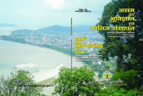
GSI Misc. Pub. 30 Pt. 4 Vol. 2(i)<br />
PGSI. 307<br />
700-2009 (DSK-II)<br />
GEOLOGY<br />
AND<br />
MINERAL RESOURCES<br />
OF<br />
ASSAM<br />
GEOLOGICAL SURVEY OF INDIA<br />
Miscelleaneous Publication<br />
No. 30 Part IV Vol 2(i) <strong>Assam</strong><br />
150<br />
YEARS<br />
in the service of the nation<br />
Published by the order of the Government of <strong>India</strong><br />
2009
GSI Misc. Pub. 30 Pt. 4 Vol. 2(i)<br />
Copy right © <strong>India</strong>, Geological Survey, 2009<br />
First Edition : 2009<br />
Second Reprint s: March, 2011<br />
Manuscript processed for printing by:<br />
G. K. KESARI<br />
Geologist (Sr)<br />
under the guidance of :<br />
G. DAS GUPTA B. V. R. REDDY DR. H.S.M. PRAKASH<br />
Director Director AND Director<br />
Publication Division Publication Division Publication Division<br />
Overall supervision by:<br />
B.K. Mohanty Sudipta Lahiri U.K.Behara<br />
Ex-Dy. Director General Dy. Director General AND Director In-Charge<br />
Geological Survey of <strong>India</strong><br />
NORTH EASTERN REGION<br />
Shillong- 793 003<br />
Printed at<br />
ESSAR OFFSET<br />
Janapath Lane, G.S. Road, Ulubari, Guwahati-781007, Mobile : +91-9435106080<br />
Price:<br />
Inl<strong>and</strong> : Rs. 84/-<br />
Foreign : £ 3.31 or $ 4.61
GSI Misc. Pub. 30 Pt. 4 Vol. 2(i)<br />
FOREWORD<br />
The Miscellaneous Publication 30 Series of the Geological Survey of <strong>India</strong><br />
brings out concise information on the geology <strong>and</strong> mineral resources of the states of<br />
<strong>India</strong>. The present volume Part IV, Vol. 2(i) of the series, pertaining to the state of<br />
<strong>Assam</strong>, is a revised <strong>and</strong> updated version of the first edition published in 1974. During<br />
the span of three decades since the first edition was published, enormous knowledge<br />
has been added in the sphere of geology of the area, hence warranting publication<br />
of a revised edition. The Geological <strong>and</strong> <strong>Mineral</strong> Map presented in this volume is<br />
based on the 1:2 million scale geological map of North-East <strong>India</strong> published in 1998.<br />
Geological Survey of <strong>India</strong> continues its untiring work in different realms<br />
of earth sciences – a committed goal of ‘digging the past to light the future’.<br />
DOVEMAP studies in <strong>Assam</strong> were taken up for development of village economy<br />
through mineral appraisal Programme <strong>and</strong> to bring both the scientific knowledge<br />
regarding l<strong>and</strong>, mineral <strong>and</strong> water resources as well as environment at the basic level<br />
of social set up. There was a need for revision in the lithostratigraphy of the state in<br />
the light of the data available through the recent works both in the field <strong>and</strong> in the<br />
laboratory.<br />
Some new mineral occurrences have been located in the state through<br />
geological <strong>and</strong> exploration programme. The occurrences of coal from two geological<br />
horizons viz. Gondwana <strong>and</strong> Tertiary of which Tertiary coal deposits of Makum,<br />
Mikir Hills <strong>and</strong> Dilli-Jeypore are the most noteworthy amongst them.<br />
This publication will update the knowledge-base on the geology <strong>and</strong> mineral<br />
resources of the state of <strong>Assam</strong> <strong>and</strong> will be of great use to the professionals, students<br />
of geology <strong>and</strong> entrepreneurs alike. Thus it will help in boosting the economy of the<br />
region.<br />
PLACE : Kolkata<br />
November, 2009<br />
(N. K. DUTTA)<br />
Director General<br />
Geological Survey of <strong>India</strong>
GSI Misc. Pub. 30 Pt. 4 Vol. 2(i)<br />
“With their four-dimensional minds, <strong>and</strong> in their inter disciplinary ultraverbal<br />
way, geologists can wiggle out of almost anything.”<br />
– John McPhee
GSI Misc. Pub. 30 Pt. 4 Vol. 2(i)<br />
CONTENTS<br />
GSI Misc. Pub. 30 Pt. 4 Vol. 2(i)<br />
1. INTRODUCTION .................................................................................................................... 1<br />
(I) CLIMATE ........................................................................................................................................... 2<br />
(ii) FAUNA, FLORA AND CULTIVATION .............................................................................................. 2<br />
(iii) NATURAL RESOURCES ................................................................................................................... 2<br />
(iv) PHYSIOGRAPHY AND DRAINAGE ................................................................................................ 2<br />
(v) PREVIOUS WORK ............................................................................................................................. 4<br />
(vi) ACKNOWLEDGEMENTS ................................................................................................................. 6<br />
II. GENERAL GEOLOGY AND STRATIGRAPHY ...........................................................................7<br />
(A) GNEISSIC COMPLEX ...................................................................................................................... 10<br />
(B) SHILLONG GROUP ......................................................................................................................... 10<br />
(C) GRANITE PLUTONS ....................................................................................................................... 11<br />
(D) LOWER GONDWANA GROUP ....................................................................................................... 11<br />
(E) ALKALI COMPLEX OF SAMCHAMPI ........................................................................................... 11<br />
(F) SYLHET TRAP ................................................................................................................................. 12<br />
(G) JAINTIA GROUP ............................................................................................................................. 12<br />
(H) DISANG GROUP ............................................................................................................................. 13<br />
(I) BARAIL GROUP .............................................................................................................................. 14<br />
(J) SURMA GROUP .............................................................................................................................. 15<br />
(K) TIPAM GROUP ................................................................................................................................ 16<br />
(L) DUPI TILLA GROUP ....................................................................................................................... 17<br />
(M) DIHING GROUP .............................................................................................................................. 18<br />
(N) QUARTERNARY SEDIMENTS ........................................................................................................ 18<br />
III. STRUCTURE AND TECTONICS .............................................................................................. 20<br />
IV. GEOLOGICAL HISTORY ....................................................................................................... 22<br />
V : DEVELOPMENT OF VILLAGE ECONOMY THROUGH MINERAL ............................................. 23<br />
APPRAISAL PROGRAMME (DOVEMAP)<br />
VI. MINERAL RESOURCES ......................................................................................................... 24<br />
(i) OIL AND NATURAL GAS ............................................................................................................... 24<br />
(ii) COAL ............................................................................................................................................... 24<br />
(iii) LIMESTONE .................................................................................................................................... 27<br />
(iv) BASE METAL ................................................................................................................................... 28<br />
Page<br />
Contd.
GSI Misc. Pub. 30 Pt. 4 Vol. 2(i)<br />
(v) BERYL .............................................................................................................................................. 28<br />
(vi) BUILDING STONE .......................................................................................................................... 28<br />
(vii) CLAY ................................................................................................................................................ 29<br />
(viii) FELDSPAR ....................................................................................................................................... 29<br />
(ix) GOLD ............................................................................................................................................... 30<br />
(x) GYPSUM .......................................................................................................................................... 30<br />
(xi) IRON ................................................................................................................................................ 30<br />
(xii) MICA ................................................................................................................................................ 30<br />
(xiii) HOT SPRINGS ................................................................................................................................. 30<br />
(xiv) PYRITE ............................................................................................................................................ 31<br />
(xv) RADIOACTIVE MINERALS ............................................................................................................ 31<br />
(xvi) SALT ................................................................................................................................................ 31<br />
(xvii) SILLIMANITE .................................................................................................................................. 31<br />
LOCALITY INDEX ................................................................................................................ 32<br />
REFERENCE ........................................................................................................................ 35
GSI Misc. Pub. 30 Pt. 4 Vol. 2(i)<br />
The Geological Survey of <strong>India</strong> published the first<br />
Misc. Pub. No. 30, Pt. IV in 1974 elucidating the geology<br />
<strong>and</strong> mineral resources of all the seven states of North<br />
Eastern Region in one volume. Since its publication quantum<br />
progress in the field of geological mapping, mineral<br />
investigations, structure <strong>and</strong> tectonics of the region has<br />
been achieved out by officers of GSI <strong>and</strong> to some extent<br />
by earth scientists of other institutions. This has resulted<br />
in better underst<strong>and</strong>ing of the geology of North Eastern<br />
<strong>India</strong>, its natural resources <strong>and</strong> arrive at a modified<br />
stratigraphic set up of the North Eastern <strong>India</strong>. Large volume<br />
of geological data has been generated in the North<br />
Eastern Region over the past three decades, in view of<br />
this, the Misc. Pub. No. 30, Pt. 4,Vol. 2 (Part-1) is exclusively<br />
dedicated to the geology <strong>and</strong> mineral resources of<br />
<strong>Assam</strong>. The <strong>State</strong> of <strong>Assam</strong>, covering an area of 78,523<br />
sq. km, is the gateway to other six sister states of the<br />
North Eastern Region.<br />
Capital City Dispur<br />
<strong>Geology</strong> <strong>and</strong> <strong>Mineral</strong> Resources of <strong>Assam</strong><br />
Table 1: Basic Statistics of <strong>Assam</strong><br />
Introduction<br />
The state can be broadly divided into the following<br />
physiographic domains :-<br />
a) Brahmaputra valley - The vast alluvial plains of<br />
Brahmaputra valley occupy most of the North <strong>Assam</strong> covering<br />
Goalpara, Kokrajhar, Dhubri, Kamrup, Nalbari,<br />
Barpeta, Nagaon, Darrang, Sonitpur, Sibsagar, Jorhat,<br />
Golaghat, Lakhimpur <strong>and</strong> Dibrugarh districts. The<br />
Brahmaputra valley is bounded by Arunachal Himalaya<br />
in the north <strong>and</strong> northeast, Patkai – Naga - Lushai range<br />
of Nagal<strong>and</strong> <strong>and</strong> the Shillong Plateau in the south <strong>and</strong><br />
southeast.<br />
b) Central <strong>Assam</strong> Hills -The Central <strong>Assam</strong> which<br />
essentially is a hilly terrain comprised of Mikir Hill in<br />
Karbi Anglong <strong>and</strong> North Cachar Hill districts.<br />
c) Barak valley - The hilly <strong>and</strong> alluvial terrain in<br />
the south covering the Cachar <strong>and</strong> Karimganj districts in<br />
the Barak (Surma) valley.<br />
Population 26,655,528 Forest cover 26,060 sq. km<br />
Area 78,523 sq. km Road length 68,913 km<br />
Population Density 286 persons/sq. km Total Hard rock area 21,585 sq. km<br />
Villages 22,000 nos. Quaternary area 51247 sq. km<br />
Literacy 63.3% Hard rock mapping coverage * 23,625 sq. km<br />
Total no. of districts 23 Quaternary mapping coverage * 49,867 sq. km<br />
Major <strong>Mineral</strong>s Coal, Limestone, clay <strong>and</strong> Oil & Natural Gas<br />
Minor <strong>Mineral</strong>s Base metals, Bauxite, Phosphate, Glass s<strong>and</strong>, Iron ore, Beryl, Feldspar, Mica, Platinoids,<br />
Rare earths, Gold, Construction materials <strong>and</strong> Refractory minerals.<br />
* Revised upto 2007-2008.
2 GEOLOGICAL SURVEY OF INDIA<br />
GSI Misc. Pub. 30 Pt. 4 Vol. 2(i)<br />
The Brahmaputra valley with an average elevation<br />
from 50 to 120 m above m.s.l. represents an unique l<strong>and</strong>scape<br />
comprising of a 800 km long <strong>and</strong> 130 km wide valley<br />
delimited by the low-lying valley to its south <strong>and</strong> the<br />
Mikir hills <strong>and</strong> Barail range comprising the North Cachar<br />
hills in the central part.<br />
(i) CLIMATE :<br />
<strong>Assam</strong> experiences the predominant influence of the<br />
southwest tropical monsoon which is normally active<br />
from April to October with occasional winter showers.<br />
The approach of the monsoon is usually marked by strong<br />
winds, overcast skies accompanied by occasional thunder<br />
showers, hailstorms <strong>and</strong> at times by cyclones between<br />
April <strong>and</strong> May. Heavy downpour starts from June. The<br />
annual average rainfall of the state varies between 160 cm<br />
<strong>and</strong> 430 cm from place to place. The average rainfall for<br />
the state as a whole is about 290 cm with maximum precipitation<br />
during June <strong>and</strong> July. The average temperature<br />
in the state varies from 4°C to 19°C during the winter <strong>and</strong><br />
26°C to 37°C during the summer accompanied by high<br />
humidity.<br />
(ii) FLORA, FAUNA AND CULTIVATION:<br />
The diverse l<strong>and</strong>scape of the state has a variety of<br />
mixed dense forests which include numerous varieties of<br />
trees, bamboos, cane groves, tall grasses, herbaceous <strong>and</strong><br />
shrubby vegetations. In the state different varieties of deciduous<br />
<strong>and</strong> evergreen timber producing trees flourish like<br />
Sal (Shorea robusta), Makai (Shorea assamica), Nageshwara<br />
(Mesut ferrea), Tiachapa (Micheelia champaka), Sonaru<br />
(Classia fistula), Gunsarai (Chinamonum gl<strong>and</strong>uliferum), Ajhar<br />
(Lager straemiaflos regina), Agar (Aquilaria agalocha), Hollock<br />
(Terminalia bicolorata), Hollong (Diptercarpus bondii), Simul<br />
(Bombak malabaricum), Khair (Accacia cateshu), etc. The forests<br />
also shelter various types of parasites, epiphytes <strong>and</strong><br />
orchids.<br />
The most important amongst the fauna in <strong>Assam</strong> is<br />
the single horned <strong>India</strong>n Rhino (Rhinoceros unicornis). Besides<br />
this, the forests in the state provides habitat for a variety<br />
of other animals such as wild elephant, wild buffalo,<br />
wild pig, gaur, bison, chital, sambar, swamp deer, hog<br />
deer, barking deer, tiger, bear, wild cat, wild dog, hare,<br />
panther, <strong>and</strong> monkey. Amongst birds, wild geese, teal,<br />
black <strong>and</strong> marsh partridge, wild fowl, pea fowl, wood<br />
cock, snipe <strong>and</strong> varieties of peasant are found. The pelican<br />
<strong>and</strong> adjutant storks are also seen in the Kaziranga<br />
wild life sanctuary, which has been recently declared as a<br />
National Park. The other wild life sanctuary at Manas is<br />
at the foothills of Bhutan. It is famous for wild elephants,<br />
gaur, bison, <strong>and</strong> chital. Varieties of snakes including python,<br />
king cobra <strong>and</strong> vipers are abundant at places. In the<br />
rivers of the state variety of fishes <strong>and</strong> minor aquatic animals<br />
are found.<br />
The chief agricultural products of the state are<br />
varities of rice, tea, jute, mustard, pulses, sugarcane, potatoes,<br />
oranges, pineapples, coconut, betels, black pepper,<br />
citrus fruits, bananas besides many types of vegetables. In<br />
tea, <strong>Assam</strong> excels as a number one tea producing state in<br />
the country contributing to over half (215, 157, 000 Kg)<br />
of the total annual production of the country. From tea<br />
alone the state earns about 11 % of its revenue. The total<br />
annual production of rice in the state is about 2.02 million<br />
tons.<br />
(iii) NATURAL RESOURCES:<br />
The <strong>State</strong> of <strong>Assam</strong> was the only oil producing state<br />
in <strong>India</strong> till the oil fields of Gujarat <strong>and</strong> Bombay Highs<br />
were discovered. Along with oil there are also a modest<br />
reserves of natural gas in <strong>Assam</strong>. The state also has good<br />
reserves of coal in the Upper <strong>Assam</strong> coalfields (Makum<br />
& Dilli-Jeypore) <strong>and</strong> in Karbi-Anglong district. Apart<br />
from coal, limestone deposits occur in the Karbi-Anglong<br />
<strong>and</strong> North Cachar Hills districts. Other mineral found are<br />
clay, feldspar, mica, beryl, gypsum, iron ore, placer gold,<br />
pyrite, salt <strong>and</strong> sillimanite, which do not have known economic<br />
importance.<br />
(iv) PHYSIOGRAPHY AND DRAINAGE:<br />
The evolution of the modern day topographic <strong>and</strong><br />
physiographic architecture of <strong>Assam</strong>, leading to development<br />
of the mighty Brahmaputra Valley, the Central <strong>Assam</strong><br />
range comprising of the Mikir <strong>and</strong> North Cachar<br />
(Barail) hills <strong>and</strong> the Surma Valley extending south-westward<br />
into alluvial plains of Bangladesh are due to the effect<br />
of several complicated cycles of geological events of
MISC. PUB. 30 PT. 4 VOL. 2(i) 3<br />
GSI Misc. Pub. 30 Pt. 4 Vol. 2(i)<br />
the North East <strong>India</strong> which are discussed separately in the<br />
forthcoming chapters on structure, tectonics <strong>and</strong> geological<br />
history.<br />
The Brahmaputra Valley of <strong>Assam</strong> is the eastern<br />
continuity of the Indo-Gangetic trough of North <strong>India</strong>.<br />
While, the peninsular rock masses are represented in the<br />
Mikir Hills of Karbi Anglong district of <strong>Assam</strong> is an extension<br />
from the Meghalaya Plateau.<br />
The Karbi (Mikir) Hills with an average elevation of<br />
1,000 m (m.s.l) represent a peneplained surface of metamorphosed<br />
rocks with sedimentary cover rock of s<strong>and</strong>stone,<br />
clay-shales <strong>and</strong> limestone along its southern <strong>and</strong><br />
eastern margins. The Barail Range of North Cachar Hills<br />
comprising of post Oligocene sedimentary rocks merges<br />
with Mikir Hills to the north <strong>and</strong> further extends into the<br />
Naga Hills towards southeast. The Barail Range with an<br />
average elevation ranging between 1300 <strong>and</strong> 1650 m defines<br />
the main watershed between Brahmaputra <strong>and</strong><br />
Surma basin. The regional trend of central <strong>Assam</strong> range<br />
is ENE-WSW which towards the east is NE-SW.<br />
The Brahmaputra <strong>and</strong> the Surma (or Barak) are the<br />
two major river systems of the <strong>State</strong>. The Brahmaputra<br />
River originates at an elevation of about 5,000 m above<br />
(m.s.l.) in Tibet. The Bhramaputra River, known as Tsang<br />
Po in Tibet, after a long eastward course of 1,600 km<br />
abruptly veers towards south around Namcha Barwa peak<br />
(7,710 m) in Eastern Himalaya. This southward course<br />
of the river flowing through Arunachal Pradesh is known<br />
as Siang River. It passes through tortuous course across<br />
the mountains of Arunachal Pradesh <strong>and</strong> then emerges<br />
on to the plains of <strong>Assam</strong>, where downstream it is met<br />
by the Dihang, which is known as the largest tributary of<br />
the Brahmaputra, further fed by tributaries like Dibong,<br />
Sessiri, Lohit <strong>and</strong> Noa-Dihing around Saikhowaghat. The<br />
river known as Brahmaputra in <strong>Assam</strong> initially flows<br />
south-westward <strong>and</strong> thereafter towards west in the<br />
Brahmaputra Valley. Further down streams, the river<br />
swings towards south <strong>and</strong> passes on to the plains of Bangladesh.<br />
The Brahmaputra River between Namcha Barwa<br />
<strong>and</strong> the confluence with Dihang descend by about 2,200<br />
m <strong>and</strong> its water power resources have been estimated to<br />
be the third biggest in the world coming after Congo <strong>and</strong><br />
Amazon basins. Along the northern bank, the<br />
Brahmaputra River is joined by the tributaries like<br />
Subansiri, Ranga Nadi, Dikrong, Gabharu, North<br />
Dhansiri, Pagladiya, Manas, Aie, Beki, Champamati,<br />
Gangadhar, <strong>and</strong> Raidak. All these tributaries more or less<br />
flow in straight courses up to the junction of the main<br />
river. On the south bank tributaries like Benhi-Dihing,<br />
Disang, Dikhau, <strong>and</strong> South Dhansiri originate from Naga-<br />
Patkai Hills. The Kopili River originates from North<br />
Cachar Hills, while the Digaru, Bharalu, Kulsi, Singra,<br />
Dudnai <strong>and</strong> Krisnai originate from Meghalaya Plateau.<br />
Some of the rivers <strong>and</strong> tributaries originating from the<br />
south flow for quite a distance almost parallel to the<br />
Brahmaputra River before joining the main river.<br />
In the Surma Valley, the Surma River originates in<br />
the North Cachar Hills. The Barak River is an important<br />
tributary of Surma which rises in the North Manipur. This<br />
river after flowing west through Cachar district meets the<br />
Kushiara River <strong>and</strong> then unites with the Surma, further<br />
downstream in Bangladesh known as Meghna River. The<br />
Surma River is fed by numerous small tributaries originating<br />
from the Meghalaya plateau <strong>and</strong> North Cachar<br />
Hills.<br />
The Brahmaputra Valley is mainly a Quaternary fill<br />
valley with a few isolated sedimentary residual hills in Upper<br />
<strong>Assam</strong> <strong>and</strong> inselbergs <strong>and</strong> hills of gneissic rocks in<br />
the Darrang, Kamrup, <strong>and</strong> Goalpara districts. The drainage<br />
pattern in the valley apparently seems to be of antecedent<br />
type. The often changing me<strong>and</strong>ering course of<br />
the Brahmaputra <strong>and</strong> its tributaries are not only due to<br />
lateral erosion because of the low gradient of the rivers<br />
but also due to periodic, local <strong>and</strong> sudden changes in the<br />
basement levels due to the netotectonic activitiy.<br />
The Surma River Valley is situated in a triangular<br />
area between the Meghalaya in the northwest, the North<br />
Cachar <strong>and</strong> Manipur Hills in the east <strong>and</strong> Mizoram <strong>and</strong><br />
Tripura Hills to the south. The valley is low-lying with<br />
swamps <strong>and</strong> perfectly levelled alluvial flats (barring the<br />
low hillocks in the Cachar <strong>and</strong> Karimganj districts)<br />
stretching upto the base of steep rocky escarpment of<br />
Shillong Plateau. The Surma River <strong>and</strong> its tributaries over<br />
short distances only have steep gradients soon loosing all
4 GEOLOGICAL SURVEY OF INDIA<br />
GSI Misc. Pub. 30 Pt. 4 Vol. 2(i)<br />
the perceptible falls <strong>and</strong> thereafter become tortuous, anastomosing<br />
water channels.<br />
Trellis to sub-trellis drainage pattern is present in the<br />
Mikir Hills. Here the straight stream courses mainly follow<br />
the joint pattern of the country rock.<br />
(iv) PREVIOUS WORK:<br />
(a) Systematic Hard Rock Geological Mapping:<br />
The pioneering work in the field of geology was<br />
done by H.B. Medlicott (1865) <strong>and</strong> Mallet (1876) whose<br />
valuable reports on geological mapping of Upper <strong>Assam</strong><br />
coal belts were published in G.S.I. Memoirs. Subsequent<br />
significant geological contribution was made by the premier<br />
<strong>Assam</strong> Oil Company established in 1912 at Digboi<br />
in Upper <strong>Assam</strong>. Extensive prospecting for oil was carried<br />
out by this company during that period. Evans (1932)<br />
of <strong>Assam</strong> Oil Company recorded a detailed account of<br />
stratigraphy <strong>and</strong> structure of the Tertiary sediments of<br />
<strong>Assam</strong>.<br />
The Geological Survey of <strong>India</strong> during the pre <strong>and</strong><br />
post Independence era has been subsequently carrying out<br />
geological investigations <strong>and</strong> appraisals of mineral occurrence<br />
in different parts of <strong>Assam</strong>.<br />
The earliest geological mapping in the hard rock terrain<br />
of Mikir Hills (Karbi Anglong district) was carried<br />
out by F.H. Smith (1896) <strong>and</strong> later followed up by V.R.R.<br />
Khedkar (1938-39) <strong>and</strong> D.R. Ch<strong>and</strong>ra (1947-48). Geological<br />
mapping of part of North Cachar Hills was carried<br />
out by P.N. Mukherji (1939-40) <strong>and</strong> S.N. Sen (1953-54).<br />
After Mallet (1876), geological mapping <strong>and</strong><br />
traverses in parts of Upper <strong>Assam</strong> were followed up by<br />
T.H.D. La Touche (1886), J.M. Maclaren (1904), J.C.<br />
Brown (1912), E.H. Pascoe (1912), Murray Stuart (1923),<br />
T.Benerji (1951) <strong>and</strong> A.C. Goswami (1959-60 <strong>and</strong> 1960-<br />
61). Laskar (1953-54), S.D. Banerji (1955-56), A.C.<br />
Goswami <strong>and</strong> V.K. Raina (1956-57), M.B. P<strong>and</strong>e <strong>and</strong> S.<br />
Banerji (1959-60) <strong>and</strong> G.N. Dutta (1960-61) carried out<br />
study of the Archaean rocks in parts Kamrup <strong>and</strong> Nagaon<br />
districts.<br />
Detailed programmes of systematic mapping in different<br />
parts of the state have subsequently followed up by<br />
GSI during the post independence. Systematic mapping<br />
in parts of Mikir Hills was carried out by M.B. Pawde,<br />
S.K. Banerjee, M.M. Munshi, B.K. Duara, B.D. Adhikari,<br />
A.C. Bhattacharya, G. Barman, K.K. Sen, R.N.<br />
Mukhopadhya, Ashim Dutta, A.R. Nambiar, P.K.<br />
Muralidharan, G.K. Pancholi, Des Raj <strong>and</strong> K.<br />
Chadrashekhar during field seasons from 1959-60 to 1978-<br />
79 <strong>and</strong> A.K. Buragohain, J.C.Dutta, V.N. Bajpai, Y.<br />
Kumar, D.P.Das <strong>and</strong> H.S. Shrivastava during 1982-83 <strong>and</strong><br />
1983-84 field season. Parts of North Cachar Hills was<br />
mapped by B. Dayal, P.C. Raj, B.D.Adhikari, S.K.<br />
Srivastava, R.N. Patnaik, R. B<strong>and</strong>opadhyay, Y. Kumar<br />
<strong>and</strong> J.C. Dutta during 1964-65, 1968-69, 1972-73, 1974-<br />
75, 1975-76 <strong>and</strong> 1981-82 field seasons. Systematic mapping<br />
in parts of Cachar district was carried out by<br />
B.Dayal, P.C. Raj, S.K. Shrivastava, Ashim Datta, S.D.<br />
Mohanty, S.C. Sharma, G.K. Pancholi, S.N. Mitra, A.K.<br />
Roychoudhuri, J.K. Sinha, A.K. Buragohain <strong>and</strong> D.P. Das<br />
during 1963-64, 1971-72, 1973-74, 1974-75, 1975-76,<br />
1976-77, 1980-81 <strong>and</strong> 1981-82 field seasons. The Kopili<br />
reservoir area was mapped partly by M.G. Rao, J.P. Dias,<br />
C. Chakrabarti, S.K. Shrivastava, <strong>and</strong> S. Chopra during<br />
1963-64, 1965-66 1972-73 <strong>and</strong> 1974-75 field seasons.<br />
D.N. B<strong>and</strong>opadhyay (1976-77) mapped the area around<br />
Jagi Road in Kamrup <strong>and</strong> Nagaon districts.<br />
(b) Quaternary Geological Studies:<br />
The Quaternary terrain of Goalpara <strong>and</strong> part of<br />
Kamrup districts were mapped initially by M.G. Rao during<br />
field seasons 1961-62 to 1966-67 <strong>and</strong> that in parts of<br />
Kamrup <strong>and</strong> Darrang districts by S.N. Sar, S. Basu<br />
Chowdhury, <strong>and</strong> B.K. Duara during 1965-66. An integrated<br />
study of Manas, Pagladiya, Jia Bhareli, <strong>and</strong><br />
Subansiri Basins for the purpose of Brahmaputra Flood<br />
Control Commission during 1970-72 was conducted by<br />
B.C.Poddar, T.V.Viswanathan, S.K.Mazumdar,<br />
C.Chakrabarty, A.C. Paul, B.K. Duara <strong>and</strong> others. Work<br />
on similar lines was extended to cover more Quaternary<br />
areas of <strong>Assam</strong> including Lower <strong>and</strong> Upper Brahmaputra<br />
Valley between the period 1975-80 by a number of workers<br />
including B.C.Poddar, A.B. Goswami, C. Chakrabarti,<br />
P. Chakrabarti, B.K. Duara, K.K. Sinha, S.N. Banerjee,<br />
R.K. Sinha, A.U. Khan, S.K. Kar, S.K. B<strong>and</strong>opadhya,<br />
N.R. Ramesh <strong>and</strong> R.N. Verma.
MISC. PUB. 30 PT. 4 VOL. 2(i) 5<br />
GSI Misc. Pub. 30 Pt. 4 Vol. 2(i)<br />
(c) <strong>Mineral</strong> Investigation:<br />
I. Coal: The existence of coal in the Upper <strong>Assam</strong> was<br />
known to the Britishers as early as in 1825, however nothing<br />
was done for its exploration till H.B. Medlicott visited<br />
the most inaccessible hilly terrain across Dihing river<br />
in Upper <strong>Assam</strong> in 1865. His investigation not only<br />
brought to light the superior quality <strong>and</strong> large reserves of<br />
coal deposits, but also indicated possibility of petroleum<br />
reserves in the region. On his recommendation the collieries<br />
in the Margherita area, Upper <strong>Assam</strong> came up during<br />
1889. Subsequent investigations in the area were followed<br />
up by F.R. Mallet (1876), R.R. Simpson (1906),<br />
H.H. Hayden (1910), E.H. Pascoe (1911), B.Laskar<br />
(1950), A.M.N.Ghosh (1950) <strong>and</strong> T. Banerji (1951). Systematic<br />
mapping of the adjacent Makum coalfield area<br />
in Upper <strong>Assam</strong> was carried out by A.C. Goswami in<br />
1959-60 <strong>and</strong> 1960-61 field seasons. Large scale mapping<br />
of Makum coalfields in Upper <strong>Assam</strong> was carried out by<br />
A.C. Goswami <strong>and</strong> A.N. Trivedi during 1961-62 <strong>and</strong><br />
1962-63 field seasons. Seam-wise estimation of reserves<br />
of coal in part of Makum coal field was done by A.C.<br />
Goswami, P.C. Raj <strong>and</strong> P.Majumdar during 1964-65 <strong>and</strong><br />
1965-66 field seasons. The investigation was further followed<br />
up by N.Venkatappaiyya, A.K.Majumdar, A.K.<br />
Chowdhury <strong>and</strong> V.D.Puri of the Coal Division, G.S.I.<br />
during 1966-67 field seasons. Large scale mapping of<br />
Dilli- Jeypore colliery was completed by J.P. Dias, R.N.<br />
Sinha Roy <strong>and</strong> B.D. Adhikari during 1963-64 <strong>and</strong> further<br />
investigation was carried out by A.K. Chowdhury, V.D.<br />
Puri <strong>and</strong> others during 1967-68.<br />
Coal occurrence of Mikir Hills was examined by<br />
A.M.N. Ghosh in 1950s <strong>and</strong> V.K. Raina <strong>and</strong> M.M.<br />
Munshi in 1958-59. Further investigations of the coal<br />
fields in Mikir Hills were carried out by M.M. Munshi<br />
(1962) <strong>and</strong> M.D. Limaye (1966-67). Coal <strong>and</strong> limestone<br />
occurrences along the eastern flank of Mikir Hills were<br />
examined first by La Touche (1886) followed by M.D.<br />
Limaye (1966-67). Limaye (1966-67) examined a reported<br />
occurrence of coal in Jiribum in <strong>Assam</strong>-Manipur border.<br />
Occurrence of coal in Bhutan foothills along Kamrup border<br />
was investigated by G.E. Pilgrim in 1906. A.C.<br />
Goswami further visited the area in 1965 for an alleged<br />
occurrence of coal <strong>and</strong> alum shale.<br />
II. Petroleum : The earliest reference of oil find in <strong>Assam</strong><br />
was by Medlicott (1865). Since then many attempts<br />
were made by different oil companies in different parts<br />
of the belt between Makum Pathar <strong>and</strong> Jeypore, till accidental<br />
discovery of the Digboi oil field during Dibrugarh-<br />
Ledo Railway Link construction in 1889. The details of<br />
petroleum occurrences in <strong>Assam</strong> were recorded by Pascoe<br />
(1914). Since the establishment of the <strong>Assam</strong> Oil Company<br />
at Digboi during 1912, prospecting for oil in the area<br />
was carried out by the geologists of the company. Some<br />
reported occurrences of oil seepages in Kamrup district<br />
in Hathikhali in North Cachar district were examined by<br />
T. Banerjee (1950) <strong>and</strong> B. Laskar (1953). Since 1956 onwards,<br />
oil prospecting in the region has been carried out<br />
by the Oil <strong>and</strong> Natural Gas Corporation (ONGC) <strong>and</strong> Oil<br />
<strong>India</strong> Limited (OIL).<br />
III. Limestone : Reference on the limestone in the Mikir<br />
Hills was first made by Medlicott in 1869 <strong>and</strong> subsequently<br />
by La Touche (1886). A detailed investigation on<br />
Mikir Hills limestone deposits was carried out by D.K.<br />
Ch<strong>and</strong>ra in 1949. Munshi <strong>and</strong> Raina (1958-59), A.C.<br />
Bhattacharya, G. Barman <strong>and</strong> M. D. Limaye (1966-67)<br />
further examined the deposits in different parts of the<br />
area. The limestone deposit in parts of Garampani<br />
(Kopili) area of the North Cachar Hills was investigated<br />
in detail by K. Gopalakrishnan (1962-63).<br />
R.N. Patnaik <strong>and</strong> R. B<strong>and</strong>opadhyay carried out large<br />
scale mapping of limestone exposed on the Garampani-<br />
Lanka road during 1974-75 <strong>and</strong> 1975-76 field seasons.<br />
The Directorate of <strong>Geology</strong> <strong>and</strong> Mining, Govt.of <strong>Assam</strong><br />
prospected for cement grade limestone in Timbung Basti<br />
(Garampani) in 1978-79.<br />
IV. Iron ore: Occurences of weathered deposit of magnetite-hematite-quartzite<br />
b<strong>and</strong>s in gneissic hills in<br />
Goalpara district were investigated by M.G. Rao (1961-<br />
62, 1962-63 <strong>and</strong> 1966-67). A.C. Goswami examined alleged<br />
occurrences of iron ore in Kamrup district in 1969-<br />
70. The D.G.M. <strong>Assam</strong> investigated the iron ore occurrences<br />
at Lengupara <strong>and</strong> Kumri areas, Goalpara district,<br />
in 1972-73.<br />
V. Phosphate: B.D. Adhikari examined the Kopili<br />
shales in the Garampani (Kopili) area for possible occur-
6 GEOLOGICAL SURVEY OF INDIA<br />
GSI Misc. Pub. 30 Pt. 4 Vol. 2(i)<br />
rences of phosphatic nodules at the base of the formation<br />
during 1968-69.<br />
VI. Lepidolite: Investigation of lepidolite bearing mica<br />
near Dhir bil in Goalpara district was investigated by K.<br />
Gogoi in 1969-70.<br />
VII. Gypsum: In the Badarpur area alleged occurrences<br />
of gypsum in Cachar district <strong>and</strong> Mahur area in North<br />
Cachar Hills were examined by A.C. Goswami in 1959-<br />
60.<br />
VIII. Pyrite: B.Laskar (1954) examined reported occurrence<br />
of disseminated pyrite near Chatachura in the<br />
Cachar district. The D.G.M. <strong>Assam</strong>, conducted investigations<br />
for pyrite at Purna Mengaon area, Karbi Anglong<br />
District in 1977-78.<br />
IX. Beryl: <strong>Report</strong>ed occurrences of beryl at places in the<br />
north eastern part of Mikir Hills were investigated by A.C.<br />
Goswami in 1958.<br />
X. Precious Metals: Mallet (1882) examined a minor<br />
flake of iridosmine placer in the Noa-Dihing river. Occurrence<br />
of gold placers in some rivers of the Upper <strong>Assam</strong><br />
rivers were examined in detail by J.M. Maclaren in<br />
1904. The D.G.M. <strong>Assam</strong> carried out investigation for<br />
placer gold in the Subansiri river valley during 1971-74.<br />
(v): ACKNOWLEDGEMENTS<br />
The Director General, Geological Survey of <strong>India</strong>,<br />
conceived of the project on the write up on geology of<br />
the different states of <strong>India</strong> <strong>and</strong> this work in North Eastern<br />
Region comprises a part of the larger, all <strong>India</strong> project<br />
of Geological Survey of <strong>India</strong>.<br />
The present compilation on <strong>Geology</strong> <strong>and</strong> <strong>Mineral</strong><br />
resources of North Eastern Region under the Misc. Pub-<br />
<br />
lication 30 is an endeavour as per the broder framework<br />
of comprehensive write up of the <strong>Geology</strong> <strong>and</strong> <strong>Mineral</strong><br />
resources of the <strong>State</strong>s of <strong>India</strong> as formulated by the Central<br />
Headquarters of GSI.<br />
The co-ordinated efforts of the Deputy Directors<br />
General, Geological Survey of <strong>India</strong>, NER, Shillong <strong>and</strong><br />
supervisory officers at Shillong facilitated availability of<br />
manuscripts of the state for this present compilation.<br />
The material has been updated after critical reviews<br />
by the Publication Division CHQ, GSI, Kolkata. An overall<br />
co-ordination from Central Headquarters was needed<br />
to orient the objective of this publication as per the guidelines<br />
set by CHQ.<br />
Various Divisions of Geological Survey of <strong>India</strong>,<br />
Northeastern Region have provided the draft material<br />
which has been compiled, recast as per the prescribed format<br />
of this publication. Since the work for this volume<br />
started some years before the actual publication, some of<br />
the manuscripts were irretrievable <strong>and</strong> portions had to be<br />
rewritten. This would not have been possible without the<br />
background information on the data sources provided by<br />
the various Divisions/Projects. Coal Wing, Geological<br />
Survey of <strong>India</strong> provided the material pertaining to coal<br />
which has been incorporated.<br />
Dr. U.K.Mishra <strong>and</strong> Dr. V.V.Sesha Sai, Geologists<br />
(Sr.), GSI NER, Shillong is thankfully acknowledged for<br />
scrutinising <strong>and</strong> attended to the modification <strong>and</strong> corrections<br />
in the manuscript. The support provided by Miss<br />
Lamonsie Laitflong, Smt. Aradhana Saikia, <strong>and</strong> Smt.<br />
Dorothy L. Fanai, Library Information Assistant’s of the<br />
Publication Division, GSI, NER, was very important in<br />
composing, editing, <strong>and</strong> for retrieval of material, as available,<br />
for authentication of details, as necessary.
GSI Misc. Pub. 30 Pt. 4 Vol. 2(i)<br />
The <strong>State</strong> of <strong>Assam</strong> is occupied by rocks belonging<br />
to, (a) Proterozoic Gneissic Complex, (b) Shillong Group<br />
of Meso-Palaeo Proterozoic age, (c ) Granite Plutons of<br />
Neo-Proterozoic-Lower Palaeozoic age, (d) Lower<br />
Gondwana sedimentary rocks of Permo-carboniferous<br />
age (e) Alkali Complexes of Samchampi, Borpung <strong>and</strong><br />
volcanic rocks represented by Sylhet Trap of Cretaceous<br />
age, (f) Lower Tertiary (Paleocene-Eocene) shelf<br />
sediments of the Jaintia Group extending along the southern<br />
<strong>and</strong> eastern flanks of Mikir Hills <strong>and</strong> geosynclinal<br />
sediments of Disang Group in parts of the North Cachar<br />
Hills, (g) Upper Tertiary (Oligocene to Pliocene) shelf <strong>and</strong><br />
General <strong>Geology</strong> <strong>and</strong> Stratigraphy<br />
STRATIGRAPHIC SET UP (Table 2)<br />
geosynclinal sediments covering the southern flanks of<br />
Mikir Hills, the North Cachar Hills <strong>and</strong> the hills of the<br />
Cachar district in the Surma valley area. These rocks are<br />
also exposed along the northern foothills of Naga-Patkai<br />
range bordering the southern margin of Sibsagar, Jorhat<br />
<strong>and</strong> Dibrugrah districts. Along the southern foothills of<br />
Eastern Himalaya facing the northern border of <strong>Assam</strong><br />
a narrow strip of Siwalik rocks are exposed (h) the Quaternary<br />
deposits comprising of Older <strong>and</strong> Newer Alluvium<br />
occur in flood plains <strong>and</strong> terraces of the<br />
Brahmaputra valley, Surma valley <strong>and</strong> other river basins<br />
of <strong>Assam</strong>.<br />
Age Group Name Formation (Thickness) Lithology<br />
Holocene Unclassified Newer or Low Level Alluvium S<strong>and</strong>, silt <strong>and</strong> clay<br />
Middle to Upper Unclassified Older Alluvium S<strong>and</strong>, clay, pebble, gravel <strong>and</strong><br />
Pleistocene boulder deposit<br />
------------------------------------------------------------------ Unconformity/ Tectonic -------------------------------------------------------------------<br />
Pliocene- Pleistocene Siwalik Group Kimin Formation S<strong>and</strong>stone with clay stone<br />
Subansiri Micaceous s<strong>and</strong>stone<br />
Pliocene Dihing Group Dihing Formation (900m) Pebble beds, soft s<strong>and</strong>y clay,<br />
clay, conglomerates, grit <strong>and</strong><br />
s<strong>and</strong>stone<br />
-------------------------------------------------------------------------- Unconformity --------------------------------------------------------------------------<br />
S<strong>and</strong>stone, mottled clay, grit<br />
<strong>and</strong> conglomerate; locally with<br />
Dupitila Formation beds of coal, conglomerate<br />
(Surma Valley: 3300 m) <strong>and</strong> poorly consolidated<br />
Mio-Pliocene Dupitila Group s<strong>and</strong>stone with layers <strong>and</strong><br />
pockets of pebbles
8 GEOLOGICAL SURVEY OF INDIA<br />
GSI Misc. Pub. 30 Pt. 4 Vol. 2(i)<br />
Namsang Formation Coarse, gritty, poorly<br />
(Upper <strong>Assam</strong>: 800 m) consolidated s<strong>and</strong>stone <strong>and</strong><br />
conglomerate of coal pebbles<br />
-------------------------------------------------------------------------- Unconformity -------------------------------------------------------------------------<br />
Girujan Clay Formation Mottled clays, s<strong>and</strong>y shale <strong>and</strong><br />
(1800 m) subordinate mottled, coarse to<br />
gritty s<strong>and</strong>stone<br />
Mio-Pliocene Tipam Group Bluish grey to greenish, coarse<br />
Tipam S<strong>and</strong>stone to gritty, false bedded,<br />
Formation ferruginous s<strong>and</strong>stone, clays,<br />
(2300 m) shales <strong>and</strong> conglomerates<br />
-------------------------------------------------------------------------- Unconformity -------------------------------------------------------------------------<br />
shale, s<strong>and</strong>y Shale, siltstone,<br />
Bokabil Formation mudstone <strong>and</strong> lenticular,<br />
(900 to 1800 m) coarse ferruginous s<strong>and</strong>stone<br />
Miocene Surma Group Alternations of s<strong>and</strong>stone <strong>and</strong><br />
Bhuban Formation s<strong>and</strong>y shale <strong>and</strong> thin conglo-<br />
(1400 to 2400 m) merate, argillaceous in middle<br />
part<br />
-------------------------------------------------------------------------- Unconformity -------------------------------------------------------------------------<br />
Massive bedded s<strong>and</strong>stone; its<br />
equivalent - the Tikak Parbat<br />
Renji Formation Formation in the Upper <strong>Assam</strong><br />
(600 to 1000 m) is marked by thick coal seam in<br />
basal part<br />
Shale, s<strong>and</strong>y shale, <strong>and</strong><br />
carbonaceous shales with<br />
interbedded hard s<strong>and</strong>stone;<br />
Eocene- Barail Group Jenam Formation its equivalent the Bargolai<br />
Oligocene (1000 to 3300 m ) Formation in Upper <strong>Assam</strong><br />
is marked by thin coal seams<br />
Well bedded compact flaggy<br />
s<strong>and</strong>stone <strong>and</strong> subordinate<br />
shale; its equivalent- the<br />
Laisong Formation Nagaon Formation in Upper<br />
(2000 to 2500 m) <strong>Assam</strong> is marked by thin<br />
bedded, hard s<strong>and</strong>stone <strong>and</strong><br />
interbedded shale.
MISC. PUB. 30 PT. 4 VOL. 2(i) 9<br />
GSI Misc. Pub. 30 Pt. 4 Vol. 2(i)<br />
Disang Group Splintery dark grey shale <strong>and</strong><br />
thin s<strong>and</strong>stone<br />
Kopili Formation Shale, s<strong>and</strong>stone <strong>and</strong> marl.<br />
Sylhet Limestone (Fossiliferous<br />
Palaeocene-Eocene Limestone)<br />
Jaintia Group Shella Formation Sylhet s<strong>and</strong>stone S<strong>and</strong>stone,<br />
clay <strong>and</strong> thin coal seam<br />
Langpar Formation Calcareous shale, s<strong>and</strong>stone-<br />
(exposed in Meghalaya) limestone<br />
-------------------------------------------------------------------------- Unconformity --------------------------------------------------------------------------<br />
Cretaceous Alkali Complex Pyroxenite – Serpentinite with<br />
of Samchampi abundant development of<br />
melilite pyroxene rock, ijolite,<br />
syenite <strong>and</strong> carbonatite<br />
-------------------------------------------------------------------------- Unconformity --------------------------------------------------------------------------<br />
Cretaceous Sylhet Trap Basalt, alkali basalt, rhyolite,<br />
(exposed in Meghalaya) (600m) acid tuff<br />
-------------------------------------------------------------------------- Unconformity --------------------------------------------------------------------------<br />
Very coarse to coarse grained<br />
Kaharbari Formation s<strong>and</strong>stone with conglomerate<br />
Permo-carboniferous Lower lense, shale, carbonaceous<br />
Gondwana shale <strong>and</strong> coal<br />
Basal tillite, conglomerate with<br />
Talchir Formation s<strong>and</strong>stone b<strong>and</strong>s, siltstone <strong>and</strong><br />
shale<br />
-------------------------------------------------------------------------- Unconformity --------------------------------------------------------------------------<br />
Neo-Proterozoic - Granite Plutons ............................. Porphyritic coarse granite,<br />
Early Palaeozoic pegmatite, aplite, quartz vein<br />
traversed by epidiorite, dolerite<br />
----------------------------------------------------------------------- Intrusive contact -------------------------------------------------------------------------<br />
Palaeo-Meso Shillong Group ............................. Quartzite, phyllite, quartz –<br />
Proterozoic sericite schist, conglomerate<br />
-------------------------------------------------------------------------- Unconformity --------------------------------------------------------------------------<br />
Archaean (?) Gneissic ............................. Complex metamorphic group<br />
Proterozoic Complex comprising ortho <strong>and</strong> para<br />
gneisses <strong>and</strong> schists, migmatites<br />
granulites etc. Later intruded<br />
by acidic <strong>and</strong> basic intrusives-
10 GEOLOGICAL SURVEY OF INDIA<br />
GSI Misc. Pub. 30 Pt. 4 Vol. 2(i)<br />
(A) GNEISSIC COMPLEX:<br />
The rocks of Gneissic Complex are exposed in <strong>Assam</strong><br />
in the north western extension of the Proterozoic<br />
rocks of Meghalaya Plateau. It occupies a large part of<br />
the central <strong>Assam</strong> <strong>and</strong> few isolated inselbergs jutting out<br />
of the Quaternary plains of western Brahmaputra basins.<br />
The Gneissic Complex comprises of gneiss, schist,<br />
migmatitic granitoid intruded by younger acidic (granite,<br />
aplite, pegmatite) <strong>and</strong> basic (metadolerite, epidiorite,<br />
amphibolite) rocks. The granite plutons are often of<br />
batholithic dimensions. The predominant rock type of this<br />
complex is gneiss, particularly biotite-bearing quartzofeldspathic<br />
gneiss. Dating by K-Ar method has indicated<br />
that the last metamorphic event is around ~500 my, however,<br />
original rocks could be much older.<br />
The rocks of the Gneissic Complex exposed in parts<br />
of Goalpara, Kamrup districts <strong>and</strong> in northern part of<br />
North Cachar Hills <strong>and</strong> Nagaon districts including the isolated<br />
inselbergs in the Brahmaputra Basin, mainly consist<br />
of biotite, <strong>and</strong> biotite-hornblende gneisses with b<strong>and</strong>s of<br />
granulites <strong>and</strong> bosses of intrusive granites, pegmatites,<br />
quartz veins <strong>and</strong> minor basic b<strong>and</strong>s. Minor meta-sedimentary<br />
b<strong>and</strong>s comprising magnetite-hematite quartzite are<br />
associated with the gneiss in some of the isolated outcrops<br />
in the vicinity of Ch<strong>and</strong>ardinga, Bilasipara <strong>and</strong><br />
Abhayapuri in the Goalpara district. In Sonaikuchi reserve<br />
forest area of Nagaon district, two pyroxene gneisses<br />
containing scapolite, saphirine <strong>and</strong> sillimanite-cordierite<br />
have been reported.<br />
In the Karbi (Mikir) Hills the rock types vary from<br />
coarse grained, porphyritic granite to foliated biotite-granites<br />
<strong>and</strong> seem to be associated with fine grained, b<strong>and</strong>ed<br />
foliated gneisses, schists <strong>and</strong> granulites with intrusive<br />
pegmatite, quartz veins <strong>and</strong> basic sills <strong>and</strong> dykes. From<br />
the neighbourhood of Koilajan in central Mikir Hills,<br />
pyroxene granulite assemblages resembling charnockite<br />
were identified. Recently, large extensions of sillimanite<br />
bearing quartzites have been reported from the gneissic<br />
belts of central Karbi Hills. Here the geological setting resembles<br />
to sillimanite occurrences found in Sonapahar<br />
area in Meghalaya.<br />
The structural framework of the gneissic complex<br />
<strong>and</strong> its history of evolution combined with associated<br />
intrusives are complex issues. Effects of polyphase deformation<br />
<strong>and</strong> intrusion are indicated from several places.<br />
At least two distinct phases of folding are indicated. An<br />
earlier one along E-W axis <strong>and</strong> a later one along NE-SW<br />
axis. A third phase of folding is also indicated at places<br />
by broad N-S upwarps <strong>and</strong> tight synforms. Syntectonic<br />
granitisation related to the first phase of folding is postulated<br />
to have given rise to gneissic granites <strong>and</strong> associated<br />
migmatitic rocks, while the emplacement of porphyritic<br />
granites are related to a later phase of folding. The granites<br />
were subsequently deformed to augen-gneisses. As<br />
proposed by Mazumdar (1986), on a regional scale, this<br />
basement terrain may be considered as a mosaic of different<br />
tectonic blocks, each with its own characteristic tectonic<br />
style.<br />
These rocks have undergone regional metamorphism<br />
of amphibolite-granulite facies from place to place <strong>and</strong><br />
has given rise to gneisses <strong>and</strong> schists on the one h<strong>and</strong> <strong>and</strong><br />
the granulites on the other. Quartz veins which have intruded<br />
the schists are found to be co-folded along with<br />
these schists. These quartz veins are, therefore, older than<br />
those which traverse the overlying Shillong Group of<br />
rocks, as they were not affected by fold movements.<br />
(B) SHILLONG GROUP :<br />
Gneissic Complex is unconformably overlain by<br />
Shillong Group of rocks of Meso-Palaeo Proterozoic age.<br />
These rocks mainly comprise of conglomerate <strong>and</strong> metasedimentaries<br />
like quartzite-phyllite-schist association.<br />
The type section of Shillong Group is found in<br />
Meghalaya. In <strong>Assam</strong> the rocks of Shillong Group outcrop<br />
along the northern part of North Cachar Hills district<br />
<strong>and</strong> the western <strong>and</strong> northern part of the Mikir Hills<br />
across the Kopili valley. The structural trend of these rocks<br />
are NE-SW with dip varying from low to high angles.<br />
Relict primary sedimentary structures like current<br />
bedding, ripple marks <strong>and</strong> graded bedding are often found<br />
within the quartzites. These rocks are metamorphosed to<br />
a low green-schist facies. Intrusion by granite plutons in<br />
Shillong Group exhibits contact metamorphism which
MISC. PUB. 30 PT. 4 VOL. 2(i) 11<br />
GSI Misc. Pub. 30 Pt. 4 Vol. 2(i)<br />
is represented by development of <strong>and</strong>alusite, garnet <strong>and</strong><br />
staurolite in the contact zones. The strike continuity of<br />
the Gneissic Complex <strong>and</strong> the Shillong Group across the<br />
Kopili valley in a roughly collinear trend suggests the continuity<br />
of the rocks from the Meghalaya massif are possibly<br />
separated by the Kopili graben.<br />
(C) GRANITE PLUTON:<br />
A number of granite bodies, often of batholithic size<br />
transect both Gneissic Complex <strong>and</strong> Shillong Group. In<br />
Mikir Hills area, two types of granite occur, a) nonporphyritic<br />
foliated medium to coarse grained pink granite,<br />
occurring in the central part of the batholithic mass,<br />
<strong>and</strong> b) porphyritic granite encircling the non-porphyritic<br />
granite. Conclusive evidence to establish that these two<br />
granites mark separate phases of intrusions is not established.<br />
Ch<strong>and</strong>ra Chowdhury et. al., 1977 have opined that<br />
it mainly represents different phases of crystallisation of<br />
the same magma. However, Maswood (1977) feels that<br />
weekly foliated pink granite around Guwahati is a product<br />
of migmatisation of biotite schist which was the original<br />
country rock.<br />
In Mikir Hills, around Siliguri area small bodies of<br />
amphibolites <strong>and</strong> metadolerites are seen within schists <strong>and</strong><br />
quartzites of Shillong Group. These intrusives also occur<br />
within granite around Samchampi <strong>and</strong> along Luhajuri-<br />
Bajajuri-Tarapung-Barapung nala sections.<br />
(D) LOWER GONDWANA GROUP:<br />
The occurrence of Lower Gondwana rocks was first<br />
reported from <strong>Assam</strong> area by Fox (1934) <strong>and</strong> later by<br />
Fermor (1935). These rocks are exposed in Singrimari<br />
area along the Meghalaya border in the extreme western<br />
corner of <strong>Assam</strong>. Though Singrimari (º Hallydayganj) village<br />
is located within the territorial limits of Meghalaya<br />
<strong>State</strong>, these rocks extend over to the <strong>State</strong> of <strong>Assam</strong>. Fox<br />
(1934) reported plant fossils <strong>and</strong> pieces of vitrinised coal<br />
from these beds, based on which he concluded Gondwana<br />
affinity. Acharyya <strong>and</strong> Ghosh (1968b) grouped the entire<br />
sequence into Karharbari Formation (Permian). Banerjee<br />
et.al, (1977) based on mega <strong>and</strong> microflora finds in the<br />
fossiliferous carbonaceous shale assigned an age equivalent<br />
to lower Barakar. De <strong>and</strong> Boral (1978) further differ-<br />
entiated these sediments lithostratigraphically into the<br />
Talchir <strong>and</strong> Karharbari Formations.<br />
(a) Talchir Formation:<br />
The Gondwana succession in the area starts with the<br />
boulder conglomerate in the basal part which is well exposed<br />
south of Singrimari township at the road junction<br />
leading to Mancachar <strong>and</strong> Tura. The road cutting exposes<br />
shale overluing a layer of conglomerate. This sequence<br />
can be further traced towards north in the Boldamiri nala<br />
where about 10 m alternating sequence of conglomerate<br />
<strong>and</strong> shale is exposed. The shale is khaki green to dirty<br />
greenish, silty <strong>and</strong> micaceous in nature. The boulder conglomerate<br />
is greyish brown to dirty grey with subangular<br />
to rounded clasts within the silty matrix. The clasts are<br />
composed of quartz, quartzite, gneisses <strong>and</strong> pegmatites<br />
which vary in size from pebble to large cobbles of 12 to<br />
15 cm diameter. They are unsorted <strong>and</strong> do not exhibit<br />
stratification nor provide any directional palaeocurrent<br />
properties.<br />
(b) Karharbari Formation:<br />
The overlying younger sequence is poorly exposed.<br />
Best exposures can be studied in the area around of<br />
Singrimari Inspection Bunglow (IB). Here thin layers of<br />
s<strong>and</strong>stone <strong>and</strong> carbonaceous shales with a thick layer of<br />
conglomerate capping are exposed.<br />
The shale is brownish red to dark grey, highly micaceous<br />
<strong>and</strong> contains well preserved plant impressions.<br />
The conglomerate is brownish grey to greenish grey with<br />
clasts of vein quartz embedded within a s<strong>and</strong>y matrix.<br />
These clasts show a greater degree of sphericity <strong>and</strong><br />
roundness <strong>and</strong> vary in size from small pebble to cobble.<br />
Well preserved leaf impressions of Vertebraria sp. <strong>and</strong><br />
Glossopteris sp. are within the reddish brown to black micaceous<br />
shale which is underlying the coal b<strong>and</strong>.<br />
(E) ALKALI COMPLEX OF SAMCHAMPI :<br />
Alkaline mafic-ultramafic-carbonatite complex at<br />
Samchampi is emplaced within granitic host rock. The<br />
rock types include mainly a variety of syenites which<br />
cover large part of the area, mafic rocks which include<br />
alkaline pyroxenite, shonkinite, biotite pyroxenite,
12 GEOLOGICAL SURVEY OF INDIA<br />
GSI Misc. Pub. 30 Pt. 4 Vol. 2(i)<br />
ultramafics (ijolite, melteigite), apatite-hematite-magnetite<br />
rock, carbonatite <strong>and</strong> cherty rocks. A zone of<br />
fenitisation encircles the complex. Carbonatite occurs<br />
mainly in the northern <strong>and</strong> eastern peripheral parts of the<br />
complex as dykes. At places, they laterally grade into<br />
mafics <strong>and</strong> ultramafic rocks <strong>and</strong> occasionally contain<br />
partly digested xenoliths of syenites <strong>and</strong> mafic-ultramafic<br />
rocks. The central part of the complex is occupied by apatite<br />
bearing magnetite-hematite rock. The carbonatites are<br />
mainly soviet with minor kasenite.<br />
Carbonatite bodies with associated rhyolite flows<br />
have been located along Brik nala, south of Matikhola<br />
Parbat in Mikir Hills. An ultrabasic radioactive diatreme<br />
containing magnetite <strong>and</strong> occasional sulphides are reported<br />
from Luhajuri-Bajajuri-Tarapung-Borpung area<br />
from the Central Mikir Hills. This occurrence resembles<br />
the carbonatite complex of Sung valley in Meghalaya. The<br />
volcanic nature of these rocks, lack of metamorphism <strong>and</strong><br />
presence of volcanic glass suggest that all these occurrences<br />
belong to a common volcanic episode, which might<br />
be coeval with Sylhet Traps occurring along the southern<br />
fringe of Meghalaya Plateau.<br />
(F) SYLHET TRAP :<br />
Patchy occurrences of highly weathered trap rocks<br />
presumably belonging to Sylhet suite of Meghalaya have<br />
been reported from vicinity of Koilajan, Selvetta <strong>and</strong> a<br />
few other places in Karbi-Anglong district of <strong>Assam</strong>. The<br />
outcrop shows highly weathered <strong>and</strong> altered chert/olive<br />
green trap rocks overlying the gneisses.<br />
Similar trap outcrops have been encountered in the<br />
Barapathar oil well drilled by Oil <strong>and</strong> Natural Gas Corporation<br />
(ONGC). Palynofossils obtained from the section<br />
suggests an early Cretaceous age.<br />
Sylhet trap are exposed in a narrow 4 km wide <strong>and</strong><br />
8 km long strip along the southern margin of Shillong Plateau.<br />
In <strong>Assam</strong> these outcrops are highly weathered.<br />
These sporadic outcrops present in the area have small<br />
aerial extent <strong>and</strong> are not possible to plot on the map of<br />
attached scale.<br />
TERTIARIES<br />
The Tertiary rocks, rest over the weathered platforms<br />
of Precambrian rocks, these comprise of both shelf <strong>and</strong><br />
geosynclinal facies sediments of Palaeocene-Eocene age<br />
represented by the Jaintia <strong>and</strong> Disang Groups respectively.<br />
The overlying Barail (Eocene-Oligocene), Surma (Lower<br />
Miocene), Tipam (Mio-Pliocene), Dupi tila (Foccue-Mio-<br />
Pliocene) <strong>and</strong> Dihing (Pliocene) Groups also represent<br />
both shelf <strong>and</strong> geosynclinal facies. The Tertiary sedimentary<br />
history of <strong>Assam</strong> is an integral part of the tectonosedimentary<br />
setting of the Tertiary sediments of the North<br />
East <strong>India</strong> <strong>and</strong> is influenced by the prominent<br />
‘Brahmaputra Arch’ running parallel to Brahmaputra<br />
River. The thickness of Tertiary rocks is seen to increase<br />
towards southeast. Whereas the thickness of Quaternary<br />
sediments of Bhramaputra Basin increases towards north<br />
<strong>and</strong> northwest.<br />
In the Early Tertiary sediments there is a sharp distinction<br />
between a geosynclinal facies <strong>and</strong> a shelf facies.<br />
In the Late-Tertiary sediments there are minor differences<br />
in lithology, except that the shelf sediments are much thinner.<br />
The geosynclinal sediments are very thick where<br />
deposition took place in a sinking basin.<br />
(G) JAINTIA GROUP :<br />
The shelf facies sediments (Jaintia Group) of Eocene<br />
age are calcareous <strong>and</strong> abundantly fossiliferous. They differ<br />
markedly from the Eocene shales of the geosyncline<br />
(Disang Group) facies.<br />
Jaintia Group is classified into three formation as<br />
given below :<br />
Kopili Shale, s<strong>and</strong>stone<br />
Formation <strong>and</strong> marl<br />
Sylhet Limestone<br />
Member<br />
(Fossiliferous<br />
Limestone)<br />
Palaeocene- Jaintia Shella Sylhet s<strong>and</strong>stone<br />
Eocene Group Formation Member (S<strong>and</strong>stone,<br />
clay <strong>and</strong><br />
thin coal seam)<br />
Langpar Calcareous shale,<br />
Formation S<strong>and</strong>stone-lime-<br />
(exposed in stone.<br />
Meghalaya)
MISC. PUB. 30 PT. 4 VOL. 2(i) 13<br />
GSI Misc. Pub. 30 Pt. 4 Vol. 2(i)<br />
Jaintia Group comprising Shella <strong>and</strong> overlying<br />
Kopili Formations is seen around Garampani area of the<br />
North Cachar Hills. It also extends north-easterly along<br />
the southern <strong>and</strong> eastern slopes of the Karbi (Mikir) Hills.<br />
These rocks are exposed from the vicinity of Selvetta in<br />
west through Dilai Parbat in the east <strong>and</strong> then through<br />
Doigrung further north-east. Workable seams of coal are<br />
present in the Sylhet S<strong>and</strong>stone Member at Selvetta,<br />
Koilajan <strong>and</strong> Sylhet Limestone Member in Selvetta,<br />
Jarapgaon, Koilajan <strong>and</strong> Nambar areas.<br />
(a) Shella Formation:<br />
The Shella Formation is well developed with three<br />
limestone b<strong>and</strong>s alternating with three interbedded clastic<br />
s<strong>and</strong>stone units. In the basal part of this formation<br />
Theria-Cherra S<strong>and</strong>stone member has been redesignated<br />
as Lower Sylhet S<strong>and</strong>stone Member. In Garampani area<br />
a single limestone horizon underlain by s<strong>and</strong>stone represents<br />
the base. The limestone designated as Sylhet Limestone<br />
Member in Meghalaya is found to be equivalent to<br />
Upper Sylhet Limestone Member of the southern scarp<br />
of Meghalaya. The underlying unit, Lower Sylhet S<strong>and</strong>stone<br />
Member in <strong>Assam</strong> represents the facies variant of<br />
the underlying limestone/ s<strong>and</strong>stone units exposed along<br />
the southern scarp of Khasi <strong>and</strong> Jaintia Hills, Meghalaya.<br />
The Sylhet S<strong>and</strong>stone (lower member) in Garampani<br />
area rests unconformably over the Precambrian basement.<br />
It is about 60 m thick <strong>and</strong> includes thick beds of s<strong>and</strong>stone<br />
with interstratified shale, carbonaceous shale <strong>and</strong><br />
thin (0.3 m) coal seam, which overlies 2 to 3 meters thick<br />
basal conglomerate bed. An impure white clay bed is developed<br />
locally in the bottom part of the member. At<br />
places the s<strong>and</strong>stone is quartzitic in nature.<br />
The overlying Sylhet Limestone ( upper member in<br />
Garampani area is upto 120 m thick consisting of thick<br />
beds of foraminiferal limestone with minor shale <strong>and</strong> marl<br />
b<strong>and</strong>s. The limestone is hard <strong>and</strong> compact, traversed by<br />
several sets of vertical joints in different directions, giving<br />
rise to karst morphology <strong>and</strong> solution channels. Presence<br />
of Nummulites bagelensis, Assilina spira, Coperculina sp.,<br />
Alveolina elliptica in the Upper Sylhet Limestone are indicative<br />
of Middle to Upper Eocene age.<br />
East of Garampani, the limestone is under alluvium<br />
cover, at around Lauka. It again reappears striking the<br />
south-southeastern Karbi-Anglong Hills with variable<br />
thickness. The underlying grit/s<strong>and</strong>stone bed is at places<br />
friable. In few locations the s<strong>and</strong>stone beds bear thin<br />
seams of coal. Northeast of Hazihaja, the limestone is<br />
overlapped by beds of Surma Group, <strong>and</strong> it reappears in<br />
Nambar area in the extreme northeast.<br />
(b) Kopili Formation:<br />
The Shella Formation is conformably overlain by<br />
Kopili Formation, consisting mainly of greyish, usually<br />
ferruginous, splintery shales with interbedded s<strong>and</strong>stone<br />
<strong>and</strong> calcareous marl of variable thickness. The thickness<br />
of this formation is about 500 m in the area around<br />
Kharungma <strong>and</strong> exhibits conformable trend similar to that<br />
of the underlying Shella Formation.<br />
Northeast of Kharungma, Kopili sequence includes<br />
b<strong>and</strong>s of white s<strong>and</strong>stone, calcareous or grey shales, s<strong>and</strong>y<br />
shales, <strong>and</strong> ferruginous shales, often with coaly material.<br />
At Samkhijan, near Lumding the upper part of the formation<br />
includes light grey clays with ferruginous nodules.<br />
Northeast of Lumding, Kopili Formation is overlapped<br />
by beds of Surma Group.<br />
The rocks of Kopili Formation contains fossils like<br />
Nummulites pengaroensis, Globigerina semi involuta etc. indicative<br />
of Upper Eocene age.<br />
(H) DISANG GROUP :<br />
Disang Group in <strong>Assam</strong> are represented by monotonous<br />
sequence of dark grey, splintery, shale with thin<br />
s<strong>and</strong>stone interb<strong>and</strong>s. The shale is usually limonite coated.<br />
The Disang are predominantly arenaceous in the upper<br />
part <strong>and</strong> exhibit vertical as well as lateral facies change<br />
to its overlying Barail Group of rocks.<br />
In <strong>Assam</strong>, Disang Group is exposed along a narrow<br />
strip southwest of Haflong-Disang thrust in the central<br />
part of North Cachar Hills. This sequence is exposed from<br />
Jatinga valley eastward upto the headwaters of Dhansiri.<br />
In the upper part, beds of this sequence are cut-off by a<br />
thrust along which these rocks are seen to override the<br />
younger Tertiaries. Good exposures of these rocks are
14 GEOLOGICAL SURVEY OF INDIA<br />
GSI Misc. Pub. 30 Pt. 4 Vol. 2(i)<br />
seen along the railway cutting <strong>and</strong> stream sections near<br />
Mahur where shales contain streaks of soapstone. In<br />
North Cachar Hills, they are highly disturbed by<br />
overfolding. West of Jatinga valley, Disang rocks extend<br />
as narrow strip along the northern boundary of Cachar<br />
district.<br />
In Upper <strong>Assam</strong>, Disang Group comprises of a<br />
thick sequence of alternating splintery shale with thin<br />
partings of hard greyish flaggy s<strong>and</strong>stone <strong>and</strong> s<strong>and</strong>y<br />
shales. They are generally iron stained, light to dark grey<br />
<strong>and</strong> carry fine streaks of carbonaceous matter. Thin veins<br />
of quartz <strong>and</strong> encrustations of soapstone characterise<br />
these shales in south-western part of Patkai Hills.<br />
Foraminifera reported from the outcrops south-east<br />
of Halflong-Disang thrust suggests the age equivalence to<br />
Jaintia (Evans,1935) Group.<br />
(I) BARAIL GROUP :<br />
Barail Group represents a lithological package belonging<br />
to the geosynclinal facies. Rocks of this group are<br />
exposed along two different strips, in the south-eastern part<br />
of North Cachar Hills, i.e. to the South of Haflong-Disang<br />
Thrust <strong>and</strong> secondly in parts North of the Cachar <strong>and</strong><br />
Karbi (Mikir) Hills i.e. to the north of Haflong-Disang<br />
Thrust in Upper <strong>Assam</strong>.<br />
The unclassified shelf facies rocks of Barail Group<br />
which overlie the Kopili Formation cover a large area with<br />
a gross thickness of about 1000 m. Lithologically they<br />
consist of fairly coarse s<strong>and</strong>stone, shale <strong>and</strong> carbonaceous<br />
shale with streaks of minor seams of coal. Outcrops of<br />
Barail Group in this part of the area are seen near Mupa,<br />
Langling, Latikhali, Chota Langher along the Lumding-<br />
Badarpur railway cuttings of North-East Frontier Railway<br />
as well as along road section between Haflong <strong>and</strong><br />
Garampani-Kopili. The geosynclinal facies of Barail<br />
Group in Surma valley <strong>and</strong> North Cachar Hills are subdivided<br />
into Laisong, Jenam <strong>and</strong> Renji Formations.<br />
Renji Hard massive s<strong>and</strong>stone<br />
Formation with rare beds of shale<br />
<strong>and</strong> s<strong>and</strong>y shale.<br />
Barail Jenam Shale, s<strong>and</strong>y shale,<br />
Group Formation carbonaceous shale with<br />
streaks of coal <strong>and</strong><br />
interbedded hard s<strong>and</strong>stone.<br />
Laisong Greyish s<strong>and</strong>stone with<br />
Formation interbedded thin s<strong>and</strong>y shale,<br />
rare massive s<strong>and</strong>stone,<br />
carbonaceous shales <strong>and</strong><br />
streaks of coal.<br />
(a) Laisong Formation:<br />
It consists of thin bedded greyish s<strong>and</strong>stone with<br />
interbedded thin s<strong>and</strong>y shale, rare massive s<strong>and</strong>stone,<br />
carbonaceous shales <strong>and</strong> streaks of coal. The assemblage<br />
of Laisong Formation comprises Cicatricosisporites<br />
macrocostatus, Polypodiaceaesporites tertiarus, Polypodiisporites<br />
speciousus, P. oligocenicus Palmaepollenites communis, <strong>and</strong><br />
Favitricolporites complex. The pollen Tetracolporites paucus,<br />
Graminidites assaminus, Polyadopollenites sp. appear for the<br />
first time <strong>and</strong> eyeripollis naharkotensis is most abundant in<br />
Laisong Formation (Sah. 1974). On the basis of<br />
microfauna <strong>and</strong> palyno-fossil the Laisong Formation has<br />
been dated as Auversian-Bartonian.<br />
(b) Jenam Formation:<br />
Laisong Formation gradationally passes into<br />
argillaceous Jenam Formation comprising mainly of shale,<br />
s<strong>and</strong>y shale, carbonaceous shale with streaks of coal <strong>and</strong><br />
interbedded hard s<strong>and</strong>stone. The carbonaceous shales of<br />
the Jenam Formation are characterised by the relative increase<br />
in the abundance of pteridophytic flora <strong>and</strong> a decrease<br />
in the frequence of angiospermous elements, in particular,<br />
Meyeripollis naharkotensis. On the basis of
MISC. PUB. 30 PT. 4 VOL. 2(i) 15<br />
GSI Misc. Pub. 30 Pt. 4 Vol. 2(i)<br />
microfauna <strong>and</strong> palyno-fossil the Jenam Formation has<br />
been dated as Lattorfian.<br />
(c ) Renji Formation:<br />
Renji Formation comprises of hard massive s<strong>and</strong>stone<br />
with rare beds of shale <strong>and</strong> s<strong>and</strong>y shale. The Renji<br />
Formation is distinguished from the former two by the<br />
increased frequency of Cicatricosisporites macrocostatus <strong>and</strong><br />
presence of Polypodiisporites speciosus <strong>and</strong> P. oligocenicus. On<br />
the basis of microfauna <strong>and</strong> palyno-fossil the Renji Formation<br />
has been dated as Chattian.<br />
In upper <strong>Assam</strong>, the Barail Group has been classified<br />
as below :<br />
Tikak Light coloured quartzose<br />
Parbat s<strong>and</strong>stone with interbedded<br />
Formation shale, s<strong>and</strong>y shale, clay,<br />
carbonaceous shale with coal<br />
seams<br />
Barail Bargolai S<strong>and</strong>stone, clay, clayey<br />
Group Formation s<strong>and</strong>stone, s<strong>and</strong>y clay,<br />
carbonaceous shale <strong>and</strong> coal<br />
seams<br />
Nagaon Light to darker grey flaggy<br />
S<strong>and</strong>stone s<strong>and</strong>stone with thin partings<br />
Formation of greyish splintery shales<br />
<strong>and</strong> s<strong>and</strong>y shales<br />
(i) Nagaon S<strong>and</strong>stone Formation:<br />
The lowermost Nagaon S<strong>and</strong>stone Formation (=<br />
Laisong Formation) consists of fine grained, hard, thin<br />
bedded, light to darker grey flaggy s<strong>and</strong>stone with thin<br />
partings of greyish splintery shales <strong>and</strong> thinly bedded s<strong>and</strong>y<br />
shales.<br />
(ii) Bargolai Formation:<br />
The overlying Bargolai Formation is a 900–2500<br />
meter thick sequence comprising of s<strong>and</strong>stone, clay, clayey<br />
s<strong>and</strong>stone, s<strong>and</strong>y clay, carbonaceous shale <strong>and</strong> coal seams.<br />
The lower part of the formation is represented by hard<br />
s<strong>and</strong>stone, bluish grey micaceous s<strong>and</strong>stone with alternating<br />
bluish grey clay beds <strong>and</strong> carbonaceous shales. The<br />
top part comprises massive s<strong>and</strong>stone, overlain by thick<br />
alternating assemblage of clay, s<strong>and</strong>y clay, clayey s<strong>and</strong>stone,<br />
thin ferruginous s<strong>and</strong>stone <strong>and</strong> carbonaceous shale<br />
with laminae of coaly material <strong>and</strong> leaf impressions. This<br />
formation includes several oil-s<strong>and</strong> horizons in Upper <strong>Assam</strong>.<br />
It is equivalent to the upper part of Laisong Formation<br />
<strong>and</strong> lower part of Jenam Formation.<br />
(iii) Tikak Parbat Formation:<br />
Tikak Parbat Formation which overlies Bargolai Formation<br />
comprises of medium to coarse grained light coloured<br />
quartzose s<strong>and</strong>stone with interbedded shale, s<strong>and</strong>y<br />
shales, clays, carbonaceous shale with at least five workable<br />
coal seams in the basal part. The carbonaceous shales<br />
exhibit leaf impressions. This formation is well exposed<br />
in Dilli-Jaipur <strong>and</strong> Makum coalfield areas in Upper <strong>Assam</strong>.<br />
The base of this formation in Makum coalfield area<br />
is defined at the base of the 18 meter thick coal seam in the<br />
bottam part of the sequence. This is also the thickest recorded<br />
coal seam in <strong>Assam</strong>. A total of five workable coal<br />
seams in the basal 160 m of Tikak Parbat Formation in<br />
Namdang area have been recorded. The rocks of this formation<br />
strike ENE-WSW with 45° southerly dip near<br />
Namdang colliery <strong>and</strong> 15° near Tirap colliery. It is equivalent<br />
to the upper part of Jenam Formation <strong>and</strong> the lower<br />
part of Renji Formations in the North Cachar Hills.<br />
The thickness of Barail Group in southeastern part<br />
of Upper <strong>Assam</strong> Valley decreases in a north-westerly direction<br />
<strong>and</strong> this group may pinch out to the north of<br />
Brahmaputra – Baruah & Ratnam, C, (1982).<br />
The Barail Group contains meagre fossil fauna. However,<br />
it contains a fairly rich palynofossil assemblage.<br />
(J) SURMA GROUP:<br />
Barail Group is unconformably overlain by Lower<br />
Miocene Surma Group, which covers a large area in Surma<br />
valley <strong>and</strong> North Cachar Hills. This group is divided into<br />
a lower arenaceous facies (Bhuban Formation) <strong>and</strong> an<br />
upper argillaceous facies (Bokabil Formation). Surma<br />
Group as a whole is well exposed as inliers in the southern<br />
part of the Surma valley <strong>and</strong> also occupies a strip in the<br />
northern part of the valley. In the North Cachar Hills, the<br />
rocks of Surma Group occupy a large tract in the vicinity
16 GEOLOGICAL SURVEY OF INDIA<br />
GSI Misc. Pub. 30 Pt. 4 Vol. 2(i)<br />
of Maibong <strong>and</strong> further northeastward upto Lumding.<br />
These rocks further continue northwards <strong>and</strong> are exposed<br />
in the south-eastern part of the Karbi (Mikir) Hills, as a<br />
narrow strip over the eastern base of the Karbi Hills. These<br />
rocks overlap the older horizons like Kopili, Sylhet limestone<br />
<strong>and</strong> metamorphite. The Bokabil Formation includes<br />
soft micaceous s<strong>and</strong>stone, siltstone, shale <strong>and</strong> clay with<br />
occasional intercalation of limestone <strong>and</strong> fossil wood.<br />
Shale samples collected from south of Khumbaman Parbat<br />
yielded a moderate assemblage of pteridophytic spore <strong>and</strong><br />
some angiospermic pollen, which indicate an age range<br />
from Oligocene to Miocene.<br />
Surma Group in Upper <strong>Assam</strong> is represented by<br />
about 30 to 60 m thick estuarine s<strong>and</strong>stone, shale <strong>and</strong> conglomerate<br />
unconformably overlying the Barails. Elsewhere<br />
the group is missing either due to overlap or by lateral passage<br />
of Bokabils into overlying Tipam Group which directly<br />
rests over the Barails in the Dilli-Jaipore <strong>and</strong> Makum<br />
coalfield areas.<br />
(a) Bhuban Formation:<br />
Bhuban Formation consists of s<strong>and</strong>stones, s<strong>and</strong>y<br />
shales <strong>and</strong> conglomerate intervened by shale, s<strong>and</strong>y shale<br />
<strong>and</strong> lenticular s<strong>and</strong>stone.<br />
The fossil fauna in Bhuban Formation is extremely<br />
rare. Sale (1932) <strong>and</strong> Sale <strong>and</strong> Evans (1940) reported occurrence<br />
of molluscan fauna namely Bassilia, Cancellaria,<br />
Hipponyx, Isocardia, Scutus, etc, in Early Miocene in<br />
Kanchanpur. Biswas (1961) assigned Middle Miocene age<br />
on the basis of a few foraminifera exposed in Halflong-<br />
Dulu-Damchar area. Pascoe (1962), however, assigned<br />
Chattian age to the Kanchanpur fauna.<br />
The palyno-fossil assemblage of the Bhuban Formation<br />
includes the following taxa:<br />
Dicolpollis emineus, Marginipollis gr<strong>and</strong>is, Tricolpites<br />
oratus, Favitricolporites usitatus, Oudhkusumites immodicus,<br />
Couperipollis, duratus, Hexapollentes artificiosus,<br />
Fusiformisporites adrogans, etc (Salujha et al, 1973)<br />
(b) Bokabil Formation:<br />
Bokabil Formation consists of shale, s<strong>and</strong>y shale,<br />
siltstone, mudstone <strong>and</strong> fairly thick lenticular, coarse<br />
grained, ferruginous s<strong>and</strong>stone. The s<strong>and</strong>-shale ratio frequently<br />
varies laterally <strong>and</strong> the Bokabil facies represents a<br />
gradational passage from the Bhuban Formation to the<br />
overlying Tipam S<strong>and</strong>stone Formation (Upper Miocene).<br />
At Kanchanpur near Silchar in Cachar district, a thin<br />
fossilliferous horizon occurs at the base of Bokabil Formation.<br />
The marine fauna assemblage mainly comprises<br />
of lamellibranch, gastropod, cirrpidia, actinozoa & echinoids<br />
which assigns Lower Miocene (Aquitanian) age to this<br />
formation.<br />
(K) TIPAM GROUP :<br />
Tipam Group comprises a lower arenaceous facies<br />
Tipam S<strong>and</strong>stone Formation <strong>and</strong> an upper argillaceous<br />
facies Girujan Clay Formation. Tipam Group has a general<br />
strike of ENE–WSW with a northerly dip varying<br />
from 50º-70º.<br />
The rocks of Tipam Group are exposed in many areas<br />
in the Surma valley. Upper part of the Tipam sequence<br />
at many places is found to be eroded away, prior to the<br />
deposition of overlying Dupitila Group. However,<br />
Girujan Clay is exposed in the hills between Chargola <strong>and</strong><br />
Longai valleys <strong>and</strong> the low hills to the east of Jatinga <strong>and</strong><br />
Cachar district. Rocks of this group are present also in<br />
the Labak-Diksha <strong>and</strong> Darby-Dwarb<strong>and</strong> areas.<br />
In <strong>Assam</strong> valley, Tipam Group occupies a 300 km<br />
long strip from Langting to Digboi interrupted by small<br />
patches of alluvium cover.<br />
Both Tipam <strong>and</strong> underlying Surma Groups include<br />
fragments of silicified <strong>and</strong> semi carbonised fossil wood.<br />
Tipam Group also includes several oil-s<strong>and</strong> horizons in<br />
Upper <strong>Assam</strong>. Along the northern border of the state, facing<br />
the southern foothills of eastern Himalayas, light greyish,<br />
fine to coarse, micaceous s<strong>and</strong>stone having a typical<br />
“pepper <strong>and</strong> salt” texture with thin beds of shale are exposed<br />
below the terrace deposits. The group designated<br />
as Subamgiri Formation of Siwalik Group is equivalent<br />
to Tipam Group. These s<strong>and</strong>stones are invariably associated<br />
with fragments of semi silicified, semi carbonised<br />
fossil wood, with minor seams of lignite <strong>and</strong> rarely with<br />
thin impersistent layers of pebble. The shale is rarely<br />
carbonaceous. The Siwalik beds are well exposed in
MISC. PUB. 30 PT. 4 VOL. 2(i) 17<br />
GSI Misc. Pub. 30 Pt. 4 Vol. 2(i)<br />
Subansiri river section in Lakhimpur district <strong>and</strong> Bharali<br />
River in Darrang district.<br />
(a) Tipam S<strong>and</strong>stone Formation:<br />
Tipam S<strong>and</strong>stone consists of fairly coarse to gritty<br />
false-bedded, ferruginous s<strong>and</strong>stone interbedded with<br />
shale, s<strong>and</strong>y shale, clay <strong>and</strong> conglomerate. The s<strong>and</strong>stone<br />
is usually bluish grey to greenish giving a brownish tint on<br />
weathering.<br />
Shrivastava et.al, (1974) have recorded from sub-surface<br />
samples of the Tipam S<strong>and</strong>stone of Upper <strong>Assam</strong><br />
following palynological assemblage of Mid-Miocene-<br />
Pliocene age: Dicksoniaceaesporites sp., Podocarpidites sp.,<br />
Pinuspollenites sp., Quercoidites sp., Castaneapollenites sp.,<br />
Tetracolpites sp., LLexpollenites sp., Alnipollenites sp.,<br />
Alnipollenites sp., Alnipollenites sp., Ericipites sp.,<br />
Sporitescirculus sp., Scabratriletes sp., Pteridacidites sp.,<br />
Cyathidites sp., Graminidites sp., Compositoipollenites sp.,<br />
Juglanspollenites sp., <strong>and</strong> Impatiensidites sp.,<br />
Based on the palynogical studies two palyzones one<br />
of Miocene age <strong>and</strong> another of Pliocene- Pliestocene age<br />
have been recognised.<br />
Lalitha <strong>and</strong> Prakash (1979) have recorded a fossil<br />
wood Gymnosporia of the family celatraceae from the Tipam<br />
S<strong>and</strong>stones exposed at Sultanicherra, which is about 55<br />
km south of Hailak<strong>and</strong>i, district Cachar. The wood is important<br />
as its modern comparable species. Gymnosporia<br />
emerginate Roth, grows in the Eastern Ghats in dry deciduous<br />
forests <strong>and</strong> on the slopes of Nilgiris <strong>and</strong> Annamalais.<br />
Singh <strong>and</strong> Saxena (1979) have studied a palynofloral<br />
assemblage from the Neogene sediments of Jorajan well-<br />
3, Upper <strong>Assam</strong>. The assemblage includes a new genus<br />
Verrualets 16 general <strong>and</strong> 23 species, besides<br />
<strong>Assam</strong>iapollenites.<br />
<br />
(b) Girujan Clay Formation:<br />
The Girujan Clay Formation consists of lacustrine<br />
mottled clay, s<strong>and</strong>y mottled clay, s<strong>and</strong>y shale <strong>and</strong> subordinate<br />
mottled, coarse to gritty, ferruginous s<strong>and</strong>stone.<br />
Isopach maps of Baruah <strong>and</strong> Ratnam (1982) for<br />
Tipam S<strong>and</strong>stone Formation <strong>and</strong> Girujan Clay Formation<br />
in the south eastern part of Upper <strong>Assam</strong> Valley reveal<br />
that thicknesses of these formations gradually decrease<br />
towards the north-west direction.<br />
(L) DUPITILA GROUP :<br />
Tipam Group is unconformably overlain by the Mio-<br />
Pliocene Dupitila Group consisting of coarse, loose <strong>and</strong><br />
ferruginous s<strong>and</strong>, clay, mottled clay, mottled s<strong>and</strong>stone <strong>and</strong><br />
poorly consolidated s<strong>and</strong> with layers <strong>and</strong> pockets of pebbles.<br />
These beds are well exposed at intervals, as patches<br />
over Tipam Group in Cachar <strong>and</strong> Karimganj districts,<br />
forming low mounds in valley areas.<br />
A characteristic lithostratigraphic section is exposed<br />
in Surma valley where it attains a thickness of 3300 m <strong>and</strong><br />
is named as Dupitila Formation. It comprises of s<strong>and</strong>stone,<br />
mottled clay, grit <strong>and</strong> conglomerate, locally with beds of<br />
coal, conglomerate <strong>and</strong> poorly consolidated s<strong>and</strong> with layers<br />
<strong>and</strong> pockets of pebbles.<br />
In Upper <strong>Assam</strong>, Dupitila Group is represented by<br />
fluviatile Namsang Formation, which consists of coarse,<br />
gritty, poorly consolidated s<strong>and</strong>stone, mottled clay <strong>and</strong><br />
conglomerate, which at places, is almost entirely composed<br />
of pebbles of coal derived from Barail Group.<br />
Lignitised fossil wood fragments are abundantly found in<br />
this group. Namsang Formation overlies Girujan Clay<br />
Formation with an unconformable contact at places <strong>and</strong><br />
is well exposed in Dihing river section near Jaipur.<br />
These rocks are devoid of diagnostic fossil fauna<br />
<strong>and</strong> flora, however, fossil wood remains are common but
18 GEOLOGICAL SURVEY OF INDIA<br />
GSI Misc. Pub. 30 Pt. 4 Vol. 2(i)<br />
are non-diagnostic. A few indeterminate leaf impressions<br />
<strong>and</strong> reworked Permian Eocene palynofossils are reported.<br />
Mathur <strong>and</strong> Evans (1964) assigned a Mio-Pliocene age to<br />
Dupitila on the basis of correlation with lithologically<br />
similar sequence in the fossiliferous Irrawady Series of<br />
Burma.<br />
(M) DIHING GROUP:<br />
Dupitila <strong>and</strong> Namsang Formations are succeeded by<br />
fluvial Pliocene deposit named as Dihing Group consisting<br />
of thick pebble beds alternating with coarse, soft s<strong>and</strong>stone,<br />
clay, grit <strong>and</strong> conglomerate containing half decomposed<br />
plant remains. The unconformable relationship between<br />
Dihing <strong>and</strong> underlying Namsang Formation is well<br />
exposed along Dihing river section near Jaipur in Upper<br />
<strong>Assam</strong>. Locally, at the base of the group, there are<br />
unconsolidated s<strong>and</strong>s with relatively few pebbles<br />
(Dhekiajuli bed in Digboi oil field area).<br />
In Makum coalfields, this group comprises alternating<br />
pebble beds, s<strong>and</strong>stone <strong>and</strong> clays. The s<strong>and</strong>stones are<br />
gritty to coarse grained, loose ferruginous <strong>and</strong> generally<br />
greyish in colour. Along Margherita thrust, Tipam S<strong>and</strong>stone<br />
is seen in juxtaposition with the Dihing beds.<br />
In Surma valley, Dupitila Formation is conformably<br />
overlain by a sequence of conglomerate, grit, s<strong>and</strong>stone<br />
<strong>and</strong> clay corresponding possibly to Dihing Group of Upper<br />
<strong>Assam</strong>. These beds, with steep dip are seen near<br />
Bishramk<strong>and</strong>i <strong>and</strong> Nagar Tea Garden.<br />
Dihing Group is correlated with the Kimi Formation<br />
of Siwalik Group exposed in the foothill of<br />
Arunachal Himalayas. Recently, characteristic<br />
palynofossils like Corrugatisporites terminalis, Polygonacidites<br />
frequens <strong>and</strong> Polyporina globosa have been reported.<br />
In the oil field area, the alluvium passes downward<br />
without any abrupt change into a sequence of soft s<strong>and</strong>s<br />
with b<strong>and</strong>s of clay <strong>and</strong> silt which has been named<br />
Dhekiajulis in this area. Dhekiajulis can be considered as<br />
equivalents of a thick mass of boulder conglomerates with<br />
subordinate soft s<strong>and</strong>s <strong>and</strong> clays, called the Dihings,<br />
which intervene between the Namsang beds <strong>and</strong> the alluvial<br />
terraces in the Naga-Patkoi hill zone of schuppen. In<br />
this Schuppen belt, the Dihings have been strongly folded<br />
in many places <strong>and</strong> eroded before the alluvial terraces<br />
were formed. There are small sporadic outcrop present in<br />
the area but are not mappable on 1:1000000 scale.<br />
(N) SIWALIK GROUP :<br />
Middle <strong>and</strong> Upper Siwalik rocks designated as<br />
Subansiri <strong>and</strong> Kimin formations are exposed in Sonitpur<br />
district of <strong>Assam</strong>, along the foot hills of Arunachal<br />
Himalaya. The Subansiri Formation is represented in the<br />
area by micaceous massive fine to medium grained pale<br />
brown s<strong>and</strong>stone while the Kimin Formation in the area<br />
comprises soft, grey s<strong>and</strong>stone with b<strong>and</strong>s of claystone.<br />
(O) QUATERNARY SEDIMENTS:<br />
Dihing Group is unconformably overlain by Quaternary<br />
sequence which in the Upper <strong>Assam</strong> has been described<br />
variously by different workers as “Terrace Deposits”,<br />
“Unstratified Drifts”, “Older or High Level Alluvium”<br />
or “Red bank Soil”. It consists of indurated, yellow,<br />
brown or red clay with s<strong>and</strong>, gravel <strong>and</strong> boulder deposits.<br />
These deposits do not belong to the typical fluvial<br />
Quaternary deposits of the Brahmaputra Basin <strong>and</strong> are<br />
possibly weathered derivatives of the underlying older<br />
rocks. These deposits, sometimes without much difference<br />
from underlying Dihing, cover large tracts along (i) the<br />
northern border of the state, (ii) around Digboi <strong>and</strong><br />
Margherita, (iii) along the southern border of the state facing<br />
the Tirap district of Arunachal Pradesh <strong>and</strong> Nagal<strong>and</strong>,<br />
(iv) in parts of eastern Cachar in the Surma valley, (v) in<br />
isolated inliers around Tezpur <strong>and</strong> Behali areas in Darrang<br />
district, <strong>and</strong> (vi) along the courses of Dhansiri <strong>and</strong> Kopili<br />
Rivers respectively in Sibsagar <strong>and</strong> Nagaon districts in<br />
<strong>Assam</strong>.<br />
A major part of the area flanking the Brahmaputra<br />
River in Lower <strong>and</strong> Upper <strong>Assam</strong> is covered by thick<br />
Quaternary fluvial sequence. These Quaternary deposits<br />
of the Brahmaputra Basin have been classified under four<br />
geomorphic units viz., Kaklung (=Chapar), Sarbhog,<br />
Hauli <strong>and</strong> Barpeta (=Recent) surfaces, each underlain by<br />
alluvial formation of the same name, ranging in age from<br />
Pleistocene to Recent. Palynological <strong>and</strong> pedological studies<br />
reveal that the Kakulung (Chapar) formation has undergone<br />
deep lateritic type of pedogenesis, under a warm
MISC. PUB. 30 PT. 4 VOL. 2(i) 19<br />
GSI Misc. Pub. 30 Pt. 4 Vol. 2(i)<br />
humid i.e. tropical to subtropical type climate. The<br />
Sarbhog soil is of podozolic type formed under relatively<br />
temperate conditions indicating that the time when<br />
Sarbhog sediments were deposited, both temperature <strong>and</strong><br />
humidity had decreased effectively. Thus, these Quaternary<br />
deposits record the fluctuations in the climatic regime<br />
during the post-glacial times.<br />
<br />
The Older Alluvium (Kaklung/Chapar formation)<br />
is exposed near the hills of the granite (Precambrian) in<br />
the southern side <strong>and</strong> as river terrace close to the<br />
Himalayan foothills in the northern side. The Younger<br />
Alluvium {Hauli & Recent (Barpeta) Formations} is exposed<br />
along the present course of Brahmaputra River.
GSI Misc. Pub. 30 Pt. 4 Vol. 2(i)<br />
Gneissic Complex of <strong>Assam</strong>, which is in continuity<br />
with geological set up of Meghalaya, comprising the<br />
peninsular crystalline rocks, shows evidences of deformation<br />
causing intricate folding <strong>and</strong> development of<br />
deep-seated fracture lineaments trending E-W <strong>and</strong> NE-<br />
SW. These fractures may be related to first order fundamental<br />
lineaments connected with sub-crustal movements<br />
which divide this segment into a number of blocks.<br />
The present configuration of Brahmaputra valley is<br />
the result of uplift <strong>and</strong> subsidence of different blocks of<br />
Precambrian crystalline autochthon–the remnant of<br />
which is now represented by Karbi Hills <strong>and</strong> Shillong Plateau.<br />
This mass forms a “forel<strong>and</strong> spur” (Mathur <strong>and</strong><br />
Evans, 1964) which has been overthrusted from northwest<br />
by Eastern Himalayas, from northeast by Mishmi Hills,<br />
<strong>and</strong> from southeast by Naga-Patkai range during Tertiary<br />
geotectonic cycle.<br />
The following geotectonic provinces are identified<br />
in Northeast <strong>India</strong>:<br />
I. Comparatively stable shield area of the Shillong Plateau<br />
<strong>and</strong> Mikir Hills<br />
II. Platform area peripheral to the shield, now covering<br />
the Brahmaputra valley, North Cachar Hills <strong>and</strong><br />
Bangladesh plains<br />
III. Naga-Patkai <strong>and</strong> Eastern Himalayan mobile<br />
geosyncline belt<br />
IV. Transitional zones between the platform <strong>and</strong><br />
geosyncline, probably with narrow pericratonic<br />
downwraps marginal to the shield<br />
The above geologic domains are bounded by the following<br />
major tectonic lineaments which remained active<br />
Structure <strong>and</strong> Tectonics<br />
during different stages of the tectonic cycles <strong>and</strong> have effected<br />
the area throughout geological history commencing<br />
from, cratonisation of Gneissic Complex, followed by<br />
the deposition of Shillong Group of rocks in intracratonic<br />
basins, succeeded by further sedimentation upto the Pleistocene<br />
times:<br />
a) The basement faults consisting of (1) E-W<br />
Dauki Fault along southern margin of the<br />
Shillong plateau extending upto Haflong in the<br />
North Cachar Hills, (2) a suspected E-W fault<br />
along the Brahmaputra valley, (3) NW-SE fault<br />
to the west of Shillong plateau, the Mikir Hills<br />
<strong>and</strong> to the east of the latter.<br />
b) The belt of Schuppen, a NE-SW belt of imbricate<br />
thrusts over the northern part of Naga-<br />
Patkai range.<br />
c) The E-W <strong>and</strong> NE-SW frontal Himalayan<br />
thrust belt.<br />
d) The NW-SE Mishmi Thrust along Lohit foothills<br />
over the N-E Himalayan syntaxis<br />
e) Probable north-easterly extension of NE-SW<br />
Calcutta-Mymensing gravity high to the south<br />
of the North Cachar Hills through Cachar district.<br />
Subsurface geology of Upper <strong>Assam</strong> oil fields indicates<br />
that Tertiary sediments overlying the basement are<br />
gently folded into domes <strong>and</strong> anticlines with low to moderate<br />
dipping limbs affected by numerous faults with a<br />
throw ranging upto 200 m. The faults mainly trend ENE-<br />
WSW, NNE-SSW, NE-SW, NW-SE, <strong>and</strong> E-W. The<br />
Naharkatiya field is broken up by large <strong>and</strong> small criss-
MISC. PUB. 30 PT. 4 VOL. 2(i) 21<br />
GSI Misc. Pub. 30 Pt. 4 Vol. 2(i)<br />
cross faults giving rise to a mosaic in which individual<br />
blocks lie at different levels, at places being warped <strong>and</strong><br />
tilted (Mathur <strong>and</strong> Evans, 1964). The Moran field is dissected<br />
by a major NW-SE reverse fault. Rudrasagar field,<br />
a gentle dome <strong>and</strong> Lakwa field, a large ENE-WSW anticline<br />
are affected by several criss-cross faults. Except<br />
Moran fault, the others affecting the oil fields are normal<br />
tensional faults.<br />
The faulting continued intermittently throughout the<br />
sedimentation from Eocene to Pleistocene; some of the<br />
faults affected only Oligocene rocks <strong>and</strong> others extend<br />
upto the younger group of rocks. Some of the major faults<br />
marginal to the shield area are of the nature of down to<br />
basin faults along which subsidence of the basin floor occurred<br />
during the evolution of the mobile belts. The intricate<br />
pattern of faults has developed along ancient fracture<br />
lines which deformed the basement, presumably during<br />
the Precambrian times, during intrusive movements.<br />
The later movements affect the sediments laid down over<br />
the crystalline platform due to tectonic reactivation along<br />
some of these weak planes at different intervals. The fault<br />
pattern is of similar nature as visible over the shelf<br />
sediments covering the southern margin of the Garo Hills<br />
of Meghalaya. The attainment of the present configuration<br />
of the Brahmaputra basin is resultant of uplifts of the<br />
Mikir Hills <strong>and</strong> Shillong Plateau relative to the Pari Passu<br />
subsidence of basin floor.<br />
Along thrust belts, the sediments are thrown up into<br />
tight folds cut-off later by faults. The data about East<br />
Himalayan thrust belts are scanty. The “belt of Schuppen”<br />
over the northern front of Naga-Patkai range consists of<br />
a series of complex overthrusts with an imbricate pattern,<br />
one thrust overlapping another. The outermost boundary<br />
thrust of the belt called Naga thrust closely follows the<br />
boundary of Quaternary valley fill of <strong>Assam</strong> for about<br />
350 kms <strong>and</strong> with a swing continues southwestwards for<br />
another 50 km upto Haflong. The Naga thrust is, however,<br />
not a single thrust; it comprises a succession of six<br />
different thrusts (Mathur <strong>and</strong> Evans, 1964). The innermost<br />
boundary of the belt is represented by Disang thrust,<br />
which is persistent <strong>and</strong> an important thrust in the belt. The<br />
thrust system in the belt cuts off the the folded Tertiary<br />
sediments into several interlocking slices some of which<br />
enclose the coalfields of Upper <strong>Assam</strong> <strong>and</strong> Nagal<strong>and</strong>.<br />
The allochthouous pits of Cenozoic rocks of<br />
Schuppen belt exhibit certain distinctive features in contrast<br />
to the homotaxial rocks of <strong>Assam</strong> shelf.<br />
(a) There is a remarkable increase in thickness of the<br />
sediments in the Schuppen belt compared to that of<br />
<strong>Assam</strong> shelf.<br />
(b) The contrasting depositional style between the two<br />
tectonic domains is also reflected in the Surma<br />
Group. The Surma Group is developed as thin discontinuous<br />
unit in Upper <strong>Assam</strong> subsurface, but in<br />
the Schuppen belt, it is well exposed.<br />
(c) In <strong>Assam</strong> shelf, the Barail coal seams, though locally<br />
thick, are disposed as lenses. But in the Schuppen<br />
belt, the Barail coal seams are not only thick but also<br />
persistent <strong>and</strong> they are exposed in Makum, Dilli-<br />
Jeypore <strong>and</strong> Borjan coalfields.<br />
Thus Cenozoic rocks of Schuppen belt were formed<br />
in an environment in which sedimentation went pari passu<br />
with continued sinking. On the contrary, on <strong>Assam</strong> platform,<br />
basement geometry, vertical movement along basement<br />
faults <strong>and</strong> a slower rate of subsidence shaped the<br />
depositional model.<br />
The NW-SE Mishmi thrust, against which Mishmi<br />
block along the East Himalayan syntaxis is upheaved, is<br />
the youngest in the region. Against this thrust, the<br />
metamorphics of the Mishmi Hills override the younger<br />
Tertiaries <strong>and</strong> Quaternary bed (Dihing Group) of the frontal<br />
Himalayan thrust belt, Naga Patkai belt <strong>and</strong> those in<br />
the head of the Brahmaputra valley. This thrust overrides<br />
the earlier thrusts in the belt of Schuppen as well as those<br />
in the East Himalayan front.<br />
Surma valley, the eastern part of which falls in the<br />
Cachar district of <strong>Assam</strong>, represents a region of N-S to<br />
NE-SW folding. Here, asymmetrical anticlines having<br />
their steeper flanks invariably faulted are intervened by<br />
broad symmetrical synclines. The folding of the sediments<br />
in this region was, presumably, caused by down-to-basin<br />
normal faults, during the Tertiary time but there is no<br />
overthrusting in the belt of Schuppen (Mathur <strong>and</strong> Evans,<br />
1964).
GSI Misc. Pub. 30 Pt. 4 Vol. 2(i)<br />
The <strong>Assam</strong> Shelf area flanks the Shillong-Mikir massif,<br />
with the slope of the basement both towards the northeast<br />
<strong>and</strong> southeast (Dasgupta,et.al., 1995-97). The Lower<br />
Gondwana sediments of the Talchir <strong>and</strong> the Barakar Formations<br />
(Permian) occur only in the northwestern tip of<br />
the Shillong massif. The predominance of Lower<br />
Gondwana miospores in the younger Tertiary sediments<br />
documents larger spread of the Gondwana basin on the<br />
cratonic area than those exposed now. South of Shillong,<br />
basic volcanic flows of the Sylhet Trap overlies the basement,<br />
which continues in depth in the Garo Hills to the<br />
northeast. Fission track dating of apatite of alkaline ultramafic<br />
carbonatite complex (105 Ma) from central Mikir<br />
Hills suggests possible contemporaneous mantle activity.<br />
The Sylhet volcanics floor the Upper Cretaceous or<br />
younger sediments, which occur as embayments over the<br />
southern flank of the Shillong-Mikir shelf. Upper Cretaceous<br />
sediments are usually absent in the Upper <strong>Assam</strong><br />
shelf but embayments of these sediments occur in a local<br />
fault bounded basin around Jorhat (Murthy,1983).<br />
The Cenozoic sedimentation on the <strong>Assam</strong>-Shillong<br />
shelf begins with the deposition of the Jaintia Group of<br />
<br />
Geological History<br />
Paleocene-Eocene age which has a large spread in the<br />
Upper <strong>Assam</strong> sub-surface <strong>and</strong> in the Mikir Hills. From<br />
bottom to upwards it is mainly made up of basal arkose,<br />
blanket limestone <strong>and</strong> black shale association of stable to<br />
slightly unstable shelf <strong>and</strong> littoral to sub-littoral environment<br />
(Murthy, 1983). The deposition of the Eocene sequence<br />
on the platform, under shallow marine to lagoonal<br />
environments, was primarily controlled by vertical movements<br />
along basement faults (Dasgupta,et.al., 1995-97).<br />
The Oligocene in <strong>Assam</strong> Shelf is represented by 600-<br />
1000m thick sediments. The Barail Group displays a lower<br />
s<strong>and</strong>stone-dominated unit <strong>and</strong> an upper argillaceous facies.<br />
The basinal areas during the deposition of the Barail<br />
intermittently witnessed shallow marine, lagoonal <strong>and</strong><br />
deltaic <strong>and</strong> estuarine environment (Murthy, 1983).<br />
Succeeding the deposition of the Barail sequence,<br />
the shelf area experienced uplift <strong>and</strong> erosion <strong>and</strong> the<br />
Surma Group shows rapid thinning towards the northern<br />
part of the shelf <strong>and</strong> elsewhere merges imperceptivily with<br />
the overlying Tipam sediments (Miocene). The Tipam <strong>and</strong><br />
the Namsang Beds (Mio-Pliocene) were deposited after a<br />
prominent break in fluvial milieu (Murthy, 1983).
GSI Misc. Pub. 30 Pt. 4 Vol. 2(i)<br />
Development of Village Economy Through <strong>Mineral</strong><br />
Appraisal Programme (DOVEMAP)<br />
(V) DEVELOPMENT OF VILLAGE ECONOMY<br />
THROUGH MINERAL APPRAISAL PROGRAMME<br />
(DOVEMAP):<br />
Keeping in view the rapid urbanization <strong>and</strong> industrial<br />
growth in the north eastern region particularly in the<br />
Brahmaputra <strong>and</strong> Barak basins in <strong>Assam</strong>, it was envisaged<br />
that there would be an increasing dem<strong>and</strong> for building <strong>and</strong><br />
construction material which would be met by small scale<br />
rural entrepreneurs. The exploitation <strong>and</strong> utilizations of<br />
these resources being highly labour intensive would generate<br />
employment opportunities for the weaker sections<br />
of the rural society. With this objective, the DOVEMAP<br />
studies in <strong>Assam</strong> for development of village economy<br />
through mineral appraisal Programme was initiated during<br />
F.S.1996-97 by the GSI, NER in order to empower<br />
the rural folk <strong>and</strong> to impart basic scientific knowledge regarding<br />
l<strong>and</strong>, mineral <strong>and</strong> water resources <strong>and</strong> environment.<br />
In this era of Panchayat Raj system, where the basic<br />
development work in rural sector needs a great impetus<br />
at the village panchayat <strong>and</strong> block level, the programme<br />
envisaged at generating rural employment <strong>and</strong><br />
arrest migration towards the urban areas.<br />
In F.S.1996-97, initiation of the Project DOVEMAP,<br />
for covering ten villages in Kamrup, Nagaon, Darrang<br />
<strong>and</strong> Jorhat districts was launched on cadastral map base<br />
scale on (16²= 1 mile scale). All the villages covered under<br />
this programme lie in Quaternary terrain. In Kamrup<br />
district, the basement rocks are encountered at variable<br />
depth below the Quaternary sediments. In the course of<br />
the survey, natural resources of clay b<strong>and</strong>s suitable for<br />
pottery <strong>and</strong> brick-making, s<strong>and</strong> <strong>and</strong> hard rock boulders<br />
suitable as building material were located. <strong>Water</strong> table<br />
conditions, l<strong>and</strong>use pattern <strong>and</strong> geoenvironmental hazards<br />
were mapped <strong>and</strong> identified. Suitable measures to overcome<br />
the hazards were suggested.<br />
Subsequently during F.S.1997-98, (DOVEMAP) was<br />
extended to seven more districts of <strong>Assam</strong> on the cadastral<br />
map base, where in 140 villages were covered in<br />
Tinsukia, Jorhat, Golaghat, Morigaron, Goalpara,<br />
Sonitpur <strong>and</strong> Kamrup districts.<br />
Thereafter in F.S.1998-99, a total of 90 villages in<br />
four districts of <strong>Assam</strong> namely Jorhat, Nagaon, Marigaon<br />
<strong>and</strong> Sibsagar were studied in detail. Three sets of thematic<br />
maps viz. geological <strong>and</strong> geomorphological, soil <strong>and</strong><br />
l<strong>and</strong>use maps apart from natural resources <strong>and</strong> hazard<br />
maps were prepared. Shallow drilling for collecting various<br />
samples were carried out to gather subsurface data.<br />
During the field season 1999-2000, a total of 160 villages<br />
in seven districts of <strong>Assam</strong> namely Goalpara, Jorhat,<br />
Nagaon, Kamrup, Tinsukia, Cachar <strong>and</strong> Marigaon were<br />
covered.<br />
During the F.S. 2000-2001, a total of 171 villages in<br />
seven districts of <strong>Assam</strong> namely Cachar, Dibrugarh,<br />
Goalpara, Golaghat, Kamrup, Nagaon <strong>and</strong> Tinsukia were<br />
studied. Some of the water <strong>and</strong> soil samples were tested<br />
in the field with portable water testing kit. Shallow drilling<br />
was carried out in three districts to study <strong>and</strong> collect<br />
subsurface data, where a total of 447.45 m drilling has<br />
been carriedout.<br />
Lastly, during the F.S. 2001-2002, a total of 70 villages<br />
in four districts, viz., Dibrugarh, Gologhat, Sonitpur<br />
<strong>and</strong> Karimganj were covered to study geology,<br />
geomorphology, l<strong>and</strong>use soil, natural resources underground<br />
water <strong>and</strong> geoenvironmental appraisal.
GSI Misc. Pub. 30 Pt. 4 Vol. 2(i)<br />
The Precambrian Gneissic Complex of <strong>Assam</strong> like<br />
its counter parts in other <strong>State</strong>s of <strong>India</strong> should have been<br />
a potential site for major economic minerals, particularly<br />
metallic ores. Unfortunately, no major deposit has been<br />
located in this terrain so far, although minor occurrences<br />
of base metal sulphides are reported from different localities.<br />
The Precambrian terrains of <strong>Assam</strong> merit detailed<br />
systematic research for economic mineral deposits.<br />
The other major rock group in <strong>Assam</strong> includes the<br />
Tertiary sediments. These are rich storehouse of quite a<br />
few economic mineral deposits like oil, coal, limestone<br />
<strong>and</strong> clay. Besides, several minerals of little or yet unknown<br />
economic importance are reported to occur in different<br />
parts of <strong>Assam</strong> <strong>and</strong> are dealt below.<br />
(i) OIL AND NATURAL GAS :<br />
Hydrocarbon indications have been encountered in<br />
the Eocene rocks (i.e. Disang) in Chantongia (Naga-<br />
Patkoi Hills), where a large seepage of oil has been known<br />
for many years. In the shelf zone, oil was discovered just<br />
above the basement at Borholla <strong>and</strong> gas in Eocene s<strong>and</strong><br />
near Tengakhat.<br />
The upper part of Barails contains the largest<br />
amount of oil discovered in this region so far. The oil occurs<br />
primarily in s<strong>and</strong>stone b<strong>and</strong>s in the upper shale-coal<br />
sequence, <strong>and</strong> in the upper most part of the thick s<strong>and</strong>y<br />
group that lies immediately below the shale-coal sequence.<br />
Most of the s<strong>and</strong>stone b<strong>and</strong>s in the upper shale-coal sequence<br />
are channel s<strong>and</strong>s. The occurrences of petroleum<br />
in these are controlled by the configuration of channels<br />
<strong>and</strong> bars as well as by the regional structural setting <strong>and</strong><br />
numerous faults. Barail oil is closely associated with coal,<br />
which is low in ash & high in sulphur. This coal can be<br />
<strong>Mineral</strong> Resources<br />
easily liquefied with the application of temperature <strong>and</strong><br />
pressure. While the associated coal is rich in sulphur, the<br />
oil is almost free from it <strong>and</strong> so both need not be genetically<br />
associated. Possibly the oil could have migrated from<br />
other area <strong>and</strong> accumulated in Barail s<strong>and</strong>stones with coal<br />
seams.<br />
Next to the Barails, the Tipams have so far proved<br />
to be another important oil productive horizons <strong>and</strong> sizeable<br />
accumulations exist in a number of structures close<br />
to the Naga-Patkoi hills. The Tipam S<strong>and</strong>stones are good<br />
reservoir rocks for petroleum accumulation <strong>and</strong> the<br />
Girujan Clays could be good cap rocks.<br />
In all these petroleum occurrences there is an overall<br />
pattern of having hydrocarbons in younger horizons<br />
close to the main Naga-Patkoi mountains. The older formations<br />
have progressively more hydrocarbons towards<br />
north-west.<br />
(ii) COAL :<br />
The coal occurrences in <strong>Assam</strong> are reported from<br />
two geological horizons viz., Gondwana <strong>and</strong> Tertiary of<br />
which Tertiary coal deposits of Makum, Mikir Hills <strong>and</strong><br />
Dilli-Jeypore are the most important coalfields.<br />
The Gondwana coal deposits in the westernmost<br />
part of Garo Hills of Meghalaya is extending into the<br />
Hallidayganj area, Dhubri district of <strong>Assam</strong> <strong>and</strong> is known<br />
as the Singrimari Coal deposits with a total resources of<br />
2.79 million tonnes of non-coking coal including the<br />
Meghalaya part of the coal deposits<br />
The Tertiary coal deposits of <strong>Assam</strong> are the major<br />
coal resource of the state. The coal deposits of Tertiary<br />
are reported from rocks of Eocene as well as of Oligocene
MISC. PUB. 30 PT. 4 VOL. 2(i) 25<br />
GSI Misc. Pub. 30 Pt. 4 Vol. 2(i)<br />
age. Coal deposits of Eocene are known from Mikir Hills<br />
area where as Makum <strong>and</strong> Dilli-Jeypore coalfields belong<br />
to Oligocene age. The Makum Coalfield of <strong>Assam</strong> is the<br />
most important in the entire North-Eastern <strong>India</strong> so far<br />
as the resource of coal <strong>and</strong> the infrastructural facilities are<br />
concerned.<br />
The coal deposits in Mikir Hills occur within Sylhet<br />
Formation of Jaintia Group <strong>and</strong> are located in the southern<br />
part of Mikir Hills <strong>and</strong> to the north of the railway line<br />
between Lumding <strong>and</strong> Dimapur. Coal exposures are located<br />
from Koilajan, Selvetta area, Khunbaman Range,<br />
Khota Arda, Garampani, Dithor Dishai nala <strong>and</strong> minor<br />
occurrences at a few places along Diphu nala, Nambar<br />
River <strong>and</strong> Daigurung River, Tisomgaon, Longlai, Lungi,<br />
Lataang Umrangshu, Dehangi, Khorangora <strong>and</strong><br />
Hamagisim areas. All the soil occurrences in hilly terrain<br />
<strong>and</strong> some of the occurrences are reachable only through<br />
foot tracks. Of the above occurrences the Koilajan deposits<br />
are worth mentioning with seam thickness varying<br />
from 1.3 to 2.2 m. Three coal seams are reported from<br />
Sylvetta with thickness varying from 0.35 m (top) to 1.28<br />
m (bottom). The Mikir Hills coal are characterised by high<br />
moisture (6.7 to 9.3%), medium ash (18.8 to 26.3%) <strong>and</strong><br />
high sulphur (3.08 to 6.35%). Out of a total of 3.71 million<br />
tonnes of coal 1.19 m.t (proved + inferred) <strong>and</strong> 2.52<br />
m.t. under Inferred category has been assessed through<br />
drilling <strong>and</strong> mapping respectively..<br />
The Makum coalfield lies along the outermost flank<br />
of the Patkoi range between the latitudes 27°15' <strong>and</strong> 27°25'<br />
North <strong>and</strong> longitudes 95°40' <strong>and</strong> 95°55' East <strong>and</strong> is well<br />
connected by roads <strong>and</strong> railway with the rest of the country.<br />
The coal seams are confined mainly within the basal<br />
part of Tikak Parbat Formation <strong>and</strong> also a few thin coal<br />
seams within the Baragolai Formation of Barail Group.<br />
Coal seams of Titak Parbat Formation are fairly thick<br />
where as those of Baragolai Formation are varying in<br />
thickness from 0.5 to 0.8 m only. Five regionally persistent<br />
coal seams were reported from the Makum Coalfield<br />
confined within the basal 200 m section of the Titak Formation.<br />
The generalised sequence of the coal bearing deposits<br />
as follows:<br />
Seam Name Thickness (in m)<br />
‘8ft Seam’ 2.4<br />
Parting 30 to 40<br />
‘5ft Seam’ 1.2 to 1.8<br />
Parting 3 to 18<br />
‘20 ft Seam’ 6 to 7<br />
Parting 38 to 68<br />
‘New Seam’ 1.5 to 2.6<br />
Parting 5 to 20<br />
‘60 ft Seam’ 15 to 33
26 GEOLOGICAL SURVEY OF INDIA<br />
GSI Misc. Pub. 30 Pt. 4 Vol. 2(i)<br />
All the coal seams are interb<strong>and</strong>ed with dirt b<strong>and</strong>s.<br />
The coal seams are exposed at several places between the<br />
Namdang colliery in the west <strong>and</strong> the Tipang colliery in<br />
the east <strong>and</strong> are being mined at several collieries in between.<br />
The coal from the Makum Coalfield is of good<br />
quality with generally low to very low ash (1.9 to 5.9%),<br />
low moisture (1.9 to 3.9%) <strong>and</strong> high C.I. (17-24 B.S.S).<br />
Sulphur content is fairly high <strong>and</strong> lies between 1.53 <strong>and</strong><br />
5.43%. A total resource of 1327.00 million tonnes has<br />
been assessed for the Makum Coalfield up to 600m depth.<br />
Dilli-Jeypore Coalfield is the second most important<br />
coalfield of the northeastern region. The coal bearing<br />
Titak Parbat Formation of this coalfield extends continuously<br />
over a length of 33 km from Bimalpur Tea Garden<br />
in the southwest to Dhekiajuli in the northeast with an<br />
average width of 300 to 600 m. The coalfield is bounded<br />
by latitudes 27°04' N <strong>and</strong> 27°12' N <strong>and</strong> longitudes 95°15'<br />
E <strong>and</strong> 95°29’E. Two coal bearing horizons separated by<br />
barren arenaceous zone, 60 to 125 m thick have been established<br />
in this coalfield. The lower coal horizon is exposed<br />
along the Disang River whereas the upper one was<br />
intersected in the boreholes drilled in this coal field. The<br />
lower coal horizon, which is 70 to 90 m thick, contains<br />
three coal seams whereas the upper one with 100 to 113<br />
m thickness contain eight coal seams. All the coal seams<br />
in the Dilli-Jeypore coalfield are generally thin,<br />
impersistent <strong>and</strong> show number of splits with thickness<br />
varying from < 1 to 7.5 m. The basal seam is the thickest<br />
one with > 20 m thickness. The coals have moisture content<br />
of 2 to 8.3 % <strong>and</strong> ash content of 3 to 19.8%, which<br />
occasionally goes up to 37.6%. The total sulphur content<br />
varies from 1.3 to 13.5 % <strong>and</strong> the coal is non coking. A<br />
total resource of 54.02 million tonnes has been assessed<br />
for the Dilli-Jeypore coalfield up to 300 m depth.<br />
GEOLOGICAL RESOURCE OF COAL OF ASSAM COAL FIELDS<br />
(as on 01.04.2009)<br />
(Resource is million tonne)<br />
Type of coal Depth Proved Indicated Inferred Inferred Total<br />
Exploration) (Mapping)<br />
1 2 3 4 5 6 7<br />
ASSAM<br />
1. SINGRAIMARI COAL FIELD<br />
Non Coking 0-300 0.00 2.79 0.00 2.79<br />
Total Non Coking 0.00 2.79 0.00 2.79<br />
TOTAL FOR SINGRIMARI 0.00 2.79 0.00 2.79<br />
2. MAKUM COALFIELD<br />
High Sulphur 0-300 172.37 0.00 0.00 172.37<br />
300-600 143.59 11.04 154.63<br />
Total High Sulphur 315.96 11.04 0.00 327.00<br />
TOTAL FOR MAKUM 315.96 11.04 0.00 327.00<br />
3. DILLI-JEYPORE<br />
COALFIELD 0-300 32.00 22.02 54.02<br />
High Sulphur 32.00 22.02 54.02<br />
Total High Sulphur 32.00 22.02 54.02<br />
TOTAL FOR DILLI-JEYPORE<br />
4. MIKIR HILLS COALFIELD<br />
High Sulphur 0-300 0.69 0.00 0.50 2.52 3.71<br />
Total High Sulphur 0.69 0.00 0.50 2.52 3.71<br />
TOTAL FOR MIKIR HILLS 0.69 0.00 0.50 2.52 3.71<br />
TOTAL FOR ASSAM 348.65 35.85 0.50 2.52 387.52
MISC. PUB. 30 PT. 4 VOL. 2(i) 27<br />
GSI Misc. Pub. 30 Pt. 4 Vol. 2(i)<br />
(iii) LIMESTONE:<br />
Thick deposits of limestone, belonging to Shella Formation<br />
of Jaintia Group extend more or less as continuous<br />
belt along the southern base of Meghalaya Plateau.<br />
The richest development of the belt is between Jadukata<br />
River in the west <strong>and</strong> Lubha River in the east where the<br />
belt comprises three prominent b<strong>and</strong>s viz, Lower, Middle<br />
<strong>and</strong> Upper Sylhet Limestone Members with intervening<br />
Middle <strong>and</strong> Upper Sylhet S<strong>and</strong>stone Members. At<br />
Khaddum on the Lubha, the belt abruptly swings towards<br />
north <strong>and</strong> extends north-wards with the immediate dying<br />
out of Lower <strong>and</strong> Middle limestone b<strong>and</strong>s. Between Umte<br />
<strong>and</strong> Nonghlieh on the eastern Jaintia Hills, only a single<br />
b<strong>and</strong> of limestone conforming to Upper Sylhet limestone<br />
is developed.<br />
The Upper Sylhet Limestone seen in Nonghlieh area<br />
continues north-eastwards as a single, 80 to 90 m thick<br />
b<strong>and</strong> across Kopili River into the Garampani area in<br />
North Cachar Hills. Promising deposits are located near<br />
Lobang, Longkingdong, Larphing <strong>and</strong> Baralarphing;<br />
these deposits are confined within a zone covering 6.5 km<br />
in length <strong>and</strong> about 2.5 km in average width. The limestone<br />
here is generally siliceous with CaO between 40 <strong>and</strong><br />
50%, MgO less than 2.5% <strong>and</strong> insolubles between 5 <strong>and</strong><br />
15%. Workable deposits in this area are in between 3.5<br />
<strong>and</strong> 6.5 km posts along Garampani road exposing a 60<br />
m thick horizon of limestone extending along a ridge on<br />
the western side of the Umrong valley. Inferred reserves<br />
of limestone are about 900 million tonnes. GSI examined<br />
a part of this deposits covering 1.8 sq km block which<br />
contains a 20 m thick bottom horizon with 43 million<br />
tonnes of cement grade limestone, a 20 m thick middle<br />
zone with 30 million tonnes of blending quality <strong>and</strong> a 20-<br />
30 m thick top zone having high R 2 O 3. Detailed exploration<br />
for cement grade limestone by DGM, <strong>Assam</strong>, at<br />
Timbung established a total reserve of 4.6 million tone,<br />
of which only 1.5 million tones were found fit for economic<br />
exploitation. The composition of limestone is<br />
analysed CaO 46.64 to 48. 37%, MgO 2.08 to 2.92%, Fe 2<br />
O 3 1.09 to 3.53%, Al 2 O 3 1.01 to 2.51% <strong>and</strong> acid insolubles<br />
3.49 to 10.01%. However, the quality of limestone varies<br />
both laterally as well as vertically.<br />
Directorate of <strong>Geology</strong> <strong>and</strong> Mining (DGM) <strong>Assam</strong><br />
has investigated a few more deposit around Churanganshu<br />
<strong>and</strong> Garampani Cement Factory area in North Cachar<br />
Hills district. At Tassimur, a deposit with a total reserve<br />
of 3.2 million tonnes of high R 2 O 3 has been located. Near<br />
4 km post on the Garampani-Lauka road, a deposit with<br />
26 million tonnes of cement grade limestone has been located.<br />
This deposit being near reservoir of Kopili Hydel<br />
project may not be available for exploitation for safety of<br />
the reservoir. Another deposit located near Churanganshu<br />
at 11 km post on Garampani–Lauka road accounts for 6.4<br />
million tonnes of cement grade limestone.<br />
Recently, the Directorate of <strong>Geology</strong> <strong>and</strong> Mining,<br />
<strong>Assam</strong> has located another deposit at Churanganshu near<br />
the 16 km post on Garampani-Lauka road. The limestone<br />
is about 80 m thick. The bottom part of the deposit accounts<br />
for a reserve of 26.7 million tonnes <strong>and</strong> is found<br />
to be cement grade. The upper horizon accounting for 9.3<br />
million tonnes is high in R 2 O 3.<br />
An indicated reserve of 105.6 million tonnes of<br />
limestone has also been reported from an exposure in<br />
North Cachar Hills around Langkri nala beyond 21 Km<br />
post on Garampani-Lauka road. The grade <strong>and</strong> workability<br />
of this limestone are to be ascertained. Preliminary investigation<br />
for cement grade limestone at Boralokhinder<br />
<strong>and</strong> (92º37’4":92º38’17")in North Cachar Hills district<br />
was carried by DGM, <strong>Assam</strong> Govt <strong>and</strong> inferred a reserve<br />
of 12.35 million tons with the following analytical<br />
values:CaO:37.82 to 51.03%, MgO: 0.40 to 2.70%,<br />
Fe 2 O 3 :1.99 to 5.98%, A1 2 O 3 :0.21 to 8.62%, Si O 2: 2.56<br />
to 8.14%<br />
A few scattered occurrences are also found in the<br />
Karbi Hills. The Selvetta-Meyongdisa area (between<br />
25º54': 26º06' <strong>and</strong> 93º10': 93º41') exposes 15 to 60 m thick<br />
b<strong>and</strong> within an area of 5 sq. km along the Jamuna valley.<br />
This limestone is ferruginous <strong>and</strong> may be suitable only<br />
for manufacture of “Ferroportl<strong>and</strong> Cement”. Analysis<br />
shows Fe 2 O 3 8.38%, CaO 42.38 to 51.9% <strong>and</strong> MgO<br />
1.42%. The total reserve of cement grade limestone in this<br />
area is estimated around 2 million tones. Similar occurrences<br />
have been found in Chopping <strong>and</strong> Lengloi hill areas<br />
about 19 kms north of Lumding.
28 GEOLOGICAL SURVEY OF INDIA<br />
GSI Misc. Pub. 30 Pt. 4 Vol. 2(i)<br />
The largest deposit of limestone in Mikir Hills is<br />
found in Koilajon area near Dilai. This deposit extends<br />
over an area of 12 sq km, <strong>and</strong> has 5 different limestone<br />
b<strong>and</strong>s (with 47.2% CaO <strong>and</strong> 1.3% MgO) <strong>and</strong> is suitable<br />
for cement manufacture. Inferred reserve for this limestone<br />
b<strong>and</strong> is about 31 million tonnes. Directorate of <strong>Geology</strong><br />
<strong>and</strong> Mining, <strong>Assam</strong> <strong>and</strong> <strong>India</strong>n Bureau of Mines, investigated<br />
Koilajon deposit in 1962 <strong>and</strong> estimated a reserve<br />
of 30 million tonnes of cement grade limestone.<br />
Several occurrences of nodular earthy limestone<br />
have been reported from the Saini Lango, Harihajang <strong>and</strong><br />
Dilai nalas near Bor Harihajan <strong>and</strong> these analyse 38-44%<br />
CaO, 0.7 to 1.7 % MgO, 0.9 to 5% Al 2 O 3, 3 to 6% Fe 2 O 3<br />
<strong>and</strong> 4 to 8% SiO 2 . Saini Lango deposit has reserve of<br />
0.626 million tonnes <strong>and</strong> is being used by Bokajan Cement<br />
factory of Cement Corporation of <strong>India</strong>.<br />
The total inferred reserve of limestone from Mikir<br />
Hills is about 154 million tons.<br />
(iv) BASE METAL :<br />
Occurrences of base metal sulphide minerals are reported<br />
from Gneissic Complex of Mahamaya<br />
Pancharatna <strong>and</strong> Agia areas <strong>and</strong> Deolina <strong>and</strong> Khardong<br />
Hills in Goalpara district. The occurrences are yet to be<br />
investigated in detail. Geochemical analysis of rock <strong>and</strong><br />
soil samples collected from Pancharatna have not yielded<br />
encouraging result. Elsewhere, rock chips <strong>and</strong> soil samples<br />
show presence of Cu up to 700 ppm <strong>and</strong> Zn up to 1500<br />
ppm at isolated places.<br />
In Karbi Hills, occurrences of sulphide minerals (pyrite<br />
<strong>and</strong> calcopyrite) have been noticed in basic rocks<br />
(epidiorite <strong>and</strong> amphibolite) <strong>and</strong> also in quartz veins traversing<br />
basic rocks around Borjuri. Occasional sulphide<br />
minerals have been reported from suspected ultrabasic<br />
diatreme in Luhajuri–Bajajuri–Tarapung areas. Minor disseminations<br />
of chalcopyrite are noticed in basic rocks<br />
around Silijuri.<br />
(v) BERYL:<br />
Occurrences of beryl have been reported from some<br />
of the pegmatite veins in gneissic rocks in Naga-Largo-<br />
Mukjap area of the northeastern parts of Karbi Hills.<br />
However, no economically important deposit so far has<br />
been located. Minor occurrences of beryl have also been<br />
reported from a few places of Goalpara district.<br />
(vi) BUILDING STONE:<br />
Granite <strong>and</strong> granite gneisses occurring along the<br />
northern hills of the Shillong Plateau in Goalpara,<br />
Kamrup <strong>and</strong> Nagaon districts are being quarried for use<br />
as building stone <strong>and</strong> road metals. The quarry near Jagi<br />
road is well known. A number of similar quarries are seen<br />
at several places near Guwahati by the side of National<br />
Highway 31 <strong>and</strong> 37.<br />
The pink <strong>and</strong> grey granite found in parts of Karbi<br />
Hills <strong>and</strong> Goalpara <strong>and</strong> Dhubri districts are suitable for<br />
production of decorative stones.<br />
Directorate of <strong>Geology</strong> <strong>and</strong> Mining, <strong>Assam</strong> carried<br />
out preliminary investigation in Agiyathuri, Digheswari<br />
hill ranges (near Guwahati) <strong>and</strong> identified three blocks for<br />
extracting pink granite <strong>and</strong> grey granite as decorative<br />
stones. DGM, <strong>Assam</strong> also carried out detailed investigation<br />
for pink granite in Center bazaar <strong>and</strong> Mahamaya hillocks<br />
near Dokinoka in Karbi Anglong district <strong>and</strong> identified<br />
promising blocks for extraction of stones for polishing<br />
purpose.<br />
Buragohain (1994-95) carried out detailed survey for<br />
dimension stones in Bura Parbat area of Nagaon <strong>and</strong><br />
Karbi Anglong districts. Granite outcrops suitable for polishing<br />
industry were identified at Seconee (9, 11,250<br />
tonnes) <strong>and</strong> in Hatigaon area (81, 00,000 tonnes).<br />
The rock boulders carried down by rivers from<br />
Himalaya on the north bank are being used as road metals<br />
as well as for flood control measures, such as preventing<br />
bank erosion.<br />
Basaltic rocks found in Mikir Hills, especially near<br />
Koliajan area, the Jamuna, Hariajan <strong>and</strong> the Deopani<br />
River beds <strong>and</strong> near the Namber falls are suitable for use<br />
as road metal <strong>and</strong> as aggregate in concrete.<br />
In Upper <strong>Assam</strong>, hard <strong>and</strong> massive s<strong>and</strong>stone underlying<br />
the coal measures are found abundantly in headwaters<br />
of the Namdang, Ledo <strong>and</strong> the Likha streams, the<br />
Tipang <strong>and</strong> Tirap Rivers. Laterite, ferruginous conglom-
MISC. PUB. 30 PT. 4 VOL. 2(i) 29<br />
GSI Misc. Pub. 30 Pt. 4 Vol. 2(i)<br />
erate, compact hard calcareous <strong>and</strong> ferruginous s<strong>and</strong>stone<br />
of the Surma Group in Cachar district are also used locally<br />
for building purpose <strong>and</strong> road metals.<br />
(vii) CLAY<br />
(a) Pottery clay : Plastic clays derived from the weathered<br />
<strong>and</strong> decomposed gneisses rich in feldspar are<br />
locally used for making earthenware <strong>and</strong> bricks in<br />
different parts of Kamrup districts. Alluvial plastic<br />
clay, often highly plastic is ubiquitous in alluvial<br />
tracts of <strong>Assam</strong>. Locally this clay is used for manufacture<br />
of bricks <strong>and</strong> tiles. The well known brick industry<br />
of Margherita belonging to A.R.T. Company<br />
<strong>and</strong> another at Jalukbari are using this alluvial clay.<br />
Grey, plastic clay, occurring as pockets within<br />
Bokabil Formation in Cachar districts are locally<br />
used for color washing the houses.<br />
(b) Fire clay : Fire clay commonly occurs in association<br />
with coal seams of Upper <strong>Assam</strong>. Several thin<br />
fire clay b<strong>and</strong>s containing small amounts of impurities<br />
are found with seams in Makum <strong>and</strong> Jaipur<br />
coalfields. These might be suitable for manufacture<br />
of firebricks after proper beneficiation <strong>and</strong> blending.<br />
A 3 m to 5 m b<strong>and</strong> of fire clay occurs below coal<br />
outcrops at Koilajan in Mikir Hills. Inferred reserve<br />
of this deposit is about 2 million tons.<br />
Another 1.5 m thick b<strong>and</strong> of white clay is found<br />
associated with coal seams at Selvetta area containing<br />
an inferred reserve of about 55,000 tones. In<br />
Namdang-Ledo area, fireclay b<strong>and</strong>s are found below<br />
the coal seams that belong to the Barail Group. The<br />
inferred reserve of fireclay around Namdang is estimated<br />
to be 47,115 tons.<br />
( c ) Kaolin (China clay):<br />
Kaolin is reported from Dora River in Lakhimpur<br />
district. Recently, kaolin has been found as an altered<br />
product of feldspar in granites of Selvetta area. The<br />
washed product gives about 35% of raw material.<br />
Directorate of <strong>Geology</strong> <strong>and</strong> Mining, <strong>Assam</strong> has calculated<br />
a reserve of 58,390 tons of crude clay based<br />
on recent borehole data.<br />
Kaolin of grade II (I.S.) has been located by Directorate<br />
of <strong>Geology</strong> <strong>and</strong> Mining, <strong>Assam</strong> in Upper Deopani<br />
area. The Kaolin deposit covers an area of 0.043075 sq.<br />
km <strong>and</strong> the reserve of crude kaolin is estimated at 260252<br />
tons. Considering the recovery of clay at 28%, the actual<br />
clay content of the deposit is 74170 tons. The overburden<br />
of Kaolin deposit ranges from 0.00 to 18.40m, the average<br />
thickness is 6.62 m. This Kaolin is found to be suitable<br />
for ceramic industries, where firing color is not important.<br />
DGM, <strong>Assam</strong> also carried out investigation for Kaolin<br />
in Tengralangso <strong>and</strong> Kukibasti areas, Karbi Anglong<br />
district. But this deposit is in the form of two small pockets<br />
<strong>and</strong> the inferred reserve is only 331 tonnes.<br />
Several other minor occurrences of clay are<br />
reported from Khunbamon, Takhi <strong>and</strong> along the<br />
Dimapur-Dabaka road between 37 th <strong>and</strong> 38 th milestones.<br />
Fine white clay has been reported from Namber River<br />
<strong>and</strong> from Barpather in Sibsagar district.<br />
(d) Fullers’ Earth: An occurrence of inferior quality<br />
fuller’s earth has been reported from north of Bhutan<br />
Khuti, north of Suban Khata on left bank of<br />
Pagladiya River in northern part of Kamrup district.<br />
The inferred reserve is 13 million tons. The deposit<br />
is of inferior grade.<br />
(e) Oil well drilling clay: Large deposits of black alluvial<br />
clay are located near Mathurapur along<br />
Sibsagar–Nahorkatiya road in Sibsagar district.<br />
Black clay is also found within Dihing Group <strong>and</strong><br />
Older Alluvium in several parts of Dibrugarh district.<br />
These clays are being used by O.N.G.C. <strong>and</strong> Oil<br />
<strong>India</strong> Limited as oil well drilling clays.<br />
(viii) FELDSPAR:<br />
Feldspar occurs in pegmatites in Precambrian massif<br />
in Karbi <strong>and</strong> North Cachar Hills, Goalpara <strong>and</strong><br />
Kamrup districts. Pegmatite veins containing feldspar occur<br />
in biotite gneiss near Pancharatna in Goalpara district,<br />
where veins upto 40 meters thick have been reported.<br />
Occurrences of feldspar are recorded from Gowardhan
30 GEOLOGICAL SURVEY OF INDIA<br />
GSI Misc. Pub. 30 Pt. 4 Vol. 2(i)<br />
Hill, west of Suarmari (25º49':90º30") <strong>and</strong> also from<br />
many places in pegmatite veins traversing Archaean rocks<br />
in Goalpara district. The DGM, <strong>Assam</strong> estimated an inferred<br />
reserve of 2200 million tons of feldspar in pegmatite<br />
which is located at Hahime in Kamrup district.<br />
(ix) GOLD:<br />
Although occurrences of native placer gold have<br />
been recorded from a few places in rivers of Upper<br />
<strong>Assam</strong>, of which the Subansiri river bed was the best gold<br />
producing area in <strong>Assam</strong> in older days. Small grains of<br />
native gold were won by panning alluvial s<strong>and</strong>. In view<br />
of insignificant quantity of gold commercial exploitation<br />
of gold, is not possible. The placers presumably have been<br />
derived from auriferous quartz veins in the metamorphic<br />
rocks of north-eastern Himalayas.<br />
(x) GYPSUM:<br />
Minor occurrences of gypsum within shales have<br />
been reported from Badarpur <strong>and</strong> Mahur in North<br />
Cachar Hills district.<br />
Selenite crystals in clays are seen in Mayoung Disa<br />
area in Karbi Hills. The occurrence has no economic significance.<br />
(xi) IRON:<br />
Iron ore associated with ferruginous quartzite are<br />
found near Ch<strong>and</strong>radinga Hill, Chakrasila range <strong>and</strong><br />
Malai Hills in Goalpara district. The ore minerals include<br />
mainly magnetite, hematite <strong>and</strong> goethite. The iron content<br />
varies from 23 to 50%. The estimated reserves are 12<br />
million tonnes in Chadradinga Hill, 2.2 million tonnes in<br />
Malai Hill, <strong>and</strong> 0.64 million tonnes in Chakrasila range.<br />
Occurrences of iron ore are also reported from adjoining<br />
Lengupara <strong>and</strong> Kumri Hills in Goalpara district. The<br />
Directorate of <strong>Geology</strong> <strong>and</strong> Mining, <strong>Assam</strong> has inferred<br />
a total reserve of 7 million tonnes <strong>and</strong> 1 million tonnes<br />
in Lengupara <strong>and</strong> Kumri Hills respectively.<br />
A few b<strong>and</strong>s of b<strong>and</strong>ed hematite–quartzite are located<br />
near Ranighat for an extent of about 1500 m. The<br />
occurrences are, however, in nature of scattered fragmentary<br />
masses supporting no promising deposit. The existence<br />
of old excavations for iron ore is mentioned near<br />
Jaipur in North Lakhimpur district.<br />
Ferruginous s<strong>and</strong>stone passing laterally into hematite<br />
<strong>and</strong> hematitic conglomerate was observed by Smith<br />
(1898) in Karbi Hills in large quantity but the hematite is<br />
seldom sufficiently concentrated to provide workable ore.<br />
Iron ore occurrences have been reported from<br />
Malegarh <strong>and</strong> adjacent Lengupara <strong>and</strong> Kummi hills in the<br />
Goalpara district.<br />
(xii) MICA<br />
a) Muscovite : Several thin veins of pegmatite containing<br />
small books (10 cms x 7 cms) of muscovite along<br />
with feldspar, tourmaline <strong>and</strong> smoky quartz occur<br />
in Naga Langso <strong>and</strong> Mukjam Hills areas along<br />
Kaliani River, Mikir Hills. No undeformed size mica<br />
book has so far been located.<br />
The reported occurrence of mica in pegmatites,<br />
west of Abhayapuri , Goalpara district, is not of any<br />
economic value.<br />
b) Lithium Mica: An unusual lepidolite rock comprising<br />
almost entirely flakes of lepidolite mica is found<br />
in association with pegmatite veins in biotite-gneiss<br />
<strong>and</strong> pyroxenites occurring on the northern tip of<br />
Dhir Bil in Goalpara district; one specimen analysed<br />
3.8% Li 2 O. Large blocks <strong>and</strong> boulders of lepidolite<br />
rock lie scattered on a 120 m long <strong>and</strong> 30 m wide<br />
zone following more or less the foliation trend of the<br />
gneiss. About 260 tons of such rock will be available<br />
from the surface boulders. The reserve will be<br />
more, provided veins of lepidolite rock could be<br />
traced at depth by deep trenching or by drilling.<br />
(xiii) HOT SPRINGS<br />
a) Garampani: On the right bank of Kopili River there<br />
are three sulphurous hot springs. The springs lie on<br />
faulted contact between Lower S<strong>and</strong>stone Member<br />
<strong>and</strong> overlying Sylhet Limestone Member of Shella<br />
Formation belonging to Jaintia Group. The water of<br />
the springs belongs to Na-HCO 3 -SO 4 type <strong>and</strong> the<br />
temperature, pH <strong>and</strong> discharge values are 47.4ºC to<br />
55ºC, 7.4 to 8.2 <strong>and</strong> 65 liters per minute respectively.
MISC. PUB. 30 PT. 4 VOL. 2(i) 31<br />
GSI Misc. Pub. 30 Pt. 4 Vol. 2(i)<br />
b) Nambar: A hot spring is located near the bridge on<br />
Golaghat-Dimapur road, 18 kms south of Golaghat<br />
town. The water has sulphurous smell, a temperature<br />
of about 35ºC <strong>and</strong> a discharge of about 35 liters<br />
per minute.<br />
c) Lumding: A warm spring with salt <strong>and</strong> sulphur is<br />
reported from Kopili shales <strong>and</strong> s<strong>and</strong>stone (Upper<br />
Eocene) exposed along the Samkhujan stream. No<br />
detailed information is available about this spring.<br />
d) Luhajuri-Bajajuri-Tarapung nala sections, Central<br />
Mihir Hills: A few warm springs having a N–S<br />
alignment has been reported from these nala sections.<br />
These probably denote a fault zone through<br />
Precambrian granitic terrain.<br />
(xiv) PYRITE<br />
Along southern border of Goalpara district, sparse<br />
disseminations of pyrite in quartzo-feldspathic gneiss,<br />
hardly exceeding 35 percent even in the richest portion is<br />
traced for about 1.6 kms along crest of Gowardhan Hill,<br />
west of Suramari.<br />
Pyrite shales are associated with coal seams of<br />
Malaum <strong>and</strong> Jaipur Coalfields in Upper <strong>Assam</strong>, but it is<br />
doubtful whether they contain a sufficiently high proportion<br />
of the sulphide to be profitably worked as a source<br />
of sulphur.<br />
Small pyritiferous lenses have recently been reported<br />
by D.G.M., <strong>Assam</strong>, from the gneisses of Purana Mengoan<br />
area of Karbi Anglong district. A tentative reserve of 1413<br />
tons has been estimated. Massive <strong>and</strong> nodular pyrite of<br />
little economic importance was seen in localities southeast<br />
of Dereng Parbat.<br />
(xv) RADIOACTIVE MINERALS<br />
The radioactive ultrabasic diatreme located in<br />
Luhajuri-Bajajuri-Tarapung area of central Mikir Hills is<br />
expected to yield besides uranium, some quantities of niobium,<br />
cerium <strong>and</strong> other related minerals. In Bargaon,<br />
Donkamokam <strong>and</strong> Teragaon (Karbi-Anglong district) radioactivity<br />
due to thorium <strong>and</strong> uranium has been noticed<br />
in pink porphyritic biotite granite.<br />
<br />
Carbonatite samples from Khumbaman Parbat<br />
yielded 1000 ppm – 1500 ppm Nb <strong>and</strong> high concentration<br />
of Zr <strong>and</strong> Sr. In Sylvetta–Keolari area (Karbi–<br />
Anglong district), whitish clay b<strong>and</strong>s within granites <strong>and</strong><br />
also overlying Tertiary sediments show low order radioactivity.<br />
Indications of radioactivity to the extent of 3 to 4<br />
times background value on G.M. counter have been noted<br />
on a quartz vein body located SW of Pancharatna. In<br />
Dillai area (Karbi Anglong district) laterities exposed in<br />
bed of Kailajan River show radioactivity due to thorium.<br />
(xvi) SALT<br />
Brine springs occur in Cachar district at several<br />
places <strong>and</strong> salt was formerly being prepared in north-western<br />
corner of Hailak<strong>and</strong>i valley. Salt was also being made<br />
near Sadiya <strong>and</strong> Jorhat in early days. Other local sources<br />
of salt of <strong>Assam</strong> require further detailed investigation.<br />
(xvii) S ILLIMANITE<br />
Significant concentration (10% to 15% of the bulk)<br />
of sillimanite has recently been reported from sillimanite<br />
bearing schist of Bamuni area of Nagaon district. Biotite<br />
being the major associated mineral, economic values of<br />
sillimanite is doubtful. Occurrences of sillimanite bearing<br />
rocks <strong>and</strong> massive sillimanite have been reported from<br />
gneissic rocks at Ingti Goan, Chippilangso <strong>and</strong><br />
Samelangso areas of Karbi Anglong district. Directorate<br />
of <strong>Geology</strong> <strong>and</strong> Mining, <strong>Assam</strong> carried out investigation<br />
at Chippilangso <strong>and</strong> delineated three deposits of sillimanite.<br />
The A1 2 O 3 content of the sillimanite ranges from 58.90<br />
to 59.80% <strong>and</strong> was considered to be useful for refractory<br />
bricks manufacturing. Other occurrences of sillimanite in<br />
the form of sillimanite schist, quartz- sillimanite-schist are<br />
recorded from Upper Chibabu, Chailangso <strong>and</strong> Antreng<br />
areas of Karbi Anglong district. The concentration of sillimanite<br />
in rock varies from 10 to 100%. A total reserve<br />
of 50 million tonnes has been tentatively estimated. The<br />
sillimanite is reported to be of good quality, suitable for<br />
refractory industry.
32 GEOLOGICAL SURVEY OF INDIA<br />
GSI Misc. Pub. 30 Pt. 4 Vol. 2(i)<br />
LOCALITY INDEX<br />
Locality Latitude (N) Longitude (E)<br />
Abhayapuri 26 ° 20’00" 90 ° 00’40"<br />
Antreng 25º26' 00" 92º35' 00"<br />
Badarpur 25°30’30" 92°38’30"<br />
Bamuni 26º13’10" 92º49’30"<br />
Baralarphing 25º30' 00" 92º46' 00"<br />
Barpather 26º18’00" 95º52’30"<br />
Bishramk<strong>and</strong>i 24º44' 00" 92º59' 00"<br />
Bilasipara 26 ° 15’20" 90 ° 38’00"<br />
Boralokhinder 25º26’54" 25º28’30"<br />
Bor Harihajan 26º04' 00" 93º49' 00"<br />
Borjuri 26º24’40" 92º51’00"<br />
Ch<strong>and</strong>ardinga 26 ° 23’50" 90 ° 16’30"<br />
Chibabu 26º10' 00" 93º10' 00"<br />
Chailangso 26º19' 00" 93º46' 00"<br />
Chippilangso 26º11' 00" 93º12' 00"<br />
Churanganshu 25º31’15" 92º43’20"<br />
Deopani 26º13’45" 93º47’35"<br />
Dereng Parbat 26º10’30" 93º17’30"<br />
Dhir Bil 26º16' 00" 90º23' 00"<br />
Digboi 27º22' 00" 95º37' 00"<br />
Dilai 26º00' 00" 93º35' 00"<br />
Dilli-Jaipur 27°16' 00" 95°25' 00"<br />
Garampani 25°32' 00" 92°38' 00"<br />
Hailak<strong>and</strong>i 24º40’00" 92º33’00"<br />
Haflong 25°10' 00" 93°01' 00"
MISC. PUB. 30 PT. 4 VOL. 2(i) 33<br />
GSI Misc. Pub. 30 Pt. 4 Vol. 2(i)<br />
Hahime 25º58’30" 91º31’30"<br />
Hazihaja 26º05' 00" 93º38' 00"<br />
Ingti Goan 26º10' 00" 93º16' 00"<br />
Jaipur 27º16' 00" 95º25' 00"<br />
Jalukbari 26º10’00" 91º45’30"<br />
Jorhat 26º38’00" 94º11’30"<br />
Kanchanpur 24º47' 00" 92º44' 00"<br />
Karimganj 24º52' 00" 92º23' 00"<br />
Khaddum 25º09' 00" 92º27' 00"<br />
Kharungma 25º26' 00" 92º45' 00"<br />
Khumbaman Parbat 26°07' 00" 93°29' 00"<br />
Koilajan 26 ° 00’00" 90 ° 34’00"<br />
Kumri Hills 26º16' 00" 90º32' 00"<br />
Langting 25º26' 00" 90º23' 00"<br />
Larphing 25º30' 00" 92º41' 00"<br />
Lauka 25°56’00" 92°57’00"<br />
Ledo 27º18' 00" 95º52' 00"<br />
Lengupara 26º34' 00" 90º28' 00"<br />
Lobang 25º26' 00" 92º40' 00"<br />
Longkingdong 25º29' 00" 92º37' 00"<br />
Lumding 25°46’00" 90°08' 00"<br />
Mahamaya Pancharatna 26º12' 00" 90º35' 00"<br />
Mahur 25º11' 00" 93º07' 00"<br />
Makum 27°27' 00" 95°27' 00"<br />
Malai Hills 26º17' 00" 90º39' 00"<br />
Malegarh 26º15’20" 90º38’00"<br />
Matikhola Parbat 26°12’35" 93°24’10"
34 GEOLOGICAL SURVEY OF INDIA<br />
GSI Misc. Pub. 30 Pt. 4 Vol. 2(i)<br />
Mathurapur 26º57' 00" 94º52' 00"<br />
Mukjam Hills 26º25’00" 93º43’00"<br />
Nagar Tea Garden 24º57' 00" 92º53' 00"<br />
Naga Langso 26º25’45" 93º44’31"<br />
Nambar 26°20' 00" 93°50' 00"<br />
Namdang 26°59' 00" 94°38' 00"<br />
Nonghlieh 26º20' 00" 92º32' 00"<br />
Pancharatna 26º12' 00" 90º35' 00"<br />
Ranighat 25º50' 00" 91º10’30"<br />
Sadiya 27º51’00" 93º38’00"<br />
Samelangso 26º17' 00" 93º12' 00"<br />
Samchampi 26 ° 12' 00" 93 ° 23' 00"<br />
Samkhijan 25º48' 00" 93º09' 00"<br />
Selvetta 26°00' 00" 93°18' 00"<br />
Siliguri 26 ° 37' 00" 93 ° 30' 00"<br />
Singrimari 25°44’00" 39°54’00"<br />
Suban Khata 26º50’48" 91º25' 00"<br />
Suramari 25º49' 00" 90º30' 00"<br />
Timbung 25º28’45" 92º35’35"<br />
Tassimur 25º44’15" 92º49’45"<br />
Umrong valley 25º26' 00" 92º40' 00"<br />
Umte 25º17’33" 92º30’47"
MISC. PUB. 30 PT. 4 VOL. 2(i) 35<br />
GSI Misc. Pub. 30 Pt. 4 Vol. 2(i)<br />
REFERENCES<br />
Acharya, S.K. <strong>and</strong> Ghosh, S.K. (1968b): <strong>Geology</strong> <strong>and</strong><br />
Coal resources of Siju Coalfield (eastern part) Garo Hills<br />
District, <strong>Assam</strong>. Rep. F.S. 1967 - 68.<br />
Acharya, S.K. <strong>and</strong> Sastry, M.V.A. (1976): Stratigraphy<br />
of Eastern Himalaya. Him. Geol. Sem. 1976, New Delhi.<br />
Geol. Surv. of <strong>India</strong>, Misc. Pub. 41, pt. 1, pp 49-66.<br />
Acharyya, S. K <strong>and</strong> Ghosh, S. c. (1966-67) : <strong>Geology</strong><br />
<strong>and</strong> coal resources of the eastern part of the Siju<br />
Coalfield, Garo Hills, <strong>Assam</strong>. Geol. Surv. Rep. (Unpub).<br />
Allen, B.C., (1905-1906): <strong>Assam</strong> District Gazetteers.<br />
Anon, 1986 : G.S.I. News (CHQ) 17 (2): 17<br />
Anon. (1957 to 1970: <strong>Report</strong>s of the Regional Coal Survey<br />
Station 1957 to 1970, C.F.R.I., Jorhat.<br />
Anon. (1964): <strong>Mineral</strong> development in <strong>Assam</strong> Directorate of<br />
<strong>Geology</strong> <strong>and</strong> Mining, Govt. Of <strong>Assam</strong> (Symposium volume).<br />
Anon. (1966): Industrial Programme for the Fourth plan for<br />
<strong>Assam</strong>. National Council for Applied Economic Research, New<br />
Delhi.<br />
Anon. (1966): Project report “CEMENT”. N.I.D.C., New<br />
Delhi.<br />
Anon. (1968-1969): Material for NEFA circle, GSI,<br />
Annual General <strong>Report</strong>.<br />
Anon. (1969-70): <strong>Mineral</strong> resources of NEFA, <strong>India</strong>n<br />
<strong>Mineral</strong>s, Vol. 25, No. 2.<br />
Anon. (1971): <strong>Mineral</strong> Resource of North East Frontier<br />
Agency. Ind., Min. 25, 1971, 101-118.<br />
Anon. (1974) : Director General, GSI, Address on<br />
<strong>Geology</strong> <strong>and</strong> <strong>Mineral</strong> resources of the states of <strong>India</strong>, Part<br />
IV, GSI Misc. Pub. No. 30, p30.<br />
Anon. (1974): <strong>Geology</strong> <strong>and</strong> <strong>Mineral</strong> resources of the<br />
states of <strong>India</strong>. GSI Misc. Pub. 30 part IV. 124p.<br />
Anon. (1978): Exploration for Uranium <strong>and</strong> other atomic<br />
minerals in North East Region - Progress Rep.1978. Atomic<br />
<strong>Mineral</strong>s Division, Northeastern Region, Shillong.<br />
Anon. (1980): <strong>India</strong>n <strong>Mineral</strong>s Year Book, 1976 <strong>and</strong> 1977.<br />
<strong>India</strong>n Bureau of Mines, Nagpur<br />
Arogyaswami, R.N.P. <strong>and</strong> Desikachar, S.V. (1954):<br />
Economics-Kaolin, glass making s<strong>and</strong>s iron-ore,<br />
petroleum etc. Rep. F.S. 1953 - 54.<br />
Awasthi, (1966): In a catalogue of <strong>India</strong>n Fossil plants<br />
by Lakhanpal, F.N., Maheshwari, H.K., <strong>and</strong> Awasthi, M.;<br />
B.S.I.P. 112.<br />
Balasundaram, M.S, 1972a: Annual General <strong>Report</strong> Rec.<br />
G.S.I., 103(1): 186-197.<br />
Banerjee, T. (1951): Geological observations in portion<br />
of the outer Himalayan the Sela sub agency, NEFA.Geol.<br />
Surv. of <strong>India</strong>. Progress <strong>Report</strong>. F.S.<br />
Banerjee, T. (1951): <strong>Report</strong> on the coal <strong>and</strong> clay<br />
investigations in parts of Upper <strong>Assam</strong>. Geol. Surv. of <strong>India</strong><br />
report. F.S.<br />
Banerjee,M., Mitra,P. <strong>and</strong> Chakravorty,D.K.(1977):<br />
Occurrence of lower Gondwana rocks in western Garo<br />
Hill, <strong>India</strong>. IV Int. Gond. Symp. <strong>India</strong>.,1, 71-75.<br />
Barkeley, A.K. (In Heron AM) (1920): Baljong, Dogring<br />
<strong>and</strong> Waimong Coalfields Garo Hills, <strong>Assam</strong>. Director’s<br />
General report. Rec. Geol. Surv. Ind. Vol. 72, Pt. 1 pp. 37.<br />
Barooah, B.C. (1973 - 74): Geological investigations in<br />
the Lower Gondwana Formation around Singrimari,<br />
Directorate of <strong>Geology</strong> <strong>and</strong> Mining, Govt. of <strong>Assam</strong>. rep.<br />
Baruah J. M. B. <strong>and</strong> Ratnam, C., 1982: Variation of<br />
thickness of sedimentary succession in the Upper <strong>Assam</strong><br />
valley. Rec. G.S.I. 112 (IV): 26-90.<br />
Baruah, J. M. B, H<strong>and</strong>ique, G. K., Rath, S. <strong>and</strong><br />
Mallick, R. K., 1992: Exploration for Palaeocene-Lower<br />
Eocene Hydrocarbon prospects in the eastern parts of<br />
upper <strong>Assam</strong> Basin. Ind: J. pet. Geol. 1(1): 117-129.<br />
Bhalla, J.K. <strong>and</strong> Bishui, P.K., 1989: Geochronology <strong>and</strong><br />
geochemistry of granite emplacement <strong>and</strong> metamorphism<br />
in northeastern Himalaya. Rec. G.S.I. 122(2): 18-20.
36 GEOLOGICAL SURVEY OF INDIA<br />
GSI Misc. Pub. 30 Pt. 4 Vol. 2(i)<br />
Bhattacharya, A.C. <strong>and</strong> Barman, G. (1966): <strong>Geology</strong><br />
of the area along the Jamuna valley, United Mikir Hill<br />
<strong>and</strong> North Cachar Hills district, <strong>Assam</strong>. rep. F.S. 1965 -<br />
66.<br />
Bhuyan, R. T & Rao, S. Someswara (2001): Appraisal<br />
of mineral/natural resource potential for rural<br />
development on Cadastral Map Base in parts of Jorhat<br />
distrct, <strong>Assam</strong> (Proj: DOVEMAP) F.S. 1999-2000.<br />
Biswas, B (1961) : <strong>Geology</strong> of Bengal Basin with special<br />
reference to stratigraphy <strong>and</strong> micropalaeontology,<br />
STANVAC (Calcutta), I & II (Unpub).<br />
Biswas,B.(1961): <strong>Geology</strong> of Bengal Basin with special<br />
reference to stratigraphy <strong>and</strong> micropalaeontology.<br />
STANVAC (Calcutta), I & II (unpublished).<br />
Bose, P.N. (1904): Um Rileng coal bed. Rec. Geol. Surv.<br />
Ind. Vol. 22 Pt. 1.<br />
Bose, U. <strong>and</strong> Chowdhury, A. (1966-67): <strong>Geology</strong> <strong>and</strong><br />
coal resources of a part of Namchik- Namphuk coalfield,<br />
Tirap district, NEFA (with plates I to III). Geol. Surv. of<br />
<strong>India</strong>. Progress <strong>Report</strong> (unpublished).<br />
Bose, U. <strong>and</strong> Chowdhury, A., <strong>and</strong> Puri, V.D. (1970):<br />
Geological investigation of the northern sector of<br />
Namchik-Namphuk coalfield. (including Maio Bum<br />
area). Tirap dist. NEFA. Rep. Geol. Surv. of <strong>India</strong>. Progress<br />
<strong>Report</strong>.<br />
Boume, A.H. (1962): Sedimentology of some flysch deposits.<br />
Brown, J. Coggin (1912): A geological Recconaisance<br />
through Dihang valley, Rec. GSI Vol. 42 (4), pp 231-253.<br />
Bulletins No.45: Coalfields of <strong>India</strong>-edited by C.S.Raja Rao,<br />
Vol.1(1981).<br />
Buragohain,A.K.(1994-95):Final report on resource<br />
survey for Dimension stones in Bura Parbat area, Nagaon<br />
& Karbi Anglong dist.,<strong>Assam</strong>.<br />
Chakraborti, S.N. <strong>and</strong> Ghosh, S.K. (1968-69): <strong>Geology</strong><br />
<strong>and</strong> coal resources of central <strong>and</strong> western parts of the<br />
Langrin Coal fields, United Khasi <strong>and</strong> Jaintia Hills dist.<br />
<strong>Assam</strong>. rep.<br />
Chakraborti, S.N. <strong>and</strong> Mukherjee, A.K. (1966-67):<br />
<strong>Geology</strong> <strong>and</strong> coal resources of eastern part of the Langrin<br />
Coalfield, United Khasi <strong>and</strong> Jaintia Hills dist. <strong>Assam</strong>. rep.<br />
Chakraborti, S.N. <strong>and</strong> Mukherjee, A.K. (1967-68):<br />
<strong>Geology</strong> <strong>and</strong> coal resources of the central part of the<br />
Langrin Coalfield United Khasi <strong>and</strong> Jaintia Hills dist.<br />
<strong>Assam</strong>. rep.<br />
Chatterjee, N.N. (1944): Heavy mineral study of the<br />
Barakar s<strong>and</strong>stone, Singrimari-Garo Hills, <strong>Assam</strong>. Proc.<br />
31st. Ind. Sci. Cong. 1944, Pt. III. Sec. IV. Geol. Cong. Sec. P<br />
- 68.<br />
Chattopadhyay, B., 1984: North-east corner of the<br />
<strong>India</strong>n Plate -An appraisal. Rec. G.S.I. 113(4): 22-66.<br />
Chaudhury, M.K., Dasgupta, H.S. <strong>and</strong> Khating, D.T.<br />
(1979): North-east Coal: an assesment of its potential as<br />
a Germanium source. Chemistry <strong>and</strong> Industry, July, 1964.<br />
Choudhury J.M. <strong>and</strong> Rao, M. N., (1975): A review of<br />
the Precambrian stratigraphy of <strong>Assam</strong> Meghalaya<br />
Plateau. GSI Misc. Pub. No. 23, pt. I pp. 27-35.<br />
Das D. P. & Rao, K. S. Bhaskara (2001): Appraisal of<br />
mineral/natural resource potential for rural development<br />
on Cadastral Map Base in parts of Kamrup distrct, <strong>Assam</strong><br />
(Proj: DOVEMAP) F.S. 1999-2000<br />
Das, D. P. & Rao, K. S. Bhaskara (2001): Appraisal of<br />
mineral/natural resource potential for rural development<br />
on Cadastral Map Base in parts of Kamrup distrct, <strong>Assam</strong><br />
(Proj: DOVEMAP) F.S. 1999-2000.<br />
Dasgupta, Sujit., Bhattacharya, A. & Jana, Tapan Kr.,<br />
(1995–97): <strong>Report</strong> on : (i) Seismic Hazard Assessment in<br />
Eastern–Northeastern <strong>India</strong> through Poisson Probability<br />
Density function Analysis. (ii). Seismicity Pattern,<br />
Geometry of the Benioff zone <strong>and</strong> Stress distribution<br />
along the Indo- Burmese Convergent Margin.. Geol. Surv.<br />
of <strong>India</strong>. Progress <strong>Report</strong>.<br />
De, A. K <strong>and</strong> Boral, M. C. (1978): A note on the
MISC. PUB. 30 PT. 4 VOL. 2(i) 37<br />
GSI Misc. Pub. 30 Pt. 4 Vol. 2(i)<br />
Singsimani (Hallidagganj) area, Garo Hills, Meghalaya,<br />
Geol. Surv. Rep.<br />
Dey A.K. <strong>and</strong> Shah, A.K. (1954): A petrological Study<br />
of rock types between Dening <strong>and</strong> Minutang, Mishmi<br />
hills, <strong>Assam</strong>. Rec. Geol. Surv. of <strong>India</strong>, Vol. 83, Pt. 2, pp 493<br />
- 500.<br />
Dias, J.P., Sunhat Roy, R.N. <strong>and</strong> Debadhikari, B.<br />
(1965): The detailed Geological Mapping of the Dilli-<br />
Jeypore Coalfield <strong>and</strong> contiguous area, Lakhimpur <strong>and</strong><br />
Sibsagar district, <strong>Assam</strong> <strong>and</strong> parts of Khonsa Sub. Div.,<br />
NEFA. rep. F.S. 1963 - 64.<br />
Duraisamy, K. Bruah, Binod & Kumar, Alok (2001):<br />
Appraisal of mineral/natural resource potential for rural<br />
development on Cadastral Map Base in parts of Marigaon<br />
distrct, <strong>Assam</strong> (Proj: DOVEMAP) F.S. 1999-2000.<br />
Dutt, N.R. (1980): Coal Resource Potentialities of the<br />
Northeastern <strong>State</strong>s. (Manuscript).<br />
Evans, P. (1932): Explanatory notes to accompany a table<br />
showing the Tertiary succession in <strong>Assam</strong>. Trans. Min.<br />
Geol. Met. Inst. Ind. Vol. 27. pp. 168 - 248.<br />
Evans, P. (1932): Tertiary succession in <strong>Assam</strong>.Trans.<br />
Min. Geol. Inst. <strong>India</strong>. Vol. 27(3).<br />
Evans, P. (1964): The tectonic framework of <strong>Assam</strong>.<br />
Journ. Geol. Soc. Ind. Vol. 5, pp. 80 - 96.<br />
Evans, P. (1965): Structure of NEFA area of <strong>Assam</strong>.<br />
Min. Geol. Me HI. Inst. Ind. Dr. Wadia Commemorative<br />
Volume, p 693.<br />
Evans, P. <strong>and</strong> Mathur, L.P. (1964): ‘Oil in <strong>India</strong>’.<br />
International Geological Cong. 22 Session, <strong>India</strong>, 1964.<br />
Evans, P., (1932): Table showing the Tertiary succession<br />
of <strong>Assam</strong> - T.M.G. I.I Vol. 27.<br />
Evans, P., (1935): General <strong>Report</strong> of Geological Survey<br />
of <strong>India</strong>. Rec. Geol. Surv. Ind., 69, 83.<br />
Fermor, L.L. (1935): General <strong>Report</strong>,1934, Rec. Geol.<br />
Surv. Ind. Vol. 69, Pt. 1, pp. 82.<br />
Fox, C.S. (1934 - 35): Garo Hills Coalfields, <strong>Assam</strong>.<br />
Director’s General report. In Heron, A.M. Rec. Geol. Surv.<br />
Ind. Vol. 71, Pt. 1, pp. 35.<br />
Fox, C.S. (1934): The Lower Gondwana Coalfields of<br />
<strong>India</strong>. Mem. Geol. Surv. Ind. Vol. 59, pp. 1 - 386.<br />
Fox, C.S. (1937): Hidden Coalfields of the Garo Hills,<br />
<strong>Assam</strong>. Director’s General report. In Heron, A.M. Rec.<br />
Geol. Surv. Ind., Vol. 72, Pt. 1, pp. 40 - 41.<br />
Fox, C.S. (1947): The economic mineral resources of<br />
<strong>Assam</strong>. Govt. of <strong>Assam</strong> Publication.<br />
Ghevariya, Z. G & Baruah, B (1999) : Appraisal of<br />
mineral/natural resource potential for rural development<br />
on Cadastral Map Base in Golaghat distrct, <strong>Assam</strong> (Proj:<br />
DOVEMAP) F.S. 1997-98.<br />
Ghevariya, Z. G & Baruah, B (1999): Appraisal of<br />
mineral/ natural resource potential for rural development<br />
on Cadastral Map Base survey in <strong>Assam</strong> (Proj:<br />
DOVEMAP) F.S. 1996-97.<br />
Ghevariya, Z. G & Baruah, B (1999): Appraisal of<br />
mineral/natural resource potential for rural development<br />
on Cadastral Map Base in Jorhat distrct, <strong>Assam</strong> (Proj:<br />
DOVEMAP) F.S. 1997-98.<br />
Ghosh. A.M.N. (1956): Recent advances in geology <strong>and</strong><br />
structure of Eastern Himalaya. Proc. Ind. Sc. Cong. 43rd<br />
Session, Presidential Address.<br />
Goswami, A.C. (1960): Geological Mapping of the<br />
Makum <strong>and</strong> Jeypore areas bordering the Lakhimpur<br />
district, <strong>Assam</strong>. rep. F.S. 1959 - 60.Geol. Surv. of <strong>India</strong>.<br />
Progress <strong>Report</strong> (unpublished).<br />
Goswami, A.C. <strong>and</strong> Raj, P.C. (1965): Large scale<br />
mapping of a part of the Namdang colliery area in the<br />
Makum coalfield, Lakhimpur dist. <strong>Assam</strong>. rep. F.S. 1964 -<br />
65.<br />
Goswami, A.C. <strong>and</strong> Trivedi, A. N. (1962): Geological<br />
mapping <strong>and</strong> investigation of coal resources of the<br />
Makum coalfield area between Namdang <strong>and</strong> Tipangpani<br />
river, Lakhimpur dist. <strong>Assam</strong>. rep. F.S. 1961 - 62.
38 GEOLOGICAL SURVEY OF INDIA<br />
GSI Misc. Pub. 30 Pt. 4 Vol. 2(i)<br />
Hayden, H.E. (1910): Some coalfields in northeastern<br />
<strong>Assam</strong>. Rec. GSI, Vol. 40 pt. 4.<br />
Hayden, H.H. (1910): Northeast <strong>Assam</strong> Coal Fields.<br />
Rec. G.S.I. Vol. 30, pp 283-319.<br />
Hayden, H.H. (1910): Some coalfields in the<br />
Northeastern <strong>Assam</strong>. Rec. Geol. Surv. Ind. Vol. 40, Pt. 4,<br />
pp. 283 - 319.<br />
Hines, G.E. (1931): Descriptions of the collieries of<br />
Makum coalfield, <strong>Assam</strong>. Trans. Instt. Min. Engg. (Lond.),<br />
Vol. 81, Pt. 5.<br />
Jacob, K. <strong>and</strong> Benerjea, T. (1954): The occurrence of<br />
Glossopteris in N.E. Frontier tracts with a brief review<br />
of Gondwana of N.E. <strong>India</strong>. Proc. Nat. Sc. <strong>India</strong> Vol. 20<br />
(1), pp 53-61.<br />
Kar, S.K., Prasad, S. <strong>and</strong> Kumar, G., 1997: Quaternary<br />
sediments in parts of Indo-Gangetic, Brahmaputra <strong>and</strong><br />
adjoining inl<strong>and</strong> basins <strong>and</strong> the problem of Pleistocene-<br />
Holocene boundary, Palaeobotanist, 46 (1-2) : 196-210.<br />
Kar, S.K., Prasad, S. <strong>and</strong> Kumar, G., 1997: Quaternary<br />
sediments in parts of Indo-Gangetic, Brahmaputra <strong>and</strong><br />
adjoining inl<strong>and</strong> basins <strong>and</strong> the problem of Pleistocene-<br />
Holocene boundary, Palaeobotanist, 46 (1-2): 196-210.<br />
Karunakaran, C <strong>and</strong> Ranga Rao, A.(1979): Status of<br />
exploration for hydrocarbons in the Himalayan region.<br />
Contribution to stratigraphy <strong>and</strong> structure.<br />
Him.Geol.Sem.1976,New Delhi Misc.Pub. 41,Pt.V.pp 1-66.<br />
Karunakaran, C <strong>and</strong> Ranga Rao, A., 1979: Status of<br />
exploration for hydrocarbons in the Himalayan region-<br />
contribution to stratigraphy <strong>and</strong> structure. G.S.I., Misc.<br />
Pub. 41(V):1-66.<br />
Krishnan, M. S (1953): The structural <strong>and</strong> tectonic<br />
history of <strong>India</strong> Mem. GSI, Vol. 81, p. 109.<br />
Kumar, M.N. <strong>and</strong> Mazumder, A.K. (1967 - 68):<br />
<strong>Geology</strong> of the area in between Namdang <strong>and</strong> Lakhimpur<br />
in Makum coalfield, Lakhimpur dist. <strong>Assam</strong> with special<br />
reference to its coal resources. rep. F.S. 1967 - 68.<br />
Kumar, M.N. <strong>and</strong> Mazumder, A.K. (1968 - 69):<br />
Detailed Geological mapping <strong>and</strong> prospecting for coal in<br />
the area east of Lakhimpur coalfield, Lakhimpur dist.<br />
<strong>Assam</strong>. rep. F.S. 1968 - 69.<br />
La Touche, T.D. (1883): Note on traverse through Khasi,<br />
Jaintia <strong>and</strong> North Cachar Hills, Rec. GSI, Vol. 16, pp. 198-<br />
203.<br />
La Touche, T.D. (1885): Note on the <strong>Geology</strong> of Aka<br />
Hills, <strong>Assam</strong>. Rec. GSI, Vol. 18,pt. 2, 1885.<br />
La,Touche, T.H.D. (1886): Coal <strong>and</strong> limestone in<br />
Doigrung river near Goalaghat, <strong>Assam</strong> - Rec. G.S.I. 17 pp<br />
31-32.<br />
La,Touche, T.H.D. (1886): <strong>Geology</strong> of the Upper<br />
Dihing Basin in the Singhpho hills. Rec. G.S.I. Vol. 19 pt.<br />
2. pp. 111-115.<br />
Lalitha, C <strong>and</strong> Prakash, U. (1979) : Gymnospond – A<br />
new addition to fossil records, Symp Evol. Botany <strong>and</strong><br />
Biostratigraphy Calcutta University 3 (Abs)<br />
Laskar, B. (1953): Recconaisance for Economic <strong>Mineral</strong><br />
Deposits in NEFA. Geol. Surv. of <strong>India</strong>. Progress <strong>Report</strong><br />
(unpublished).<br />
Laskar, B. (1953): Reconnaissance for economic mineral<br />
deposits in NEFA. rep.<br />
Laskar, B. (1954): Geol. Surv. of <strong>India</strong>. Progress <strong>Report</strong><br />
(unpublished).<br />
Laskar, B. (1956): On certain intercalation of marine<br />
source rocks for oil with Sub Himalayan Gondwana.<br />
(Abs). Proc. Ind. Sc. Cong. 43rd Ser. pp 3. p. 194.<br />
Laskar, B. (1959): On Permo-Carboniferous of the<br />
foothills of the <strong>Assam</strong> Himalaya. Un-Ecafe, <strong>Mineral</strong><br />
resources development series No. 10, Pt.II, sec. C, 171-172.<br />
Laskar, B. <strong>and</strong> Sen, S.N. (1952-55):Geol. Surv. of <strong>India</strong>.<br />
Progress <strong>Report</strong> (unpublished).La Touche, T.D. (1884):<br />
<strong>Report</strong> on the Langrin coal feild, south-west Khasi Hills,<br />
GSI Rec. Vol. 17, Pt. 4, pp143-145.<br />
Laskar, B., (1958): General report of the G.S.I. for the
MISC. PUB. 30 PT. 4 VOL. 2(i) 39<br />
GSI Misc. Pub. 30 Pt. 4 Vol. 2(i)<br />
year 1953. Rec. G.S.I. 87 (1) :46 - 47.<br />
LaTouche, T.H.D. (1883): Notes on traverse through<br />
Khasi Jaintia <strong>and</strong> North Cachar Hills - Rec. G.S.I. Vol. 10,<br />
pp. 198-203.<br />
LaTouche, T.H.D. (1885): Coal <strong>and</strong> limestone in<br />
Doigrung river near Golaghar, <strong>Assam</strong>- Rec, GSI, Vol. 17,<br />
pp. 31-32.<br />
LaTouche, T.H.D. (1886): <strong>Geology</strong> of upper Dihing<br />
basin in the Singpho Hills, Rec. GSI, Vol. 19, pp. 111-115.<br />
Limaye, M. (1967): Geological mapping <strong>and</strong> preliminary<br />
investigation of coal resources in Khumbamer Parbat<br />
area, Lengloi Parbat area, Namber river etc. in Mikir,<br />
United Mikir <strong>and</strong> North Cachar Hills, <strong>Assam</strong>. rep. F.S.<br />
1966 - 67.<br />
Maclaren, J.M. (1904): a) <strong>Geology</strong> of Upper <strong>Assam</strong> (b)<br />
The Auriferous occurrences of <strong>Assam</strong>; Rec. G.S. Vol. 31<br />
pt. 4 pp. 170-232.<br />
Majumder, A.K. <strong>and</strong> Ghosh, S.K. (1969-70): Detailed<br />
Geological mapping with special reference to coal in the<br />
eastern part of the Makum coalfield <strong>and</strong> adjoining part<br />
of Namchik-Namphuk coalfields, Tirap dist., NEFA. rep.<br />
F.S. 1969 - 70.<br />
Mallet, F.R. (1875): Note on coals recently found near<br />
Moflong, Khasia Hills, Rec. Geol. Surv. Ind. Vol. 8 Pt. 3.<br />
Mallet, F.R. (1876): On the coal field of Naga hills,<br />
bordering the Sibsagar <strong>and</strong> Lakhimpur districts, Mem.<br />
GSI. Vol. 12 Pt. 2, pp 1-95<br />
Mallet, F.R. (1882): On Iridesmine from Noa-Dihing<br />
river, <strong>Assam</strong>, Rec. GSI. Pt. 1, pp 53-55.<br />
Maswood M.D. <strong>and</strong> Goswami D.N.D. 1974 : Basic<br />
rocks from precambrian terrain around Gauhati <strong>Assam</strong>,<br />
The <strong>India</strong>n <strong>Mineral</strong>ogist, Vol. 15, pp 55-62.<br />
Maswood, M.D. (1977): Petrology of the pink Granite<br />
around Gauhati, <strong>Assam</strong> -Jour. <strong>Assam</strong> Sci. Soc. Vol. 20-pp<br />
72-75.<br />
Mathur, L. P. <strong>and</strong> Evan, P (1964) : Oil in <strong>India</strong>, Int. Geol.<br />
Cong, 22 nd Session <strong>India</strong>, 1964.<br />
Mazumdar, S. K. (1986): The Precambrain famework of<br />
part of the Khasi Hills, Meghalaya, Geol. Surv. of <strong>India</strong>,<br />
Records, Vol. 117, part-2.<br />
McLaren, J.M., ((1904): <strong>Geology</strong> of Upper <strong>Assam</strong>. Rec.<br />
GSI, Vol. 31. (4), 179 -204.<br />
Medlicott, H.B. (1865): The coal of <strong>Assam</strong>, results of a<br />
brief visit to the coalfields that province in 1865; with<br />
Geological note on <strong>Assam</strong> <strong>and</strong> the Hills to the south of<br />
it, Mem. Geol. Surv. Ind. Vol. 4, Pt. 3 pp. 388 - 442.<br />
Misra, A. P. & Bhuyan, R. T. (2000): Appraisal of<br />
mineral/natural resource potential for rural development<br />
on Cadastral Map Base in Jorhat distrct, <strong>Assam</strong> (Proj:<br />
DOVEMAP) F.S. 1998-99.<br />
Mukherjee, B.C. (1976): Petrographic characters of coal<br />
from Makum coalfield, <strong>Assam</strong>. Journ. Geol. Soc. Ind. Vol.<br />
17. March, 1976. No. 1. pp. 89 - 93.<br />
Mukherjee, K.N., Pal, J.C., Dutt, N.R. <strong>and</strong> Raja Rao,<br />
C.S. (1980): Trace element studies in the Tertiary Coalfields<br />
of northeastern <strong>India</strong>. (Manuscript).<br />
Munshi, M.M. (1962): <strong>Report</strong> on the Geological<br />
mapping <strong>and</strong> investigation for coal along Jaintia Valley,<br />
United Mikir <strong>and</strong> North Cachar Hills, <strong>Assam</strong>. rep. F.S. 1961<br />
- 62.<br />
Munshi, M.M. <strong>and</strong> Goswami, A.C. (1959 - 61): On the<br />
<strong>Geology</strong> of parts of North Tirap <strong>and</strong> Namsung-Bordhuria<br />
areas, Tirap distt., NEFA. rep. F.S. 1959 - 61.<br />
Munshi, M.M. <strong>and</strong> Rao, M.G. (1962 - 63) : <strong>Report</strong> on<br />
Geological mapping of Namchik coalfield <strong>and</strong> expedition<br />
along the Nao-Dihing river, Tirap Frontier Div., NEFA.<br />
rep. F.S. 1962 - 63.<br />
Murthy, K..N. (1983) : <strong>Geology</strong> <strong>and</strong> hydrocarbon<br />
prospects of <strong>Assam</strong> Shelf-recent advances <strong>and</strong> present<br />
ststus. Petrol. Asia Jour., v.6,no.4, pp.1-14.<br />
Murthy, M.V.N. (1968) : Basement controlled structure<br />
<strong>and</strong> tectonics in upper <strong>Assam</strong> oil fields. Paper read in the
40 GEOLOGICAL SURVEY OF INDIA<br />
GSI Misc. Pub. 30 Pt. 4 Vol. 2(i)<br />
First <strong>India</strong> Petroleum conference, Duliajan, 1968.<br />
Murthy, M.V.N. (1968) : Geomorphological Evolution<br />
of <strong>Assam</strong> Plateau. Proc. 21st International Geographical<br />
Congress 1968 - A Gauhati University Publication.<br />
Murthy, M.V.N. (1972) : Stratigraphic Nomenclature<br />
<strong>and</strong> Stratigraphic Lexicon for <strong>Assam</strong> <strong>and</strong> other Areas<br />
(Material submitted for stratigraphic Lexicon of <strong>India</strong>).<br />
Murthy, M.V.N. (1970) : Tectonics <strong>and</strong> Mafic Igneous<br />
activity in Northeast <strong>India</strong>, Proc. II Ind. Symposium on<br />
Upper Mouth Project, Dec. 1970 Hyderabad.<br />
N<strong>and</strong>y D.R. <strong>and</strong> Basak, A. (1966-67) : Detailed<br />
investigation graphite deposit at Lalpani district, NEFA.<br />
Geol. Surv. of <strong>India</strong>. Progress <strong>Report</strong> (unpublished).<br />
N<strong>and</strong>y, D.R. (1975) : <strong>Geology</strong> of NEFA Himalaya. GSI<br />
Misc. Pub. No. 29, Part I, p. 91-114.<br />
N<strong>and</strong>y, D.R. (1983) : The Eastern Himalaya <strong>and</strong> the<br />
Indo-Buraman orogen in relation to the <strong>India</strong>n plate<br />
movement. Symposium Geol. <strong>and</strong> Min. Resources of<br />
North Eastern Himalayas, Shillong, 1976. GSI Misc. Pub.<br />
43, pp 153-159.<br />
N<strong>and</strong>y, D.R., Mullick, B.B., Basu Chowdhury, S. <strong>and</strong><br />
Murthy, M.V.N. 1975 : <strong>Geology</strong> of the NEFA Himalaya,<br />
G.S.I., Misc. Pub. 24(1) : 91-144.<br />
Nayak, P.N. <strong>and</strong> Yahkar D.D. (1976) : Geological<br />
Evolution of Geophysical traverse taken over Older<br />
alluvium near Himalayan foothills in <strong>Assam</strong>. (Abs).<br />
Symposium Geol. <strong>and</strong> Min. Resources of North Eastern<br />
Himalayas, Shillong.<br />
Neogi, S., Dasgupta, S <strong>and</strong> Fukuoka, F., 1998 : High<br />
P-T Polymetamorphism, Dehydration Melting <strong>and</strong><br />
Generation of Migmatites <strong>and</strong> Granites in Higher<br />
Himalayan Crystalline Complex, Sikkim, <strong>India</strong>, J. Pet. 39<br />
: 61-99.<br />
Pascoe E.H. (1911) : Coal in Namchik valley Upper<br />
<strong>Assam</strong>. Rec. G.S.I. Vol. 1 pt 3 pp 214-216.<br />
Pascoe E.H. (1914) : The Petroleum occurrences of<br />
<strong>Assam</strong> <strong>and</strong> Bengal. Mem. G.S.I. Vol.40. pt. 2 pp 270-329.<br />
Pascoe, E (1962) : A manual of geology of <strong>India</strong> <strong>and</strong> Burma.<br />
III, 1345 - 2130<br />
Pascoe, E.H. (1912) : Coal in the Namchik Valley, Upper<br />
<strong>Assam</strong>. Rec. Geol. Surv. Ind. Vol. 41 Pt. 3 pp. 214 - 216.<br />
Puri, V.D. (1968) : A report on investigation by drilling<br />
in Ledo area.Makum caolfield,Lakhimpur dt., <strong>Assam</strong>.rep.<br />
F.S. 1966-68.<br />
Raju, A.T.R. (1968) : Geological evolution of Tertiary<br />
basins of <strong>Assam</strong> <strong>and</strong> Cambay, <strong>India</strong>. Bull. Am. Assoc.<br />
Petrol. Geologists. Dec.68, Vol. 52, No. 12, pp. 2422 - 2436.<br />
Raju, t.r., 1968 (1968) : Geologcial Evolution of <strong>Assam</strong><br />
<strong>and</strong> Cambay Tertiary Basins of <strong>India</strong>, A.A.P. Bulletin vol.<br />
52-12, December, 1968, pp. 2422-2437<br />
Ranga Rao, A. (1983): <strong>Geology</strong> <strong>and</strong> hydrocarbon<br />
potentials of a part of <strong>Assam</strong>-Arakan basin <strong>and</strong> its<br />
adjoining region. Symp. Petroliferous basins of <strong>India</strong>. Pp 127-<br />
158.<br />
Ranga Rao, A. <strong>and</strong> Babu, P.V.I.P. (1976): On the floor<br />
of the Tertiary in Eastern Himalaya. Him. Geol. Sem. 1976,<br />
New Delhi.<br />
Rao, E. Hanumantha & Ramesh, V (2001): Appraisal<br />
of mineral/natural resource potential for rural<br />
development on Cadastral Map Base in Goalpara distrct,<br />
<strong>Assam</strong> (Proj: DOVEMAP) F.S. 1999-2000<br />
Rao, M.G. <strong>and</strong> Limaye, M.D. (1966): Reconnaissance<br />
geological mapping <strong>and</strong> mineral investigation at Delil’s<br />
camp in the Tirap Frontier Division, NEFA. rep. F.S. 1964<br />
- 65.<br />
Ray, S. (1947): Zonal metamorphism in the Eastern<br />
Himalaya <strong>and</strong> some aspects of local geology, Quart. Jour.<br />
Geol. Min. Soc. <strong>India</strong>. Vol. 14, No. 4 pp 117-140.<br />
Roy Chowdhury, J. (1978e): Coal memoir for the North<br />
Eastern <strong>India</strong>n coalfields. Geol. Surv. of <strong>India</strong>. Progress<br />
<strong>Report</strong> (unpublished).<br />
Roy Chowdhury, M.K. (1974): Geological <strong>and</strong> mineral map
MISC. PUB. 30 PT. 4 VOL. 2(i) 41<br />
GSI Misc. Pub. 30 Pt. 4 Vol. 2(i)<br />
of <strong>Assam</strong>, Meghalaya, Arunachal Pradesh, Nagal<strong>and</strong>,<br />
Manipur, Mizoram <strong>and</strong> Tripura.<br />
Sah, S. C. D (1974) : Palaeogene biostratigrapohy fo the<br />
Shillng plateau. In aspects <strong>and</strong> appraisal of <strong>India</strong>n<br />
Palaeoborany (Ed. K. R. Surangs, R. N. Lakhanpal <strong>and</strong> Dr.<br />
Bharadwaj) Bidwal Sahni Institute of Palaeobotany, 525-533.<br />
Sale, H.M.(1932): The Kanachanpur fossil bed(Abs.).<br />
Proc. 19 th <strong>India</strong>n Sci. Congr.,381.<br />
Sale, H.M., <strong>and</strong> Evans,P.(1940): The geology of British<br />
oilfields: 1, The <strong>Geology</strong> of <strong>Assam</strong>-Arakan oil<br />
Region(<strong>India</strong> <strong>and</strong> Burma). Geol. Mag.,77,337-363.<br />
Sarkar, A. K. & Gosami, A. N. (1999): Appraisal of<br />
mineral/natural resource potential for rural development<br />
on Cadastral Map Base in Marigaon distrct, <strong>Assam</strong> (Proj:<br />
DOVEMAP) F.S. 1997-98<br />
Sarkar, A. K. & Gosami, A. N. (2000): Appraisal of<br />
mineral/natural resource potential for rural development<br />
on Cadastral Map Base in Nagaon distrct, <strong>Assam</strong> (Proj:<br />
DOVEMAP) F.S. 1998-99.<br />
Satujha, S. K , Rehman, K <strong>and</strong> Kindra, G.S (1973) :<br />
Distinction between the Bhuban <strong>and</strong> Bokabil sediments<br />
on the southern edge of Shjllong plateau based on<br />
palynofossil assemblages Bull G. C. <strong>India</strong>, 10, 109-117.<br />
Sen, N. <strong>and</strong> Srivastava, B.B.P. (1974): A preliminary<br />
geological map of Dilli-Jeypore coalfields, <strong>Assam</strong>. Department<br />
of Exploration, C.M.P.D.I., Ranchi.<br />
Sen, S.N. (1976): Present status of <strong>Geology</strong> of North<br />
Eastern Himalaya. Him. Geol. Sem. 1976, New Delhi.<br />
<br />
GSI Misc. Pub.41. Pt. 2, pp 23-35.<br />
Shrivastava, P. K. , Ganesan, s <strong>and</strong> Roy, d. (2974) :<br />
Tipam Group in the sub surface of <strong>Assam</strong> Valley, south<br />
of Brahmaputra Jour. Geol Soc <strong>India</strong> 15 (2), 165 – 181.<br />
Simpson, R.R. (1906): Jaipur <strong>and</strong> Nazira Coalfields,<br />
Upper <strong>Assam</strong>. Rec. Geol. Surv. Ind. Vol. 34, Pt. 4 pp. 199 -<br />
238.<br />
Simpson, R.R. 1896: The <strong>Geology</strong> of Mikir Hills, Mem.<br />
GSI, Vol. 28, pt. 1, pp. 71-95<br />
Simpson, R.R. 1906 : Notes on Upper <strong>Assam</strong> coalfields.<br />
Rec. G.S.I. Vol.34, pt 4, pp 199-241.<br />
Sinha, N. K. <strong>and</strong> Mishra, U. K., 1984: G.S.I., NER<br />
News, 6 (1).<br />
Smith, F.H. (1898): The <strong>Geology</strong> of the Mikir Hills in<br />
<strong>Assam</strong>. Mem. Geol. Surv. Ind. Vol. 28, Pt. 1.<br />
Stuart Murray, 1923: Geological Traverse from <strong>Assam</strong><br />
o Myitkyina. Rec. G.S.I. Vol. 54, pt. 4, pp 402-405.<br />
Thakur, V.C. (1973): Tectonic Eastern Himalaya<br />
syntaxis. Current Science Vol, 43, Part II, p 783 - 785.<br />
Thakur, V.C. <strong>and</strong> Jain, A.K. (1974): Tectonic Eastern<br />
Himalaya syntaxis. Current Science Vol, No. 24. II, pp 783 -<br />
785.<br />
Vacheli, E.T. (1942): Q.J.G.M.S.I. vol. Xiv, No.1, pp9-12.<br />
Venkatappayya, N., Kumar, M.N. <strong>and</strong> Majumder,<br />
A.K. (1966-67): <strong>Geology</strong> of the area around Ledo-<br />
Makum coalfield, Lakhimpur Dt., <strong>Assam</strong>, with special<br />
reference to its coal resources. rep. 1966 67.
42 GEOLOGICAL SURVEY OF INDIA<br />
GSI Misc. Pub. 30 Pt. 4 Vol. 2(i)<br />
N O T E S
MISC. PUB. 30 PT. 4 VOL. 2(i) 43<br />
GSI Misc. Pub. 30 Pt. 4 Vol. 2(i)<br />
N O T E S
GSI Misc. Pub. 30 Pt. 4 Vol. 2(i)<br />
The Publication is available for sale from the office of the Director, Geological Survey of <strong>India</strong>, Publication <strong>and</strong><br />
Information Division, 29, Jawaharlal Nehru Road, Kolkata 700016; the Controller of Publications, Government<br />
of <strong>India</strong>, Civil Lines, Delhi 110054, <strong>and</strong> the following offices of the Geological Survey of <strong>India</strong> :<br />
Western Region : Khanij Bhawan, 15 & 16, Jhalana Institutional Area, JAIPUR 302004<br />
Northern Region : GSI Complex, Plot No. 2, Sector E, Aliganj, LUCKNOW 226020<br />
Southern Region : P.O. GSI Complex, B<strong>and</strong>laguda, Ranga Reddy District HYDERABAD 500068 <strong>and</strong><br />
Operation Kerala, T.C. : 24 / 388, Model School Road, East Thampanur,<br />
THIRUVANANTHAPURAM 695014<br />
Eastern Region : CGO Complex, DF-Block, Sector-1, Salt Lake City, KOLKATA 700064<br />
North-Eastern Region : Kumud Villa, Nongrim Hills, SHILLONG 793003<br />
Central Region : Block-A, 1st Floor, New Office Complex, Seminary Hills, NAGPUR 400006<br />
Delhi Office : Pushpa Bhavan (2nd Floor), A-Block, Madangir Road, NEW DELHI 110062<br />
Front <strong>and</strong> Back Cover: A Panoramic view of Guwahati City as seen from Kamakhya Hills