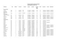
Area Summary L12-14 - Department of Mines and Petroleum
Area Summary L12-14 - Department of Mines and Petroleum
Area Summary L12-14 - Department of Mines and Petroleum

You also want an ePaper? Increase the reach of your titles
YUMPU automatically turns print PDFs into web optimized ePapers that Google loves.
Geology <strong>and</strong> petroleum prospectivity<br />
<strong>of</strong> State Acreage Release <strong>Area</strong> <strong>L12</strong>-<strong>14</strong><br />
Southern Perth Basin, Western Australia<br />
by<br />
Geological Survey <strong>of</strong> Western Australia<br />
Abstract<br />
State Acreage Release <strong>Area</strong> <strong>L12</strong>-<strong>14</strong> covers about 10.5 graticular blocks (716.8 km 2 ) <strong>of</strong> the northern part <strong>of</strong> the<br />
Bunbury Trough with excellent access to infrastructure. The area spans the Swan Coastal Plain to the Whicher<br />
Range, <strong>and</strong> is bounded by the Darling Fault to the east. There are no petroleum exploration wells within the area<br />
<strong>and</strong> the seismic coverage is sparse. Fair to good gas shows are known from several wells within the Bunbury Trough<br />
to the south <strong>of</strong> the area, including Wonnerup 1, which is the closest. The Whicher Range Gasfield is also 30 km<br />
south <strong>of</strong> this well. The Permian section is estimated to be up to 6.5 km thick in the area, <strong>and</strong> the top <strong>of</strong> the Sue Coal<br />
Measures varies from a depth <strong>of</strong> 4200 m in the southwest to 8200 m in the northeast. The Lower Cretaceous – Upper<br />
Jurassic section gently dips eastward <strong>and</strong> becomes thicker toward the Darling Fault. Various trapping mechanisms<br />
are possible, although mature source rocks younger than Permian are unlikely to be present. The main risks are<br />
likely to be reservoir quality <strong>and</strong> trap integrity.<br />
KEYWORDS: State Acreage Release, Bunbury Trough, Southern Perth Basin, Western Australia, <strong>Petroleum</strong><br />
prospects, tight gas<br />
Introduction<br />
The Perth Basin covers about 100 000 km 2 <strong>and</strong> contains<br />
a number <strong>of</strong> proven Permian <strong>and</strong> Mesozoic petroleum<br />
systems. The onshore part <strong>of</strong> the basin covers approximately<br />
45 000 km 2 <strong>and</strong> extends 650 km along the southwest coast<br />
<strong>of</strong> Western Australia, mainly to the south <strong>of</strong> Geraldton<br />
(Hocking, 1994). In total, 300 wells have been drilled in<br />
the basin, onshore <strong>and</strong> <strong>of</strong>fshore (as <strong>of</strong> December 2011),<br />
resulting in the discovery <strong>of</strong> 31 hydrocarbon fields <strong>and</strong><br />
several significant accumulations (GSWA, 2011), mostly<br />
within the northern onshore part <strong>of</strong> the basin.<br />
The southern Perth Basin extends from the Harvey Ridge<br />
southwards across the south coast <strong>of</strong> the State, consisting<br />
<strong>of</strong> the Bunbury Trough <strong>and</strong> the Vasse Shelf (Figs 1 <strong>and</strong> 2;<br />
Crostella <strong>and</strong> Backhouse, 2000, fig. 4). Hydrocarbon<br />
shows have been reported from several wells within<br />
the Bunbury Trough, including those close to the State<br />
Acreage Release <strong>Area</strong> <strong>L12</strong>-<strong>14</strong> (Fig. 2). Wonnerup 1 is the<br />
closest well. It was drilled on the crest <strong>of</strong> a north–south<br />
trending anticline (Crostella <strong>and</strong> Backhouse, 2000, figs 62<br />
<strong>and</strong> 69). This structure extends northward into the Release<br />
<strong>Area</strong>, although there were no successful mechanical tests.<br />
The location has been ranked as the Wonnerup prospect<br />
(Fig. 2; Ferdin<strong>and</strong>o <strong>and</strong> Dedman, 2003).<br />
1<br />
The only major discovery within the Bunbury Trough has<br />
been the Whicher Range Gasfield, where significant gas<br />
flows from the Upper Permian Willespie Formation were<br />
encountered in five wells (Table 1; Sharif, 2007). This is<br />
a much larger structure than the one at the Wonnerup 1<br />
site, <strong>and</strong> it is estimated to contain an original gas in place<br />
volume <strong>of</strong> up to <strong>14</strong>2.5 Gm 3 (5 Tcf), although attempts to<br />
develop the field have been unsuccessful so far. A major<br />
research project has analyzed causes <strong>of</strong> failure, <strong>and</strong> has<br />
proposed new drilling methods <strong>and</strong> approaches to reservoir<br />
stimulation (WA:ERA, 2012).<br />
Location <strong>and</strong> infrastructure<br />
State Acreage Release <strong>Area</strong> <strong>L12</strong>-<strong>14</strong> (716.8 km 2 ) covers<br />
almost 10.5 graticular blocks within the poorly explored<br />
northern part <strong>of</strong> the Bunbury Trough, nearly 170 km<br />
south <strong>of</strong> Perth (Figs 1–3). The port city <strong>of</strong> Bunbury is<br />
partially within the Release <strong>Area</strong>, <strong>and</strong> Busselton is about<br />
13 km to the southwest (Fig. 3). The Dampier–Bunbury<br />
Gas Pipeline extends to 7 km north <strong>of</strong> the area, <strong>and</strong> the<br />
BP Kwinana Refinery is 30 km south <strong>of</strong> Perth. Rising<br />
dem<strong>and</strong> <strong>and</strong> proximity to potential industrial consumers<br />
could facilitate commercialization <strong>of</strong> even a relatively<br />
small discovery.